Meyer's Großer Hand-Atlas (1843-1860)
en SDUK, Tanner, Mitchell
See below for (a summary of) this text in English.
Hieronder staan kaarten van Meyer's Großer Hand-Atlas (1843-1860), kaarten van de Society for the Diffusion of Useful Knowledge, Tanner's Universal Atlas (1836) en Mitchell's Universal Atlas (1846) ter vergelijking naast elkaar. Daarbij horen ook de volgende pagina's.
- Beschrijving van Meyer's Großer Hand-Atlas
- Plaatjes van Meyer's Großer Hand-Atlas
- Tabellen en lijsten bij Meyer's Großer Hand-Atlas
en
- Beschrijving van Society for the Diffusion of Useful Knowledge
- Plaatjes van Society for the Diffusion of Useful Knowledge
- Tabellen en lijsten bij Society for the Diffusion of Useful Knowledge
en
- Beschrijving van Tanner's Universal Atlas
- Plaatjes van Tanner's Universal Atlas
- Tabellen en lijsten bij Tanner's Universal Atlas
en
- Beschrijving van Mitchell's Universal Atlas
- Plaatjes van Mitchell's Universal Atlas
- Tabellen en lijsten bij Mitchell's Universal Atlas
Plaatjes
- Alle plaatjes zijn ontleend aan David Rumsey Map Collection.
- Beeldmateriaal uit David Rumsey Map Collection valt onder een Creative Commons License.
- Klik op een plaatje voor een vergroting.
Meyer's Großer Hand-Atlas (1843-1860)
and SDUK, Tanner, Mitchell
- Below are pictures of Meyer's Großer Hand-Atlas (1843-1860), Tanner's
Universal Atlas (1836), Mitchell's Universal Atlas (1846) en maps from the
Society for the Diffusion of Useful Knowledge side by side for comparison
purposes. Related pages
- Description of Meyer's Großer Hand-Atlas
- Pictures of Meyer's Großer Hand-Atlas
- Tables and lists to Meyer's Großer Hand-Atlas
- Description of Society for the Diffusion of Useful Knowledge
- Pictures of Society for the Diffusion of Useful Knowledge
- Tables and lists to Society for the Diffusion of Useful Knowledge
- Description of Tanner's Universal Atlas
- Pictures of Tanner's Universal Atlas
- Tables and lists to Tanner's Universal Atlas
- Description of Mitchell's Universal Atlas
- Pictures of Mitchell's Universal Atlas
- Tables and lists to Mitchell's Universal Atlas
Pictures
- All pictures have been derived from David Rumsey Map Collection.
- Images from the David Rumsey Map Collection are licensed under a Creative Commons License.
- Click on a picture to enlarge.
Plattegronden van Europese steden / Plans of European cities
 Meyer's Großer Hand-Atlas
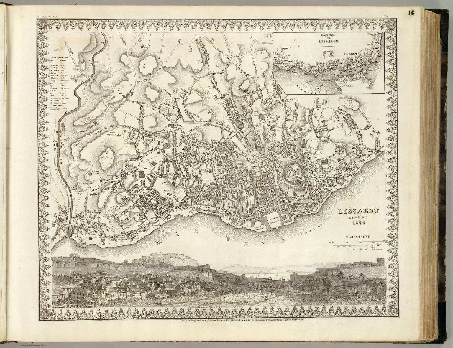
14. Lissabon (Lisboa) (1844)
Lissabon / Lisbon
David Rumsey Map Collection
 Society for the Diffusion of Useful Knowledge
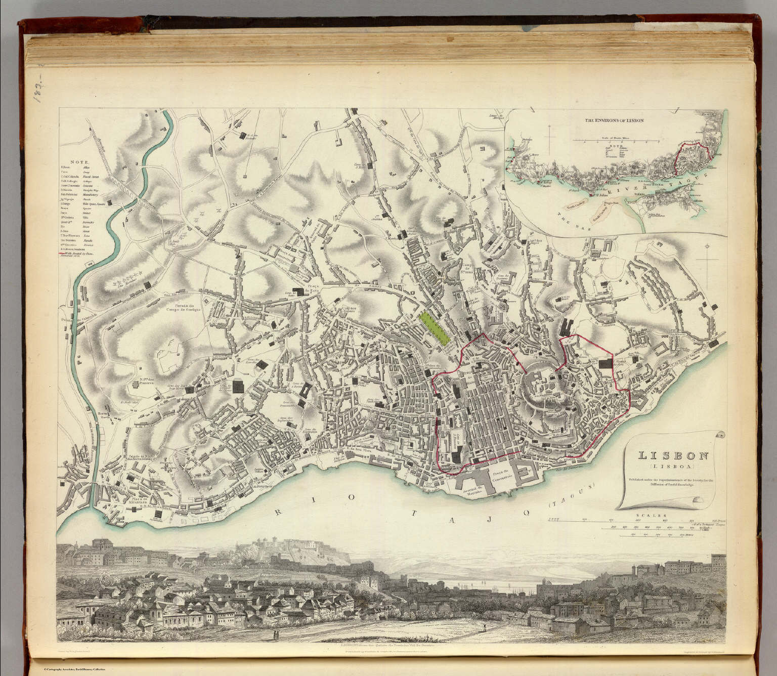
P22. Lisbon (Lisboa) (1833)
Lissabon
David Rumsey Map Collection
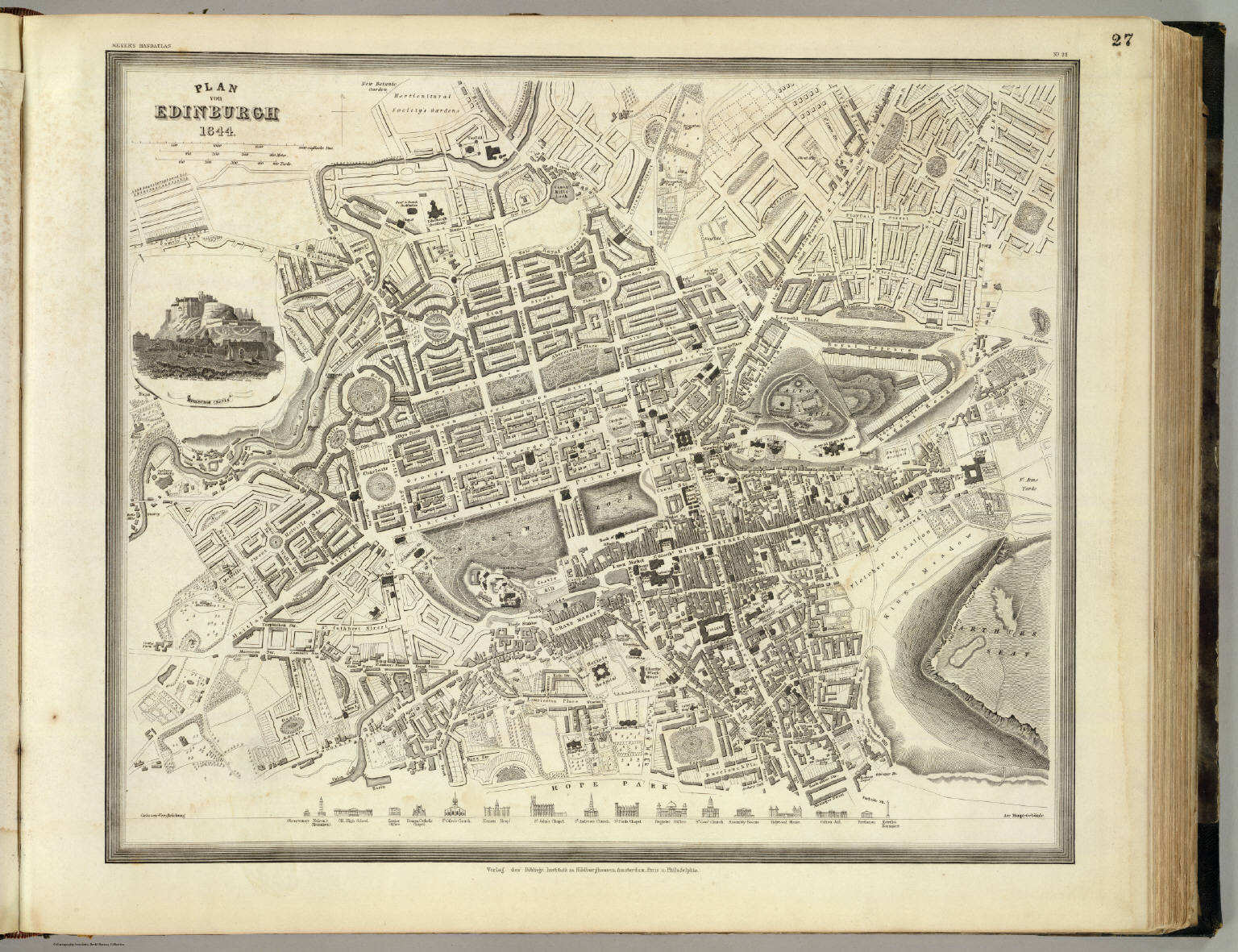
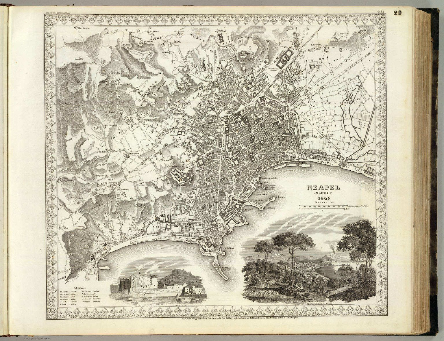
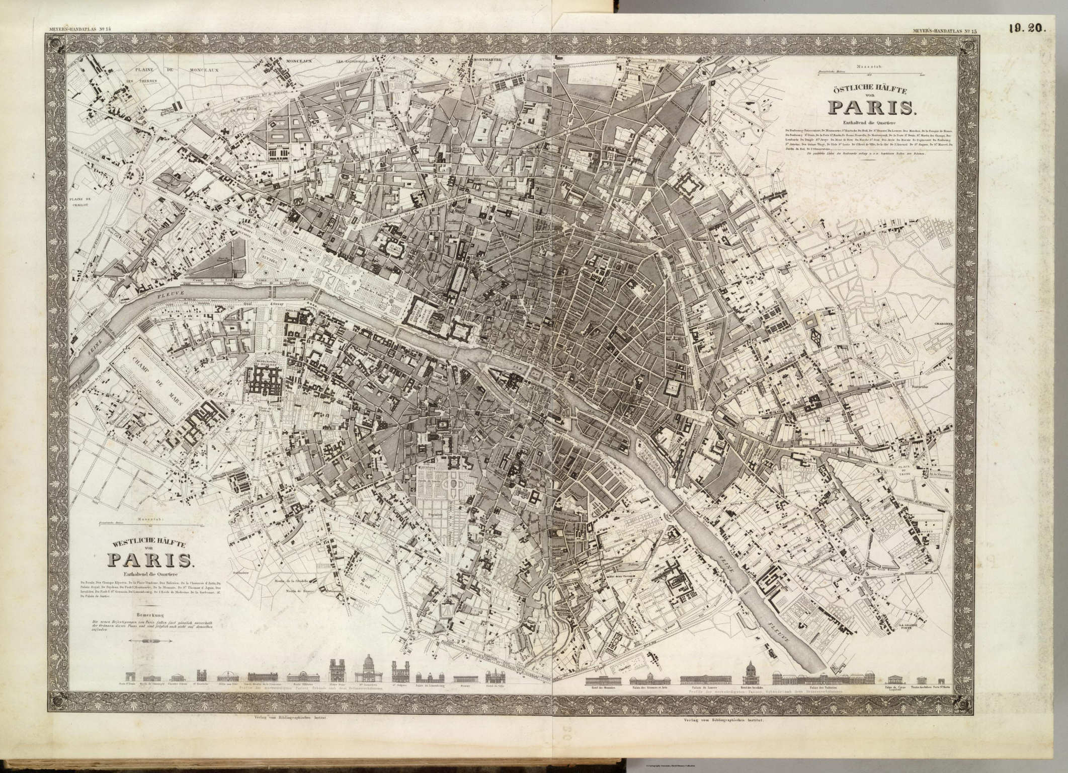 Meyer's Großer Hand-Atlas
19. Westliche Hälfte von Paris 20. Östliche Hälfte von Paris
Parijs / Paris
David Rumsey Map Collection
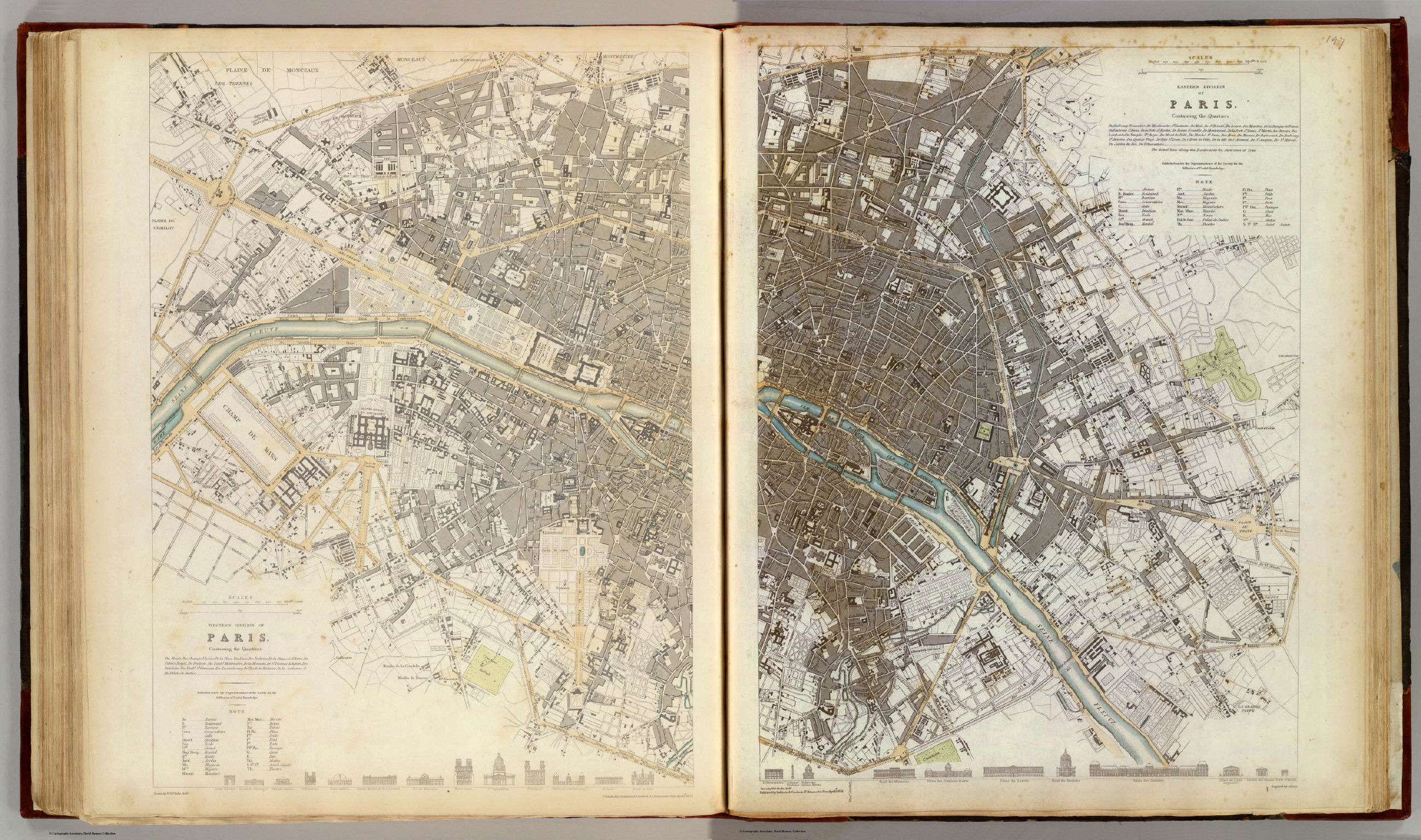 Society for the Diffusion of Useful Knowledge
P34. Western Division of Paris. Eastern Division of Paris (1834)
Parijs
David Rumsey Map Collection (Western Division of Paris)
David Rumsey Map Collection (Eastern Division of Paris)
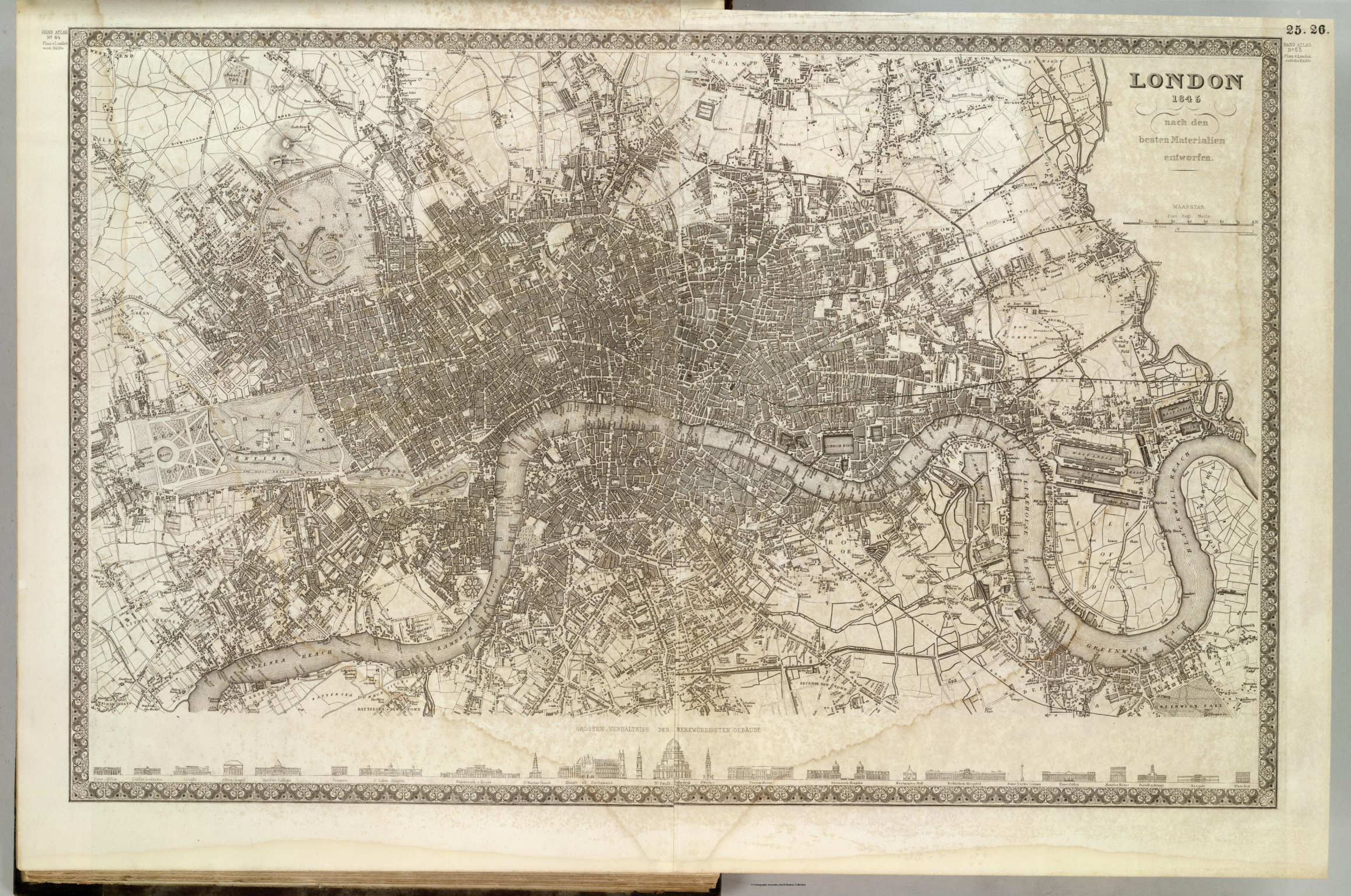 Meyer's Großer Hand-Atlas
25. Westliche Hälfte von London 26. Östliche Hälfte von London (1845)
Londen / London
David Rumsey Map Collection
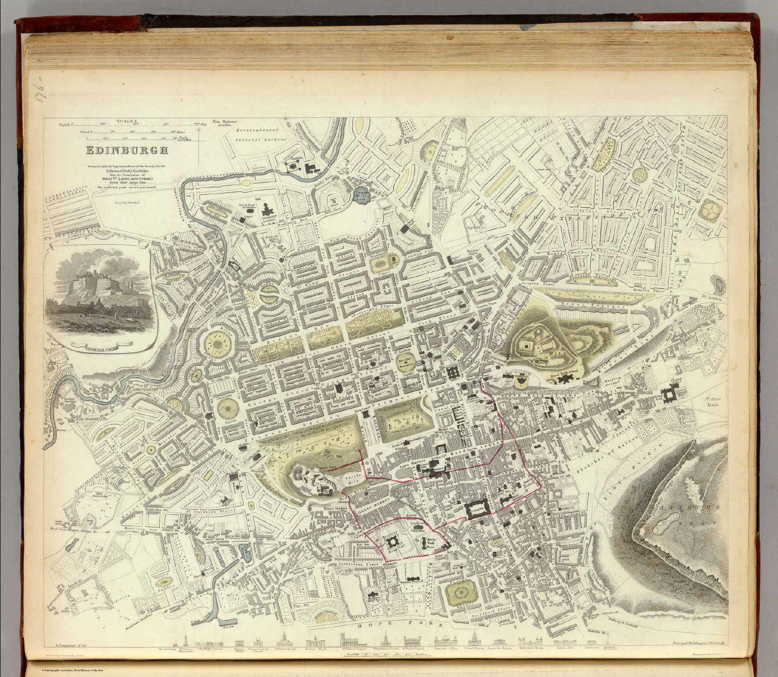 Society for the Diffusion of Useful Knowledge
P15. Edinburgh (1834)
Edinburgh
David Rumsey Map Collection
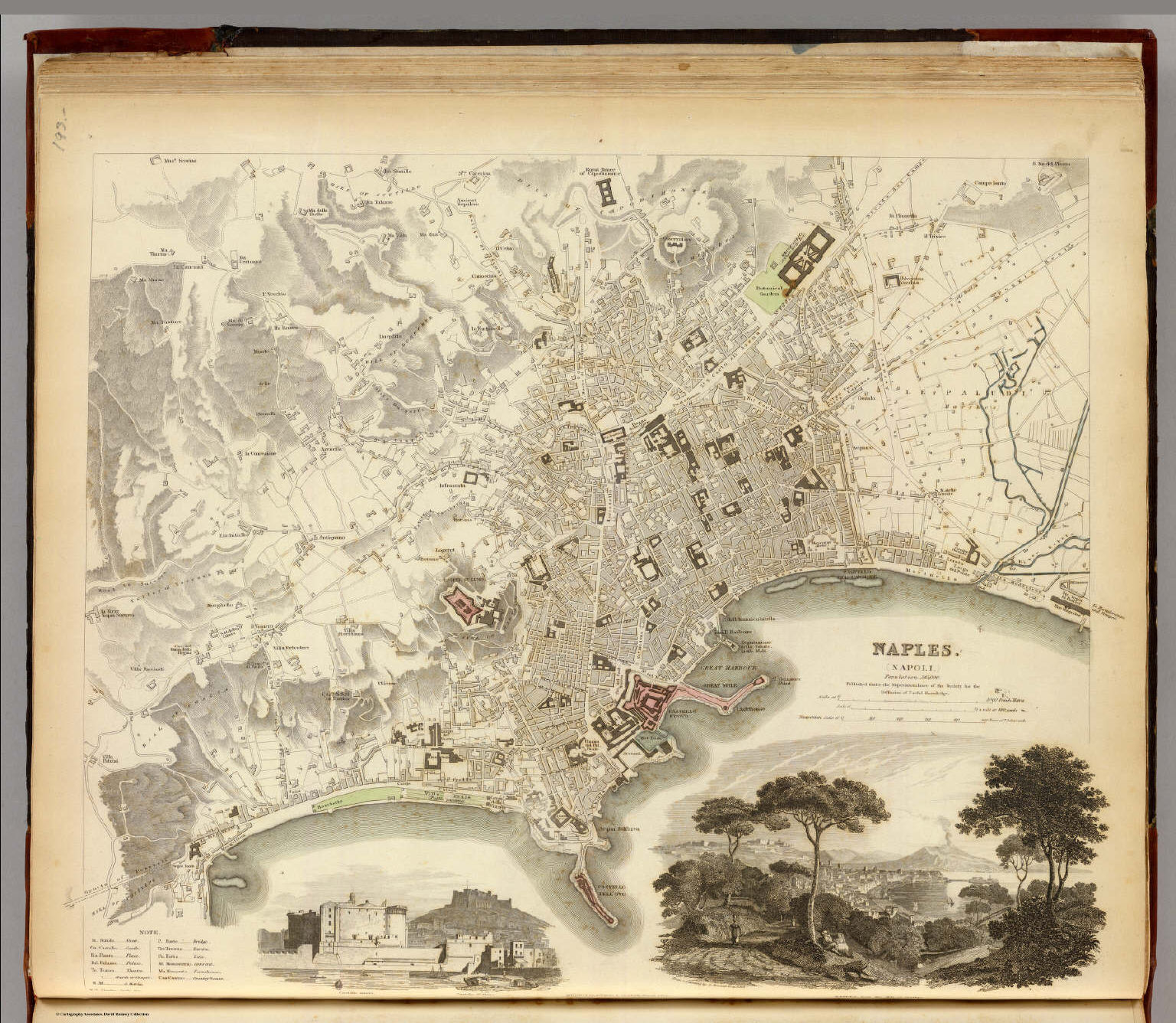 Society for the Diffusion of Useful Knowledge
P31. Naples (Napoli) (1835)
Napels
David Rumsey Map Collection
 Society for the Diffusion of Useful Knowledge
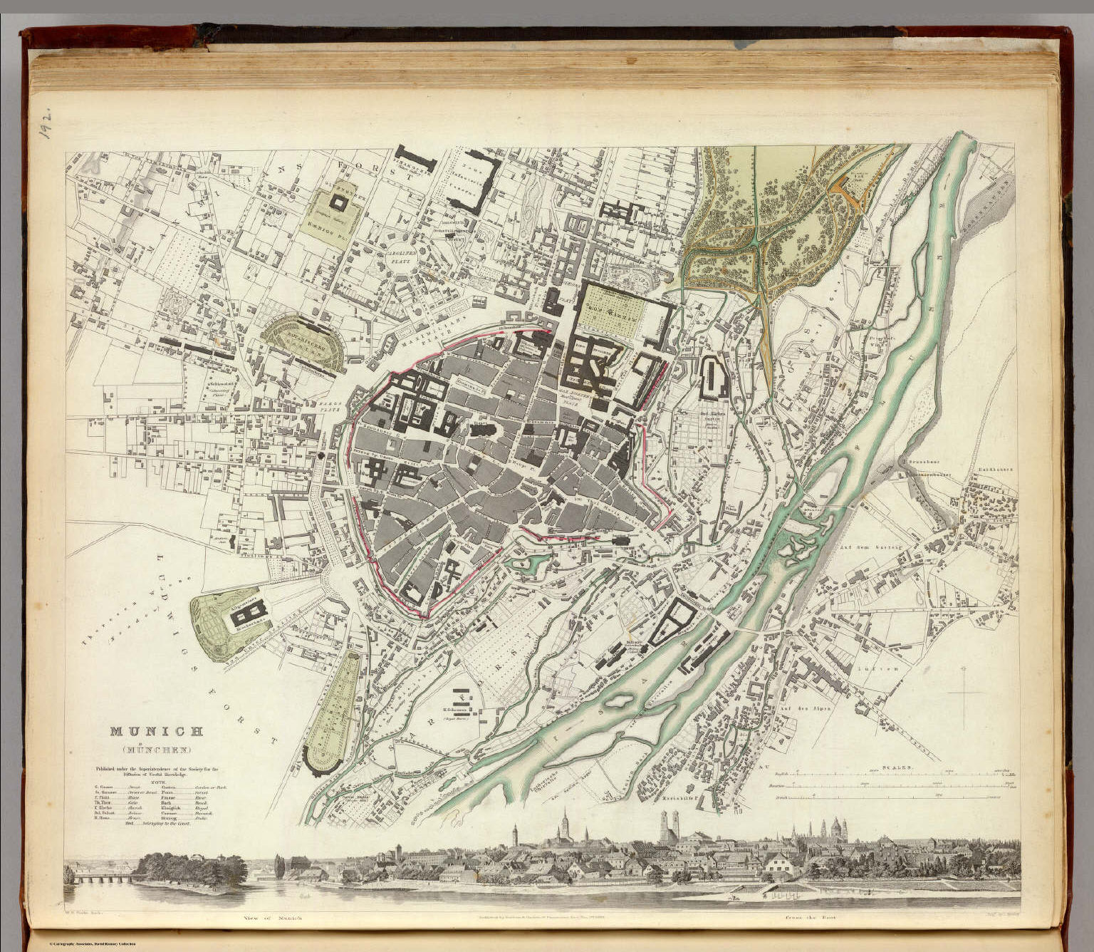
P30. Munich (München) (1832)
München
David Rumsey Map Collection
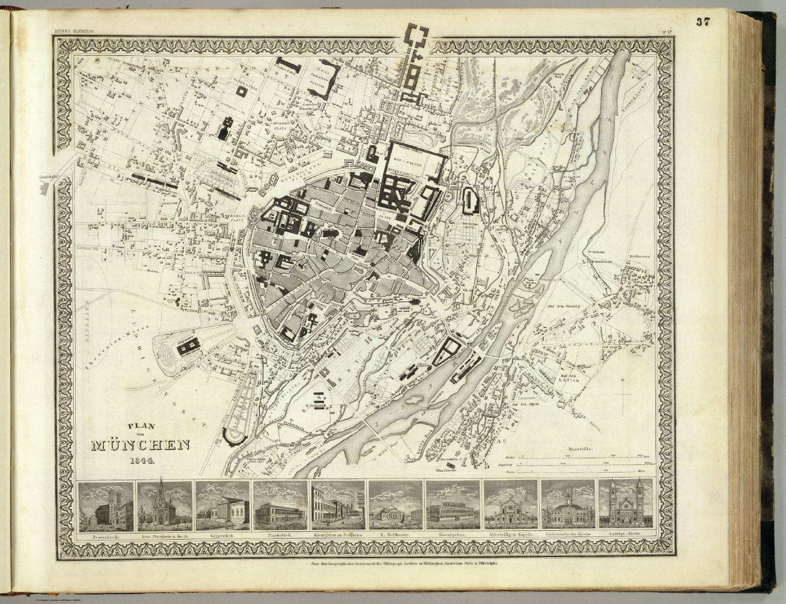
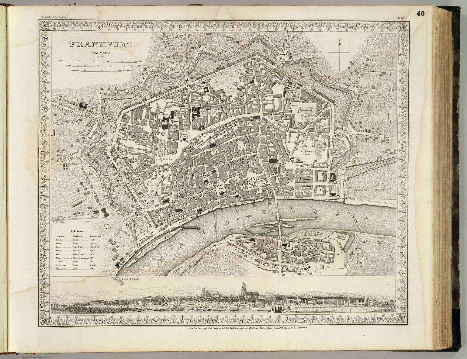 Meyer's Großer Hand-Atlas
40. Frankfurt (am Mayn) (1845)
Frankfurt am Main
David Rumsey Map Collection
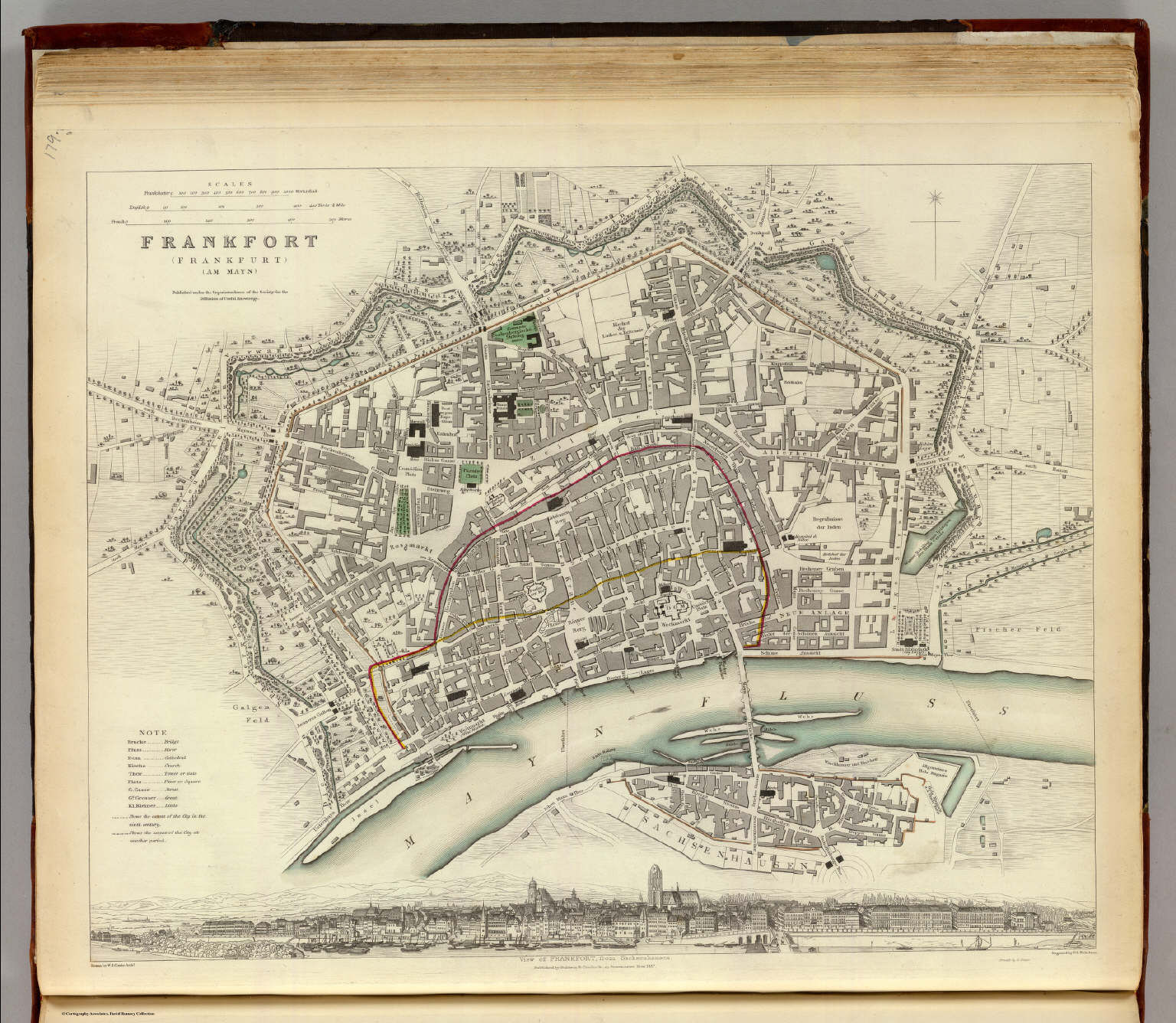 Society for the Diffusion of Useful Knowledge
P18. Frankfort (Frankfurt am Mayn) (1837)
Frankfurt am Main
David Rumsey Map Collection
 Society for the Diffusion of Useful Knowledge
geen overeenkomstige kaart / no corresponding map
 Society for the Diffusion of Useful Knowledge
geen overeenkomstige kaart / no corresponding map
 Society for the Diffusion of Useful Knowledge
geen overeenkomstige kaart / no corresponding map
 Society for the Diffusion of Useful Knowledge
geen overeenkomstige kaart / no corresponding map
 Society for the Diffusion of Useful Knowledge
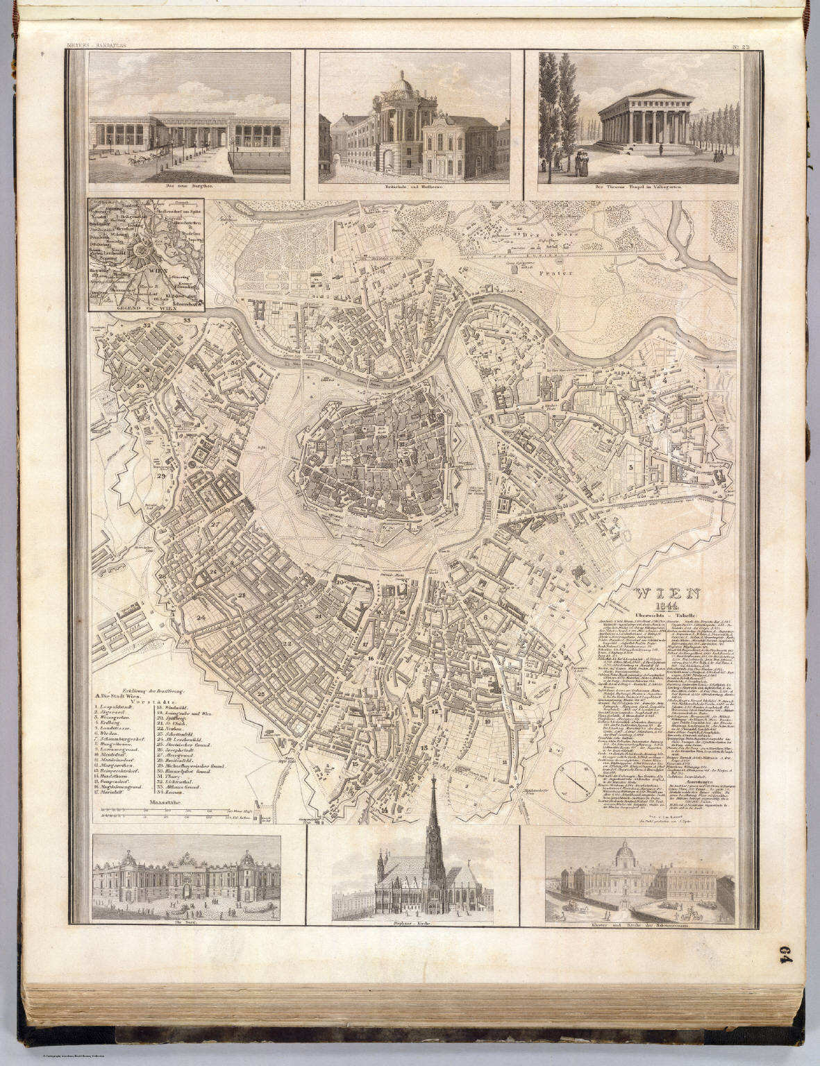
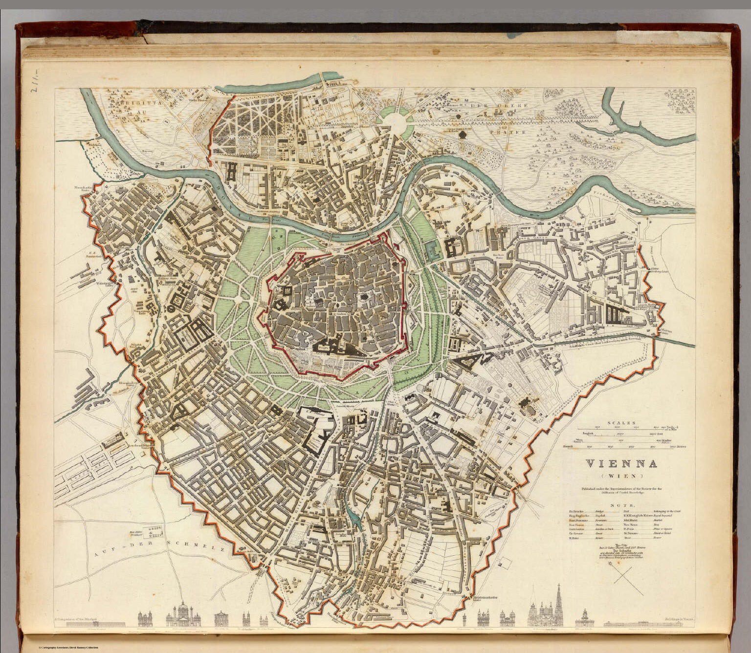
P46. Vienna (Wien) (1833)
Wenen
David Rumsey Map Collection
 Society for the Diffusion of Useful Knowledge
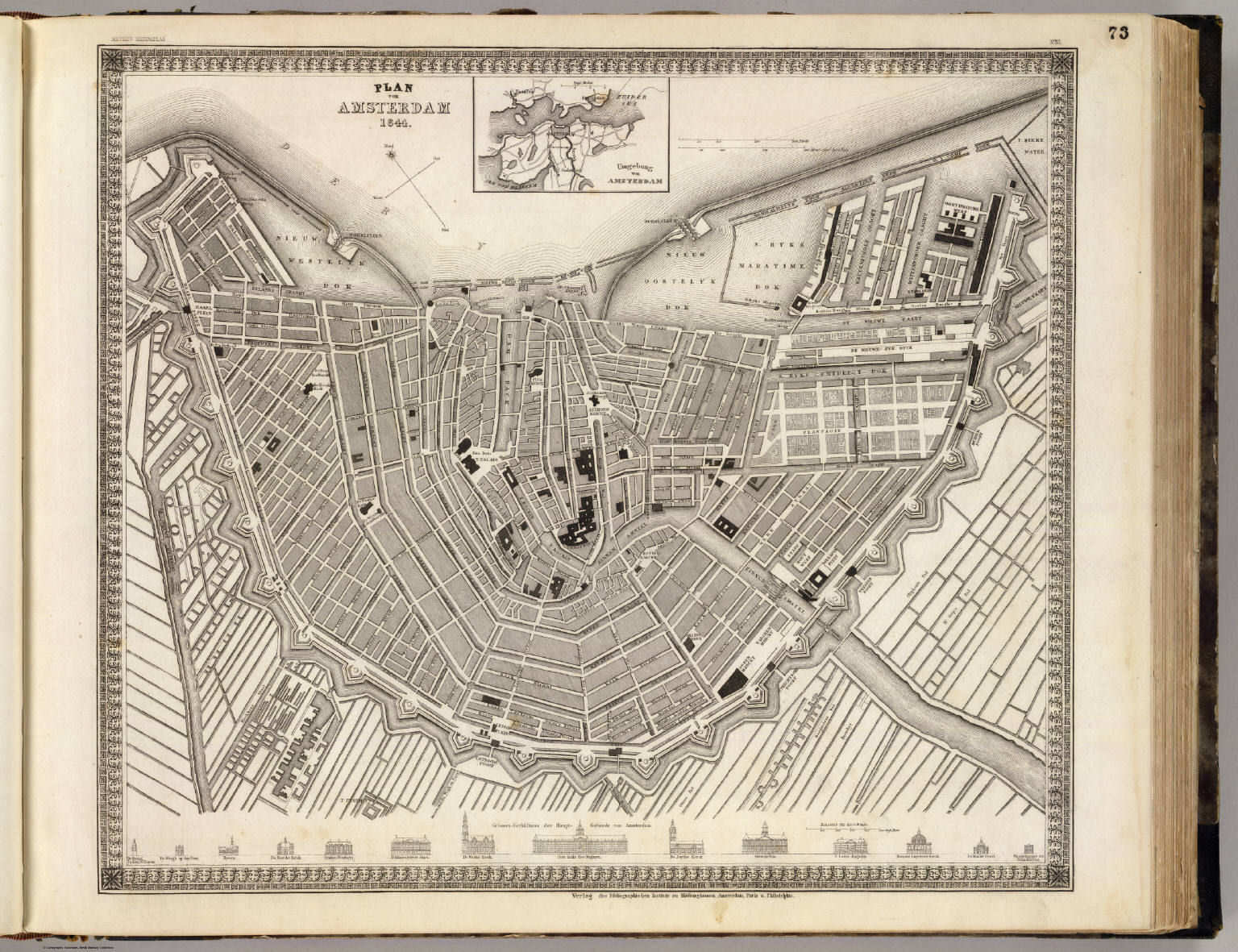
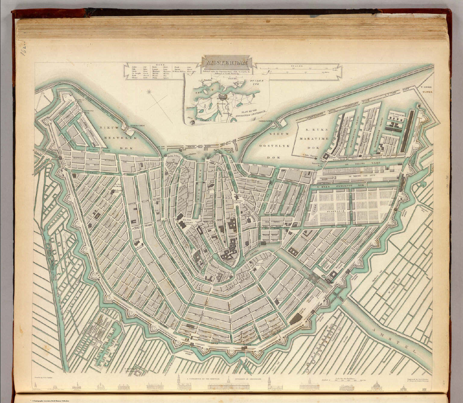
P01. Amsterdam (1835)
Amsterdam
David Rumsey Map Collection
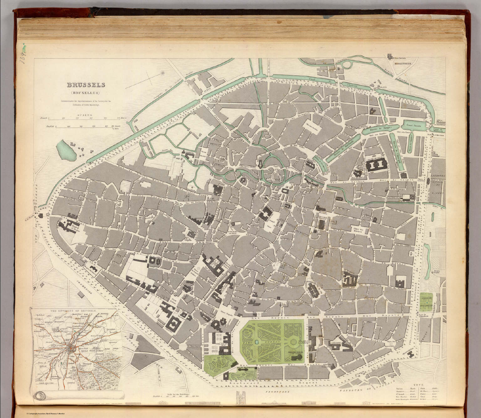 Society for the Diffusion of Useful Knowledge
P08. Brussels (Bruxelles) (1837)
Brussel
David Rumsey Map Collection
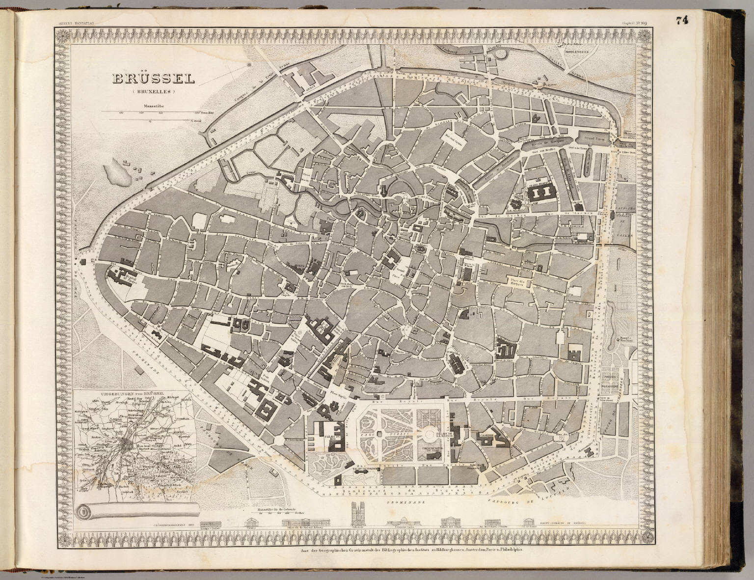
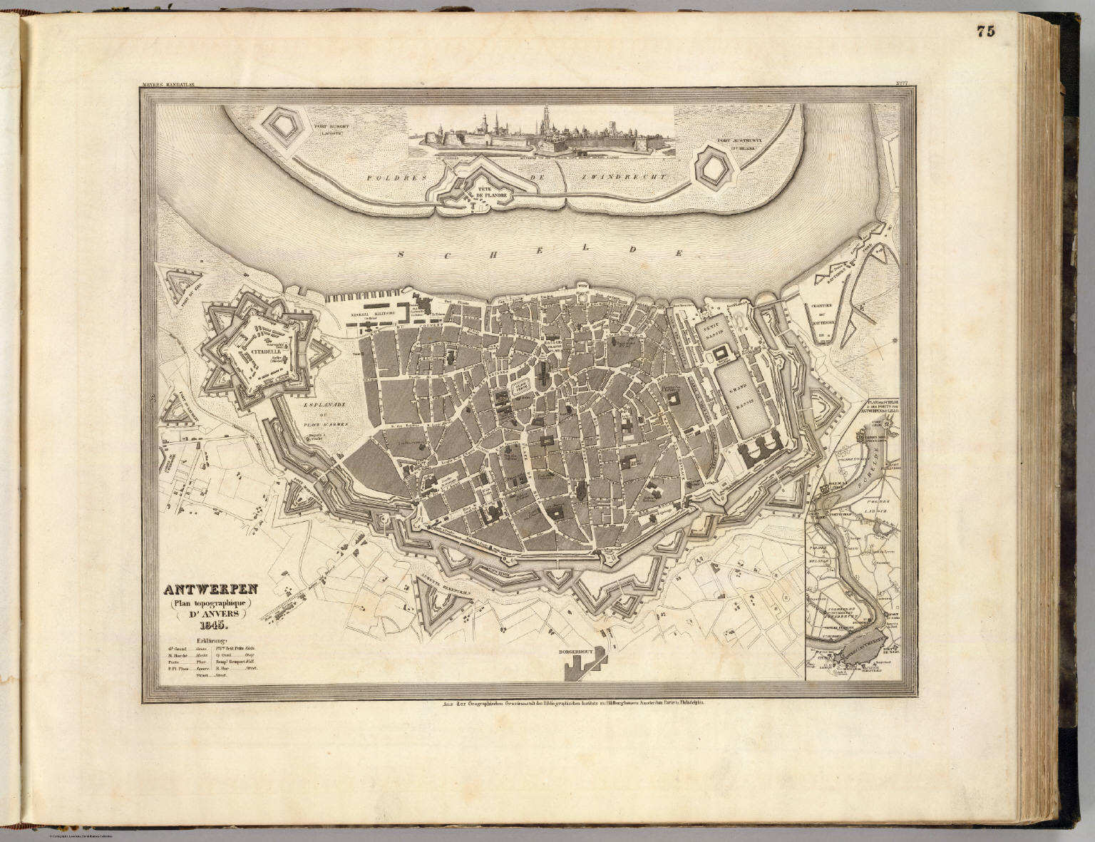 Meyer's Großer Hand-Atlas
75. Antwerpen (Plan topographique d'Anvers) (1845)
Antwerpen / Antwerp
David Rumsey Map Collection
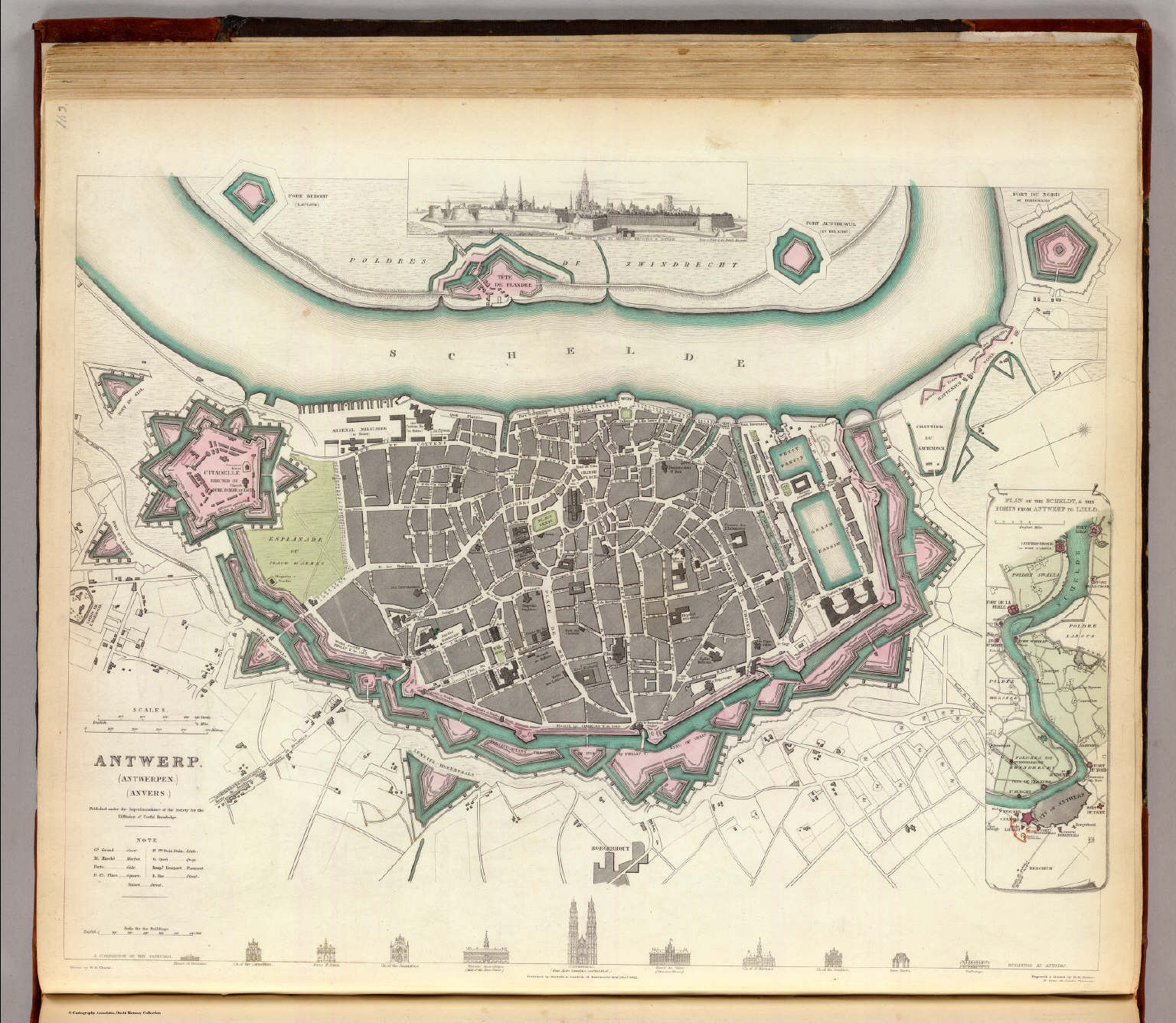 Society for the Diffusion of Useful Knowledge
P02. Antwerp (Antwerpen, Anvers) (1832)
Antwerpen
David Rumsey Map Collection
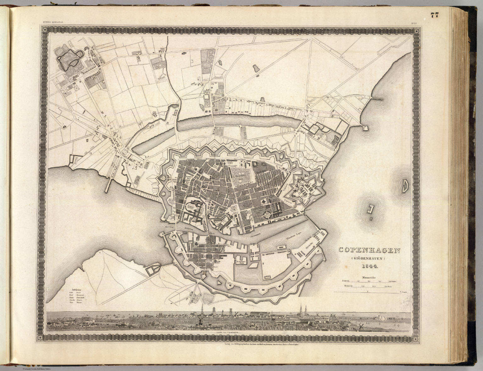 Meyer's Großer Hand-Atlas
77. Copenhagen (Kiöbenhaven) (1844)
Kopenhagen / Copenhagen
David Rumsey Map Collection
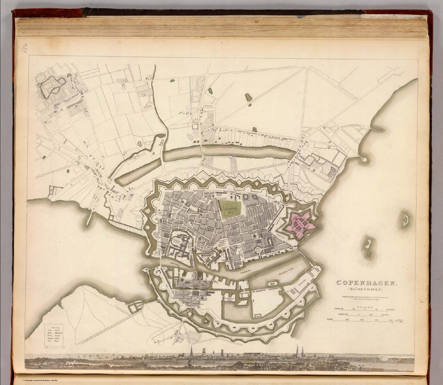 Society for the Diffusion of Useful Knowledge
P11. Copenhagen (Kiöbenhaven) (1837)
Kopenhagen
David Rumsey Map Collection
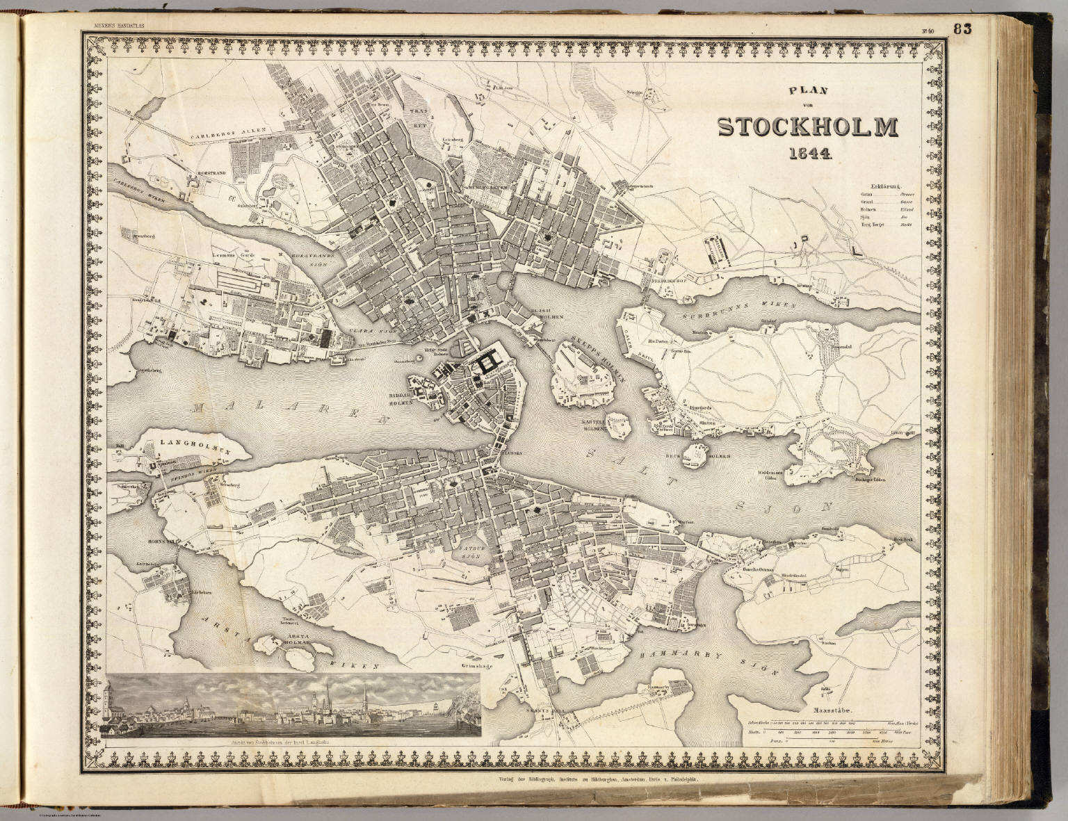
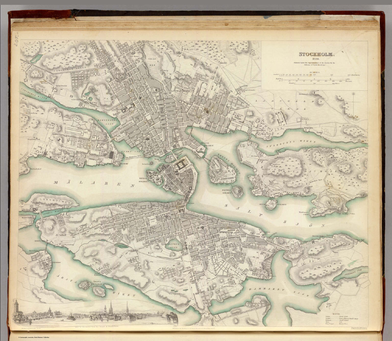 Society for the Diffusion of Useful Knowledge
P42. Stockholm (1838)
Stockholm
David Rumsey Map Collection
 Meyer's Großer Hand-Atlas
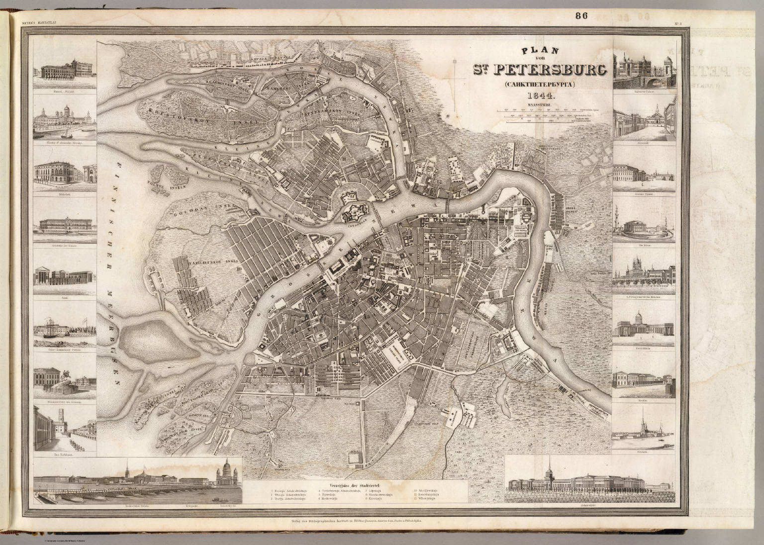
86. Plan von St. Petersburg (Санктпетербурга) (1844)
Sint-Petersburg / Saint Petersburg
David Rumsey Map Collection
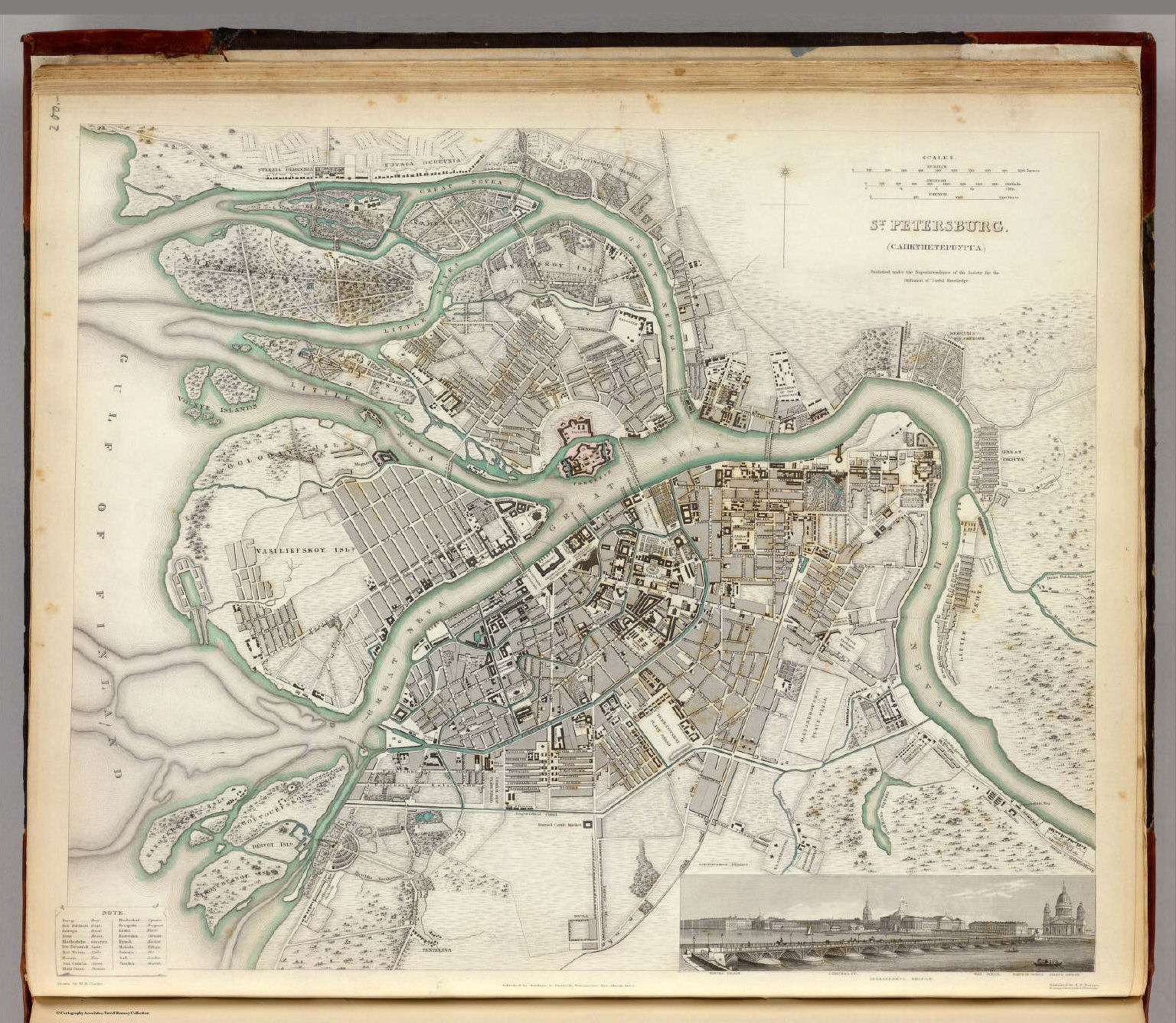 Society for the Diffusion of Useful Knowledge
P41. St. Petersburg (Санктпетербурга) (1834)
St. Petersburg
David Rumsey Map Collection
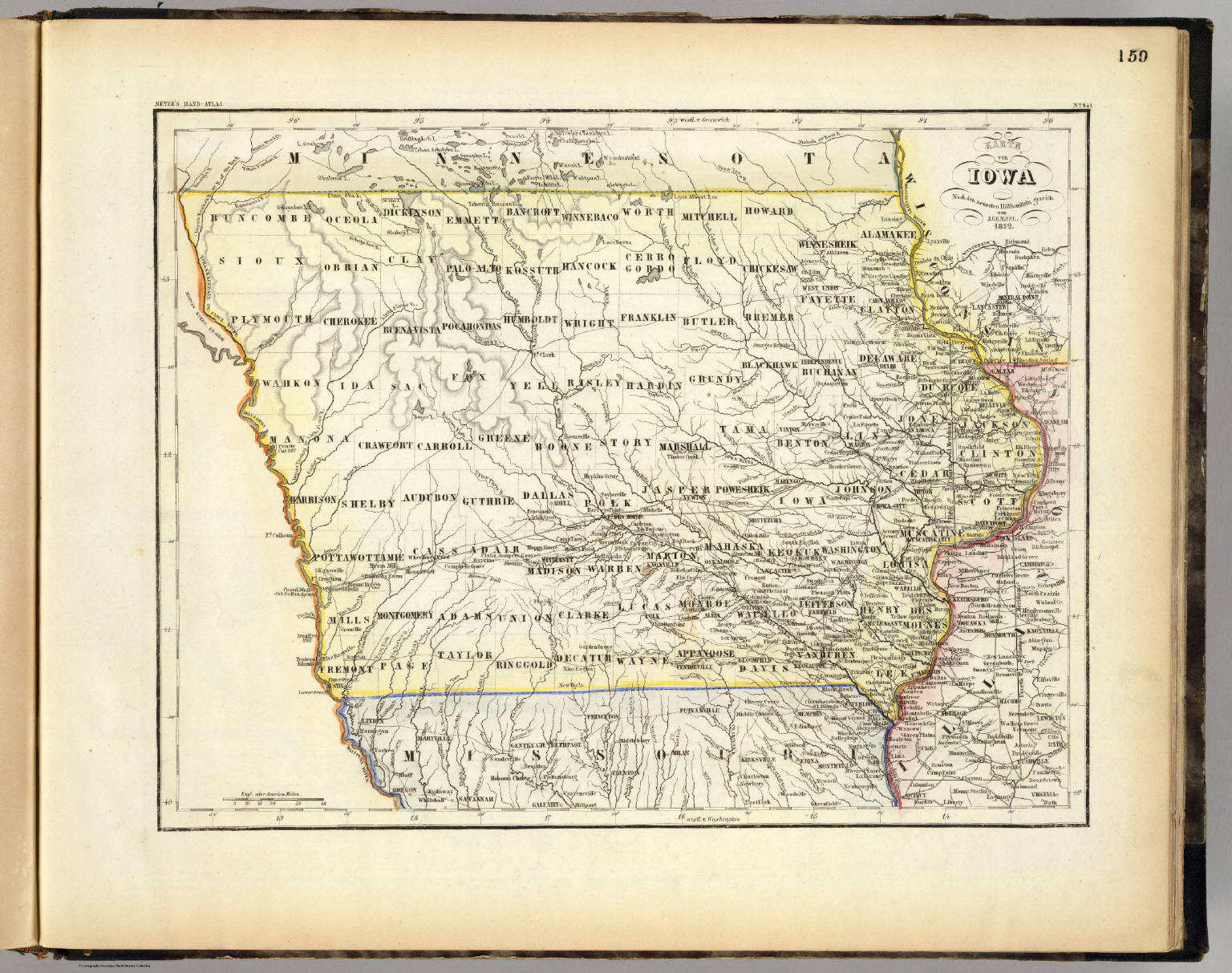
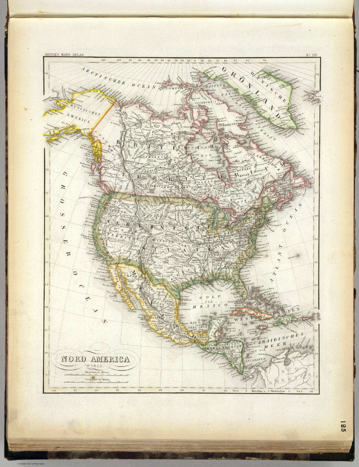 Meyer's Großer Hand-Atlas
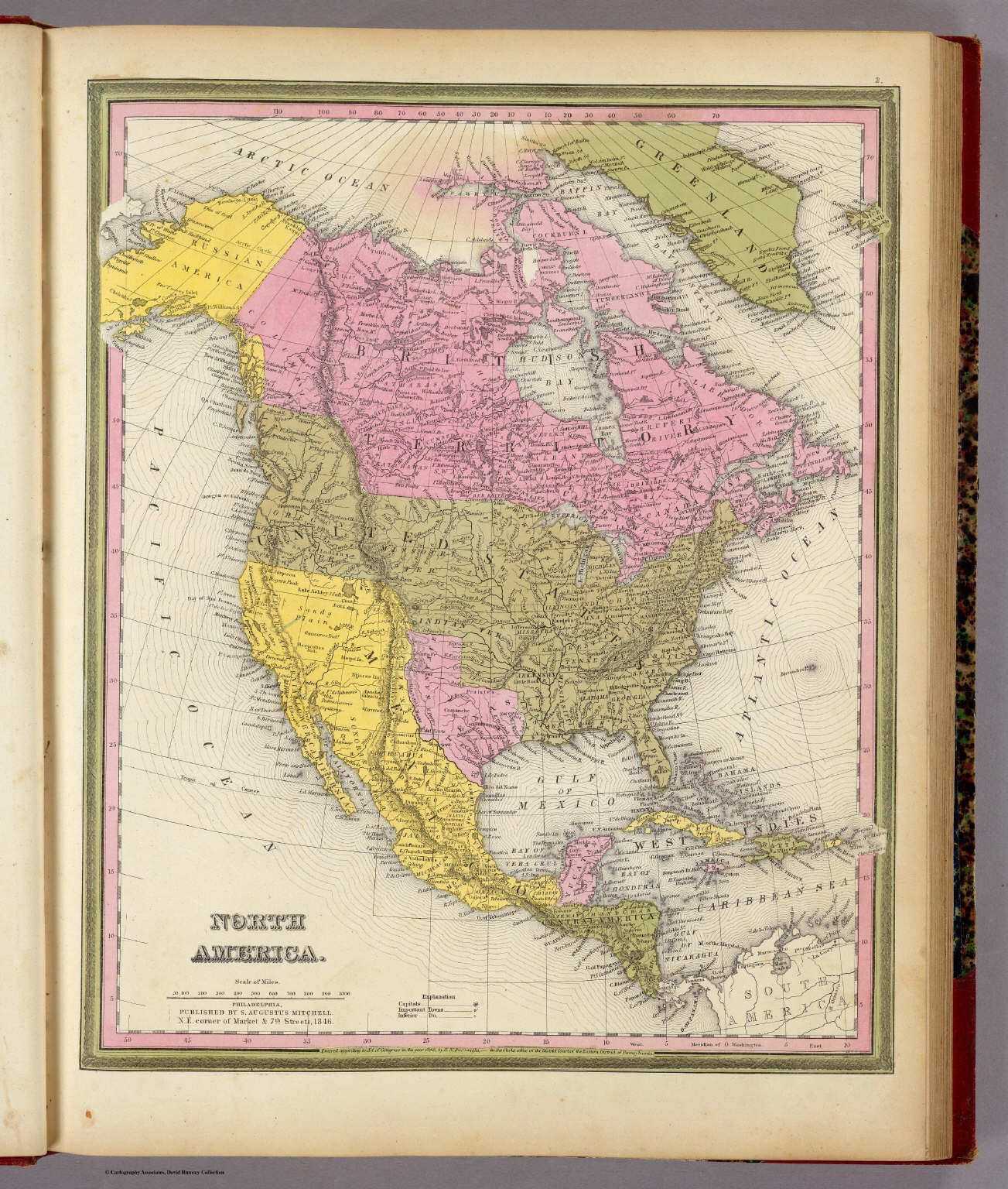
125. Nord America (1853)
Noord-Amerika / North America
David Rumsey Map Collection
 Meyer's Großer Hand-Atlas
125. Nord America (1853)
Noord-Amerika / North America
David Rumsey Map Collection
 Meyer's Großer Hand-Atlas
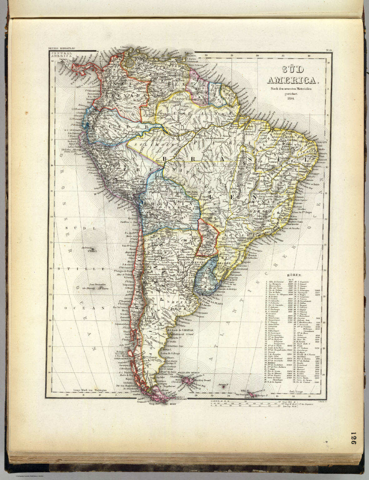
126. Süd America (1854)
Zuird-Amerika / South America
David Rumsey Map Collection
 Meyer's Großer Hand-Atlas
126. Süd America (1854)
Zuird-Amerika / South America
David Rumsey Map Collection
 Meyer's Großer Hand-Atlas
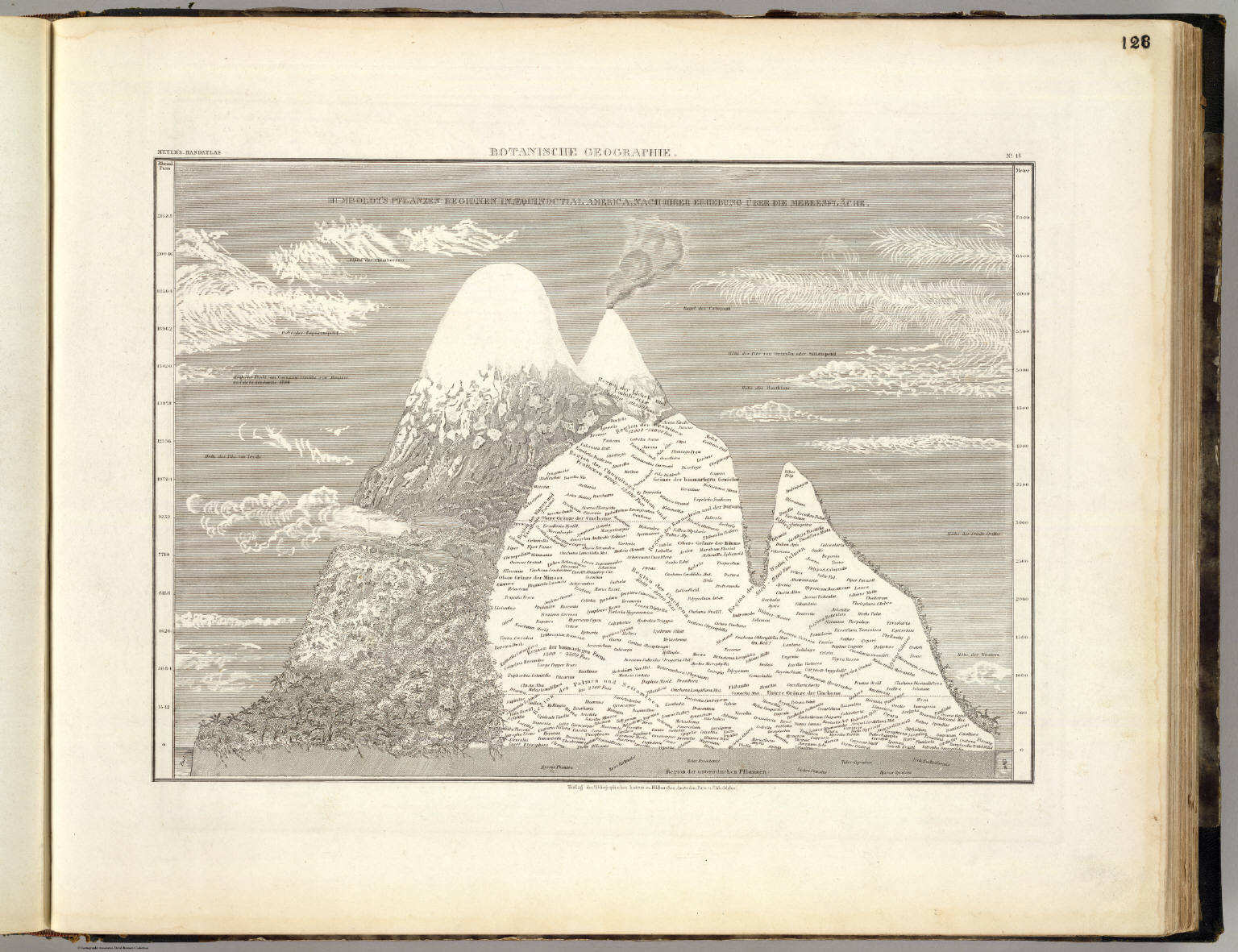
128. Botanische Geographie
Plantengeografie / Geobotany
David Rumsey Map Collection
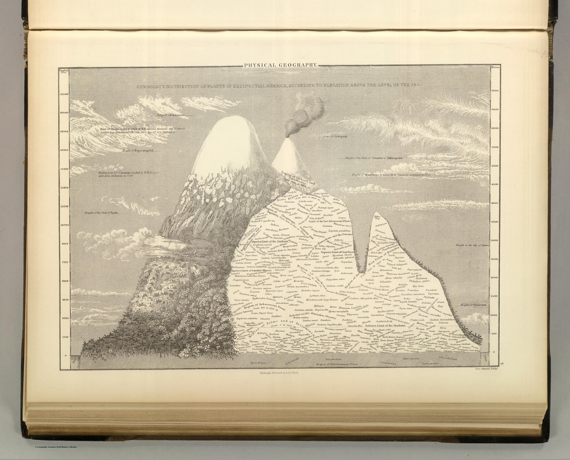 Black's General Atlas (1854)
5. Physical Geography: Botany
Plantengeografie
David Rumsey Map Collection
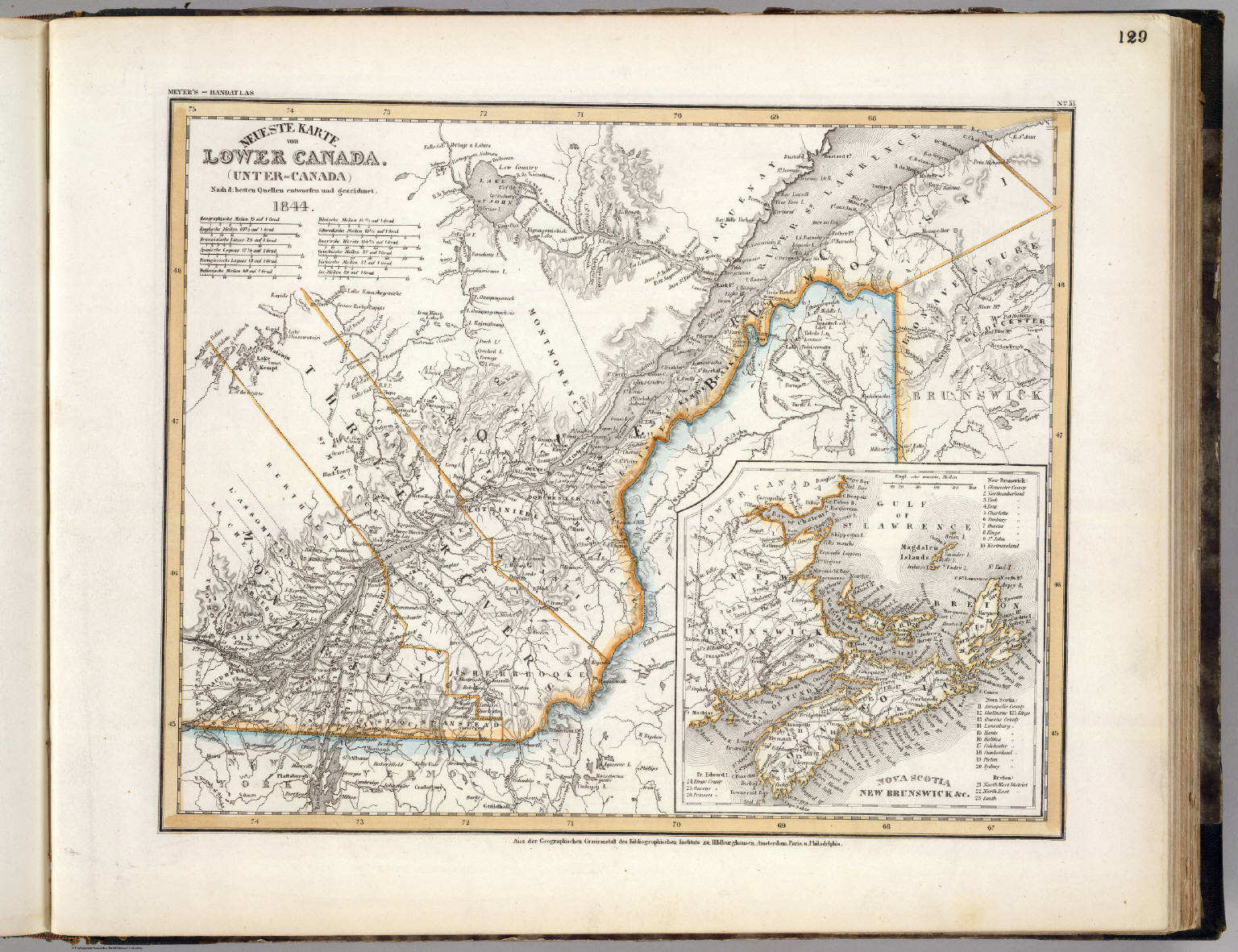 Meyer's Großer Hand-Atlas
129. Neueste Karte von Lower Canada (Unter-Canada) (1844)
Neder-Canada / Lower Canada (Bas-Canada)
David Rumsey Map Collection
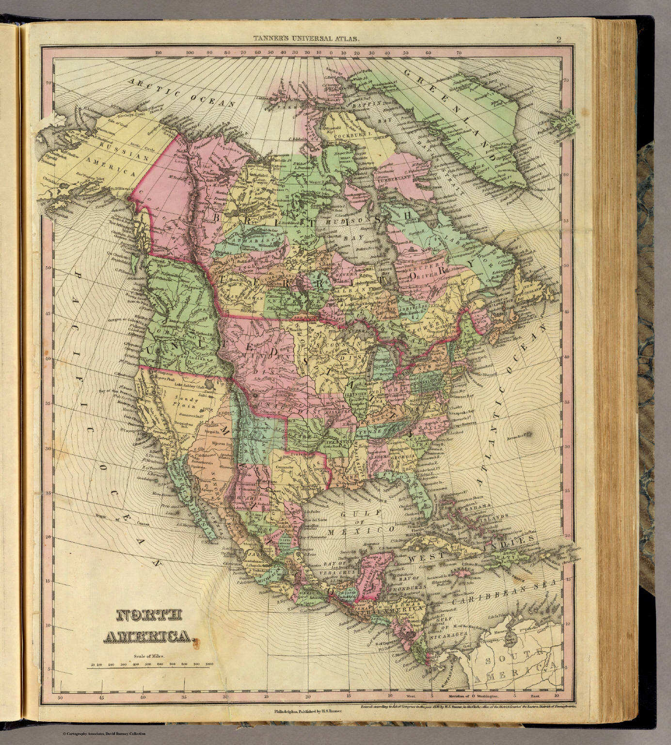
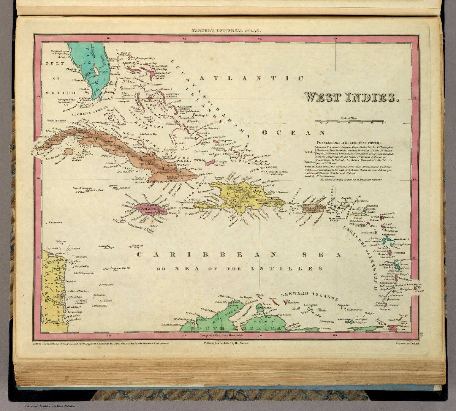
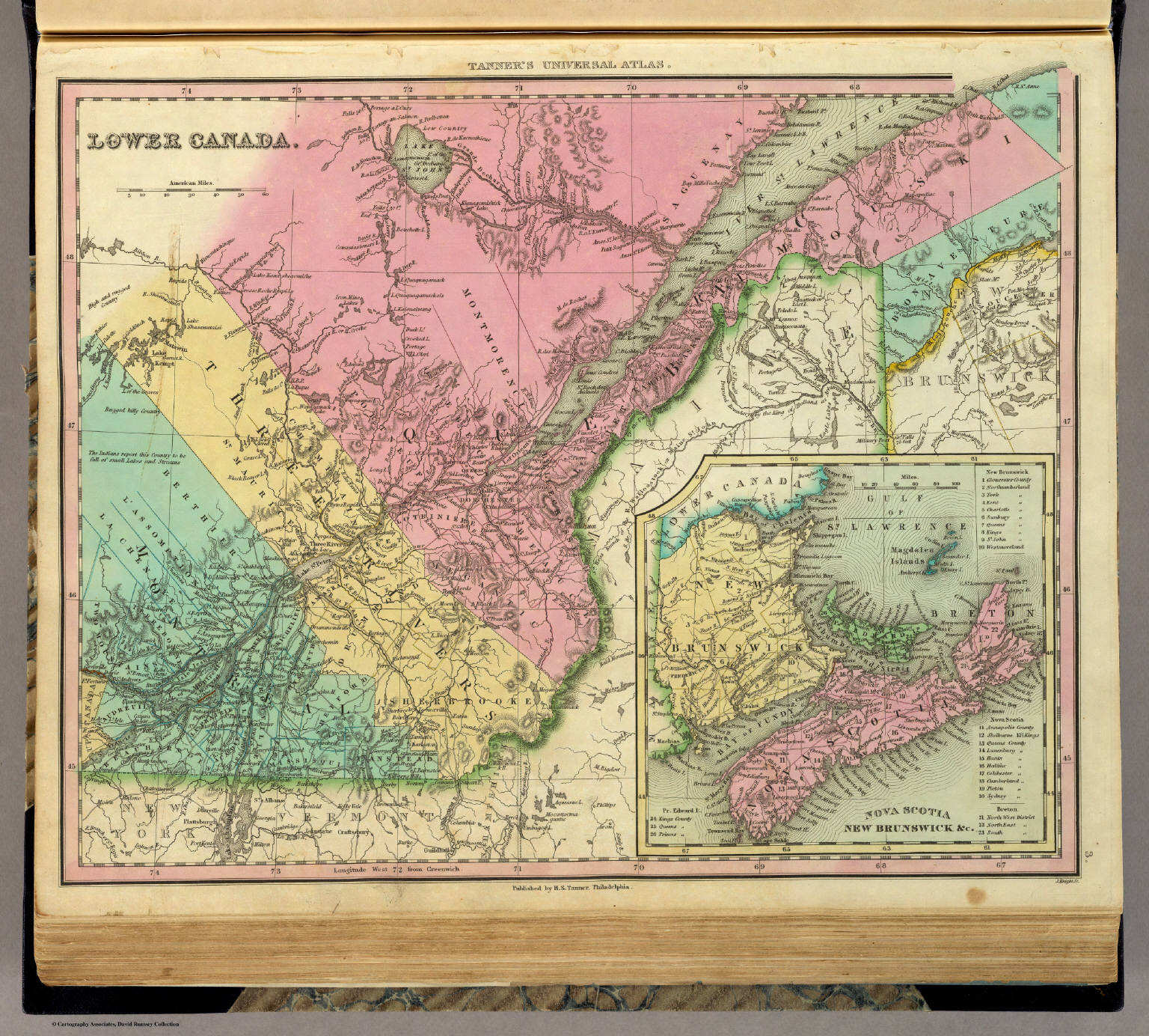 Tanner's Universal Atlas (1836)
3. Lower Canada
Neder-Canada (Bas-Canada)
David Rumsey Map Collection
Meyer's Großer Hand-Atlas
129. Neueste Karte von Lower Canada (Unter-Canada) (1844)
Neder-Canada / Lower Canada (Bas-Canada)
David Rumsey Map Collection
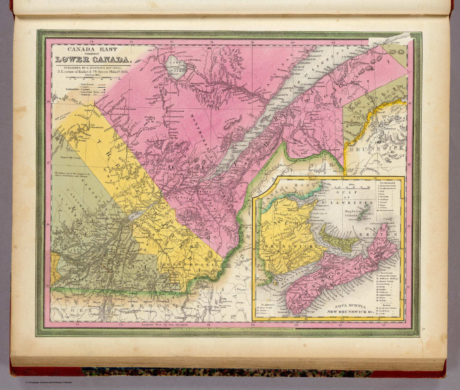 Mitchell's Universal Atlas (1846)
3. Canada East formerly Lower Canada
Oost-Canada (voormalig Neder-Canada)
David Rumsey Map Collection
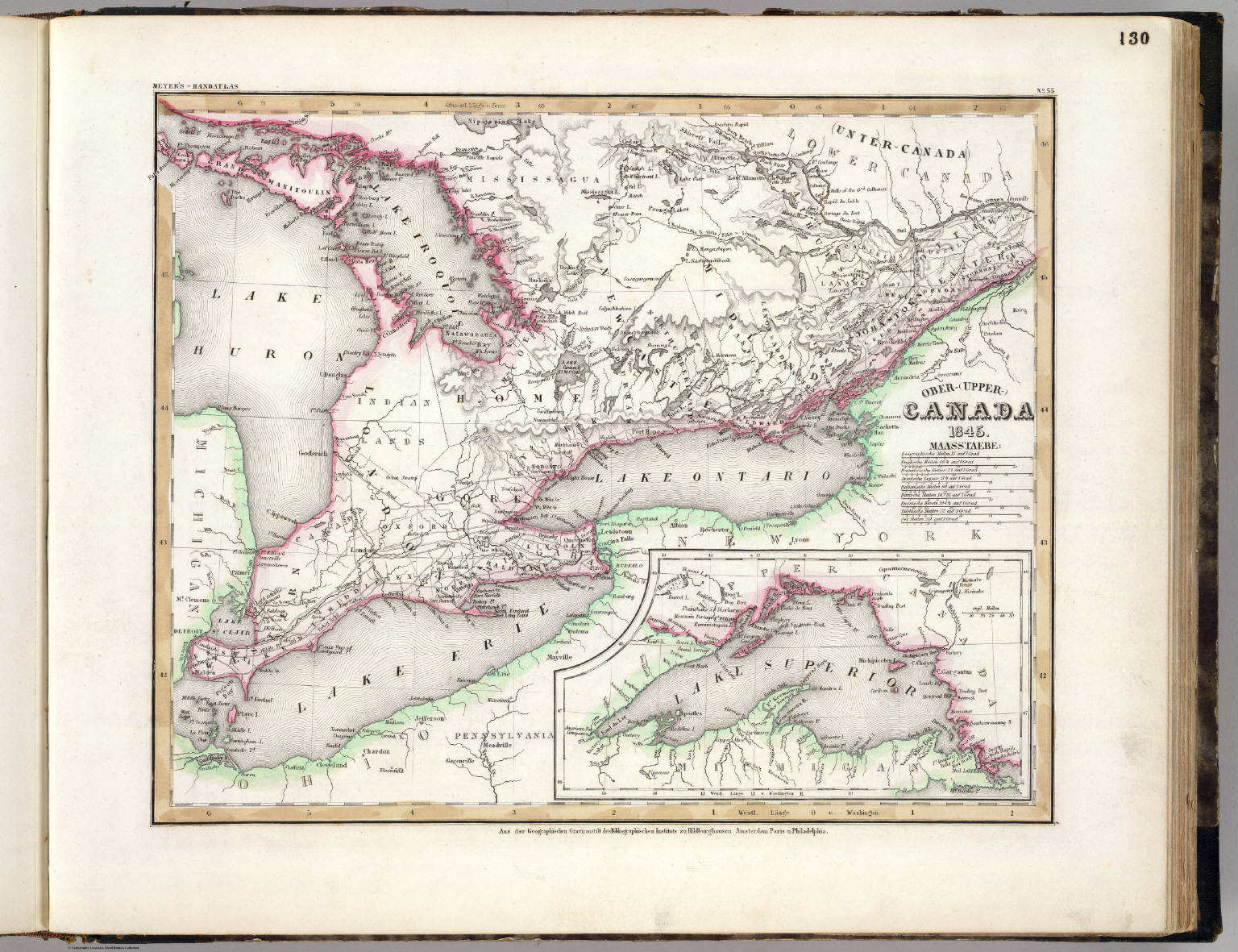 Meyer's Großer Hand-Atlas
130. Ober-(Upper-)Canada (1845)
Opper-Canada / Upper Canada (Haut-Canada)
David Rumsey Map Collection
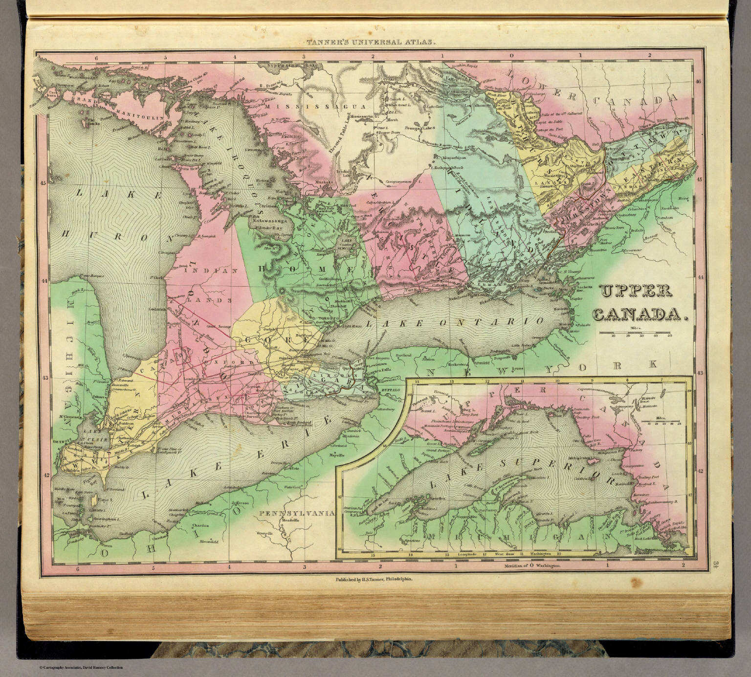 Tanner's Universal Atlas (1836)
3½. Upper Canada
Opper-Canada (Haut-Canada)
David Rumsey Map Collection
Meyer's Großer Hand-Atlas
130. Ober-(Upper-)Canada (1845)
Opper-Canada / Upper Canada (Haut-Canada)
David Rumsey Map Collection
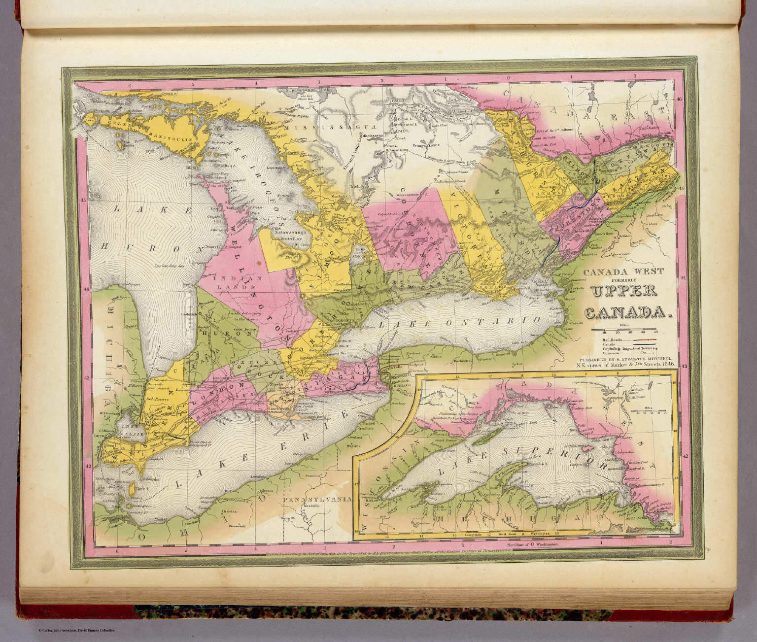 Mitchell's Universal Atlas (1846)
4. Canada West formerly Upper Canada
West-Canada (voormalig Opper-Canada)
David Rumsey Map Collection
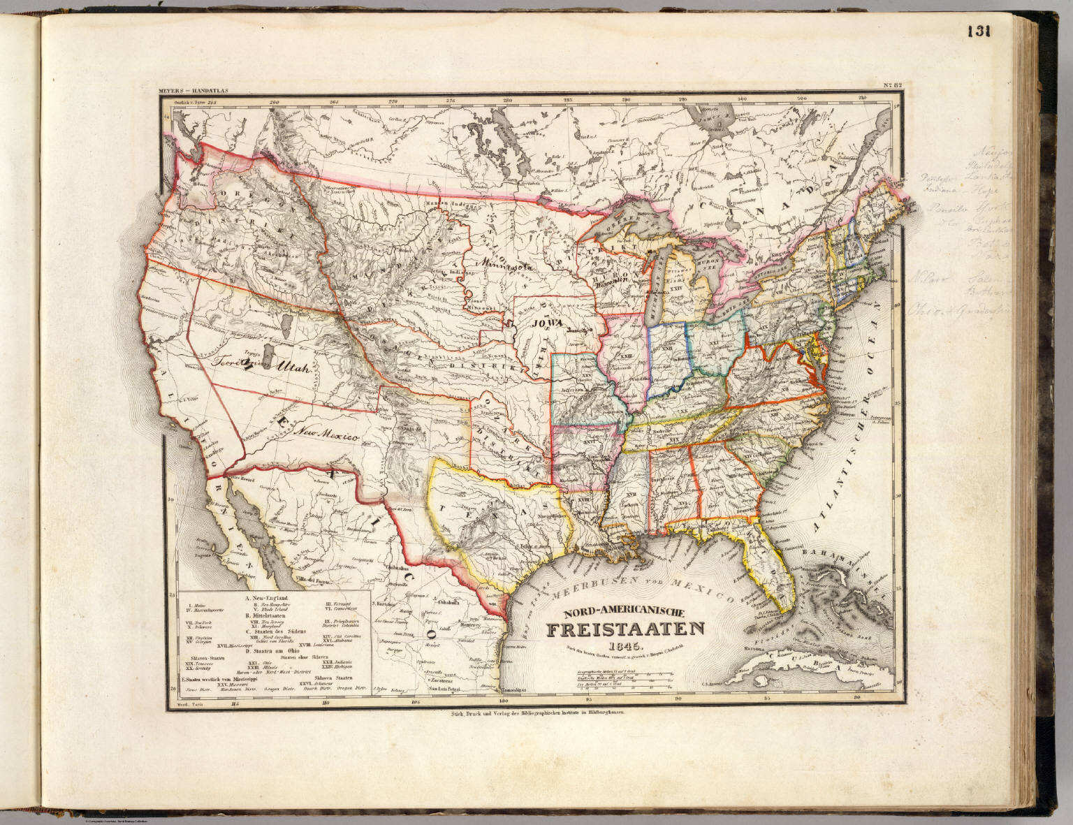 Meyer's Großer Hand-Atlas
131. Nord-Americanische Freistaaten (1845)
Verenigde Staten van Noord-Amerika / United States of North America
David Rumsey Map Collection
 Tanner's Universal Atlas (1836)
geen overeenkomstige kaart / no corresponding map
Meyer's Großer Hand-Atlas
131. Nord-Americanische Freistaaten (1845)
Verenigde Staten van Noord-Amerika / United States of North America
David Rumsey Map Collection
 Mitchell's Universal Atlas (1846)
geen overeenkomstige kaart / no corresponding map
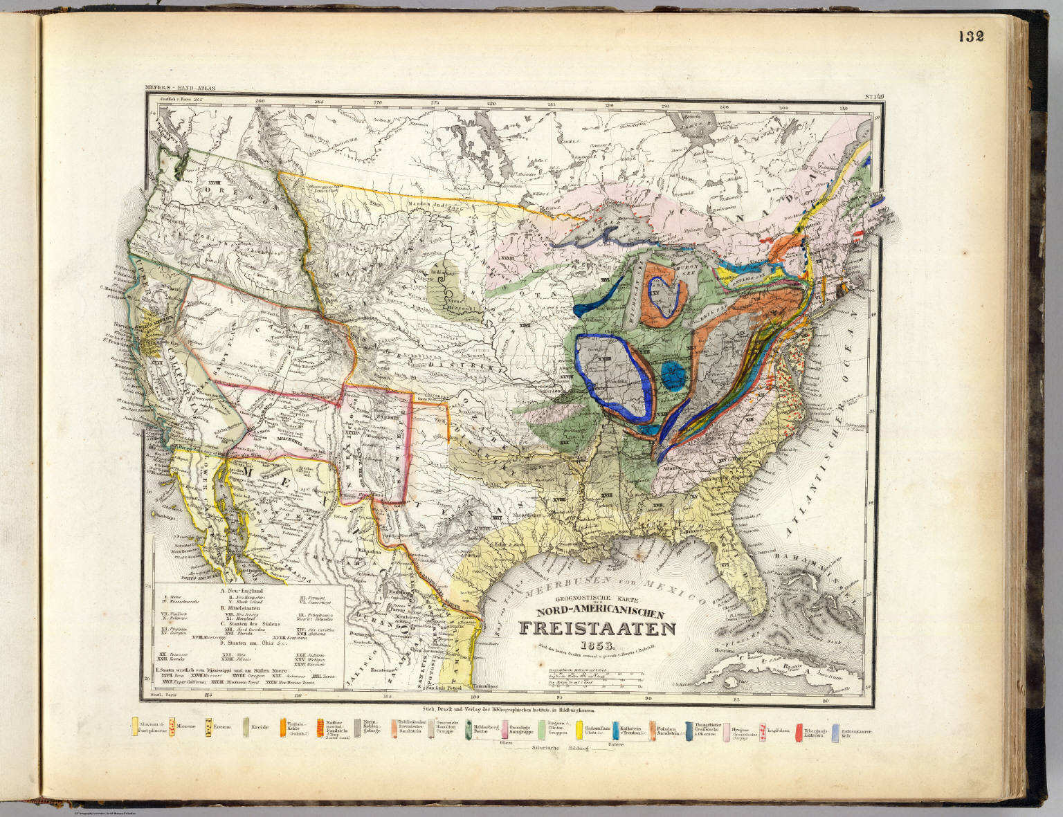 Meyer's Großer Hand-Atlas
132. Geognostische Karte der Nord-Americanischen Freistaaten (1853)
Geologische kaart van de Verenigde Staten / Geological map of the United States
David Rumsey Map Collection
Tanner's Universal Atlas (1836)
geen overeenkomstige kaart / no corresponding map
Meyer's Großer Hand-Atlas
132. Geognostische Karte der Nord-Americanischen Freistaaten (1853)
Geologische kaart van de Verenigde Staten / Geological map of the United States
David Rumsey Map Collection
Mitchell's Universal Atlas (1846)
geen overeenkomstige kaart / no corresponding map
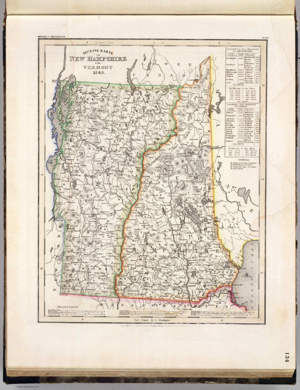 Meyer's Großer Hand-Atlas
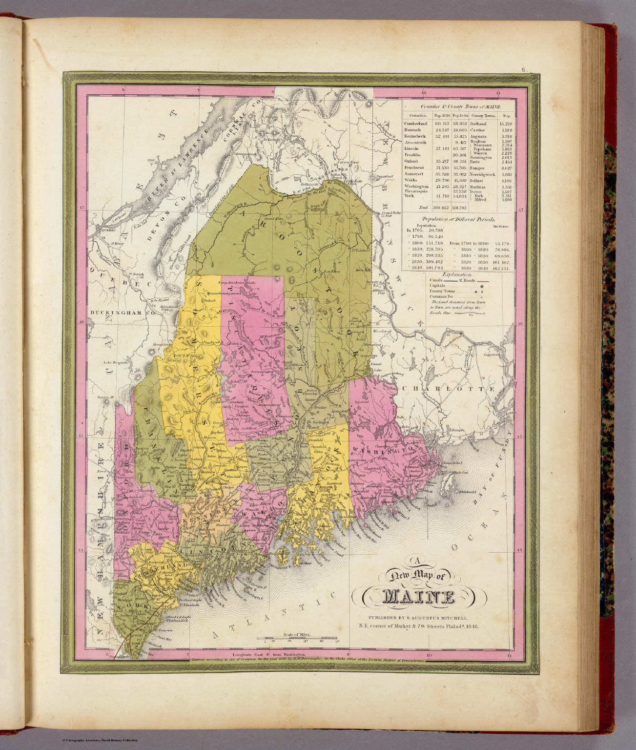
134. Neueste Karte von New Hampshire und Vermont (1846)
New Hampshire en Vermont / New Hampshire and Vermont
David Rumsey Map Collection
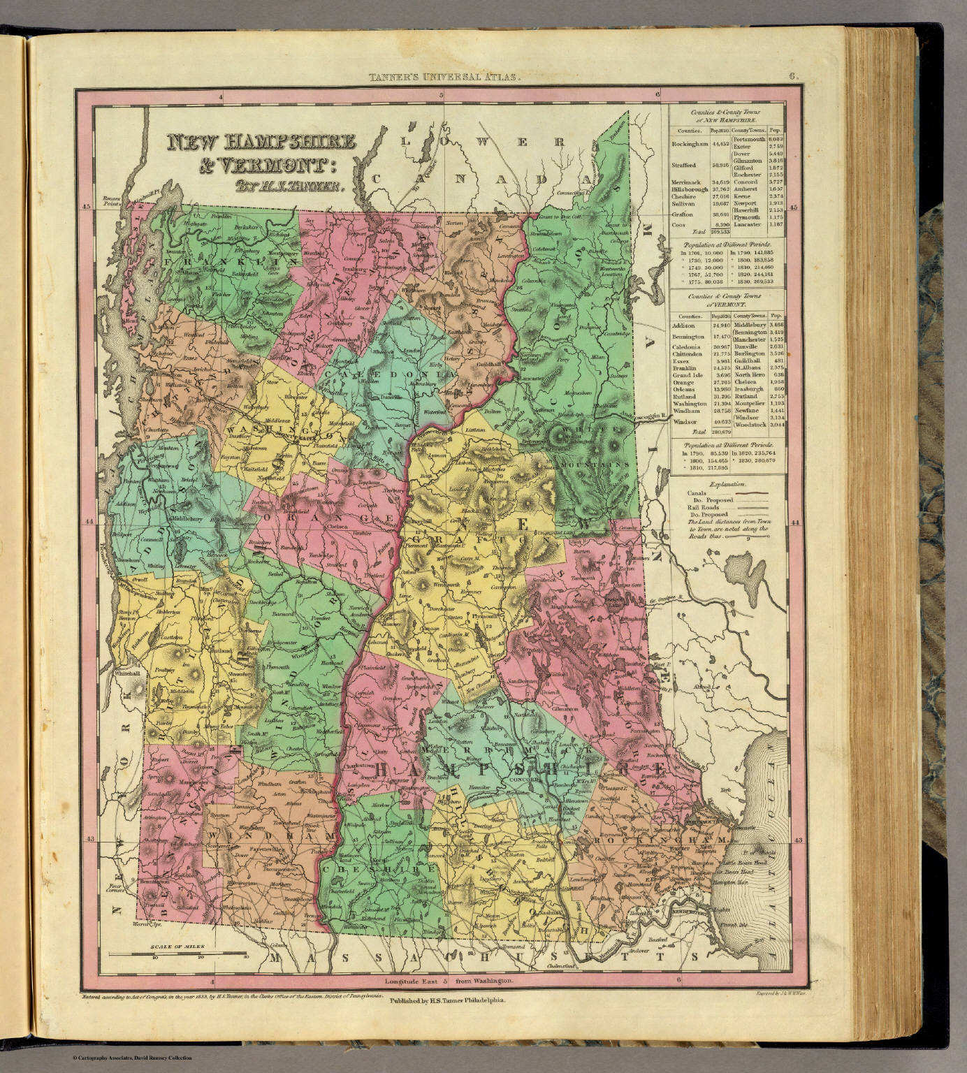 Tanner's Universal Atlas (1836)
6. New Hampshire & Vermont
New Hampshire en Vermont
David Rumsey Map Collection
Meyer's Großer Hand-Atlas
134. Neueste Karte von New Hampshire und Vermont (1846)
New Hampshire en Vermont / New Hampshire and Vermont
David Rumsey Map Collection
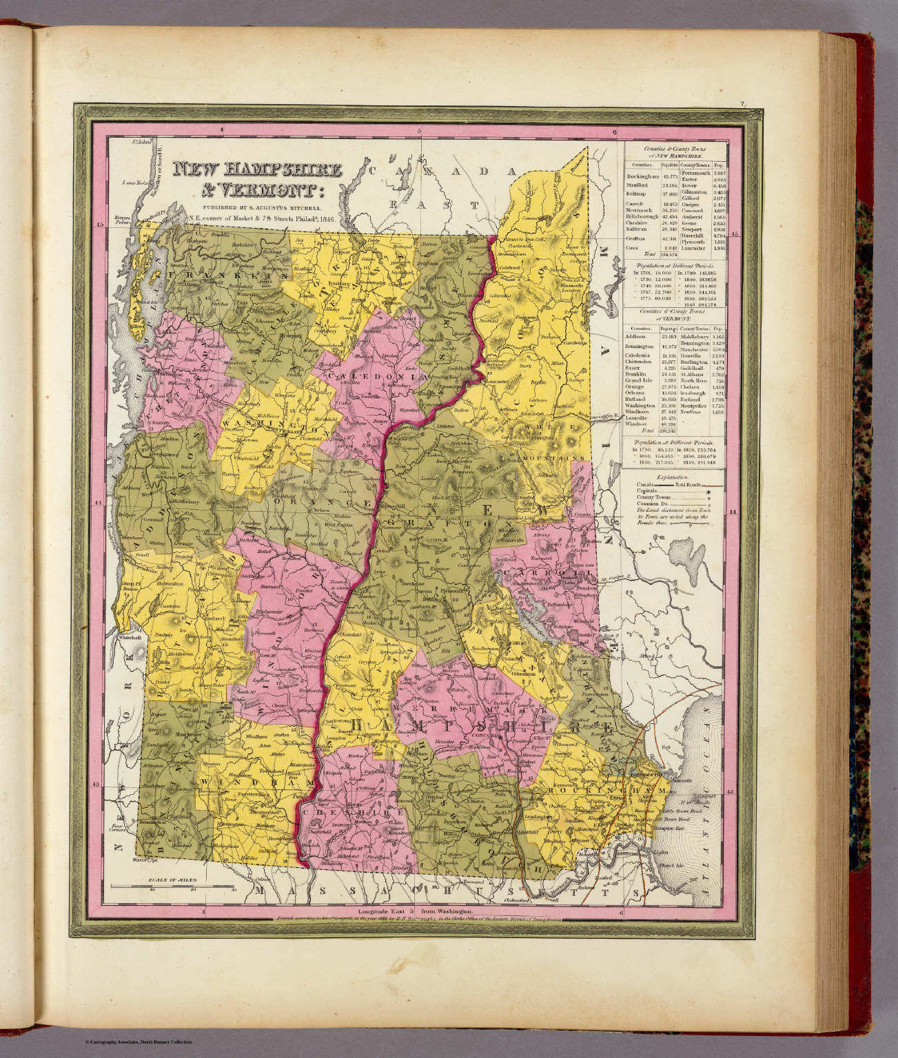 Mitchell's Universal Atlas (1846)
7. New Hampshire & Vermont
New Hampshire en Vermont
David Rumsey Map Collection
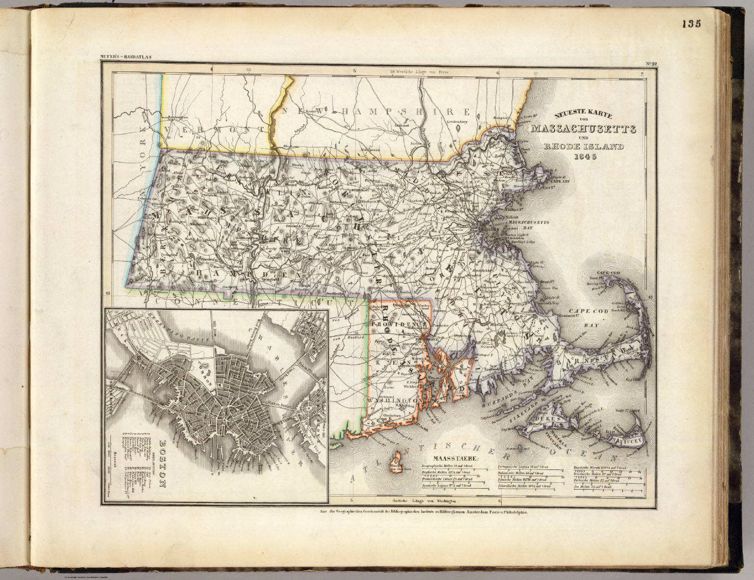 Meyer's Großer Hand-Atlas
135. Neueste Karte von Massachusetts und Rhode Island (1846)
Massachusetts en Rhode Island / Massachusetts and Rhode Island
David Rumsey Map Collection
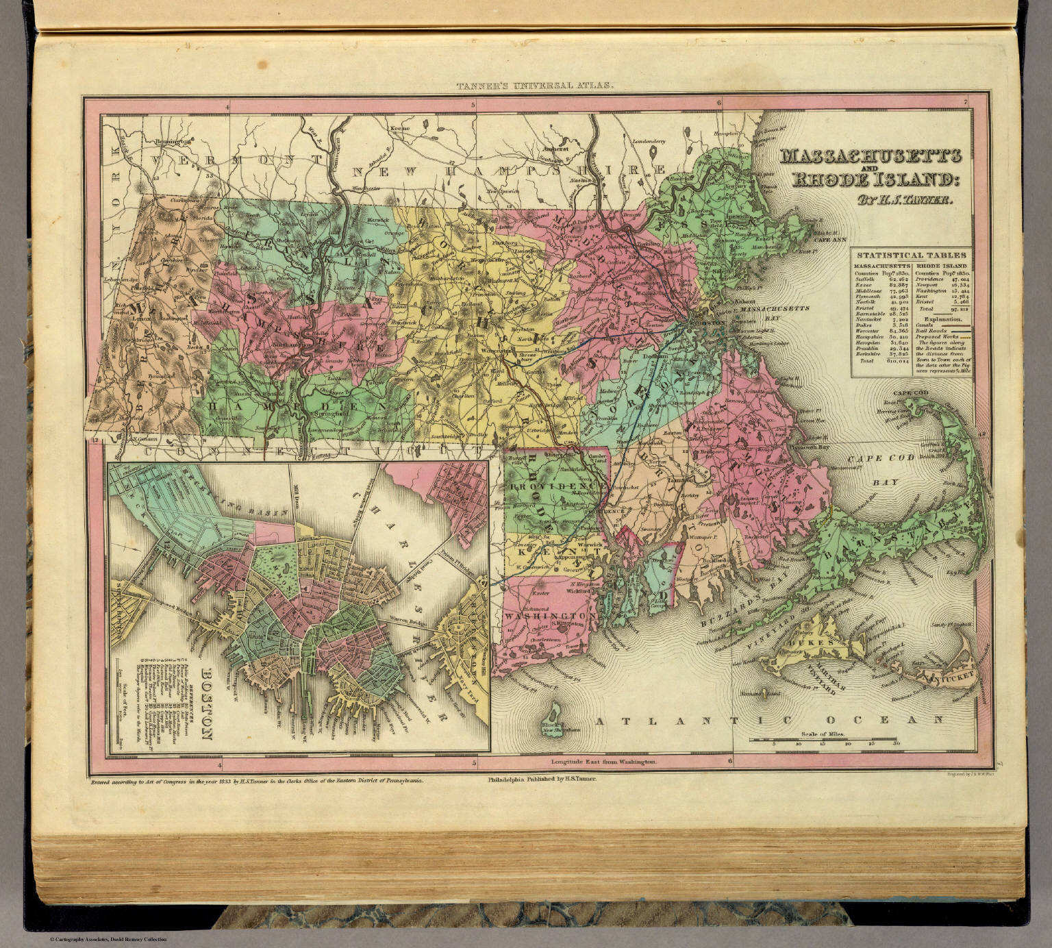 Tanner's Universal Atlas (1836)
7. Massachusetts and Rhode Island
Massachusetts en Rhode Island
David Rumsey Map Collection
Meyer's Großer Hand-Atlas
135. Neueste Karte von Massachusetts und Rhode Island (1846)
Massachusetts en Rhode Island / Massachusetts and Rhode Island
David Rumsey Map Collection
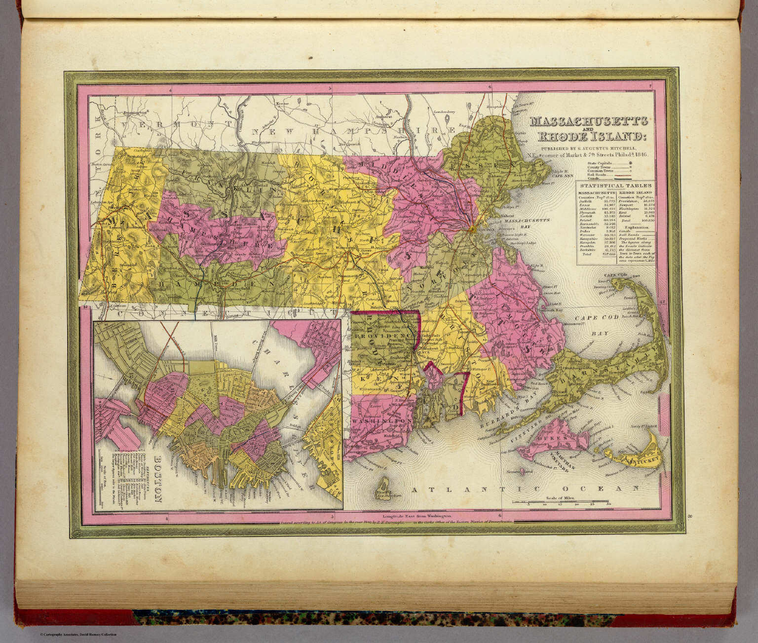 Mitchell's Universal Atlas (1846)
8. Massachusetts and Rhode Island
Massachusetts en Rhode Island
David Rumsey Map Collection

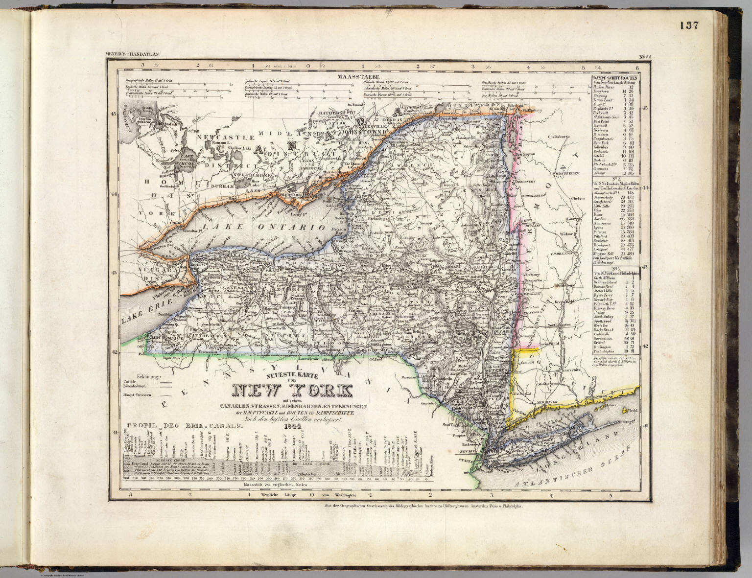 Meyer's Großer Hand-Atlas
137. Neueste Karte von New York mit seinen Canaelen, ... (1844)
New York
David Rumsey Map Collection
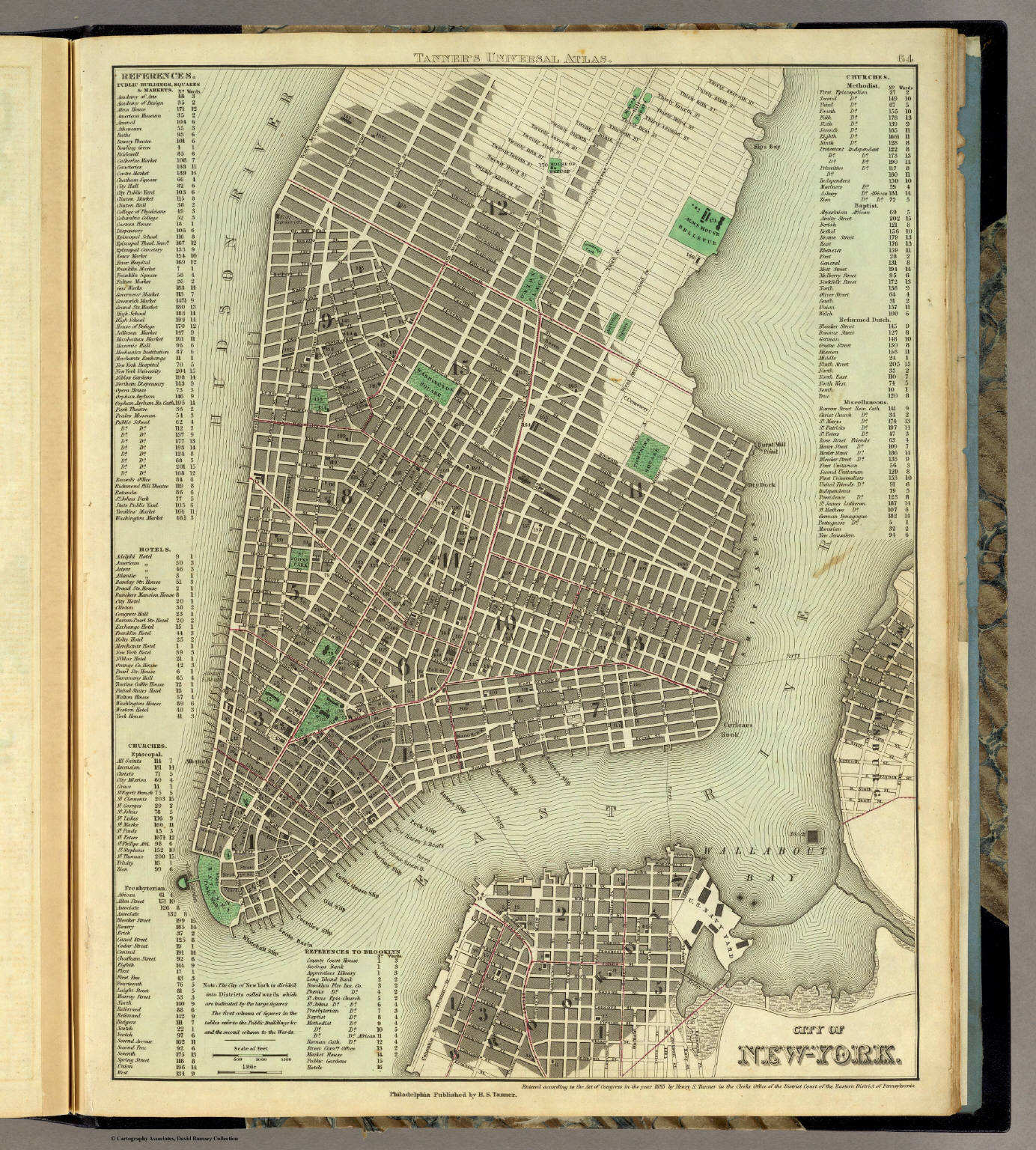
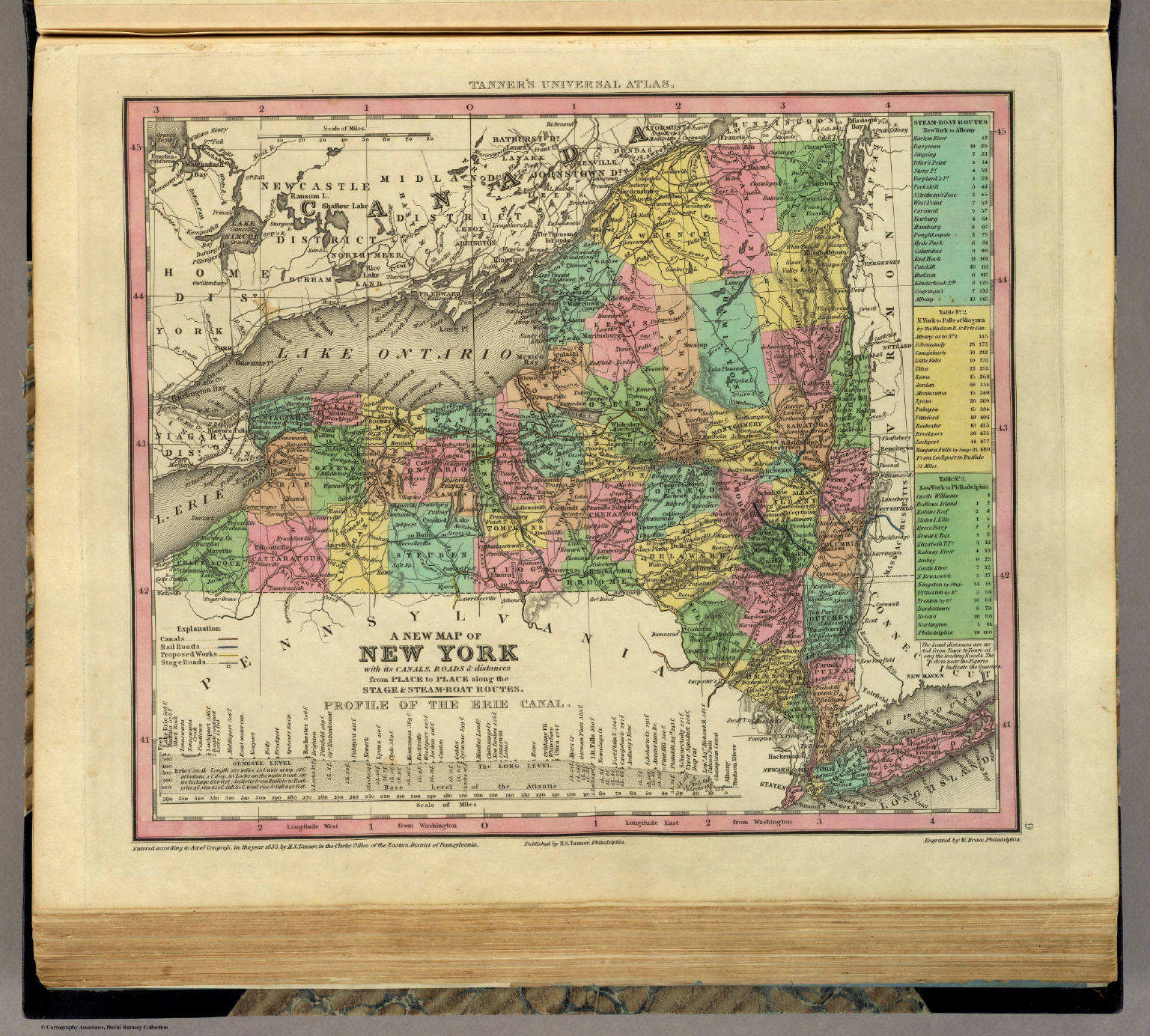 Tanner's Universal Atlas (1836)
9. A New Map of New York with its Canals, ...
New York
David Rumsey Map Collection
Meyer's Großer Hand-Atlas
137. Neueste Karte von New York mit seinen Canaelen, ... (1844)
New York
David Rumsey Map Collection
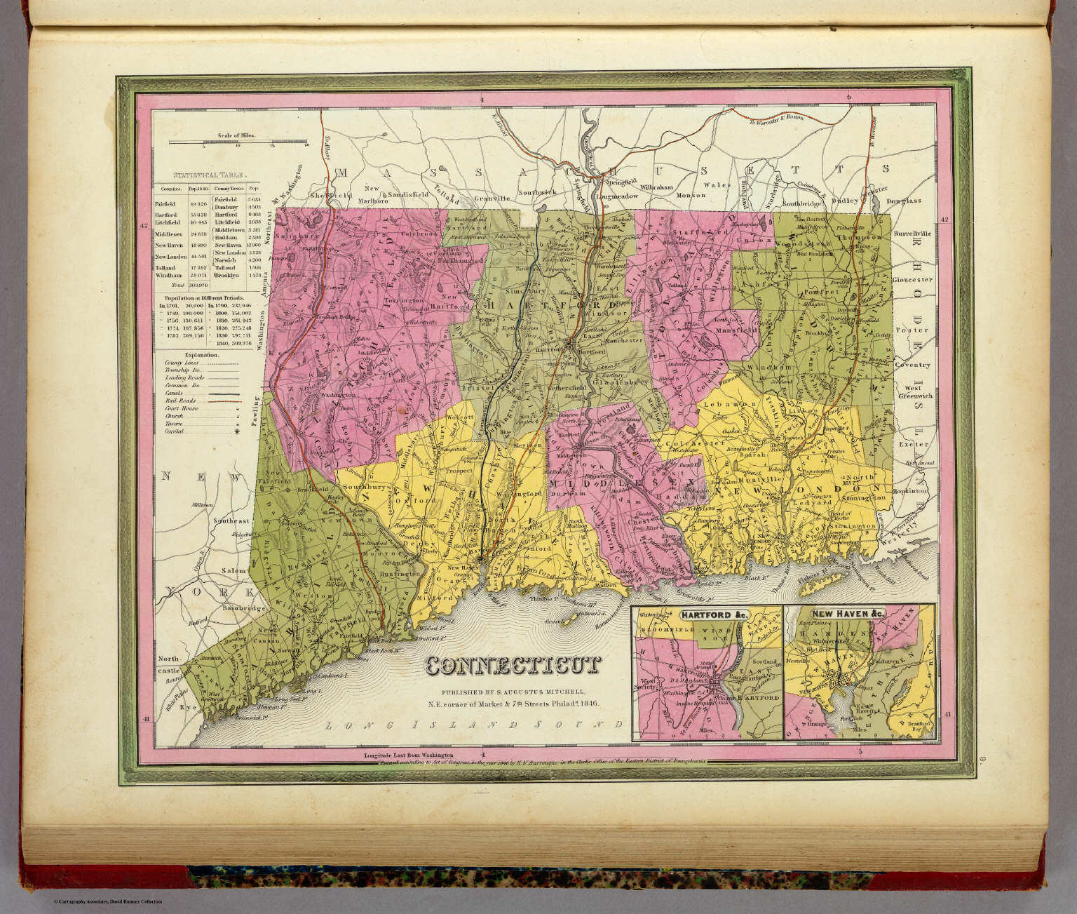
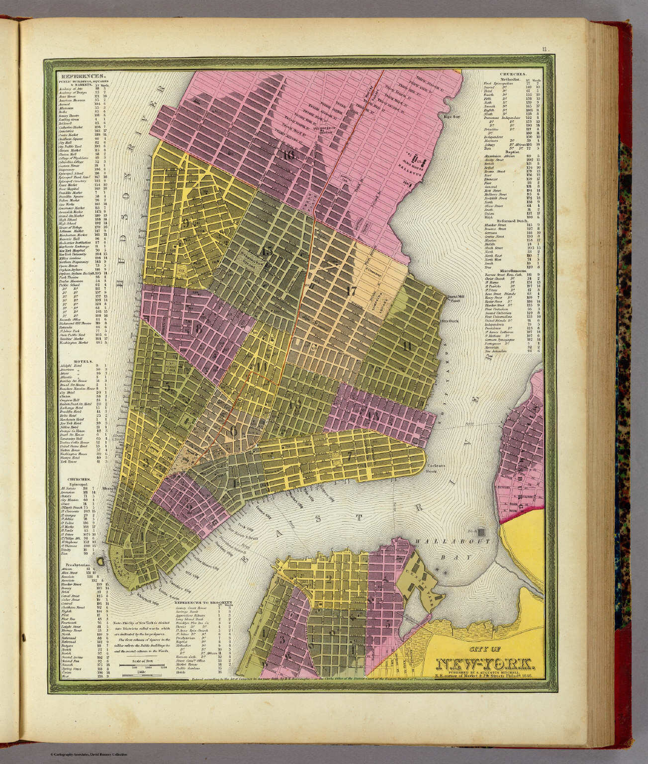
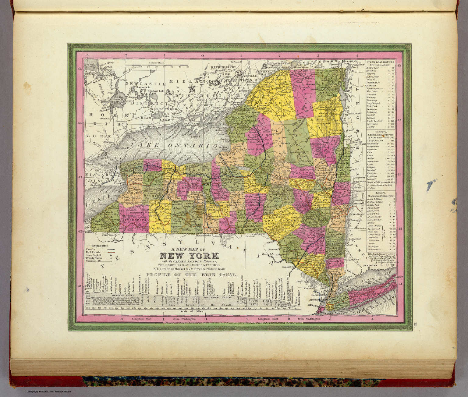 Mitchell's Universal Atlas (1846)
10. A New Map of New York with its Canals, ...
New York
David Rumsey Map Collection
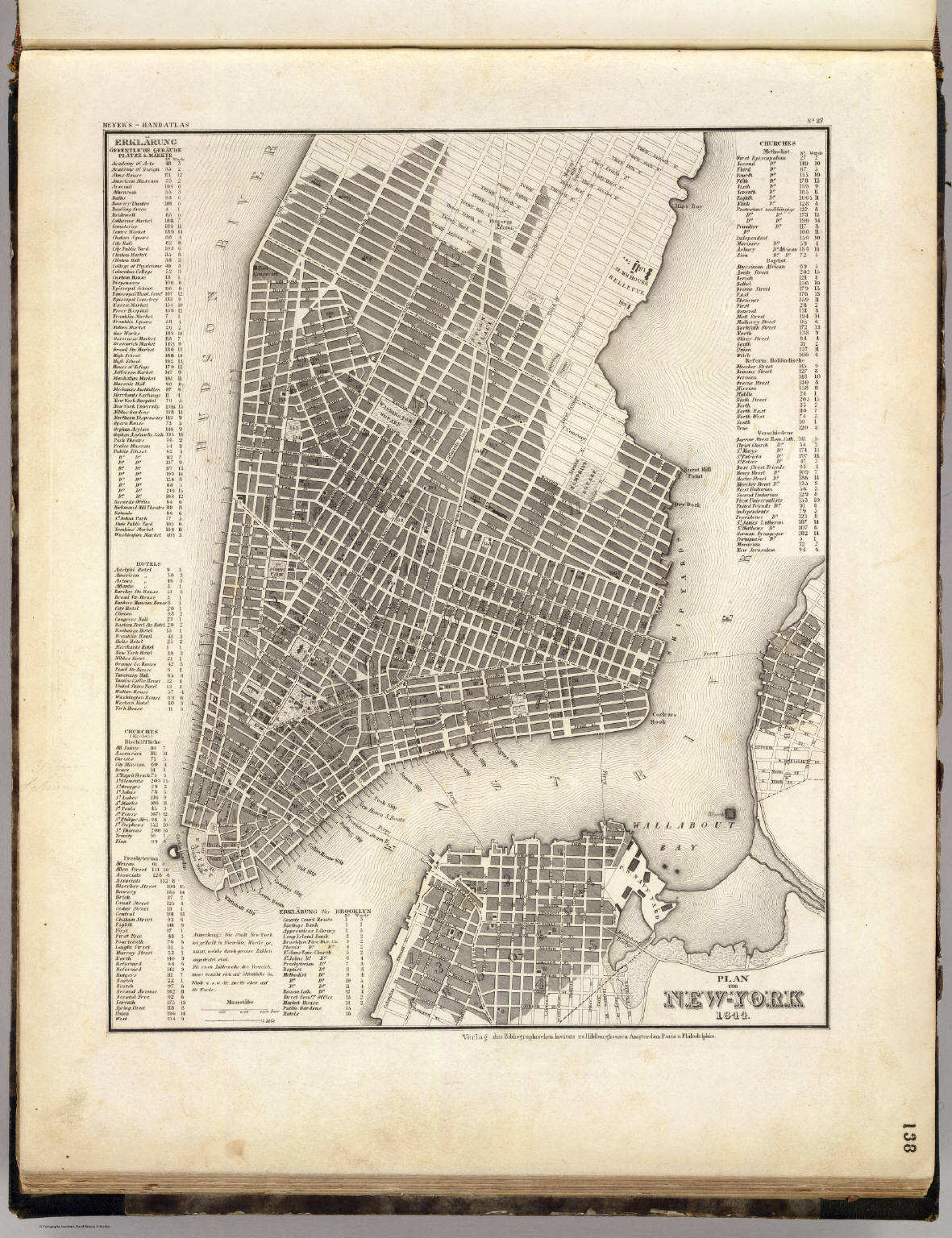 Meyer's Großer Hand-Atlas
138. Plan von New-York (1844)
De stad New York / City of New York
David Rumsey Map Collection
 Meyer's Großer Hand-Atlas
138. Plan von New-York (1844)
De stad New York / City of New York
David Rumsey Map Collection
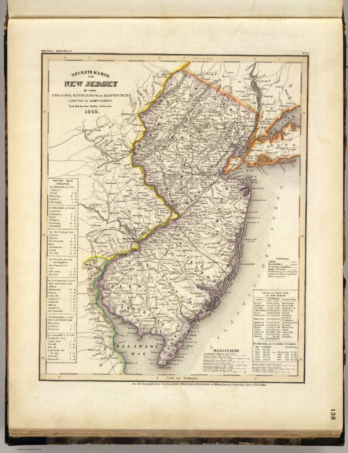 Meyer's Großer Hand-Atlas
139. Neueste Karte von New Jersey mit seinen Strassen, ... (1846)
New Jersey
David Rumsey Map Collection
 Tanner's Universal Atlas (1836)
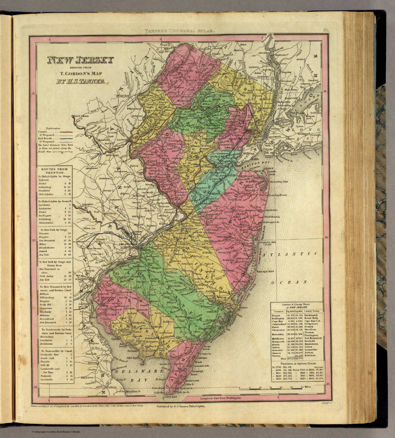
10. New Jersey Reduced from T. Gordon's Map
New Jersey
David Rumsey Map Collection
Meyer's Großer Hand-Atlas
139. Neueste Karte von New Jersey mit seinen Strassen, ... (1846)
New Jersey
David Rumsey Map Collection
 Mitchell's Universal Atlas (1846)
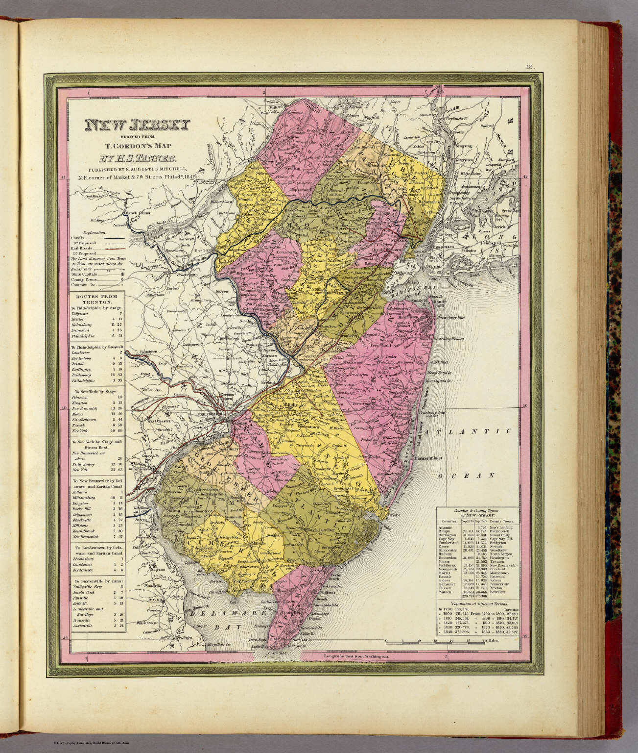
12. New Jersey Reduced From T. Gordon's Map
New Jersey
David Rumsey Map Collection
 Meyer's Großer Hand-Atlas
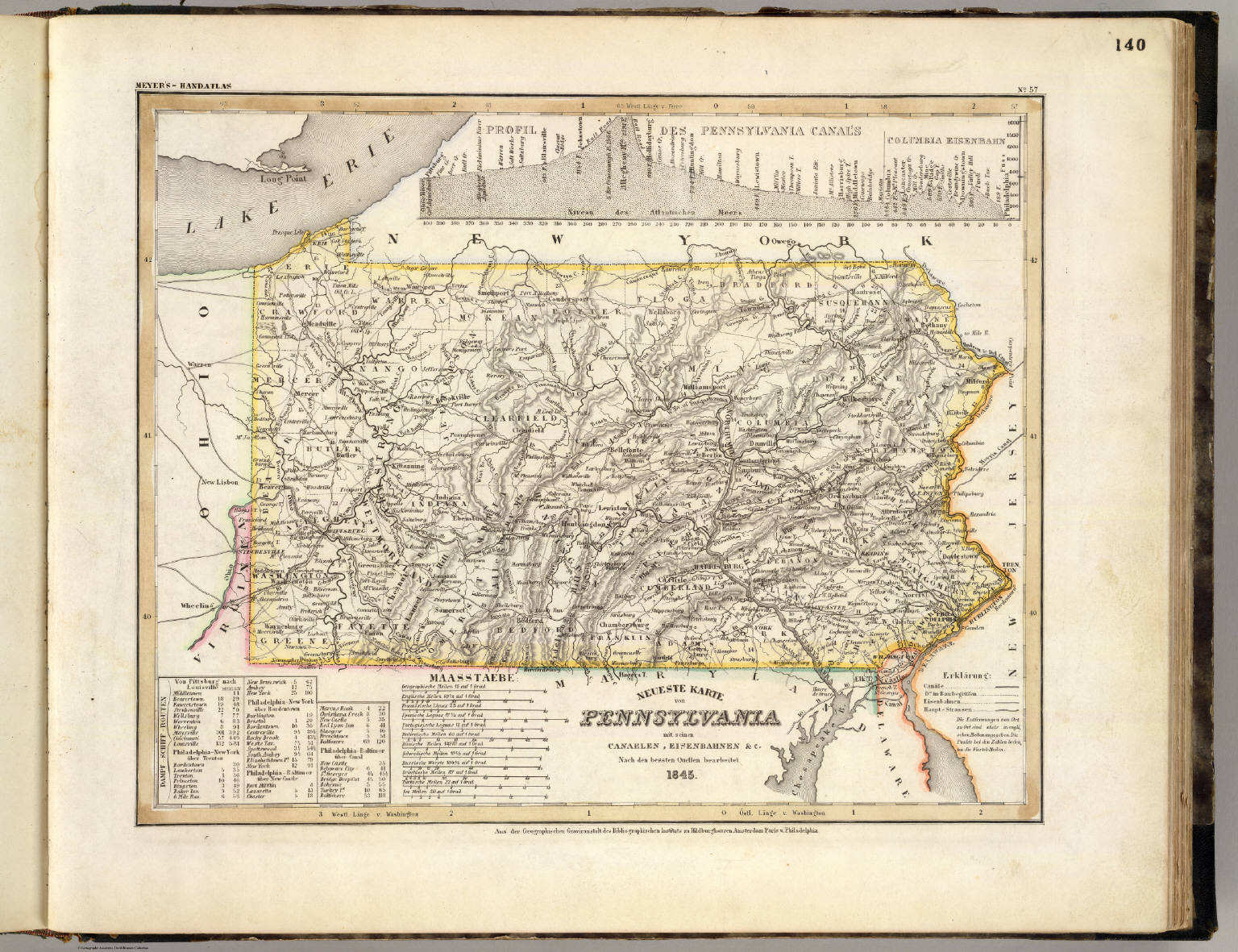
140. Neueste Karte von Pennsylvania mit seinen Canaelen, ... (1845)
Pennsylvania
David Rumsey Map Collection
 Tanner's Universal Atlas (1836)
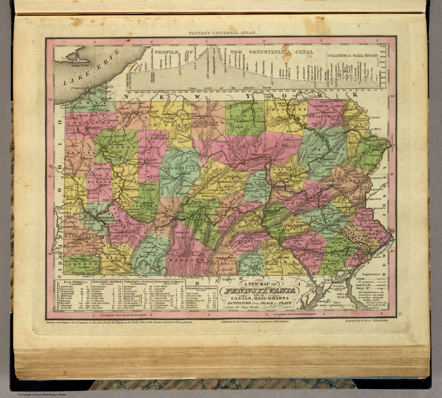
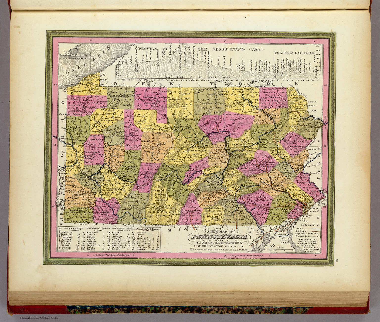
11. A New Map of Pennsylvania with its Canals, ...
Pennsylvania
David Rumsey Map Collection
Meyer's Großer Hand-Atlas
140. Neueste Karte von Pennsylvania mit seinen Canaelen, ... (1845)
Pennsylvania
David Rumsey Map Collection
 Mitchell's Universal Atlas (1846)
13. A New Map of Pennsylvania with its Canals, ...
Pennsylvania
David Rumsey Map Collection
 Meyer's Großer Hand-Atlas
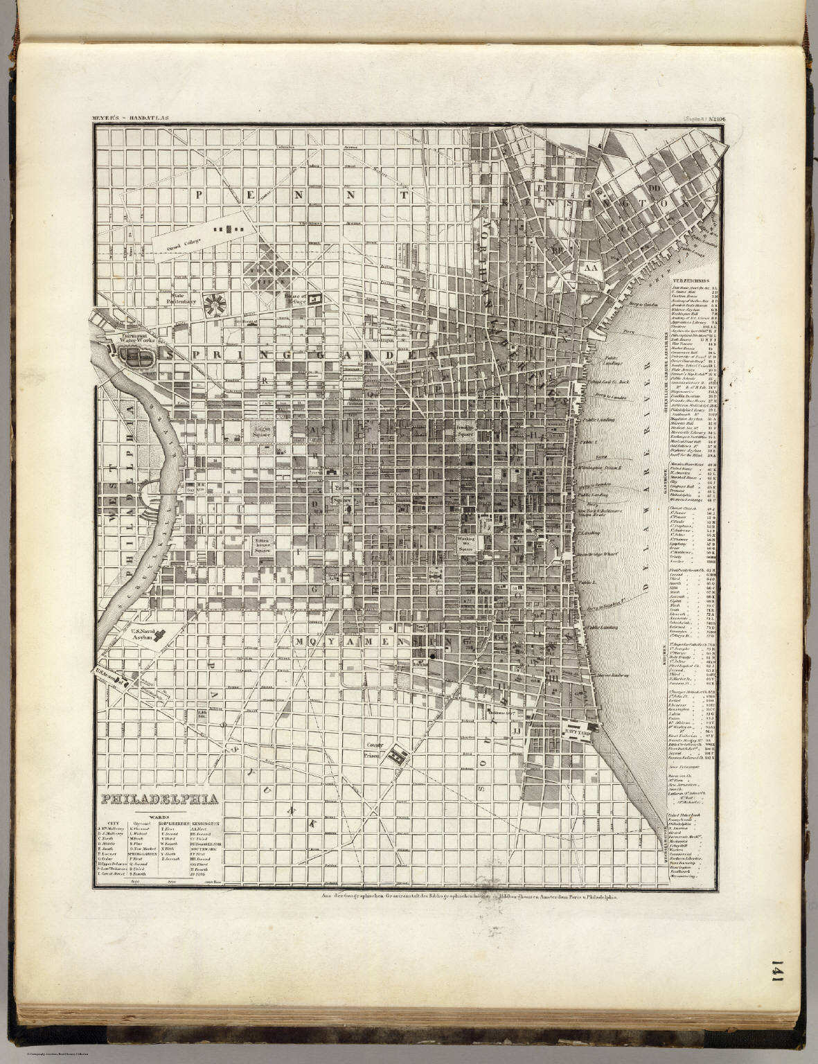
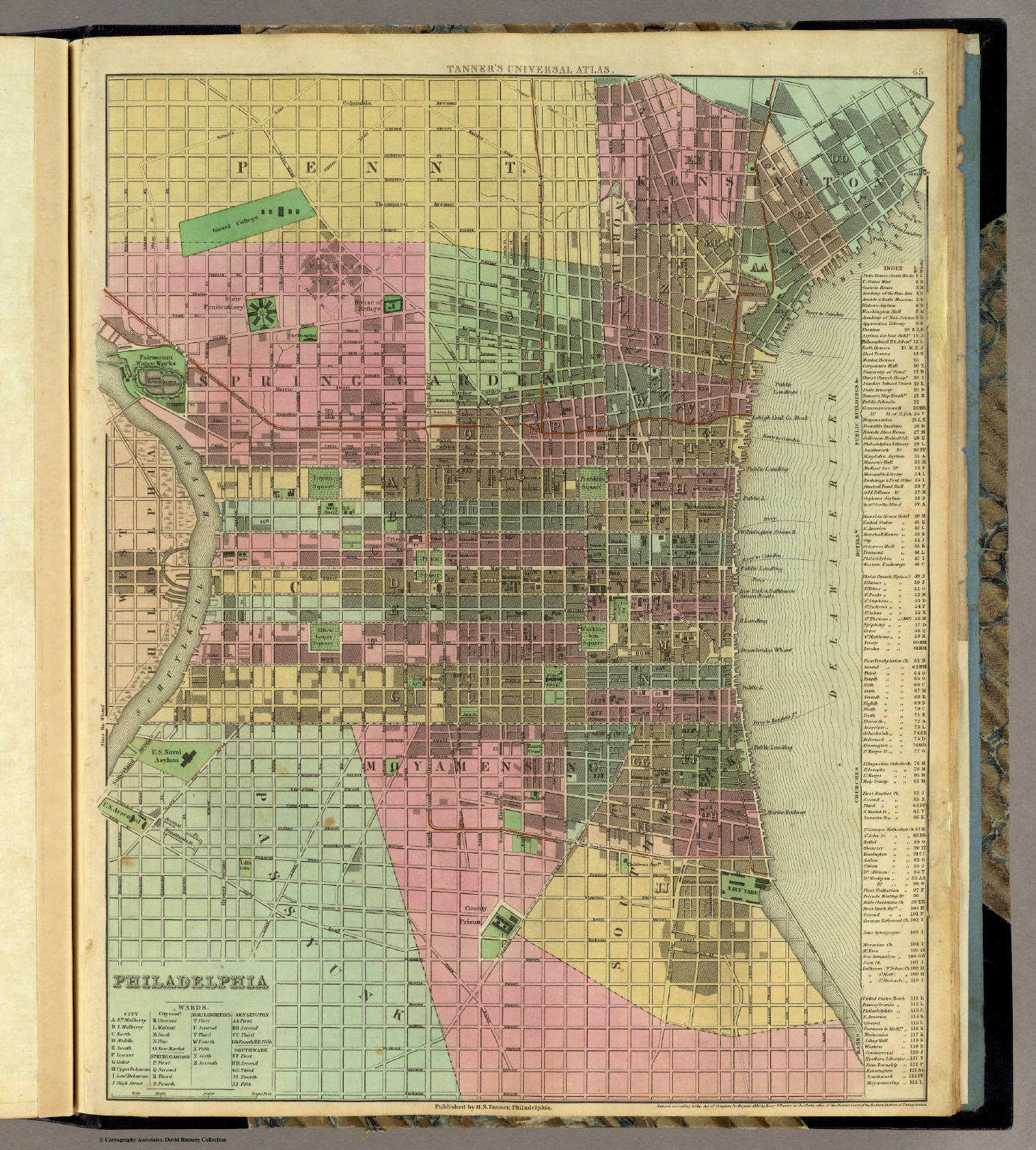
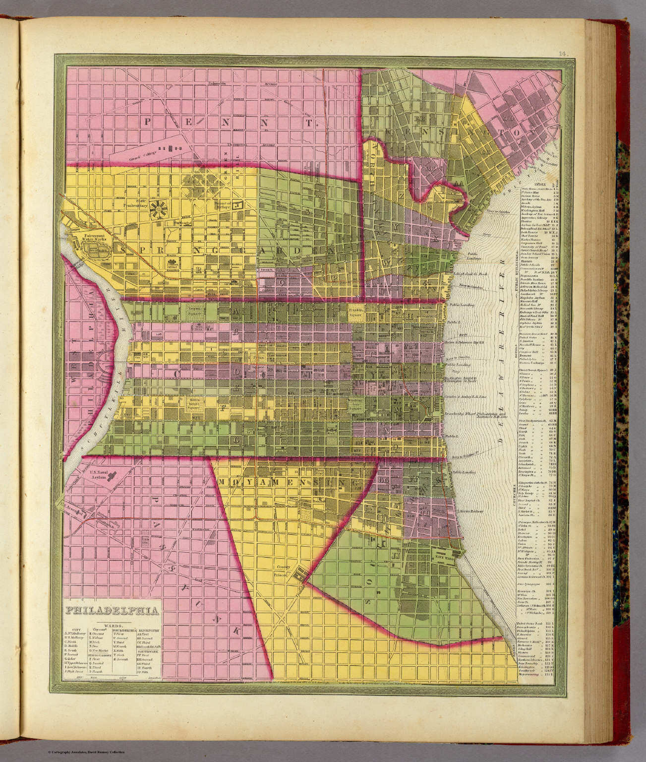
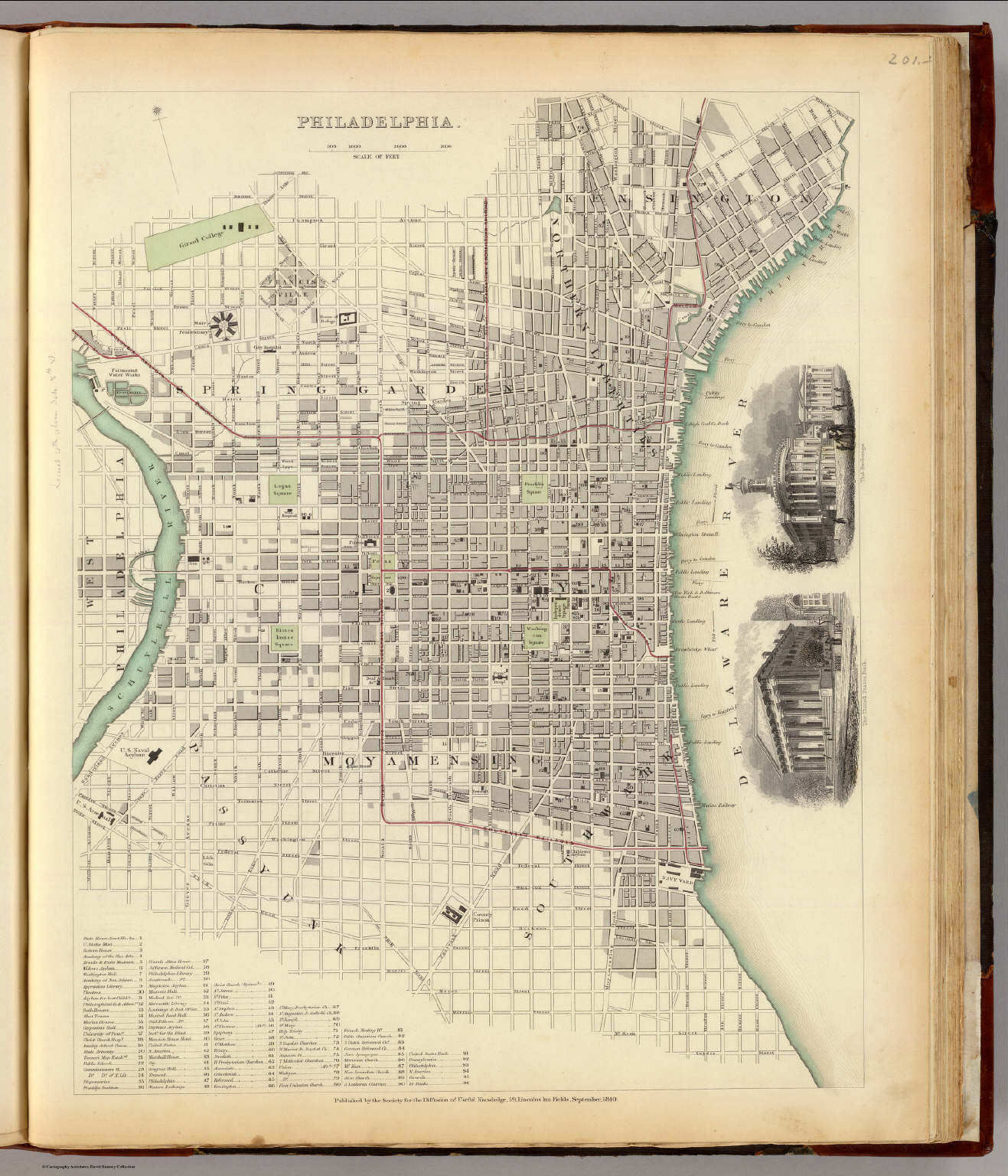
141. Philadelphia
De stad Philadelphia / City of Philadelphia
David Rumsey Map Collection
 Meyer's Großer Hand-Atlas
141. Philadelphia
De stad Philadelphia / City of Philadelphia
David Rumsey Map Collection
 Meyer's Großer Hand-Atlas
141. Philadelphia
De stad Philadelphia / City of Philadelphia
David Rumsey Map Collection
 Society for the Diffusion of Useful Knowledge
P37. Philadelphia (1840)
De stad Philadelphia
David Rumsey Map Collection
 Meyer's Großer Hand-Atlas
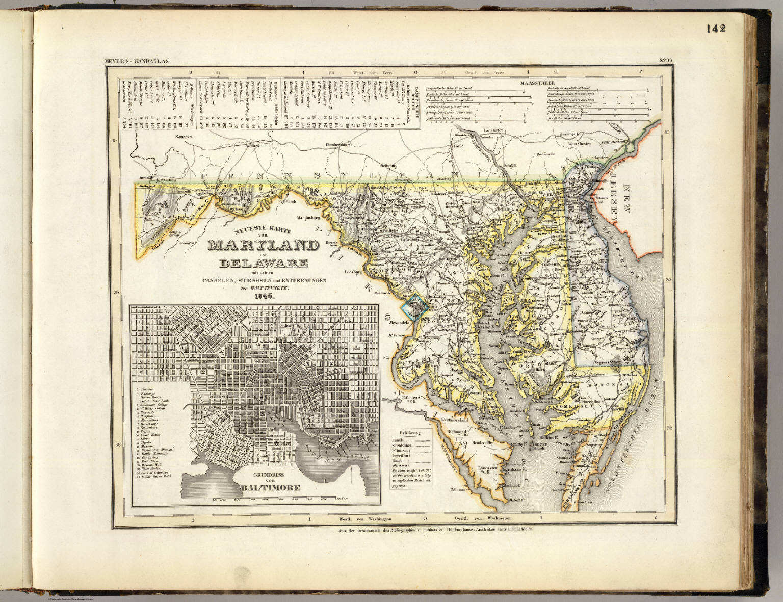
142. Neueste Karte von Maryland und Delaware mit seinen Canaelen, ... (1846)
Maryland en Delaware / Maryland and Delaware
David Rumsey Map Collection
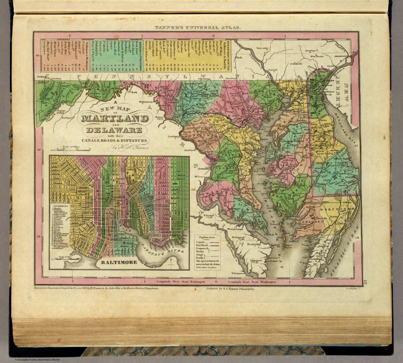 Tanner's Universal Atlas (1836)
12. A New Map of Maryland and Delaware with their Canals, ...
Maryland en Delaware
David Rumsey Map Collection
Meyer's Großer Hand-Atlas
142. Neueste Karte von Maryland und Delaware mit seinen Canaelen, ... (1846)
Maryland en Delaware / Maryland and Delaware
David Rumsey Map Collection
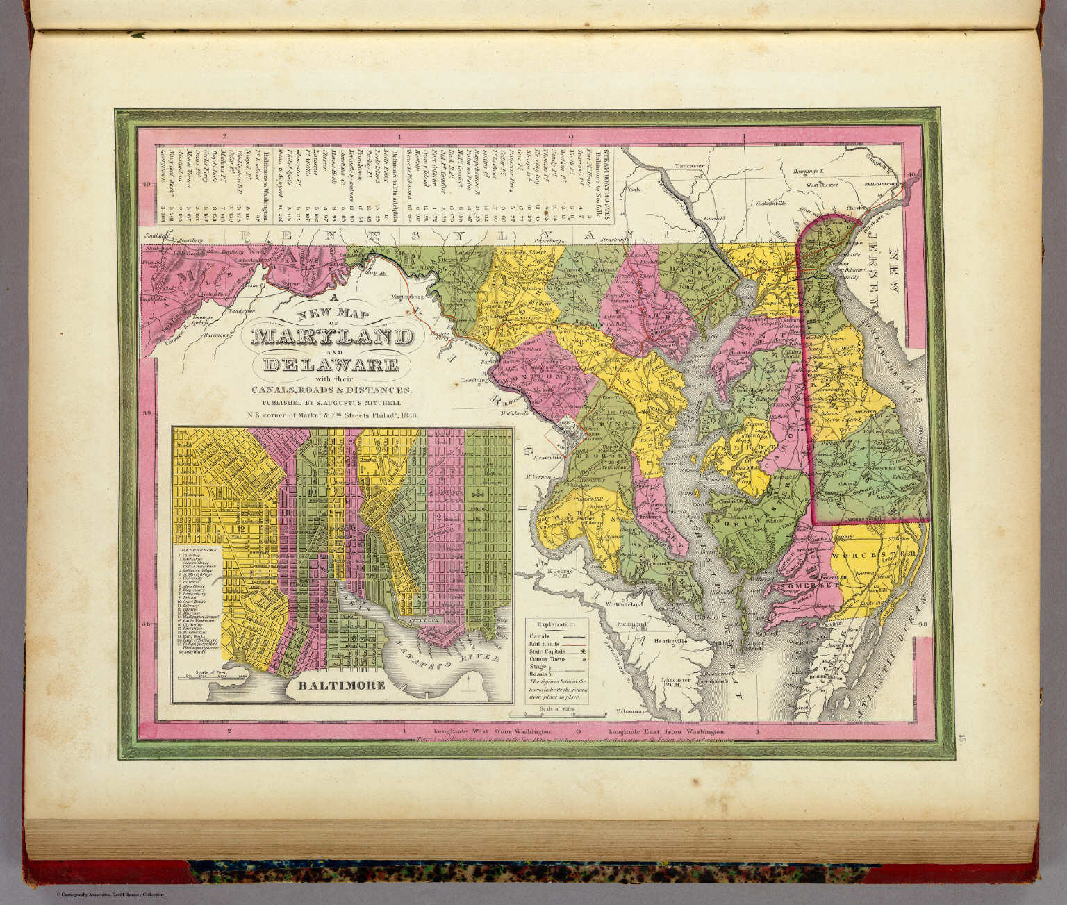 Mitchell's Universal Atlas (1846)
15. A New Map of Maryland and Delaware with their Canals, ...
Maryland en Delaware
David Rumsey Map Collection
 Meyer's Großer Hand-Atlas
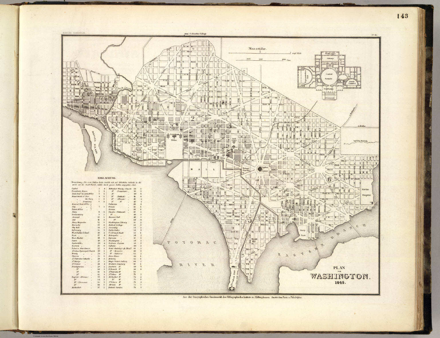
143. Plan von Washington (1845)
De stad Washington / City of Washington
David Rumsey Map Collection
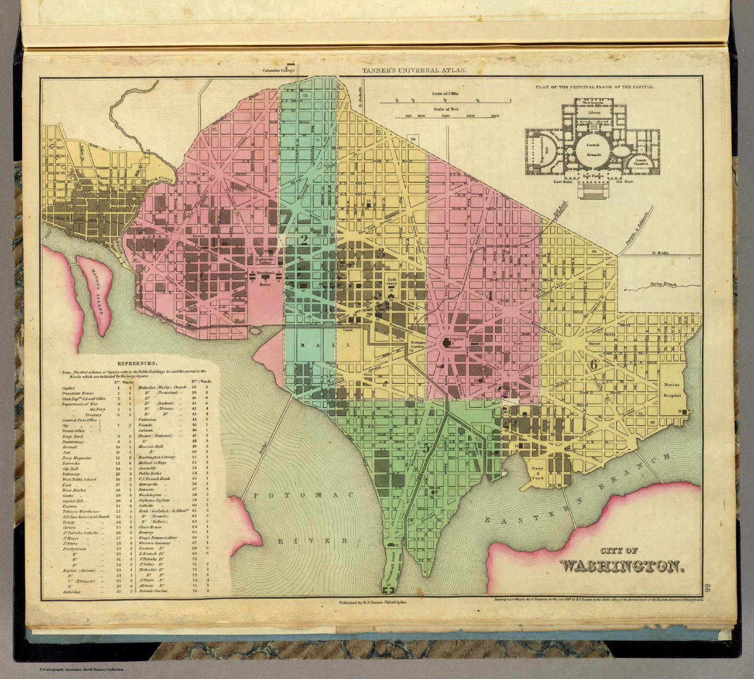 Tanner's Universal Atlas (1836)
66. City of Washington
De stad Washington
David Rumsey Map Collection
Meyer's Großer Hand-Atlas
143. Plan von Washington (1845)
De stad Washington / City of Washington
David Rumsey Map Collection
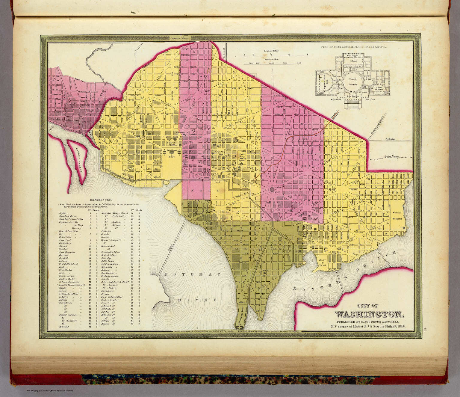 Mitchell's Universal Atlas (1846)
16. City of Washington
De stad Washington
David Rumsey Map Collection
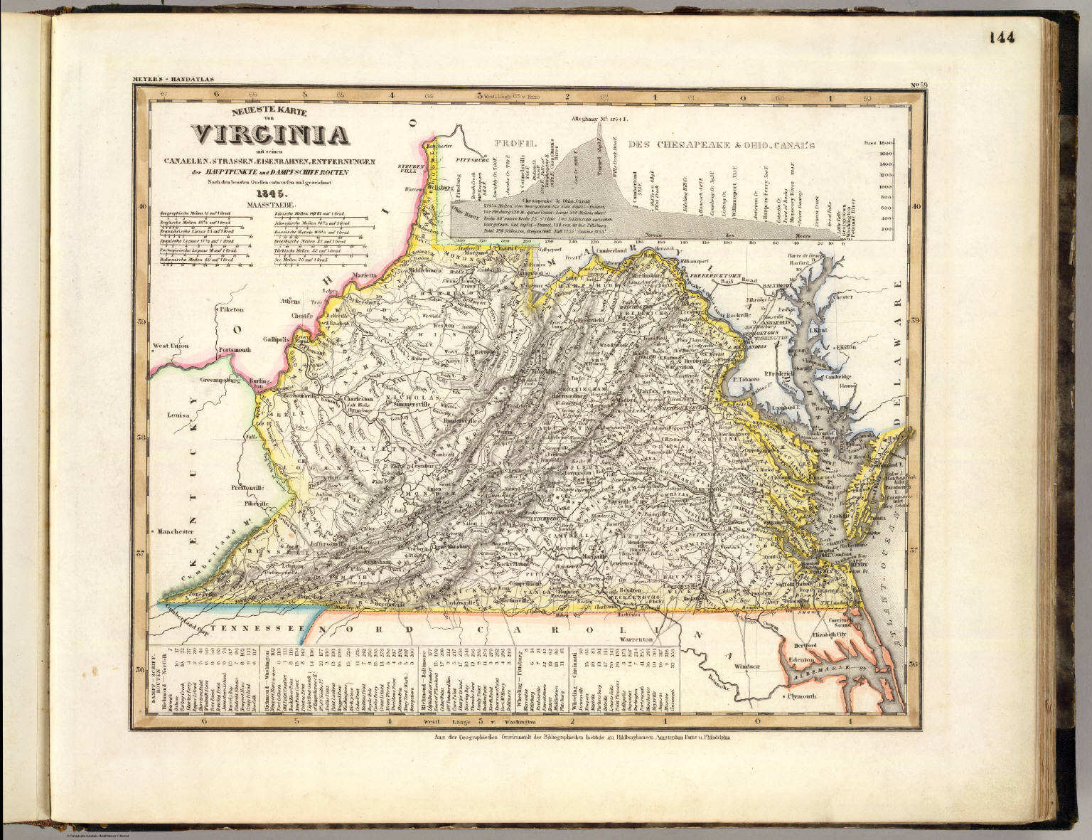 Meyer's Großer Hand-Atlas
144. Neueste Karte von Virginia mit seinen Canaelen, ... (1845)
Virginia
David Rumsey Map Collection
 Tanner's Universal Atlas (1836)
13. A New Map of Virginia with its Canals, ...
Virginia
David Rumsey Map Collection
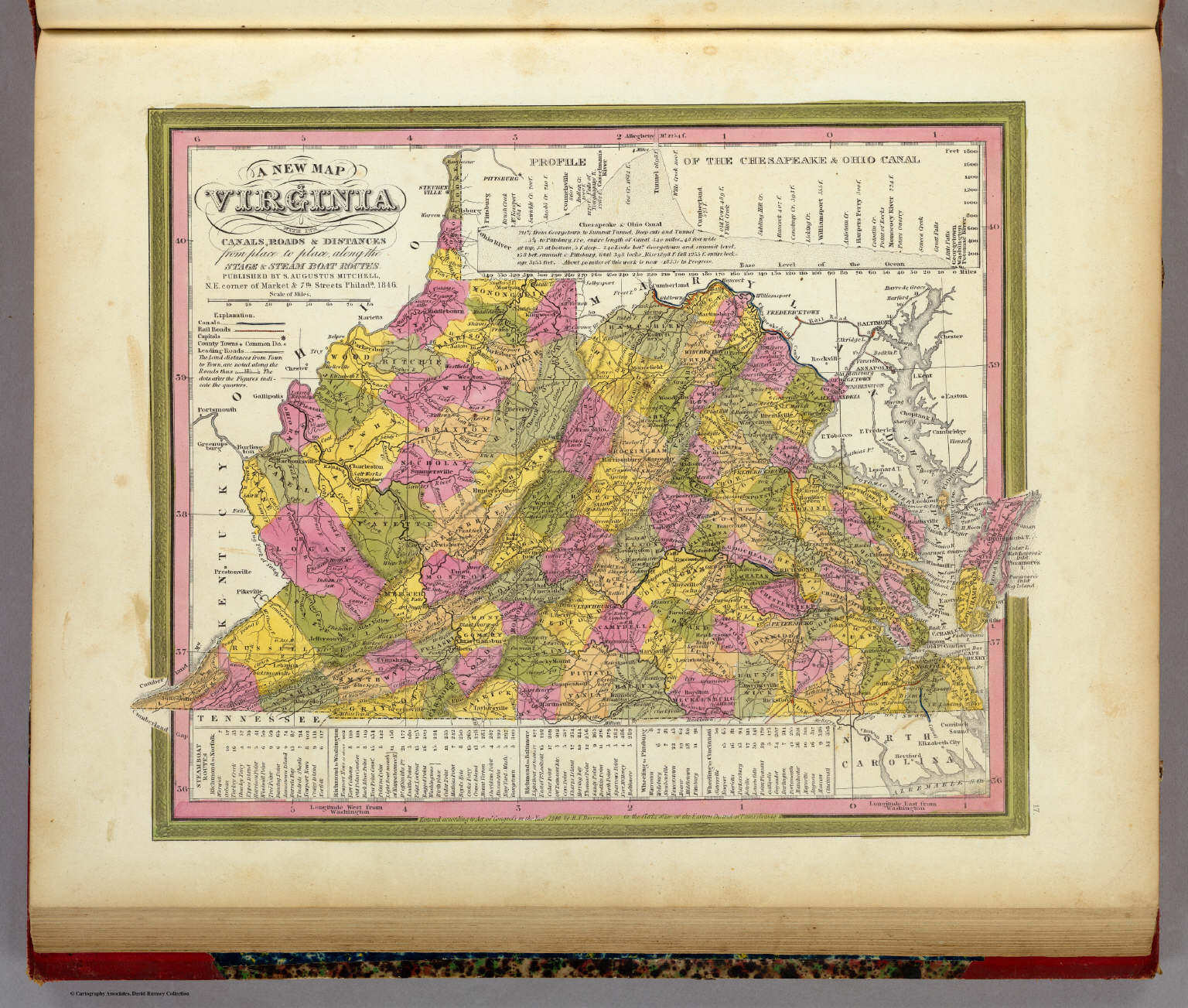
Meyer's Großer Hand-Atlas
144. Neueste Karte von Virginia mit seinen Canaelen, ... (1845)
Virginia
David Rumsey Map Collection
 Mitchell's Universal Atlas (1846)
17. A New Map of Virginia with its Canals, ...
Virginia
David Rumsey Map Collection
 Meyer's Großer Hand-Atlas
145. Neueste Karte von Nord Carolina mit seinen Canaelen, ... (1845)
North Carolina
David Rumsey Map Collection
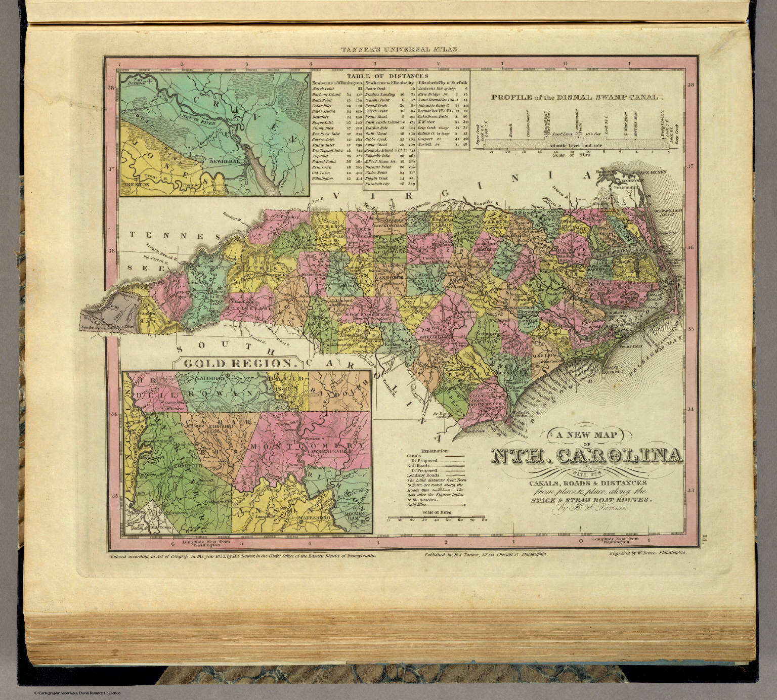 Tanner's Universal Atlas (1836)
14. A New Map of Nth. Carolina with its Canals, ...
North Carolina
David Rumsey Map Collection
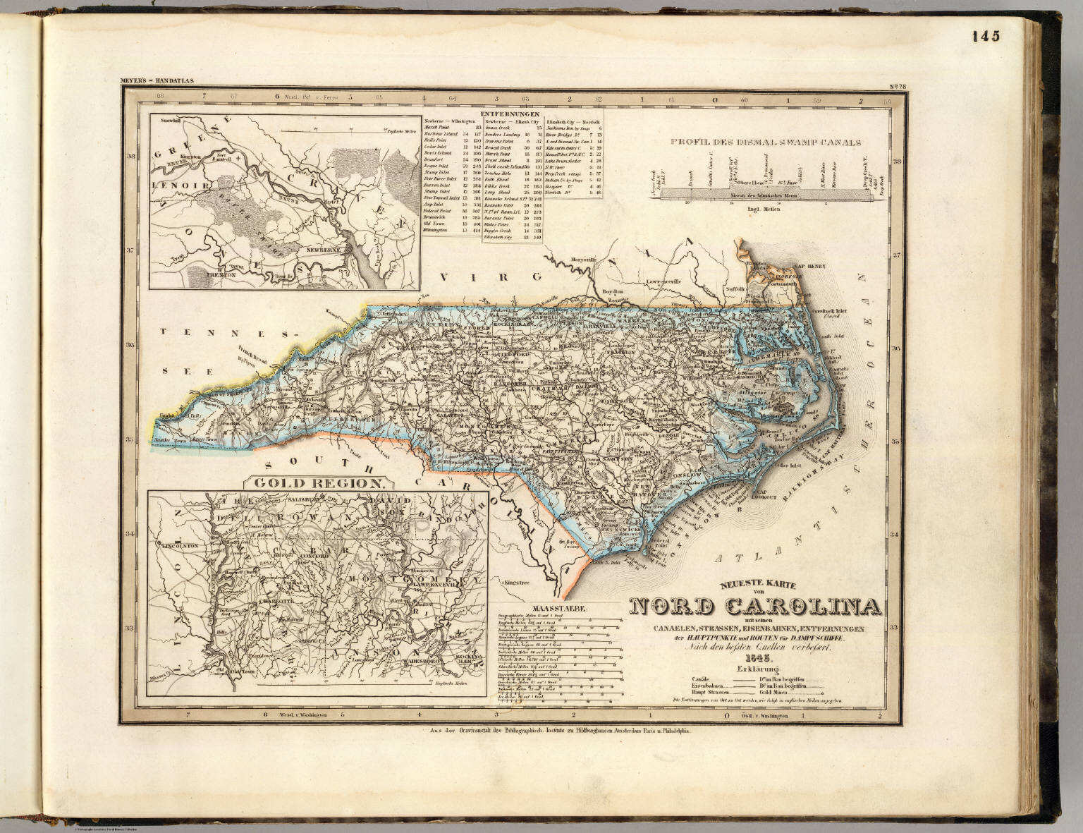
Meyer's Großer Hand-Atlas
145. Neueste Karte von Nord Carolina mit seinen Canaelen, ... (1845)
North Carolina
David Rumsey Map Collection
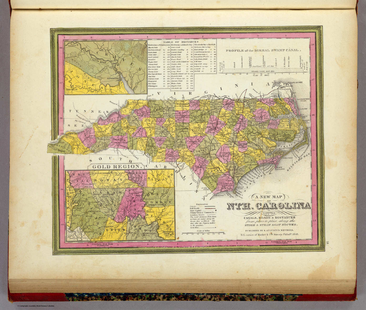 Mitchell's Universal Atlas (1846)
18. A New Map of Nth. Carolina with its Canals, ...
North Carolina
David Rumsey Map Collection
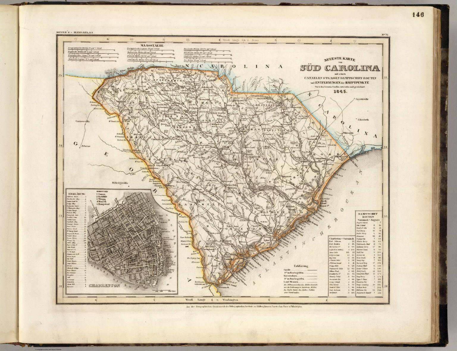 Meyer's Großer Hand-Atlas
146. Neueste Karte von Süd Carolina mit seinen Canaelen, ... (1845)
South Carolina
David Rumsey Map Collection
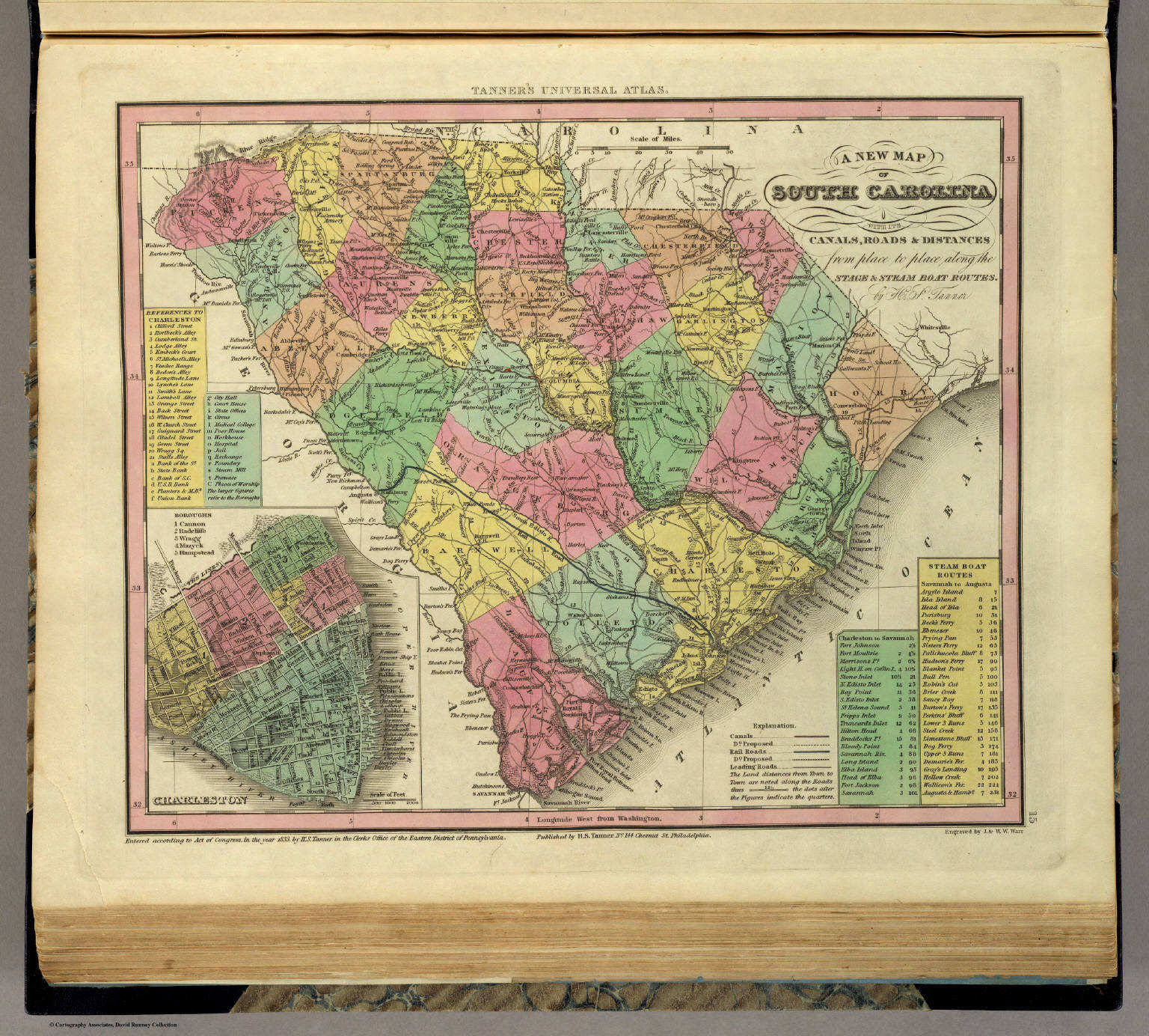 Tanner's Universal Atlas (1836)
15. A New Map of South Carolina with its Canals, ...
South Carolina
David Rumsey Map Collection
Meyer's Großer Hand-Atlas
146. Neueste Karte von Süd Carolina mit seinen Canaelen, ... (1845)
South Carolina
David Rumsey Map Collection
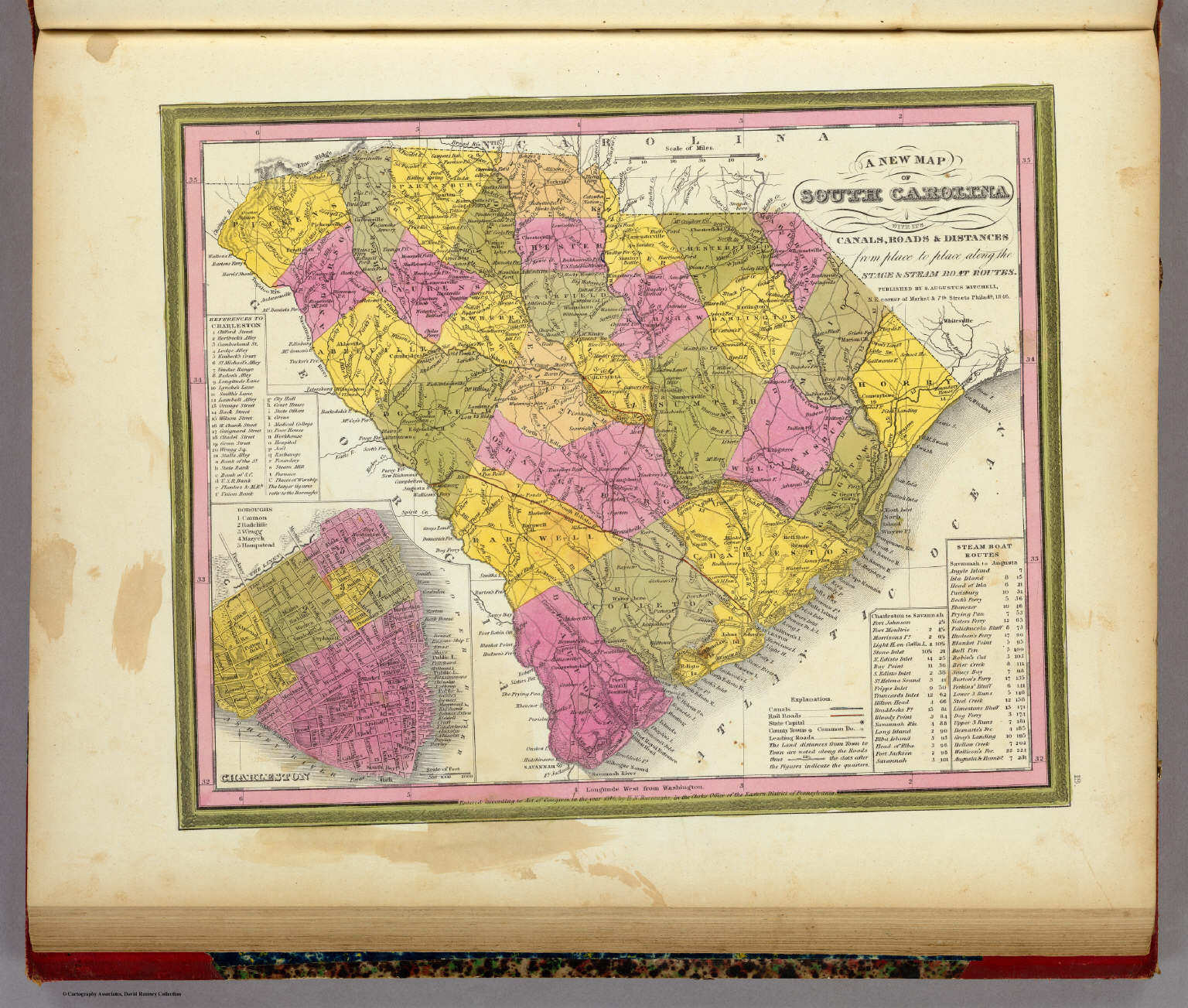 Mitchell's Universal Atlas (1846)
19. A New Map of South Carolina with its Canals, ...
South Carolina
David Rumsey Map Collection
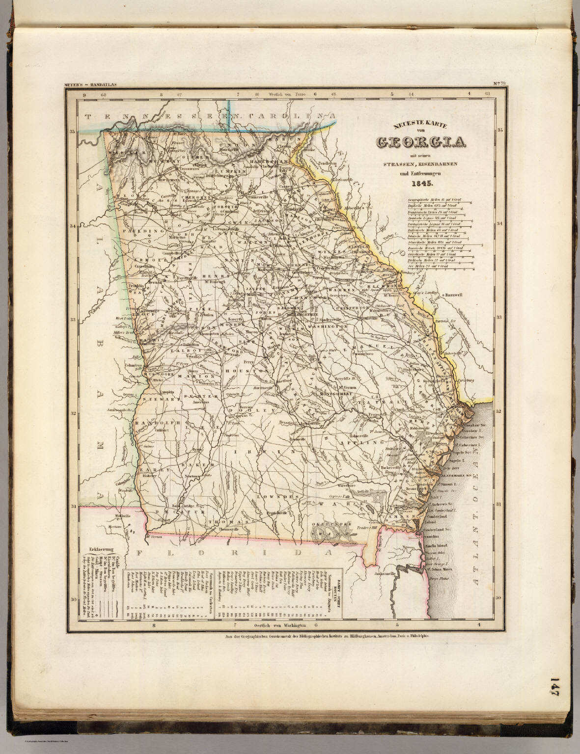 Meyer's Großer Hand-Atlas
147. Neueste Karte von Georgia mit seinen Strassen, ... (1845)
Georgia
David Rumsey Map Collection
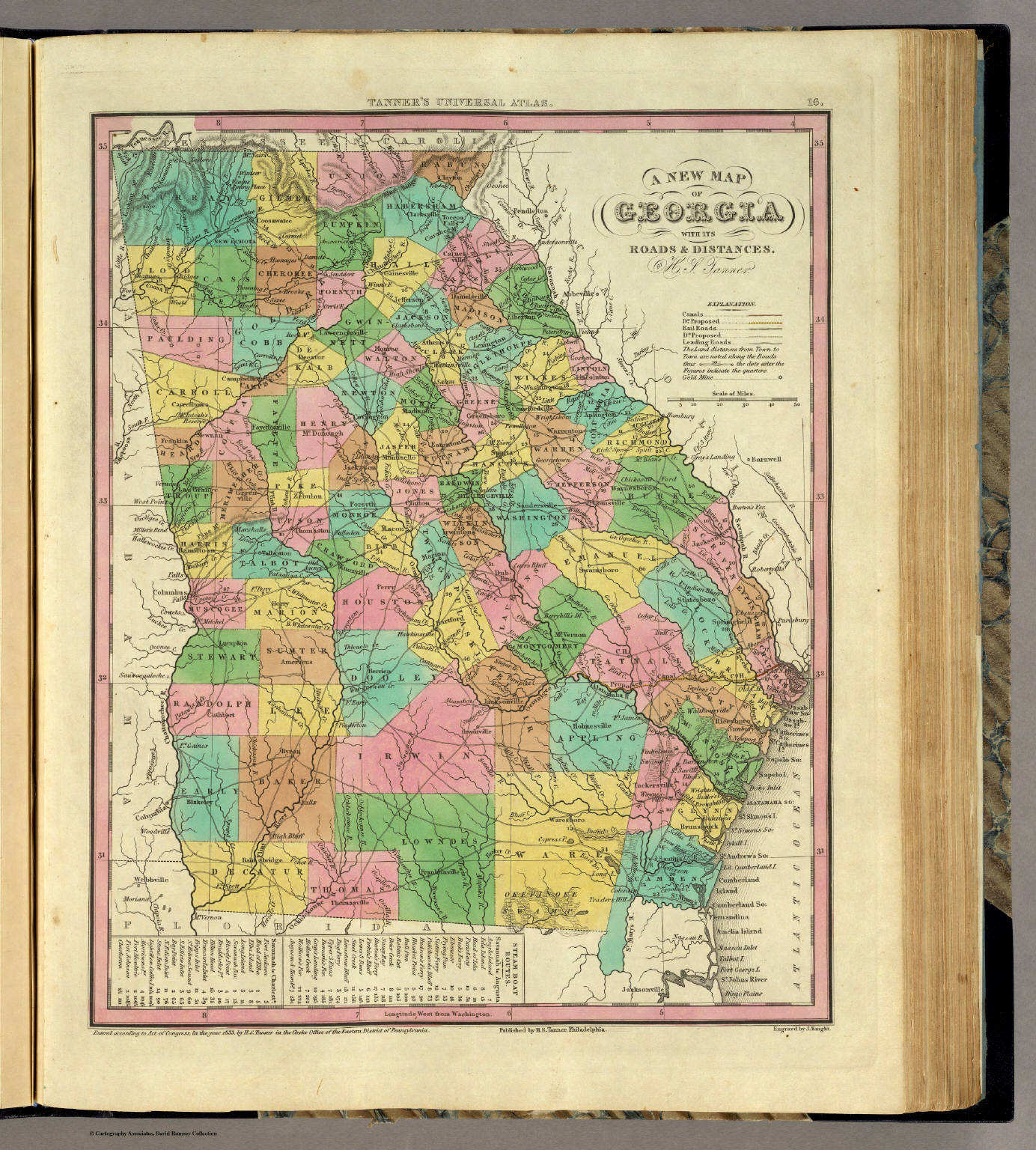 Tanner's Universal Atlas (1836)
16. A New Map of Georgia with its Roads & Distances
Georgia
David Rumsey Map Collection
Meyer's Großer Hand-Atlas
147. Neueste Karte von Georgia mit seinen Strassen, ... (1845)
Georgia
David Rumsey Map Collection
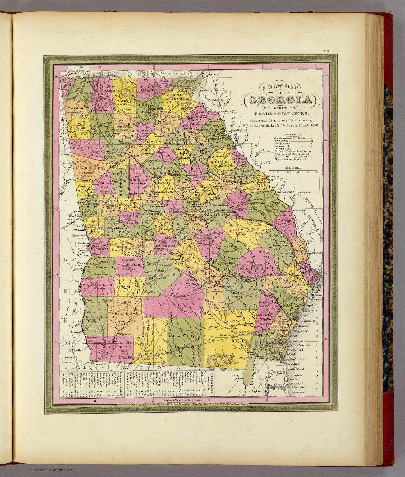 Mitchell's Universal Atlas (1846)
20. A New Map of Georgia with its Roads & Distances
Georgia
David Rumsey Map Collection
 Meyer's Großer Hand-Atlas
149. Neueste Karte von Alabama mit seinen Canaelen, ... (1845)
Alabama
David Rumsey Map Collection
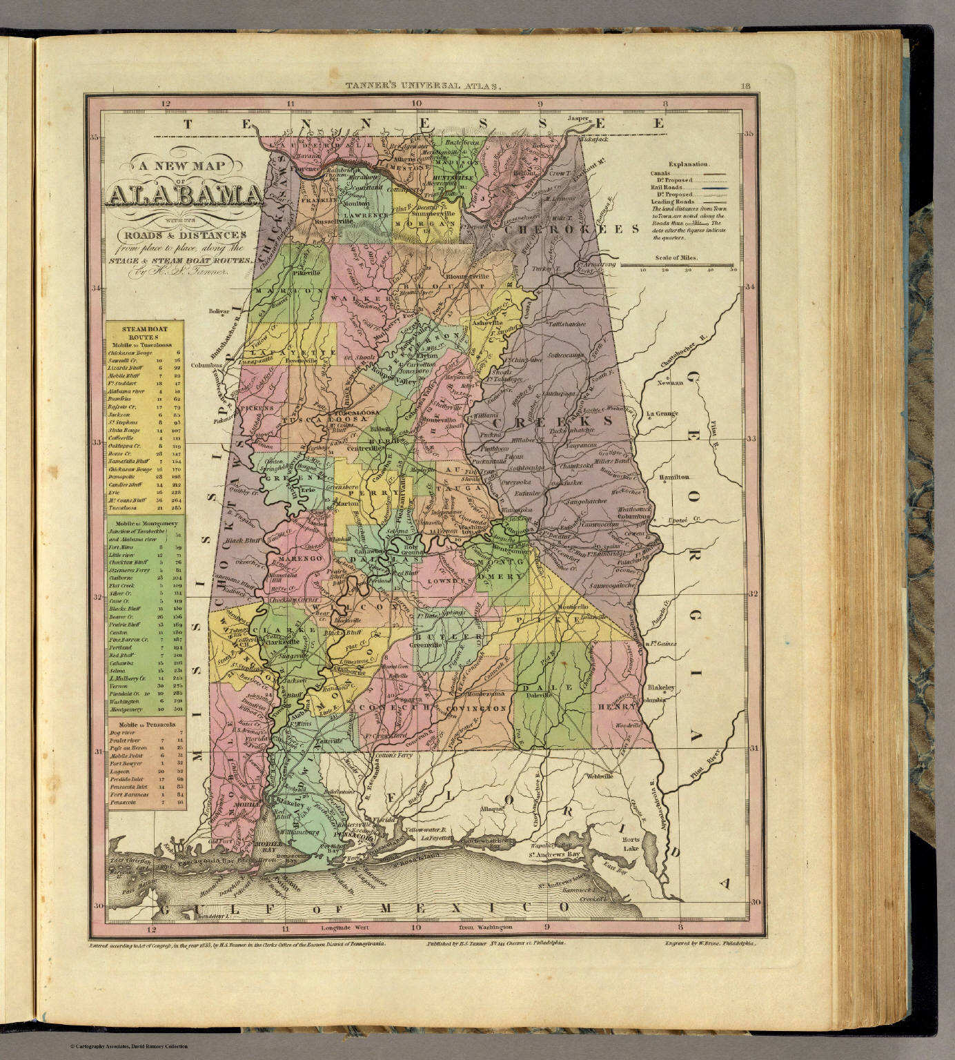 Tanner's Universal Atlas (1836)
18. A New Map of Alabama with its Roads ...
Alabama
David Rumsey Map Collection
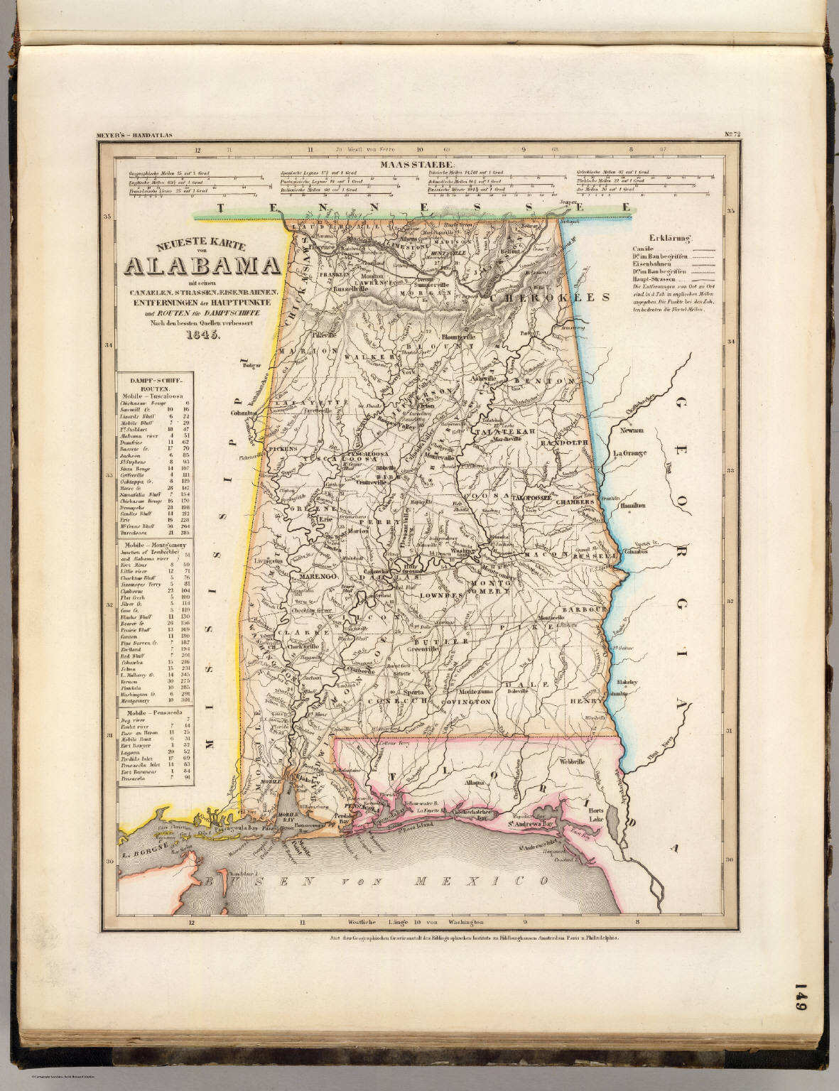
Meyer's Großer Hand-Atlas
149. Neueste Karte von Alabama mit seinen Canaelen, ... (1845)
Alabama
David Rumsey Map Collection
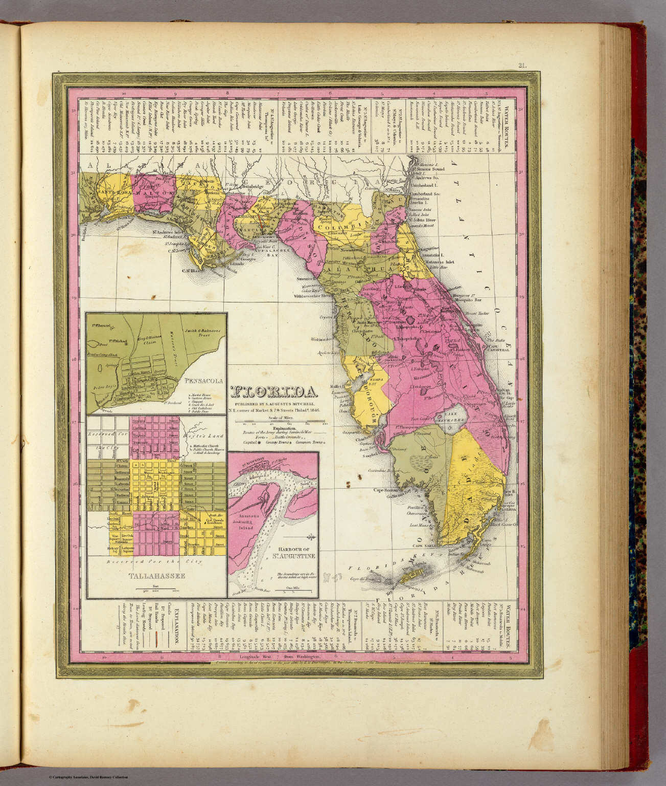
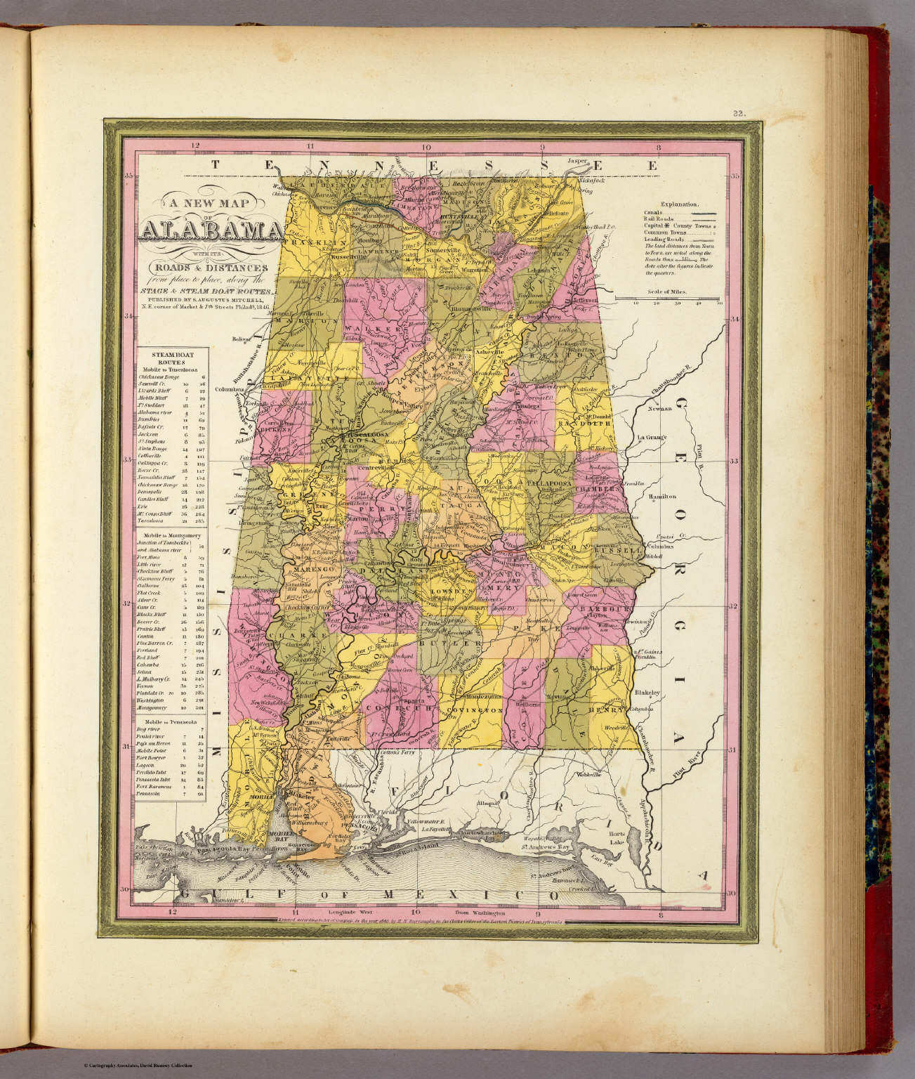 Mitchell's Universal Atlas (1846)
22. A New Map of Alabama with its Roads ...
Alabama
David Rumsey Map Collection
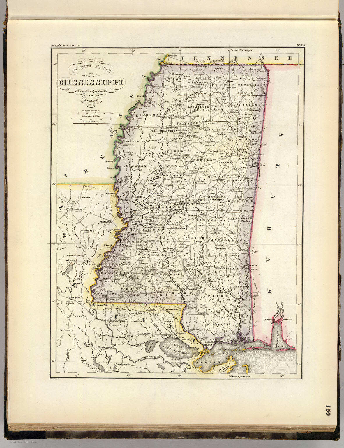 Meyer's Großer Hand-Atlas
150. Neueste Karte von Mississippi (1852)
Mississippi
David Rumsey Map Collection
 Tanner's Universal Atlas (1836)
19. A New Map of Mississippi with its Roads ...
Mississippi
David Rumsey Map Collection
Meyer's Großer Hand-Atlas
150. Neueste Karte von Mississippi (1852)
Mississippi
David Rumsey Map Collection
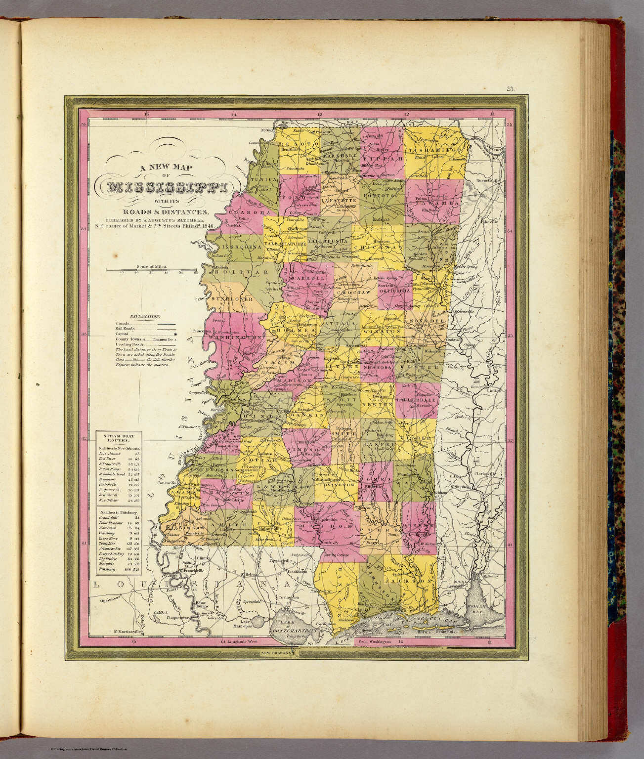 Mitchell's Universal Atlas (1846)
23. A New Map of Mississippi with its Roads & Distances
Mississippi
David Rumsey Map Collection
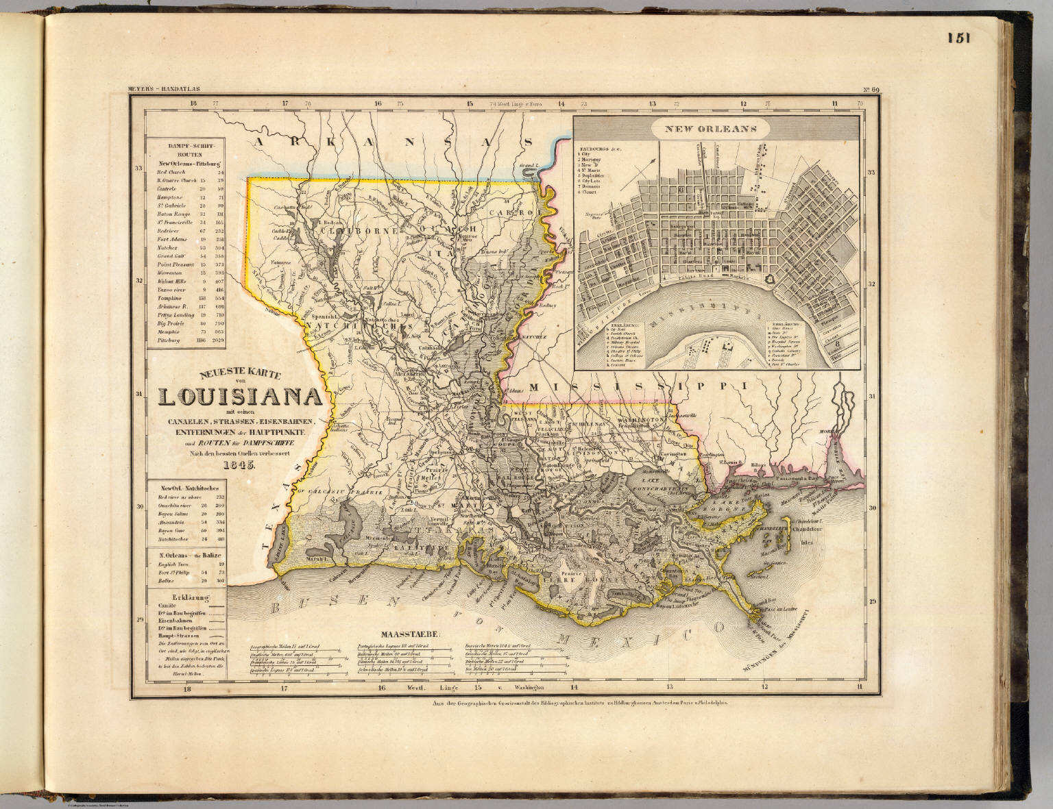 Meyer's Großer Hand-Atlas
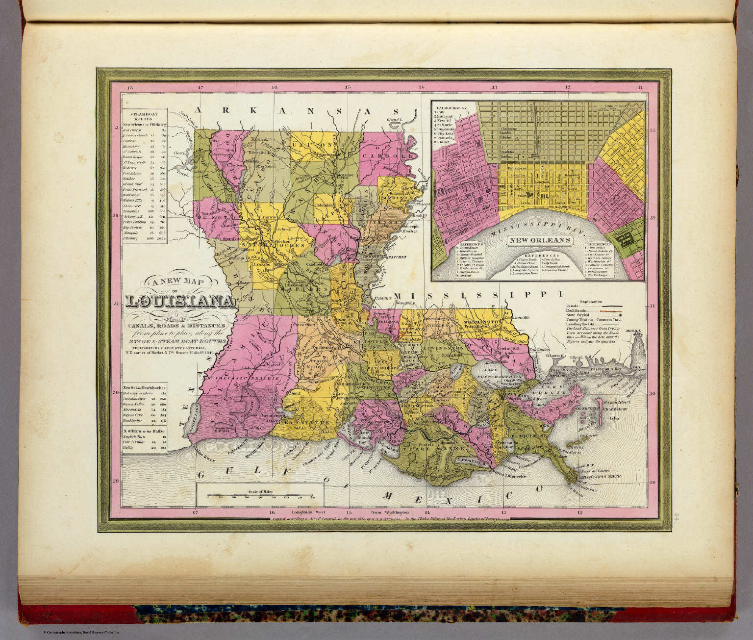
151. Neueste Karte von Louisiana mit seinen Canaelen, ... (1845)
Louisiana
David Rumsey Map Collection
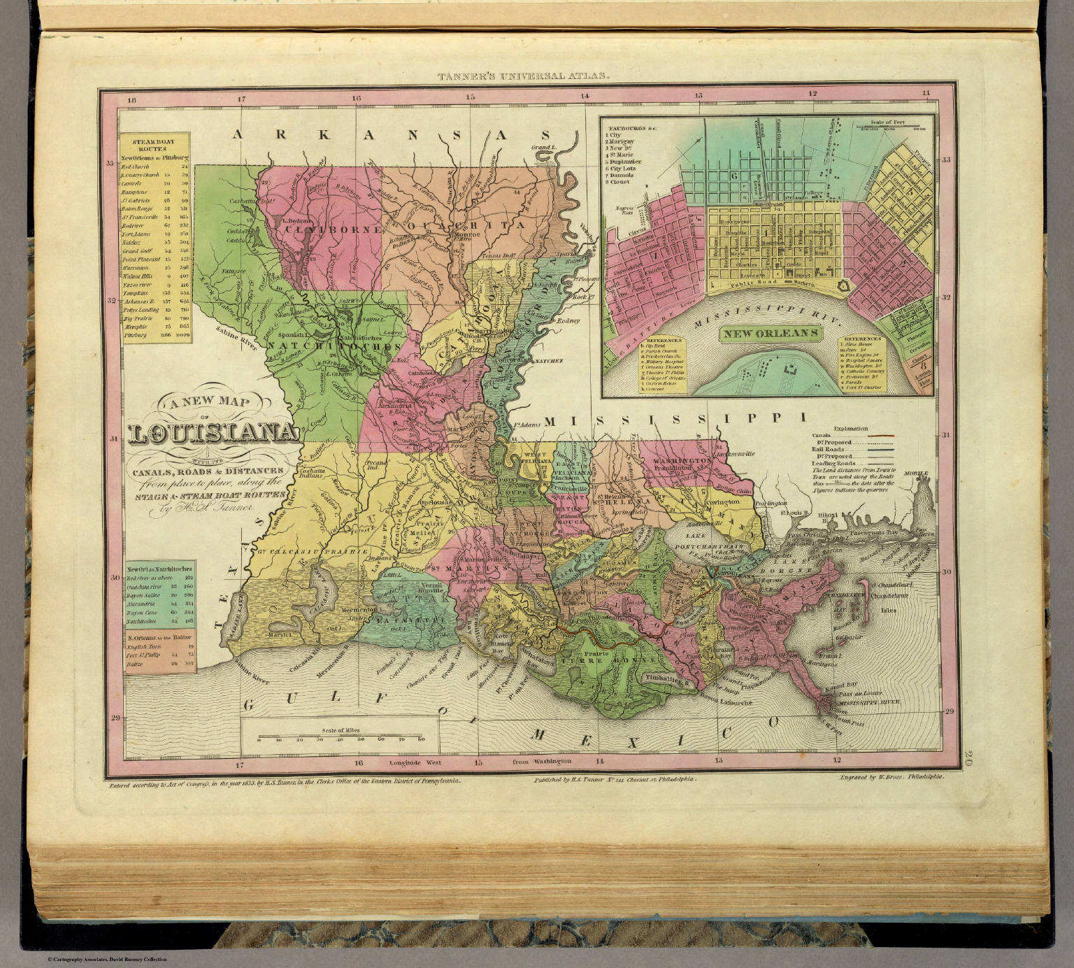 Tanner's Universal Atlas (1836)
20. A New Map of Louisiana with its Canals, ...
Louisiana
David Rumsey Map Collection
Meyer's Großer Hand-Atlas
151. Neueste Karte von Louisiana mit seinen Canaelen, ... (1845)
Louisiana
David Rumsey Map Collection
 Mitchell's Universal Atlas (1846)
24. A New Map of Louisiana with its Canals, ...
Louisiana
David Rumsey Map Collection
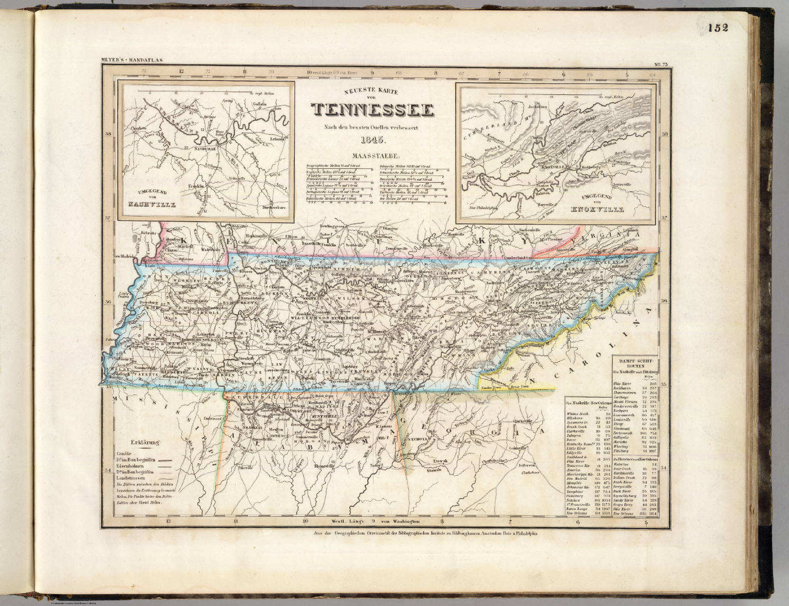 Meyer's Großer Hand-Atlas
152. Neueste Karte von Tennessee (1845)
Tennessee
David Rumsey Map Collection
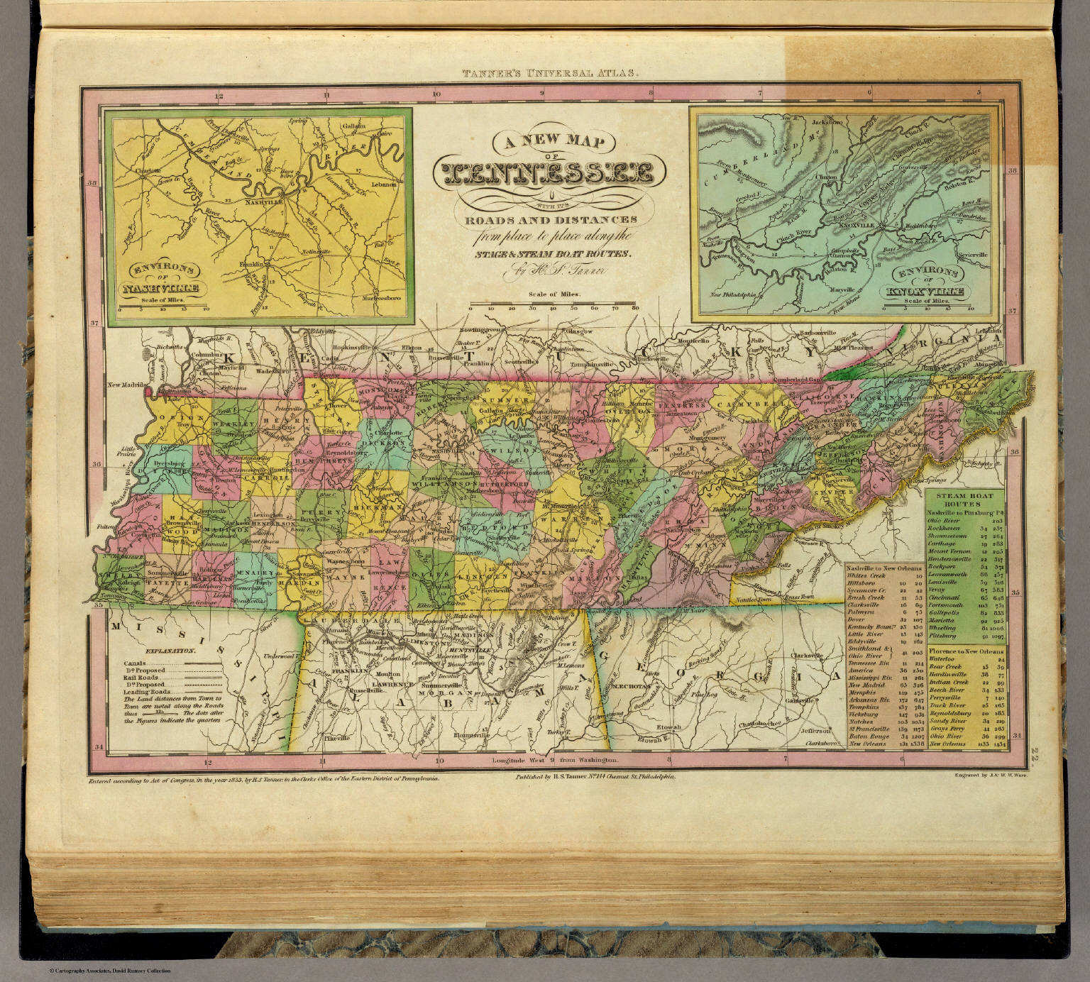 Tanner's Universal Atlas (1836)
22. A New Map of Tennessee with its Roads ...
Tennessee
David Rumsey Map Collection
Meyer's Großer Hand-Atlas
152. Neueste Karte von Tennessee (1845)
Tennessee
David Rumsey Map Collection
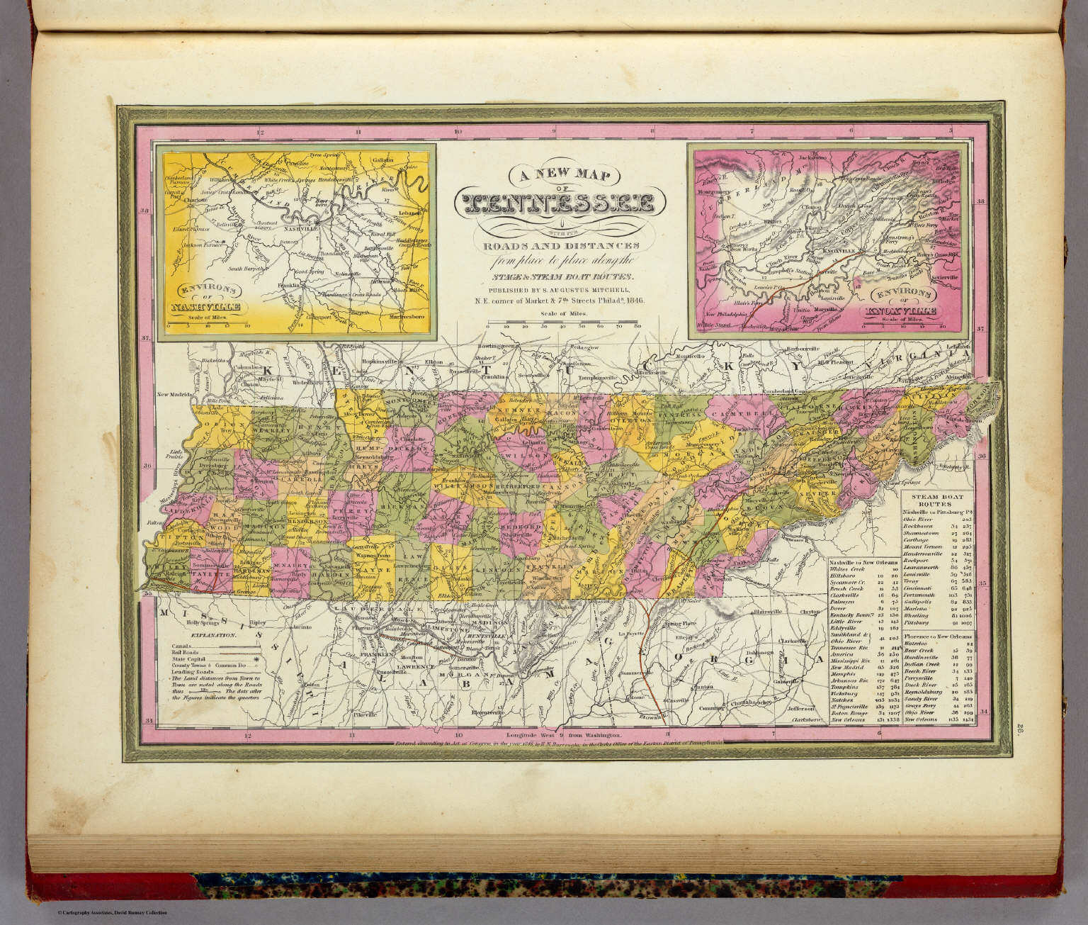 Mitchell's Universal Atlas (1846)
26. A New Map of Tennessee with its Roads ...
Tennessee
David Rumsey Map Collection
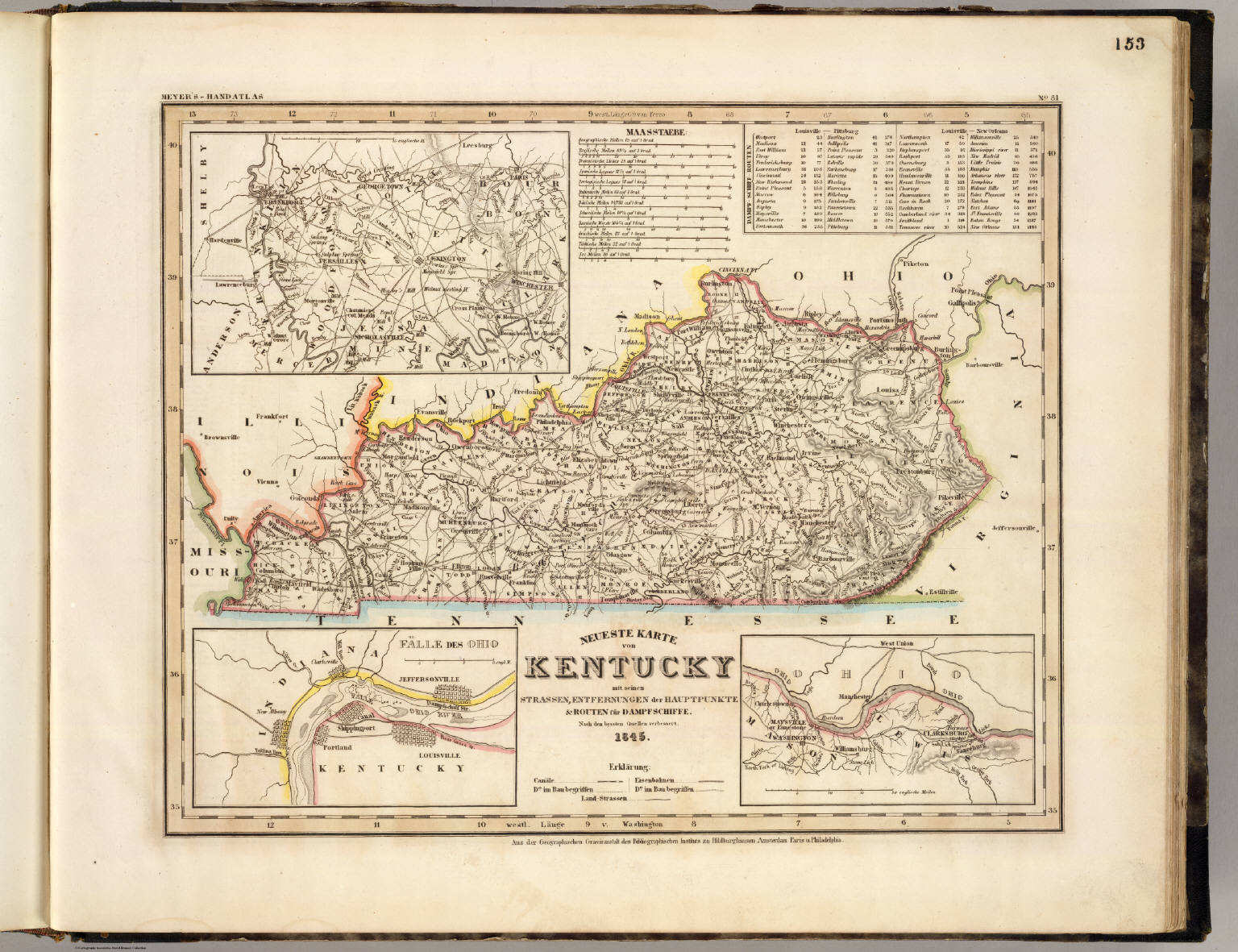 Meyer's Großer Hand-Atlas
153. Neueste Karte von Kentucky mit seinen Strassen, ... (1845)
Kentucky
David Rumsey Map Collection
 Tanner's Universal Atlas (1836)
23. A New Map of Kentucky with its Roads ...
Kentucky
David Rumsey Map Collection
Meyer's Großer Hand-Atlas
153. Neueste Karte von Kentucky mit seinen Strassen, ... (1845)
Kentucky
David Rumsey Map Collection
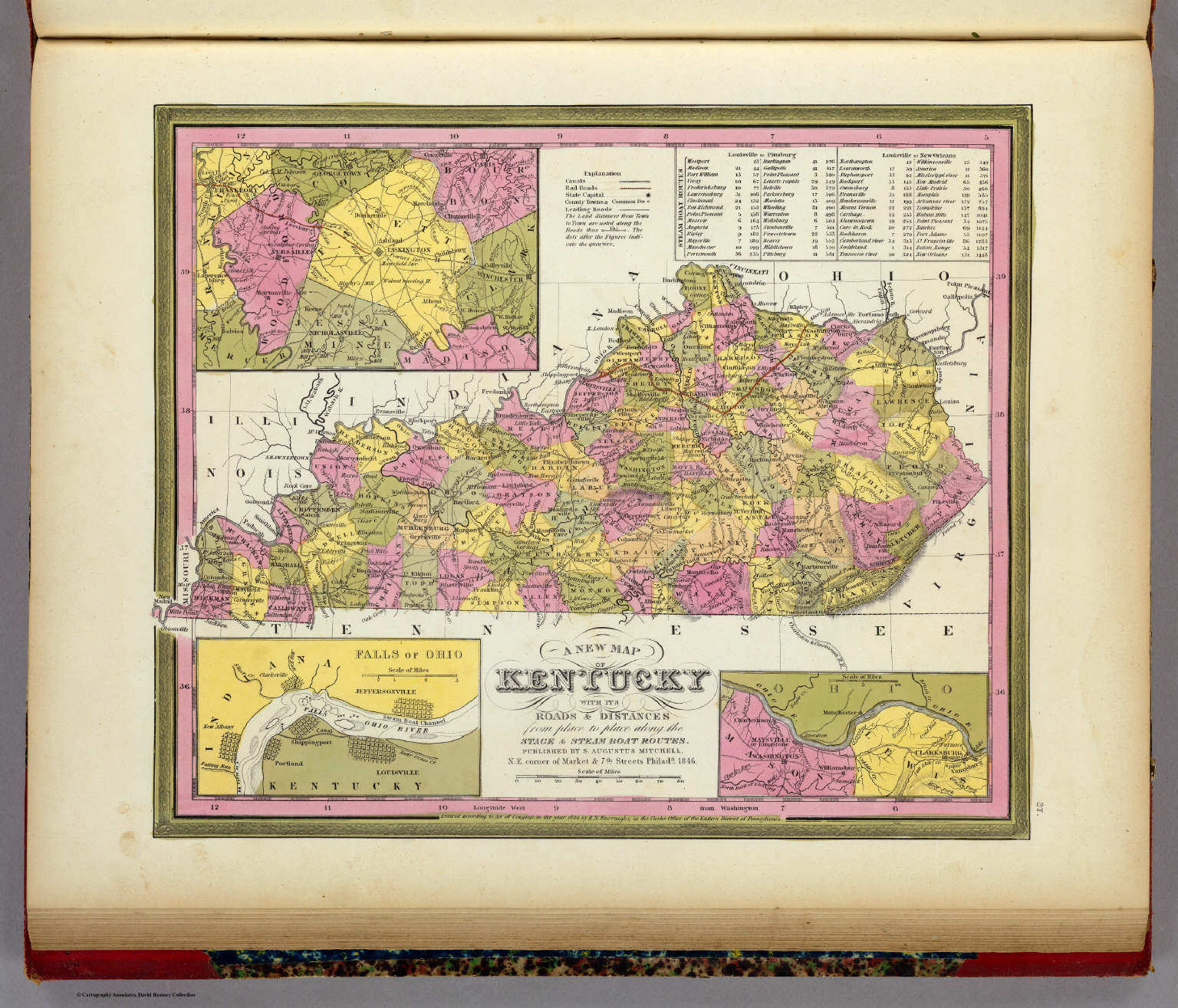 Mitchell's Universal Atlas (1846)
27. A New Map of Kentucky with its Roads ...
Kentucky
David Rumsey Map Collection
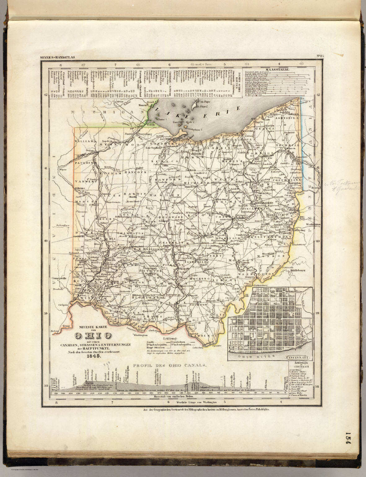 Meyer's Großer Hand-Atlas
154. Neueste Karte von Ohio mit seinen Canaelen, ... (1845)
Ohio
David Rumsey Map Collection
 Tanner's Universal Atlas (1836)
24. A New Map of Ohio with its Canals, ...
Ohio
David Rumsey Map Collection
Meyer's Großer Hand-Atlas
154. Neueste Karte von Ohio mit seinen Canaelen, ... (1845)
Ohio
David Rumsey Map Collection
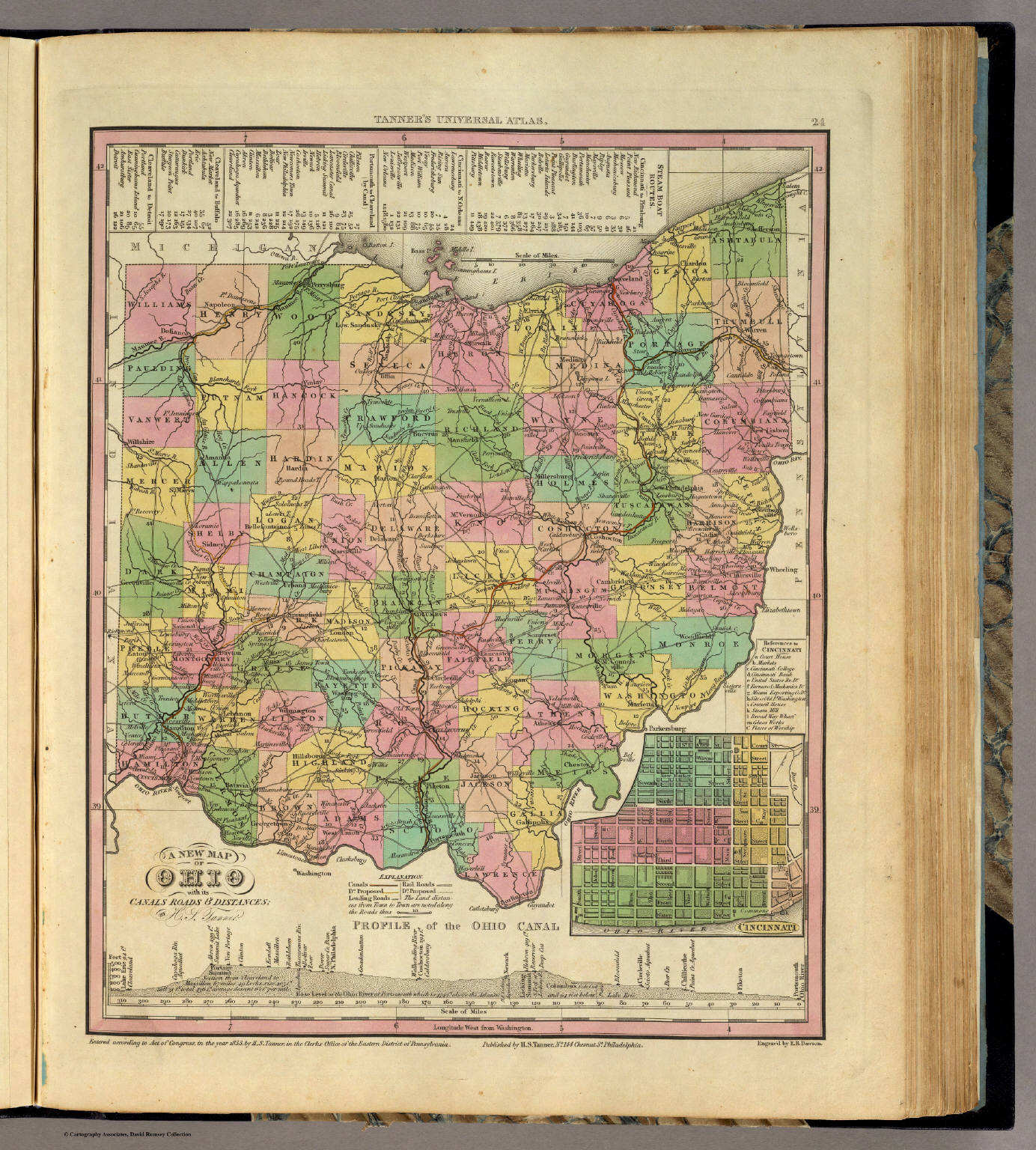
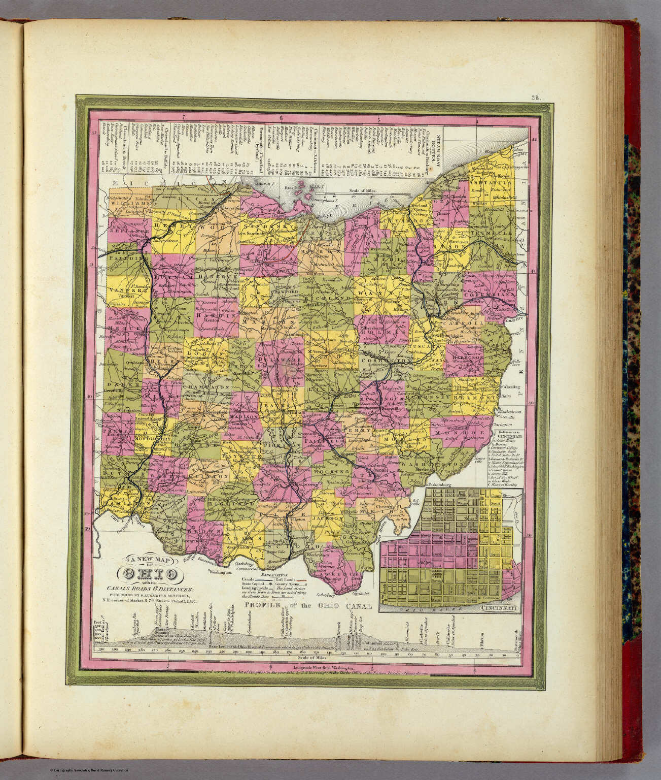 Mitchell's Universal Atlas (1846)
28. A New Map of Ohio with its Canals ...
Ohio
David Rumsey Map Collection
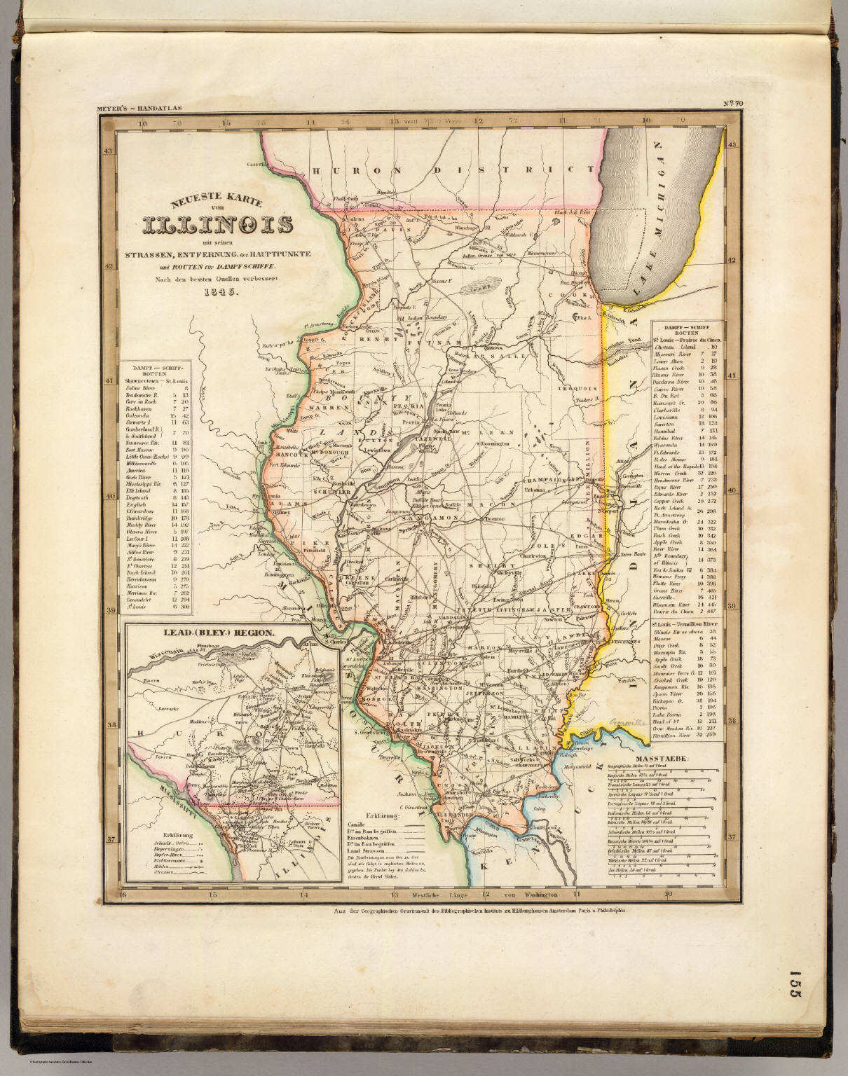 Meyer's Großer Hand-Atlas
155. Neueste Karte von Illinois mit seinen Strassen, ... (1845)
Illinois
David Rumsey Map Collection
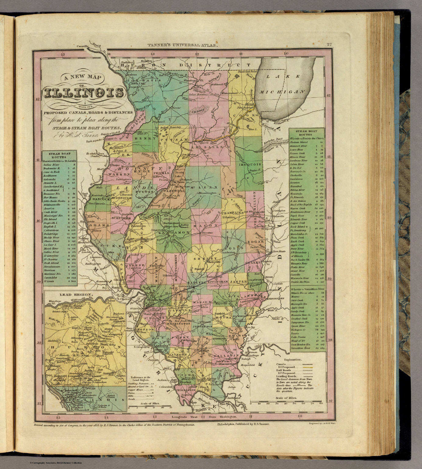 Tanner's Universal Atlas (1836)
27. A New Map of Illinois with its Proposed ...
Illinois
David Rumsey Map Collection
Meyer's Großer Hand-Atlas
155. Neueste Karte von Illinois mit seinen Strassen, ... (1845)
Illinois
David Rumsey Map Collection
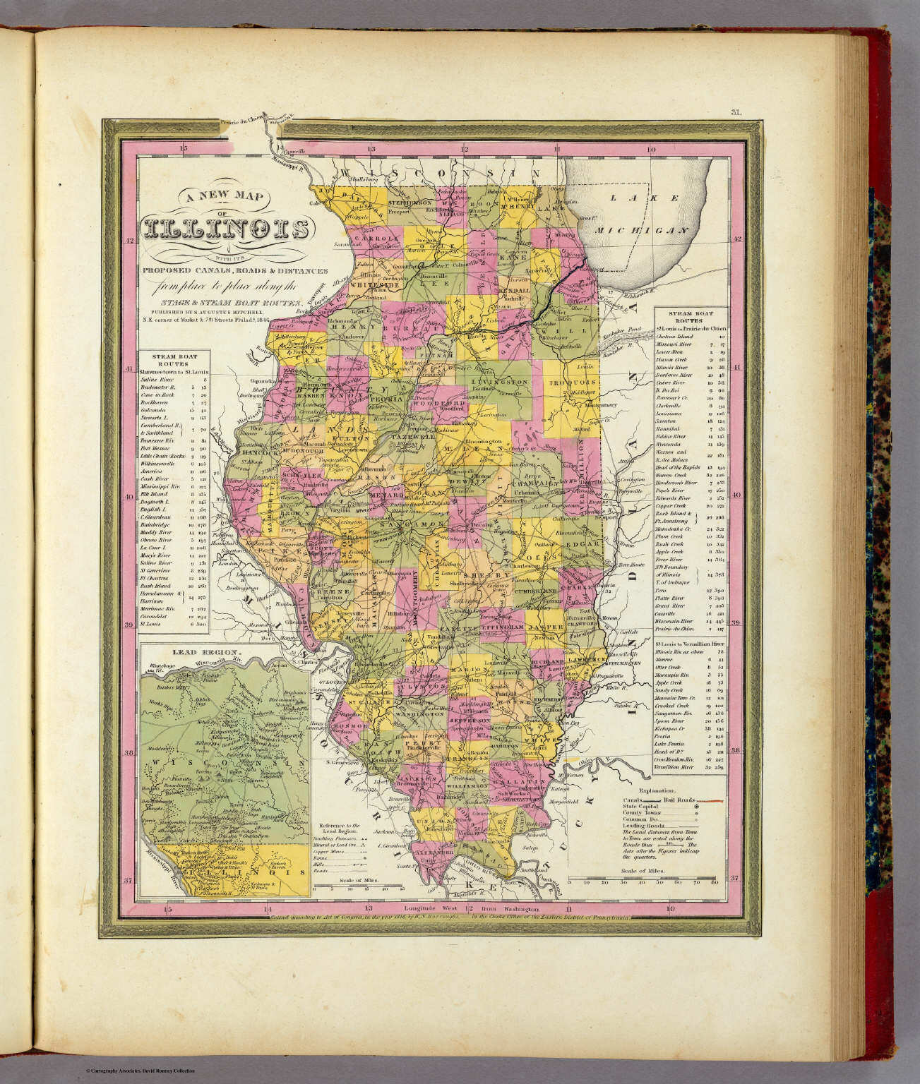 Mitchell's Universal Atlas (1846)
31. A New Map of Illinois with its Proposed ...
Illinois
David Rumsey Map Collection
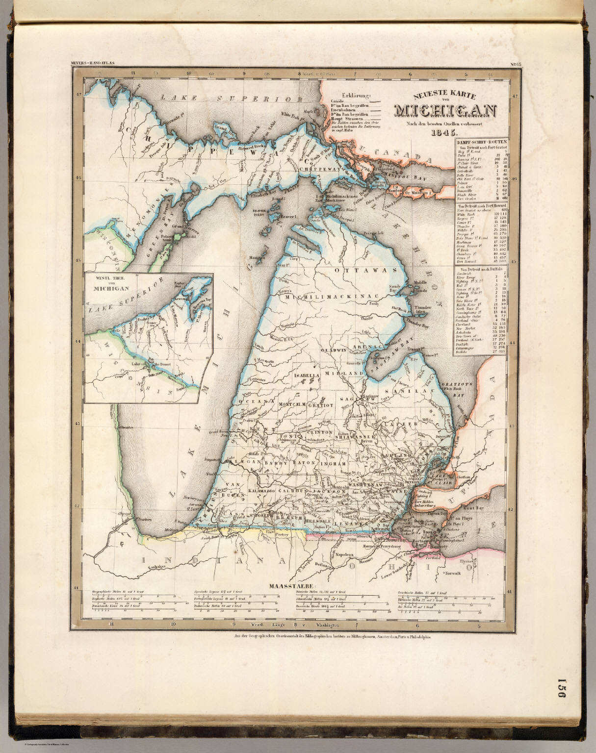 Meyer's Großer Hand-Atlas
156. Neueste Karte von Michigan (1845)
Michigan
David Rumsey Map Collection
 Tanner's Universal Atlas (1836)
25. A New Map of Michigan with its Canals, ...
Michigan
David Rumsey Map Collection
Meyer's Großer Hand-Atlas
156. Neueste Karte von Michigan (1845)
Michigan
David Rumsey Map Collection
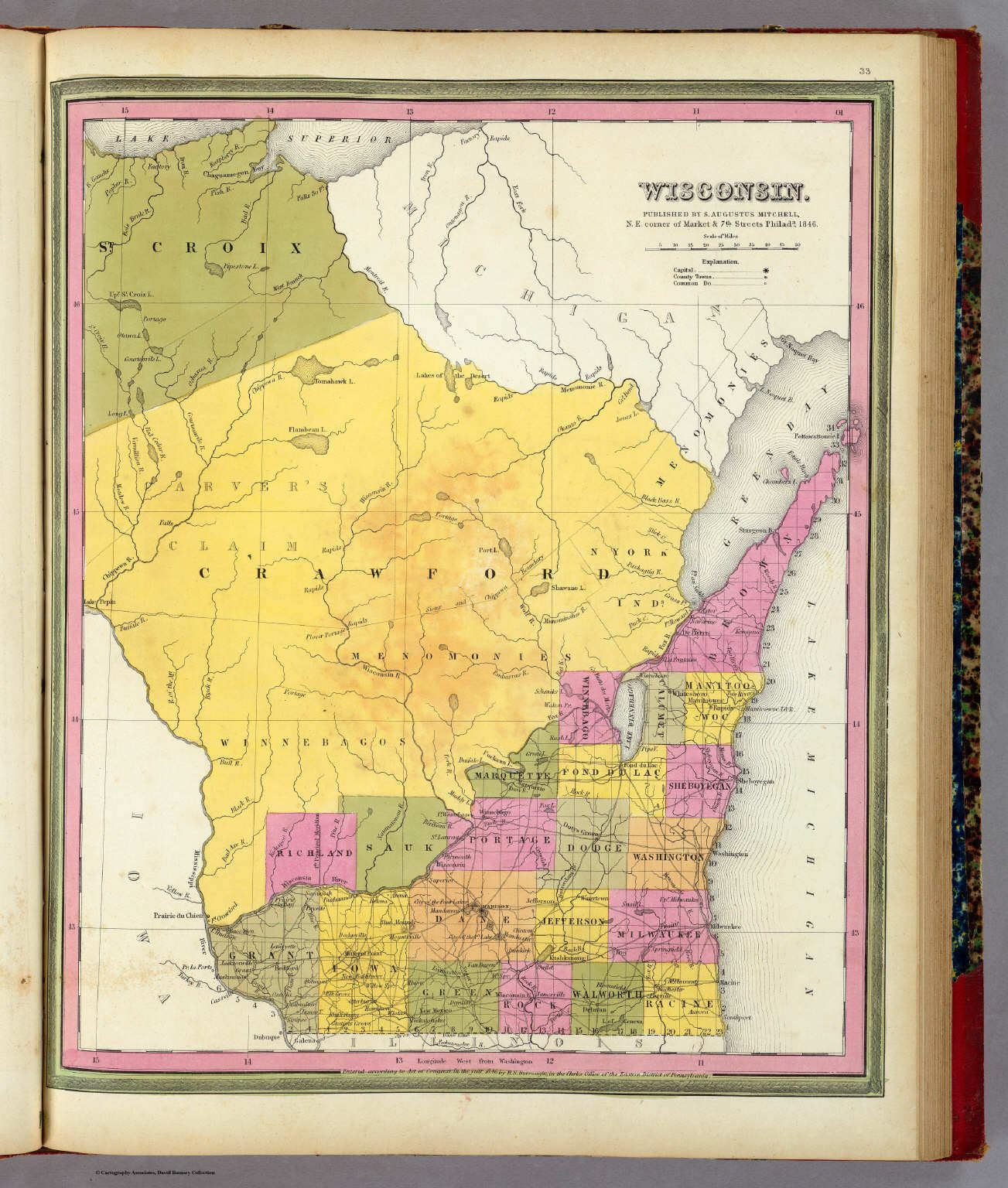
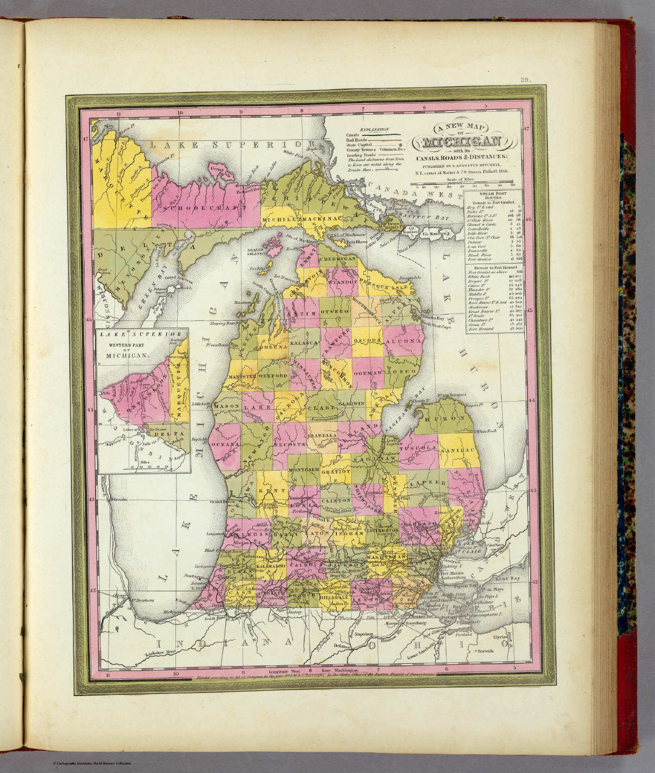 Mitchell's Universal Atlas (1846)
29. A New Map of Michigan with its Canals ...
Michigan
David Rumsey Map Collection
 Meyer's Großer Hand-Atlas
geen overeenkomstige kaart / no corresponding map
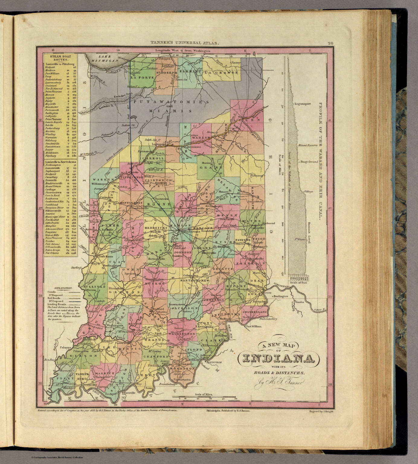 Tanner's Universal Atlas (1836)
26. New Map of Indiana with its Roads ...
Indiana
David Rumsey Map Collection
Meyer's Großer Hand-Atlas
geen overeenkomstige kaart / no corresponding map
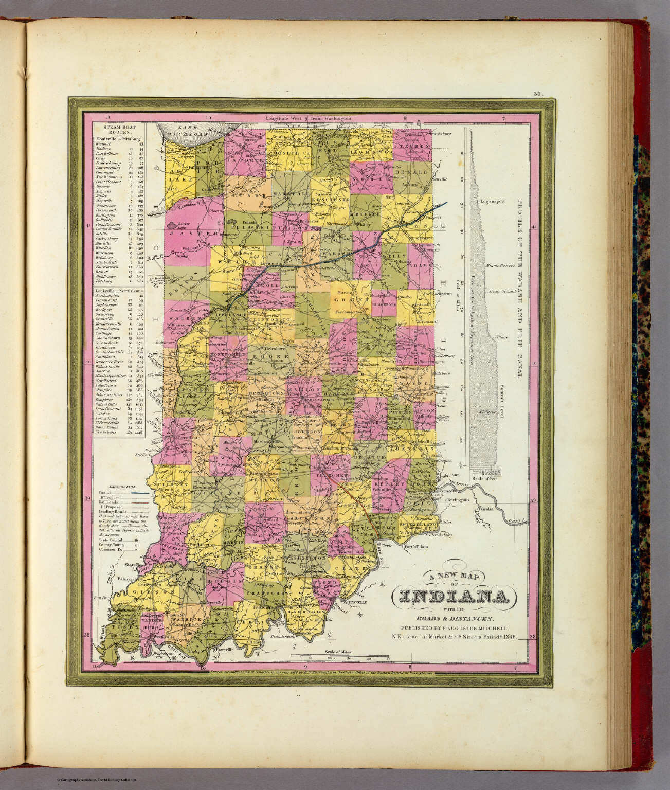 Mitchell's Universal Atlas (1846)
30. A New Map of Indiana with its Roads ...
Indiana
David Rumsey Map Collection
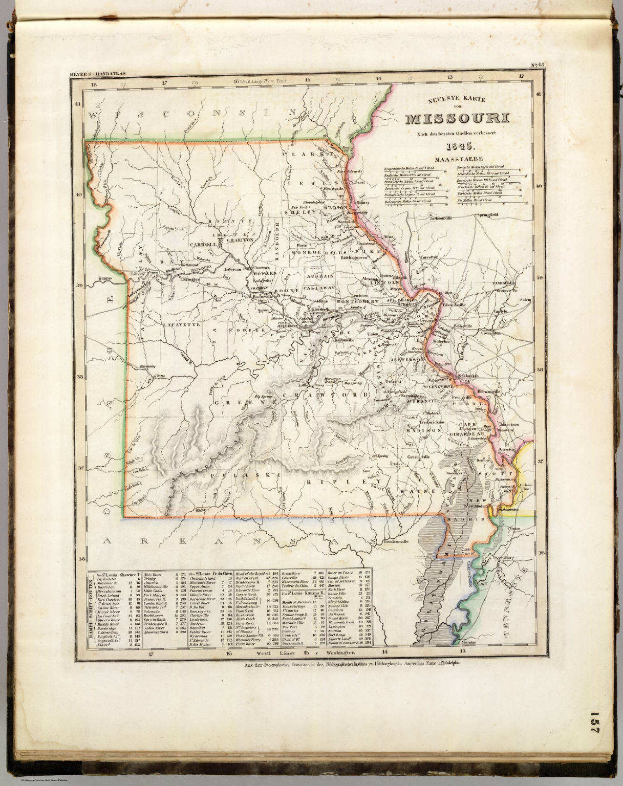 Meyer's Großer Hand-Atlas
157. Neueste Karte von Missouri (1845)
Missouri
David Rumsey Map Collection
 Tanner's Universal Atlas (1836)
28. A New Map of Missouri with its Roads ...
Missouri
David Rumsey Map Collection
Meyer's Großer Hand-Atlas
157. Neueste Karte von Missouri (1845)
Missouri
David Rumsey Map Collection
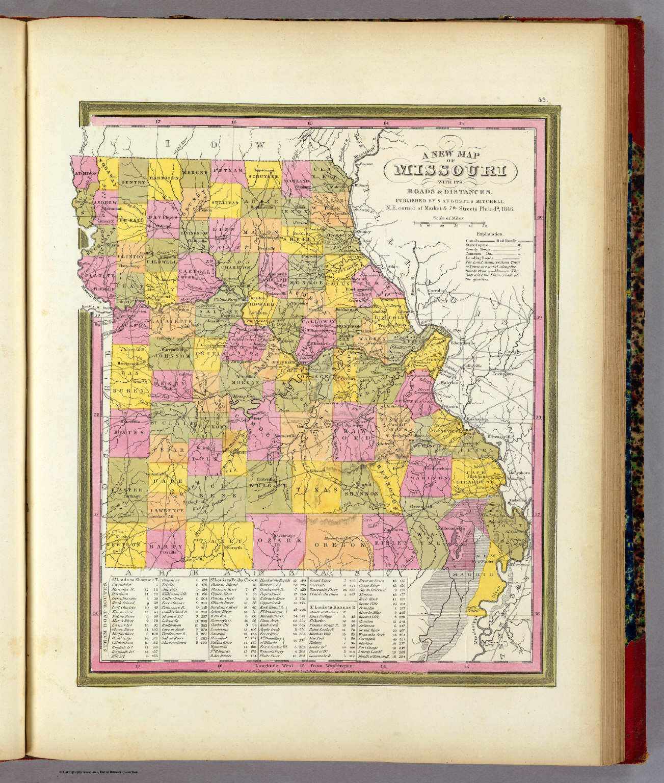 Mitchell's Universal Atlas (1846)
32. A New Map of Missouri with its Roads and Distances
Missouri
David Rumsey Map Collection
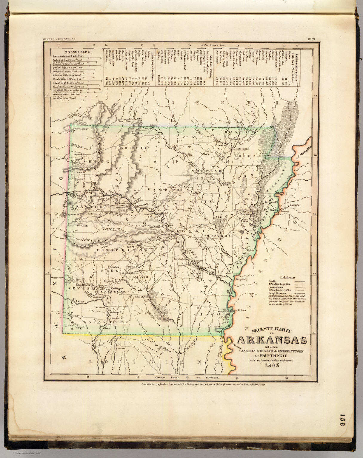 Meyer's Großer Hand-Atlas
158. Neueste Karte von Arkansas mit seinen Canaelen, ... (1845)
Arkansas
David Rumsey Map Collection
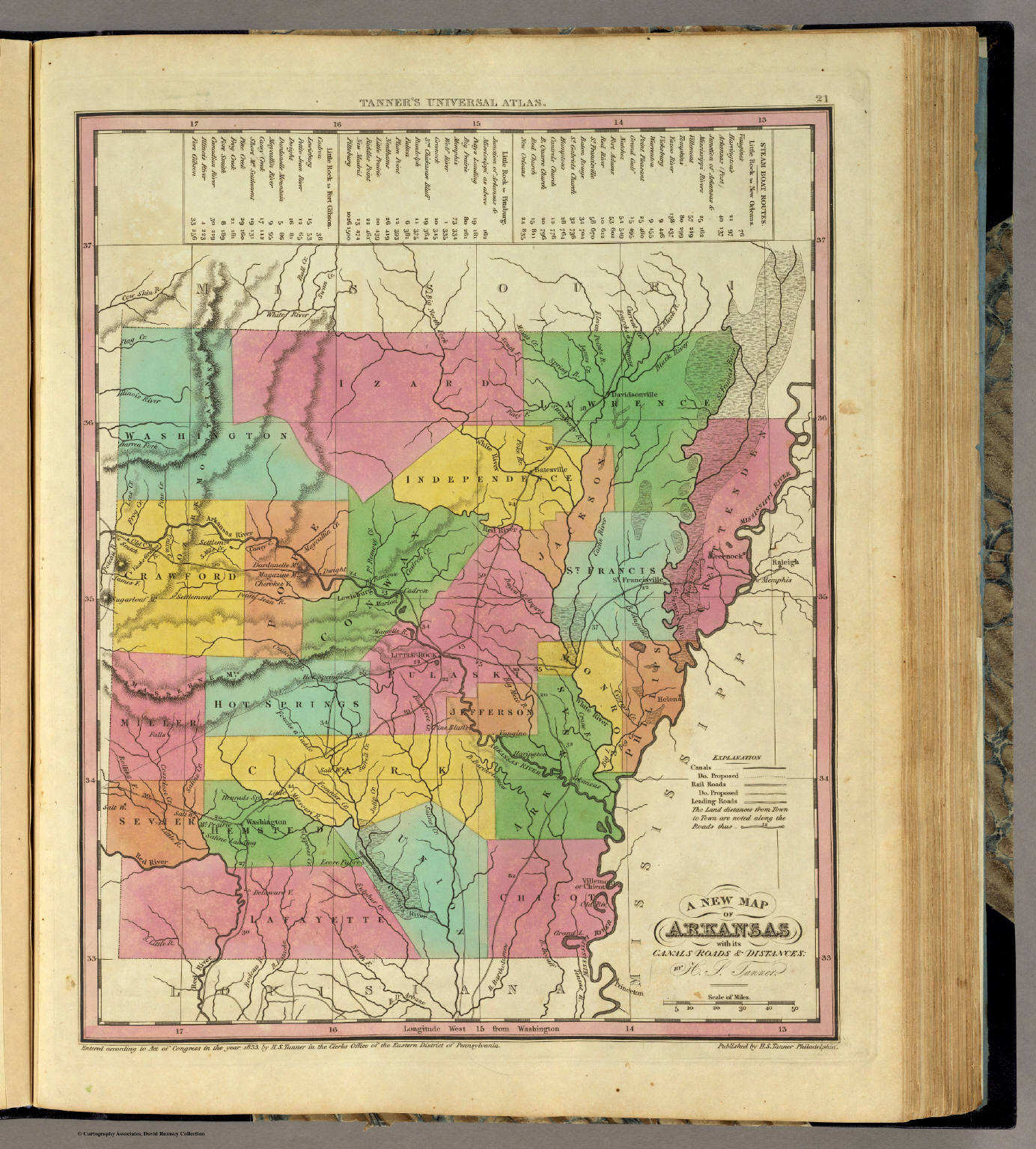 Tanner's Universal Atlas (1836)
21. A New Map of Arkansas with its Canals, ...
Arkansas
David Rumsey Map Collection
Meyer's Großer Hand-Atlas
158. Neueste Karte von Arkansas mit seinen Canaelen, ... (1845)
Arkansas
David Rumsey Map Collection
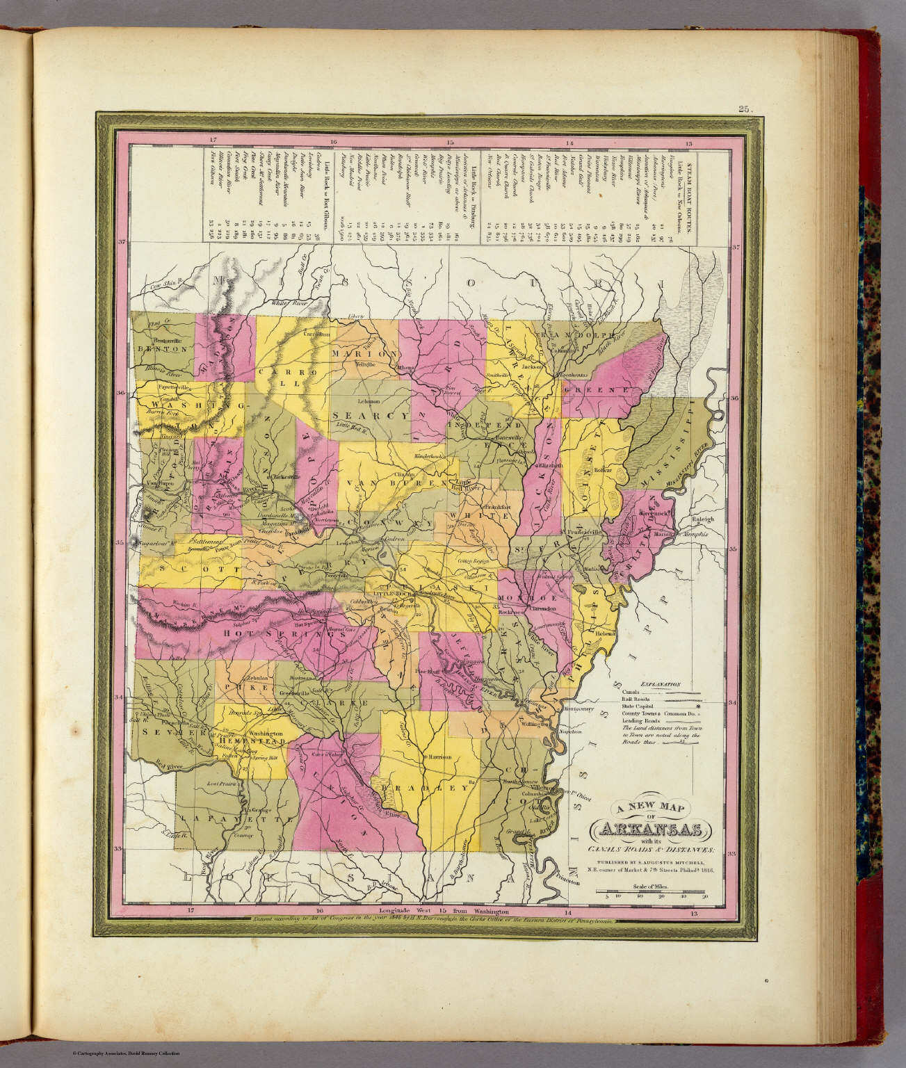 Mitchell's Universal Atlas (1846)
25. A New Map of Arkansas with its Canals, ...
Arkansas
David Rumsey Map Collection
 Tanner's Universal Atlas (1836)
geen overeenkomstige kaart / no corresponding map
 Tanner's Universal Atlas (1836)
geen overeenkomstige kaart / no corresponding map
 Tanner's Universal Atlas (1836)
geen overeenkomstige kaart / no corresponding map
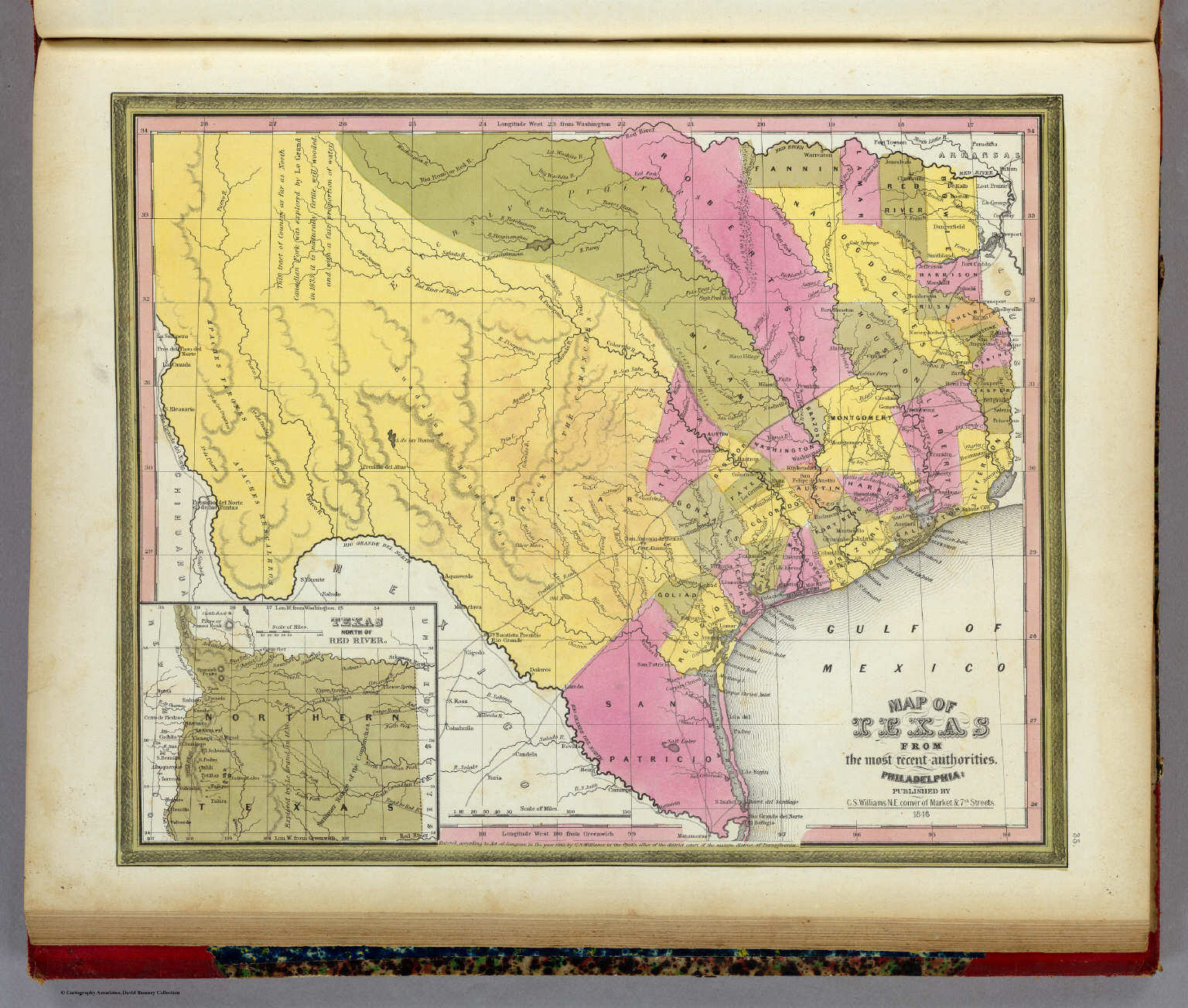 Mitchell's Universal Atlas (1846)
35. Map of Texas from the most recent authorities
Texas
David Rumsey Map Collection
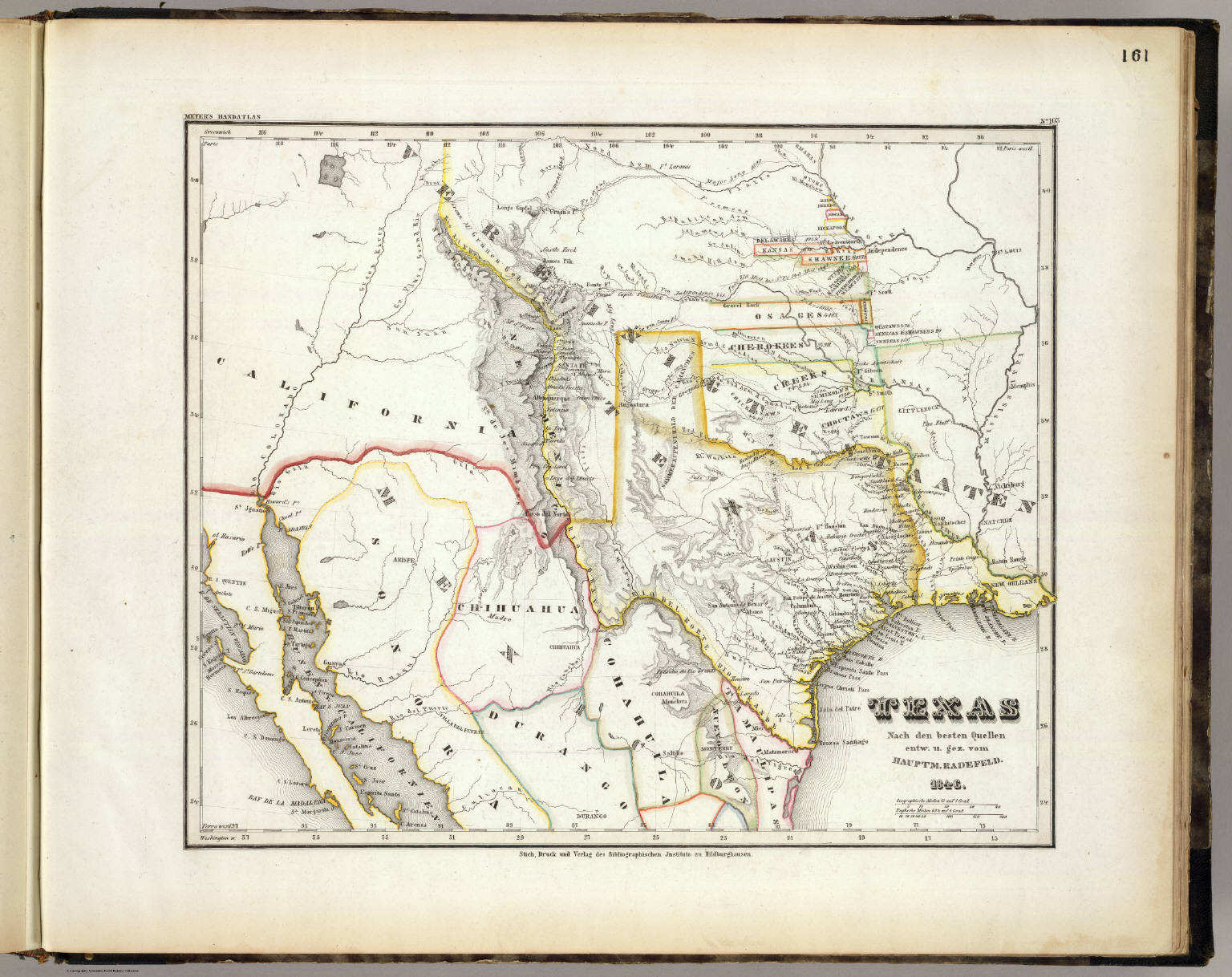
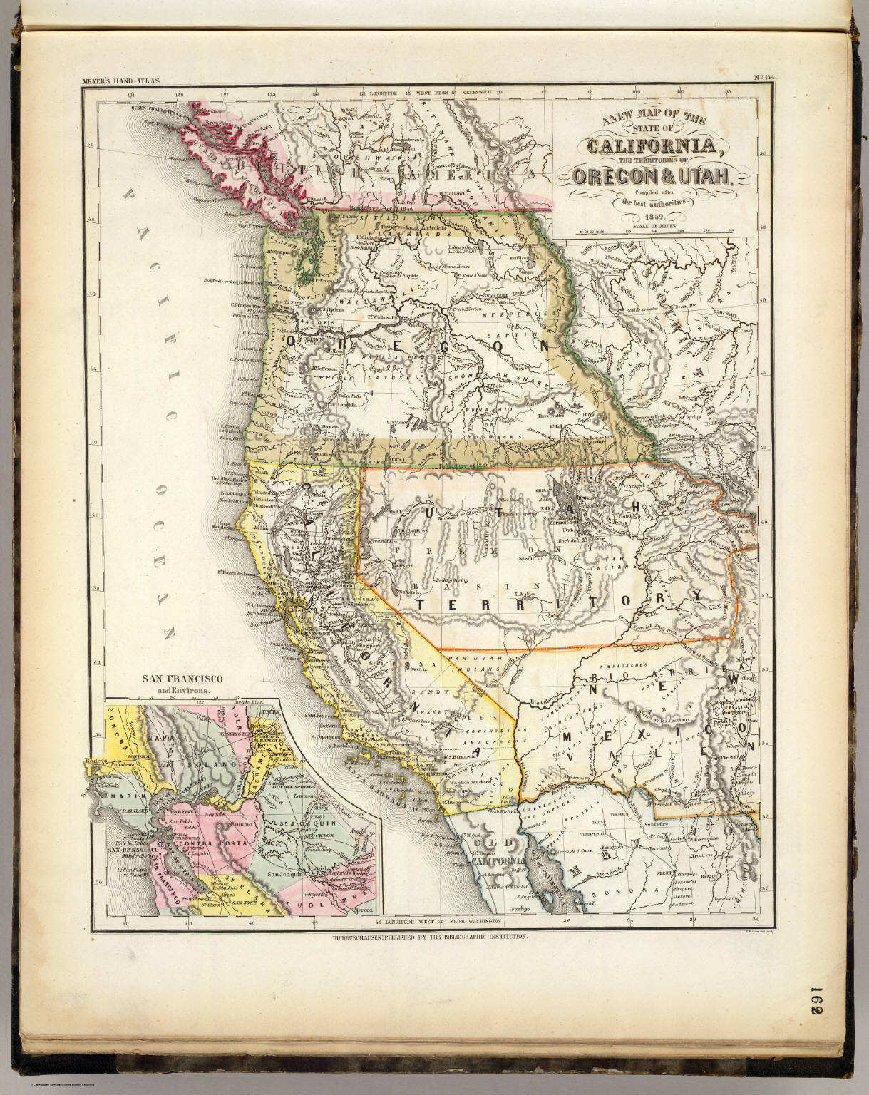 Meyer's Großer Hand-Atlas
162. A new map of the State of California, the Territories of Oregon & Utah (1852)
California, Oregon, Utah
David Rumsey Map Collection
Tanner's Universal Atlas (1836)
geen overeenkomstige kaart / no corresponding map
Meyer's Großer Hand-Atlas
162. A new map of the State of California, the Territories of Oregon & Utah (1852)
California, Oregon, Utah
David Rumsey Map Collection
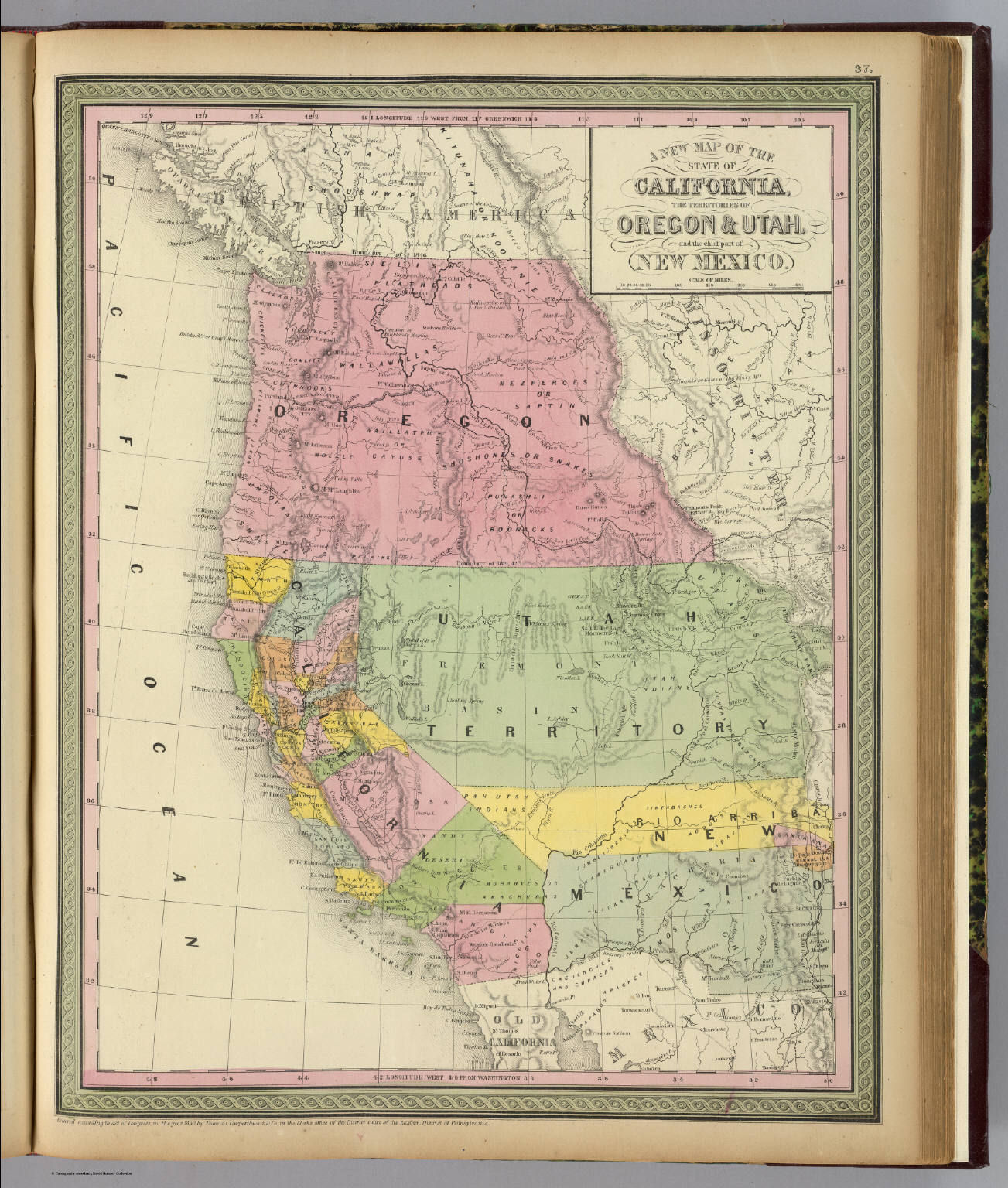 Mitchell's Universal Atlas (1852)
37. A new map of the State of California, the Territories of Oregon & Utah, and the chief part of New Mexico
California, Oregon, Utah, New Mexico
David Rumsey Map Collection
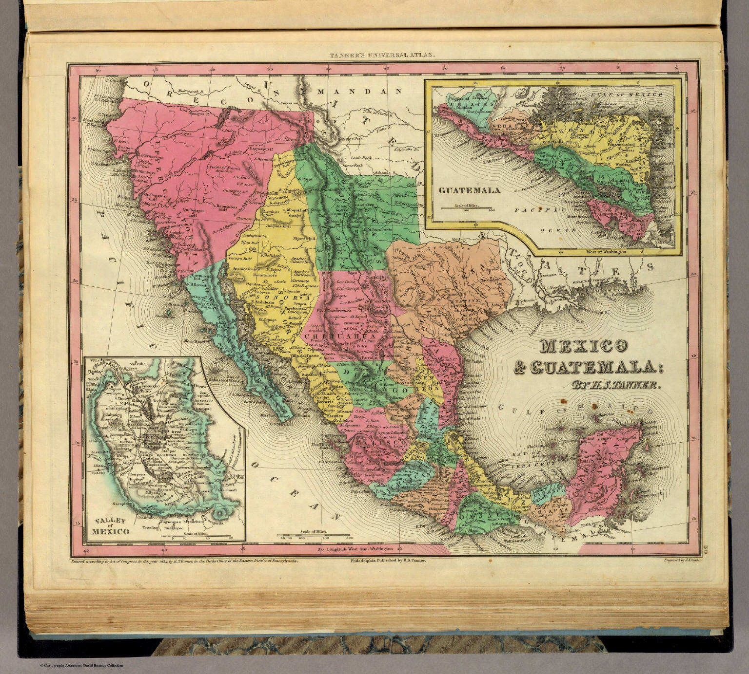 Tanner's Universal Atlas (1836)
30. Mexico & Guatemala
Mexico en Guatemala
David Rumsey Map Collection
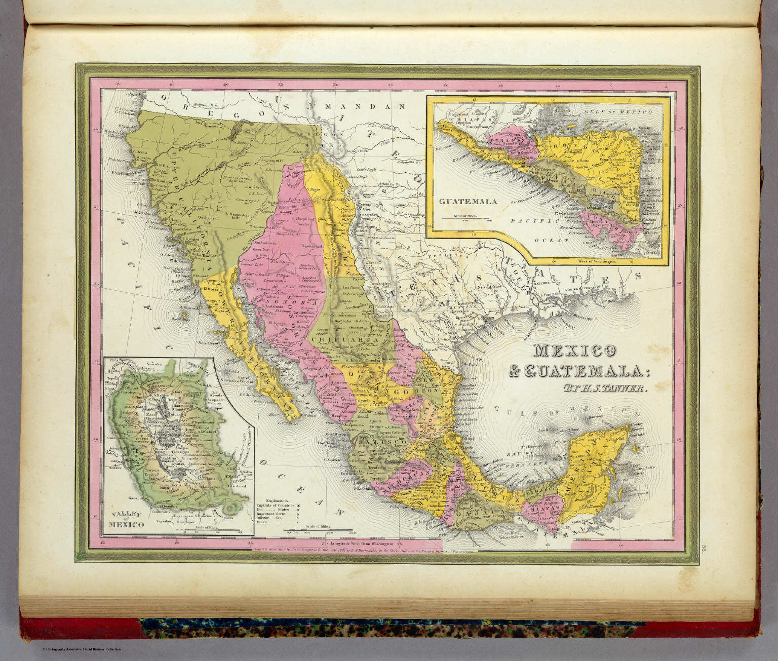 Mitchell's Universal Atlas (1846)
36. Mexico & Guatemala
Mexico en Guatemala
David Rumsey Map Collection
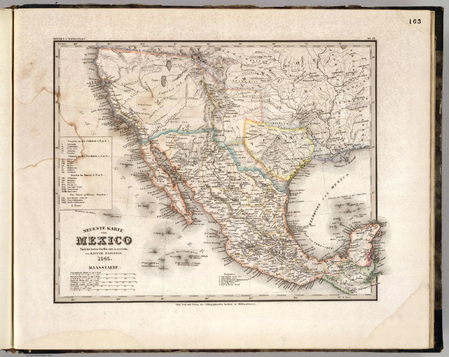
 Meyer's Großer Hand-Atlas
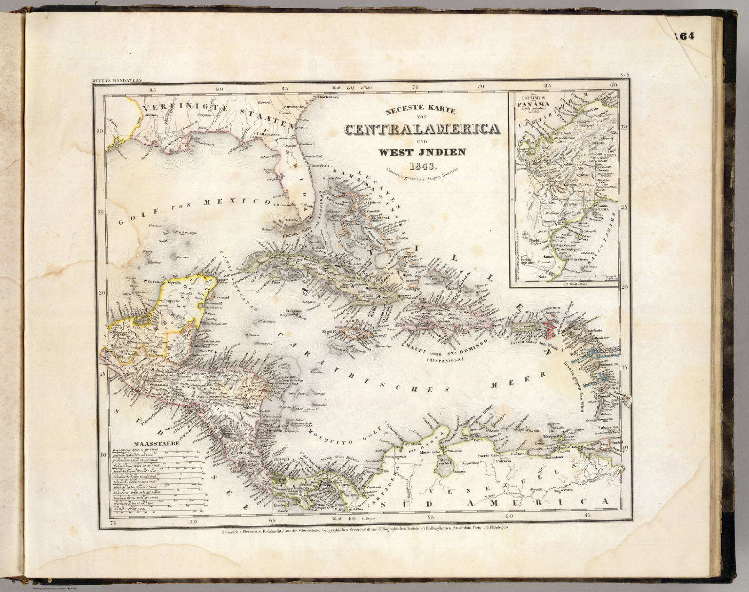
164. Neueste Karte von Centralamerica und West Jndien (1843)
Midden-Amerika en West-Indië / Central America and West Indies
David Rumsey Map Collection
 Meyer's Großer Hand-Atlas
164. Neueste Karte von Centralamerica und West Jndien (1843)
Midden-Amerika en West-Indië / Central America and West Indies
David Rumsey Map Collection
 Meyer's Großer Hand-Atlas
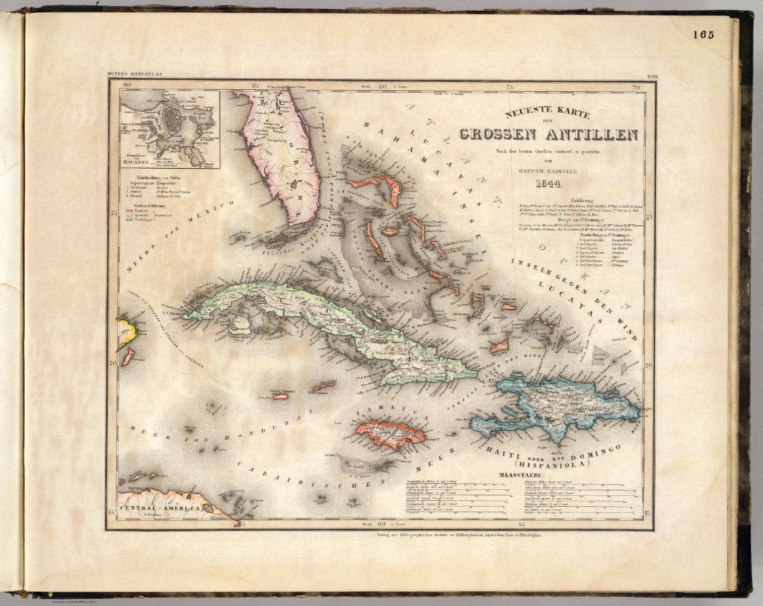
165. Neueste Karte der Grossen Antillen (1844)
De Grote Antillen / The Greater Antilles
David Rumsey Map Collection
Tanner's Universal Atlas (1836)
geen overeenkomstige kaart / no corresponding map
Meyer's Großer Hand-Atlas
165. Neueste Karte der Grossen Antillen (1844)
De Grote Antillen / The Greater Antilles
David Rumsey Map Collection
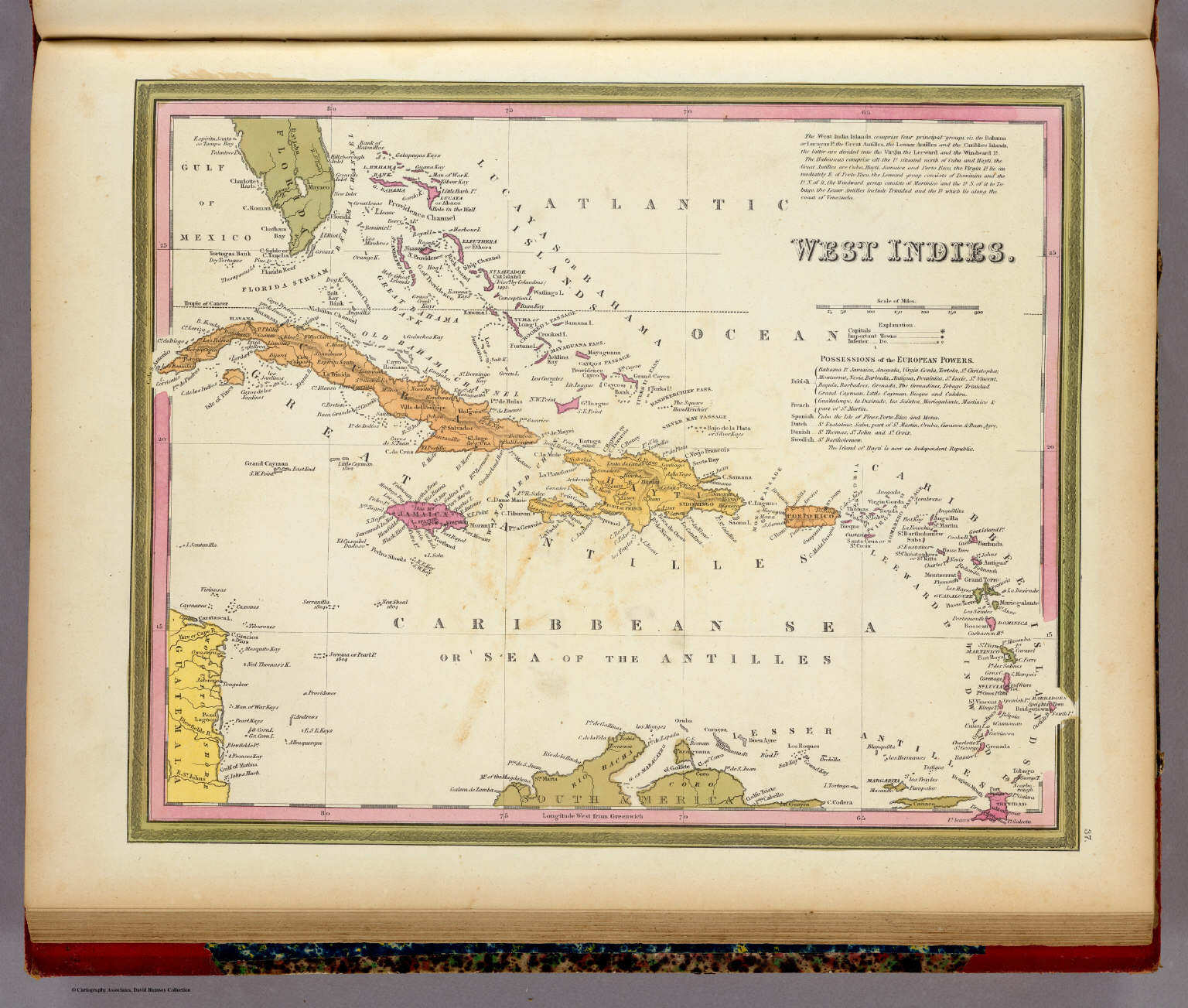
Mitchell's Universal Atlas (1846)
geen overeenkomstige kaart / no corresponding map
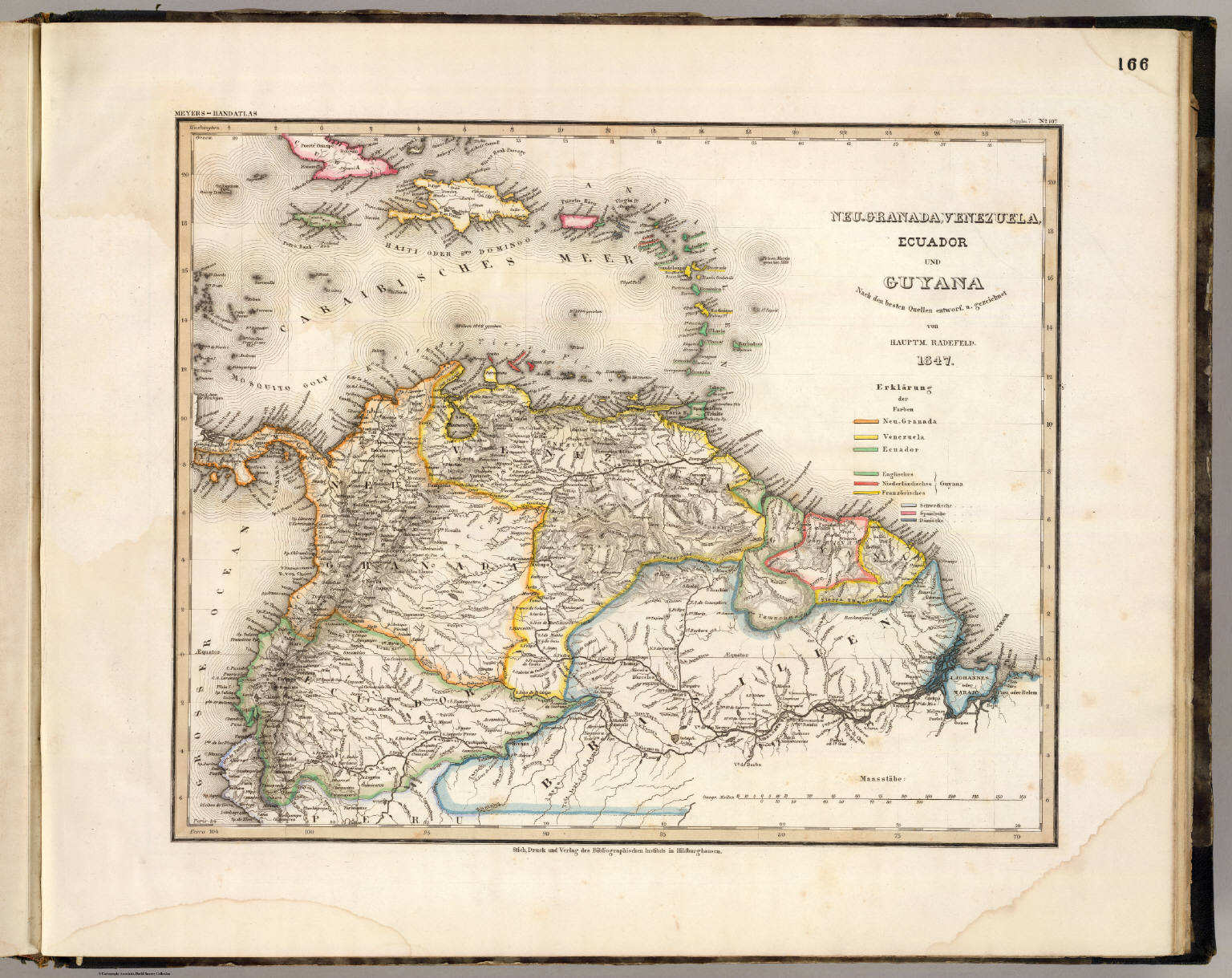 Meyer's Großer Hand-Atlas
166. Neu-Granada, Venezuela, Ecuador und Guyana (1847)
Nieuw-Granada (Colombia), Venezuela, Ecuador en Guyana / New Granada (Colombia), Venezuela, Ecuador and Guyana
David Rumsey Map Collection
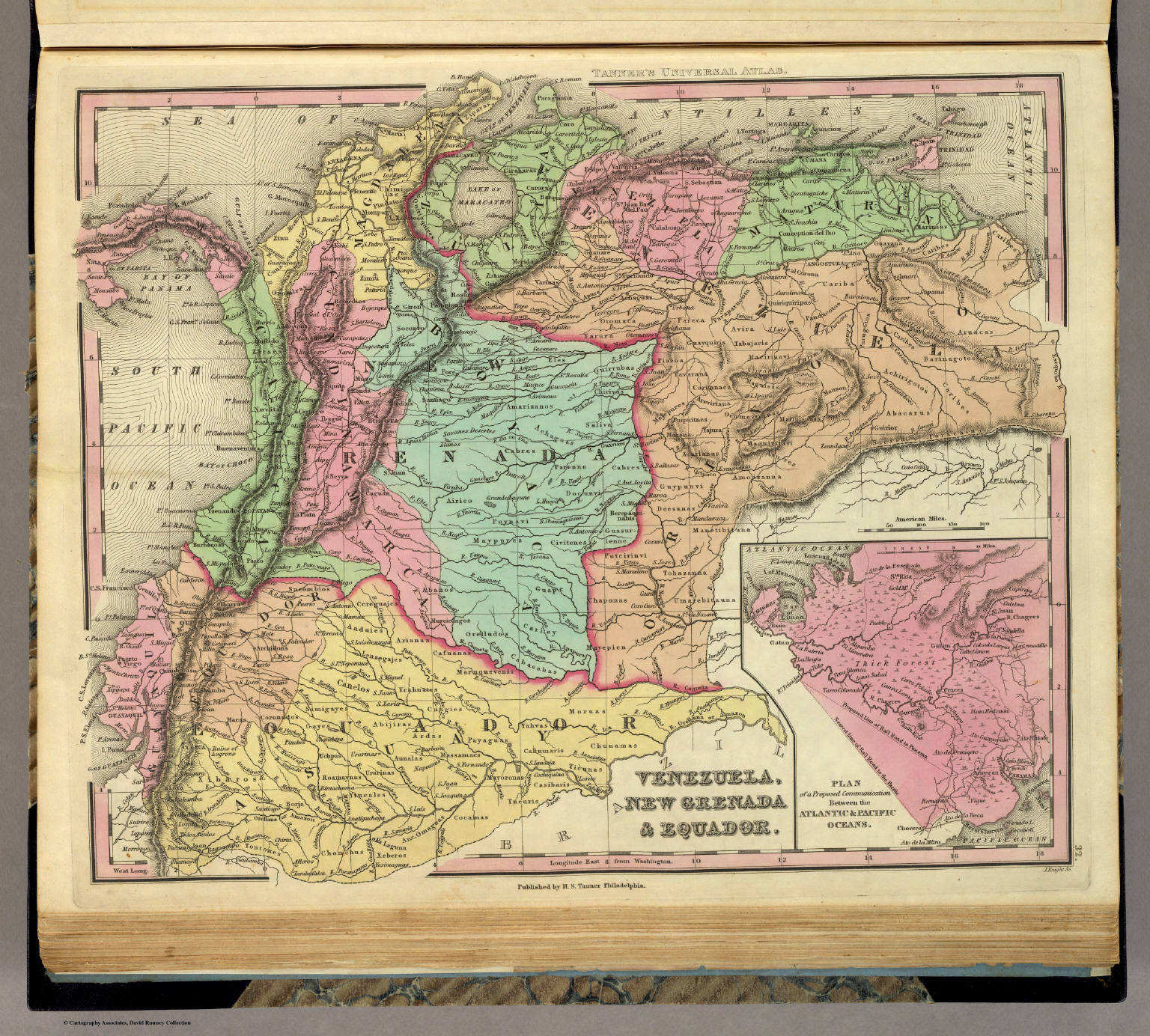 Tanner's Universal Atlas (1836)
32. Venezuela, New Grenada & Equador
Venezuela, Nieuw-Granada (Colombia) en Ecuador
David Rumsey Map Collection
Meyer's Großer Hand-Atlas
166. Neu-Granada, Venezuela, Ecuador und Guyana (1847)
Nieuw-Granada (Colombia), Venezuela, Ecuador en Guyana / New Granada (Colombia), Venezuela, Ecuador and Guyana
David Rumsey Map Collection
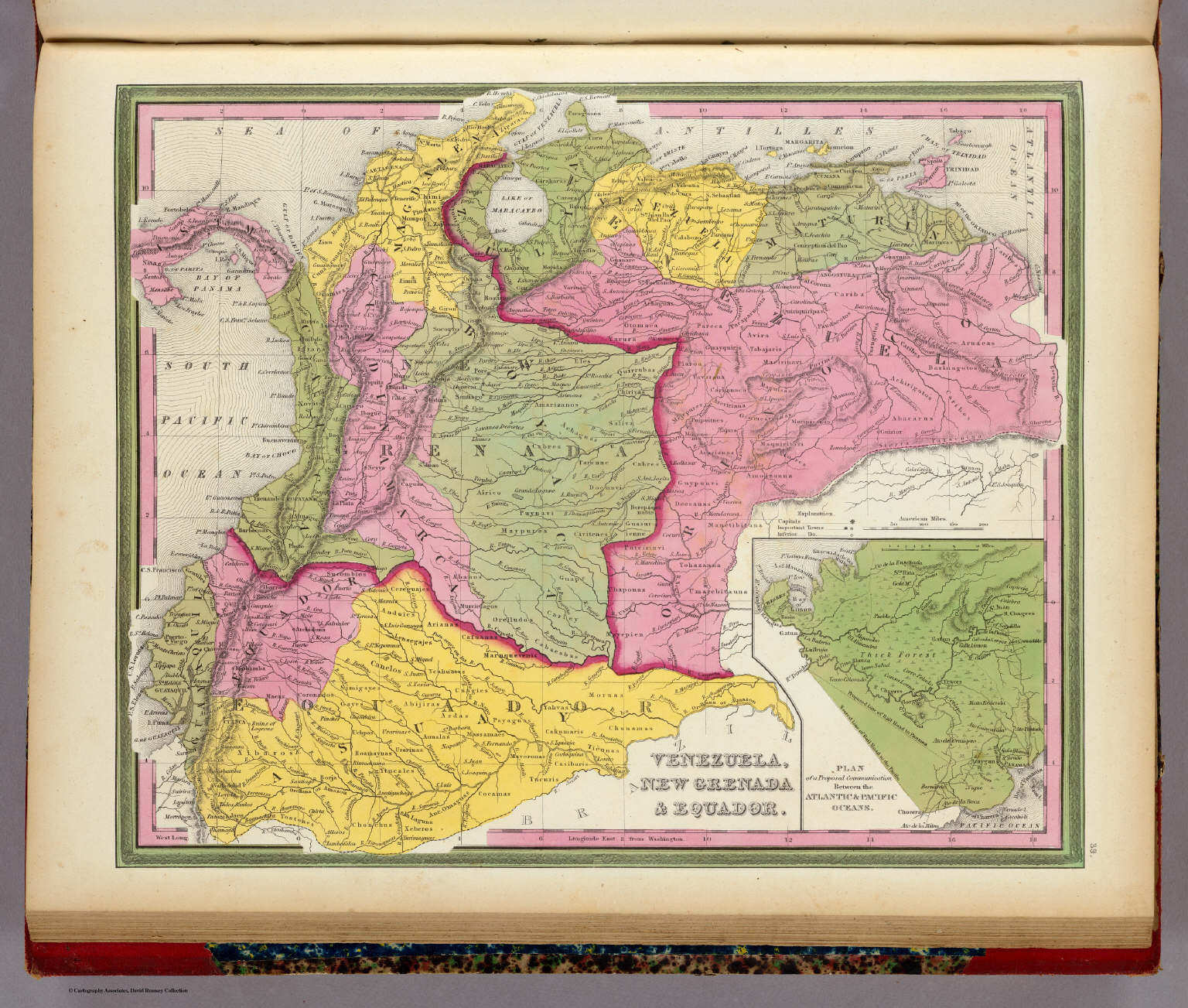 Mitchell's Universal Atlas (1846)
39. Venezuela, New Grenada & Equador
Venezuela, Nieuw-Granada (Colombia) en Ecuador
David Rumsey Map Collection
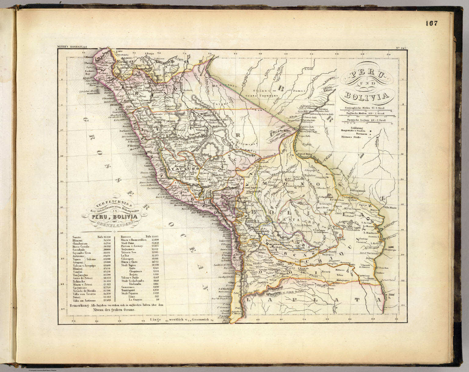 Meyer's Großer Hand-Atlas
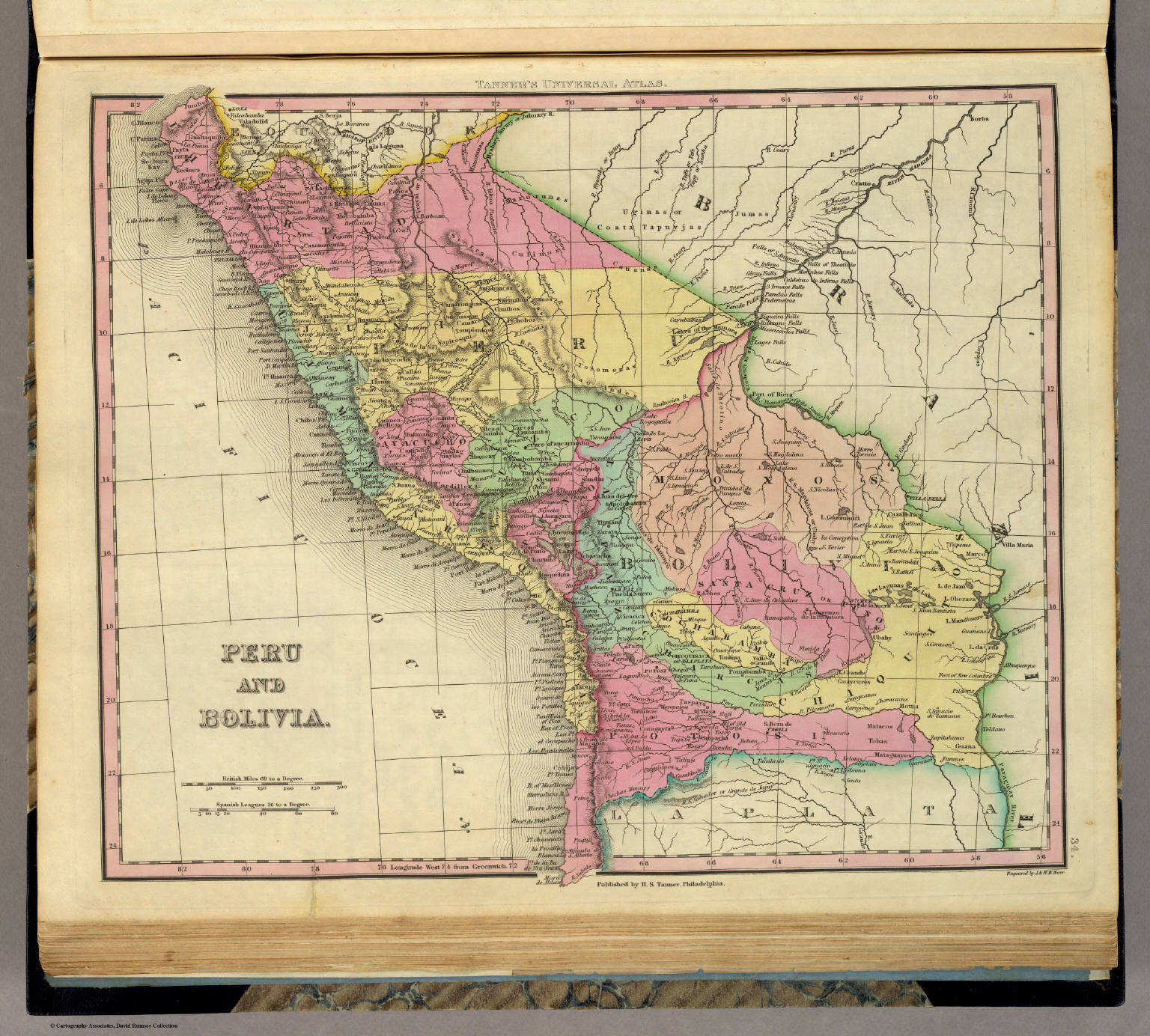
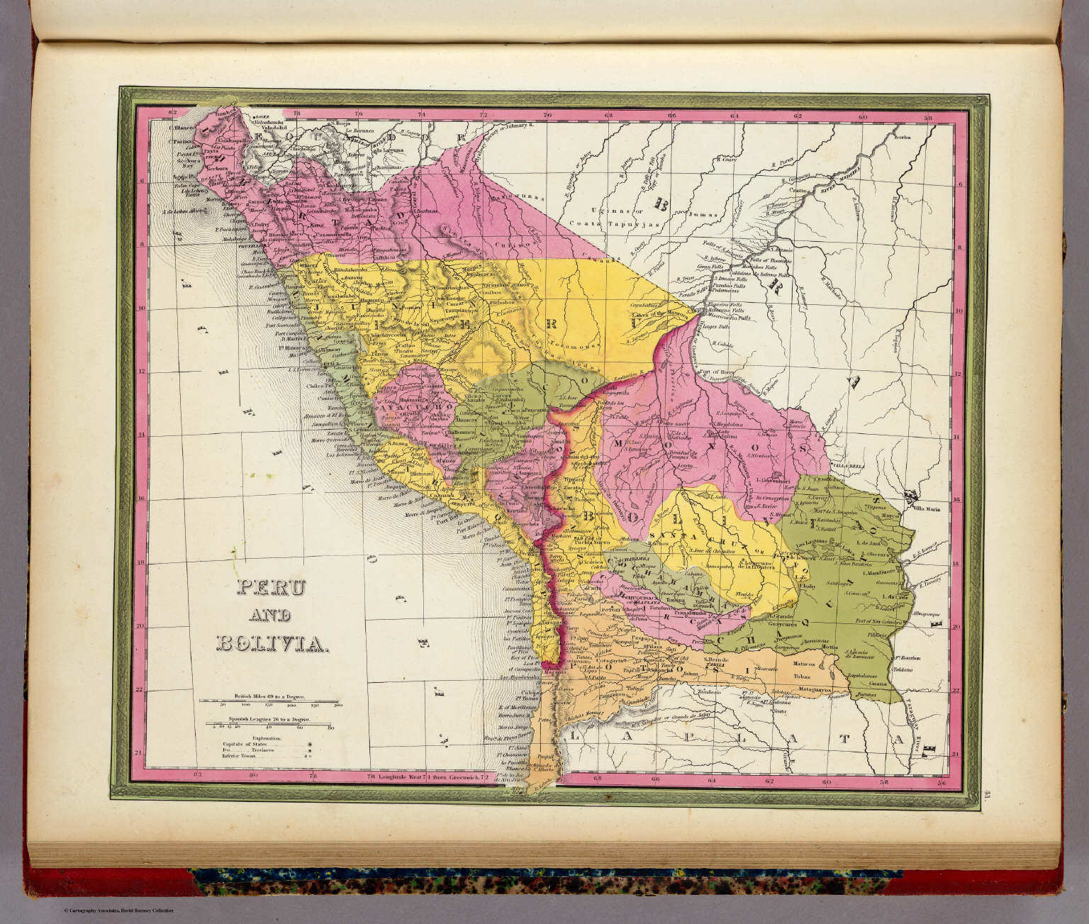
167. Peru und Bolivia
Peru en Bolivia / Peru and Bolivia
David Rumsey Map Collection
 Meyer's Großer Hand-Atlas
167. Peru und Bolivia
Peru en Bolivia / Peru and Bolivia
David Rumsey Map Collection
 Meyer's Großer Hand-Atlas
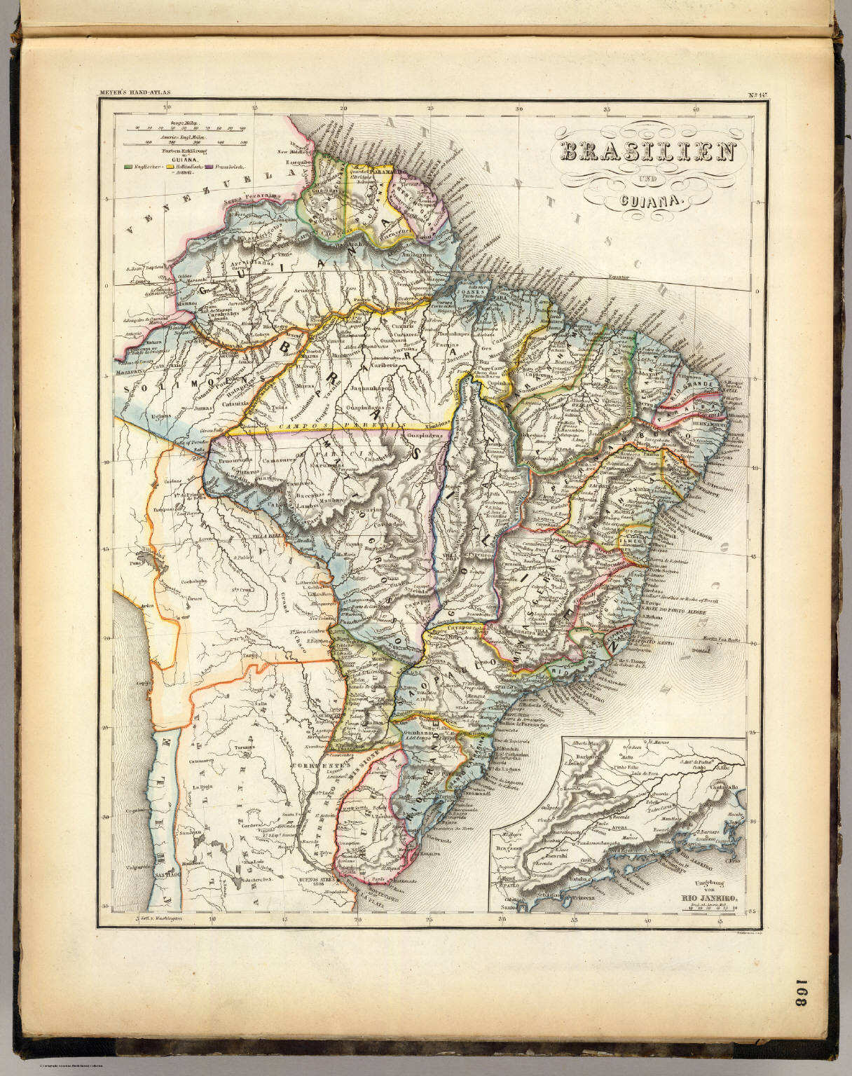
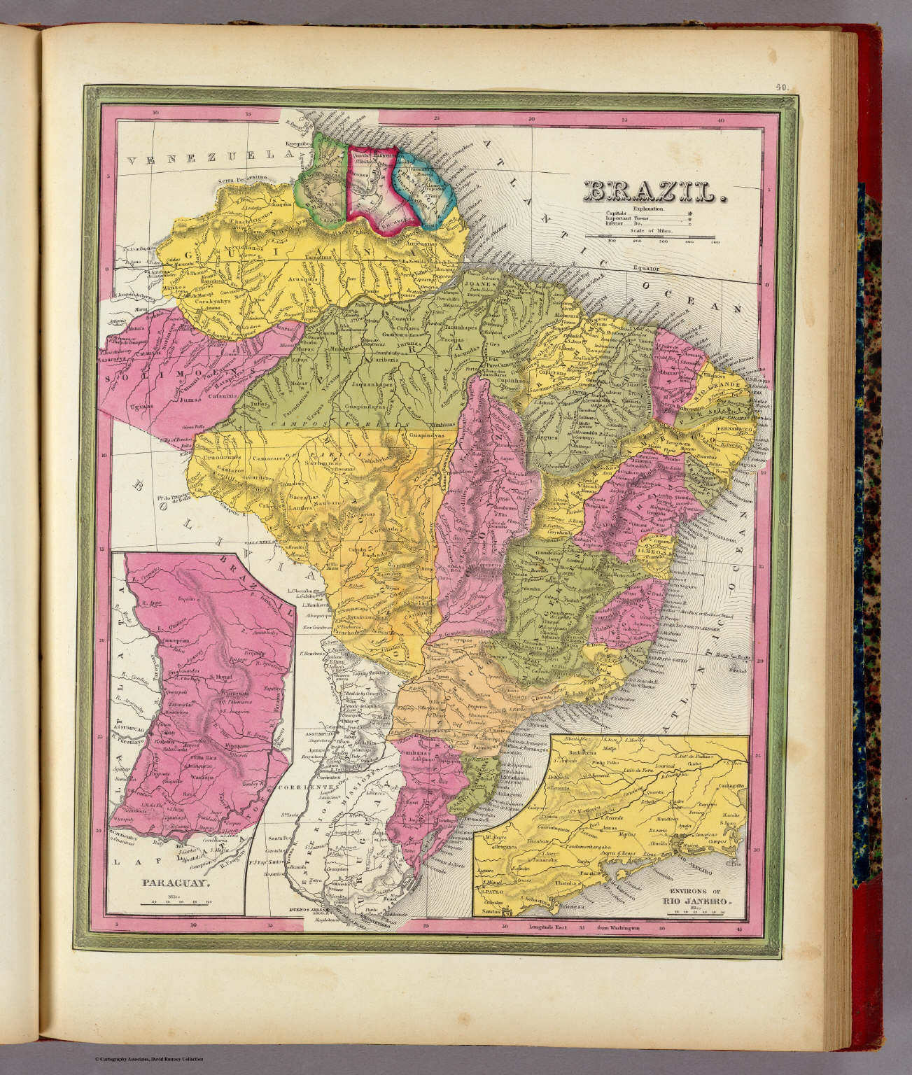
168. Brasilien und Guiana
Brazilië en Guyana / Brazil and Guyana
David Rumsey Map Collection
 Meyer's Großer Hand-Atlas
168. Brasilien und Guiana
Brazilië en Guyana / Brazil and Guyana
David Rumsey Map Collection
 Meyer's Großer Hand-Atlas
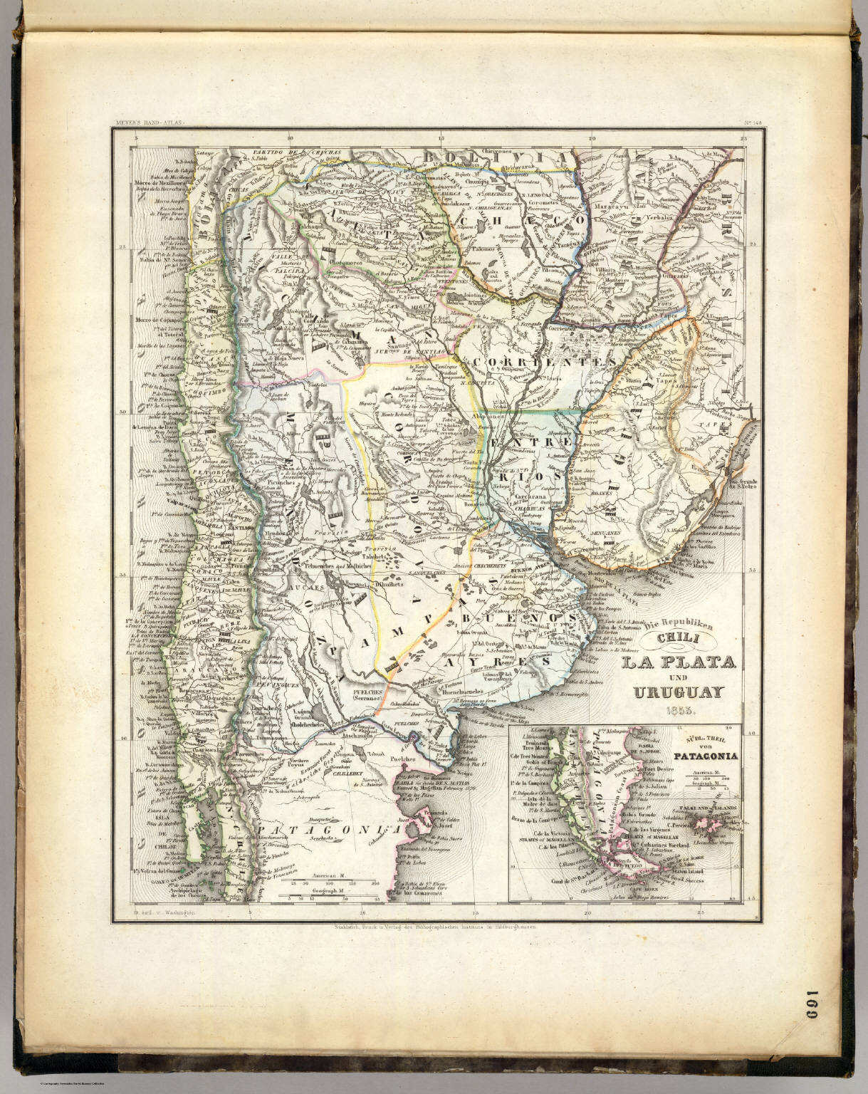
169. Die Republiken Chili, La Plata und Uruguay (1853)
Chili, La Plata (Argentinië) en Uruguay / Chile, La Plata (Argentine) and Uruguay
David Rumsey Map Collection
 Tanner's Universal Atlas (1836)
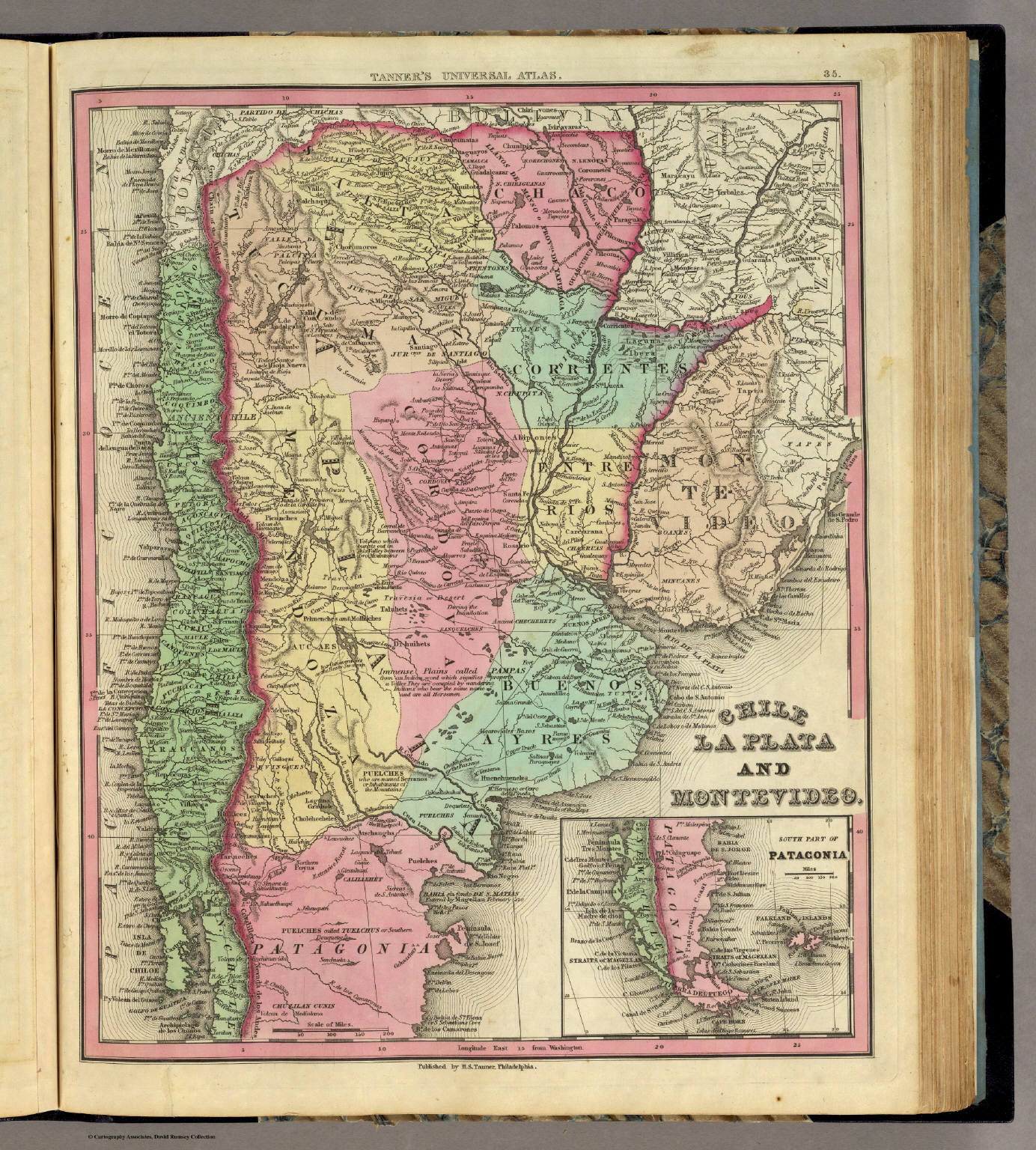
35. Chile La Plata and Montevideo
Chili, La Plata (Argentinië) en Montevideo (Uruguay)
David Rumsey Map Collection
Meyer's Großer Hand-Atlas
169. Die Republiken Chili, La Plata und Uruguay (1853)
Chili, La Plata (Argentinië) en Uruguay / Chile, La Plata (Argentine) and Uruguay
David Rumsey Map Collection
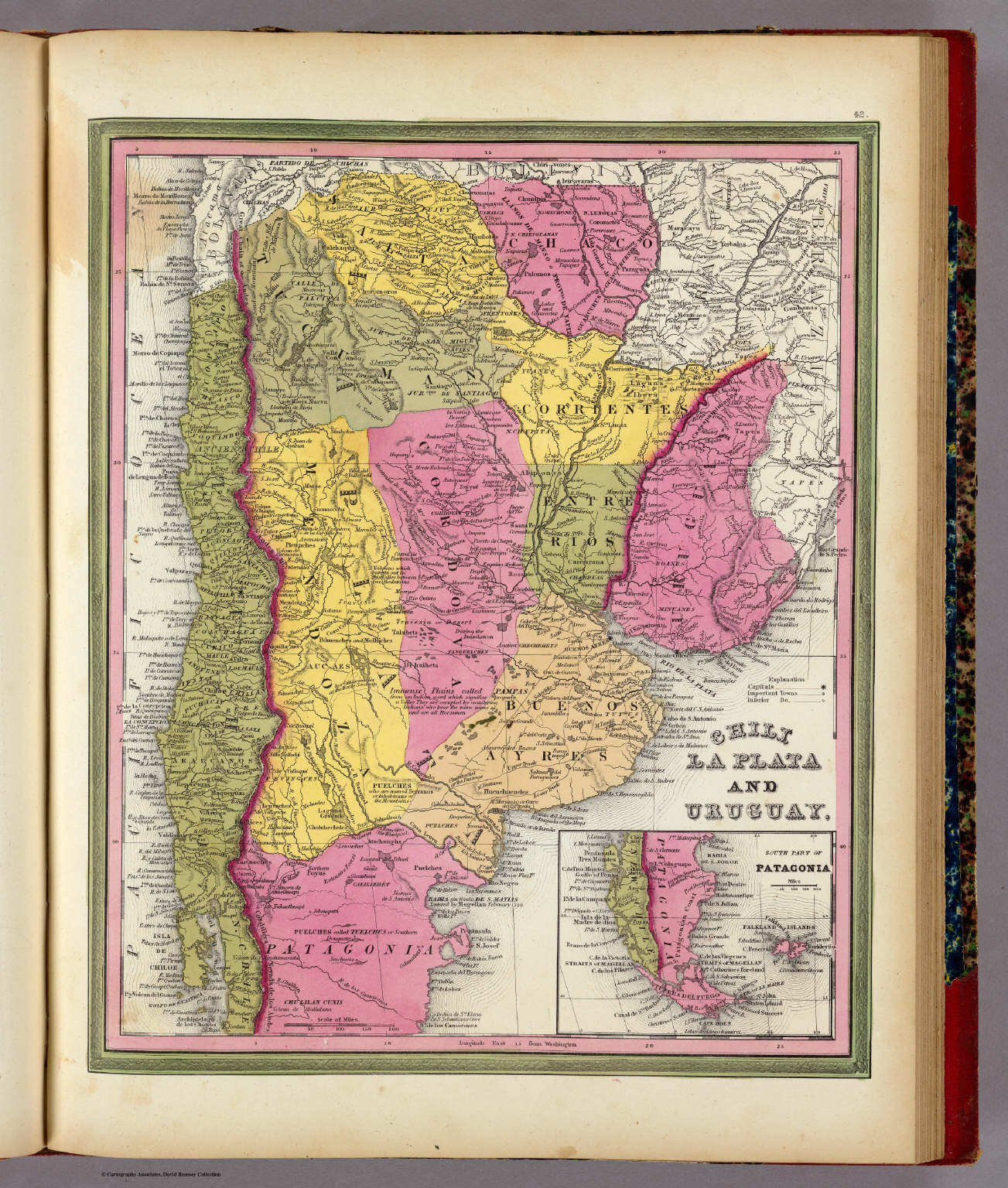 Mitchell's Universal Atlas (1846)
42. Chili, La Plata and Uruguay
Chili, La Plata (Argentinië) en Uruguay
David Rumsey Map Collection
 Meyer's Großer Hand-Atlas
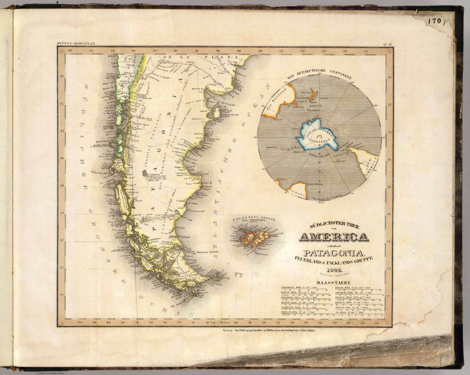
170. Südlichster Theil von America enthaltend Patagonia, Feuerland & Falklands Gruppe (1844)
De zuidpunt van Amerika met Patagonië, Vuurland en de Falklandeilanden / Southern tip of America with Patagonia, Tierra del Fuego and the Falkland Islands
David Rumsey Map Collection
Tanner's Universal Atlas (1836)
geen overeenkomstige kaart / no corresponding map
Meyer's Großer Hand-Atlas
170. Südlichster Theil von America enthaltend Patagonia, Feuerland & Falklands Gruppe (1844)
De zuidpunt van Amerika met Patagonië, Vuurland en de Falklandeilanden / Southern tip of America with Patagonia, Tierra del Fuego and the Falkland Islands
David Rumsey Map Collection
Mitchell's Universal Atlas (1846)
geen overeenkomstige kaart / no corresponding map
- Beeldmateriaal uit David Rumsey Map Collection valt onder een Creative Commons License.
- Images from the David Rumsey Map Collection are licensed under a Creative Commons License.
HTML © M. Witkam, 2010
![]()
![]()