Tanner's Universal Atlas (1836-1846)
See below for (a summary of) this text in English.
Hieronder staan plaatjes van de atlas. Daarbij horen ook de volgende pagina's
- Beschrijving van de atlas
- Tabellen en lijsten bij de atlas
Plaatjes
- Alle plaatjes zijn ontleend aan David Rumsey Map Collection.
- Beeldmateriaal uit David Rumsey Map Collection valt onder een Creative Commons License.
- Klik op een plaatje voor een vergroting.
Tanner's Universal Atlas (1836-1846)
- Below are pictures of the atlas. Related pages
- Description of the atlas
- Tables and lists to the atlas
Pictures
- All pictures have been derived from David Rumsey Map Collection.
- Images from the David Rumsey Map Collection are licensed under a Creative Commons License.
- Click on a picture to enlarge.
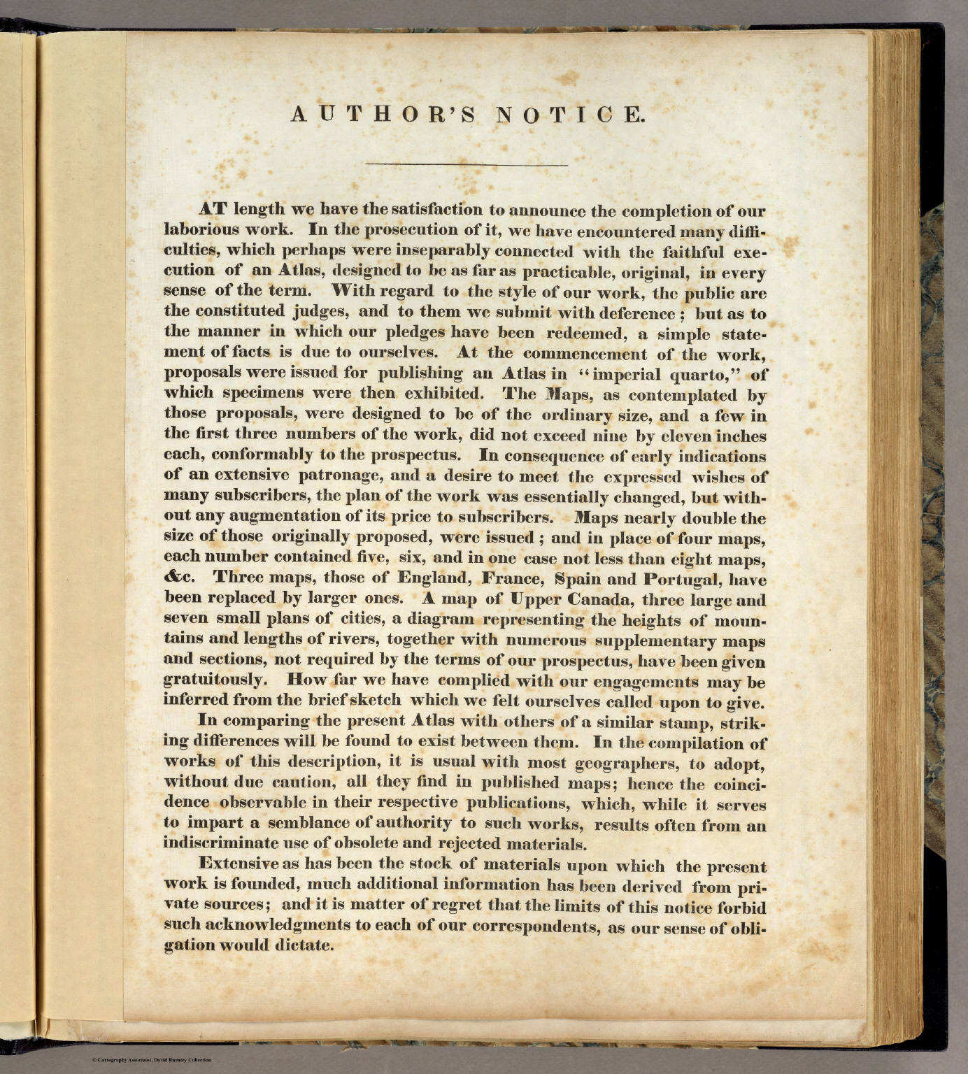
Titelpagina, inhoudsopgave, enz. / Title page, table of contents, etc.
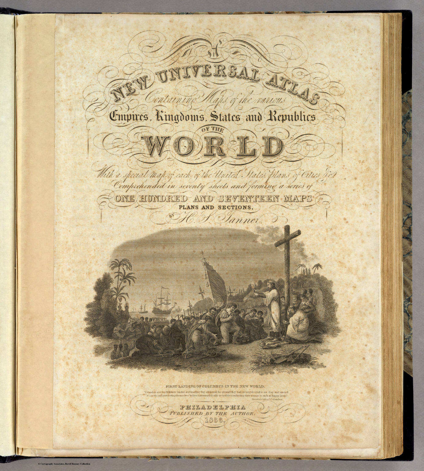
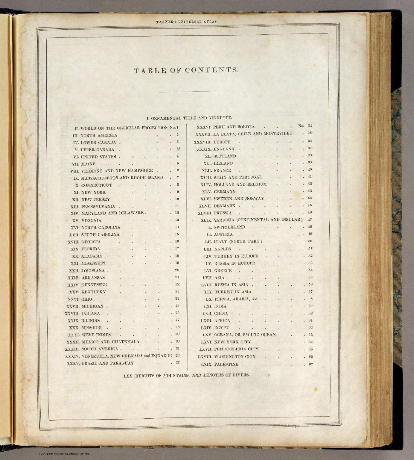
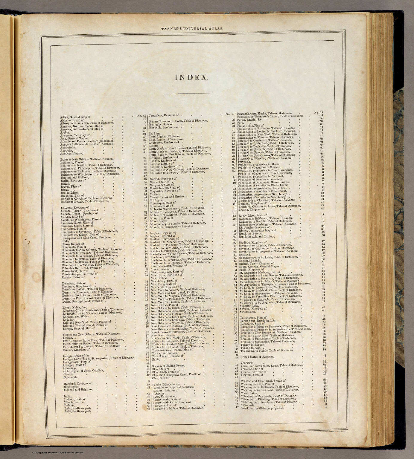
 Tanner's Universal Atlas (1836)
Voorwoord van de auteur / Author's notice
David Rumsey Map Collection
 Tanner's Universal Atlas (1836)
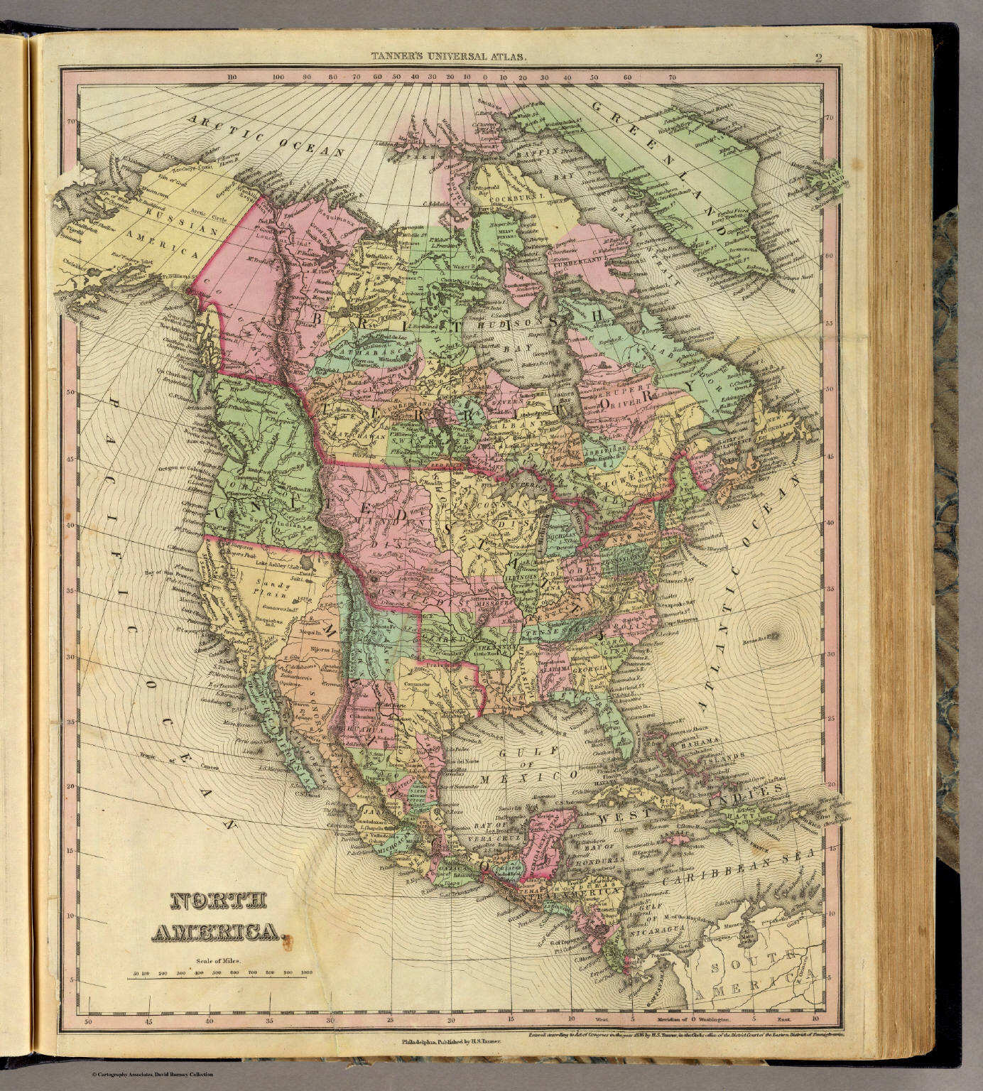
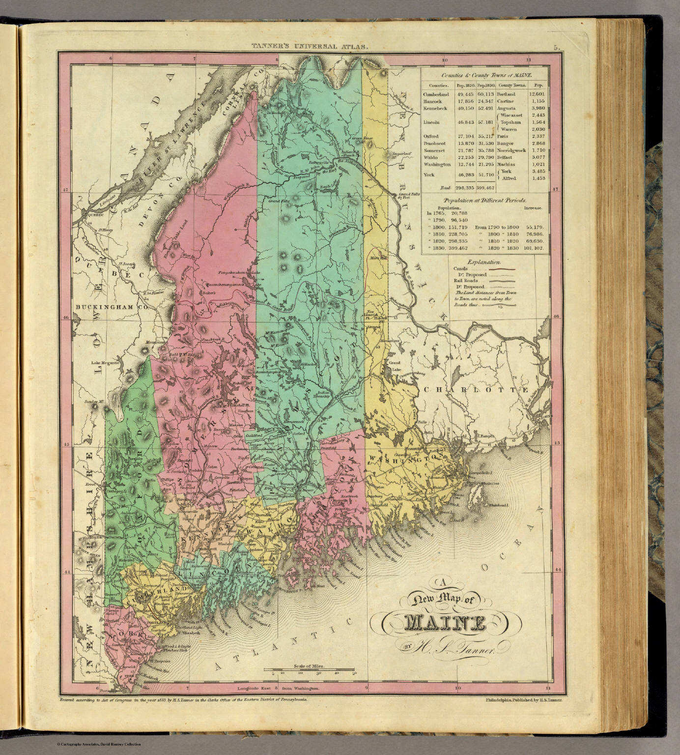
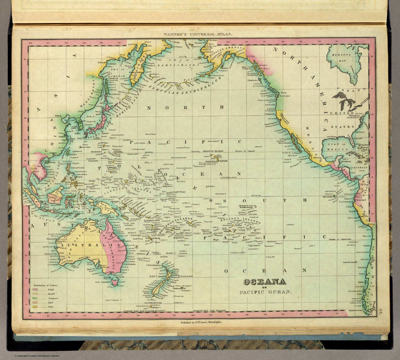
1. A New Map of the World on the Globular Projection
Westelijk en oostelijk halfrond
David Rumsey Map Collection
 Tanner's Universal Atlas (1836)
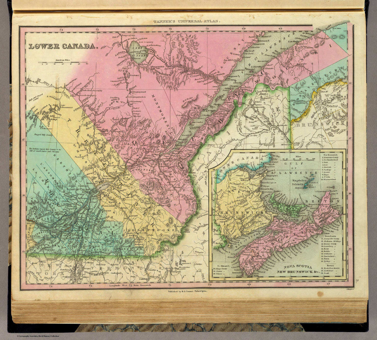
3. Lower Canada
Neder-Canada (Bas-Canada)
David Rumsey Map Collection
 Tanner's Universal Atlas (1836)
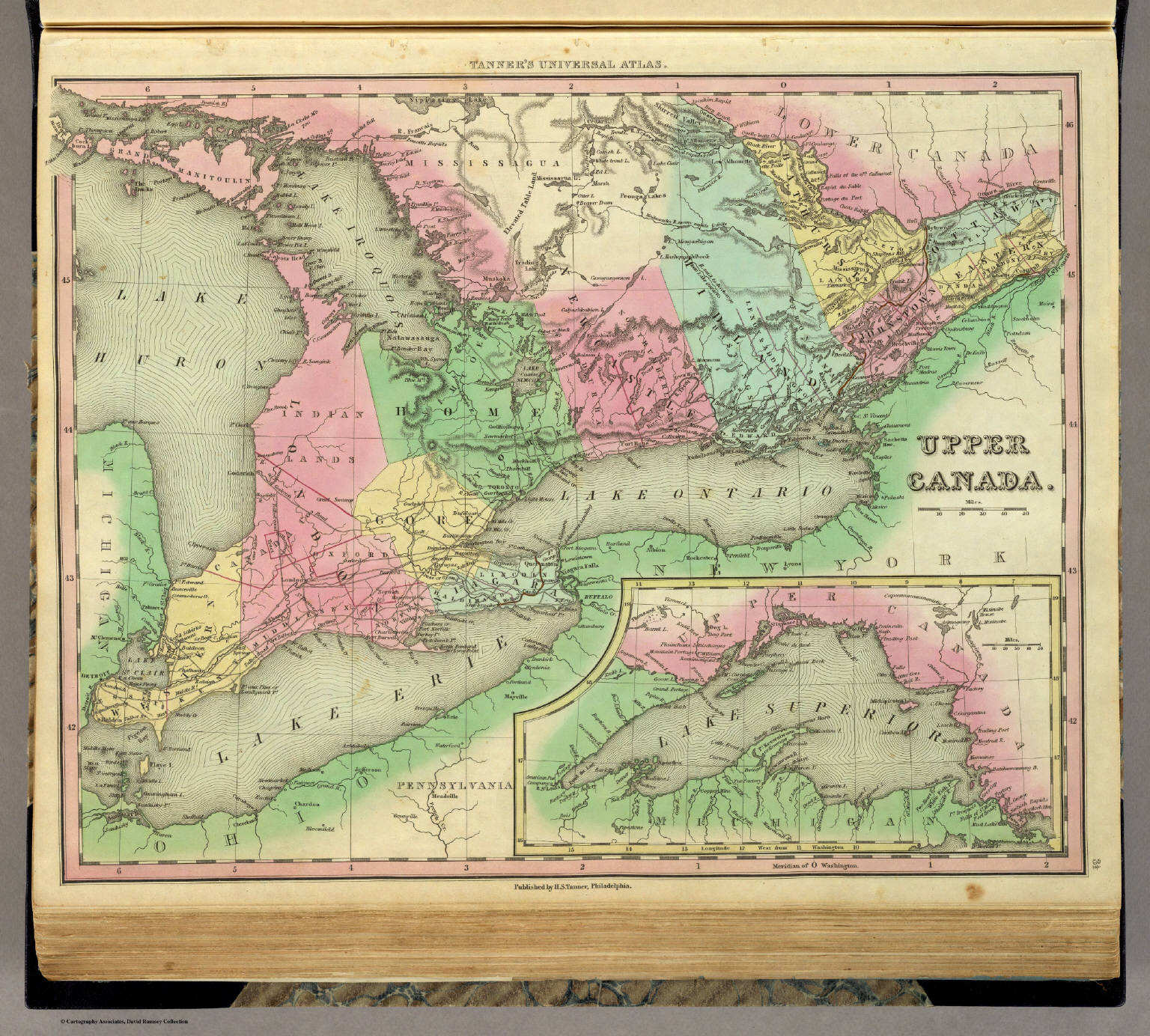
3½. Upper Canada
Opper-Canada (Haut-Canada)
David Rumsey Map Collection
 Tanner's Universal Atlas (1836)
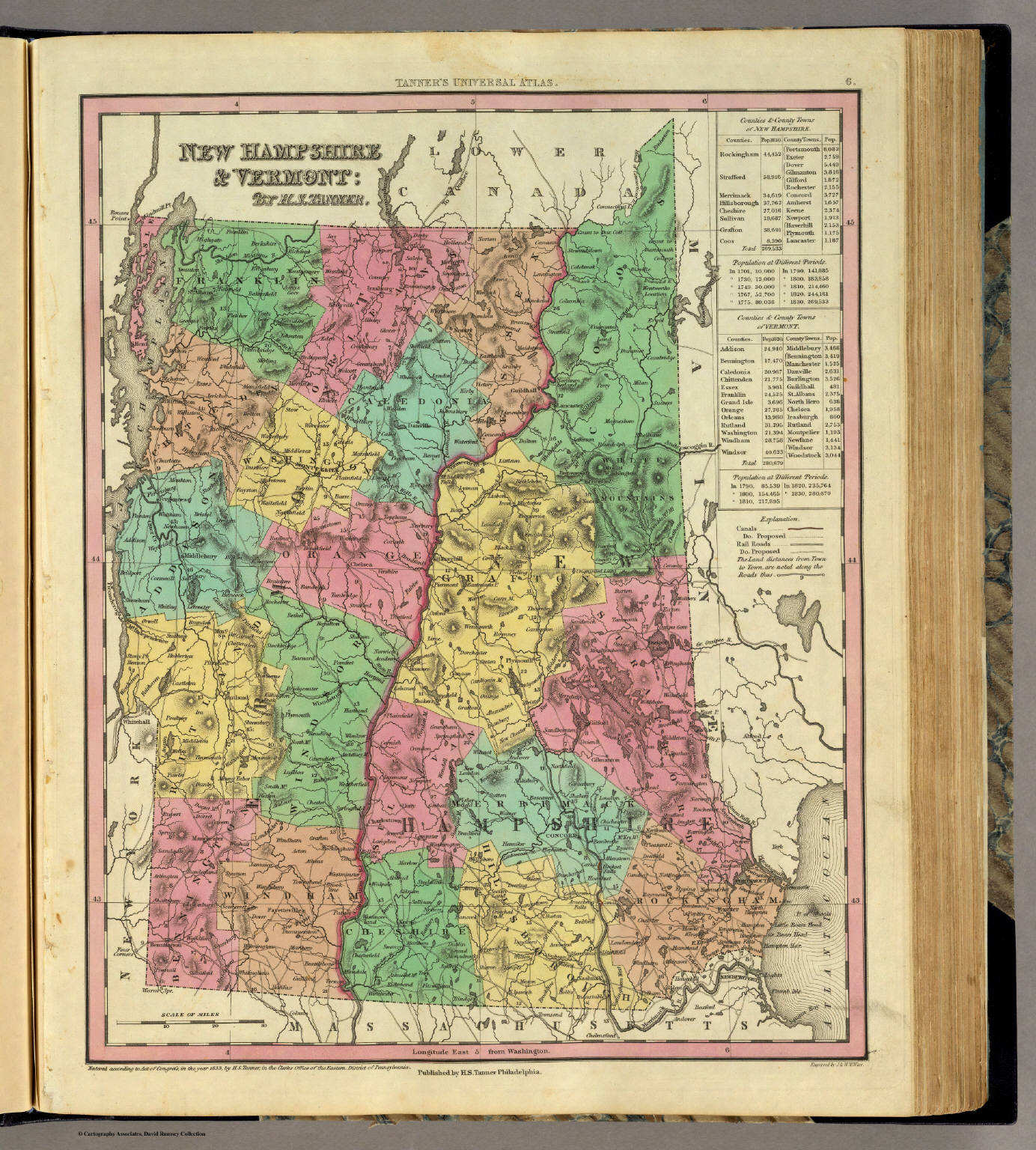
6. New Hampshire & Vermont
New Hampshire en Vermont
David Rumsey Map Collection
 Tanner's Universal Atlas (1836)
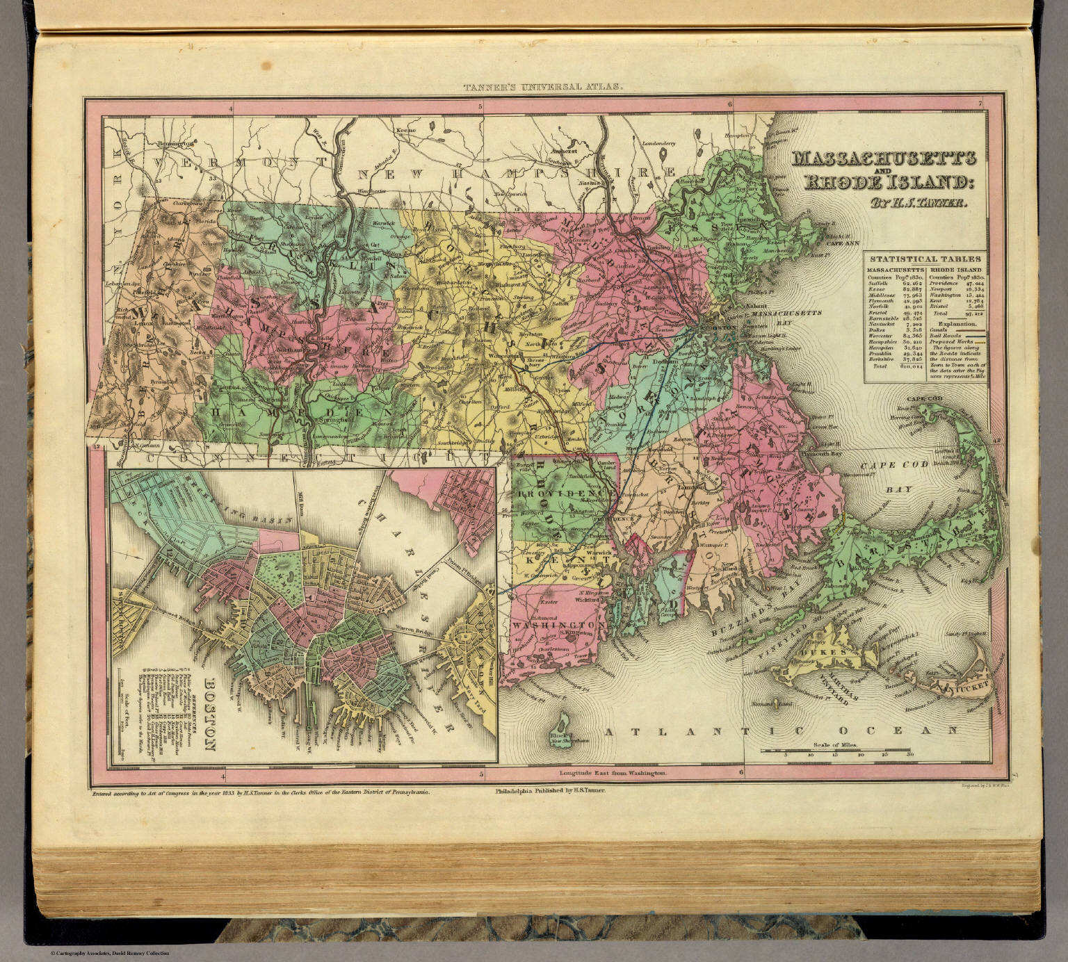
7. Massachusetts and Rhode Island
Massachusetts en Rhode Island
David Rumsey Map Collection

 Tanner's Universal Atlas (1836)
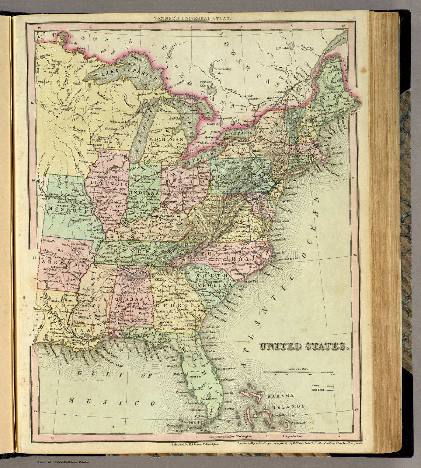
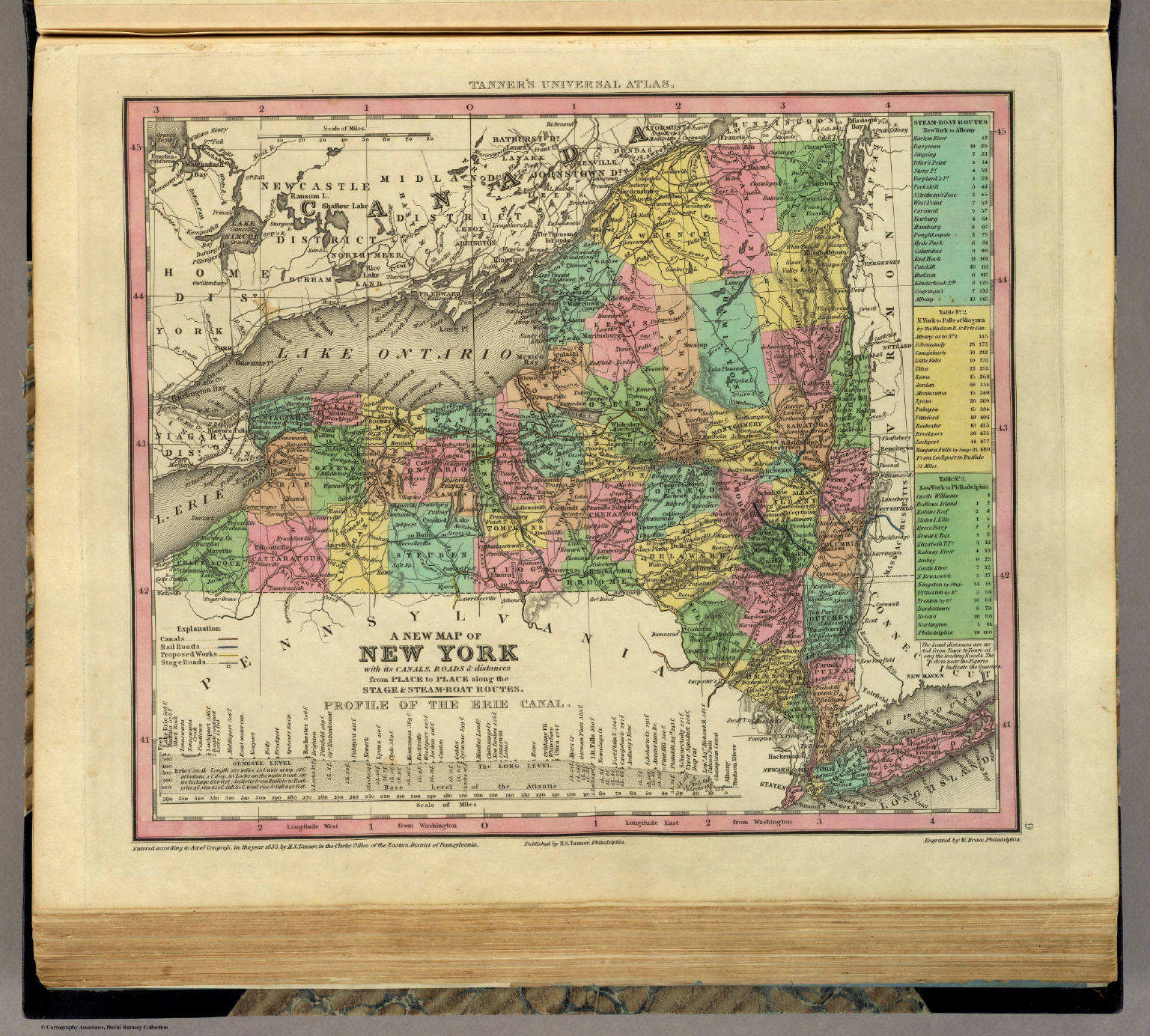
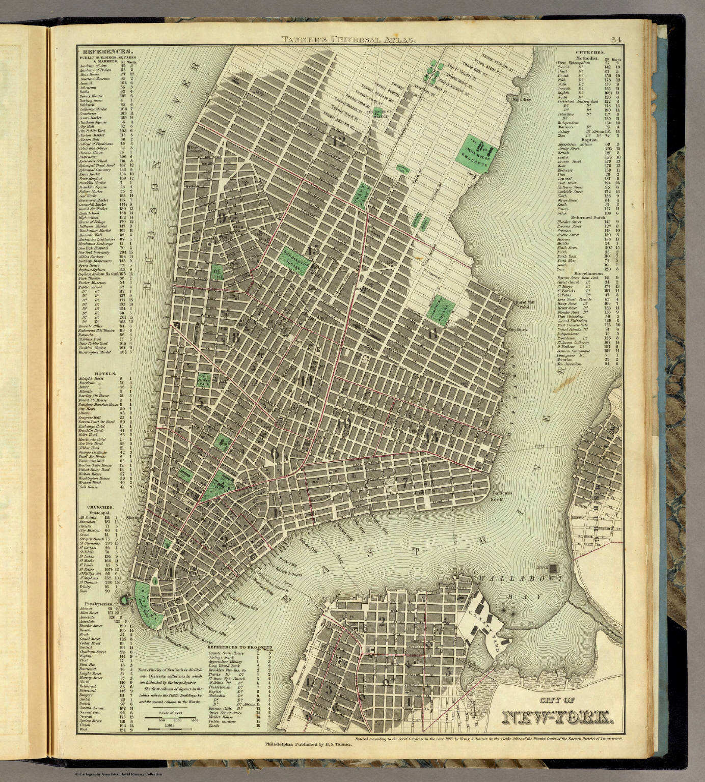
9. A New Map of New York with its Canals, ...
New York
David Rumsey Map Collection
 Tanner's Universal Atlas (1836)
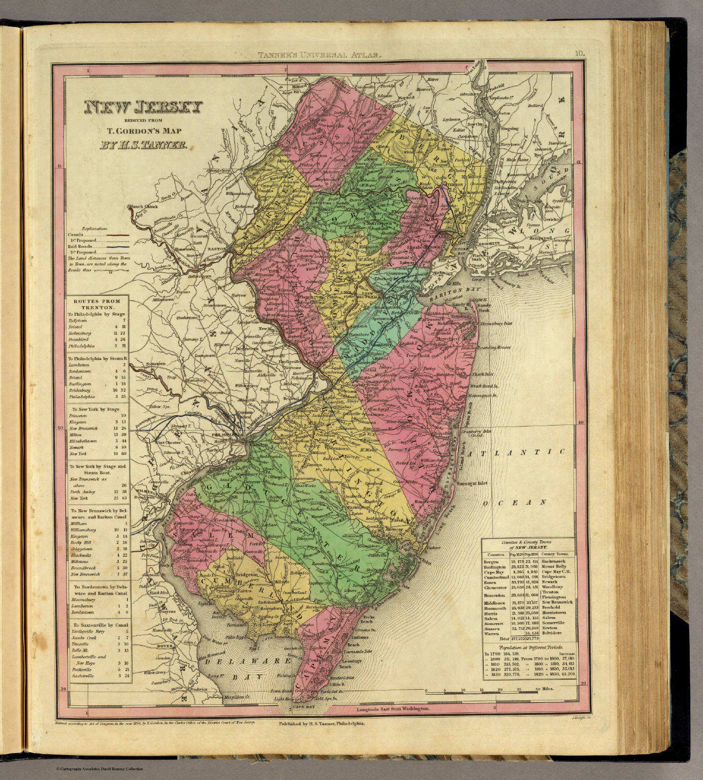
10. New Jersey Reduced from T. Gordon's Map
New Jersey
David Rumsey Map Collection
 Tanner's Universal Atlas (1836)
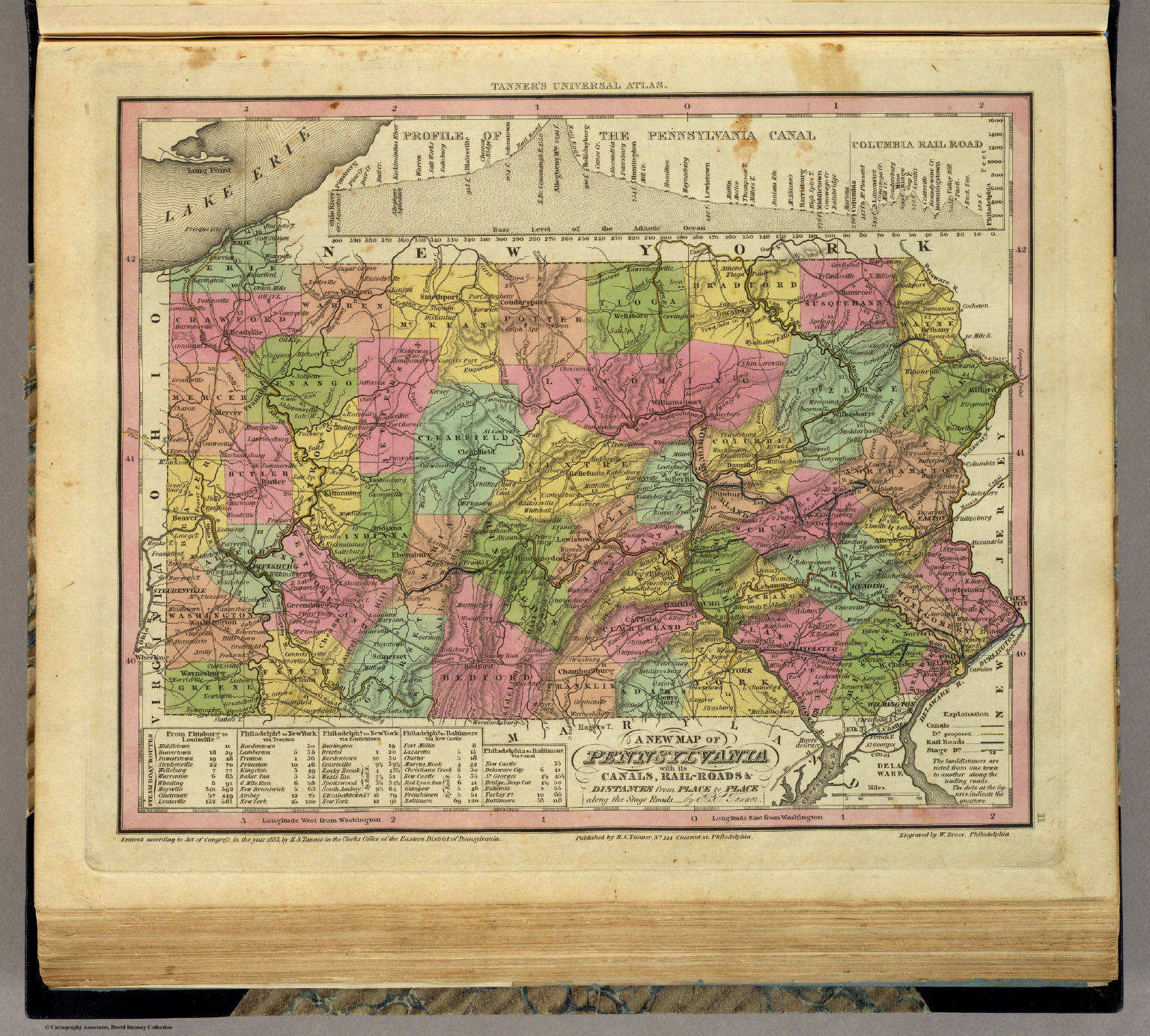
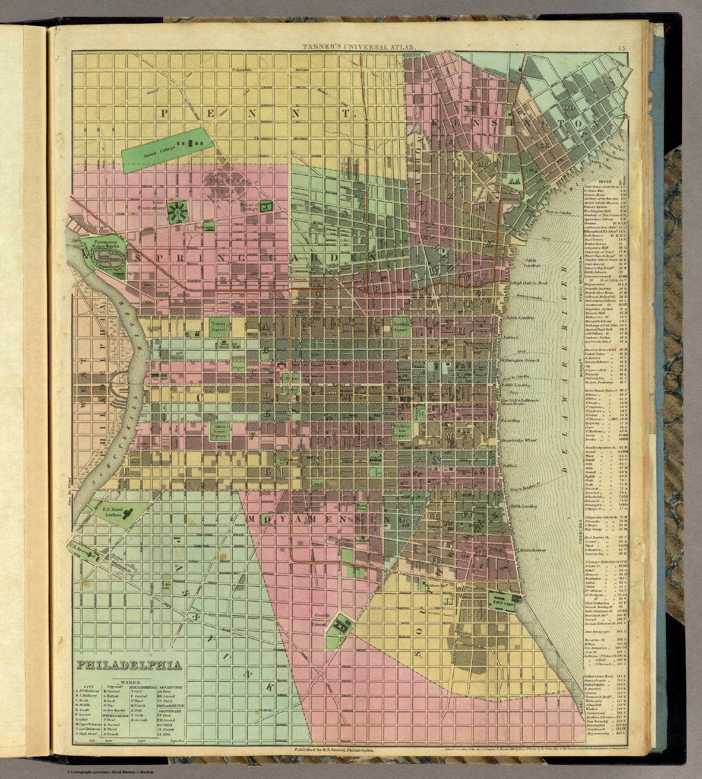
11. A New Map of Pennsylvania with its Canals, ...
Pennsylvania
David Rumsey Map Collection
 Tanner's Universal Atlas (1836)
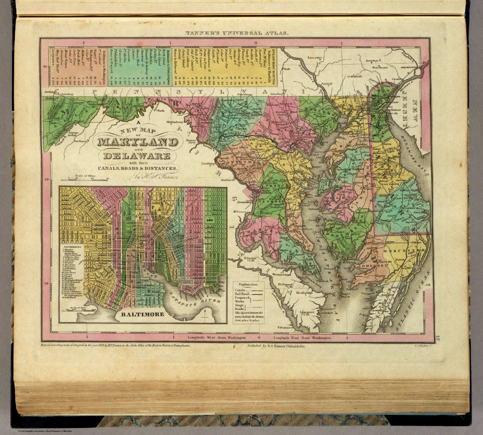
12. A New Map of Maryland and Delaware with their Canals, ...
Maryland en Delaware
David Rumsey Map Collection
 Tanner's Universal Atlas (1836)
13. A New Map of Virginia with its Canals, ...
Virginia
David Rumsey Map Collection
 Tanner's Universal Atlas (1836)
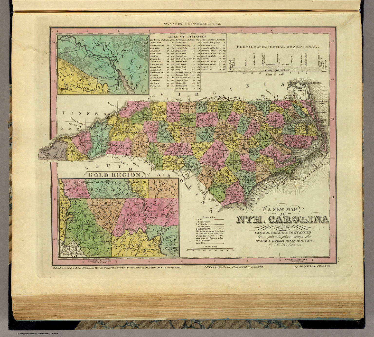
14. A New Map of Nth. Carolina with its Canals, ...
North Carolina
David Rumsey Map Collection
 Tanner's Universal Atlas (1836)
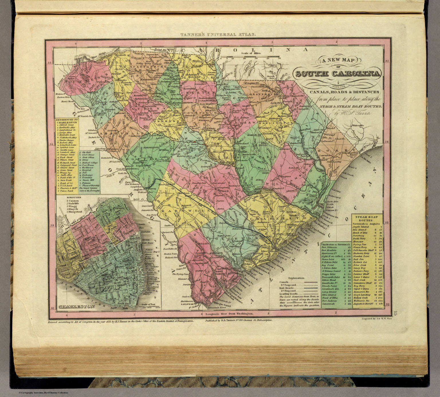
15. A New Map of South Carolina with its Canals, ...
South Carolina
David Rumsey Map Collection
 Tanner's Universal Atlas (1836)
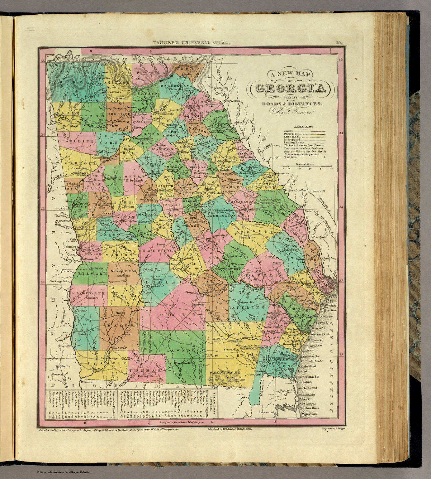
16. A New Map of Georgia with its Roads & Distances
Georgia
David Rumsey Map Collection
 Tanner's Universal Atlas (1836)
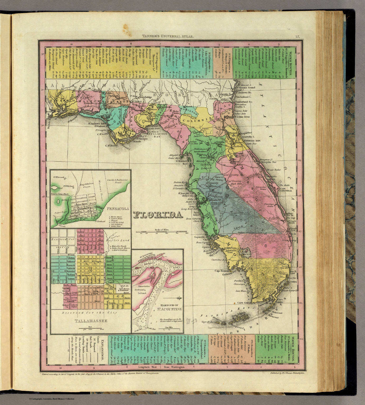
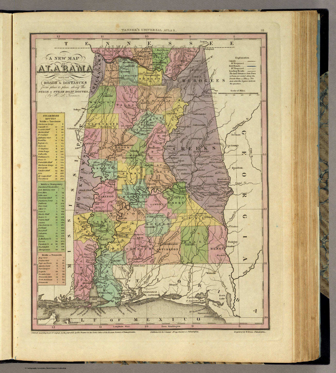
18. A New Map of Alabama with its Roads ...
Alabama
David Rumsey Map Collection
 Tanner's Universal Atlas (1836)
19. A New Map of Mississippi with its Roads ...
Mississippi
David Rumsey Map Collection
 Tanner's Universal Atlas (1836)
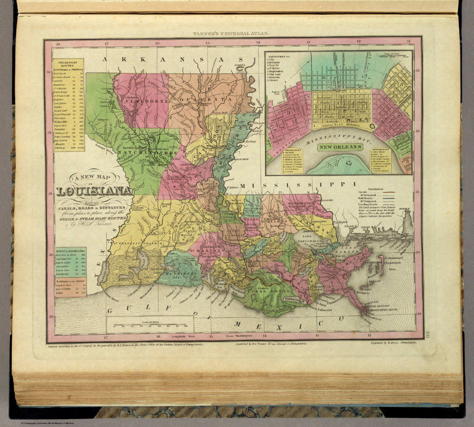
20. A New Map of Louisiana with its Canals, ...
Louisiana
David Rumsey Map Collection
 Tanner's Universal Atlas (1836)
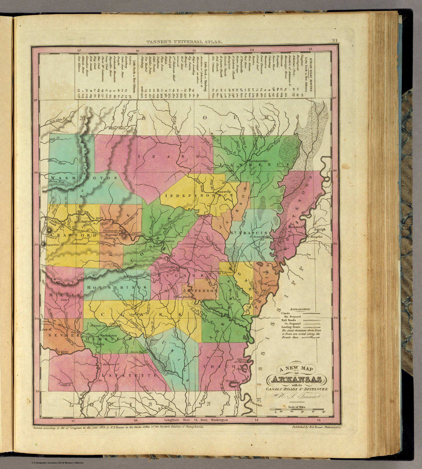
21. A New Map of Arkansas with its Canals, ...
Arkansas
David Rumsey Map Collection
 Tanner's Universal Atlas (1836)
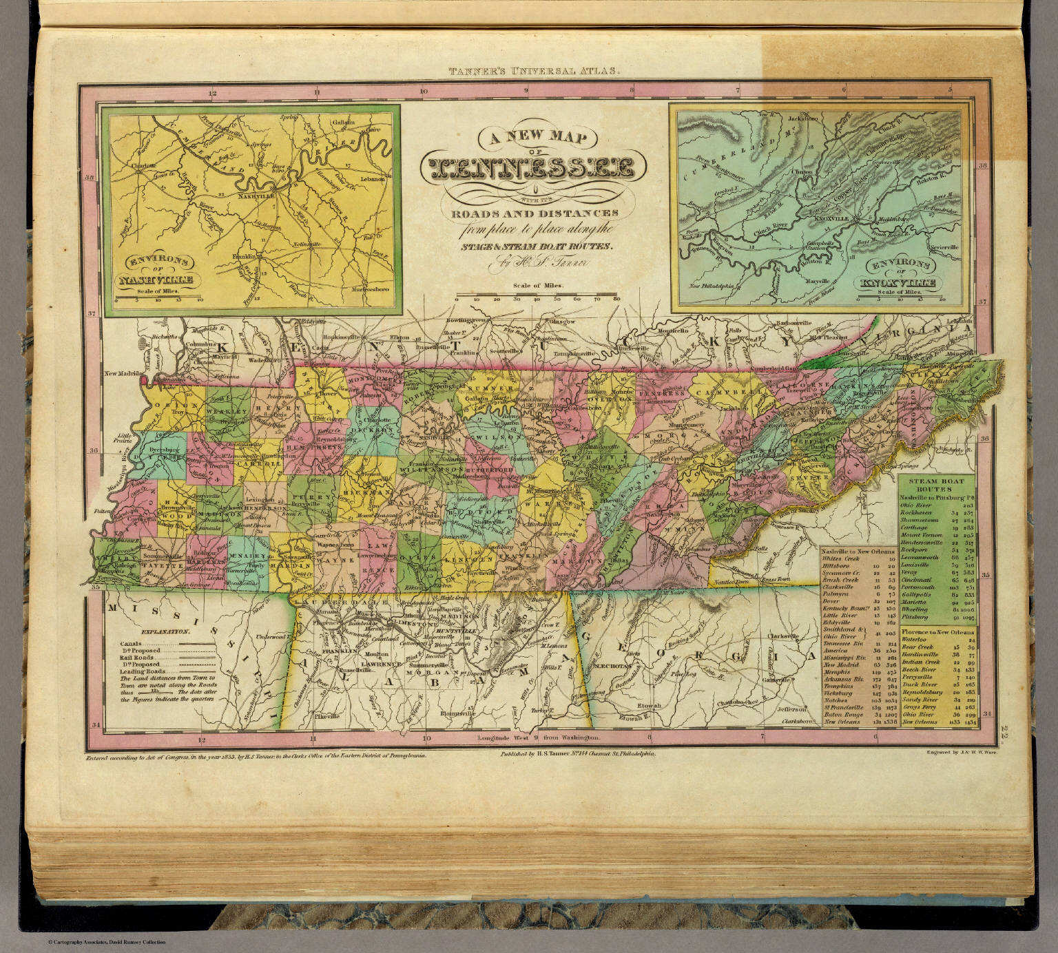
22. A New Map of Tennessee with its Roads ...
Tennessee
David Rumsey Map Collection
 Tanner's Universal Atlas (1836)
23. A New Map of Kentucky with its Roads ...
Kentucky
David Rumsey Map Collection
 Tanner's Universal Atlas (1836)
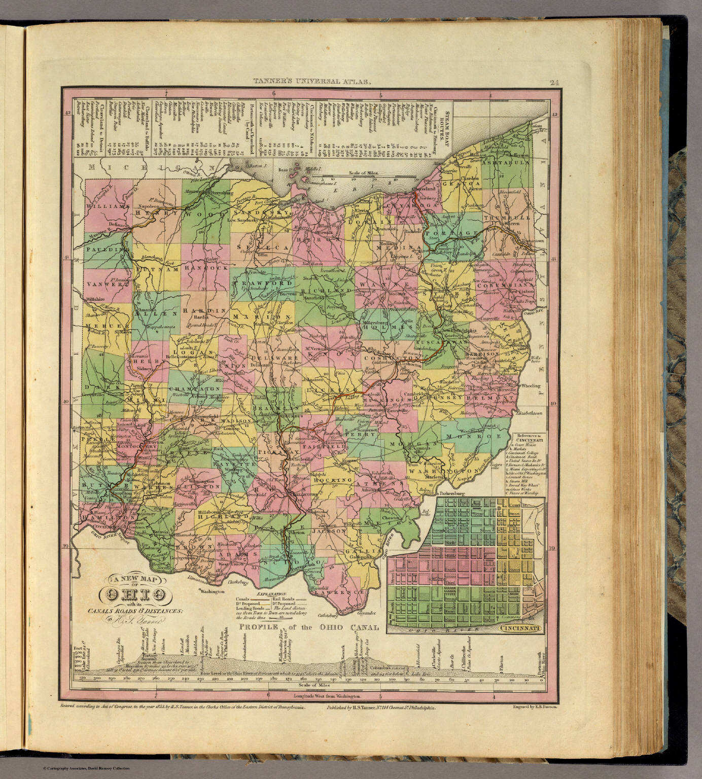
24. A New Map of Ohio with its Canals, ...
Ohio
David Rumsey Map Collection
 Tanner's Universal Atlas (1836)
25. A New Map of Michigan with its Canals, ...
Michigan
David Rumsey Map Collection
 Tanner's Universal Atlas (1836)
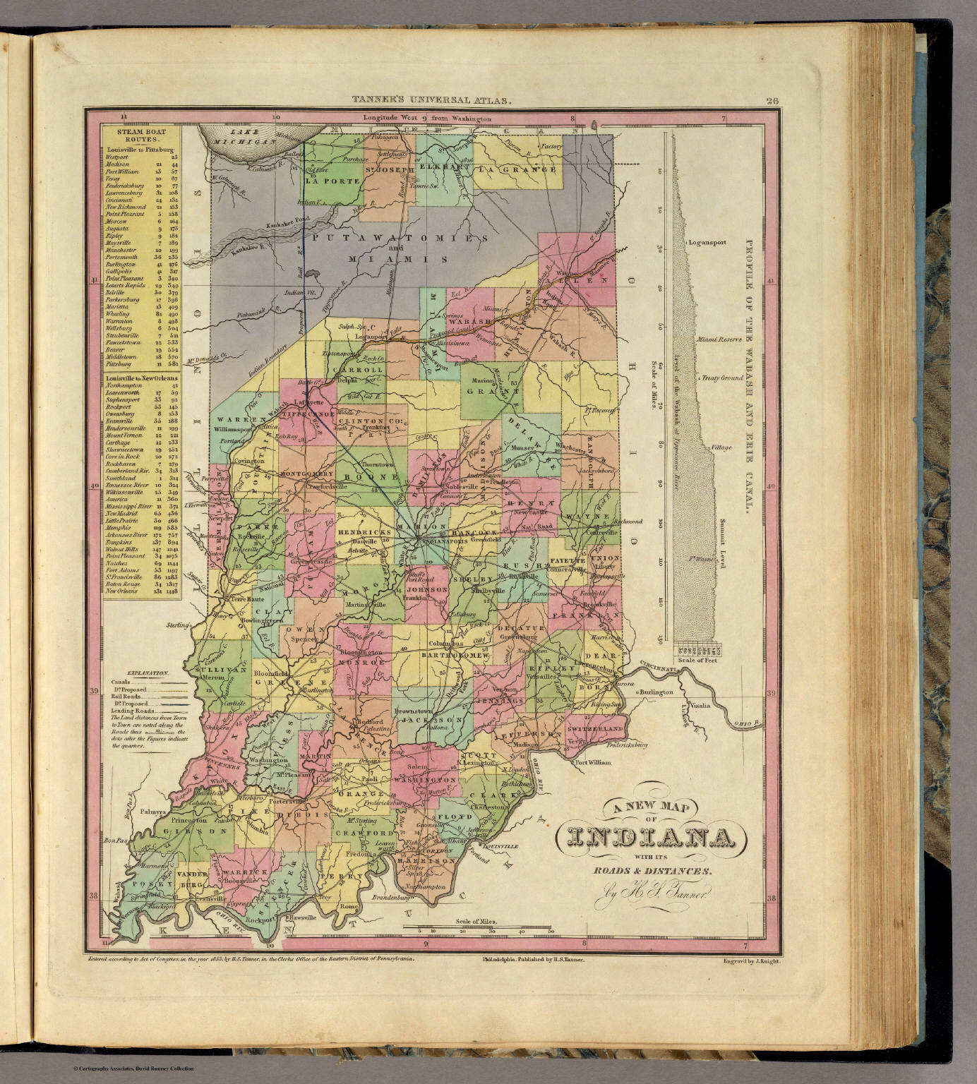
26. New Map of Indiana with its Roads ...
Indiana
David Rumsey Map Collection
 Tanner's Universal Atlas (1836)
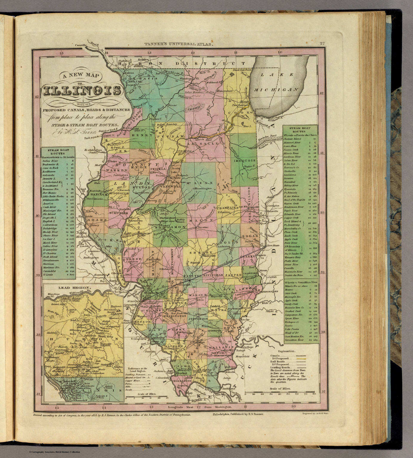
27. A New Map of Illinois with its Proposed ...
Illinois
David Rumsey Map Collection
 Tanner's Universal Atlas (1836)
28. A New Map of Missouri with its Roads ...
Missouri
David Rumsey Map Collection
 Tanner's Universal Atlas (1836)
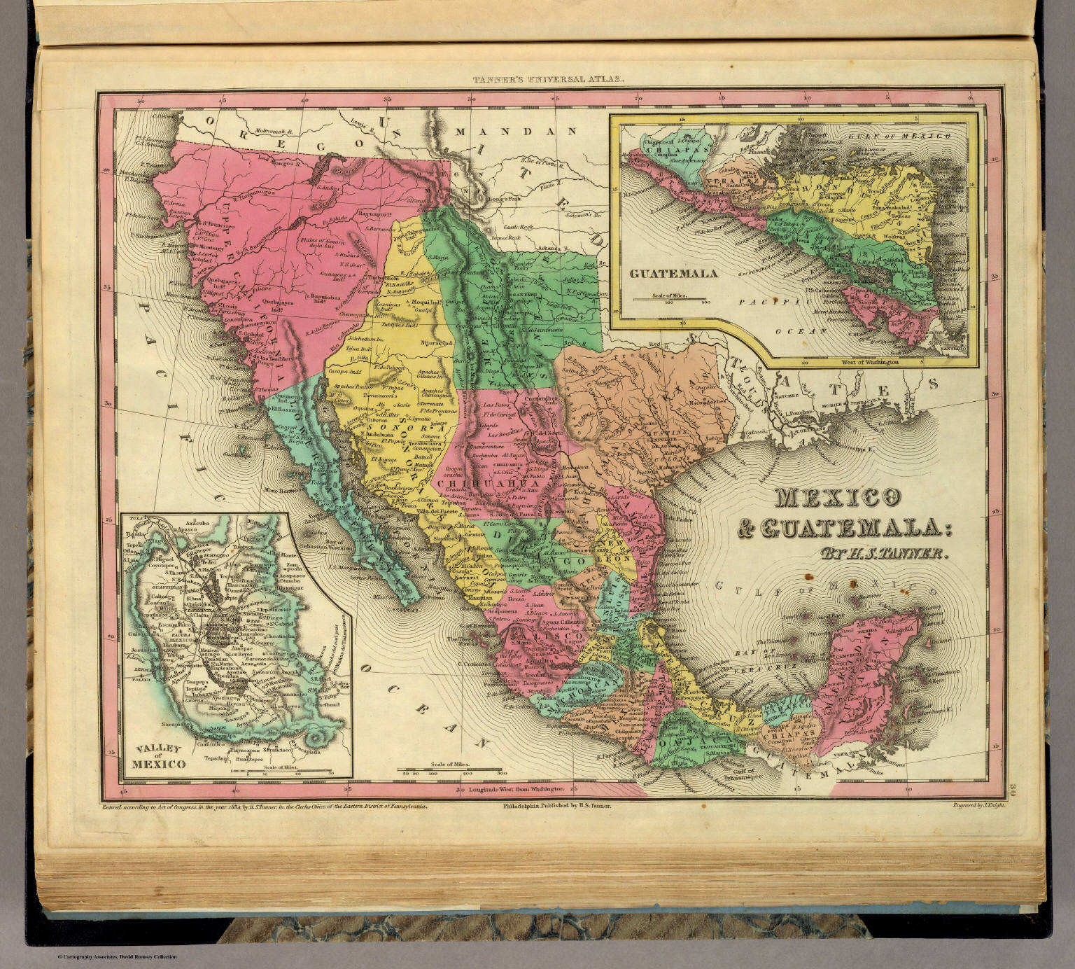
30. Mexico & Guatemala
Mexico en Guatemala
David Rumsey Map Collection
 Tanner's Universal Atlas (1836)
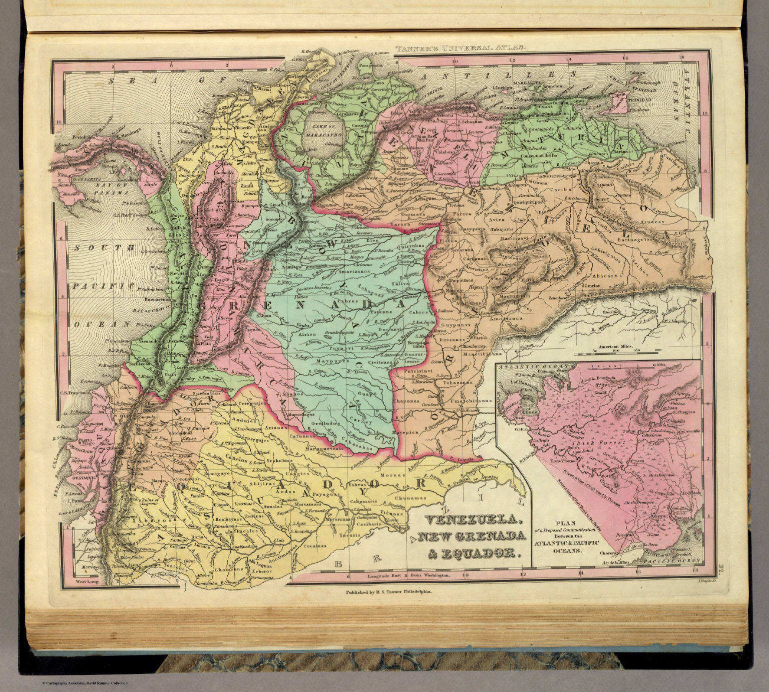
32. Venezuela, New Grenada & Equador
Venezuela, Nieuw-Granada (Colombia) en Ecuador
David Rumsey Map Collection
 Tanner's Universal Atlas (1836)
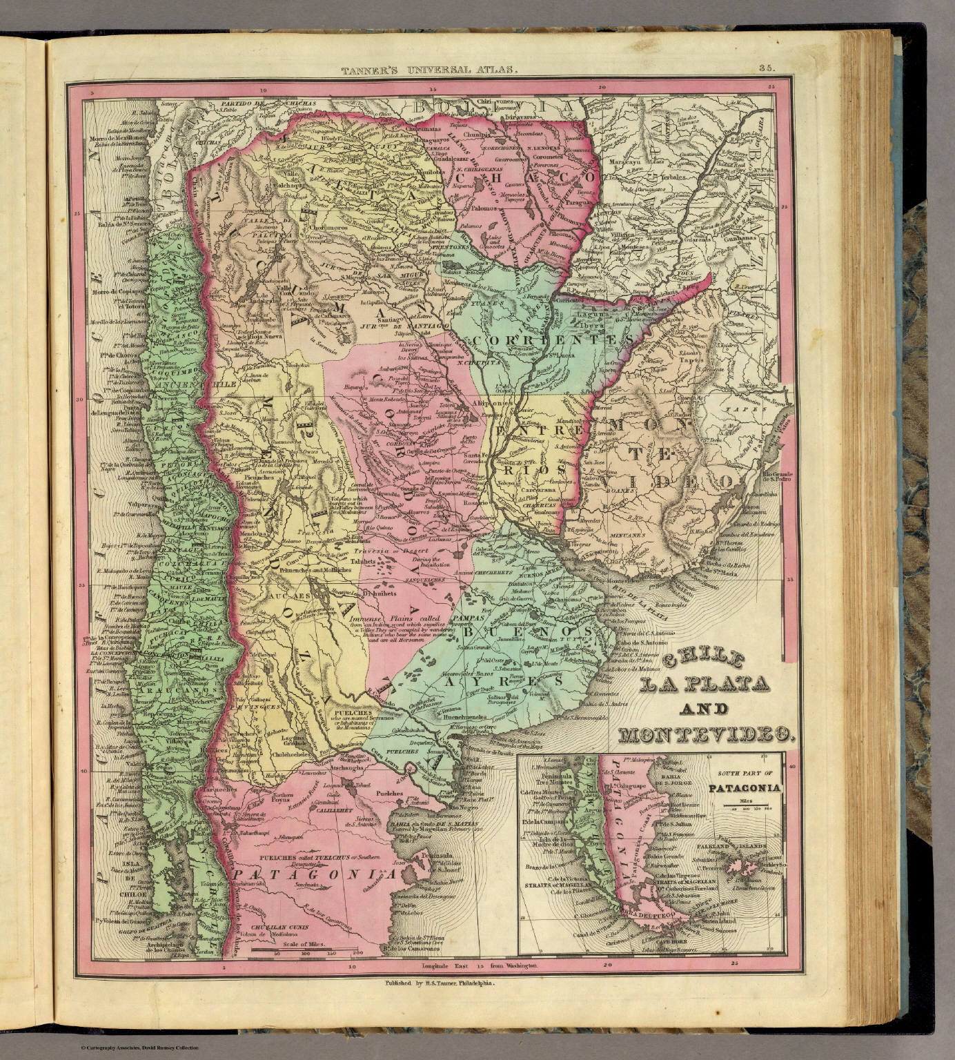
35. Chile La Plata and Montevideo
Chili, La Plata (Argentinië) en Montevideo (Uruguay)
David Rumsey Map Collection
 Tanner's Universal Atlas (1836)
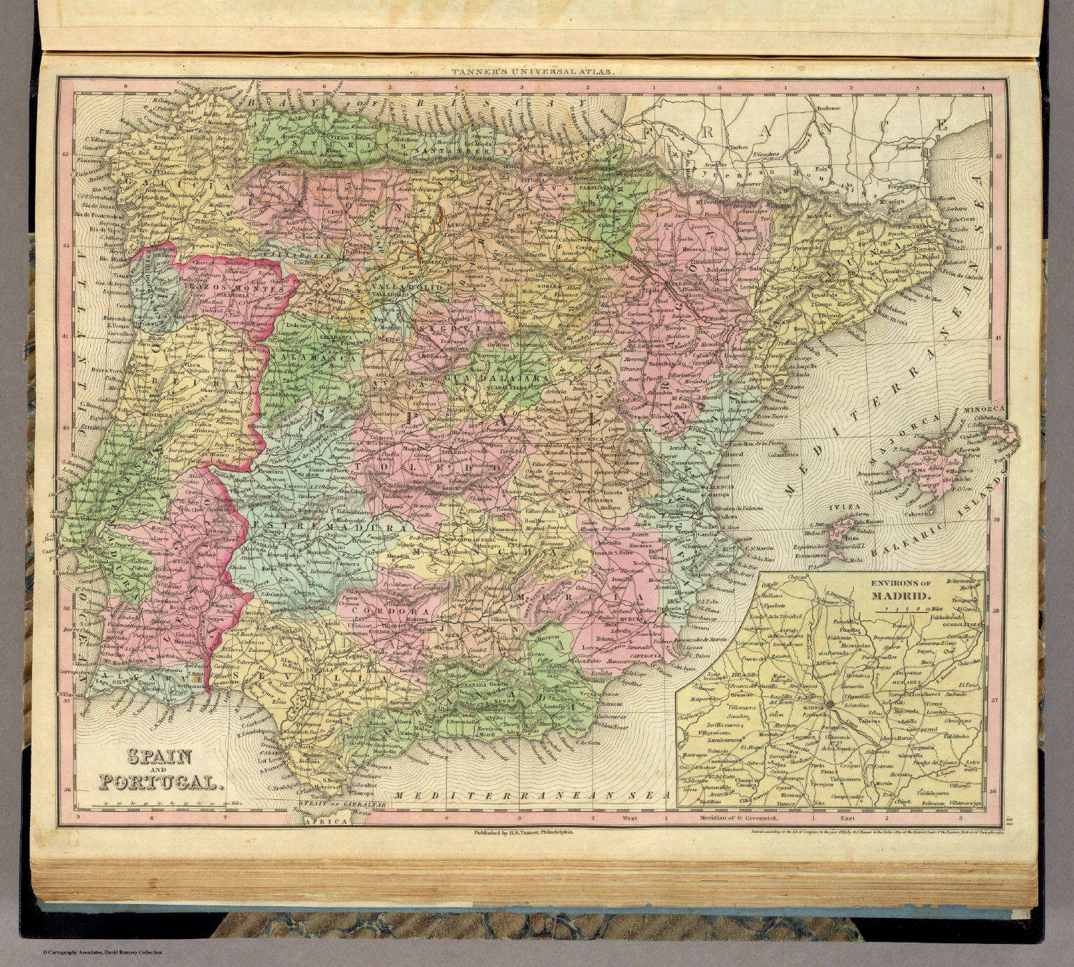
41. Spain and Portugal
Spanje en Portugal
David Rumsey Map Collection
 Tanner's Universal Atlas (1836)
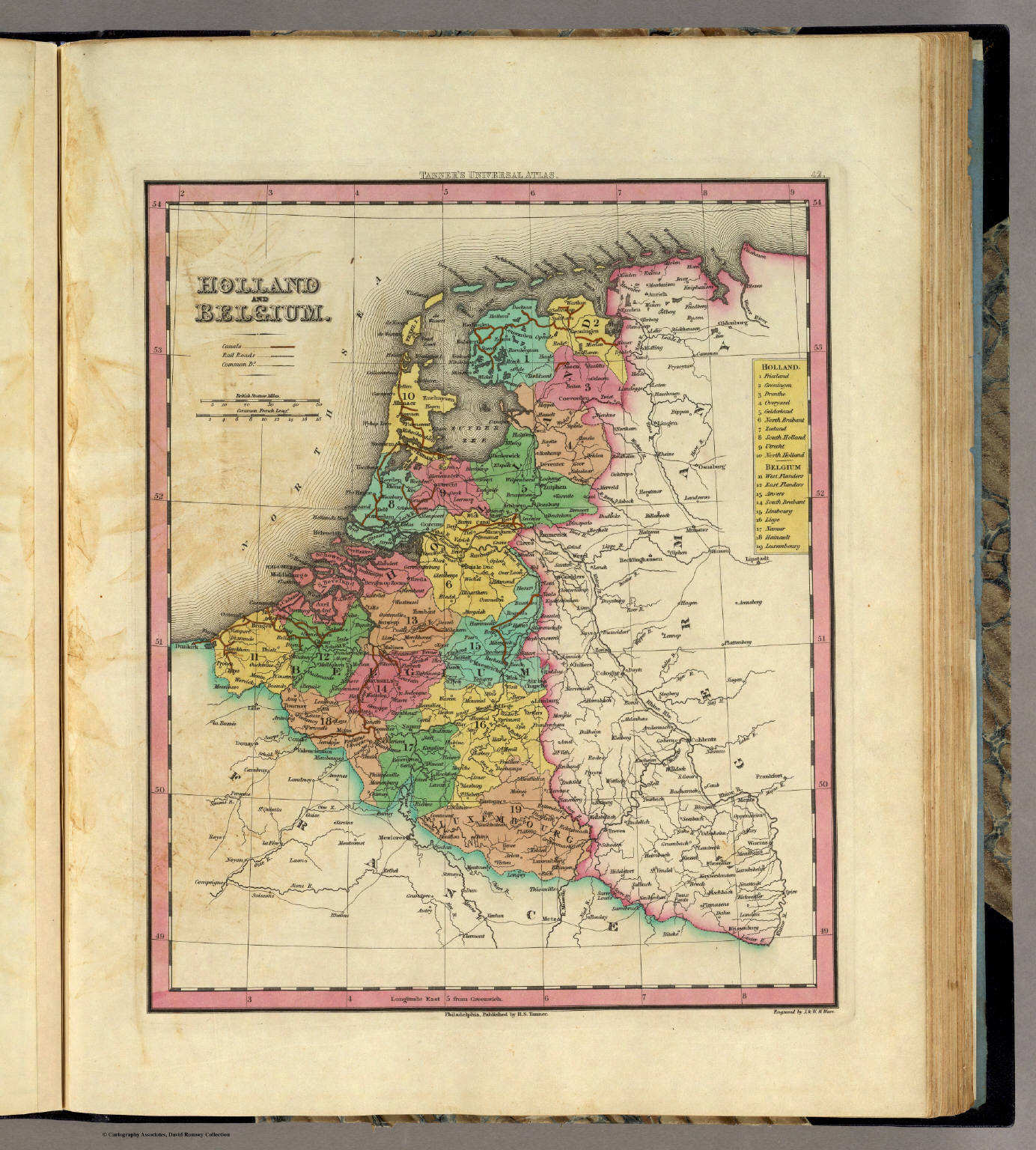
42. Holland and Belgium
Nederland en België
David Rumsey Map Collection
 Tanner's Universal Atlas (1836)
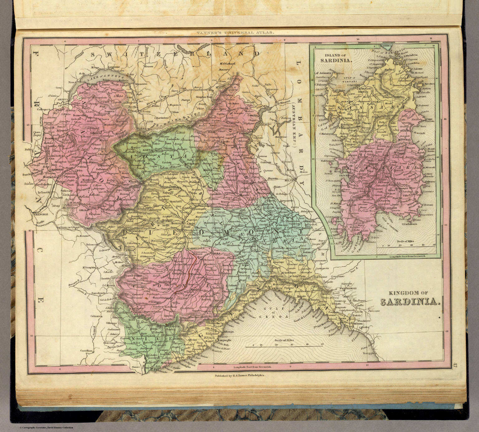
47. Kingdom of Sardinia
Koninkrijk Sardinië
David Rumsey Map Collection
 Tanner's Universal Atlas (1836)
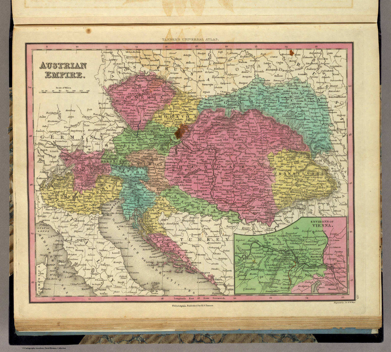
49. Austrian Empire
Keizerrijk Oostenrijk
David Rumsey Map Collection
 Tanner's Universal Atlas (1836)
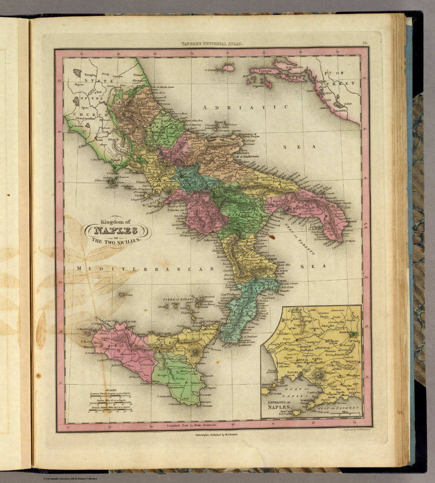
51. Kingdom of Naples or the Two Sicilies
Koninkrijk der Beide Siciliën
David Rumsey Map Collection
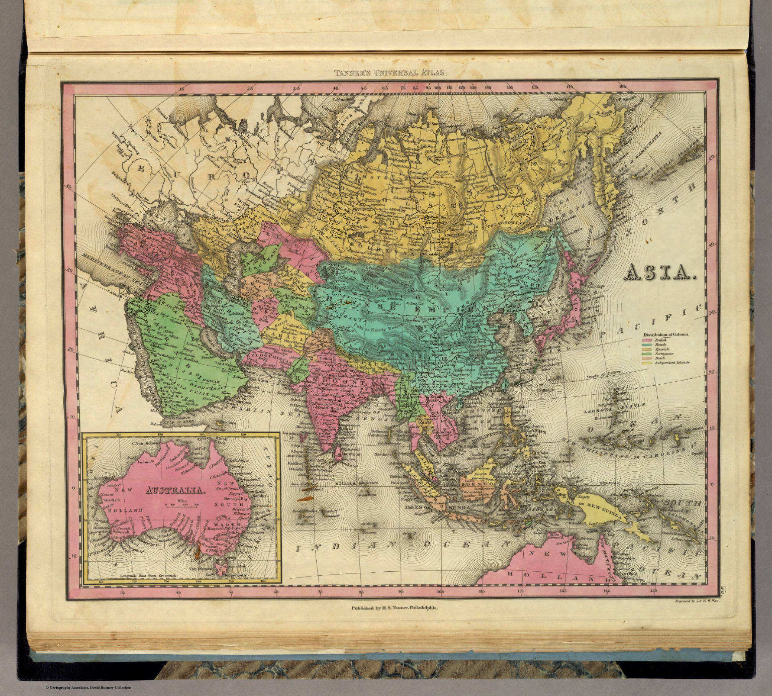
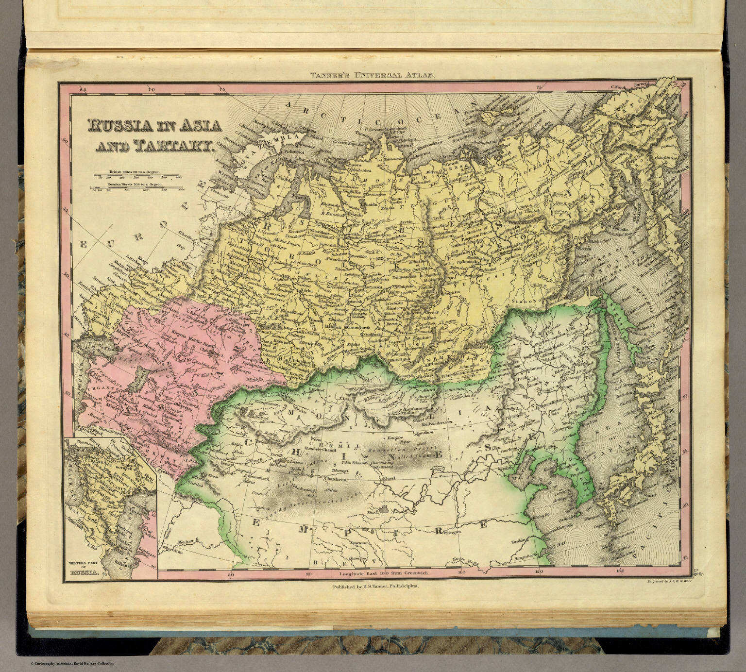 Tanner's Universal Atlas (1836)
56. Russia in Asia and Tartary
Aziatisch Rusland en Tartarije
David Rumsey Map Collection
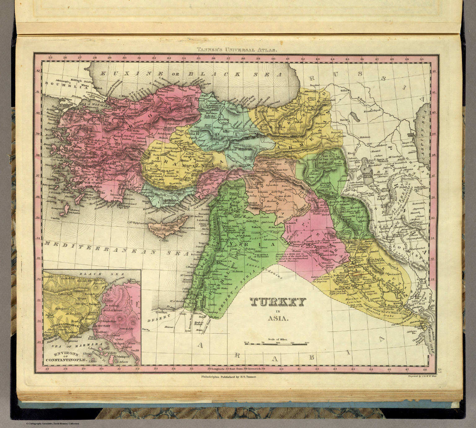
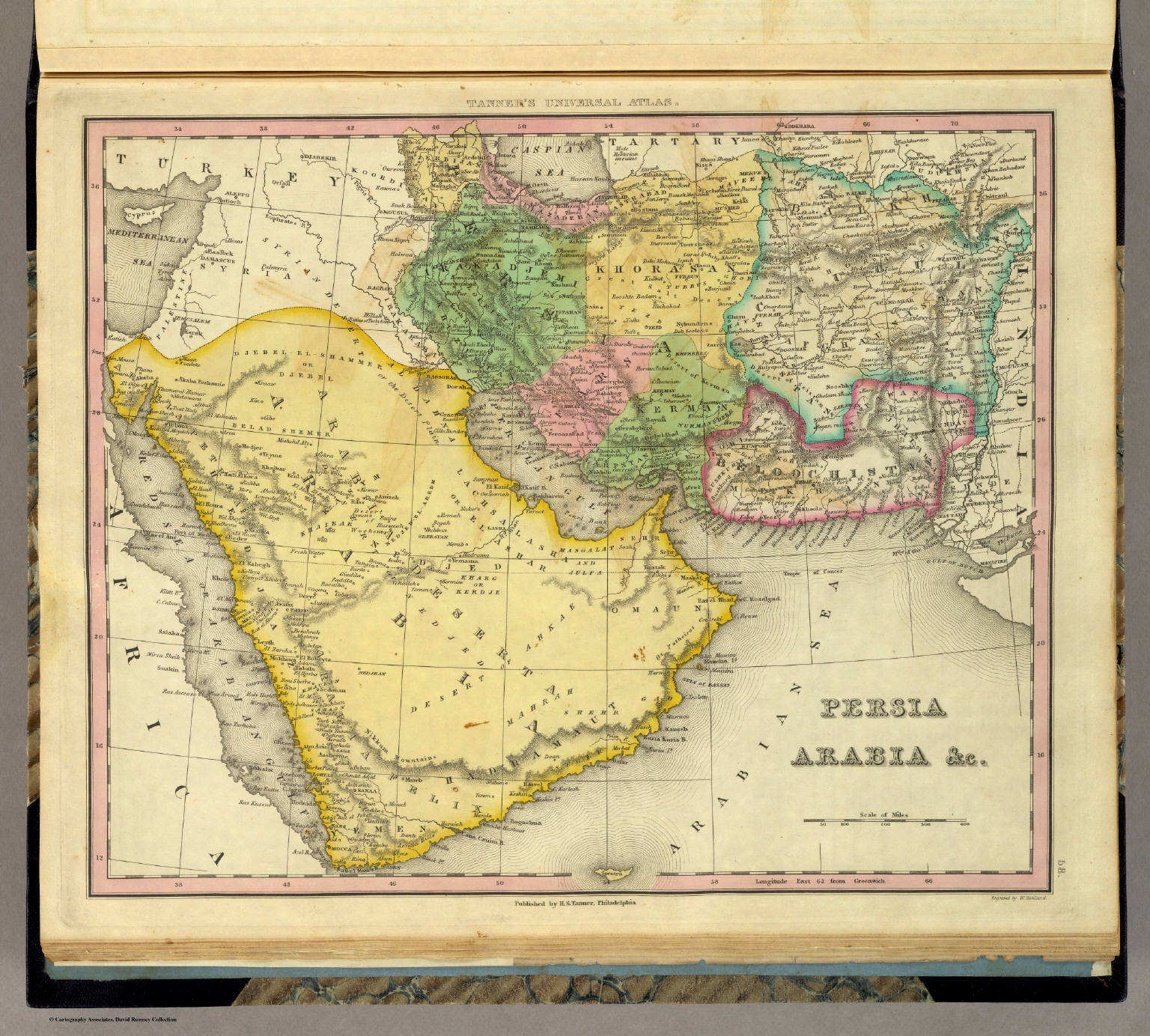 Tanner's Universal Atlas (1836)
58. Persia Arabia &c.
Perzië, Arabië enz.
David Rumsey Map Collection
 Tanner's Universal Atlas (1836)
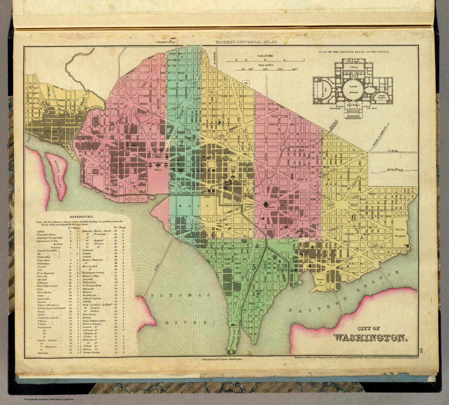
66. City of Washington
De stad Washington
David Rumsey Map Collection
 Tanner's Universal Atlas (1836)
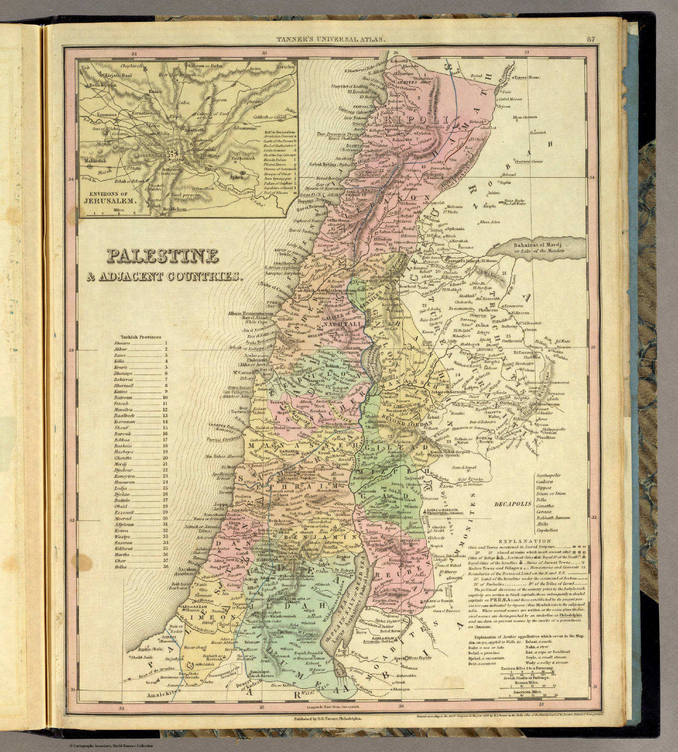
67. Palestine & Adjacent Countries
Palestina en aangrenzende landen
David Rumsey Map Collection
 Tanner's Universal Atlas (1836)
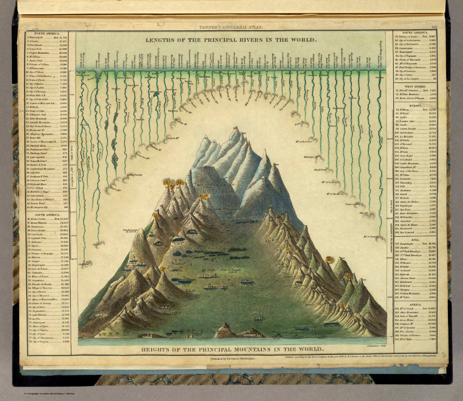
68. Heights of the Principal Mountains in the World
Hoogten van de belangrijkste bergen
David Rumsey Map Collection
- Beeldmateriaal uit David Rumsey Map Collection valt onder een Creative Commons License.
- Images from the David Rumsey Map Collection are licensed under a Creative Commons License.
HTML © M. Witkam, 2009
![]()
![]()