Justus Perthes. Atlas portátil, 1e druk (1894)
Justus Perthes' Taschen-Atlas, 24e druk (1888)
See below for (a summary of) this text in English.
Hieronder staan de kaarten van de Spaanse uitgave (1894) en de Duitse uitgave (1888) van Perthes' Zakatlas ter vergelijking naast elkaar. Daarbij horen ook de volgende pagina's
- Beschrijving van de Spaanse atlas, 1e-11e druk (1894-1921)
- Plaatjes van de Spaanse atlas, 1e-11e druk (1894-1921)
- Tabellen en lijsten bij de Spaanse atlas, 1e-11e druk (1894-1921)
en ook
- Plaatjes van de Spaanse atlas, 1e druk (Spaanse uitgave, 1894)
- Plaatjes van de Spaanse atlas, 6e druk (Spaanse uitgave, 1910)
- Plaatjes van de Spaanse atlas, 11e druk (Zuid-Amerikaanse uitgave, 1921)
en
- Beschrijving van de Duitse atlas, 20e-59e druk (1884-1923)
- Plaatjes van de Duitse atlas, 20e-59e druk (1884-1923)
- Tabellen en lijsten bij de Duitse atlas, 20e-59e druk (1884-1923)
en ook
- Plaatjes van de Duitse atlas, 24e druk (Duitse uitgave, 1888)
- Plaatjes van de Duitse atlas, 39e druk (Oostenrijke uitgave, 1902)
- Plaatjes van de Duitse atlas, 50e druk (Duitse uitgave, 1913)
- Plaatjes van de Duitse atlas, 57e druk (Duitse uitgave, 1921)
Plaatjes
Klik op een plaatje voor een vergroting.
Justus Perthes. Atlas portátil, 1st edition (1894)
Justus Perthes' Taschen-Atlas, 24th edition (1888)
- Below are pictures of the maps of the Spanish version (1891) and the
German version (1888) of Perthes Pocket Atlas side by side for comparison
purposes. Related pages
- Description of the Spanish atlas, 1st-3rd editions (1894-1921)
- Pictures of the Spanish atlas, 1st-3rd editions (1894-1921)
- Tables and lists to the Spanish atlas, 1st-3rd editions (1894-1921)
- Pictures of the Spanish atlas, 1st edition (Spanish version, 1894)
- Pictures of the Spanish atlas, 6th edition (Spanish version, 1910)
- Pictures of the Spanish atlas, 11th edition (South American version, 1921)
- Description of the German atlas, 20th-59th editions (1884-1923)
- Pictures of the German atlas, 20th-59th editions (1884-1923)
- Tables and lists to the German atlas, 20th-59th editions (1884-1923)
Pictures
Click on a picture to enlarge.
Band / Binding
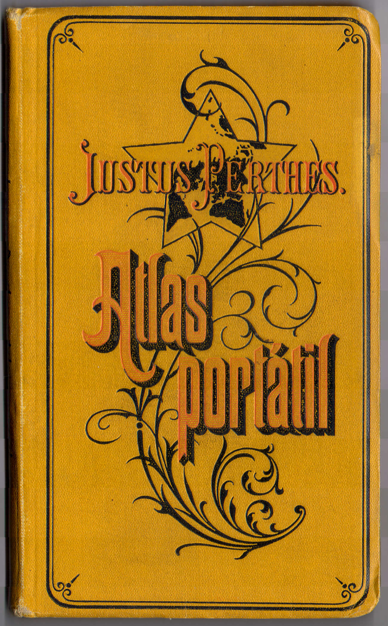 Perthes. Atlas portátil (1894)
Voorkant band / Front cover
 Perthes' Taschen-Atlas (1888)
Voorkant band / Front cover
 Perthes. Atlas portátil (1894)
Titelpagina / Title page
 Perthes' Taschen-Atlas (1888)
Titelpagina / Title page
 Perthes. Atlas portátil (1894)
1. Planisferios
Wereldkaarten / World maps
 Perthes' Taschen-Atlas (1888)
1. Weltkarten
Wereldkaarten / World maps
 Perthes. Atlas portátil (1894)
2. Europa
Europa / Europe
 Perthes' Taschen-Atlas (1888)
2. Europa
Europa / Europe
 Perthes. Atlas portátil (1894)
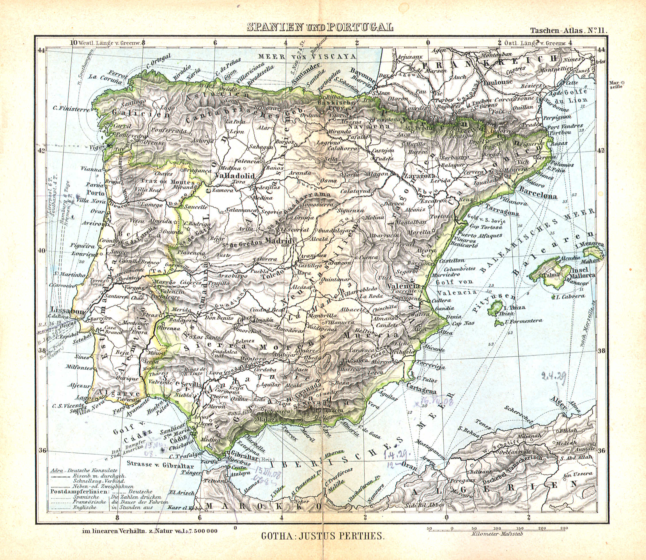
3. España y Portugal
Spanje en Portugal / Spain and Portugal
 Perthes' Taschen-Atlas (1888)
11. Spanien und Portugal
Spanje en Portugal / Spain and Portugal
 Perthes. Atlas portátil (1894)
4. Península Ibérica, Parte noroeste
Noordwestelijk Iberisch Schiereiland / Northwestern Iberian Peninsula
 Perthes' Taschen-Atlas (1888)
geen overeenkomstige kaart / no corresponding map
 Perthes. Atlas portátil (1894)
5. Península Ibérica, Parte nordeste
Noordoostelijk Iberisch Schiereiland / Northeastern Iberian Peninsula
Perthes' Taschen-Atlas (1888)
geen overeenkomstige kaart / no corresponding map
 Perthes. Atlas portátil (1894)
6. Península Ibérica, Parte meridional
Zuidelijk Iberisch Schiereiland / Southern Iberian Peninsula
Perthes' Taschen-Atlas (1888)
geen overeenkomstige kaart / no corresponding map
 Perthes. Atlas portátil (1894)
7. Las más importantes posesiones españolas
De belangrijkste Spaanse bezittingen / 7. The most important Spanish possessions
 Perthes' Taschen-Atlas (1888)
geen overeenkomstige kaart / no corresponding map
 Perthes. Atlas portátil (1894)
8. Francia
Frankrijk / France
 Perthes' Taschen-Atlas (1888)
10. Frankreich
Frankrijk / France
 Perthes. Atlas portátil (1894)
9. Italia
Italië / Italy
 Perthes' Taschen-Atlas (1888)
9. Italien
Italië / Italy
 Perthes. Atlas portátil (1894)
10. Austria-Hungría
Oostenrijk-Hongarije / Austria-Hungary
 Perthes' Taschen-Atlas (1888)
8. Österreich-Ungarn
Oostenrijk-Hongarije / Austria-Hungary
 Perthes. Atlas portátil (1894)
11. Suiza
Zwitserland / Switzerland
 Perthes' Taschen-Atlas (1888)
7. Schweiz
Zwitserland / Switzerland
 Perthes. Atlas portátil (1894)
12. Alemania y Dinamarca
Duitsland en Denemarken / Germany and Denmark
 Perthes' Taschen-Atlas (1888)
3. Deutschland
Duitsland / Germany
 Perthes. Atlas portátil (1894)
geen overeenkomstige kaart / no corresponding map
 Perthes' Taschen-Atlas (1888)
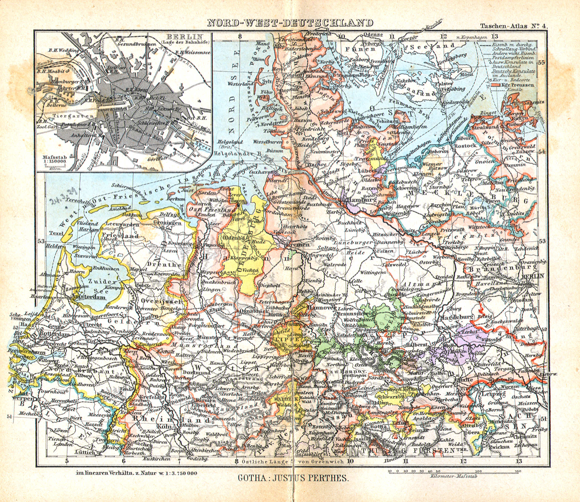
4. Nord-West-Deutschland
Noordwest-Duitsland / Northwest Germany
Perthes. Atlas portátil (1894)
geen overeenkomstige kaart / no corresponding map
 Perthes' Taschen-Atlas (1888)
5. Nord-Ost-Deutschland
Noordoost-Duitsland / Northeast Germany
Perthes. Atlas portátil (1894)
geen overeenkomstige kaart / no corresponding map
 Perthes' Taschen-Atlas (1888)
6. Süd-Deutschland
Zuid-Duitsland / South Germany
Perthes. Atlas portátil (1894)
12. Alemania y Dinamarca
Duitsland en Denemarken / Germany and Denmark
 Perthes' Taschen-Atlas (1888)
13. Schweden u. Norwegen, Dänemark
Zweden en Noorwegen, Denemarken / Sweden and Norway, Denmark
 Perthes. Atlas portátil (1894)
13. Islas Británicas, Bélgica y Países Bajos
Britse Eilanden, Nederland en België / British Isles, Netherlands and Belgium
 Perthes' Taschen-Atlas (1888)
12. Britische Inseln, Niederlande & Belgien
Britse Eilanden, Nederland en België / British Isles, Netherlands and Belgium
 Perthes. Atlas portátil (1894)
14. Rusia y Escandinavia
Rusland en Scandinavië / Russia and Scandinavia
 Perthes' Taschen-Atlas (1888)
14. Russland
Rusland / Russia
 Perthes. Atlas portátil (1894)
15. Península de los Balkanes
Balkanschiereiland / Balkan Peninsula
 Perthes' Taschen-Atlas (1888)
15. Balkan-Halbinsel
Balkanschiereiland / Balkan Peninsula
 Perthes. Atlas portátil (1894)
16. Asia
Azië / Asia
 Perthes' Taschen-Atlas (1888)
16. Asien
Azië / Asia
 Perthes. Atlas portátil (1894)
17. Asia Sudoeste
Zuidwest-Azië / Southwest Asia
 Perthes' Taschen-Atlas (1888)
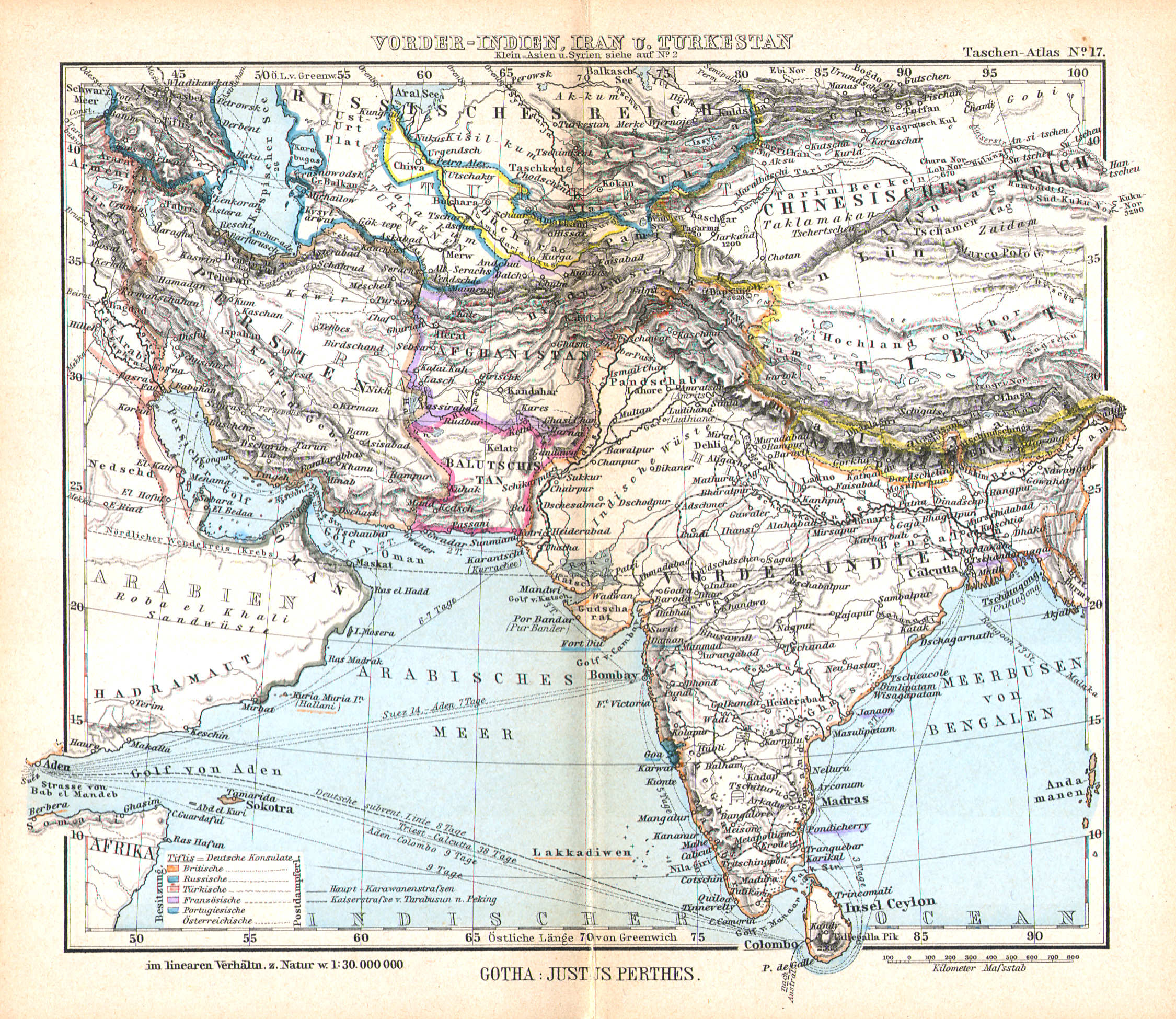
17. Vorder-Indien, Iran u. Turkestan
Voor-Indië, Iran en Turkestan / India, Iran and Turkestan
 Perthes. Atlas portátil (1894)
18. Asia Sudeste
Zuidoost-Azië / Southeast Asia
 Perthes' Taschen-Atlas (1888)
18. Süd-China u. Ostindischer Arpl.
Zuid-China en de Oostindische eilanden / Southern China and the East Indian Archipelago
 Perthes. Atlas portátil (1894)
19. África
Afrika / Africa
 Perthes' Taschen-Atlas (1888)
19. Afrika
Afrika / Africa
 Perthes. Atlas portátil (1894)
20. Marruecos y Argelia, planos de Madrid y de Lisboa
Marokko en Algerije, plattegronden van Madrid en Lissabon / Morocco, Algeria and plans of Madrid and Lisbon
Perthes' Taschen-Atlas (1888)
geen overeenkomstige kaart / no corresponding map
 Perthes. Atlas portátil (1894)
21. Oceanía
Australië, Oceanië / Australia, Oceania
 Perthes' Taschen-Atlas (1888)
20. Australien u. Polynesien
Australië, Oceanië / Australia, Oceania
 Perthes. Atlas portátil (1894)
22. América del Sur
Zuid-Amerika / South America
 Perthes' Taschen-Atlas (1888)
24. Süd-Amerika
Zuid-Amerika / South America
 Perthes. Atlas portátil (1894)
23. República Argentina central
Midden-Argentinië / Central Argentina
Perthes' Taschen-Atlas (1888)
geen overeenkomstige kaart / no corresponding map
 Perthes. Atlas portátil (1894)
24. Parte setentrional y central de Chile
Noord- en Midden-Chili / Northern and Central Chile
Perthes' Taschen-Atlas (1888)
geen overeenkomstige kaart / no corresponding map
 Perthes. Atlas portátil (1894)
25. Partes de México, Perú, Ecuador y Venezuela
Delen van Mexico, Peru, Ecuador en Venezuela / Parts of Mexico, Peru, Ecuador and Venezuela
Perthes' Taschen-Atlas (1888)
geen overeenkomstige kaart / no corresponding map
 Perthes. Atlas portátil (1894)
26. América central, las Antillas y la parte setentrional de América del Sur
Midden-Amerika, de Antillen en noordelijk Zuid-Amerika / Central America, the Antilles islands and northern South America
 Perthes' Taschen-Atlas (1888)
23. Central-Amerika, West-Indien und das nördliche Süd-Amerika
Midden-Amerika, West-Indië en noordelijk Zuid-Amerika / Central America, West Indies and northern South America
 Perthes. Atlas portátil (1894)
27. América del Norte
Noord-Amerika / North America
 Perthes' Taschen-Atlas (1888)
21. Nord-Amerika
Noord-Amerika / North America
 Perthes. Atlas portátil (1894)
28. Estados Unidos y México
Verenigde Staten en Mexico / United States and Mexico
 Perthes' Taschen-Atlas (1888)
22. Vereinigte Staaten und Mexico
Verenigde Staten en Mexico / United States and Mexico
© M. Witkam, 2011
![]()
![]()