Kogutowicz-Littke(-Debes): Világatlasz (1912-1914)
en Debes' Neuer Handatlas, 4e druk (1913)
See below for (a summary of) this text in English.
Hieronder staan plaatjes van Kogutowicz-Littke(-Debes): Világatlasz en Debes' Neuer Handatlas, 4e druk ter vergelijking naast elkaar. Daarbij horen ook de volgende pagina's
- Beschrijving van Kogutowicz-Littke: Világatlasz
- Plaatjes van Kogutowicz-Littke: Világatlasz
- Tabellen en lijsten bij Kogutowicz-Littke: Világatlasz
en
- Beschrijving van Debes' Neuer Handatlas
- Plaatjes van Debes' Neuer Handatlas
- Tabellen en lijsten bij Debes' Neuer Handatlas
Plaatjes
Klik op een plaatje voor een vergroting.
Kogutowicz-Littke(-Debes): Világatlasz (1912-1914)
and Debes' Neuer Handatlas, 4th edition (1913)
- Below are pictures of Kogutowicz-Littke(-Debes): Világatlasz and Debes'
Neuer Handatlas, 4th edition side by side for comparison purposes. Related
pages
- Description of Kogutowicz-Littke: Világatlasz
- Pictures of Kogutowicz-Littke: Világatlasz
- Tables and lists to Kogutowicz-Littke: Világatlasz
- Description of Debes' Neuer Handatlas
- Pictures of Debes' Neuer Handatlas
- Tables and lists to Debes' Neuer Handatlas
Pictures
Click on a picture to enlarge.
Kaarten / Maps Wereldkaarten / World maps
 Téleki-Kogutowicz: Világatlasz, 1912-1914
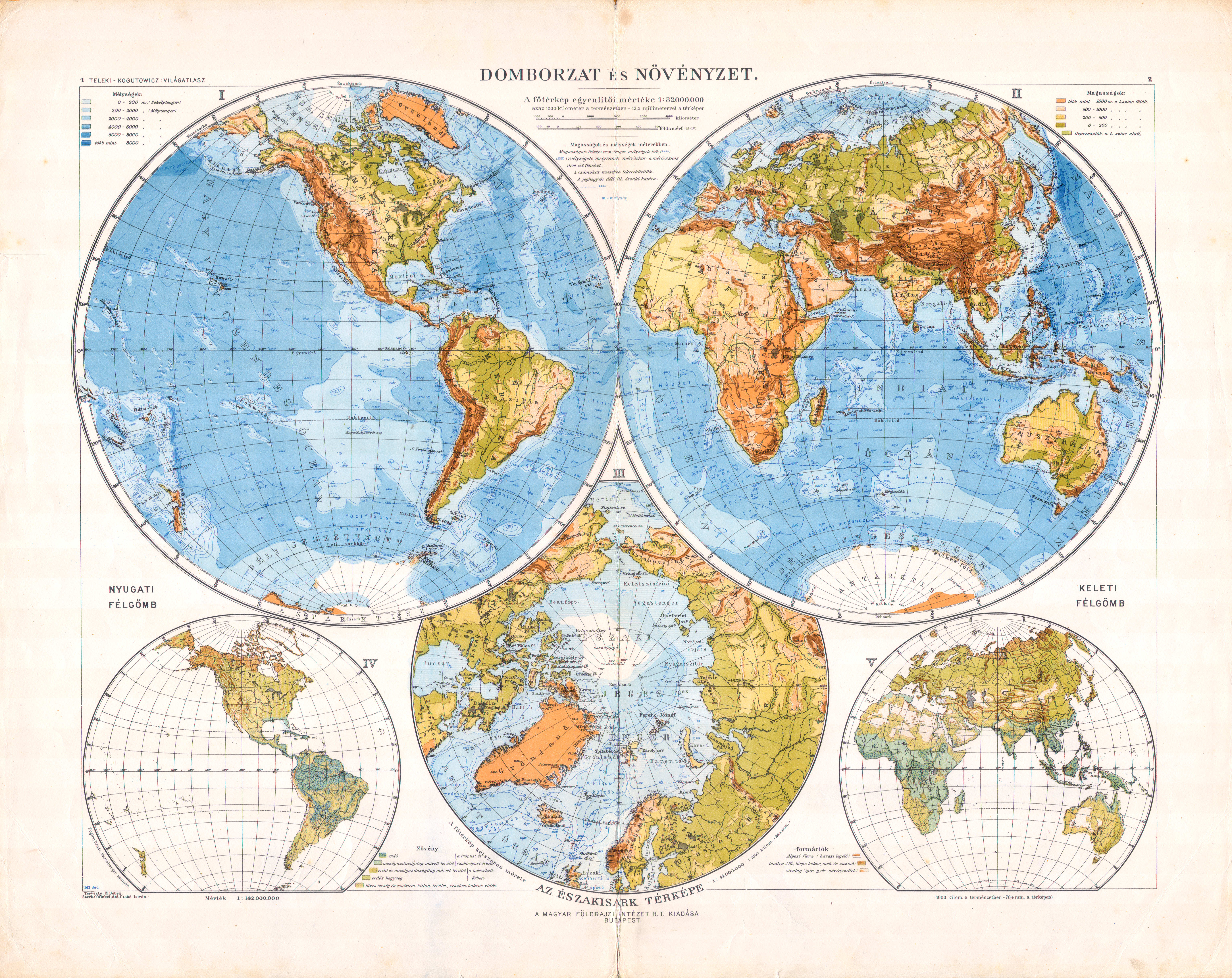
1-2. Domborzat és növényzet XL
Reliëf en vegetatie / Relief and vegetation
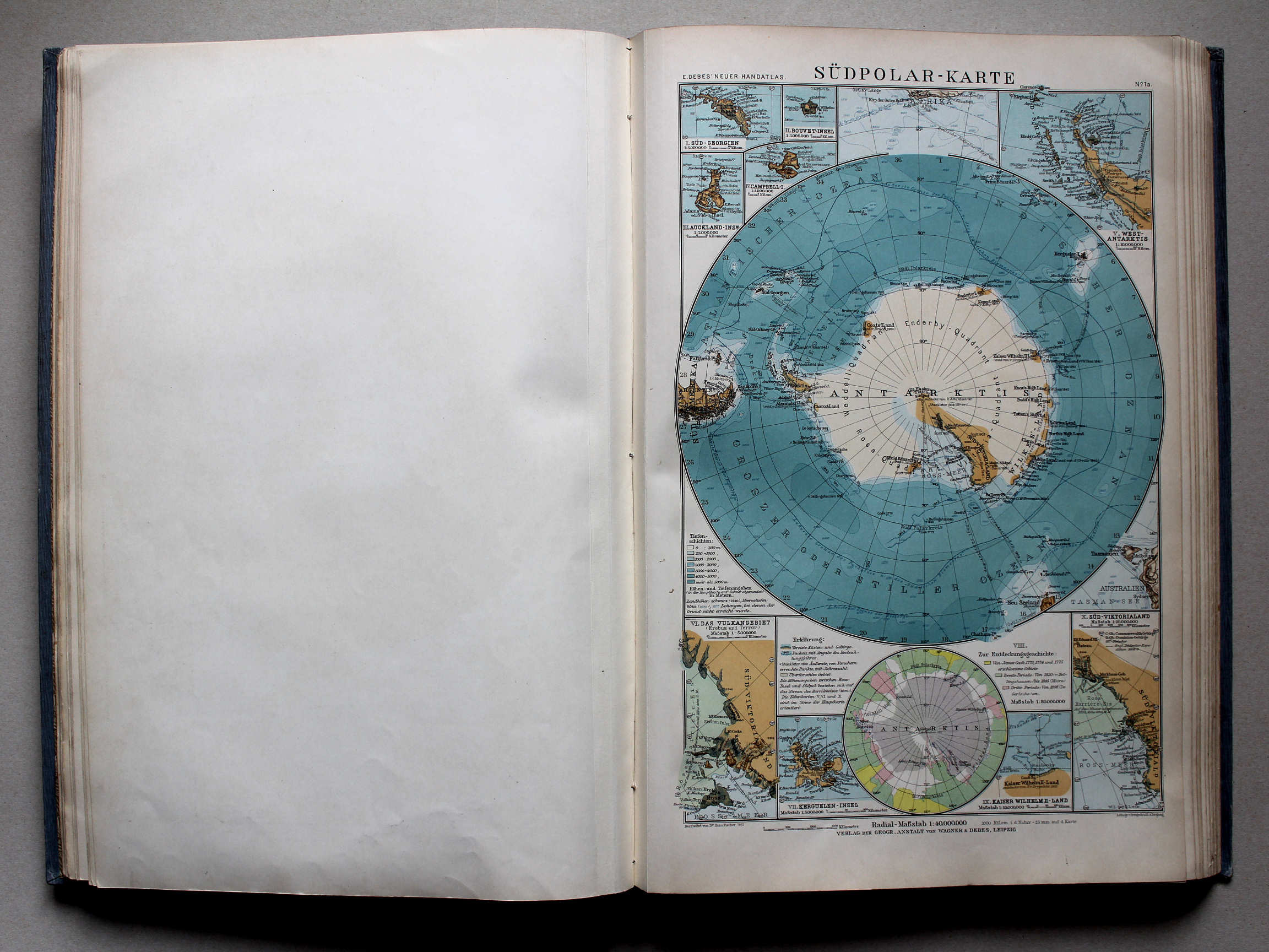
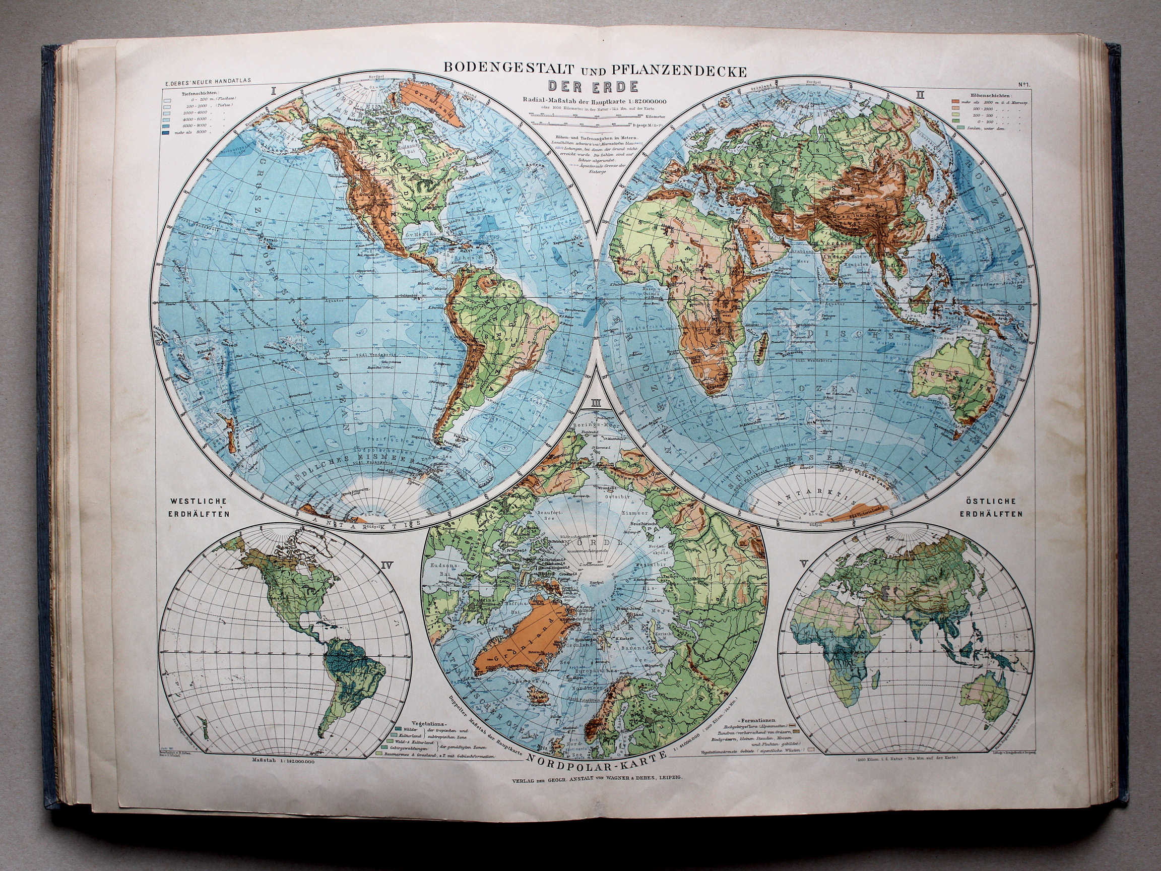 Debes' Neuer Handatlas, 1913
1. Bodengestalt und Pflanzendecke der Erde XL
Reliëf en vegetatie op Aarde / Relief and vegetation on Earth

![Kogutowicz-Littke: Világatlasz, 1912-1914
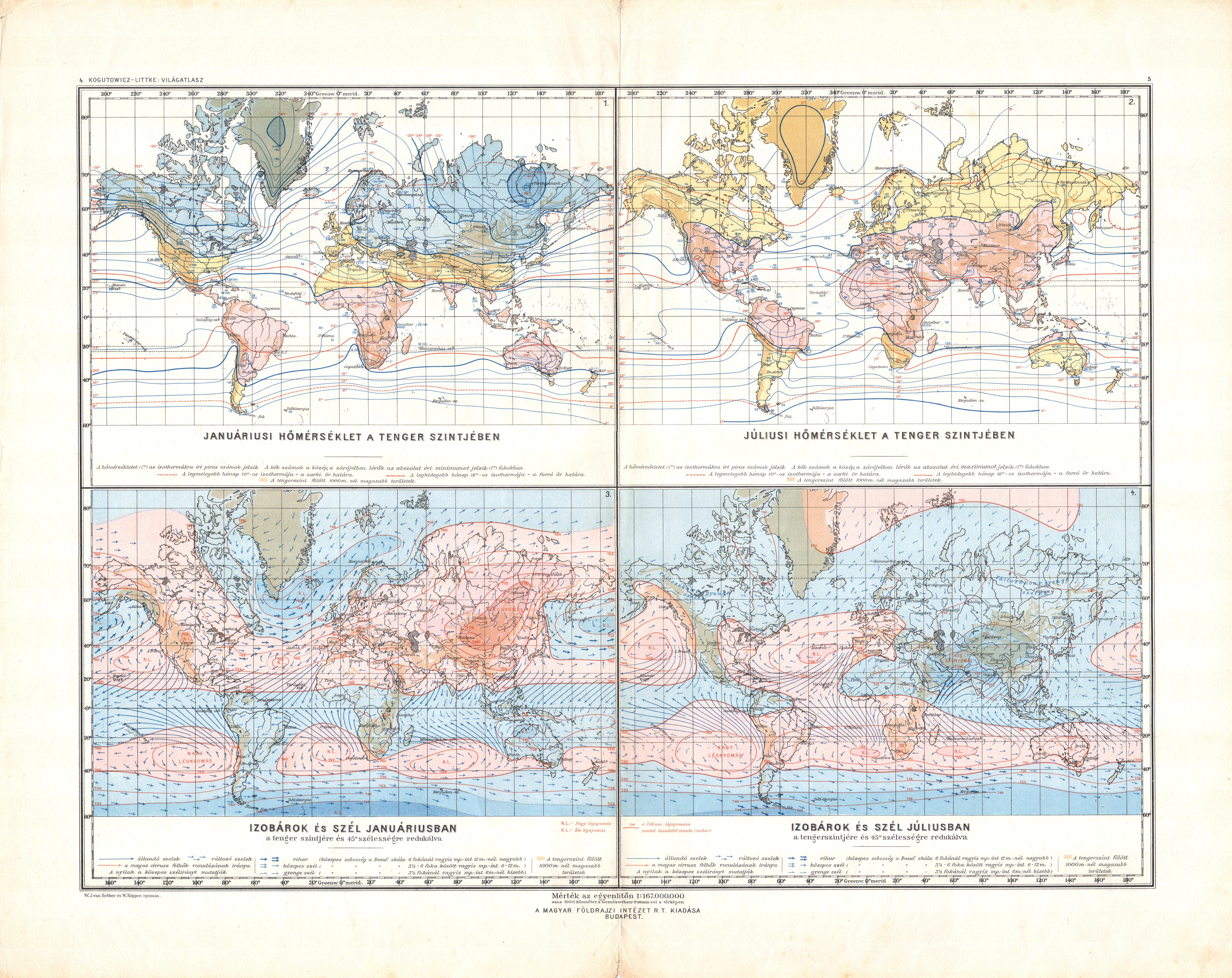
4-5. [Világtérképek: hőmérséklet, izobárok és szél]](../debhh01/picslarge/debhh1914k004005.jpg) Kogutowicz-Littke: Világatlasz, 1912-1914
Kogutowicz-Littke: Világatlasz, 1912-1914
4-5. [Világtérképek: hőmérséklet, izobárok és szél] XL
[Wereldkaarten: temperatuur, isobaren en wind] / [World maps: temperature, isobars and wind]
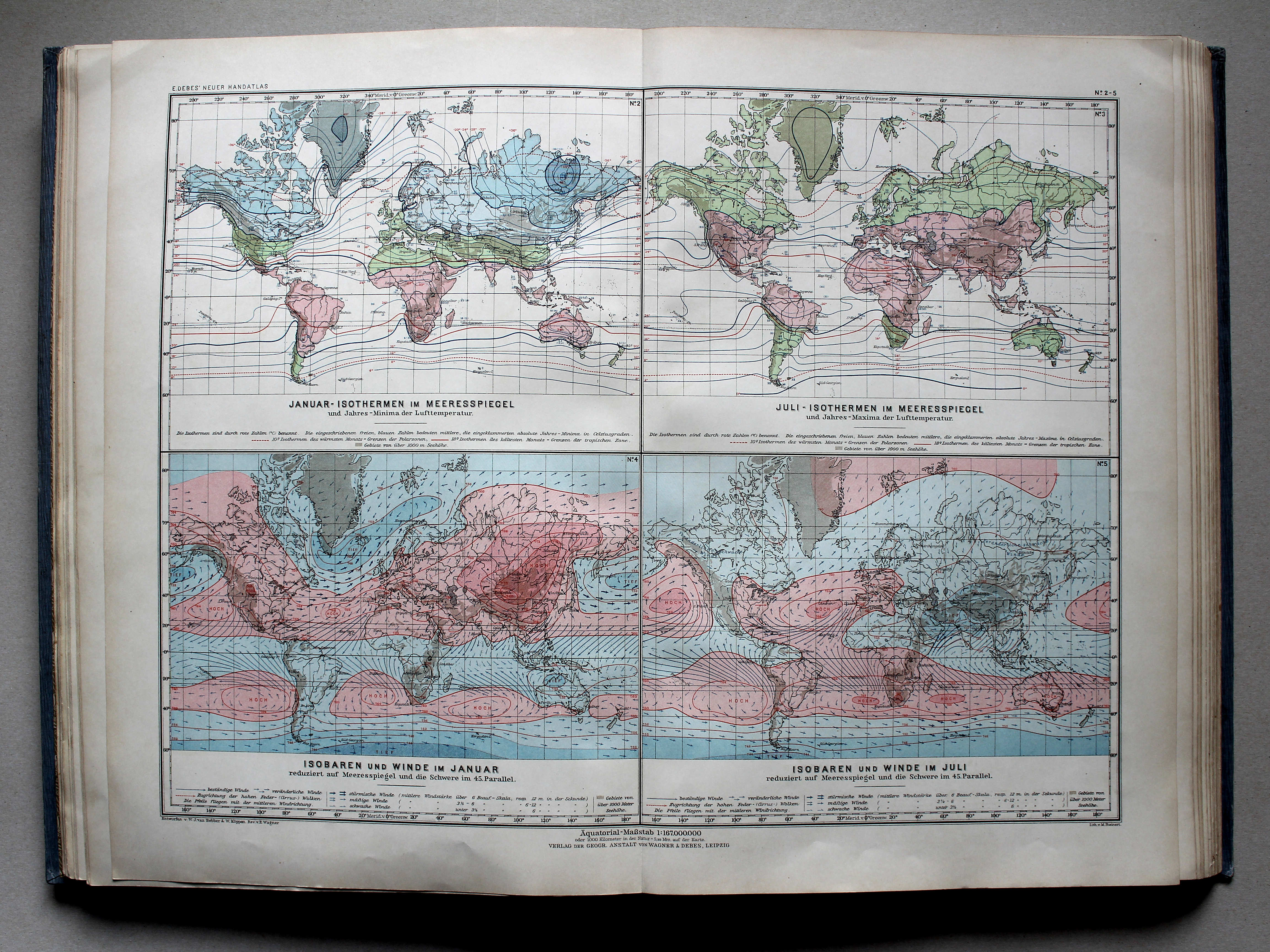
![Debes' Neuer Handatlas, 1913
2-5. [Klimakarten der Erde]](../debha04/picslarge/debha1913k002x.jpg)
![Kogutowicz-Littke: Világatlasz, 1912-1914
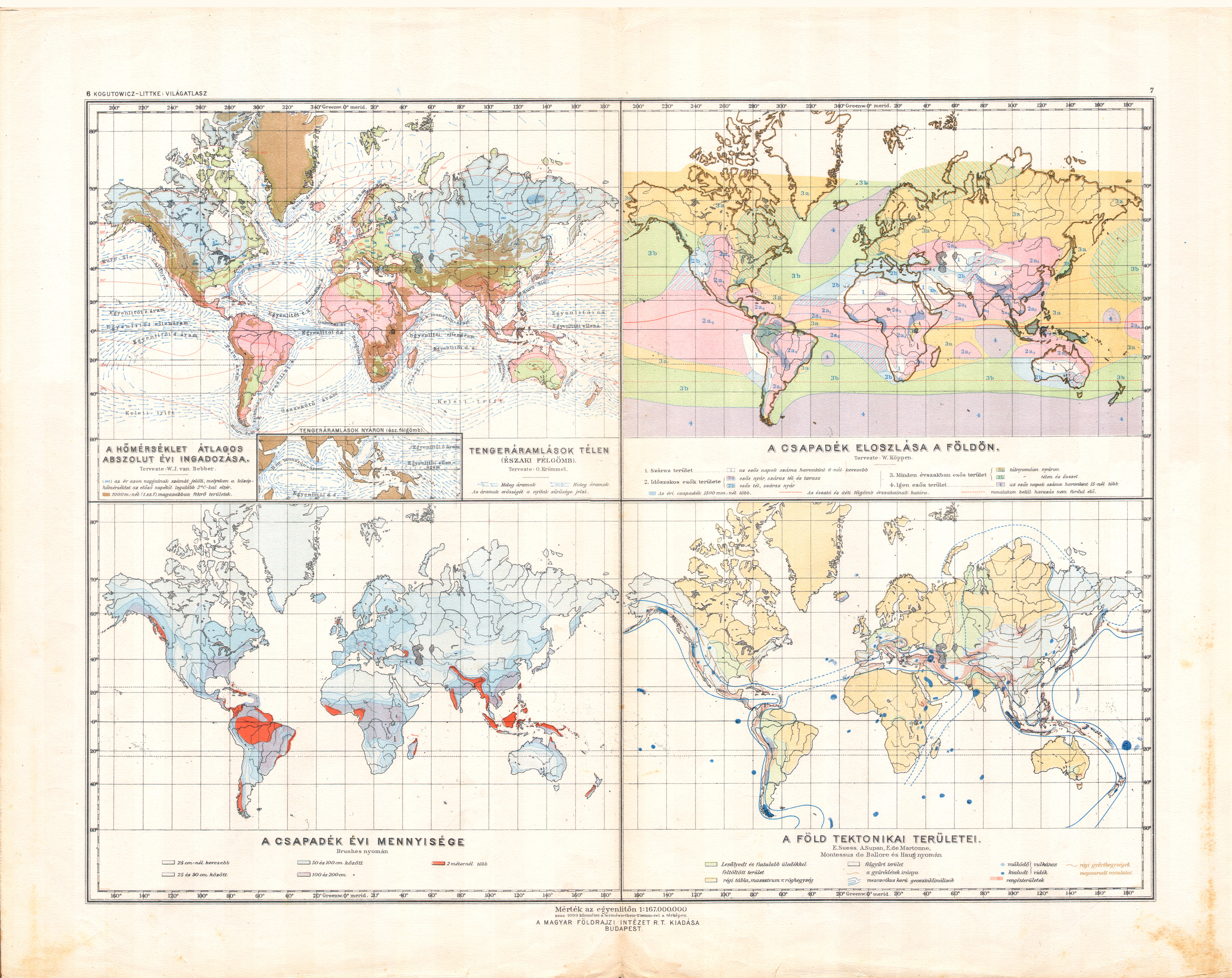
6-7. [Világtérképek: hőmérséklet ingadozása, csapadék, tektonika]](../debhh01/picslarge/debhh1914k006007.jpg) Kogutowicz-Littke: Világatlasz, 1912-1914
Kogutowicz-Littke: Világatlasz, 1912-1914
6-7. [Világtérképek: hőmérséklet ingadozása, csapadék, tektonika] XL
[Wereldkaarten: temperatuurschommeling, neerslag, tektoniek] / [World maps: temperature fluctuation, precipitation, tectonics]
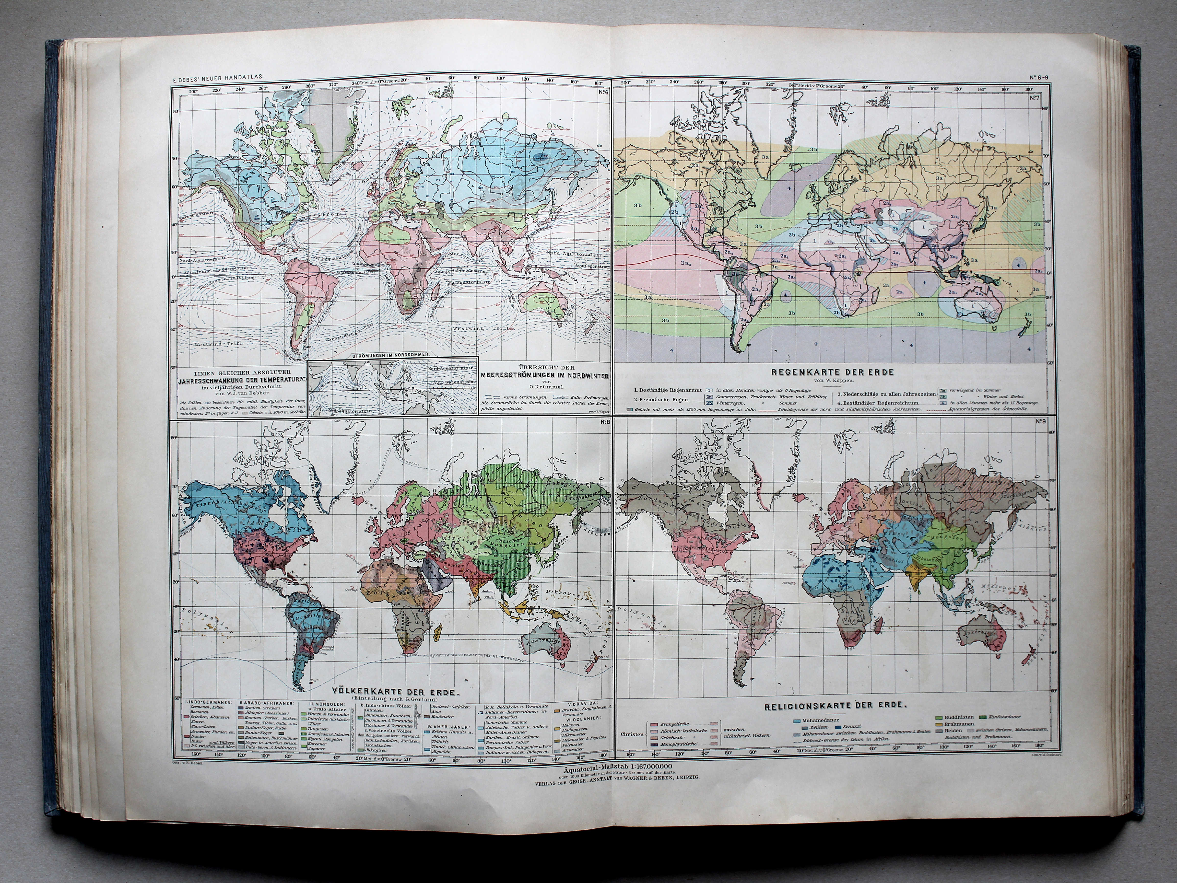
![Debes' Neuer Handatlas, 1913
6-9. [Klima- und Völkerkarten der Erde]](../debha04/picslarge/debha1913k006x.jpg) Debes' Neuer Handatlas, 1913
Debes' Neuer Handatlas, 1913
6-9. [Klima- und Völkerkarten der Erde] XL
[Klimatologie en volkenkunde] / [Climatology and ethnography]
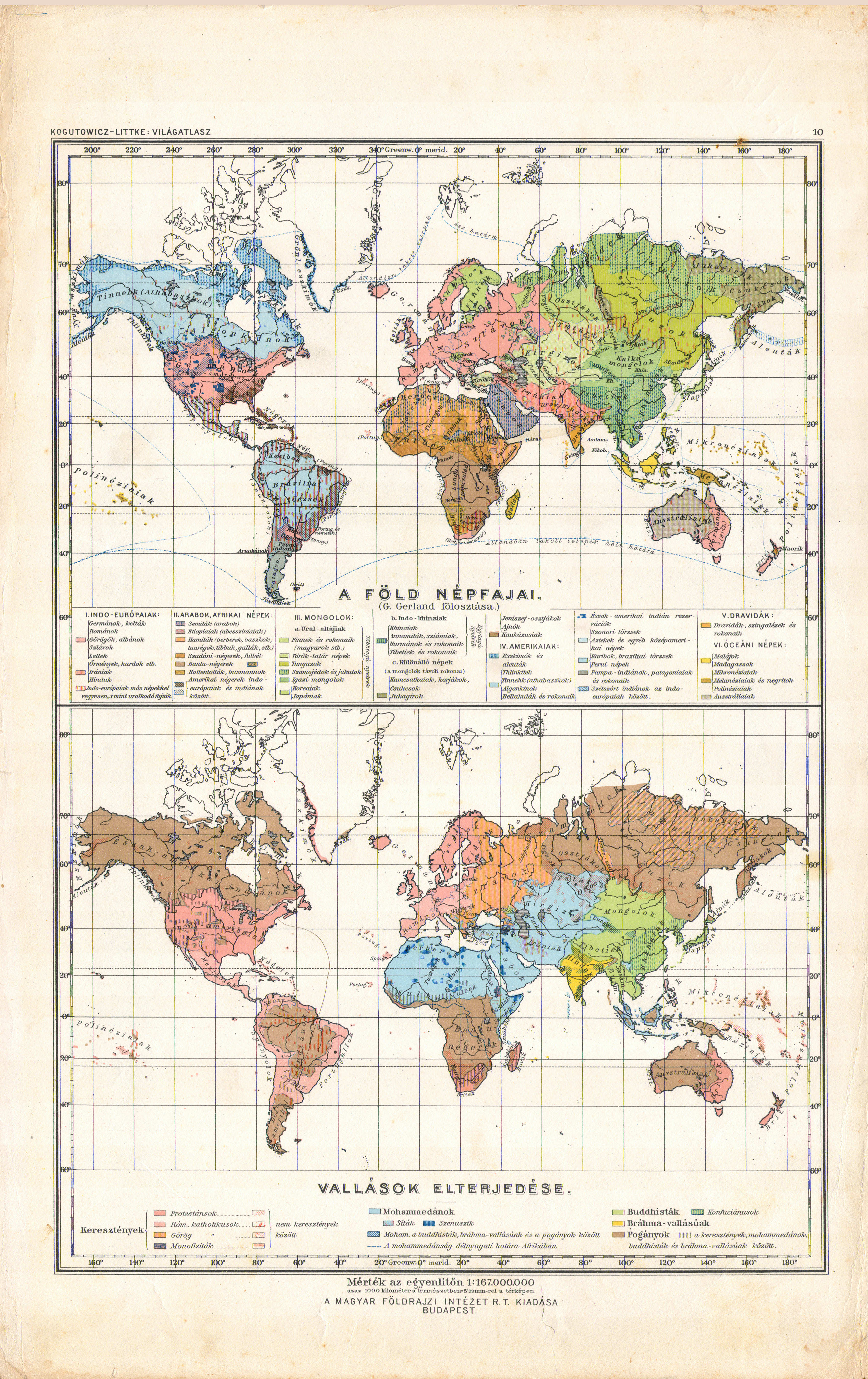
![Kogutowicz-Littke: Világatlasz, 1912-1914
10. [Világtérképek; népfajok, vallások]](../debhh01/picslarge/debhh1914k010000.jpg) Kogutowicz-Littke: Világatlasz, 1912-1914
Kogutowicz-Littke: Világatlasz, 1912-1914
10. [Világtérképek; népfajok, vallások] XL
[Wereldkaarten: volkeren, godsdiensten] / [World maps: nations, religions]
Debes' Neuer Handatlas, 1913
6-9. [Klima- und Völkerkarten der Erde] XL
[Klimatologie en volkenkunde] / [Climatology and ethnography]
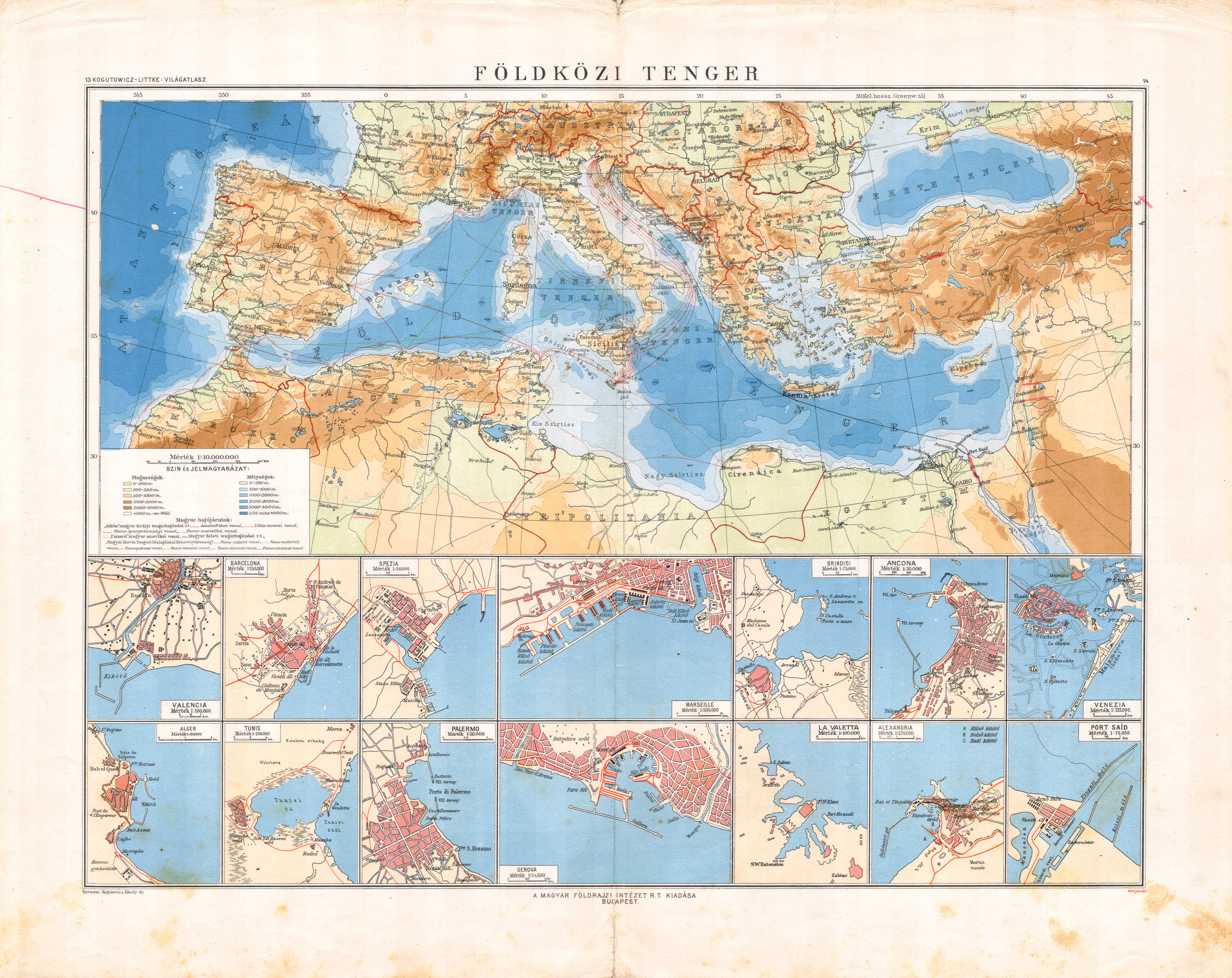 Kogutowicz-Littke: Világatlasz, 1912-1914
13-14. Földközi tenger XL
Middellandse Zee / Mediterranean Sea
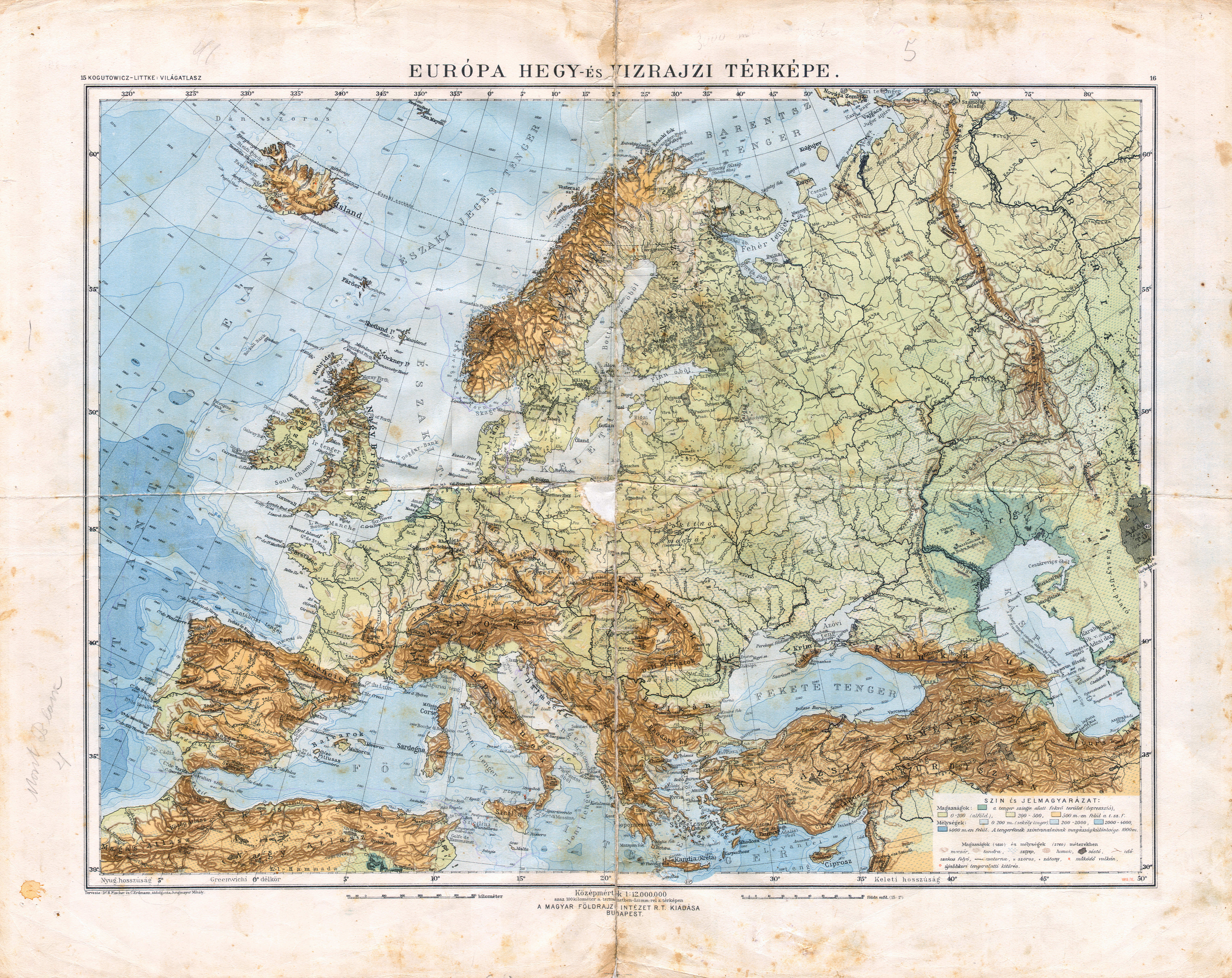
 Kogutowicz-Littke: Világatlasz, 1912-1914
15-16. Európa hegy- és vizrajzi térképe XL
Orografische en hydrografische kaart van Europa / Orographic and hydrographic map of Europe
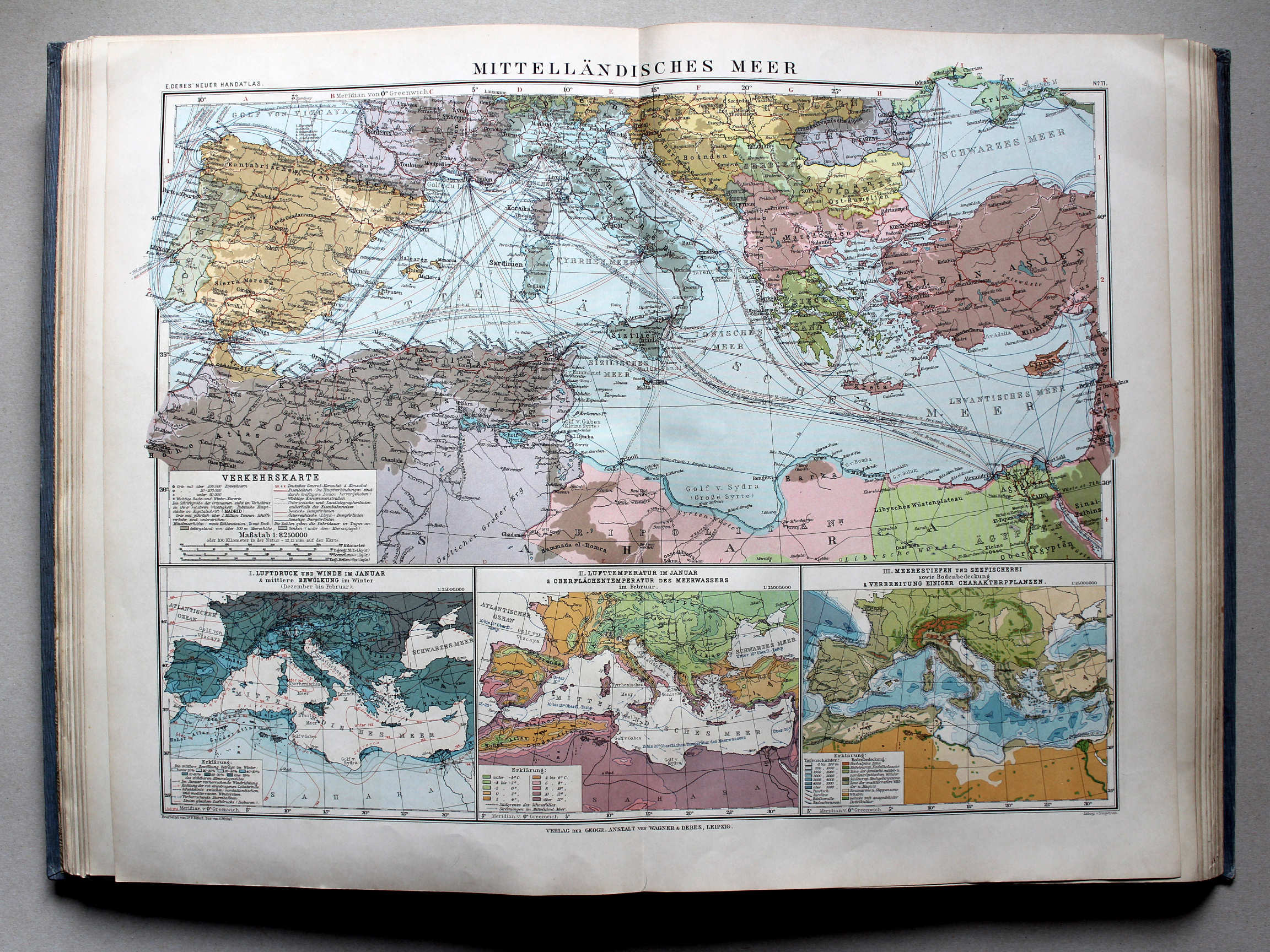
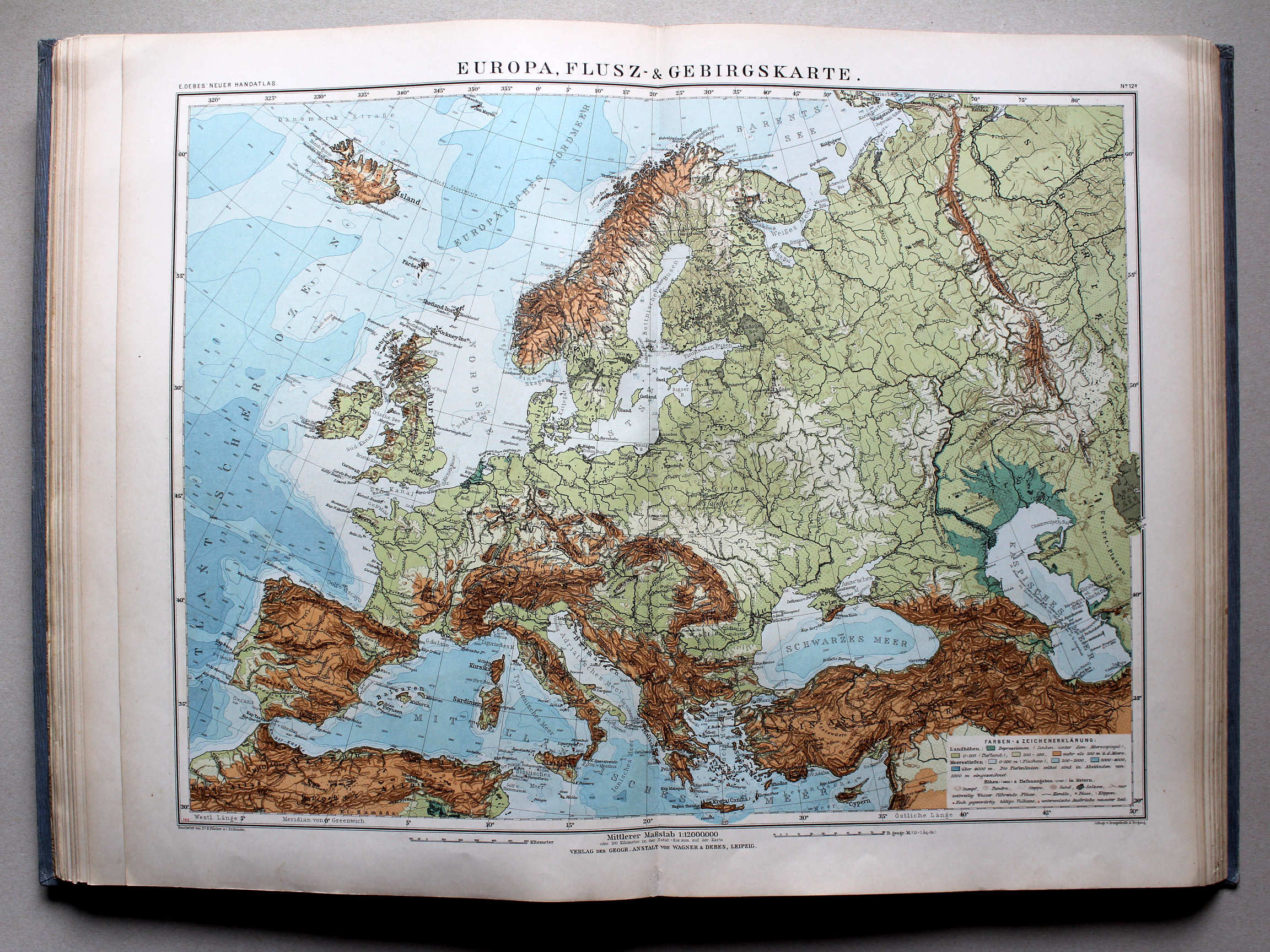 Debes' Neuer Handatlas, 1913
12a. Europa, Flusz- & Gebirgskarte XL
Orografische en hydrografische kaart van Europa / Orographic and hydrographic map of Europe
 Kogutowicz-Littke: Világatlasz, 1912-1914
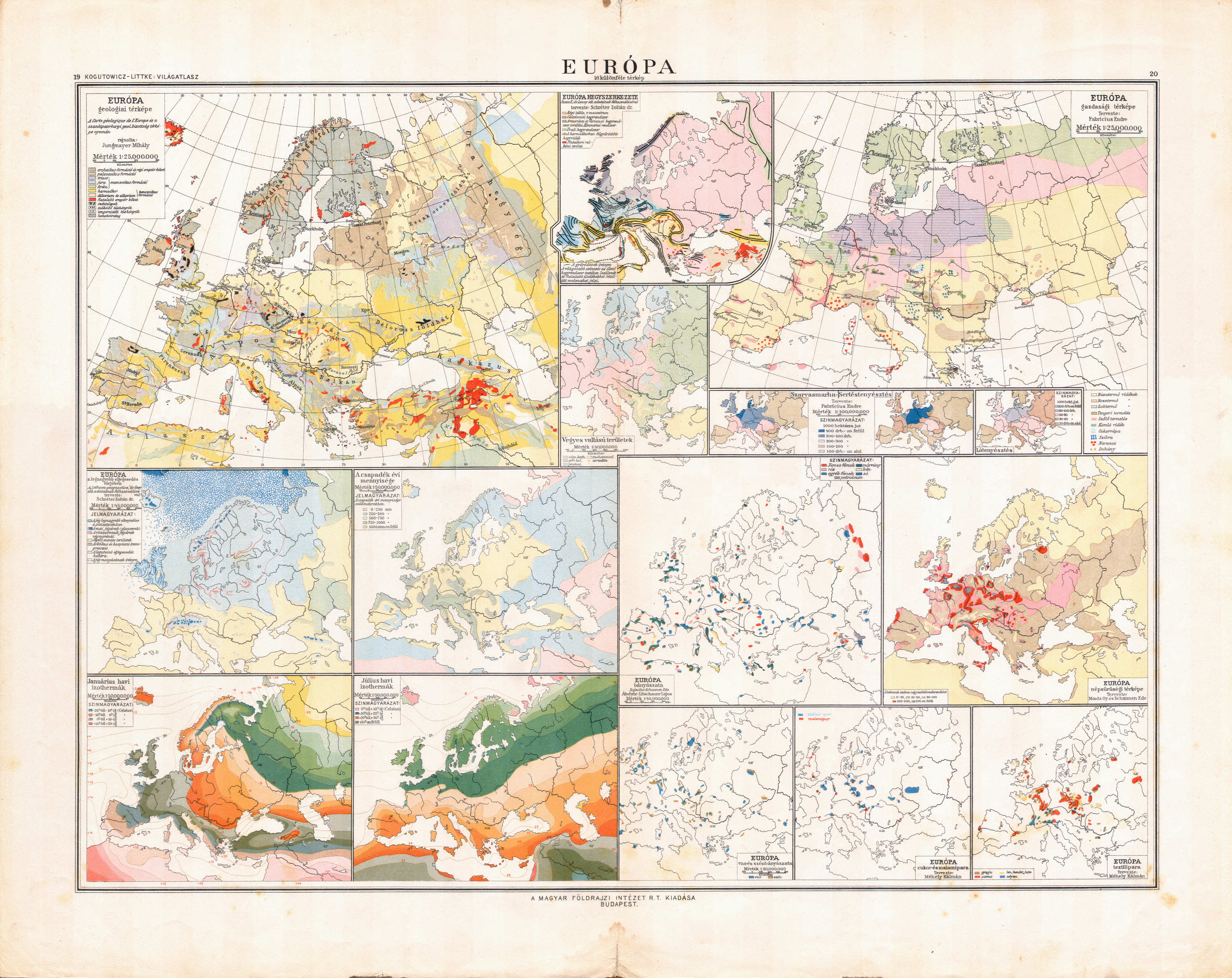
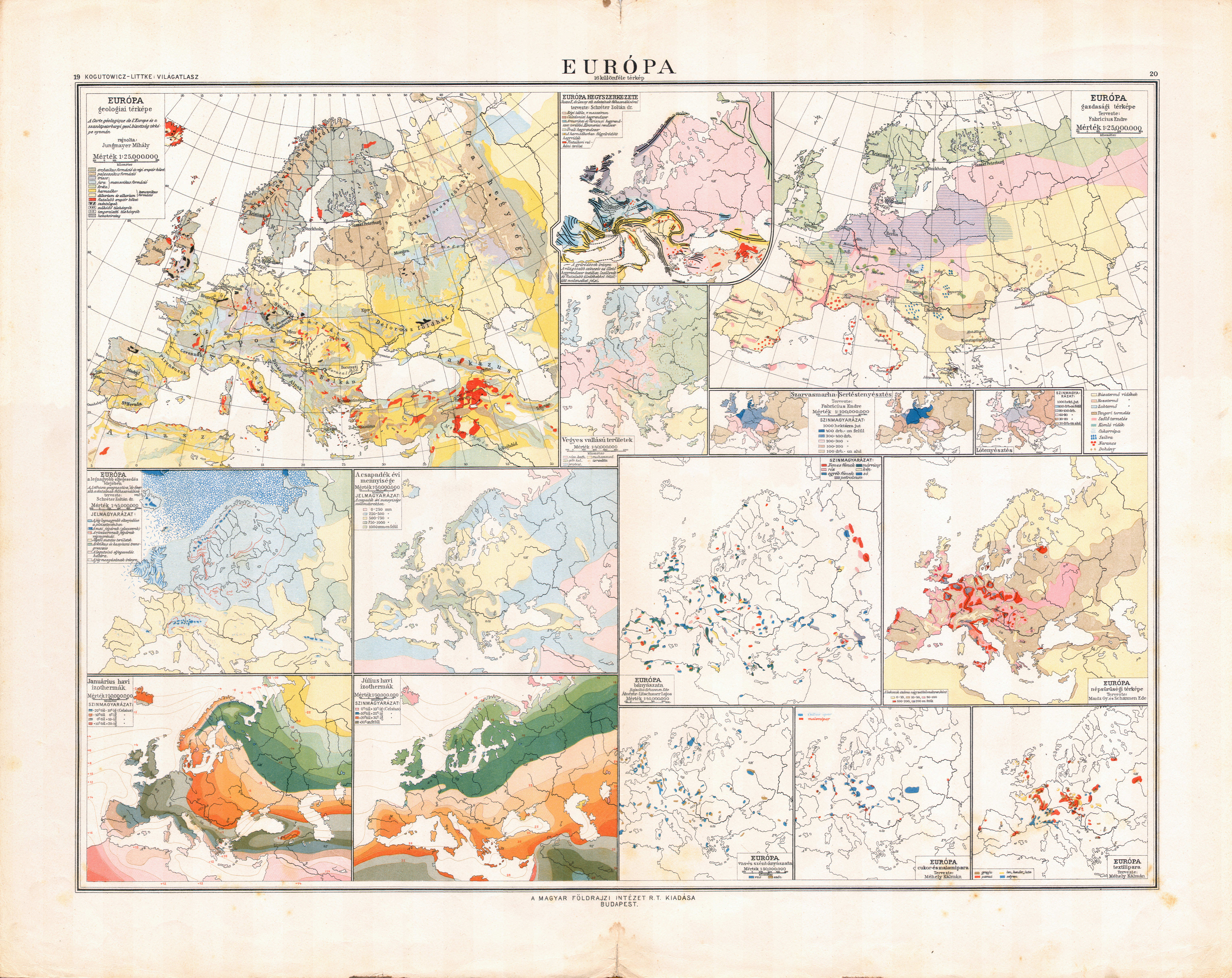
19-20. Európa 16 különféle térkép XL
Europa, diverse kaarten (16) / Europe, various maps (16)
 Debes' Neuer Handatlas, 1913
geen overeenkomstige kaart / no corresponding map
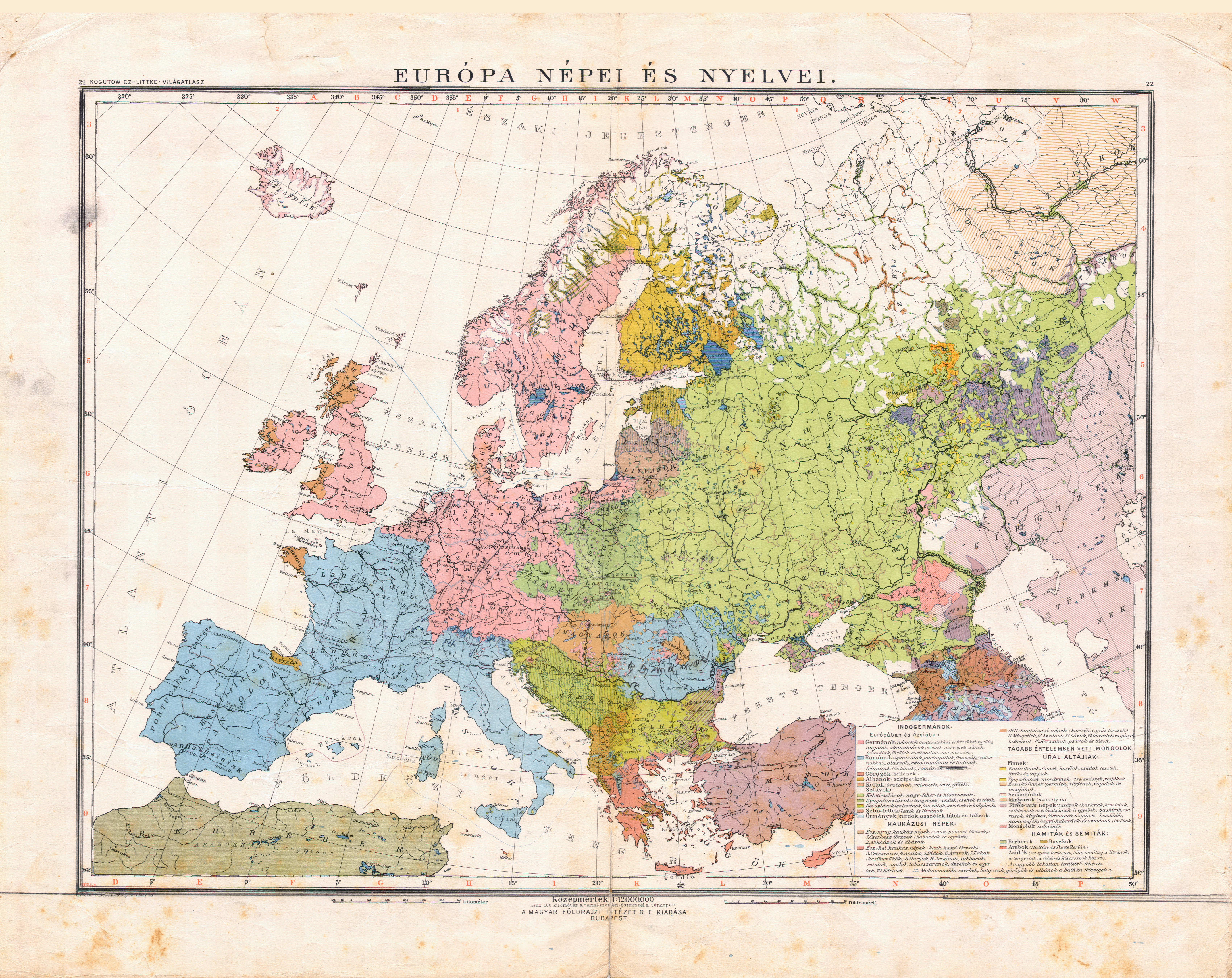
 Kogutowicz-Littke: Világatlasz, 1912-1914
21-22. Európa népei és nyelvei XL
Volkeren en talen van Europa / Nations and languages of Europe
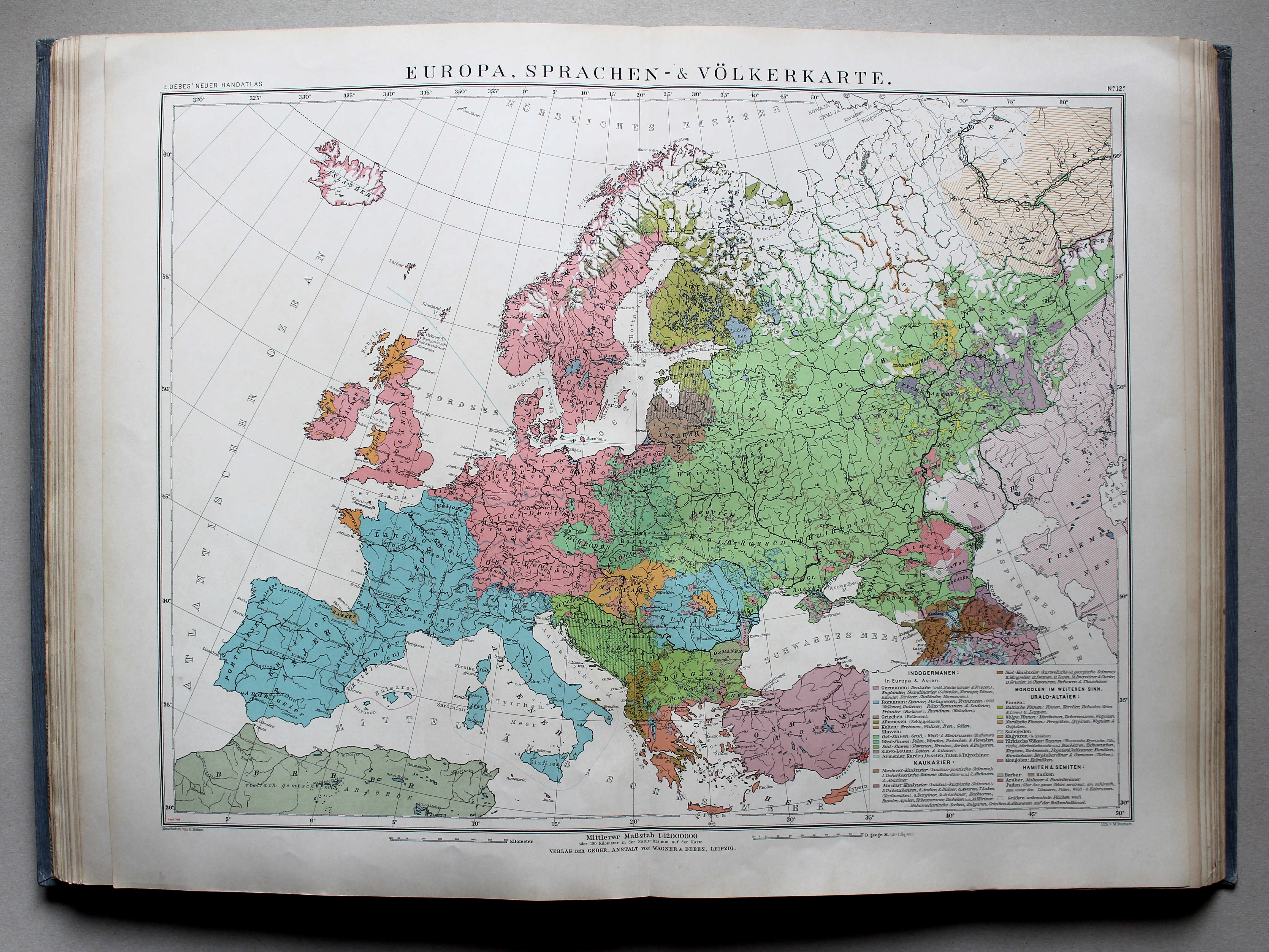
 Debes' Neuer Handatlas, 1913
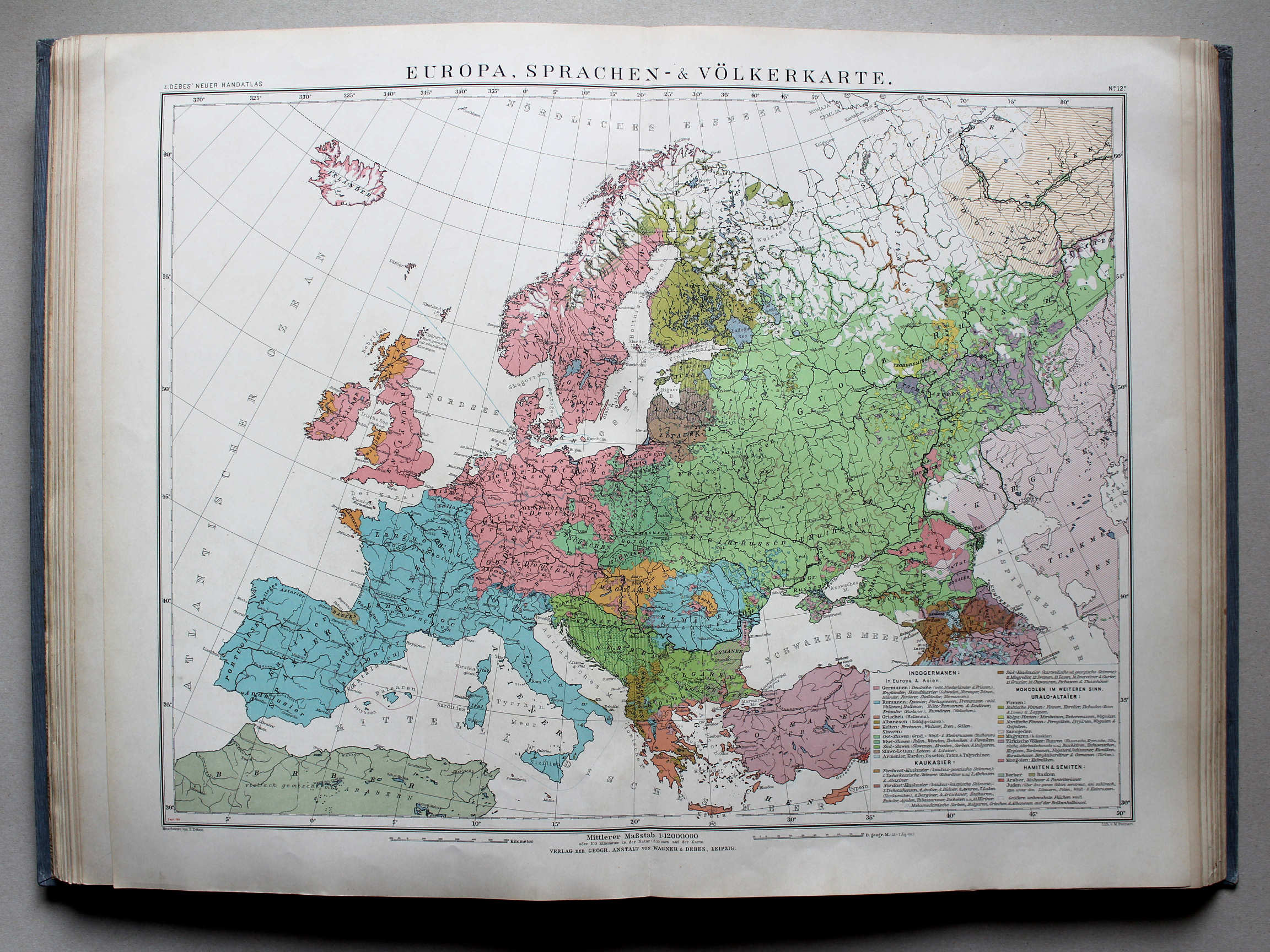
12c. Europa, Sprachen- & Völkerkarte XL
Europa, volkeren en talen / Europe, nations and languages
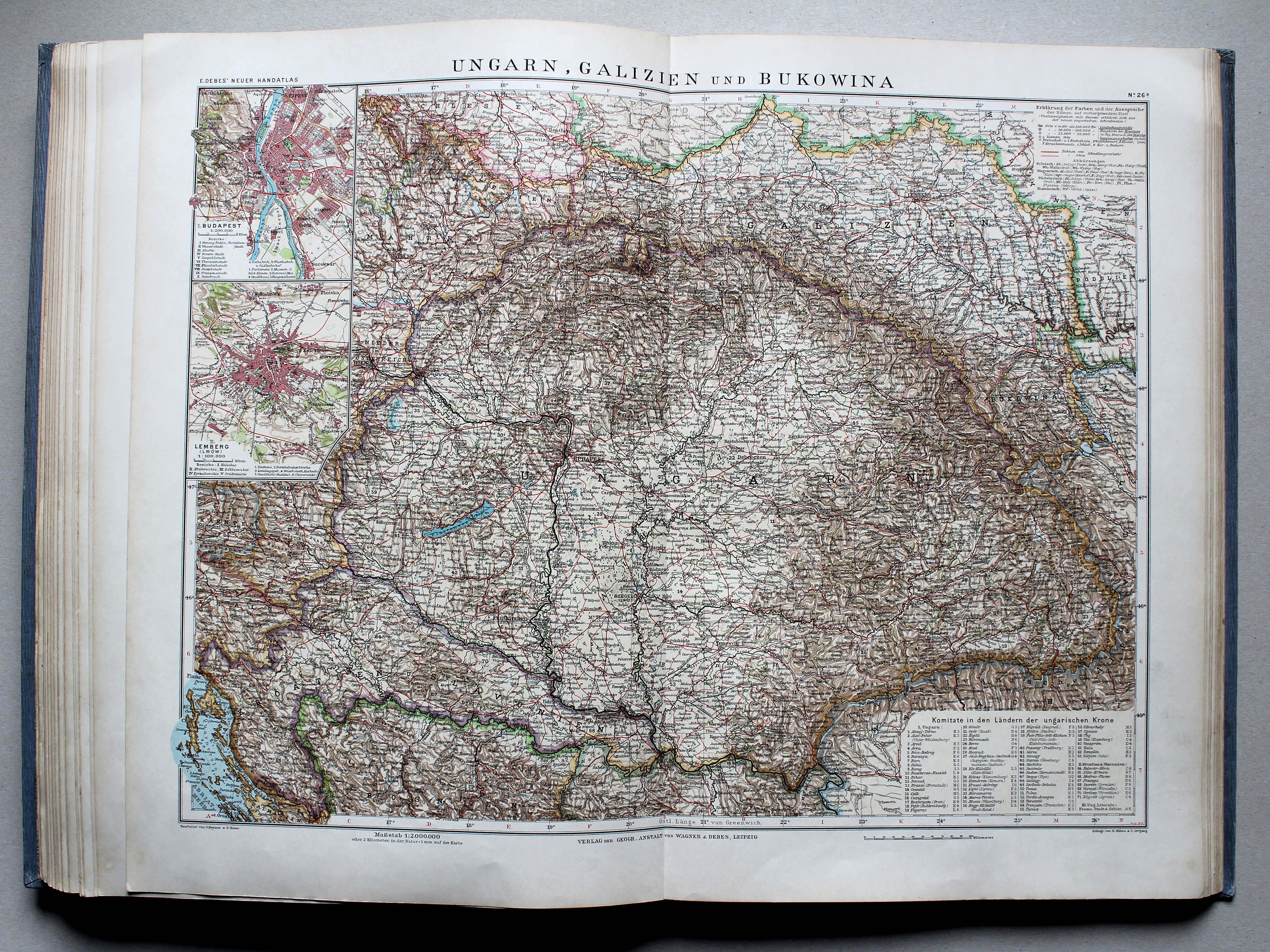
 Debes' Neuer Handatlas, 1913
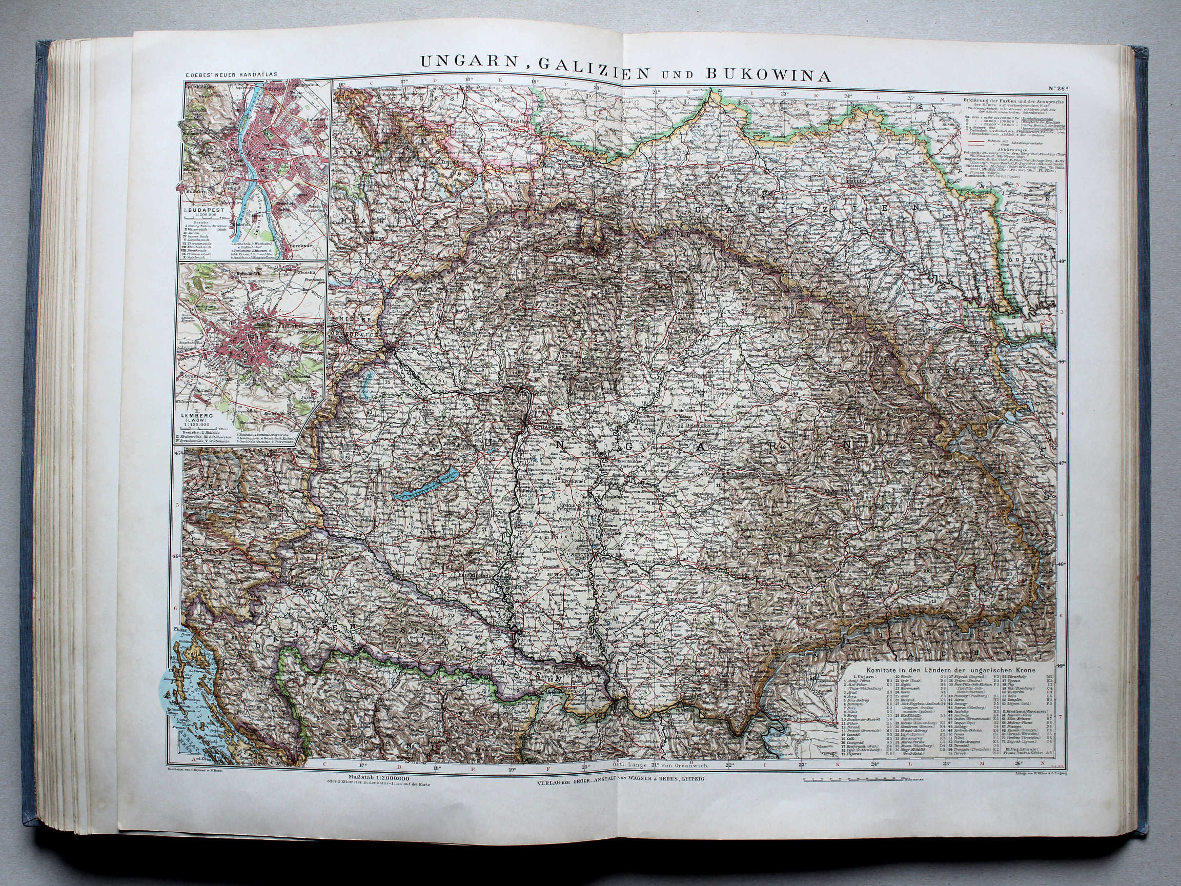
26a. Ungarn, Galizien und Bukowina XL
Hongarije, Galicië en Boekovina / Hungary, Galicia and Bukovina
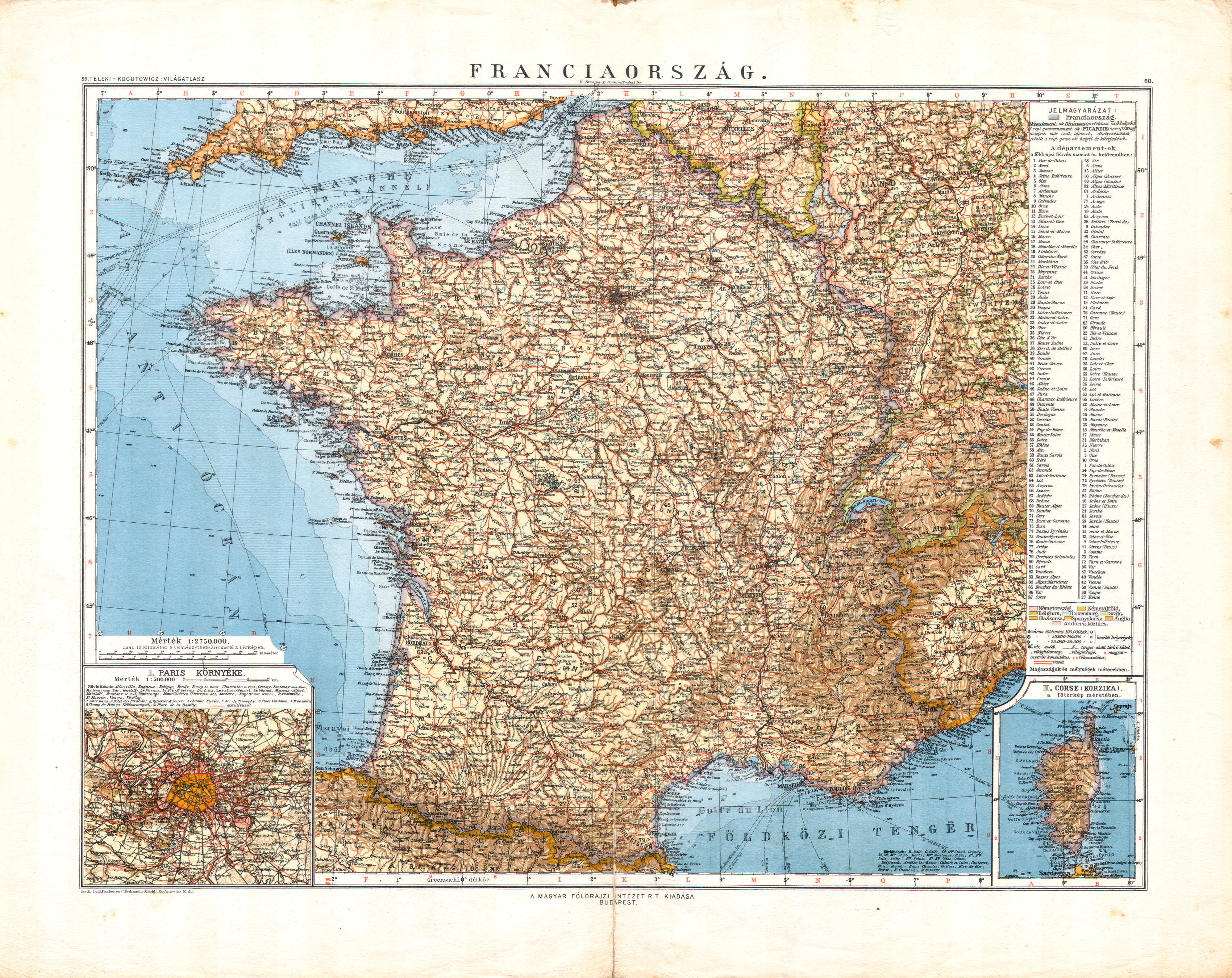
 Kogutowicz-Littke: Világatlasz, 1912-1914
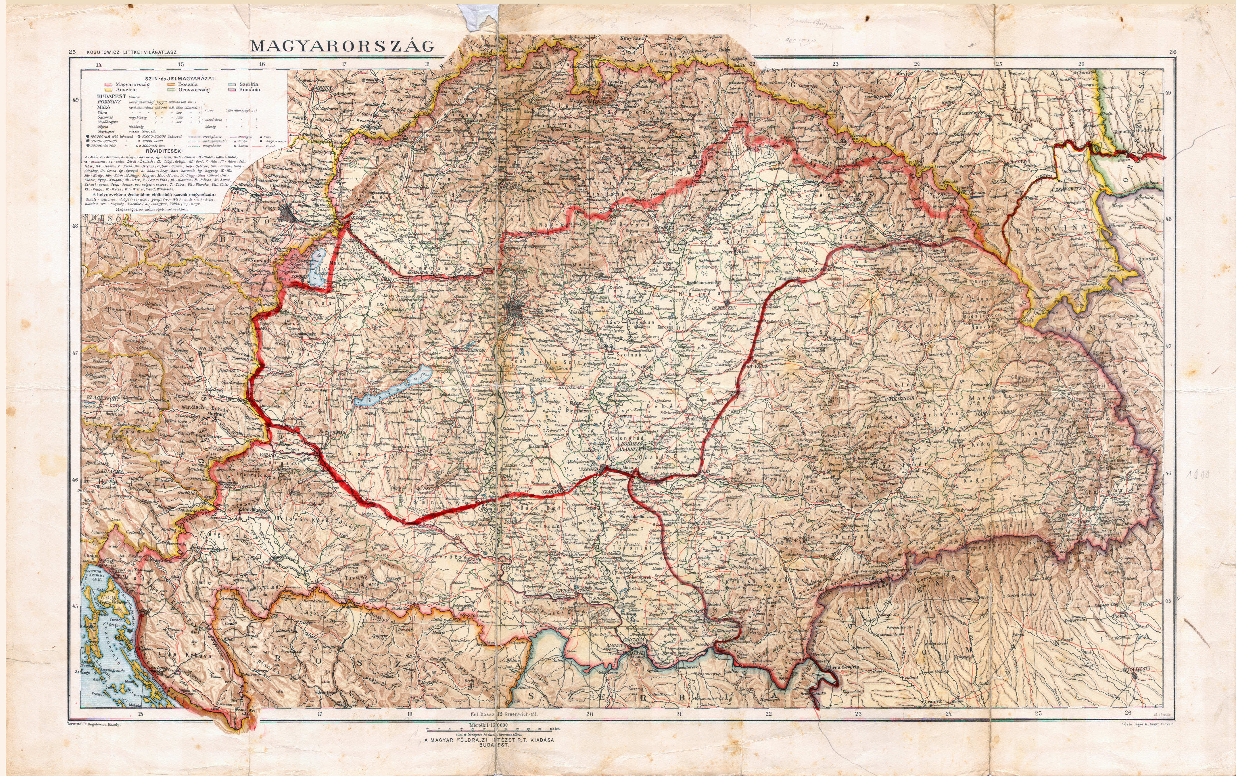
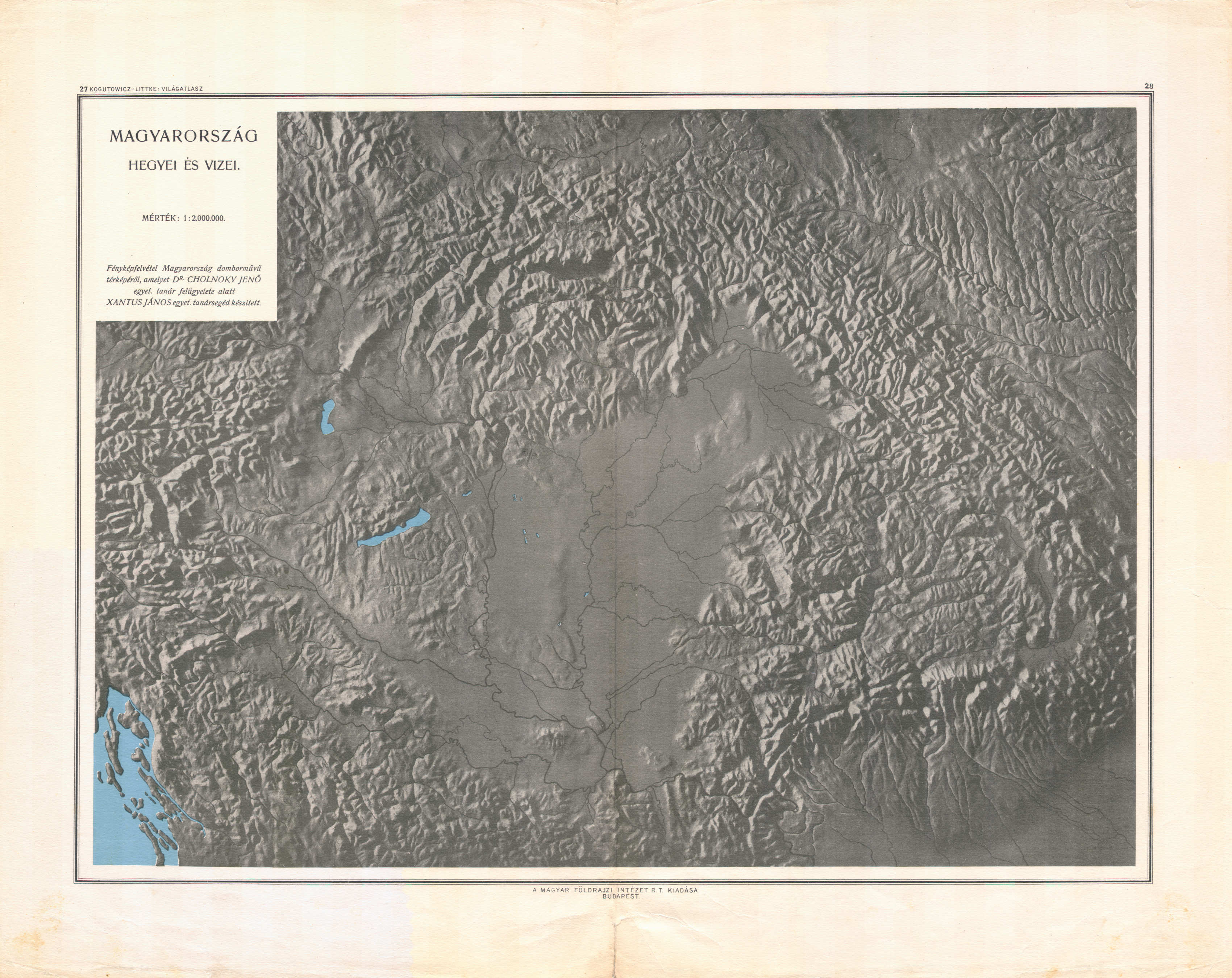
27-28. Magyarország 9 különféle térkép XL
Orografie en hydrografie van Hongarije / Orography and hydrography of Hungary
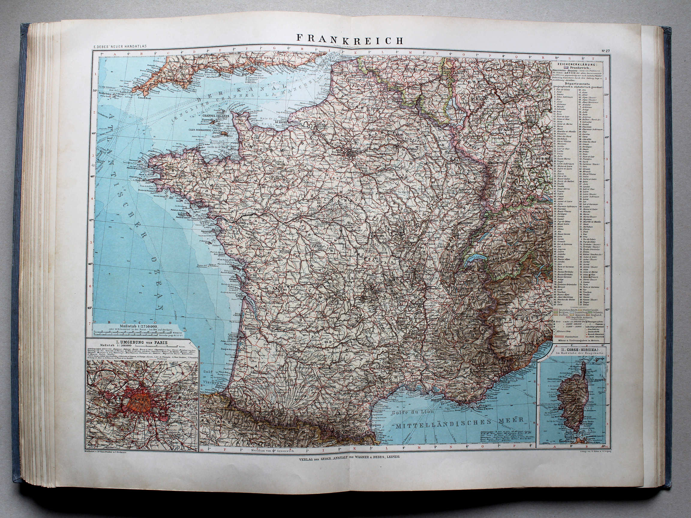
Debes' Neuer Handatlas, 1913
geen overeenkomstige kaart / no corresponding map
 Kogutowicz-Littke: Világatlasz, 1912-1914
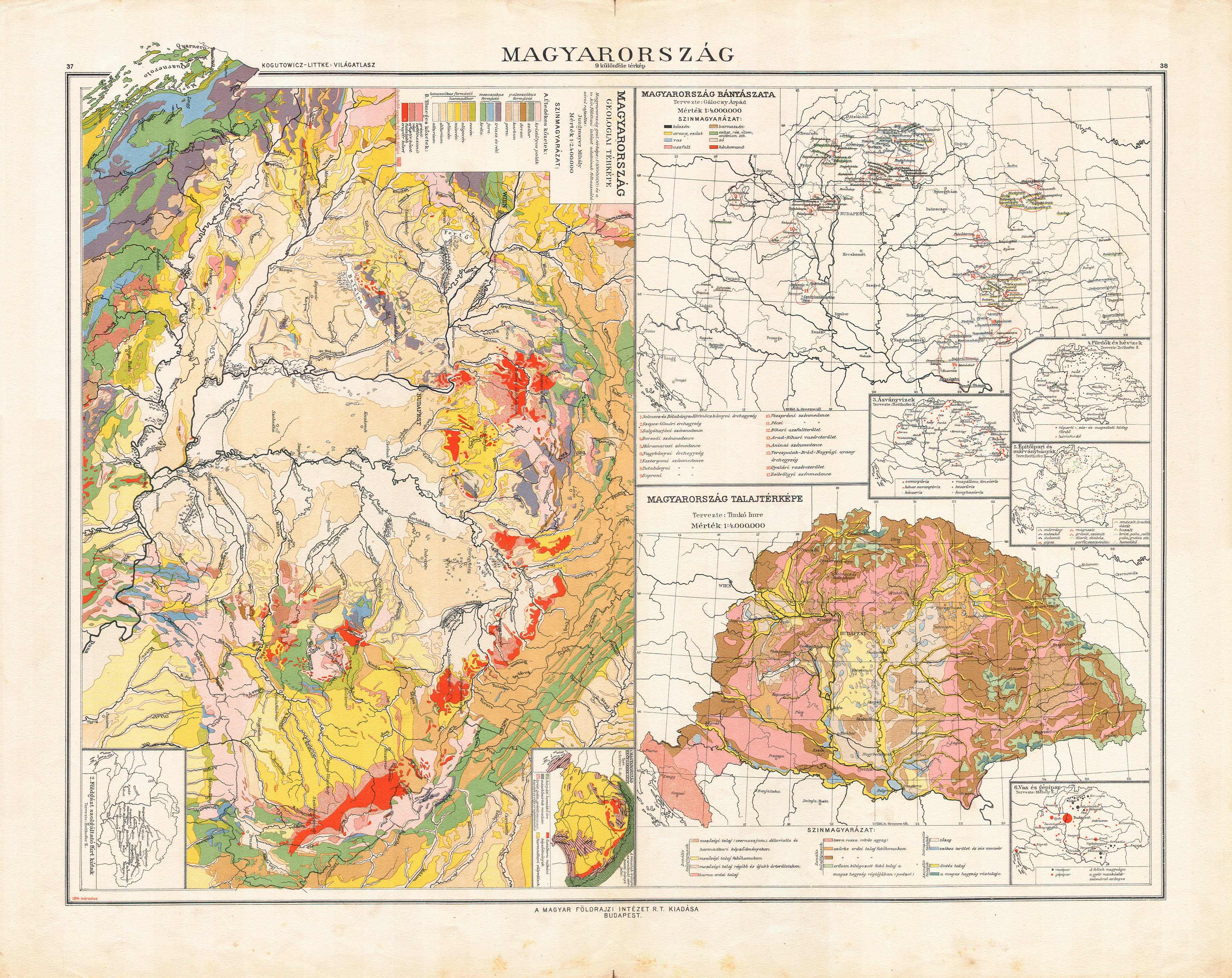
37-38. Magyarország 9 különféle térkép XL
Hongarije, diverse kaarten (9) / Hungary, various maps (9)
Debes' Neuer Handatlas, 1913
geen overeenkomstige kaart / no corresponding map
 Kogutowicz-Littke: Világatlasz, 1912-1914
41-42. Magyarország 12 különféle térkép XL
Hongarije, diverse kaarten (12) / Hungary, various maps (12)
Debes' Neuer Handatlas, 1913
geen overeenkomstige kaart / no corresponding map
 Kogutowicz-Littke: Világatlasz, 1912-1914
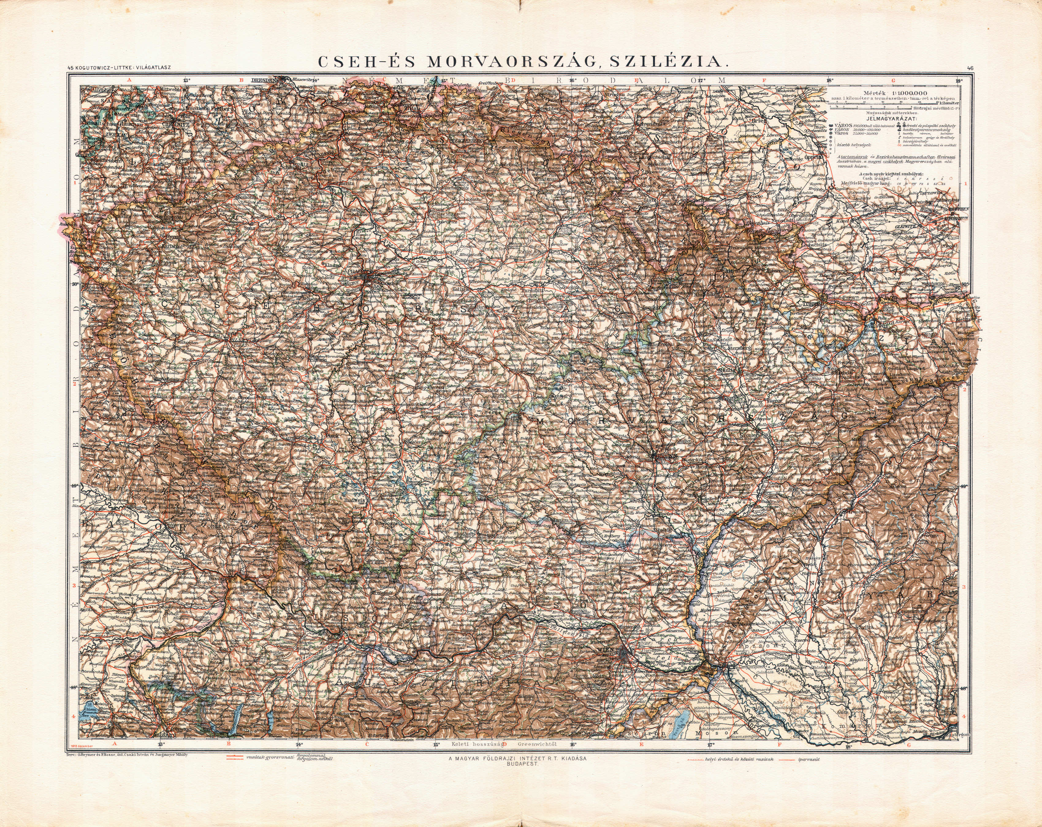
45-46. Cseh- és Morvaország, Szilézia XL
Bohemen en Moravië, Silezië / Bohemia and Moravia, Silesia
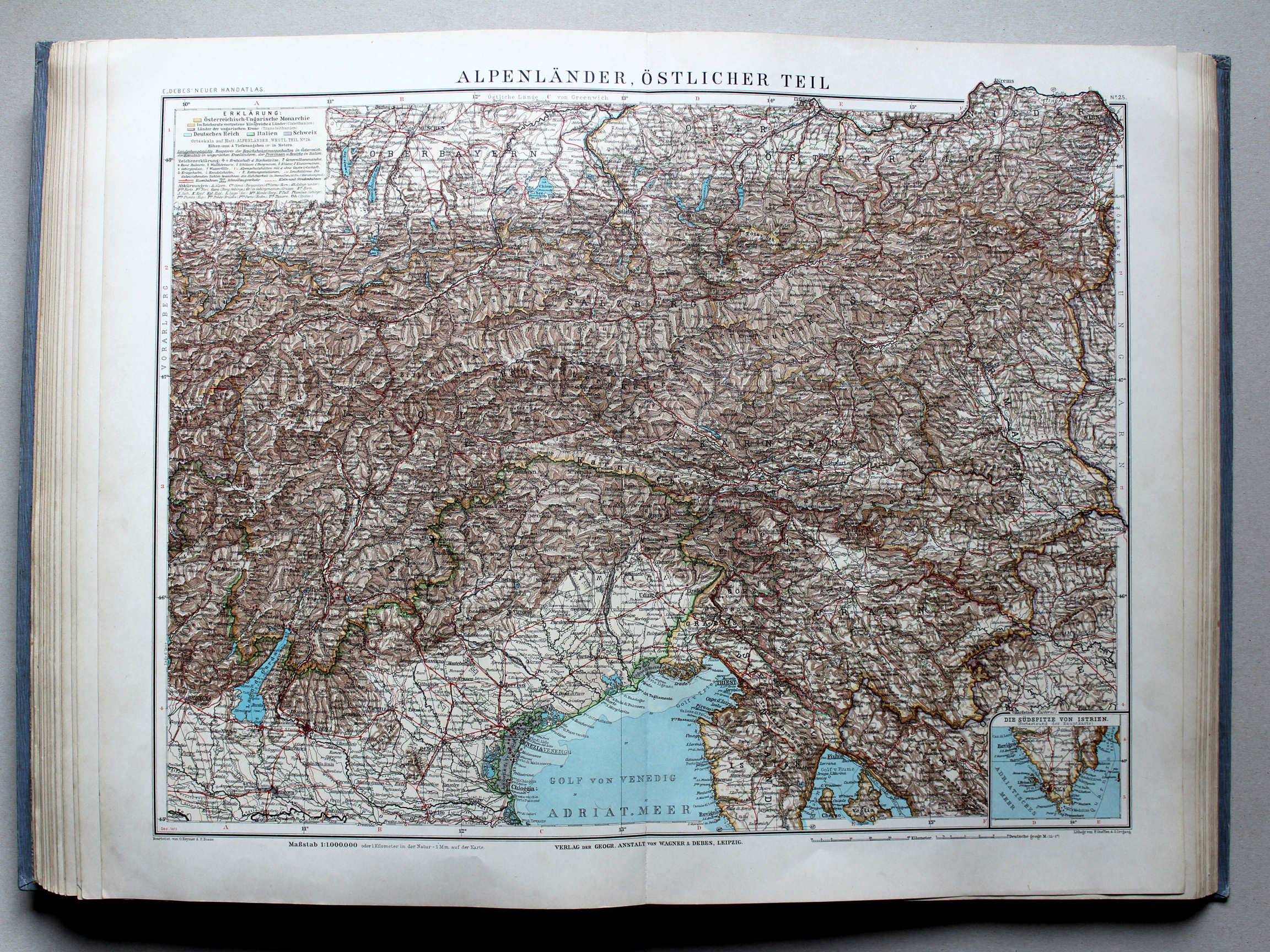
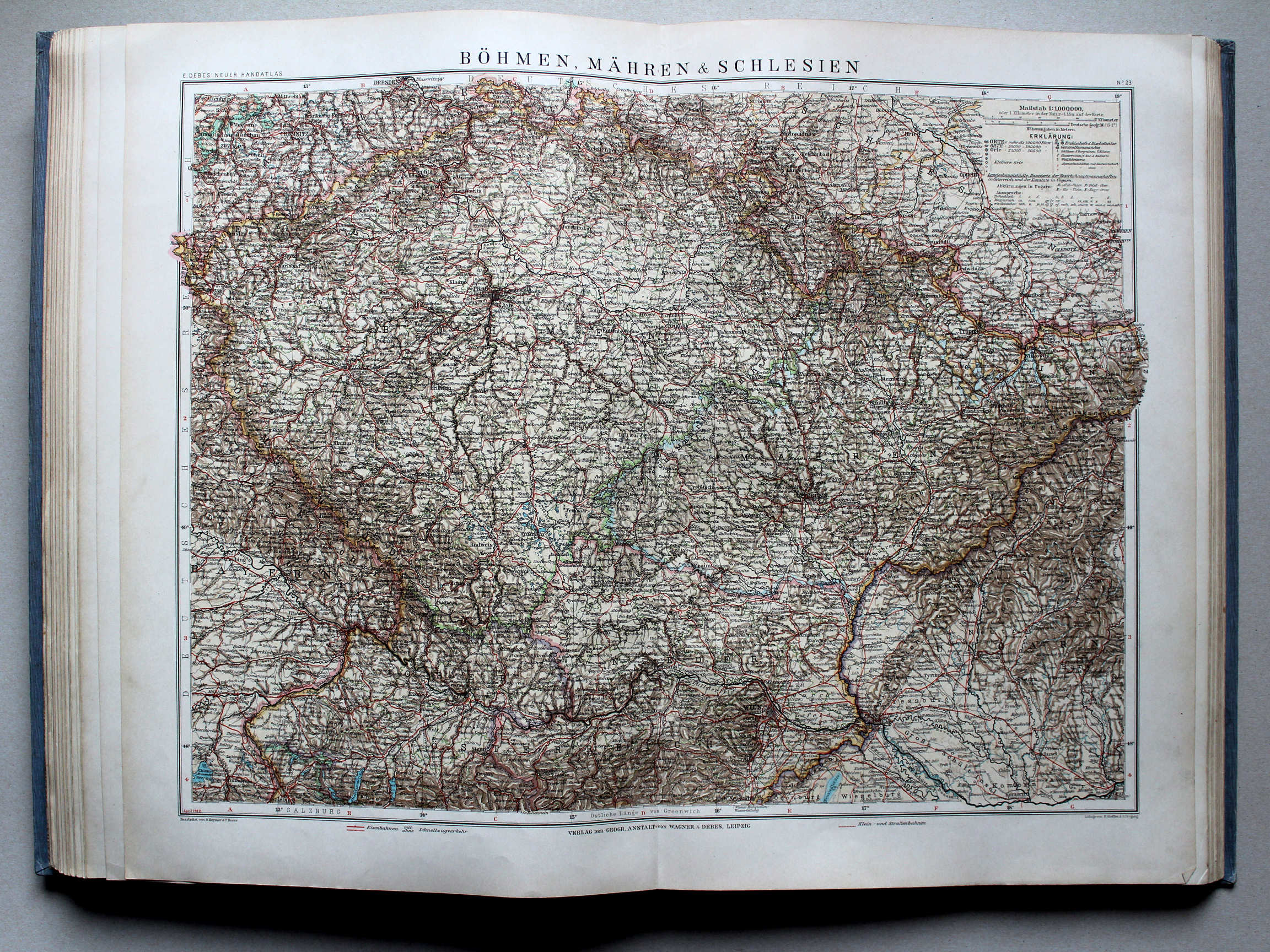 Debes' Neuer Handatlas, 1913
23. Böhmen, Mähren & Schlesien XL
Bohemen, Moravië en Silezië / Bohemia, Moravia and Silesia
 Téleki-Kogutowicz: Világatlasz, 1912-1914
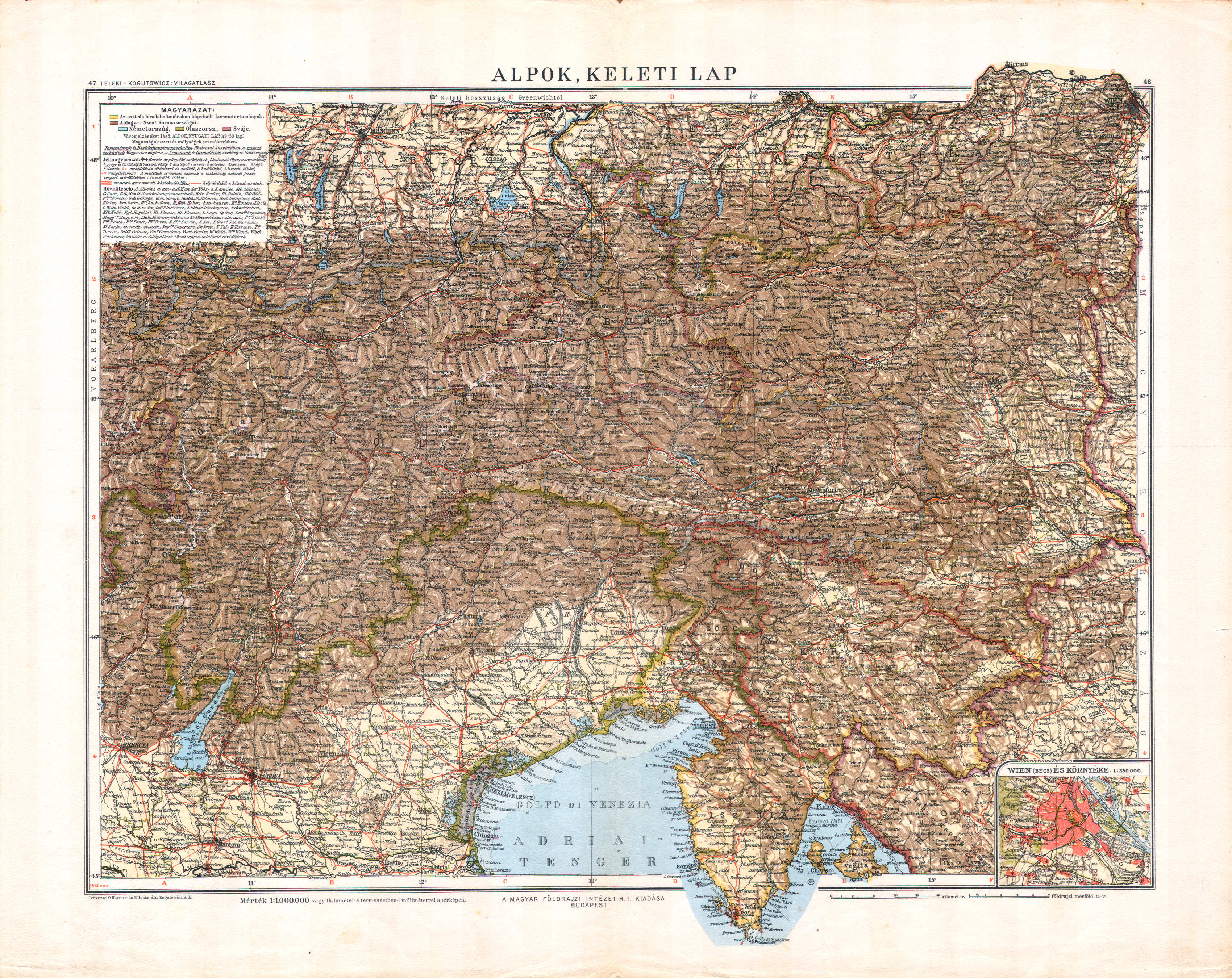
47-48. Alpok, keleti lap XL
Alpen, oostblad / Alps, eastern sheet
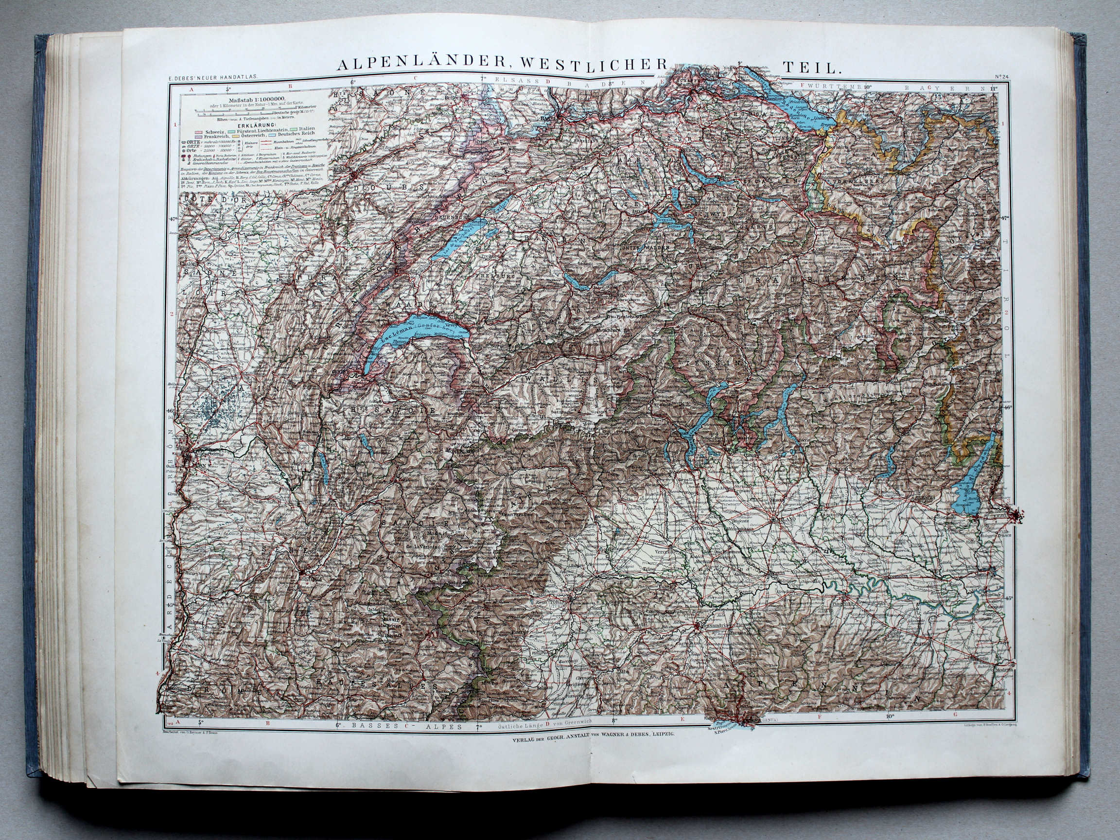
 Téleki-Kogutowicz: Világatlasz, 1912-1914
49-50. Alpok, nyugati lap XL
Alpen, westblad / Alps, western sheet
 Kogutowicz-Littke: Világatlasz, 1912-1914
57-58. Belgium, Németalföld és Luxemburg XL
België, Nederland en Luxemburg / Belgium, Netherlands and Luxembourg
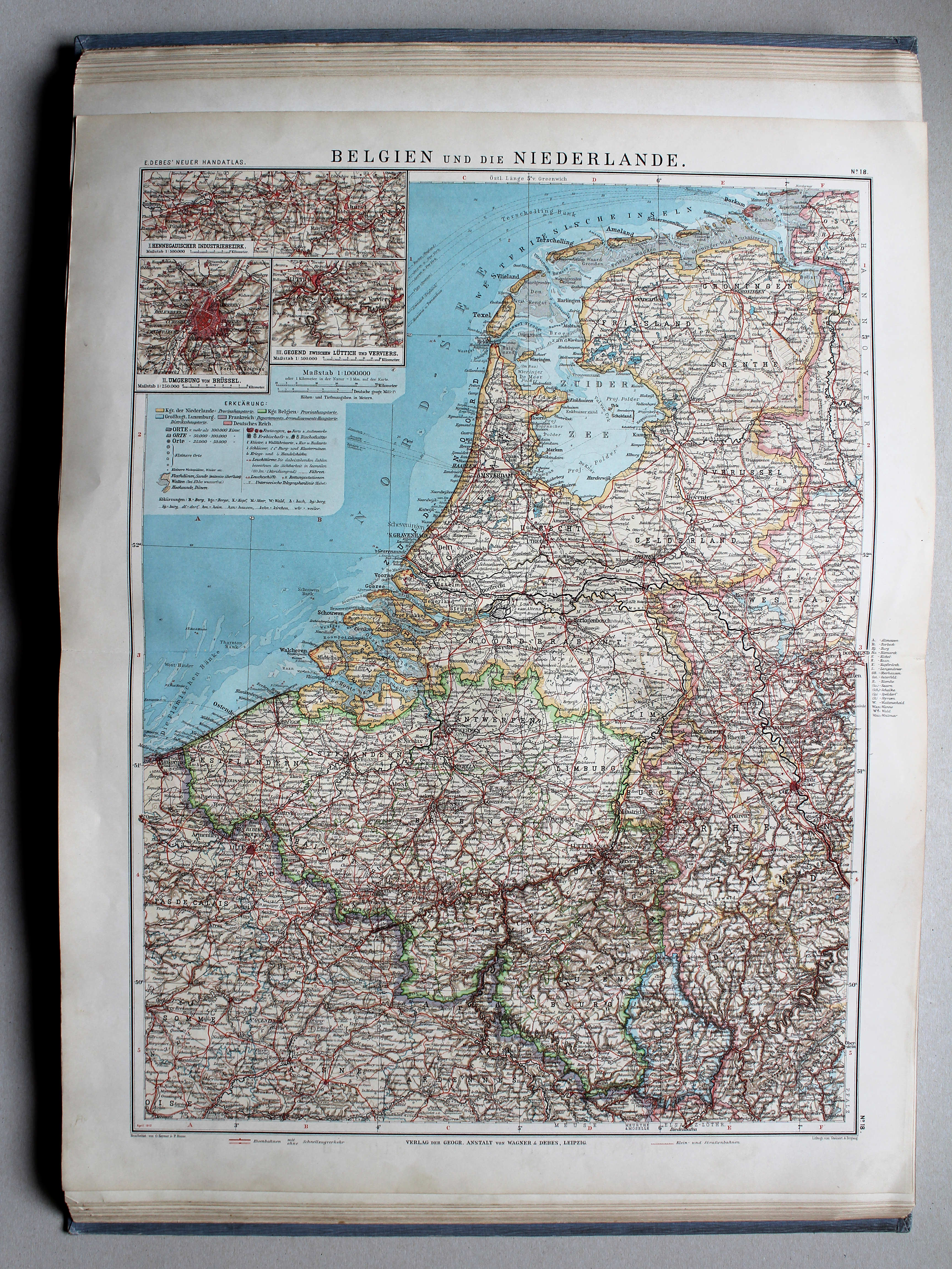
 Debes' Neuer Handatlas, 1913
18. Belgien und die Niederlande XL
België en Nederland / Belgium and Netherlands

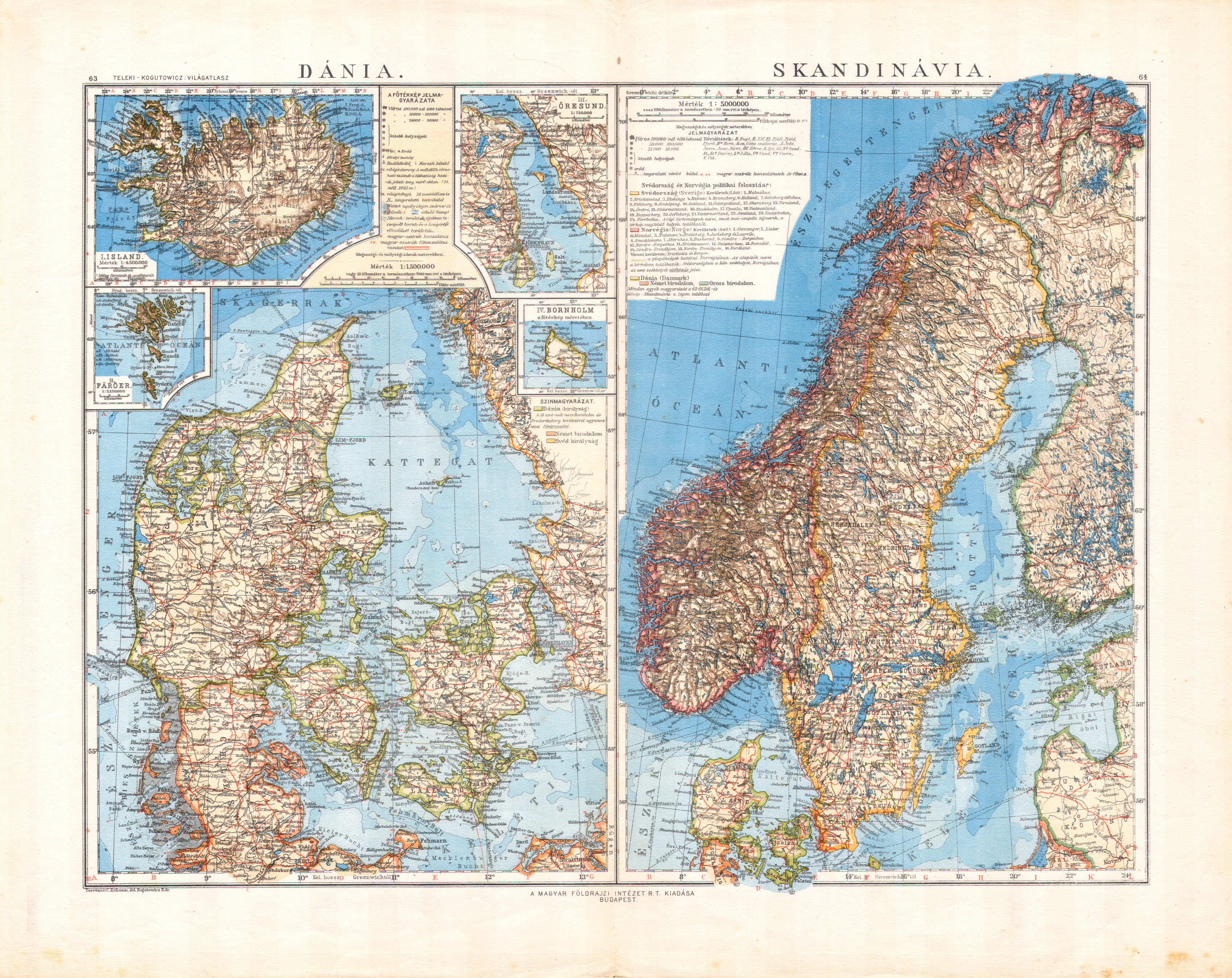 Téleki-Kogutowicz: Világatlasz, 1912-1914
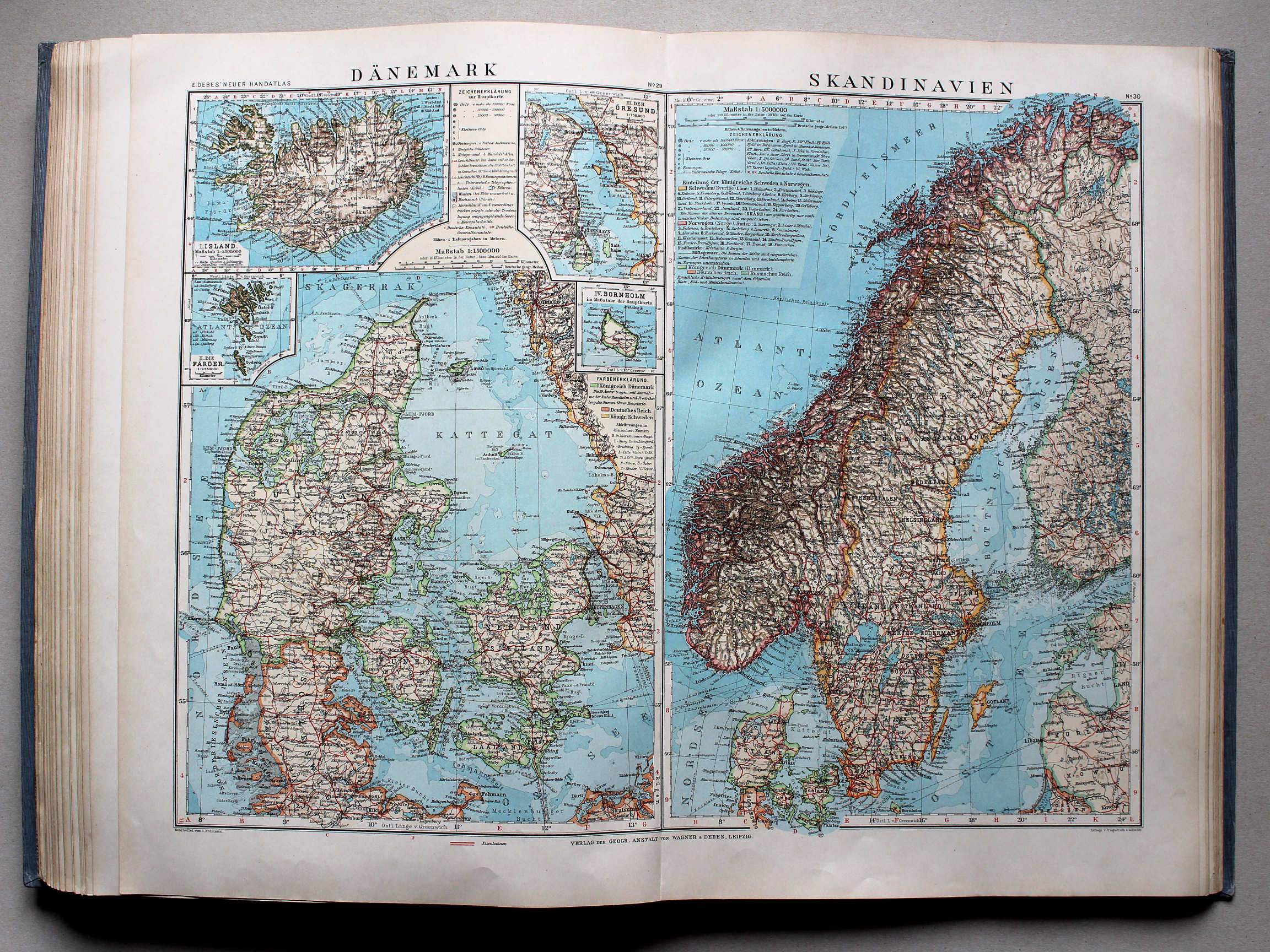
63-64. Dánia. Skandinávia XL
Denemarken. Scandinavië / Denmark. Scandinavia
 Debes' Neuer Handatlas, 1913
29-30. Dänemark. Skandinavien XL
Denemarken. Scandinavië / Denmark. Scandinavia
 Téleki-Kogutowicz: Világatlasz, 1912-1914
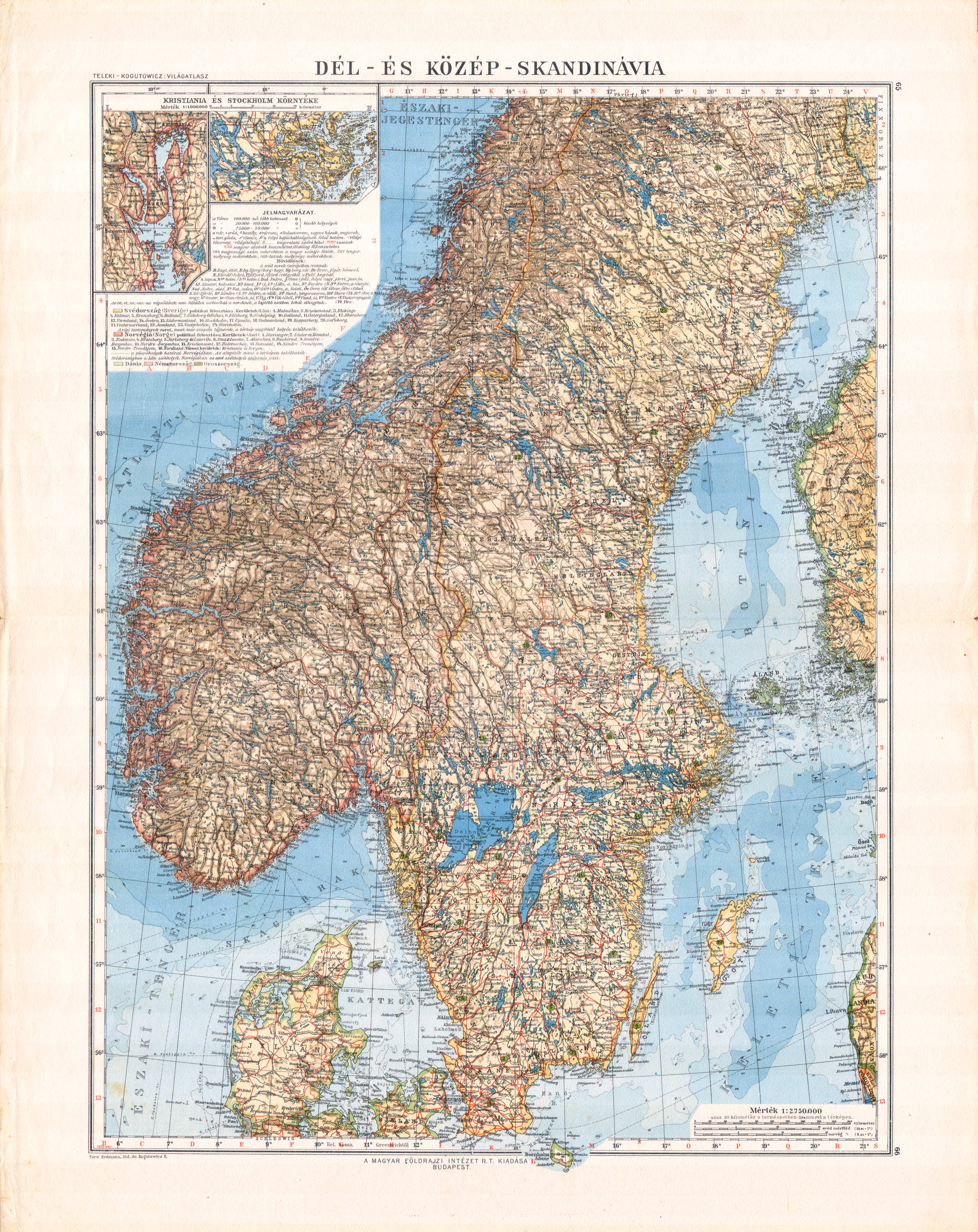
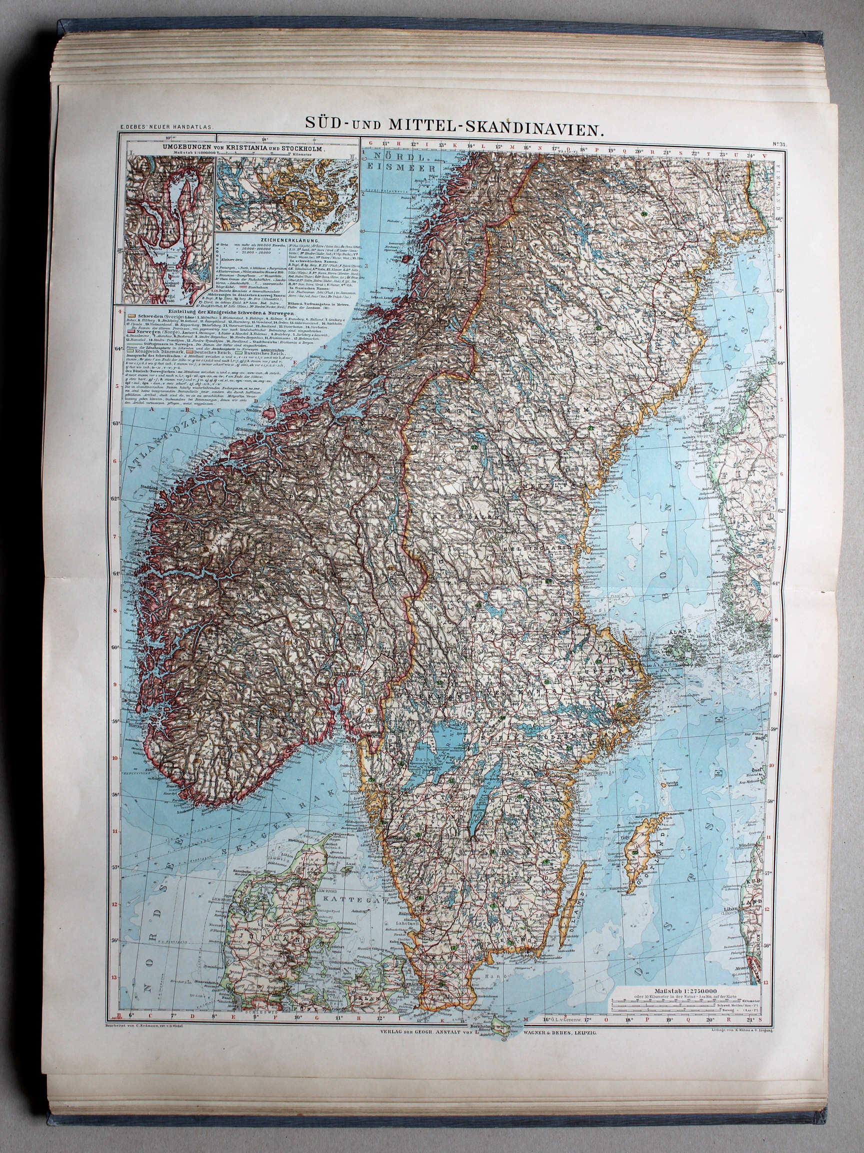
65-66. Dél- és Közép-Skandinávia XL
Zuid- en Midden-Scandinavië / Southern and Central Scandinavia
 Debes' Neuer Handatlas, 1913
31. Süd- und Mittel-Skandinavien XL
Zuid- en Midden-Scandinavië / Southern and Central Scandinavia
 Kogutowicz-Littke: Világatlasz, 1912-1914
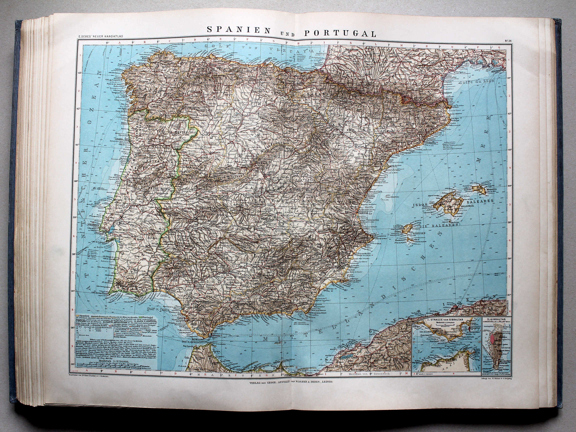
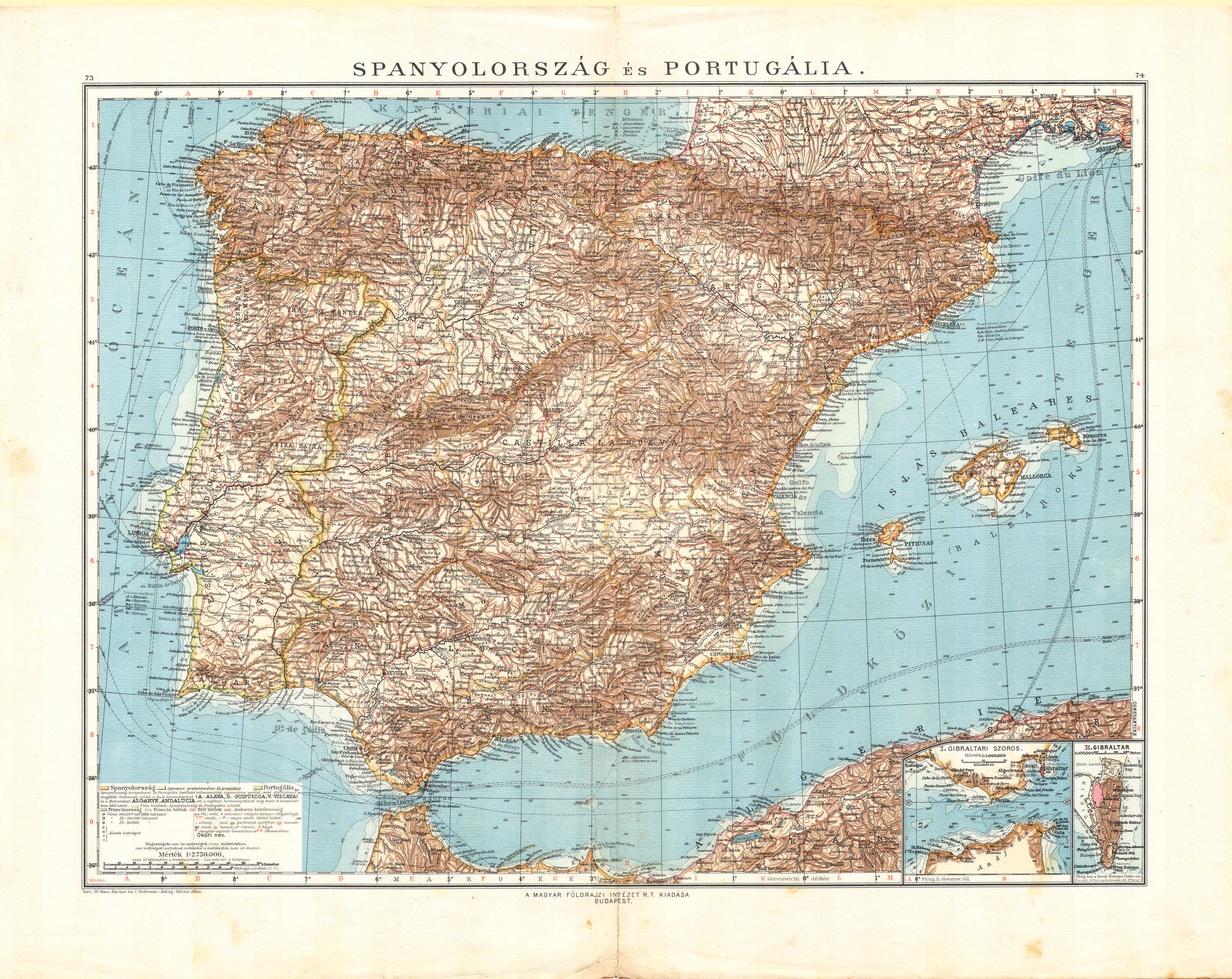
73-74. Spanyolország és Portugália XL
Spanje en Portugal / Spain and Portugal
 Kogutowicz-Littke: Világatlasz, 1912-1914
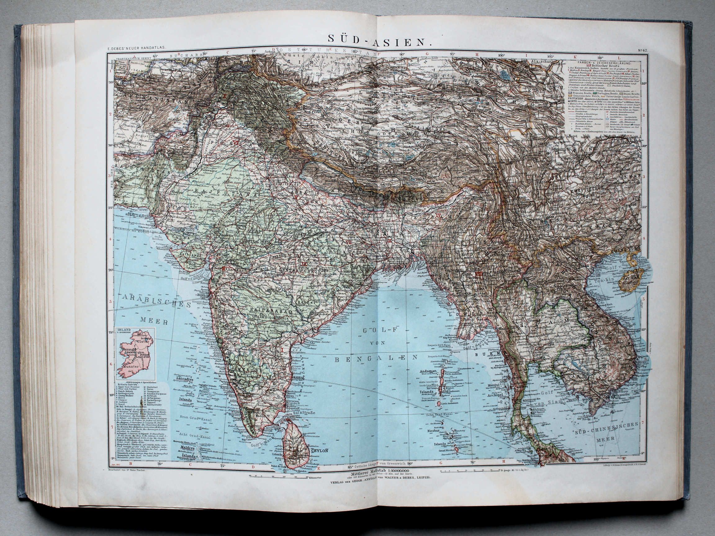
91-92. Dél-Ázsia (Brit-India) XL
Zuid-Azië (Brits Indië) / South Asia (British India)

 Kogutowicz-Littke: Világatlasz, 1912-1914
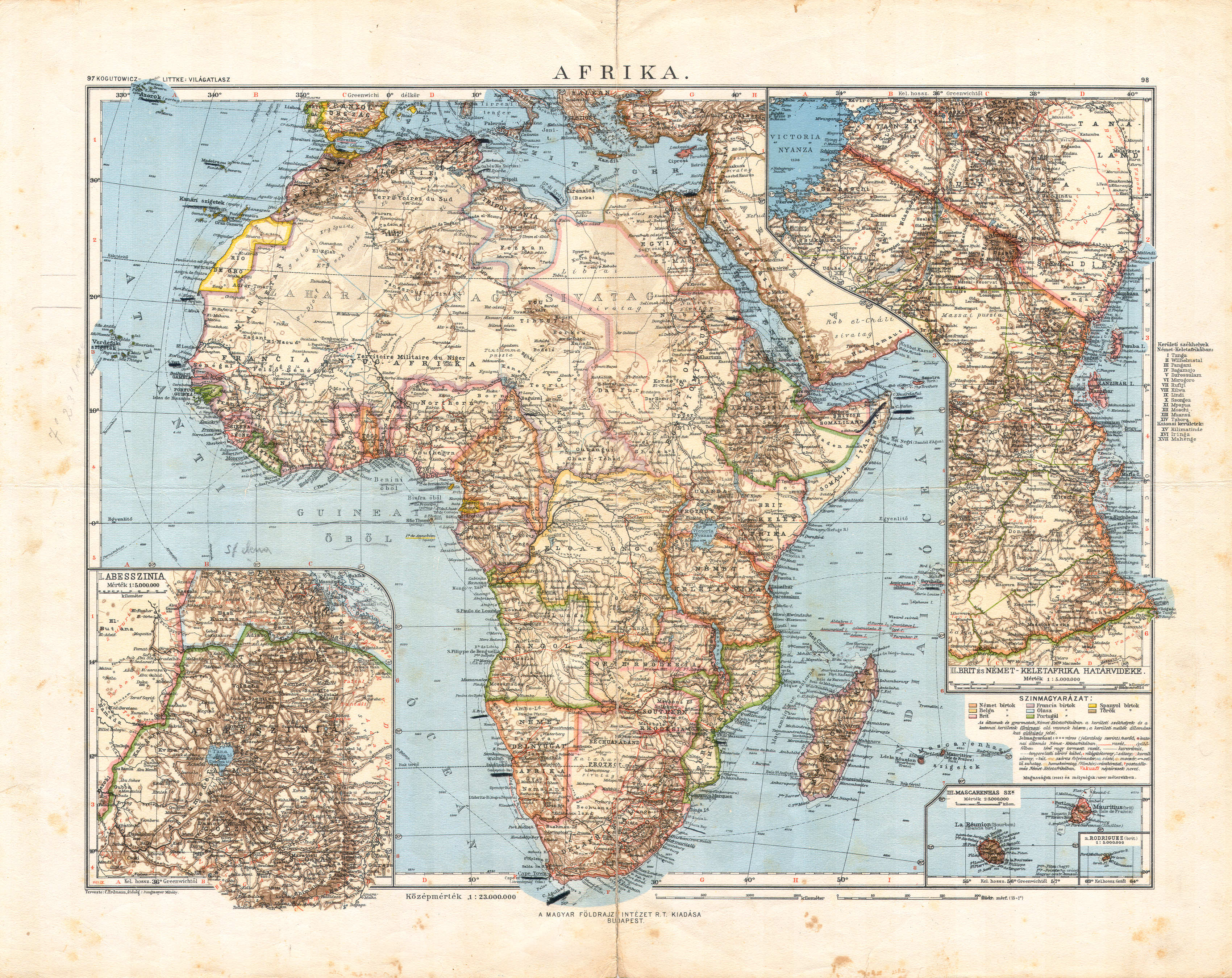
99-100. Afrika. 6 különféle térkép XL
Afrika, diverse kaarten (6) / Africa, various maps (6)
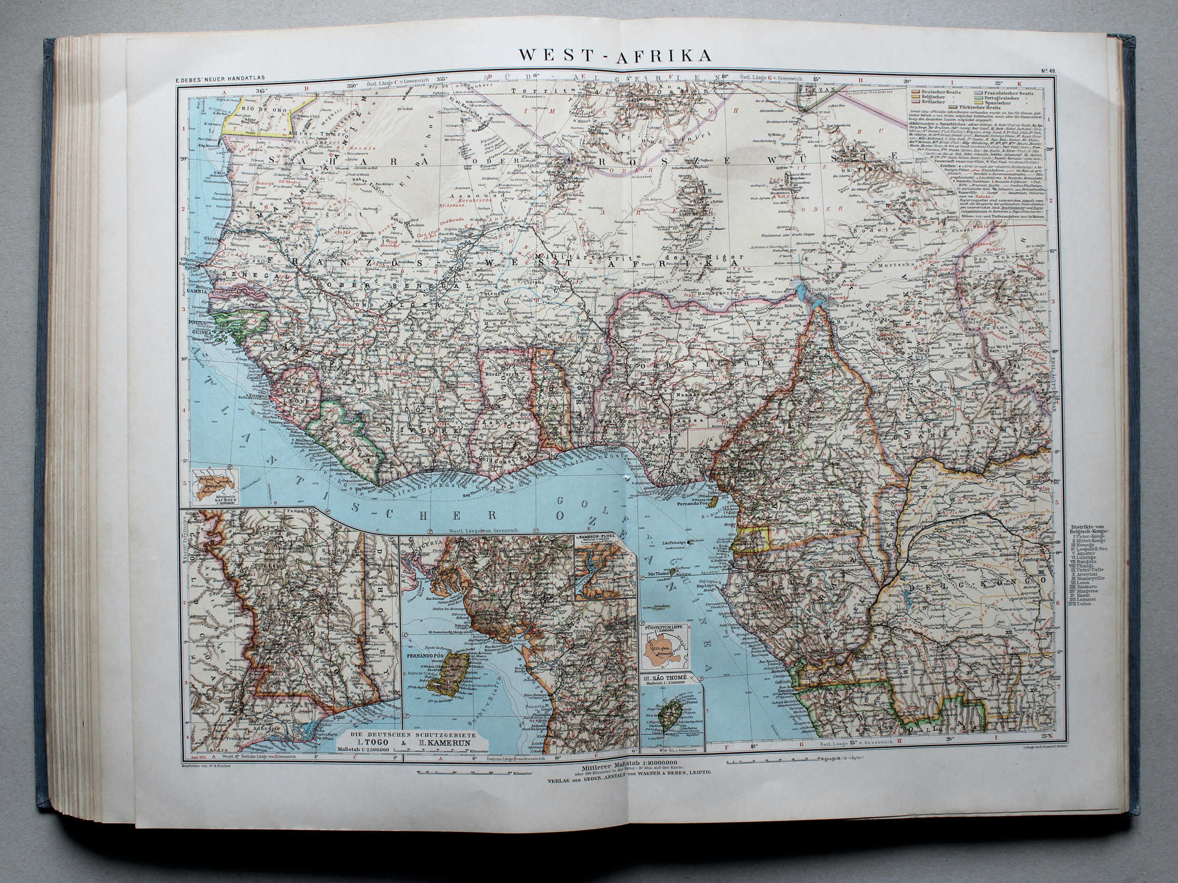
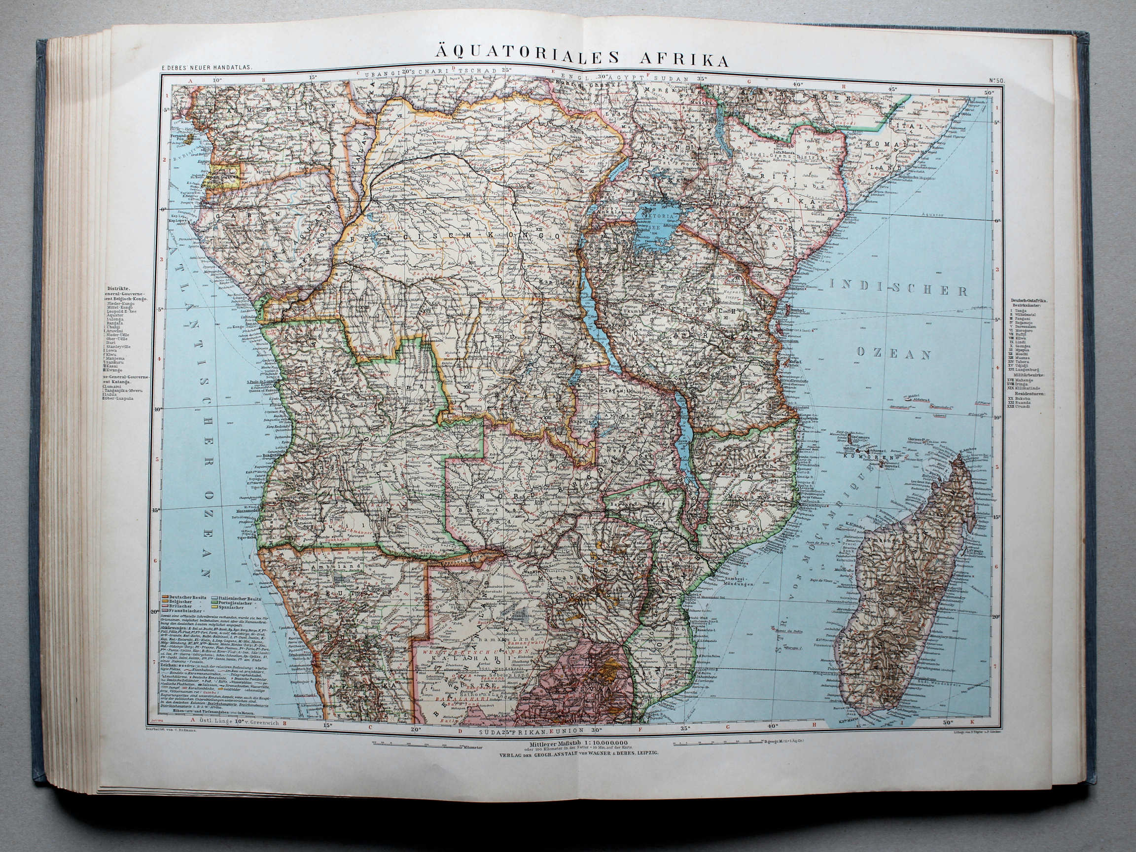
Debes' Neuer Handatlas, 1913
geen overeenkomstige kaart / no corresponding map


 Téleki-Kogutowicz: Világatlasz, 1912-1914
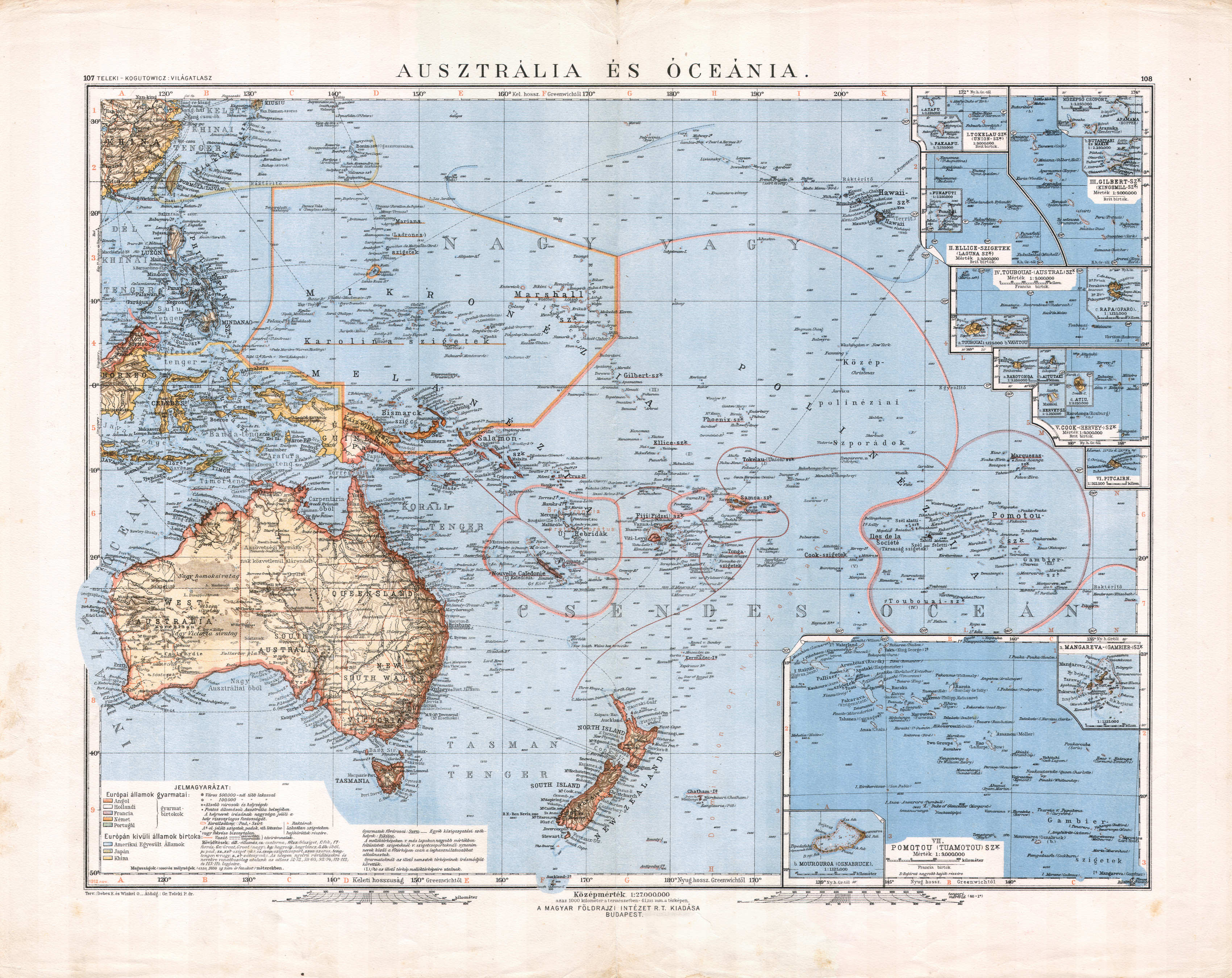
107-108. Ausztrália és Óceánia XL
Australië en Oceanië / Australia and Oceania
 Debes' Neuer Handatlas, 1913
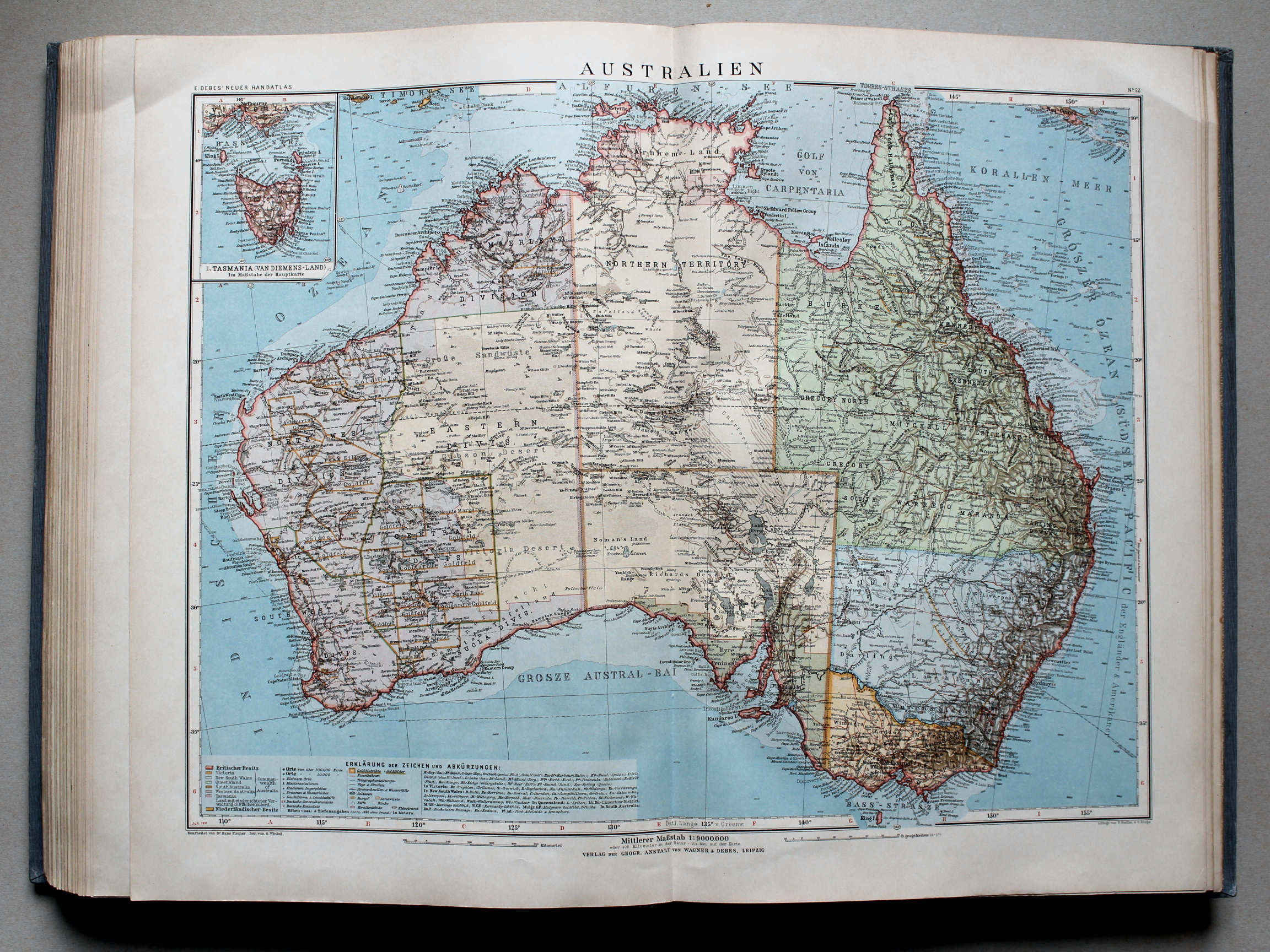
51. Australien und Ozeanien XL
Australië en Oceanië / Australia and Oceania
 Téleki-Kogutowicz: Világatlasz, 1912-1914
111-112. Ausztrália XL
Vasteland van Australië / Australian continent
 Kogutowicz-Littke: Világatlasz, 1912-1914
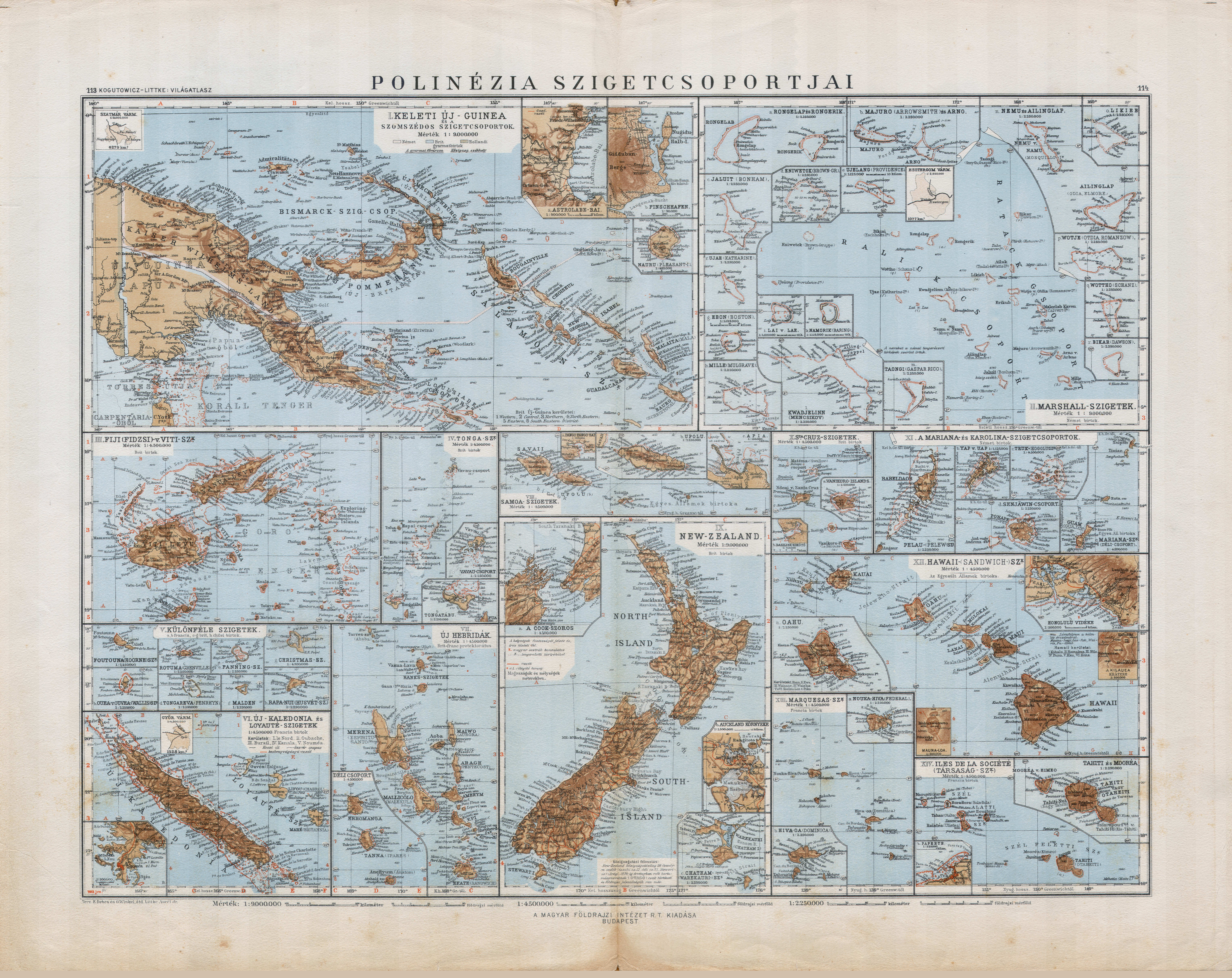
113-114. Polinézia szigetcsoportjai XL
Eilanden in de Grote Oceaan / Islands in the Pacific Ocean
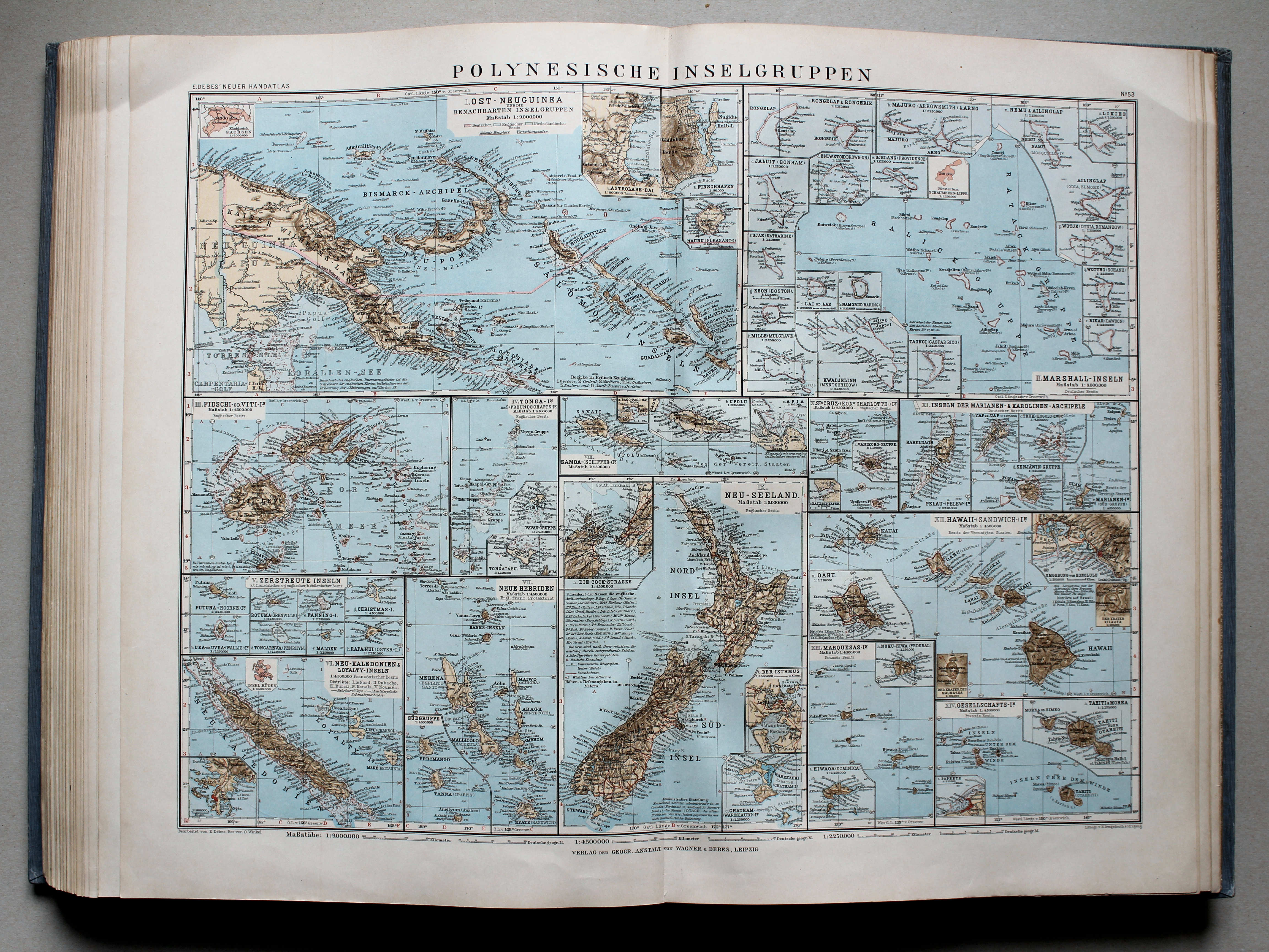
 Debes' Neuer Handatlas, 1913
53. Polynesische Inselgruppen XL
Eilanden in de Grote Oceaan / Islands in the Pacific Ocean
 Kogutowicz-Littke: Világatlasz, 1912-1914
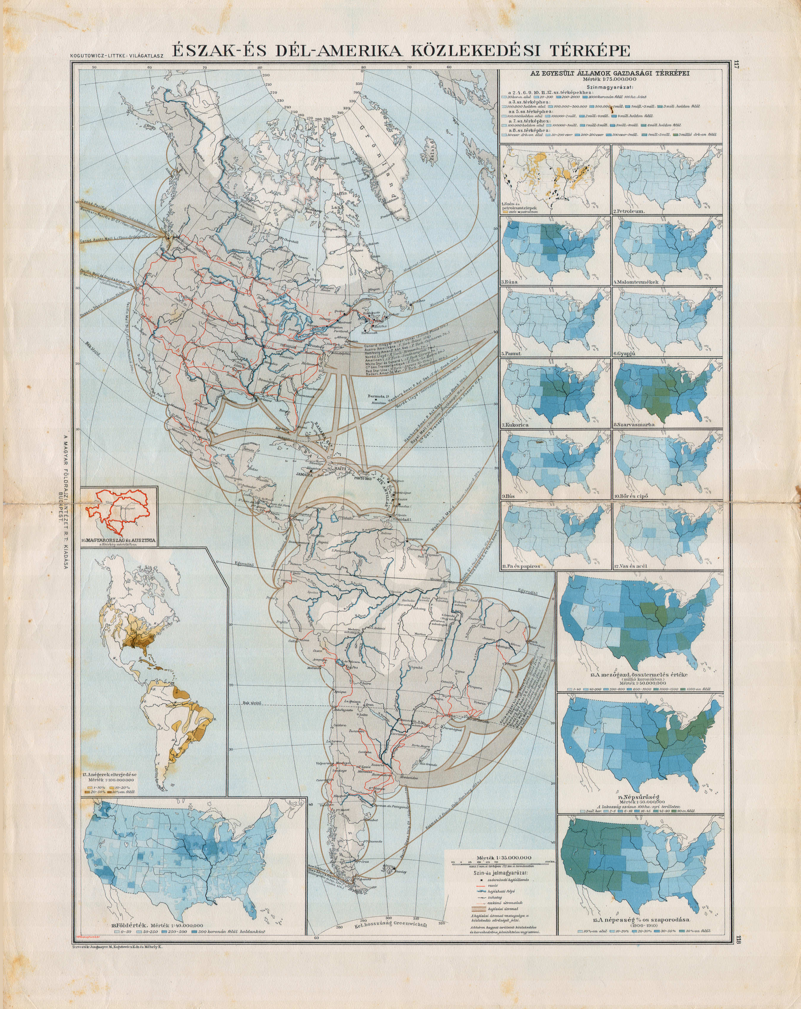
117-118. Észak- és Dél-Amerika közlekedési térképe XL
Vervoerskaart van Noord- en Zuid-Amerika / Transport map of North and South America
 Debes' Neuer Handatlas, 1913
geen overeenkomstige kaart / no corresponding map
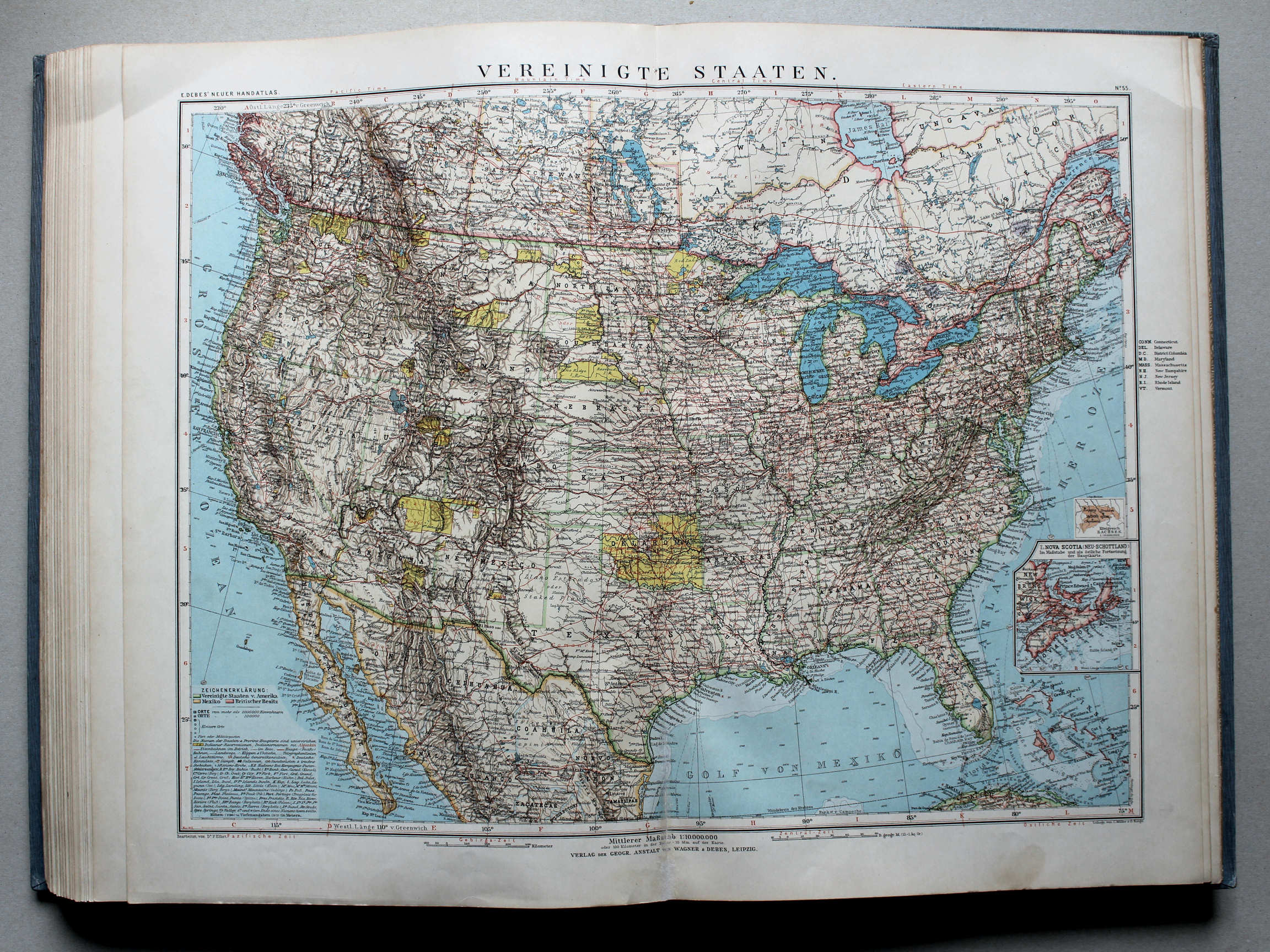
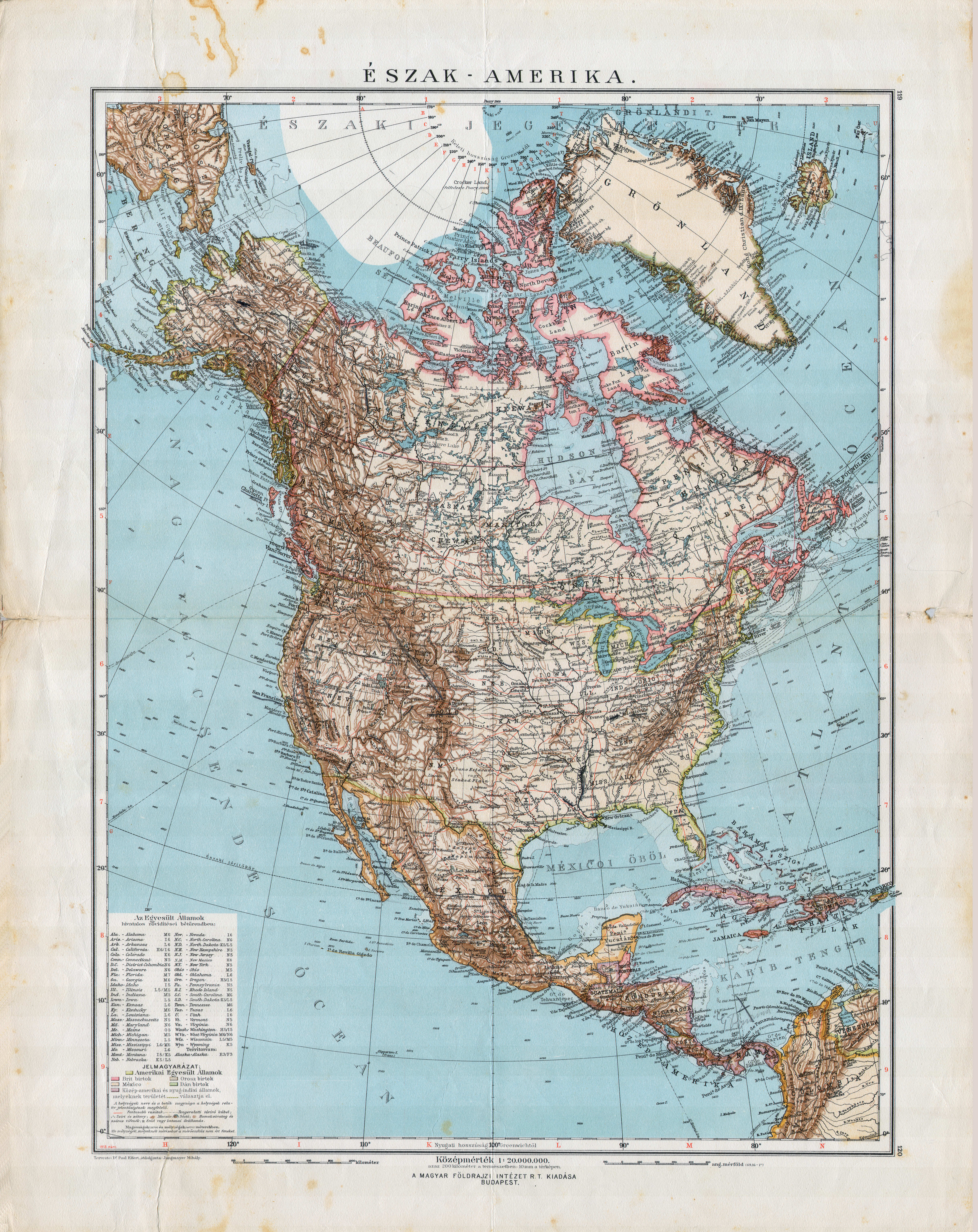
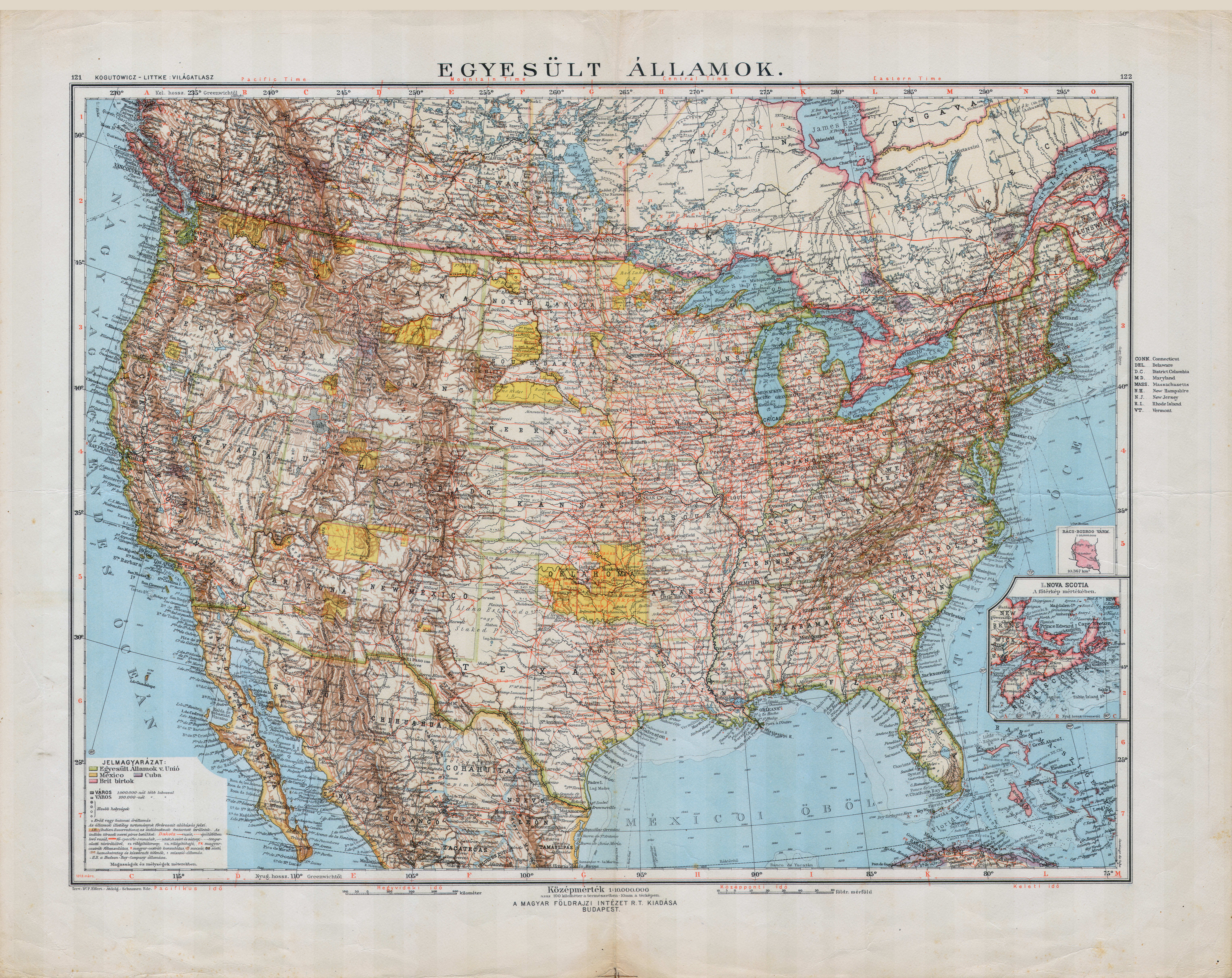
 Kogutowicz-Littke: Világatlasz, 1912-1914
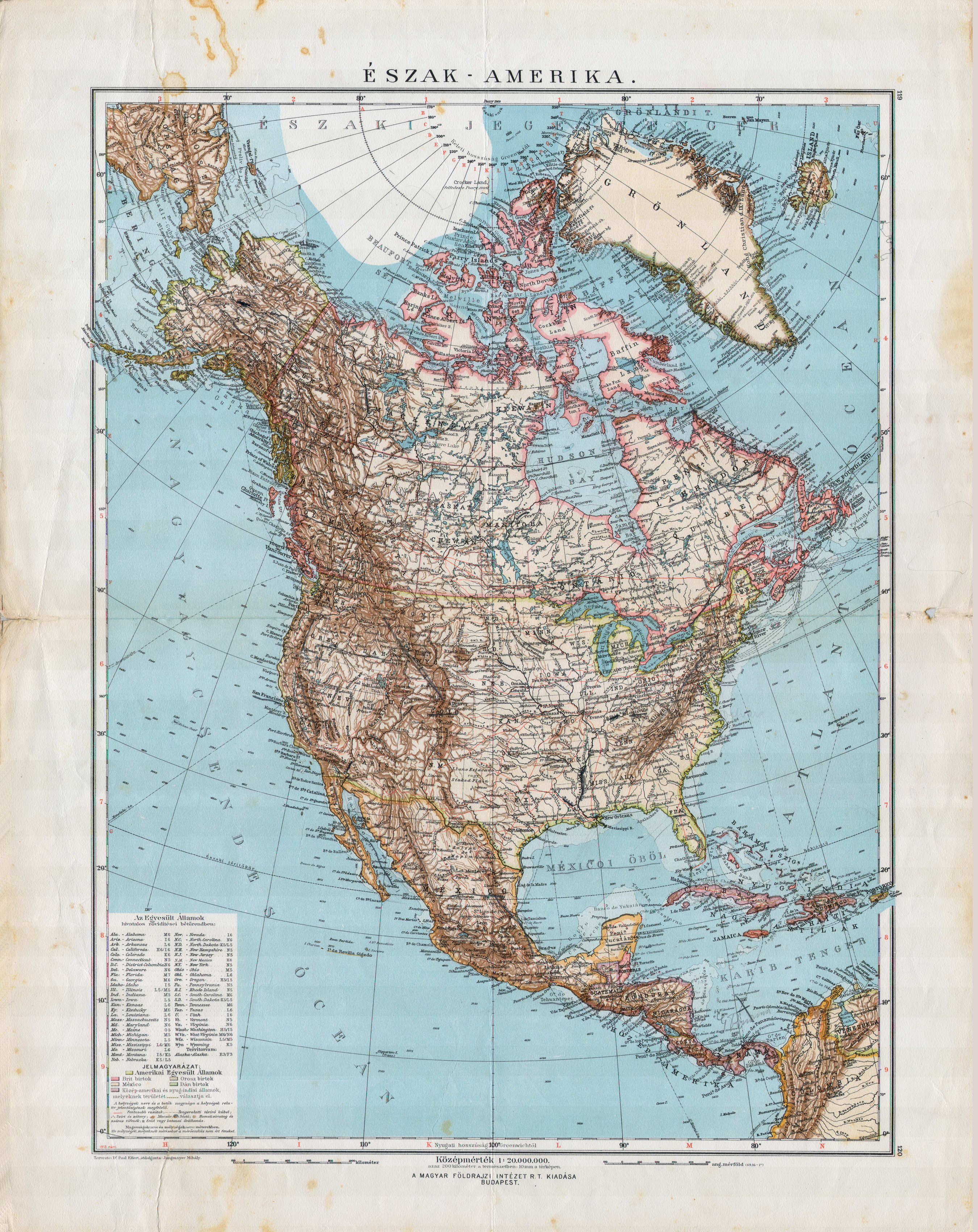
121-122. Egyesült Államok XL
Verenigde Staten / United States
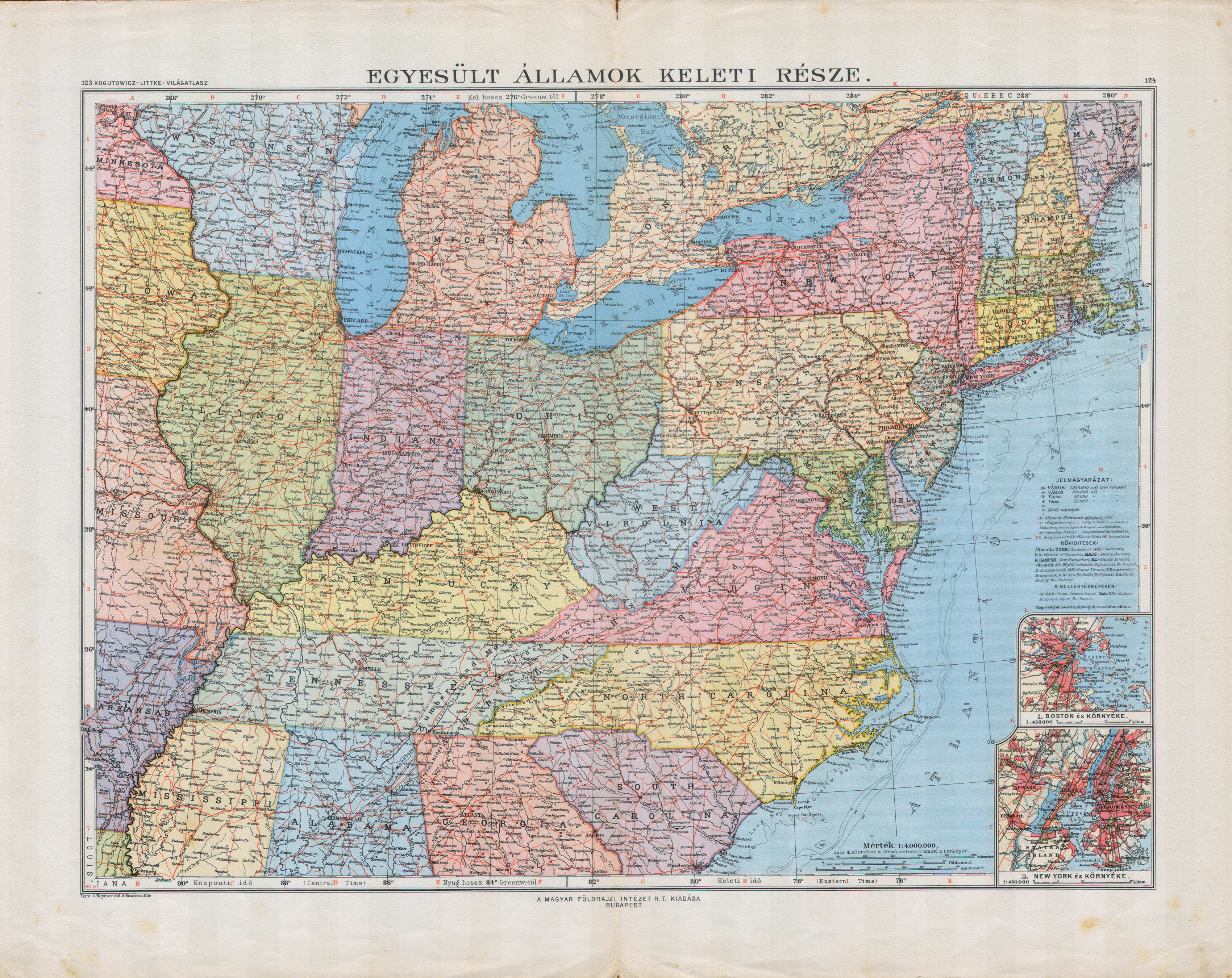 Kogutowicz-Littke: Világatlasz, 1912-1914
123-124. Egyesült Államok keleti része XL
Verenigde Staten, oostelijk deel / Eastern United States
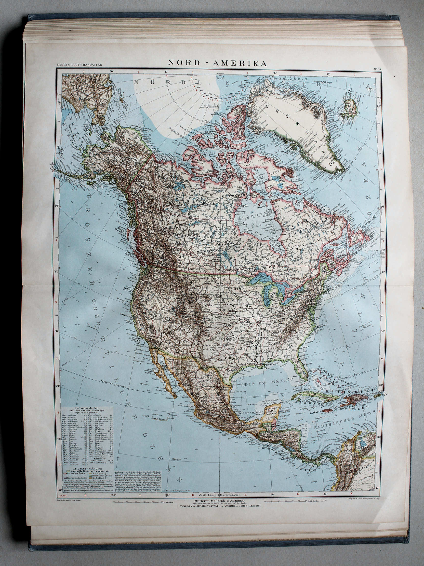
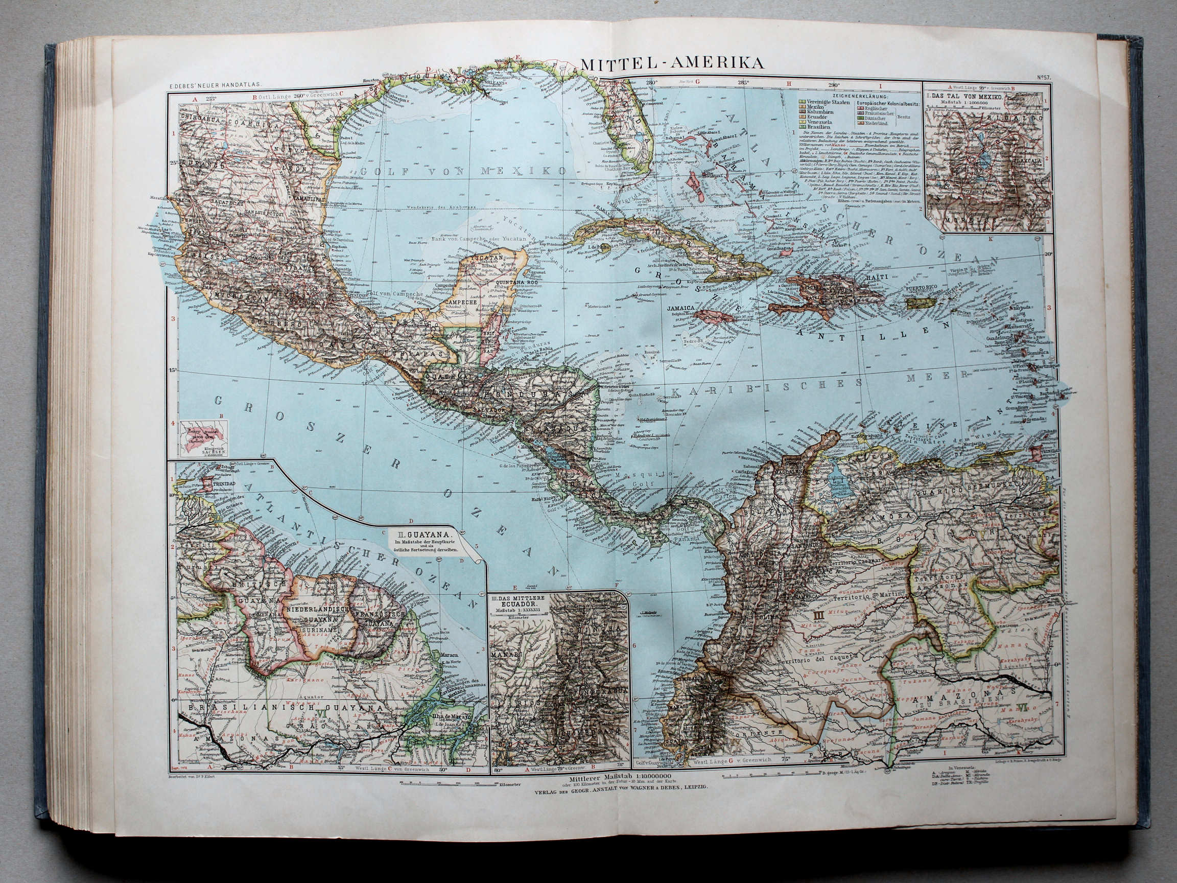
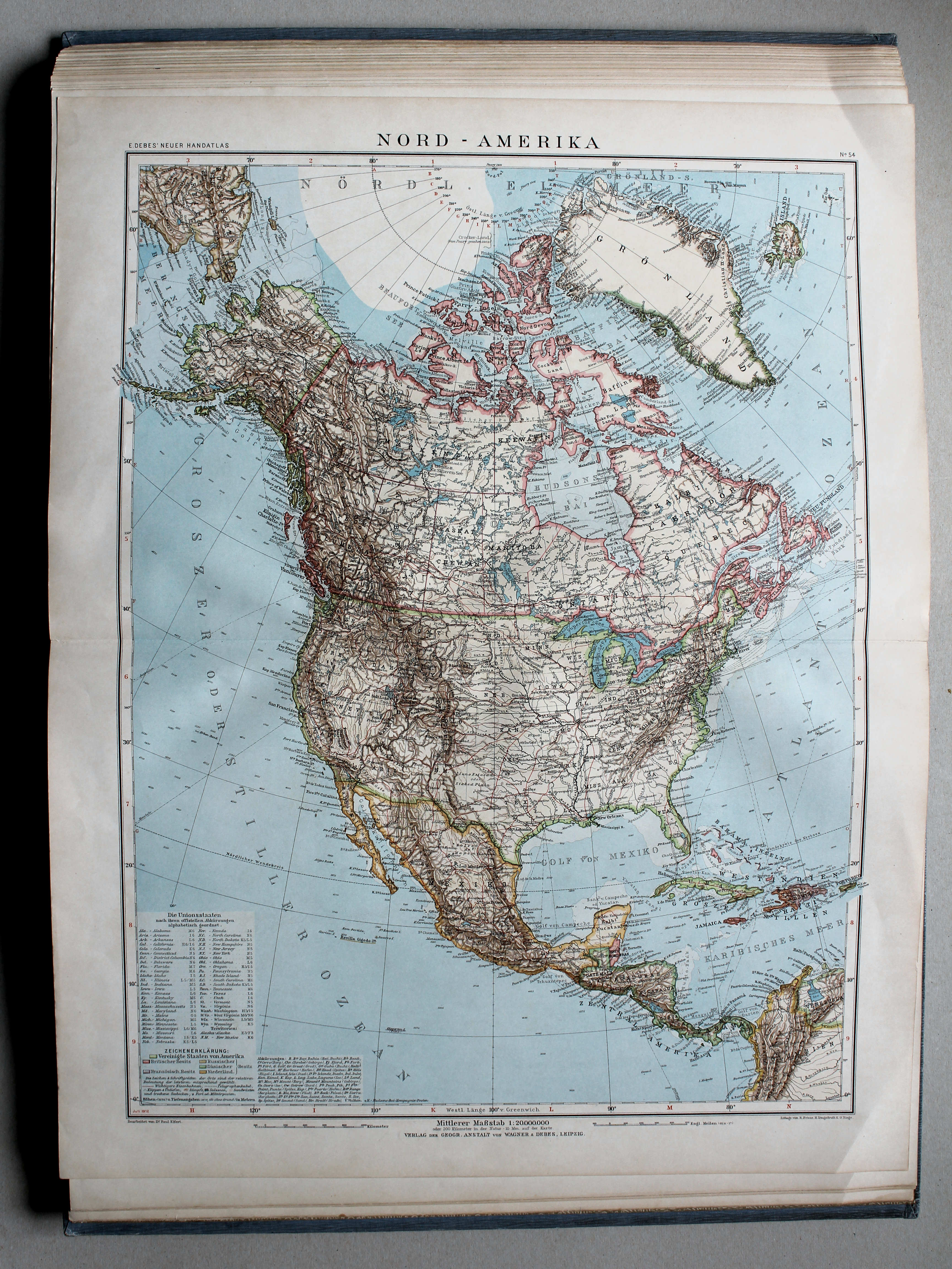
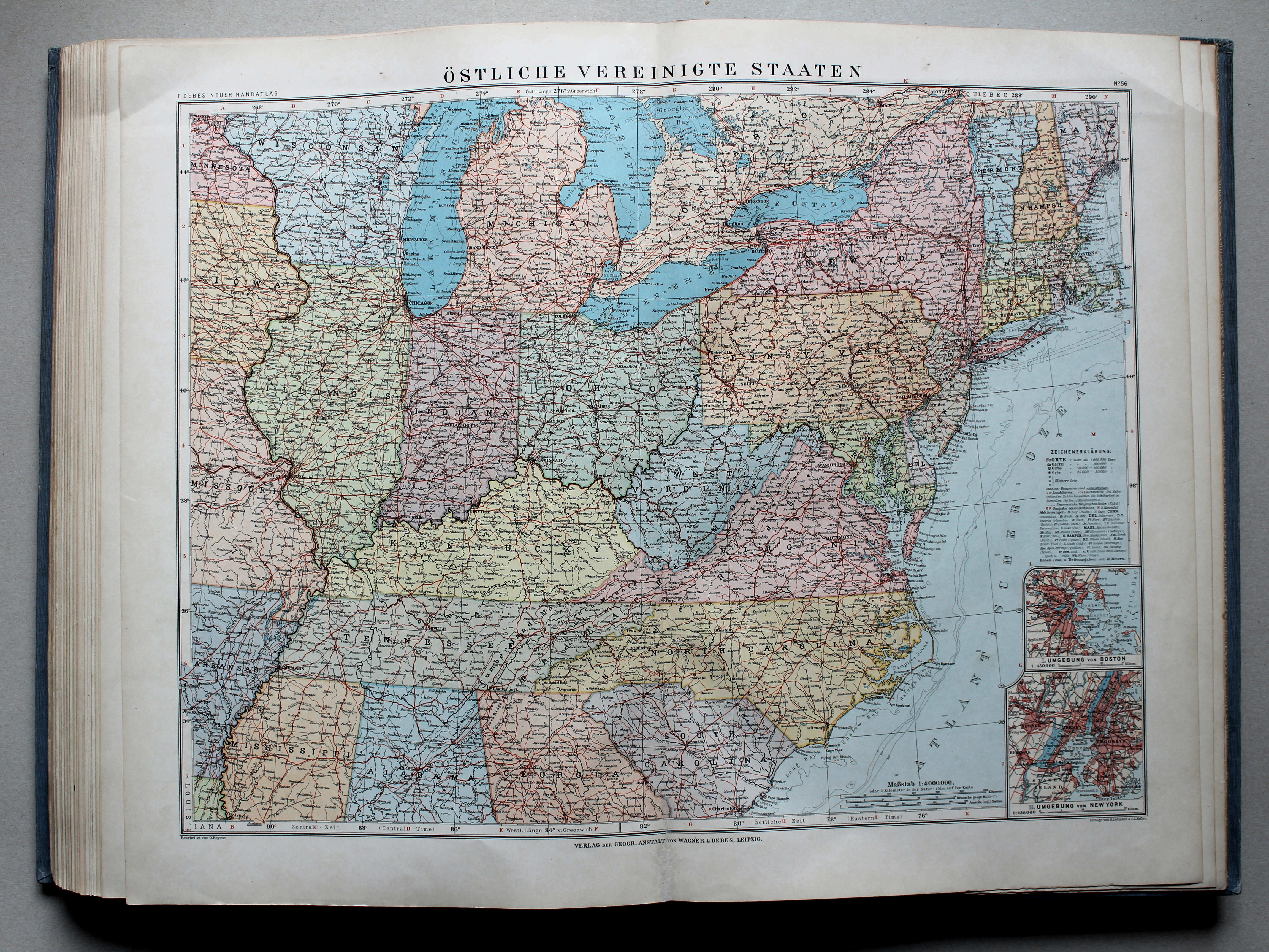
 Debes' Neuer Handatlas, 1913
56. Östliche Vereinigte Staaten XL
Verenigde Staten, oostelijk deel / Eastern United States
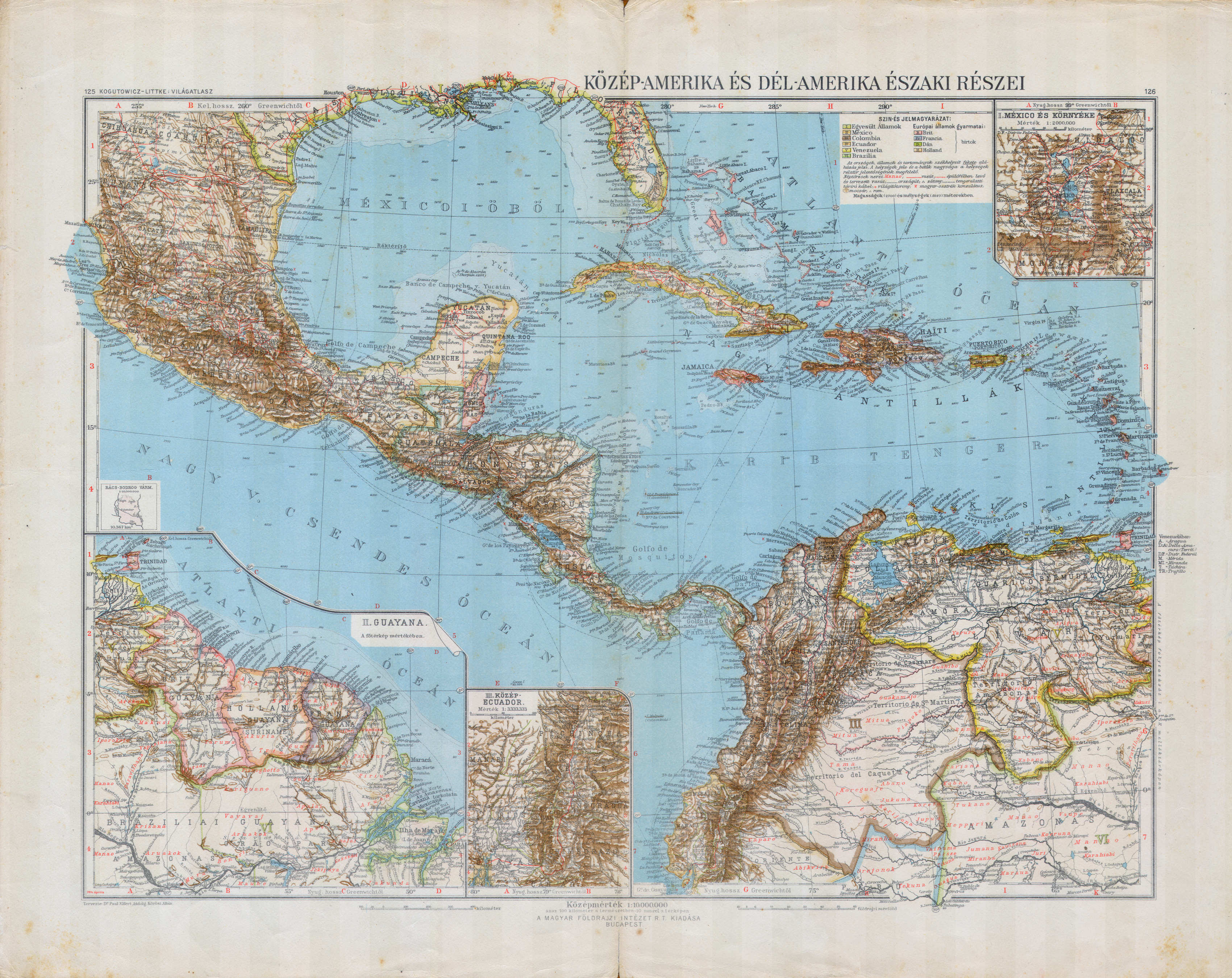 Kogutowicz-Littke: Világatlasz, 1912-1914
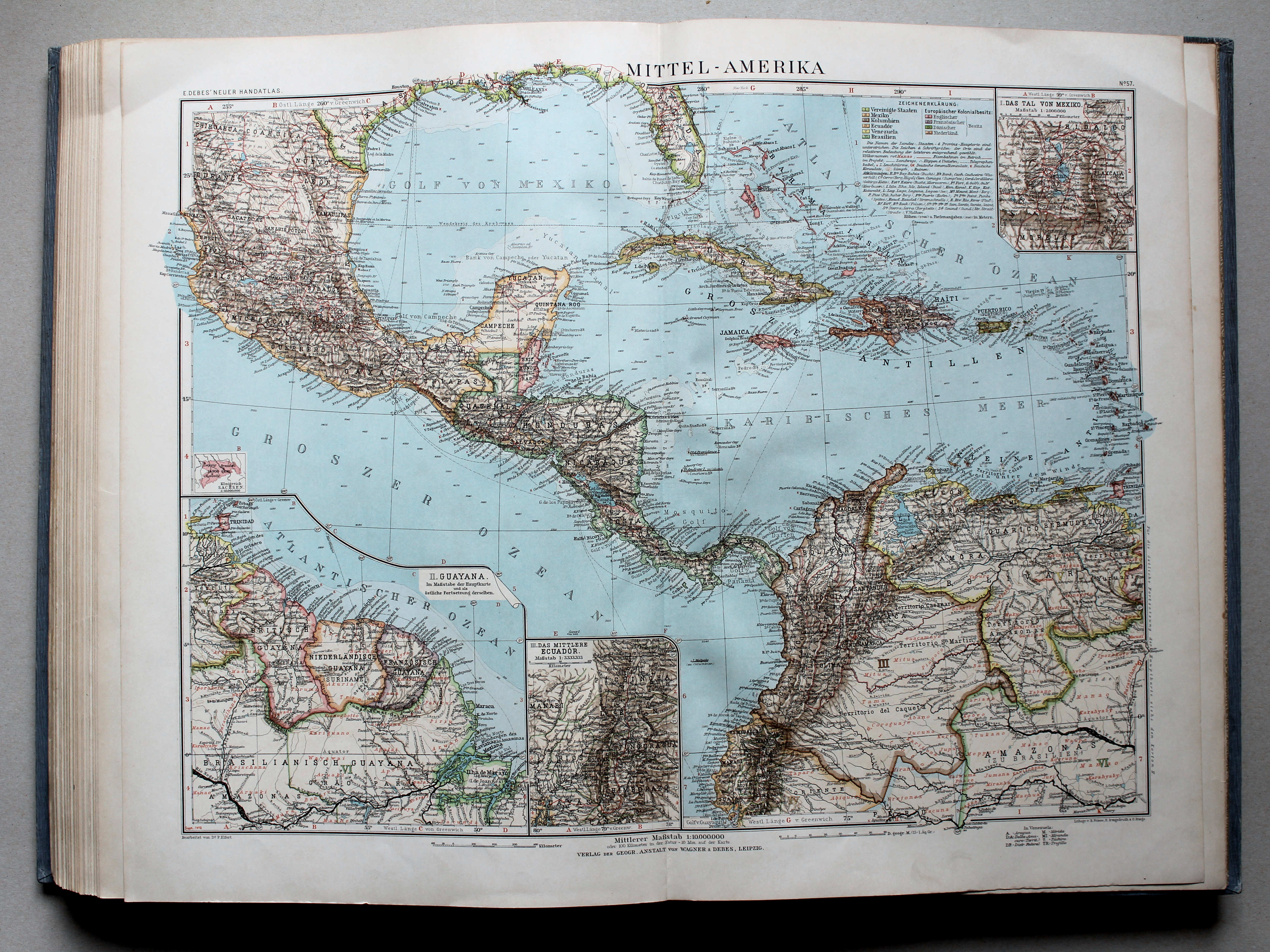
125-126. Közép-Amerika és Dél-Amerika északi részei XL
Midden-Amerika en het noordelijke deel van Zuid-Amerika / Central America and the northern part of South America
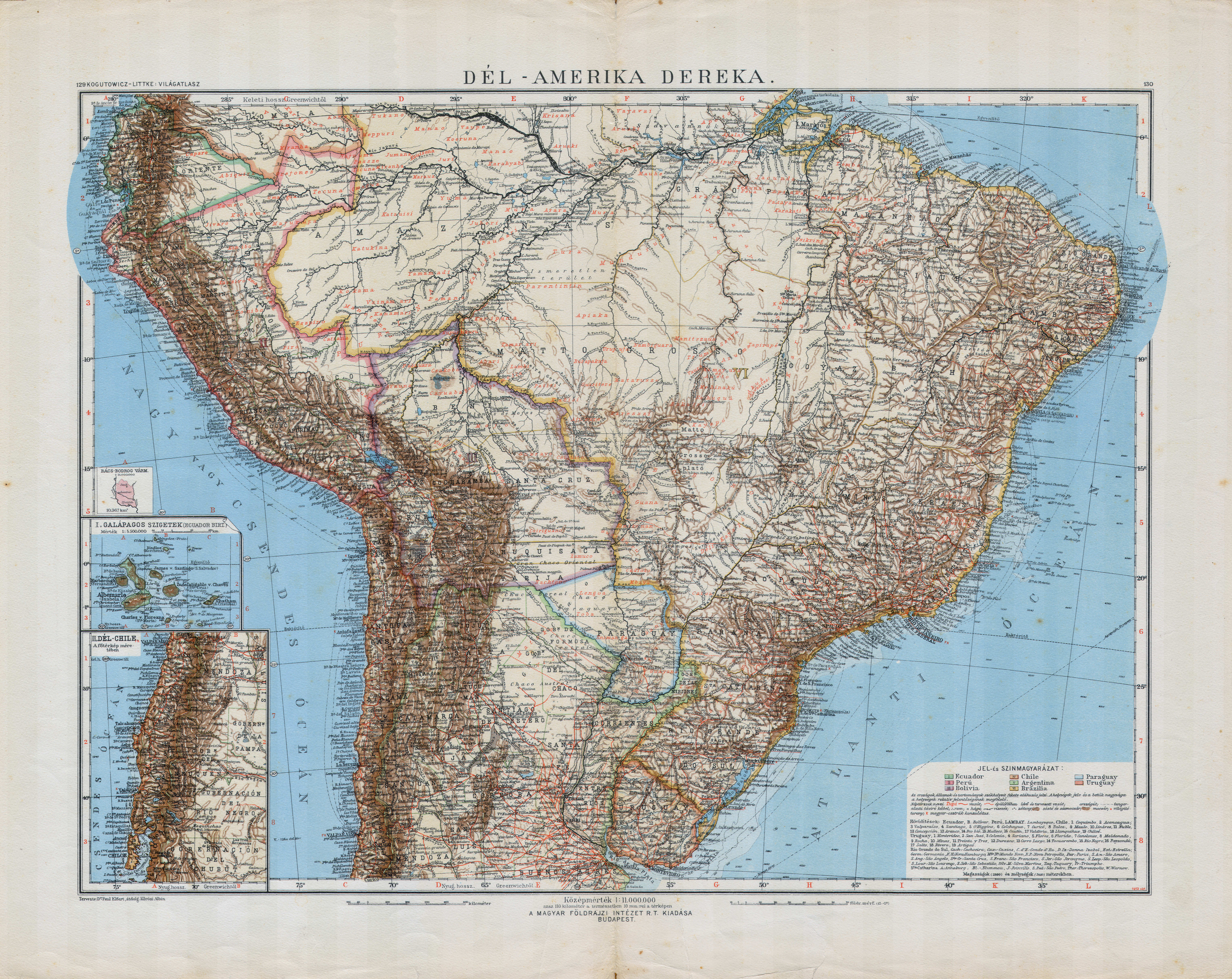
 Kogutowicz-Littke: Világatlasz, 1912-1914
129-130. Dél-Amerika dereka XL
Centraal Zuid-Amerika / Central South America
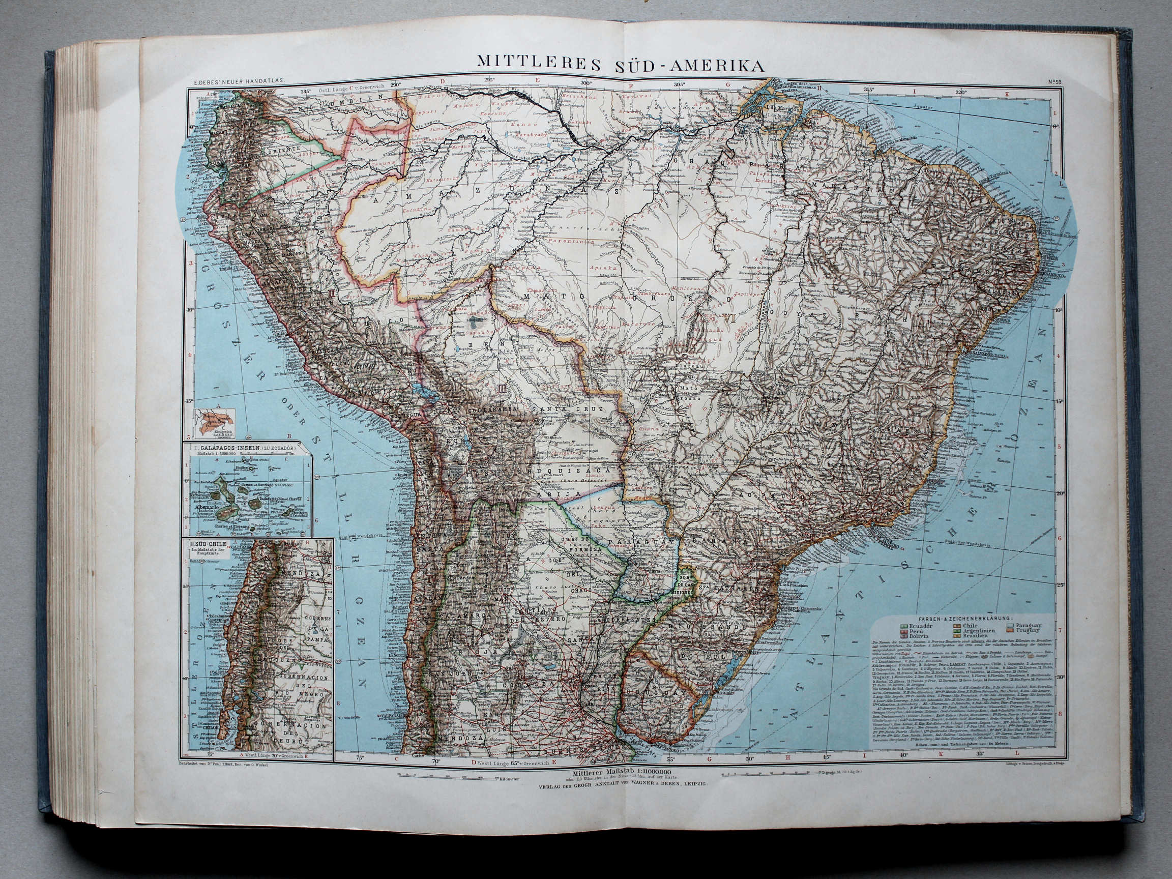 Debes' Neuer Handatlas, 1913
59. Mittleres Süd-Amerika XL
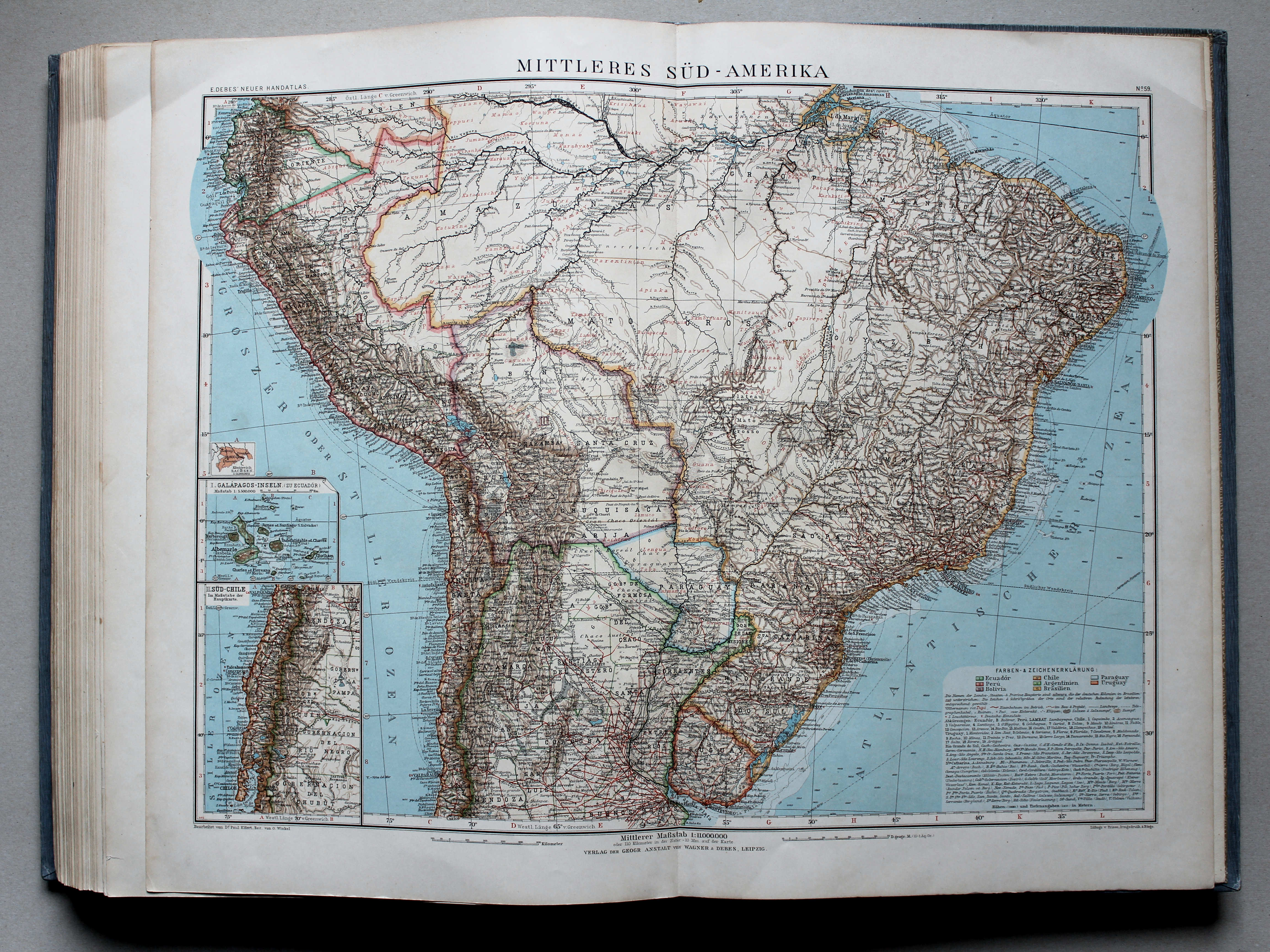
Centraal Zuid-Amerika / Central South America
© M. Witkam, 2015
met dank aan / courtesy of: Rob Segers
![]()
![]()