Orbis terrarum antiquus. Schul-Atlas der alten Welt, 19e druk (1846)
See below for (a summary of) this text in English.
Hieronder staan plaatjes van de atlas. Daarbij horen ook de volgende pagina's
- Beschrijving van de atlas
- Voorwoord bij de atlas
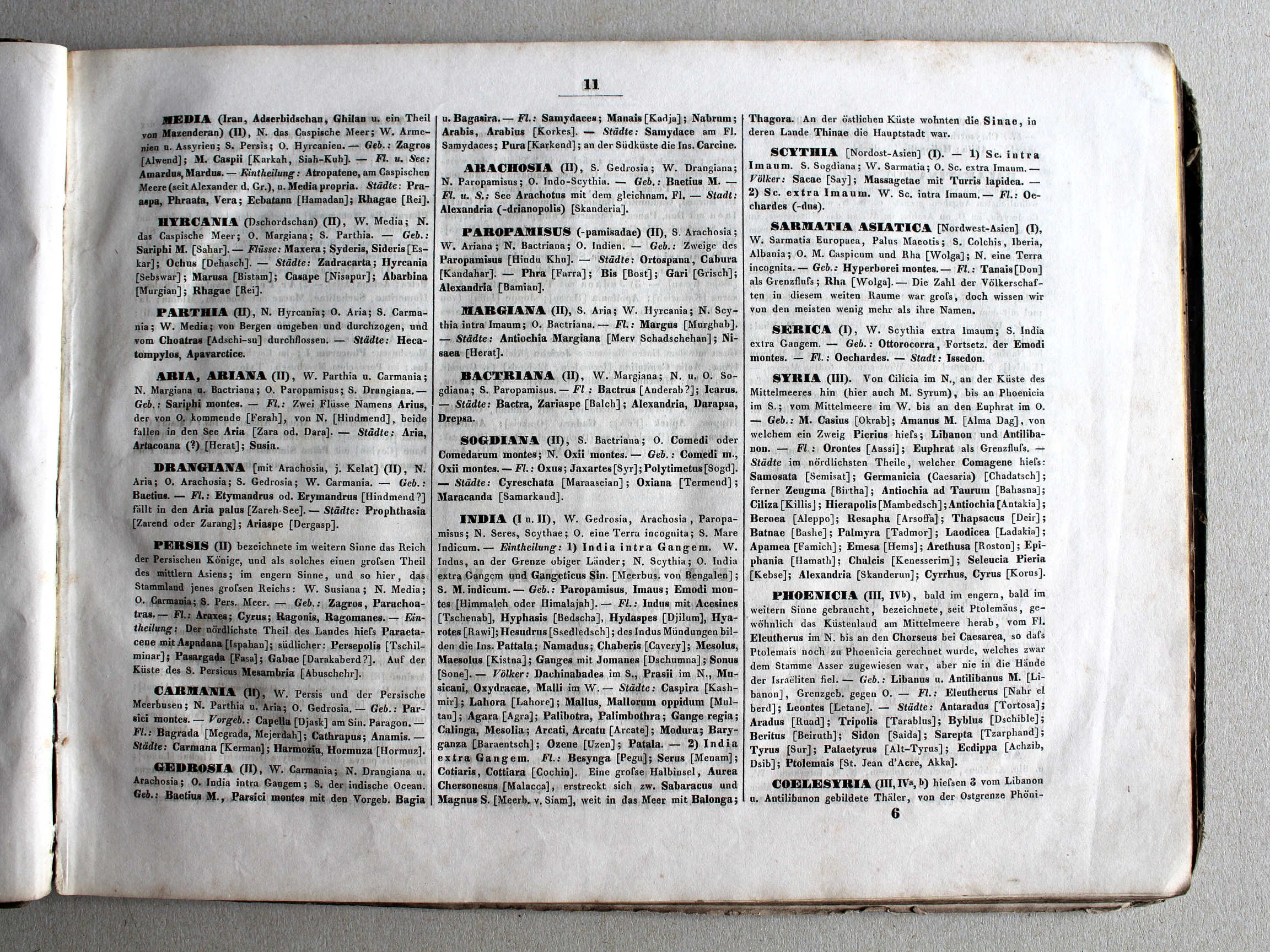
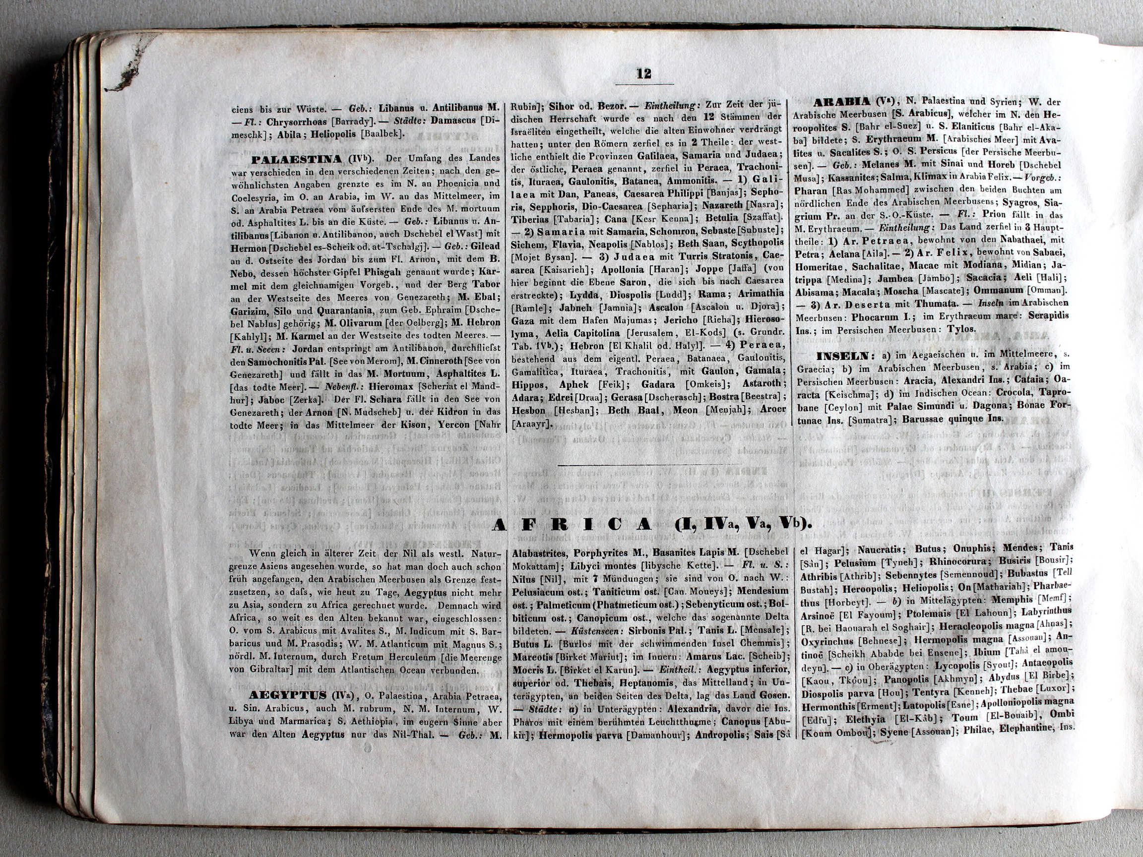
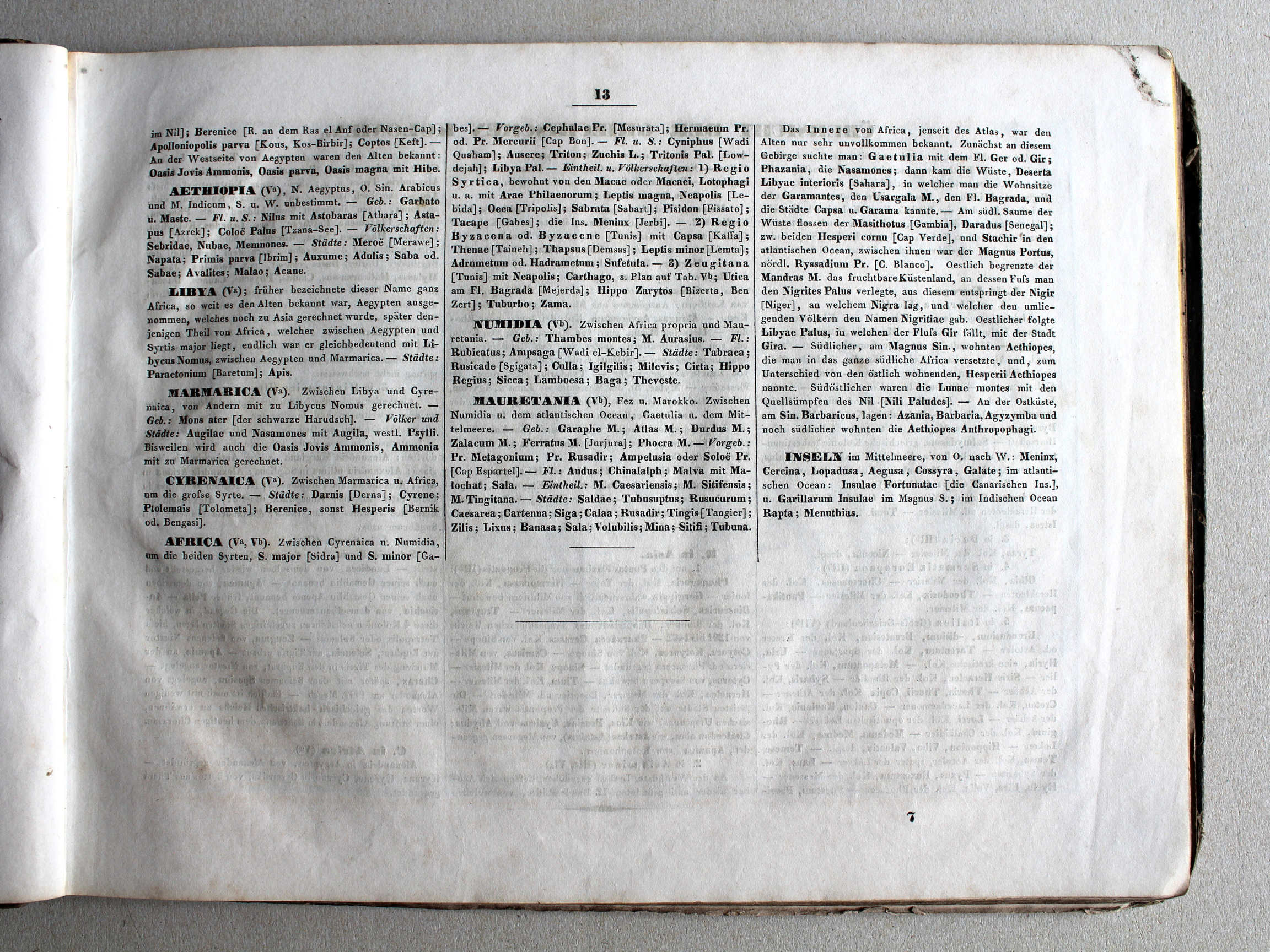
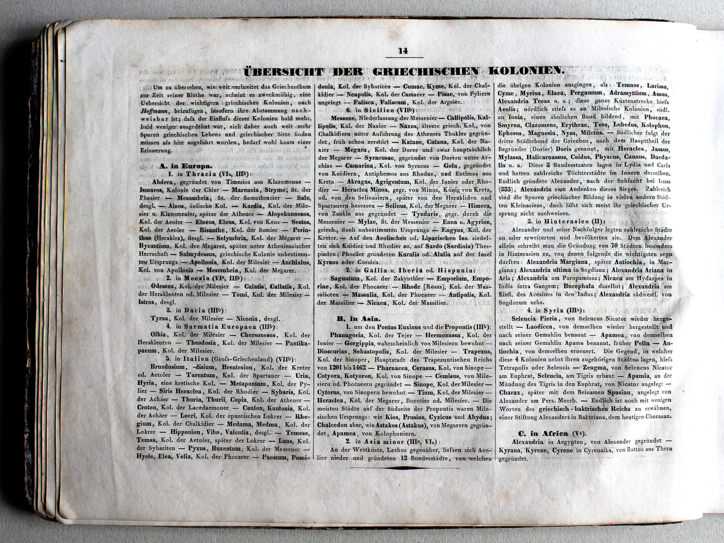
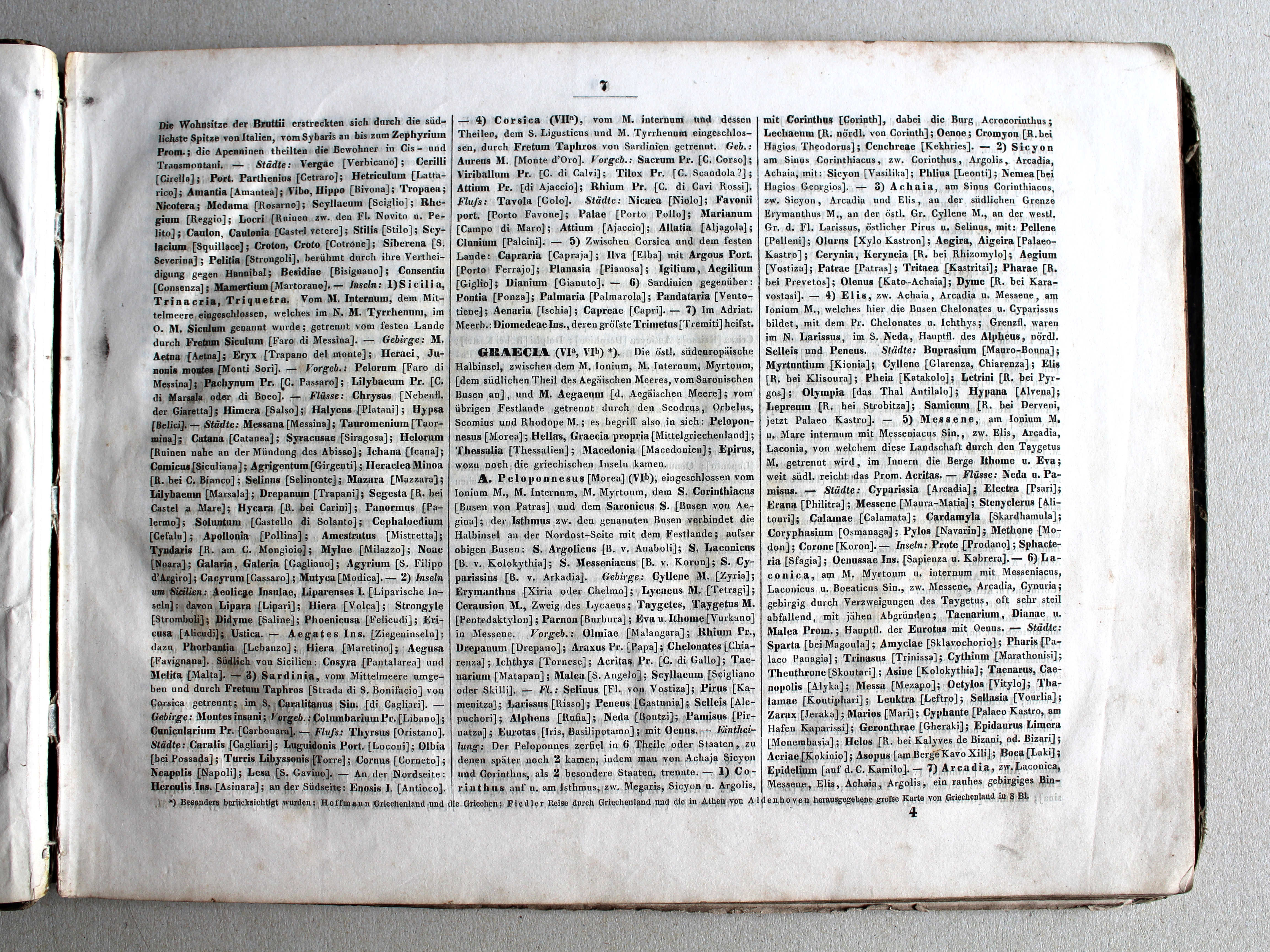
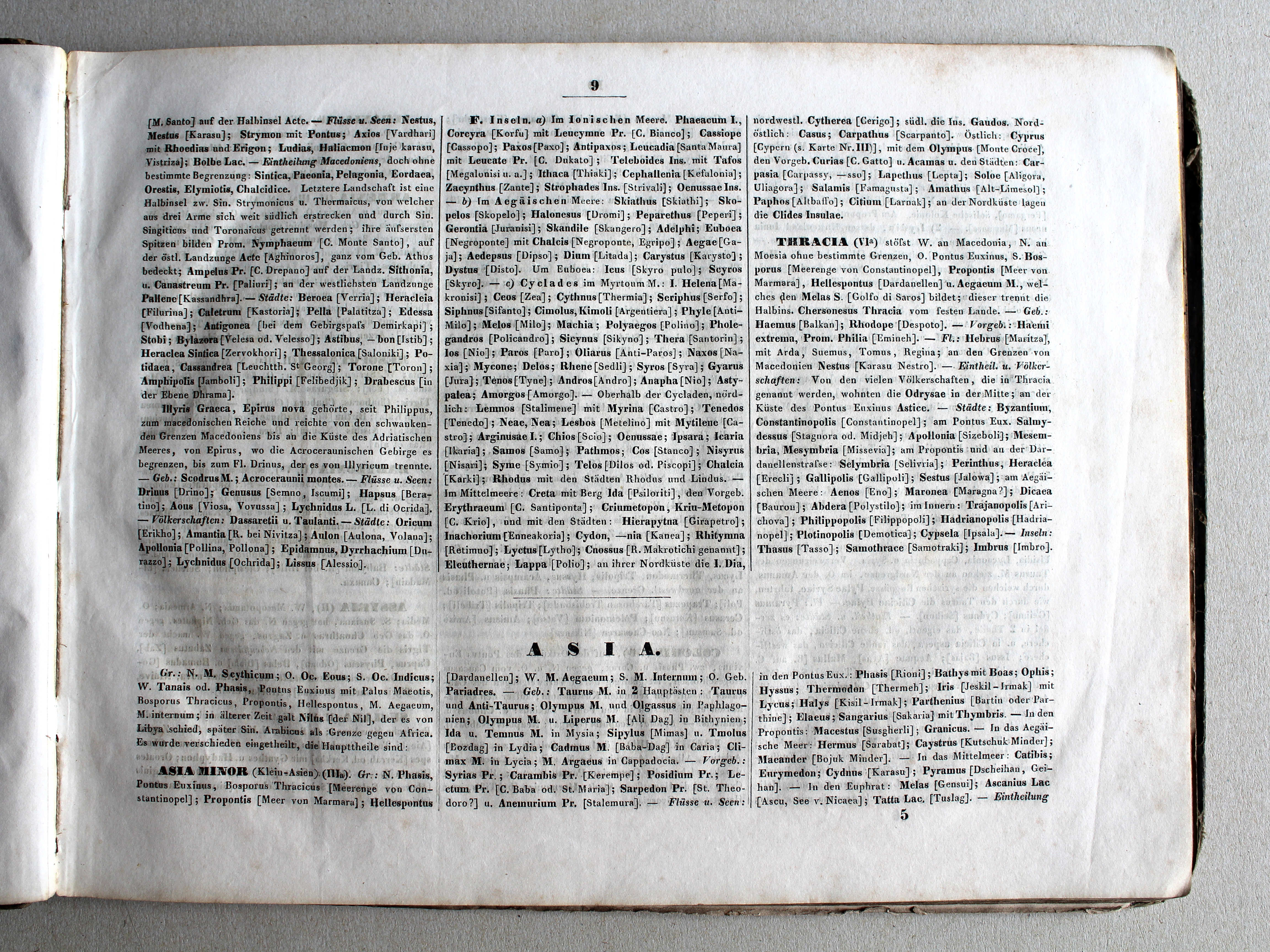
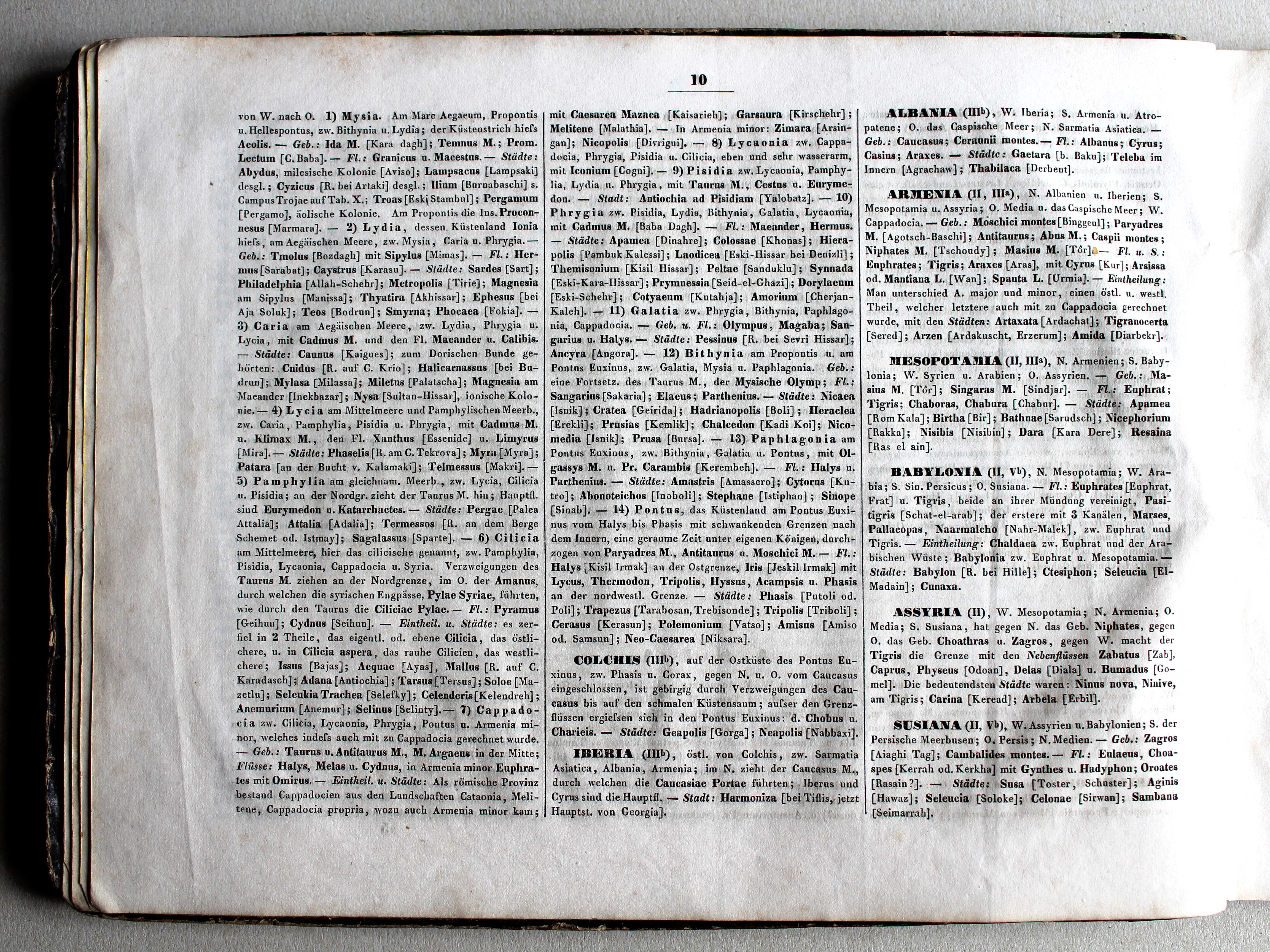
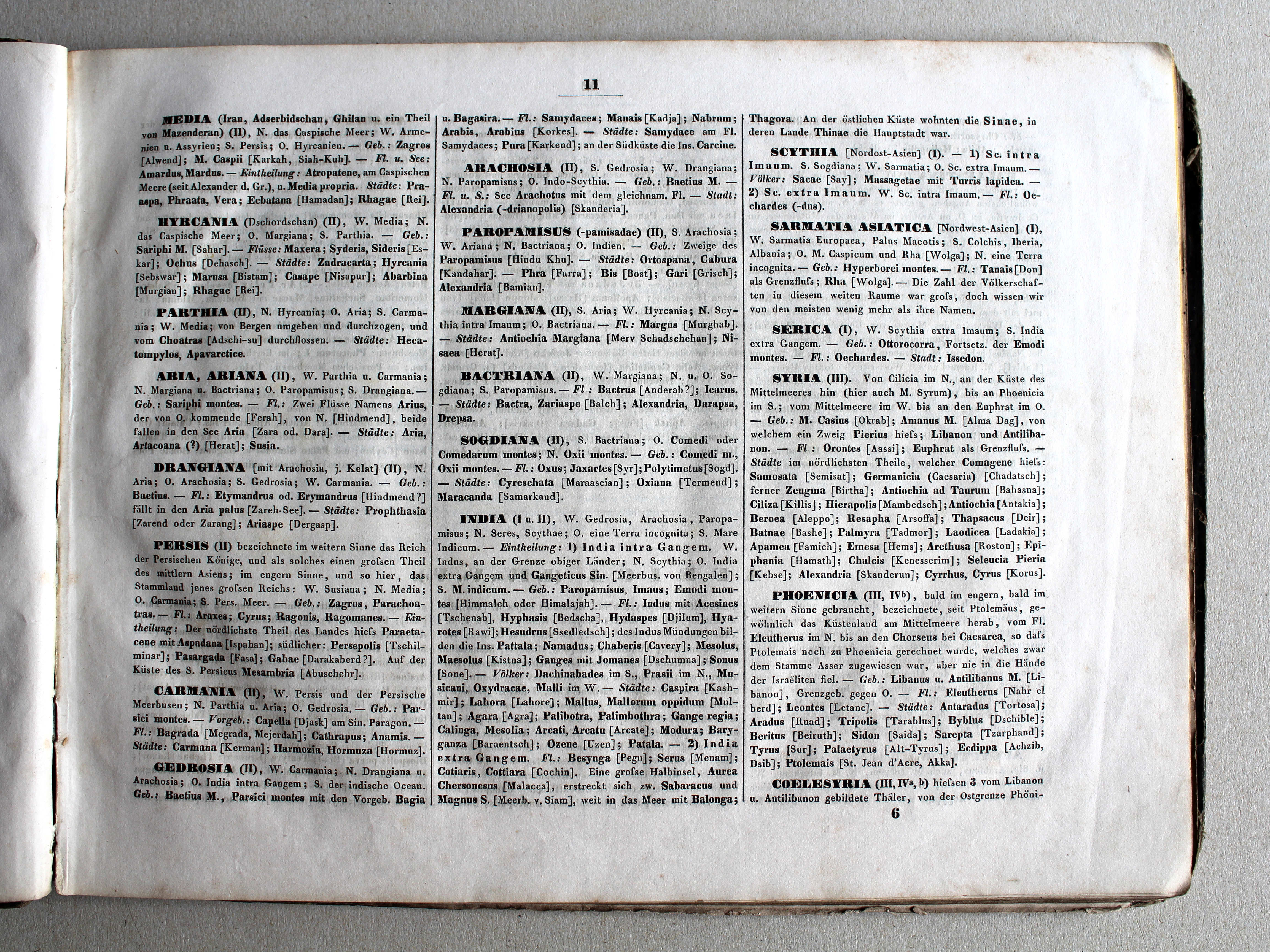
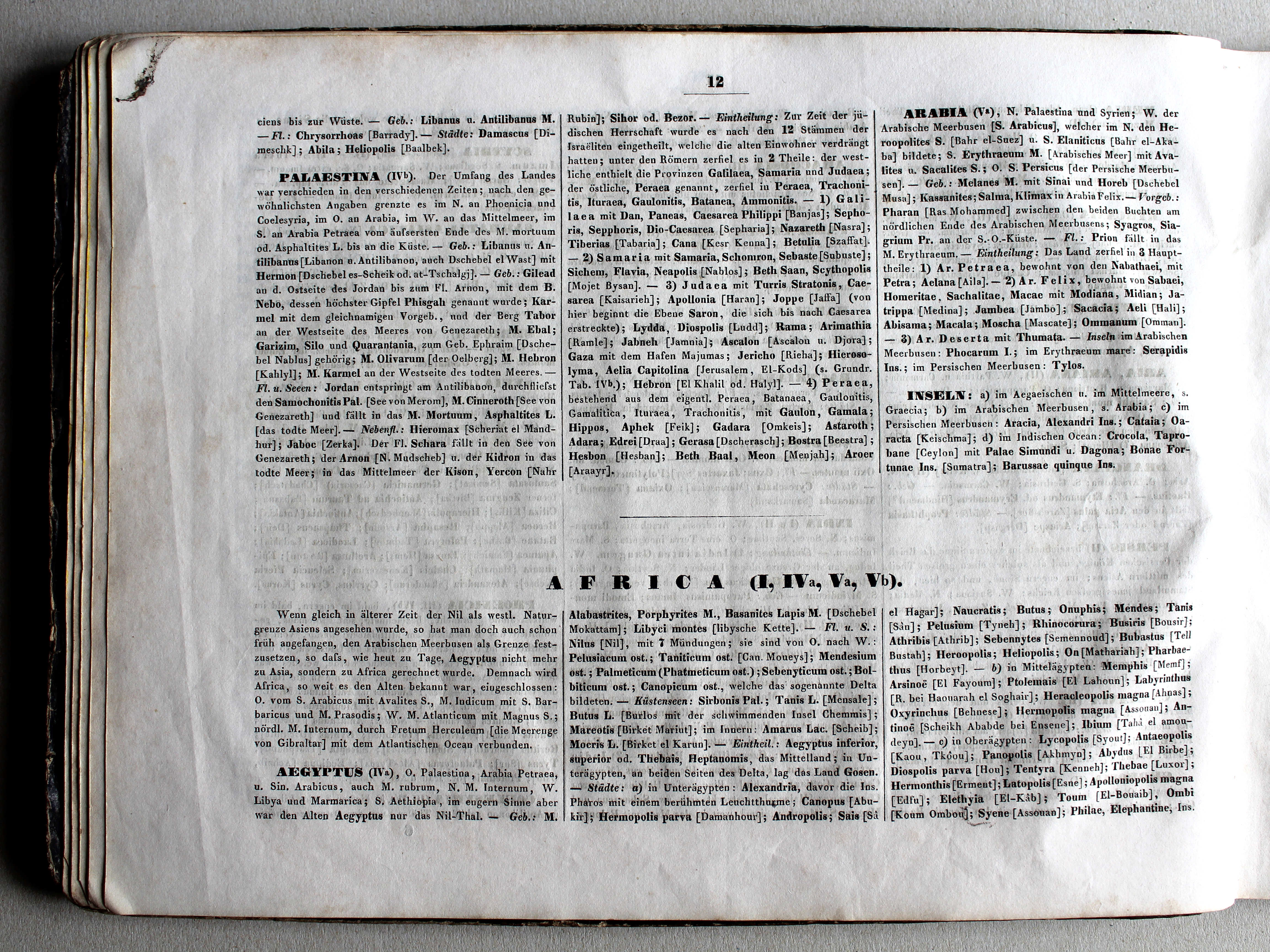
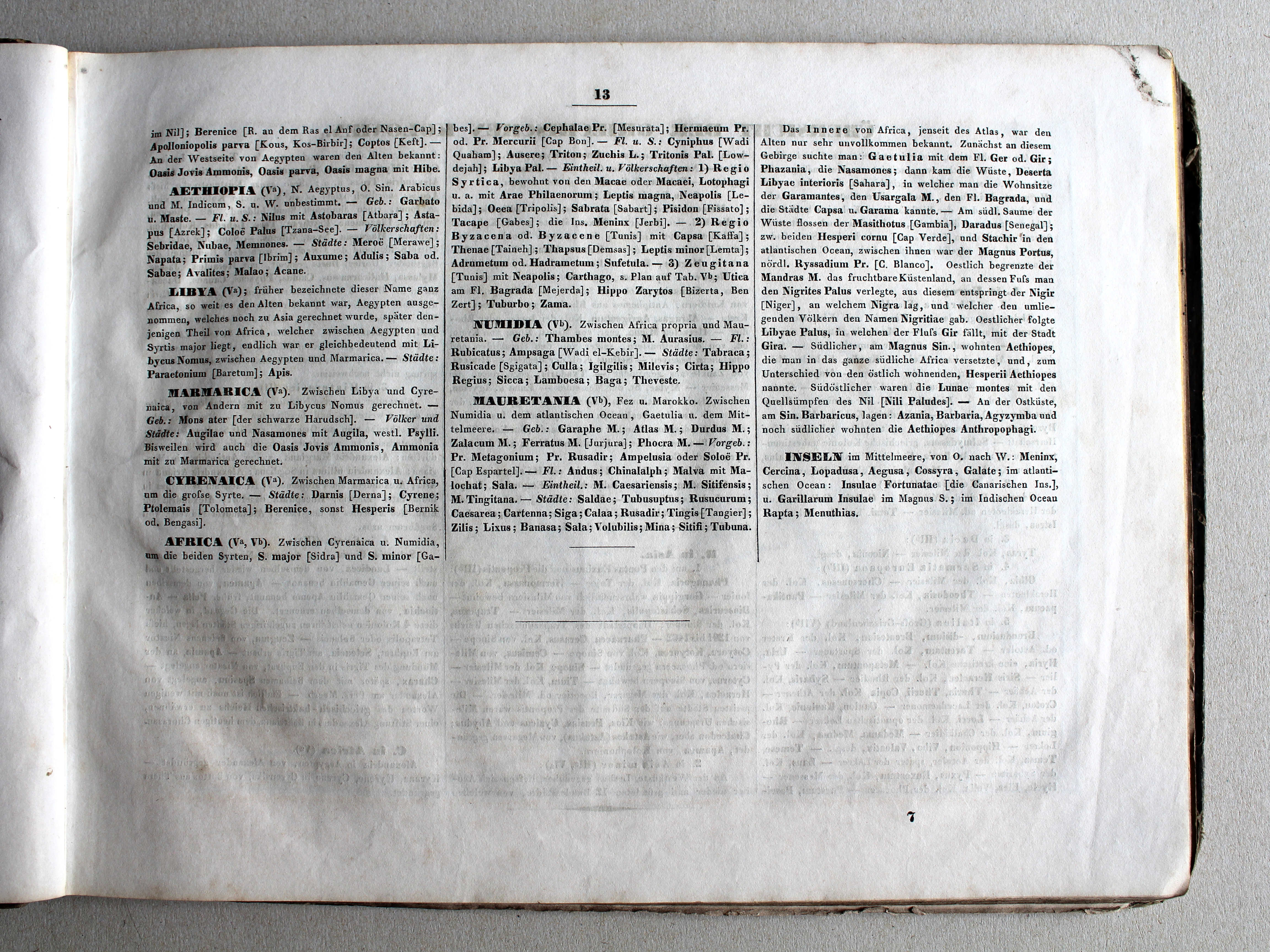
- Tabellen en lijsten bij de atlas
- Vergelijking (plaatjes) met de vroege uitgaven
Plaatjes
Klik op een plaatje voor een vergroting.
Orbis terrarum antiquus. Schul-Atlas der alten Welt, 19th edition (1846)
- Below are pictures of the atlas. Related pages
- Description of the atlas
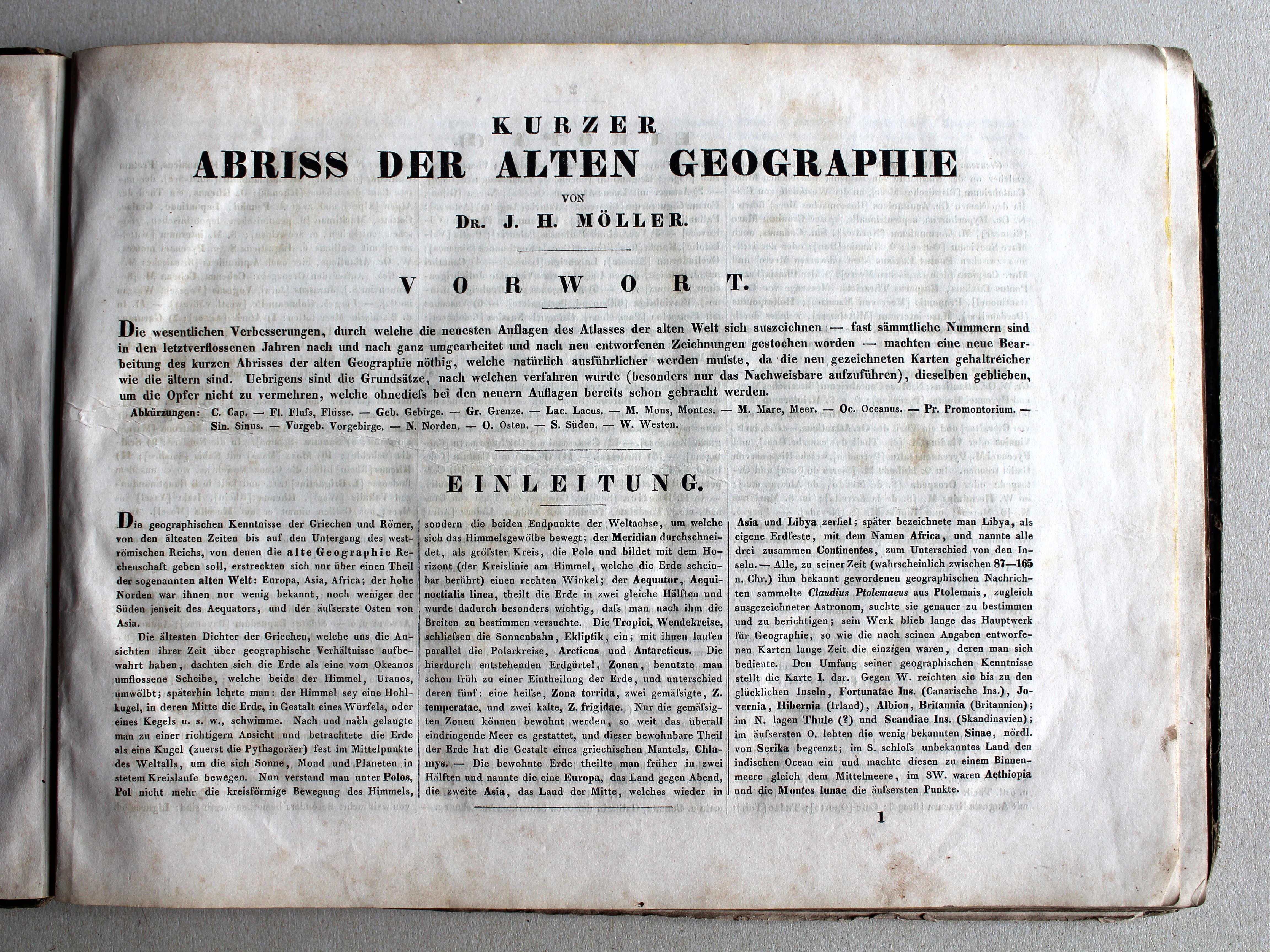
- Preface to the atlas
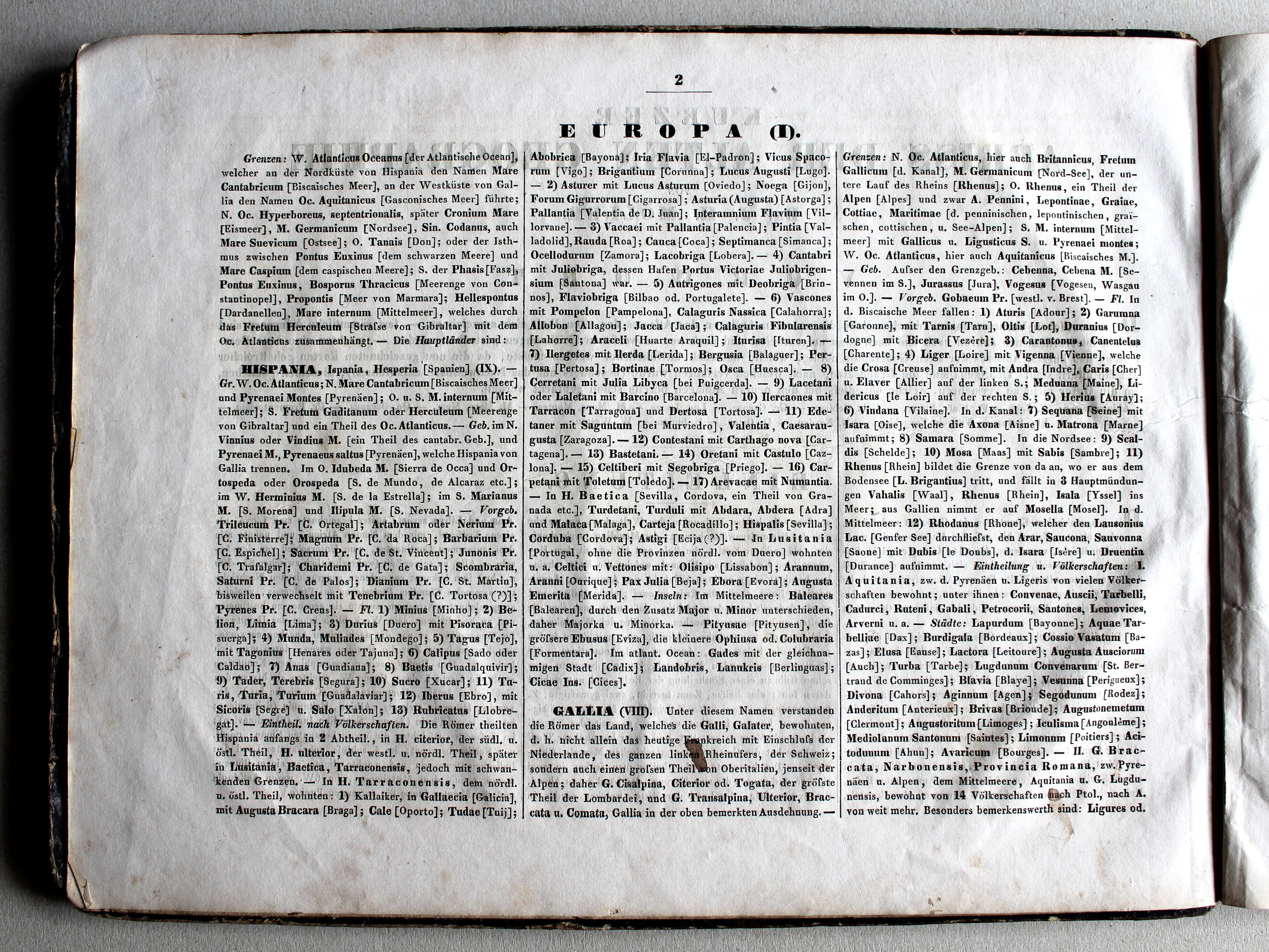
- Tables and lists to the atlas
- Comparison (pictures) with the early editions
Pictures
Click on a picture to enlarge.
Band, titelpagina / Binding, title page Inleiding / Introduction Kaarten / Maps
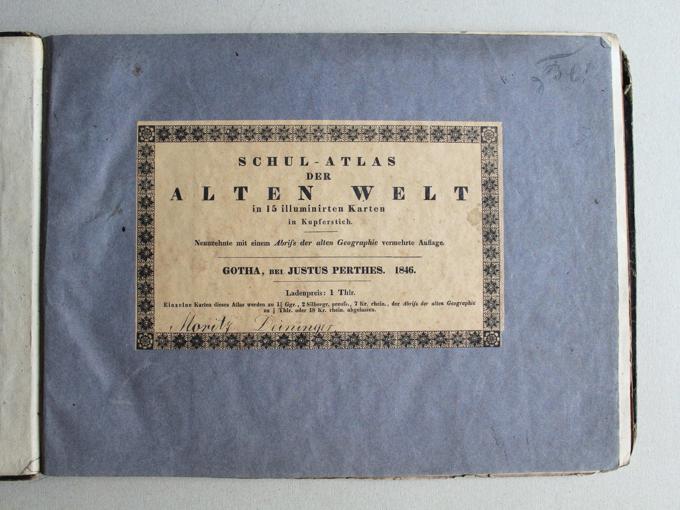


 Schul-Atlas der alten Welt, 1846
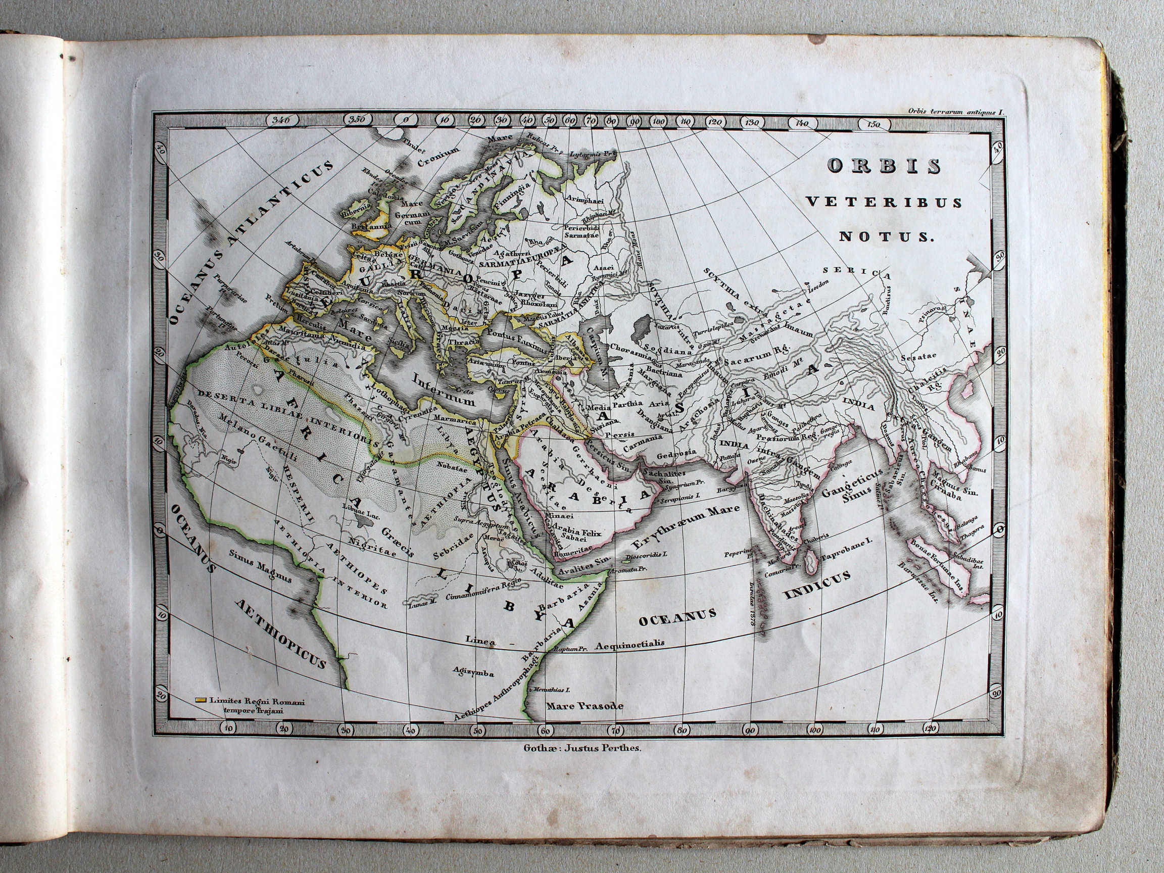
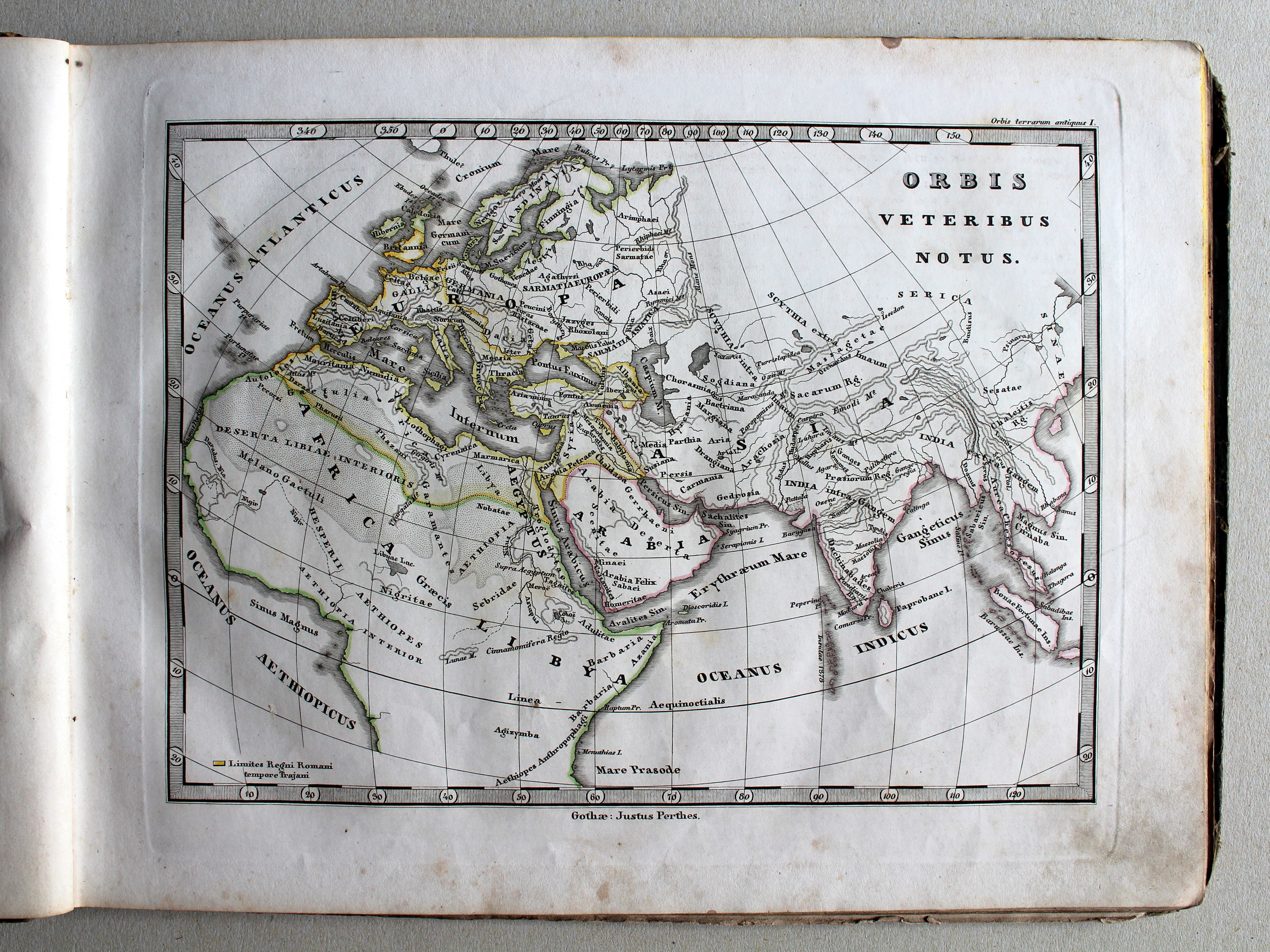
I. Orbis veteribus notus XL
De in de Oudheid bekende wereld / The world as known to the Ancients
 Schul-Atlas der alten Welt, 1846
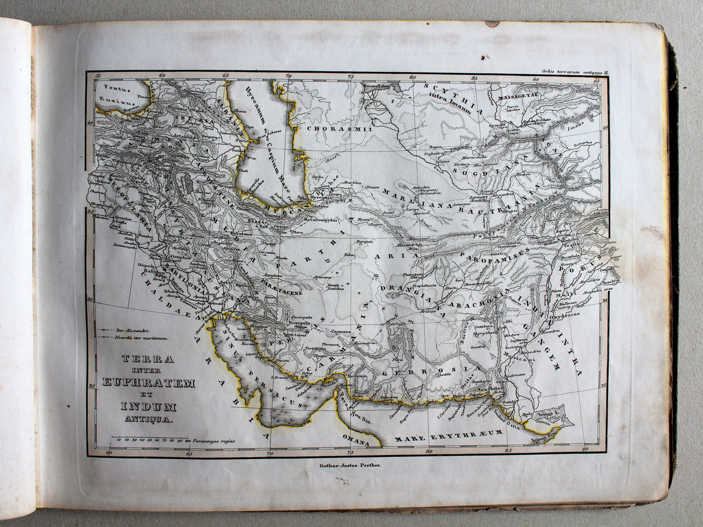
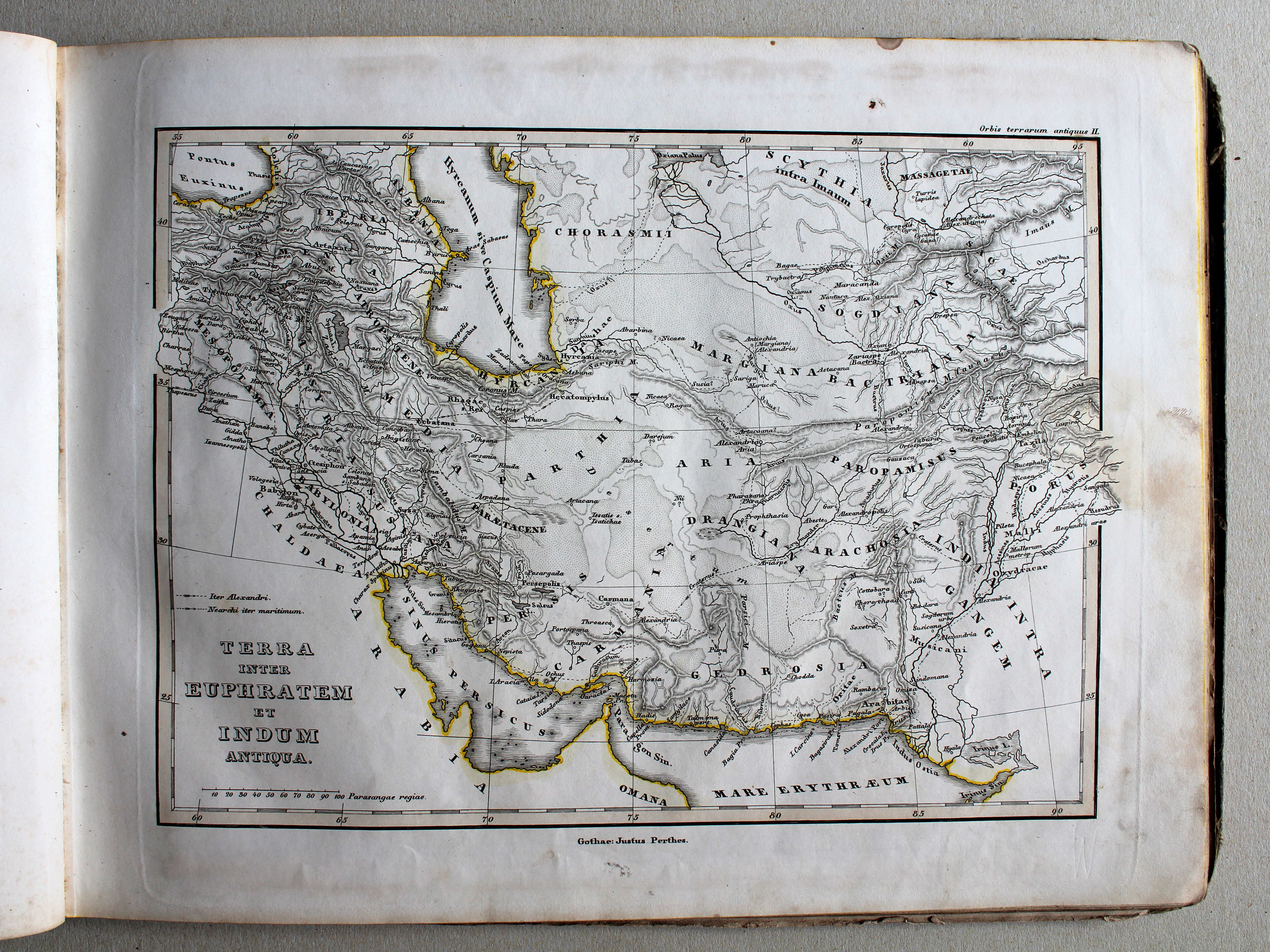
II. Terra inter Euphratem et Indum antiqua XL
Het land tussen Eufraat en Indus / The countries between Euphrates and Indus
 Schul-Atlas der alten Welt, 1846
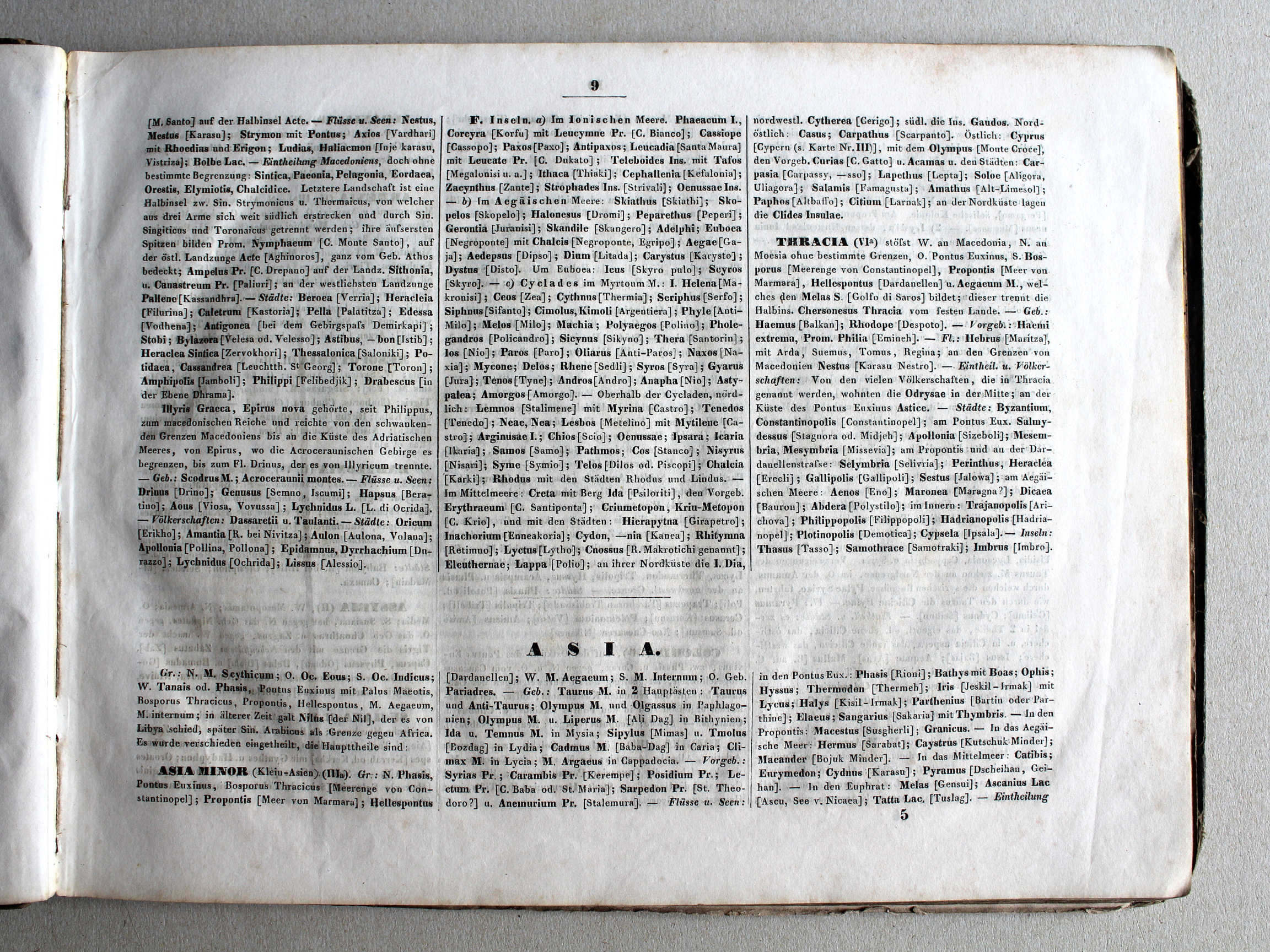
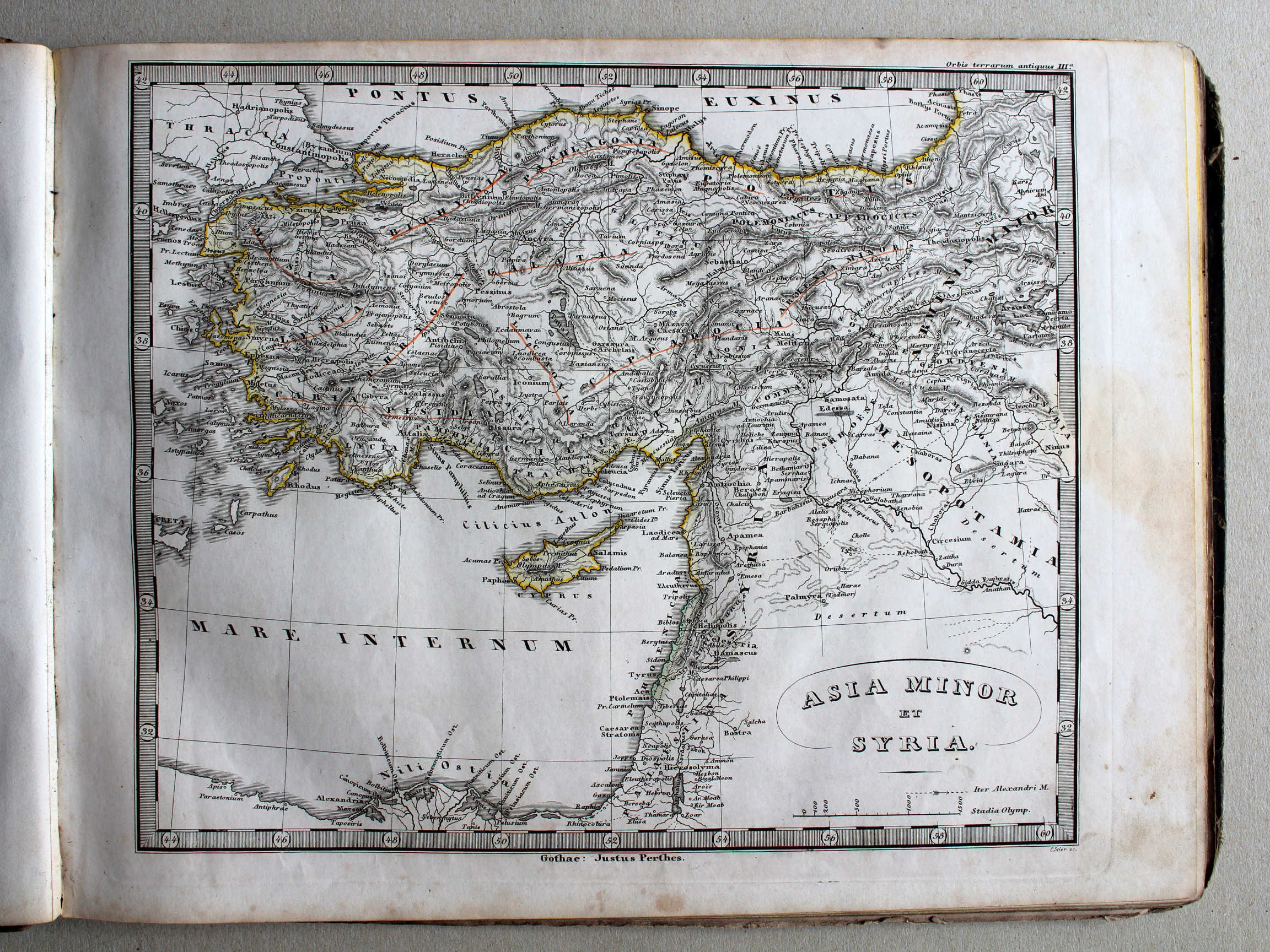
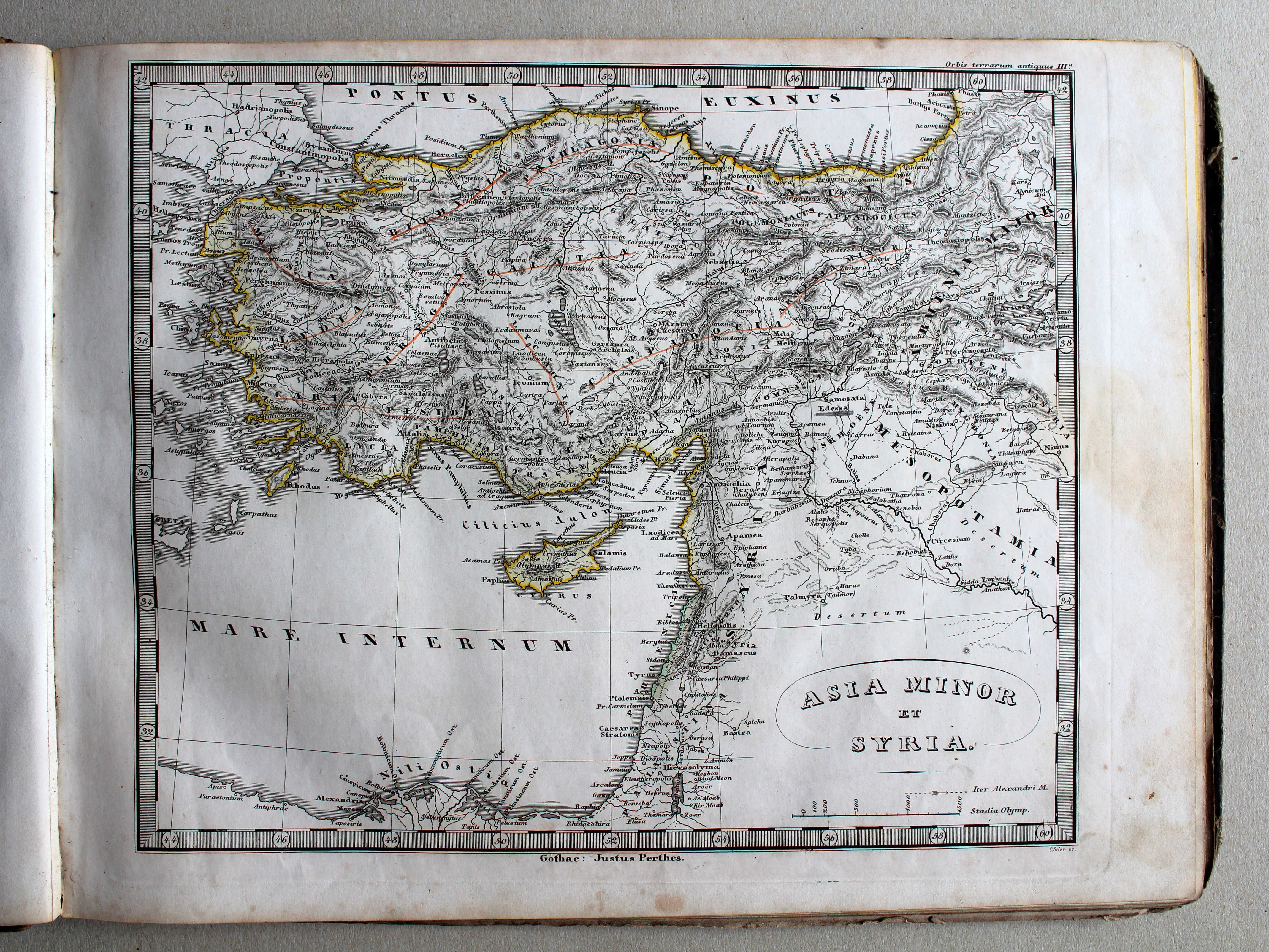
IIIa. Asia minor et Syria XL
Klein-Azië en Syrië / Asia Minor and Syria
 Schul-Atlas der alten Welt, 1846
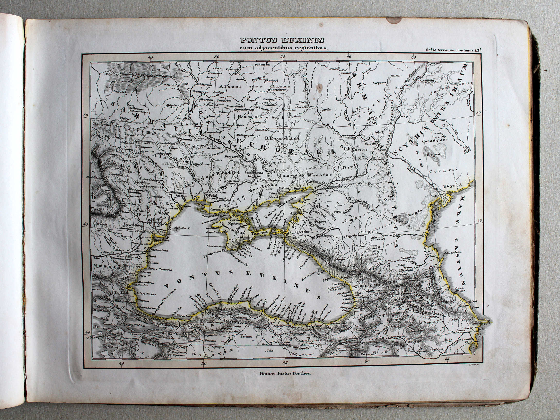
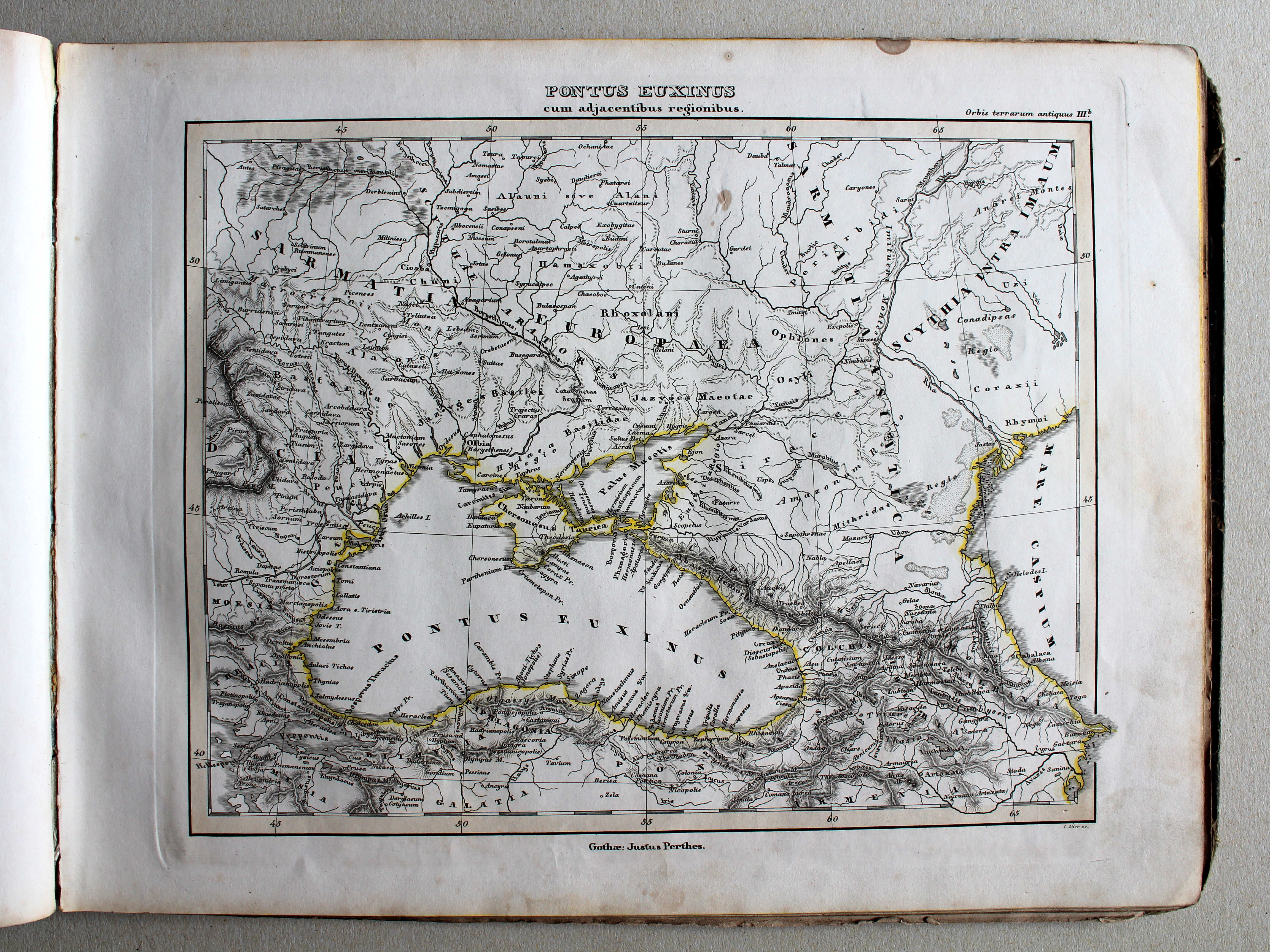
IIIb. Pontus Euxinus cum adjacentibus regionibus XL
Zwarte Zee en aangrenzende gebieden / Black sea and adjacent regions
 Schul-Atlas der alten Welt, 1846
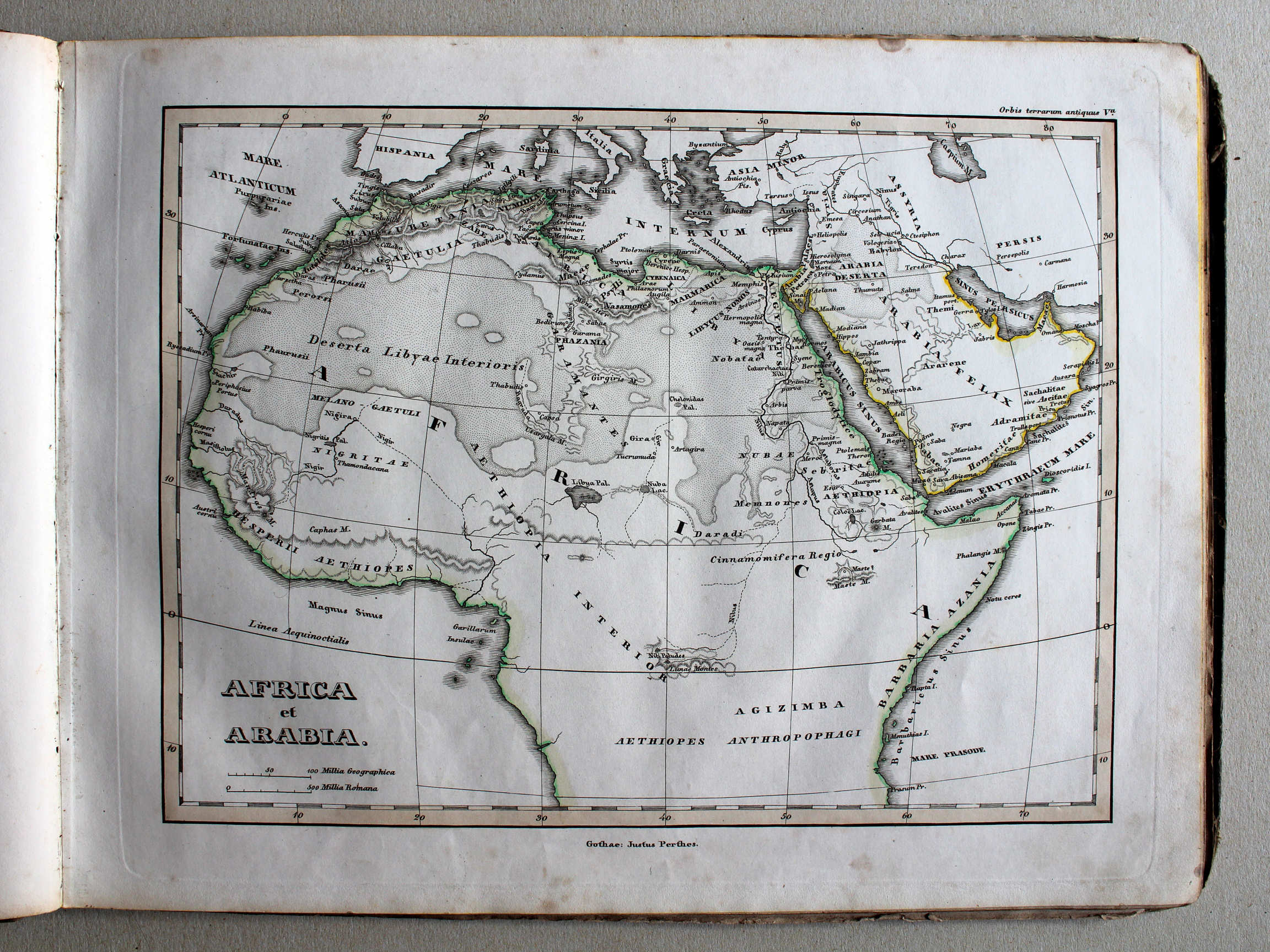
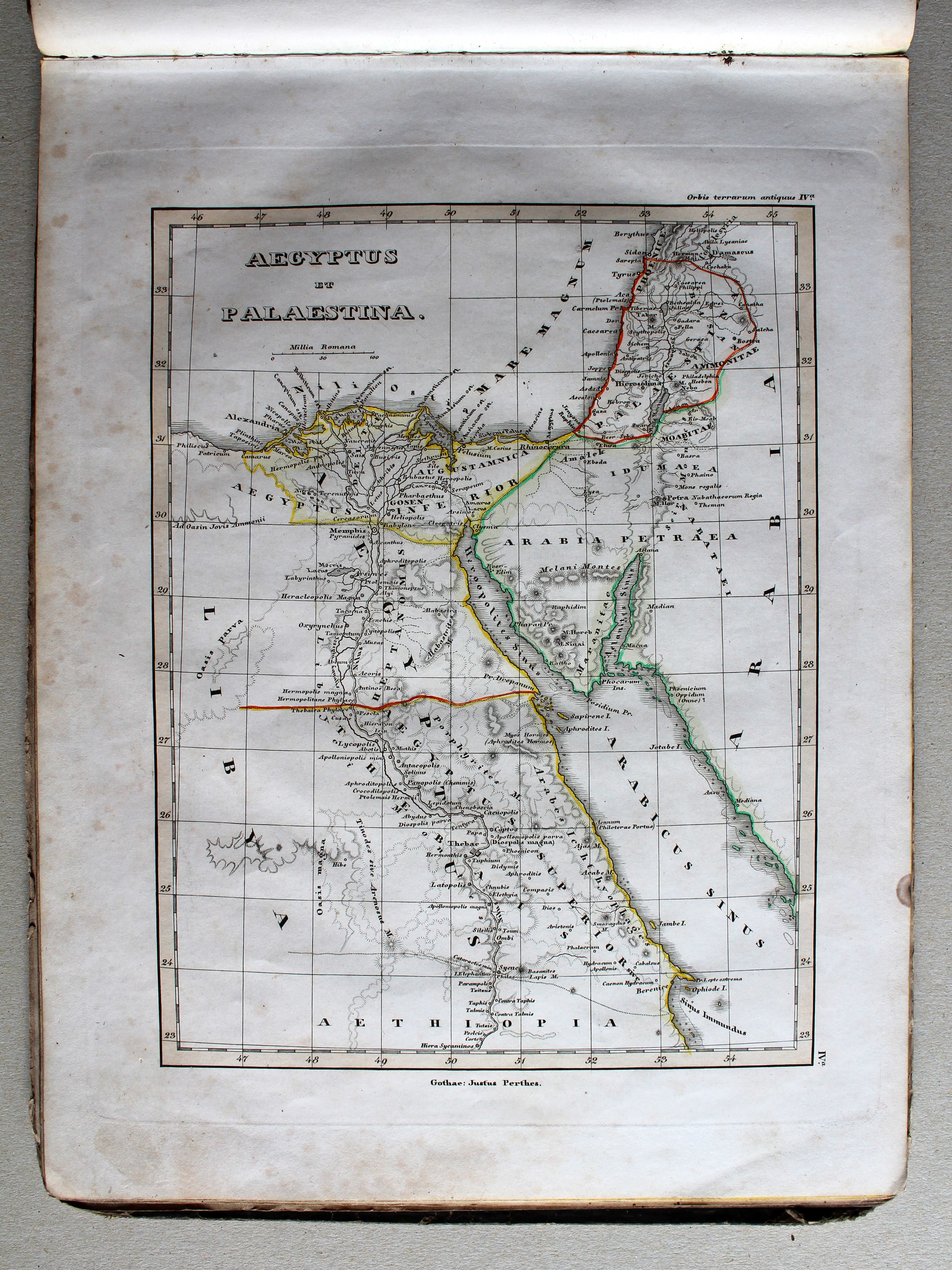
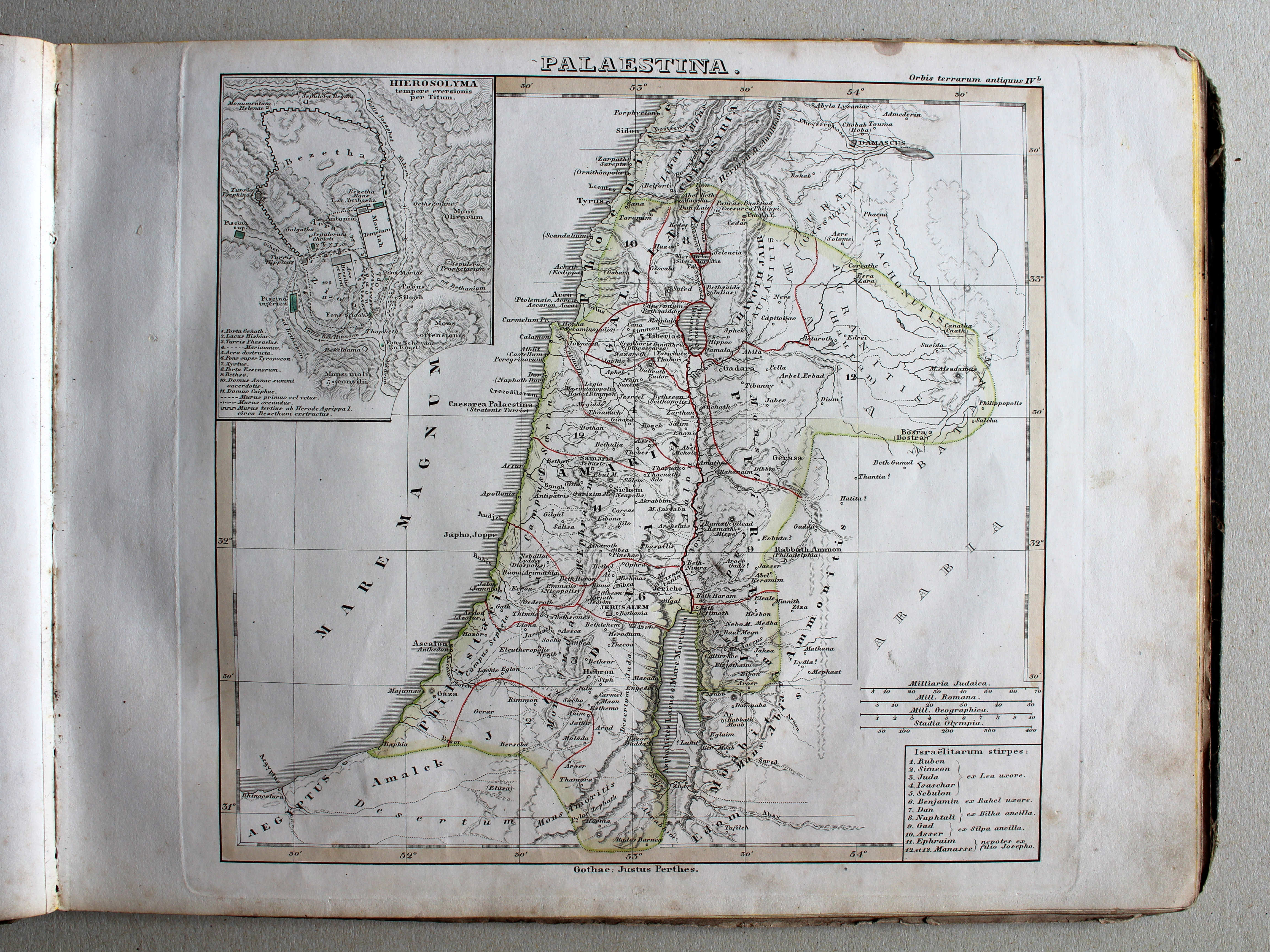
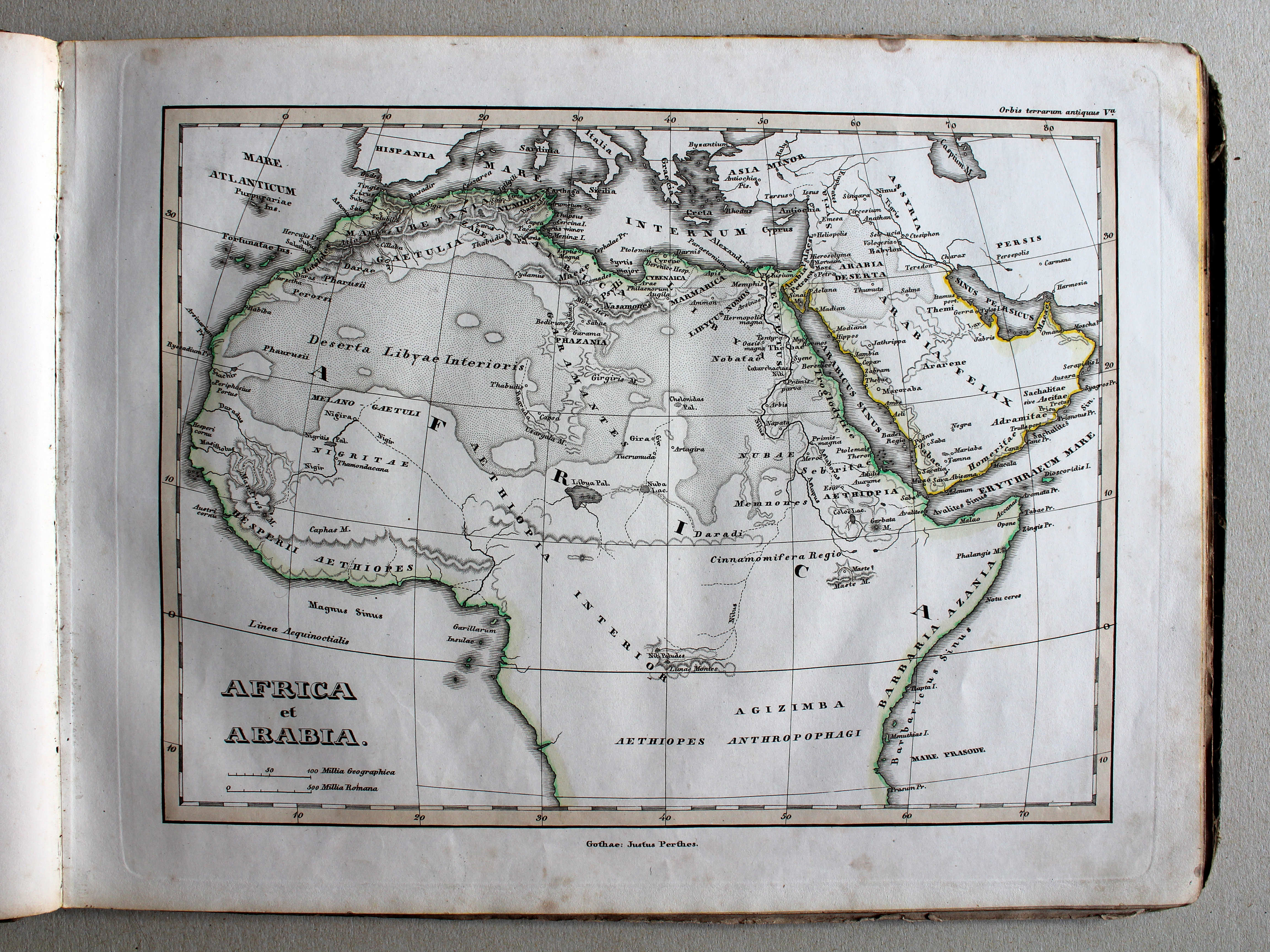
IVa. Aegyptus et Palaestina XL
Egypte en Palestina / Egypt and Palestine

 Schul-Atlas der alten Welt, 1846
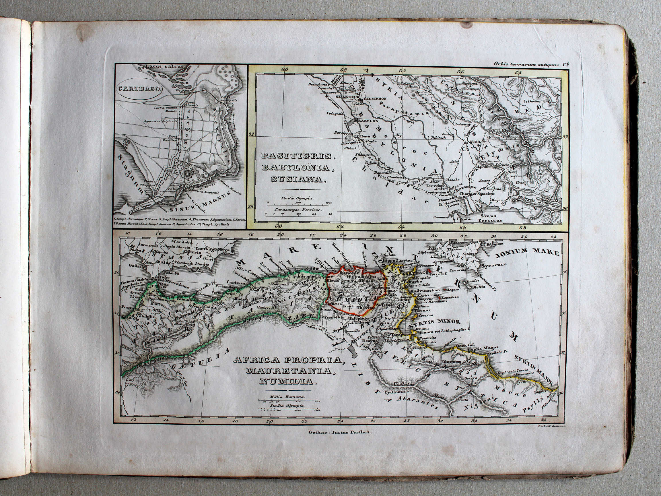
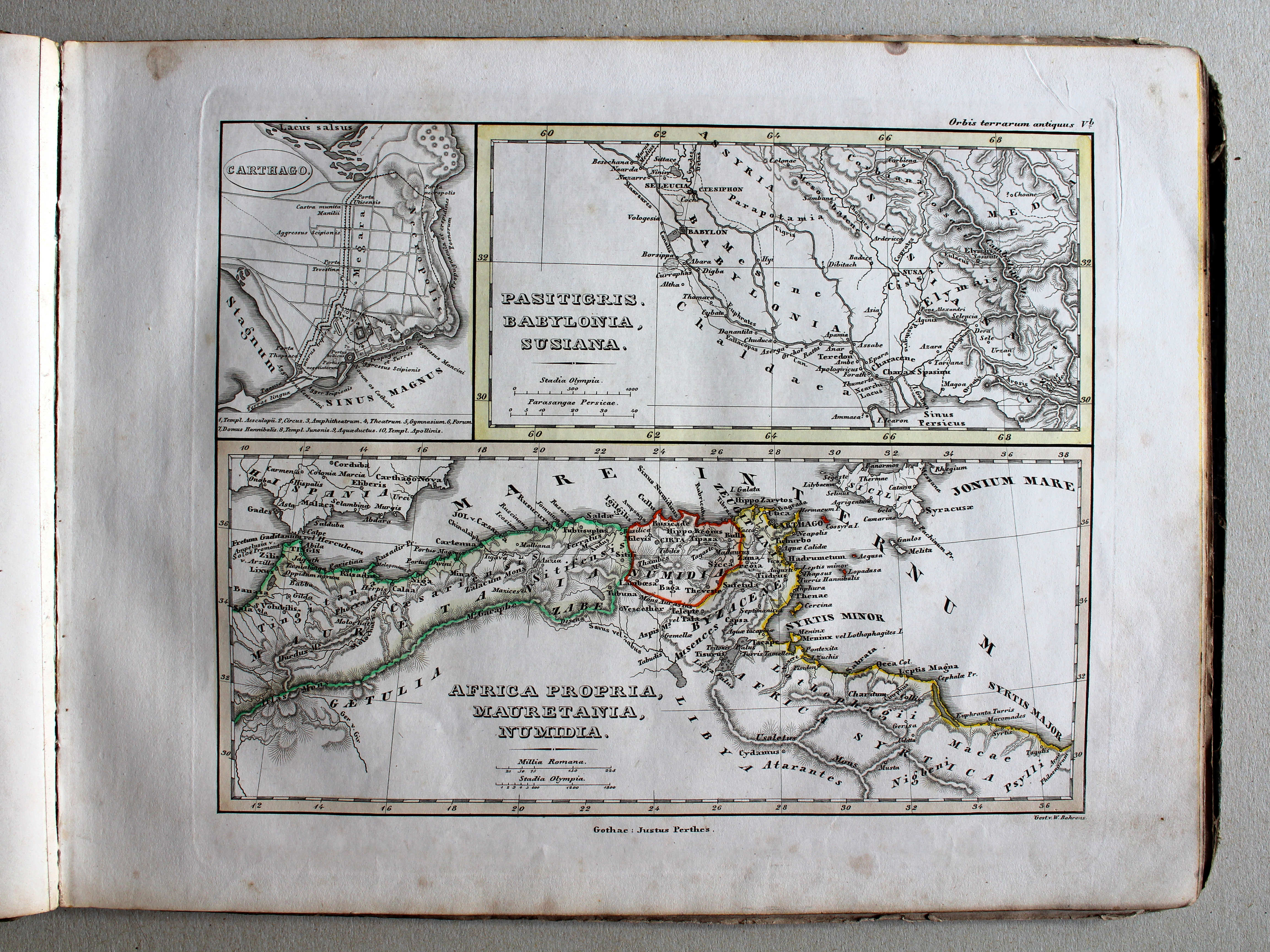
Vb. Carthago – Pasitigris – Africa propria XL
Carthago – Land van de Tigris – Het eigenlijke Afrika / Carthage – Tigris region – Africa proper
 Schul-Atlas der alten Welt, 1846
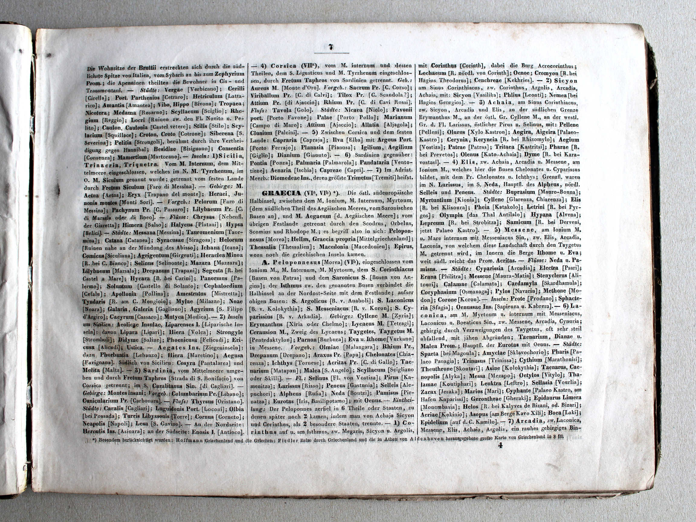
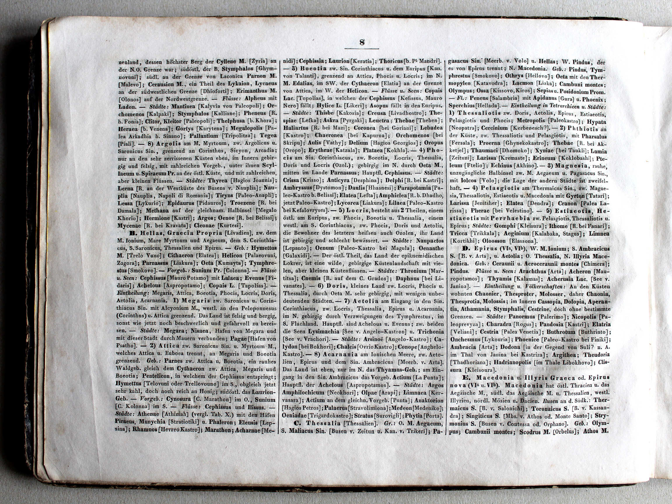
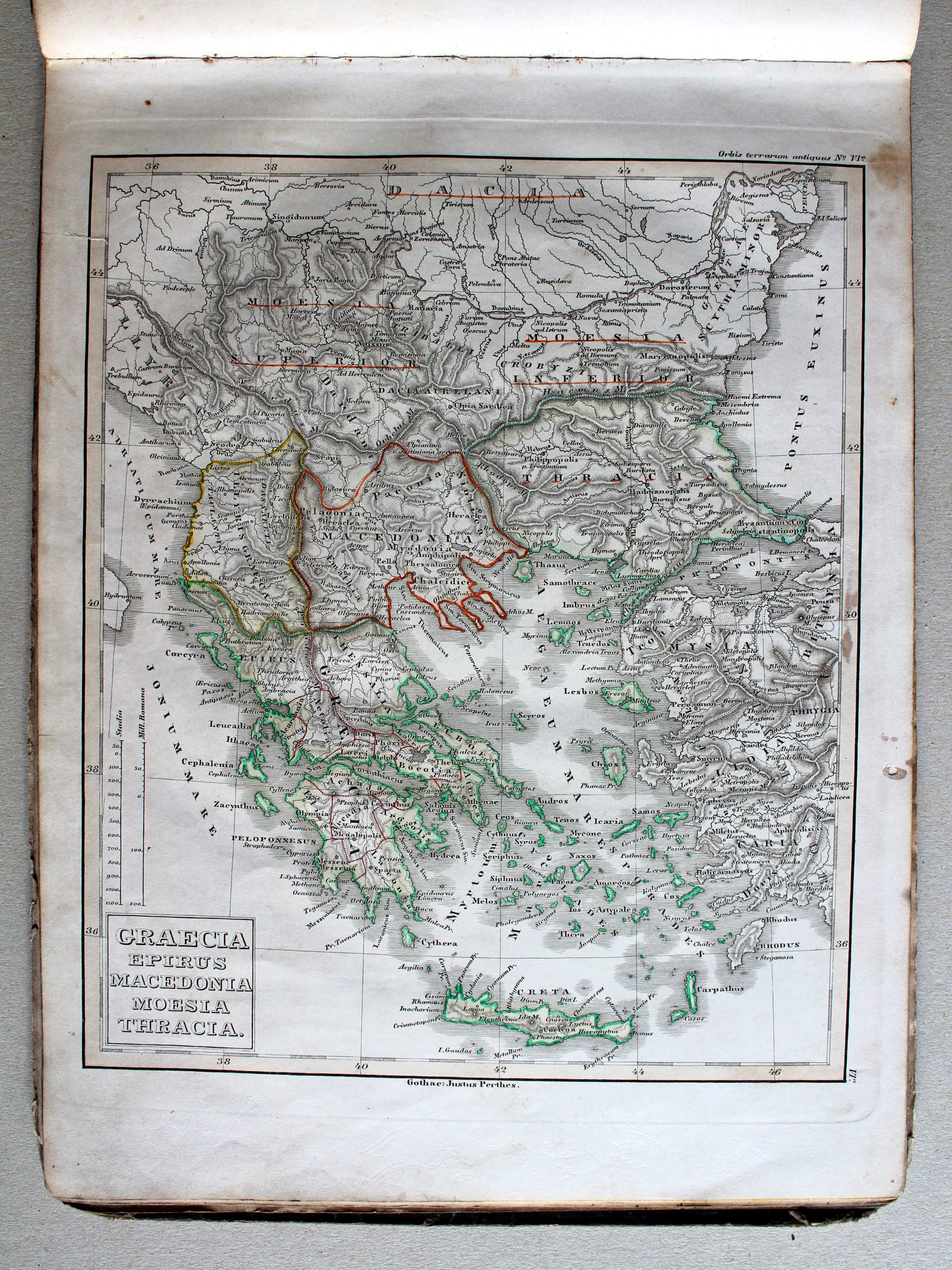
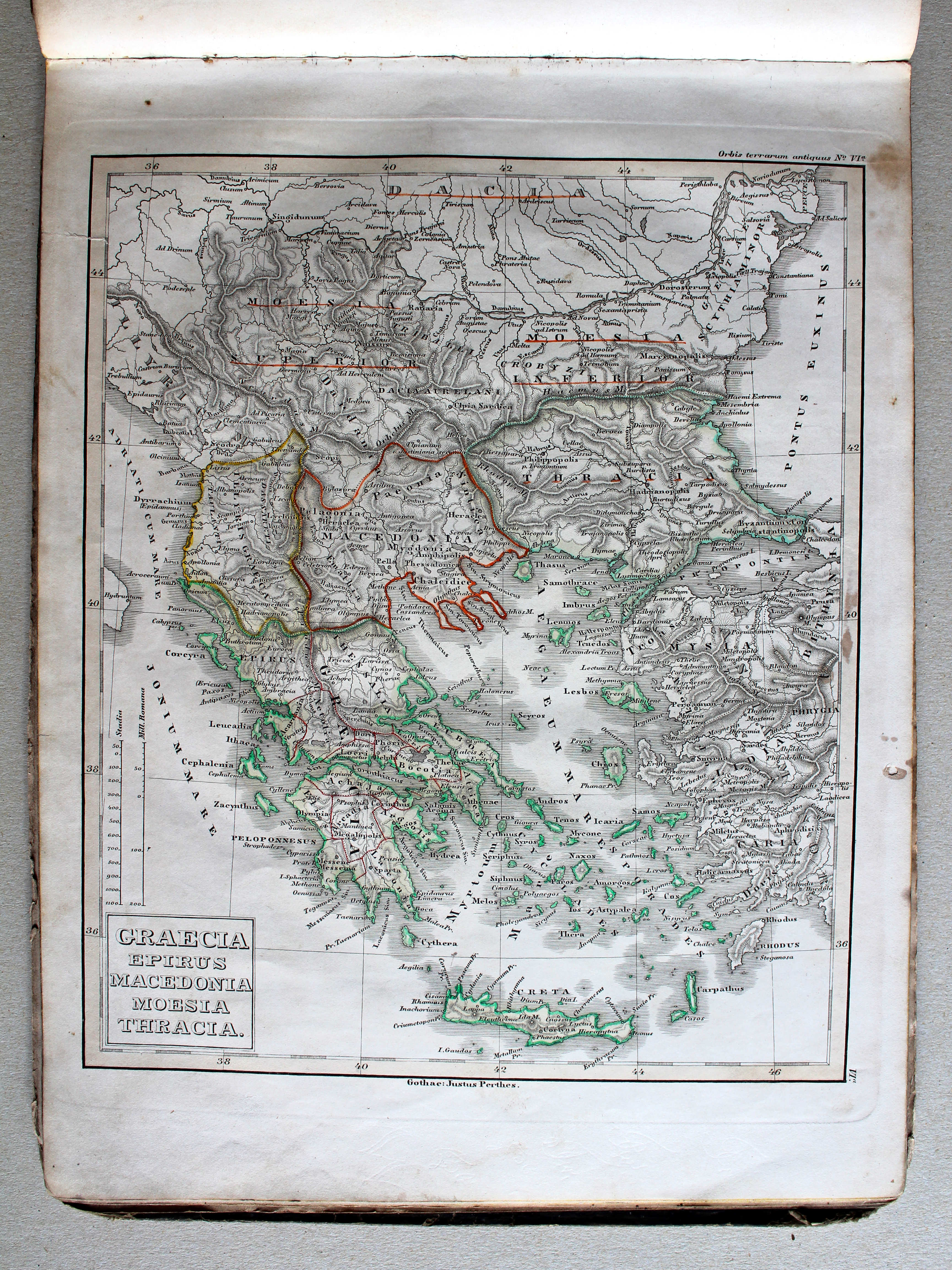
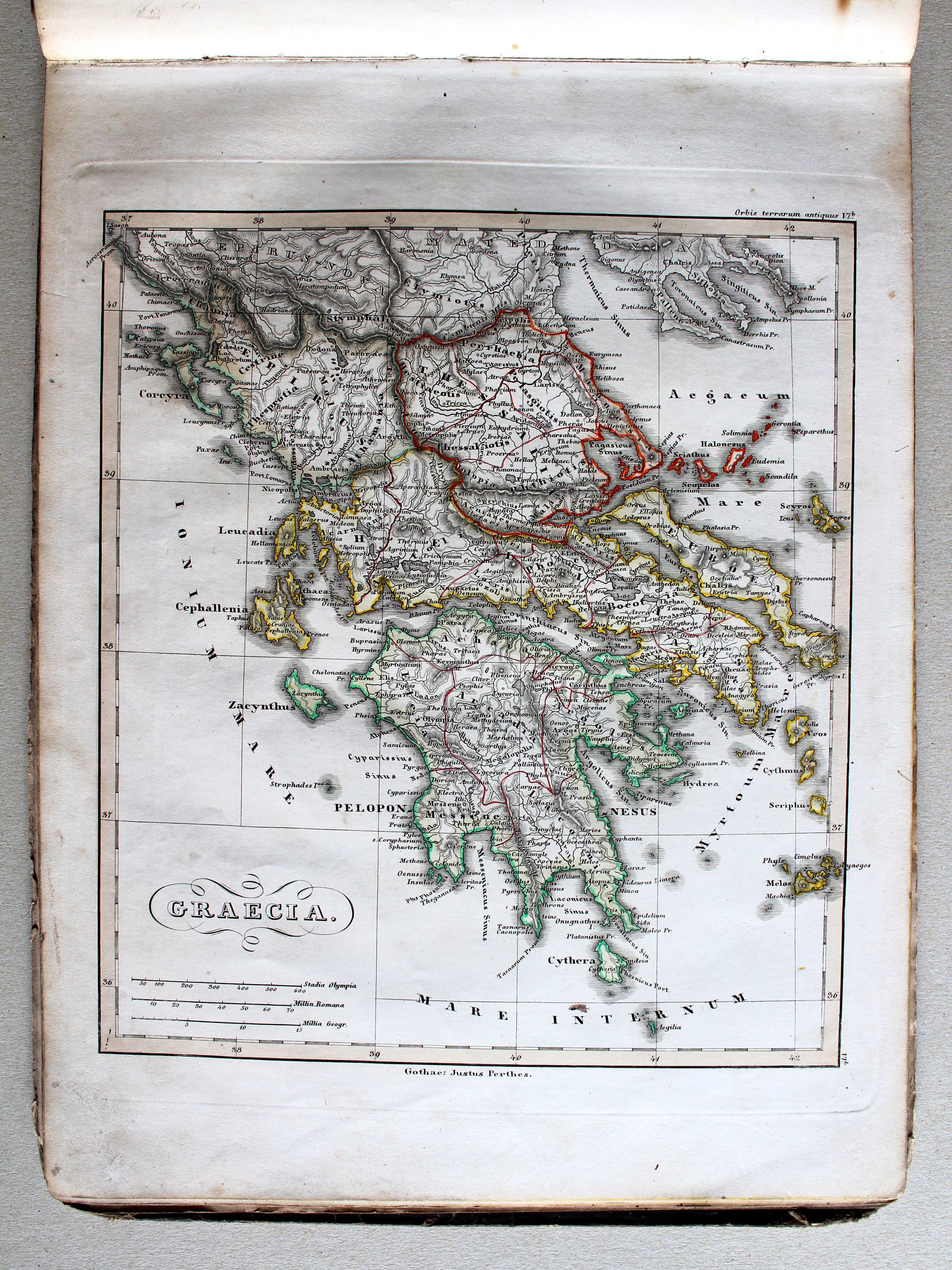
VIa. Graecia, Epirus, Macedonia, Moesia, Thracia XL
Griekenland, Epirus, Macedonië, Moesië, Thracië / Greece, Epirus, Macedonia, Moesia, Thracia

 Schul-Atlas der alten Welt, 1846
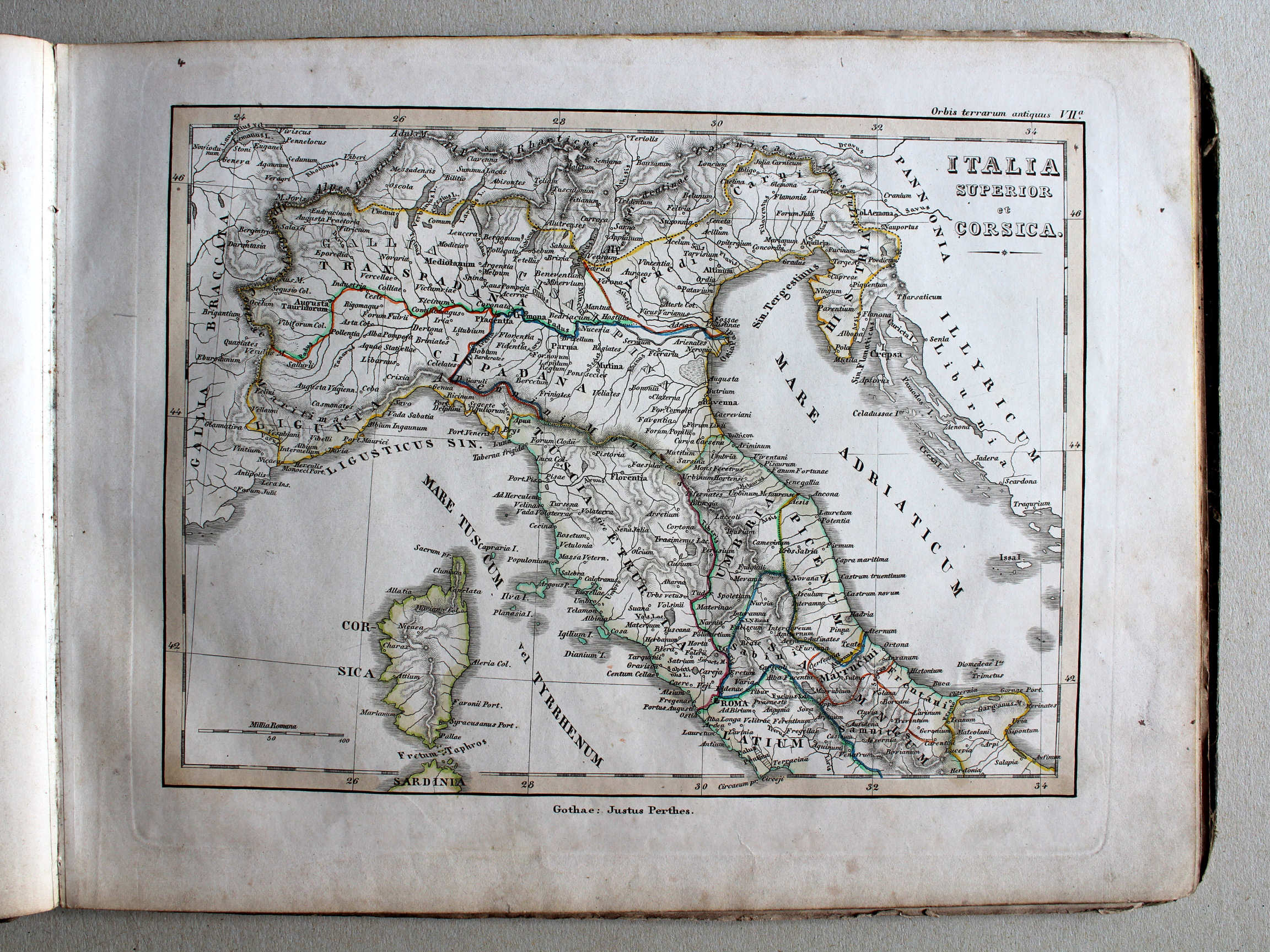
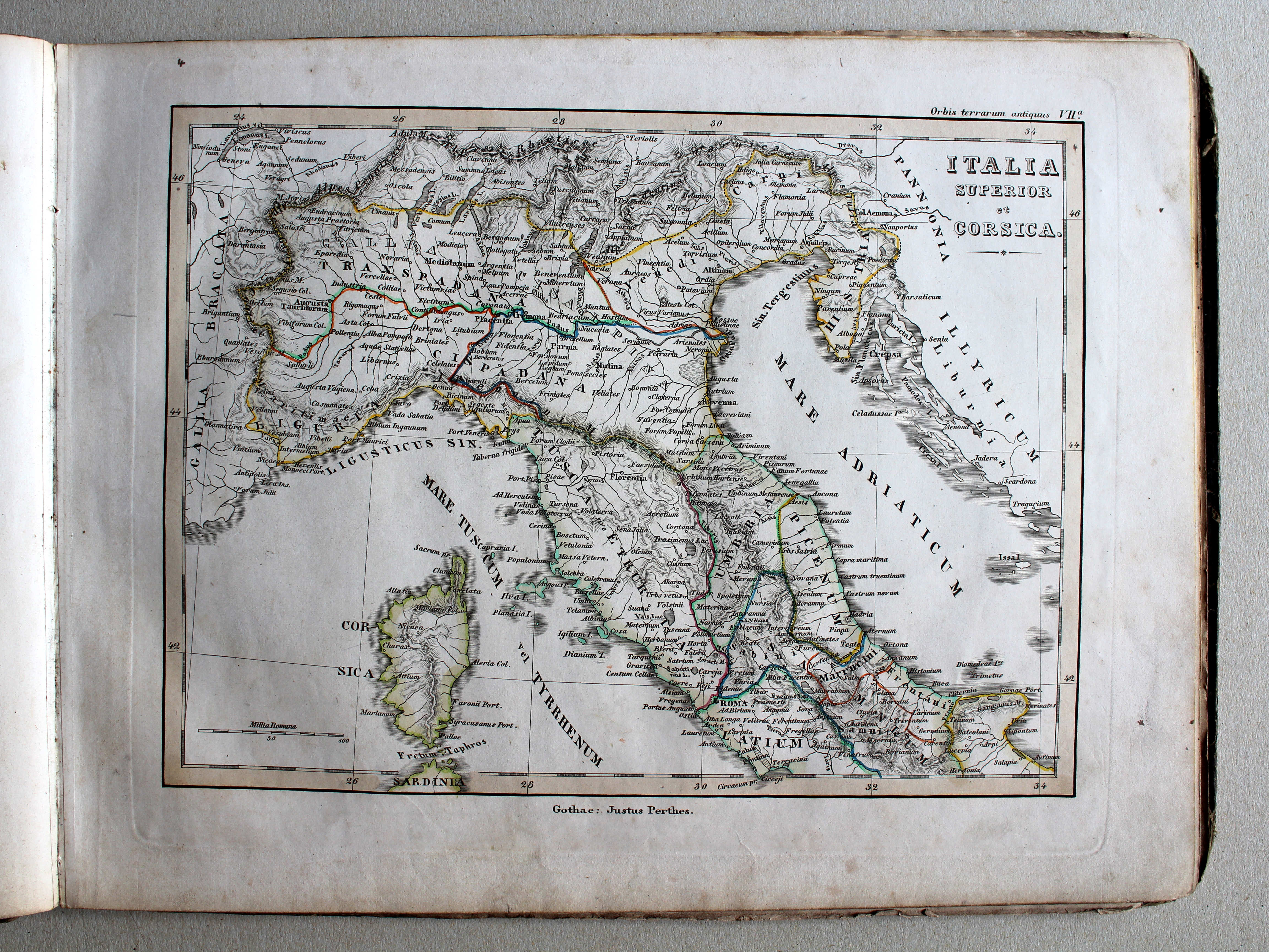
VIIa. Italia superior et Corsica XL
Noord-Italië en Corsica / Northern Italy and Corsica
 Schul-Atlas der alten Welt, 1846
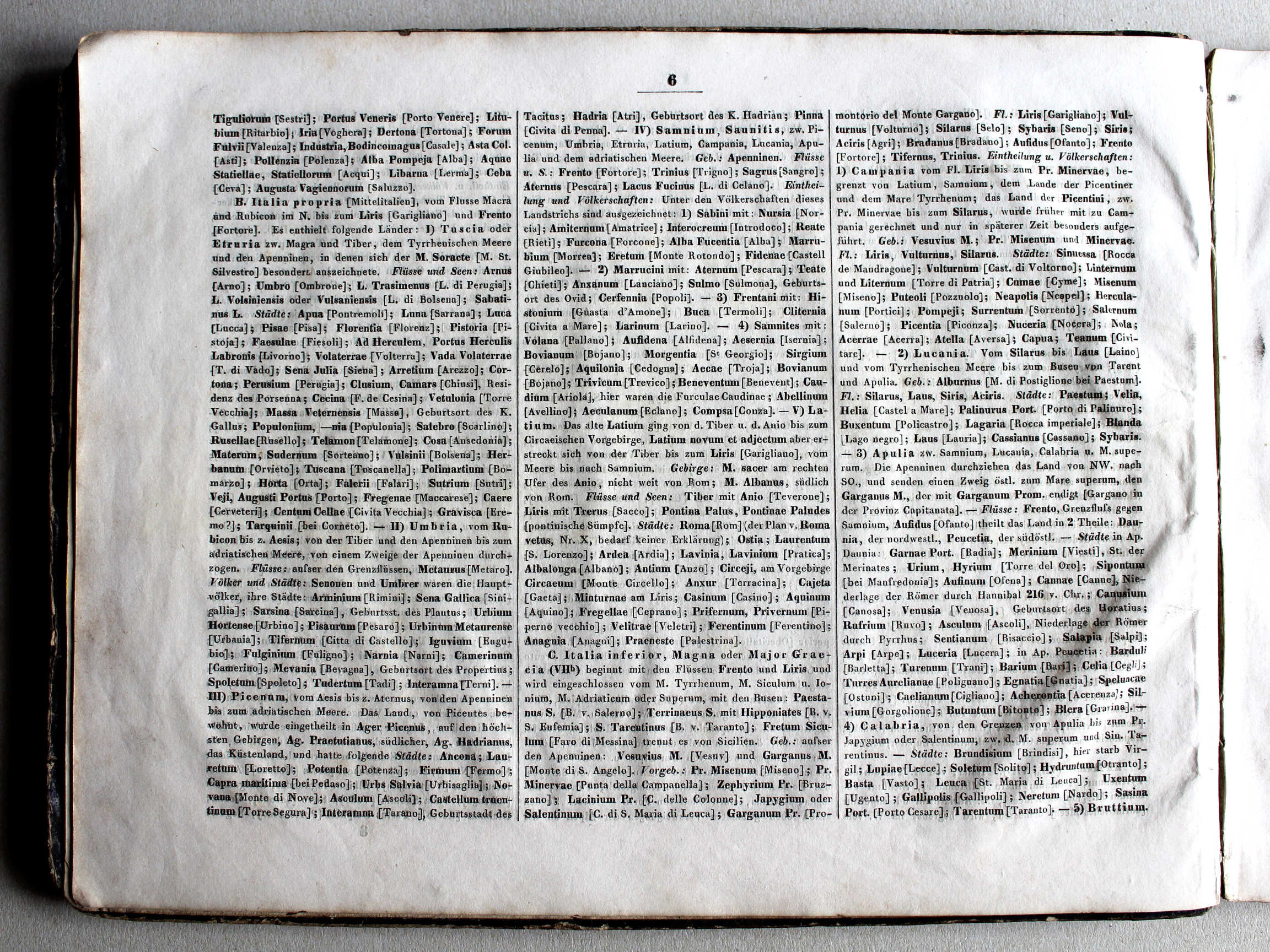
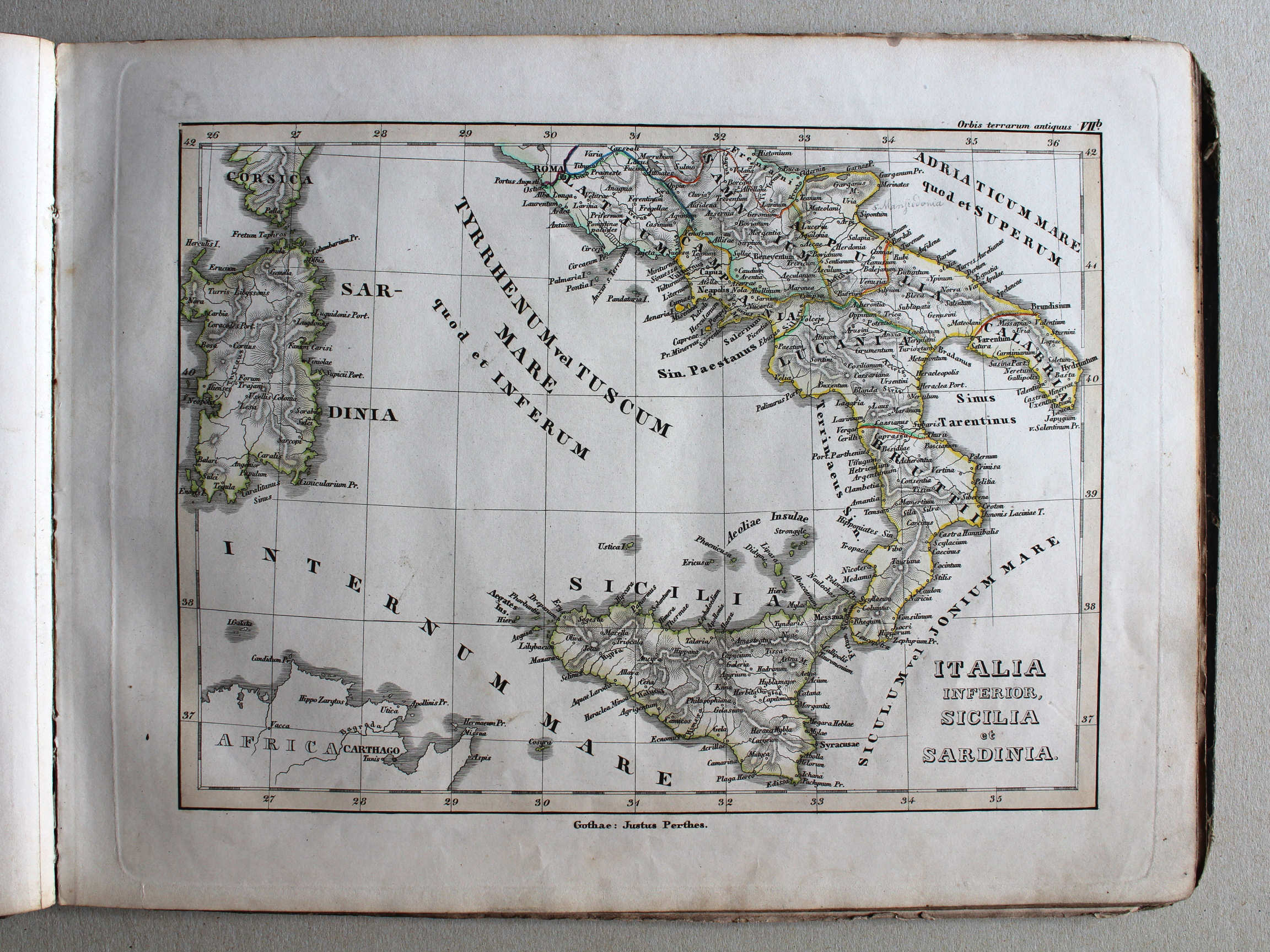
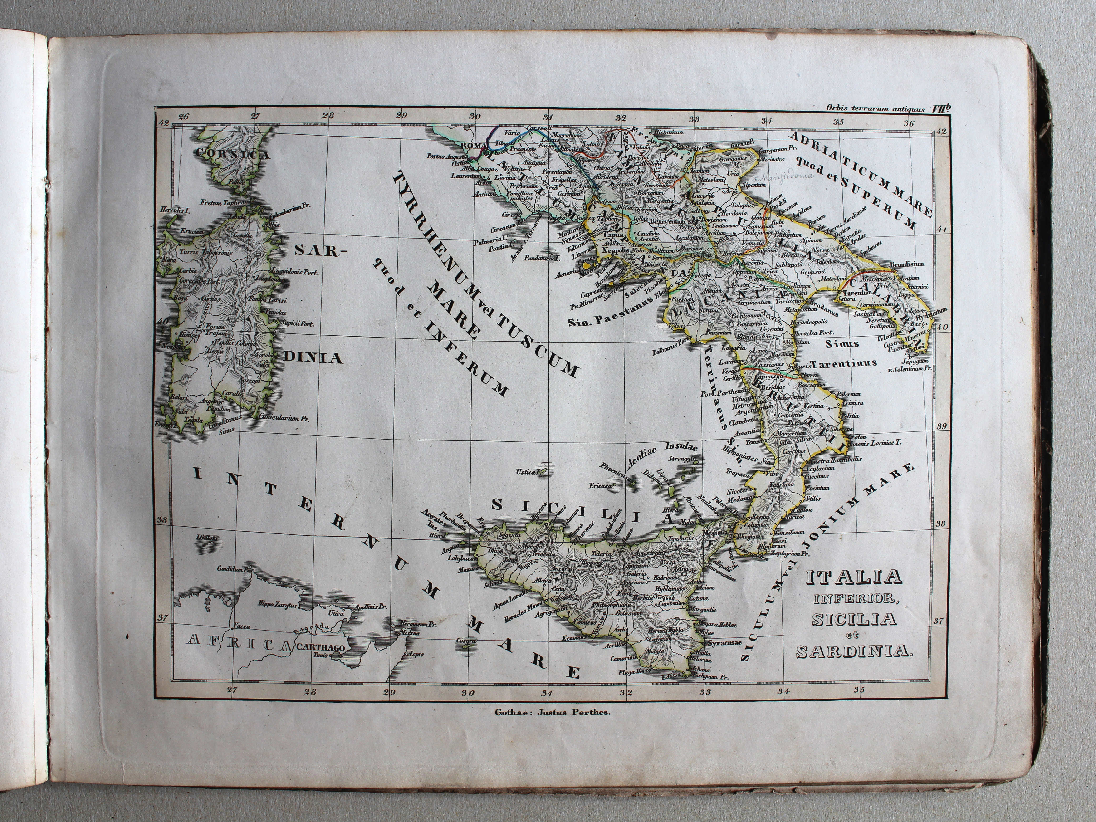
VIIb. Italia inferior, Sicilia et Sardinia XL
Zuid-Italië, Sicilië en Sardinië / Southern Italy, Sicily and Sardinia
 Schul-Atlas der alten Welt, 1846
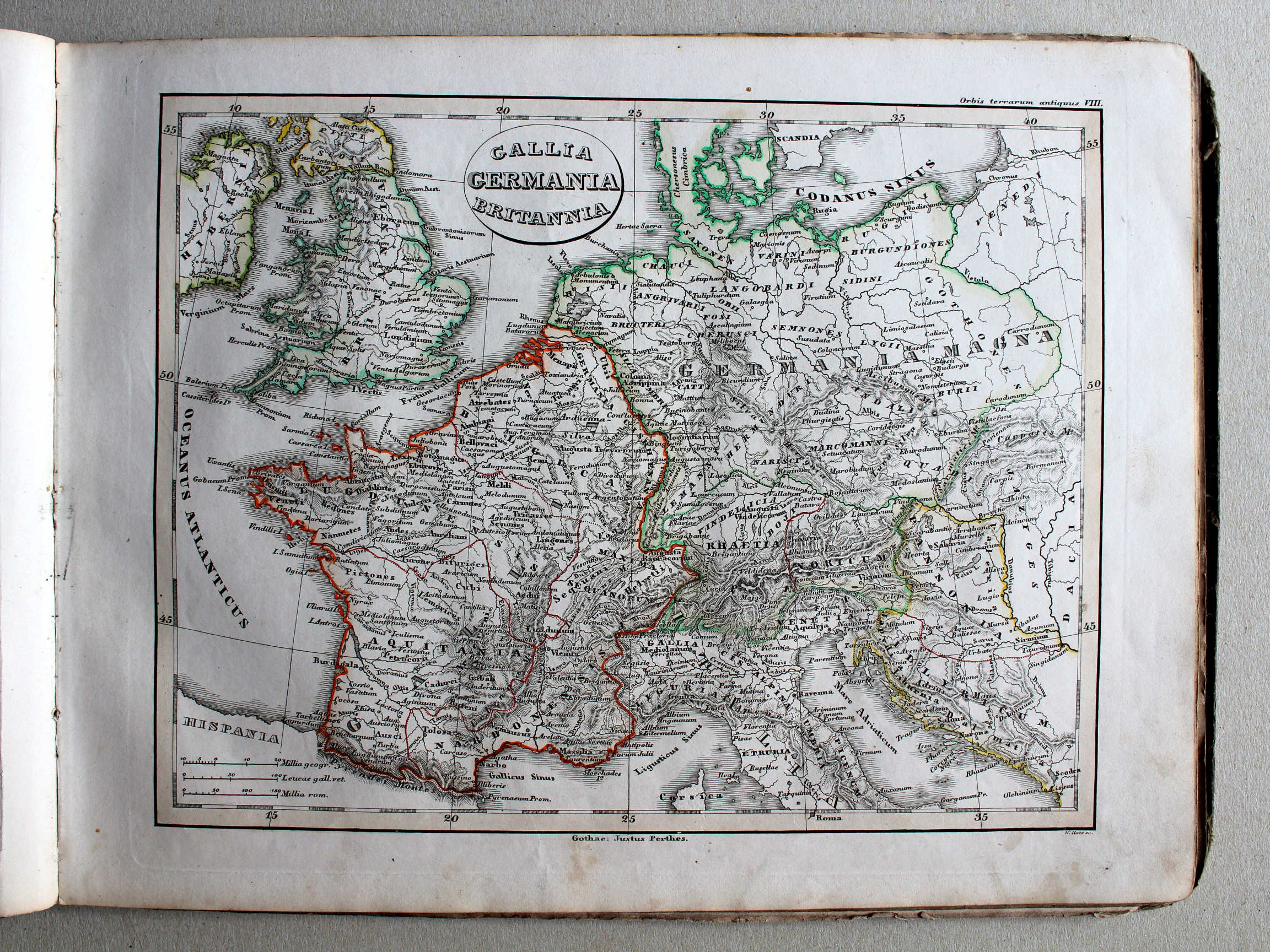
VIII. Gallia, Germania, Britannia XL
Gallië, Germanië, Britannië / Gaul, Germania, Britain

 Schul-Atlas der alten Welt, 1846
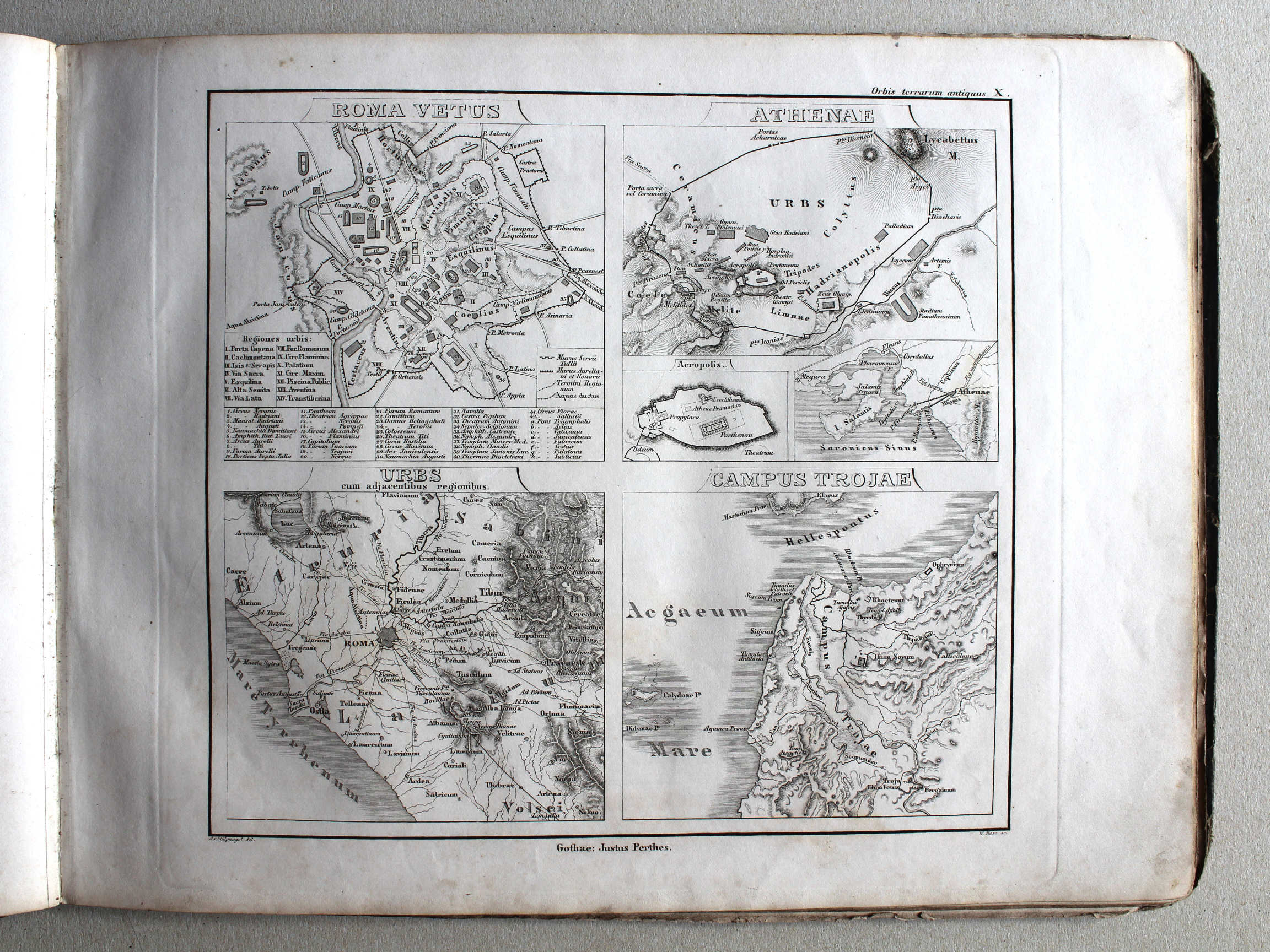
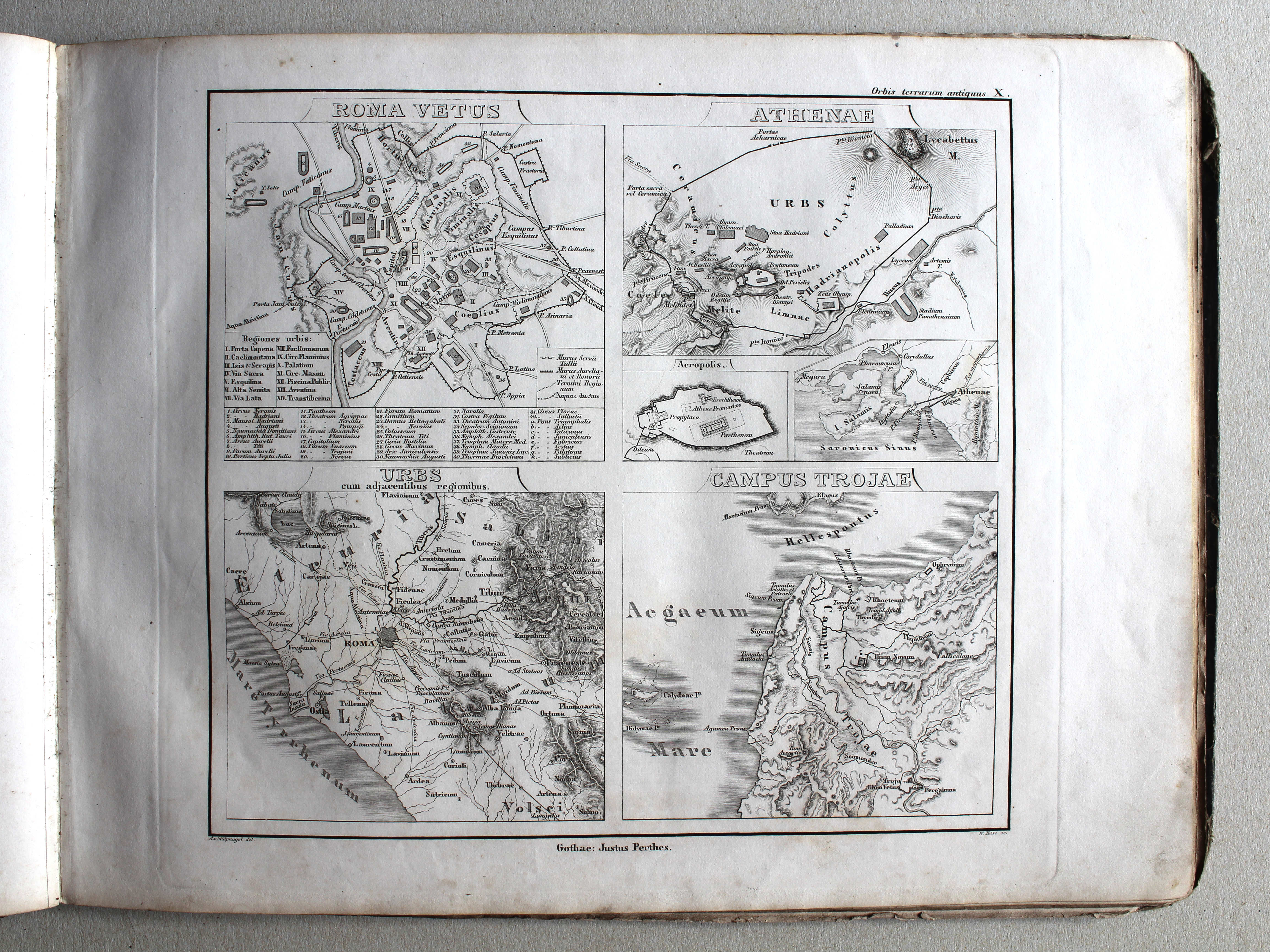
X. Roma vetus – Athenae – Campus Trojae XL
Rome – Athene – Troje / Rome – Athens – Troy
© M. Witkam, 2013
![]()
![]()