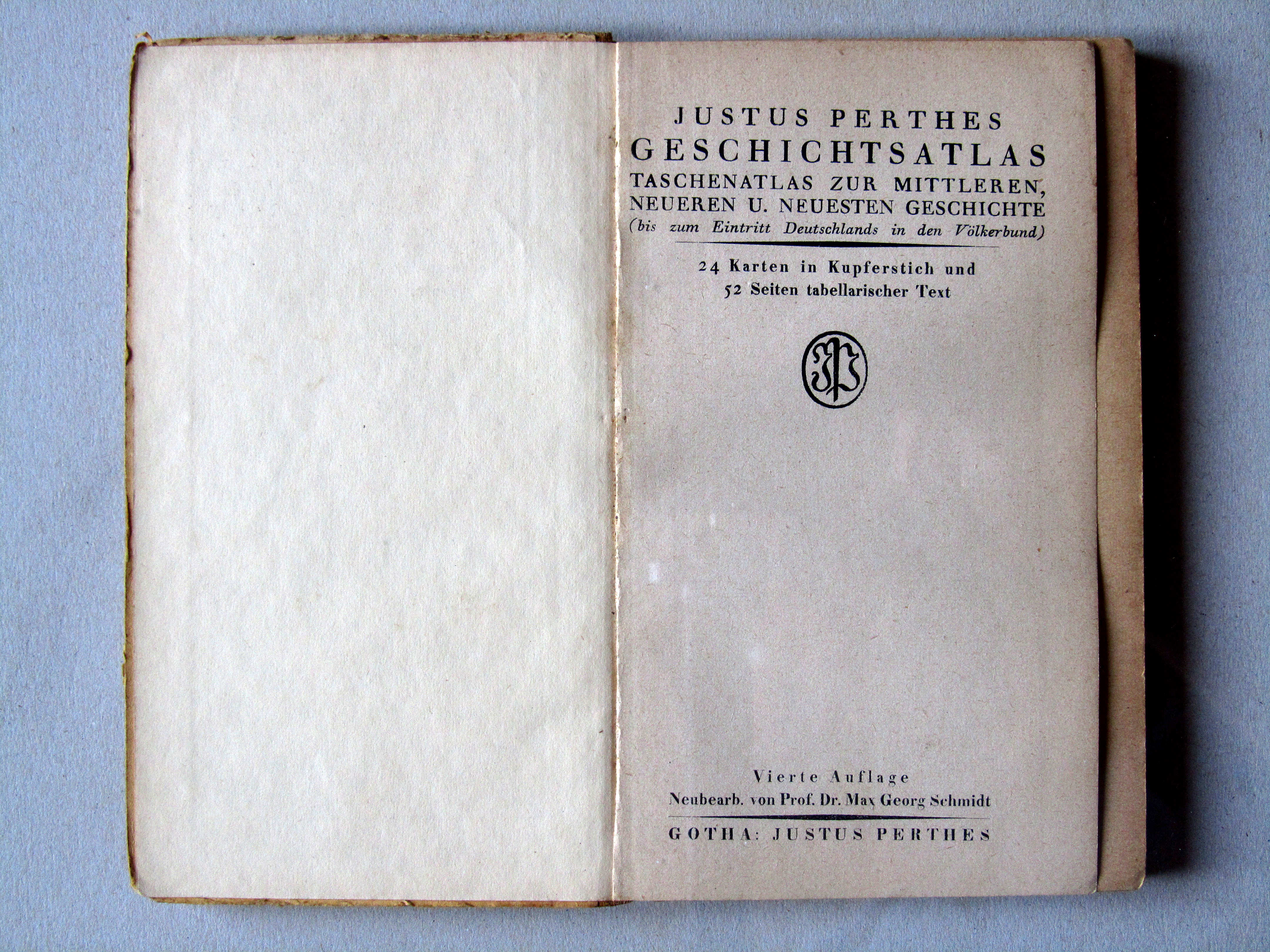
Justus Perthes Geschichtsatlas
4e druk (1927/43?) en 1e-3e druk (1898-ca. 1918)
See below for (a summary of) this text in English.
Hieronder staan plaatjes van de 4e druk en de 1e-3e druk van Perthes' Historische Zakatlas ter vergelijking naast elkaar. Daarbij horen ook de volgende pagina's
- Beschrijving van de 4e druk
- Plaatjes van de 4e druk
- Tabellen en lijsten bij de 4e druk
en
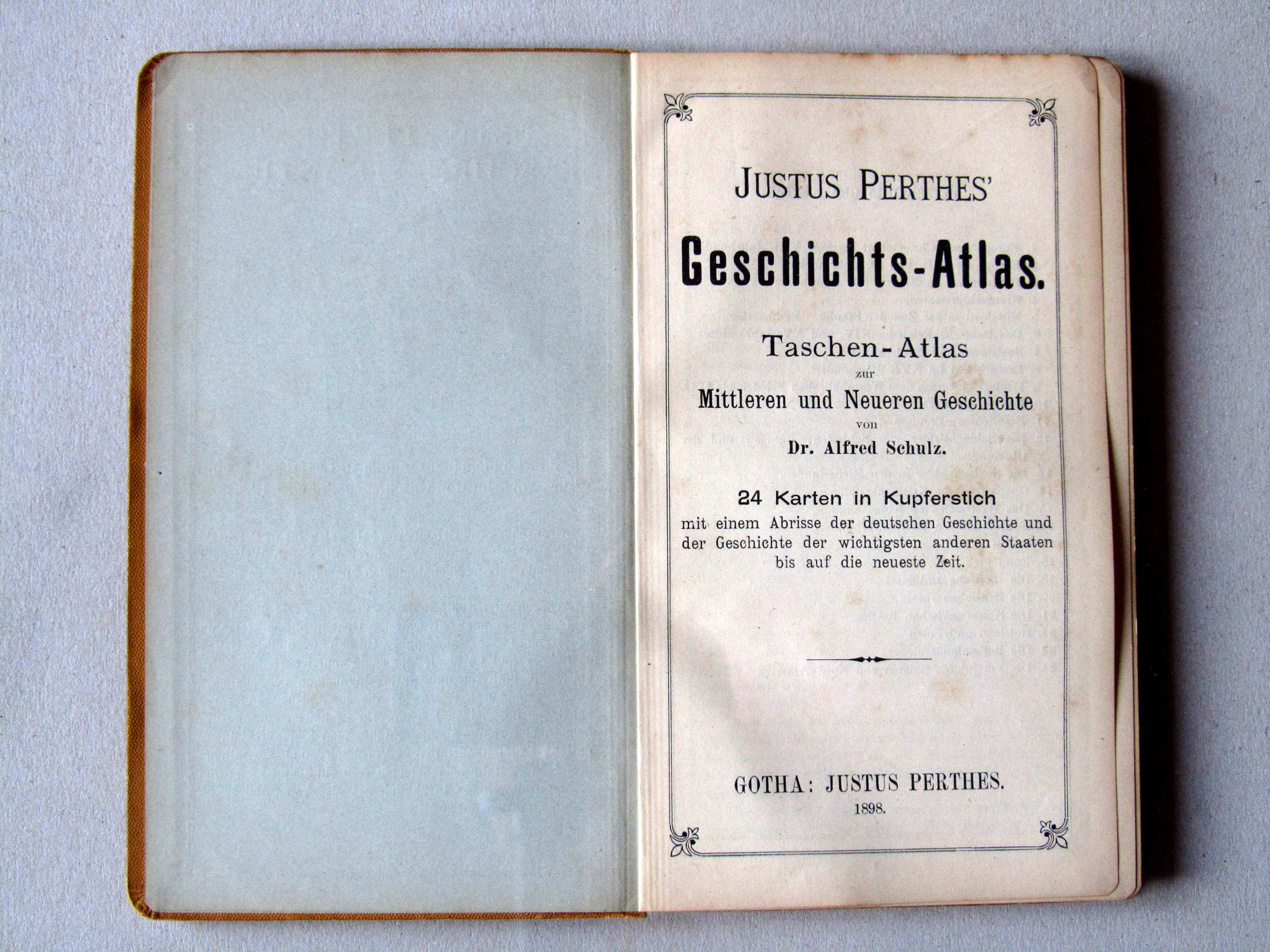
- Beschrijving van de 1e-3e druk
- Plaatjes van de 1e-3e druk
- Tabellen en lijsten bij de 1e-3e druk
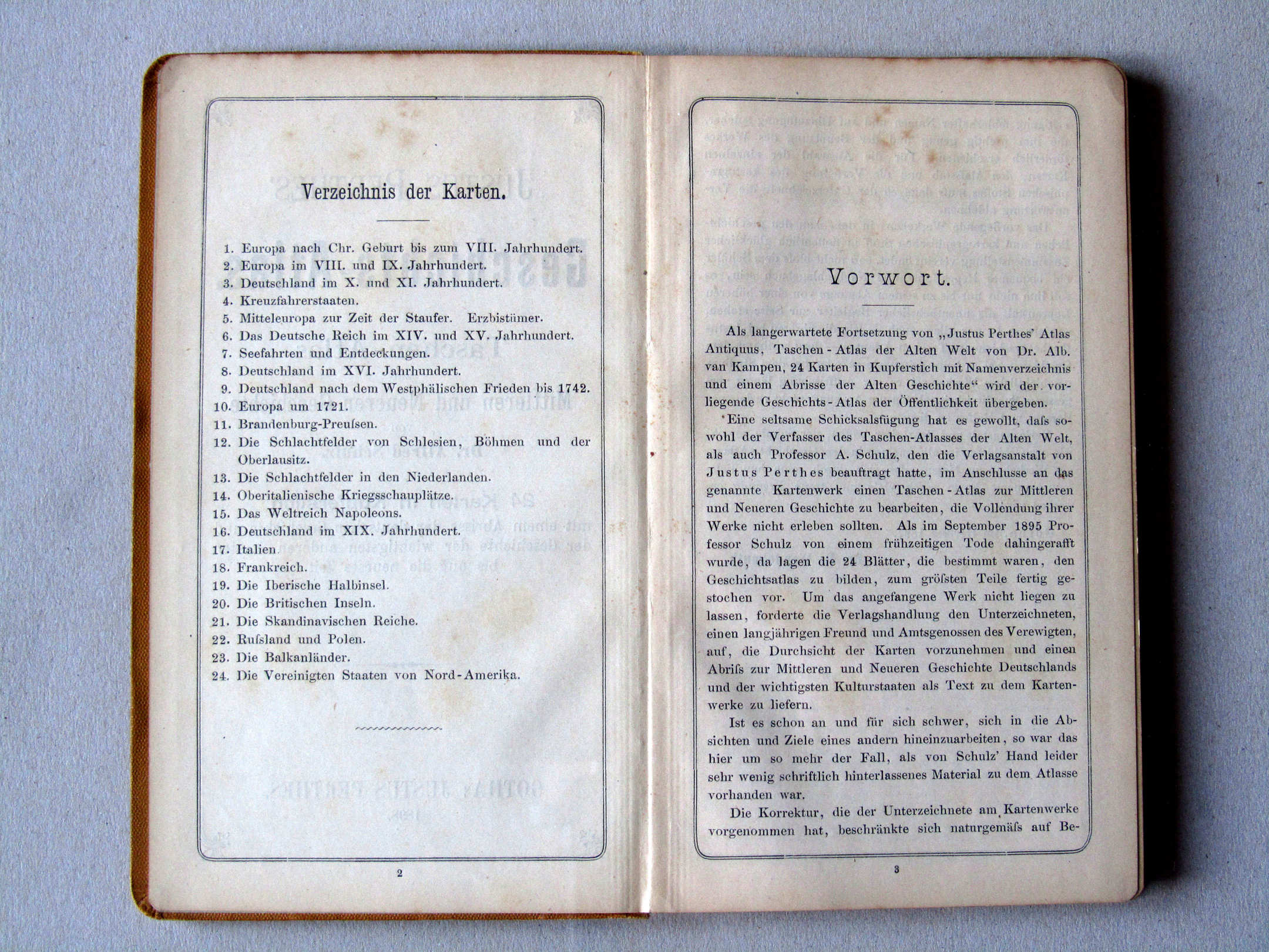
Plaatjes
Klik op een plaatje voor een vergroting.
Justus Perthes Geschichtsatlas
4th edition (1927/43?) and 1st-3rd editions (1898-ca. 1918)
- Below are pictures of the 4th edition and the 1st-3rd editions of Perthes'
Historical Pocket Atlas side by side for comparison purposes. Related pages
- Description of the 4th edition
- Pictures of the 4th edition
- Tables and lists to the 4th edition
- Description of the 1st-3rd editions
- Pictures of the 1st-3rd editions
- Tables and lists to the 1st-3rd editions
Pictures
Click on a picture to enlarge.
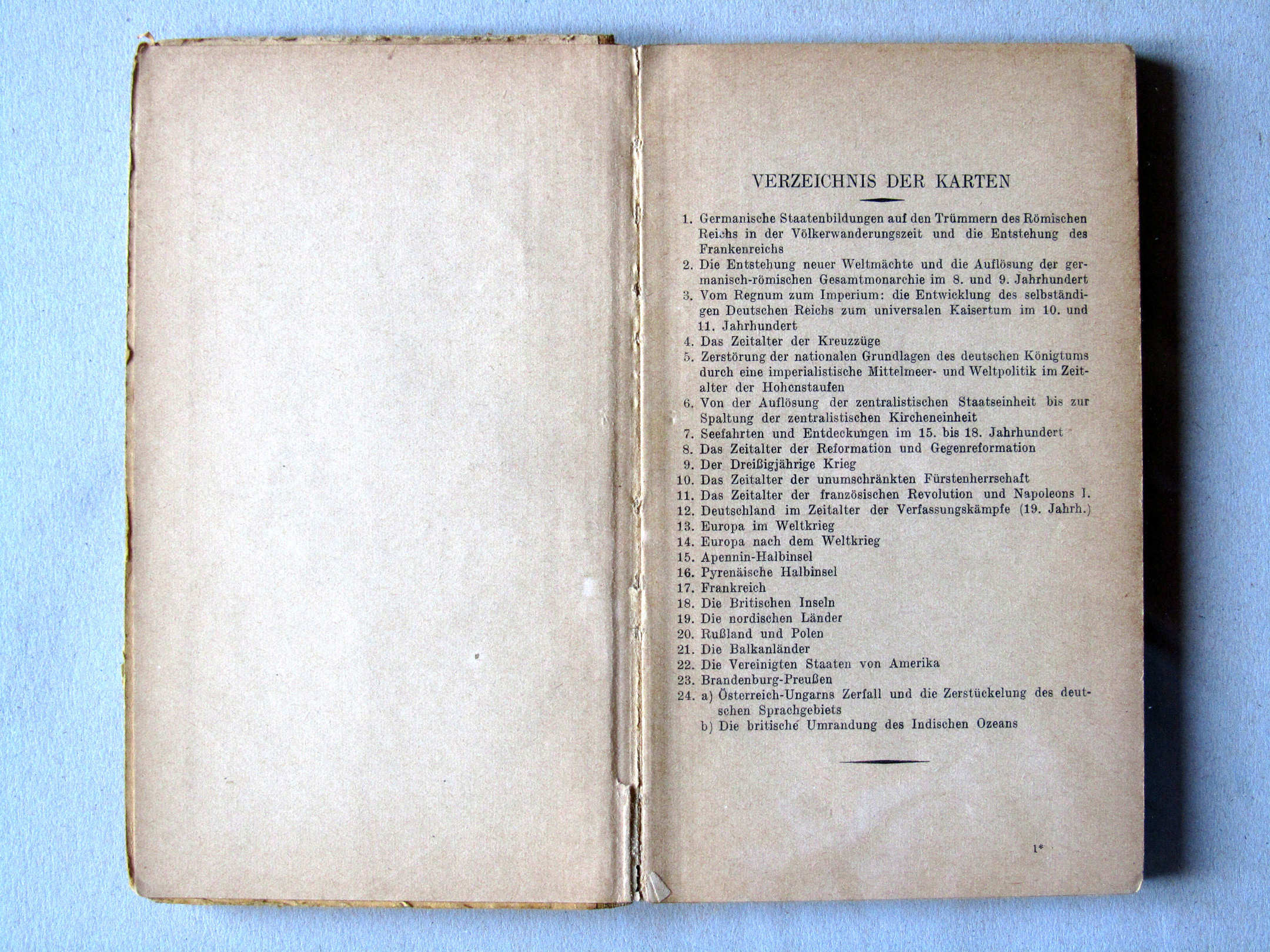
Band / Binding Titelpagina, inhoudsopgave / Title page, table of contents Kaarten / Maps
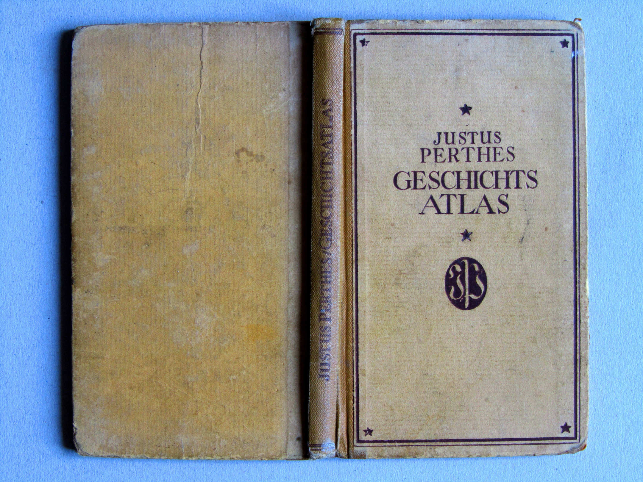

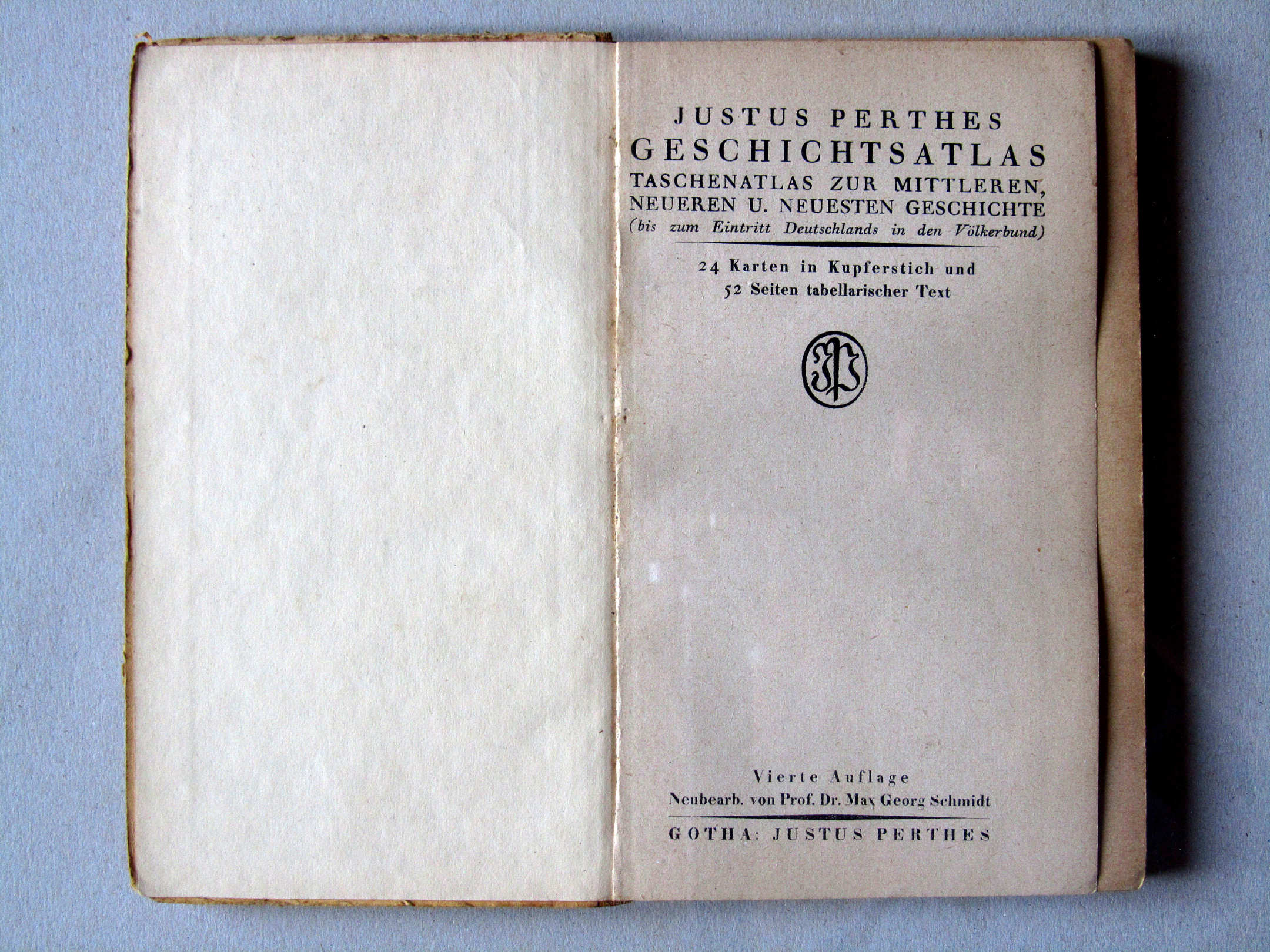
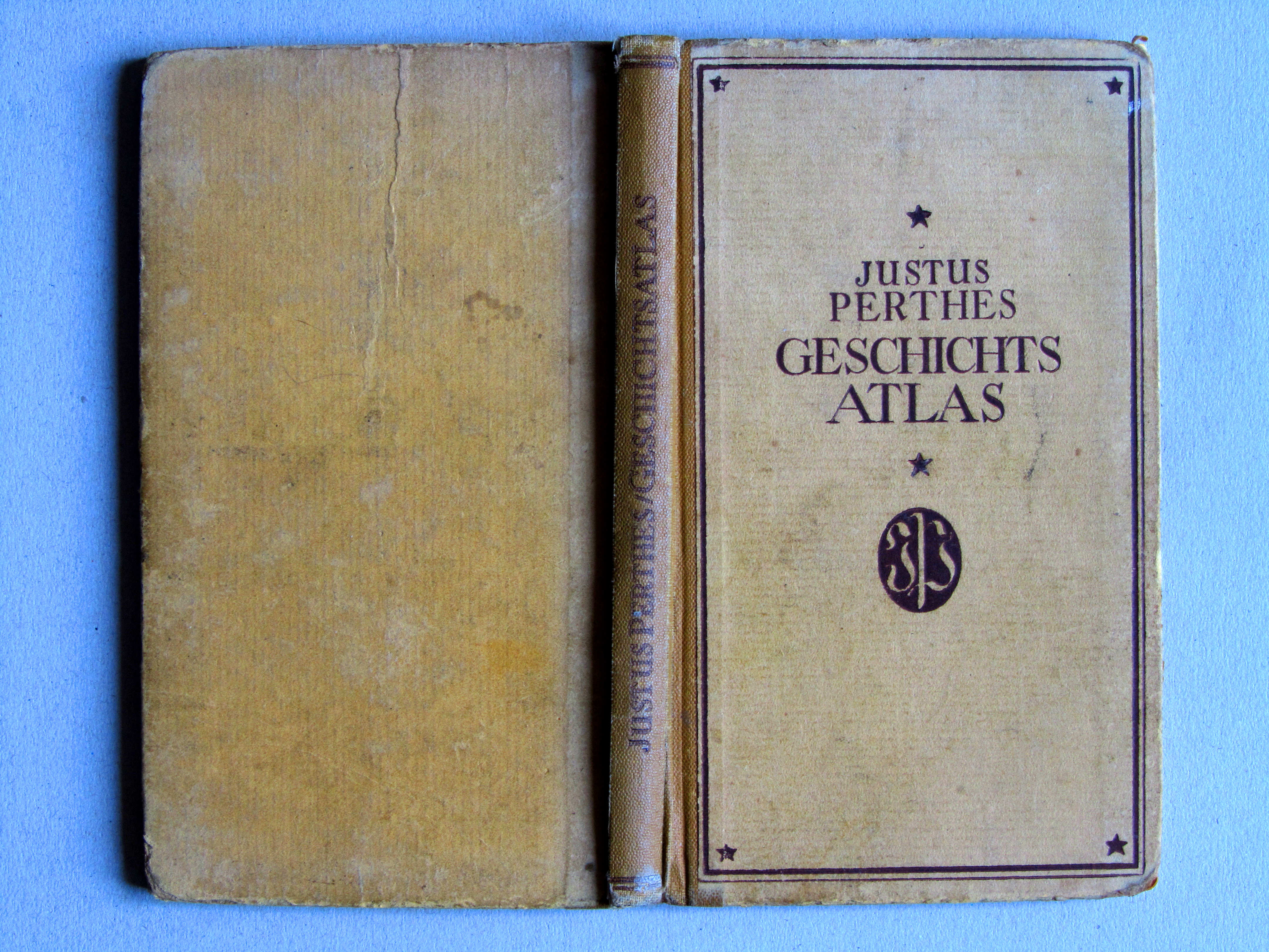
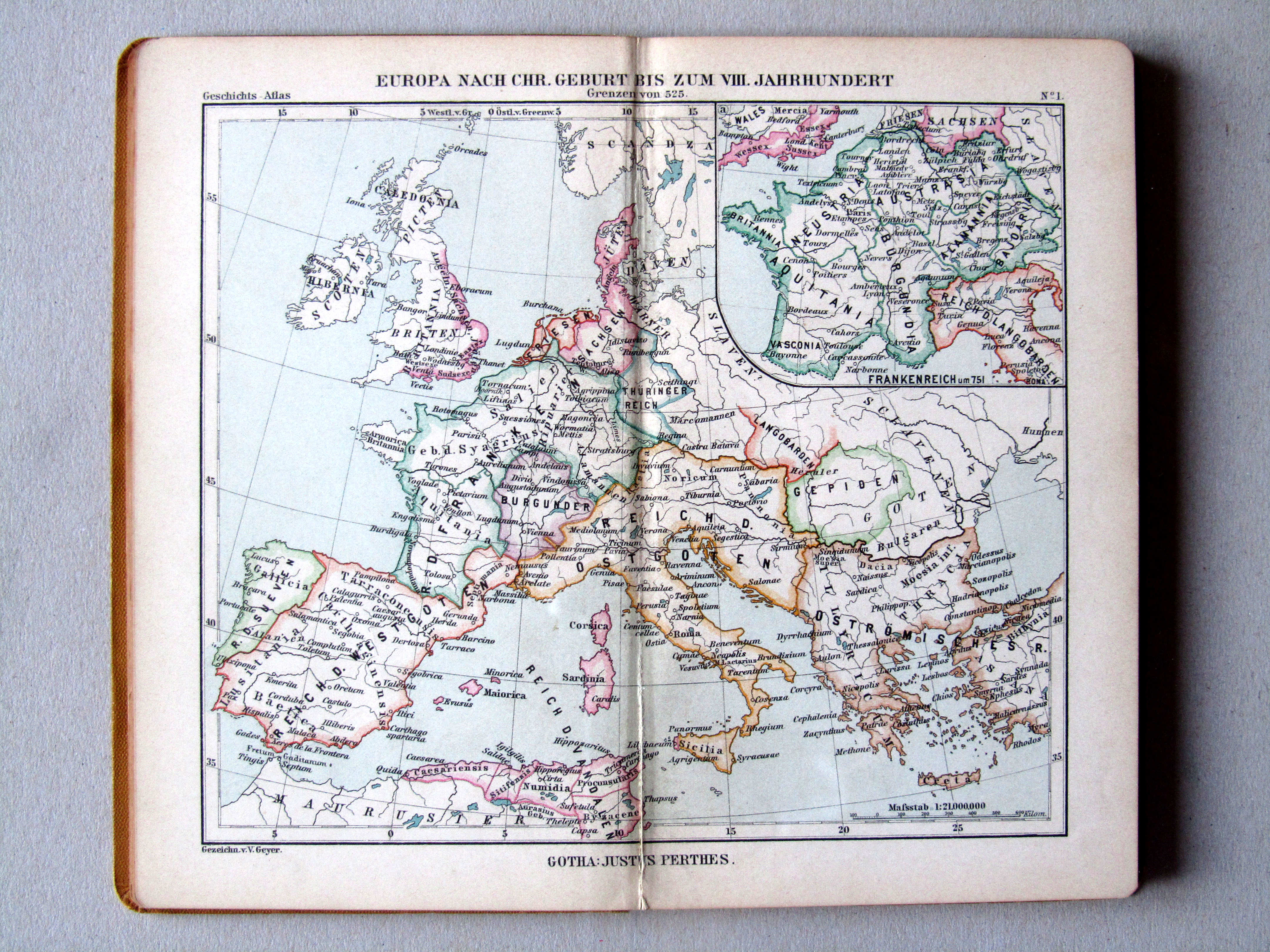
 Justus Perthes Geschichtsatlas (1927/43?)
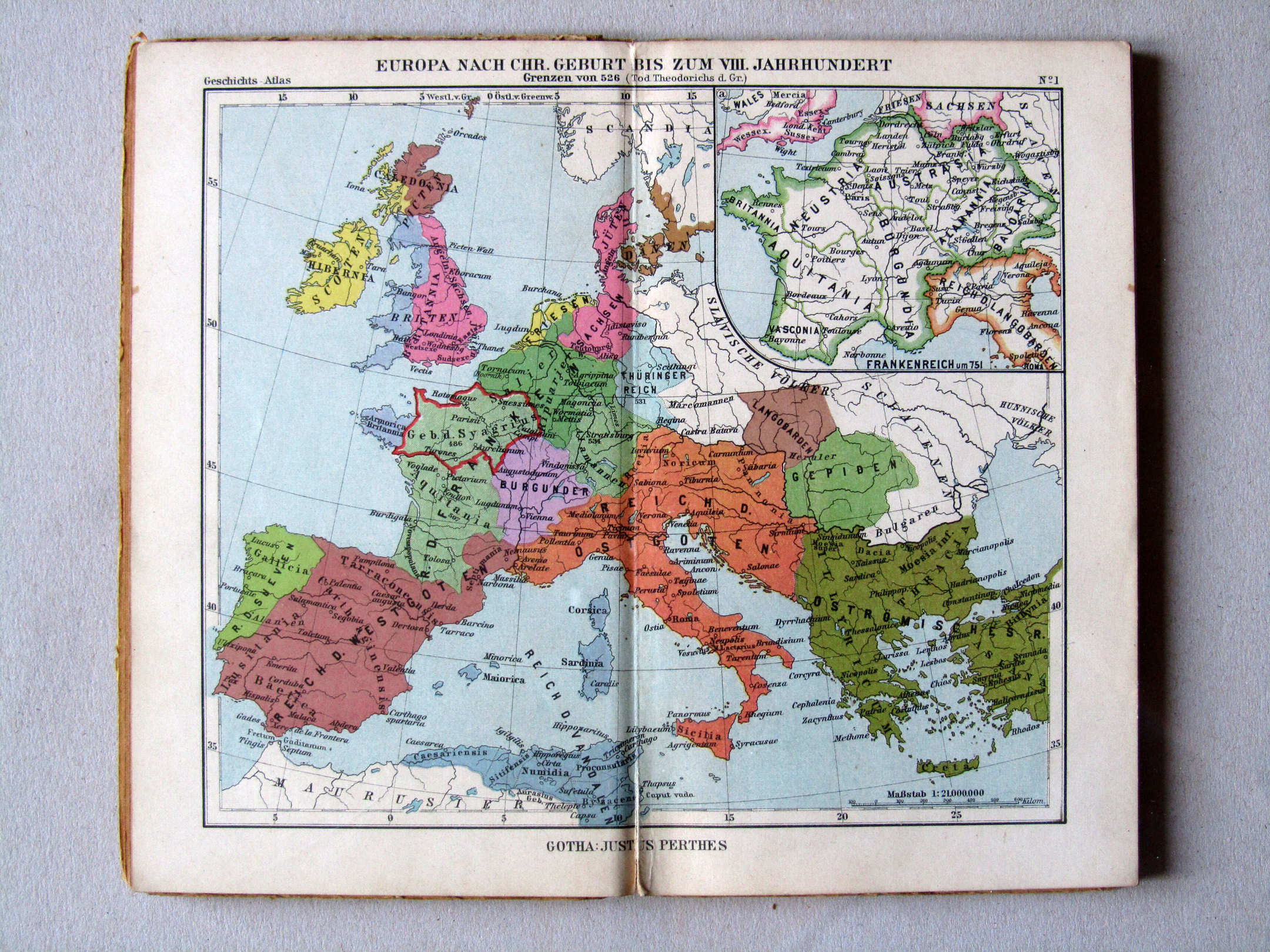
1. Europa nach Chr. Geburt. bis zum VIII. Jahrhundert. Grenzen von 525 XL
Europa na de geboorte van Christus tot de 8e eeuw. Grenzen van 525 / Europe after the birth of Christ until the 8th century. Boundaries of 525
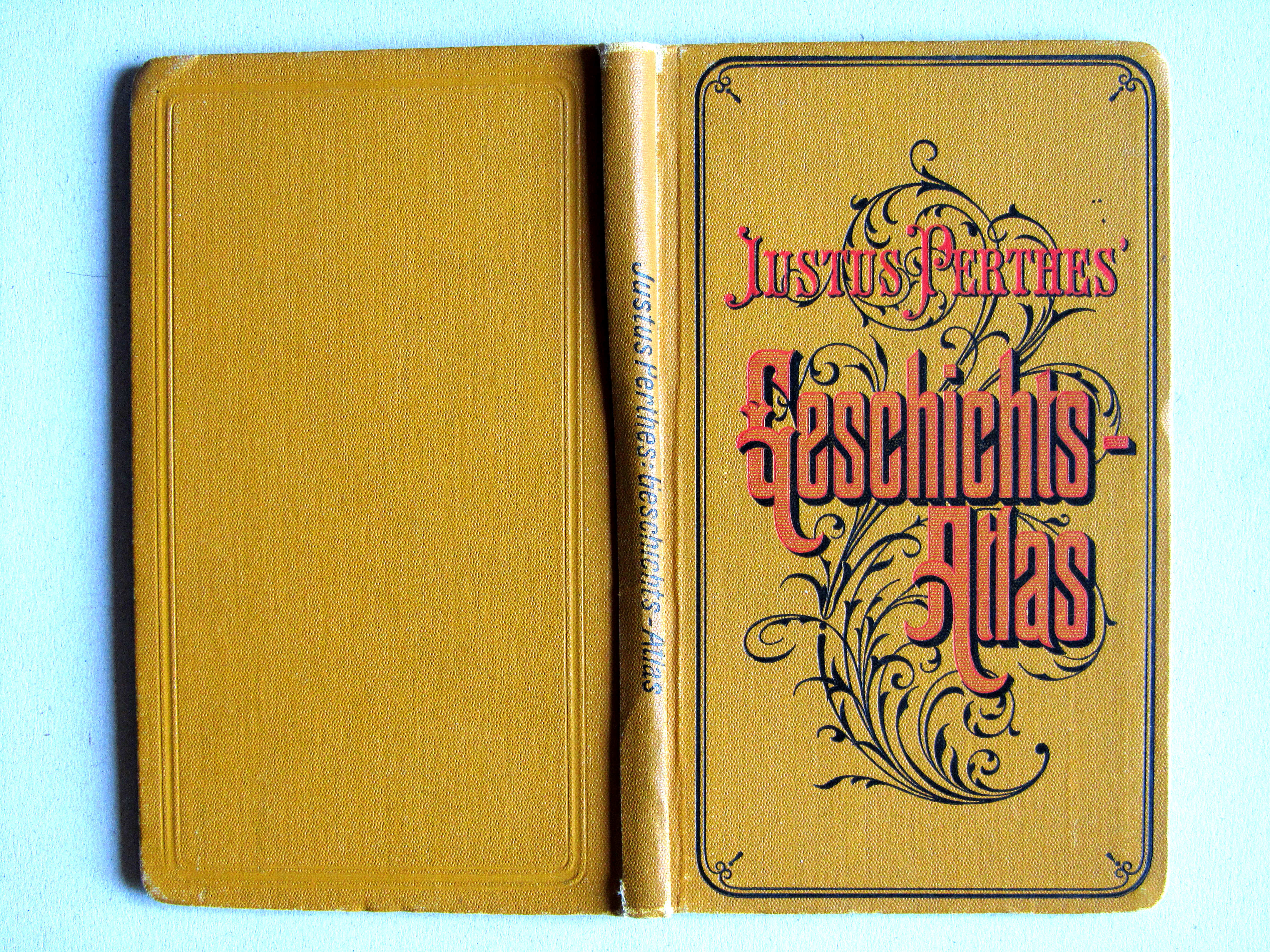
 Justus Perthes' Geschichts-Atlas (1898)
1. Europa nach Chr. Geburt. bis zum VIII. Jahrhundert. Grenzen von 525 XL
Europa na de geboorte van Christus tot de 8e eeuw. Grenzen van 525 / Europe after the birth of Christ until the 8th century. Boundaries of 525
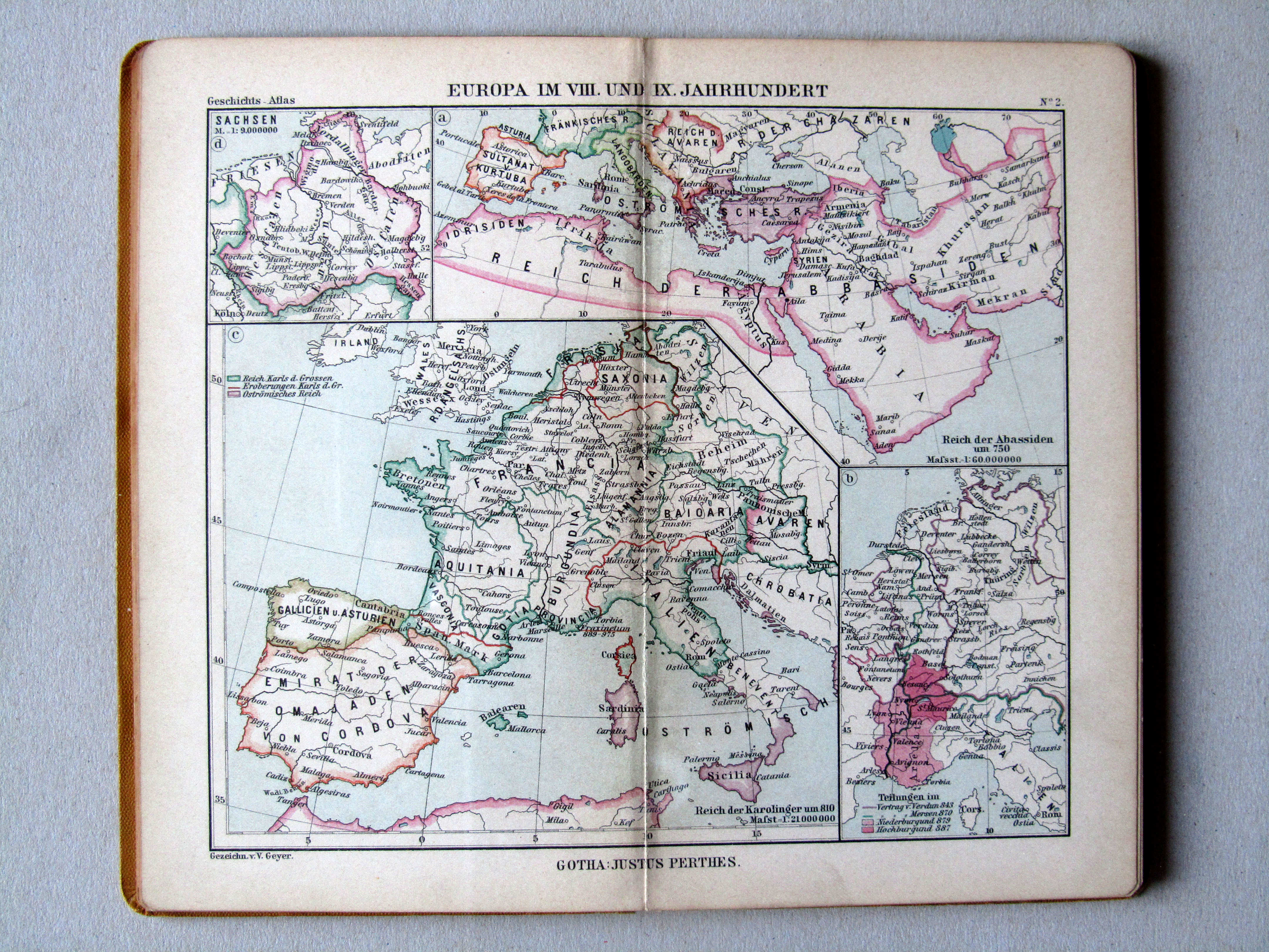
 Justus Perthes Geschichtsatlas (1927/43?)
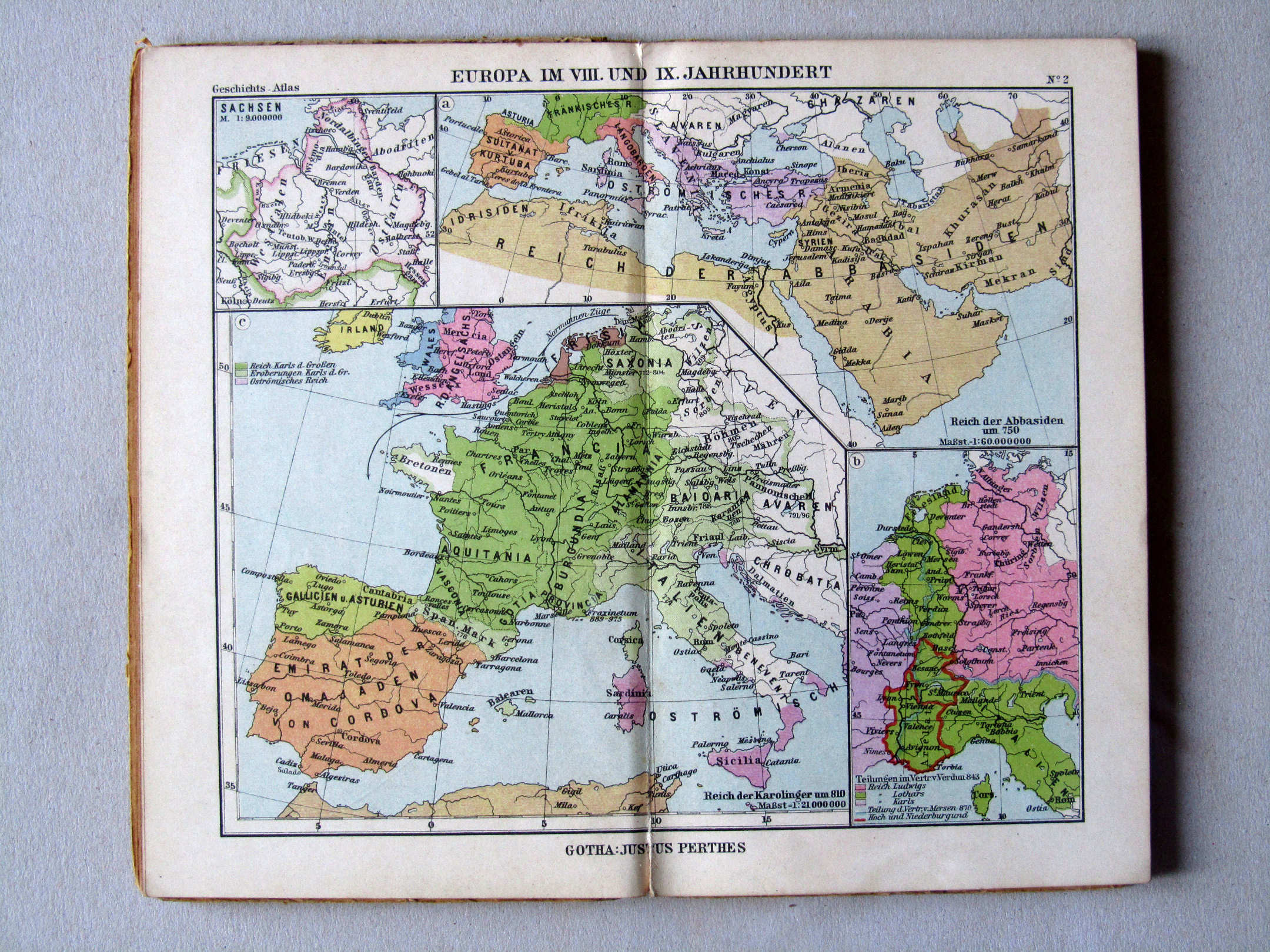
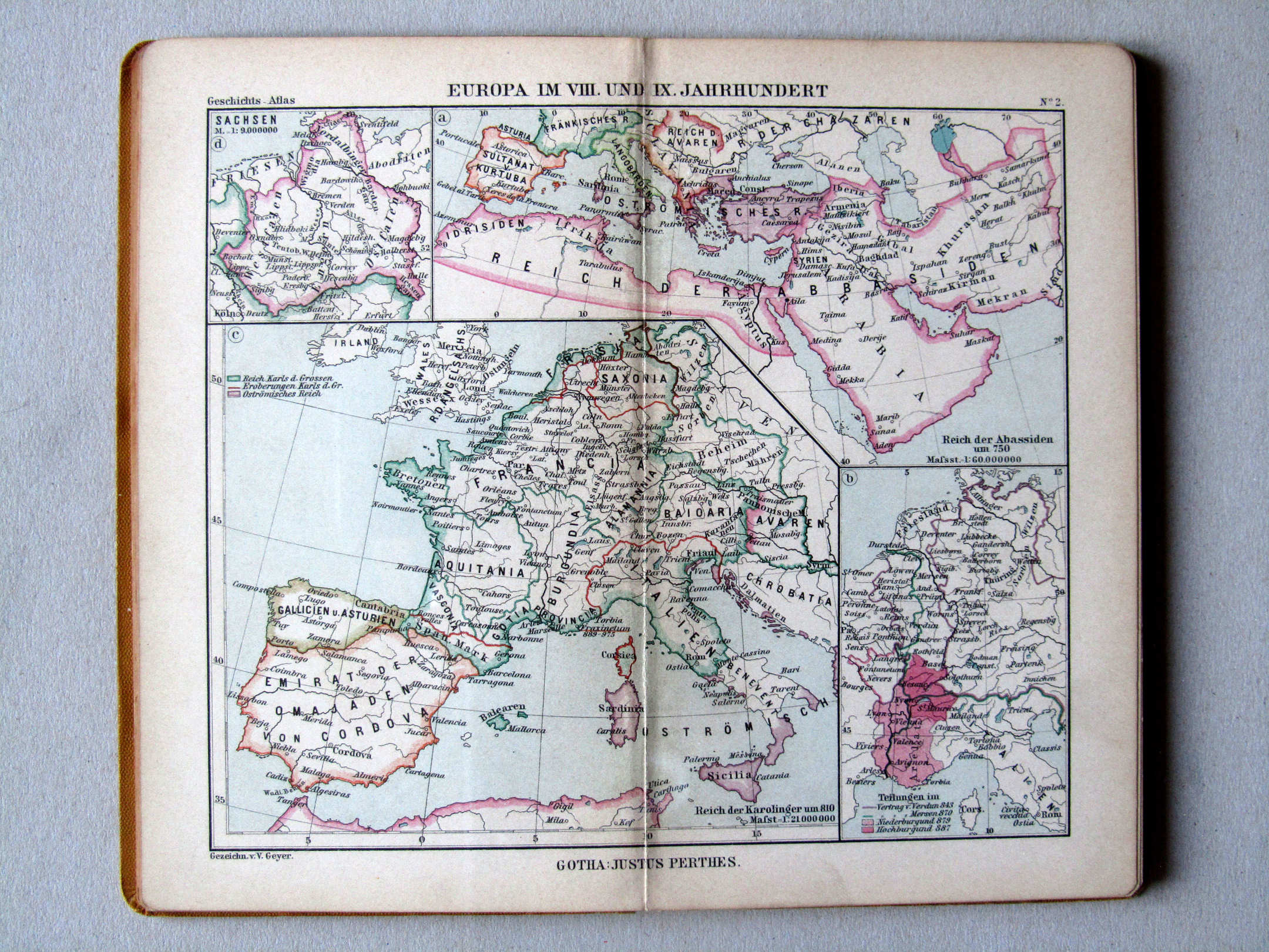
2. Europa im VIII. und IX. Jahrhundert XL
Europa in de 8e en 9e eeuw / Europe in the 8th and 9th centuries
 Justus Perthes' Geschichts-Atlas (1898)
2. Europa im VIII. und IX. Jahrhundert XL
Europa in de 8e en 9e eeuw / Europe in the 8th and 9th centuries
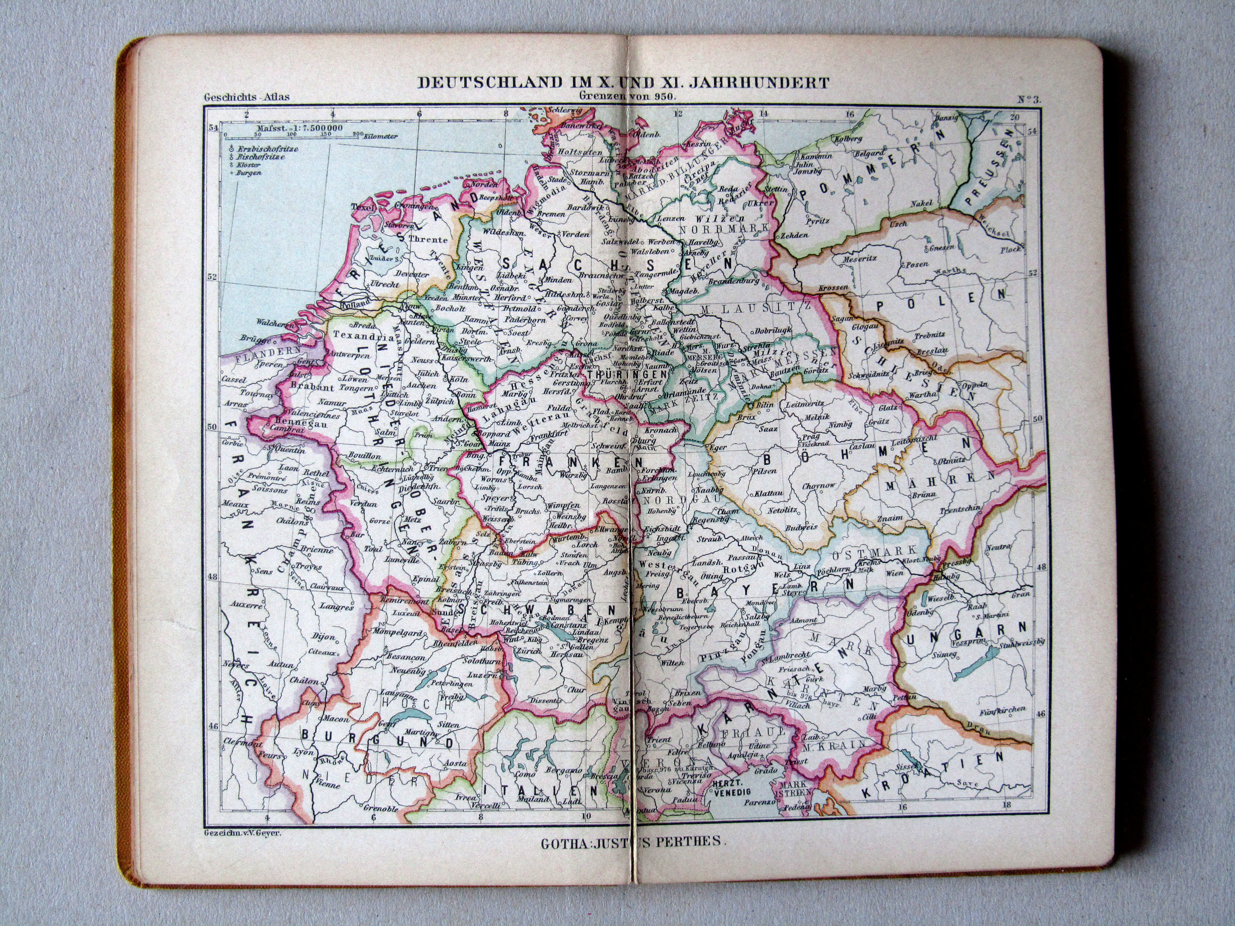
 Justus Perthes Geschichtsatlas (1927/43?)
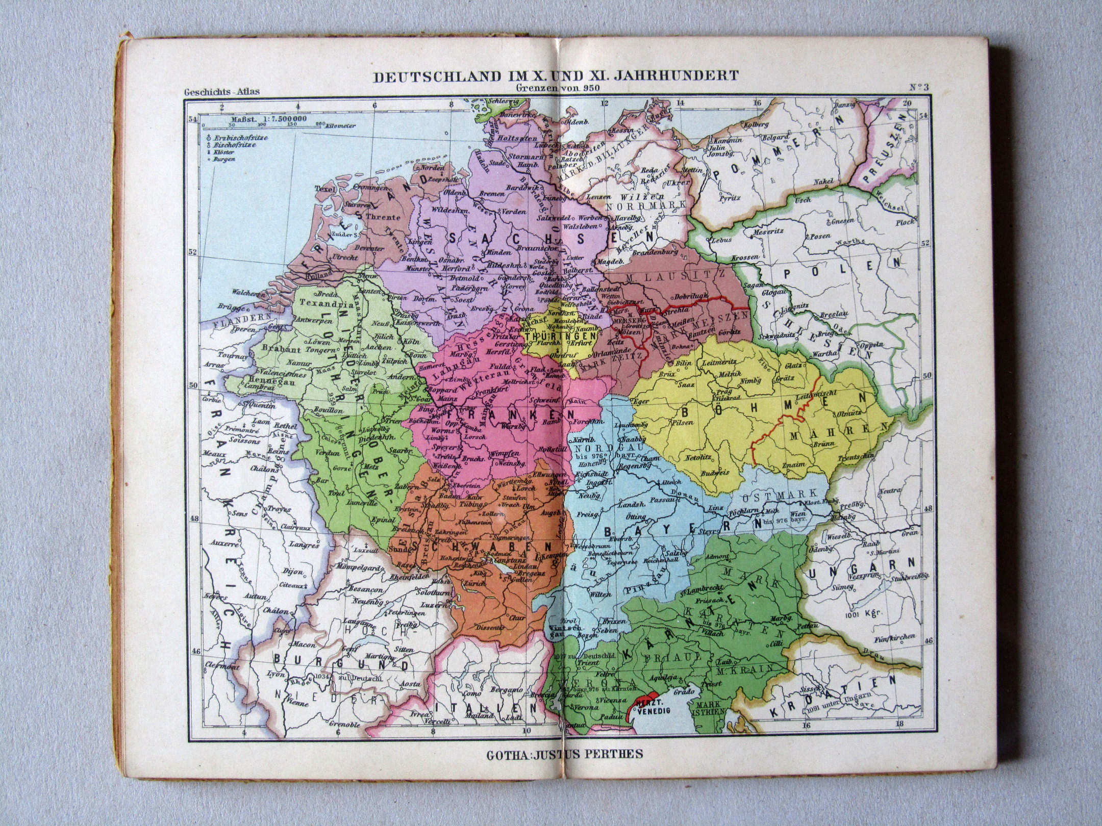
3. Deutschland im X. und XI. Jahrhundert. Grenzen von 950 XL
Duitsland in de 9e en 10e eeuw. Grenzen van 950 / Germany in the 9th and 10th centuries. Boundaries of 950
 Justus Perthes' Geschichts-Atlas (1898)
3. Deutschland im X. und XI. Jahrhundert. Grenzen von 950 XL
Duitsland in de 9e en 10e eeuw. Grenzen van 950 / Germany in the 9th and 10th centuries. Boundaries of 950
 Justus Perthes Geschichtsatlas (1927/43?)
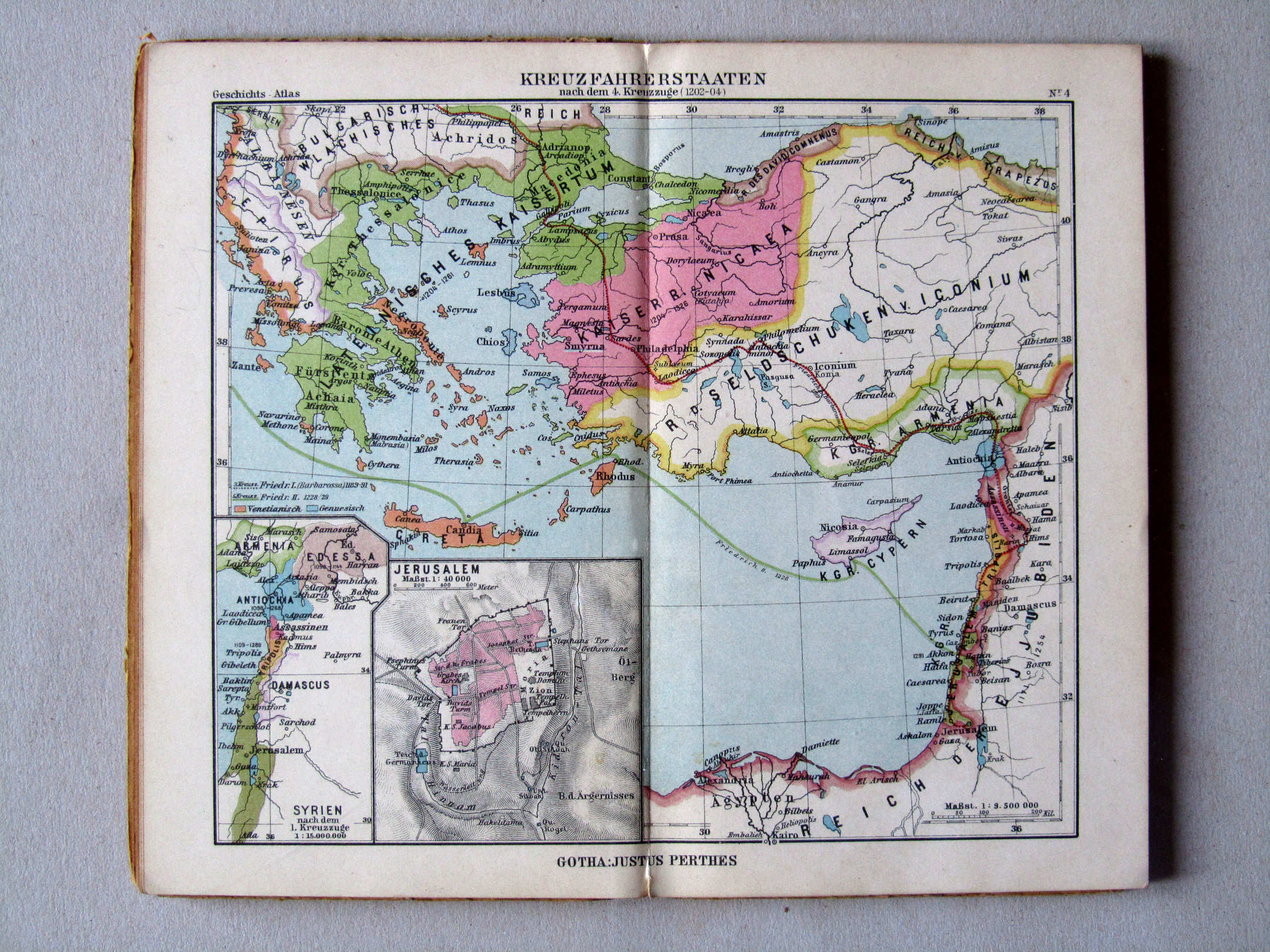
4. Kreuzfahrerstaaten nach dem 4. Kreuzzuge (1202-04) XL
Kruisvaardersstaten na de 4e kruistocht (1202-04) / Crusader states after the 4th crusade (1202-04)
 Justus Perthes' Geschichts-Atlas (1898)
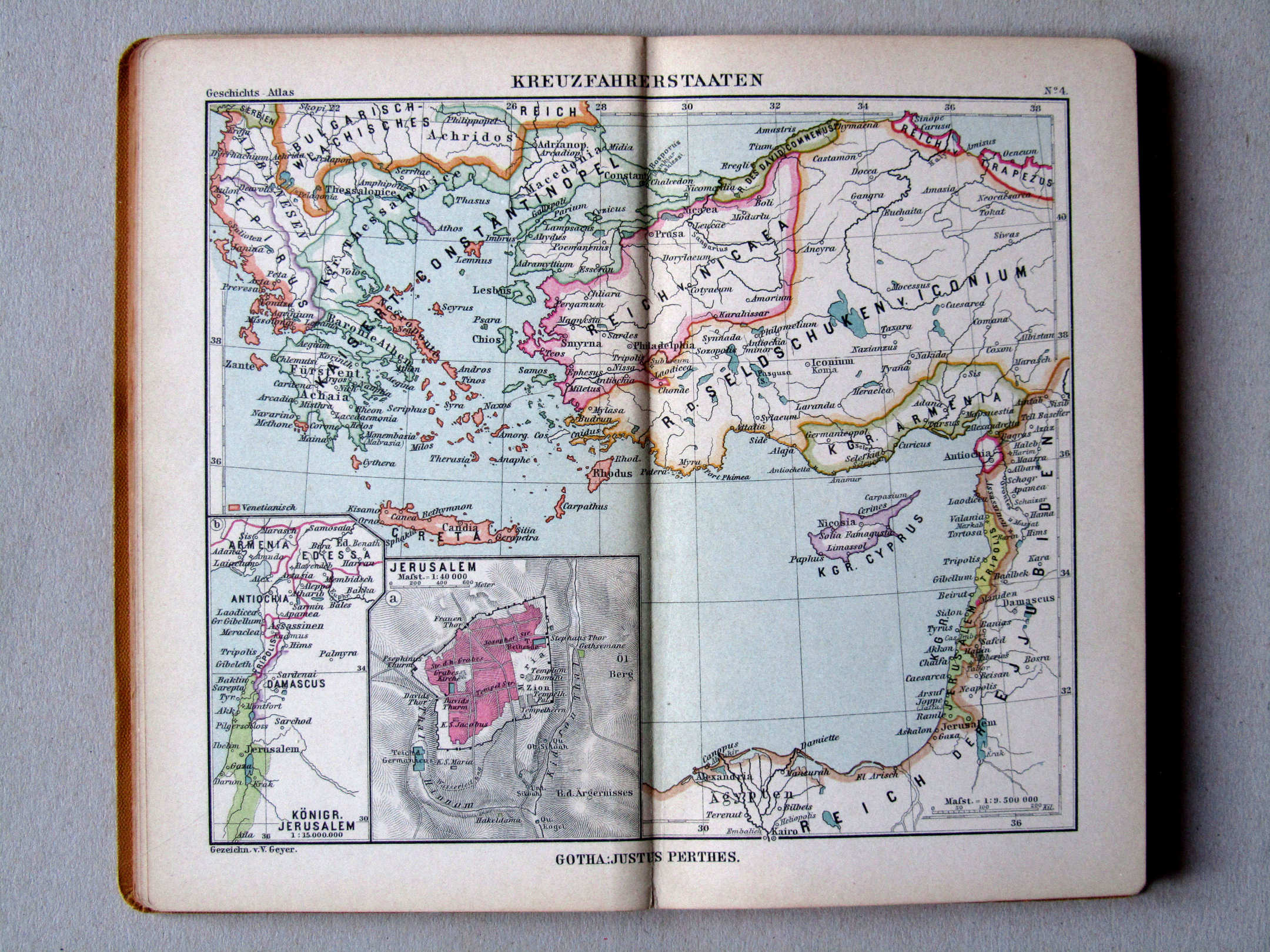
4. Kreuzfahrerstaaten XL
Kruisvaardersstaten / Crusader states
 Justus Perthes Geschichtsatlas (1927/43?)
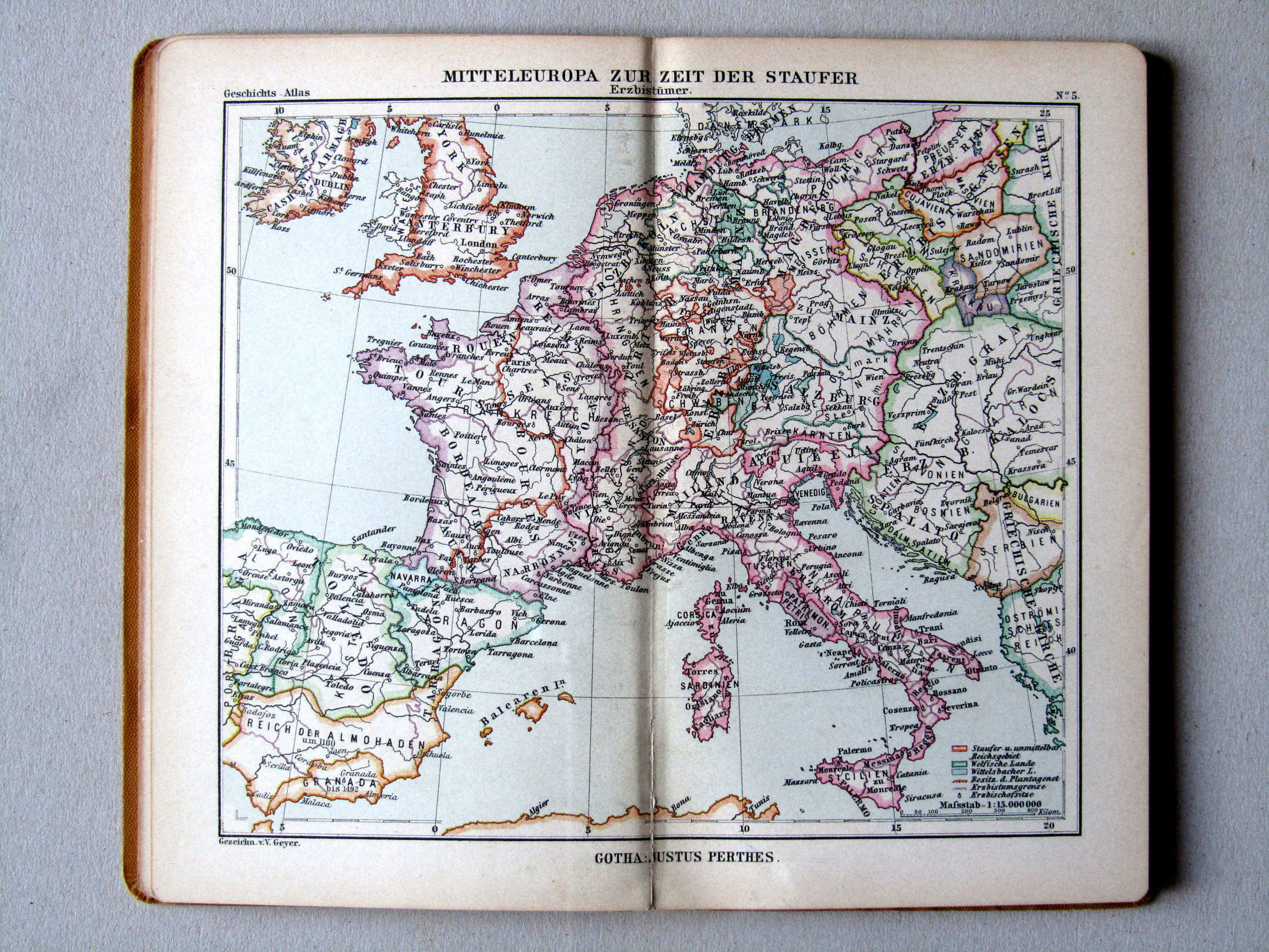
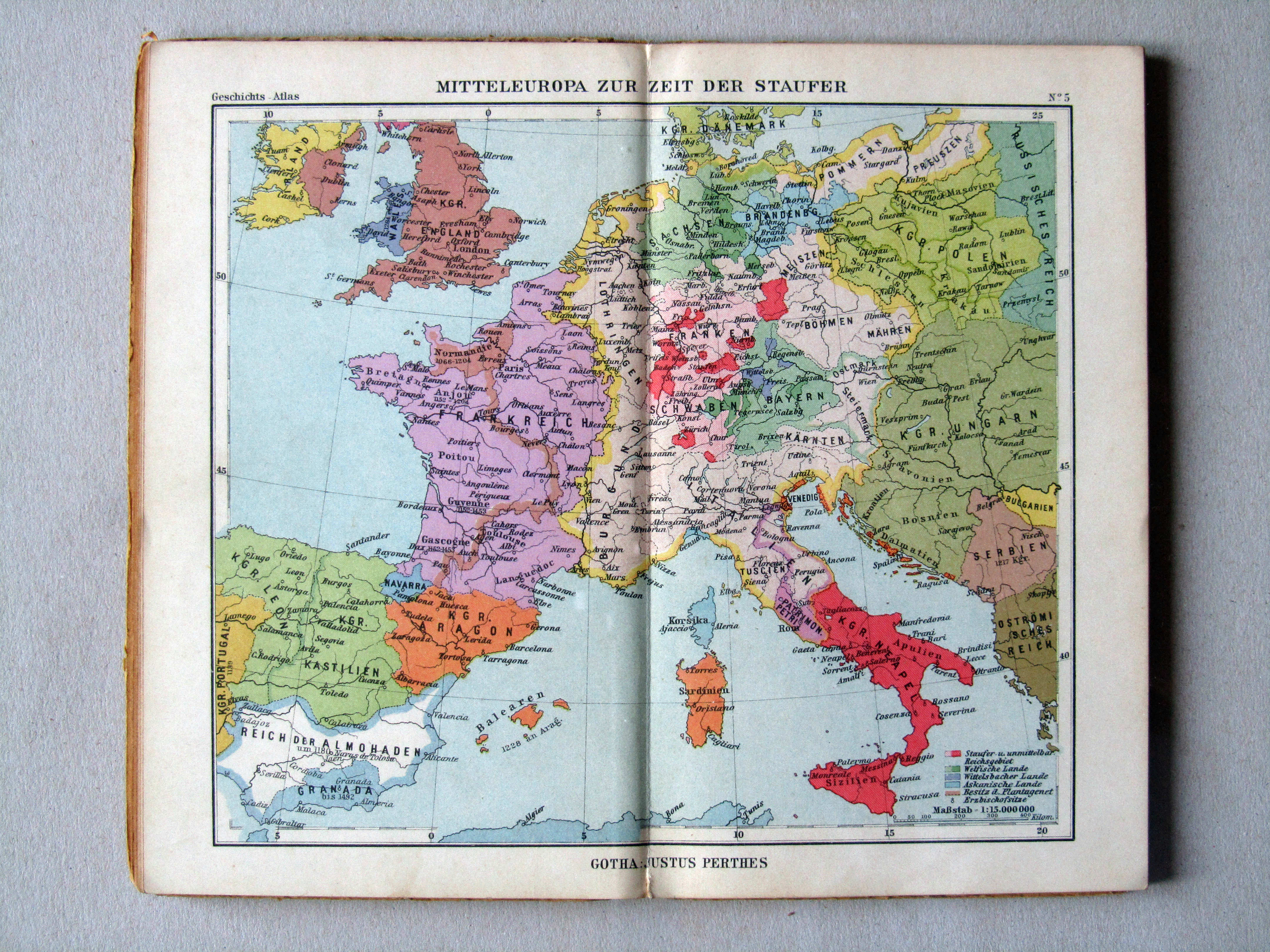
5. Mitteleuropa zur Zeit der Staufer XL
Midden-Europa ten tijde van het Huis Hohenstaufen / Central Europe during the House of Hohenstaufen
 Justus Perthes' Geschichts-Atlas (1898)
5. Mitteleuropa zur Zeit der Staufer. Erzbistümer XL
Midden-Europa ten tijde van het Huis Hohenstaufen. Aartsbisdommen / Central Europe during the House of Hohenstaufen. Archdioceses
 Justus Perthes Geschichtsatlas (1927/43?)
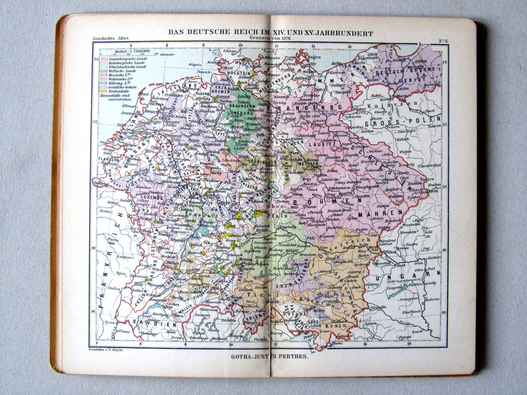
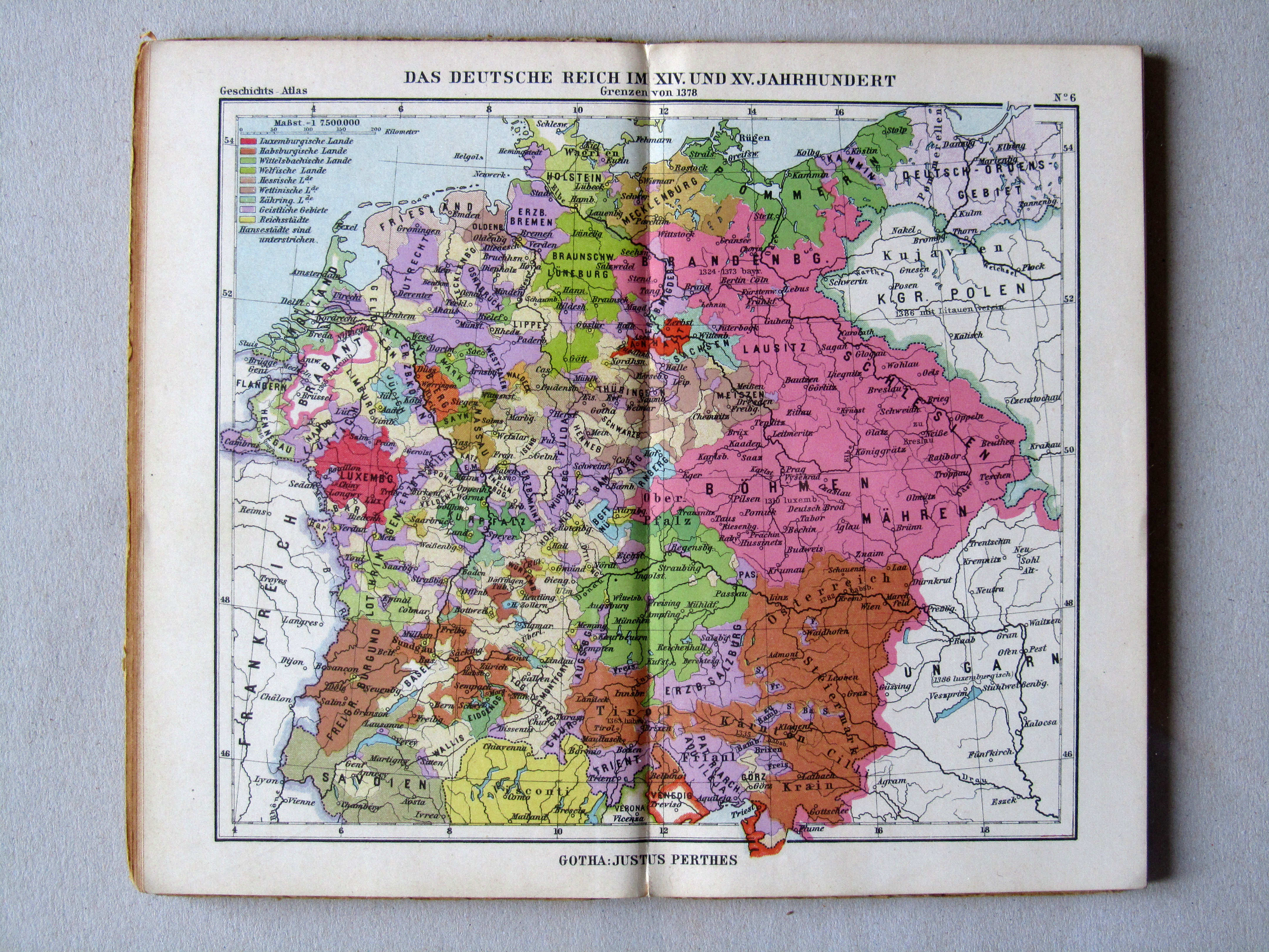
6. Das Deutsche Reich im XIV. und XV. Jahrhundert. Grenzen von 1378 XL
Het Duitse Rijk in de 14e en 15e eeuw. Grenzen van 1378 / German Empire in the 14th and 15th centuries. Boundaries of 1378
 Justus Perthes' Geschichts-Atlas (1898)
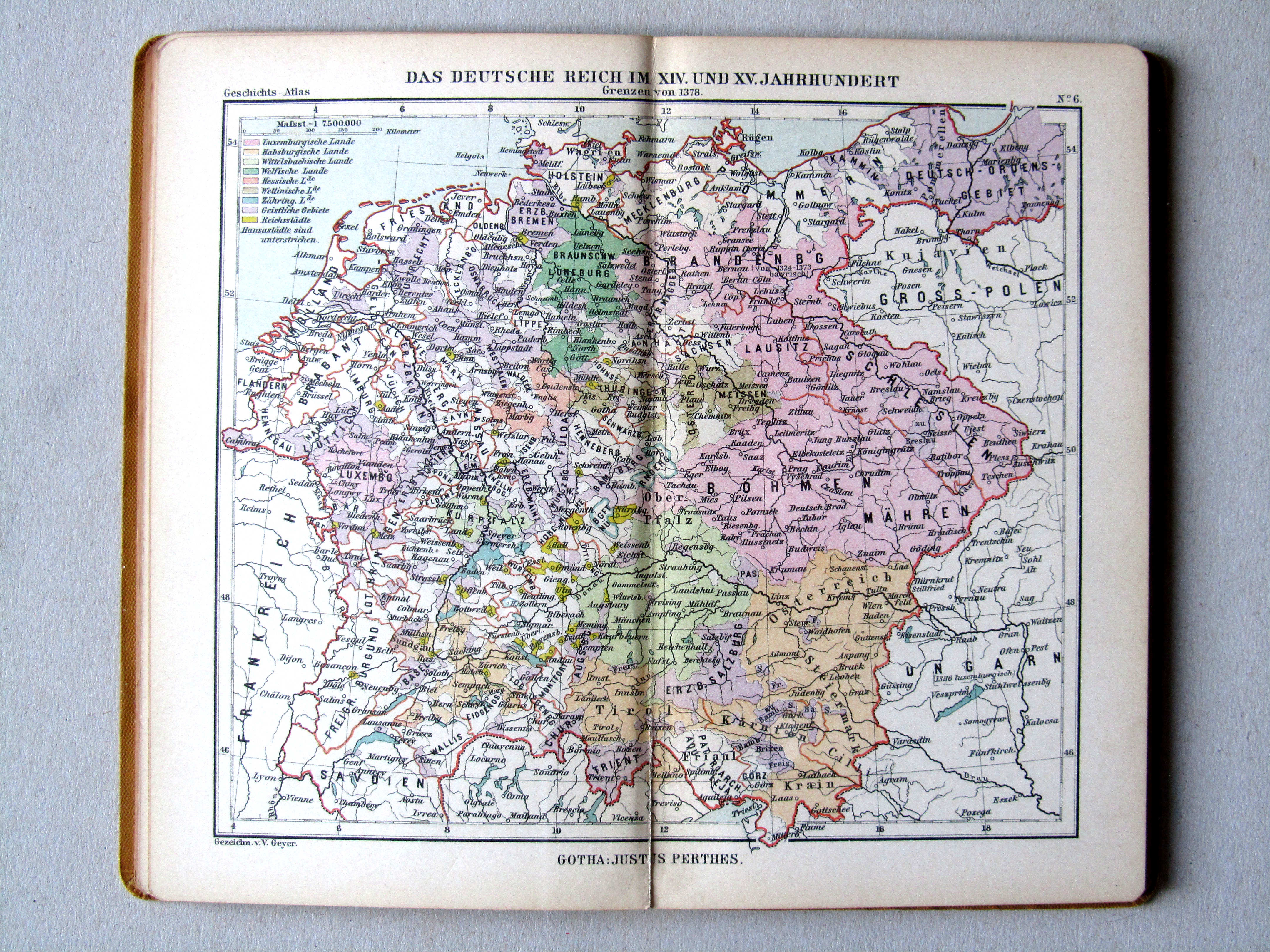
6. Das Deutsche Reich im XIV. und XV. Jahrhundert. Grenzen von 1378 XL
Het Duitse Rijk in de 14e en 15e eeuw. Grenzen van 1378 / German Empire in the 14th and 15th centuries. Boundaries of 1378
 Justus Perthes Geschichtsatlas (1927/43?)
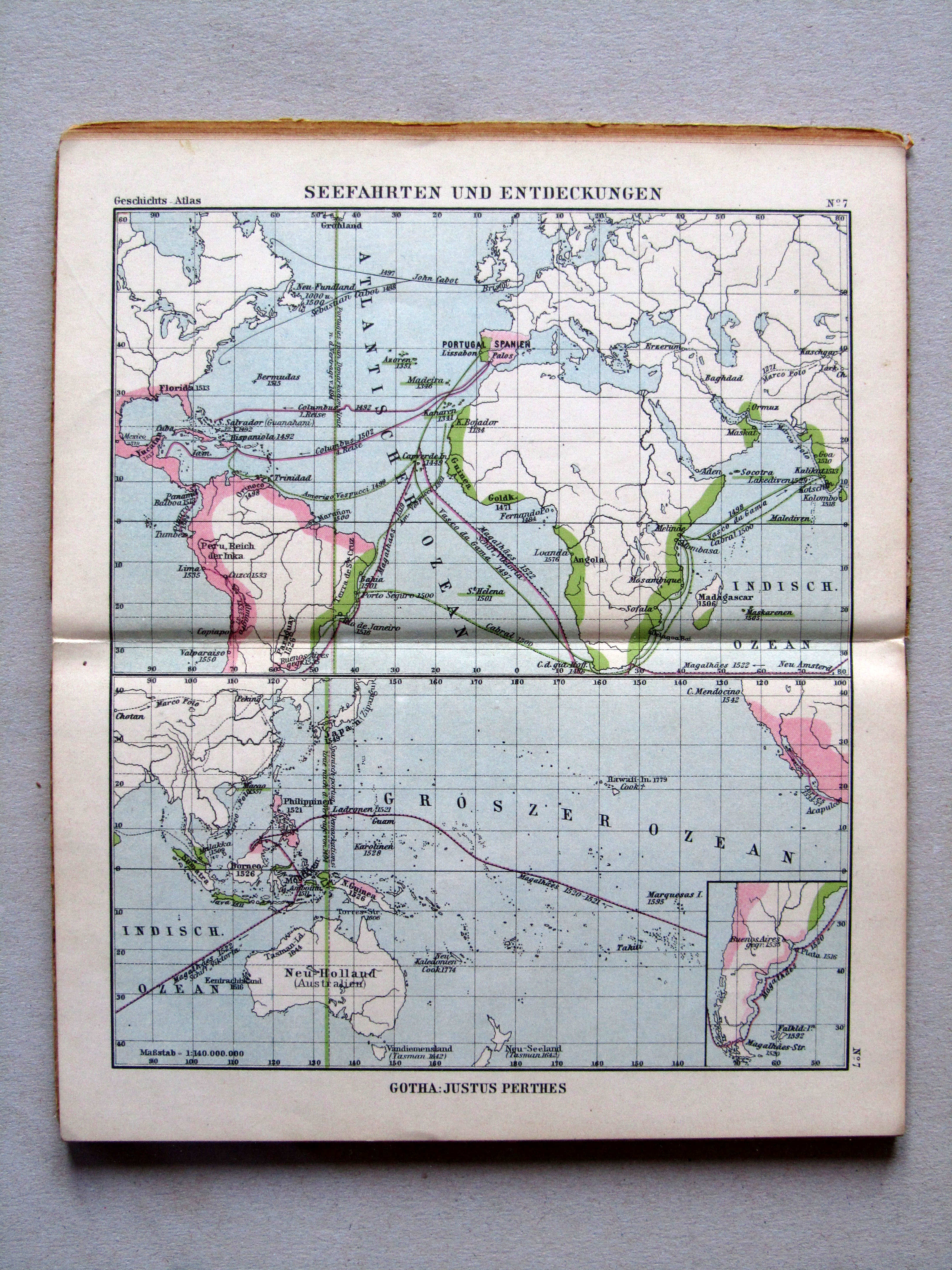
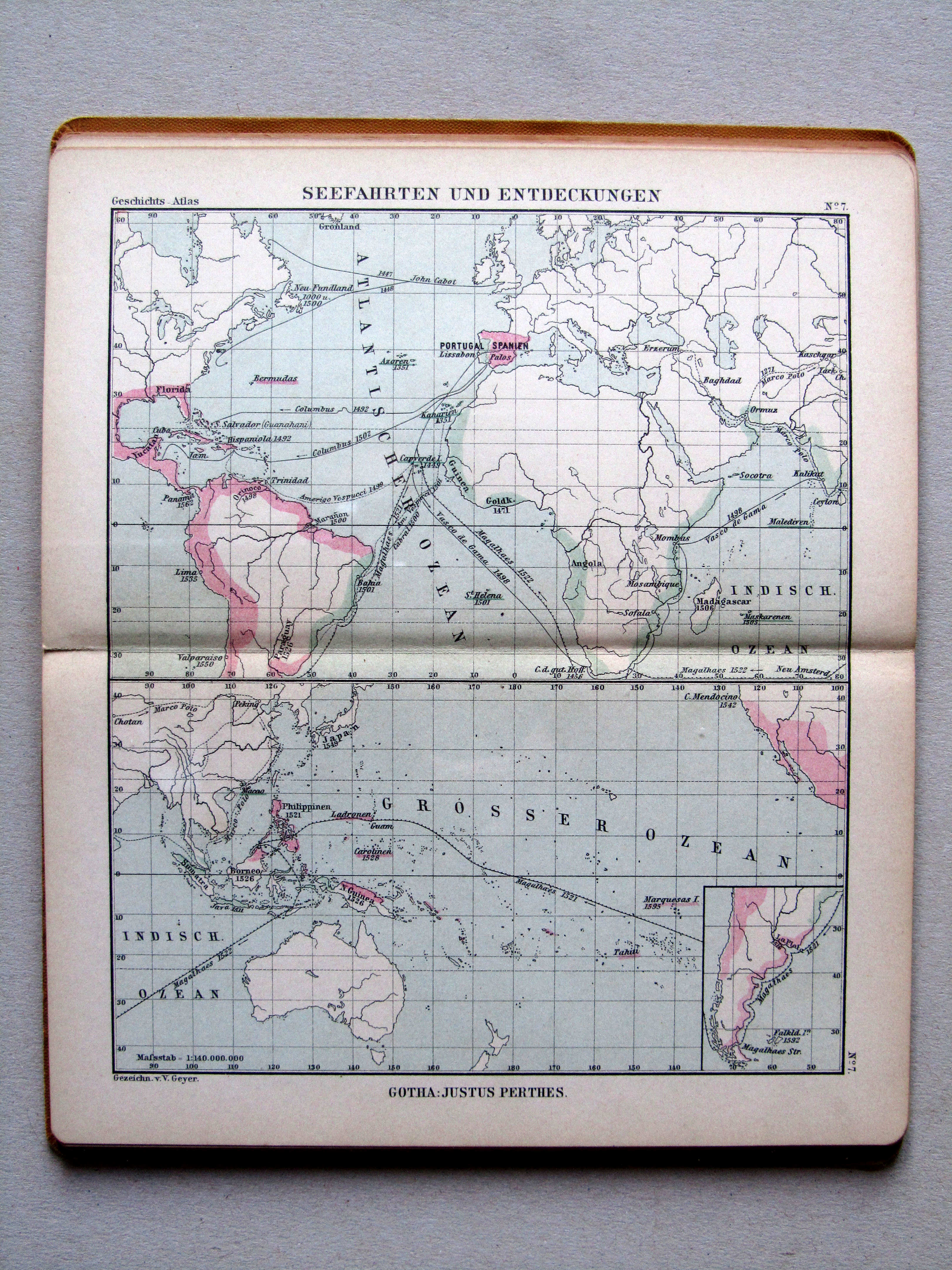
7. Seefahrten und Entdeckungen XL
Ontdekkingsreizen / Explorations
 Justus Perthes' Geschichts-Atlas (1898)
7. Seefahrten und Entdeckungen XL
Ontdekkingsreizen / Explorations
 Justus Perthes Geschichtsatlas (1927/43?)
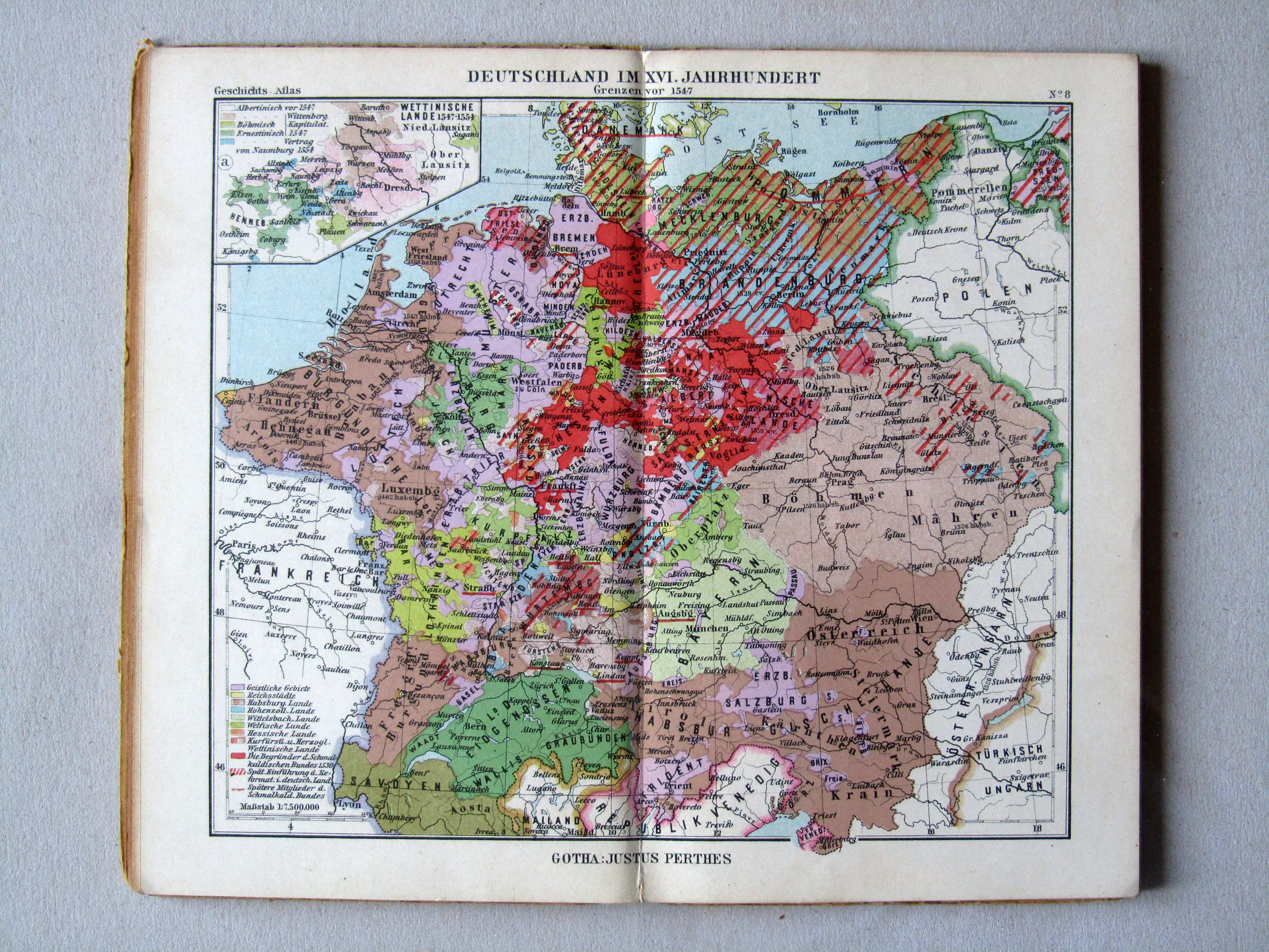
8. Deutschland im XVI. Jahrhundert. Grenzen von 1547 XL
Duitsland in de 16e eeuw. Grenzen van 1547 / Germany in the 16th century. Boundaries of 1547
 Justus Perthes' Geschichts-Atlas (1898)
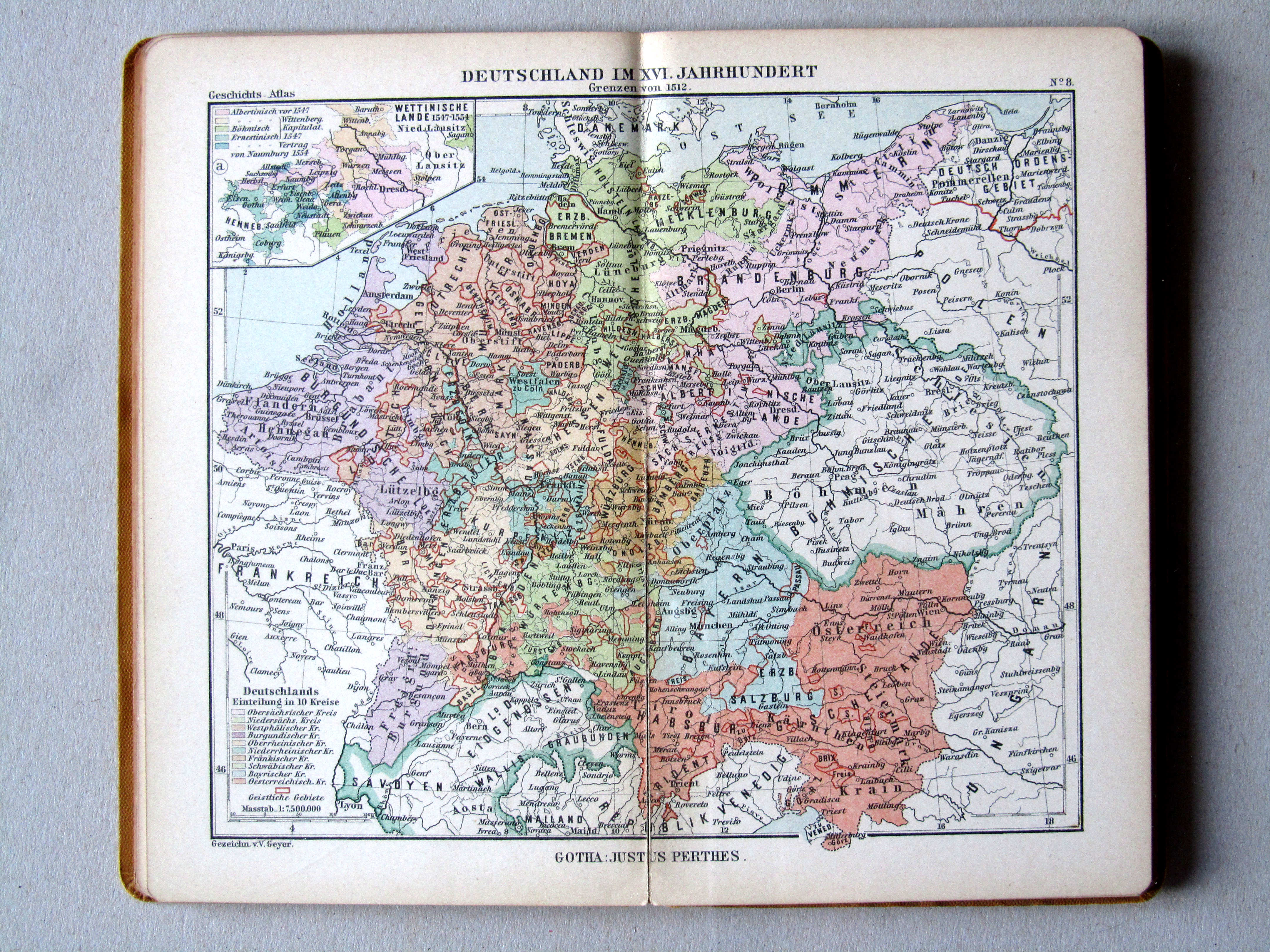
8. Deutschland im XVI. Jahrhundert. Grenzen von 1512 XL
Duitsland in de 16e eeuw. Grenzen van 1512 / Germany in the 16th century. Boundaries of 1512
 Justus Perthes Geschichtsatlas (1927/43?)
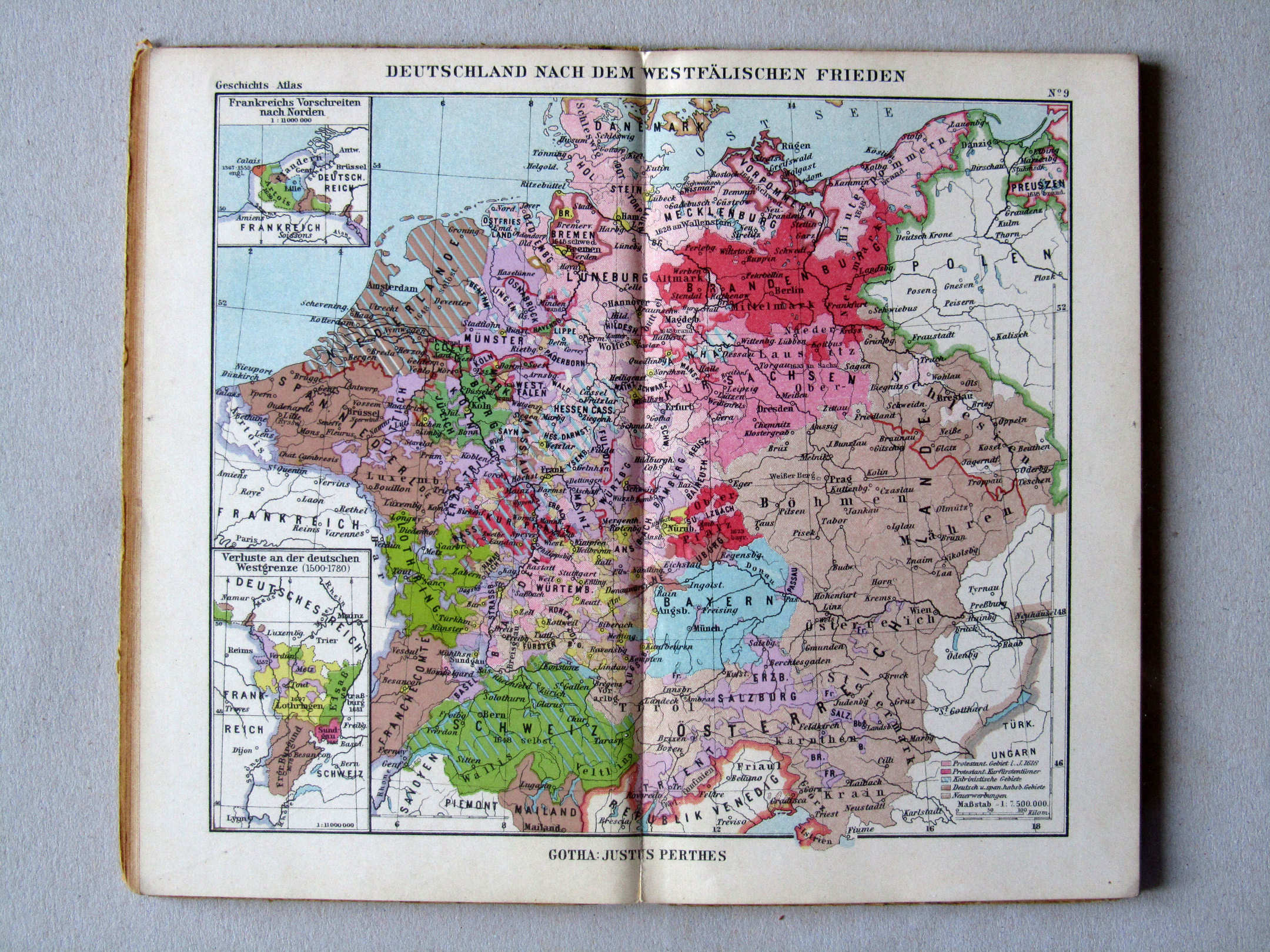
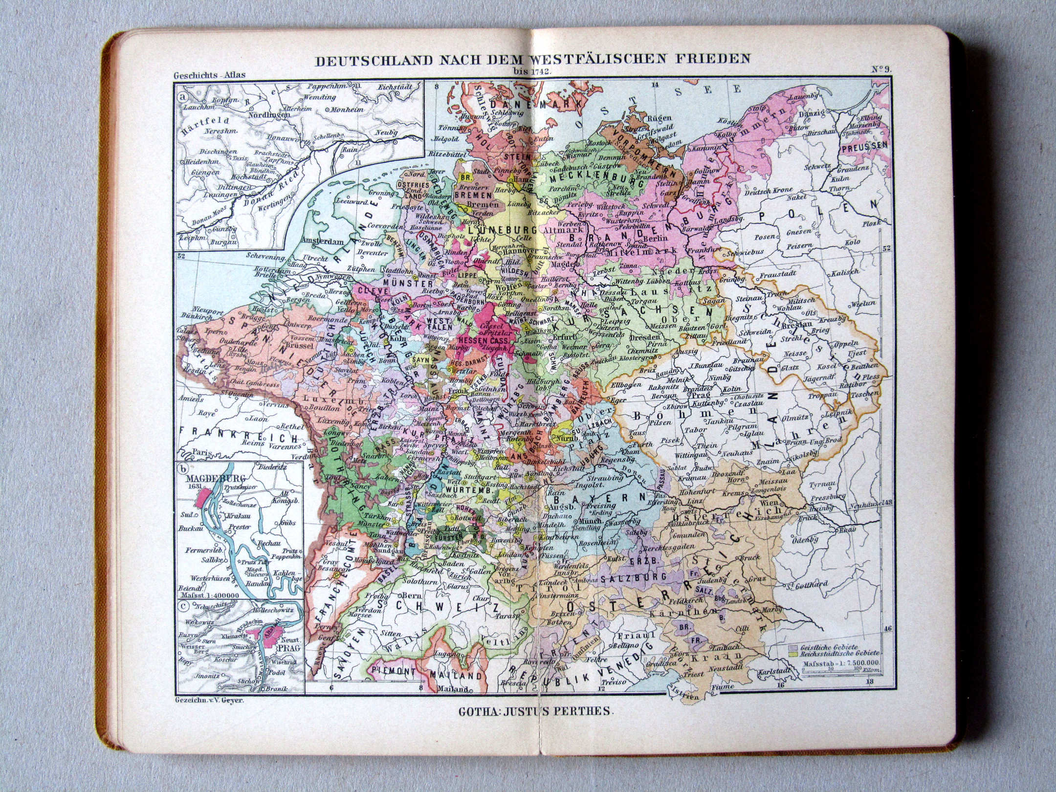
9. Deutschland nach dem Westphälischen Frieden XL
Duitsland na de Vrede van Westfalen / Germany after the Peace of Westphalia
 Justus Perthes' Geschichts-Atlas (1898)
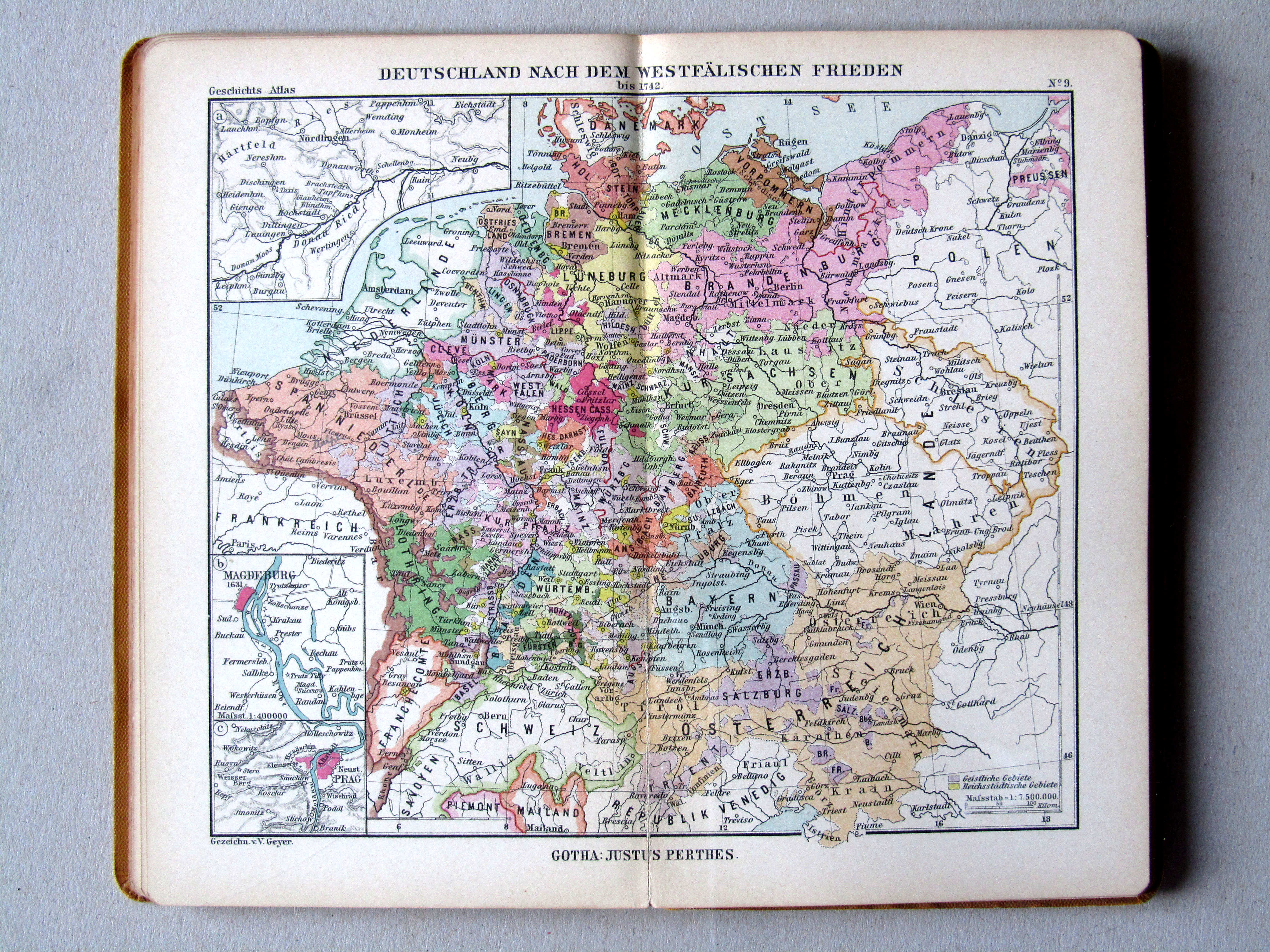
9. Deutschland nach dem Westphälischen Frieden bis 1742 XL
Duitsland van de Vrede van Westfalen tot 1742 / Germany from the Peace of Westphalia until 1742
 Justus Perthes Geschichtsatlas (1927/43?)
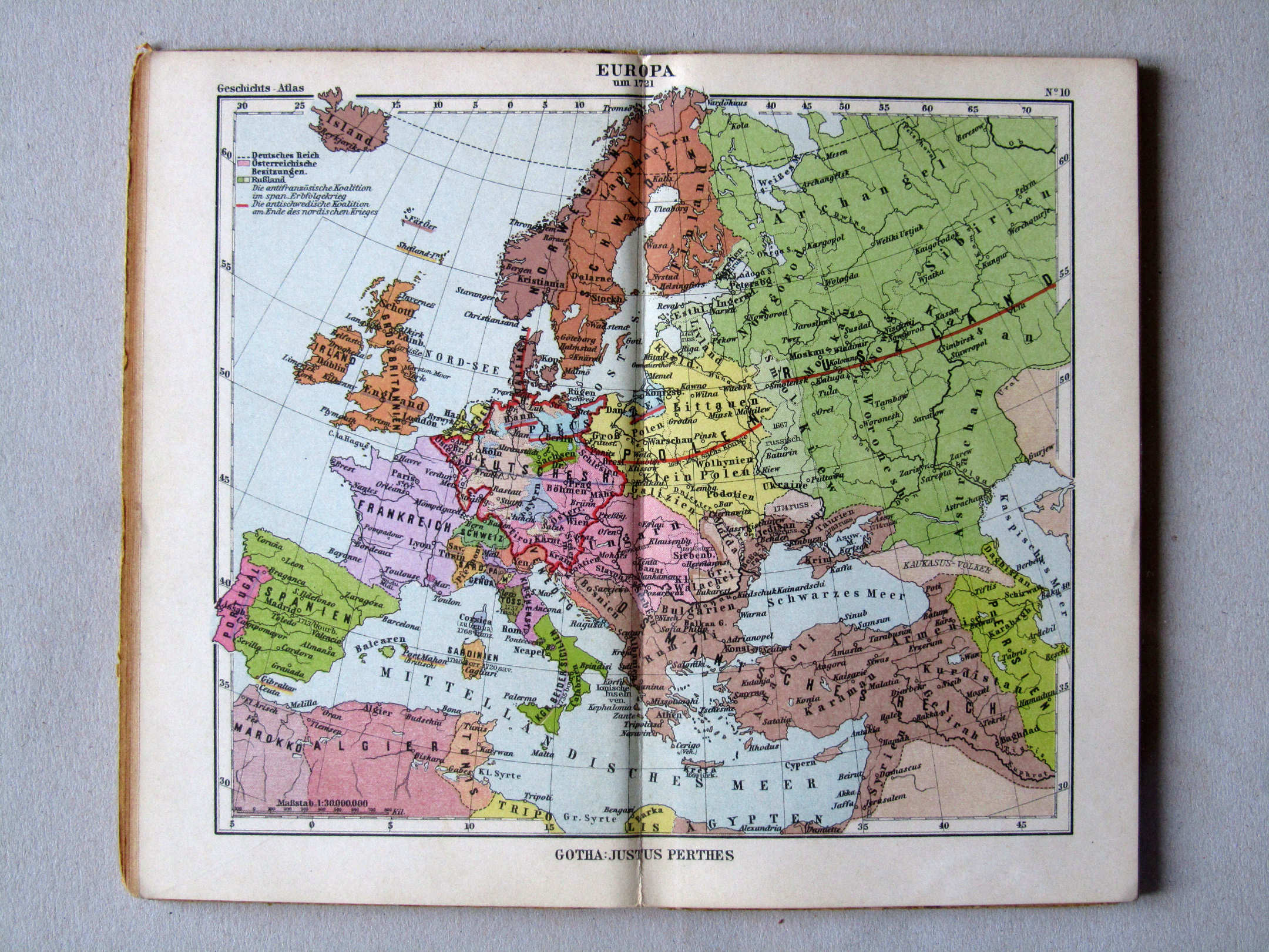
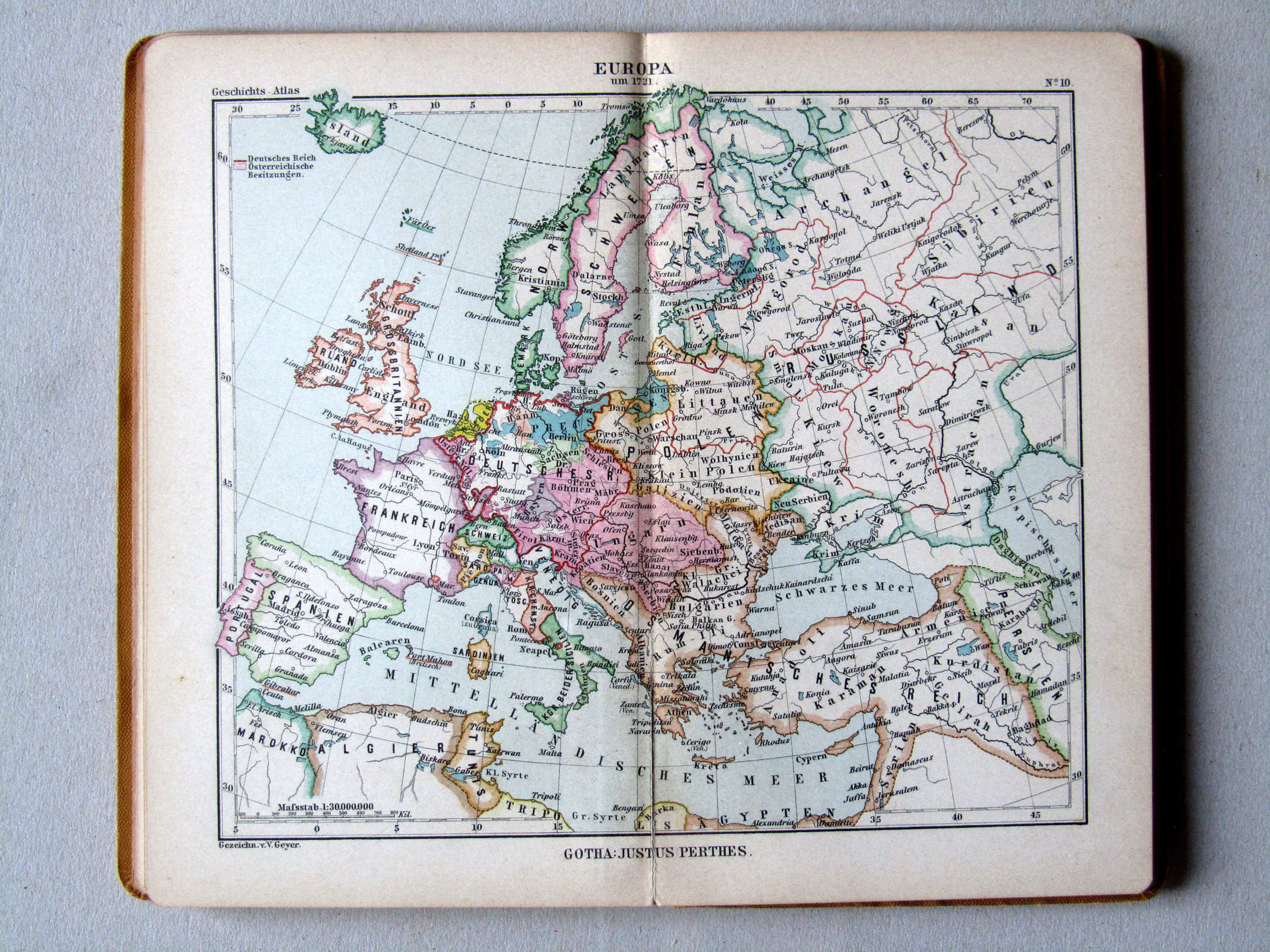
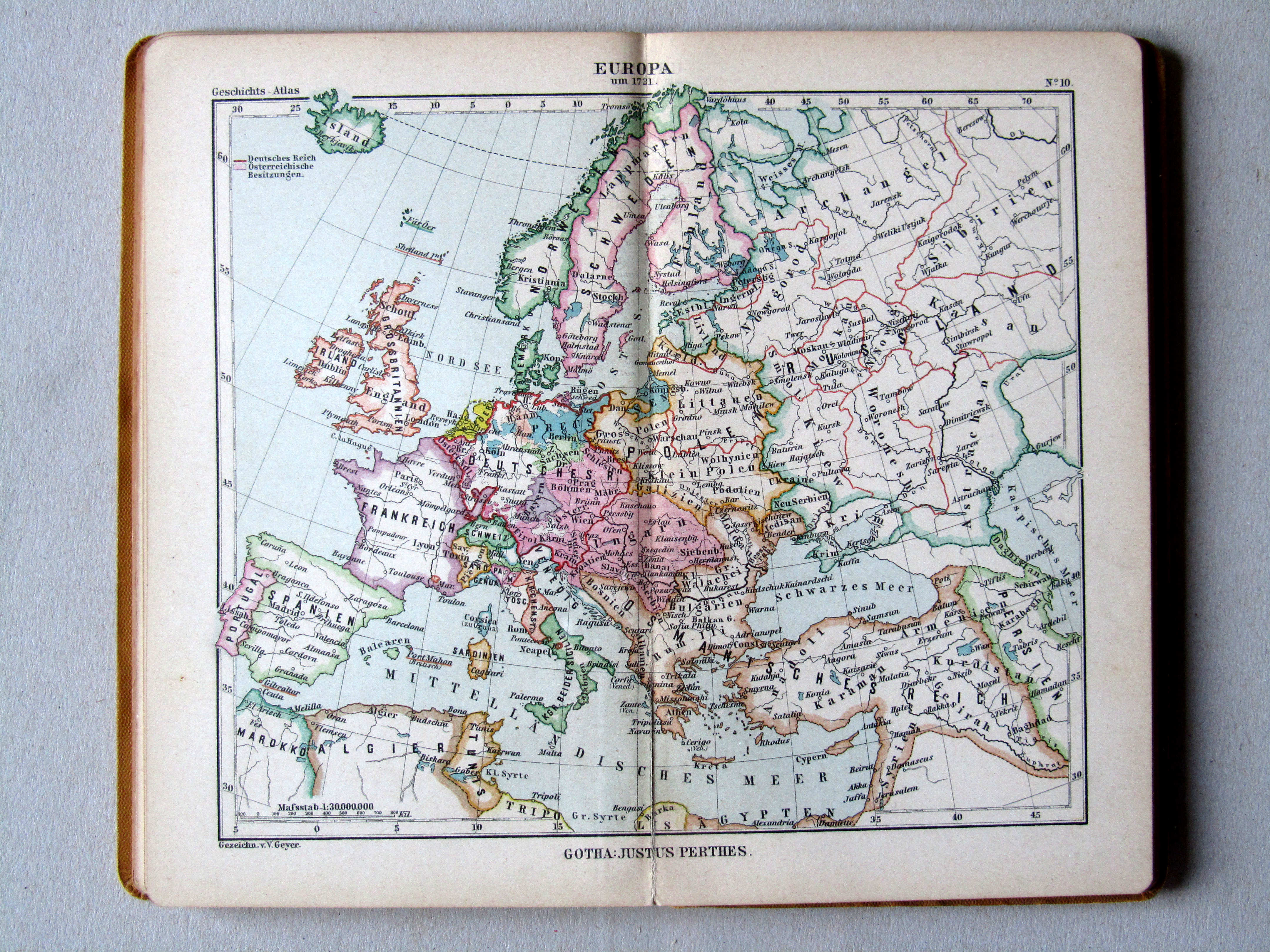
10. Europa um 1721 XL
Europa rond 1721 / Europe around 1721
 Justus Perthes Geschichtsatlas (1927/43?)
geen overeenkomstige kaart / no corresponding map
 Justus Perthes' Geschichts-Atlas (1898)
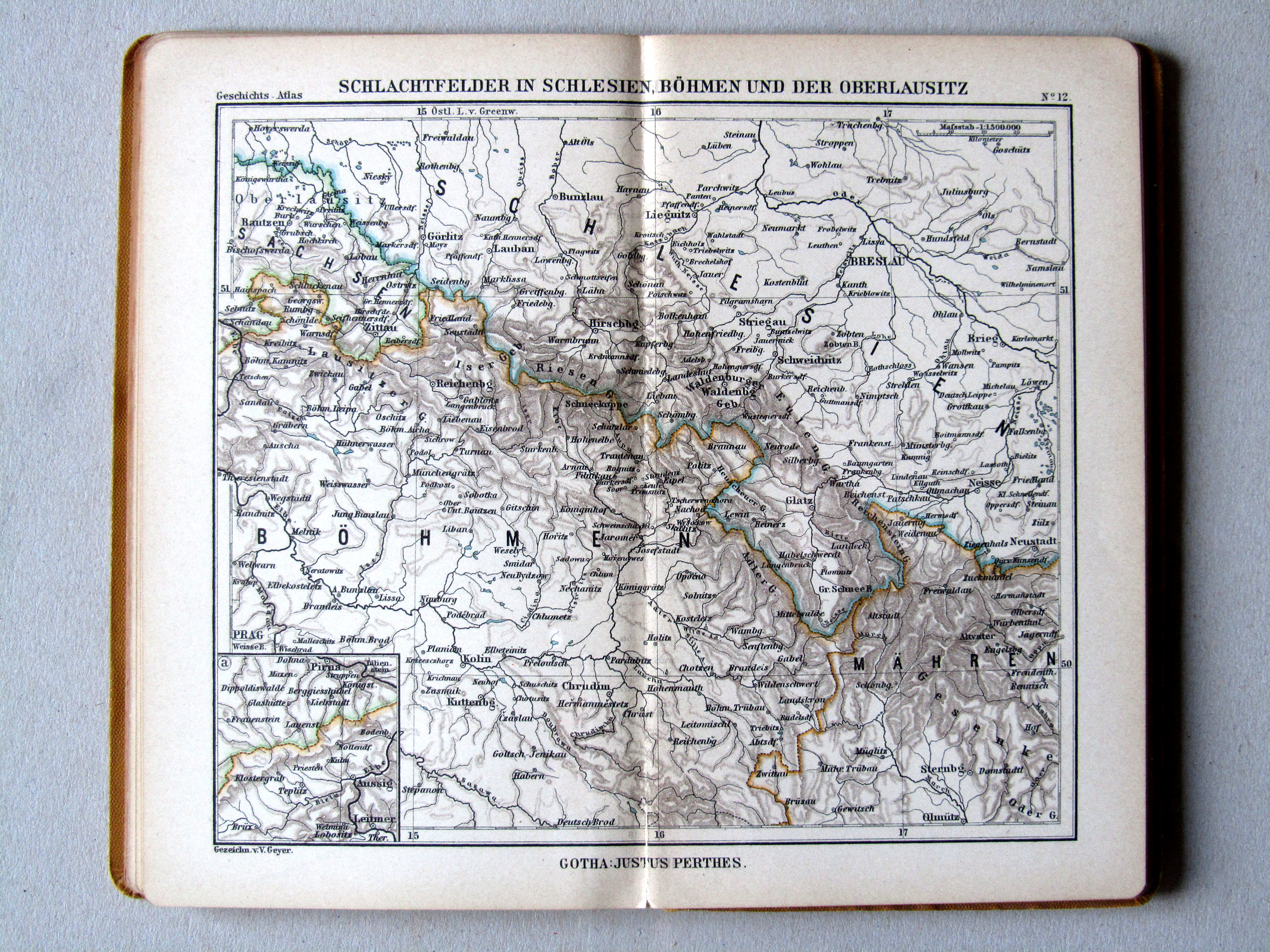
12. Die Schlachtfelder von Schlesien, Böhmen und der Oberlausitz XL
De veldslagen van Silezië, Bohemen en Opper-Lausitz / The battles of Silesia, Bohemia and Upper Lusatia
Justus Perthes Geschichtsatlas (1927/43?)
geen overeenkomstige kaart / no corresponding map
 Justus Perthes' Geschichts-Atlas (1898)
13. Die Schlachtfelder in den Niederlanden XL
De veldslagen in de Nederlanden / The battles in the Netherlands
Justus Perthes Geschichtsatlas (1927/43?)
geen overeenkomstige kaart / no corresponding map
 Justus Perthes' Geschichts-Atlas (1898)
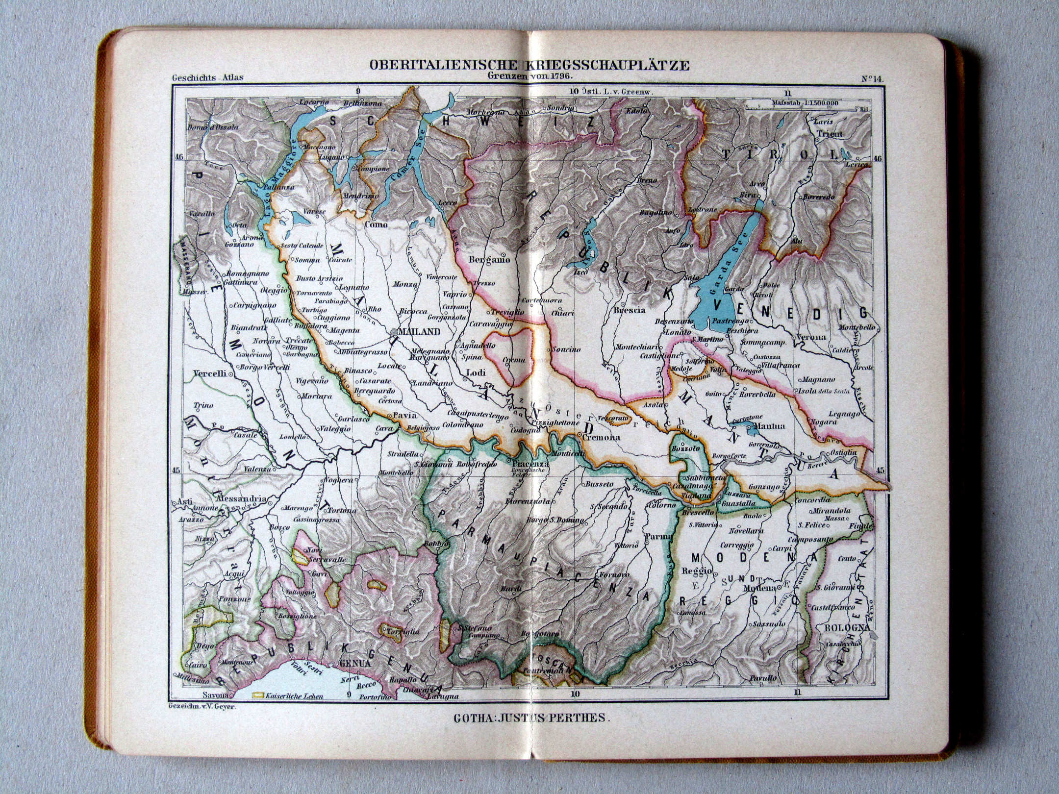
14. Oberitalienische Kriegsschauplätze. Grenzen von 1796 XL
De veldslagen in Noord-Italië. Grenzen van 1796 / The battles in Northern Italy. Boundaries of 1796
 Justus Perthes Geschichtsatlas (1927/43?)
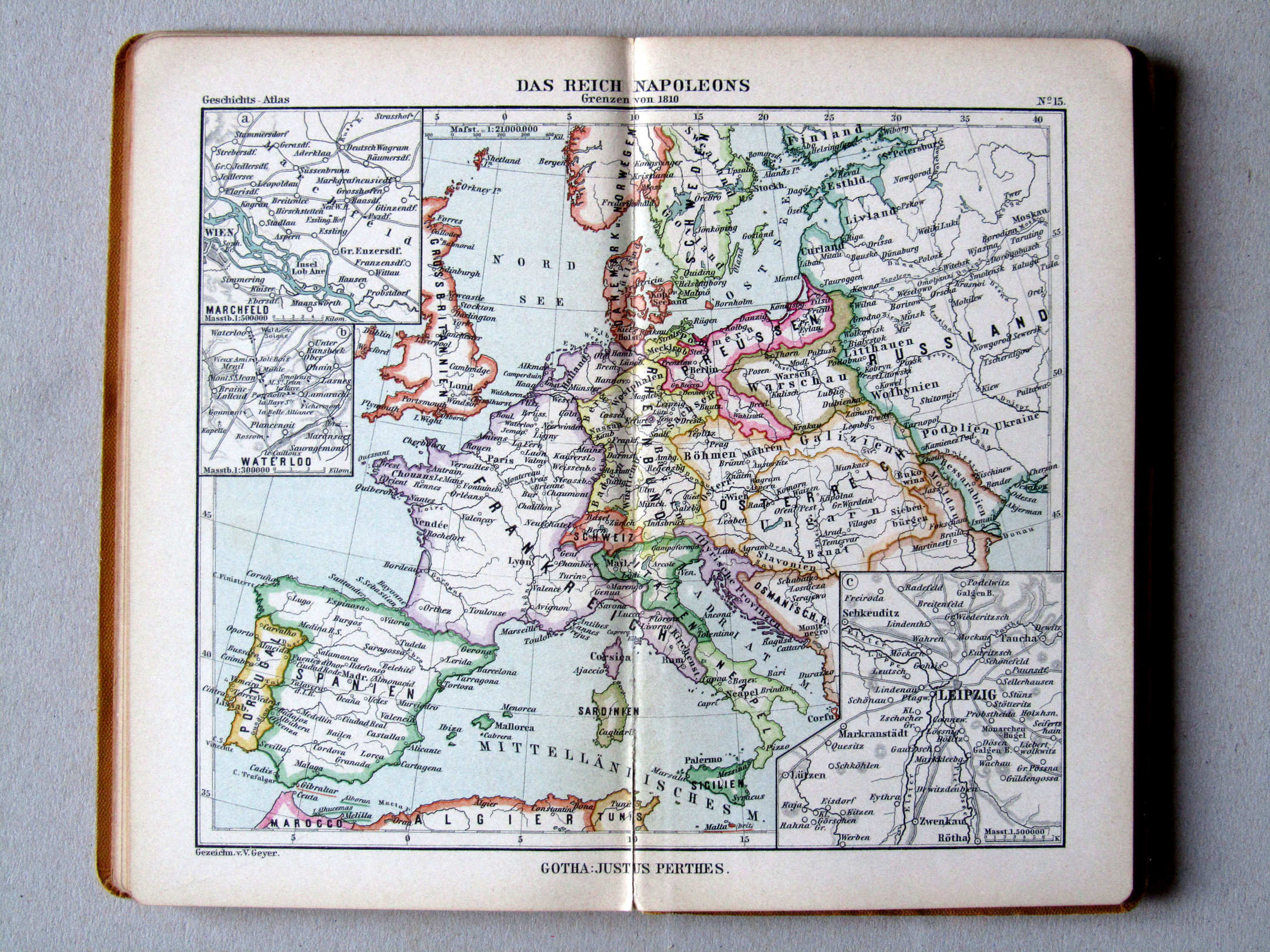
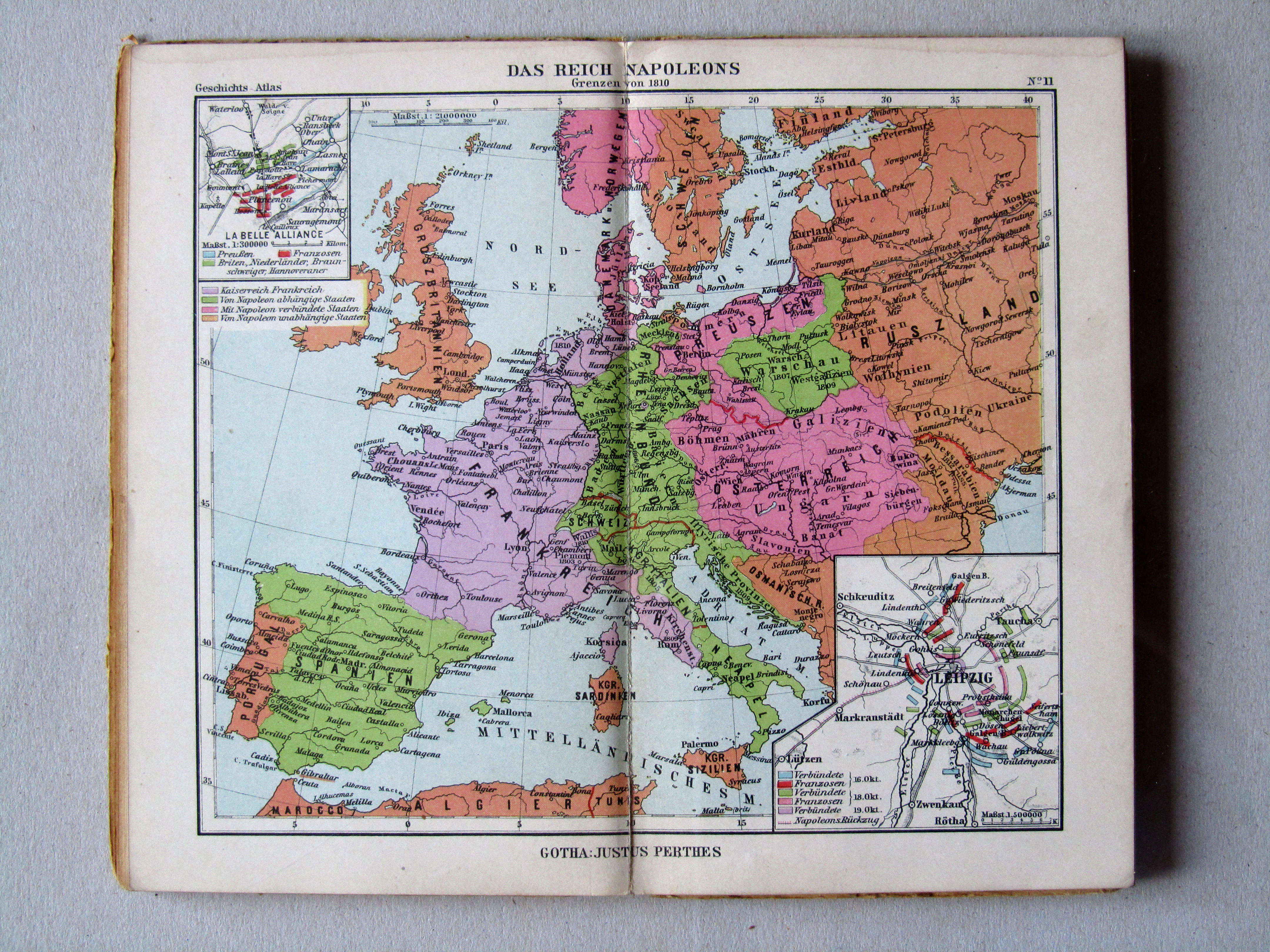
11. Das Reich Napoleons. Grenzen von 1810 XL
Het Rijk van Napoleon. Grenzen van 1810 / The Empire of Napoleon. Boundaries of 1810
 Justus Perthes' Geschichts-Atlas (1898)
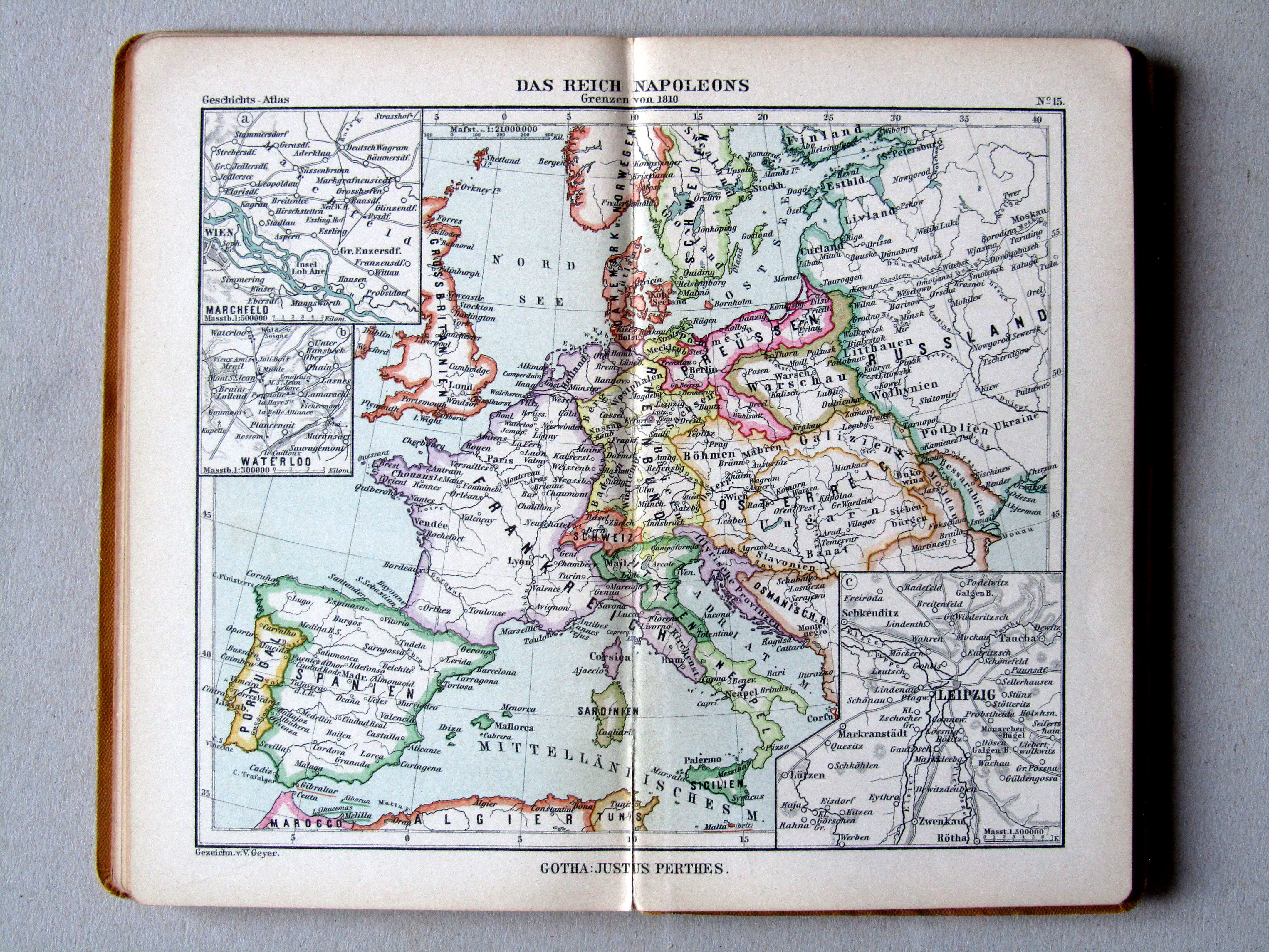
15. Das Weltreich Napoleons. Grenzen von 1810 XL
Het Rijk van Napoleon. Grenzen van 1810 / The Empire of Napoleon. Boundaries of 1810
 Justus Perthes Geschichtsatlas (1927/43?)
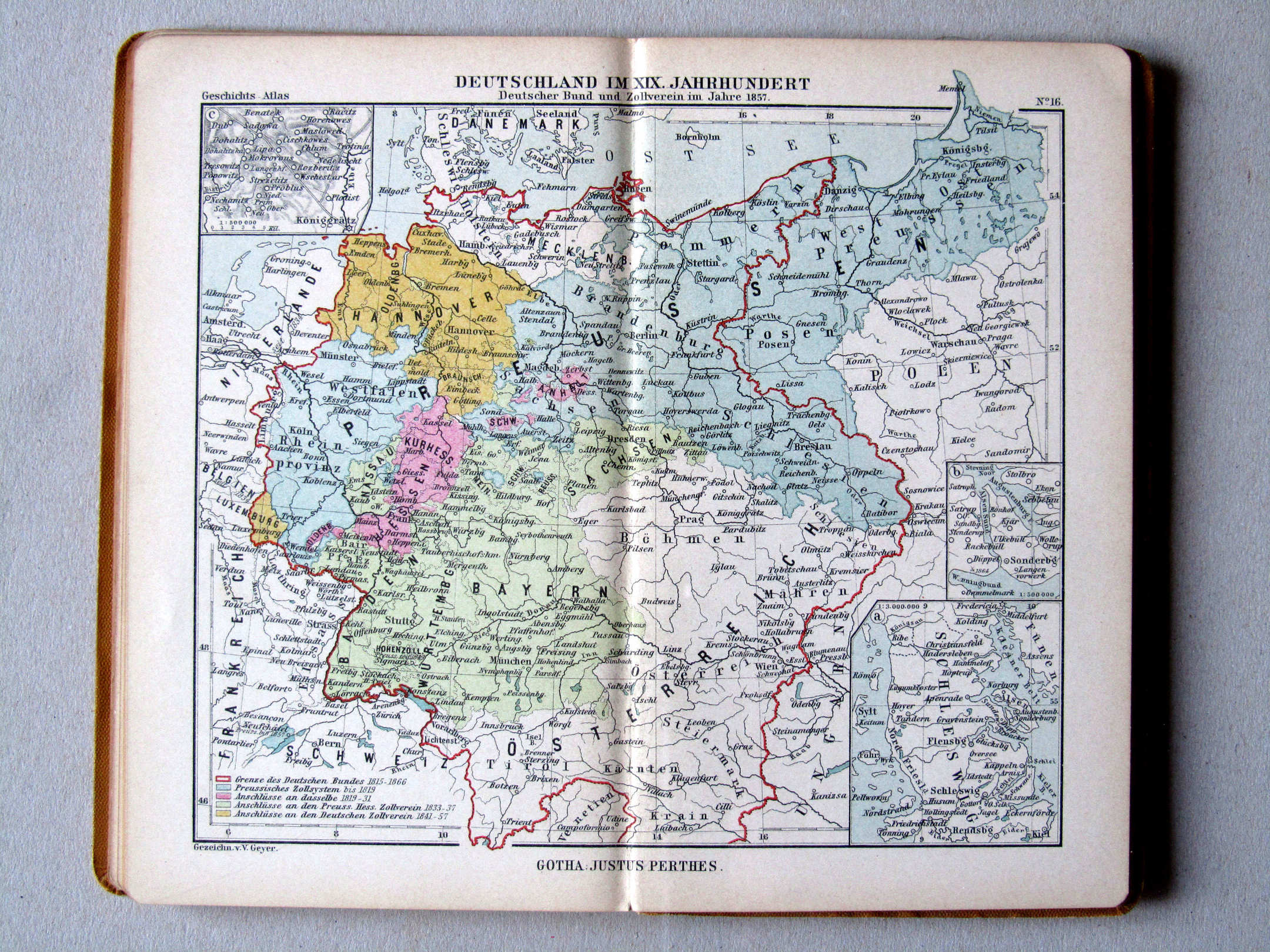
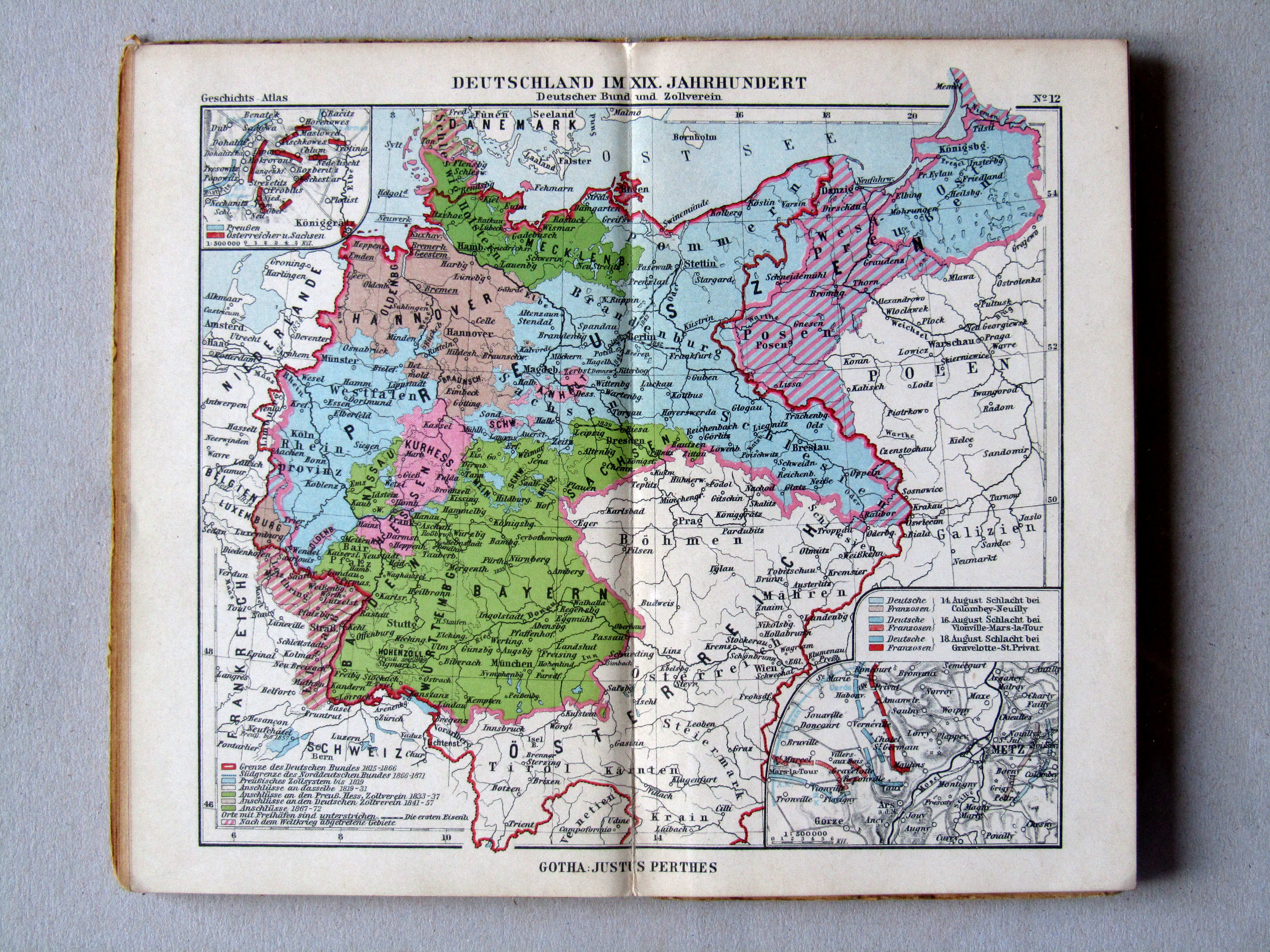
12. Deutschland im XIX. Jahrhundert. Deutscher Bund und Zollverein XL
Duitsland in de 19e eeuw. Duitse Bond en Douane-unie / Germany in the 19th century. German confederation and customs union
 Justus Perthes' Geschichts-Atlas (1898)
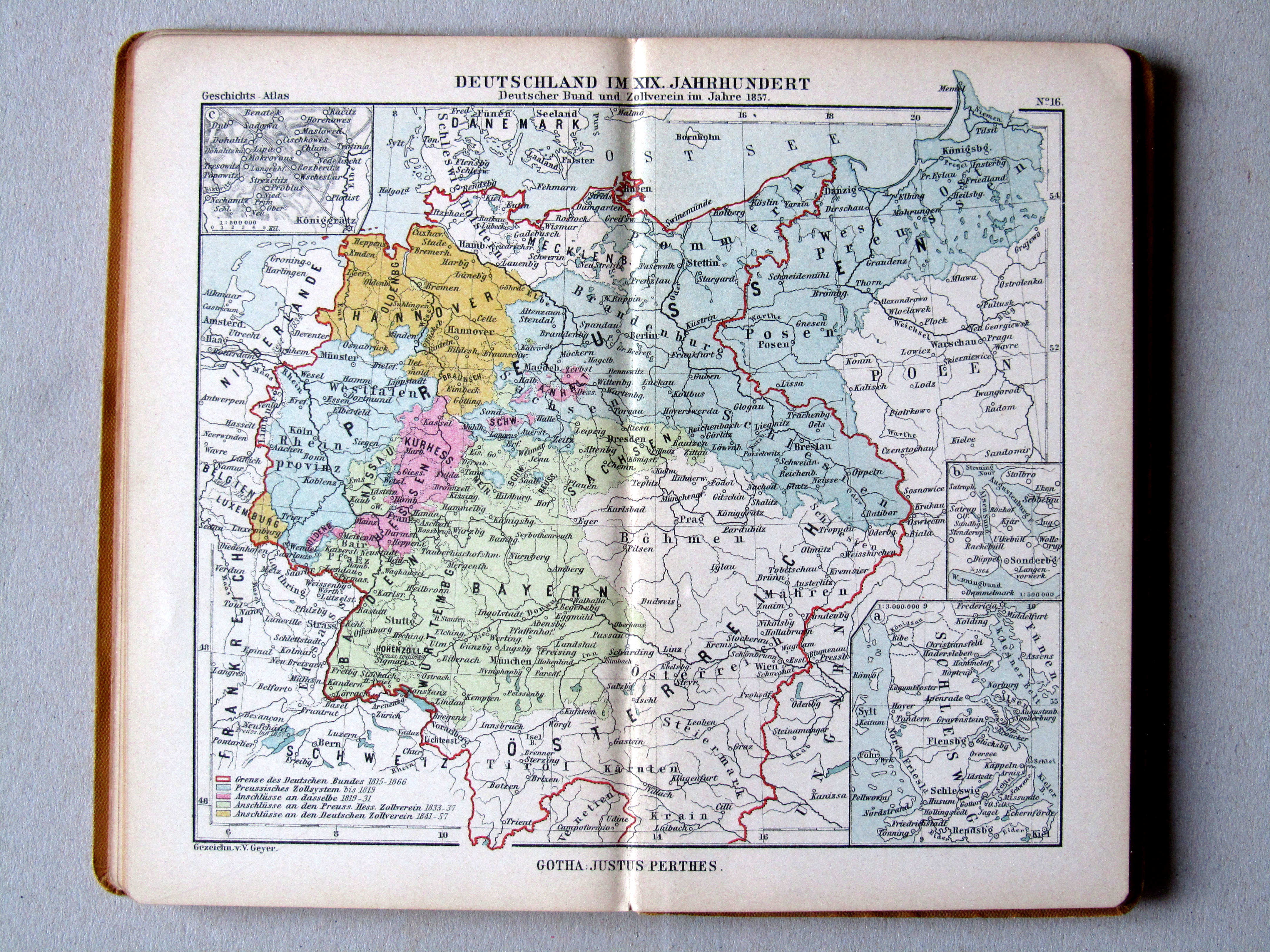
16. Deutschland im XIX. Jahrhundert XL
Duitsland in de 19e eeuw / Germany in the 19th century
 Justus Perthes Geschichtsatlas (1927/43?)
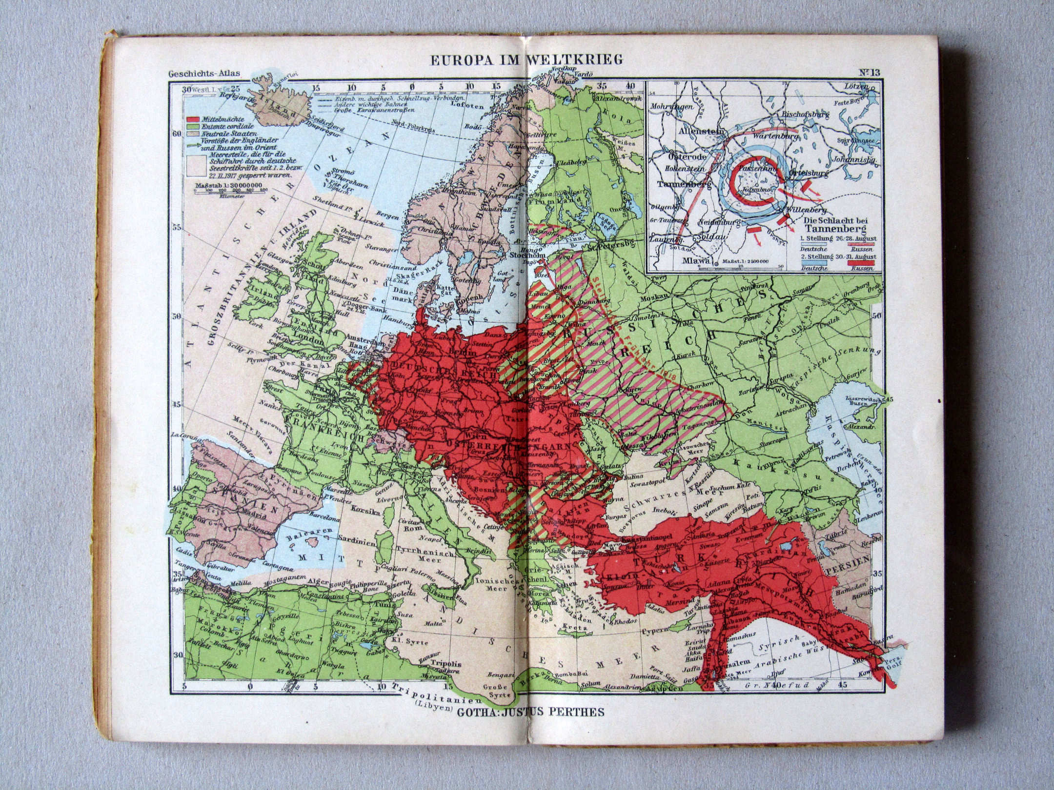
13. Europa im Weltkrieg XL
Europa in de Wereldoorlog / Europe in the World War
 Justus Perthes' Geschichts-Atlas (1898)
geen overeenkomstige kaart / no corresponding map
 Justus Perthes Geschichtsatlas (1927/43?)
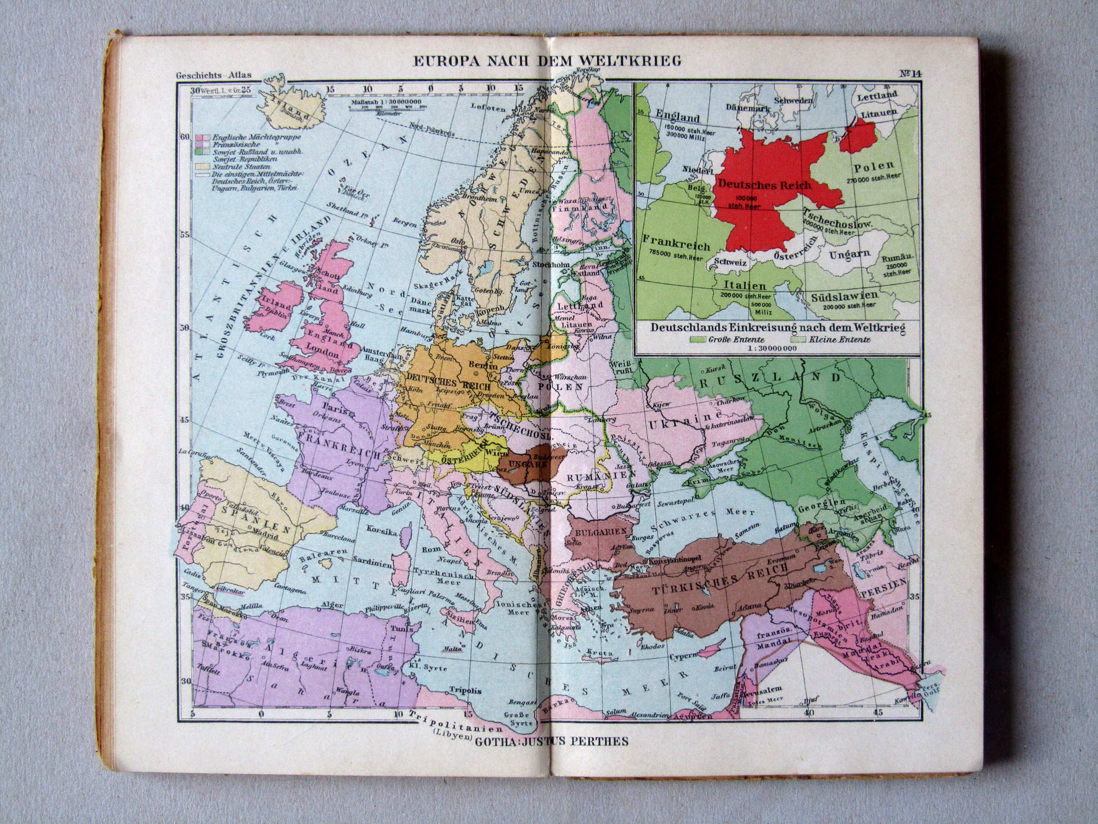
14. Europa nach dem Weltkrieg XL
Europa na de Wereldoorlog / Europe after the World War
Justus Perthes' Geschichts-Atlas (1898)
geen overeenkomstige kaart / no corresponding map
 Justus Perthes Geschichtsatlas (1927/43?)
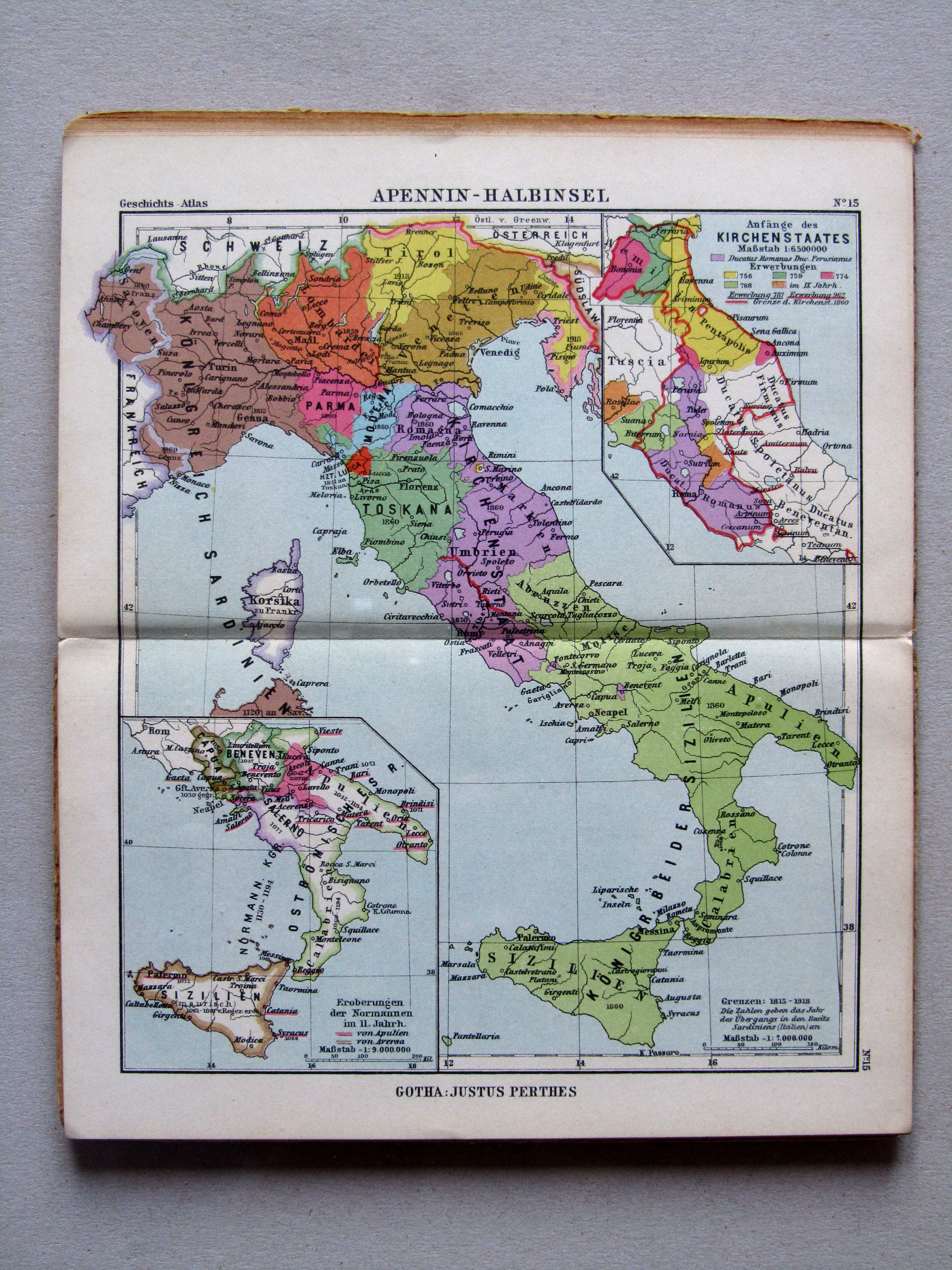
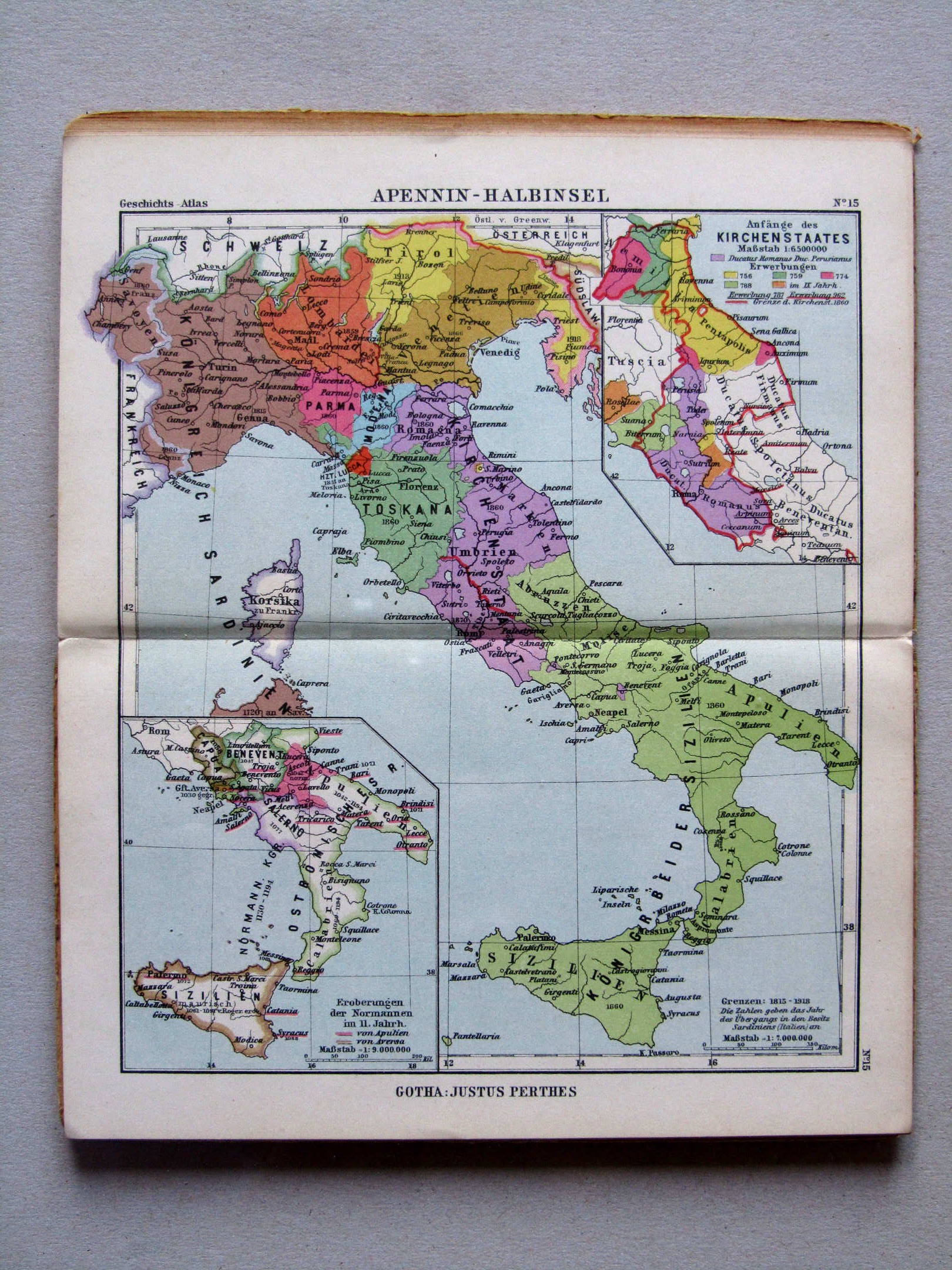
15. Apennin-Halbinsel XL
Apennijns Schiereiland / Apennine Peninsula
 Justus Perthes' Geschichts-Atlas (1898)
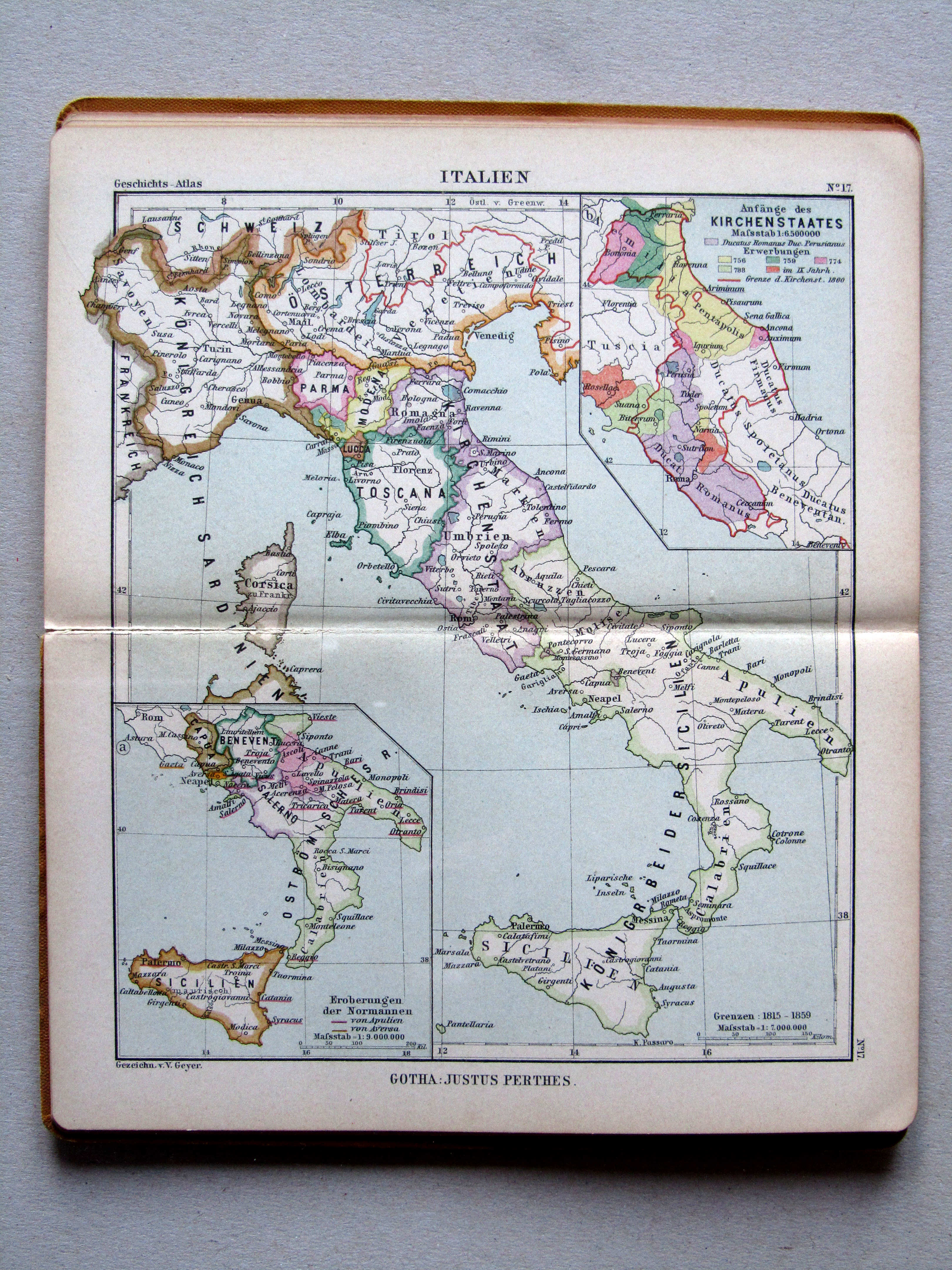
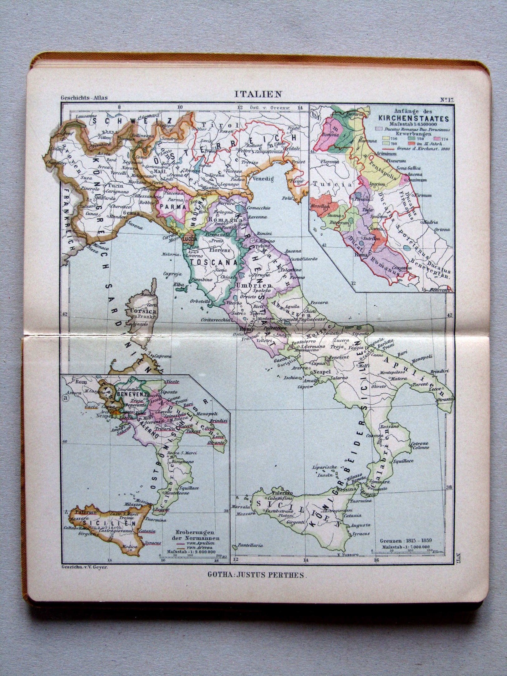
17. Italien. Grenzen 1815-1859 XL
Italië. Grenzen 1815-1859 / Italy. Boundaries 1815-1859
 Justus Perthes Geschichtsatlas (1927/43?)
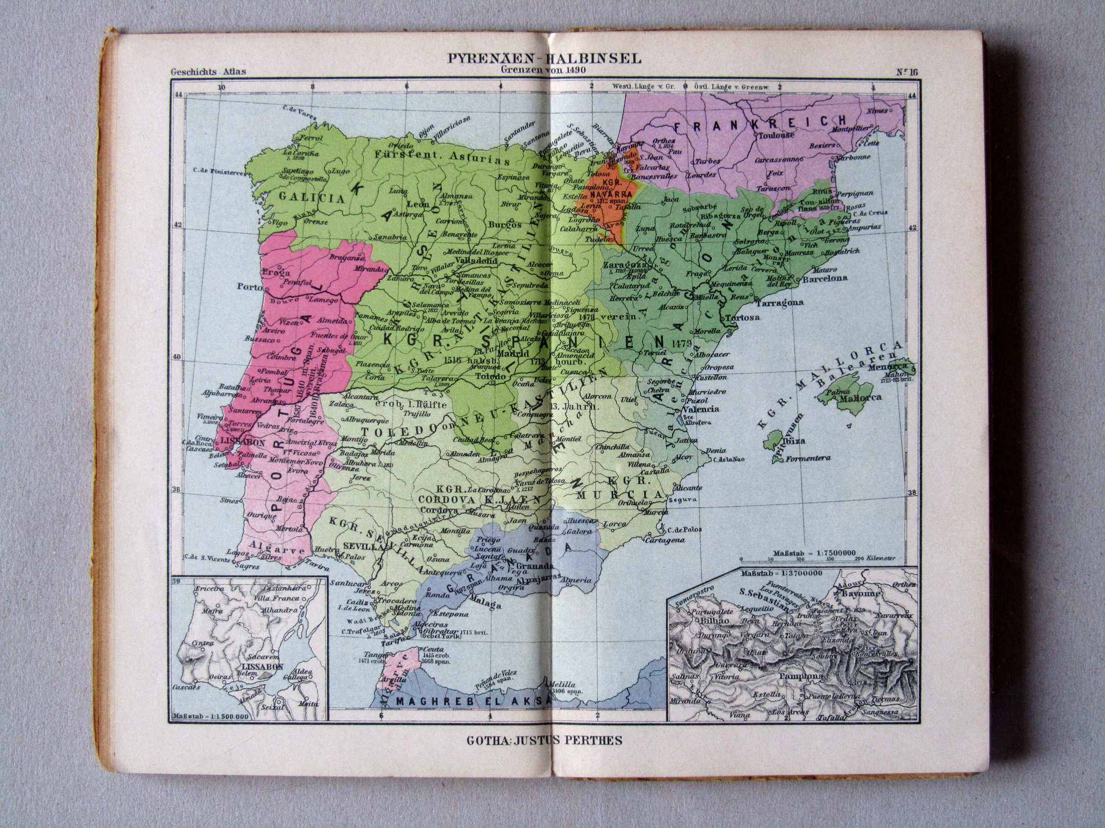
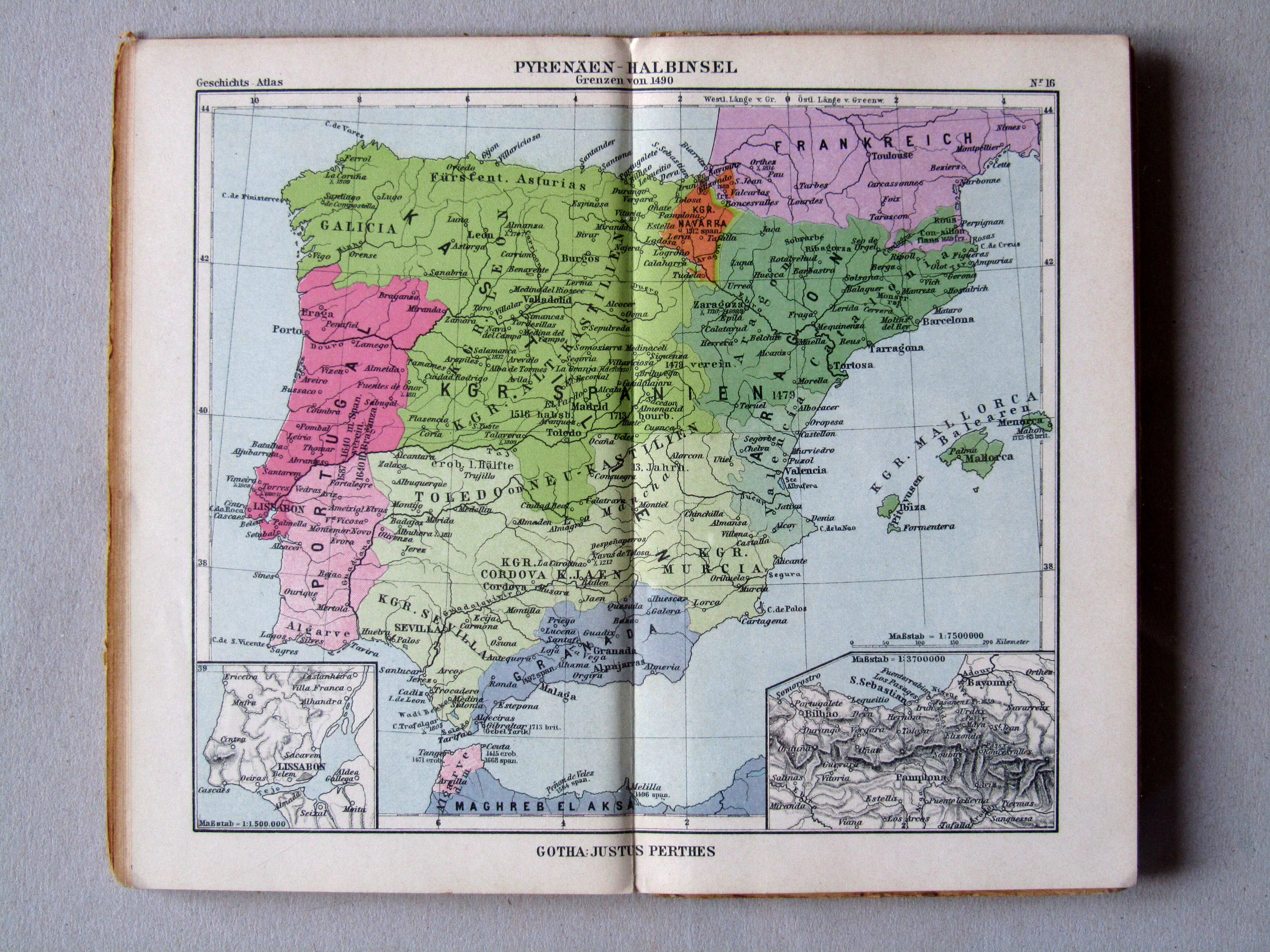
16. Pyrenäen-Halbinsel. Grenzen von 1490 XL
Iberisch Schiereiland. Grenzen van 1490 / Iberian Peninsula. Boundaries of 1490
 Justus Perthes' Geschichts-Atlas (1898)
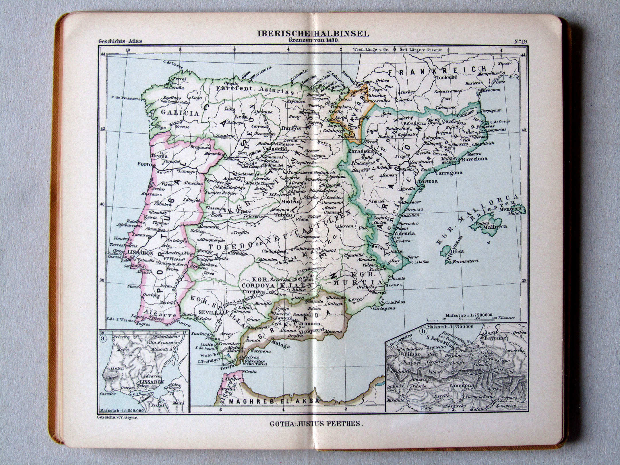
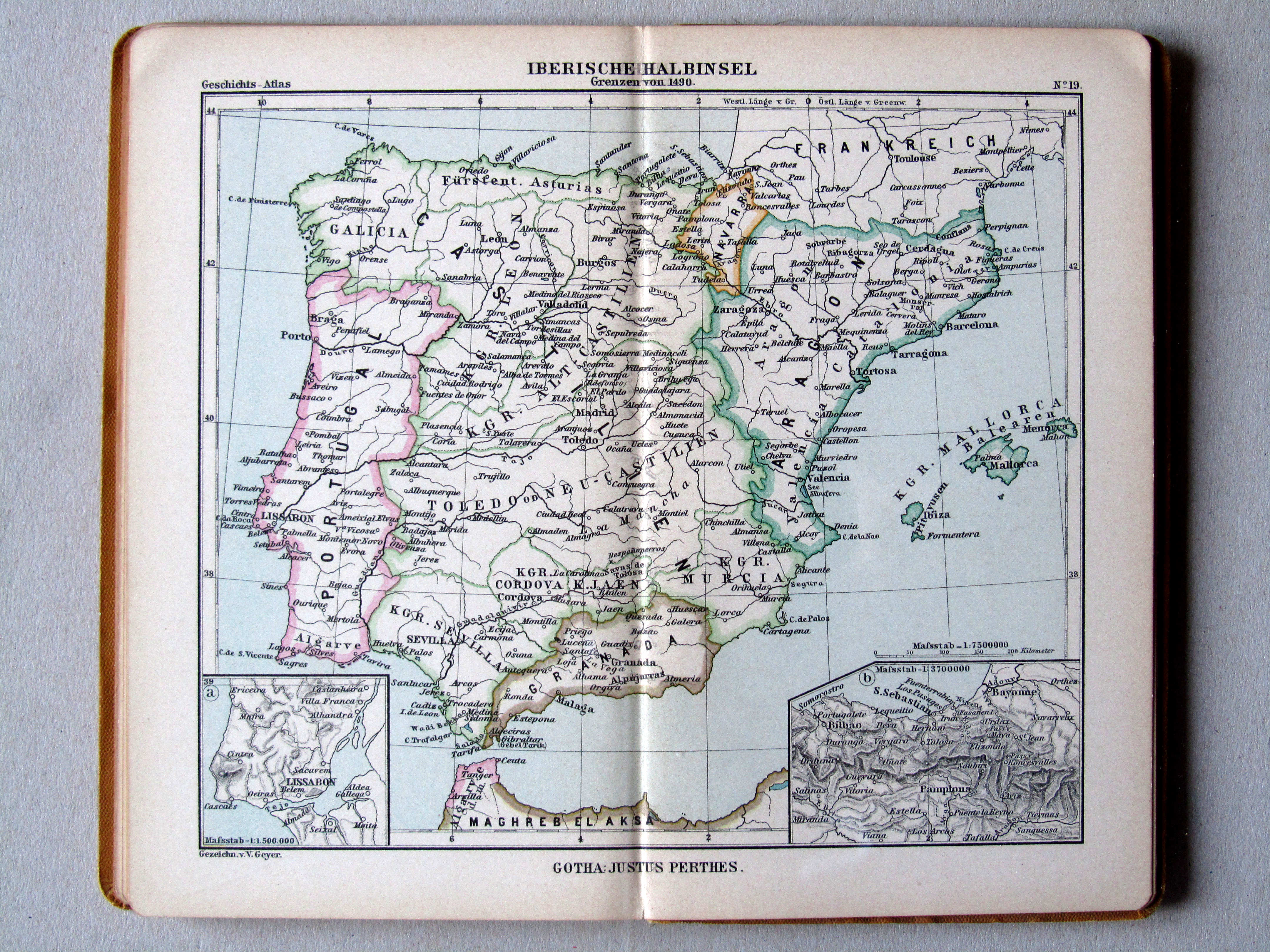
19. Die Iberische Halbinsel. Grenzen von 1490 XL
Iberisch Schiereiland. Grenzen van 1490 / Iberian Peninsula. Boundaries of 1490
 Justus Perthes Geschichtsatlas (1927/43?)
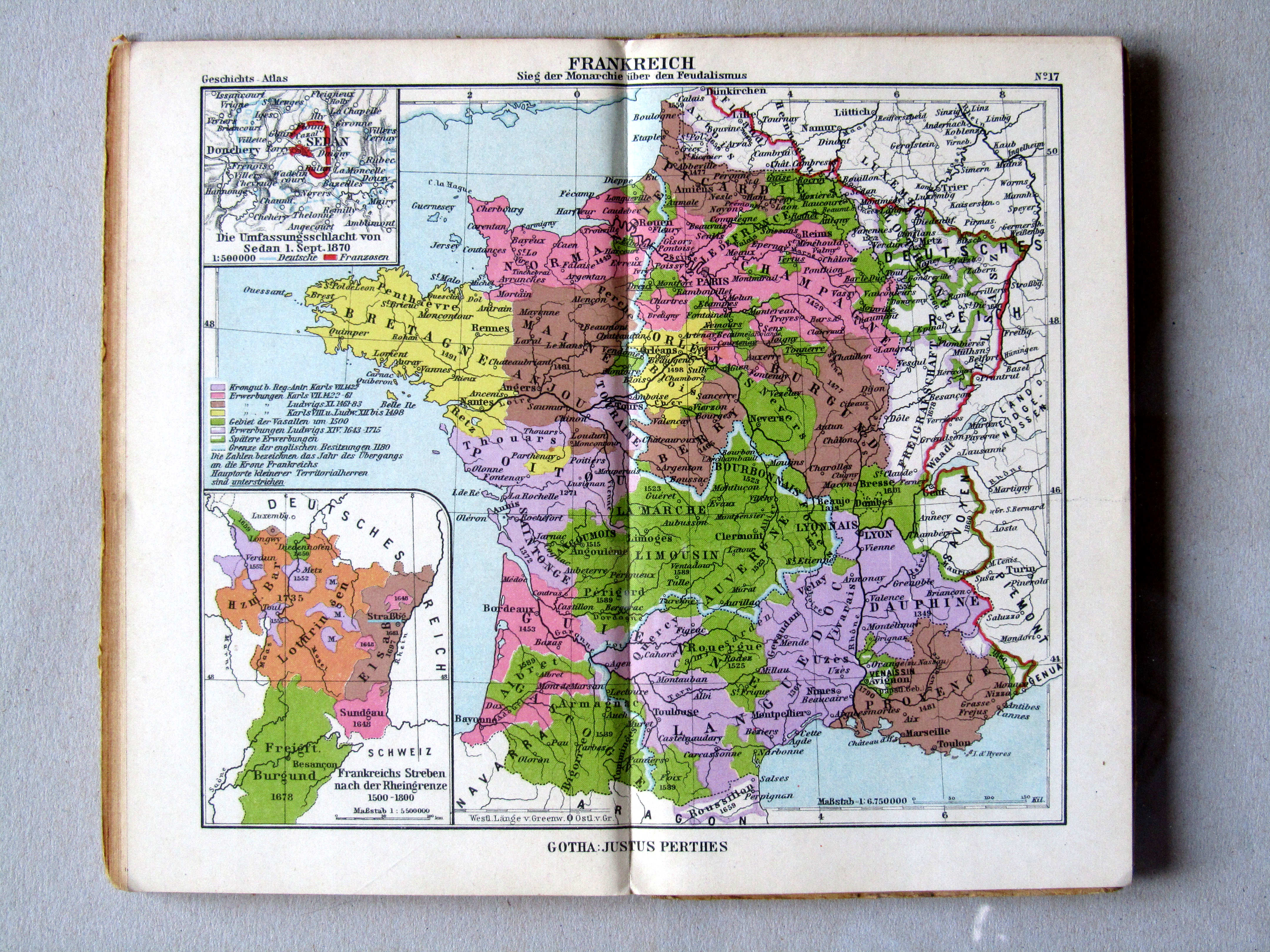
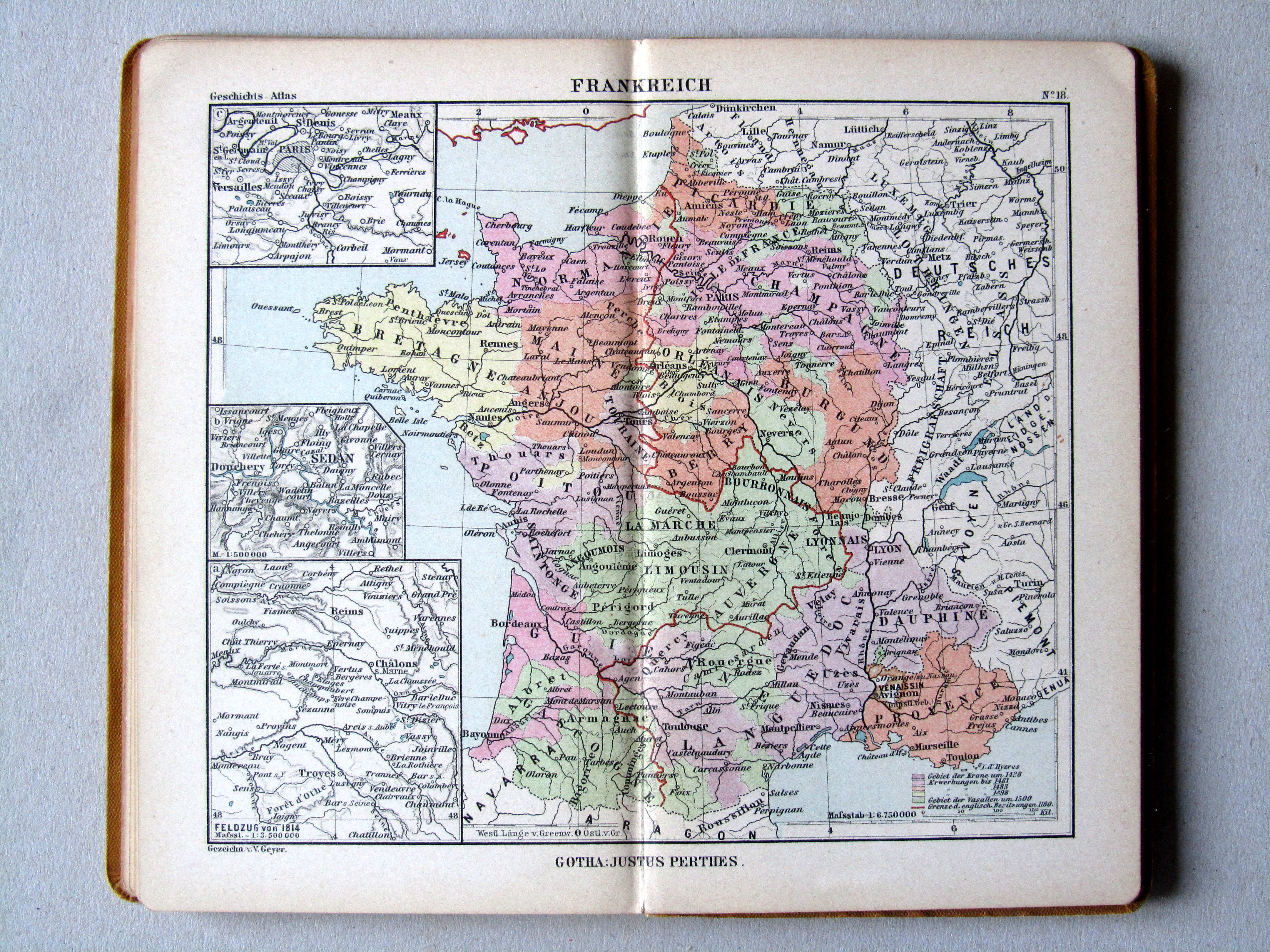
17. Frankreich. Sieg der Monarchie über den Feudalismus XL
Frankrijk. Overwinning van de monarchie op het feodalisme / France. Victory of the monarchy over feudalism

 Justus Perthes Geschichtsatlas (1927/43?)
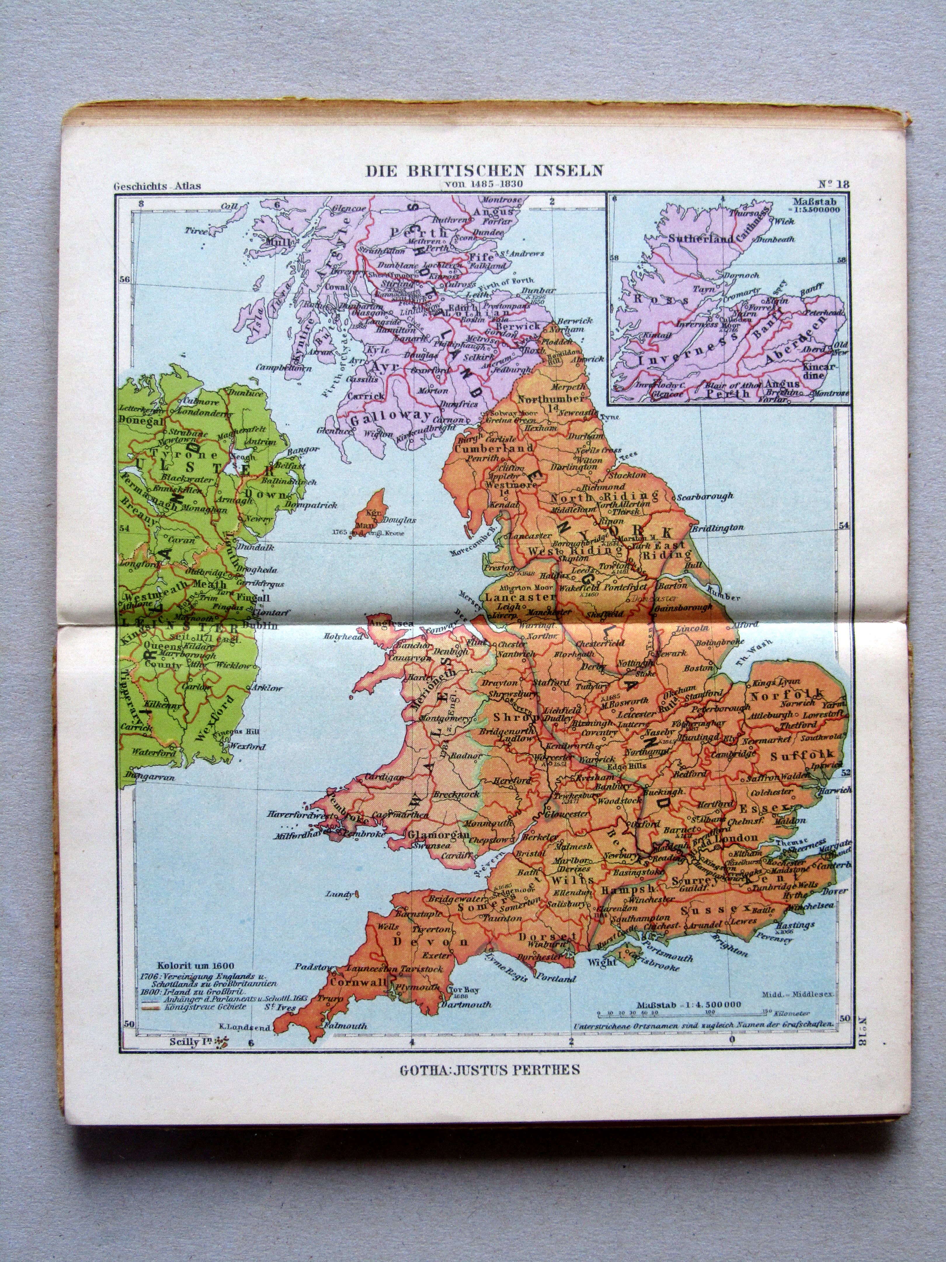
18. Die Britischen Inseln von 1485-1830 XL
Britse Eilanden 1485-1830 / British Isles 1485-1830
 Justus Perthes' Geschichts-Atlas (1898)
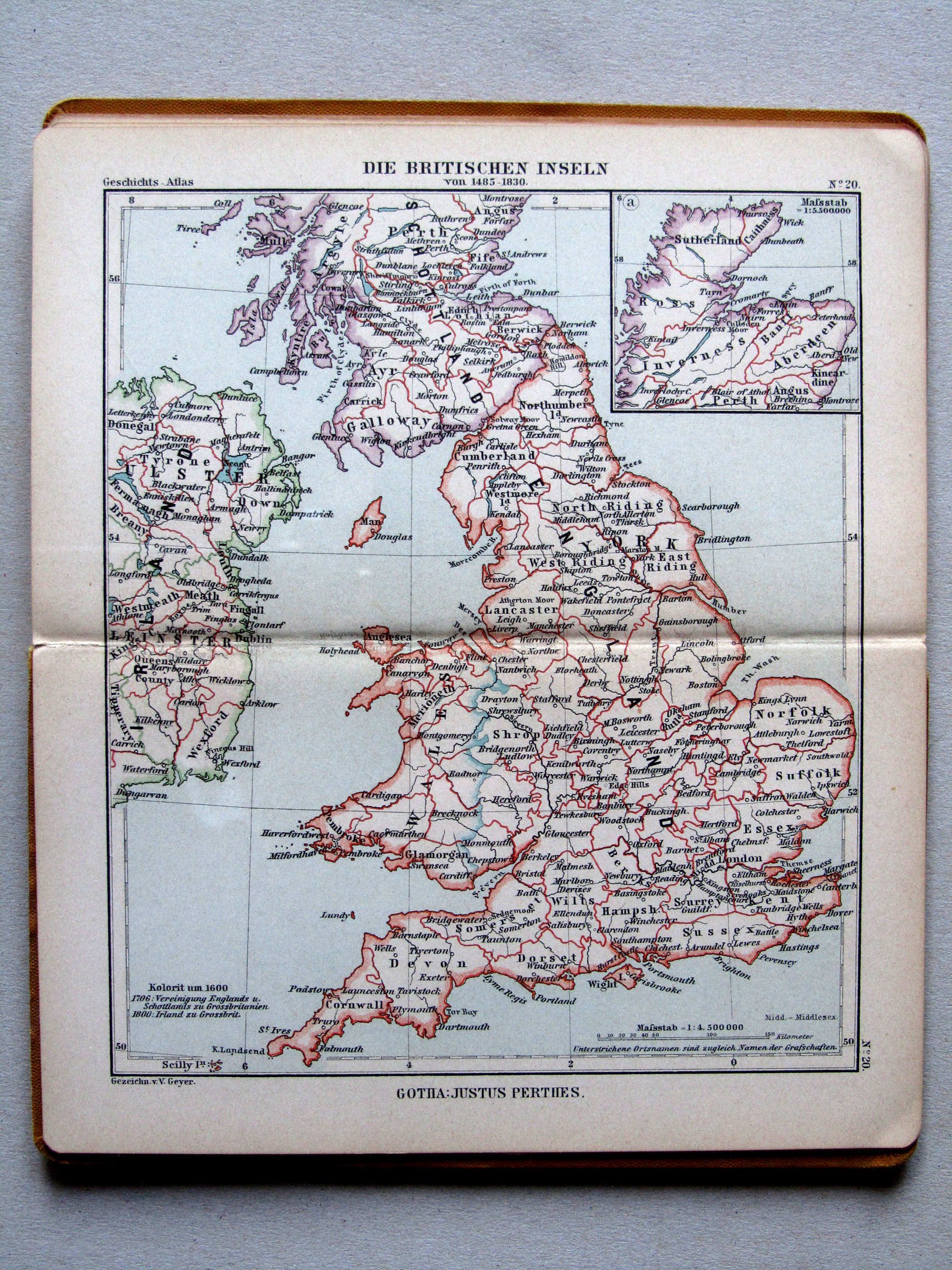
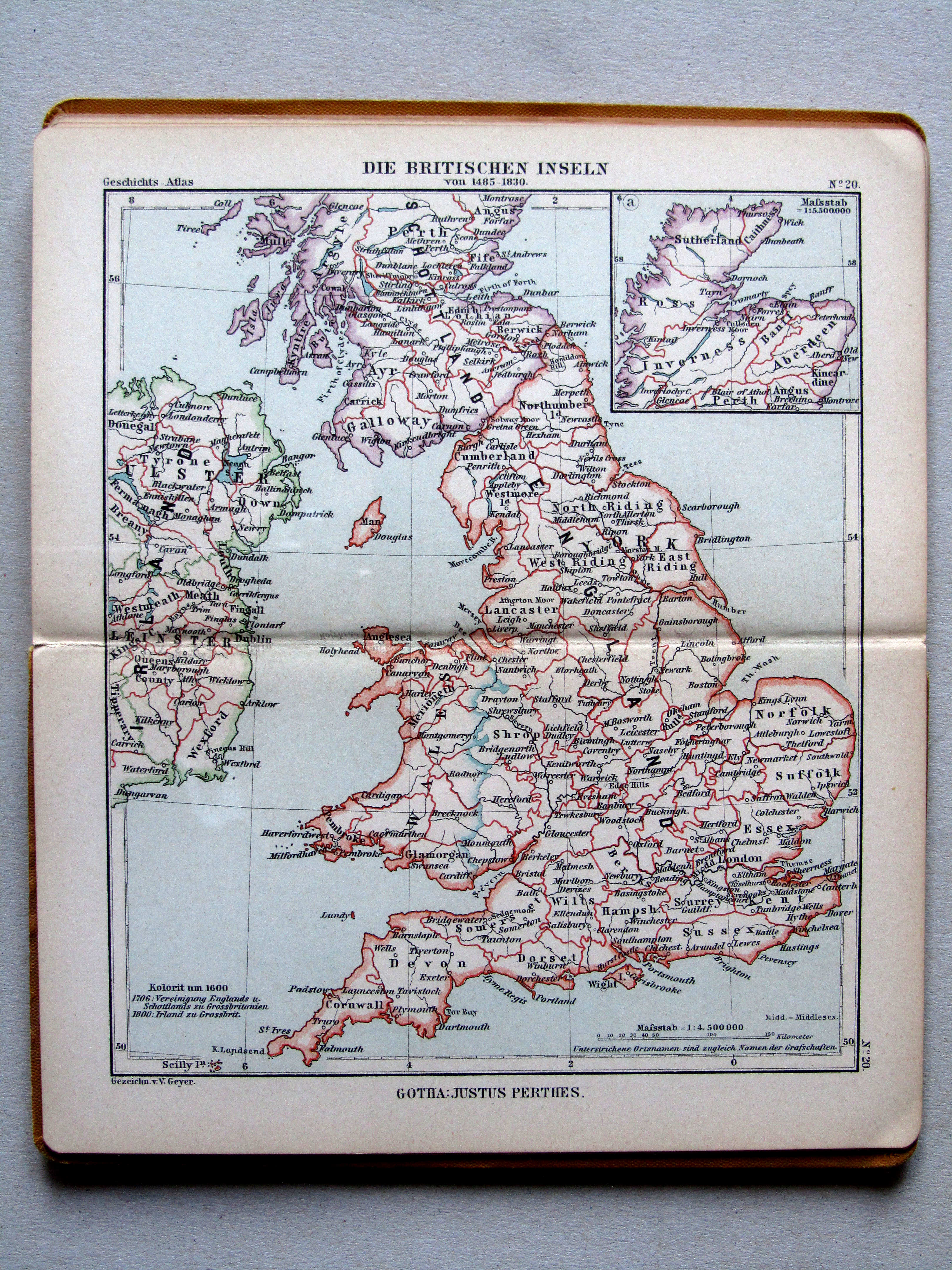
20. Die Britischen Inseln von 1485-1830 XL
Britse Eilanden 1485-1830 / British Isles 1485-1830
 Justus Perthes Geschichtsatlas (1927/43?)
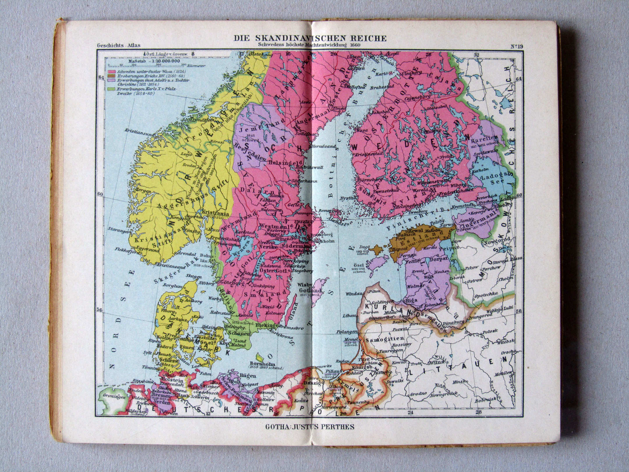
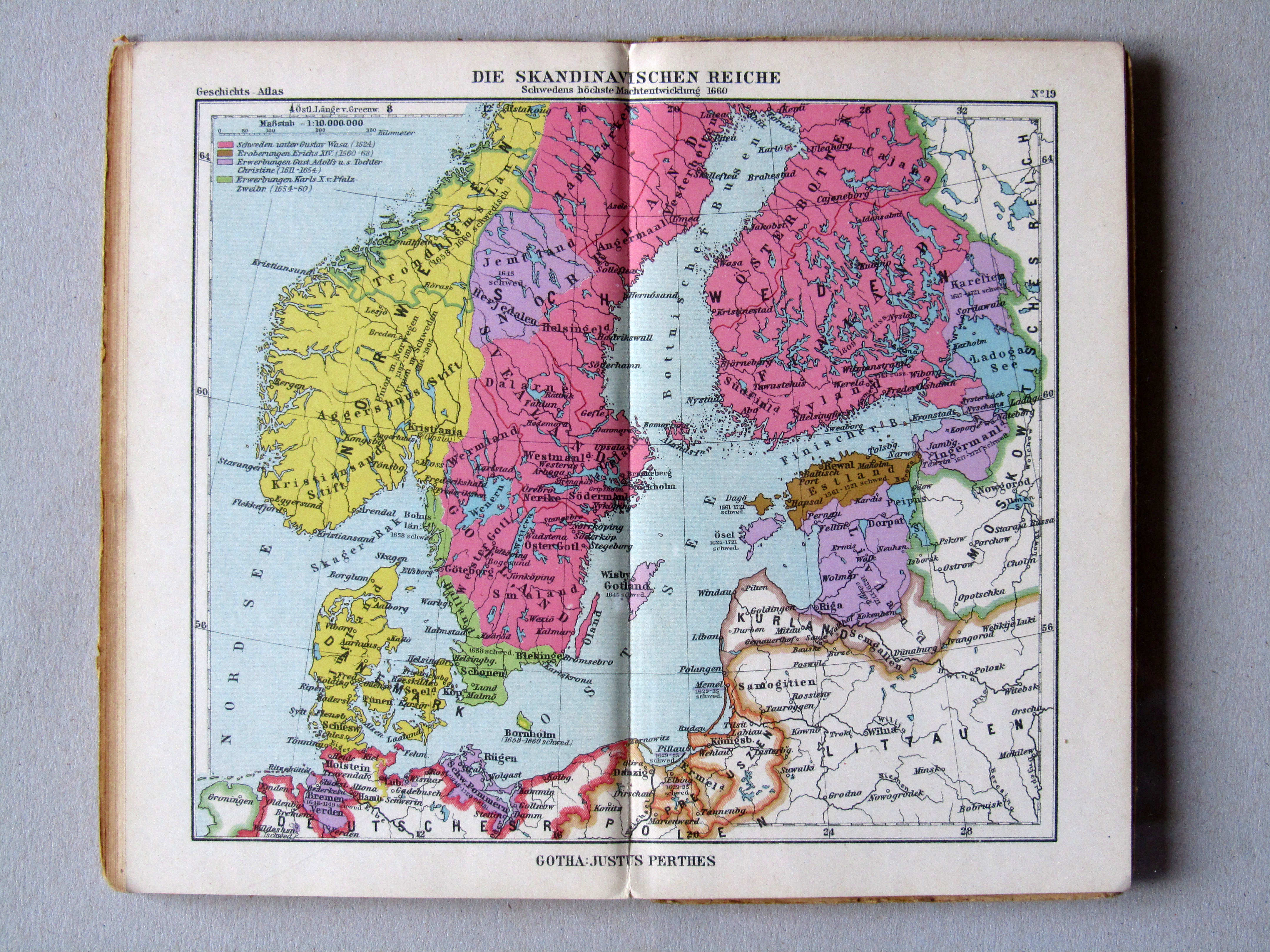
19. Die Skandinavischen Reiche. Schwedens höchste Machtsentwicklung 1660 XL
De Scandinavische landen. Zwedens grootste machtsuitbreiding 1660 / The Scandinavian countries. Sweden’s largest power expansion 1660
 Justus Perthes' Geschichts-Atlas (1898)
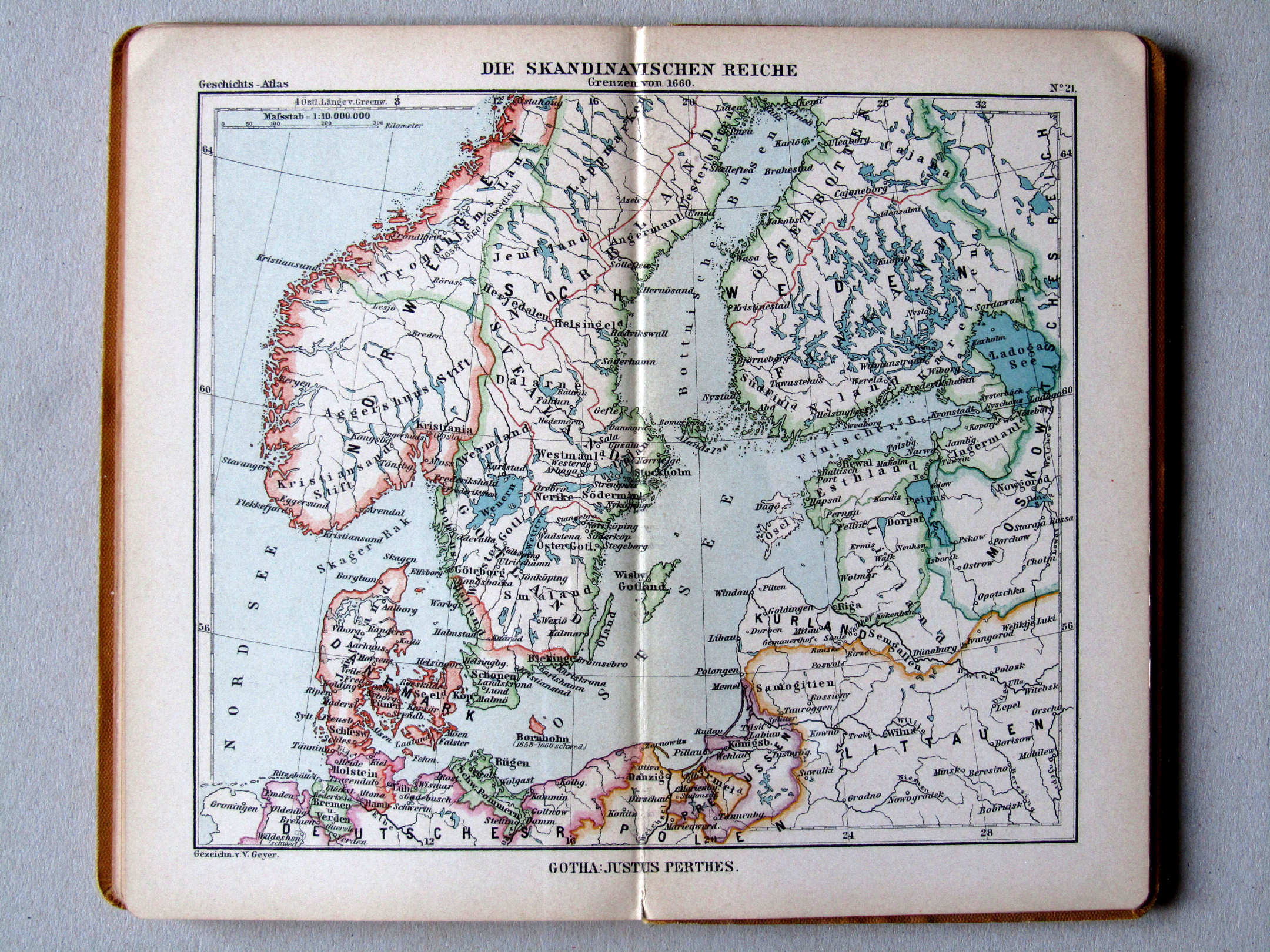
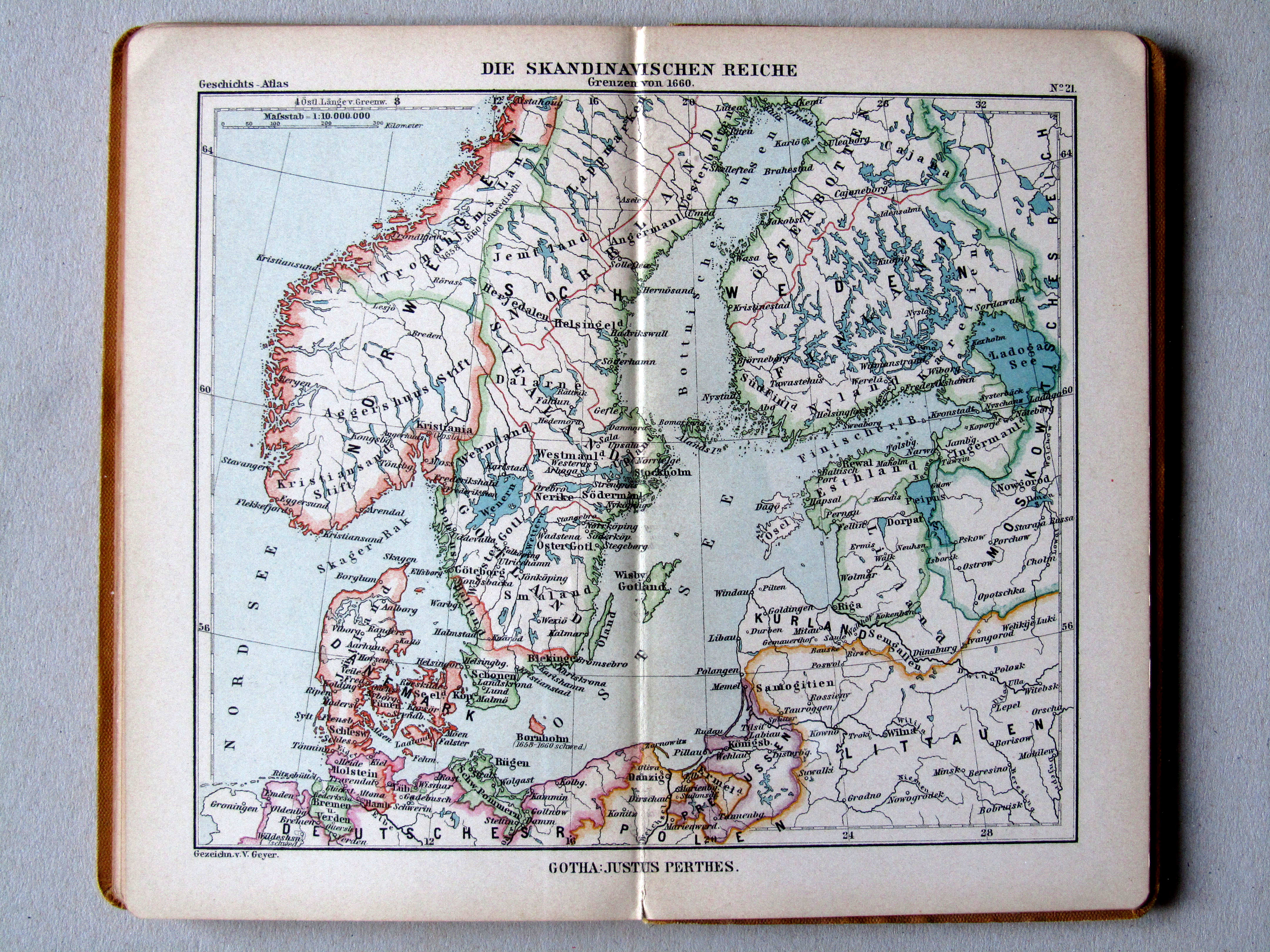
21. Die Skandinavischen Reiche. Grenzen von 1660 XL
De Scandinavische landen. Grenzen van 1660 / The Scandinavian countries. Boundaries of 1660
 Justus Perthes Geschichtsatlas (1927/43?)
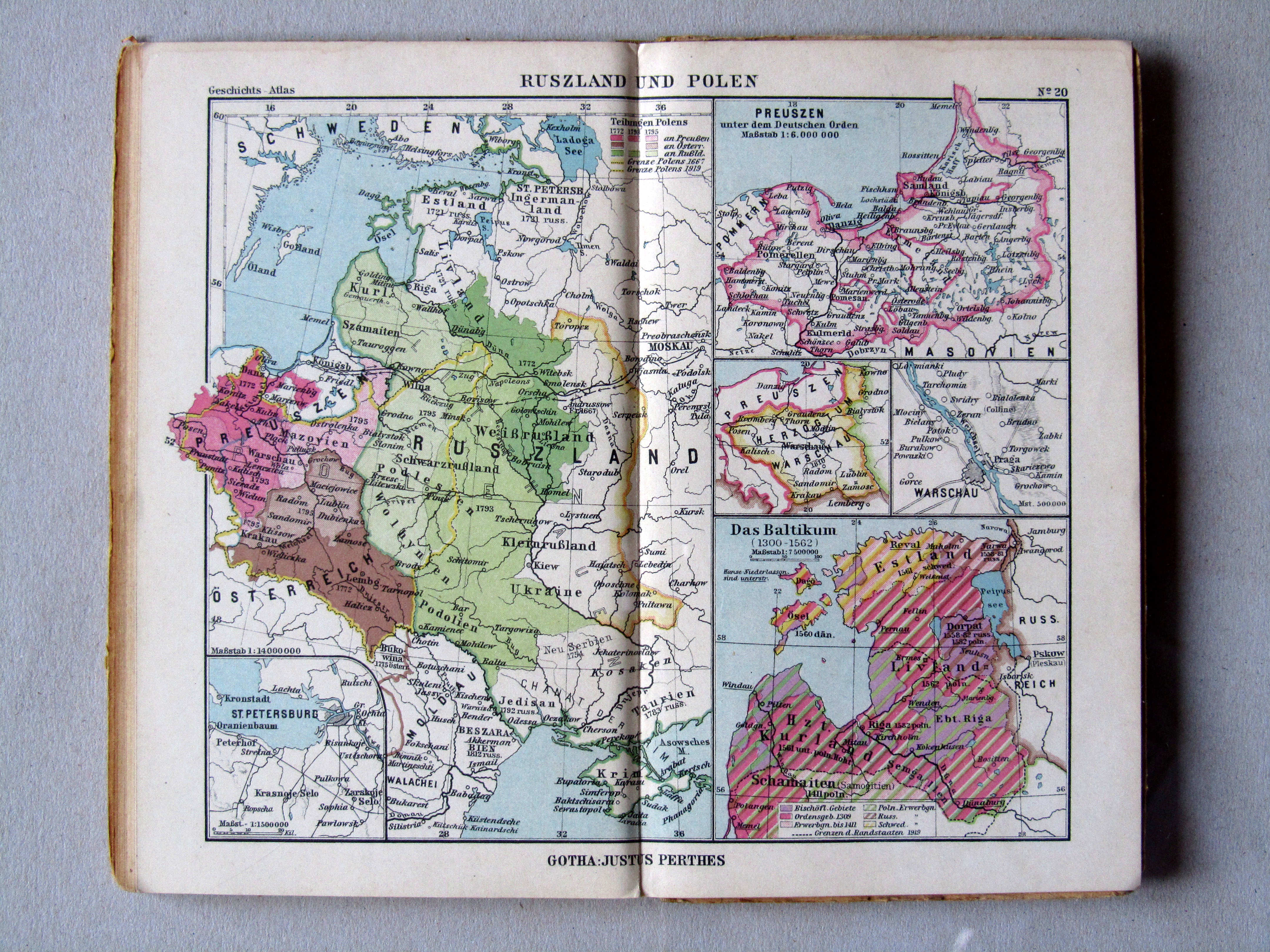
20. Russland und Polen XL
Rusland en Polen / Russia and Poland
 Justus Perthes' Geschichts-Atlas (1898)
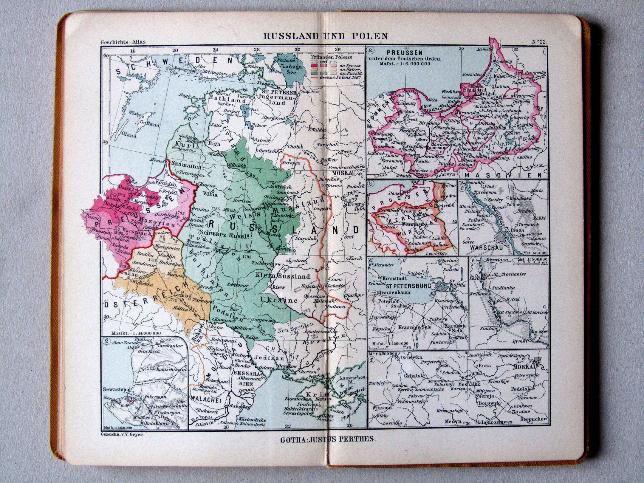
22. Russland und Polen XL
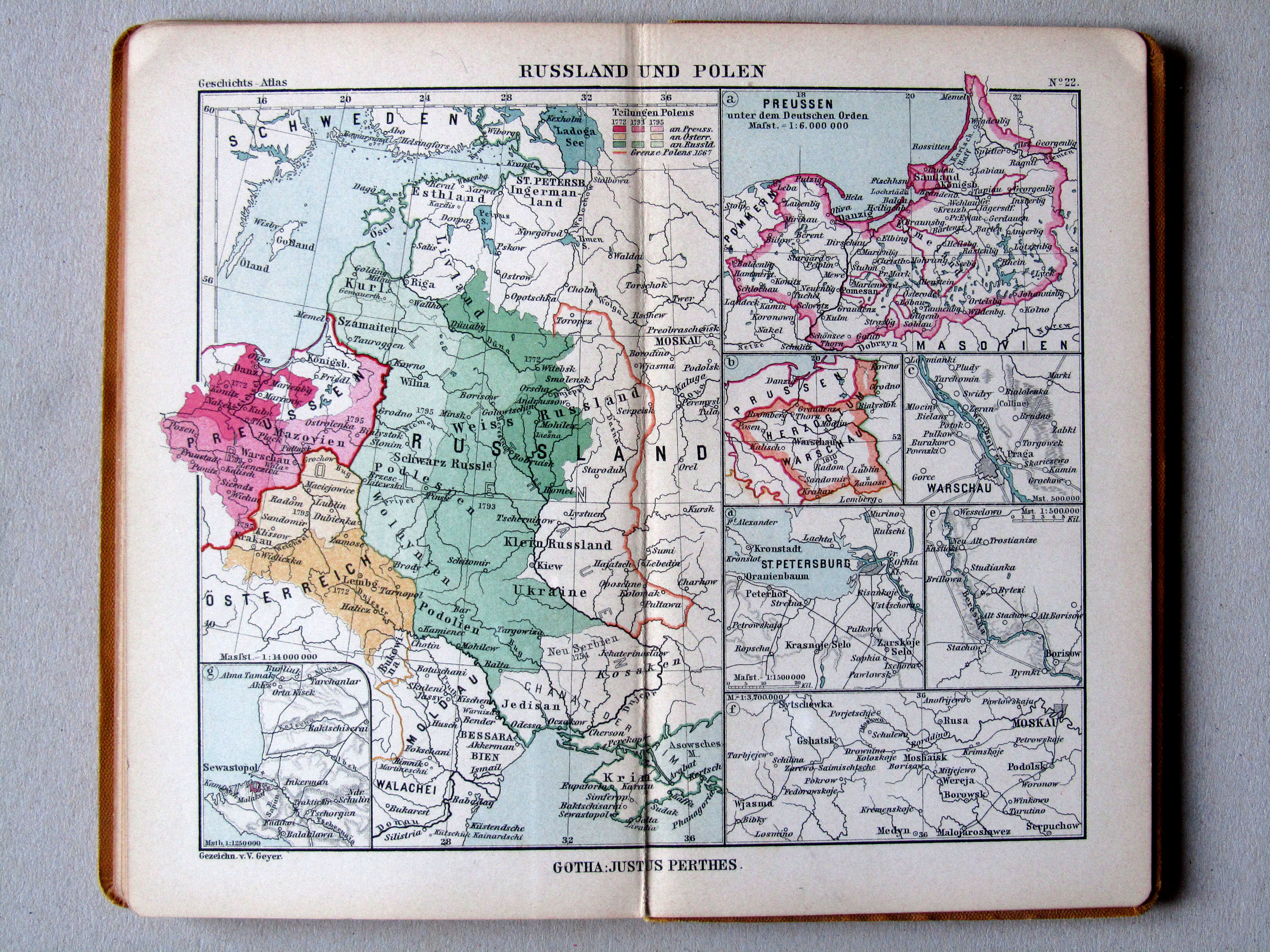
Rusland en Polen / Russia and Poland
 Justus Perthes Geschichtsatlas (1927/43?)
21. Die Balkanländer 1878-1925 XL
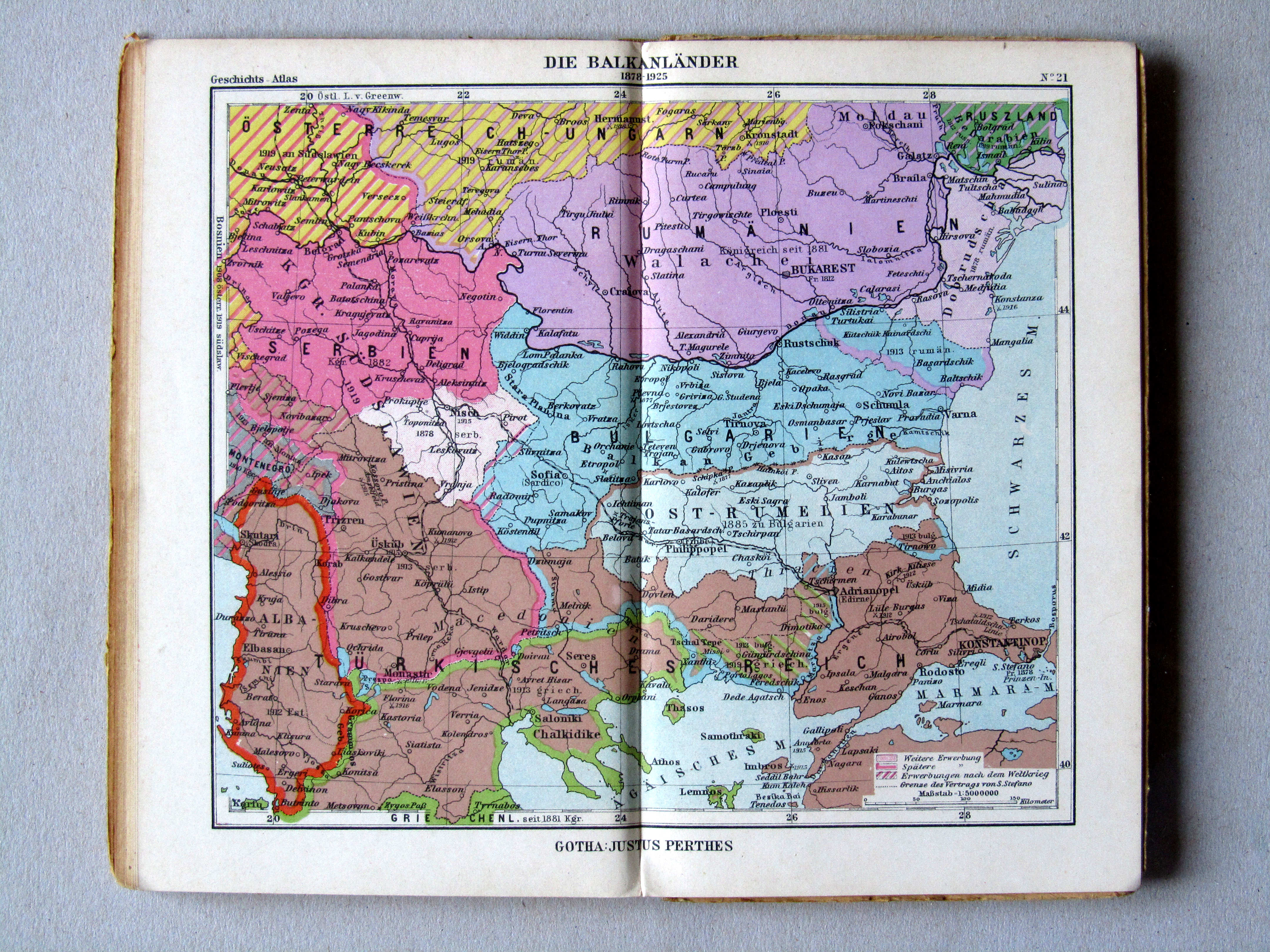
Balkanlanden. Grenzen van 1878 / Balkan countries. Boundaries of 1878
 Justus Perthes' Geschichts-Atlas (1898)
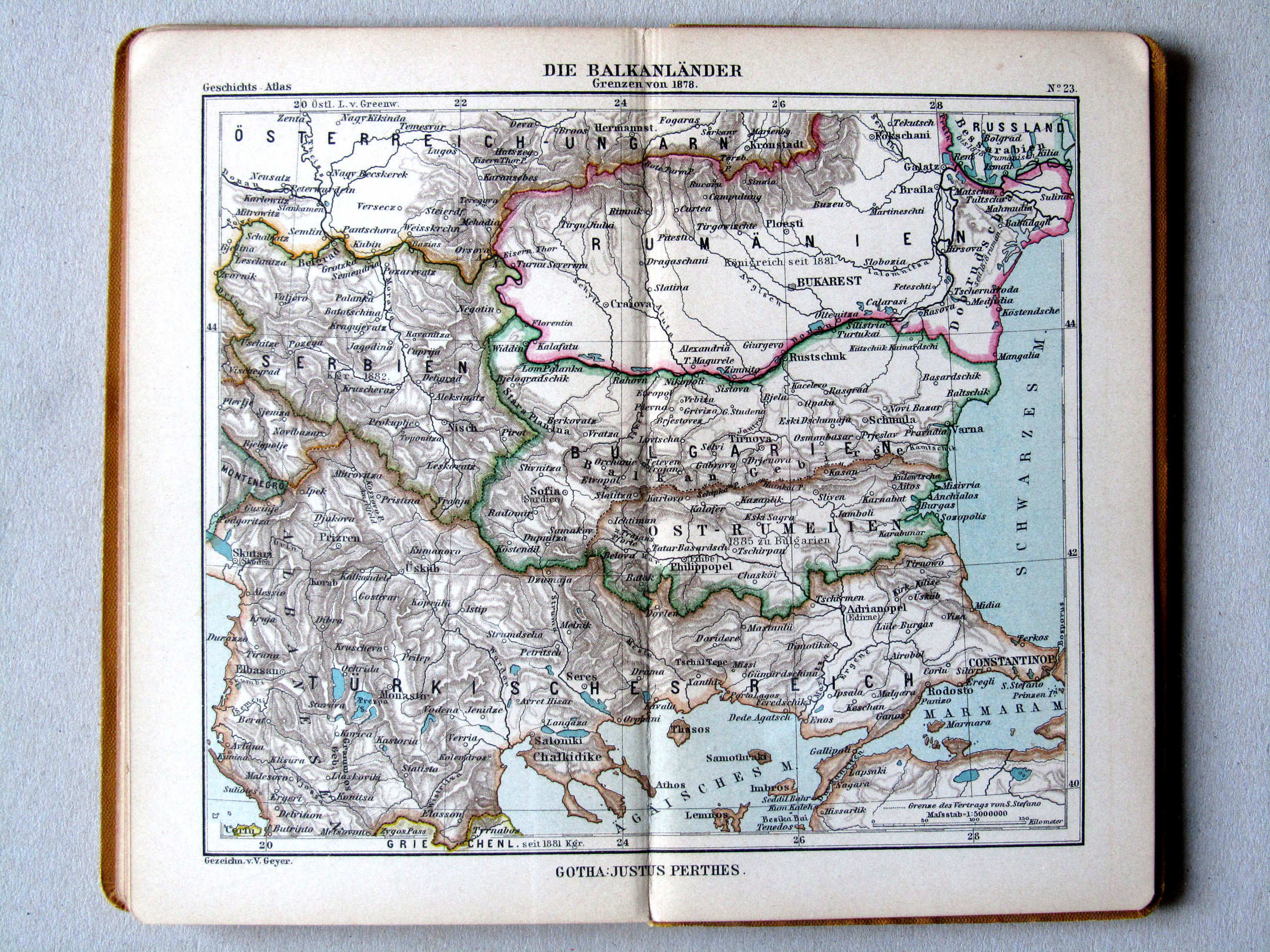
23. Die Balkanländer. Grenzen von 1878 XL
Balkanlanden. Grenzen van 1878 / Balkan countries. Boundaries of 1878
 Justus Perthes Geschichtsatlas (1927/43?)
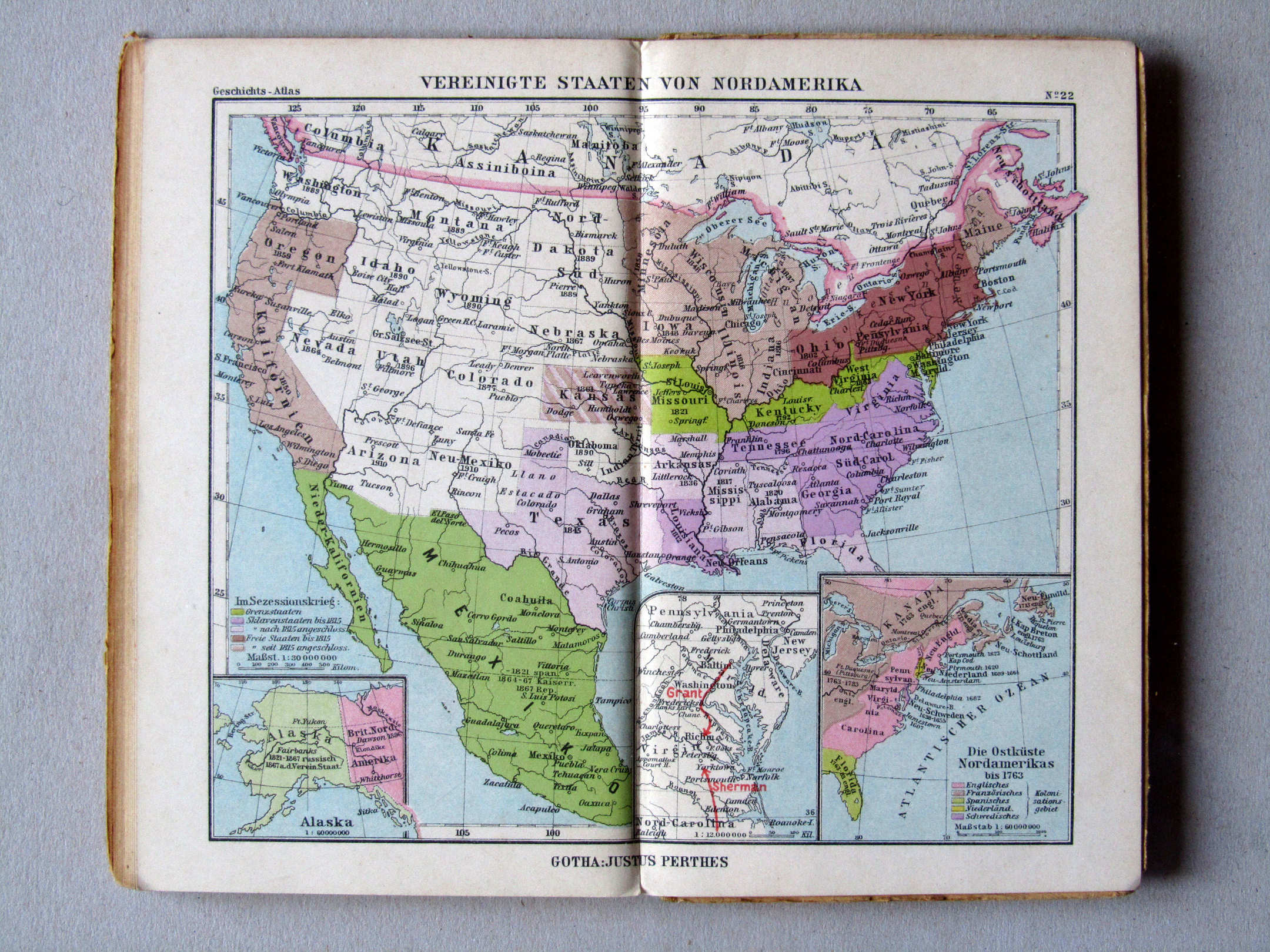
22. Die Vereinigten Staaten von Nord-Amerika XL
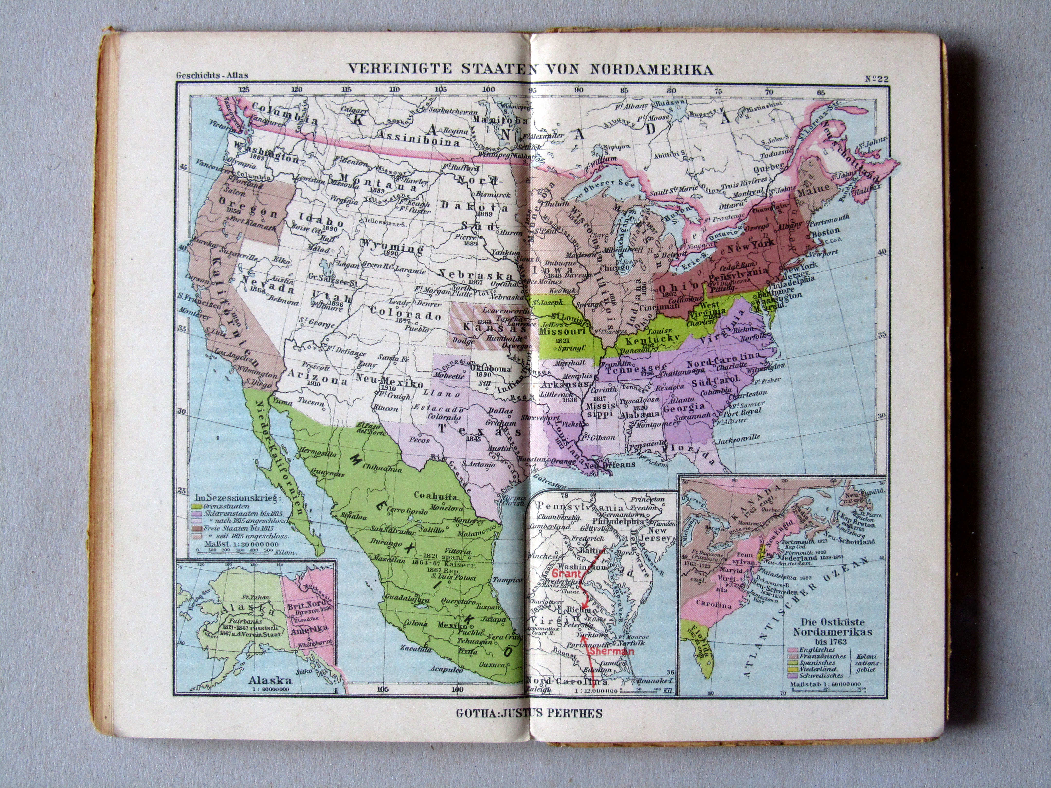
Verenigde Staten van Noord-Amerika / United States of North America
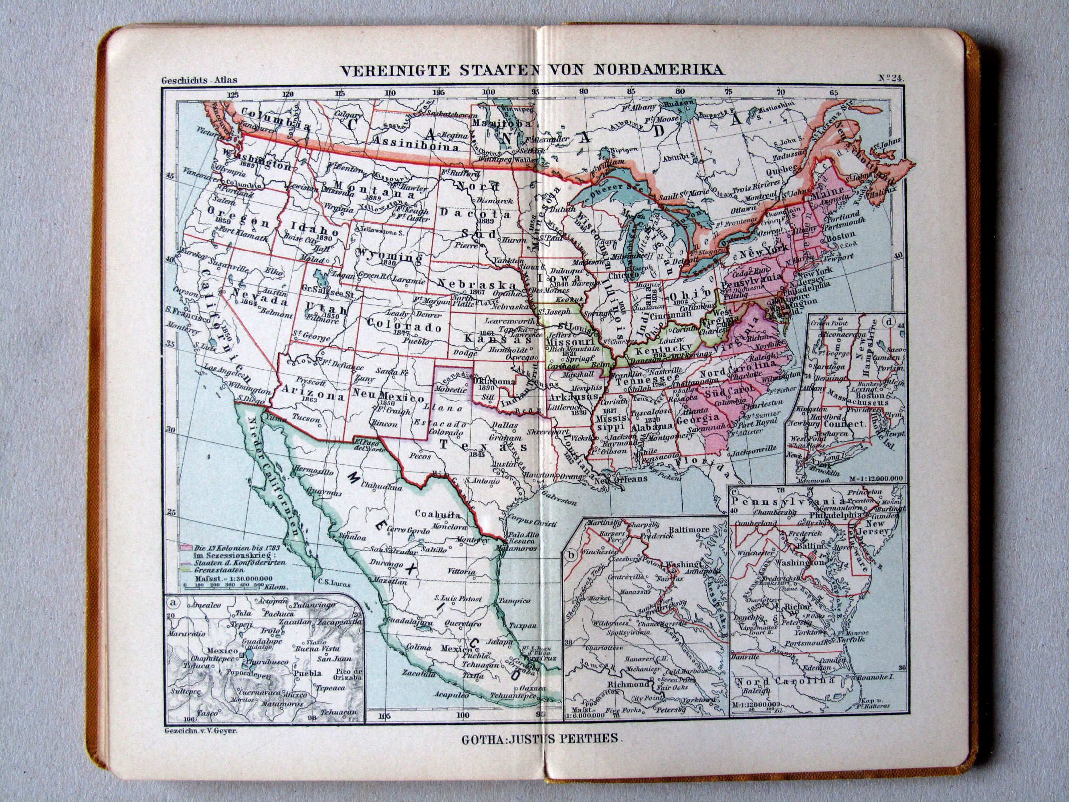 Justus Perthes' Geschichts-Atlas (1898)
24. Die Vereinigten Staaten von Nord-Amerika XL
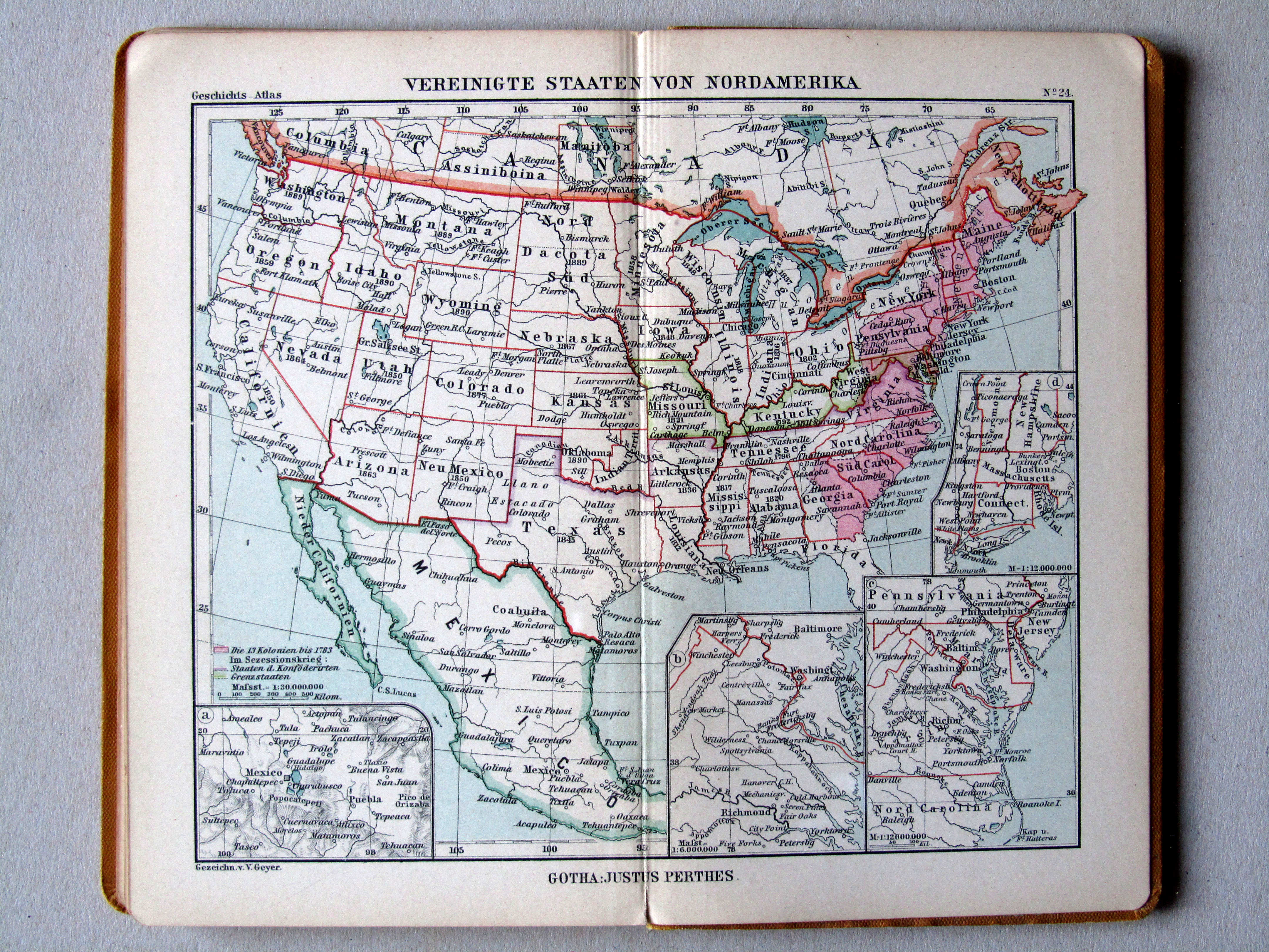
Verenigde Staten van Noord-Amerika / United States of North America
 Justus Perthes Geschichtsatlas (1927/43?)
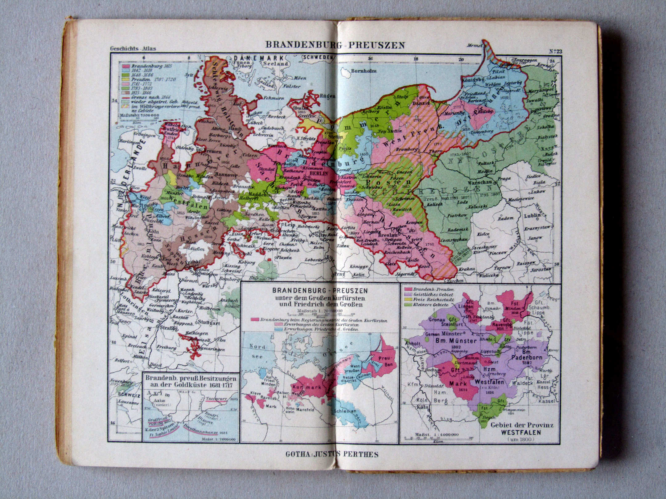
23. Brandenburg-Preuszen XL
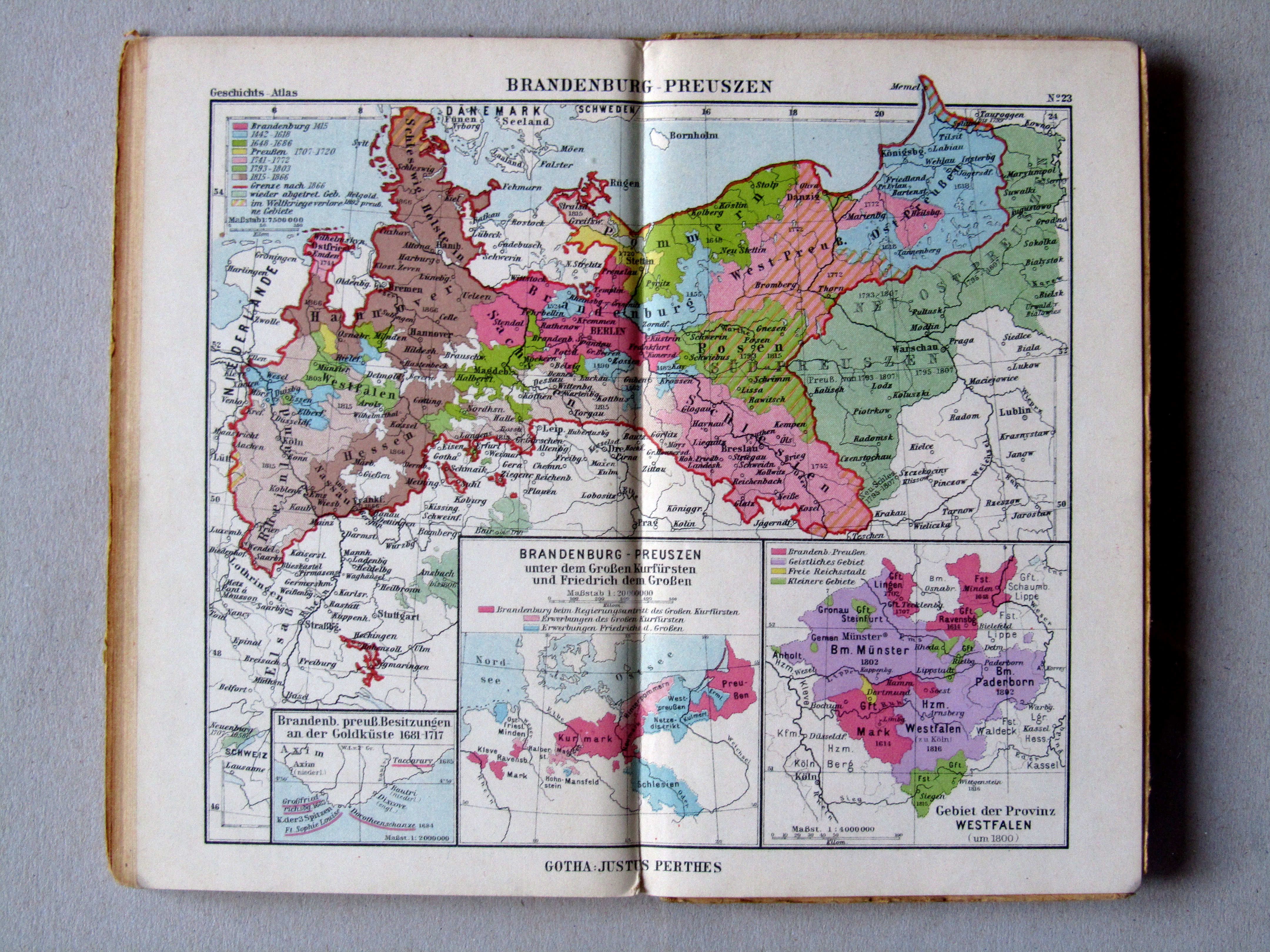
Brandenburg-Pruisen / Brandenburg-Prussia
 Justus Perthes' Geschichts-Atlas (1898)
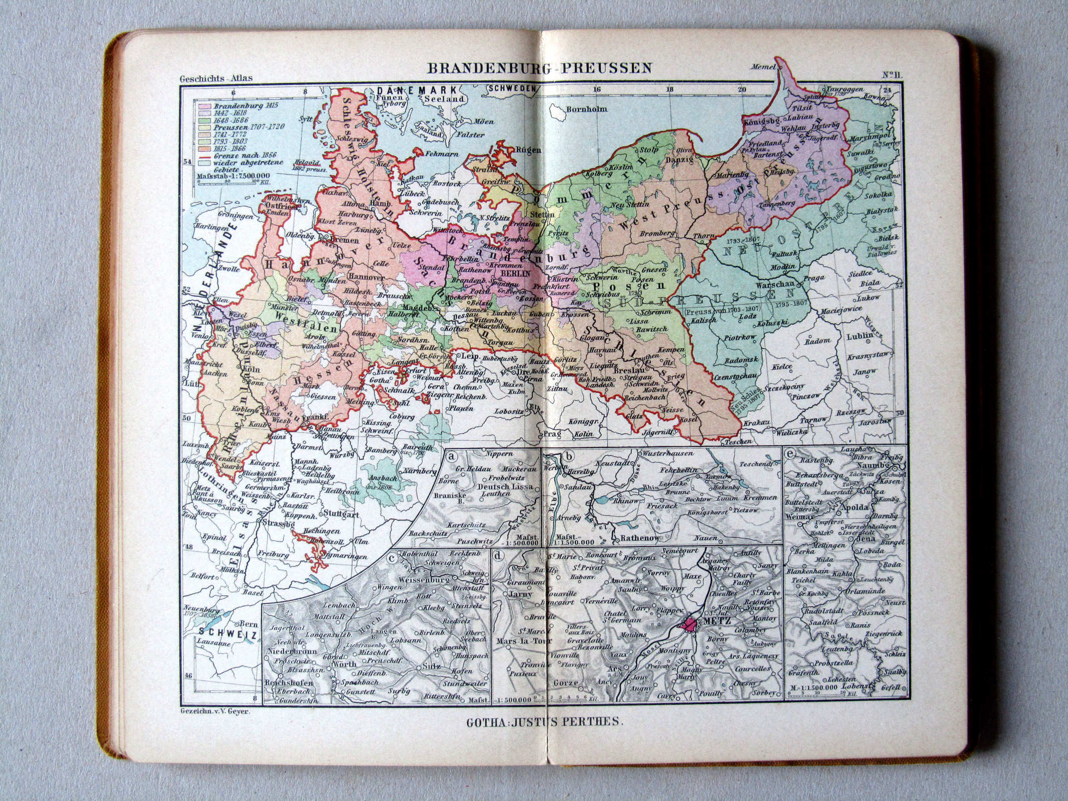
11. Brandenburg-Preussen XL
Brandenburg-Pruisen / Brandenburg-Prussia
 Justus Perthes Geschichtsatlas (1927/43?)
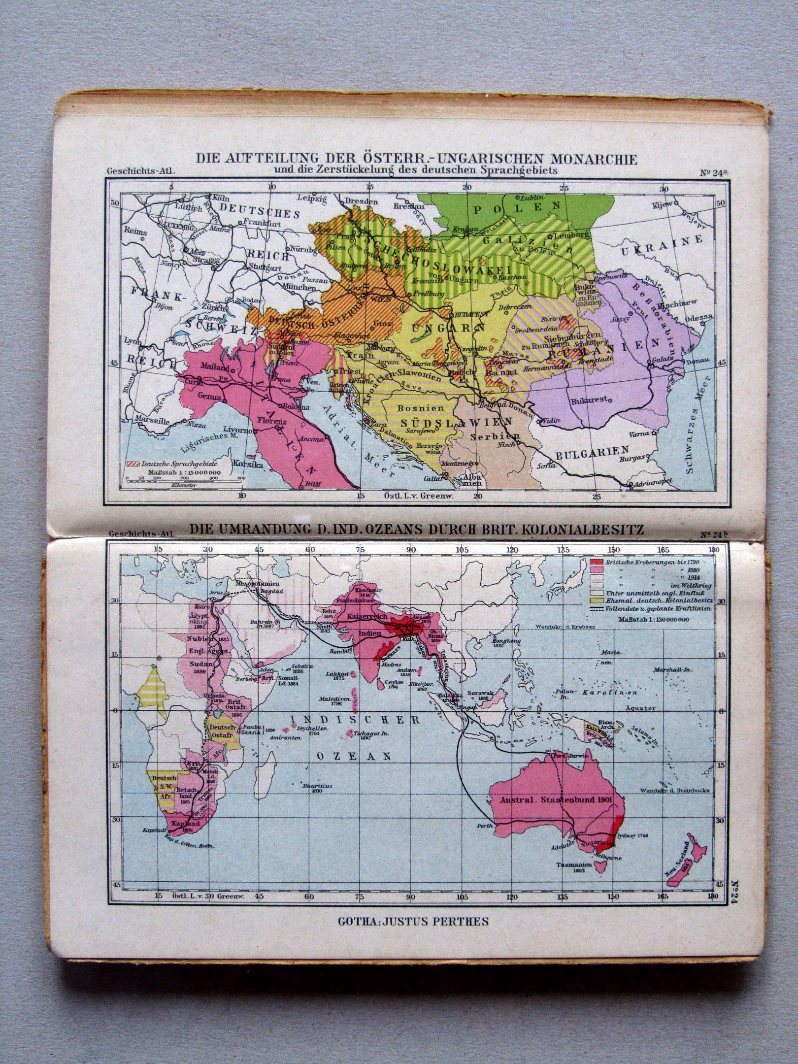
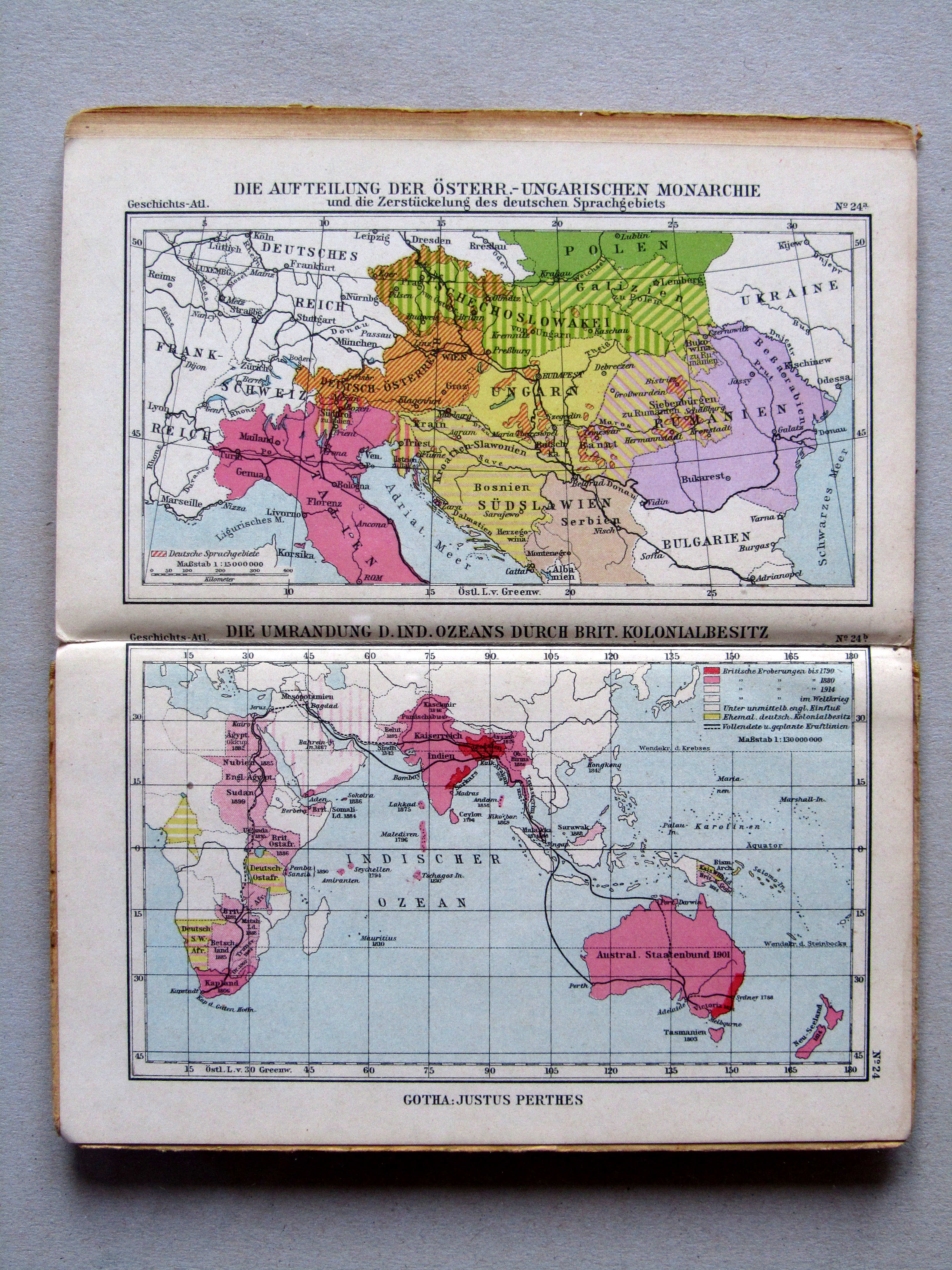
24a. Die Aufteilung der Österr.-Ungarischen Monarchie und die Zerstückelung des deutschen Sprachgebiets
De opdeling van het Oostenrijks-Hongaarse Keizerrijk en de verbrokkeling van het Duitse taalgebied / The breakdown of the Austro-Hungarian Empire and the dismemberment of the German language area
24b. Die Umrandung d. Ind. Ozeans durch brit. Kolonialbesitz XL
De Indische Oceaan omringd door Britse koloniën / The Indian Ocean surrounded by British colonies
 Justus Perthes' Geschichts-Atlas (1898)
geen overeenkomstige kaart / no corresponding map
© M. Witkam, 2011
![]()
![]()