Γκαρπολάς-Ρεφερενδάρης, Γενικὸς σχολαστικὸς ἄτλας (1837)
Garpolas-Referendaris, Genikos scholastikos atlas (1837)
en Stielers Schul-Atlas, 14e druk (1835)
See below for (a summary of) this text in English.
Hieronder staan plaatjes van Genikos scholastikos atlas en Stielers Schul-Atlas ter vergelijking naast elkaar. Daarbij horen ook de volgende pagina's
- Beschrijving van Genikos scholastikos atlas
- Plaatjes van Genikos scholastikos atlas
- Tabellen en lijsten bij Genikos scholastikos atlas
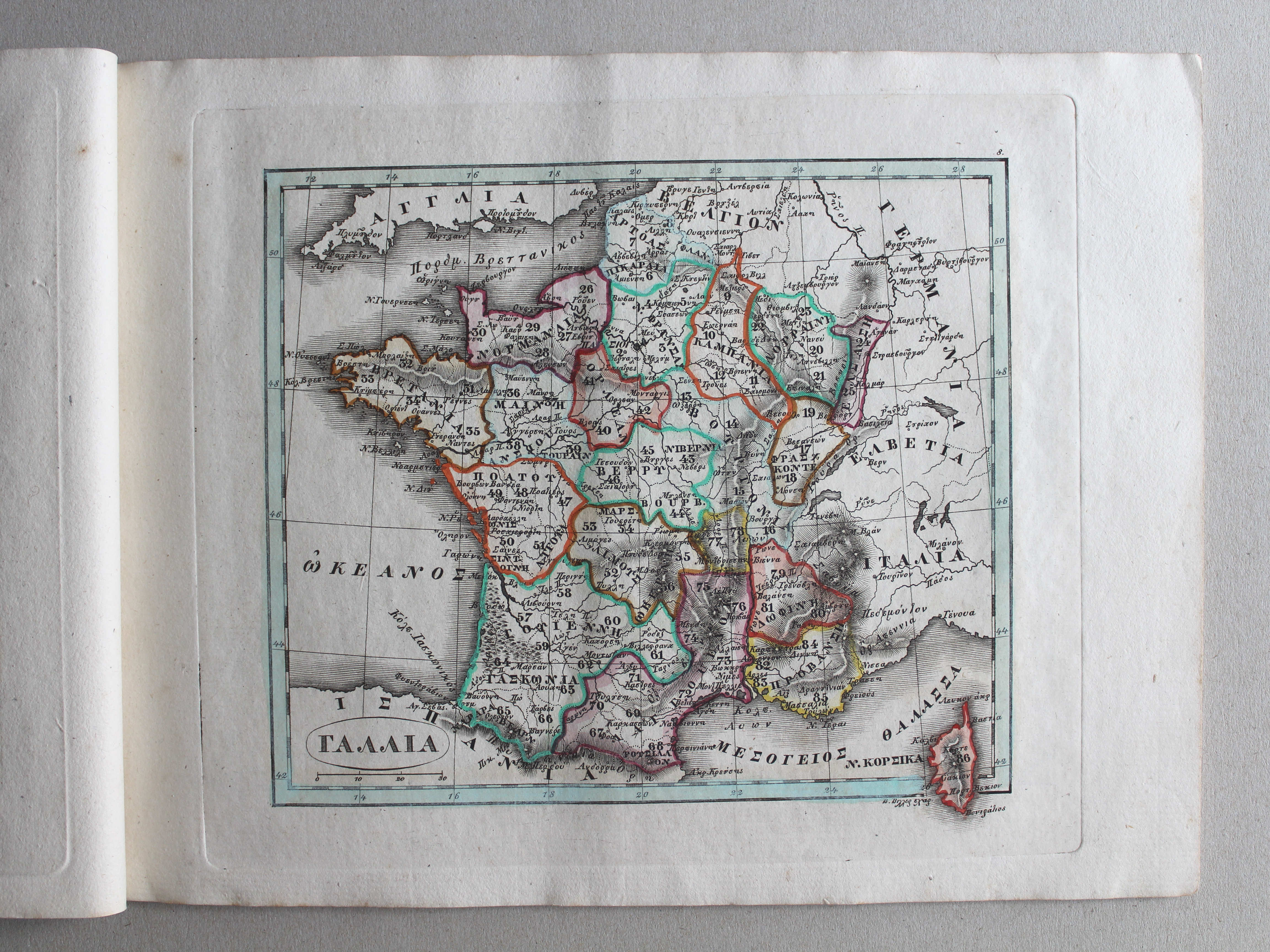
en
- Beschrijving van Stielers Schul-Atlas
- Plaatjes van Stielers Schul-Atlas
- Tabellen en lijsten bij Stielers Schul-Atlas
Plaatjes
Klik op een plaatje voor een vergroting.
Γκαρπολάς-Ρεφερενδάρης, Γενικὸς σχολαστικὸς ἄτλας (1837)
Garpolas-Referendaris, Genikos scholastikos atlas (1837)
and Stielers Schul-Atlas, 14th edition (1835)
- Below are pictures Genikos scholastikos atlas and Stielers Schul-Atlas
side by side for comparison purposes. Related pages
- Description of Genikos scholastikos atlas
- Pictures of Genikos scholastikos atlas
- Tables and lists to Genikos scholastikos atlas
- Description of Stielers Schul-Atlas
- Pictures of Stielers Schul-Atlas
- Tables and lists to Stielers Schul-Atlas
Pictures
Click on a picture to enlarge.
Titelpagina / Title page


 Γενικός σχολαστικός ἄτλας / Genikos scholastikos atlas, 1837
geen overeenkomst / no correspondence
 Γενικός σχολαστικός ἄτλας / Genikos scholastikos atlas, 1837
geen overeenkomstige kaart / no corresponding map
 Γενικός σχολαστικός ἄτλας / Genikos scholastikos atlas, 1837
geen overeenkomstige kaart / no corresponding map
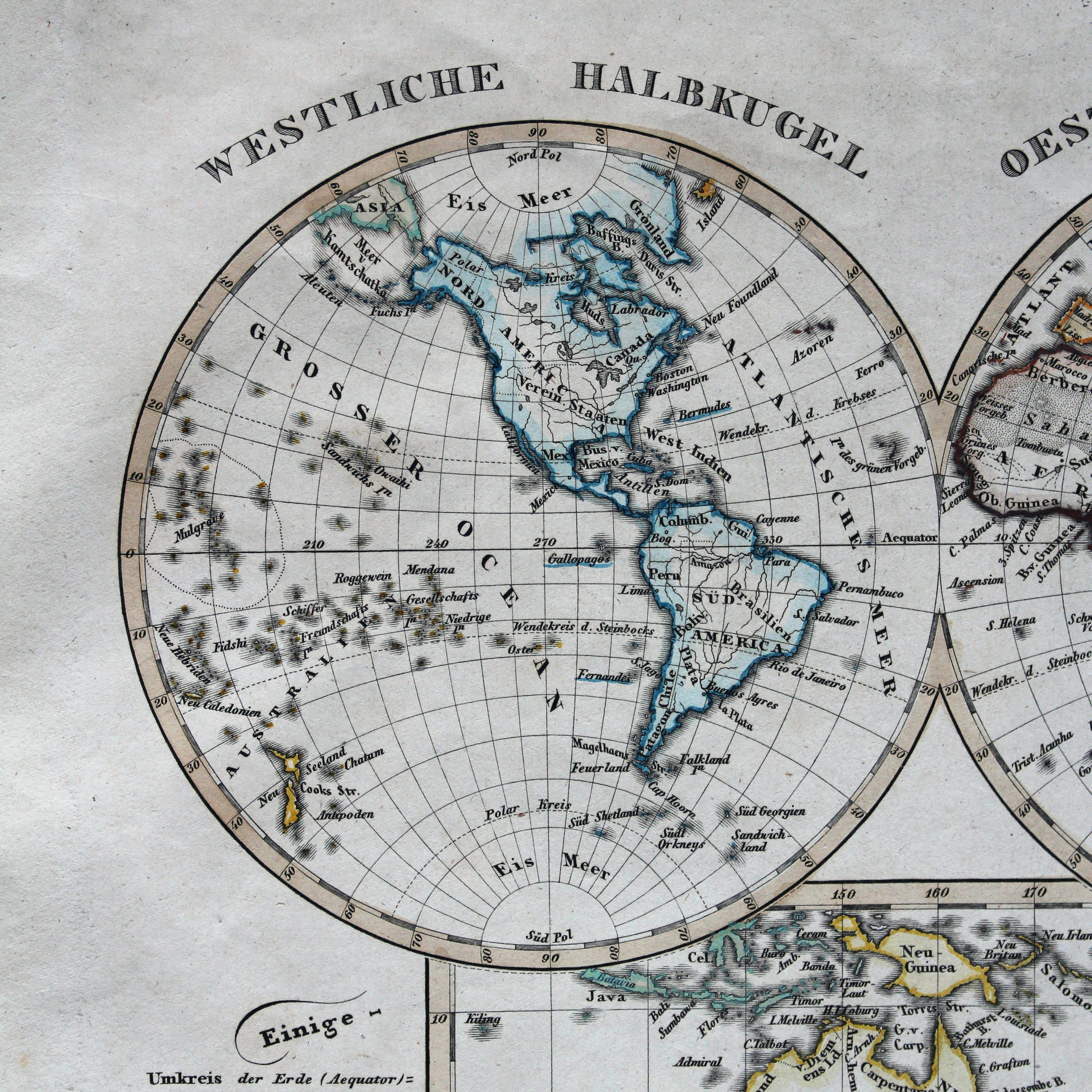
 Stielers Schul-Atlas, 1835
IIa. Westliche Halbkugel – Oestliche Halbkugel XL
Westelijk halfrond, oostelijk halfrond / Western hemisphere, eastern hemisphere
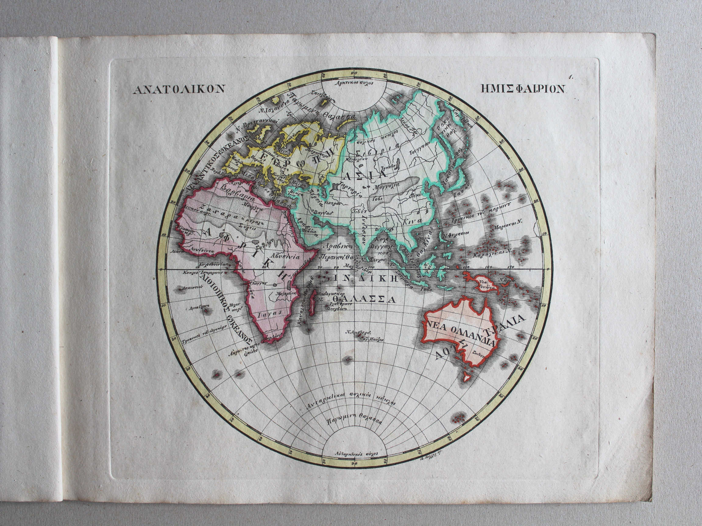 Γενικός σχολαστικός ἄτλας / Genikos scholastikos atlas, 1837
1. ΑΝΑΤΟΛΙΚΟΝ ΗΜΙΣΦΑΙΡΙΟΝ XL
Oostelijk halfrond / Eastern hemisphere
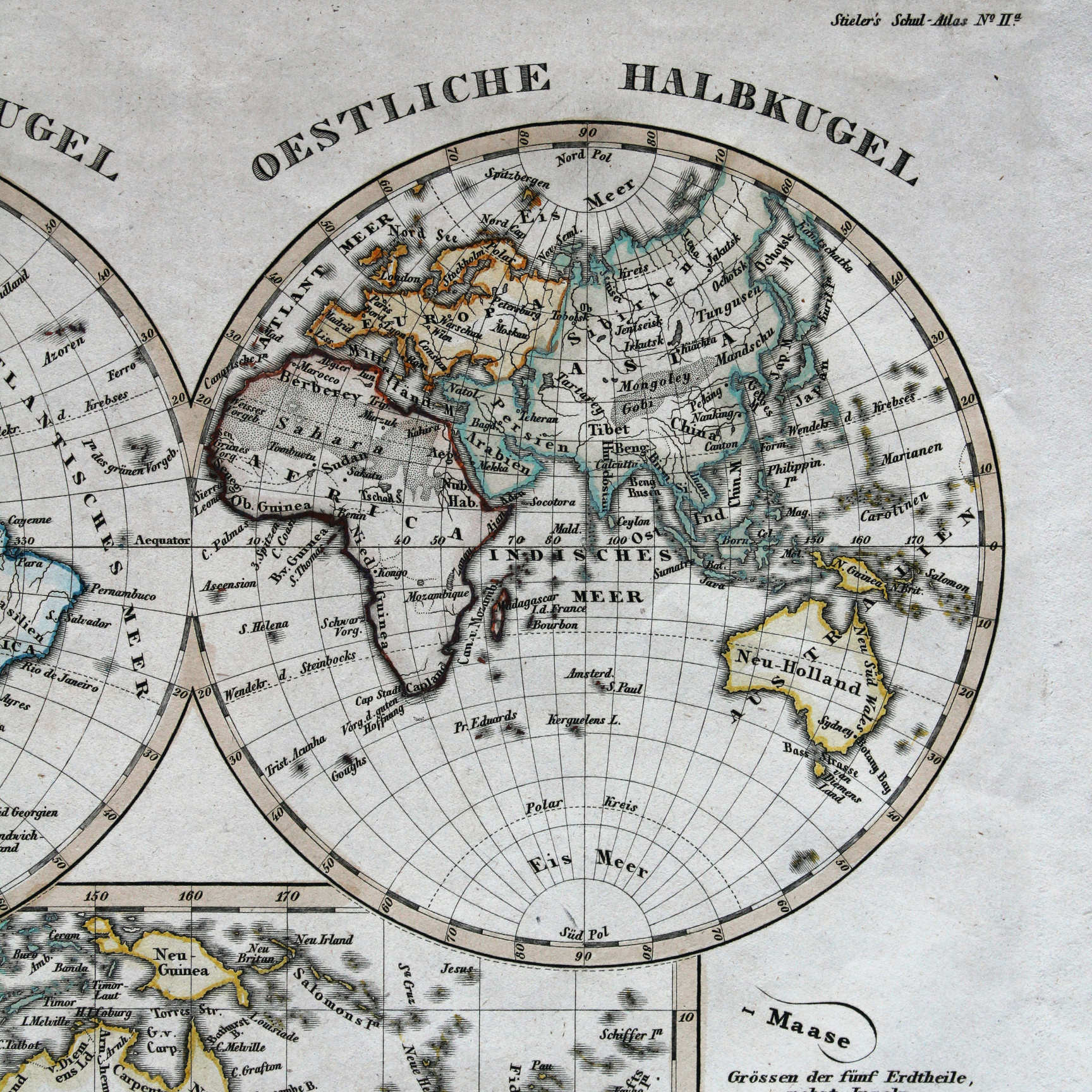 Stielers Schul-Atlas, 1835
IIa. Westliche Halbkugel – Oestliche Halbkugel XL
Westelijk halfrond, oostelijk halfrond / Western hemisphere, eastern hemisphere
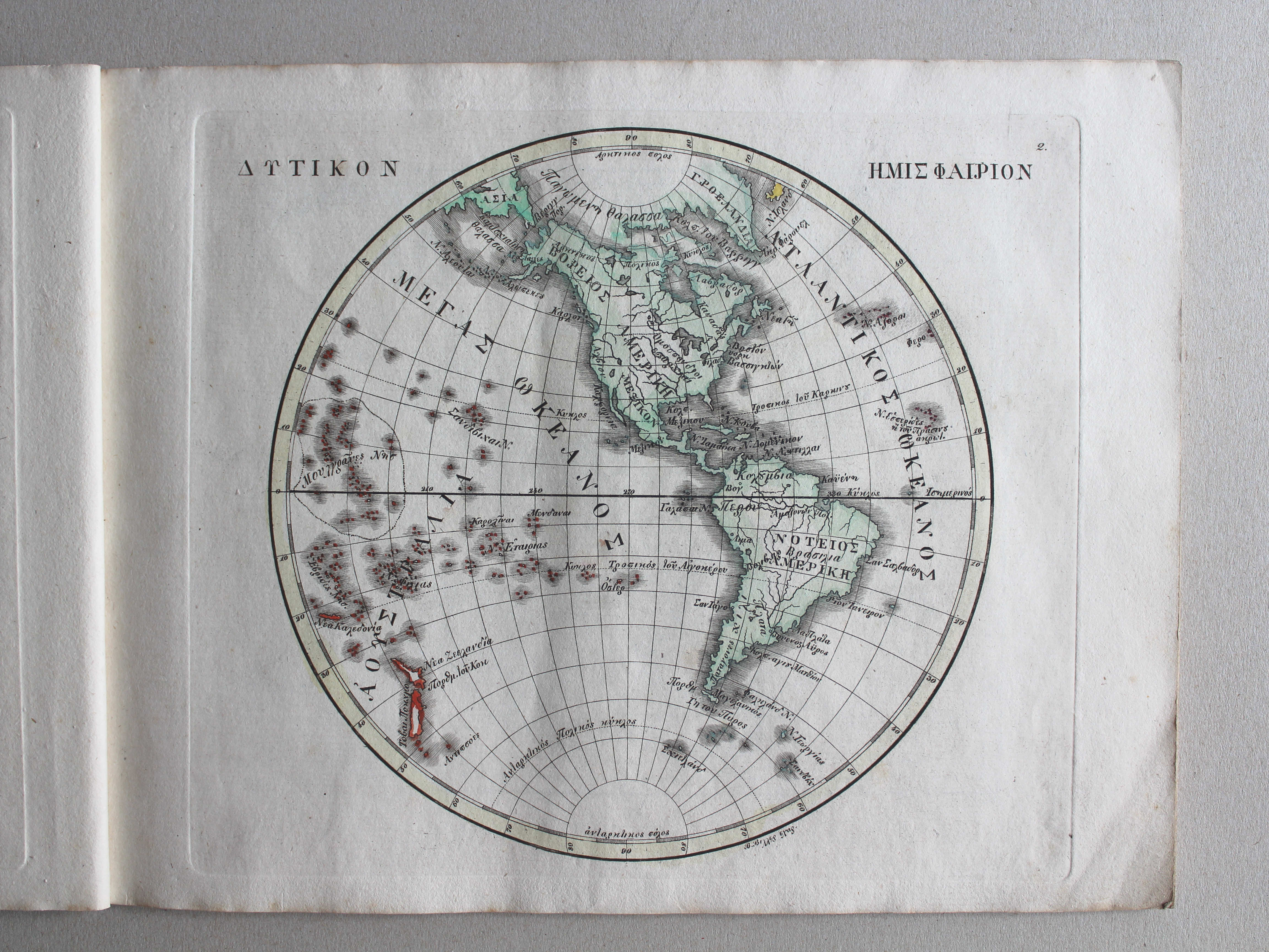
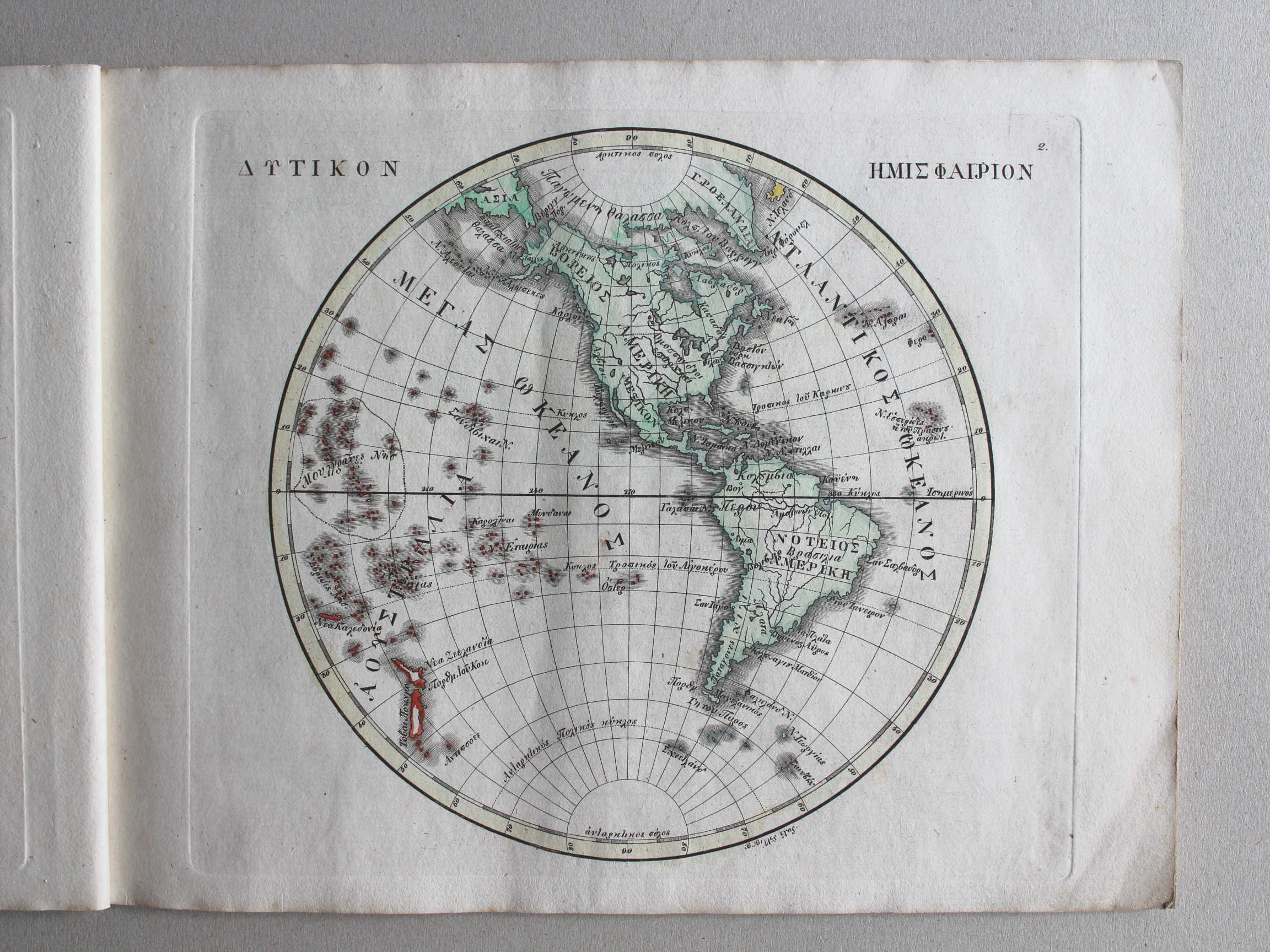 Γενικός σχολαστικός ἄτλας / Genikos scholastikos atlas, 1837
2. ΔΥΤΙΚΟΝ ΗΜΙΣΦΑΙΡΙΟΝ XL
Westelijk halfrond / Western hemisphere
 Stielers Schul-Atlas, 1835
IIa. Westliche Halbkugel – Oestliche Halbkugel XL
Westelijk halfrond, oostelijk halfrond / Western hemisphere, eastern hemisphere
Γενικός σχολαστικός ἄτλας / Genikos scholastikos atlas, 1837
geen overeenkomstige kaart / no corresponding map
 Stielers Schul-Atlas, 1835
IIb. Planiglob in Mercators Projection XL
Wereldkaart in Mercatorprojectie / World map in Mercator projection

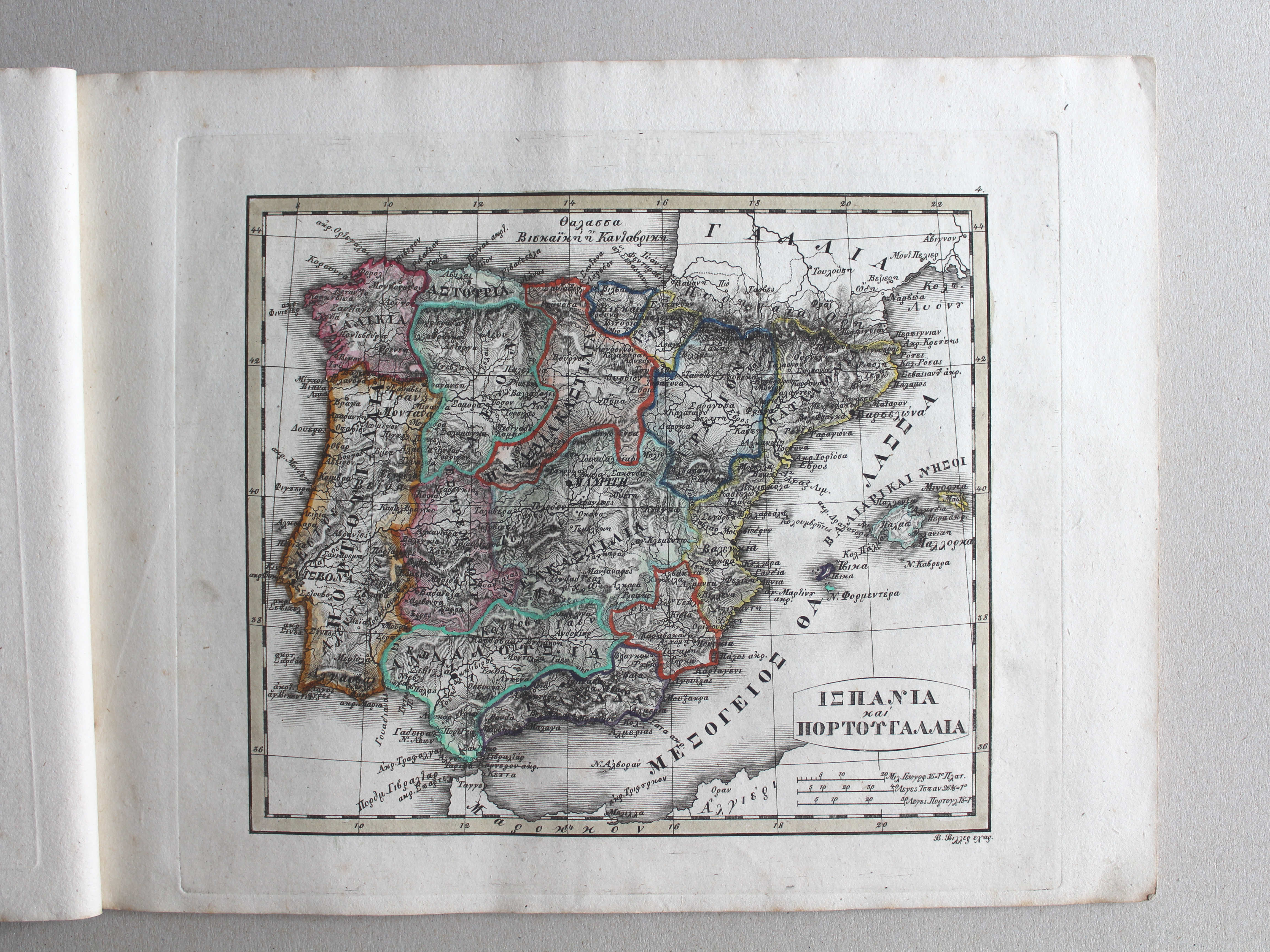
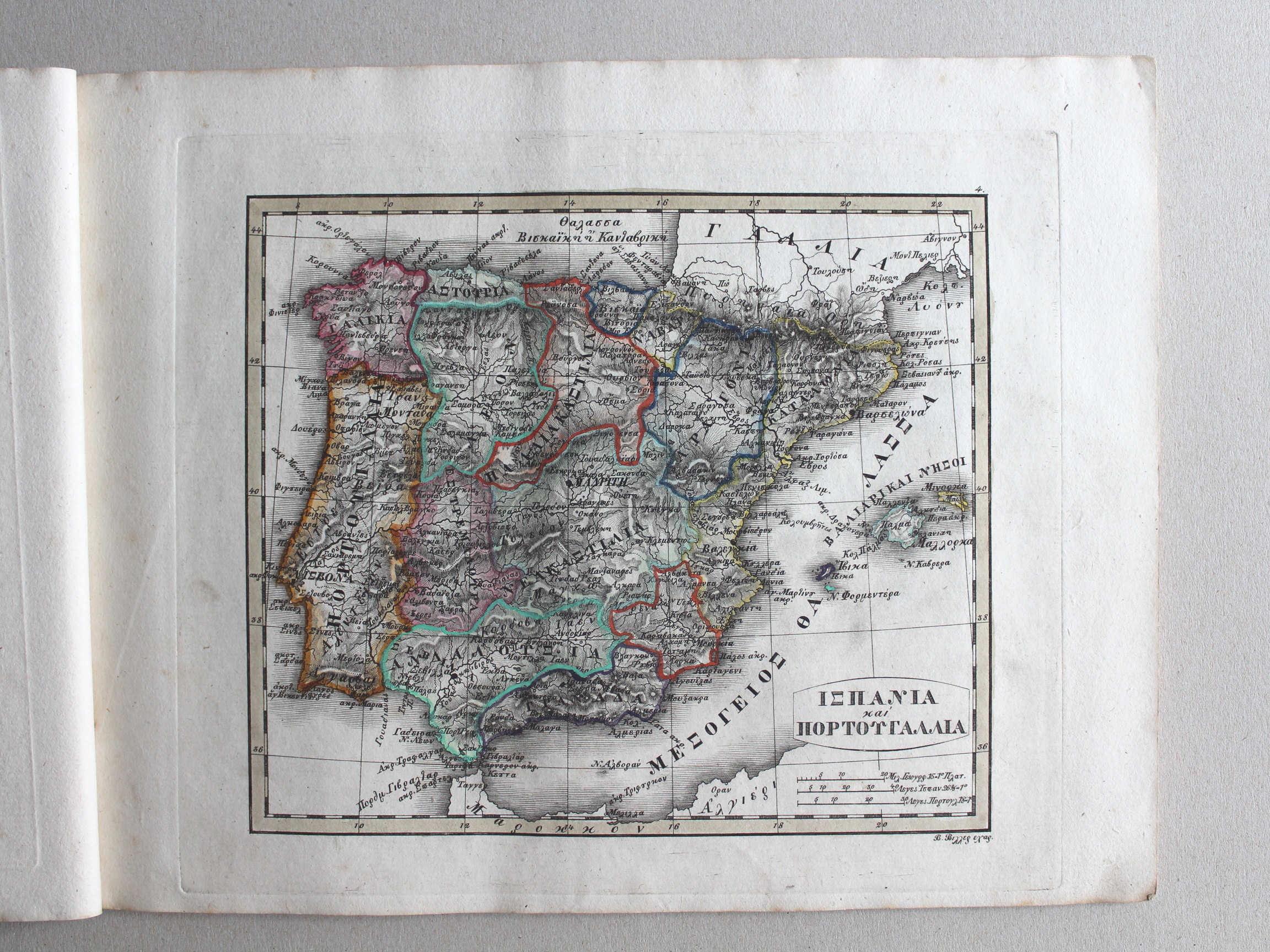 Γενικός σχολαστικός ἄτλας / Genikos scholastikos atlas, 1837
4. ΙΣΠΑΝΙΑ καὶ ΠΟΡΤΟΥΓΑΛΛΙΑ XL
Spanje en Portugal / Spain and Portugal

 Γενικός σχολαστικός ἄτλας / Genikos scholastikos atlas, 1837
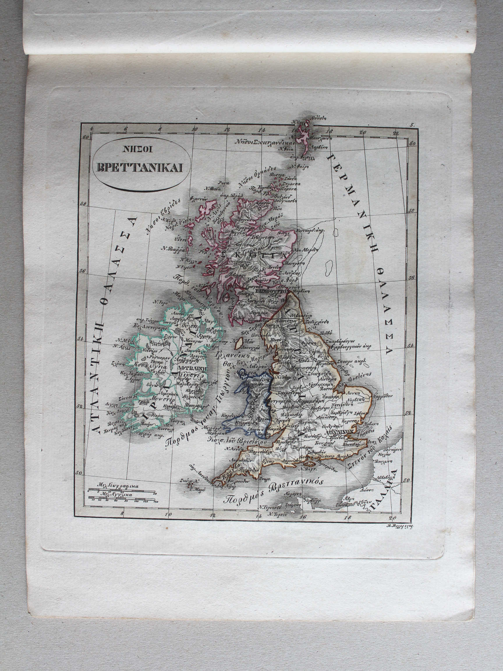
5. ΝΗΣΟΙ ΒΡΕΤΤΑΝΙΚΑΙ XL
Britse eilanden / British Isles

 Γενικός σχολαστικός ἄτλας / Genikos scholastikos atlas, 1837
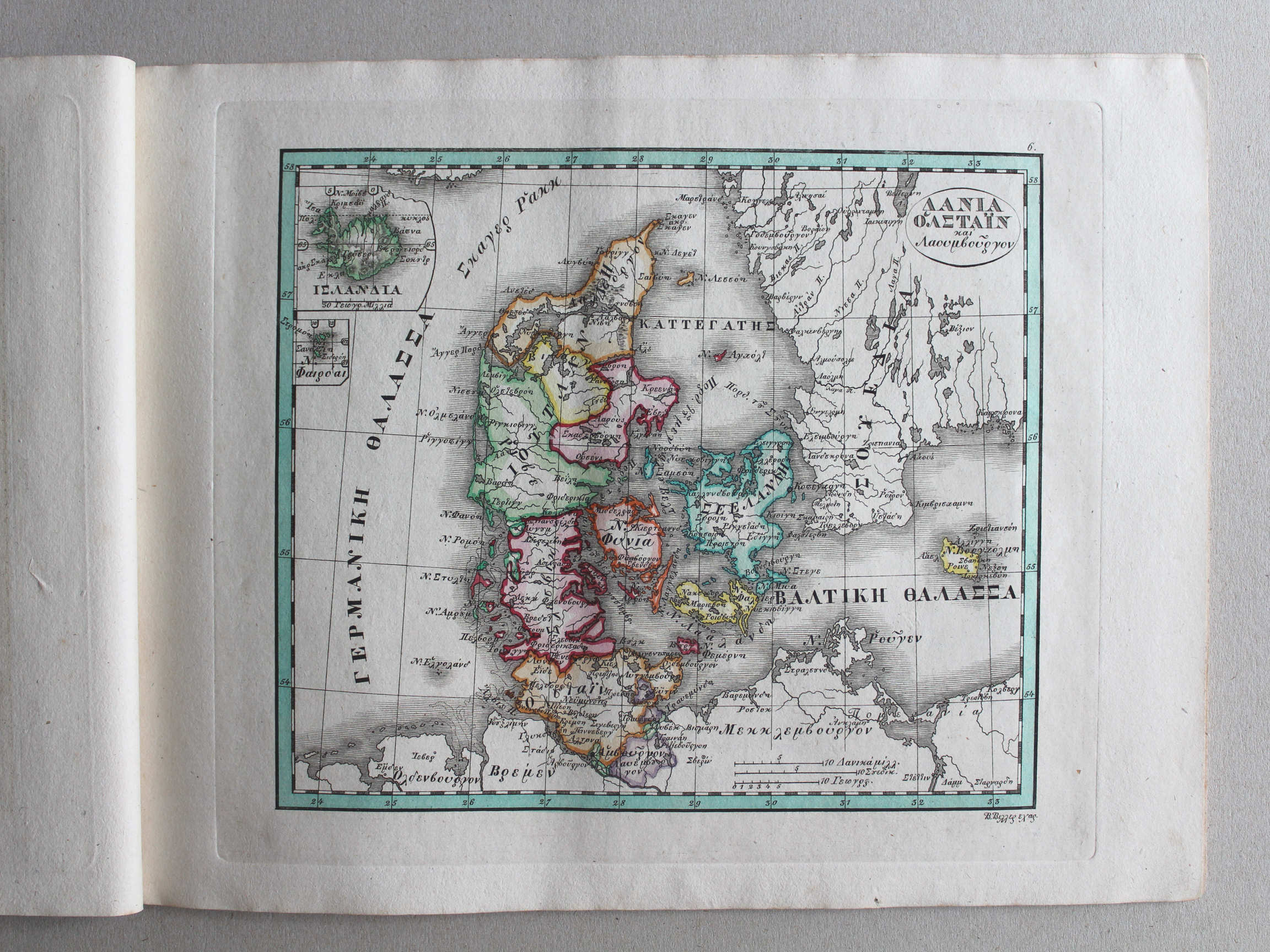
6. ΔΑΝΙΑ, ὉΛΣΤΑΪΝ και Λαουενβοῦργον XL
Denemarken, Holstein en Lauenburg / Denmark, Holstein and Lauenburg
 Stielers Schul-Atlas, 1835
IX. Dänemark, mit Holstein und Lauenburg XL
Denemarken met Holstein en Lauenburg / Denmark with Holstein and Lauenburg
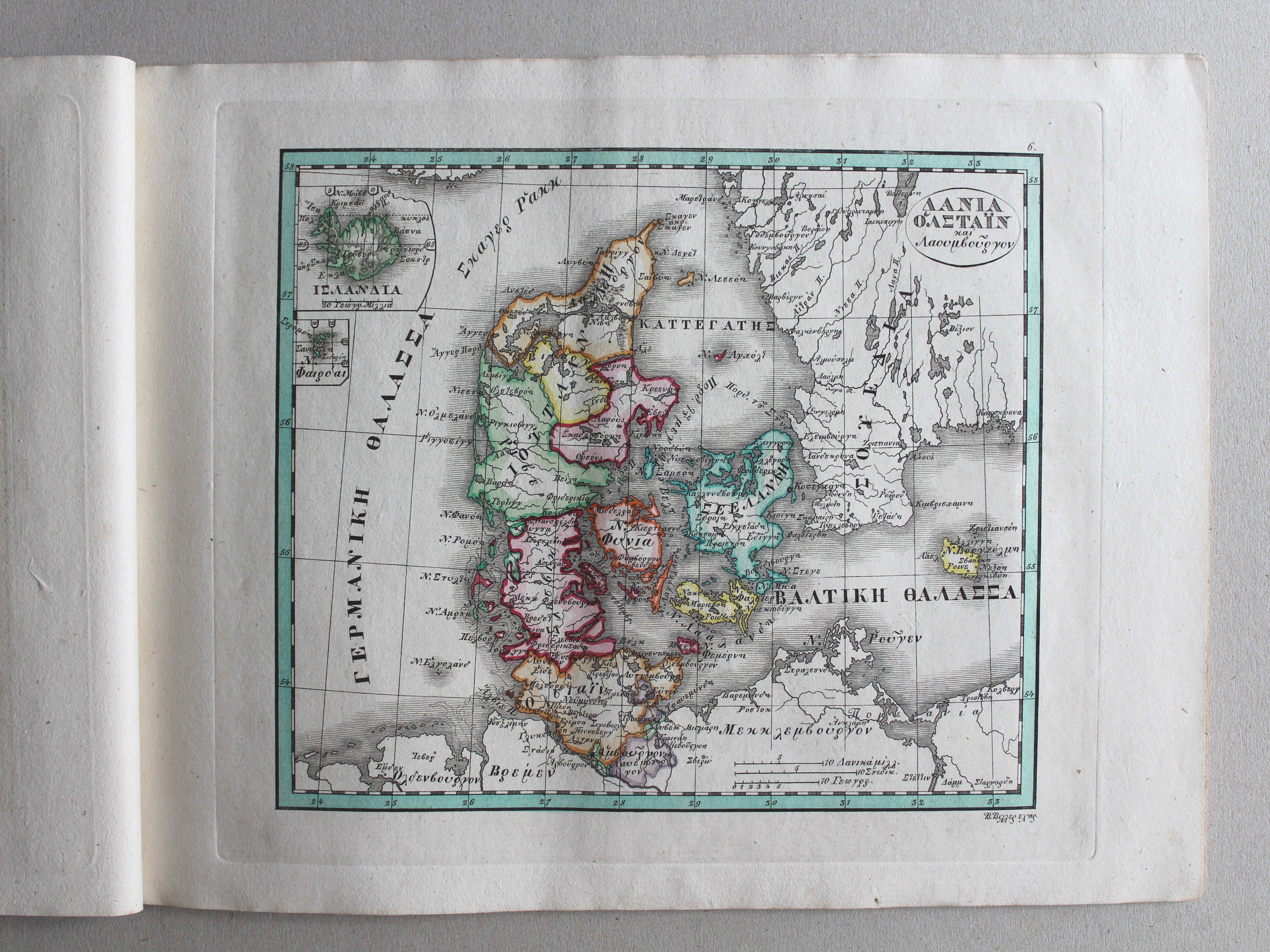
 Γενικός σχολαστικός ἄτλας / Genikos scholastikos atlas, 1837
7. ΣΟΥΕΔΙΑ καὶ ΝΟΡΒΕΓΙΑ XL
Zweden en Noorwegen / Sweden and Norway
 Stielers Schul-Atlas, 1835
VIII. Schweden, Norwegen und Dänemark XL
Zweden, Noorwegen en Denemarken / Sweden, Norway and Denmark

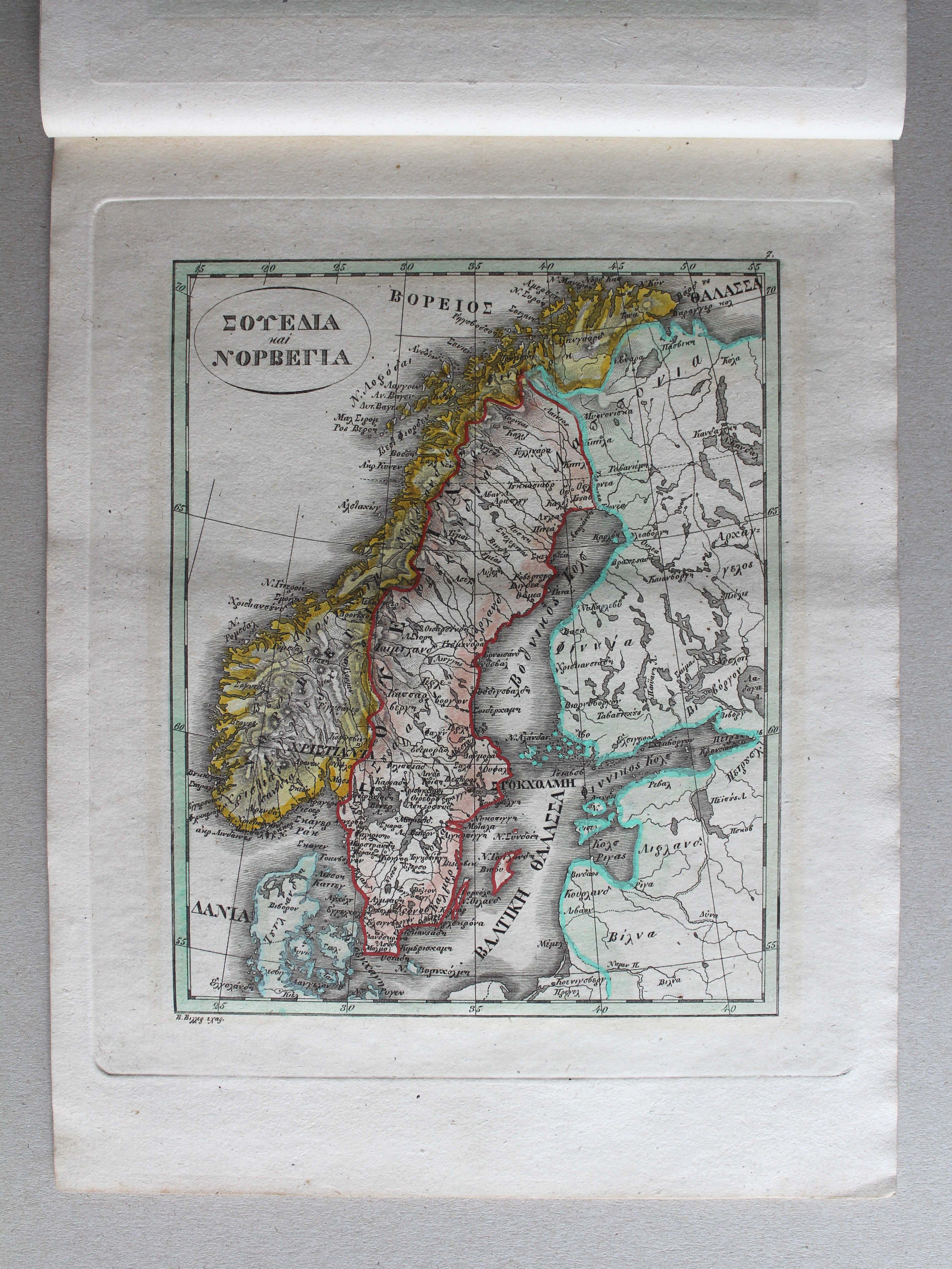
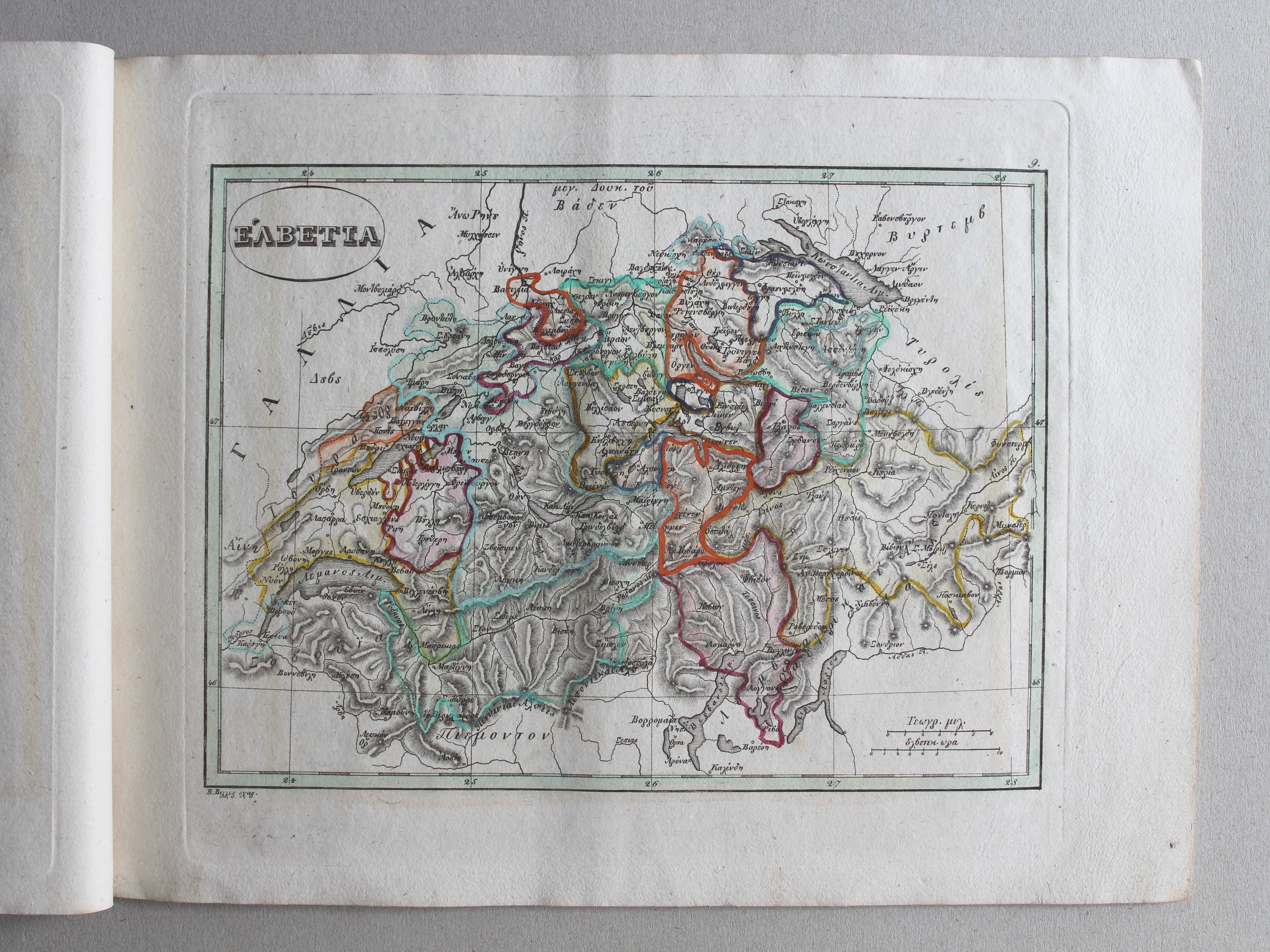
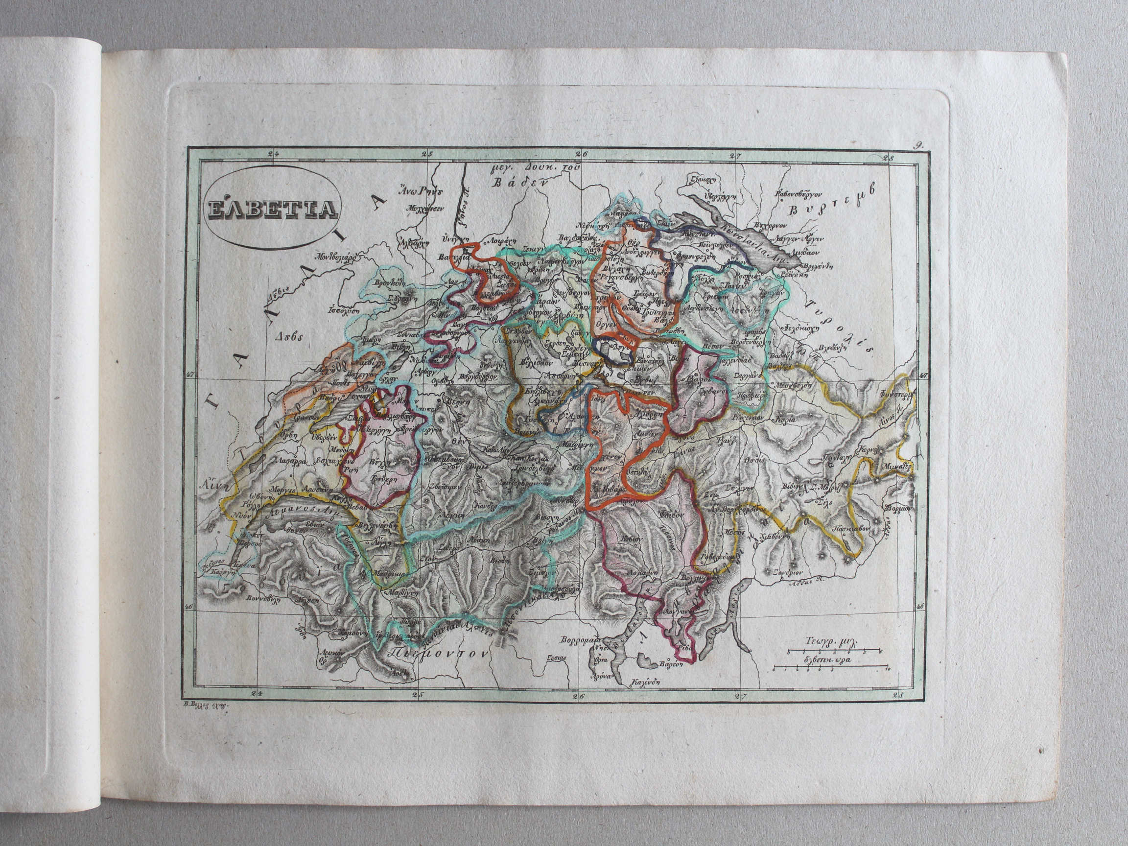 Γενικός σχολαστικός ἄτλας / Genikos scholastikos atlas, 1837
9. ἙΛΒΕΤΙΑ XL
Zwitserland / Switzerland
 Stielers Schul-Atlas, 1835
XIVb. Die Schweiz, auch Fürstenthum Lichtenstein XL
Zwitserland, Liechtenstein / Switzerland, Liechtenstein
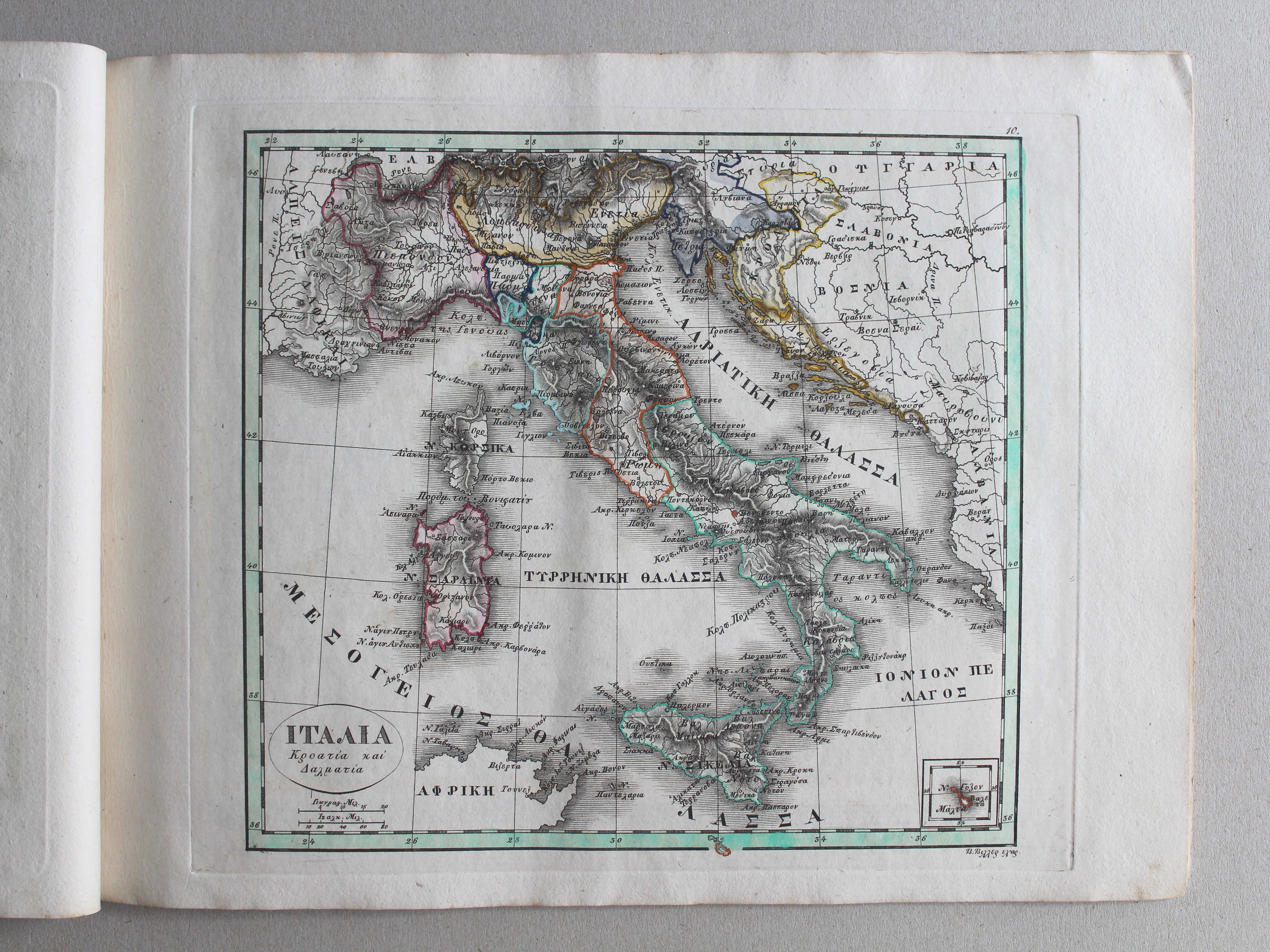
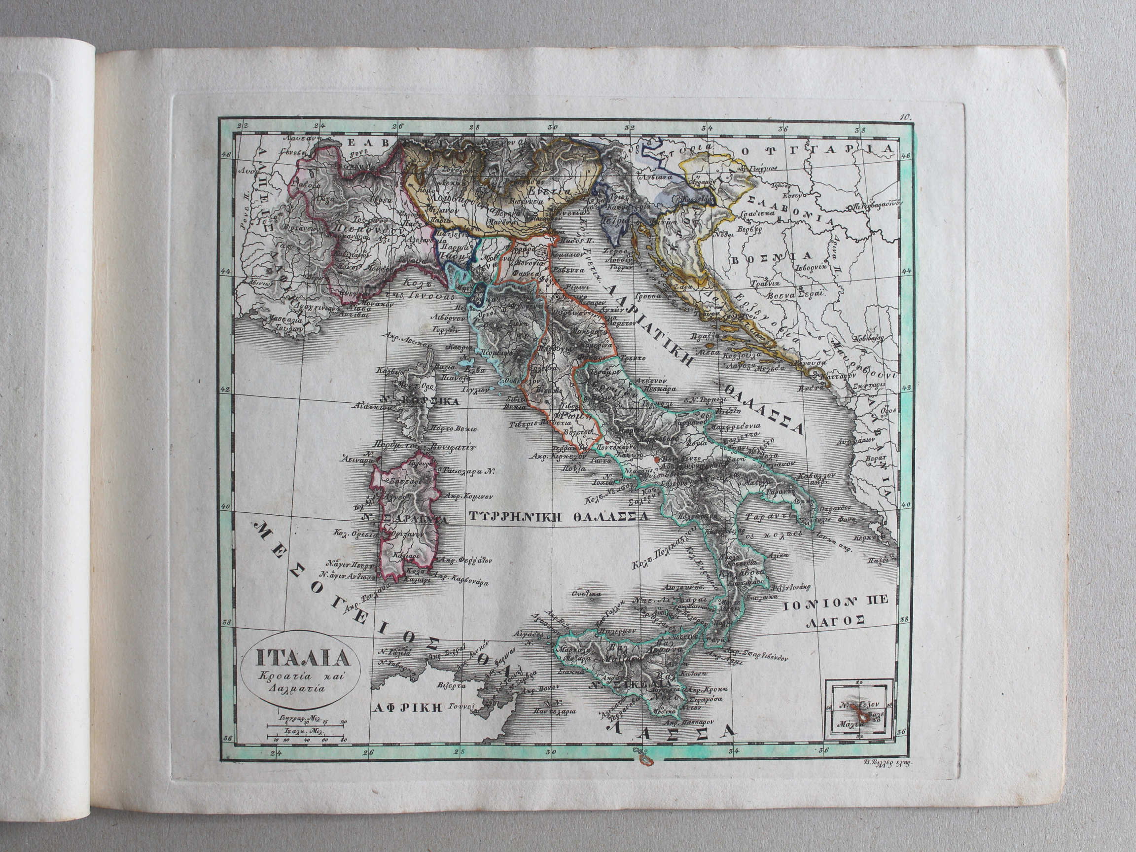 Γενικός σχολαστικός ἄτλας / Genikos scholastikos atlas, 1837
10. ΙΤΑΛΙΑ, Κροατία καὶ Δαλματία XL
Italië, Kroatië en Dalmatië / Italy, Croatia and Dalmatia
 Stielers Schul-Atlas, 1835
VI. Italien, auch Illyrien, Croatien und Dalmatien XL
Italië, Illyrië, Kroatië en Dalmatië / Italy, Illyria, Croatia and Dalmatia
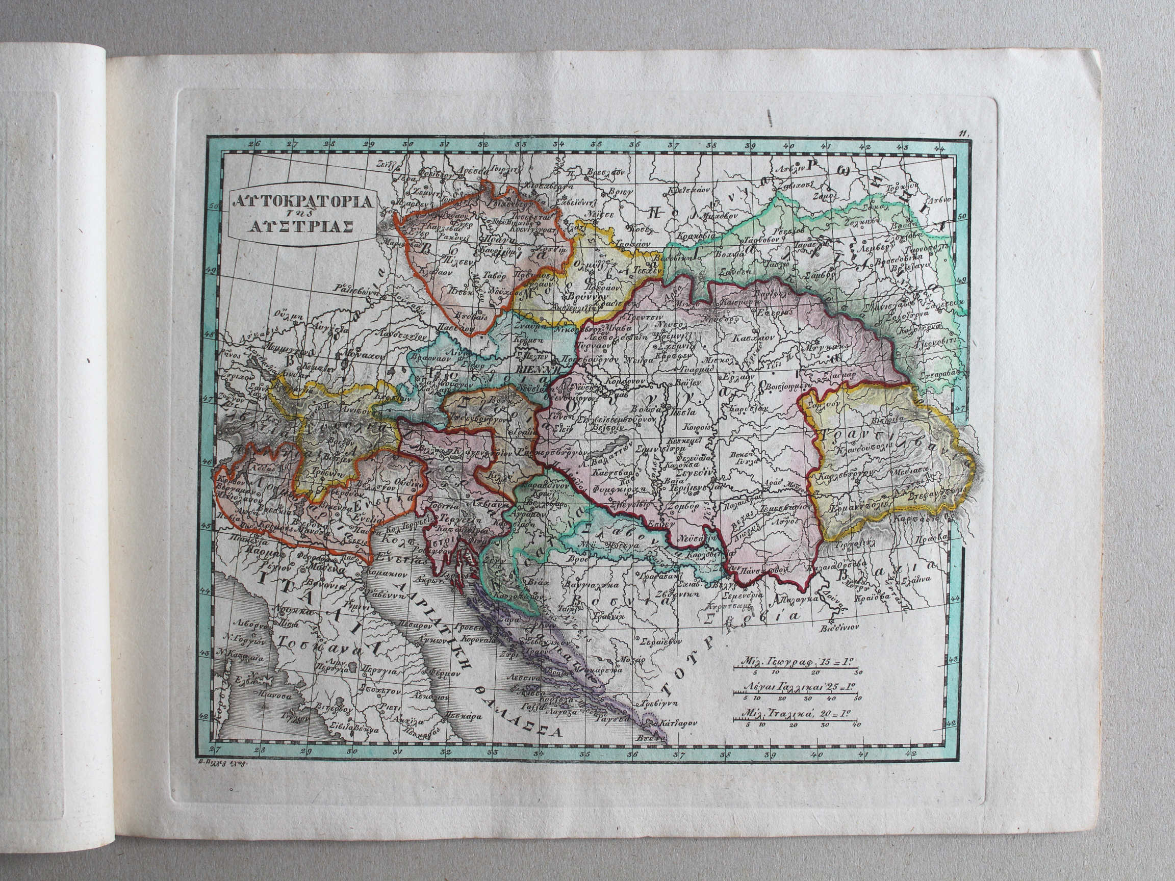 Γενικός σχολαστικός ἄτλας / Genikos scholastikos atlas, 1837
11. ΑΥΤΟΚΡΑΤΟΡΙΑ τῆς ΑΥΣΤΡΙΑΣ XL
Keizerrijk Oostenrijk / Austrian Empire
 Stielers Schul-Atlas, 1835
geen overeenkomstige kaart / no corresponding map
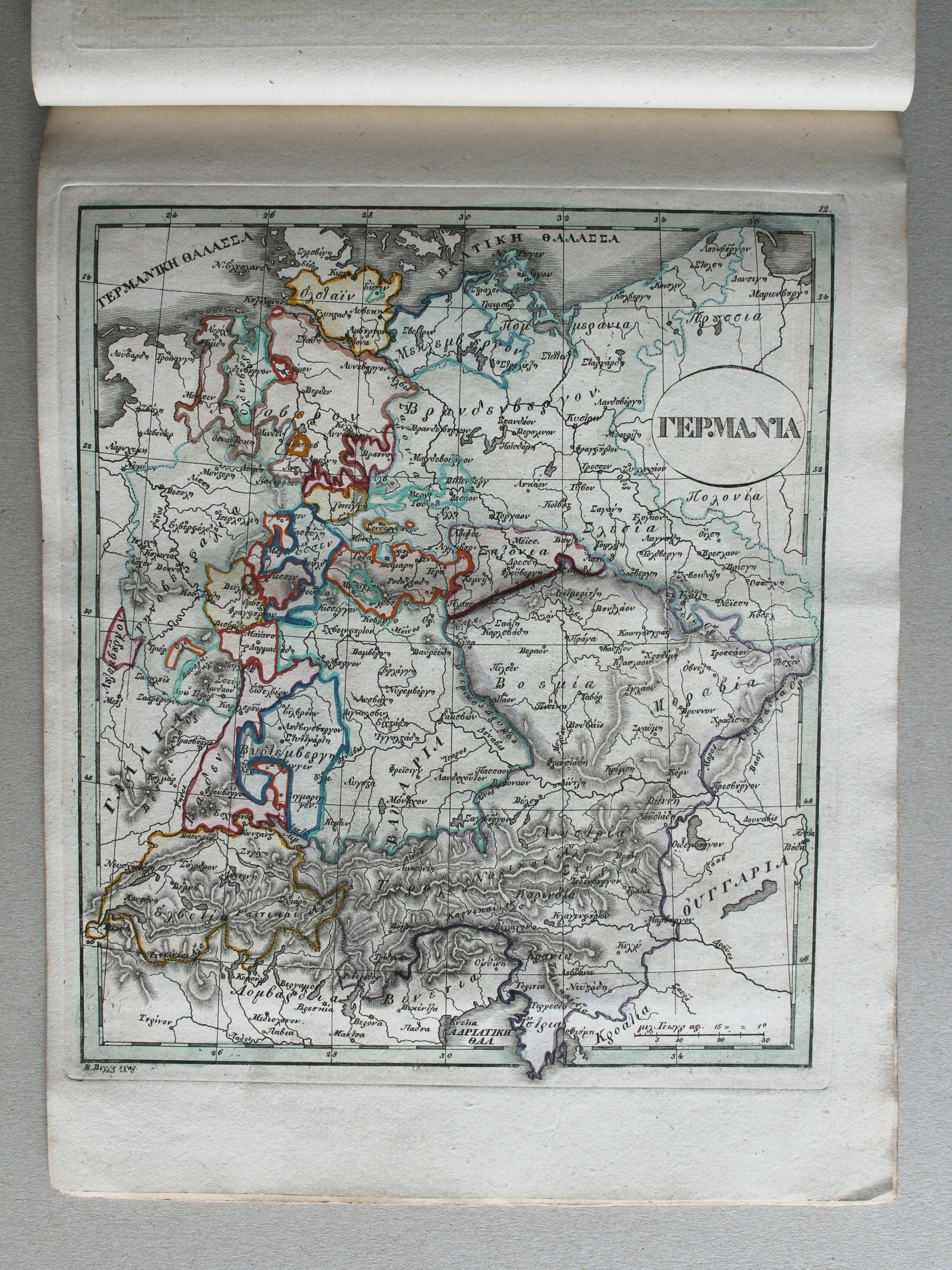
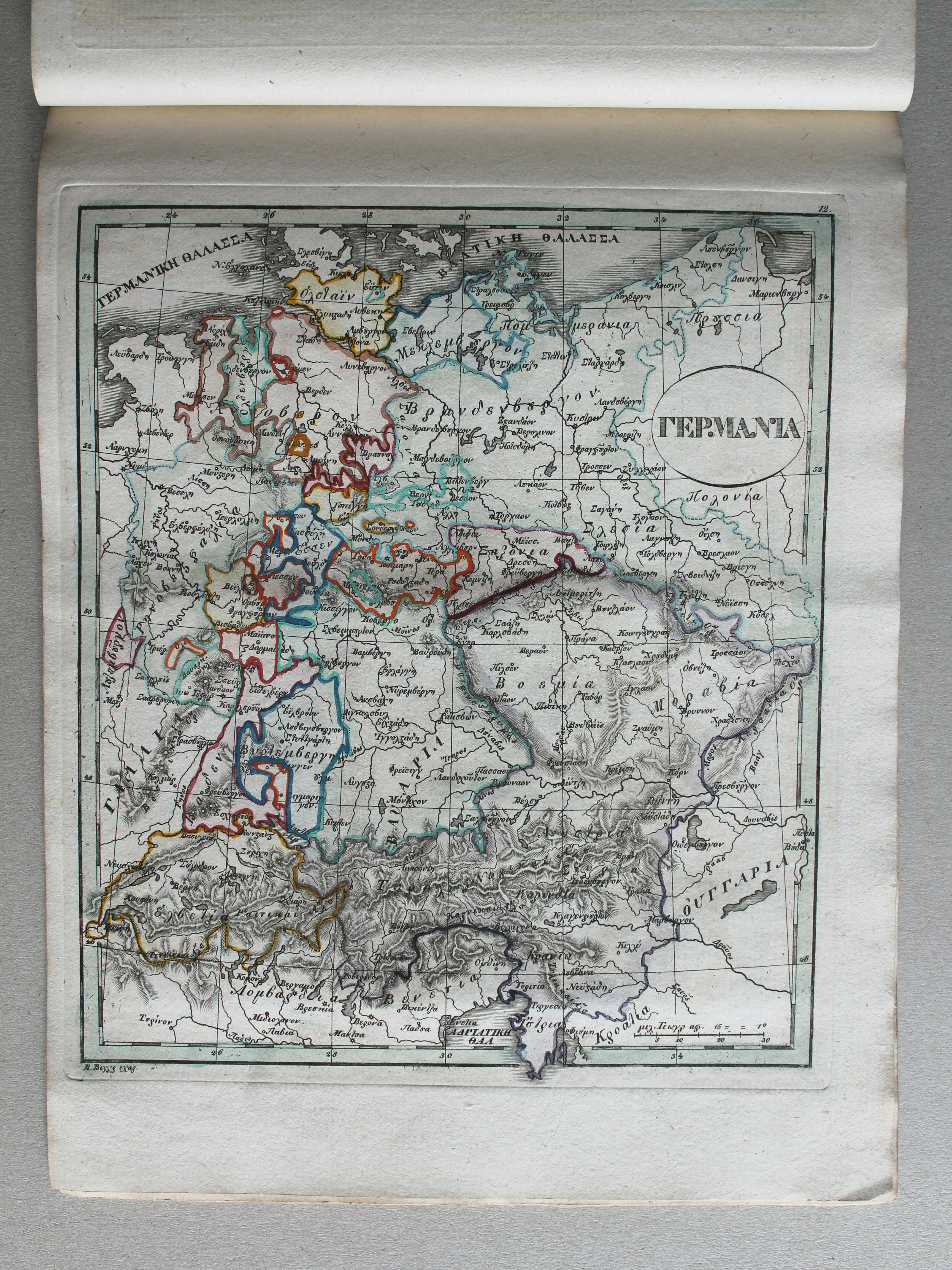
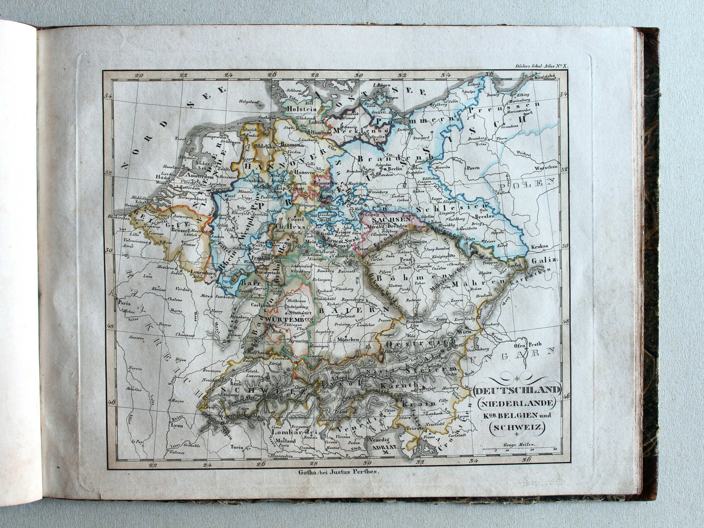 Stielers Schul-Atlas, 1835
X. Deutschland, Niederlande, Kgr. Belgien und Schweiz XL
Duitsland, Nederland, België en Zwitserland / Germany, Netherlands, Belgium and Switzerland
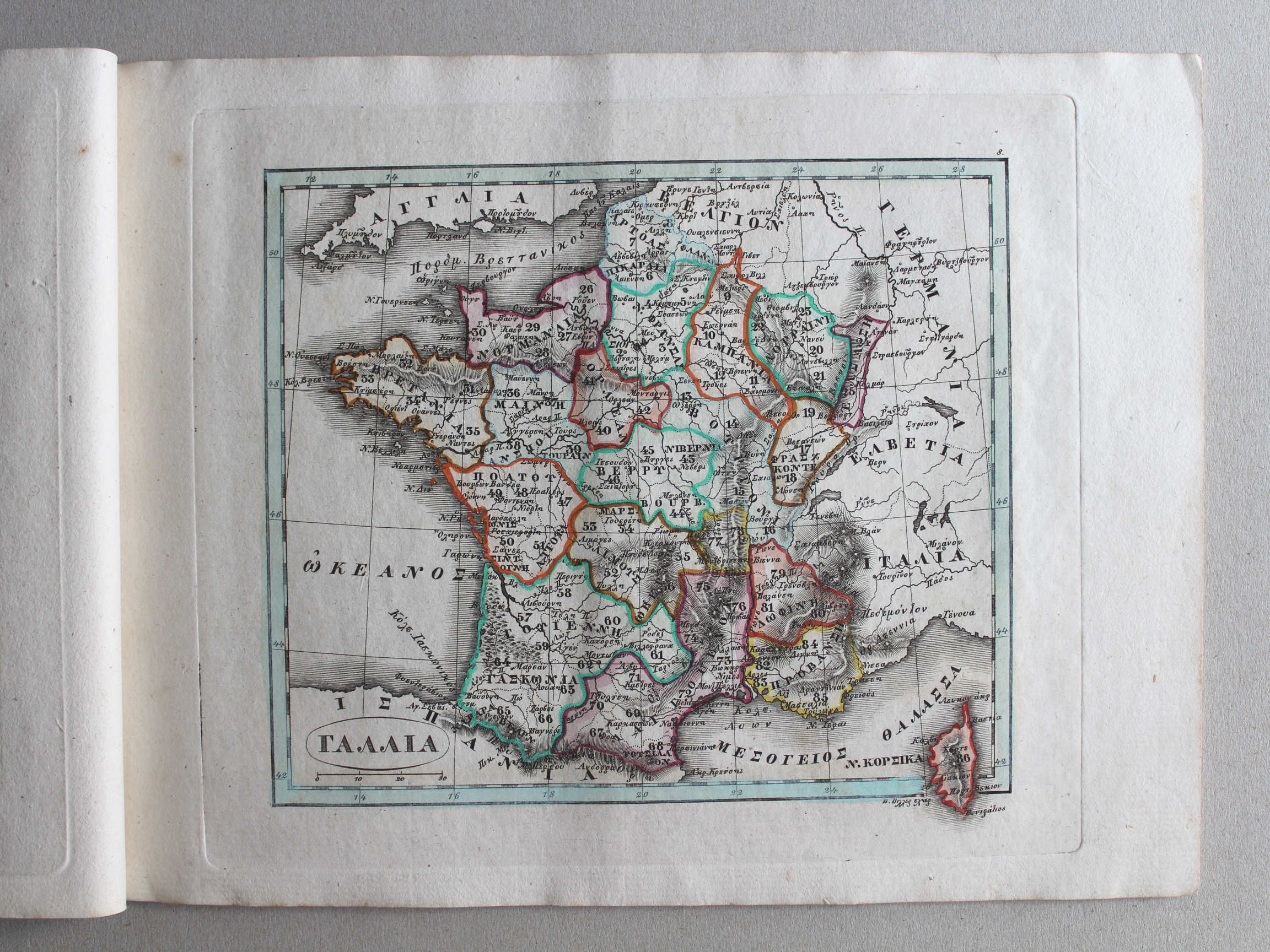
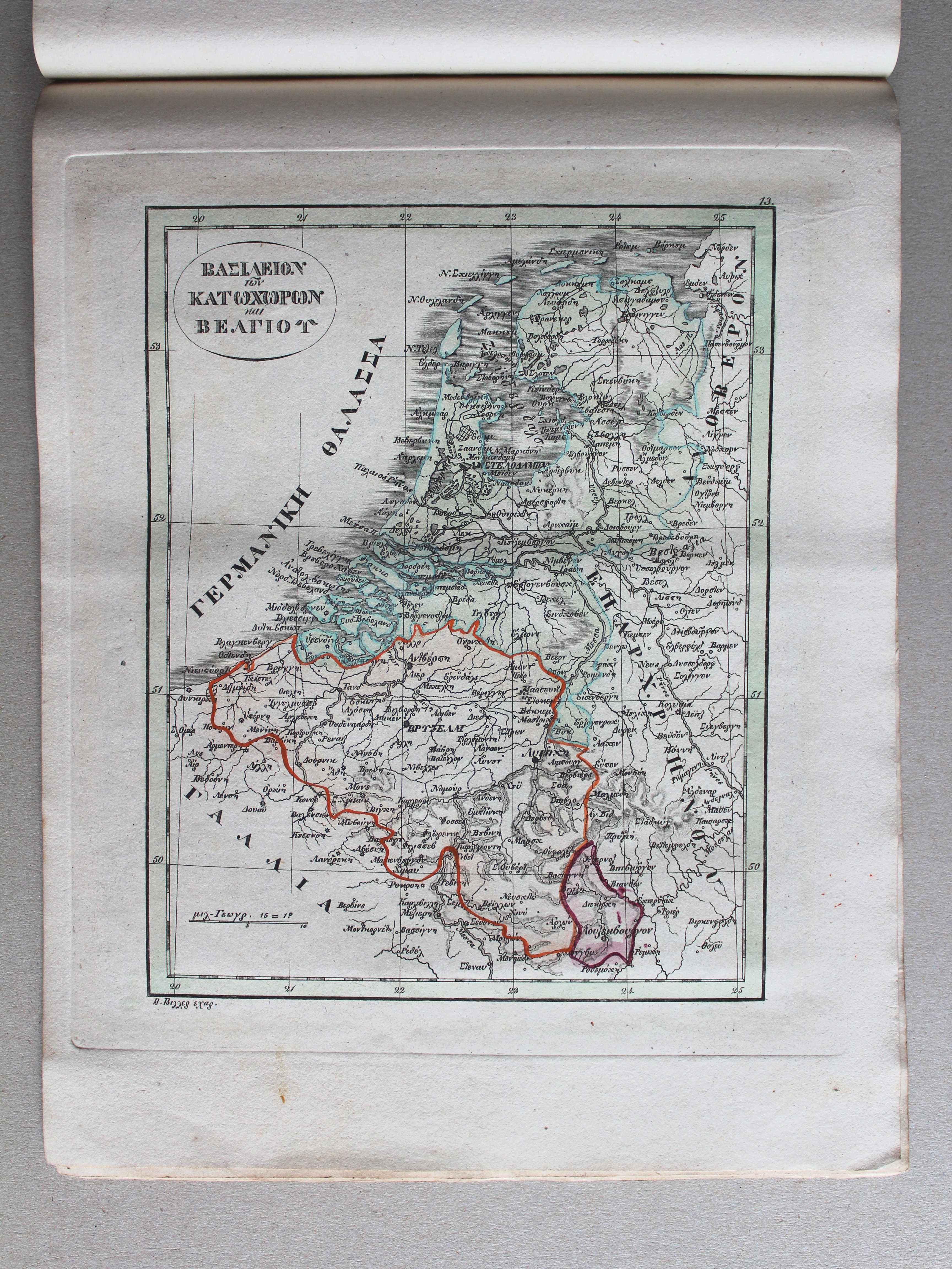
 Γενικός σχολαστικός ἄτλας / Genikos scholastikos atlas, 1837
13. ΒΑΣΙΛΕΙΟΝ τῶν ΚΑΤΩΧΩΡΩΝ καὶ ΒΕΛΓΙΟΥ XL
Koninkrijken Nederland en België / Kingdoms of the Netherlands and Belgium
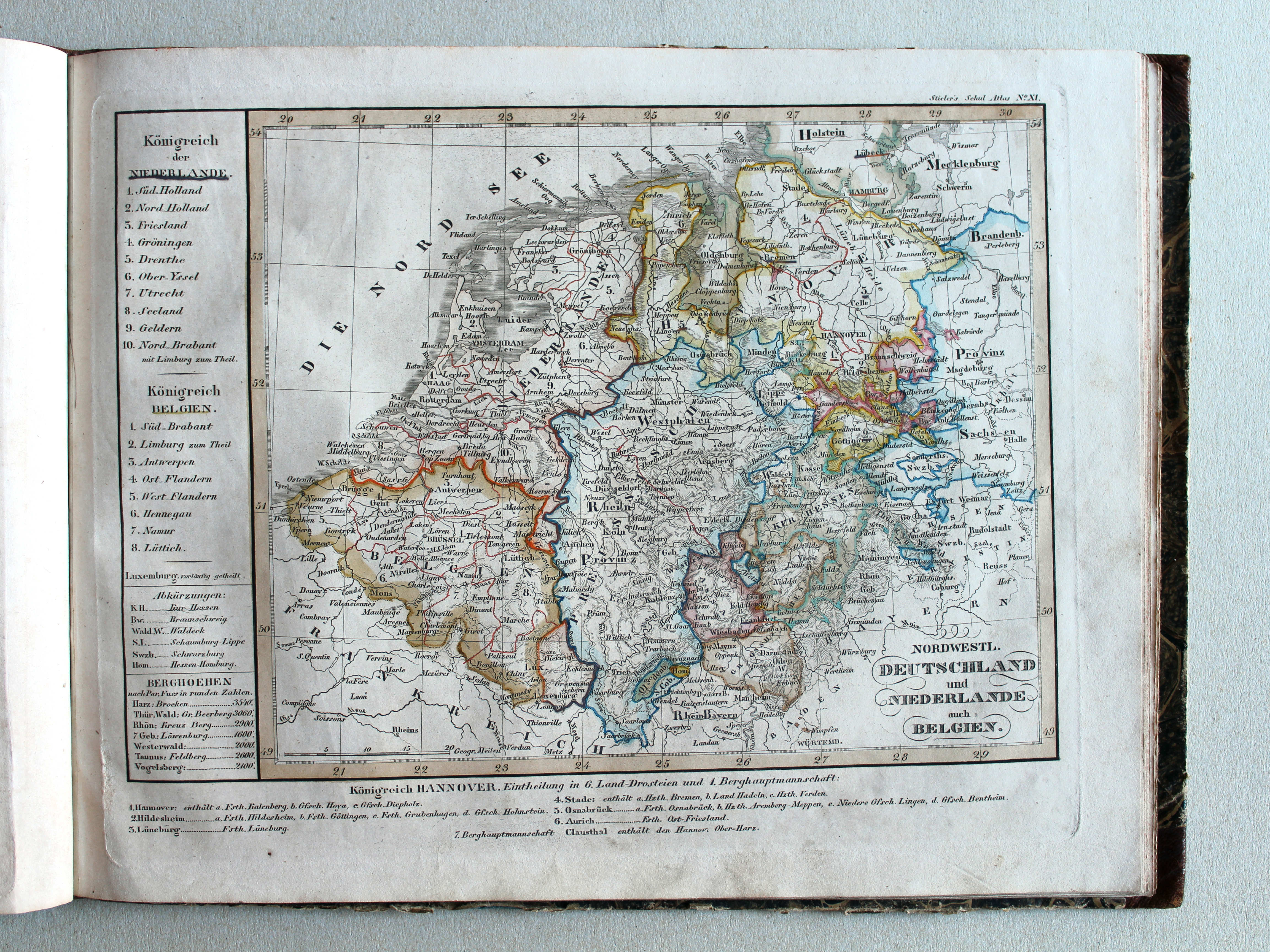
 Stielers Schul-Atlas, 1835
XI. Nordwestl. Deutschland und Niederlande, auch Belgien XL
Noordwest-Duitsland, Nederland en België / Northwestern Germany, Netherlands and Belgium
Γενικός σχολαστικός ἄτλας / Genikos scholastikos atlas, 1837
geen overeenkomstige kaart / no corresponding map
 Stielers Schul-Atlas, 1835
XII. Nordöstliches Deutschland XL
Noordoost-Duitsland / Northeastern Germany
Γενικός σχολαστικός ἄτλας / Genikos scholastikos atlas, 1837
geen overeenkomstige kaart / no corresponding map
 Stielers Schul-Atlas, 1835
XIII. Südwestliches Deutschland und Schweiz XL
Zuidwest-Duitsland en Zwitserland / Southwestern Germany and Switzerland
 Γενικός σχολαστικός ἄτλας / Genikos scholastikos atlas, 1837
geen overeenkomstige kaart / no corresponding map
 Stielers Schul-Atlas, 1835
XIVa. Südöstliches Deutschland XL
Zuidoost-Duitsland / Southeastern Germany
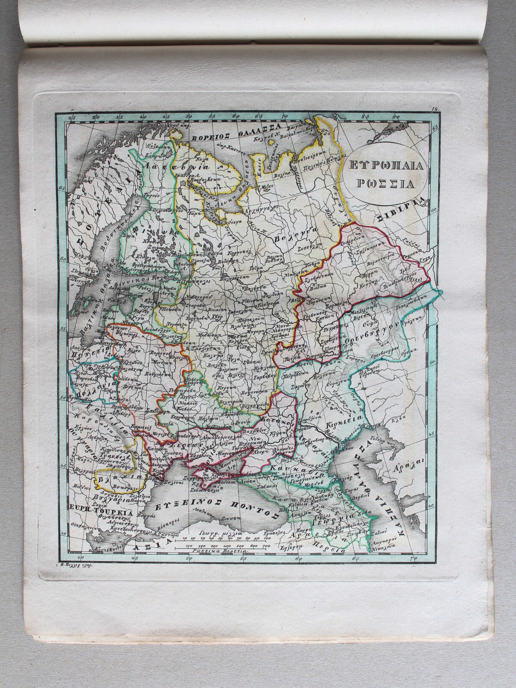 Γενικός σχολαστικός ἄτλας / Genikos scholastikos atlas, 1837
14. ΕΥΡΟΠΑΙΑ ΡΩΣΣΙΑ XL
Europees Rusland / Russia in Europe

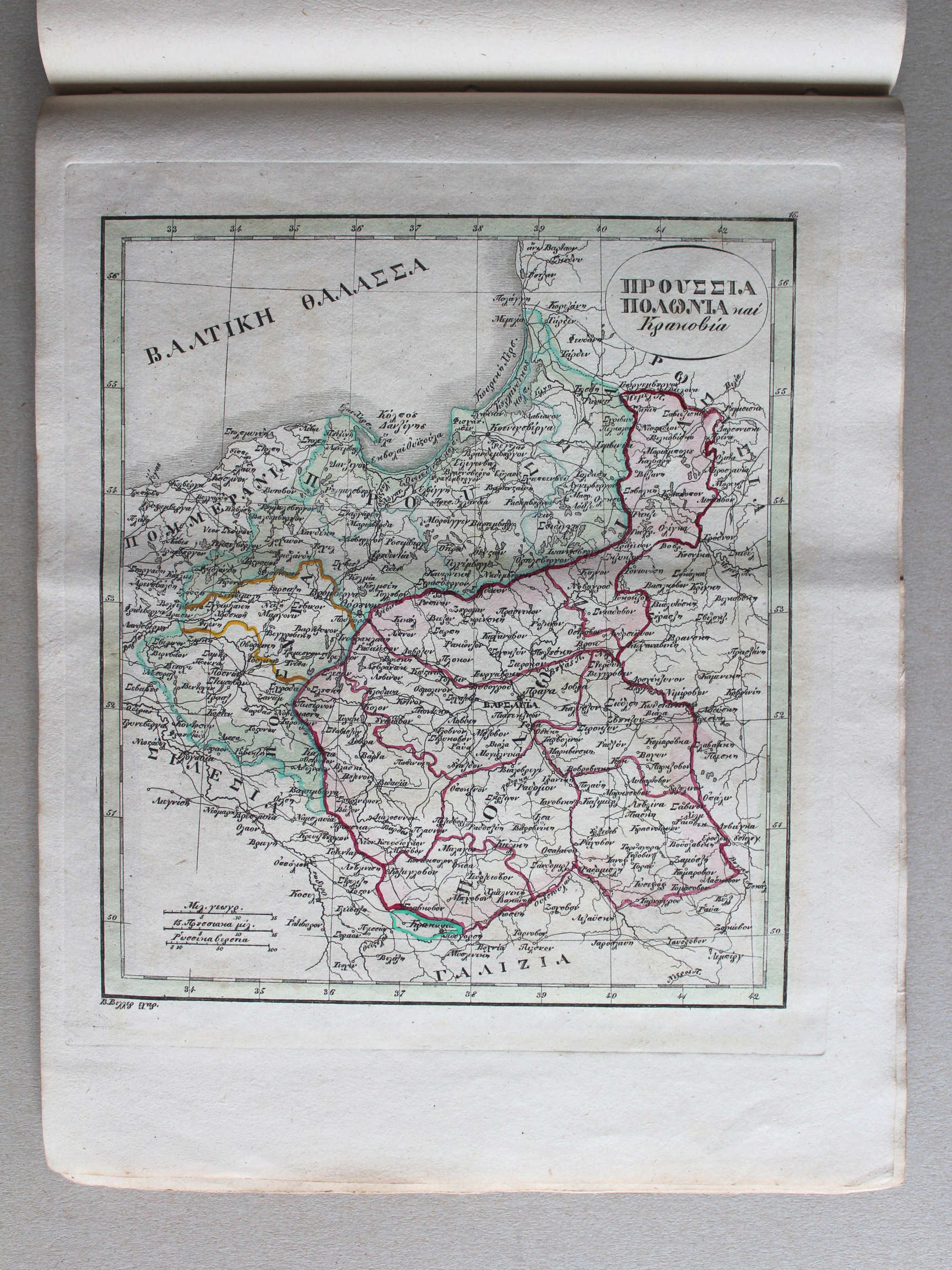 Γενικός σχολαστικός ἄτλας / Genikos scholastikos atlas, 1837
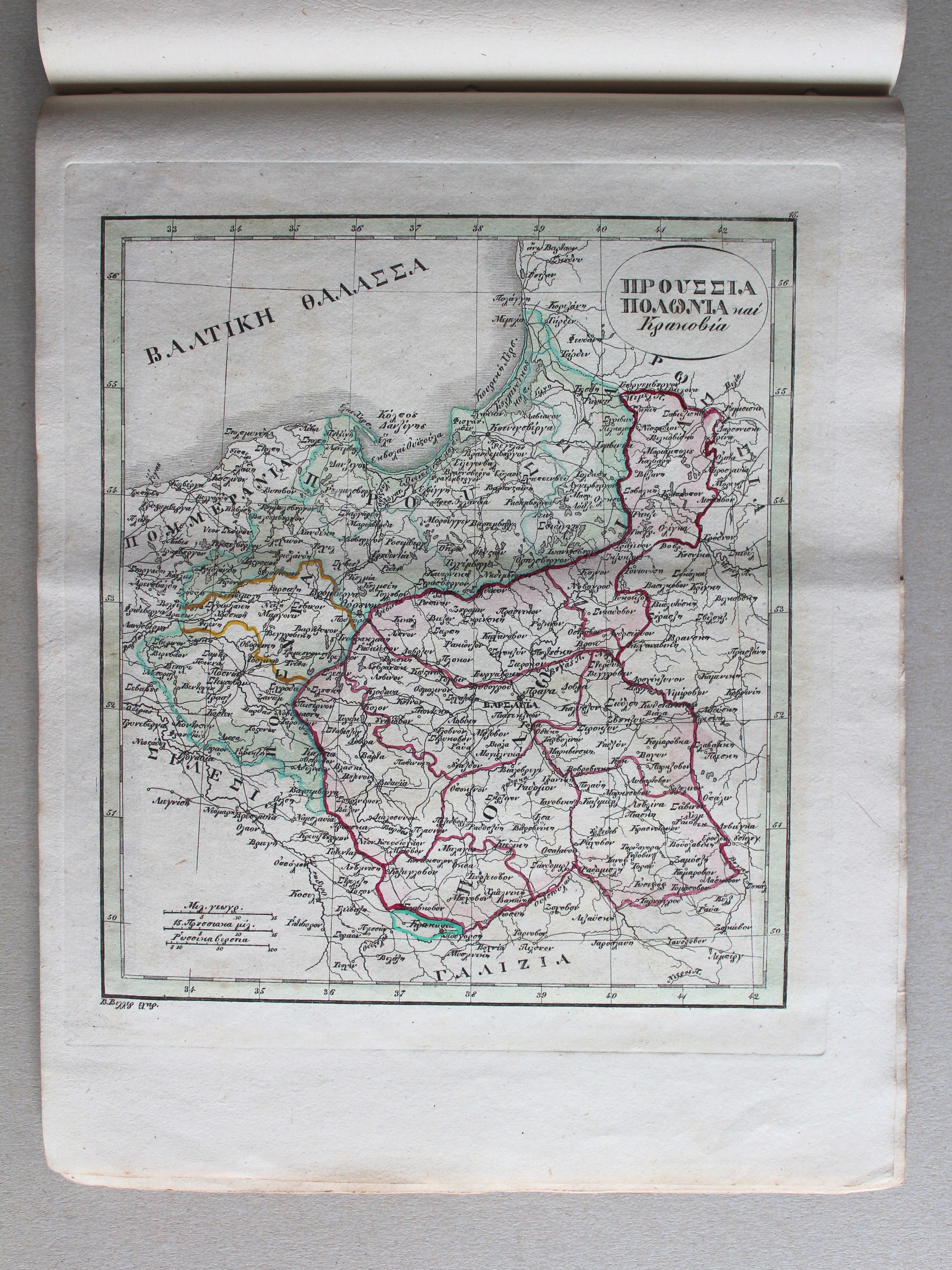
15. ΠΡΟΥΣΣΙΑ, ΠΟΛΩΝΙΑ καὶ Κρακοβία XL
Pruisen, Polen en Krakau / Prussia, Poland and Cracow
 Stielers Schul-Atlas, 1835
XVa. Preussen, Polen, Galizien, Ungarn, Siebenbürgen XL
Pruisen, Polen, Galicië, Hongarije, Zevenburgen / Prussia, Poland, Galicia, Hungary, Transylvania
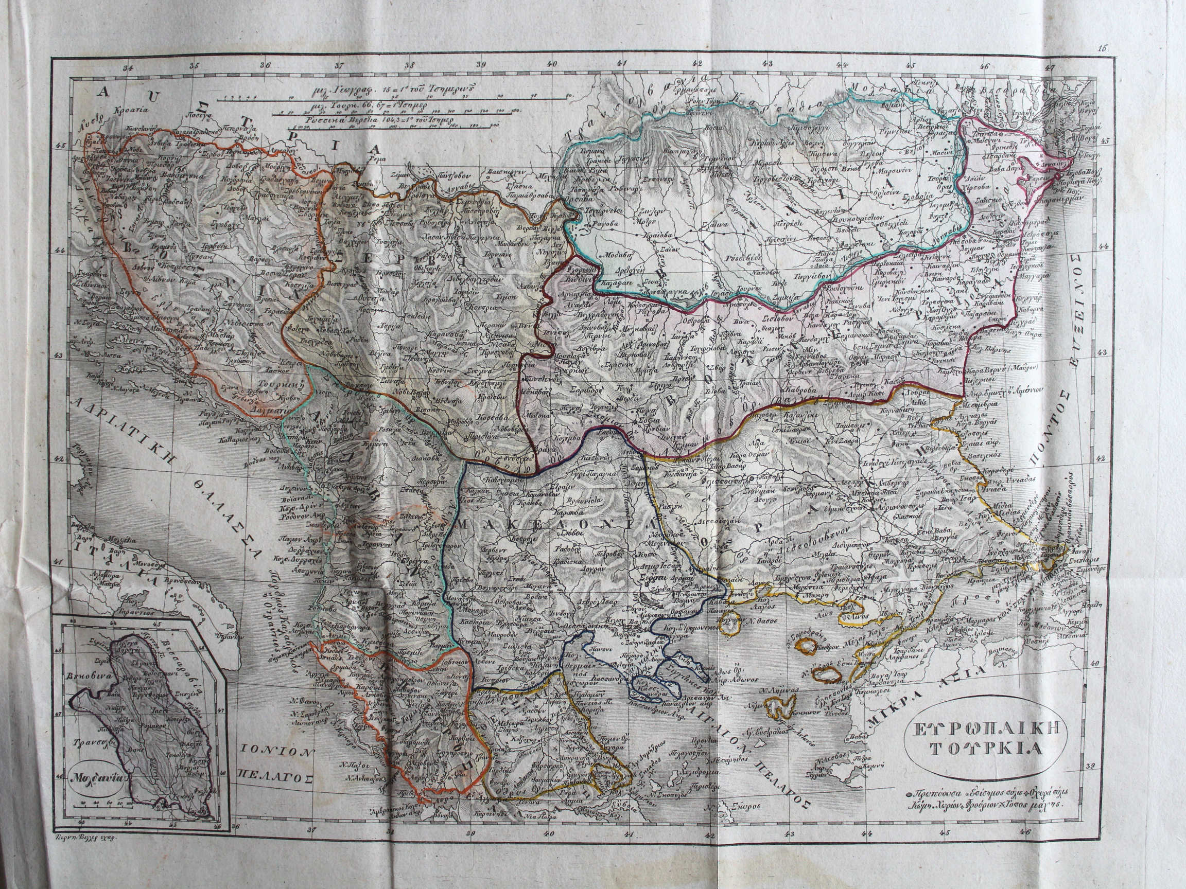
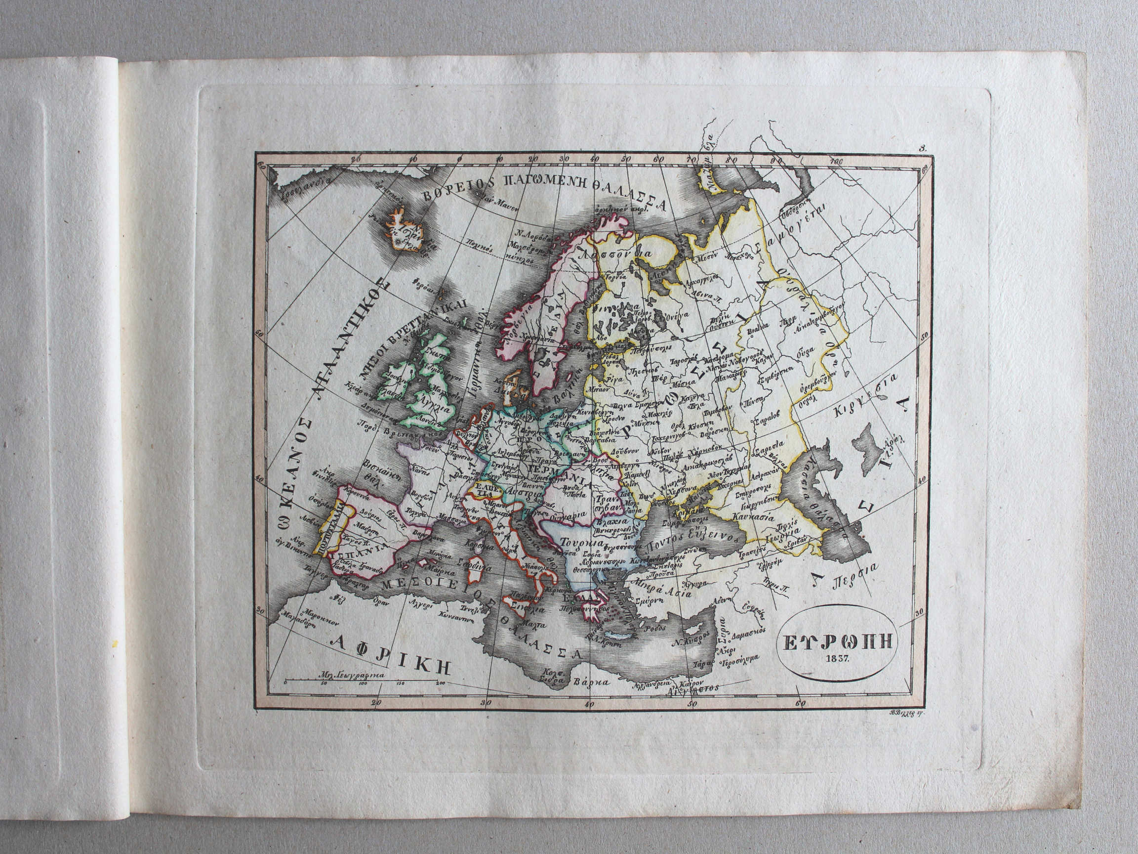
 Γενικός σχολαστικός ἄτλας / Genikos scholastikos atlas, 1837
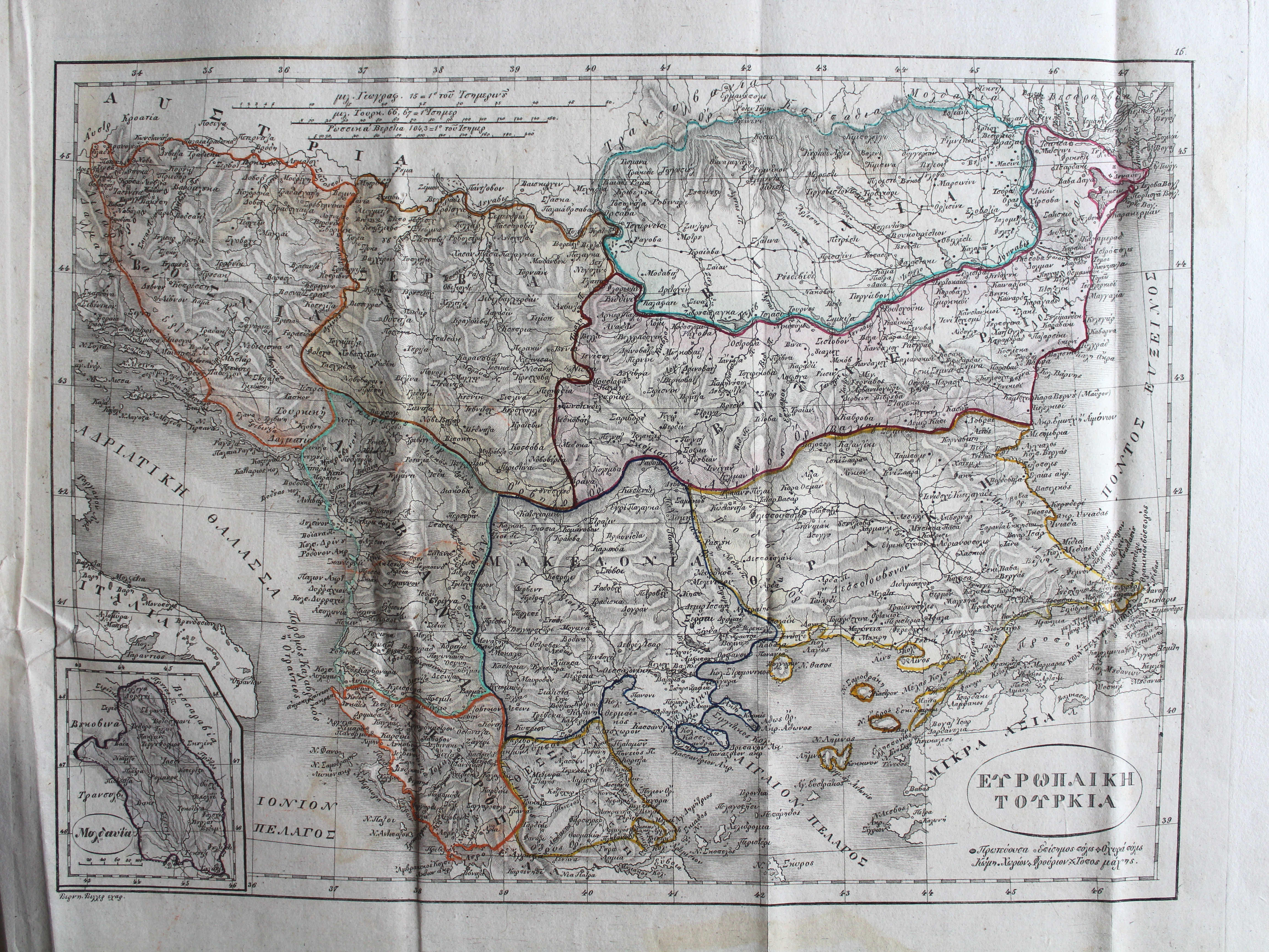
16. ΕΥΡΩΠΑΙΚΗ ΤΟΥΡΚΙΑ XL
Europees Turkije / Turkey in Europe
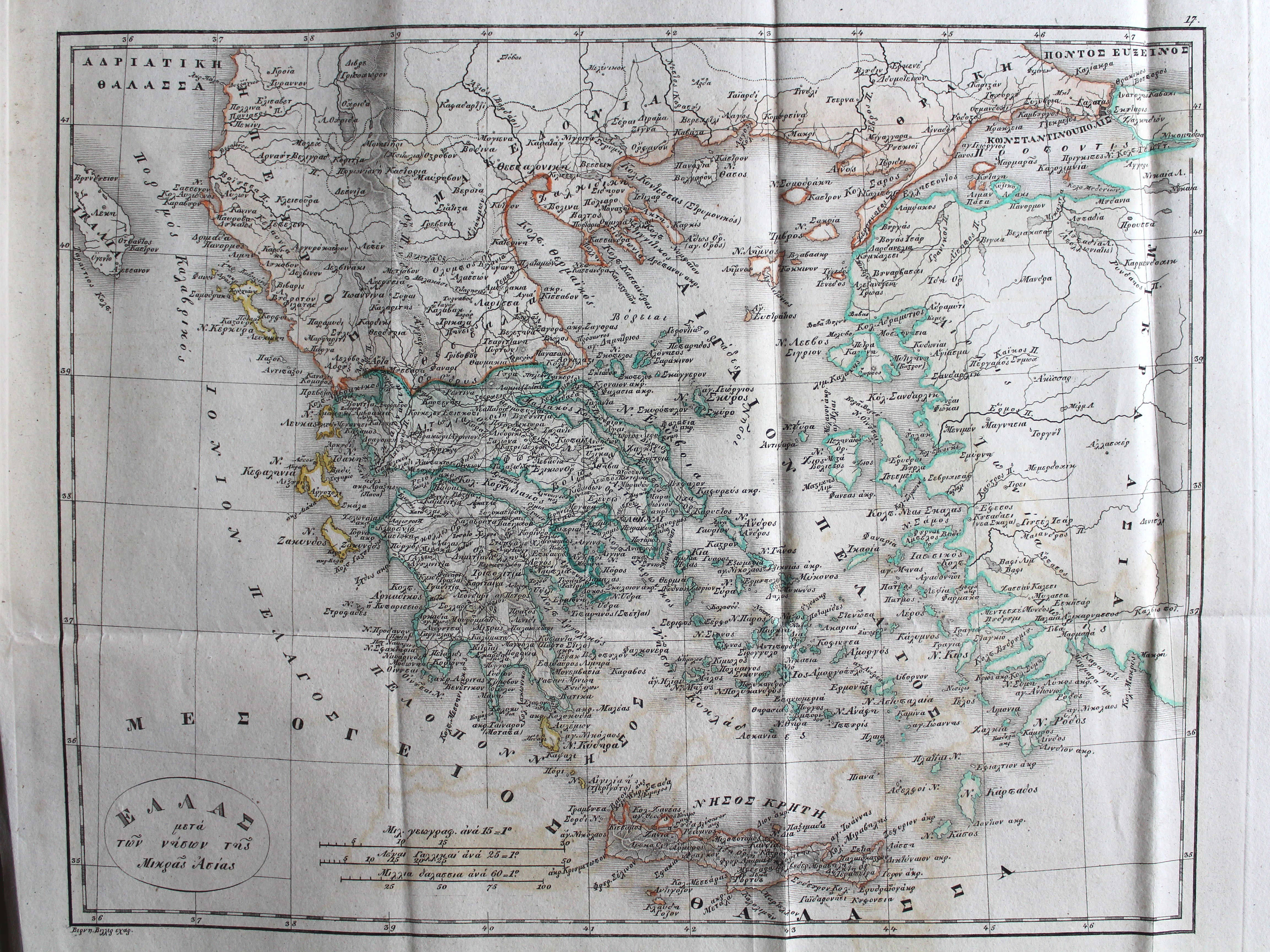
17. ΕΛΛΑΣ μετά τῶν νήσων τῆσ Μικρᾶς Ἀσίας XL
Griekenland en de eilanden van Klein-Azië / Greece and the island of Asia Minor
 Stielers Schul-Atlas, 1835
XVI. Die Europaeische Türkey, Griechenland und die Jonischen Inseln XL
Europees Turkije, Griekenland en de Ionische Eilanden / Turkey in Europe, Greece and the Ionian Islands
 Γενικός σχολαστικός ἄτλας / Genikos scholastikos atlas, 1837
geen overeenkomstige kaart / no corresponding map
 Stielers Schul-Atlas, 1835
XVIIb. Ostindien mit den Inseln XL
Oost-Indië en de Indische Archipel / East Indies and the Malay Archipelago


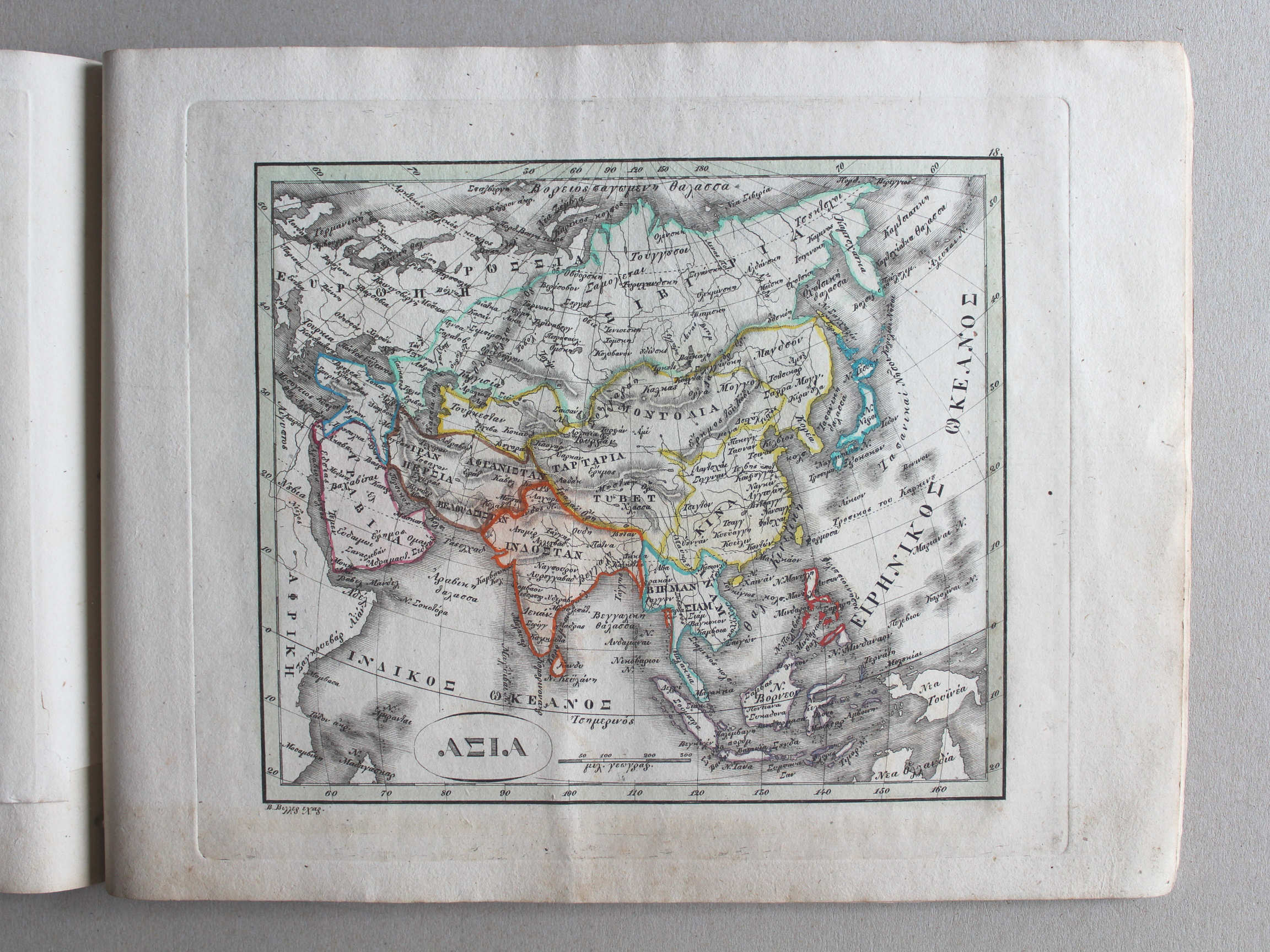
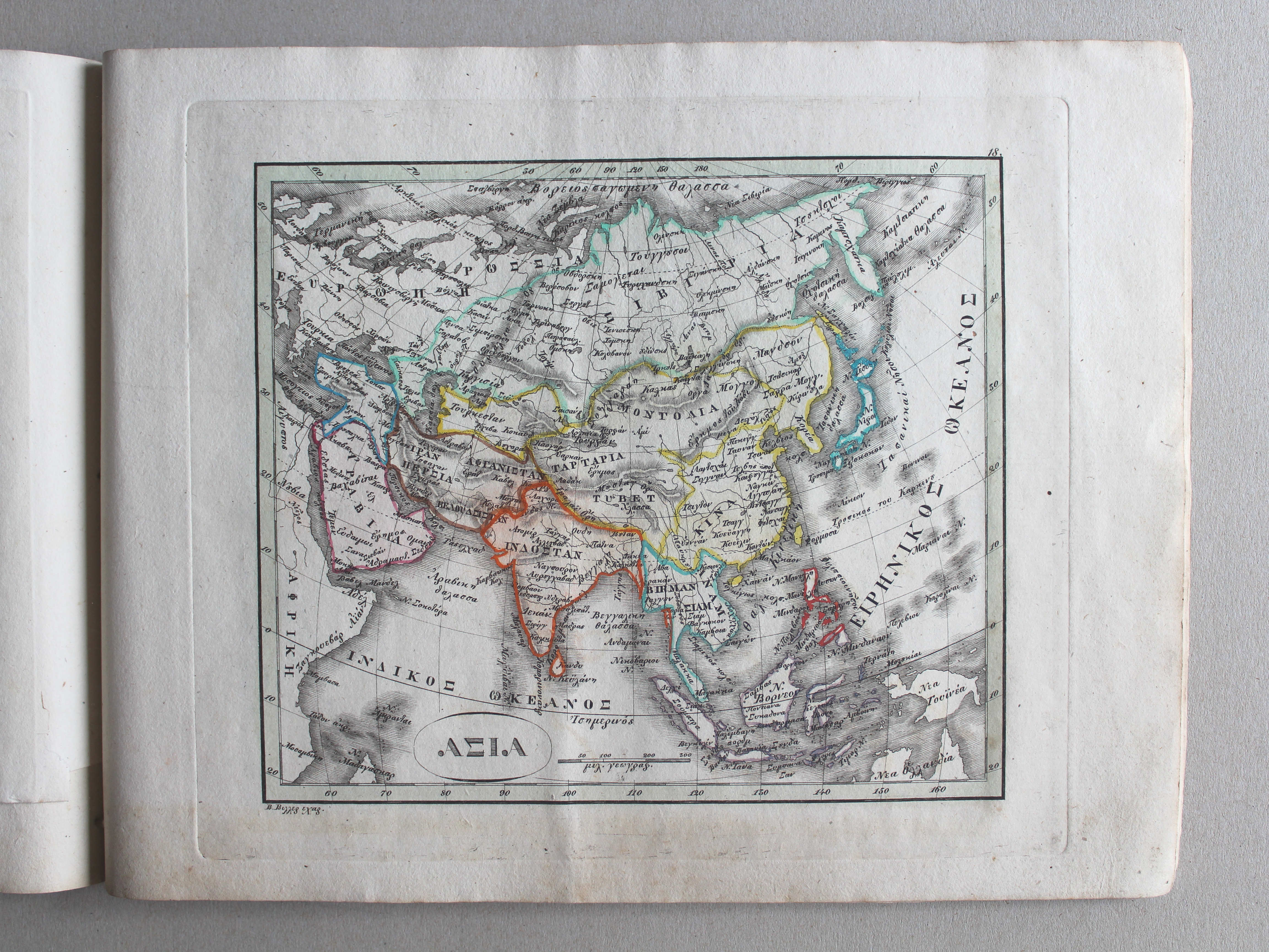
 Γενικός σχολαστικός ἄτλας / Genikos scholastikos atlas, 1837
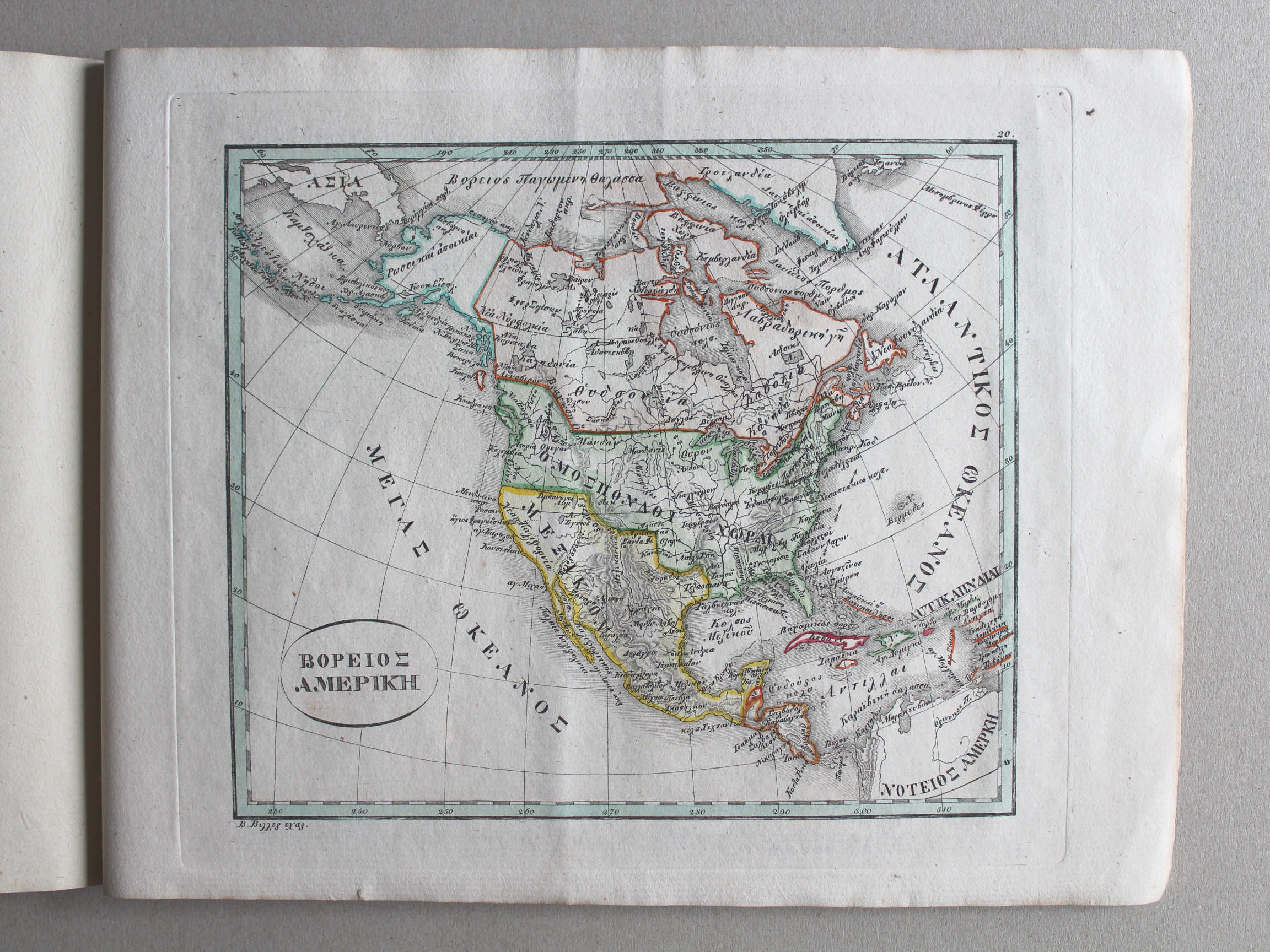
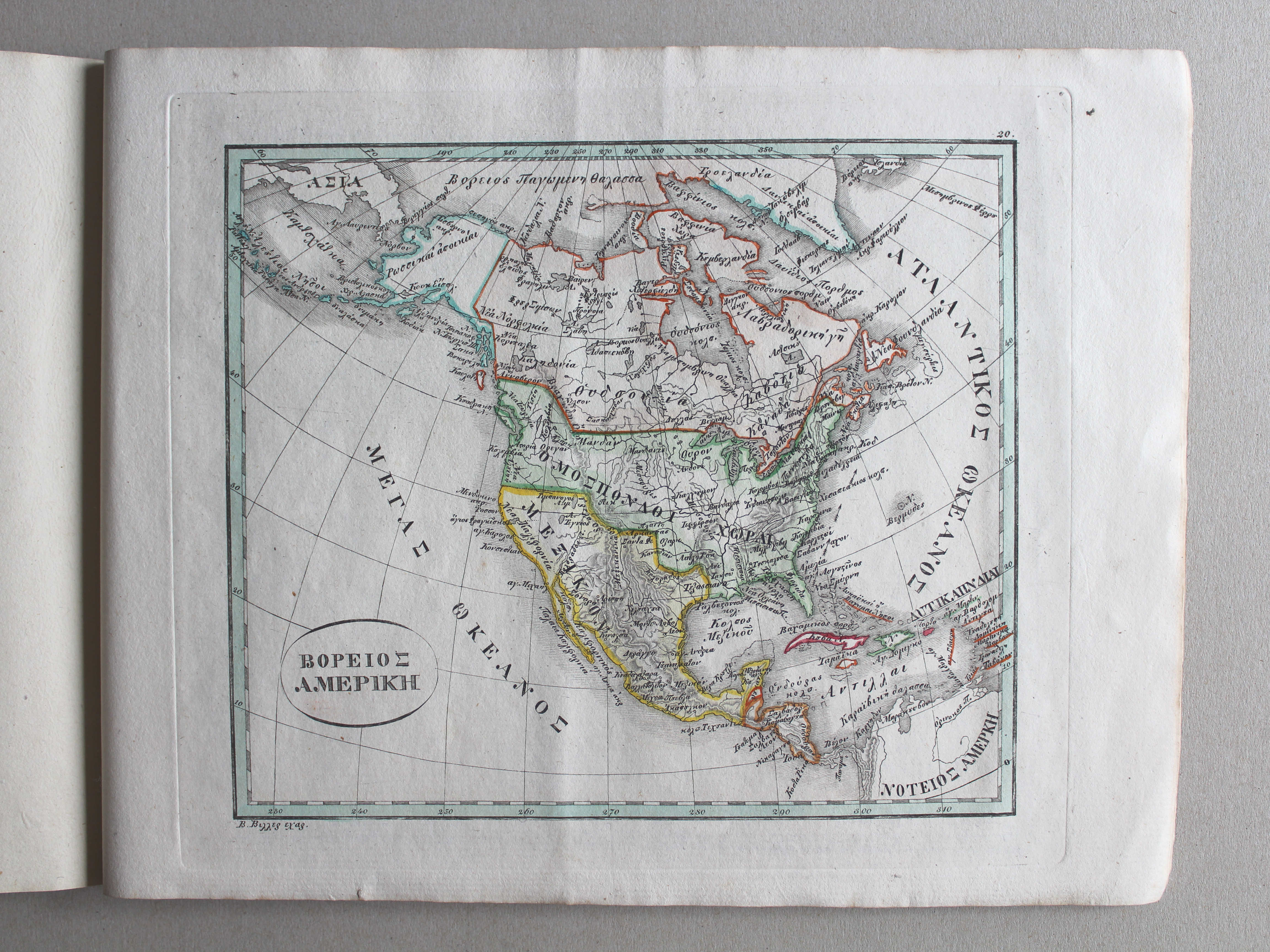
20. ΒΟΡΕΙΟΣ ΑΜΕΡΙΚΗ XL
Noord-Amerika / North America
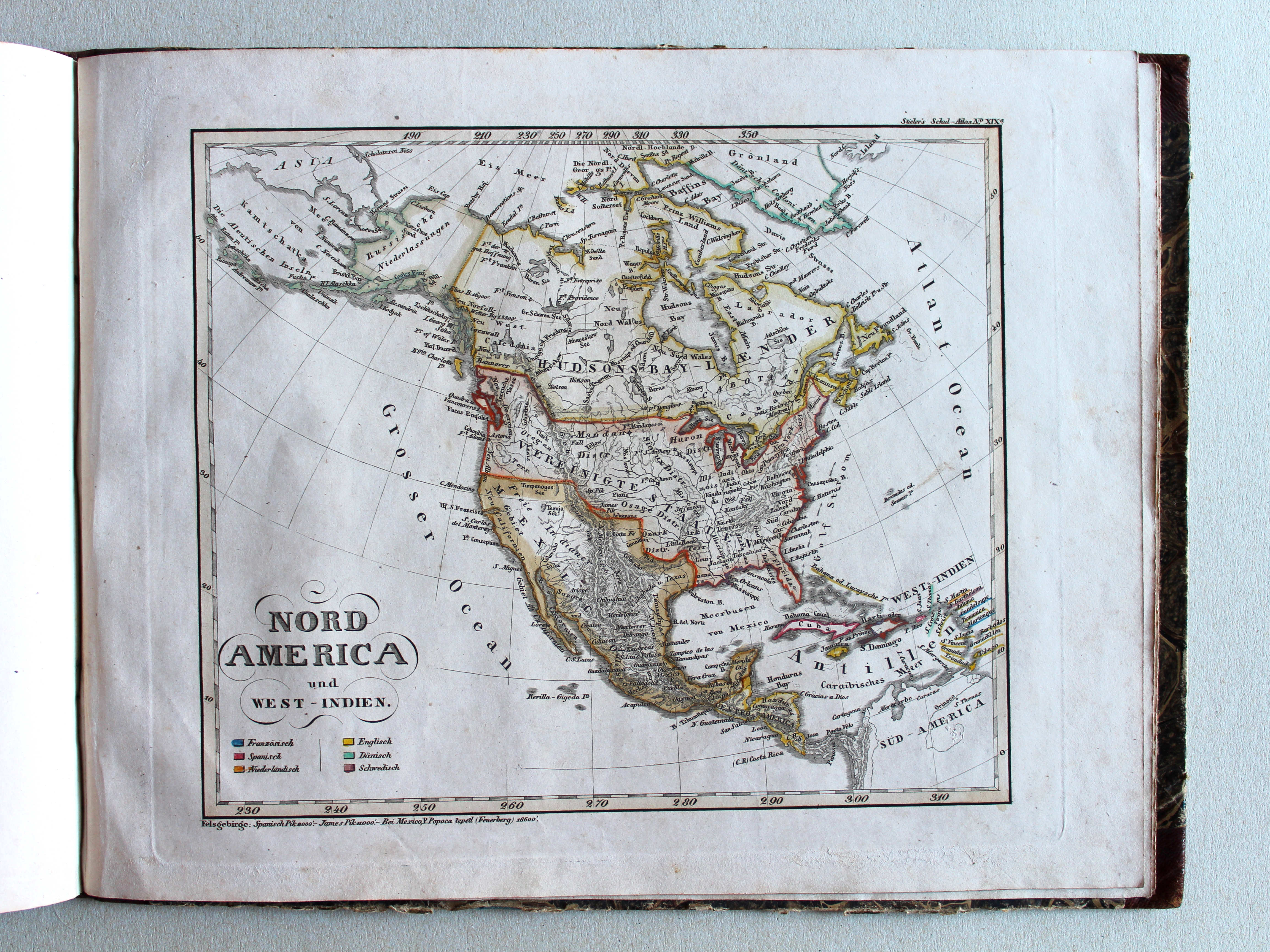
 Stielers Schul-Atlas, 1835
XIXa. Nord-America und West-Indien XL
Noord-Amerika en West-Indië / North America and West Indies
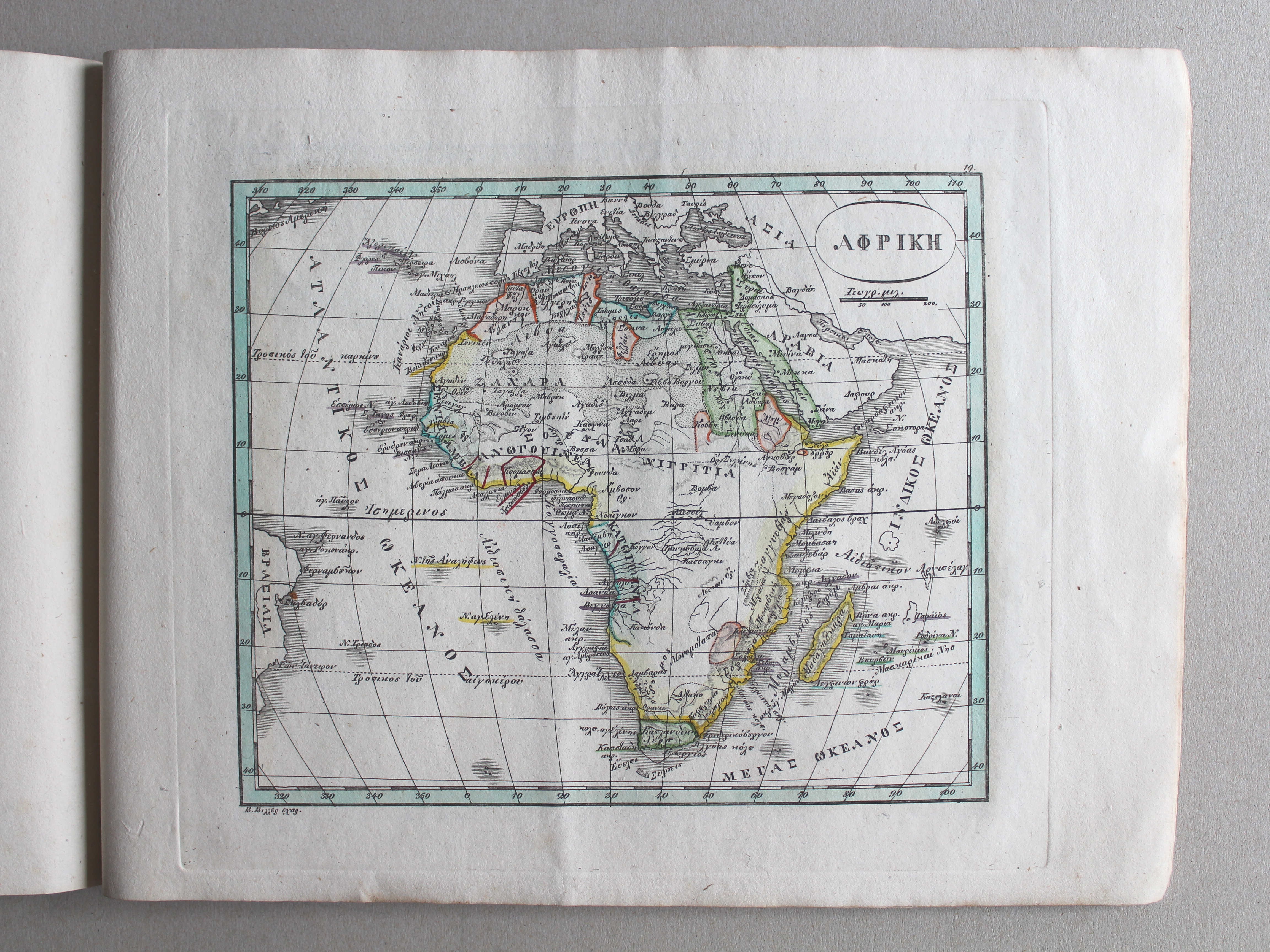
Γενικός σχολαστικός ἄτλας / Genikos scholastikos atlas, 1837
geen overeenkomstige kaart / no corresponding map
 Stielers Schul-Atlas, 1835
XIXb. Vereinigte Staaten von Nord-America, und Canada XL
Verenigde Staten van Noord-Amerika, en Canada / United States of North America, and Canada
Γενικός σχολαστικός ἄτλας / Genikos scholastikos atlas, 1837
geen overeenkomstige kaart / no corresponding map
 Stielers Schul-Atlas, 1835
XIXc. West-Indien und Centro-America XL
West-Indië en Midden-Amerika / West Indies and Central America
 Γενικός σχολαστικός ἄτλας / Genikos scholastikos atlas, 1837
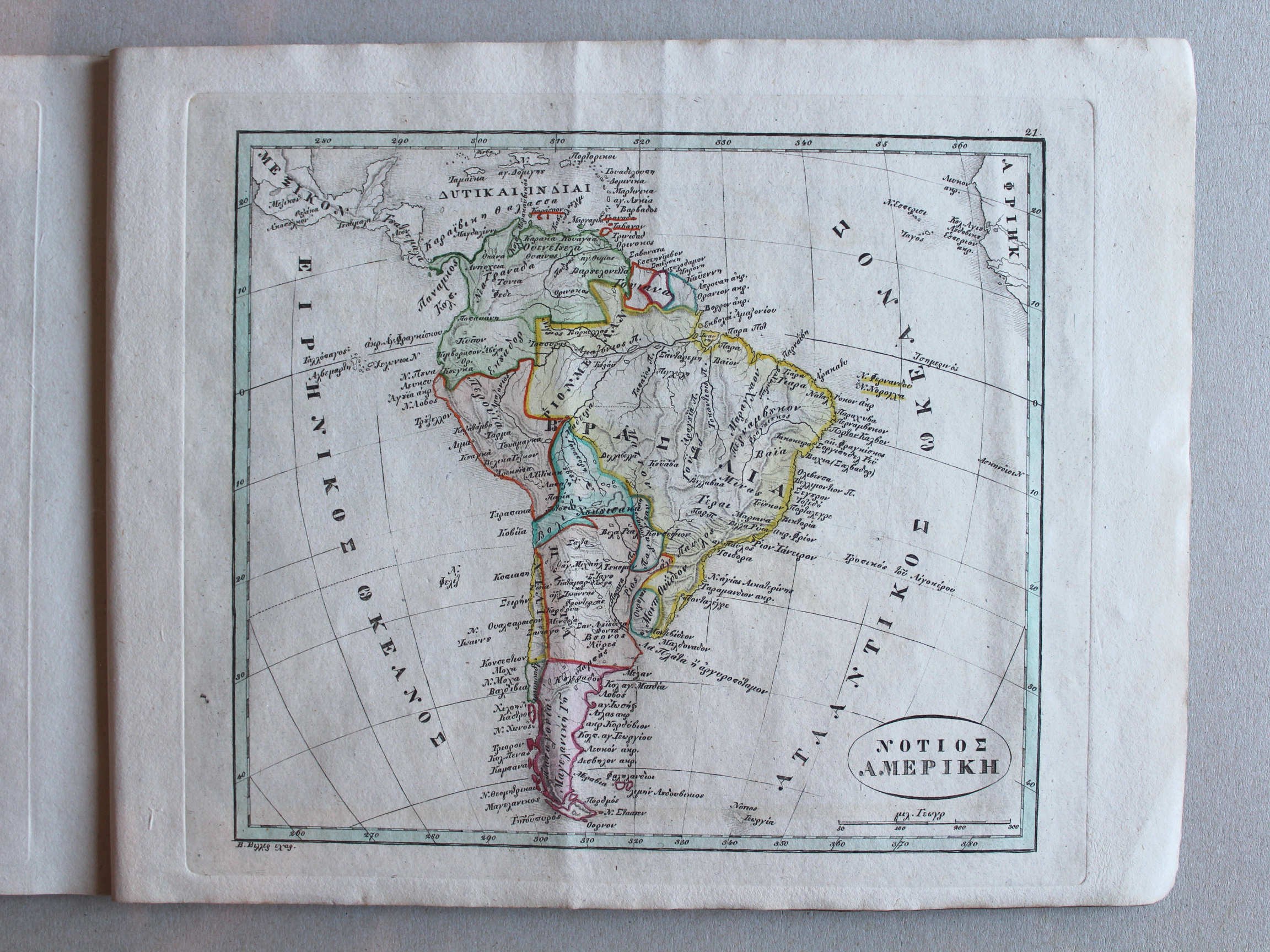
21. ΝΟΤΙΟΣ ΑΜΕΡΙΚΗ XL
Zuid-Amerika / South America

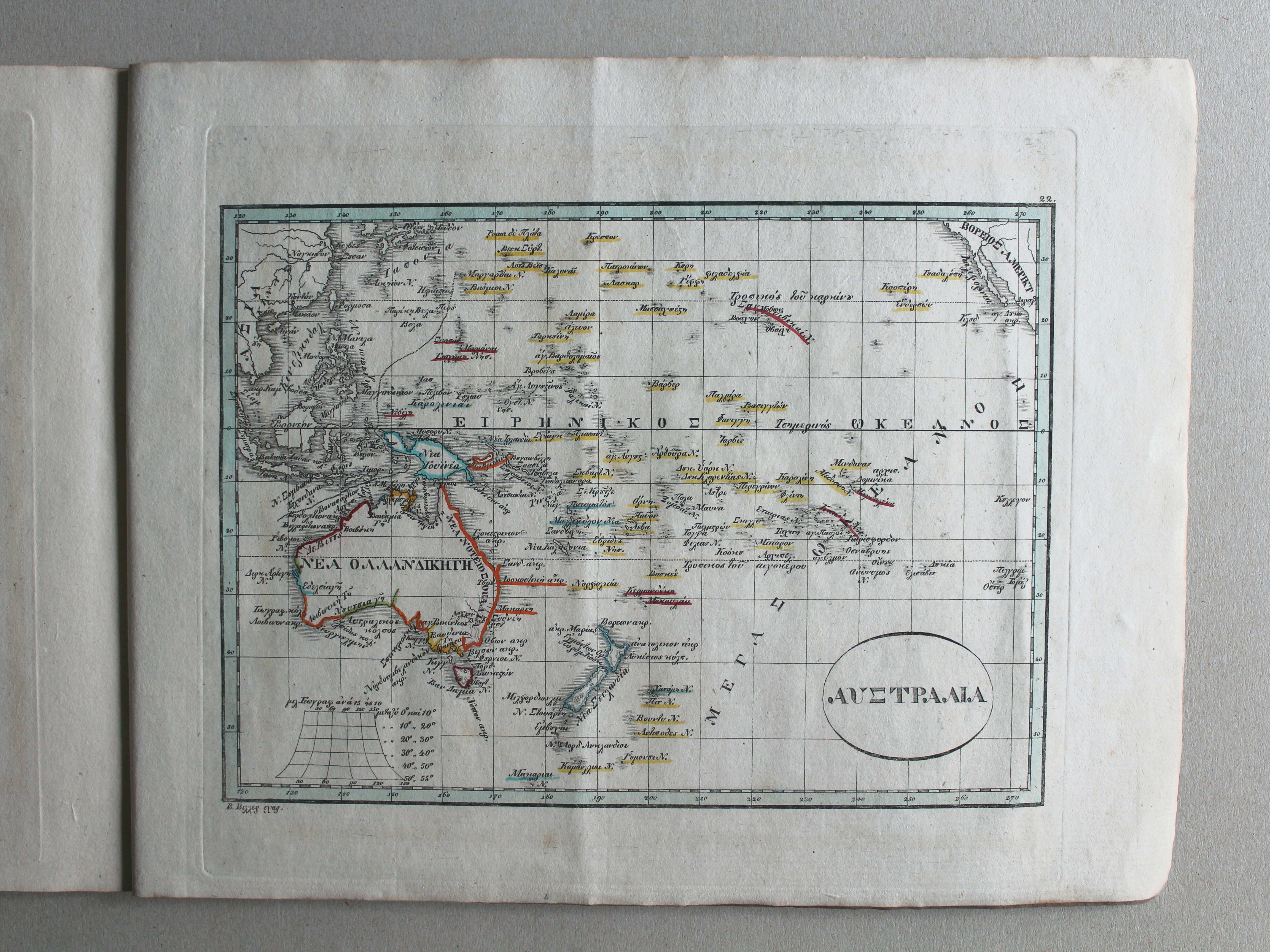
 Γενικός σχολαστικός ἄτλας / Genikos scholastikos atlas, 1837
22. ΑΥΣΤΡΑΛΙΑ XL
Australië en Oceanië / Australia and Oceania
Stielers Schul-Atlas, 1835
geen overeenkomstige kaart / no corresponding map
© M. Witkam, 2013
![]()
![]()