Topographisch-militairische Charte (1807-1832)
See below for (a summary of) this text in English.
Hieronder staat de beschrijving van de kaartserie. Daarbij horen ook de volgende pagina's
Titelgegevens
Titel: Topographisch-militairische Charte (Karte)
Uitgever: Geographisches Institut, Weimar
Jaar: 1807-1820 (1e druk), 1831-1832 (2e druk)
Titel (op bladwijzer):
Topographisch-militairische Charte von Teutschland in 204 Bl.
nebst Supplement in 46 Bl.,
Niederlande in 39 Bl. und Schweiz in 23 Bl.
Vertaling:
Topografisch-militaire kaart van Duitsland in 204 kaartbladen
met een supplement van 46 bladen,
Nederland in 39 bladen en Zwitserland in 23 bladen
Kaarten
 Topographisch-militairische Charte von Teutschland
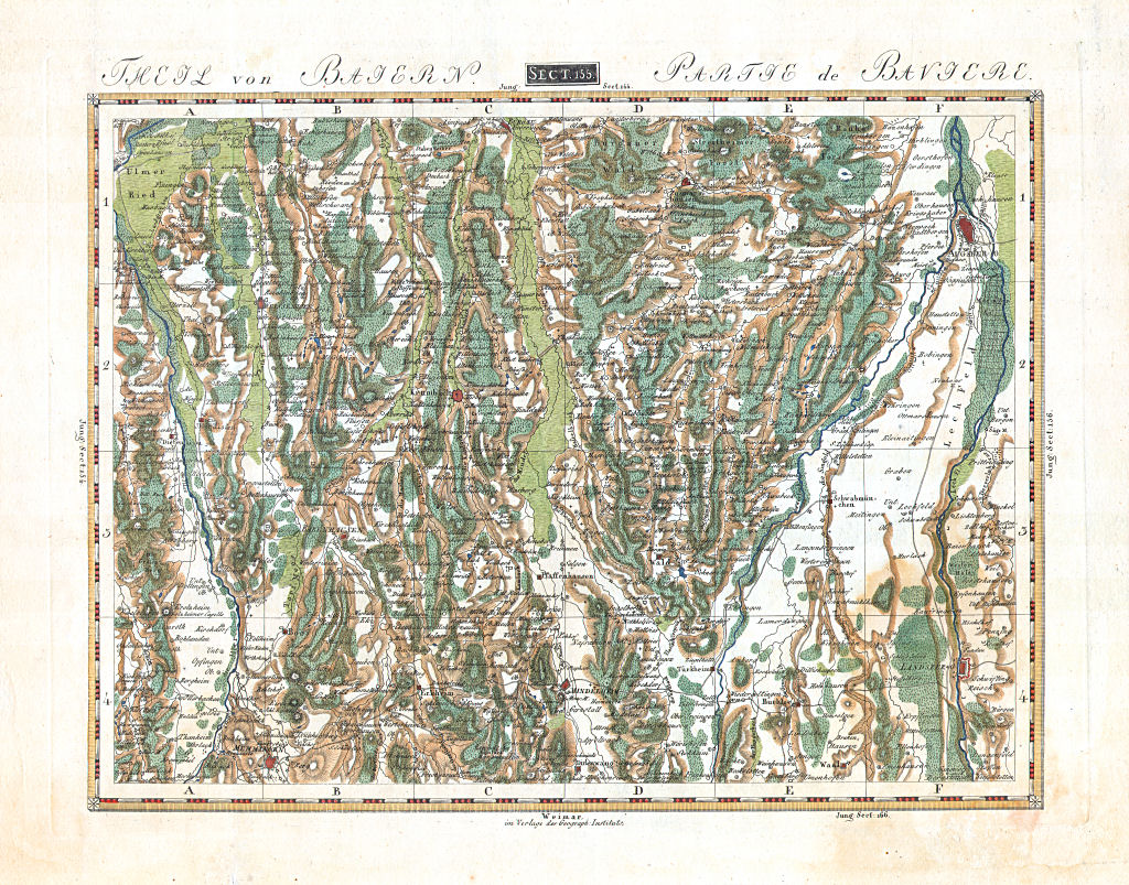
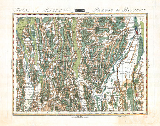
Theil von Baiern. Partie de Bavière.
Sect. 155: Augsburg
In 1806 was Daniel Gottlob Reymann (1759-1837), inspecteur van het Kaartendepot (Plankammer) van het Pruisische leger, begonnen met het vervaardigen van een topografische kaart van Midden-Europa op de schaal 1:200.000. Deze kaart staat bekend als Reymann's Special-Karte. Door de oorlog met Frankrijk waren daarvan in 1815 pas 6 van de geplande ca. 400 bladen gereed.
Friedrich Justin Bertuch (1747-1822), directeur van het Landes-Industrie-Comptoir en het Geographische Institut in Weimar, zag daardoor – al rond 1807 – de gelegenheid om zelf een serie kaarten uit te geven: de 'Topographisch-militairische Charte von Teutschland'.
Van deze serie kaarten, op een schaal van ongeveer 1:180.000, waren oorspronkelijk 204 bladen of secties (Section) gepland die het gebied van de Duitse Bond moesten beslaan. Het geheel was voorzien van een uitgebreid plaatsnamenregister in 4 delen met als titel
- Repertorium aller Oerter und anderer Gegenstände in der topographisch-militärischen Charte von Teutschland
Daaraan zijn later supplementen toegevoegd, ook voor het gebied van Nederland (toen nog met België), Zwitserland en het deel van Pruisen dat buiten de Duitse Bond lag. In totaal bestond de serie uit ongeveer 400 bladen.
Delen van de serie werden ook apart verkocht. Zie voor de deelatlassen van de Duitse Bond uit het jaar 1819 het overzicht van de deelatlassen en de lijst van deelatlassen en kaarten. Ook waren enkele atlassen van gebieden buiten de Duitse Bond verkrijgbaar, zoals
- Topographisch-militairischer Atlas von dem Königreiche Preussen
(Oost- en West-Pruisen, 30 bladen) - Topographisch-militairischer Atlas von
dem Königreiche der Niederlande
(Nederland, 38 bladen) - Topographisch-militairischer Atlas von der Schweiz
(Zwitserland, 22 bladen)
De kaarten zijn vervaardigd in koperdruk. Ze met de hand gekleurd of ongekleurd gelaten. Bovenaan staat steeds het sectienummer in Romeinse cijfers, en soms ook een titel in het Duits en het Frans zoals
- Theil von Baiern. Partie de Bavière.
Onderaan de kaarten staat de naam van de uitgever
- Weimar, im Verlage des Geograph: Instituts.
In de marges van de kaarten staat de tekst 'Jung.Sect.' (jungit sectio = het aansluitende blad is) met het nummer van het naastliggende blad. De tekst 'Jung' wordt wel eens opgevat als de naam van de auteur van de kaart. De kaarten zijn verdeeld in 24 rechthoeken. In het kaartkader staan daarbij vaak, maar niet altijd, horizontaal de letters A-F, verticaal de cijfers 1-4. Hierdoor wordt het zoeken van een naam op de kaart met behulp van het register vergemakkelijkt.
Rond 1820 waren alle kaartbladen leverbaar – in tegenstelling tot de kaart van Reymann. Cartografen waren C.F. Weiland en onder andere ook Adolf Stieler en Heinrich Berghaus, die later hun naam gevestigd hebben bij Justus Perthes in Gotha. De kaarten werden goed verkocht, waardoor in 1831-1832 een geheel bijgewerkte 2e druk moest verschijnen.
Zie voor de bladindeling van de kaarten van de Duitse Bond, Nederland en Zwitserland de tabellen.
- de onderlinge ligging van de kaarten
- lijst van kaarten op nummer
- lijst van kaarten op naam
Bronnen:
- Geographische Ephemeriden 1819 p. 463-470 (Google books)
- Helmut Arnhold: Das Geographische Institut zu Weimar (blz. 15-16, 61)
Topographisch-militairische Charte (1807-1832)
- Below is a description of the map series in keywords. Related pages
- Title description
- Title: Topographisch-militairische Charte (Karte)
Publisher: Geographisches Institut, Weimar
Year: 1807-1820 (1st edition), 1831-1832 (2nd edition) - Title (on sheet index):
Topographisch-militairische Charte von Teutschland in 204 Bl.
nebst Supplement in 46 Bl.,
Niederlande in 39 Bl. und Schweiz in 23 Bl. Translation:
Topographical and military map of Germany in 204 map sheets
with a supplement of 46 sheets,
Netherlands in 39 sheets and Switzerland in 23 sheets
- Title: Topographisch-militairische Charte (Karte)
- Maps
 Topographisch-militairische Charte von Teutschland
Theil von Baiern. Partie de Bavière.
Sect. 155: Augsburg- In 1806, Daniel Gottlob Reymann (1759-1837), inspector of the Map Depot (Plankammer) of the Prussian Army, started working on a topographical map of Central Europe at the scale of 1:200,000. This map is usually called the Reymann's Special-Karte. Because of the war with France only 6 out of the projected 400 maps sheets were completed in 1815.
- Friedrich Justin Bertuch (1747-1822), director of the Landes-Industrie-Comptoir and the Geographische Institut in Weimar, therefore saw the opportunity – around 1807 already – to publish a series of maps: the 'Topographisch-militairische Charte von Teutschland'.
- This series of maps – at a scale of about 1:180,000 – was originally
planned to contain 204 sheets (sections) for the territory of the
German
Confederation. There was an extensive 4 volume name index with the
title
- Repertorium aller Oerter und anderer Gegenstände in der topographisch-militärischen Charte von Teutschland
- Supplements were added later on for the Netherlands (including the southern half, now Belgium), Switzerland and the part of Prussia that was outside the German Confederation. The complete series consisted of about 400 map sheets.
- Subsets of the series were also sold separately. The
partial atlases of the German
Confederation available in the year 1819 are given in the
overview of partial
atlases and the list of
partial atlases and
maps. Some regions outside the German Confederation also had their
partial atlases, such as
- Topographisch-militairischer Atlas von dem Königreiche Preussen
(East and West Prussia, 30 sheets) - Topographisch-militairischer
Atlas von dem Königreiche der Niederlande
(Netherlands, 38 sheets) - Topographisch-militairischer Atlas von der Schweiz
(Switzerland, 22 sheets)
- Topographisch-militairischer Atlas von dem Königreiche Preussen
- The maps were produced in copper engraving. They are hand colored or
uncolored as printed. In the top margin is the section number in Roman
numerals, and sometimes also a title in German and French, such as
- Theil von Baiern. Partie de Bavière.
- Weimar, im Verlage des Geograph: Instituts.
- Around 1820 all sheets were available – contrary to those of the Reymann map. Main cartographer was C.F. Weiland. Among the other cartographers were Adolf Stieler and Heinrich Berghaus, who made their reputation in later years at the publishing house of Justus Perthes in Gotha. The maps were a commercial success, so a second completely revised edition had to be published in 1831-1832.
- The sheet index for the maps of the German Confederation, the
Netherlands and Switzerland can be found in the table section.
- the lay-out of map sheets
- list of map sheets by number
- list of map sheets by name
Sources:
- Geographische Ephemeriden 1819 p. 463-470 (Google books)
- Helmut Arnhold: Das Geographische Institut zu Weimar (p. 15-16, 61)
© M. Witkam, 2009
(rev. 2012-06-04)
![]()
![]()