Topographisch-militairische Charte (1807-1832)
See below for (a summary of) this text in English.
Hieronder staan plaatjes van de kaartserie. Daarbij horen ook de volgende pagina's
- Beschrijving van de kaartserie
- Tabellen en lijsten bij de kaartserie
Plaatjes
Klik op een plaatje voor een vergroting.
Topographisch-militairische Charte (1807-1832)
- Below are pictures of the map series. Related pages
- Description of the map series
- Tables and lists to the map series
Pictures
Click on a picture to enlarge.
Bladwijzers / Sheet indexes
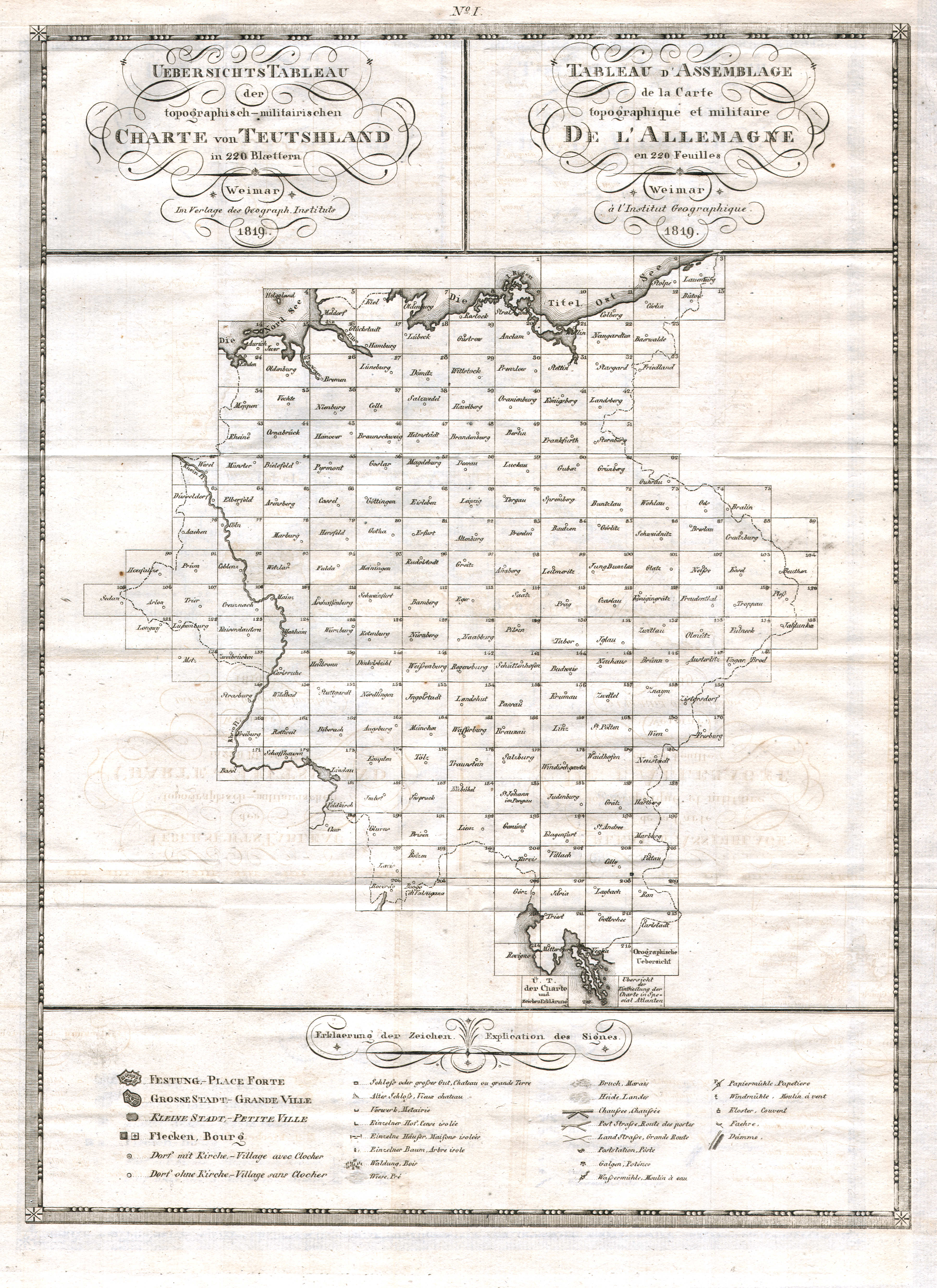
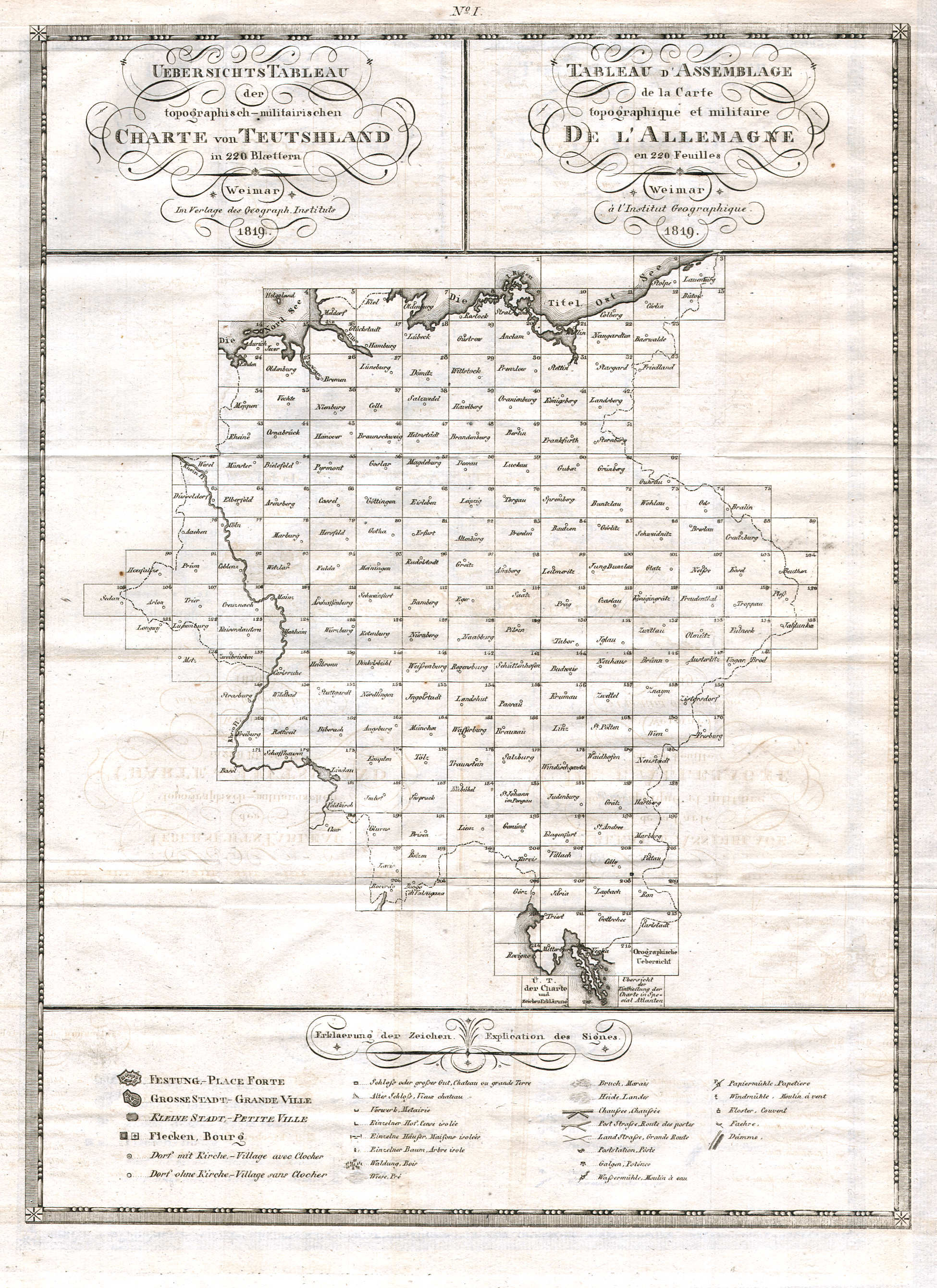 Topographisch-militairische Charte von Teutschland (1819)
Uebersichtstableau I / Tableau d'Assemblage I XL
Bladwijzer 1 / Sheet index 1
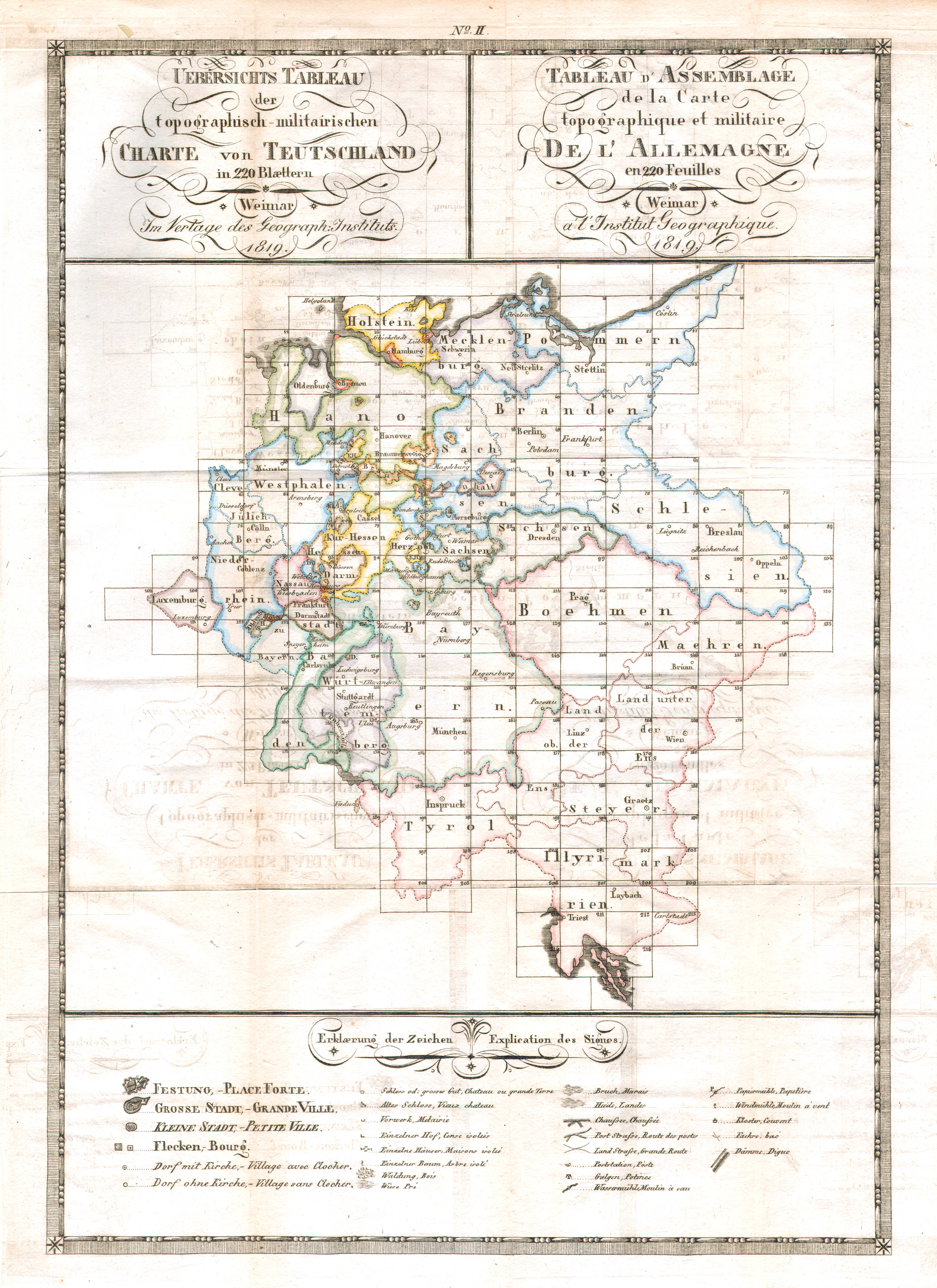
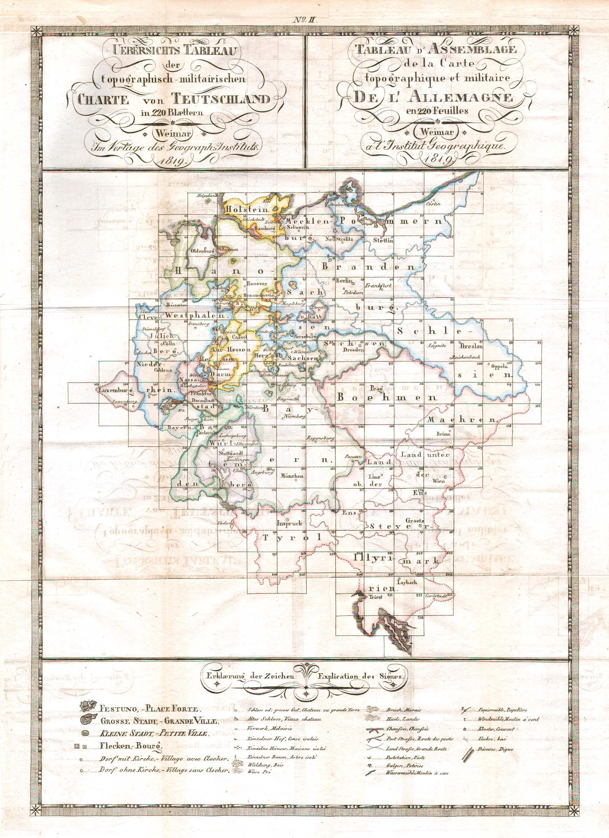 Topographisch-militairische Charte von Teutschland (1819)
Uebersichtstableau II / Tableau d'Assemblage II XL
Bladwijzer 2 / Sheet index 2
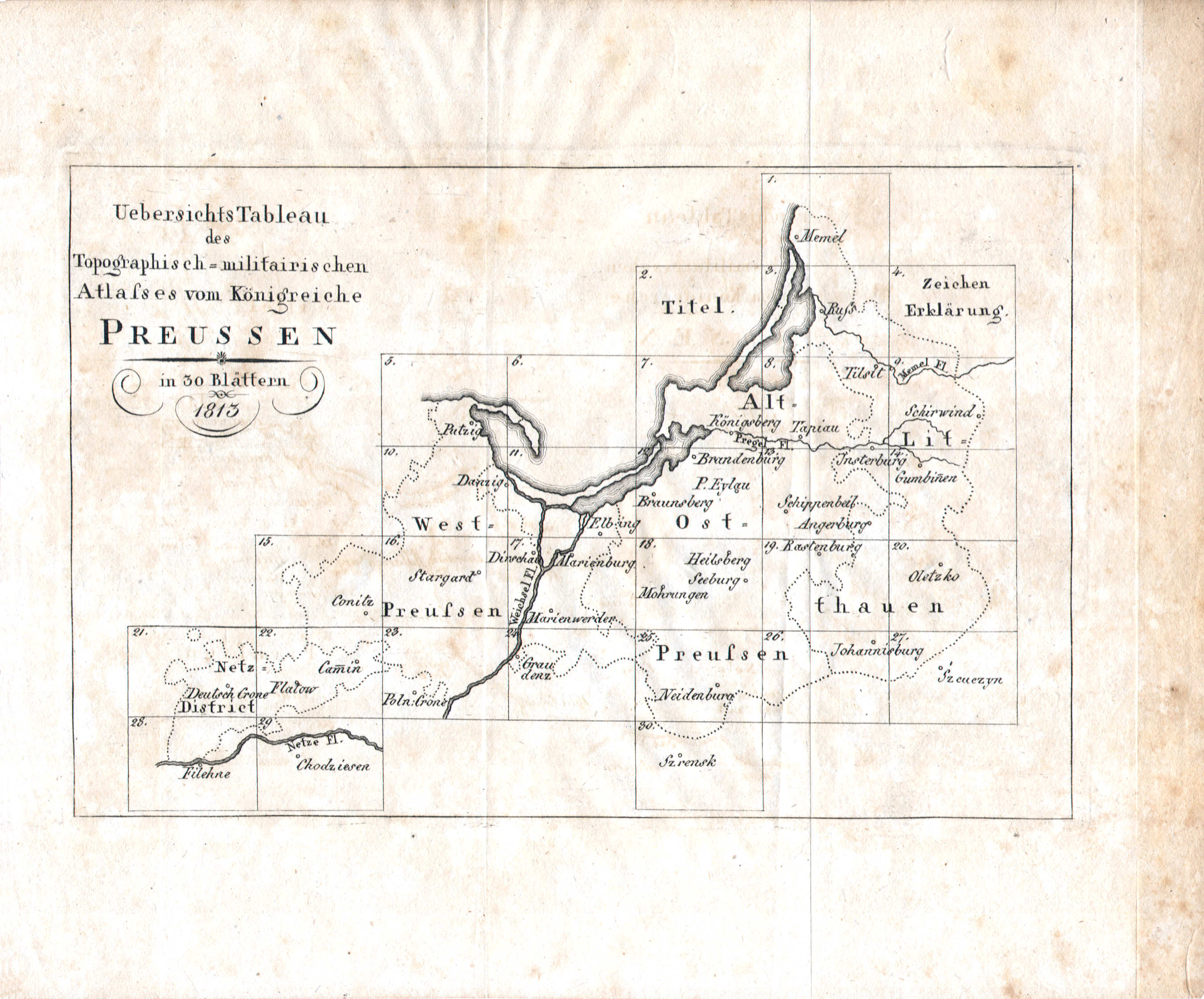
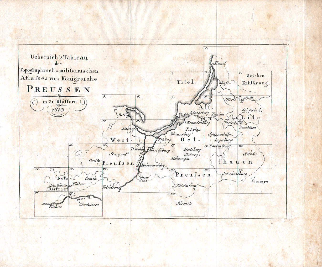 Topographisch-militairischer Atlas von Preussen (1813)
Uebersichtstableau XL
Bladwijzer / Sheet index
Voorbeeldkaart / Example map
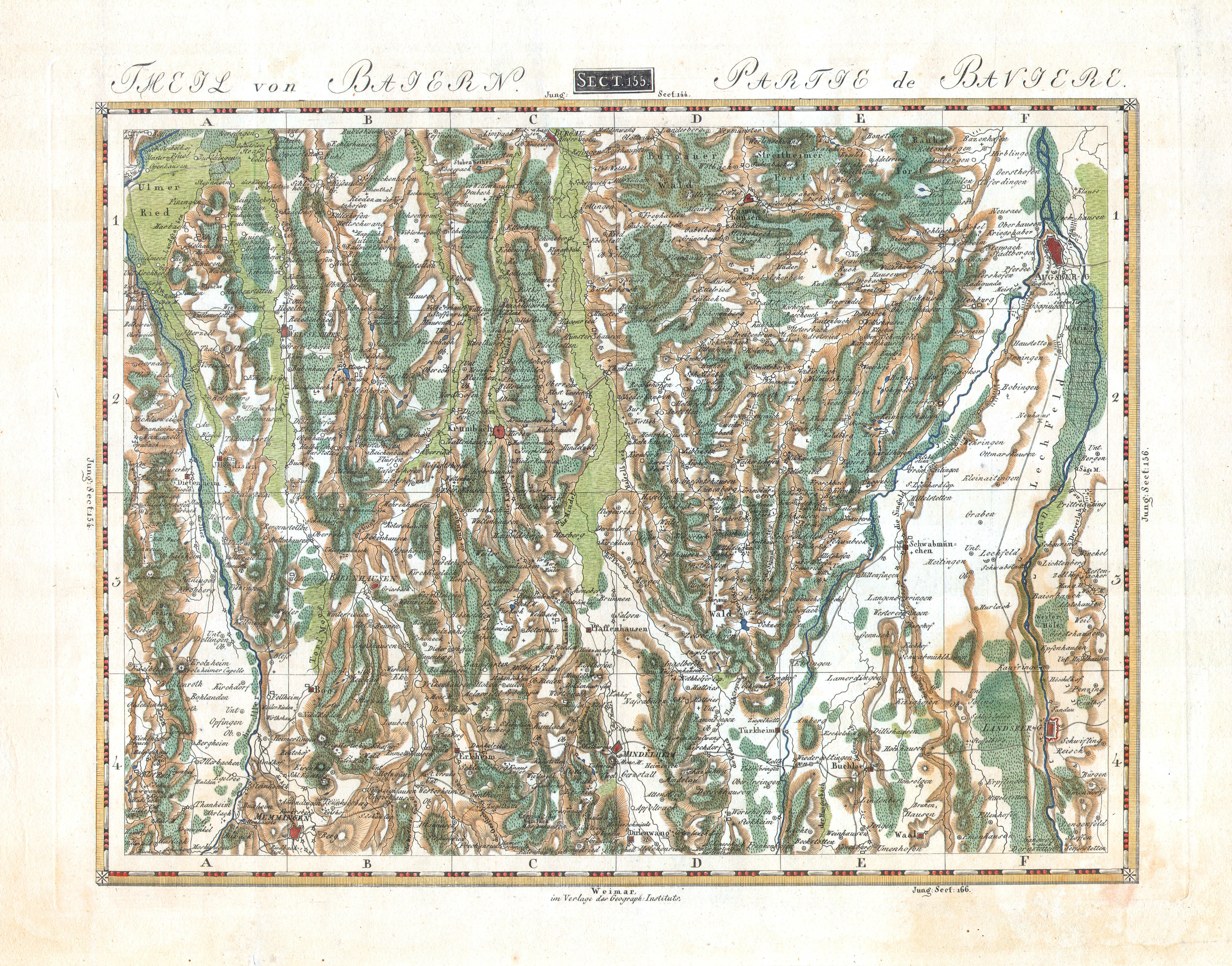
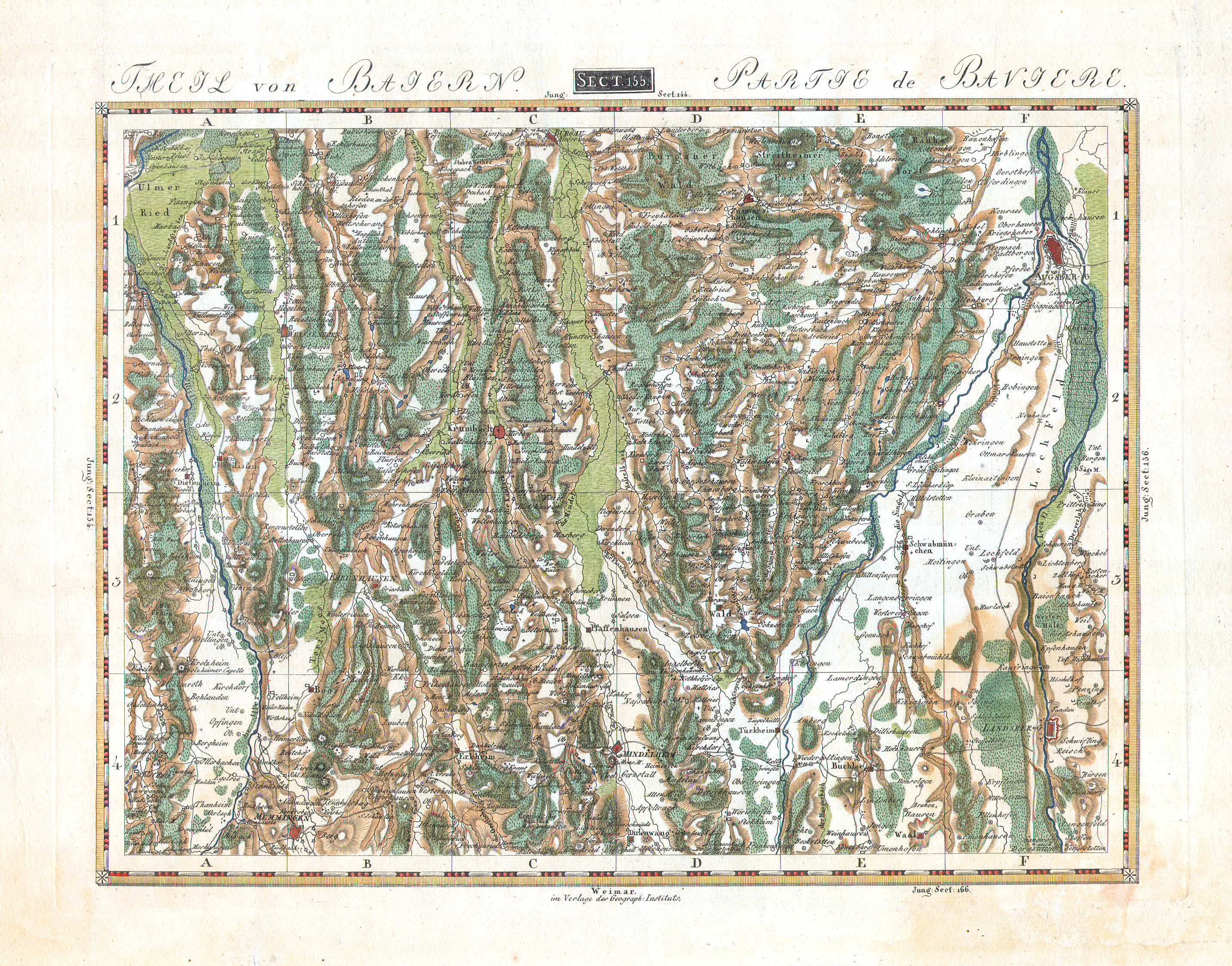 Topographisch-militairische Charte von Teutschland
Theil von Baiern. Partie de Bavière. XL
Sect. 155: Augsburg
HTML, JPG: © M. Witkam, 2009 (rev. 2012-05-16)
![]()
![]()