Putzgers Historischer Schul-Atlas, 44e druk (1923) en 43e druk (1922)
See below for (a summary of) this text in English.
Hieronder staan plaatjes van de 44e en de 43e druk ter vergelijking naast elkaar. Daarbij horen ook de volgende pagina's
- Beschrijving van de 44e druk
- Plaatjes van de 44e druk
- Tabellen en lijsten bij de 44e druk
en
- Beschrijving van de 43e druk
- Plaatjes van de 43e druk
- Tabellen en lijsten bij de 43e druk
Plaatjes
Klik op een plaatje voor een vergroting.
Putzgers Historischer Schul-Atlas, 44th edition (1923) and 43rd edition (1922)
- Below are pictures of the 44th and 43rd editions side by side for comparison
purposes. Related pages
- Description of the 44th edition
- Pictures of the 44th edition
- Tables and lists to the 44th edition
- Description of the 43rd edition
- Pictures of the 43rd edition
- Tables and lists to the 43rd edition
Pictures
Click on a picture to enlarge.
Band, voorwoord, titelpagina / Binding, preface, title page


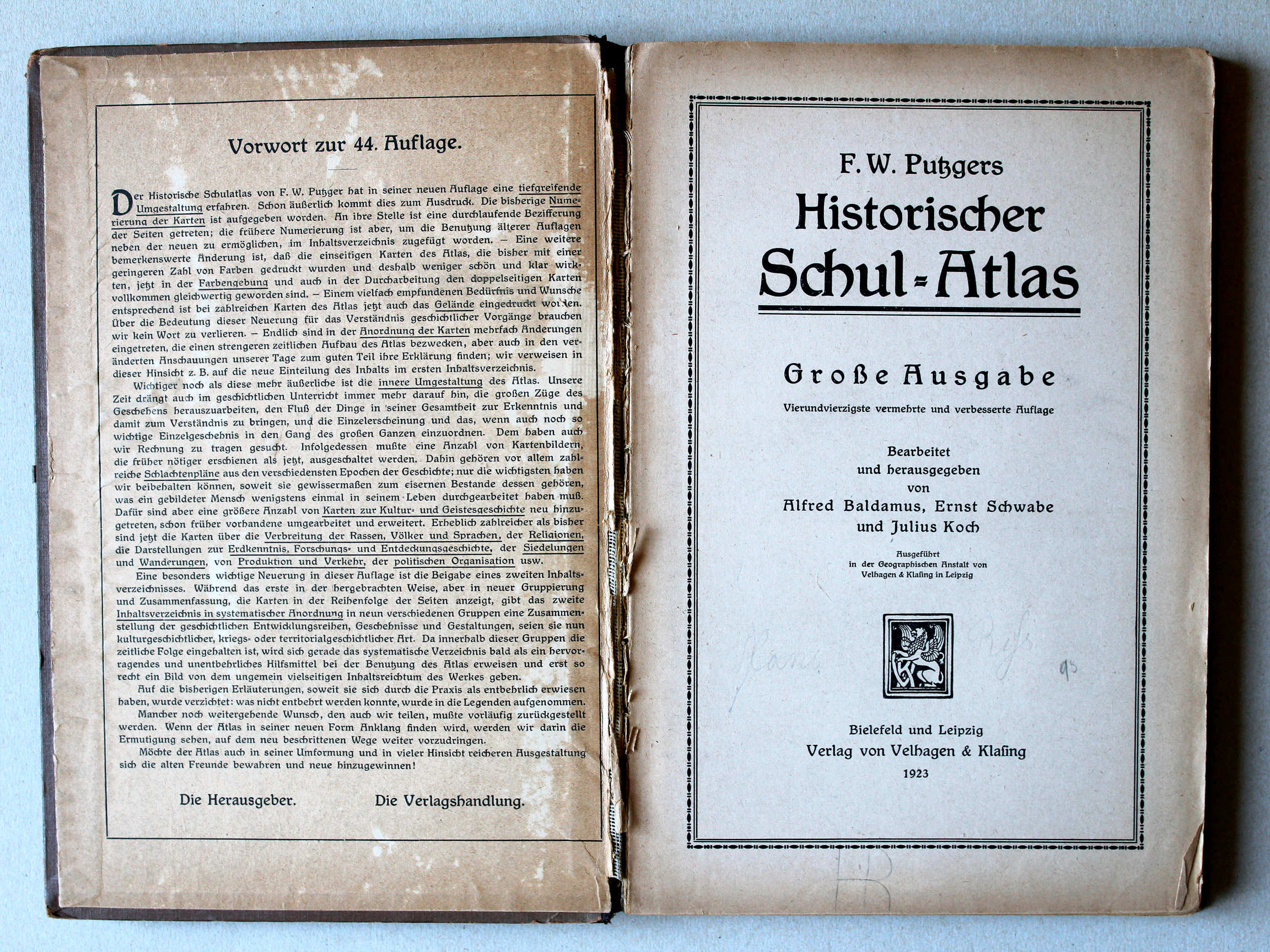 Putzgers Historischer Schul-Atlas, Große Ausgabe, 1923
Schutblad voorin met voorwoord, titelpagina / Front endpaper with preface, title page XL
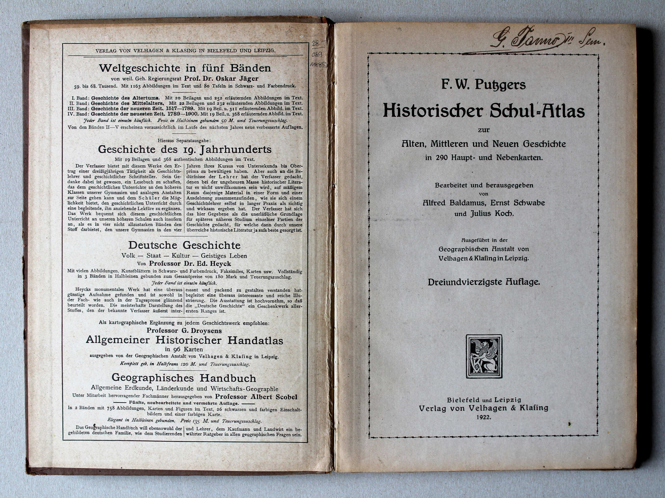 Putzgers Historischer Schul-Atlas, 1922
Schutblad voorin, titelpagina / Front endpaper, title page XL
 Putzgers Historischer Schul-Atlas, Große Ausgabe, 1923
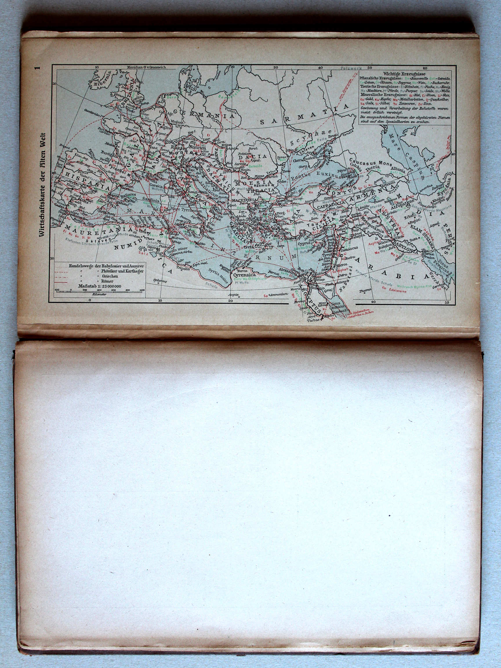
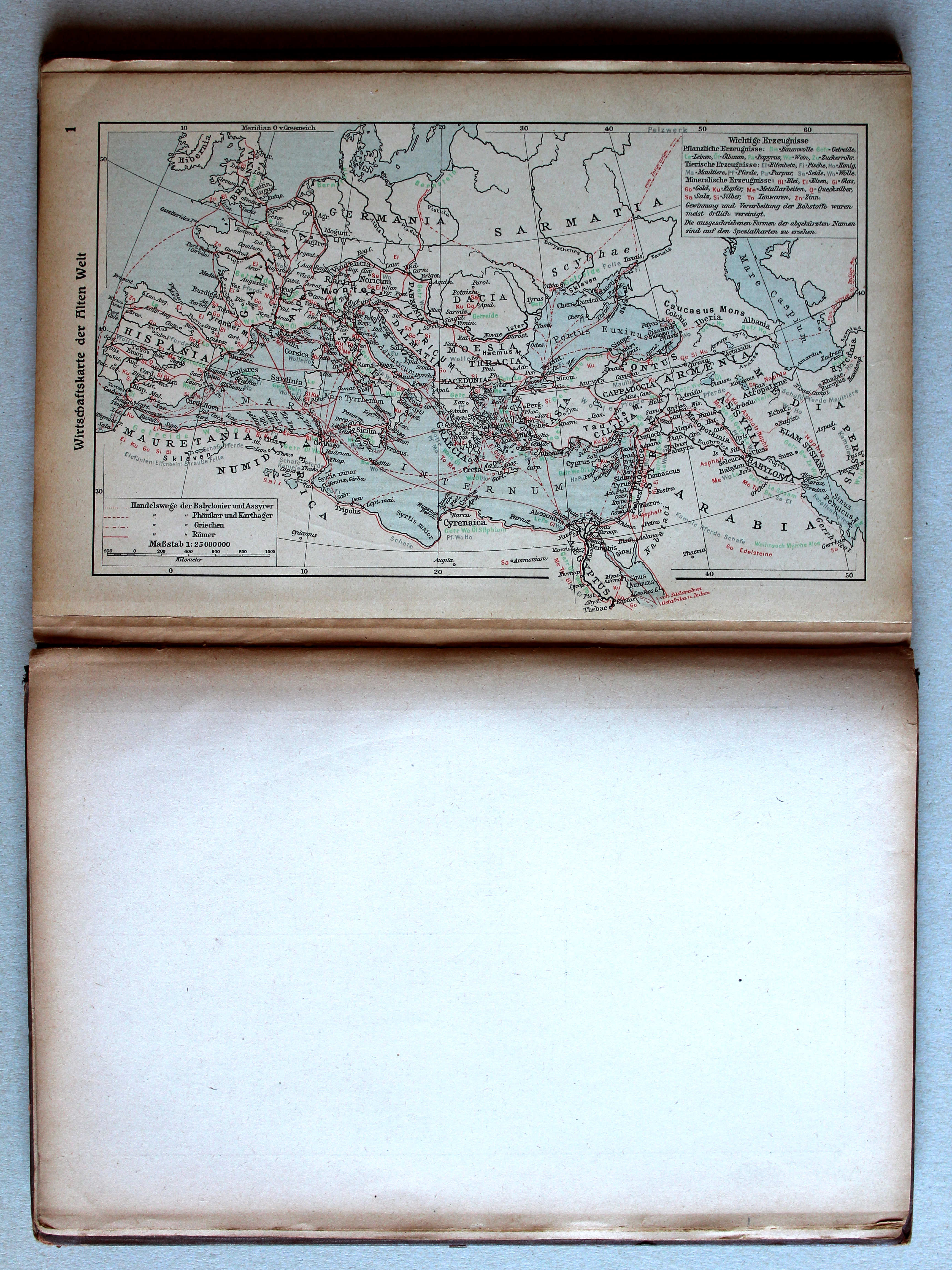
1. Wirtschaftskarte der Alten Welt XL
Economische kaart van de wereld in de Oudheid / Economic map of the Ancient world
 Putzgers Historischer Schul-Atlas, 1922
geen overeenkomstige kaart / no corresponding map
 Putzgers Historischer Schul-Atlas, Große Ausgabe, 1923
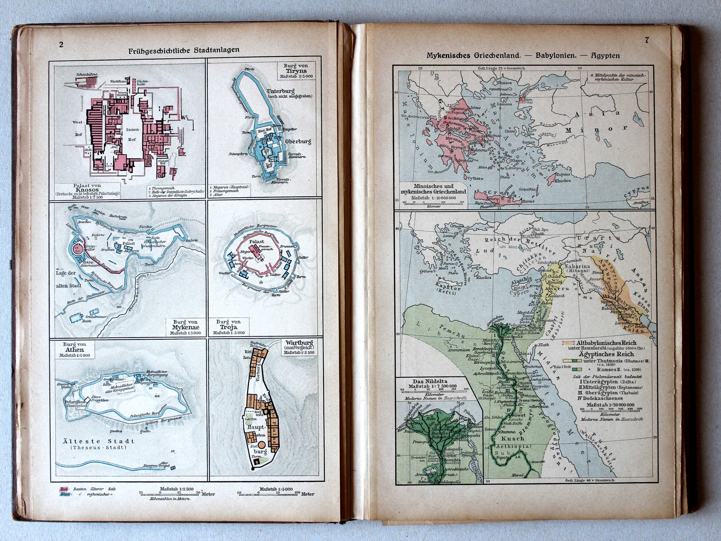
2. Frühgeschichtliche Stadtanlagen XL
Vroeghistorische steden / Early historical cities
7. Mykenisches Griechenland – Babylonien – Ägypten XL
Myceens Griekenland. Babylonië. Egypte / Mycenaean Greece. Babylonia. Egypt
 Putzgers Historischer Schul-Atlas, 1922
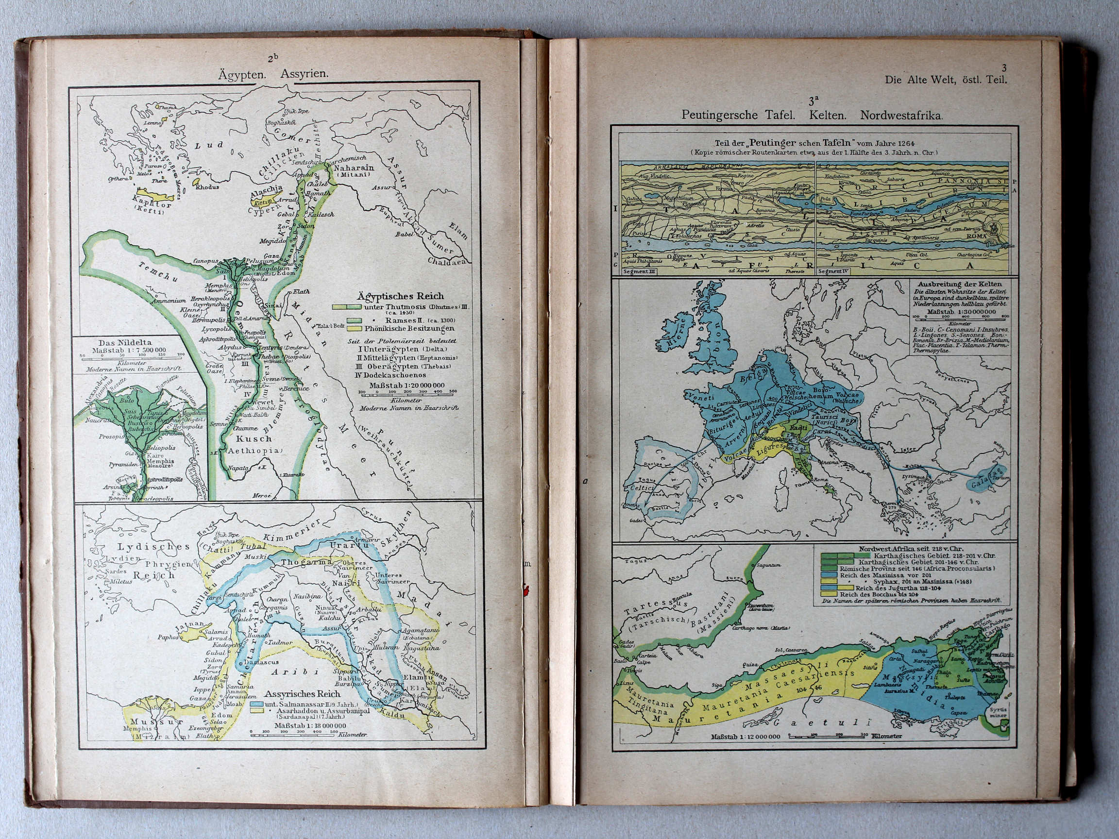
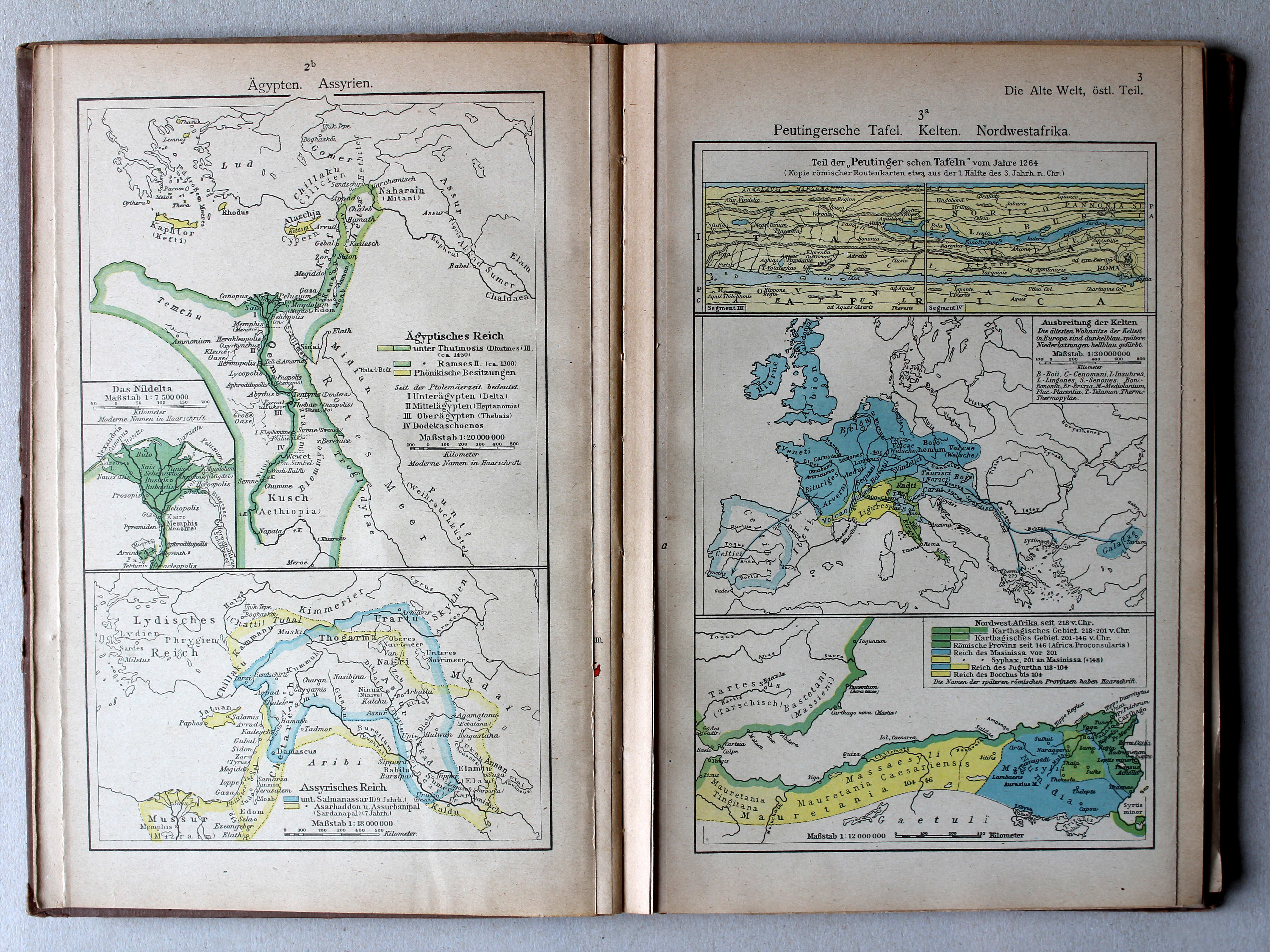
2b. Ägypten. Assyrien XL
Egypte. Assyrië / Egypt. Assyria
3a. Peutingersche Tafel. Kelten. Nordwestafrika XL
Tabula Peutingeriana. Kelten. Noordwest-Afrika / Tabula Peutingeriana. Celts. Northwest Africa
 Putzgers Historischer Schul-Atlas, Große Ausgabe, 1923
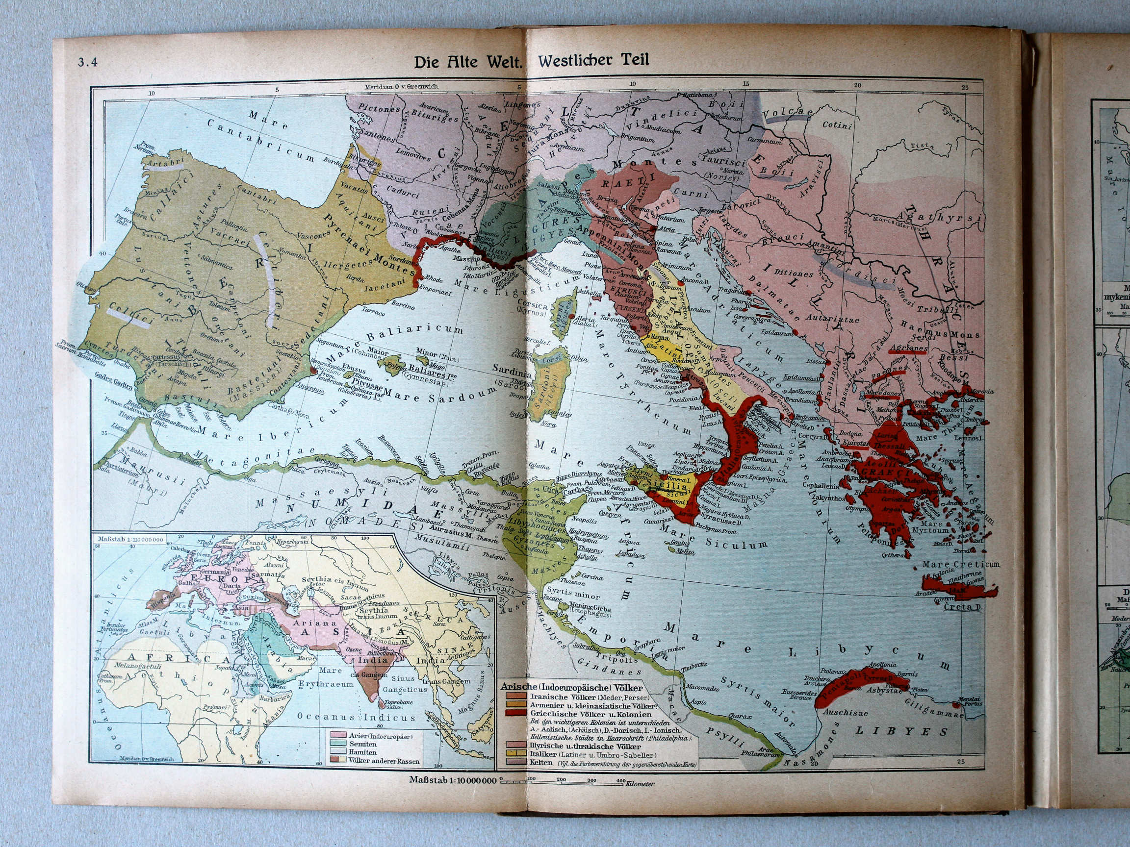
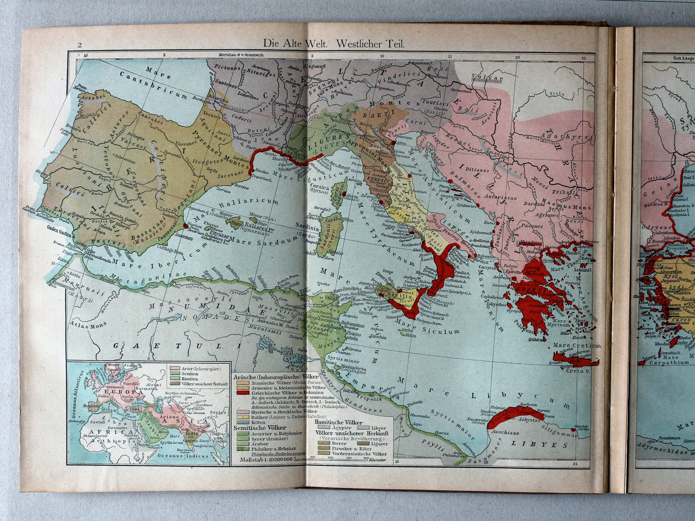
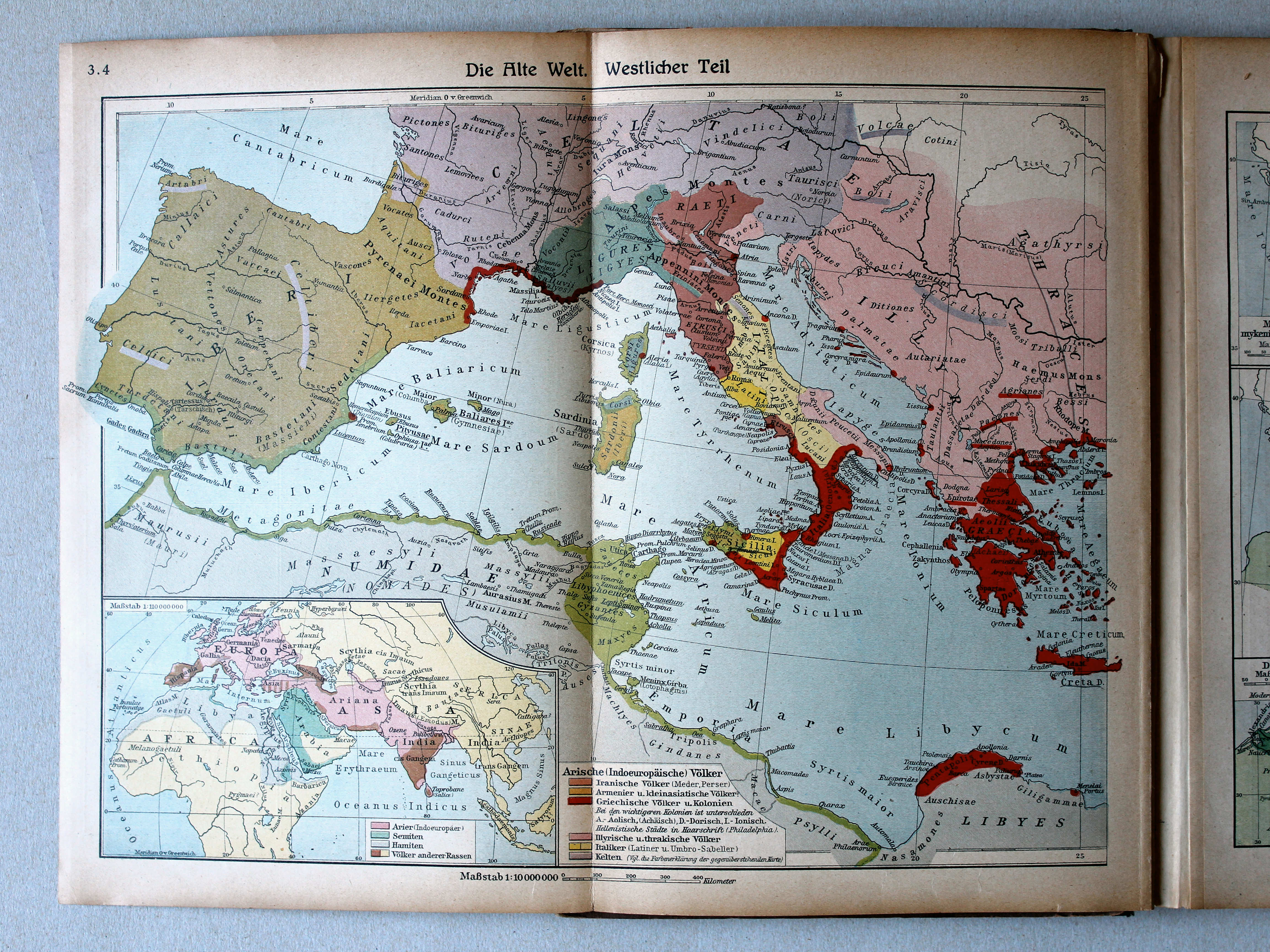
3.4. Die Alte Welt. Westlicher Teil XL
De wereld in de Oudheid, westelijk deel / The Ancient world, western part
 Putzgers Historischer Schul-Atlas, 1922
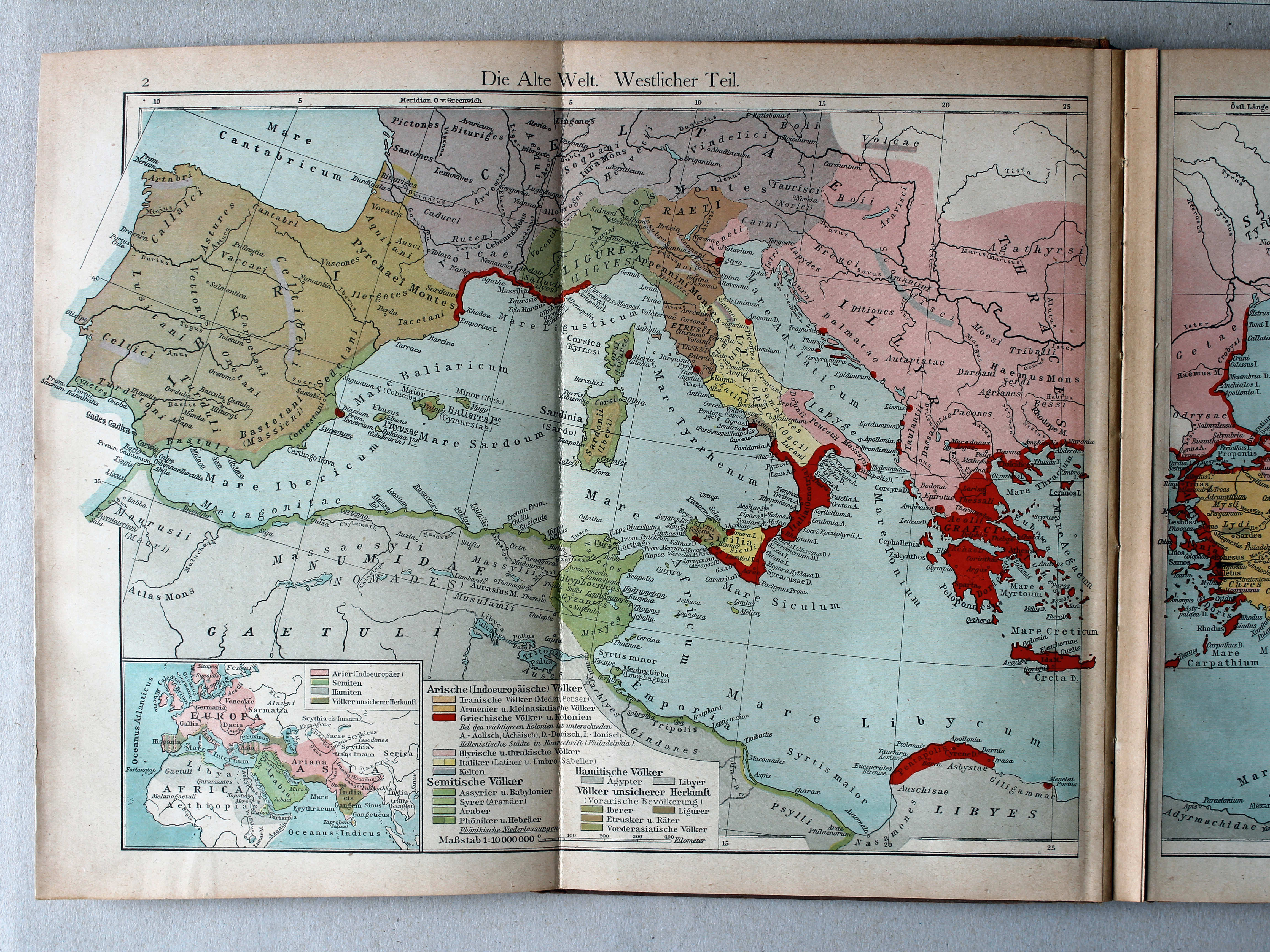
2. Die Alte Welt. Westlicher Teil XL
De wereld in de Oudheid, westelijk deel / The Ancient world, western part
 Putzgers Historischer Schul-Atlas, Große Ausgabe, 1923
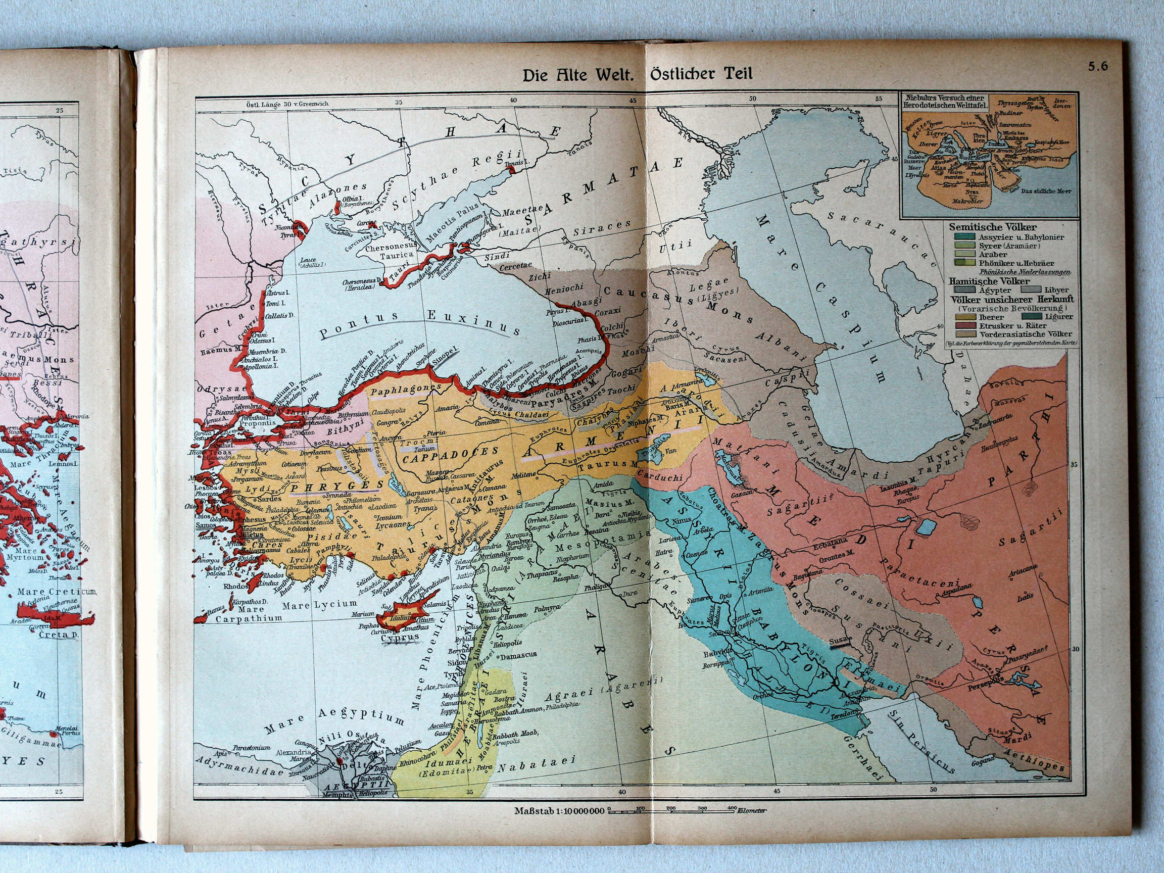
5.6. Die Alte Welt. Östlicher Teil XL
De wereld in de Oudheid, oostelijk deel / The Ancient world, eastern part
 Putzgers Historischer Schul-Atlas, 1922
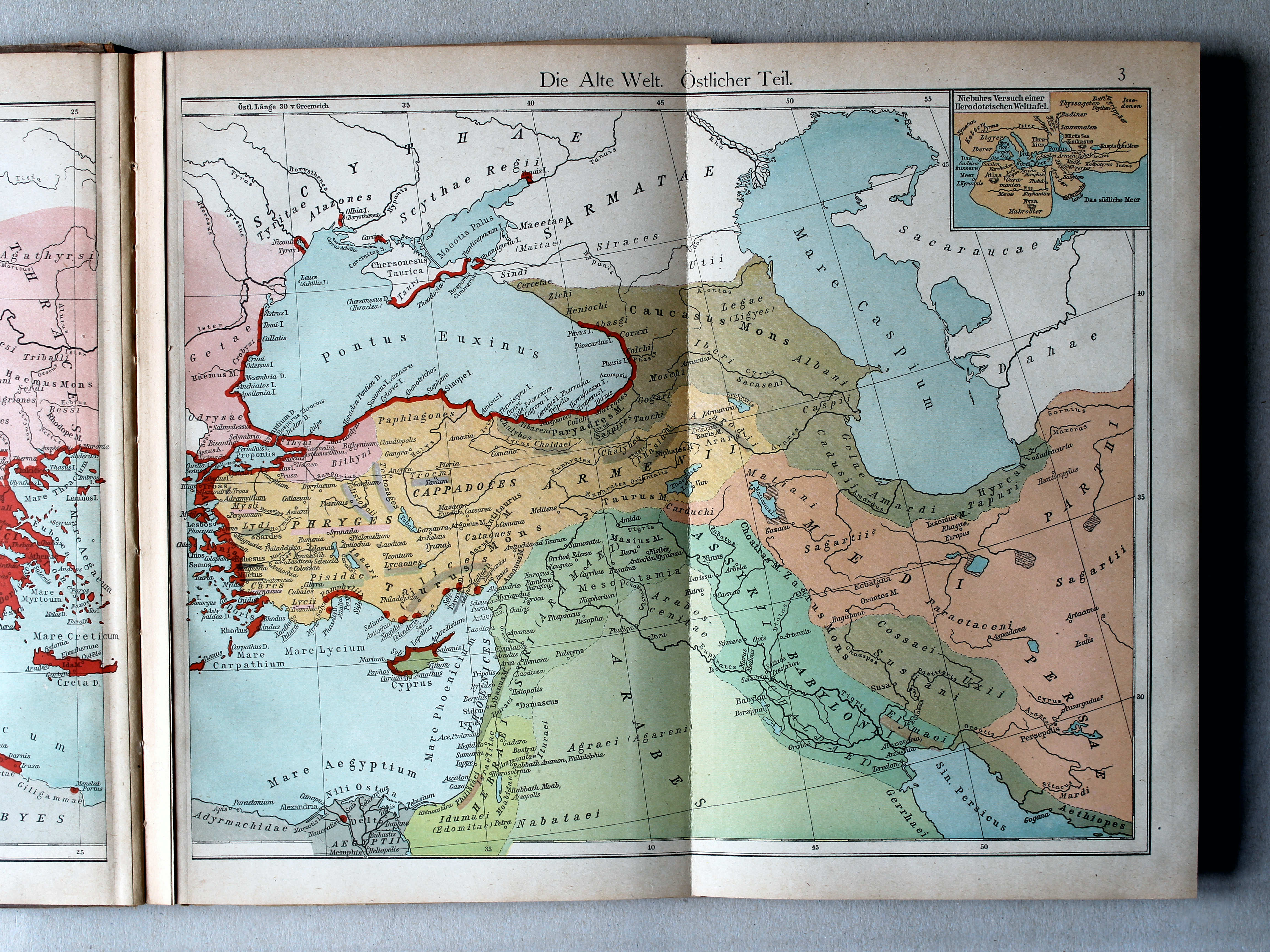
3. Die Alte Welt. Östlicher Teil XL
De wereld in de Oudheid, oostelijk deel / The Ancient world, eastern part
 Putzgers Historischer Schul-Atlas, Große Ausgabe, 1923
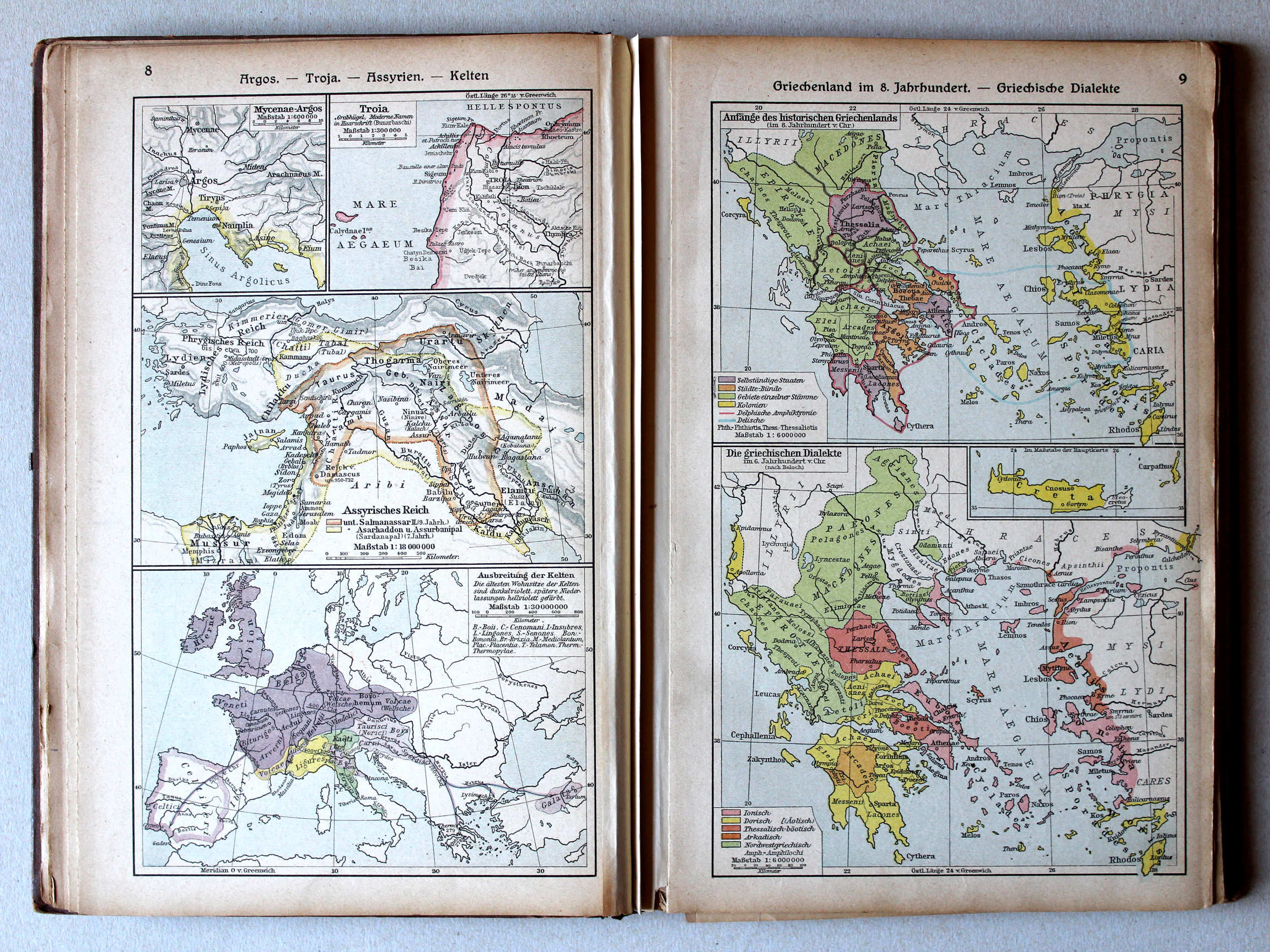
8. Argos – Troja – Assyrien – Kelten XL
Argos. Troja. Assyrië. Kelten / Argos. Troja. Assyria. Celts
9. Griechenland im 8. Jahrhundert – Griechische Dialekte XL
Griekenland in de 8e eeuw. Griekse dialecten / Greece in the 8th century. Greek dialects
Putzgers Historischer Schul-Atlas, 1922
2b. Ägypten. Assyrien XL
Egypte. Assyrië / Egypt. Assyria
3a. Peutingersche Tafel. Kelten. Nordwestafrika XL
Tabula Peutingeriana. Kelten. Noordwest-Afrika / Tabula Peutingeriana. Celts. Northwest Africa
Putzgers Historischer Schul-Atlas, Große Ausgabe, 1923
8. Argos – Troja – Assyrien – Kelten XL
Argos. Troja. Assyrië. Kelten / Argos. Troja. Assyria. Celts
9. Griechenland im 8. Jahrhundert – Griechische Dialekte XL
Griekenland in de 8e eeuw. Griekse dialecten / Greece in the 8th century. Greek dialects
 Putzgers Historischer Schul-Atlas, 1922
4b. Griechenland beim Beginne des Peloponnesischen Krieges. Propontis. Troja XL
Griekenland bij het begin van de Peloponnesische Oorlog. Propontis. Troja / Greece at the beginning of the Peloponnesian War. Propontis. Troja

 Putzgers Historischer Schul-Atlas, Große Ausgabe, 1923
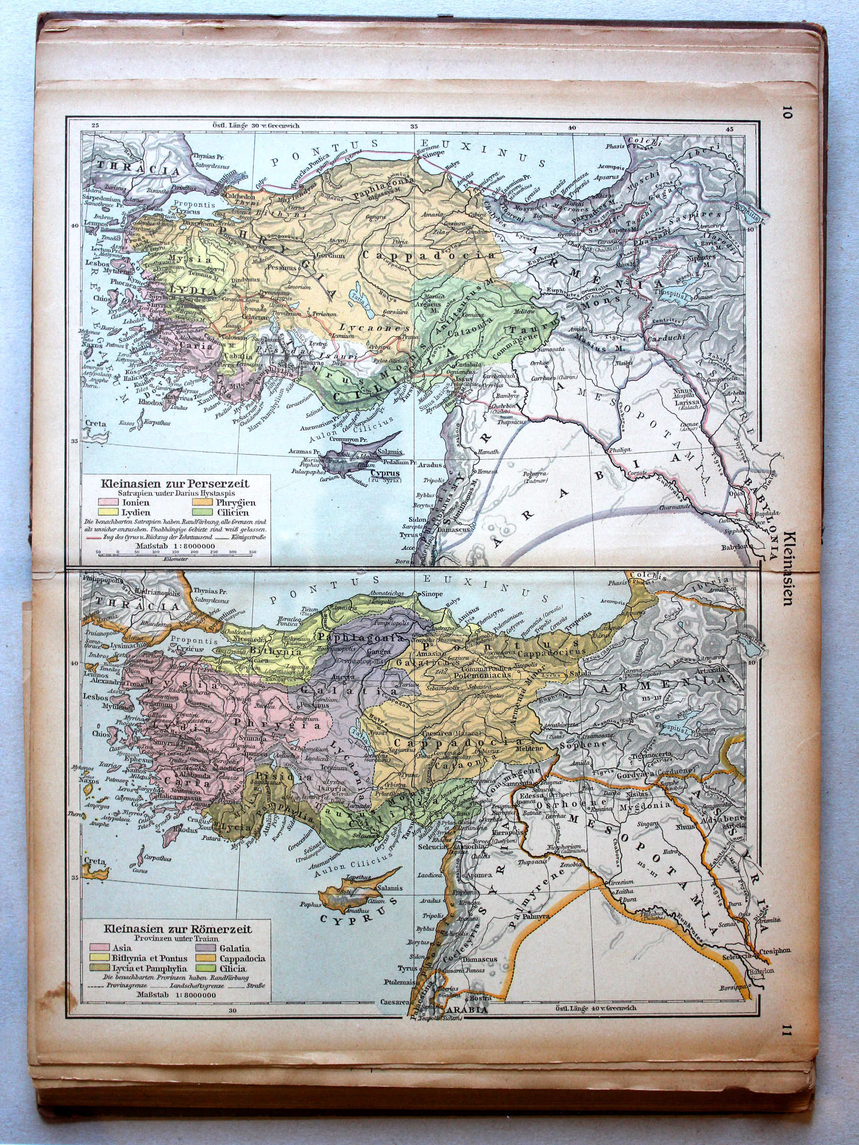
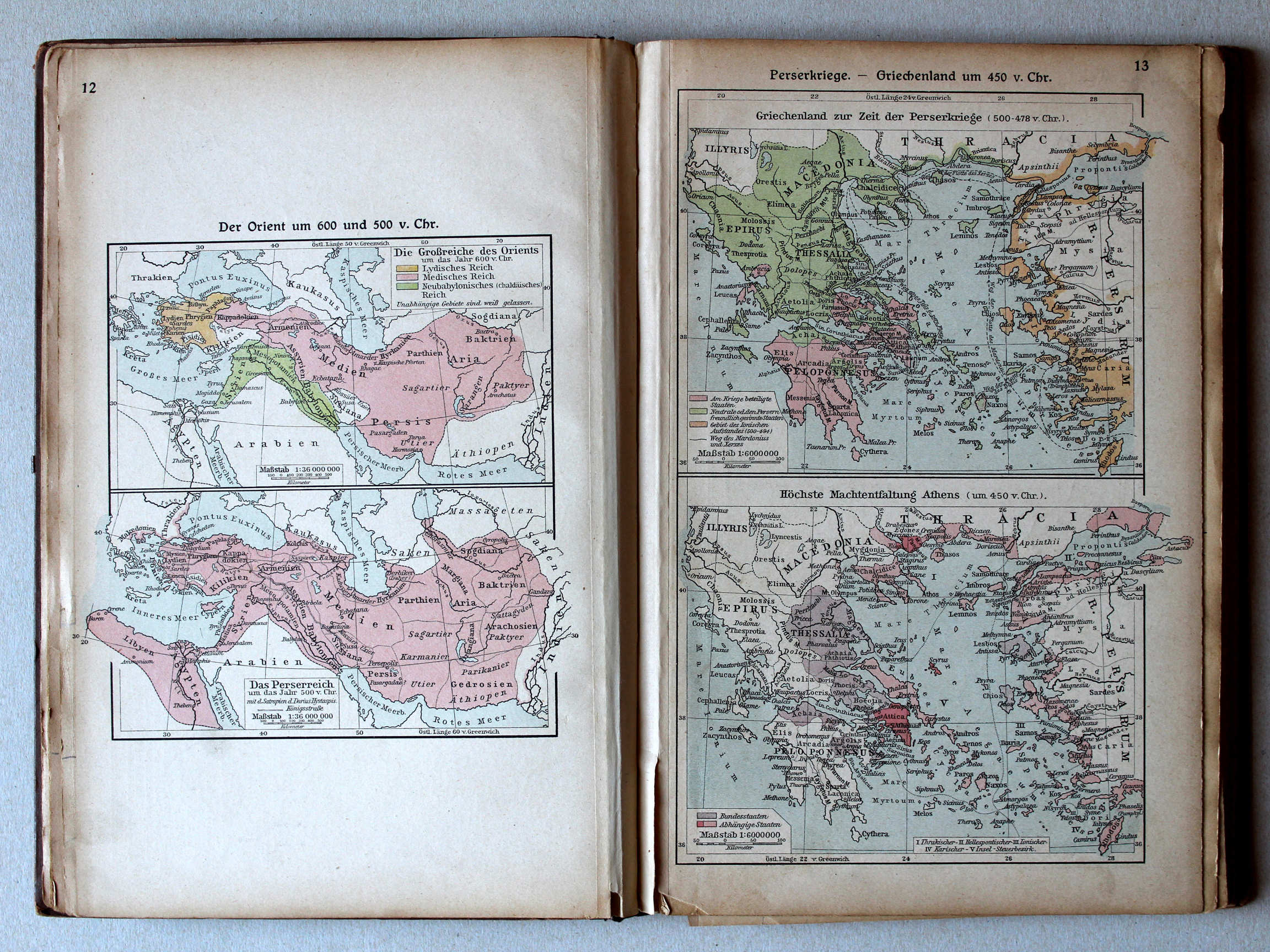
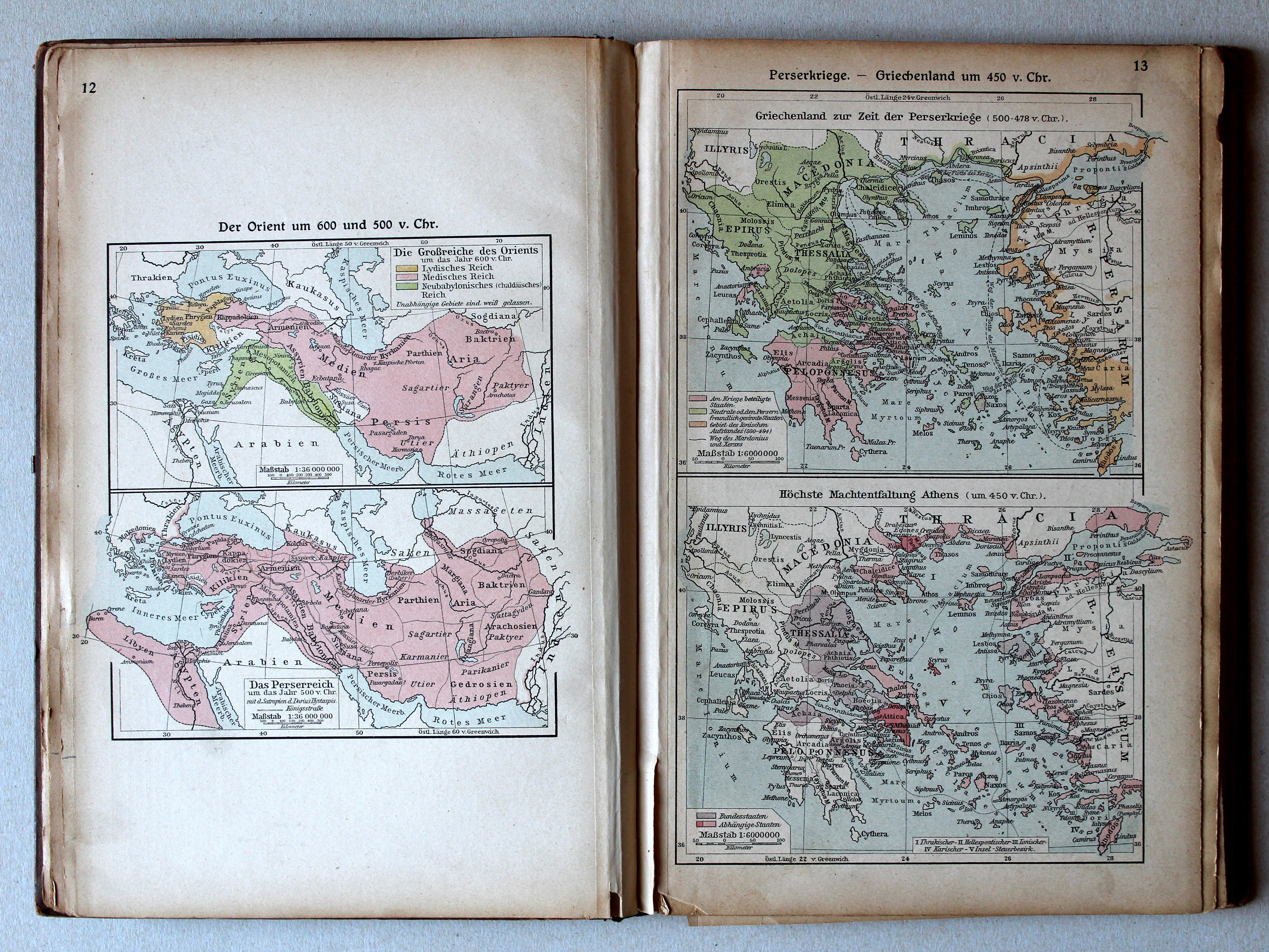
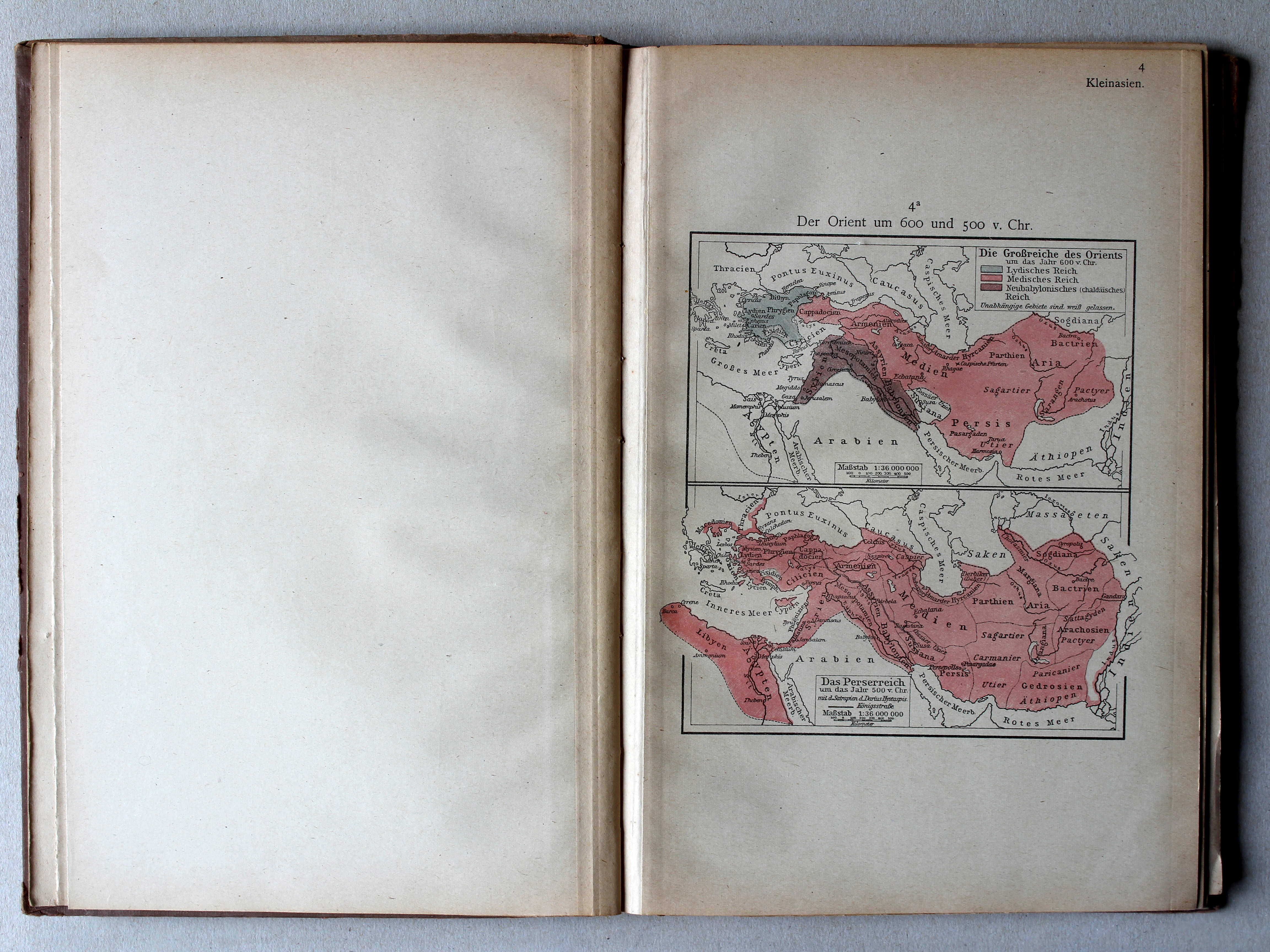
12. Der Orient um 600 und 500 v. Chr. XL
Het Oosten rond 600 en 500 v. Chr. / The Orient around 600 and 500 BC
13. Perserkriege – Griechenland um 450 v. Chr. XL
Perzische Oorlogen. Griekenland rond 450 v. Chr. / Greco-Persian Wars. Greece around 450 BC
 Putzgers Historischer Schul-Atlas, 1922
4a. Der Orient um 600 und 500 v. Chr. XL
Het Oosten rond 600 en 500 v. Chr. / The Orient around 600 and 500 BC
 Putzgers Historischer Schul-Atlas, Große Ausgabe, 1923
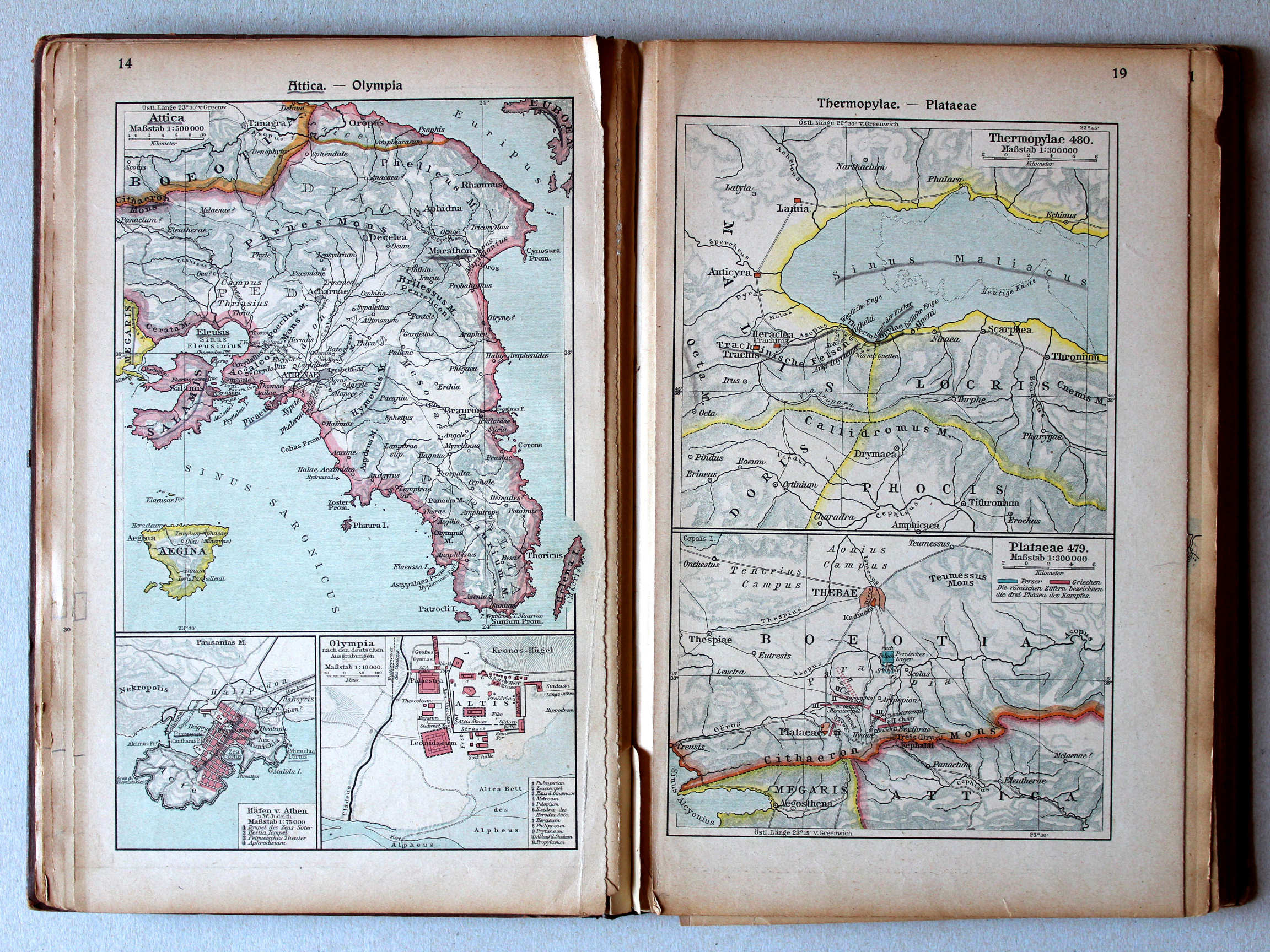
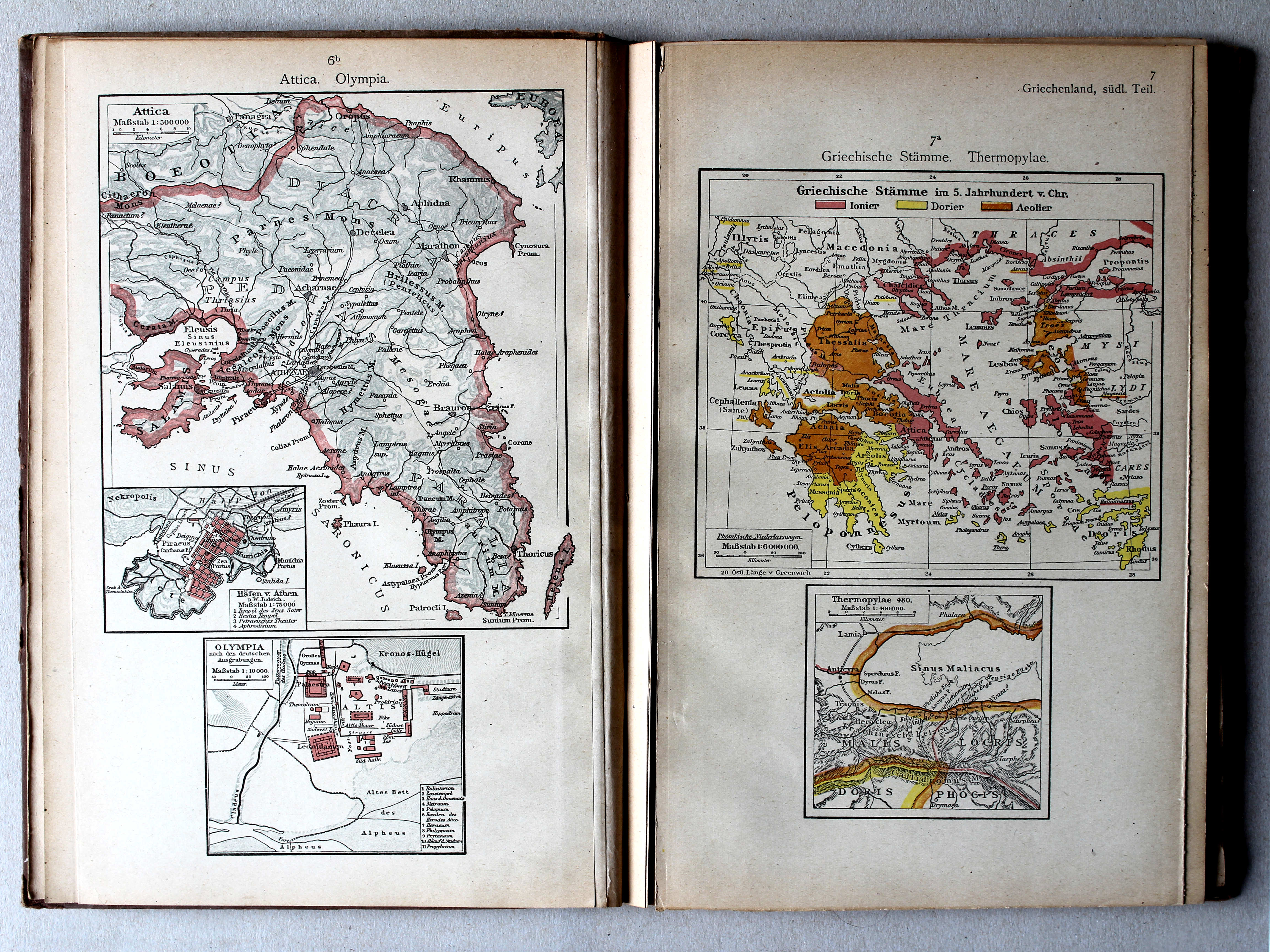
14. Attica – Olympia XL
Attica. Olympia
19. Thermopylae – Plataeae XL
Thermopylae. Plataeae
 Putzgers Historischer Schul-Atlas, 1922
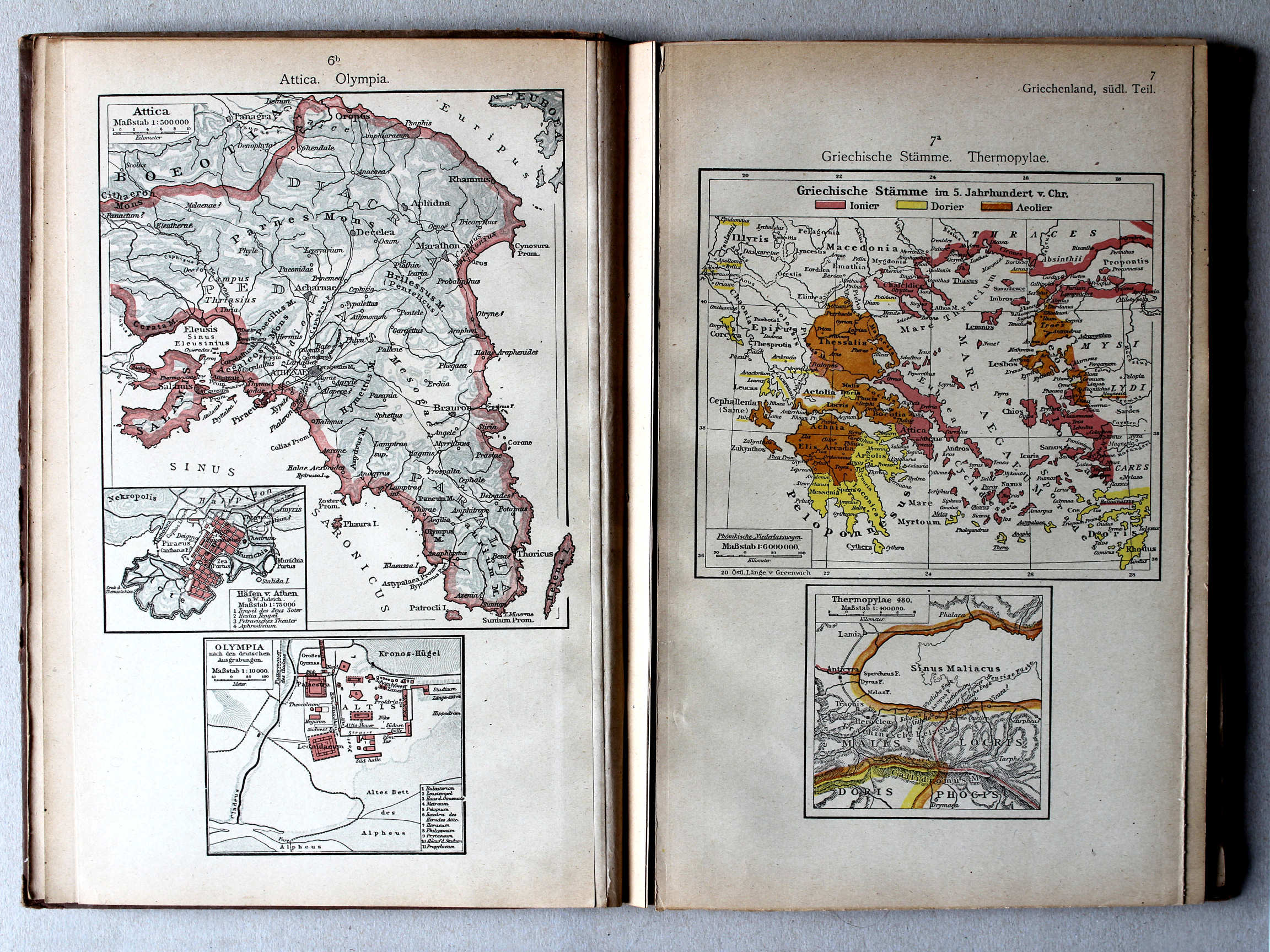
6b. Attica. Olympia XL
Attica. Olympia
7a. Griechische Stämme. Thermopylae XL
Griekse volkeren. Thermopylae / Greek nations. Thermopylae
Putzgers Historischer Schul-Atlas, Große Ausgabe, 1923
14. Attica – Olympia XL
Attica. Olympia
19. Thermopylae – Plataeae XL
Thermopylae. Plataeae
 Putzgers Historischer Schul-Atlas, 1922
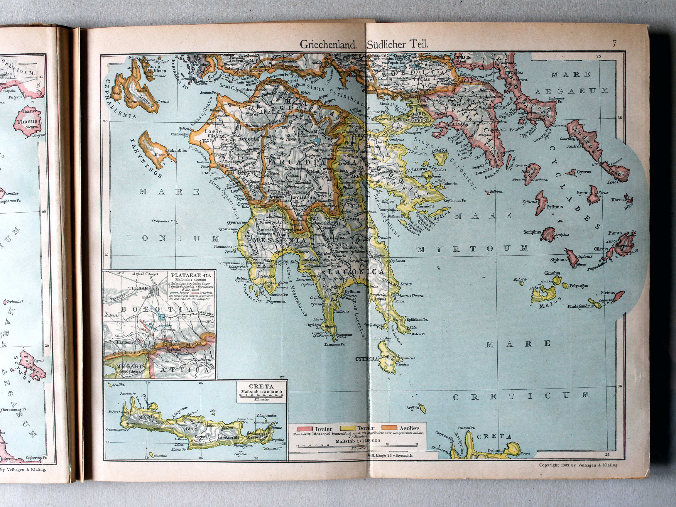
7. Griechenland. Südlicher Teil (Plataeae) XL
Griekenland, zuidelijk deel / Greece, southern part (Plataeae)
 Putzgers Historischer Schul-Atlas, Große Ausgabe, 1923
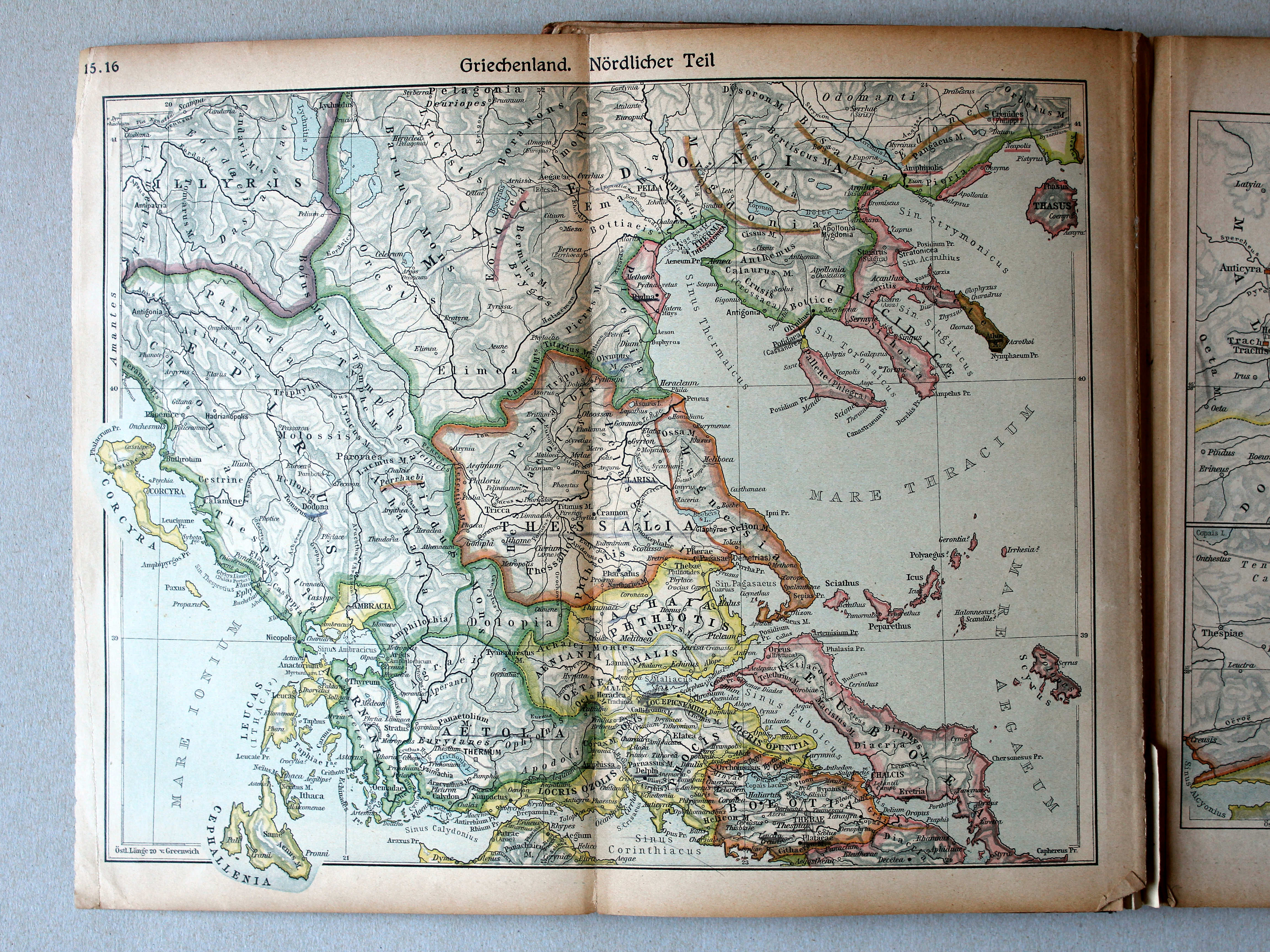
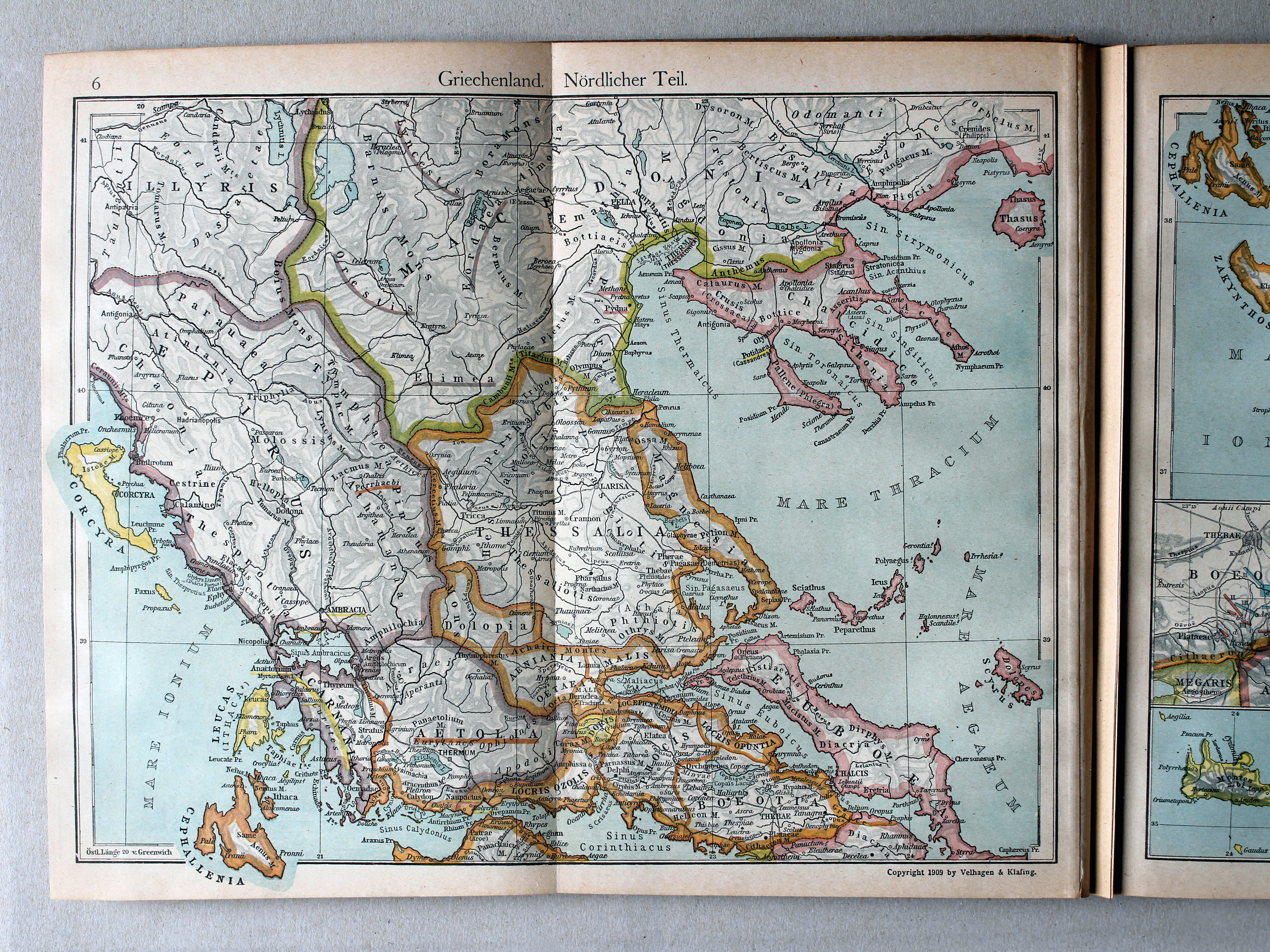
15.16. Griechenland. Nördlicher Teil XL
Griekenland, noordelijk deel / Greece, northern part
 Putzgers Historischer Schul-Atlas, 1922
6. Griechenland. Nördlicher Teil XL
Griekenland, noordelijk deel / Greece, northern part
 Putzgers Historischer Schul-Atlas, Große Ausgabe, 1923
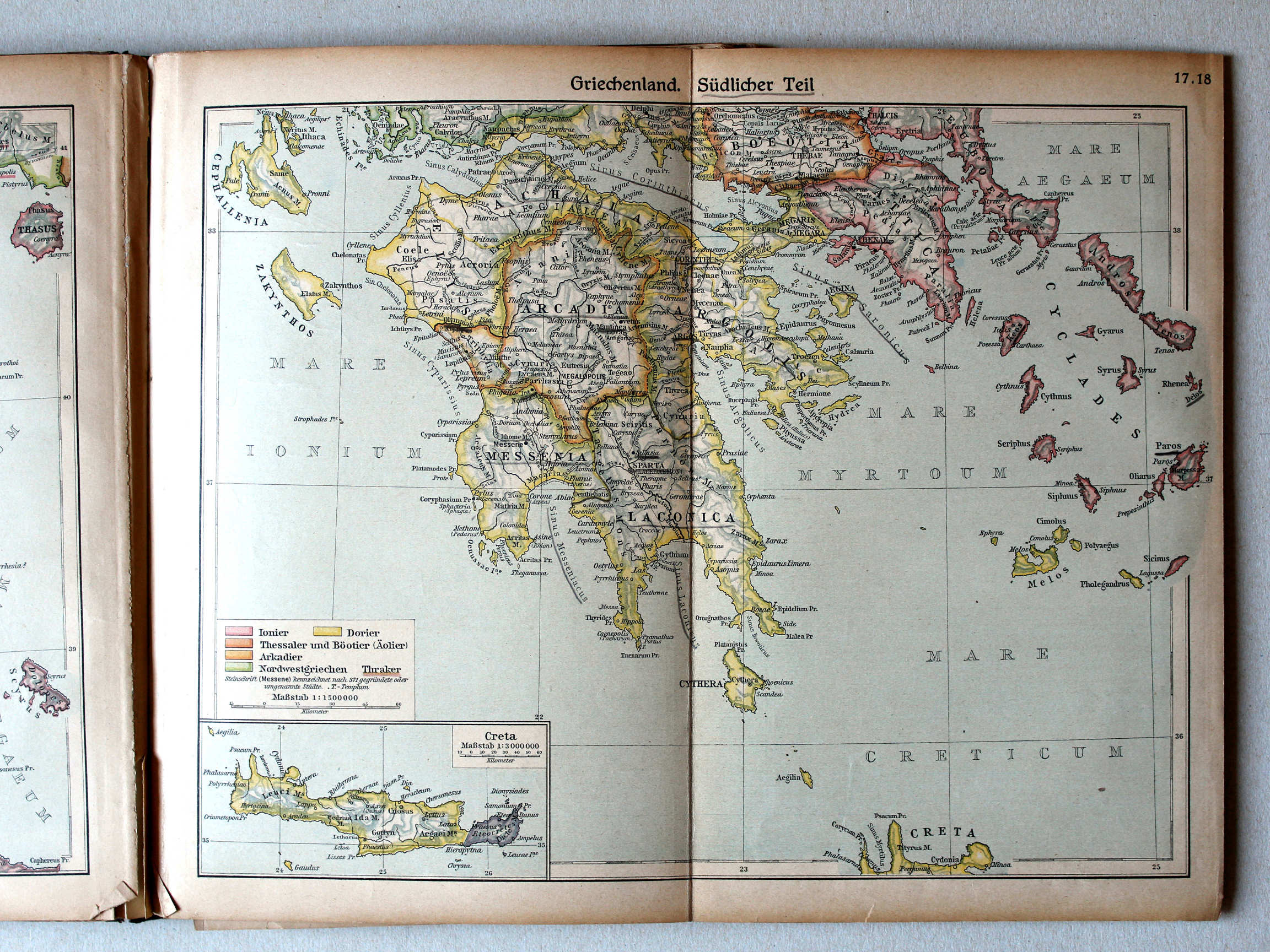
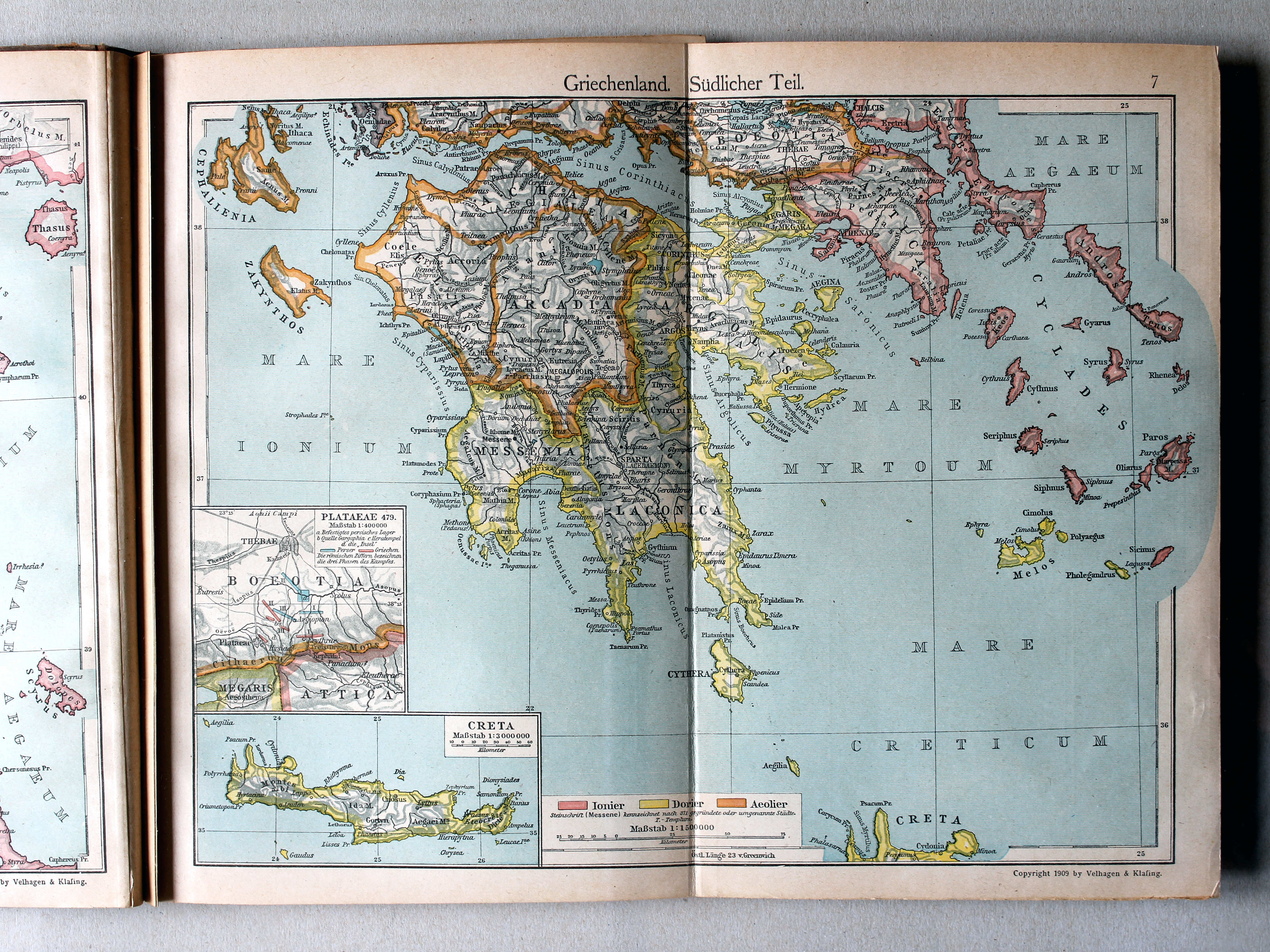
17.18. Griechenland. Südlicher Teil XL
Griekenland, zuidelijk deel / Greece, southern part
Putzgers Historischer Schul-Atlas, 1922
7. Griechenland. Südlicher Teil XL
Griekenland, zuidelijk deel / Greece, southern part
 Putzgers Historischer Schul-Atlas, Große Ausgabe, 1923
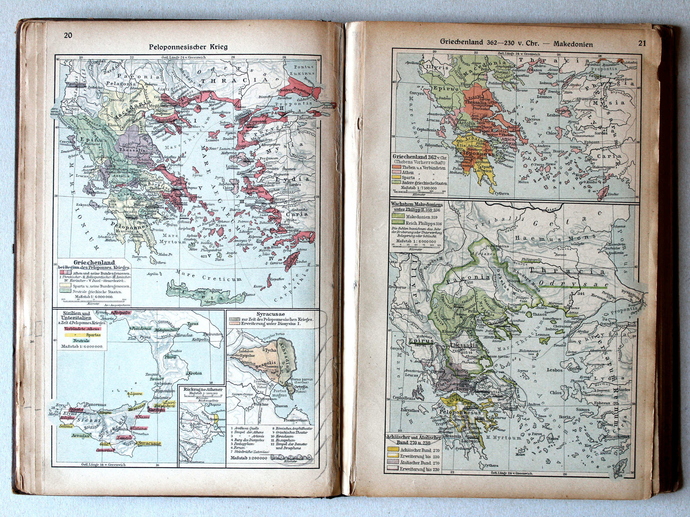
20. Peloponnesischer Krieg XL
Peloponnesische Oorlog / Peloponnesian War
21. Griechenland 362-230 v. Chr. – Makedonien XL
Griekenland 362-230 v. Chr. Macedonië / Greece 362-230 BC. Macedonia
Putzgers Historischer Schul-Atlas, 1922
4b. Griechenland beim Beginne des Peloponnesischen Krieges. Propontis. Troja XL
Griekenland bij het begin van de Peloponnesische Oorlog. Propontis. Troja / Greece at the beginning of the Peloponnesian War. Propontis. Troja
Putzgers Historischer Schul-Atlas, Große Ausgabe, 1923
20. Peloponnesischer Krieg (Syracusae) XL
Peloponnesische Oorlog / Peloponnesian War (Syracusae)
21. Griechenland 362-230 v. Chr. – Makedonien XL
Griekenland 362-230 v. Chr. Macedonië / Greece 362-230 BC. Macedonia
 Putzgers Historischer Schul-Atlas, 1922
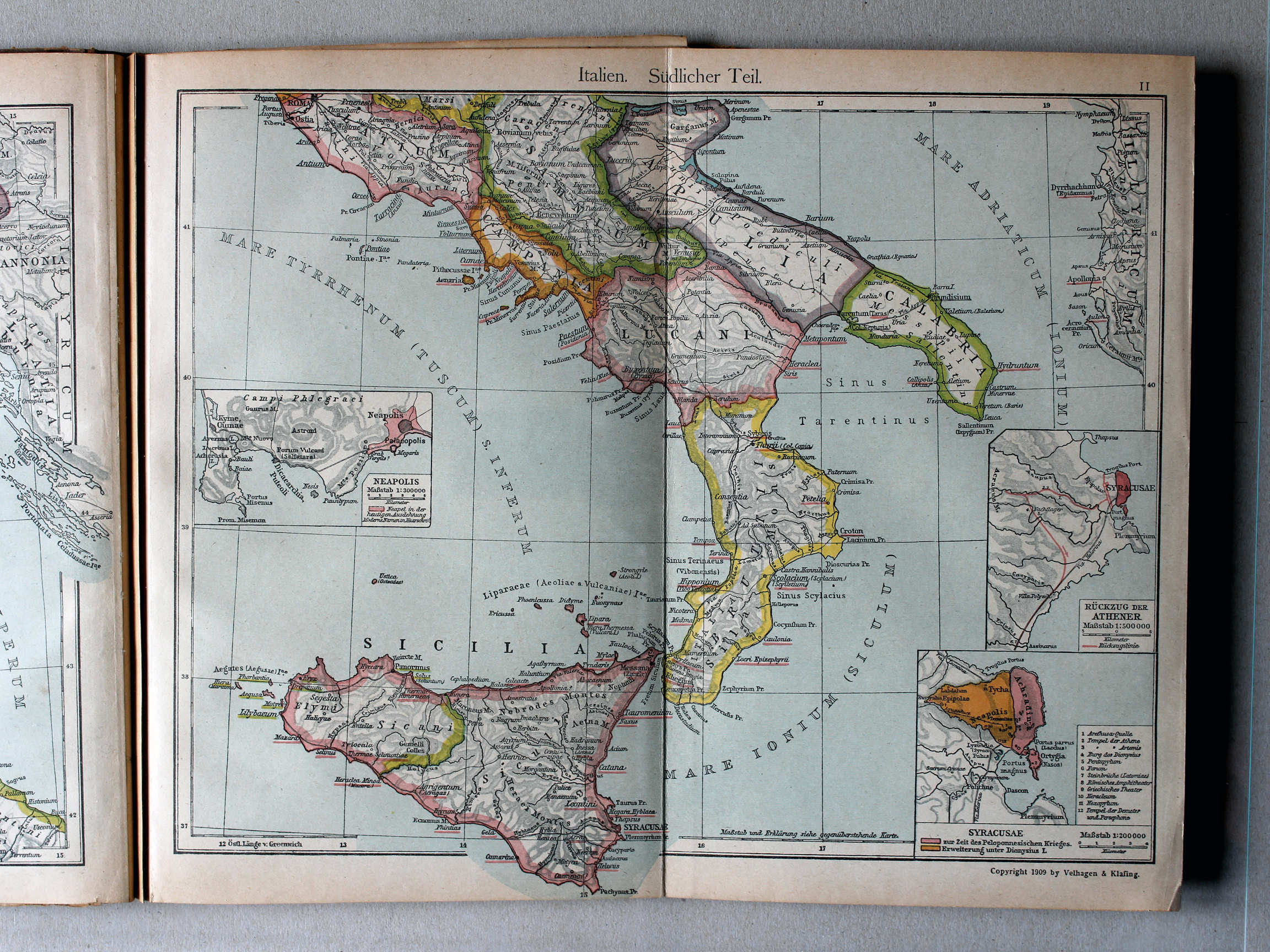
11. Italien. Südlicher Teil (Syracusae) XL
Italië, zuidelijk deel / Italy, southern part (Syracusae)
Putzgers Historischer Schul-Atlas, Große Ausgabe, 1923
20. Peloponnesischer Krieg XL
Peloponnesische Oorlog / Peloponnesian War
21. Griechenland 362-230 v. Chr. – Makedonien XL
Griekenland 362-230 v. Chr. Macedonië / Greece 362-230 BC. Macedonia
 Putzgers Historischer Schul-Atlas, 1922
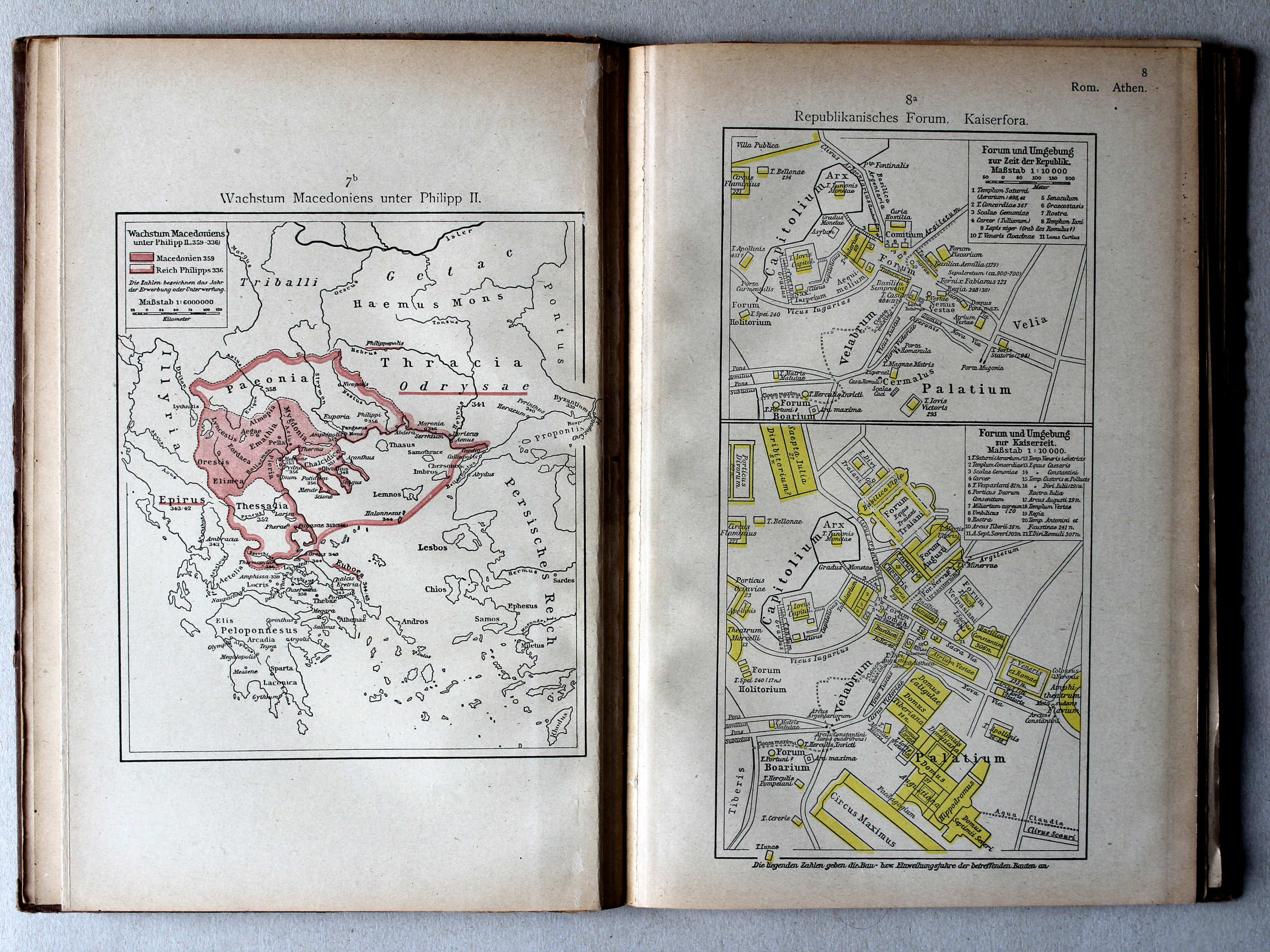
7b. Wachstum Macedoniens unter Philipp II XL
Groei van Macedonië onder Philippus II / Growth of Macedonia under Philip II
8a. Republikanisches Forum. Kaiserfora XL
Forum tijdens de Republiek. Fora in de Keizertijd / Forum during the Republic. Fora in the Imperial period
 Putzgers Historischer Schul-Atlas, Große Ausgabe, 1923
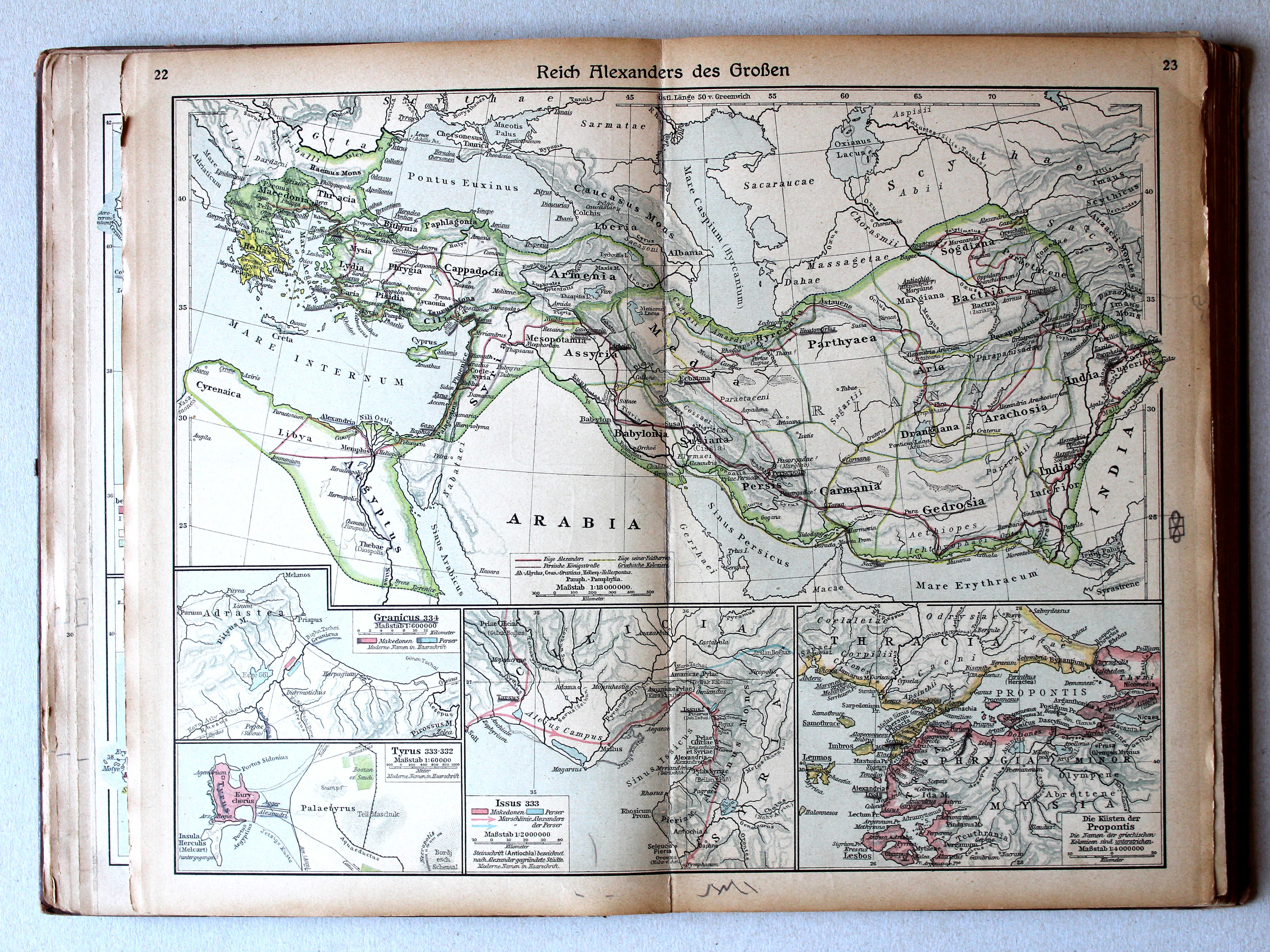
22.23. Reich Alexanders des Großen (Propontis) XL
Het Rijk van Alexander de Grote / The Empire of Alexander the Great (Propontis)
Putzgers Historischer Schul-Atlas, 1922
4b. Griechenland beim Beginne des Peloponnesischen Krieges. Propontis. Troja XL
Griekenland bij het begin van de Peloponnesische Oorlog. Propontis. Troja / Greece at the beginning of the Peloponnesian War. Propontis. Troja
Putzgers Historischer Schul-Atlas, Große Ausgabe, 1923
22.23. Reich Alexanders des Großen XL
Het Rijk van Alexander de Grote / The Empire of Alexander the Great
 Putzgers Historischer Schul-Atlas, 1922
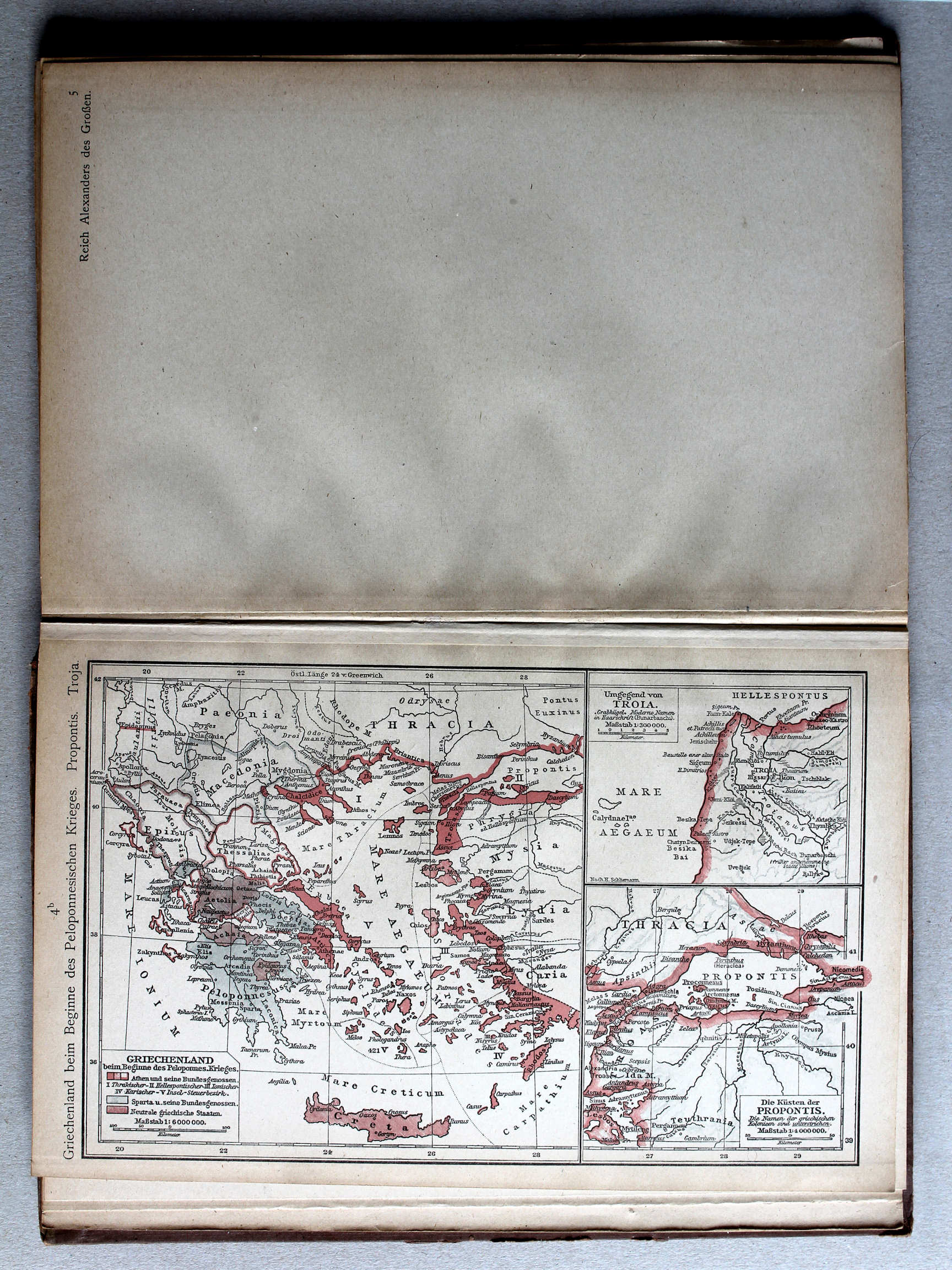
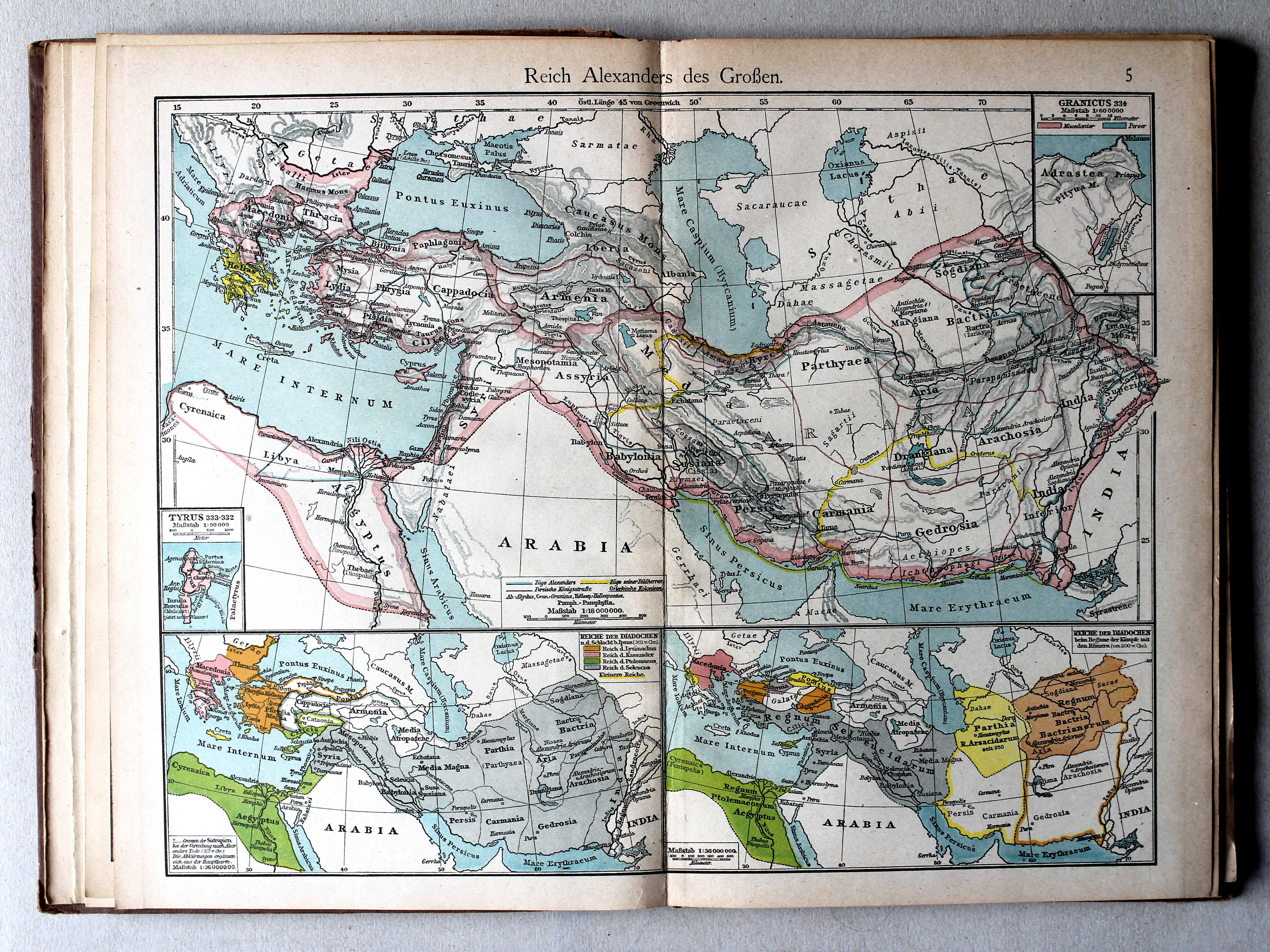
5. Reich Alexanders des Grossen XL
Het Rijk van Alexander de Grote / The Empire of Alexander the Great
Putzgers Historischer Schul-Atlas, Große Ausgabe, 1923
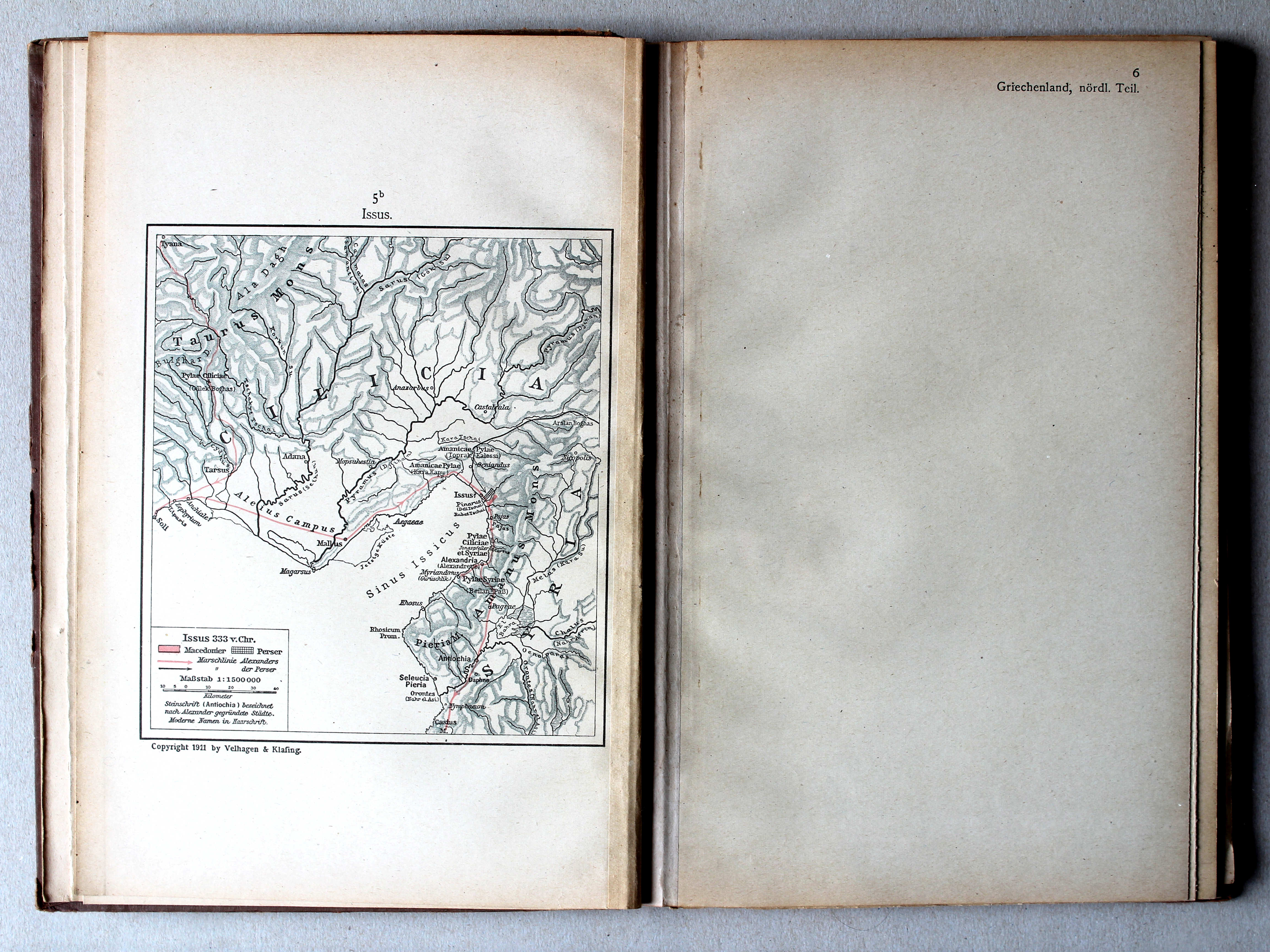
22.23. Reich Alexanders des Großen (Issus) XL
Het Rijk van Alexander de Grote / The Empire of Alexander the Great (Issus)
 Putzgers Historischer Schul-Atlas, Große Ausgabe, 1923
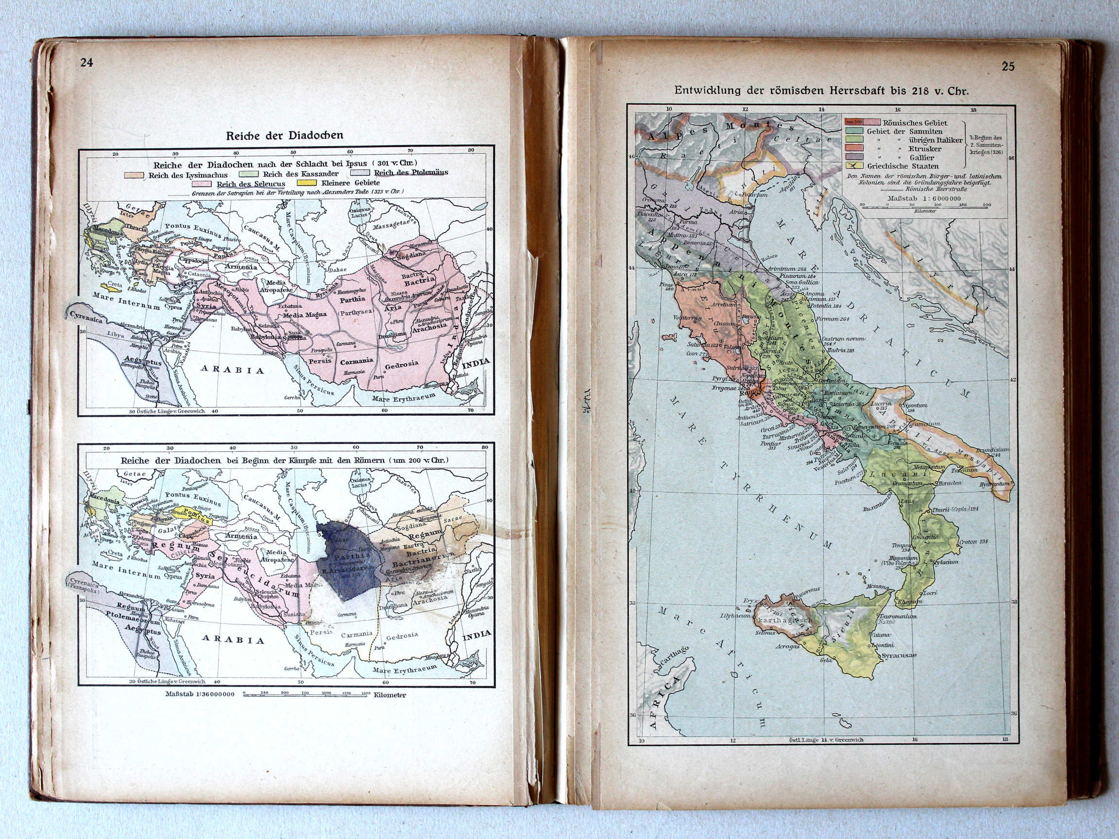
24. Reiche der Diadochen XL
Rijken van de Diadochen / Empires of the Diadochi
25. Entwicklung der römischen Herrschaft bis 218 v. Chr. XL
Ontwikkeling van de Romeinse heerschappij tot 218 v. Chr. / Development of Roman rule until 218 BC
Putzgers Historischer Schul-Atlas, 1922
5. Reich Alexanders des Grossen (Reiche der Diadochen) XL
Het Rijk van Alexander de Grote (Rijken van de Diadochen) / The Empire of Alexander the Great (Empires of the Diadochi)
Putzgers Historischer Schul-Atlas, Große Ausgabe, 1923
24. Reiche der Diadochen XL
Rijken van de Diadochen / Empires of the Diadochi
25. Entwicklung der römischen Herrschaft bis 218 v. Chr. XL
Ontwikkeling van de Romeinse heerschappij tot 218 v. Chr. / Development of Roman rule until 218 BC
 Putzgers Historischer Schul-Atlas, 1922
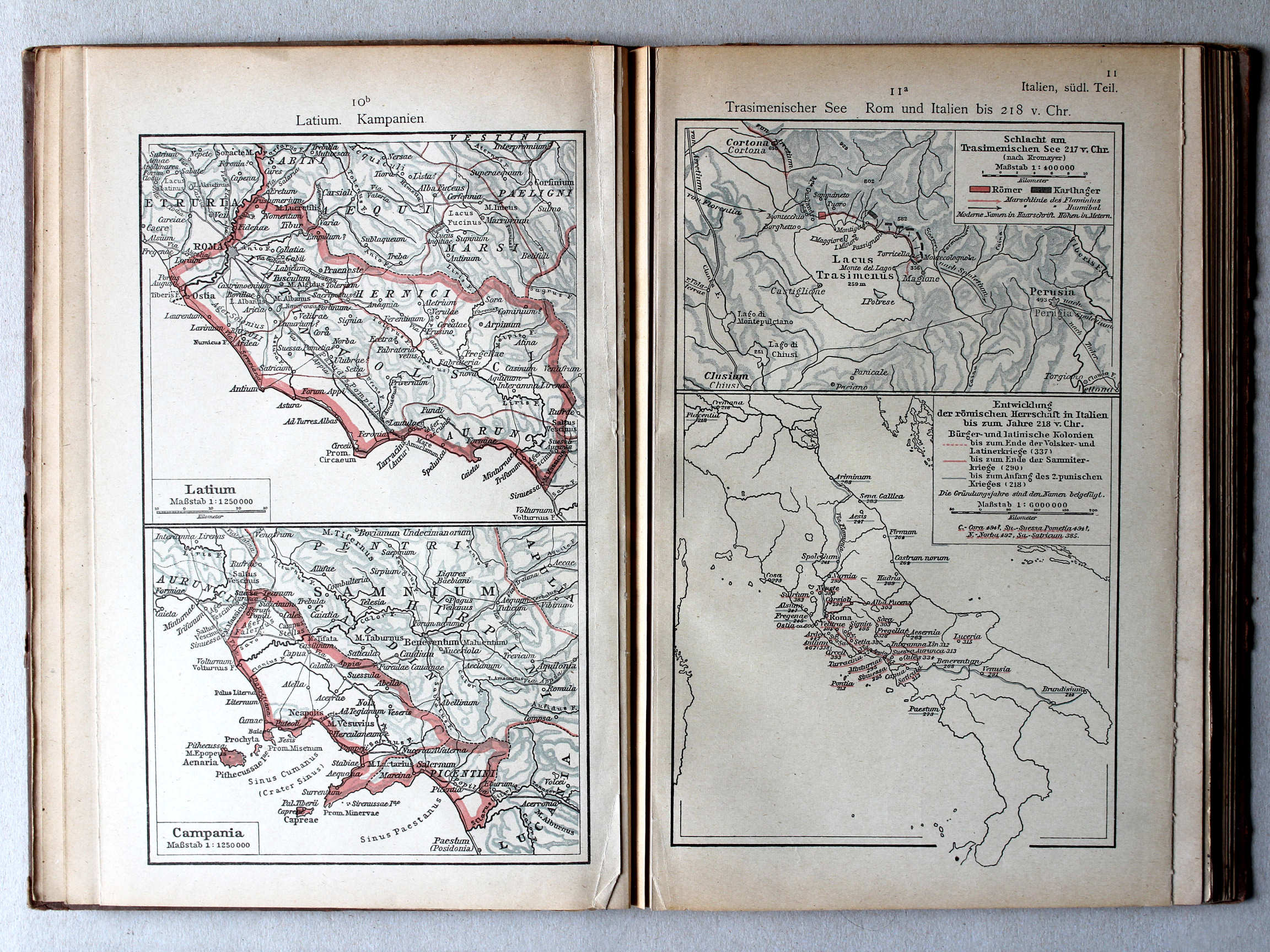
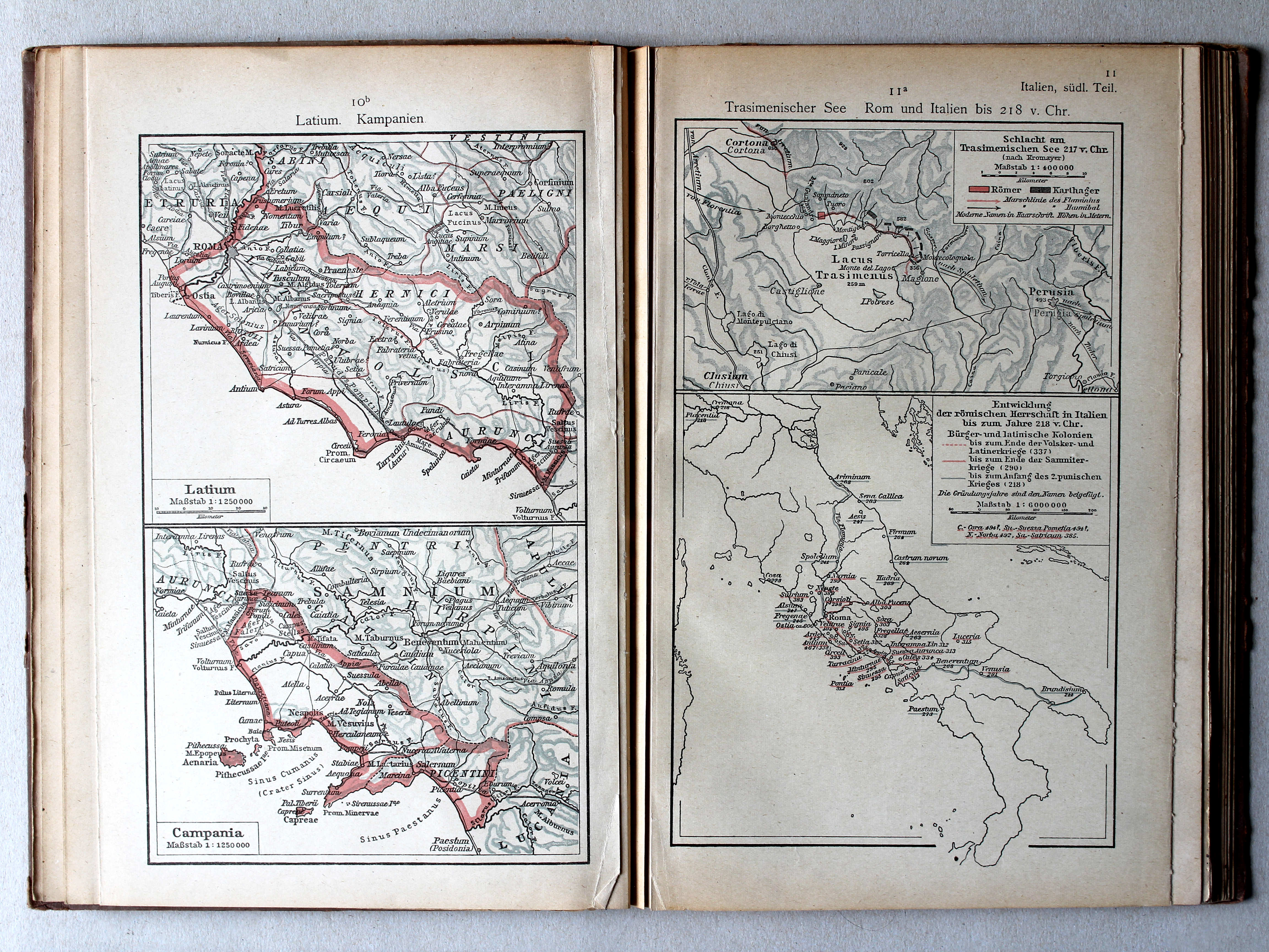
10b. Latium. Kampanien XL
Latium. Campania
11a. Trasimenischer See. Rom und Italien bis 218 v. Chr. XL
Trasimeense Meer. Rome en Italië tot 218 v. Chr. / Lake Trasimene. Rome and Italy until 218 BC
 Putzgers Historischer Schul-Atlas, Große Ausgabe, 1923
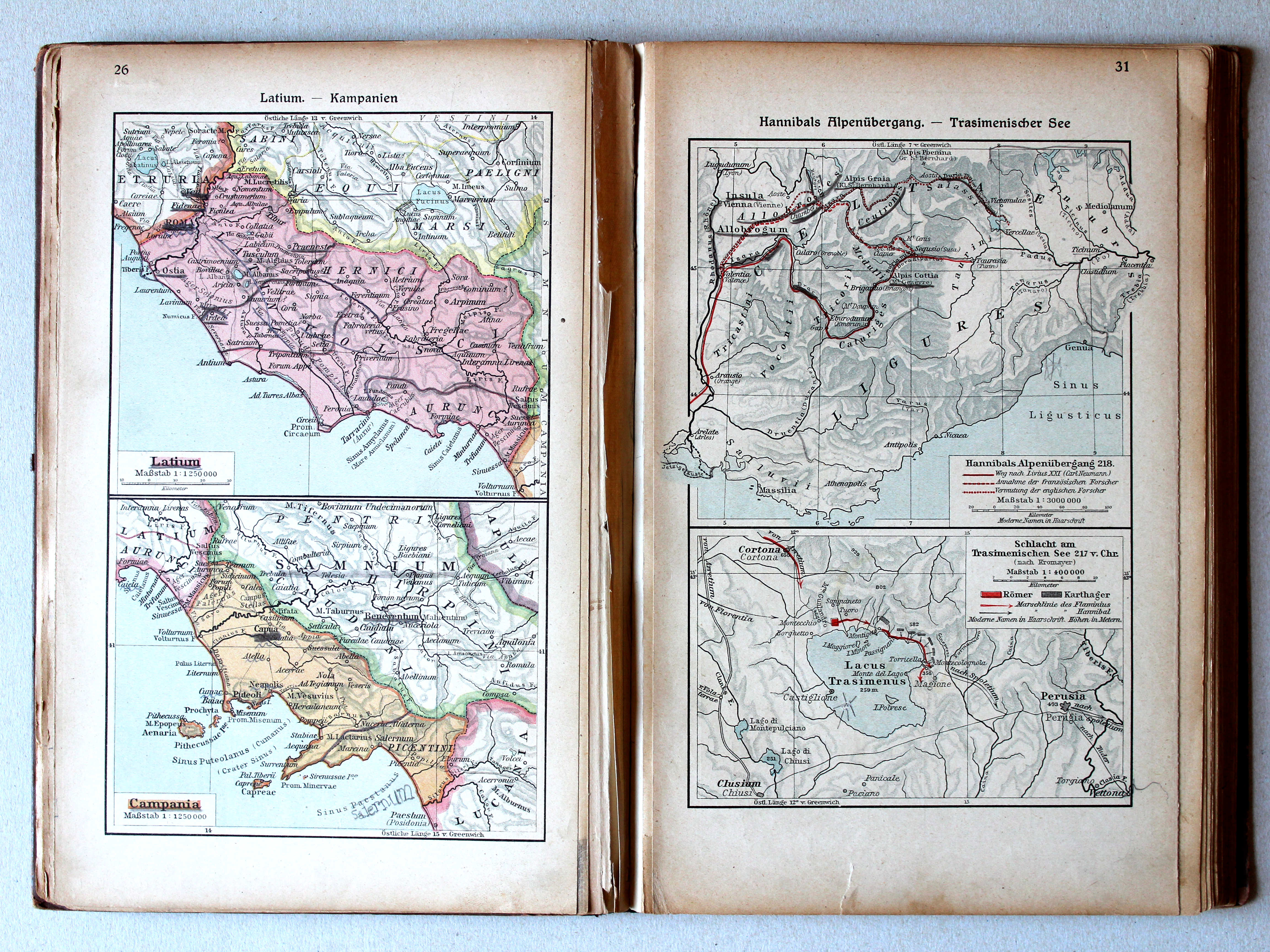
26. Latium – Kampanien XL
Latium. Campania
31. Hannibals Alpenübergang – Trasimenischer See XL
Tocht van Hannibal over de Alpen. Trasimeense Meer / Hannibal crossing the Alps. Lake Trasimene
Putzgers Historischer Schul-Atlas, 1922
10b. Latium. Kampanien XL
Latium. Campania
11a. Trasimenischer See. Rom und Italien bis 218 v. Chr. XL
Trasimeense Meer. Rome en Italië tot 218 v. Chr. / Lake Trasimene. Rome and Italy until 218 BC
Putzgers Historischer Schul-Atlas, Große Ausgabe, 1923
26. Latium – Kampanien XL
Latium. Campania
31. Hannibals Alpenübergang – Trasimenischer See XL
Tocht van Hannibal over de Alpen. Trasimeense Meer / Hannibal crossing the Alps. Lake Trasimene
 Putzgers Historischer Schul-Atlas, 1922
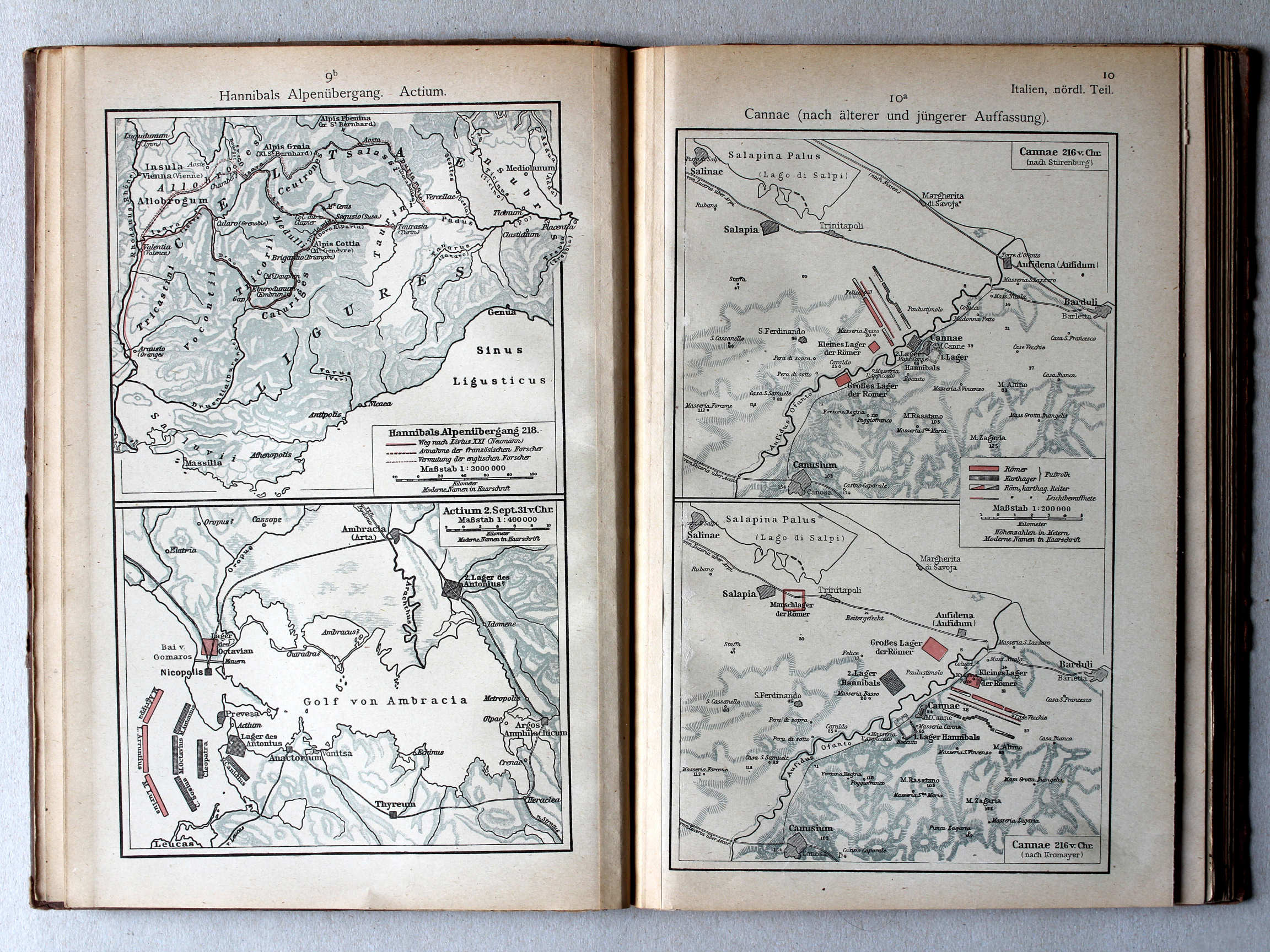
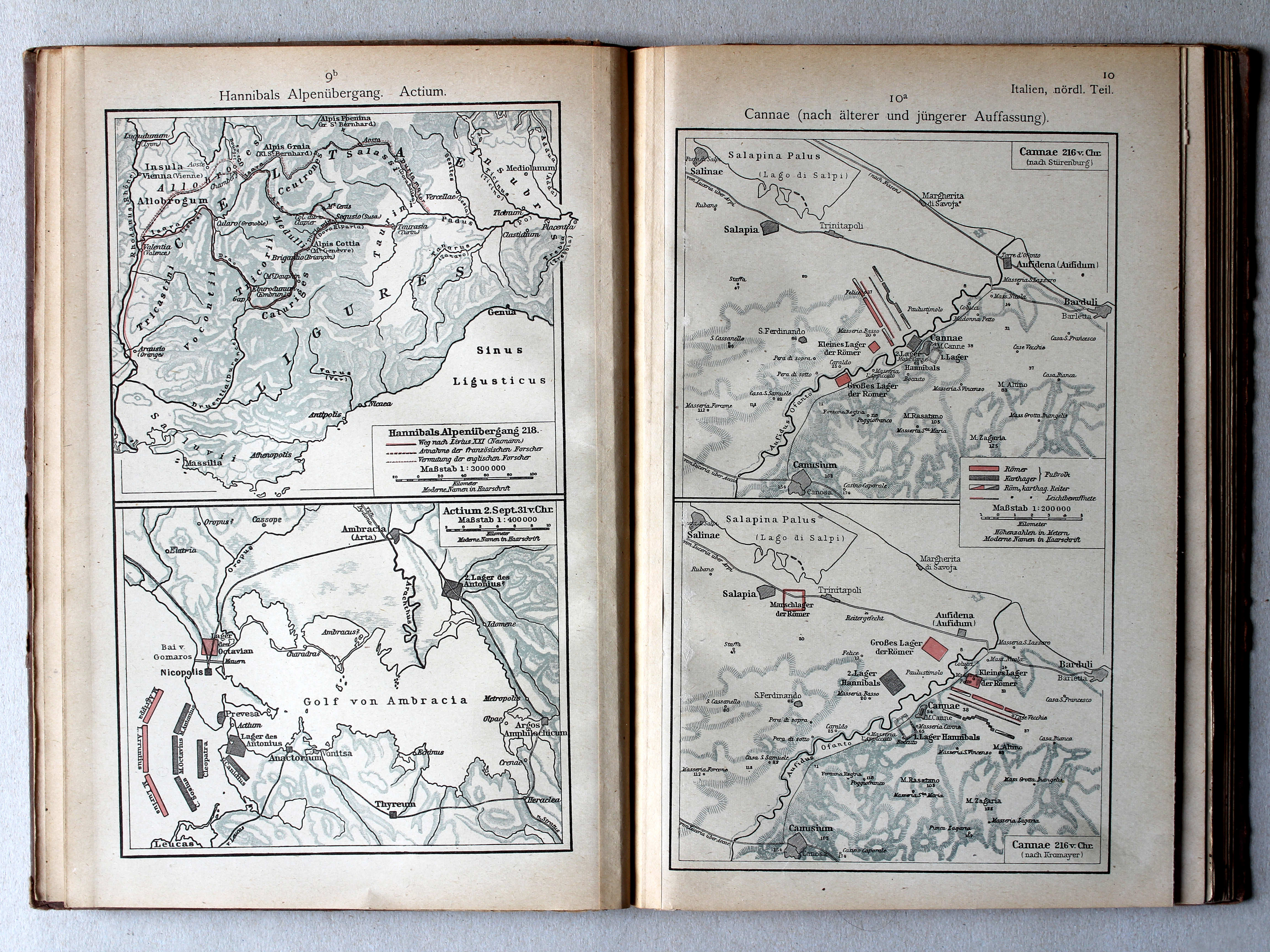
9b. Hannibals Alpenübergang. Actium XL
Tocht van Hannibal over de Alpen. Actium / Hannibal crossing the Alps. Actium
10a. Cannae (nach älterer und jüngerer Auffassung) XL
Cannae (volgens vroegere en latere inzichten) / Cannae (after earlier and later views)
 Putzgers Historischer Schul-Atlas, Große Ausgabe, 1923
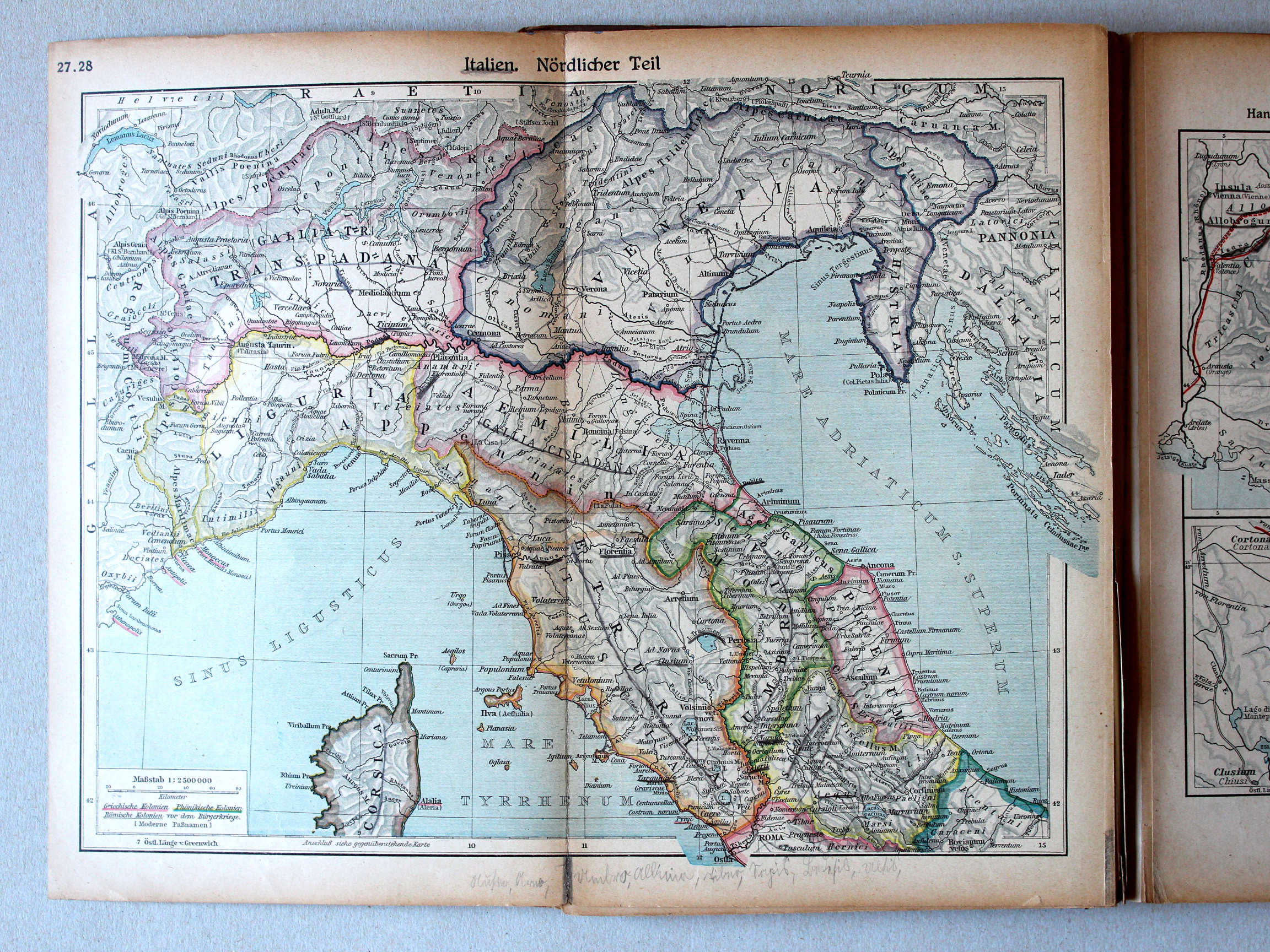
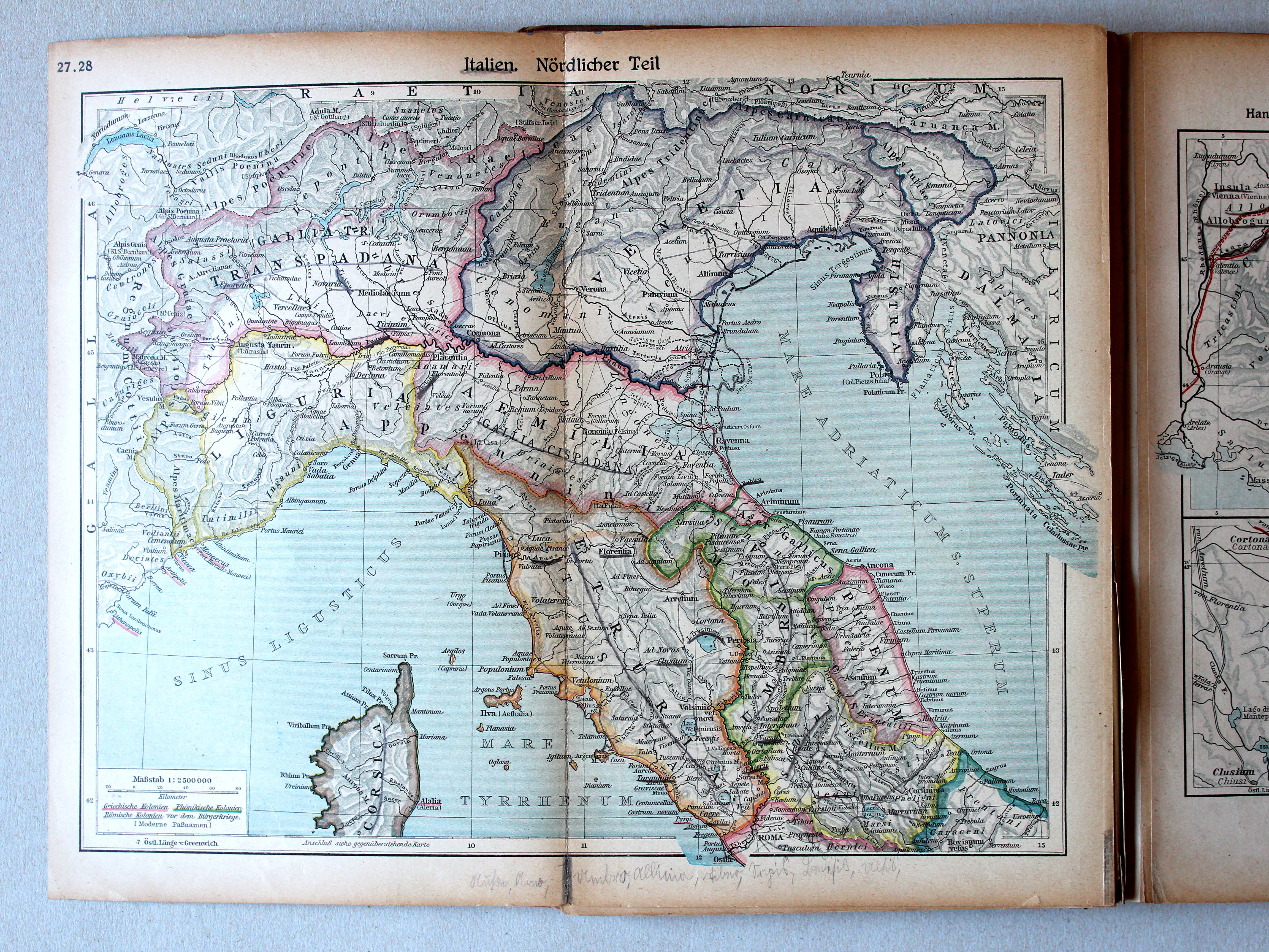
27.28. Italien. Nördlicher Teil XL
Italië, noordelijk deel / Italy, northern part
 Putzgers Historischer Schul-Atlas, 1922
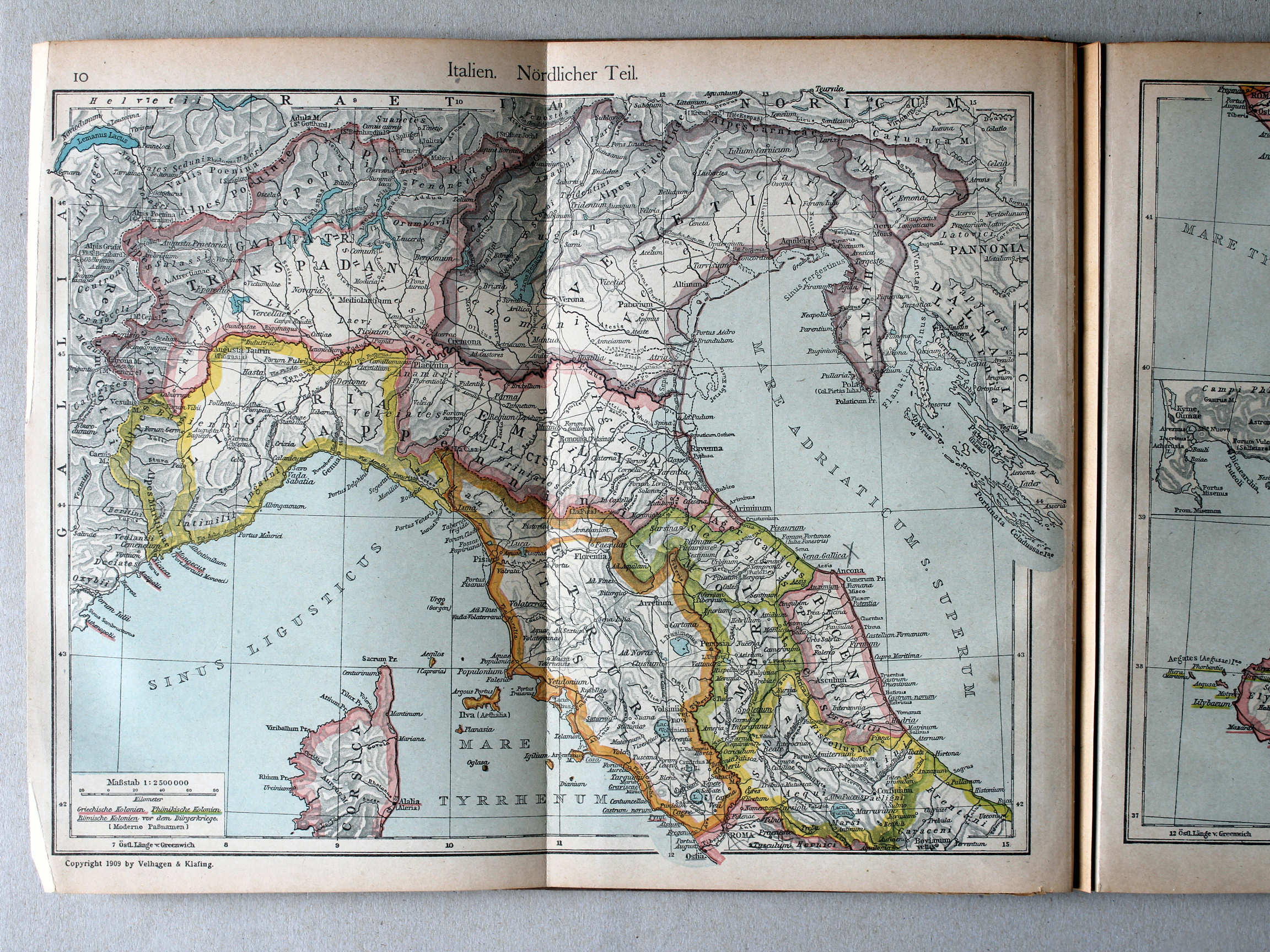
10. Italien. Nördlicher Teil XL
Italië, noordelijk deel / Italy, northern part
 Putzgers Historischer Schul-Atlas, Große Ausgabe, 1923
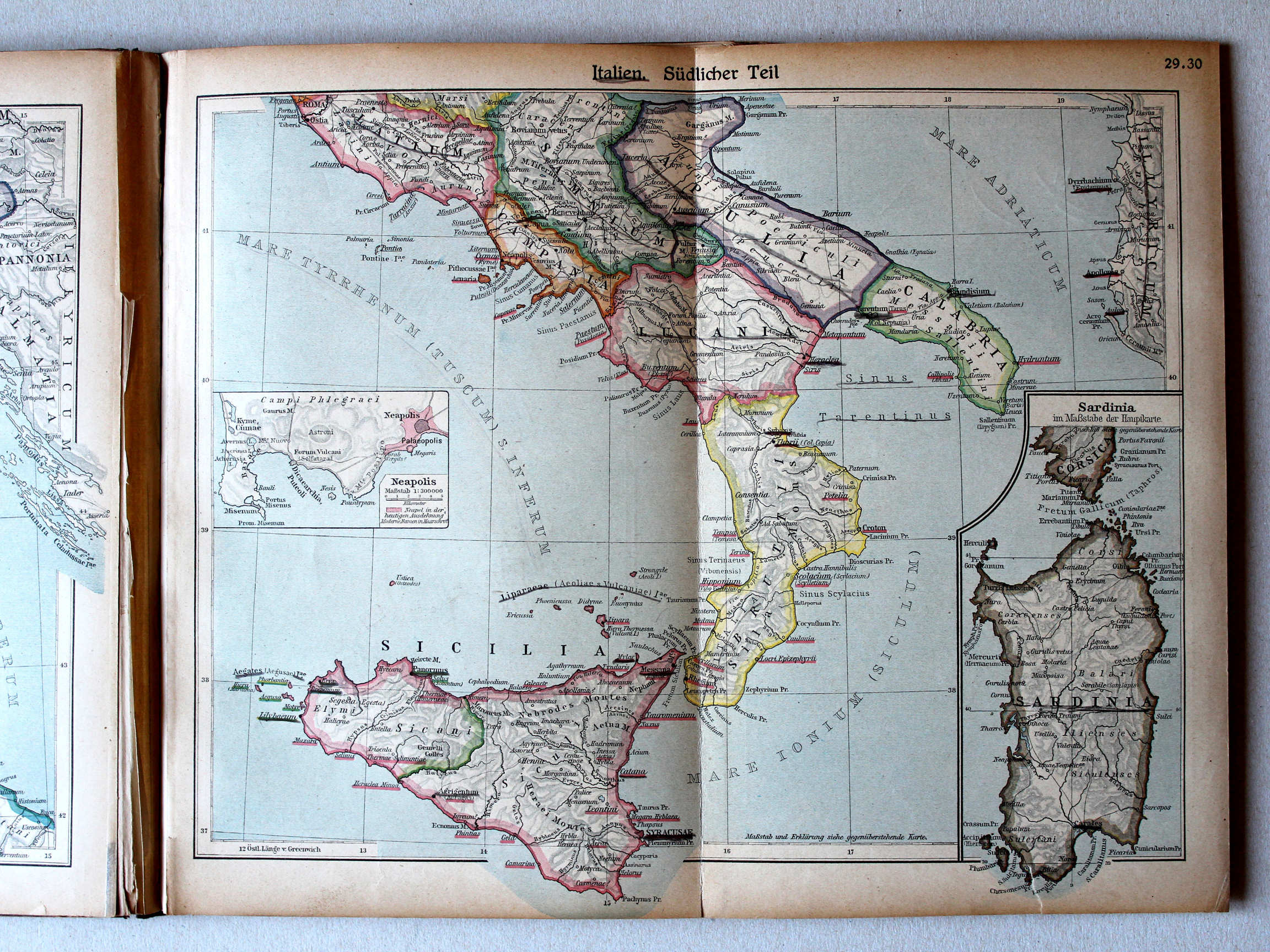
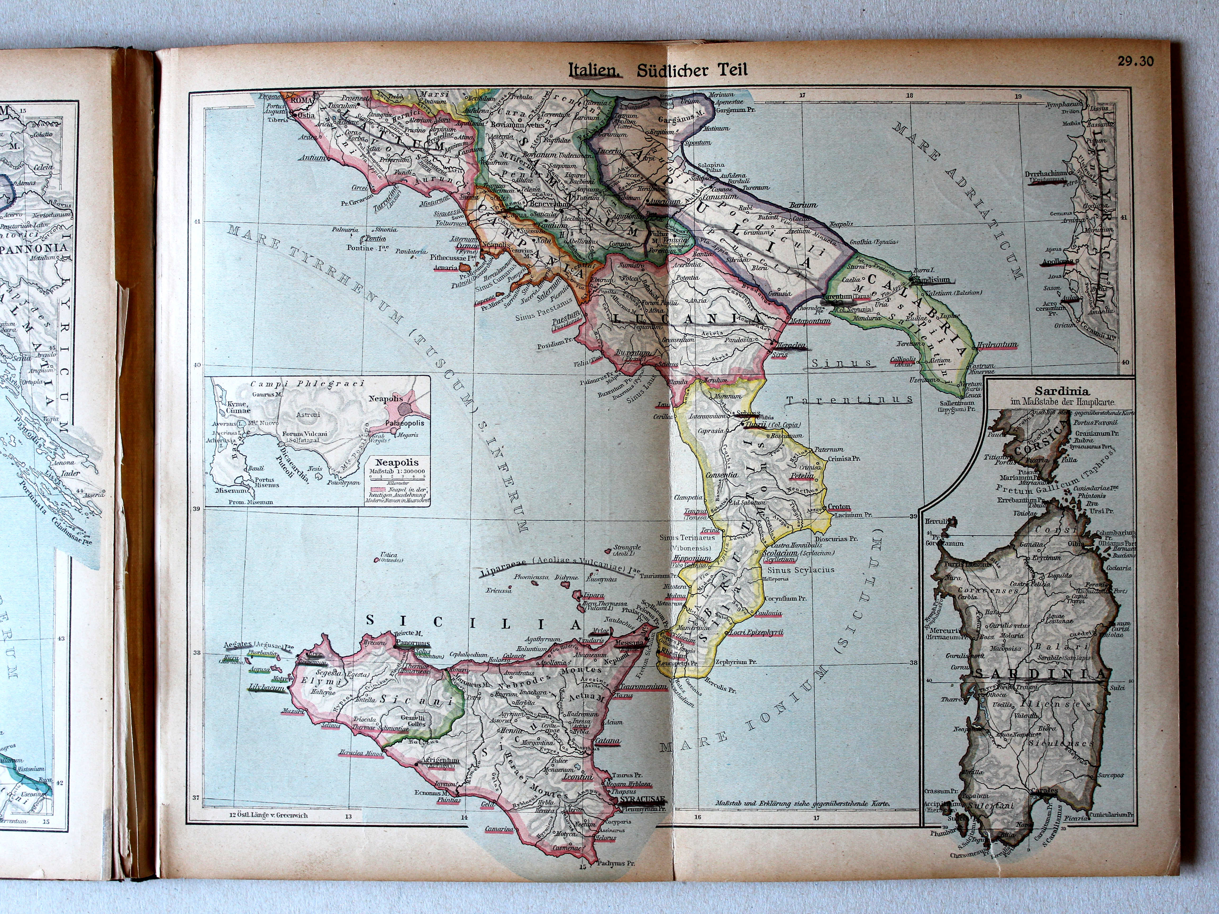
29.30. Italien. Südlicher Teil XL
Italië, zuidelijk deel / Italy, southern part
Putzgers Historischer Schul-Atlas, 1922
11. Italien. Südlicher Teil XL
Italië, zuidelijk deel / Italy, southern part
 Putzgers Historischer Schul-Atlas, Große Ausgabe, 1923
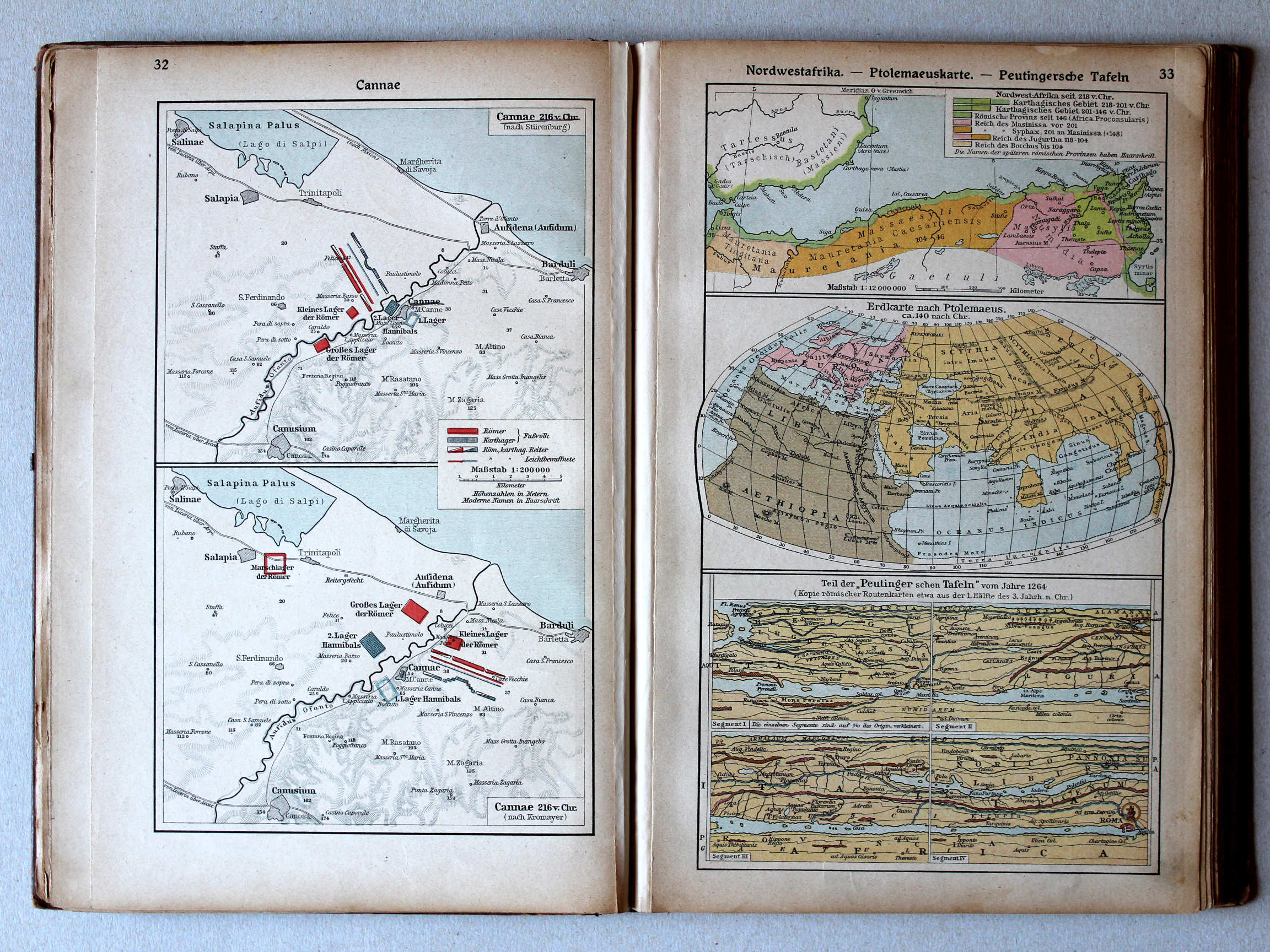
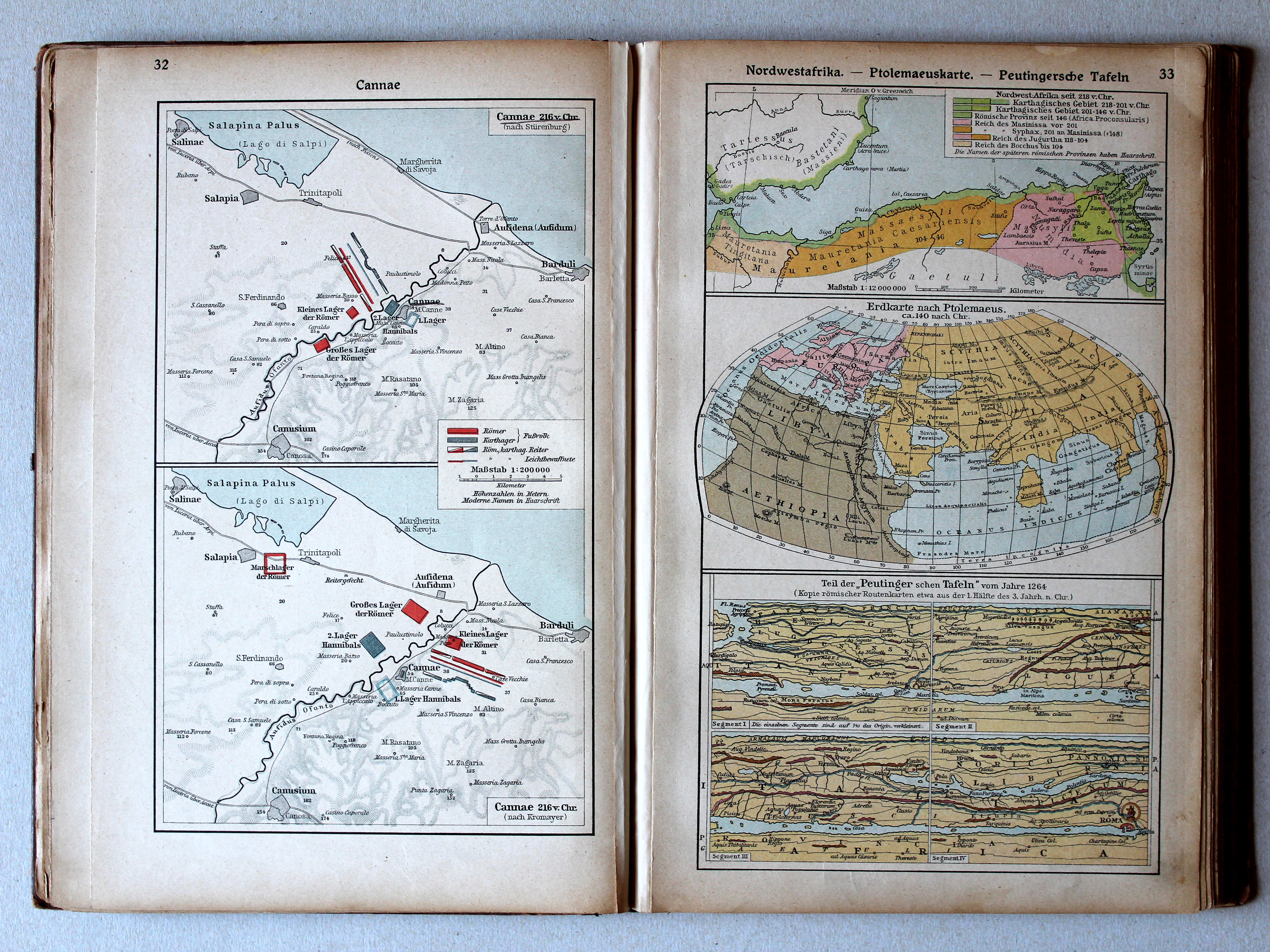
32. Cannae XL
Cannae
33. Nordwestafrika – Ptolemaeuskarte – Peutingersche Tafeln XL
Noordwest-Afrika. Kaart van Ptolemaeus. Tabula Peutingeriana / Northwest Africa. Map of Ptolemy. Tabula Peutingeriana
Putzgers Historischer Schul-Atlas, 1922
9b. Hannibals Alpenübergang. Actium XL
Tocht van Hannibal over de Alpen. Actium / Hannibal crossing the Alps. Actium
10a. Cannae (nach älterer und jüngerer Auffassung) XL
Cannae (volgens vroegere en latere inzichten) / Cannae (after earlier and later views)
Putzgers Historischer Schul-Atlas, Große Ausgabe, 1923
32. Cannae XL
Cannae
33. Nordwestafrika – Ptolemaeuskarte – Peutingersche Tafeln XL
Noordwest-Afrika. Kaart van Ptolemaeus. Tabula Peutingeriana / Northwest Africa. Map of Ptolemy. Tabula Peutingeriana
Putzgers Historischer Schul-Atlas, 1922
2b. Ägypten. Assyrien XL
Egypte. Assyrië / Egypt. Assyria
3a. Peutingersche Tafel. Kelten. Nordwestafrika XL
Tabula Peutingeriana. Kelten. Noordwest-Afrika / Tabula Peutingeriana. Celts. Northwest Africa
 Putzgers Historischer Schul-Atlas, Große Ausgabe, 1923
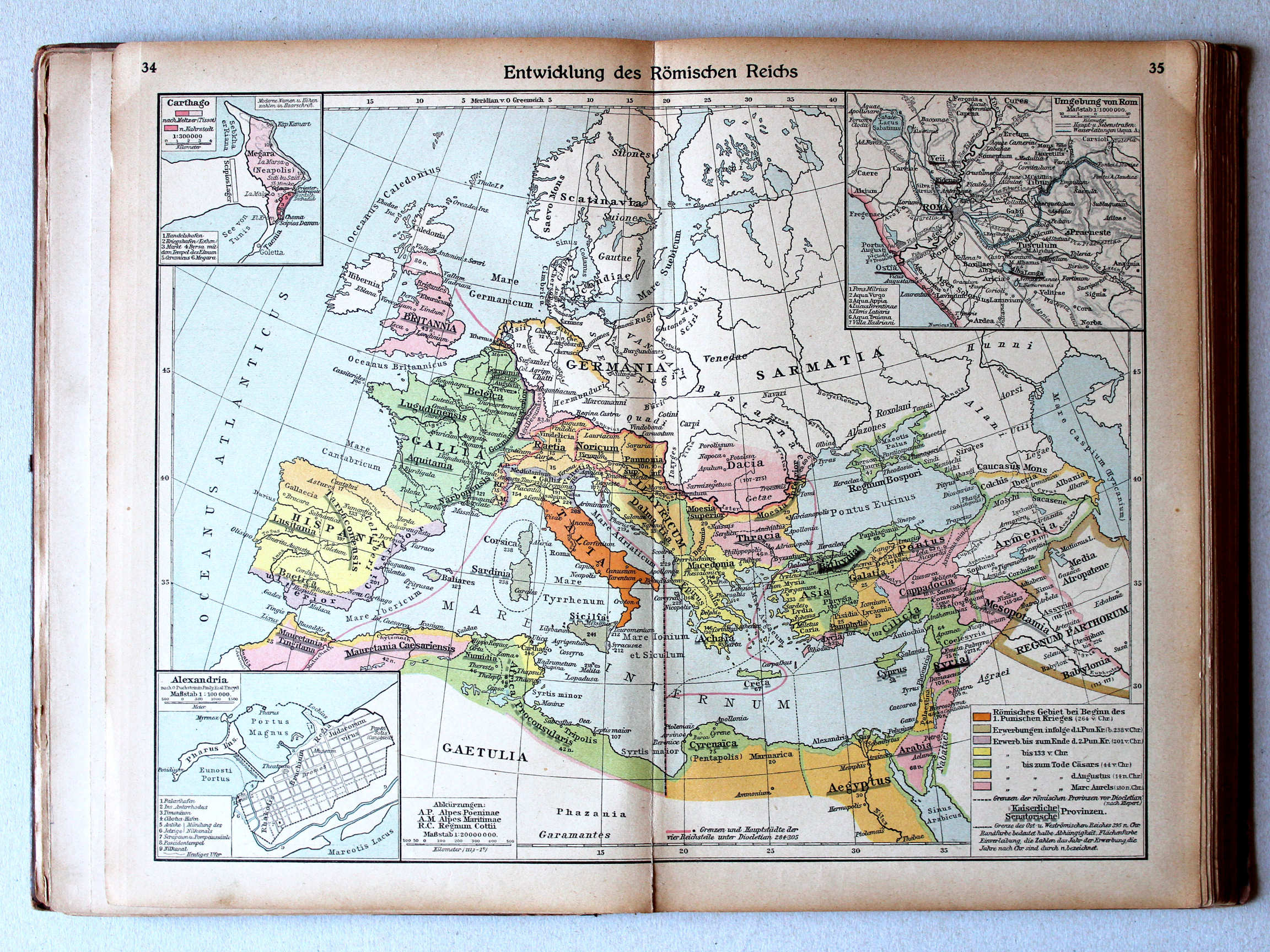
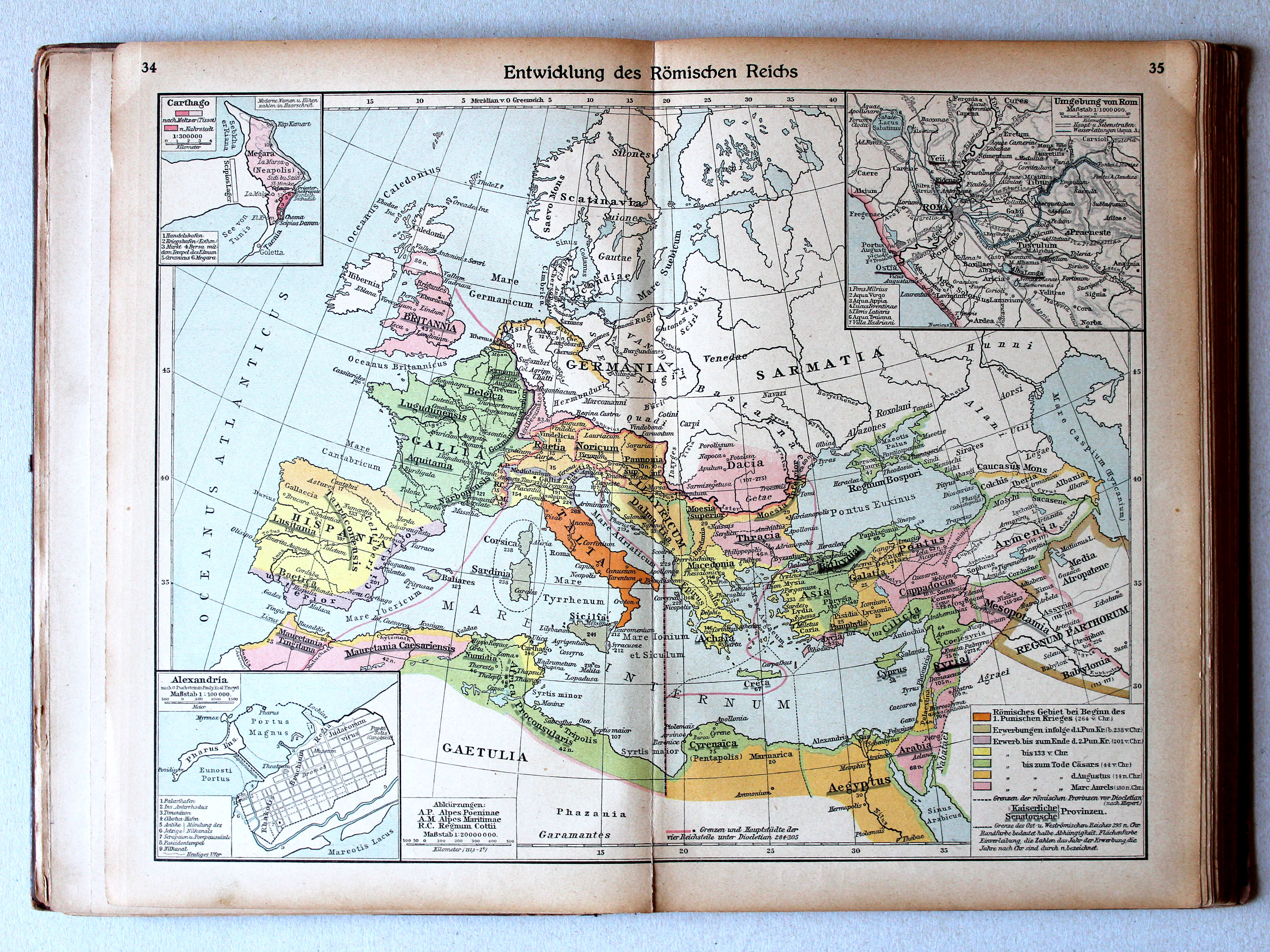
34.35. Entwicklung des Römischen Reichs XL
Ontwikkeling van het Romeinse Rijk / Development of the Roman Empire
 Putzgers Historischer Schul-Atlas, 1922
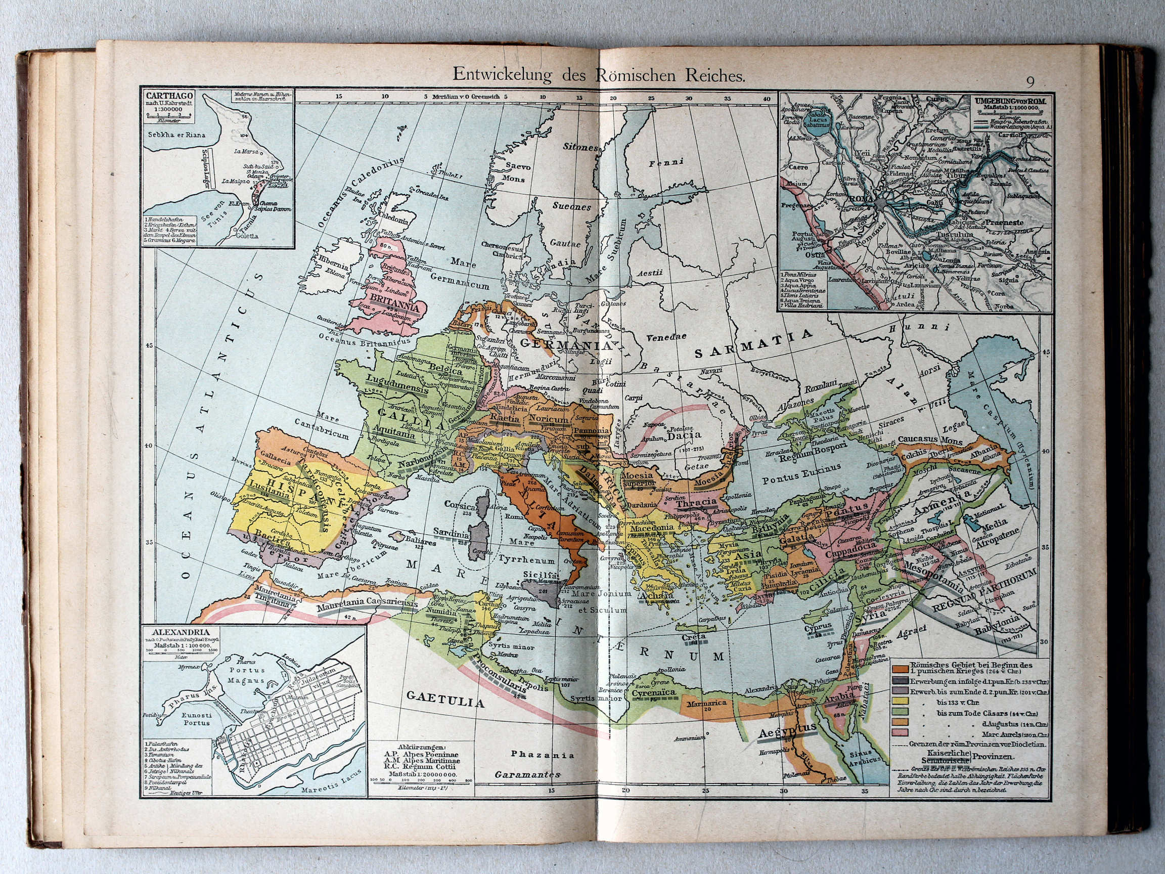
9. Entwickelung des Römischen Reiches XL
Ontwikkeling van het Romeinse Rijk / Development of the Roman Empire
 Putzgers Historischer Schul-Atlas, Große Ausgabe, 1923
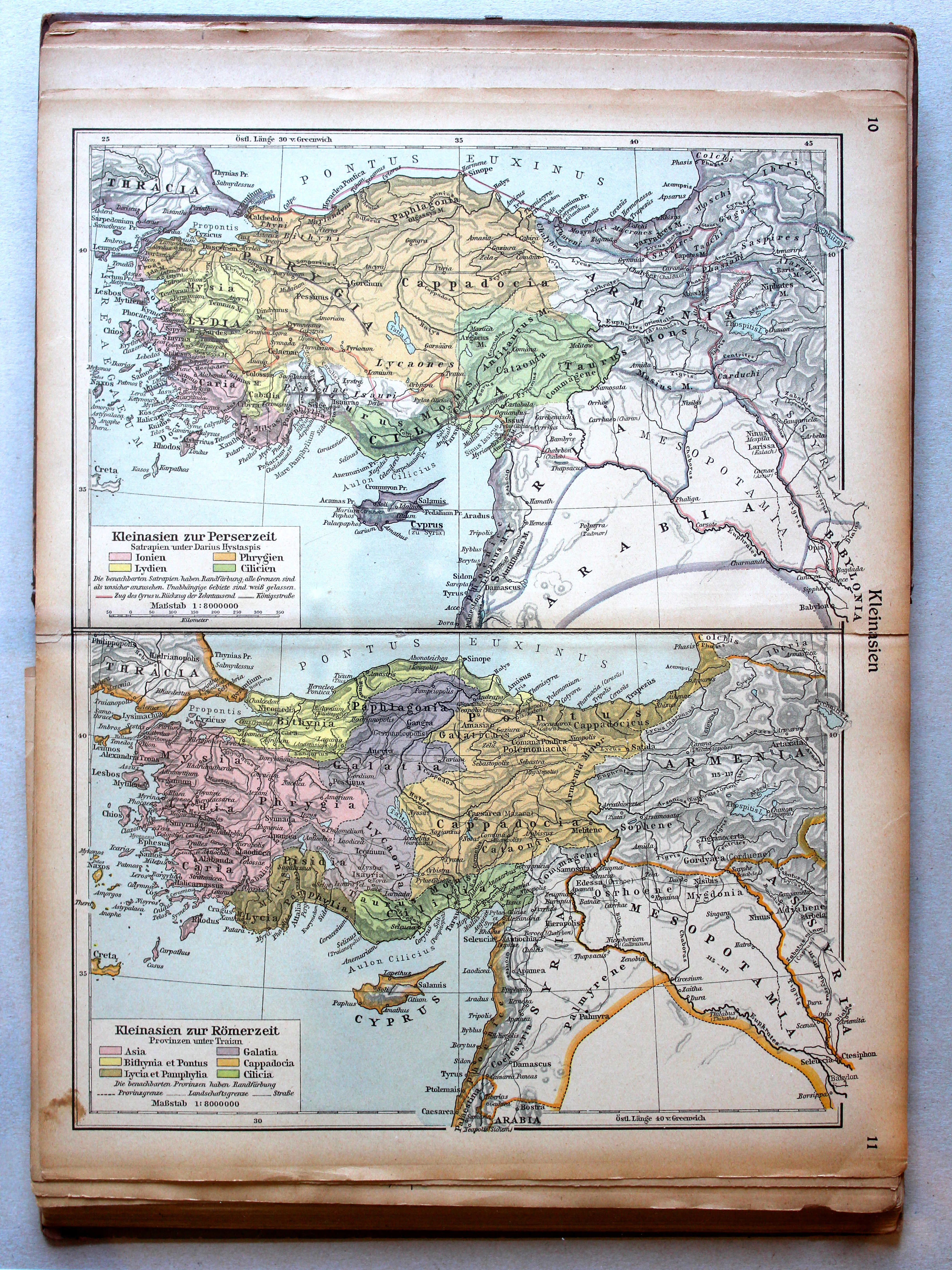
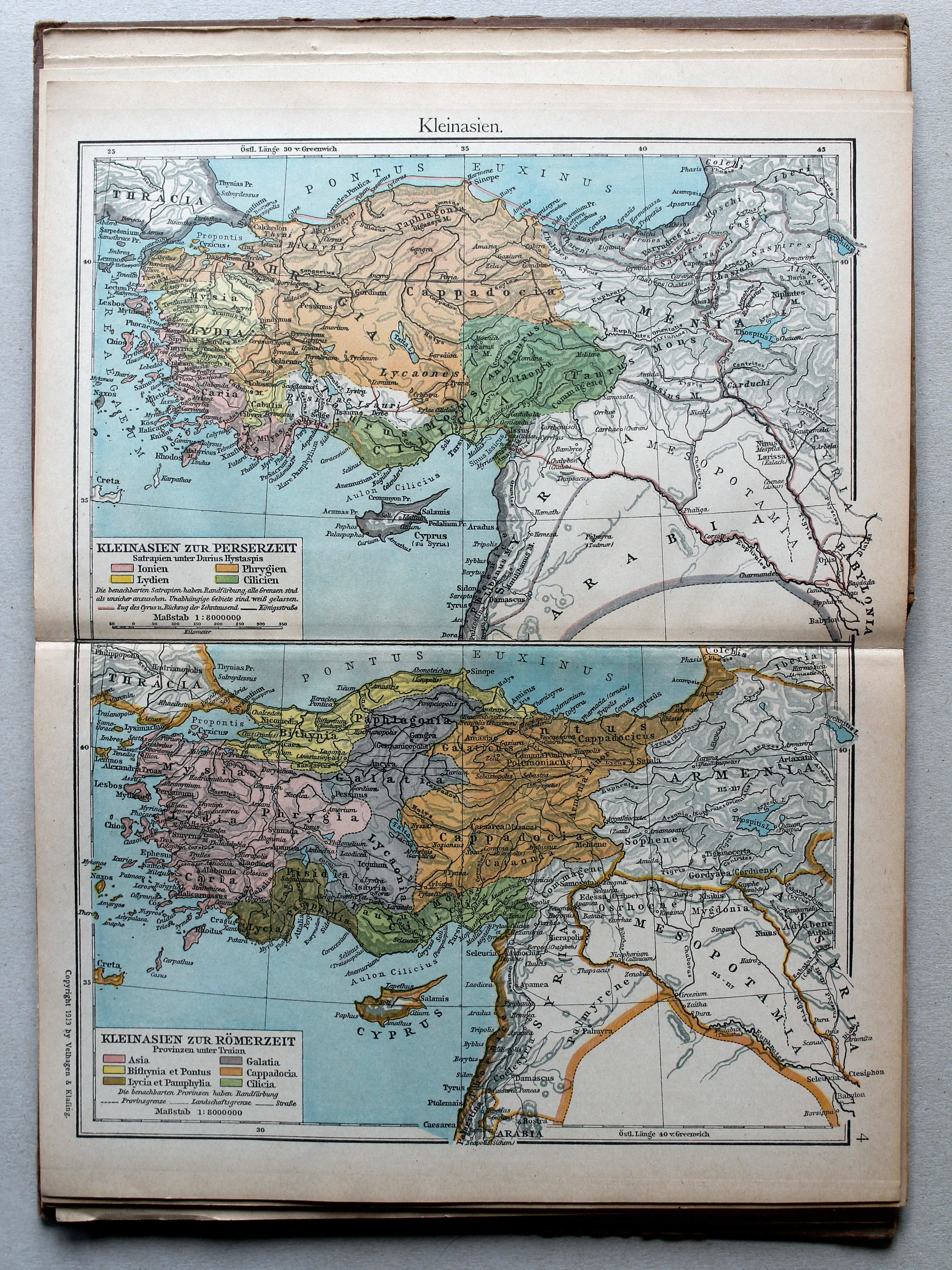
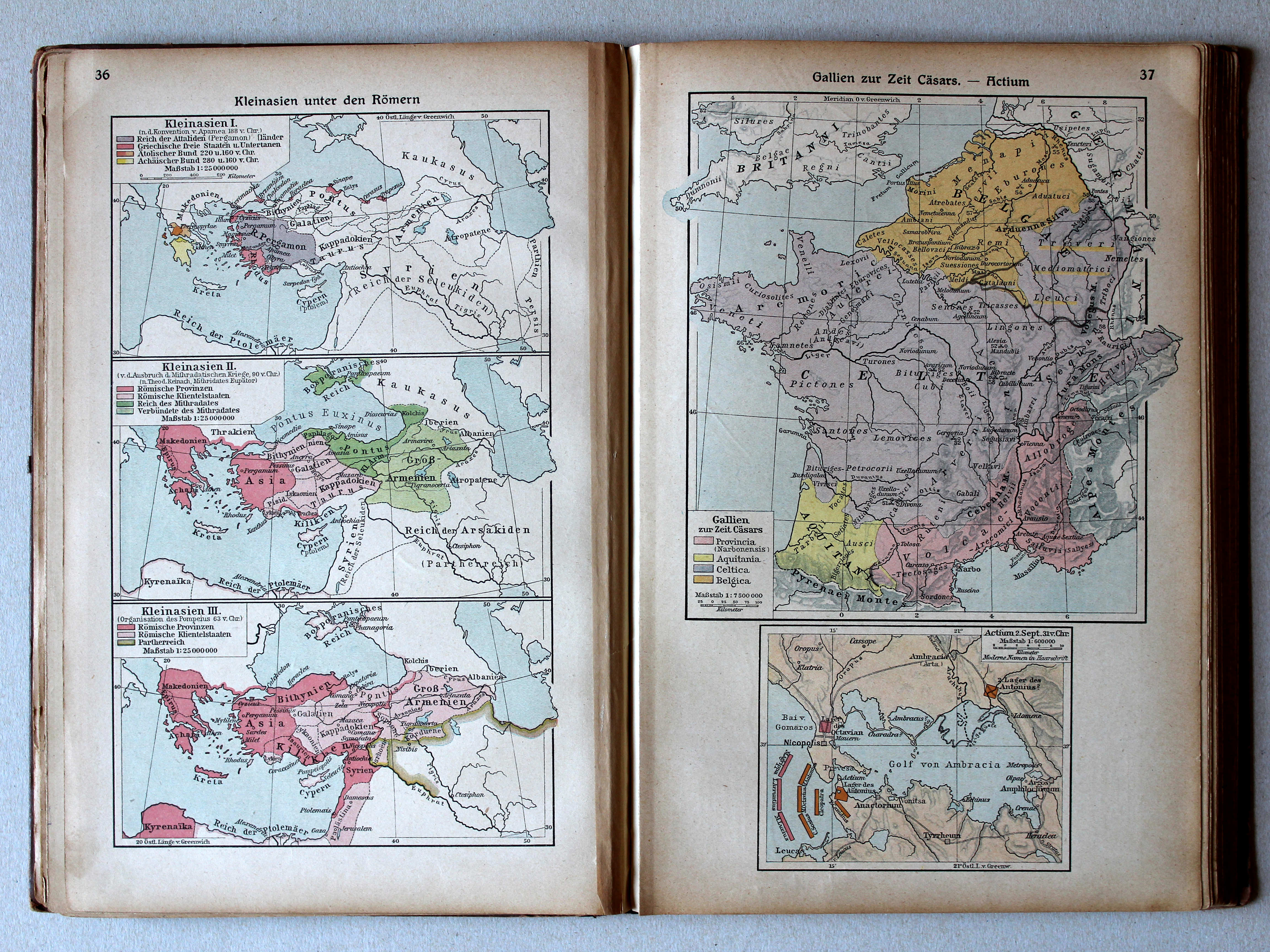
36. Kleinasien unter den Römern XL
Klein-Azië onder de Romeinen / Asia Minor under the Romans
37. Gallien zur Zeit Cäsars – Actium XL
Gallië in de tijd van Caesar. Actium / Gaul in Caesar's time. Actium
 Putzgers Historischer Schul-Atlas, 1922
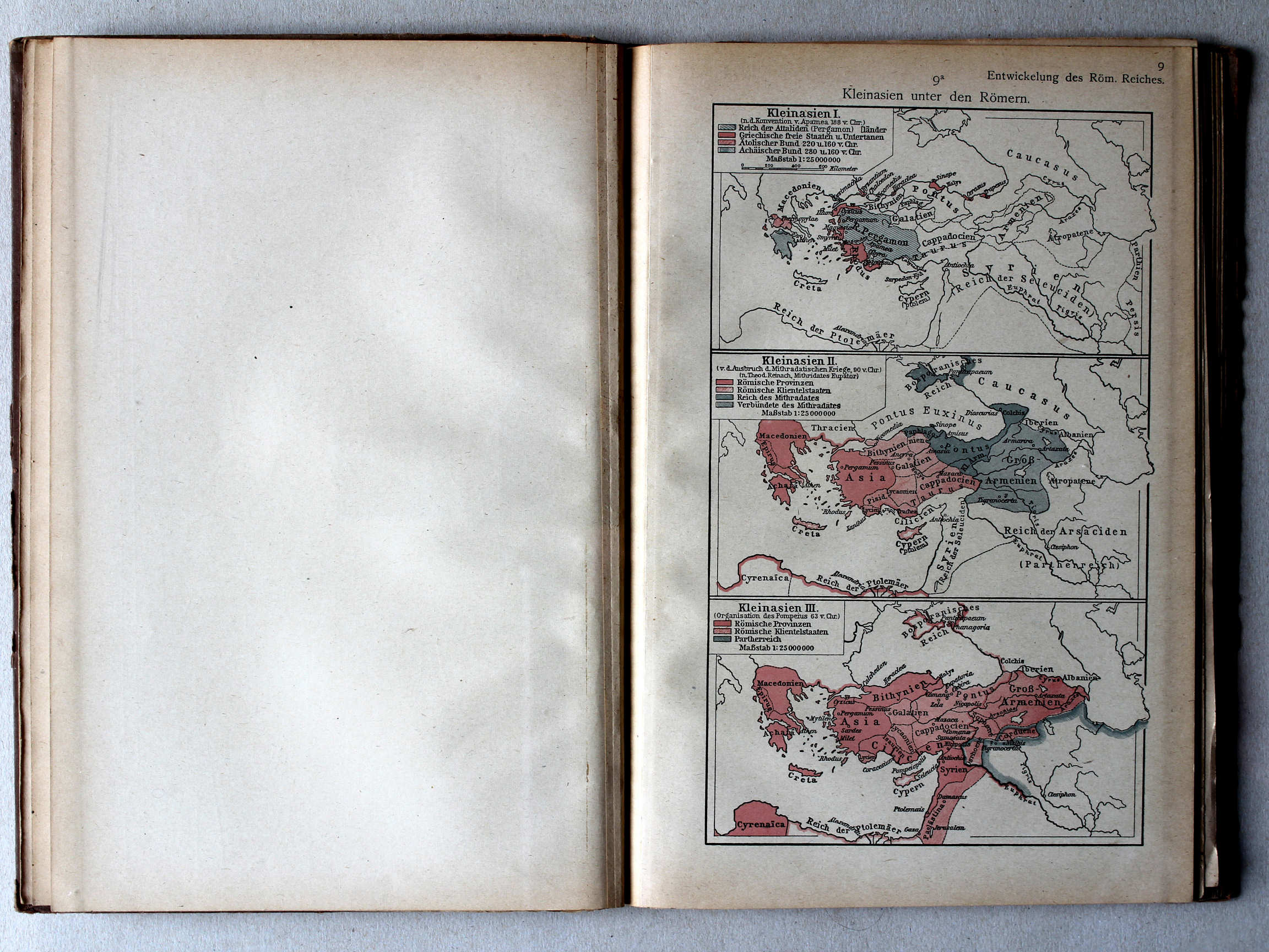
9a. Kleinasien unter den Römern XL
Klein-Azië onder de Romeinen / Asia Minor under the Romans
Putzgers Historischer Schul-Atlas, Große Ausgabe, 1923
36. Kleinasien unter den Römern XL
Klein-Azië onder de Romeinen / Asia Minor under the Romans
37. Gallien zur Zeit Cäsars – Actium XL
Gallië in de tijd van Caesar. Actium / Gaul in Caesar's time. Actium
 Putzgers Historischer Schul-Atlas, 1922
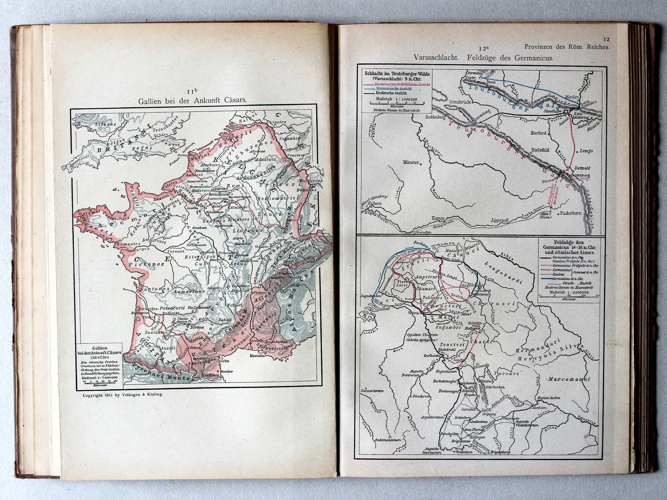
11b. Gallien bei der Ankunft Cäsars XL
Gallië bij de komst van Caesar / Gaul by Caesar's arrival
12a. Varusschlacht. Feldzüge des Germanicus XL
Slag bij het Teutoburgerwoud. Veldtochten van Germanicus / Battle of the Teutoburg Forest. Campaigns of Germanicus
Putzgers Historischer Schul-Atlas, Große Ausgabe, 1923
36. Kleinasien unter den Römern XL
Klein-Azië onder de Romeinen / Asia Minor under the Romans
37. Gallien zur Zeit Cäsars – Actium XL
Gallië in de tijd van Caesar. Actium / Gaul in Caesar's time. Actium
Putzgers Historischer Schul-Atlas, 1922
9b. Hannibals Alpenübergang. Actium XL
Tocht van Hannibal over de Alpen. Actium / Hannibal crossing the Alps. Actium
10a. Cannae (nach älterer und jüngerer Auffassung) XL
Cannae (volgens vroegere en latere inzichten) / Cannae (after earlier and later views)
 Putzgers Historischer Schul-Atlas, Große Ausgabe, 1923
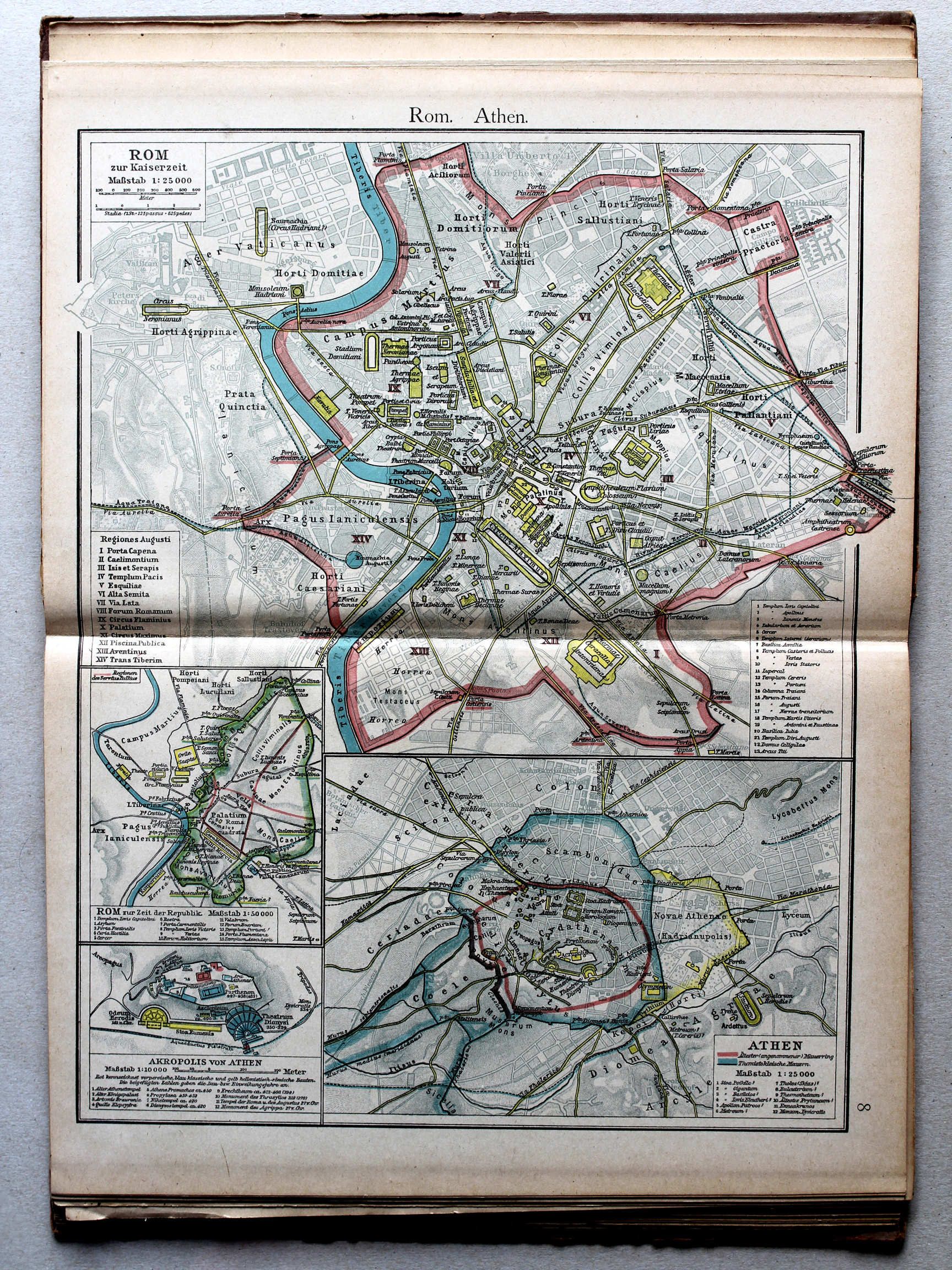
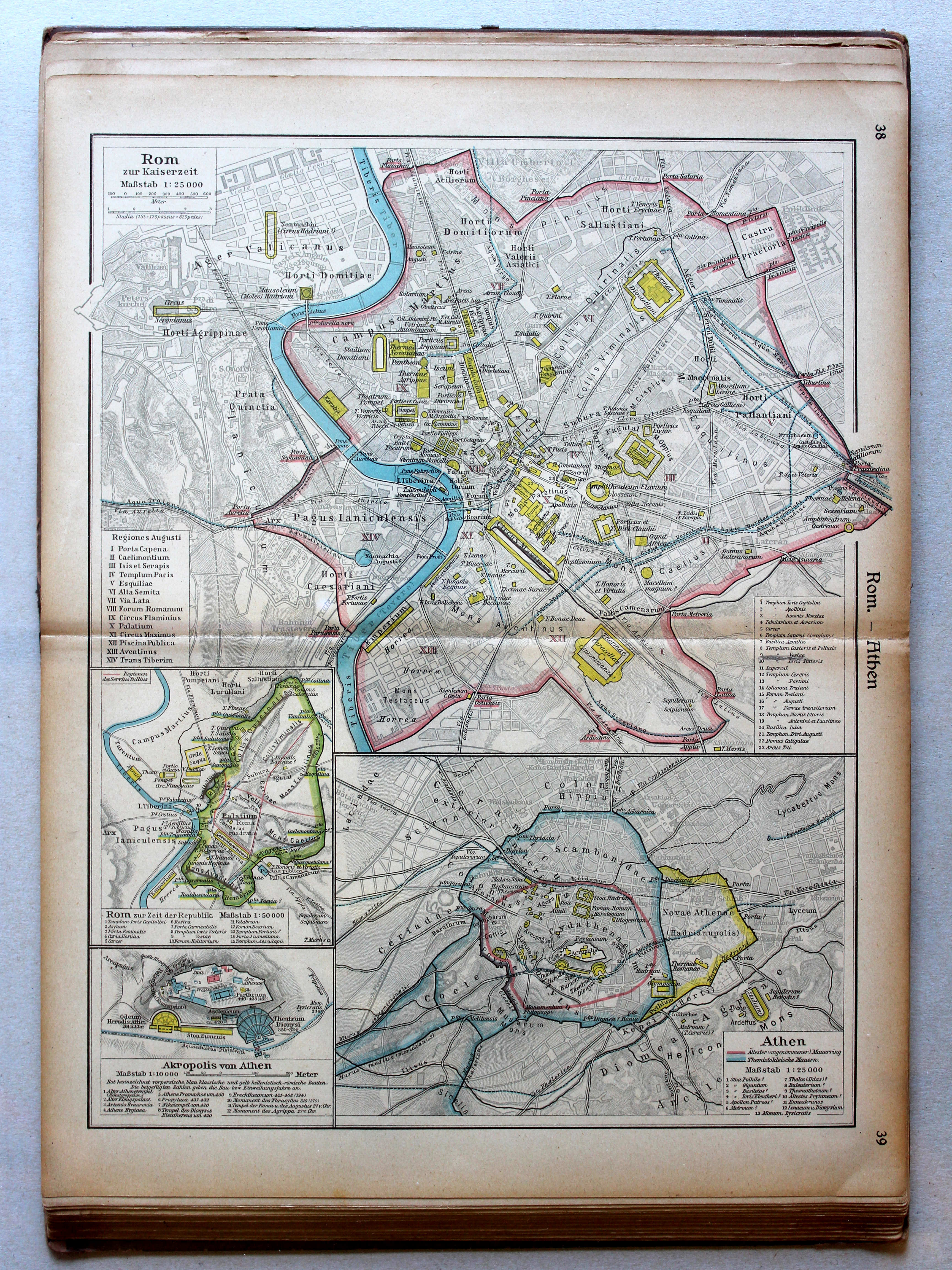
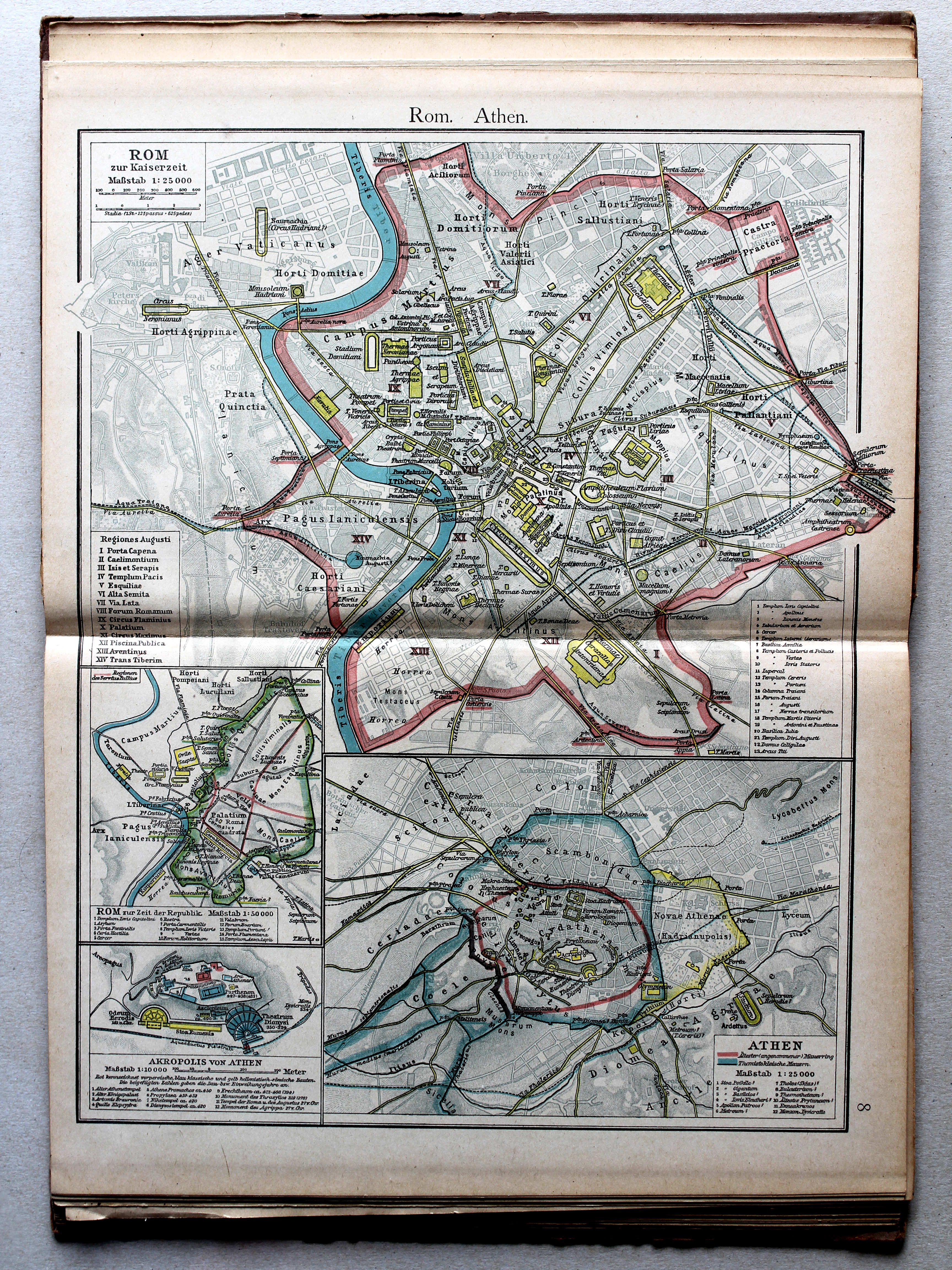
38.39. Rom – Athen XL
Rome. Athene / Rome. Athens
 Putzgers Historischer Schul-Atlas, Große Ausgabe, 1923
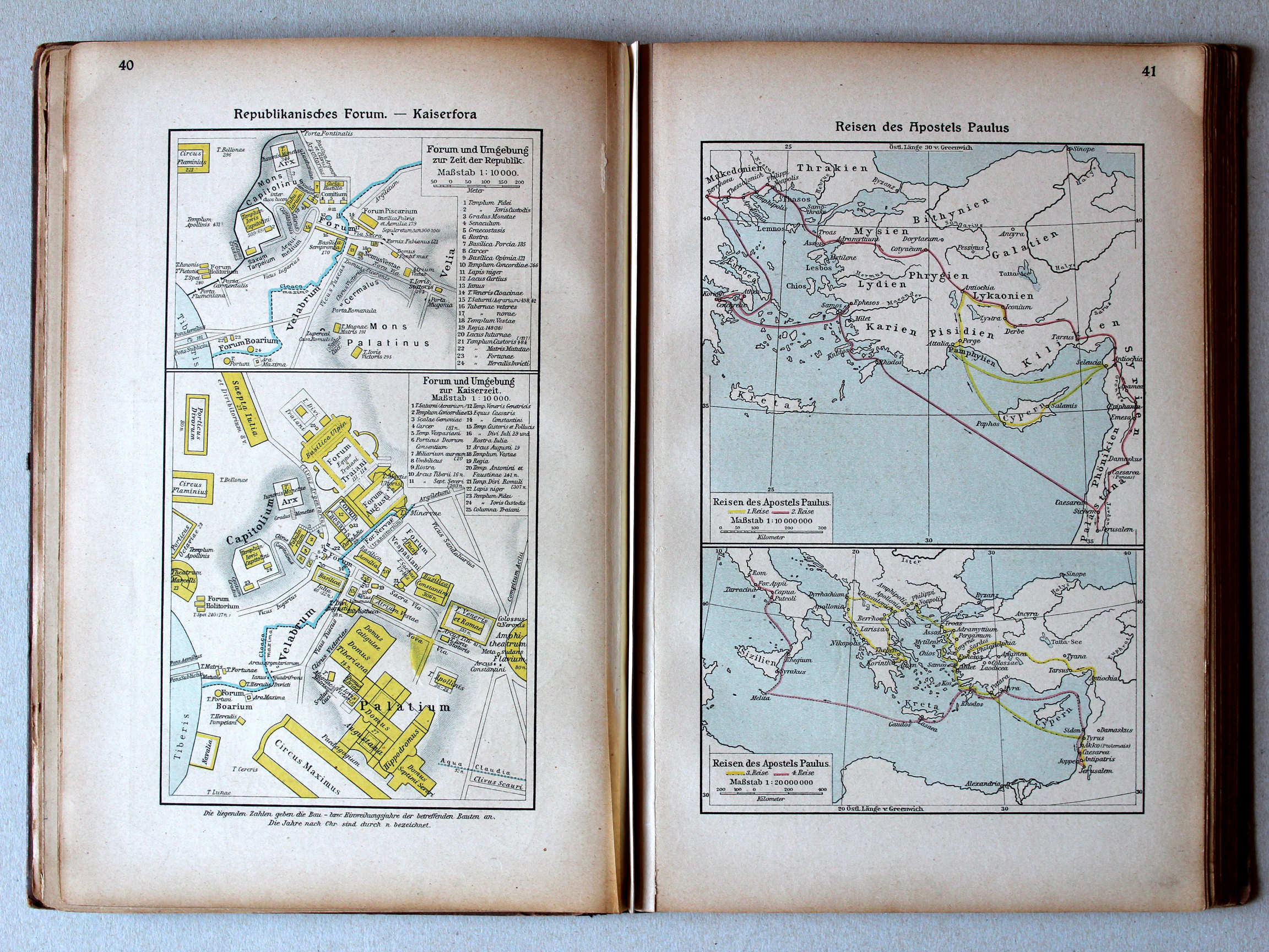
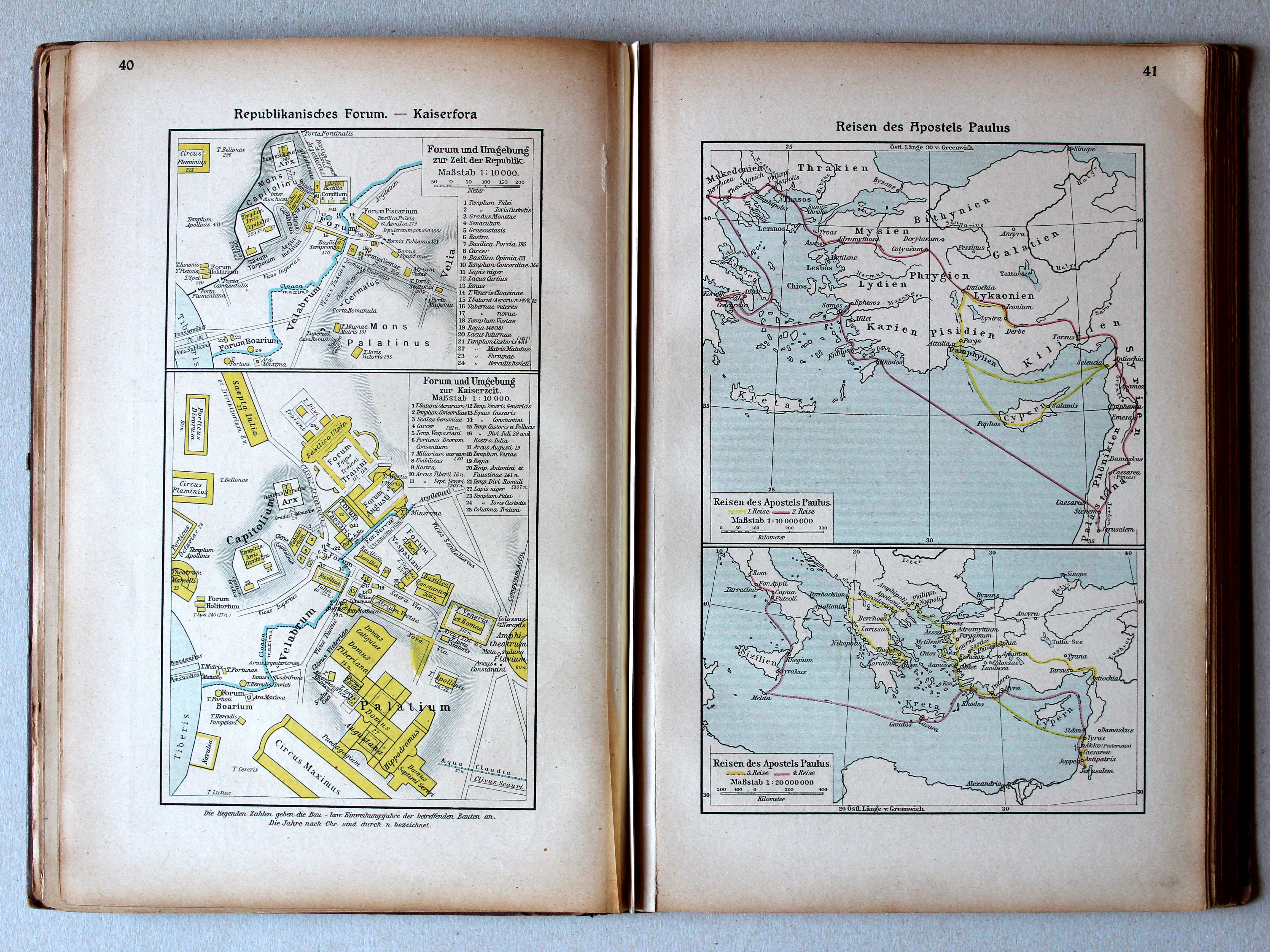
40. Republikanisches Forum – Kaiserfora XL
Forum tijdens de Republiek. Fora in de Keizertijd / Forum during the Republic. Fora in the Imperial period
41. Reisen des Apostels Paulus XL
Reizen van de Apostel Paulus / Journeys of Paul the Apostle
Putzgers Historischer Schul-Atlas, 1922
7b. Wachstum Macedoniens unter Philipp II XL
Groei van Macedonië onder Philippus II / Growth of Macedonia under Philip II
8a. Republikanisches Forum. Kaiserfora XL
Forum tijdens de Republiek. Fora in de Keizertijd / Forum during the Republic. Fora in the Imperial period
Putzgers Historischer Schul-Atlas, Große Ausgabe, 1923
40. Republikanisches Forum – Kaiserfora XL
Forum tijdens de Republiek. Fora in de Keizertijd / Forum during the Republic. Fora in the Imperial period
41. Reisen des Apostels Paulus XL
Reizen van de Apostel Paulus / Journeys of Paul the Apostle
 Putzgers Historischer Schul-Atlas, 1922
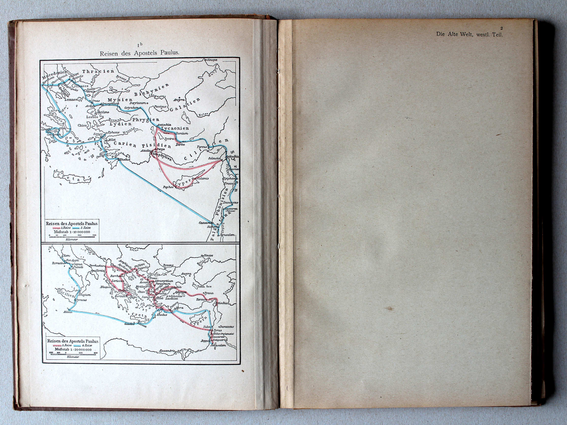
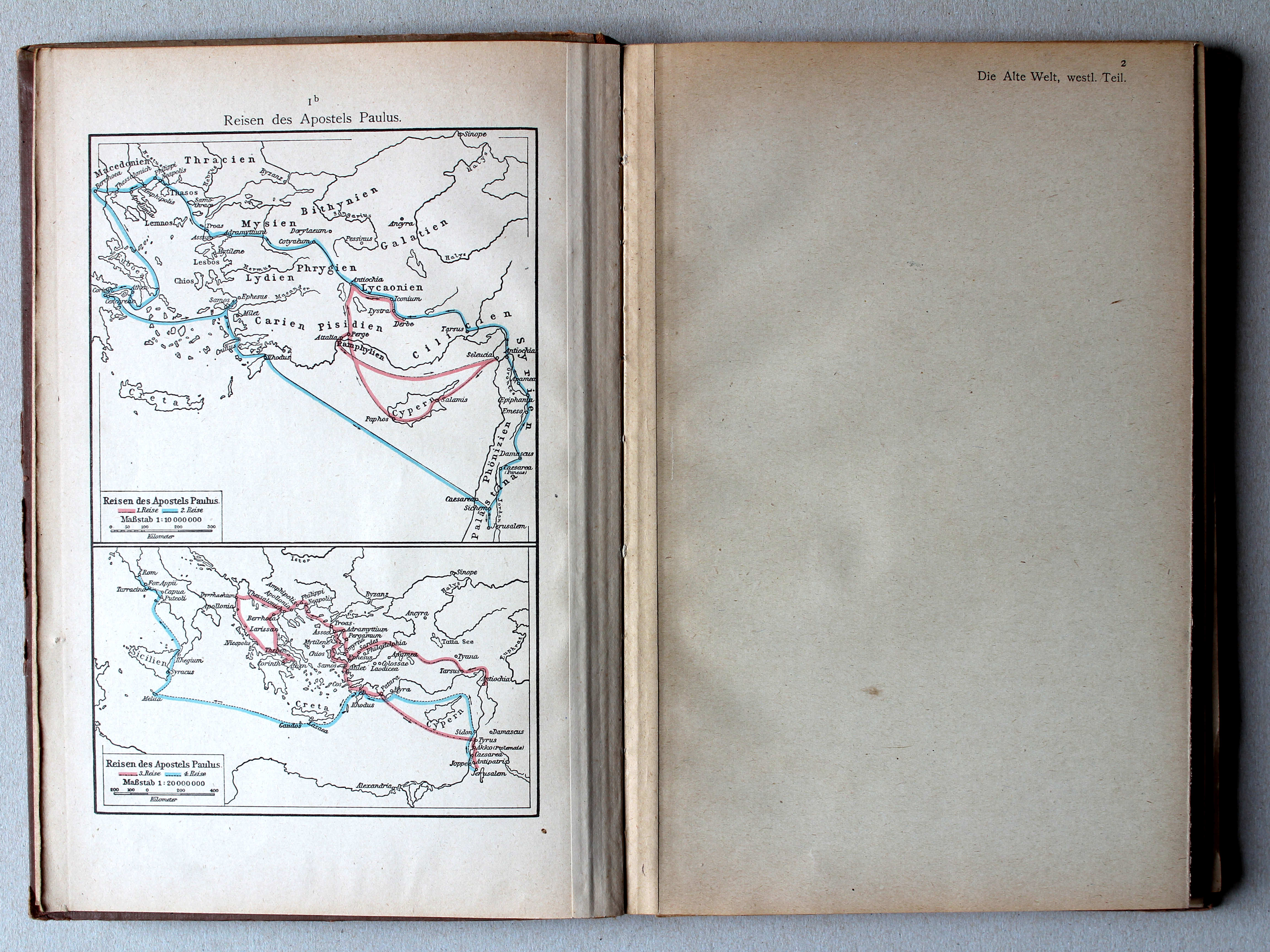
1b. Reisen des Apostels Paulus XL
Reizen van de Apostel Paulus / Journeys of Paul the Apostle
 Putzgers Historischer Schul-Atlas, Große Ausgabe, 1923
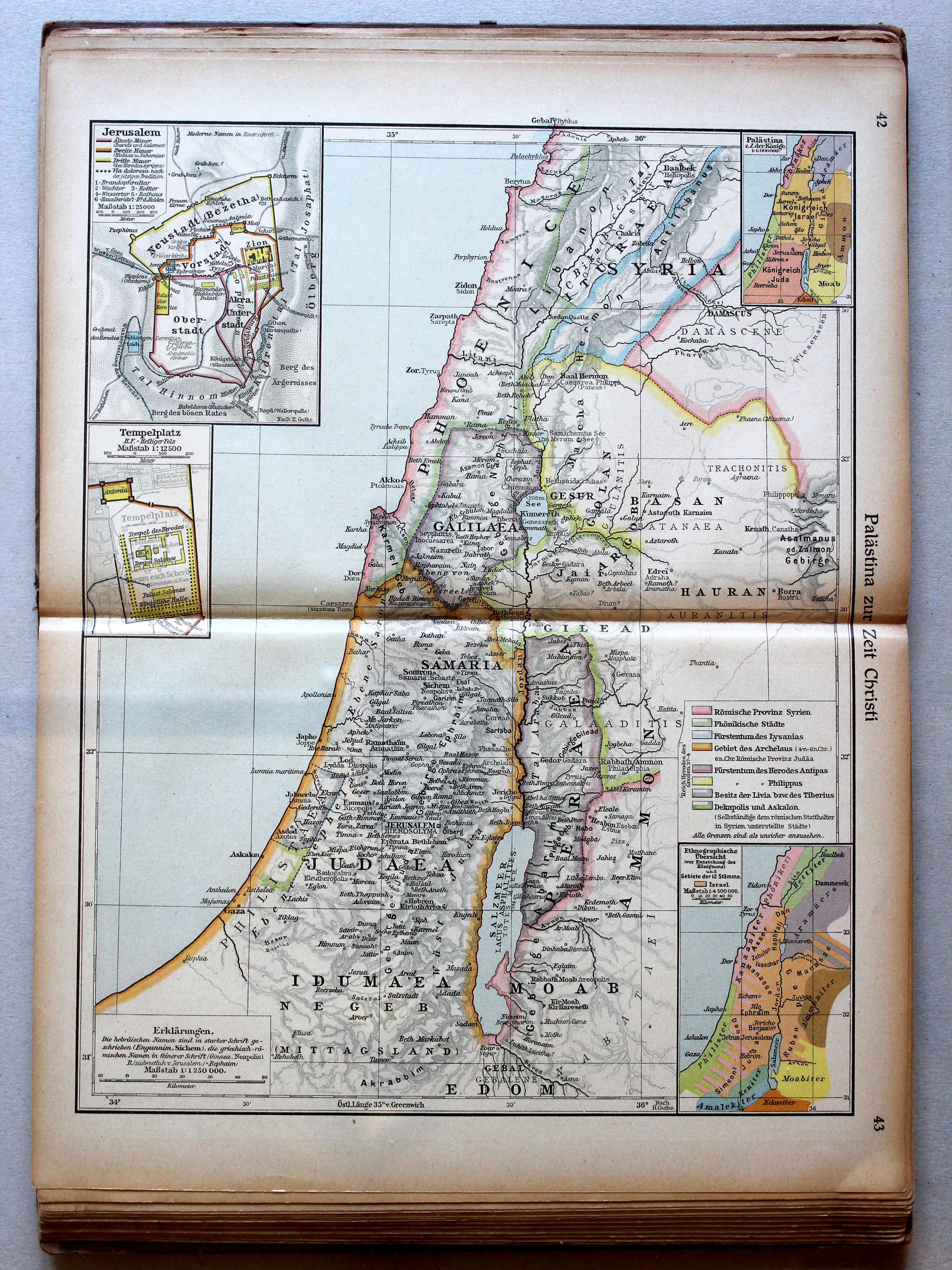
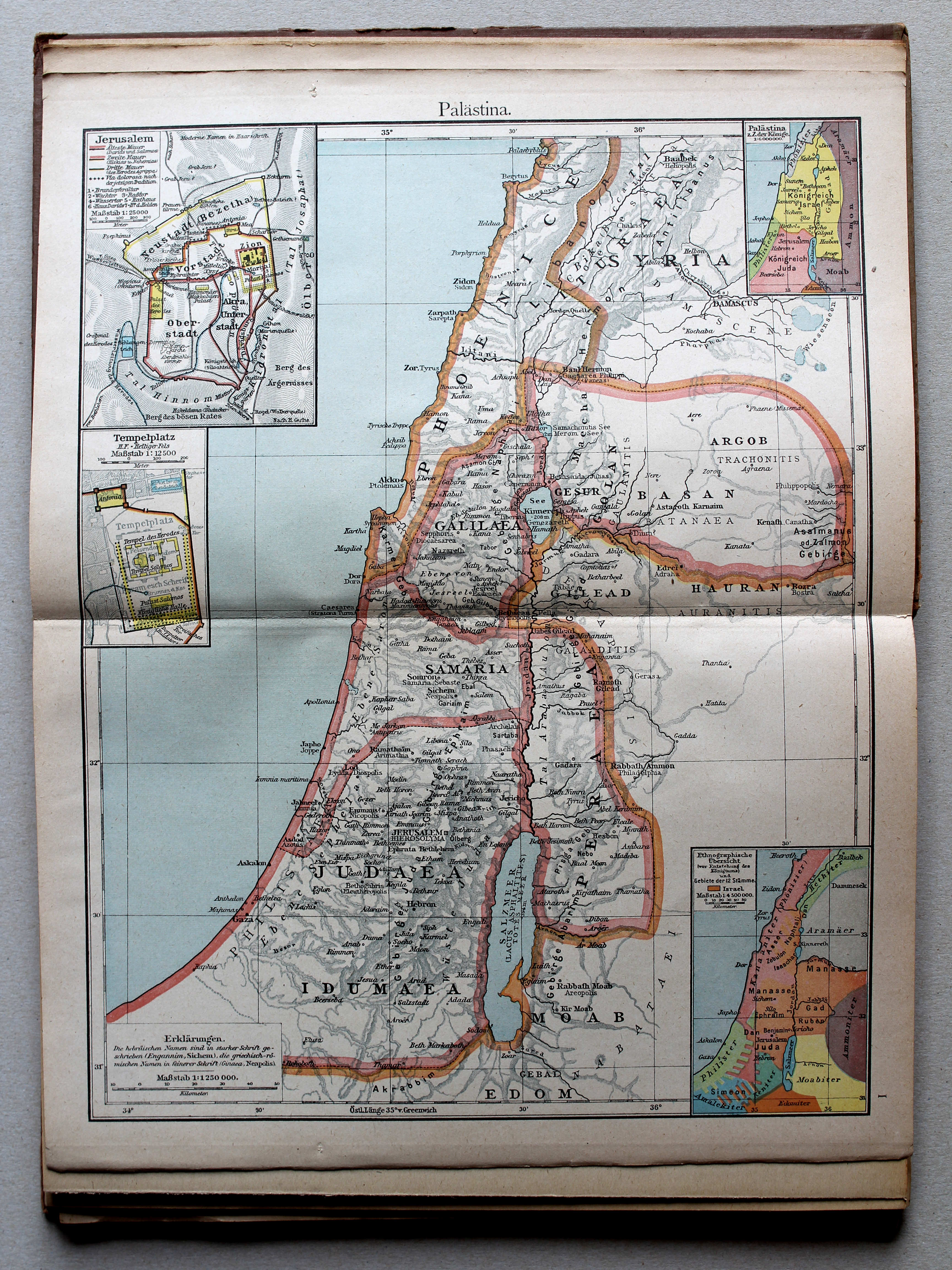
42.43. Palästina zur Zeit Christi XL
Palestina in de tijd van Christus / Palestine in Christ's time

 Putzgers Historischer Schul-Atlas, Große Ausgabe, 1923
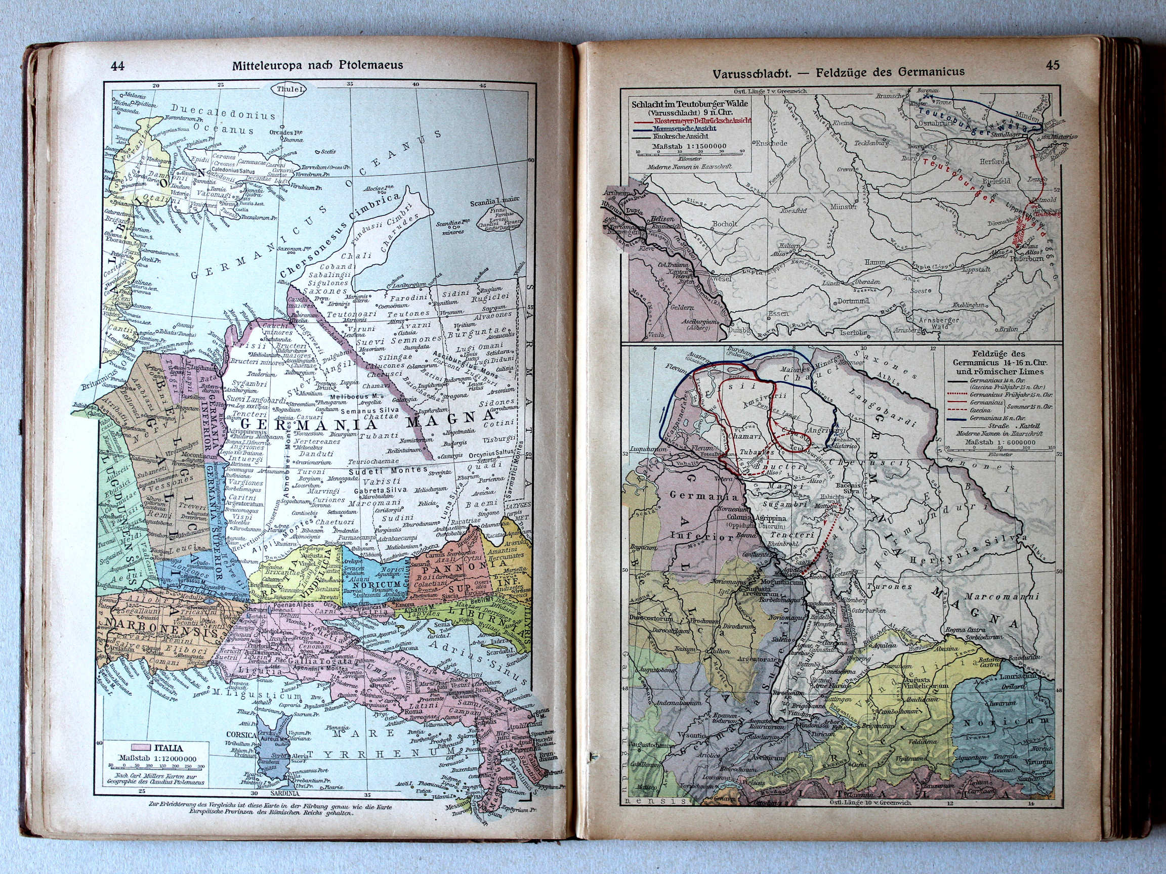
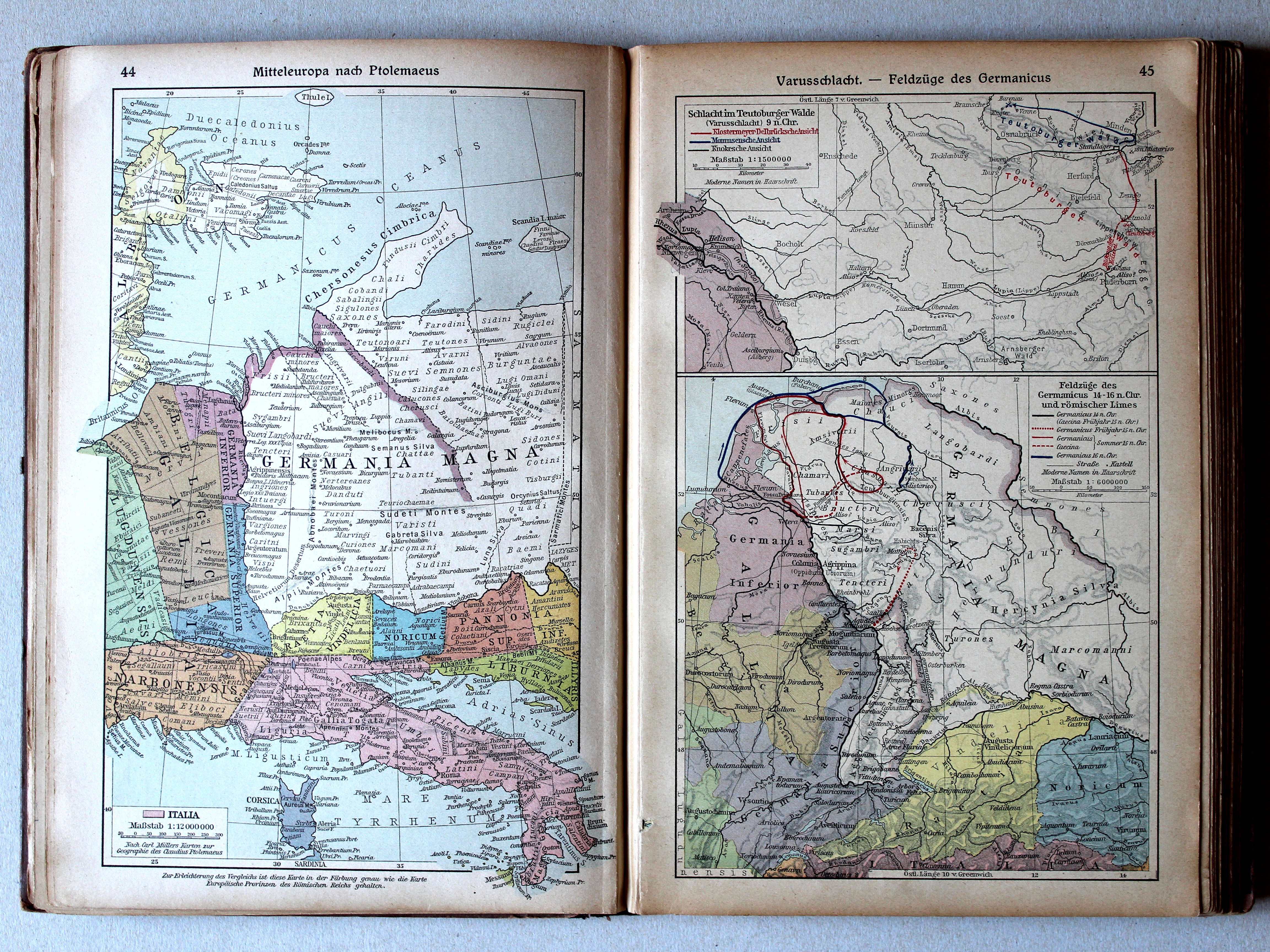
44. Mitteleuropa nach Ptolemaeus XL
Midden-Europa volgens Ptolemaeus / Central Europe after Ptolemy
45. Varusschlacht – Feldzüge des Germanicus XL
Slag bij het Teutoburgerwoud. Veldtochten van Germanicus / Battle of the Teutoburg Forest. Campaigns of Germanicus
Putzgers Historischer Schul-Atlas, 1922
11b. Gallien bei der Ankunft Cäsars XL
Gallië bij de komst van Caesar / Gaul by Caesar's arrival
12a. Varusschlacht. Feldzüge des Germanicus XL
Slag bij het Teutoburgerwoud. Veldtochten van Germanicus / Battle of the Teutoburg Forest. Campaigns of Germanicus
 Putzgers Historischer Schul-Atlas, Große Ausgabe, 1923
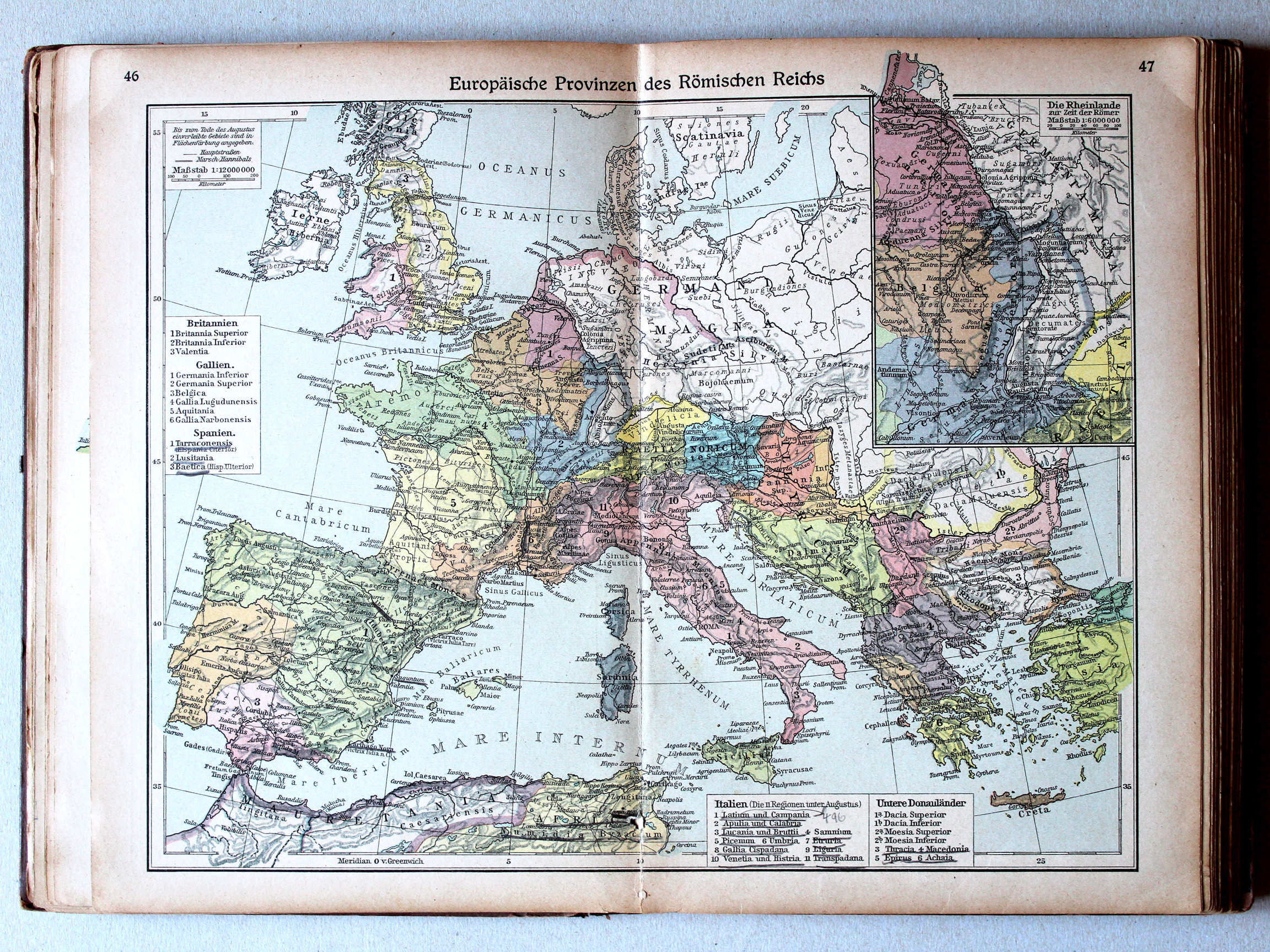
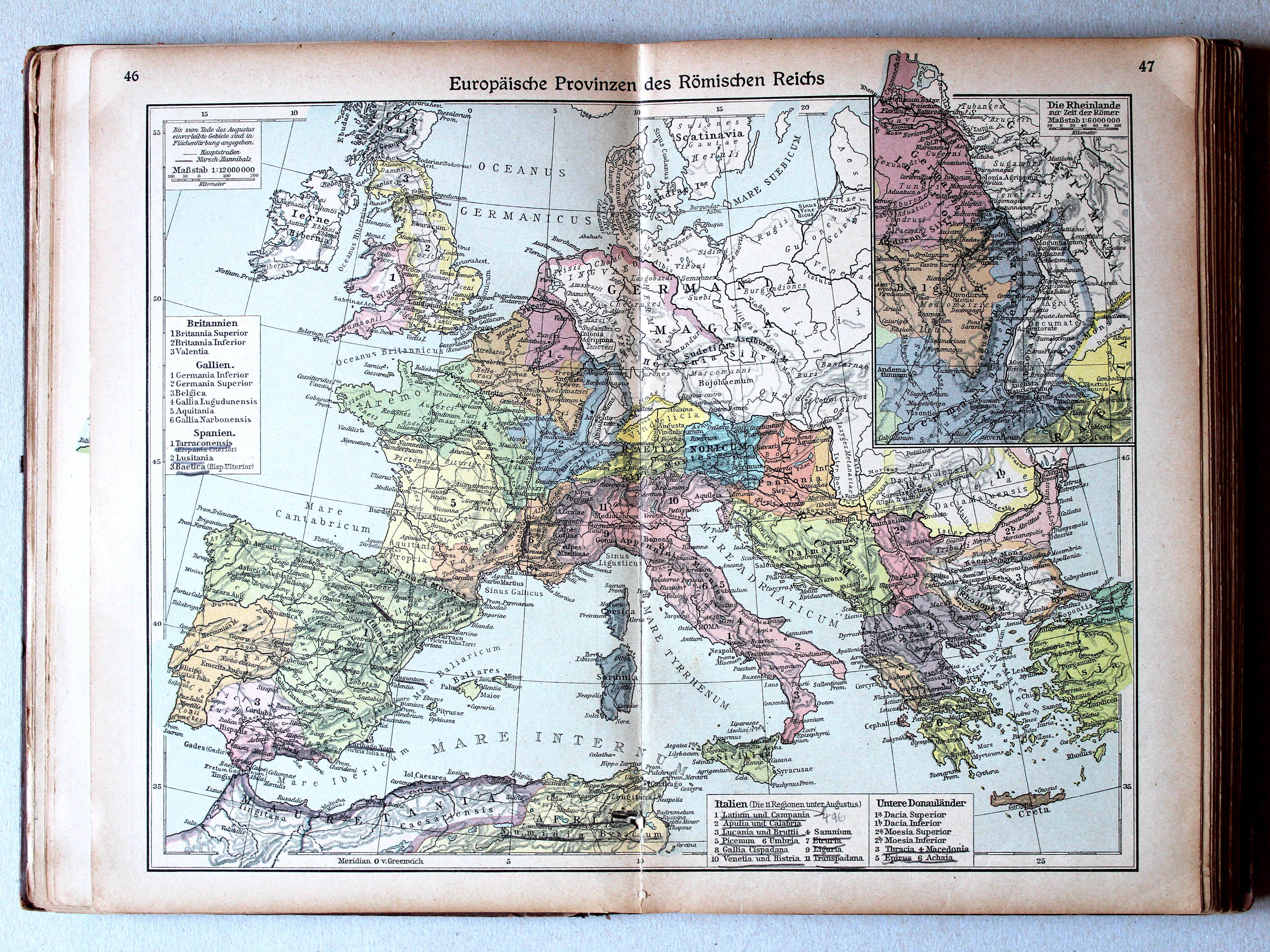
46.47. Europäische Provinzen des Römischen Reichs XL
Europese provincies van het Romeinse Rijk / European provinces of the Roman Empire
 Putzgers Historischer Schul-Atlas, 1922
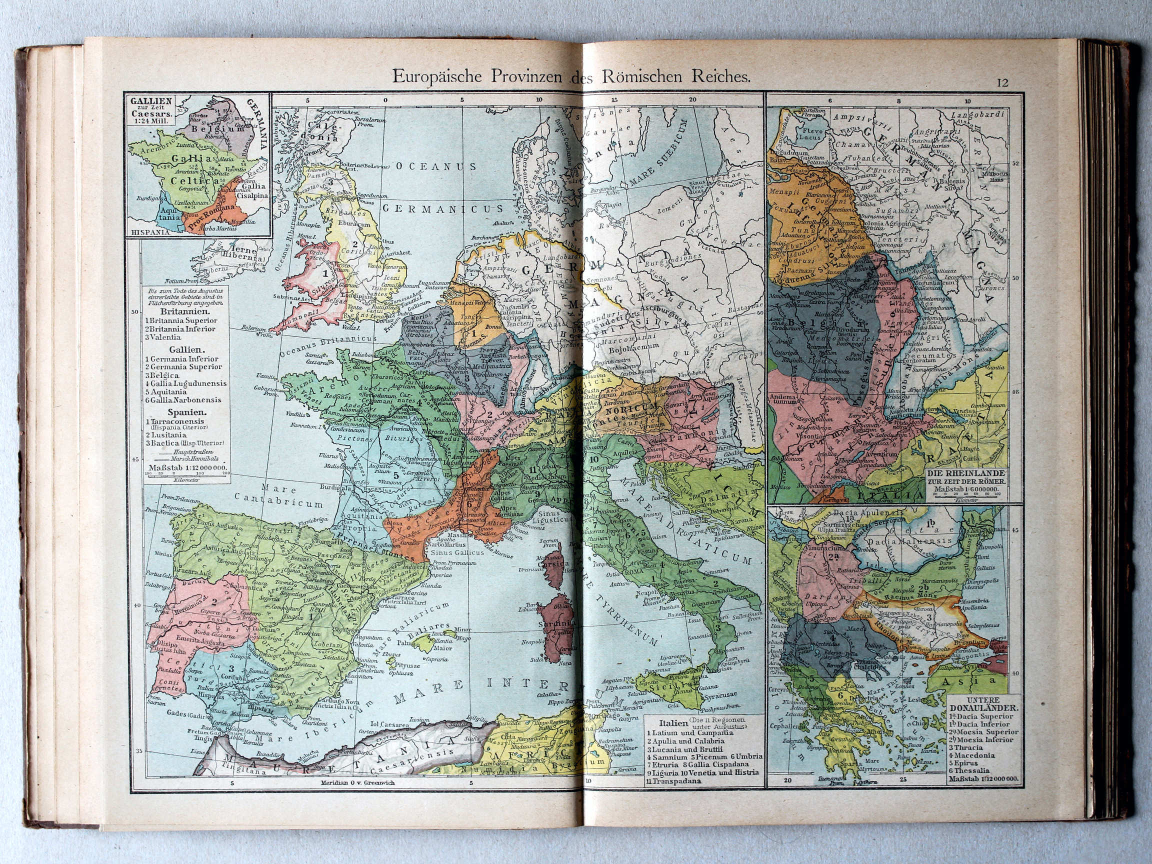
12. Europäische Provinzen des Römischen Reiches XL
Europese provincies van het Romeinse Rijk / European provinces of the Roman Empire
 Putzgers Historischer Schul-Atlas, Große Ausgabe, 1923
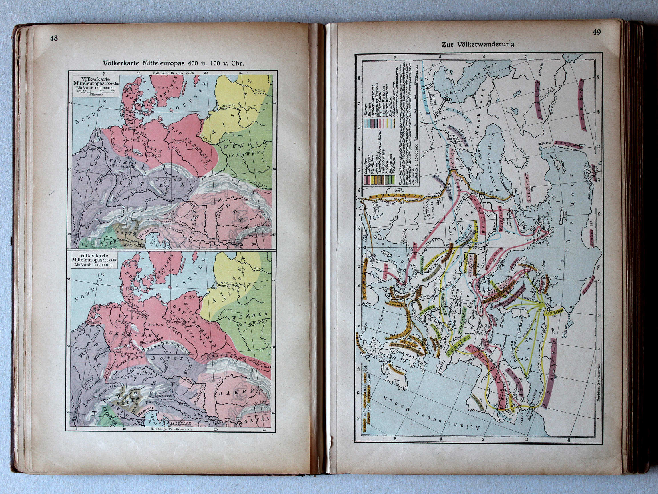
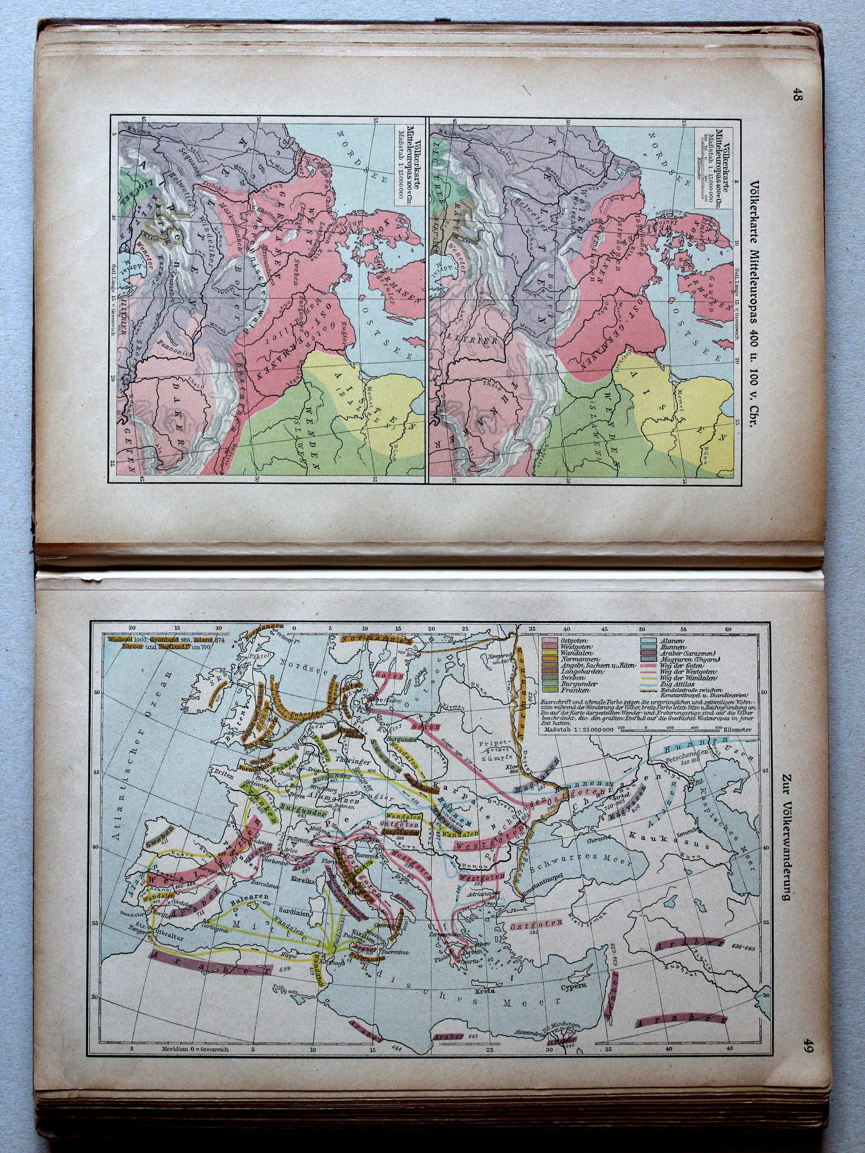
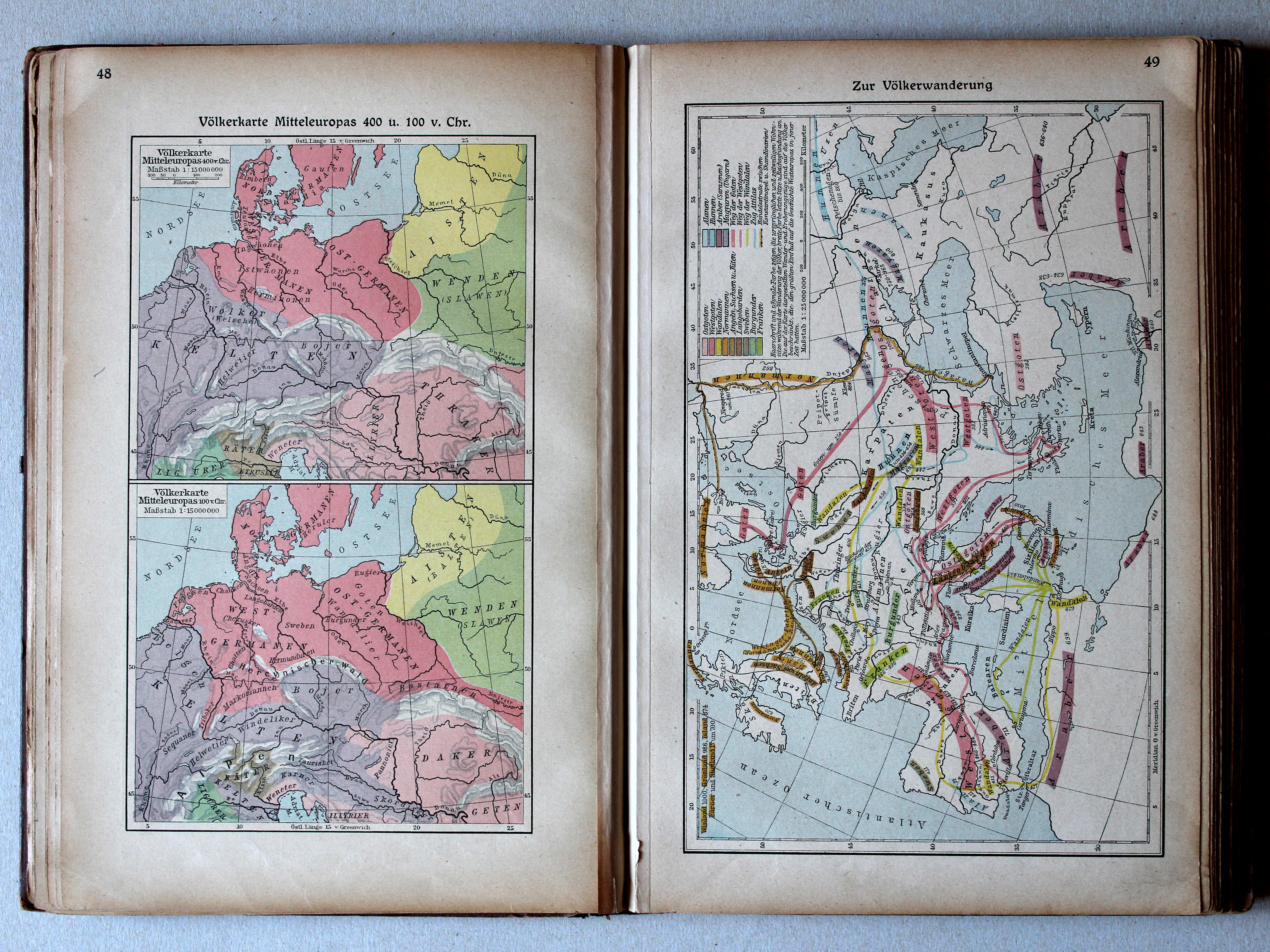
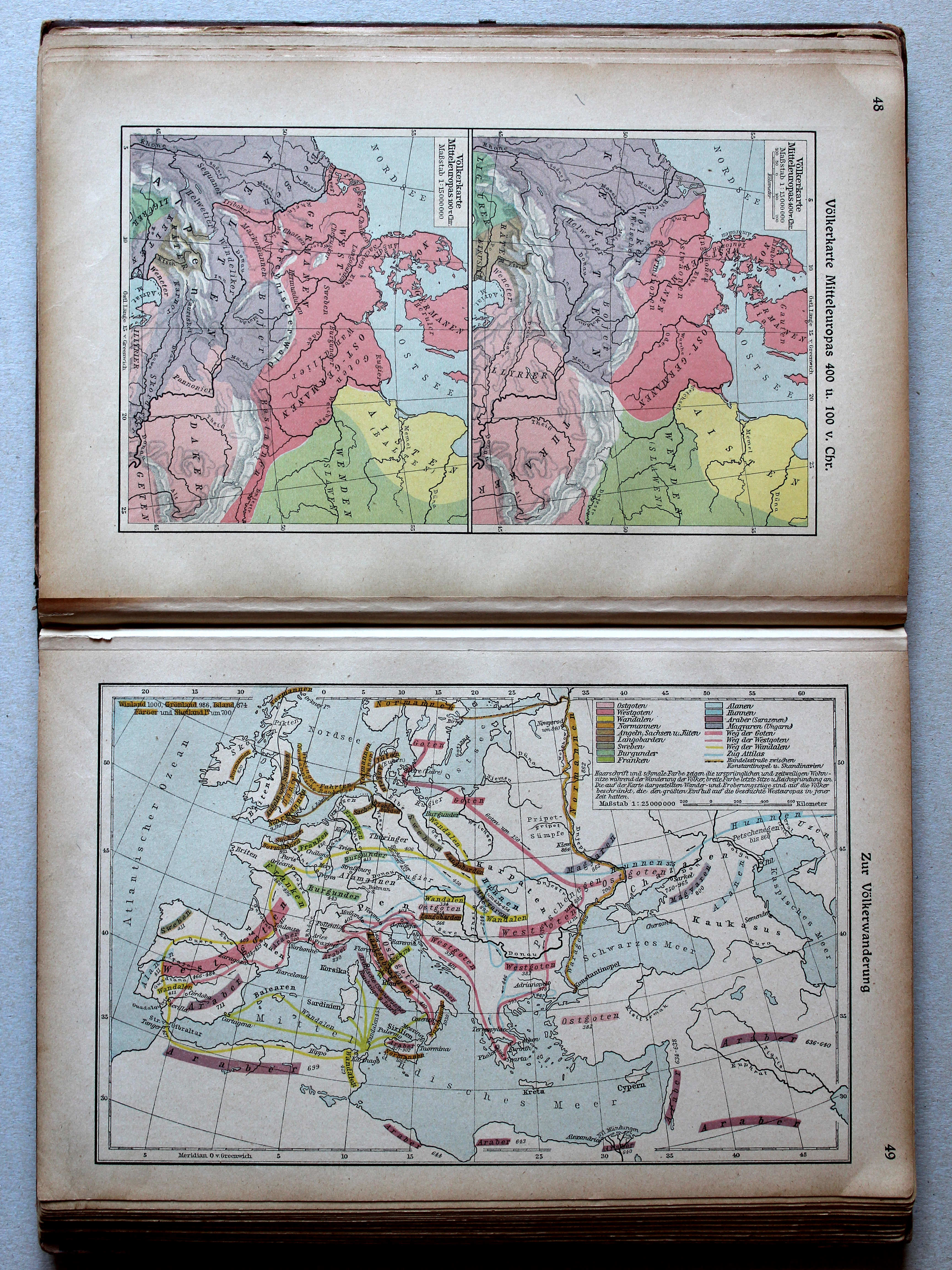
48. Völkerkarte Mitteleuropas 400 u. 100 v. Chr. XL
Etnografische kaart van Midden-Europa in 400 en 100 v. Chr. / Ethnographic map of Central Europe in 400 and 100 BC
 Putzgers Historischer Schul-Atlas, 1922
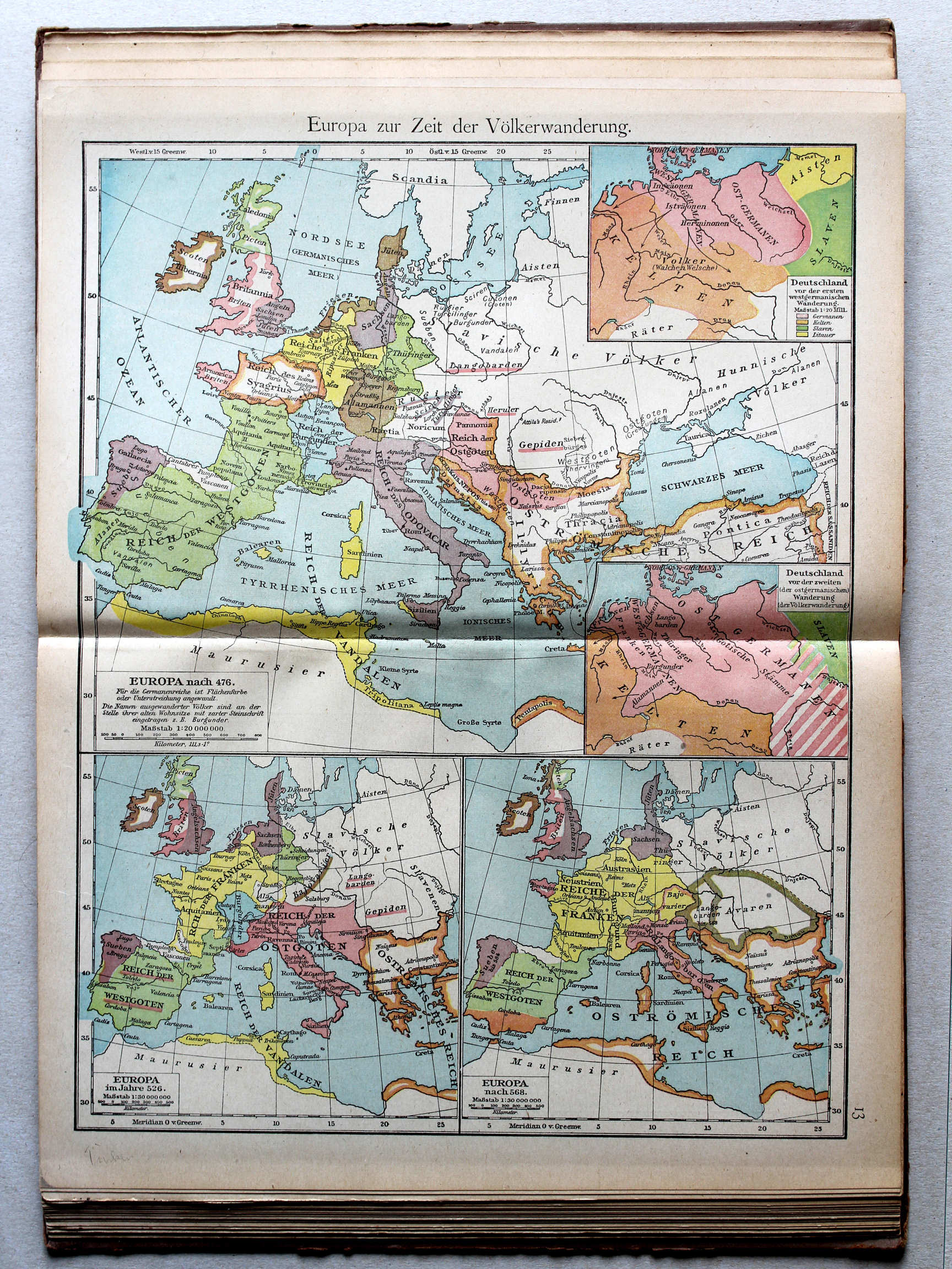
13. Europa zur Zeit der Völkerwanderung (Deutschland) XL
Europa tijdens de Volksverhuizing (Duitsland) / Europe during the Migration Period (Germany)
 Putzgers Historischer Schul-Atlas, Große Ausgabe, 1923
49. Zur Völkerwanderung XL
De Volksverhuizing / The Migration Period
 Putzgers Historischer Schul-Atlas, 1922
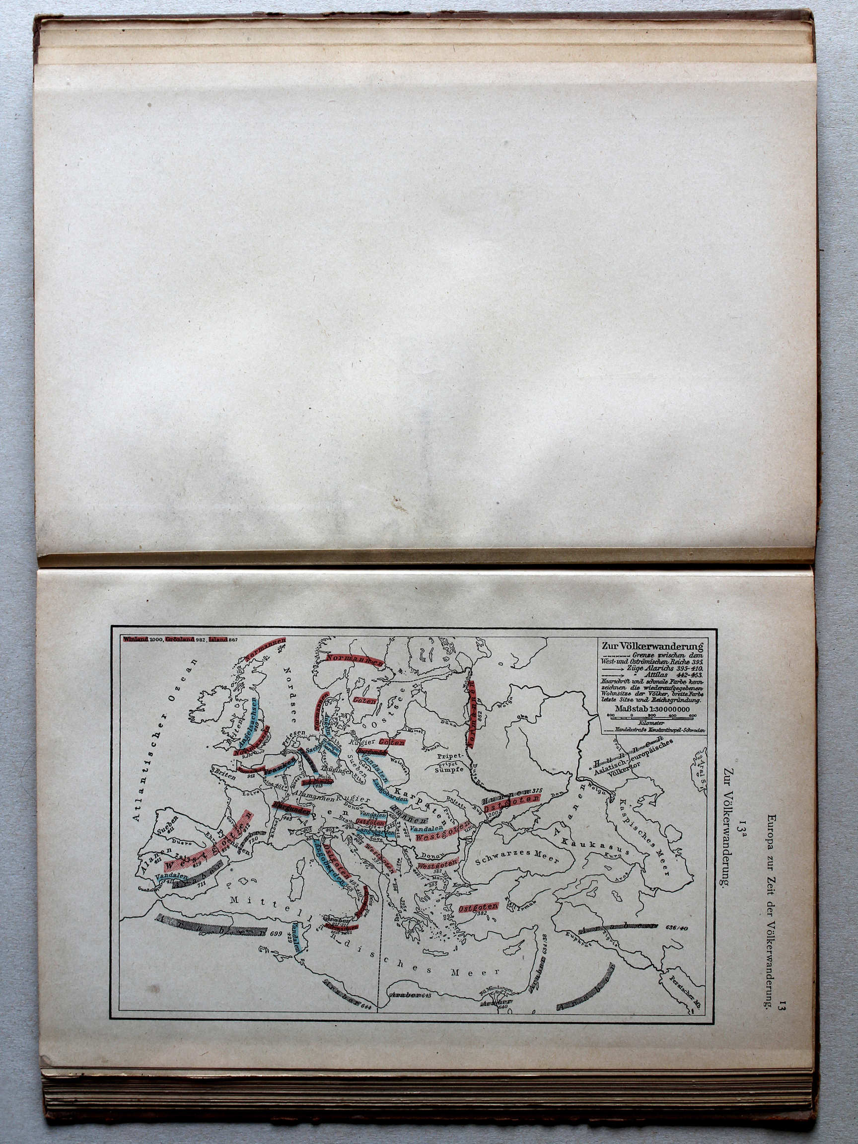
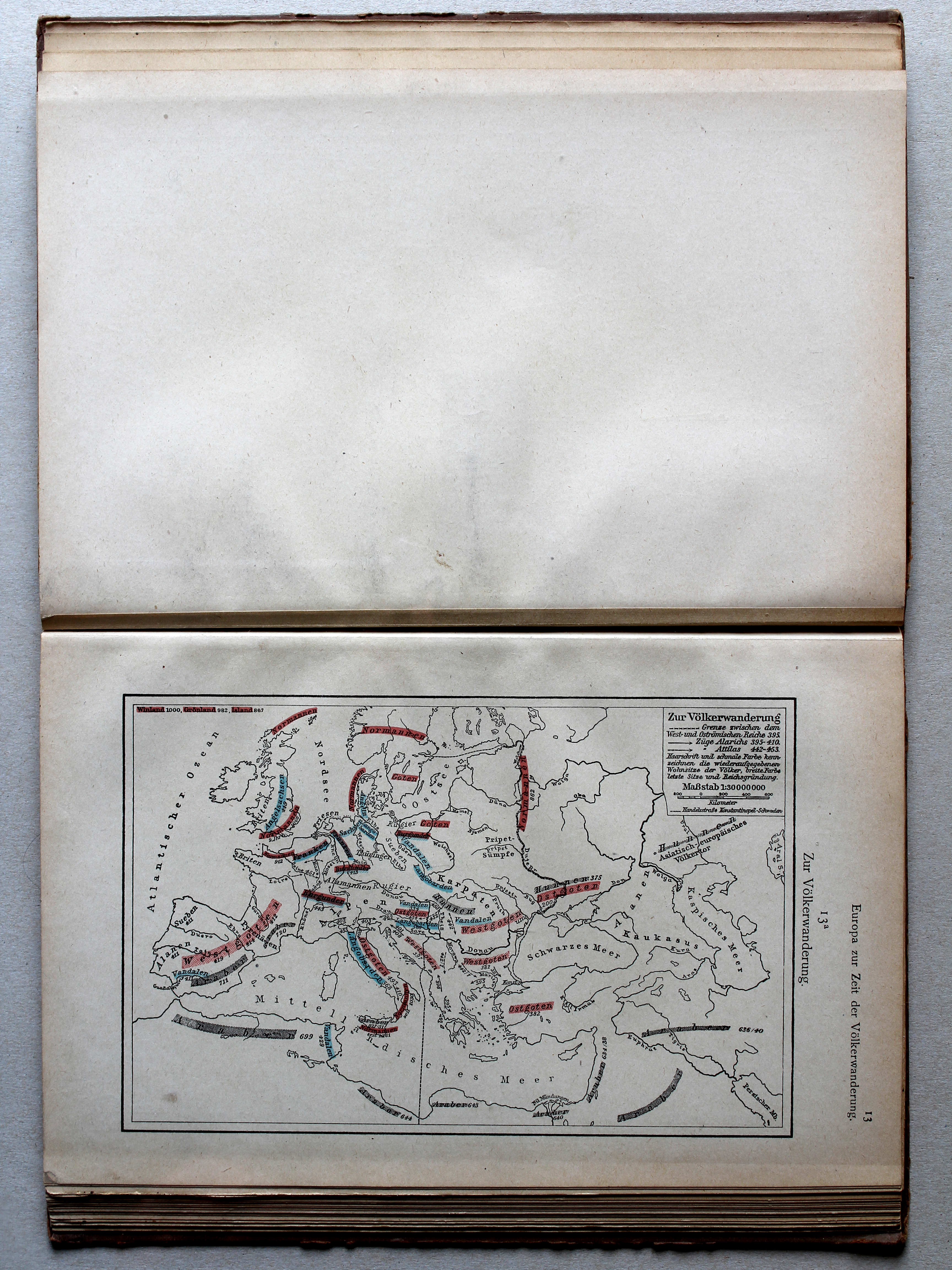
13a. Zur Völkerwanderung XL
De Volksverhuizing / The Migration Period
 Putzgers Historischer Schul-Atlas, Große Ausgabe, 1923
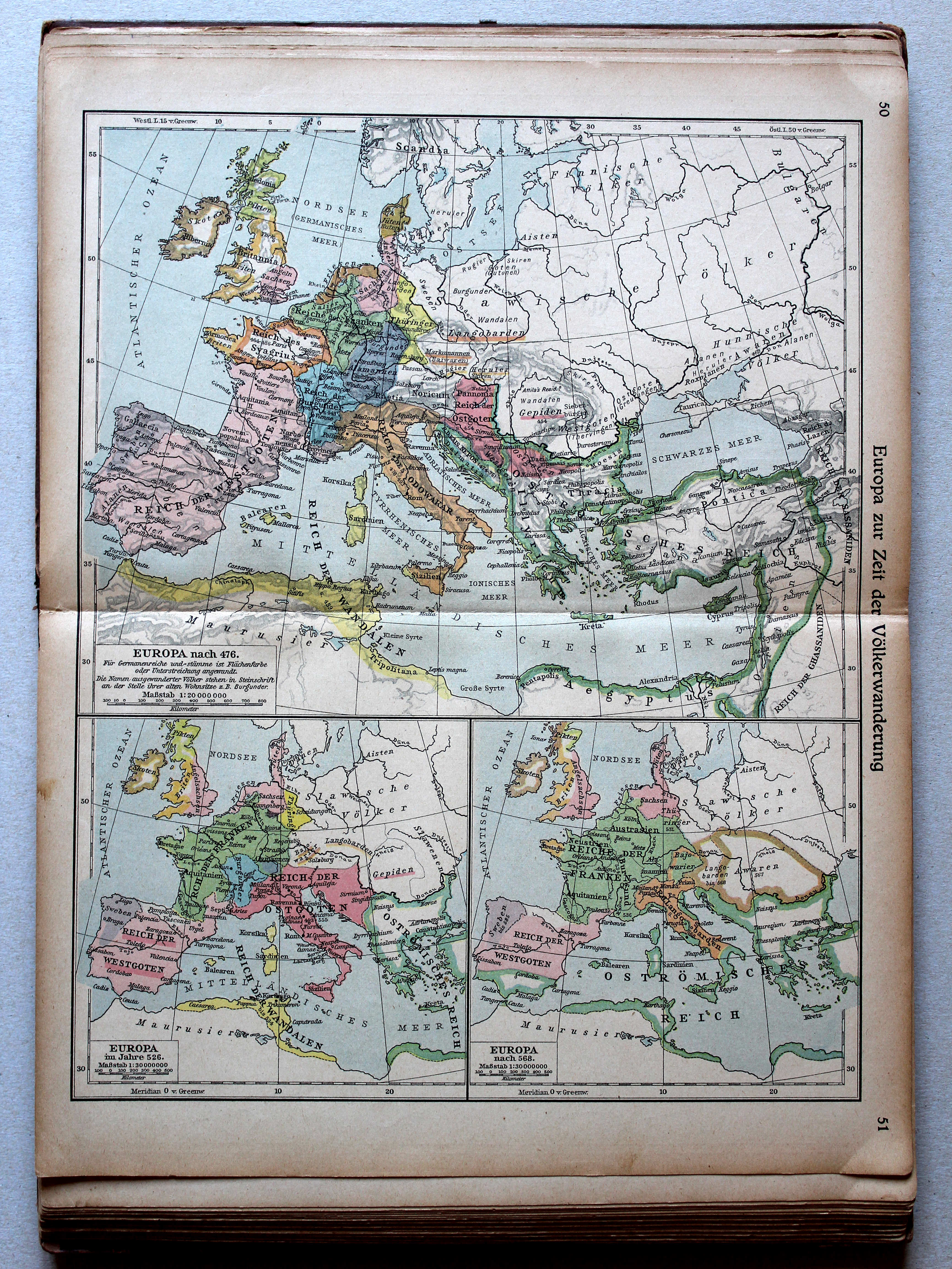
50.51. Europa zur Zeit der Völkerwanderung XL
Europa tijdens de Volksverhuizing / Europe during the Migration Period
Putzgers Historischer Schul-Atlas, 1922
13. Europa zur Zeit der Völkerwanderung XL
Europa tijdens de Volksverhuizing / Europe during the Migration Period
 Putzgers Historischer Schul-Atlas, Große Ausgabe, 1923
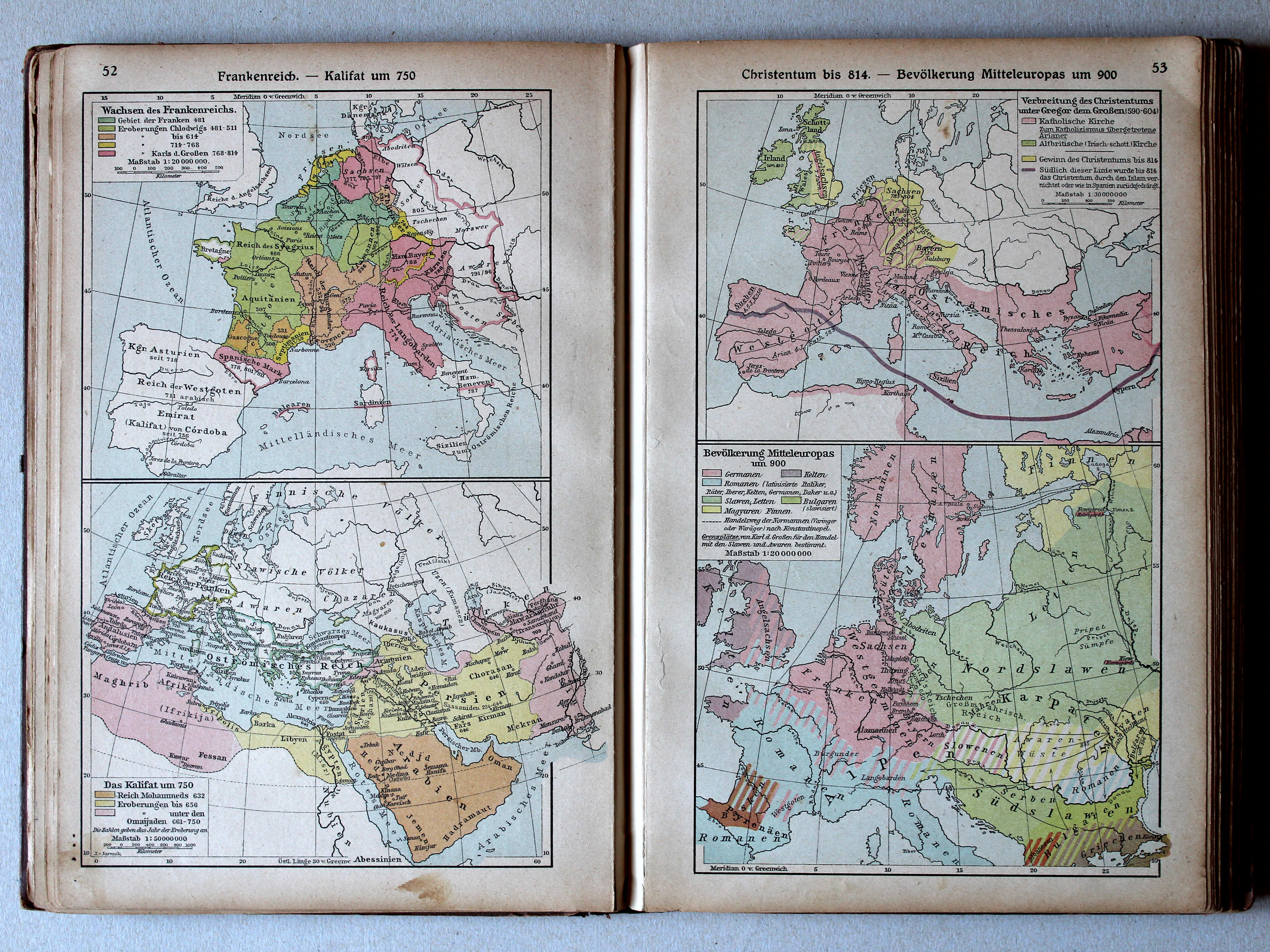
52. Frankenreich – Kalifat um 750 XL
Het Frankische Rijk. Het Kalifaat rond 750 / The Frankish Empire. The Caliphate around 750
53. Christentum bis 814 – Bevölkerung Mitteleuropas um 900 XL
Christendom tot 814. Volkeren in Midden-Europa rond 900 / Christianity until 814. Nations in Central Europa around 900
 Putzgers Historischer Schul-Atlas, 1922
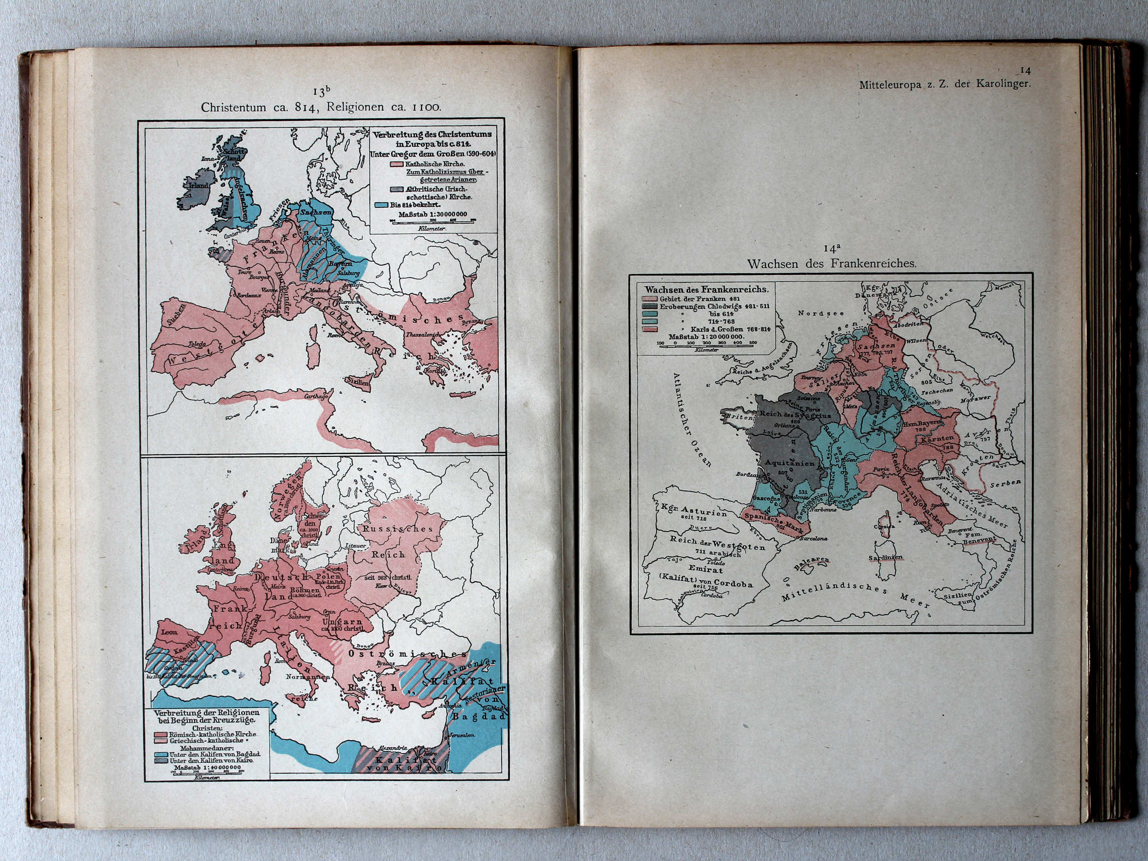
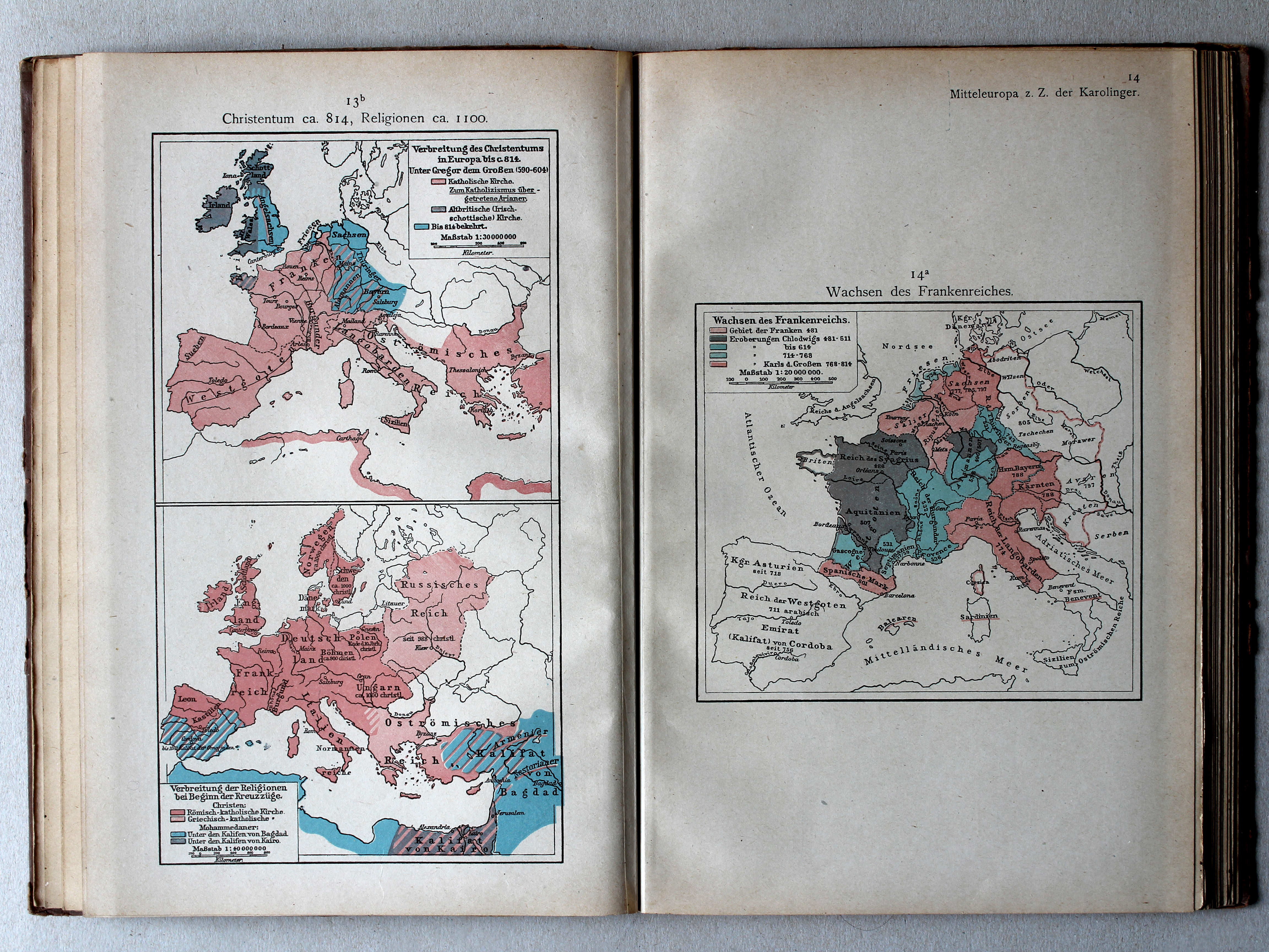
13b. Christentum ca. 814, Religionen ca. 1100 XL
Christendom ca. 814, godsdiensten ca. 1100 / Christianity ca. 814, religions ca. 1100
14a. Wachsen des Frankenreichs XL
Groei van het Frankische Rijk / Growth of the Frankish Empire
Putzgers Historischer Schul-Atlas, Große Ausgabe, 1923
52. Frankenreich – Kalifat um 750 XL
Het Frankische Rijk. Het Kalifaat rond 750 / The Frankish Empire. The Caliphate around 750
53. Christentum bis 814 – Bevölkerung Mitteleuropas um 900 XL
Christendom tot 814. Volkeren in Midden-Europa rond 900 / Christianity until 814. Nations in Central Europa around 900
 Putzgers Historischer Schul-Atlas, 1922
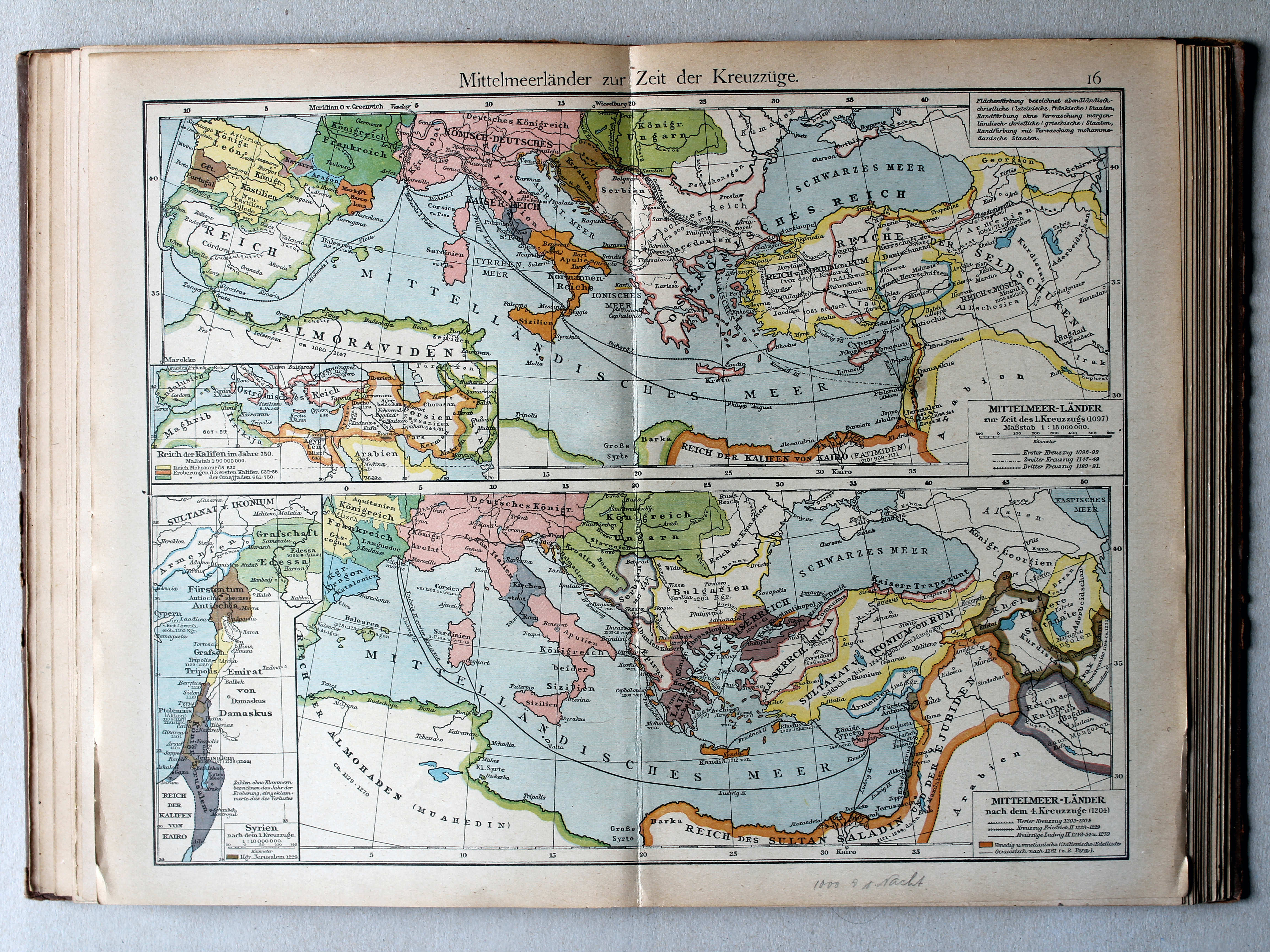
16. Mittelmeerländer zur Zeit der Kreuzzüge (Reich der Kalifen 750) XL
Het Middellandse Zeegebied in de tijd van de Kruistochten (Rijk van de Kaliefen 750) / The Mediterranean region during the Crusades (Empire of the Caliphs 750)
Putzgers Historischer Schul-Atlas, Große Ausgabe, 1923
52. Frankenreich – Kalifat um 750 XL
Het Frankische Rijk. Het Kalifaat rond 750 / The Frankish Empire. The Caliphate around 750
53. Christentum bis 814 – Bevölkerung Mitteleuropas um 900 XL
Christendom tot 814. Volkeren in Midden-Europa rond 900 / Christianity until 814. Nations in Central Europa around 900
Putzgers Historischer Schul-Atlas, 1922
13b. Christentum ca. 814, Religionen ca. 1100 XL
Christendom ca. 814, godsdiensten ca. 1100 / Christianity ca. 814, religions ca. 1100
14a. Wachsen des Frankenreichs XL
Groei van het Frankische Rijk / Growth of the Frankish Empire
Putzgers Historischer Schul-Atlas, Große Ausgabe, 1923
52. Frankenreich – Kalifat um 750 XL
Het Frankische Rijk. Het Kalifaat rond 750 / The Frankish Empire. The Caliphate around 750
53. Christentum bis 814 – Bevölkerung Mitteleuropas um 900 XL
Christendom tot 814. Volkeren in Midden-Europa rond 900 / Christianity until 814. Nations in Central Europa around 900
 Putzgers Historischer Schul-Atlas, 1922
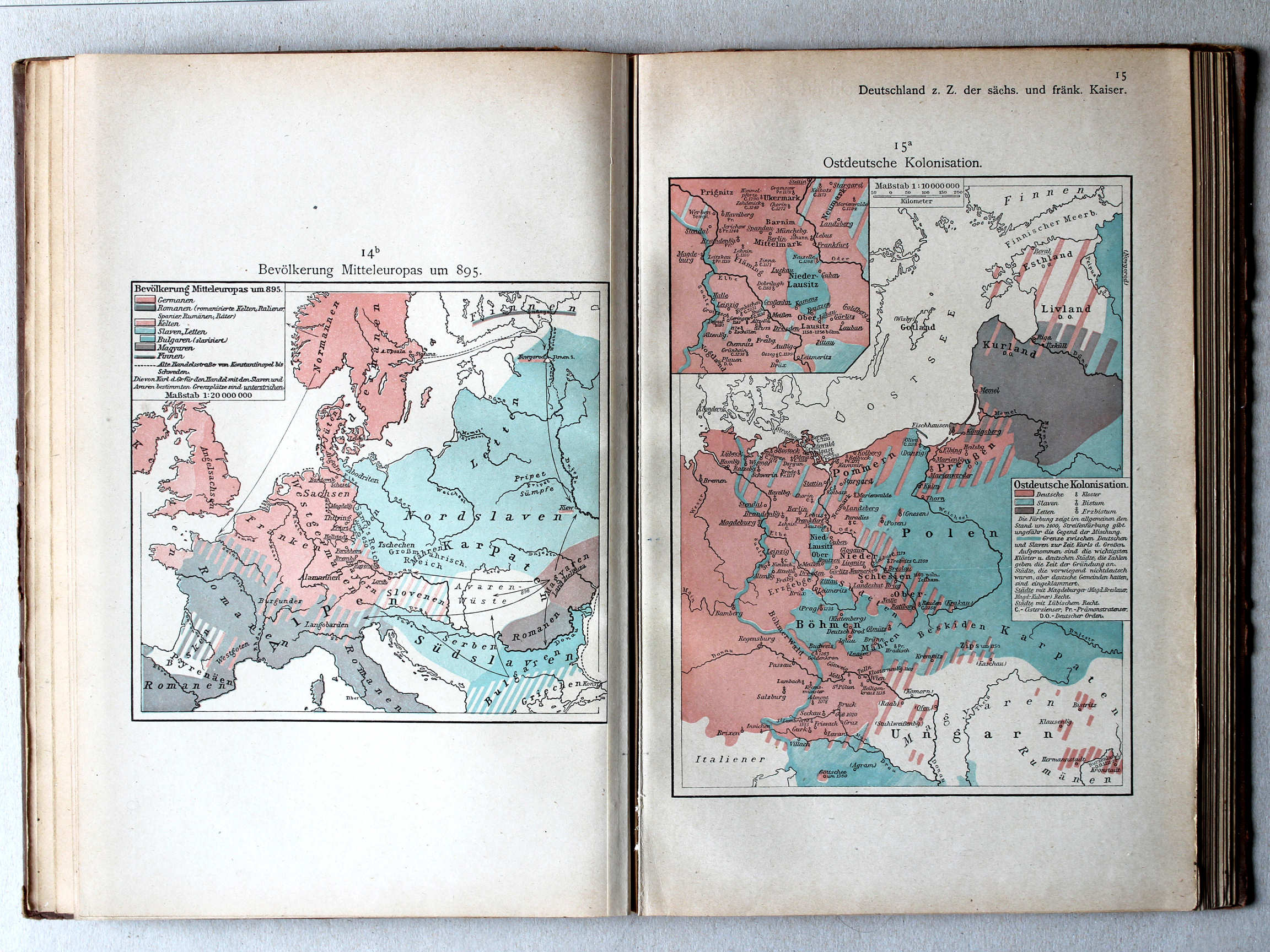
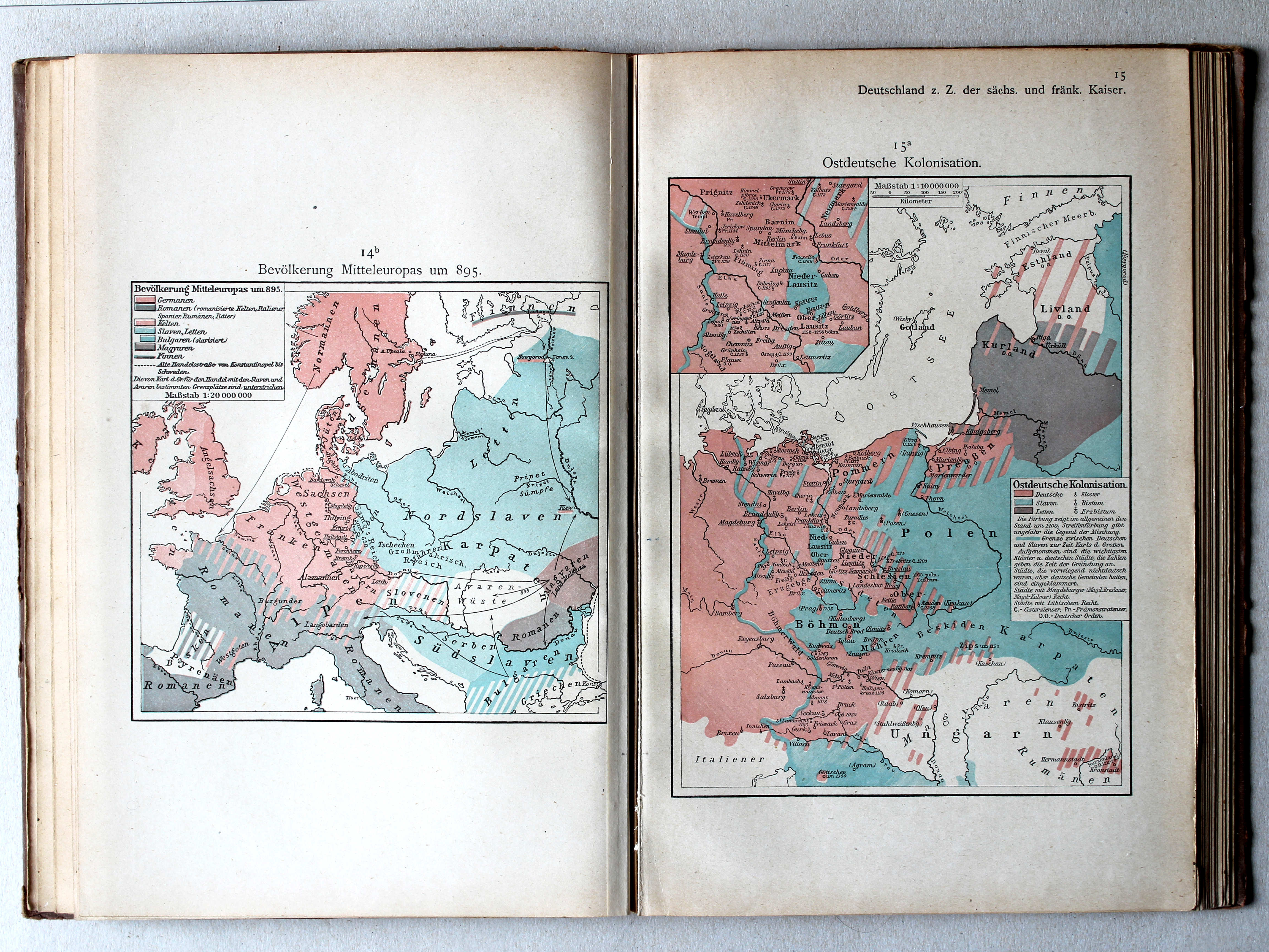
14b. Bevölkerung Mitteleuropas um 895 XL
Volkeren in Midden-Europa rond 895 / Nations in Central Europa around 895
15a. Ostdeutsche Kolonisation XL
Duitse kolonisatie naar het oosten / German colonization towards the east
 Putzgers Historischer Schul-Atlas, Große Ausgabe, 1923
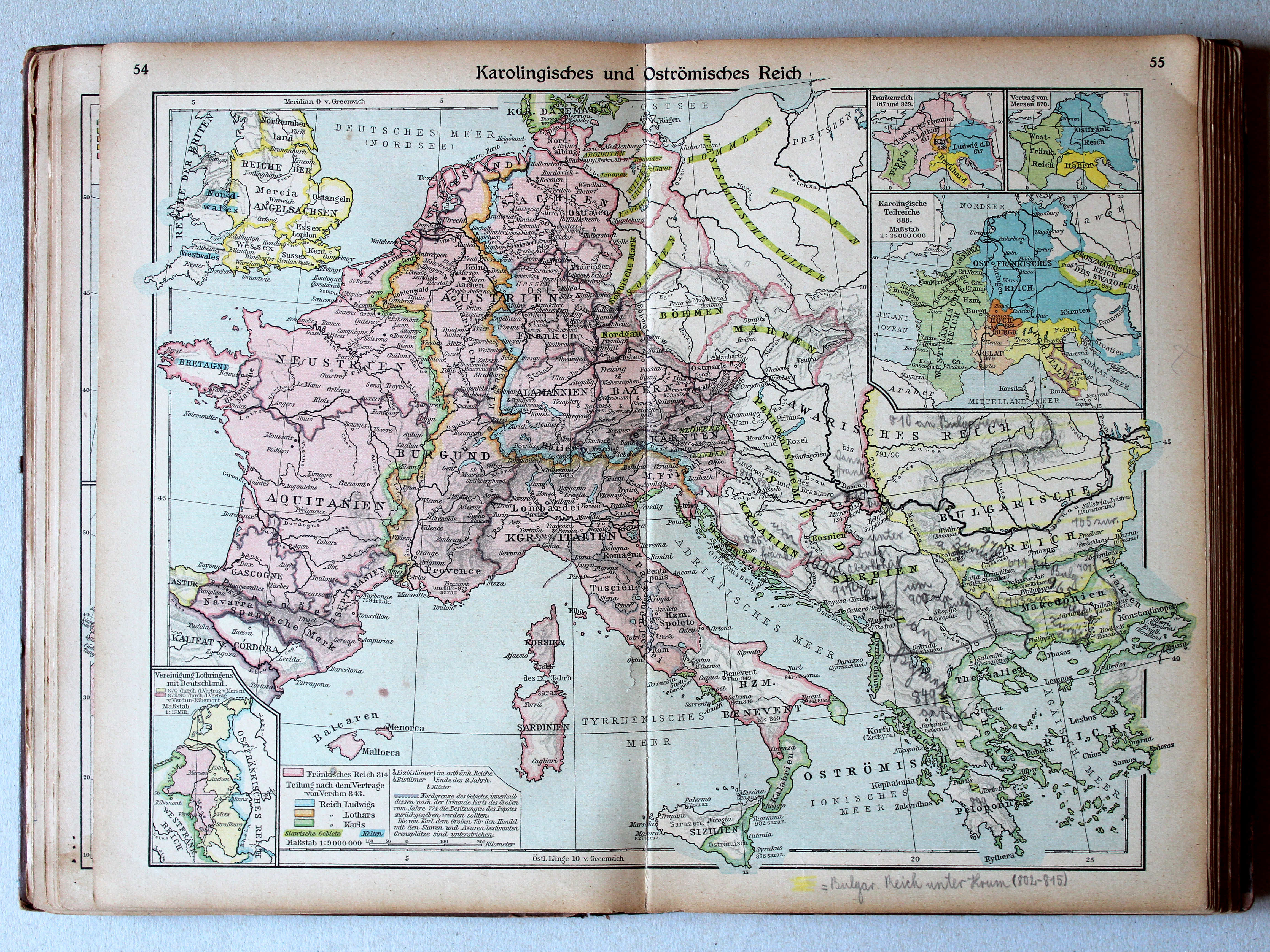
54.55. Karolingisches und Oströmisches Reich XL
Het Karolingische en het Oost-Romeinse Rijk / Carolingian and Eastern Roman Empires
 Putzgers Historischer Schul-Atlas, 1922
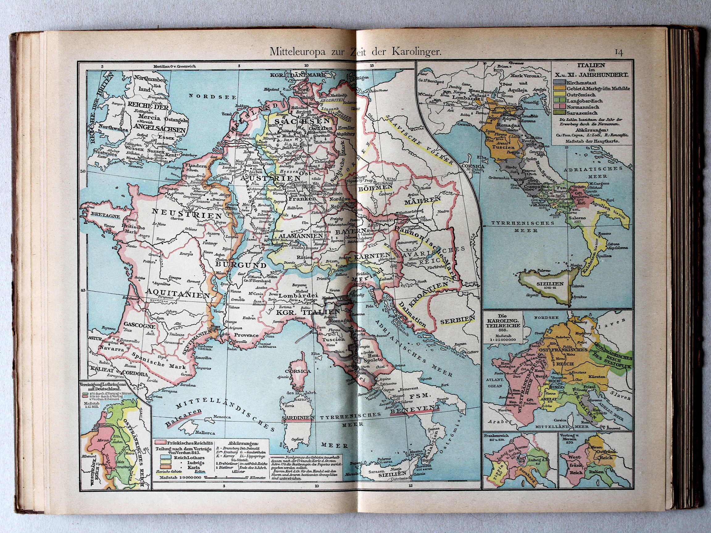
14. Mitteleuropa zur Zeit der Karolinger XL
Midden-Europa in de tijd van de Karolingen / Central Europe during the Carolingian dynasty
 Putzgers Historischer Schul-Atlas, Große Ausgabe, 1923
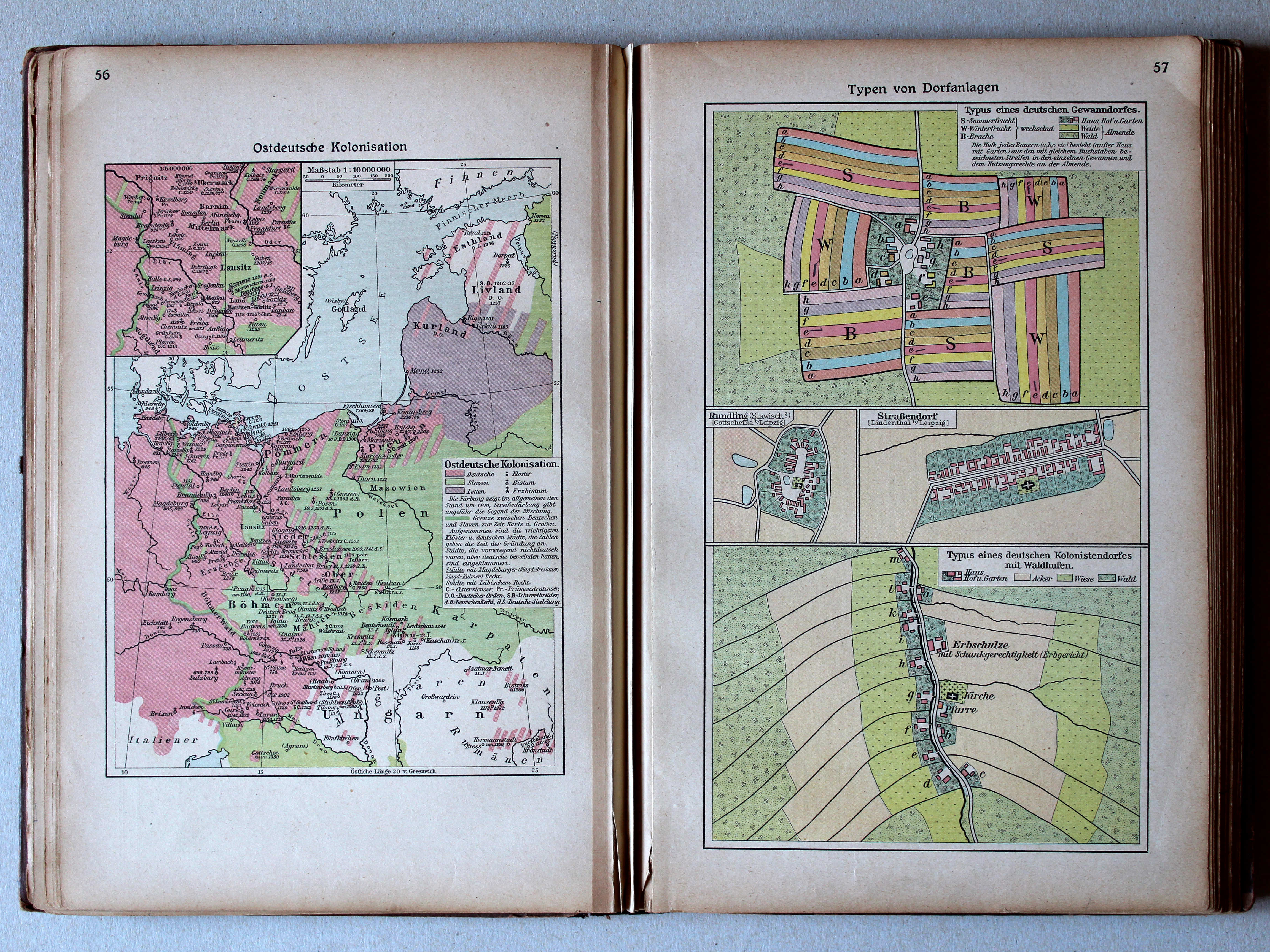
56. Ostdeutsche Kolonisation XL
Duitse kolonisatie naar het oosten / German colonization towards the east
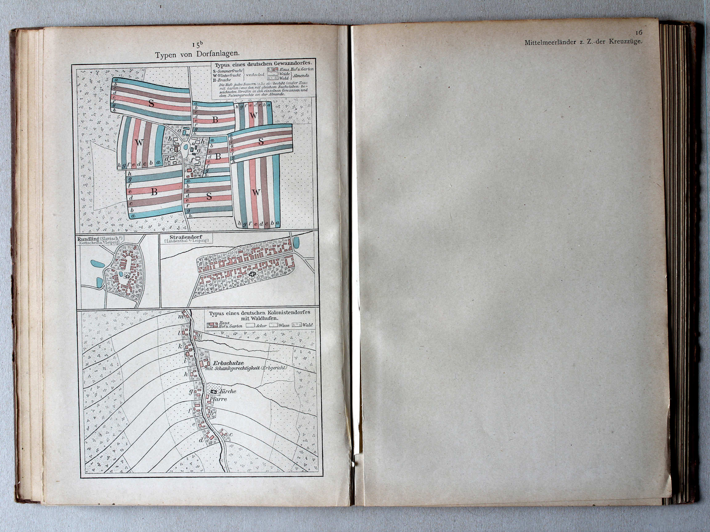
57. Typen von Dorfanlagen XL
Enkele dorpstypen / Some village types
Putzgers Historischer Schul-Atlas, 1922
14b. Bevölkerung Mitteleuropas um 895 XL
Volkeren in Midden-Europa rond 895 / Nations in Central Europa around 895
15a. Ostdeutsche Kolonisation XL
Duitse kolonisatie naar het oosten / German colonization towards the east
Putzgers Historischer Schul-Atlas, Große Ausgabe, 1923
56. Ostdeutsche Kolonisation XL
Duitse kolonisatie naar het oosten / German colonization towards the east
57. Typen von Dorfanlagen XL
Enkele dorpstypen / Some village types
 Putzgers Historischer Schul-Atlas, 1922
15b. Typen von Dorfanlagen XL
Enkele dorpstypen / Some village types
 Putzgers Historischer Schul-Atlas, Große Ausgabe, 1923
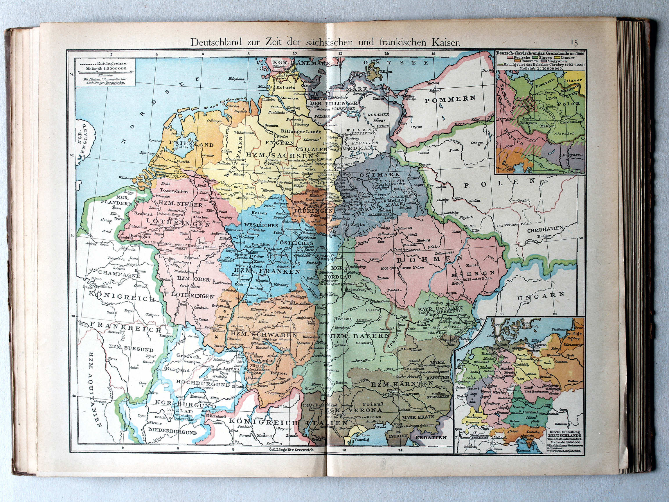
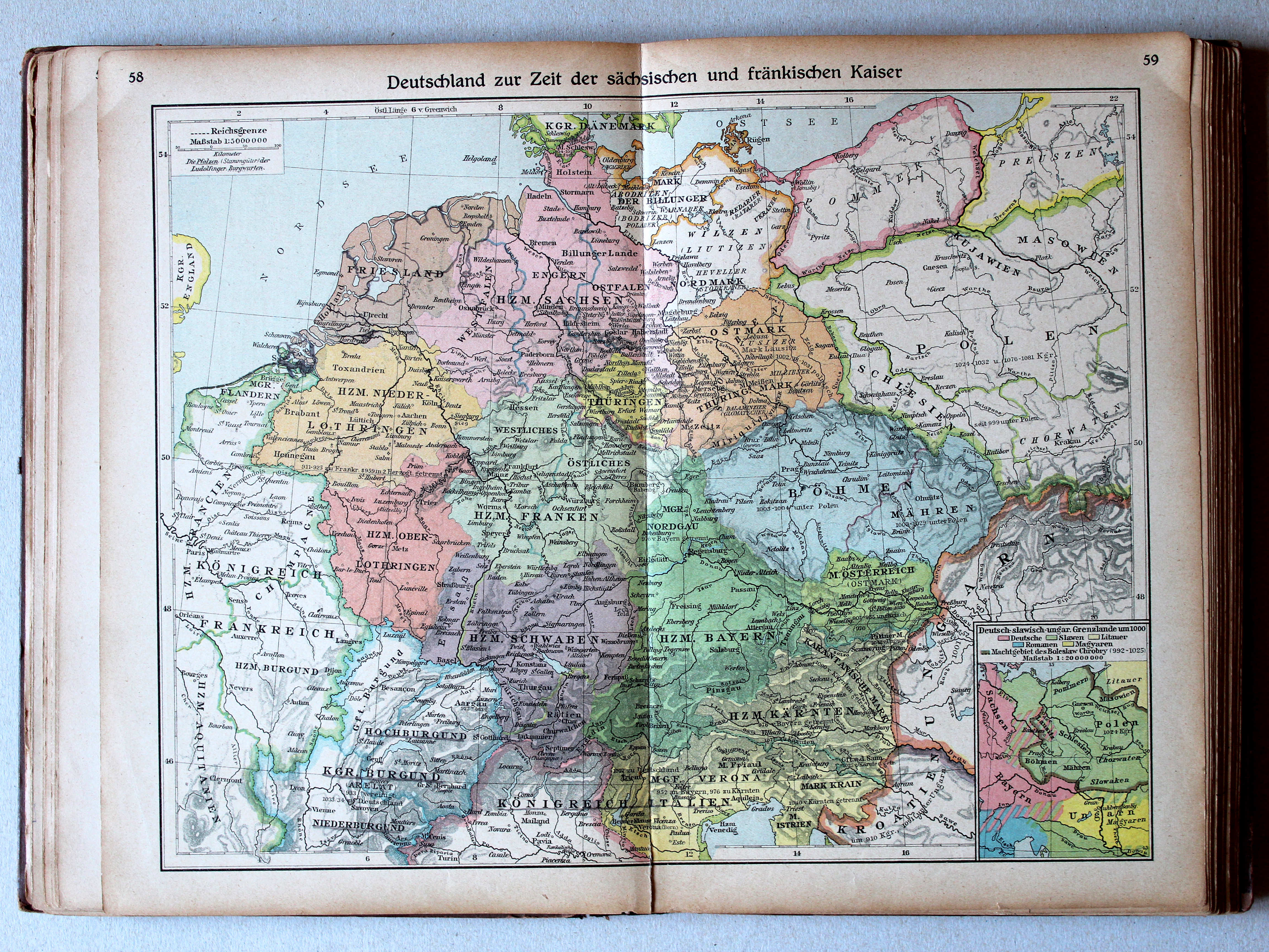
58.59. Deutschland zur Zeit der sächsischen und fränkischen Kaiser XL
Duitsland in de tijd van de Saksische en Frankische keizers / Germany during the Saxon and Frankish dynasties
 Putzgers Historischer Schul-Atlas, 1922
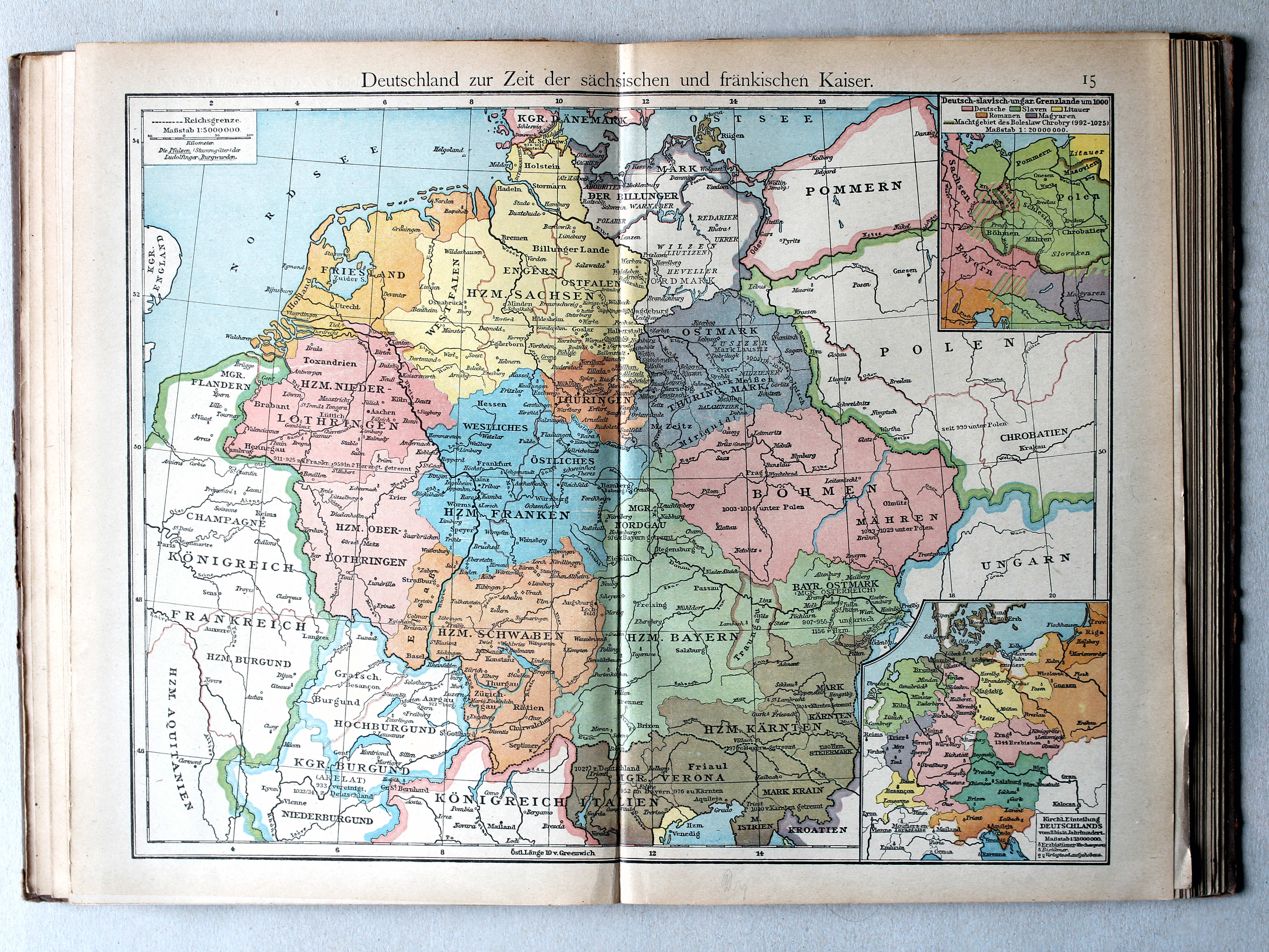
15. Deutschland zur Zeit der sächsischen und fränkischen Kaiser XL
Duitsland in de tijd van de Saksische en Frankische keizers / Germany during the Saxon and Frankish dynasties
 Putzgers Historischer Schul-Atlas, Große Ausgabe, 1923
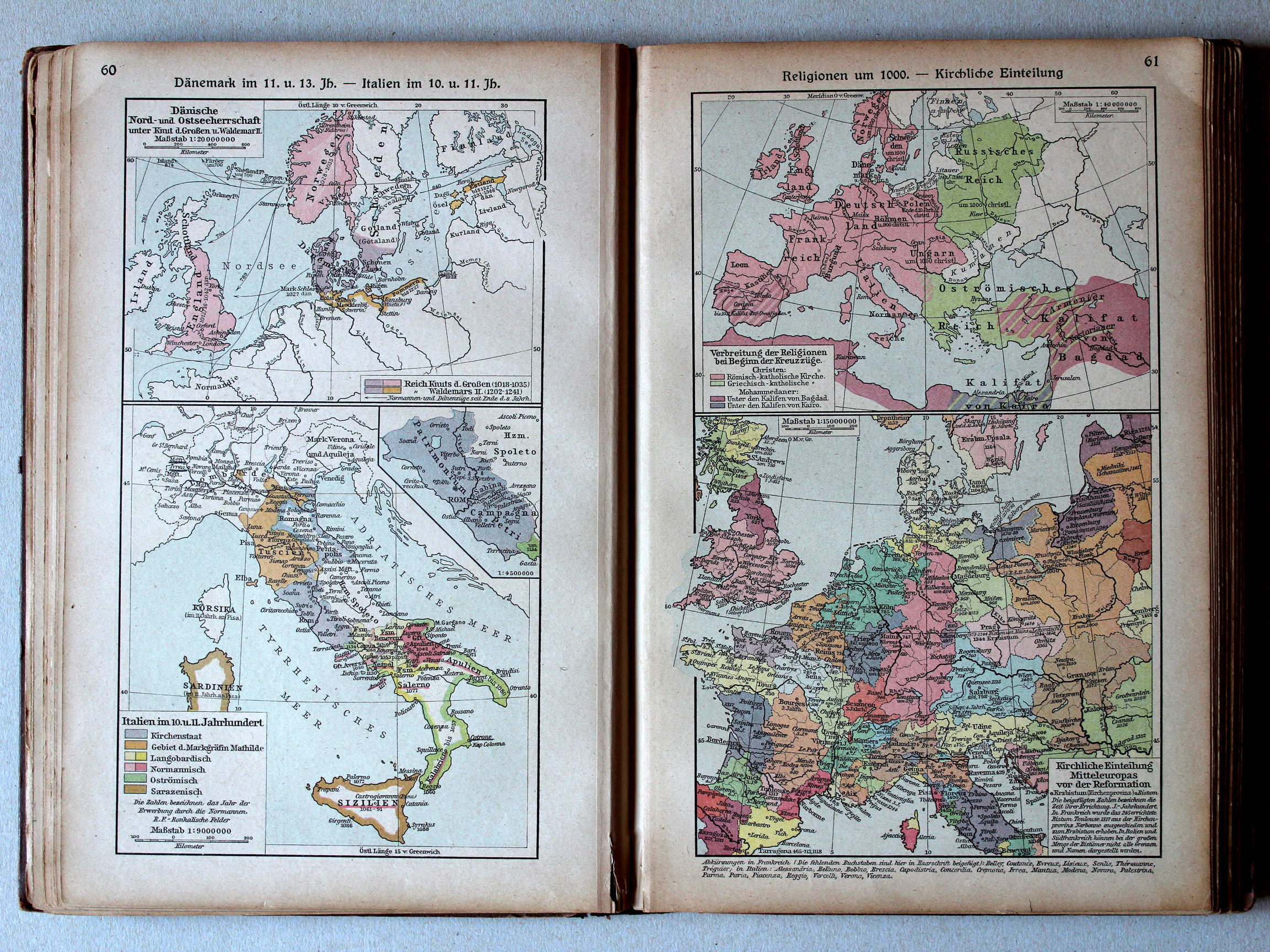
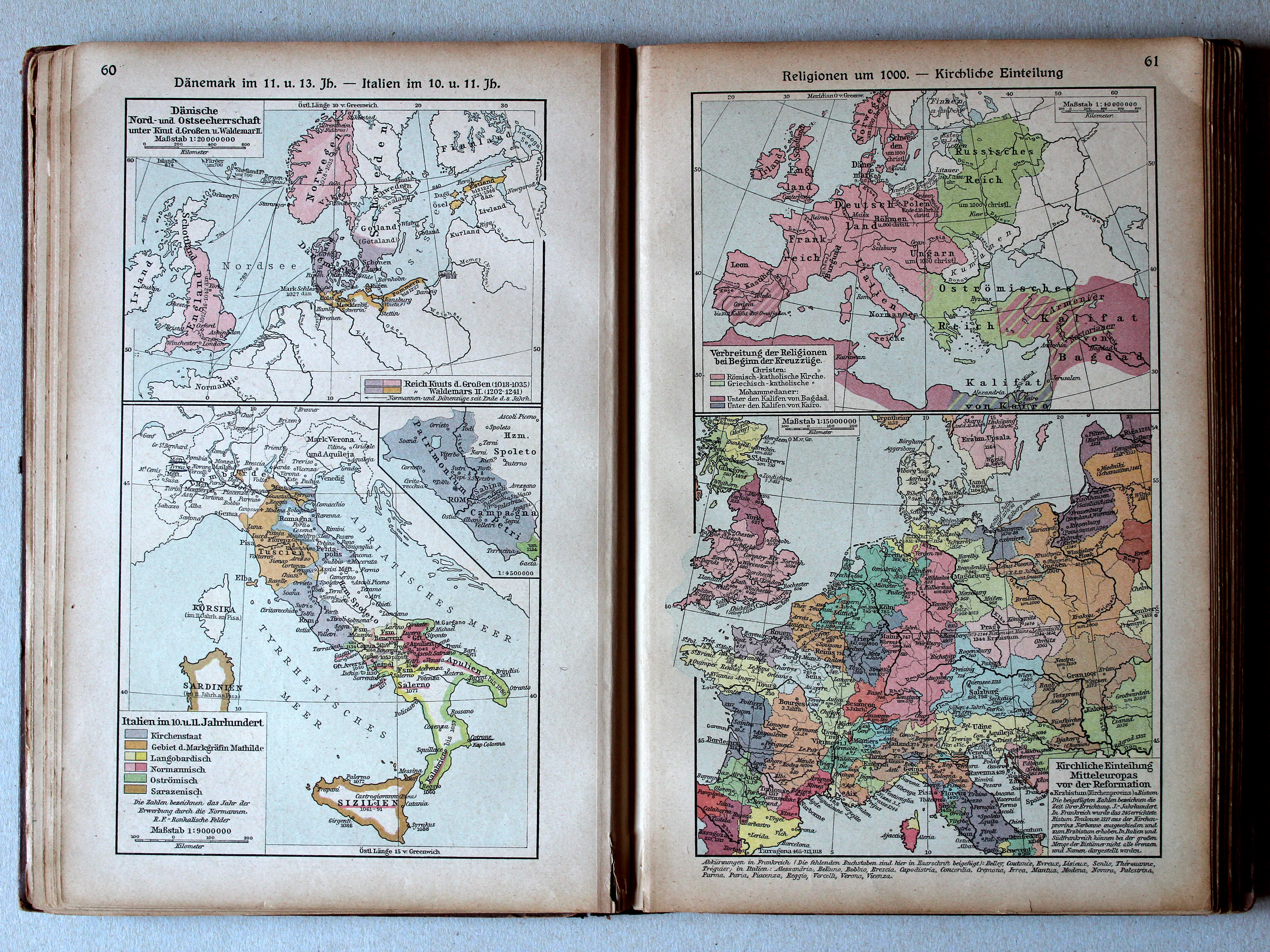
60. Dänemark im 11. u. 13. Jh. – Italien im 10. u. 11. Jh. XL
Denemarken in de 11e en 13e eeuw. Italië in de 10e en 11e eeuw / Denmark in the 11th and 13th centuries. Italy in the 10th and 11th centuries
61. Religionen um 1000 – Kirchliche Einteilung XL
Godsdiensten rond 1000. Hiërarchie van de Katholieke Kerk / Religions around 1000. Hierarchy of the Catholic Church
 Putzgers Historischer Schul-Atlas, 1922
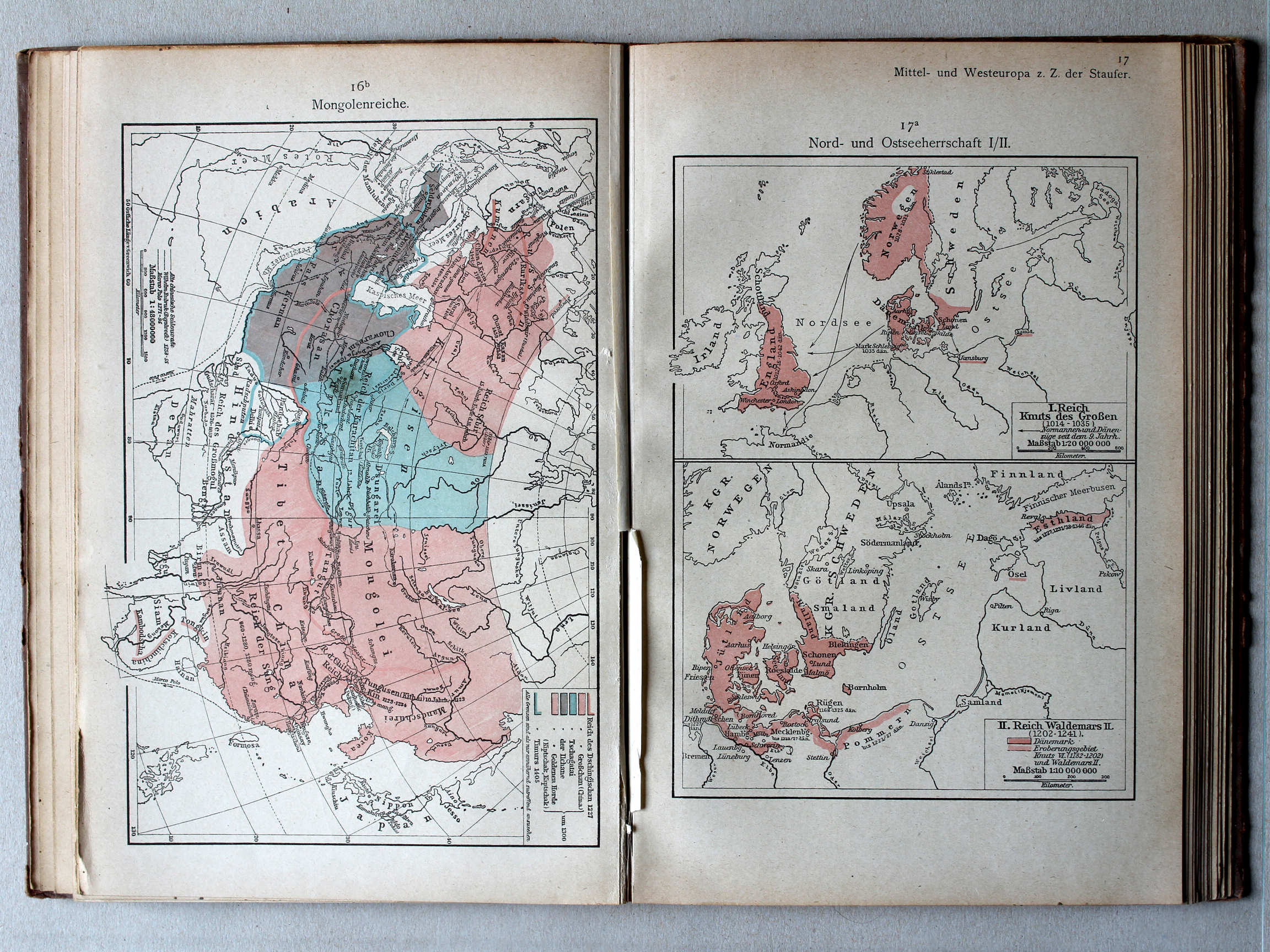
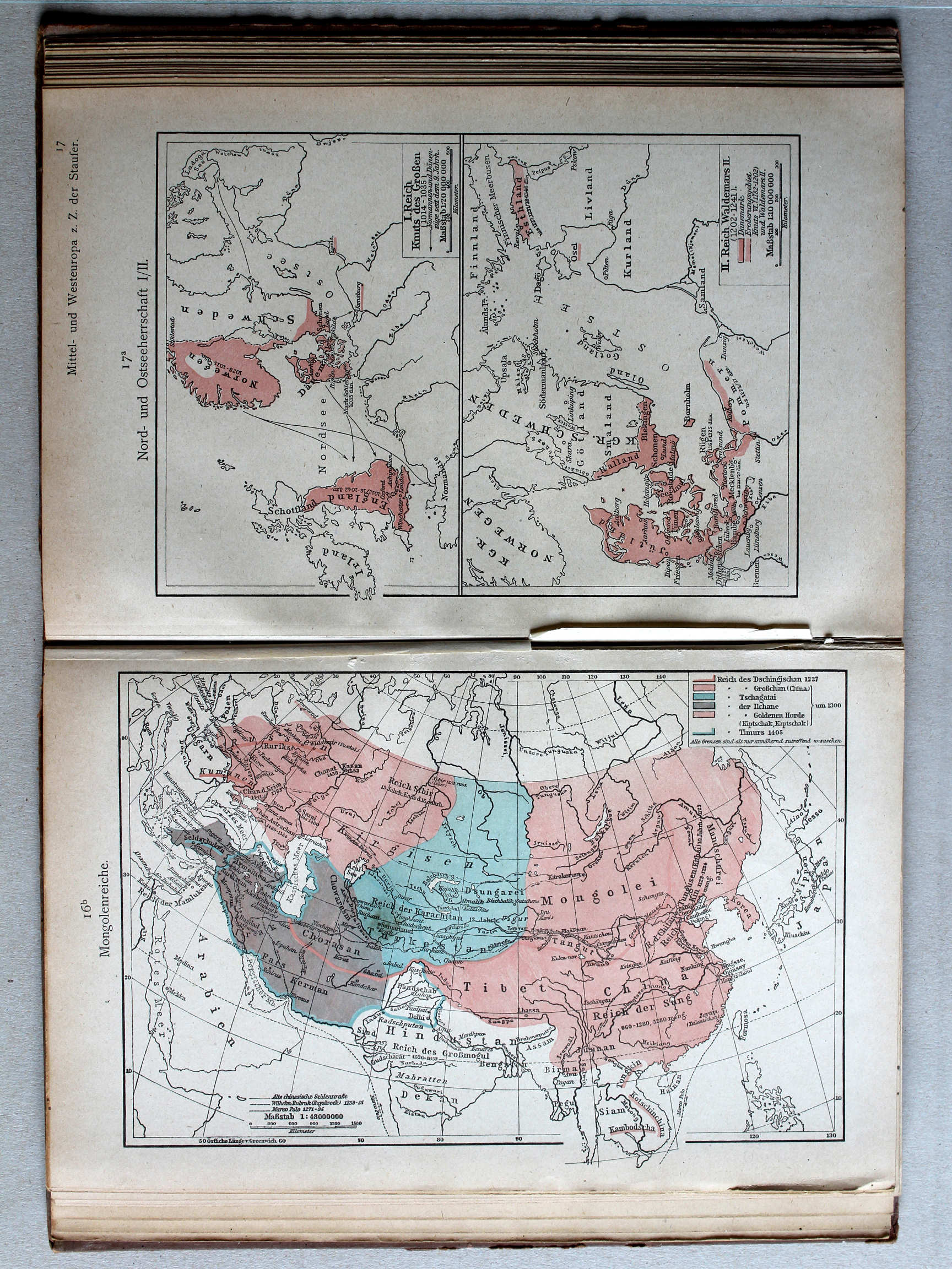
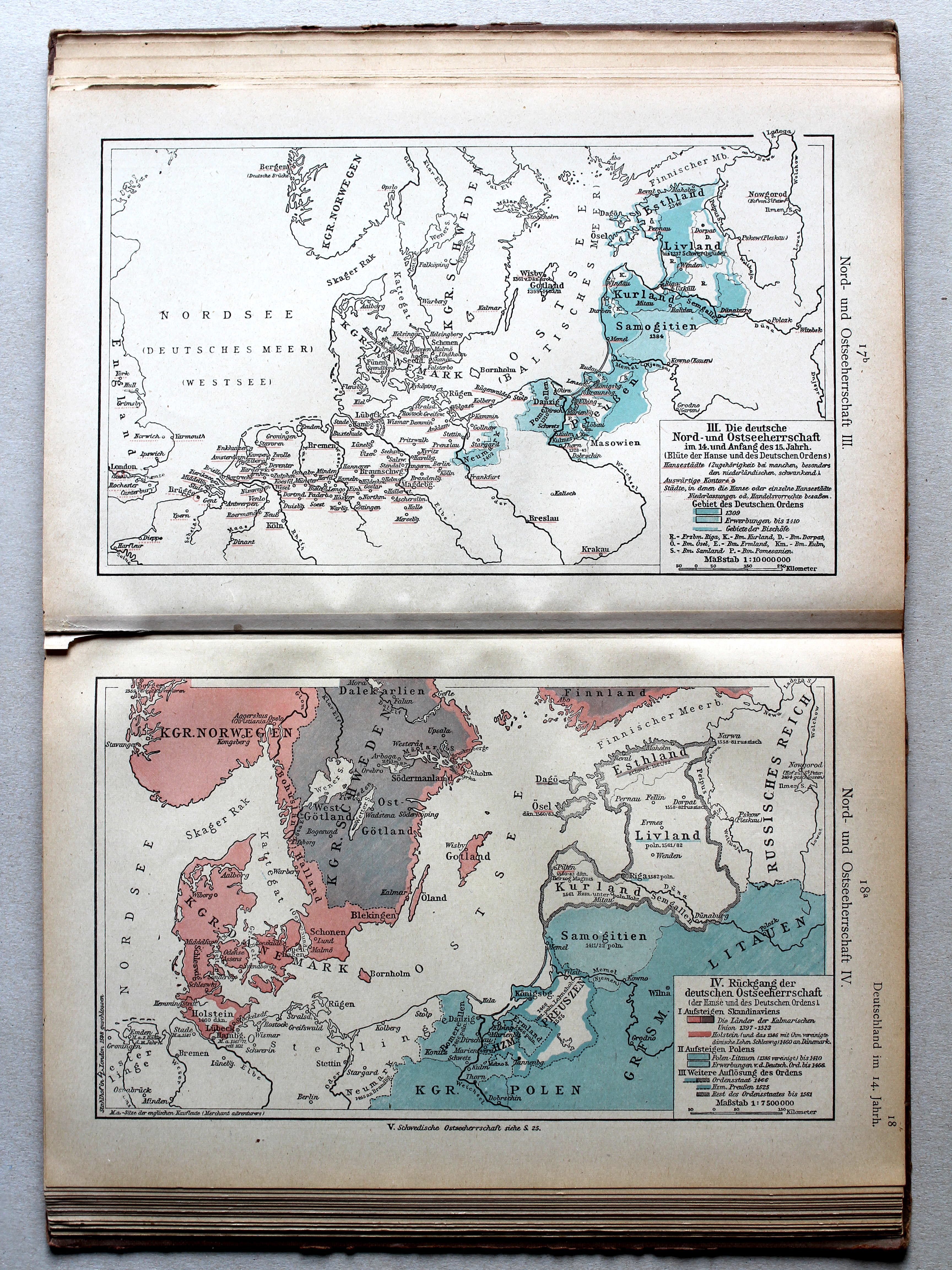
17a. Nord- und Ostseeherrschaft I/II XL
Heerschappij rond de Noord- en Oostzee I/II / Rule in the North Sea and Baltic region I/II
Putzgers Historischer Schul-Atlas, Große Ausgabe, 1923
60. Dänemark im 11. u. 13. Jh. – Italien im 10. u. 11. Jh. XL
Denemarken in de 11e en 13e eeuw. Italië in de 10e en 11e eeuw / Denmark in the 11th and 13th centuries. Italy in the 10th and 11th centuries
61. Religionen um 1000 – Kirchliche Einteilung XL
Godsdiensten rond 1000. Hiërarchie van de Katholieke Kerk / Religions around 1000. Hierarchy of the Catholic Church
Putzgers Historischer Schul-Atlas, 1922
14. Mitteleuropa zur Zeit der Karolinger (Italien im X. u. XI. Jahrhundert) XL
Midden-Europa in de tijd van de Karolingen (Italië in de 10e en 11e eeuw) / Central Europe during the Carolingian dynasty (Italy in the 10th and 11th centuries)
Putzgers Historischer Schul-Atlas, Große Ausgabe, 1923
60. Dänemark im 11. u. 13. Jh. – Italien im 10. u. 11. Jh. XL
Denemarken in de 11e en 13e eeuw. Italië in de 10e en 11e eeuw / Denmark in the 11th and 13th centuries. Italy in the 10th and 11th centuries
61. Religionen um 1000 – Kirchliche Einteilung XL
Godsdiensten rond 1000. Hiërarchie van de Katholieke Kerk / Religions around 1000. Hierarchy of the Catholic Church
Putzgers Historischer Schul-Atlas, 1922
13b. Christentum ca. 814, Religionen ca. 1100 XL
Christendom ca. 814, godsdiensten ca. 1100 / Christianity ca. 814, religions ca. 1100
14a. Wachsen des Frankenreichs XL
Groei van het Frankische Rijk / Growth of the Frankish Empire
Putzgers Historischer Schul-Atlas, Große Ausgabe, 1923
60. Dänemark im 11. u. 13. Jh. – Italien im 10. u. 11. Jh. XL
Denemarken in de 11e en 13e eeuw. Italië in de 10e en 11e eeuw / Denmark in the 11th and 13th centuries. Italy in the 10th and 11th centuries
61. Religionen um 1000 – Kirchliche Einteilung XL
Godsdiensten rond 1000. Hiërarchie van de Katholieke Kerk / Religions around 1000, Hierarchy of the Catholic Church
Putzgers Historischer Schul-Atlas, 1922
15. Deutschland zur Zeit der sächsischen und fränkischen Kaiser (Kirchl. Einteilung Deutschlands) XL
Duitsland in de tijd van de Saksische en Frankische keizers (Hiërarchie van de Kerk in Duitsland) / Germany during the Saxon and Frankish dynasties (Hierarchy of the Church in Germany)
 Putzgers Historischer Schul-Atlas, Große Ausgabe, 1923
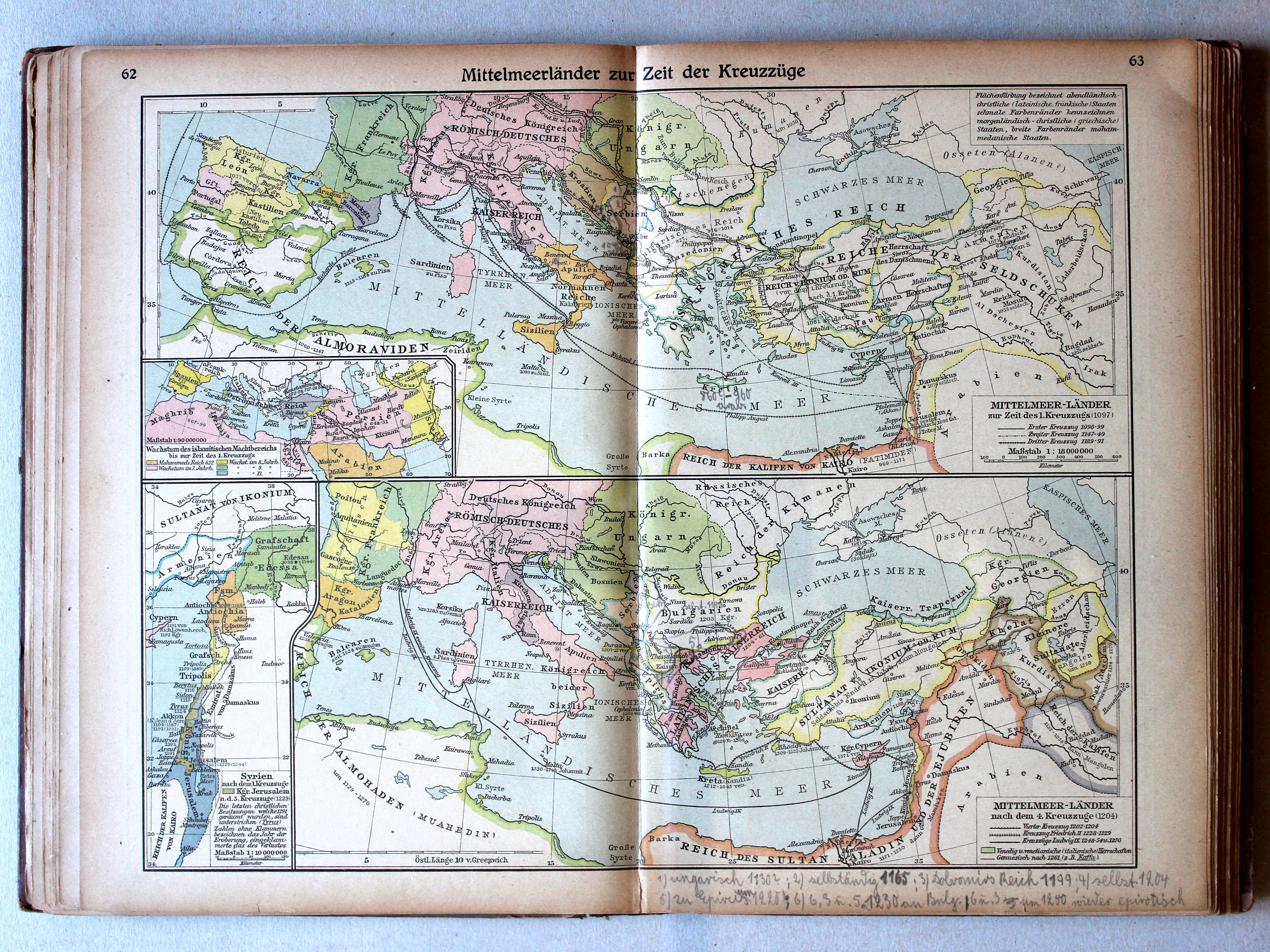
62.63. Mittelmeerländer zur Zeit der Kreuzzüge XL
Het Middellandse Zeegebied in de tijd van de Kruistochten / The Mediterranean region during the Crusades
Putzgers Historischer Schul-Atlas, 1922
16. Mittelmeerländer zur Zeit der Kreuzzüge XL
Het Middellandse Zeegebied in de tijd van de Kruistochten / The Mediterranean region during the Crusades
 Putzgers Historischer Schul-Atlas, Große Ausgabe, 1923
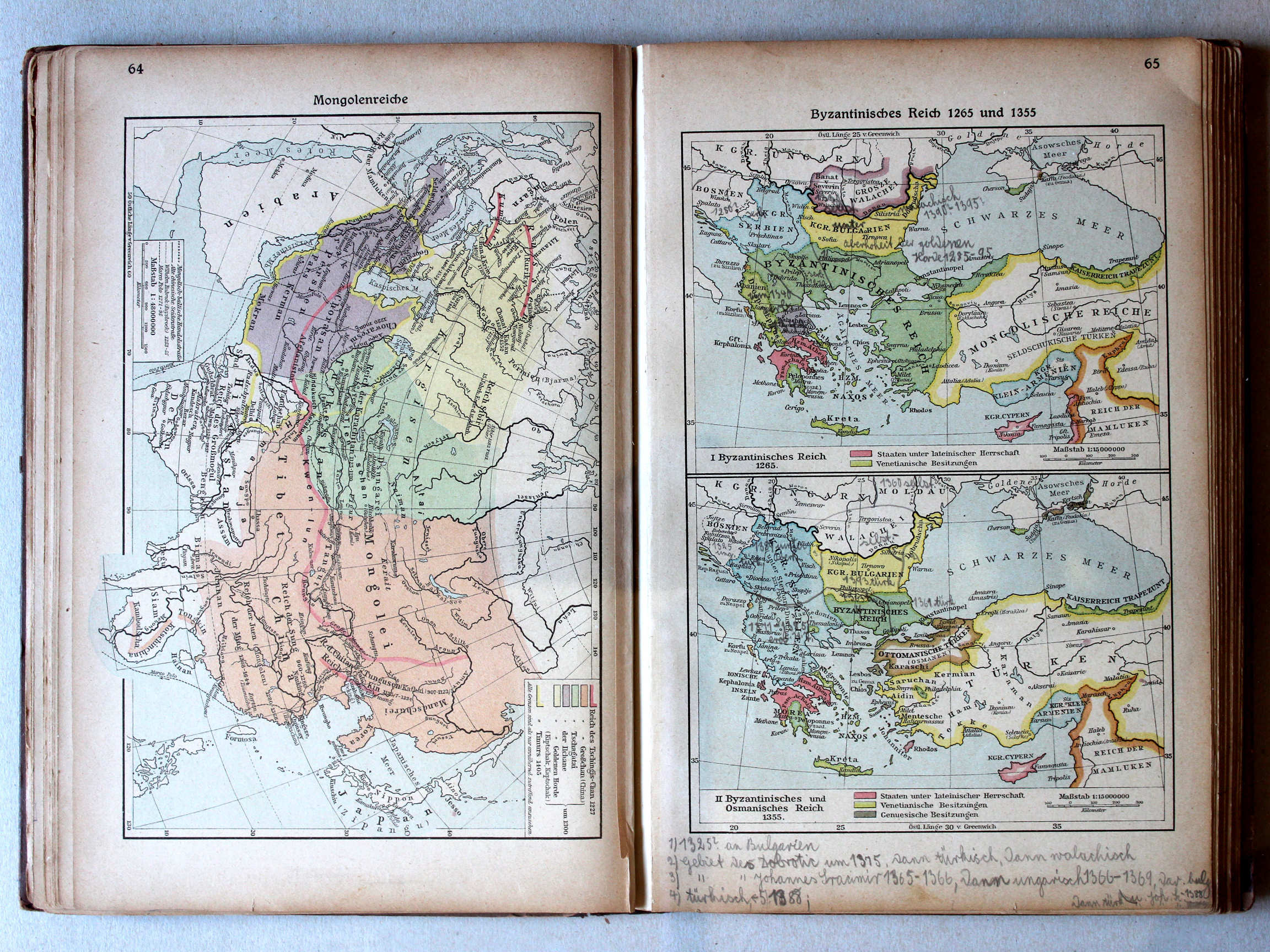
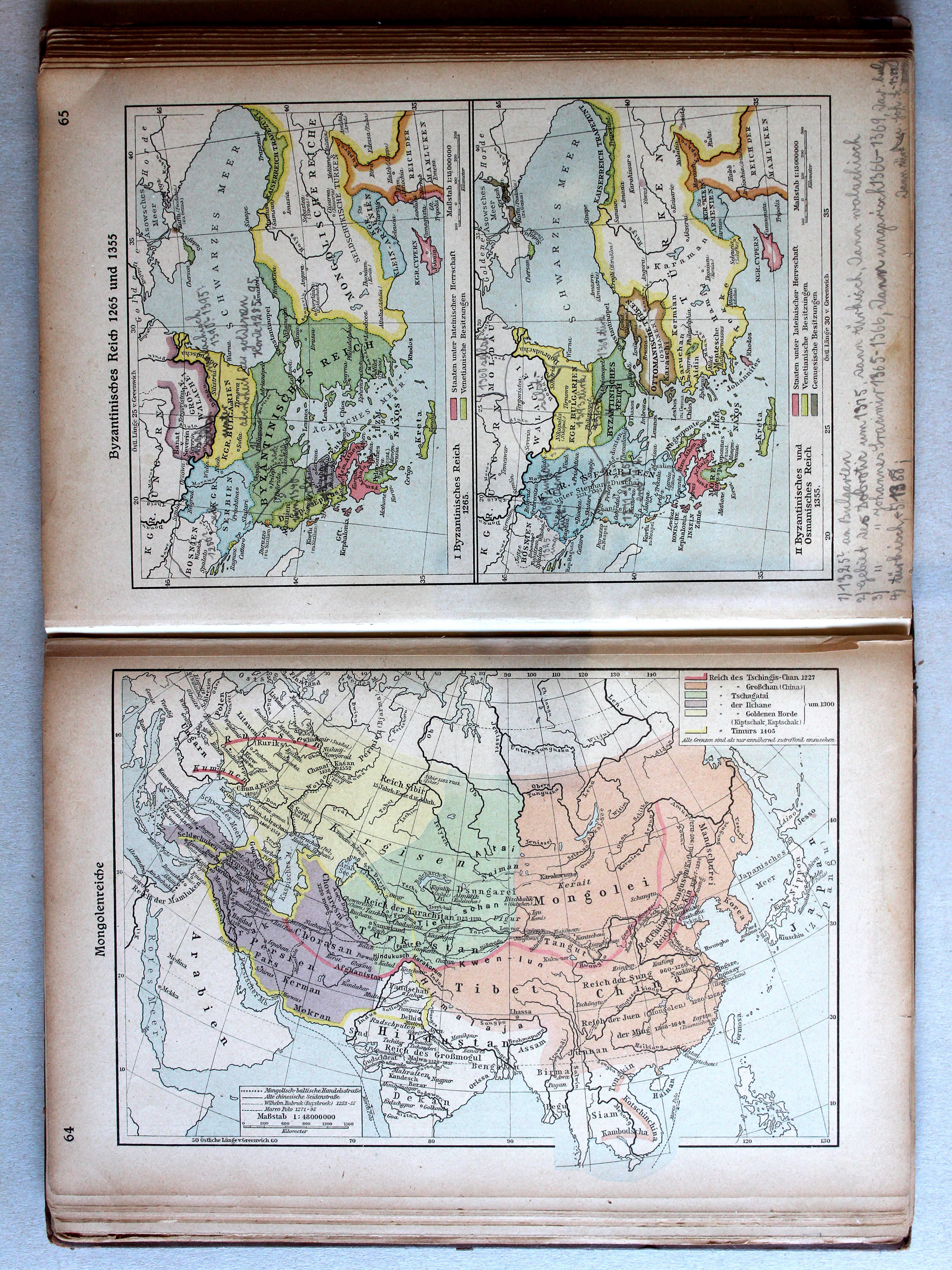
64. Mongolenreiche XL
Mongoolse rijken / Mongol empires
 Putzgers Historischer Schul-Atlas, Große Ausgabe, 1923
65. Byzantinisches Reich 1265 und 1355 XL
Het Byzantijnse Rijk in 1265 en 1355 / The Byzantine Empire in 1265 and 1355
 Putzgers Historischer Schul-Atlas, 1922
geen overeenkomstige kaart / no corresponding map
 Putzgers Historischer Schul-Atlas, Große Ausgabe, 1923
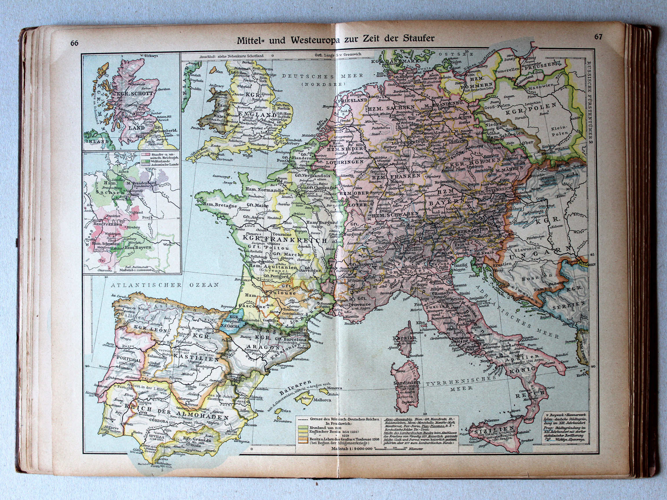
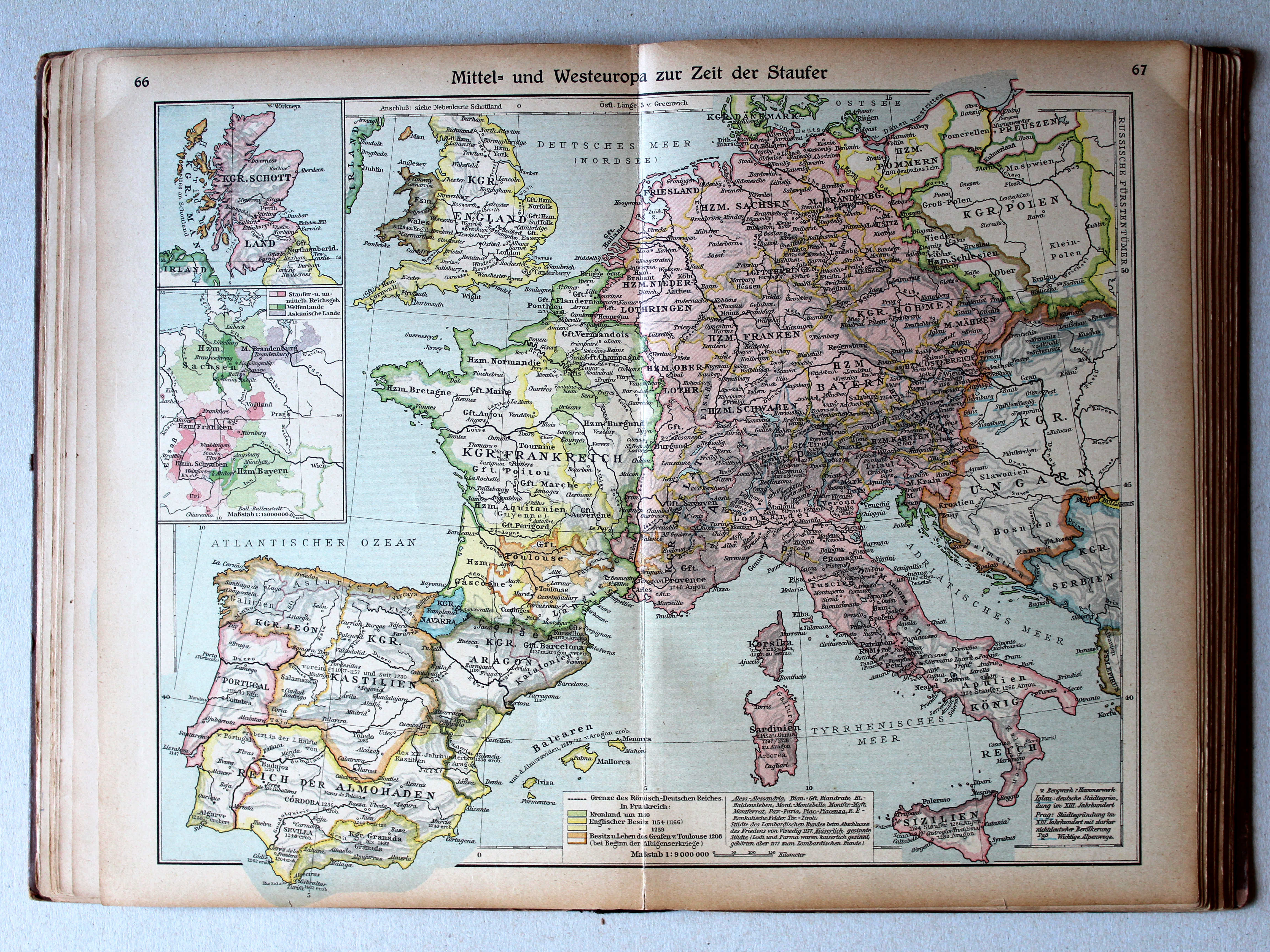
66.67. Mittel- und Westeuropa zur Zeit der Staufer XL
Midden- en West-Europa in de tijd van de Hohenstaufen / Central and Western Europe during the House of Hohenstaufen
 Putzgers Historischer Schul-Atlas, 1922
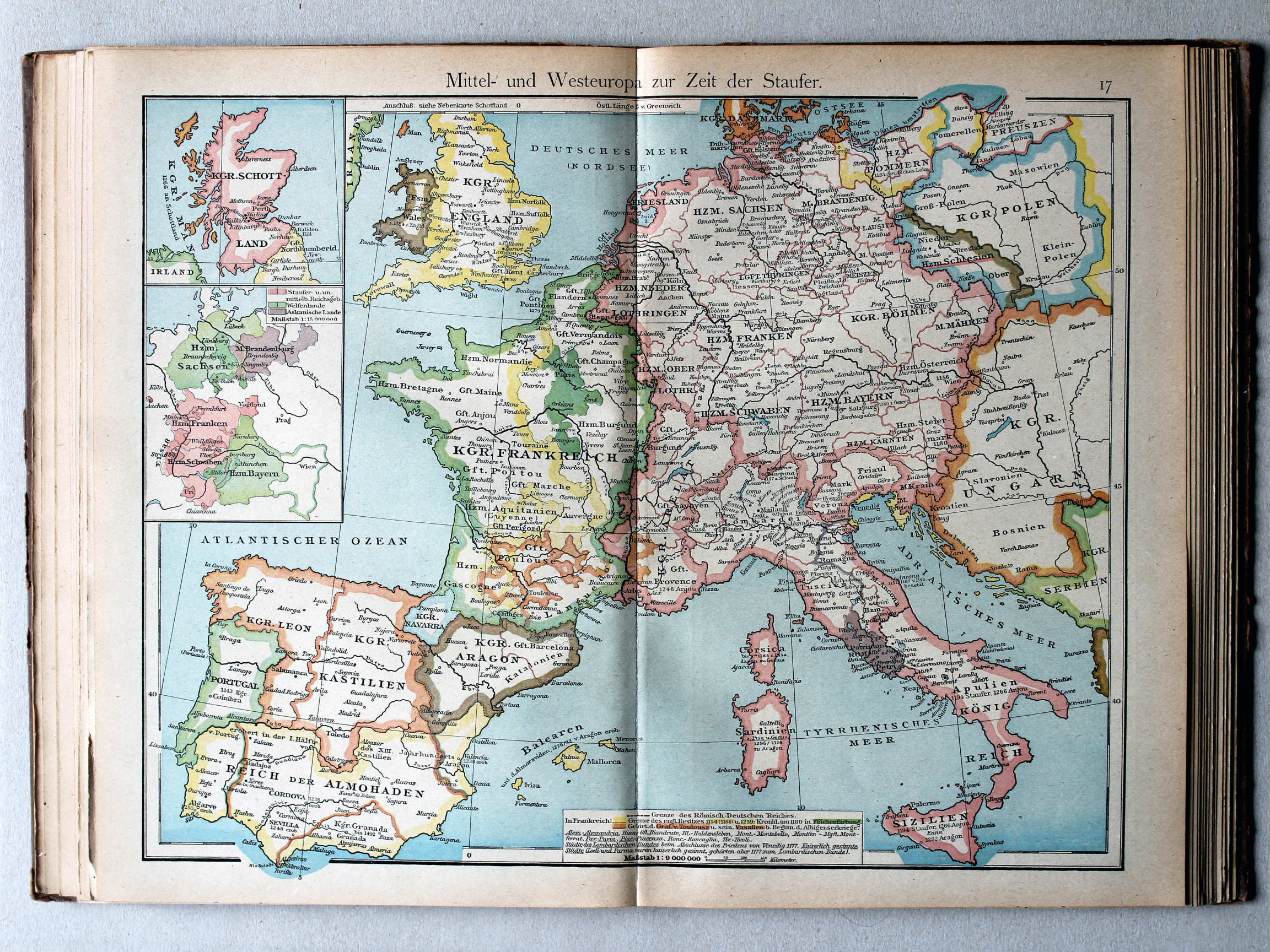
17. Mittel- und Westeuropa zur Zeit der Staufer XL
Midden- en West-Europa in de tijd van de Hohenstaufen / Central and Western Europe during the House of Hohenstaufen
 Putzgers Historischer Schul-Atlas, Große Ausgabe, 1923
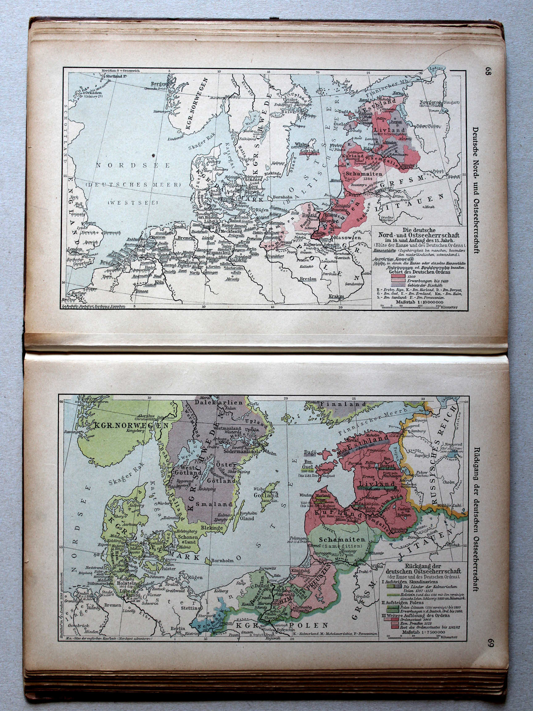
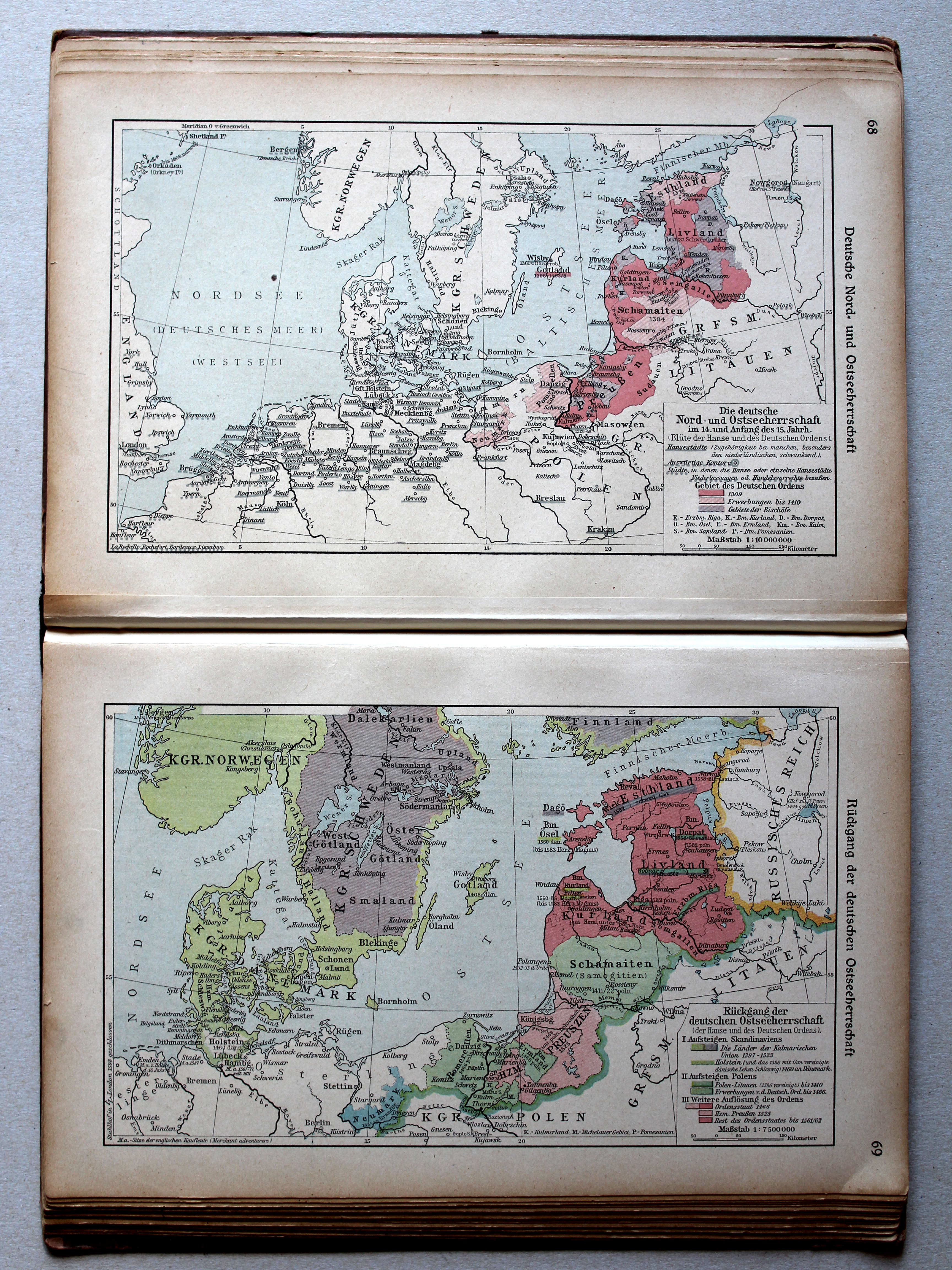
68. Deutsche Nord- und Ostseeherrschaft XL
Duitse heerschappij rond de Noord- en Oostzee / German rule in the North Sea and Baltic region
69. Rückgang der deutschen Ostseeherrschaft XL
Neergang van de Duitse heerschappij rond de Oostzee / Decline of the German rule in the Baltic region
 Putzgers Historischer Schul-Atlas, 1922
17b. Nord- und Ostseeherrschaft III XL
Heerschappij rond de Noord- en Oostzee III / Rule in the North Sea and Baltic region III
18a. Nord- und Ostseeherrschaft IV XL
Heerschappij rond de Noord- en Oostzee IV / Rule in the North Sea and Baltic region IV
 Putzgers Historischer Schul-Atlas, Große Ausgabe, 1923
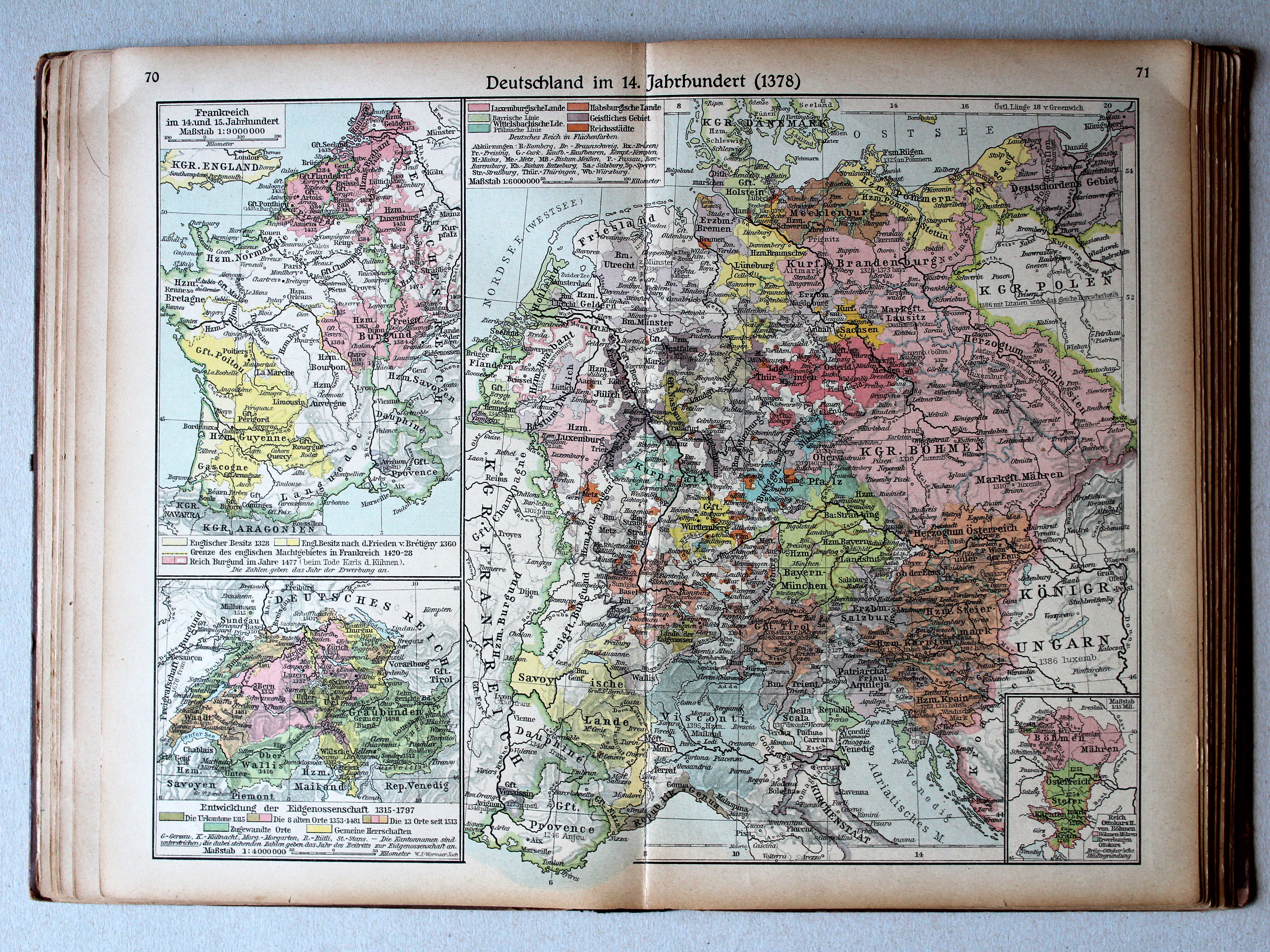
70.71. Deutschland im 14. Jahrhundert (1378) XL
Duitsland in de 14e eeuw (1378) / Germany in the 14th century (1378)
 Putzgers Historischer Schul-Atlas, 1922
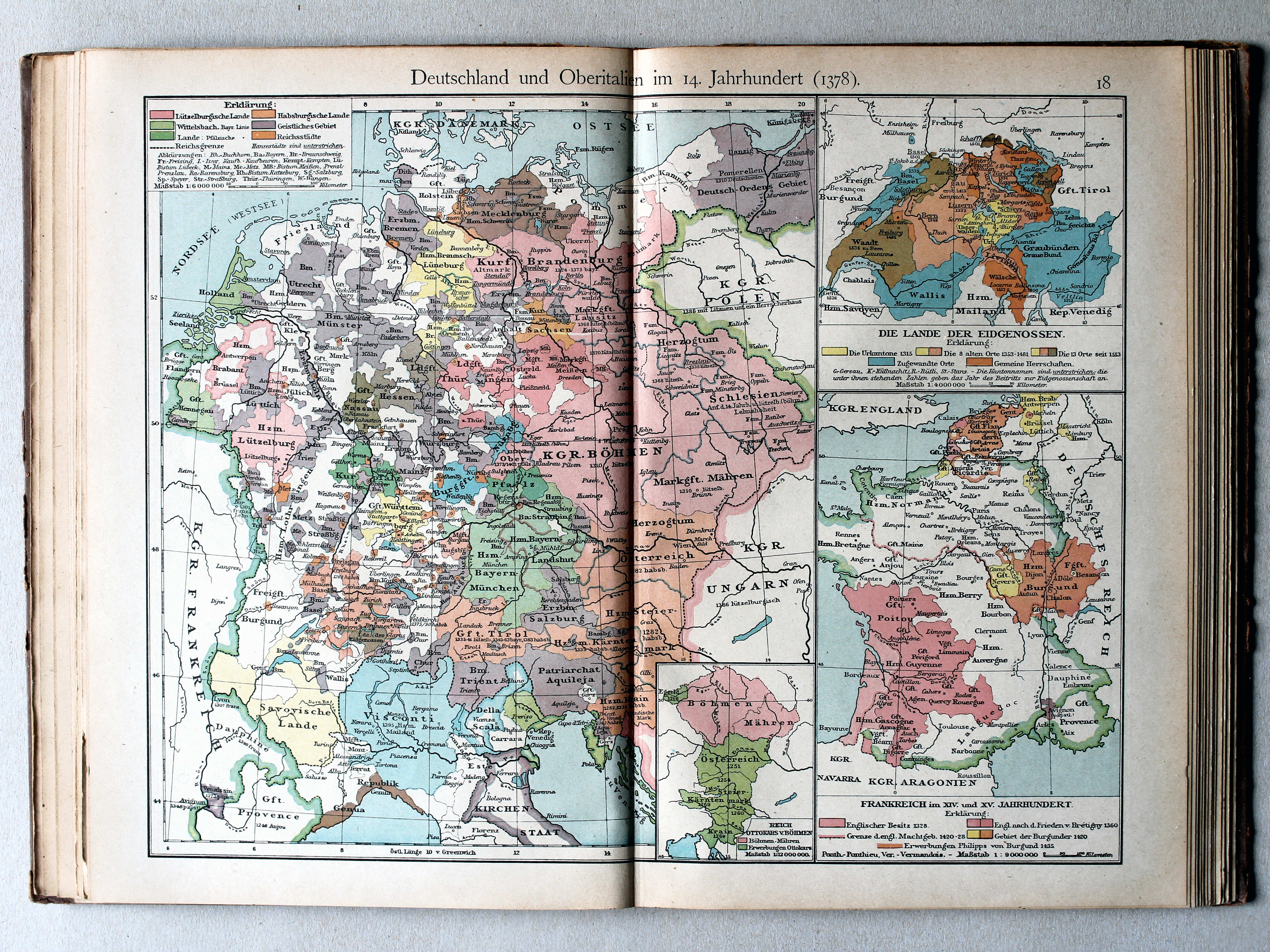
18. Deutschland und Oberitalien im 14. Jahrhundert (1378) XL
Duitsland en Noord-Italië in de 14e eeuw (1378) / Germany and Northern Italy in the 14th century (1378)
 Putzgers Historischer Schul-Atlas, Große Ausgabe, 1923
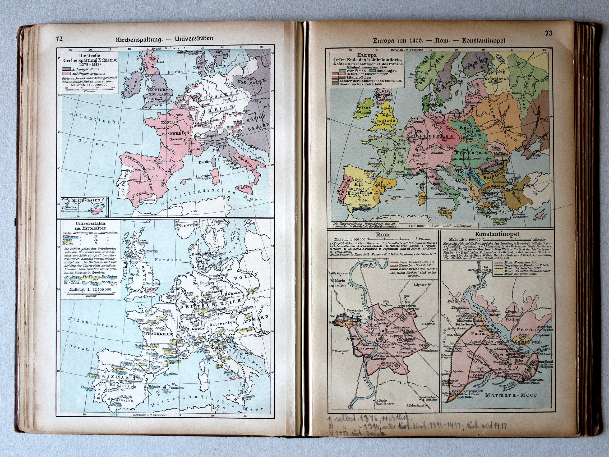
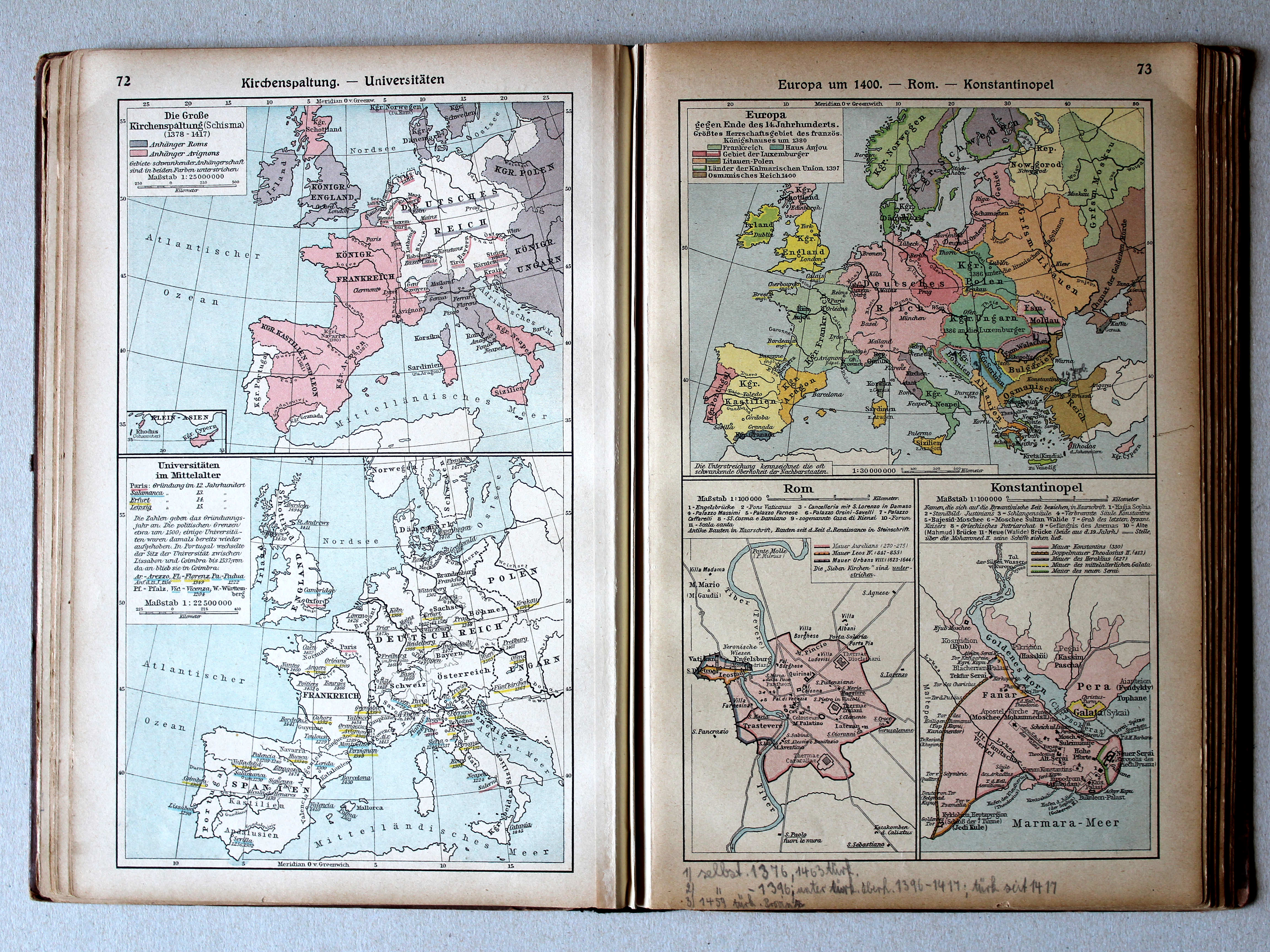
72. Kirchenspaltung – Universitäten XL
Westers Schisma. Universiteiten / Western Schism. Universities
73. Europa um 1400 – Rom – Konstantinopel XL
Europa rond 1400. Rome. Konstantinopel / Europe around 1400. Rome. Constantinople
 Putzgers Historischer Schul-Atlas, 1922
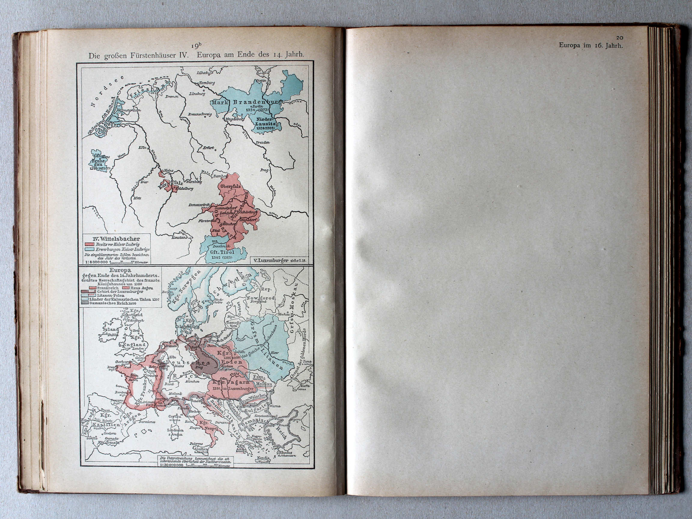
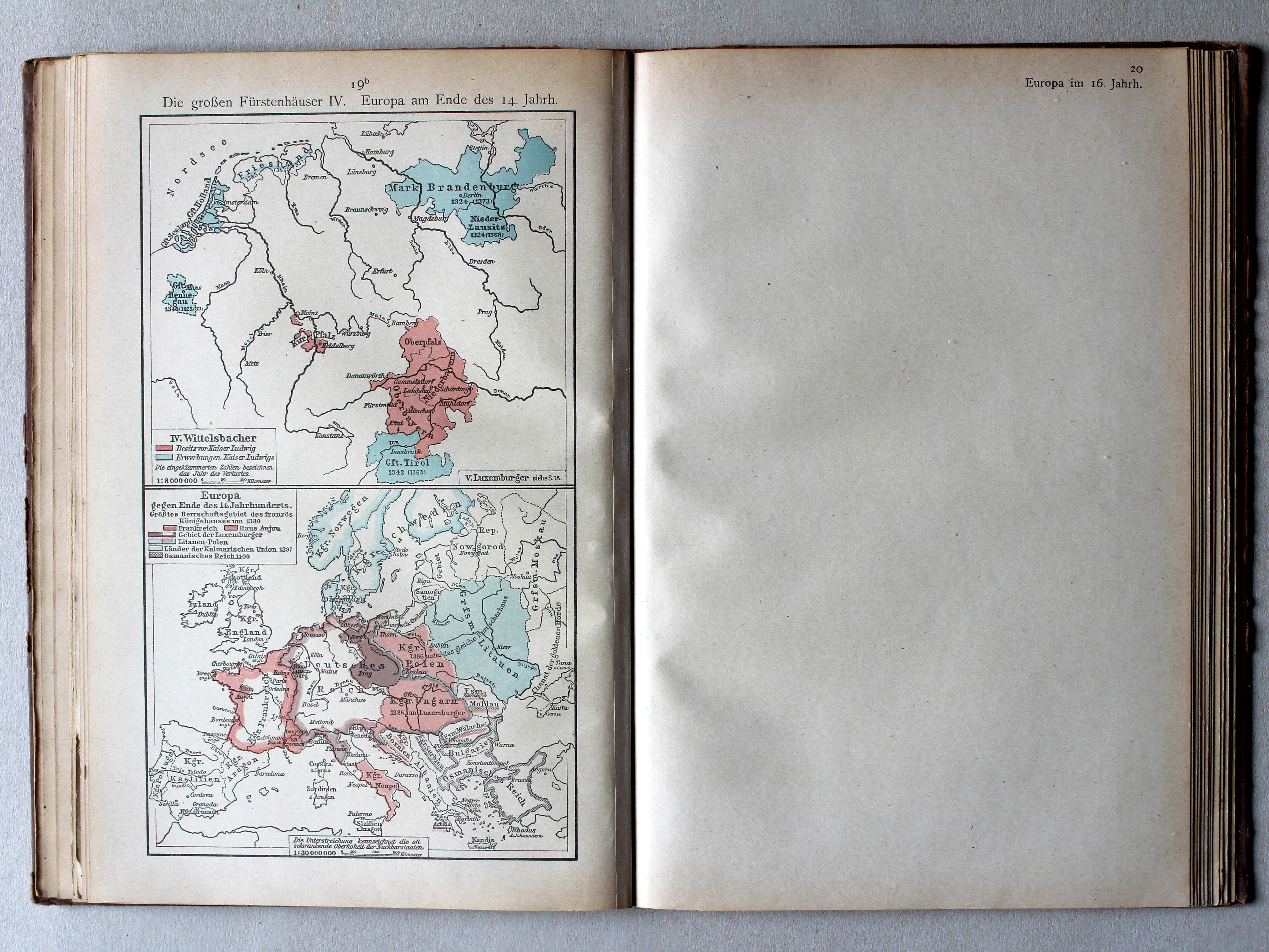
19b. Die großen Fürstenhäuser IV. Europa am Ende des 14. Jahrh. XL
De grote dynastieën IV. Europa aan het eind van de 14e eeuw / The great dynasties IV. Europe at the end of the 14th century
Putzgers Historischer Schul-Atlas, Große Ausgabe, 1923
72. Kirchenspaltung – Universitäten XL
Westers Schisma. Universiteiten / Western Schism. Universities
73. Europa um 1400 – Rom – Konstantinopel XL
Europa rond 1400. Rome. Konstantinopel / Europe around 1400. Rome. Constantinople
 Putzgers Historischer Schul-Atlas, 1922
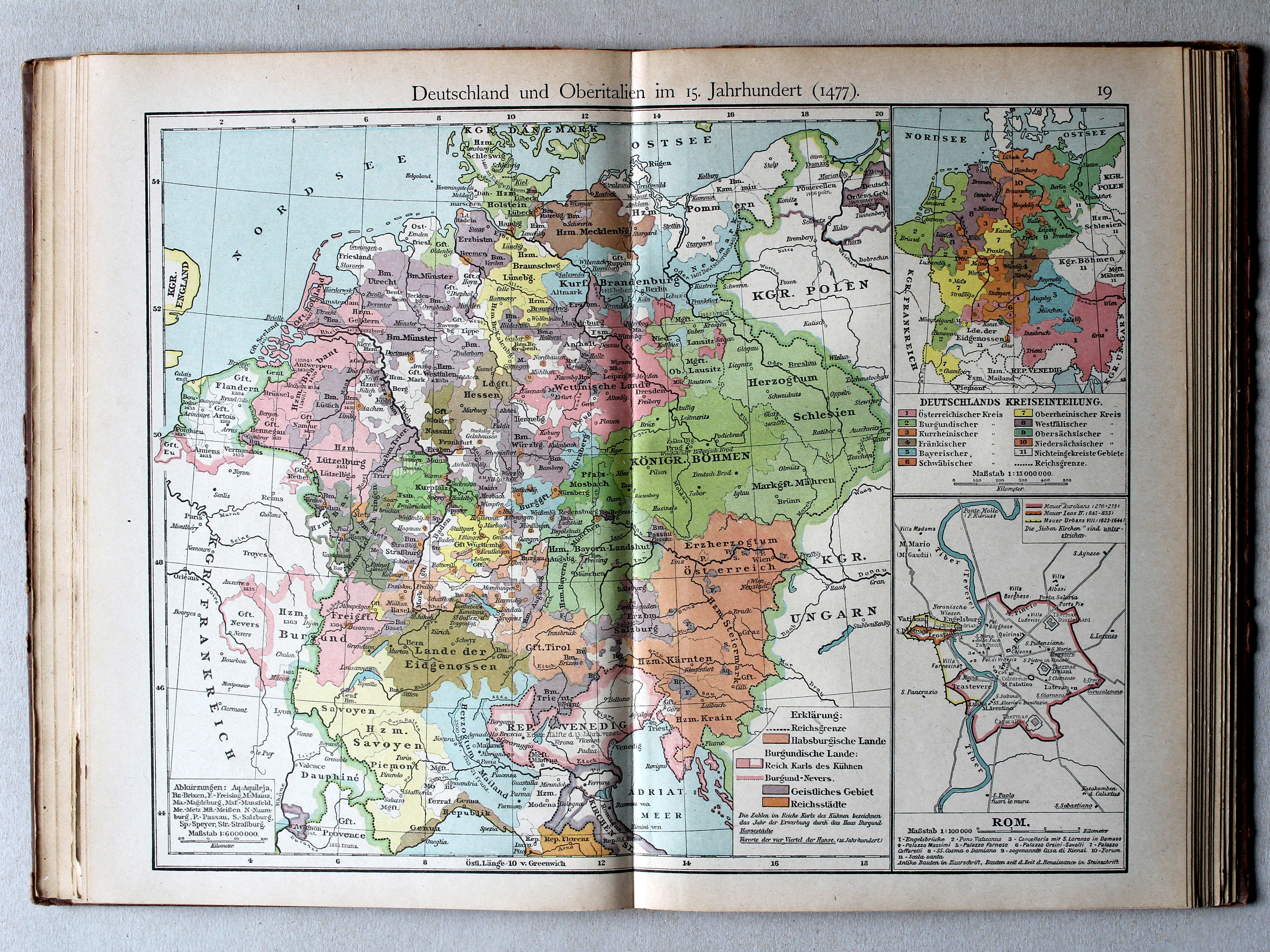
19. Deutschland und Oberitalien im 15. Jahrhundert (1477) (Rom) XL
Duitsland en Noord-Italië in de 15e eeuw (1477) (Rome) / Germany and Northern Italy in the 15th century (1477) (Rome)
Putzgers Historischer Schul-Atlas, Große Ausgabe, 1923
72. Kirchenspaltung – Universitäten XL
Westers Schisma. Universiteiten / Western Schism. Universities
73. Europa um 1400 – Rom – Konstantinopel XL
Europa rond 1400. Rome. Konstantinopel / Europe around 1400. Rome. Constantinople
 Putzgers Historischer Schul-Atlas, 1922
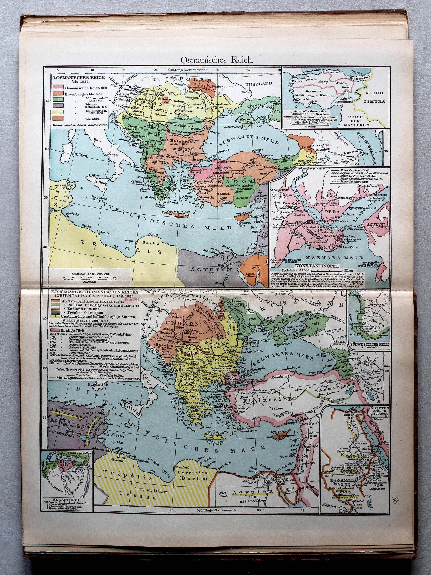
38. Osmanisches Reich (Konstantinopel) XL
Ottomaanse Rijk (Konstantinopel) / Ottoman Empire (Constantinople)
 Putzgers Historischer Schul-Atlas, Große Ausgabe, 1923
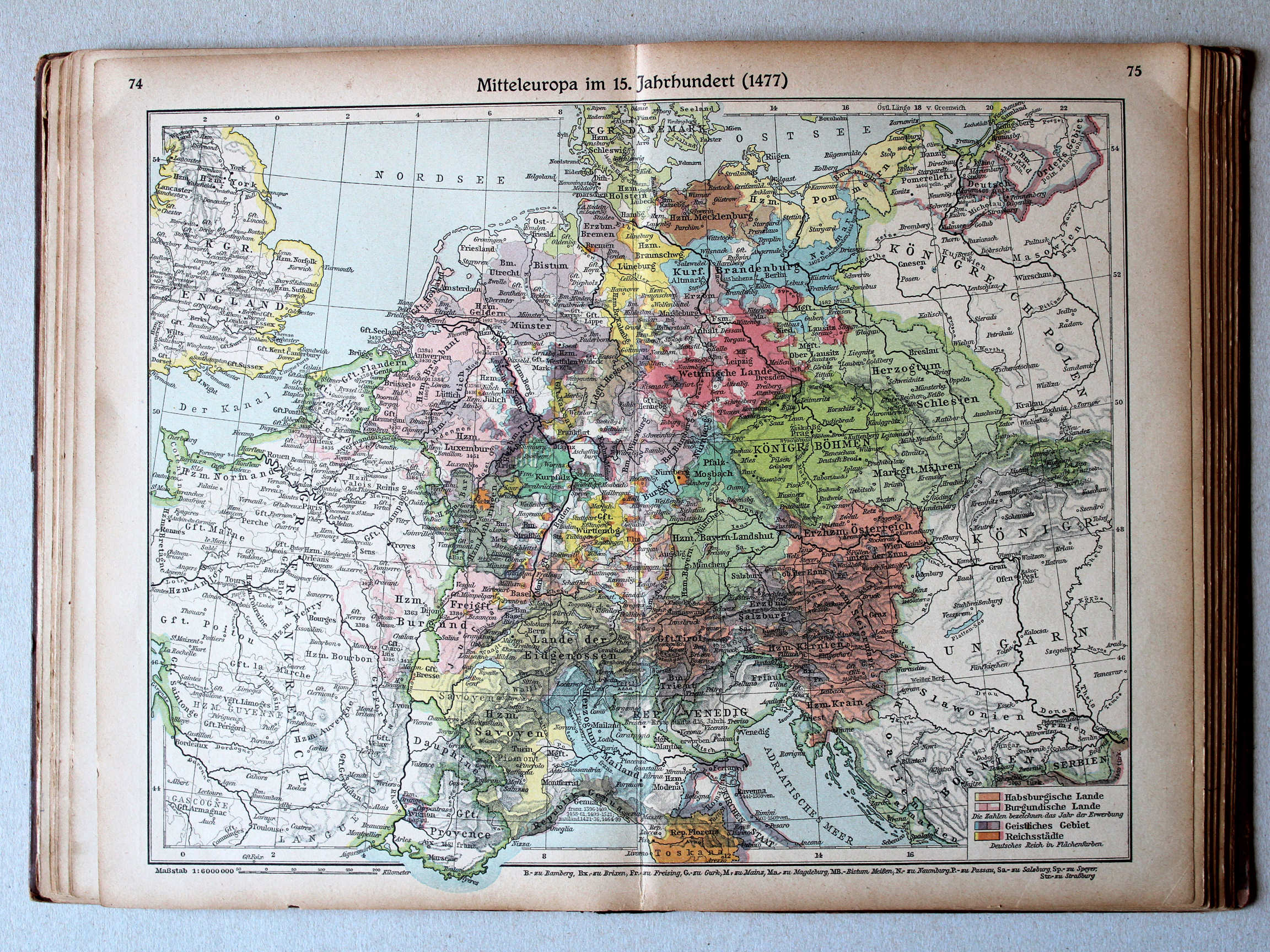
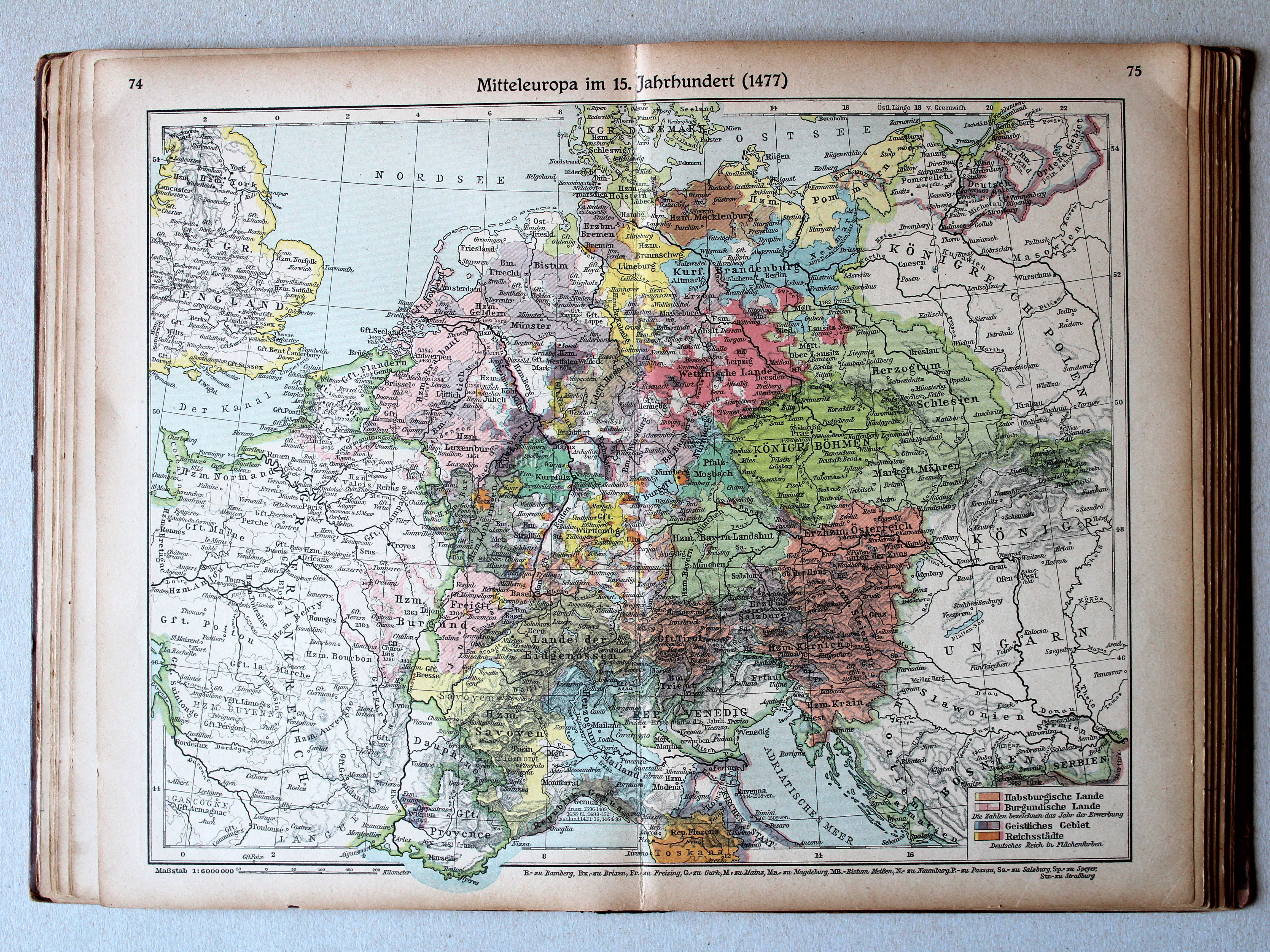
74.75. Mitteleuropa im 15. Jahrhundert (1477) XL
Midden-Europa in de 15e eeuw (1477) / Central Europe in the 15th century (1477)
Putzgers Historischer Schul-Atlas, 1922
19. Deutschland und Oberitalien im 15. Jahrhundert (1477) XL
Duitsland en Noord-Italië in de 15e eeuw (1477) / Germany and Northern Italy in the 15th century (1477)
 Putzgers Historischer Schul-Atlas, Große Ausgabe, 1923
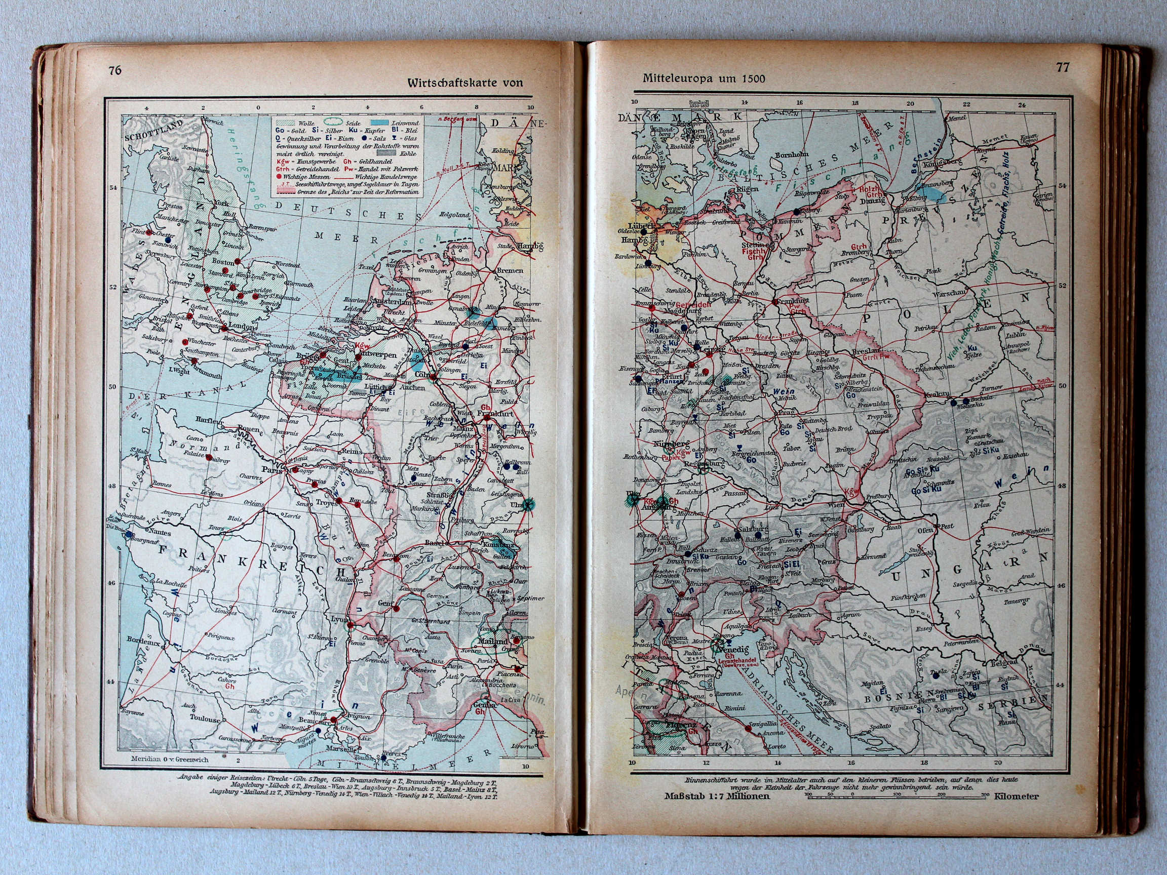
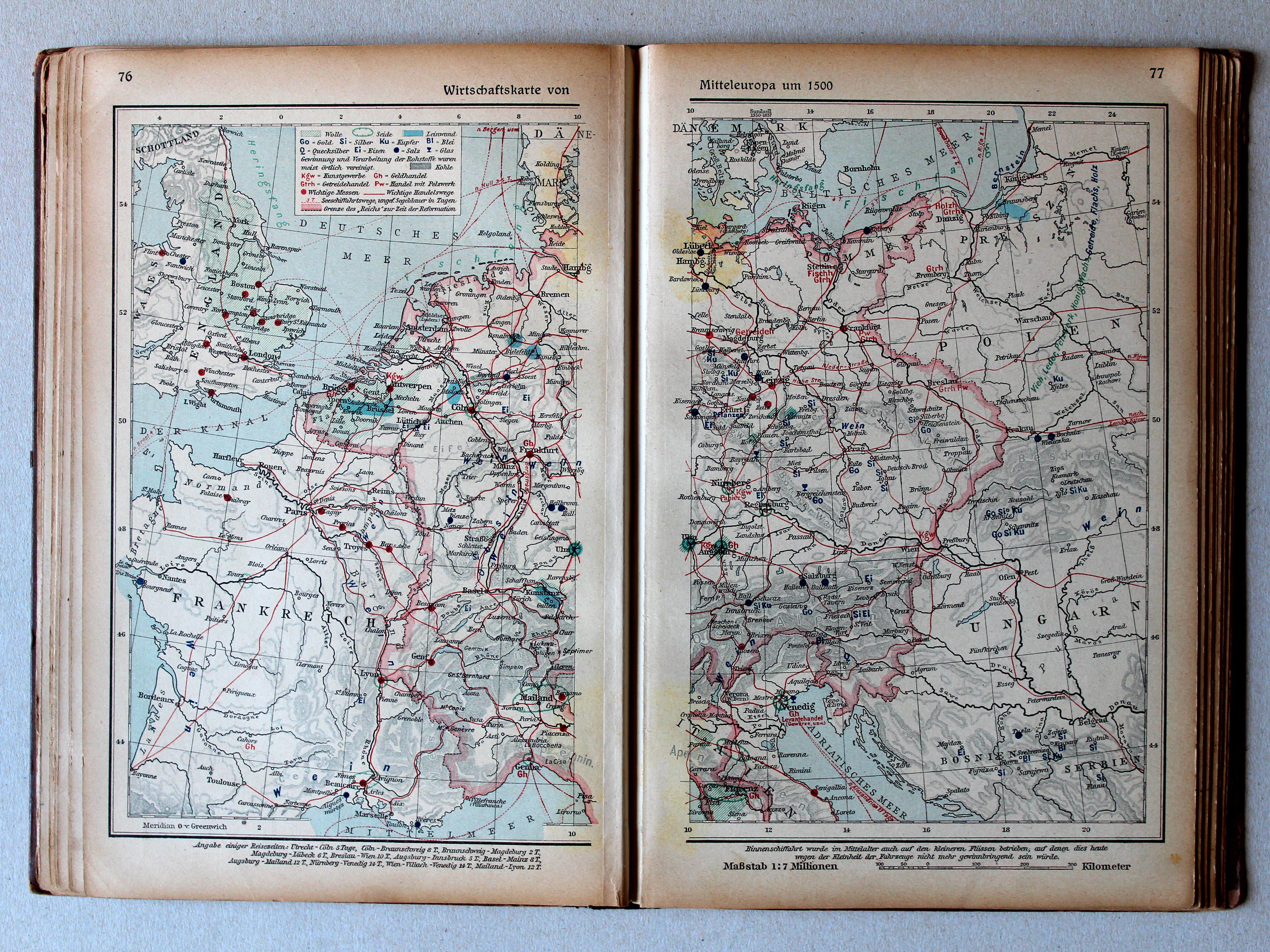
76.77. Wirtschaftskarte von Mitteleuropa um 1500 XL
Economische kaart van Midden-Europa rond 1500 / Economic map of Central Europe around 1500
Putzgers Historischer Schul-Atlas, 1922
geen overeenkomstige kaart / no corresponding map
 Putzgers Historischer Schul-Atlas, Große Ausgabe, 1923
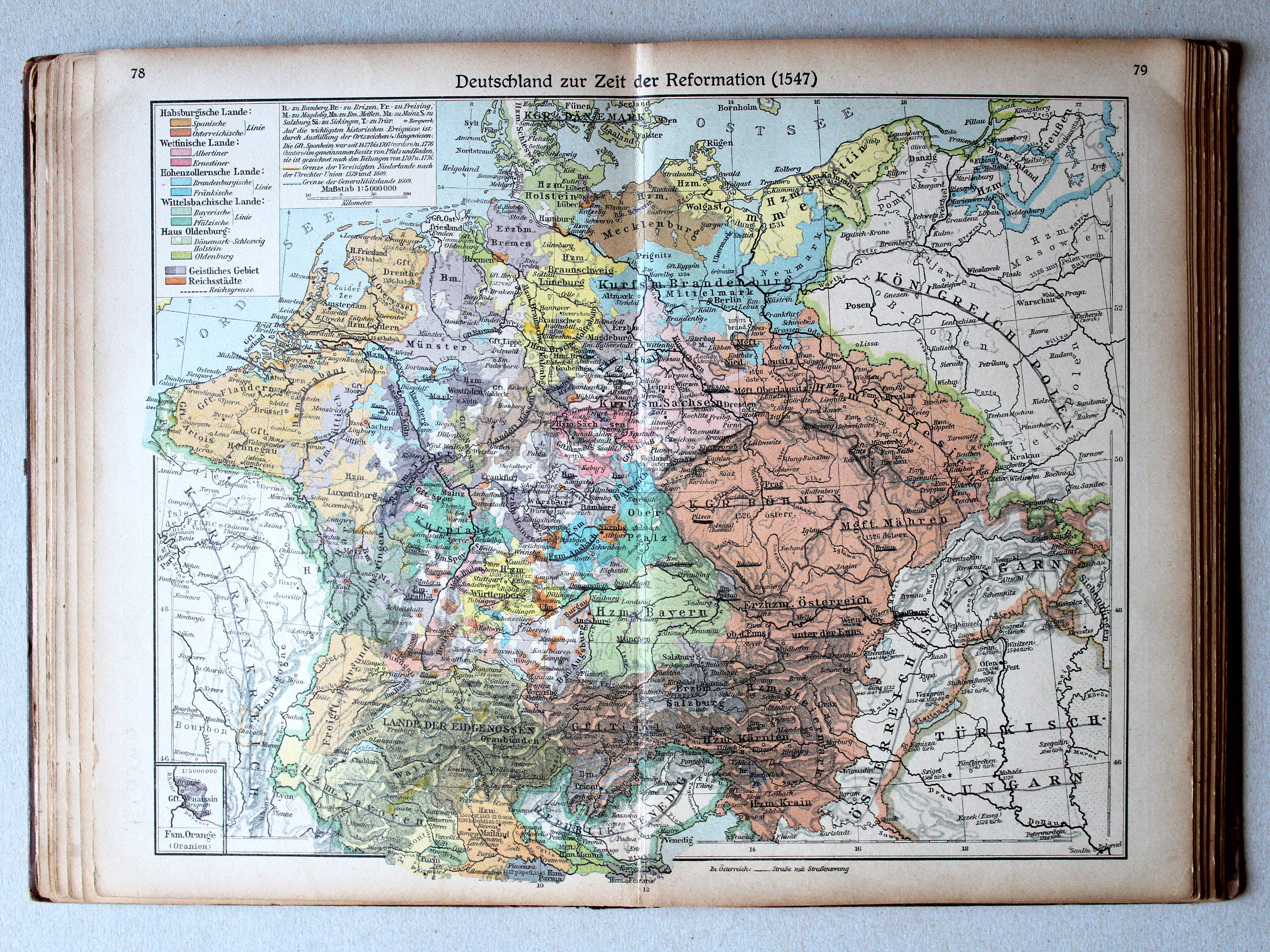
78.79. Deutschland zur Zeit der Reformation (1547) XL
Duitsland in de tijd van de Reformatie (1547) / Germany during the Protestant Reformation (1547)
 Putzgers Historischer Schul-Atlas, 1922
21. Deutschland zur Zeit der Reformation (1547) XL
Duitsland in de tijd van de Reformatie (1547) / Germany during the Protestant Reformation (1547)
 Putzgers Historischer Schul-Atlas, Große Ausgabe, 1923
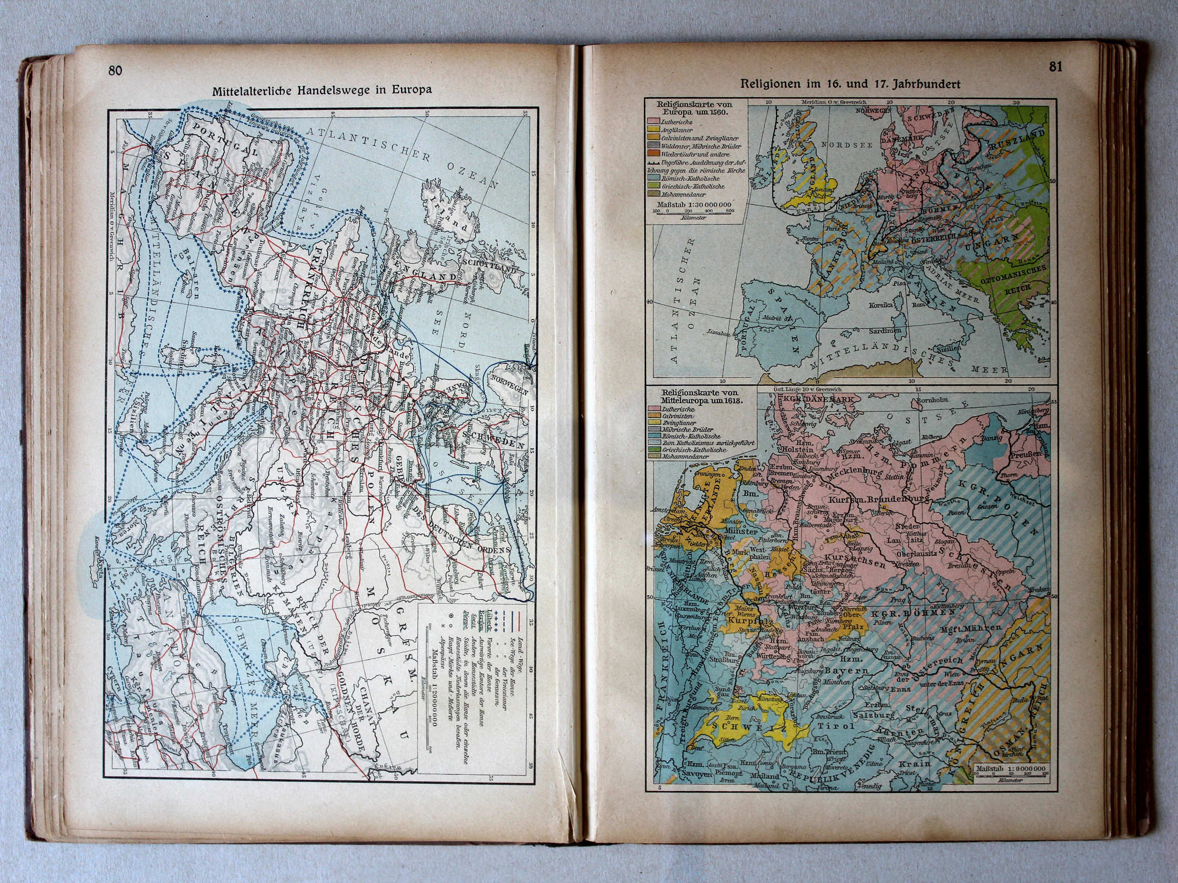
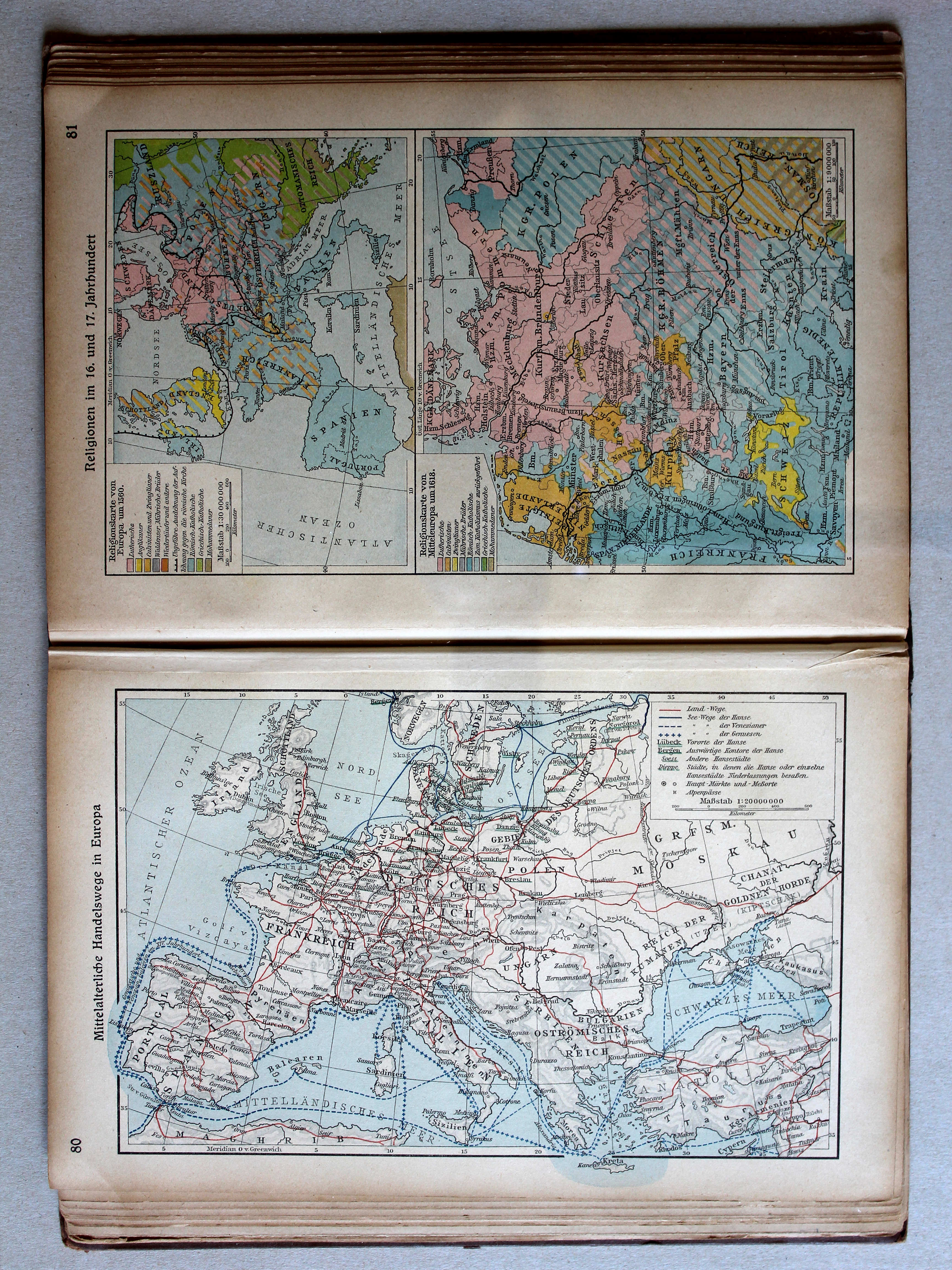
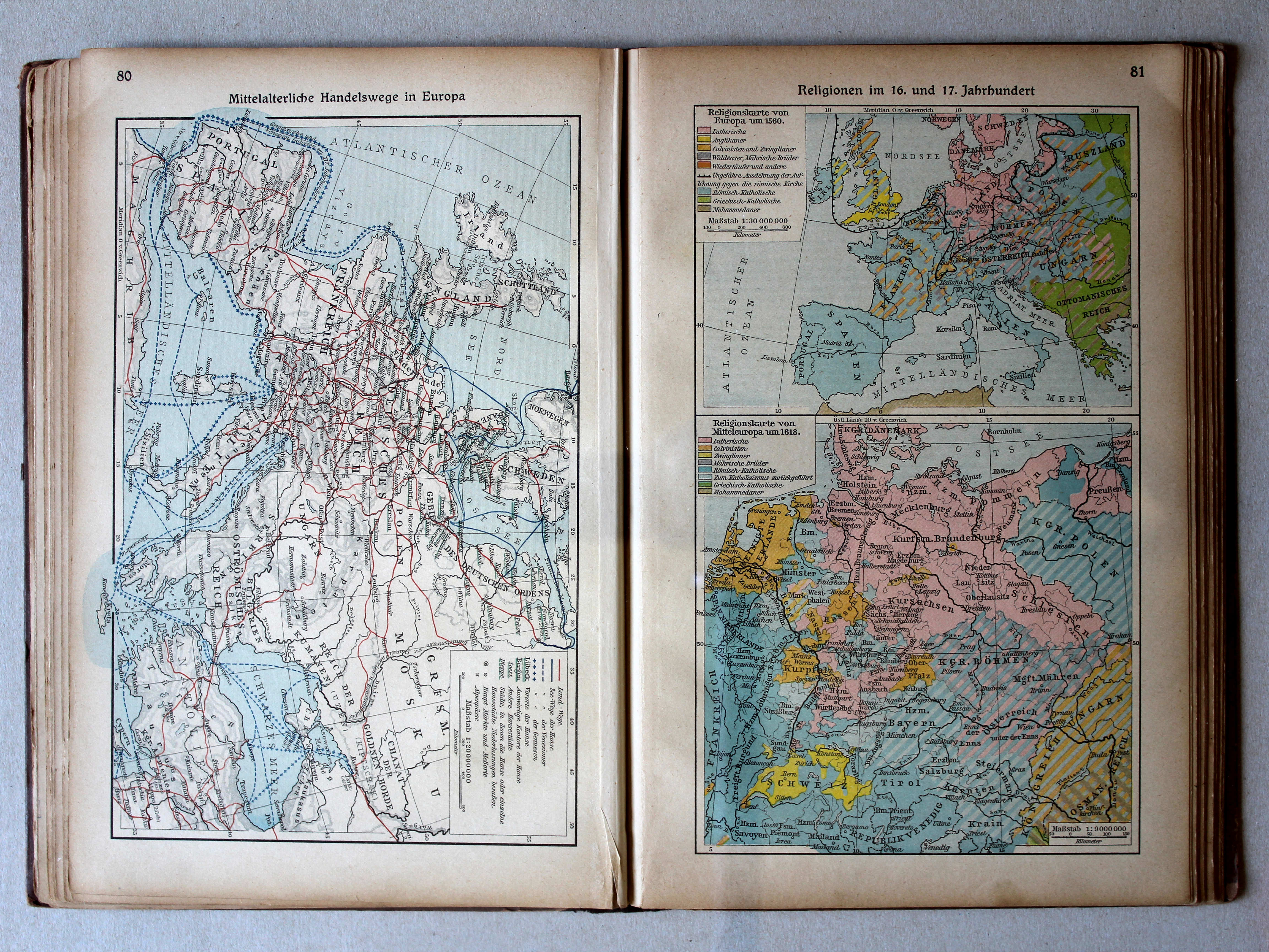
80. Mittelalterliche Handelswege in Europa XL
Handelsroutes in Europa in de Middeleeuwen / Trade routes in Europe in the Middle Ages
 Putzgers Historischer Schul-Atlas, 1922
geen overeenkomstige kaart / no corresponding map
 Putzgers Historischer Schul-Atlas, Große Ausgabe, 1923
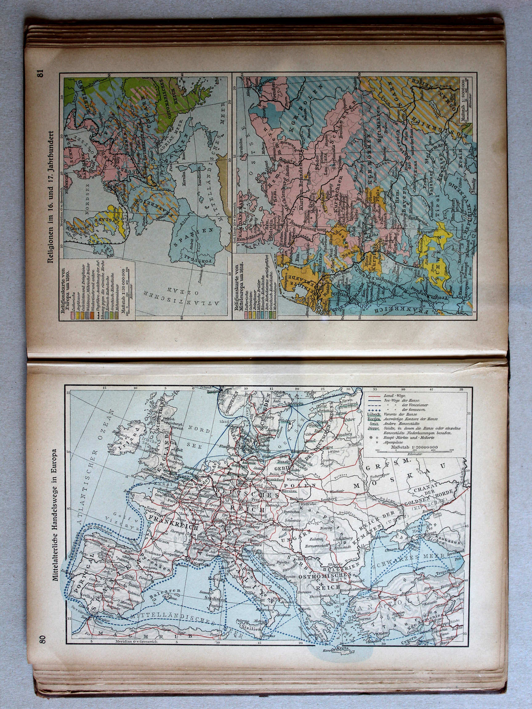
81. Religionen im 16. und 17. Jahrhundert XL
Godsdiensten in de 16e en 17e eeuw / Religions in the 16th and 17th centuries
Putzgers Historischer Schul-Atlas, 1922
geen overeenkomstige kaart / no corresponding map
 Putzgers Historischer Schul-Atlas, Große Ausgabe, 1923
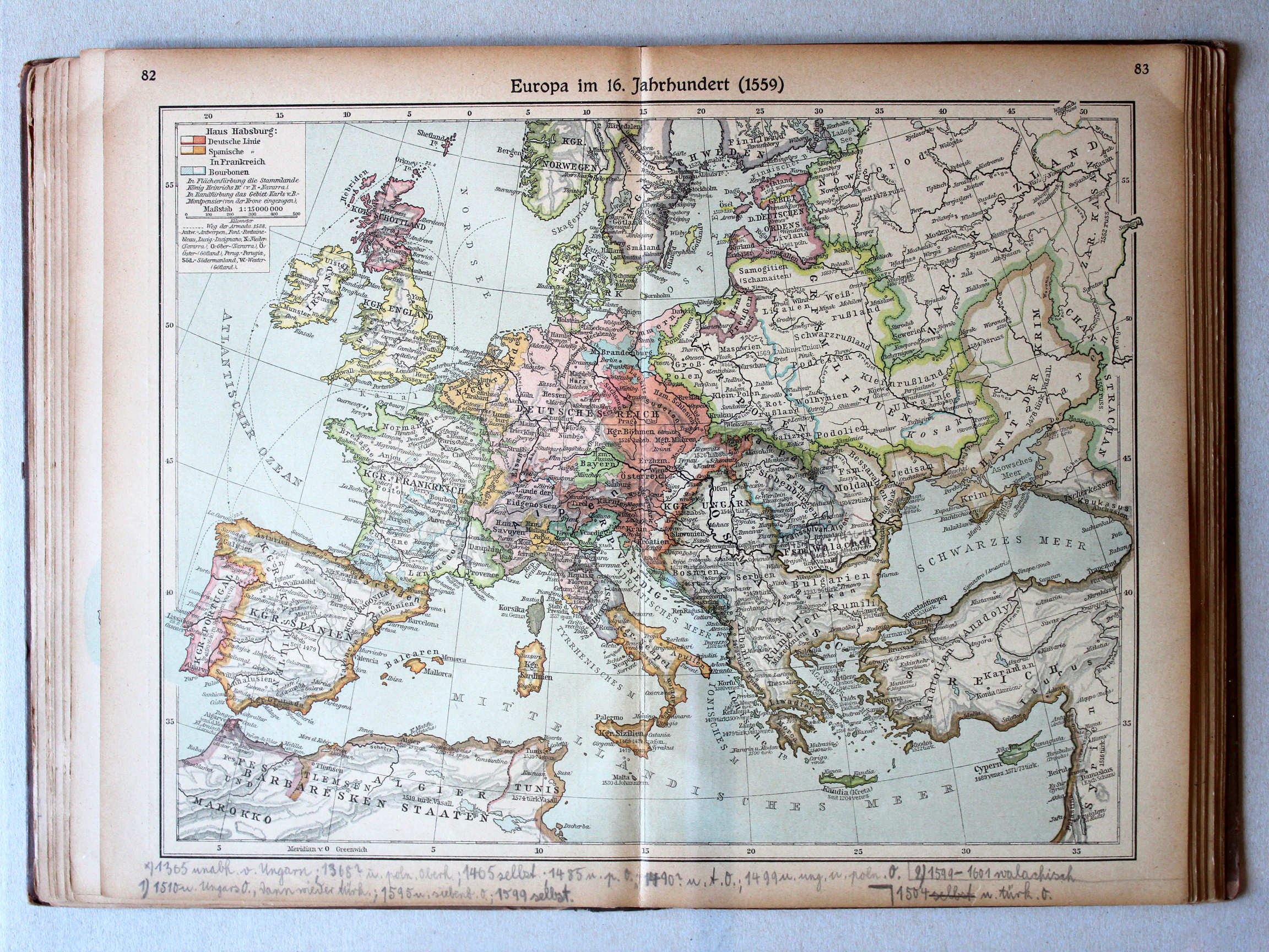
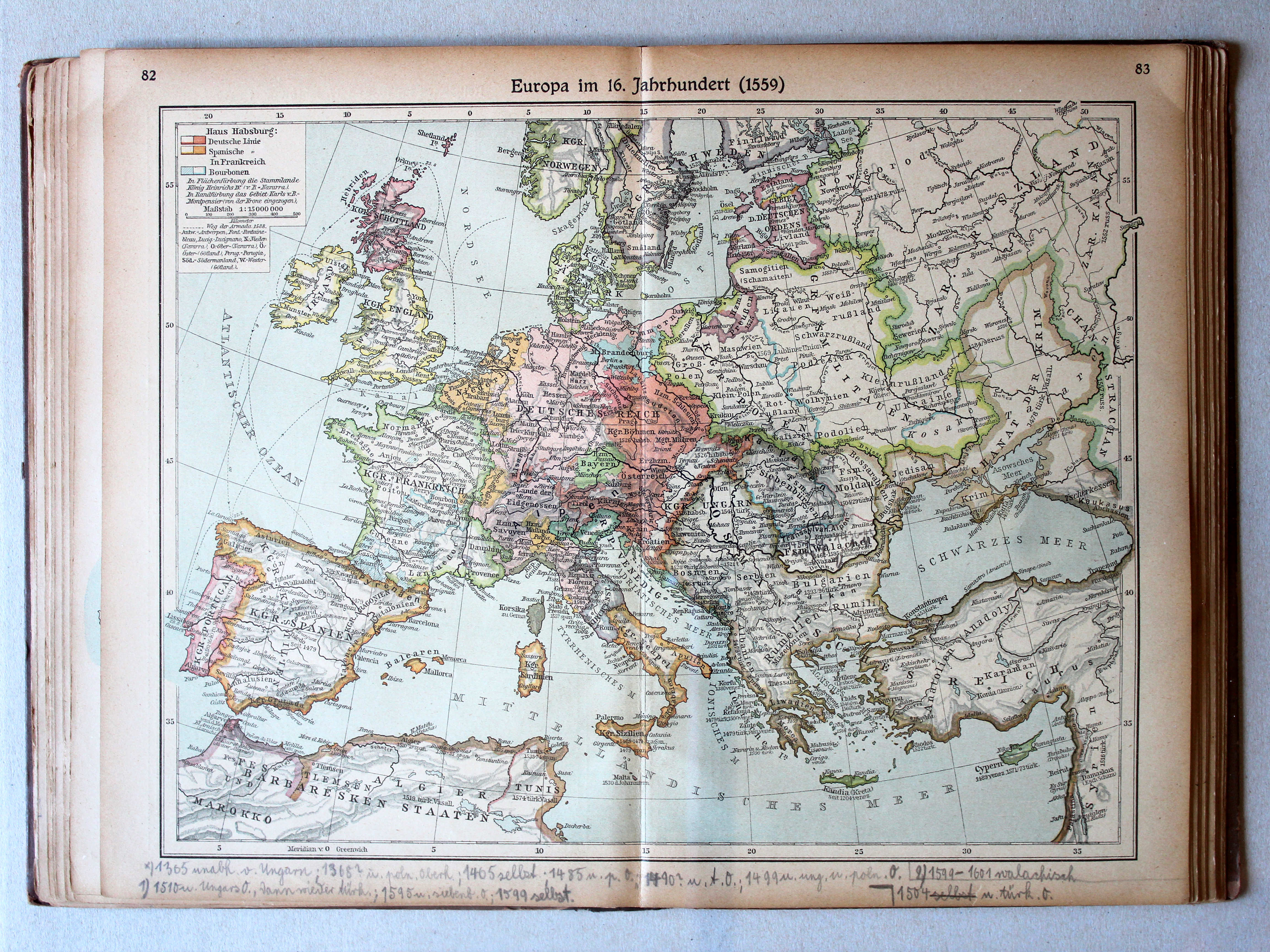
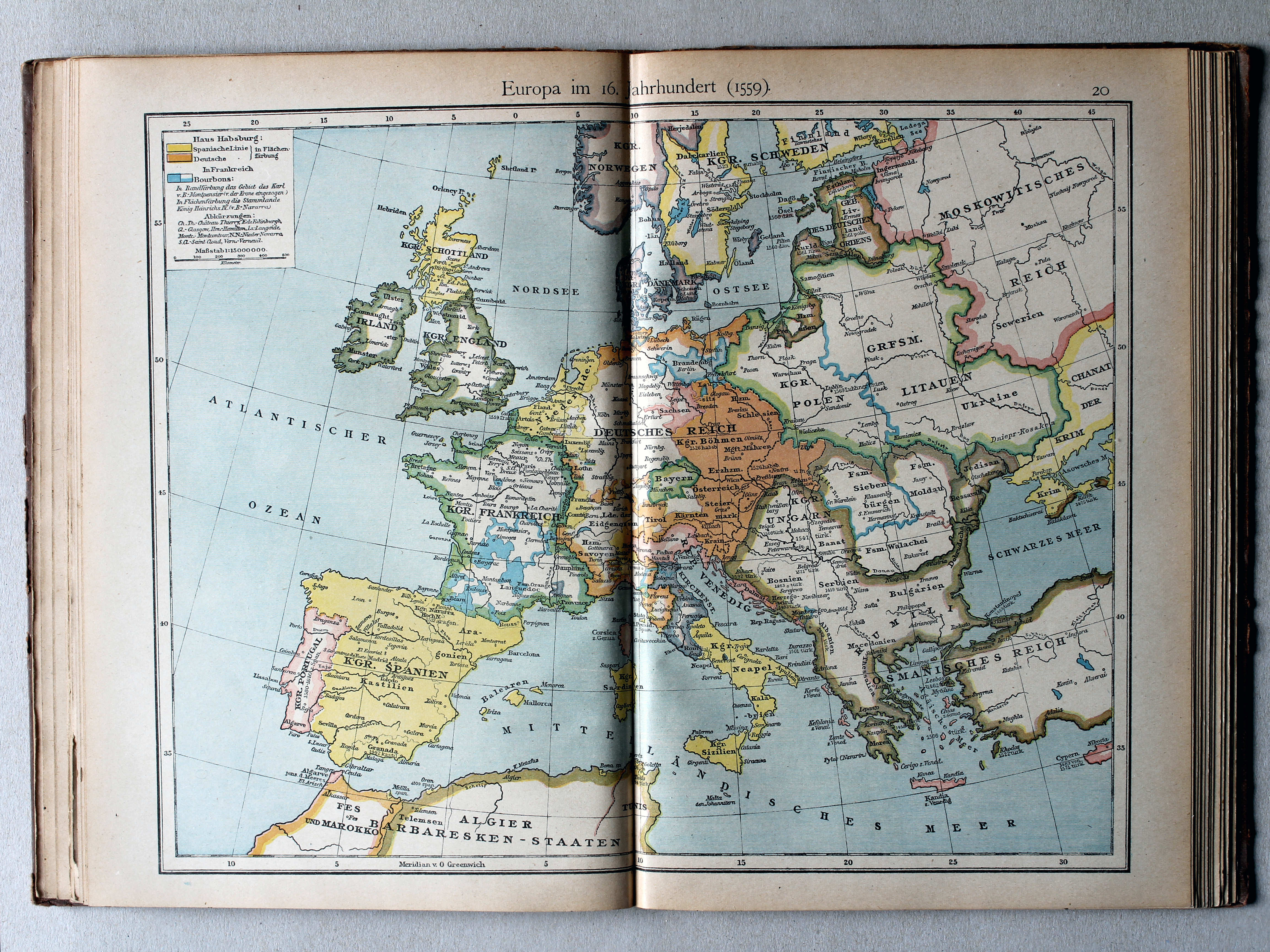
82.83. Europa im 16. Jahrhundert (1559) XL
Europa in de 16e eeuw (1559) / Europe in the 16th century (1559)
 Putzgers Historischer Schul-Atlas, 1922
20. Europa im 16. Jahrhundert (1559) XL
Europa in de 16e eeuw (1559) / Europe in the 16th century (1559)
 Putzgers Historischer Schul-Atlas, Große Ausgabe, 1923
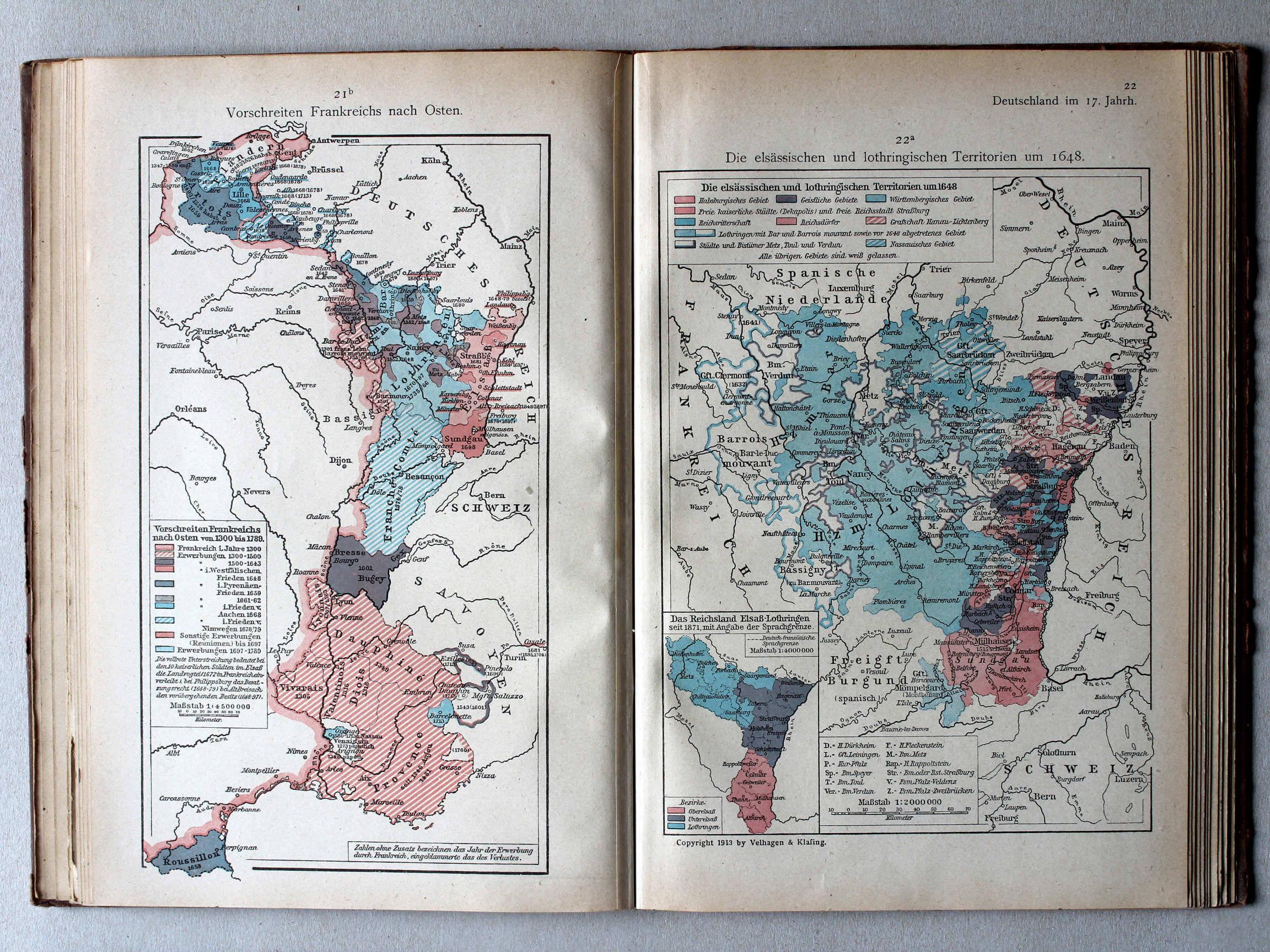
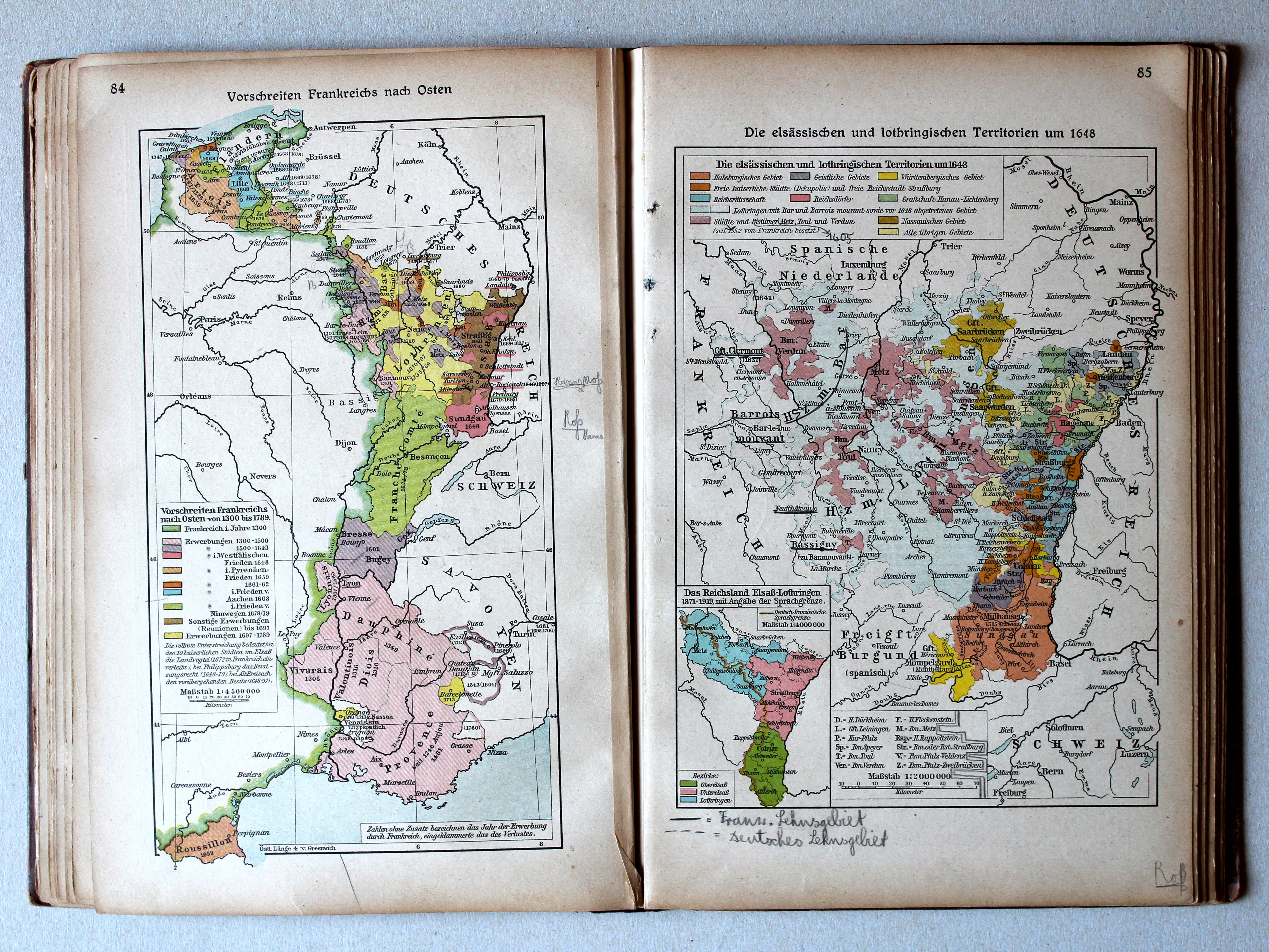
84. Vorschreiten Frankreichs nach Osten von 1300 bis 1789 XL
Uitbreiding van Frankrijk naar het oosten 1300-1789 / Expansion of France towards the east 1300-1789
85. Die elsässischen und lothringischen Territorien um 1648 XL
Elzas-Lotharingen rond 1648 / Alsace-Lorraine around 1648
 Putzgers Historischer Schul-Atlas, 1922
21b. Vorschreiten Frankreiches nach Osten XL
Uitbreiding van Frankrijk naar het oosten / Expansion of France towards the east
22a. Die elsässischen und lothringischen Territorien um 1648 XL
Elzas-Lotharingen rond 1648 / Alsace-Lorraine around 1648
 Putzgers Historischer Schul-Atlas, Große Ausgabe, 1923
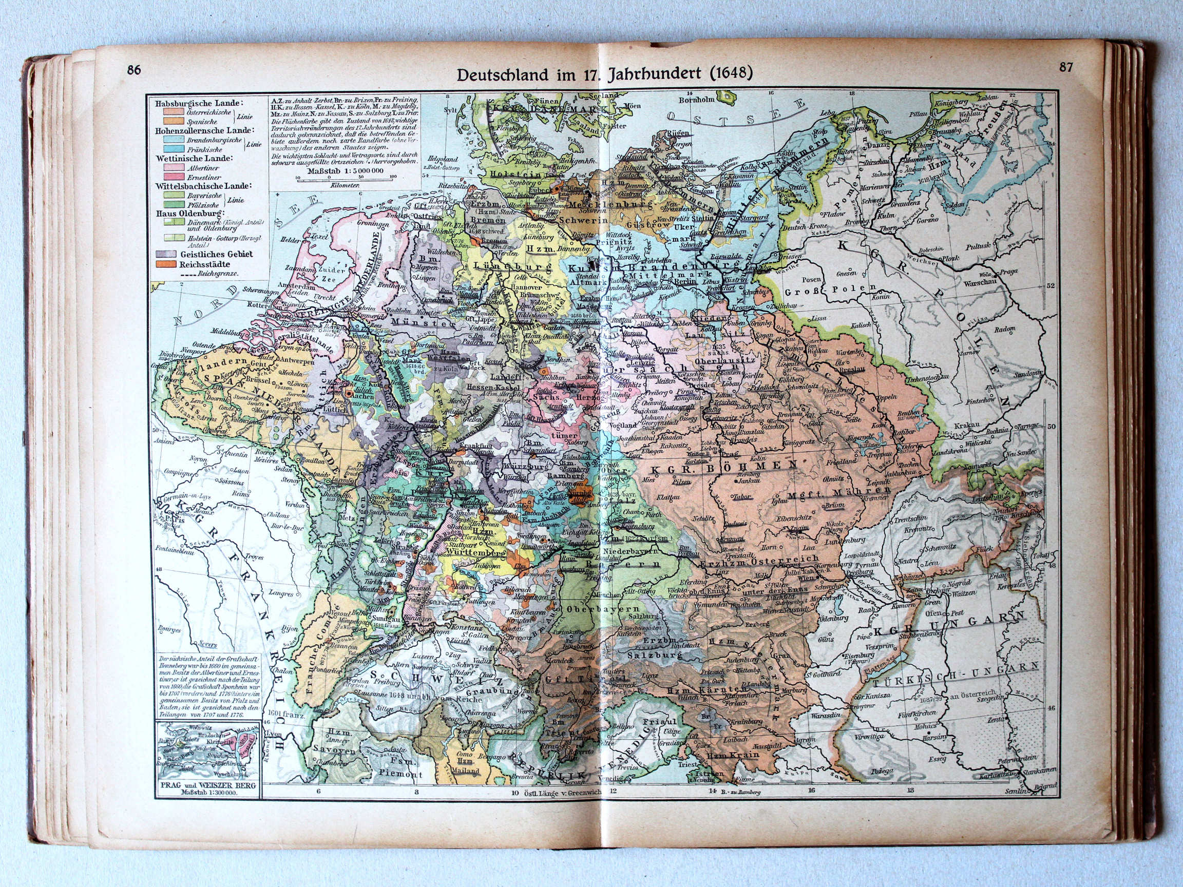
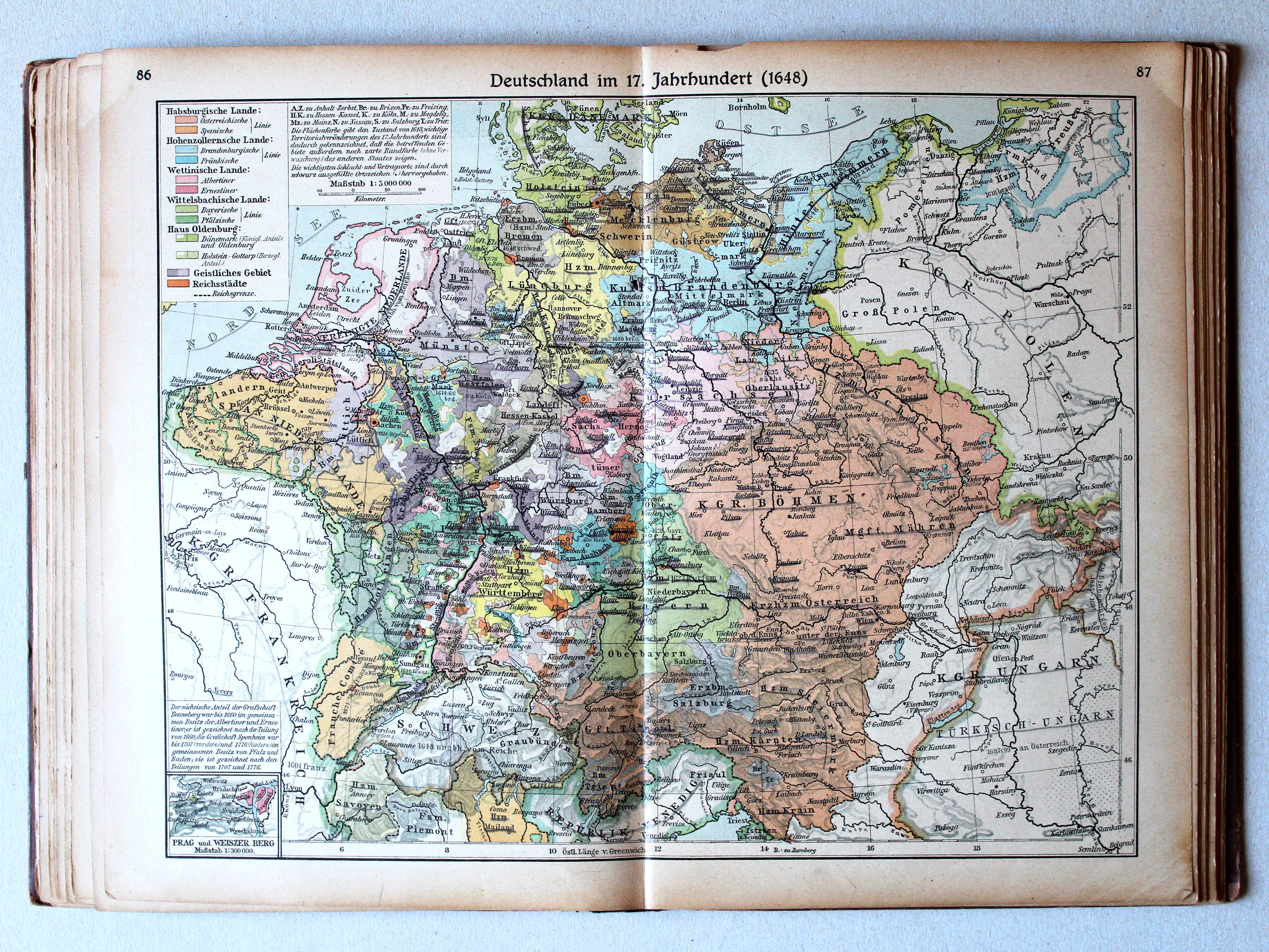
86.87. Deutschland im 17. Jahrhundert (1648) XL
Duitsland in de 17e eeuw (1648) / Germany in the 17th century (1648)
 Putzgers Historischer Schul-Atlas, 1922
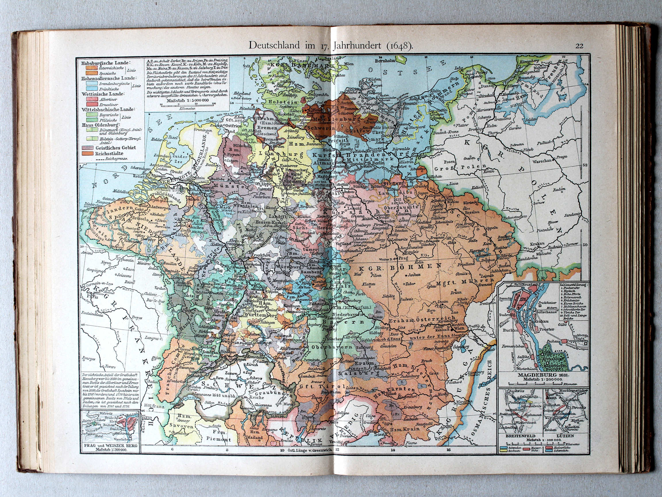
22. Deutschland im 17. Jahrh. (1648) XL
Duitsland in de 17e eeuw (1648) / Germany in the 17th century (1648)
 Putzgers Historischer Schul-Atlas, Große Ausgabe, 1923
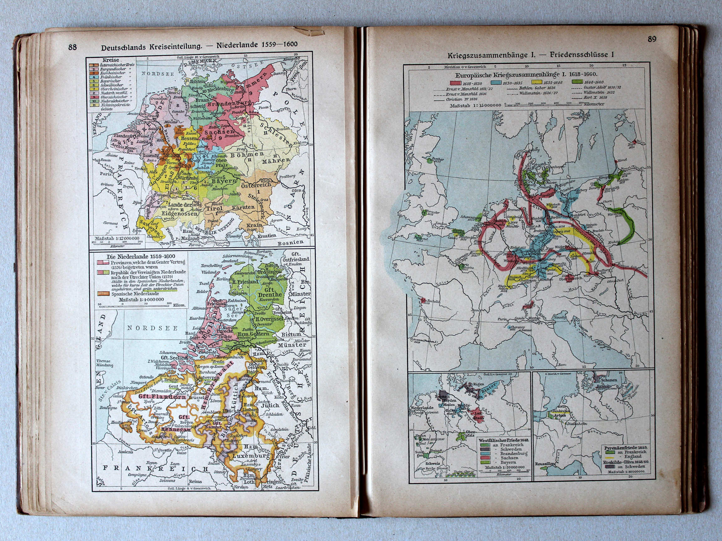
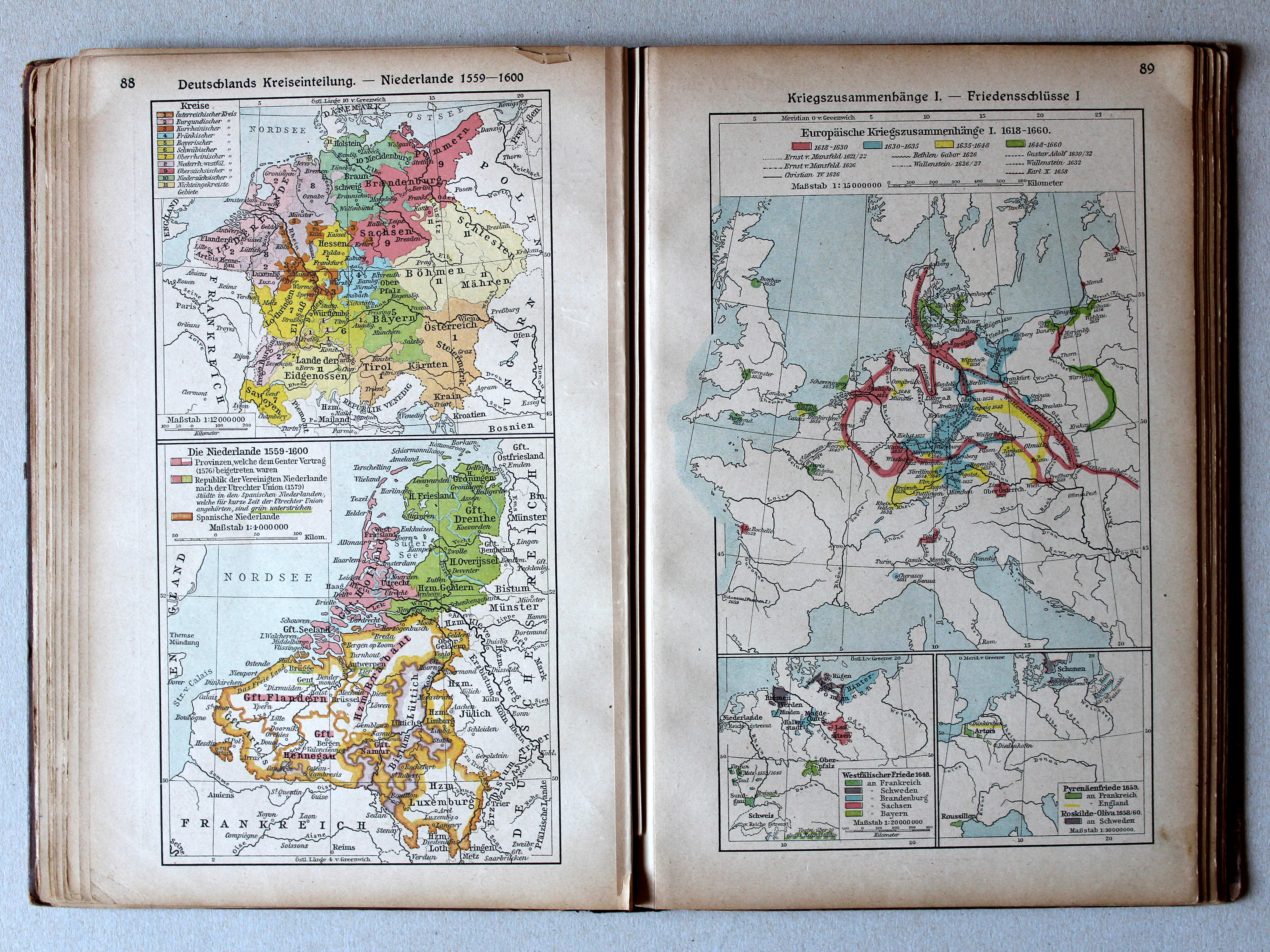
88. Deutschlands Kreiseinteilung – Niederlande 1559-1600 XL
Kreitsen in Duitsland. De Nederlanden 1559-1600 / Imperial Circles in Germany. The Netherlands 1559-1600
89. Kriegszusammenhänge I – Friedensschlüsse I XL
Oorlogen in Europa I. Vredesverdragen I / European wars I. Peace treaties I
Putzgers Historischer Schul-Atlas, 1922
19. Deutschland und Oberitalien im 15. Jahrhundert (1477) (Deutschlands Kreiseinteilung) XL
Duitsland en Noord-Italië in de 15e eeuw (1477) (Kreitsen in Duitsland) / Germany and Northern Italy in the 15th century (1477) (Imperial Circles in Germany)
Putzgers Historischer Schul-Atlas, Große Ausgabe, 1923
88. Deutschlands Kreiseinteilung – Niederlande 1559-1600 XL
Kreitsen in Duitsland. De Nederlanden 1559-1600 / Imperial Circles in Germany. The Netherlands 1559-1600
89. Kriegszusammenhänge I – Friedensschlüsse I XL
Oorlogen in Europa I. Vredesverdragen I / European wars I. Peace treaties I
 Putzgers Historischer Schul-Atlas, 1922
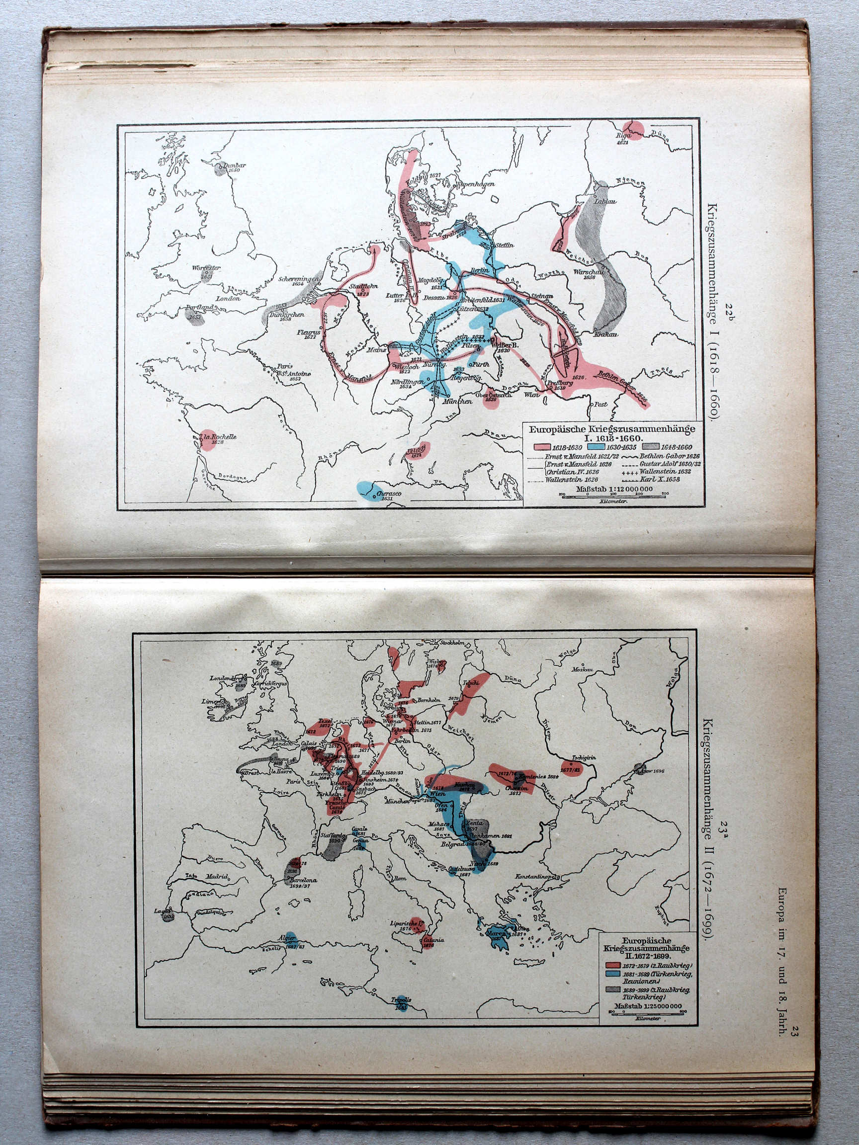
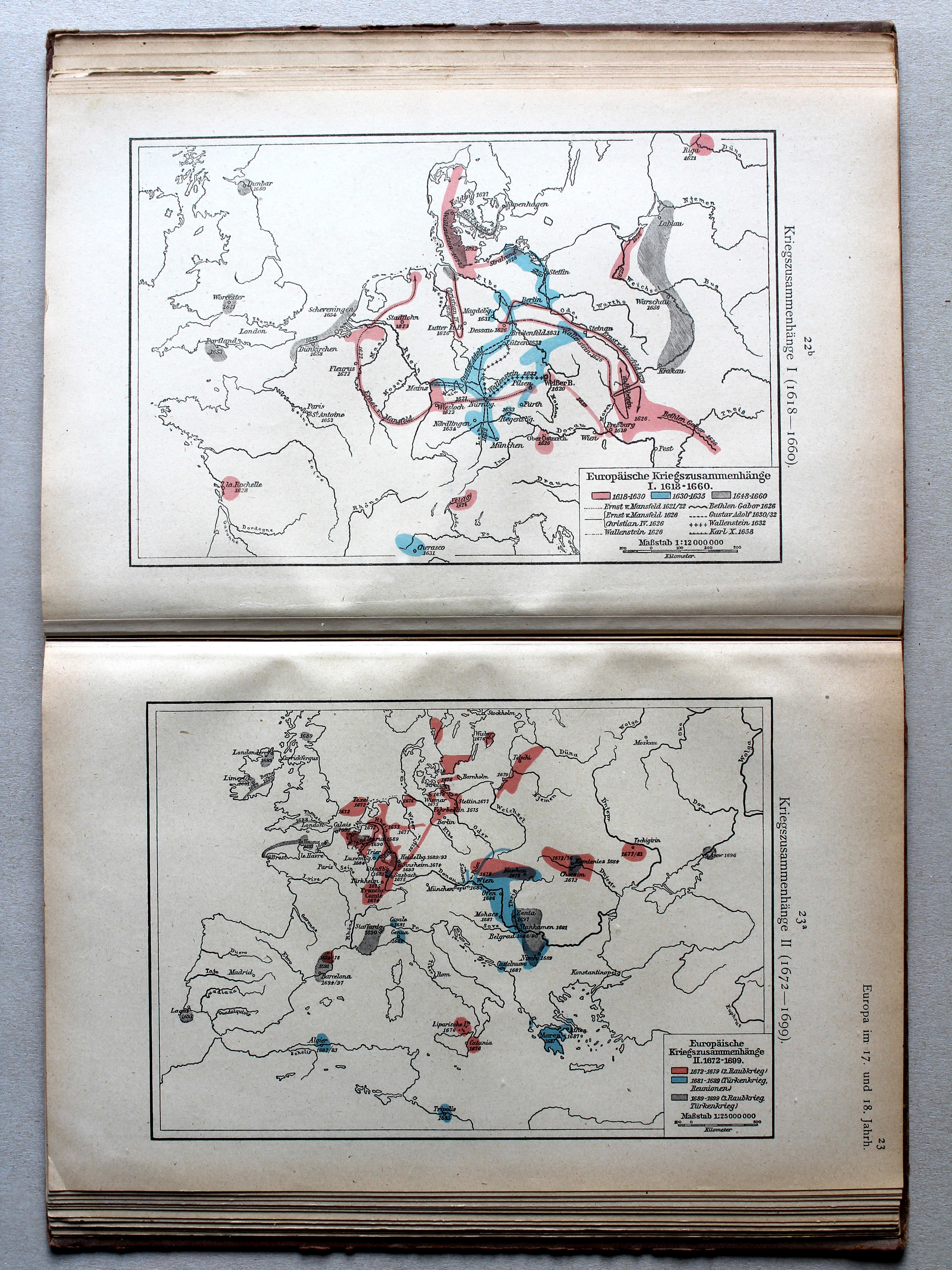
22b. Kriegszusammenhänge I (1618-1660) XL
Oorlogen in Europa I (1618-1660) / European wars I (1618-1660)
23a. Kriegszusammenhänge II (1672-1699) XL
Oorlogen in Europa II (1672-1699) / European wars II (1672-1699)
Putzgers Historischer Schul-Atlas, Große Ausgabe, 1923
88. Deutschlands Kreiseinteilung – Niederlande 1559-1600 XL
Kreitsen in Duitsland. De Nederlanden 1559-1600 / Imperial Circles in Germany. The Netherlands 1559-1600
89. Kriegszusammenhänge I – Friedensschlüsse I XL
Oorlogen in Europa I. Vredesverdragen I / European wars I. Peace treaties I
 Putzgers Historischer Schul-Atlas, 1922
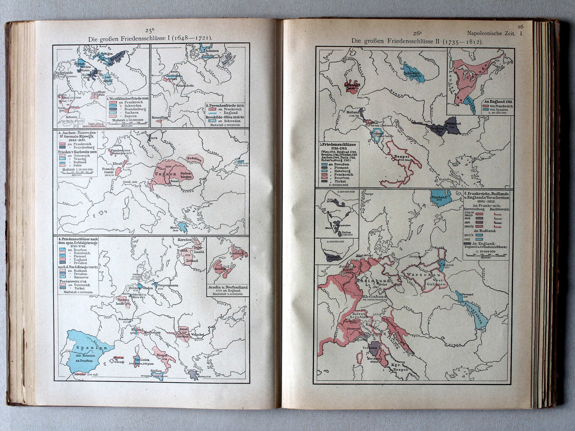
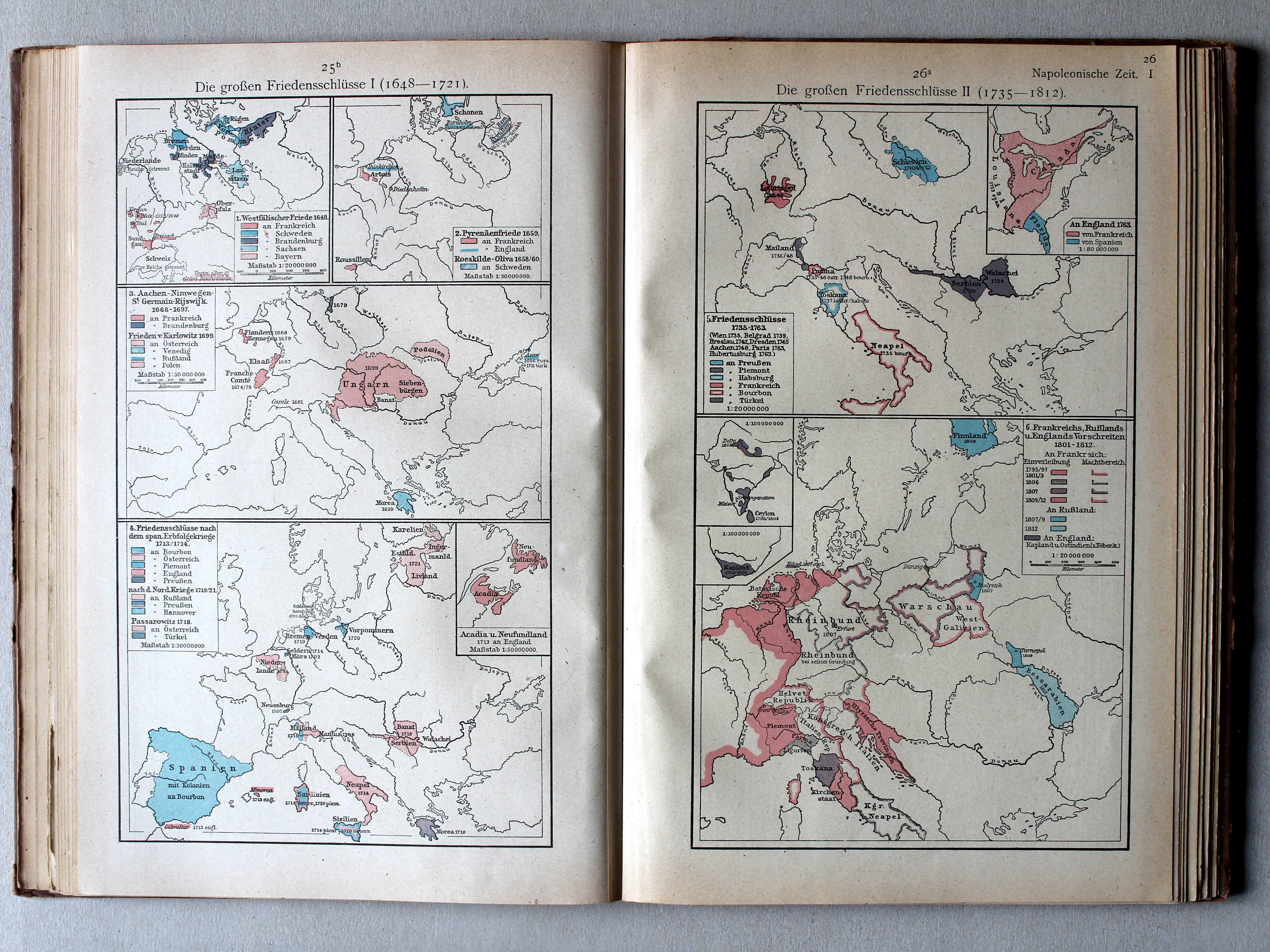
25b. Die großen Friedensschlüsse I (1648-1721) XL
De belangrijkste vredesverdragen I (1648-1721) / The main peace treaties I (1648-1721)
26a. Die großen Friedensschlüsse II (1735-1812) XL
De belangrijkste vredesverdragen II (1735-1812) / The main peace treaties II (1735-1812)
 Putzgers Historischer Schul-Atlas, Große Ausgabe, 1923
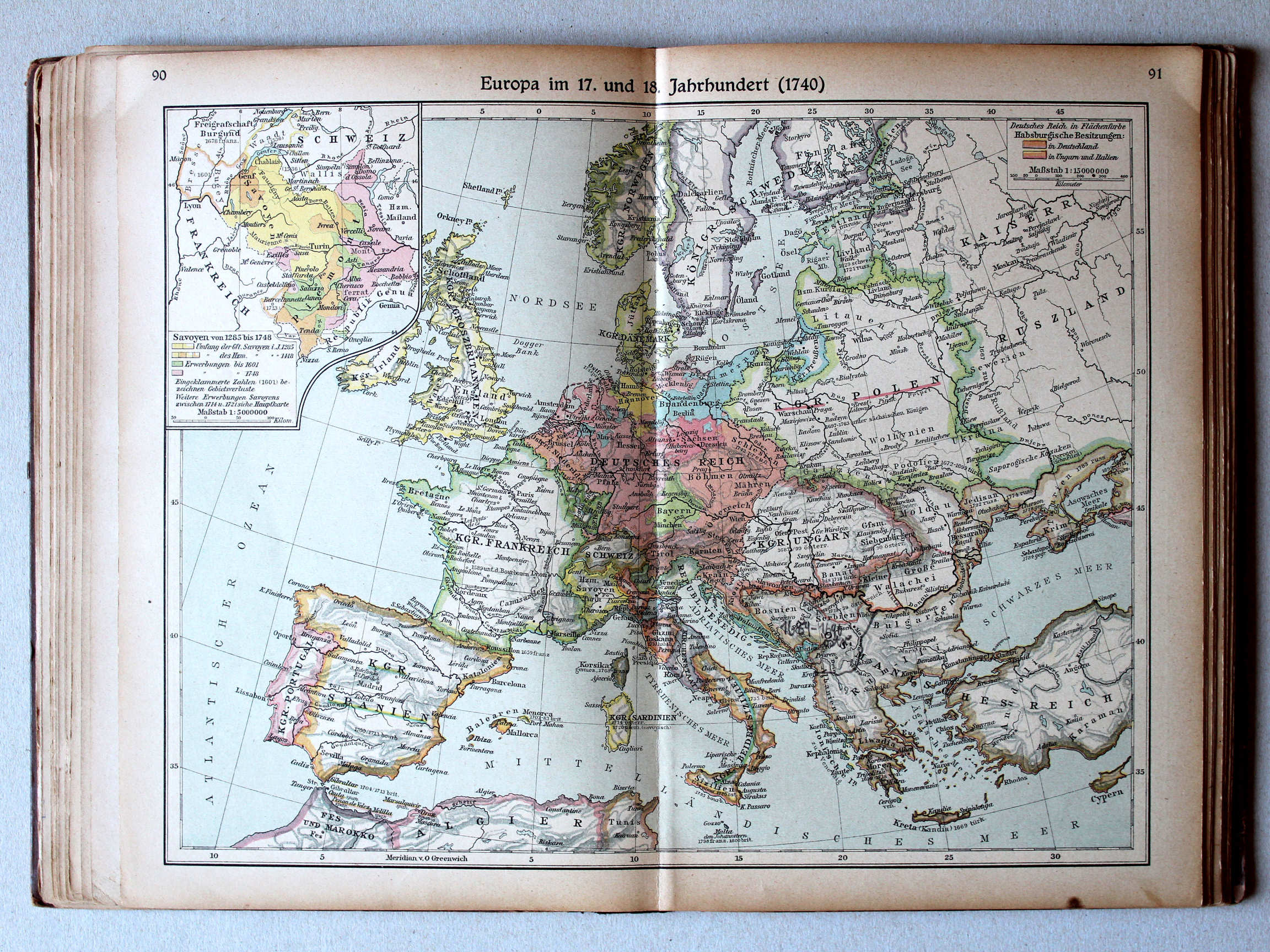
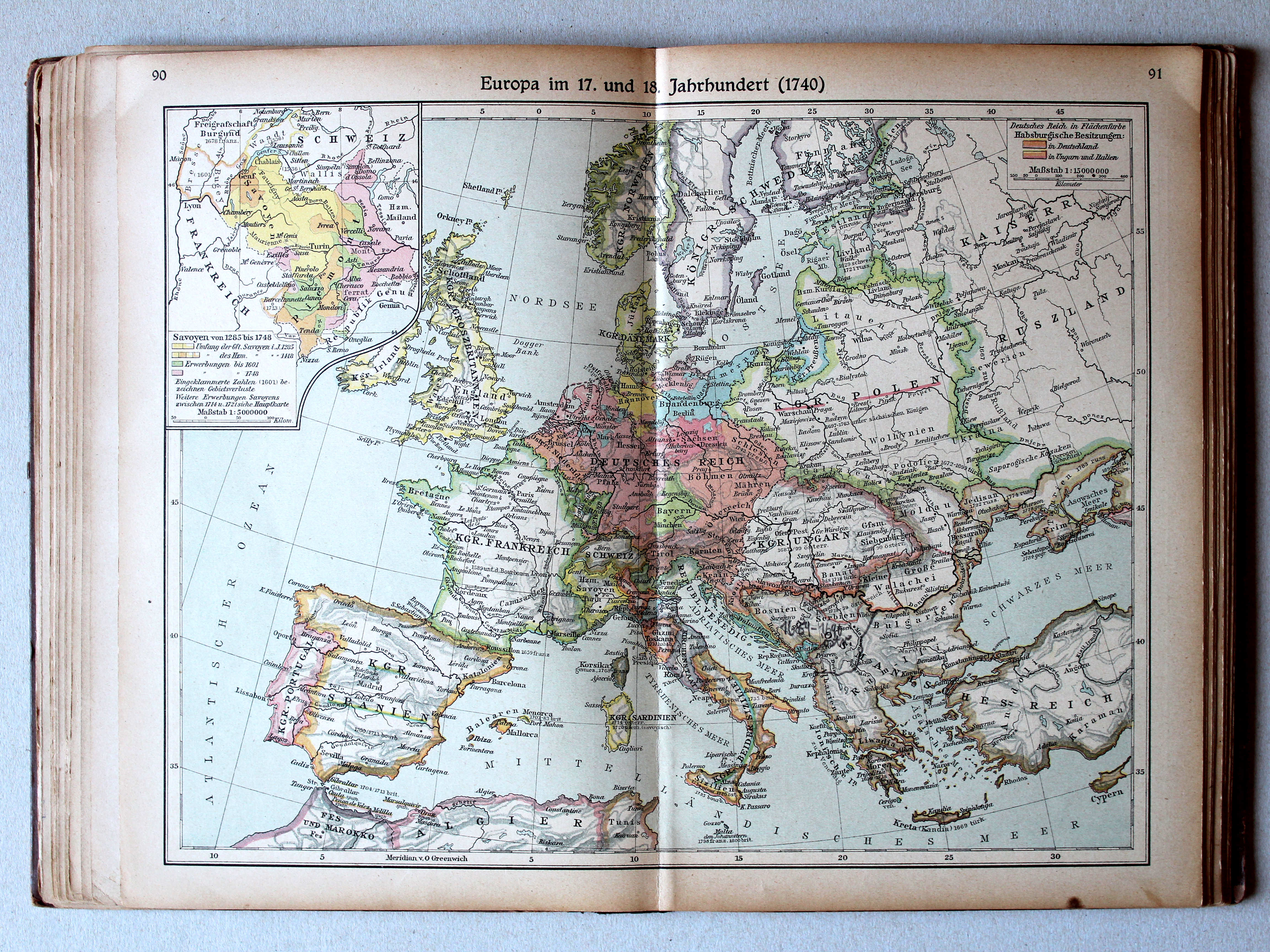
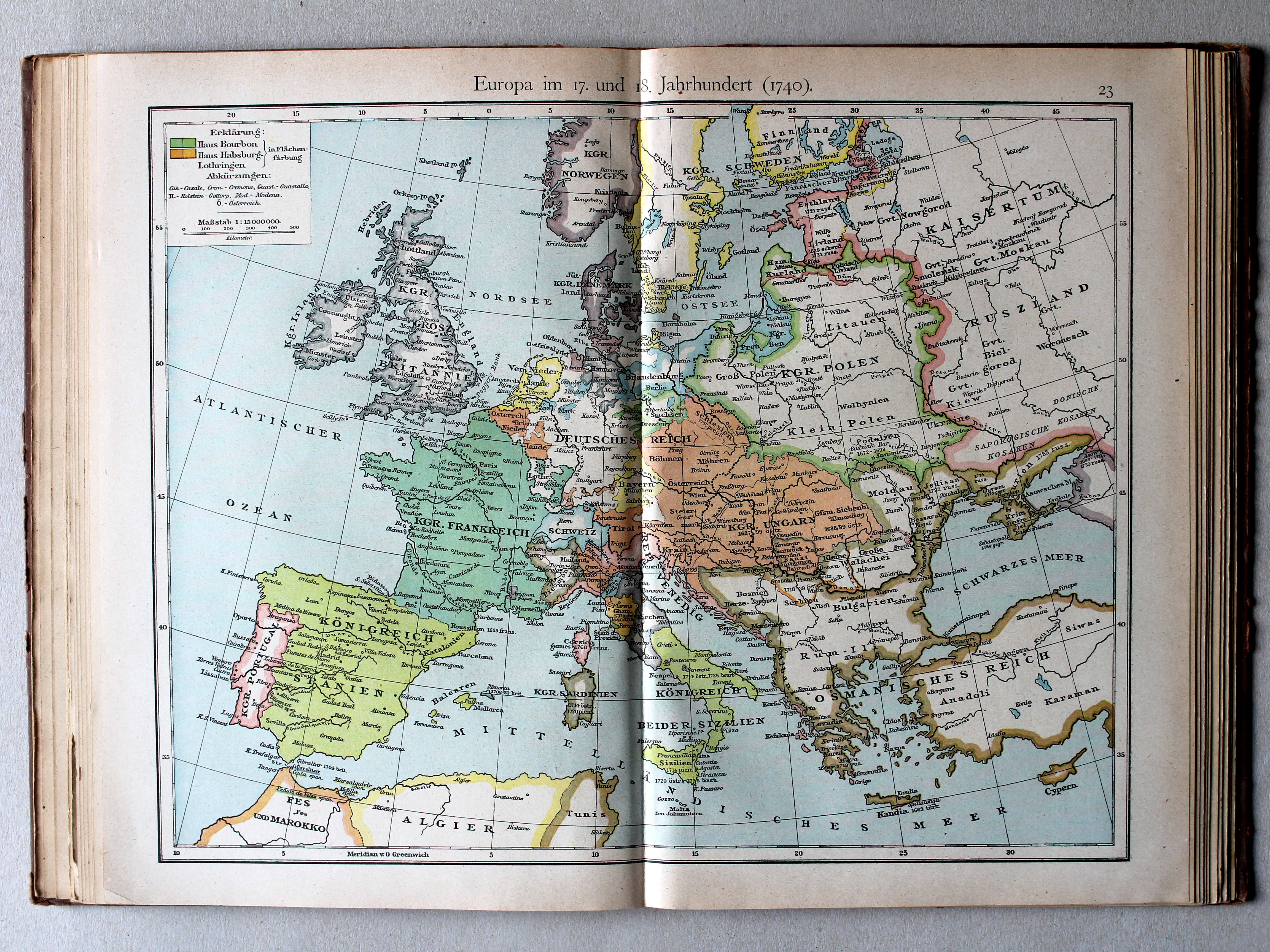
90.91. Europa im 17. und 18. Jahrhundert (1740) XL
Europa in de 17e en 18e eeuw (1740) / Europe in the 17th and 18th centuries (1740)
 Putzgers Historischer Schul-Atlas, 1922
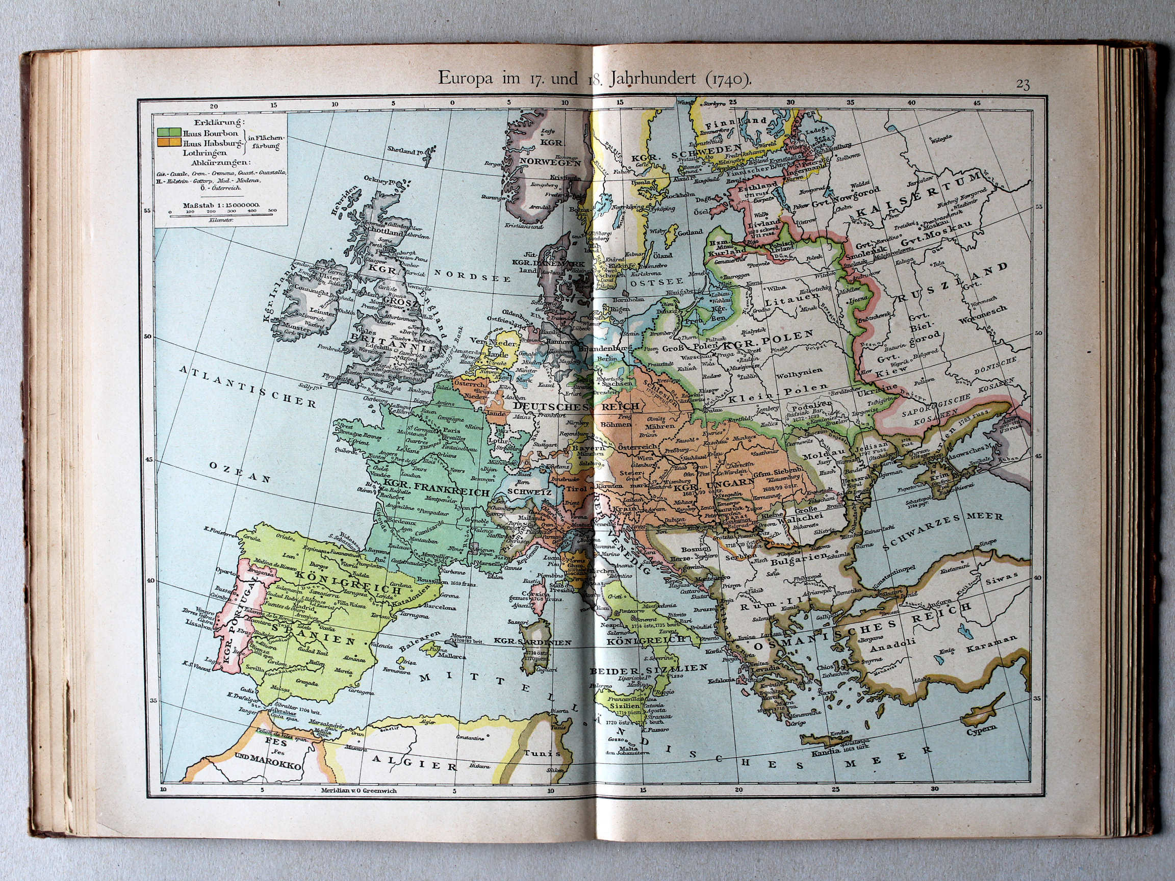
23. Europa im 17. und 18. Jahrhundert (1740) XL
Europa in de 17e en 18e eeuw (1740) / Europe in the 17th and 18th century (1740)
 Putzgers Historischer Schul-Atlas, Große Ausgabe, 1923
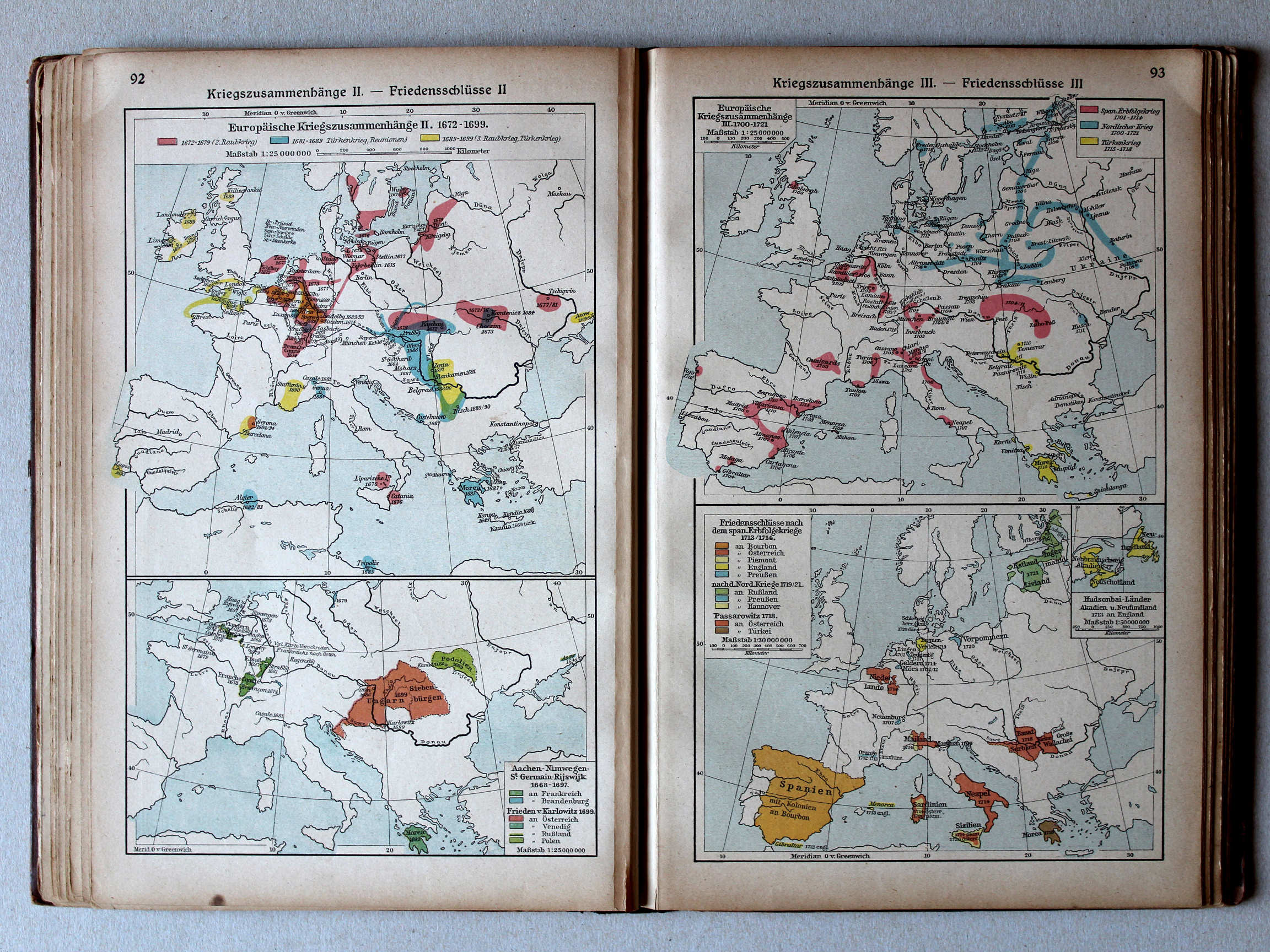
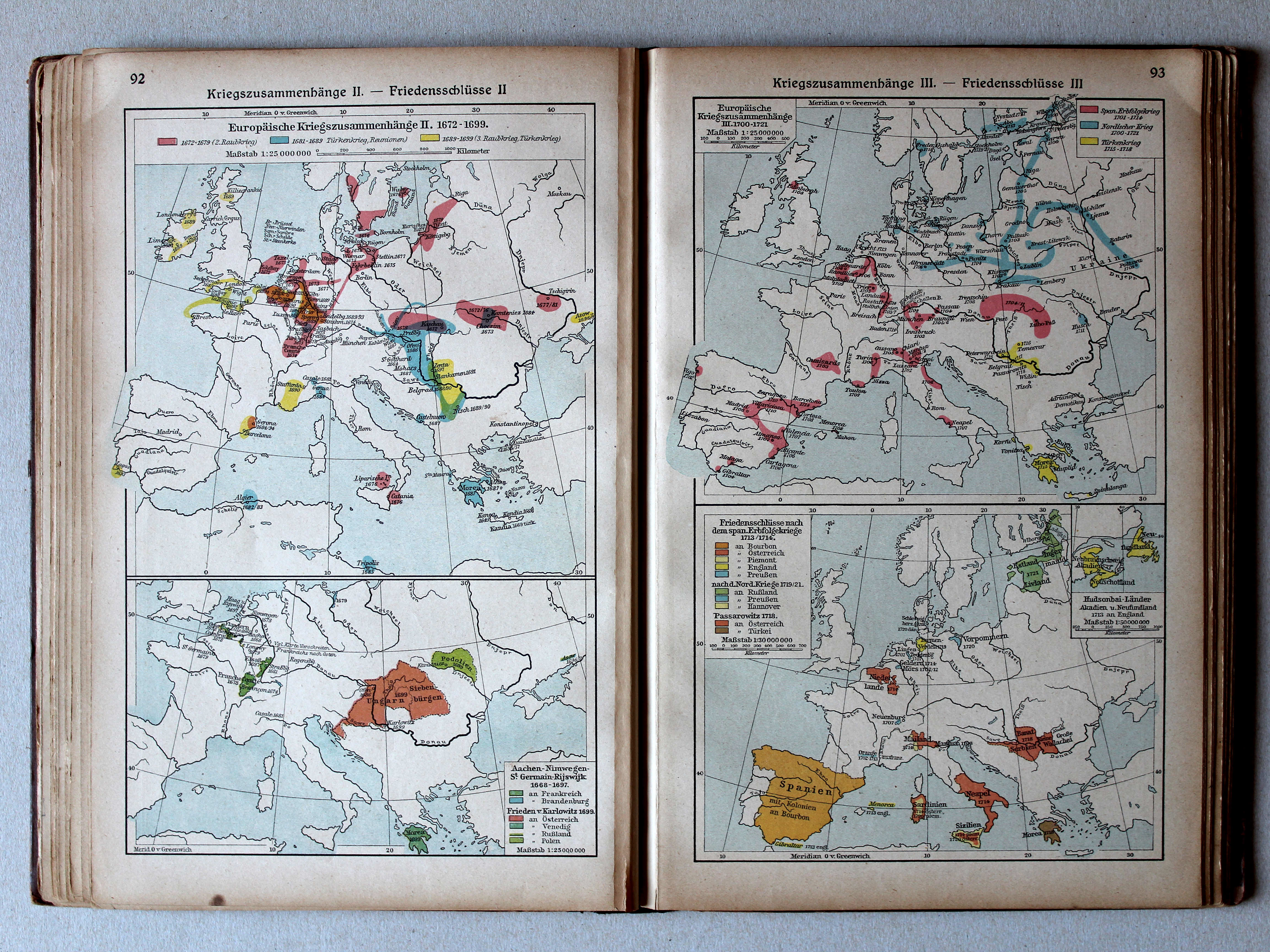
92. Kriegszusammenhänge II – Friedensschlüsse II XL
Oorlogen in Europa II. Vredesverdragen II / European wars II. Peace treaties II
93. Kriegszusammenhänge III – Friedensschlüsse III XL
Oorlogen in Europa III. Vredesverdragen III / European wars III. Peace treaties III
Putzgers Historischer Schul-Atlas, 1922
22b. Kriegszusammenhänge I (1618-1660) XL
Oorlogen in Europa I (1618-1660) / European wars I (1618-1660)
23a. Kriegszusammenhänge II (1672-1699) XL
Oorlogen in Europa II (1672-1699) / European wars II (1672-1699)
Putzgers Historischer Schul-Atlas, Große Ausgabe, 1923
92. Kriegszusammenhänge II – Friedensschlüsse II XL
Oorlogen in Europa II. Vredesverdragen II / European wars II. Peace treaties II
93. Kriegszusammenhänge III – Friedensschlüsse III XL
Oorlogen in Europa III. Vredesverdragen III / European wars III. Peace treaties III
Putzgers Historischer Schul-Atlas, 1922
25b. Die großen Friedensschlüsse I (1648-1721) (3. 1668-1679, 4. 1713/1714) XL
De belangrijkste vredesverdragen I (1648-1721) (3. 1668-1679, 4. 1713/1714) / The main peace treaties I (1648-1721) (3. 1668-1679, 4. 1713/1714)
26a. Die großen Friedensschlüsse II (1735-1812) XL
De belangrijkste vredesverdragen II (1735-1812) / The main peace treaties II (1735-1812)
Putzgers Historischer Schul-Atlas, Große Ausgabe, 1923
92. Kriegszusammenhänge II – Friedensschlüsse II XL
Oorlogen in Europa II. Vredesverdragen II / European wars II. Peace treaties II
93. Kriegszusammenhänge III – Friedensschlüsse III XL
Oorlogen in Europa III. Vredesverdragen III / European wars III. Peace treaties III
 Putzgers Historischer Schul-Atlas, 1922
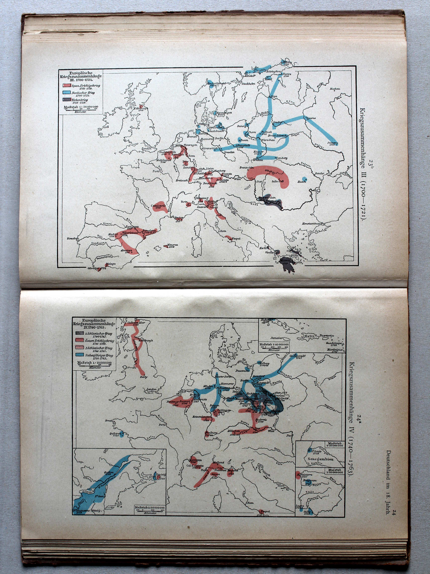
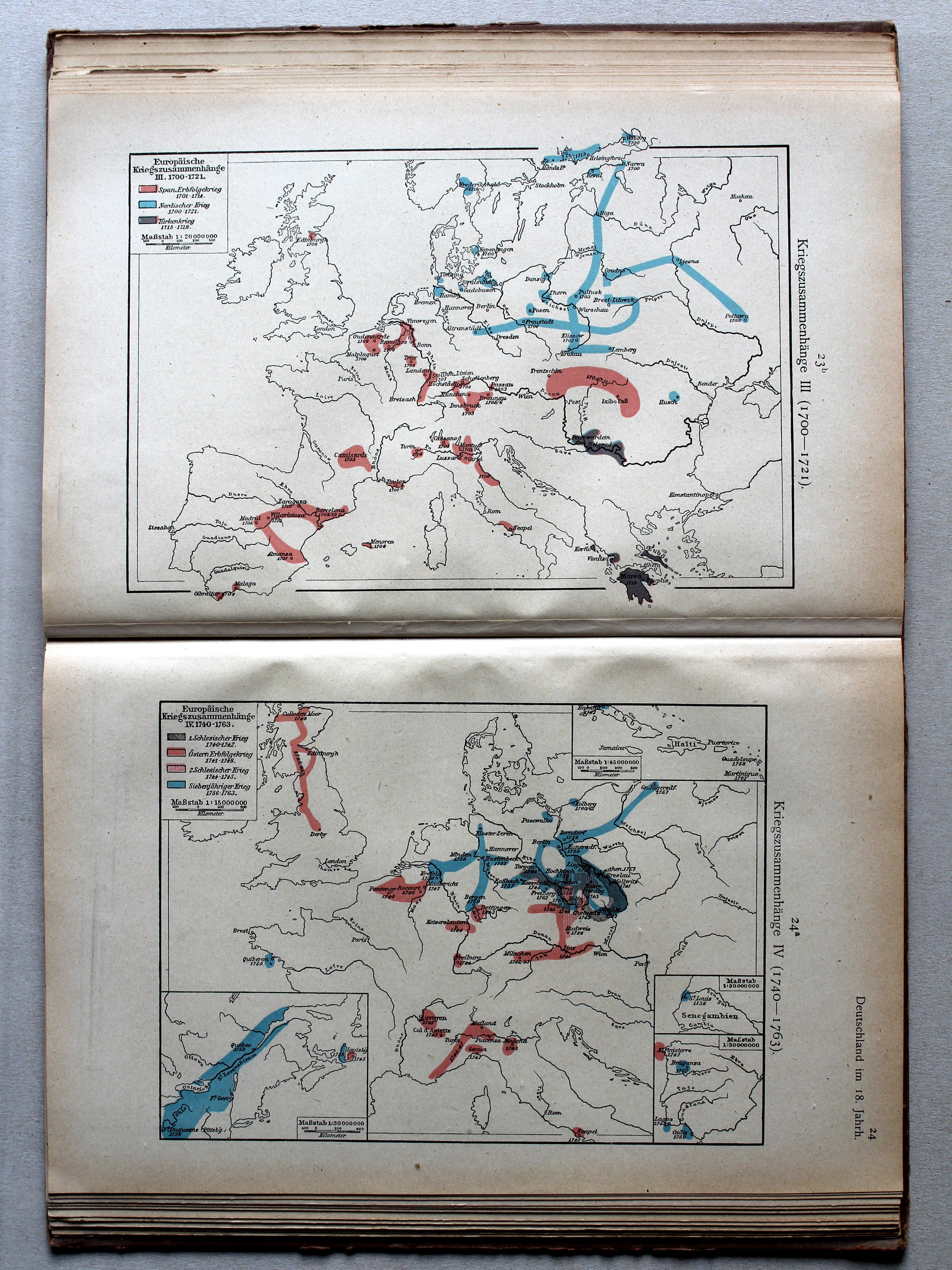
23b. Kriegszusammenhänge III (1700-1721) XL
Oorlogen in Europa III (1700-1721) / European wars III (1700-1721)
24a. Kriegszusammenhänge IV (1740-1763) XL
Oorlogen in Europa IV (1740-1763) / European wars IV (1740-1763)
 Putzgers Historischer Schul-Atlas, Große Ausgabe, 1923
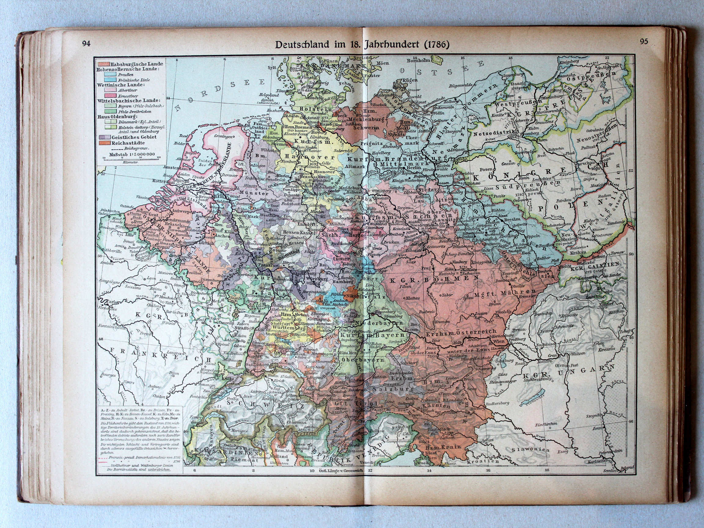
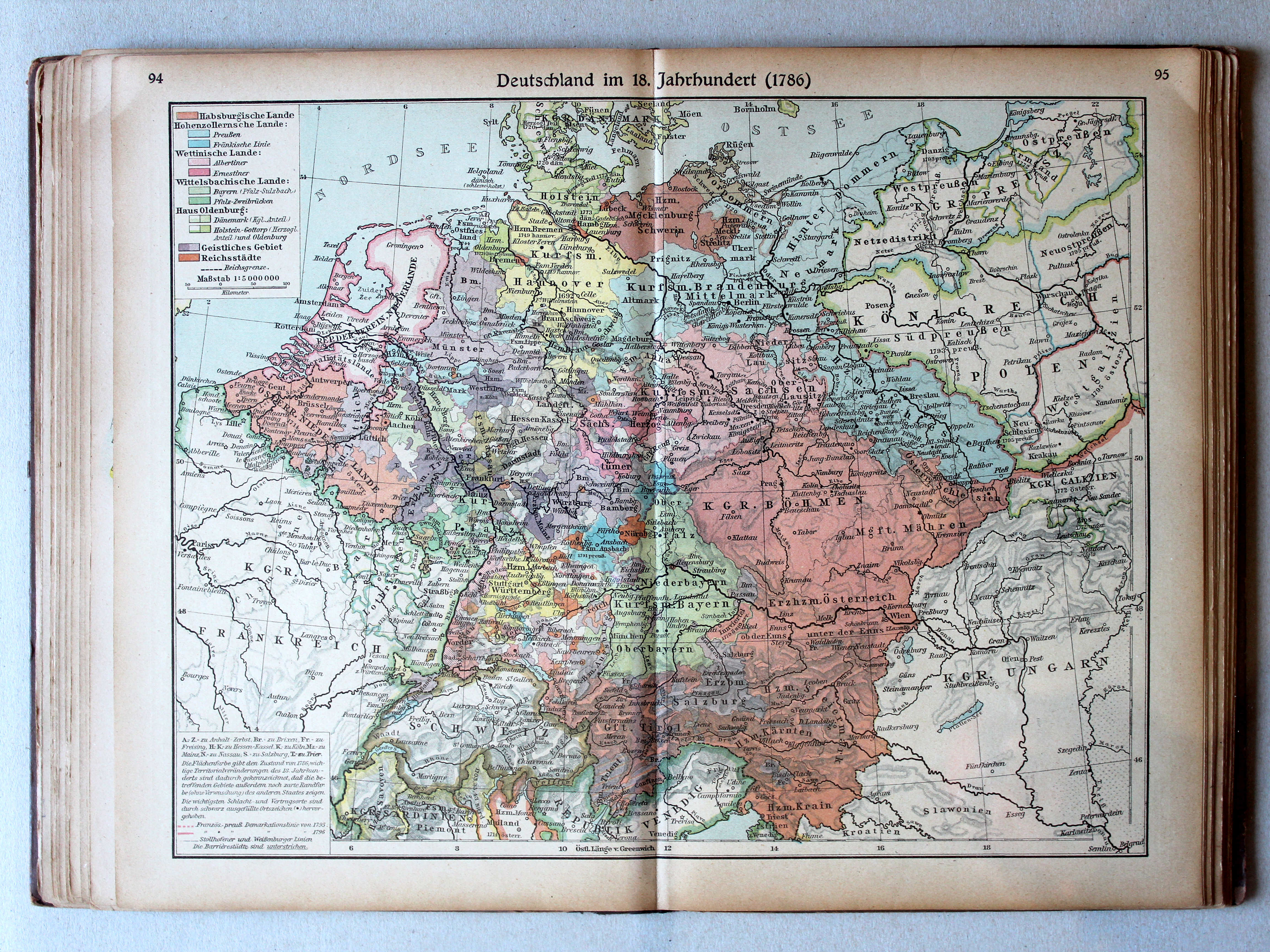
94.95. Deutschland im 18. Jahrhundert (1786) XL
Duitsland in de 18e eeuw (1786) / Germany in the 18th century (1786)
 Putzgers Historischer Schul-Atlas, 1922
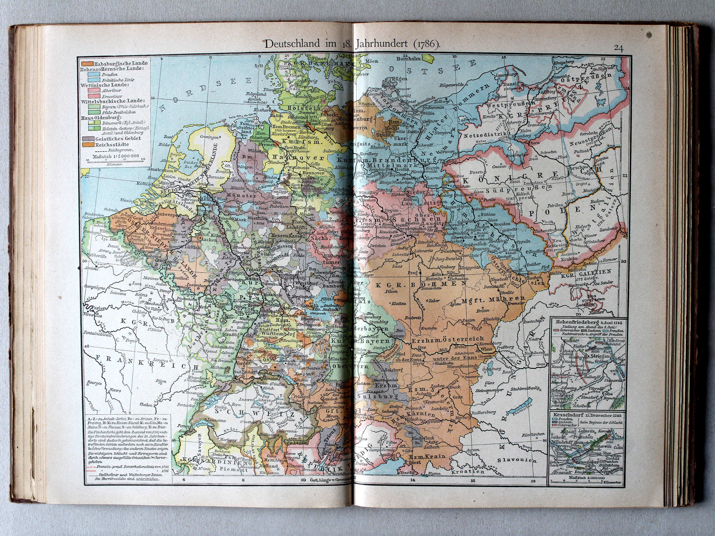
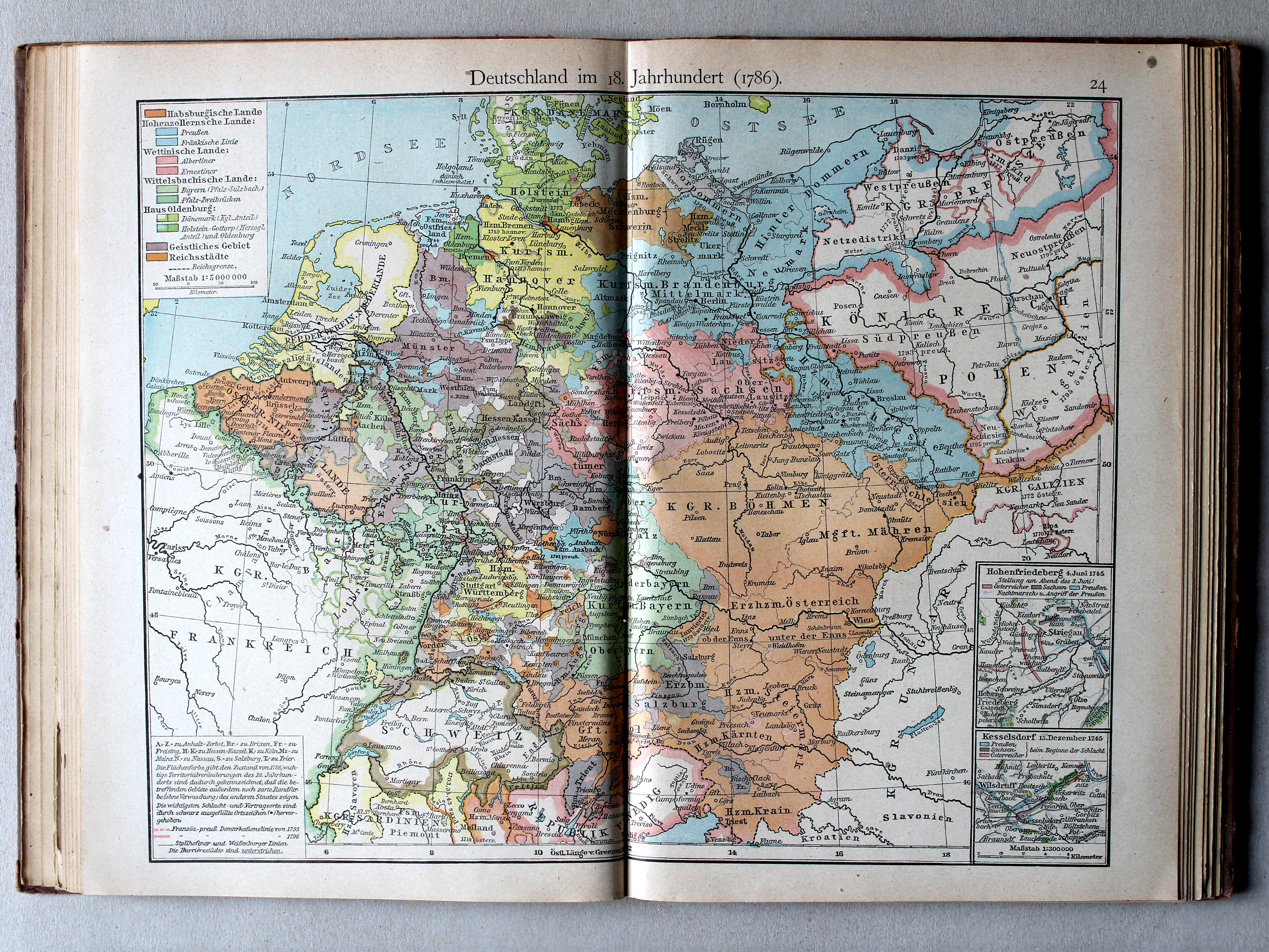
24. Deutschland im 18. Jahrhundert (1786) XL
Duitsland in de 18e eeuw (1786) / Germany in the 18th century (1786)
 Putzgers Historischer Schul-Atlas, Große Ausgabe, 1923
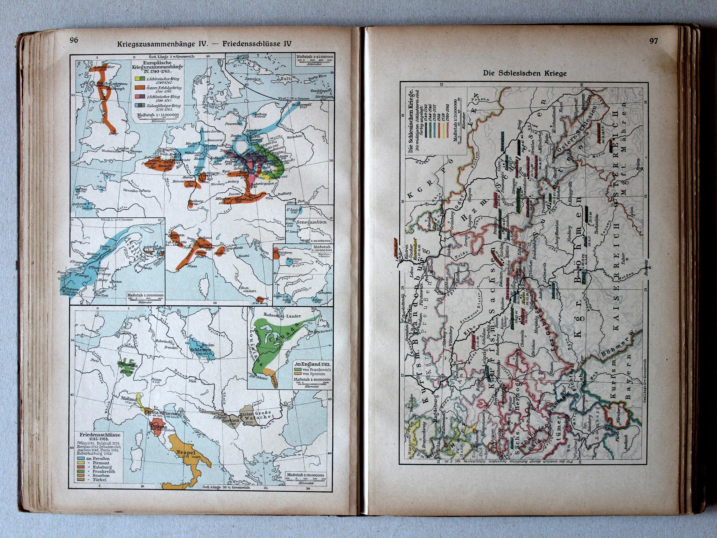
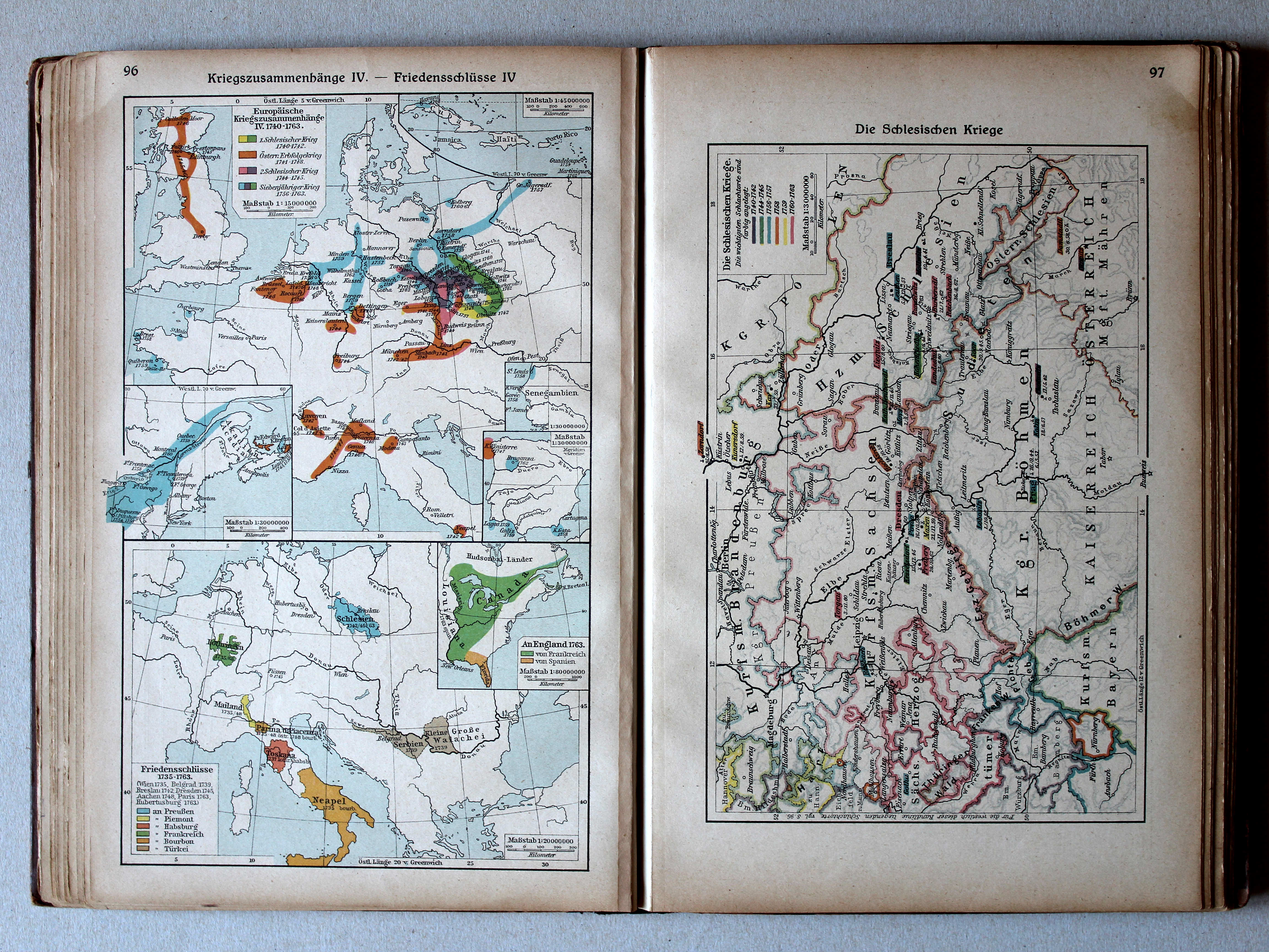
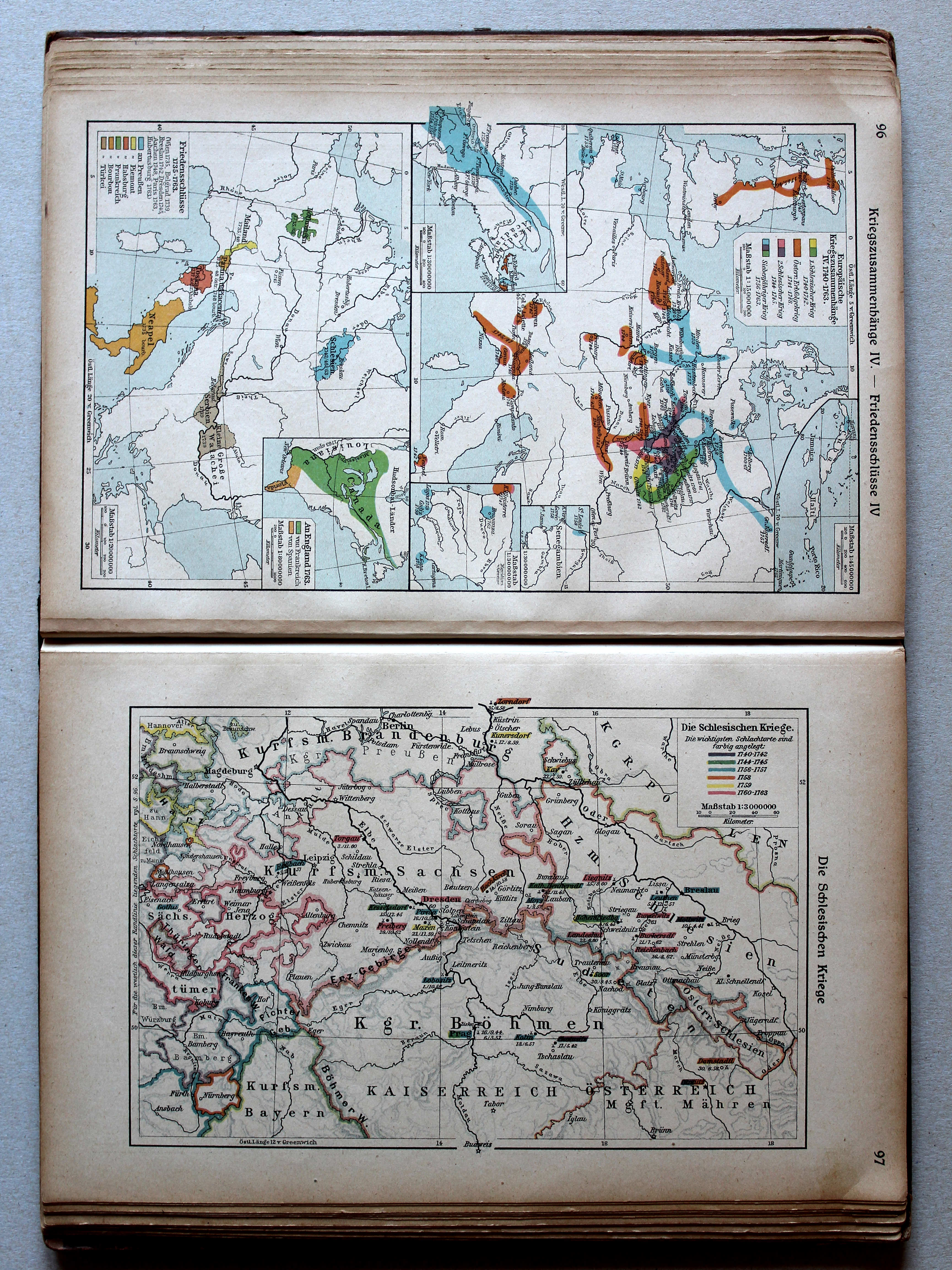
96. Kriegszusammenhänge IV – Friedensschlüsse IV XL
Oorlogen in Europa IV. Vredesverdragen IV / European wars IV. Peace treaties IV
Putzgers Historischer Schul-Atlas, 1922
23b. Kriegszusammenhänge III (1700-1721) XL
Oorlogen in Europa III (1700-1721) / European wars III (1700-1721)
24a. Kriegszusammenhänge IV (1740-1763) XL
Oorlogen in Europa IV (1740-1763) / European wars IV (1740-1763)
Putzgers Historischer Schul-Atlas, Große Ausgabe, 1923
96. Kriegszusammenhänge IV – Friedensschlüsse IV XL
Oorlogen in Europa IV. Vredesverdragen IV / European wars IV. Peace treaties IV
Putzgers Historischer Schul-Atlas, 1922
25b. Die großen Friedensschlüsse I (1648-1721) XL
De belangrijkste vredesverdragen I (1648-1721) / The main peace treaties I (1648-1721)
26a. Die großen Friedensschlüsse II (1735-1812) XL
De belangrijkste vredesverdragen II (1735-1812) / The main peace treaties II (1735-1812)
 Putzgers Historischer Schul-Atlas, Große Ausgabe, 1923
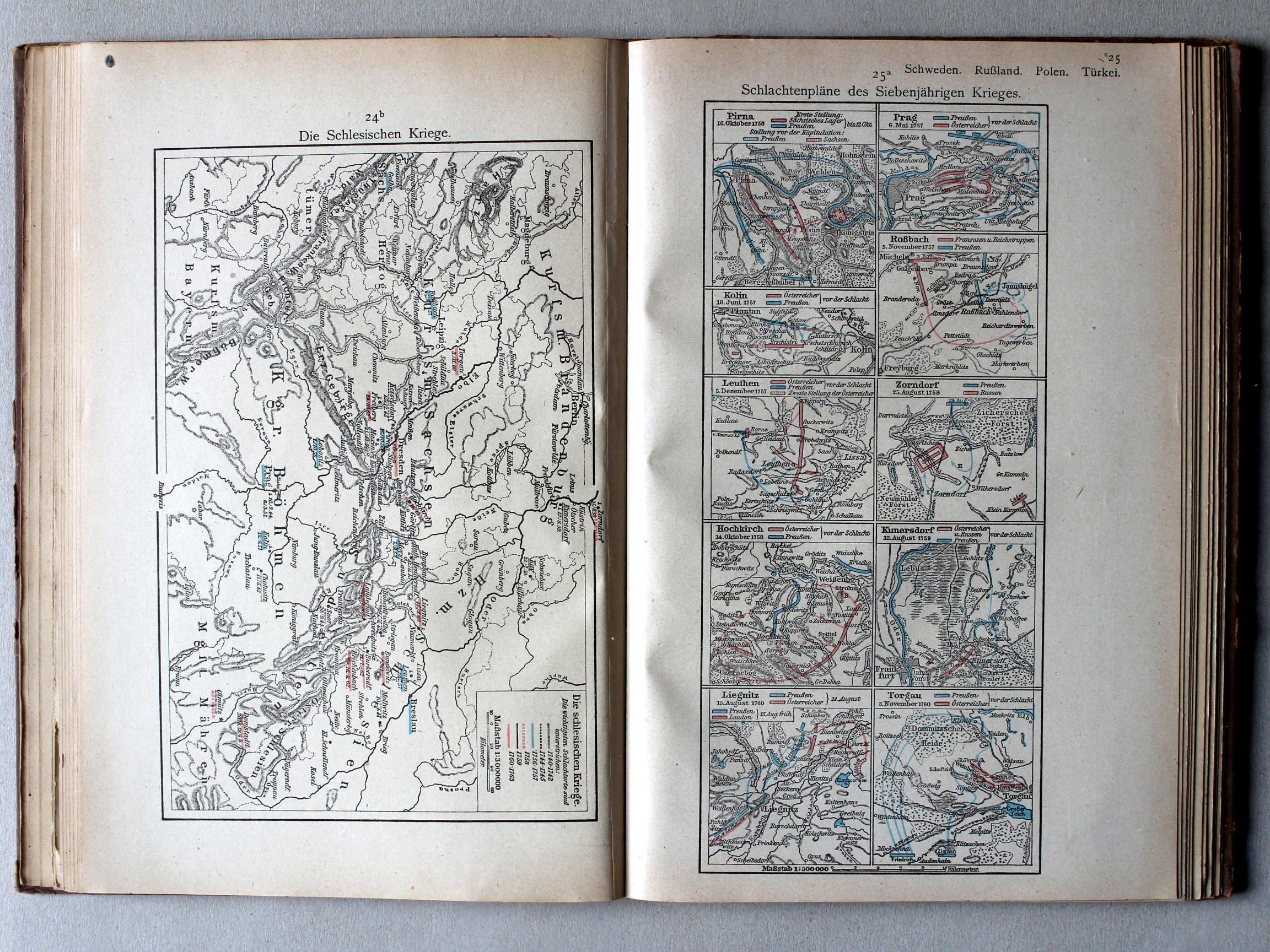
97. Die Schlesischen Kriege XL
De Silezische Oorlogen / The Silesian Wars
 Putzgers Historischer Schul-Atlas, 1922
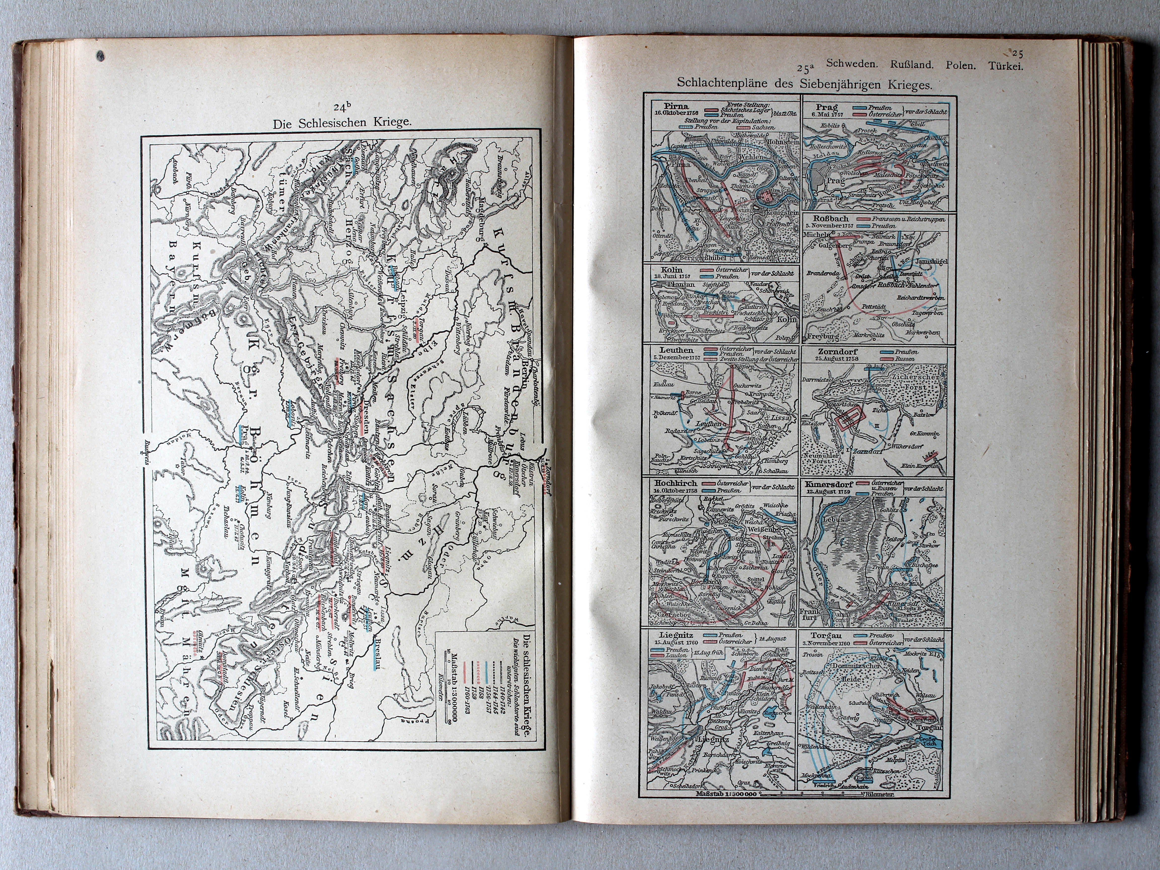
24b. Die schlesischen Kriege XL
De Silezische Oorlogen / The Silesian Wars
 Putzgers Historischer Schul-Atlas, Große Ausgabe, 1923
geen overeenkomstige kaart / no corresponding map
 Putzgers Historischer Schul-Atlas, 1922
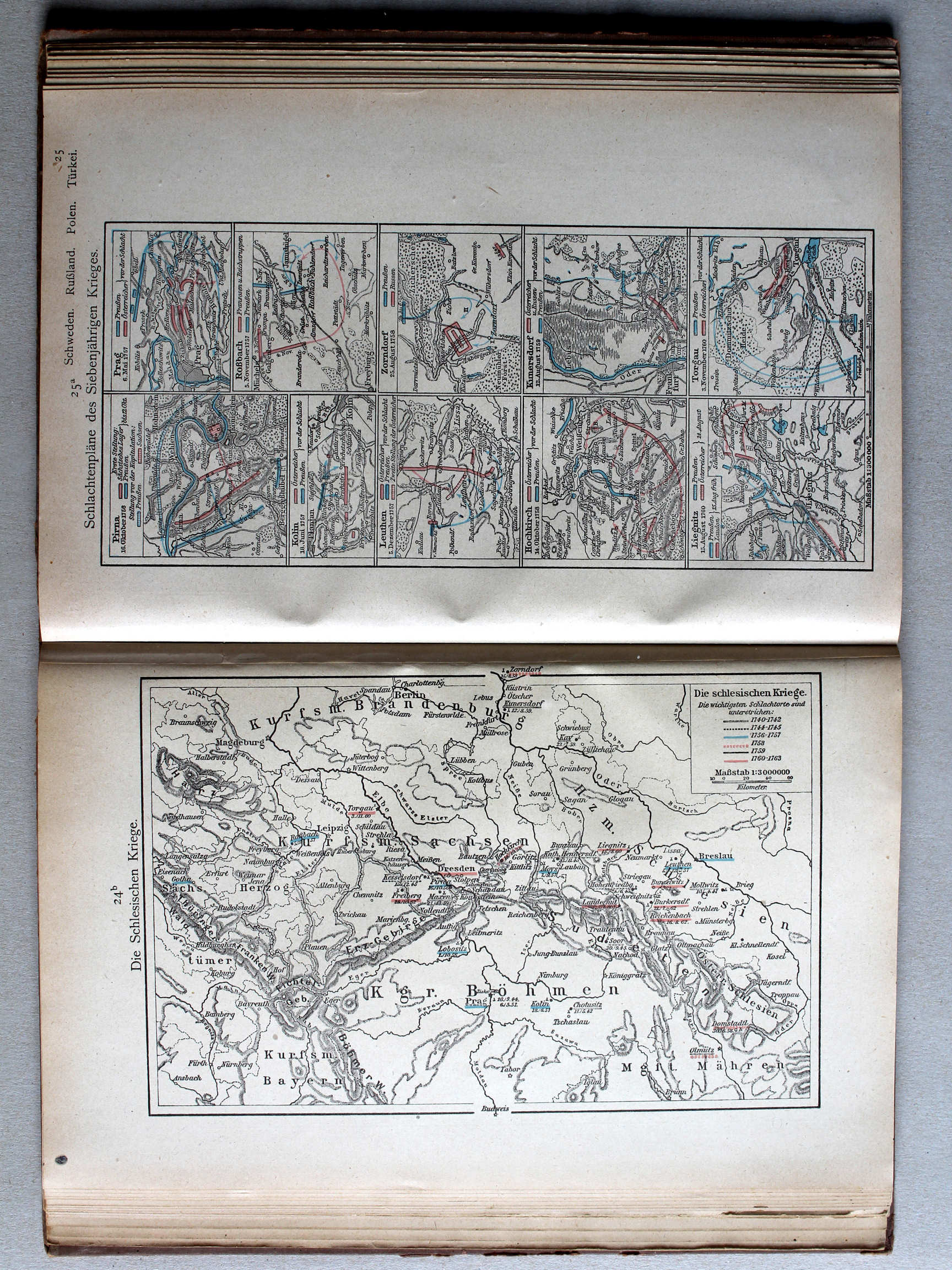
25a. Schlachtenpläne des Siebenjährigen Krieges XL
Veldslagen in de Zevenjarige Oorlog / Battlefields during the Seven Years' War
 Putzgers Historischer Schul-Atlas, Große Ausgabe, 1923
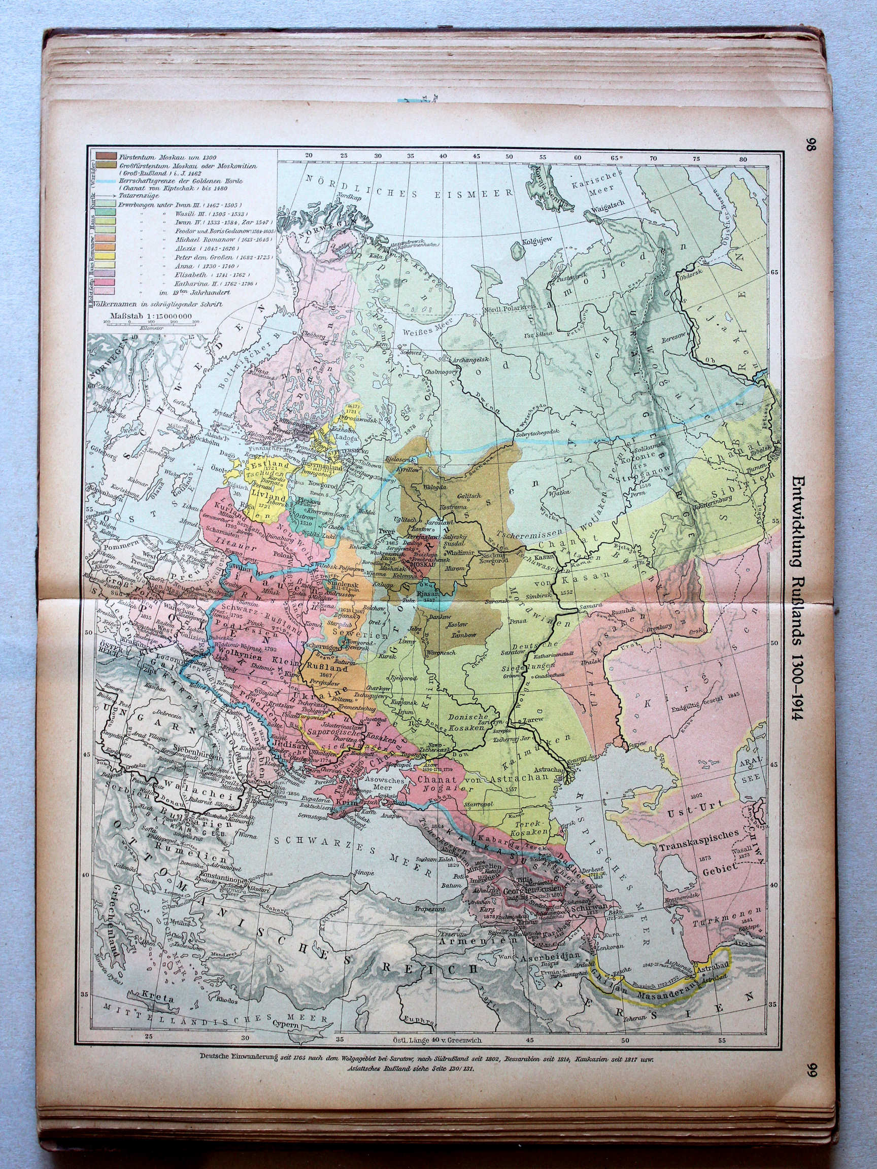
98.99. Entwicklung Rußlands 1300-1914 XL
Ontwikkeling van Rusland 1300-1914 / Development of Russia 1300-1914
 Putzgers Historischer Schul-Atlas, 1922
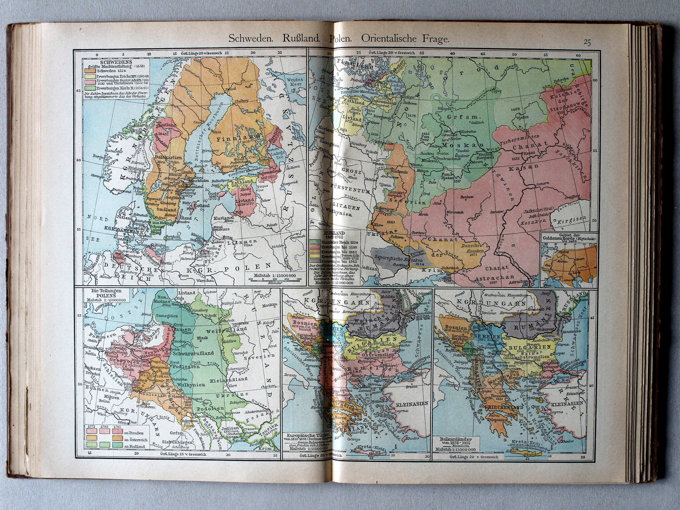
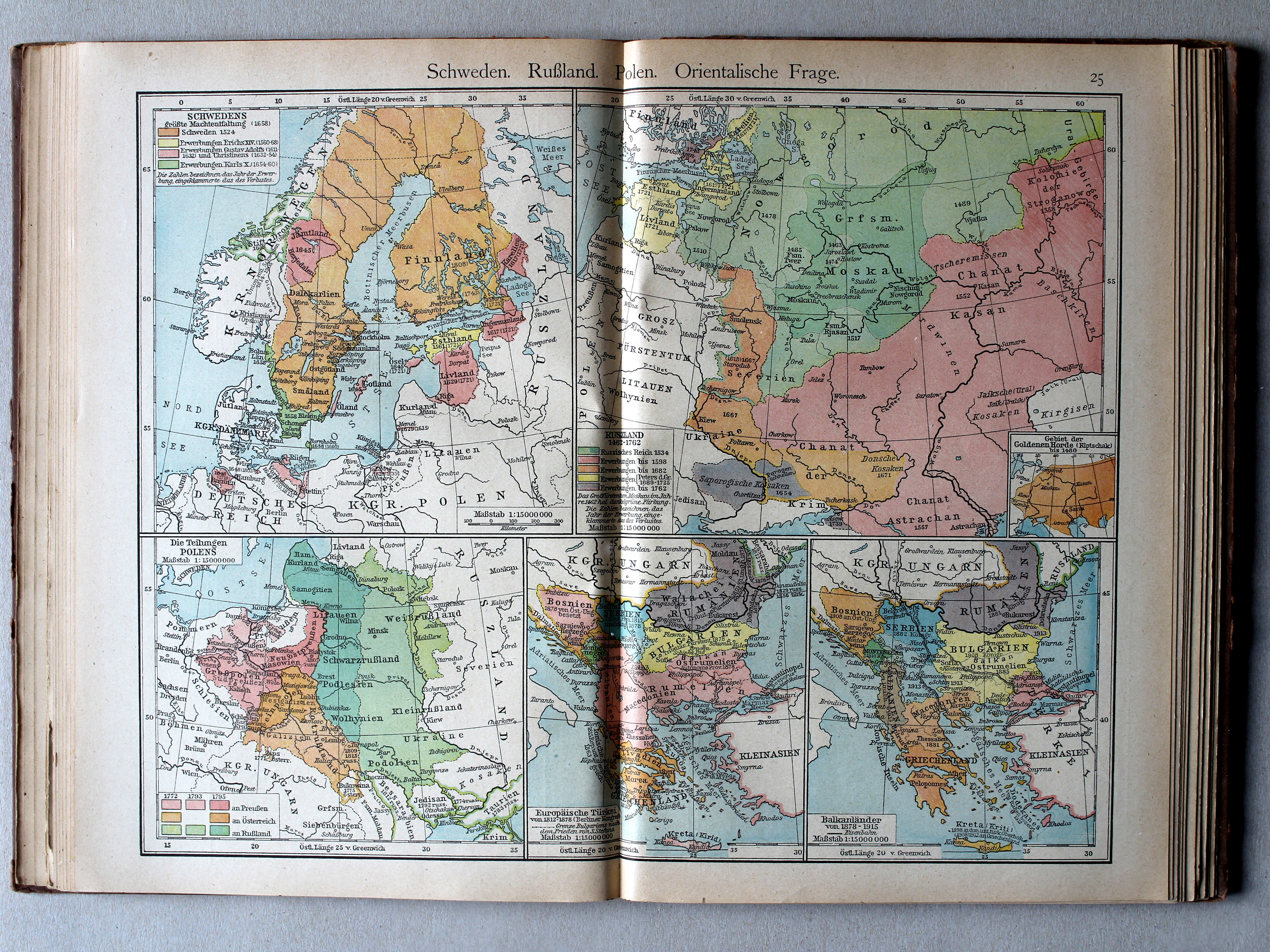
25. Schweden. Rußland. Polen. Orientalische Frage XL
Zweden, Rusland, Polen, Oosterse Kwestie / Sweden, Russia, Poland, Eastern Question
 Putzgers Historischer Schul-Atlas, Große Ausgabe, 1923
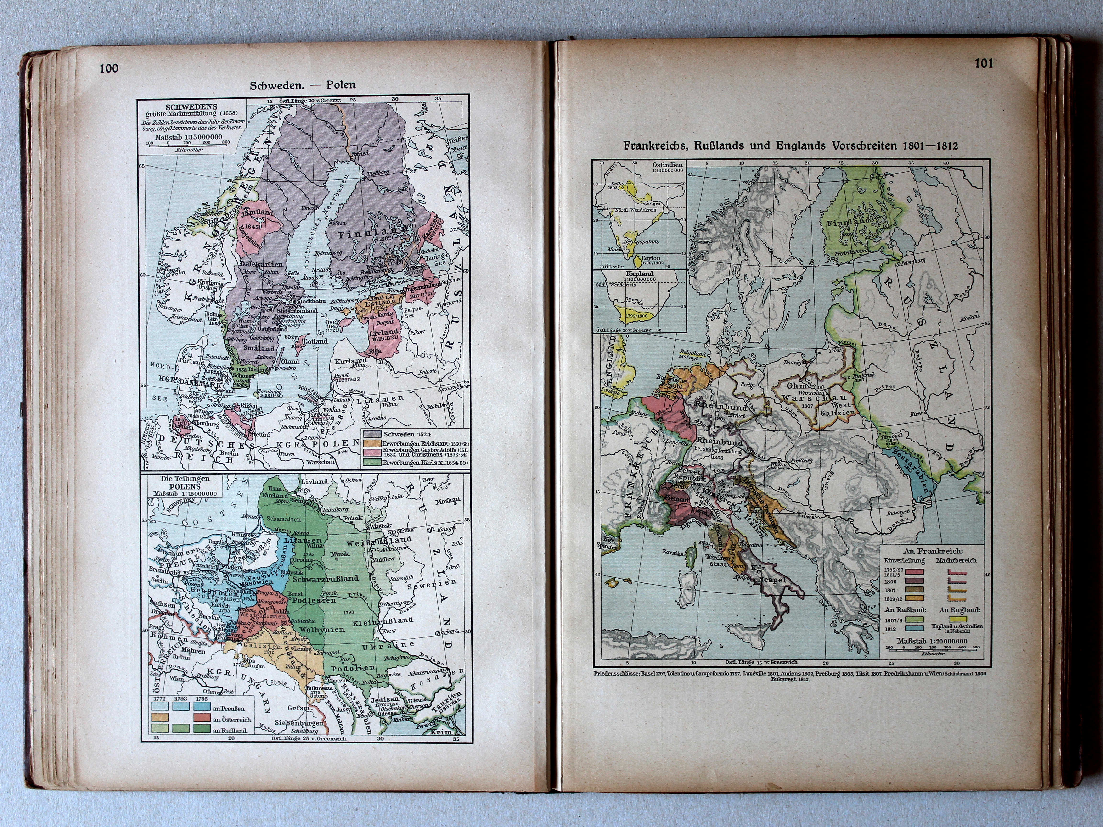
100. Schweden – Polen XL
Zweden. Polen / Sweden. Poland
101. Frankreichs, Rußlands und Englands Vorschreiten 1801-1812 XL
Uitbreiding van Frankrijk, Rusland en Engeland 1801-1812 / Expansion of France, Russia and England 1801-1812
Putzgers Historischer Schul-Atlas, 1922
25. Schweden. Rußland. Polen. Orientalische Frage XL
Zweden, Rusland, Polen, Oosterse Kwestie / Sweden, Russia, Poland, Eastern Question
Putzgers Historischer Schul-Atlas, Große Ausgabe, 1923
100. Schweden – Polen XL
Zweden. Polen / Sweden. Poland
101. Frankreichs, Rußlands und Englands Vorschreiten 1801-1812 XL
Uitbreiding van Frankrijk, Rusland en Engeland 1801-1812 / Expansion of France, Russia and England 1801-1812
Putzgers Historischer Schul-Atlas, 1922
25b. Die großen Friedensschlüsse I (1648-1721) XL
De belangrijkste vredesverdragen I (1648-1721) / The main peace treaties I (1648-1721)
26a. Die großen Friedensschlüsse II (1735-1812) XL
De belangrijkste vredesverdragen II (1735-1812) / The main peace treaties II (1735-1812)
 Putzgers Historischer Schul-Atlas, Große Ausgabe, 1923
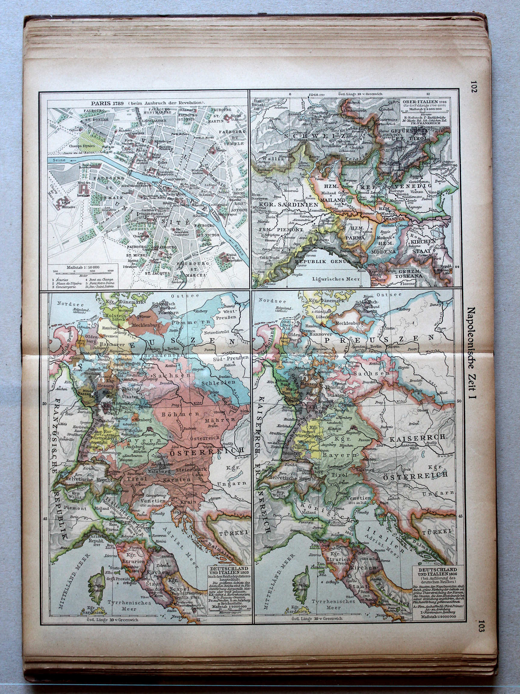
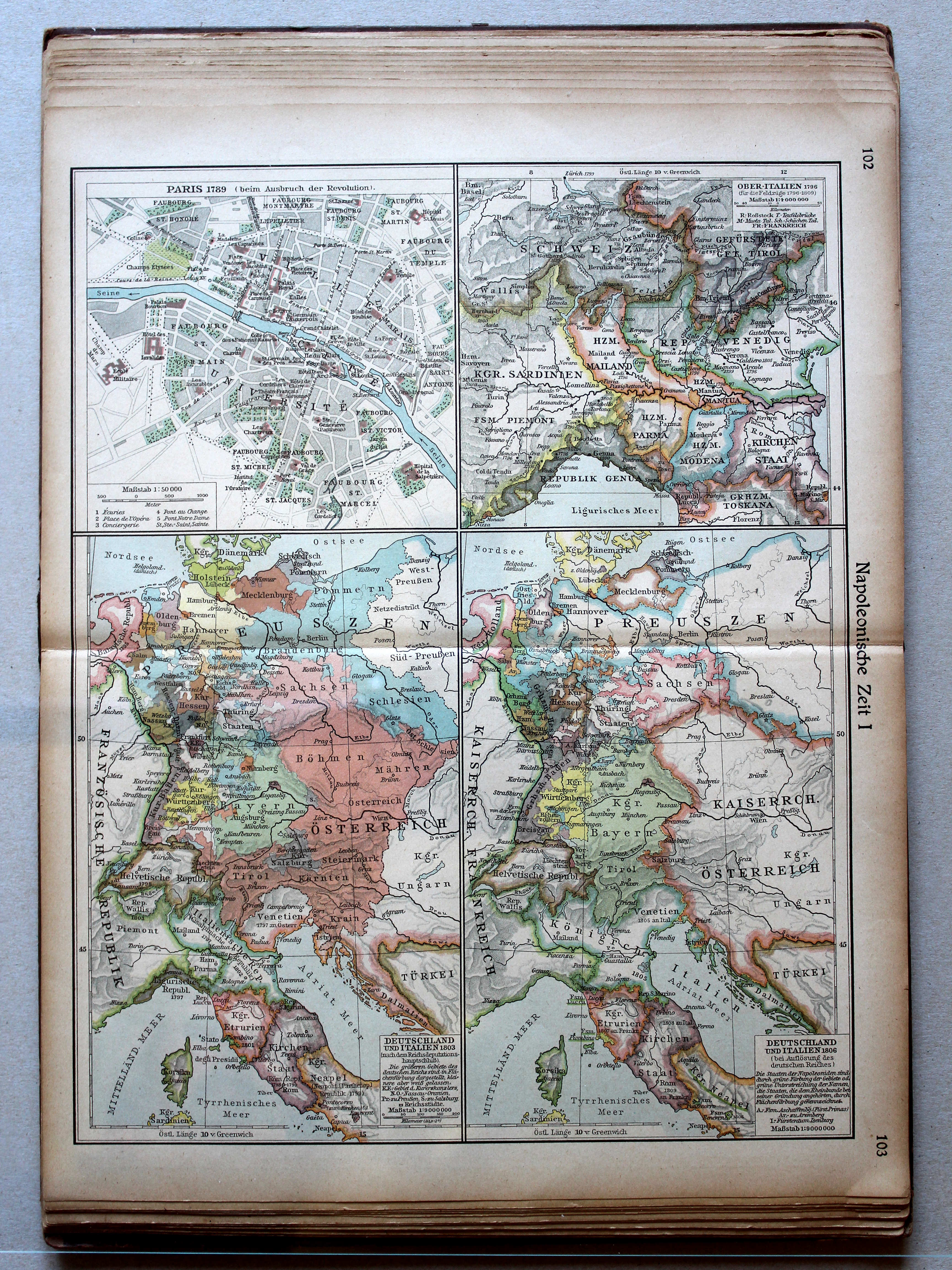
102.103. Napoleonische Zeit I XL
Tijd van Napoleon I / Era of Napoleon I
 Putzgers Historischer Schul-Atlas, 1922
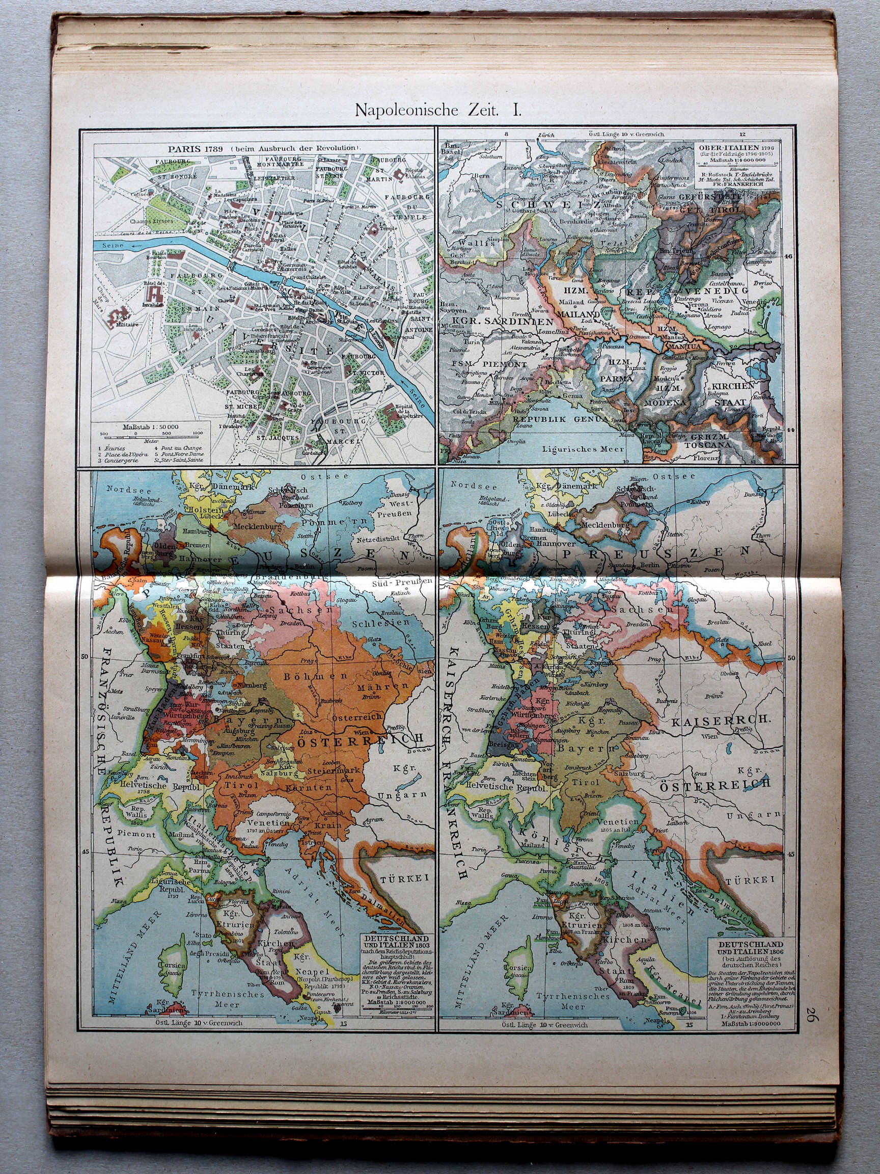
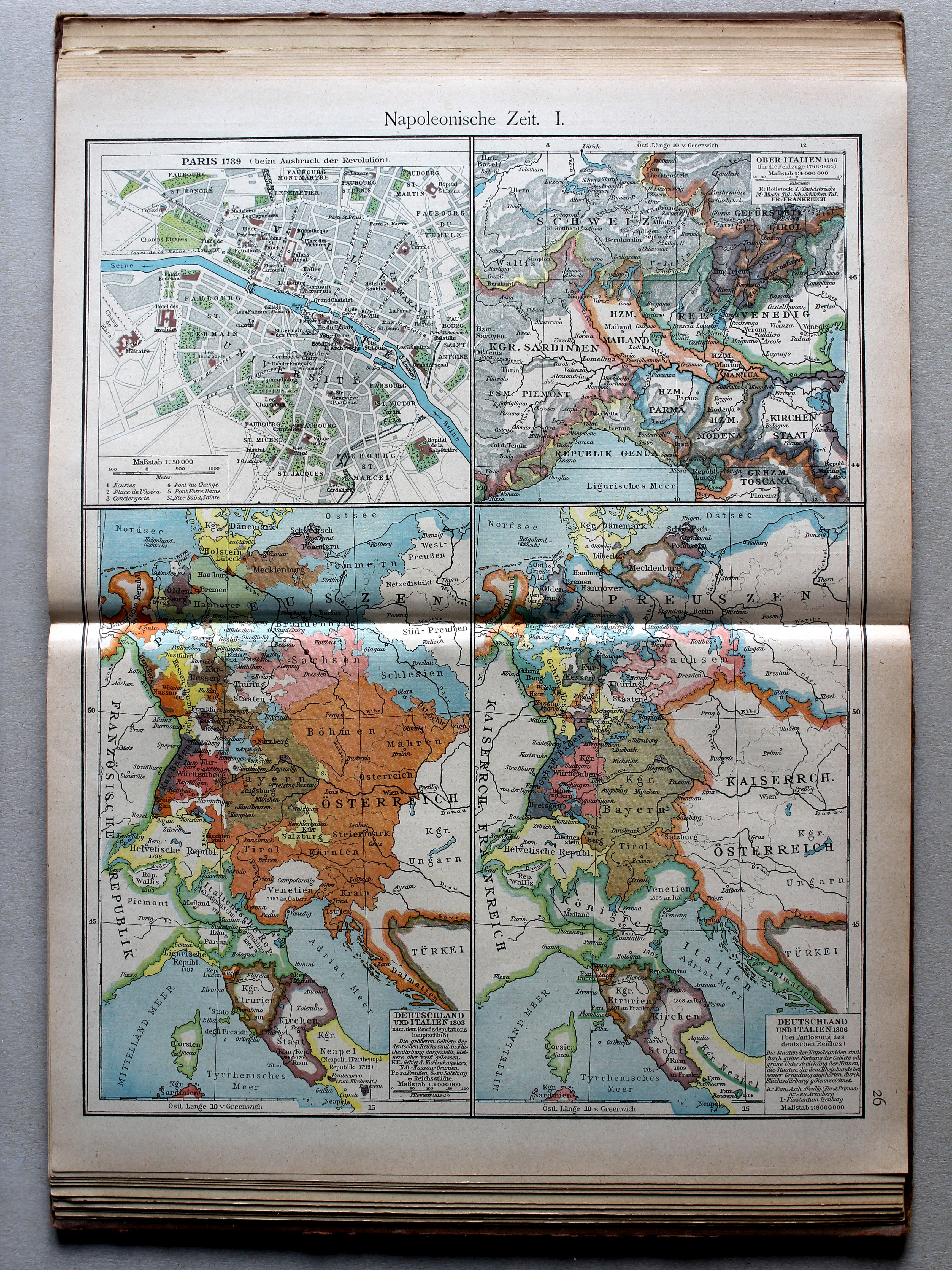
26. Napoleonische Zeit I XL
Tijd van Napoleon I / Era of Napoleon I
 Putzgers Historischer Schul-Atlas, Große Ausgabe, 1923
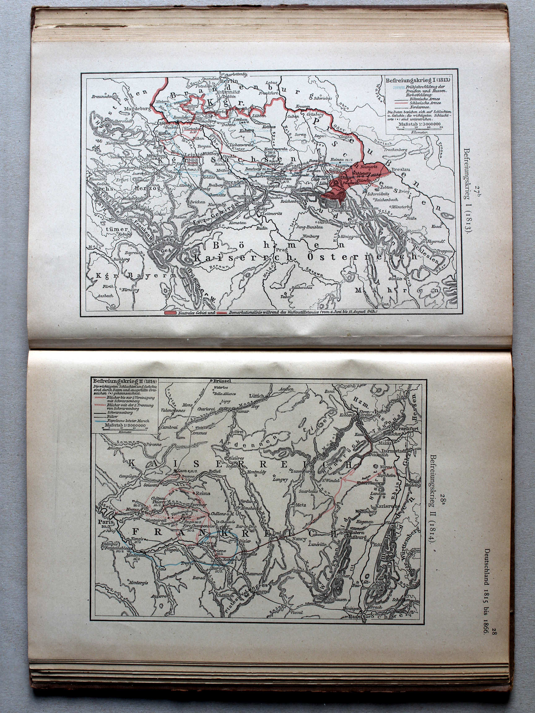
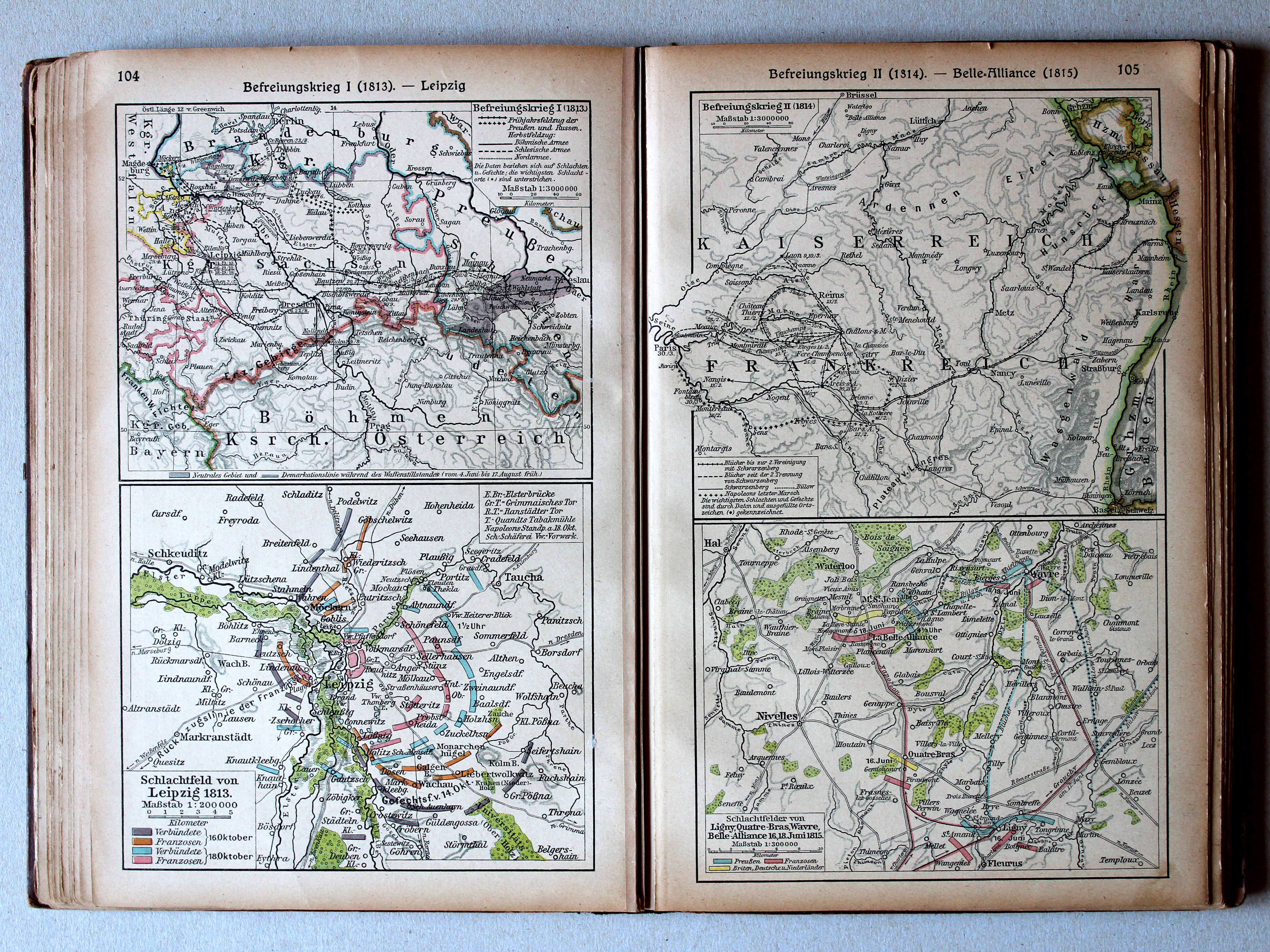
104. Befreiungskrieg I (1813) – Leipzig XL
Duitse bevrijdingsoorlog I (1813). Leipzig / German Campaign I (1813). Leipzig
105. Befreiungskrieg II (1814) – Belle-Alliance (1815) XL
Duitse bevrijdingsoorlog II (1814). Belle-Alliance (1815) / German Campaign II (1814). Belle-Alliance (1815)
 Putzgers Historischer Schul-Atlas, 1922
27b. Befreiungskrieg I (1813) XL
Duitse bevrijdingsoorlog I (1813) / German Campaign I (1813)
28a. Befreiungskrieg II (1814) XL
Duitse bevrijdingsoorlog II (1814) / German Campaign II (1814)
Putzgers Historischer Schul-Atlas, Große Ausgabe, 1923
104. Befreiungskrieg I (1813) – Leipzig XL
Duitse bevrijdingsoorlog I (1813). Leipzig / German Campaign I (1813). Leipzig
105. Befreiungskrieg II (1814) – Belle-Alliance (1815) XL
Duitse bevrijdingsoorlog II (1814). Belle-Alliance (1815) / German Campaign II (1814). Belle-Alliance (1815)
 Putzgers Historischer Schul-Atlas, 1922
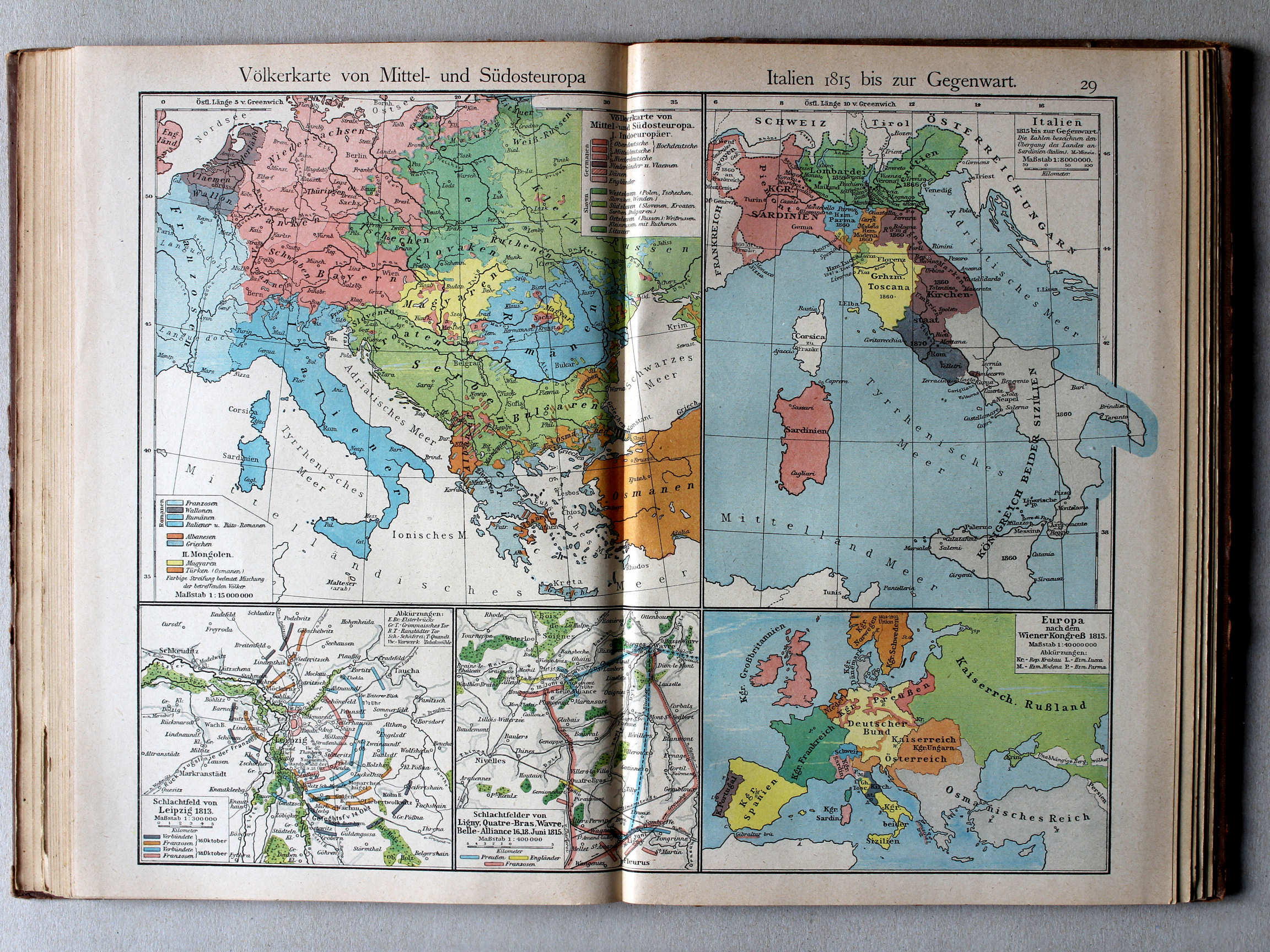
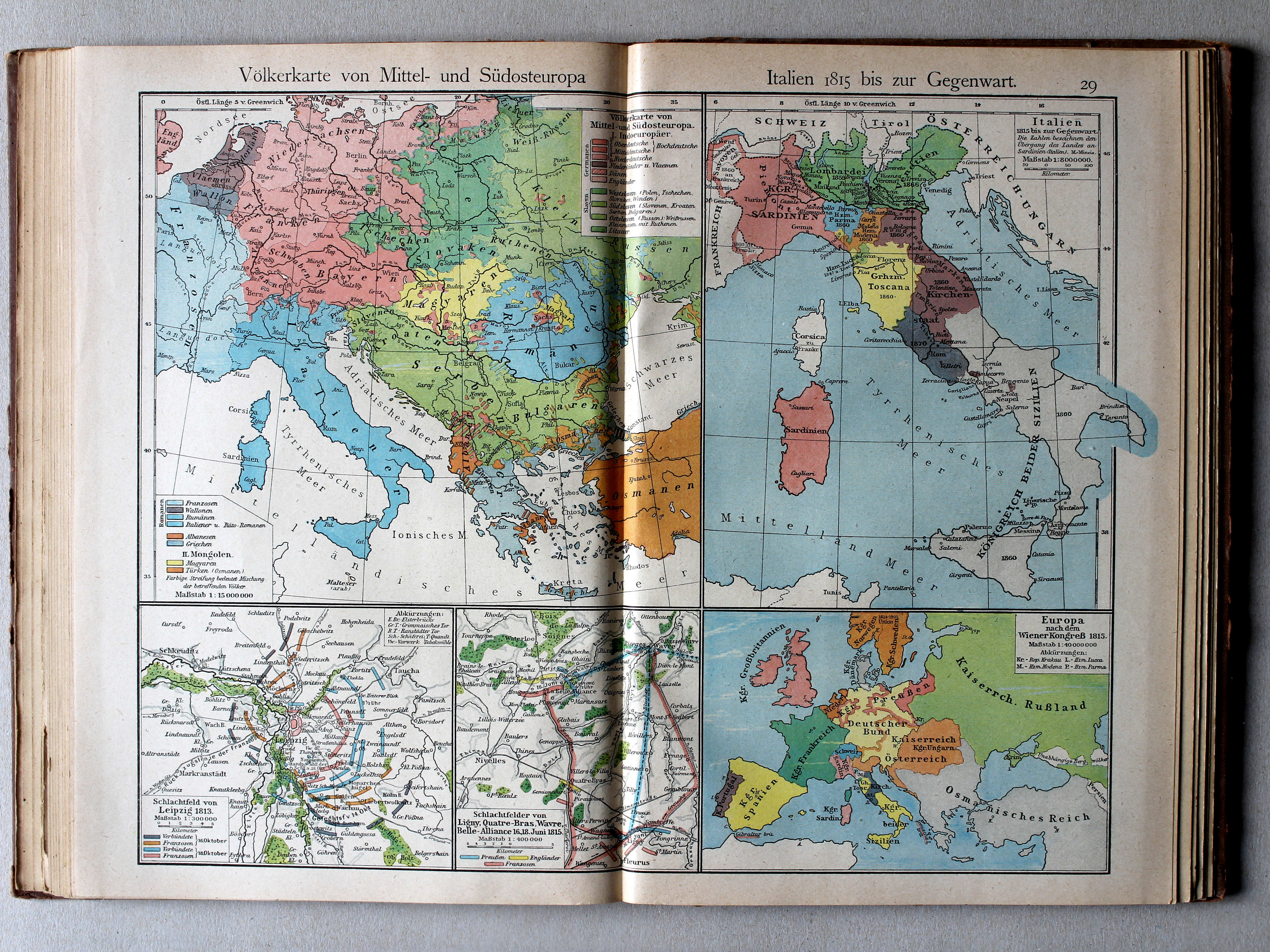
29. Völkerkarte von Mittel und Südost-Europa. Italien 1815 bis zur Gegenwart (Leipzig. Ligny ... Belle-Alliance) XL
Etnografische kaart van Midden- en Zuidoost Europa. Italië van 1815 tot heden / Ethnographic map of Central and Southeastern Europe. Italy from 1815 until today (Leipzig. Ligny ... Belle-Alliance)
 Putzgers Historischer Schul-Atlas, Große Ausgabe, 1923
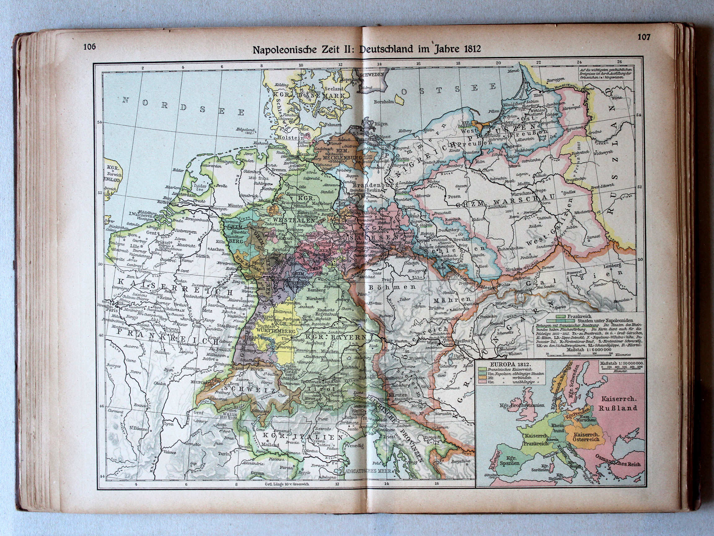
106.107. Napoleonische Zeit II: Deutschland im Jahre 1812 XL
Tijd van Napoleon II: Duitsland in 1812 / Era of Napoleon II: Germany in 1812
 Putzgers Historischer Schul-Atlas, 1922
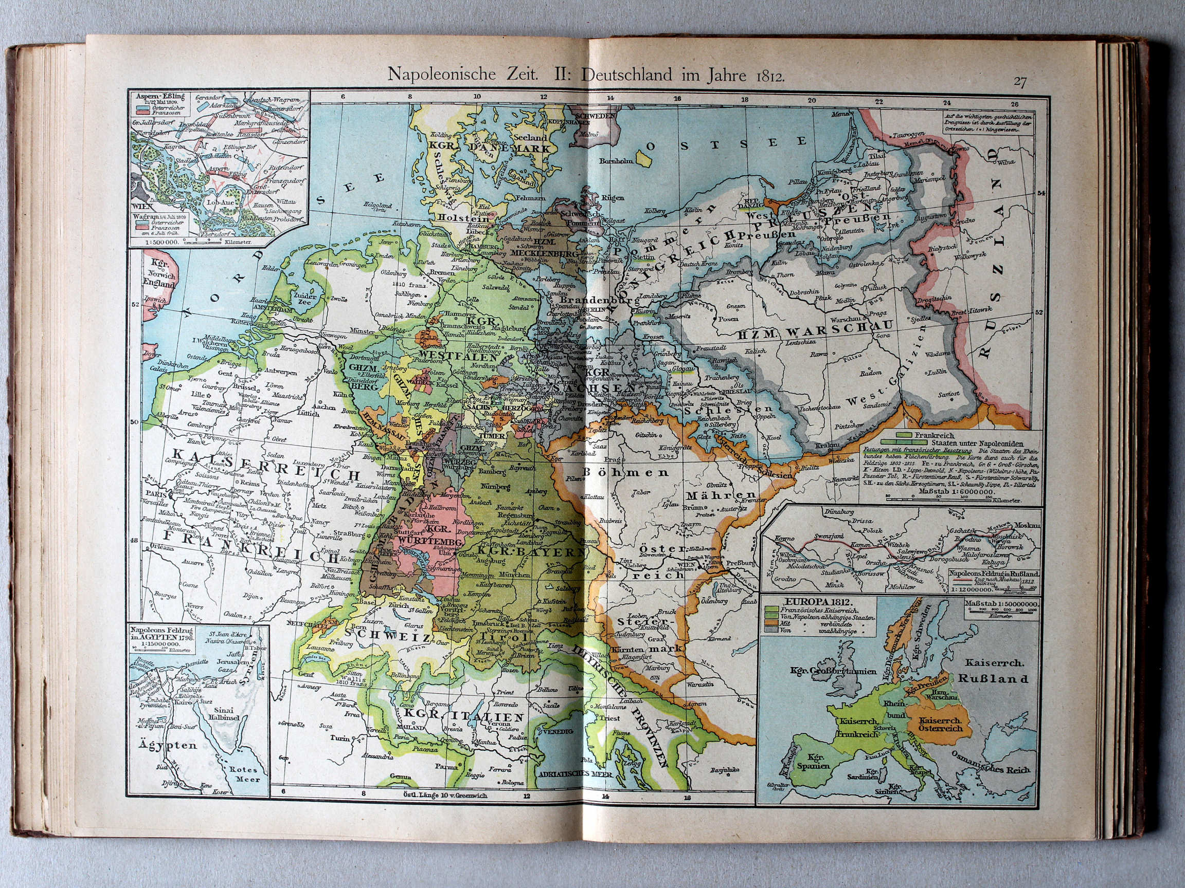
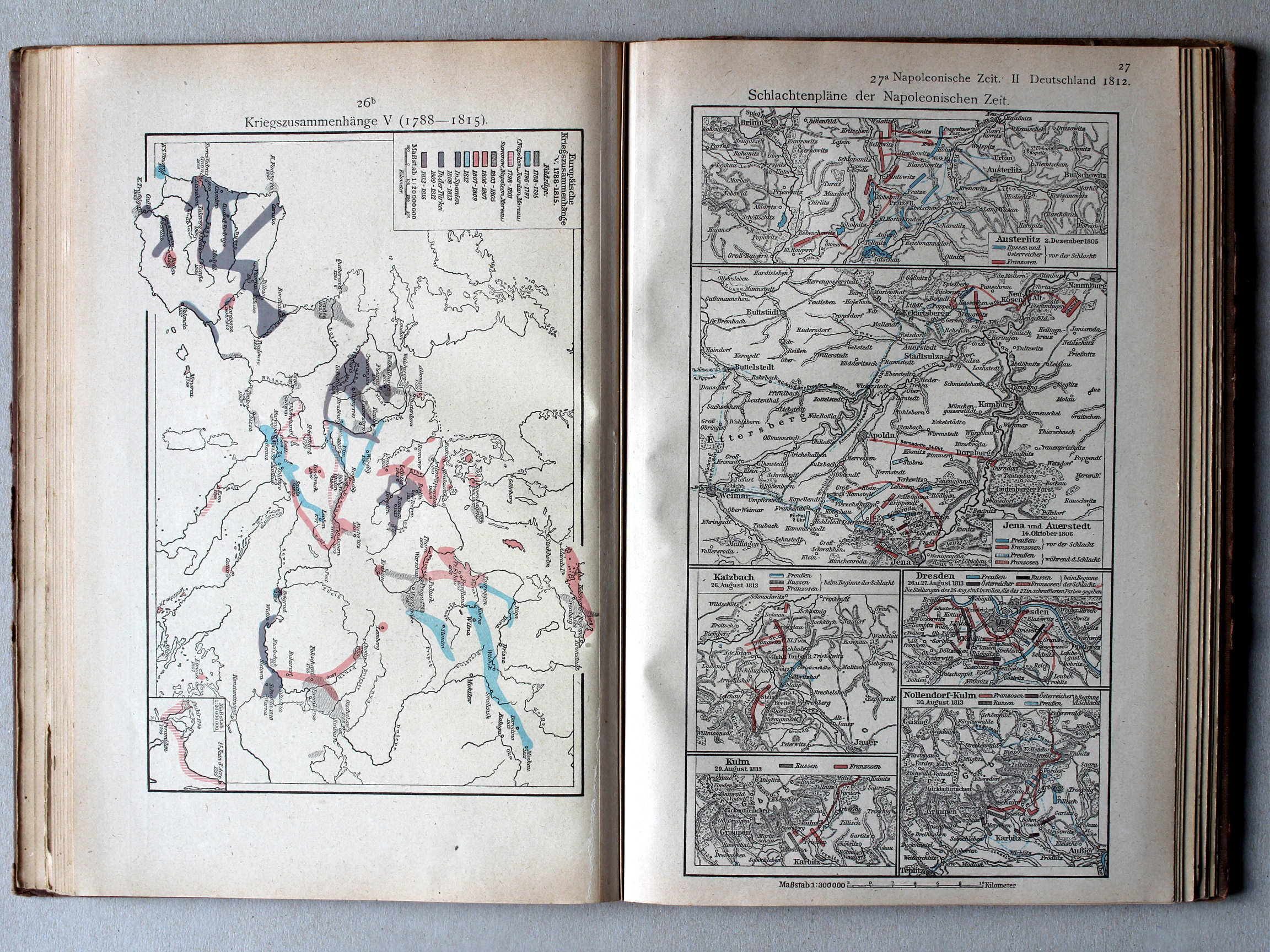
27. Napoleonische Zeit II: Deutschland im Jahre 1812 XL
Tijd van Napoleon II: Duitsland in 1812 / Era of Napoleon II: Germany in 1812
 Putzgers Historischer Schul-Atlas, Große Ausgabe, 1923
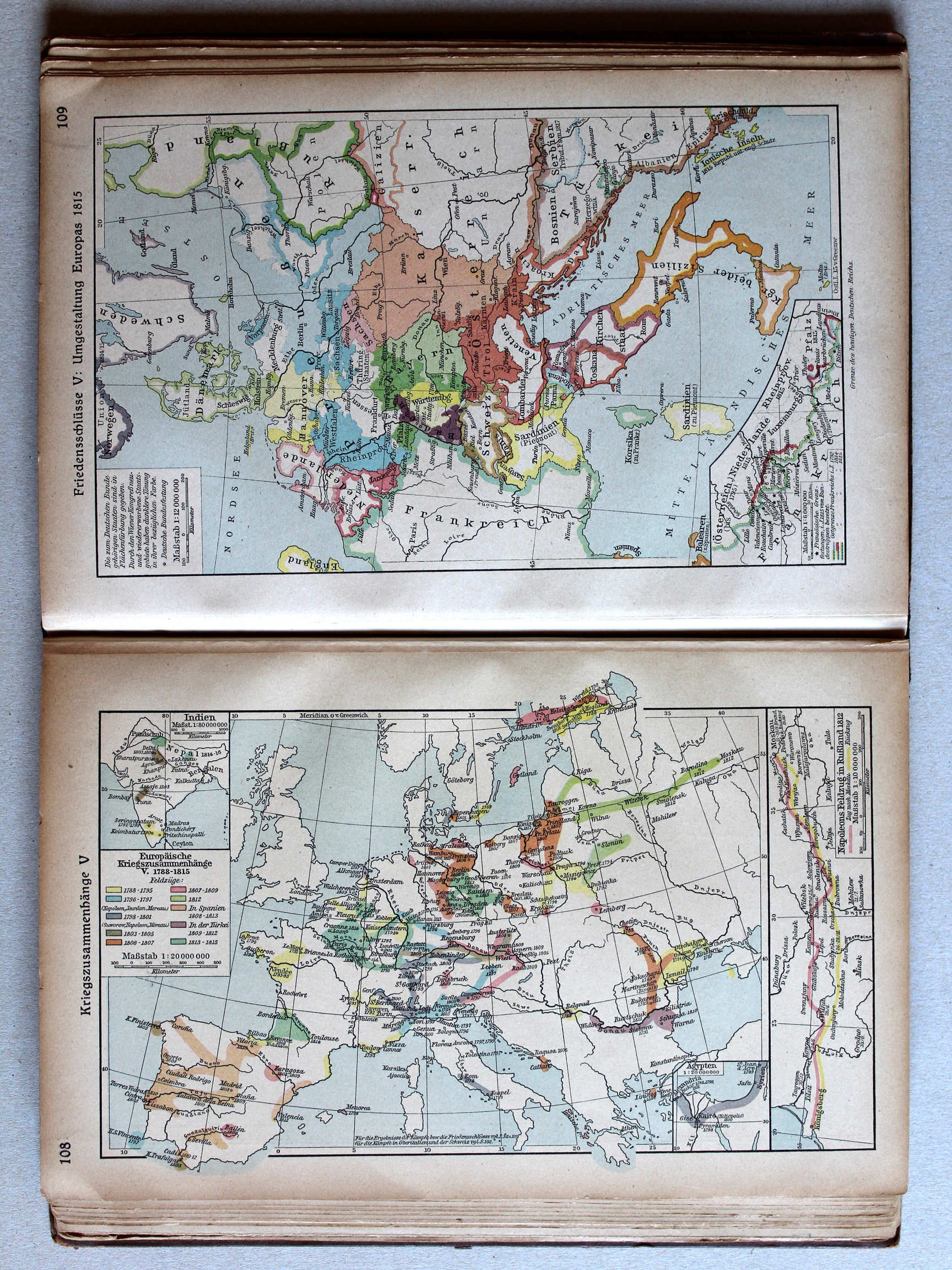
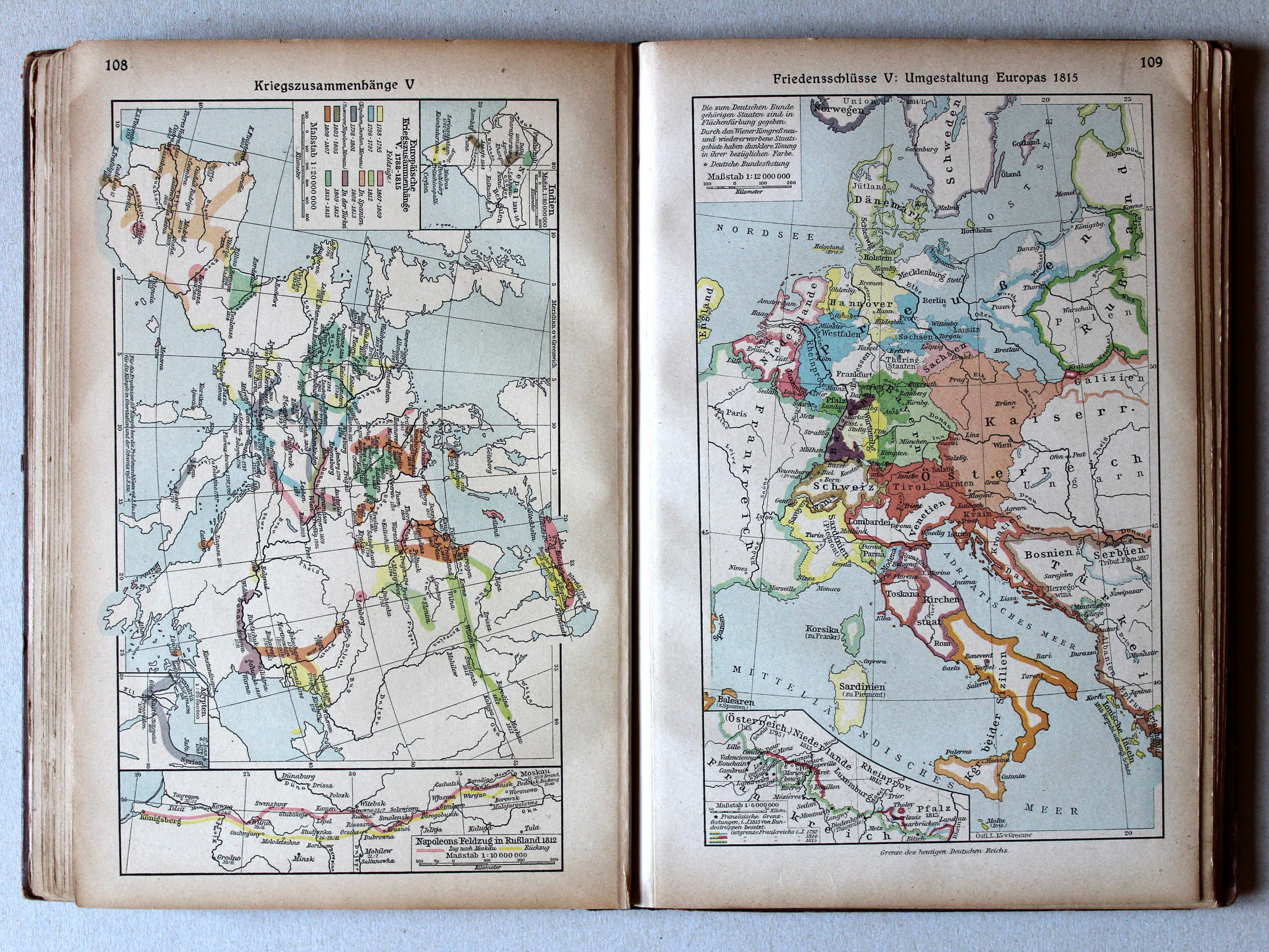
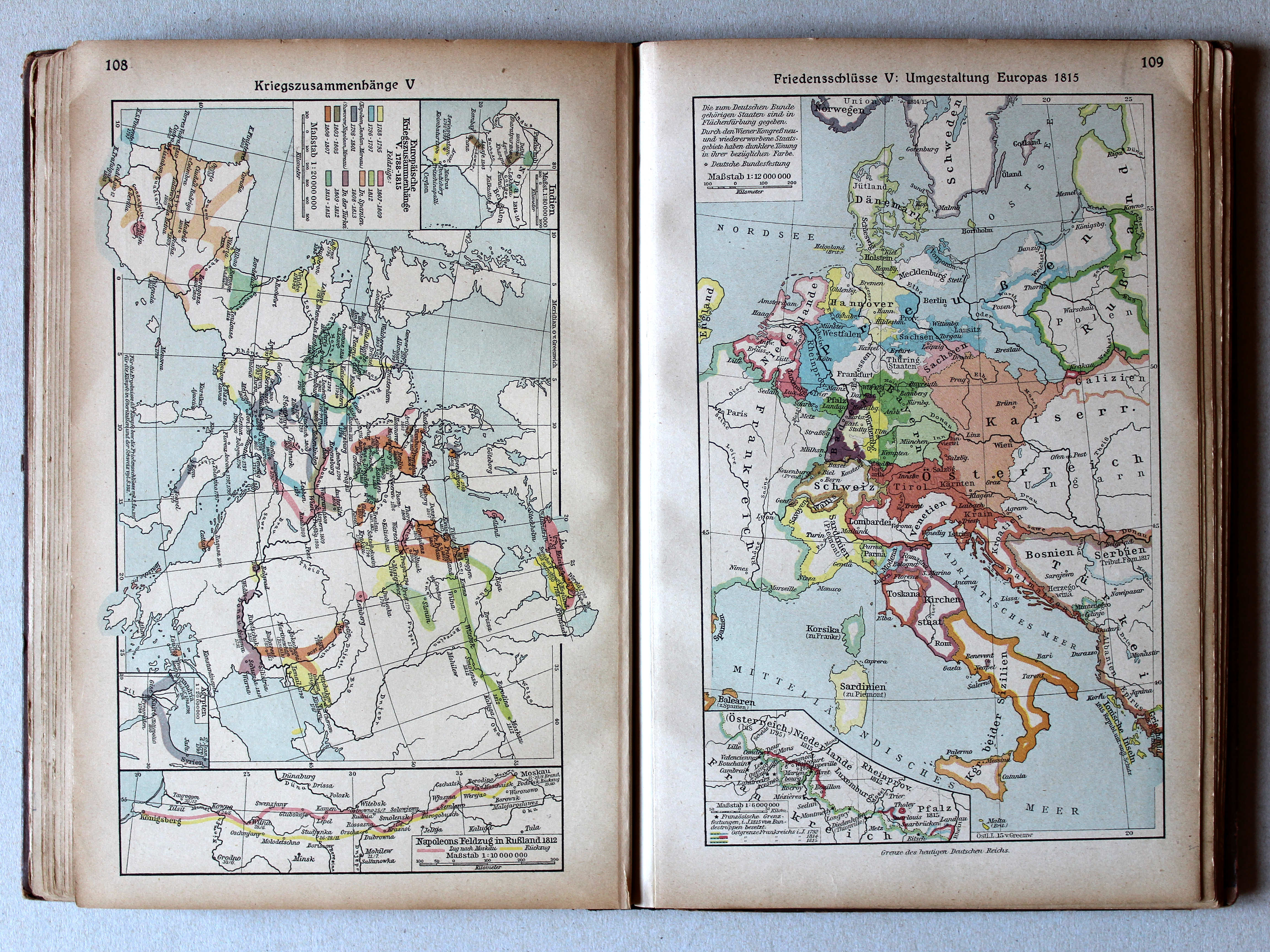
108. Kriegszusammenhänge V XL
Oorlogen in Europa V / European wars V
 Putzgers Historischer Schul-Atlas, 1922
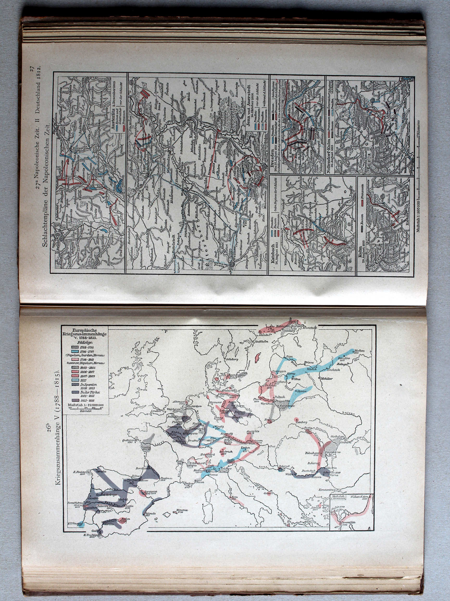
26b. Kriegszusammenhänge V (1788-1815) XL
Oorlogen in Europa V (1788-1815) / European wars V (1788-1815)
Putzgers Historischer Schul-Atlas, Große Ausgabe, 1923
108. Kriegszusammenhänge V (Napoleons Feldzug in Rußland) XL
Oorlogen in Europa V (Napoleons veldtocht in Rusland) / European wars V (Napoleon's campaign in Russia)
Putzgers Historischer Schul-Atlas, 1922
27. Napoleonische Zeit II: Deutschland im Jahre 1812 (Napoleons Feldzug in Rußland) XL
Tijd van Napoleon II: Duitsland in 1812 (Napoleons veldtocht in Rusland) / Era of Napoleon II: Germany in 1812 (Napoleon's campaign in Russia)
Putzgers Historischer Schul-Atlas, Große Ausgabe, 1923
geen overeenkomstige kaart / no corresponding map
 Putzgers Historischer Schul-Atlas, 1922
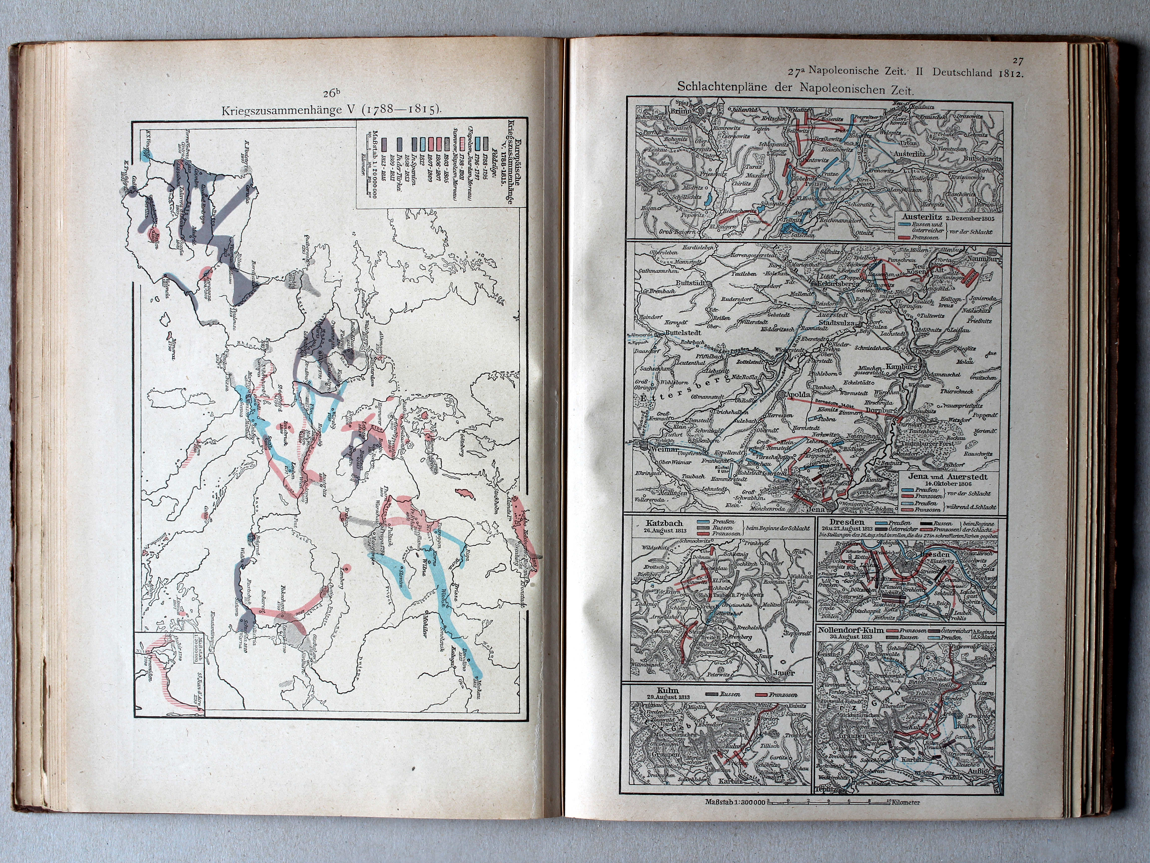
27a. Schlachtenpläne der Napoleonischen Zeit XL
Veldslagen in de tijd van Napoleon / Battlefields in the era of Napoleon
 Putzgers Historischer Schul-Atlas, Große Ausgabe, 1923
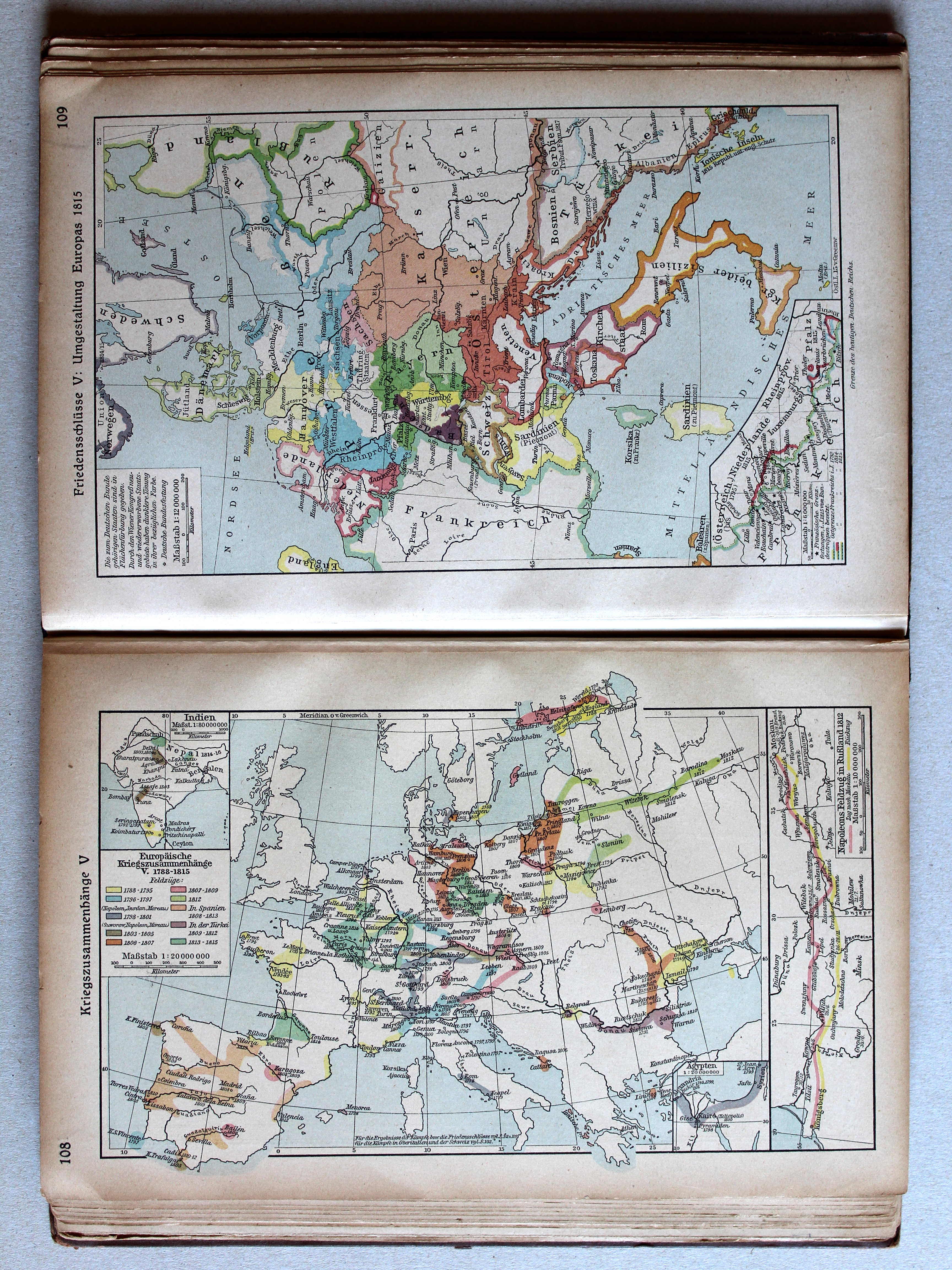
109. Friedensschlüsse V: Umgestaltung Europas 1815 XL
Belangrijkste vredesverdragen V. Staatkundige herordening van Europa in 1815 / Main peace treaties V. Political transformation of Europe in 1815
Putzgers Historischer Schul-Atlas, 1922
geen overeenkomstige kaart / no corresponding map
 Putzgers Historischer Schul-Atlas, Große Ausgabe, 1923
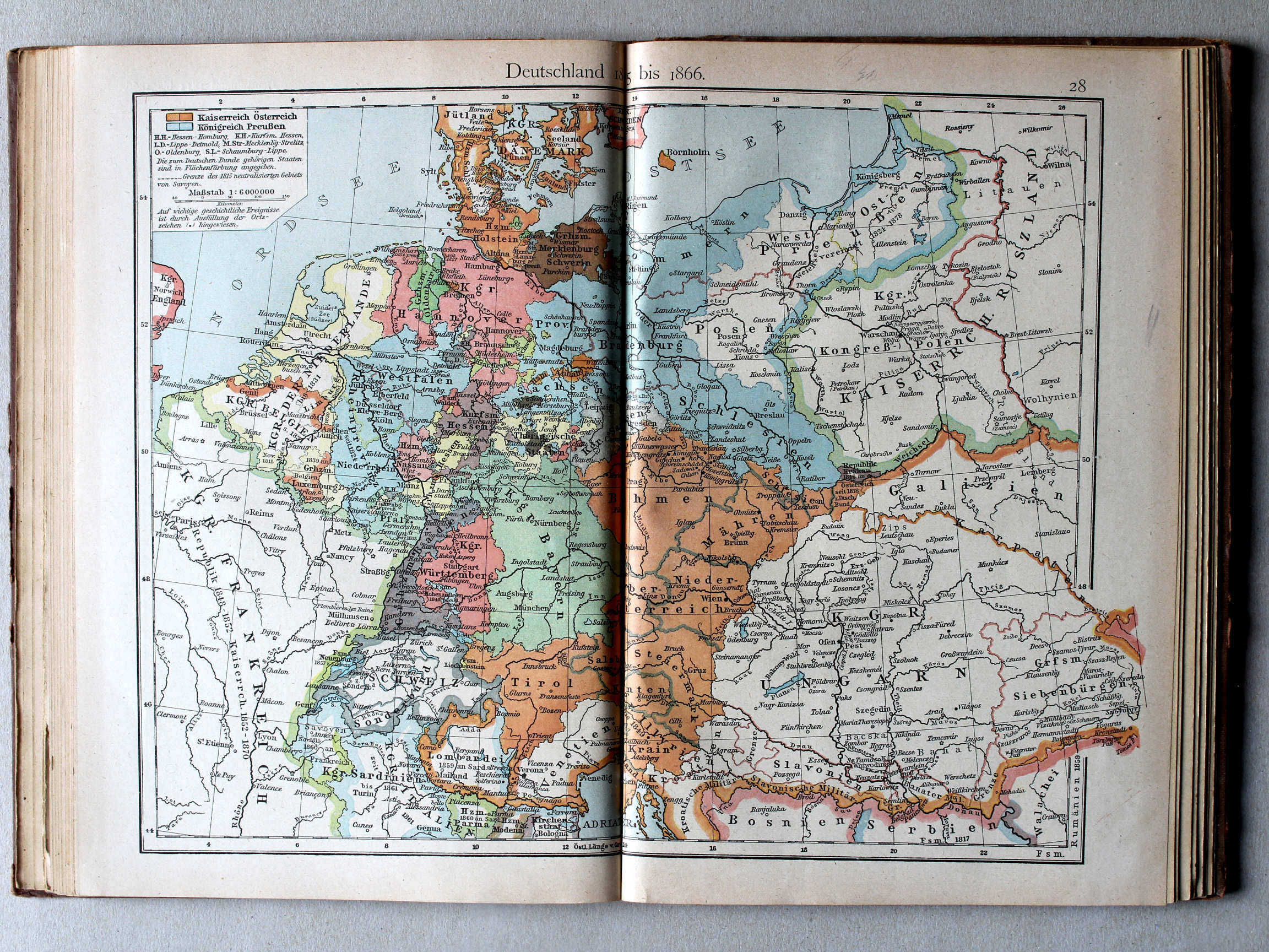
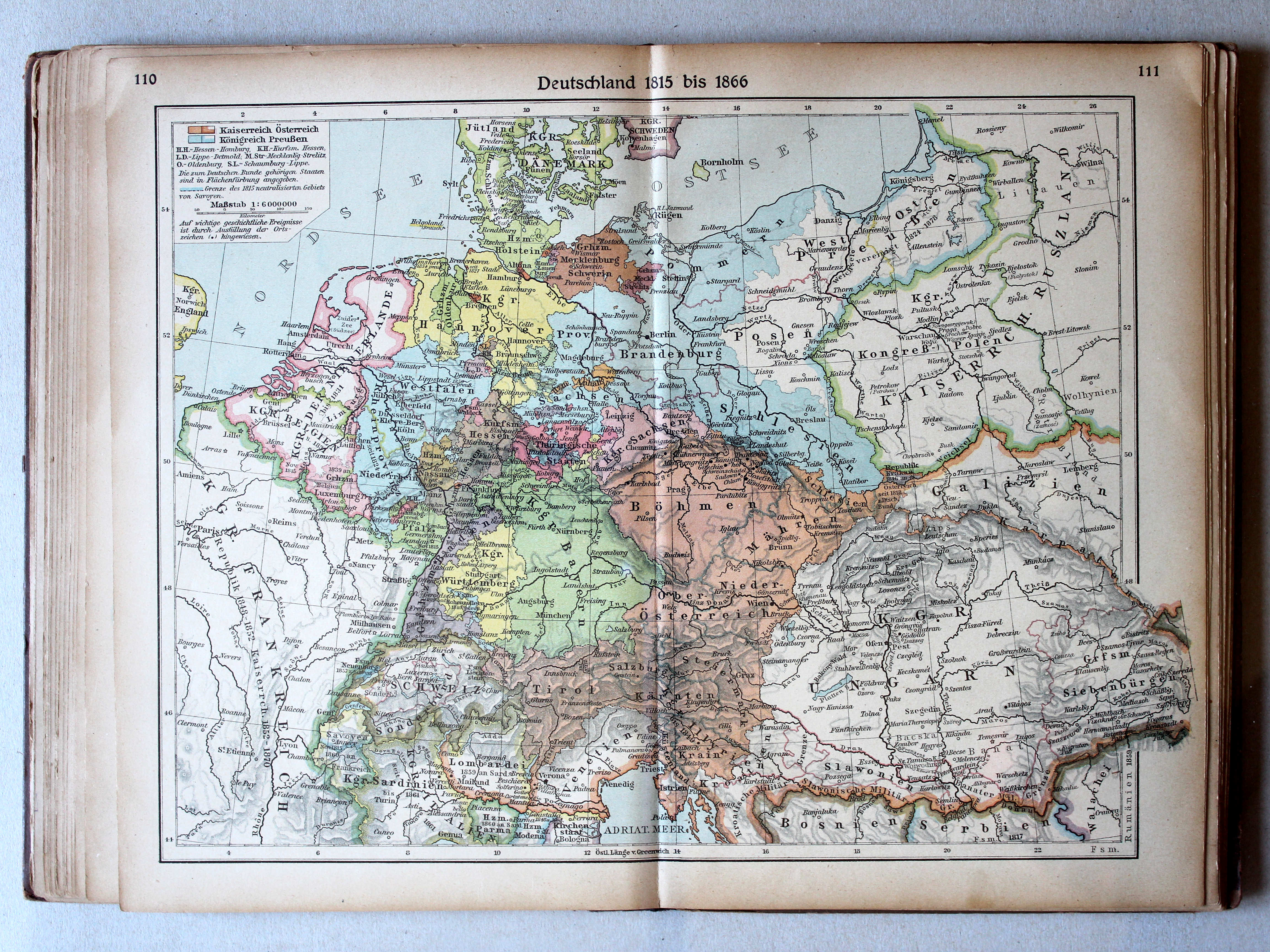
110.111. Deutschland 1815 bis 1866 XL
Duitsland 1815-1866 / Germany 1815-1866
 Putzgers Historischer Schul-Atlas, 1922
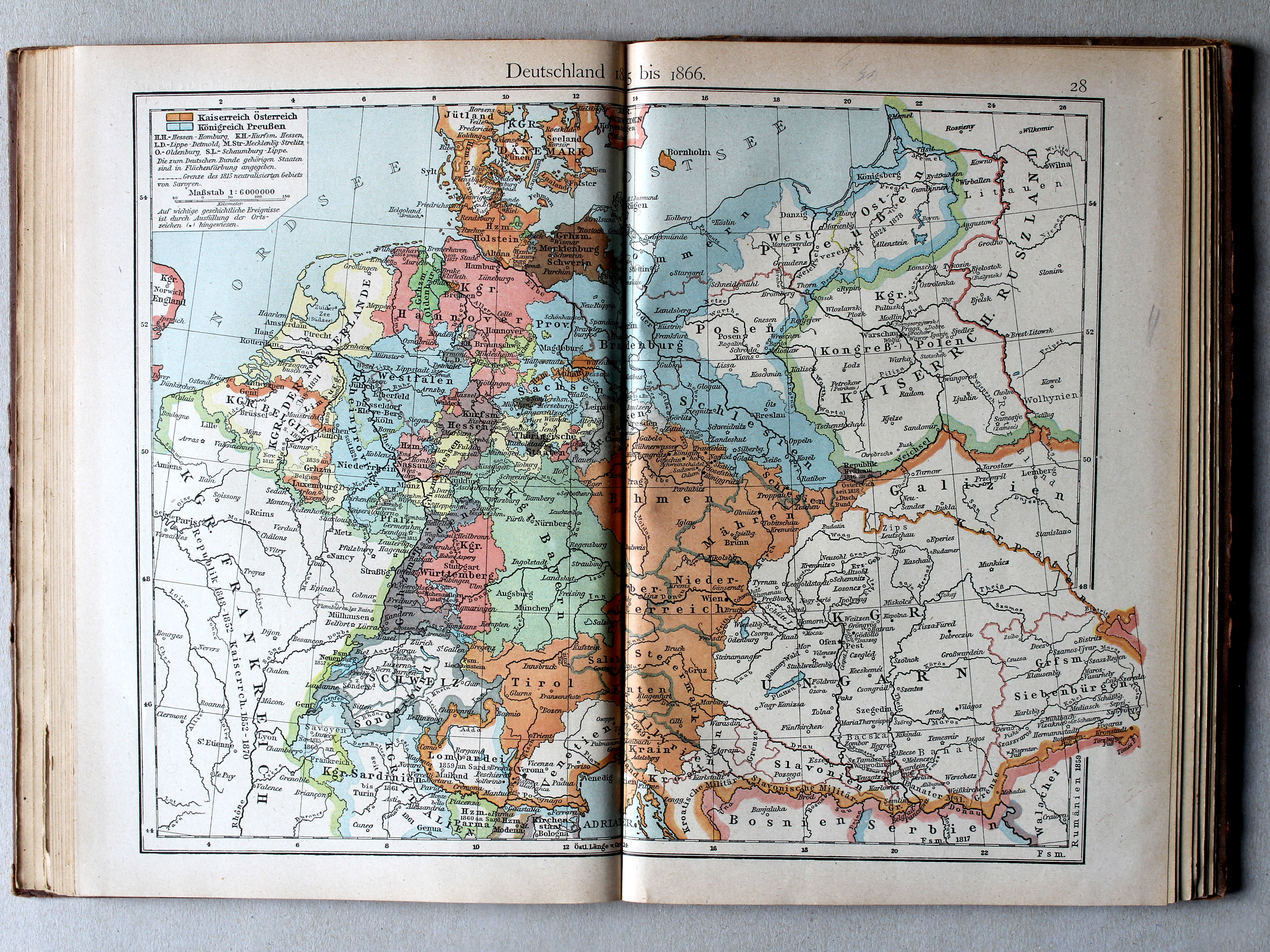
28. Deutschland 1815 bis 1866 XL
Duitsland 1815-1866 / Germany 1815-1866
 Putzgers Historischer Schul-Atlas, Große Ausgabe, 1923
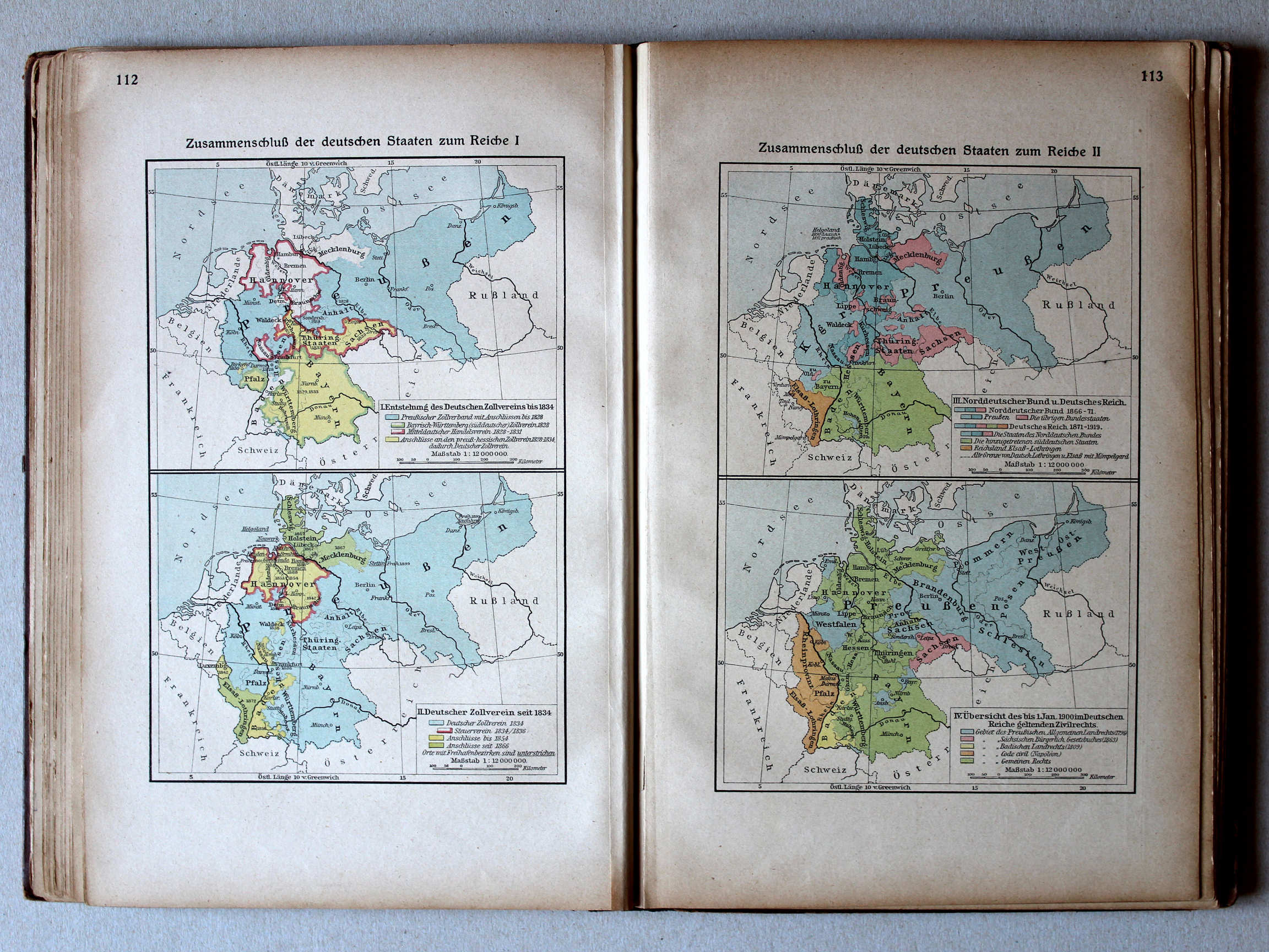
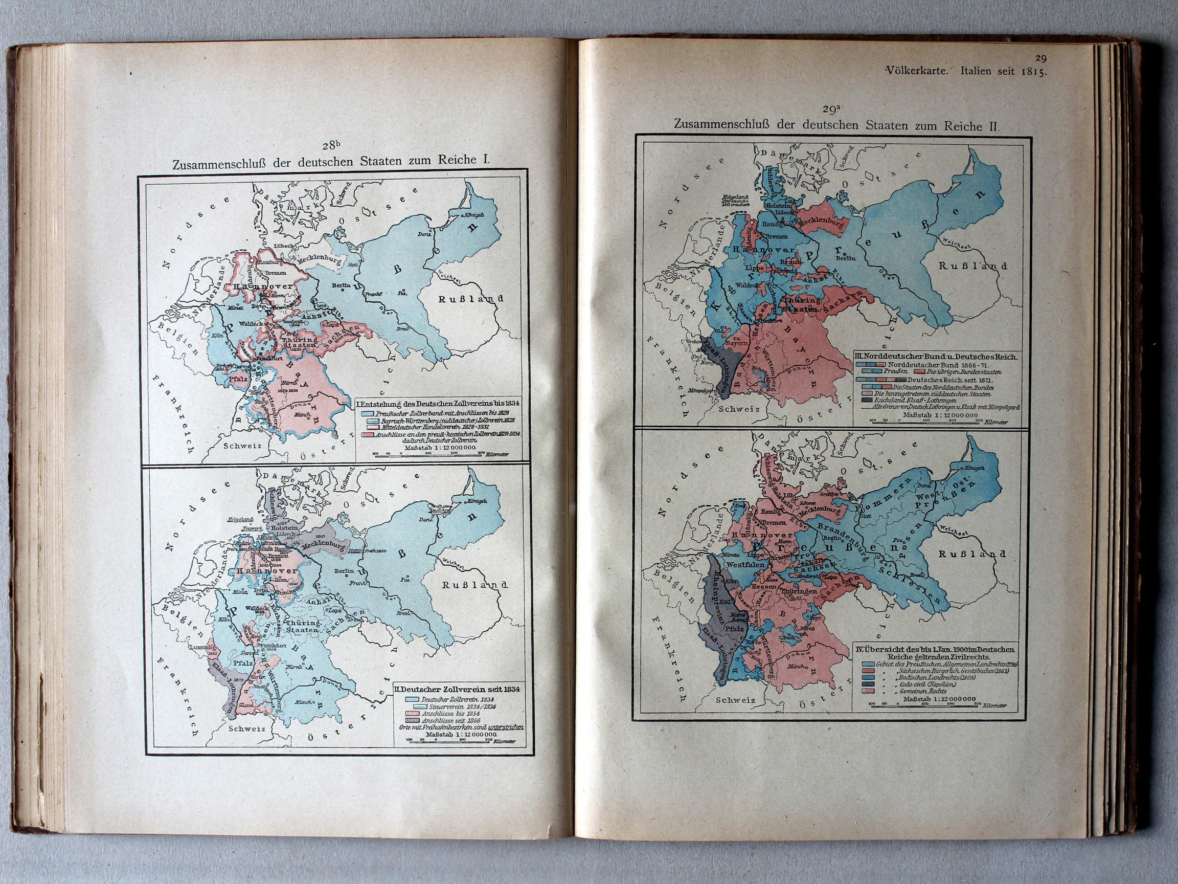
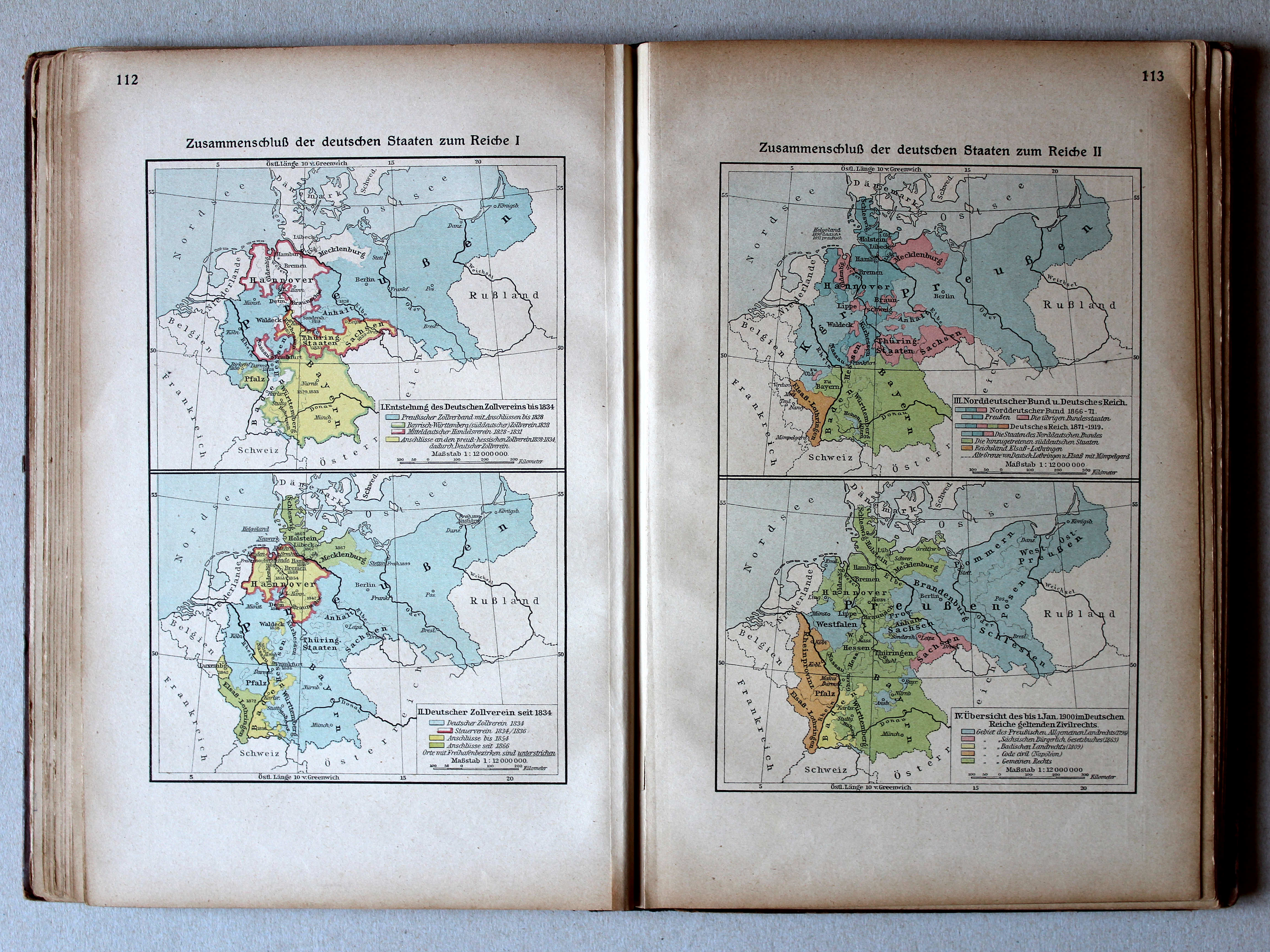
112. Zusammenschluß der deutschen Staaten zum Reiche I XL
Duitse eenwording I / German unification I
113. Zusammenschluß der deutschen Staaten zum Reiche II XL
Duitse eenwording II / German unification II
 Putzgers Historischer Schul-Atlas, 1922
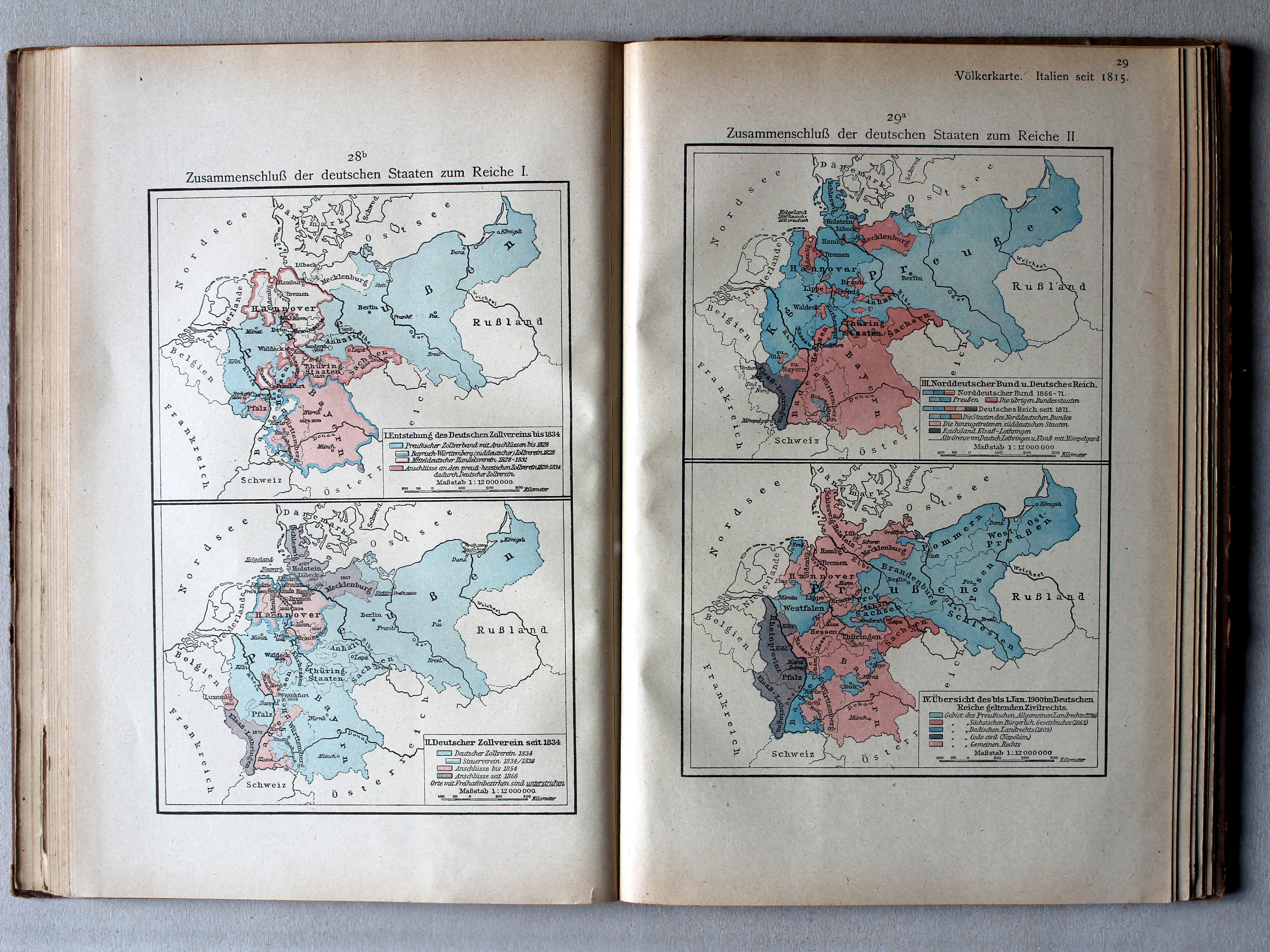
28b. Zusammenschluß der deutschen Staaten zum Reiche I XL
Duitse eenwording I / German unification I
29a. Zusammenschluß der deutschen Staaten zum Reiche II XL
Duitse eenwording II / German unification II
 Putzgers Historischer Schul-Atlas, Große Ausgabe, 1923
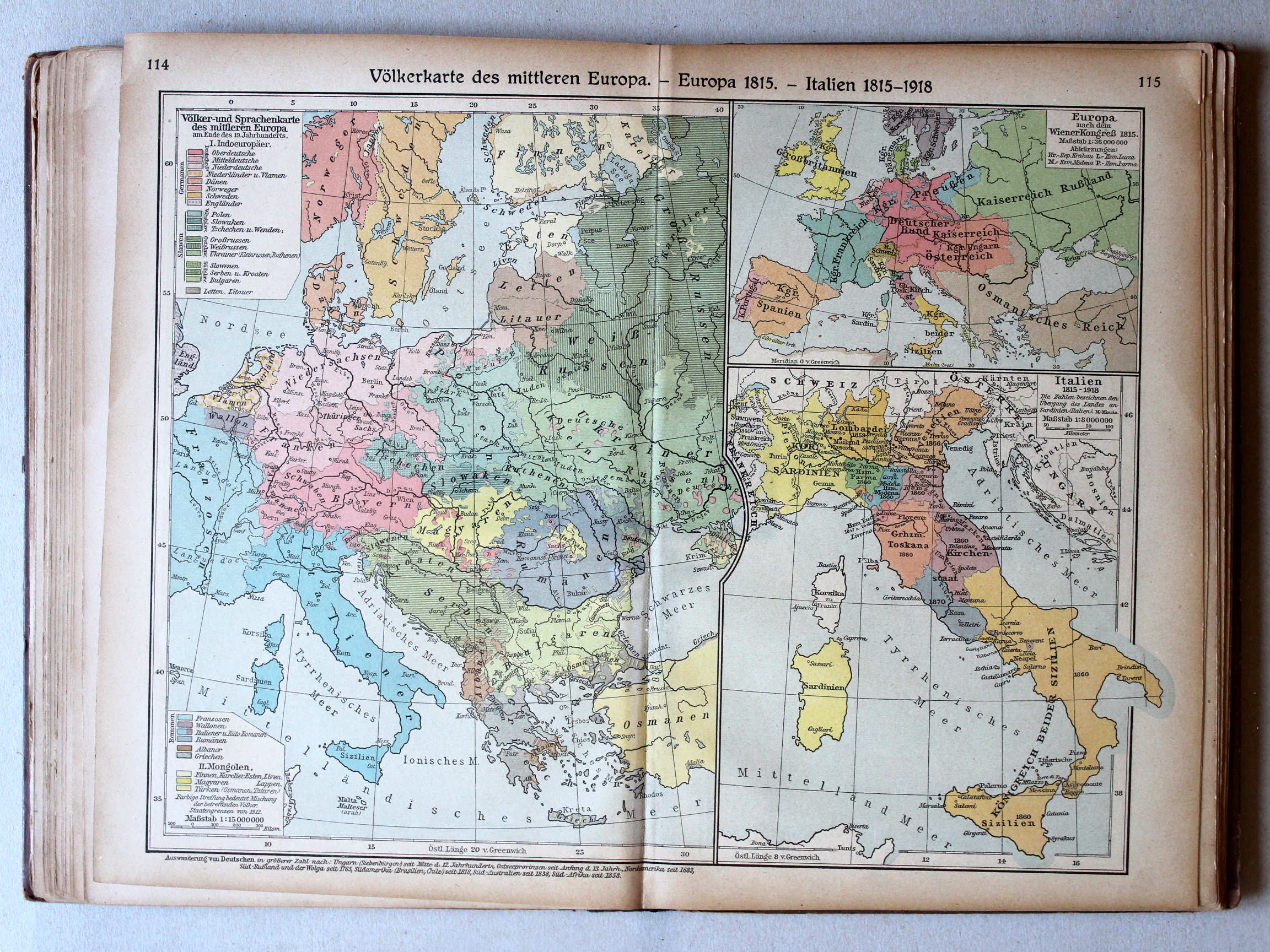
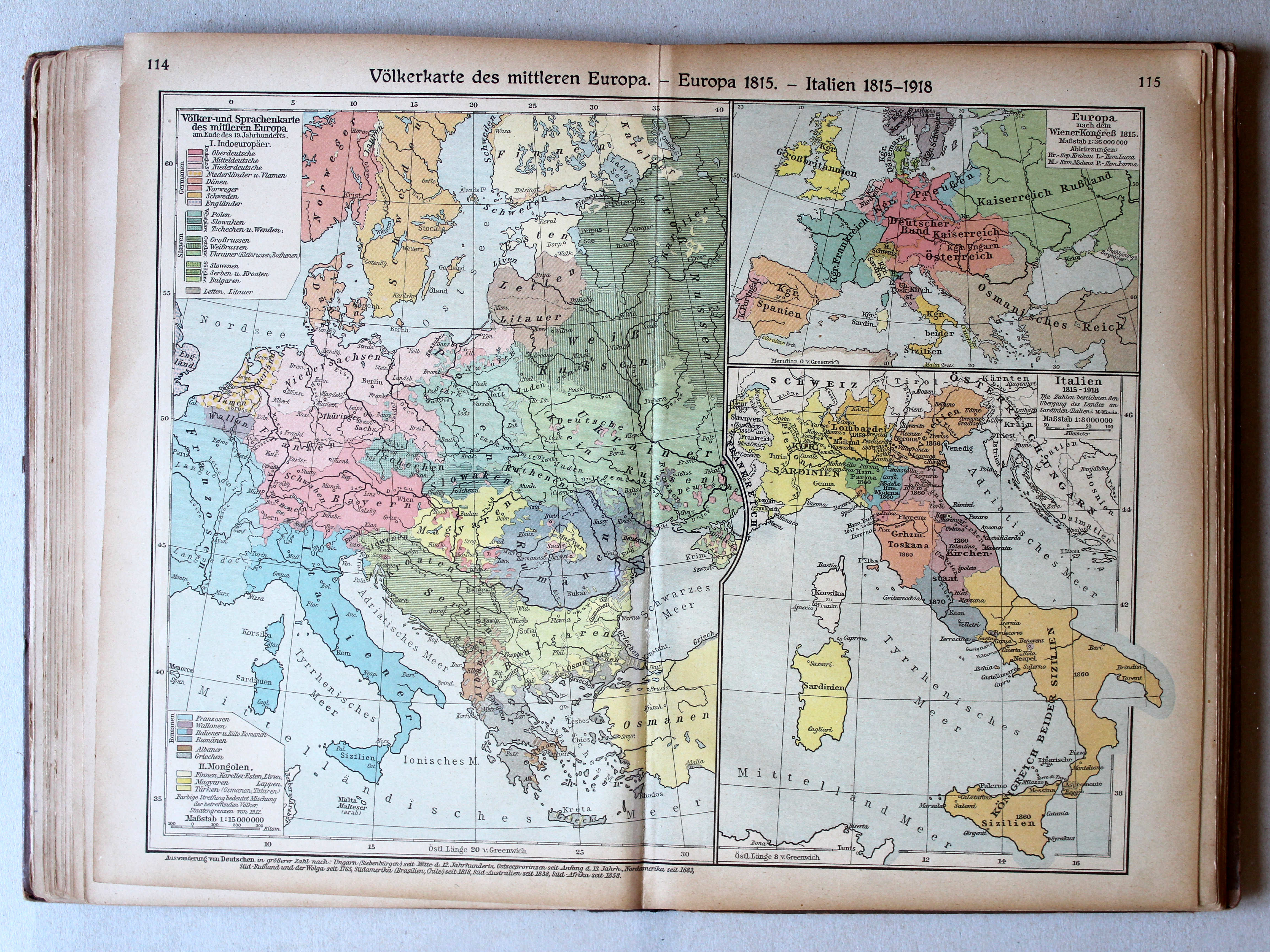
114.115. Völkerkarte des mittleren Europa – Europa 1815 – Italien 1815-1918 XL
Etnografische kaart van Midden-Europa. Europa in 1815. Italië 1815-1918 / Ethnographic map of Central Europe. Europe in 1815. Italy 1815-1918
Putzgers Historischer Schul-Atlas, 1922
29. Völkerkarte von Mittel und Südost-Europa. Italien 1815 bis zur Gegenwart XL
Etnografische kaart van Midden- en Zuidoost Europa. Italië van 1815 tot heden / Ethnographic map of Central and Southeastern Europe. Italy from 1815 until today
 Putzgers Historischer Schul-Atlas, Große Ausgabe, 1923
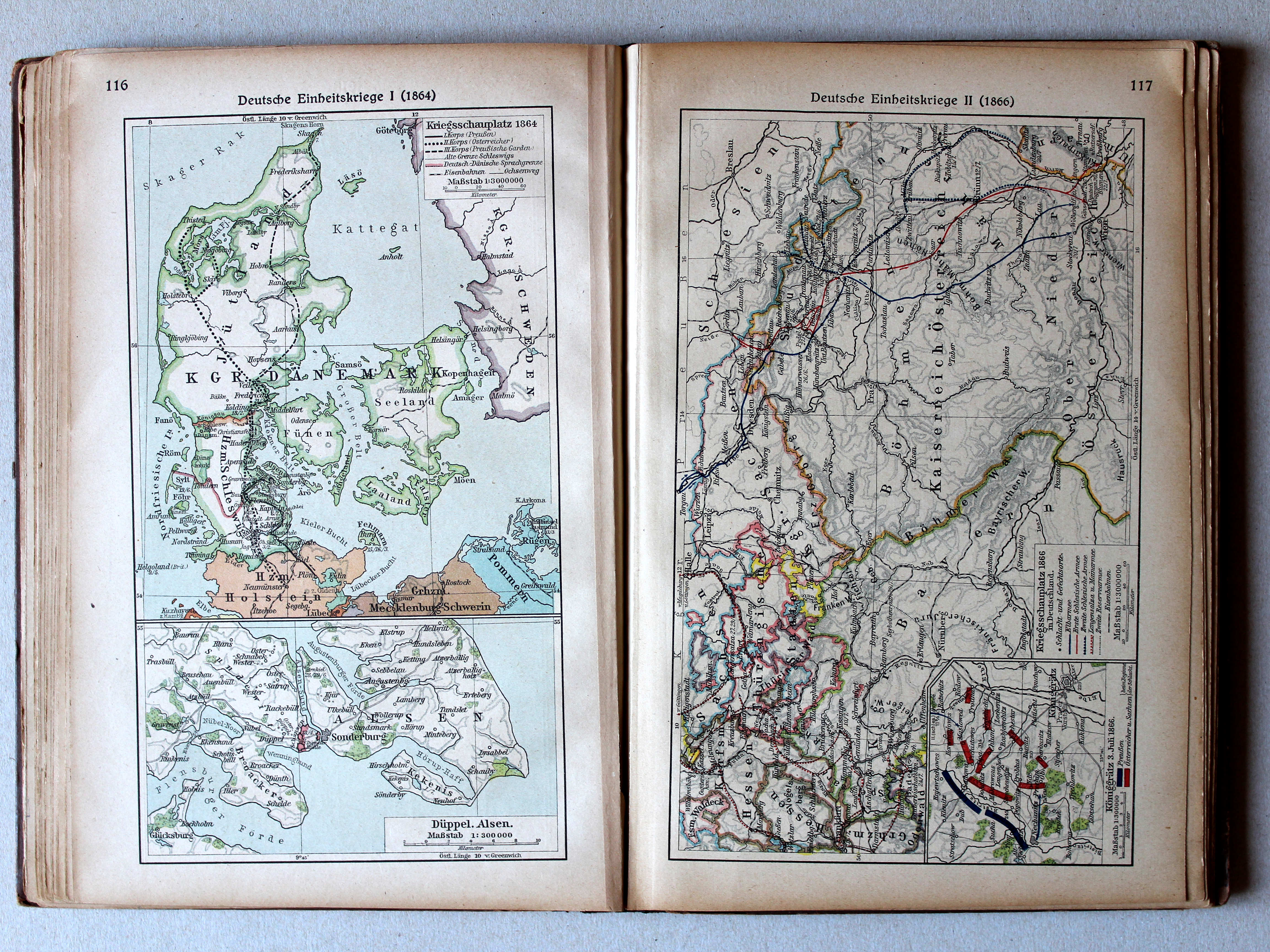
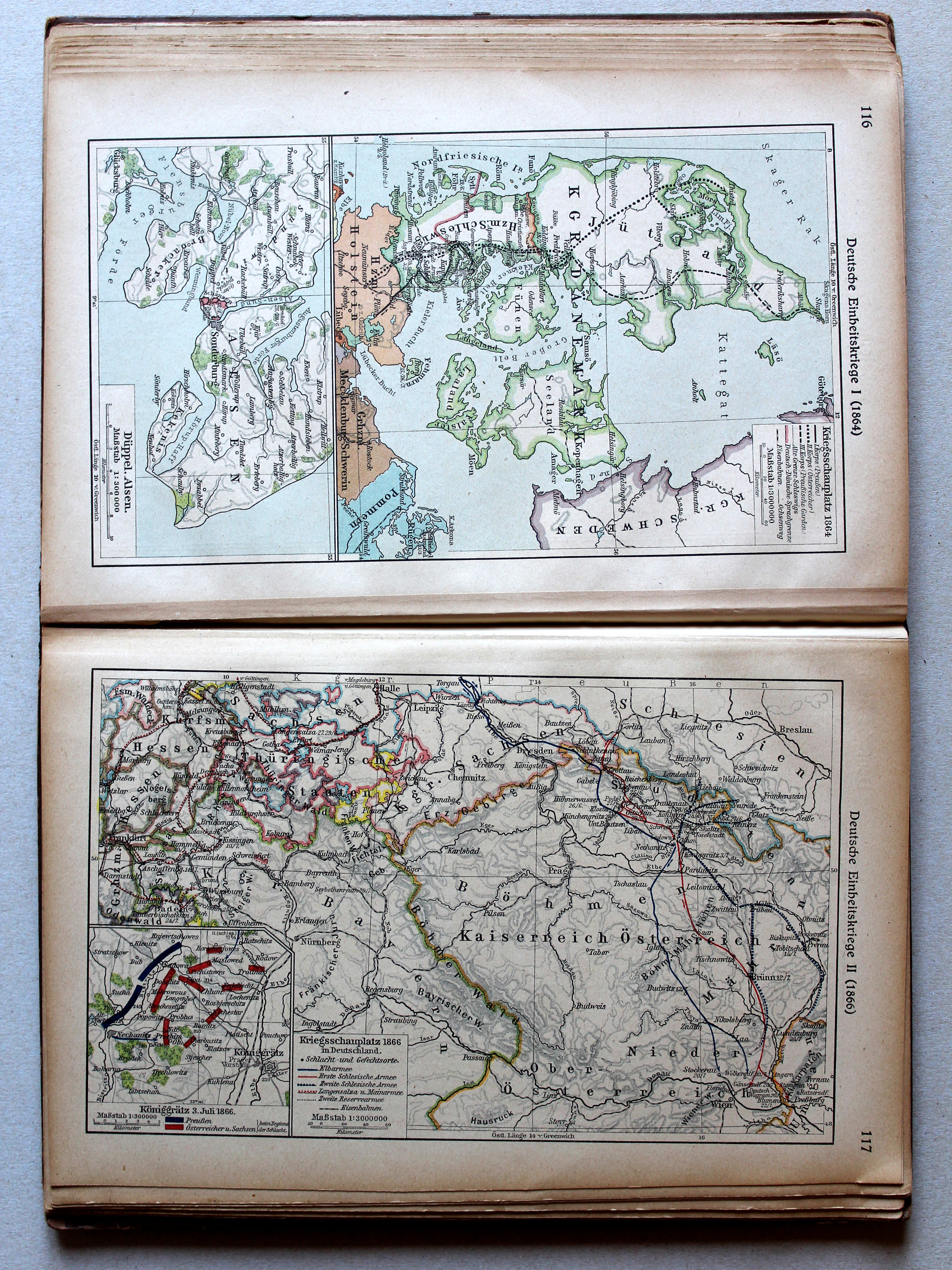
116. Deutsche Einheitskriege I (1864) XL
Duitse eenwording I (1864) / German unification I (1864)
 Putzgers Historischer Schul-Atlas, 1922
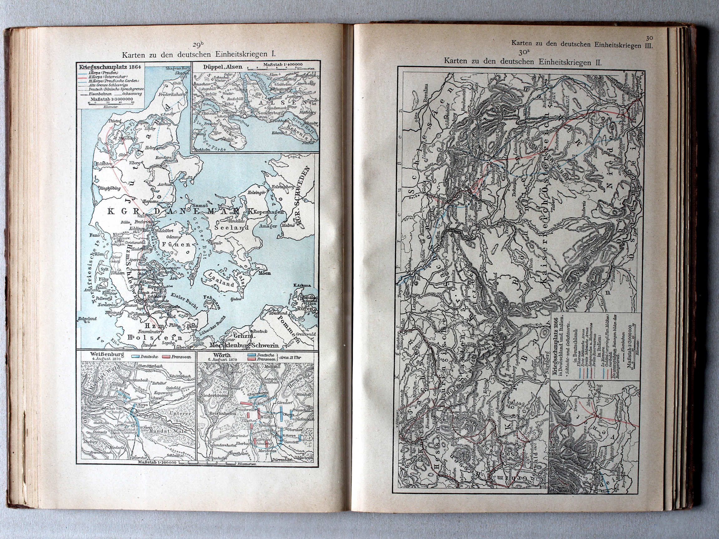
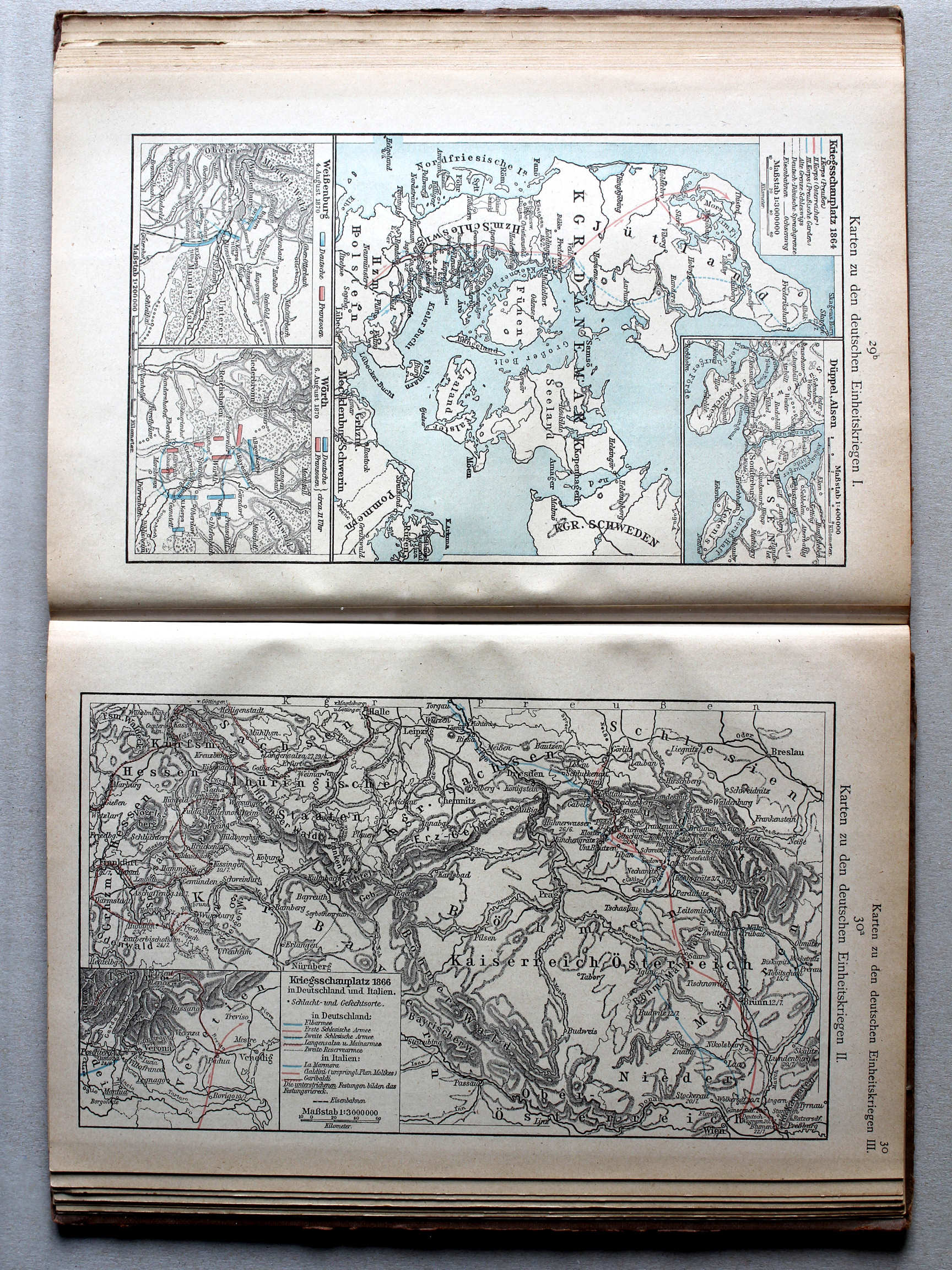
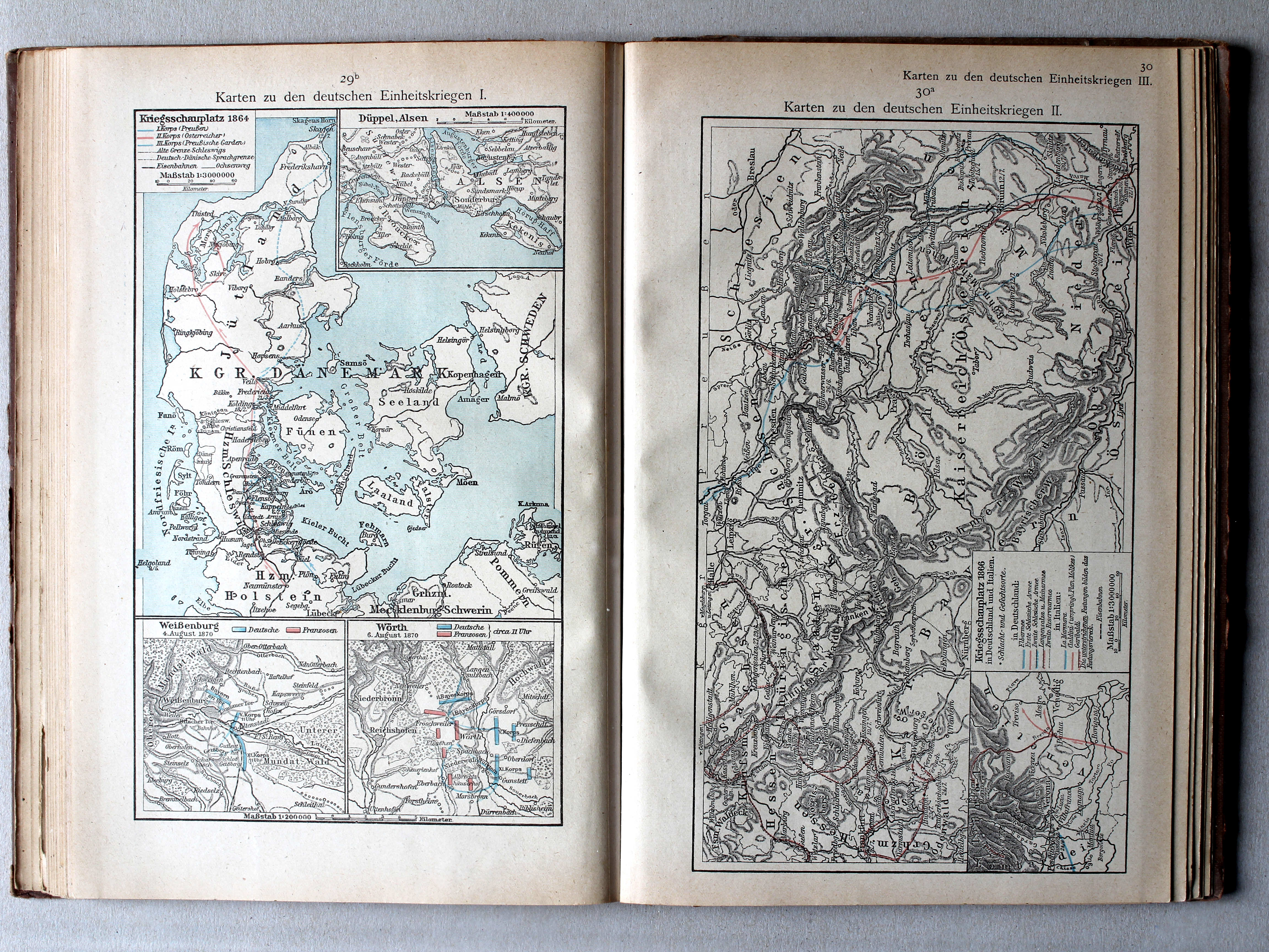
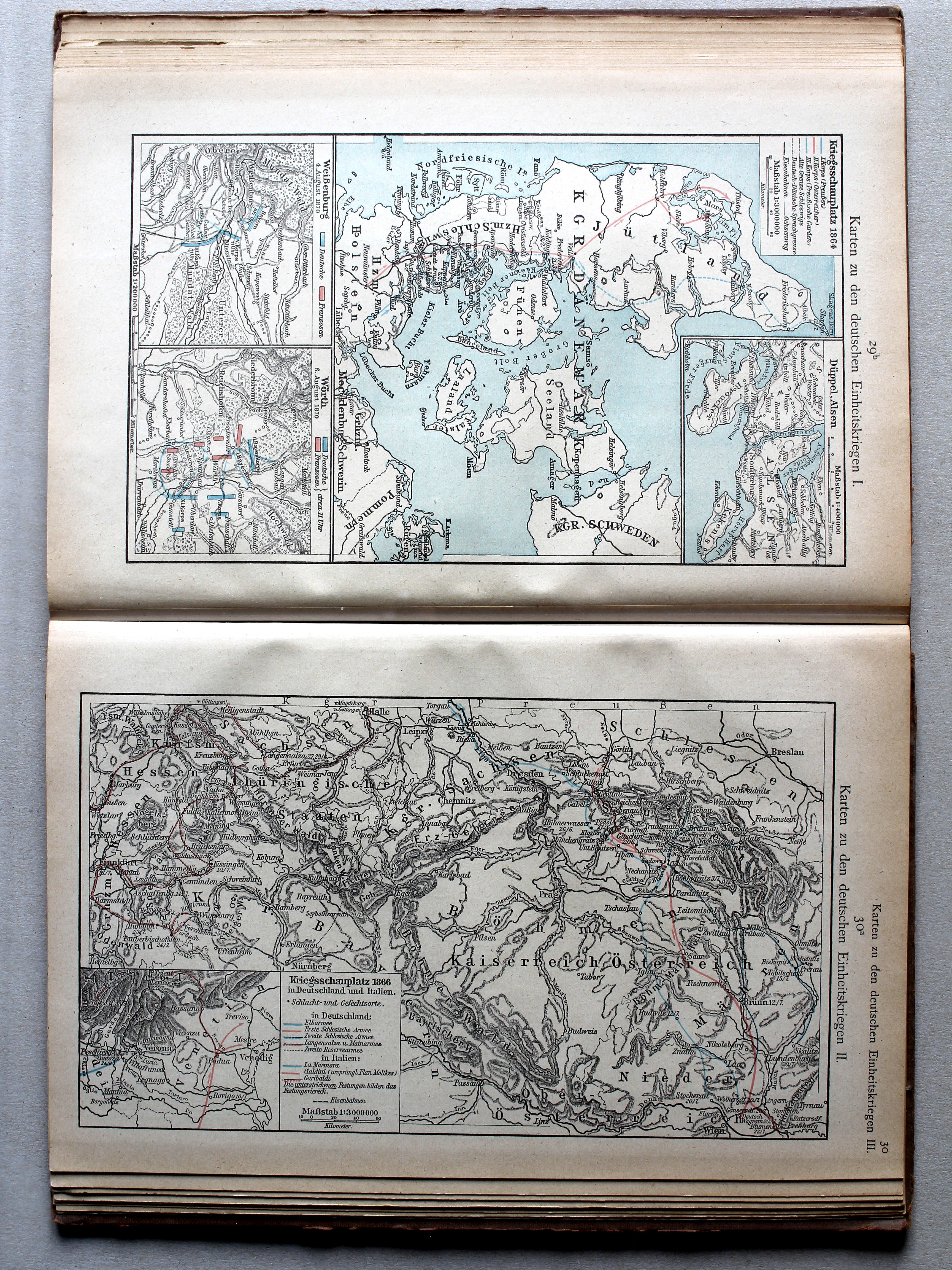
29b. Karten zu den deutschen Einheitskriegen I XL
Kaarten bij de Duitse eenwording I / Maps to the German unification I
 Putzgers Historischer Schul-Atlas, Große Ausgabe, 1923
117. Deutsche Einheitskriege II (1866) XL
Duitse eenwording II (1866) / German unification II (1866)
 Putzgers Historischer Schul-Atlas, 1922
30a. Karten zu den deutschen Einheitskriegen II XL
Kaarten bij de Duitse eenwording II / Maps to the German unification II
Putzgers Historischer Schul-Atlas, Große Ausgabe, 1923
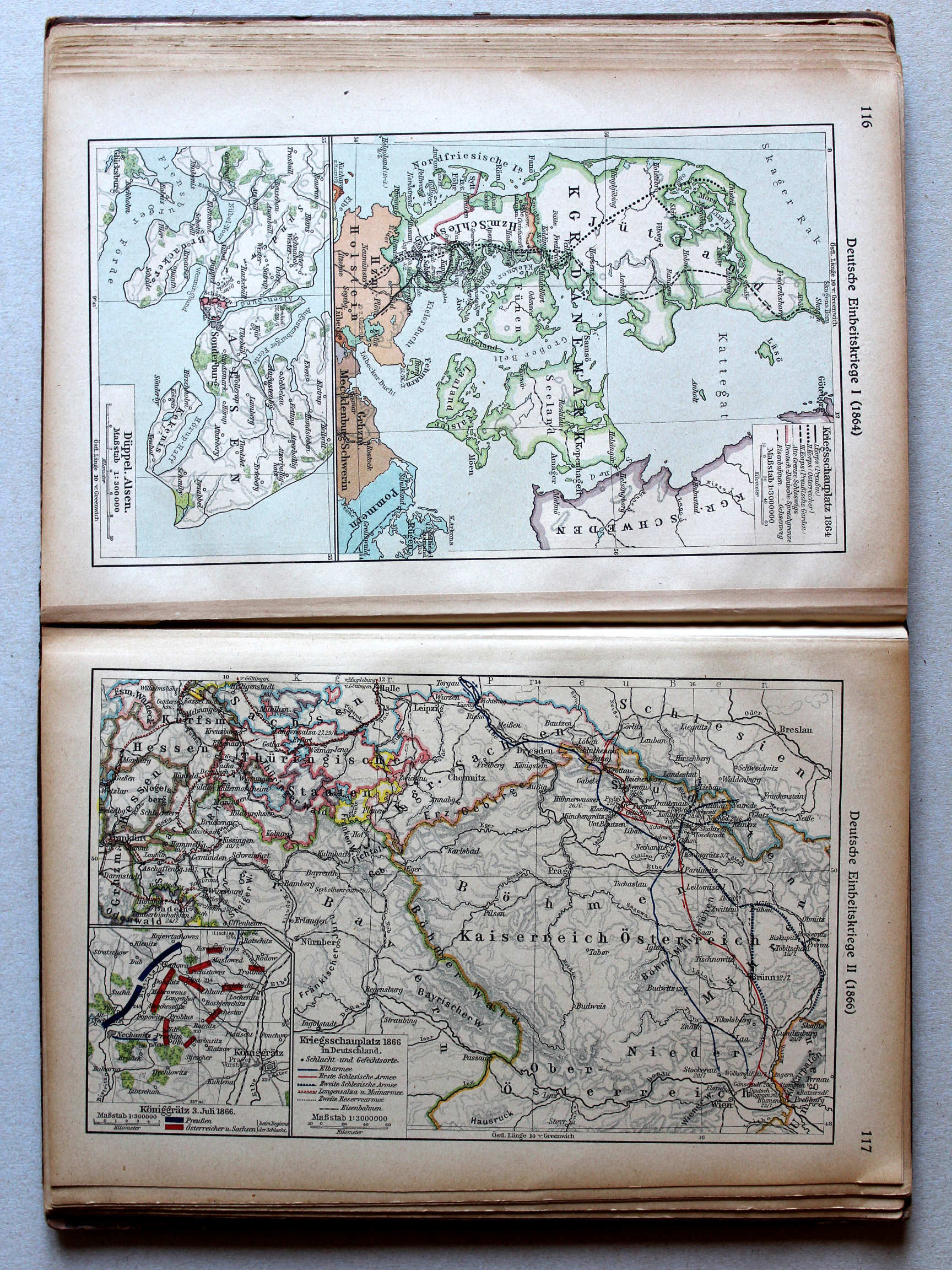
117. Deutsche Einheitskriege II (1866) (Königgrätz) XL
Duitse eenwording II / German unification II (Königgrätz)
 Putzgers Historischer Schul-Atlas, 1922
30. Karten zu den deutschen Einheitskriegen (Königgrätz) XL
Kaarten bij de Duitse eenwording / Maps to the German unification (Königgrätz)
 Putzgers Historischer Schul-Atlas, Große Ausgabe, 1923
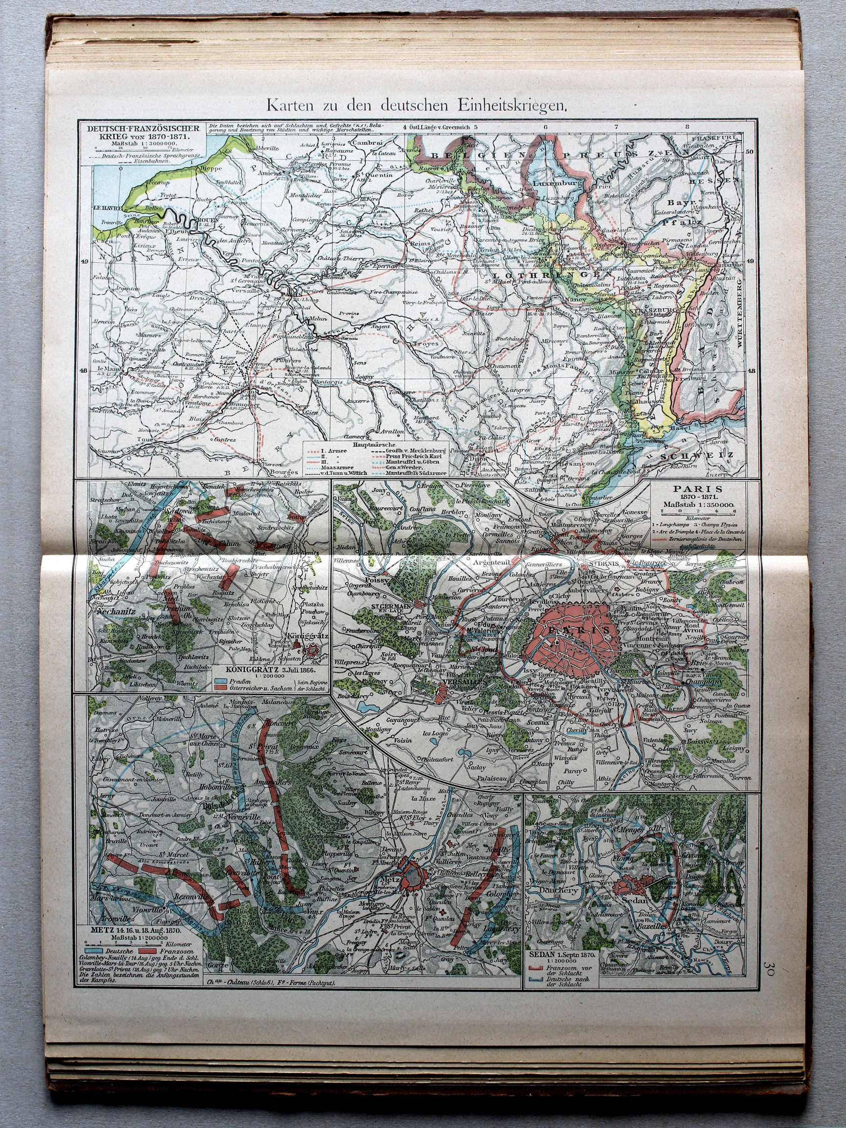
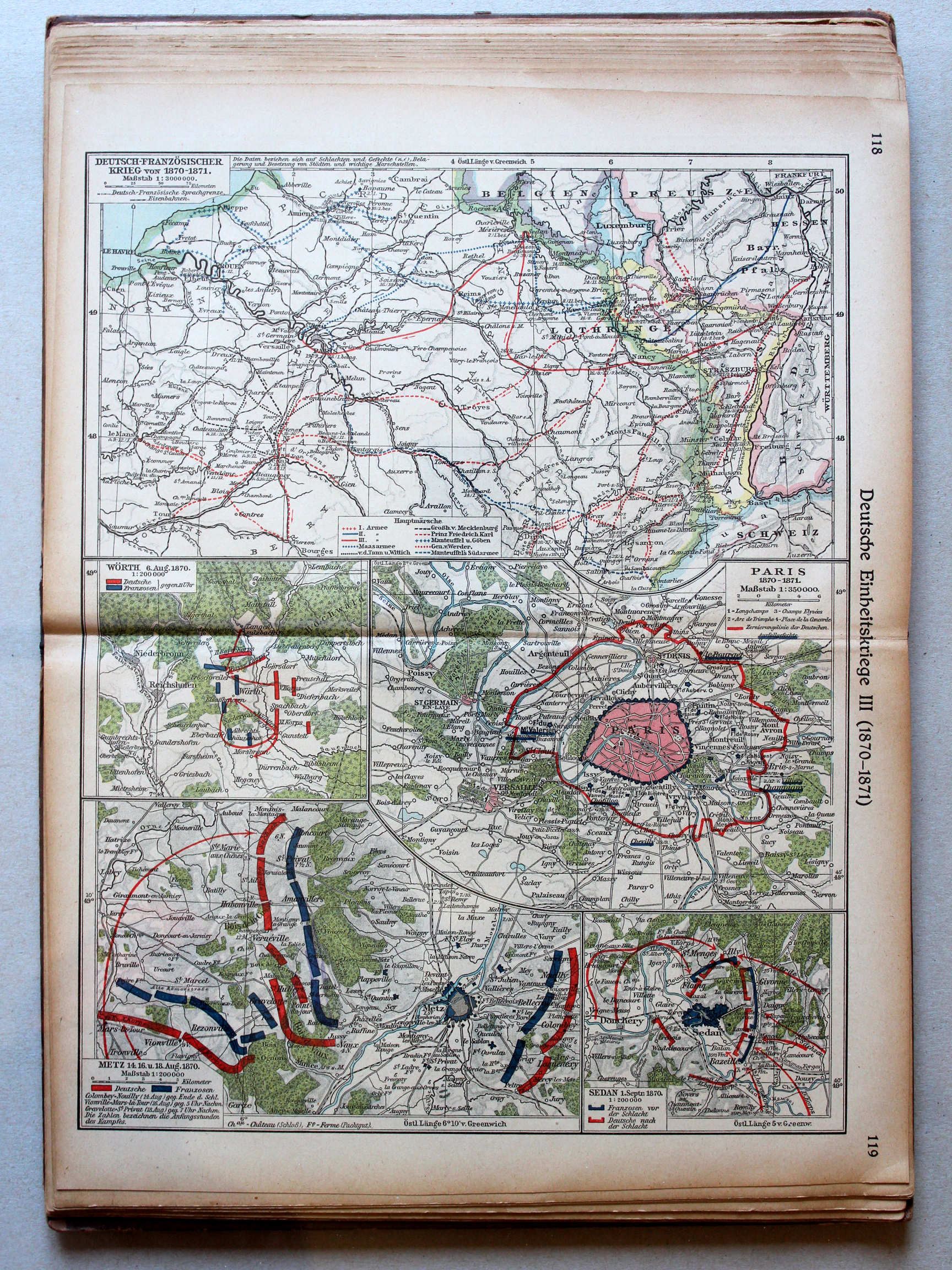
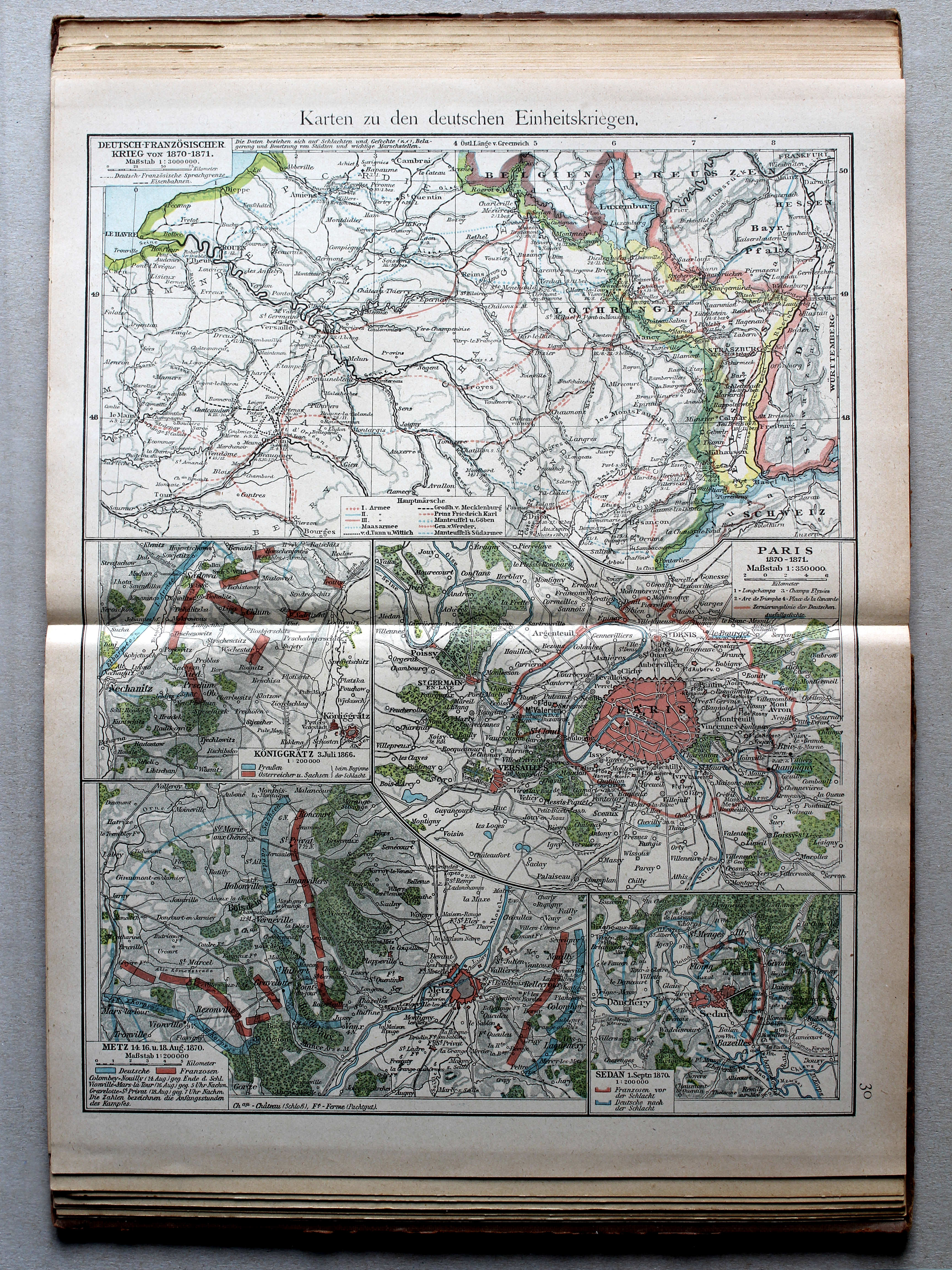
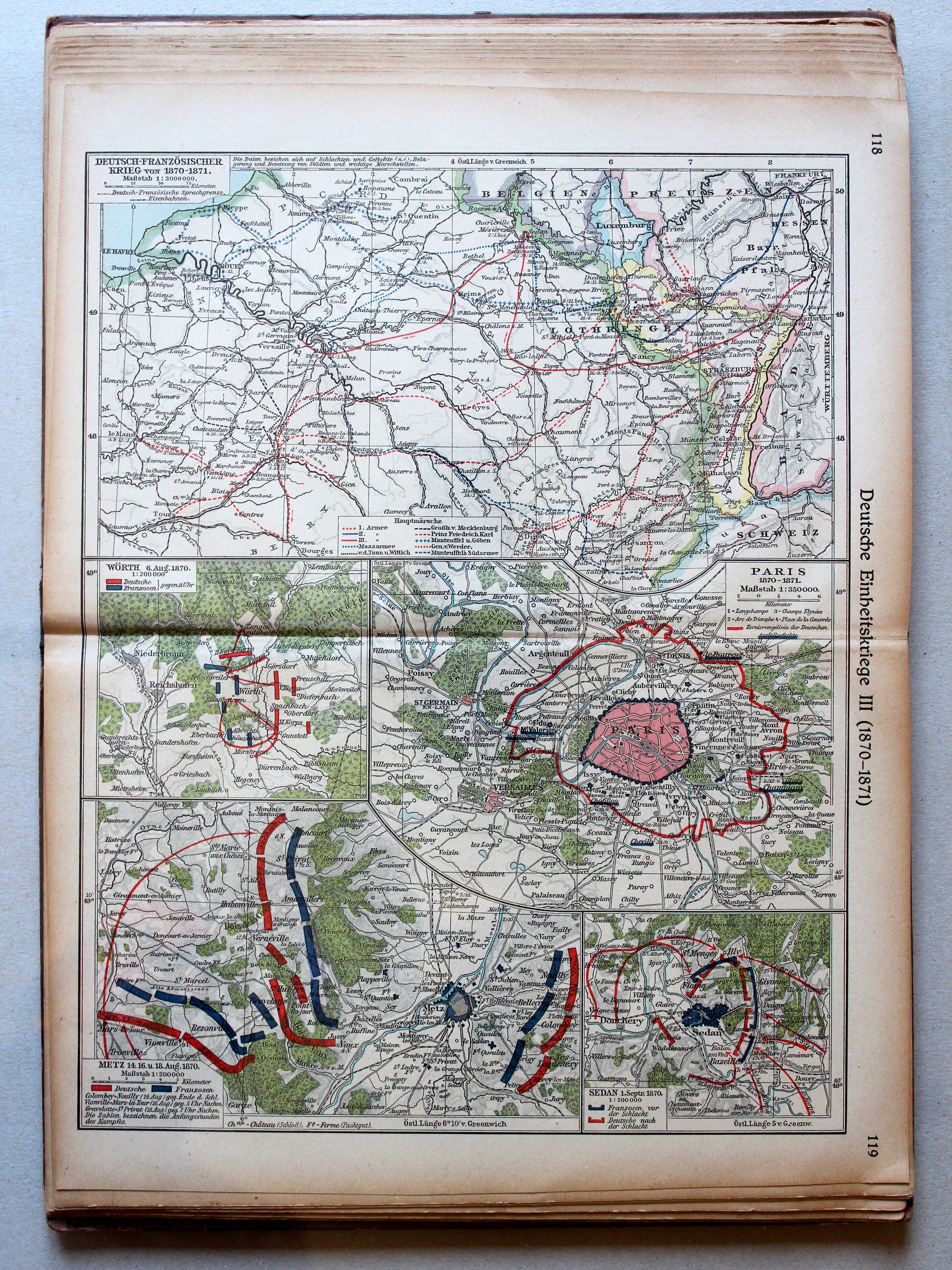
118.119. Deutsche Einheitskriege III (1870-1871) XL
Duitse eenwording III (1870-1871) / German unification III (1870-1871)
Putzgers Historischer Schul-Atlas, 1922
30. Karten zu den deutschen Einheitskriegen XL
Kaarten bij de Duitse eenwording / Maps to the German unification
Putzgers Historischer Schul-Atlas, Große Ausgabe, 1923
118.119. Deutsche Einheitskriege III (1870-1871) (Wörth) XL
Duitse eenwording III (1870-1871) / German unification III (1870-1871) (Wörth)
Putzgers Historischer Schul-Atlas, 1922
29b. Karten zu den deutschen Einheitskriegen I (Wörth) XL
Kaarten bij de Duitse eenwording I / Maps to the German unification I (Wörth)
 Putzgers Historischer Schul-Atlas, Große Ausgabe, 1923
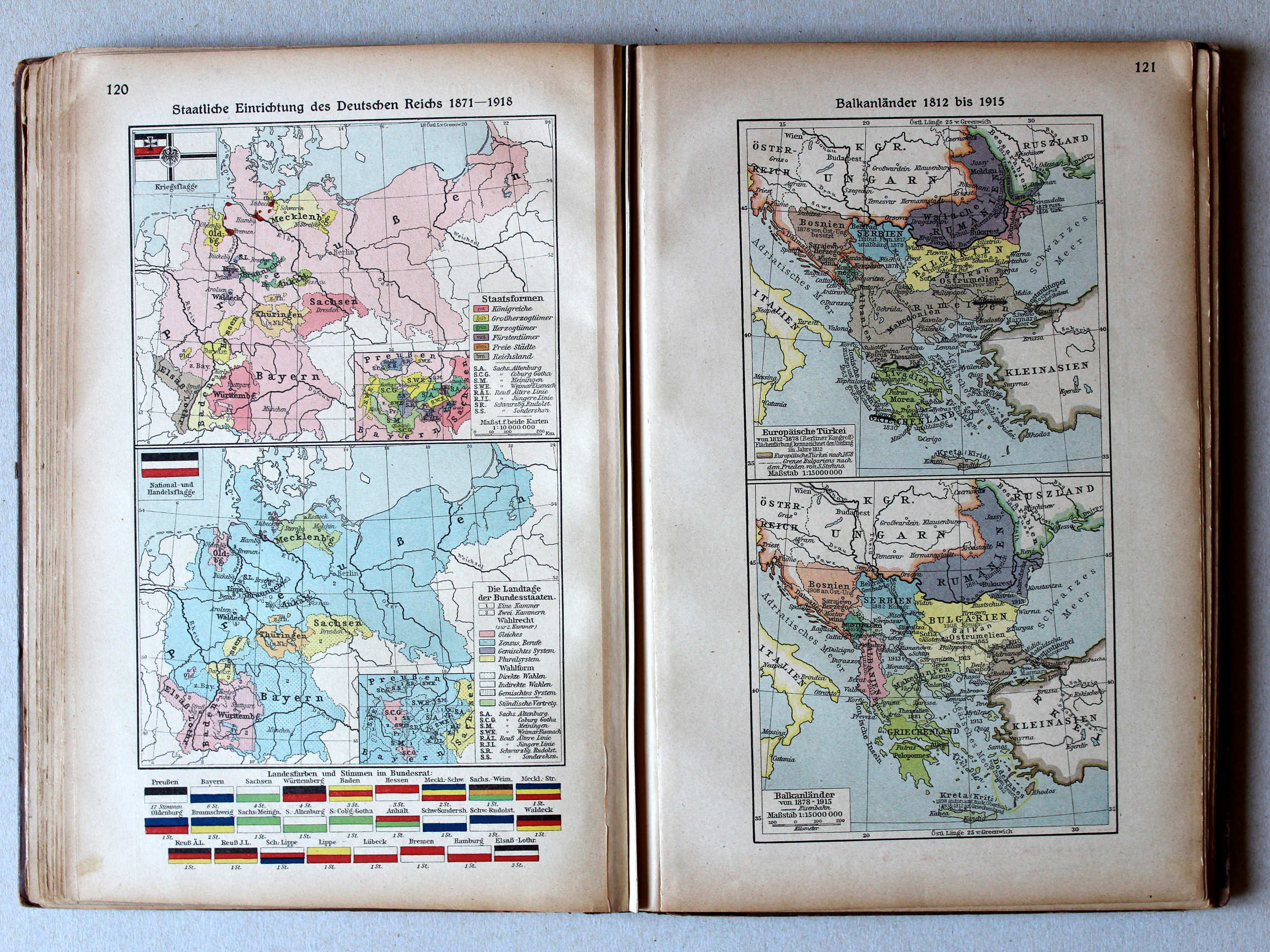
120. Staatliche Einrichtung des Deutschen Reichs 1871-1918 XL
Staatsinrichting van het Duitse Rijk 1871-1918 / Polity of the german Empire 1871-1918
121. Balkanländer 1812 bis 1915 XL
Balkanschiereiland 1812-1915 / Balkan Peninsula 1812-1915
Putzgers Historischer Schul-Atlas, 1922
25. Schweden. Rußland. Polen. Orientalische Frage XL
Zweden, Rusland, Polen, Oosterse Kwestie / Sweden, Russia, Poland, Eastern Question
 Putzgers Historischer Schul-Atlas, Große Ausgabe, 1923
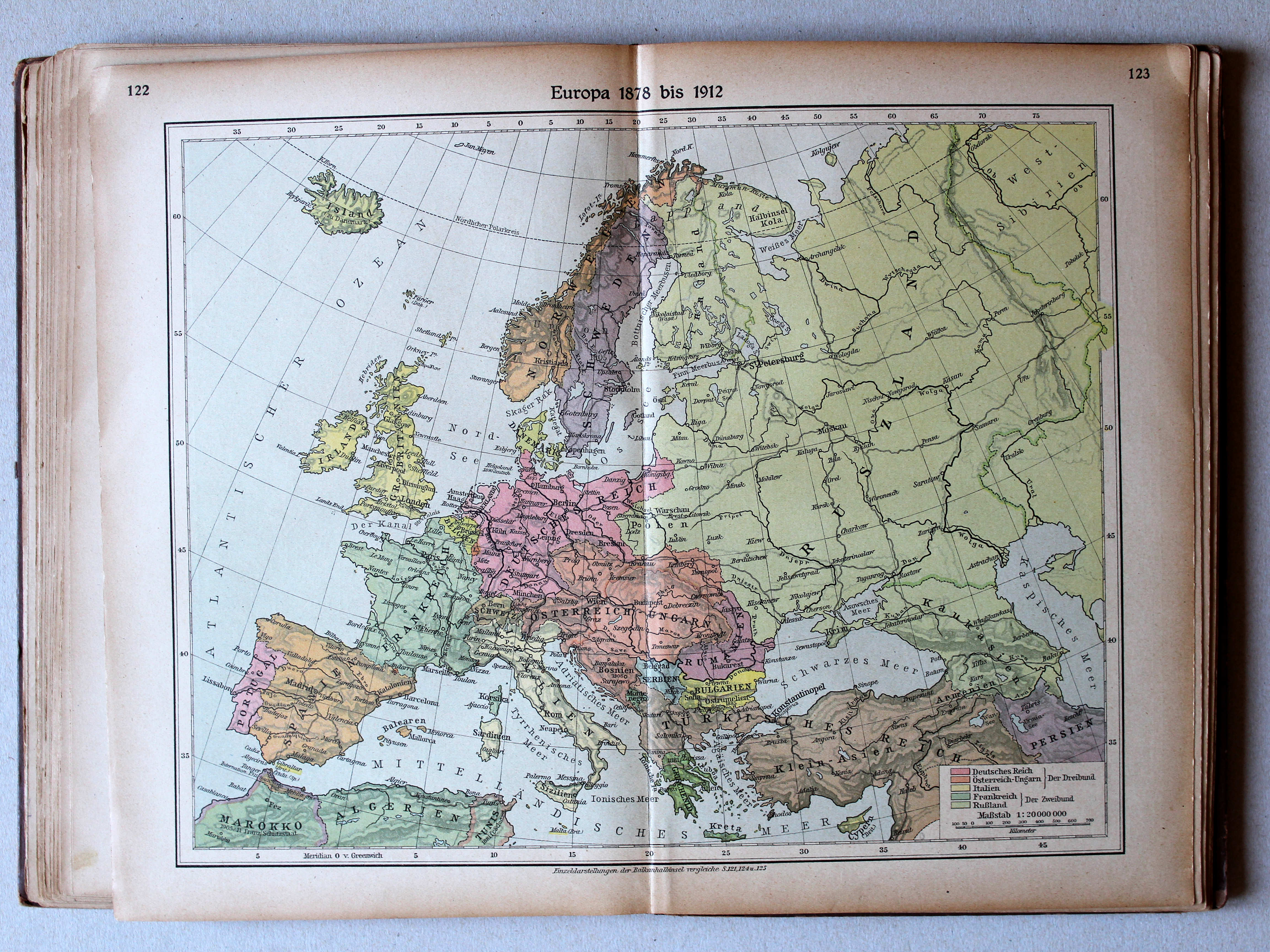
122.123. Europa 1878 bis 1912 XL
Europa 1878-1912 / Europe 1878-1912
Putzgers Historischer Schul-Atlas, 1922
geen overeenkomstige kaart / no corresponding map
 Putzgers Historischer Schul-Atlas, Große Ausgabe, 1923
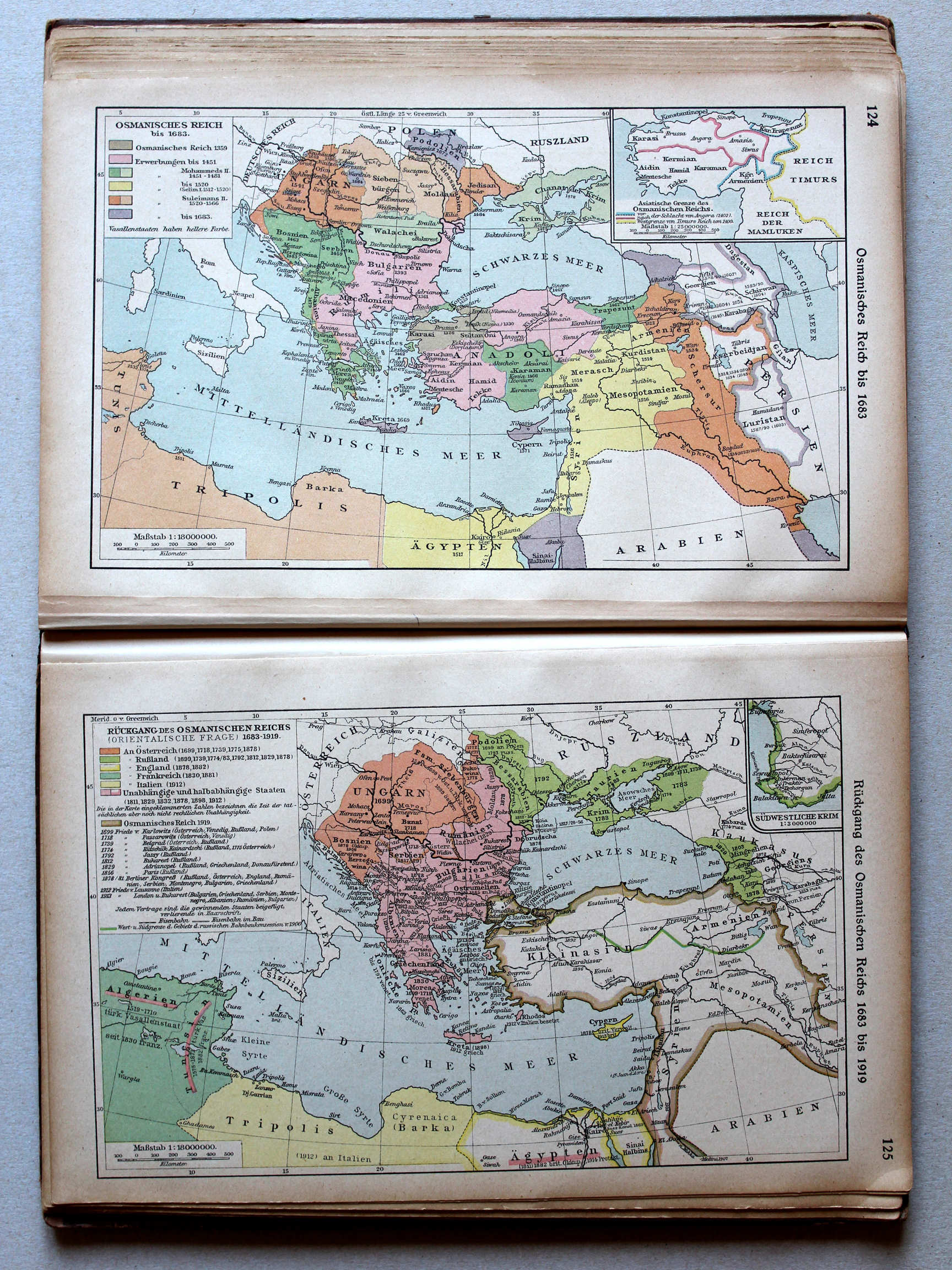
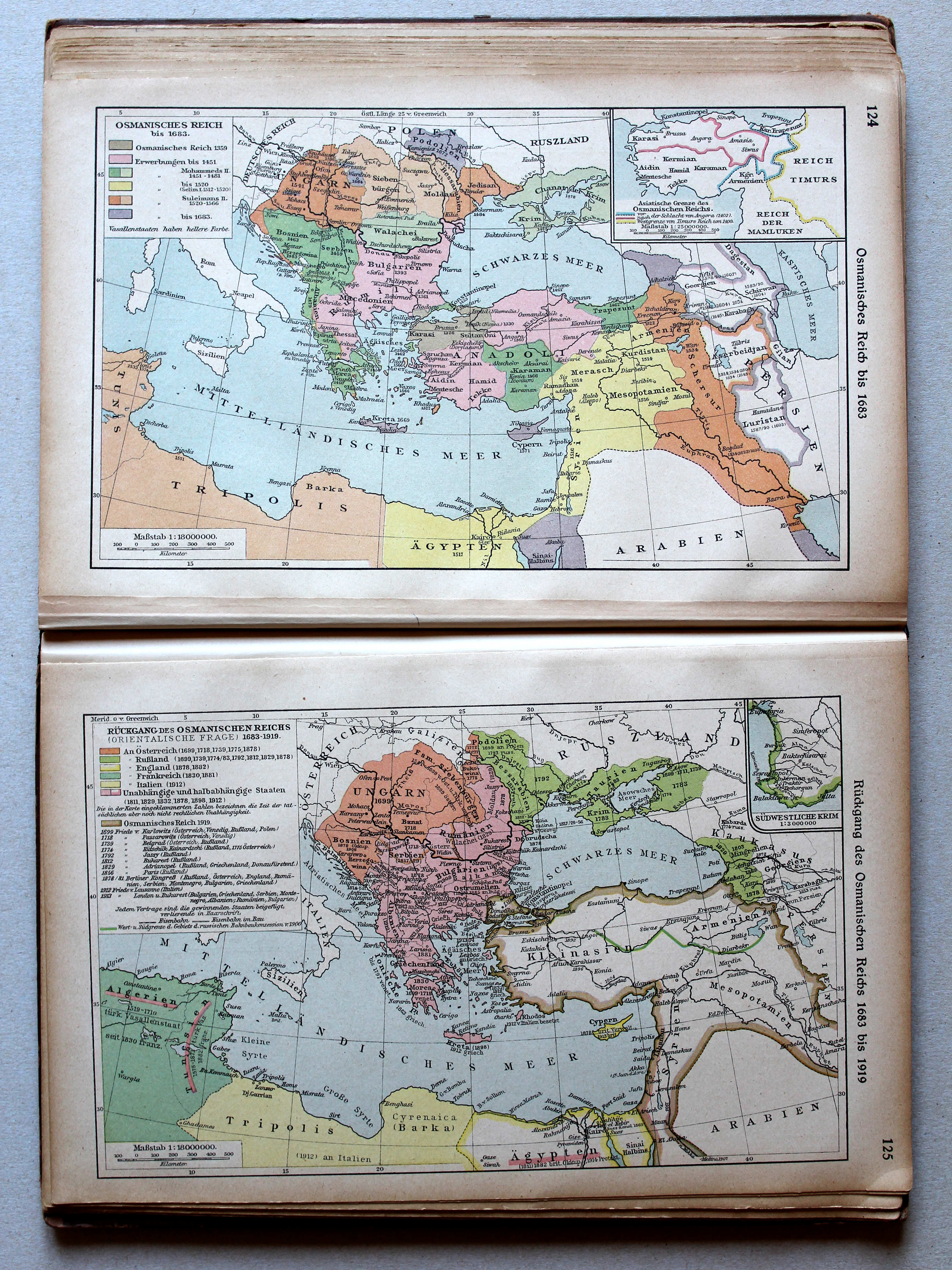
124. Osmanisches Reich bis 1683 XL
Het Ottomaanse Rijk tot 1683 / The Ottoman Empire until 1683
125. Rückgang des Osmanischen Reichs 1683 bis 1919 XL
Neergang van het Ottomaanse Rijk 1683-1919 / Decline of the Ottoman Empire 1683-1919
 Putzgers Historischer Schul-Atlas, Große Ausgabe, 1923
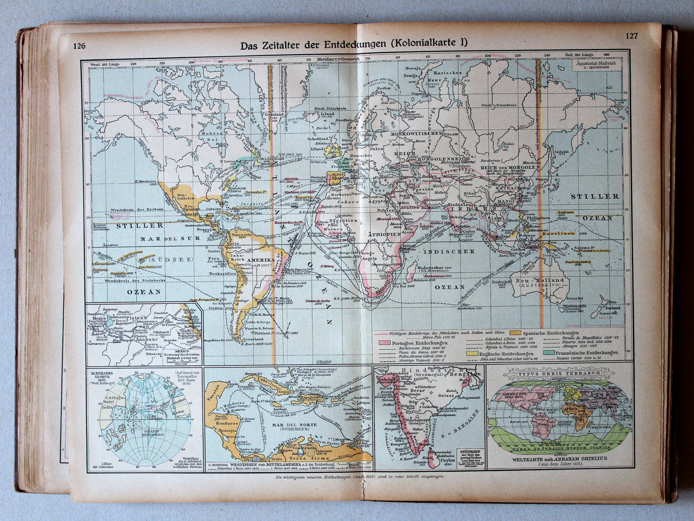
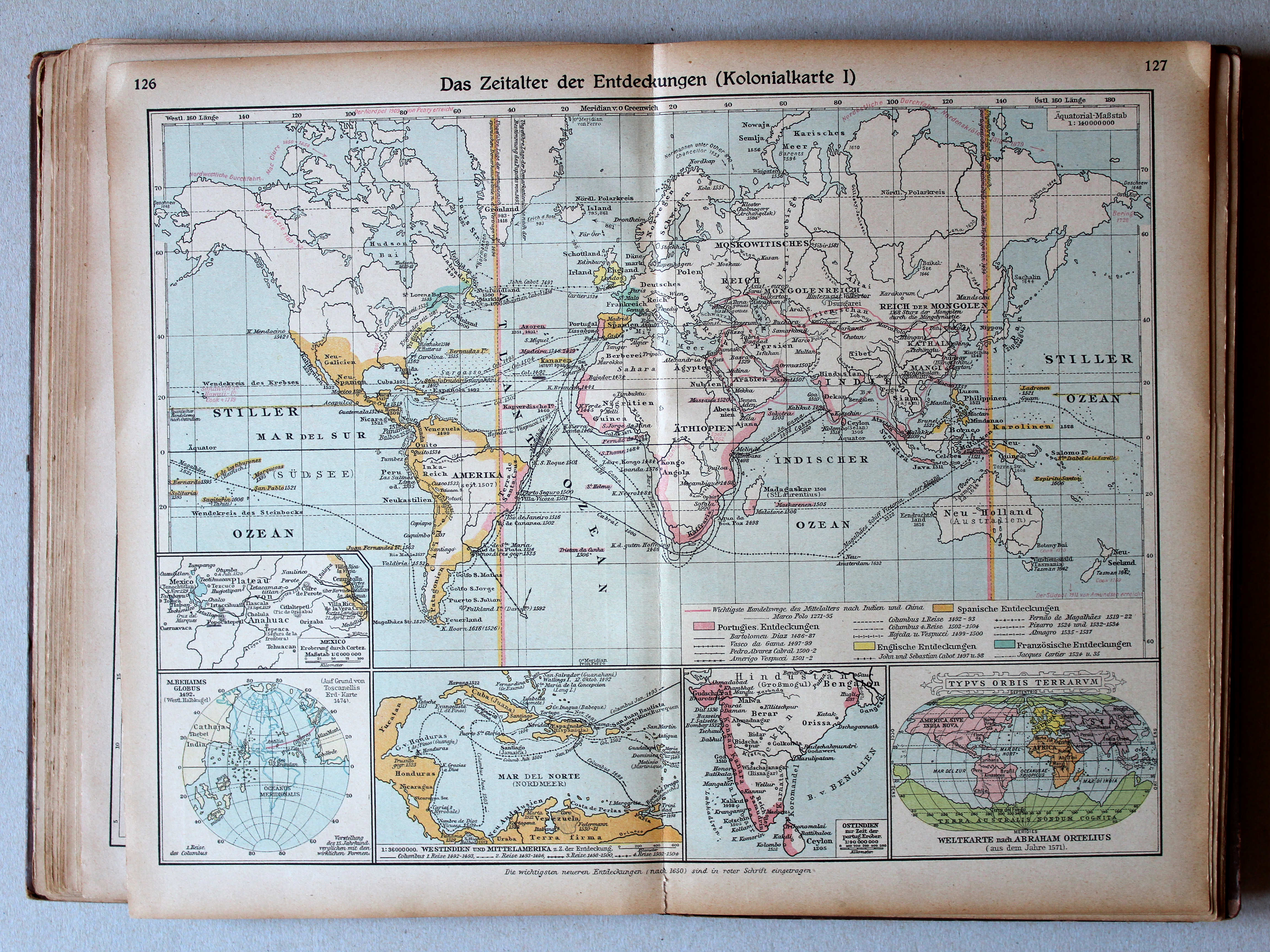
126.127. Das Zeitalter der Entdeckungen (Kolonialkarte I) XL
Het tijdperk van de grote ontdekkingen (Koloniën I) / The Age of Discovery (Colonies I)
 Putzgers Historischer Schul-Atlas, 1922
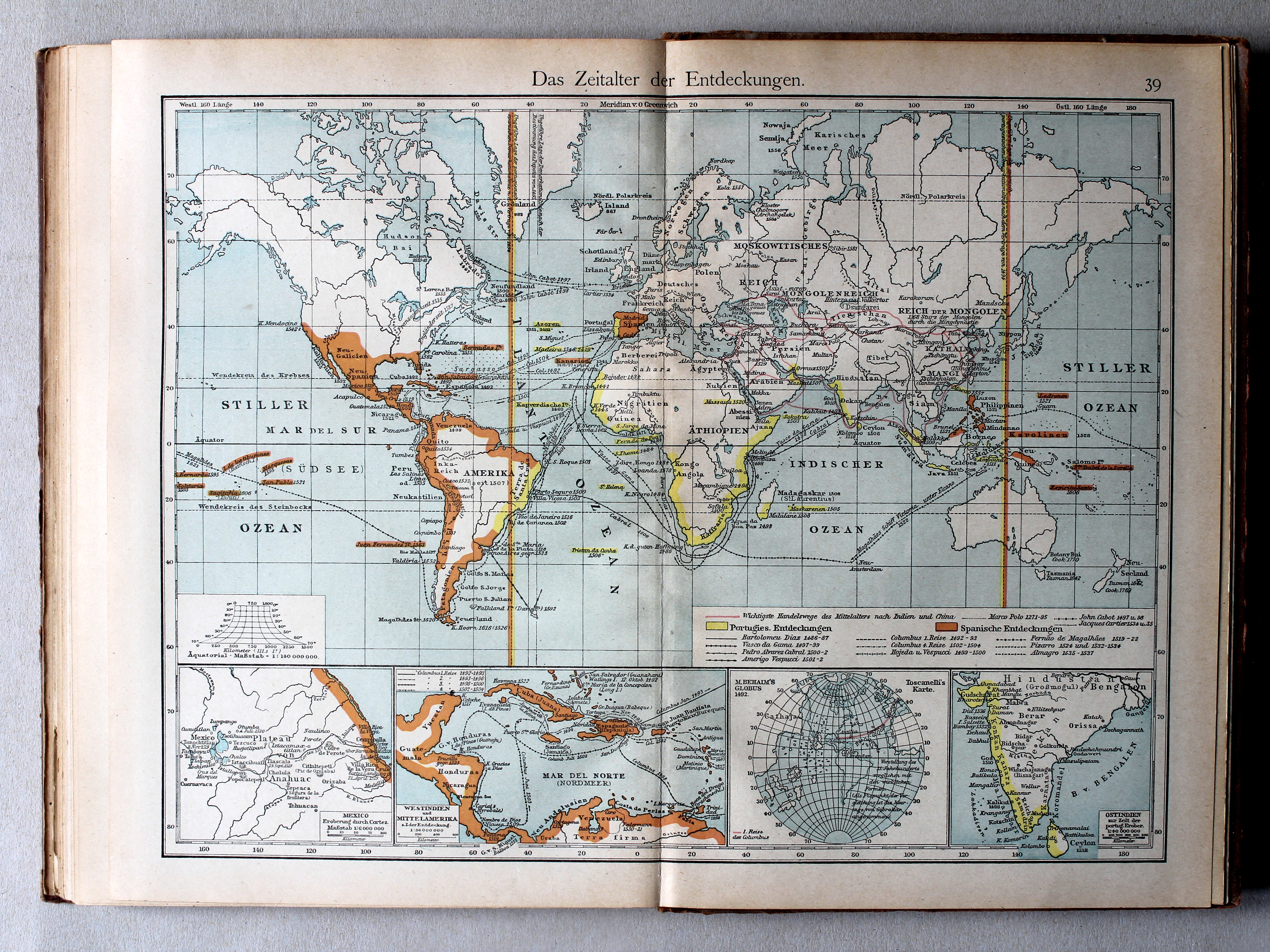
39. Das Zeitalter der Entdeckungen XL
Het tijdperk van de grote ontdekkingen / The Age of Discovery
 Putzgers Historischer Schul-Atlas, Große Ausgabe, 1923
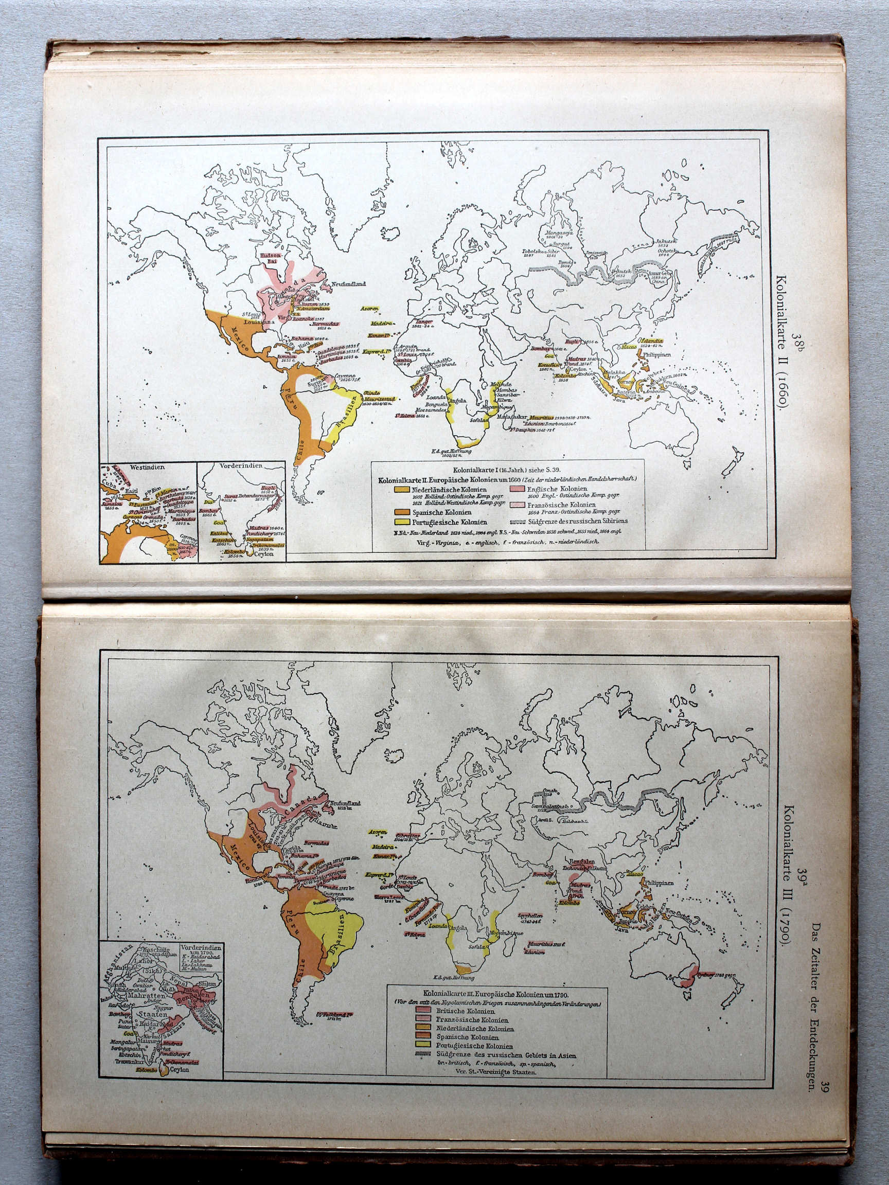
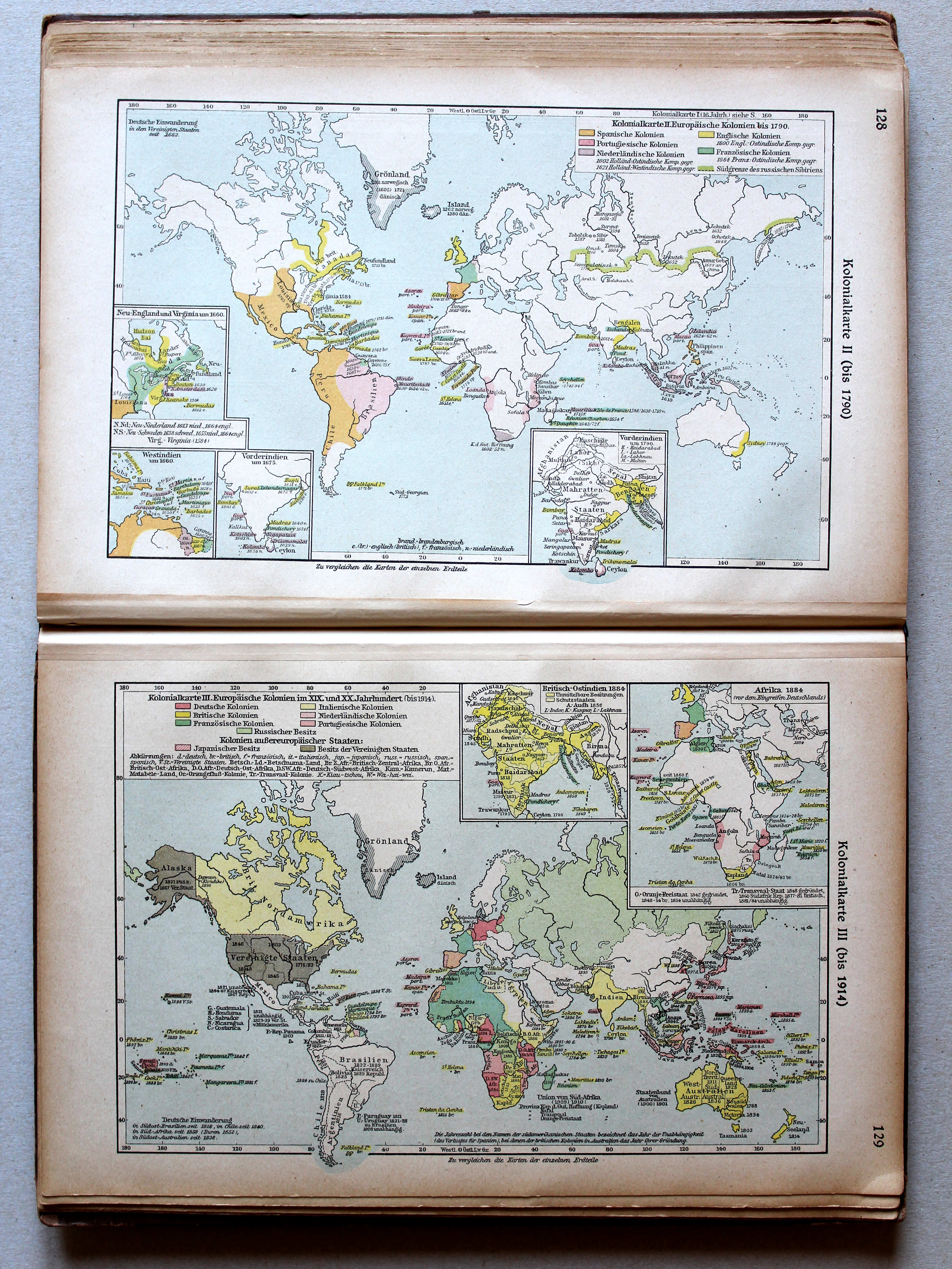
128. Kolonialkarte II (bis 1790) XL
Koloniën II (tot 1790) / Colonies II (until 1790)
129. Kolonialkarte III (bis 1914) XL
Koloniën III (tot 1914) / Colonies III (until 1914)
 Putzgers Historischer Schul-Atlas, 1922
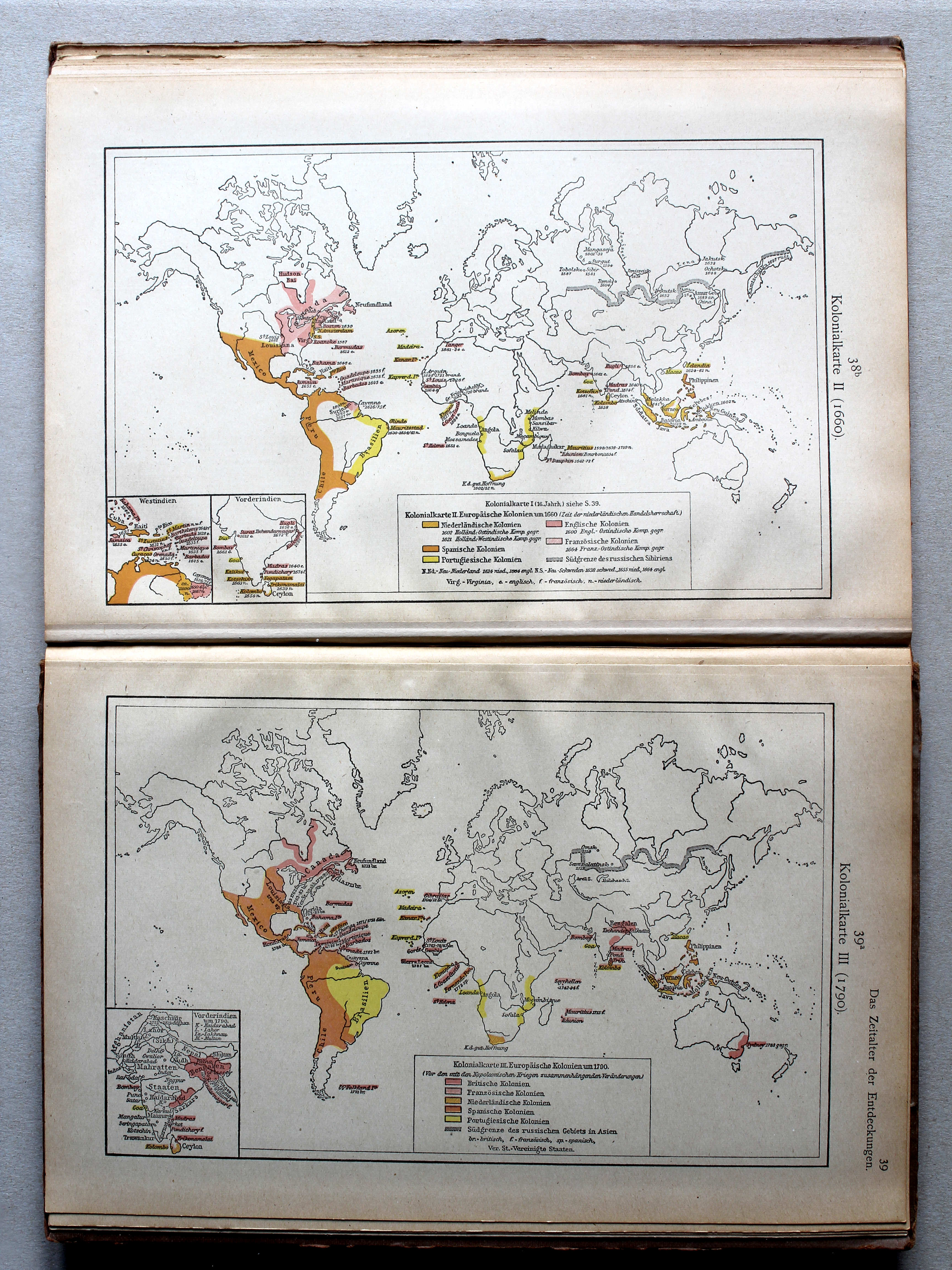
38b. Kolonialkarte II (1660) XL
Koloniën II (1660) / Colonies II (1660)
39a. Kolonialkarte III (1790) XL
Koloniën III (1790) / Colonies III (1790)
Putzgers Historischer Schul-Atlas, Große Ausgabe, 1923
128. Kolonialkarte II (bis 1790) XL
Koloniën II (tot 1790) / Colonies II (until 1790)
129. Kolonialkarte III (bis 1914) XL
Koloniën III (tot 1914) / Colonies III (until 1914)
 Putzgers Historischer Schul-Atlas, 1922
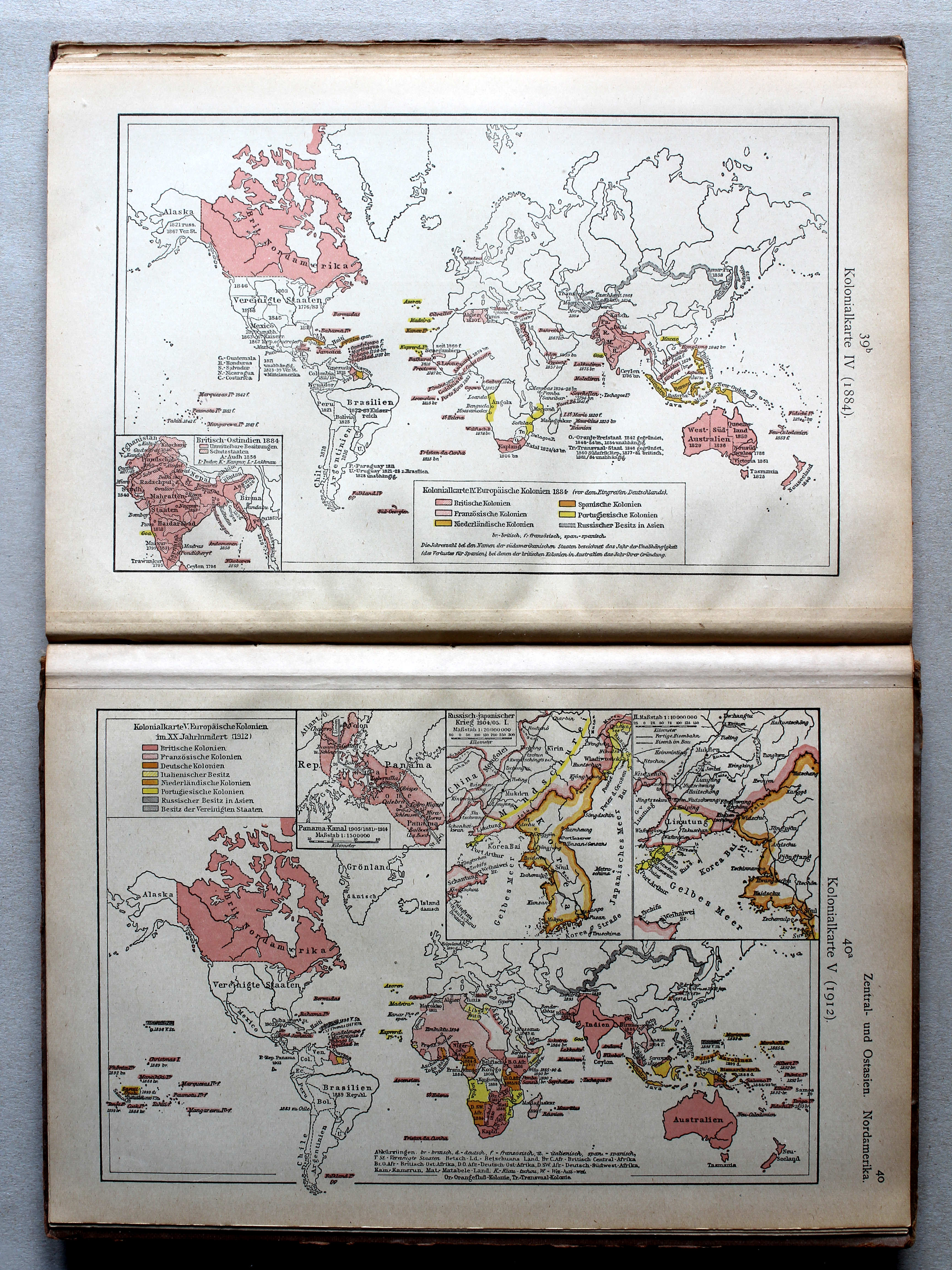
39b. Kolonialkarte IV (1884) XL
Koloniën IV (1884) / Colonies IV (1884)
40a. Kolonialkarte V (1912) XL
Koloniën V (1905) / Colonies V (1905)
 Putzgers Historischer Schul-Atlas, Große Ausgabe, 1923
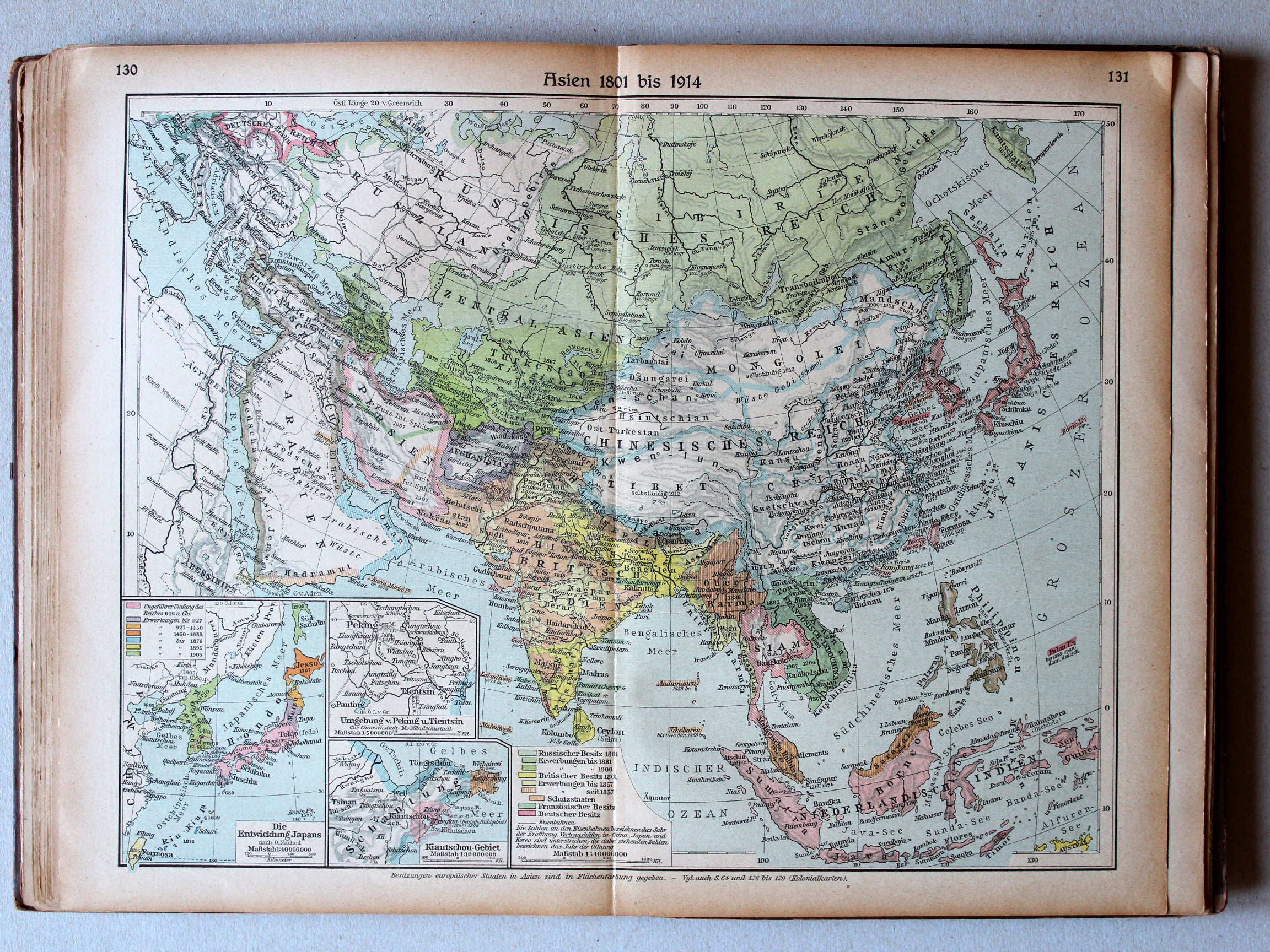
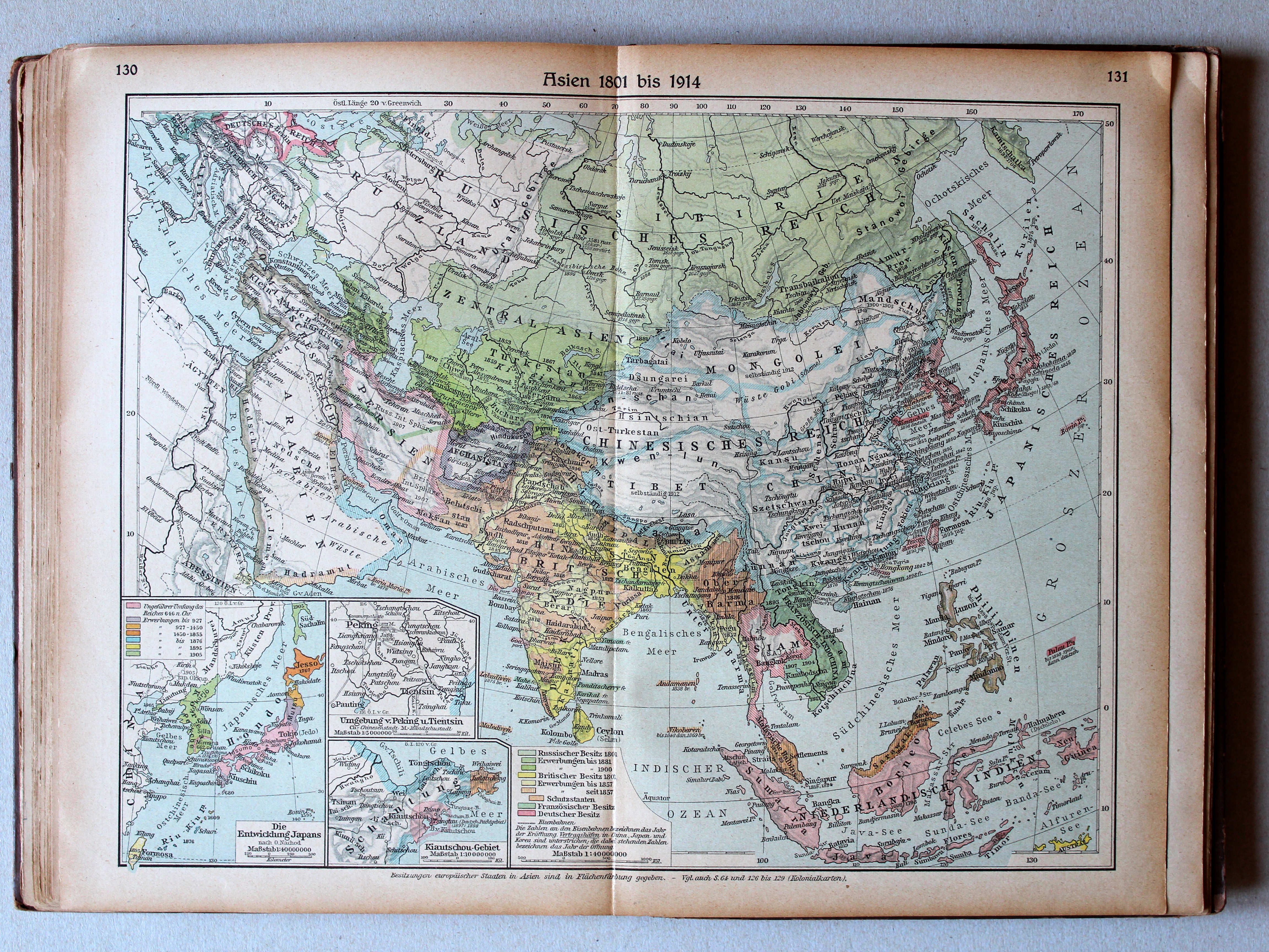
130.131. Asien 1801 bis 1914 XL
Azië 1801-1914 / Asia 1801-1914
 Putzgers Historischer Schul-Atlas, 1922
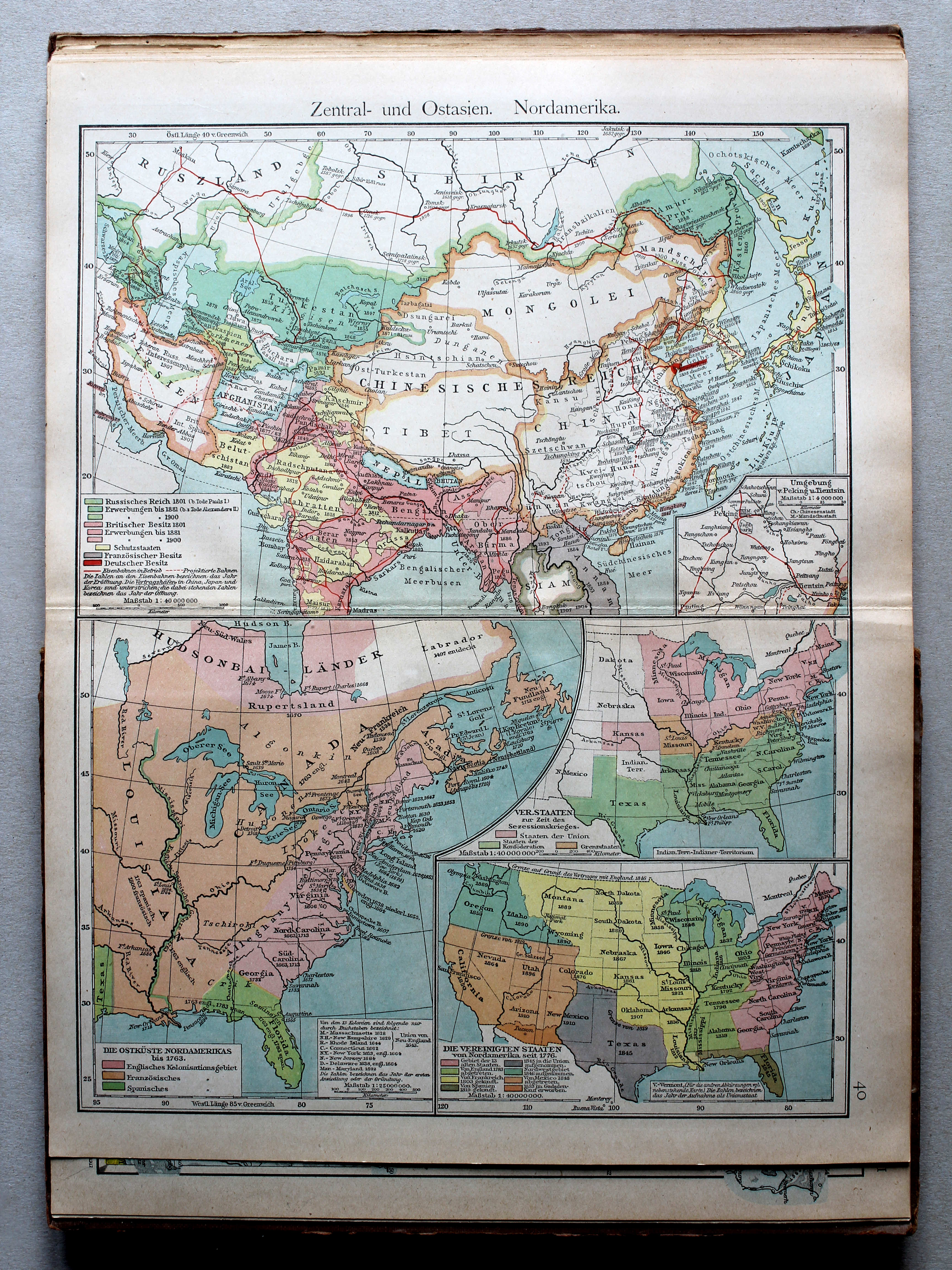
40. Zentral- und Ostasien. Nordamerika XL
Centraal- en Oost-Azië. Noord-Amerika / Central and East Asia. North America
 Putzgers Historischer Schul-Atlas, Große Ausgabe, 1923
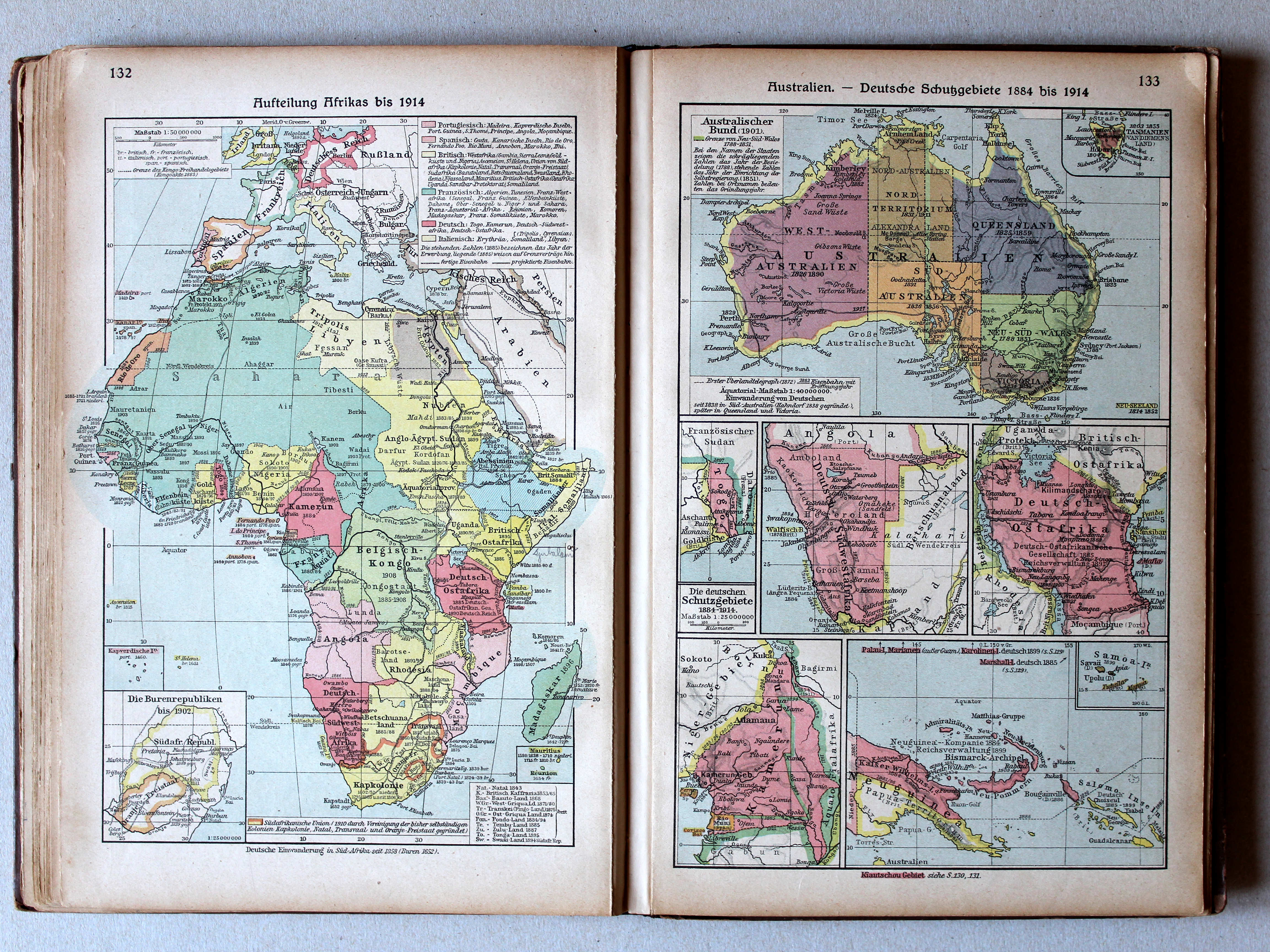
132. Aufteilung Afrikas bis 1914 XL
Opdeling van Afrika tot 1914 / Scramble for Africa until 1914
133. Australien – Die deutschen Schutzgebiete 1884-1914 XL
Australië. De Duitse koloniën 1884-1914 / Australia. The German colonies 1884-1914
 Putzgers Historischer Schul-Atlas, 1922
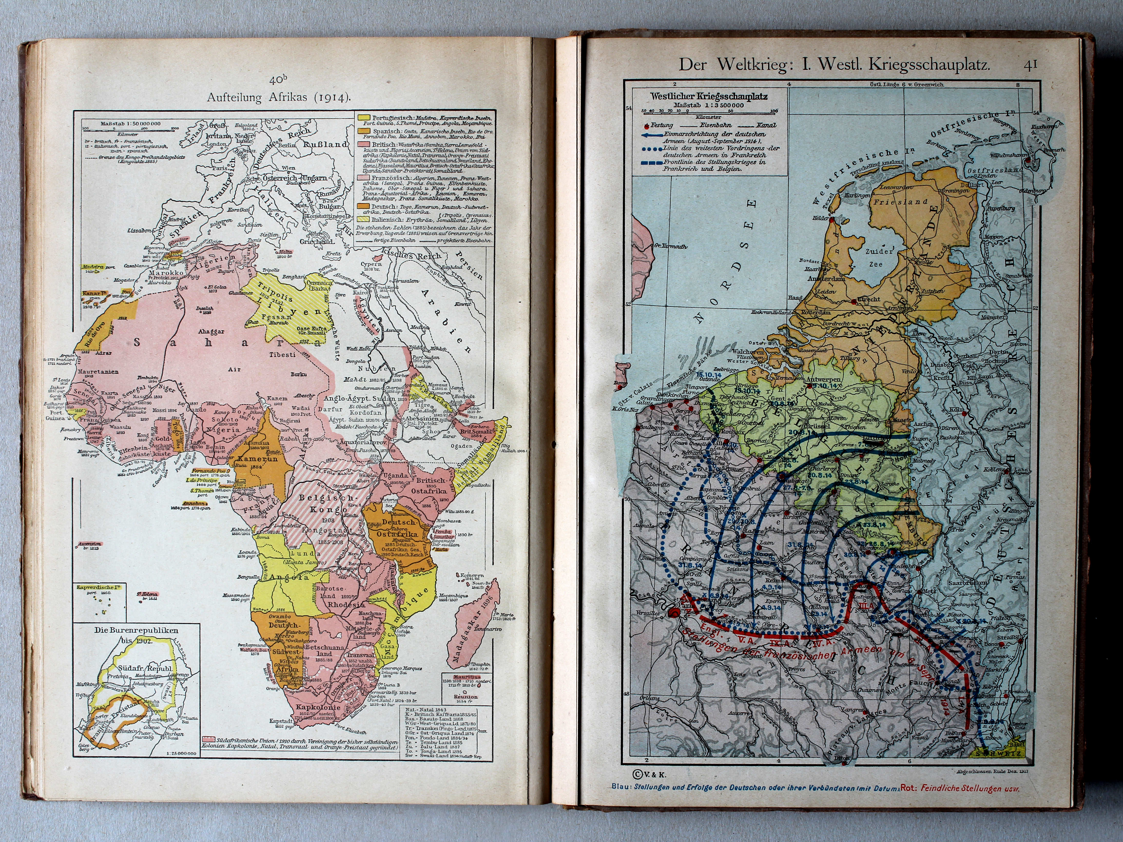
40b. Aufteilung Afrikas XL
Opdeling van Afrika / Scramble for Africa
41. Der Weltkrieg: I. Westlicher Kriegsschauplatz XL
De Wereldoorlog I: Westelijk strijdtoneel / The World War I: Western theater of war
Putzgers Historischer Schul-Atlas, Große Ausgabe, 1923
132. Aufteilung Afrikas bis 1914 XL
Opdeling van Afrika tot 1914 / Scramble for Africa until 1914
133. Australien – Die deutschen Schutzgebiete 1884-1914 XL
Australië. De Duitse koloniën 1884-1914 / Australia. The German colonies 1884-1914
 Putzgers Historischer Schul-Atlas, 1922
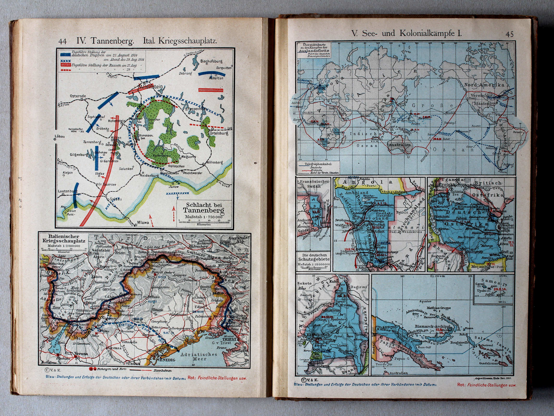
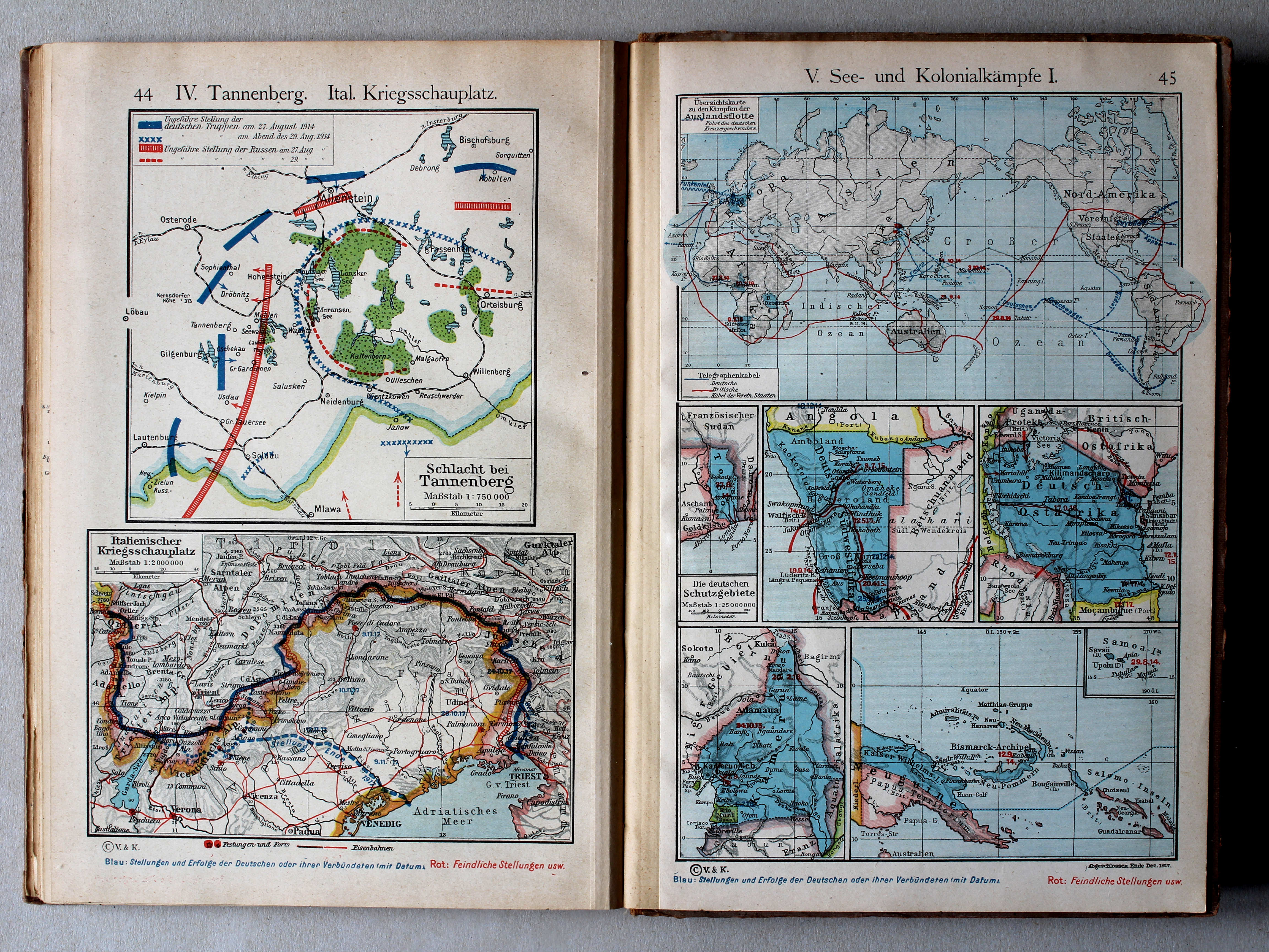
44. IV. Tannenberg. Ital. Kriegsschauplatz XL
IV. Tannenberg. Italiaans strijdtoneel / IV. Tannenberg. Italian theater of war
45. V. See- und Kolonialkämpfe I (Die deutschen Schutzgebiete) XL
V. Gevechten op zee en in de koloniën I (De Duitse koloniën) / V. Battles at sea and in the colonies I (The German colonies)
 Putzgers Historischer Schul-Atlas, Große Ausgabe, 1923
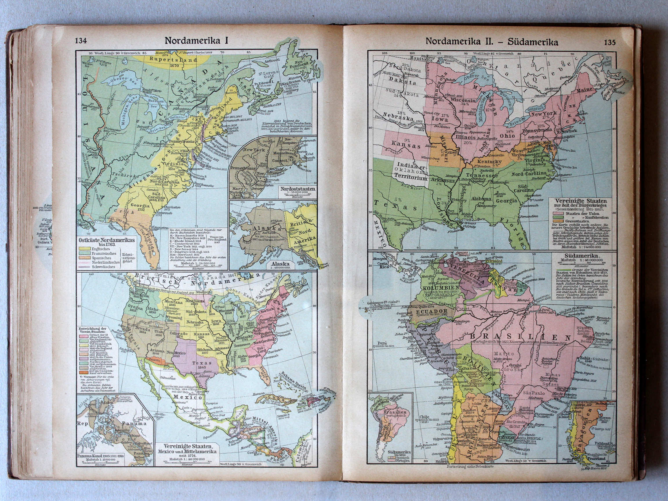
134. Nordamerika I (Panama-Kanal) XL
Noord-Amerika I (Panamakanaal) / North America I (Panama Canal)
135. Nordamerika II – Südamerika XL
Noord-Amerika II. Zuid-Amerika / North America II. South America
Putzgers Historischer Schul-Atlas, 1922
39b. Kolonialkarte IV (1884) XL
Koloniën IV (1884) / Colonies IV (1884)
40a. Kolonialkarte V (1912) (Panama-Kanal) XL
Koloniën V (1912) (Panamakanaal) / Colonies V (1912) (Panama Canal)
Putzgers Historischer Schul-Atlas, Große Ausgabe, 1923
134. Nordamerika I XL
Noord-Amerika I / North America I
135. Nordamerika II – Südamerika XL
Noord-Amerika II. Zuid-Amerika / North America II. South America
Putzgers Historischer Schul-Atlas, 1922
40. Zentral- und Ostasien. Nordamerika XL
Centraal- en Oost-Azië. Noord-Amerika / Central and East Asia. North America
 Putzgers Historischer Schul-Atlas, Große Ausgabe, 1923
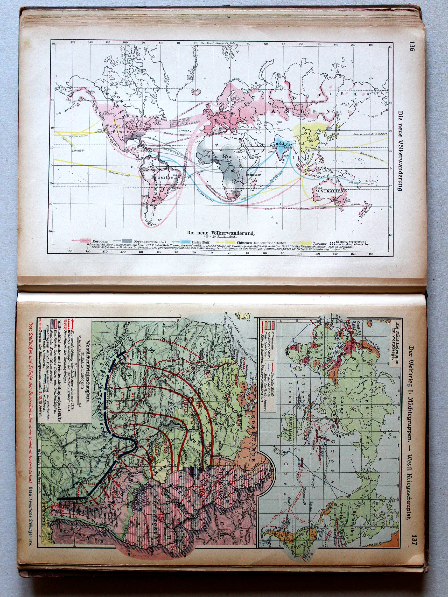
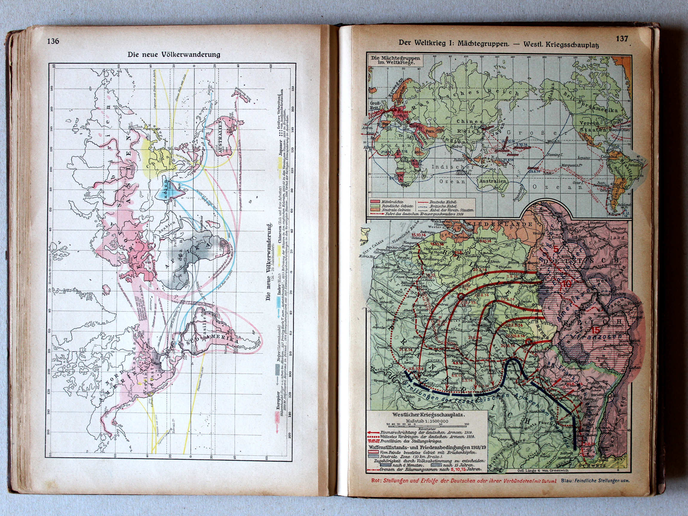
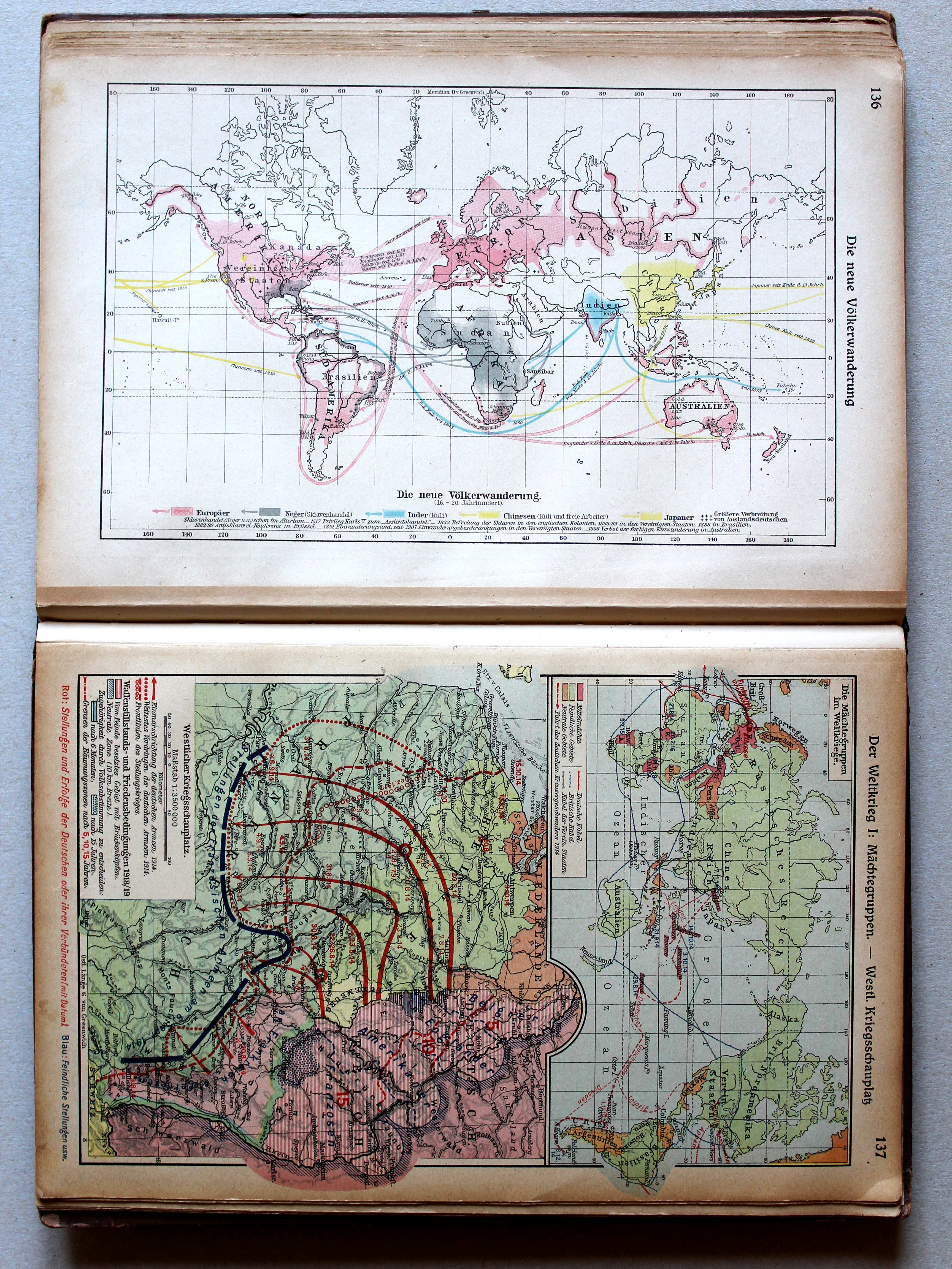
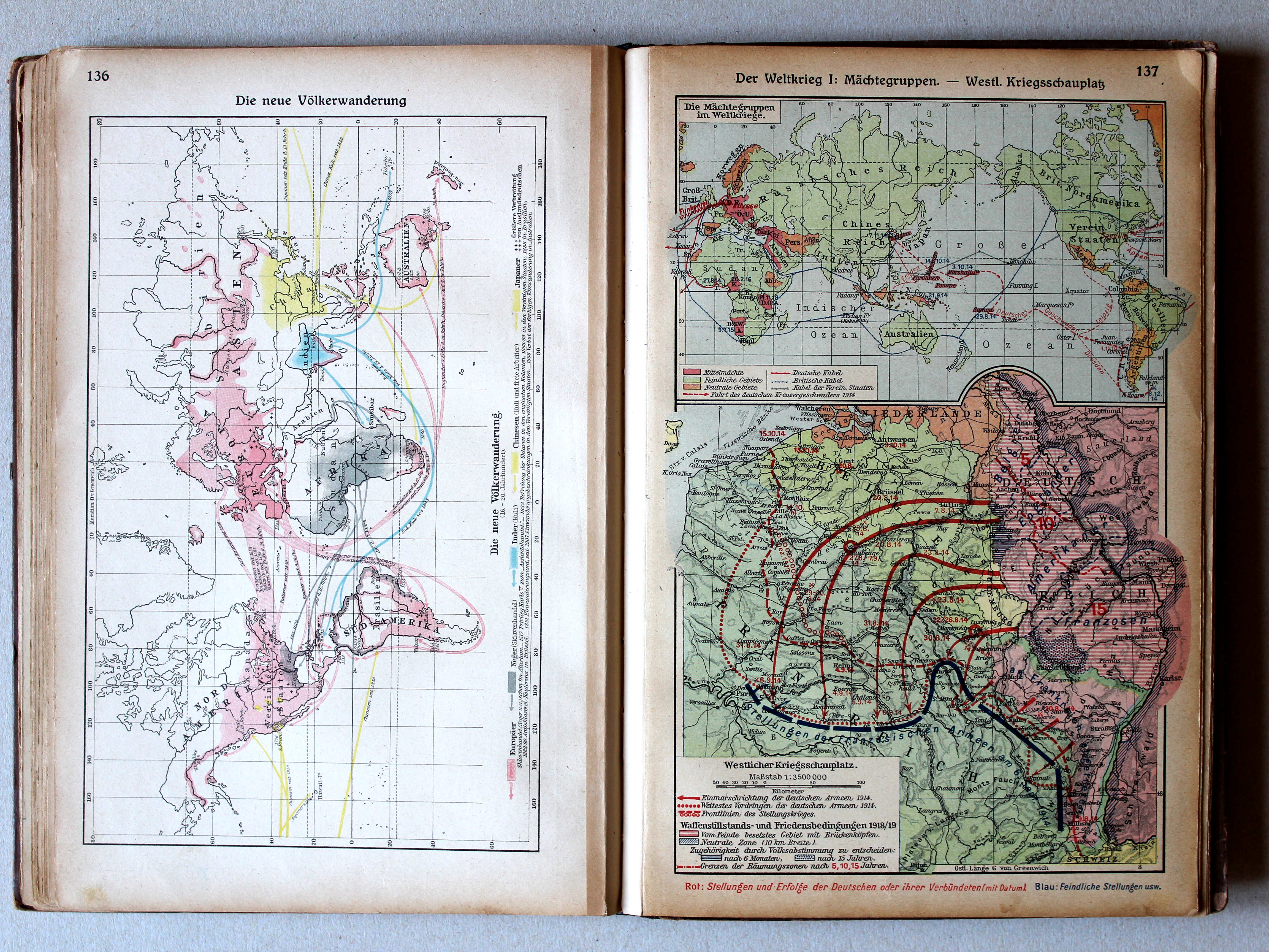
136. Die neue Völkerwanderung (16.-20. Jahrhundert) XL
De nieuwe Volksverhuizing / The modern Migration Period
Putzgers Historischer Schul-Atlas, 1922
geen overeenkomstige kaart / no corresponding map
 Putzgers Historischer Schul-Atlas, Große Ausgabe, 1923
137. Der Weltkrieg I: Mächtegruppen – Westl. Kriegsschauplatz XL
De Wereldoorlog I: Machtsblokken. Westelijk Krijgstoneel / The World War I: Power blocks. Western theater of war
 Putzgers Historischer Schul-Atlas, 1922
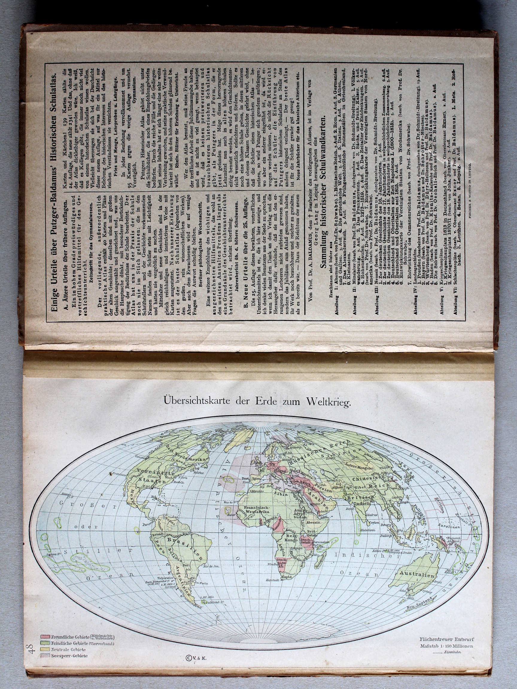
48. Übersichtskarte zum Weltkrieg XL
Overzichtskaart Wereldoorlog / General map World War
Putzgers Historischer Schul-Atlas, Große Ausgabe, 1923
137. Der Weltkrieg I: Mächtegruppen – Westl. Kriegsschauplatz XL
De Wereldoorlog I: Machtsblokken. Westelijk Krijgstoneel / The World War I: Power blocks. Western theater of war
Putzgers Historischer Schul-Atlas, 1922
40b. Aufteilung Afrikas XL
Opdeling van Afrika / Scramble for Africa
41. Der Weltkrieg I: Westlicher Kriegsschauplatz XL
De Wereldoorlog I: Westelijk strijdtoneel / The World War I: Western theater of war
 Putzgers Historischer Schul-Atlas, Große Ausgabe, 1923
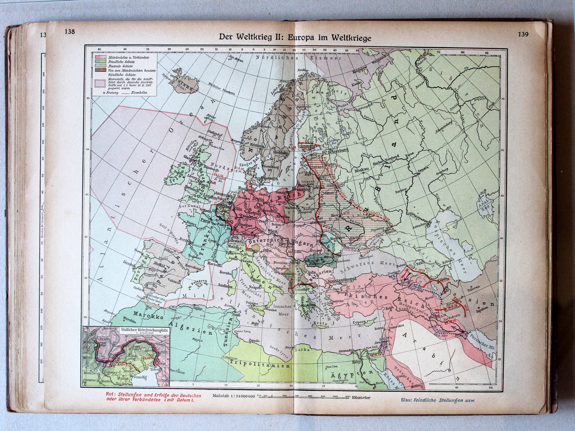
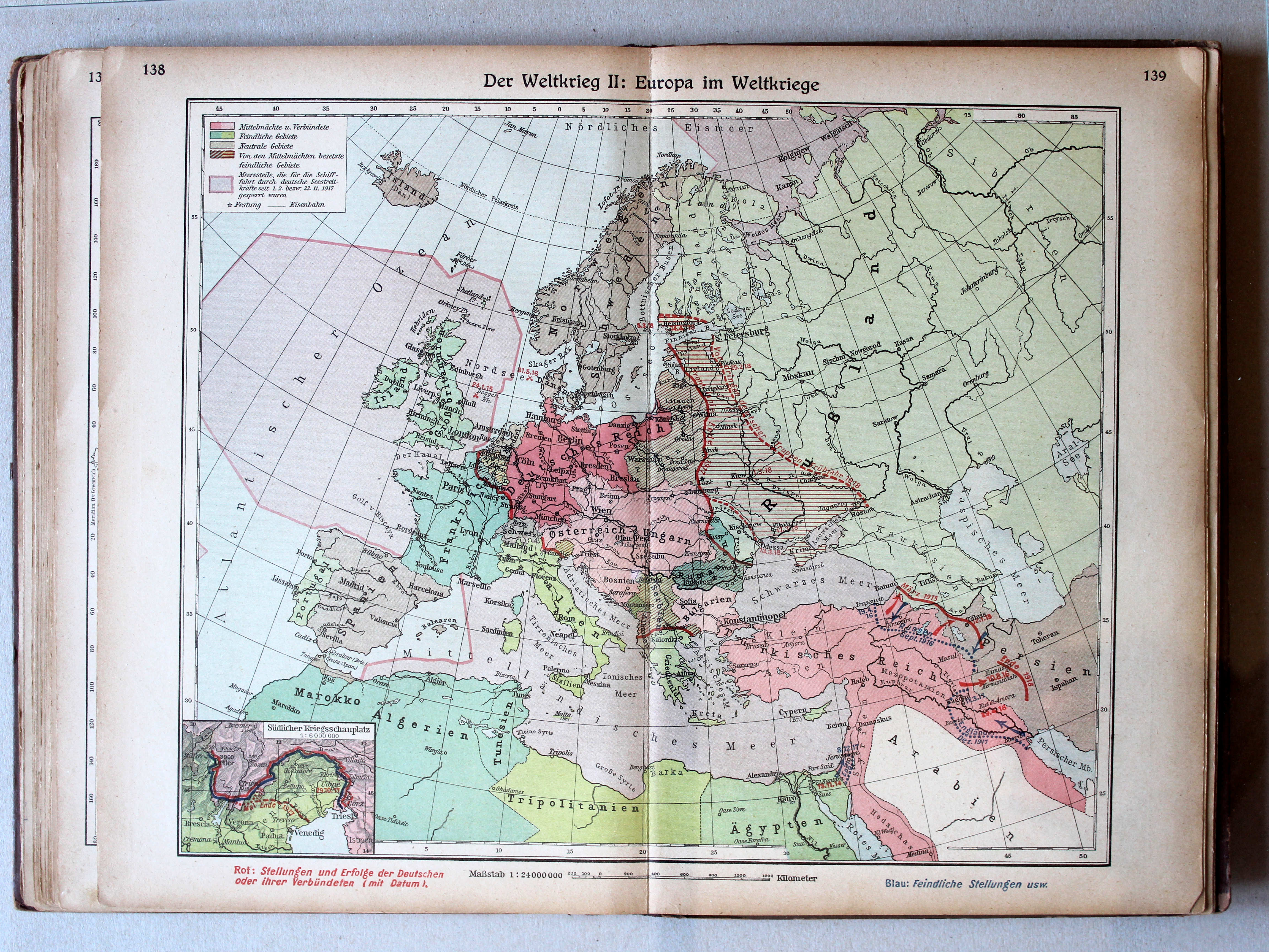
138.139. Der Weltkrieg II: Europa im Weltkriege (Südlicher Kriegsschauplatz) XL
De Wereldoorlog II: Europa in de Wereldoorlog (Zuidelijk strijdtoneel) / The World War II: Europe in the World War (Southern theater of war)
Putzgers Historischer Schul-Atlas, 1922
44. IV. Tannenberg. Ital. Kriegsschauplatz XL
IV. Tannenberg. Italiaans strijdtoneel / IV. Tannenberg. Italian theater of war
45. V. See- und Kolonialkämpfe I XL
V. Gevechten op zee en in de koloniën I / V. Battles at sea and in the colonies I
 Putzgers Historischer Schul-Atlas, Große Ausgabe, 1923
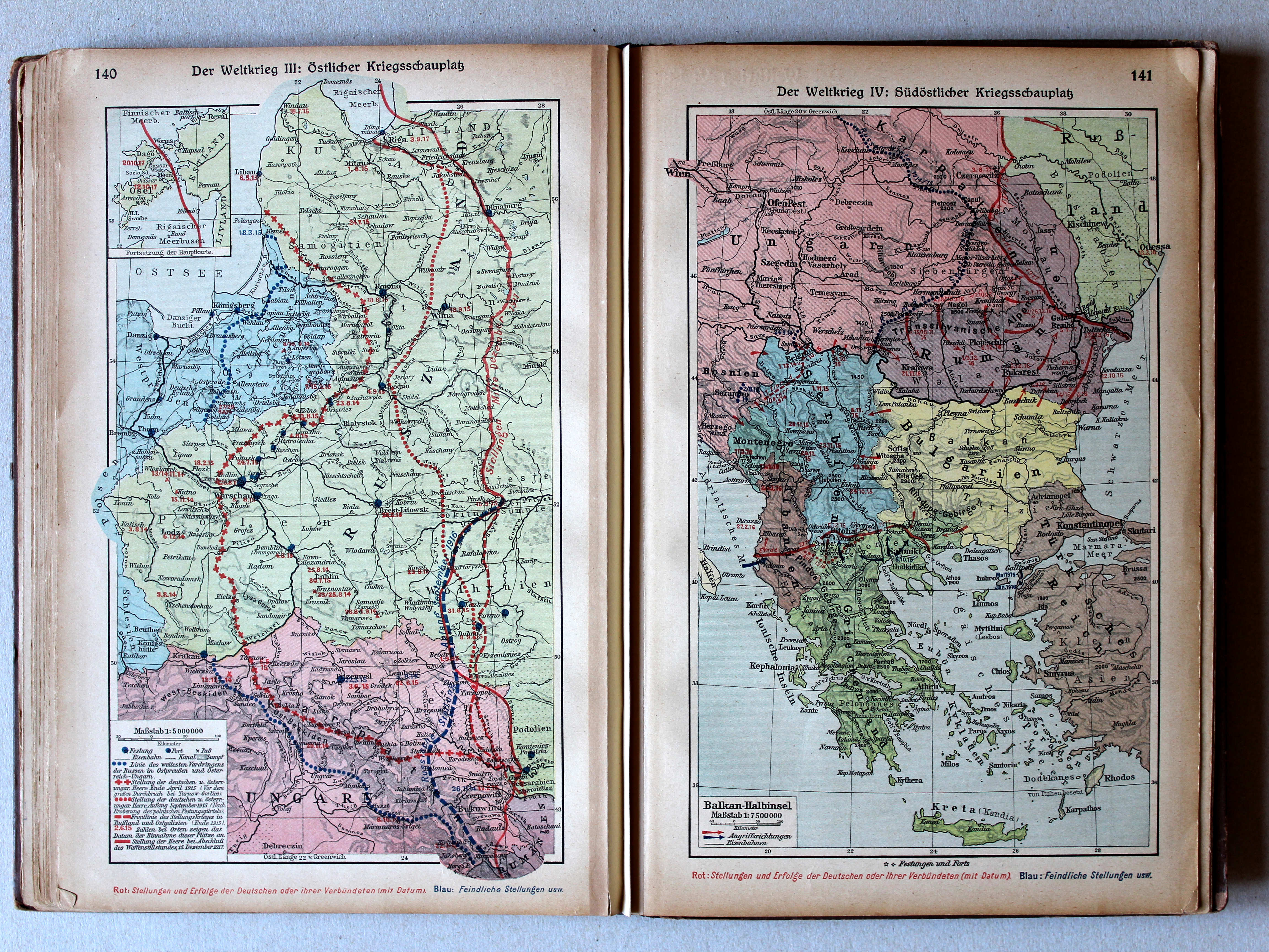
140. Der Weltkrieg III: Östlicher Kriegsschauplatz XL
De Wereldoorlog III: Oostelijk strijdtoneel / The World War III: Eastern theater of war
141. Der Weltkrieg IV: Südöstlicher Kriegsschauplatz XL
De Wereldoorlog IV: Zuidoostelijk strijdtoneel / The World War IV: Southeastern theater of war
 Putzgers Historischer Schul-Atlas, 1922
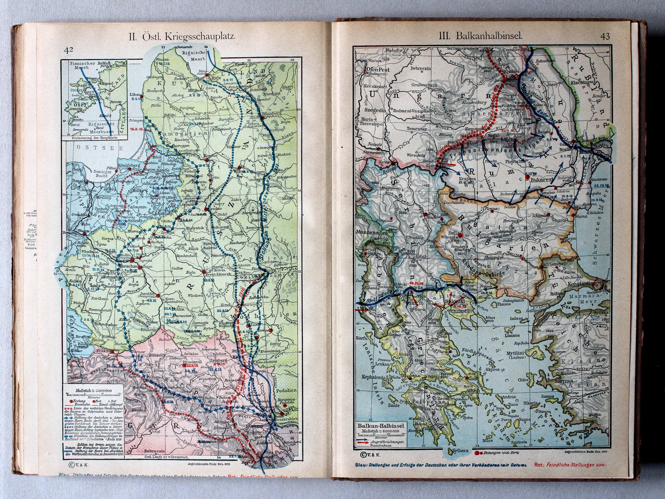
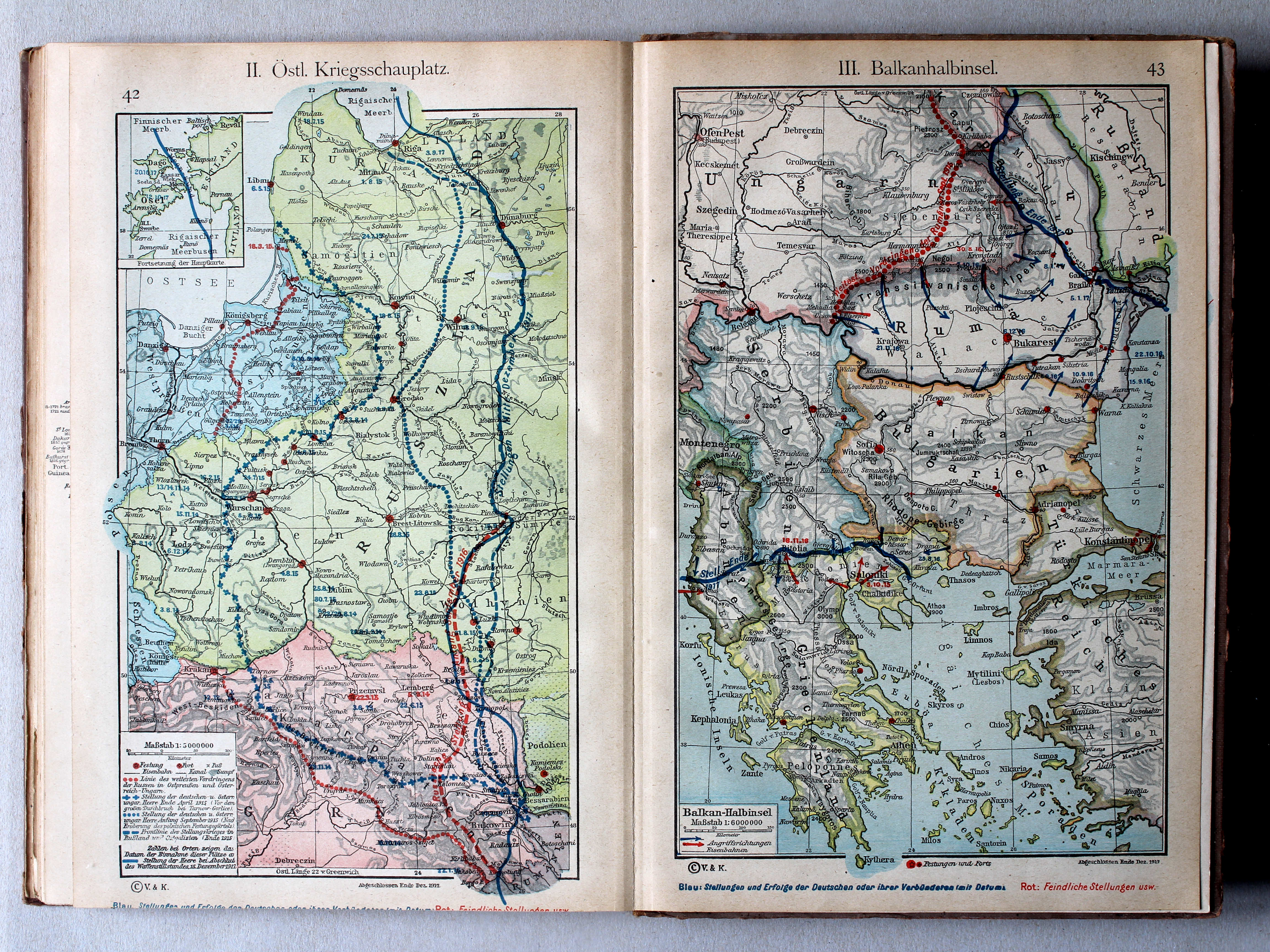
42. II. Östlicher Kriegsschauplatz XL
II. Oostelijk strijdtoneel / II. Eastern theater of war
43. III. Balkanhalbinsel XL
III. Balkanschiereiland / III. Balkan Peninsula
Putzgers Historischer Schul-Atlas, Große Ausgabe, 1923
geen overeenkomstige kaart / no corresponding map
 Putzgers Historischer Schul-Atlas, 1922
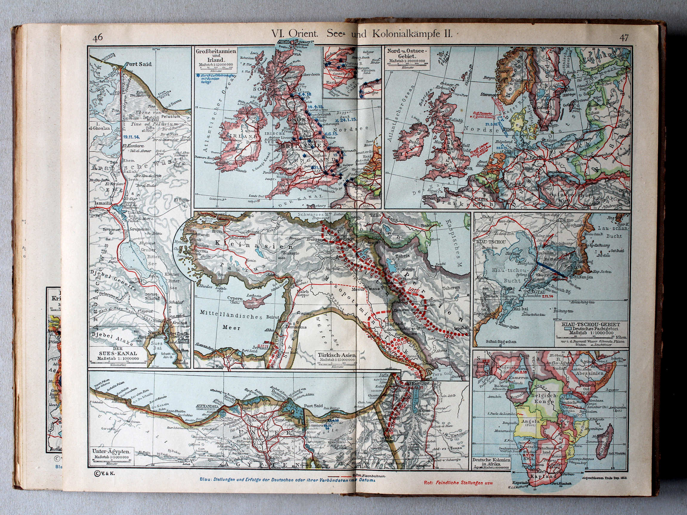
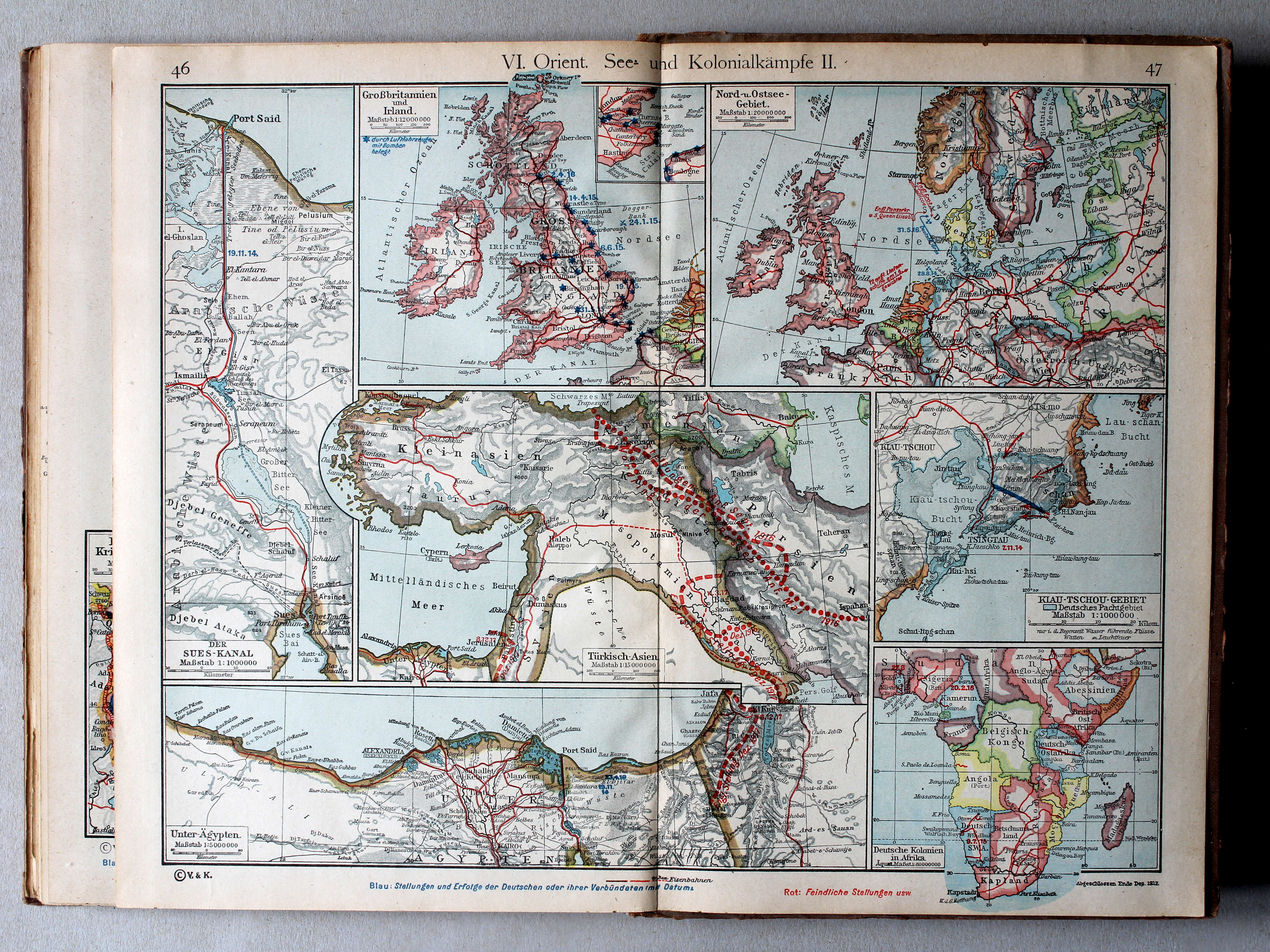
46.47. VI. Orient. See- und Kolonialkämpfe II XL
VI. Midden-Oosten. Gevechten op zee en in de koloniën II / VI. Middle East. Battles at sea and in the colonies II
 Putzgers Historischer Schul-Atlas, Große Ausgabe, 1923
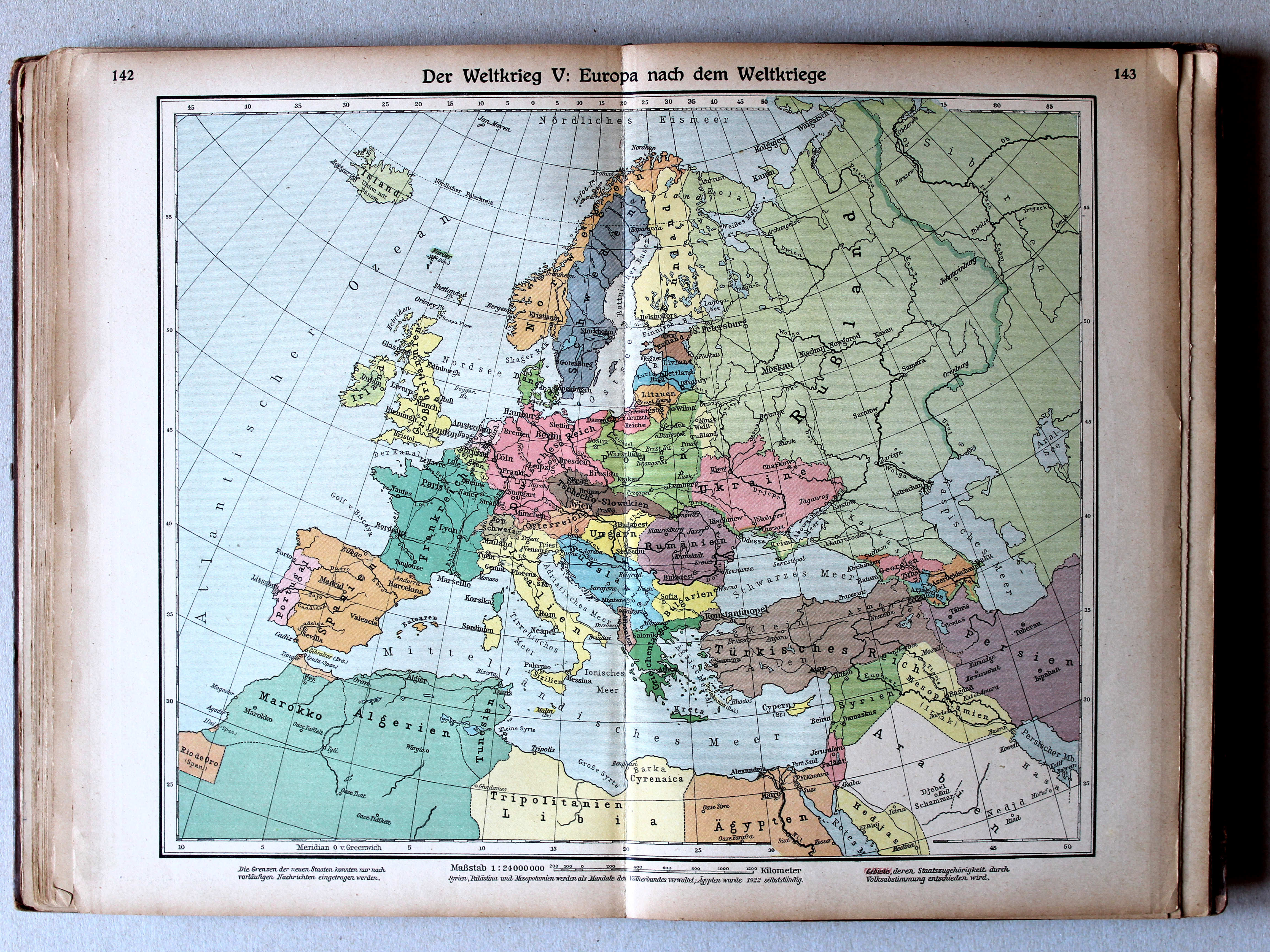
142.143. Der Weltkrieg V: Europa nach dem Weltkriege XL
De Wereldoorlog V: Europa na de Wereldoorlog / The World War V: Europe after the World War
Putzgers Historischer Schul-Atlas, 1922
geen overeenkomstige kaart / no corresponding map
 Putzgers Historischer Schul-Atlas, Große Ausgabe, 1923
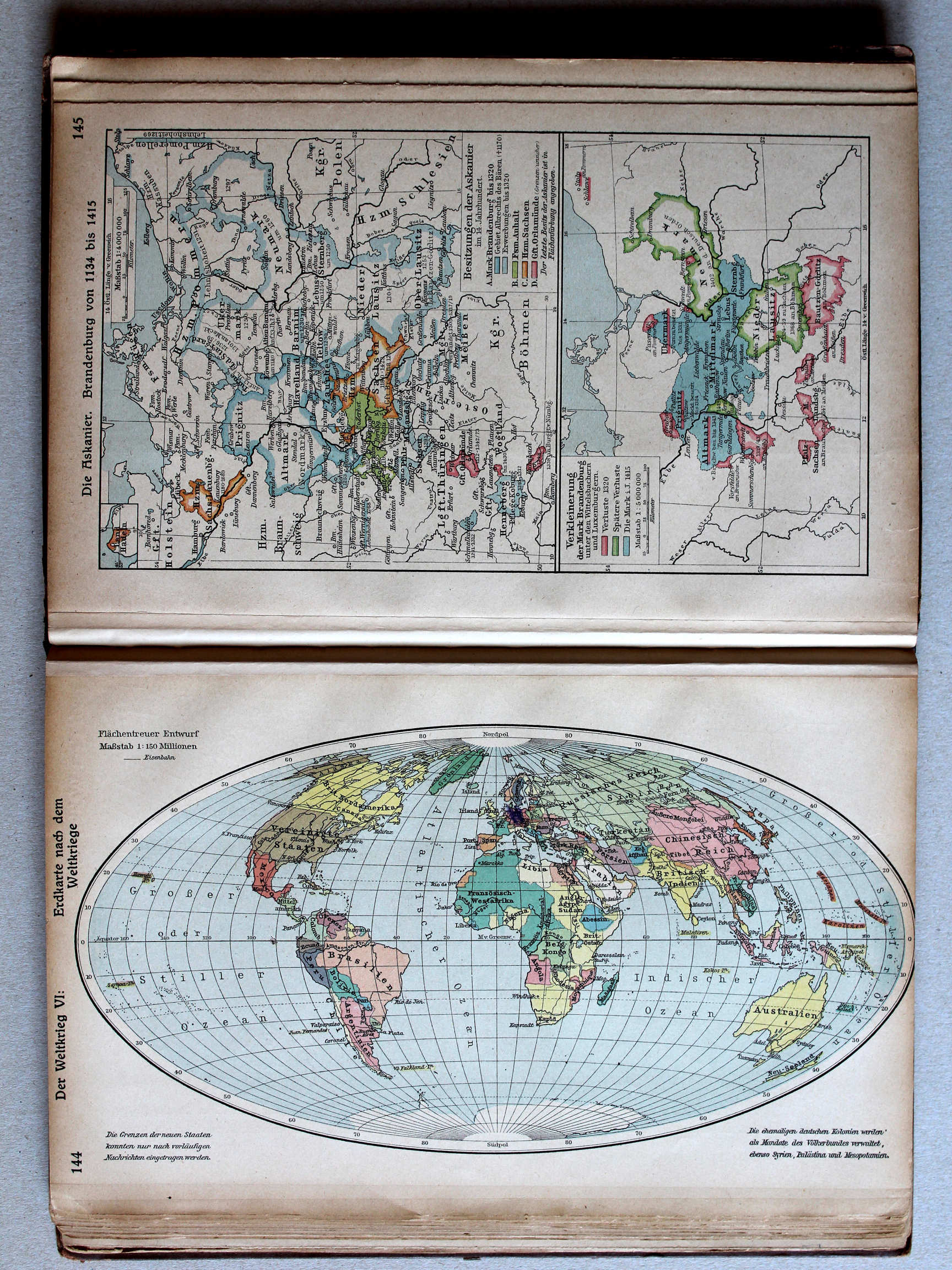
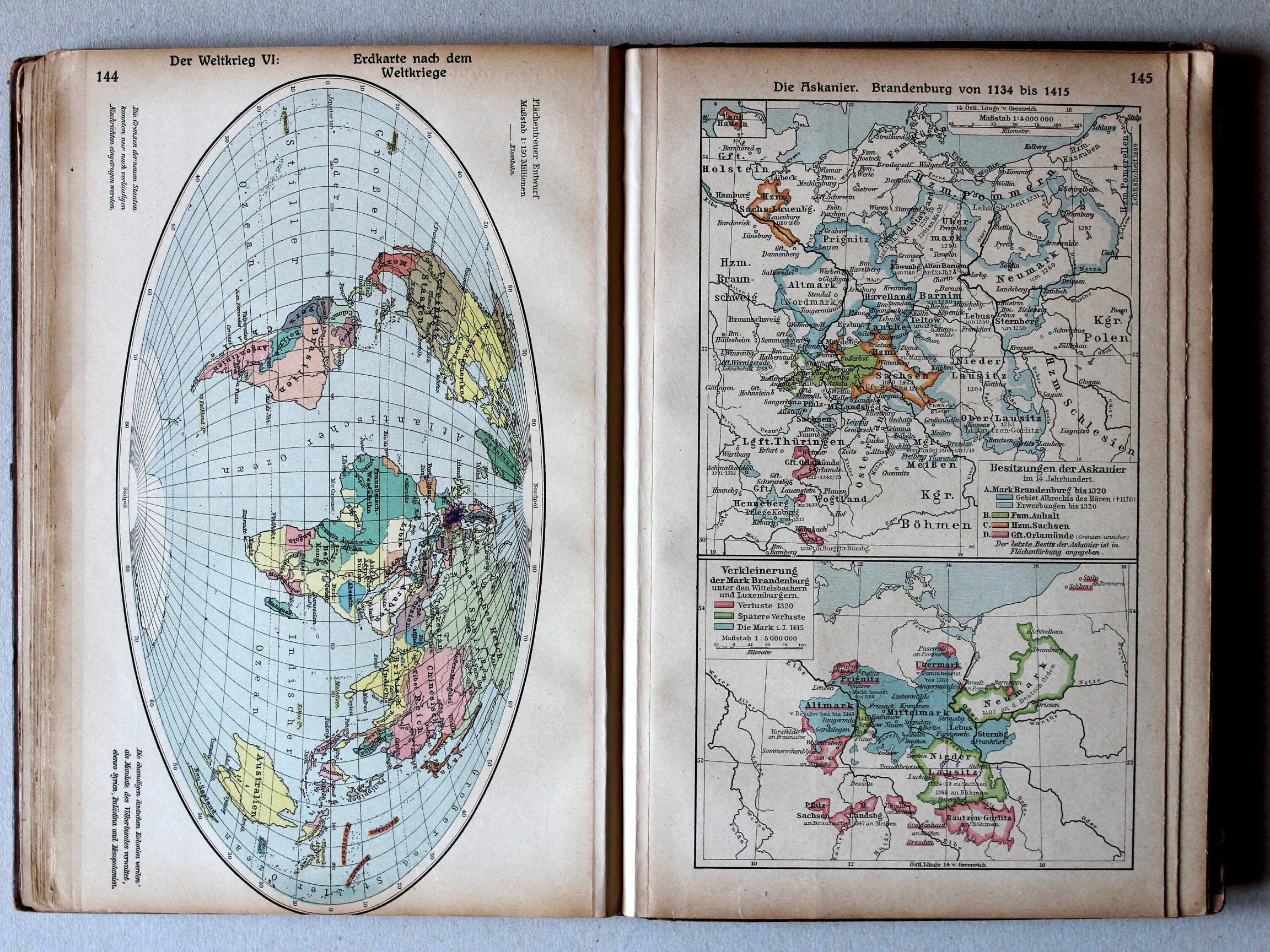
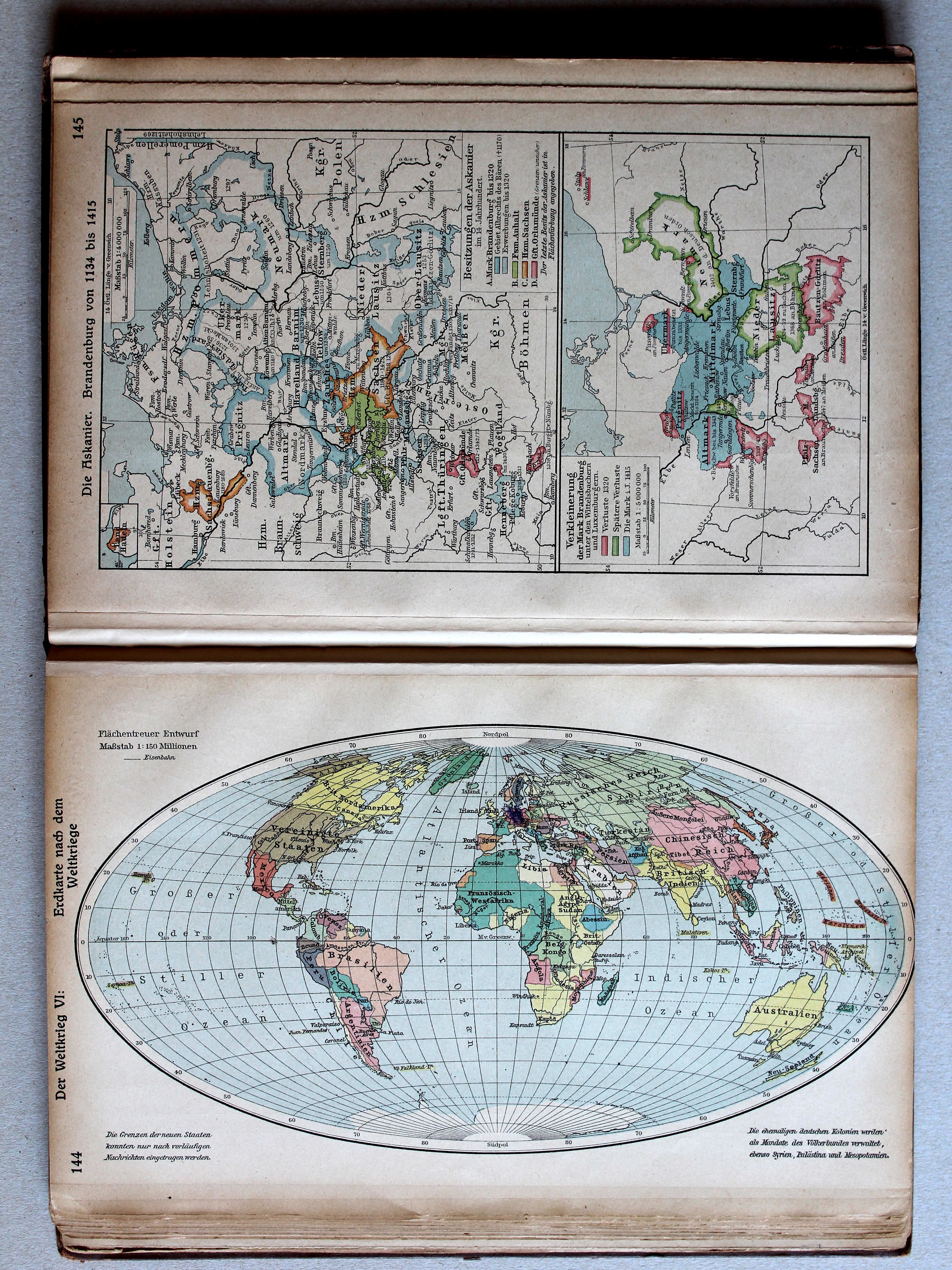
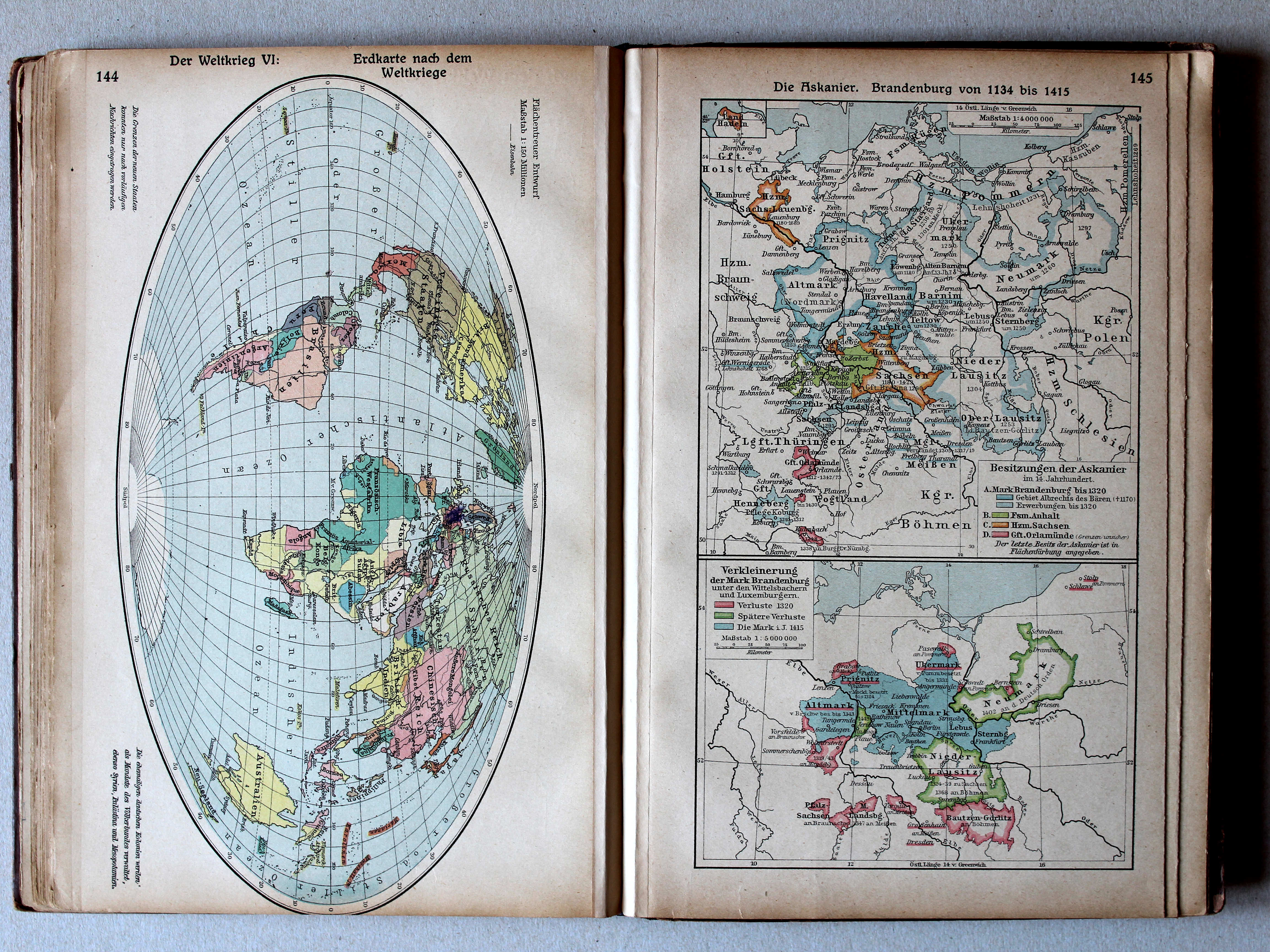
144. Der Weltkrieg VI: Erdkarte nach dem Weltkriege XL
De Wereldoorlog VI: De wereld na de Wereldoorlog / The World War VI: The World after the World War
Putzgers Historischer Schul-Atlas, 1922
48. Übersichtskarte zum Weltkrieg XL
Overzichtskaart Wereldoorlog / General map World War
 Putzgers Historischer Schul-Atlas, Große Ausgabe, 1923
145. Die Askanier. Brandenburg von 1134 bis 1415 XL
De Ascaniërs. Brandenburg 1134-1415 / The House of Ascania. Brandenburg 1134-1415
 Putzgers Historischer Schul-Atlas, 1922
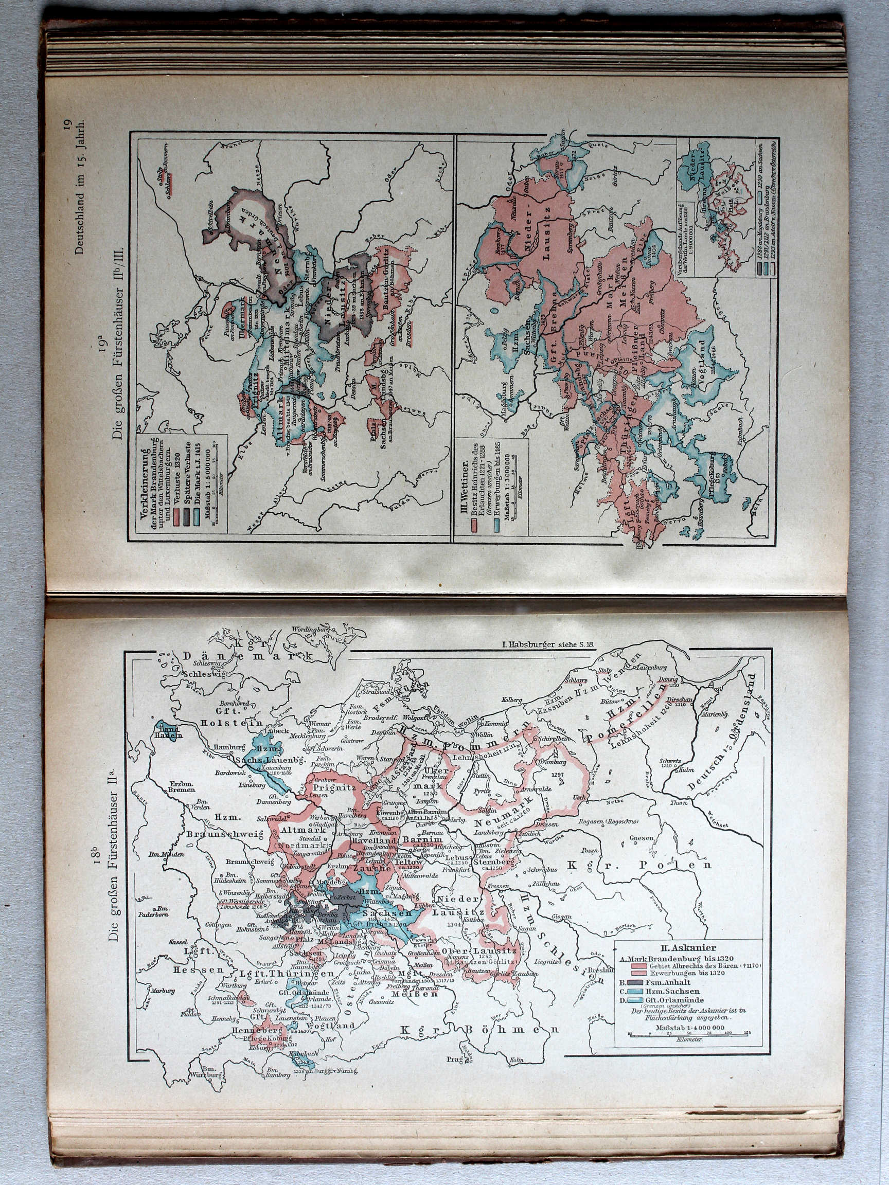
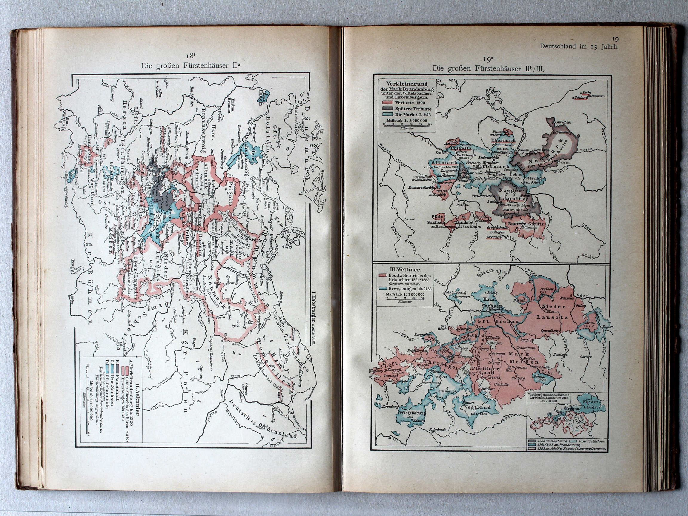
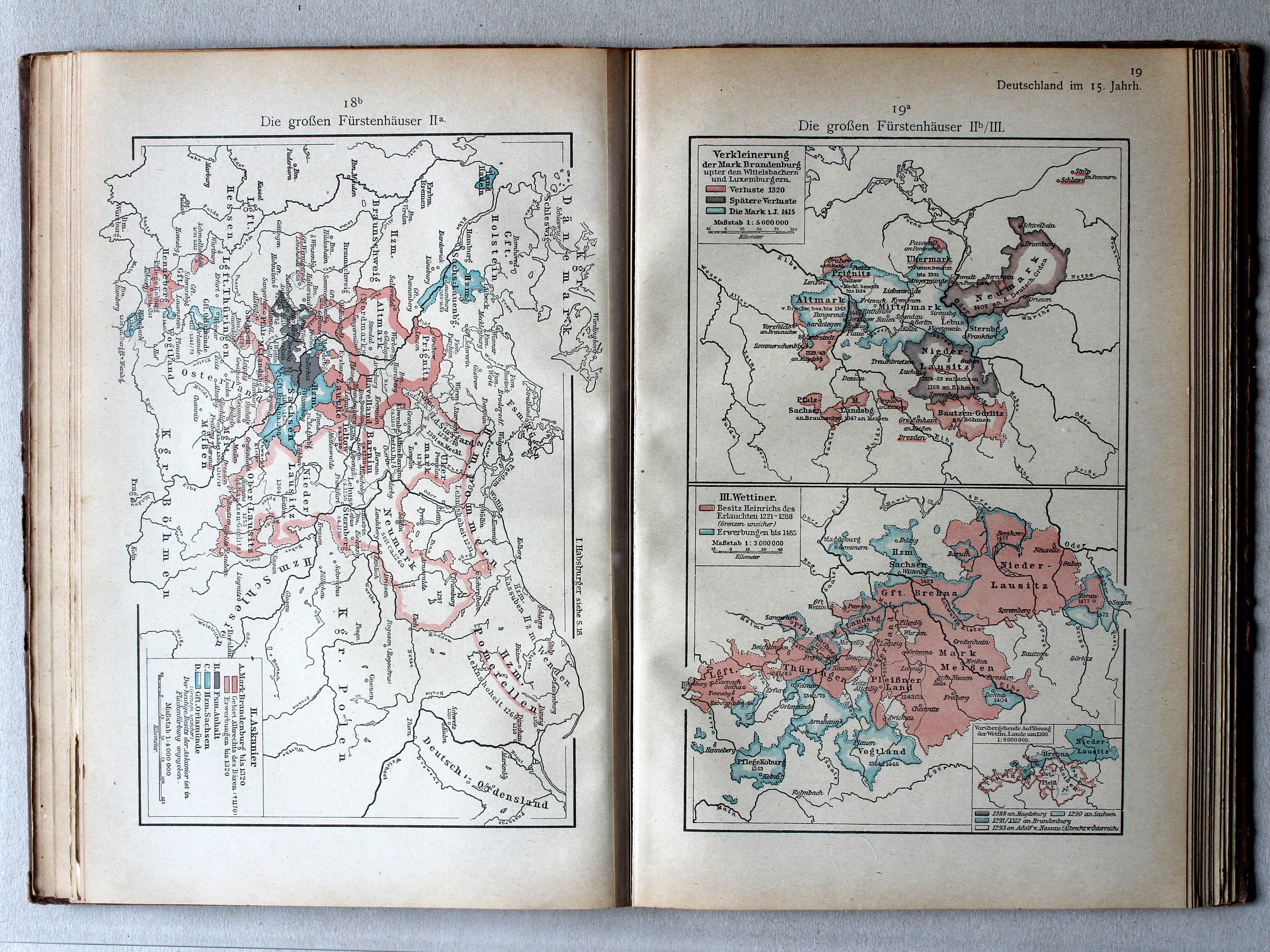
18b. Die großen Fürstenhäuser IIa XL
De grote dynastieën IIa / The great dynasties IIa
Putzgers Historischer Schul-Atlas, Große Ausgabe, 1923
145. Die Askanier. Brandenburg von 1134 bis 1415 XL
De Ascaniërs. Brandenburg 1134-1415 / The House of Ascania. Brandenburg 1134-1415
 Putzgers Historischer Schul-Atlas, 1922
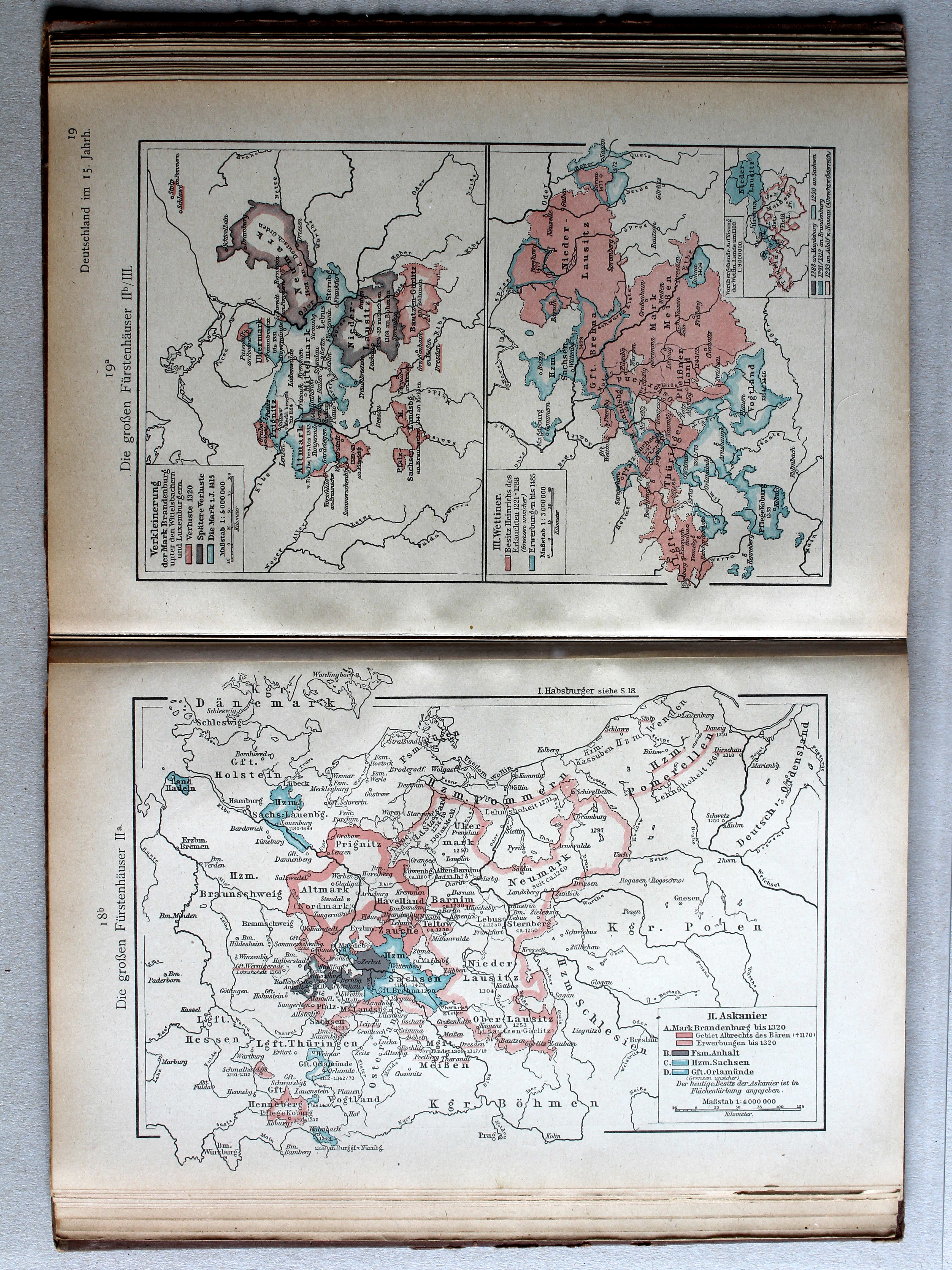
19a. Die großen Fürstenhäuser IIb/III (Verkleinerung der Mark Brandenburg) XL
De grote dynastieën IIb/III (Verkleining van Brandenburg) / The great dynasties IIb/III (The decreasing Brandenburg)
 Putzgers Historischer Schul-Atlas, Große Ausgabe, 1923
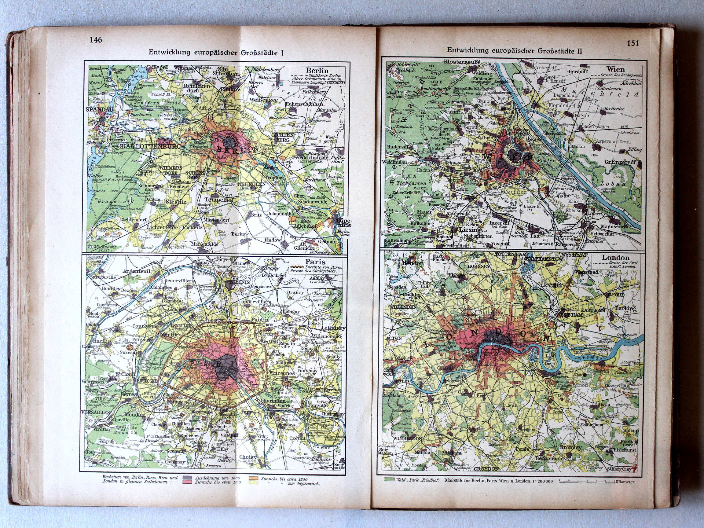
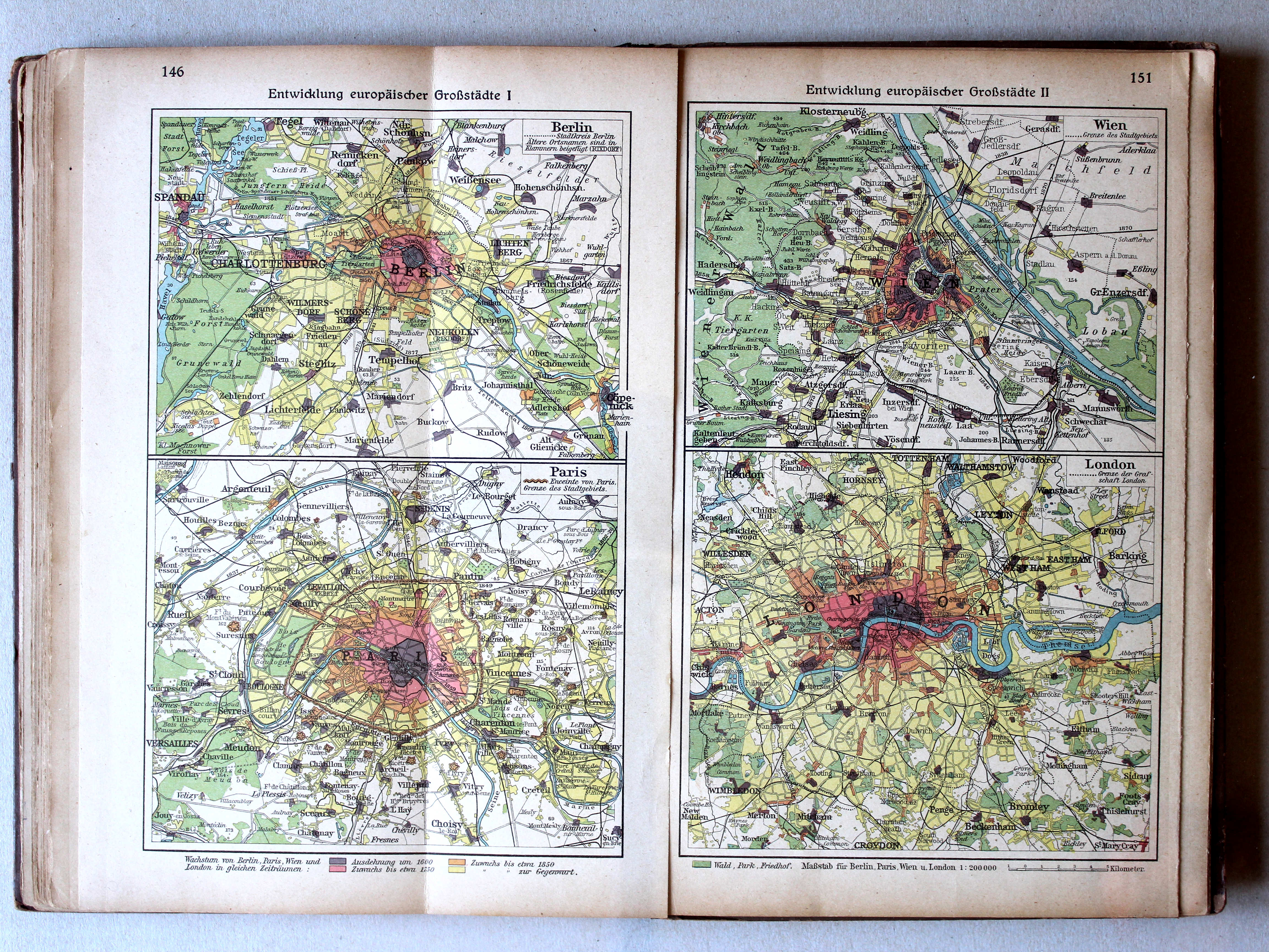
146. Entwicklung europäischer Großstädte I XL
Ontwikkeling van Europese hoofdsteden I / Development of European capitals I
151. Entwicklung europäischer Großstädte II XL
Ontwikkeling van Europese hoofdsteden II / Development of European capitals II
Putzgers Historischer Schul-Atlas, 1922
geen overeenkomstige kaart / no corresponding map
 Putzgers Historischer Schul-Atlas, Große Ausgabe, 1923
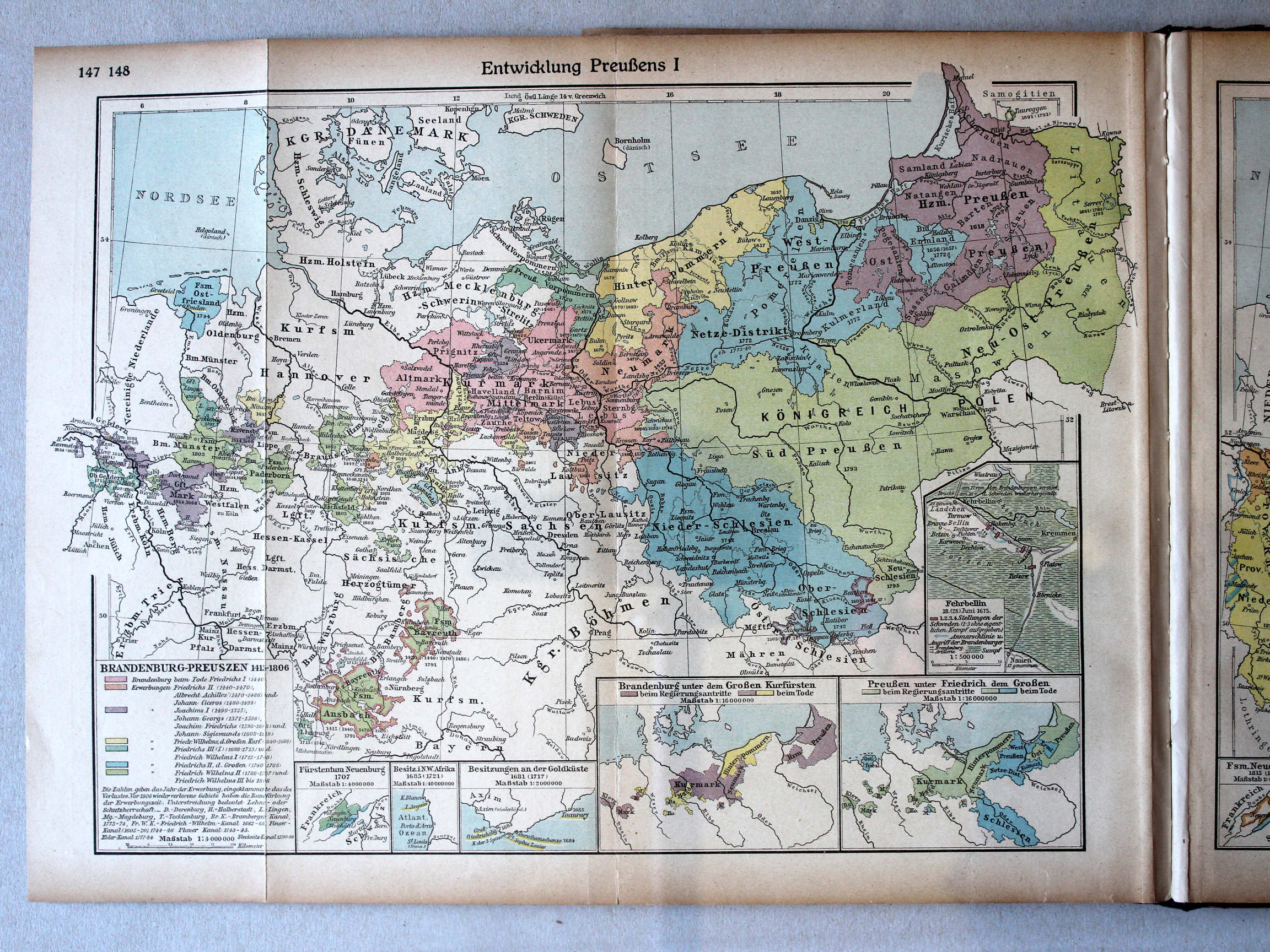
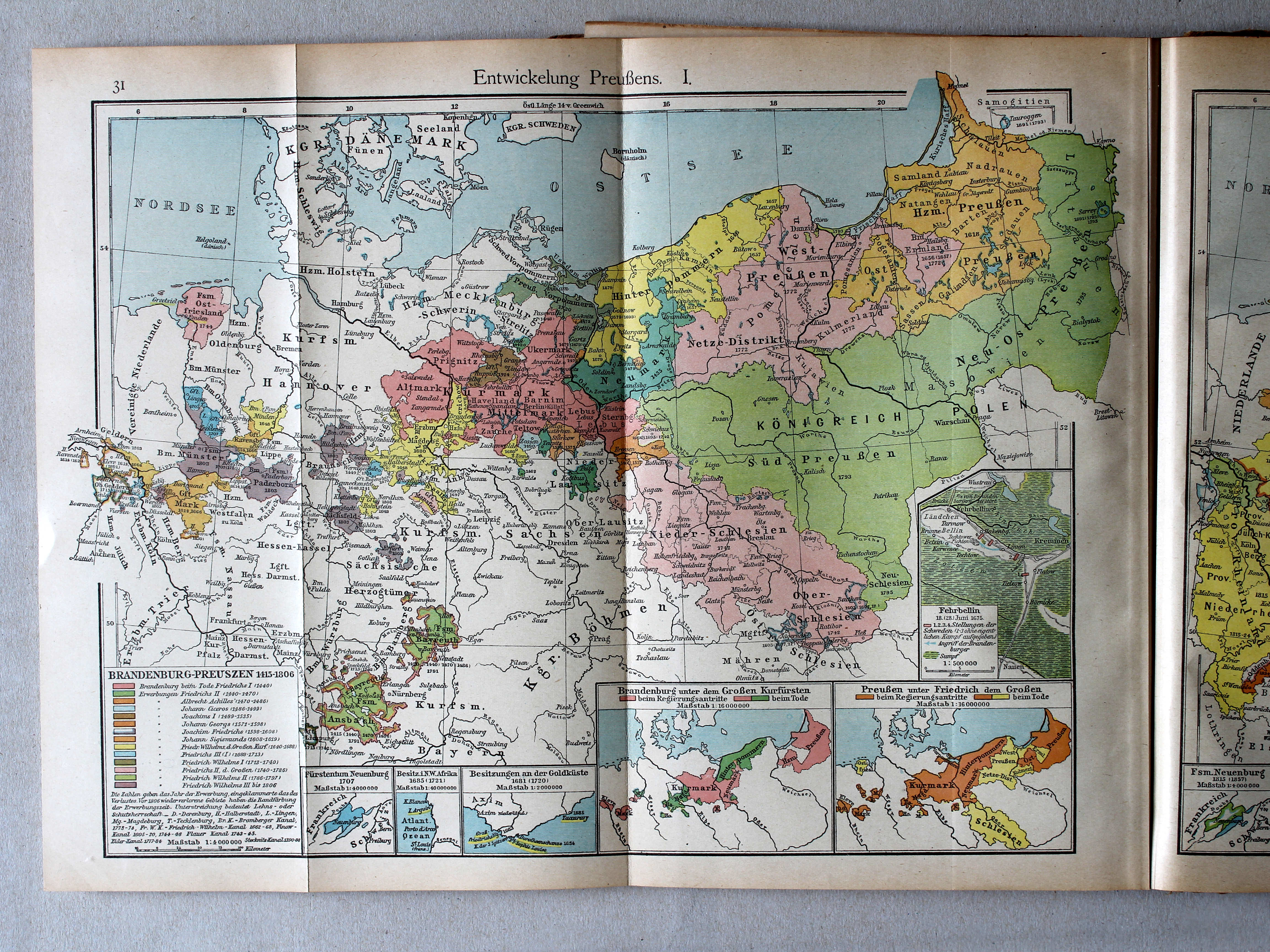
147.148. Entwicklung Preußens I XL
Ontwikkeling van Pruisen I / Development of Prussia I
 Putzgers Historischer Schul-Atlas, 1922
31. Entwickelung Preußens. I XL
Ontwikkeling van Pruisen I / Development of Prussia I
 Putzgers Historischer Schul-Atlas, Große Ausgabe, 1923
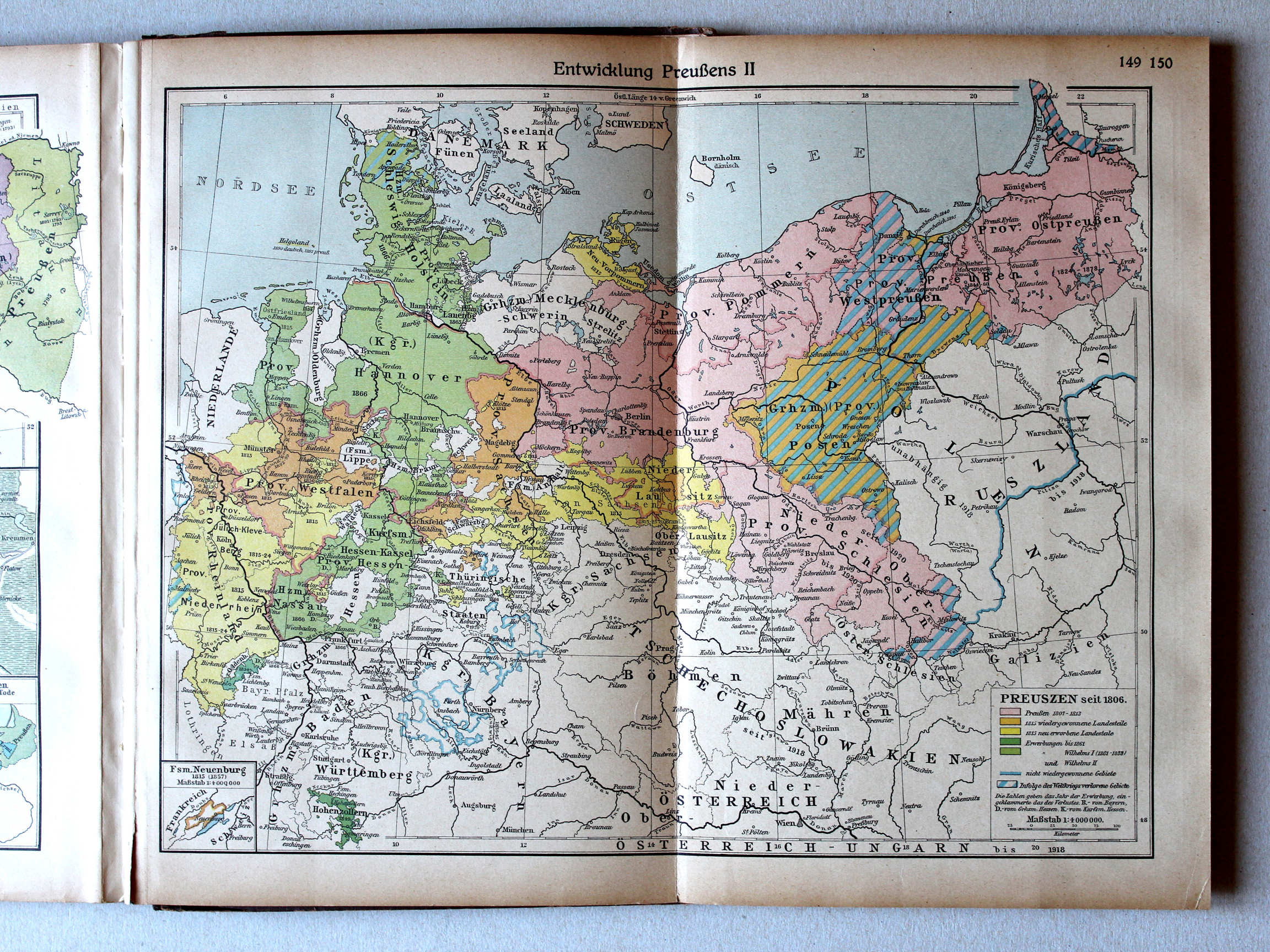
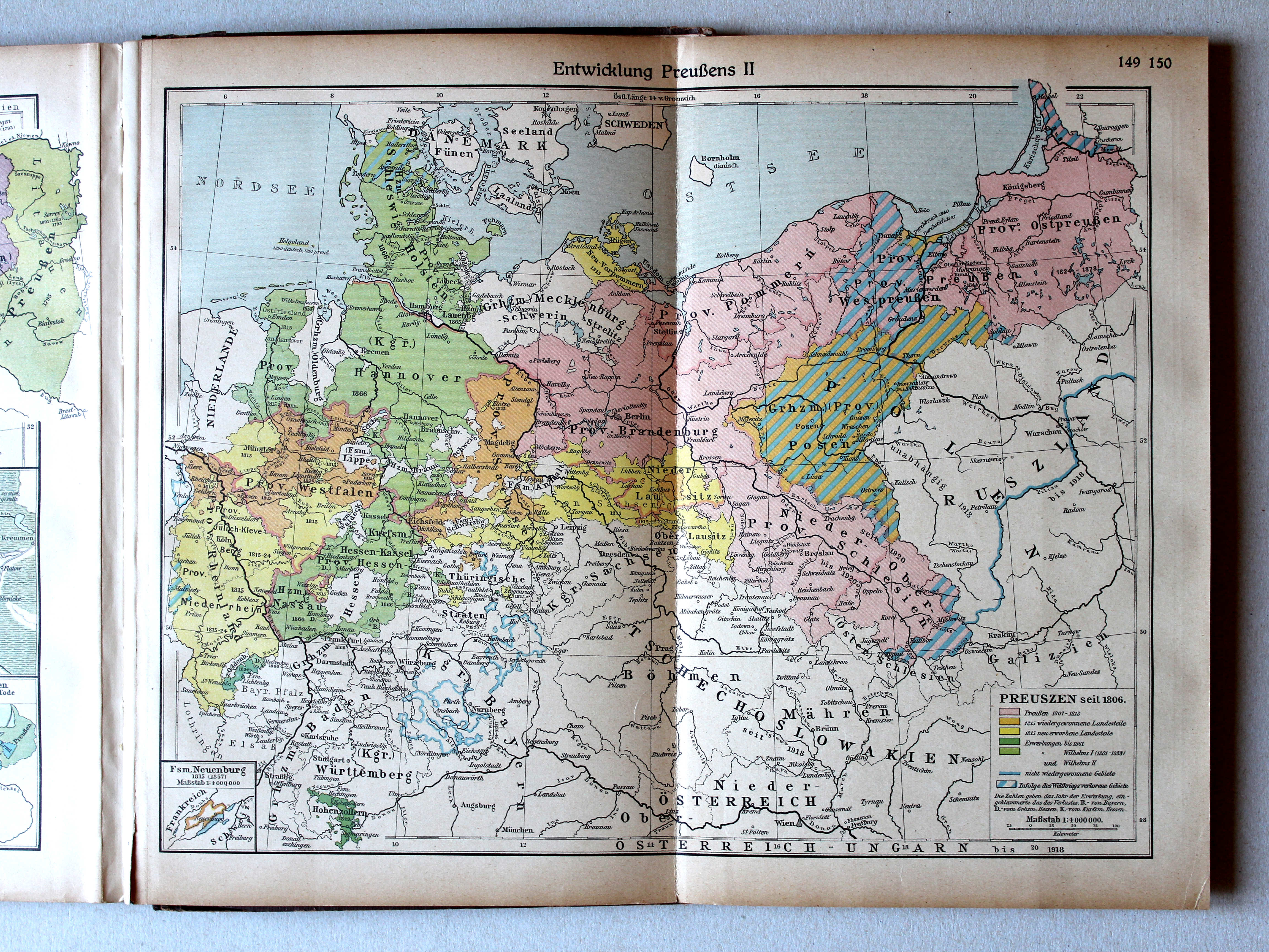
149.150. Entwicklung Preußens II XL
Ontwikkeling van Pruisen II / Development of Prussia II
 Putzgers Historischer Schul-Atlas, 1922
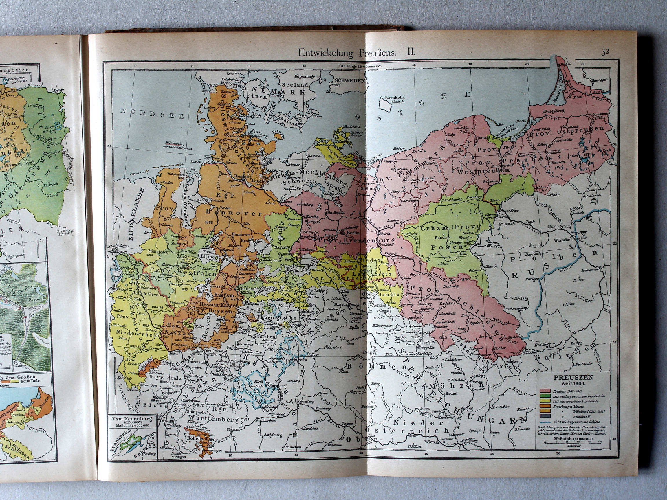
32. Entwickelung Preußens. II XL
Ontwikkeling van Pruisen II / Development of Prussia II
 Putzgers Historischer Schul-Atlas, Große Ausgabe, 1923
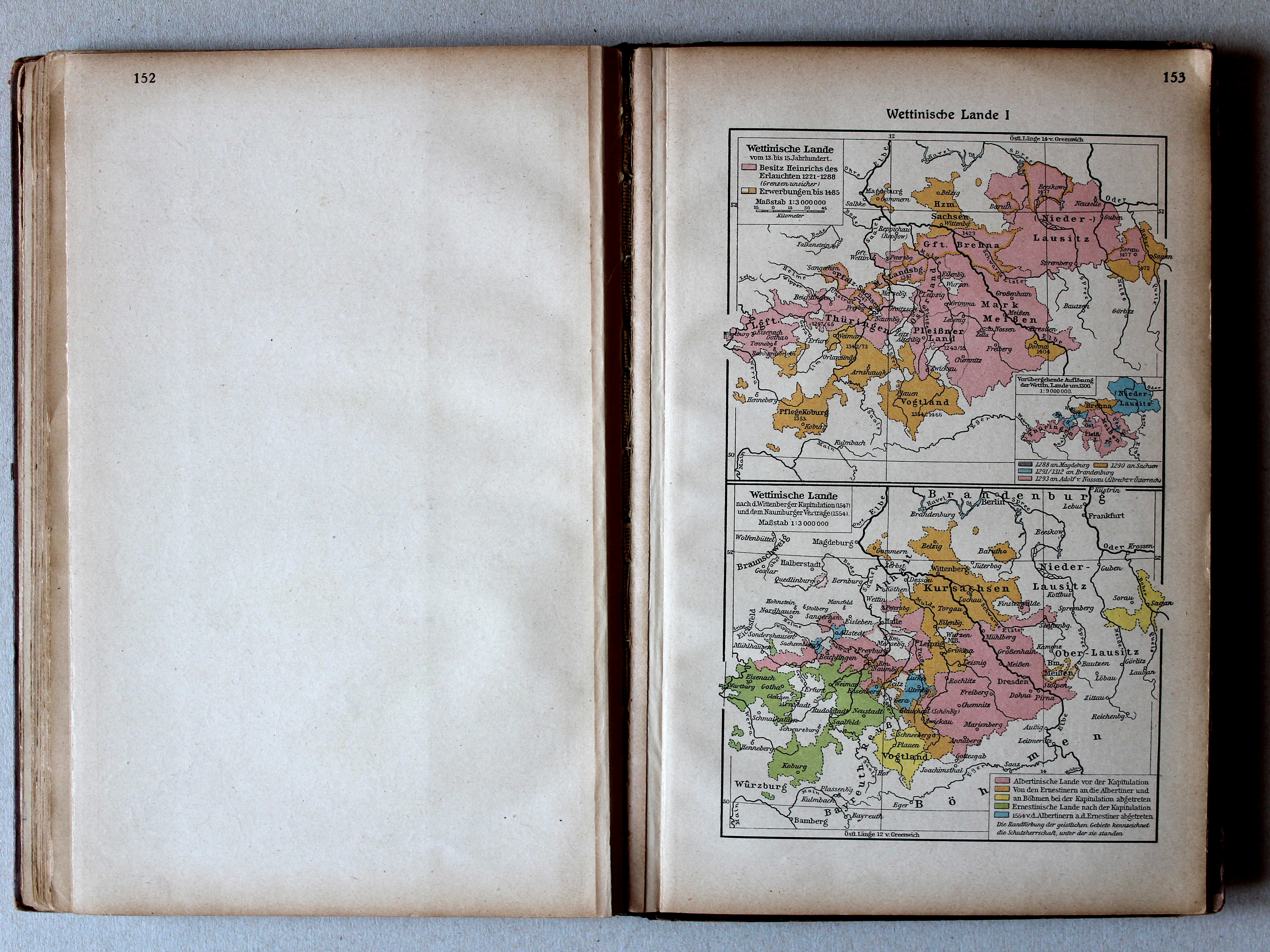
153. Wettinische Lande I (vom 13. bis 15. Jahrhundert) XL
Het gebied van het Huis Wettin I (van de 13e tot de 15e eeuw) / The lands of the House of Wettin I (13th to 15th century)
Putzgers Historischer Schul-Atlas, 1922
19a. Die großen Fürstenhäuser IIb/III (III. Wettiner) XL
De grote dynastieën IIb/III (III. Het Huis Wettin) / The great dynasties IIb/III (III. The House of Wettin)
Putzgers Historischer Schul-Atlas, Große Ausgabe, 1923
153. Wettinische Lande I (1547, 1554) XL
Het gebied van het Huis Wettin I (1547, 1554) / The lands of the House of Wettin I (1547, 1554)
Putzgers Historischer Schul-Atlas, 1922
21. Deutschland zur Zeit der Reformation (1547) (Wettinische Lande 1547 u. 1554) XL
Duitsland in de tijd van de Reformatie (1547) (Het gebied van het Huis Wettin 1547, 1554) / Germany during the Protestant Reformation (1547) (The lands of the House of Wettin 1547, 1554)
 Putzgers Historischer Schul-Atlas, Große Ausgabe, 1923
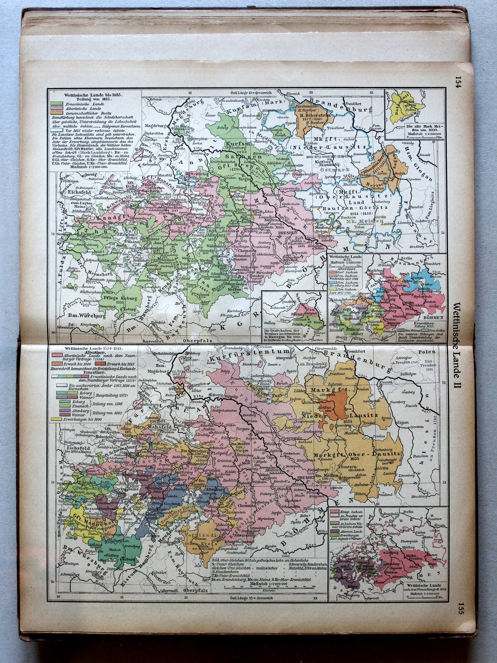
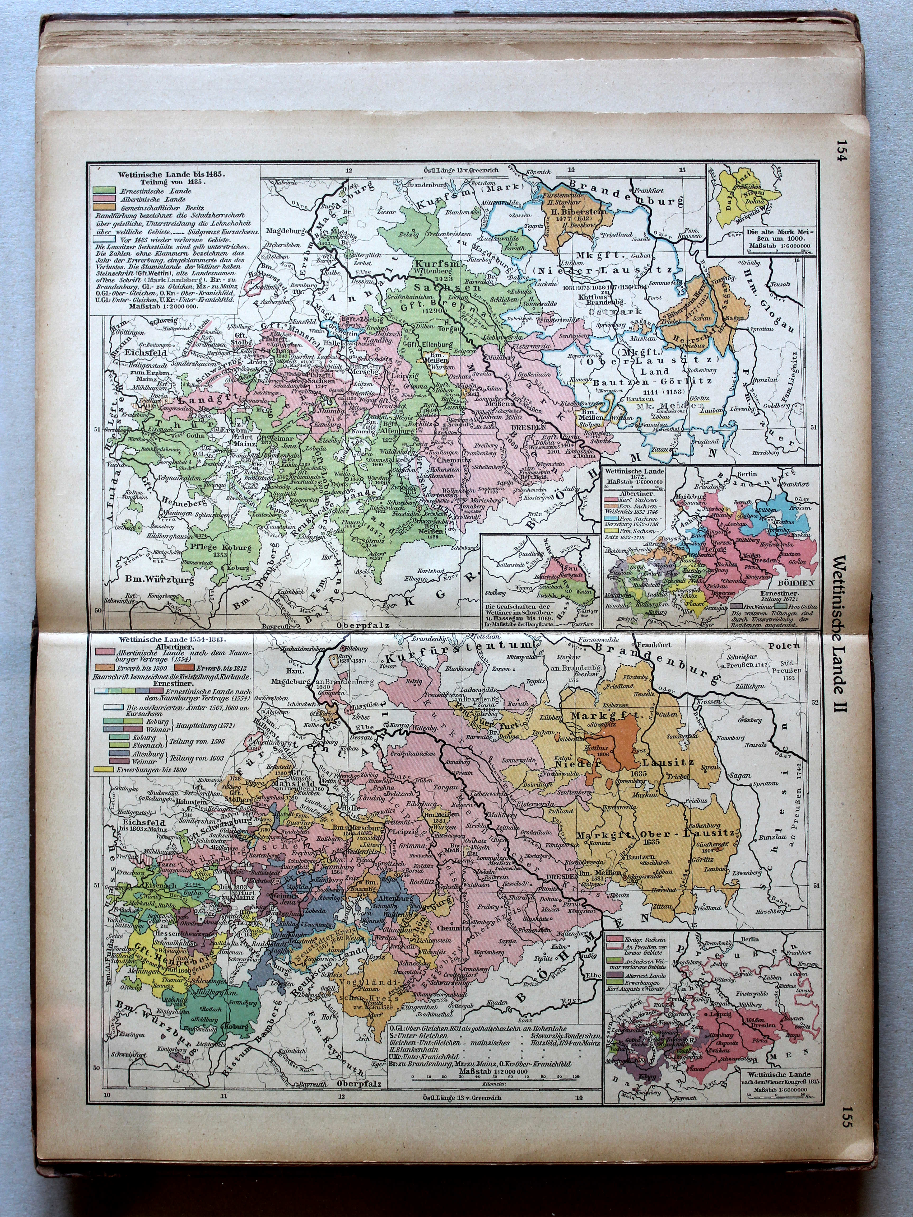
154.155. Wettinische Lande II XL
Het gebied van het Huis Wettin II / The lands of the House of Wettin II
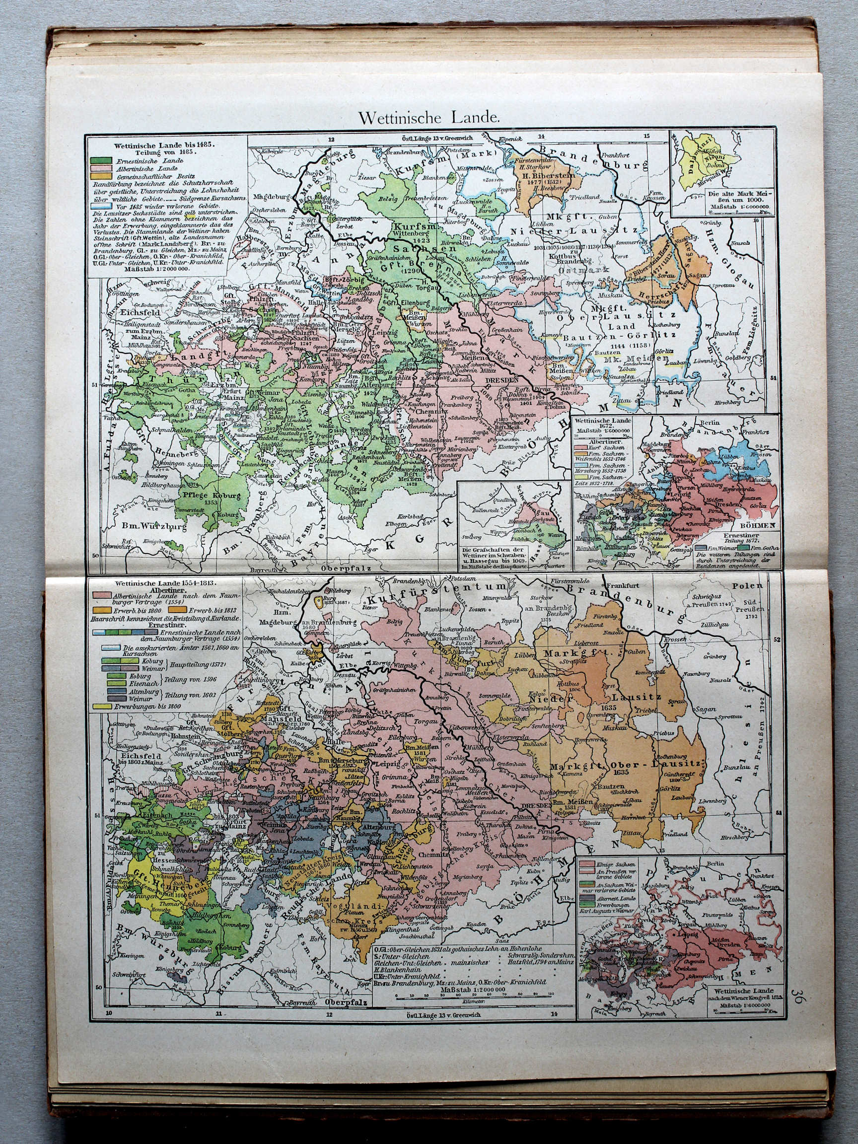 Putzgers Historischer Schul-Atlas, 1922
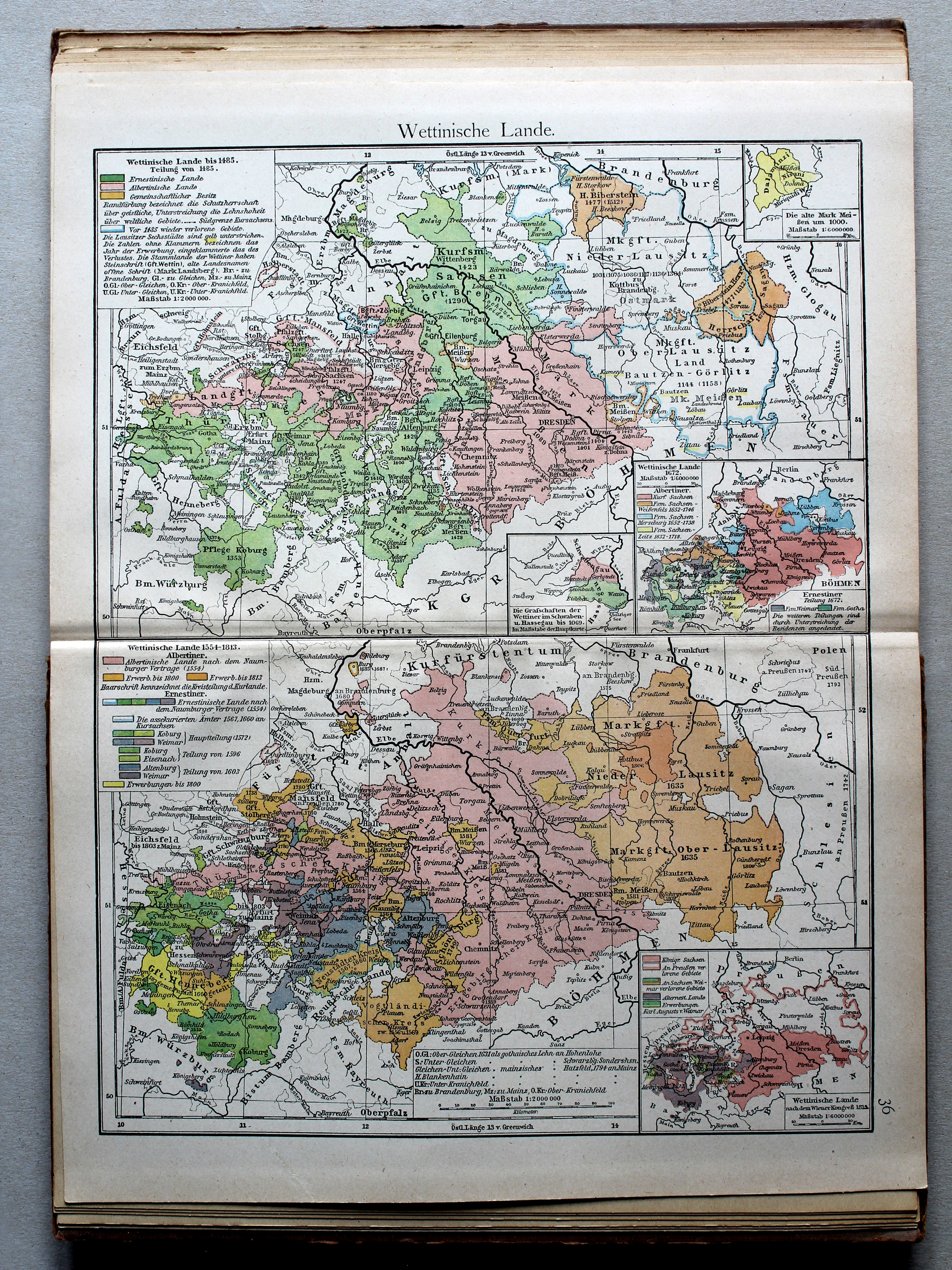
36. Wettinische Lande XL
Het gebied van het Huis Wettin / The lands of the House of Wettin
 Putzgers Historischer Schul-Atlas, Große Ausgabe, 1923
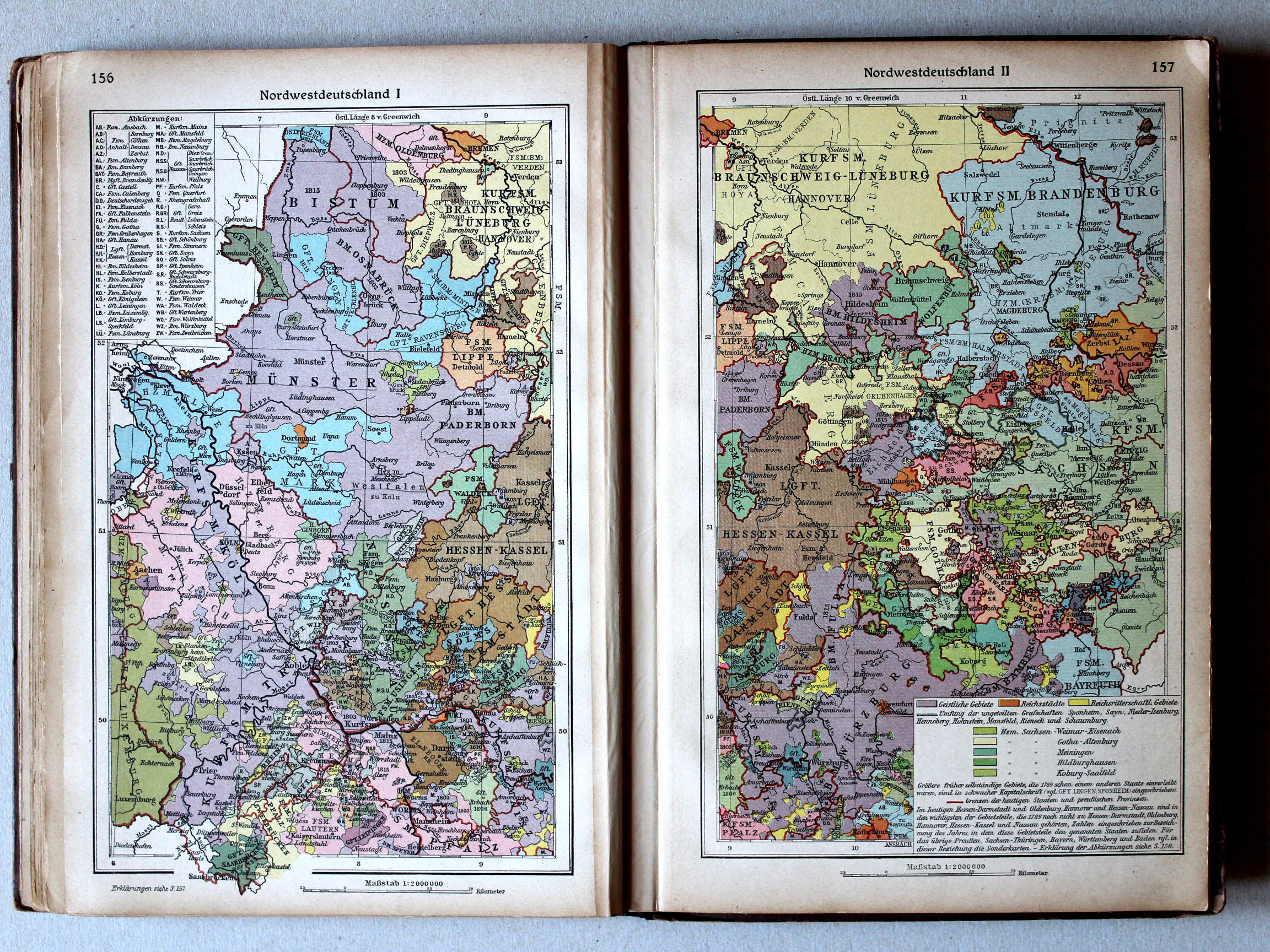
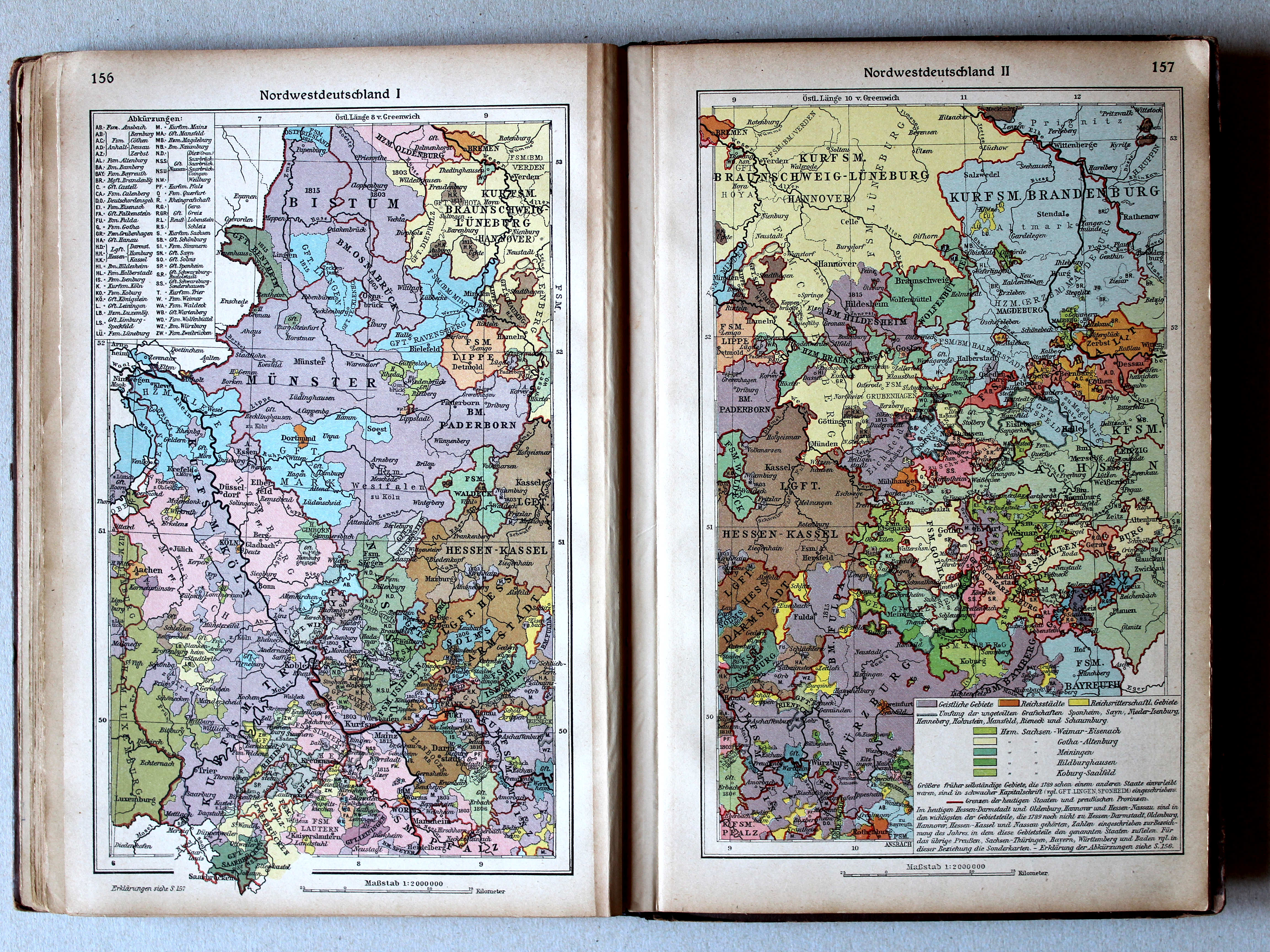
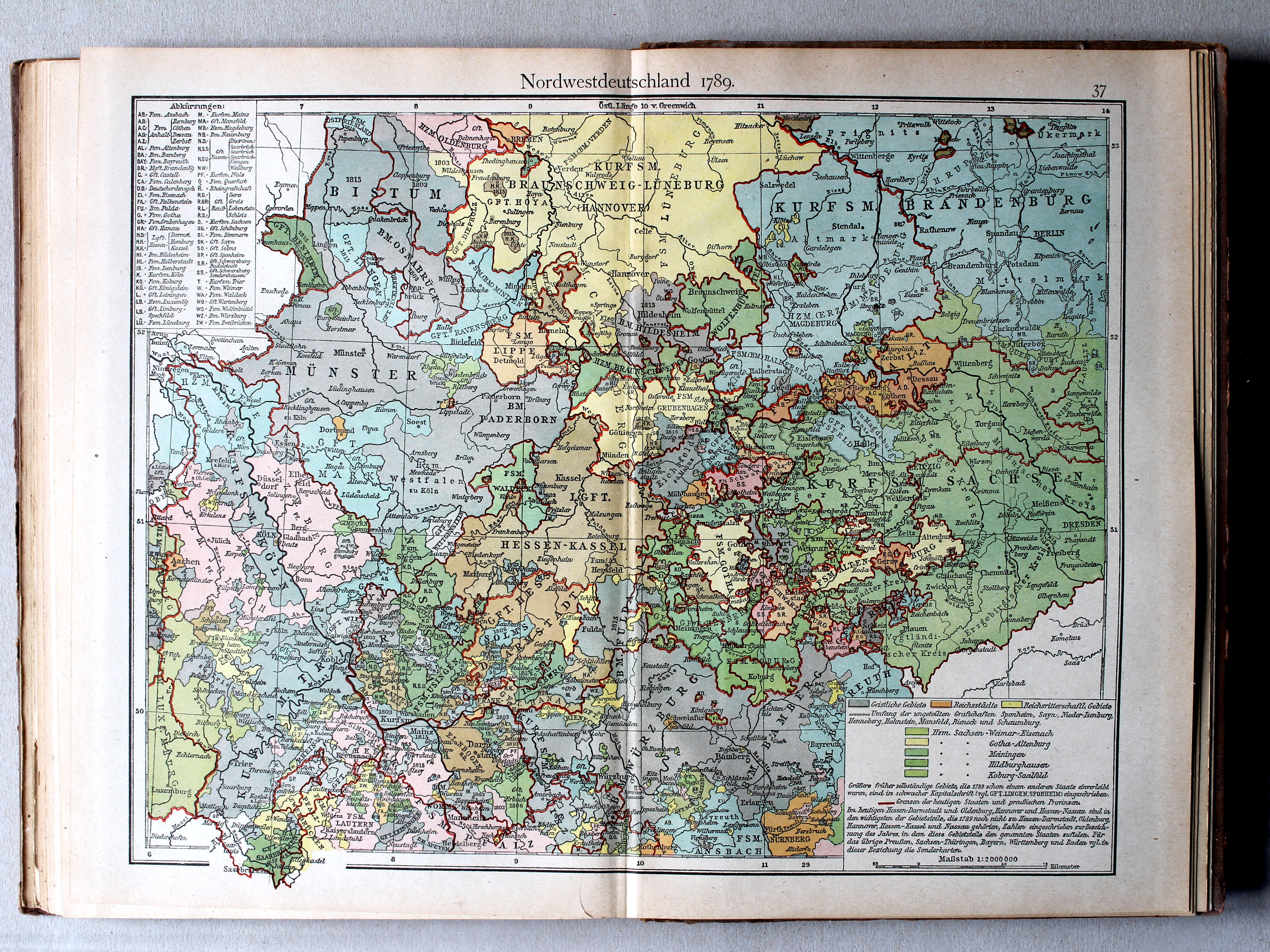
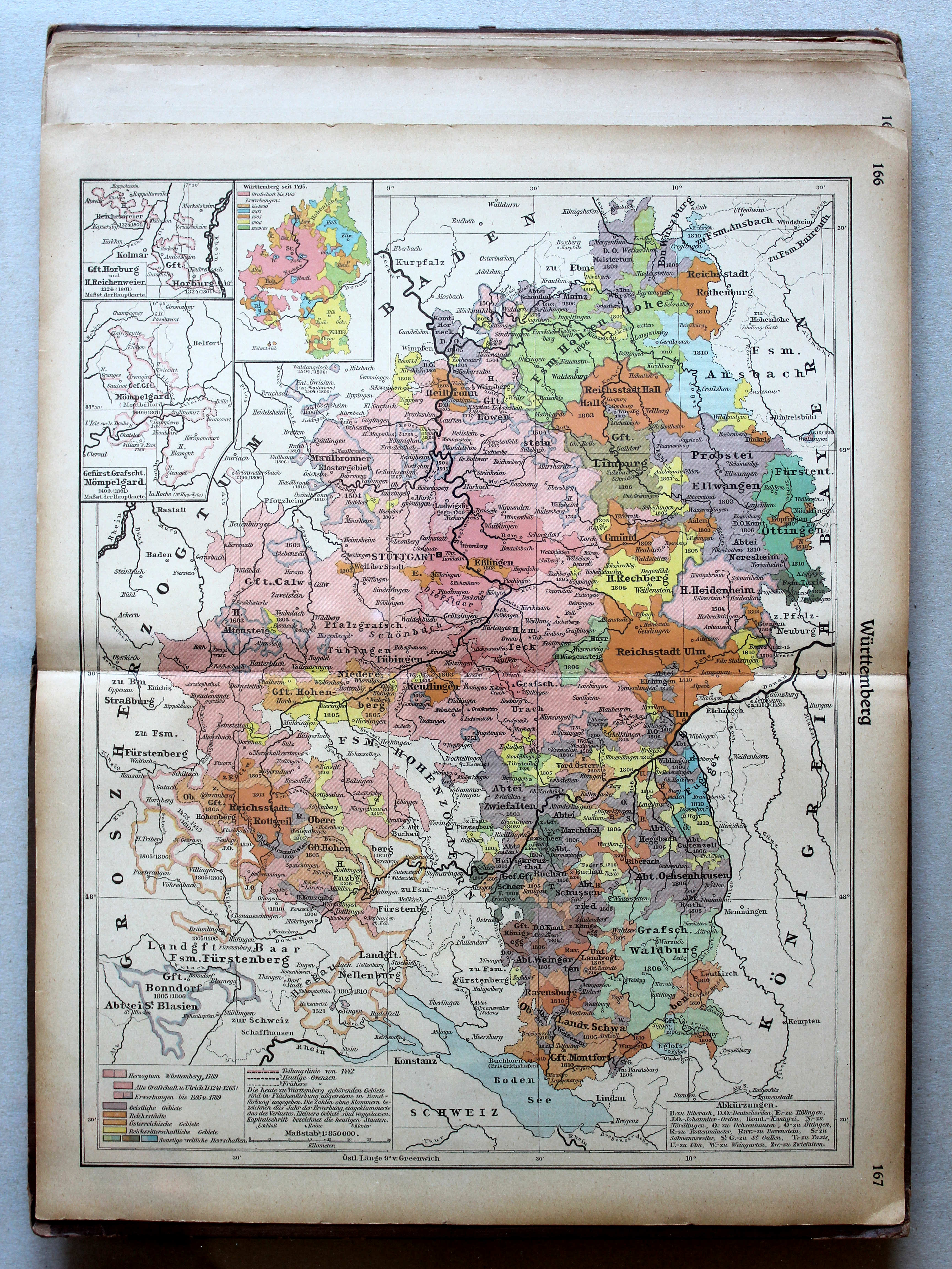
156. Nordwestdeutschland I XL
Noordwest-Duitsland I / Northwest Germany I
157. Nordwestdeutschland II XL
Noordwest-Duitsland II / Northwest Germany II
 Putzgers Historischer Schul-Atlas, 1922
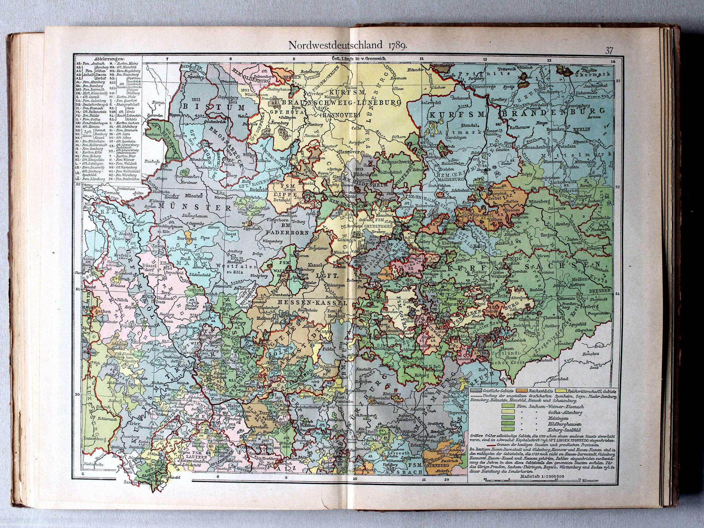
37. Nordwestdeutschland 1789 XL
Noordwest-Duitsland 1789 / Northwest Germany 1789
 Putzgers Historischer Schul-Atlas, Große Ausgabe, 1923
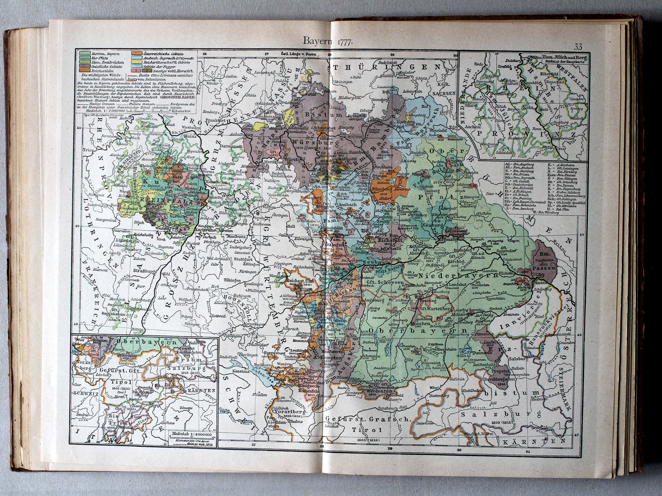
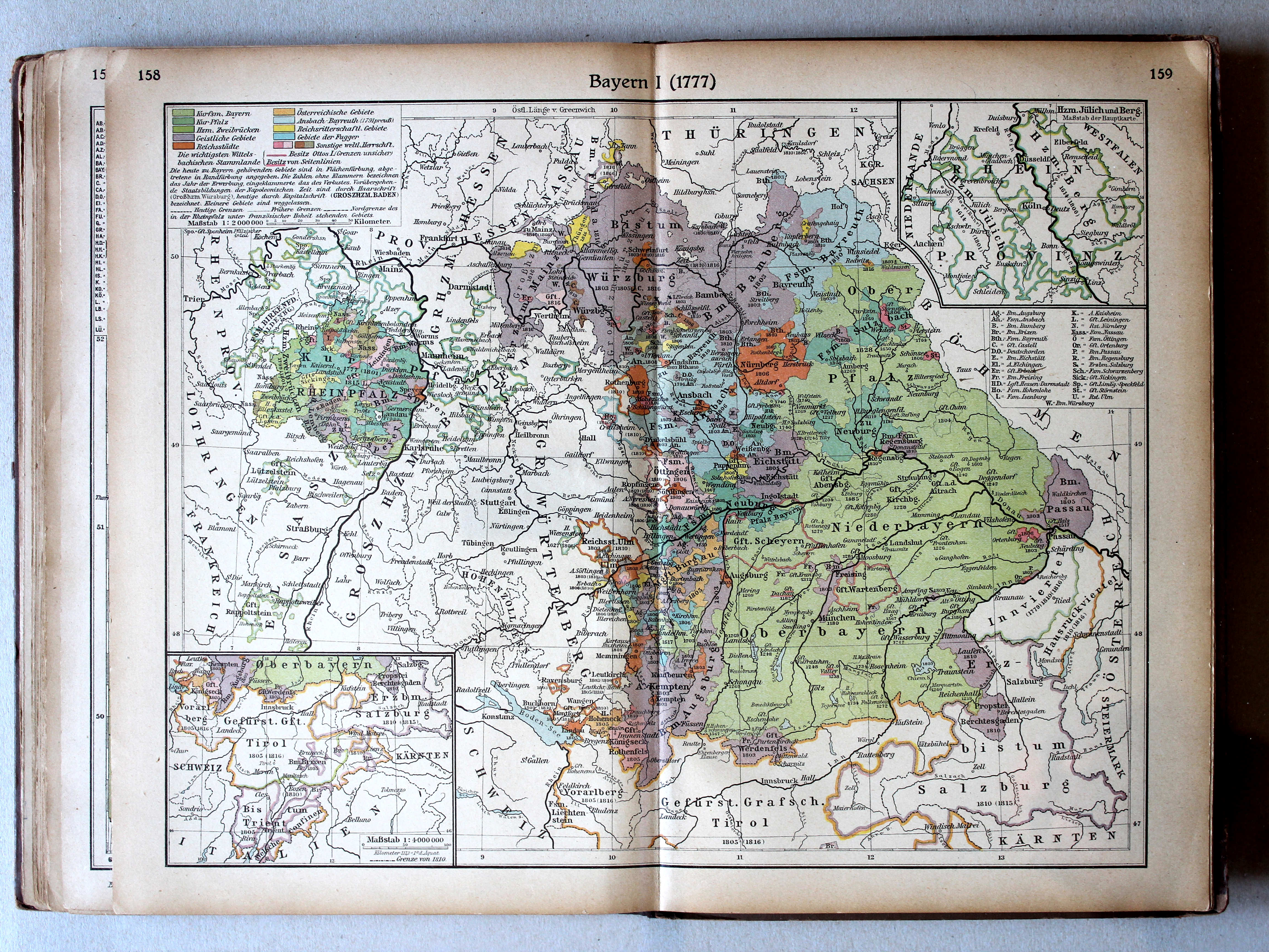
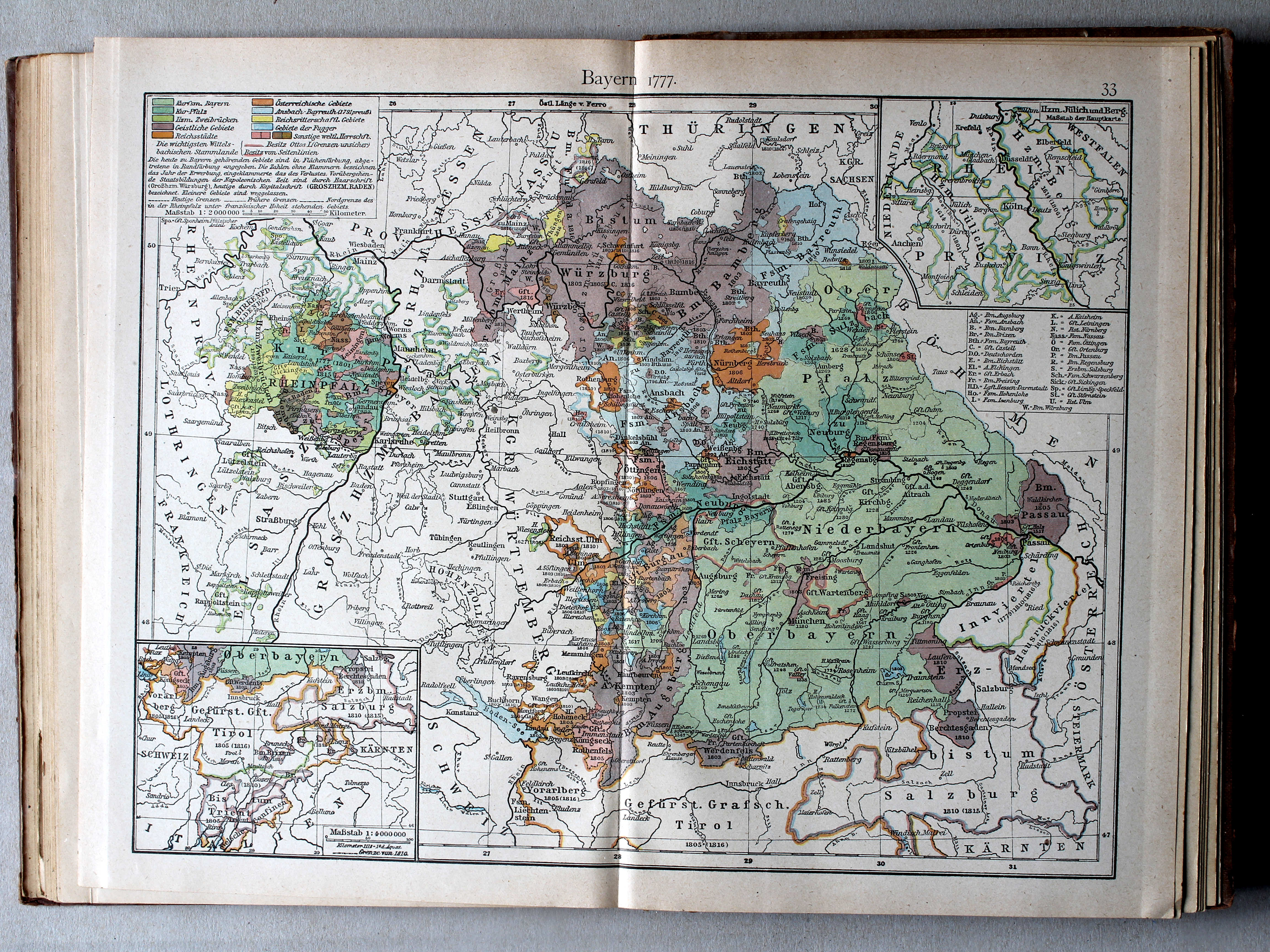
158.159. Bayern I (1777) XL
Beieren I (1777) / Bavaria I (1777)
 Putzgers Historischer Schul-Atlas, 1922
33. Bayern I: Bayern 1777 XL
Beieren I: Beieren 1777 / Bavaria I: Bavaria 1777
 Putzgers Historischer Schul-Atlas, Große Ausgabe, 1923
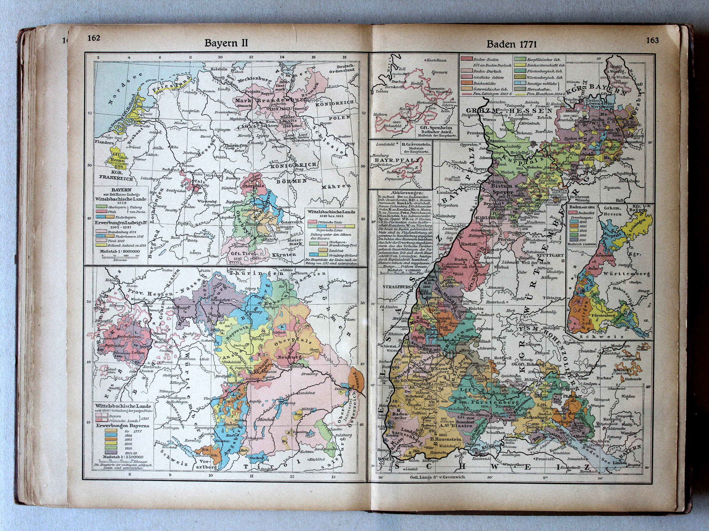
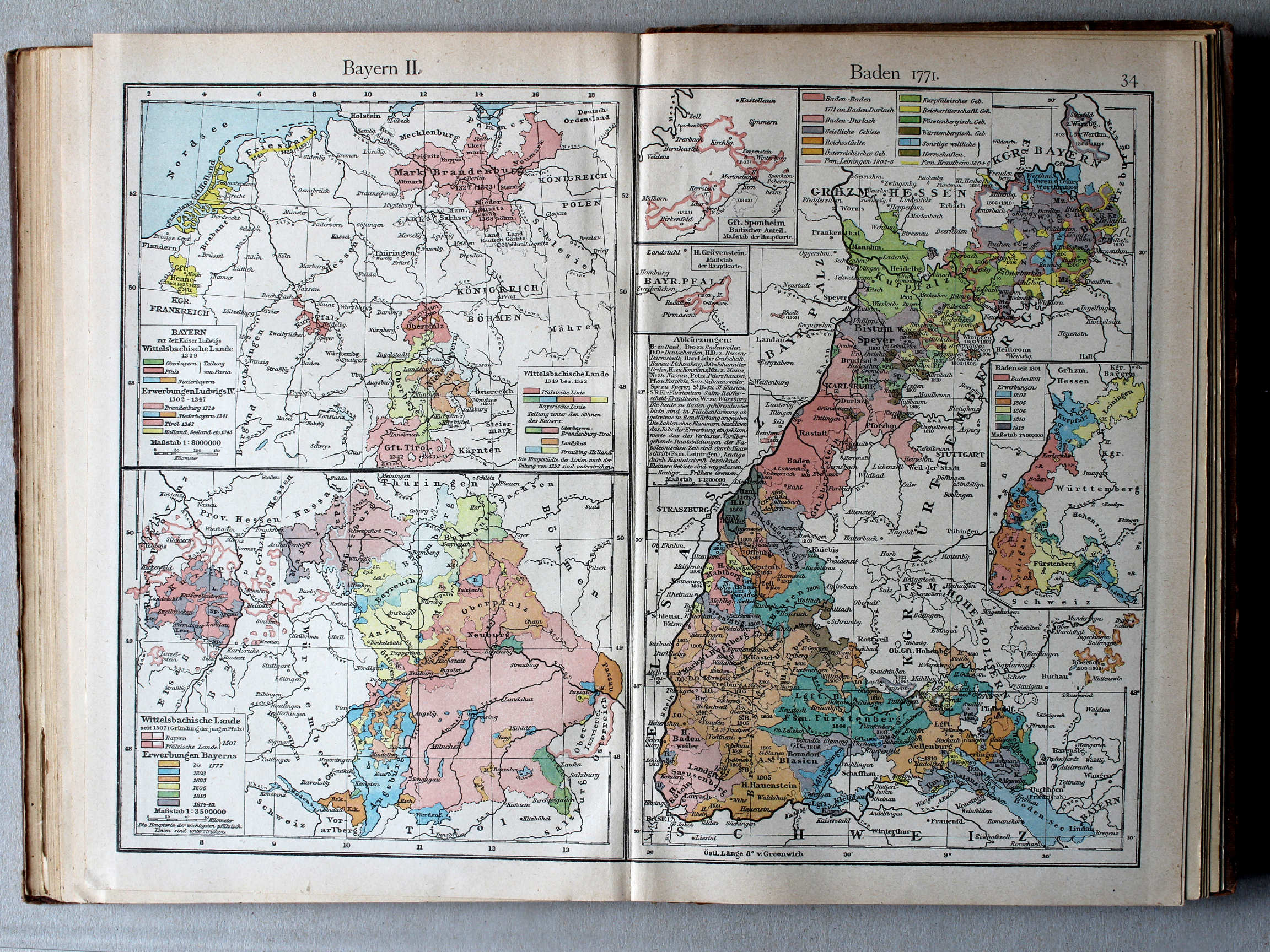
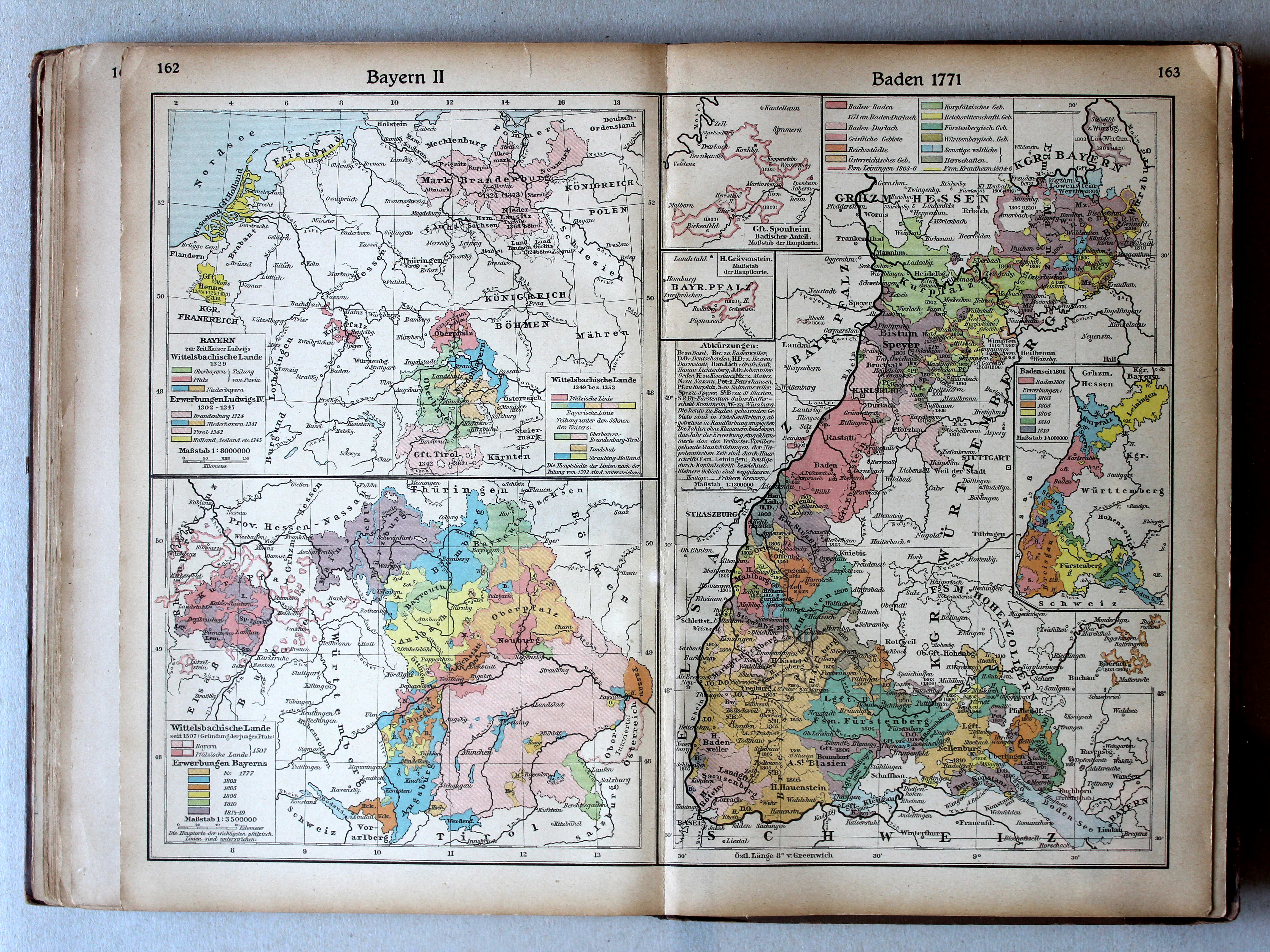
162. Bayern II XL
Beieren II / Bavaria II
163. Baden 1771 XL
Baden 1771
 Putzgers Historischer Schul-Atlas, 1922
34. Bayern II. Baden 1771 XL
Beieren II, Baden 1771 / Bavaria II, Baden 1771

© M. Witkam, 2013
![]()
![]()