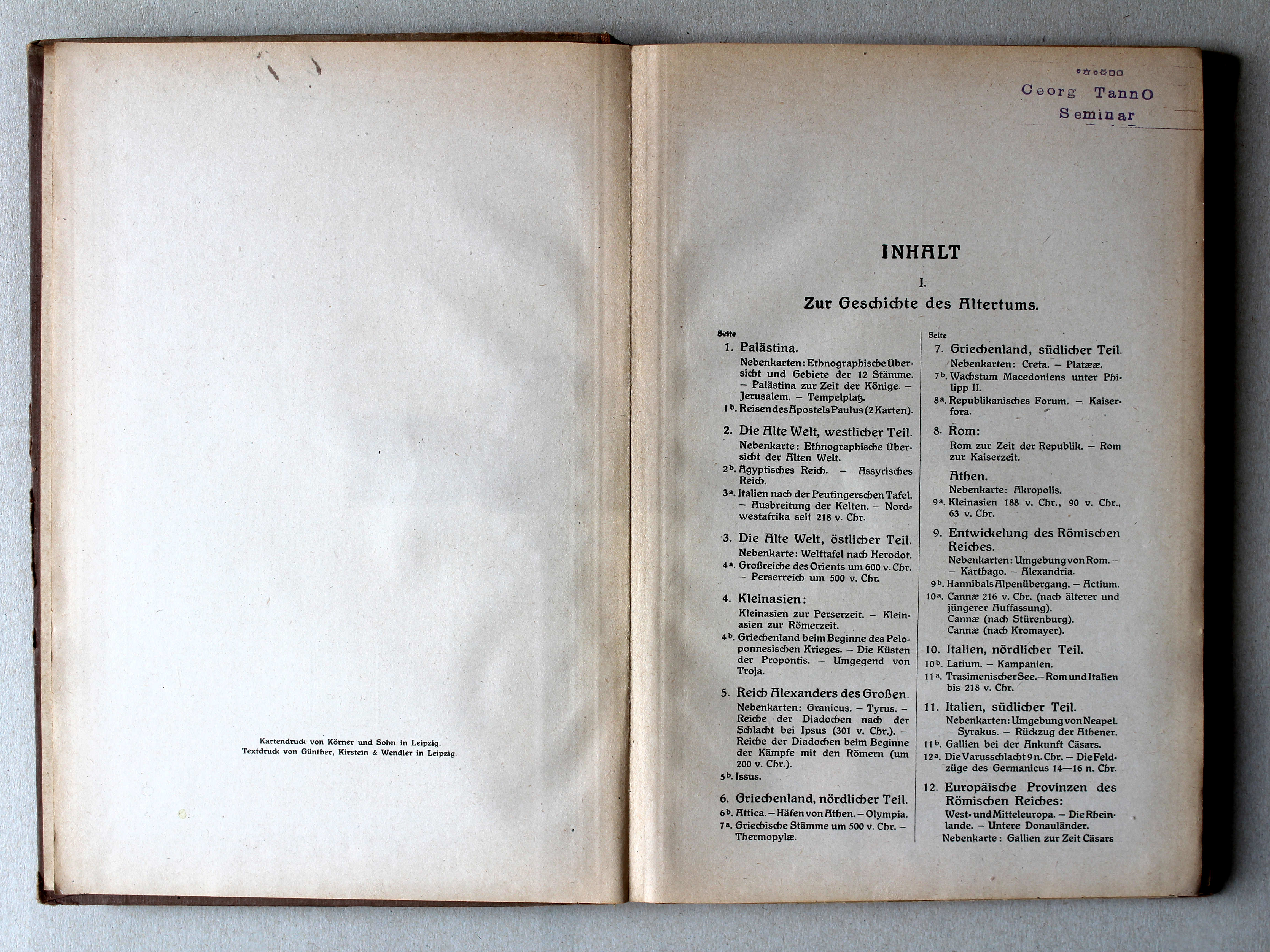
Putzgers Historischer Schul-Atlas, 43e druk (1922)
See below for (a summary of) this text in English.
Hieronder staan plaatjes van de atlas. Daarbij horen ook de volgende pagina's
- Beschrijving van de atlas
- Tabellen en lijsten bij de atlas
- Vergelijking (plaatjes) met de 41e druk (1918)
Plaatjes
Klik op een plaatje voor een vergroting.
Putzgers Historischer Schul-Atlas, 43rd edition (1922)
- Below are pictures of the atlas. Related pages
- Description of the atlas
- Tables and lists to the atlas
- Comparison (pictures) with the 41st edition (1918)
Pictures
Click on a picture to enlarge.
Band, titelpagina / Binding, title page

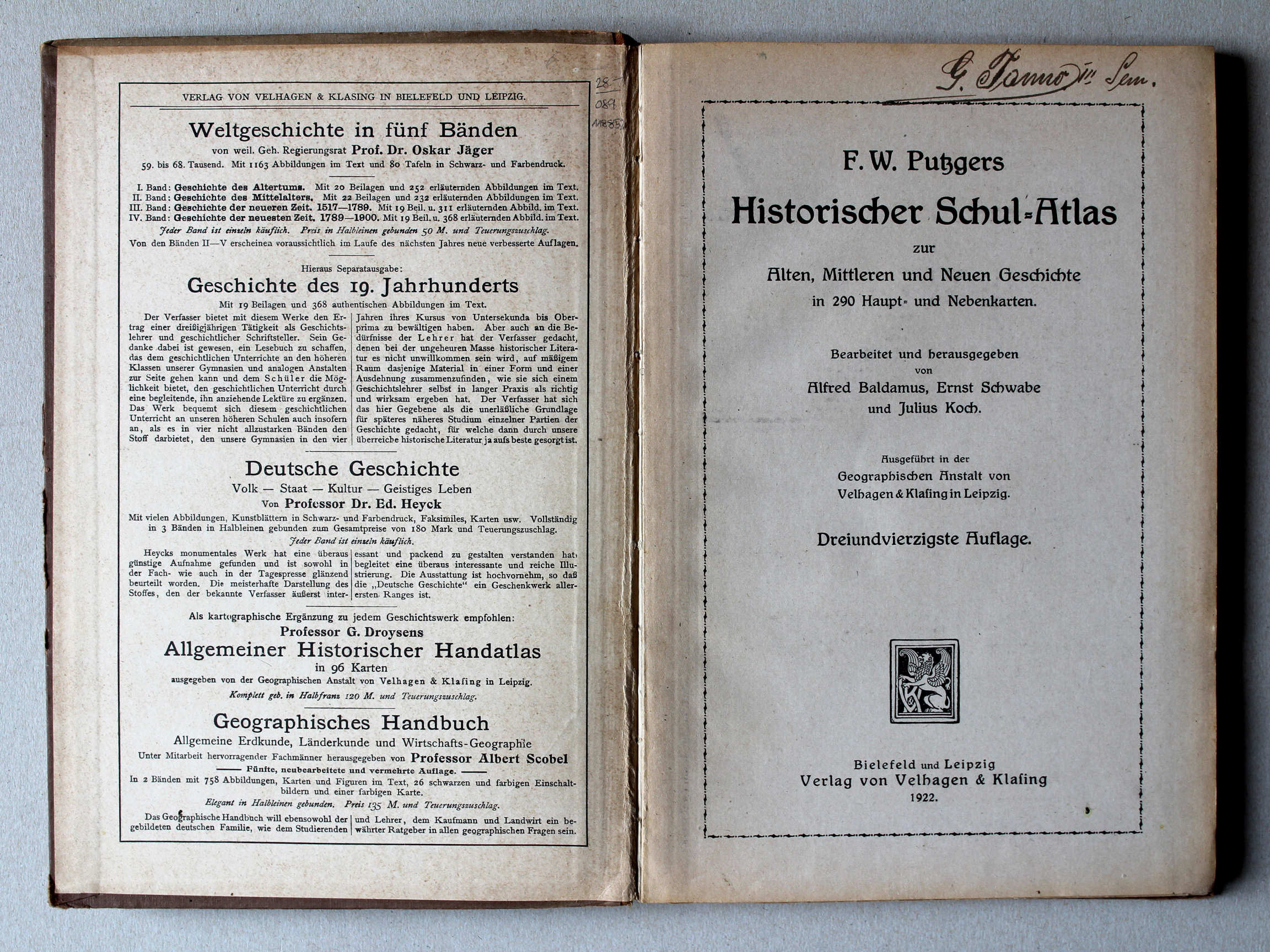 Putzgers Historischer Schul-Atlas, 1922
Schutblad voorin, titelpagina / Front endpaper, title page XL
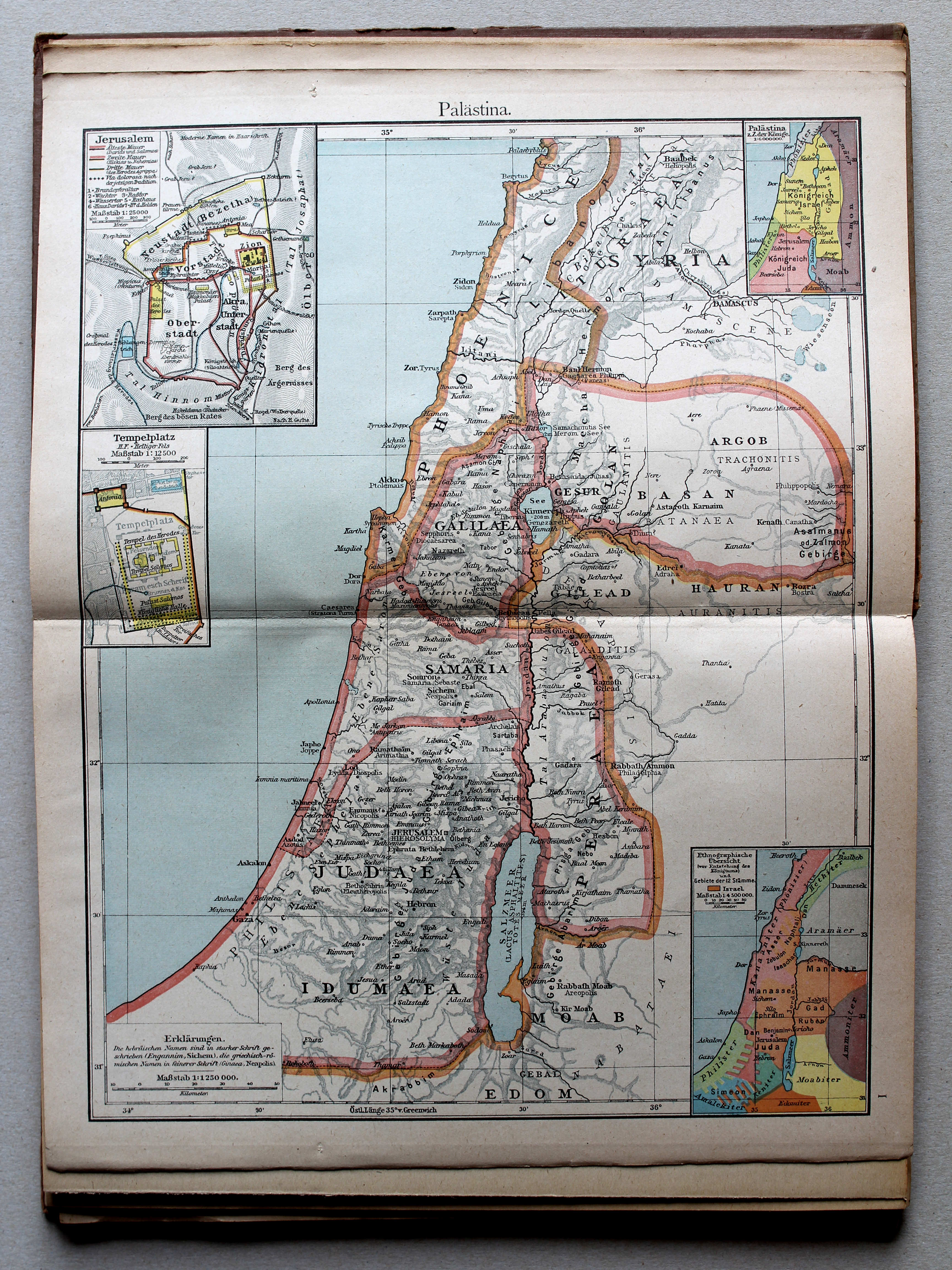
(Oudheid / Ancient history)

 Putzgers Historischer Schul-Atlas, 1922
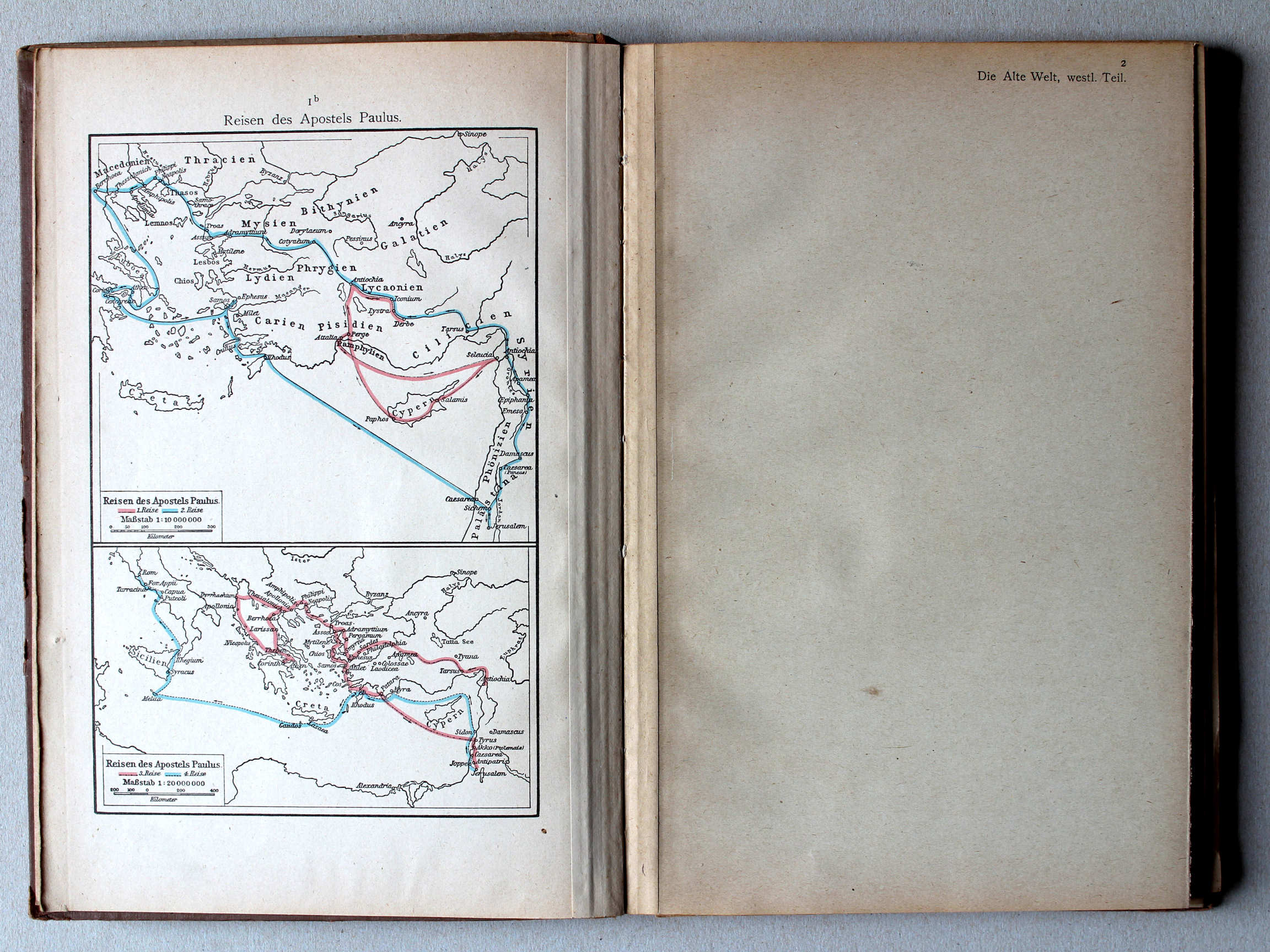
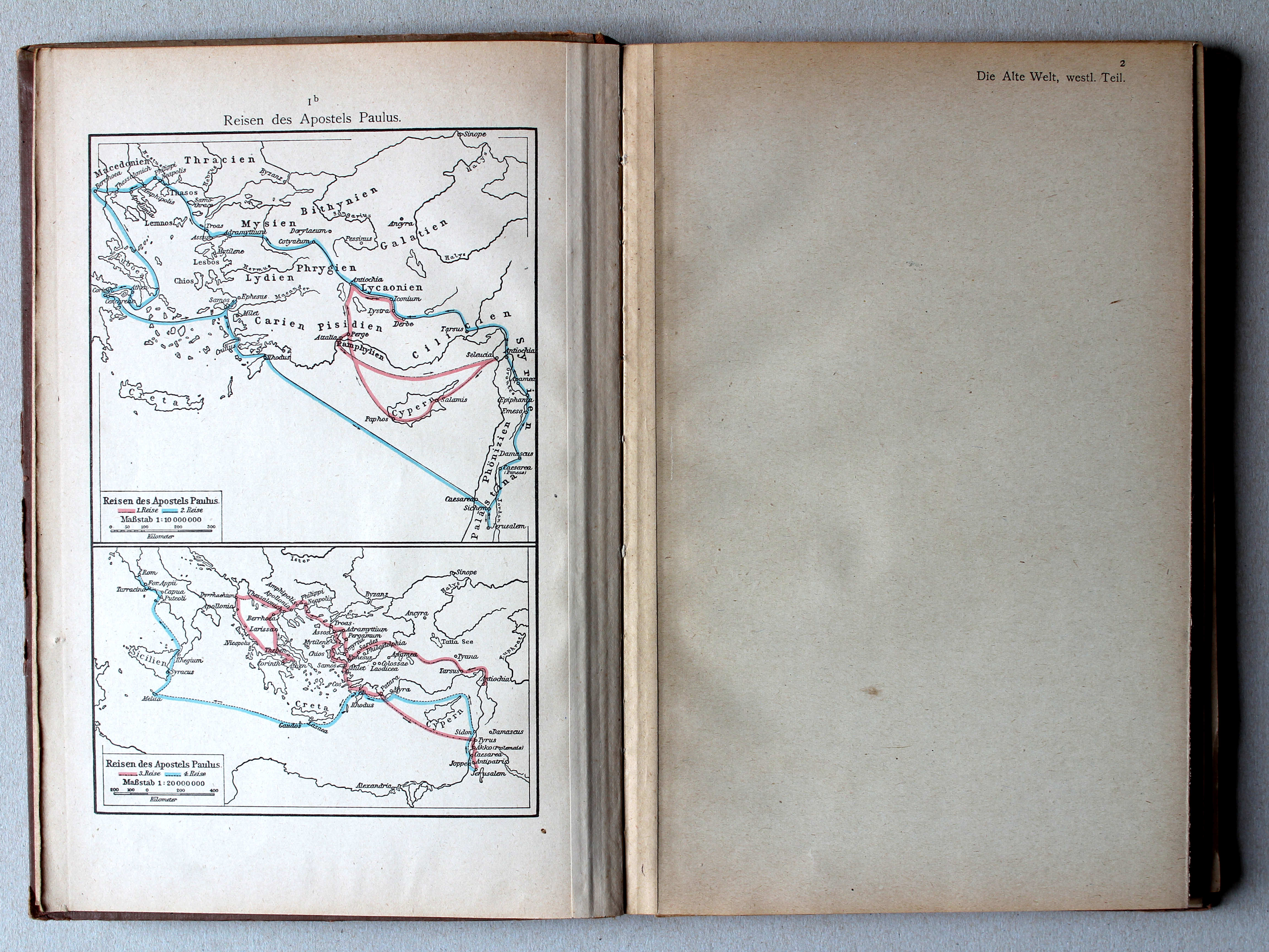
1b. Reisen des Apostels Paulus XL
Reizen van de Apostel Paulus / Journeys of Paul the Apostle
 Putzgers Historischer Schul-Atlas, 1922
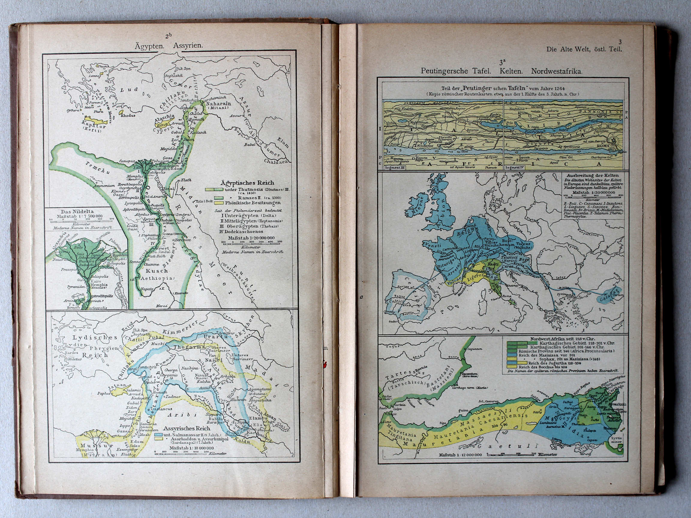
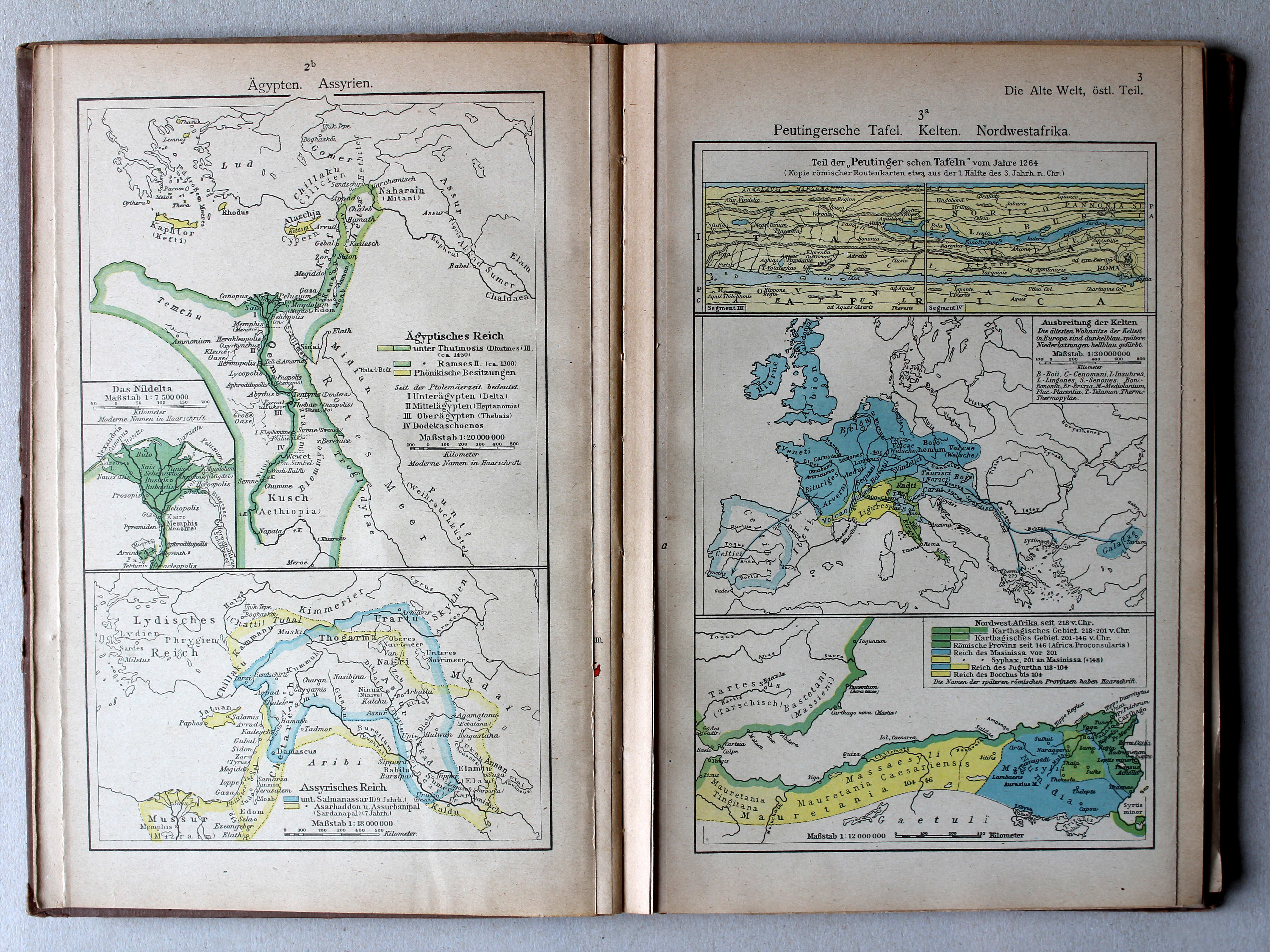
2b. Ägypten. Assyrien XL
Egypte. Assyrië / Egypt. Assyria
3a. Peutingersche Tafel. Kelten. Nordwestafrika XL
Tabula Peutingeriana. Kelten. Noordwest-Afrika / Tabula Peutingeriana. Celts. Northwest Africa
 Putzgers Historischer Schul-Atlas, 1922
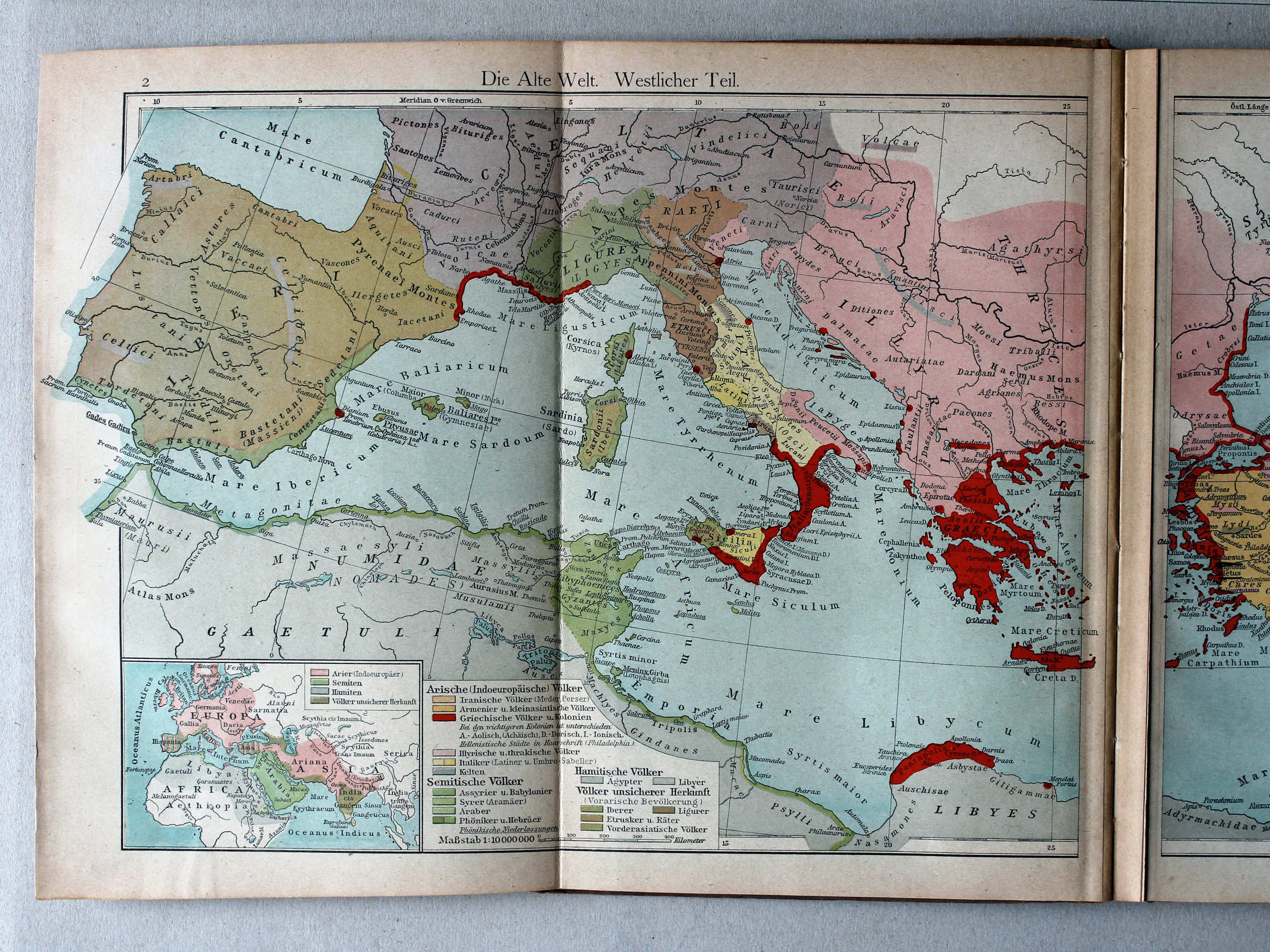
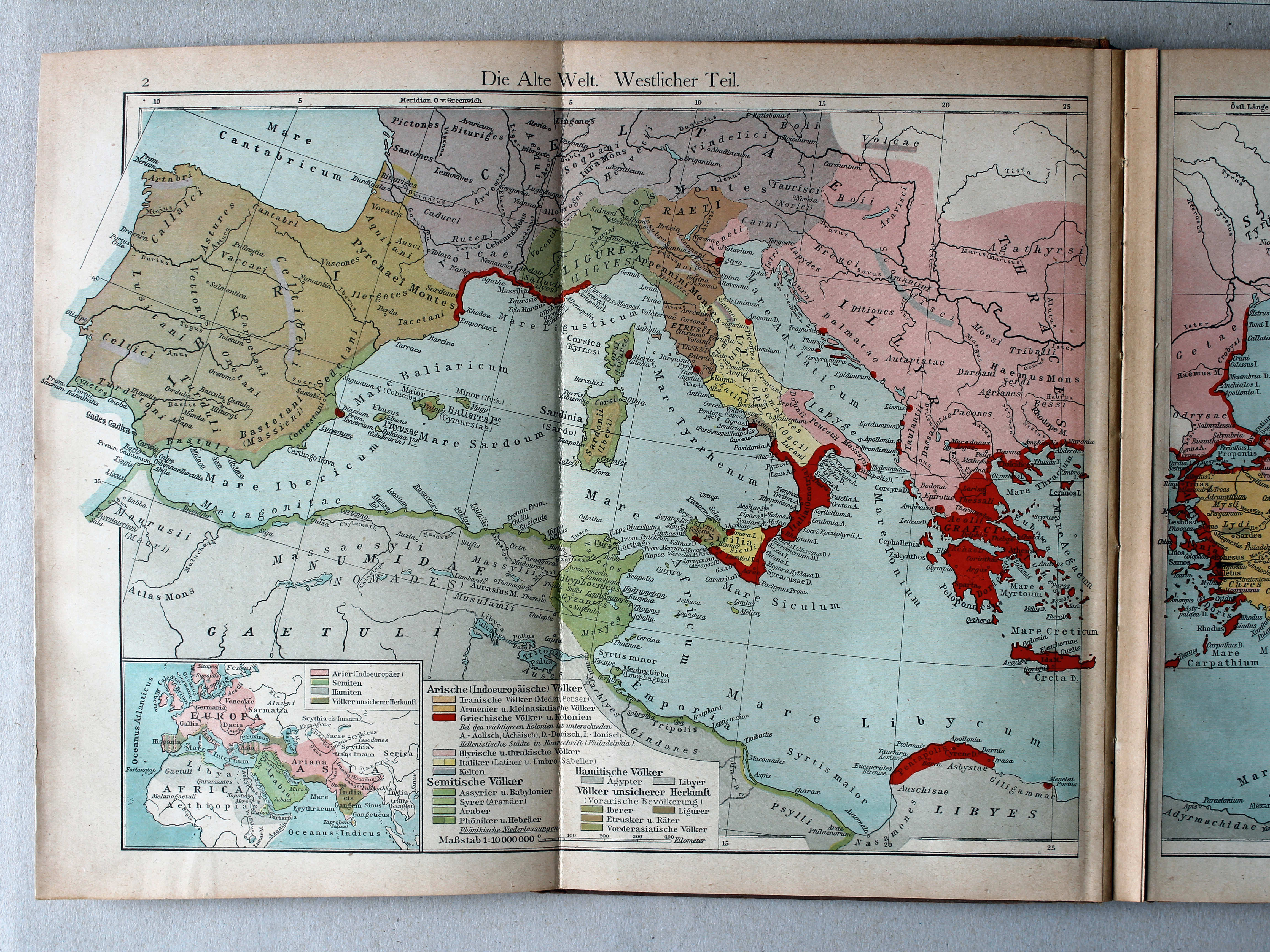
2. Die Alte Welt. Westlicher Teil XL
De wereld in de Oudheid, westelijk deel / The Ancient world, western part
 Putzgers Historischer Schul-Atlas, 1922
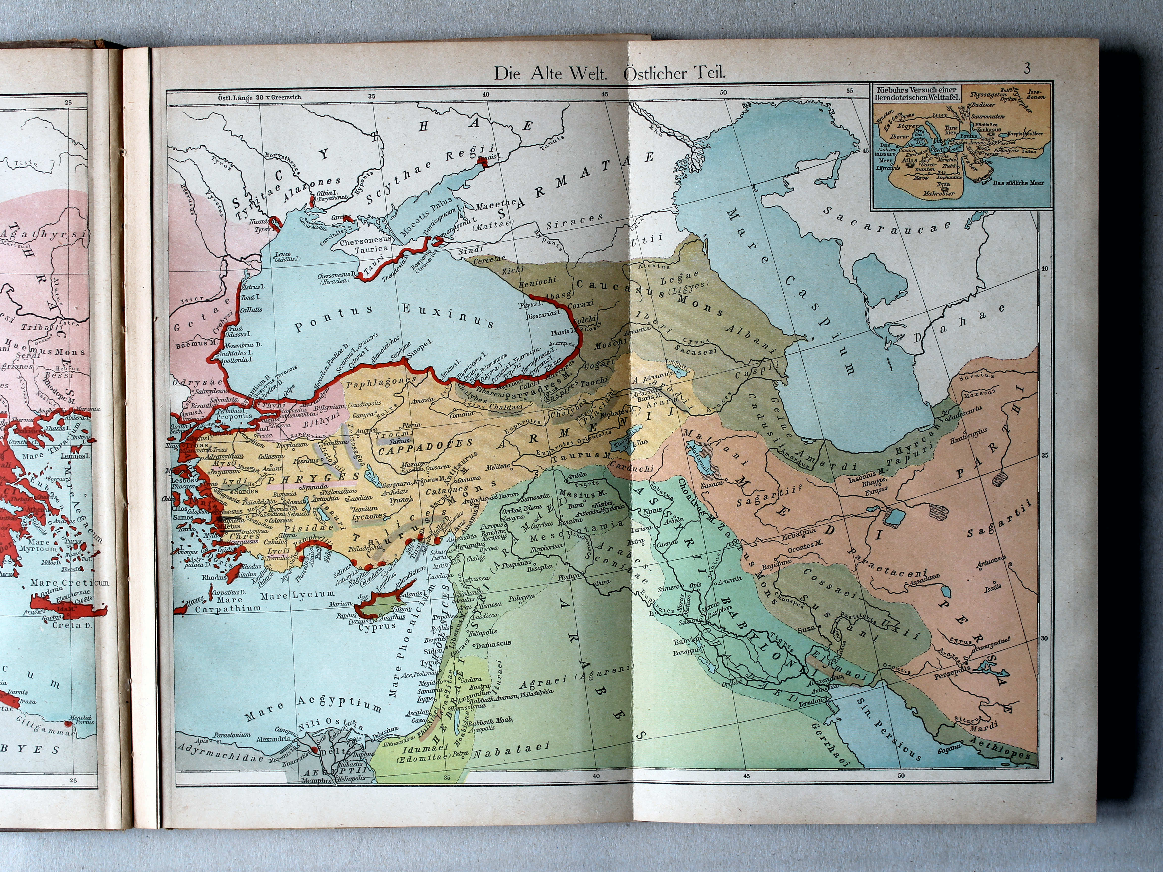
3. Die Alte Welt. Östlicher Teil XL
De wereld in de Oudheid, oostelijk deel / The Ancient world, eastern part
 Putzgers Historischer Schul-Atlas, 1922
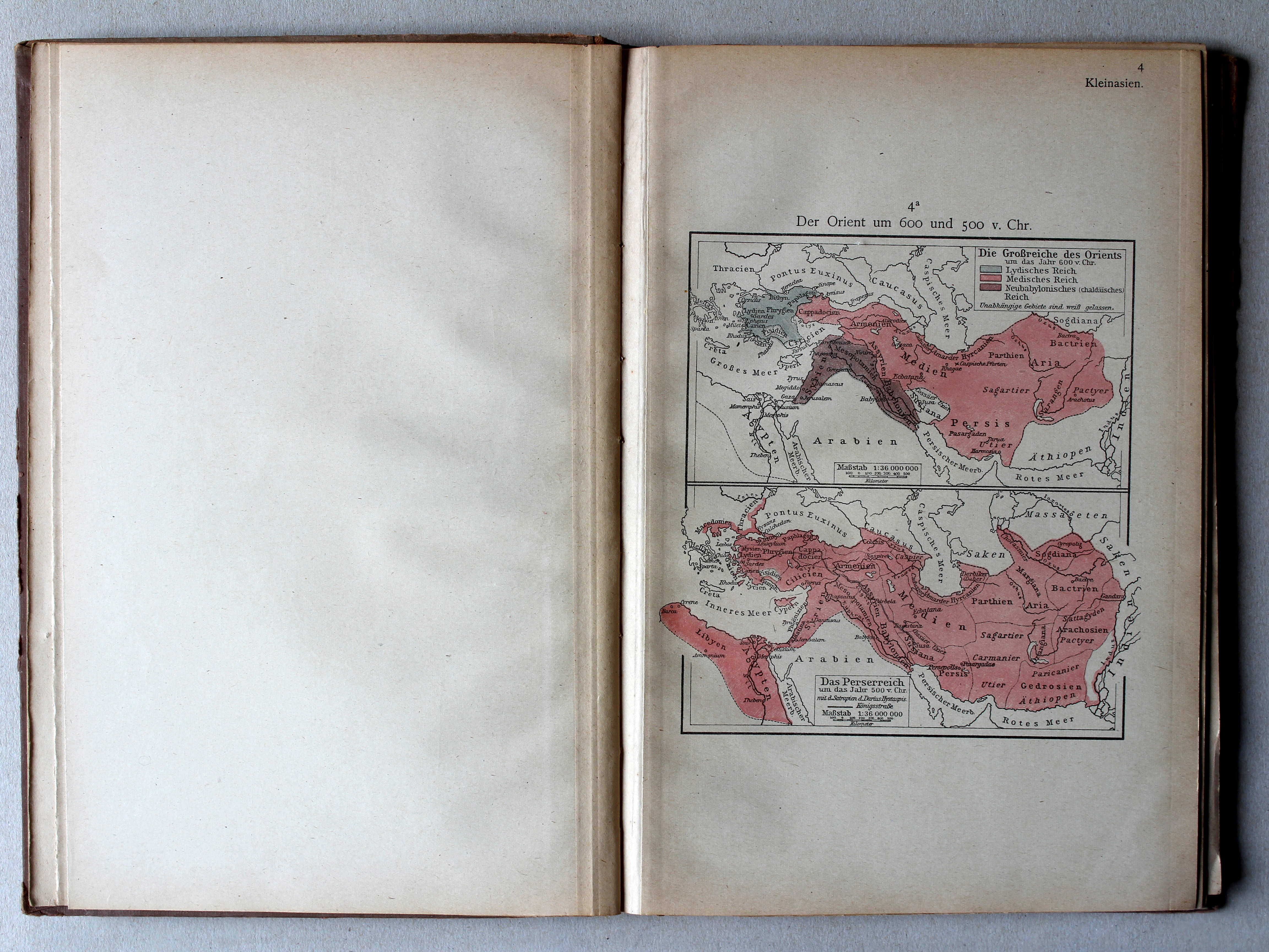
4a. Der Orient um 600 und 500 v. Chr. XL
Het Oosten rond 600 en 500 v. Chr. / The Orient around 600 and 500 BC

 Putzgers Historischer Schul-Atlas, 1922
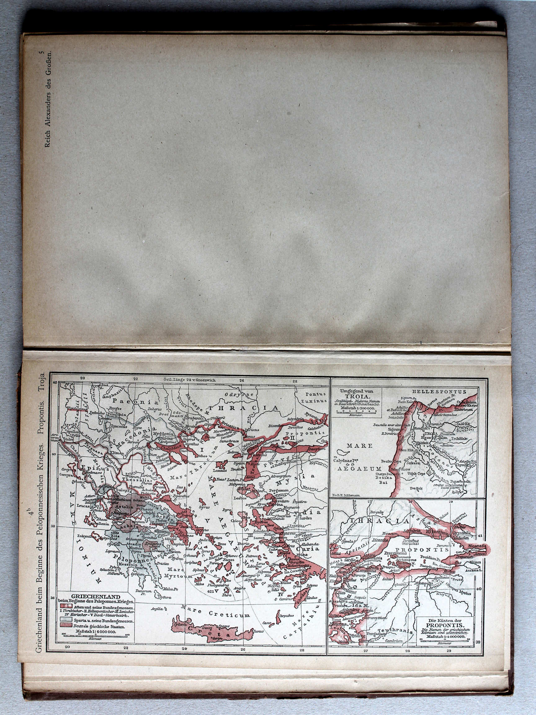
4b. Griechenland beim Beginne des Peloponnesischen Krieges. Propontis. Troja XL
Griekenland bij het begin van de Peloponnesische Oorlog. Propontis. Troja / Greece at the beginning of the Peloponnesian War. Propontis. Troja
 Putzgers Historischer Schul-Atlas, 1922
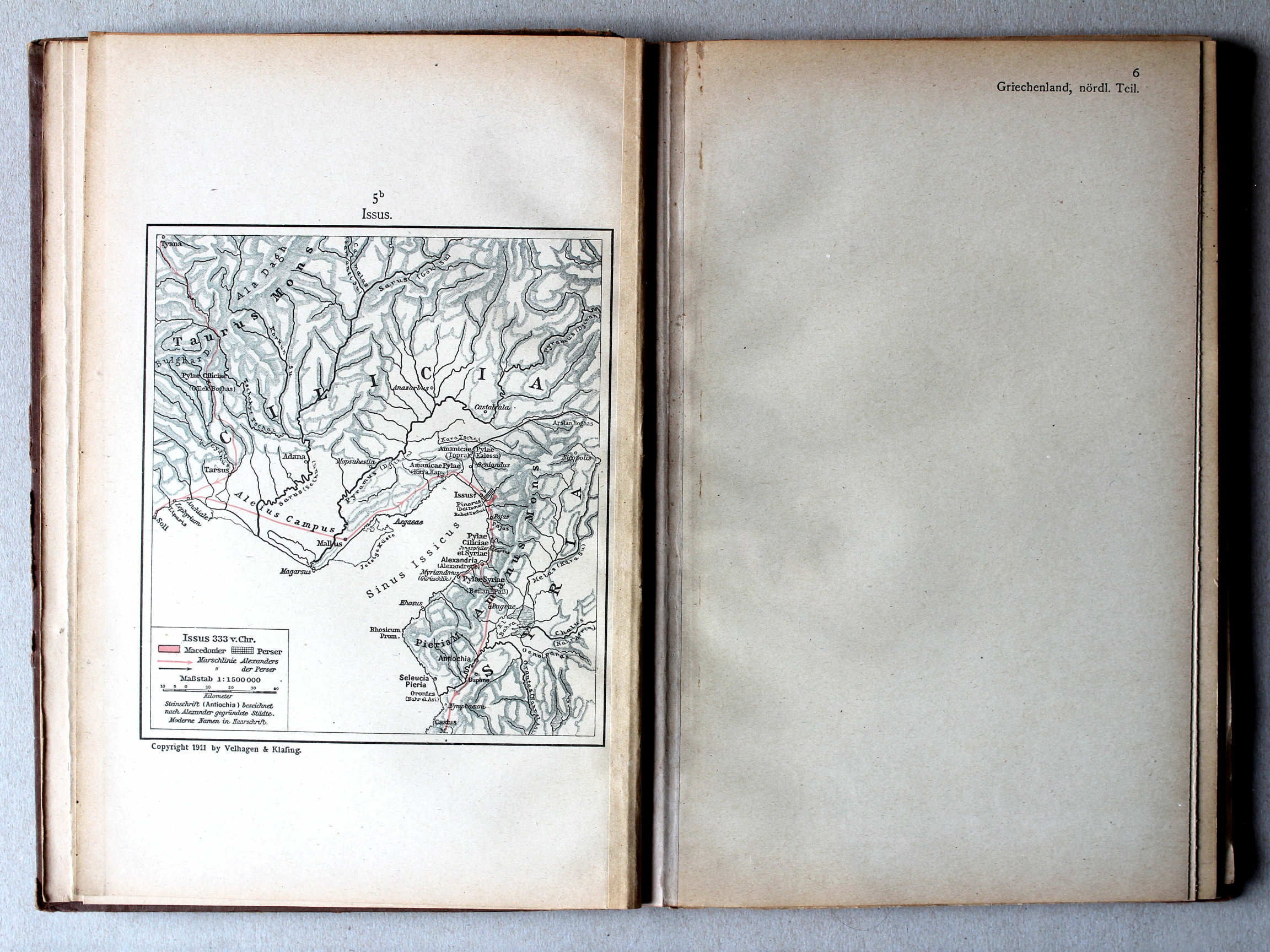
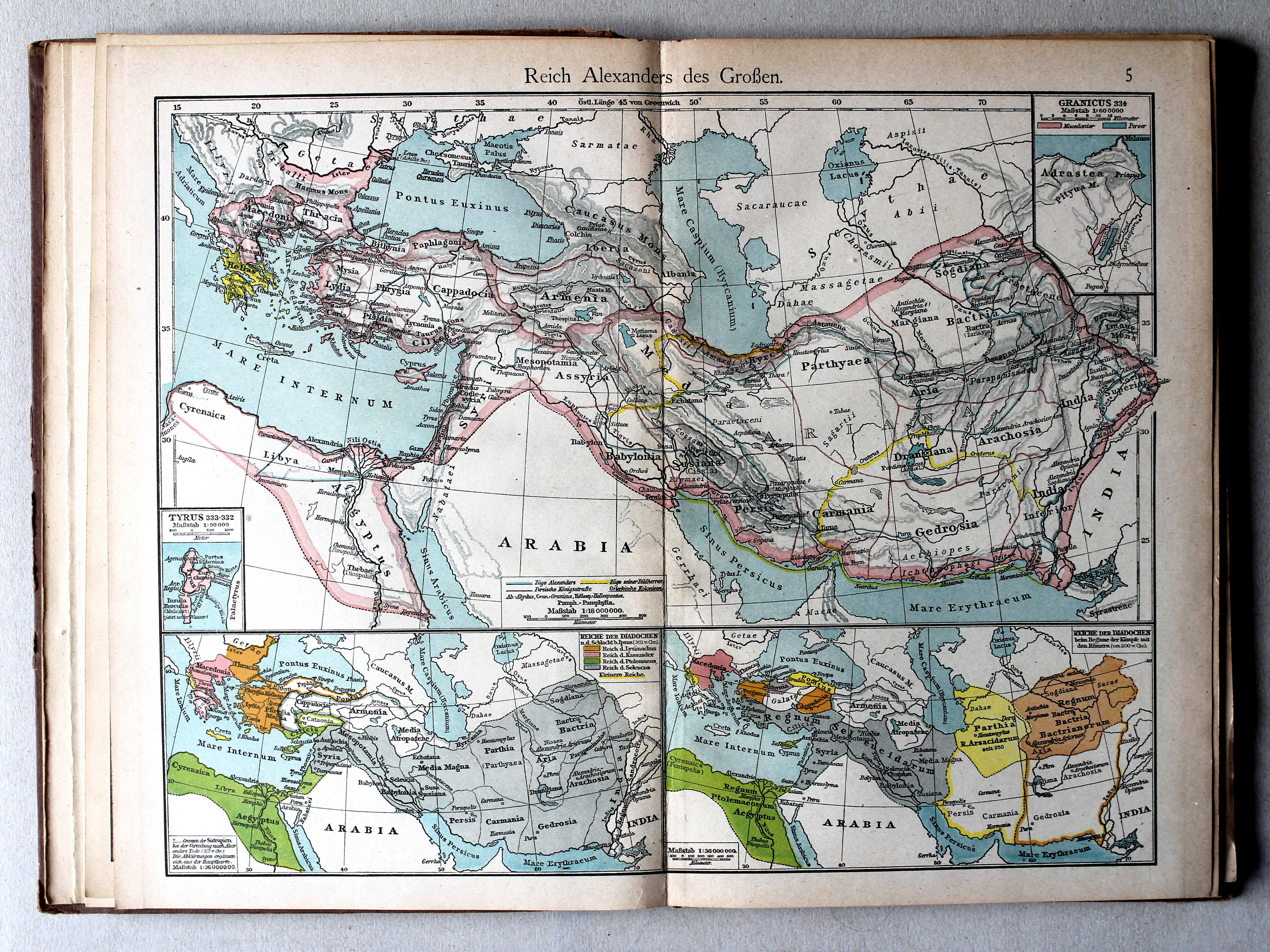
5. Reich Alexanders des Grossen XL
Het Rijk van Alexander de Grote / The Empire of Alexander the Great
 Putzgers Historischer Schul-Atlas, 1922
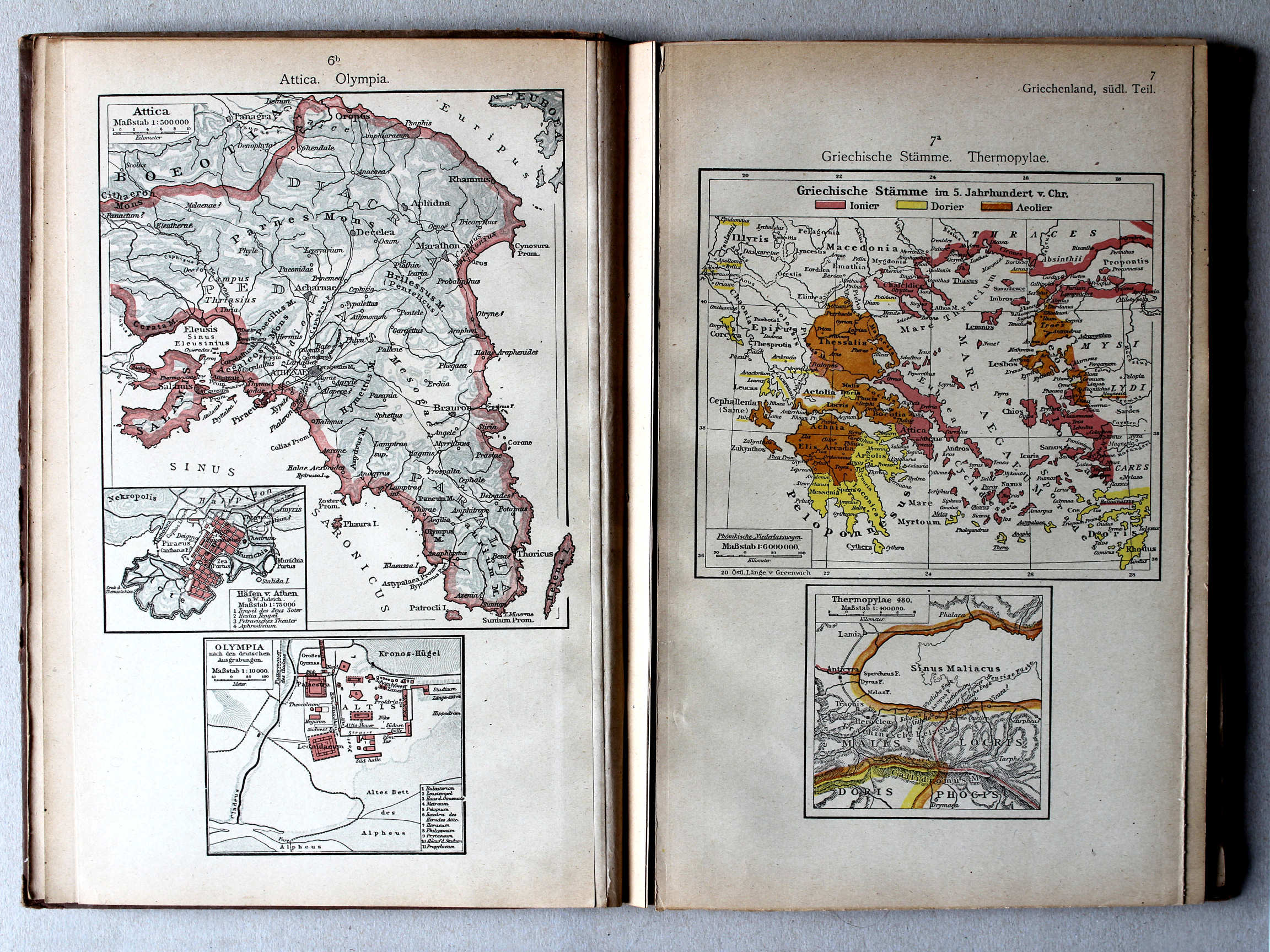
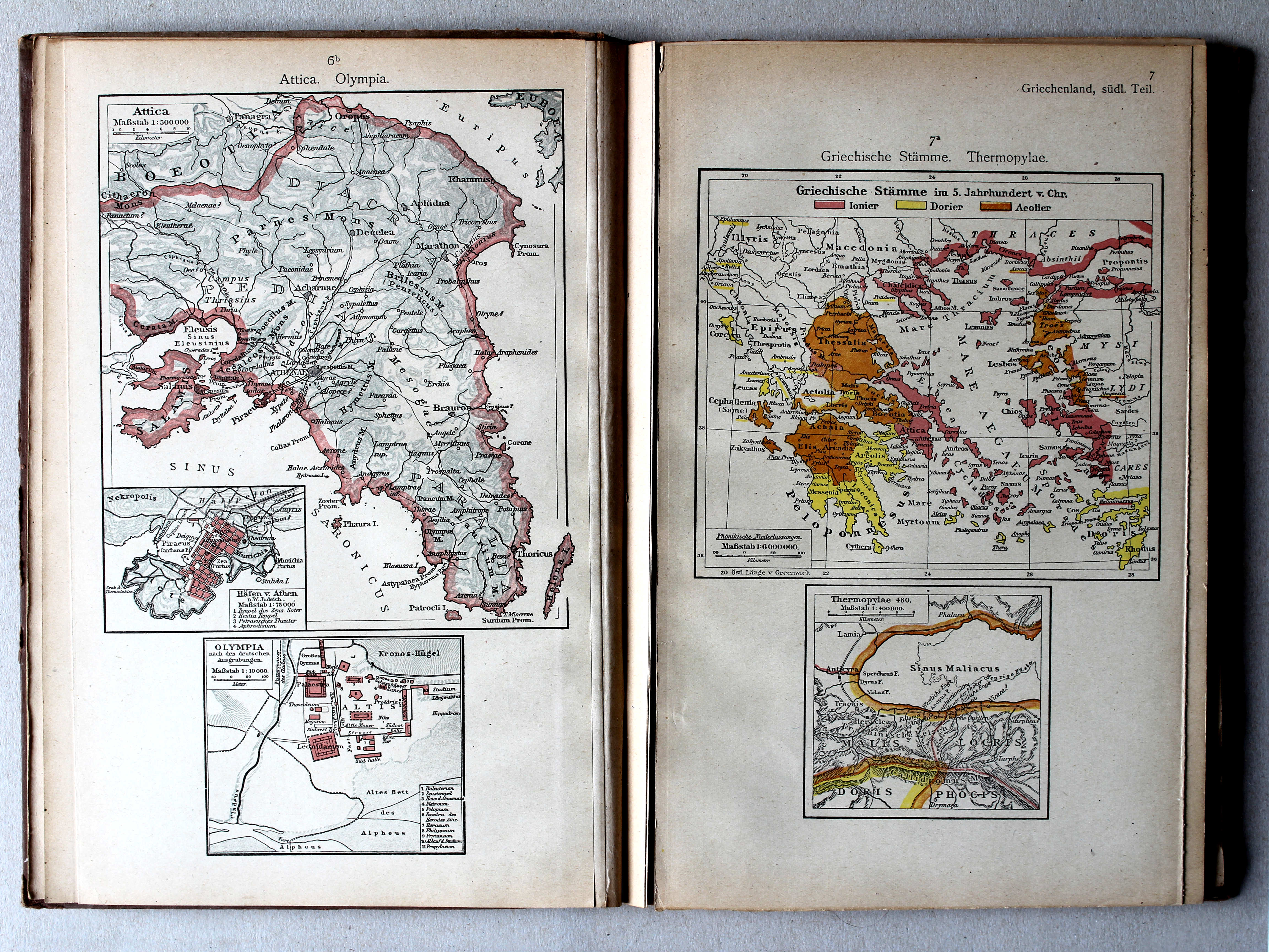
6b. Attica. Olympia XL
Attica. Olympia
7a. Griechische Stämme. Thermopylae XL
Griekse volkeren. Thermopylae / Greek nations. Thermopylae
 Putzgers Historischer Schul-Atlas, 1922
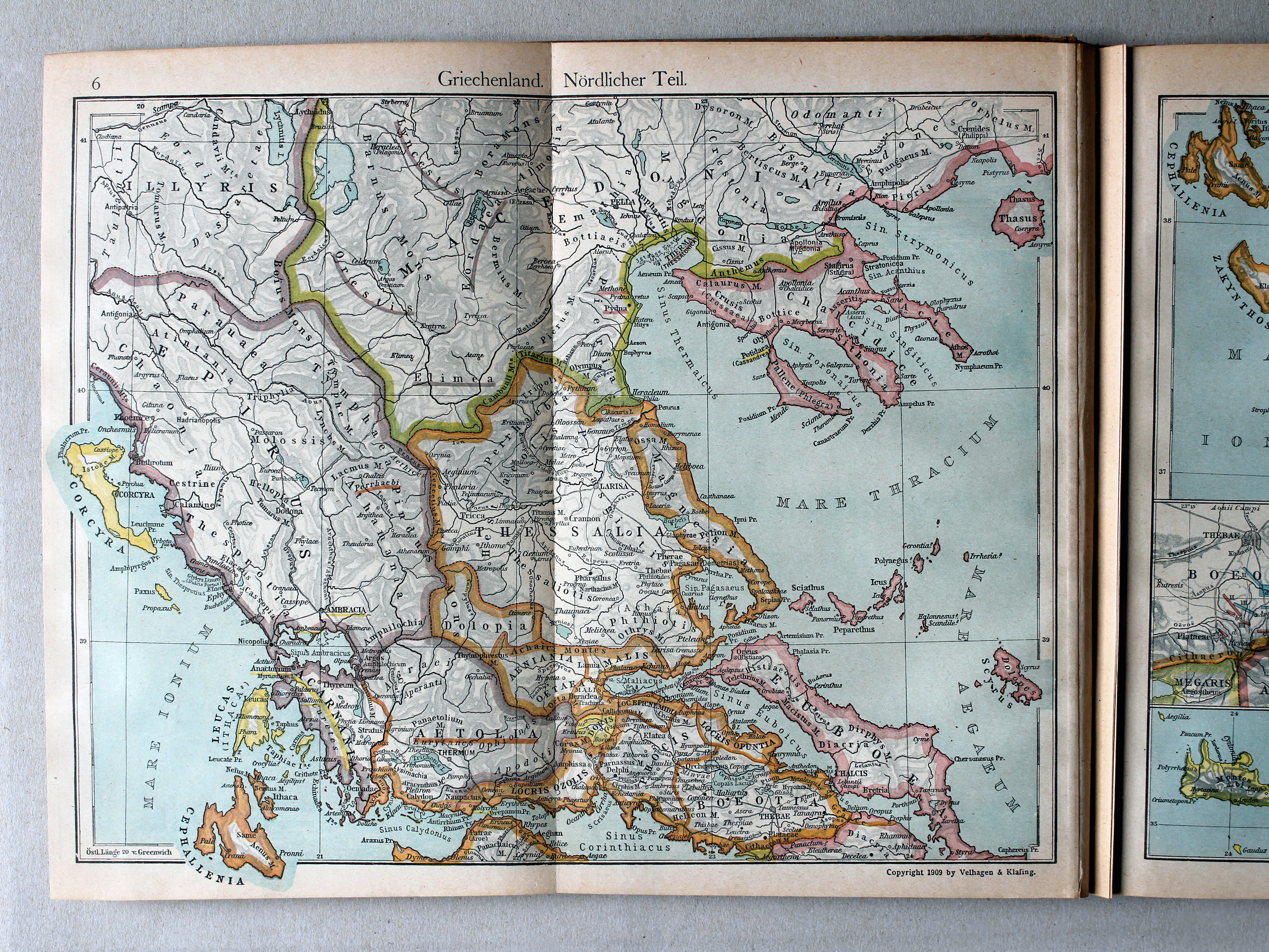
6. Griechenland. Nördlicher Teil XL
Griekenland, noordelijk deel / Greece, northern part
 Putzgers Historischer Schul-Atlas, 1922
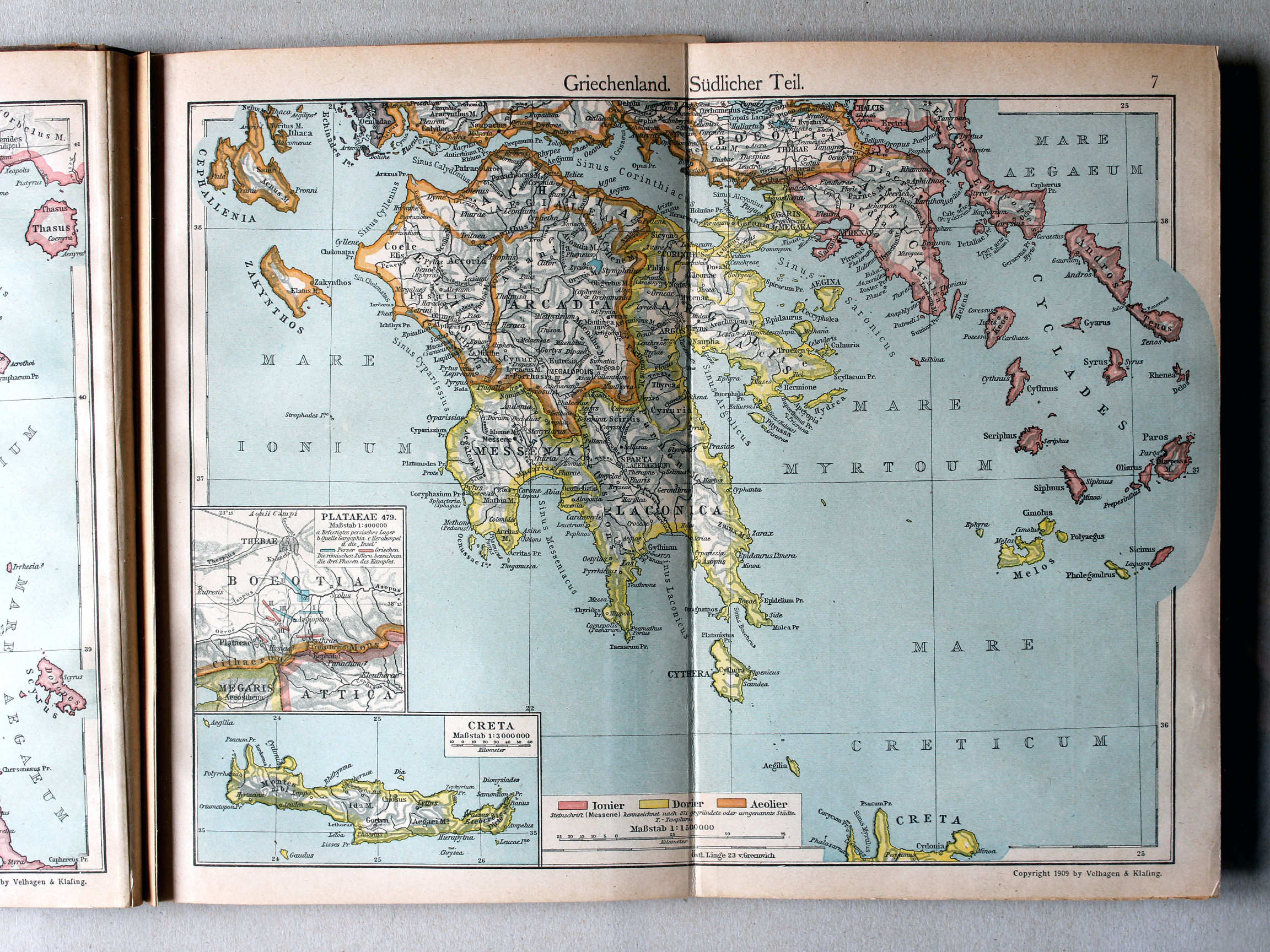
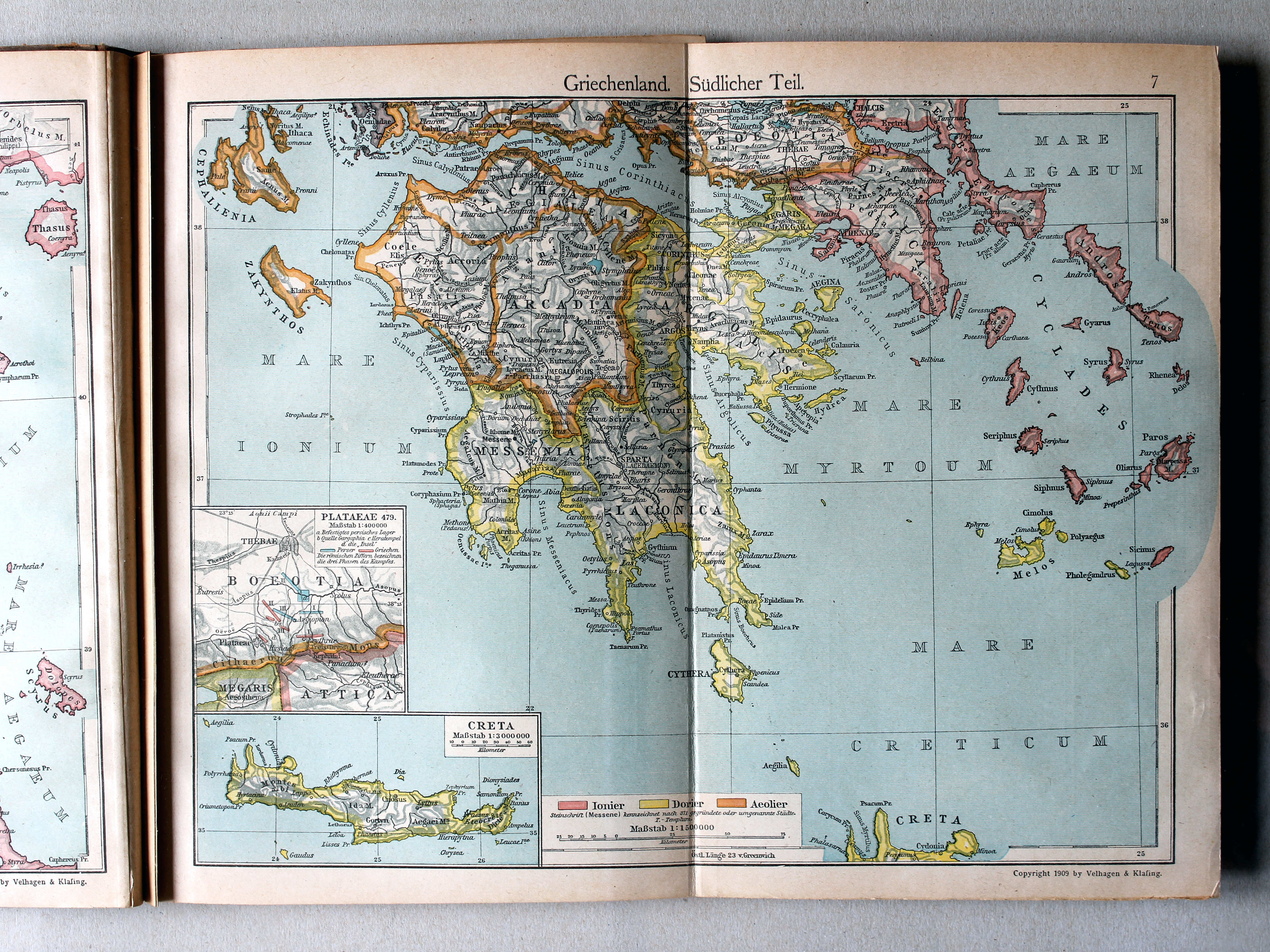
7. Griechenland. Südlicher Teil XL
Griekenland, zuidelijk deel / Greece, southern part
 Putzgers Historischer Schul-Atlas, 1922
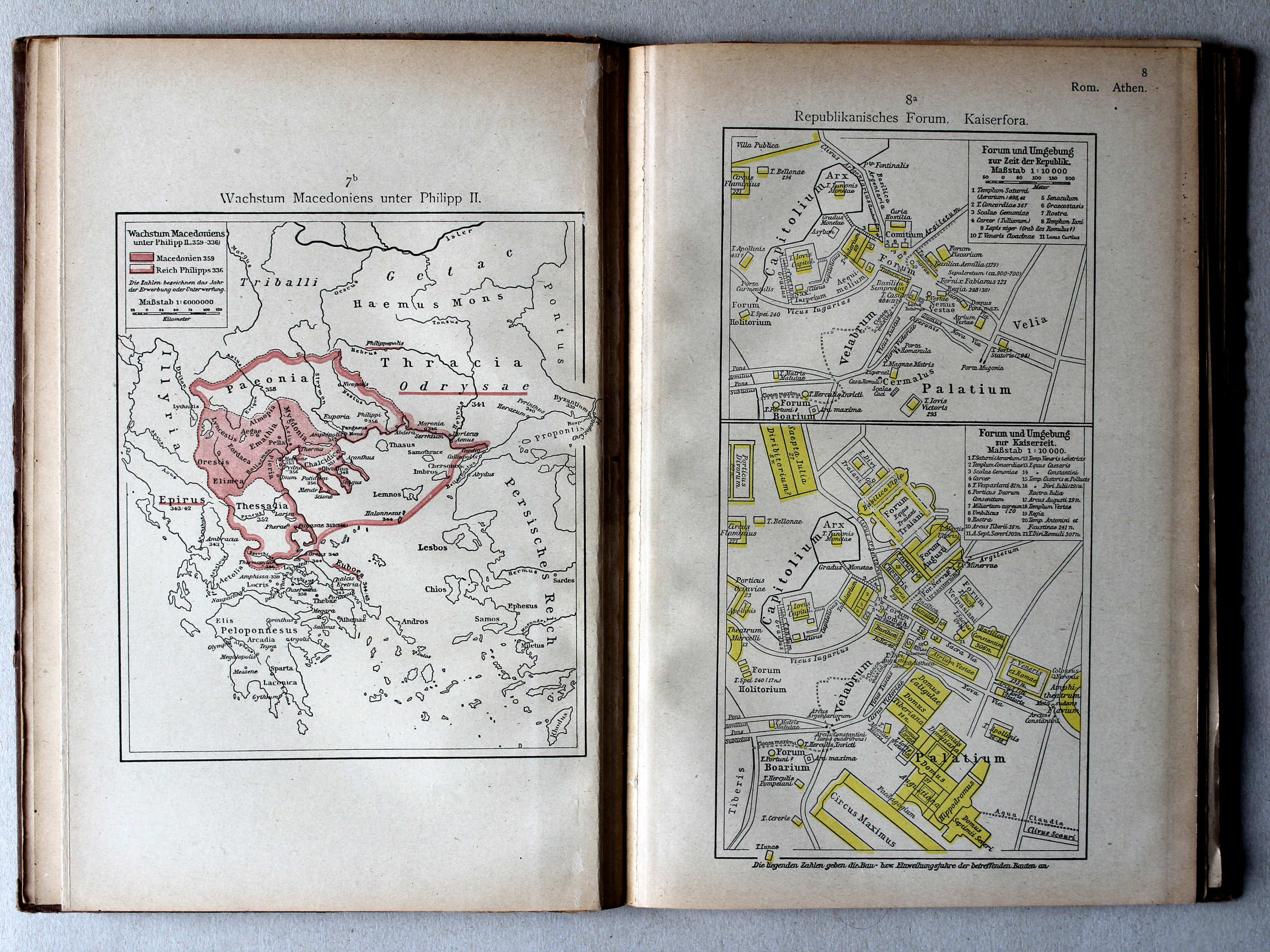
7b. Wachstum Macedoniens unter Philipp II XL
Groei van Macedonië onder Philippus II / Growth of Macedonia under Philip II
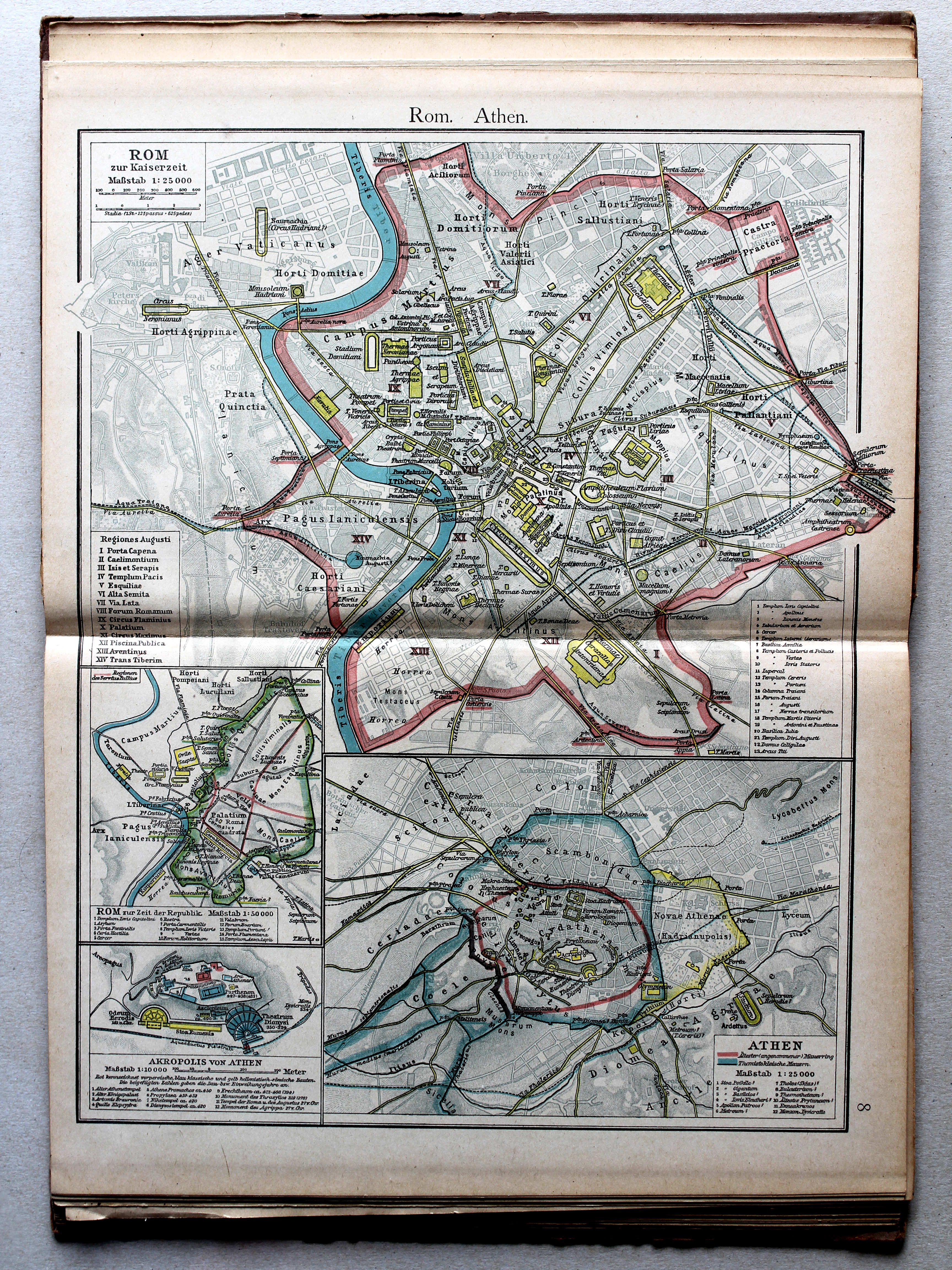
8a. Republikanisches Forum. Kaiserfora XL
Forum tijdens de Republiek. Fora in de Keizertijd / Forum during the Republic. Fora in the Imperial period
 Putzgers Historischer Schul-Atlas, 1922
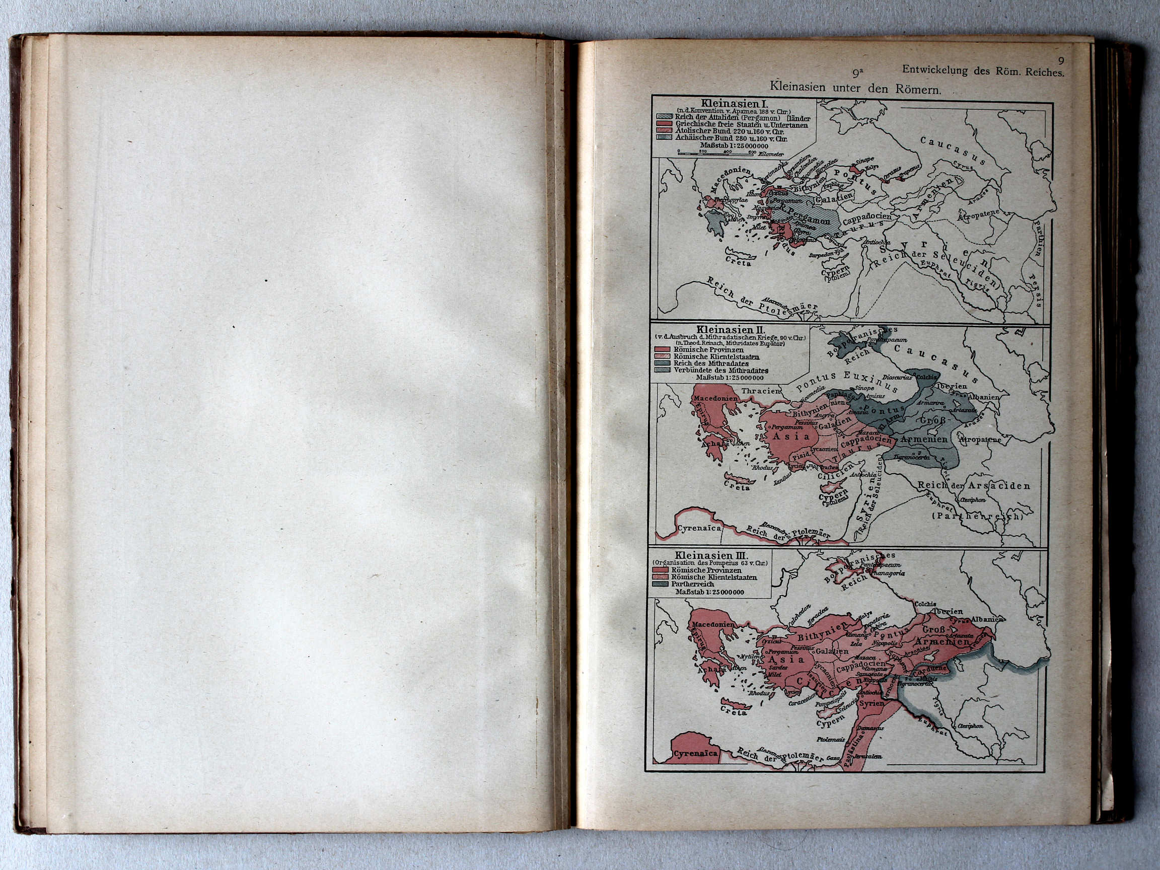
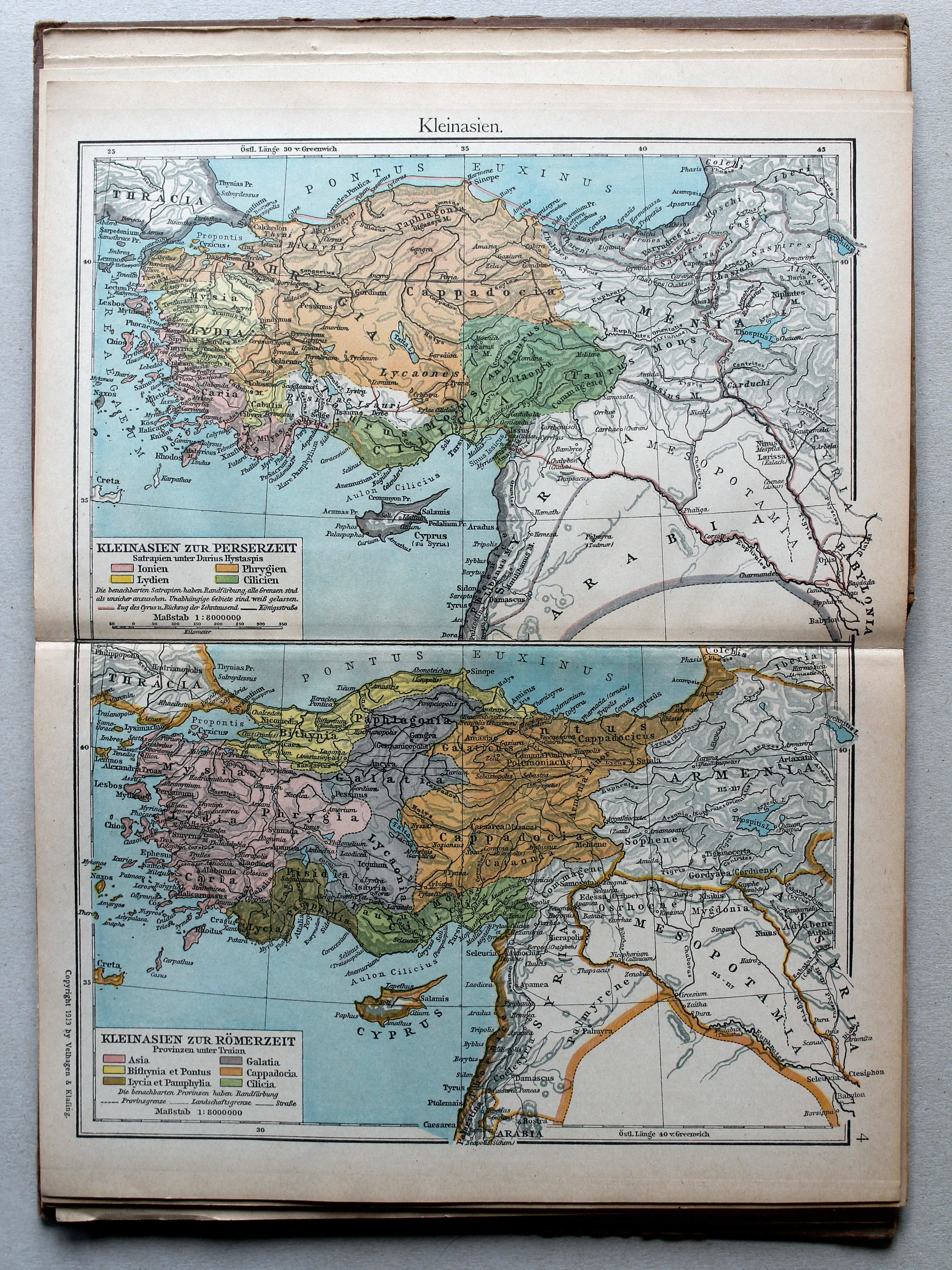
9a. Kleinasien unter den Römern XL
Klein-Azië onder de Romeinen / Asia Minor under the Romans
 Putzgers Historischer Schul-Atlas, 1922
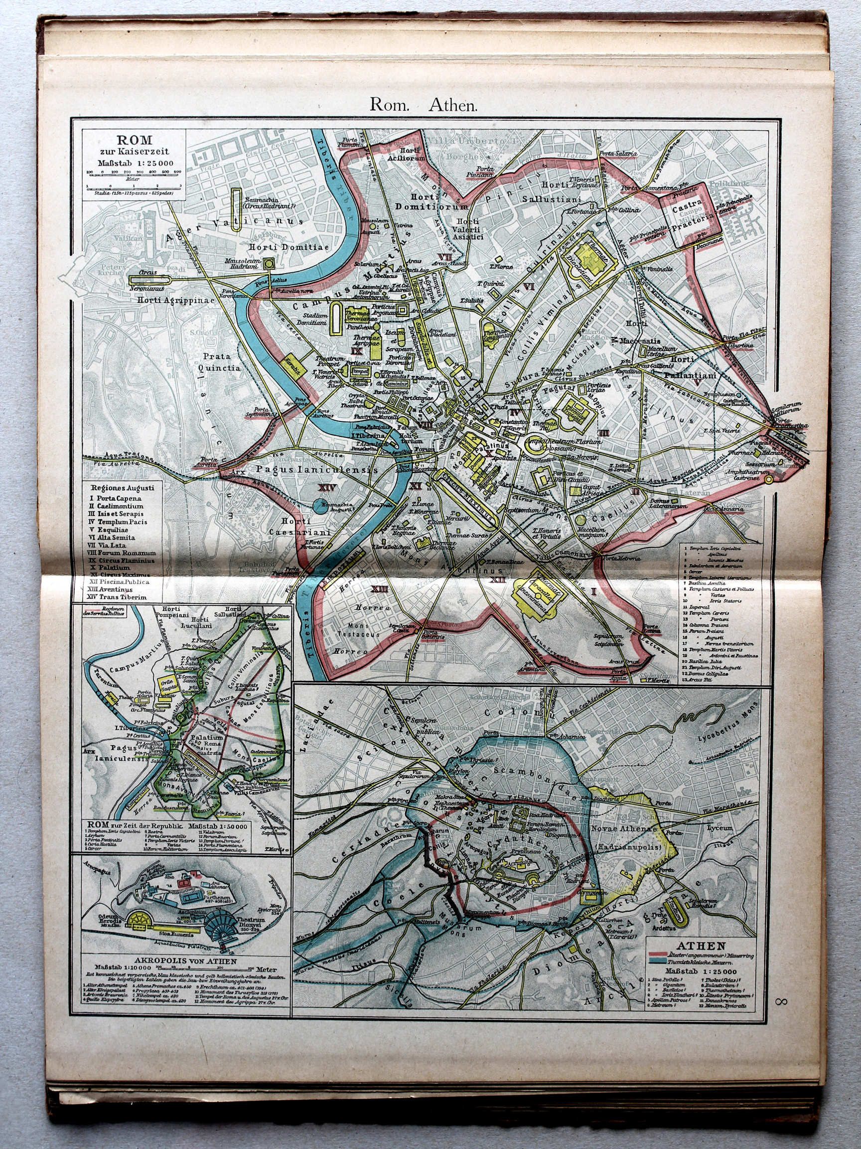
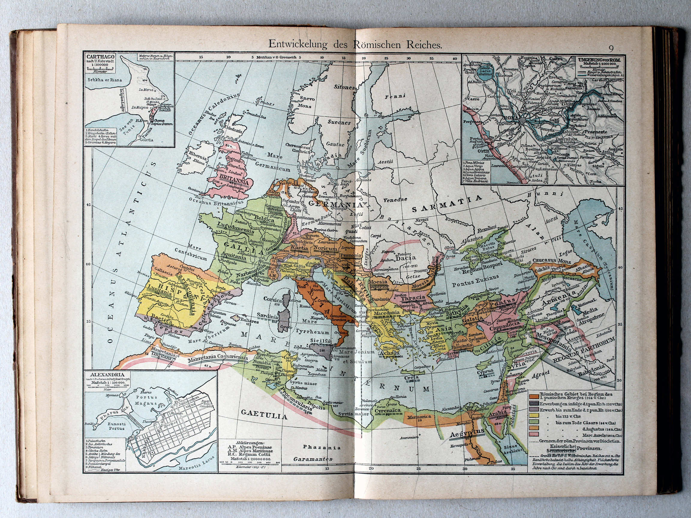
9. Entwickelung des Römischen Reiches XL
Ontwikkeling van het Romeinse Rijk / Development of the Roman Empire
 Putzgers Historischer Schul-Atlas, 1922
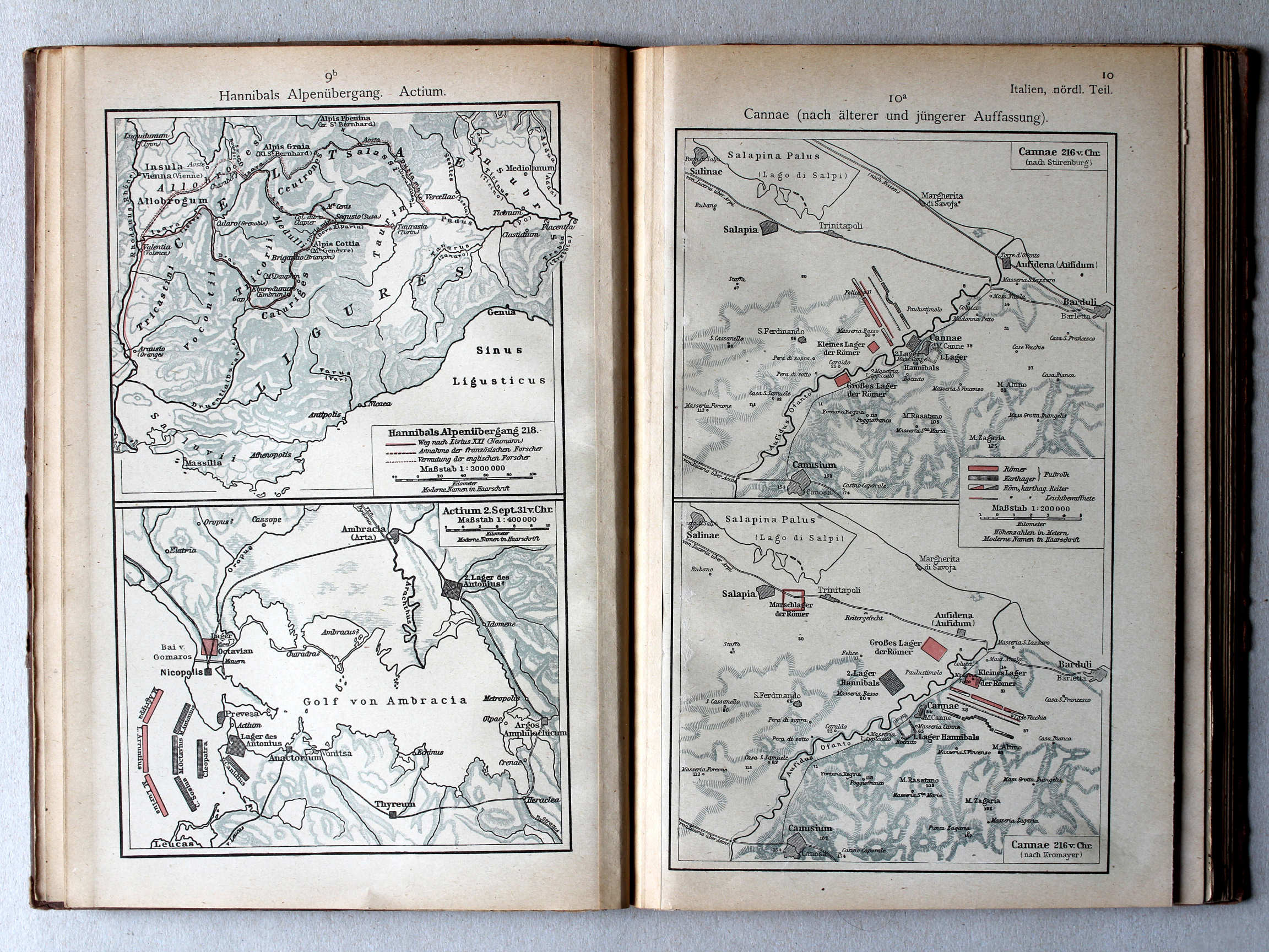
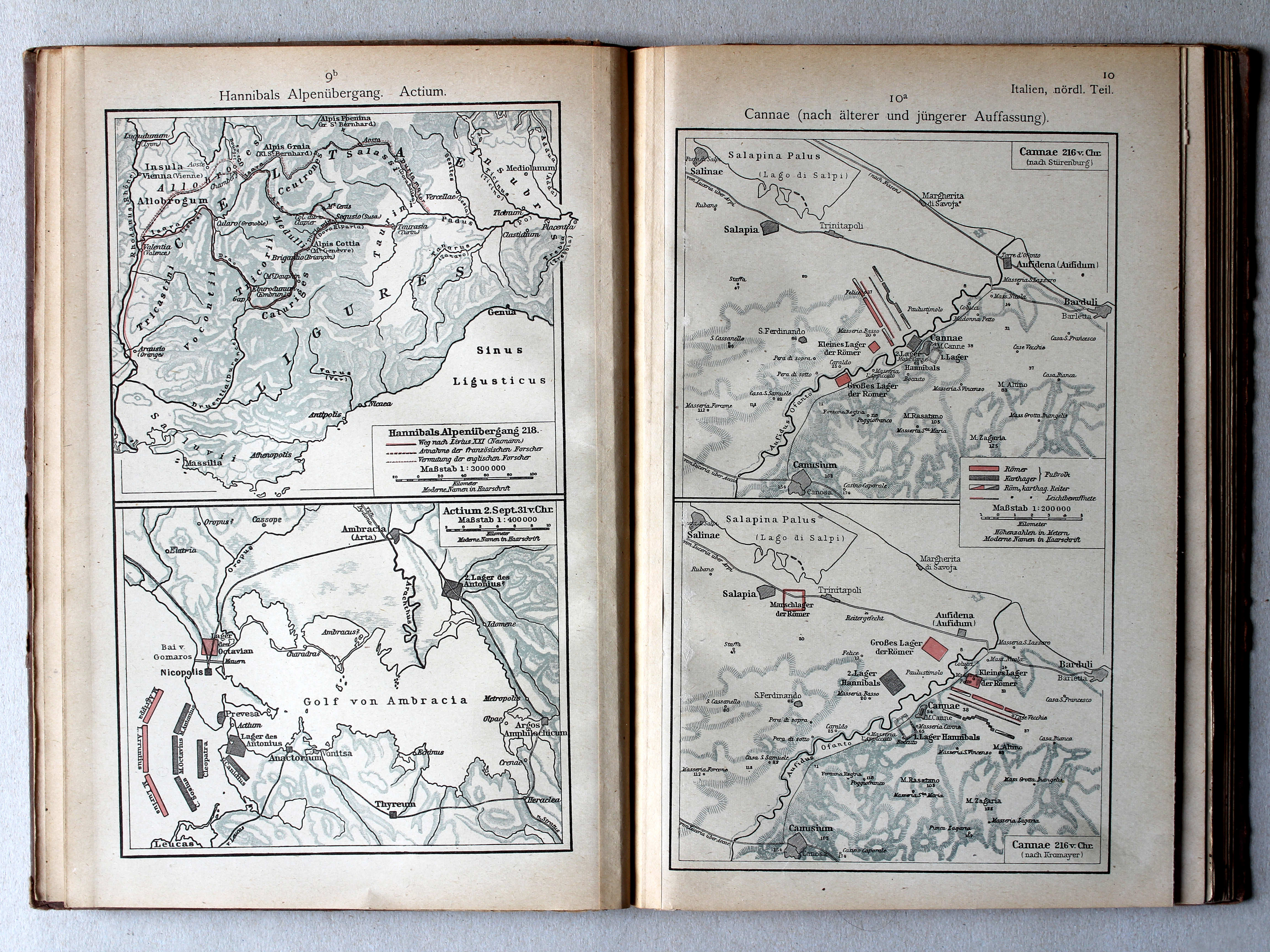
9b. Hannibals Alpenübergang. Actium XL
Tocht van Hannibal over de Alpen. Actium / Hannibal crossing the Alps. Actium
10a. Cannae (nach älterer und jüngerer Auffassung) XL
Cannae (volgens vroegere en latere inzichten) / Cannae (after earlier and later views)
 Putzgers Historischer Schul-Atlas, 1922
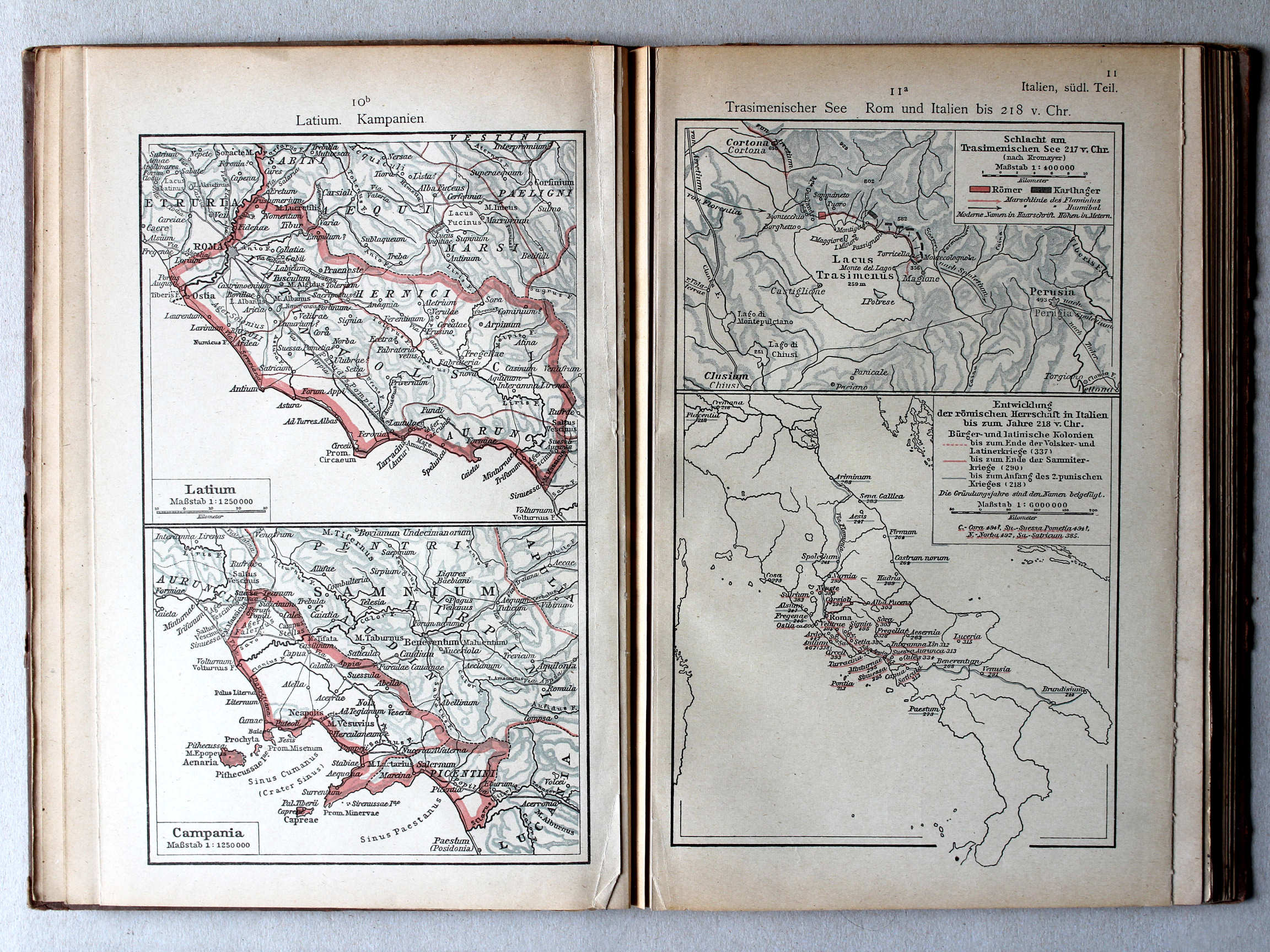
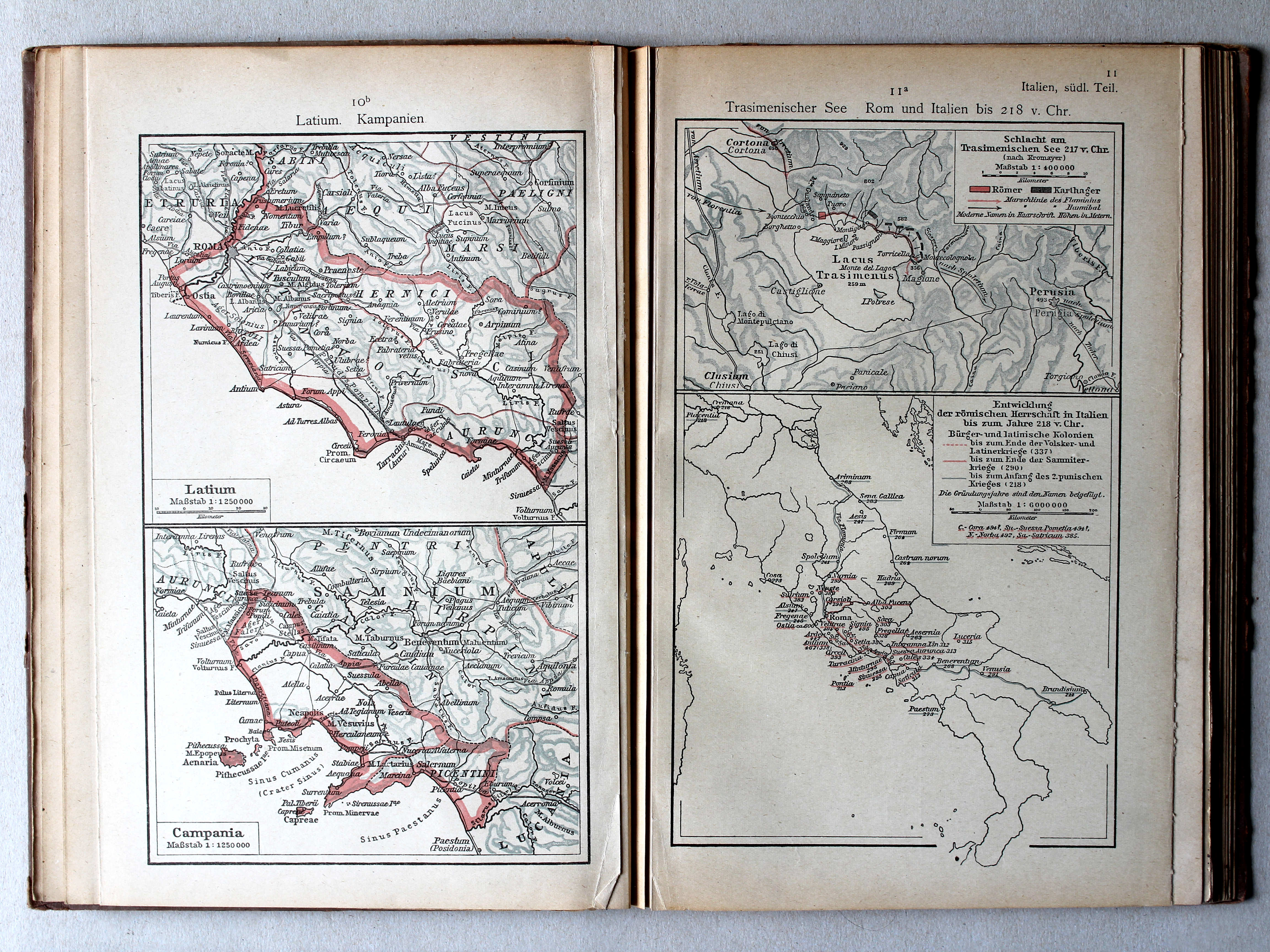
10b. Latium. Kampanien XL
Latium. Campania
11a. Trasimenischer See. Rom und Italien bis 218 v. Chr. XL
Trasimeense Meer. Rome en Italië tot 218 v. Chr. / Lake Trasimene. Rome and Italy until 218 BC
 Putzgers Historischer Schul-Atlas, 1922
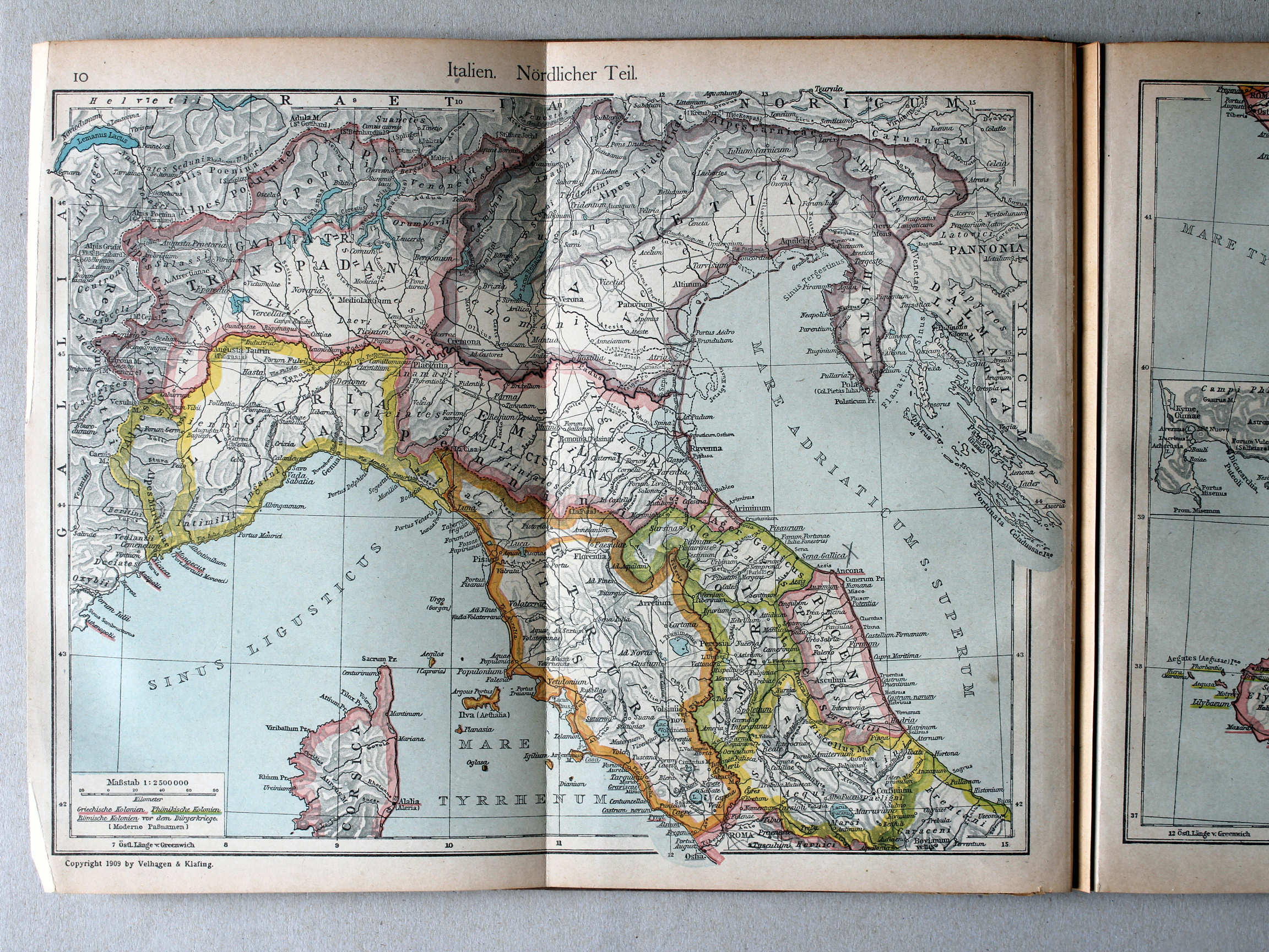
10. Italien. Nördlicher Teil XL
Italië, noordelijk deel / Italy, northern part
 Putzgers Historischer Schul-Atlas, 1922
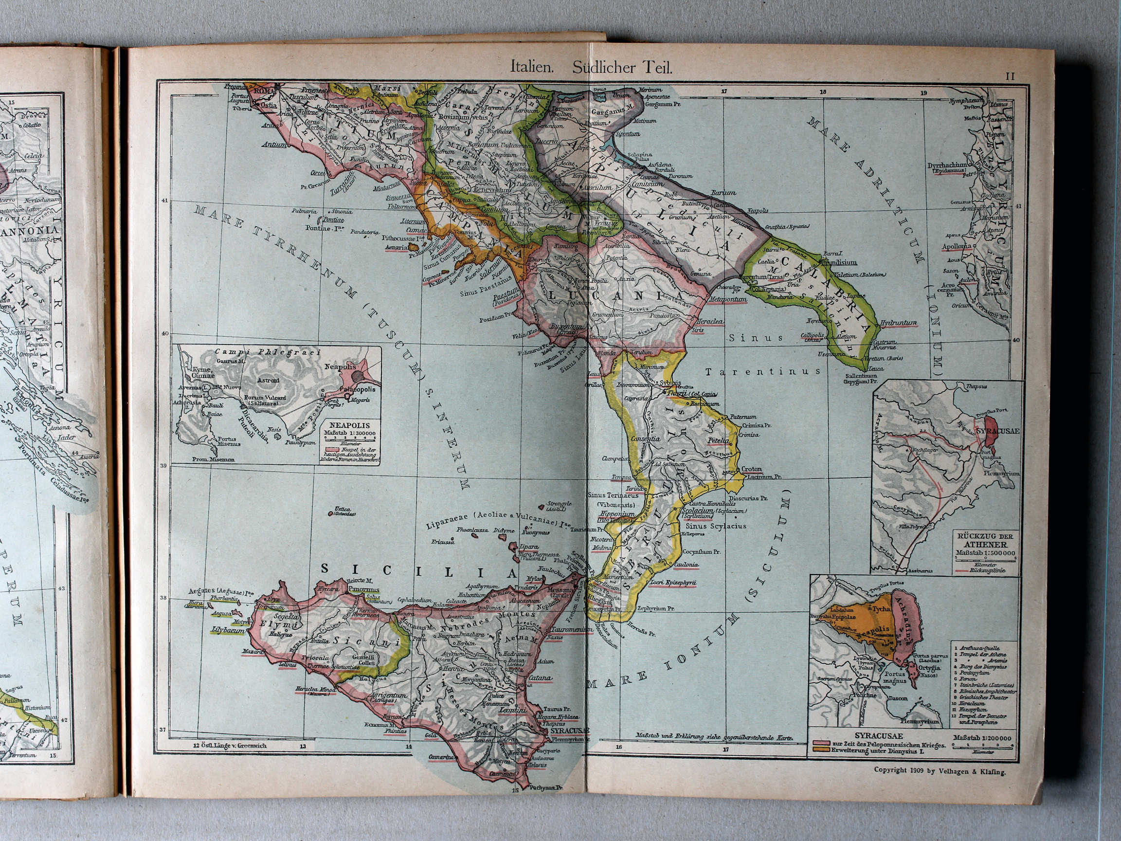
11. Italien. Südlicher Teil XL
Italië, zuidelijk deel / Italy, southern part
 Putzgers Historischer Schul-Atlas, 1922
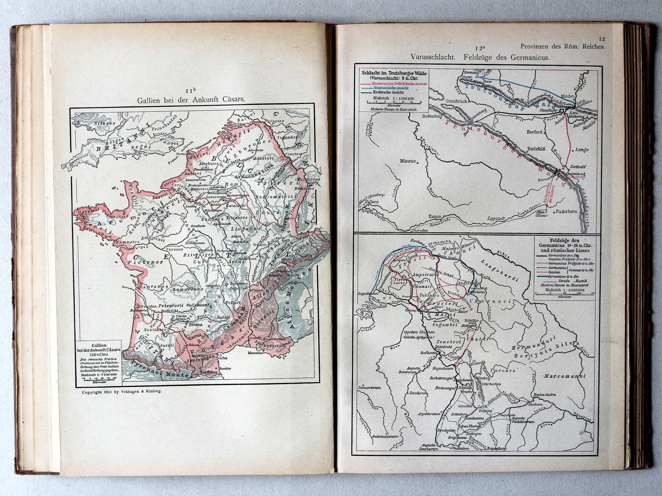
11b. Gallien bei der Ankunft Cäsars XL
Gallië bij de komst van Caesar / Gaul by Caesar's arrival
12a. Varusschlacht. Feldzüge des Germanicus XL
Slag bij het Teutoburgerwoud. Veldtochten van Germanicus / Battle of the Teutoburg Forest. Campaigns of Germanicus
 Putzgers Historischer Schul-Atlas, 1922
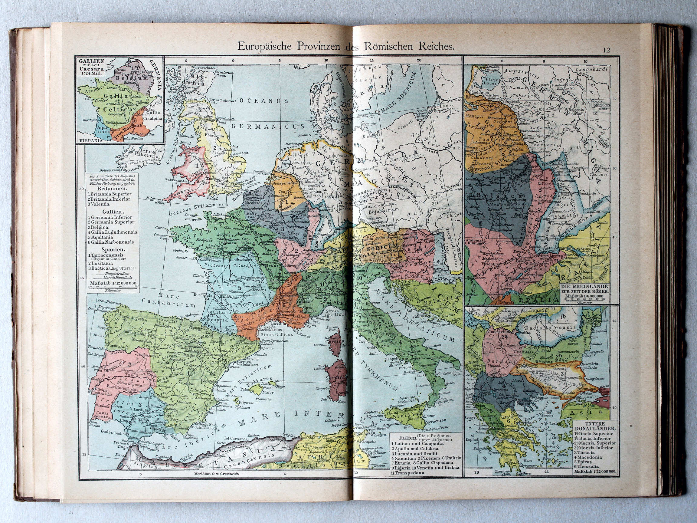
12. Europäische Provinzen des Römischen Reiches XL
Europese provincies van het Romeinse Rijk / European provinces of the Roman Empire
(Middeleeuwen, Nieuwe Tijd / Middle Ages, modern history)
 Putzgers Historischer Schul-Atlas, 1922
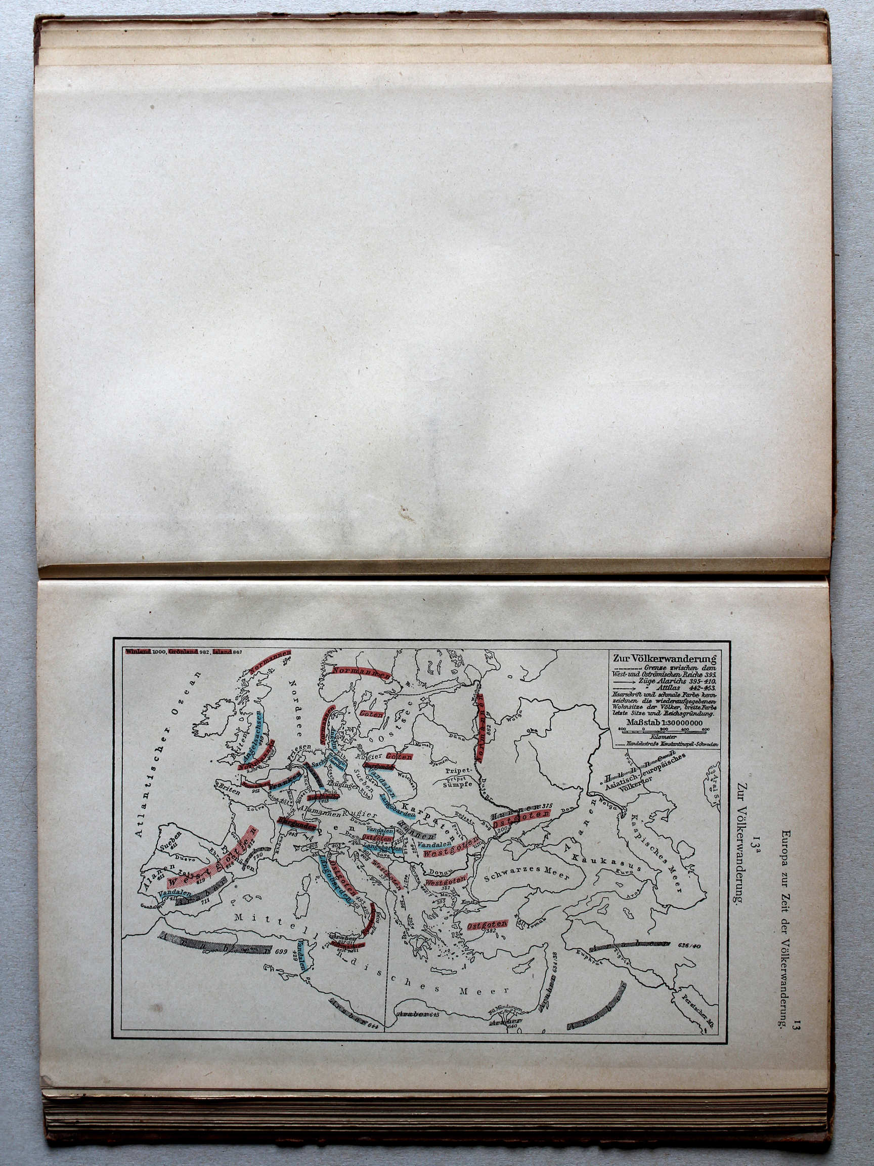
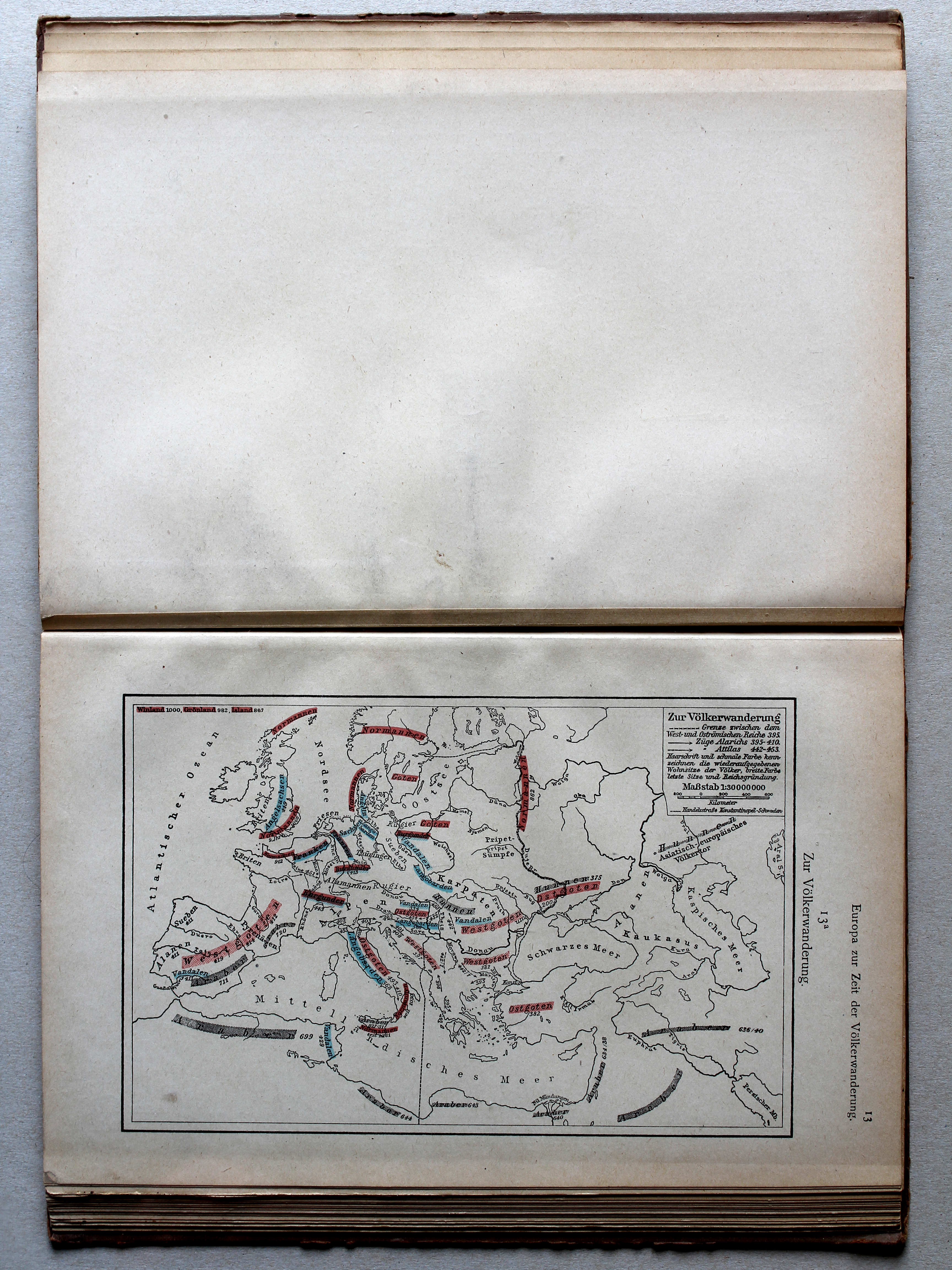
13a. Zur Völkerwanderung XL
De Volksverhuizing / The Migration Period
 Putzgers Historischer Schul-Atlas, 1922
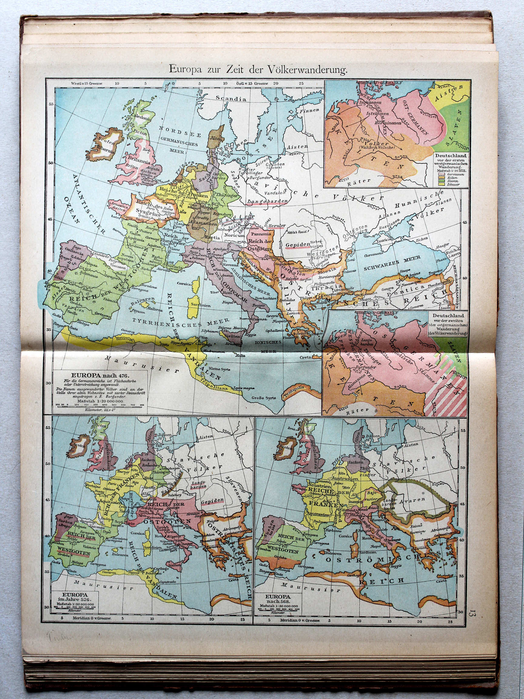
13. Europa zur Zeit der Völkerwanderung XL
Europa tijdens de Volksverhuizing / Europe during the Migration Period
 Putzgers Historischer Schul-Atlas, 1922
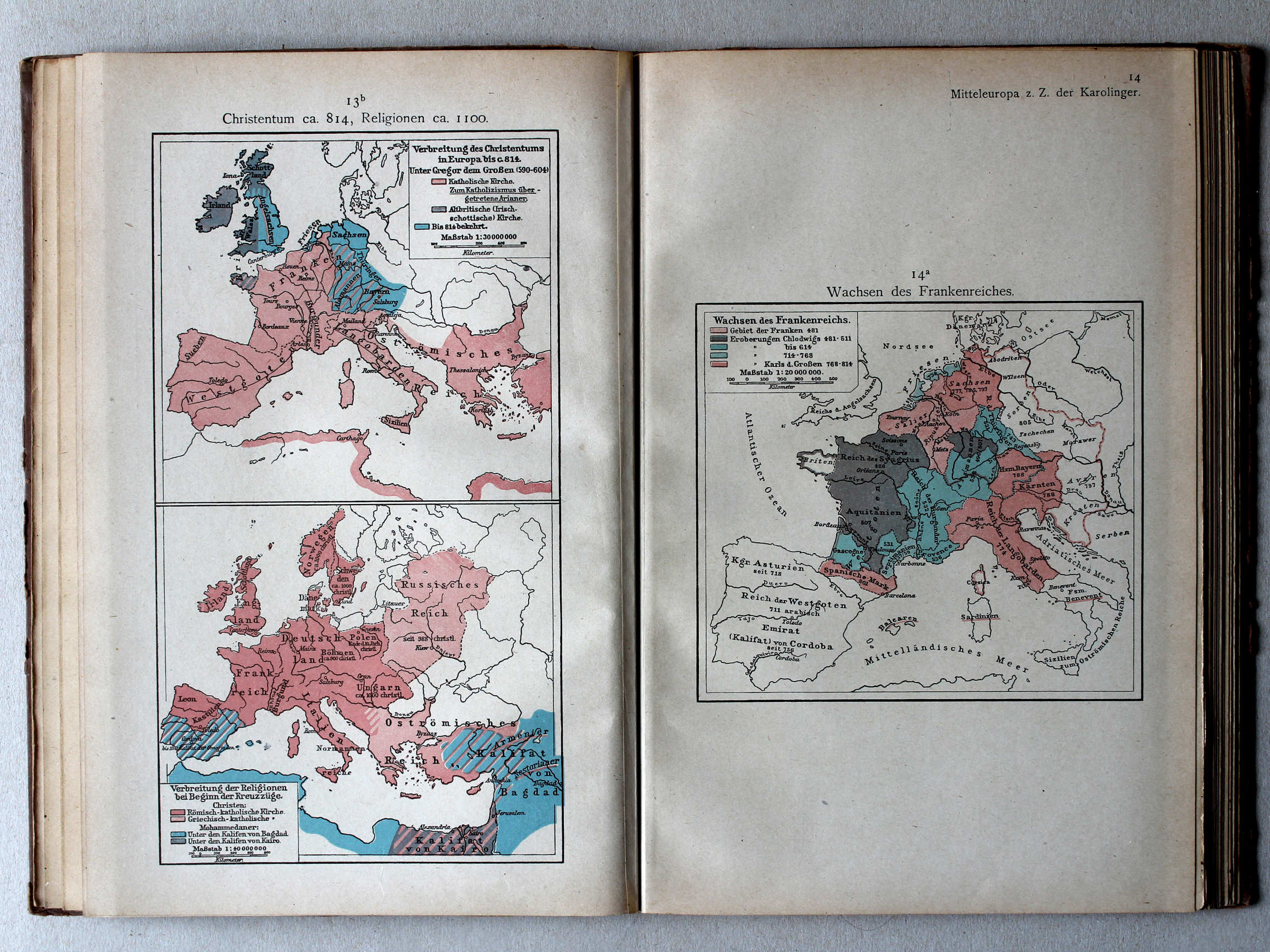
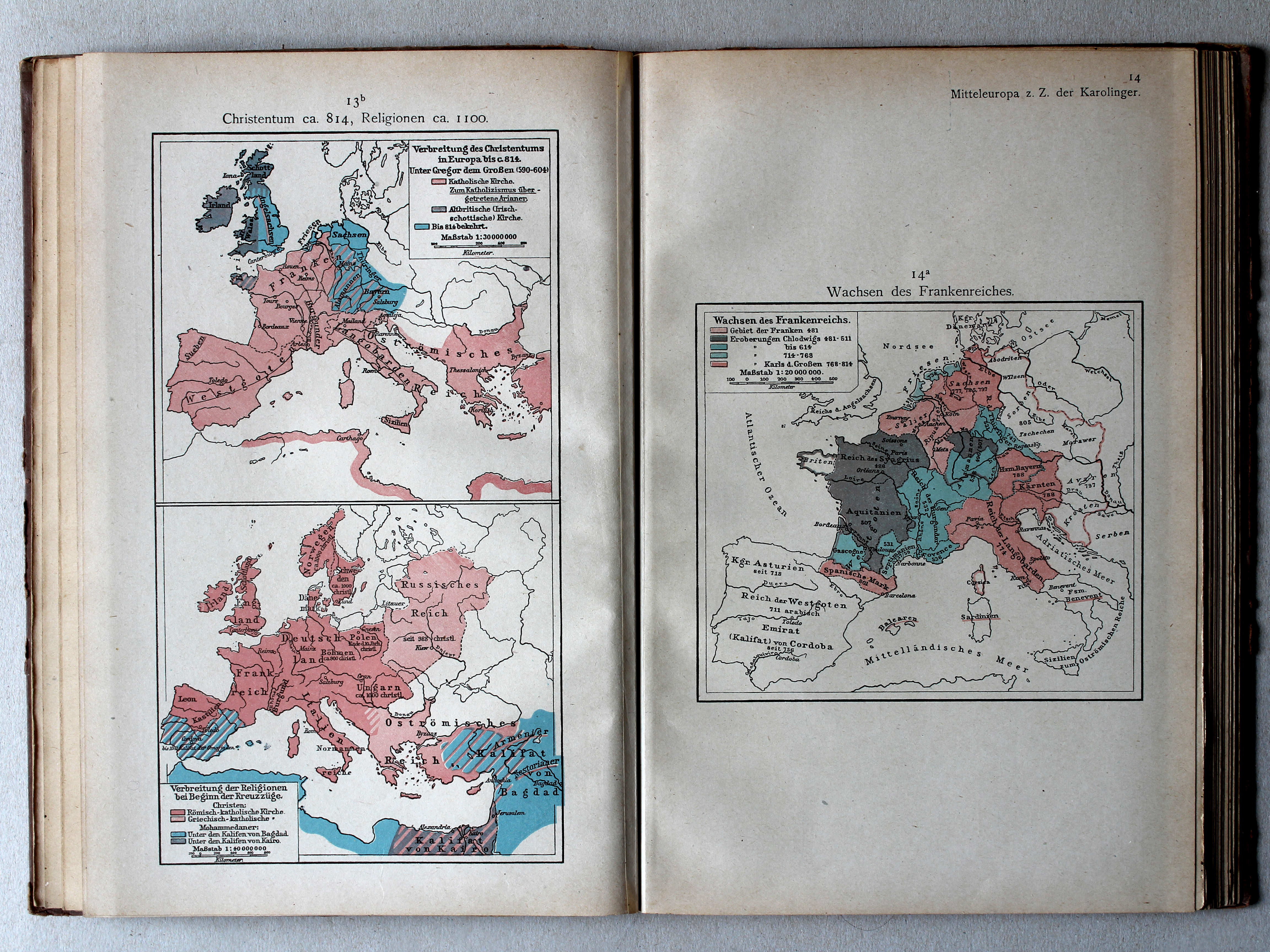
13b. Christentum ca. 814, Religionen ca. 1100 XL
Christendom ca. 814, godsdiensten ca. 1100 / Christianity ca. 814, religions ca. 1100
14a. Wachsen des Frankenreichs XL
Groei van het Frankische Rijk / Growth of the Frankish Empire
 Putzgers Historischer Schul-Atlas, 1922
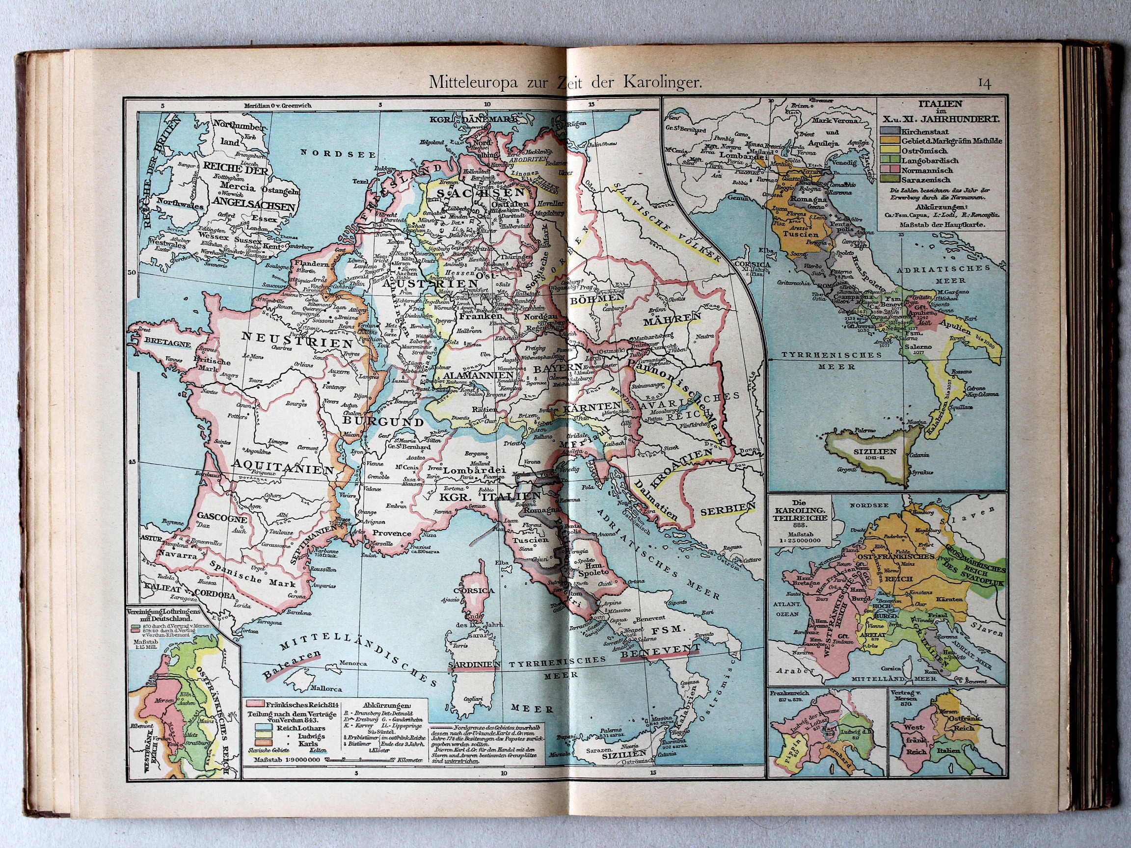
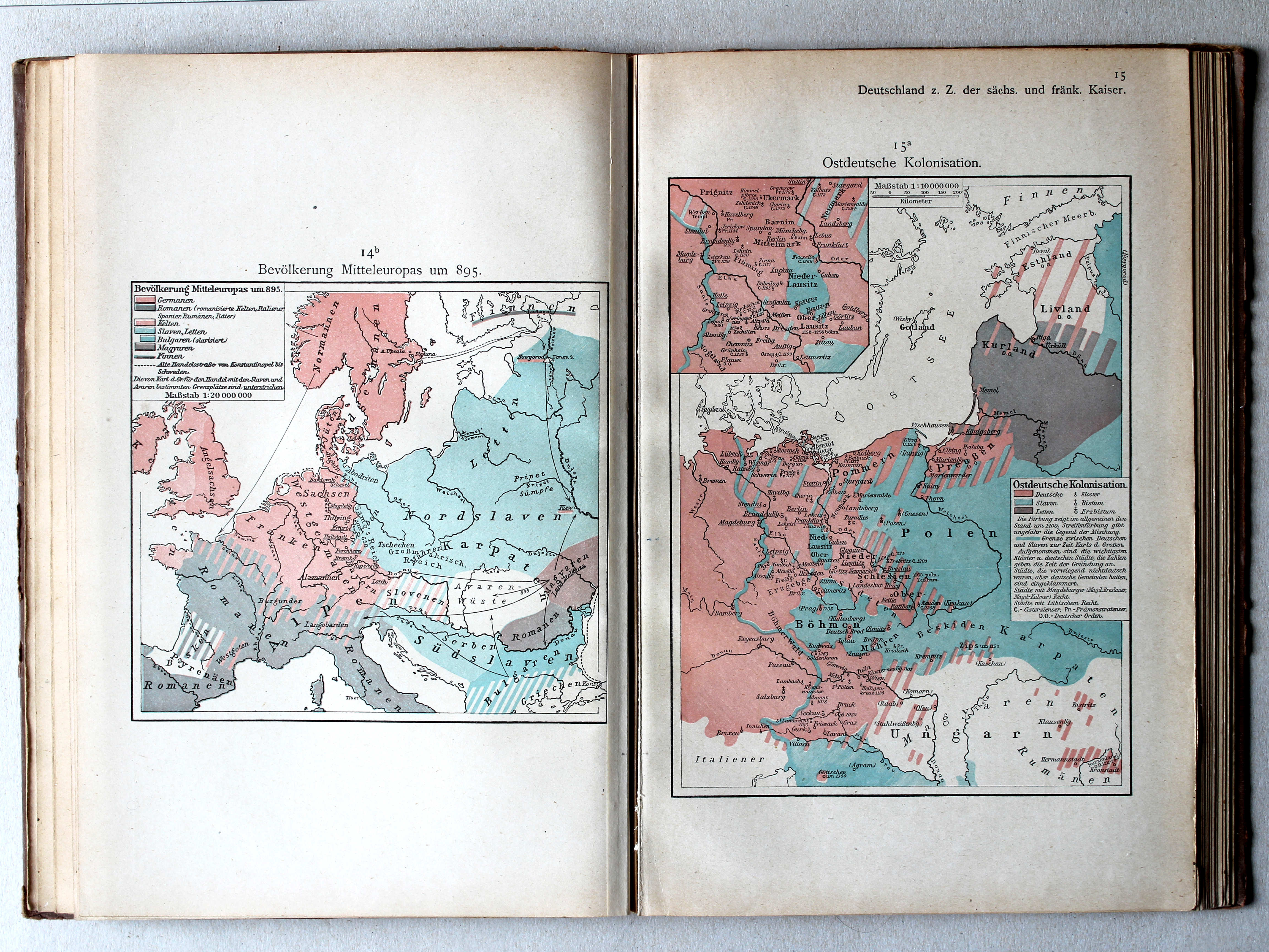
14. Mitteleuropa zur Zeit der Karolinger XL
Midden-Europa in de tijd van de Karolingen / Central Europe during the Carolingian dynasty
 Putzgers Historischer Schul-Atlas, 1922
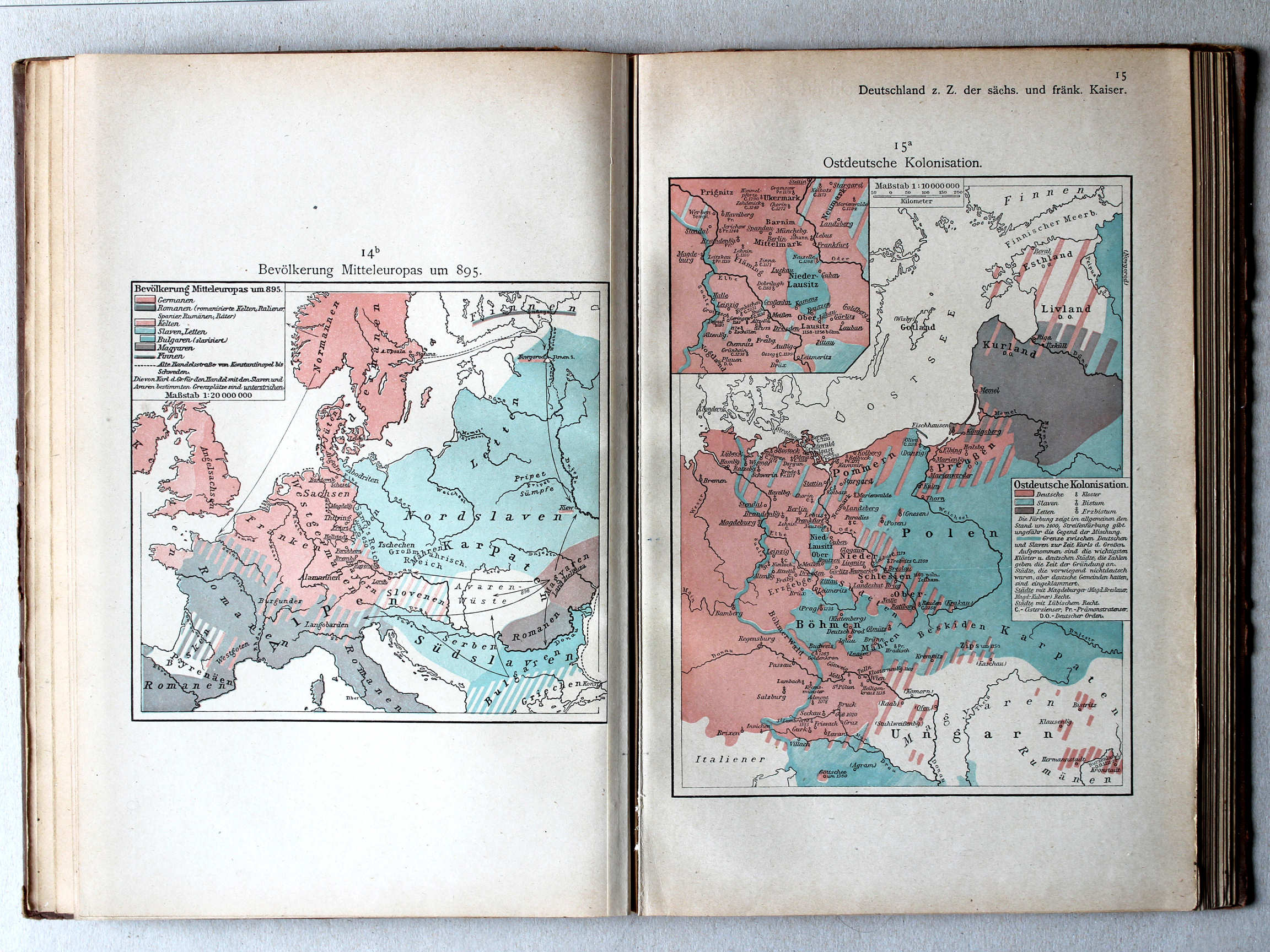
14b. Bevölkerung Mitteleuropas um 895 XL
Volkeren in Midden-Europa rond 895 / Nations in Central Europa around 895
15a. Ostdeutsche Kolonisation XL
Duitse kolonisatie naar het oosten / German colonization towards the east
 Putzgers Historischer Schul-Atlas, 1922
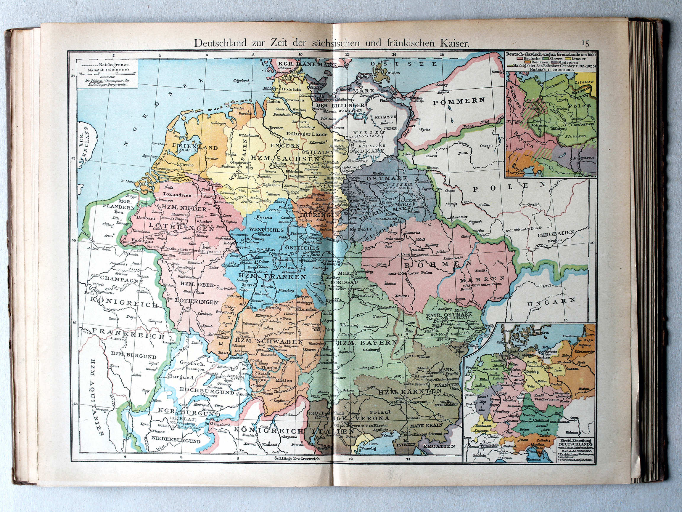
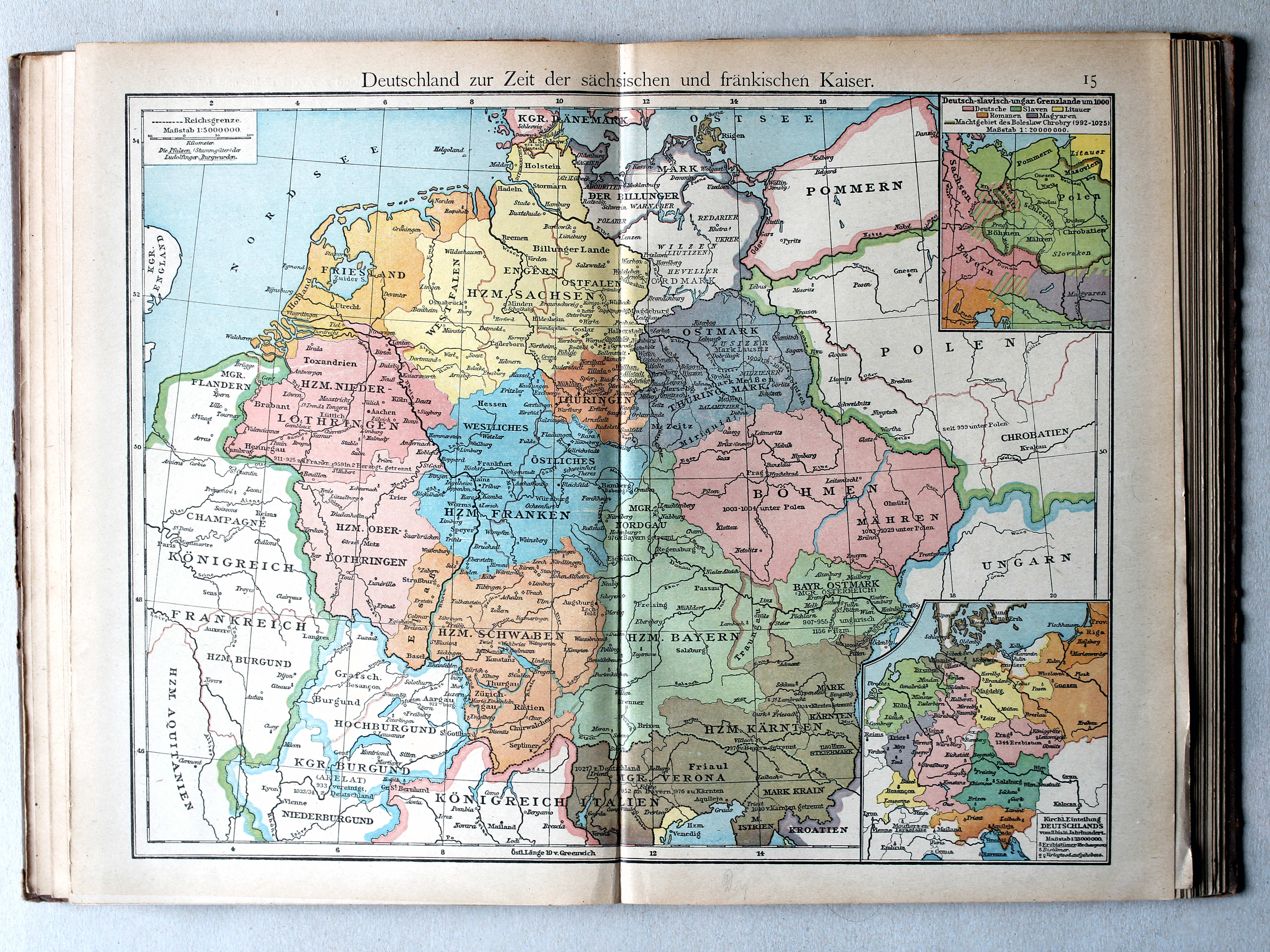
15. Deutschland zur Zeit der sächsischen und fränkischen Kaiser XL
Duitsland in de tijd van de Saksische en Frankische keizers / Germany during the Saxon and Frankish dynasties
 Putzgers Historischer Schul-Atlas, 1922
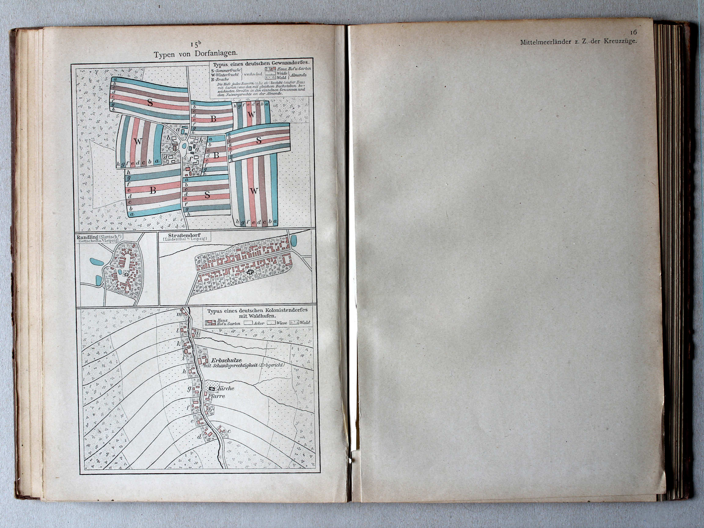
15b. Typen von Dorfanlagen XL
Enkele dorpstypen / Some village types
 Putzgers Historischer Schul-Atlas, 1922
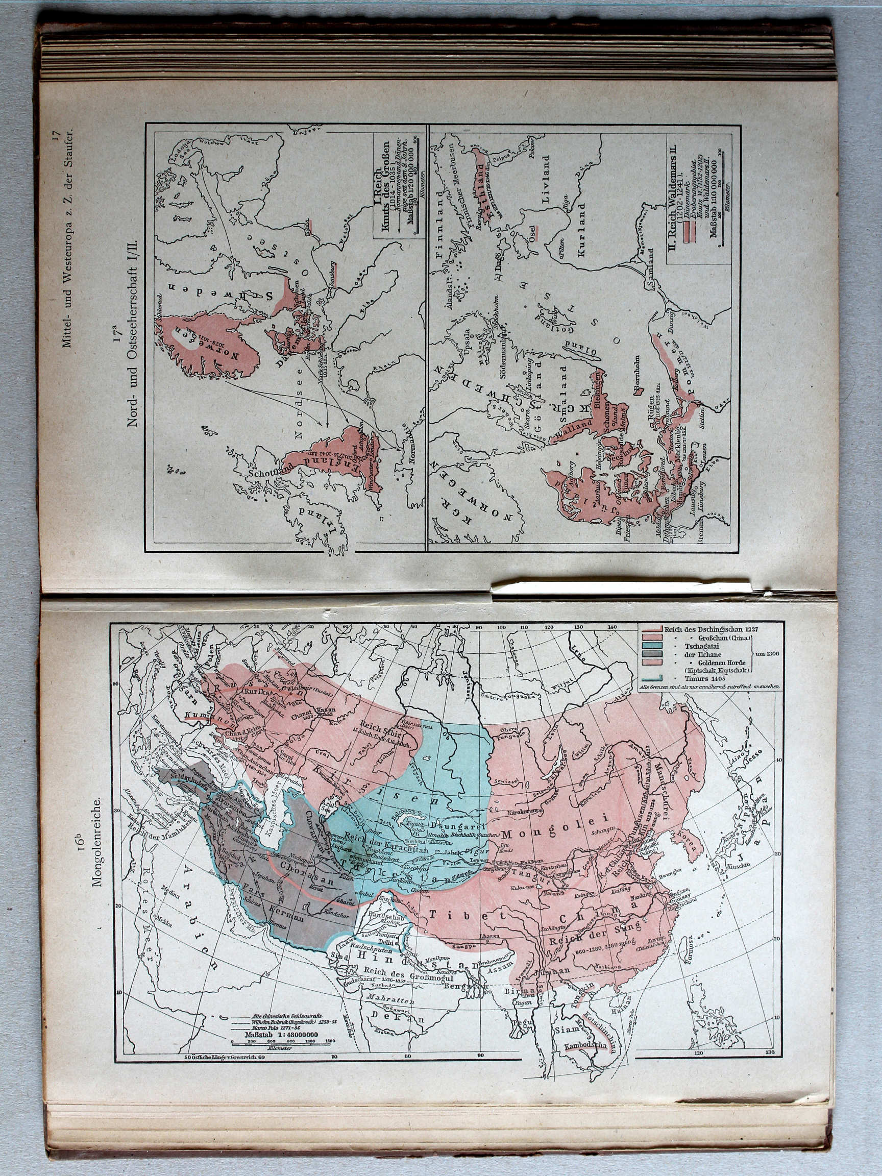
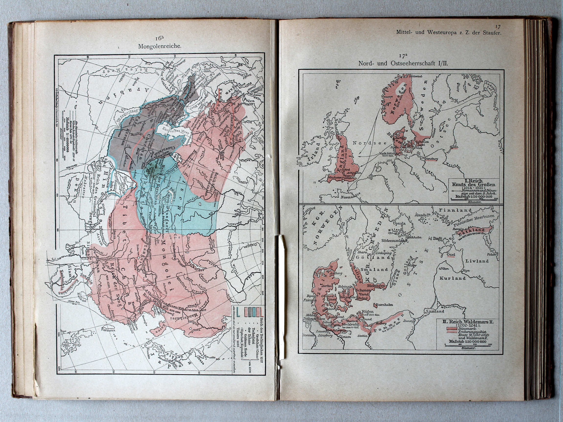
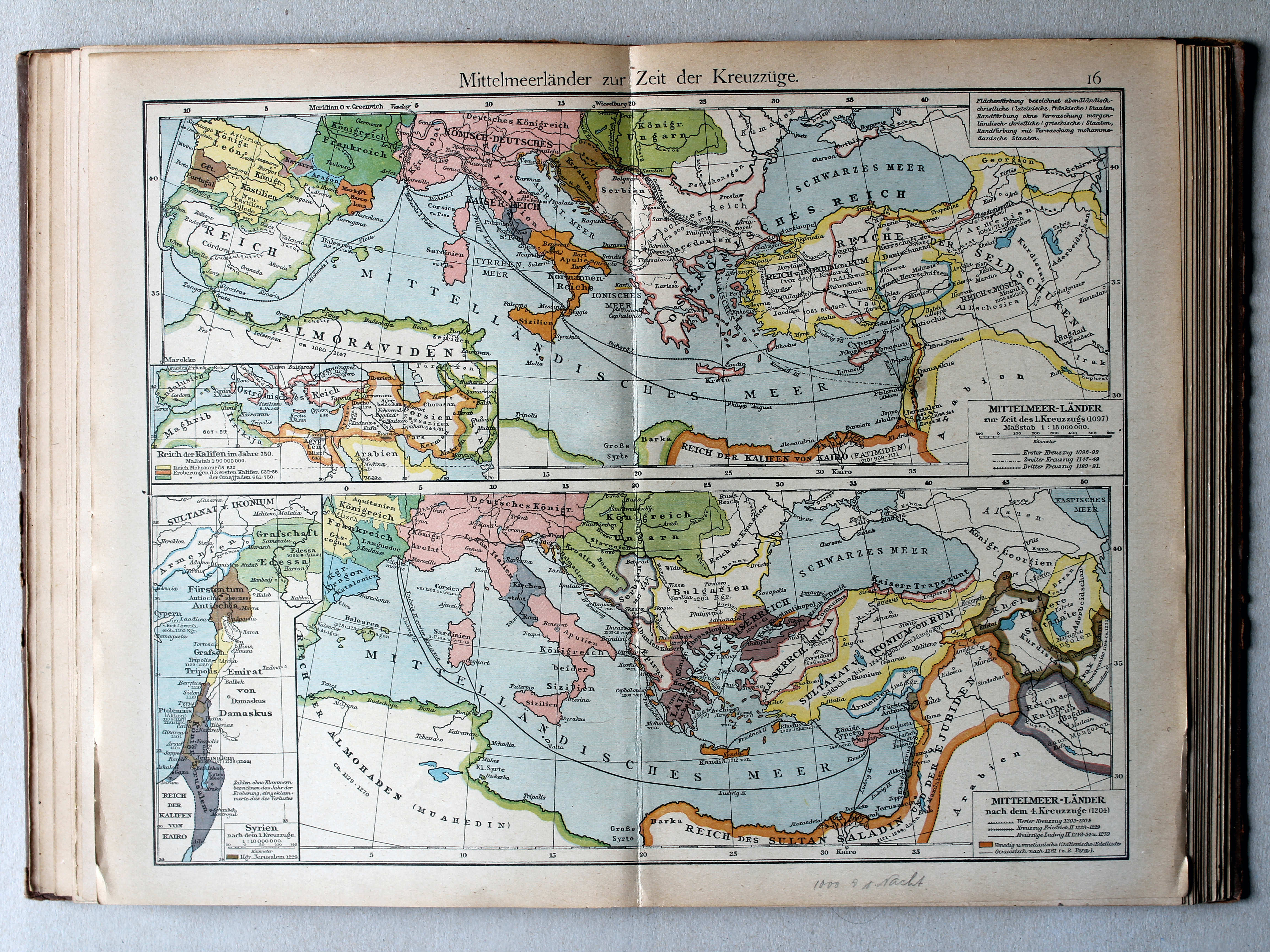
16. Mittelmeerländer zur Zeit der Kreuzzüge XL
Het Middellandse Zeegebied in de tijd van de Kruistochten / The Mediterranean region during the Crusades
 Putzgers Historischer Schul-Atlas, 1922
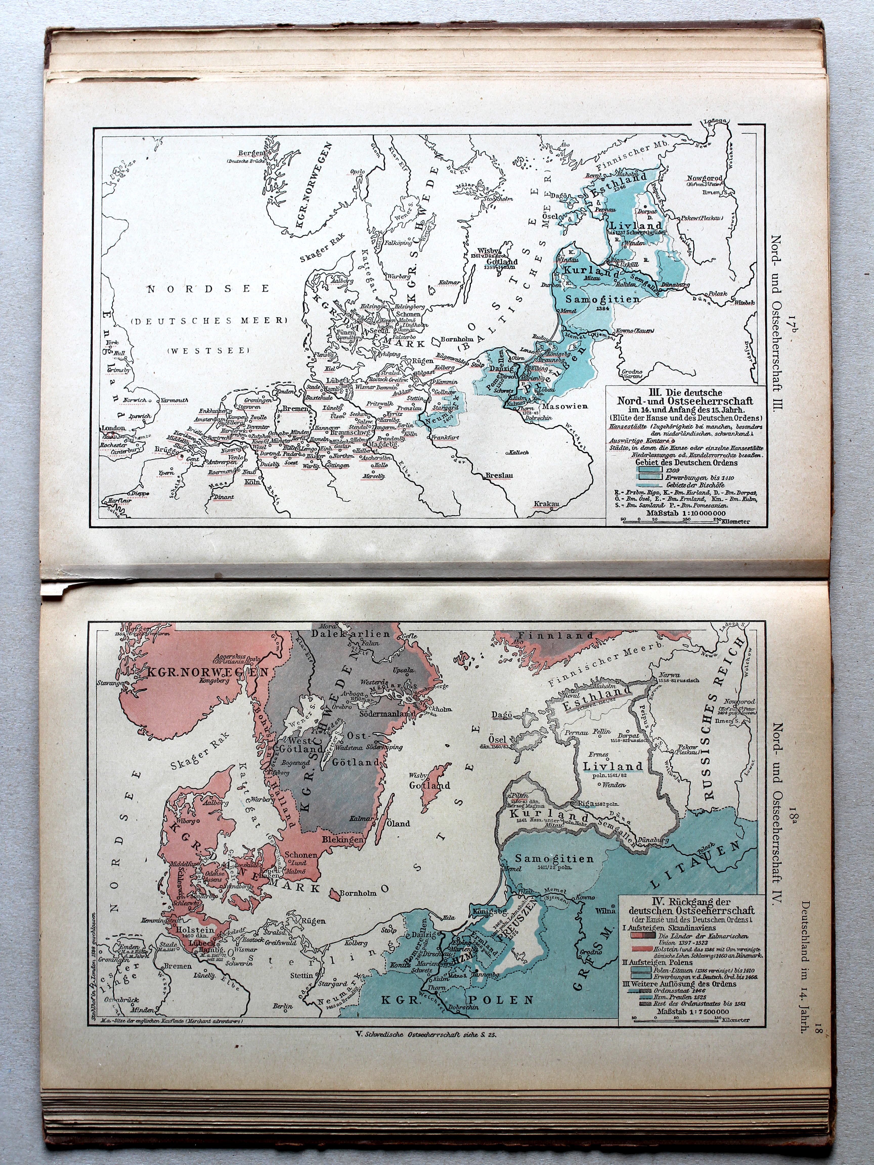
17a. Nord- und Ostseeherrschaft I/II XL
Heerschappij rond de Noord- en Oostzee I/II / Rule in the North Sea and Baltic region I/II
 Putzgers Historischer Schul-Atlas, 1922
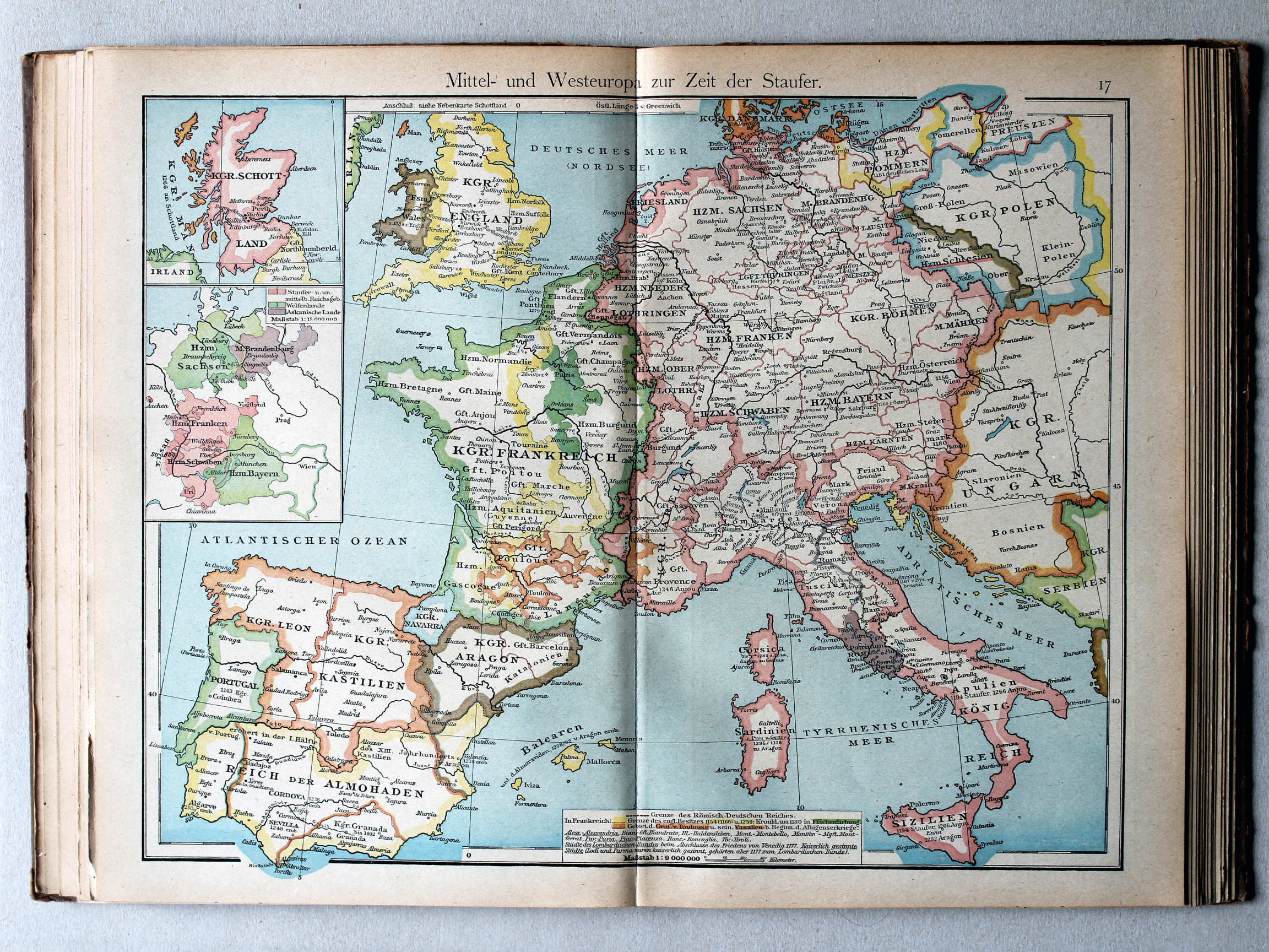
17. Mittel- und Westeuropa zur Zeit der Staufer XL
Midden- en West-Europa in de tijd van de Hohenstaufen / Central and Western Europe during the House of Hohenstaufen
 Putzgers Historischer Schul-Atlas, 1922
17b. Nord- und Ostseeherrschaft III XL
Heerschappij rond de Noord- en Oostzee III / Rule in the North Sea and Baltic region III
18a. Nord- und Ostseeherrschaft IV XL
Heerschappij rond de Noord- en Oostzee IV / Rule in the North Sea and Baltic region IV
 Putzgers Historischer Schul-Atlas, 1922
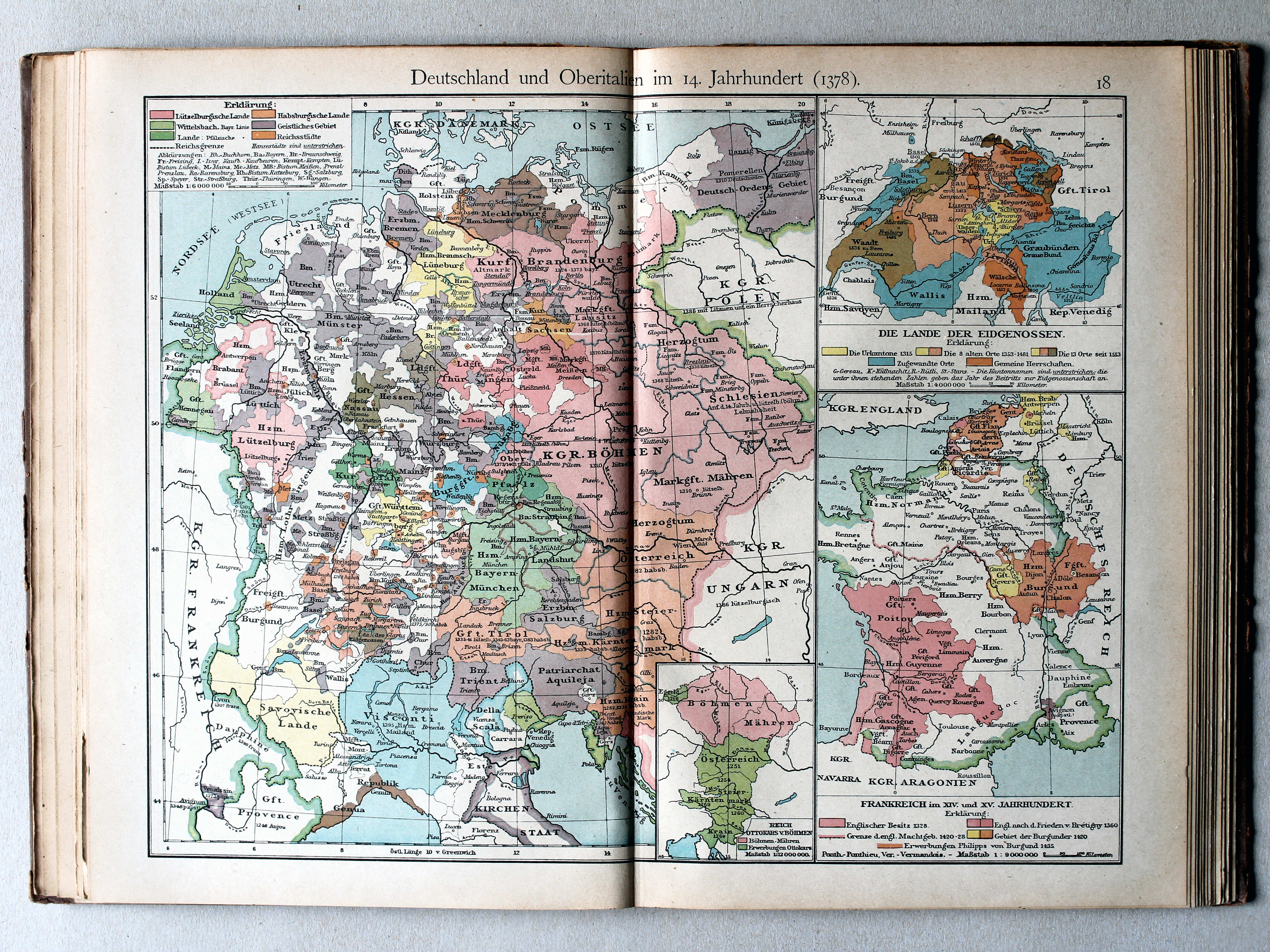
18. Deutschland und Oberitalien im 14. Jahrhundert (1378) XL
Duitsland en Noord-Italië in de 14e eeuw (1378) / Germany and Northern Italy in the 14th century (1378)
 Putzgers Historischer Schul-Atlas, 1922
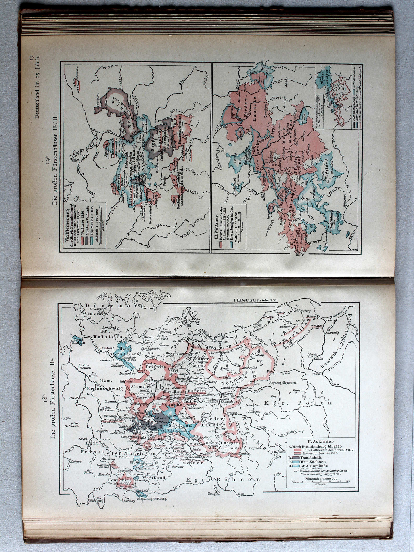
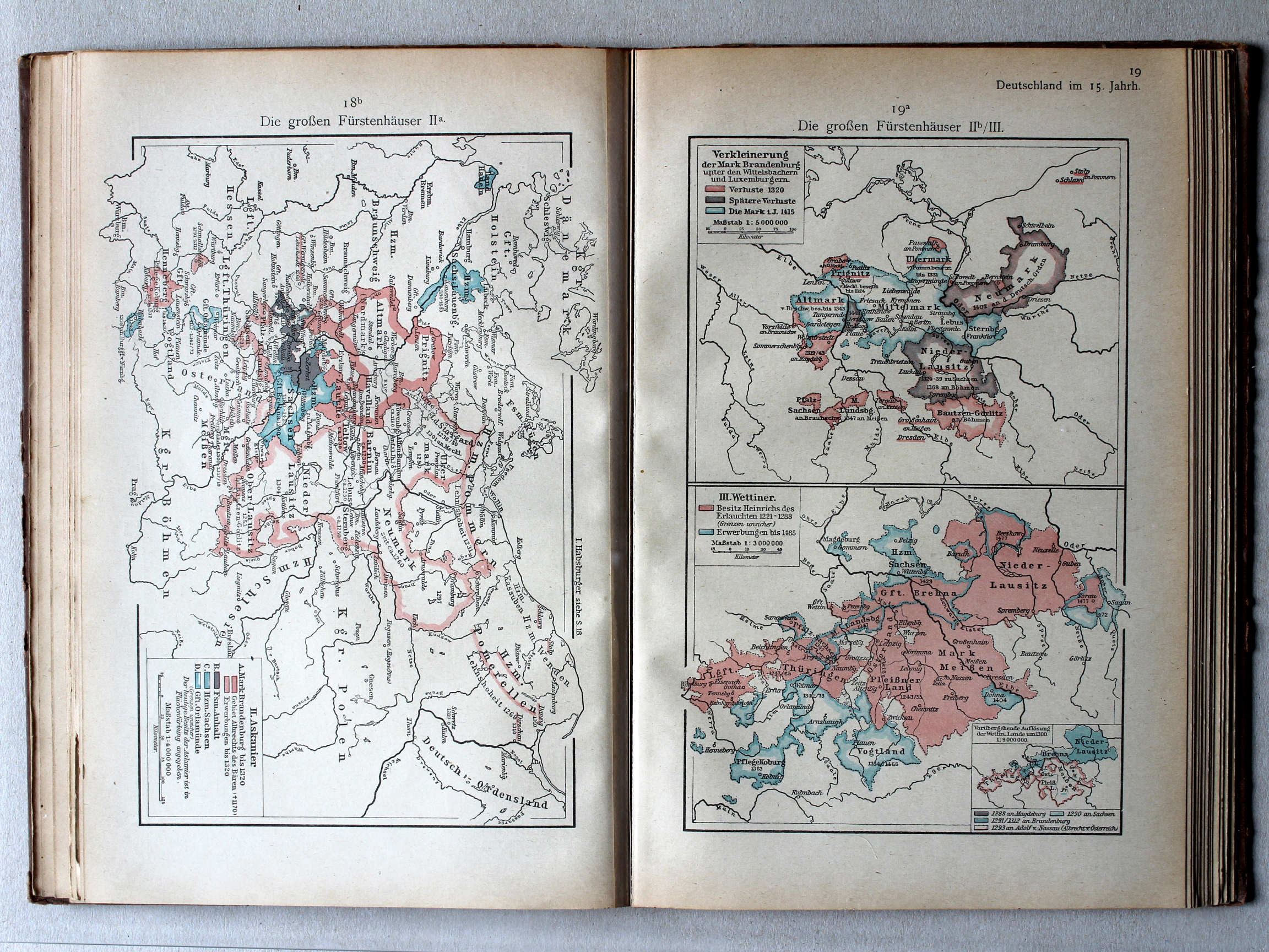
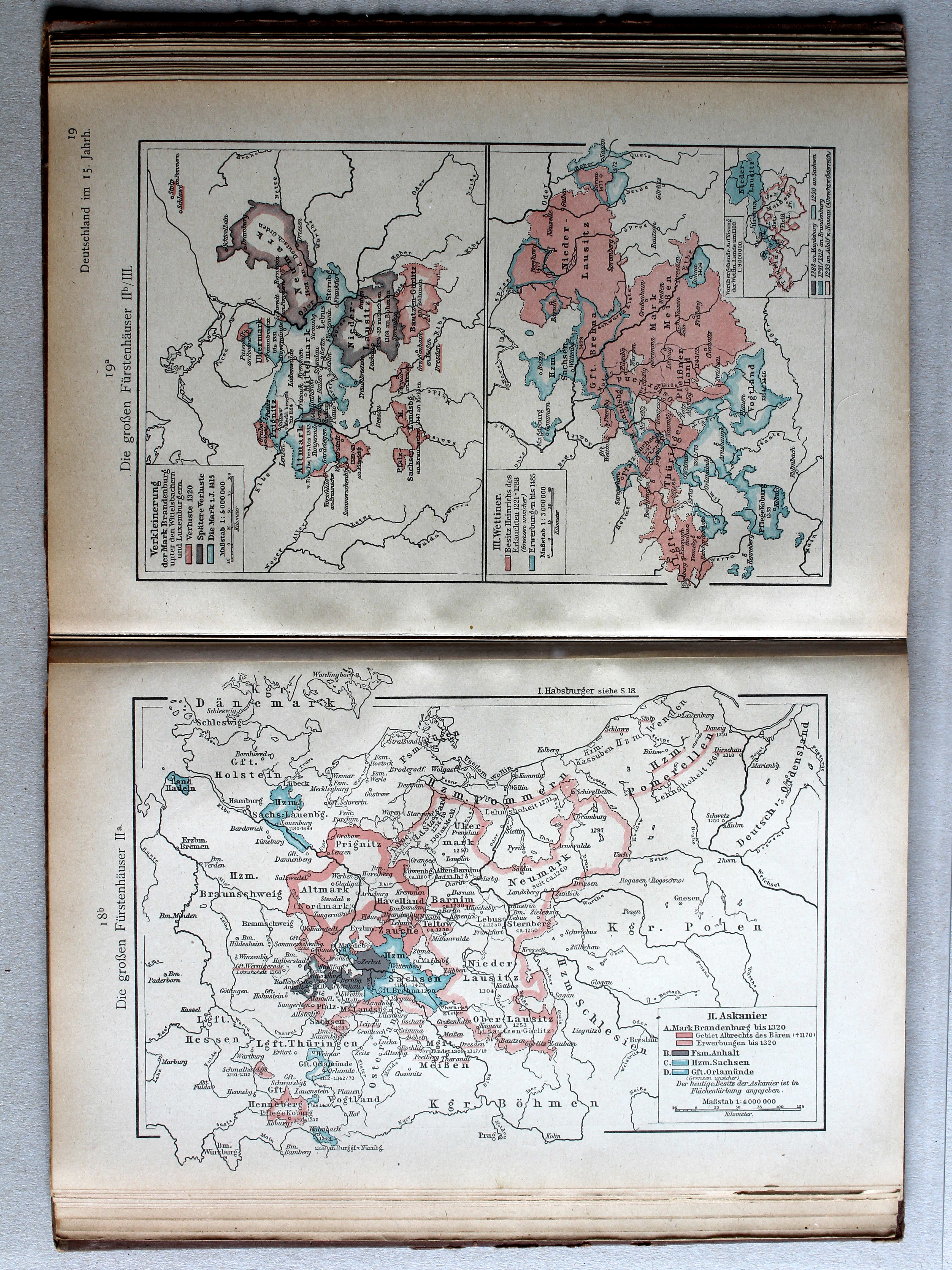
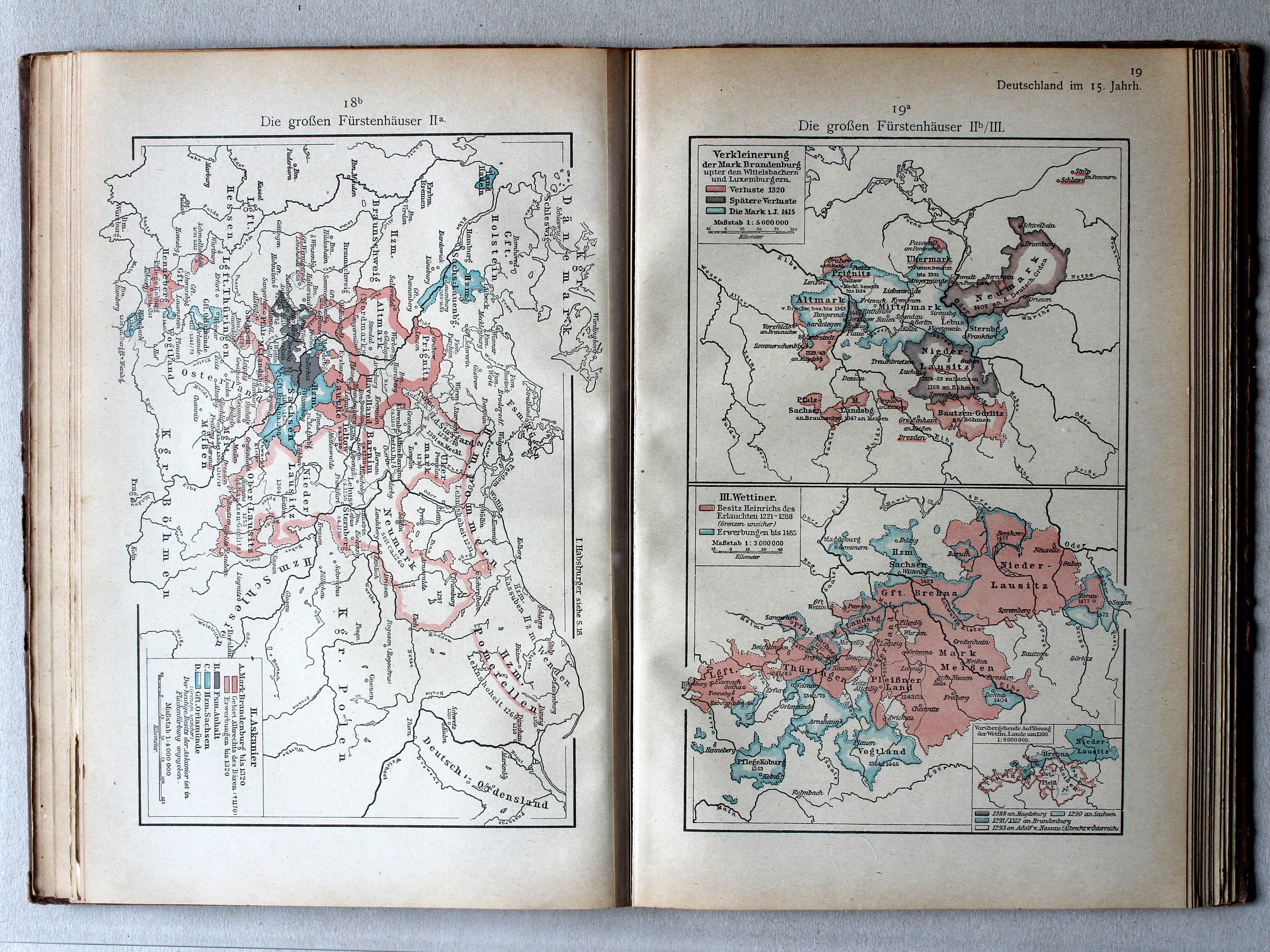
18b. Die großen Fürstenhäuser IIa XL
De grote dynastieën IIa / The great dynasties IIa
 Putzgers Historischer Schul-Atlas, 1922
19a. Die großen Fürstenhäuser IIb/III XL
De grote dynastieën IIb/III / The great dynasties IIb/III
 Putzgers Historischer Schul-Atlas, 1922
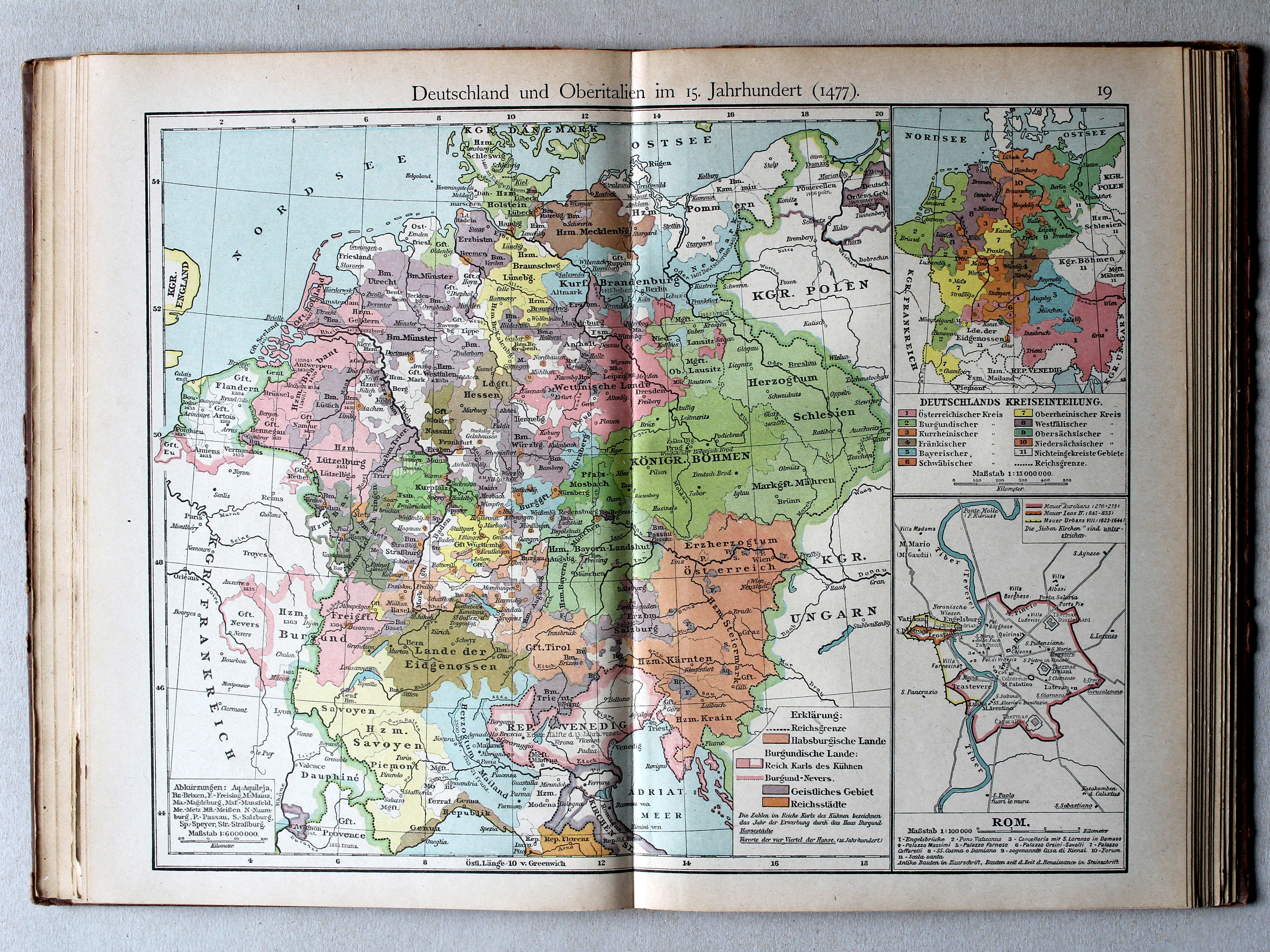
19. Deutschland und Oberitalien im 15. Jahrhundert (1477) XL
Duitsland en Noord-Italië in de 15e eeuw (1477) / Germany and Northern Italy in the 15th century (1477)
 Putzgers Historischer Schul-Atlas, 1922
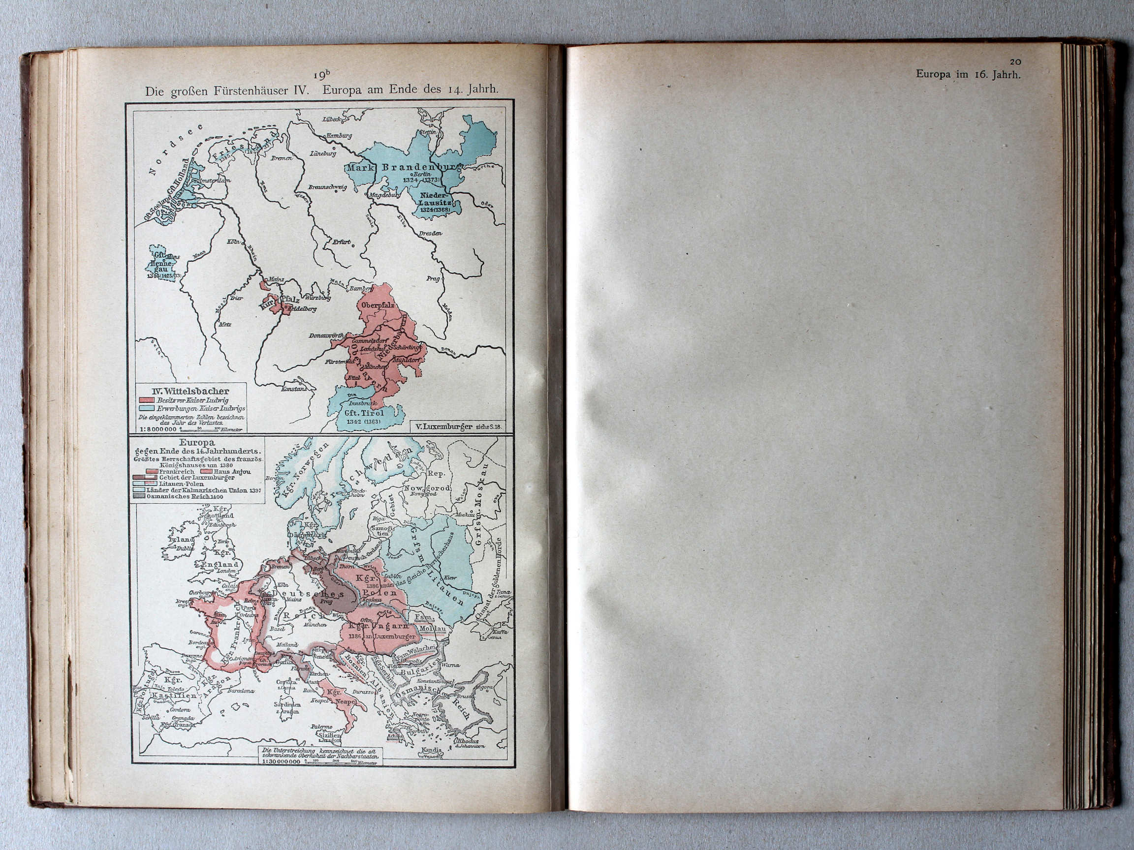
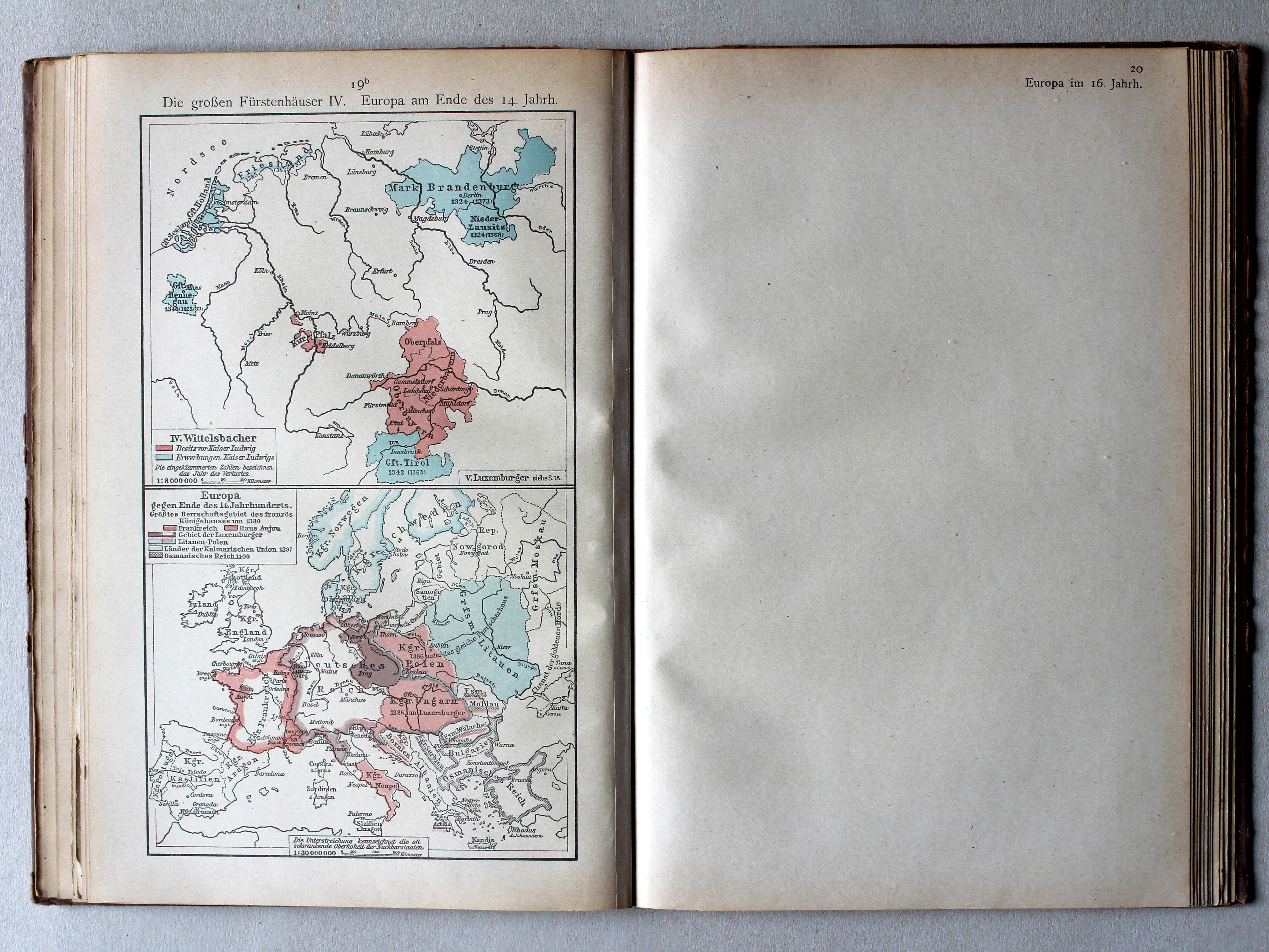
19b. Die großen Fürstenhäuser IV. Europa am Ende des 14. Jahrh. XL
De grote dynastieën IV. Europa aan het eind van de 14e eeuw / The great dynasties IV. Europe at the end of the 14th century
 Putzgers Historischer Schul-Atlas, 1922
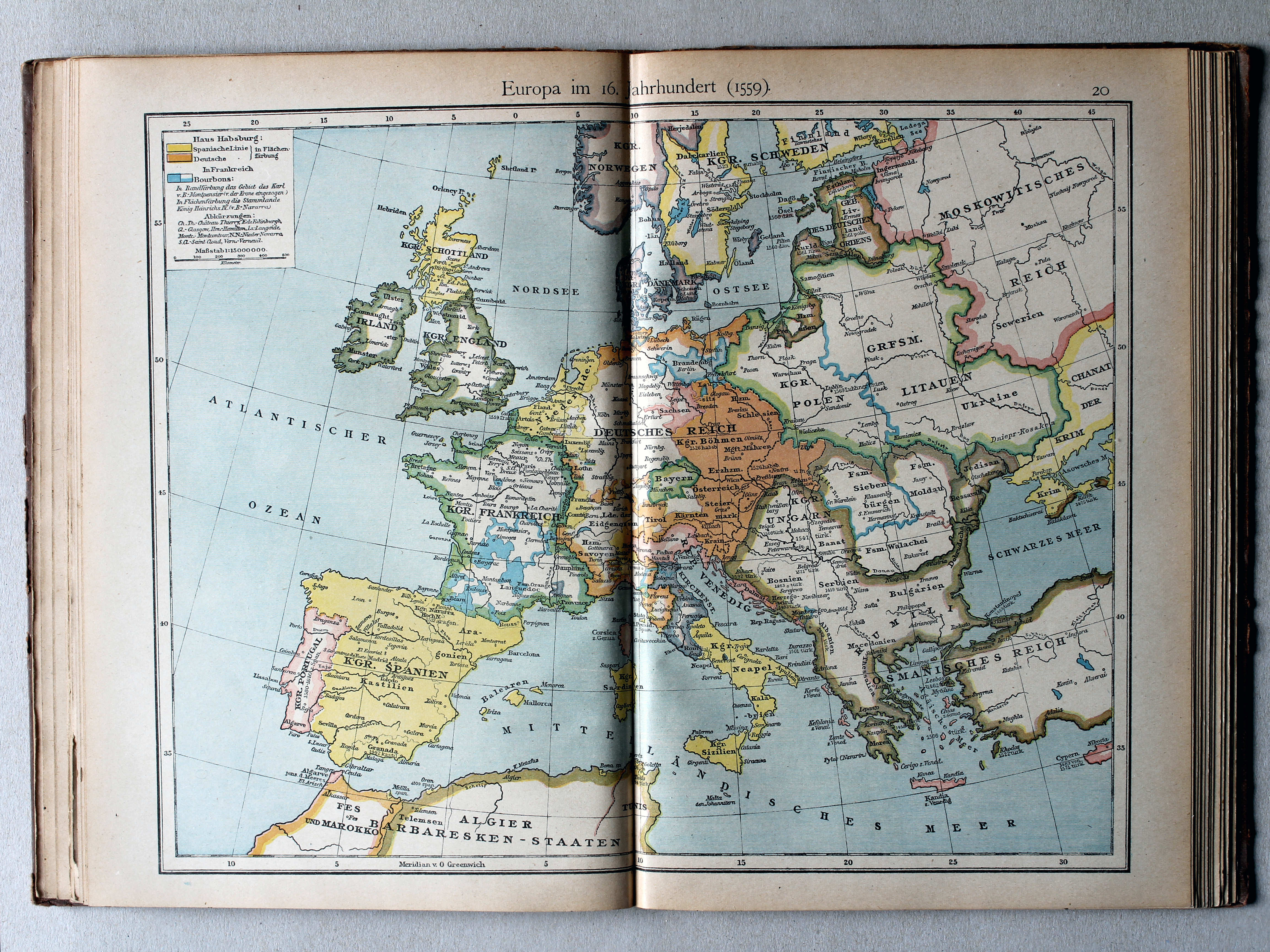
20. Europa im 16. Jahrhundert (1559) XL
Europa in de 16e eeuw (1559) / Europe in the 16th century (1559)
 Putzgers Historischer Schul-Atlas, 1922
21. Deutschland zur Zeit der Reformation (1547) XL
Duitsland in de tijd van de Reformatie (1547) / Germany during the Protestant Reformation (1547)
 Putzgers Historischer Schul-Atlas, 1922
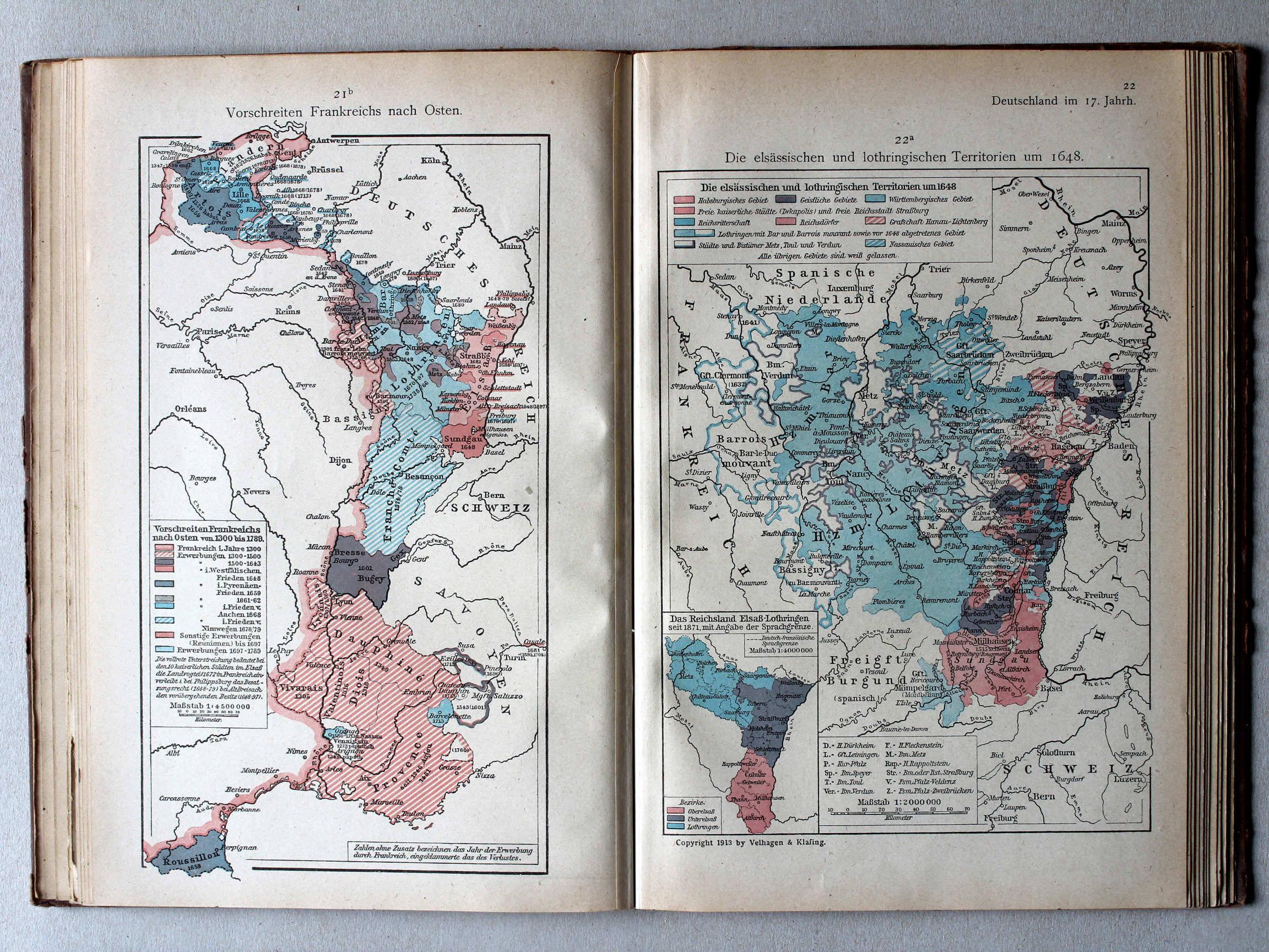
21b. Vorschreiten Frankreiches nach Osten XL
Uitbreiding van Frankrijk naar het oosten / Expansion of France towards the east
22a. Die elsässischen und lothringischen Territorien um 1648 XL
Elzas-Lotharingen rond 1648 / Alsace-Lorraine around 1648
 Putzgers Historischer Schul-Atlas, 1922
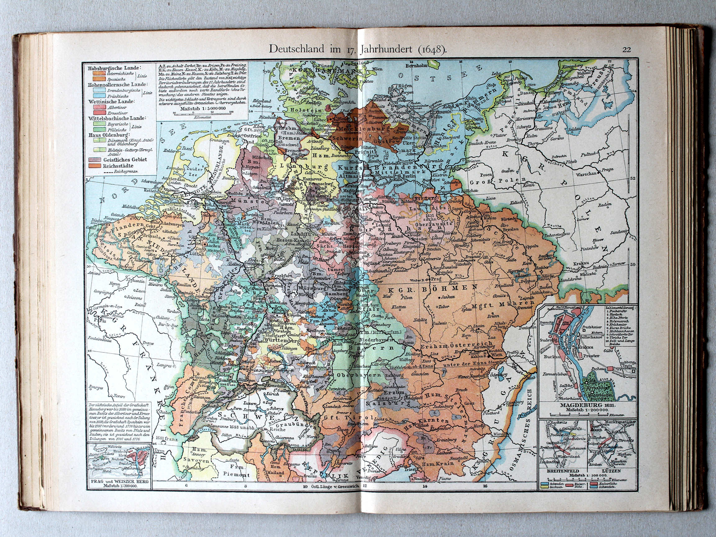
22. Deutschland im 17. Jahrh. (1648) XL
Duitsland in de 17e eeuw (1648) / Germany in the 17th century (1648)
 Putzgers Historischer Schul-Atlas, 1922
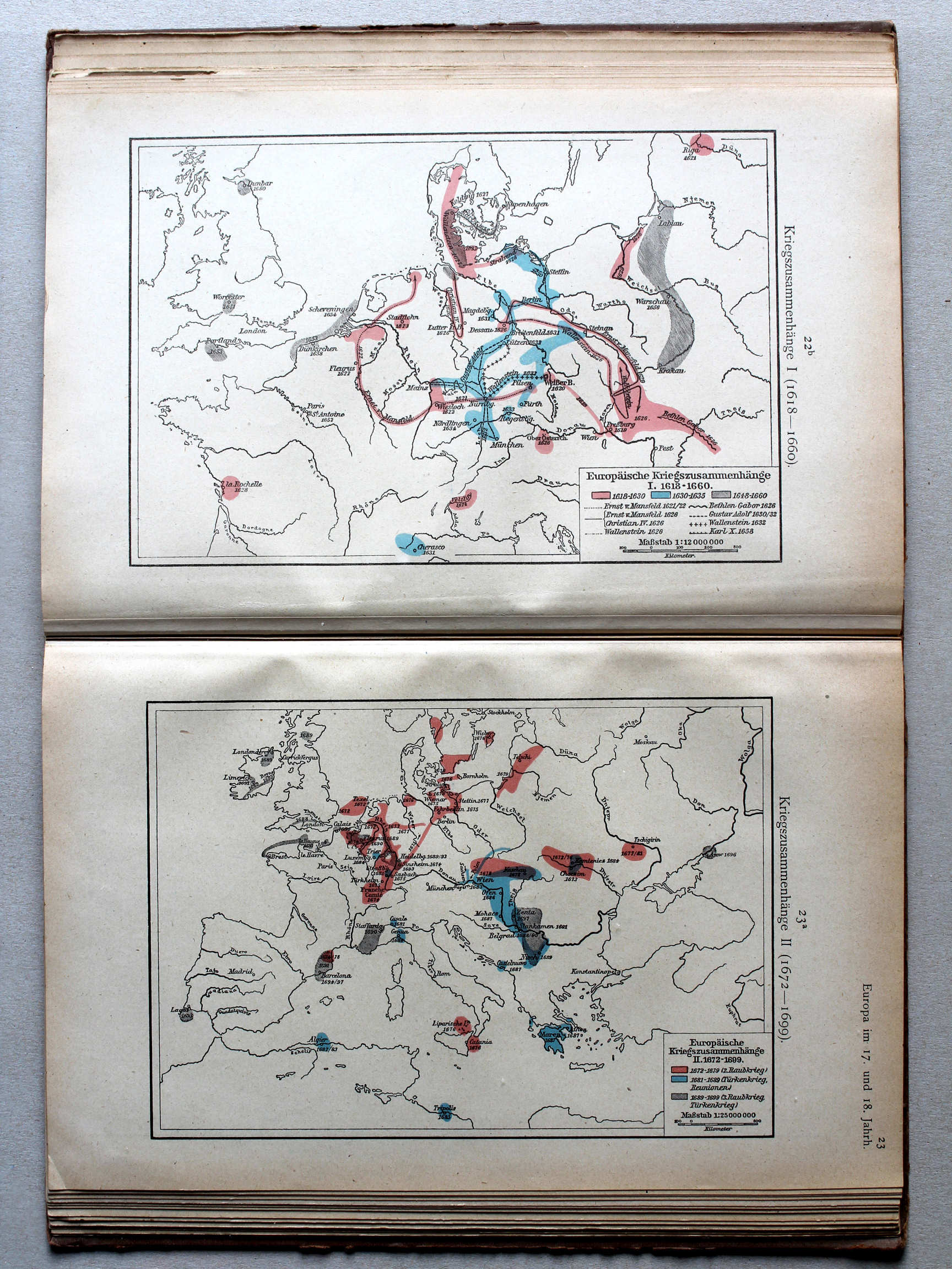
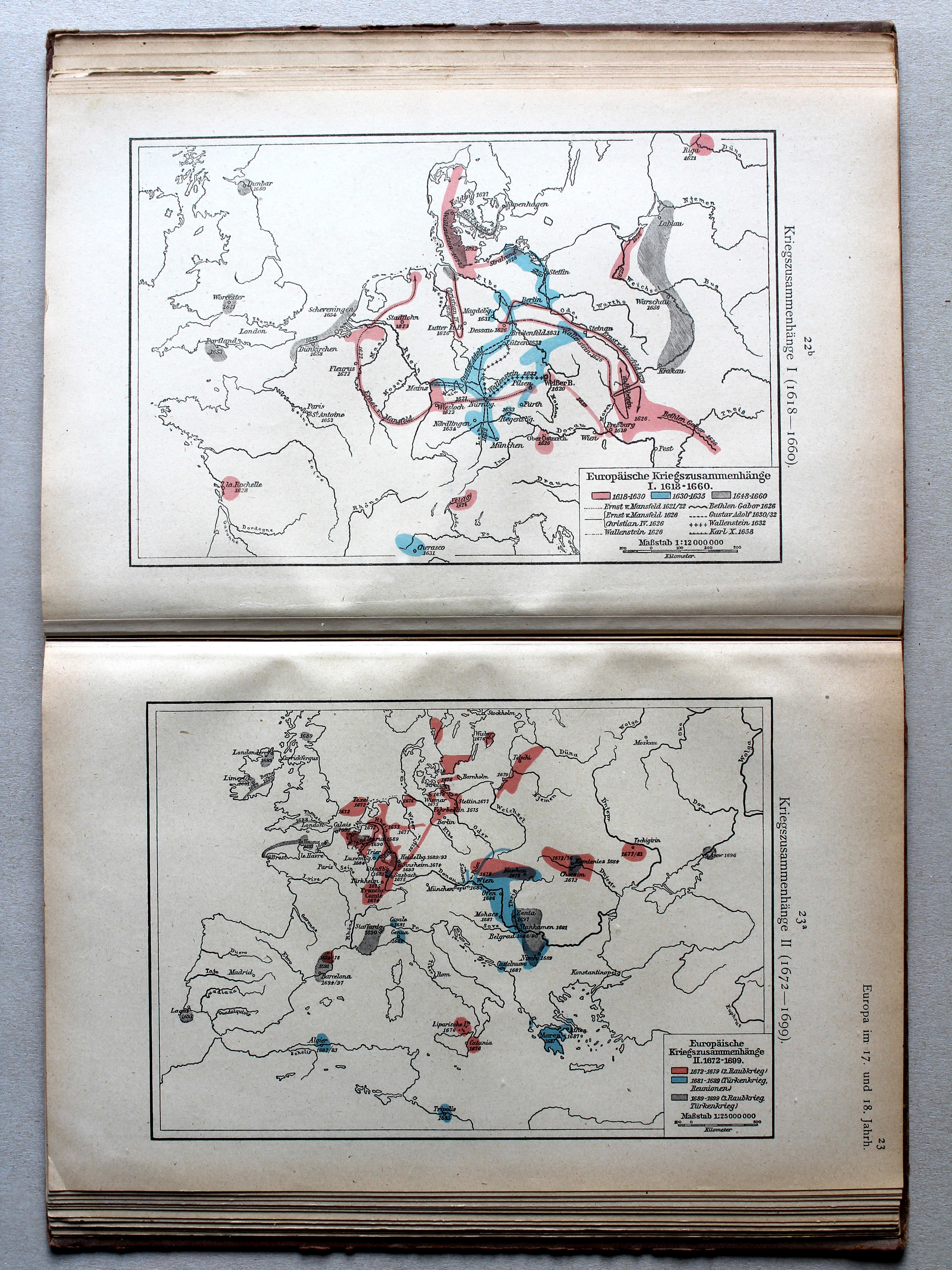
22b. Kriegszusammenhänge I (1618-1660) XL
Oorlogen in Europa I (1618-1660) / European wars I (1618-1660)
23a. Kriegszusammenhänge II (1672-1699) XL
Oorlogen in Europa II (1672-1699) / European wars II (1672-1699)
 Putzgers Historischer Schul-Atlas, 1922
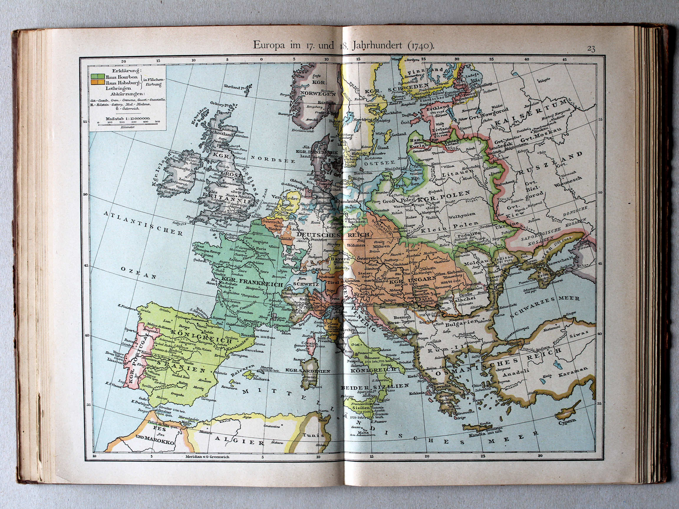
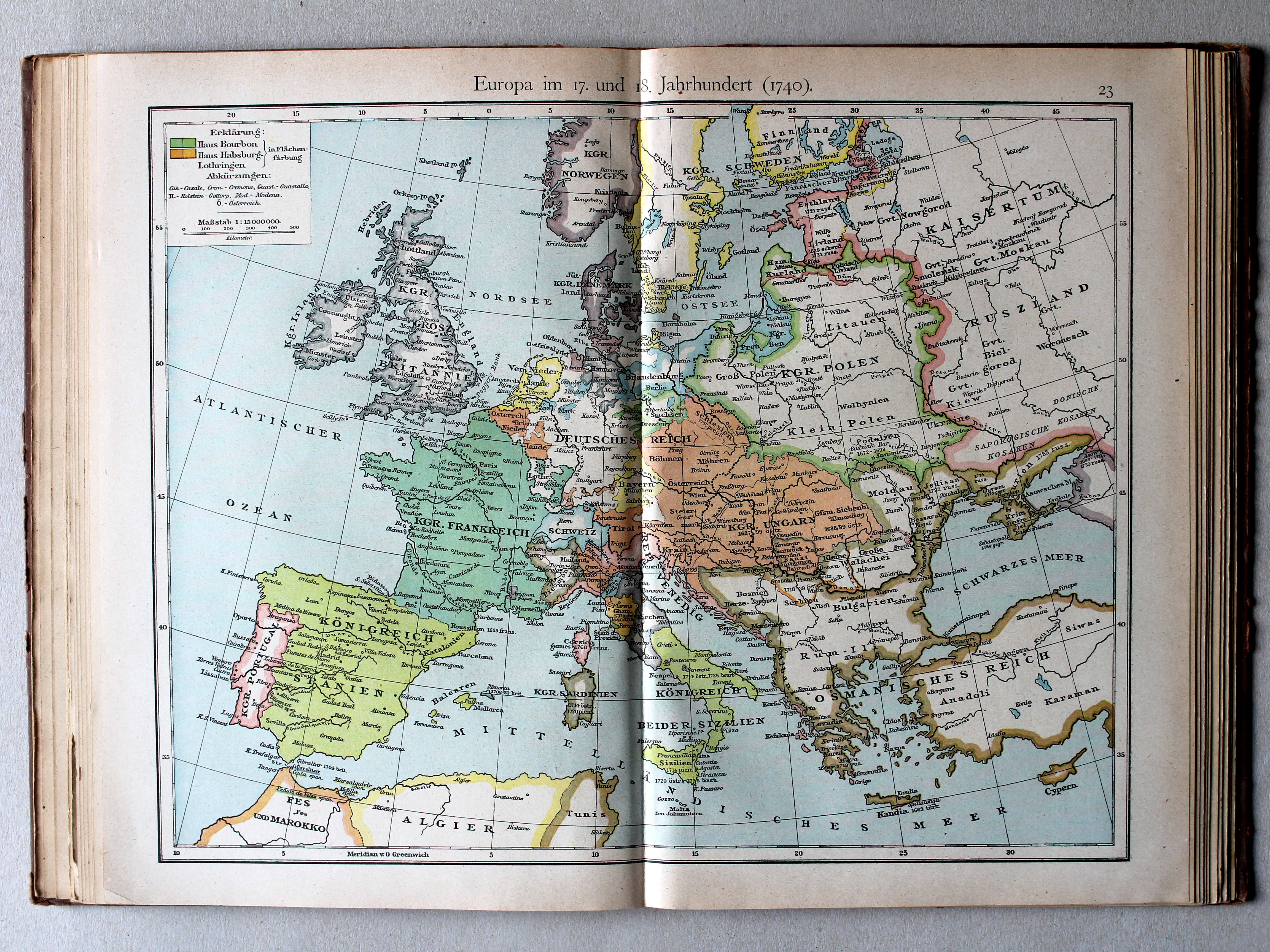
23. Europa im 17. und 18. Jahrhundert (1740) XL
Europa in de 17e en 18e eeuw (1740) / Europe in the 17th and 18th century (1740)
 Putzgers Historischer Schul-Atlas, 1922
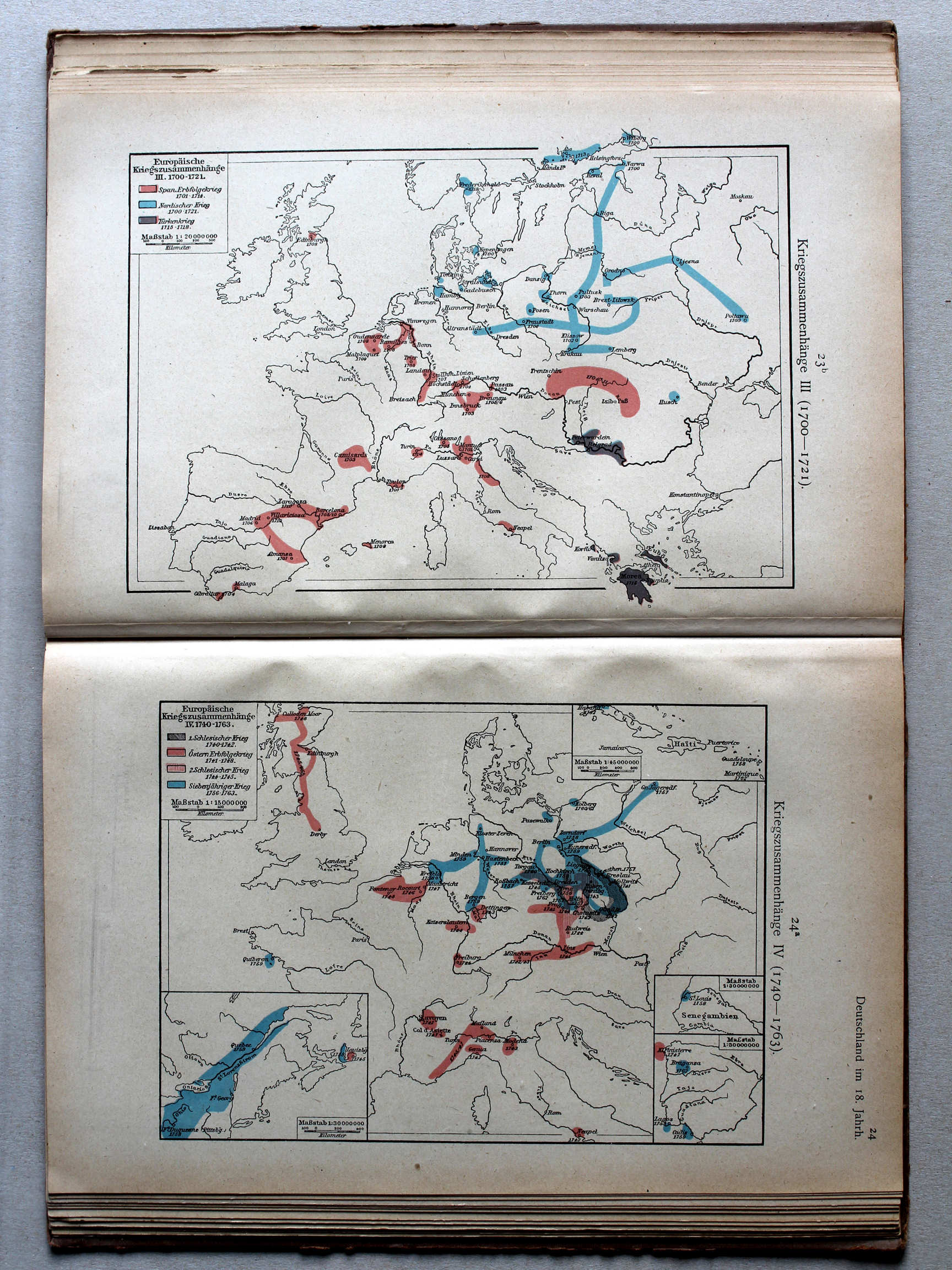
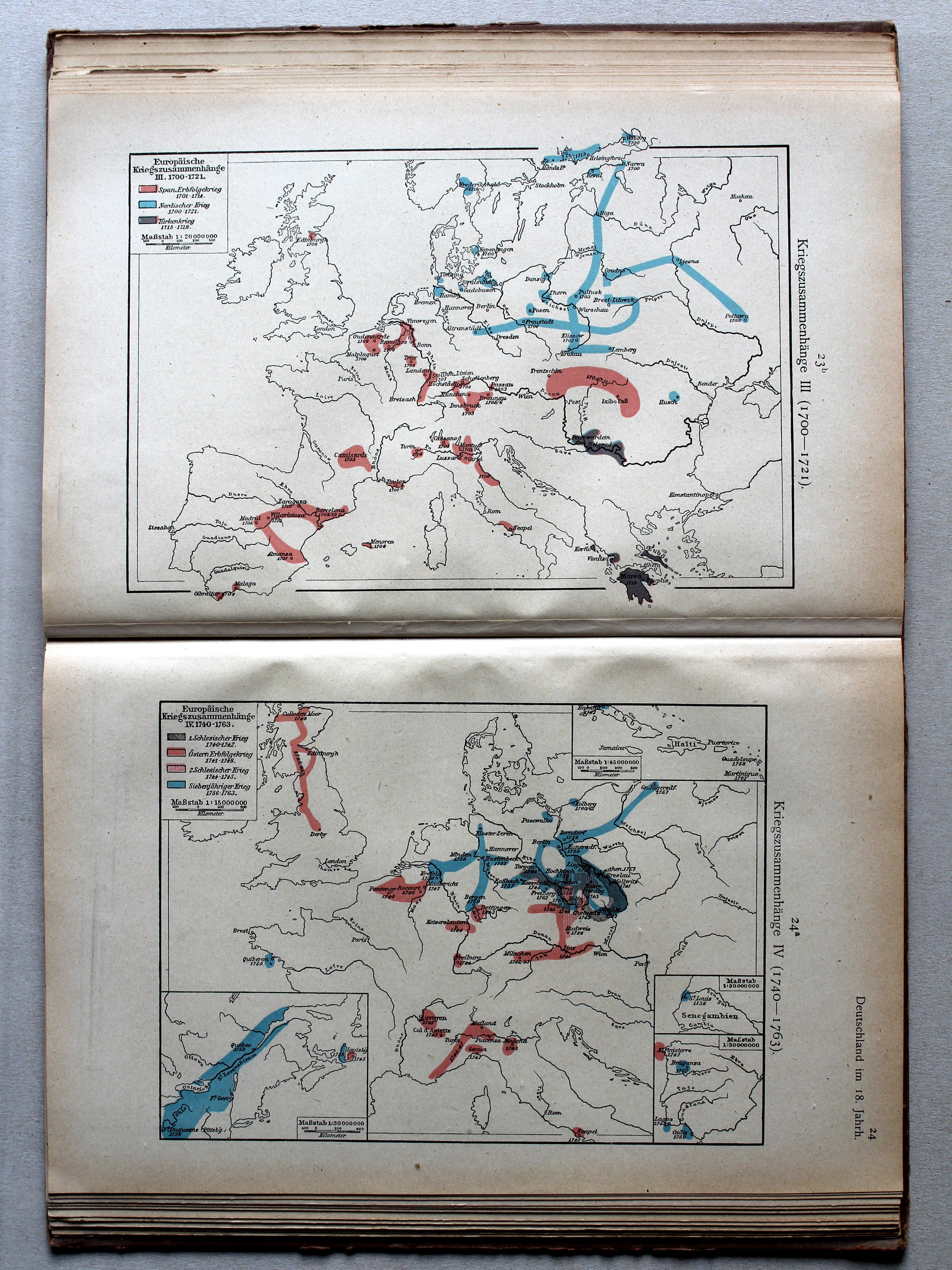
23b. Kriegszusammenhänge III (1700-1721) XL
Oorlogen in Europa III (1700-1721) / European wars III (1700-1721)
24a. Kriegszusammenhänge IV (1740-1763) XL
Oorlogen in Europa IV (1740-1763) / European wars IV (1740-1763)
 Putzgers Historischer Schul-Atlas, 1922
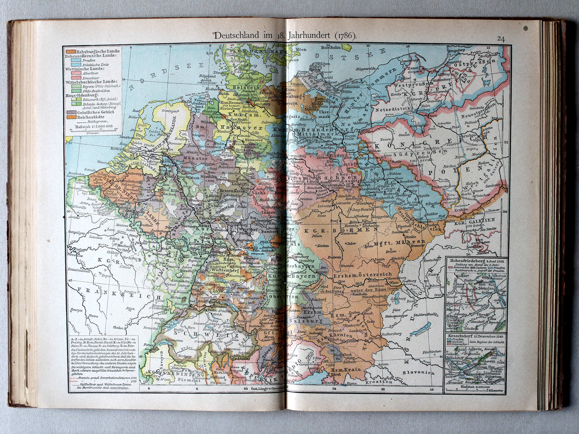
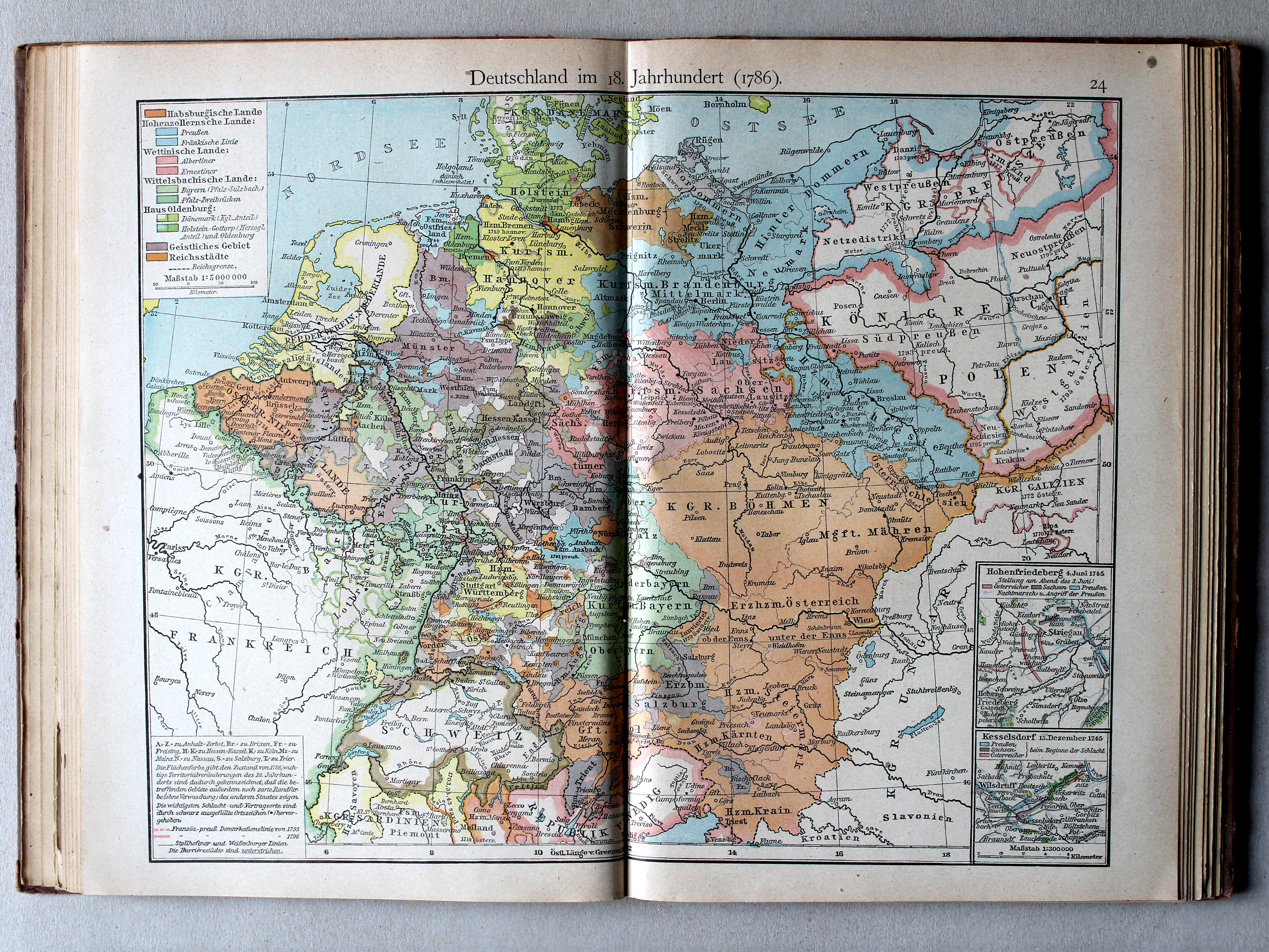
24. Deutschland im 18. Jahrhundert (1786) XL
Duitsland in de 18e eeuw (1786) / Germany in the 18th century (1786)
 Putzgers Historischer Schul-Atlas, 1922
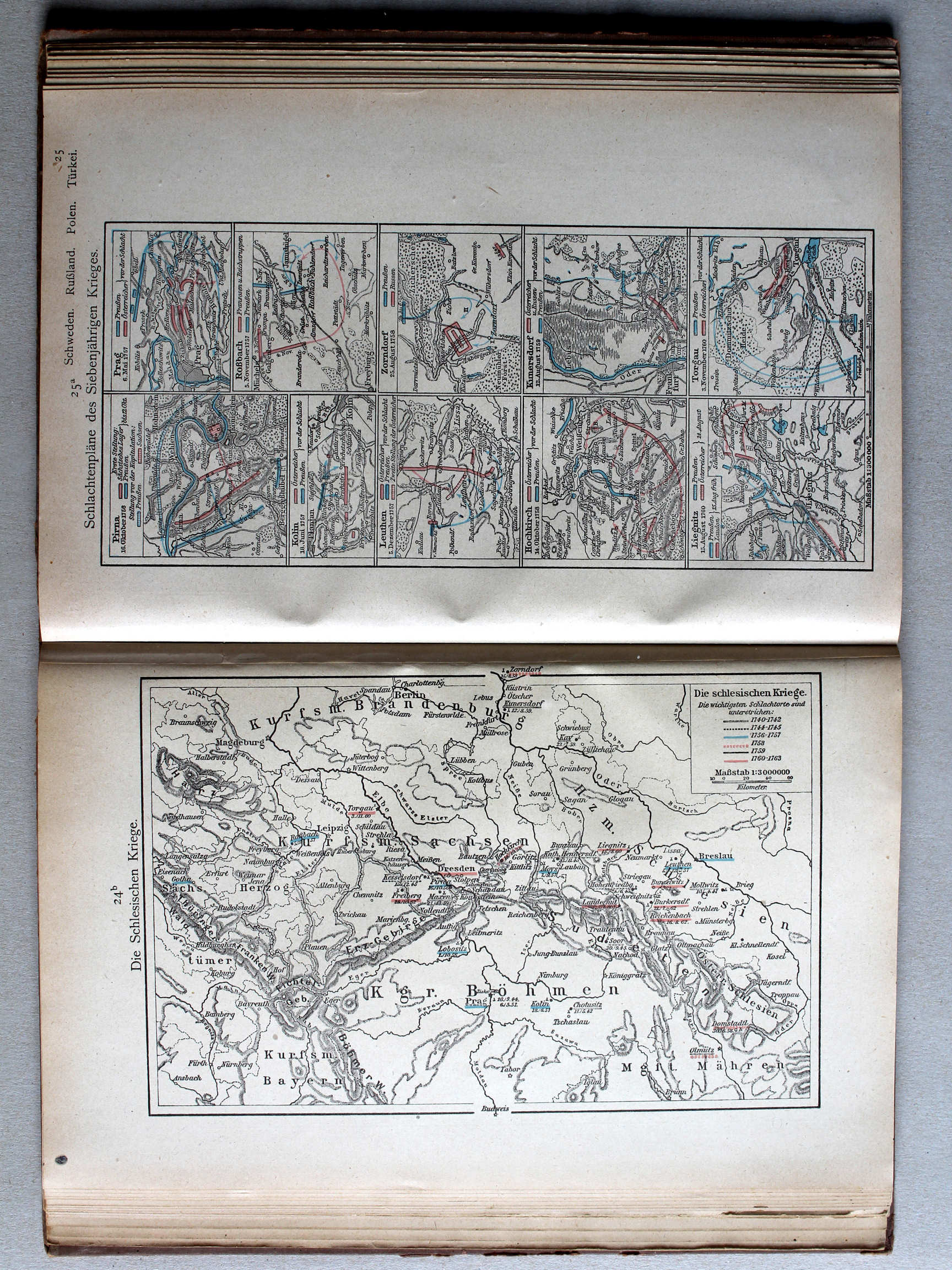
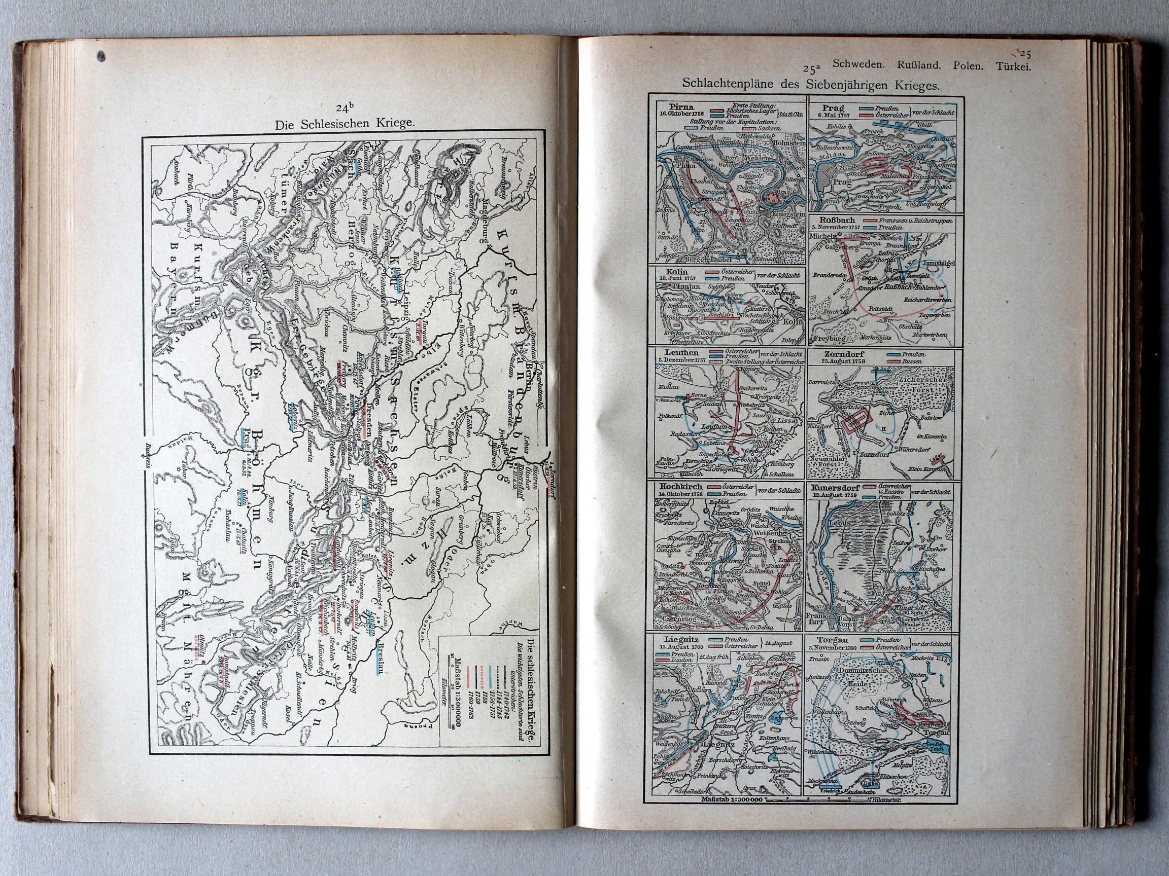
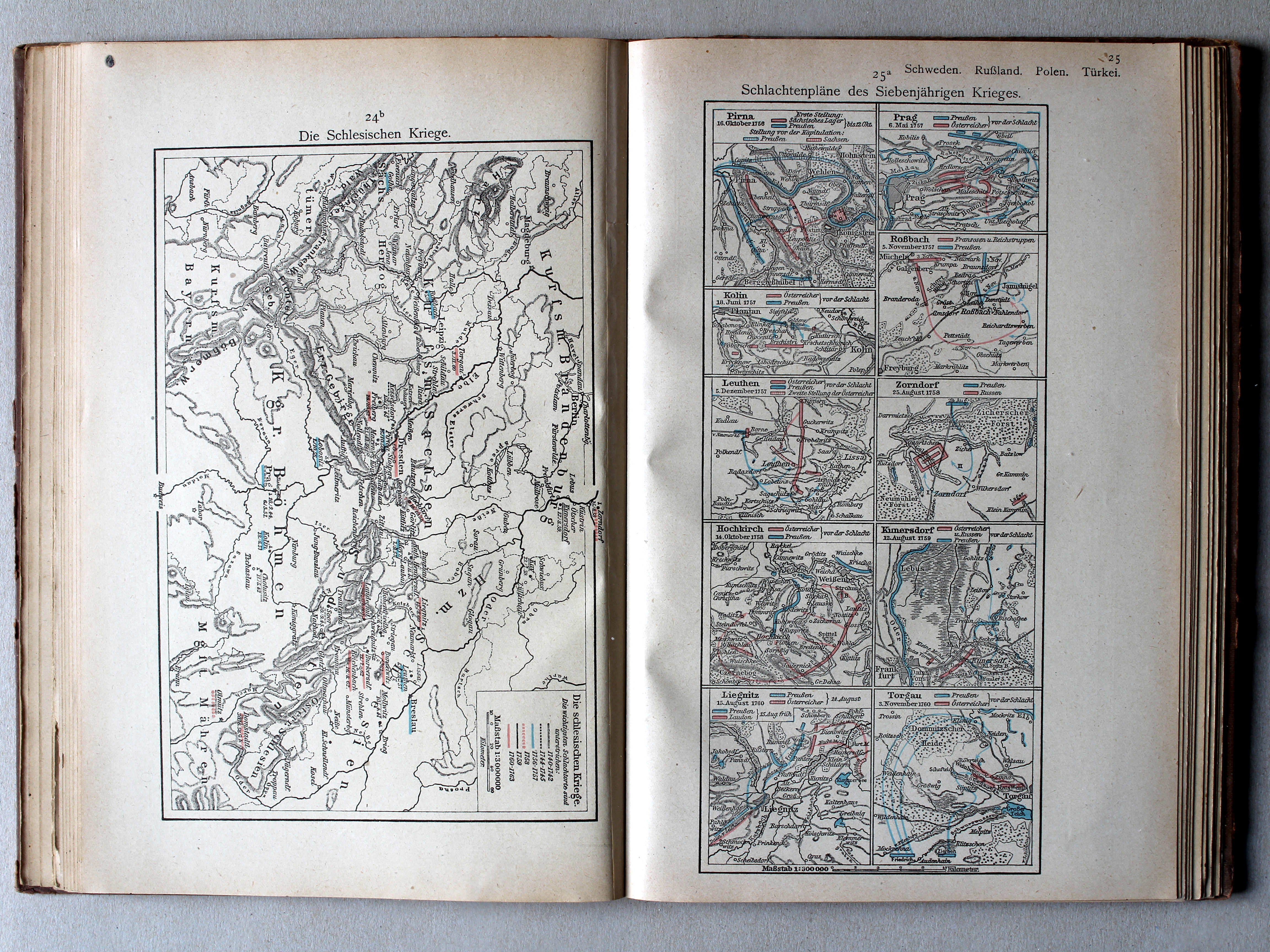
24b. Die schlesischen Kriege XL
De Silezische Oorlogen / The Silesian Wars
 Putzgers Historischer Schul-Atlas, 1922
25a. Schlachtenpläne des Siebenjährigen Krieges XL
Veldslagen in de Zevenjarige Oorlog / Battlefields during the Seven Years' War
 Putzgers Historischer Schul-Atlas, 1922
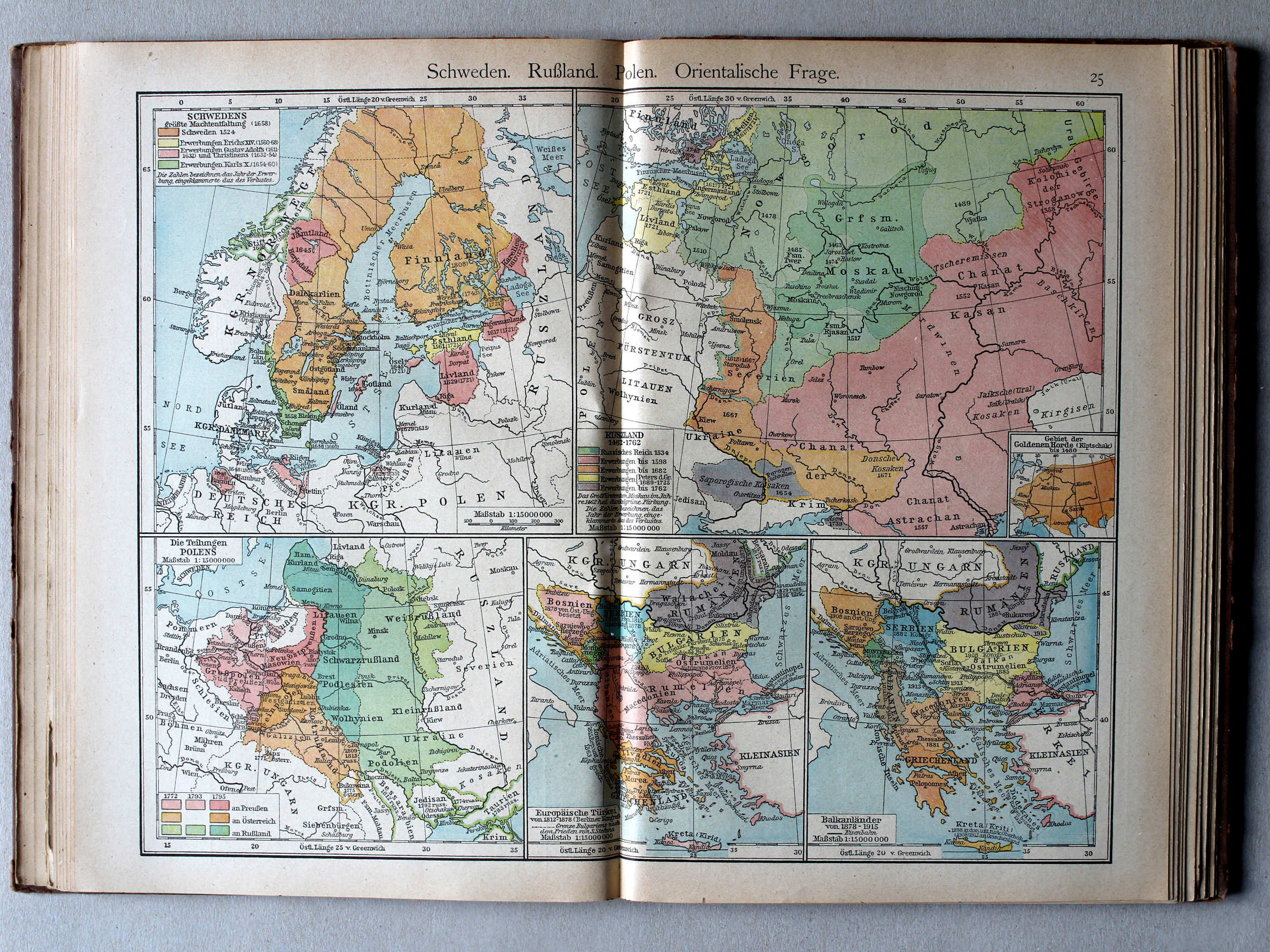
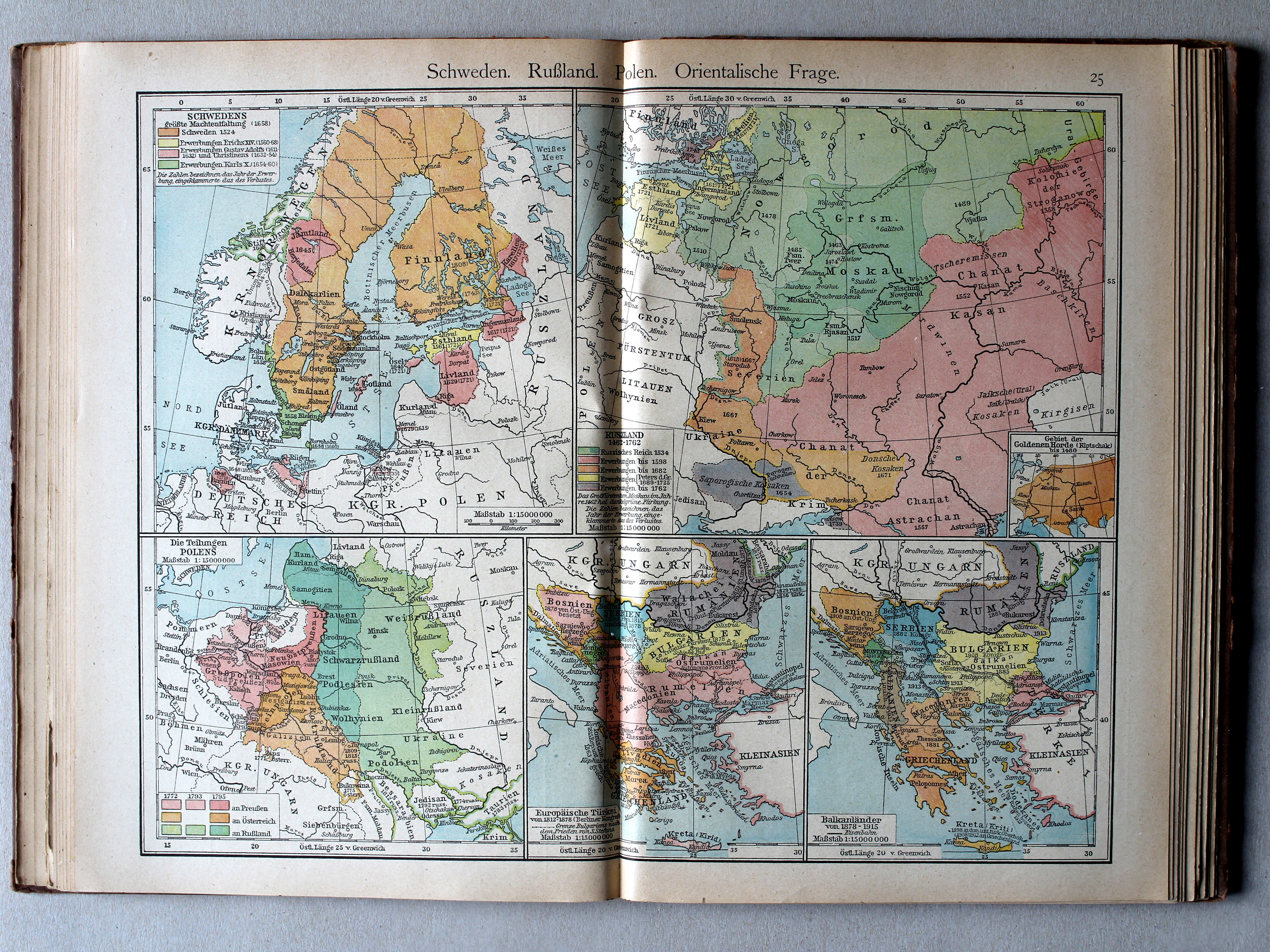
25. Schweden. Rußland. Polen. Orientalische Frage XL
Zweden, Rusland, Polen, Oosterse Kwestie / Sweden, Russia, Poland, Eastern Question
 Putzgers Historischer Schul-Atlas, 1922
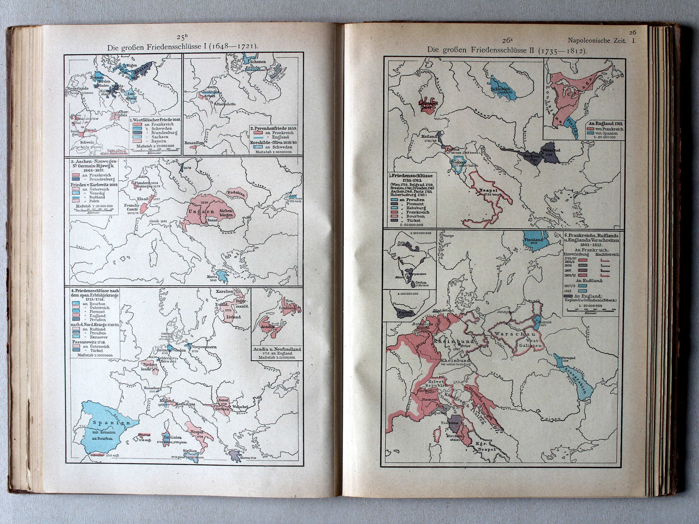
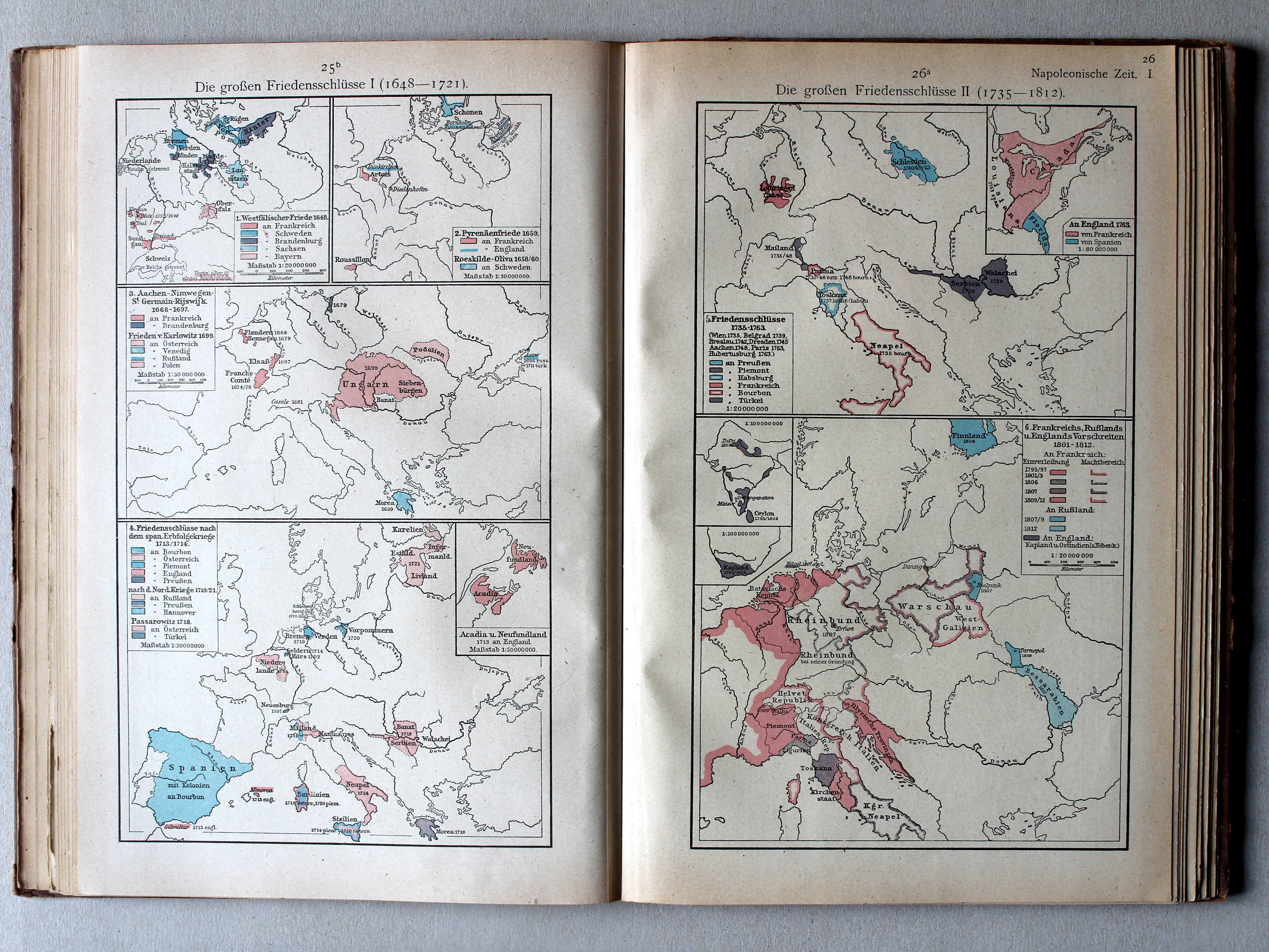
25b. Die großen Friedensschlüsse I (1648-1721) XL
De belangrijkste vredesverdragen I (1648-1721) / The main peace treaties I (1648-1721)
26a. Die großen Friedensschlüsse II (1735-1812) XL
De belangrijkste vredesverdragen II (1735-1812) / The main peace treaties II (1735-1812)
 Putzgers Historischer Schul-Atlas, 1922
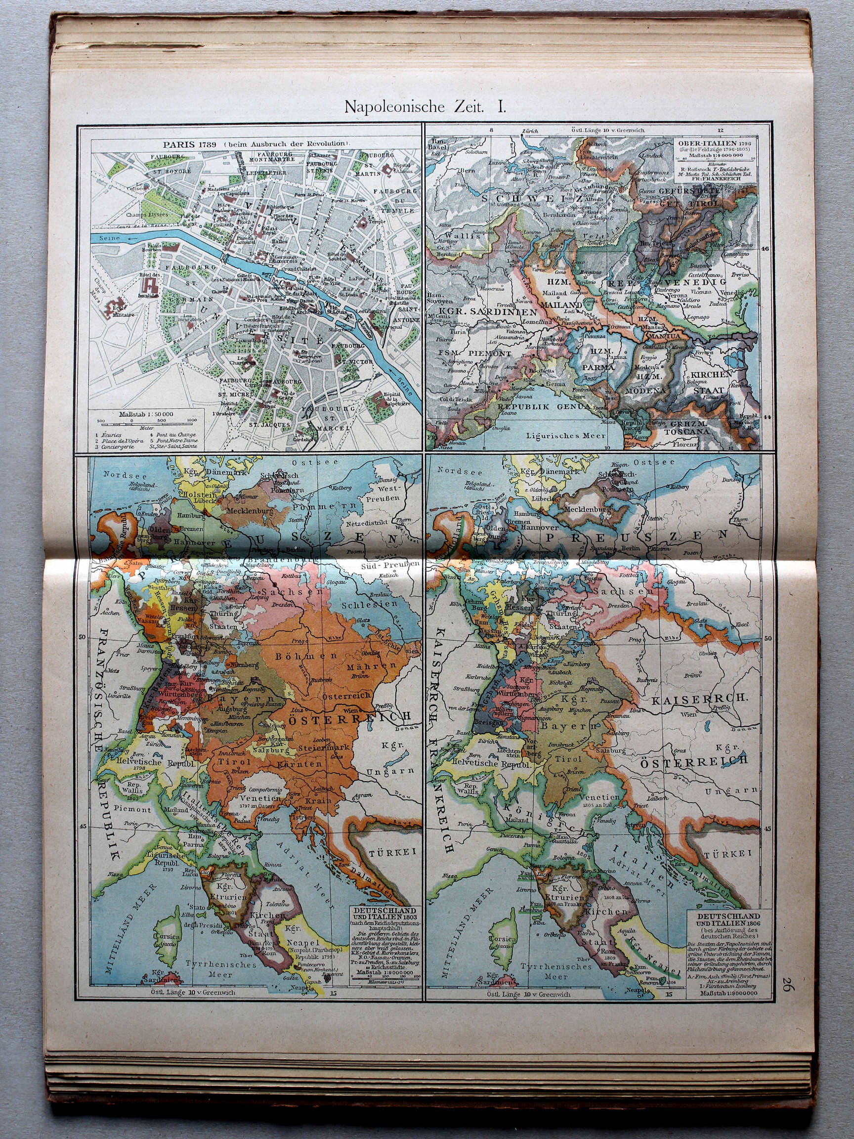
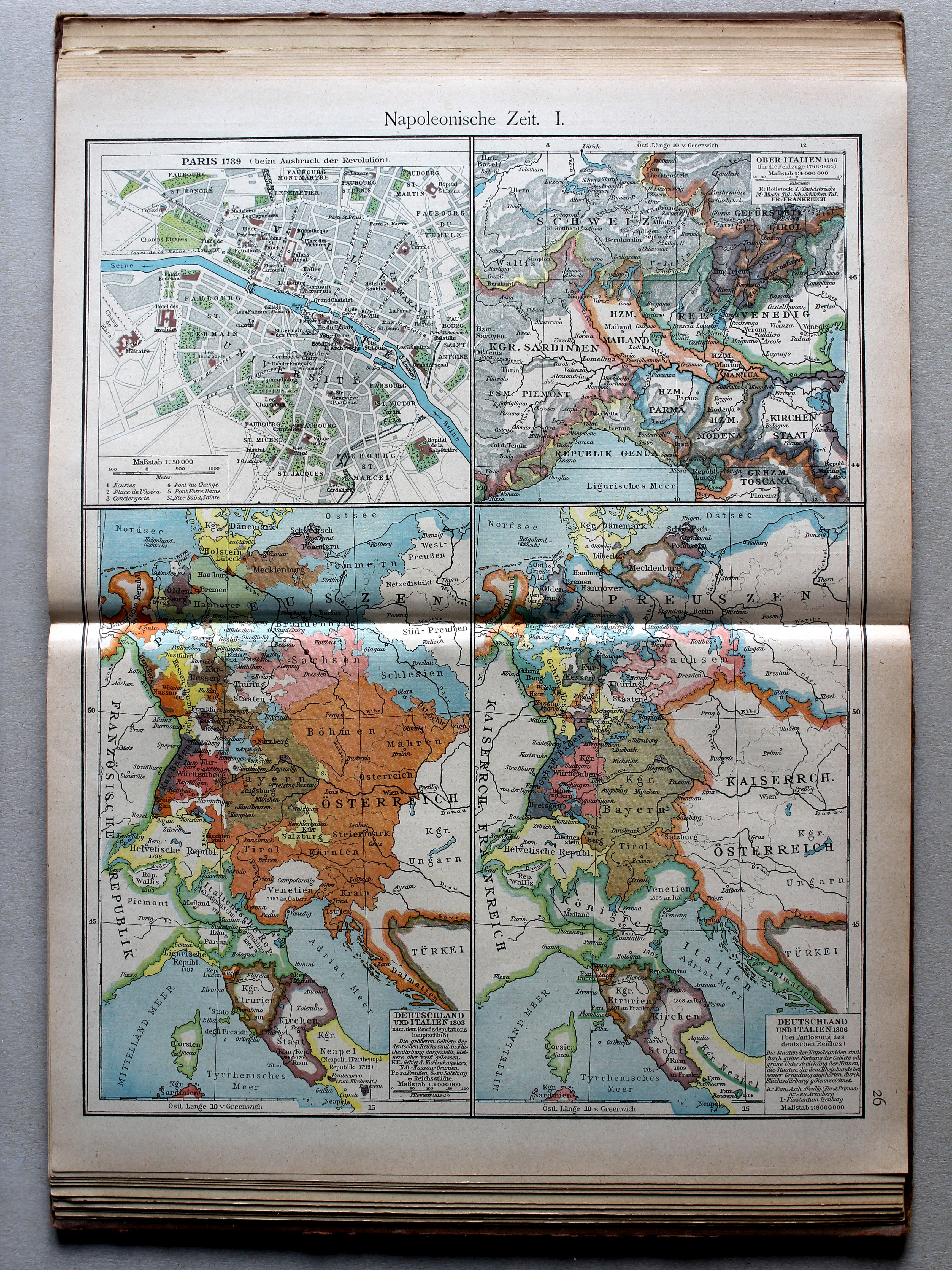
26. Napoleonische Zeit I XL
Tijd van Napoleon I / Era of Napoleon I
 Putzgers Historischer Schul-Atlas, 1922
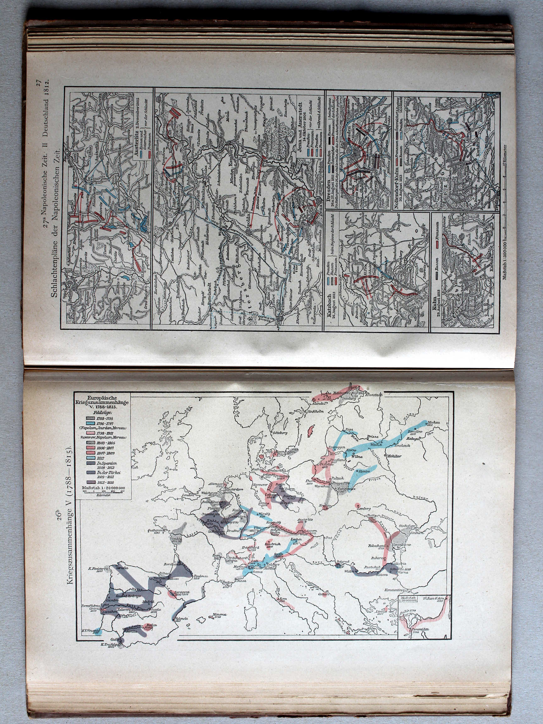
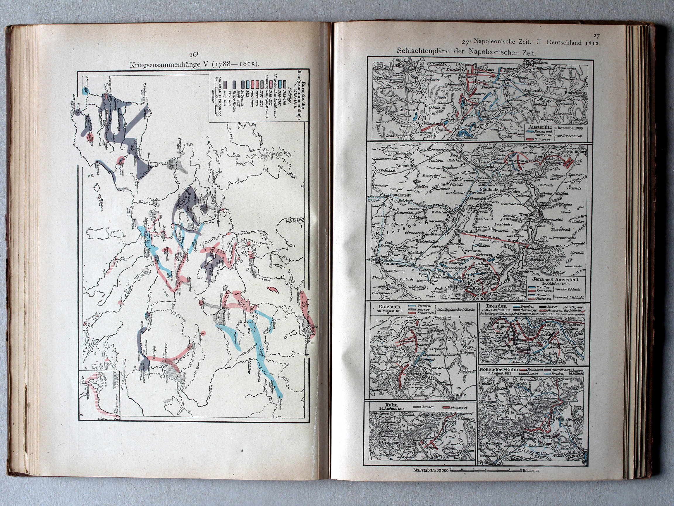
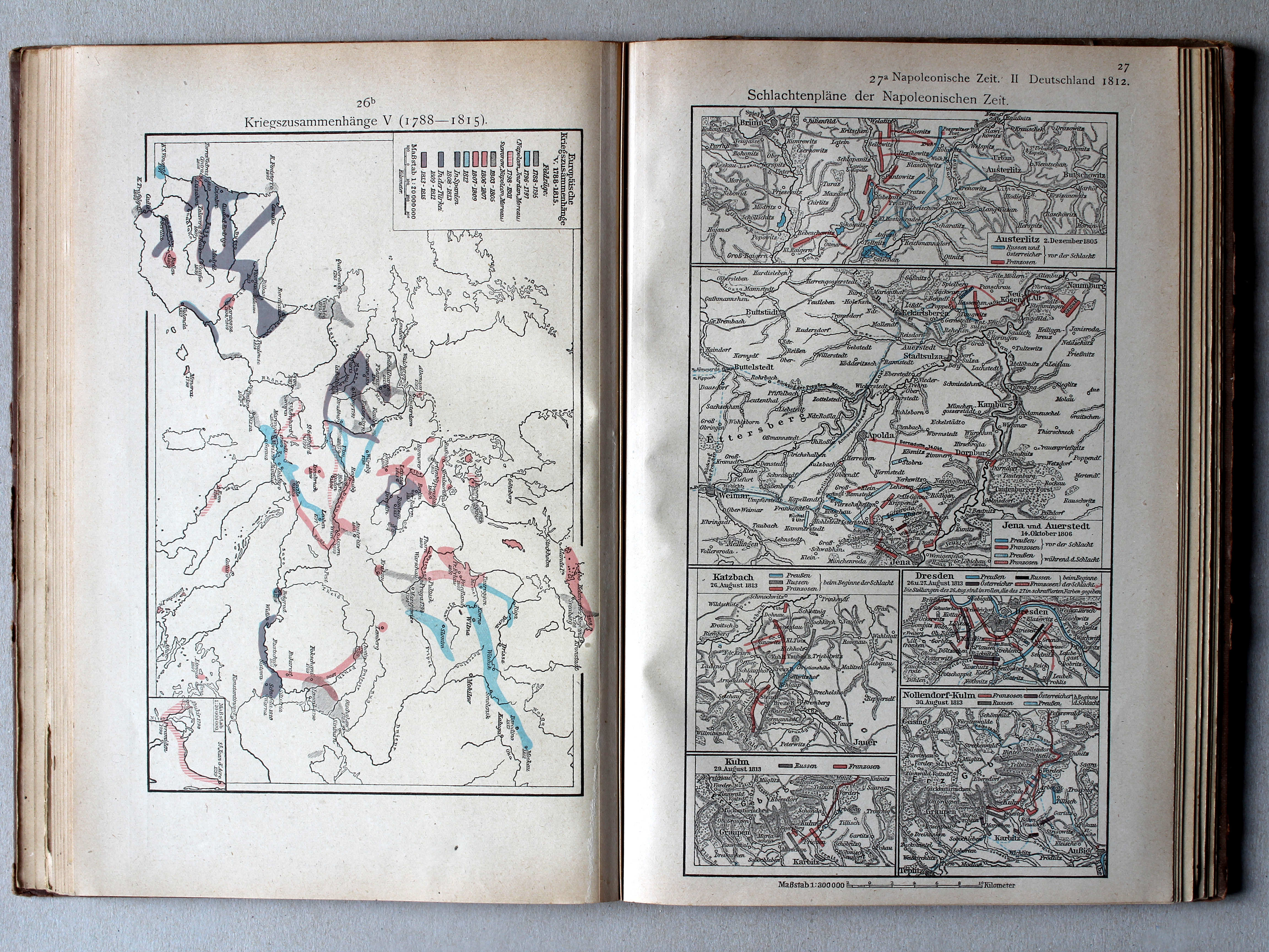
26b. Kriegszusammenhänge V (1788-1815) XL
Oorlogen in Europa V (1788-1815) / European wars V (1788-1815)
 Putzgers Historischer Schul-Atlas, 1922
27a. Schlachtenpläne der Napoleonischen Zeit XL
Veldslagen in de tijd van Napoleon / Battlefields in the era of Napoleon
 Putzgers Historischer Schul-Atlas, 1922
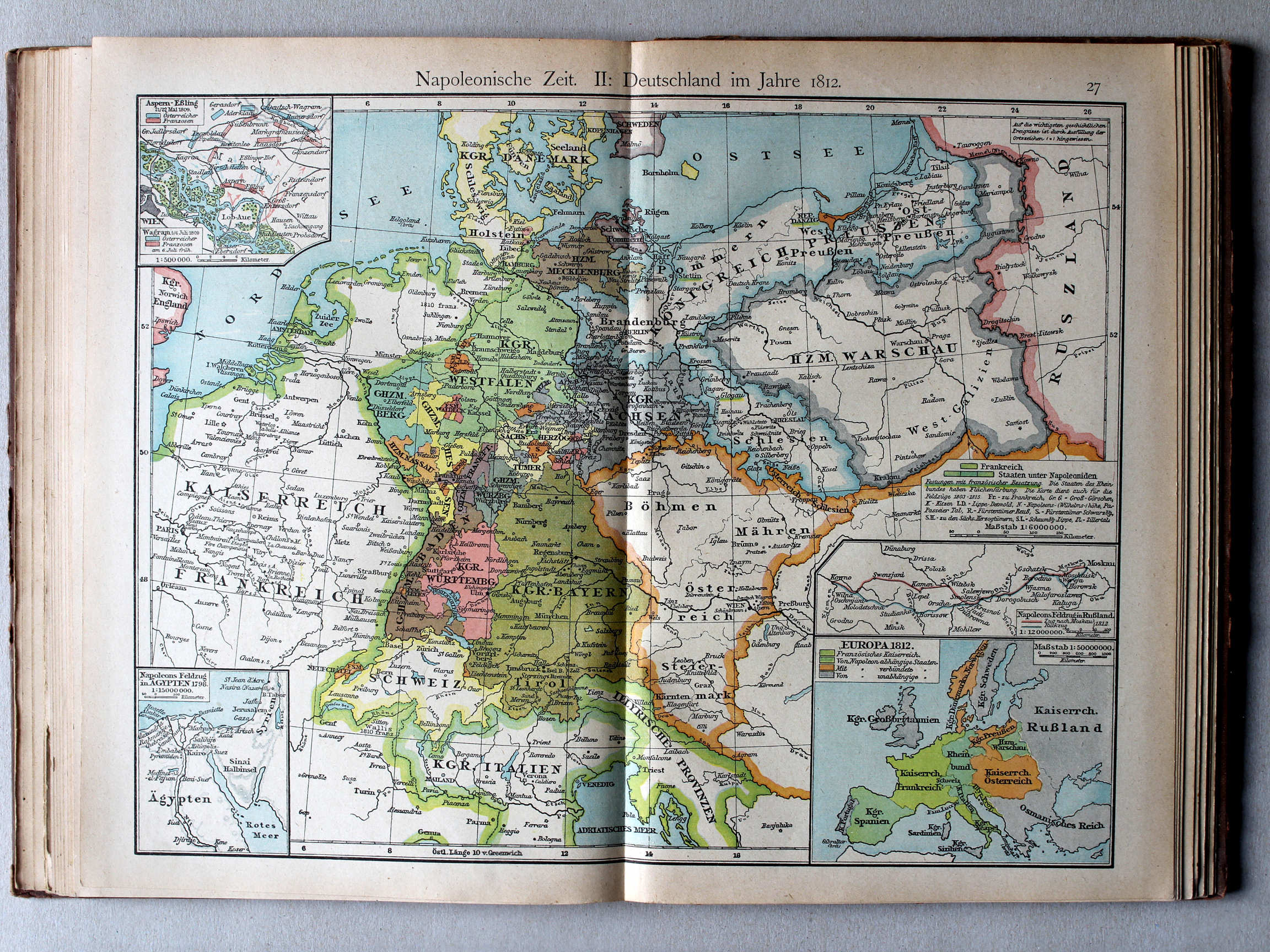
27. Napoleonische Zeit II: Deutschland im Jahre 1812 XL
Tijd van Napoleon II: Duitsland in 1812 / Era of Napoleon II: Germany in 1812
 Putzgers Historischer Schul-Atlas, 1922
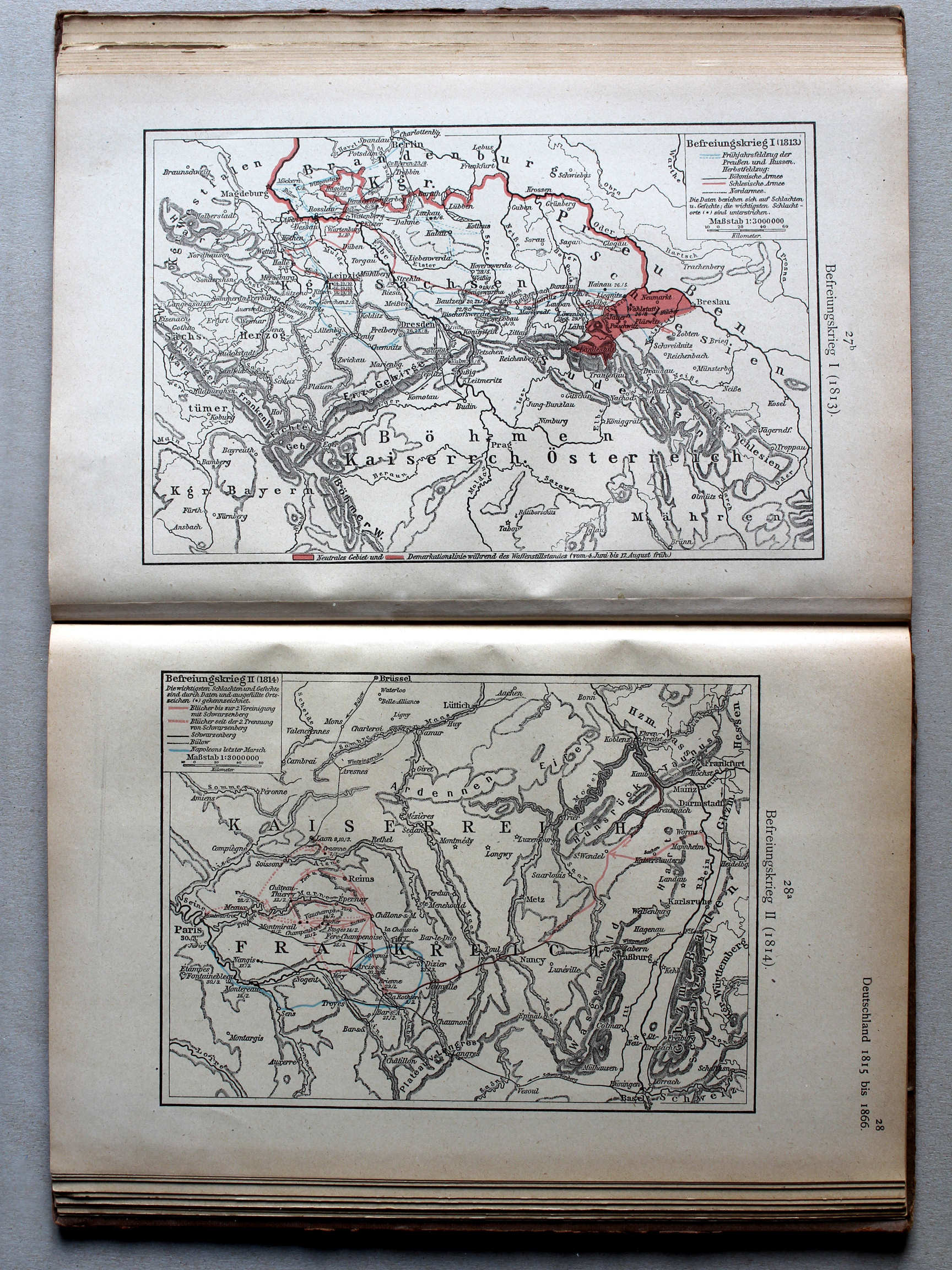
27b. Befreiungskrieg I (1813) XL
Duitse bevrijdingsoorlog I (1813) / German Campaign I (1813)
28a. Befreiungskrieg II (1814) XL
Duitse bevrijdingsoorlog II (1814) / German Campaign II (1814)
 Putzgers Historischer Schul-Atlas, 1922
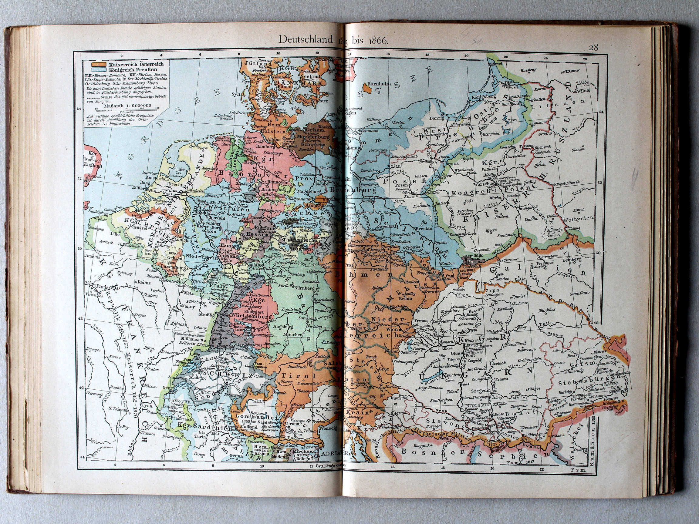
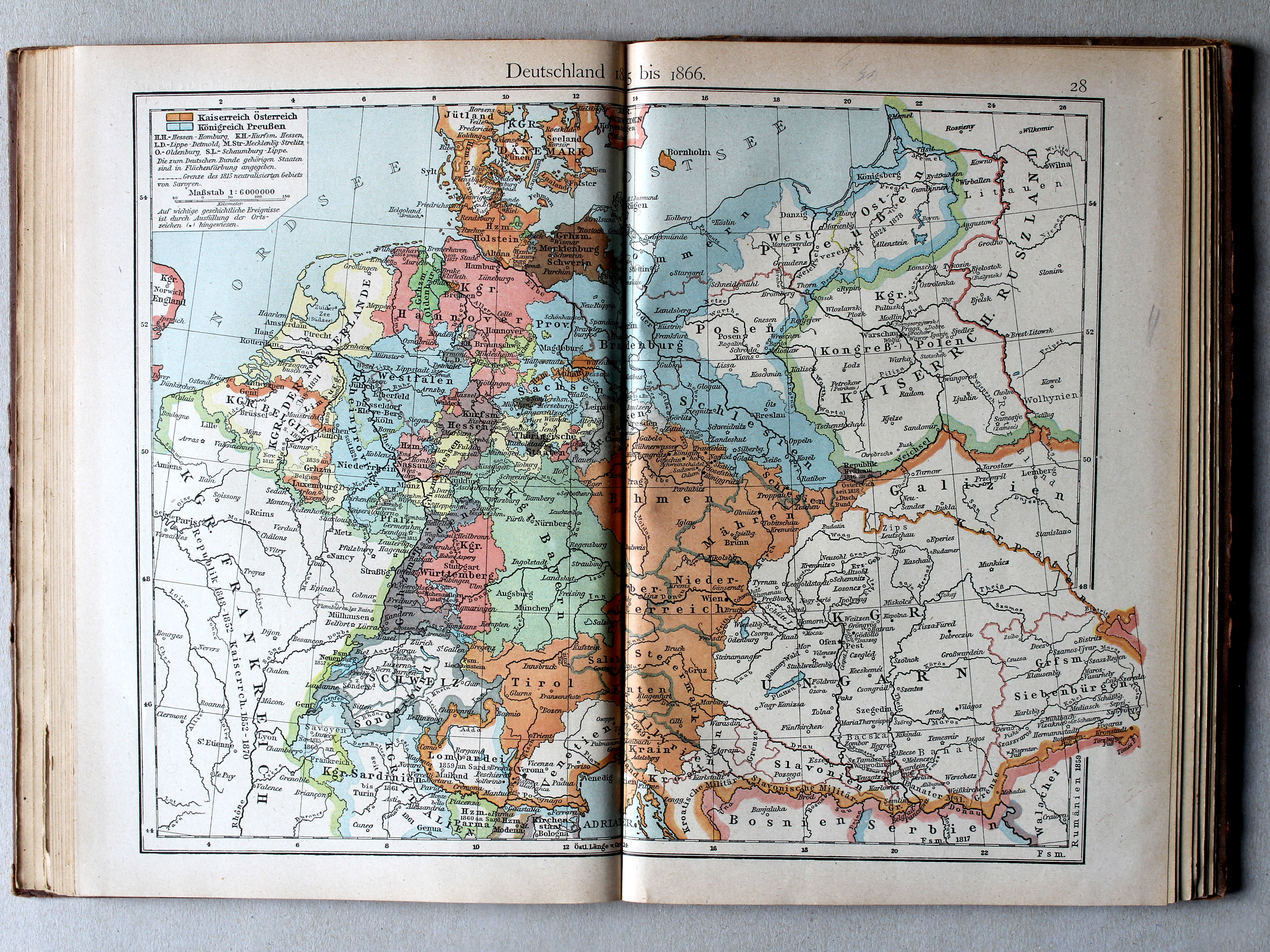
28. Deutschland 1815 bis 1866 XL
Duitsland 1815-1866 / Germany 1815-1866
 Putzgers Historischer Schul-Atlas, 1922
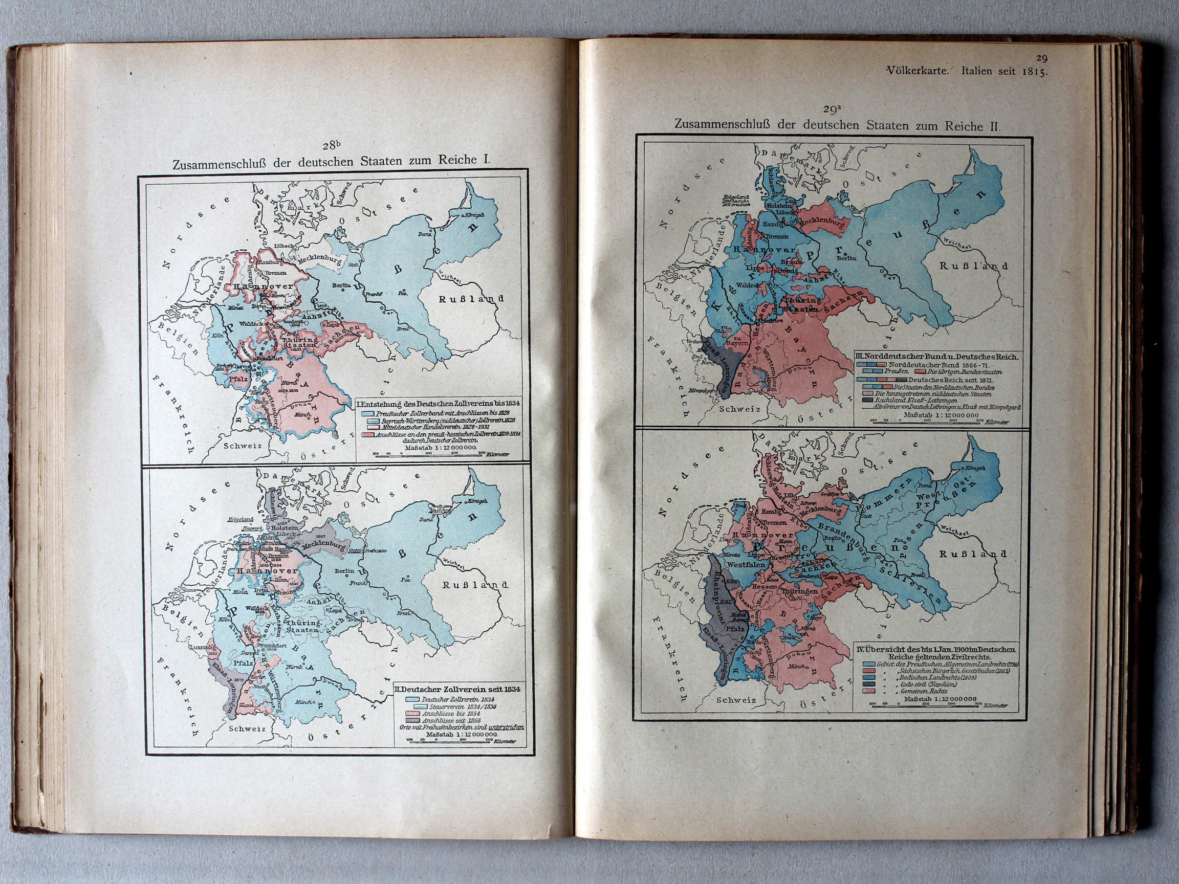
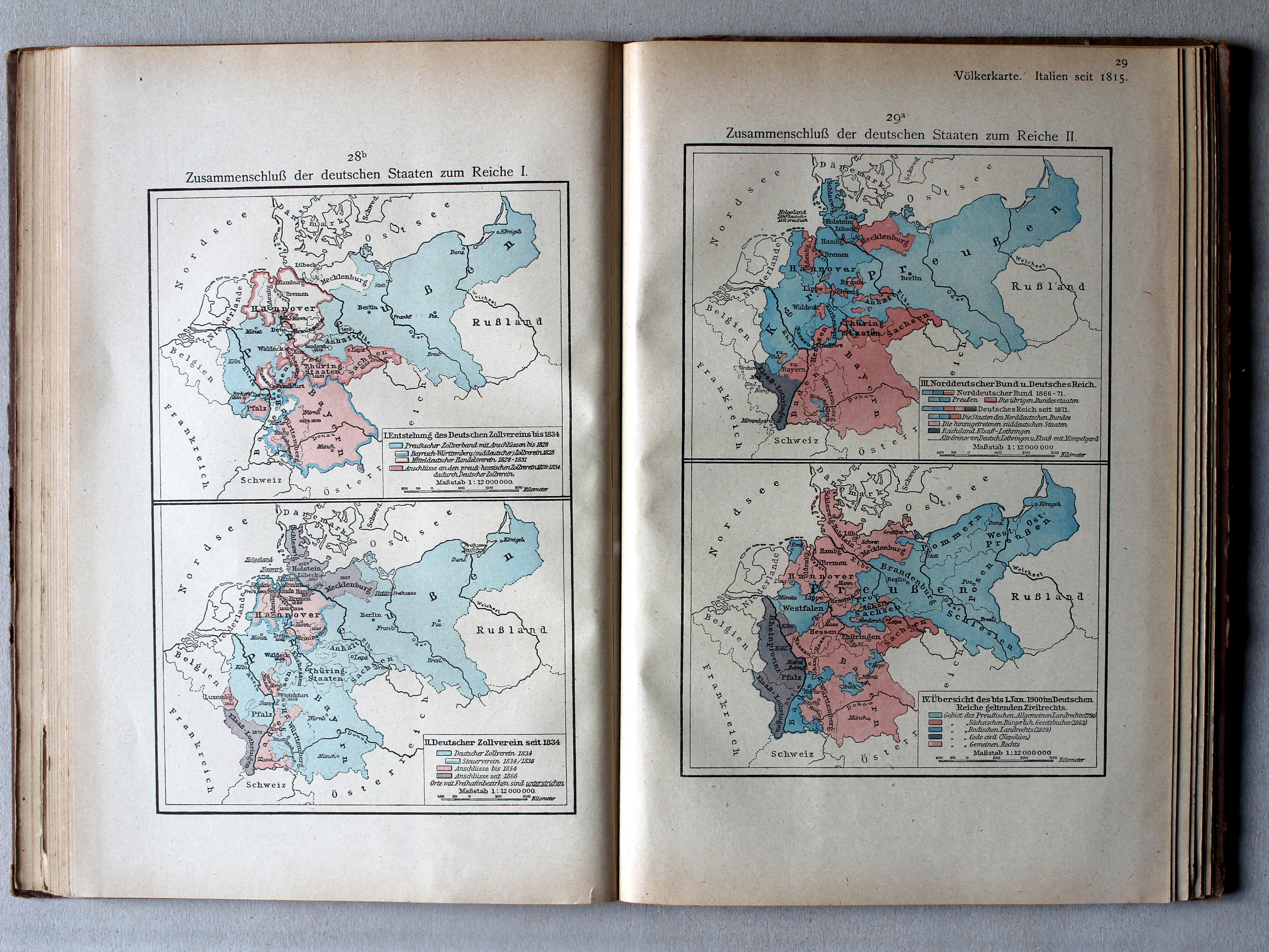
28b. Zusammenschluß der deutschen Staaten zum Reiche I XL
Duitse eenwording I / German unification I
29a. Zusammenschluß der deutschen Staaten zum Reiche II XL
Duitse eenwording II / German unification II
 Putzgers Historischer Schul-Atlas, 1922
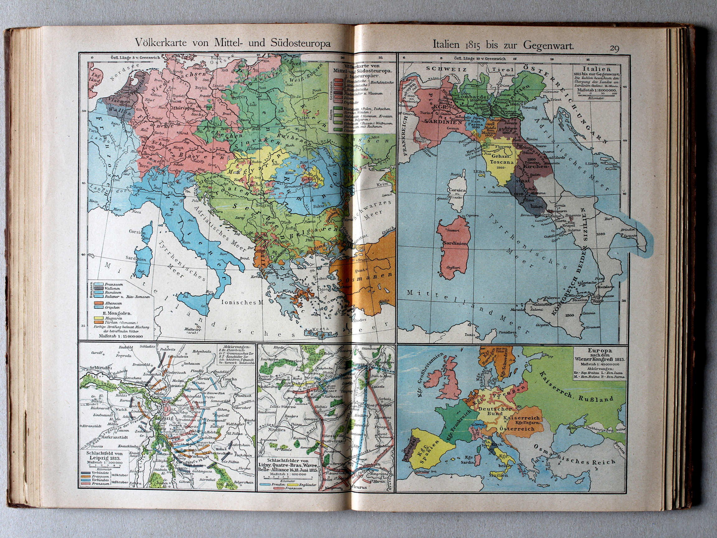
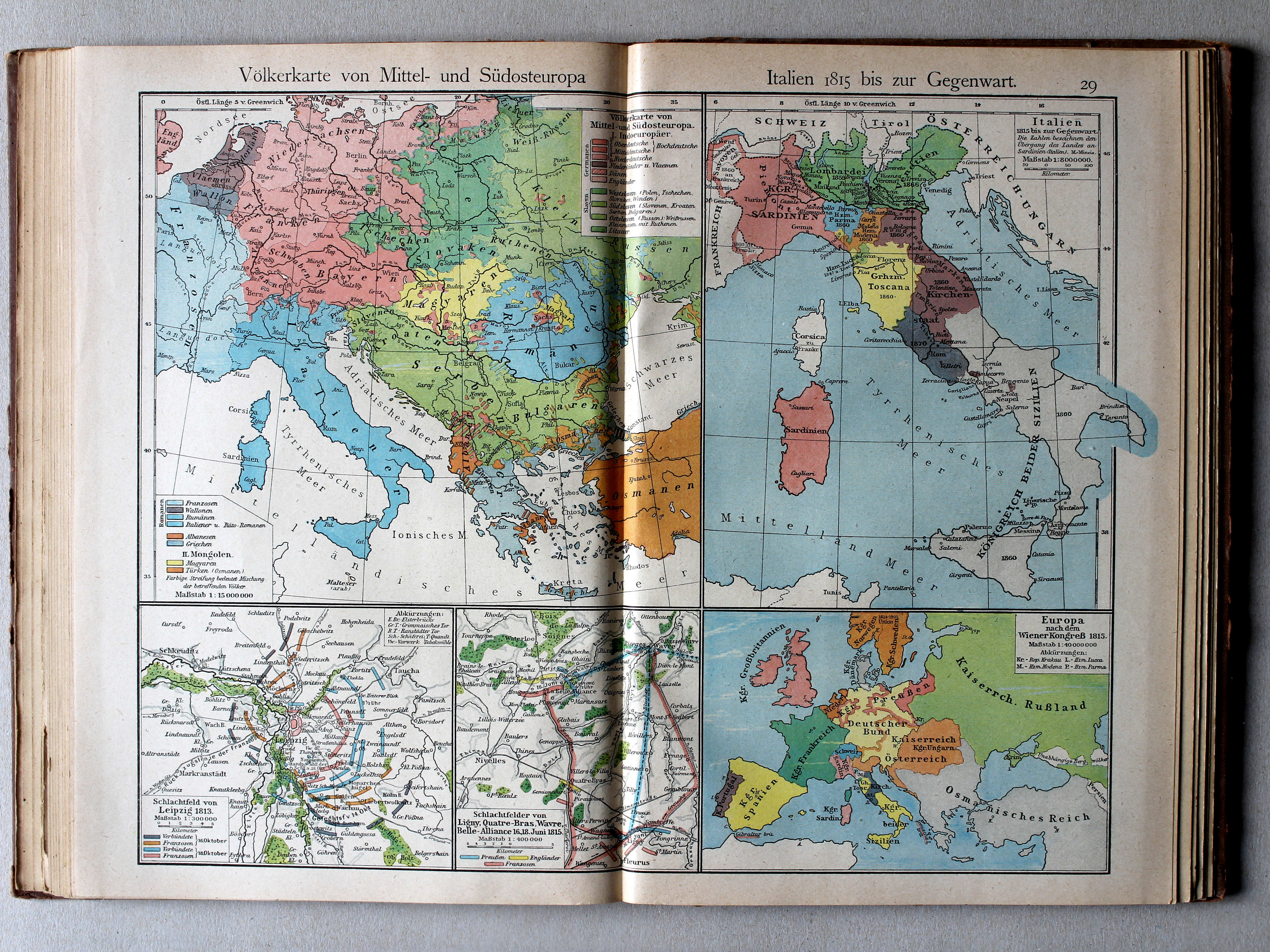
29. Völkerkarte von Mittel und Südost-Europa. Italien 1815 bis zur Gegenwart XL
Etnografische kaart van Midden- en Zuidoost Europa. Italië van 1815 tot heden / Ethnographic map of Central and Southeastern Europe. Italy from 1815 until today
 Putzgers Historischer Schul-Atlas, 1922
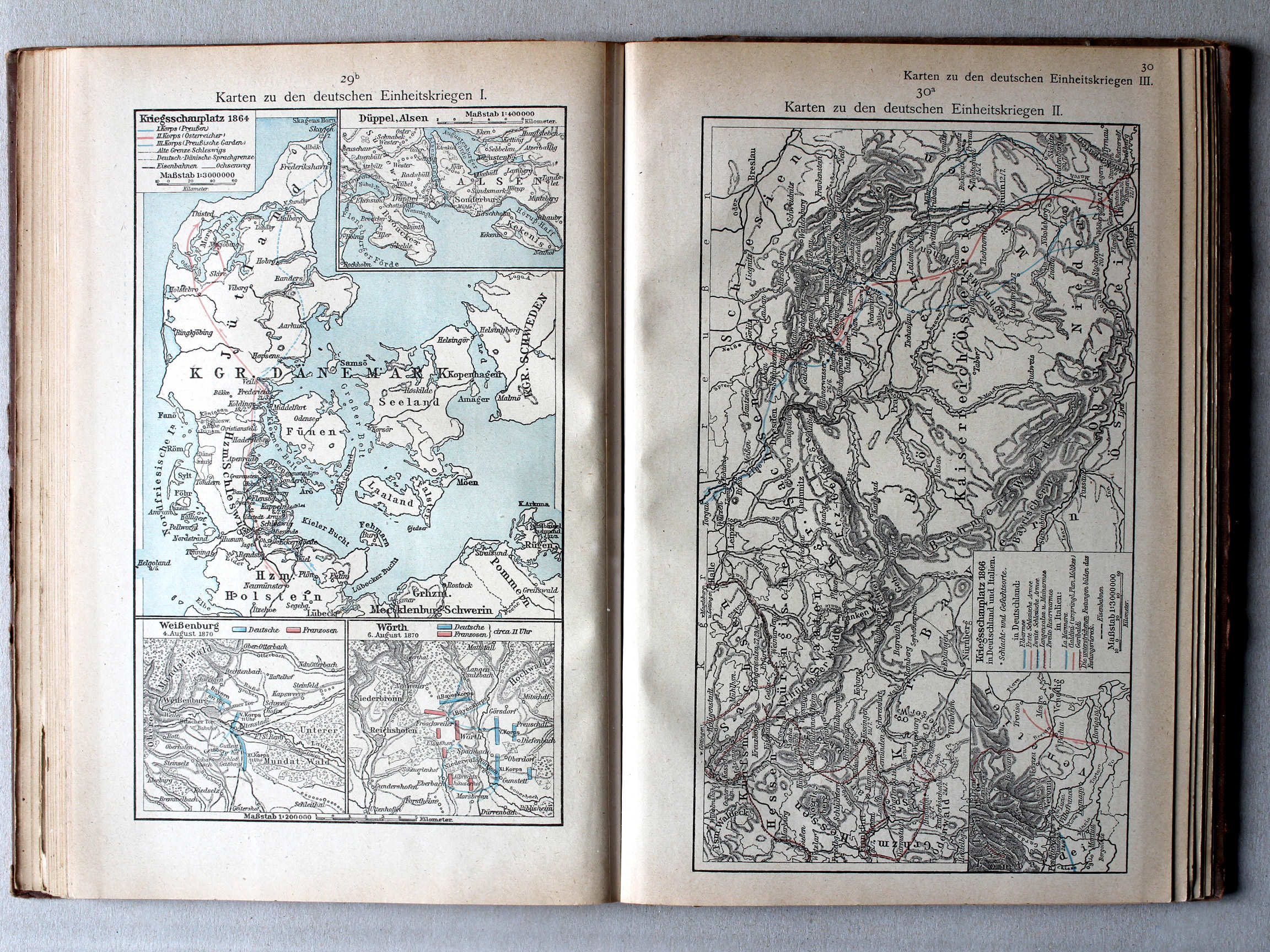
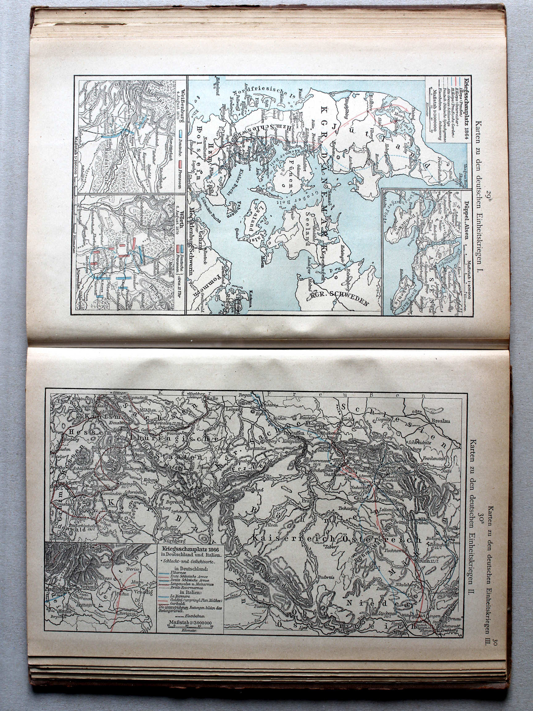
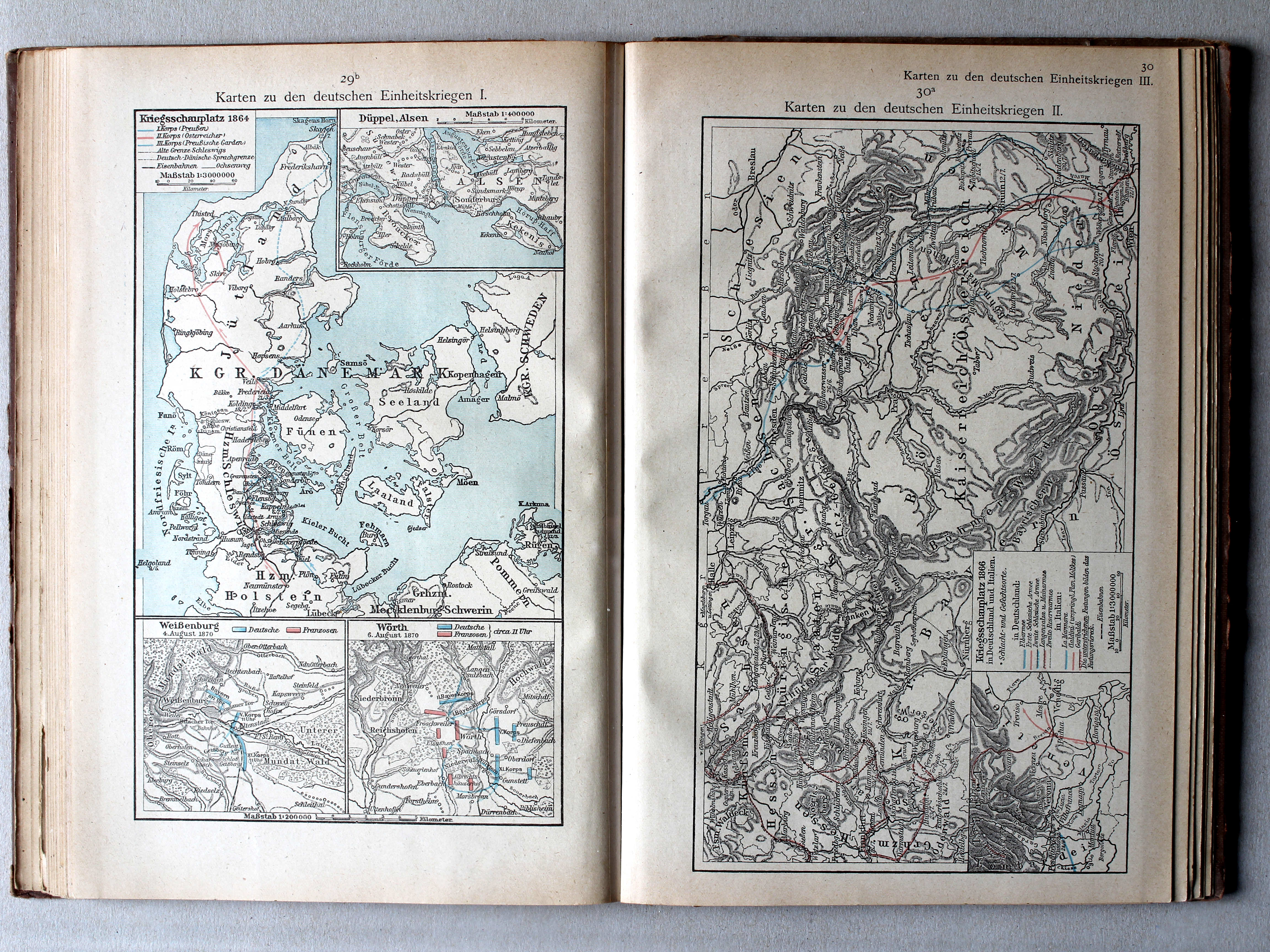
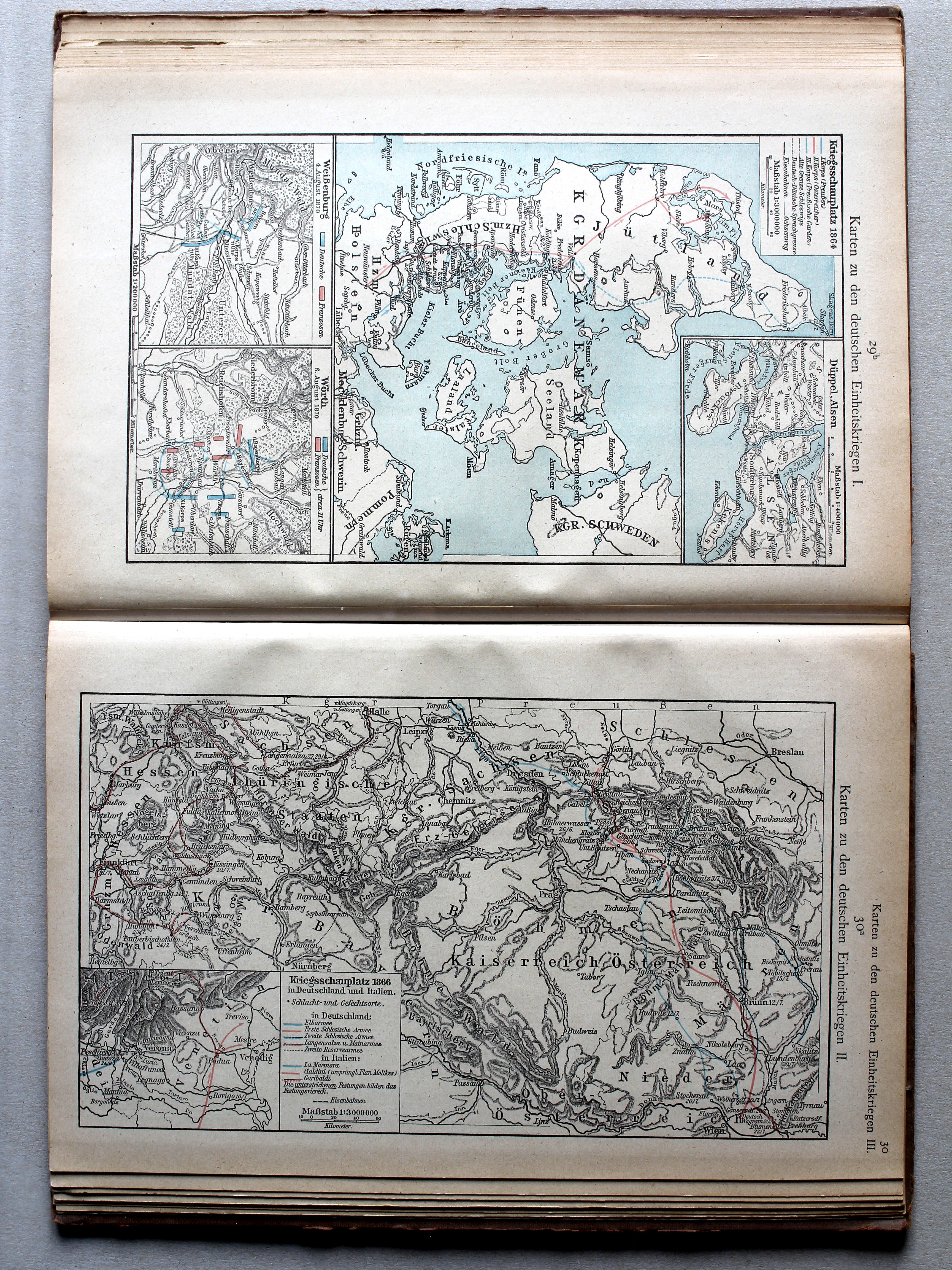
29b. Karten zu den deutschen Einheitskriegen I XL
Kaarten bij de Duitse eenwording I / Maps to the German unification I
 Putzgers Historischer Schul-Atlas, 1922
30a. Karten zu den deutschen Einheitskriegen II XL
Kaarten bij de Duitse eenwording II / Maps to the German unification II
 Putzgers Historischer Schul-Atlas, 1922
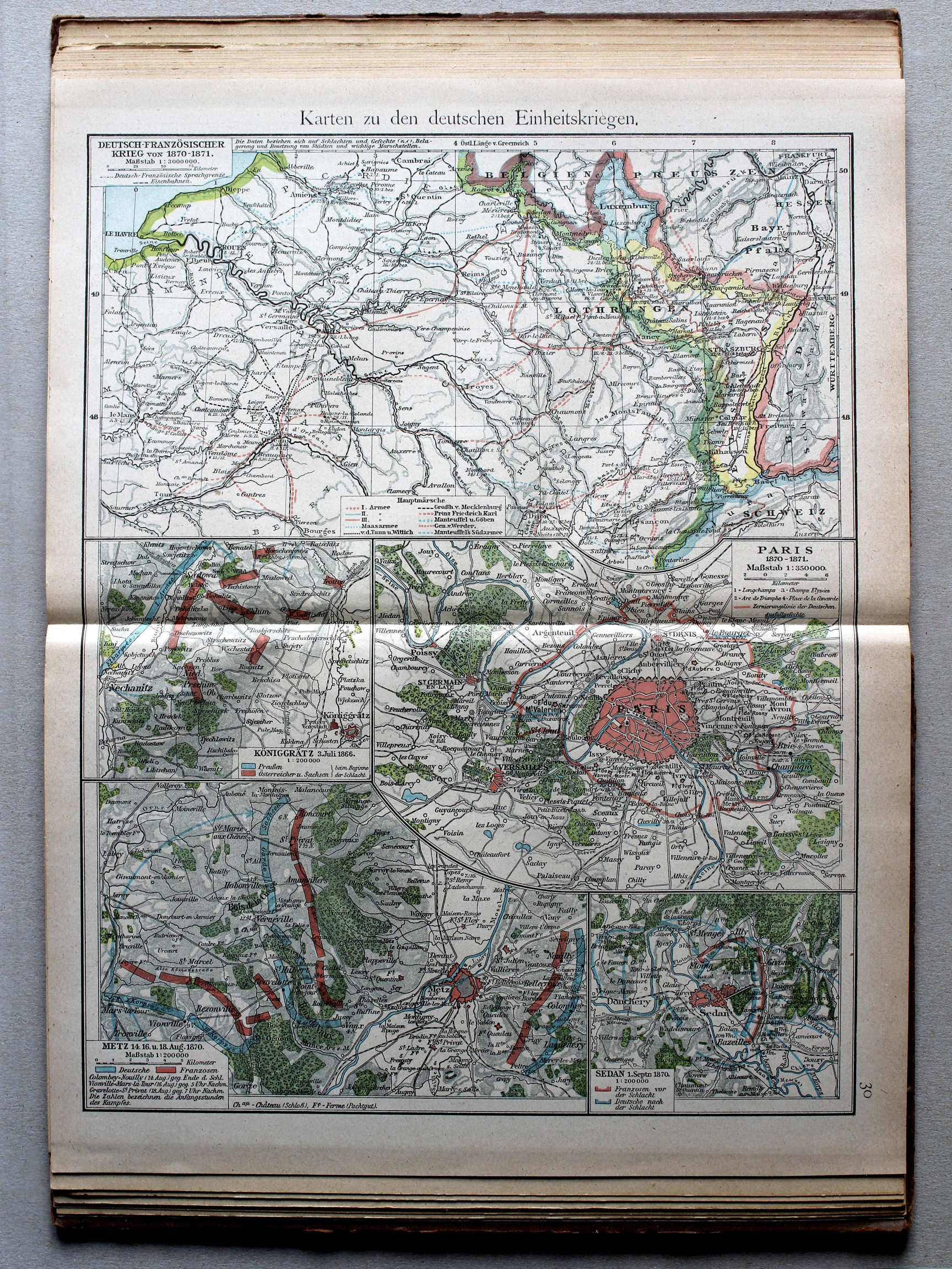
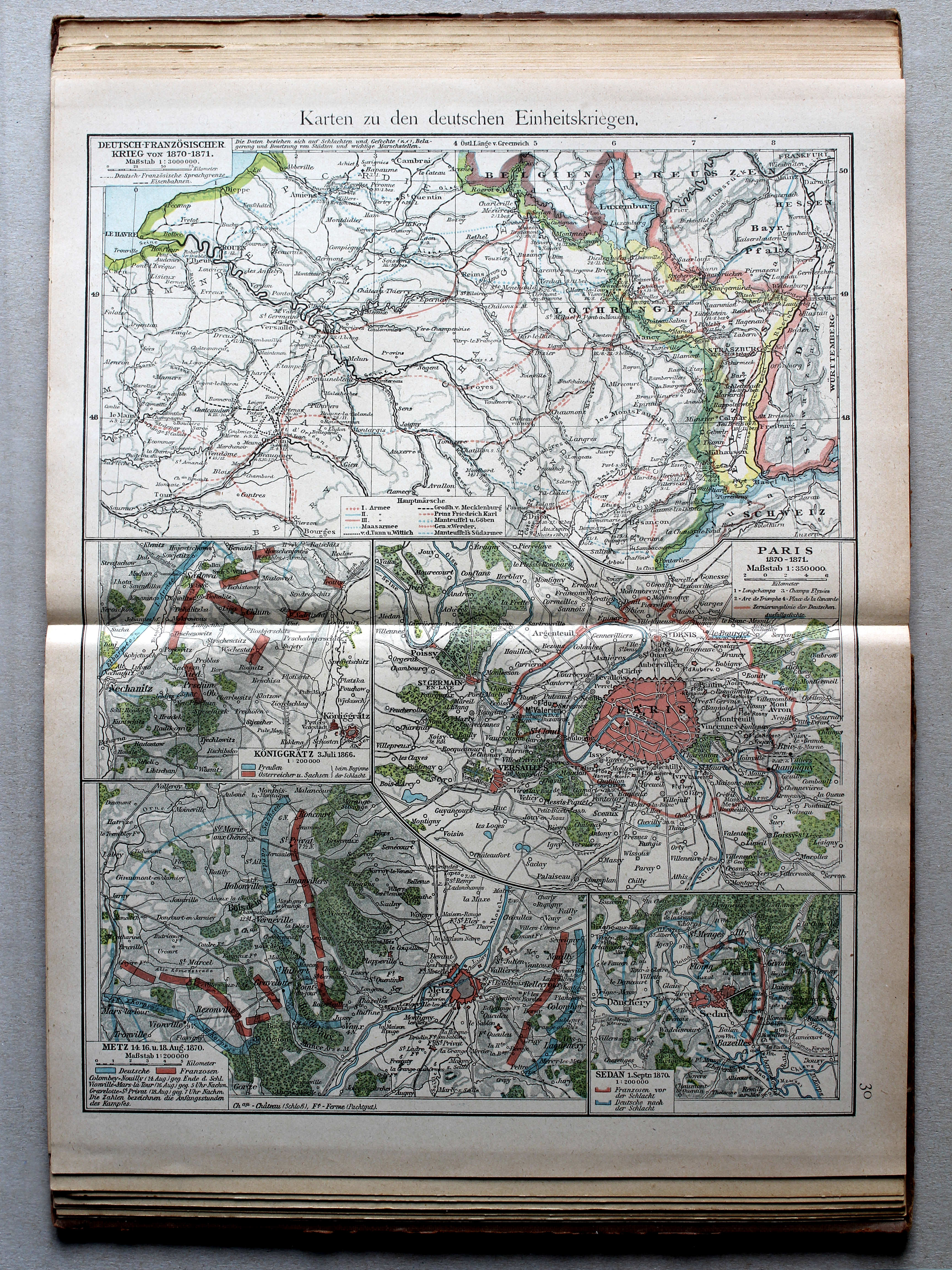
30. Karten zu den deutschen Einheitskriegen XL
Kaarten bij de Duitse eenwording / Maps to the German unification
 Putzgers Historischer Schul-Atlas, 1922
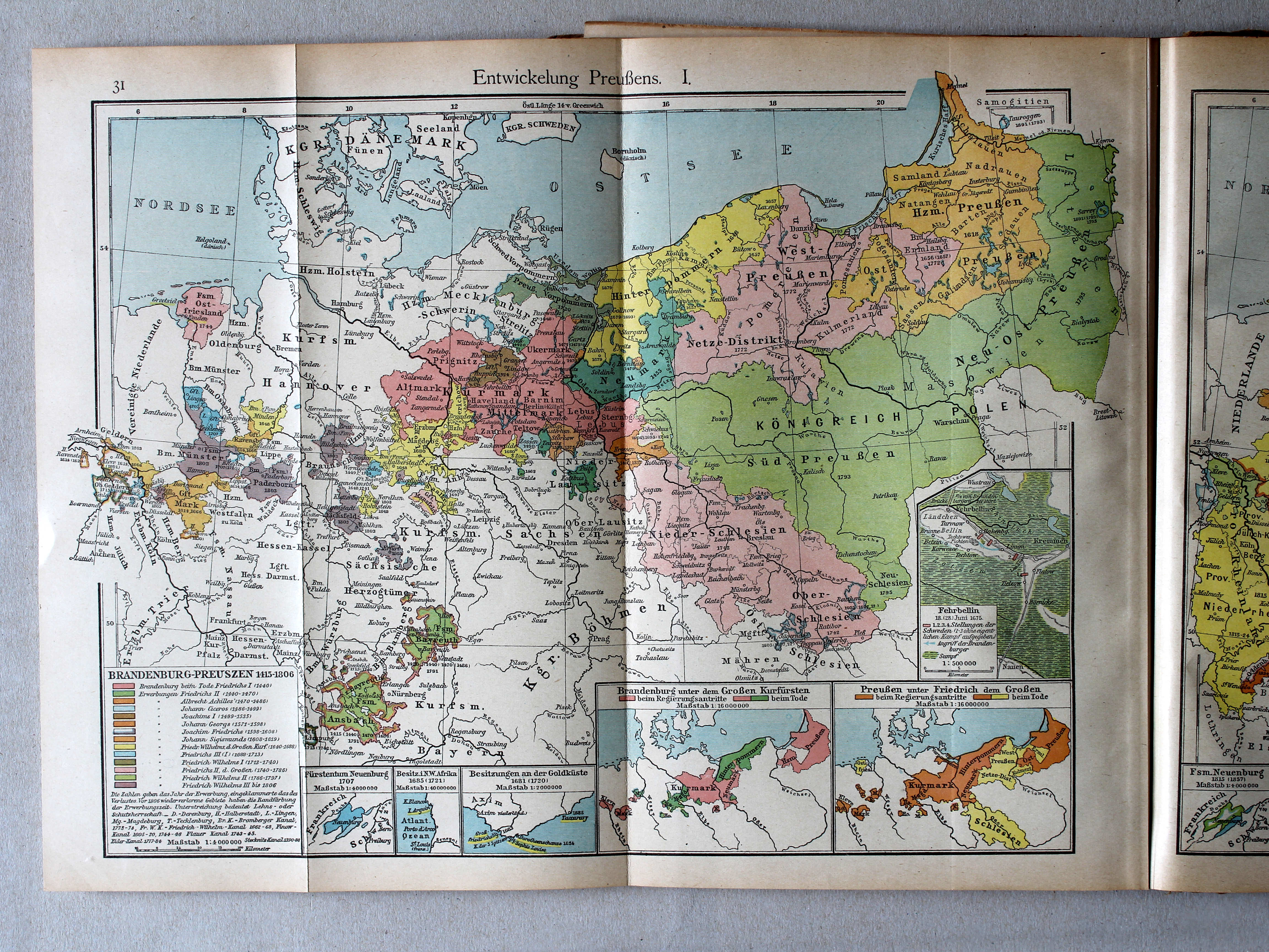
31. Entwickelung Preußens. I XL
Ontwikkeling van Pruisen I / Development of Prussia I
 Putzgers Historischer Schul-Atlas, 1922
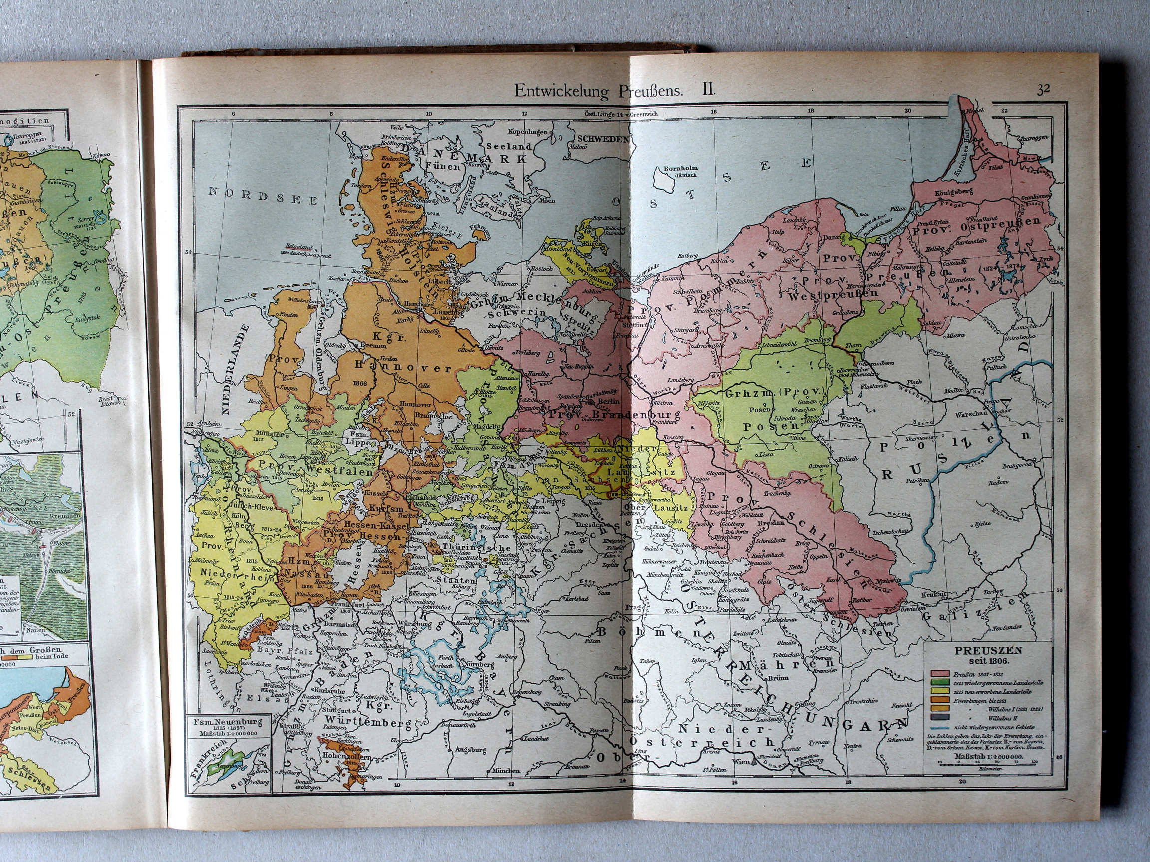
32. Entwickelung Preußens. II XL
Ontwikkeling van Pruisen II / Development of Prussia II
 Putzgers Historischer Schul-Atlas, 1922
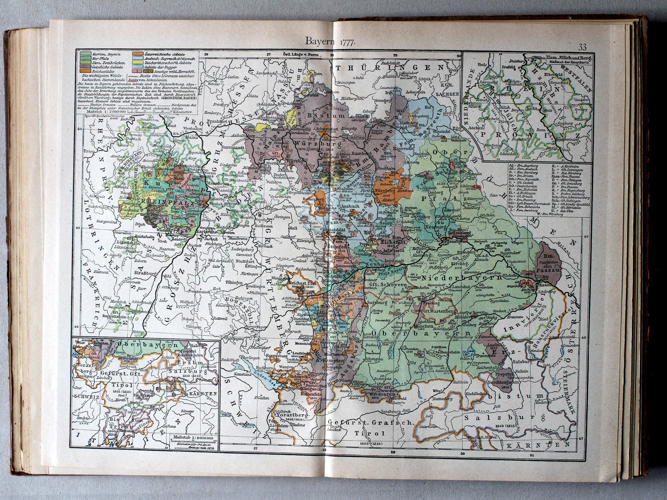
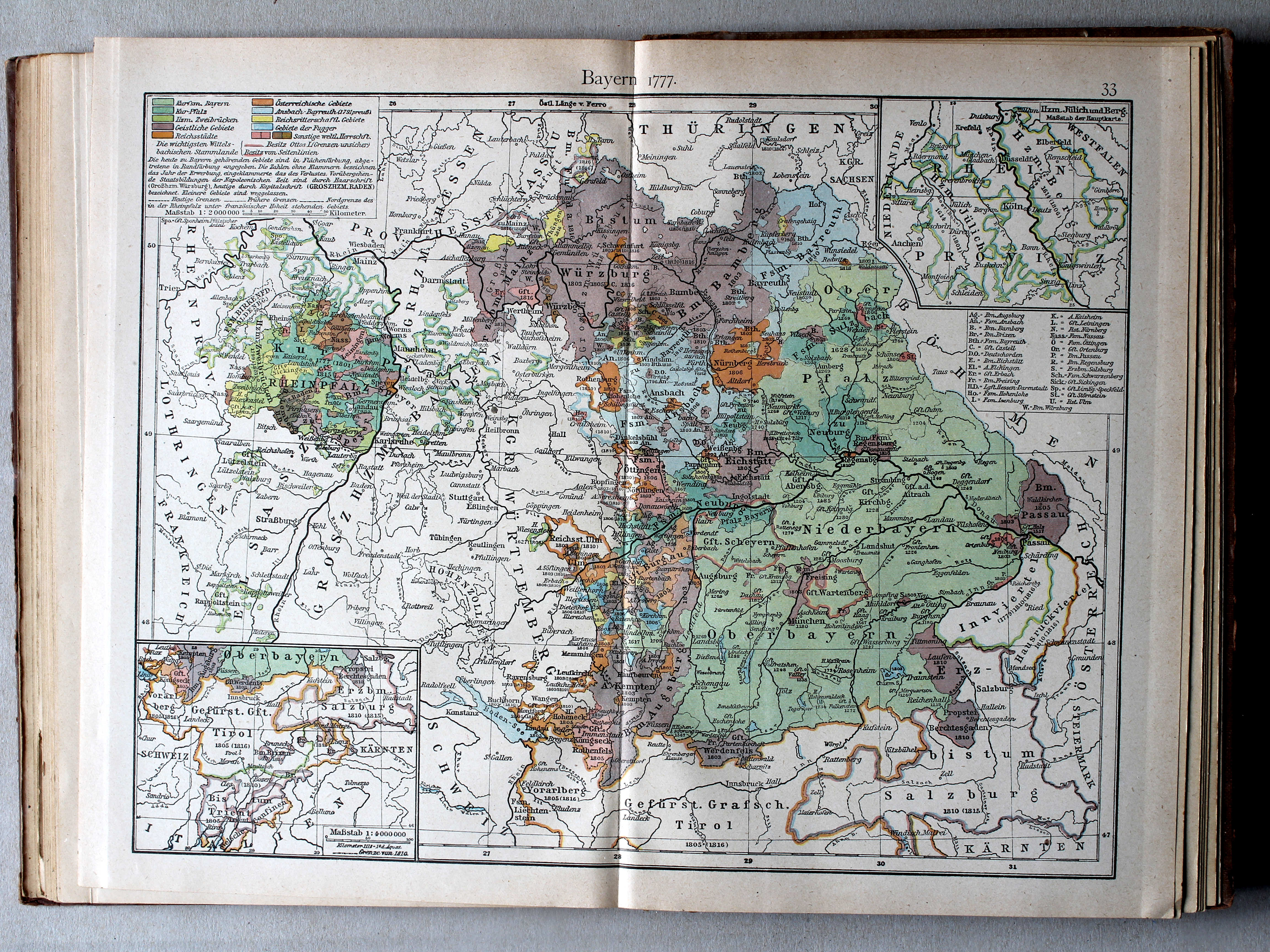
33. Bayern I: Bayern 1777 XL
Beieren I: Beieren 1777 / Bavaria I: Bavaria 1777
 Putzgers Historischer Schul-Atlas, 1922
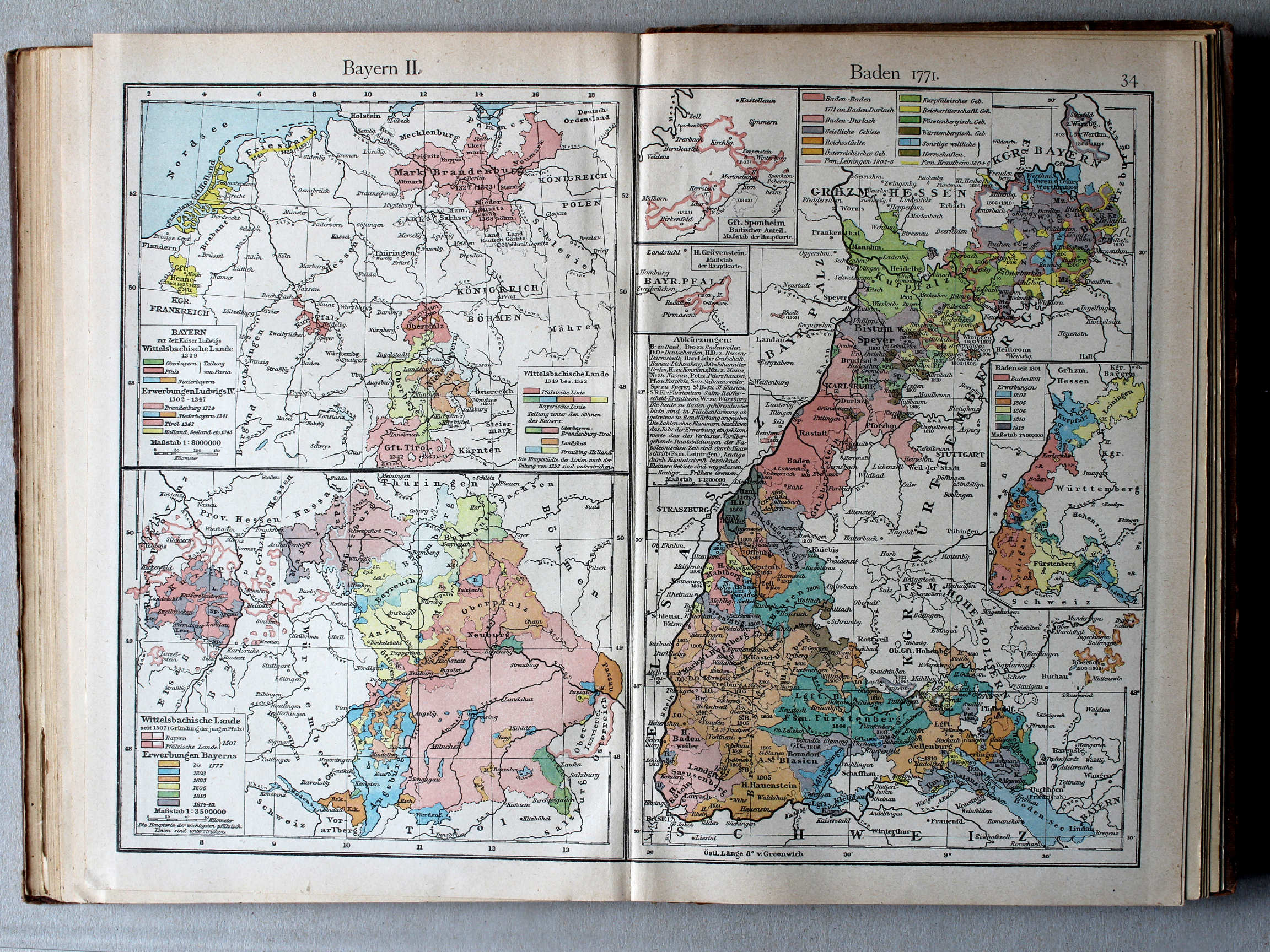
34. Bayern II. Baden 1771 XL
Beieren II, Baden 1771 / Bavaria II, Baden 1771
 Putzgers Historischer Schul-Atlas, 1922
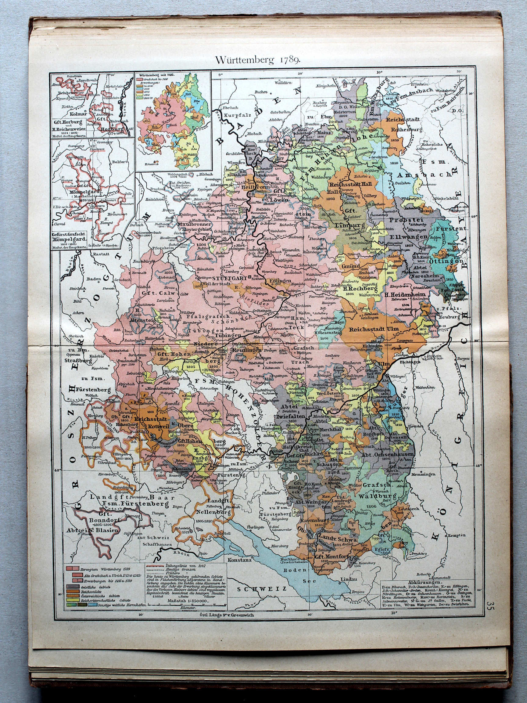
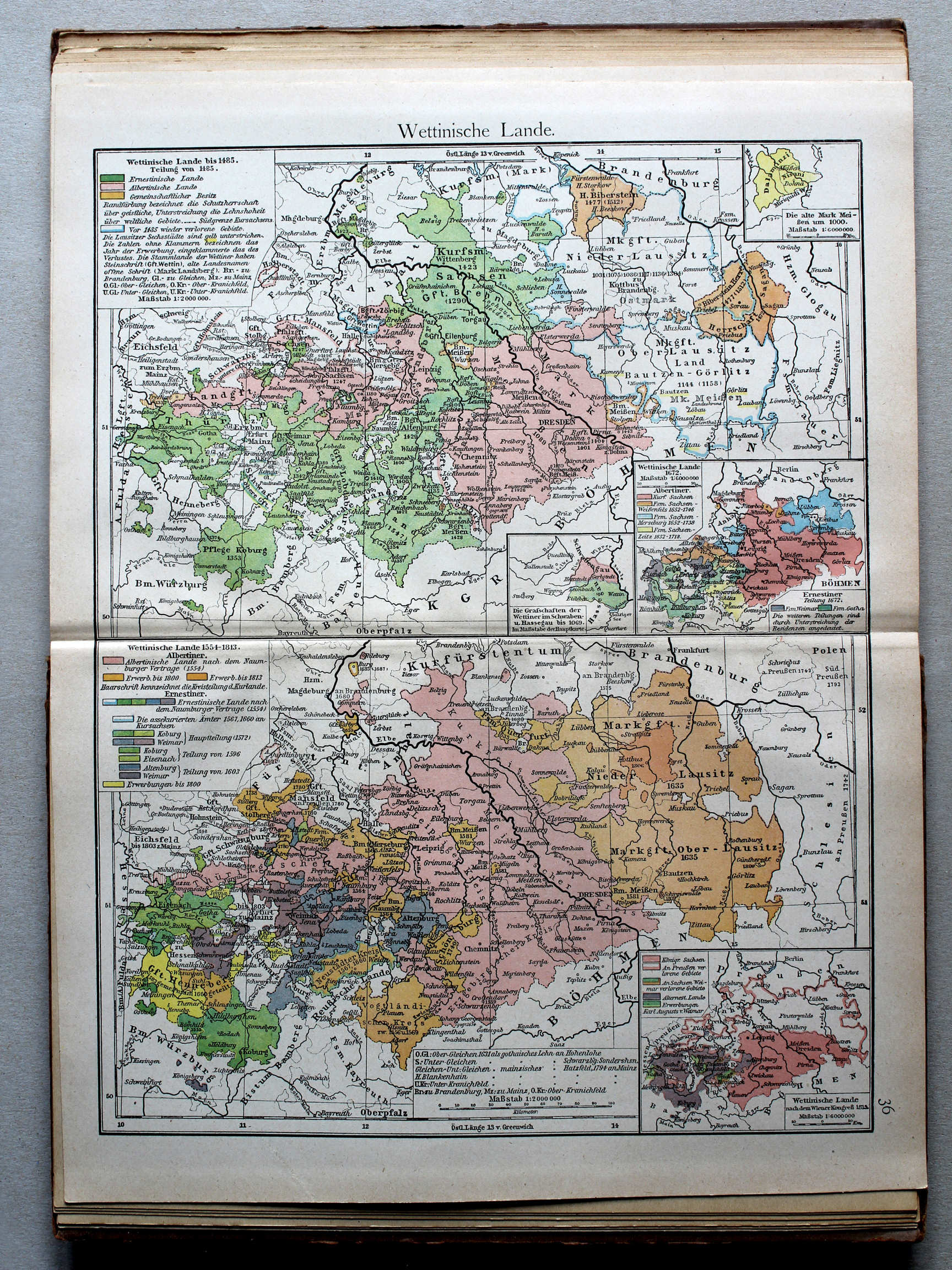
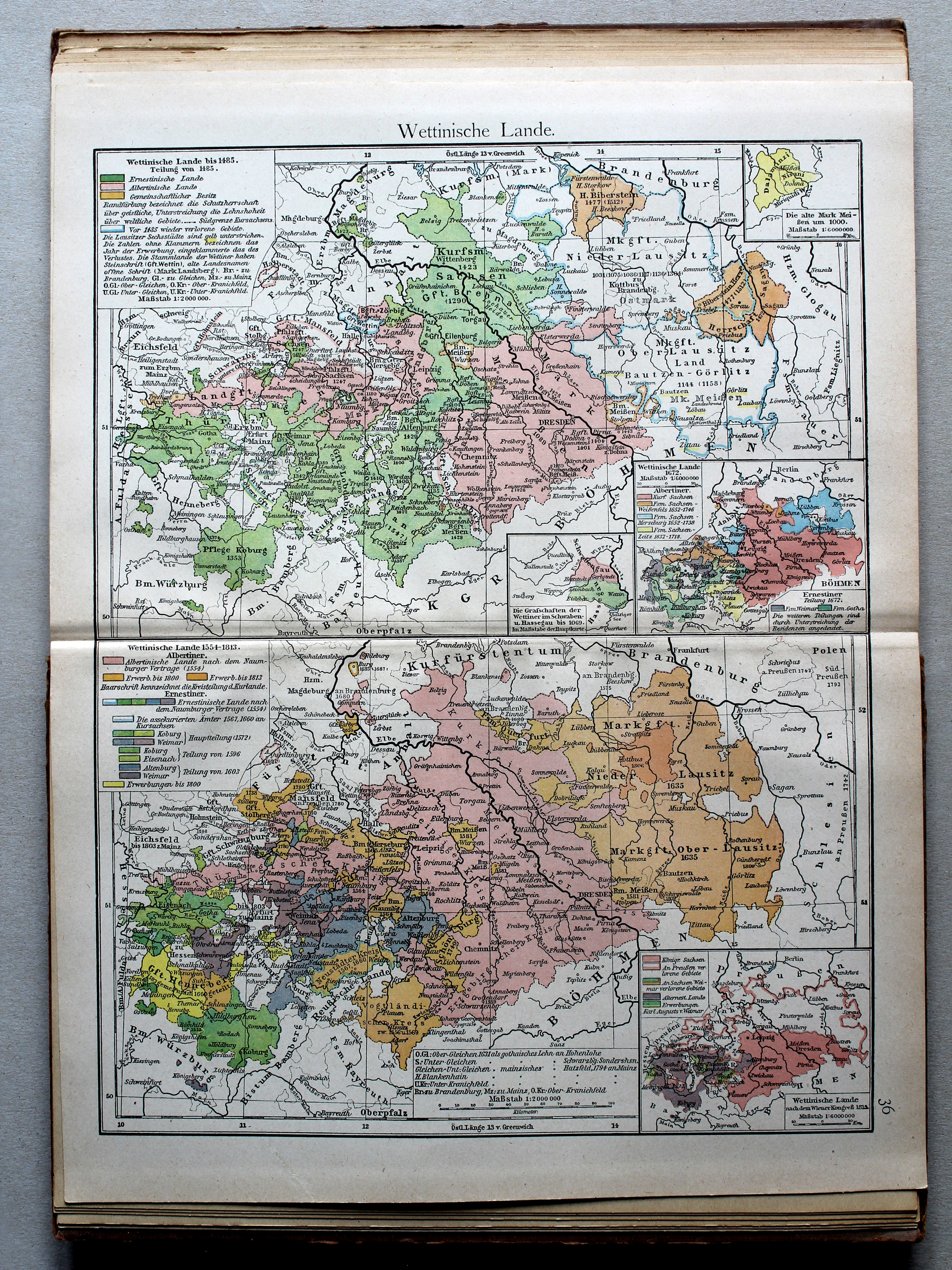
36. Wettinische Lande XL
Het gebied van het Huis Wettin / The lands of the House of Wettin
 Putzgers Historischer Schul-Atlas, 1922
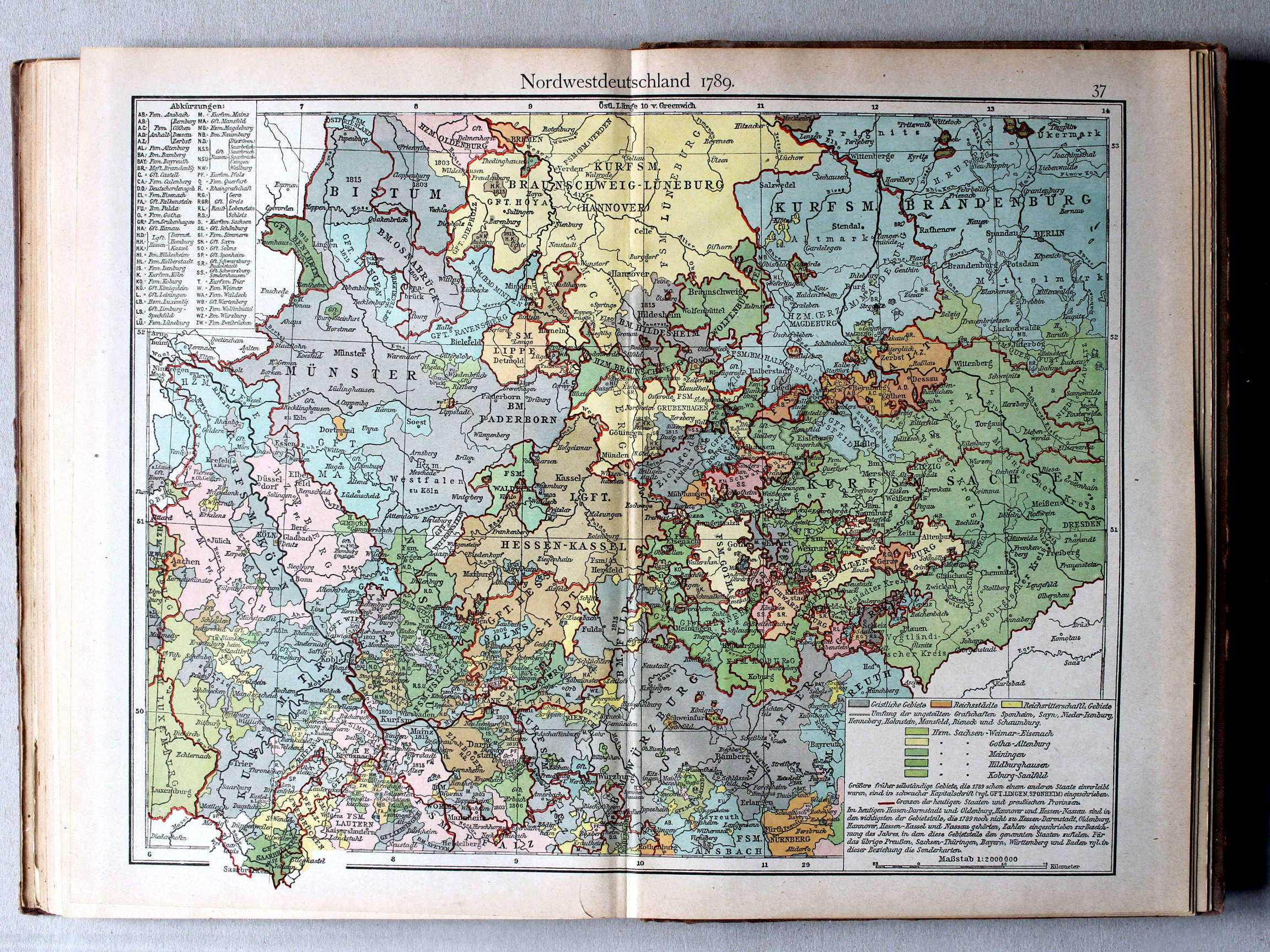
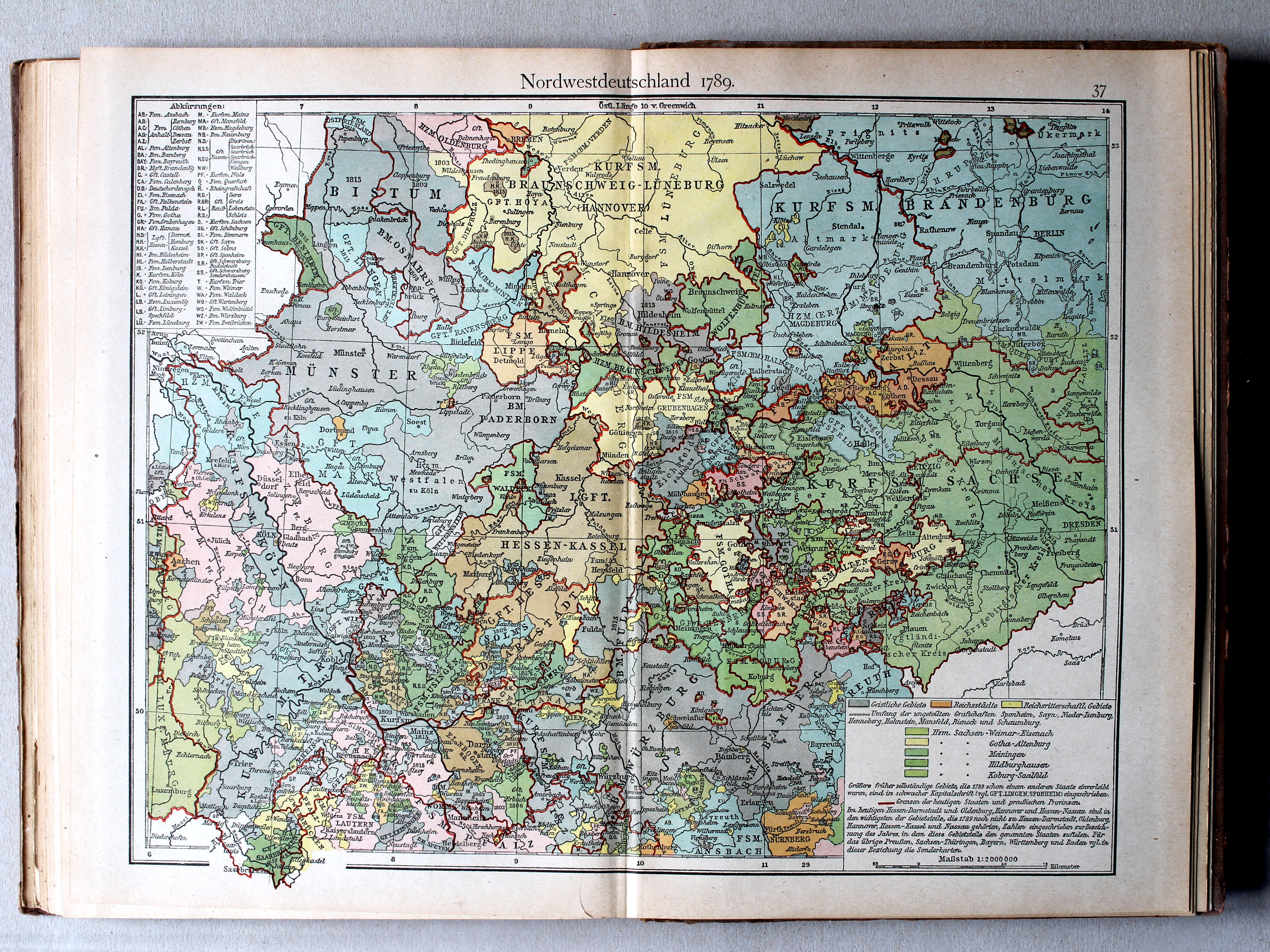
37. Nordwestdeutschland 1789 XL
Noordwest-Duitsland 1789 / Northwest Germany 1789
 Putzgers Historischer Schul-Atlas, 1922
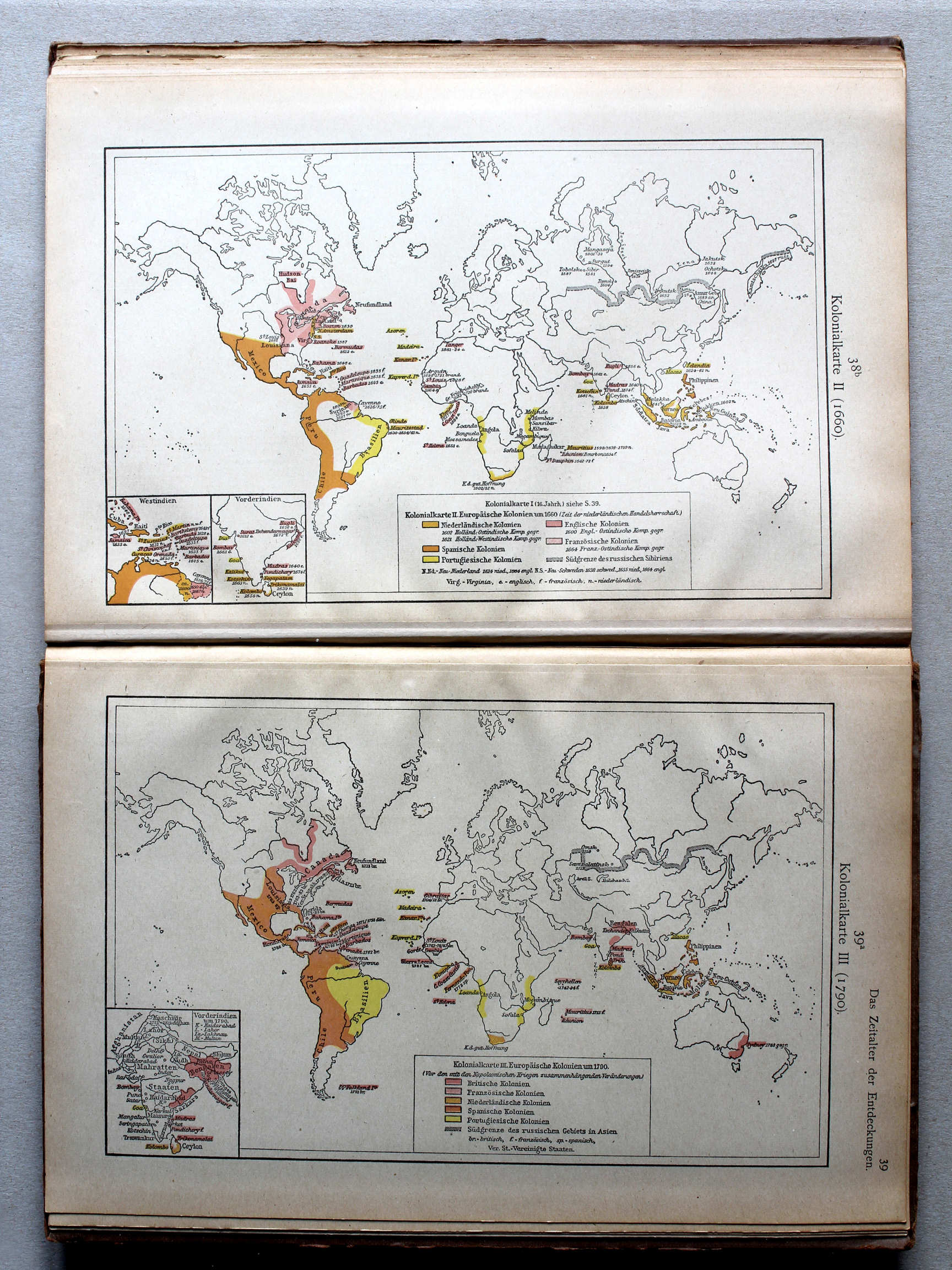
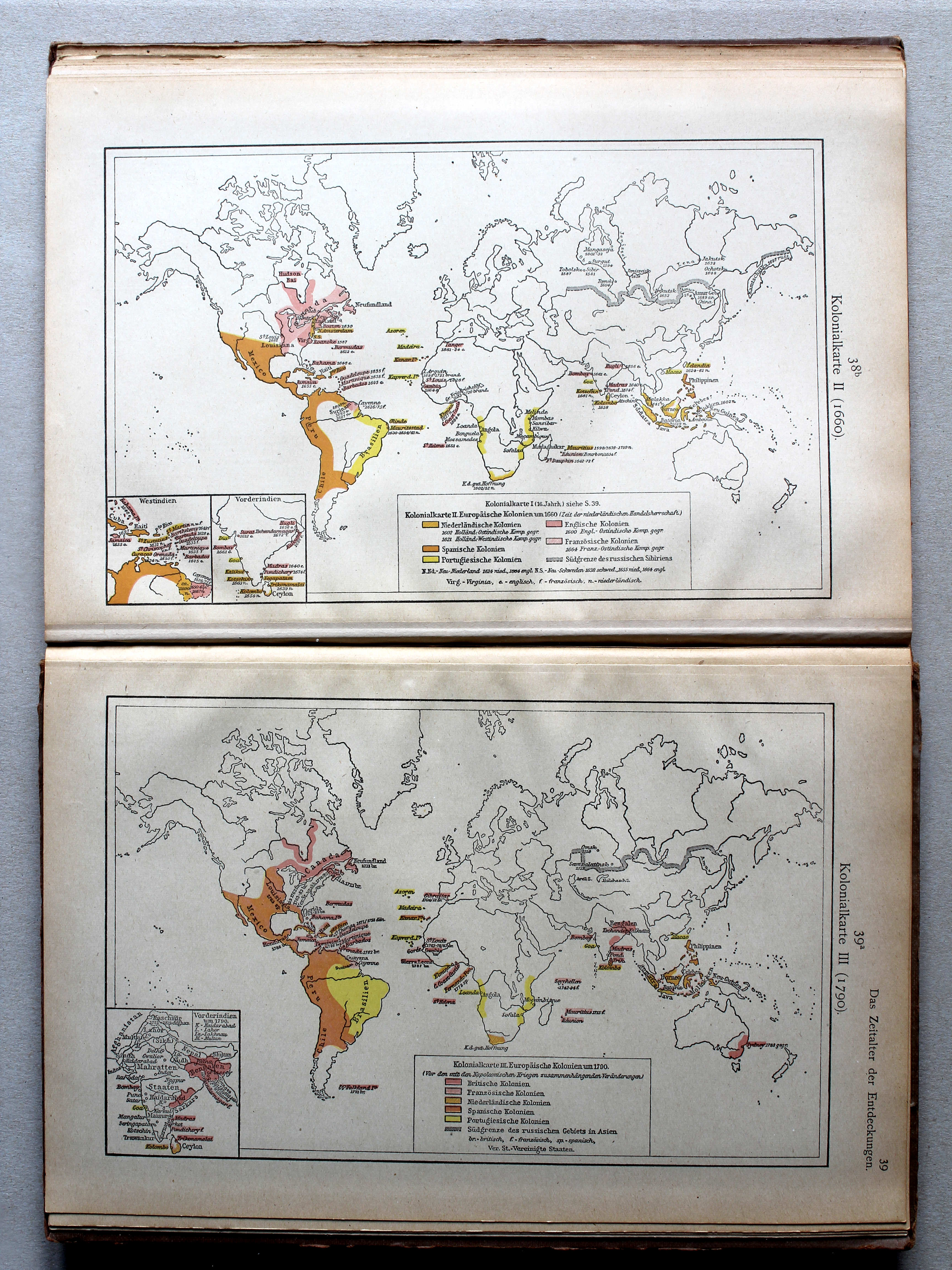
38b. Kolonialkarte II (1660) XL
Koloniën II (1660) / Colonies II (1660)
39a. Kolonialkarte III (1790) XL
Koloniën III (1790) / Colonies III (1790)
 Putzgers Historischer Schul-Atlas, 1922
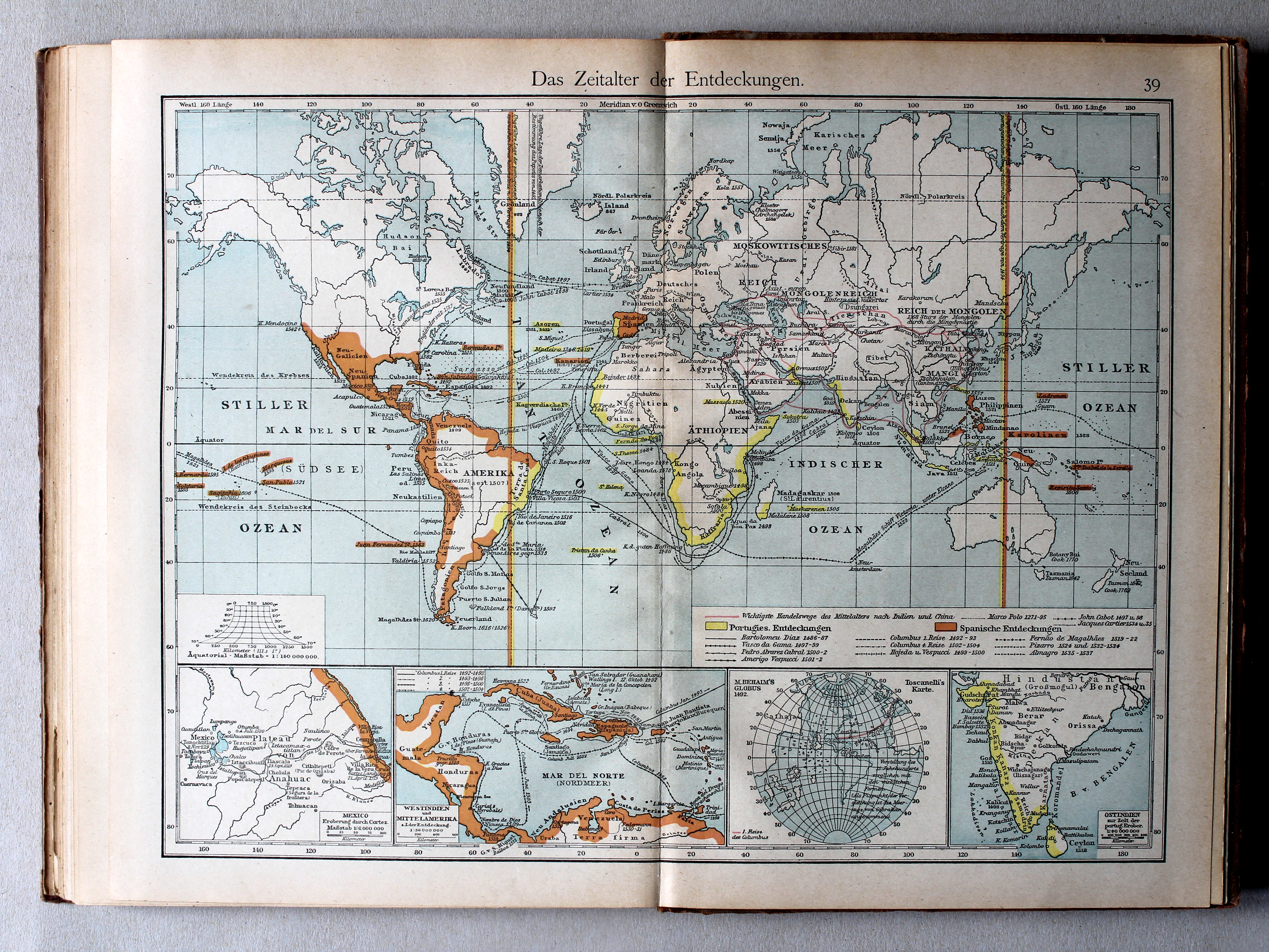
39. Das Zeitalter der Entdeckungen XL
Het tijdperk van de grote ontdekkingen / The Age of Discovery
 Putzgers Historischer Schul-Atlas, 1922
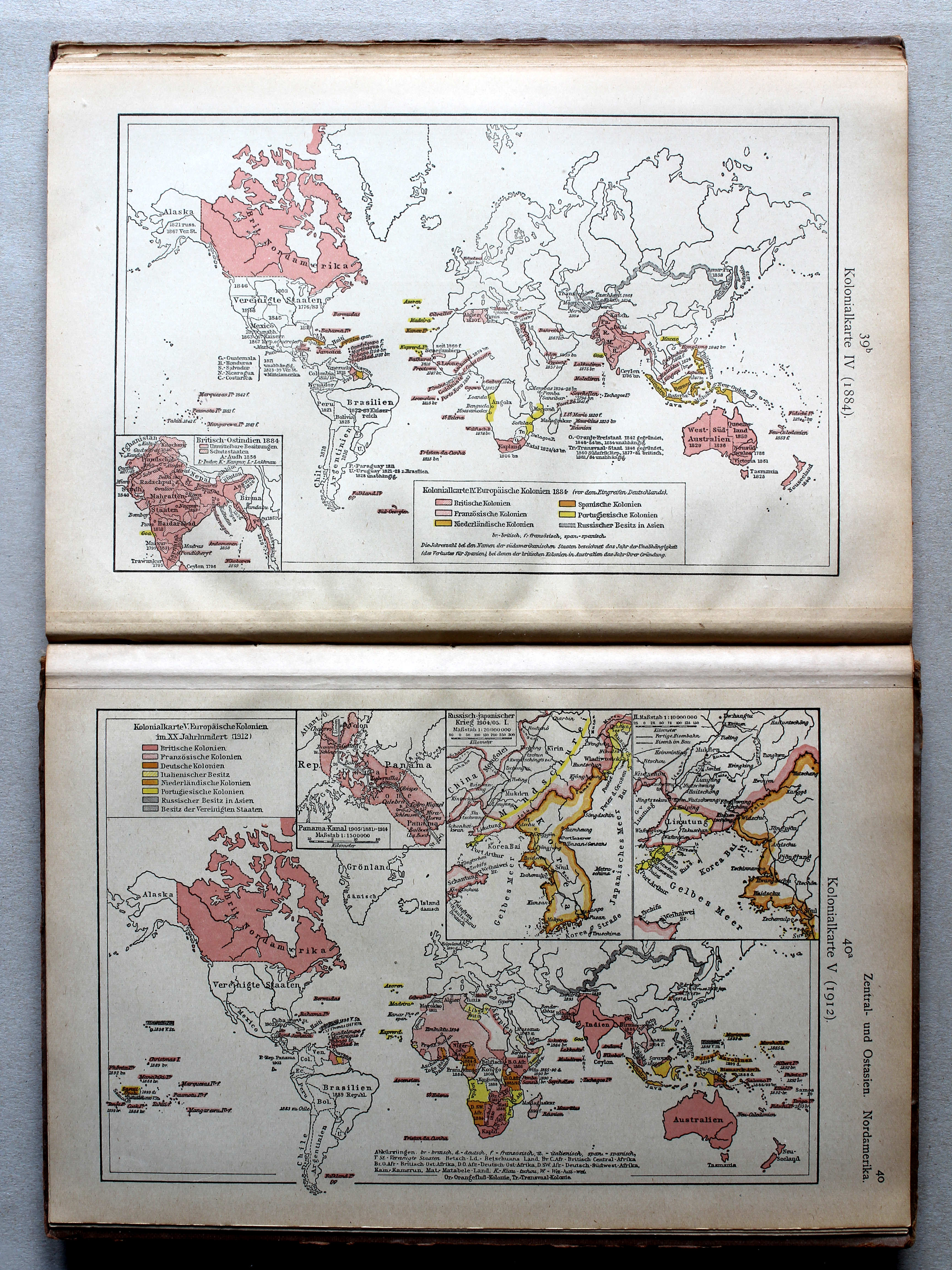
39b. Kolonialkarte IV (1884) XL
Koloniën IV (1884) / Colonies IV (1884)
40a. Kolonialkarte V (1912) XL
Koloniën V (1912) / Colonies V (1912)
 Putzgers Historischer Schul-Atlas, 1922
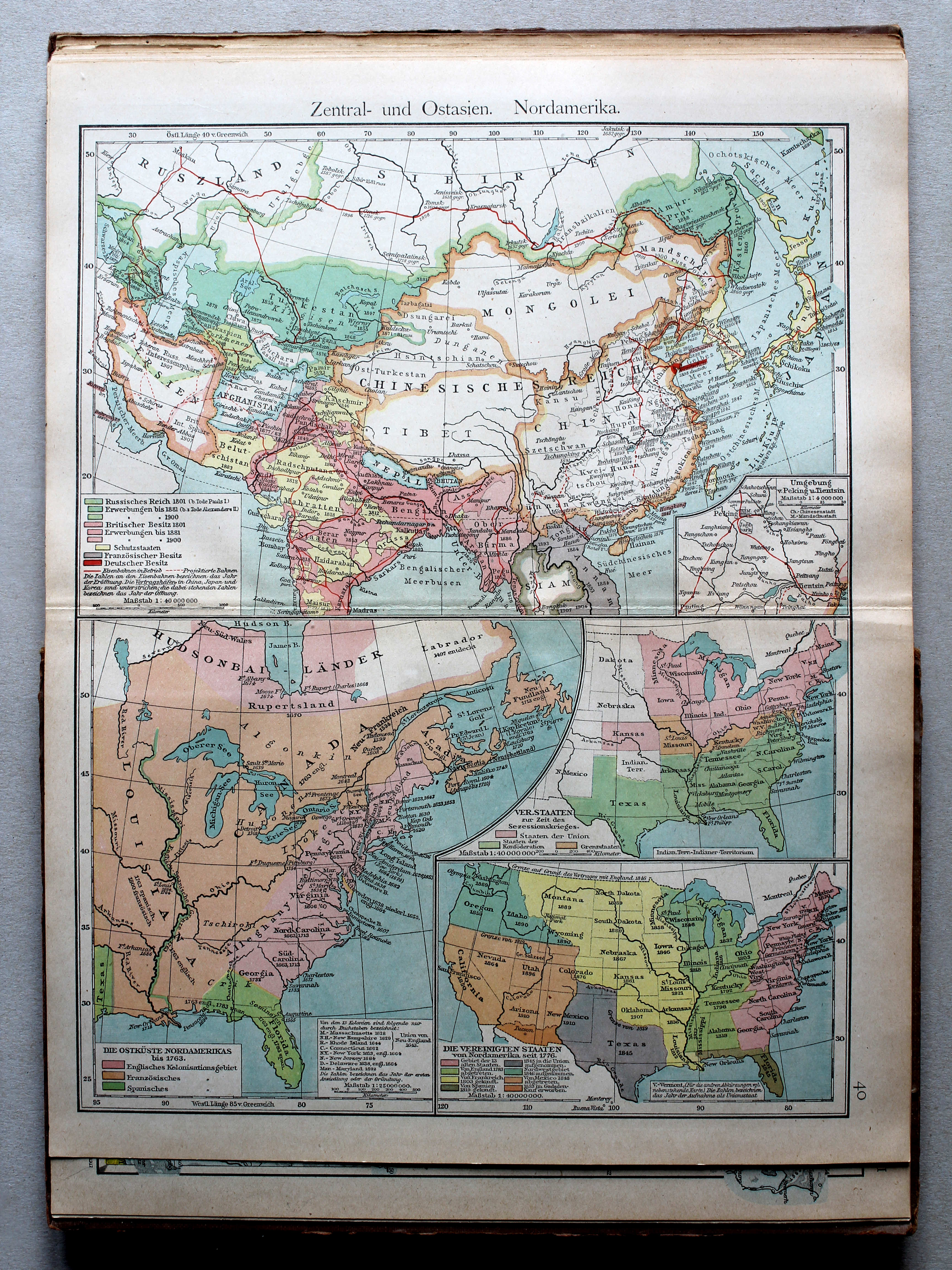
40. Zentral- und Ostasien. Nordamerika XL
Centraal- en Oost-Azië. Noord-Amerika / Central and East Asia. North America
 Putzgers Historischer Schul-Atlas, 1922
40b. Aufteilung Afrikas XL
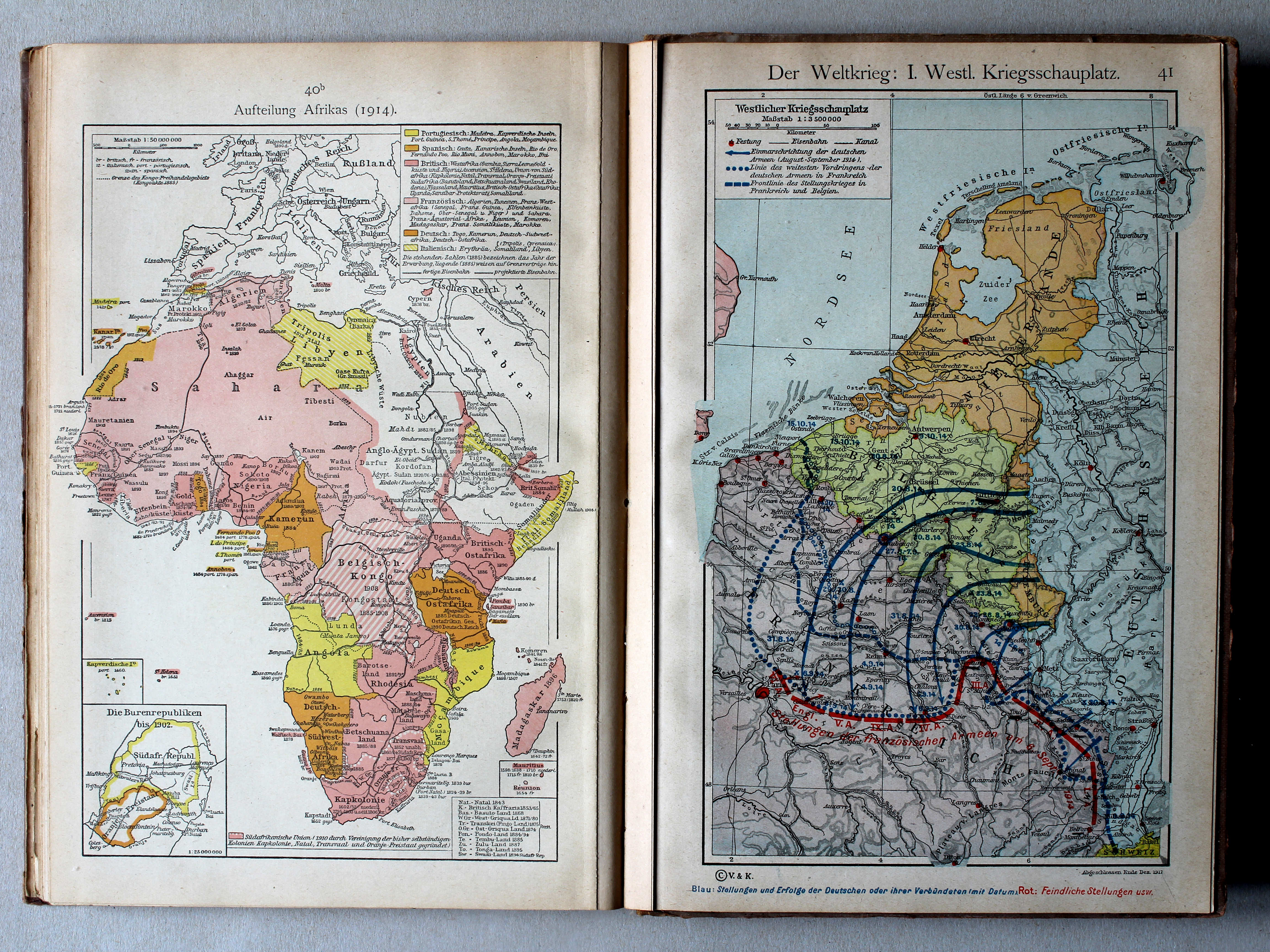
Opdeling van Afrika / Scramble for Africa
41. Der Weltkrieg: I. Westlicher Kriegsschauplatz XL
De Wereldoorlog I: Westelijk strijdtoneel / The World War I: Western theater of war
 Putzgers Historischer Schul-Atlas, 1922
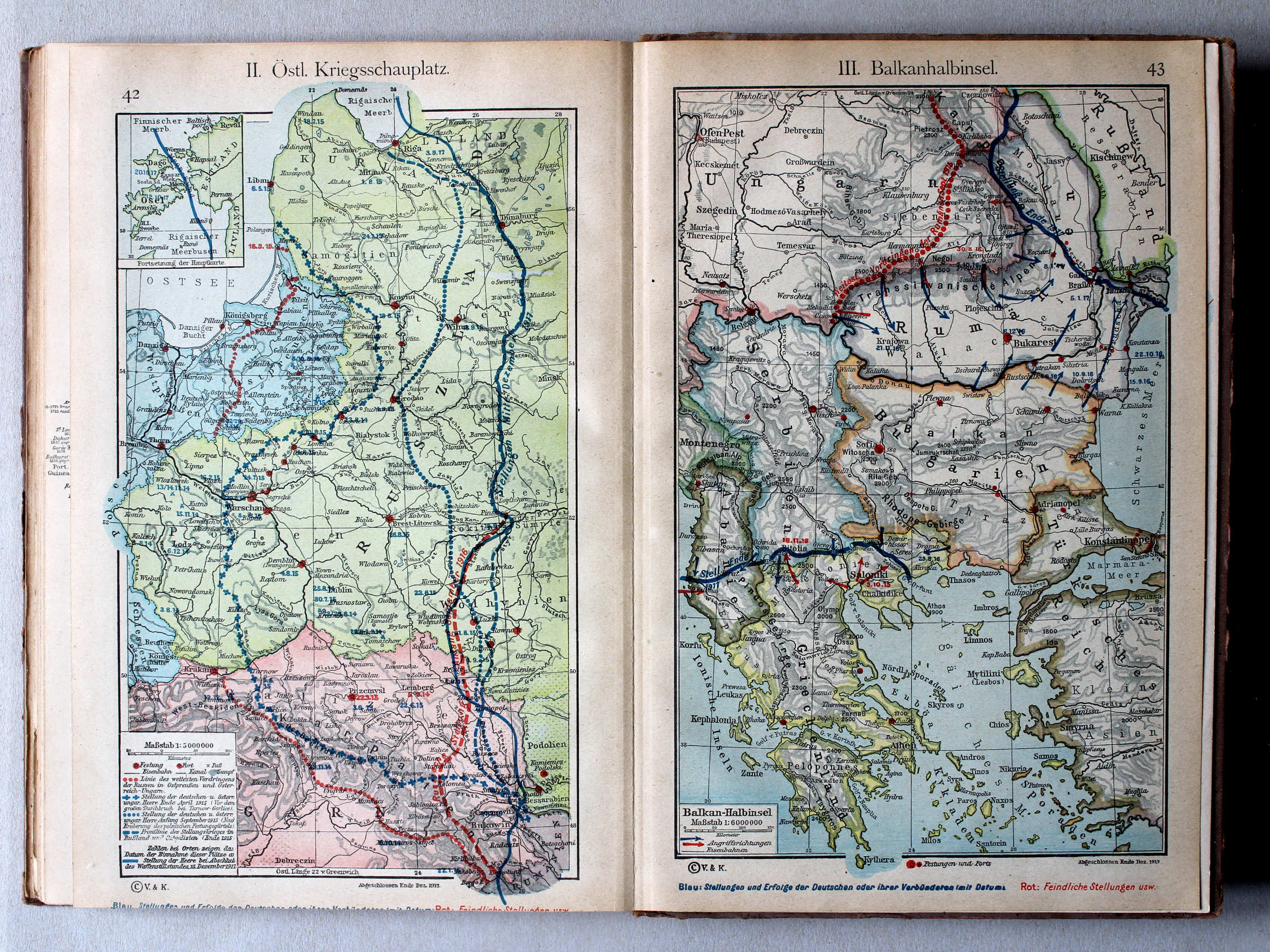
42. II. Östlicher Kriegsschauplatz XL
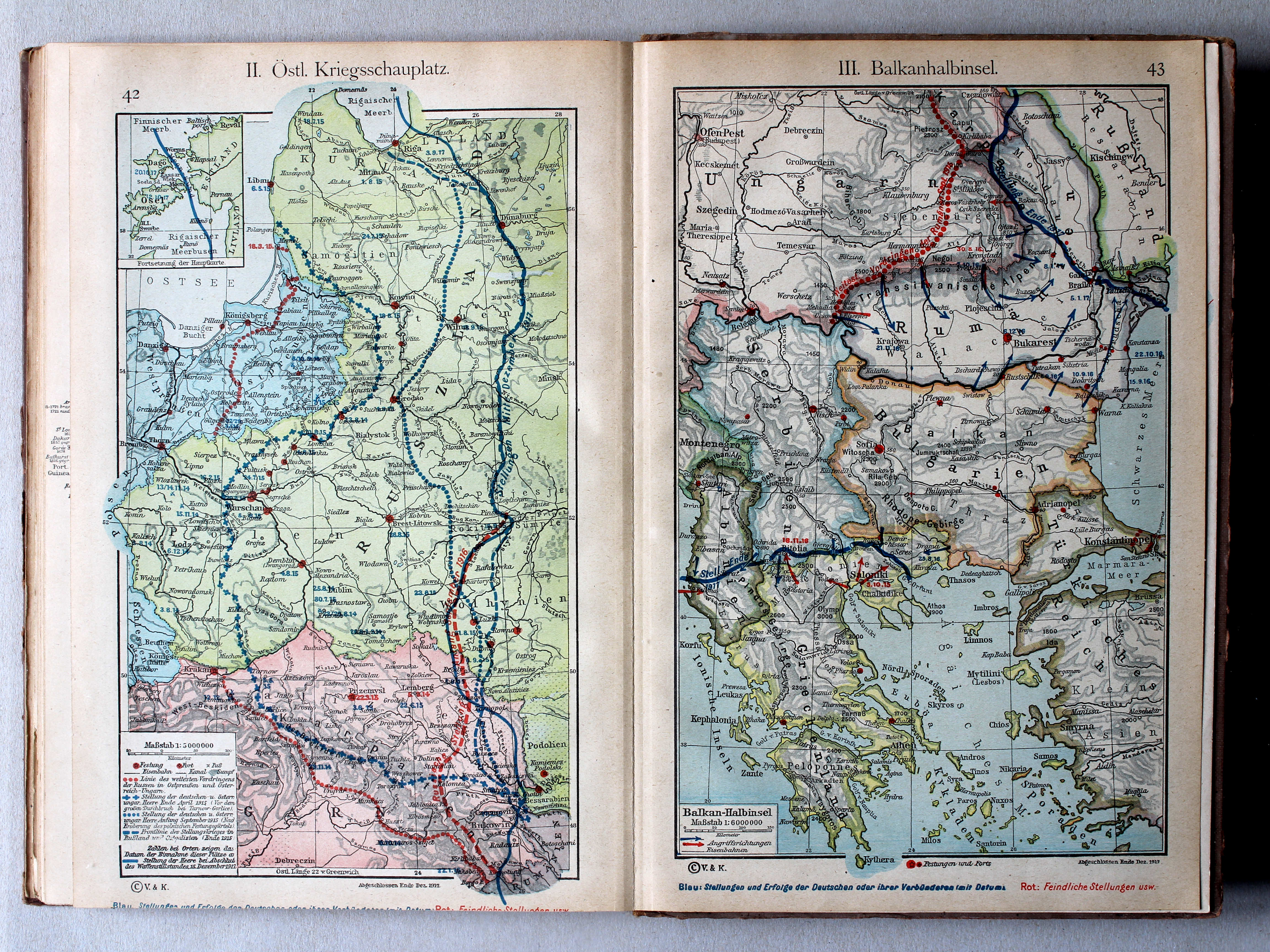
II. Oostelijk strijdtoneel / II. Eastern theater of war
43. III. Balkanhalbinsel XL
III. Balkanschiereiland / III. Balkan Peninsula
 Putzgers Historischer Schul-Atlas, 1922
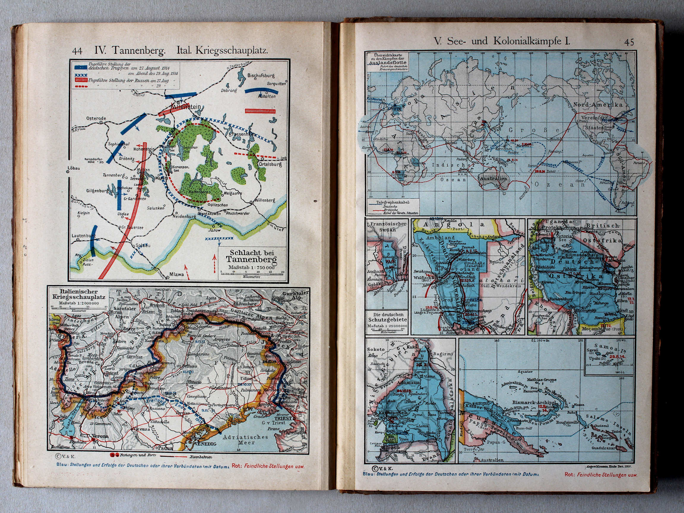
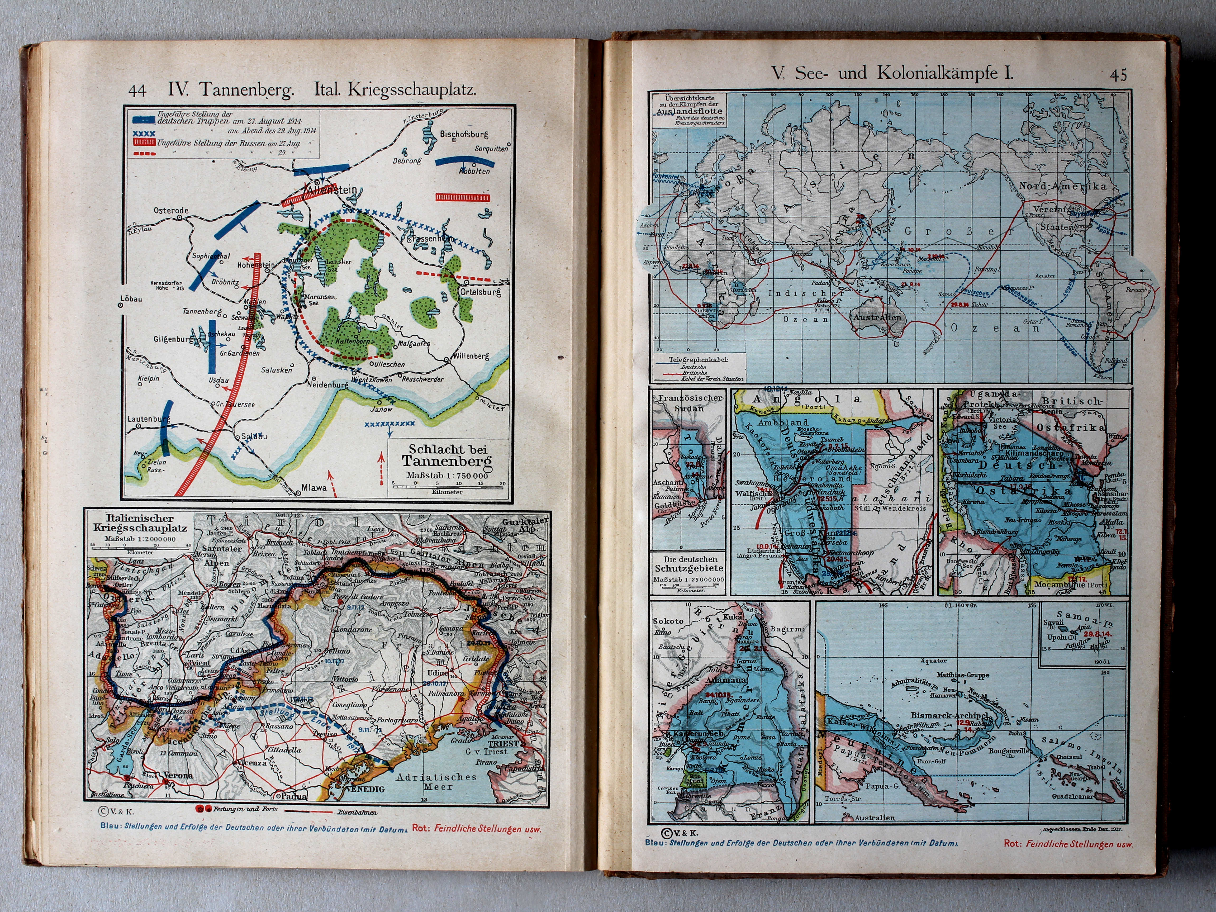
44. IV. Tannenberg. Ital. Kriegsschauplatz XL
IV. Tannenberg. Italiaans strijdtoneel / IV. Tannenberg. Italian theater of war
45. V. See- und Kolonialkämpfe I XL
V. Gevechten op zee en in de koloniën I / V. Battles at sea and in the colonies I
 Putzgers Historischer Schul-Atlas, 1922
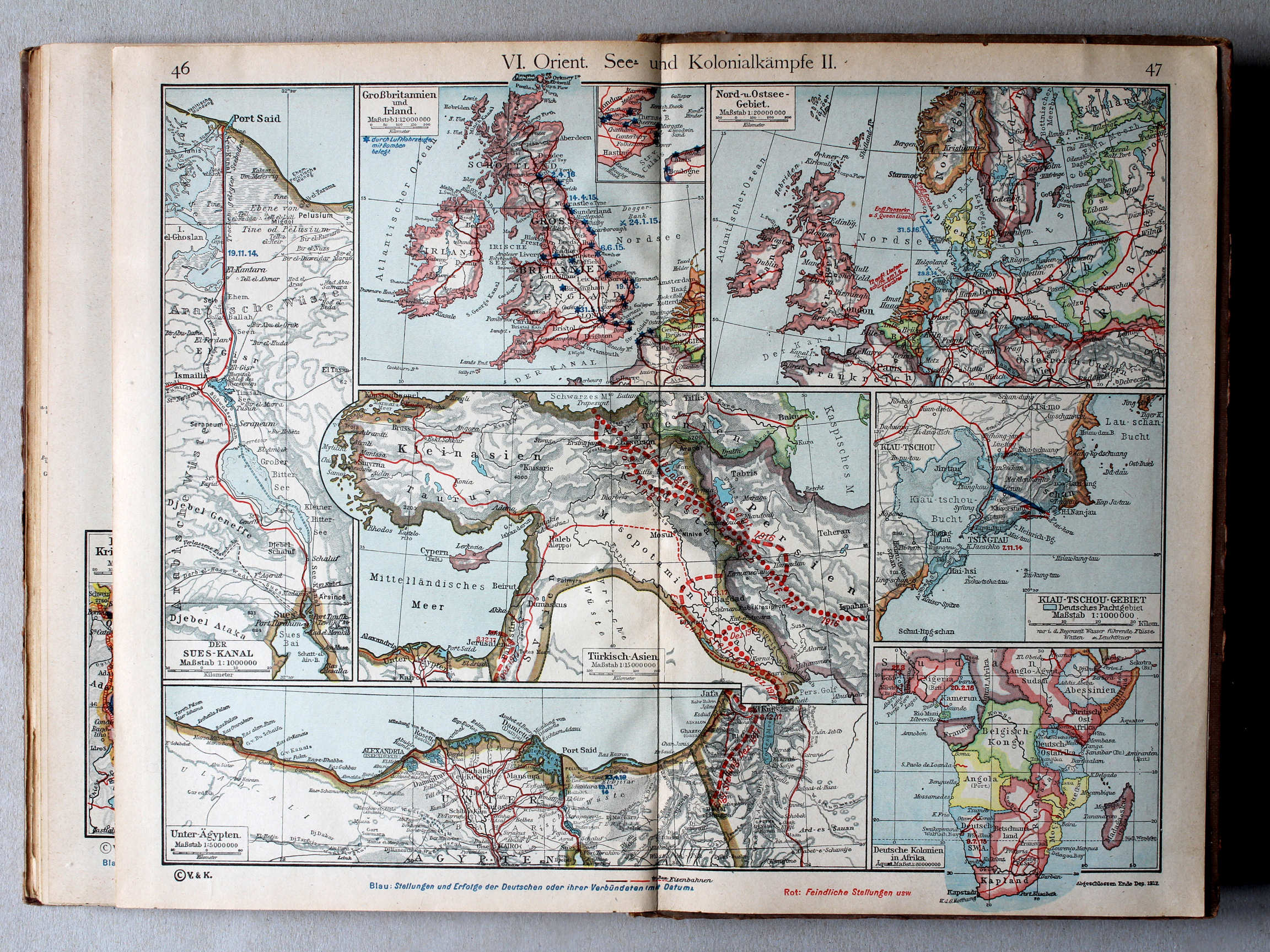
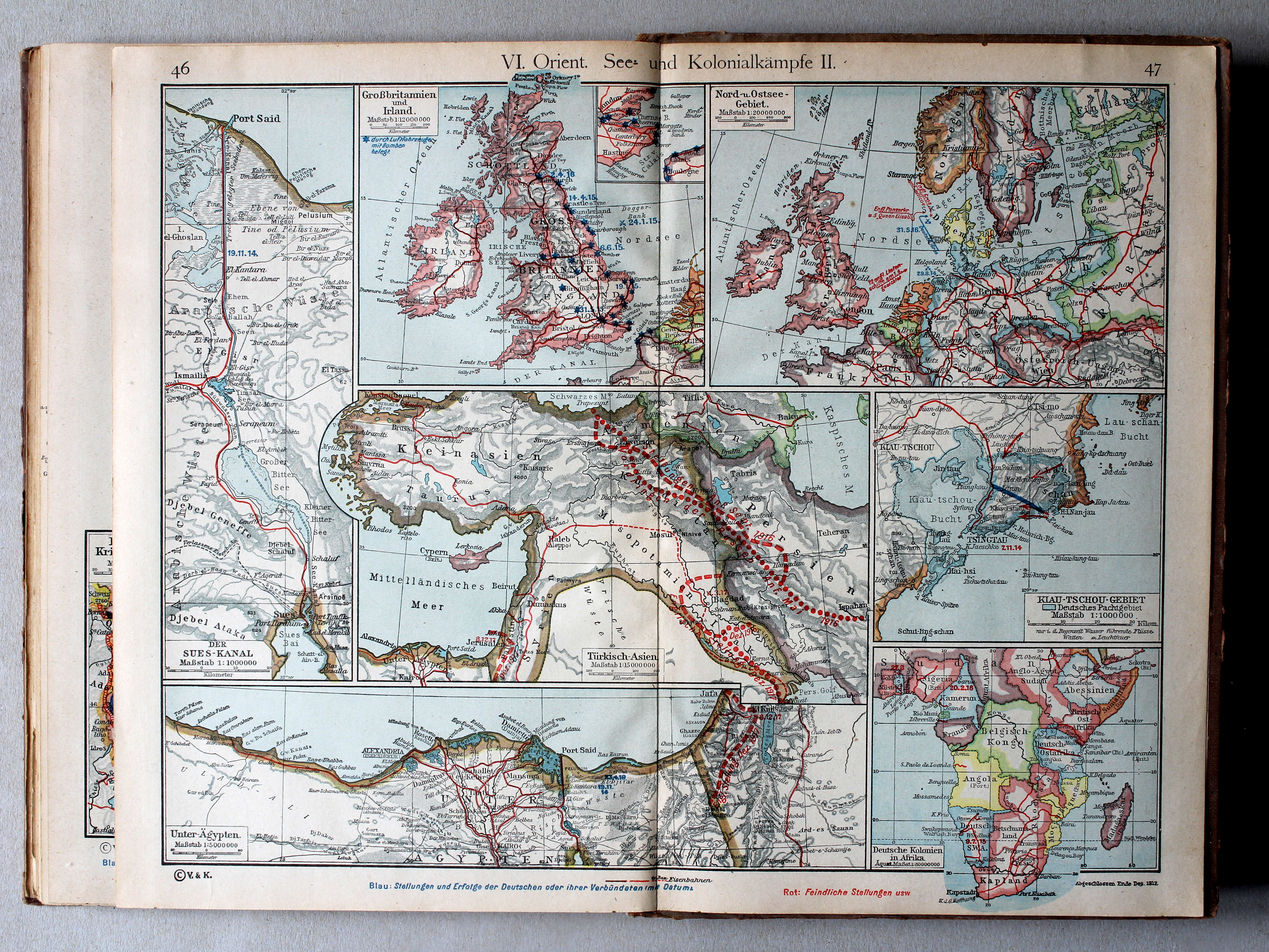
46.47. VI. Orient. See- und Kolonialkämpfe II XL
VI. Midden-Oosten. Gevechten op zee en in de koloniën II / VI. Middle East. Battles at sea and in the colonies II
 Putzgers Historischer Schul-Atlas, 1922
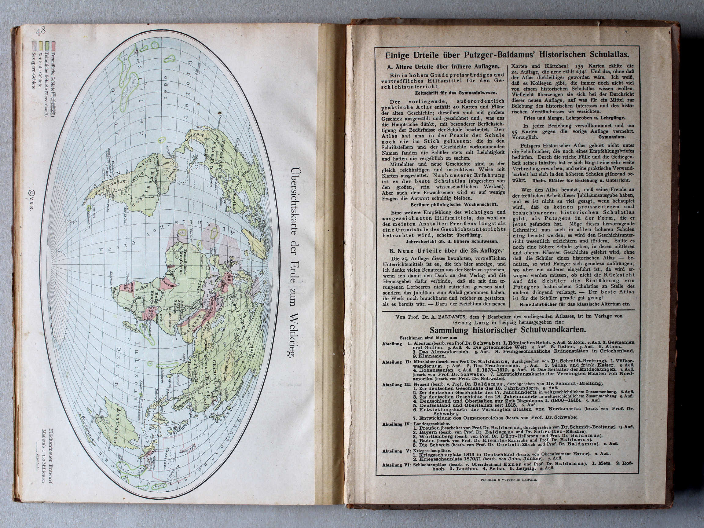
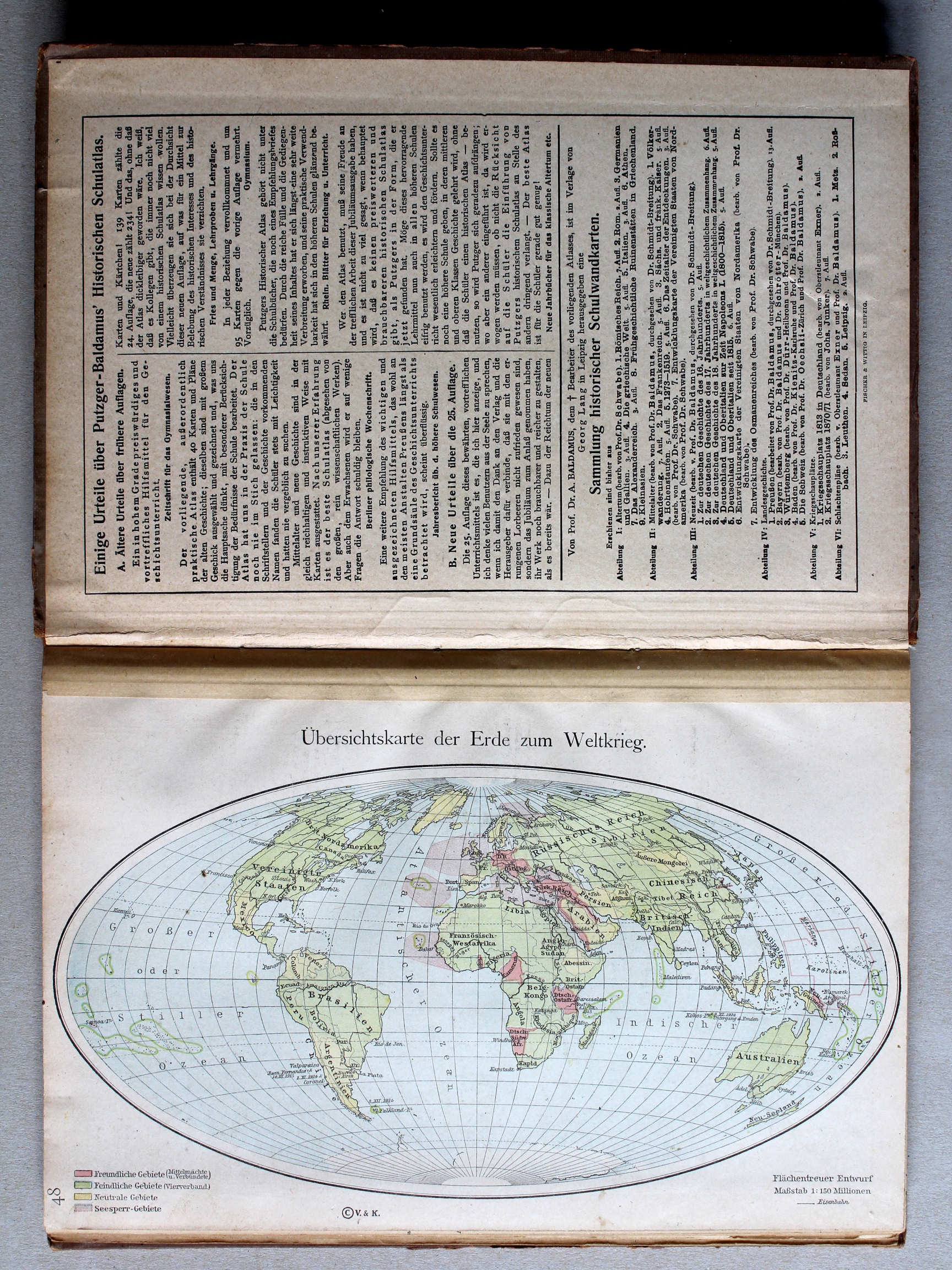
48. Übersichtskarte zum Weltkrieg XL
Overzichtskaart Wereldoorlog / General map World War
© M. Witkam, 2013
![]()
![]()