William R. Shepherd, Historical Atlas, 6e druk (1927) en
Putzgers Historischer Schul-Atlas, 41e druk (1918)
See below for (a summary of) this text in English.
Hieronder staan plaatjes van Shepherd, Historical Atlas en Putzgers Historischer Schul-Atlas ter vergelijking naast elkaar. Daarbij horen ook de volgende pagina's
- Beschrijving van Shepherd, Historical Atlas
- Plaatjes van Shepherd, Historical Atlas
- Tabellen en lijsten bij Shepherd, Historical Atlas
en
- Beschrijving van Putzgers Historischer Schul-Atlas
- Plaatjes van Putzgers Historischer Schul-Atlas
- Tabellen en lijsten bij Putzgers Historischer Schul-Atlas
Plaatjes
Klik op een plaatje voor een vergroting.
William R. Shepherd, Historical Atlas, 6th edition (1927) and
Putzgers Historischer Schul-Atlas, 41st edition (1918)
- Below are pictures Shepherd, Historical Atlas and Putzgers Historischer
Schul-Atlas side by side for comparison purposes. Related pages
- Description of Shepherd, Historical Atlas
- Pictures of Shepherd, Historical Atlas
- Tables and lists to Shepherd, Historical Atlas
- Description of Putzgers Historischer Schul-Atlas
- Pictures of Putzgers Historischer Schul-Atlas
- Tables and lists to Putzgers Historischer Schul-Atlas
Pictures
Click on a picture to enlarge.
Band, titelpagina / Binding, title page


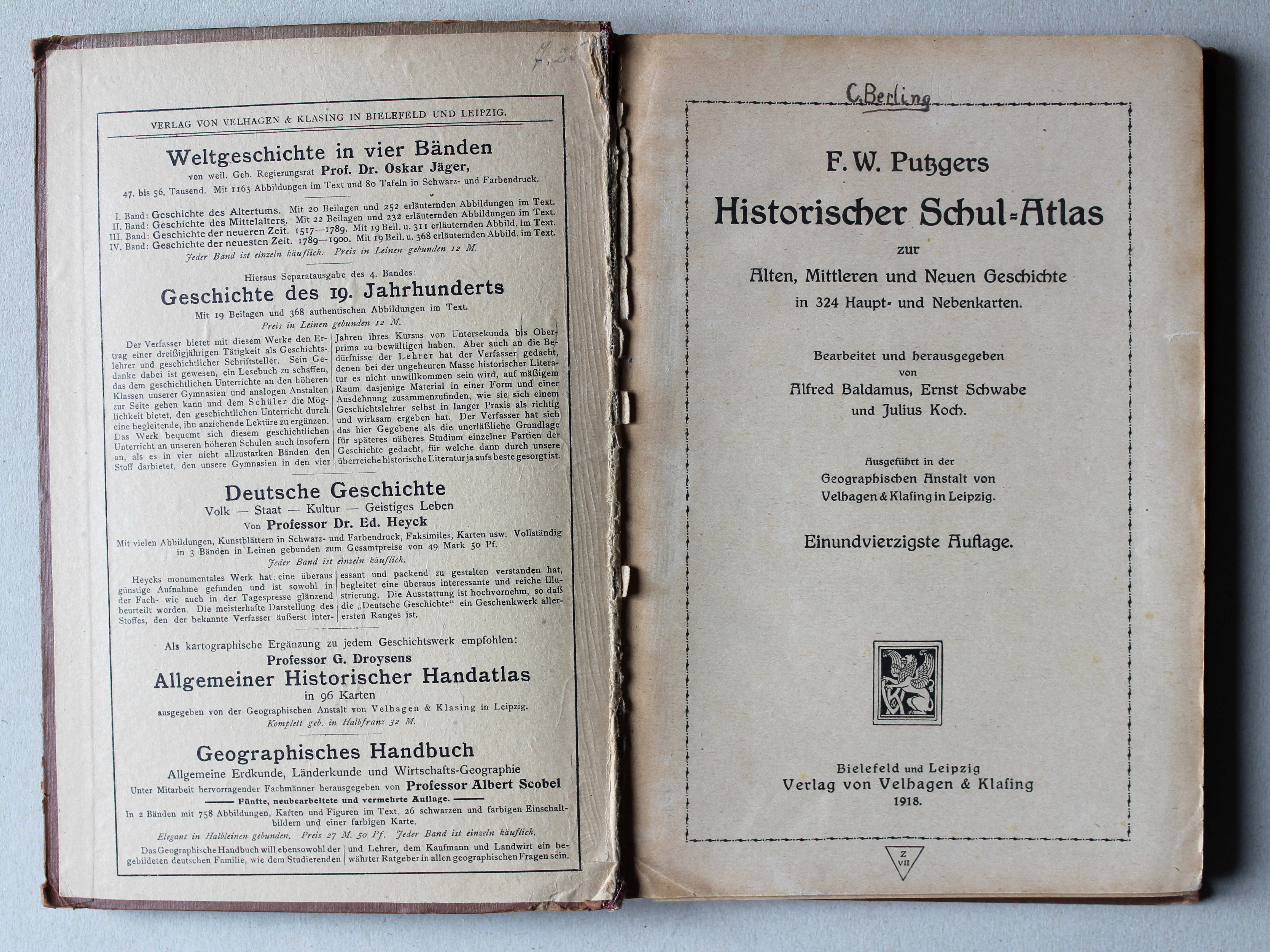
 Putzgers Historischer Schul-Atlas, 1918
Schutblad voorin, titelpagina / Front endpaper, title page XL
 Shepherd, Historical Atlas, 1927
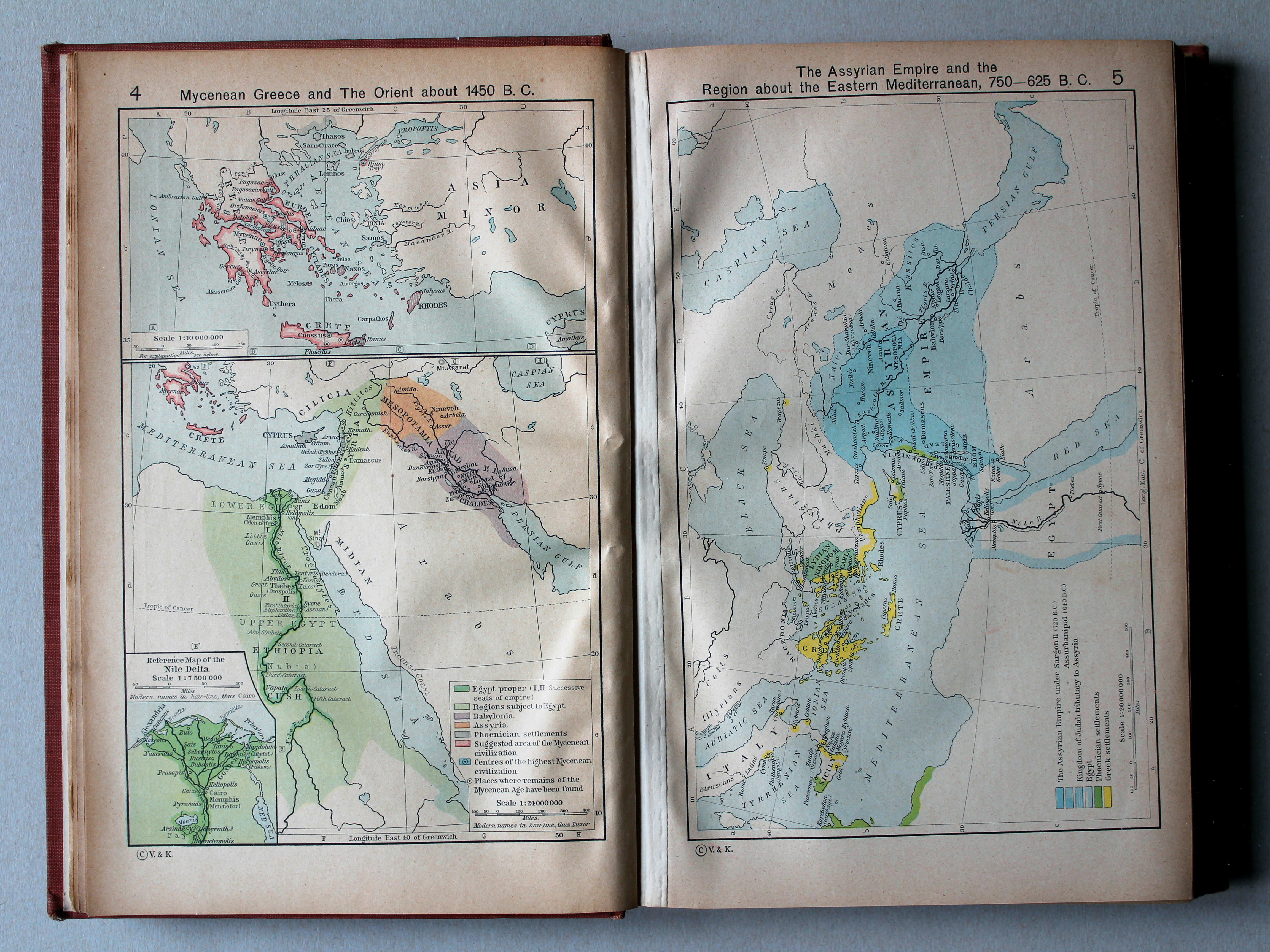
4. Mycenean Greece and the Orient about 1450 B. C. XL
Myceens Griekenland en het Oosten, ca. 1450 v. Chr.
 Putzgers Historischer Schul-Atlas, 1918
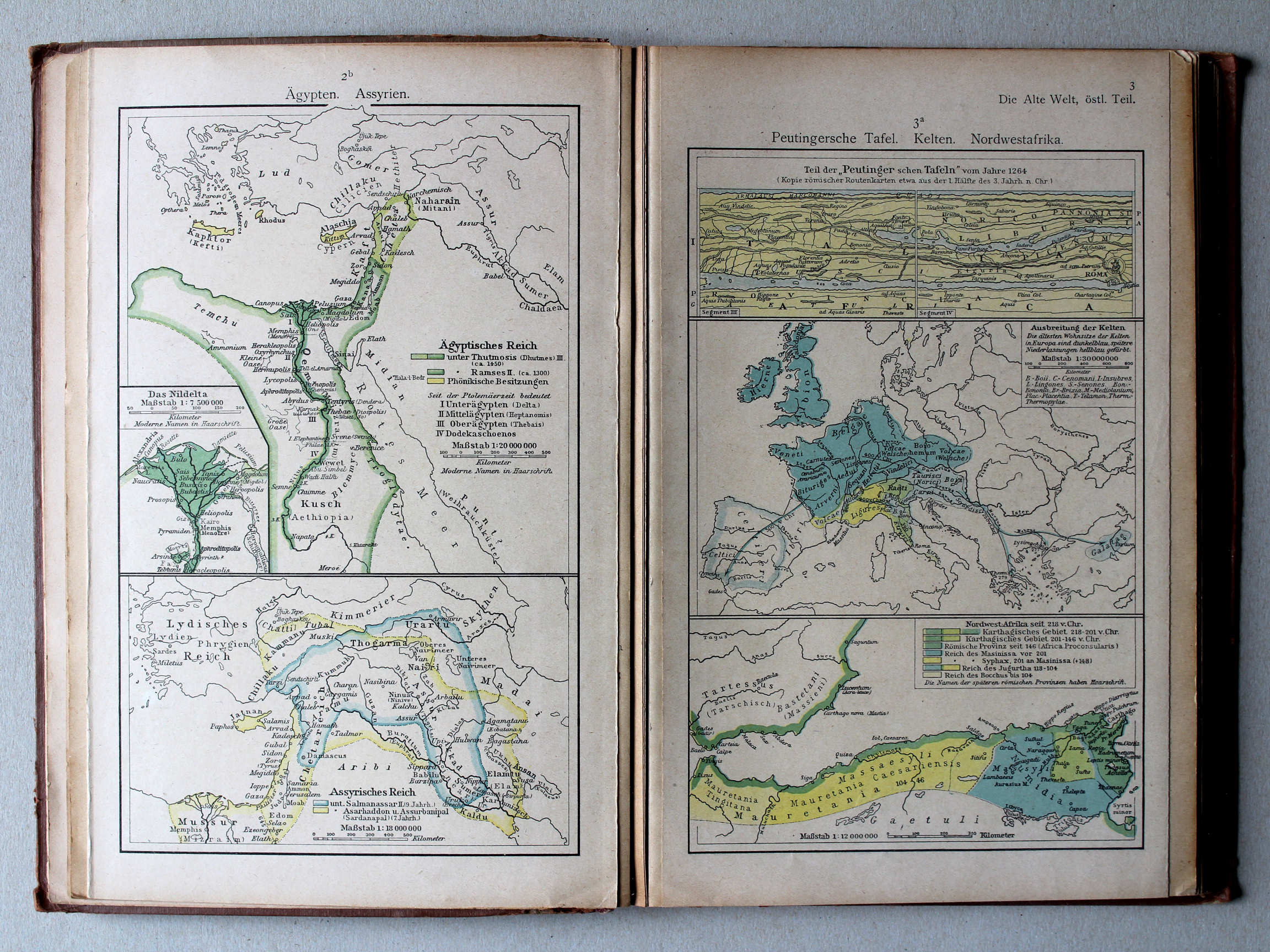
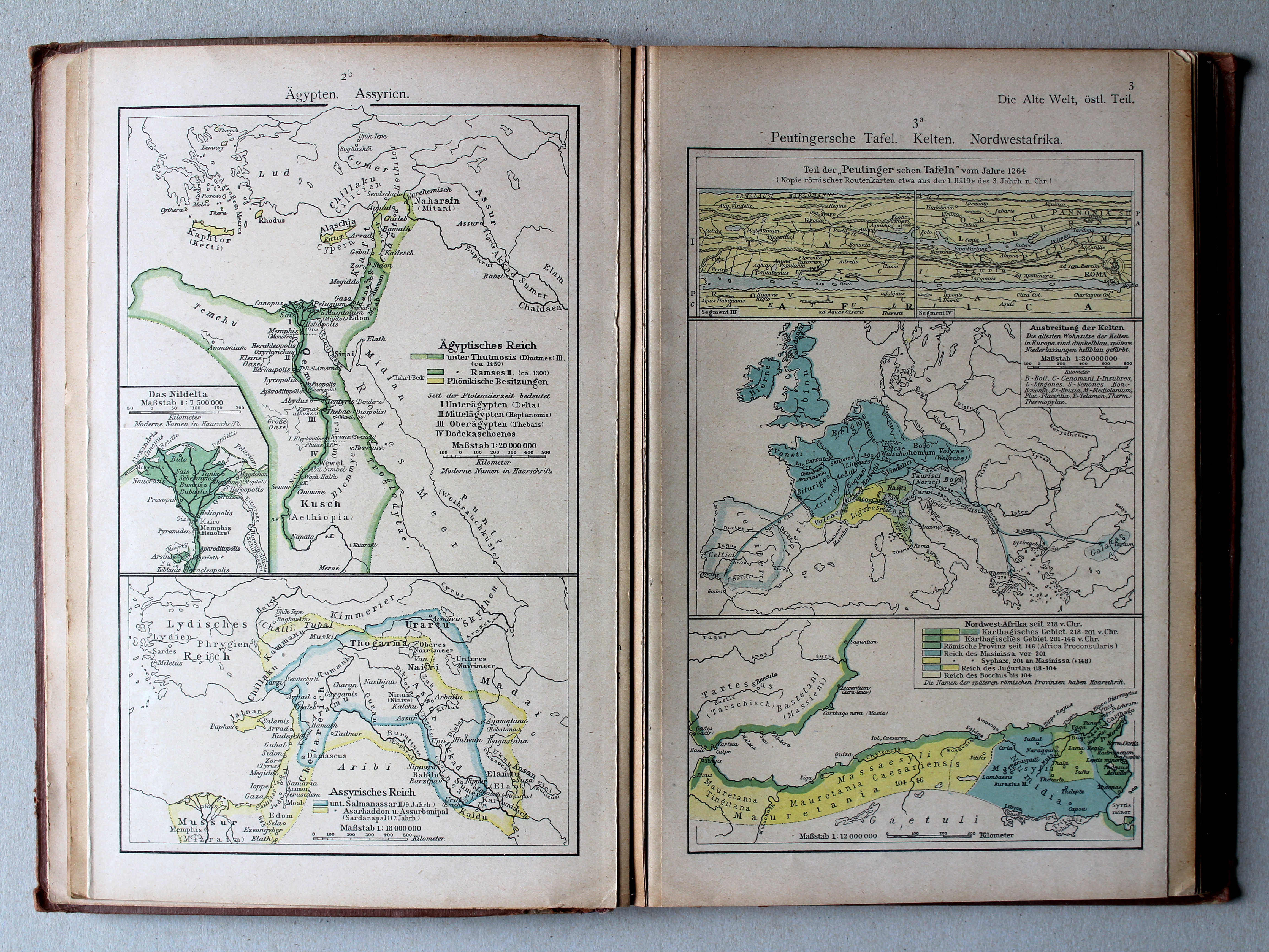
2b. Ägypten. Assyrien XL
Egypte. Assyrië / Egypt. Assyria
3a. Peutingersche Tafel. Kelten. Nordwestafrika XL
Tabula Peutingeriana. Kelten. Noordwest-Afrika / Tabula Peutingeriana. Celts. Northwest Africa


 Shepherd, Historical Atlas, 1927
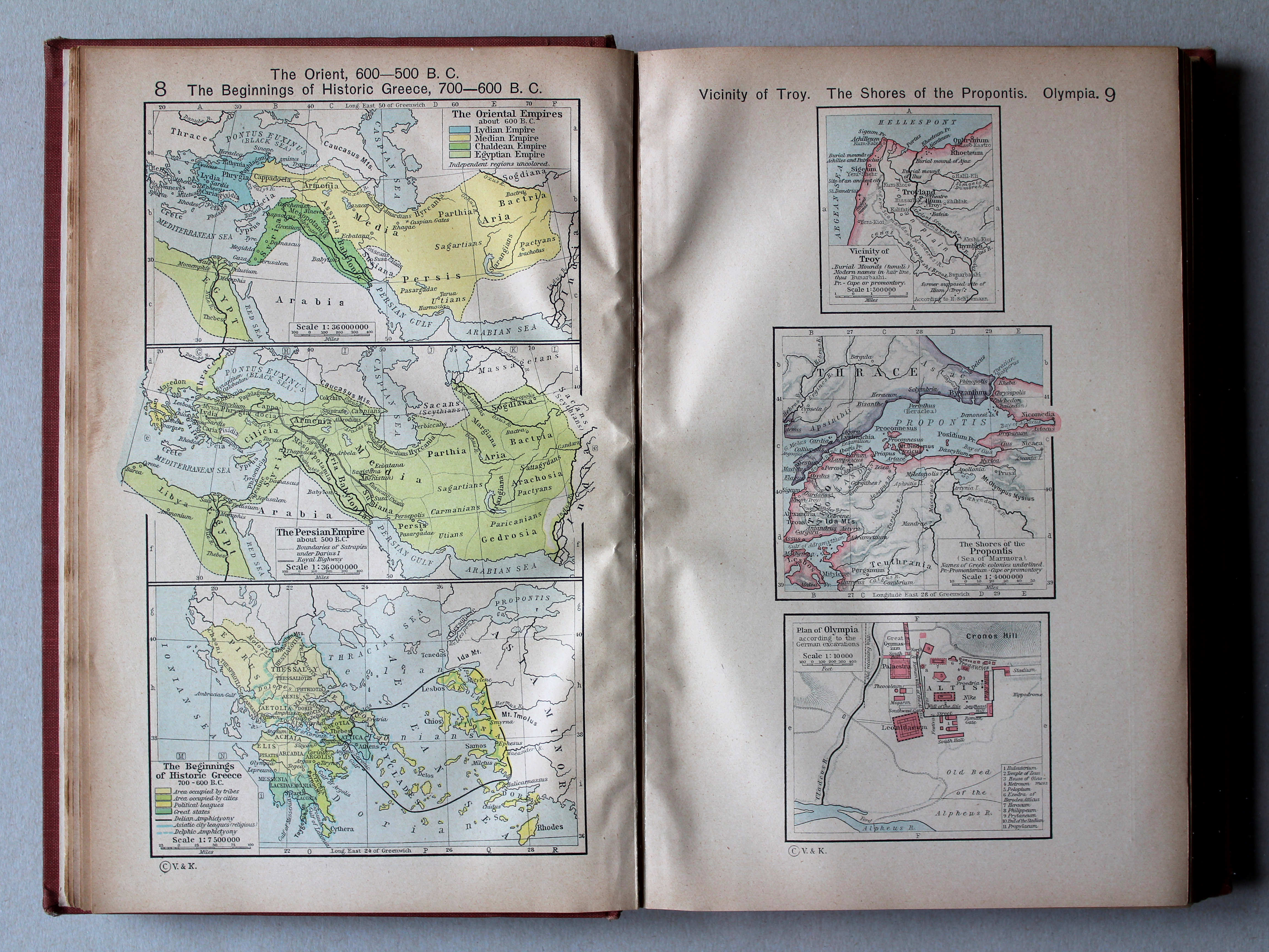
8. The Orient 600-500 B. C. The Beginnings of Historic Greece, 700-600 B. C. XL
Het Oosten 600-500 v. Chr. Het vroege historische Griekenland, 700-600 v. Chr.
9. Vicinity of Troy. The Shores of the Propontis. Plan of Olympia XL
Troje en omgeving. Propontis (Zee van Marmara). Olympia
 Putzgers Historischer Schul-Atlas, 1918
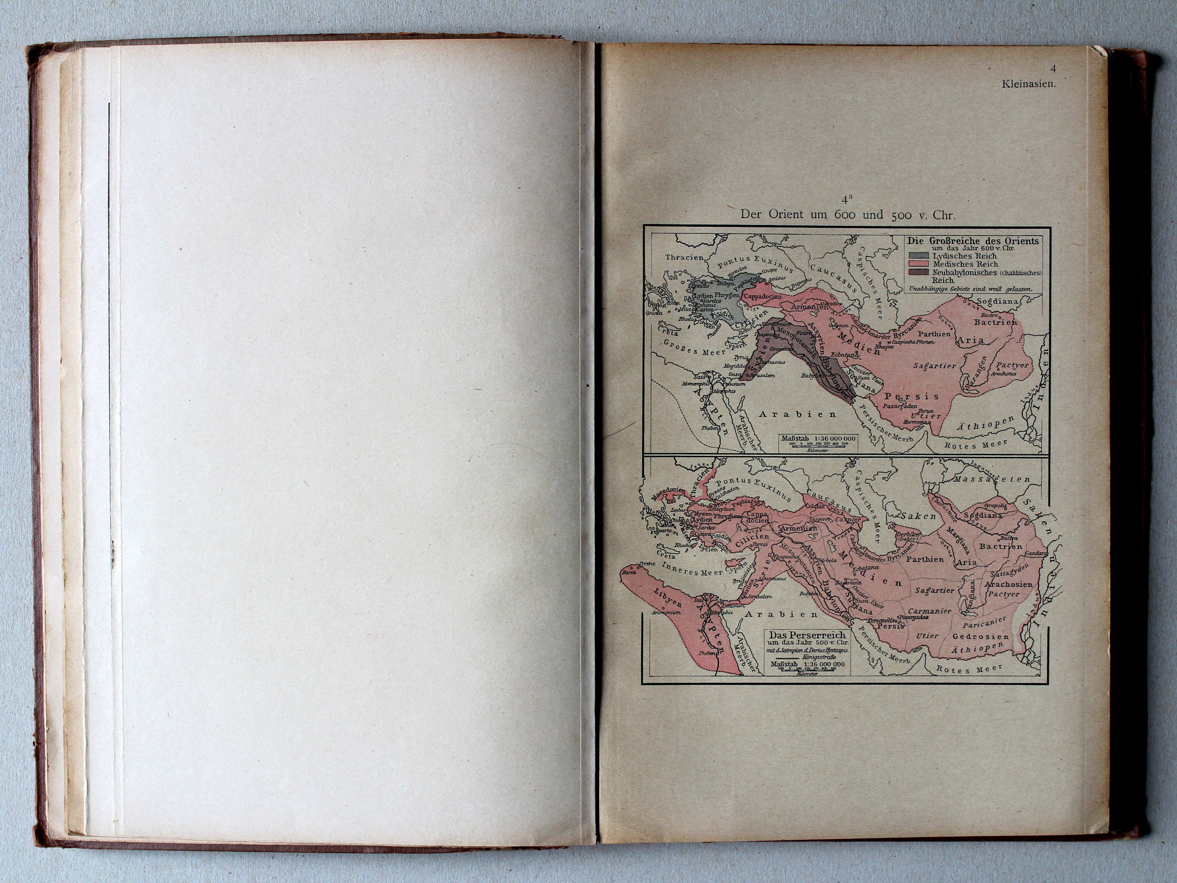
4a. Der Orient um 600 und 500 v. Chr. XL
Het Oosten rond 600 en 500 v. Chr. / The Orient around 600 and 500 BC
Shepherd, Historical Atlas, 1927
8. The Orient 600-500 B. C. The Beginnings of Historic Greece, 700-600 B. C. XL
Het Oosten 600-500 v. Chr. Het vroege historische Griekenland, 700-600 v. Chr.
9. Vicinity of Troy. The Shores of the Propontis. Plan of Olympia XL
Troje en omgeving. Propontis (Zee van Marmara). Olympia
 Putzgers Historischer Schul-Atlas, 1918
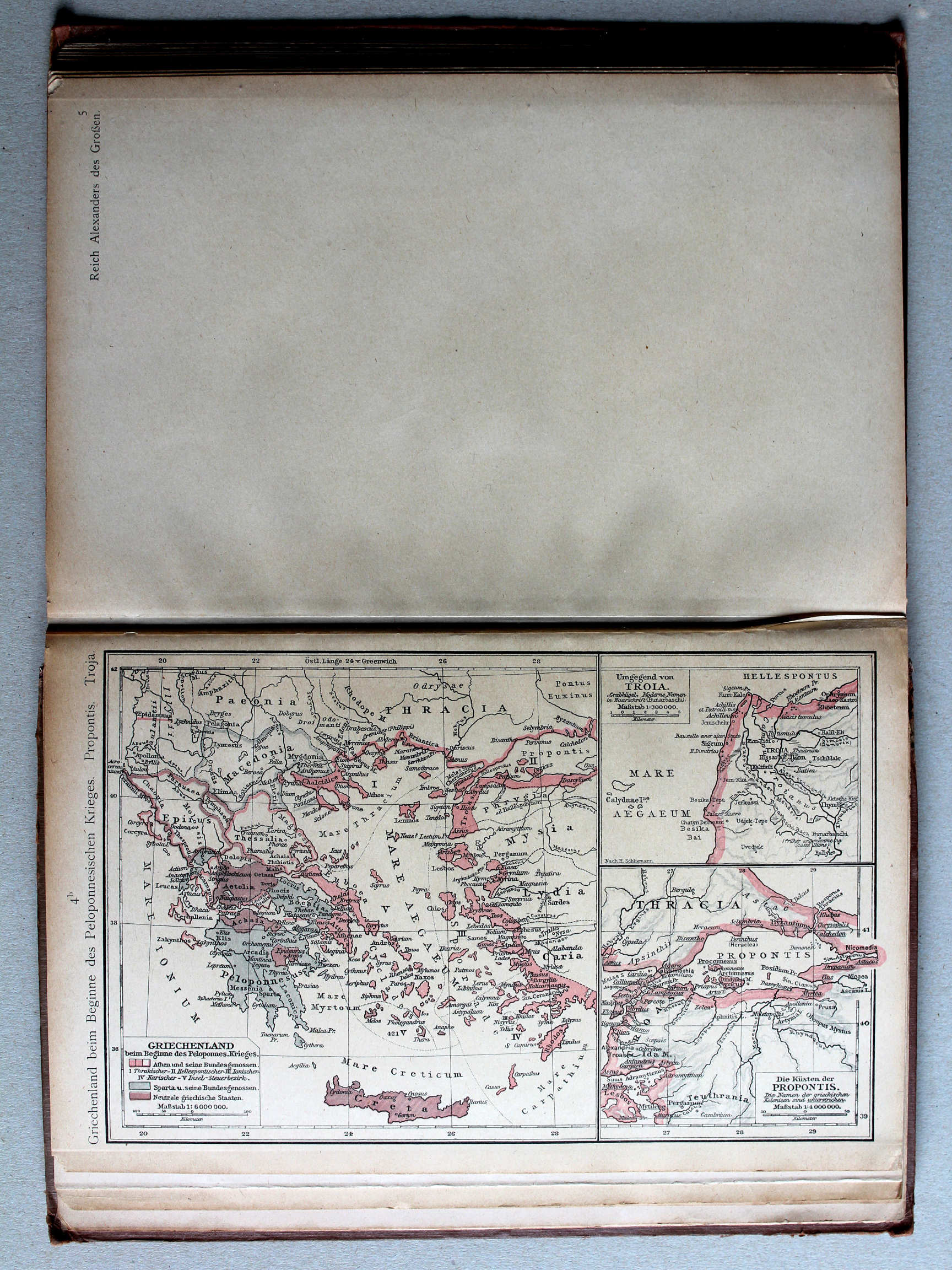
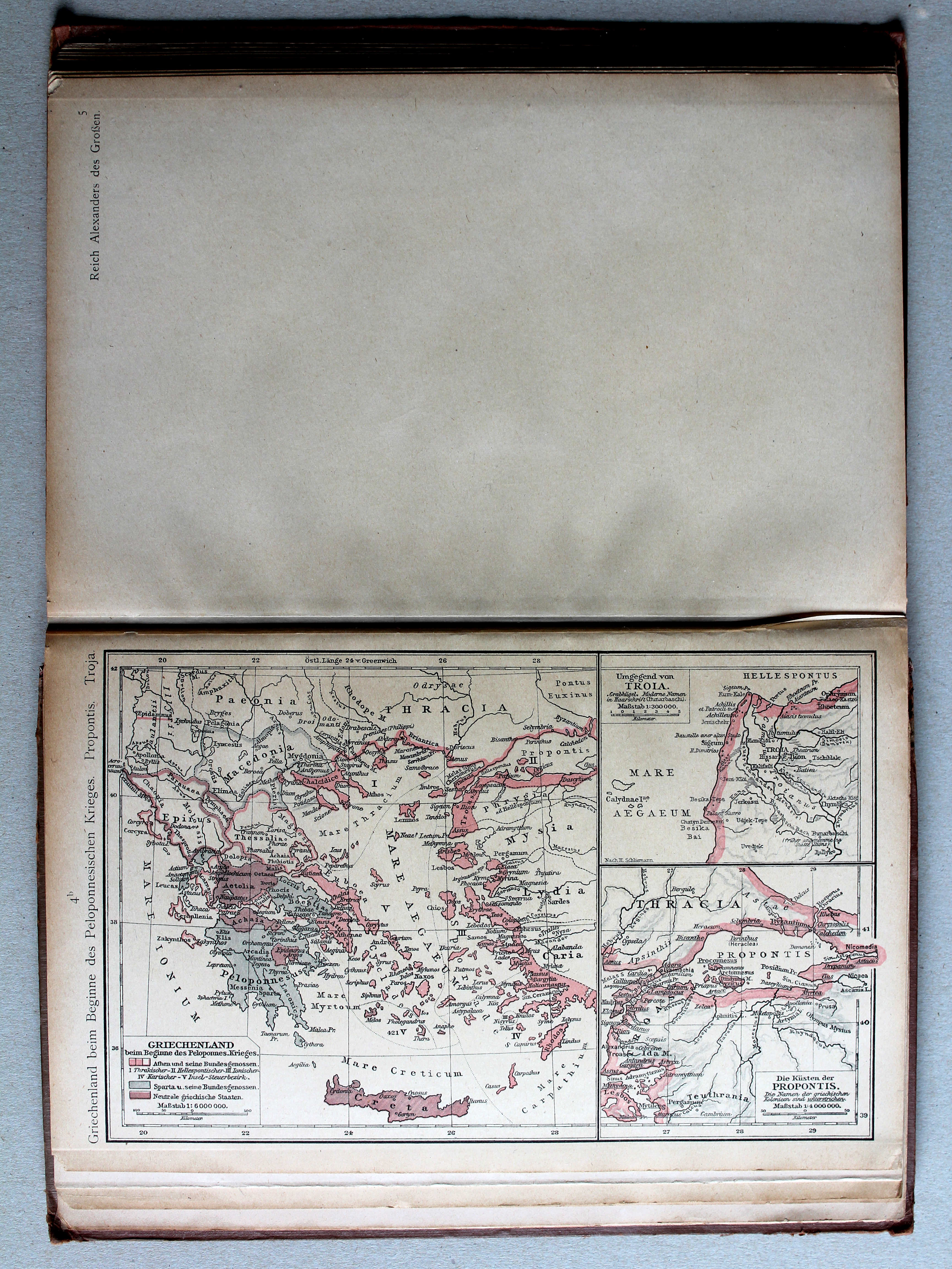
4b. Griechenland beim Beginne des Peloponnesischen Krieges. Propontis. Troja XL
Griekenland bij het begin van de Peloponnesische Oorlog. Propontis. Troja / Greece at the beginning of the Peloponnesian War. Propontis. Troja
 Shepherd, Historical Atlas, 1927
10.11. Reference Map of Ancient Greece. Northern Part XL
Griekenland in de Oudheid, noordelijk deel
 Putzgers Historischer Schul-Atlas, 1918
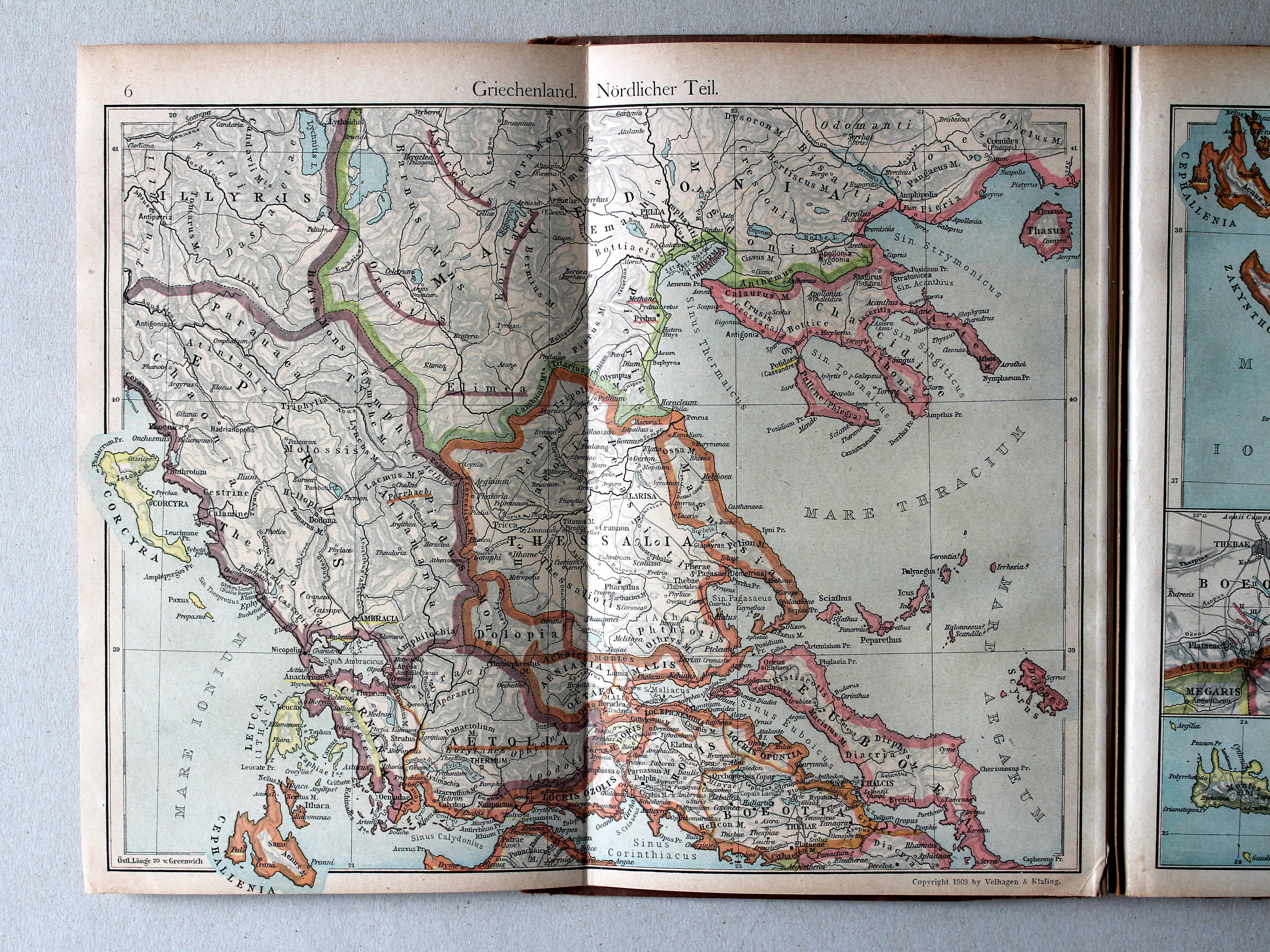
6. Griechenland. Nördlicher Teil XL
Griekenland, noordelijk deel / Greece, northern part
 Shepherd, Historical Atlas, 1927
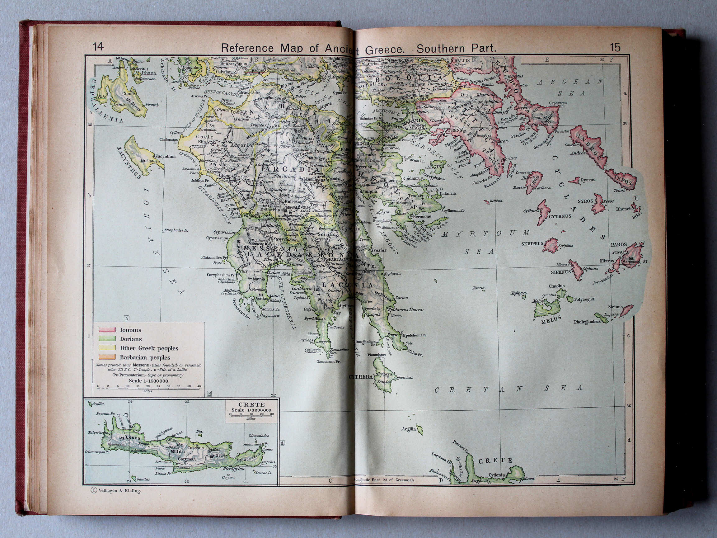
14.15. Reference Map of Ancient Greece. Southern Part XL
Griekenland in de Oudheid, zuidelijk deel
 Putzgers Historischer Schul-Atlas, 1918
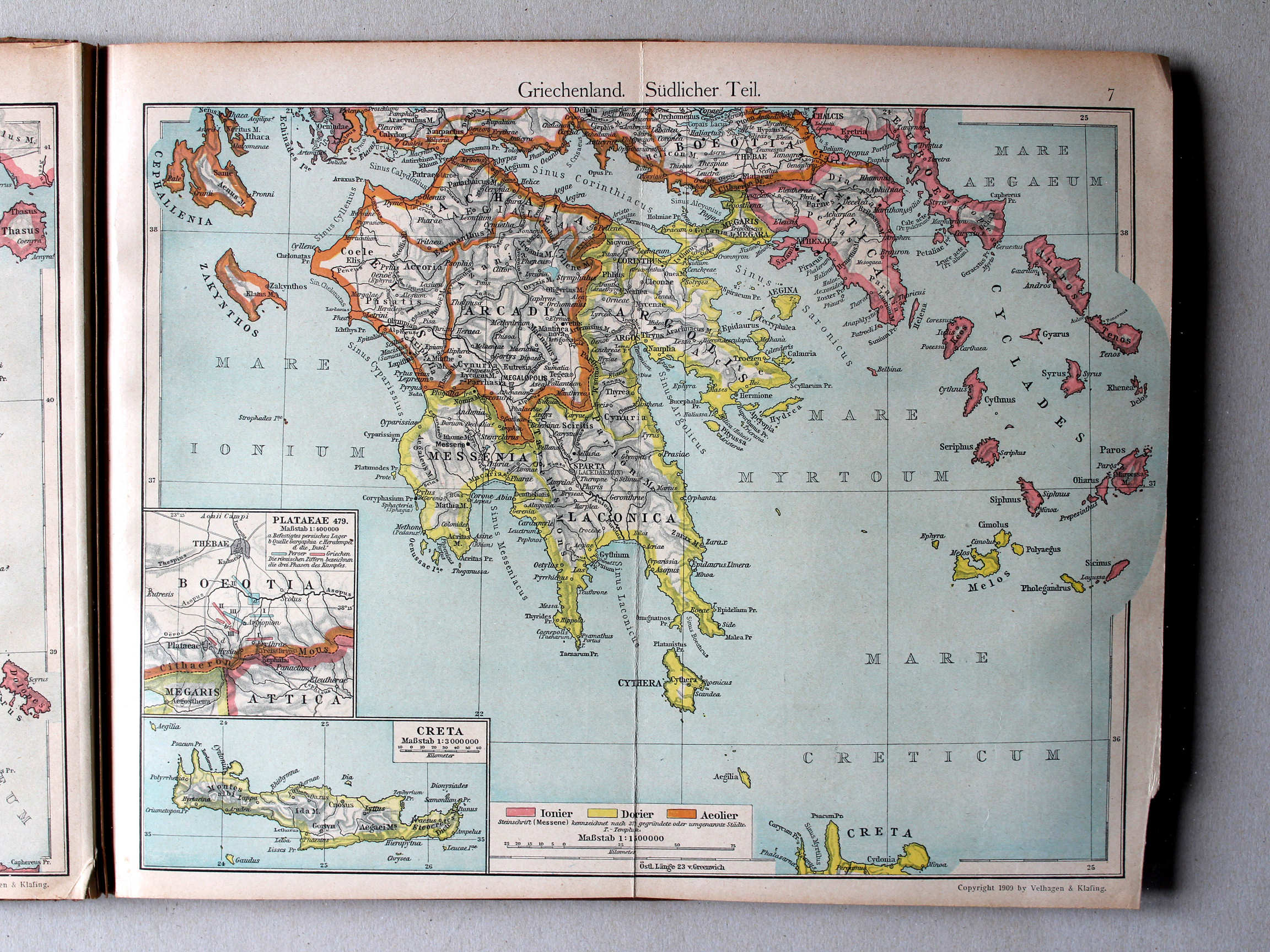
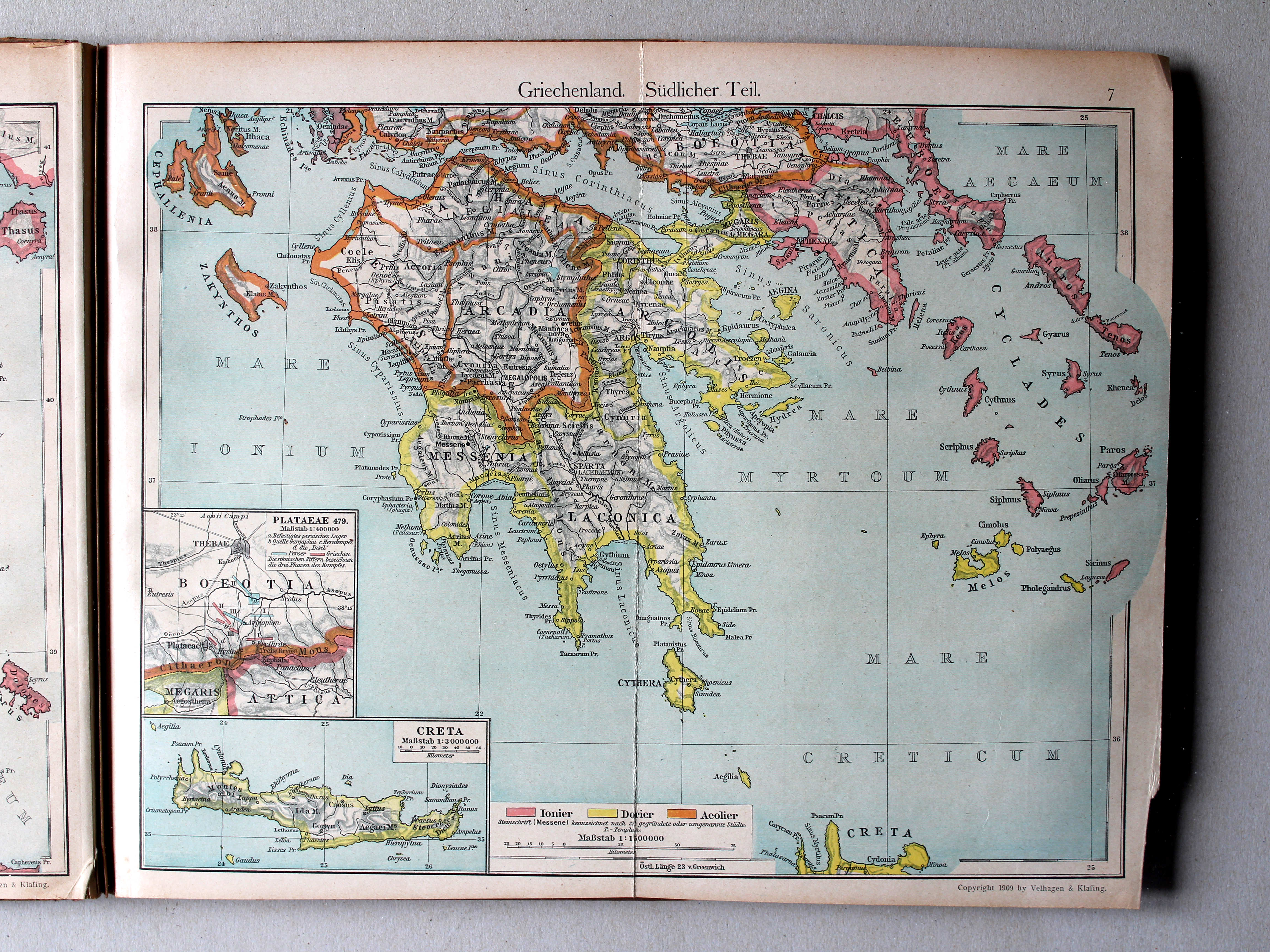
7. Griechenland. Südlicher Teil XL
Griekenland, zuidelijk deel / Greece, southern part
 Shepherd, Historical Atlas, 1927
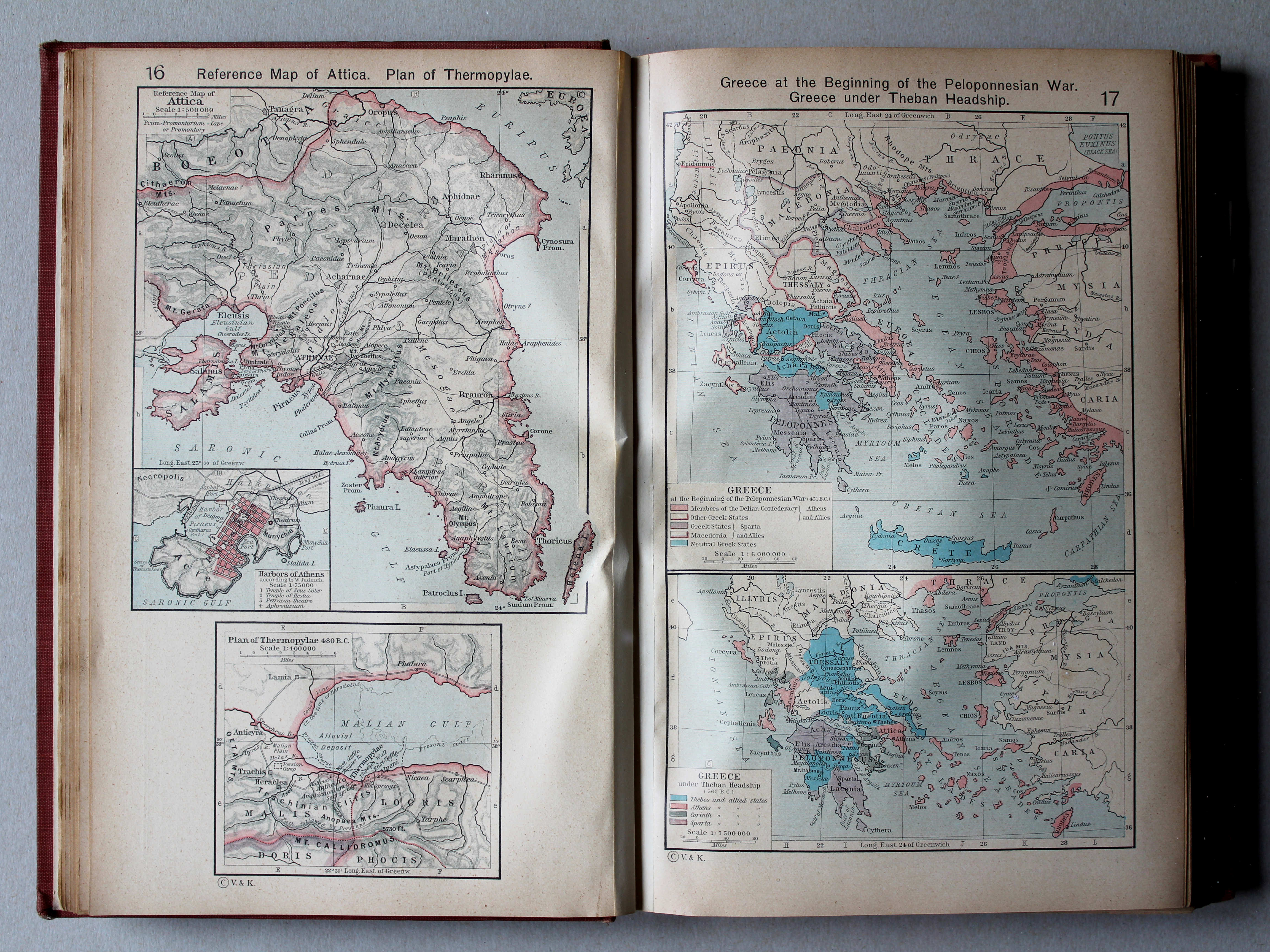
16. Reference Map of Attica. Plan of Thermopylae XL
Attica. Thermopylae
17. Greece at the Beginning of the Peloponnesian War. Greece under Theban Headship XL
Griekenland aan het begin van de Peloponnesische Oorlog. Griekenland onder hegemonie van Thebe
 Putzgers Historischer Schul-Atlas, 1918
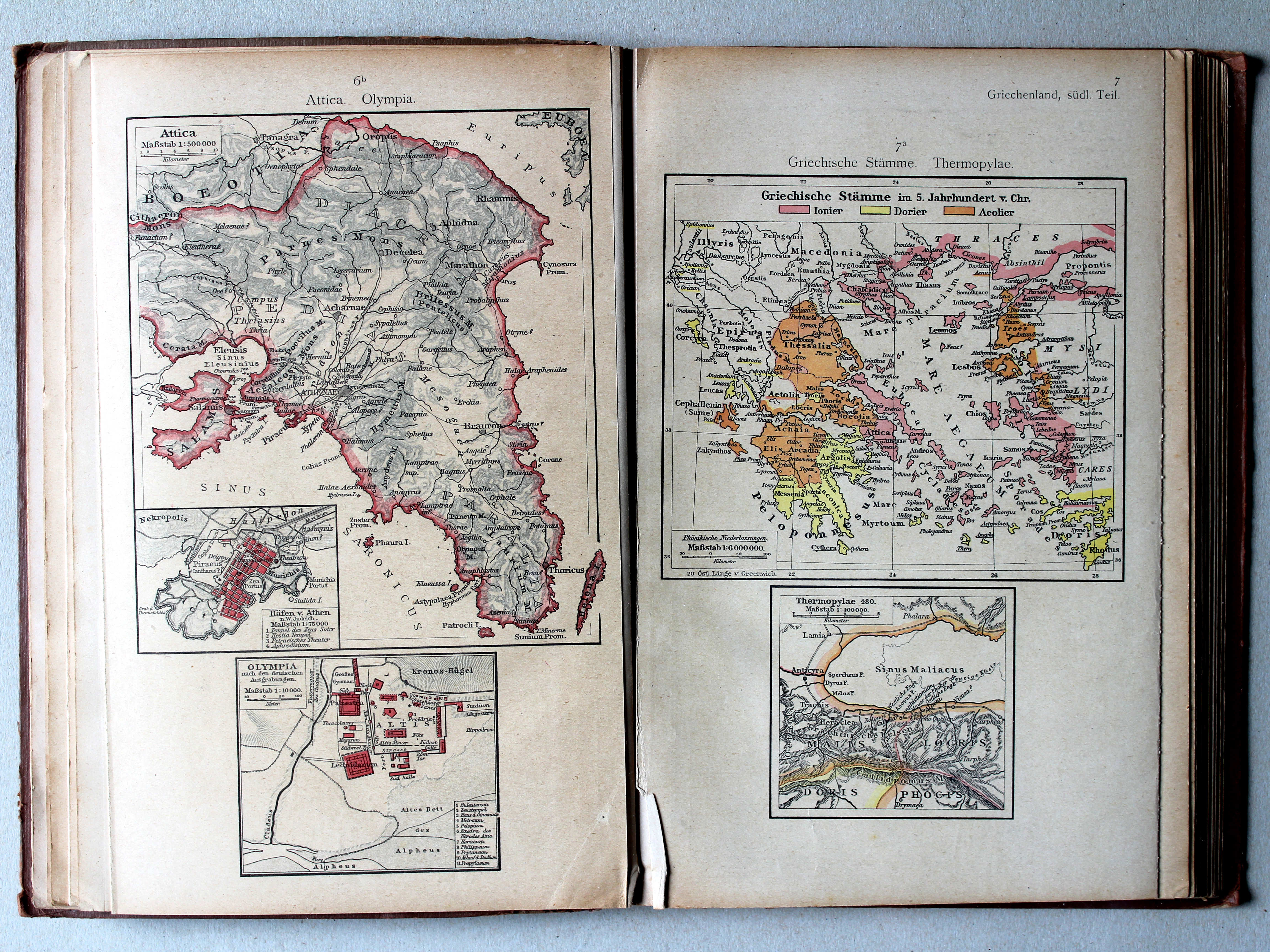
6b. Attica. Olympia XL
Attica. Olympia
7a. Griechische Stämme. Thermopylae XL
Griekse volkeren. Thermopylae / Greek nations. Thermopylae
Shepherd, Historical Atlas, 1927
16. Reference Map of Attica. Plan of Thermopylae XL
Attica. Thermopylae
17. Greece at the Beginning of the Peloponnesian War. Greece under Theban Headship XL
Griekenland aan het begin van de Peloponnesische Oorlog. Griekenland onder hegemonie van Thebe
Putzgers Historischer Schul-Atlas, 1918
4b. Griechenland beim Beginne des Peloponnesischen Krieges. Propontis. Troja XL
Griekenland bij het begin van de Peloponnesische Oorlog. Propontis. Troja / Greece at the beginning of the Peloponnesian War. Propontis. Troja
 Shepherd, Historical Atlas, 1927
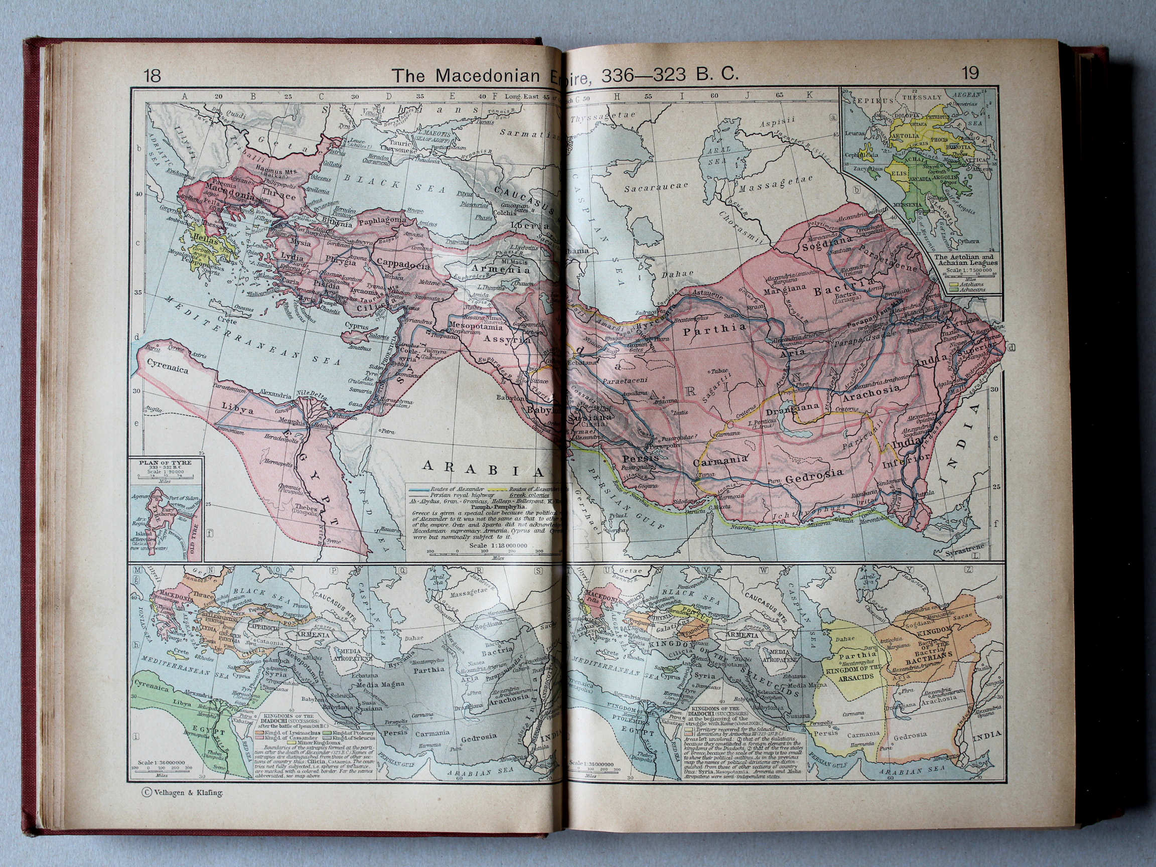
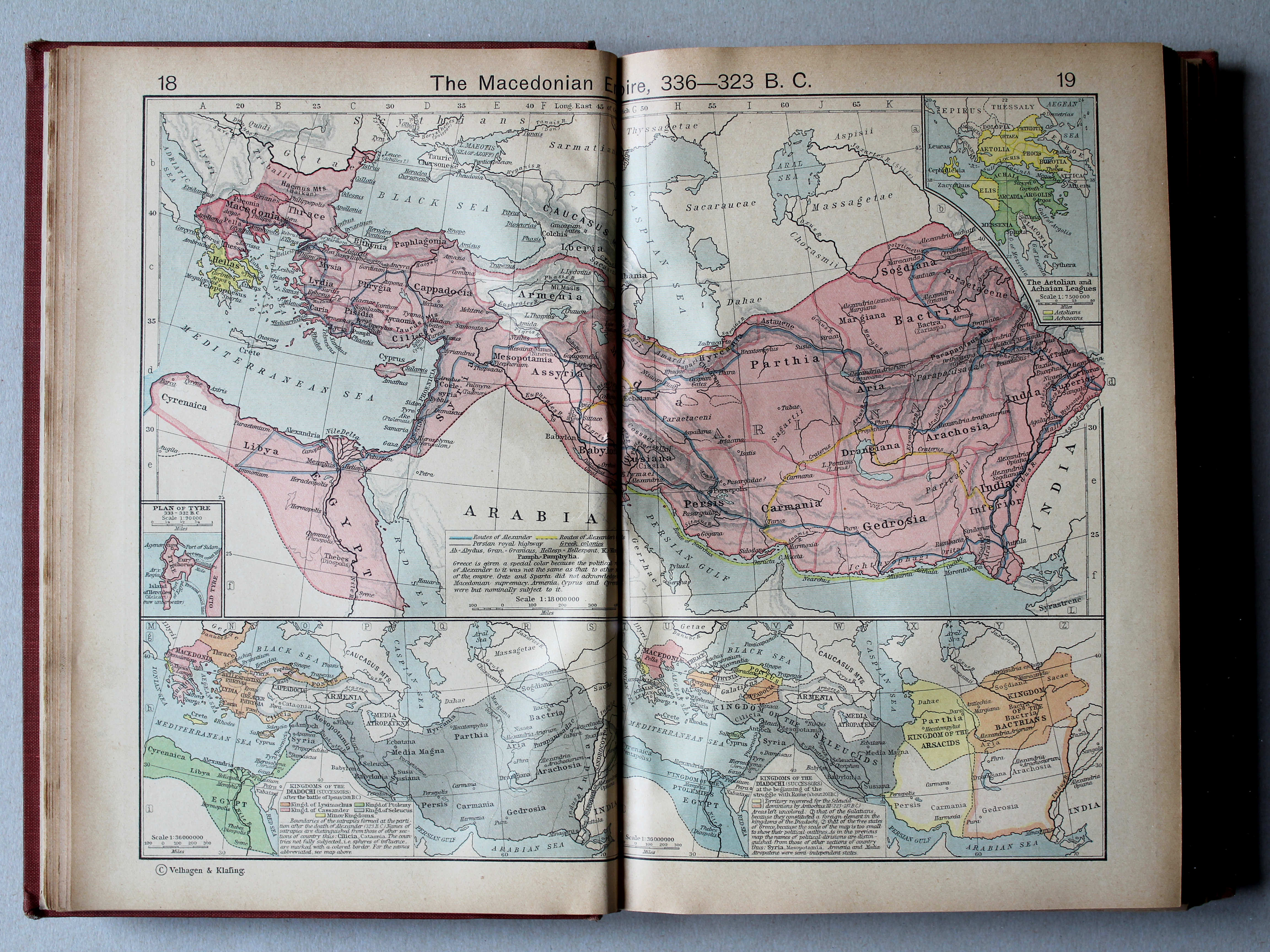
18.19. The Macedonian Empire, 336-323 B. C. XL
Het Macedonische Rijk, 336-323 v. Chr.
 Putzgers Historischer Schul-Atlas, 1918
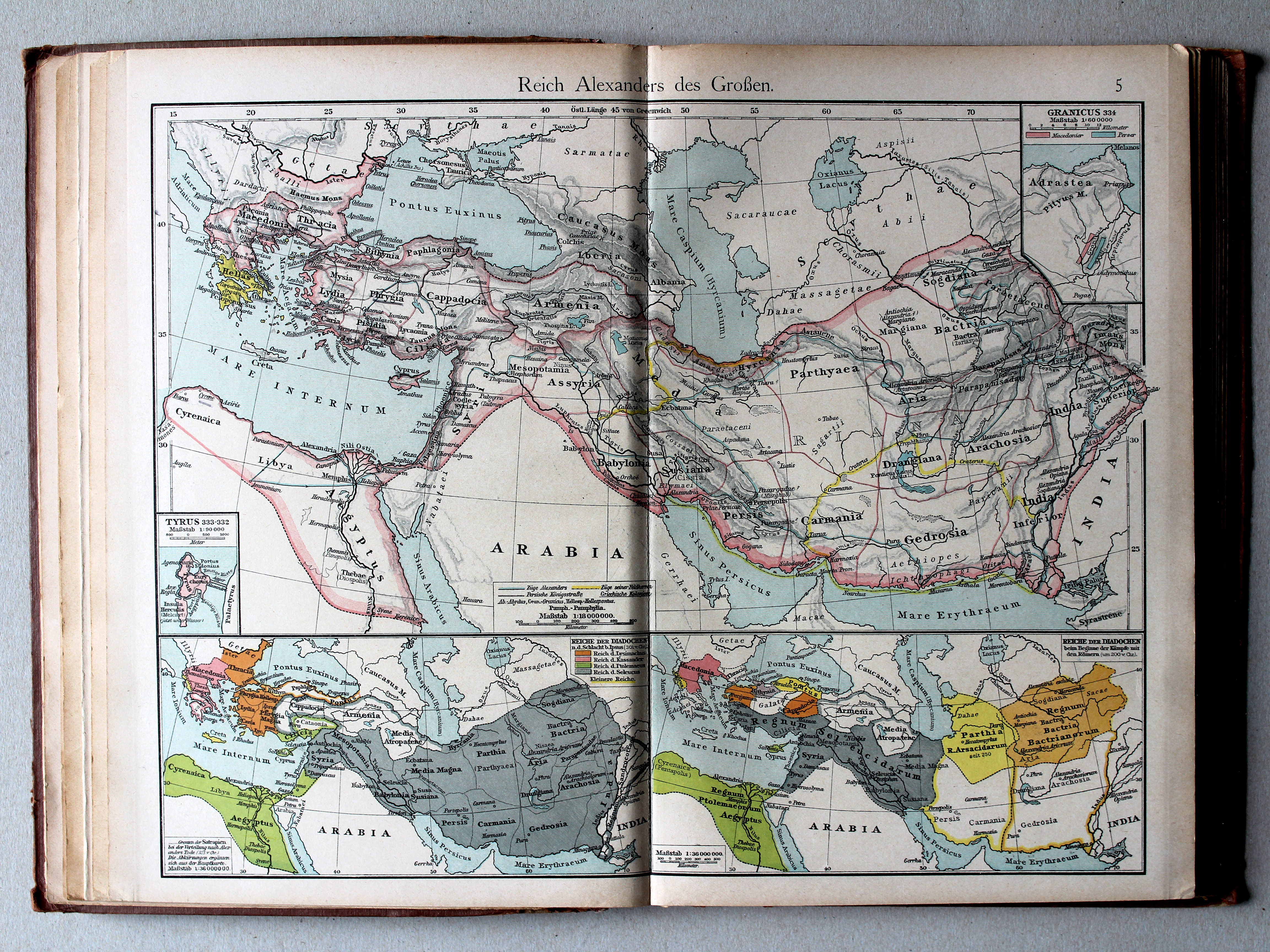
5. Reich Alexanders des Grossen XL
Het Rijk van Alexander de Grote / The Empire of Alexander the Great

 Shepherd, Historical Atlas, 1927
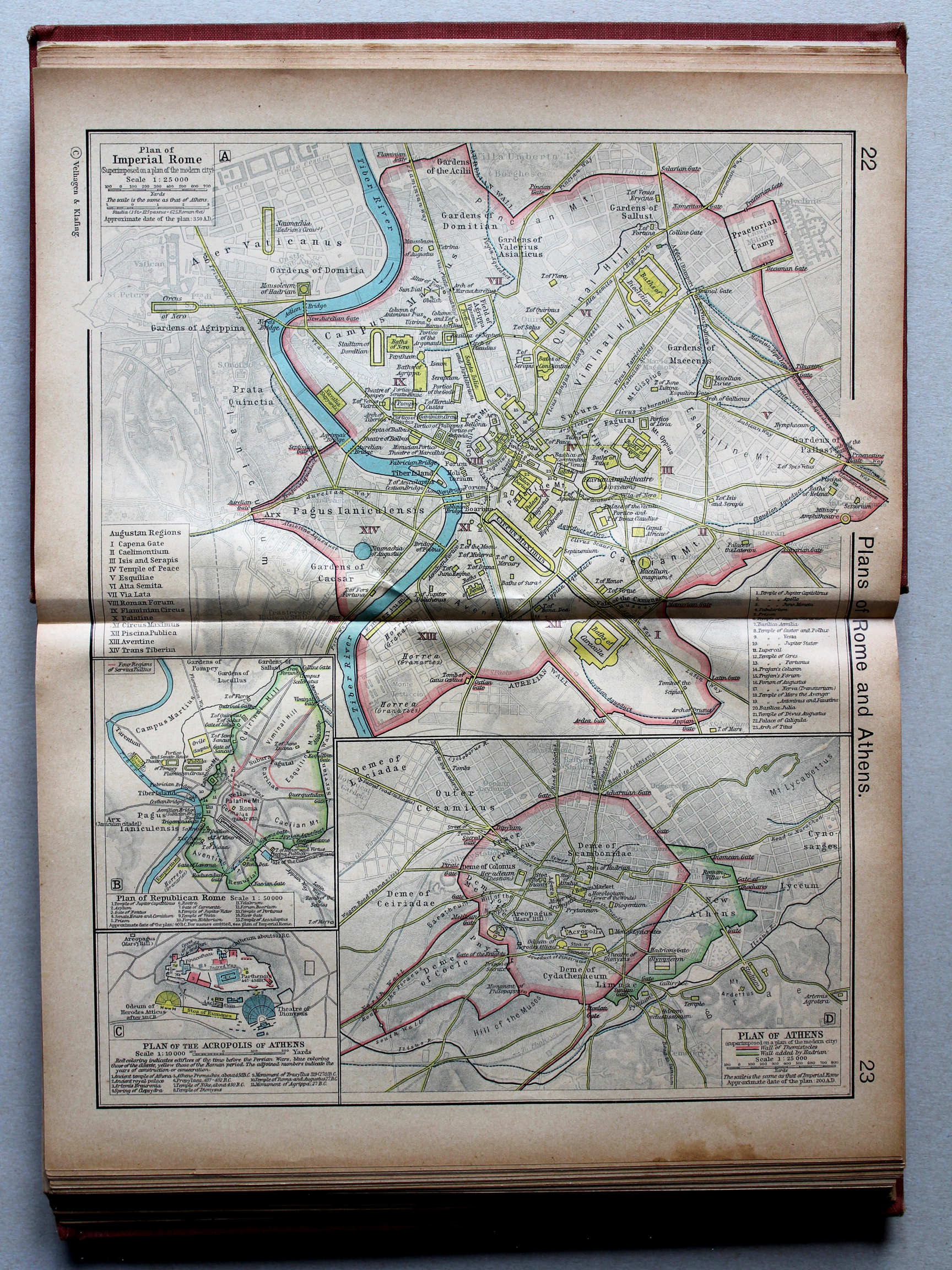
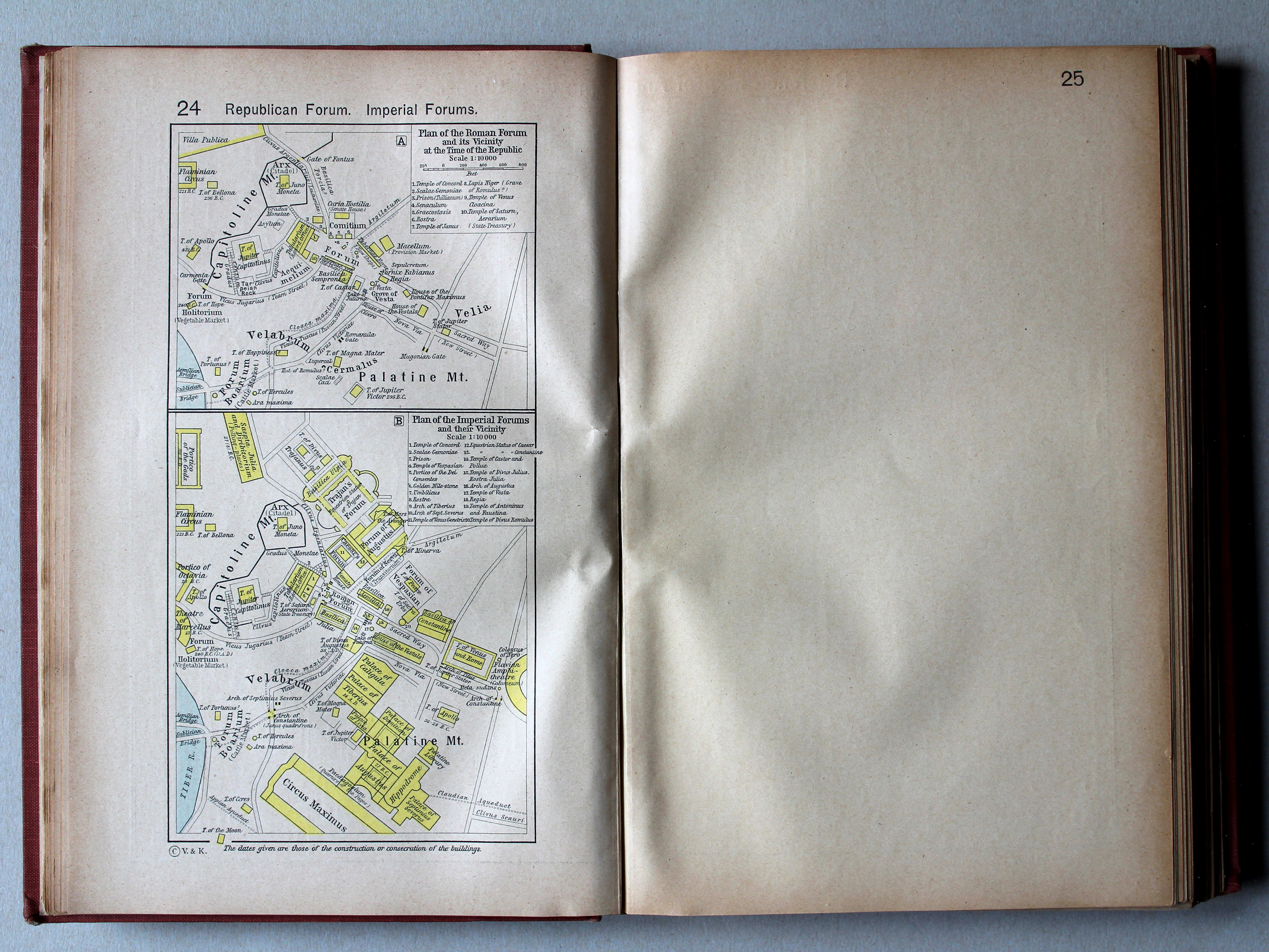
24. Republican Forum. Imperial Forums XL
Forum tijdens de Republiek. Fora in de Keizertijd
 Putzgers Historischer Schul-Atlas, 1918
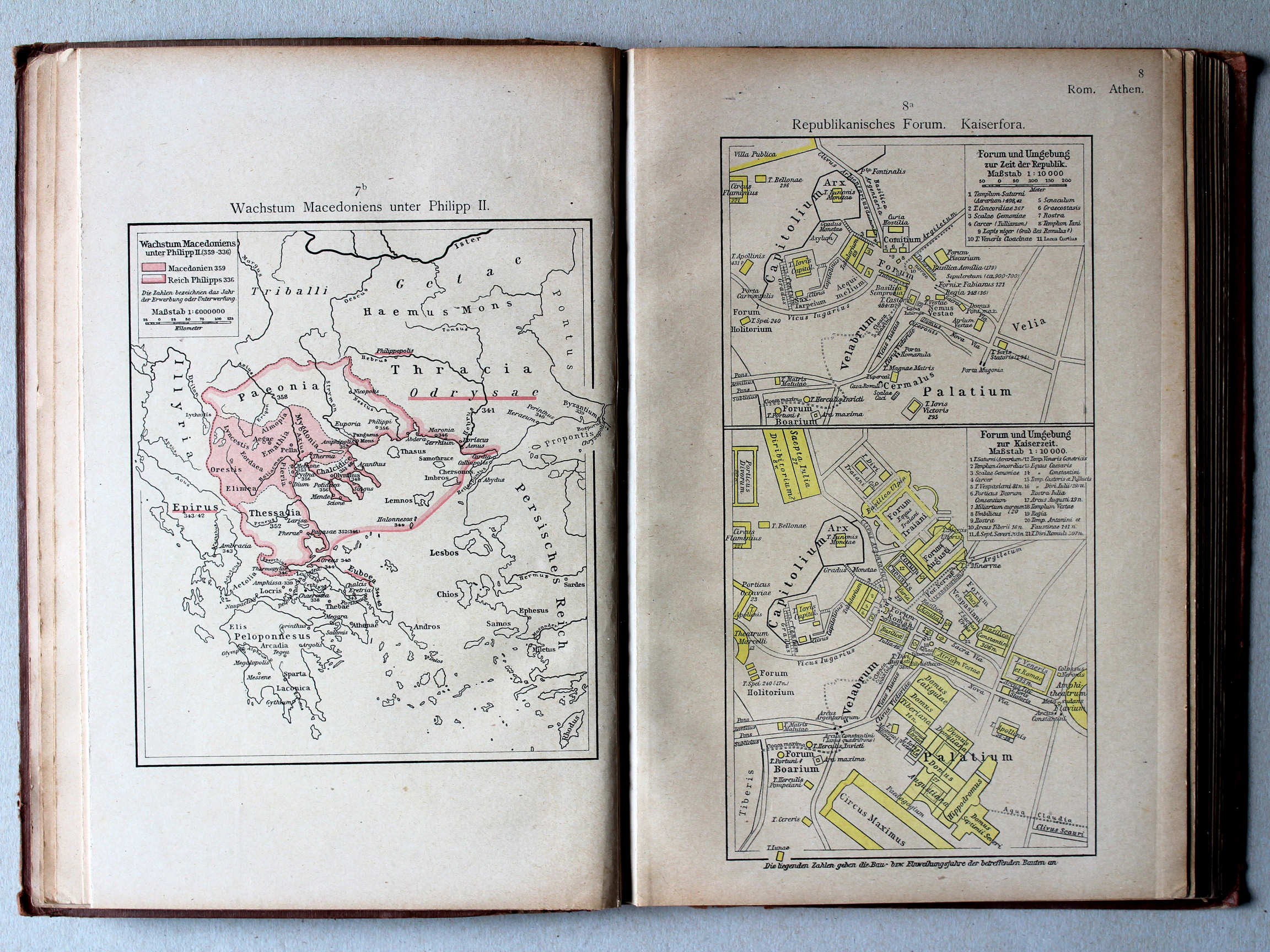
7b. Wachstum Macedoniens unter Philipp II XL
Groei van Macedonië onder Philippus II / Growth of Macedonia under Philip II
8a. Republikanisches Forum. Kaiserfora XL
Forum tijdens de Republiek. Fora in de Keizertijd / Forum during the Republic. Fora in the Imperial period
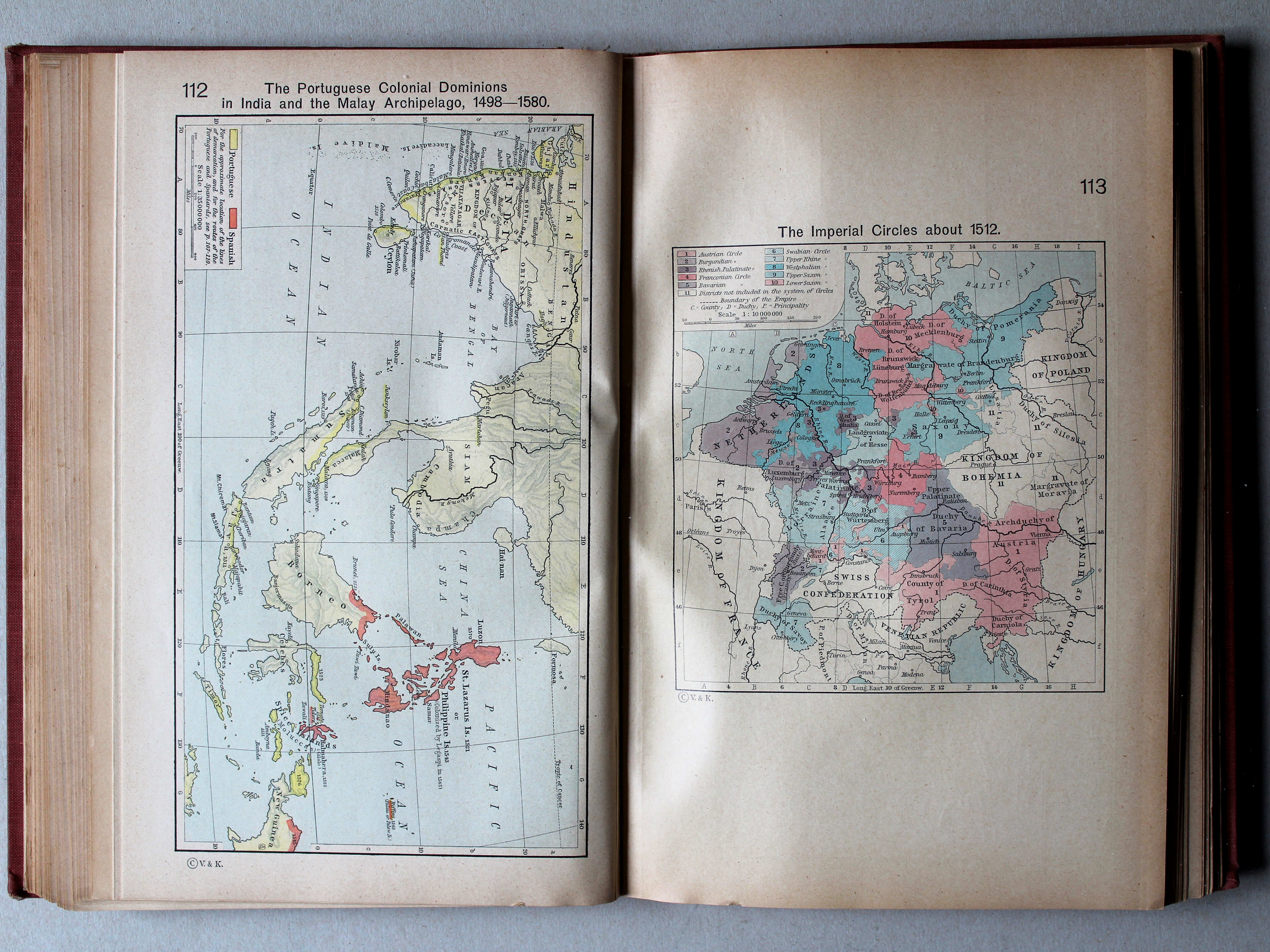
 Shepherd, Historical Atlas, 1927
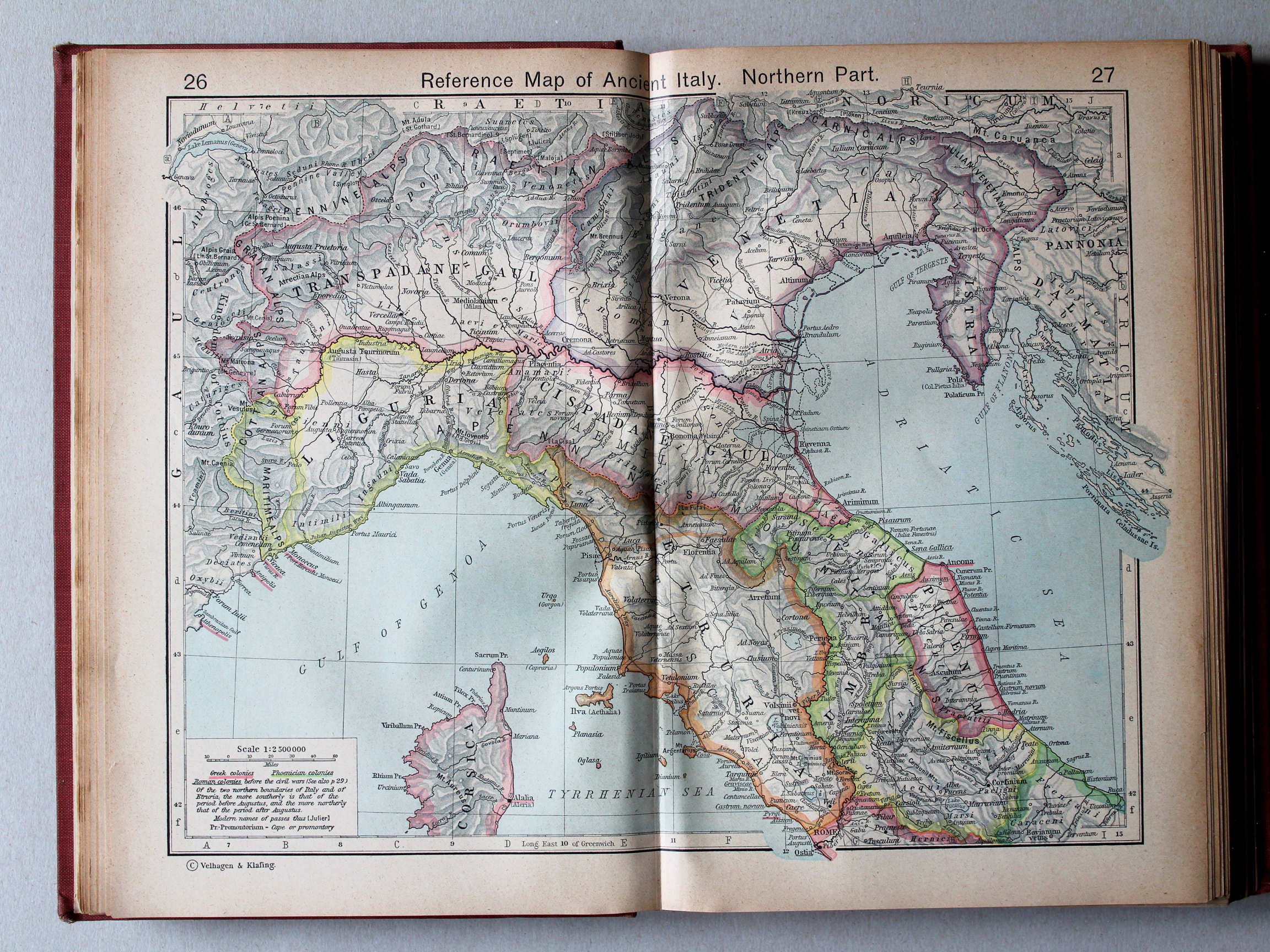
26.27. Reference Map of Ancient Italy. Northern Part XL
Italië in de Oudheid, noordelijk deel
 Putzgers Historischer Schul-Atlas, 1918
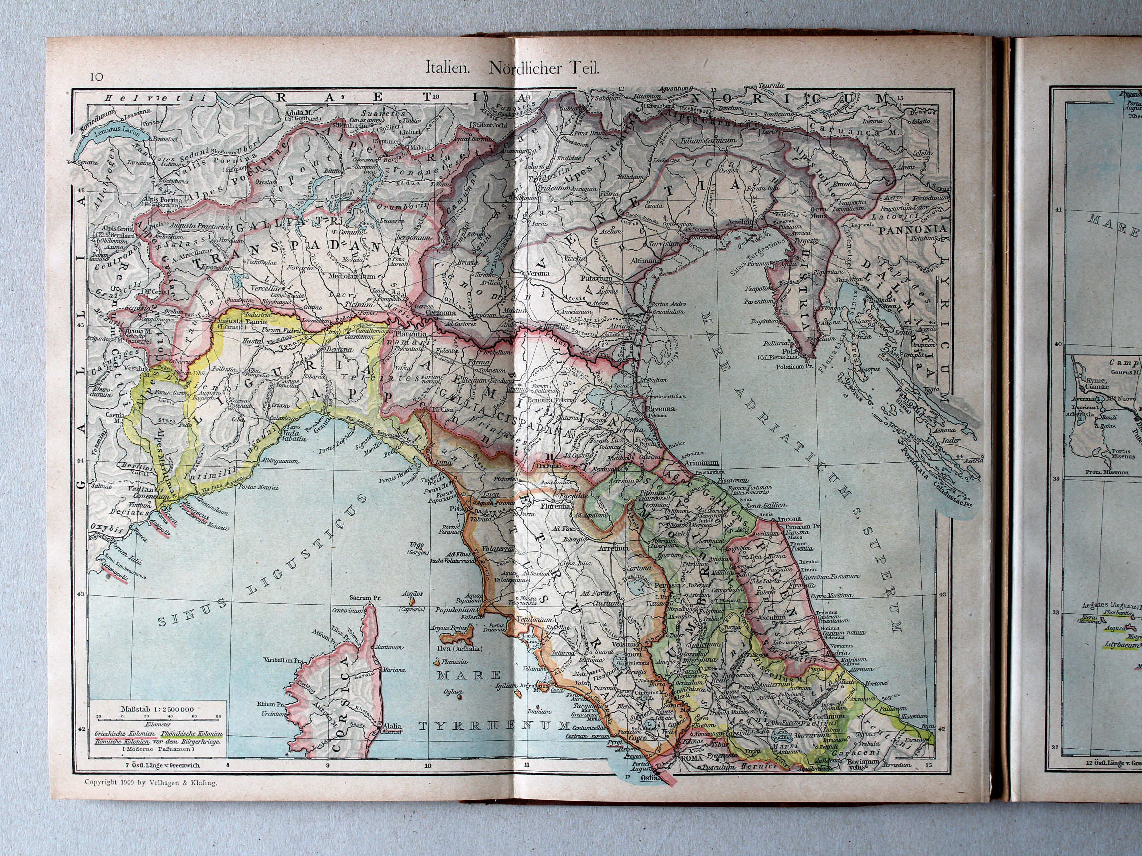
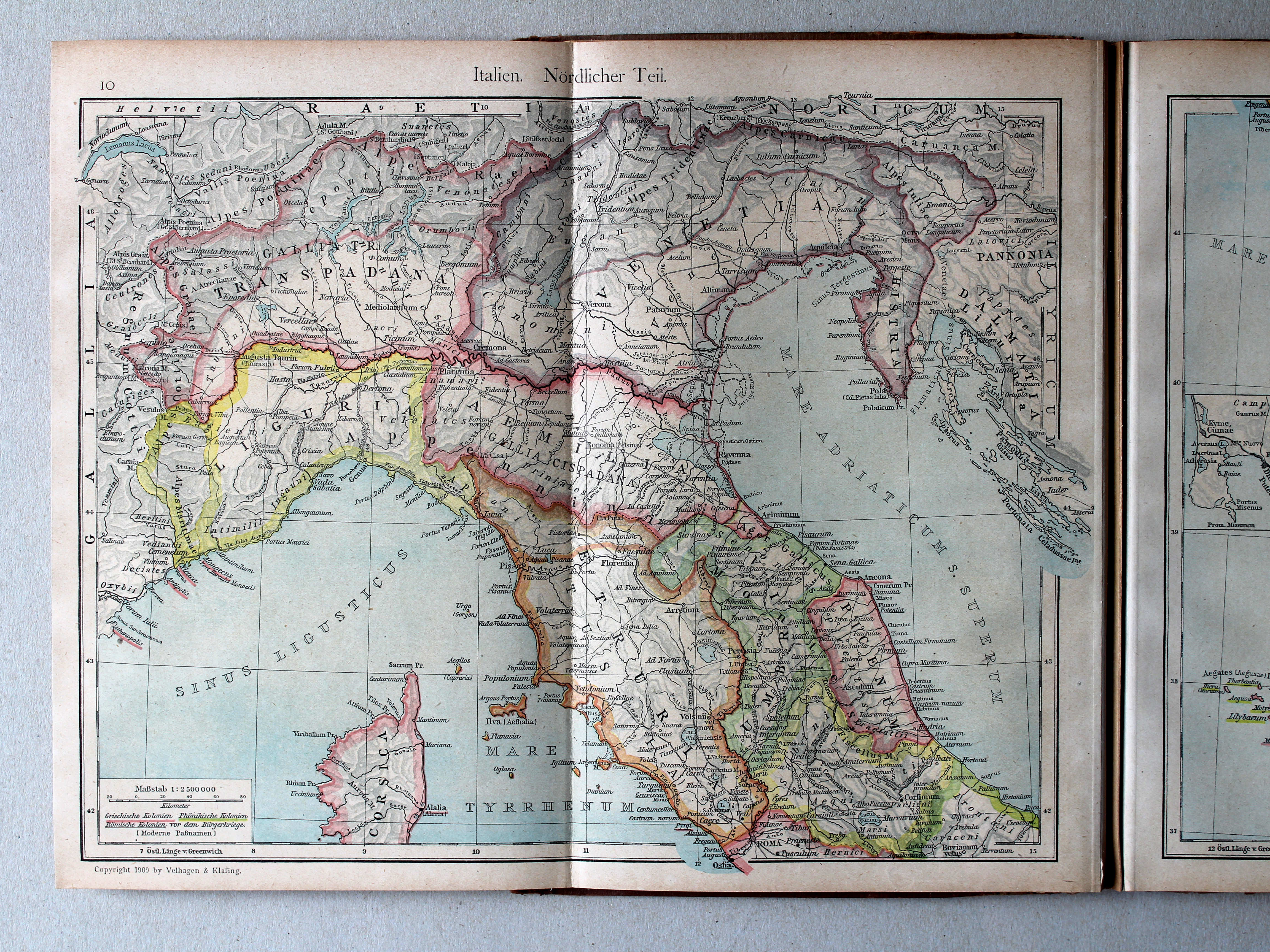
10. Italien. Nördlicher Teil XL
Italië, noordelijk deel / Italy, northern part
 Shepherd, Historical Atlas, 1927
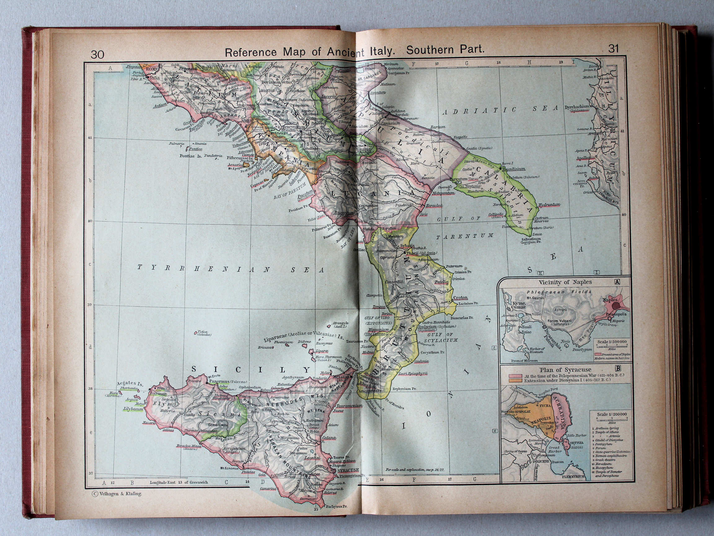
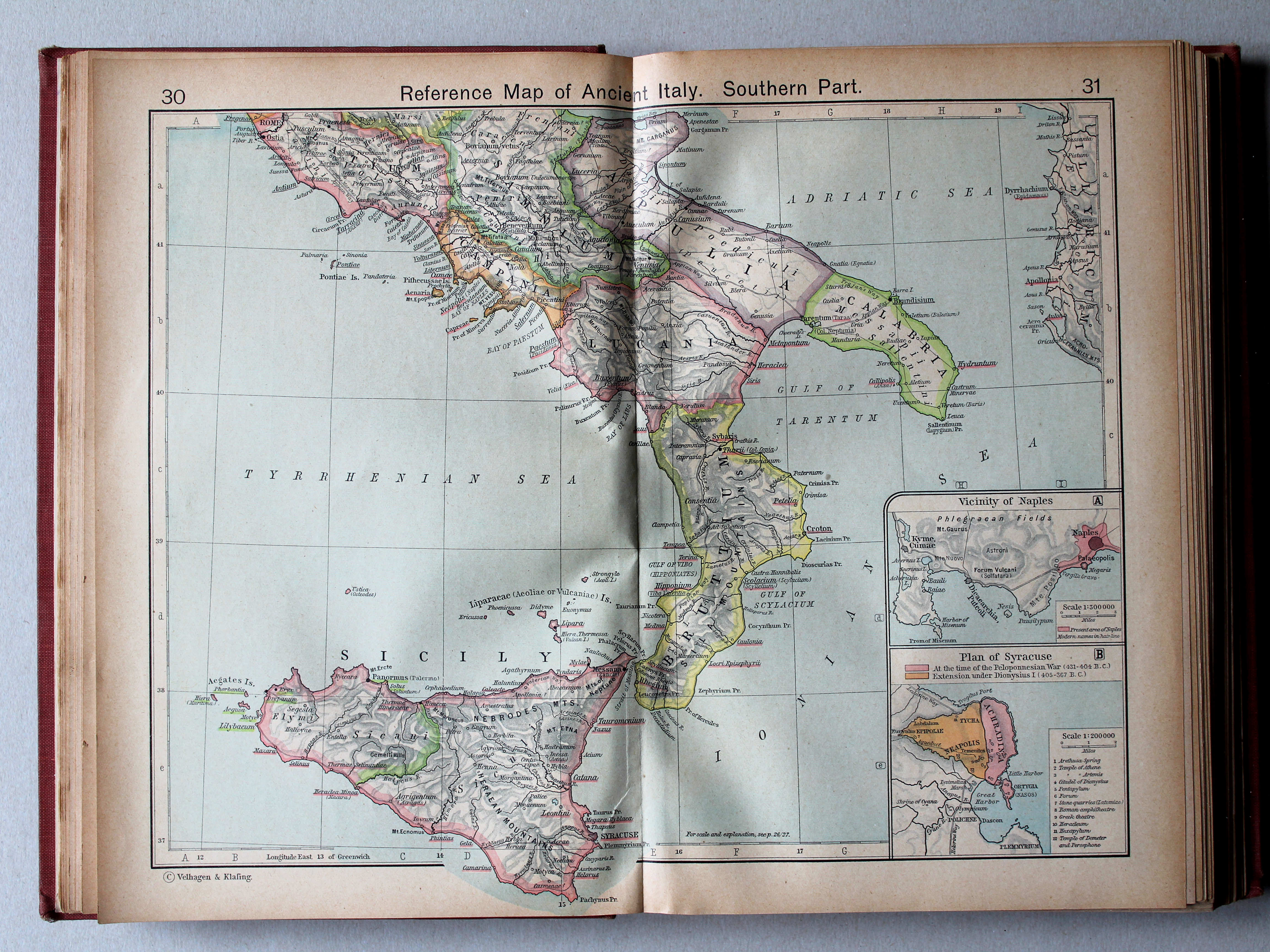
30.31. Reference Map of Ancient Italy. Southern Part XL
Italië in de Oudheid, zuidelijk deel
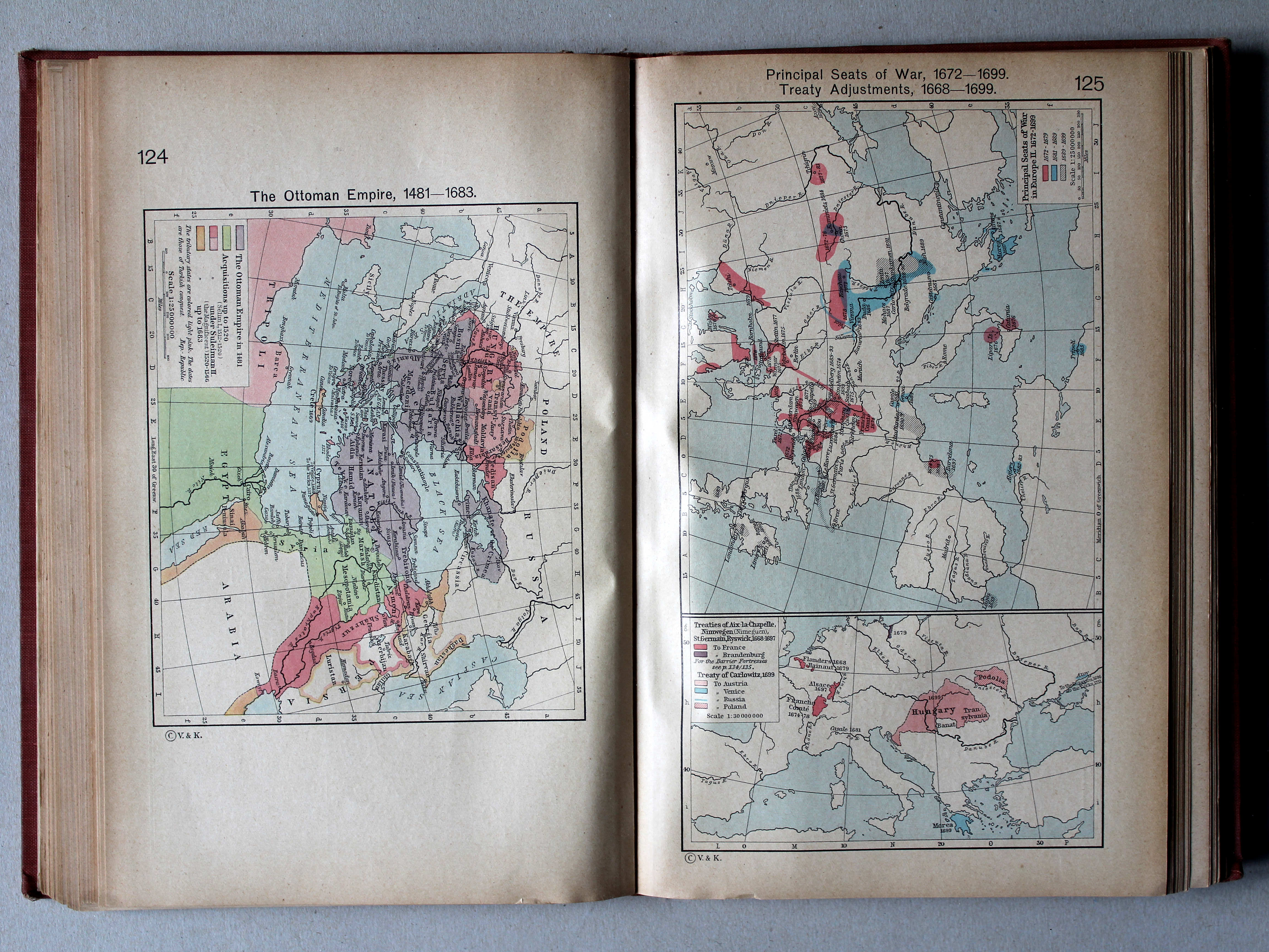
 Putzgers Historischer Schul-Atlas, 1918
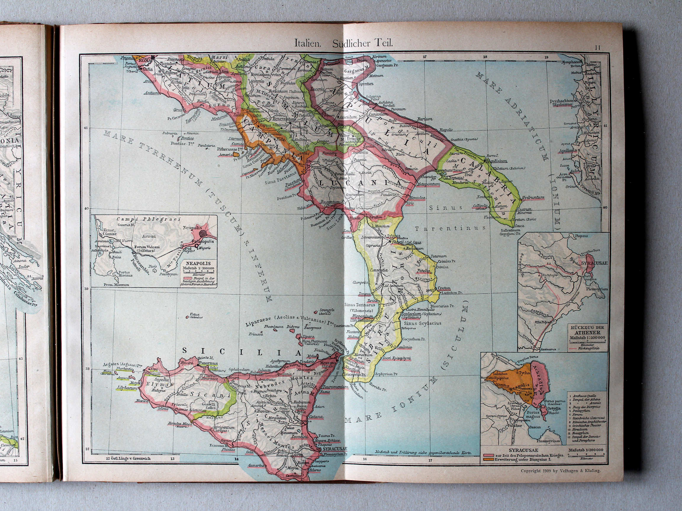
11. Italien. Südlicher Teil XL
Italië, zuidelijk deel / Italy, southern part
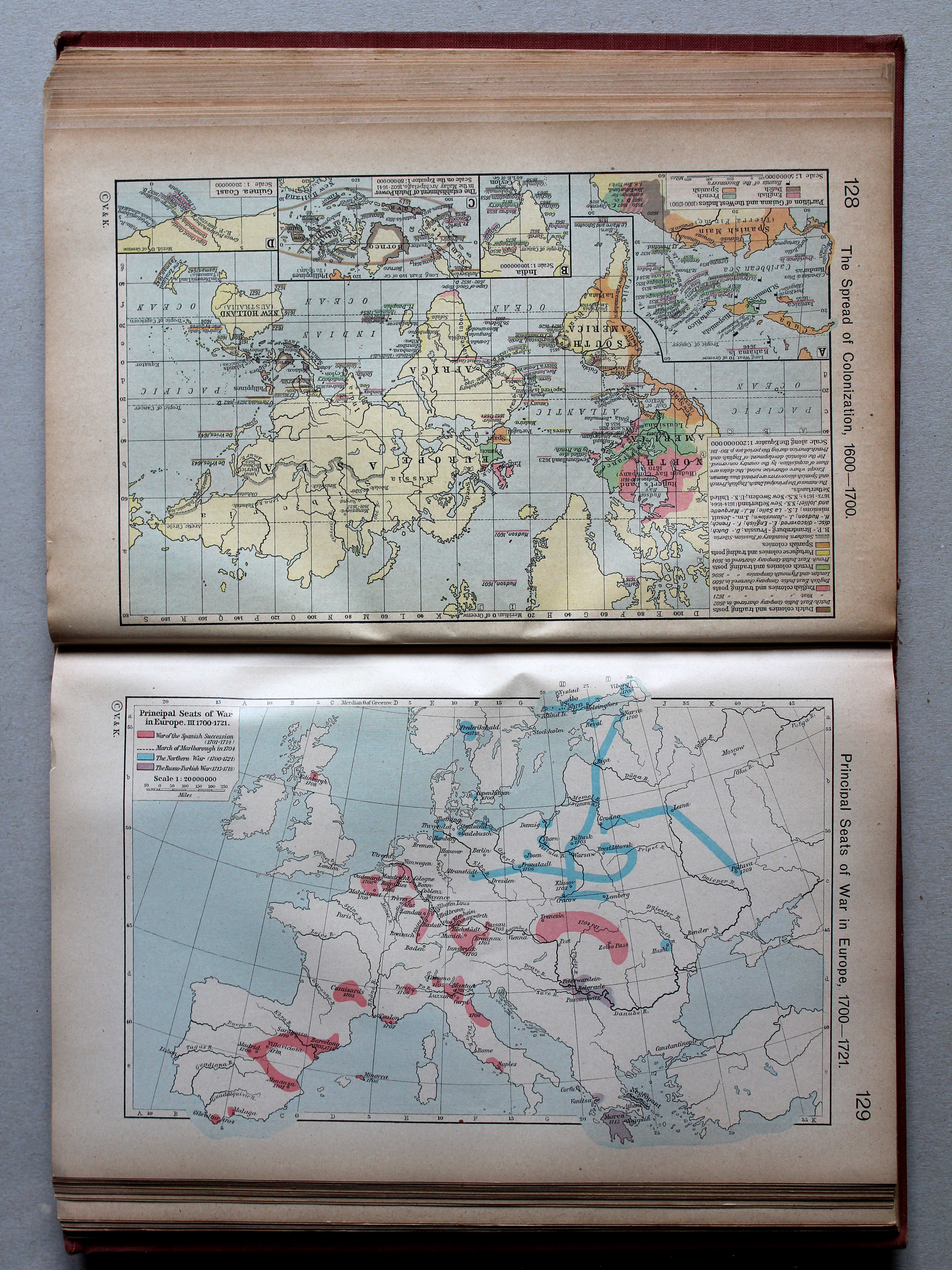
 Shepherd, Historical Atlas, 1927
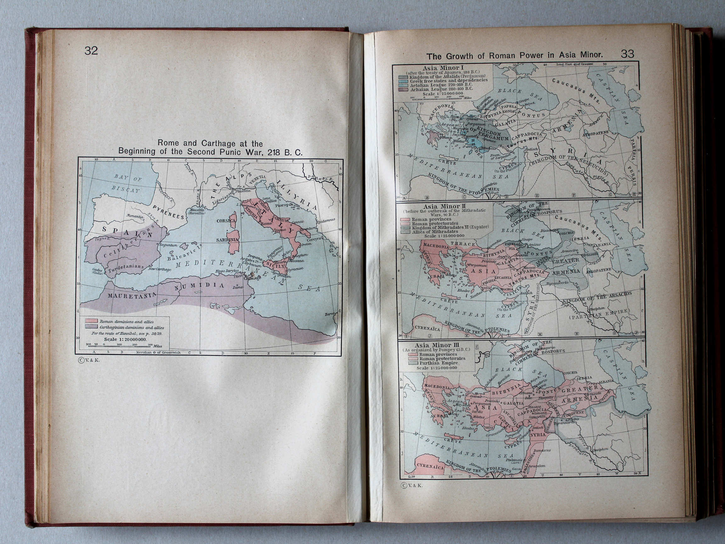
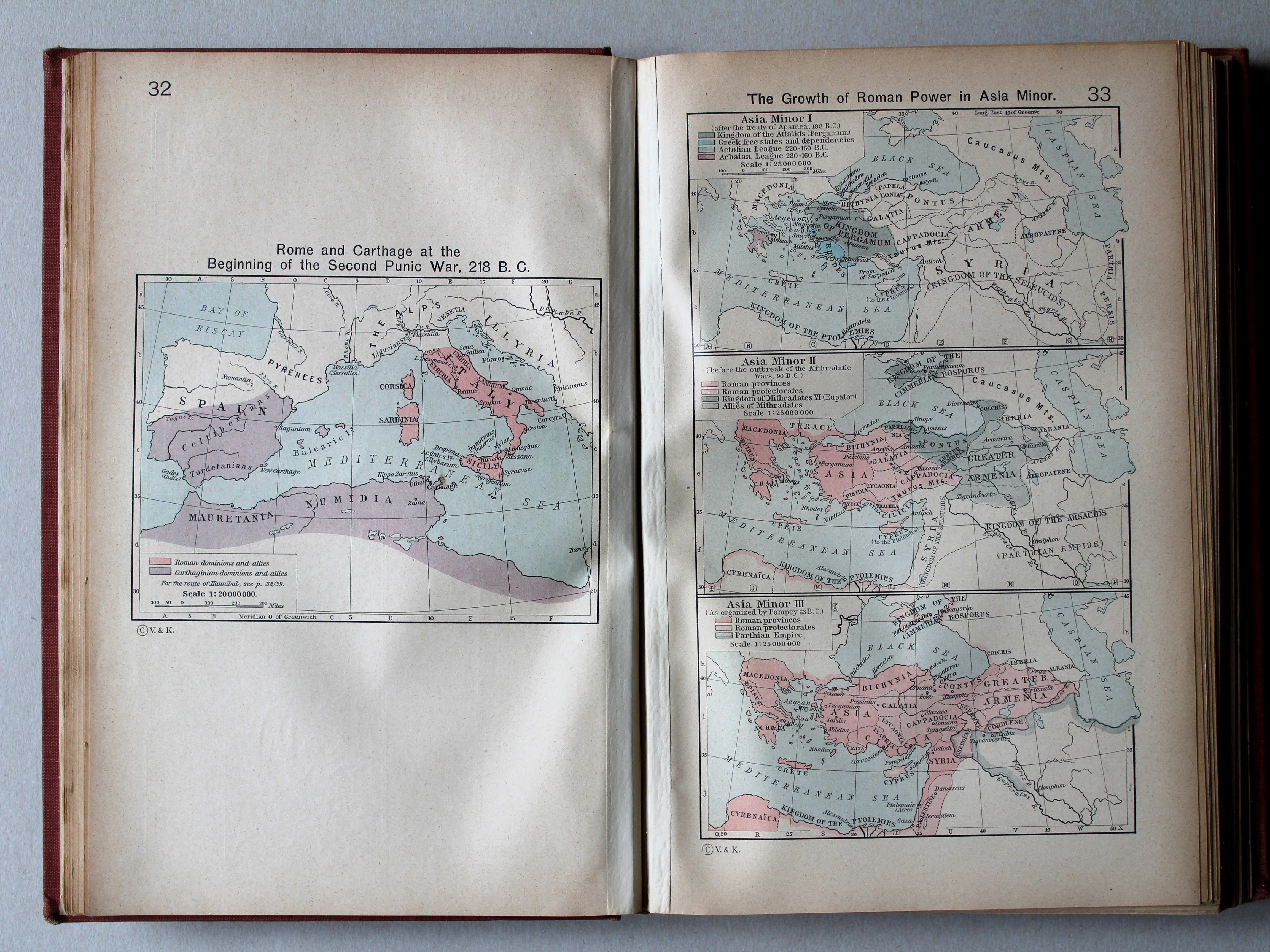
32. Rome and Carthage at the Beginning of the Second Punic War, 218 B. C. XL
Rome en Carthago aan het begin van de Tweede Punische Oorlog, 218 v. Chr.
33. The Growth of Roman Power in Asia Minor XL
Toename van de macht van Rome in Klein-Azië
 Putzgers Historischer Schul-Atlas, 1918
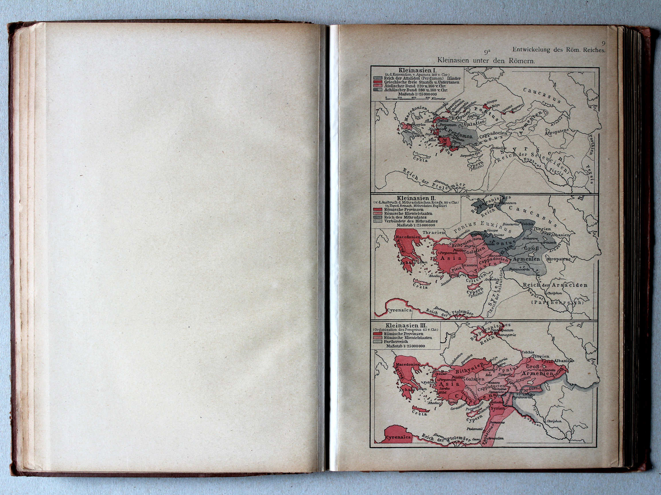
9a. Kleinasien unter den Römern XL
Klein-Azië onder de Romeinen / Asia Minor under the Romans
 Shepherd, Historical Atlas, 1927
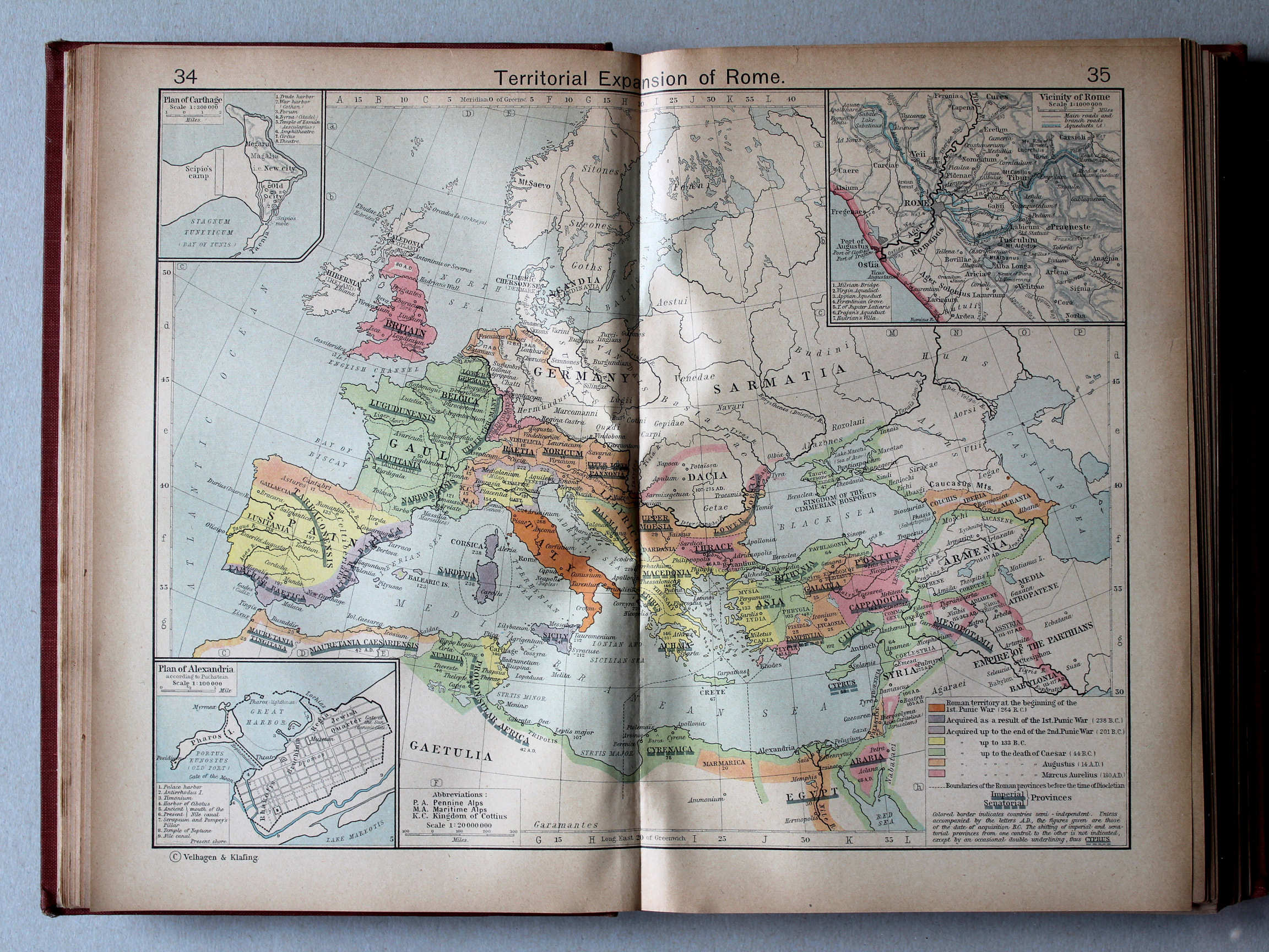
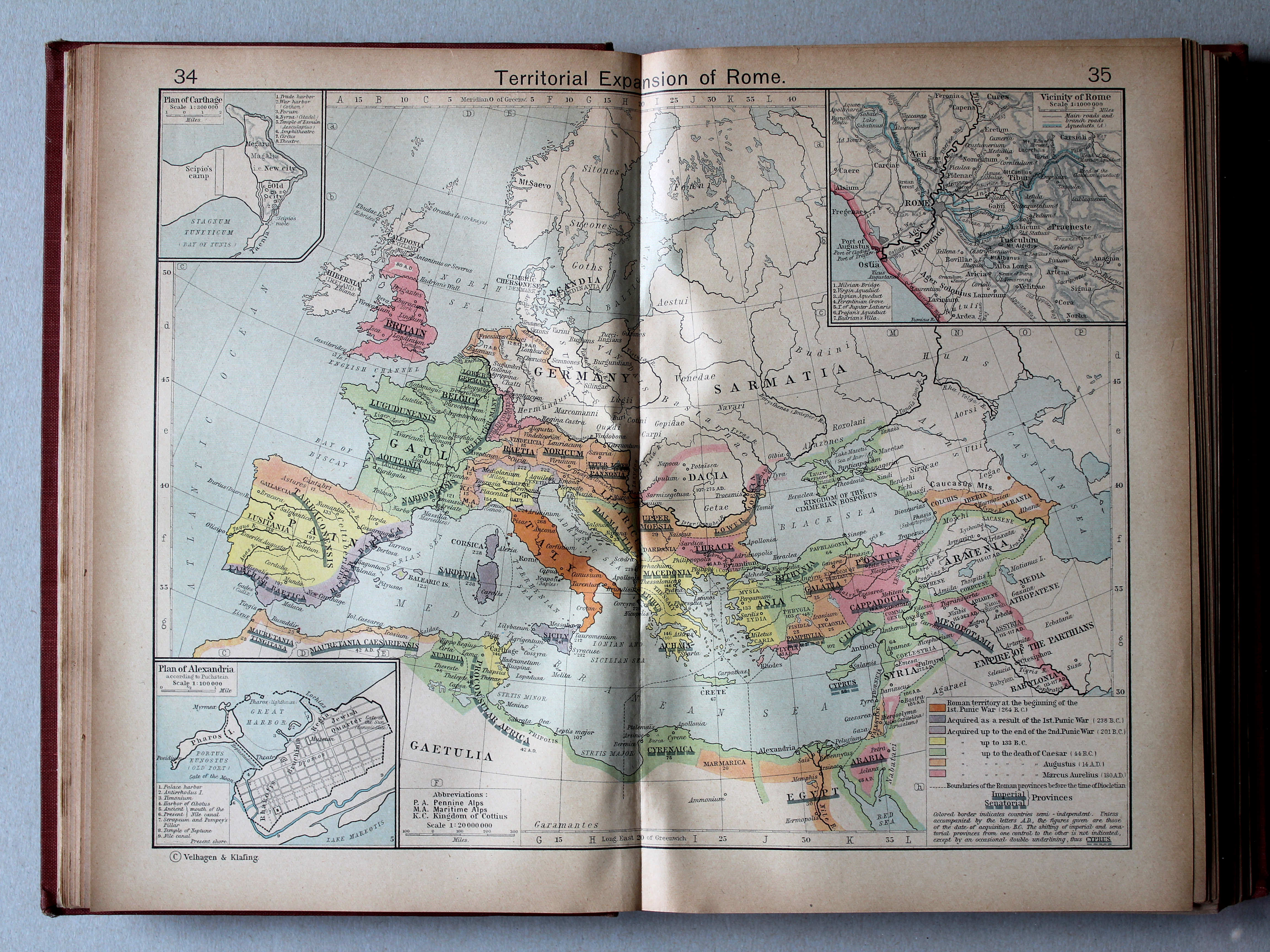
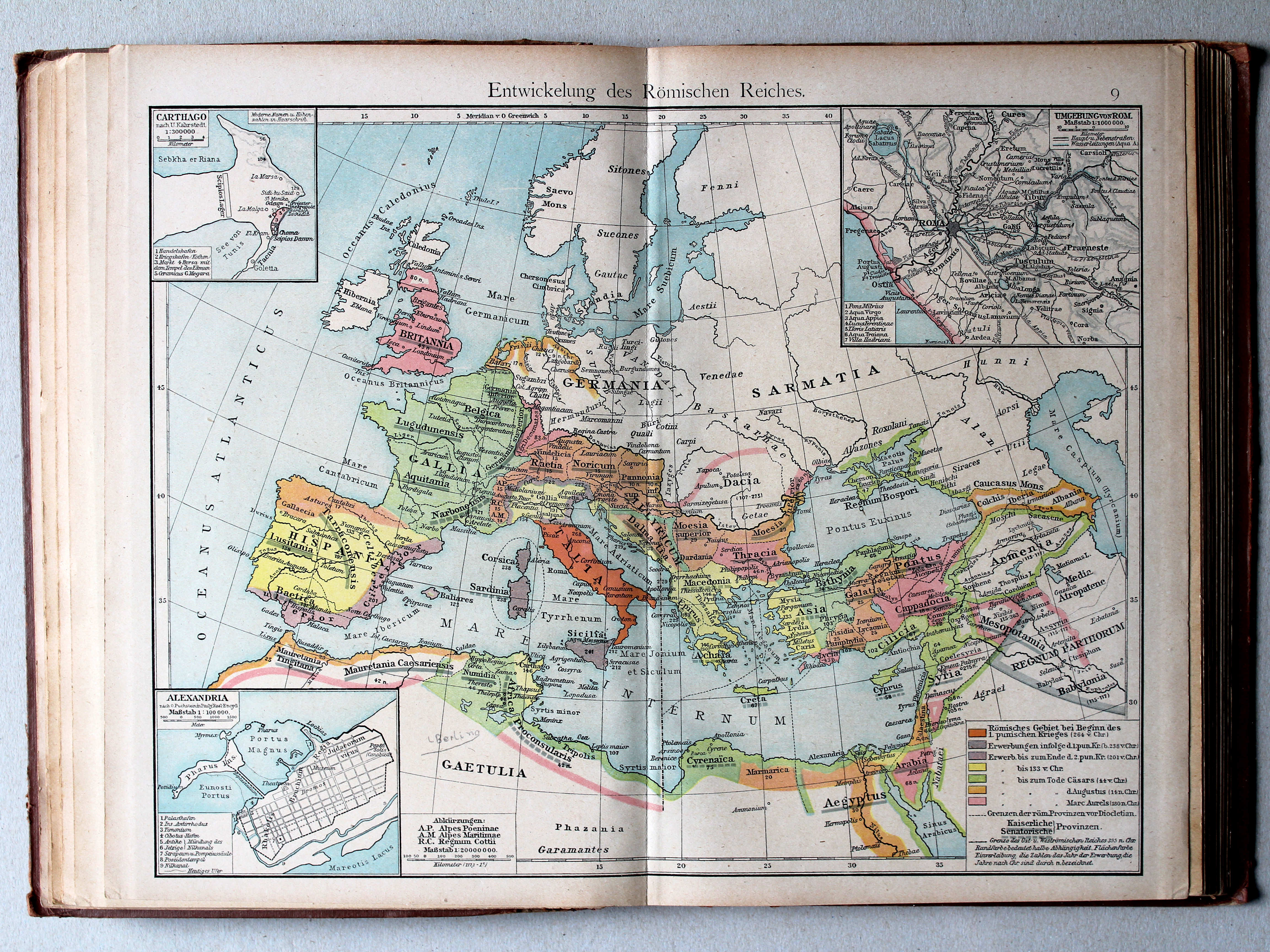
34.35. Territorial Expansion of Rome XL
Groei van het Romeinse Rijk
 Putzgers Historischer Schul-Atlas, 1918
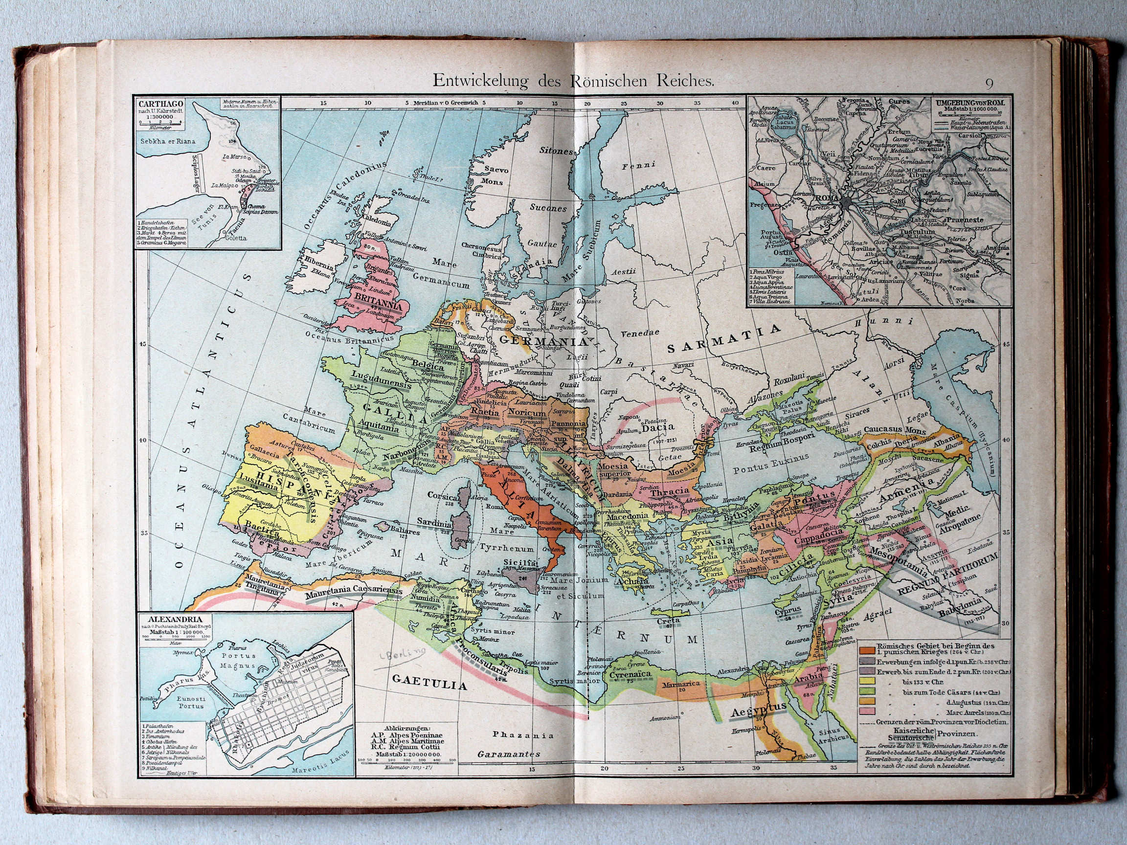
9. Entwickelung des Römischen Reiches XL
Ontwikkeling van het Romeinse Rijk / Development of the Roman Empire
 Shepherd, Historical Atlas, 1927
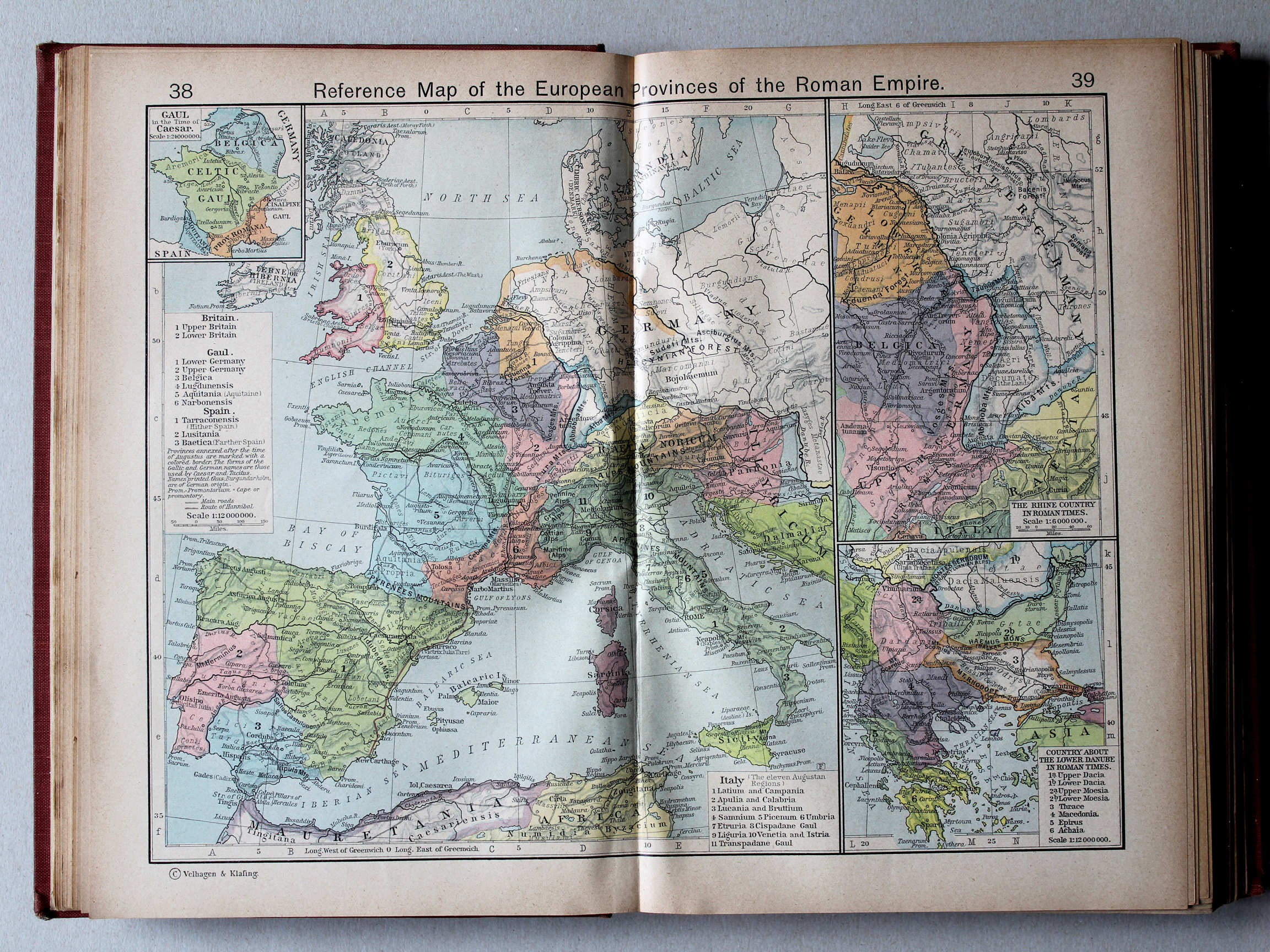
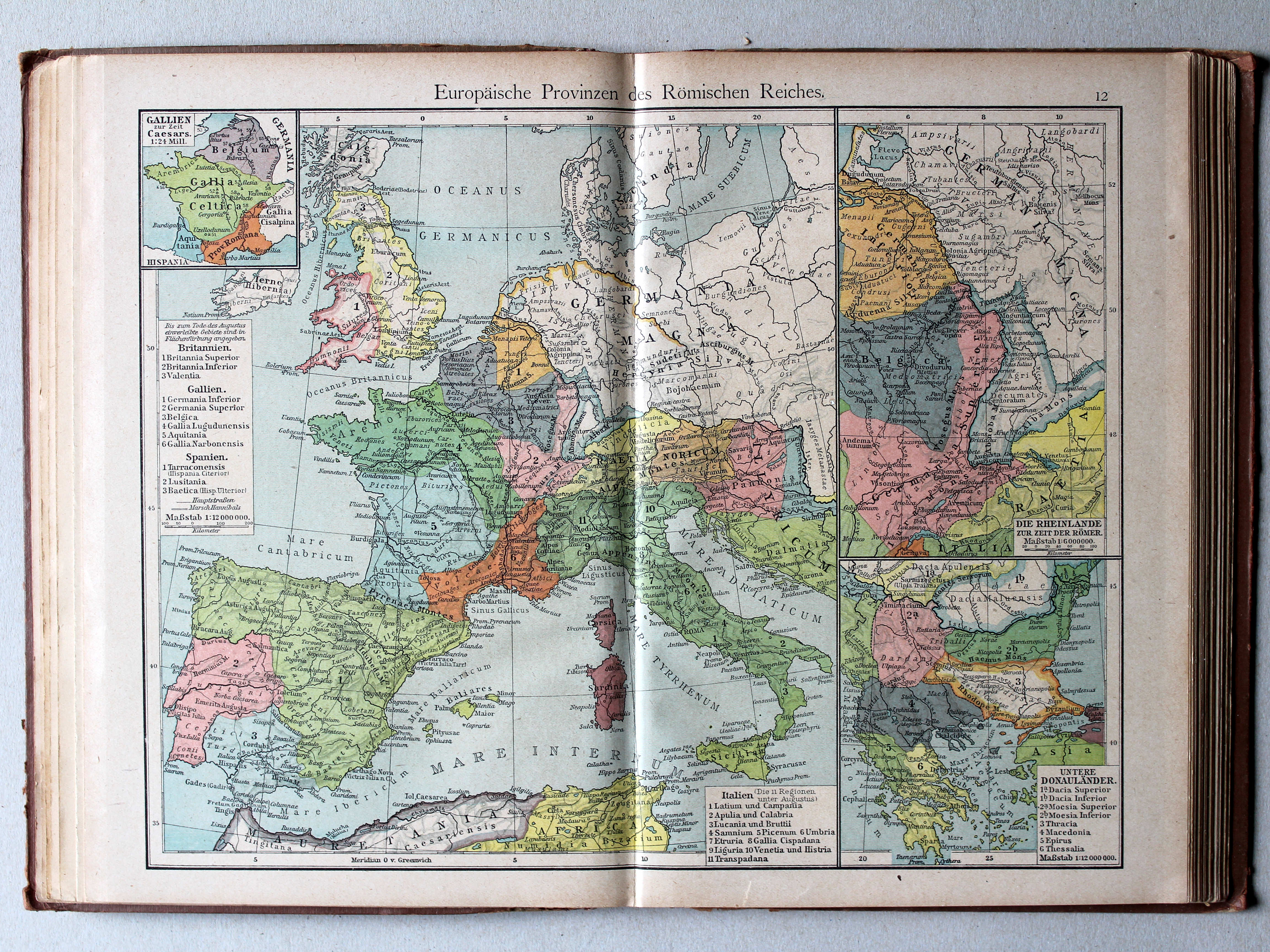
38.39. Reference Map of the European Provinces of the Roman Empire XL
Europese provincies van het Romeinse Rijk
 Putzgers Historischer Schul-Atlas, 1918
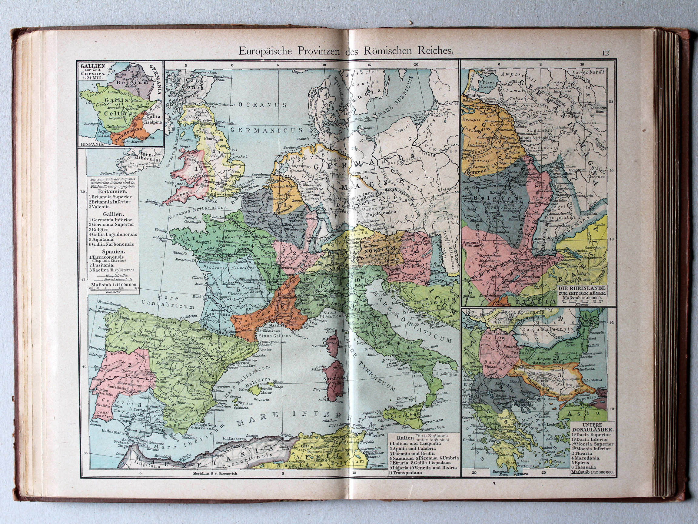
12. Europäische Provinzen des Römischen Reiches XL
Europese provincies van het Romeinse Rijk / European provinces of the Roman Empire
 Shepherd, Historical Atlas, 1927
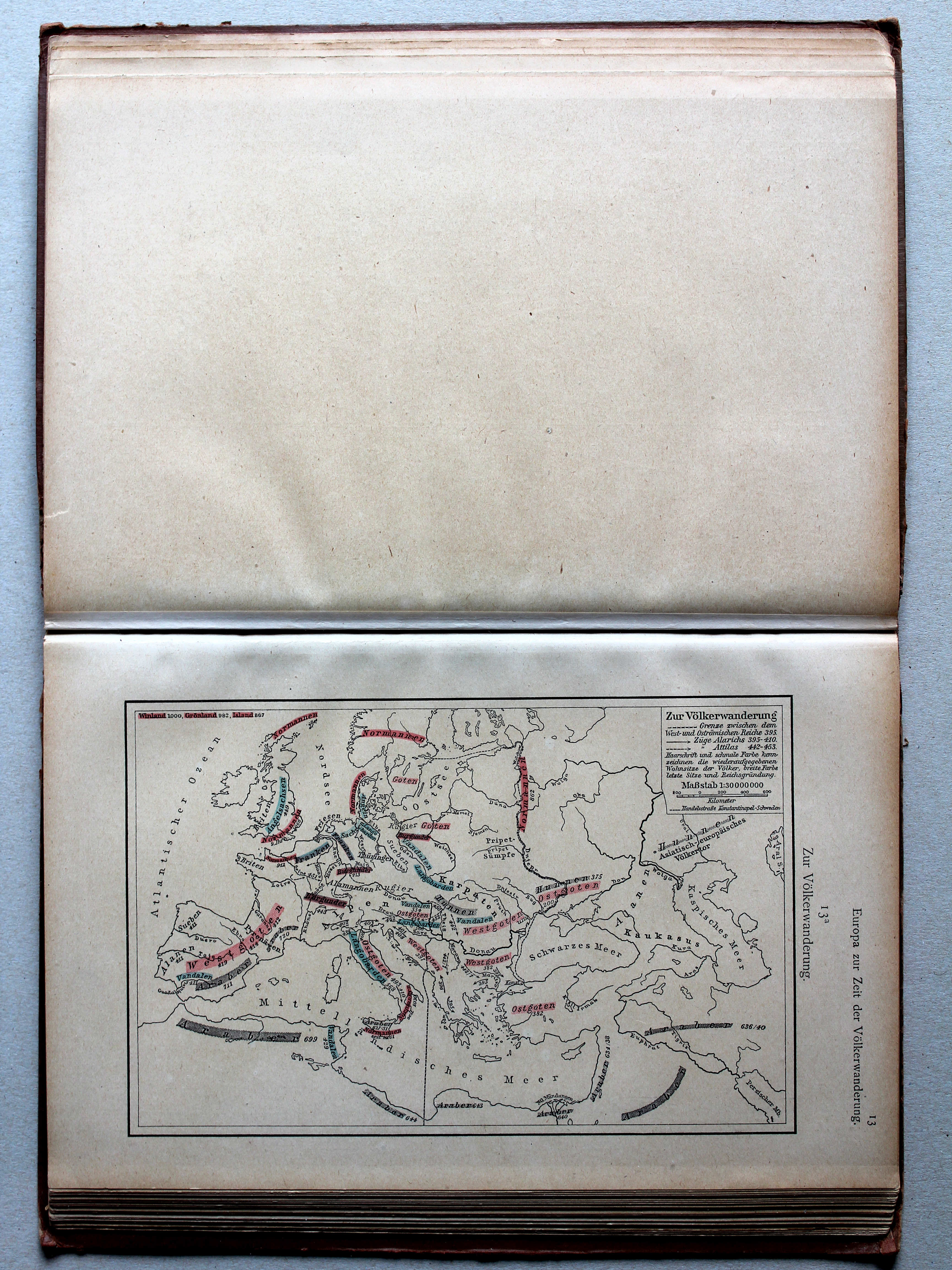
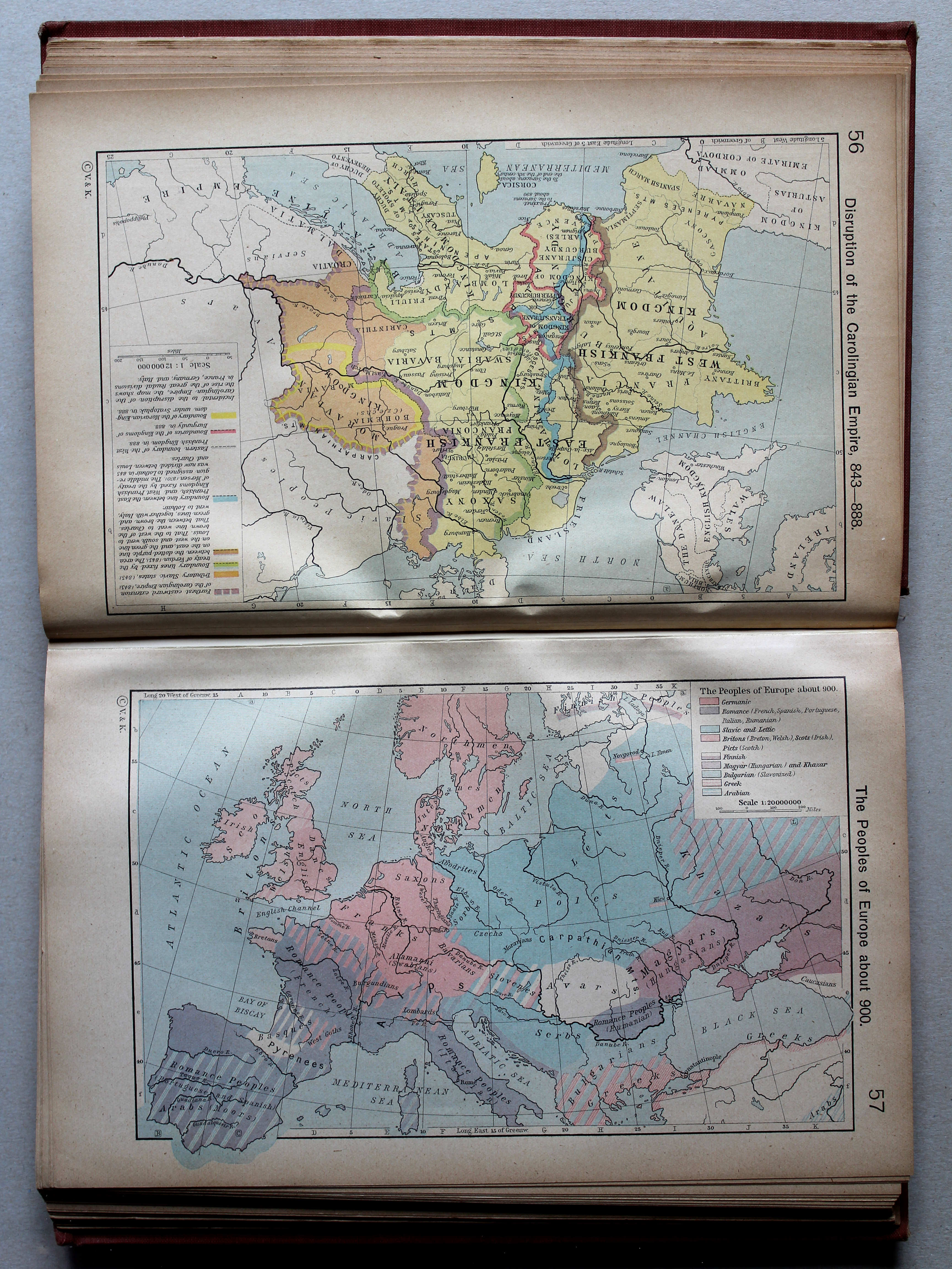
45. Germanic Migrations and Conquests, 150-1066 XL
Germaanse volksverhuizingen en veroveringen, 150-1066
 Putzgers Historischer Schul-Atlas, 1918
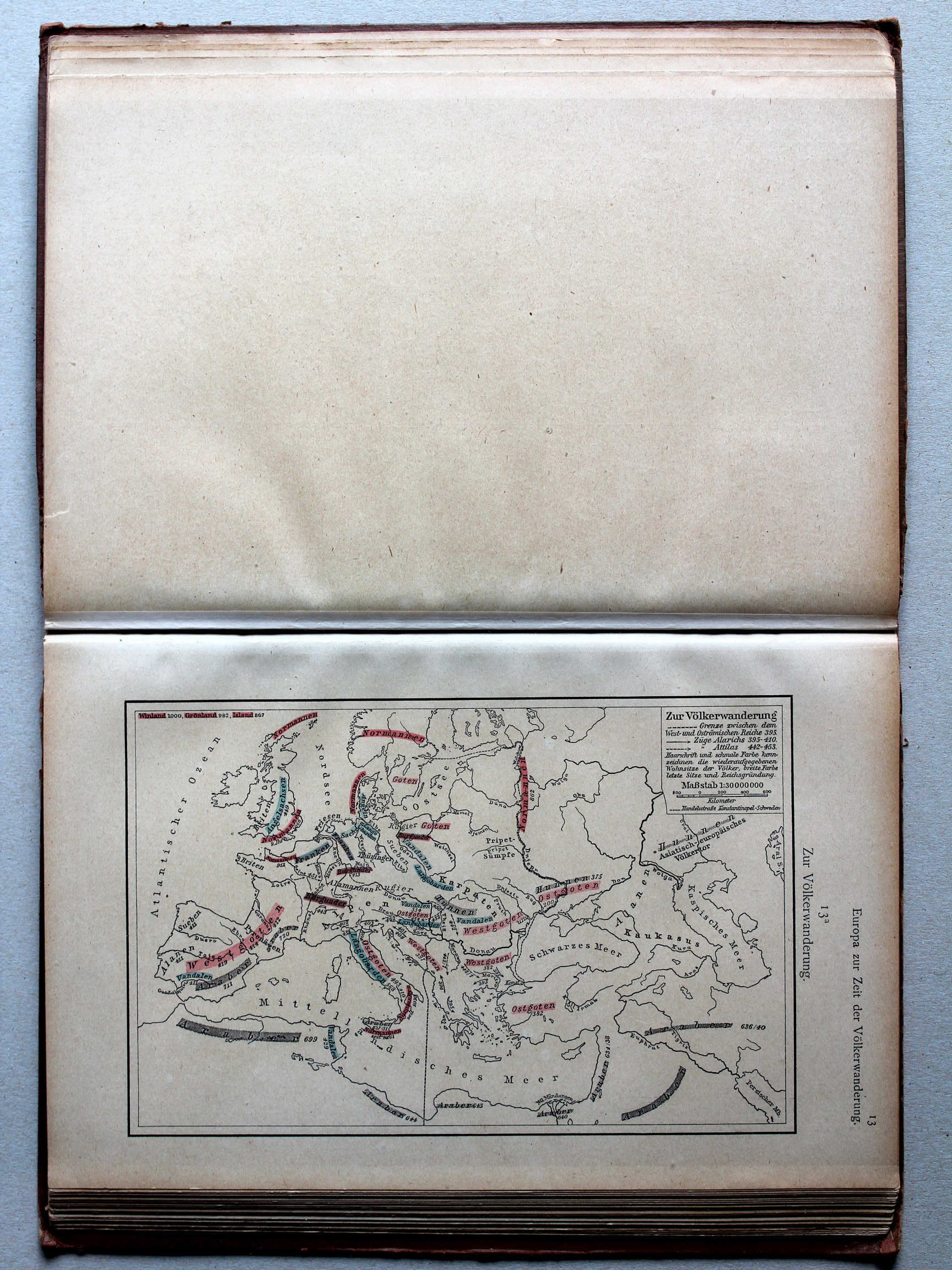
13a. Zur Völkerwanderung XL
De Volksverhuizing / The Migration Period
 Shepherd, Historical Atlas, 1927
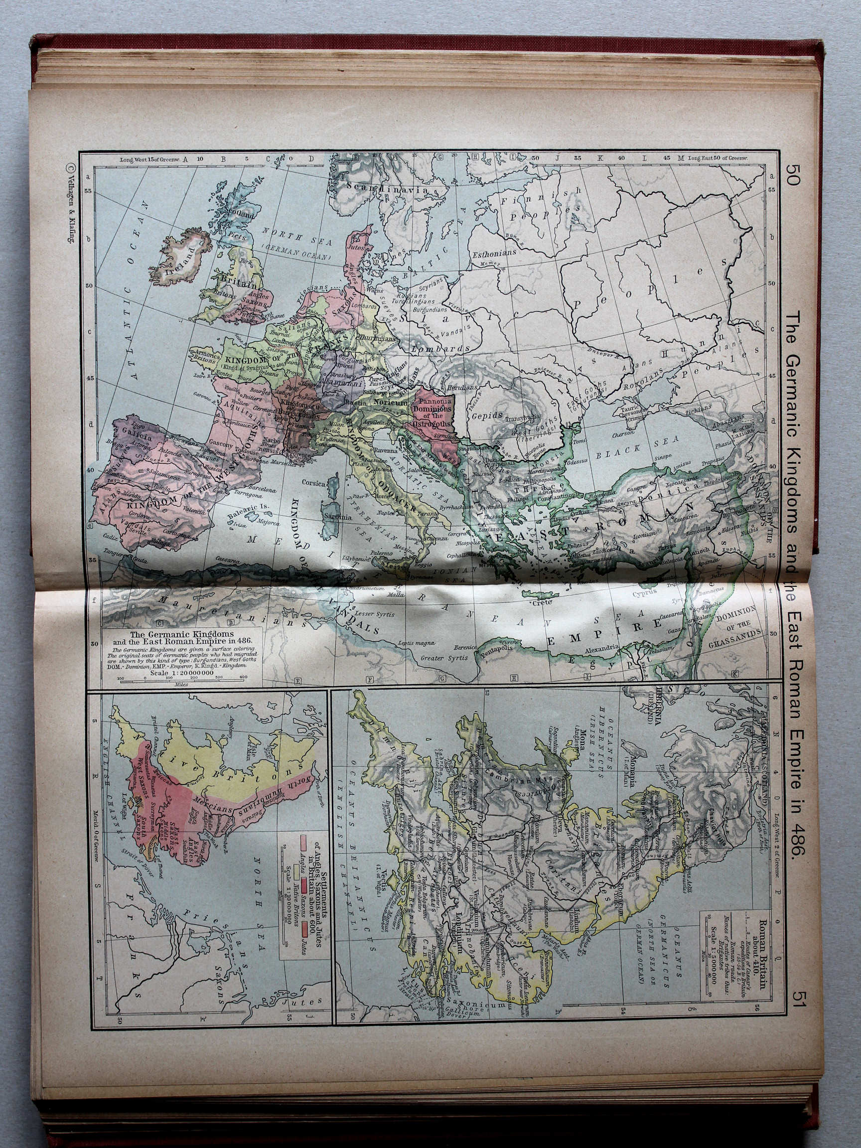
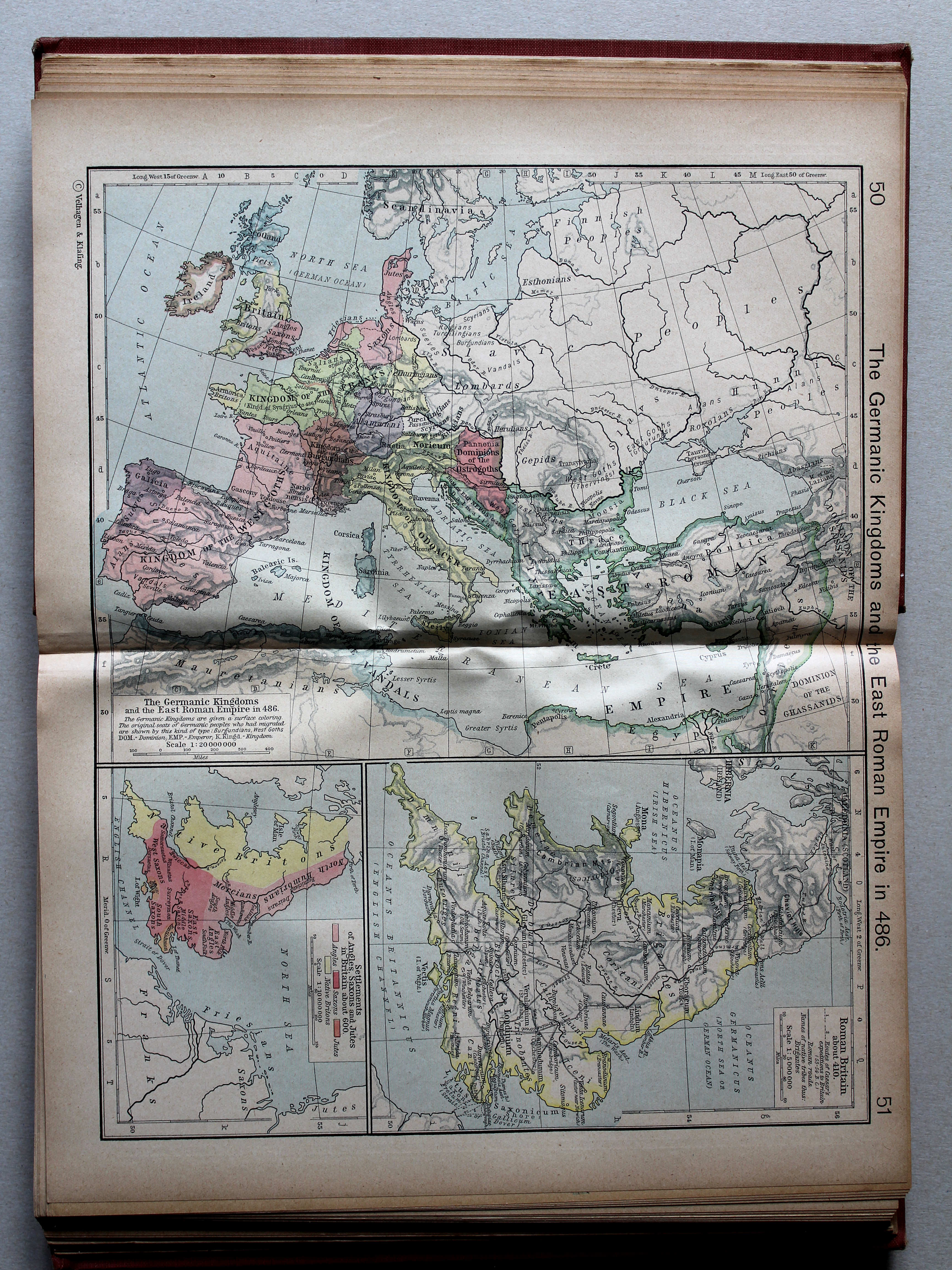
50.51. The Germanic Kingdoms and the East Roman Empire in 486 XL
De Germaanse koninkrijken en het Oost-Romeinse Rijk in 486
 Putzgers Historischer Schul-Atlas, 1918
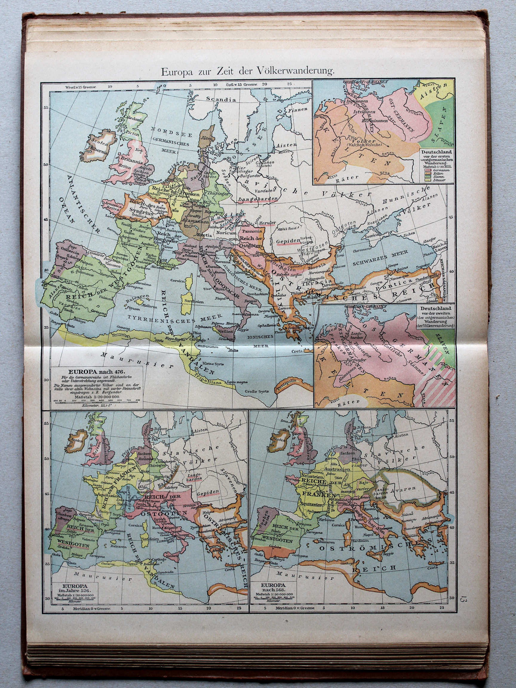
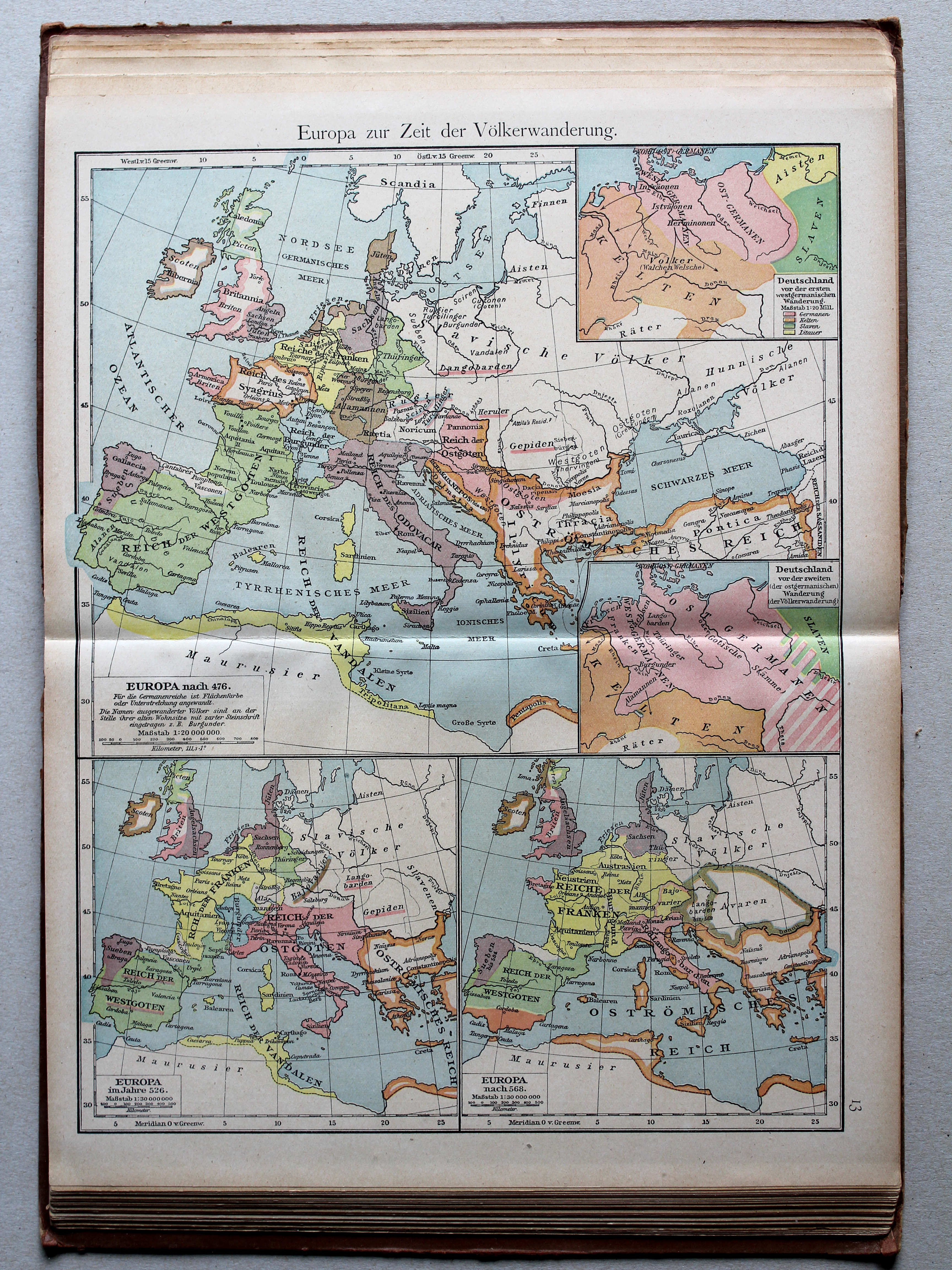
13. Europa zur Zeit der Völkerwanderung XL
Europa aan het einde van de Volksverhuizing / Europe at the end of the Migration Period
 Shepherd, Historical Atlas, 1927
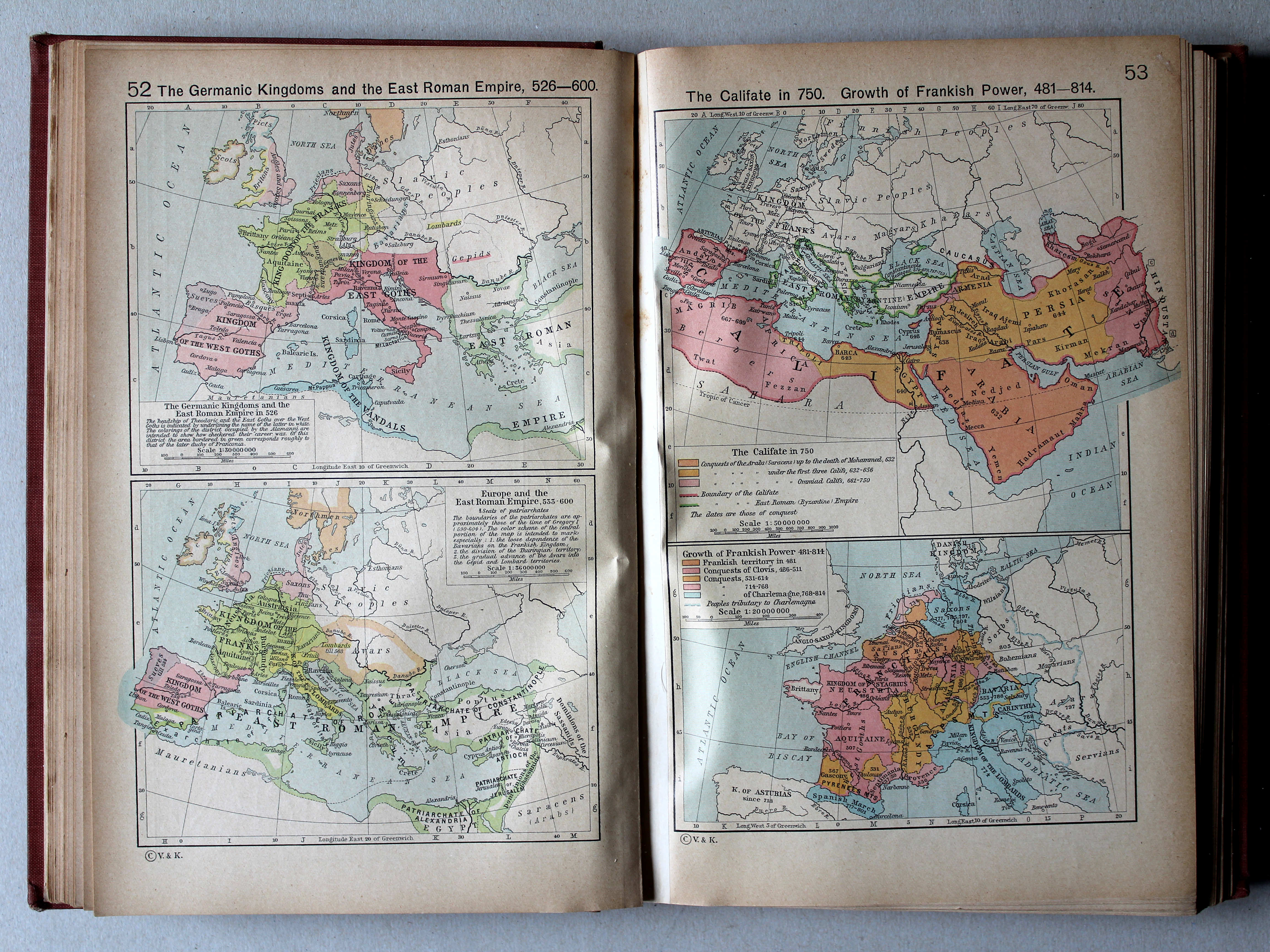
52. The Germanic Kingdoms and the East Roman Empire, 526-600 XL
De Germaanse koninkrijken en het Oost-Romeinse Rijk, 526-600
53. The Califate in 750. Growth of Frankish Power, 481-814 XL
Het Kalifaat in 750. Groei van het Frankische Rijk, 481-814
 Putzgers Historischer Schul-Atlas, 1918
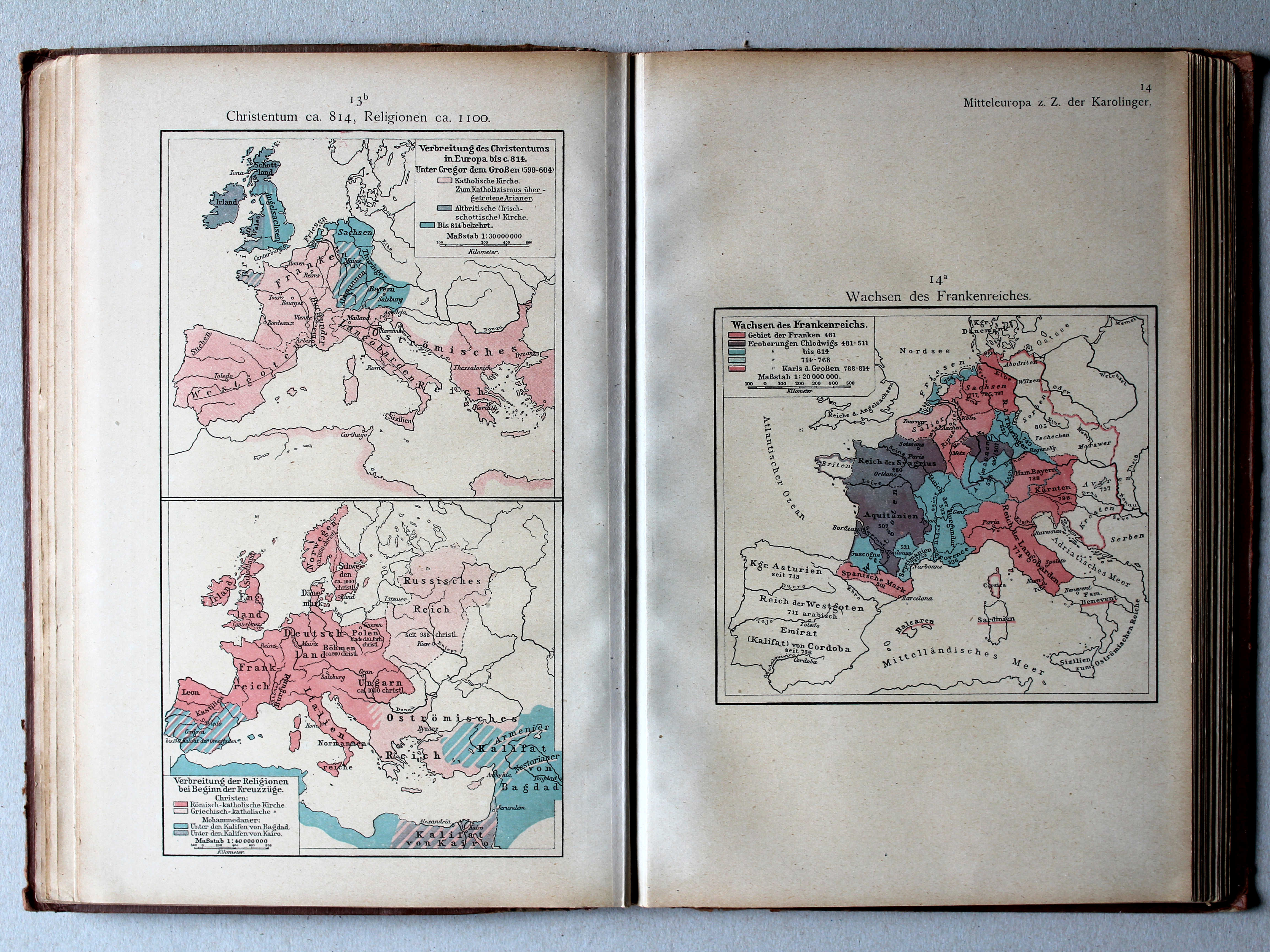
13b. Christentum ca. 814, Religionen ca. 1100 XL
Christendom ca. 814, godsdiensten ca. 1100 / Christianity ca. 814, religions ca. 1100
14a. Wachsen des Frankenreichs XL
Groei van het Frankische Rijk / Growth of the Frankish Empire

 Putzgers Historischer Schul-Atlas, 1918
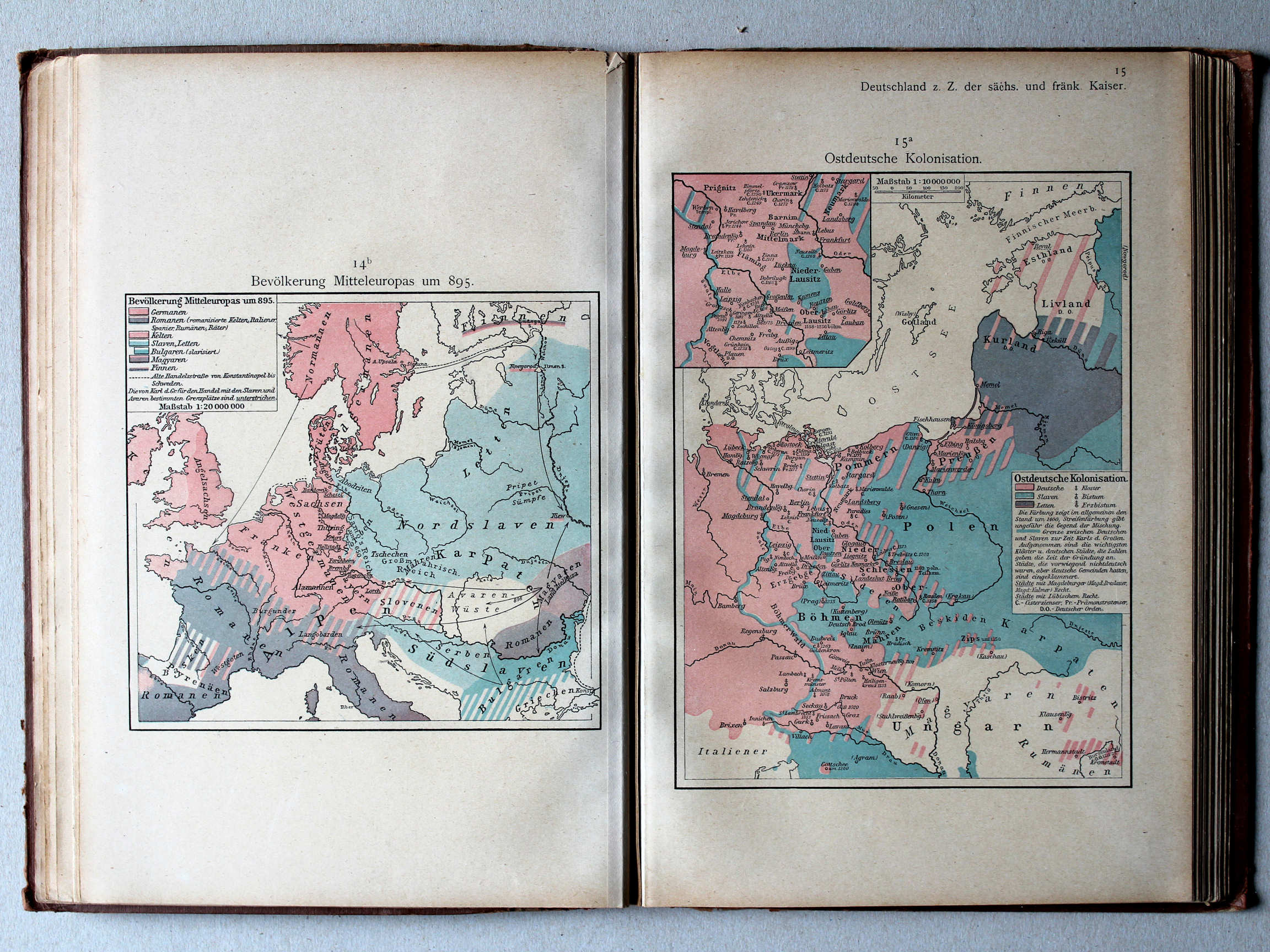
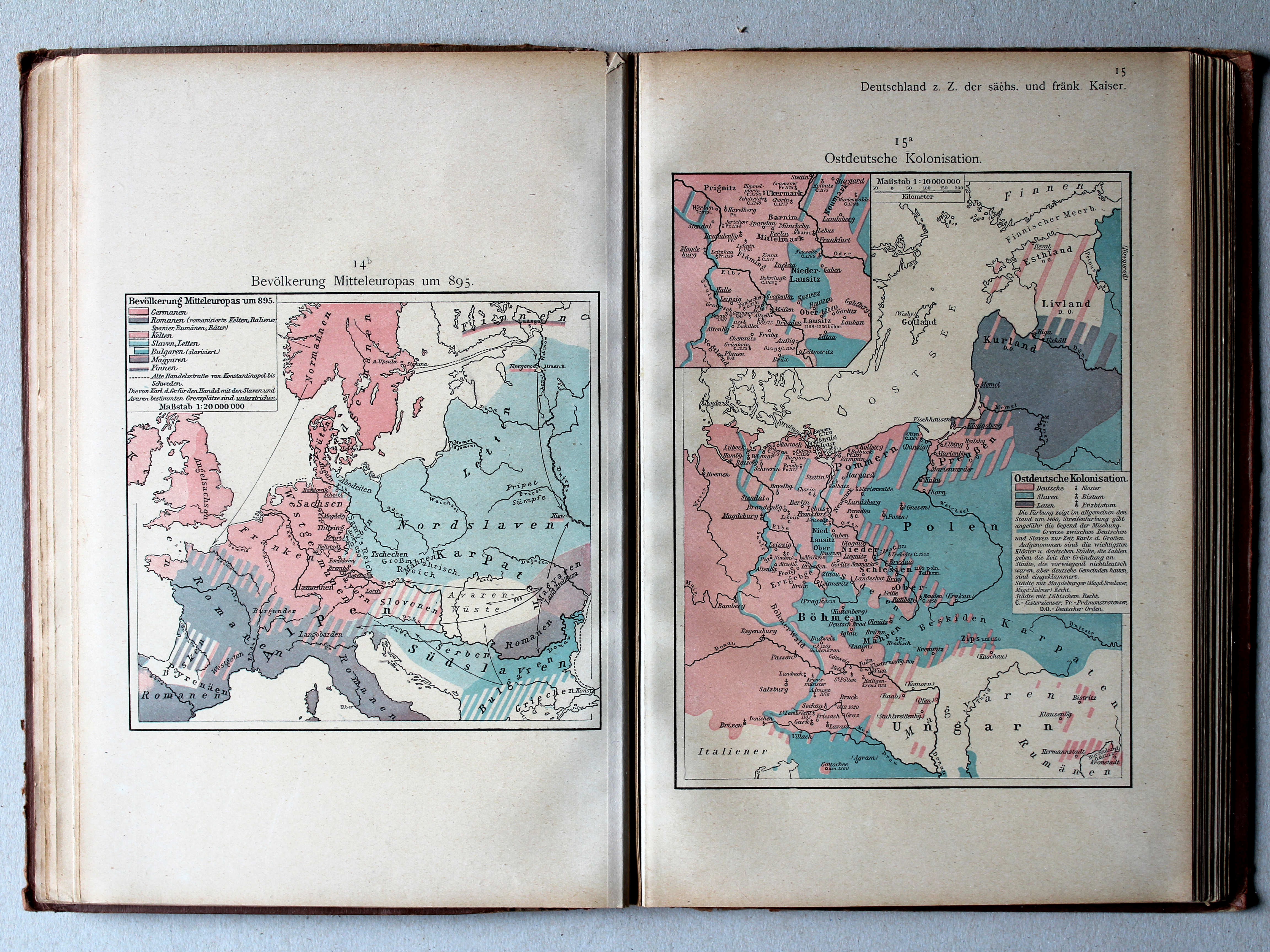
14b. Bevölkerung Mitteleuropas um 895 XL
Volkeren in Midden-Europa rond 895 / Nations in Central Europa around 895
15a. Ostdeutsche Kolonisation XL
Duitse kolonisatie naar het oosten / German colonization towards the east
 Putzgers Historischer Schul-Atlas, 1918
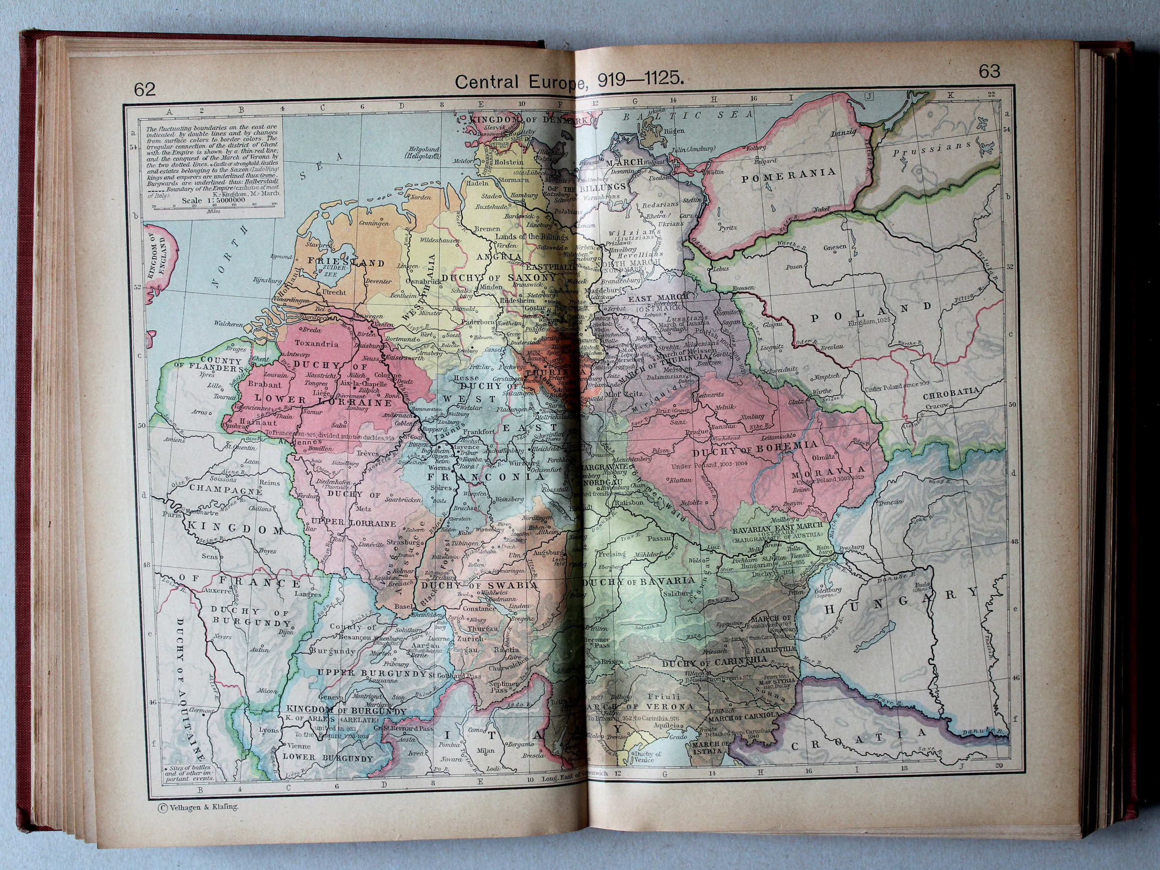
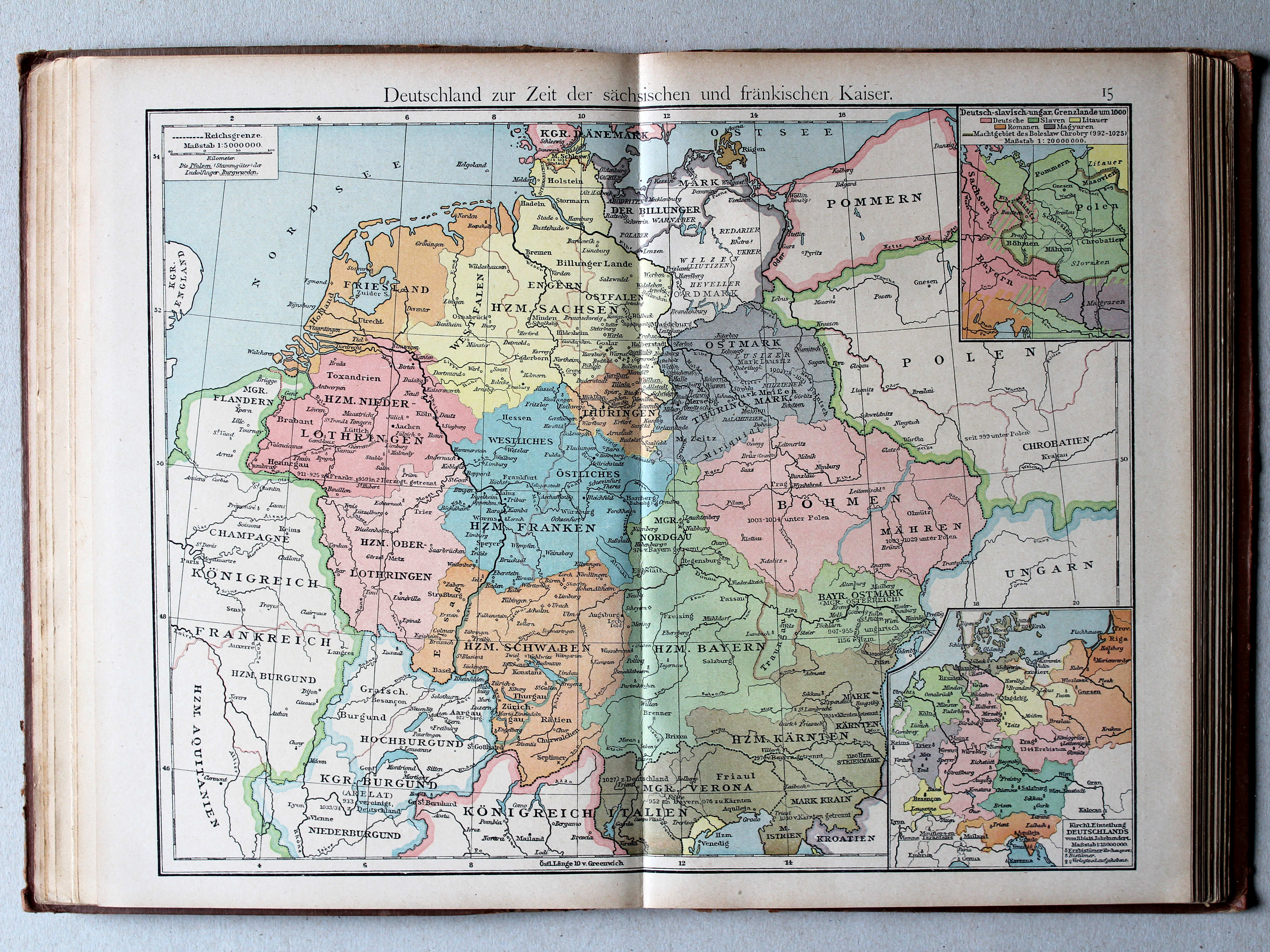
15. Deutschland zur Zeit der sächsischen und fränkischen Kaiser XL
Duitsland in de tijd van de Saksische en Frankische keizers / Germany during the Saxon and Frankish dynasties
 Shepherd, Historical Atlas, 1927
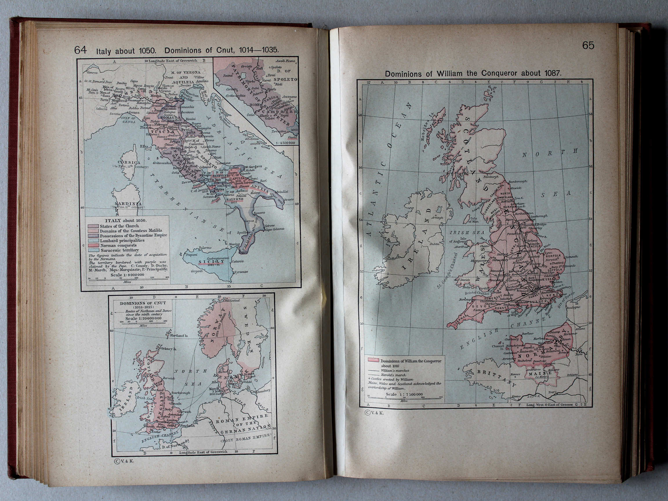
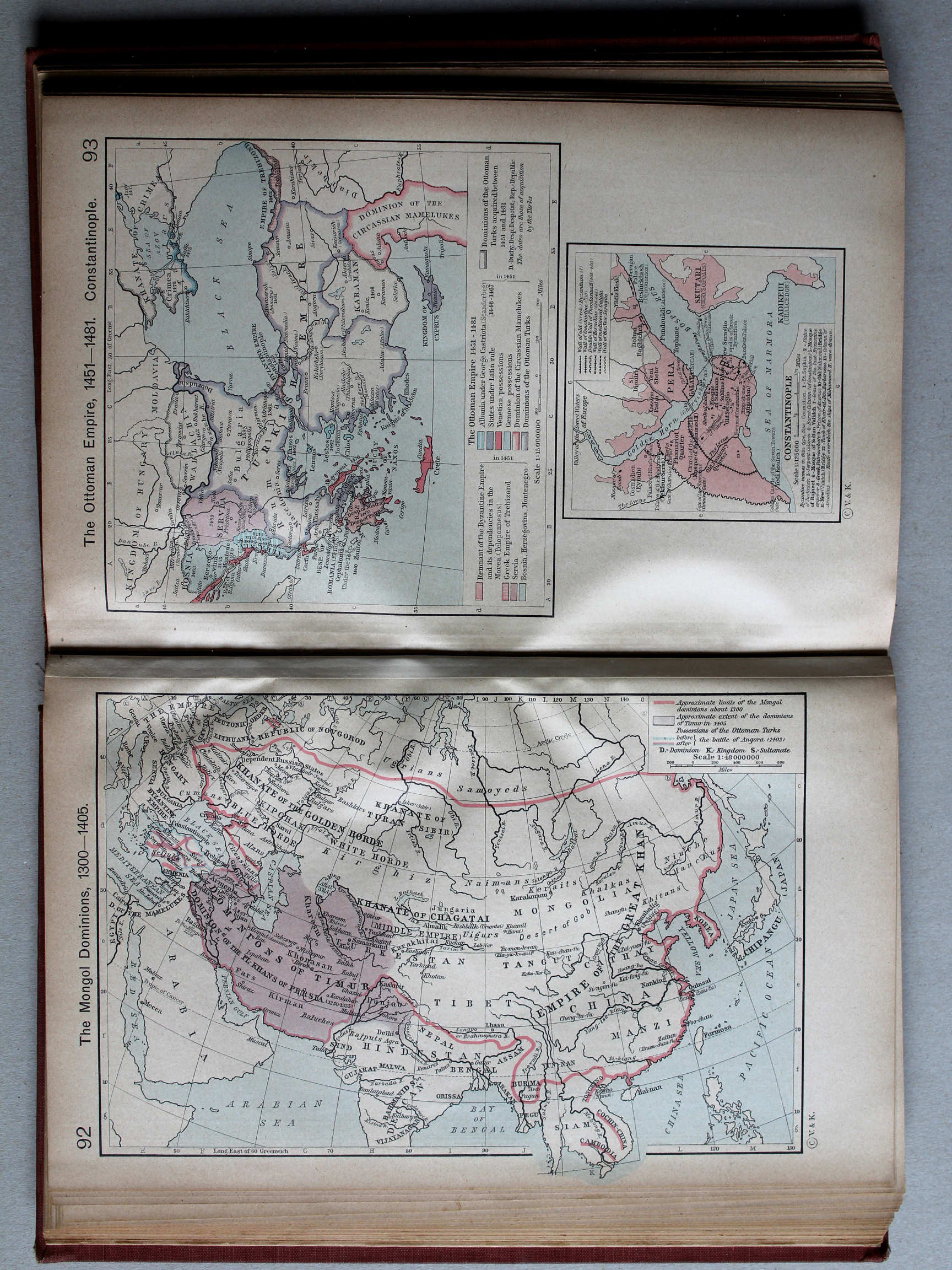
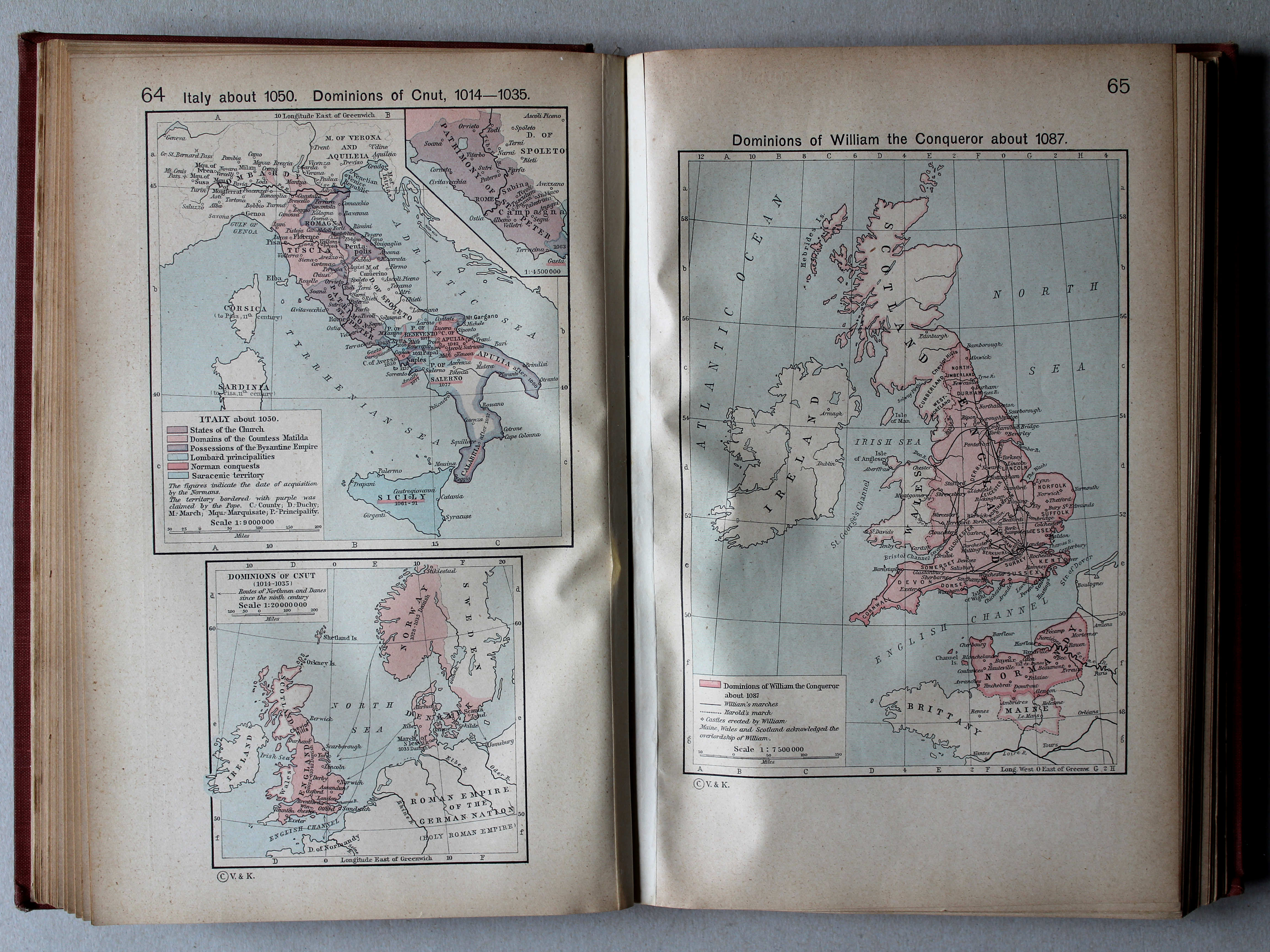
64. Italy about 1050. Dominions of Cnut, 1014-1035 XL
Italië, ca. 1050. Gebieden van Knoet, 1014-1035
65. Dominions of William the Conqueror about 1087 XL
Gebied van Willem de Veroveraar, ca. 1087
 Putzgers Historischer Schul-Atlas, 1918
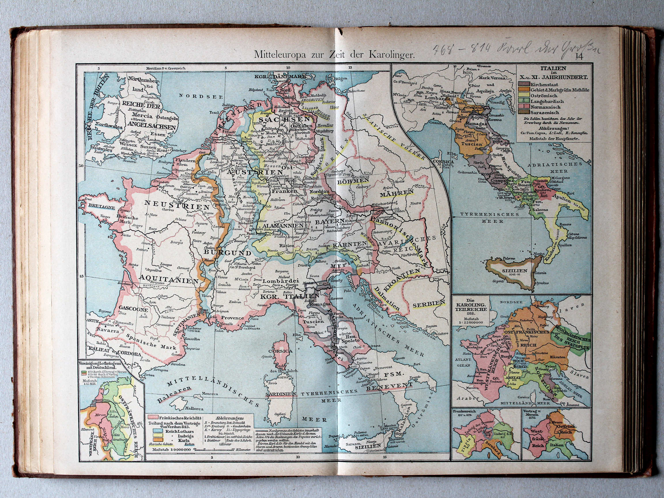
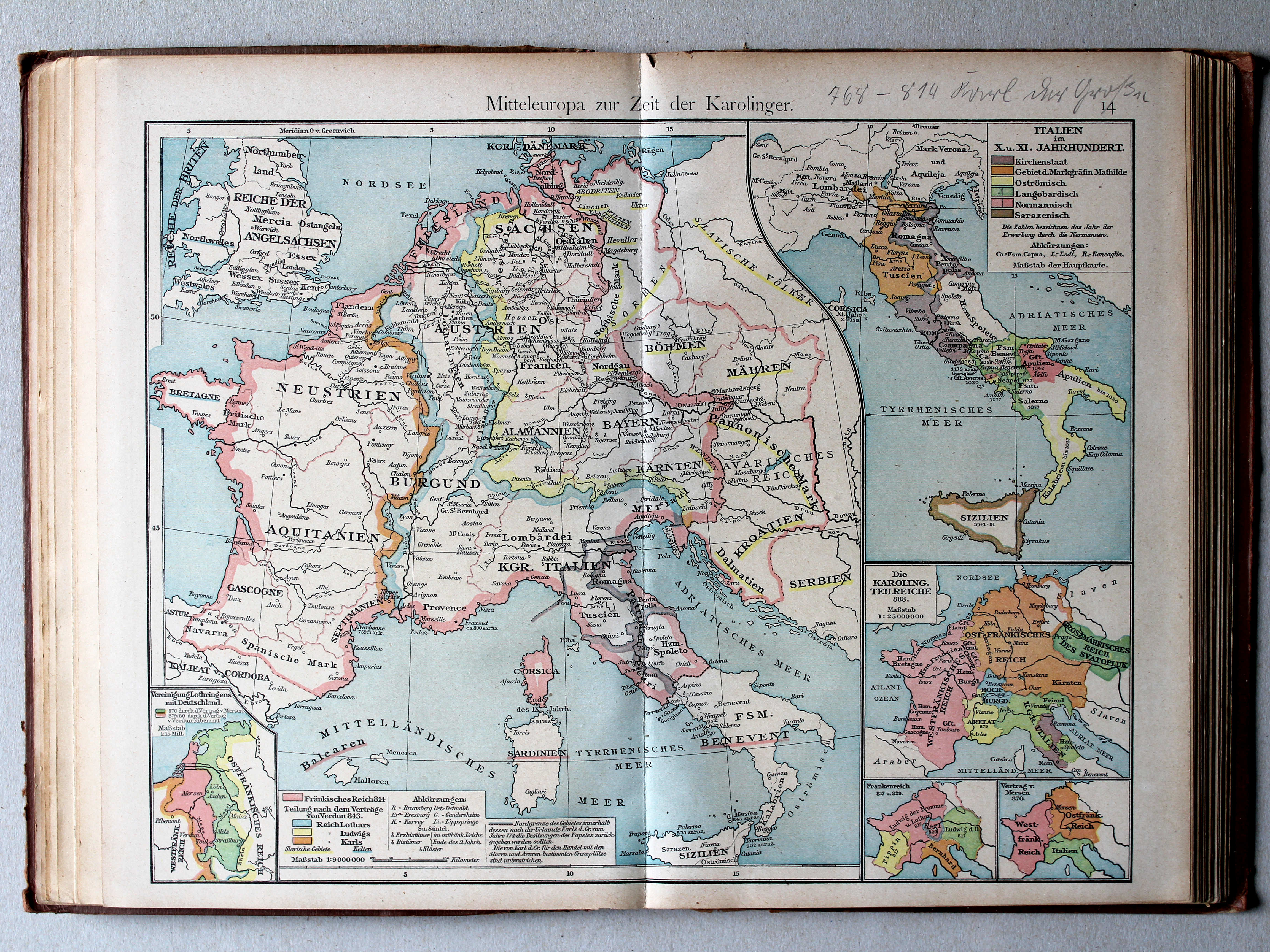
14. Mitteleuropa zur Zeit der Karolinger XL
Midden-Europa in de tijd van de Karolingen / Central Europe during the Carolingian dynasty
Shepherd, Historical Atlas, 1927
64. Italy about 1050. Dominions of Cnut, 1014-1035 XL
Italië, ca. 1050. Gebieden van Knoet, 1014-1035
65. Dominions of William the Conqueror about 1087 XL
x
 Putzgers Historischer Schul-Atlas, 1918
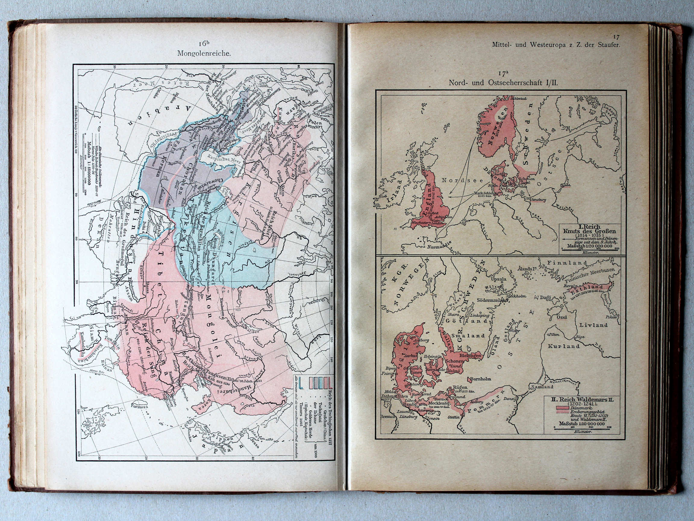
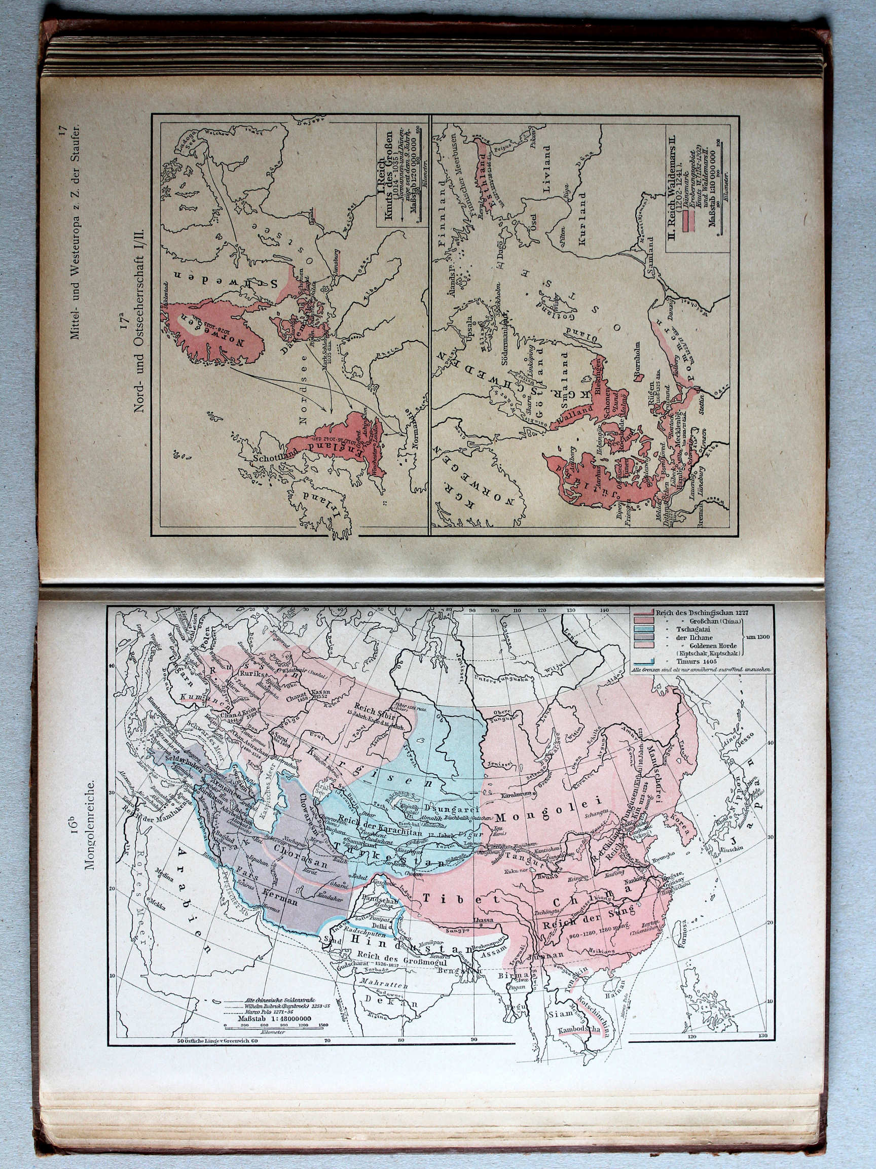
17a. Nord- und Ostseeherrschaft I/II XL
Heerschappij rond de Noord- en Oostzee I/II / Rule in the North Sea and Baltic region I/II
 Shepherd, Historical Atlas, 1927
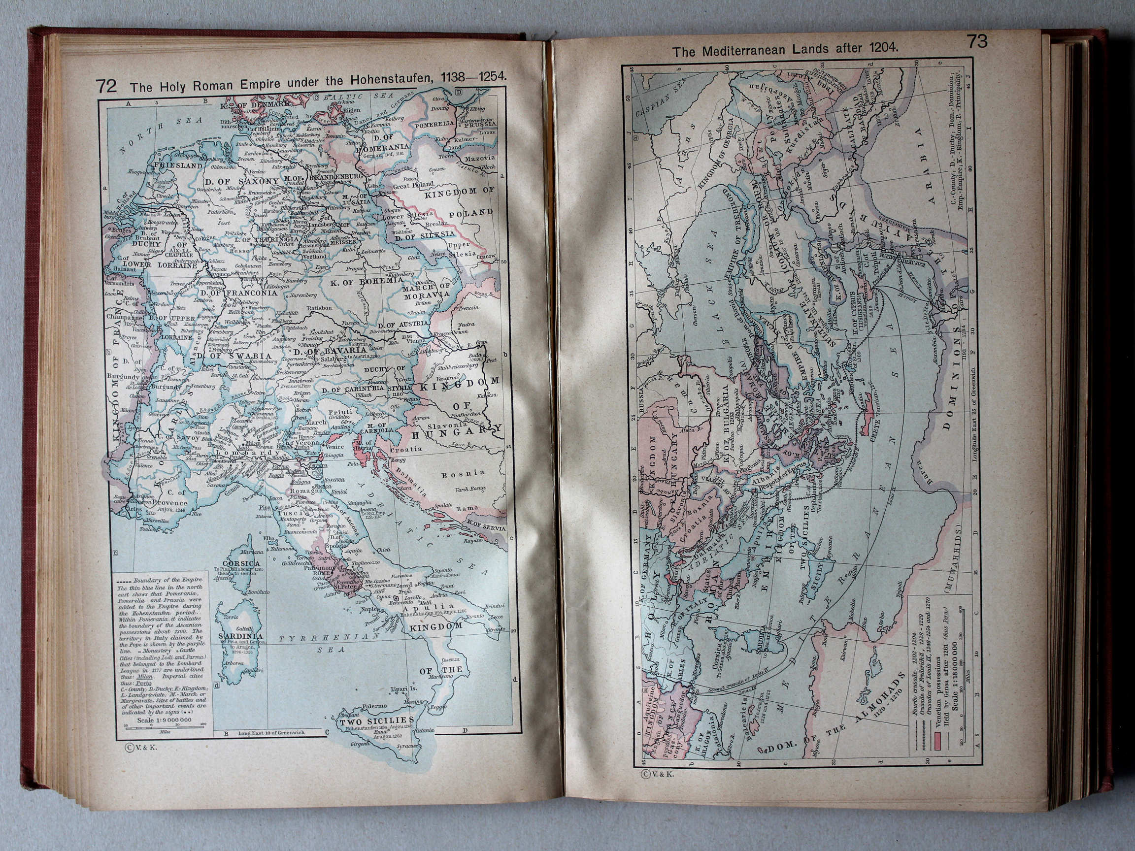
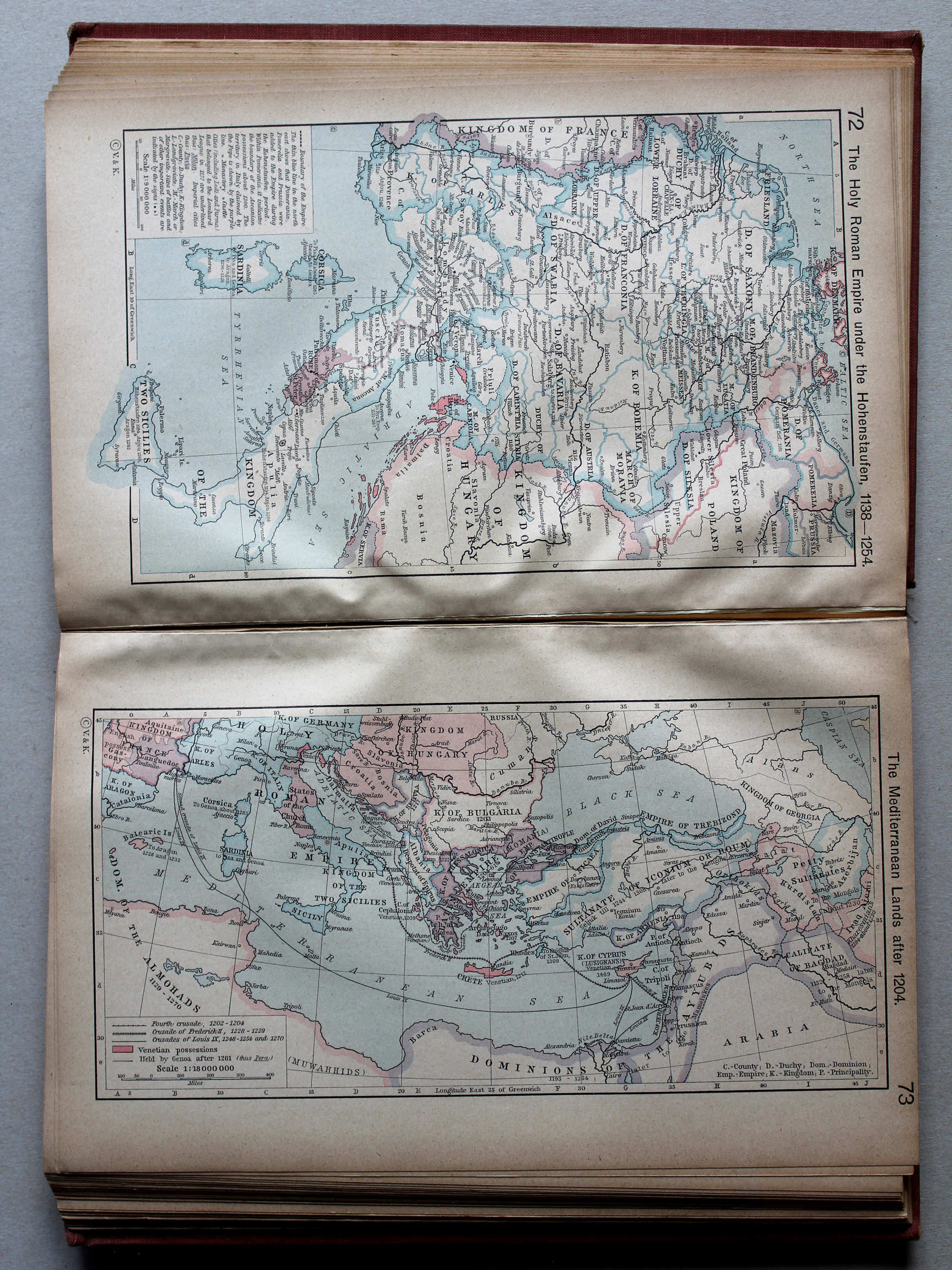
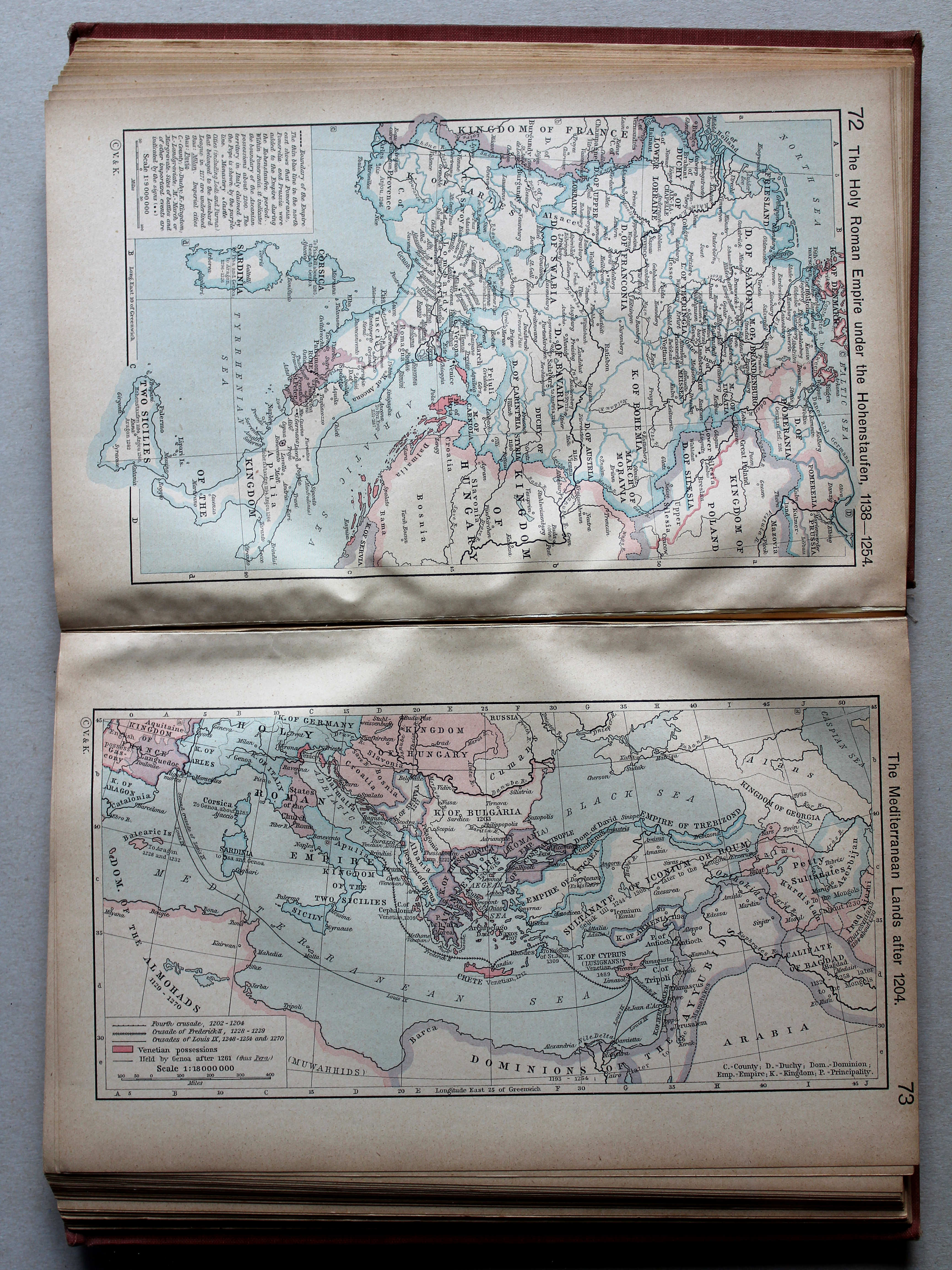
72. The Holy Roman Empire under the Hohenstaufen, 1138-1254 XL
Het Heilige Roomse Rijk onder de Hohenstaufen
 Putzgers Historischer Schul-Atlas, 1918
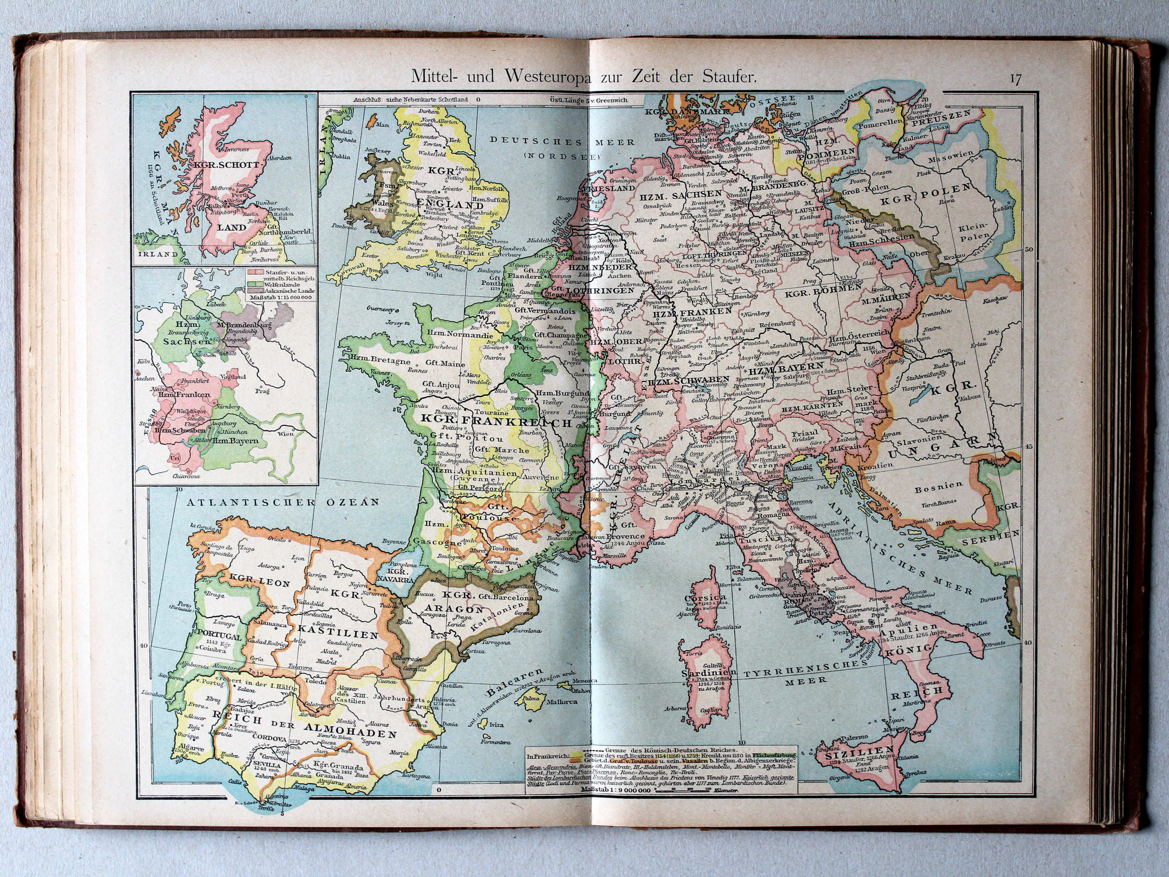
17. Mittel- und Westeuropa zur Zeit der Staufer XL
Midden- en West-Europa in de tijd van de Hohenstaufen / Central and Western Europe during the House of Hohenstaufen
 Shepherd, Historical Atlas, 1927
73. The Mediterranean Lands after 1204 XL
Het Middellandse Zeegebied na 1204
 Putzgers Historischer Schul-Atlas, 1918
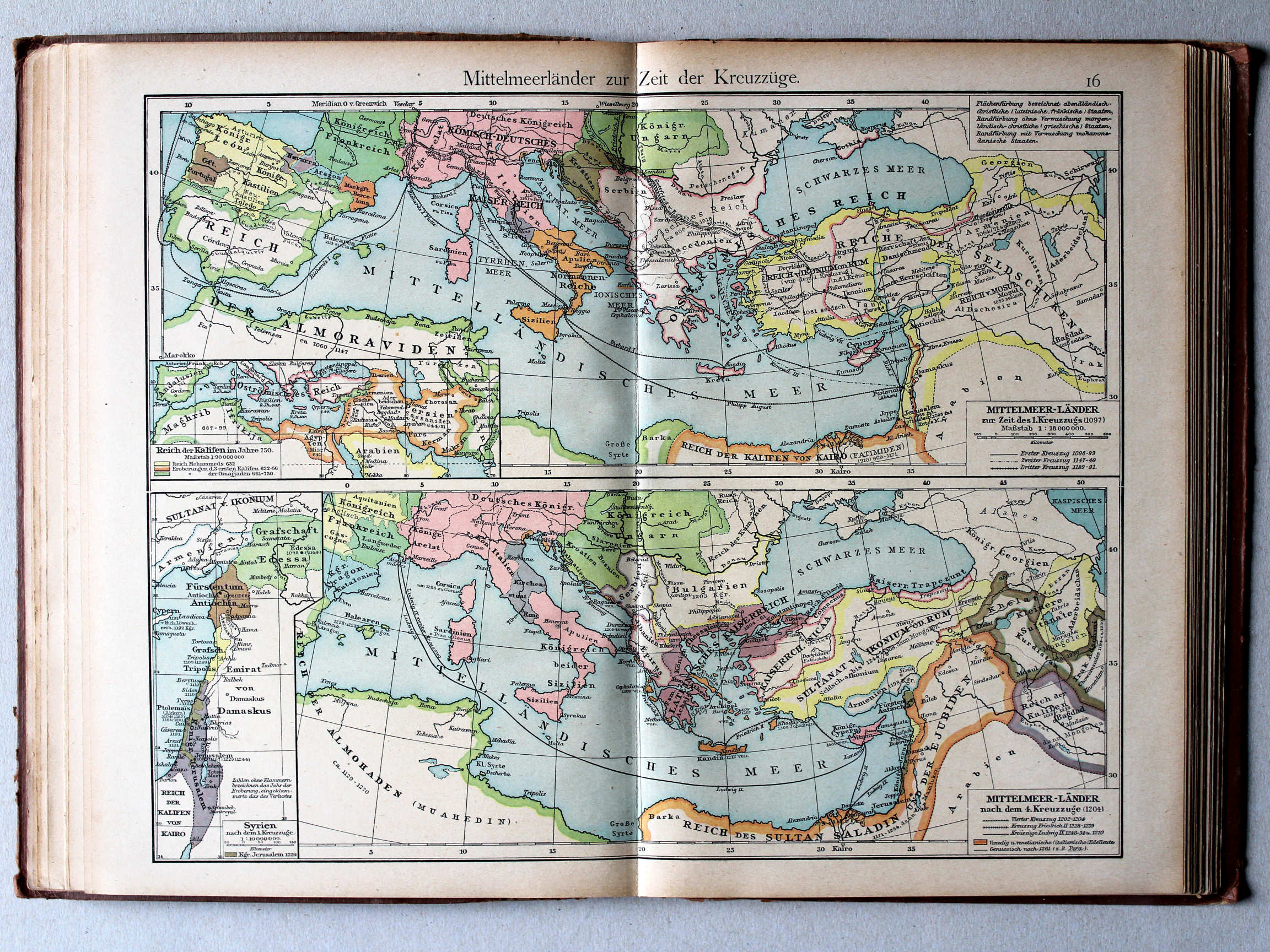
16. Mittelmeerländer zur Zeit der Kreuzzüge XL
Het Middellandse Zeegebied in de tijd van de Kruistochten / The Mediterranean region during the Crusades

 Putzgers Historischer Schul-Atlas, 1918
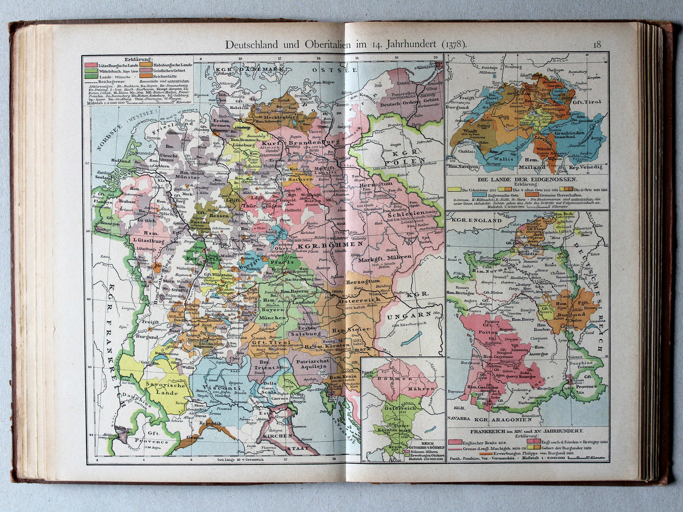
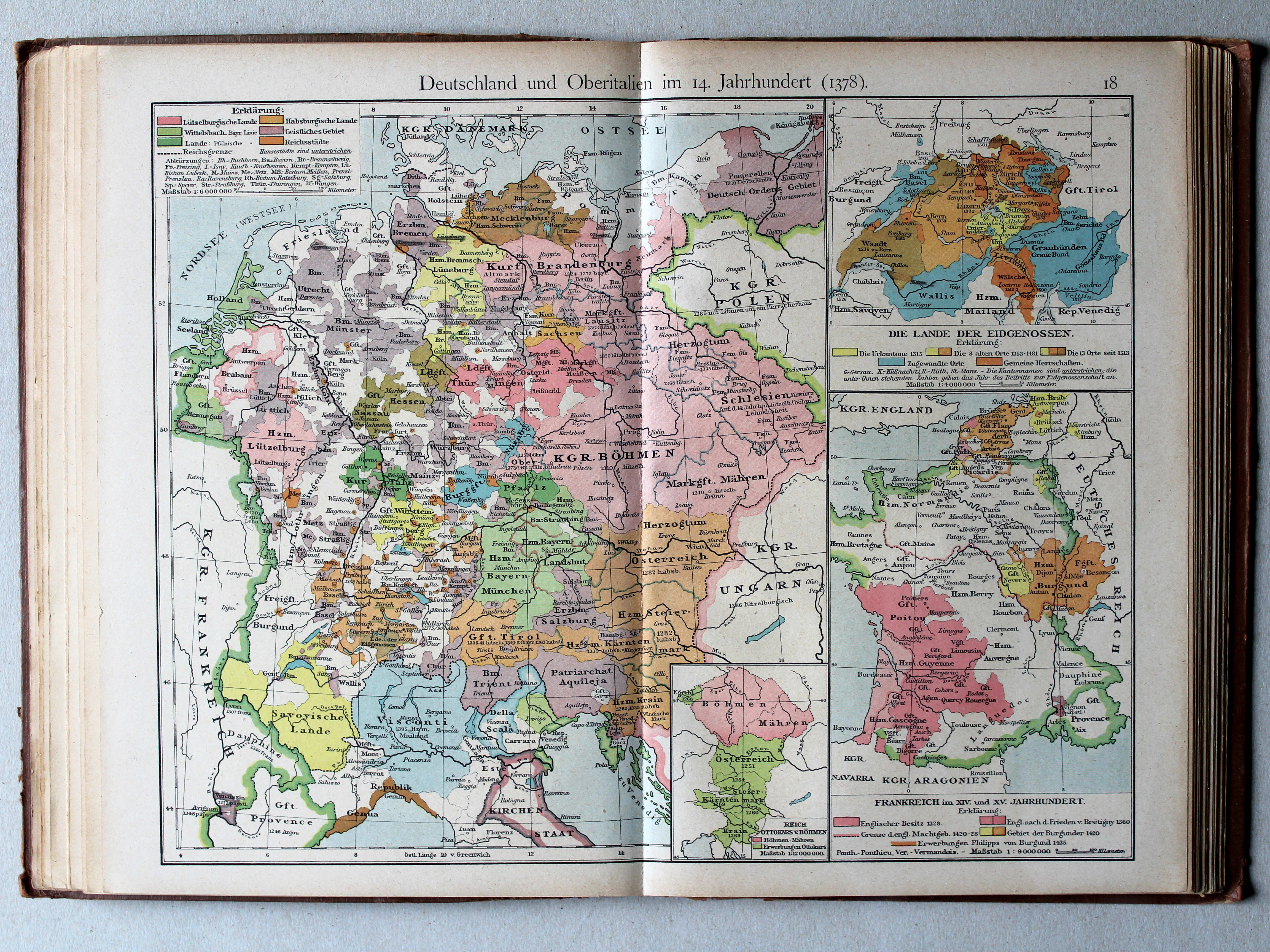
18. Deutschland und Oberitalien im 14. Jahrhundert (1378) XL
Duitsland en Noord-Italië in de 14e eeuw (1378) / Germany and Northern Italy in the 14th century (1378)
 Shepherd, Historical Atlas, 1927
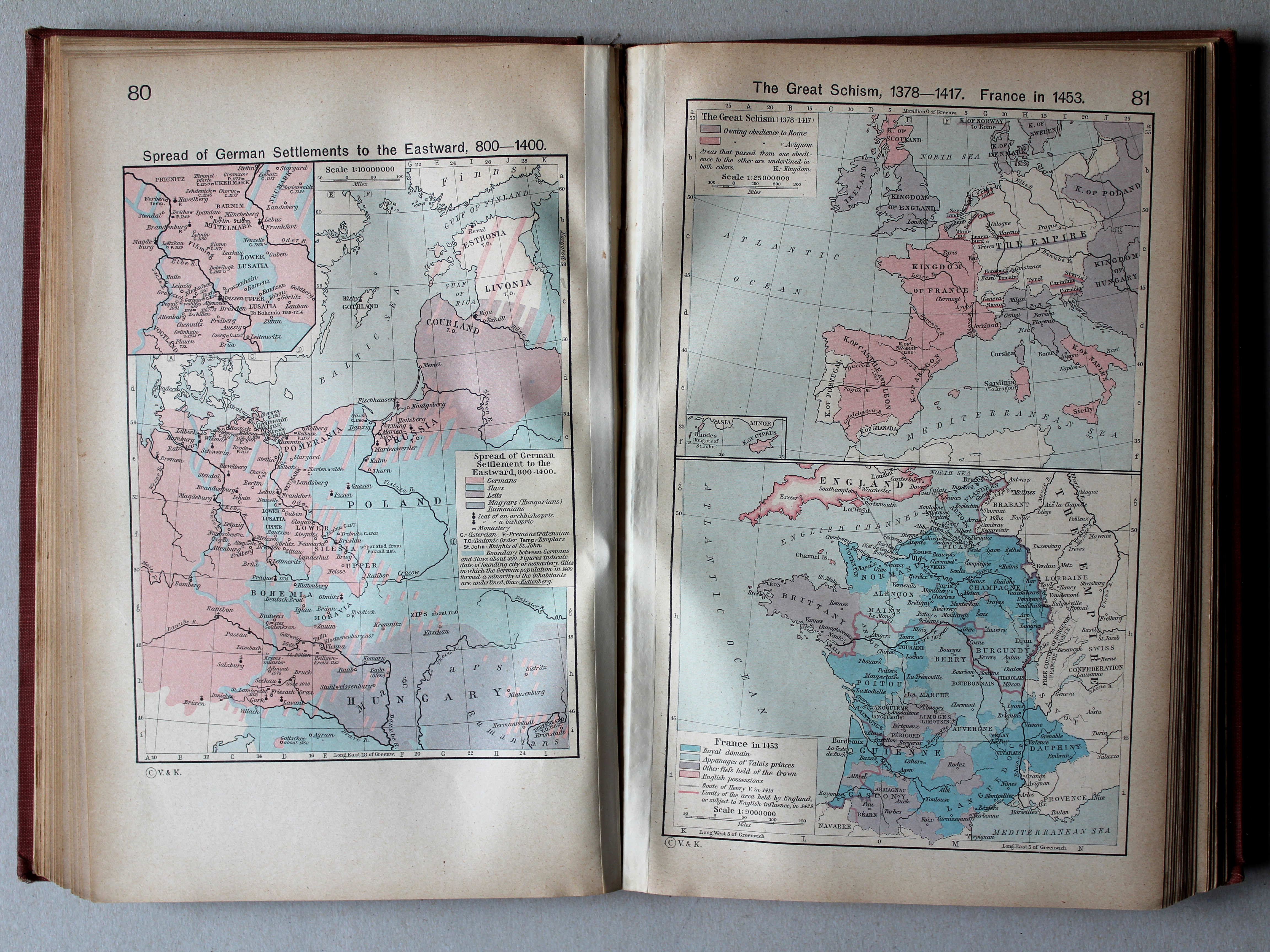
80. Spread of German Settlements to the Eastward, 800-1400 XL
Uitbreiding van Duitse vestiging naar het oosten, 800-1400
81. The Great Schism, 1378-1417. France in 1453 XL
Het Westers Schisma, 1378-1417. Frankrijk in 1453
Putzgers Historischer Schul-Atlas, 1918
14b. Bevölkerung Mitteleuropas um 895 XL
Volkeren in Midden-Europa rond 895 / Nations in Central Europa around 895
15a. Ostdeutsche Kolonisation XL
Duitse kolonisatie naar het oosten / German colonization towards the east
 Shepherd, Historical Atlas, 1927
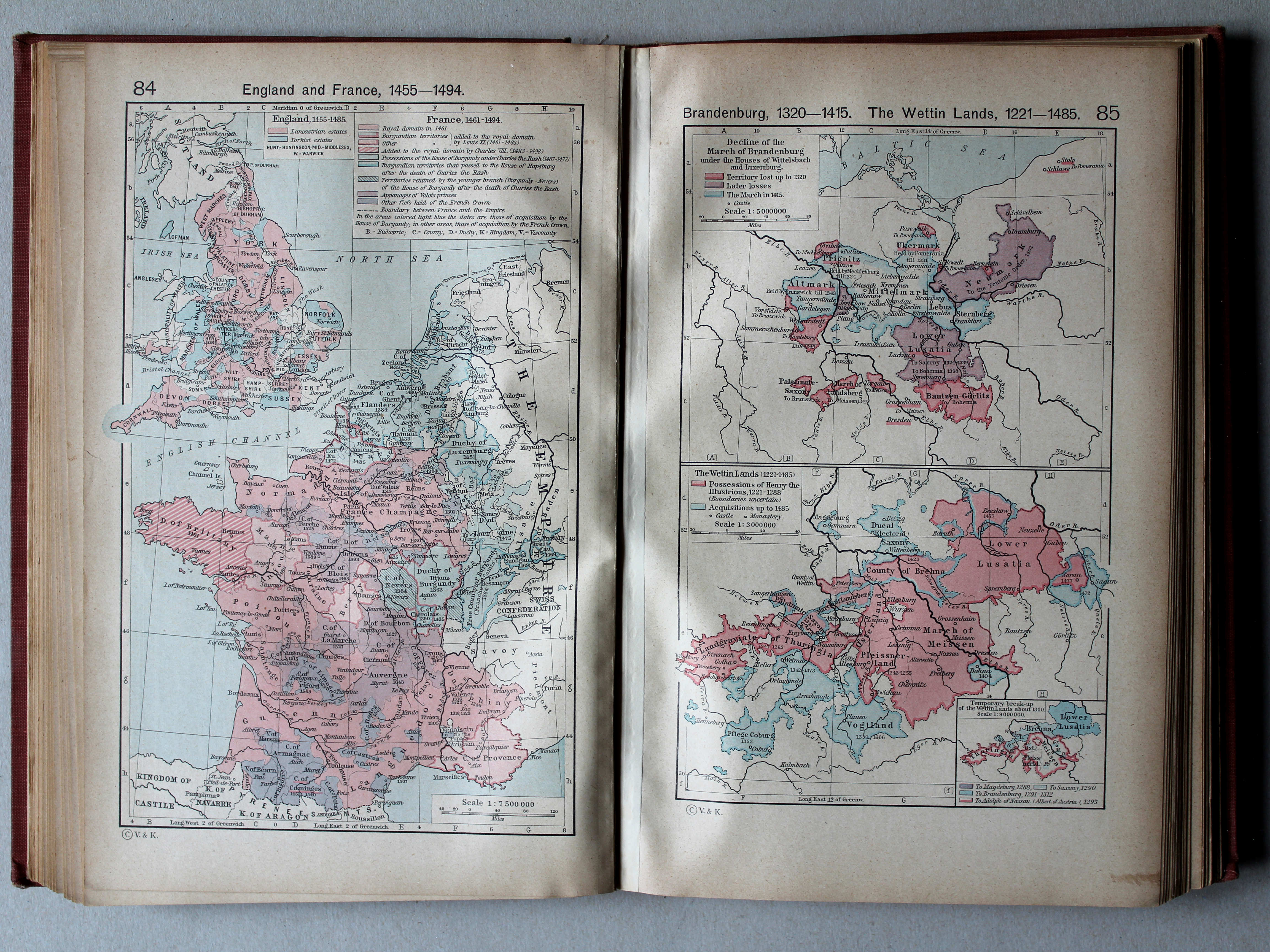
84. England and France, 1455-1494 XL
Engeland en Frankrijk, 1455-1494
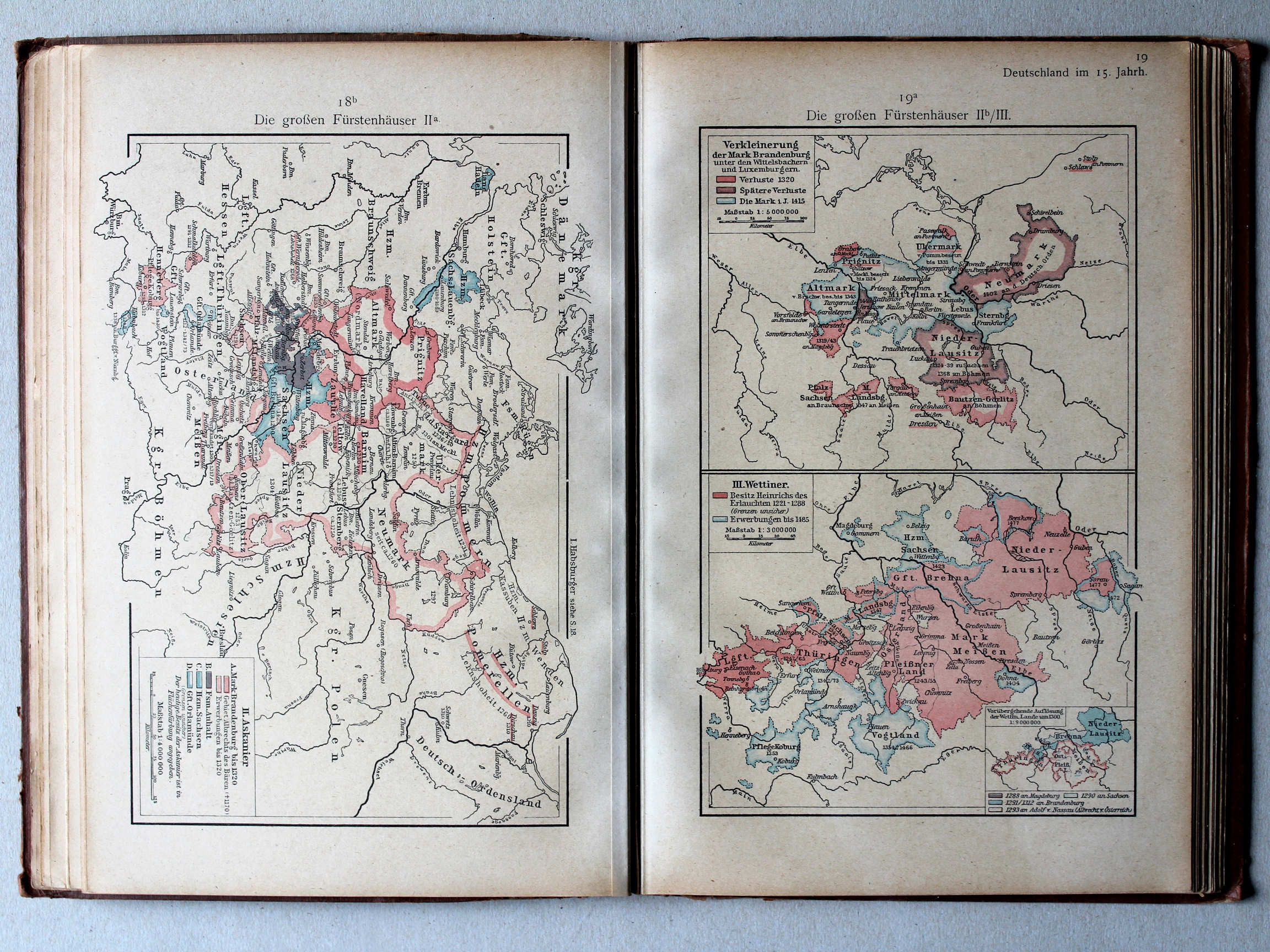
85. Brandenburg 1320-1515. The Wettin Lands, 1221-1485 XL
Brandenburg 1320-1515. Het gebied van het Huis Wettin, 1221-1485
 Putzgers Historischer Schul-Atlas, 1918
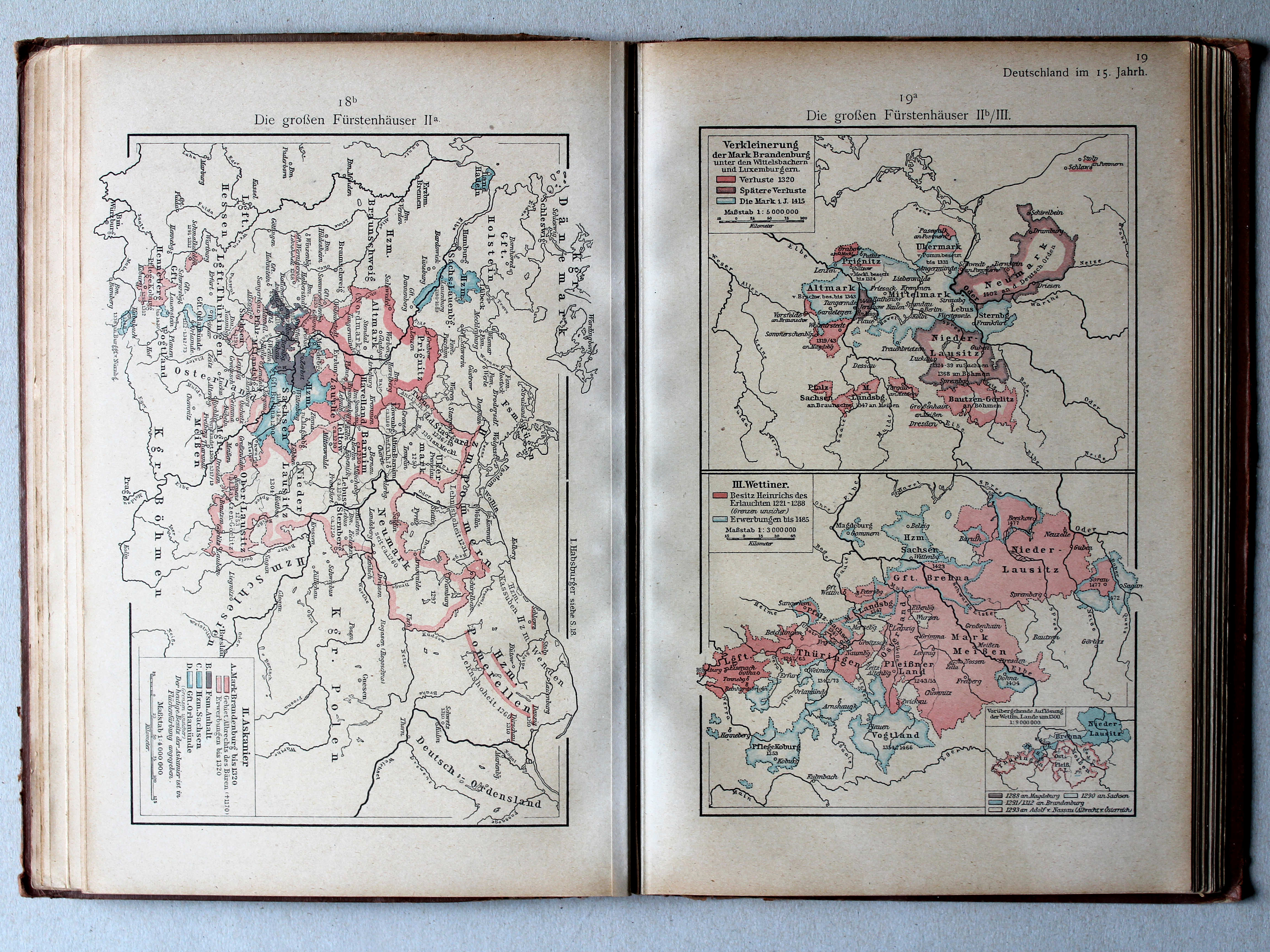
19a. Die großen Fürstenhäuser IIb/III XL
De grote dynastieën IIb/III / The great dynasties IIb/III
 Putzgers Historischer Schul-Atlas, 1918
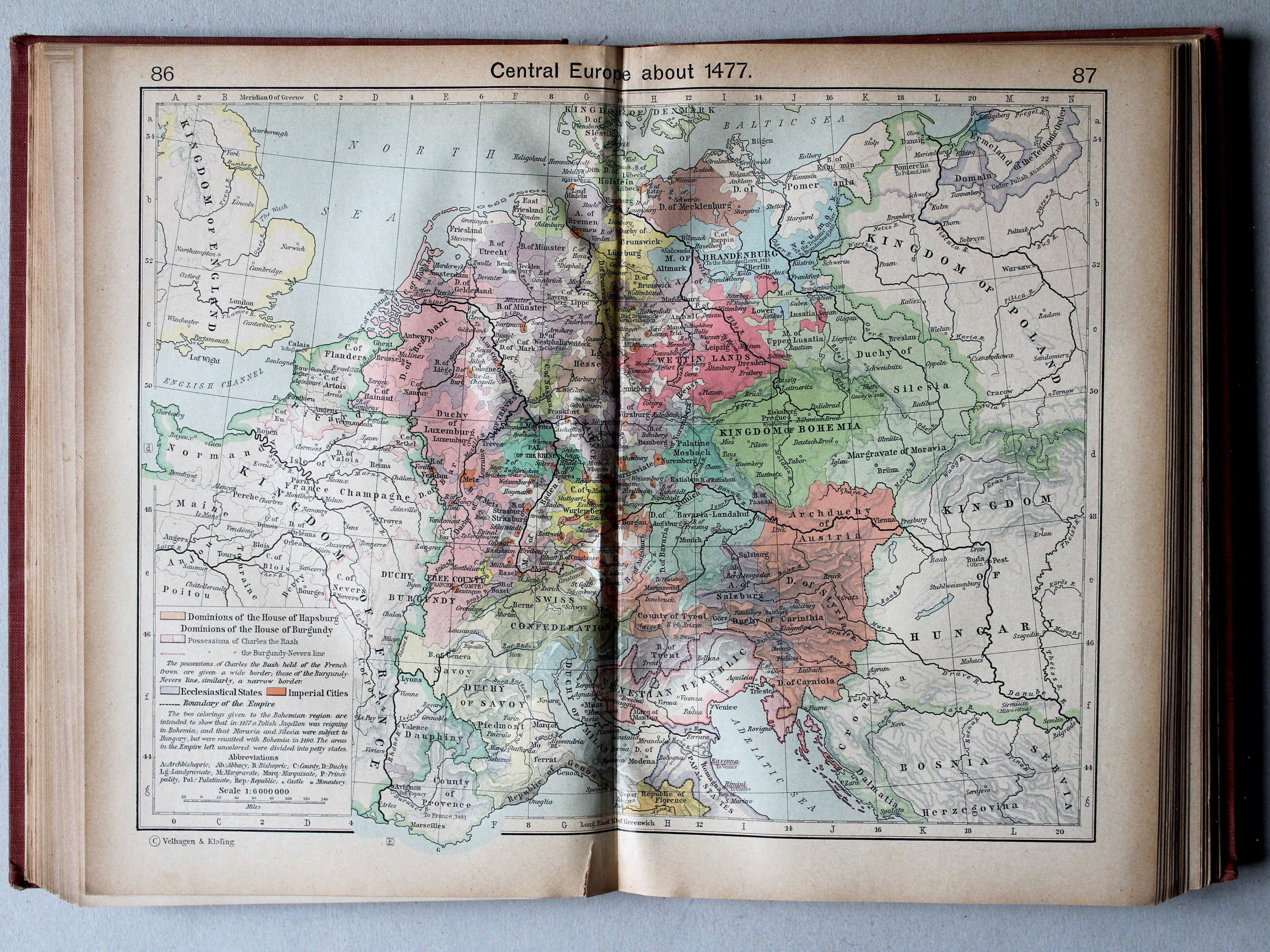
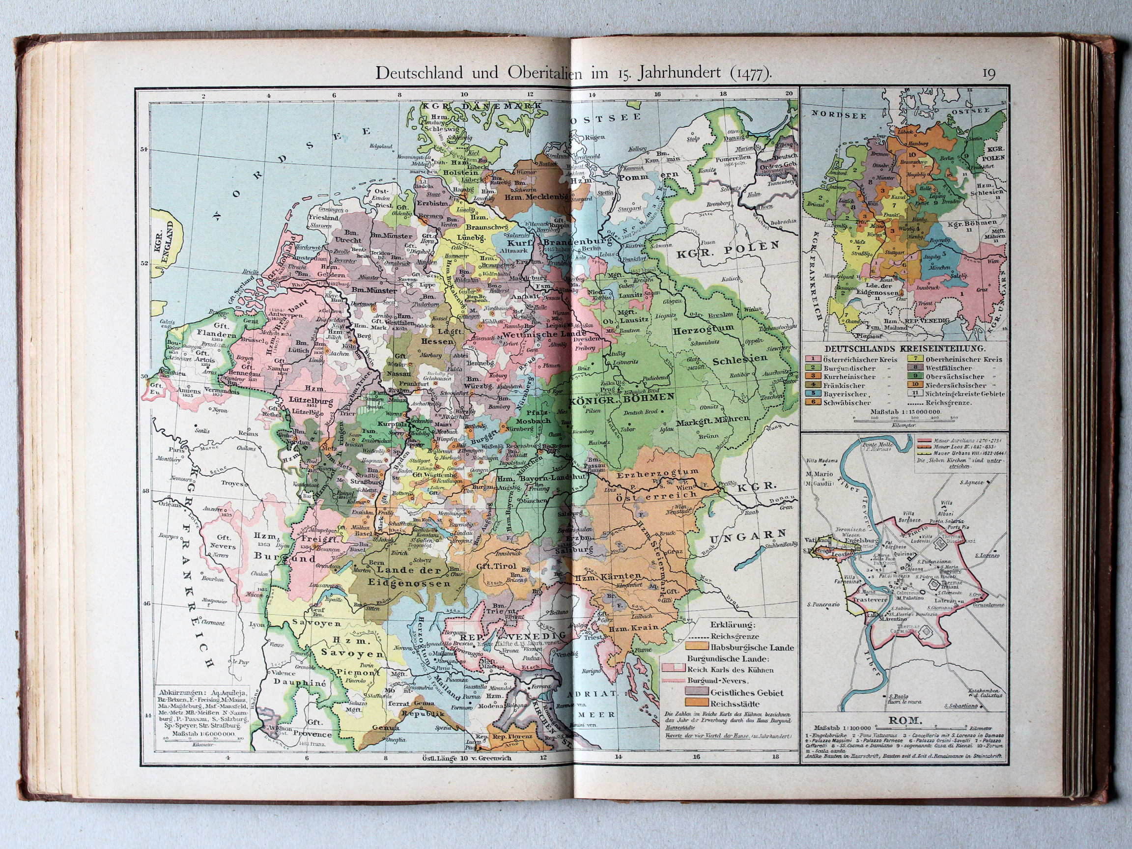
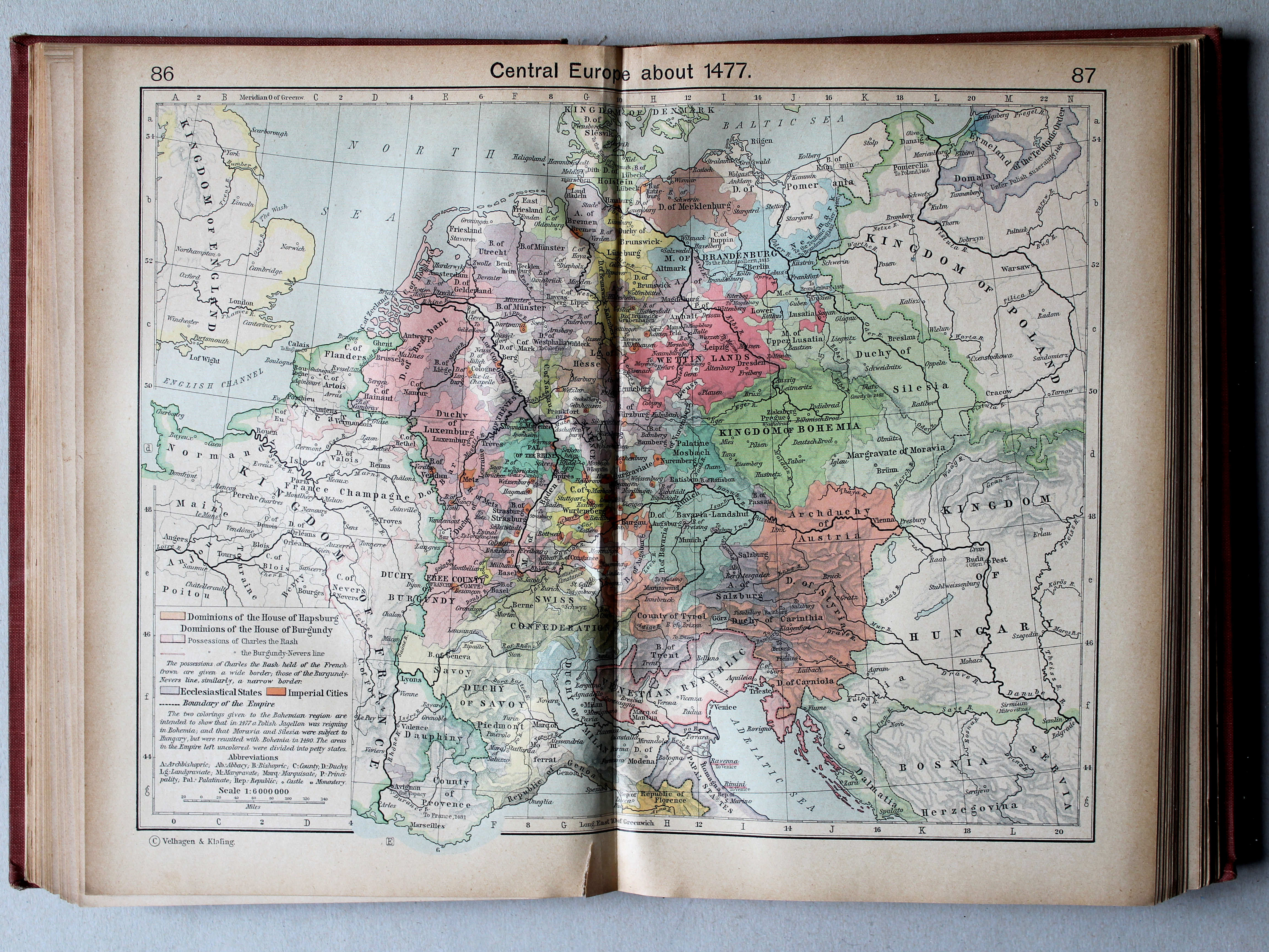
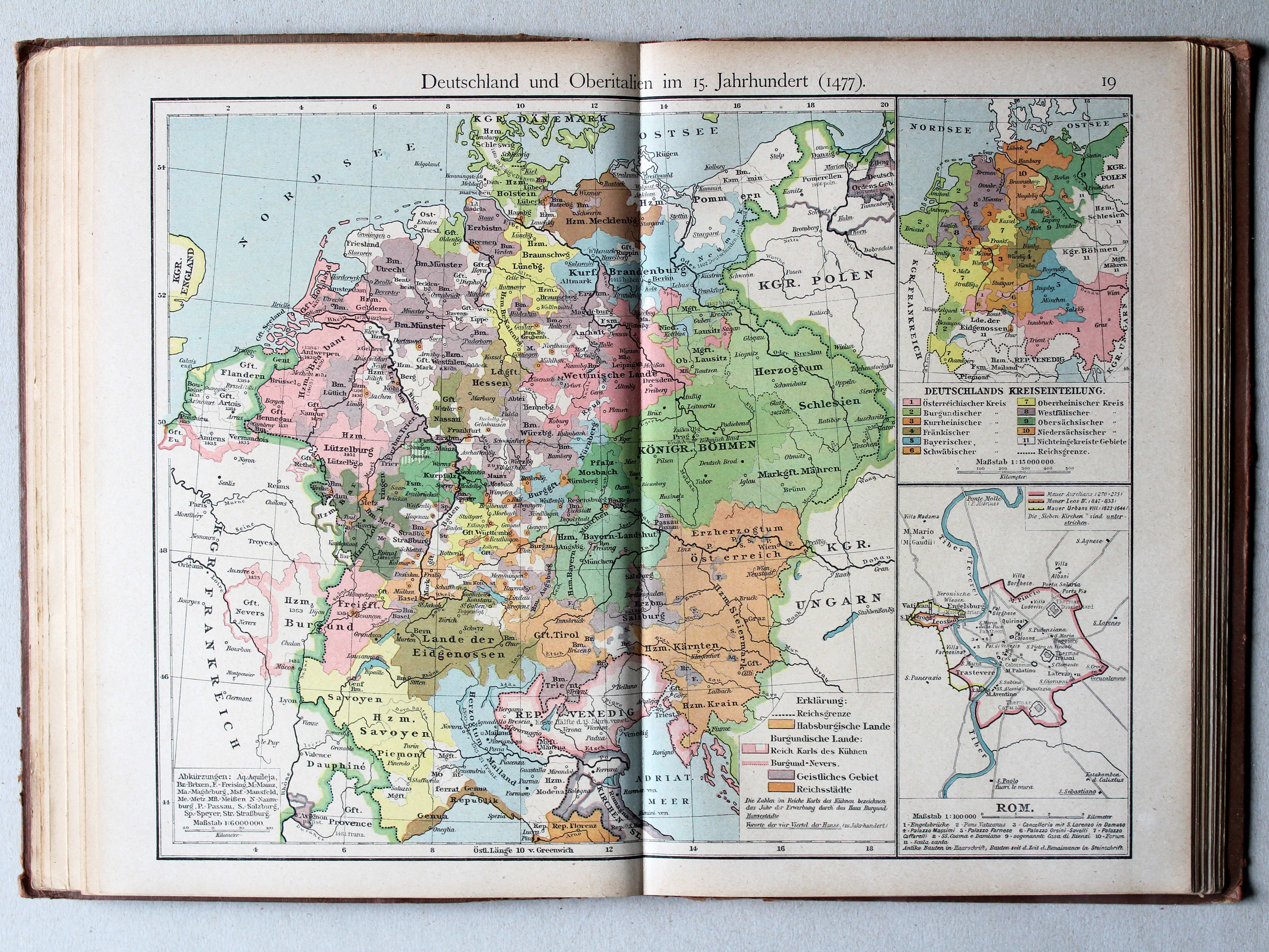
19. Deutschland und Oberitalien im 15. Jahrhundert (1477) XL
Duitsland en Noord-Italië in de 15e eeuw (1477) / Germany and Northern Italy in the 15th century (1477)
 Shepherd, Historical Atlas, 1927
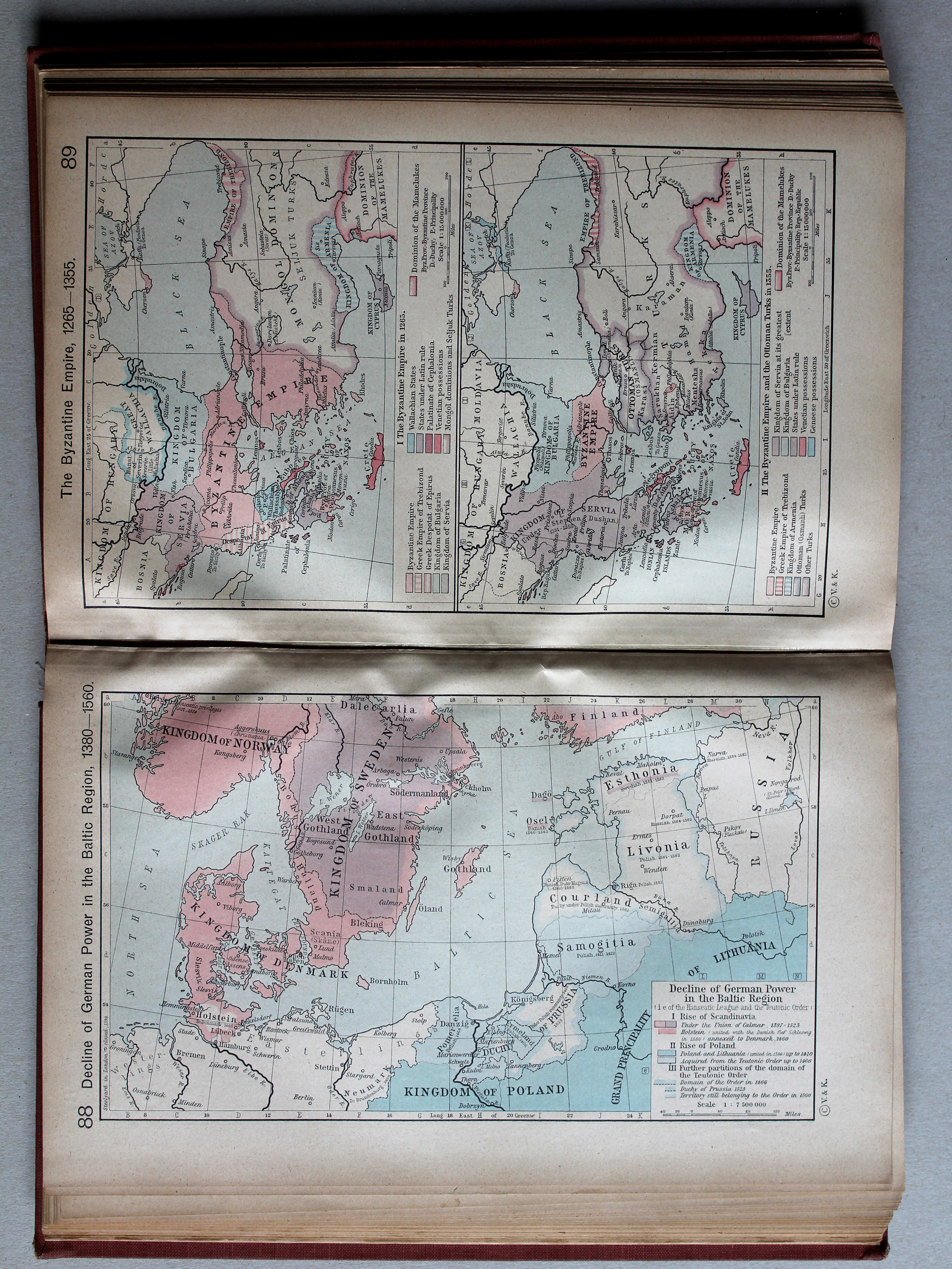
88. Decline of German Power in the Baltic Region, 1380-1560 XL
Verval van de Duitse macht in het Oostzeegebied, 1380-1560
 Putzgers Historischer Schul-Atlas, 1918
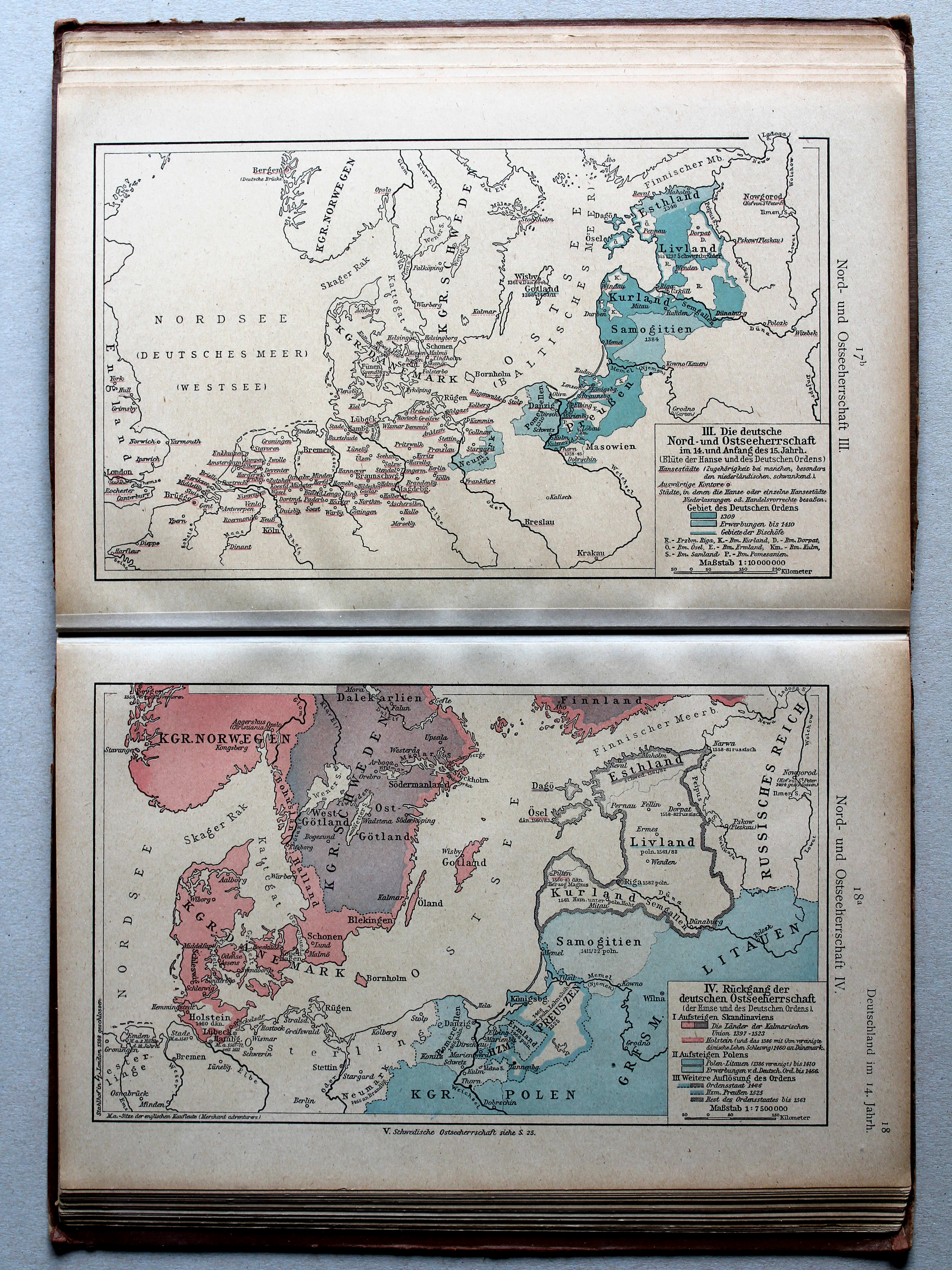
17b. Nord- und Ostseeherrschaft III XL
Heerschappij rond de Noord- en Oostzee III / Rule in the North Sea and Baltic region III
18a. Nord- und Ostseeherrschaft IV XL
Heerschappij rond de Noord- en Oostzee IV / Rule in the North Sea and Baltic region IV
 Putzgers Historischer Schul-Atlas, 1918
19. Deutschland und Oberitalien im 15. Jahrhundert (1477) XL
Duitsland en Noord-Italië in de 15e eeuw (1477) / Germany and Northern Italy in the 15th century (1477)

 Putzgers Historischer Schul-Atlas, 1918
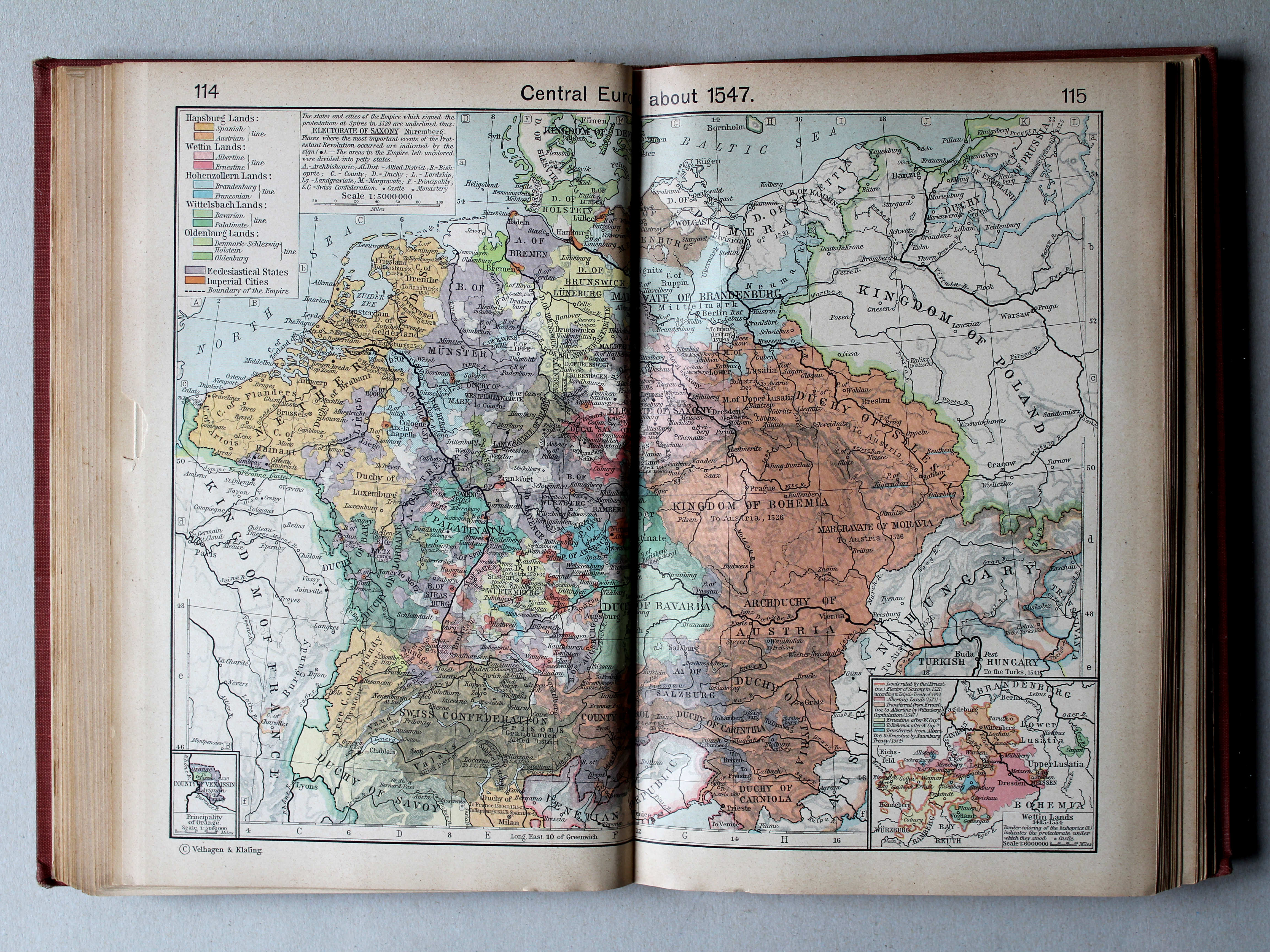
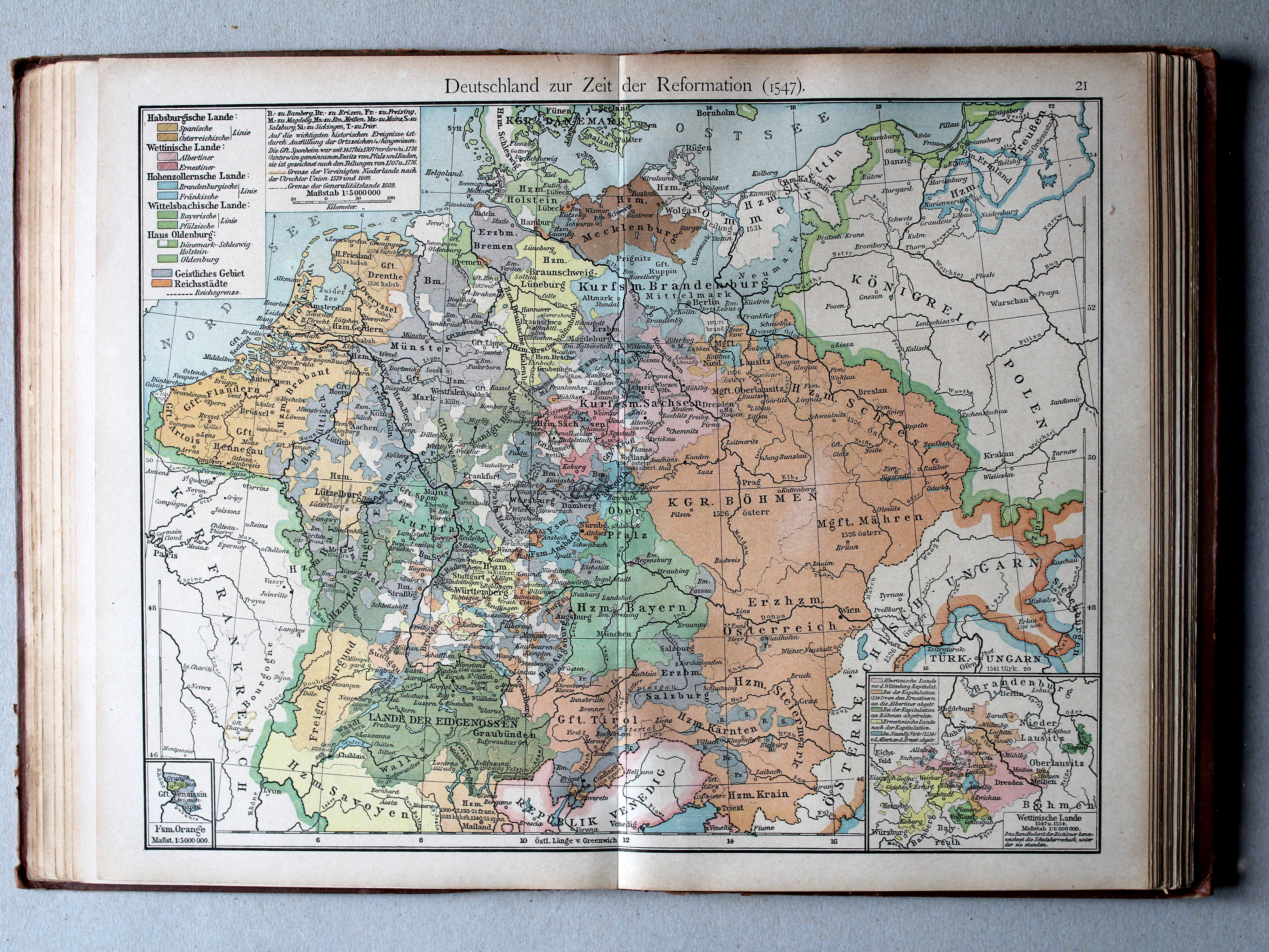
21. Deutschland zur Zeit der Reformation (1547) XL
Duitsland in de tijd van de Reformatie (1547) / Germany during the Protestant Reformation (1547)
 Putzgers Historischer Schul-Atlas, 1918
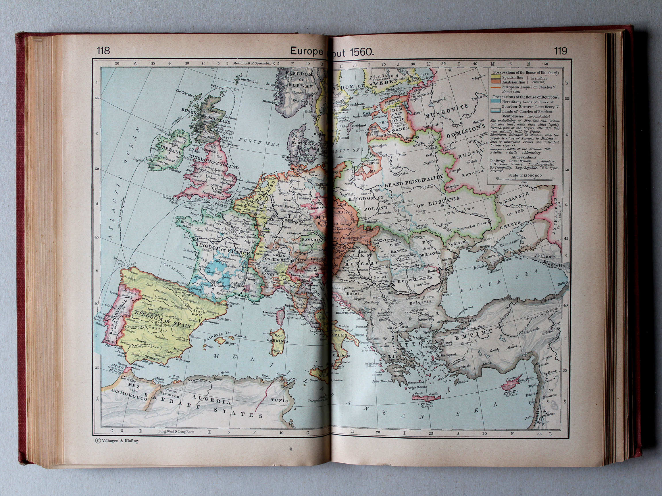
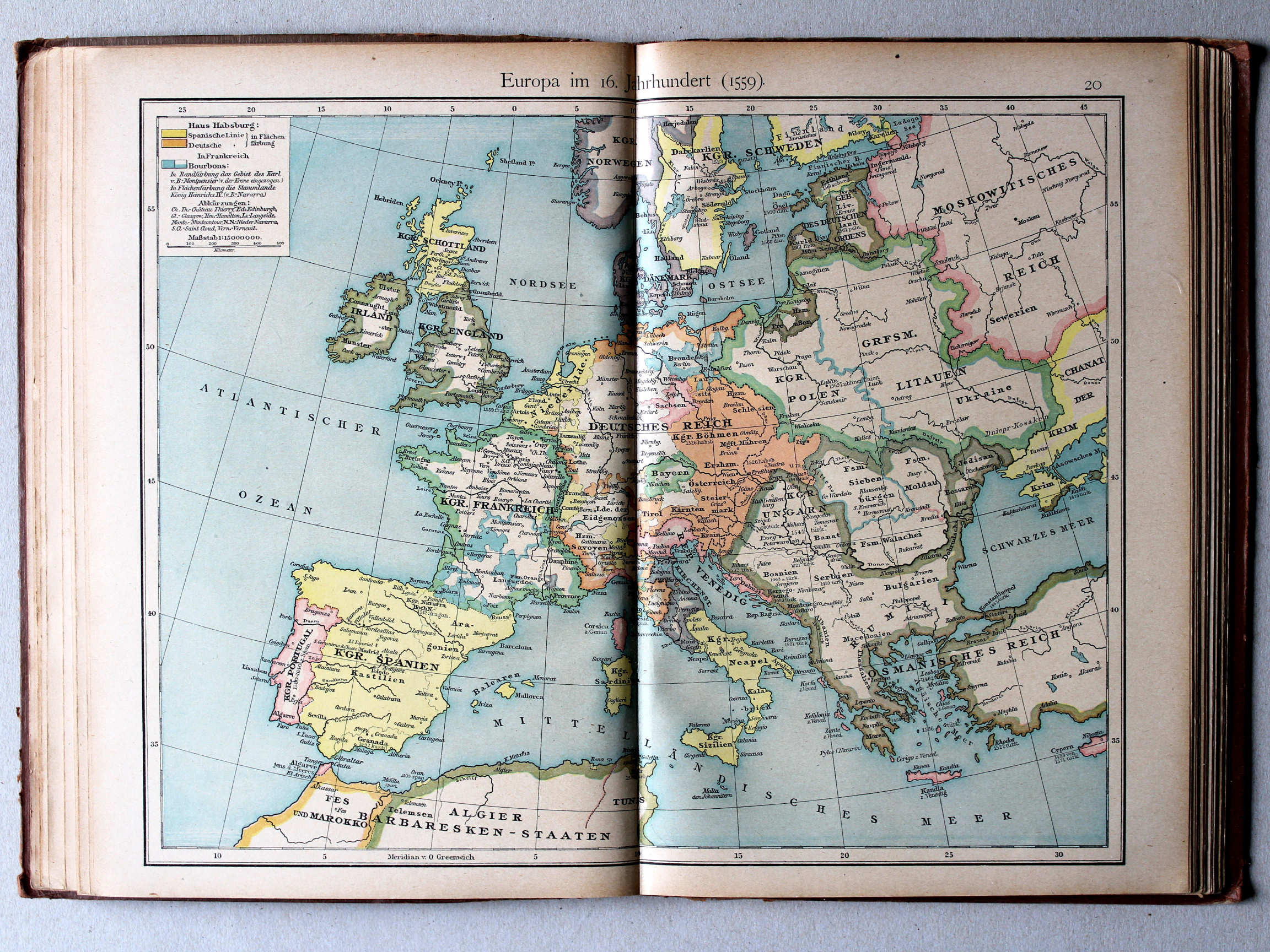
20. Europa im 16. Jahrhundert (1559) XL
Europa in de 16e eeuw (1559) / Europe in the 16th century (1559)
 Shepherd, Historical Atlas, 1927
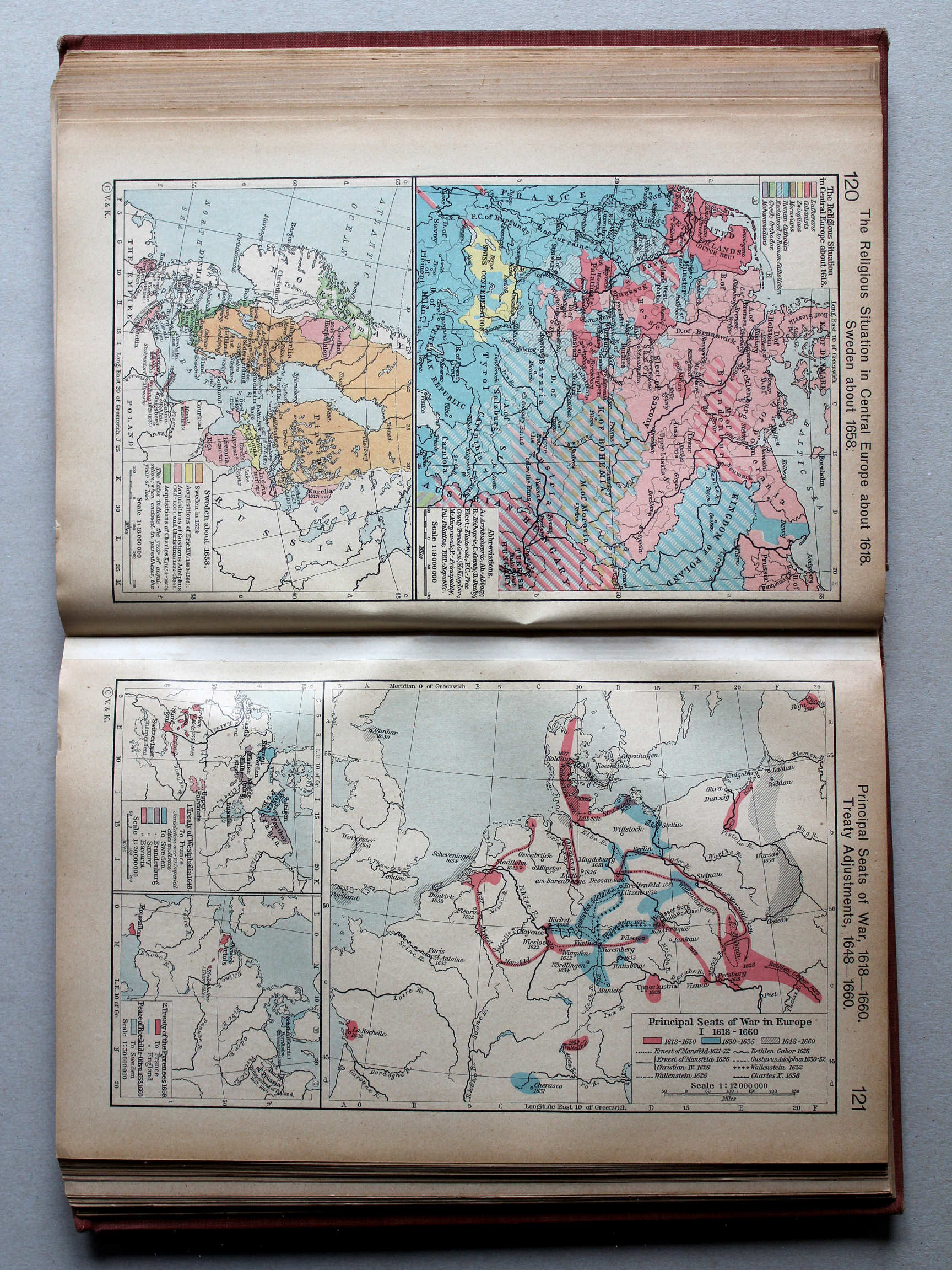
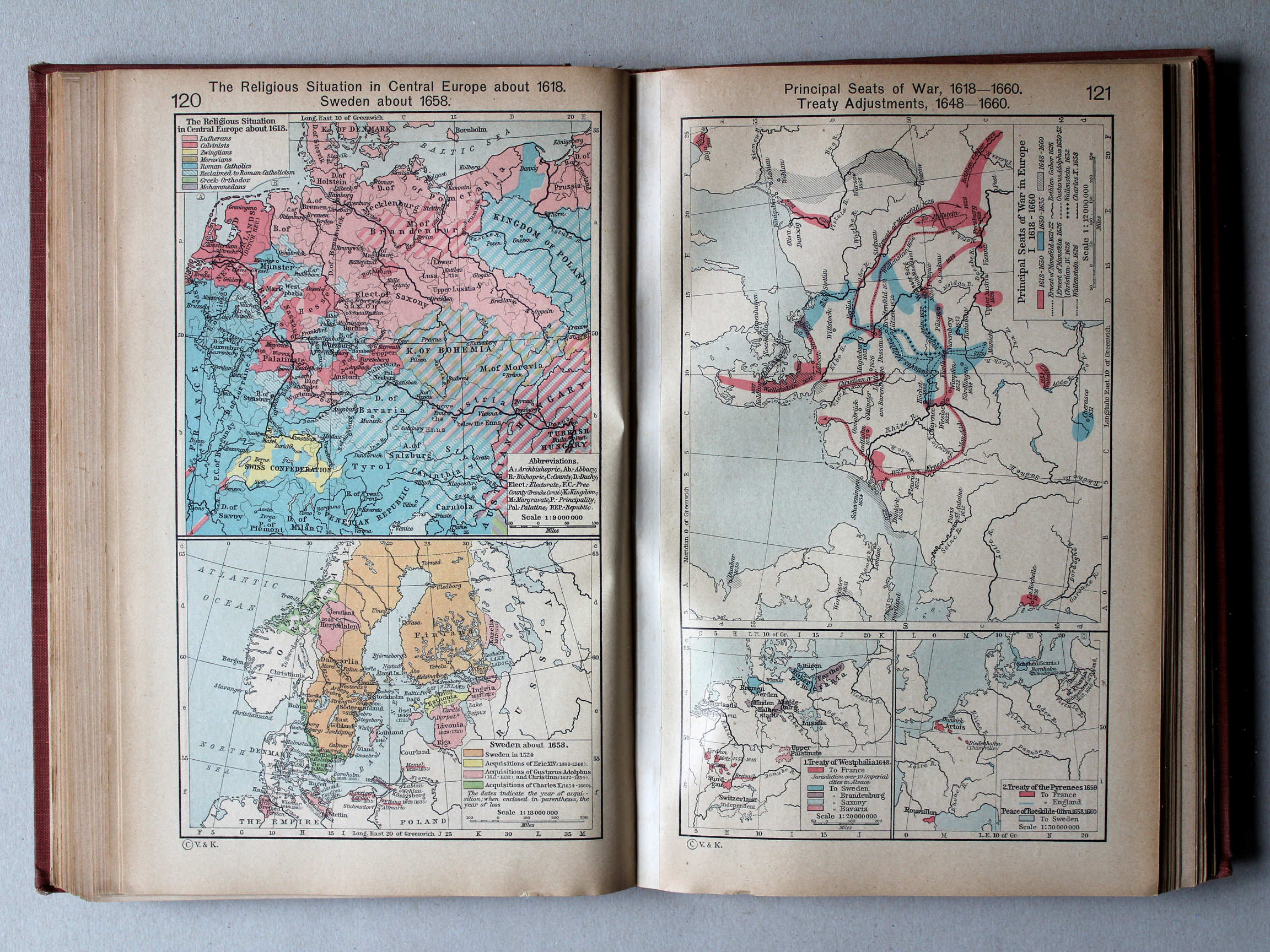
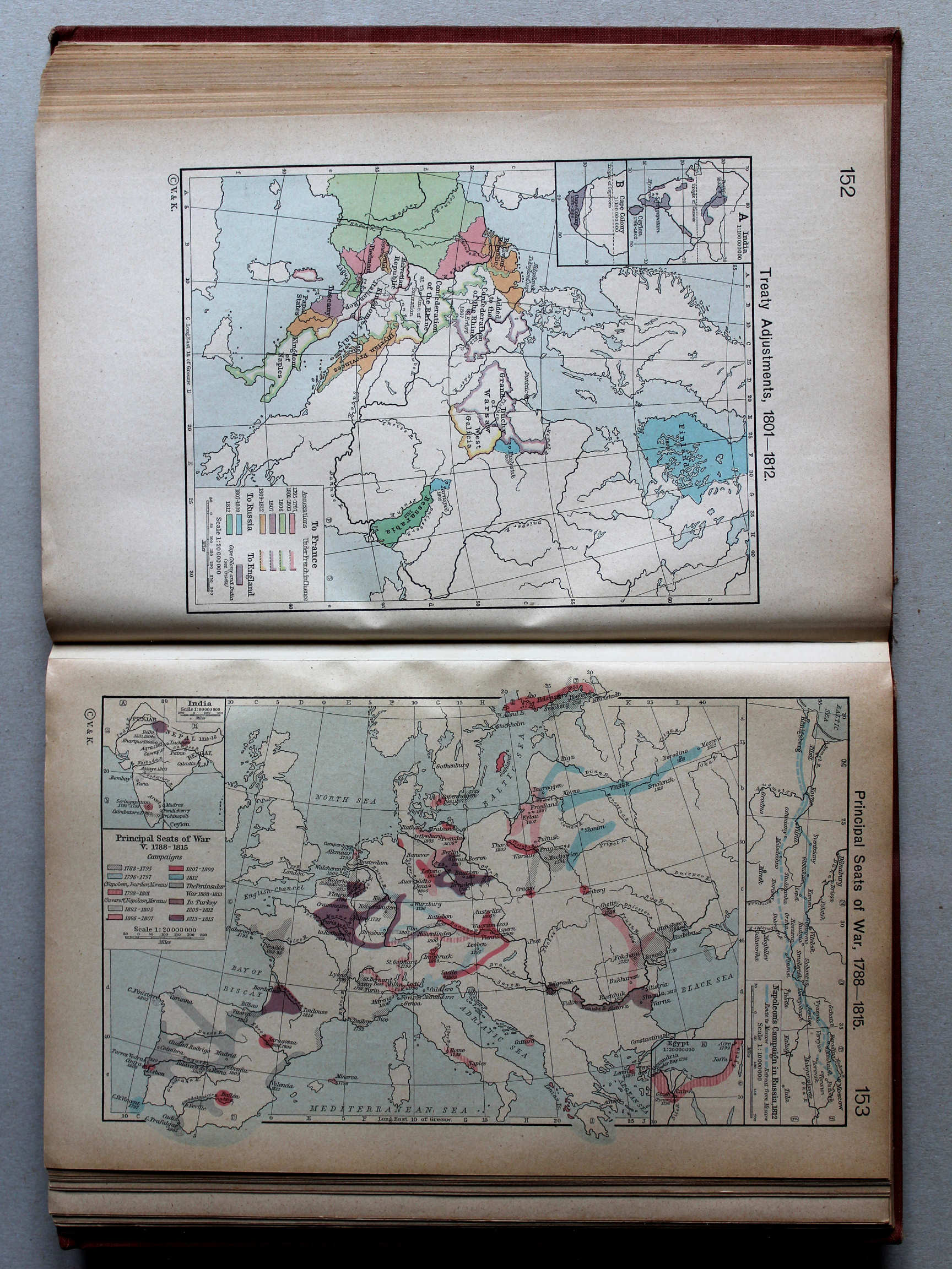
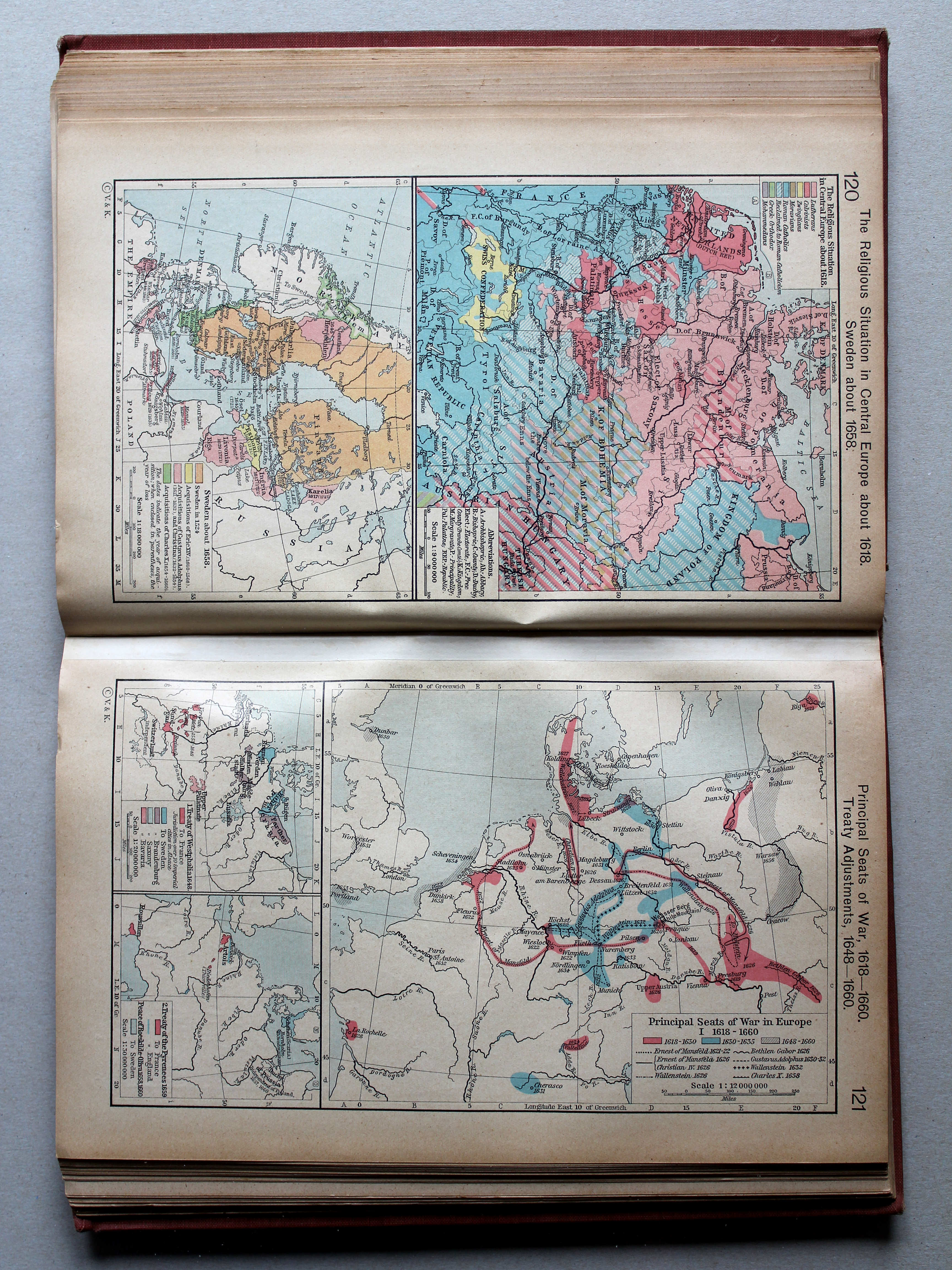
121. Principal Seats of War, 1618-1660. Treaty Adjustments, 1648-1660 XL
Oorlogen, 1618-1660. Vredesverdragen, 1648-1660
 Putzgers Historischer Schul-Atlas, 1918
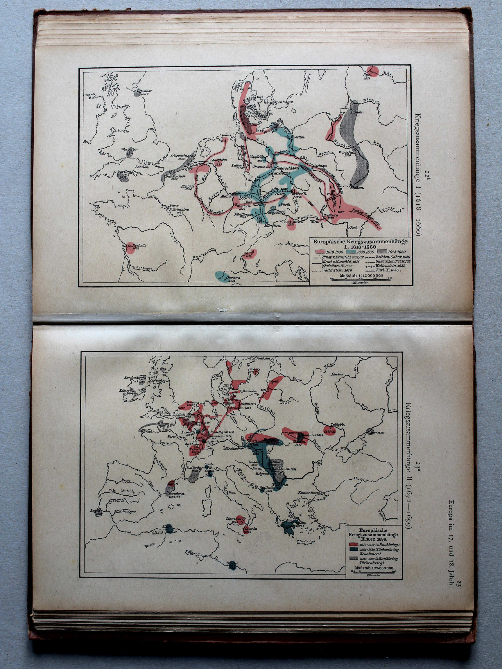
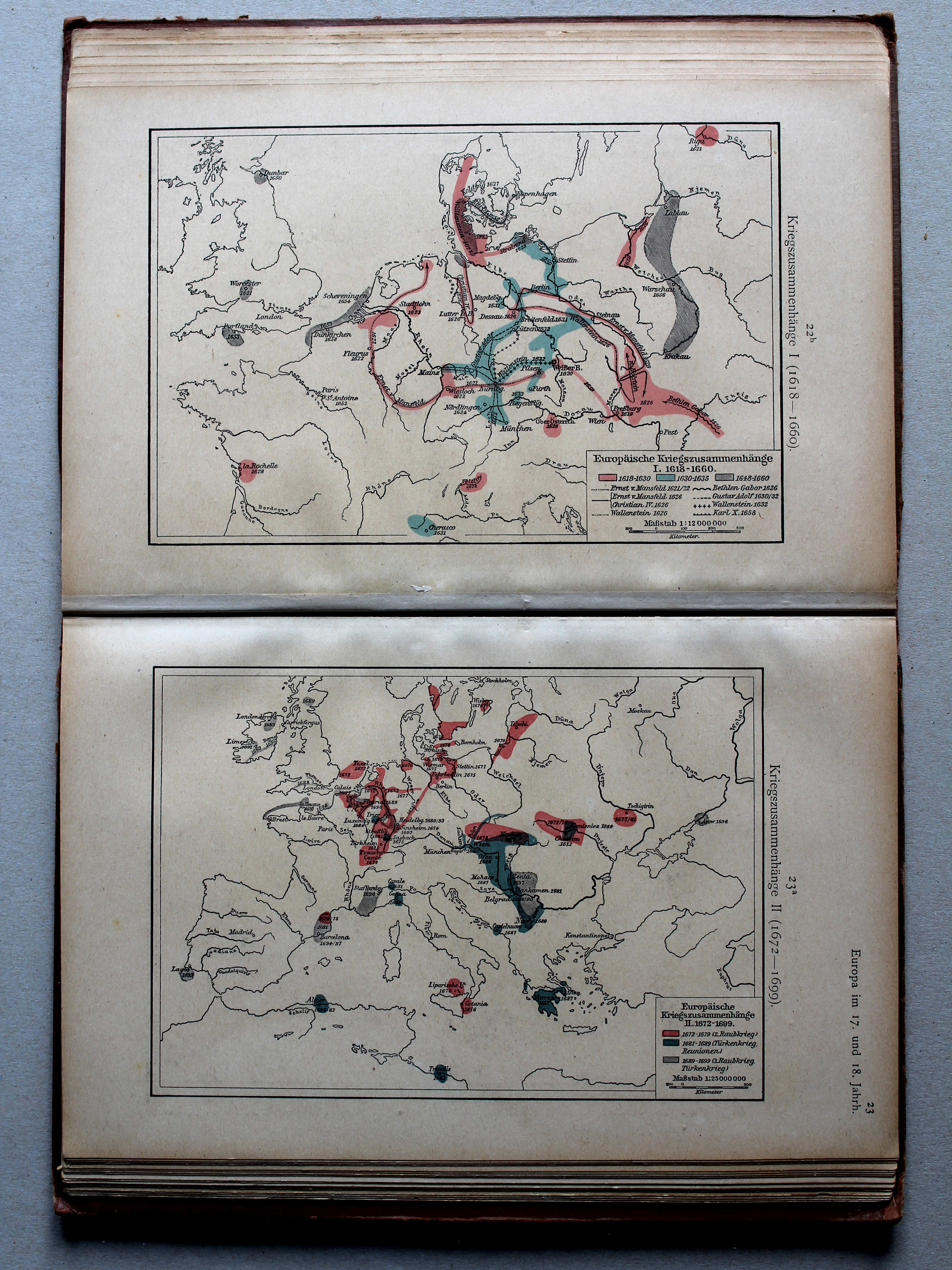
22b. Kriegszusammenhänge I (1618-1660) XL
Oorlogen in Europa I (1618-1660) / European wars I (1618-1660)
23a. Kriegszusammenhänge II (1672-1699) XL
Oorlogen in Europa II (1672-1699) / European wars II (1672-1699)
 Shepherd, Historical Atlas, 1927
121. Principal Seats of War, 1618-1660. Treaty Adjustments, 1648-1660 XL
Oorlogen, 1618-1660. Vredesverdragen, 1648-1660
 Putzgers Historischer Schul-Atlas, 1918
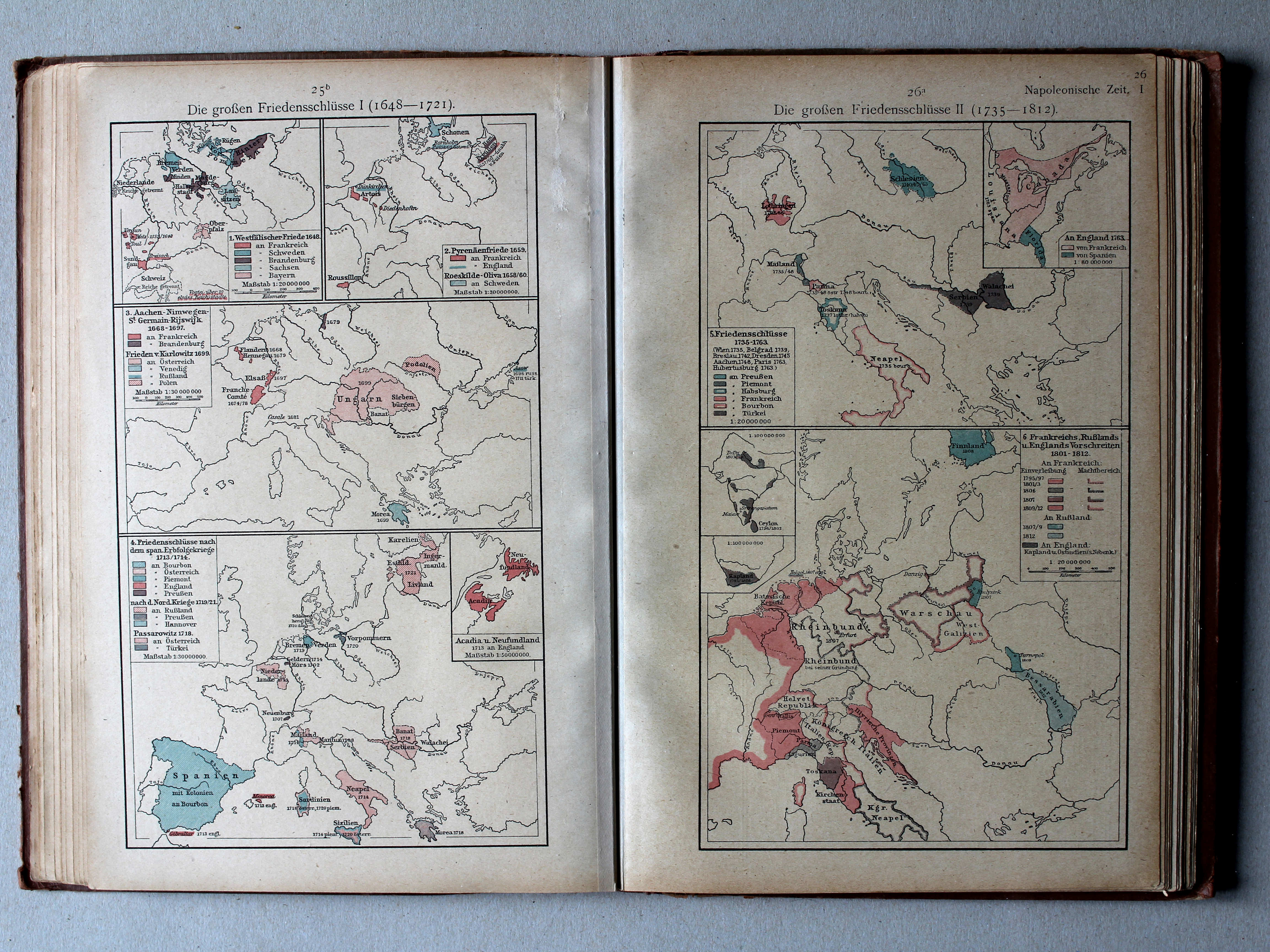
25b. Die großen Friedensschlüsse I (1648-1721) XL
De belangrijkste vredesverdragen I (1648-1721) / The main peace treaties I (1648-1721)
26a. Die großen Friedensschlüsse II (1735-1812) XL
De belangrijkste vredesverdragen II (1735-1812) / The main peace treaties II (1735-1812)
 Putzgers Historischer Schul-Atlas, 1918
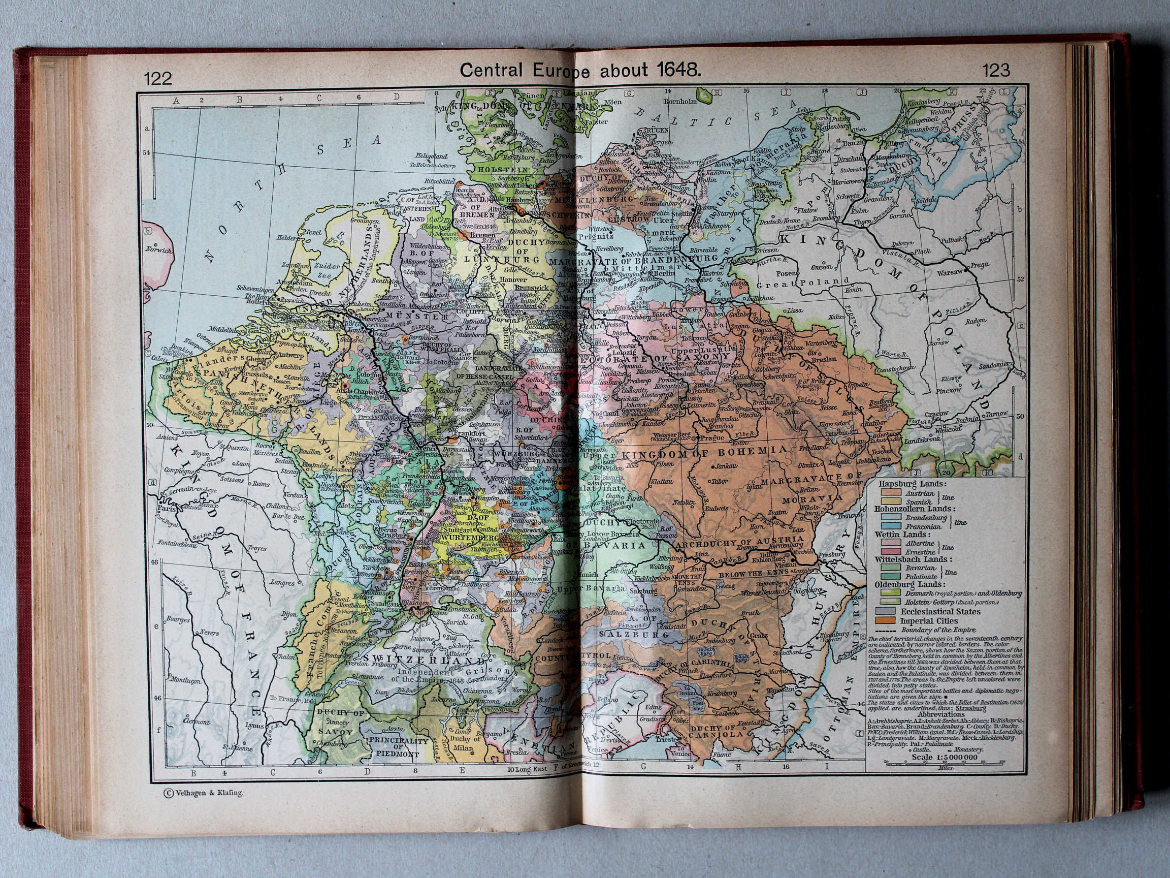
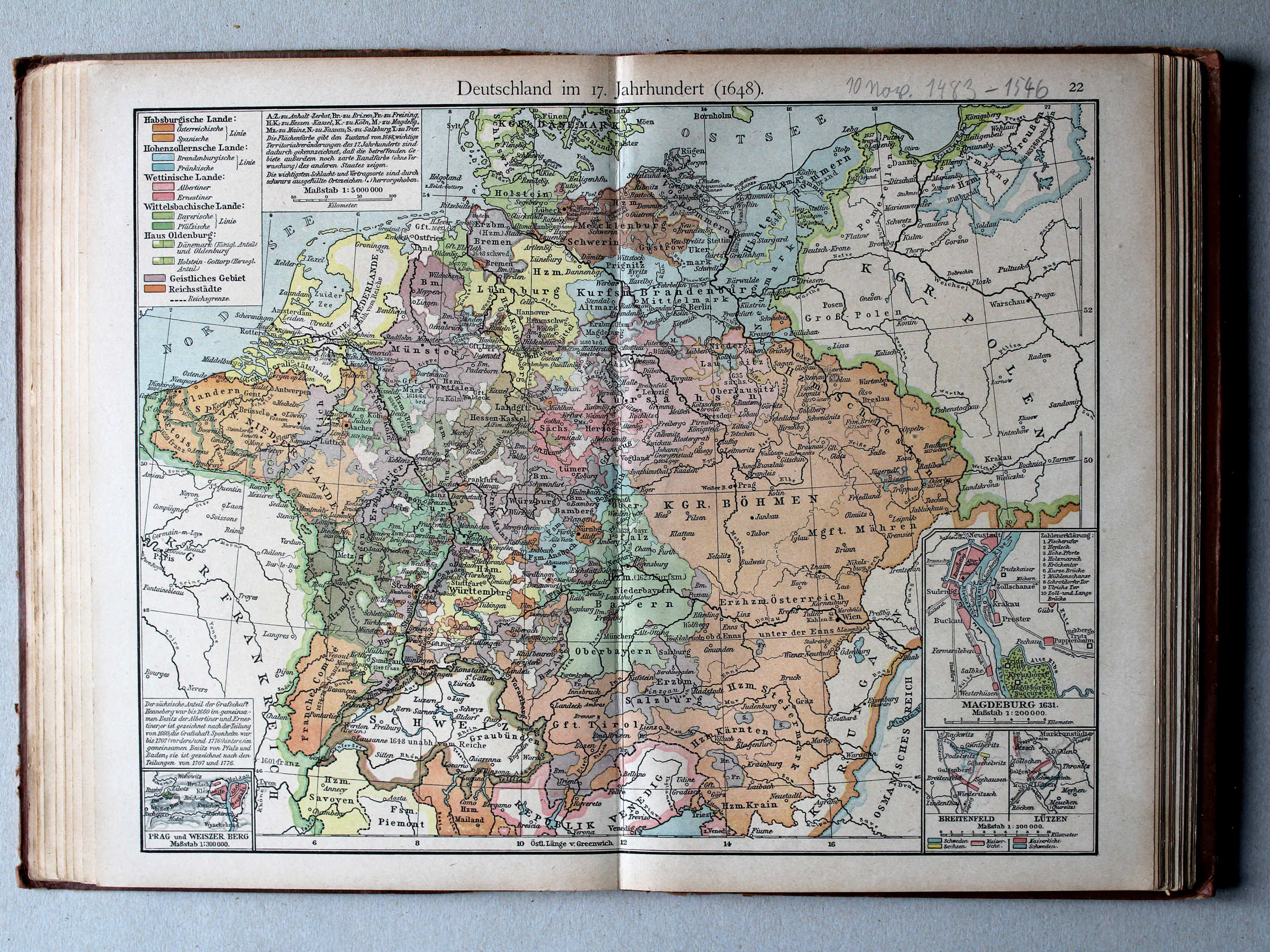
22. Deutschland im 17. Jahrh. (1648) XL
Duitsland in de 17e eeuw (1648) / Germany in the 17th century (1648)
 Shepherd, Historical Atlas, 1927
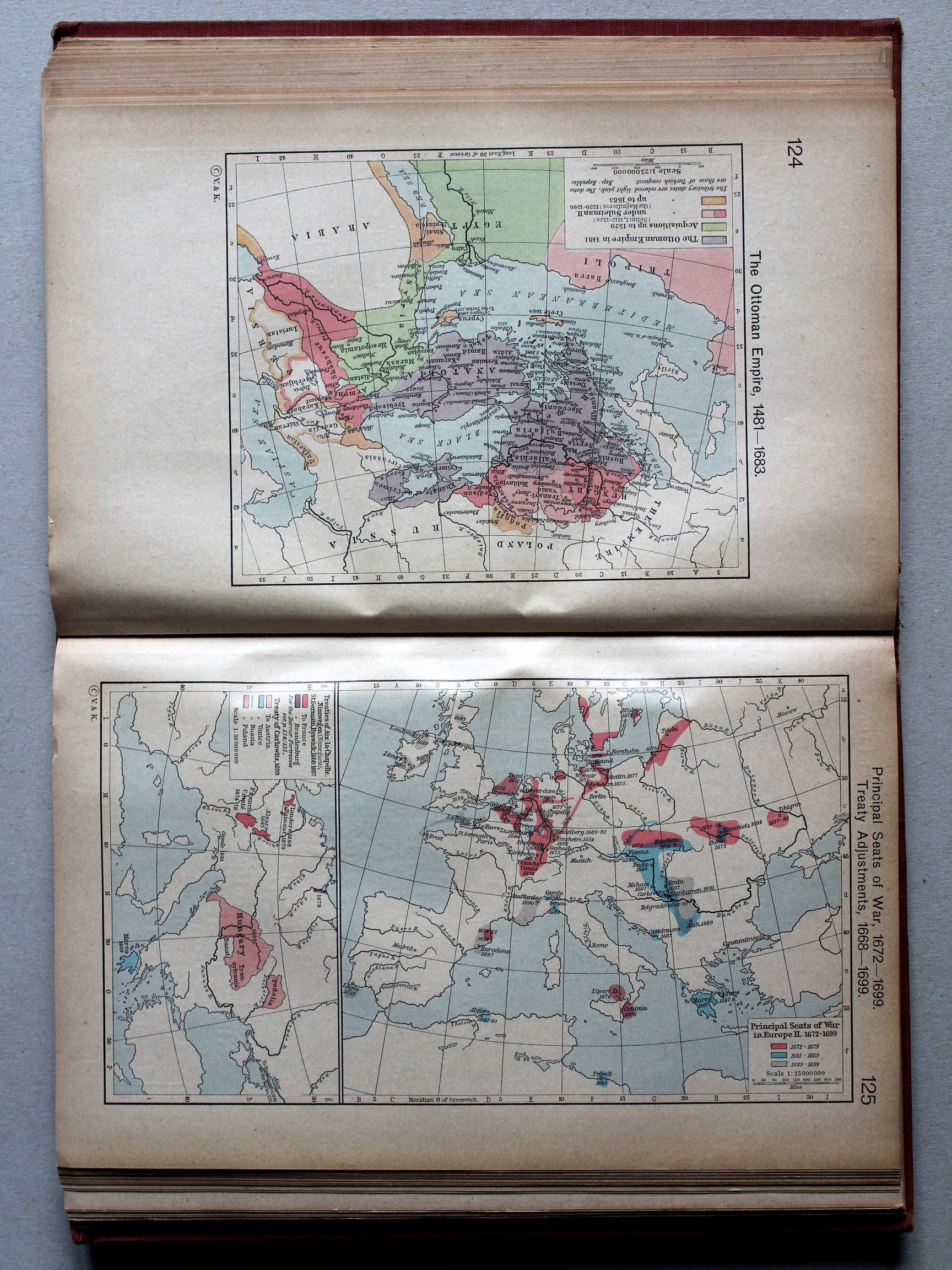
125. Principal Seats of War, 1672-1699. Treaty Adjustments, 1668-1699 XL
Oorlogen, 1672-1699. Vredesverdragen, 1668-1699
Putzgers Historischer Schul-Atlas, 1918
22b. Kriegszusammenhänge I (1618-1660) XL
Oorlogen in Europa I (1618-1660) / European wars I (1618-1660)
23a. Kriegszusammenhänge II (1672-1699) XL
Oorlogen in Europa II (1672-1699) / European wars II (1672-1699)
 Shepherd, Historical Atlas, 1927
125. Principal Seats of War, 1672-1699. Treaty Adjustments, 1668-1699 XL
Oorlogen, 1672-1699. Vredesverdragen, 1668-1699
Putzgers Historischer Schul-Atlas, 1918
25b. Die großen Friedensschlüsse I (1648-1721) XL
De belangrijkste vredesverdragen I (1648-1721) / The main peace treaties I (1648-1721)
26a. Die großen Friedensschlüsse II (1735-1812) XL
De belangrijkste vredesverdragen II (1735-1812) / The main peace treaties II (1735-1812)
 Shepherd, Historical Atlas, 1927
129. Principal Seats of War in Europe, III. 1700-1721 XL
Oorlogen in Europa, III. 1700-1721
 Putzgers Historischer Schul-Atlas, 1918
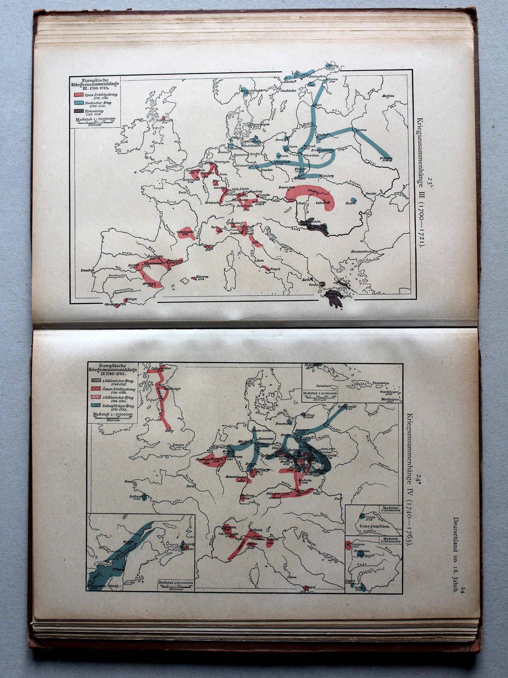
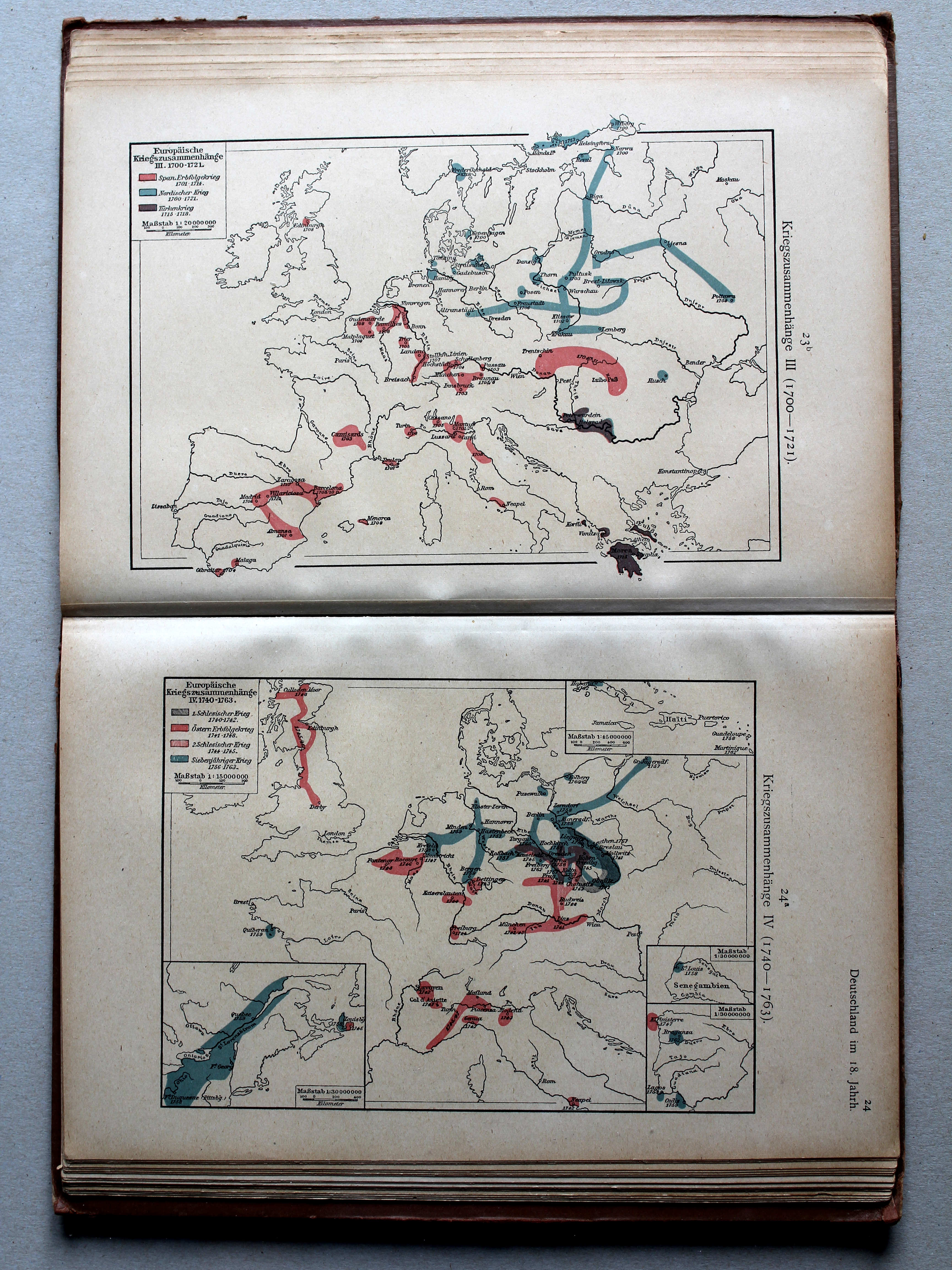
23b. Kriegszusammenhänge III (1700-1721) XL
Oorlogen in Europa III (1700-1721) / European wars III (1700-1721)
24a. Kriegszusammenhänge IV (1740-1763) XL
Oorlogen in Europa IV (1740-1763) / European wars IV (1740-1763)
 Putzgers Historischer Schul-Atlas, 1918
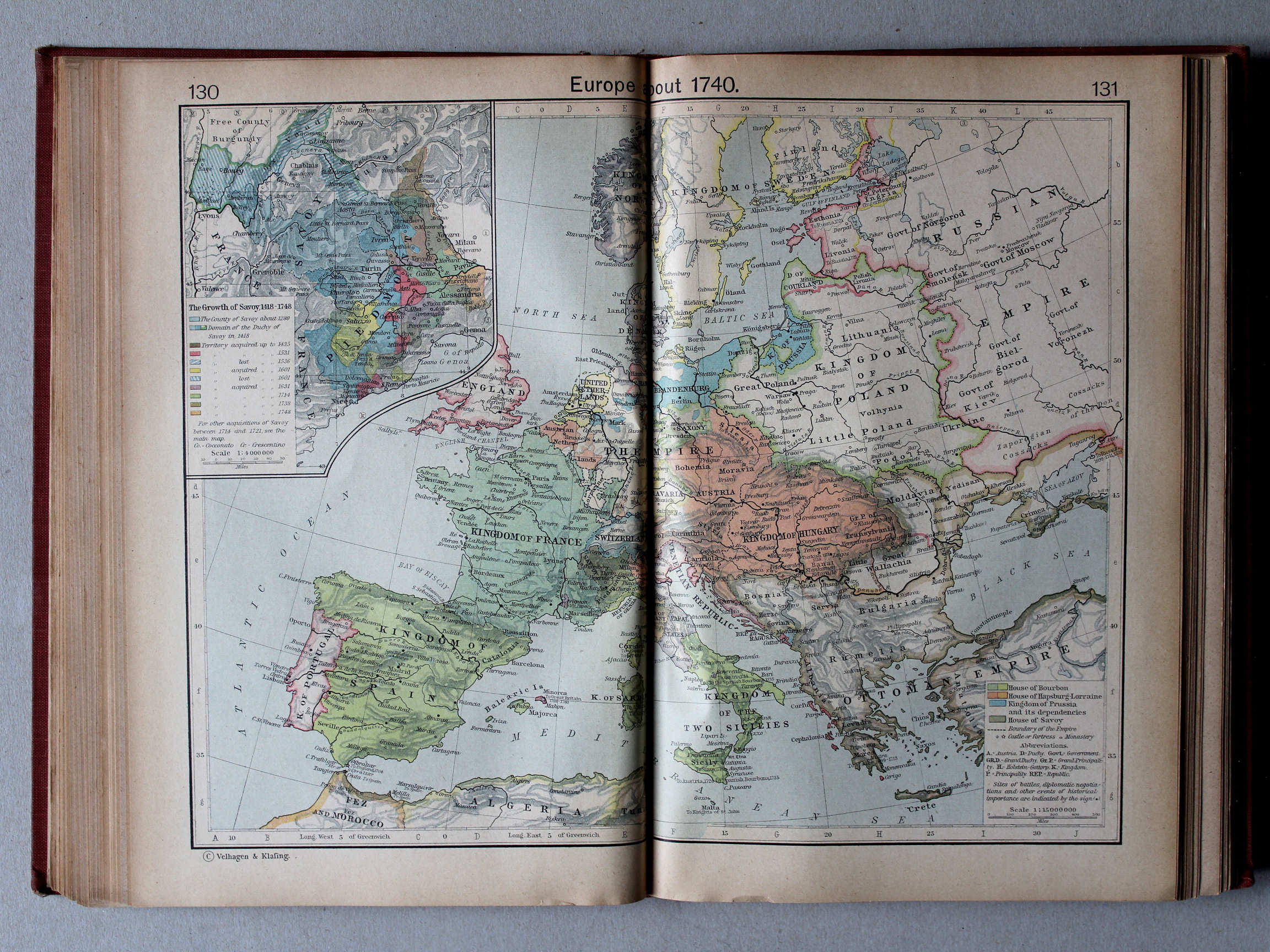
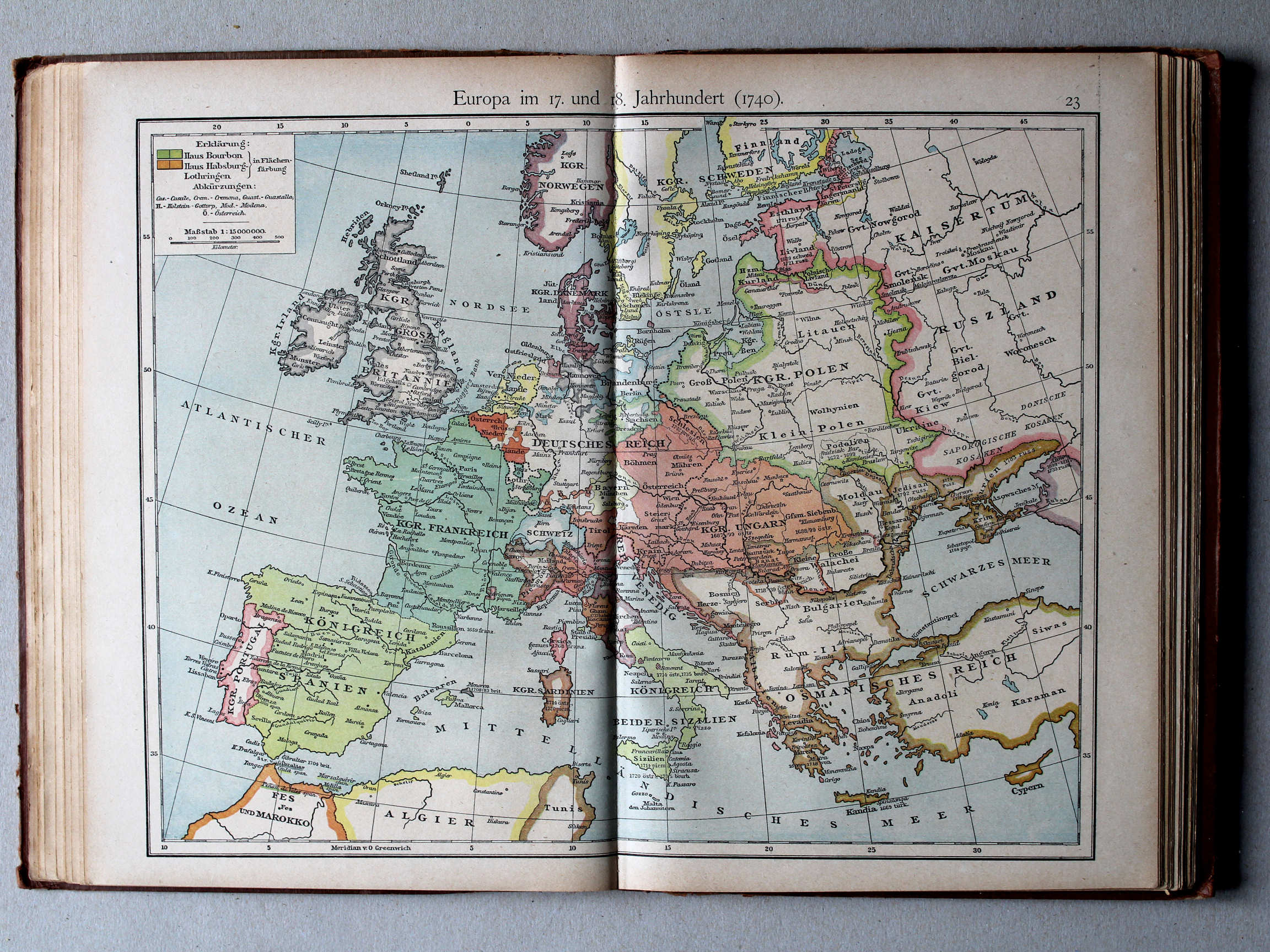
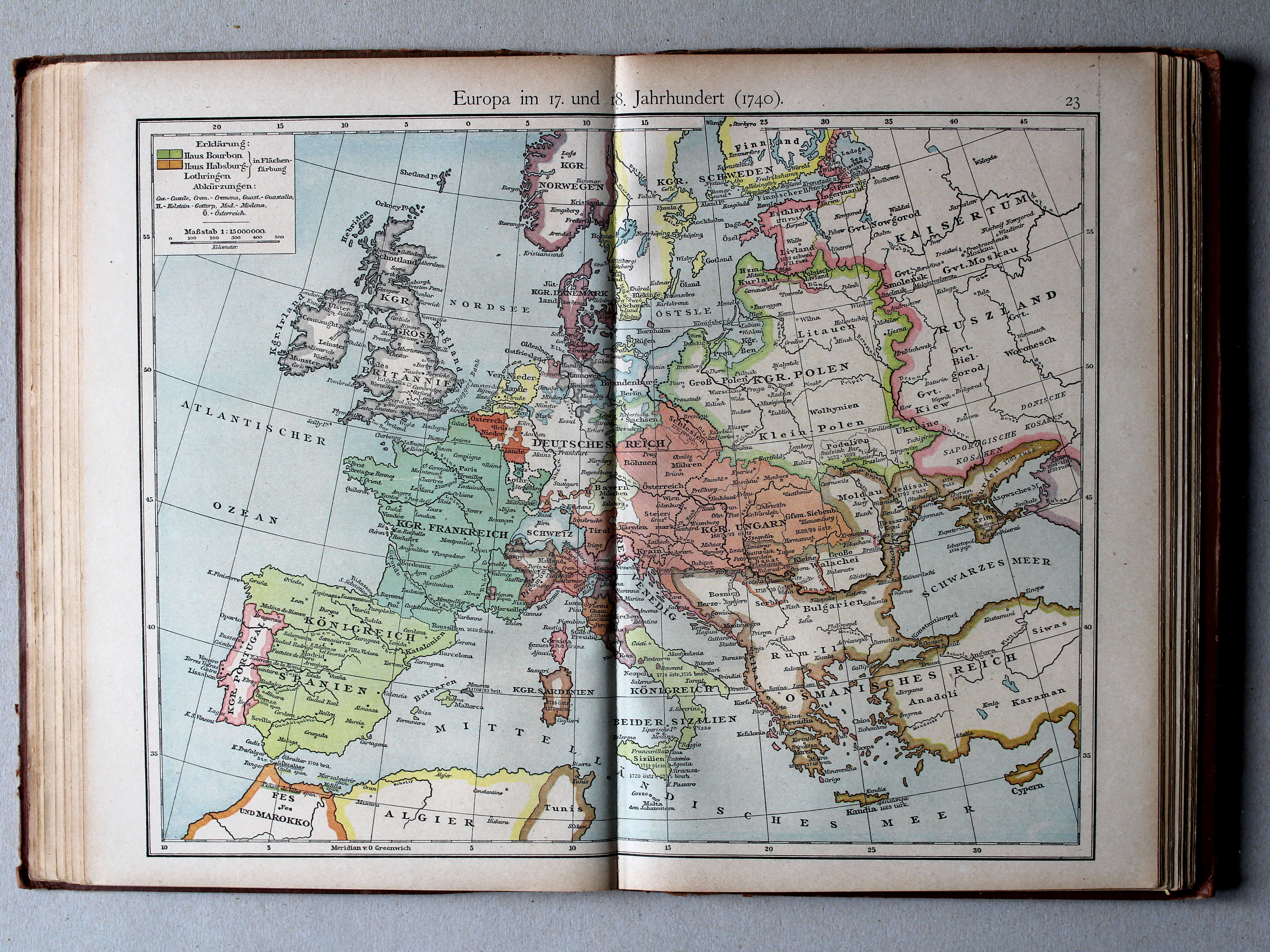
23. Europa im 17. und 18. Jahrhundert (1740) XL
Europa in de 17e en 18e eeuw (1740) / Europe in the 17th and 18th century (1740)
 Shepherd, Historical Atlas, 1927
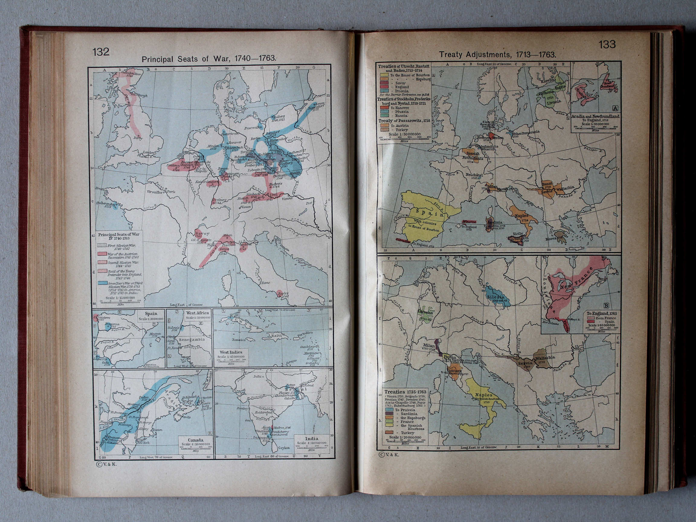
132. Principal Seats of War, 1740-1763 XL
Oorlogen, 1740-1763
133. Treaty Adjustments, 1713-1763 XL
Vredesverdragen, 1713-1763
Putzgers Historischer Schul-Atlas, 1918
23b. Kriegszusammenhänge III (1700-1721) XL
Oorlogen in Europa III (1700-1721) / European wars III (1700-1721)
24a. Kriegszusammenhänge IV (1740-1763) XL
Oorlogen in Europa IV (1740-1763) / European wars IV (1740-1763)
Shepherd, Historical Atlas, 1927
132. Principal Seats of War, 1740-1763 XL
Oorlogen, 1740-1763
133. Treaty Adjustments, 1713-1763 XL
Vredesverdragen, 1713-1763
Putzgers Historischer Schul-Atlas, 1918
25b. Die großen Friedensschlüsse I (1648-1721) XL
De belangrijkste vredesverdragen I (1648-1721) / The main peace treaties I (1648-1721)
26a. Die großen Friedensschlüsse II (1735-1812) XL
De belangrijkste vredesverdragen II (1735-1812) / The main peace treaties II (1735-1812)
 Putzgers Historischer Schul-Atlas, 1918
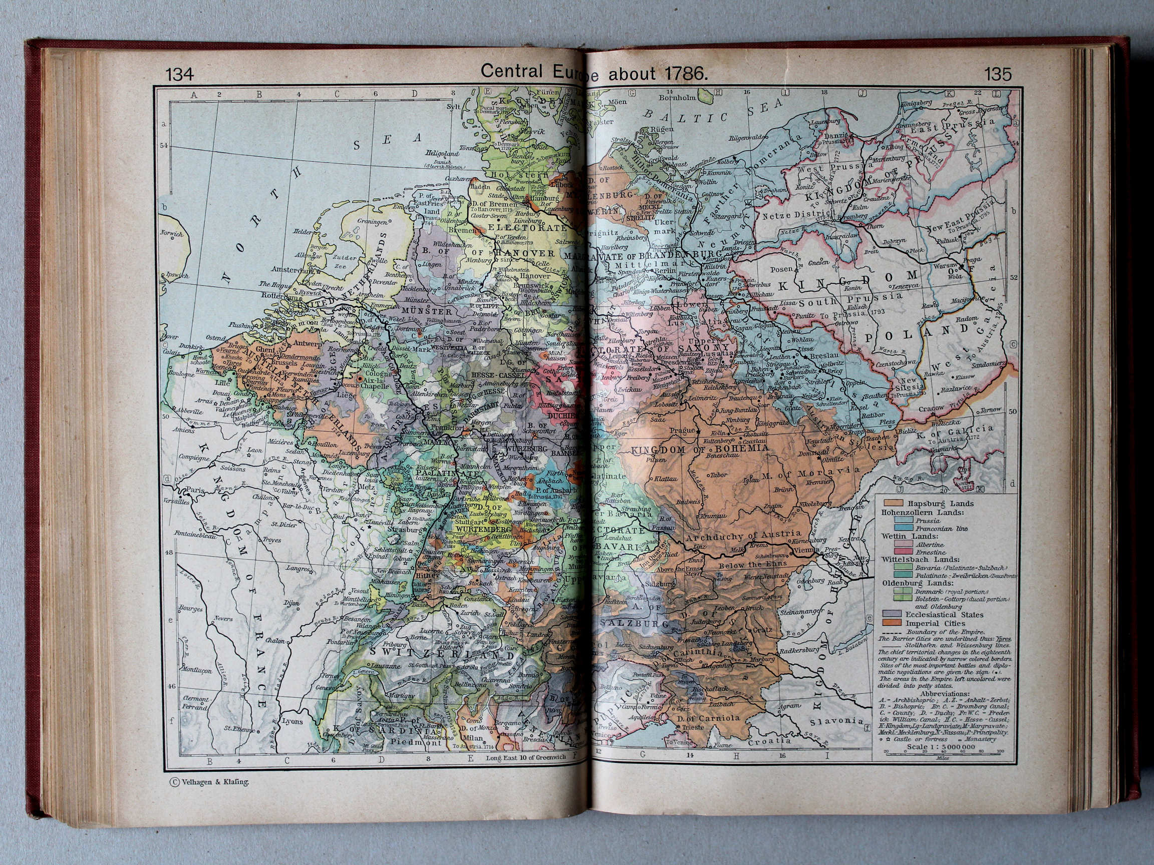
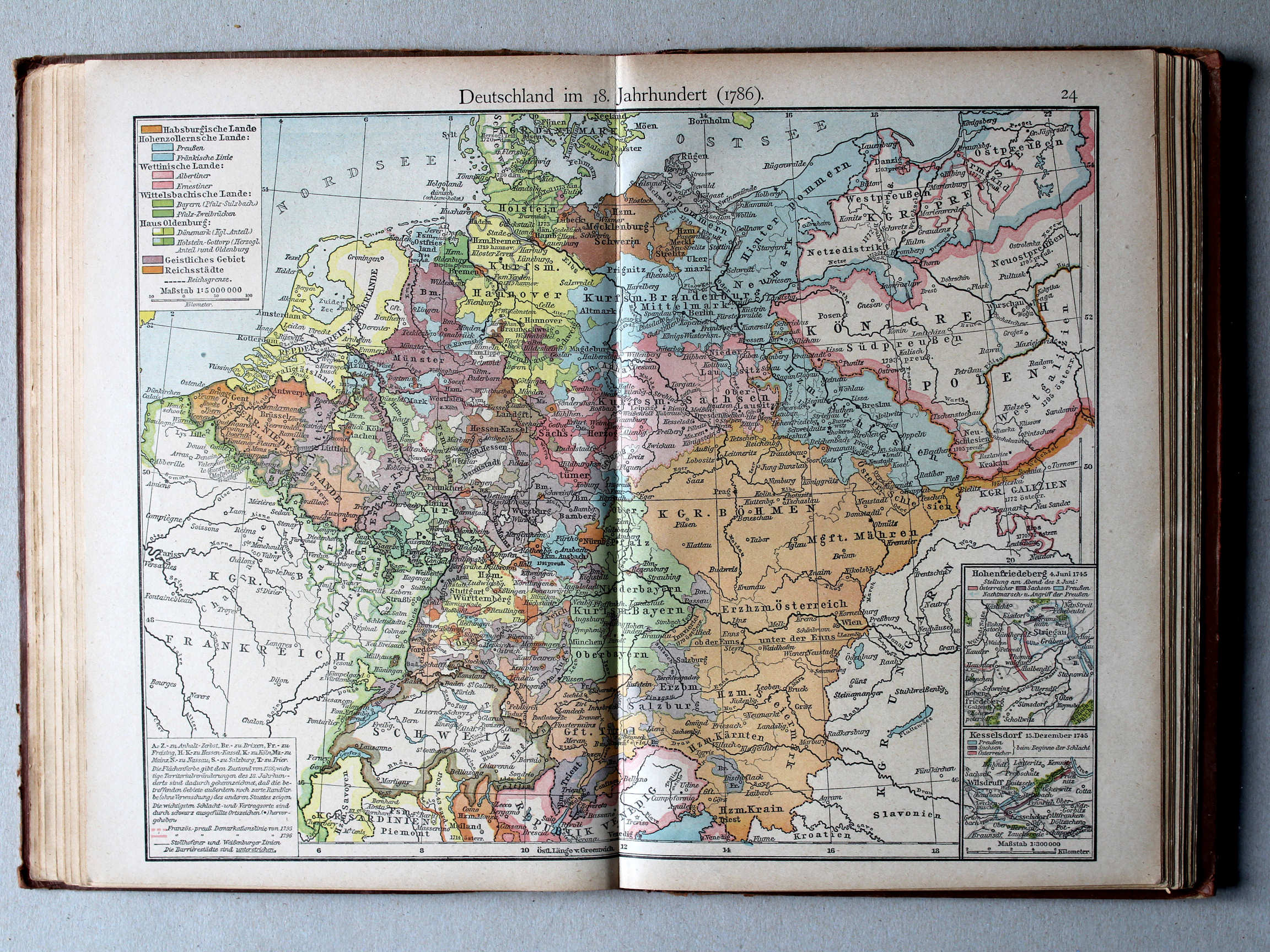
24. Deutschland im 18. Jahrh. (1786) XL
Duitsland in de 18e eeuw (1786) / Germany in the 18th century (1786)
 Shepherd, Historical Atlas, 1927
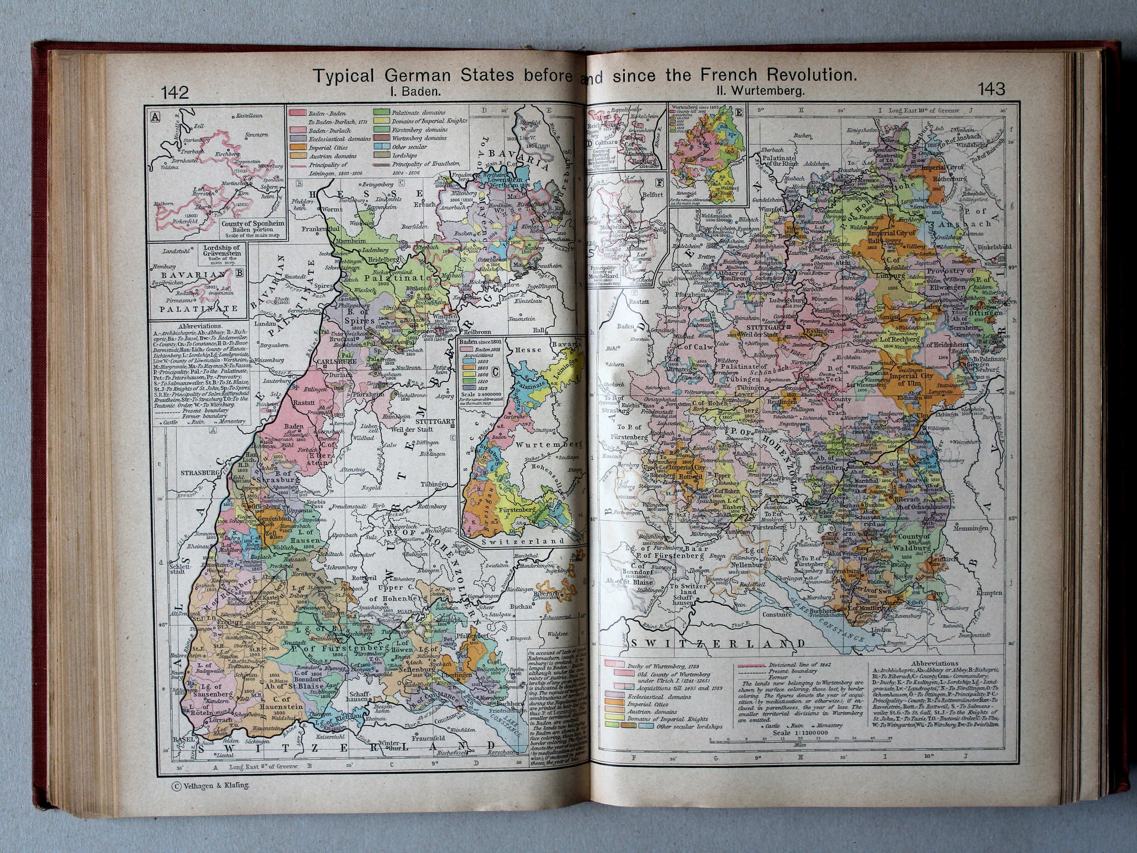
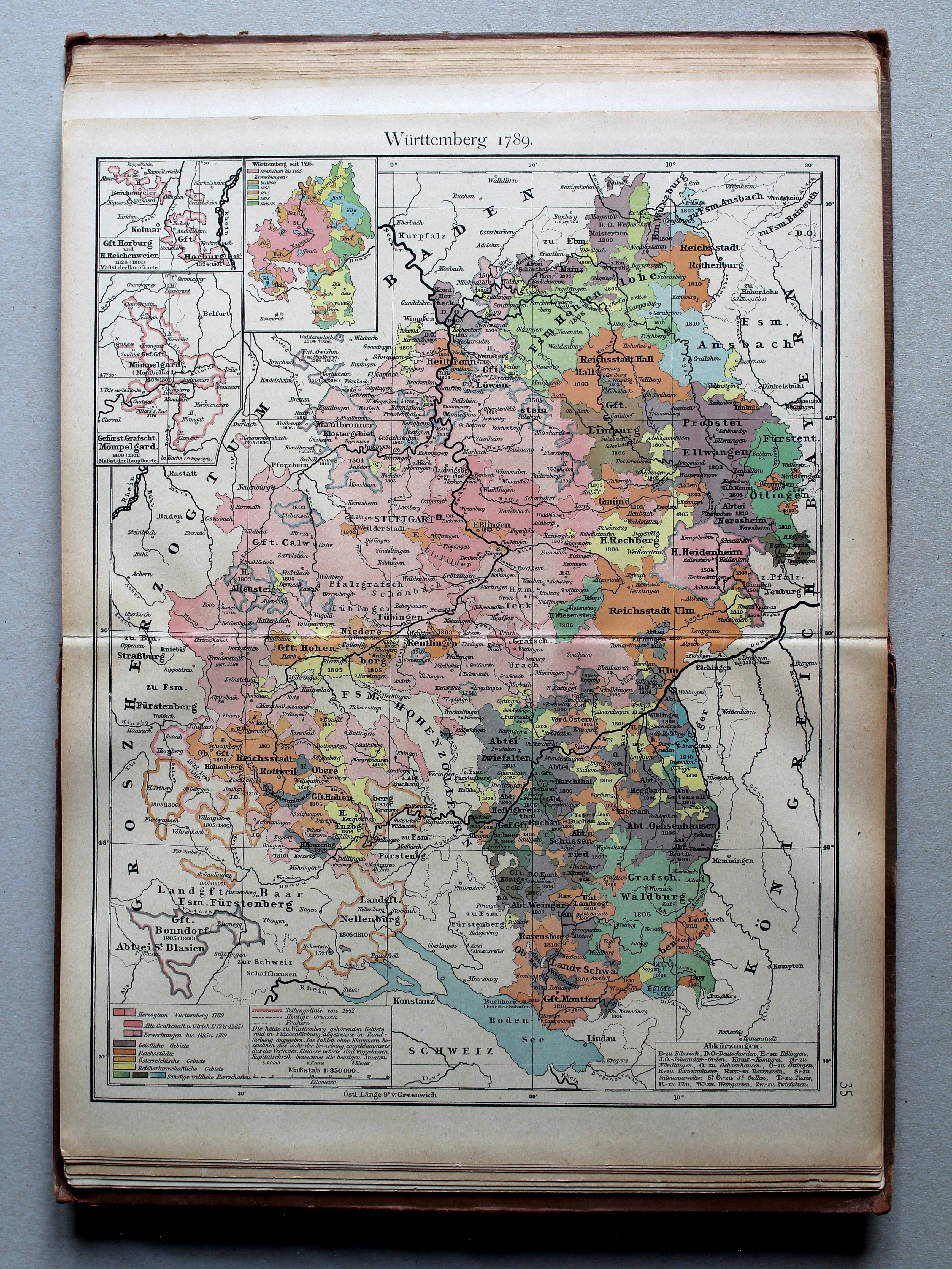
142.143. Typical German States before and since the French Revolution. I. Baden. II. Wurtemberg XL
Enkele Duitse staten voor en na de Franse Revolutie. I. Baden. II. Württemberg
 Putzgers Historischer Schul-Atlas, 1918
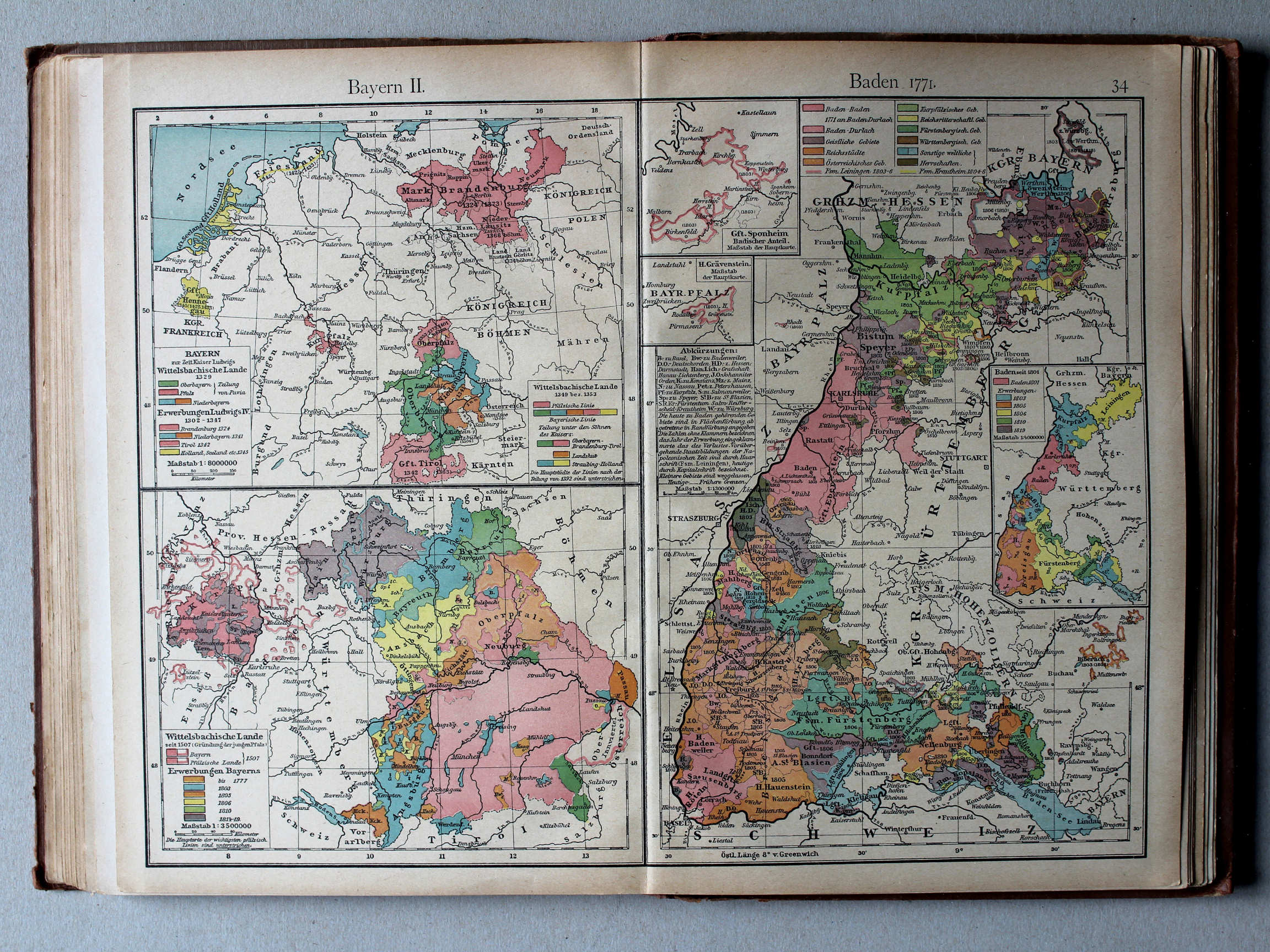
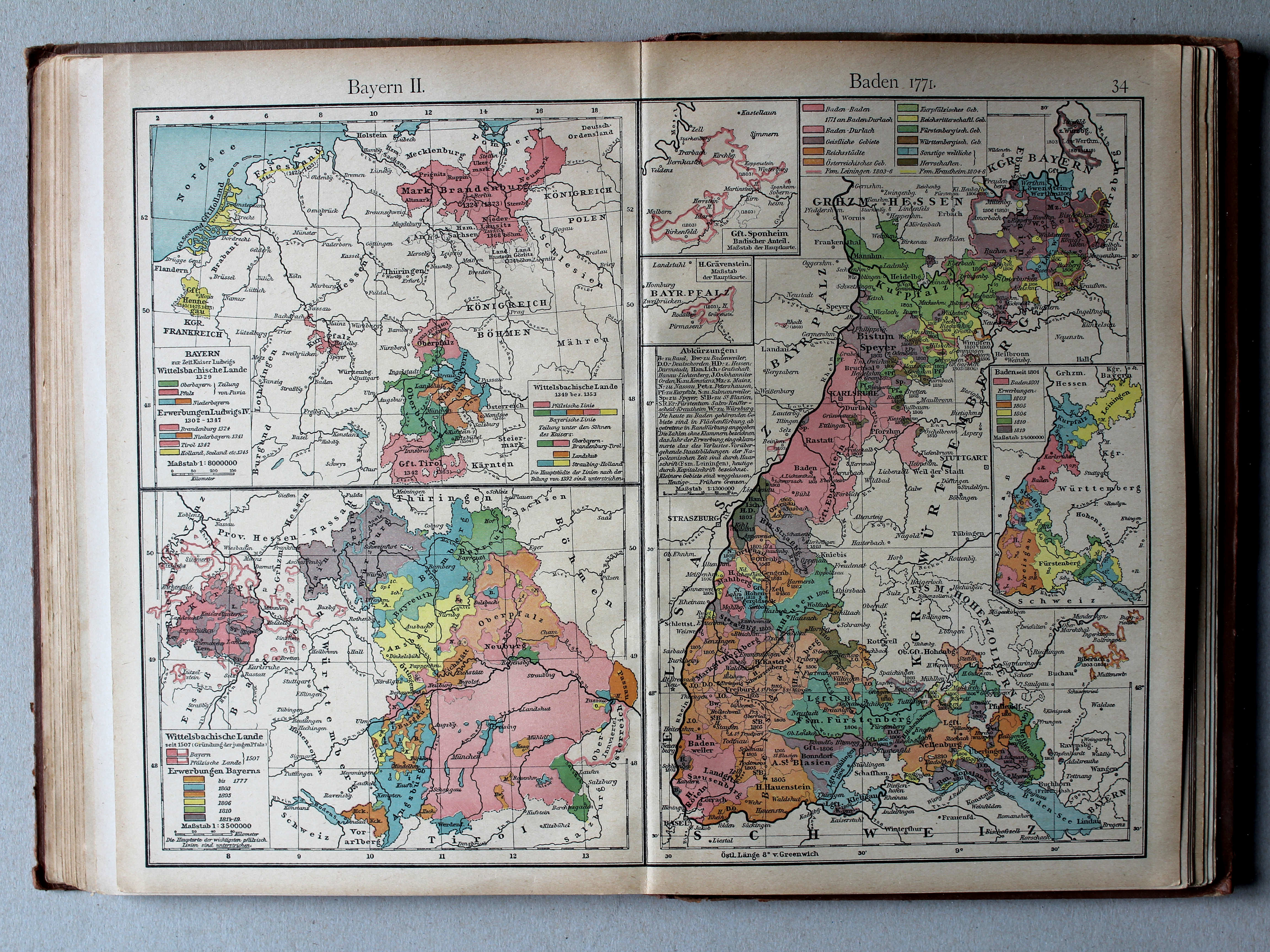
34. Bayern II. Baden 1771 XL
Beieren II, Baden 1771 / Bavaria II, Baden 1771
Shepherd, Historical Atlas, 1927
142.143. Typical German States before and since the French Revolution. I. Baden. II. Wurtemberg XL
Enkele Duitse staten voor en na de Franse Revolutie. I. Baden. II. Württemberg
 Shepherd, Historical Atlas, 1927
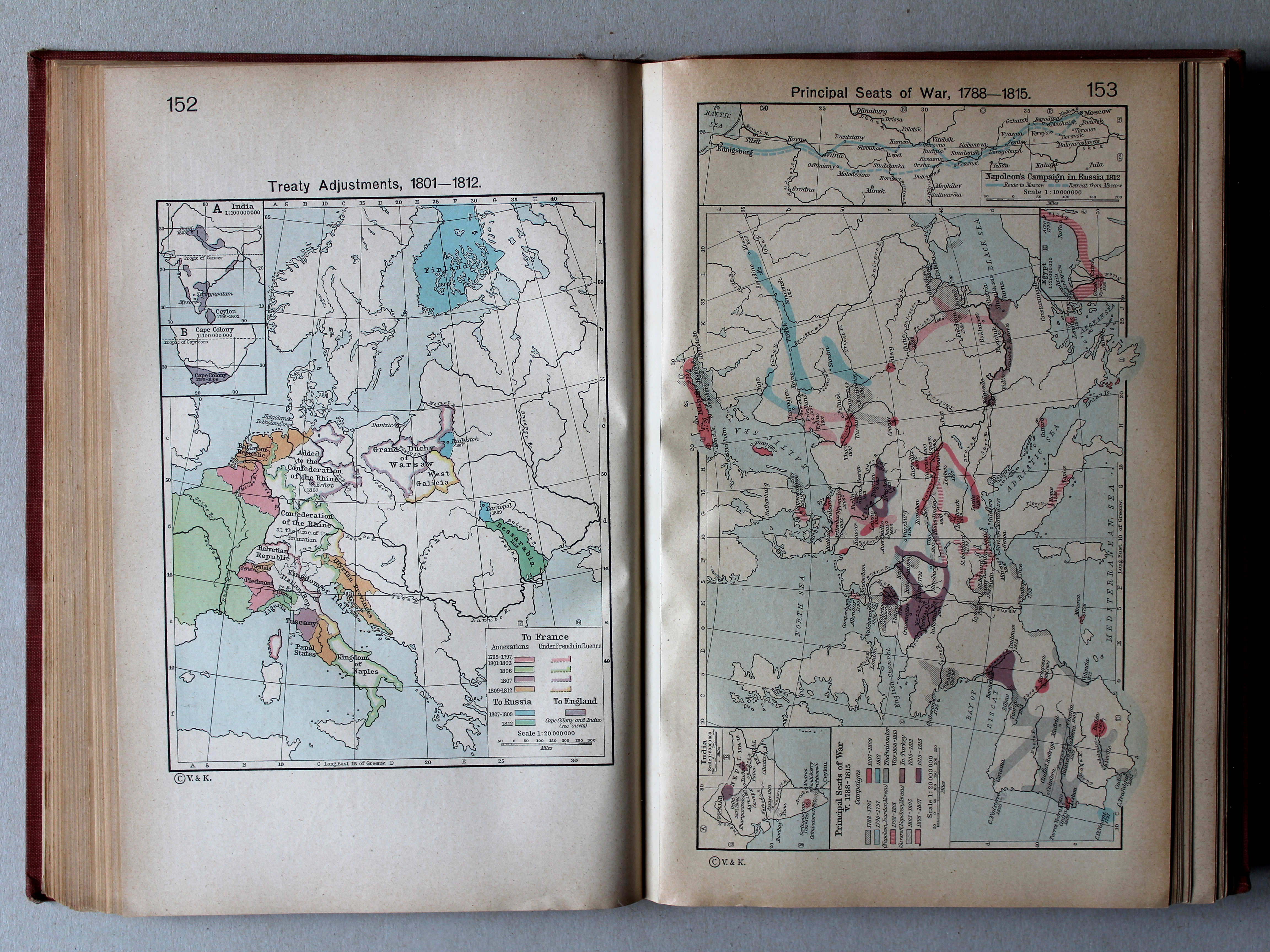
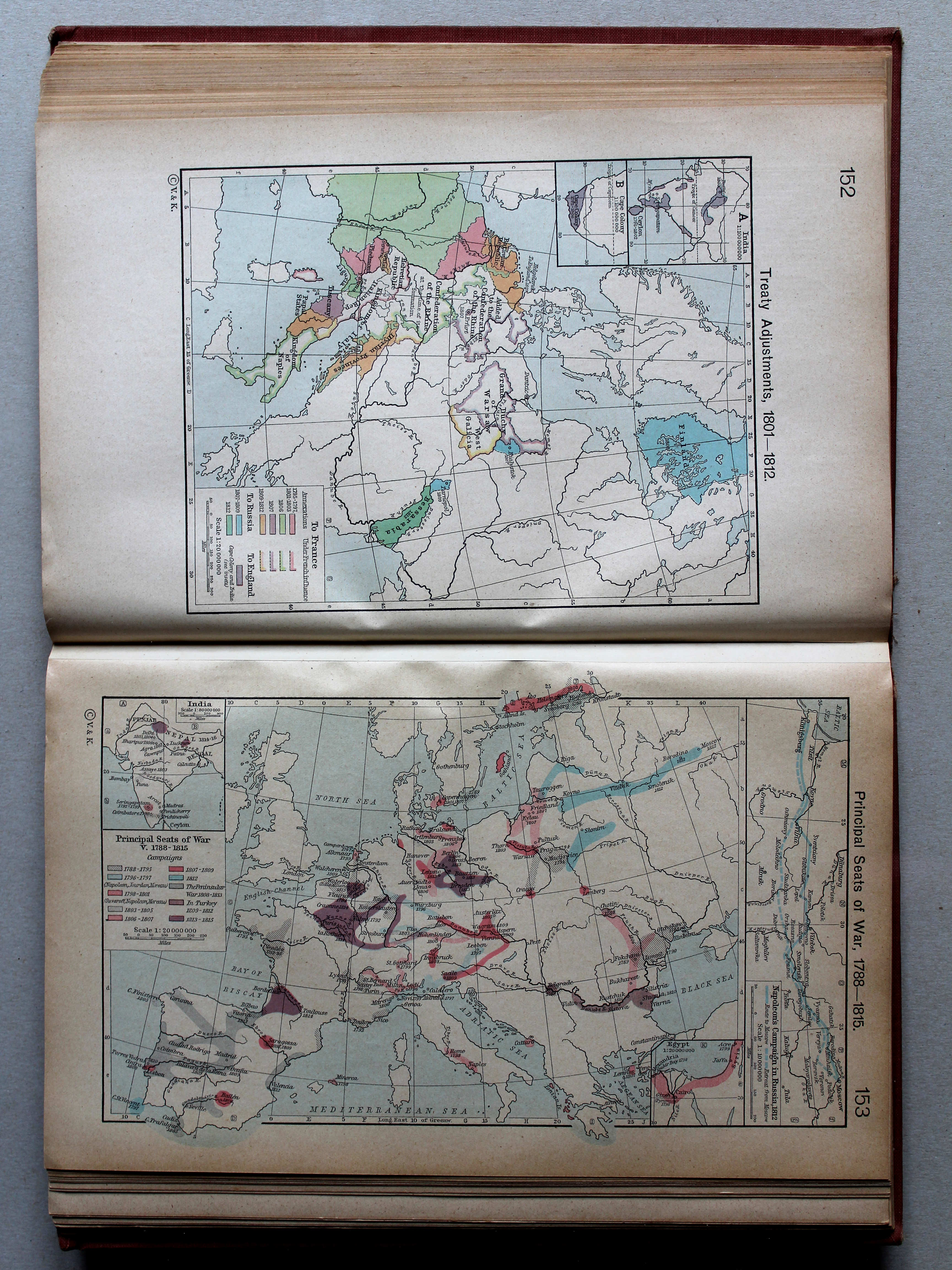
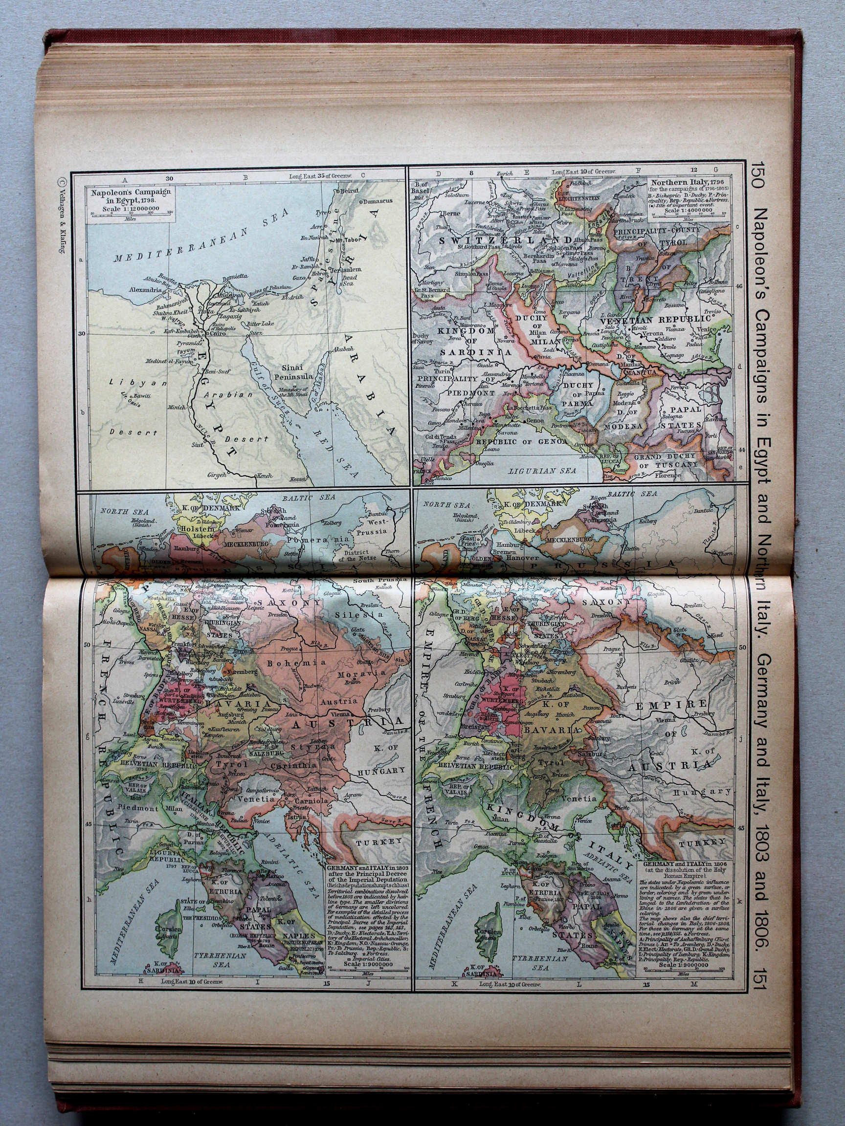
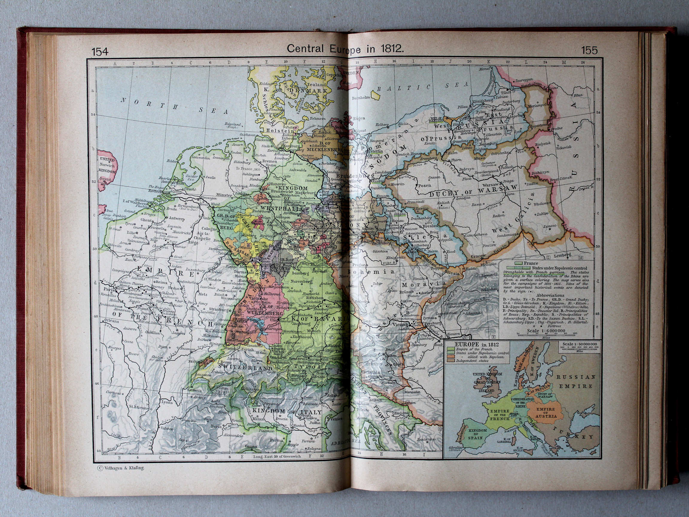
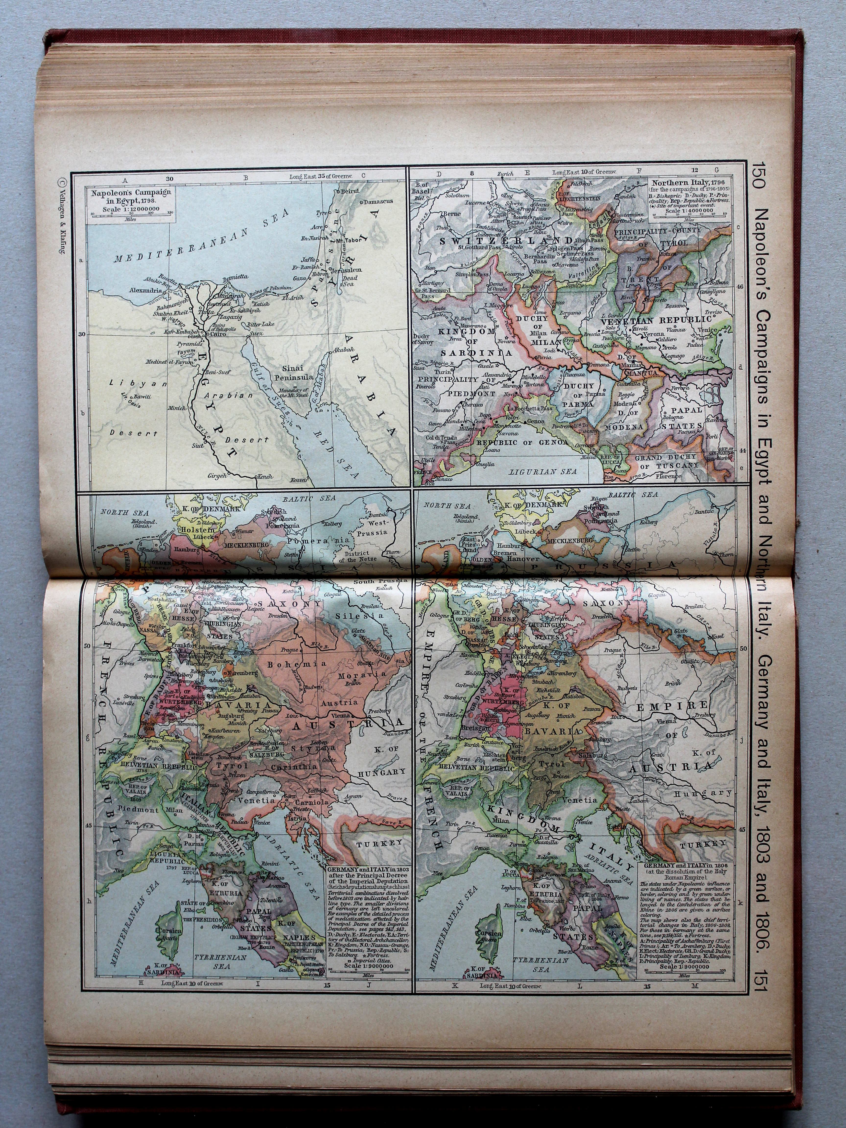
150.151. Napoleon's Campaign in Egypt and Northern Italy. Germany and Italy, 1803 and 1806 XL
Veldtochten van Napoleon in Egypte en Noord-Italië. Duitsland en Italië, 1803 en 1806
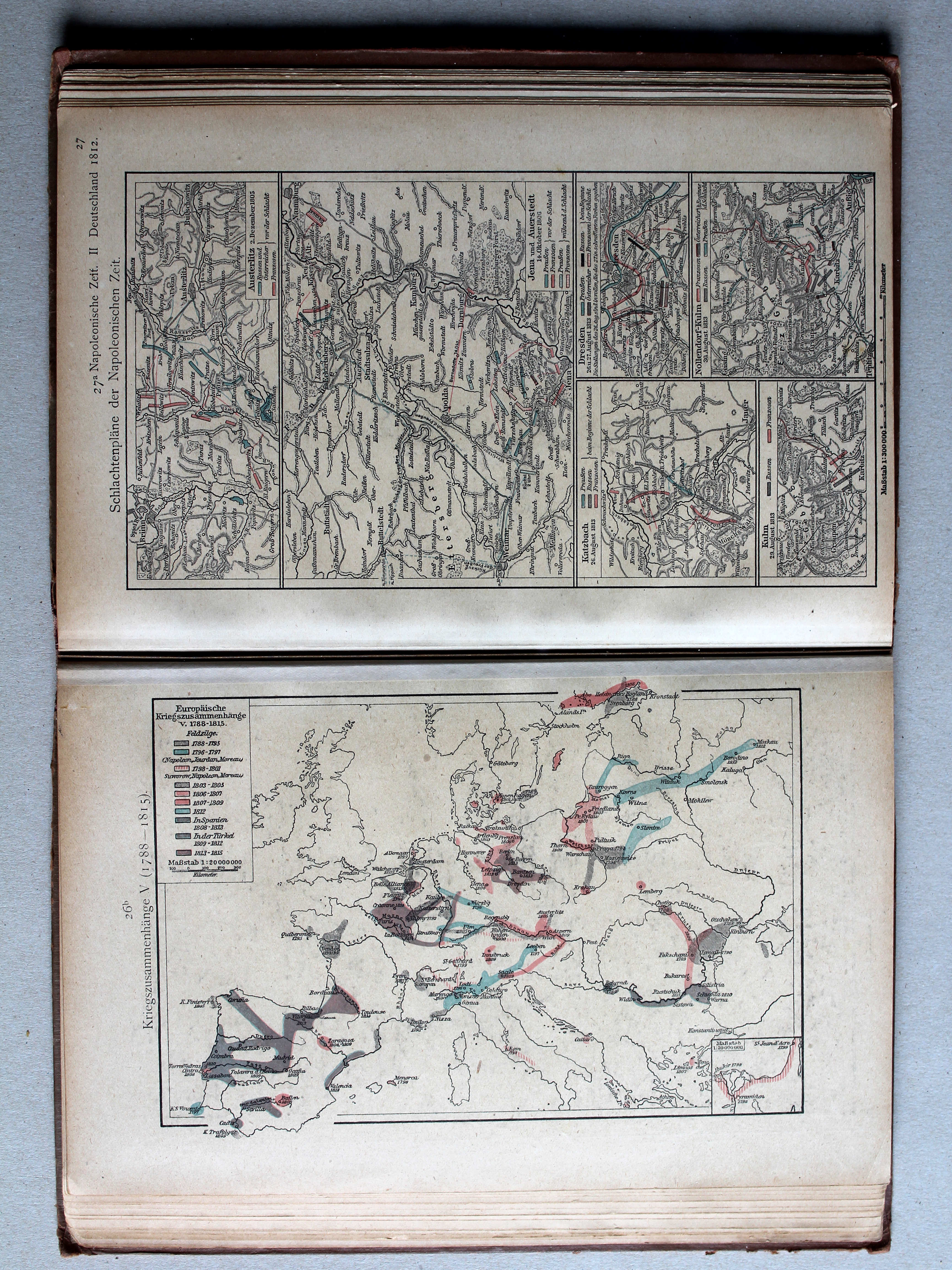
 Putzgers Historischer Schul-Atlas, 1918
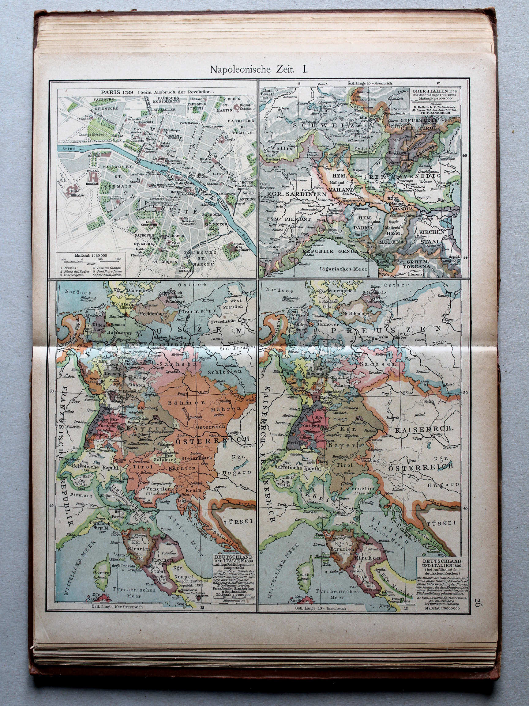
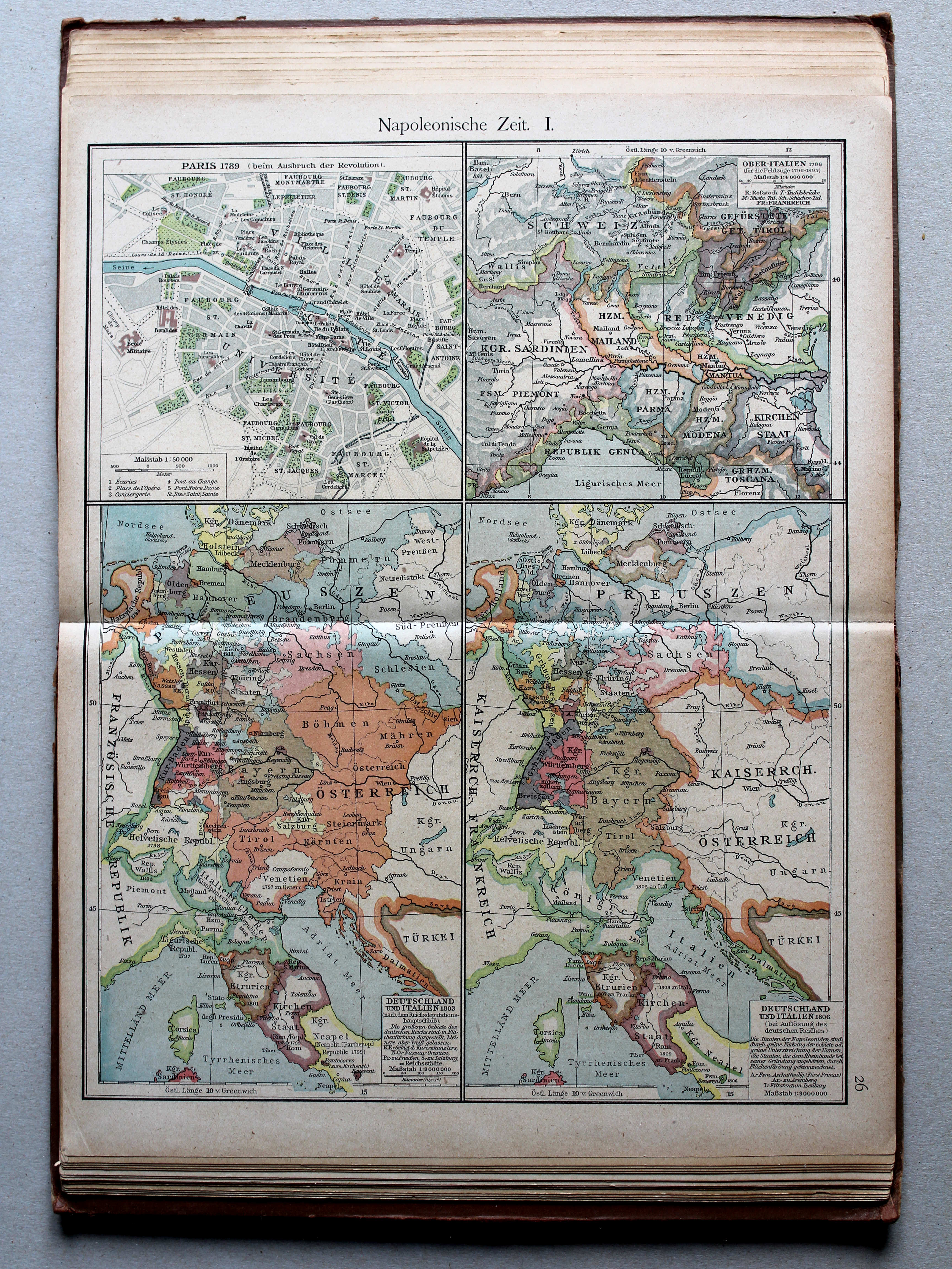
26. Napoleonische Zeit I XL
Tijd van Napoleon I / Era of Napoleon I
 Putzgers Historischer Schul-Atlas, 1918
25b. Die großen Friedensschlüsse I (1648-1721) XL
De belangrijkste vredesverdragen I (1648-1721) / The main peace treaties I (1648-1721)
26a. Die großen Friedensschlüsse II (1735-1812) XL
De belangrijkste vredesverdragen II (1735-1812) / The main peace treaties II (1735-1812)
 Putzgers Historischer Schul-Atlas, 1918
26b. Kriegszusammenhänge V (1788-1815) XL
Oorlogen in Europa V (1788-1815) / European wars V (1788-1815)
 Putzgers Historischer Schul-Atlas, 1918
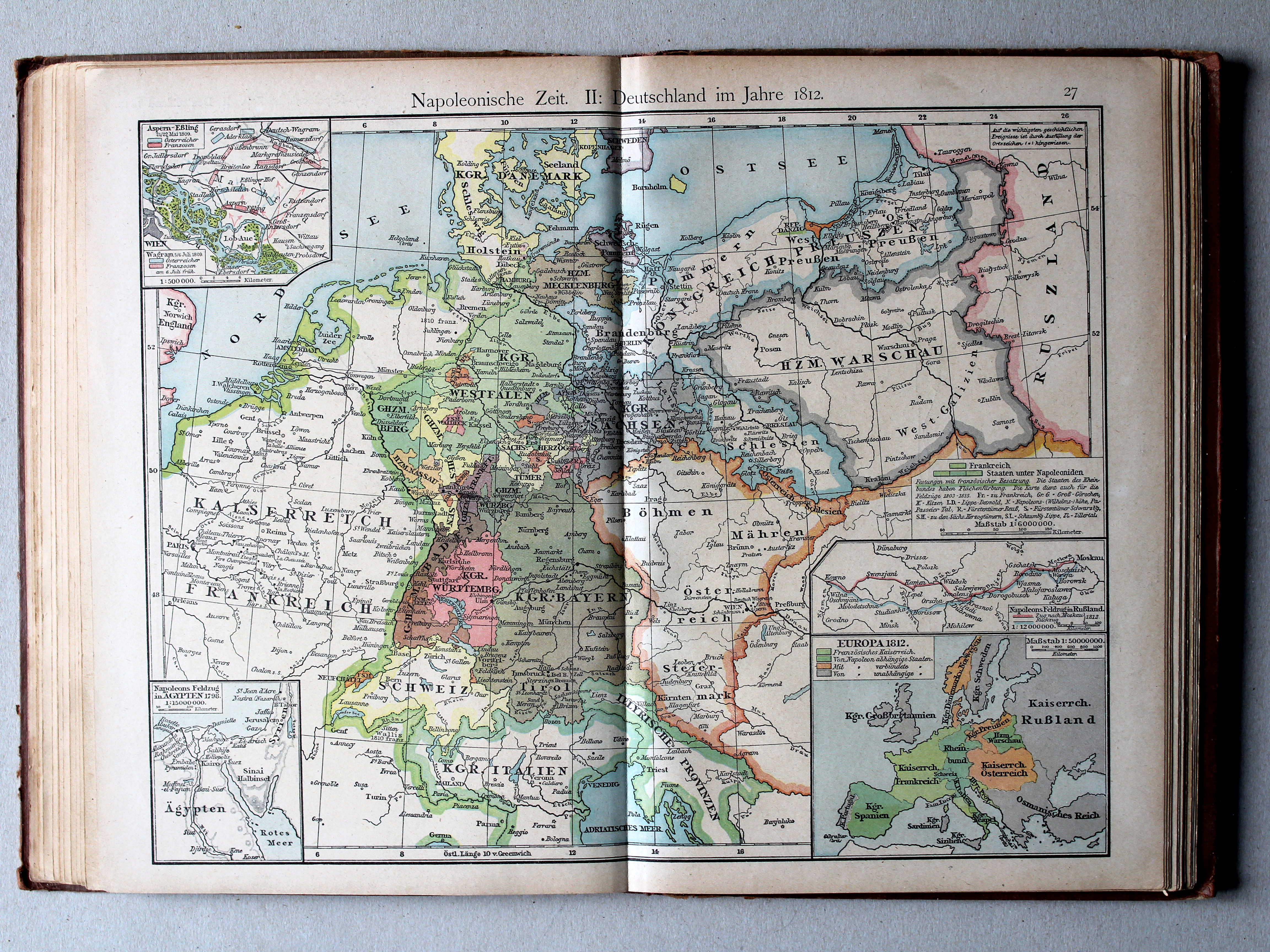
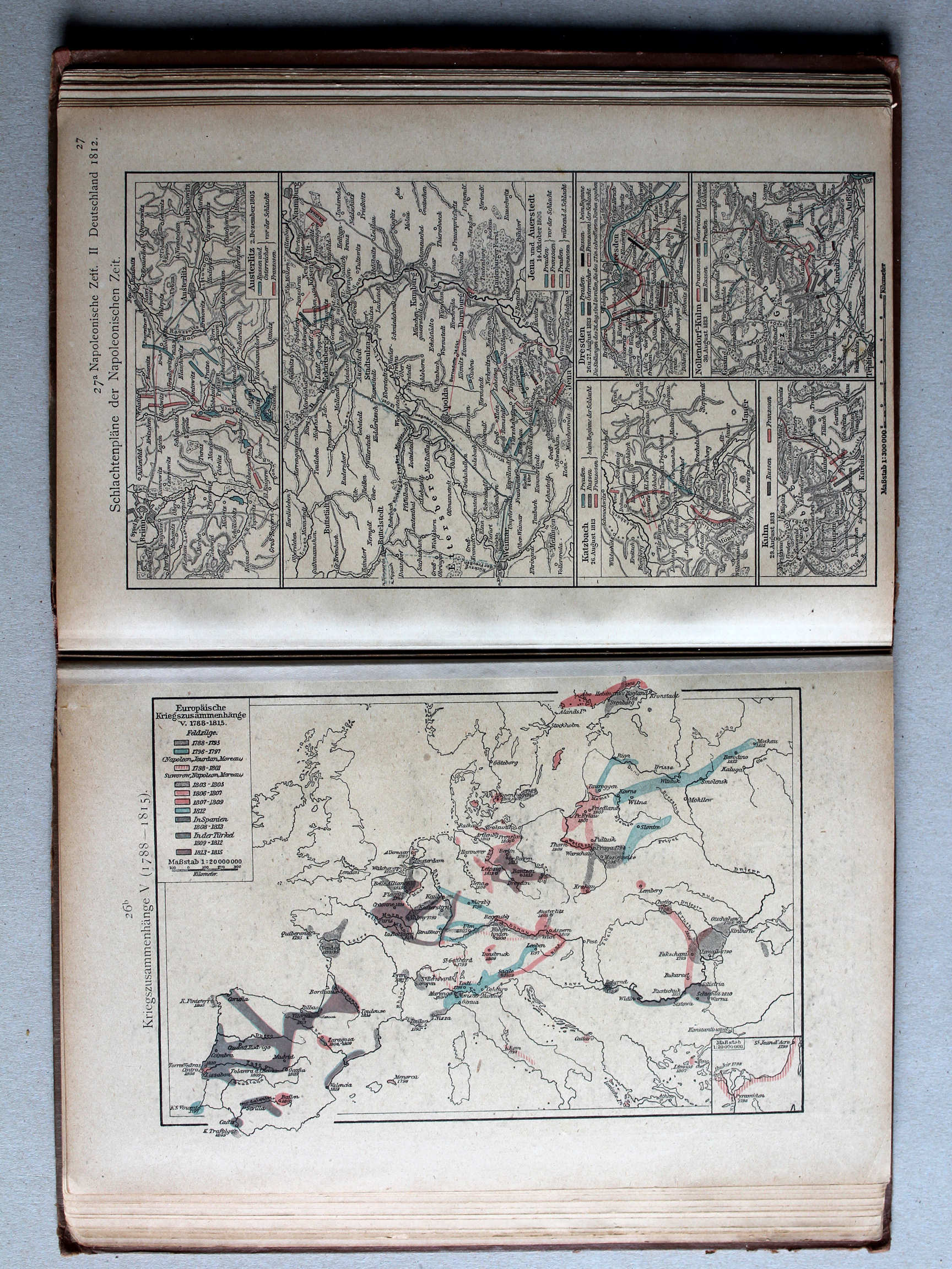
27. Napoleonische Zeit II: Deutschland im Jahre 1812 XL
Tijd van Napoleon II: Duitsland in 1812 / Era of Napoleon II: Germany in 1812

 Putzgers Historischer Schul-Atlas, 1918
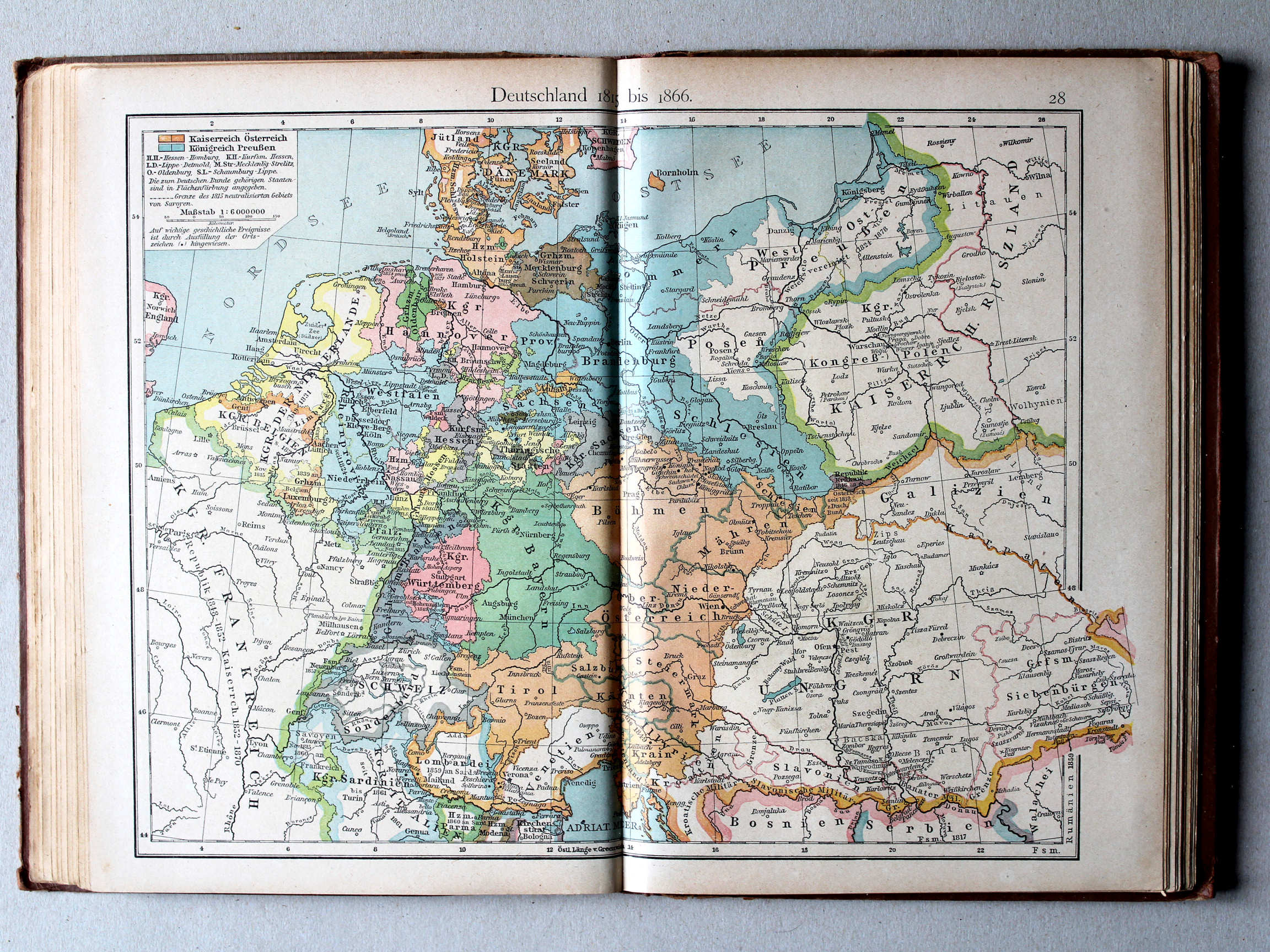
28. Deutschland 1815 bis 1866 XL
Duitsland 1815-1866 / Germany 1815-1866
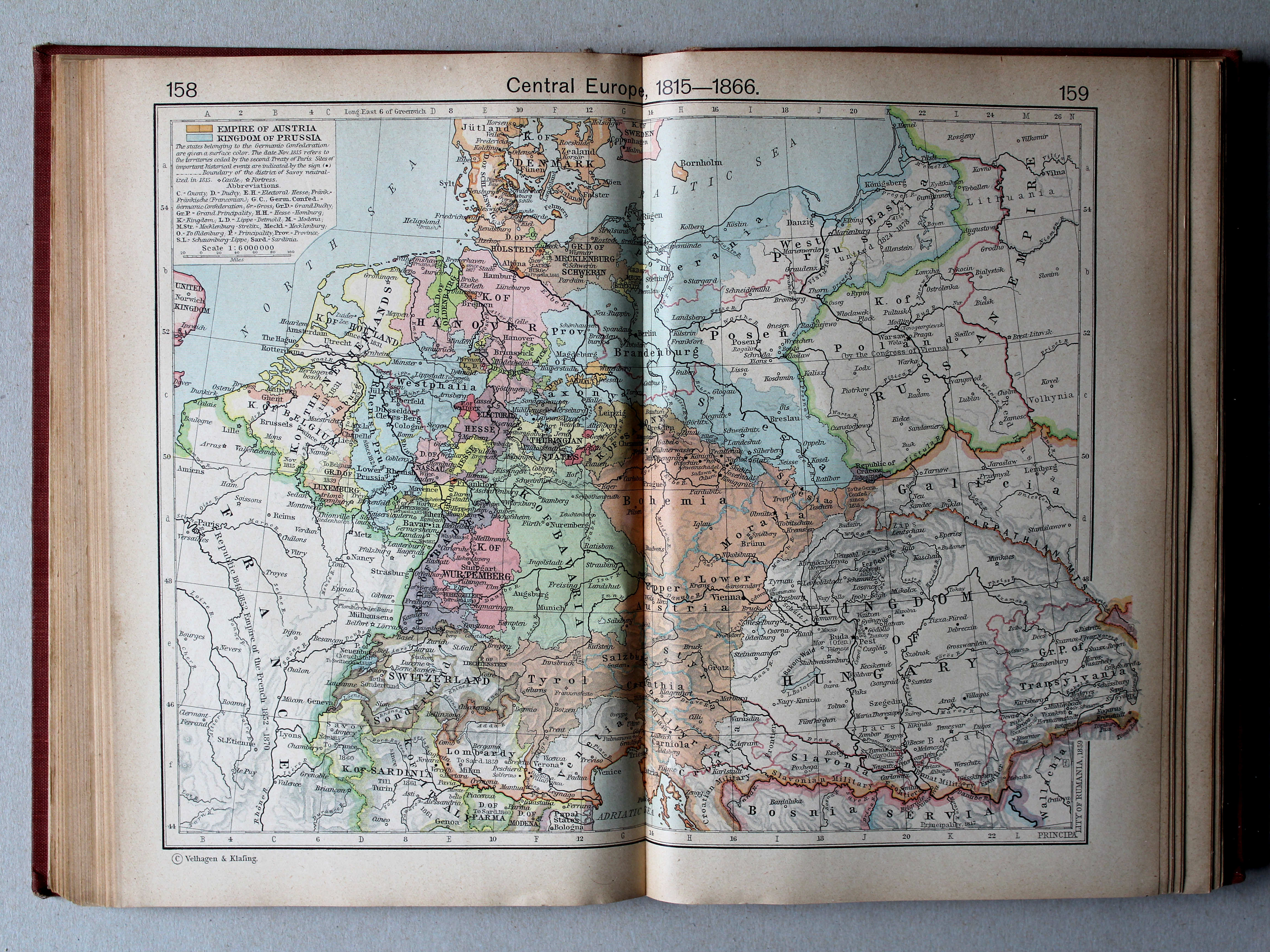
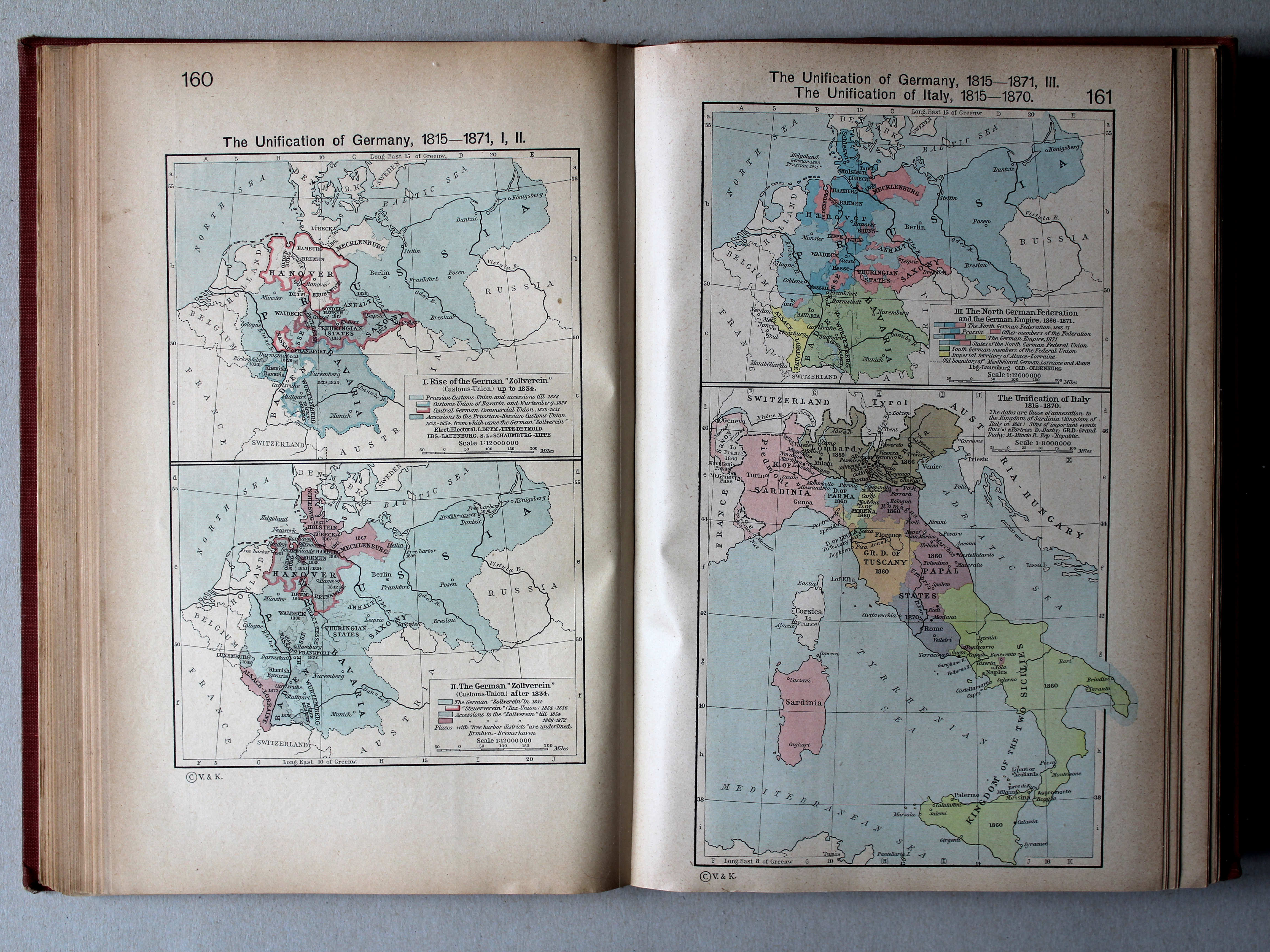
 Shepherd, Historical Atlas, 1927
160. The Unification of Germany, 1815-1871, I, II XL
Duitse eenwording, 1815-1871, I, II
161. The Unification of Germany, 1815-1871, III. The Unification of Italy, 1815-1870 XL
Duitse eenwording, 1815-1871, III. Italiaanse eenwording, 1815-1870
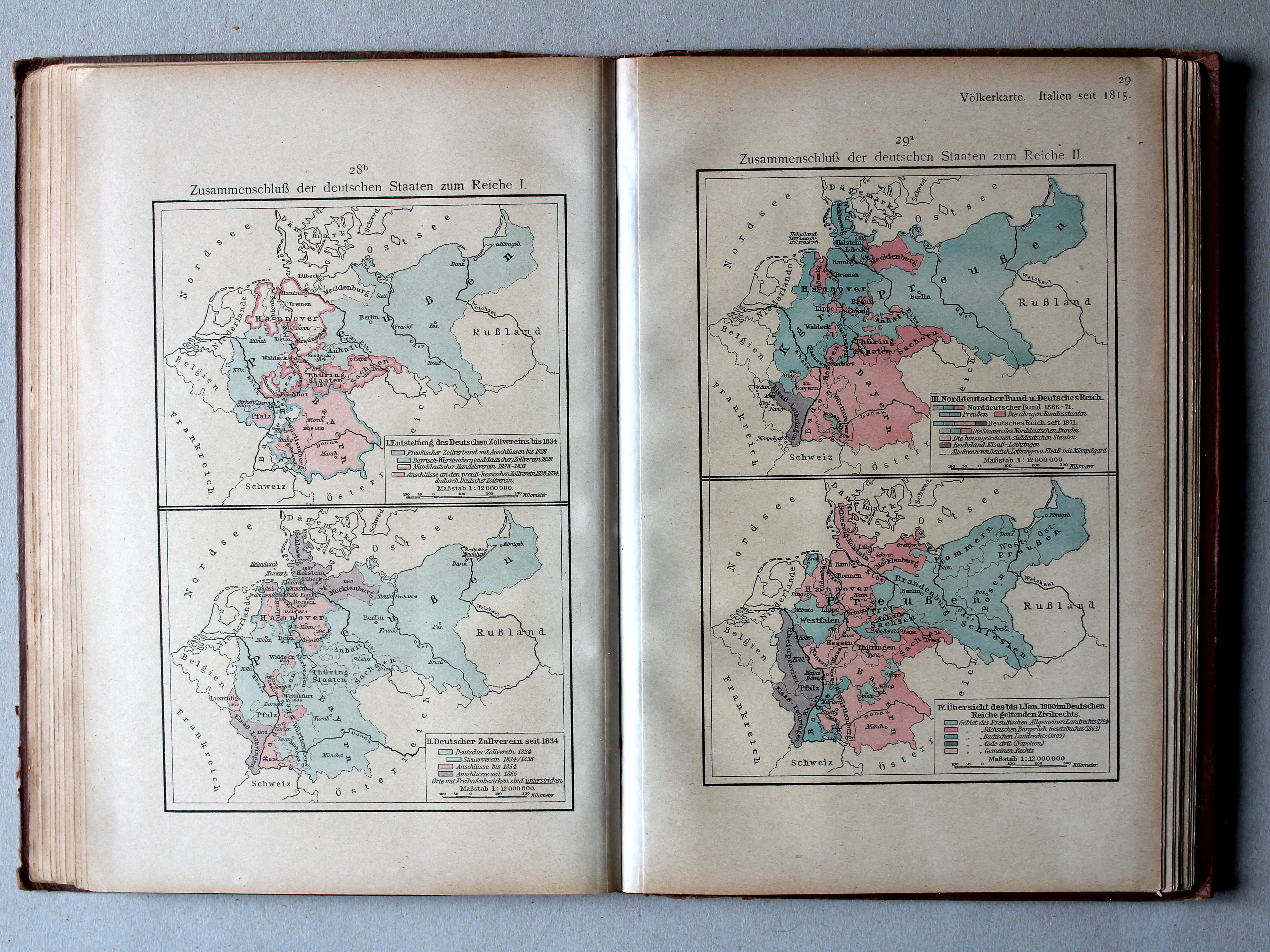
 Putzgers Historischer Schul-Atlas, 1918
28b. Zusammenschluß der deutschen Staaten zum Reiche I XL
Duitse eenwording I / German unification I
29a. Zusammenschluß der deutschen Staaten zum Reiche II XL
Duitse eenwording II / German unification II
Shepherd, Historical Atlas, 1927
160. The Unification of Germany, 1815-1871, I, II XL
Duitse eenwording, 1815-1871, I, II
161. The Unification of Germany, 1815-1871, III. The Unification of Italy, 1815-1870 XL
Duitse eenwording, 1815-1871, III. Italiaanse eenwording, 1815-1870
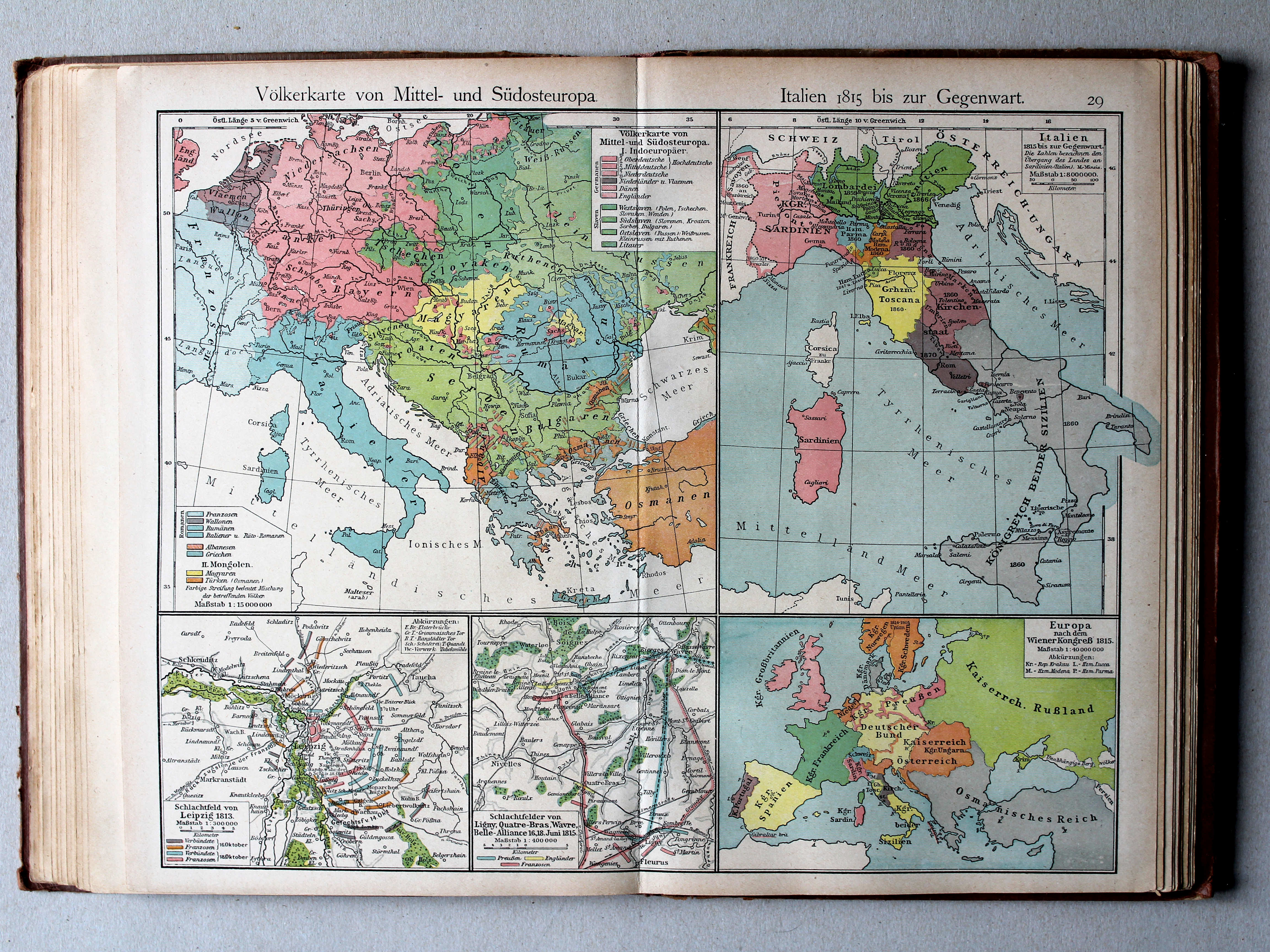
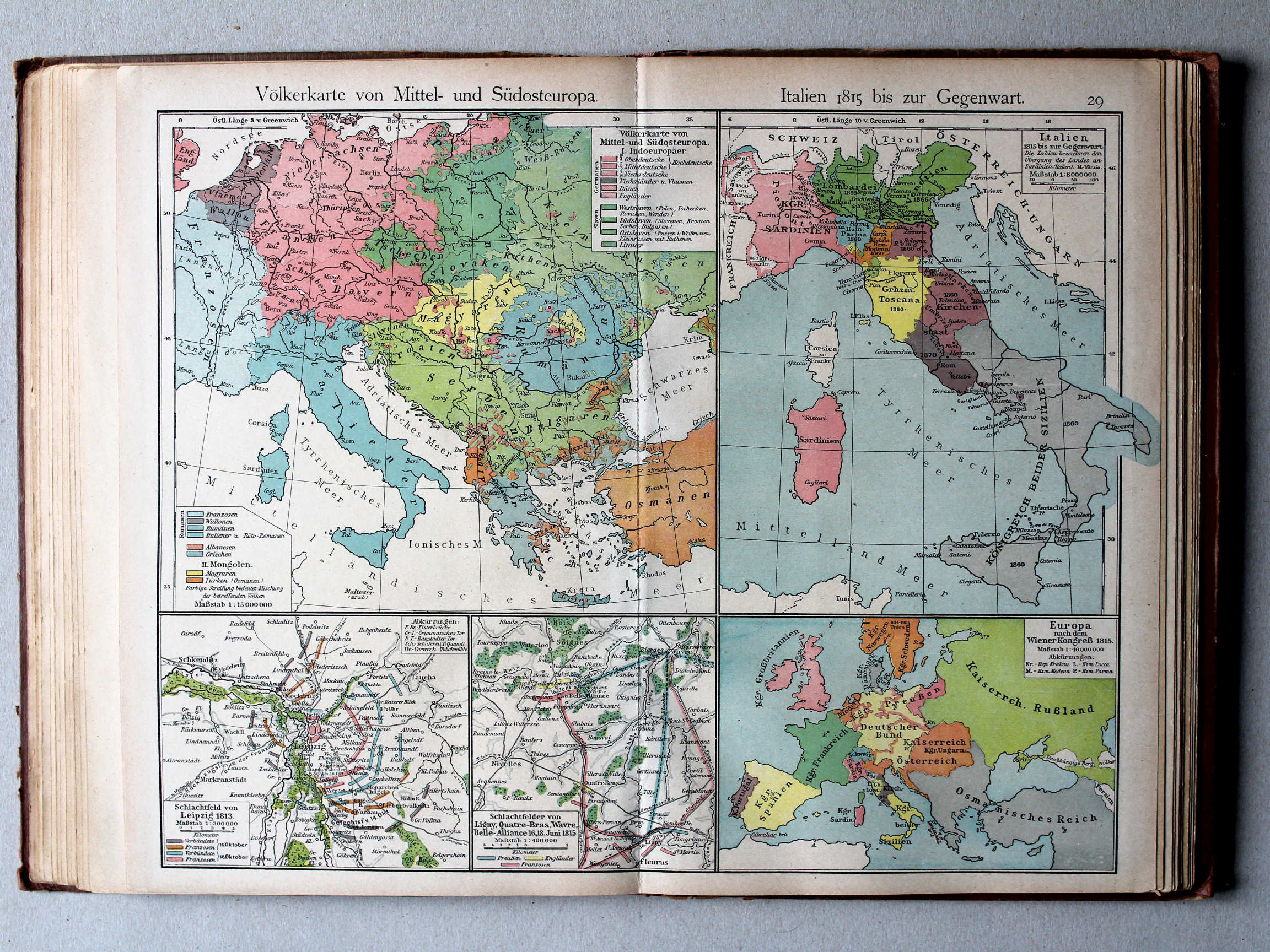 Putzgers Historischer Schul-Atlas, 1918
29. Völkerkarte von Mittel und Südost-Europa. Italien 1815 bis zur Gegenwart XL
Etnografische kaart van Midden- en Zuidoost Europa. Italië van 1815 tot heden / Ethnographic map of Central end Southeastern Europe. Italy from 1815 until today

 Putzgers Historischer Schul-Atlas, 1918
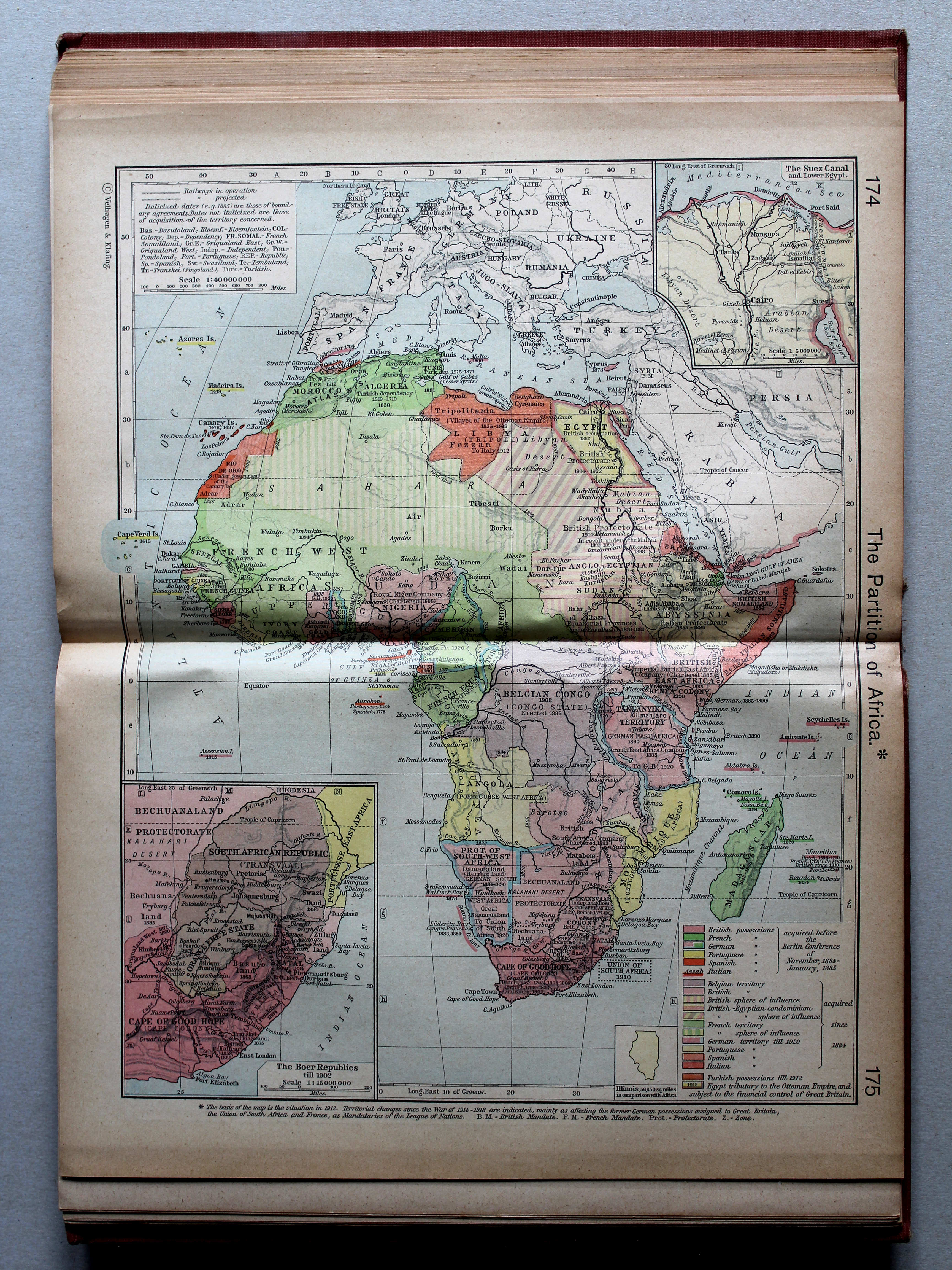
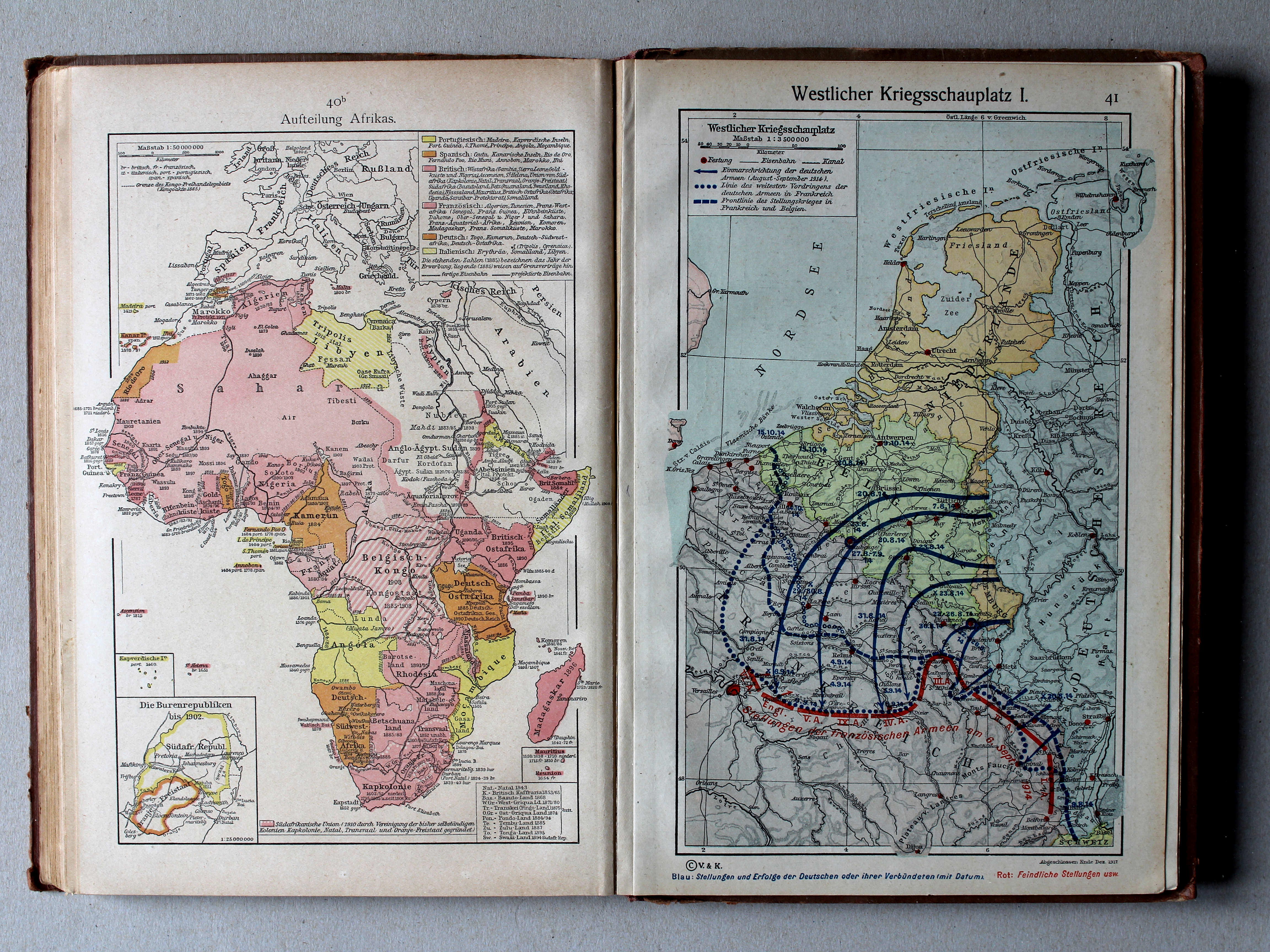
40b. Aufteilung Afrikas XL
Opdeling van Afrika / Scramble for Africa
41. Westlicher Kriegsschauplatz I XL
Westelijk strijdtoneel I / Western theater of war I
© M. Witkam, 2013
![]()
![]()