William R. Shepherd, Historical Atlas, 6e druk (1927)
See below for (a summary of) this text in English.
Hieronder staan plaatjes van de atlas. Daarbij horen ook de volgende pagina's
- Beschrijving van de atlas
- Voorwoord bij de atlas
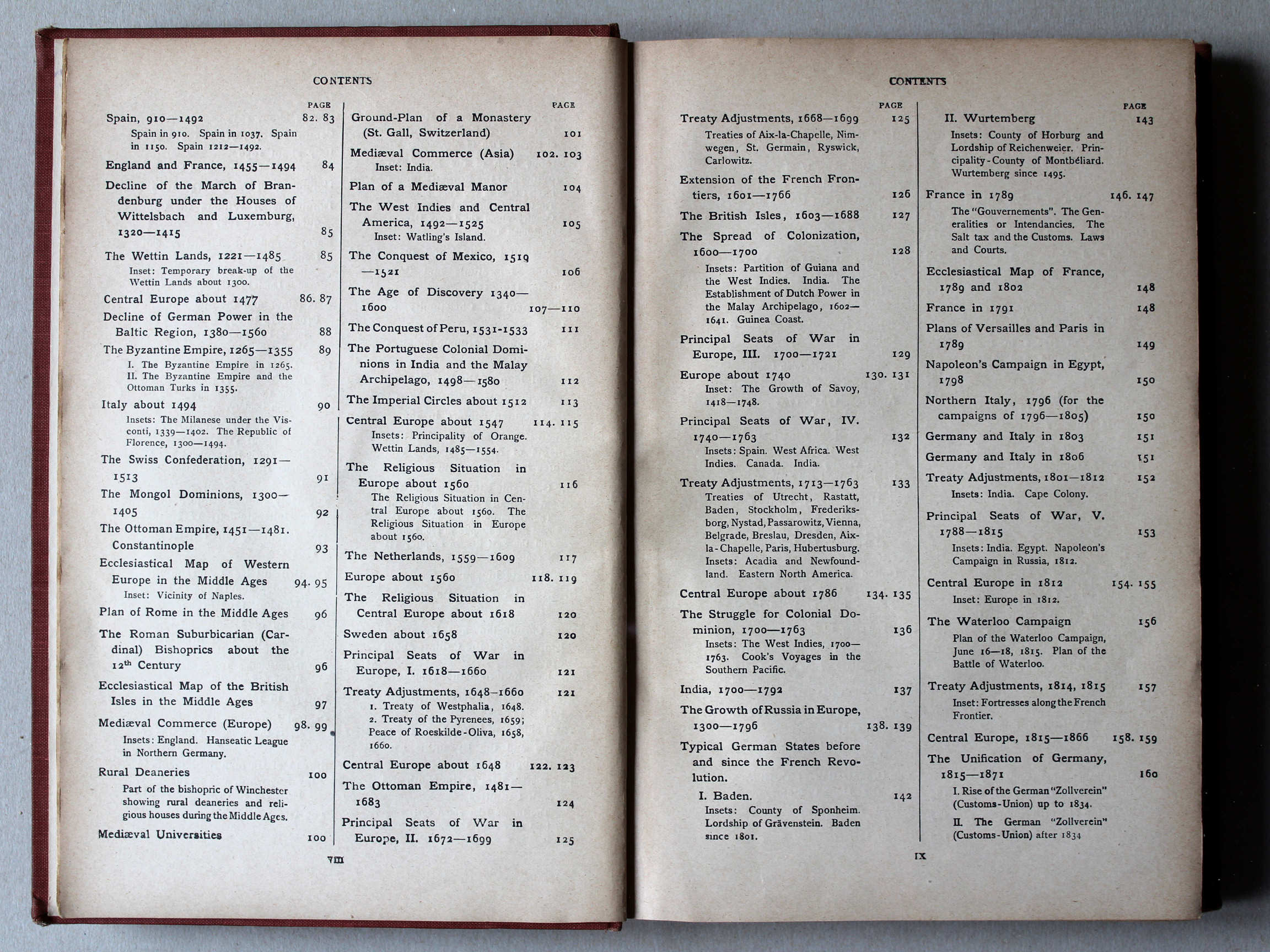
- Tabellen en lijsten bij de atlas
- Vergelijking (plaatjes) met Putzgers Historischer Schul-Atlas
Plaatjes
Klik op een plaatje voor een vergroting.
William R. Shepherd, Historical Atlas, 6th edition (1927)
- Below are pictures of the atlas. Related pages
- Description of the atlas
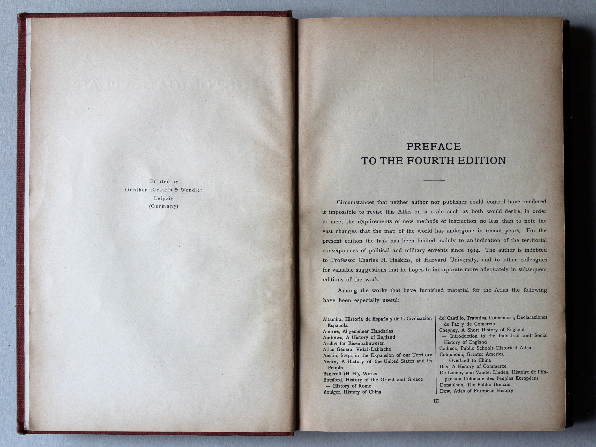
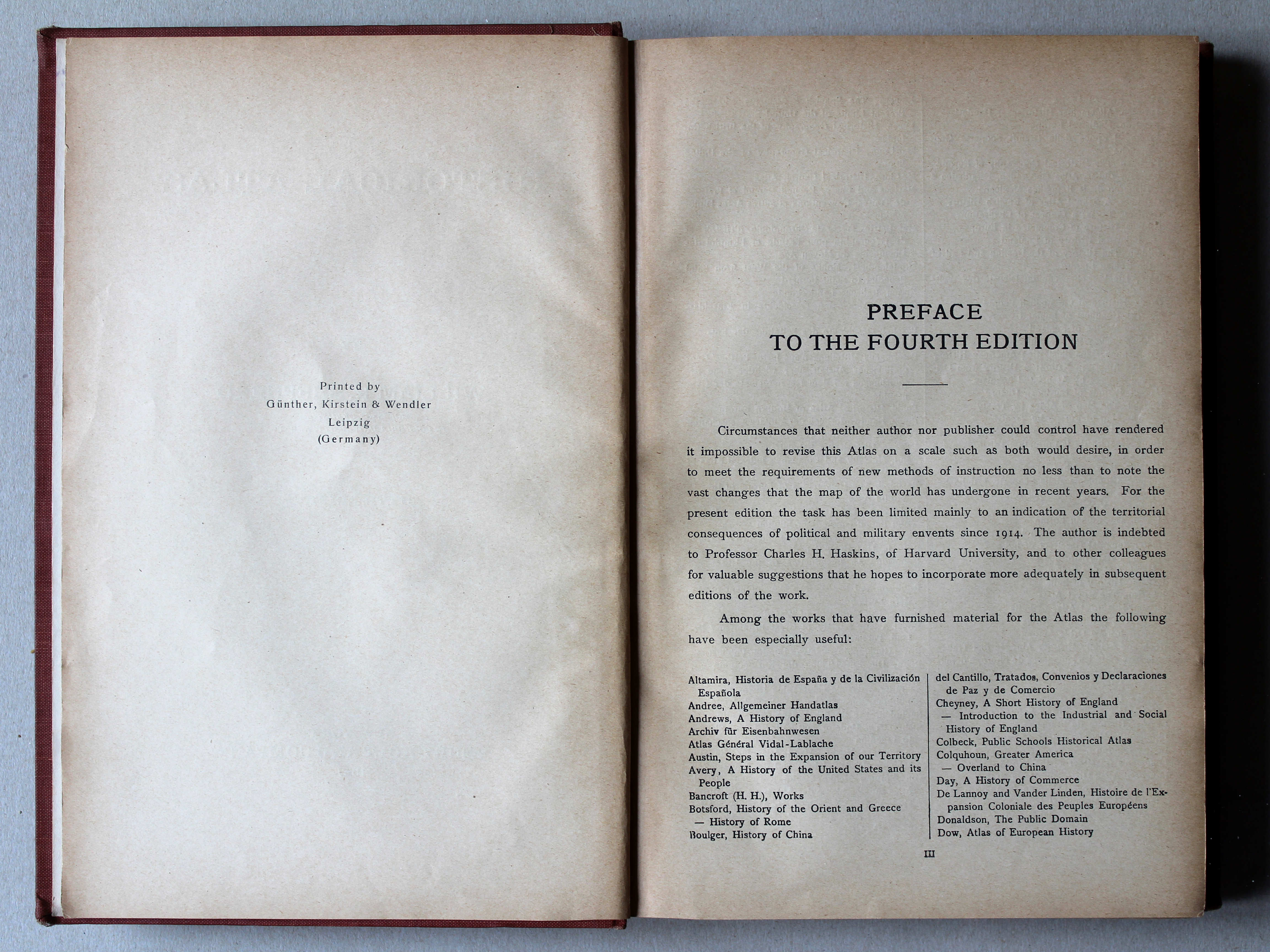
- Preface to the atlas
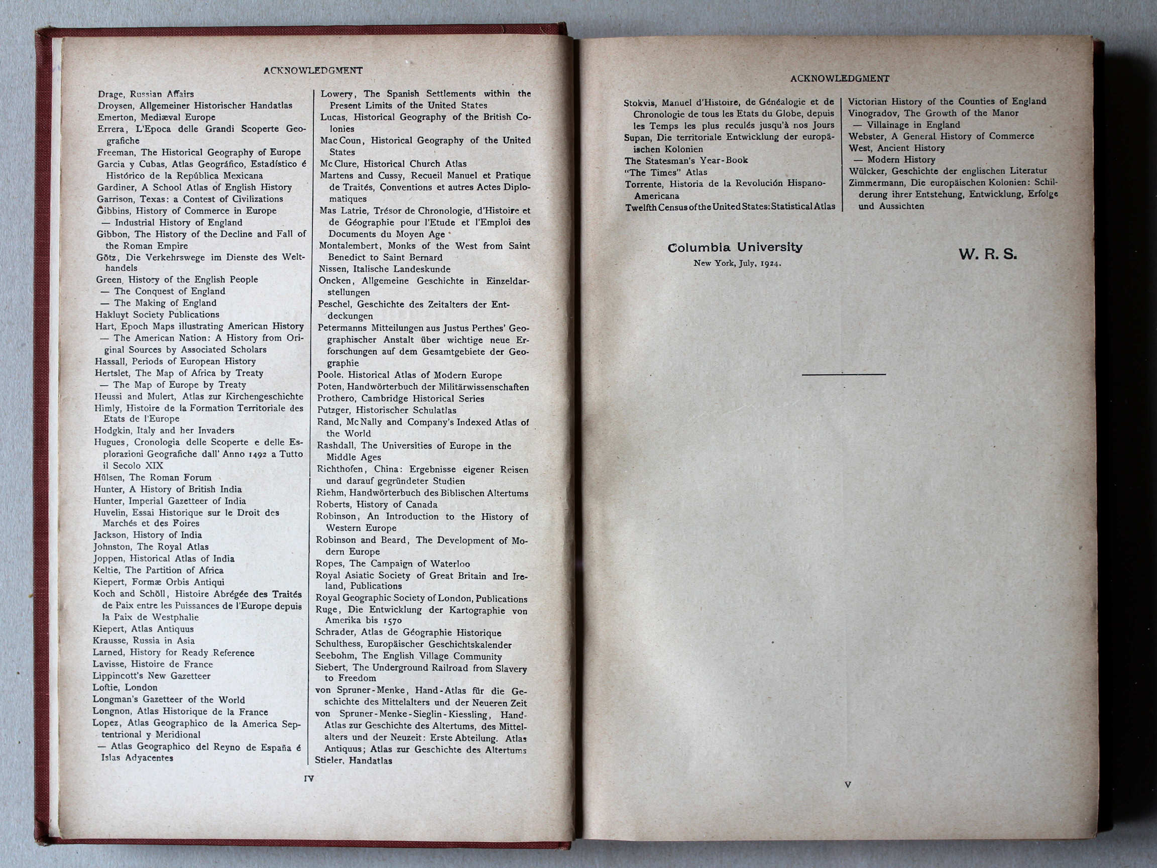
- Tables and lists to the atlas
- Comparison (pictures) with Putzgers Historischer Schul-Atlas
Pictures
Click on a picture to enlarge.
Band / Binding Titelpagina, voorwoord enz. / Title page, preface etc. Kaarten / Maps

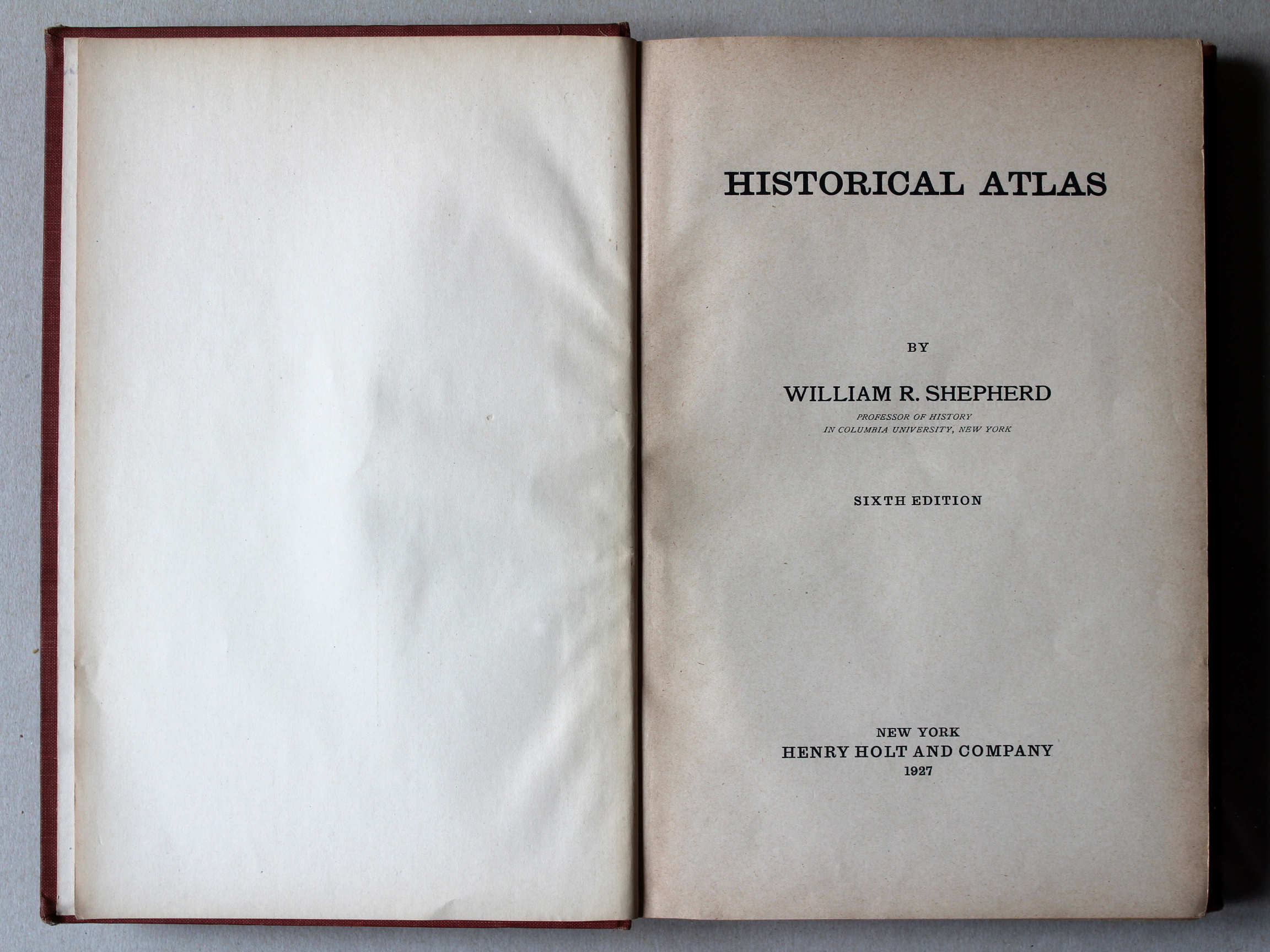


 Shepherd, Historical Atlas, 1927
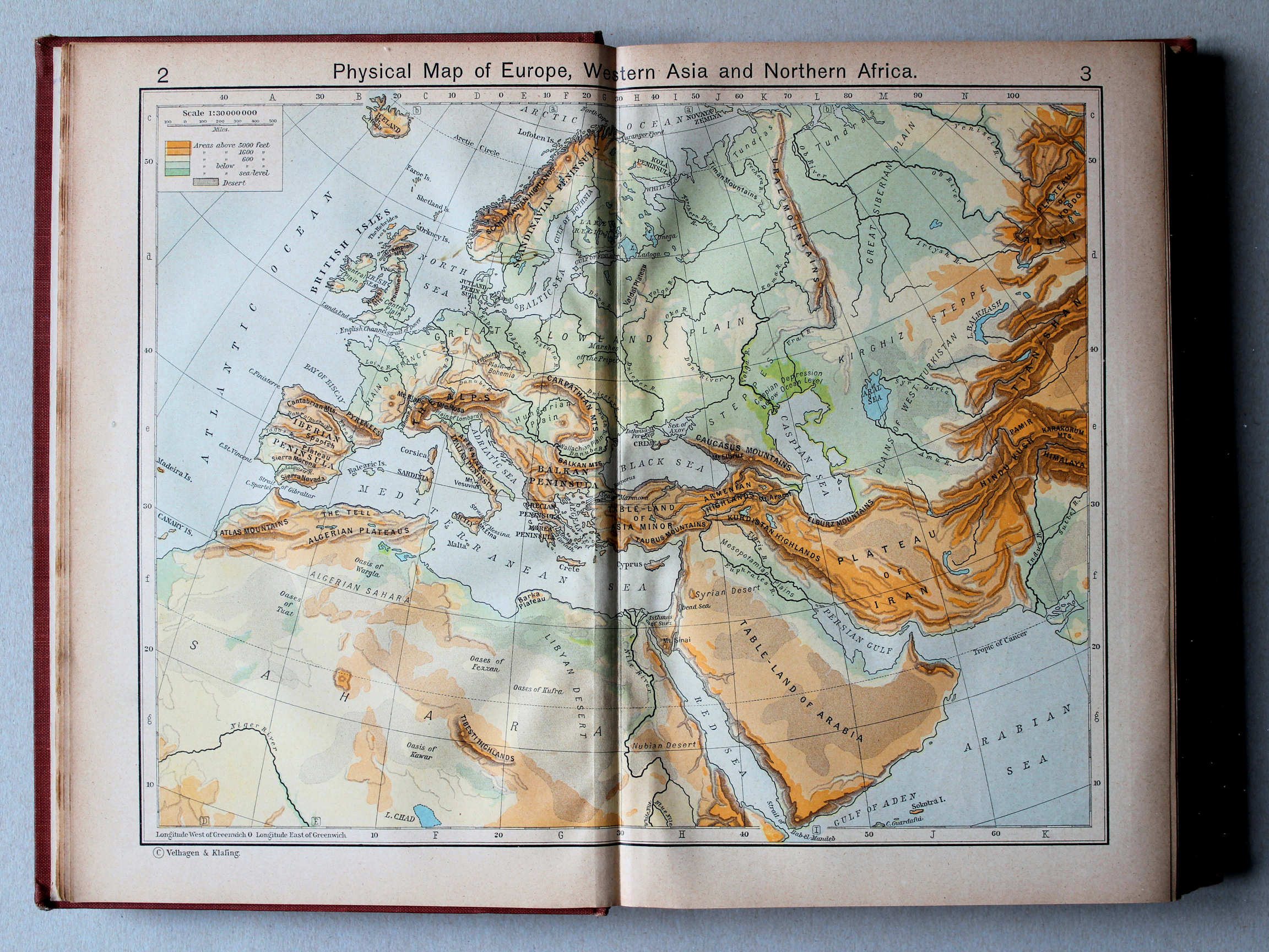
2.3. Physical Map of Europe, Western Asia and Northern Africa XL
Europa, West-Azië en Noord-Afrika, natuurkundig
 Shepherd, Historical Atlas, 1927
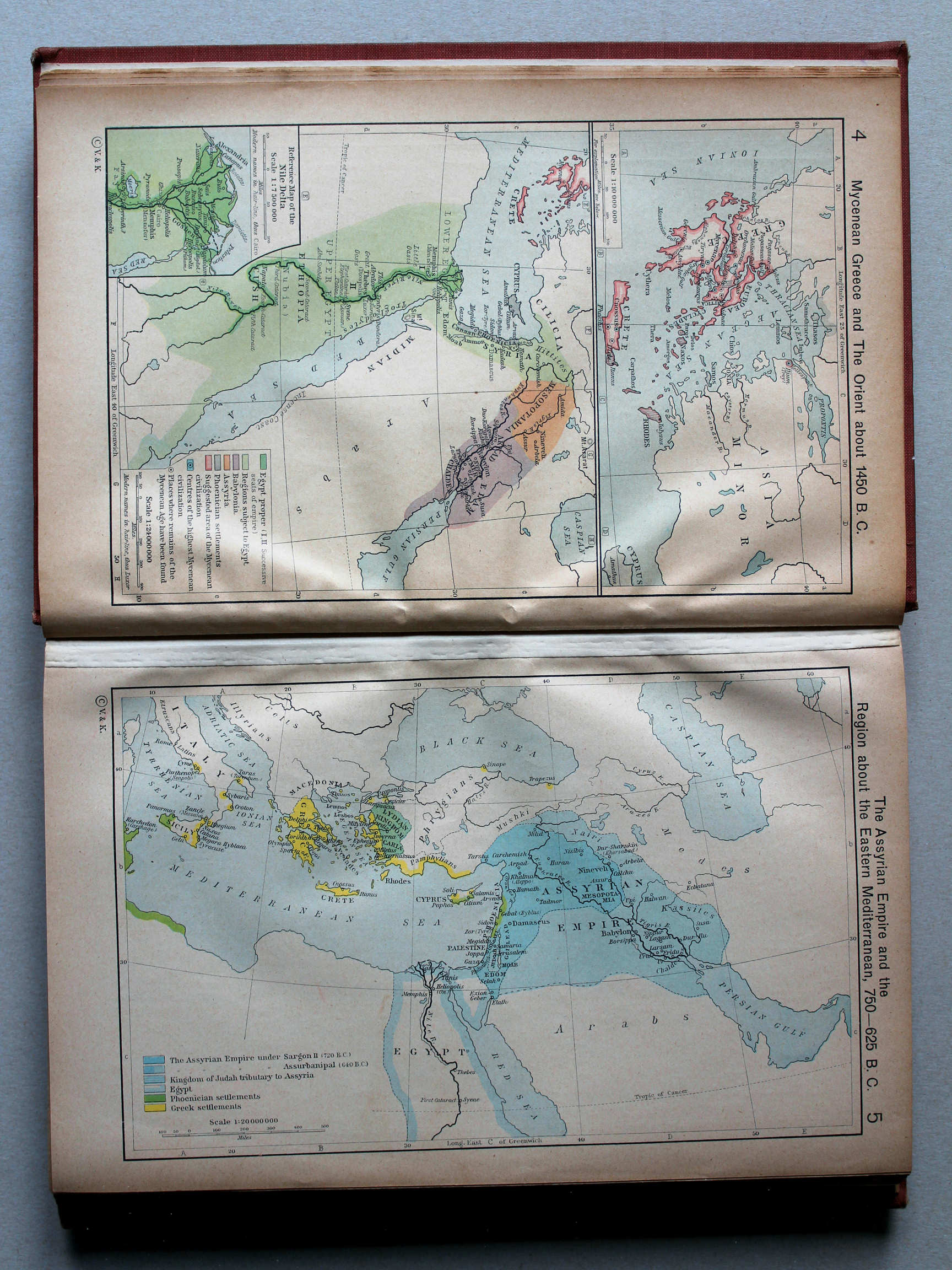
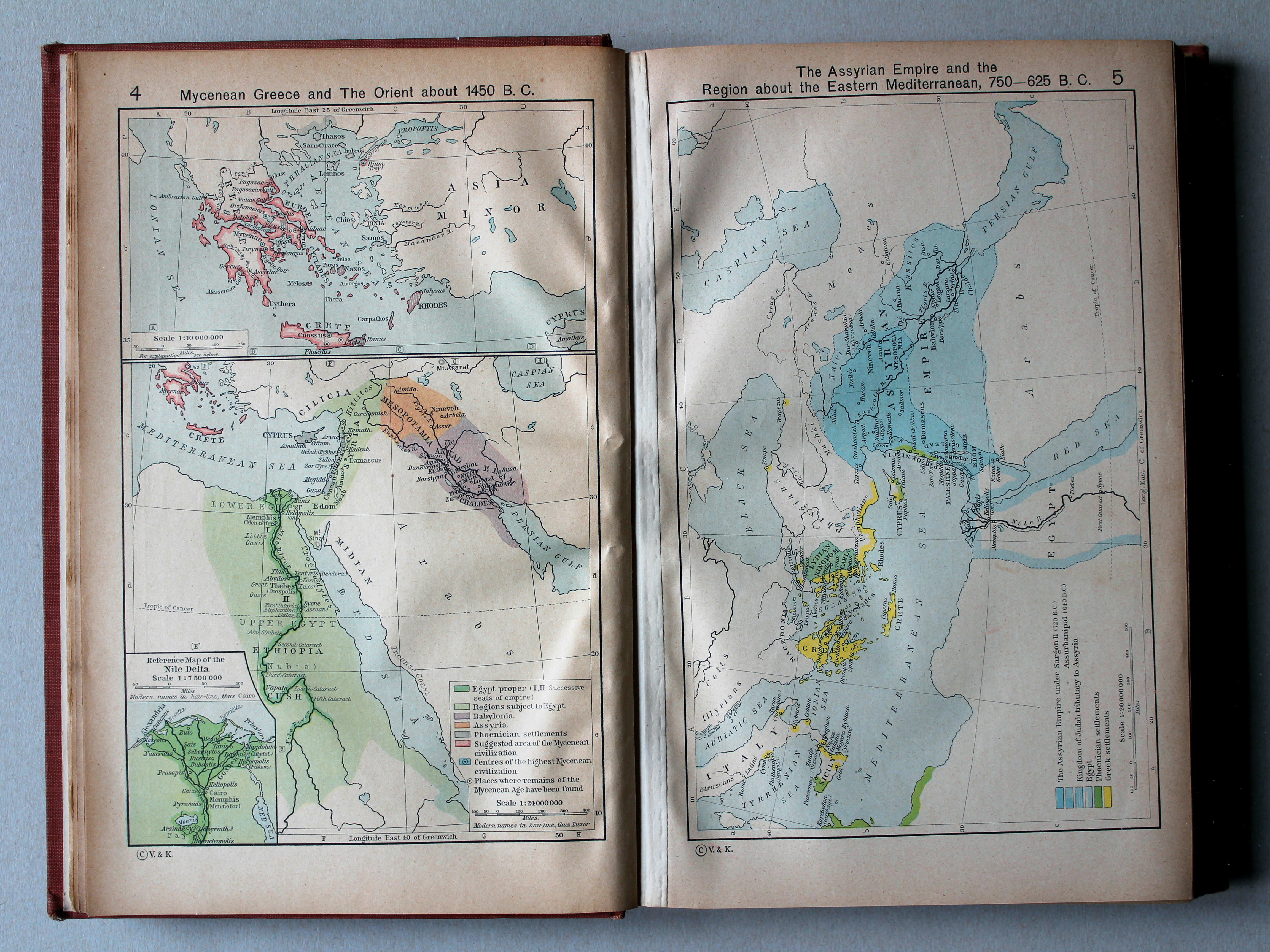
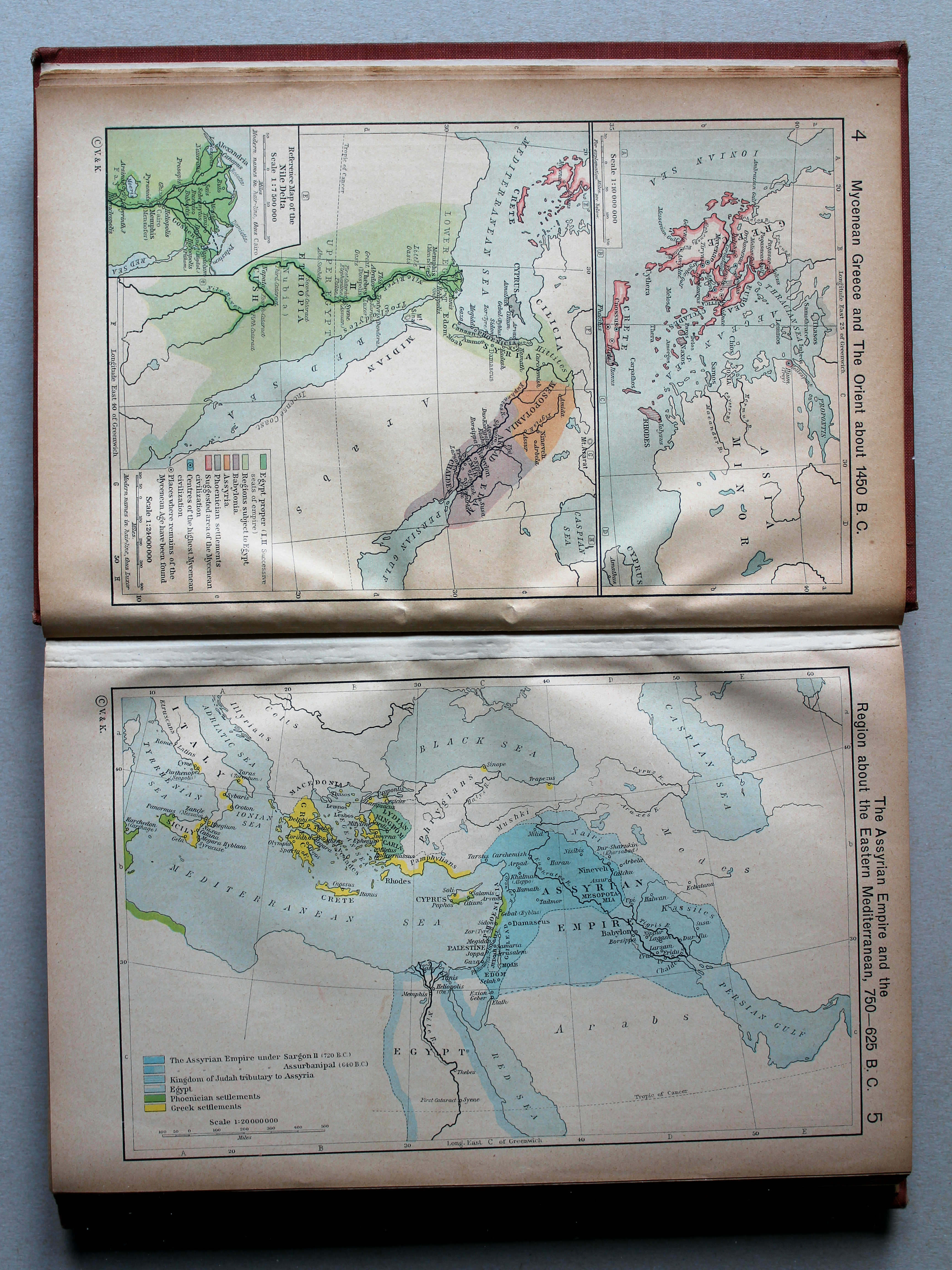
4. Mycenean Greece and the Orient about 1450 B. C. XL
Myceens Griekenland en het Oosten, ca. 1450 v. Chr.
 Shepherd, Historical Atlas, 1927
5. The Assyrian Empire and the Region about the Eastern Mediterranean, 750-625 B. C. XL
Het Rijk van de Assyriërs en het oostelijke Middellandse Zeegebied, 750-625 v. Chr.

 Shepherd, Historical Atlas, 1927
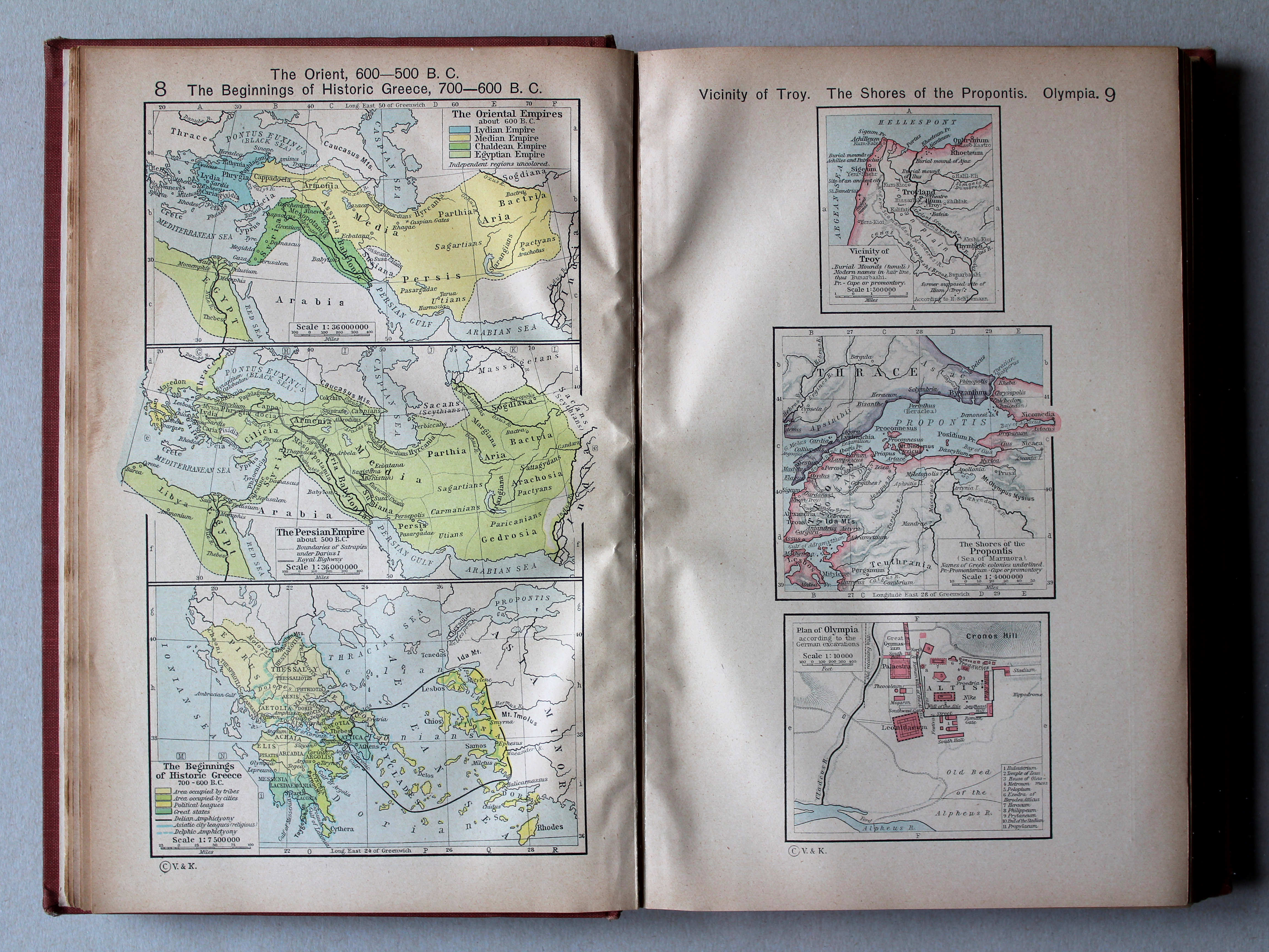
8. The Orient 600-500 B. C. The Beginnings of Historic Greece, 700-600 B. C. XL
Het Oosten 600-500 v. Chr. Het vroege historische Griekenland, 700-600 v. Chr.
9. Vicinity of Troy. The Shores of the Propontis. Plan of Olympia XL
Troje en omgeving. Propontis (Zee van Marmara). Olympia
 Shepherd, Historical Atlas, 1927
10.11. Reference Map of Ancient Greece. Northern Part XL
Griekenland in de Oudheid, noordelijk deel
 Shepherd, Historical Atlas, 1927
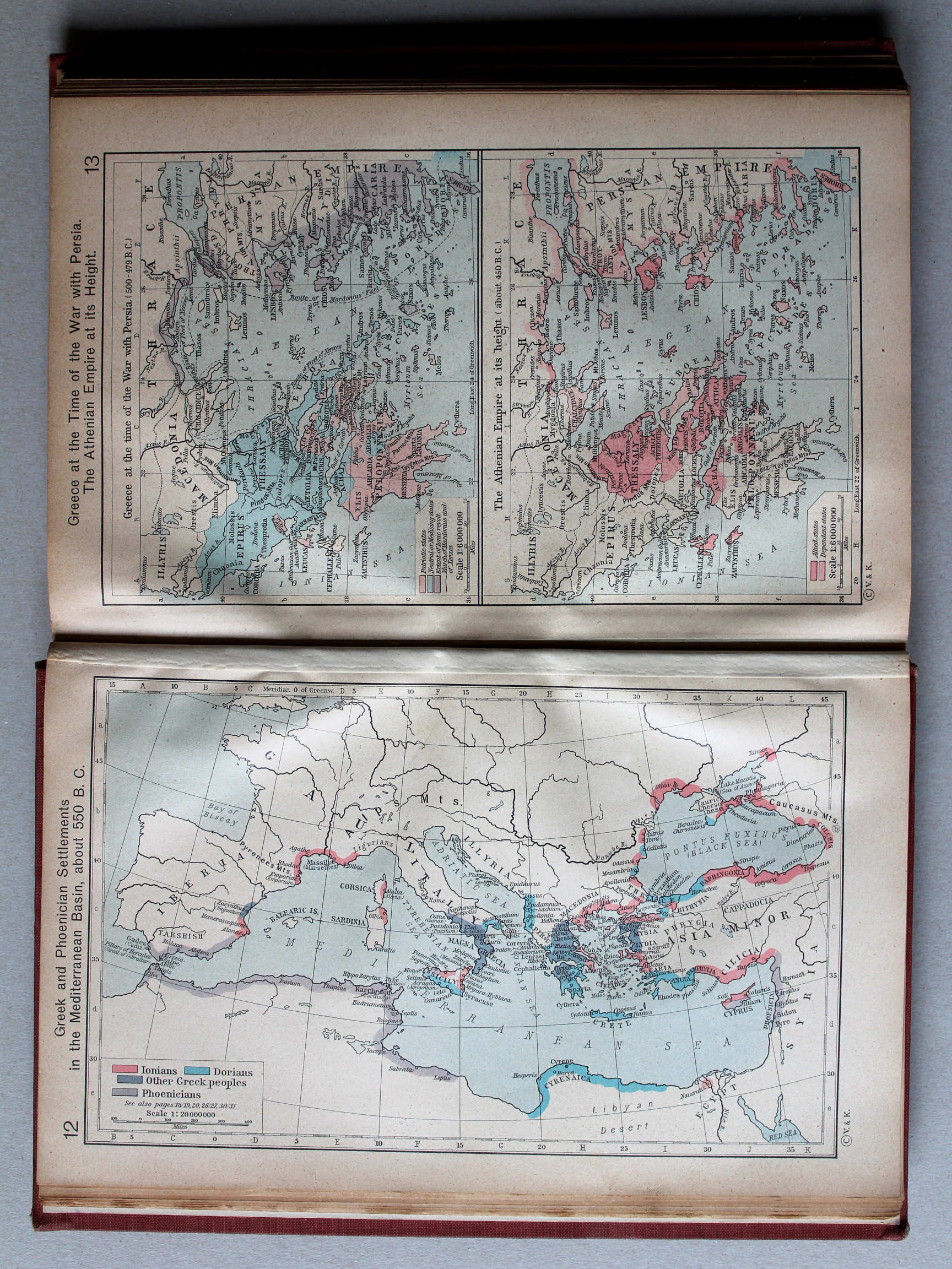
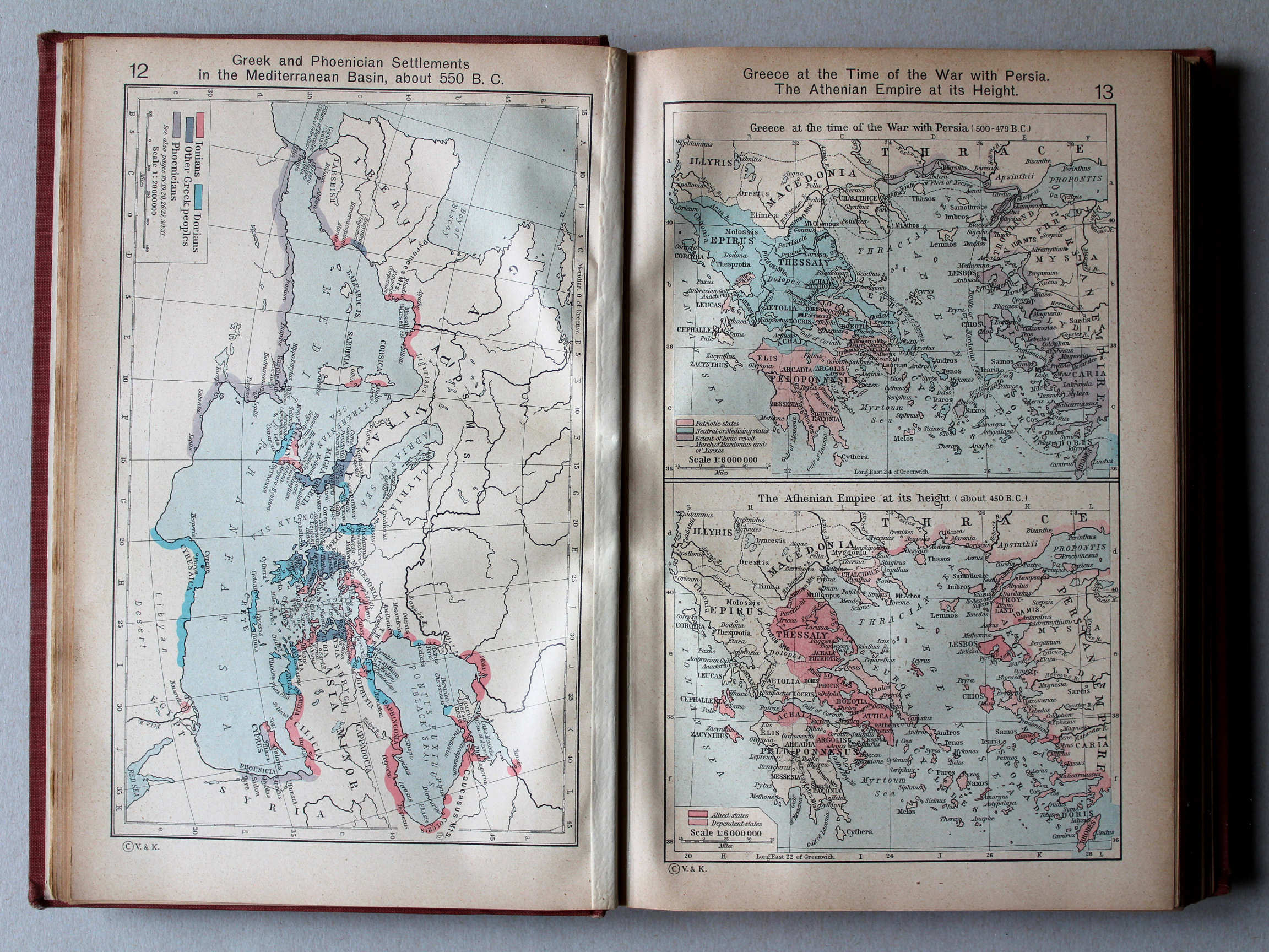
12. Greek and Phoenician Settlements in the Mediterranean Basin, about 550 B. C. XL
Griekse en Fenicische nederzettingen in het Middellandse Zeegebied, ca. 550 v. Chr.
 Shepherd, Historical Atlas, 1927
13. Greece at the Time of the War with Persia. The Athenian Empire at its Height XL
Griekenland tijdens de Perzische Oorlogen. Het hoogtepunt van het Atheense Rijk
 Shepherd, Historical Atlas, 1927
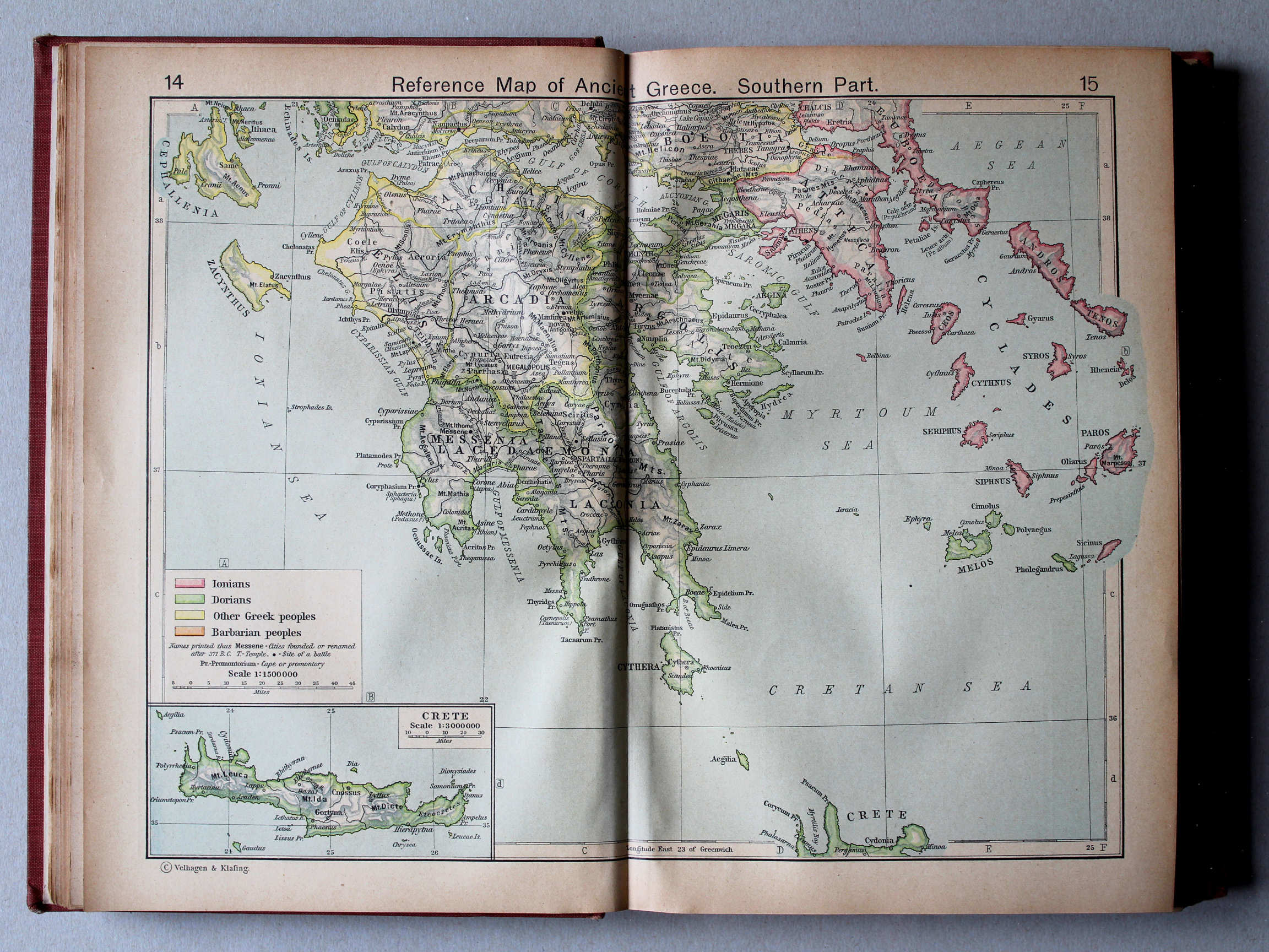
14.15. Reference Map of Ancient Greece. Southern Part XL
Griekenland in de Oudheid, zuidelijk deel
 Shepherd, Historical Atlas, 1927
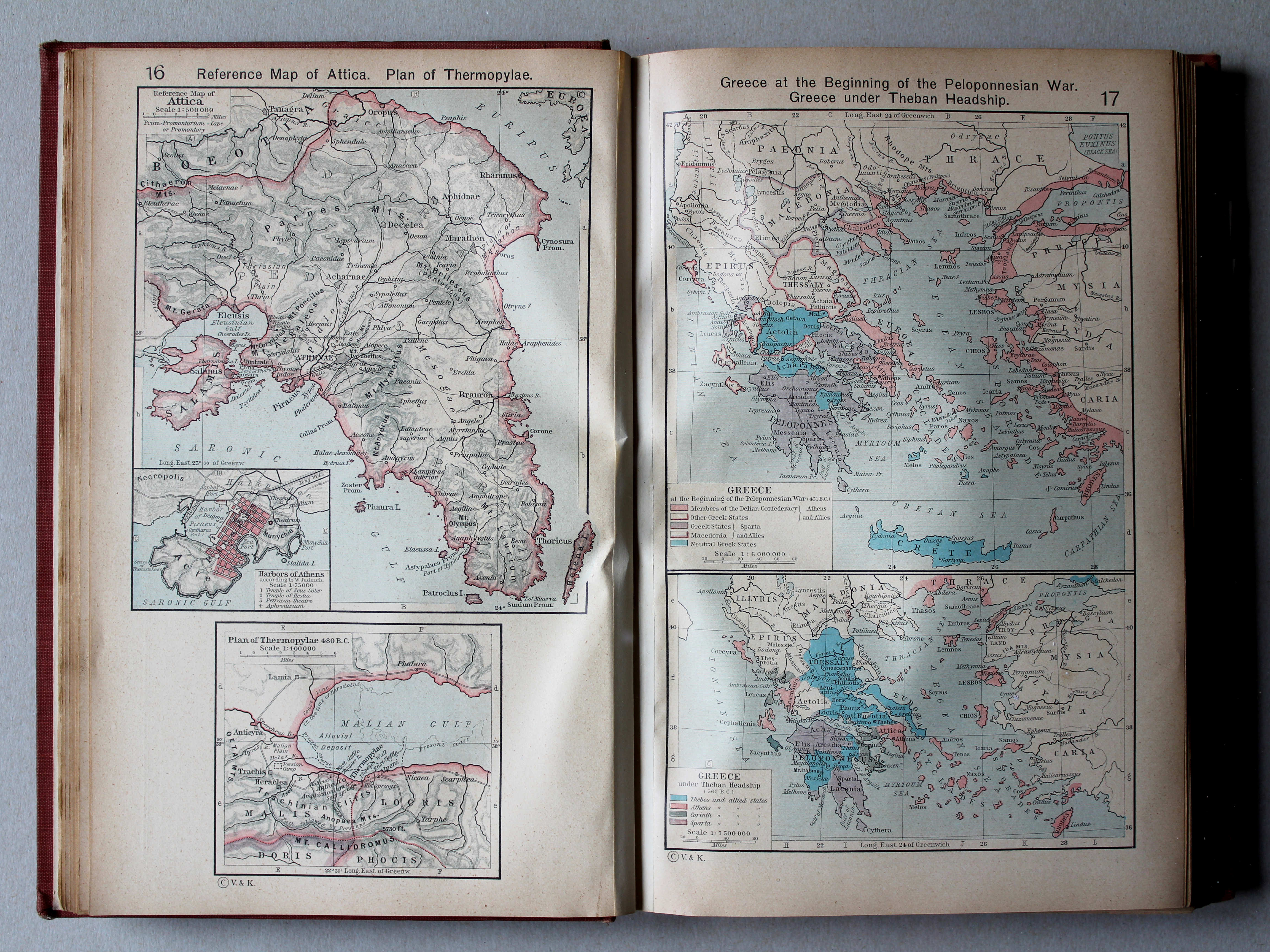
16. Reference Map of Attica. Plan of Thermopylae XL
Attica. Thermopylae
17. Greece at the Beginning of the Peloponnesian War. Greece under Theban Headship XL
Griekenland aan het begin van de Peloponnesische Oorlog. Griekenland onder hegemonie van Thebe
 Shepherd, Historical Atlas, 1927
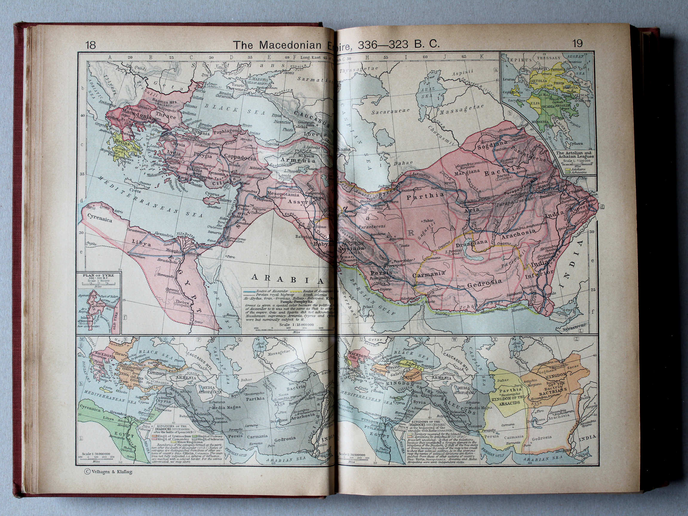
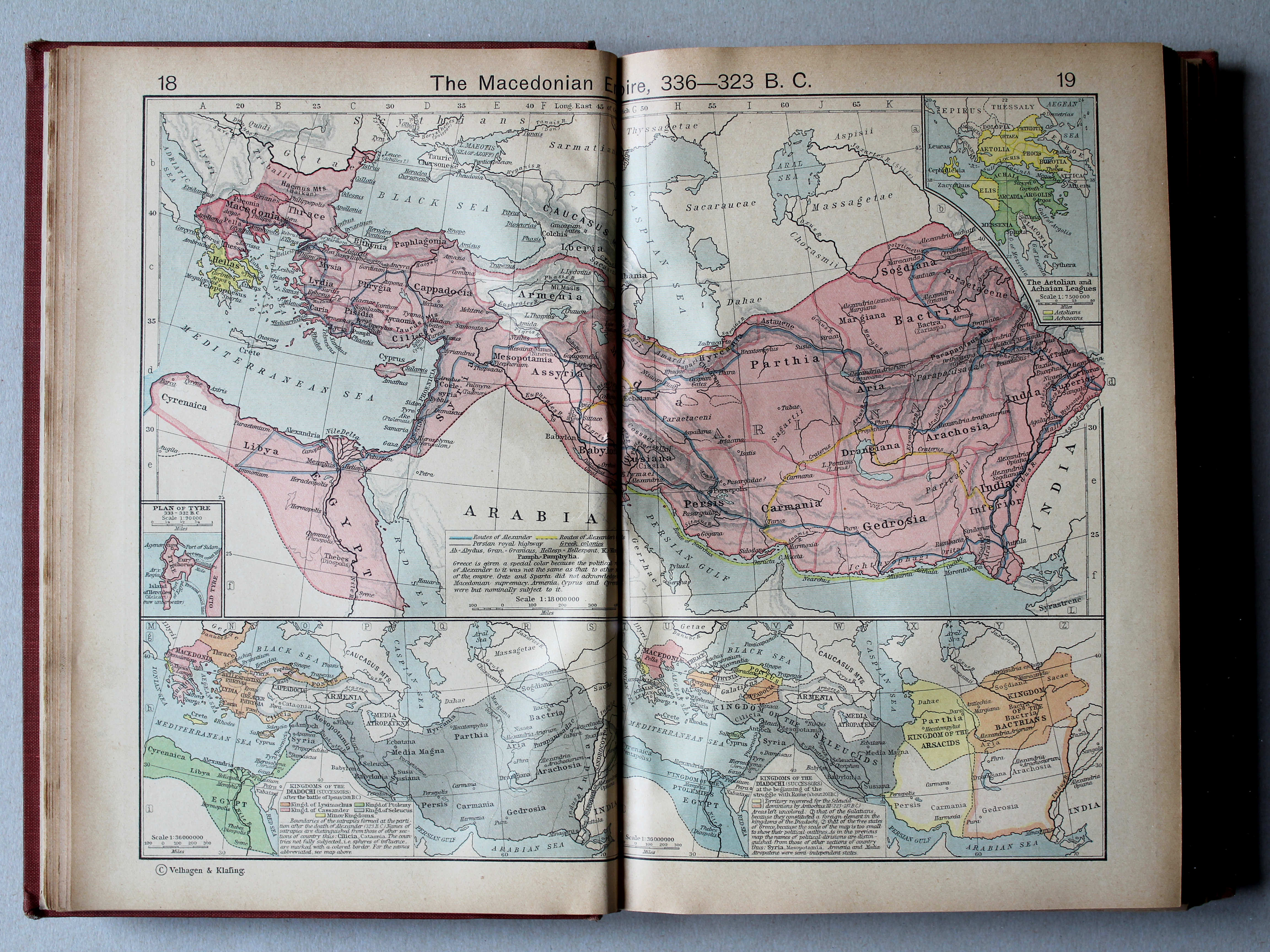
18.19. The Macedonian Empire, 336-323 B. C. XL
Het Macedonische Rijk, 336-323 v. Chr.
 Shepherd, Historical Atlas, 1927
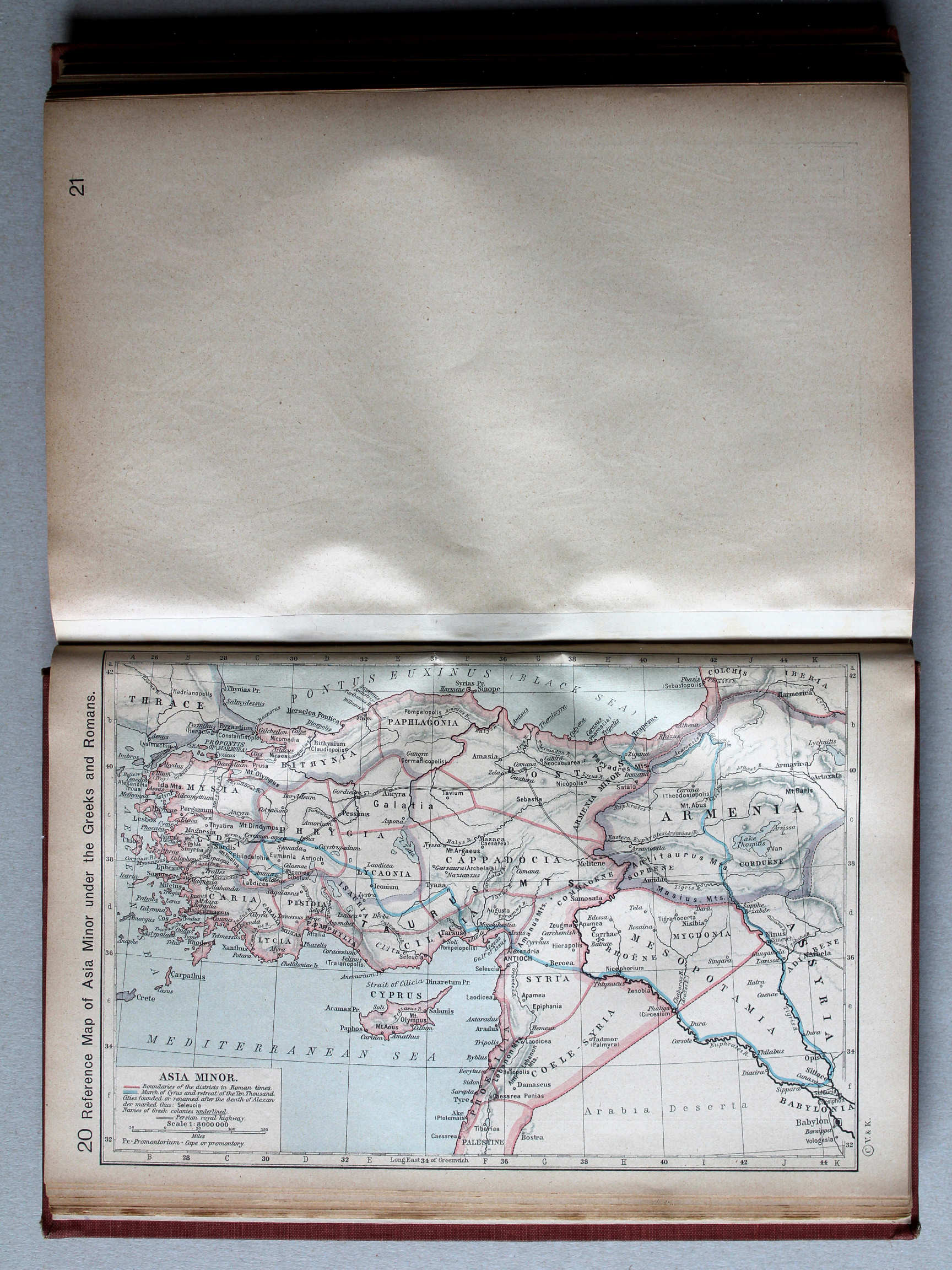
20. Reference Map of Asia Minor under the Greeks and Romans XL
Klein-Azië onder de Grieken en Romeinen
 Shepherd, Historical Atlas, 1927
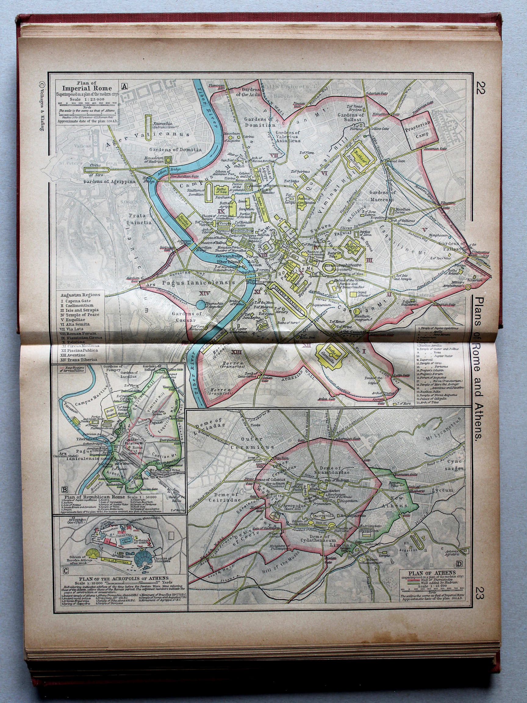
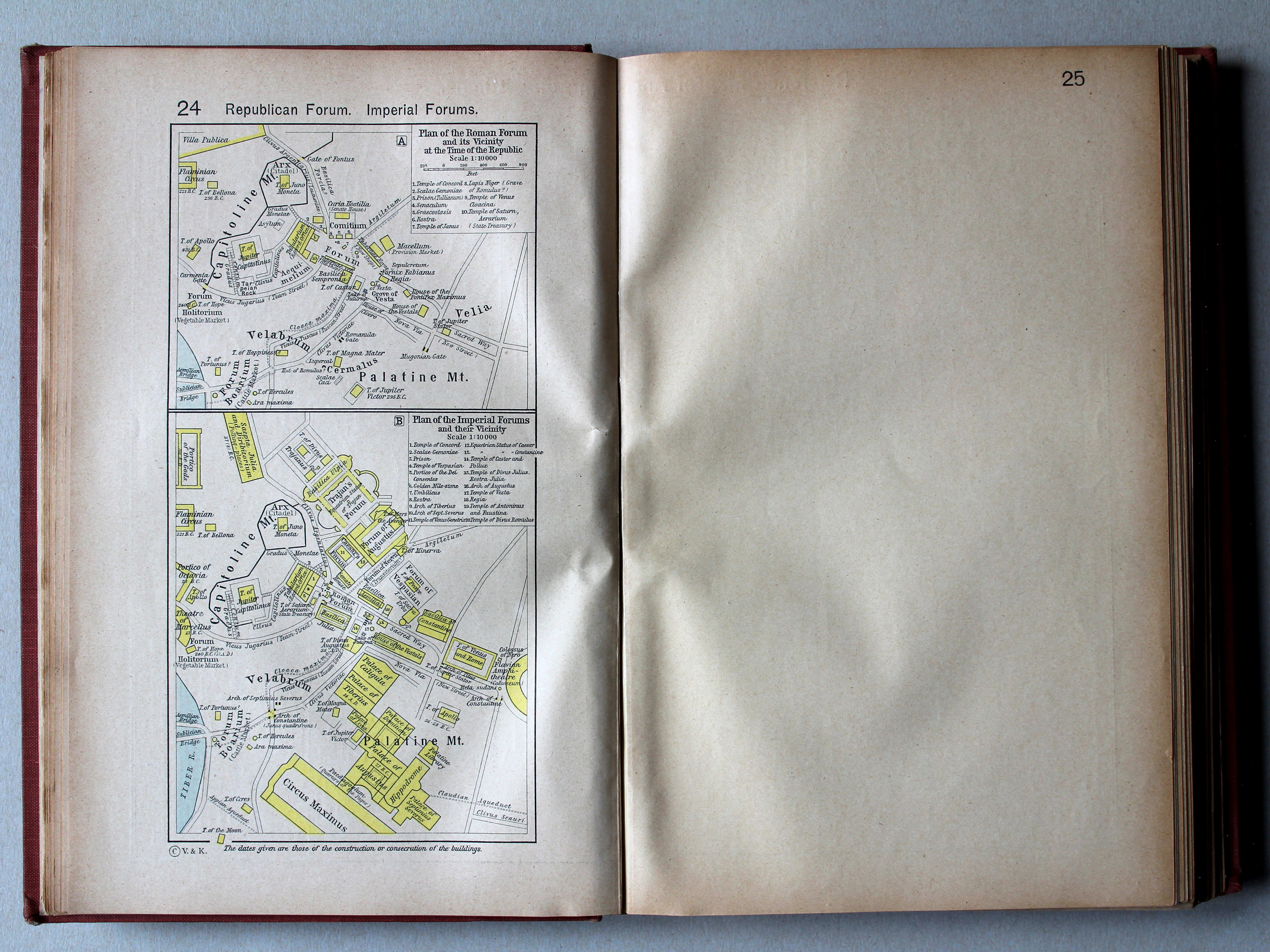
24. Republican Forum. Imperial Forums XL
Forum tijdens de Republiek. Fora in de Keizertijd
 Shepherd, Historical Atlas, 1927
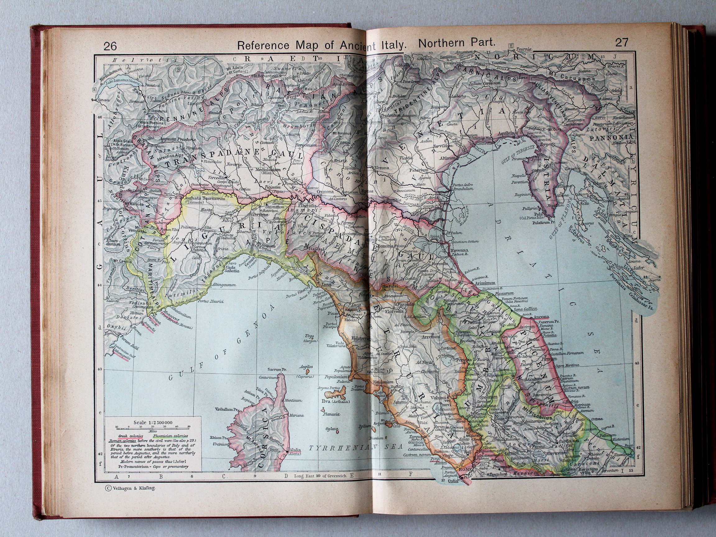
26.27. Reference Map of Ancient Italy. Northern Part XL
Italië in de Oudheid, noordelijk deel
 Shepherd, Historical Atlas, 1927
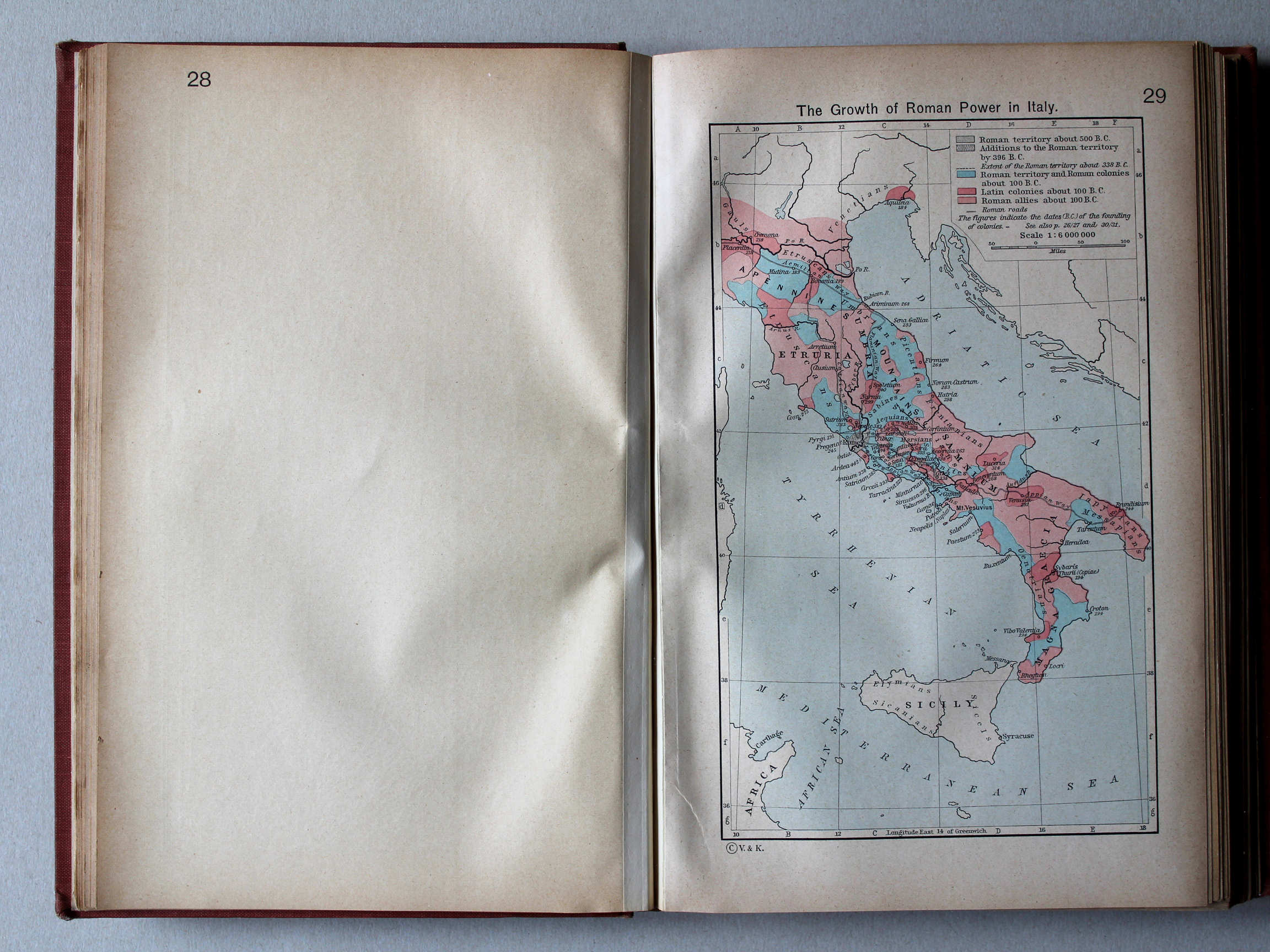
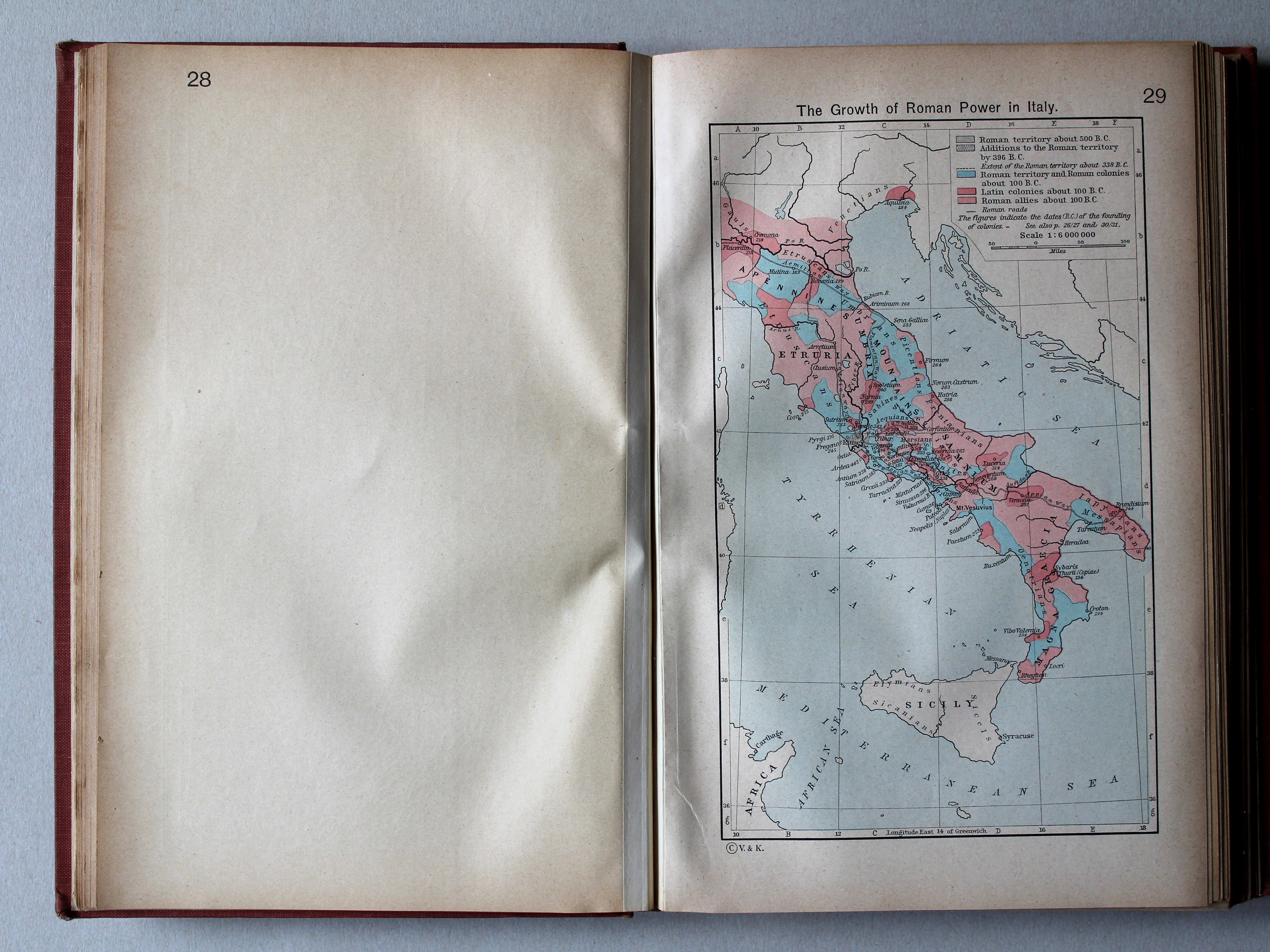
29. The Growth of Roman Power in Italy XL
Toename van de macht van Rome in Italië
 Shepherd, Historical Atlas, 1927
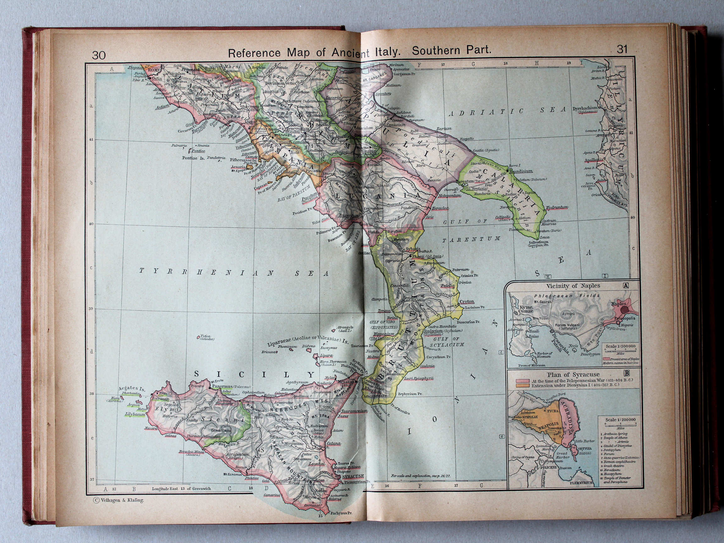
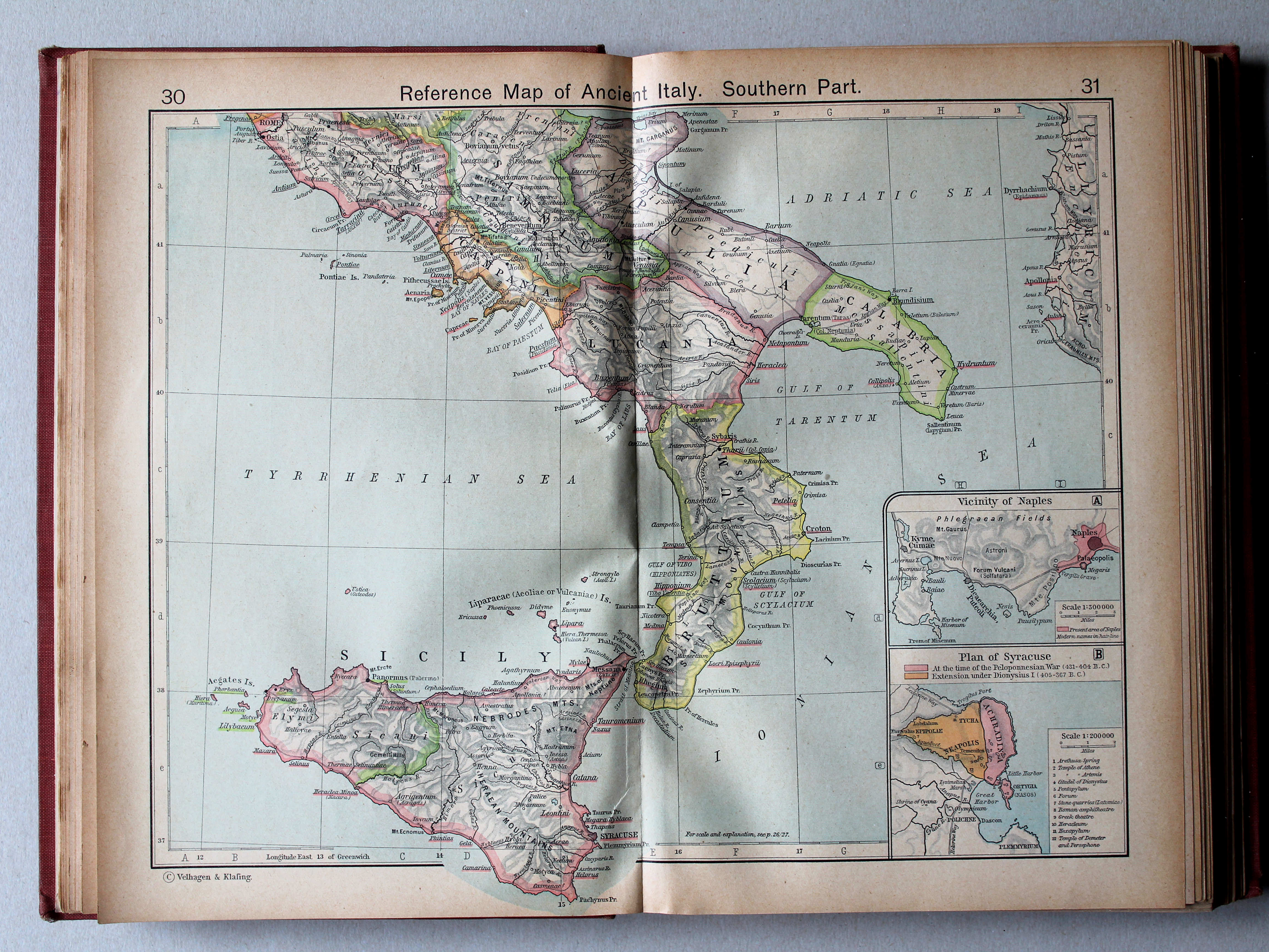
30.31. Reference Map of Ancient Italy. Southern Part XL
Italië in de Oudheid, zuidelijk deel
 Shepherd, Historical Atlas, 1927
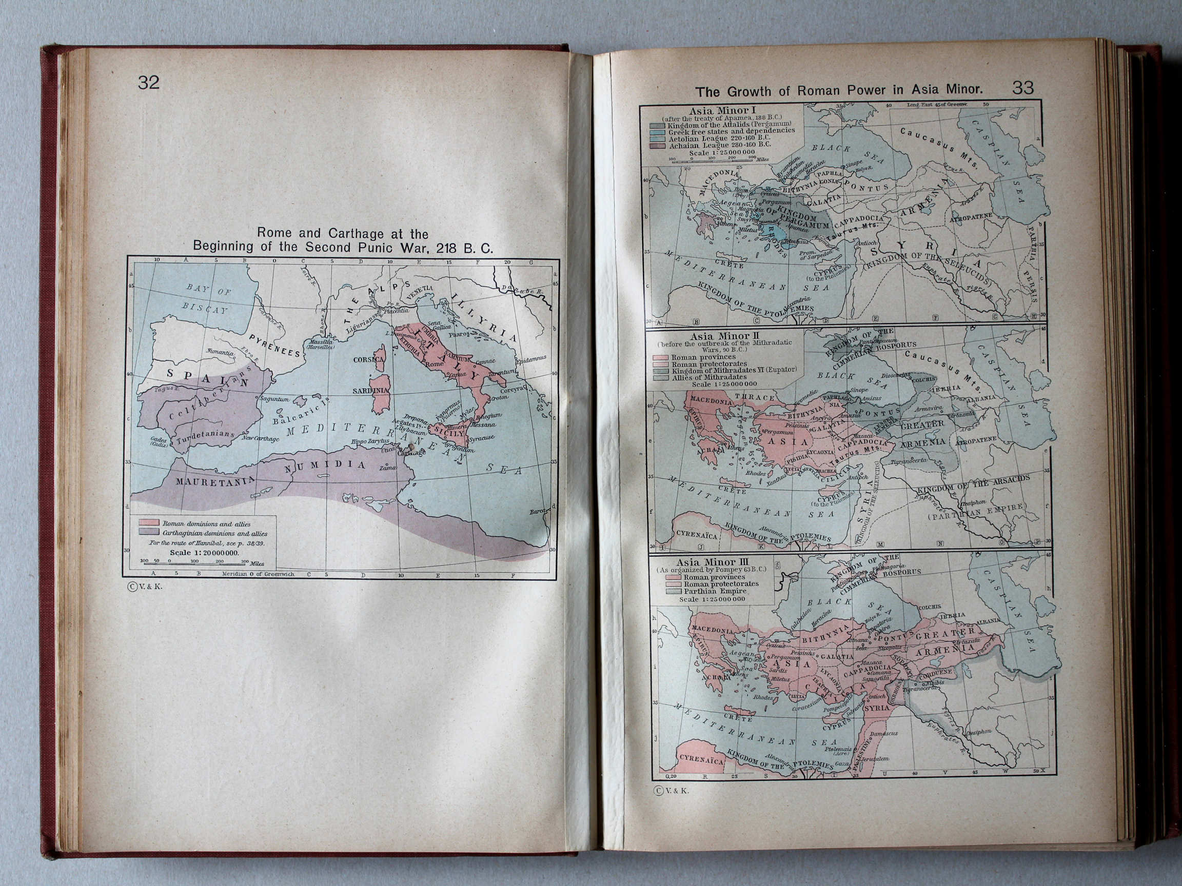
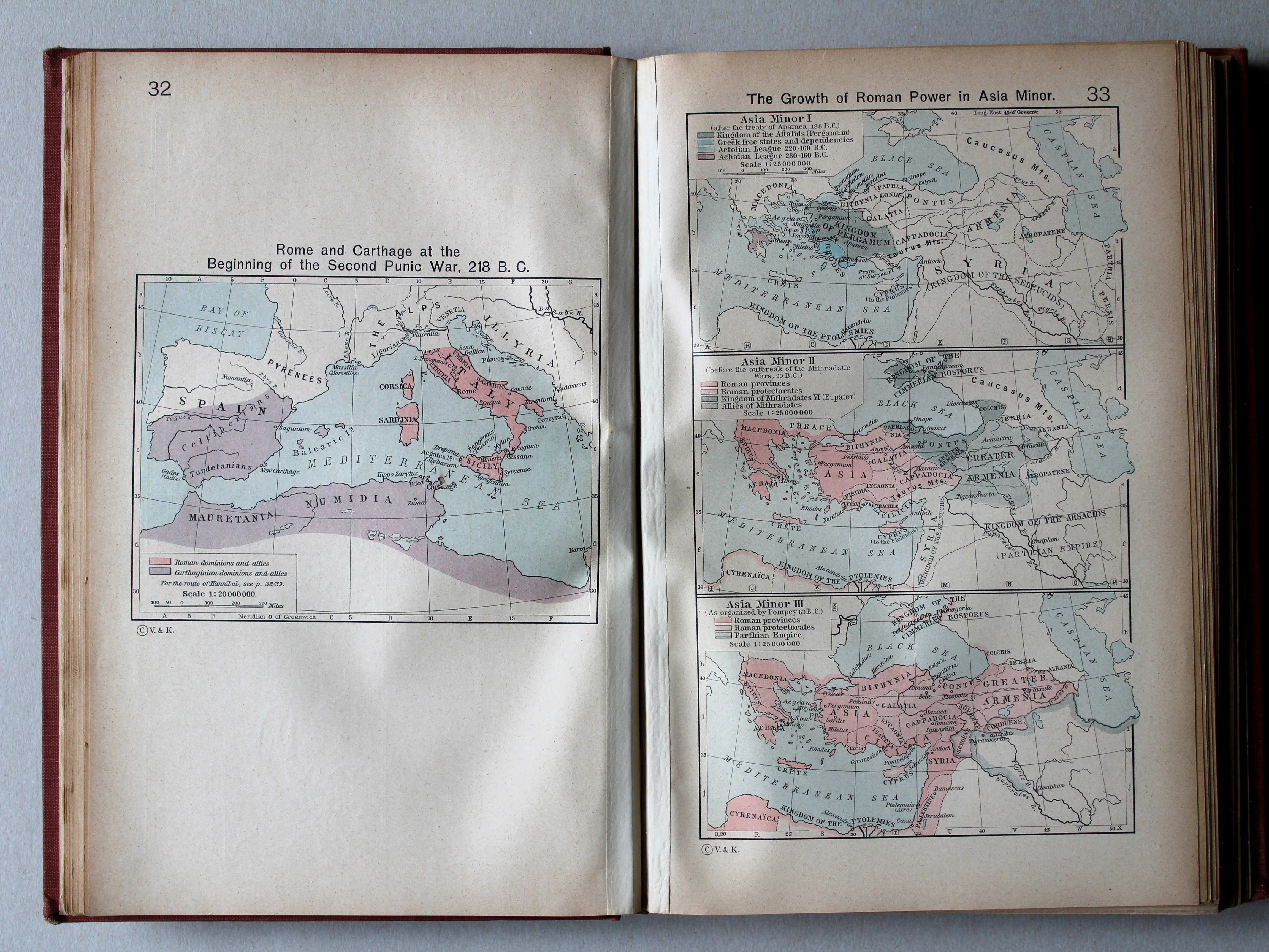
32. Rome and Carthage at the Beginning of the Second Punic War, 218 B. C. XL
Rome en Carthago aan het begin van de Tweede Punische Oorlog, 218 v. Chr.
33. The Growth of Roman Power in Asia Minor XL
Toename van de macht van Rome in Klein-Azië
 Shepherd, Historical Atlas, 1927
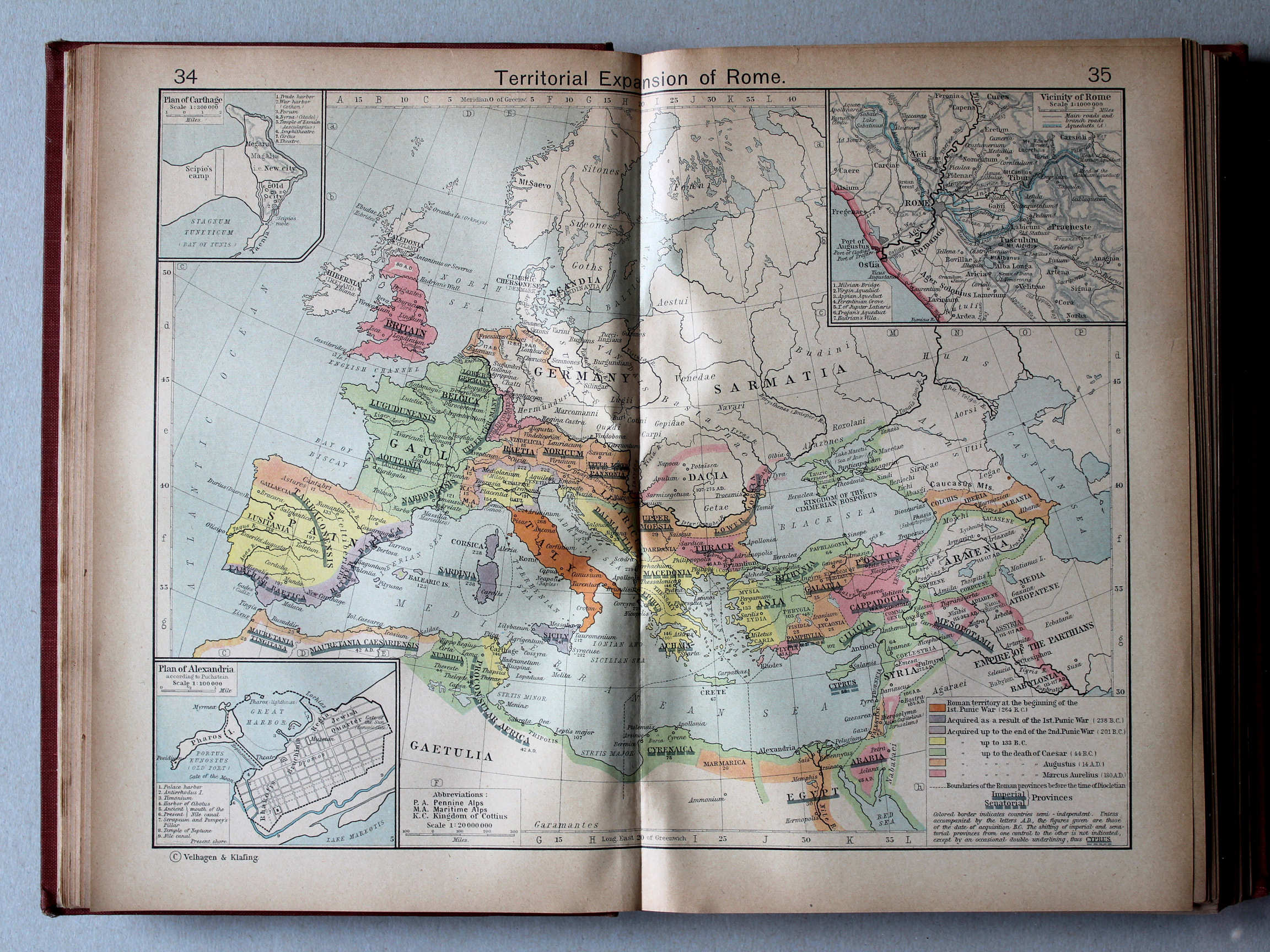
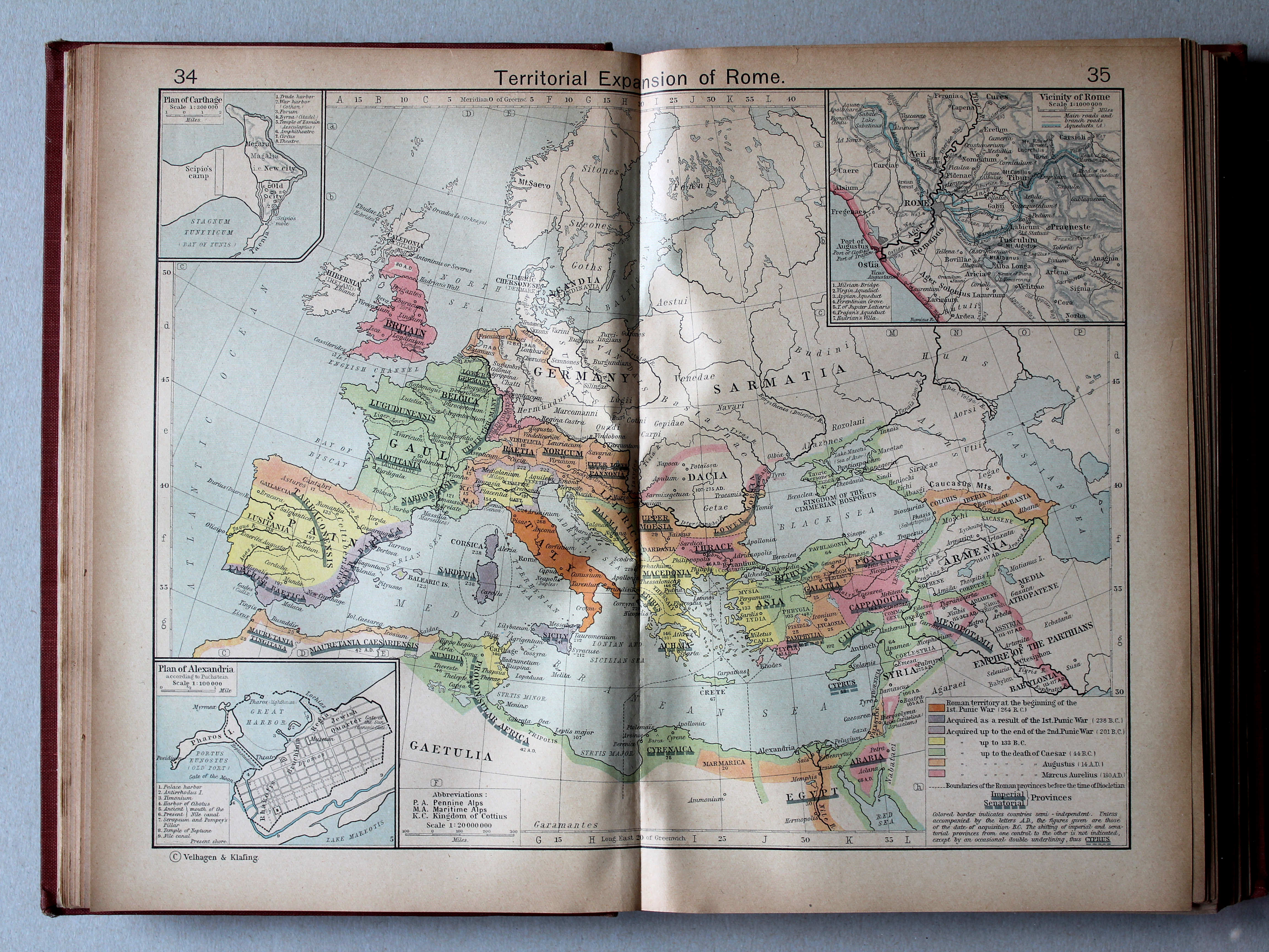
34.35. Territorial Expansion of Rome XL
Groei van het Romeinse Rijk
 Shepherd, Historical Atlas, 1927
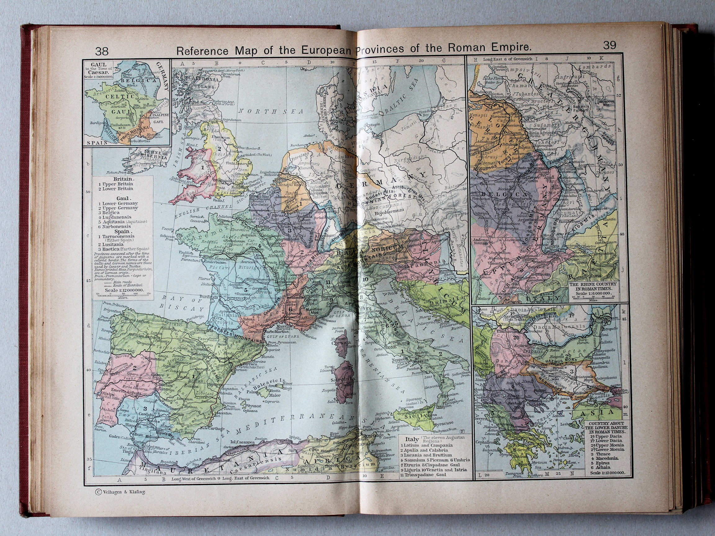
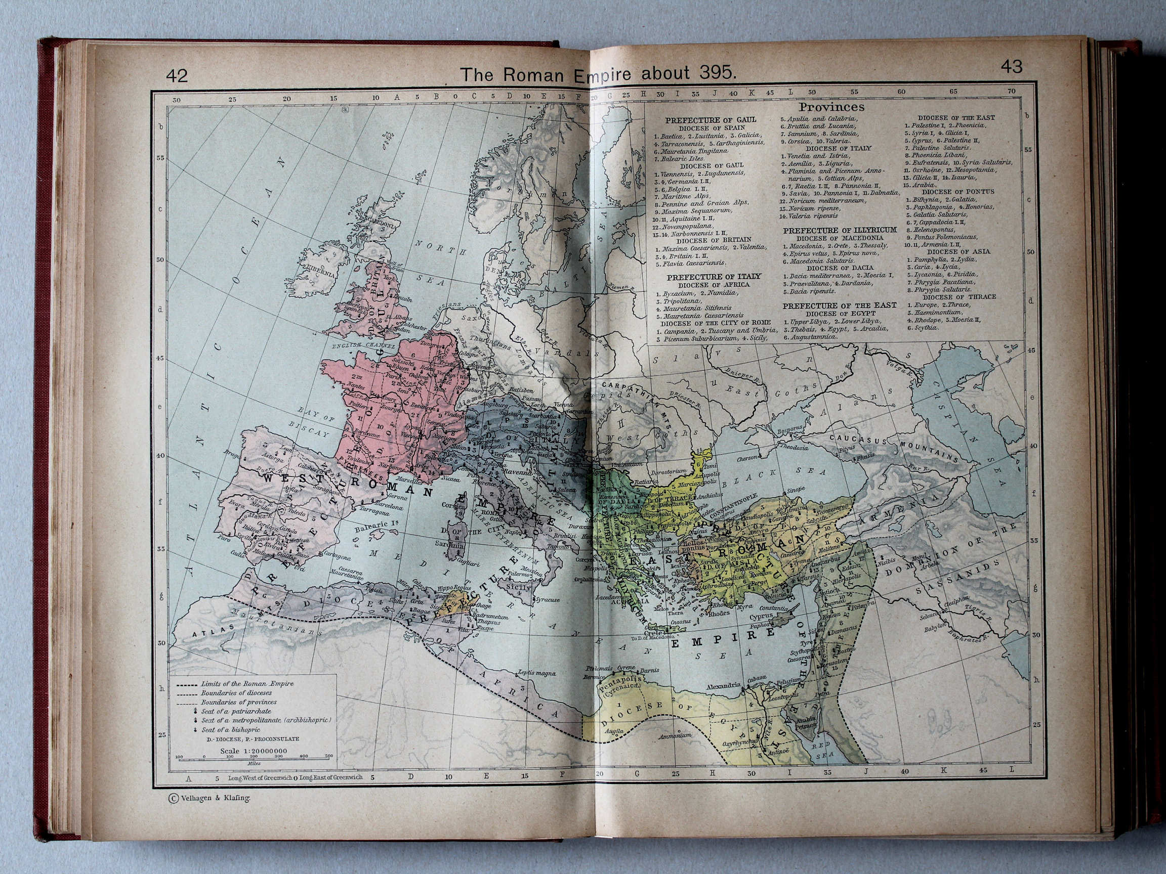
38.39. Reference Map of the European Provinces of the Roman Empire XL
Europese provincies van het Romeinse Rijk
 Shepherd, Historical Atlas, 1927
45. Germanic Migrations and Conquests, 150-1066 XL
Germaanse volksverhuizingen en veroveringen, 150-1066
 Shepherd, Historical Atlas, 1927
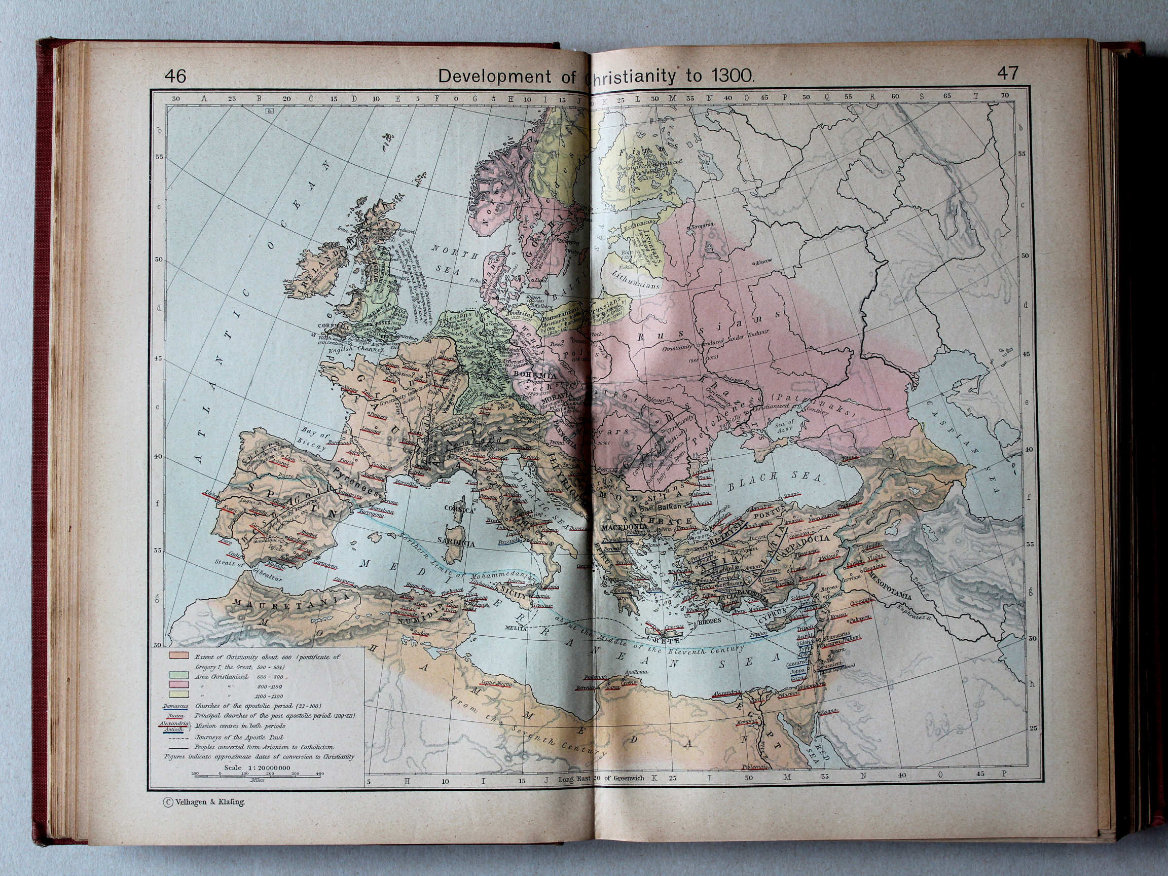
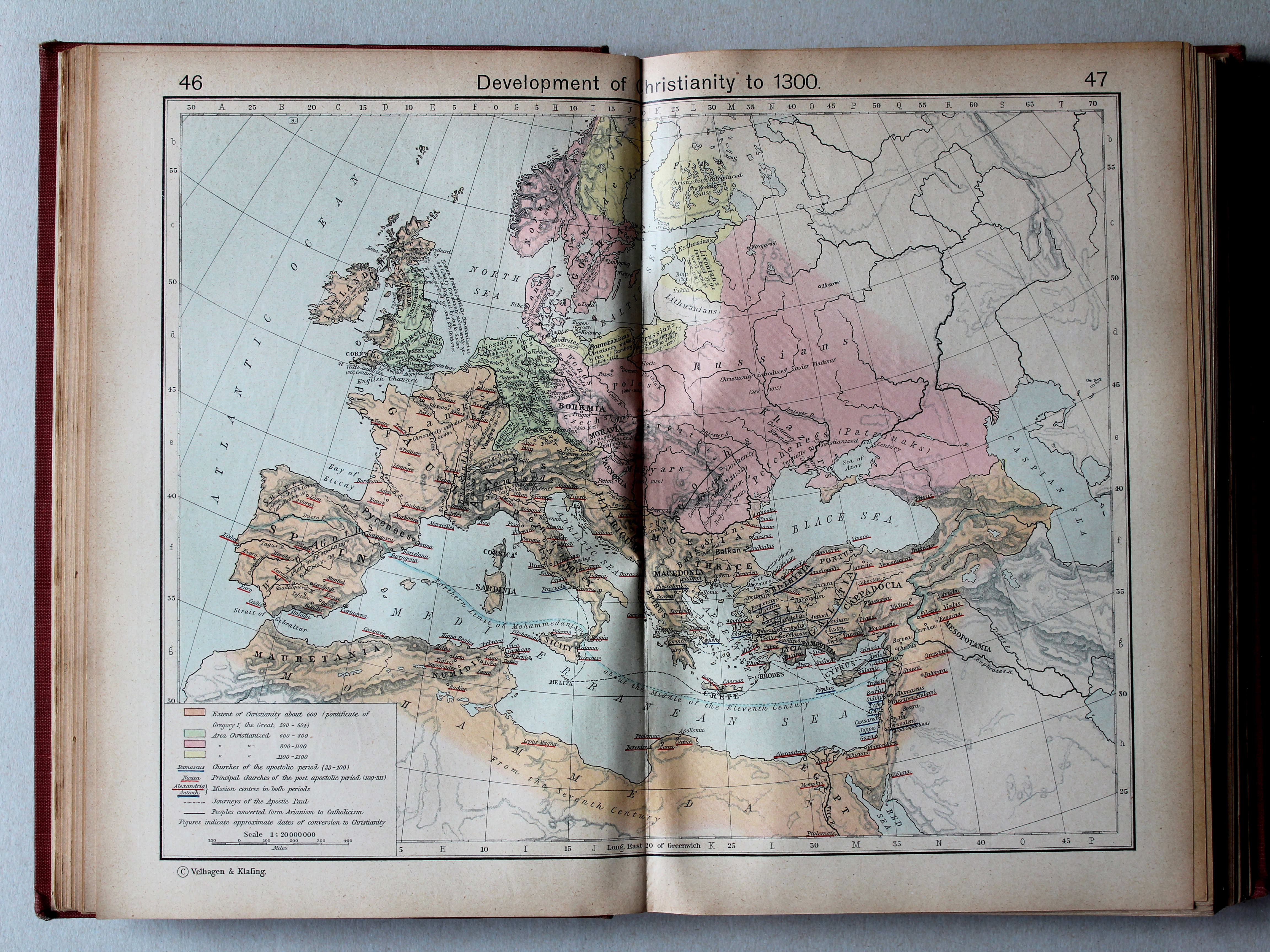
46.47. Development of Christianity to 1300 XL
Uitbreiding van het Christendom tot 1300
 Shepherd, Historical Atlas, 1927
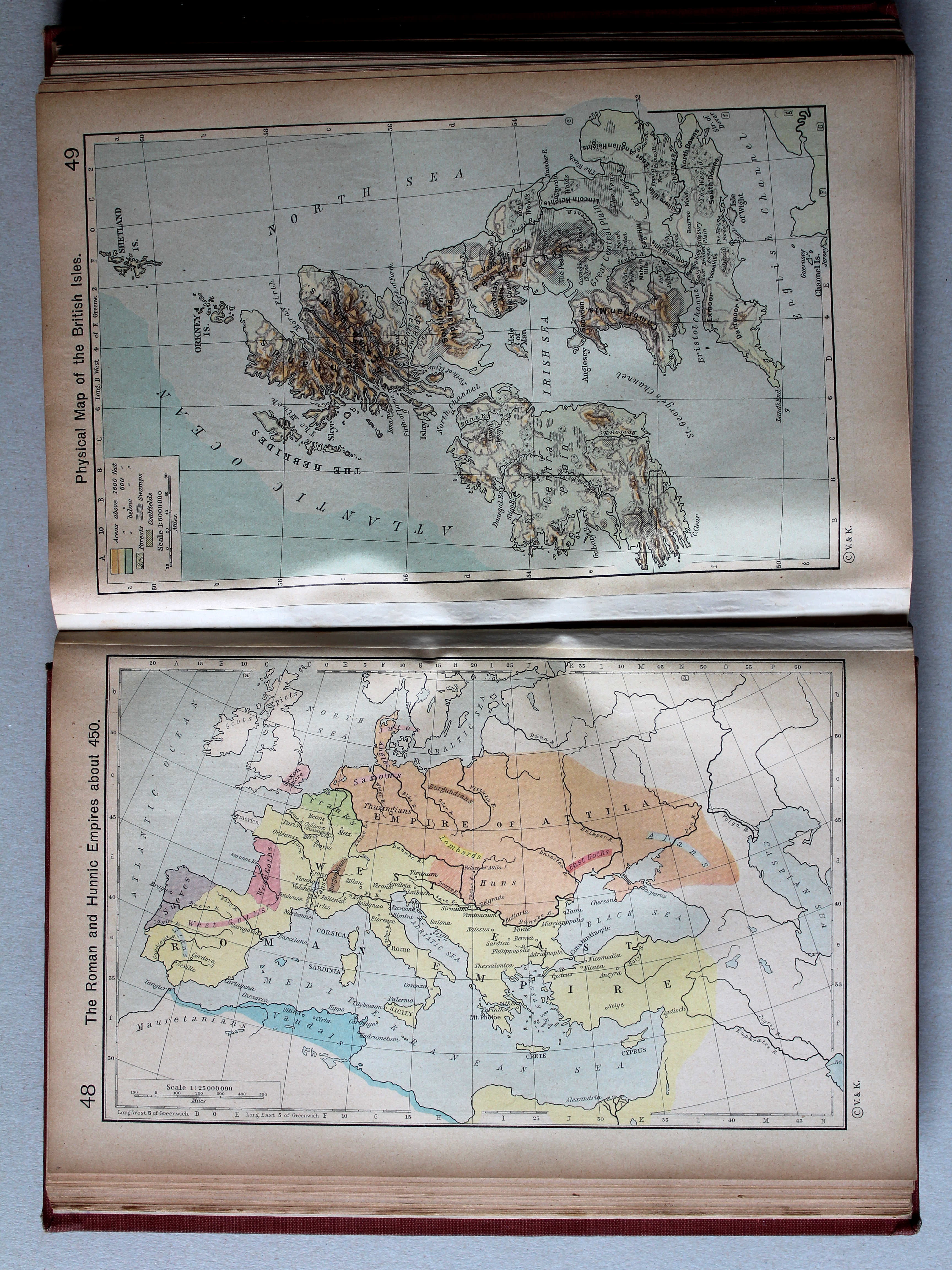
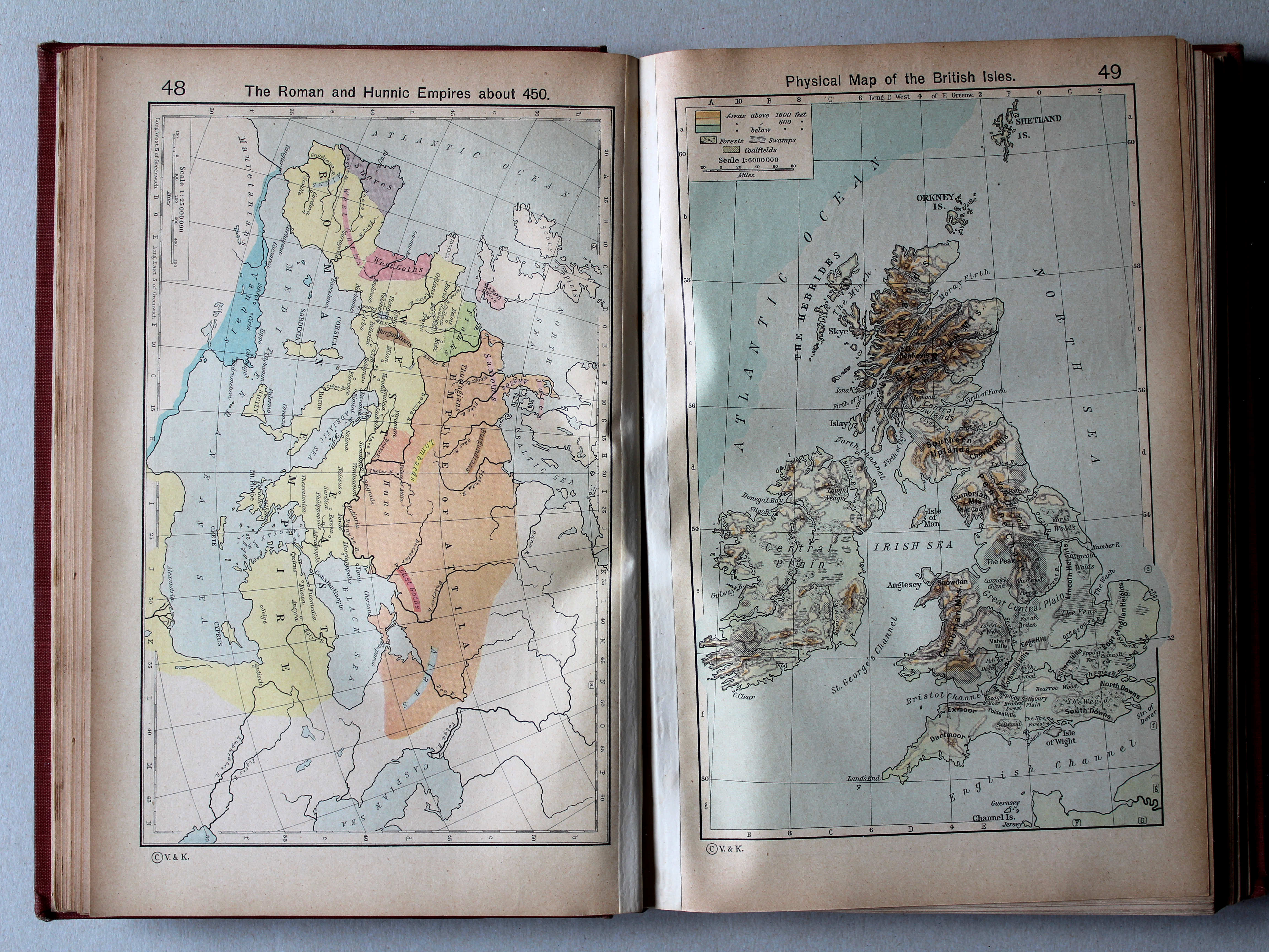
48. The Roman and Hunnic Empires about 450 XL
Het Romeinse Rijk en het Rijk van de Hunnen, ca. 450
 Shepherd, Historical Atlas, 1927
49. Physical Map of the British Isles XL
Britse Eilanden, natuurkundig
 Shepherd, Historical Atlas, 1927
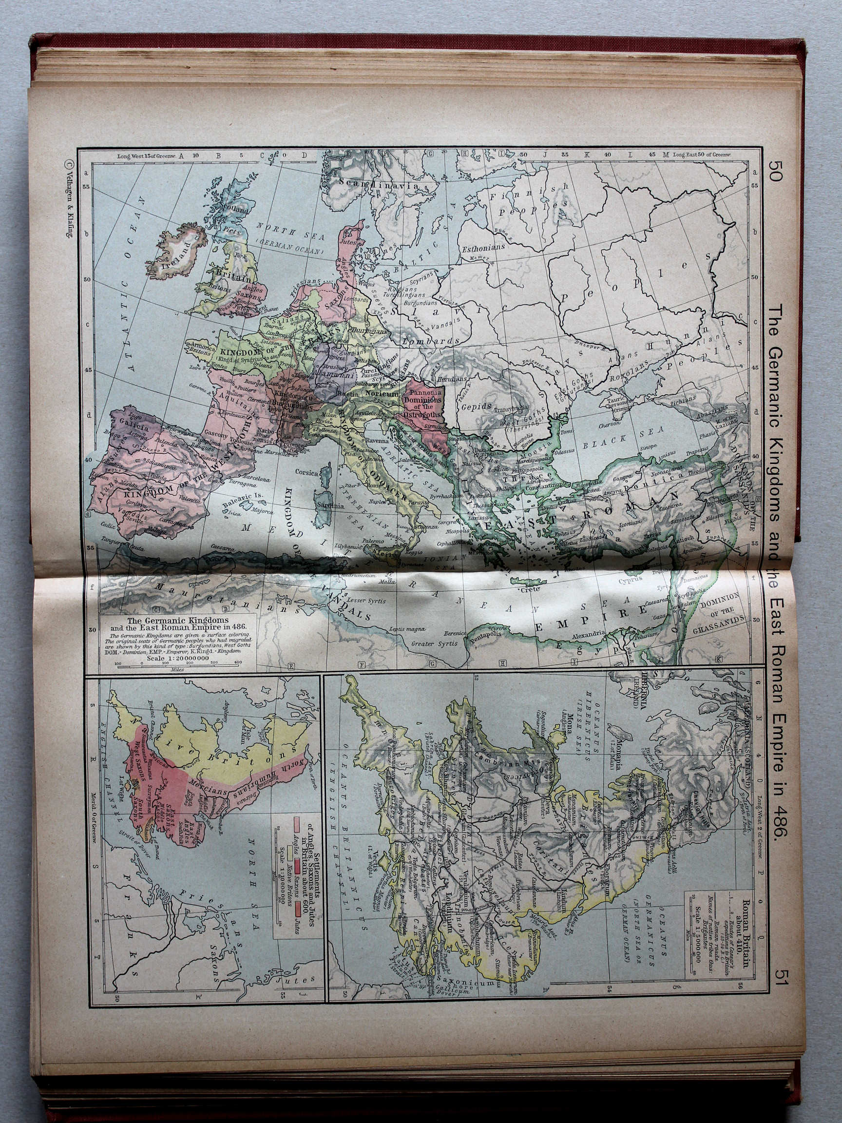
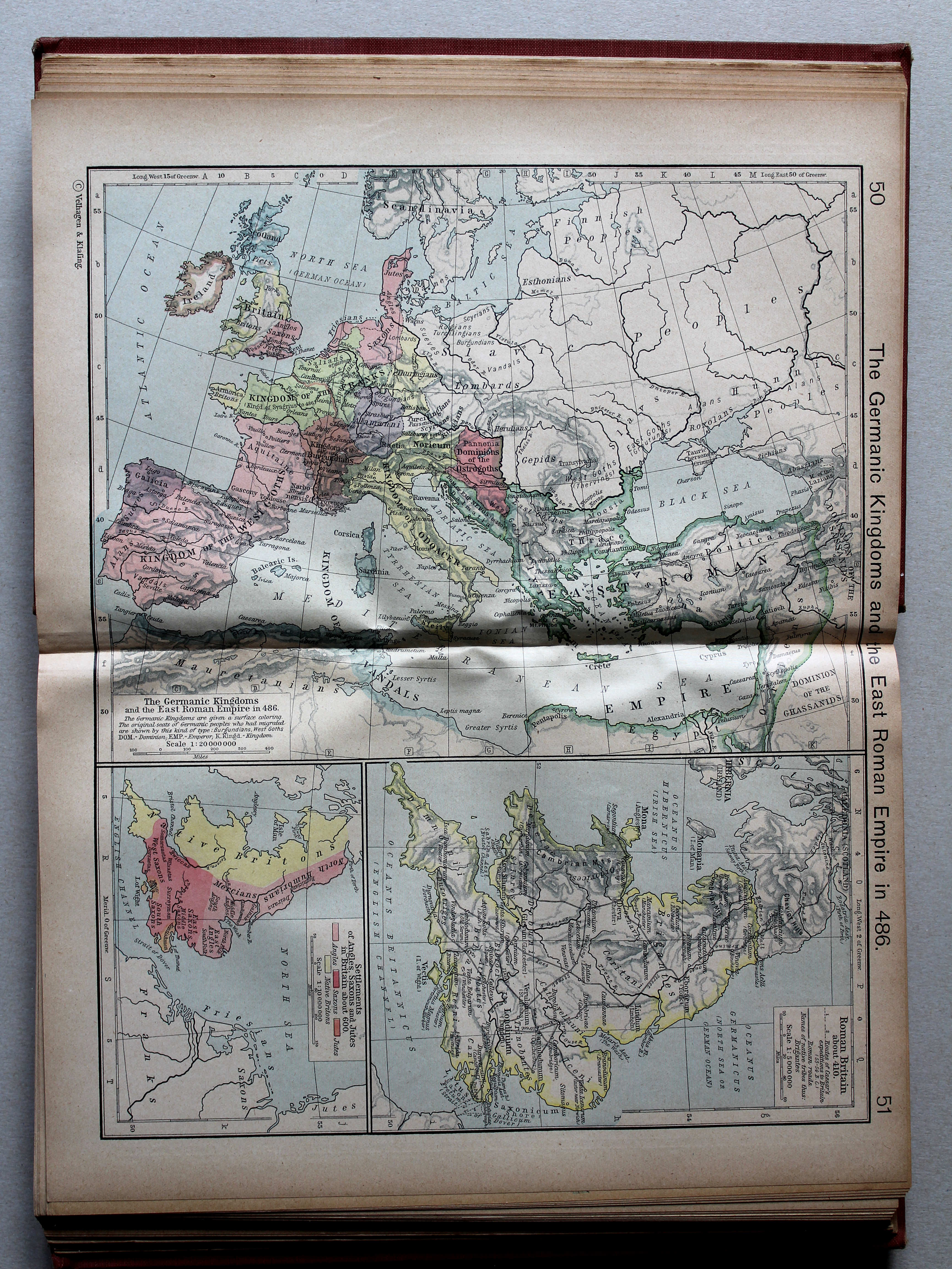
50.51. The Germanic Kingdoms and the East Roman Empire in 486 XL
De Germaanse koninkrijken en het Oost-Romeinse Rijk in 486
 Shepherd, Historical Atlas, 1927
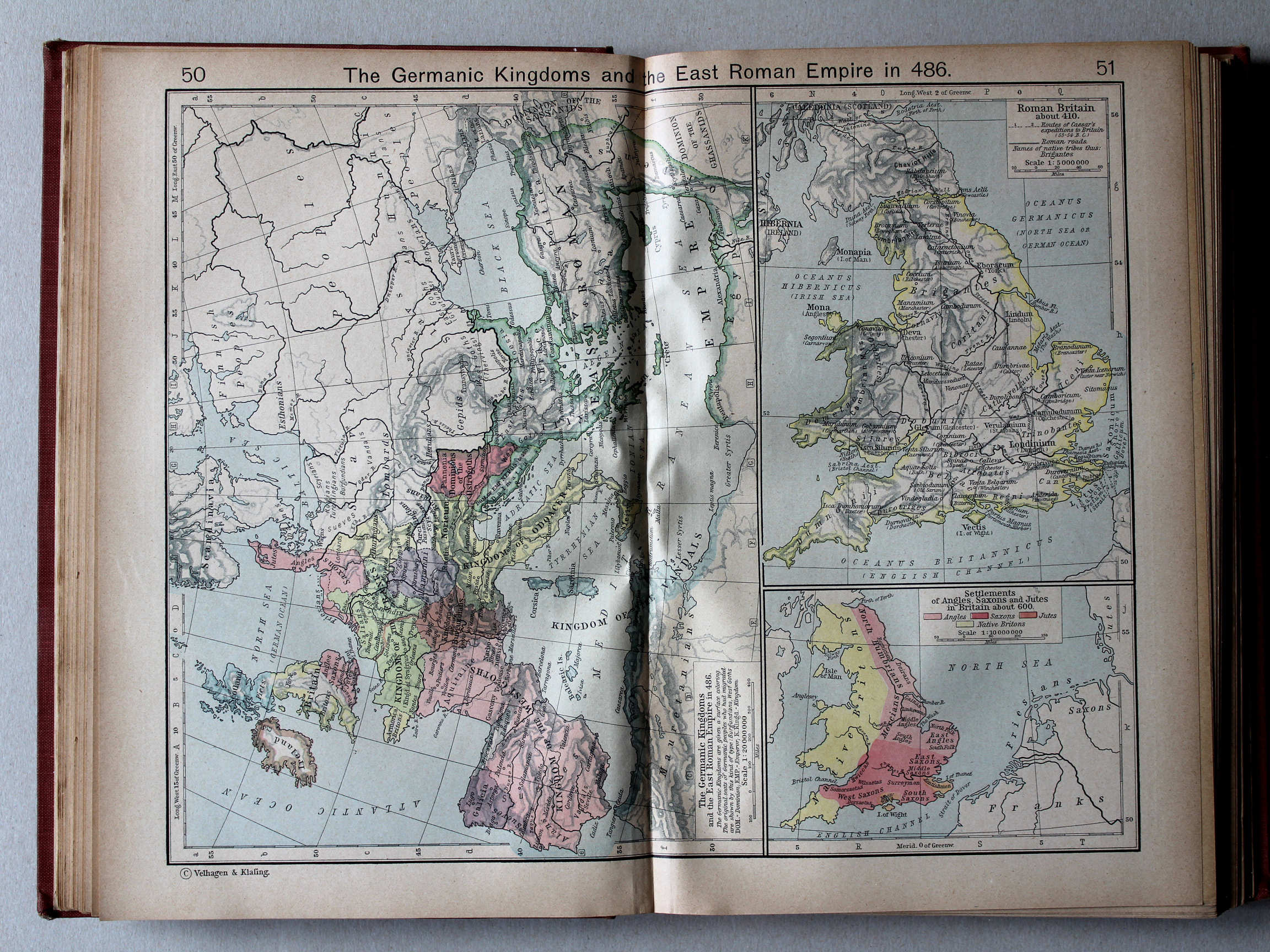
50.51. The Germanic Kingdoms and the East Roman Empire in 486 XL
De Germaanse koninkrijken en het Oost-Romeinse Rijk in 486
 Shepherd, Historical Atlas, 1927
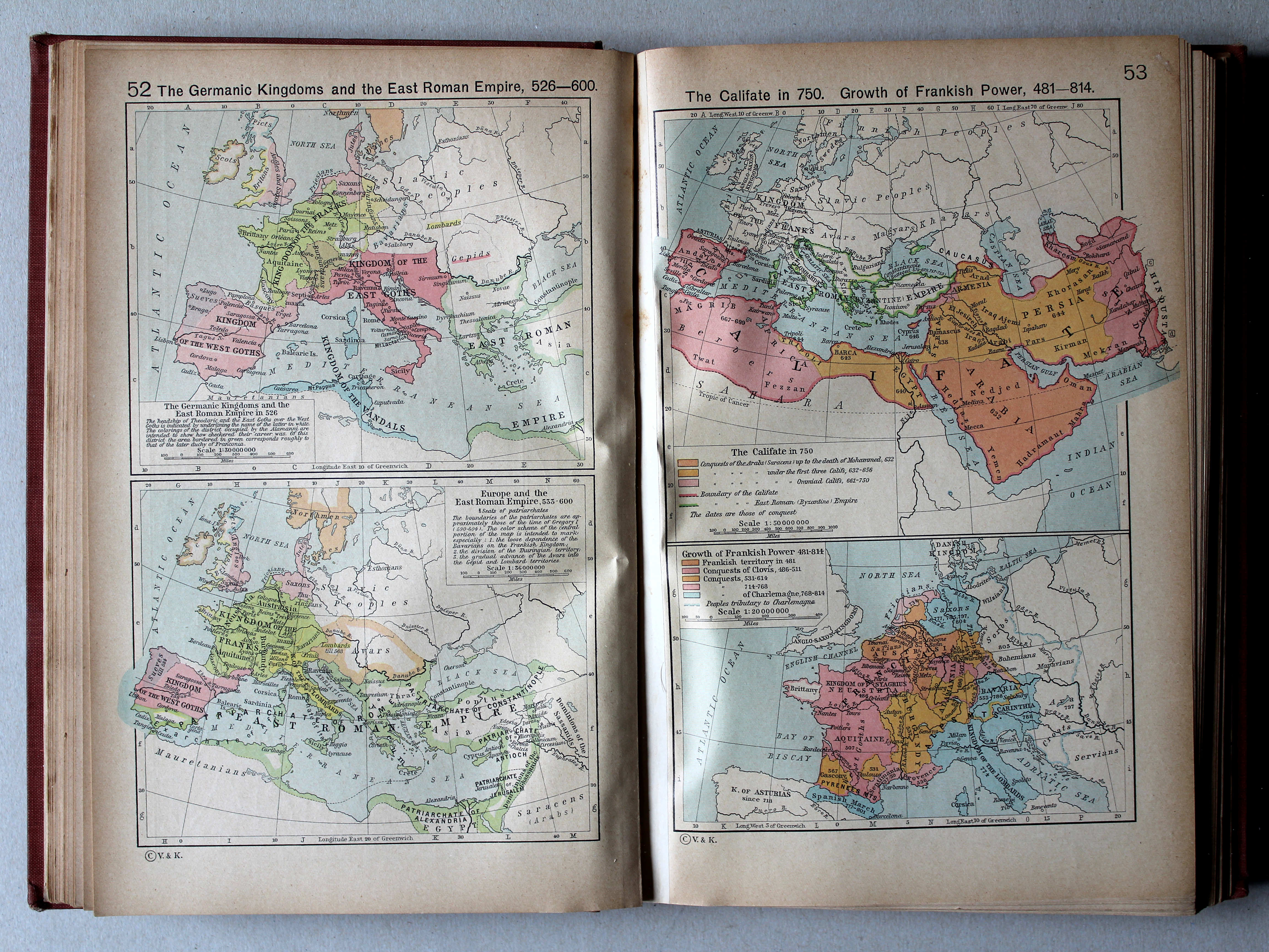
52. The Germanic Kingdoms and the East Roman Empire, 526-600 XL
De Germaanse koninkrijken en het Oost-Romeinse Rijk, 526-600
53. The Califate in 750. Growth of Frankish Power, 481-814 XL
Het Kalifaat in 750. Groei van het Frankische Rijk, 481-814
 Shepherd, Historical Atlas, 1927
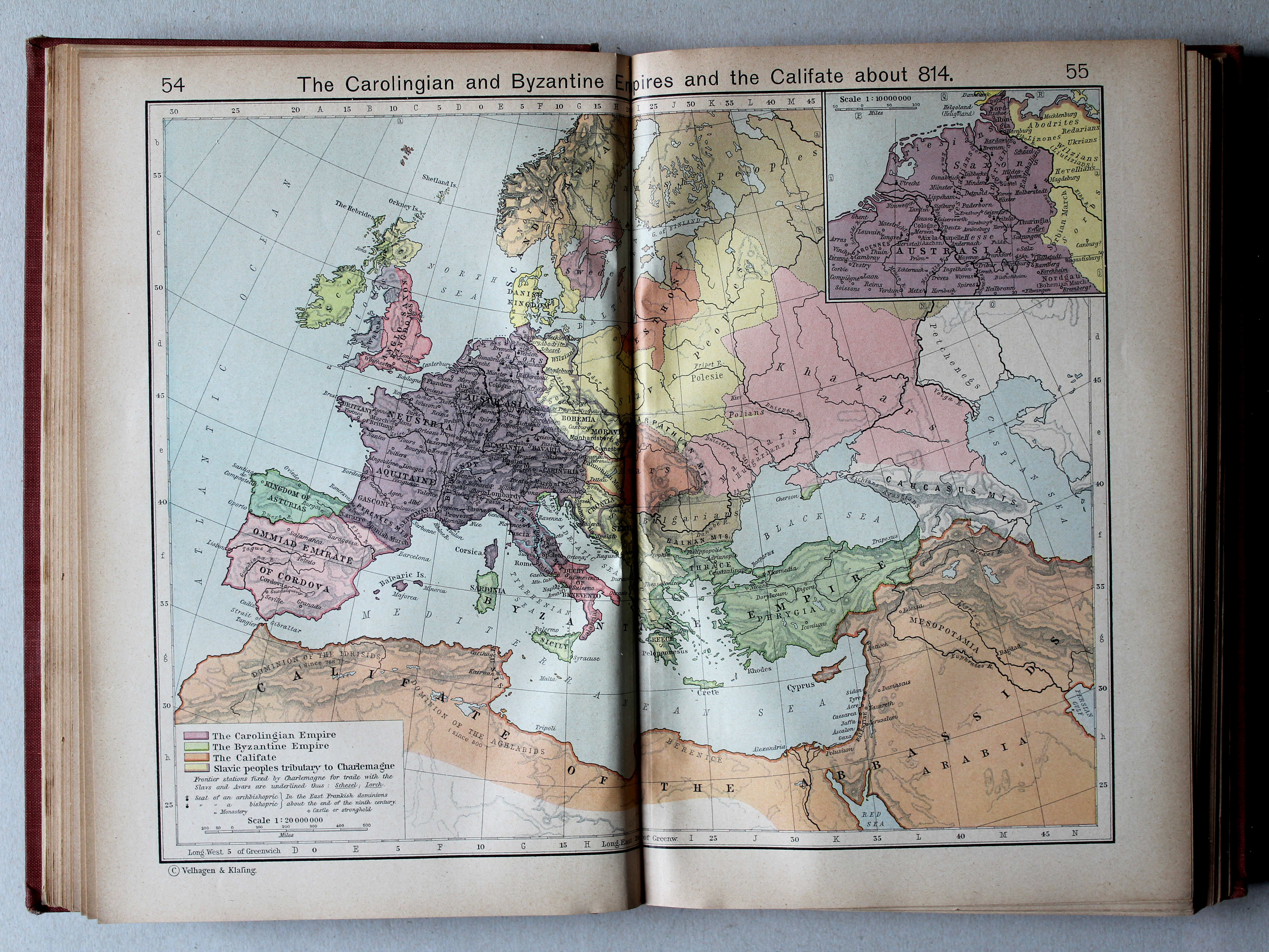
54.55. The Carolingian and Byzantine Empires and the Califate about 814 XL
Het Frankische Rijk, het Byzantijnse Rijk en het Kalifaat, ca. 814
 Shepherd, Historical Atlas, 1927
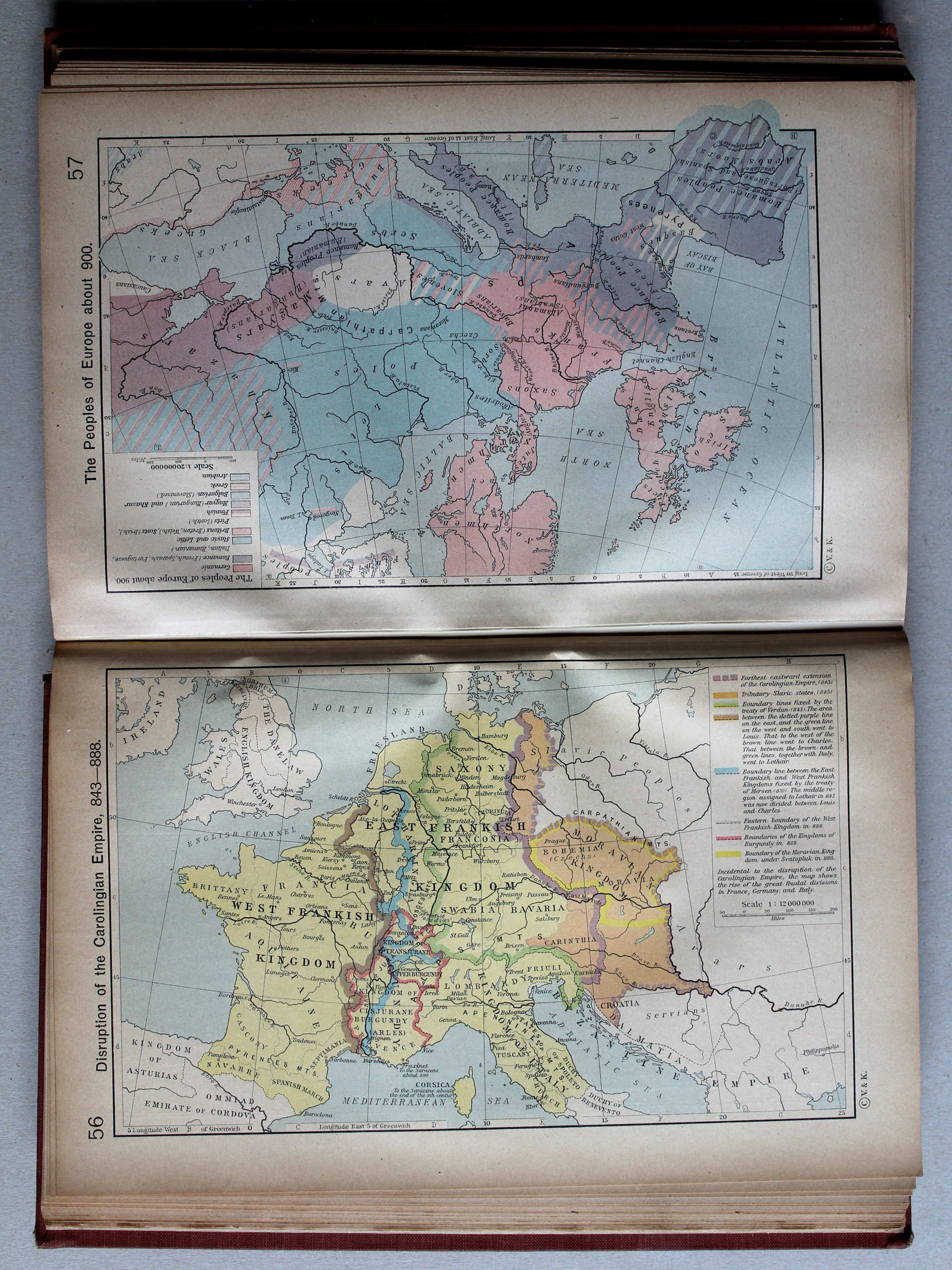
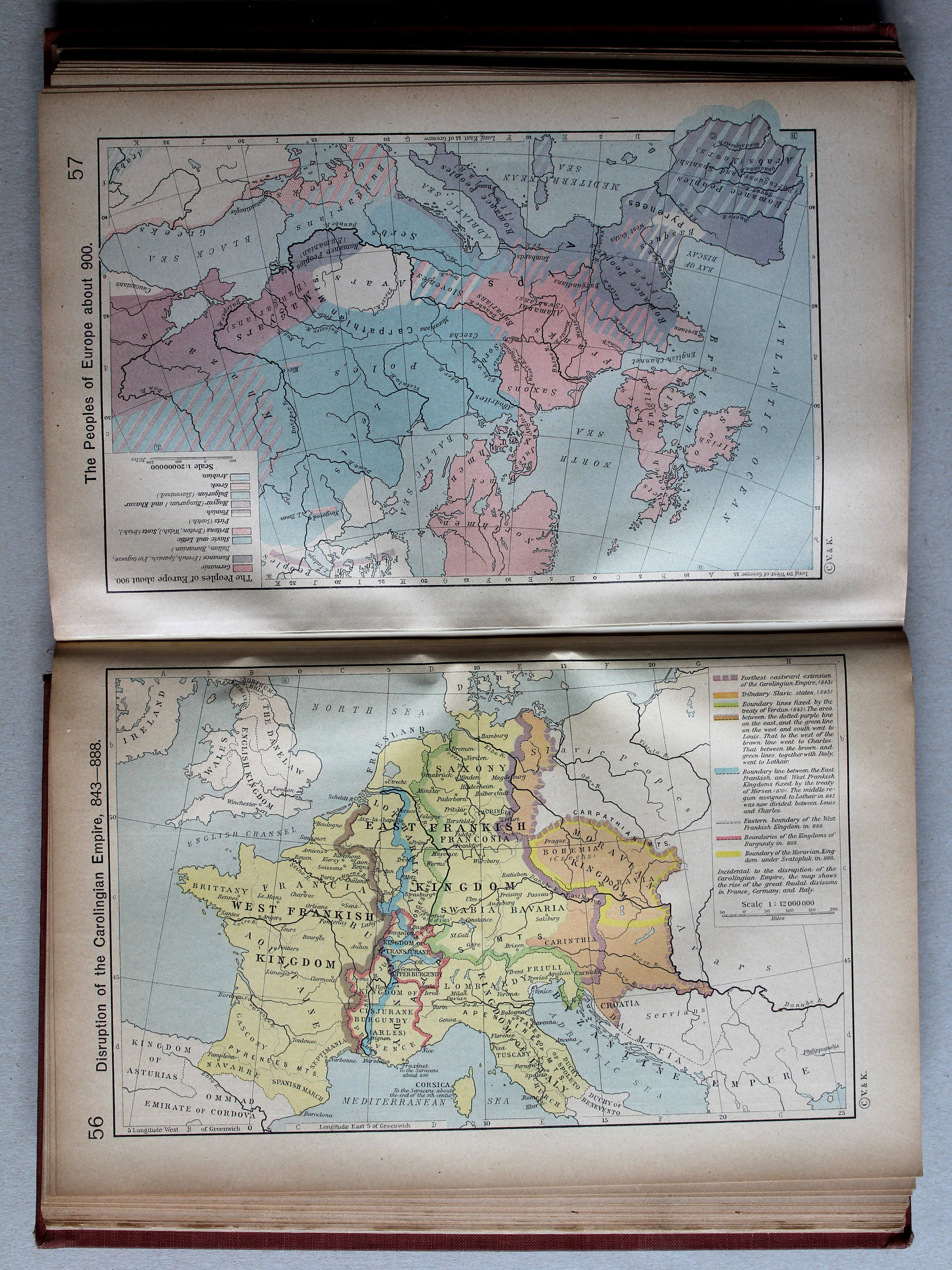
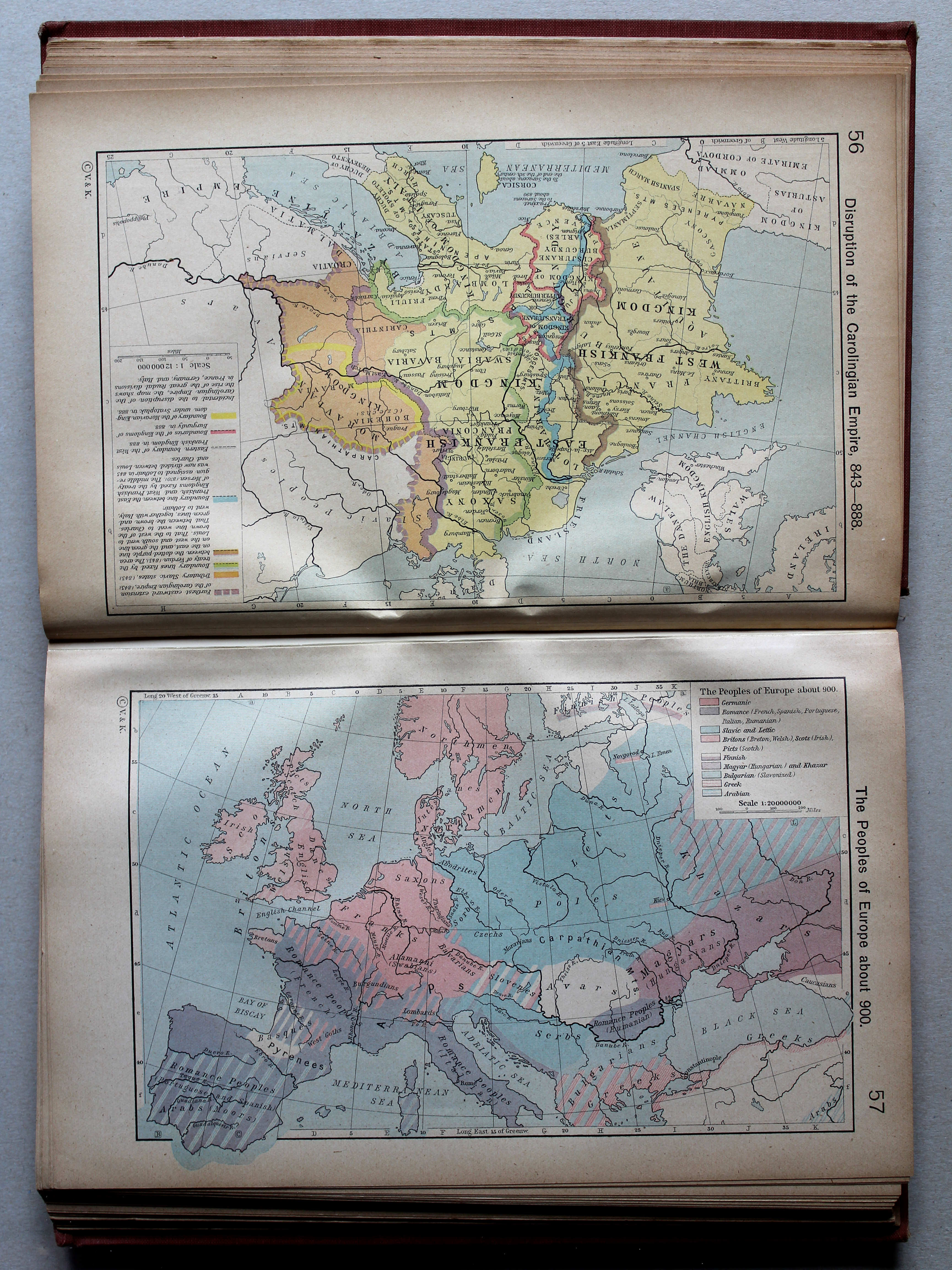
56. Disruption of the Carolingian Empire, 843-888 XL
Verdeling van het Frankische Rijk, 843-888

 Shepherd, Historical Atlas, 1927
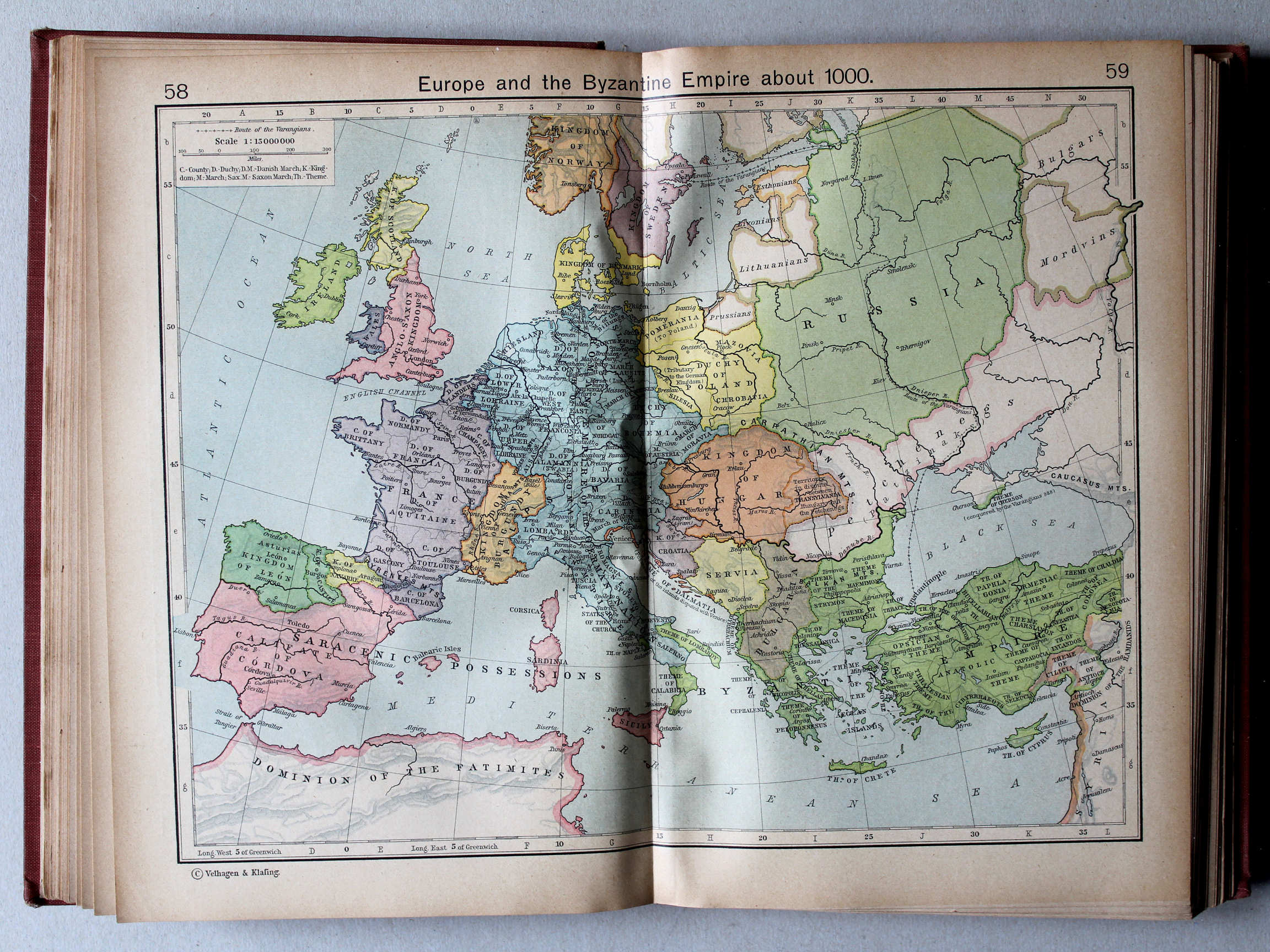
58.59. Europe and the Byzantine Empire about 1000 XL
Europa en het Byzantijnse Rijk, ca. 1000
 Shepherd, Historical Atlas, 1927
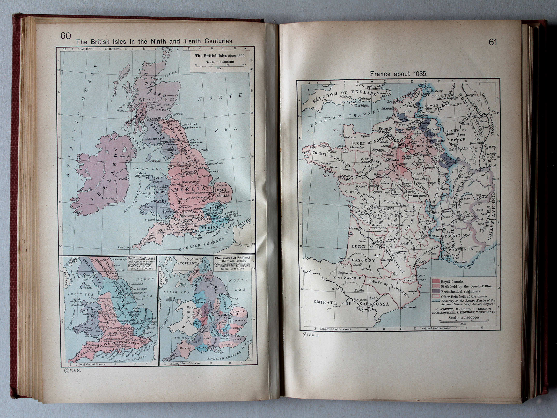
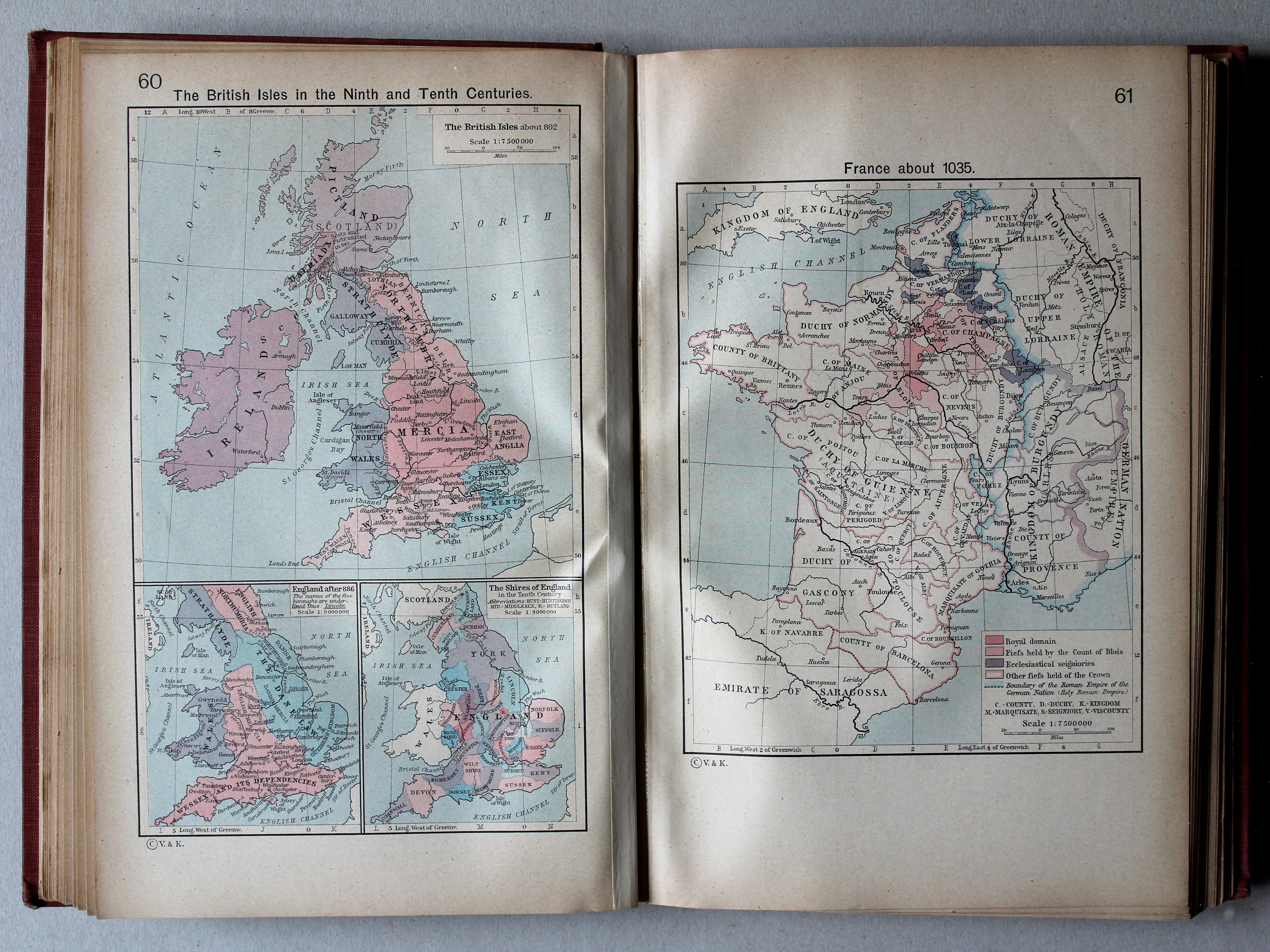
60. The British Isles in the Ninth and Tenth Centuries XL
Britse Eilanden in de 9e en 10e eeuw
61. France about 1035 XL
Frankrijk, ca. 1035
 Shepherd, Historical Atlas, 1927
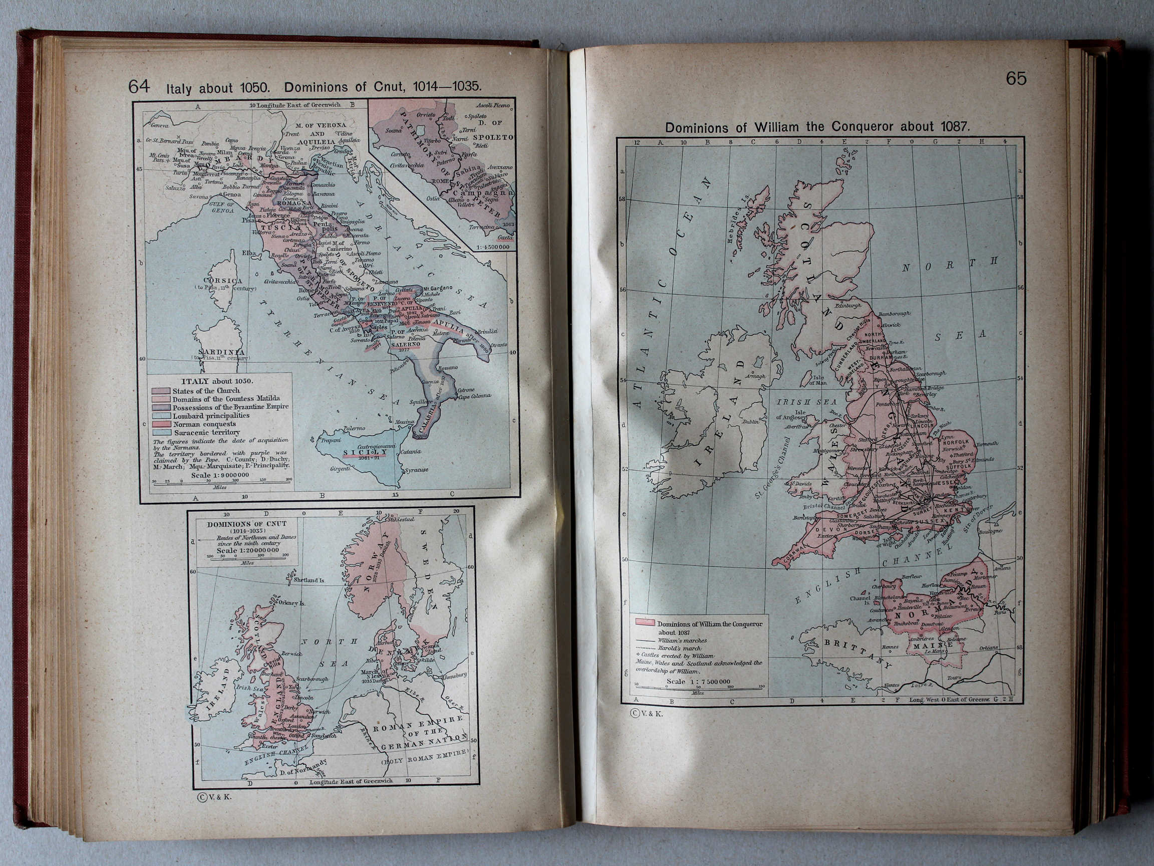
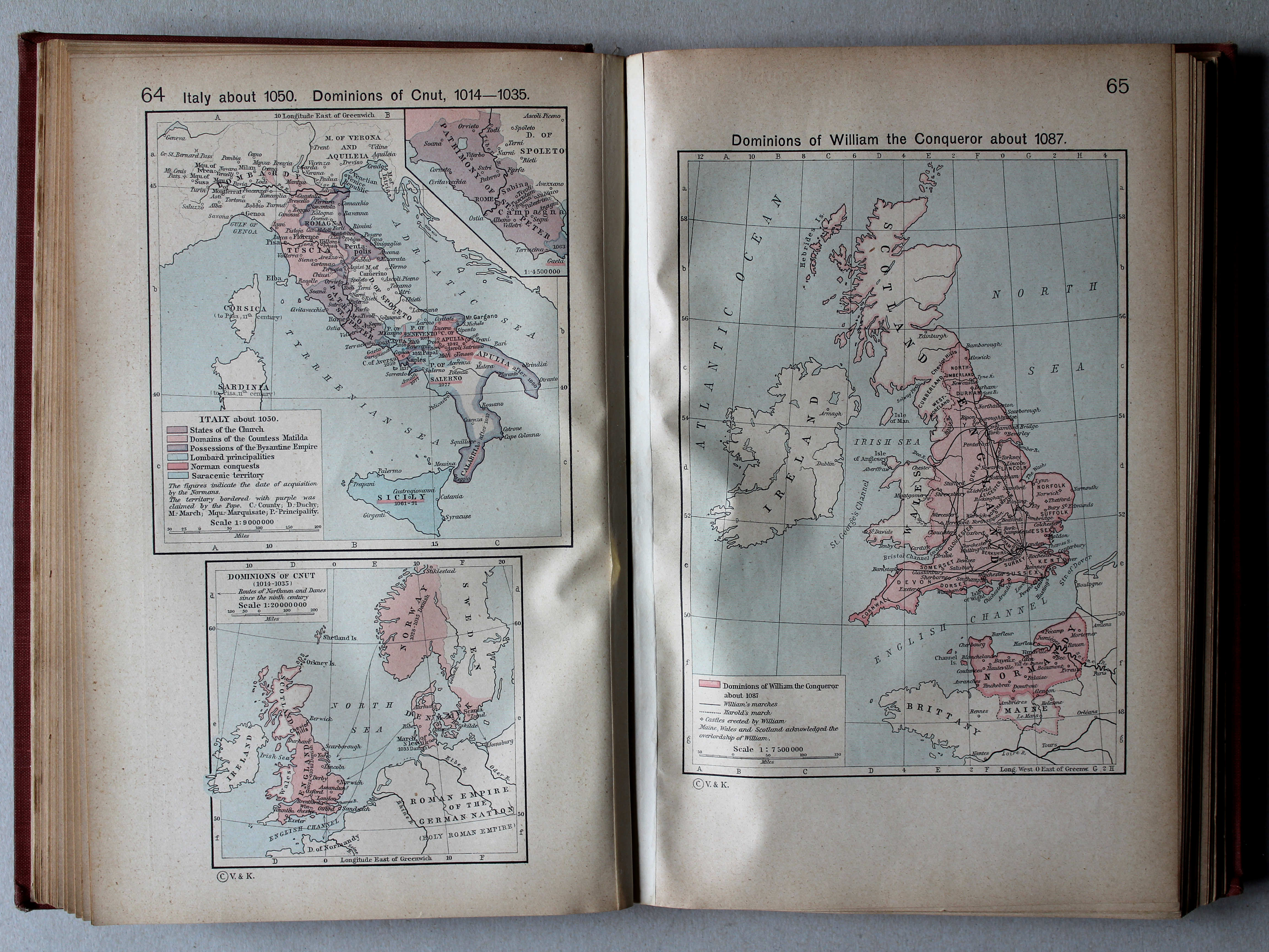
64. Italy about 1050. Dominions of Cnut, 1014-1035 XL
Italië, ca. 1050. Gebieden van Knoet, 1014-1035
65. Dominions of William the Conqueror about 1087 XL
Gebied van Willem de Veroveraar, ca. 1087
 Shepherd, Historical Atlas, 1927
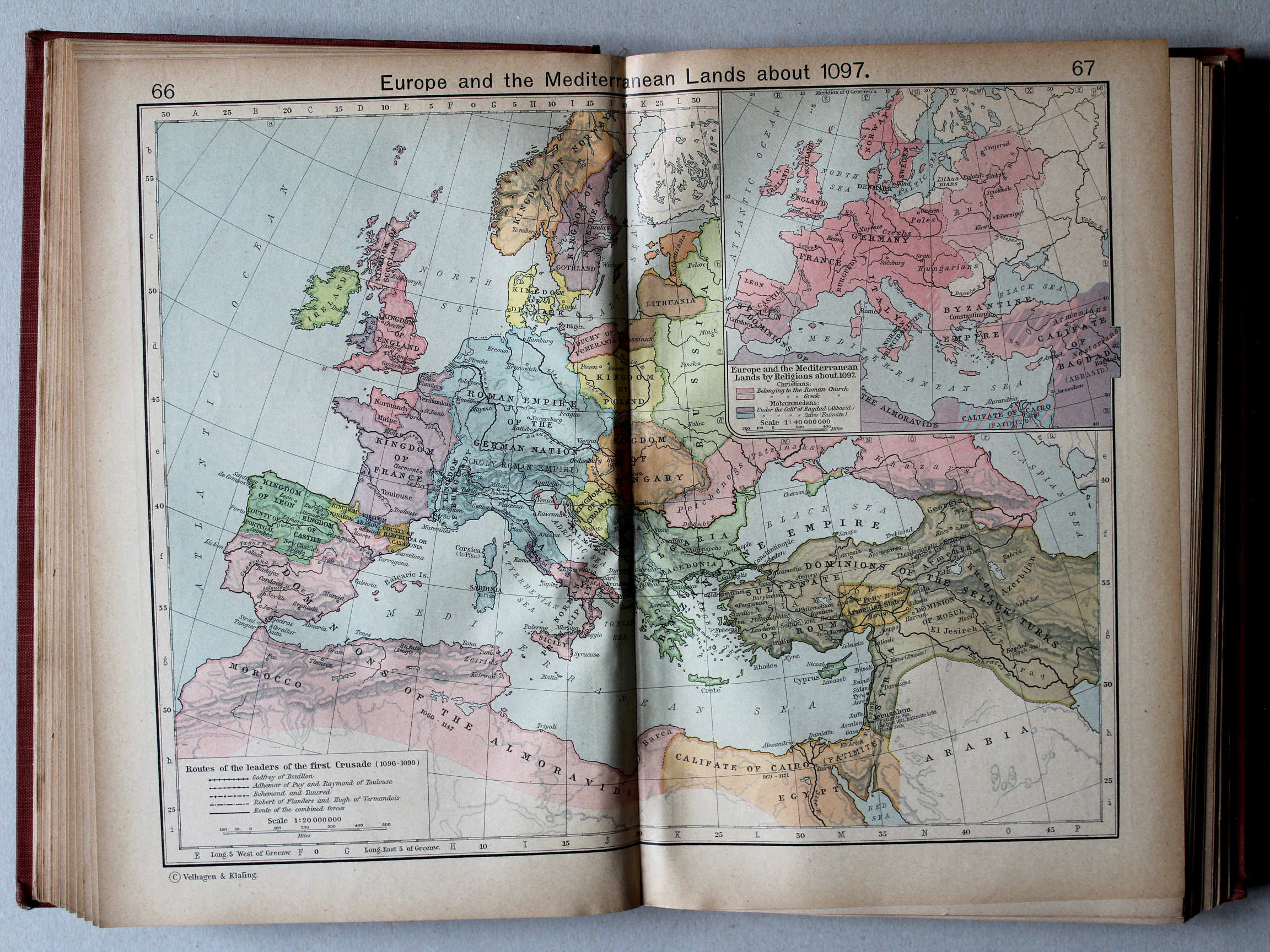
66.67. Europe and the Mediterranean Lands about 1097 XL
Europa en het Middellandse Zeegebied, ca. 1097
 Shepherd, Historical Atlas, 1927
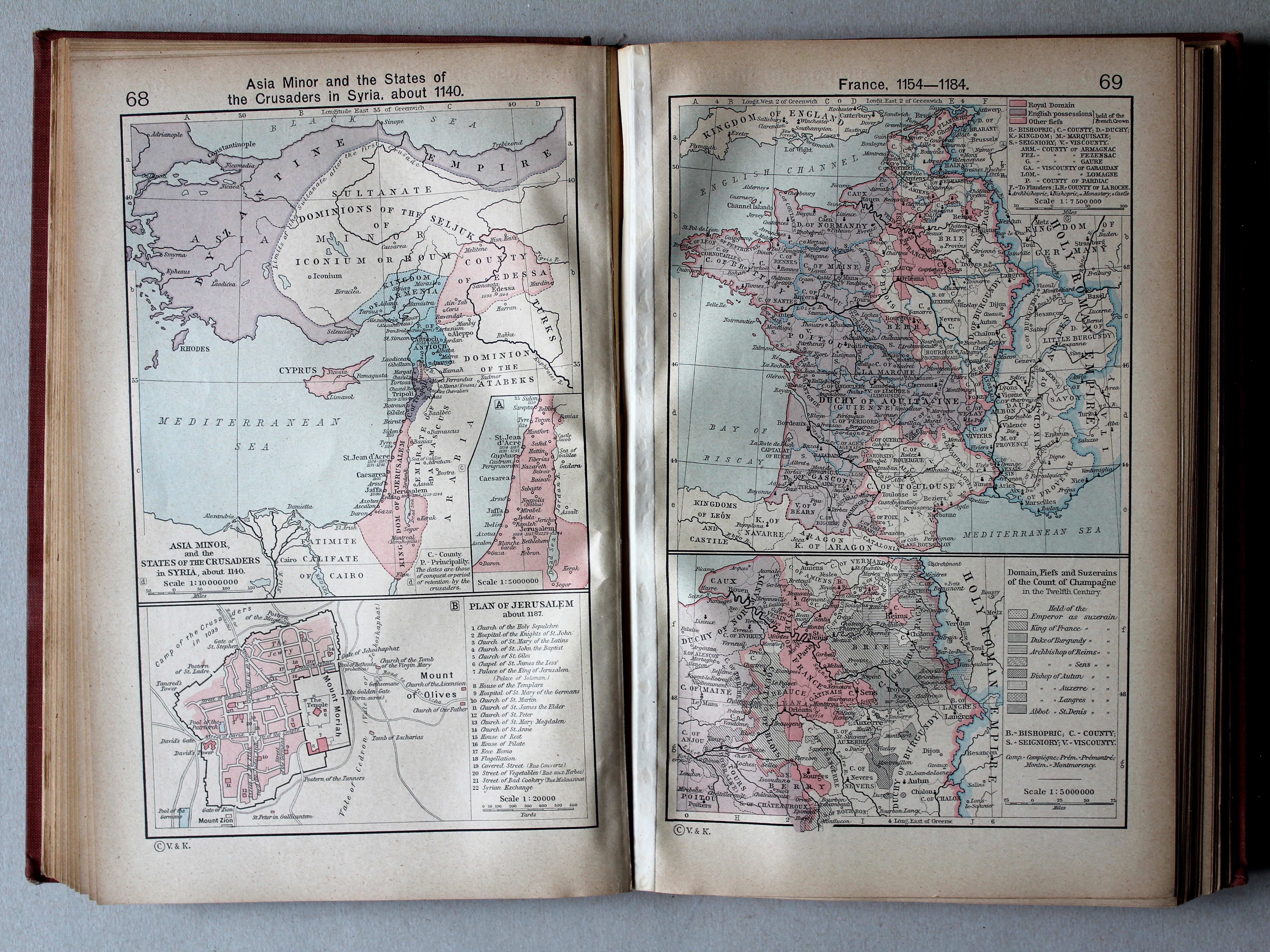
68. Asia Minor and the States of the Crusaders in Syria, about 1140 XL
Klein-Azië en de Kruisvaardersstaten in Syrië, ca. 1140
69. France, 1154-1184 XL
Frankrijk, 1154-1184
 Shepherd, Historical Atlas, 1927
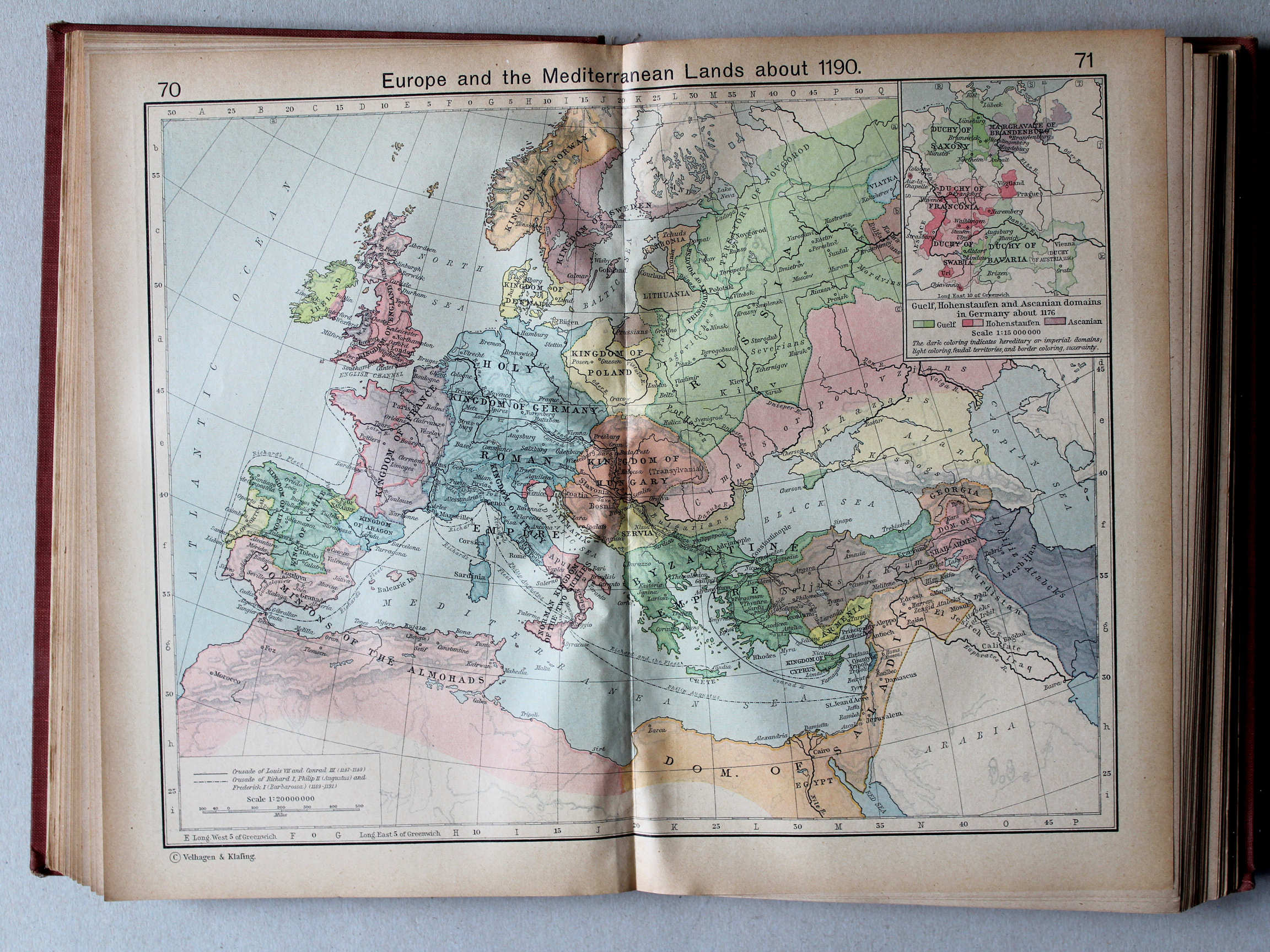
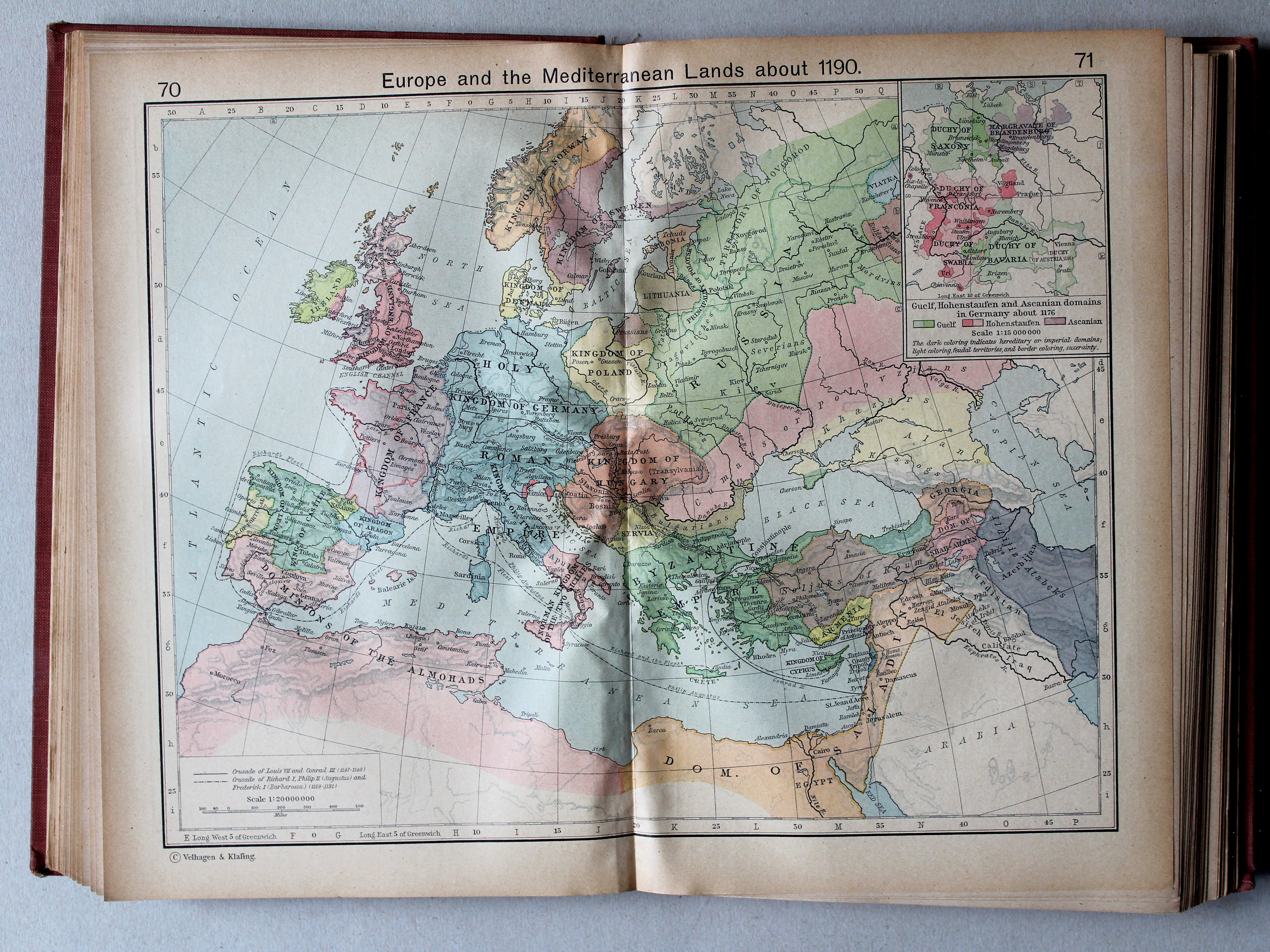
70.71. Europe and the Mediterranean Lands about 1190 XL
Europa en het Middellandse Zeegebied, ca. 1190
 Shepherd, Historical Atlas, 1927
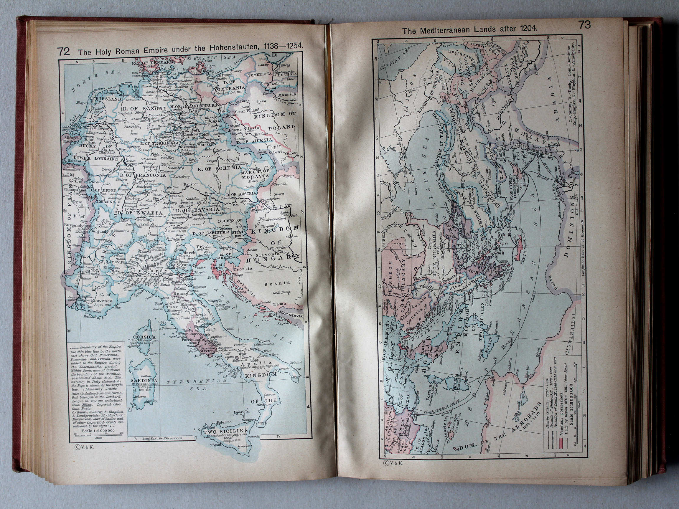
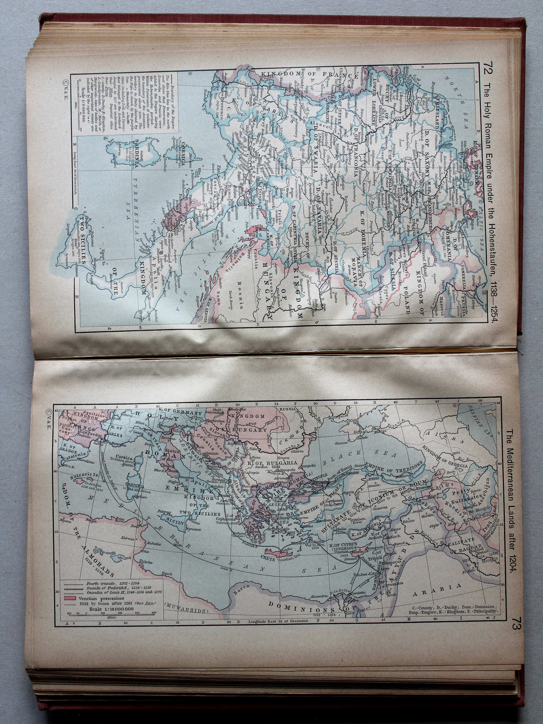
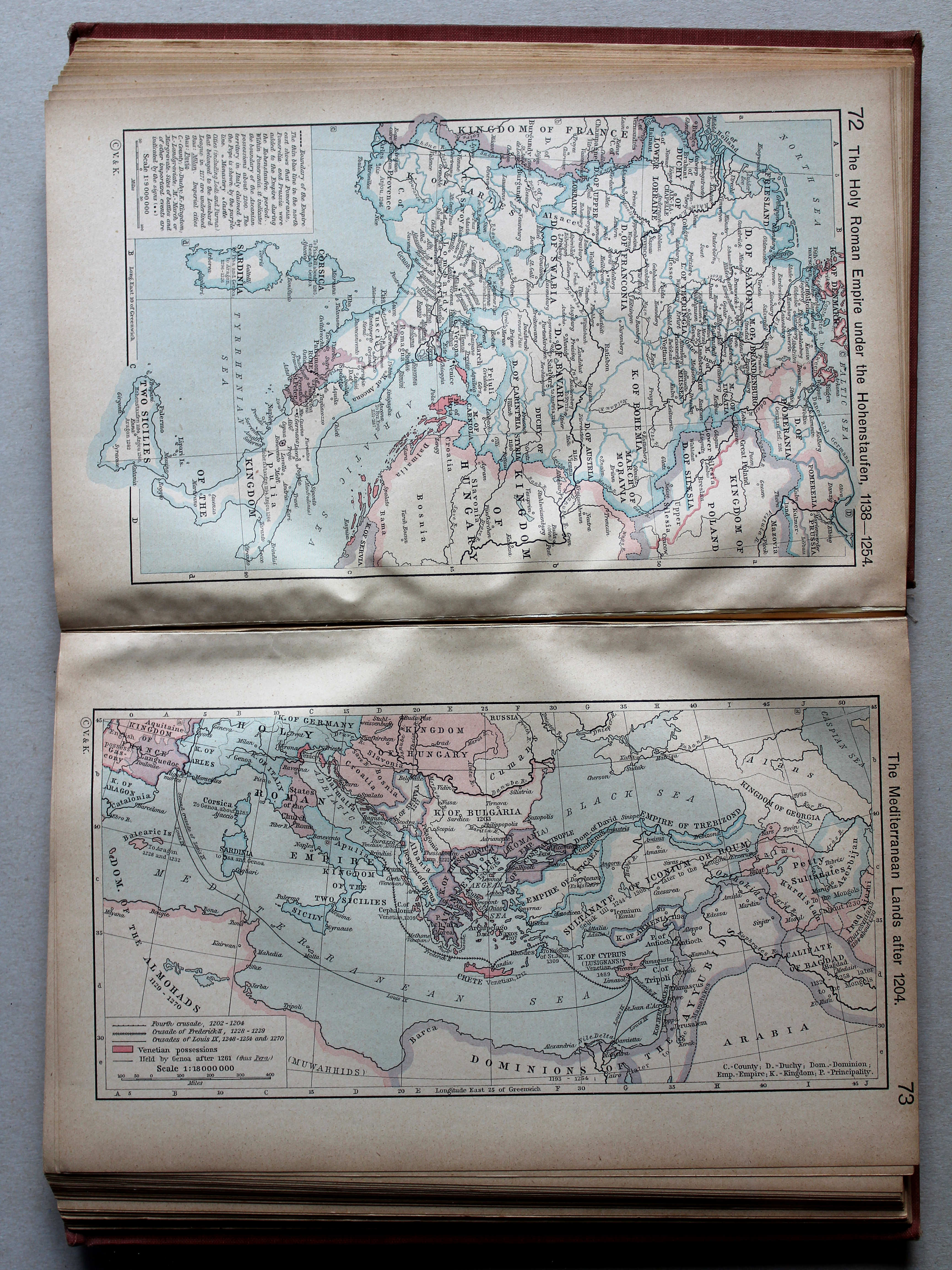
72. The Holy Roman Empire under the Hohenstaufen, 1138-1254 XL
Het Heilige Roomse Rijk onder de Hohenstaufen
 Shepherd, Historical Atlas, 1927
73. The Mediterranean Lands after 1204 XL
Het Middellandse Zeegebied na 1204
 Shepherd, Historical Atlas, 1927
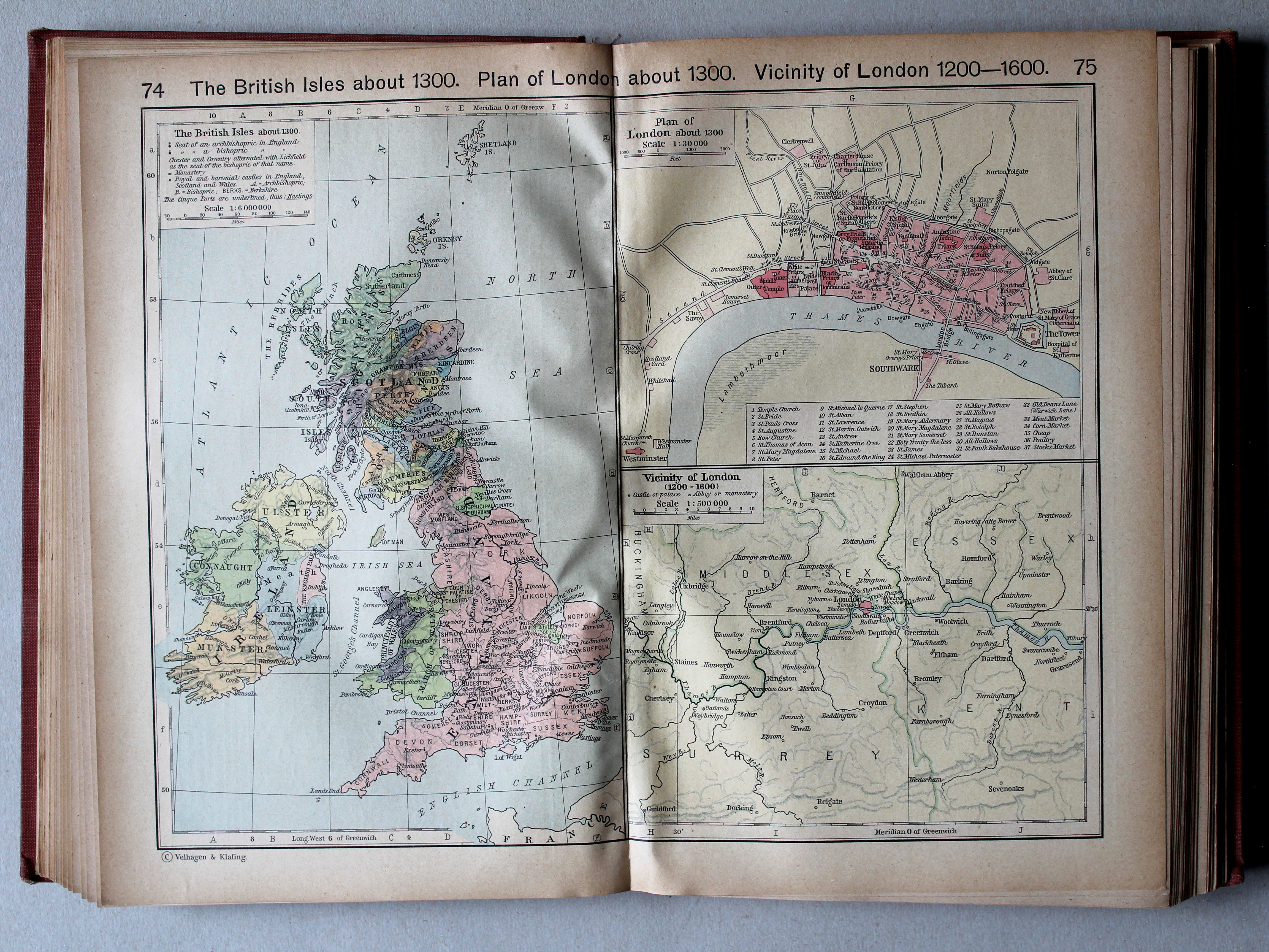
74.75. The British Isles about 1300. Plan of London about 1300. Vicinity of London, 1200-1600 XL
Britse Eilanden, ca. 1300. Londen, ca. 1300. Omgeving van Londen, 1200-1600

 Shepherd, Historical Atlas, 1927
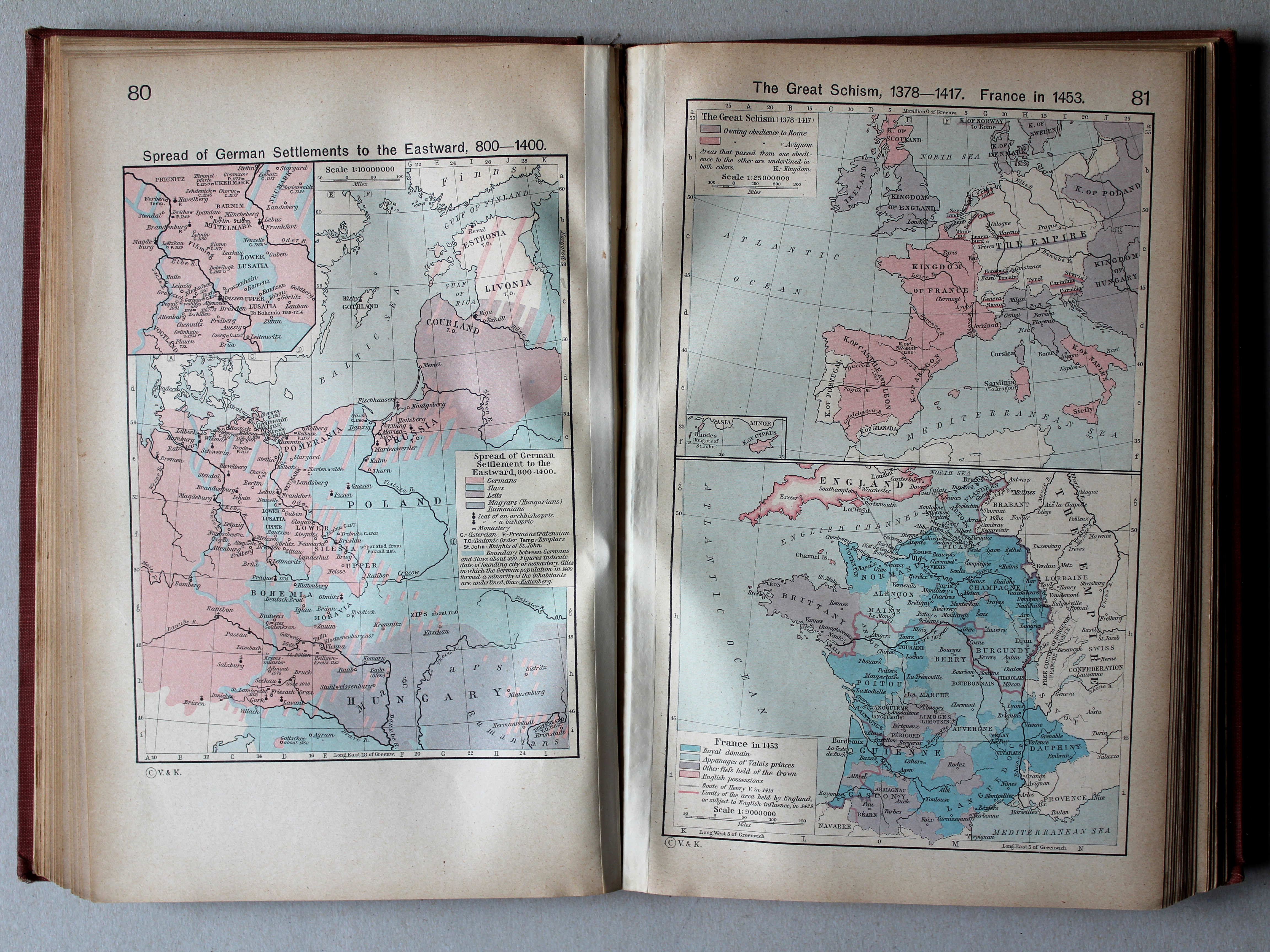
80. Spread of German Settlements to the Eastward, 800-1400 XL
Uitbreiding van Duitse vestiging naar het oosten, 800-1400
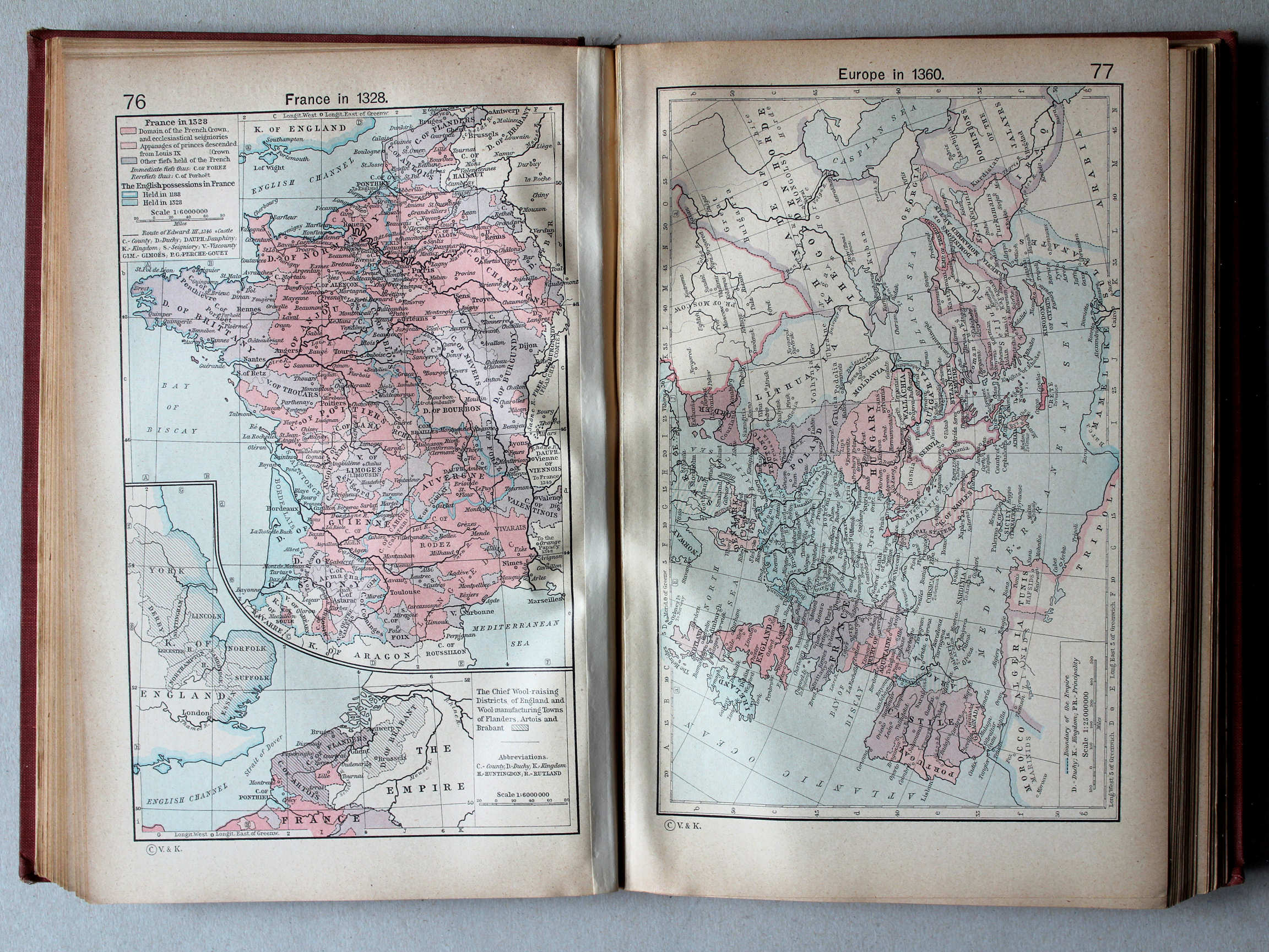
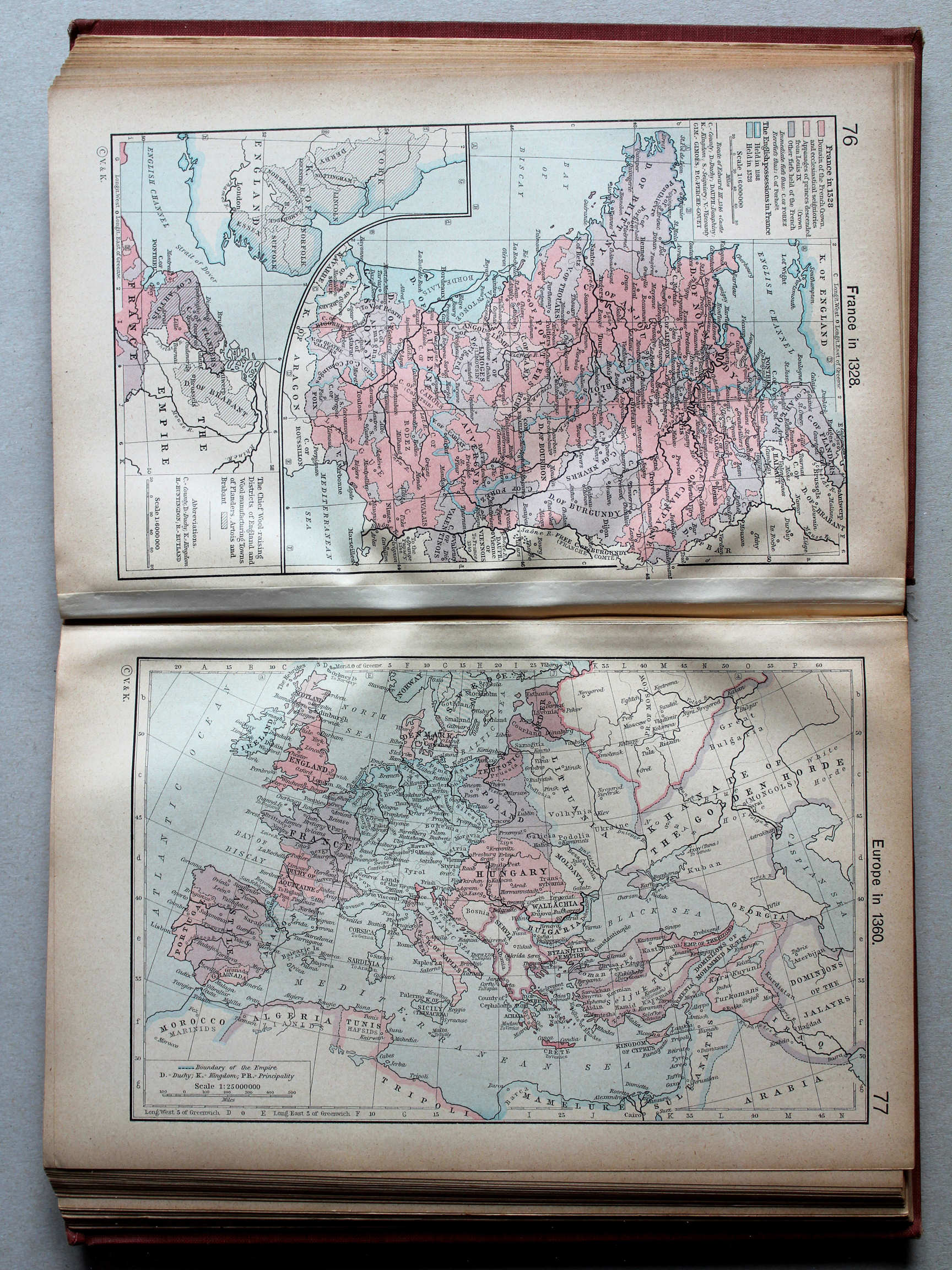
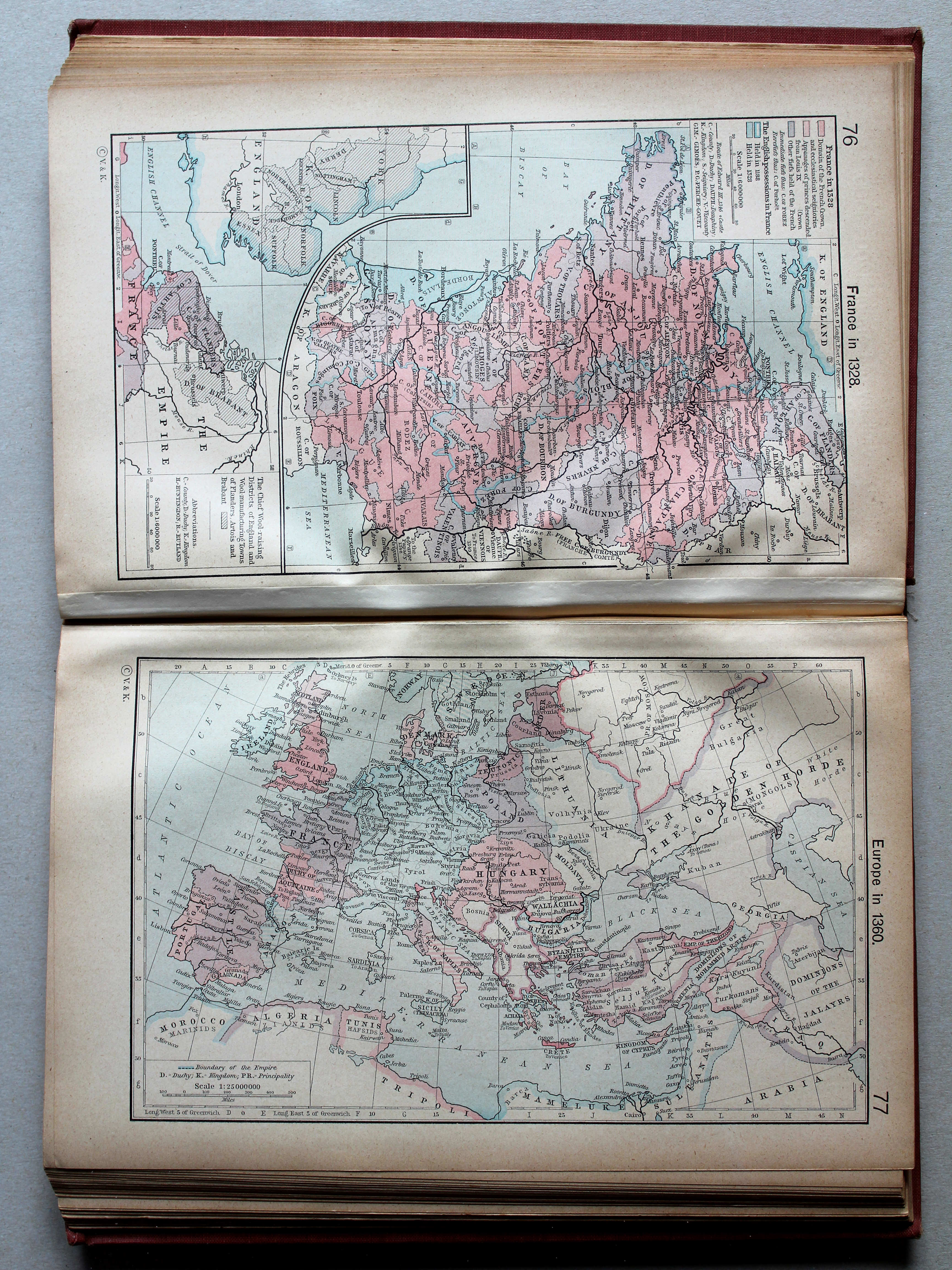
81. The Great Schism, 1378-1417. France in 1453 XL
Het Westers Schisma, 1378-1417. Frankrijk in 1453

 Shepherd, Historical Atlas, 1927
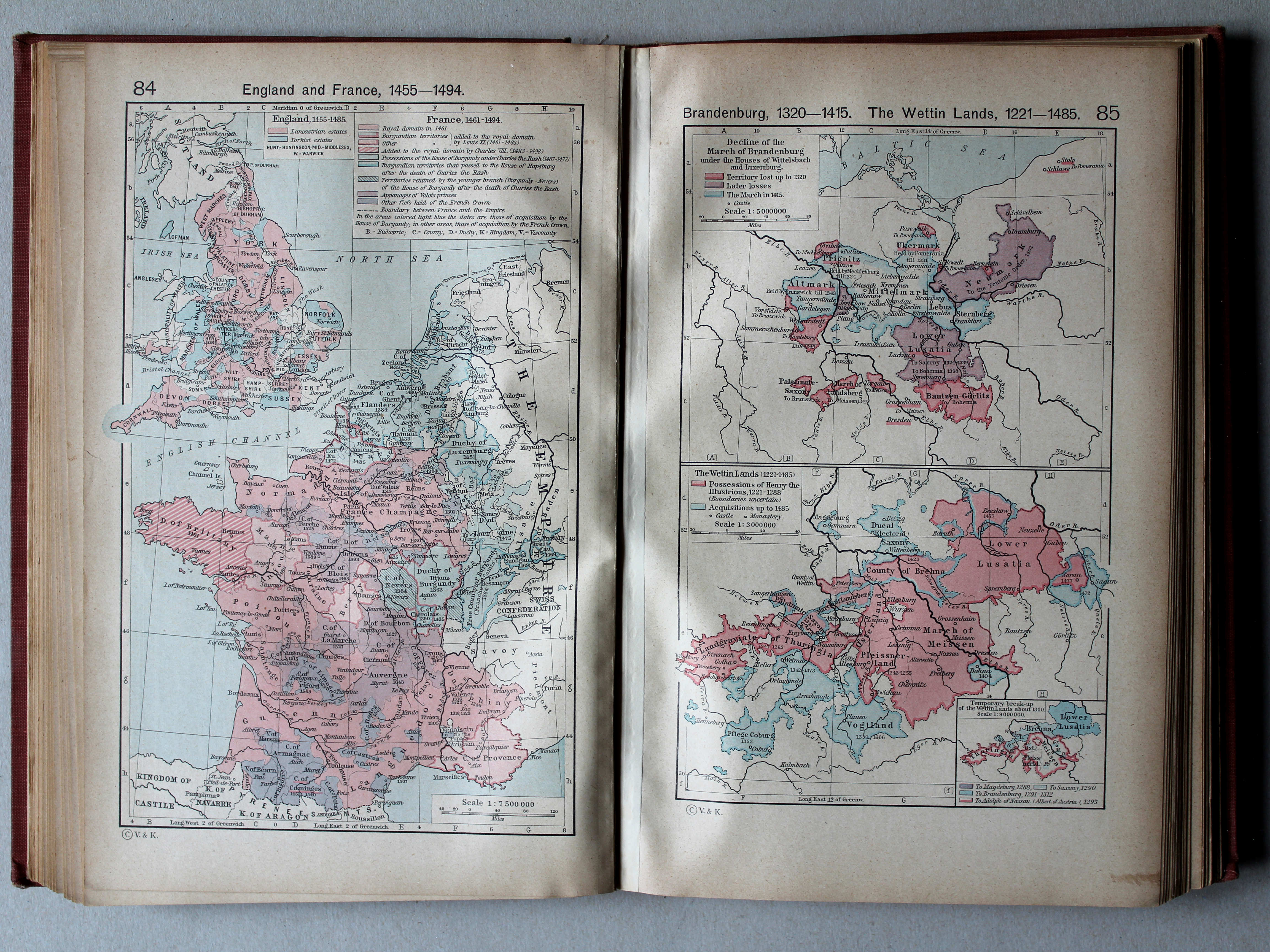
84. England and France, 1455-1494 XL
Engeland en Frankrijk, 1455-1494
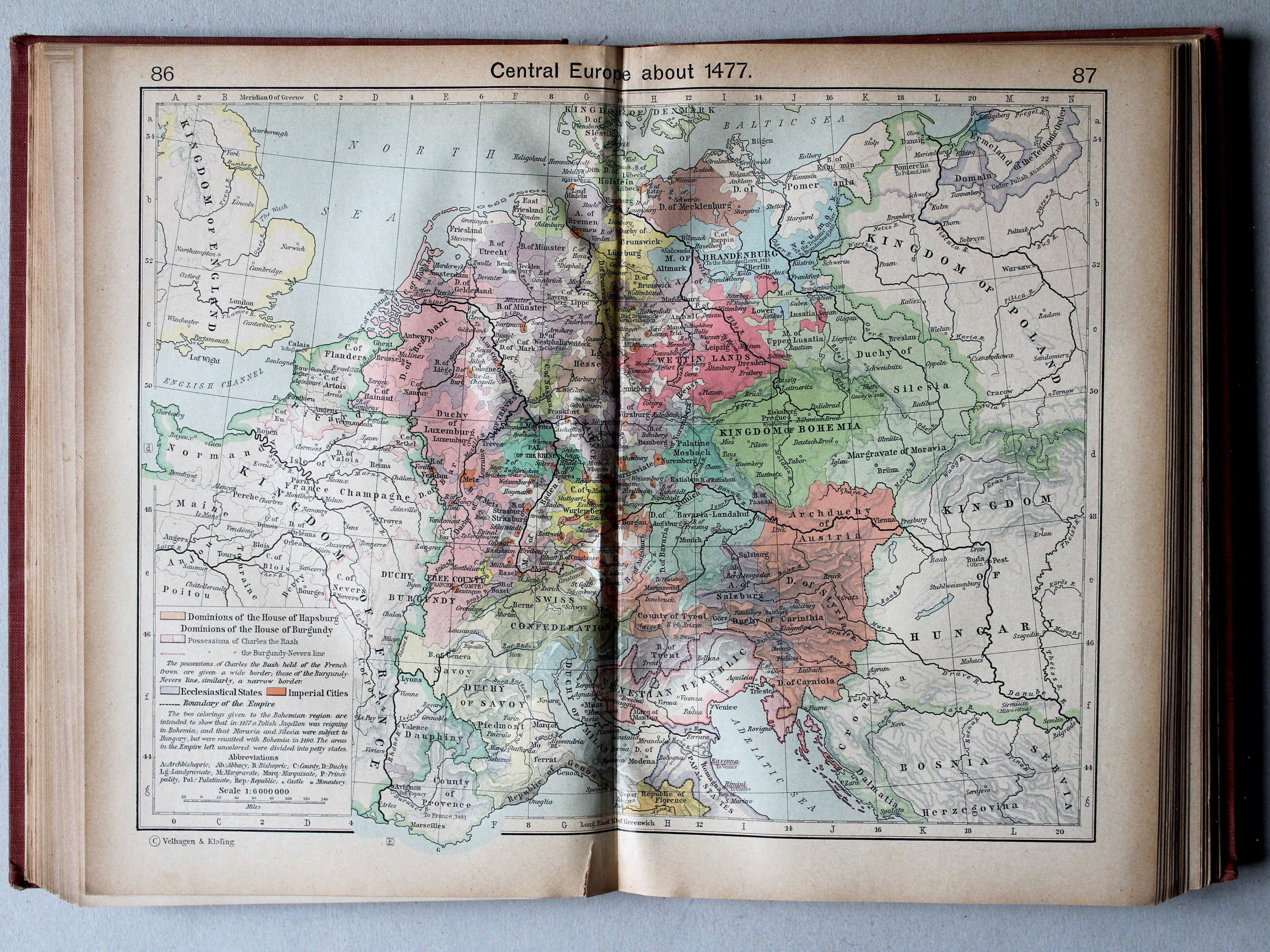
85. Brandenburg 1320-1515. The Wettin Lands, 1221-1485 XL
Brandenburg 1320-1515. Het gebied van het Huis Wettin, 1221-1485
 Shepherd, Historical Atlas, 1927
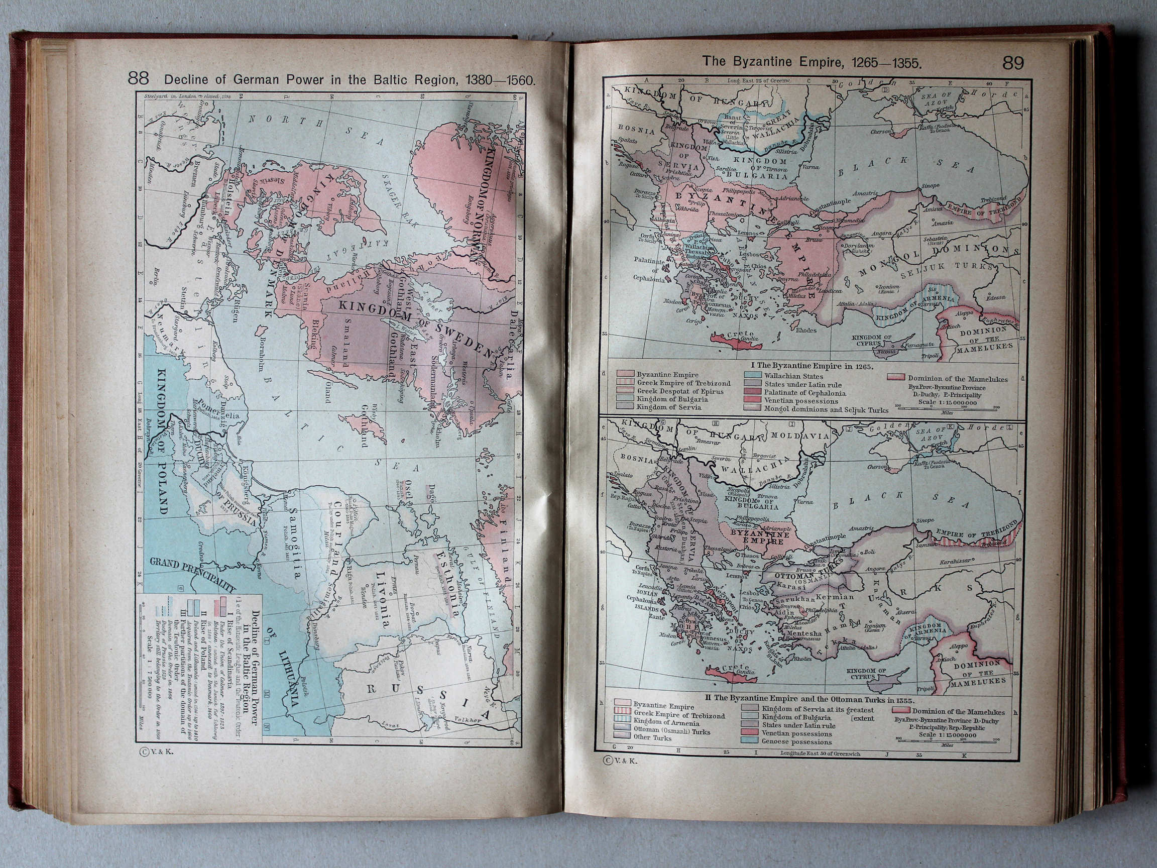
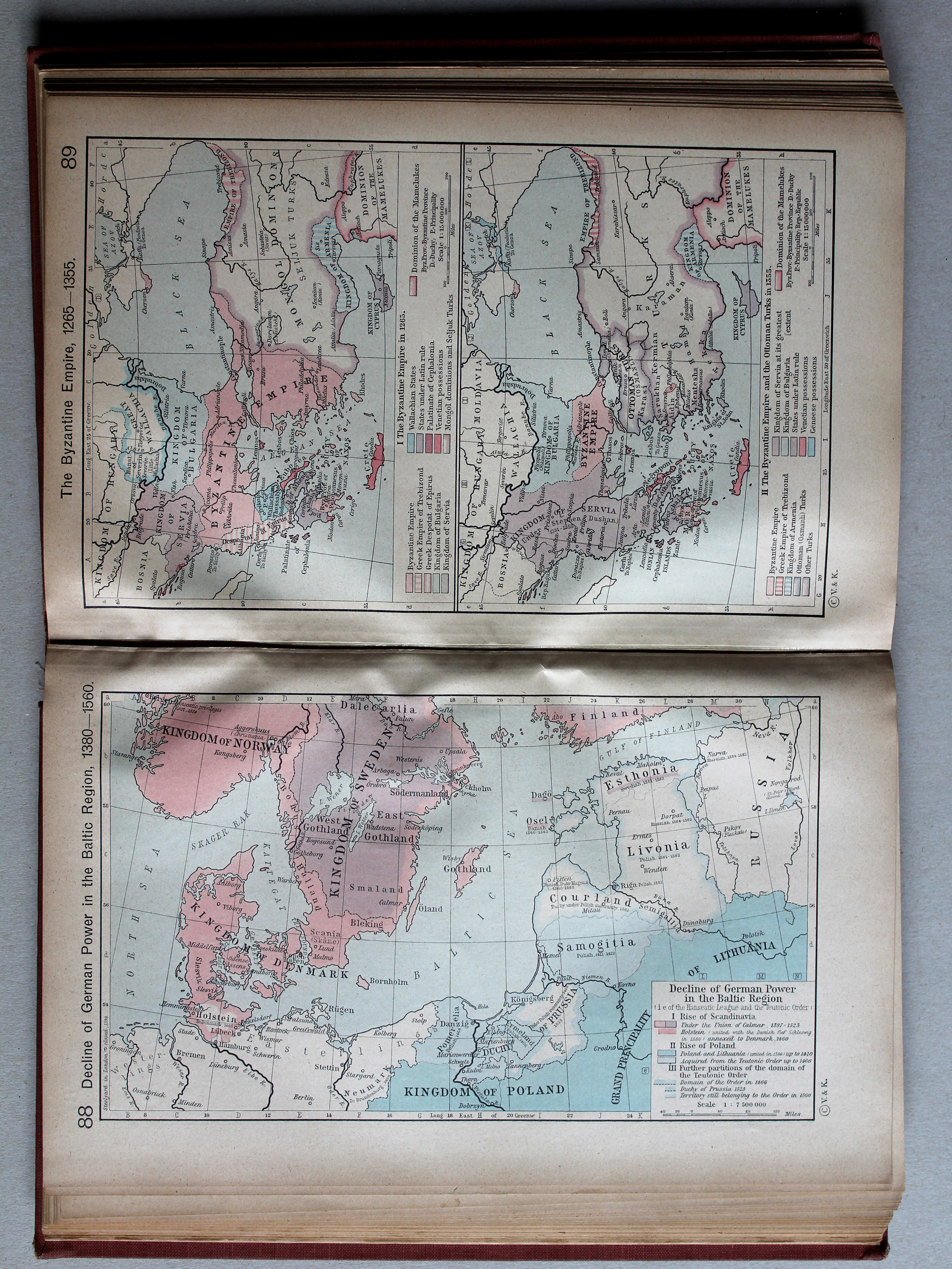
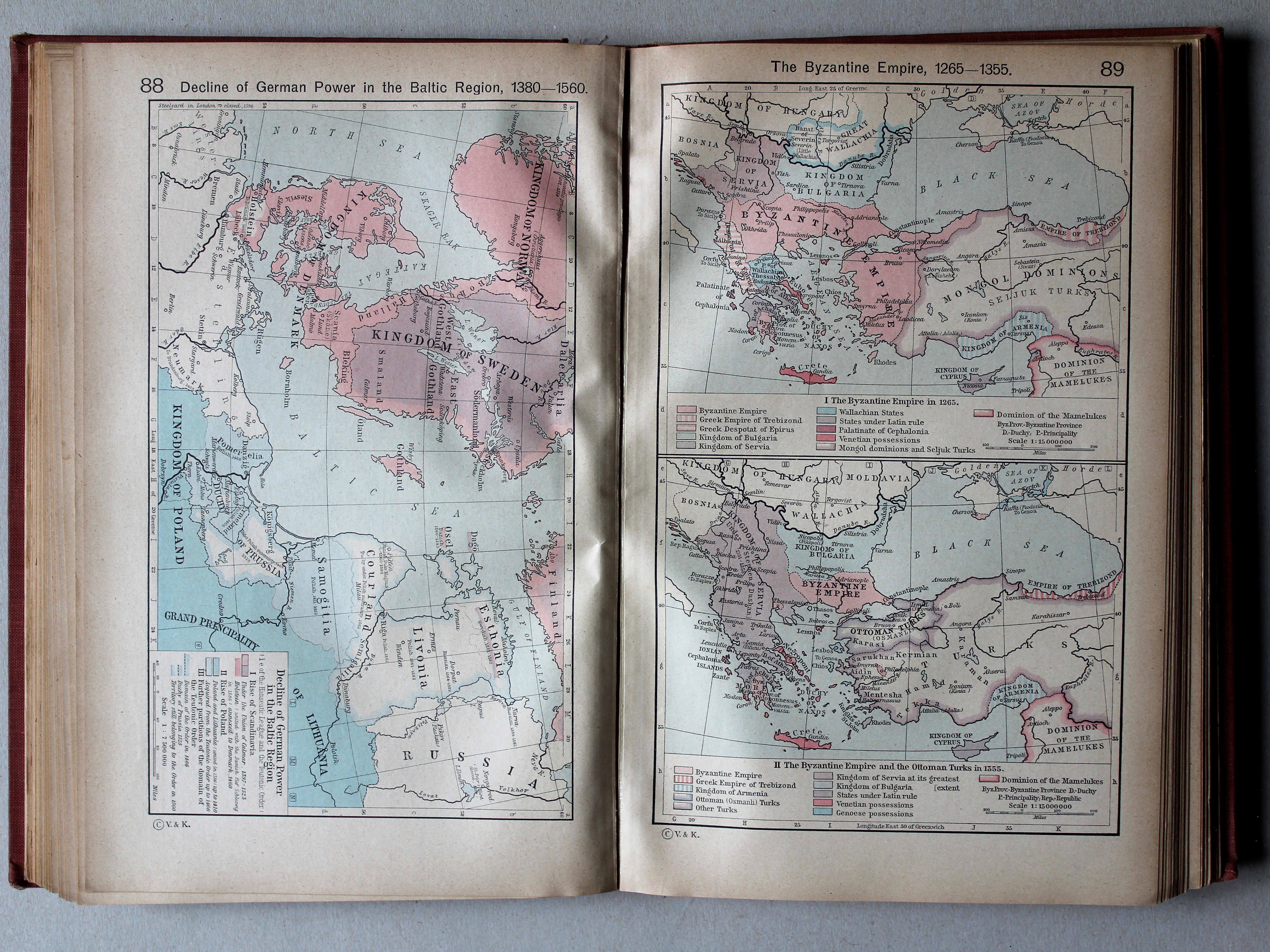
88. Decline of German Power in the Baltic Region, 1380-1560 XL
Verval van de Duitse macht in het Oostzeegebied, 1380-1560
 Shepherd, Historical Atlas, 1927
89. The Byzantine Empire, 1265-1355 XL
Het Byzantijnse Rijk, 1265-1355
 Shepherd, Historical Atlas, 1927
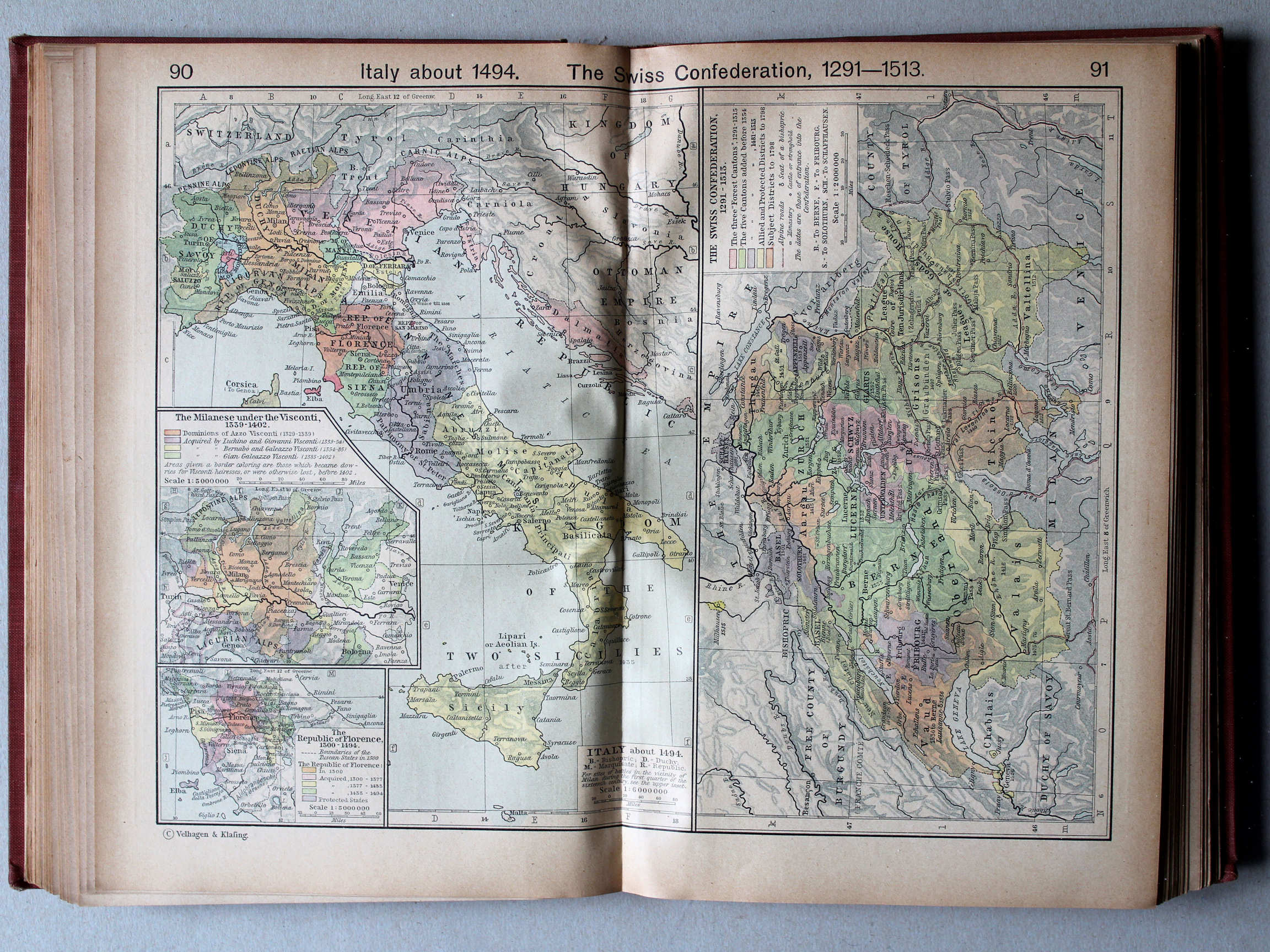
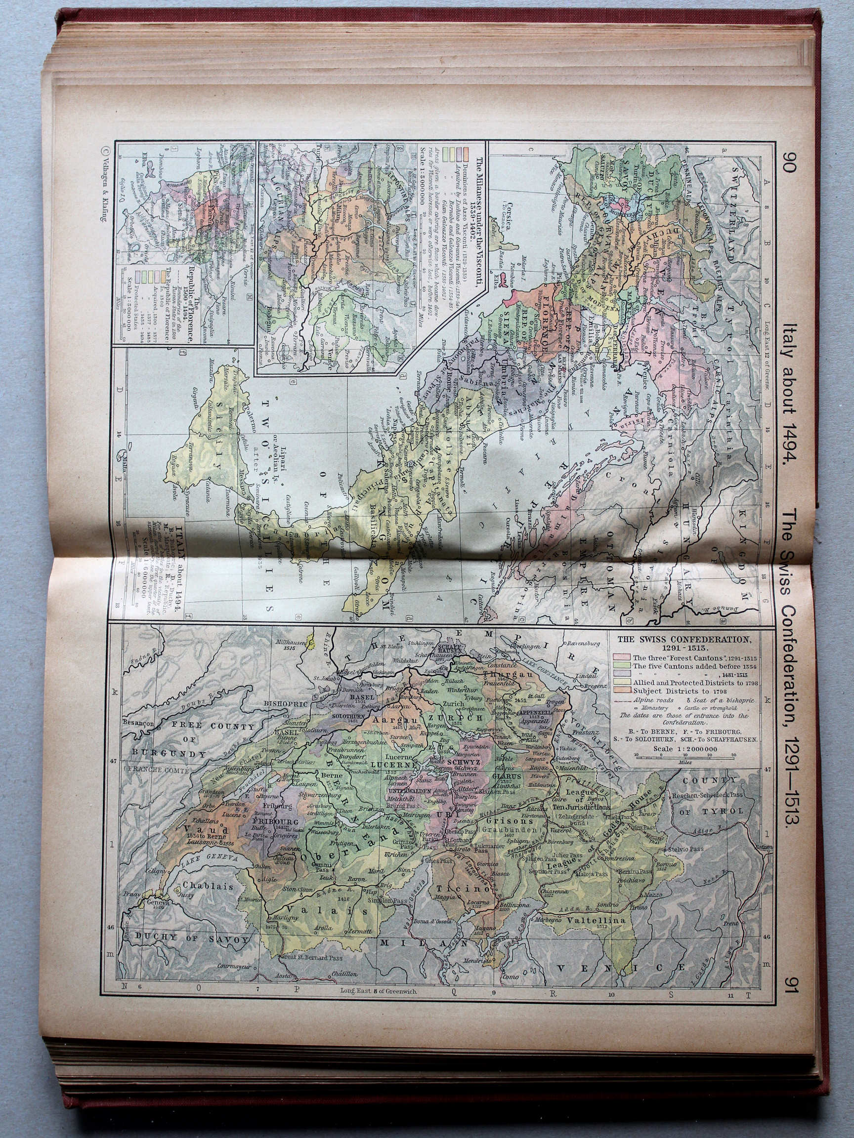
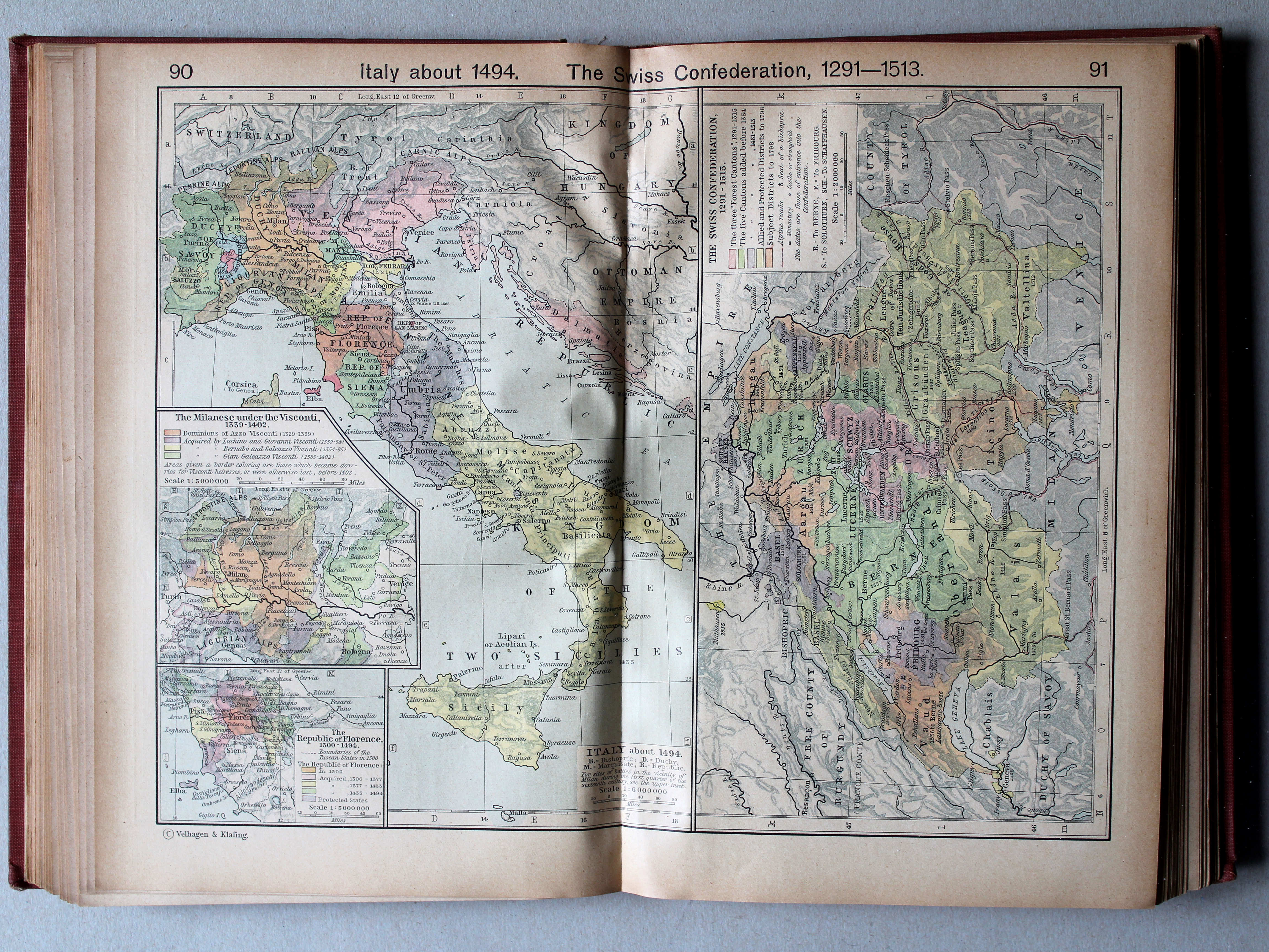
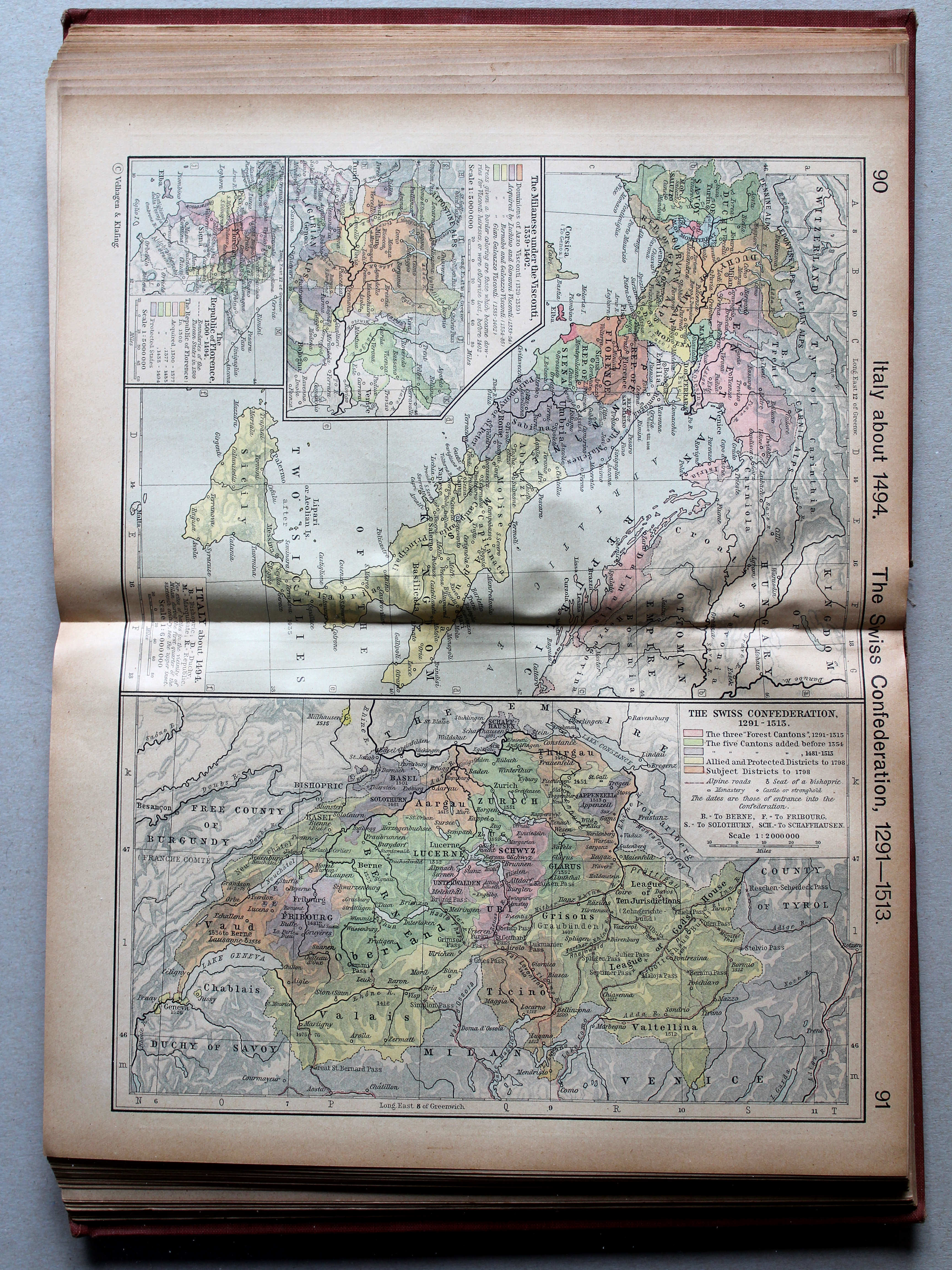
91. The Swiss Confederation, 1291-1513 XL
Zwitsers Eedgenootschap, 1291-1513
 Shepherd, Historical Atlas, 1927
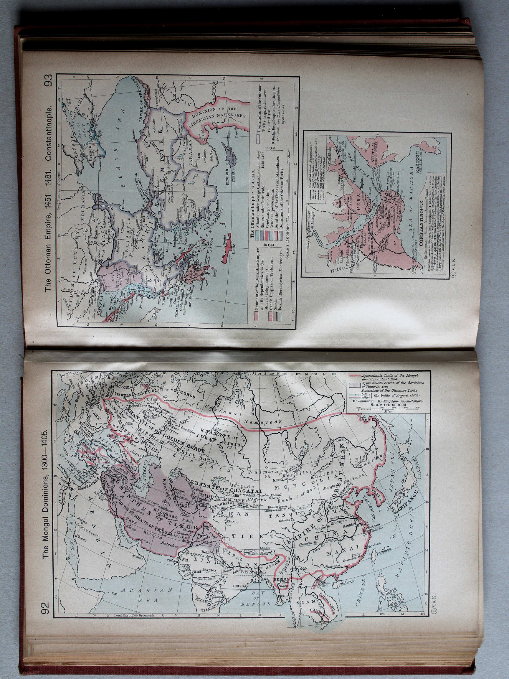
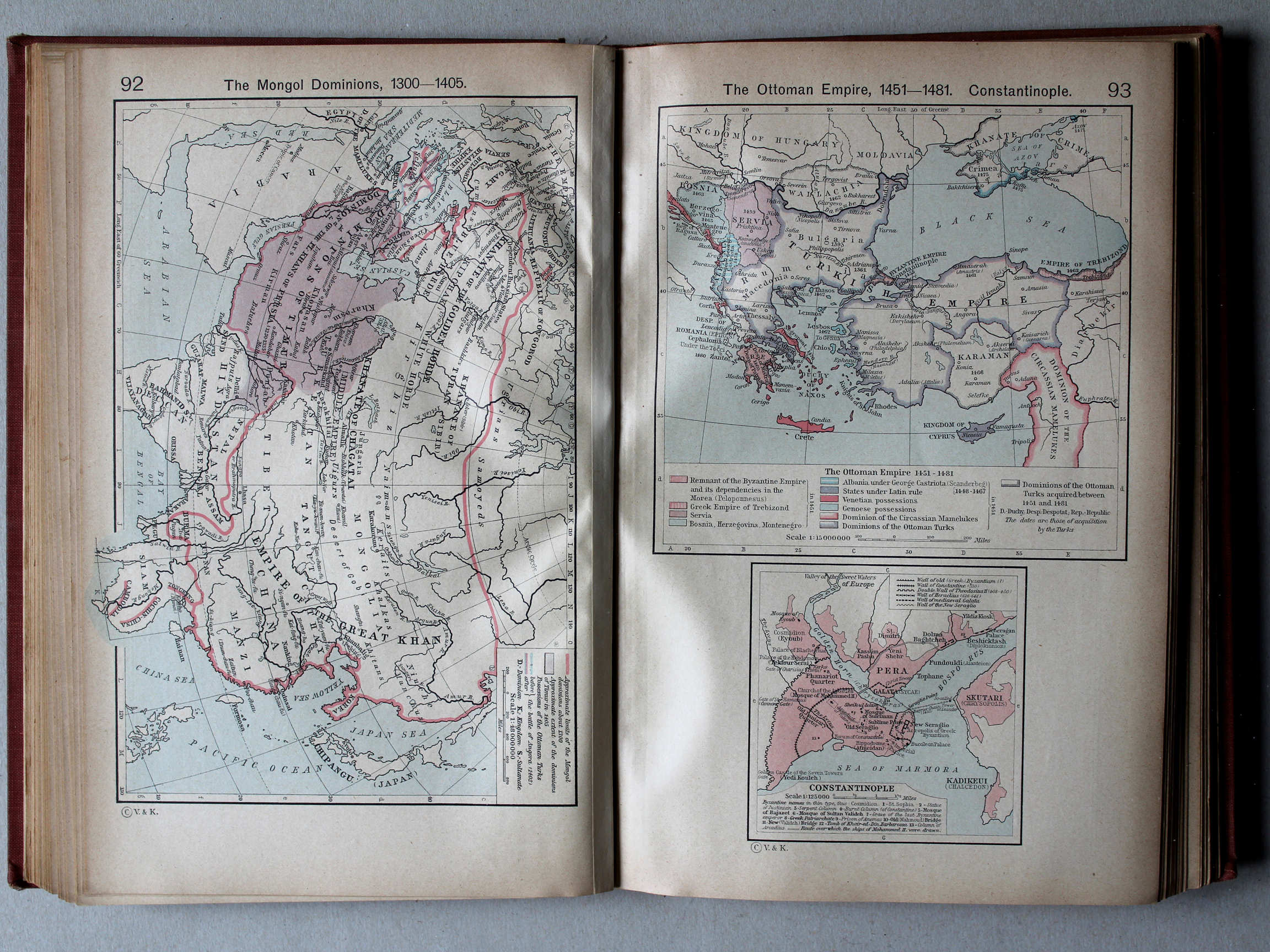
93. The Ottoman Empire, 1451-1481. Constantinople XL
Het Ottomaanse Rijk, 1451-1481. Constantinopel
 Shepherd, Historical Atlas, 1927
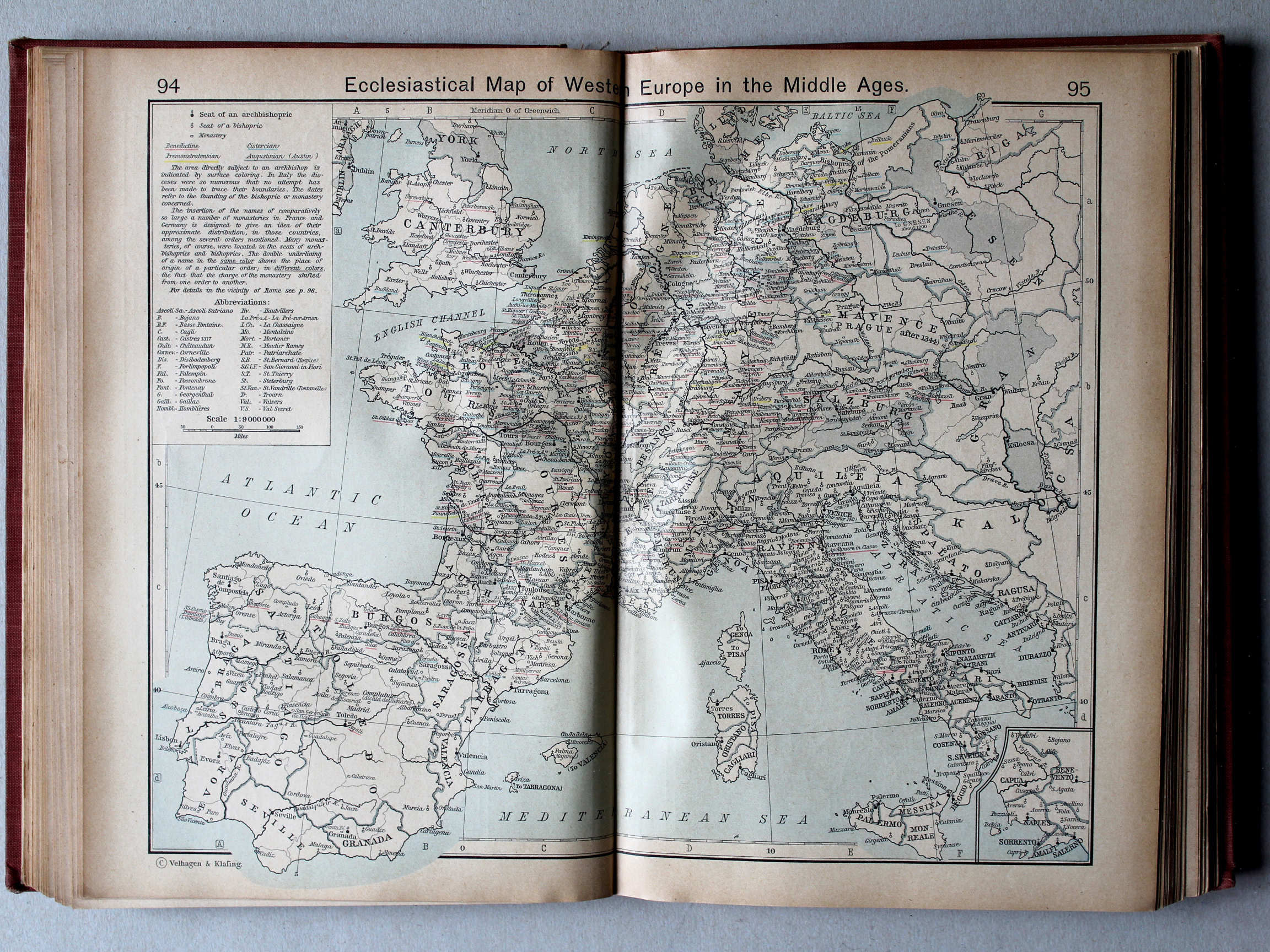
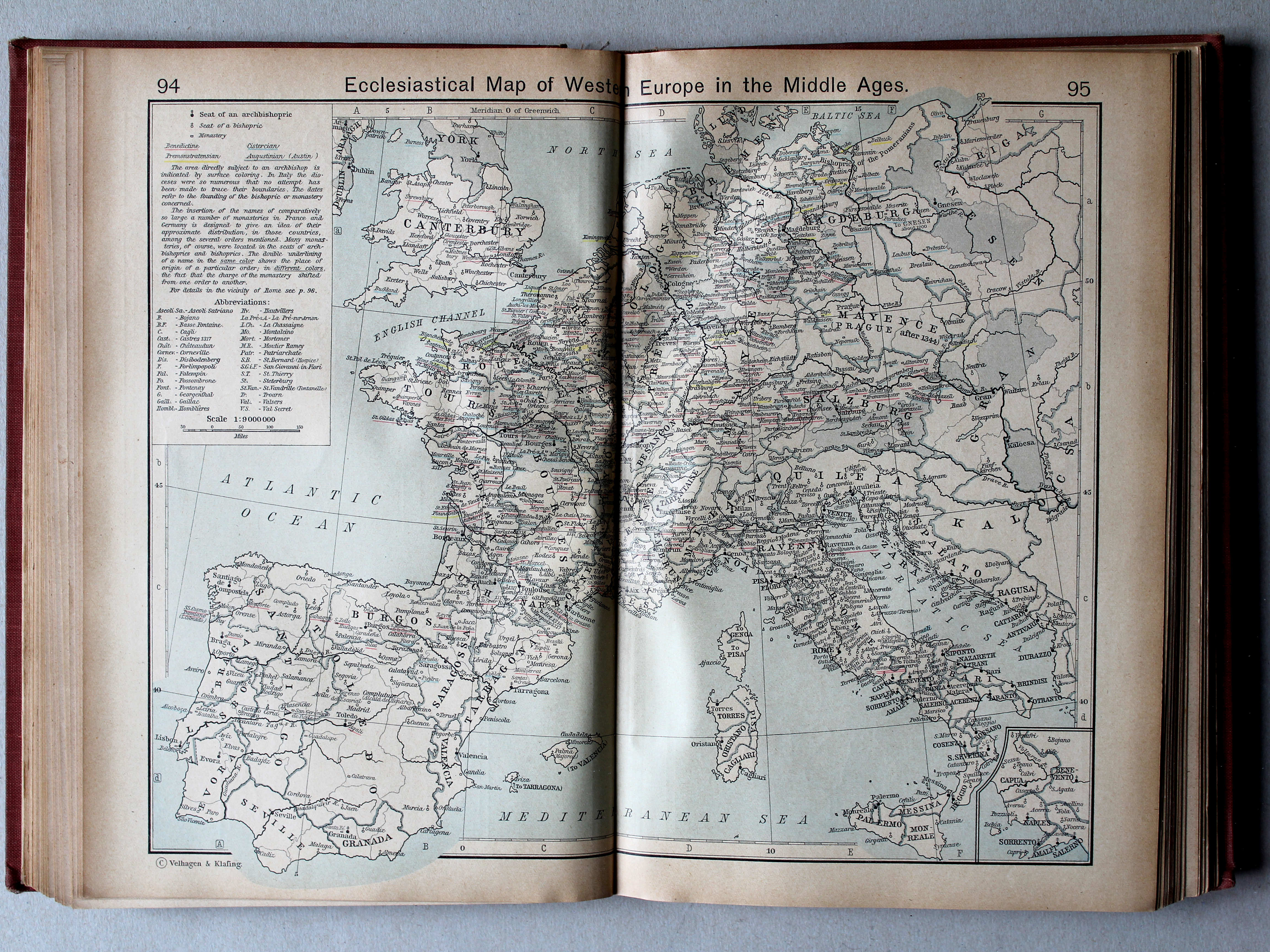
94.95. Ecclesiastical Map of Western Europe in the Middle Ages XL
Bisdommen in West-Europa in de Middeleeuwen
 Shepherd, Historical Atlas, 1927
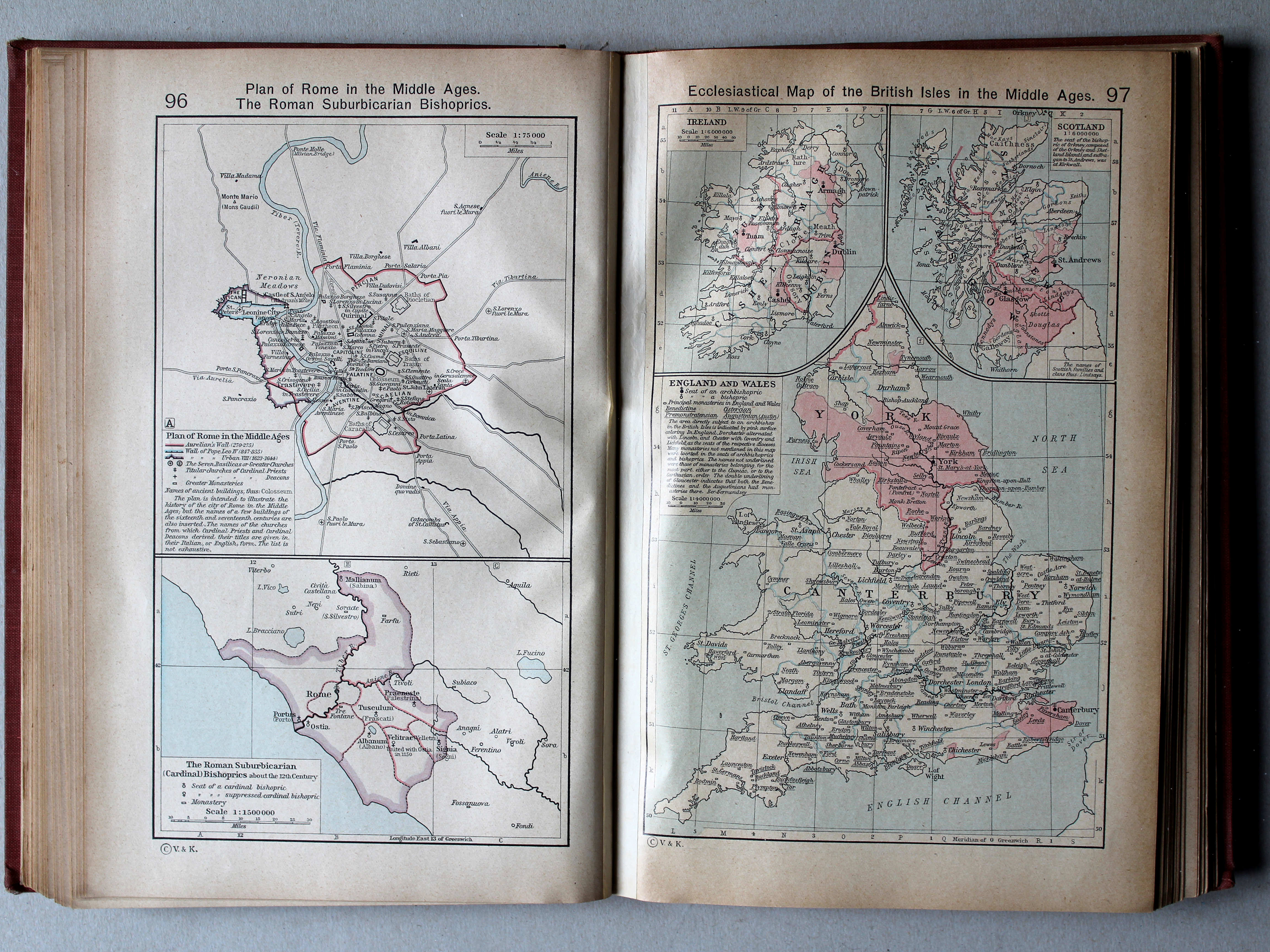
96. Plan of Rome in the Middle Ages. The Roman Suburbicarian Bishoprics XL
Rome in de Middeleeuwen. De suburbicaire bisdommen bij Rome
97. Ecclesiastical Map of the British Isles in the Middle Ages XL
Bisdommen op de Briste Eilanden in de Middeleeuwen
 Shepherd, Historical Atlas, 1927
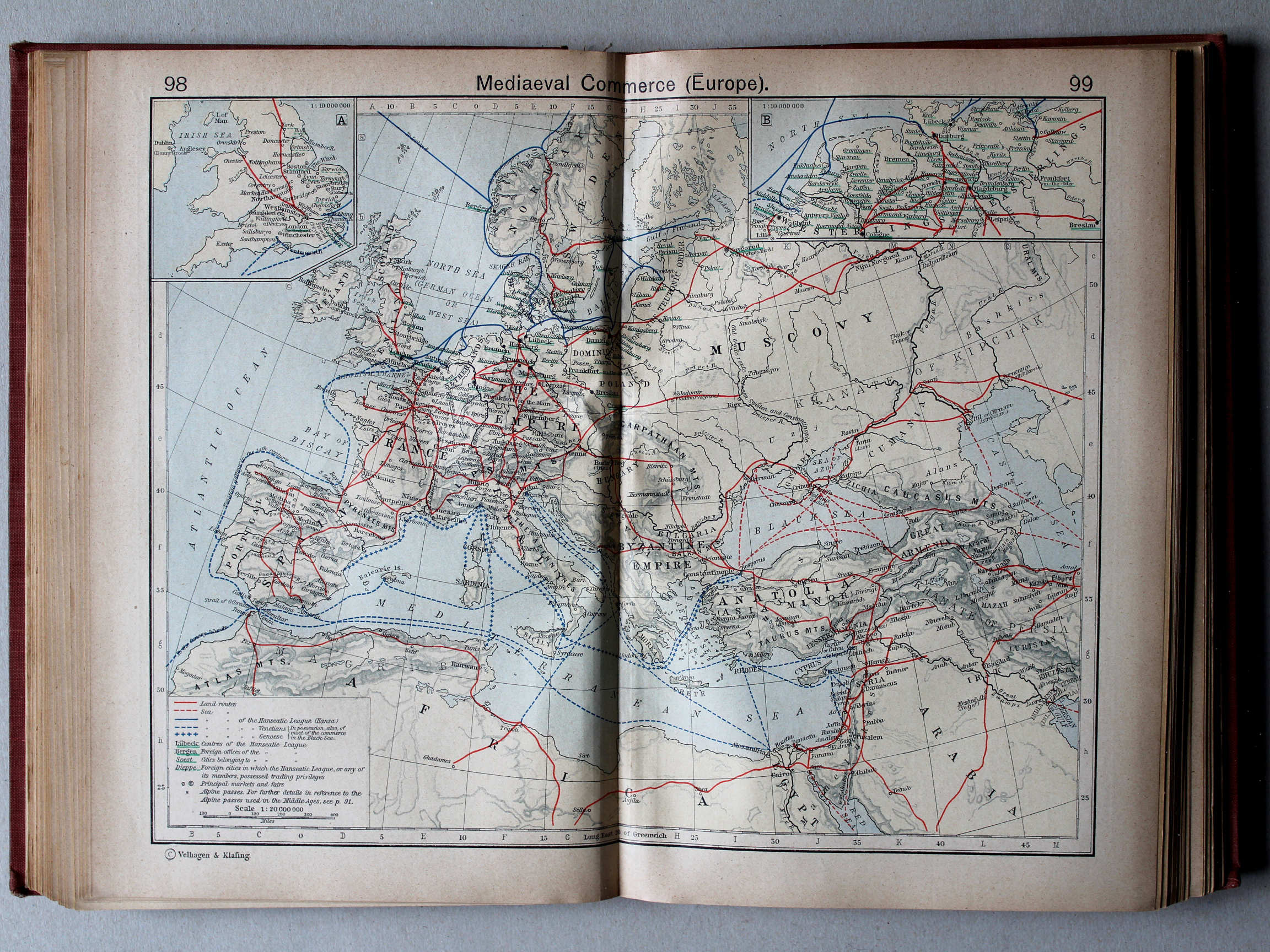
98.99. Mediaeval Commerce (Europe) XL
Handelsroutes in de Middeleeuwen (Europa)
 Shepherd, Historical Atlas, 1927
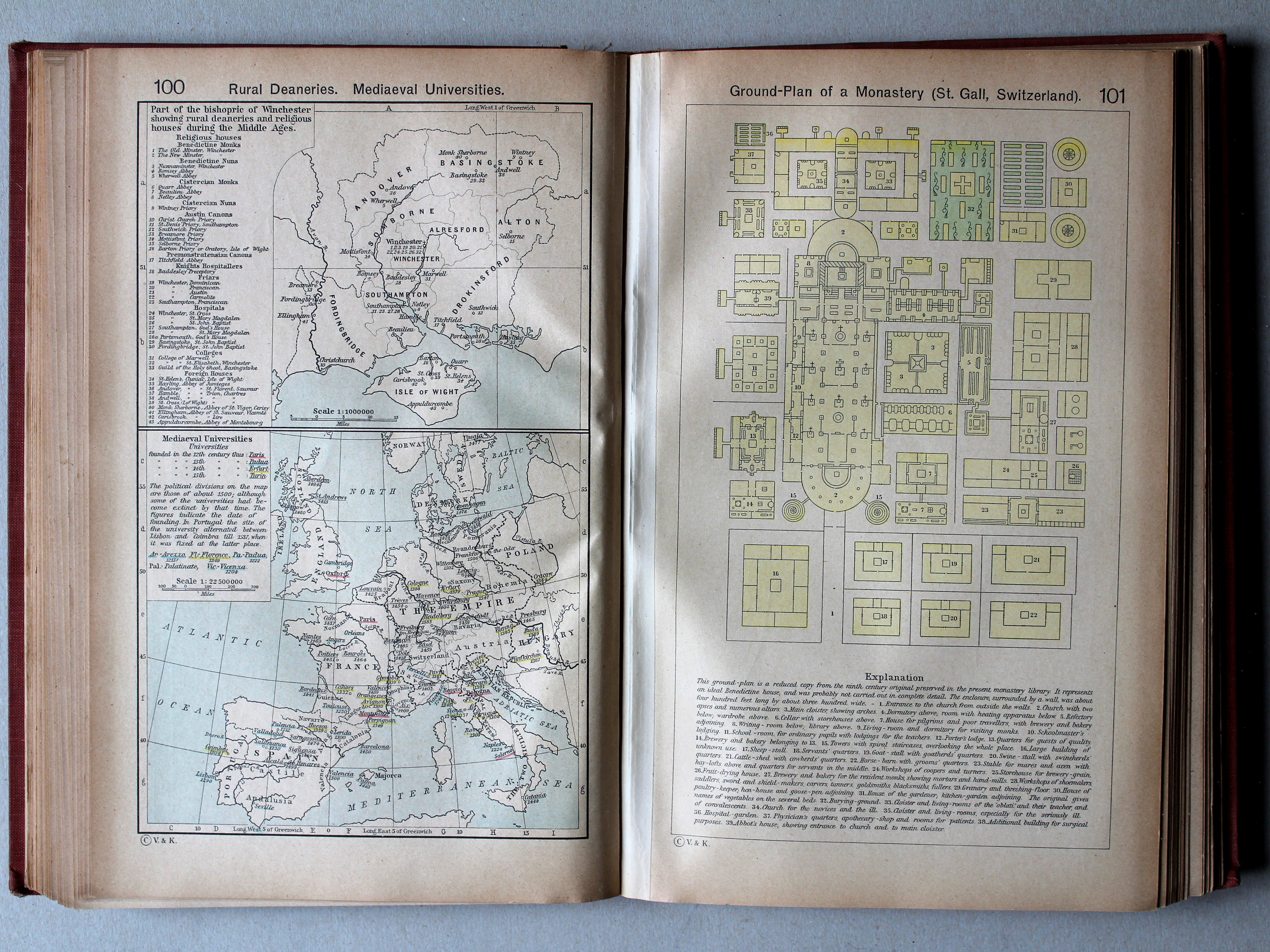
100. Rural Deaneries. Mediaeval Universities XL
Landelijke decanaten. Universiteiten in de Middeleeuwen
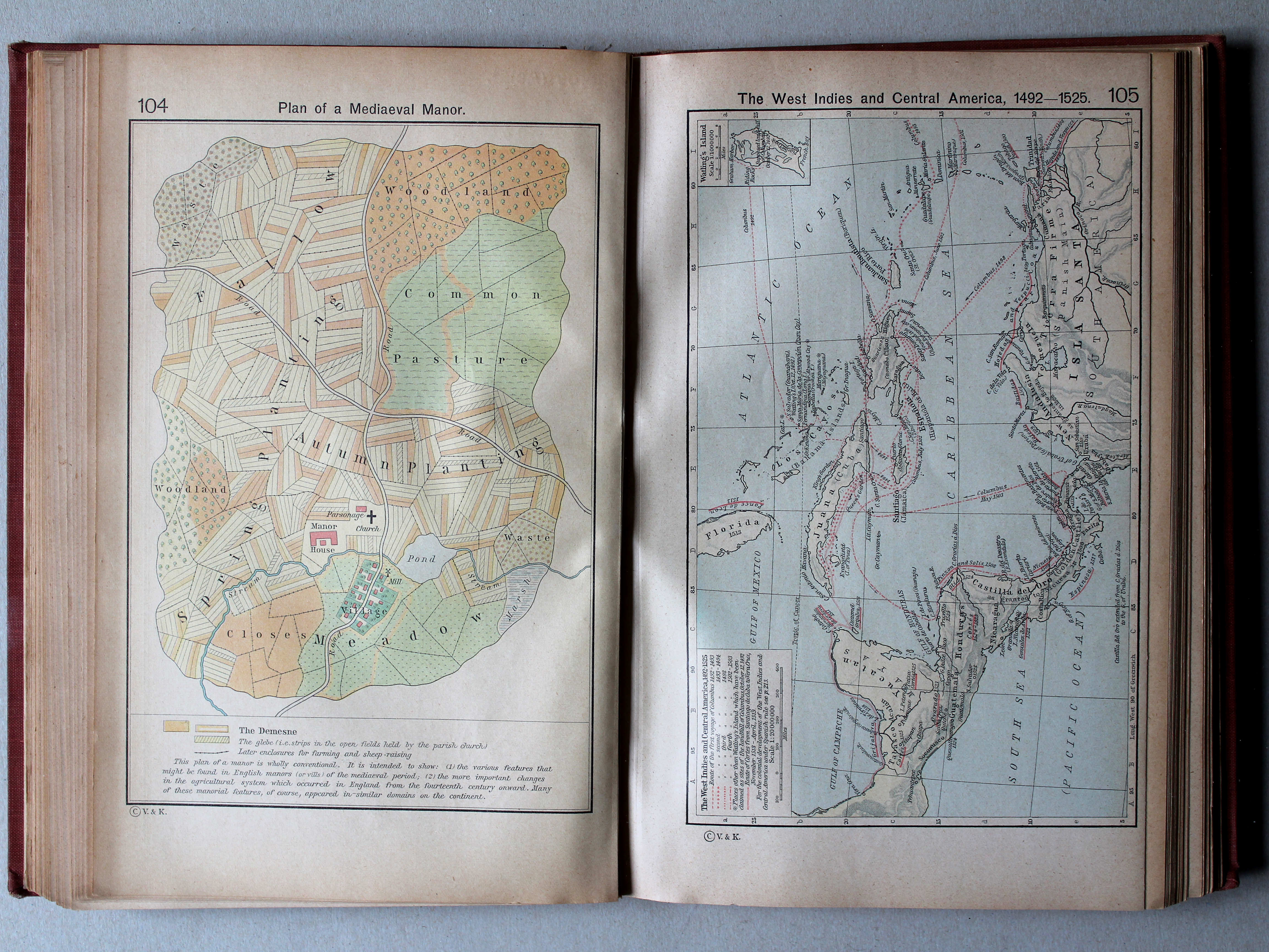
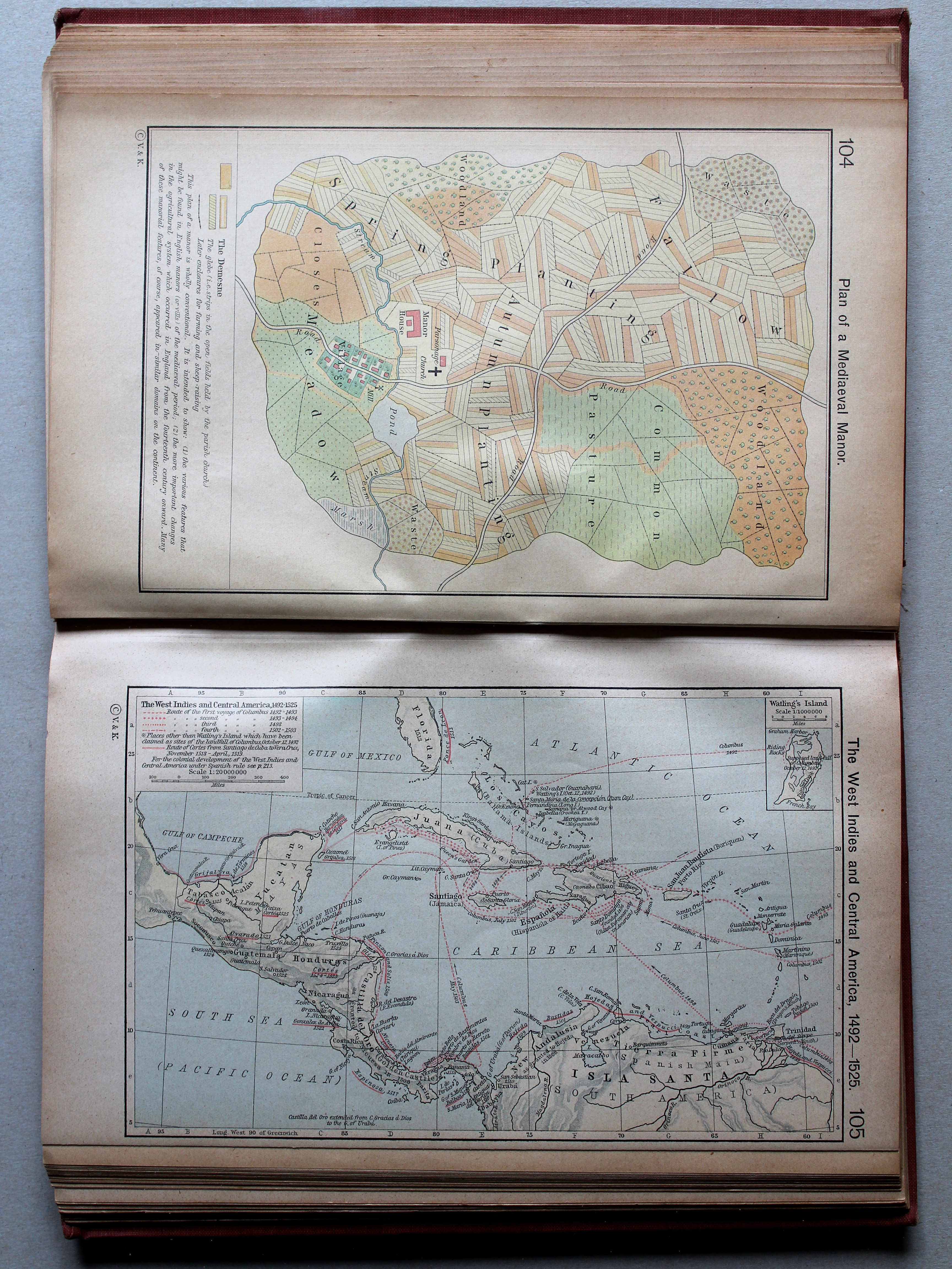
101. Ground-Plan of a Monastery (St. Gall, Switzerland) XL
Plattegrond van een klooster (Sankt Gallen, Zwitserland)
 Shepherd, Historical Atlas, 1927
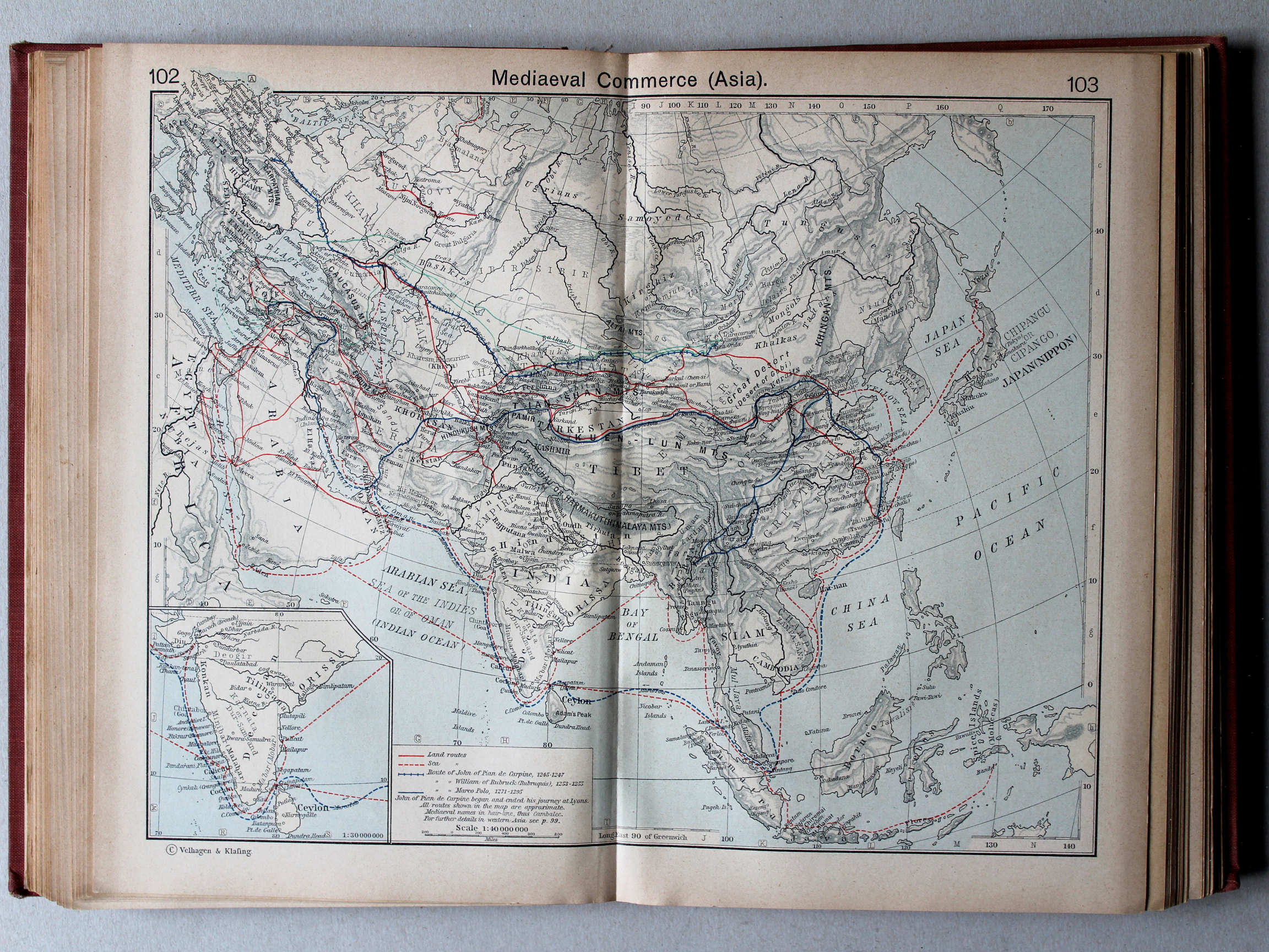
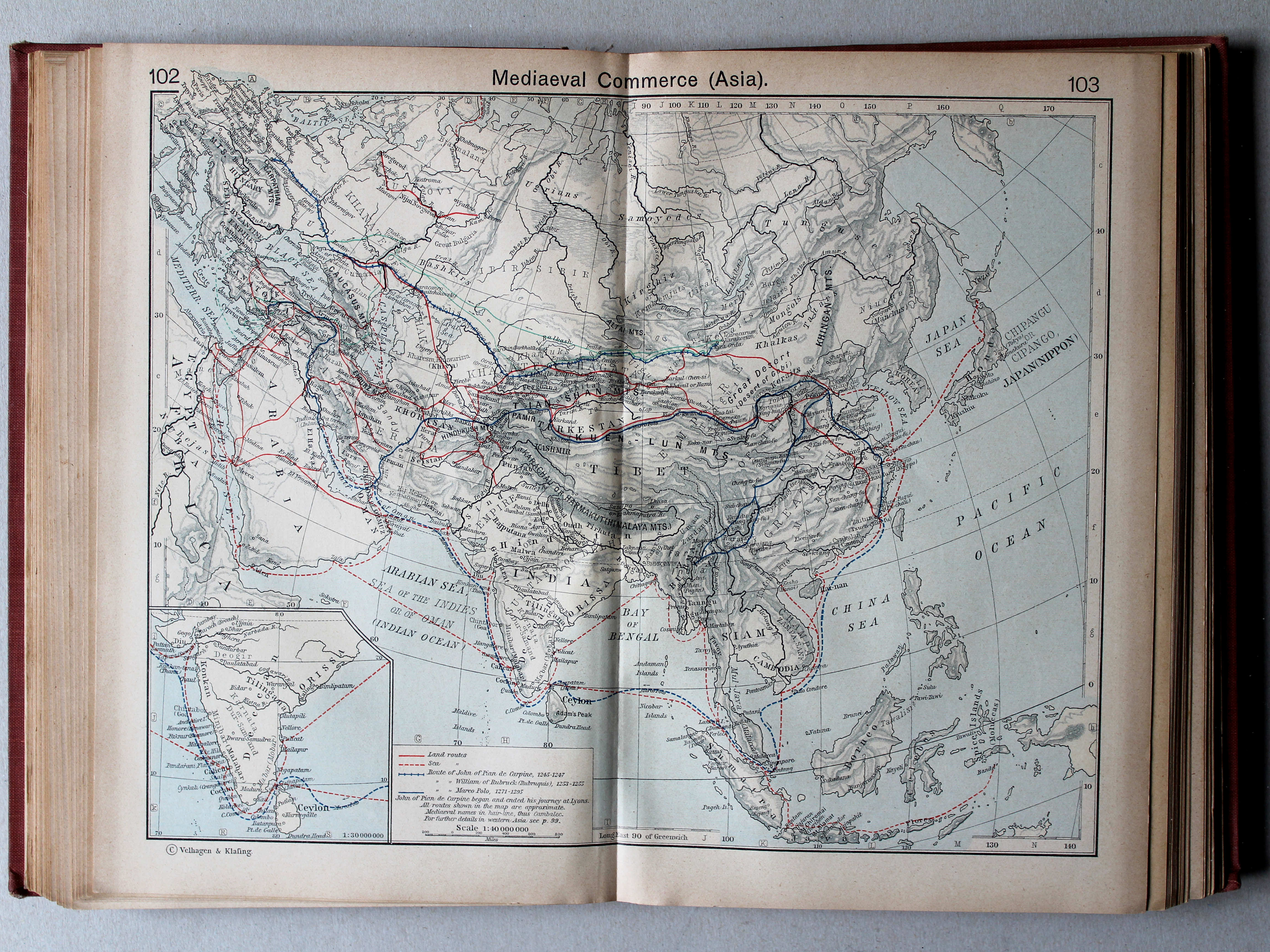
102.103. Mediaeval Commerce (Asia) XL
Handelsroutes in de Middeleeuwen (Azië)

 Shepherd, Historical Atlas, 1927
105. The West Indies and Central America, 1492-1525 XL
West-Indië en Midden-Amerika, 1492-1525
 Shepherd, Historical Atlas, 1927
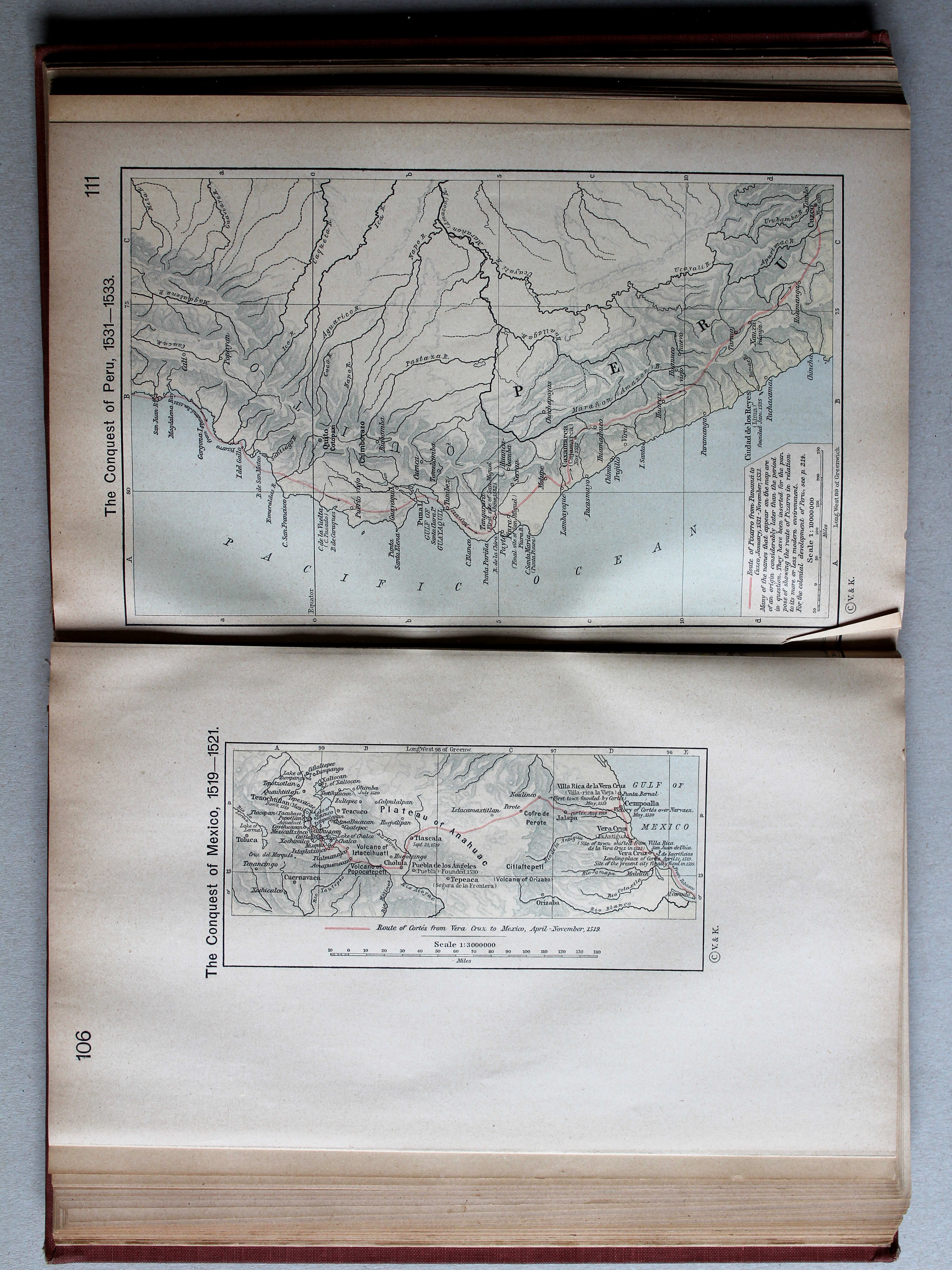
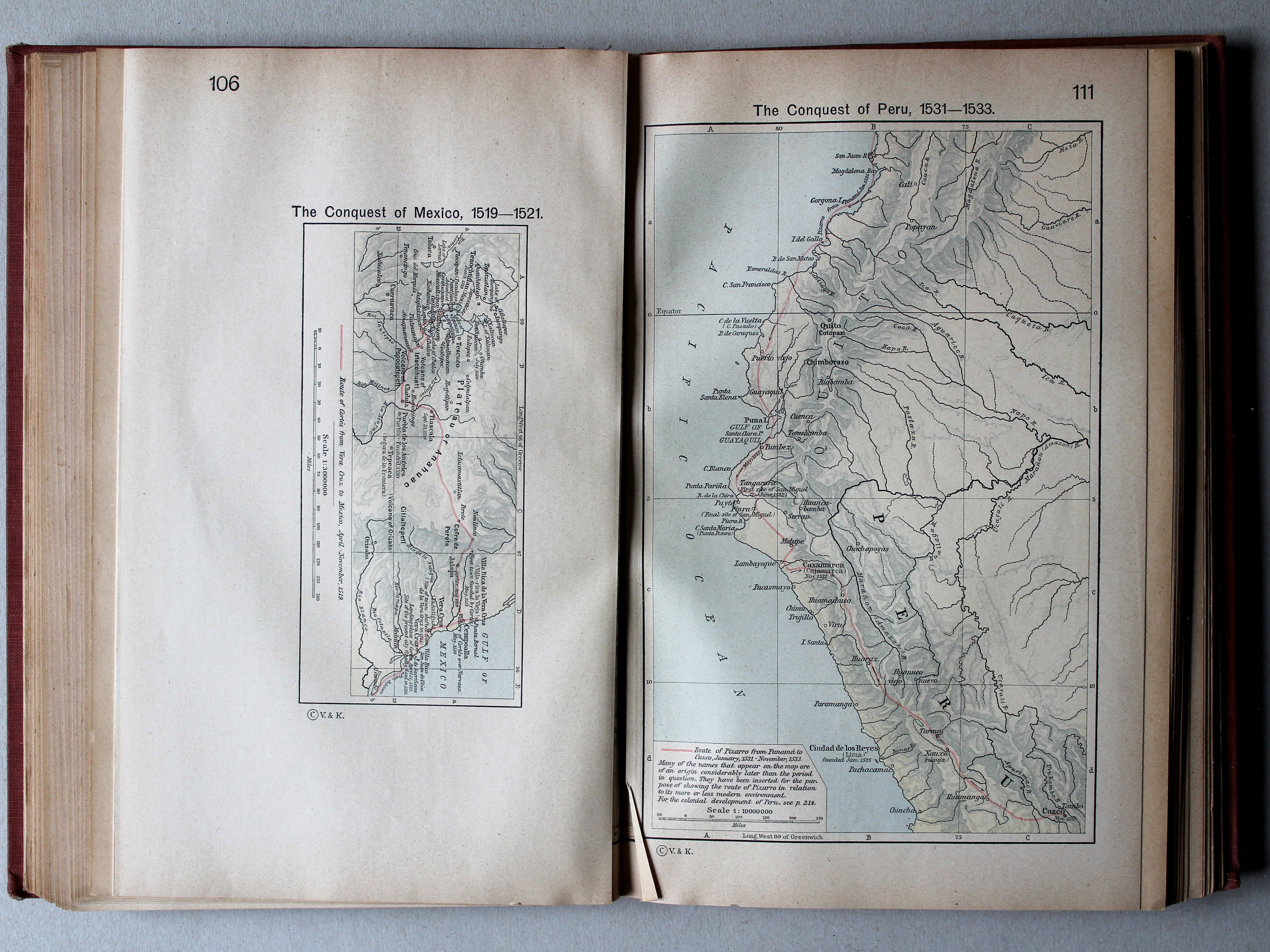
106. The Conquest of Mexico, 1519-1521 XL
Verovering van Mexico, 1519-1521
 Shepherd, Historical Atlas, 1927
111. The Conquest of Peru, 1531-1533 XL
Verovering van Peru, 1531-1533
 Shepherd, Historical Atlas, 1927
107-110. The Age of Discovery 1340-1600 XL
Het tijdperk van de grote ontdekkingen
 Shepherd, Historical Atlas, 1927
112. The Portuguese Colonial Dominions in India and the Malay Archipelago, 1498-1580 XL
De Portugese koloniën in Indië en de Indische Archipel, 1498-1580


 Shepherd, Historical Atlas, 1927
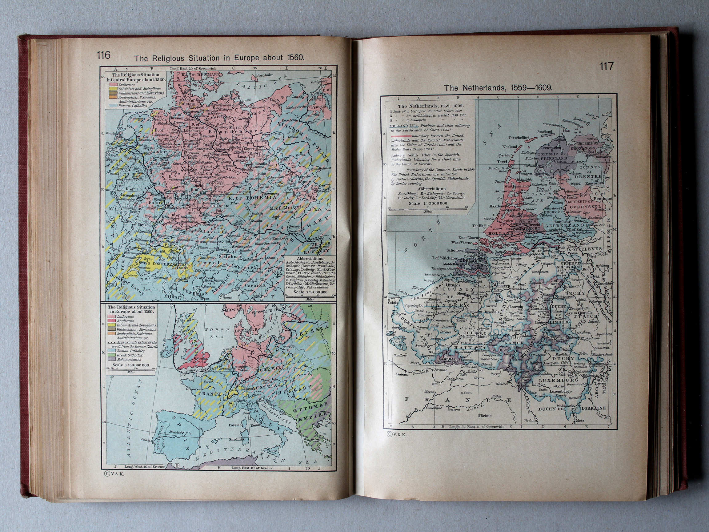
116. The Religious Situation in Europe about 1560 XL
Godsdiensten in Europa, ca. 1560
117. The Netherlands, 1559-1609 XL
De Nederlanden, 1559-1609
 Shepherd, Historical Atlas, 1927
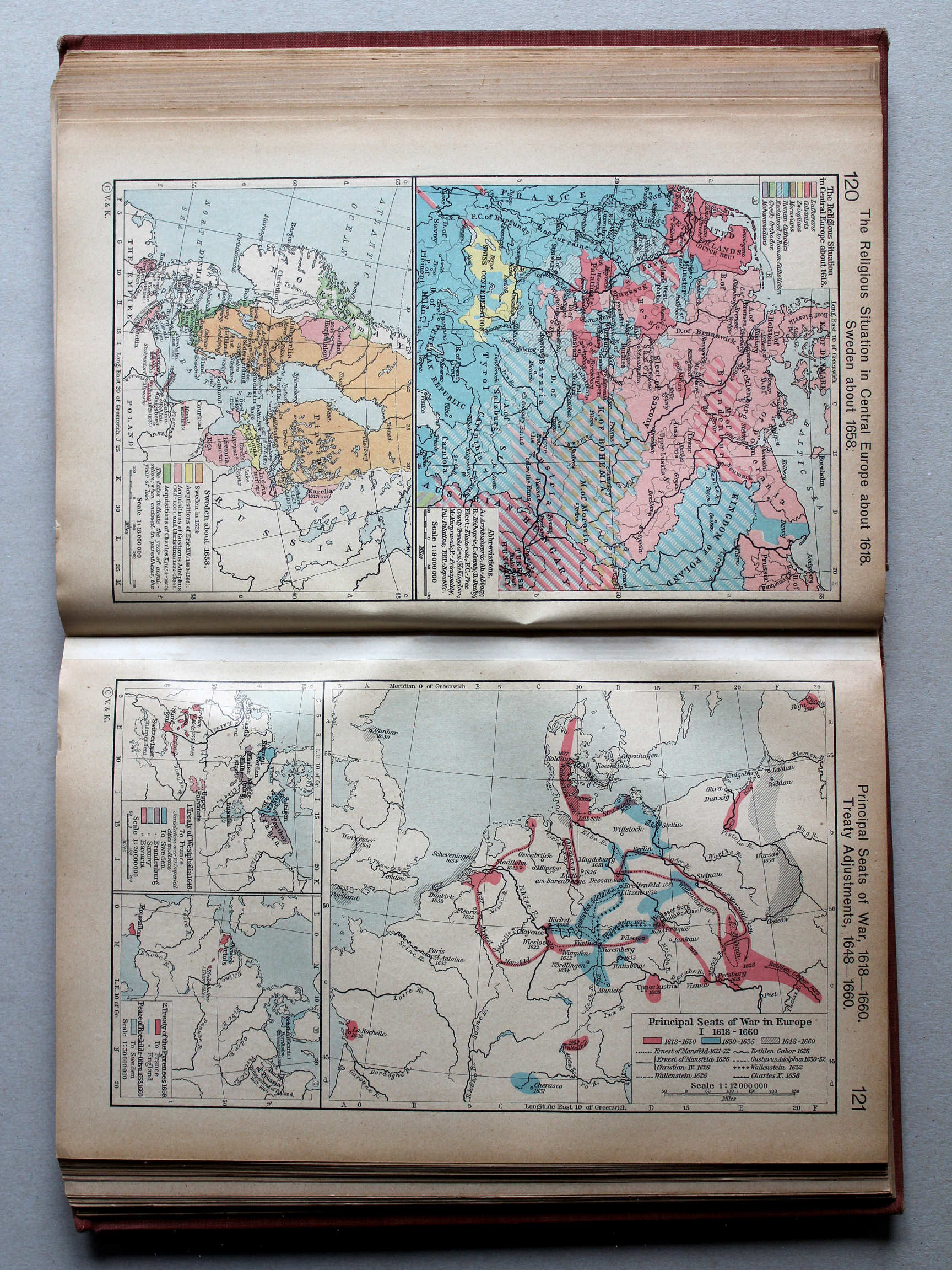
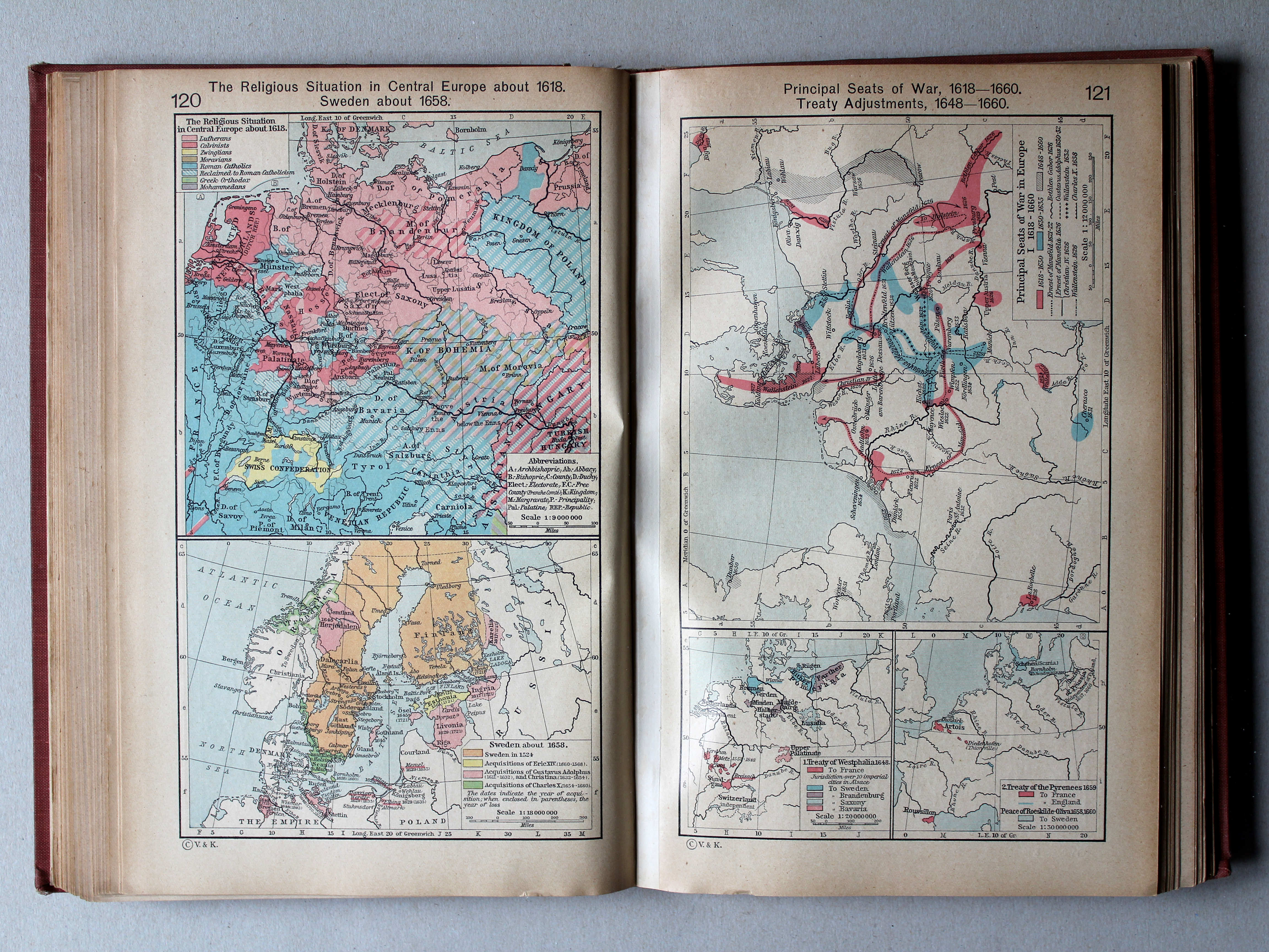
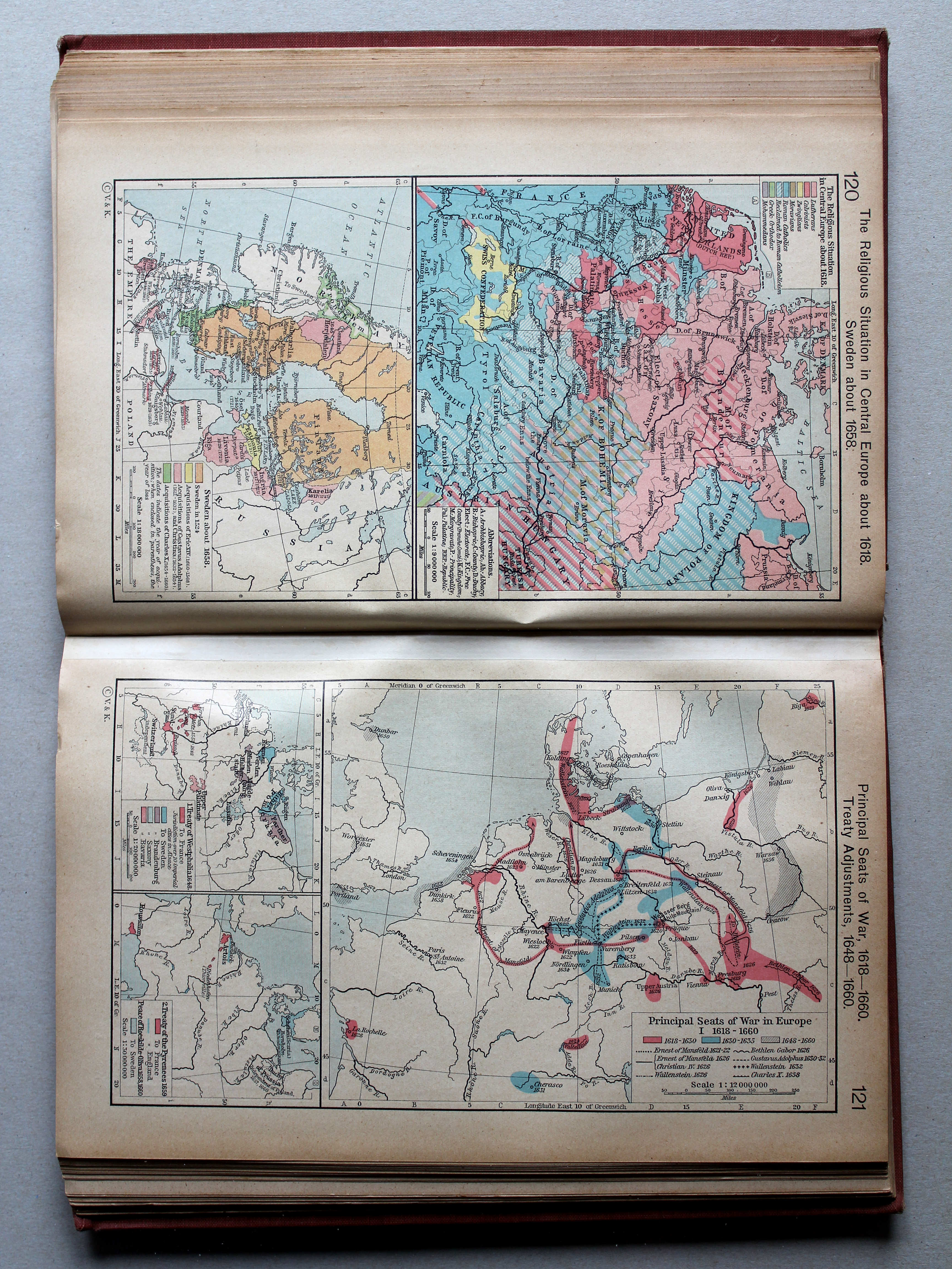
120. The Religious Situation in Central Europe about 1618. Sweden about 1658 XL
Godsdiensten in Midden-Europa, ca. 1618. Zweden, ca. 1658
 Shepherd, Historical Atlas, 1927
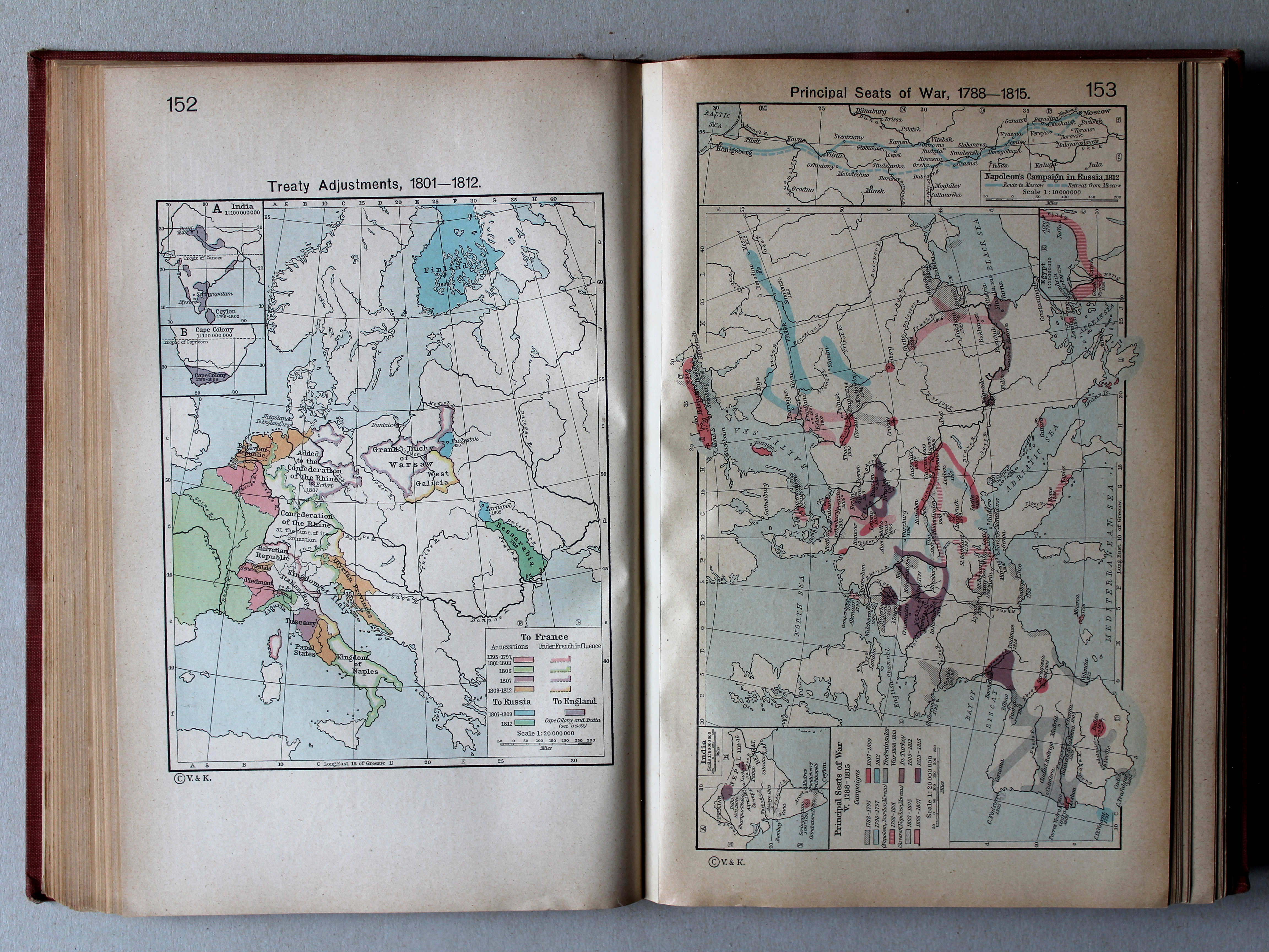
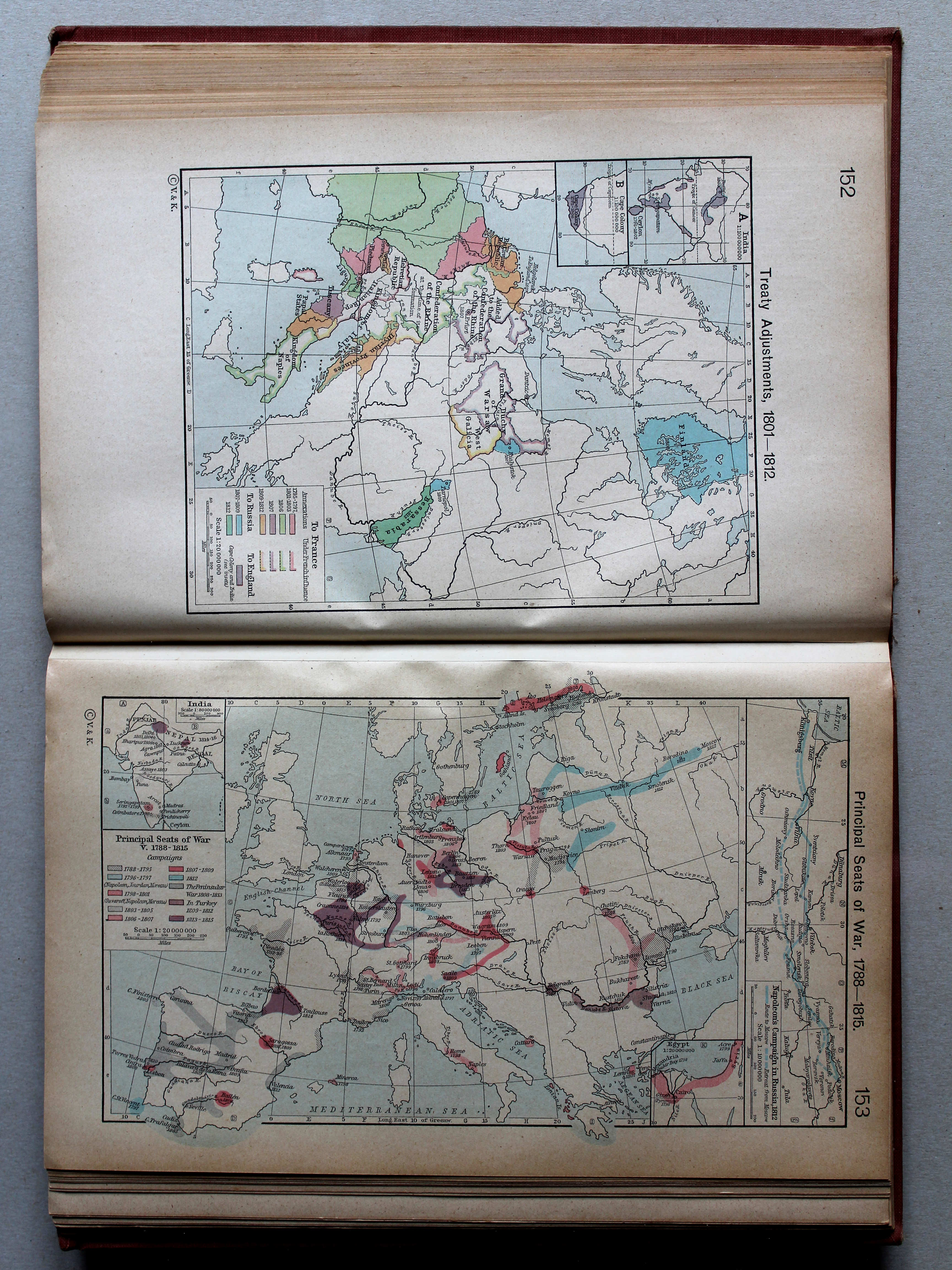
121. Principal Seats of War, 1618-1660. Treaty Adjustments, 1648-1660 XL
Oorlogen, 1618-1660. Vredesverdragen, 1648-1660
 Shepherd, Historical Atlas, 1927
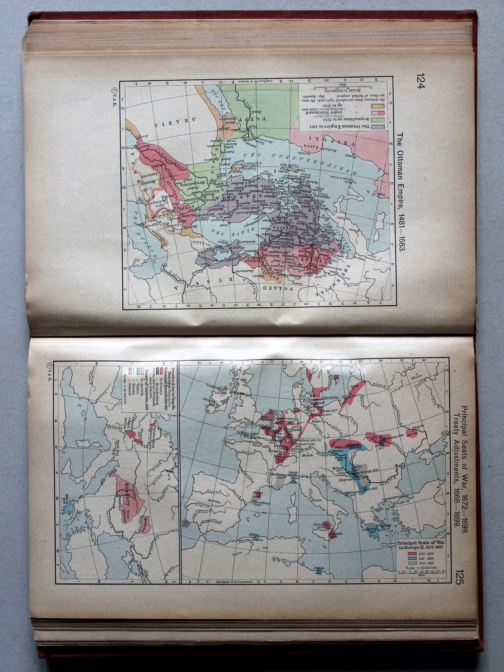
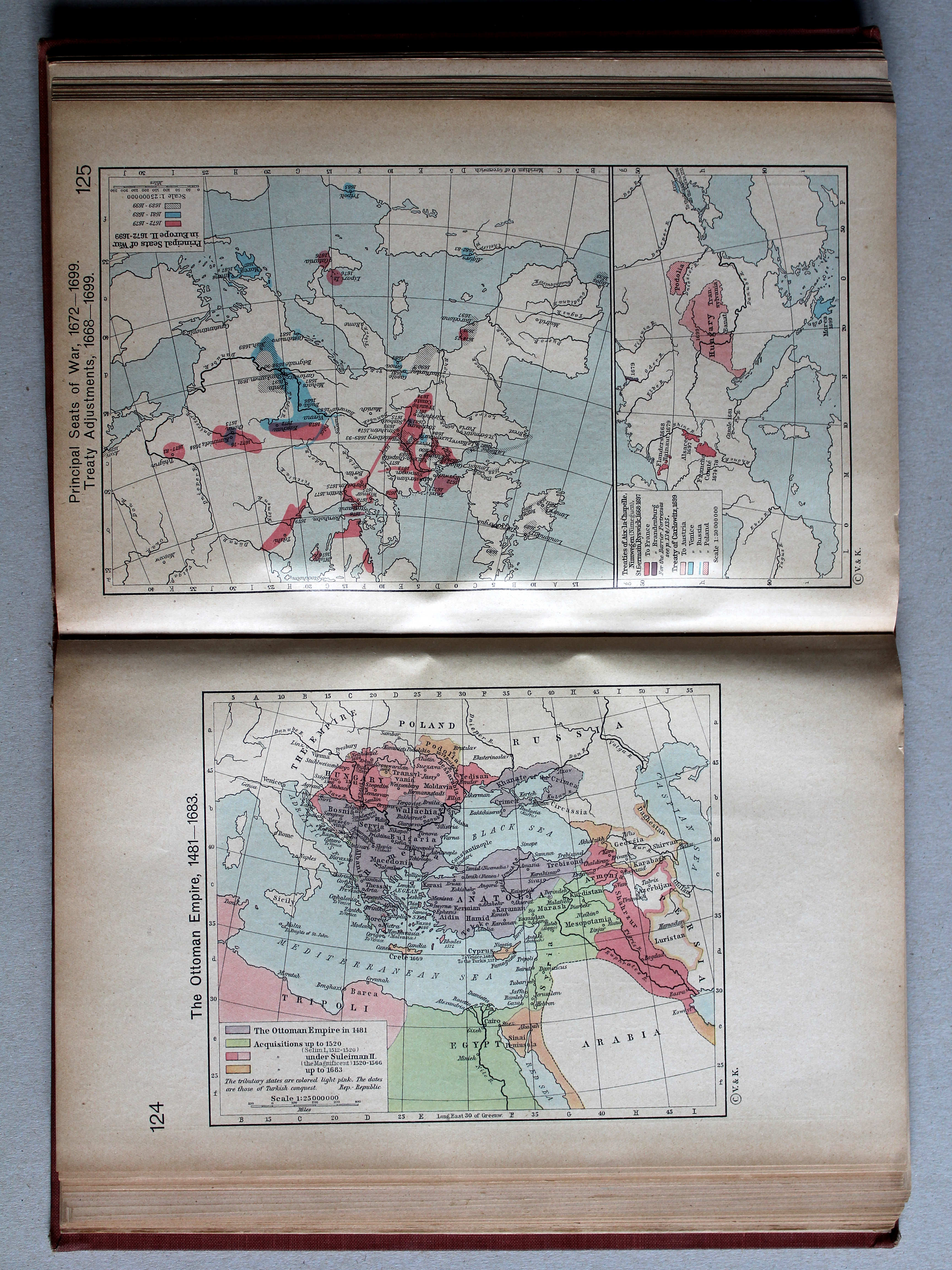
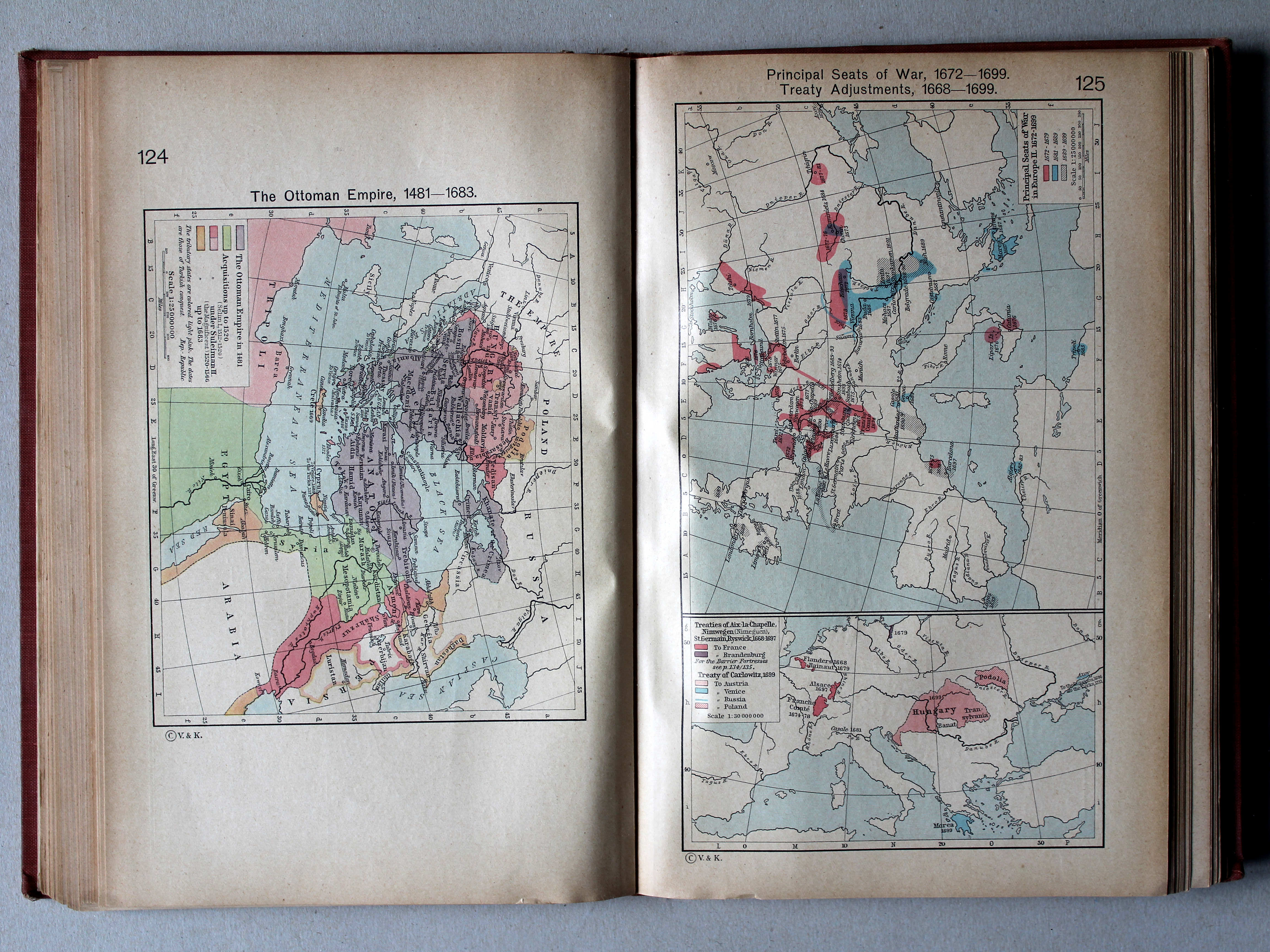
124. The Ottoman Empire, 1481-1683 XL
Het Ottomaanse Rijk, 1481-1683
 Shepherd, Historical Atlas, 1927
125. Principal Seats of War, 1672-1699. Treaty Adjustments, 1668-1699 XL
Oorlogen, 1672-1699. Vredesverdragen, 1668-1699
 Shepherd, Historical Atlas, 1927
125. Principal Seats of War, 1672-1699. Treaty Adjustments, 1668-1699 XL
Oorlogen, 1672-1699. Vredesverdragen, 1668-1699
 Shepherd, Historical Atlas, 1927
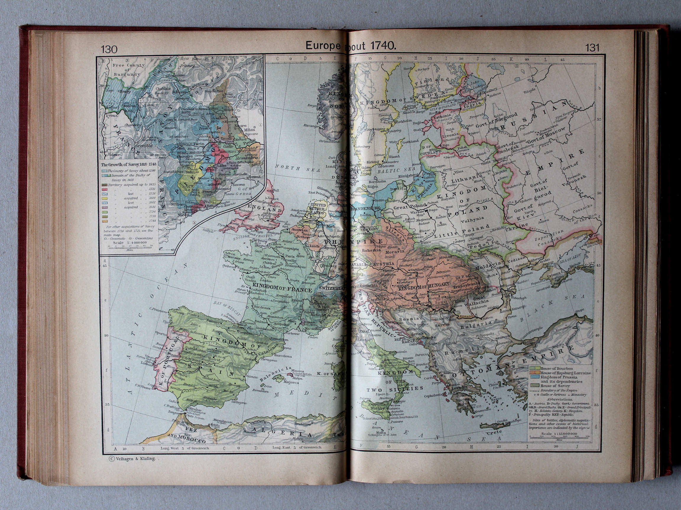
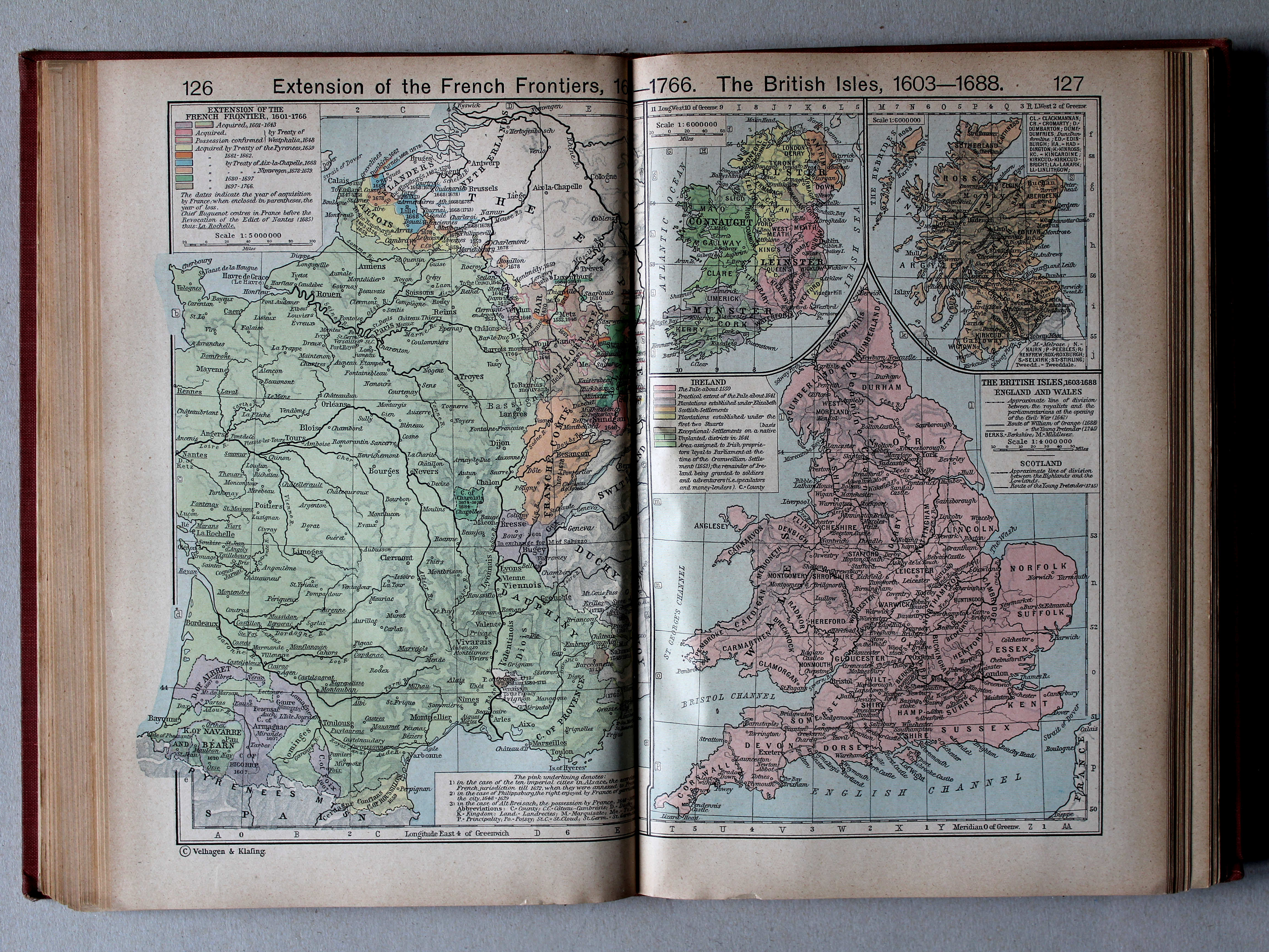
126.127. Extension of the French Frontiers, 1601-1766. The British Isles, 1603-1688 XL
Gebiedsuitbreiding van Frankrijk, 1601-1766. De Britse Eilanden, 1603-1688
 Shepherd, Historical Atlas, 1927
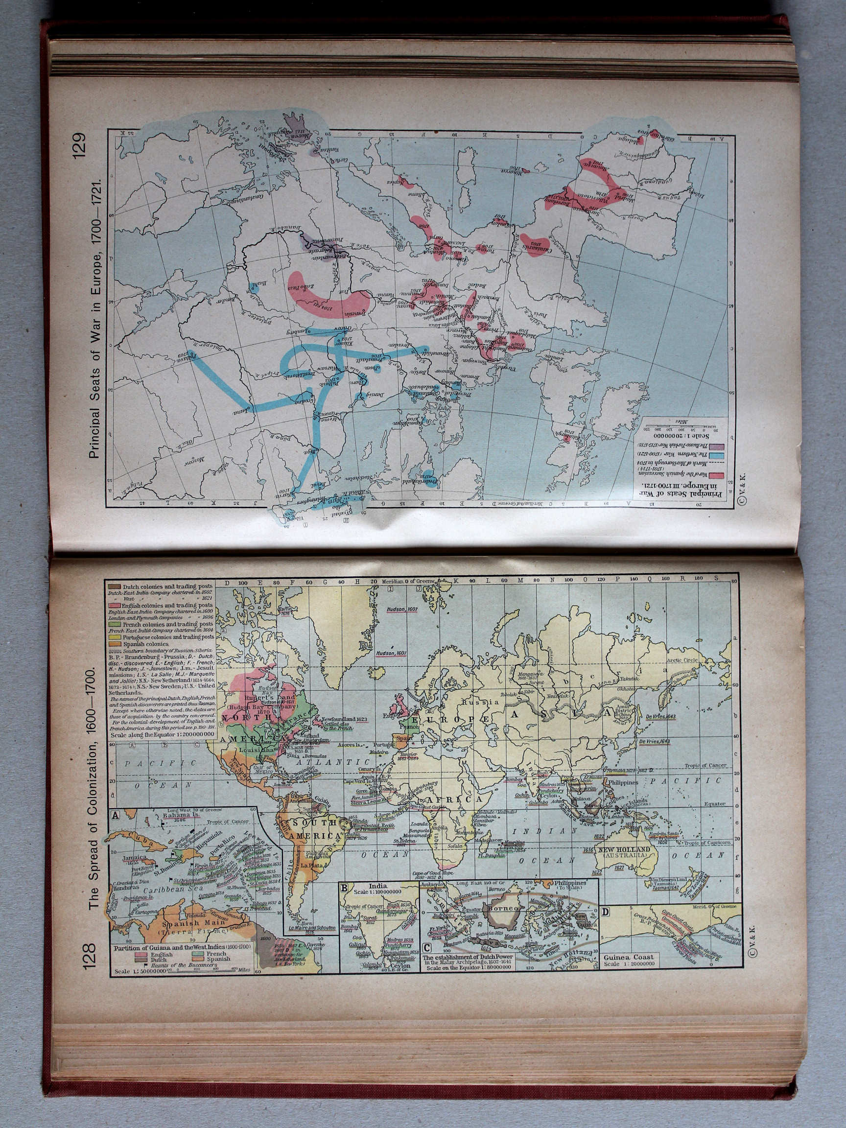
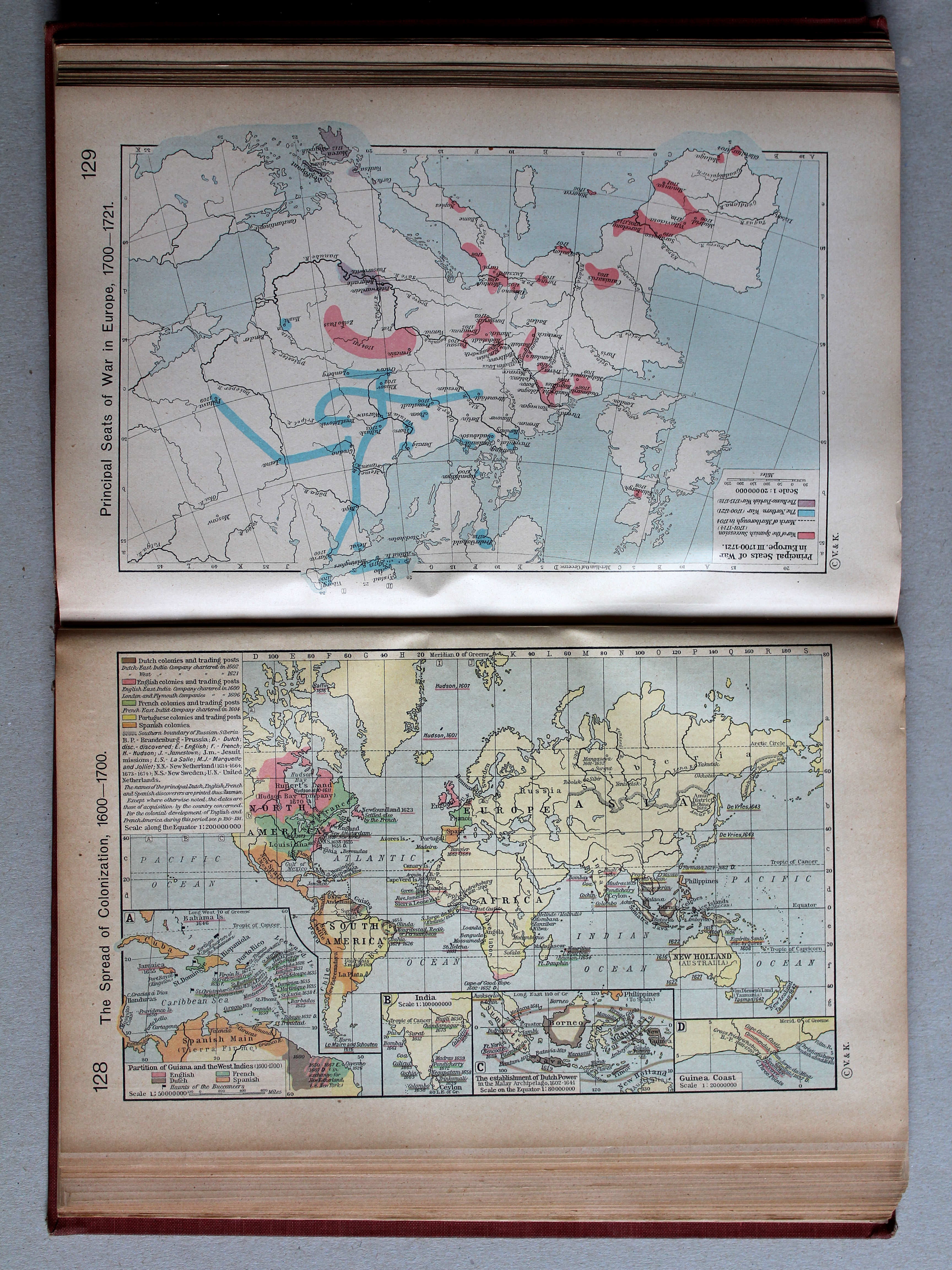
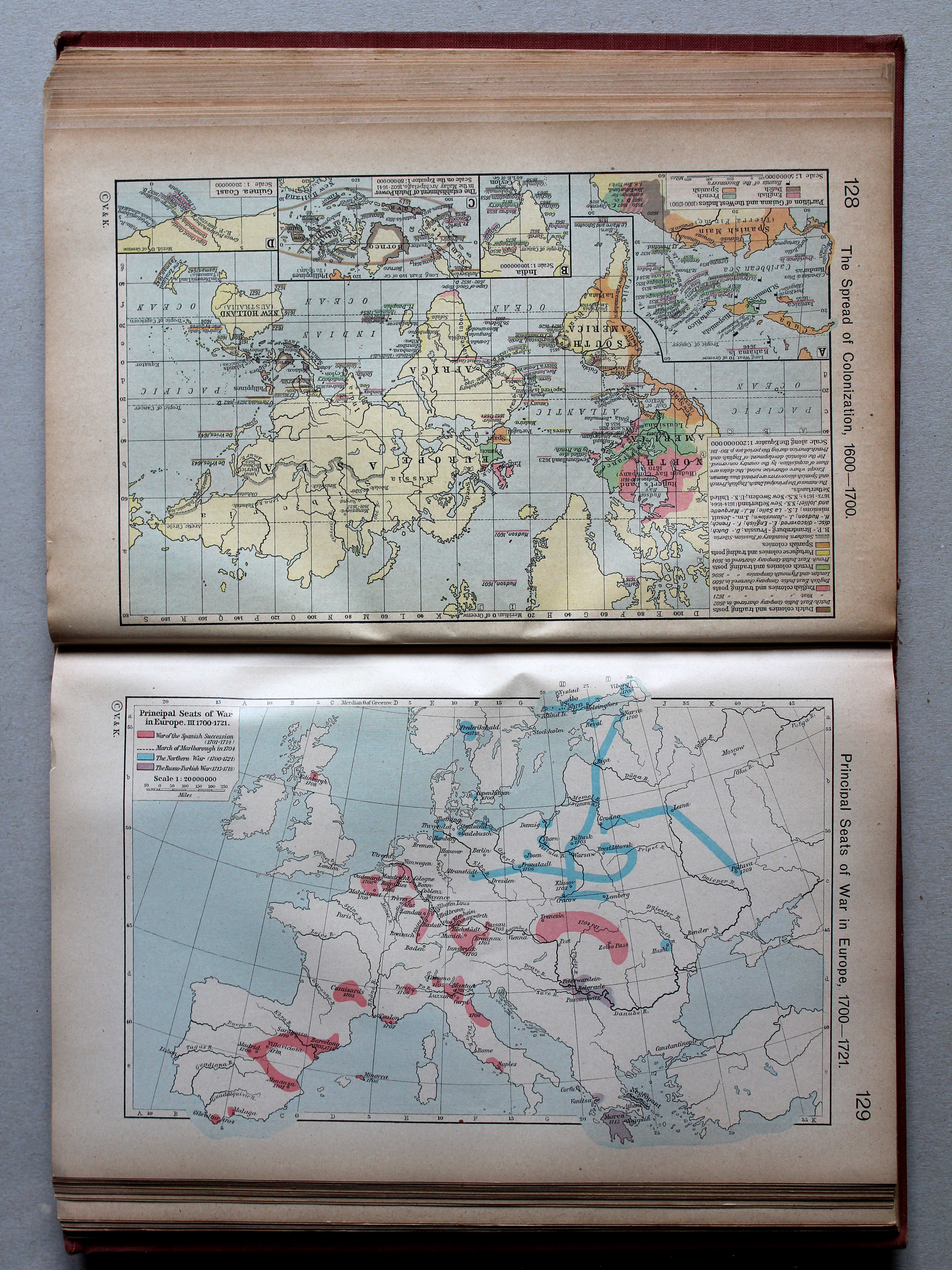
128. The Spread of Colonization, 1600-1700 XL
Kolonisatie, 1600-1700
 Shepherd, Historical Atlas, 1927
129. Principal Seats of War in Europe, III. 1700-1721 XL
Oorlogen in Europa, III. 1700-1721
 Shepherd, Historical Atlas, 1927
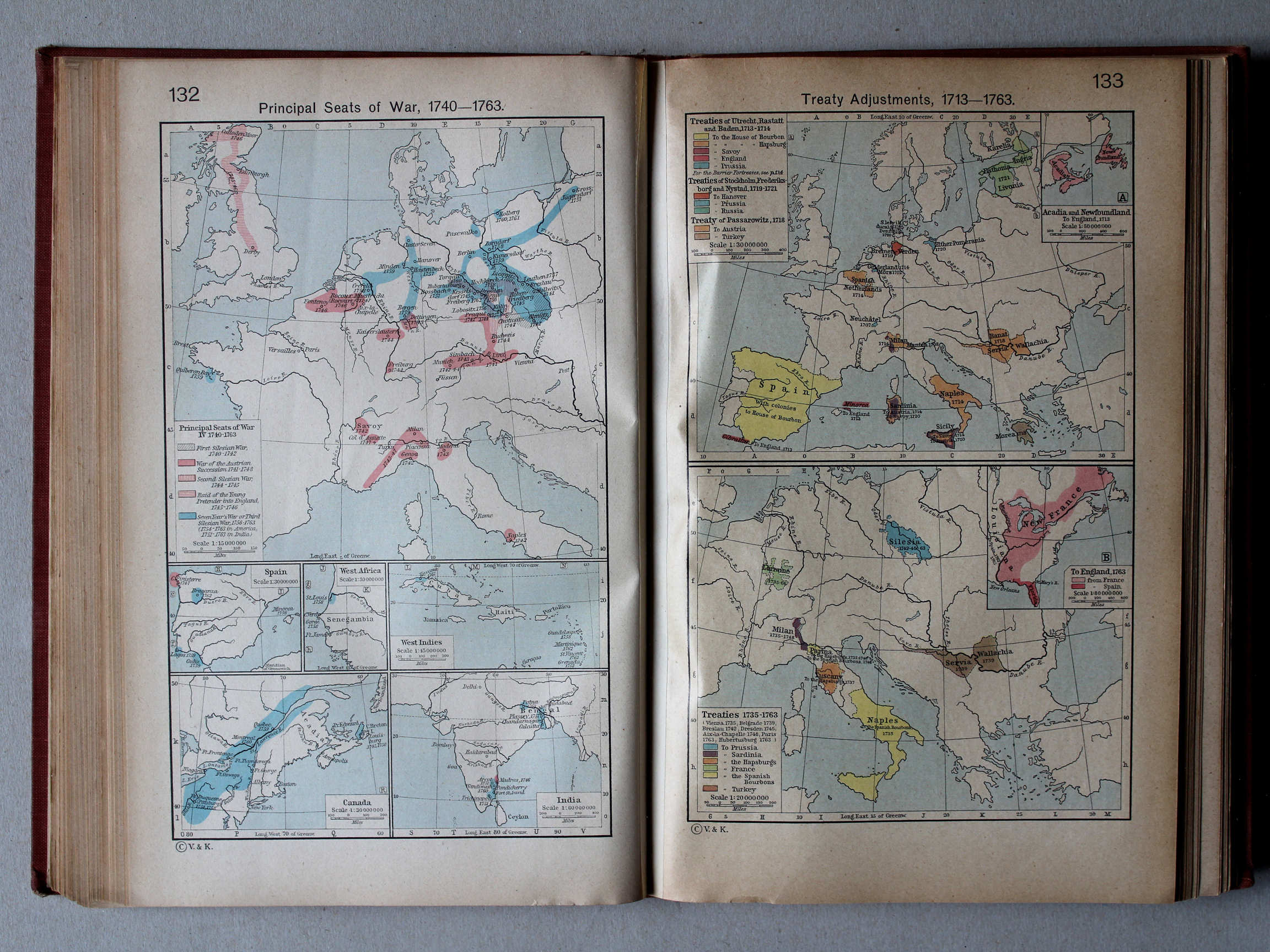
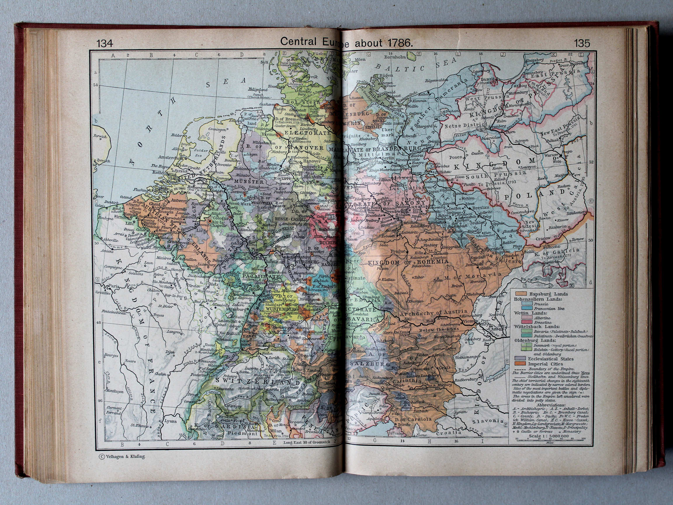
132. Principal Seats of War, 1740-1763 XL
Oorlogen, 1740-1763
133. Treaty Adjustments, 1713-1763 XL
Vredesverdragen, 1713-1763
 Shepherd, Historical Atlas, 1927
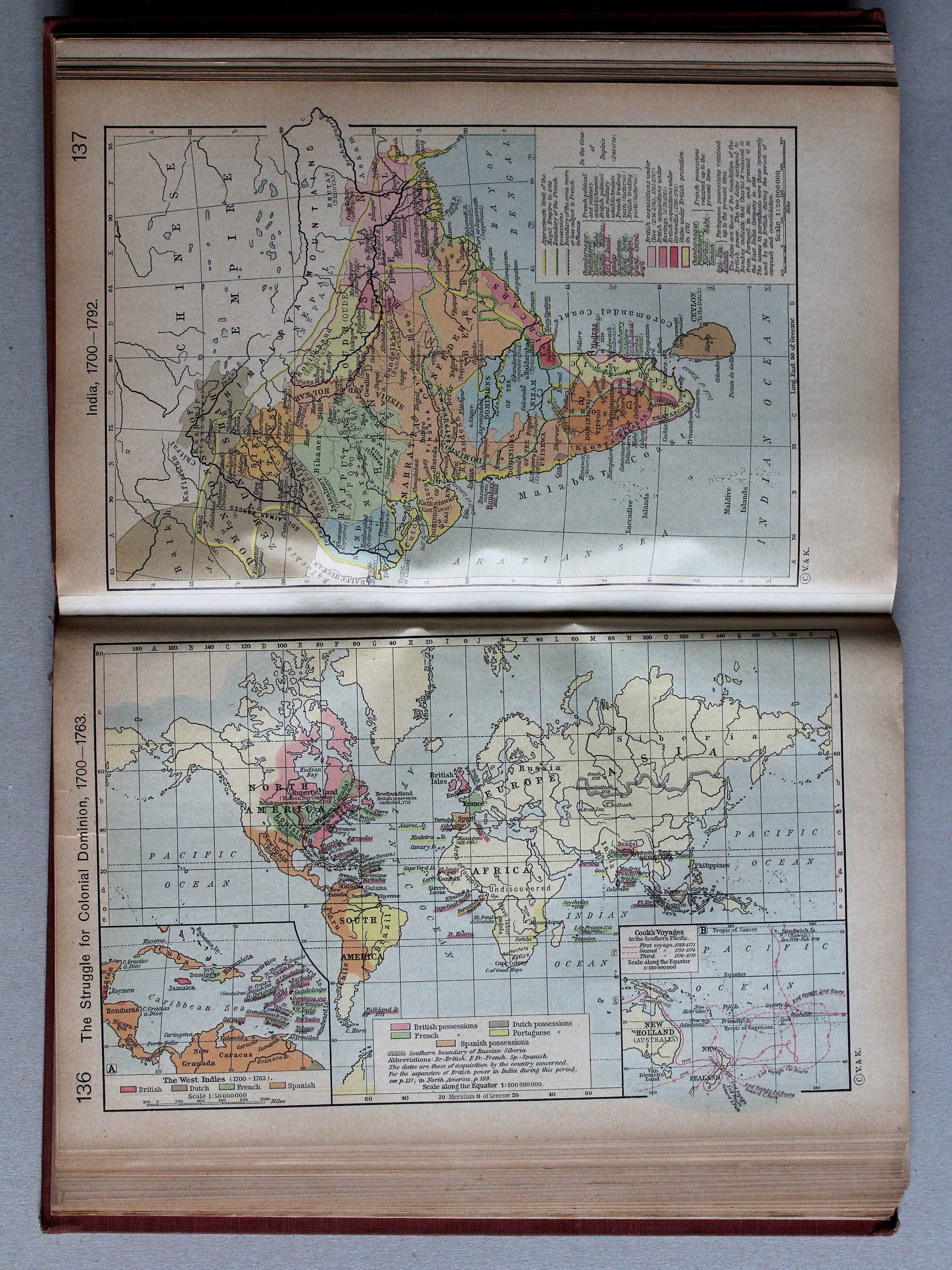
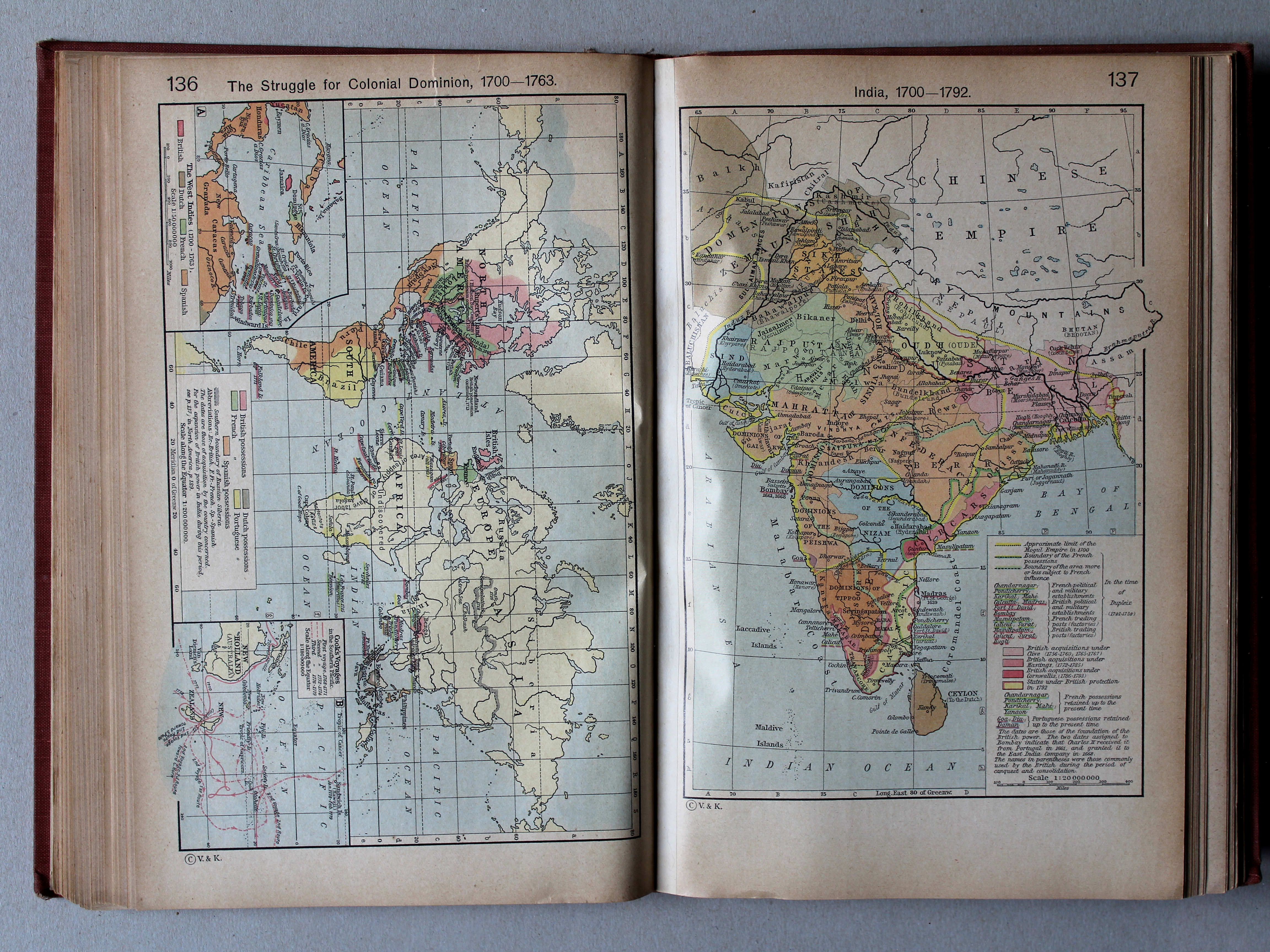
136. The Struggle for Colonial Dominion, 1700-1763 XL
Kolonisatie, 1700-1763

 Shepherd, Historical Atlas, 1927
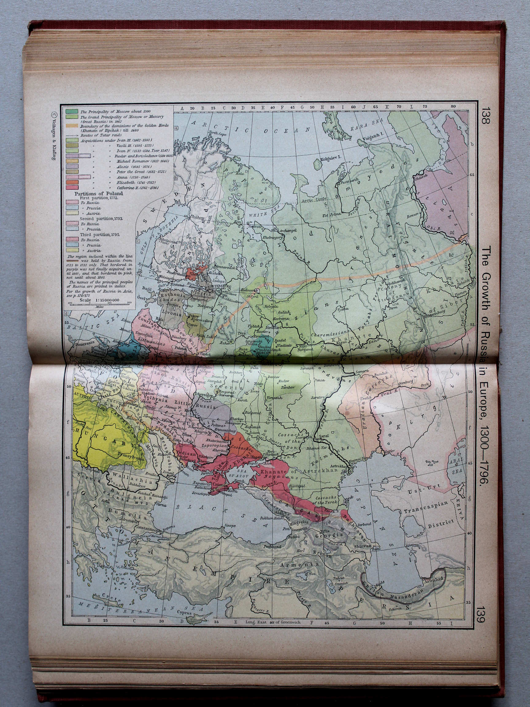
138.139. The Growth of Russia in Europe, 1300-1796 XL
Groei van Europees Rusland, 1300-1796
 Shepherd, Historical Atlas, 1927
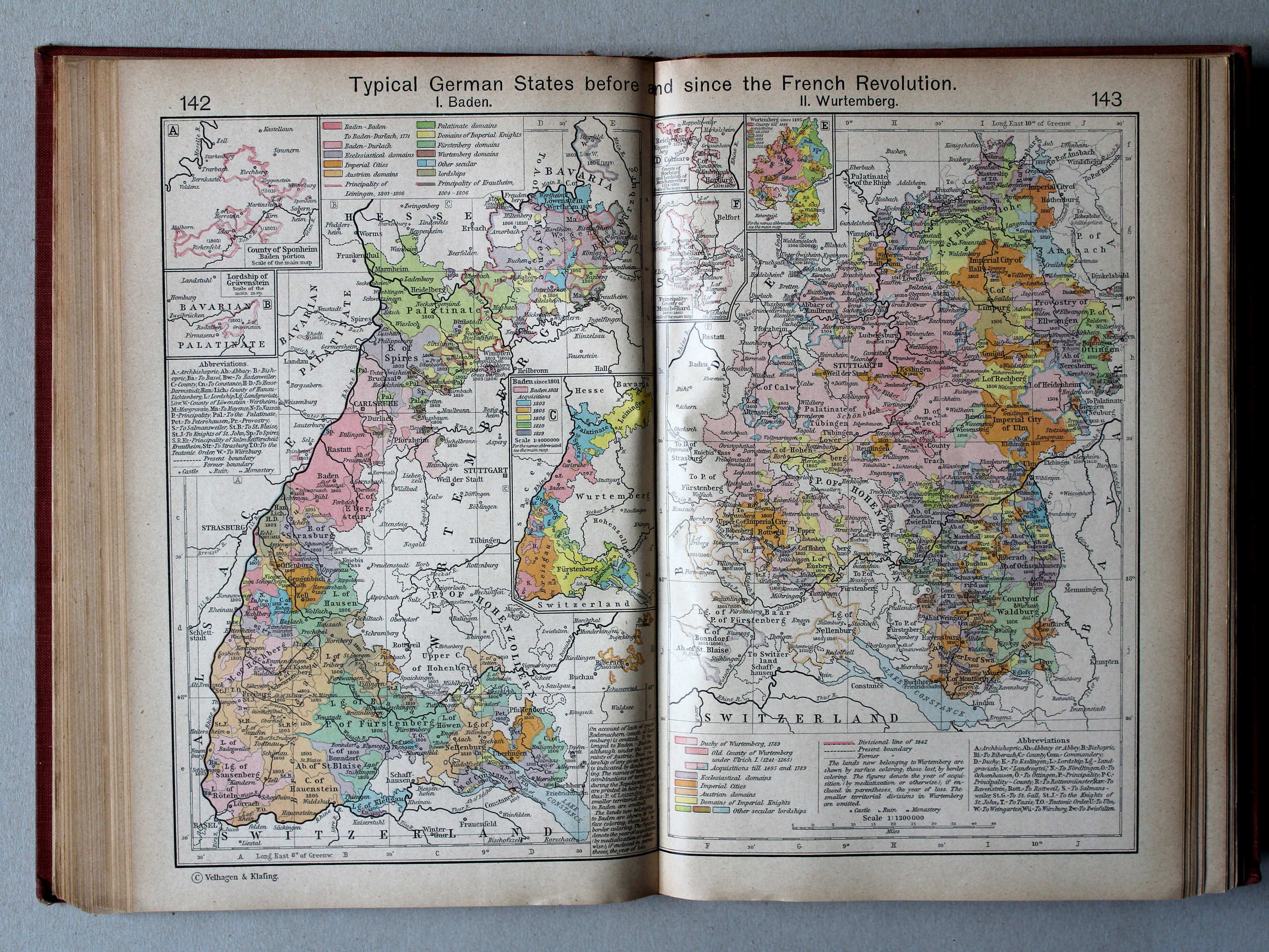
142.143. Typical German States before and since the French Revolution. I. Baden. II. Wurtemberg XL
Enkele Duitse staten voor en na de Franse Revolutie. I. Baden. II. Württemberg

 Shepherd, Historical Atlas, 1927
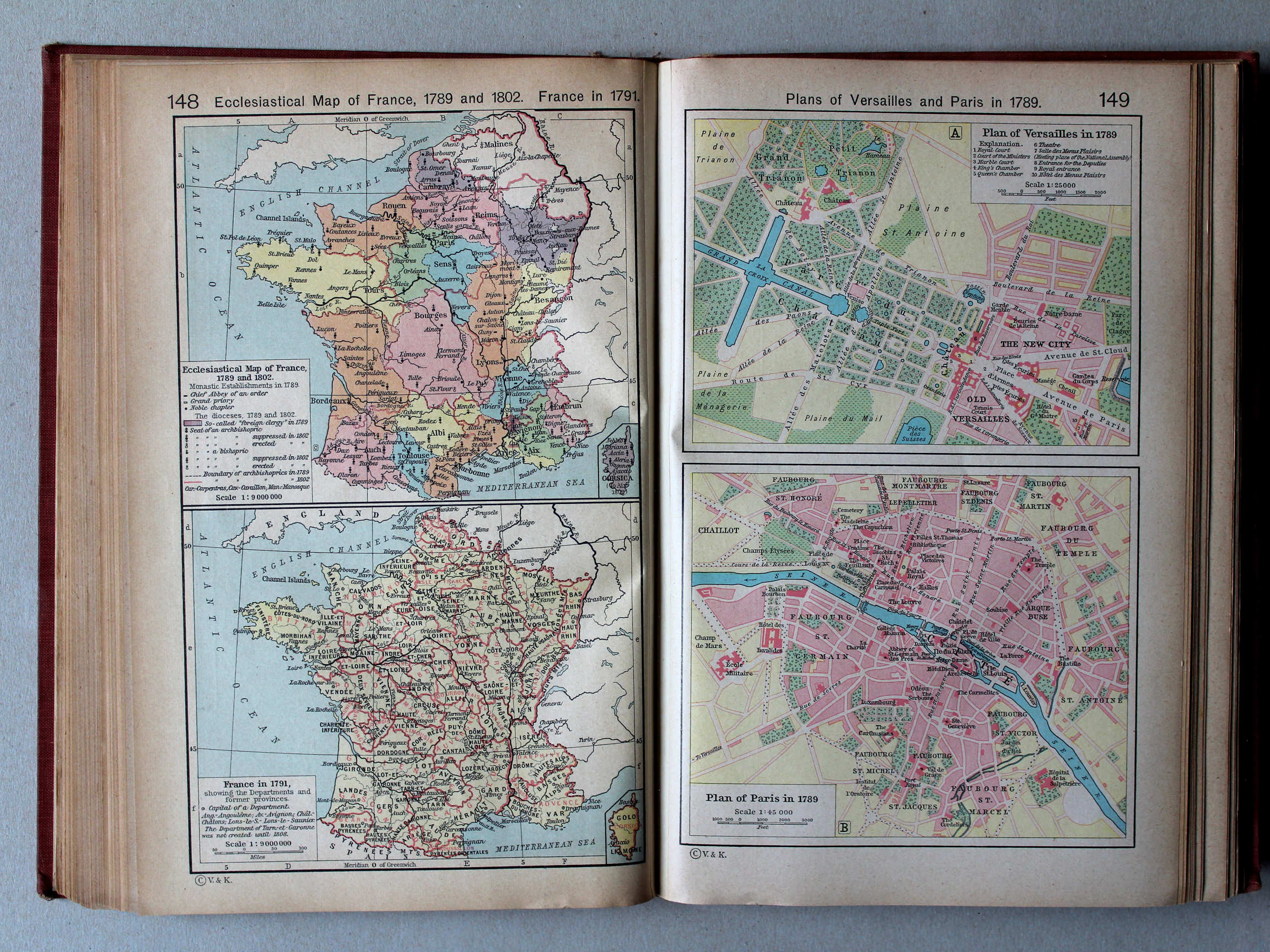
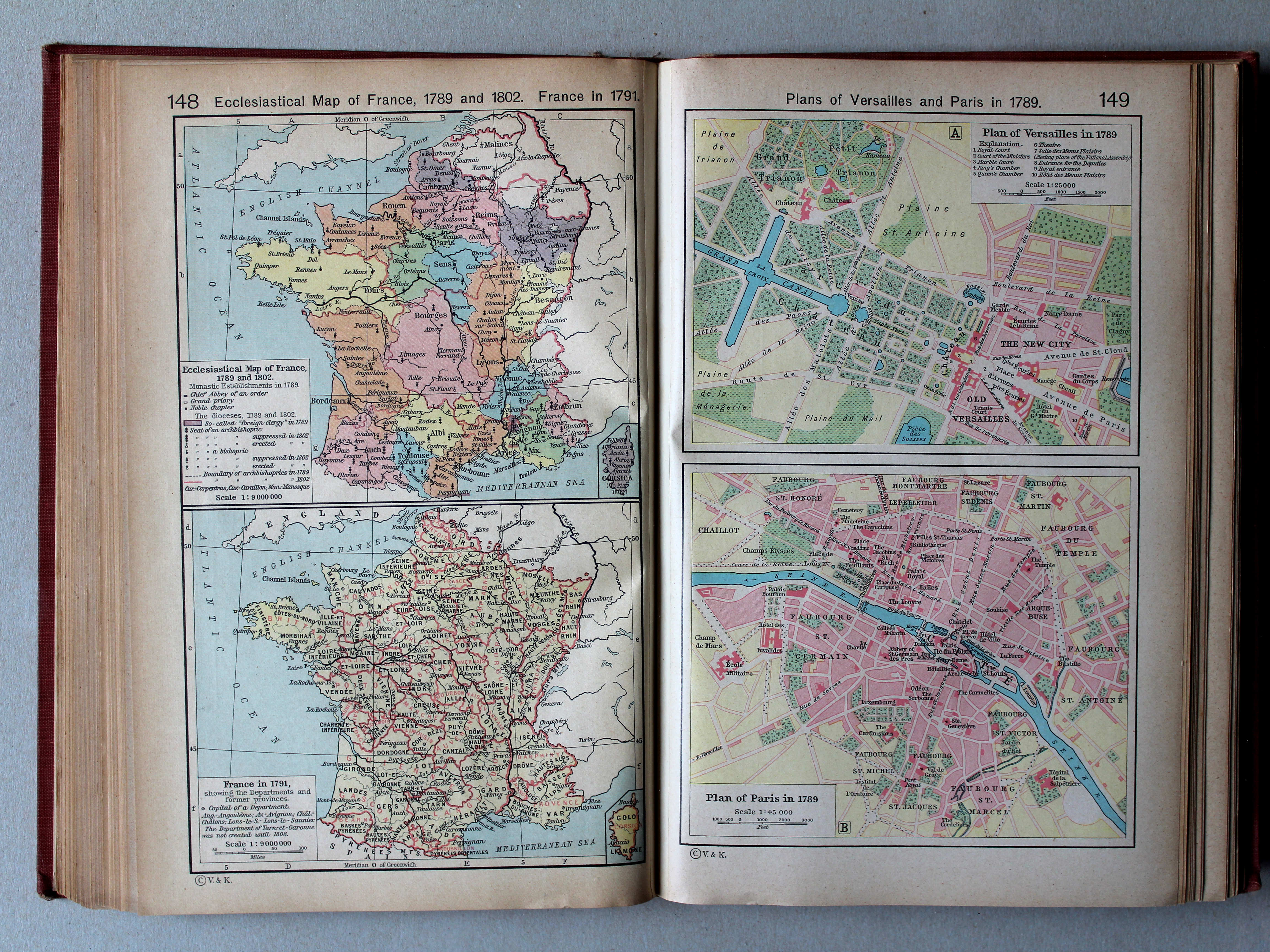
148. Ecclesiastical Map of France, 1789 and 1802. France in 1791 XL
Bisdommen in Frankrijk, 1789 en 1802. Frankrijk in 1791
149. Plans of Versailles and Paris in 1789 XL
Versailles en Parijs in 1789
 Shepherd, Historical Atlas, 1927
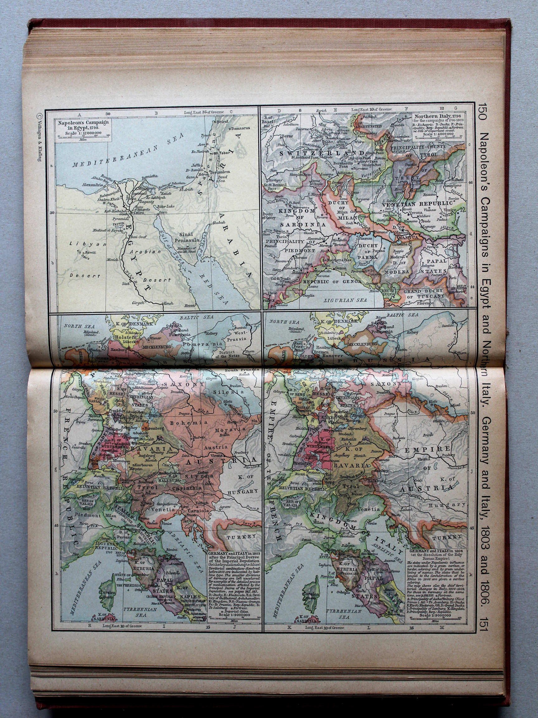
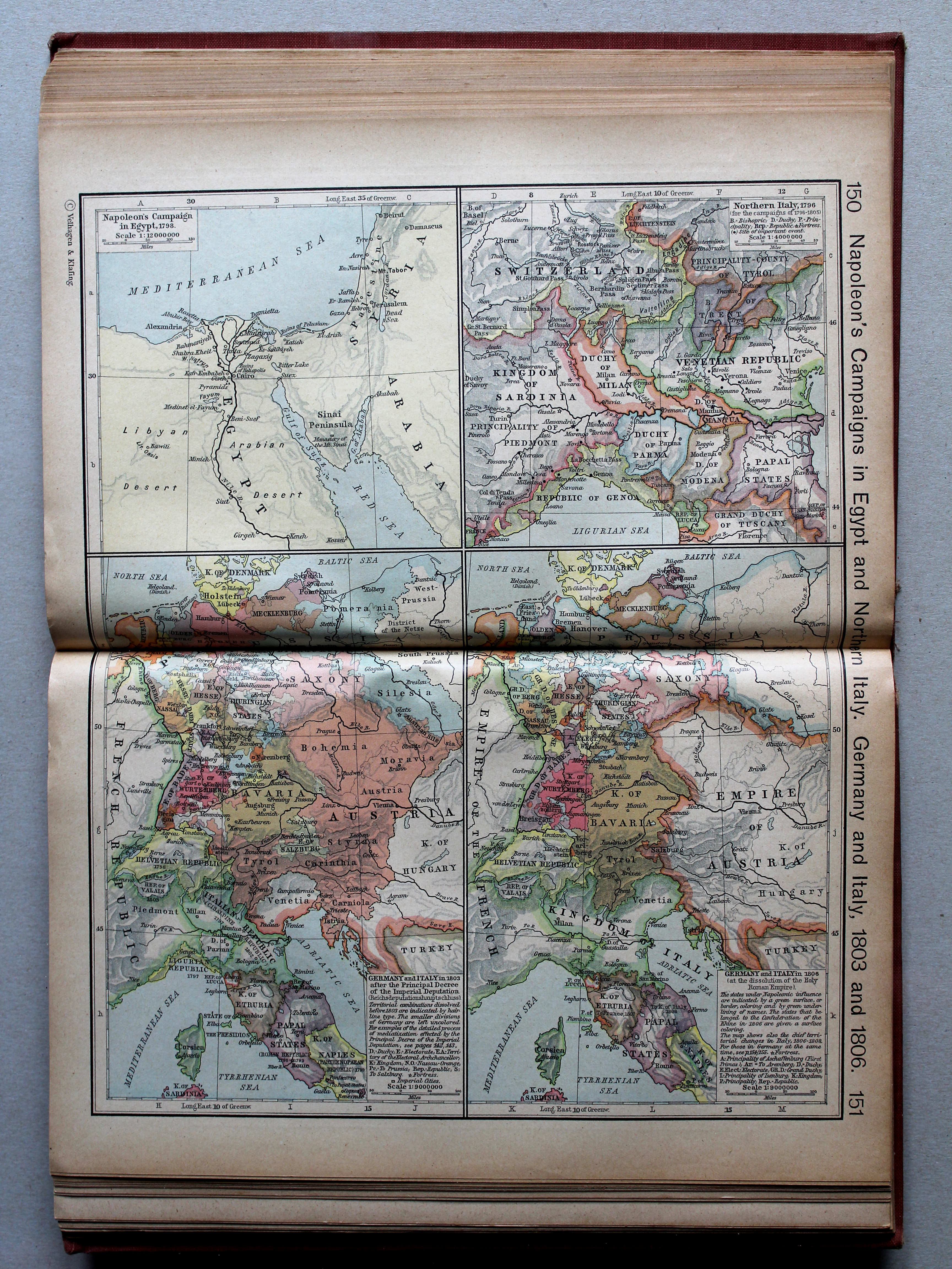
150.151. Napoleon's Campaign in Egypt and Northern Italy. Germany and Italy, 1803 and 1806 XL
Veldtochten van Napoleon in Egypte en Noord-Italië. Duitsland en Italië, 1803 en 1806

 Shepherd, Historical Atlas, 1927
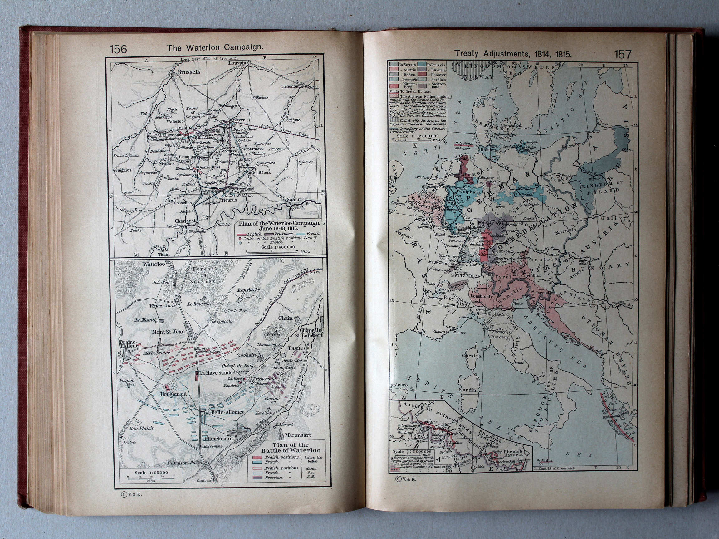
156. The Waterloo Campaign XL
Slag bij Waterloo
157. Treaty Adjustments, 1814, 1815 XL
Vredesverdragen, 1814, 1815

 Shepherd, Historical Atlas, 1927
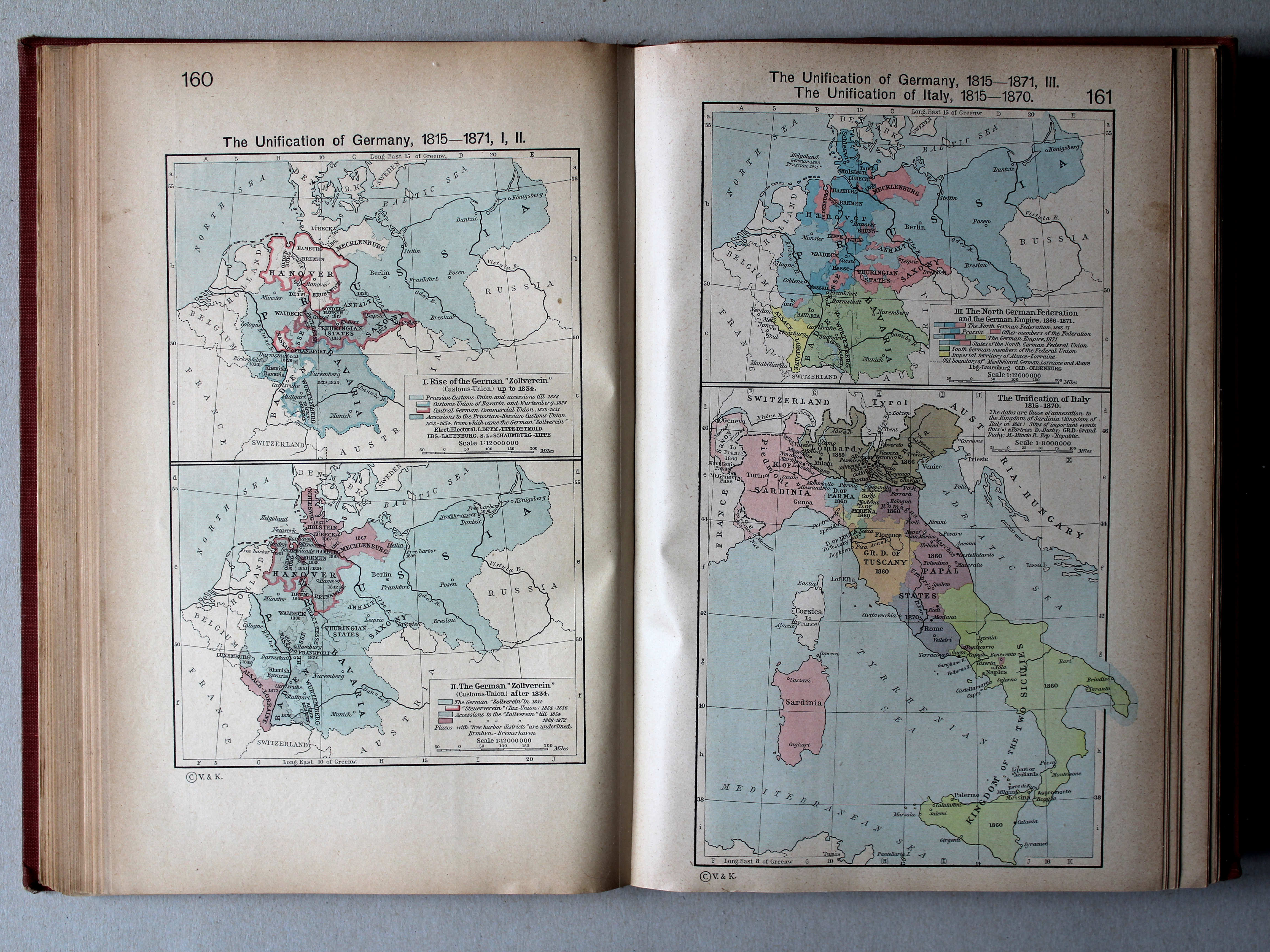
160. The Unification of Germany, 1815-1871, I, II XL
Duitse eenwording, 1815-1871, I, II
161. The Unification of Germany, 1815-1871, III. The Unification of Italy, 1815-1870 XL
Duitse eenwording, 1815-1871, III. Italiaanse eenwording, 1815-1870
 Shepherd, Historical Atlas, 1927
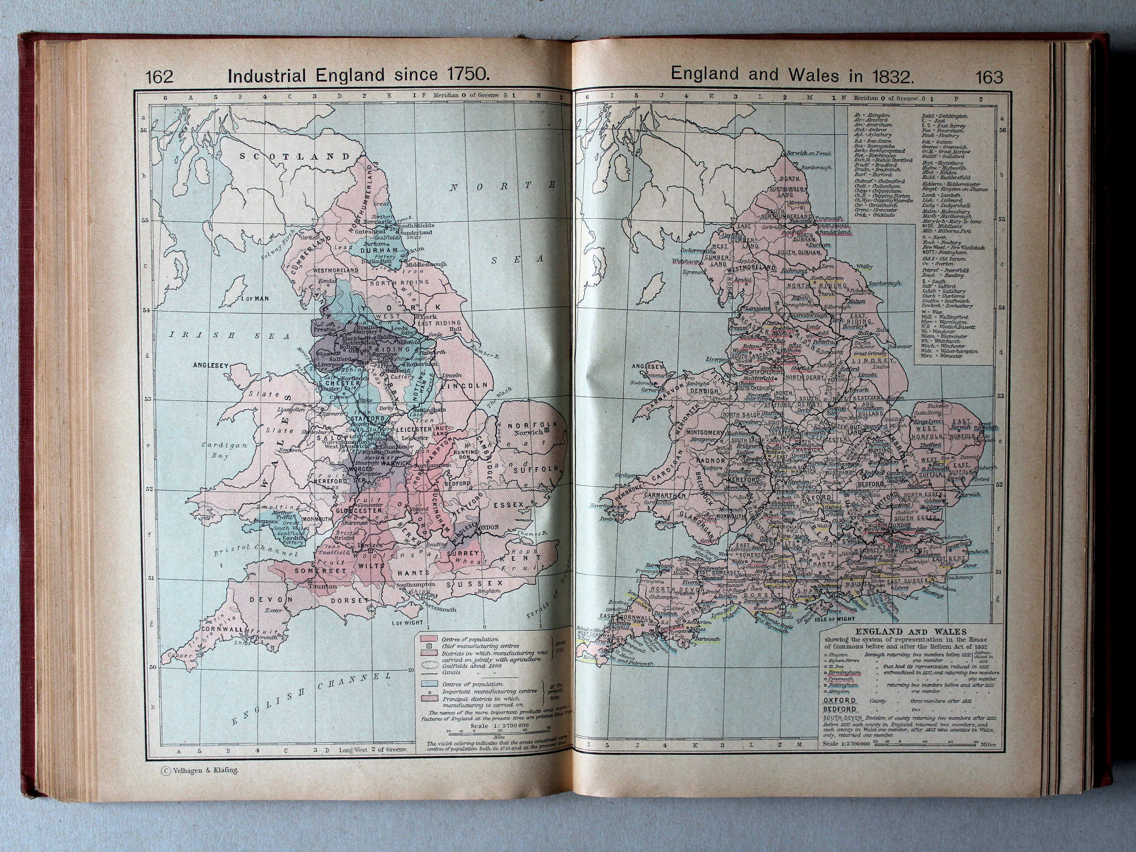
162. Industrial England since 1750 XL
Industrie in Engeland vanaf 1750
163. England and Wales in 1832 XL
Engeland en Wales in 1832
 Shepherd, Historical Atlas, 1927
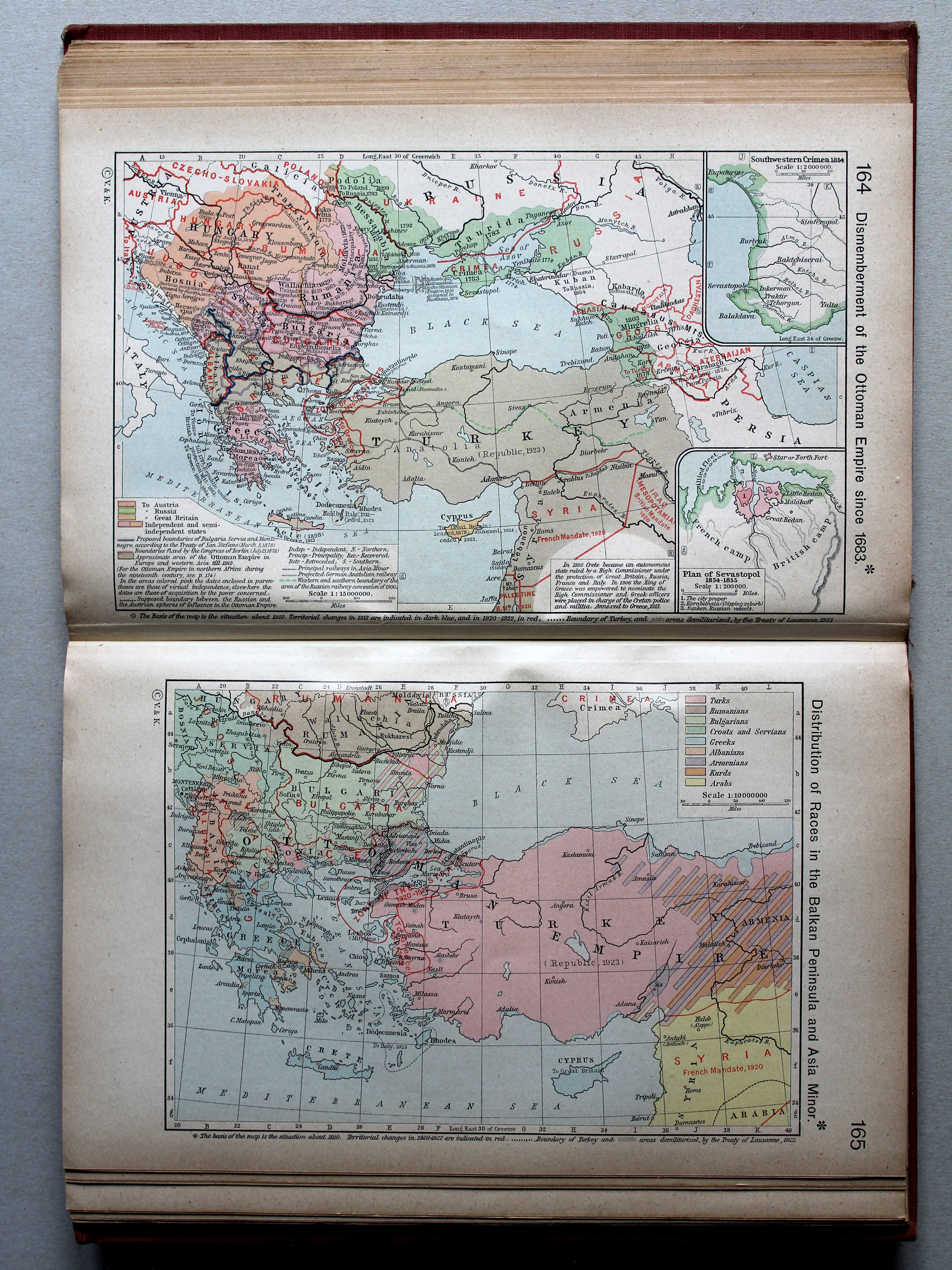
164. Dismemberment of the Ottoman Empire since 1683 XL
Versnippering van het Ottomaanse Rijk vanaf 1683
165. Distribution of Races in the Balkan Peninsula and Asia Minor XL
Volkeren op het Balkanschiereiland en in Klein-Azië
 Shepherd, Historical Atlas, 1927
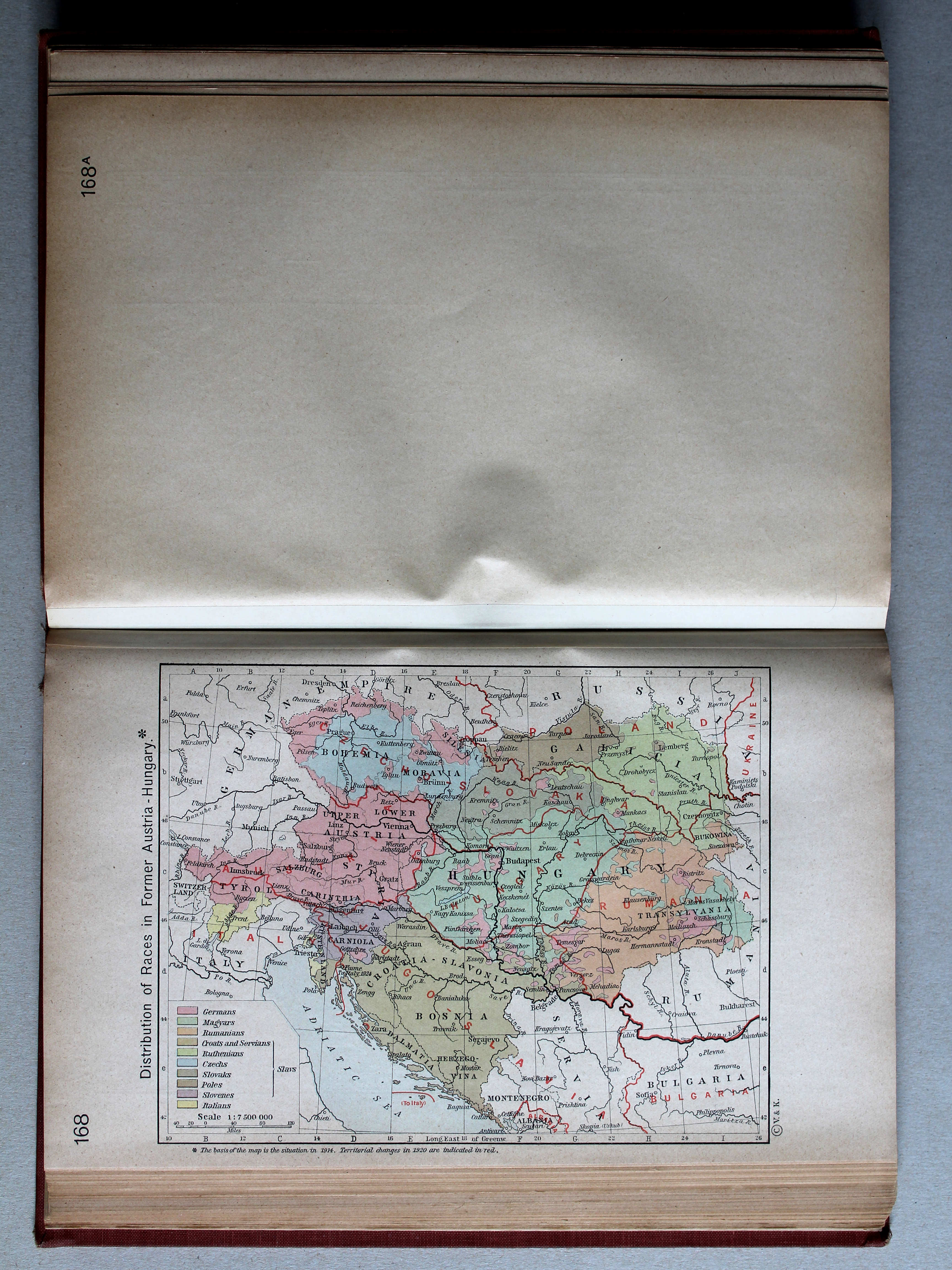
168. Distribution of Races in Former Austria-Hungary XL
Volkeren in voormalig Oostenrijk-Hongarije
 Shepherd, Historical Atlas, 1927
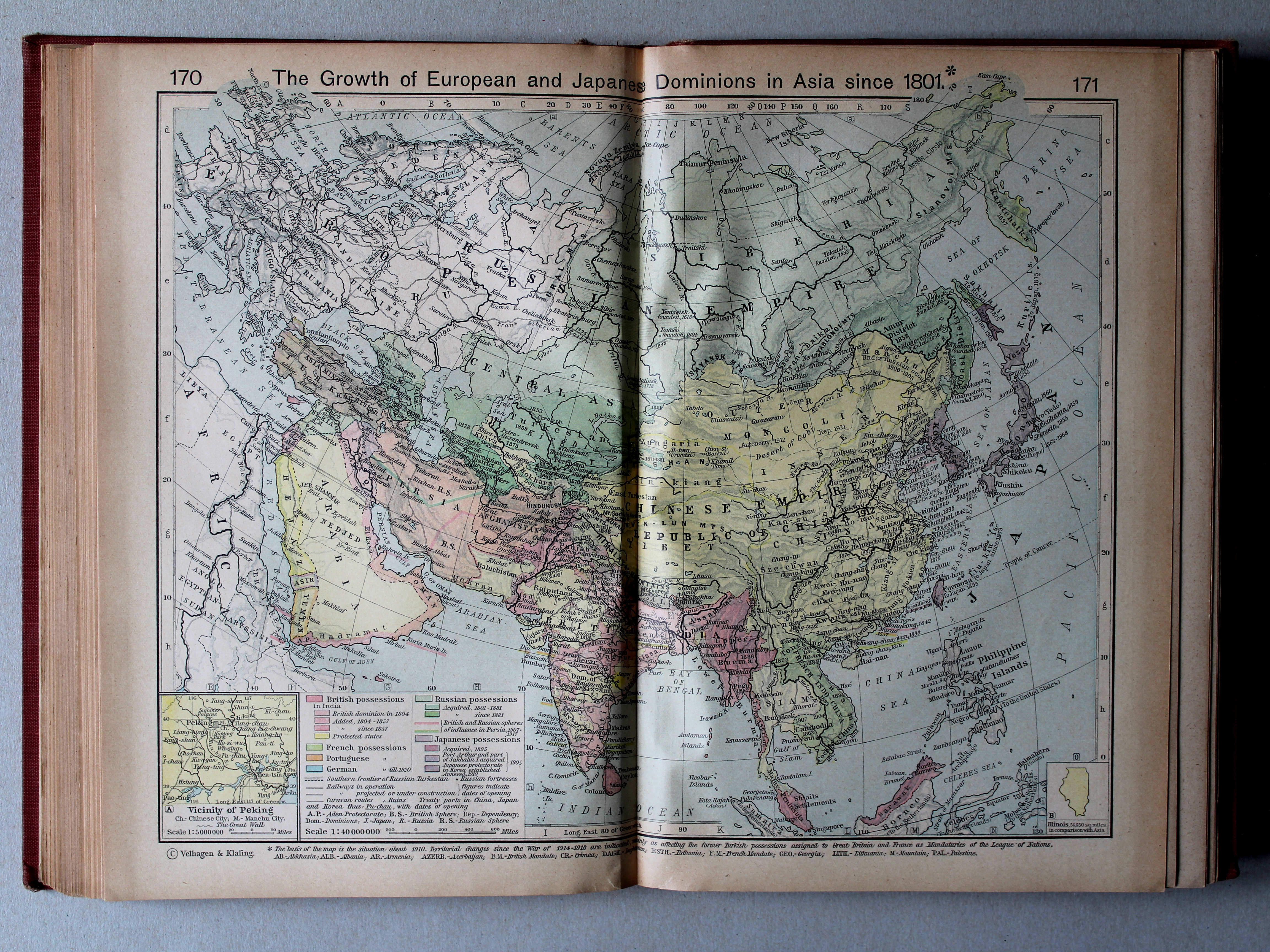
170.171. The Growth of European and Japanese Dominions in Asia since 1801 XL
Groei van de Europese en Japanse gebieden in Azië vanaf 1801
 Shepherd, Historical Atlas, 1927
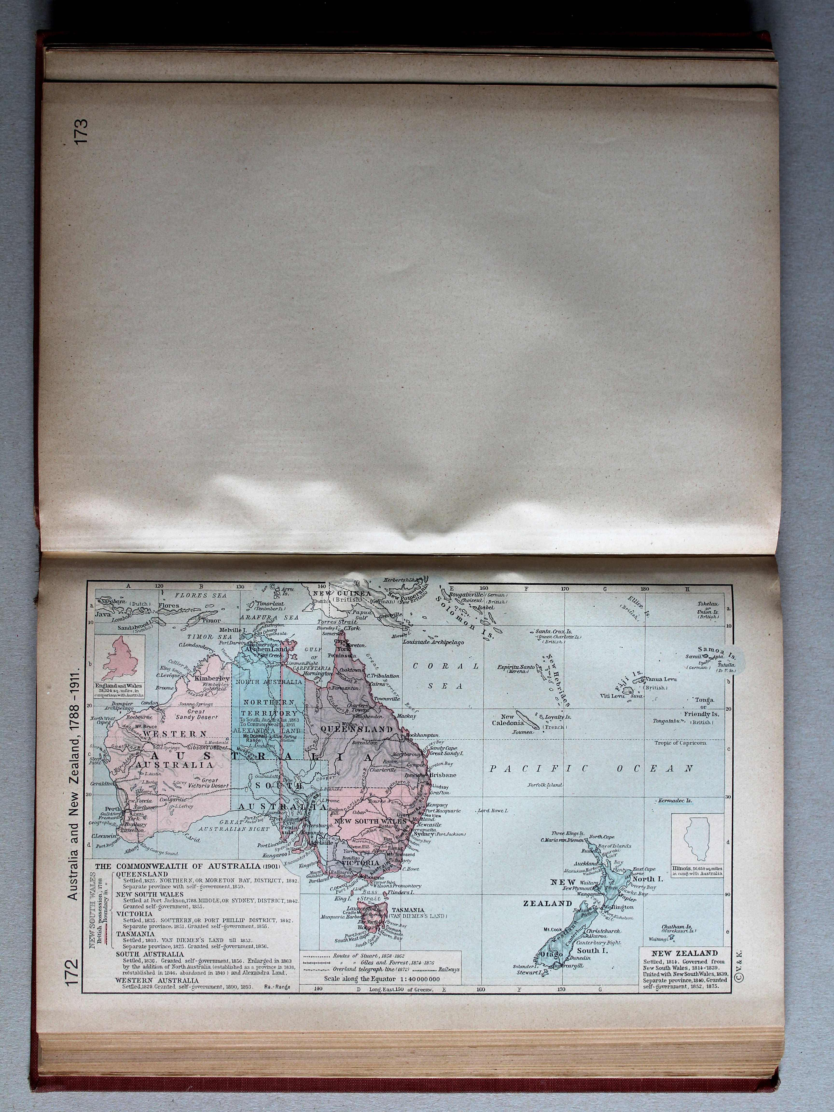
172. Australia and New Zealand, 1788-1911 XL
Australië en Nieuw-Zeeland, 1788-1911

 Shepherd, Historical Atlas, 1927
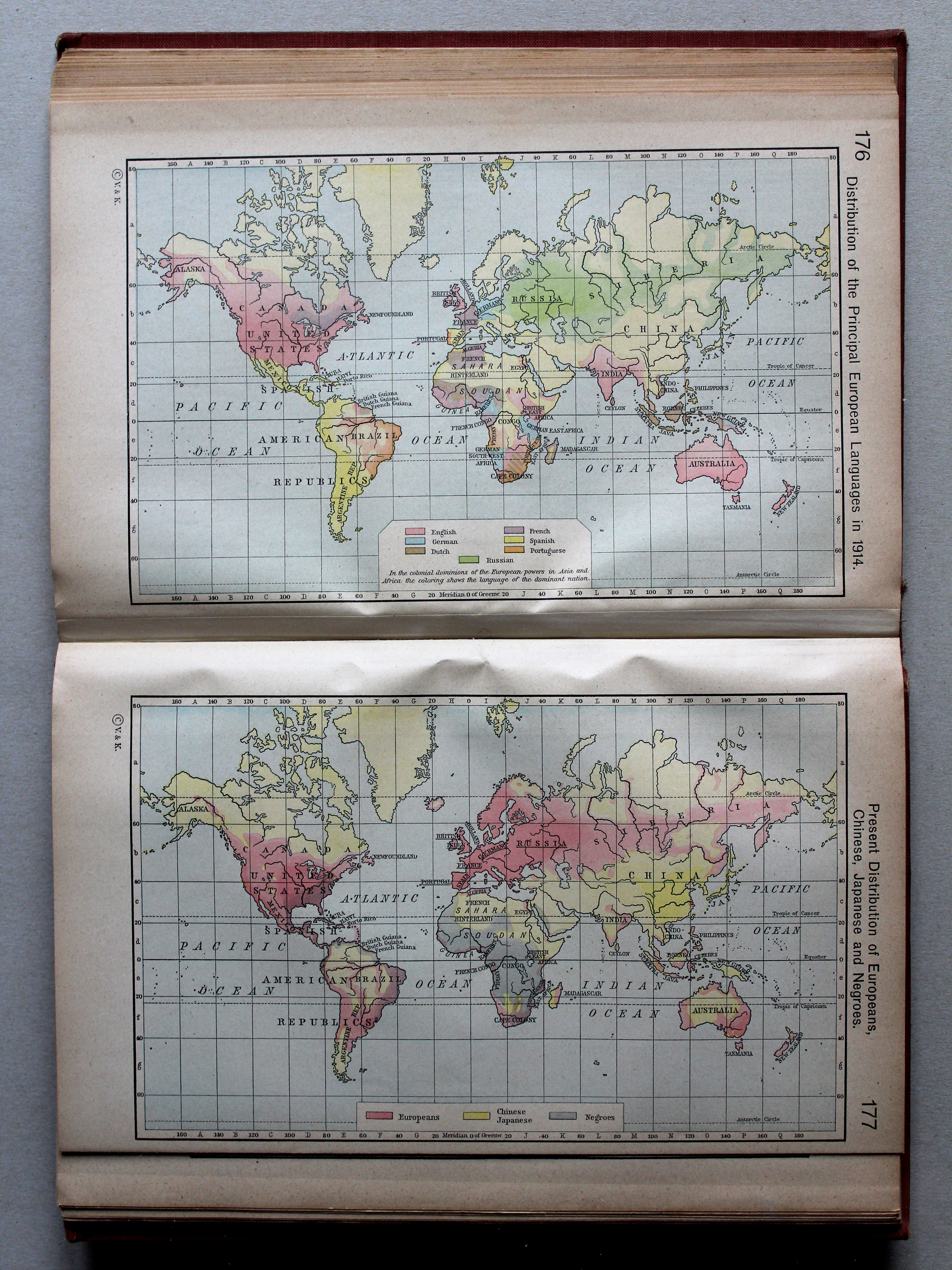
176. Distribution of the Principal European Languages in 1914 XL
Verspreiding van de belangrijkste Europese talen in 1914
177. Present Distribution of Europeans, Chinese, Japanese and Negroes XL
Verspreiding van Europeanen, Chinezen, Japanners en Negers
 Shepherd, Historical Atlas, 1927
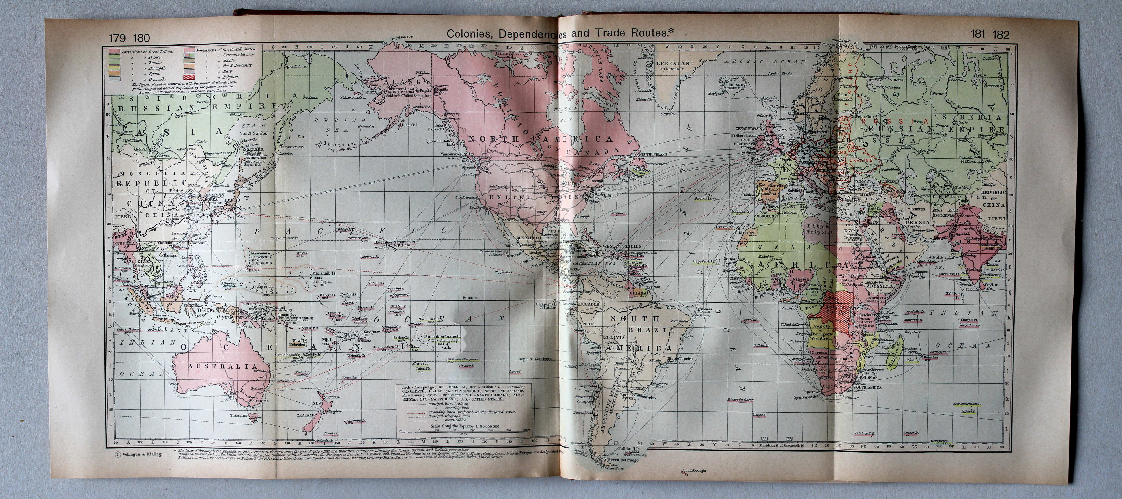
179-182. Colonies, Dependencies and Trade Routes XL
Koloniën en handelsroutes
 Shepherd, Historical Atlas, 1927
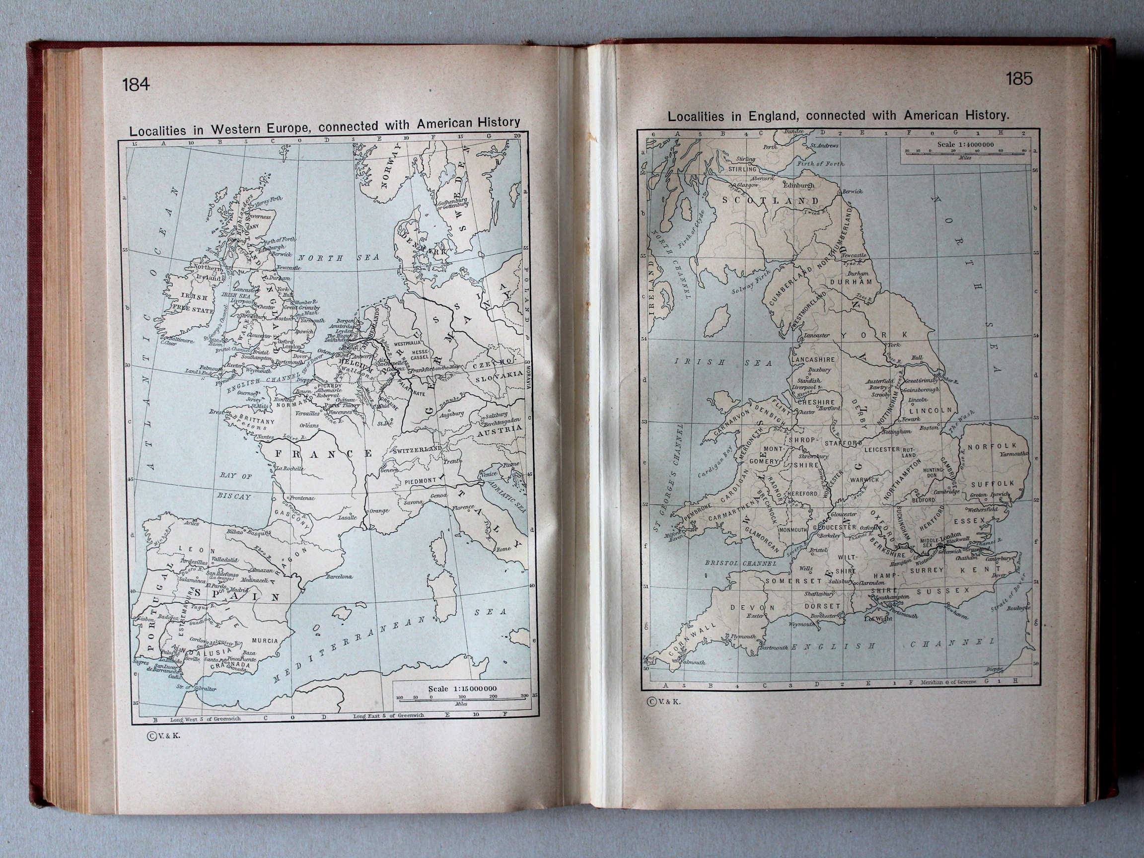
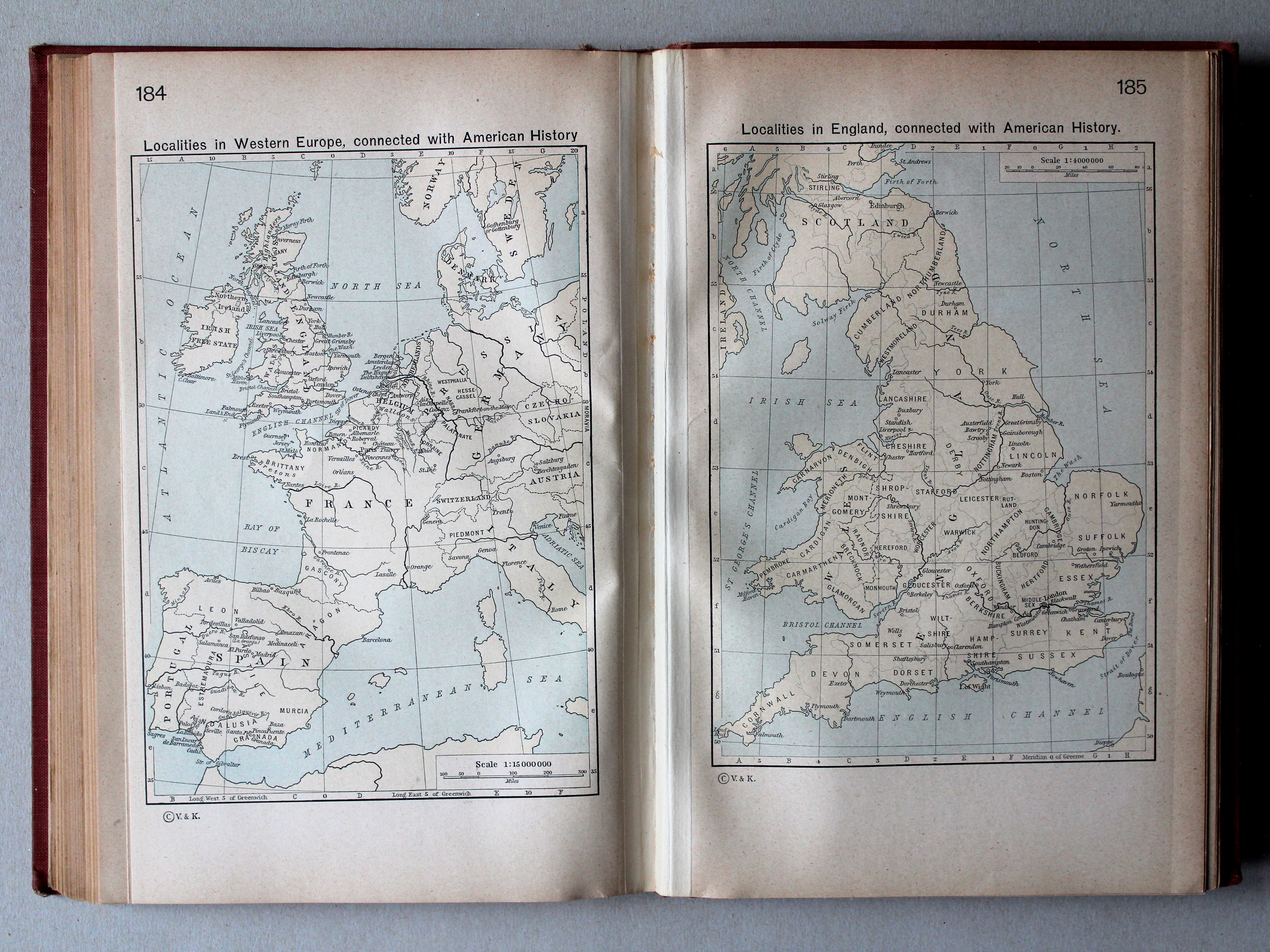
184. Localities in Western Europe connected with American History XL
Plaatsen in West-Europa verbonden met de geschiedenis van Amerika
185. Localities in England connected with American History XL
Plaatsen in Engeland verbonden met de geschiedenis van Amerika
 Shepherd, Historical Atlas, 1927
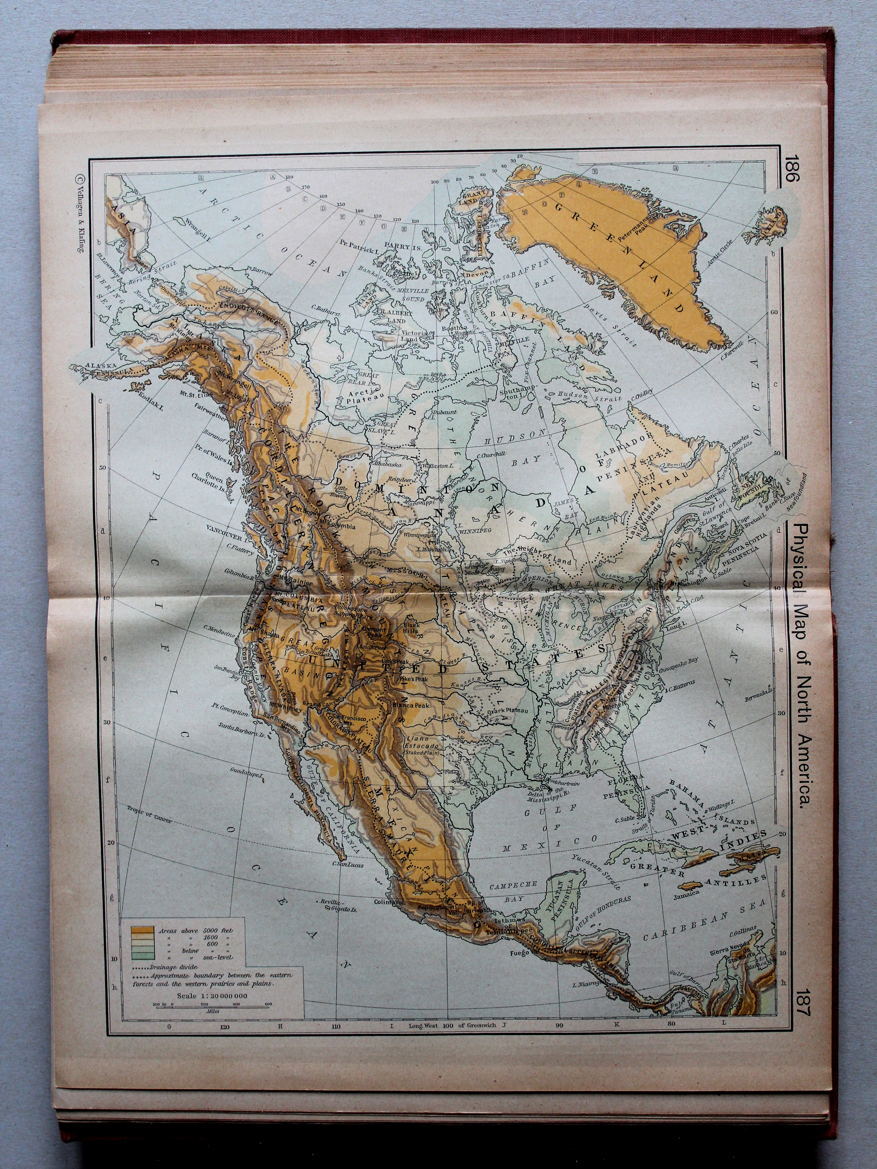
186.187. Physical Map of North America XL
Noord-Amerika, natuurkundig
 Shepherd, Historical Atlas, 1927
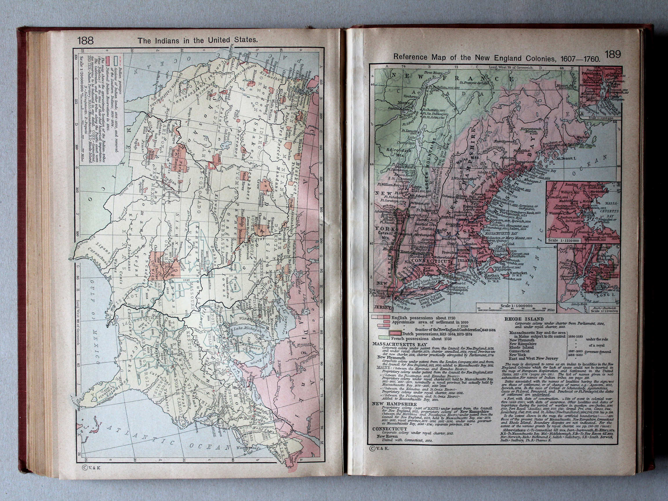
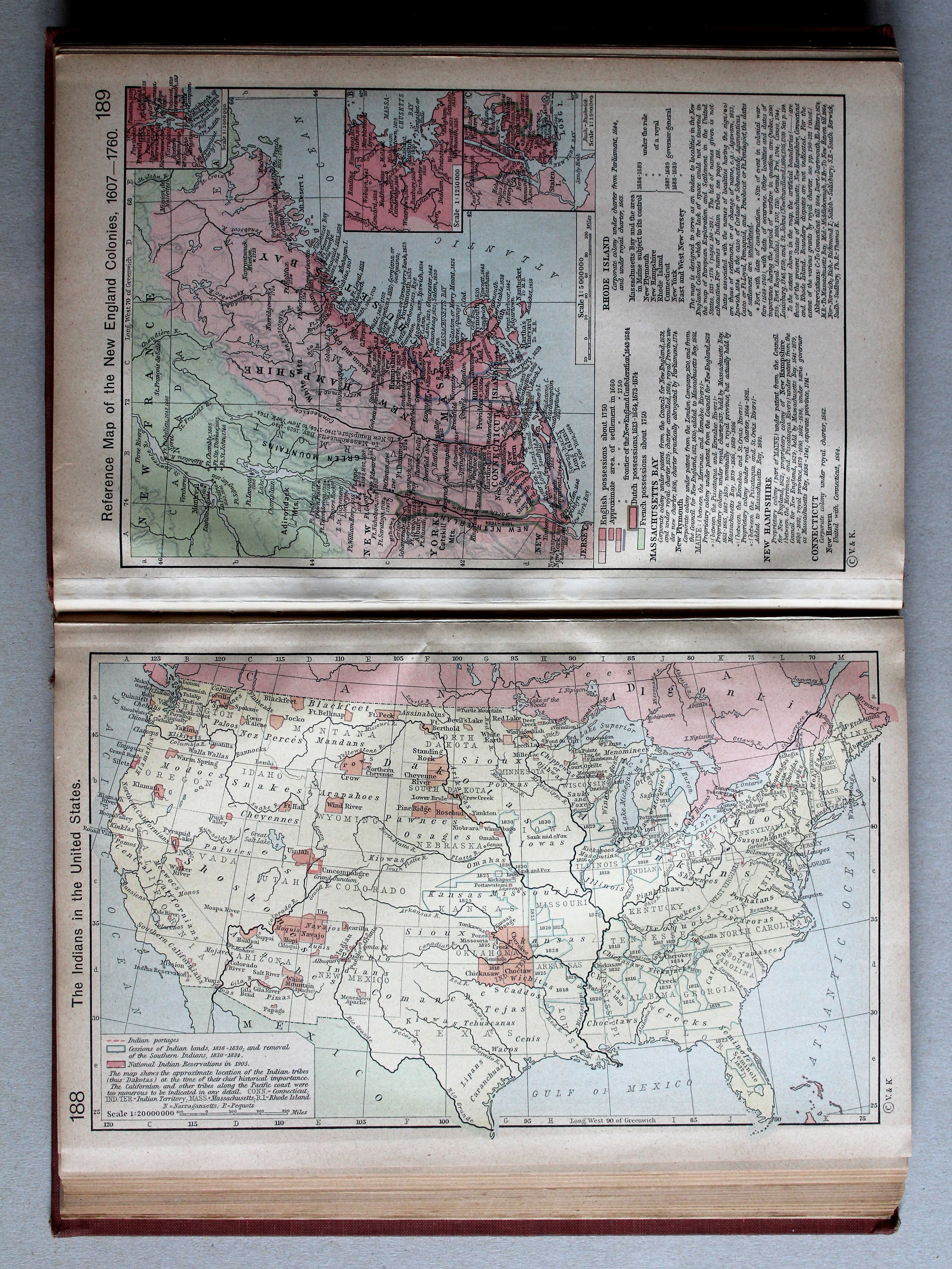
188. The Indians in the United States XL
De Indianen in de Verenigde Staten
 Shepherd, Historical Atlas, 1927
189. Reference Map of the New England Colonies, 1607-1760 XL
Koloniën in New England, 1607-1760
 Shepherd, Historical Atlas, 1927
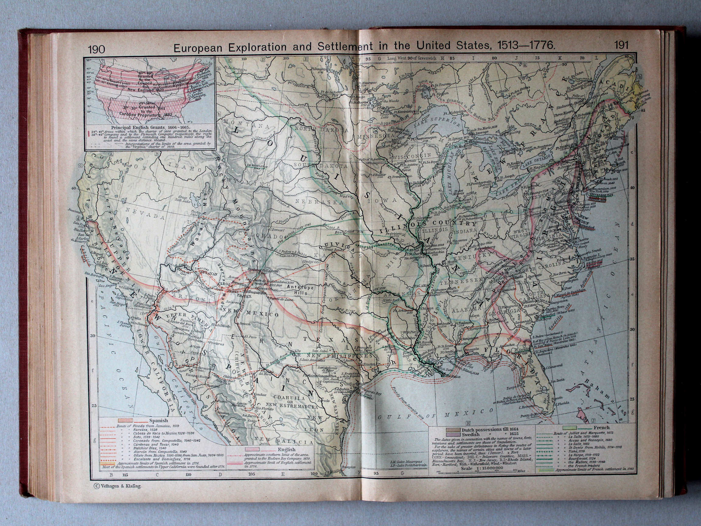
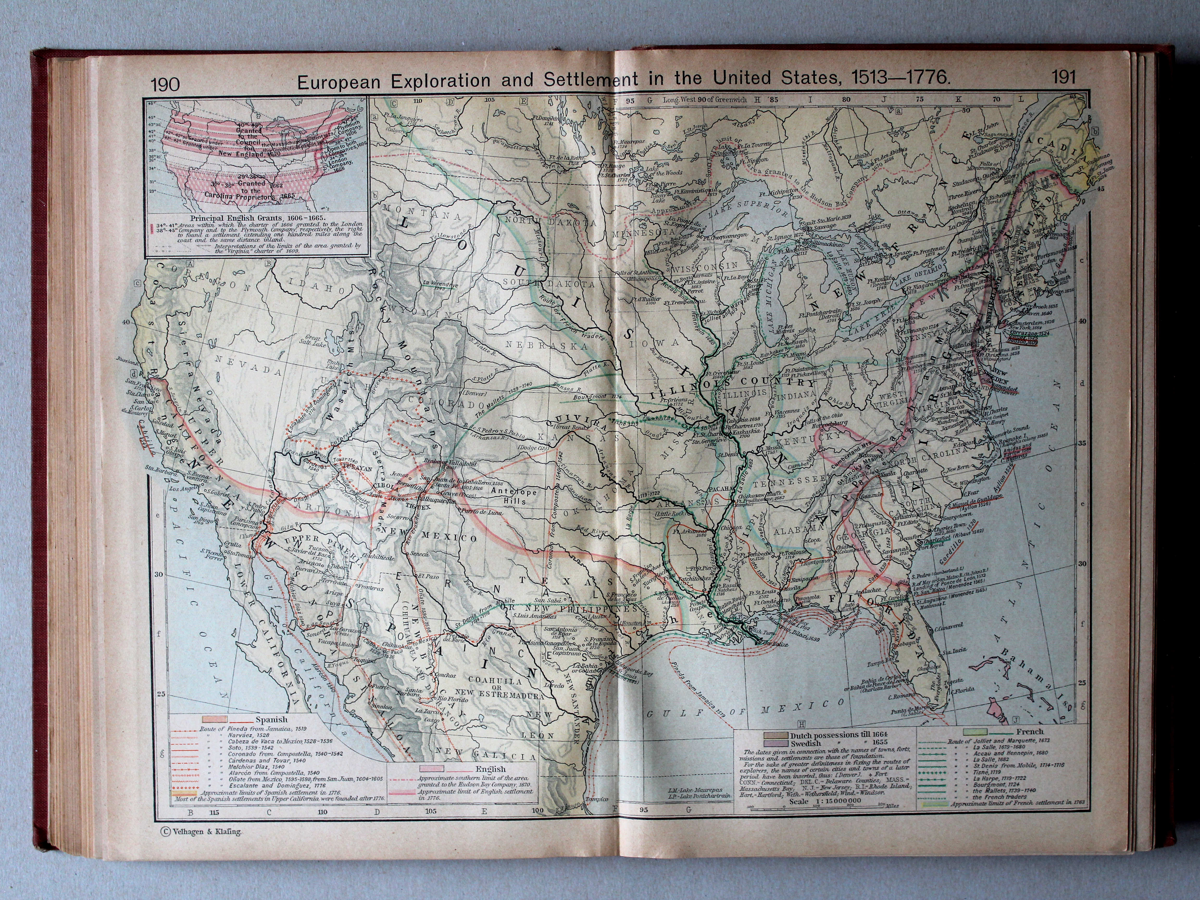
190.191. European Exploration and Settlement in the United States, 1513-1776 XL
Europese onderzoekingen en vestigingen in de Verenigde Staten, 1513-1776
 Shepherd, Historical Atlas, 1927
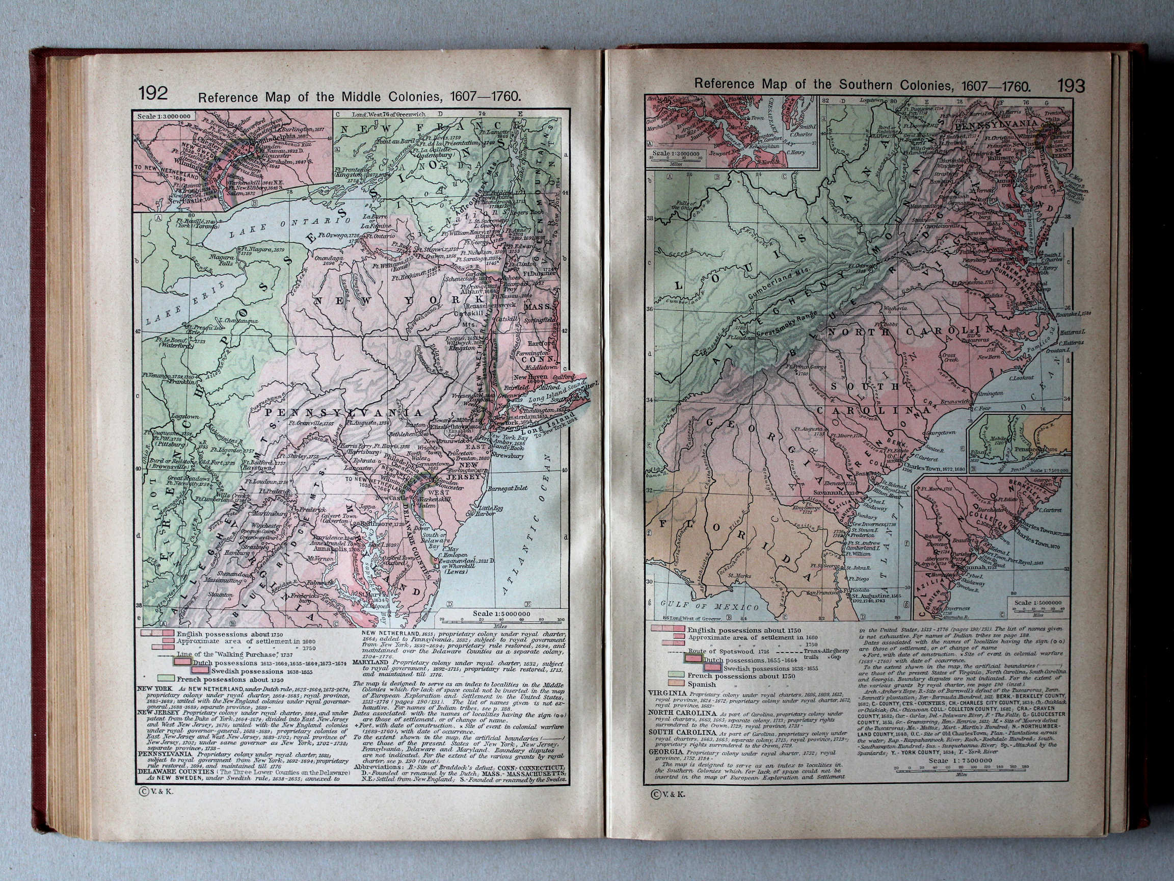
192. Reference Map of the Middle Colonies, 1607-1760 XL
Middenkoloniën in Noord-Amerika, 1607-1760
193. Reference Map of the Southern Colonies, 1607-1760 XL
Zuidelijke koloniën in Noord-Amerika, 1607-1760
 Shepherd, Historical Atlas, 1927
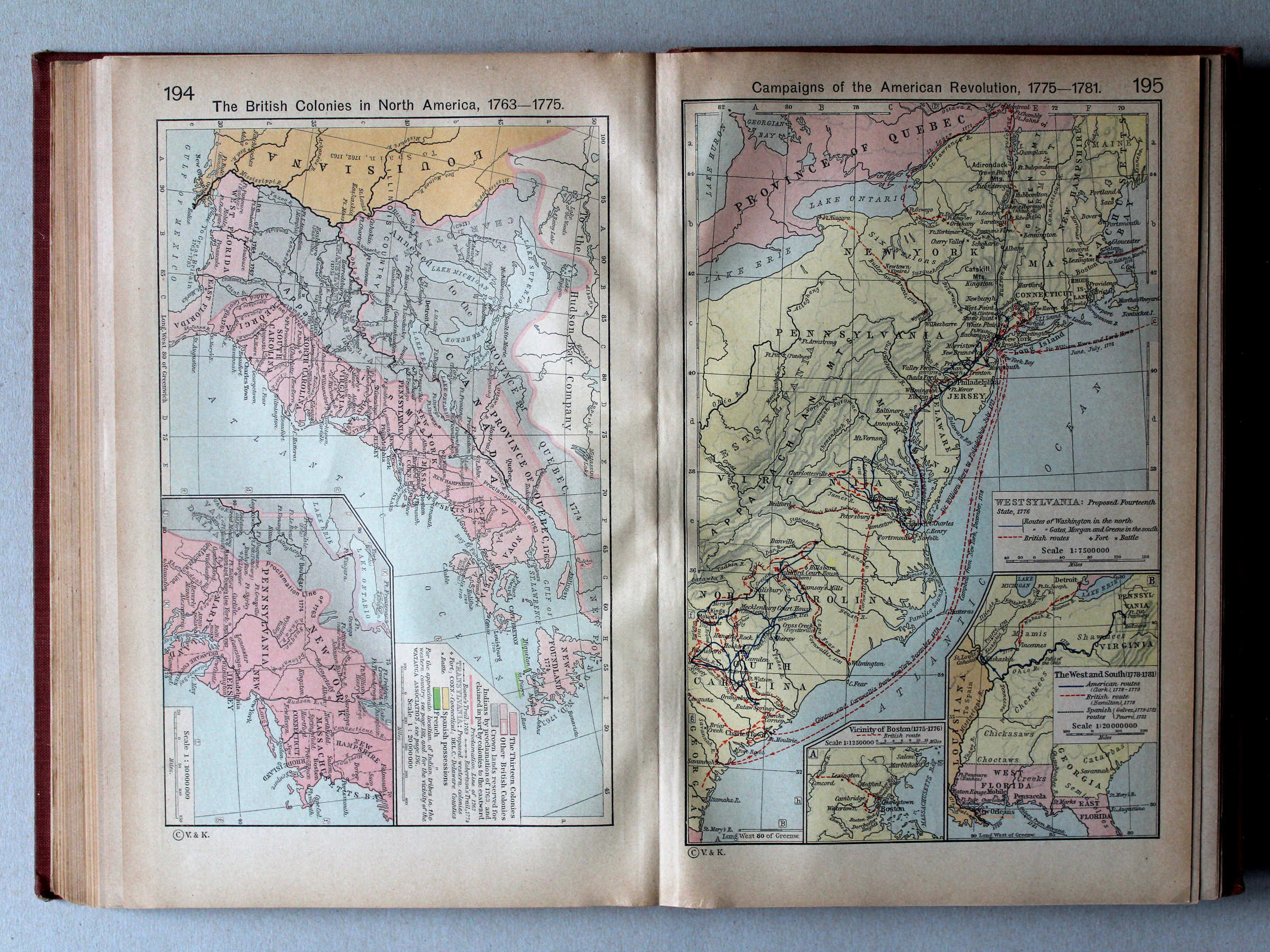
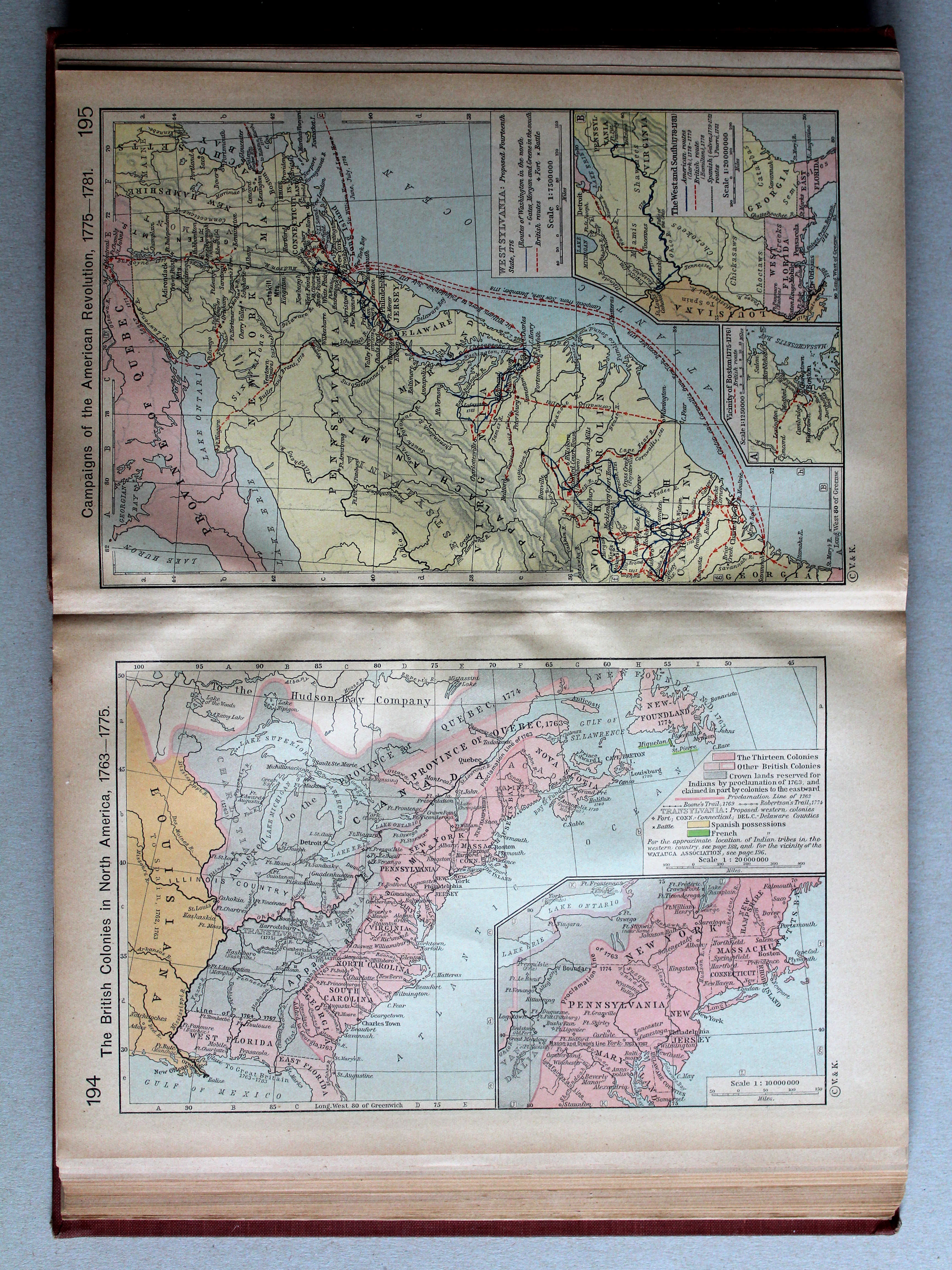
194. The British Colonies in North America, 1763-1775 XL
Britse koloniën in Noord-Amerika, 1763-1775
 Shepherd, Historical Atlas, 1927
195. Campaigns of the American Revolution, 1775-1781 XL
Veldtochten in de Amerikaanse Onafhankelijkheidsoorlog, 1775-1781
 Shepherd, Historical Atlas, 1927
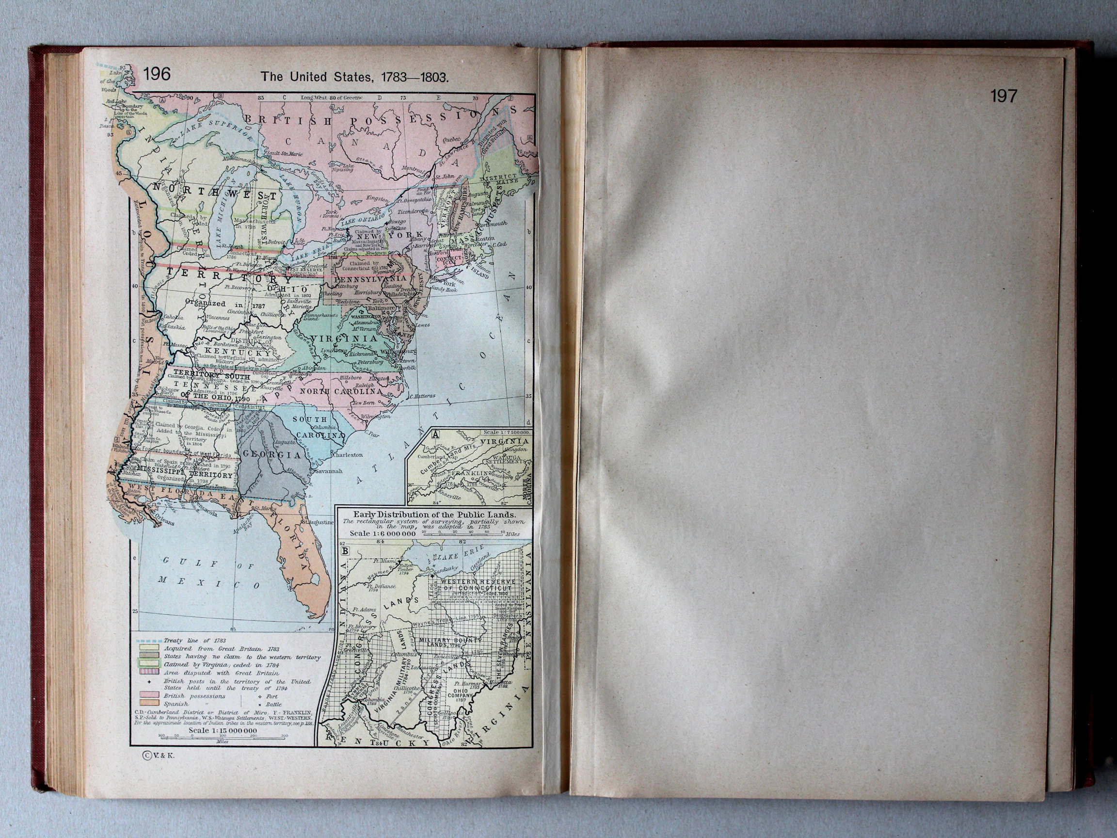
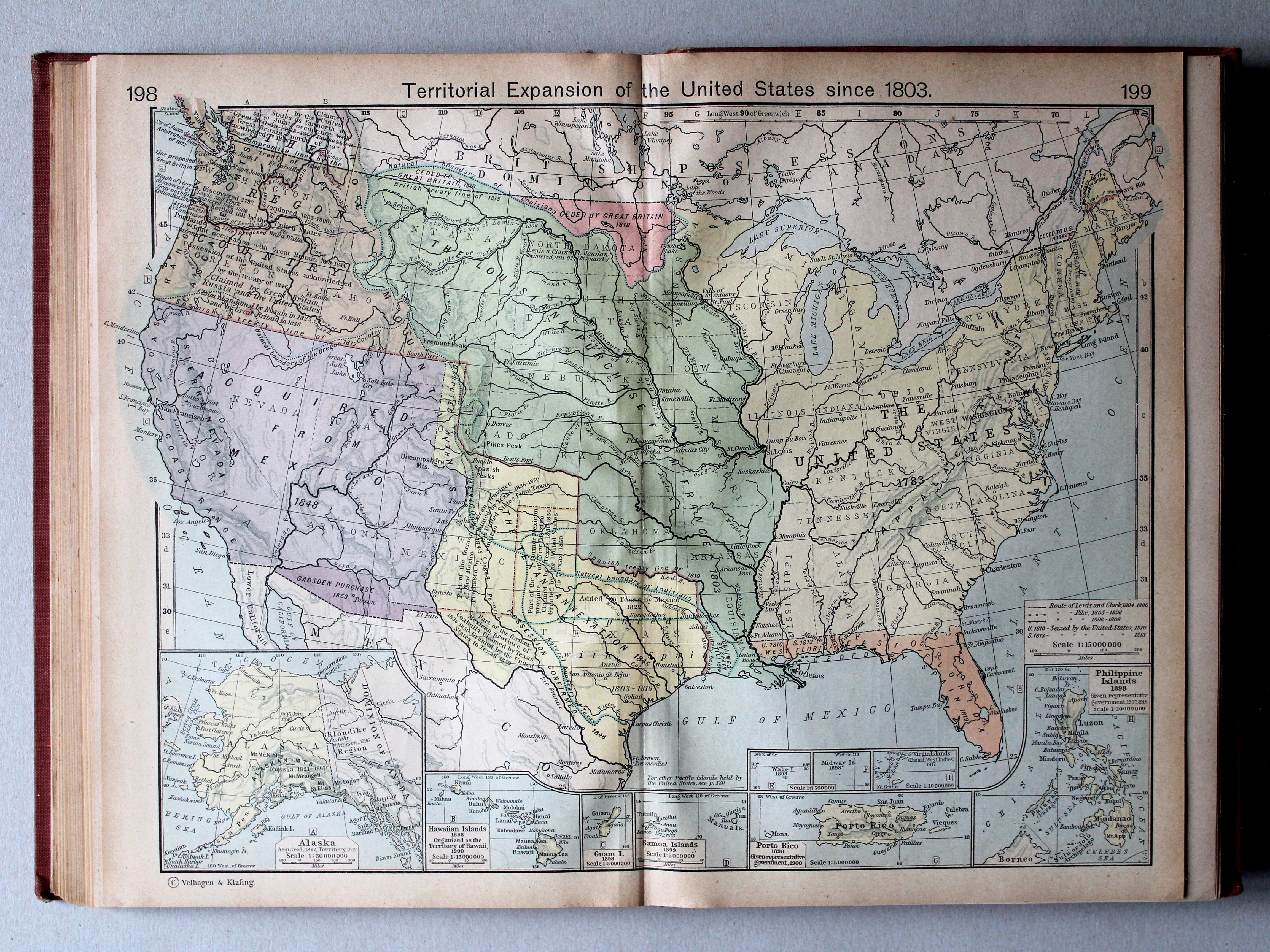
198.199. Territorial Expansion of the United States since 1803 XL
Gebiedsuitbreiding van de Verenigde Staten vanaf 1803
 Shepherd, Historical Atlas, 1927
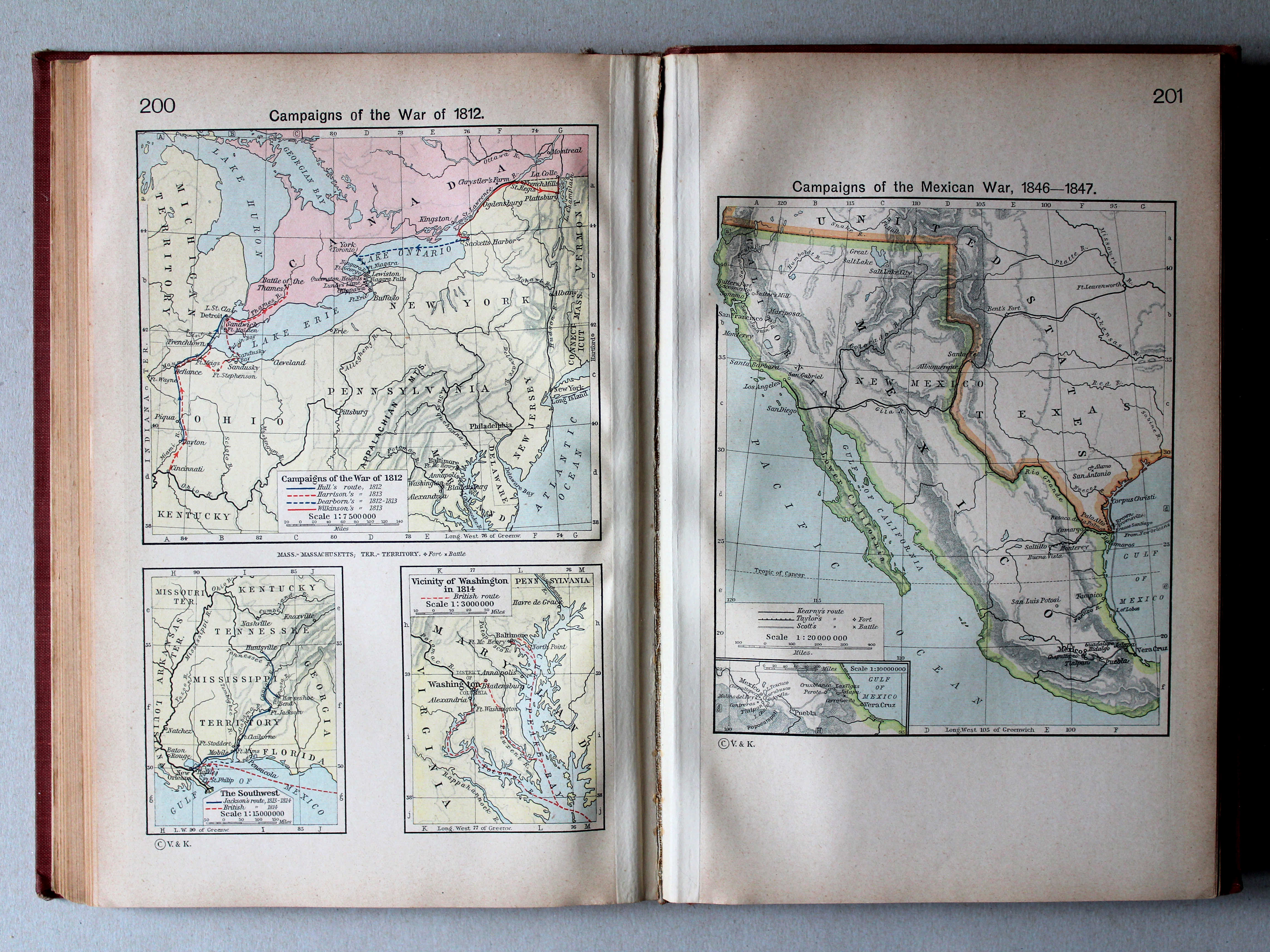
200. Campaigns of the War of 1812 XL
Veldtochten in de Anglo-Amerikaanse oorlog van 1812
201. Campaigns of the Mexican War, 1846-1847 XL
Veldtochten in de Mexicaans-Amerikaanse Oorlog, 1846-1847
 Shepherd, Historical Atlas, 1927
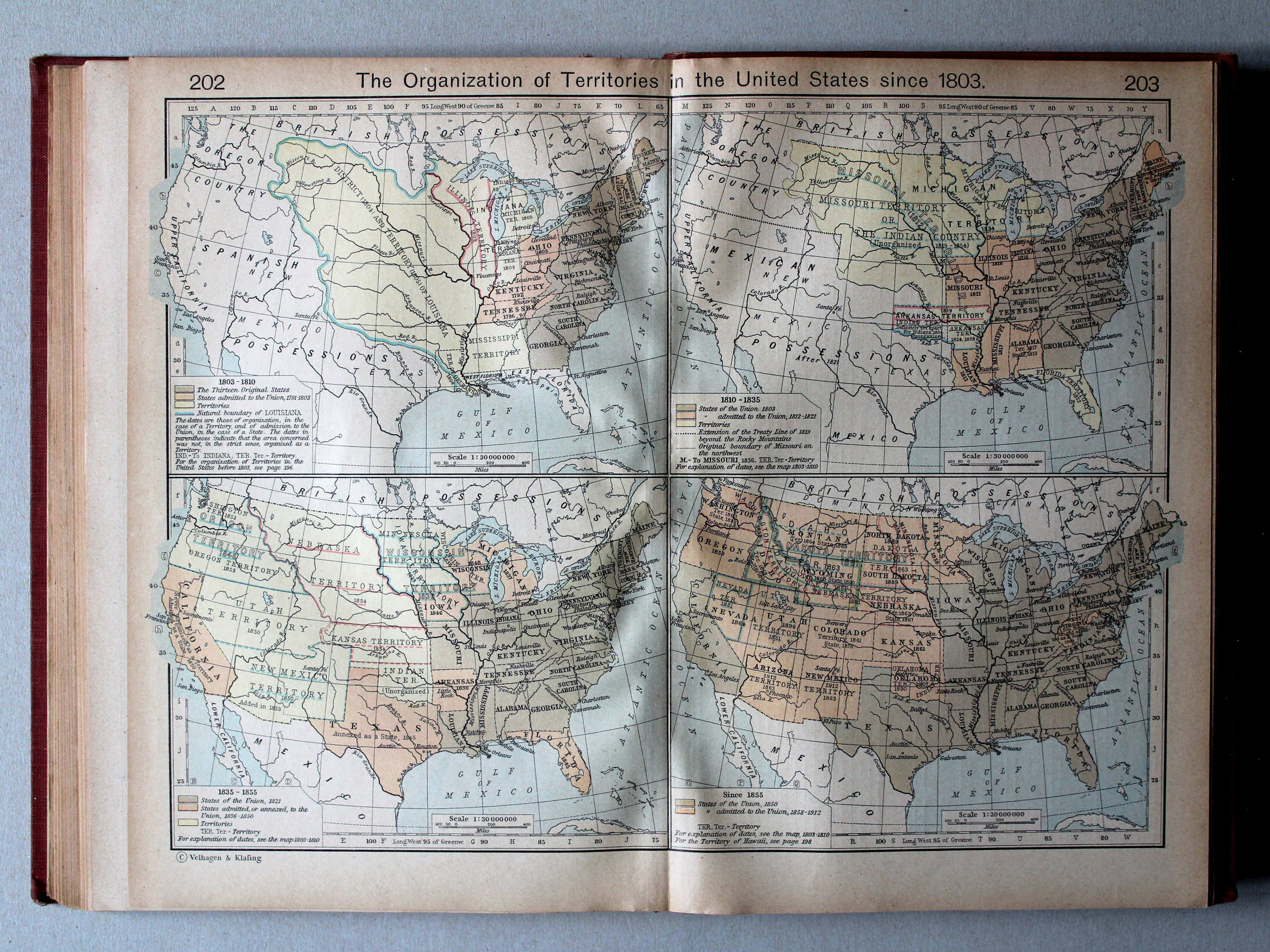
202.203. The Organization of Territories in the United States since 1803 XL
Organisatie van Gebieden in de Verenigde Staten vanaf 1803
 Shepherd, Historical Atlas, 1927
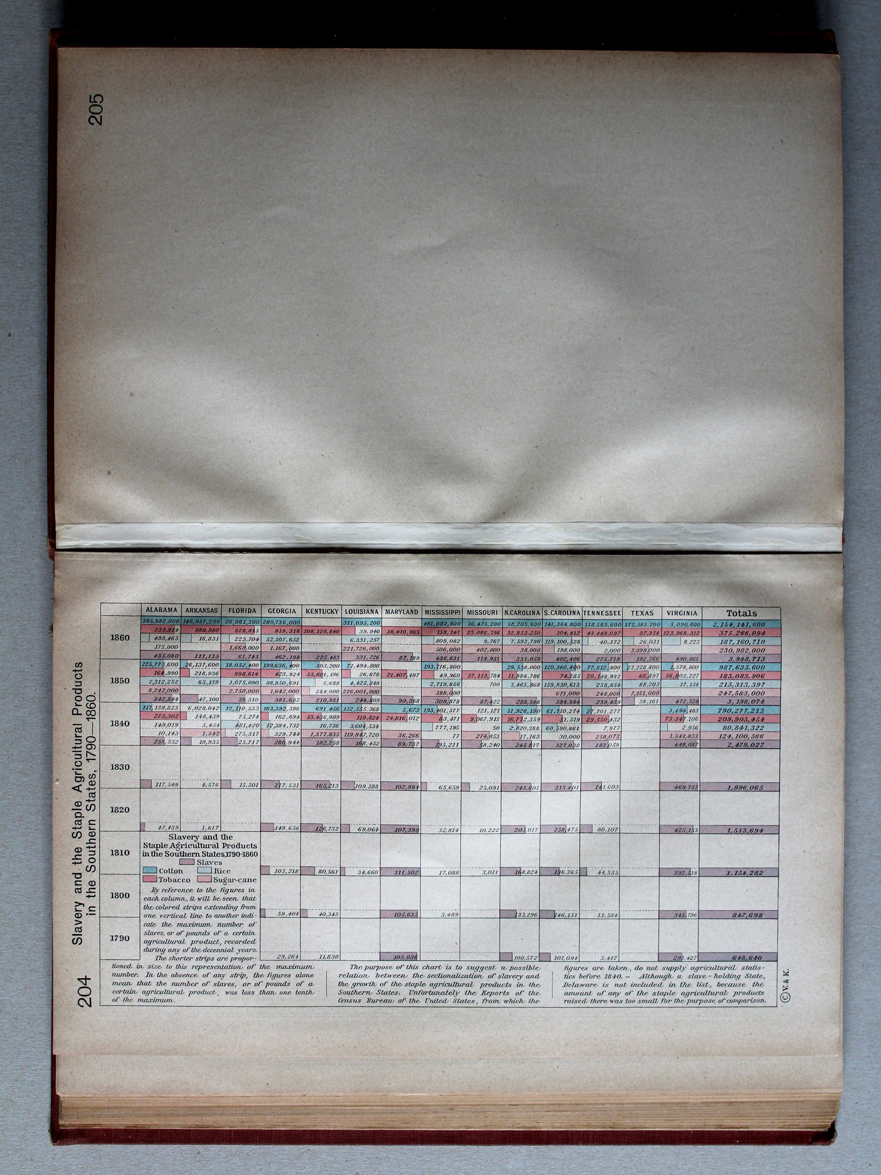
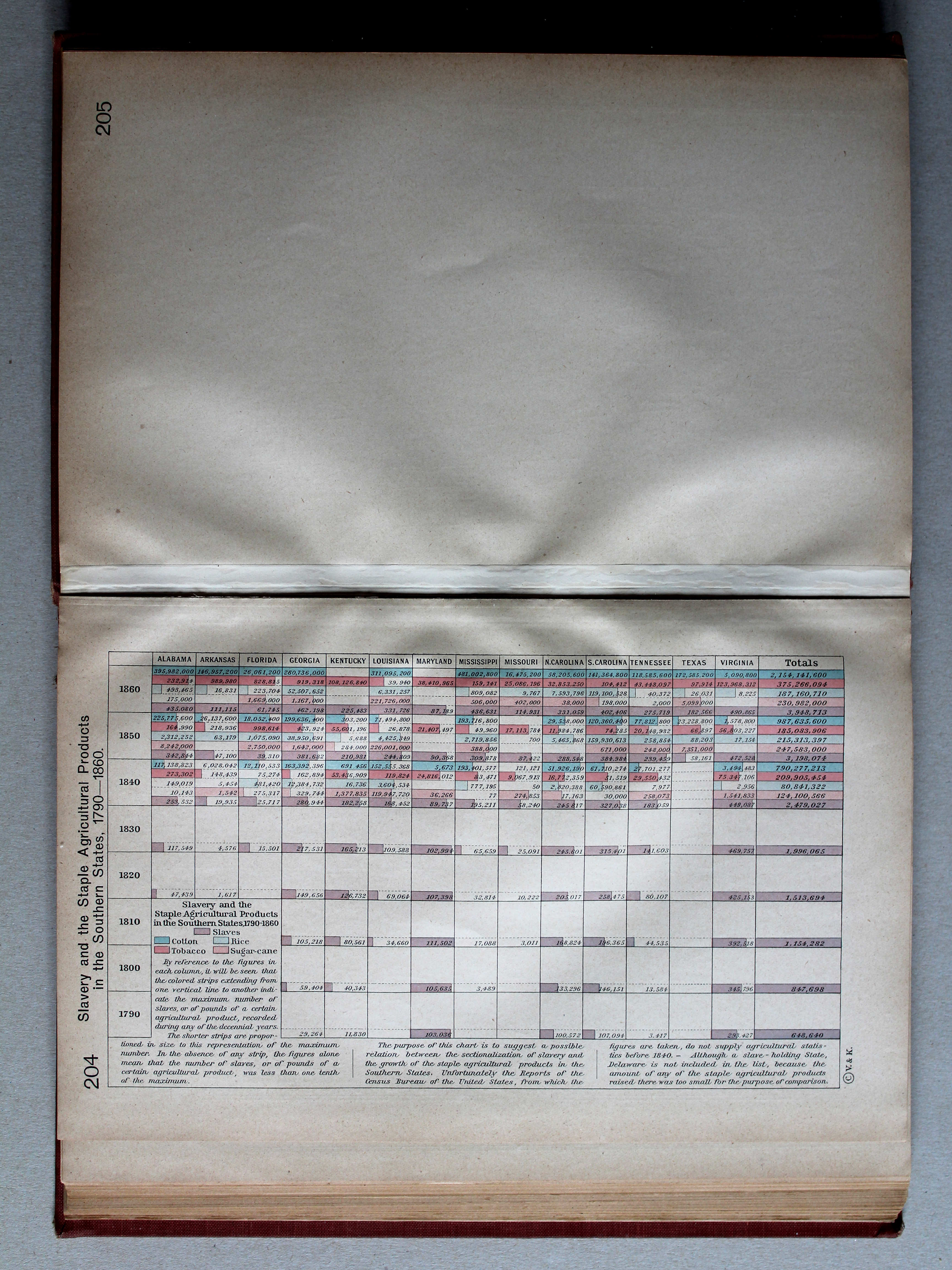
204. Slavery and the Staple Agricultural Products in the Southern States, 1790-1860 XL
Slavernij en de belangrijkste landbouwproducten in de Zuidelijke Staten, 1790-1860
 Shepherd, Historical Atlas, 1927
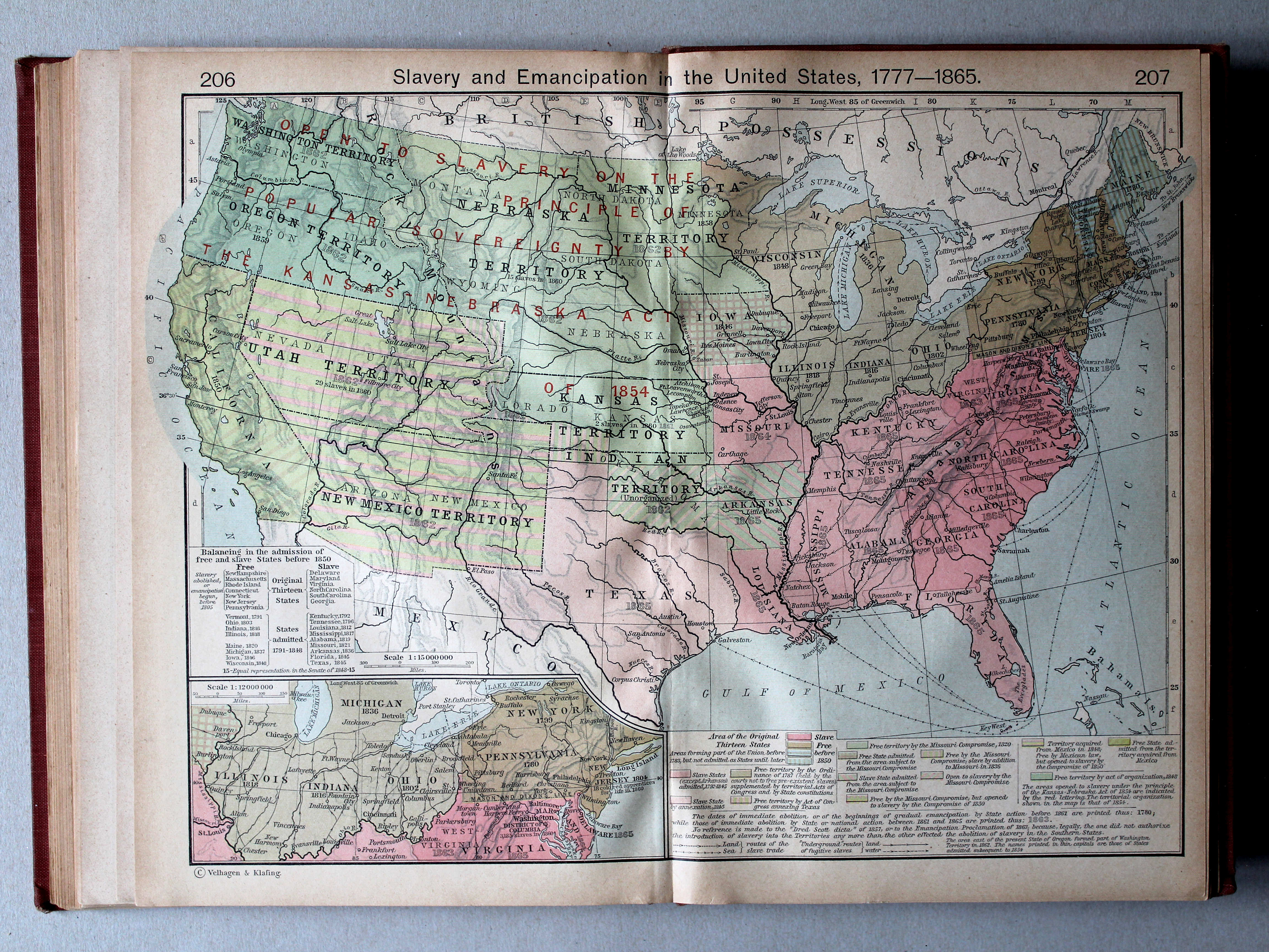
206.207. Slavery and Emancipation in the United States, 1777-1865 XL
Slavernij en bevrijding in de Verenigde Staten, 1777-1865
 Shepherd, Historical Atlas, 1927
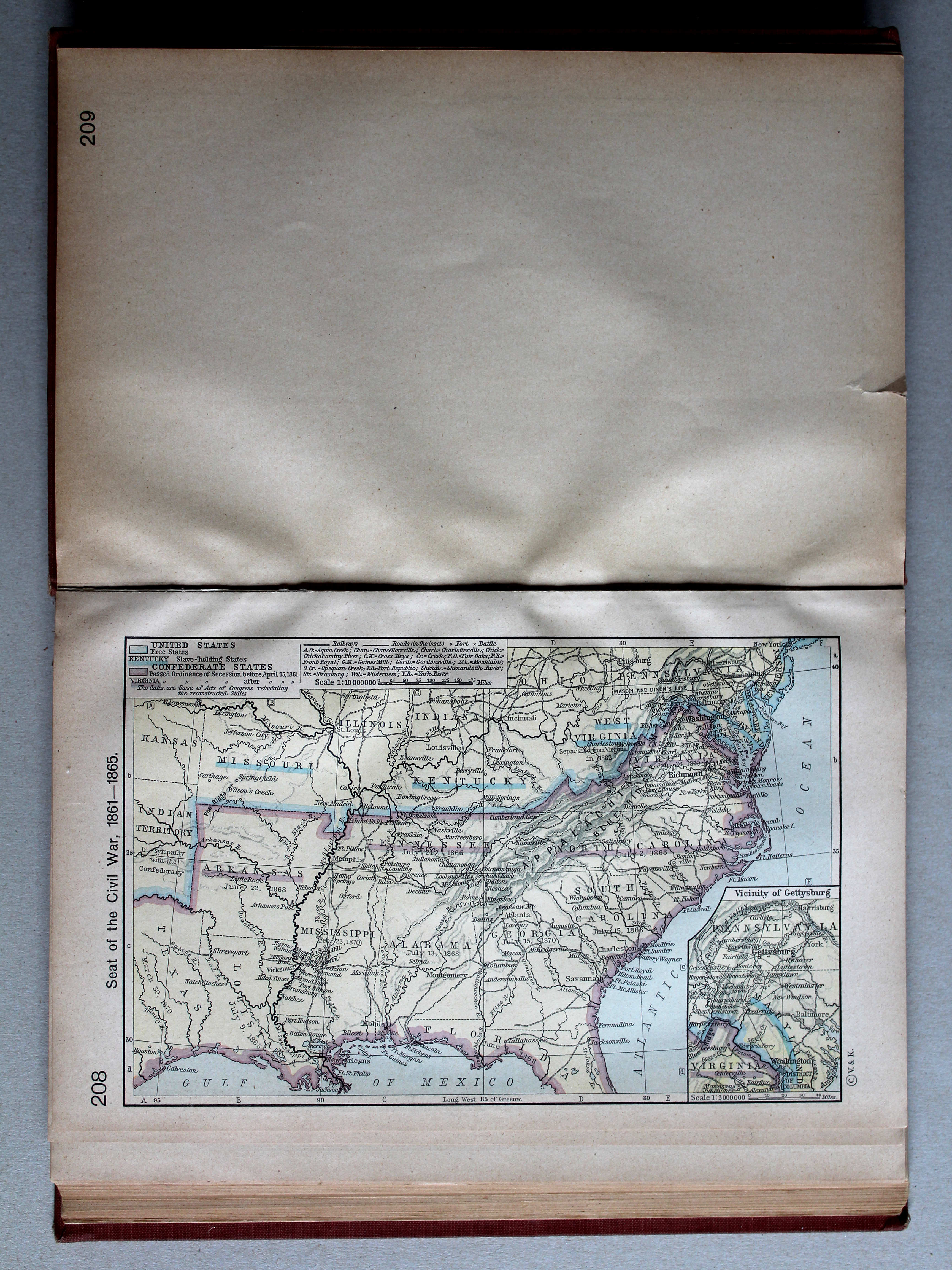
208. Seat of the Civil War, 1861-1865 XL
Amerikaanse Burgeroorlog, 1861-1865
 Shepherd, Historical Atlas, 1927
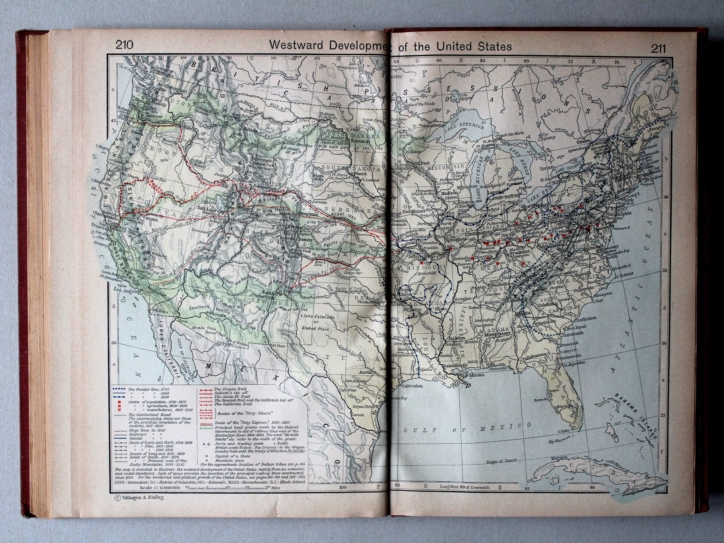
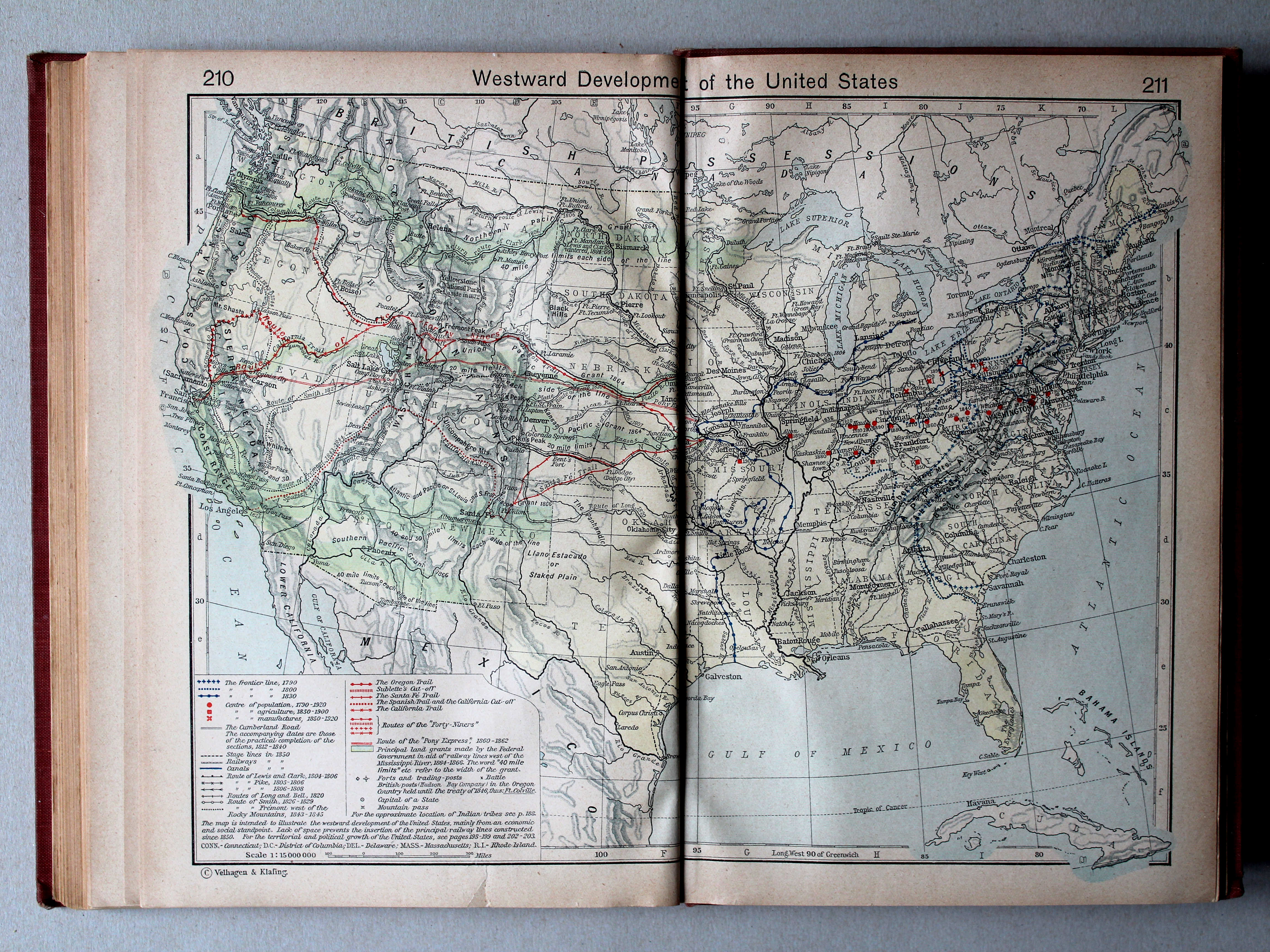
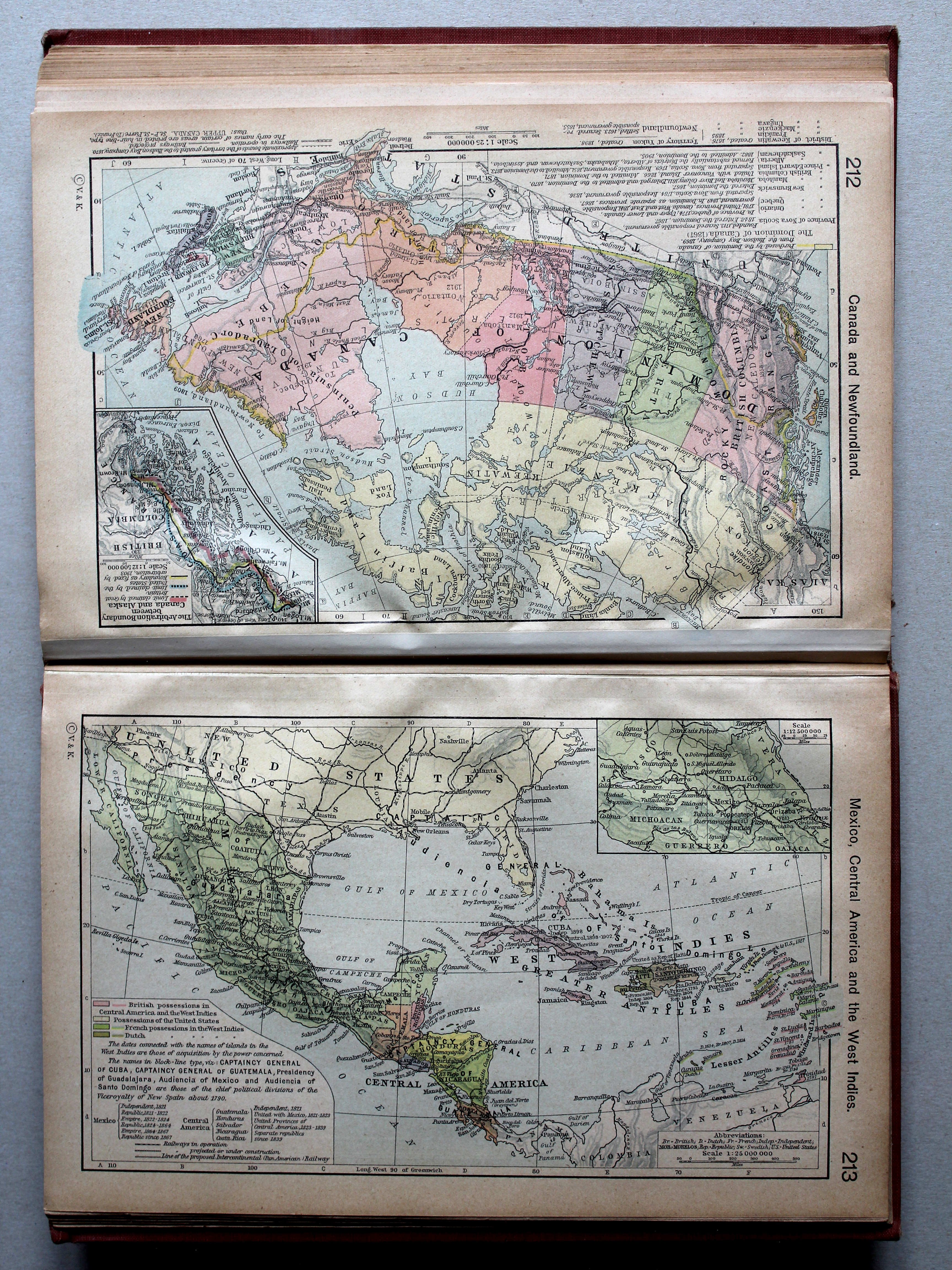
210.211. Westward Development of the United States XL
Uitbreiding van de Verenigde Staten naar het westen

 Shepherd, Historical Atlas, 1927
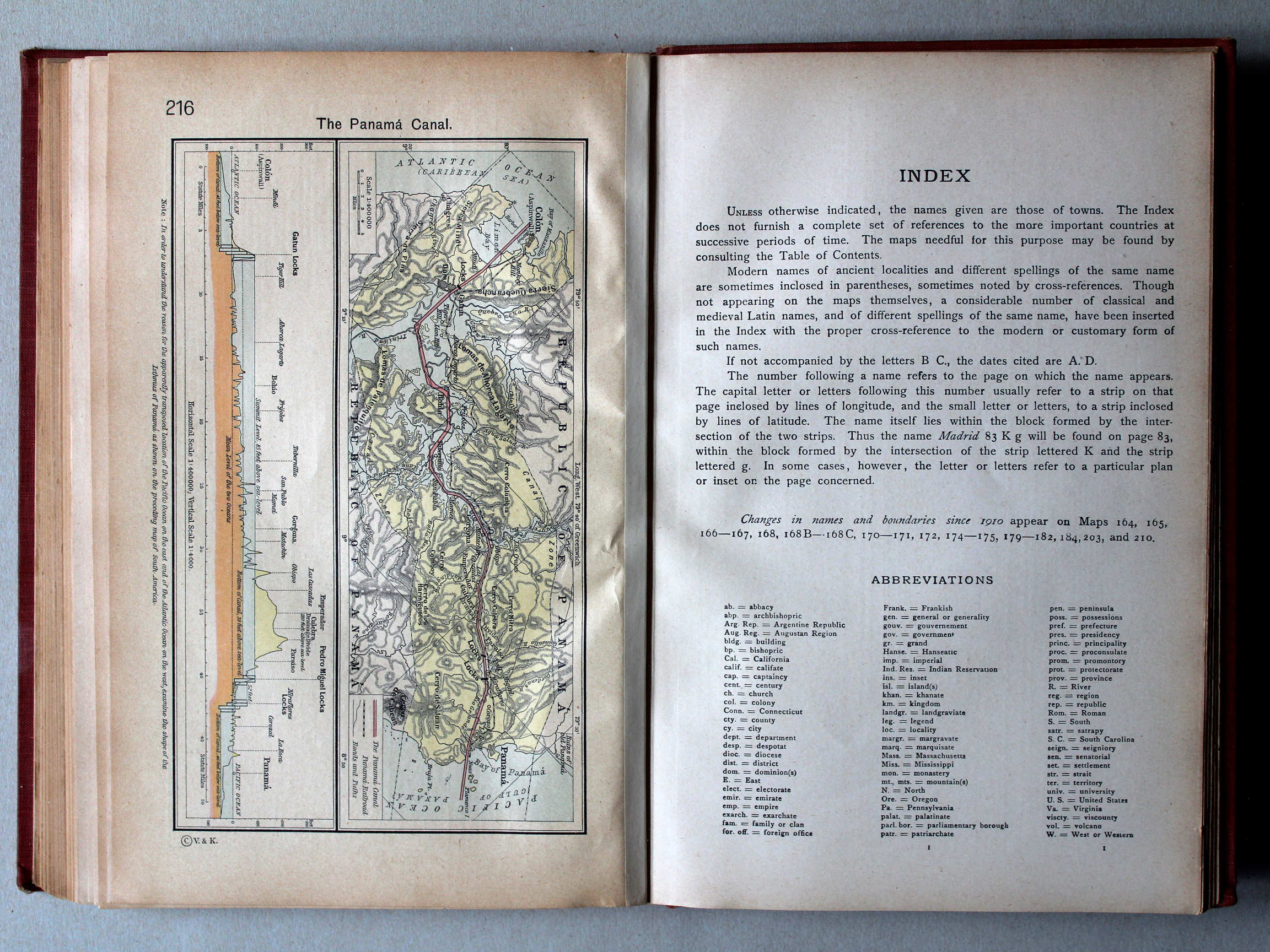
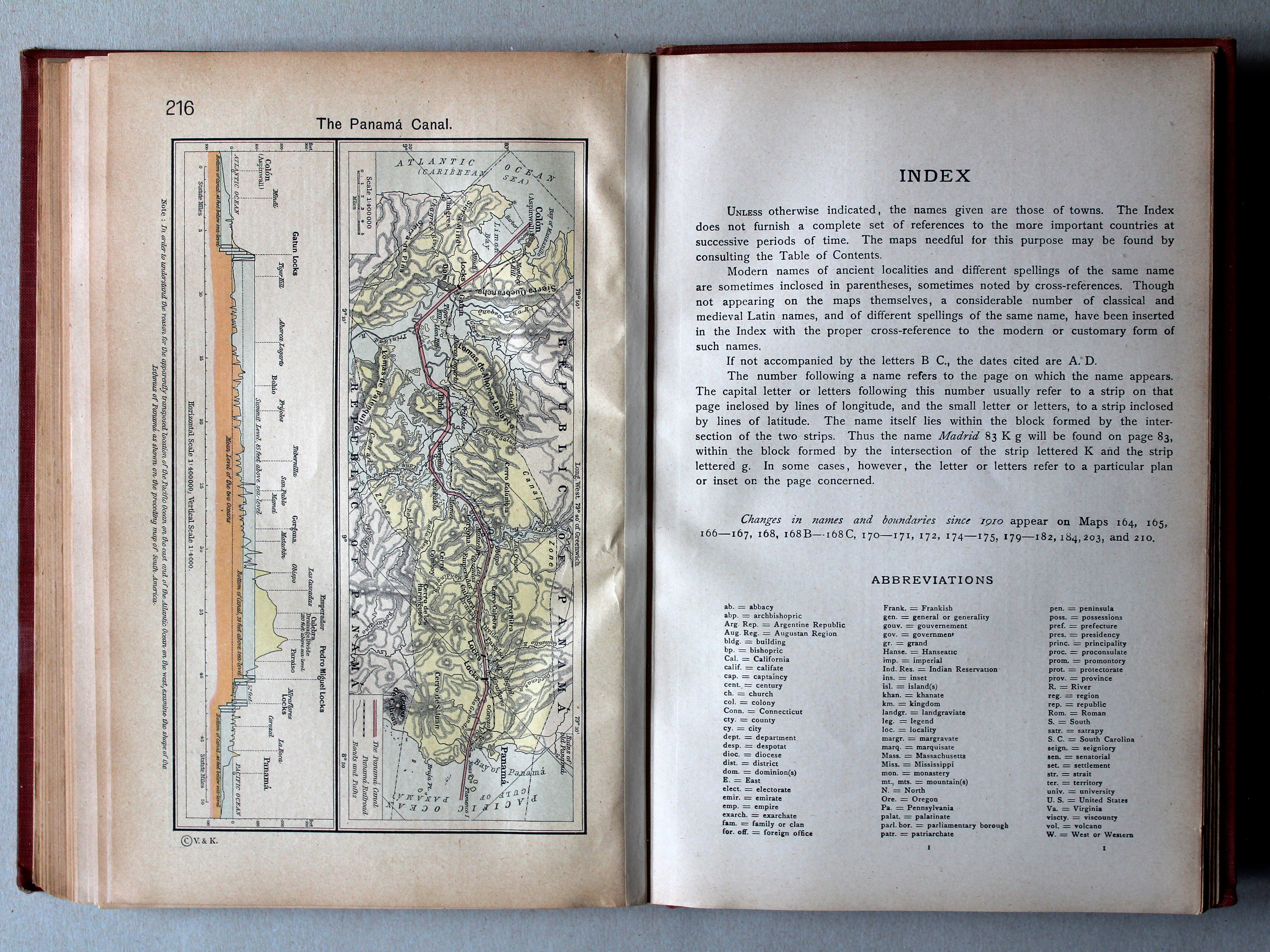
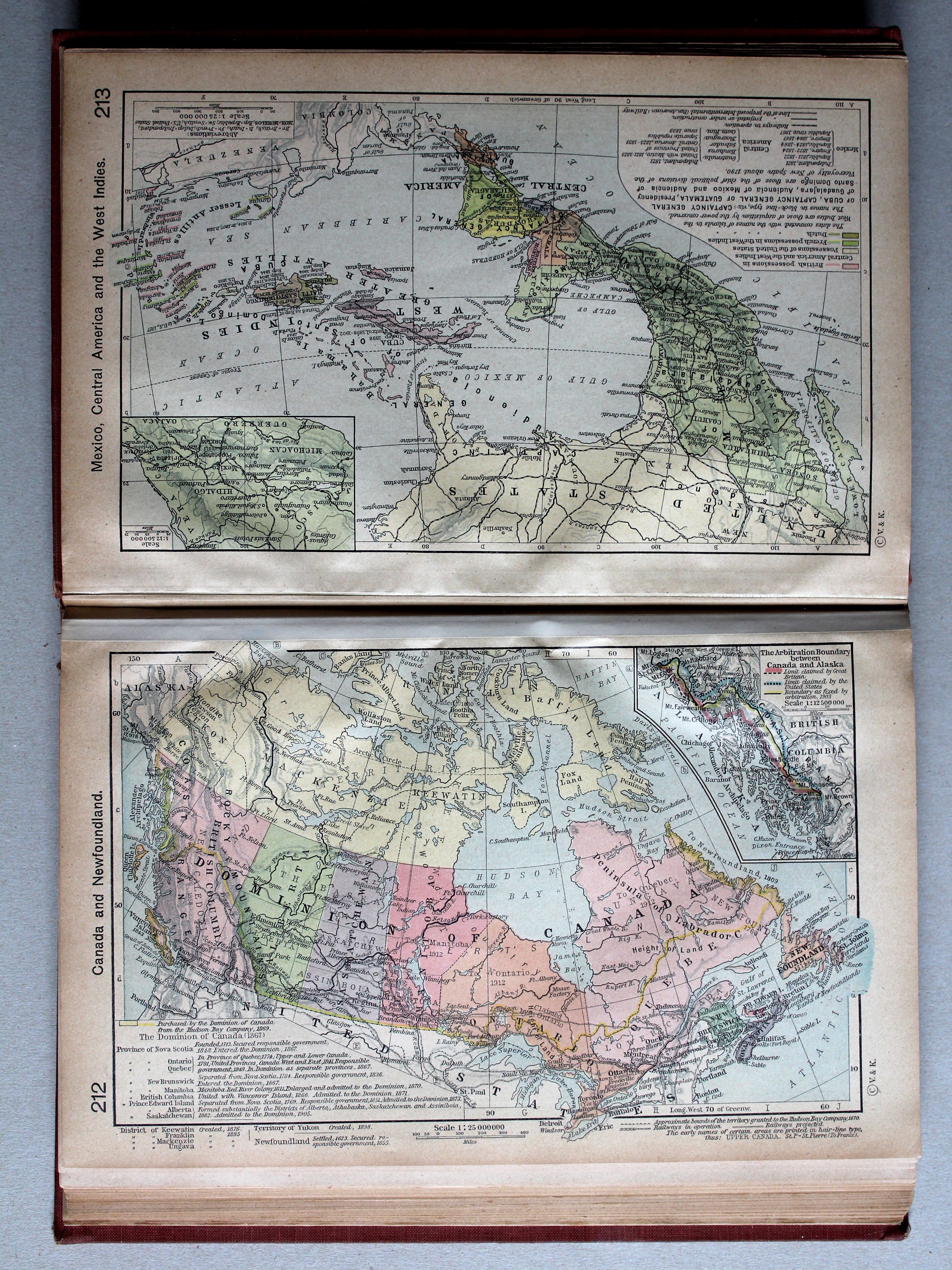
213. Mexico, Central America and the West Indies XL
Mexico, Midden-Amerika en West-Indië
© M. Witkam, 2013
![]()
![]()