Nędzyński, Atlas Orbis Antiqui (1825) en
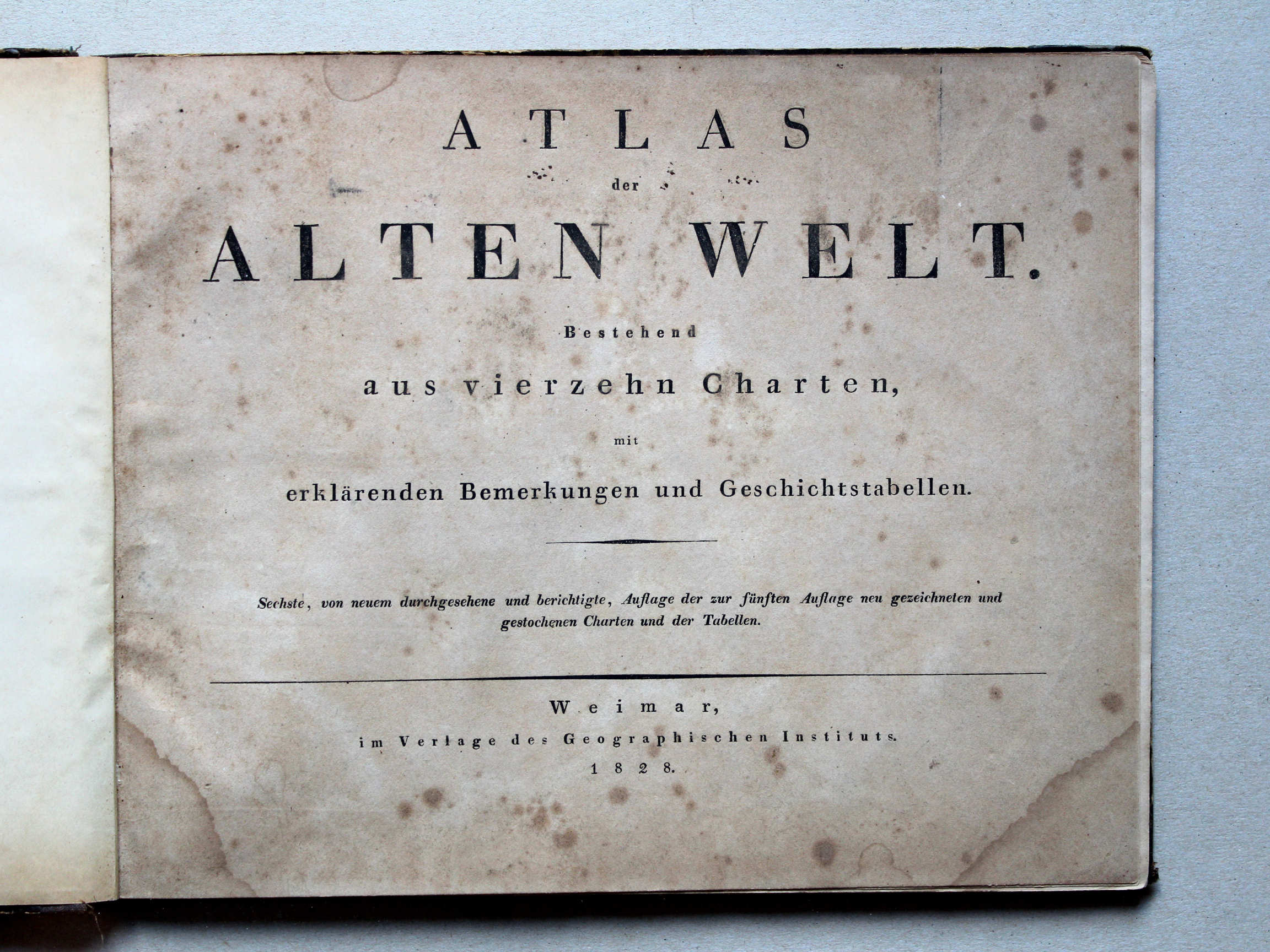
Atlas der alten Welt, 6e druk (1828)
See below for (a summary of) this text in English.
Hieronder staan plaatjes van de Atlas Orbis Antiqui en de Atlas der alten Welt ter vergelijking naast elkaar. Daarbij horen ook de volgende pagina's
- Beschrijving van de Atlas Orbis Antiqui
- Plaatjes van de Atlas Orbis Antiqui
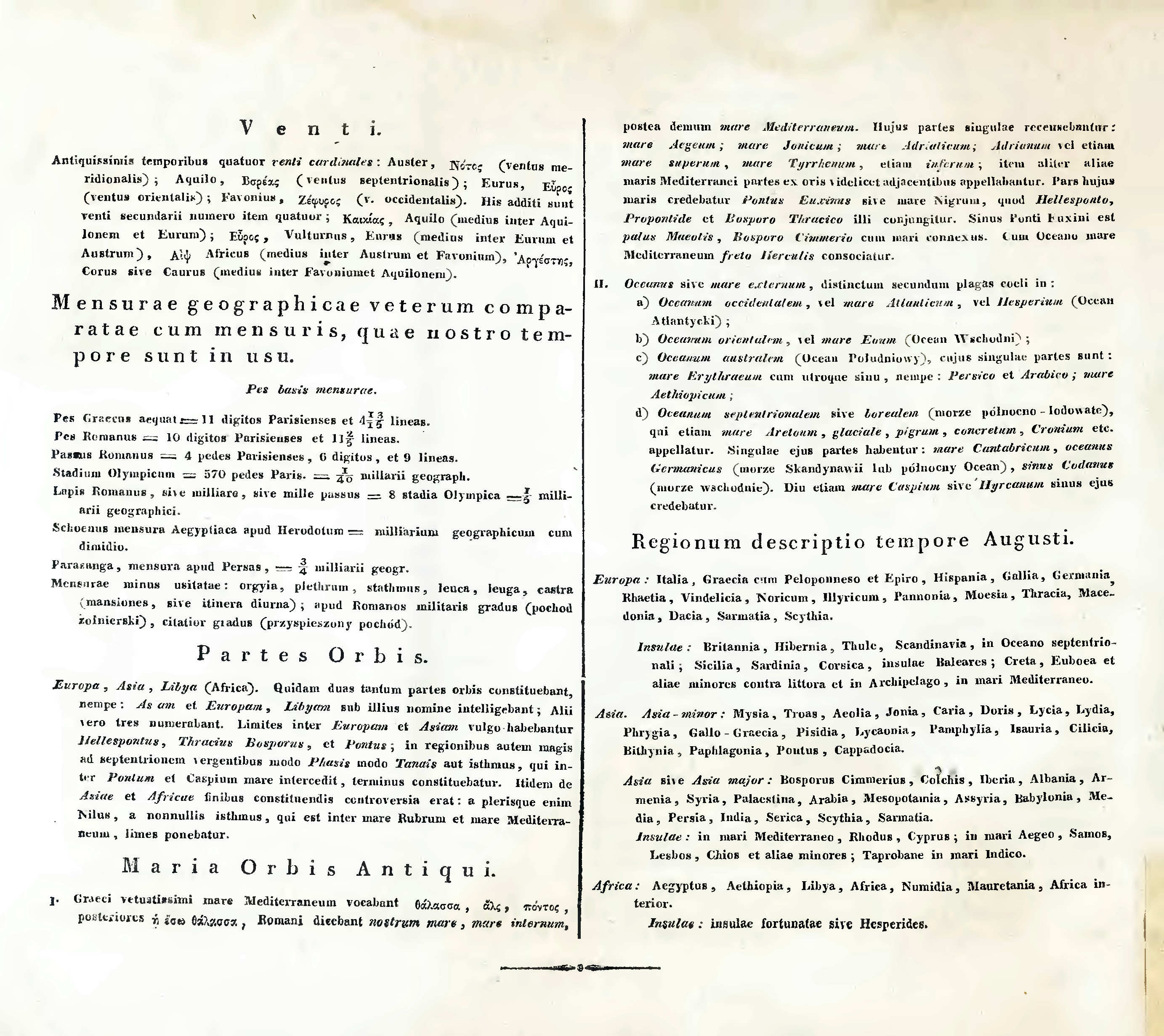
- Tabellen en lijsten bij de Atlas Orbis Antiqui
en
- Beschrijving van de Atlas der alten Welt
- Plaatjes van de Atlas der alten Welt
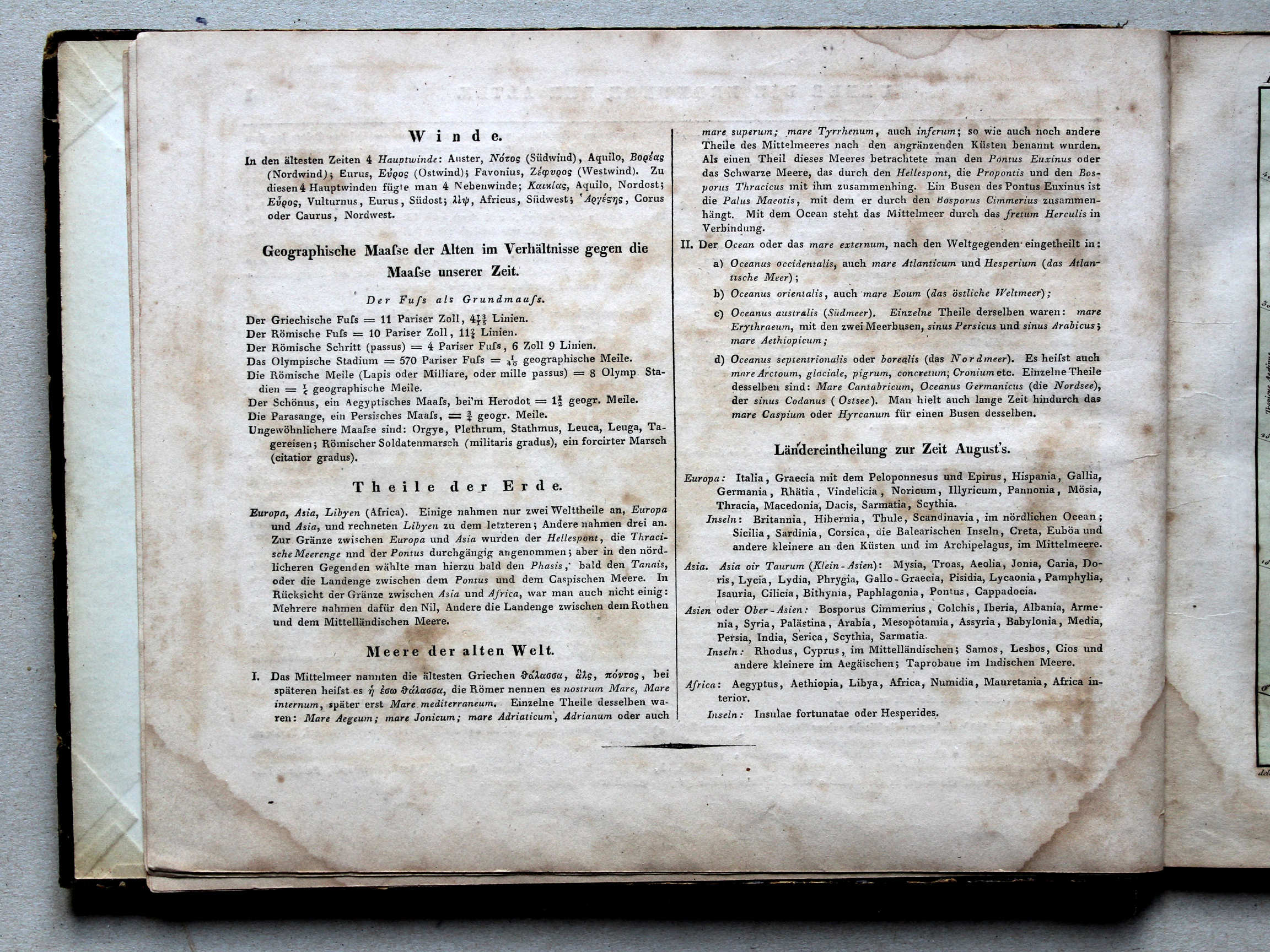
- Tabellen en lijsten bij de Atlas der alten Welt
Plaatjes
Klik op een plaatje voor een vergroting.
Nędzyński, Atlas Orbis Antiqui (1825) and
Atlas der alten Welt, 6th edition (1828)
- Below are pictures the Atlas Orbis Antiqui and the Atlas der alten Welt side by side for comparison purposes. Related pages
- Description of the Atlas Orbis Antiqui
- Pictures of the Atlas Orbis Antiqui
- Tables and lists to the Atlas Orbis Antiqui
- Description of the Atlas der alten Welt
- Pictures of the Atlas der alten Welt
- Tables and lists to the Atlas der alten Welt
Pictures
Click on a picture to enlarge.
Titelpagina / Title page
 Nedzynski, Atlas Orbis Antiqui, 1825
Titelpagina / Title page
 Nedzynski, Atlas Orbis Antiqui, 1825
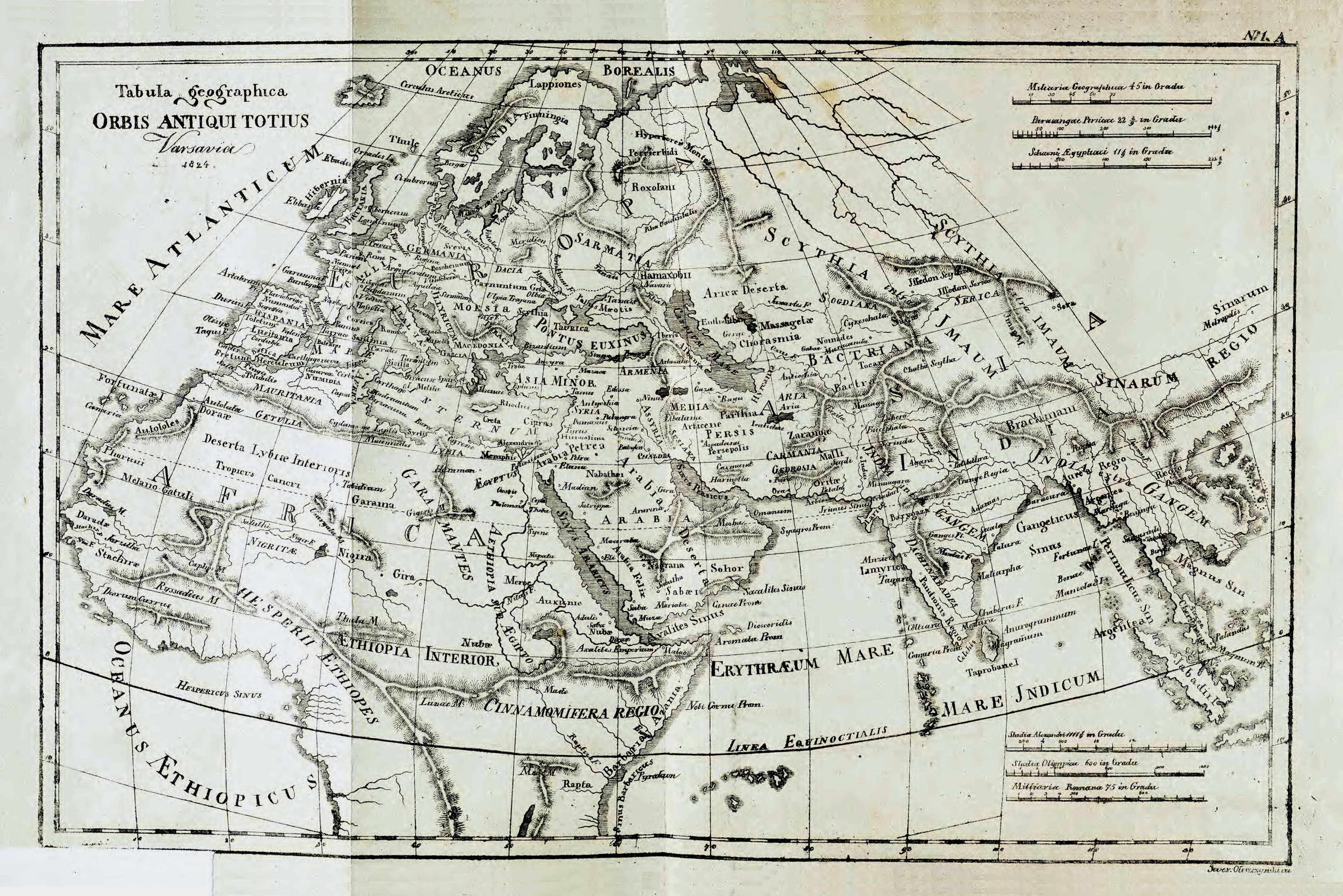
1A. Tabula geographica Orbis Antiqui totius
Overzichtskaart van de Wereld in de Oudheid / General maps of the Ancient World
 Atlas der alten Welt, 1828
geen overeenkomstige kaart / no corresponding map
 Nedzynski, Atlas Orbis Antiqui, 1825
Toelichting bij kaart I / Explanation to sheet I (1)
 Nedzynski, Atlas Orbis Antiqui, 1825
Toelichting bij kaart I / Explanation to sheet I (2)
 Nedzynski, Atlas Orbis Antiqui, 1825
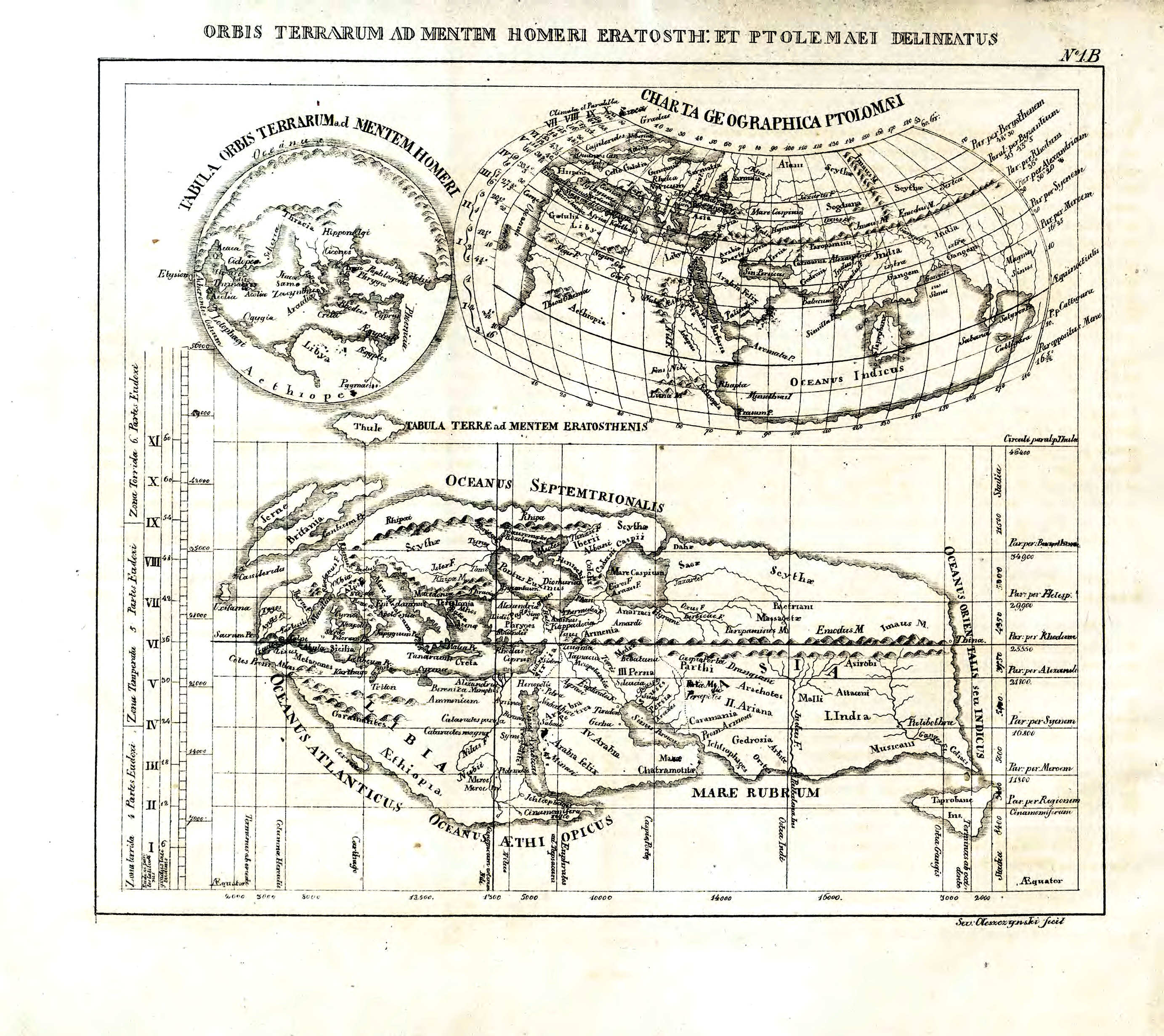
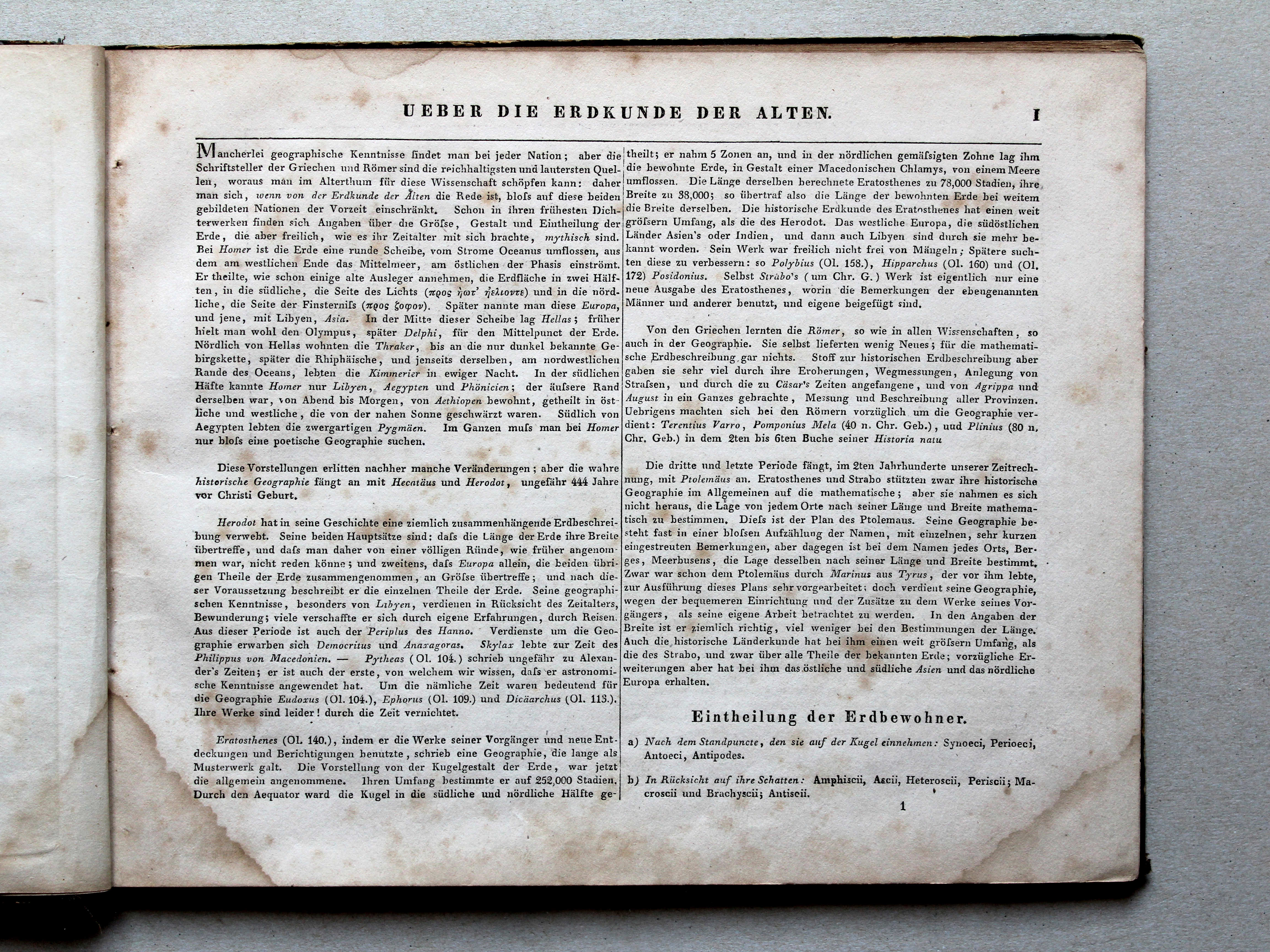
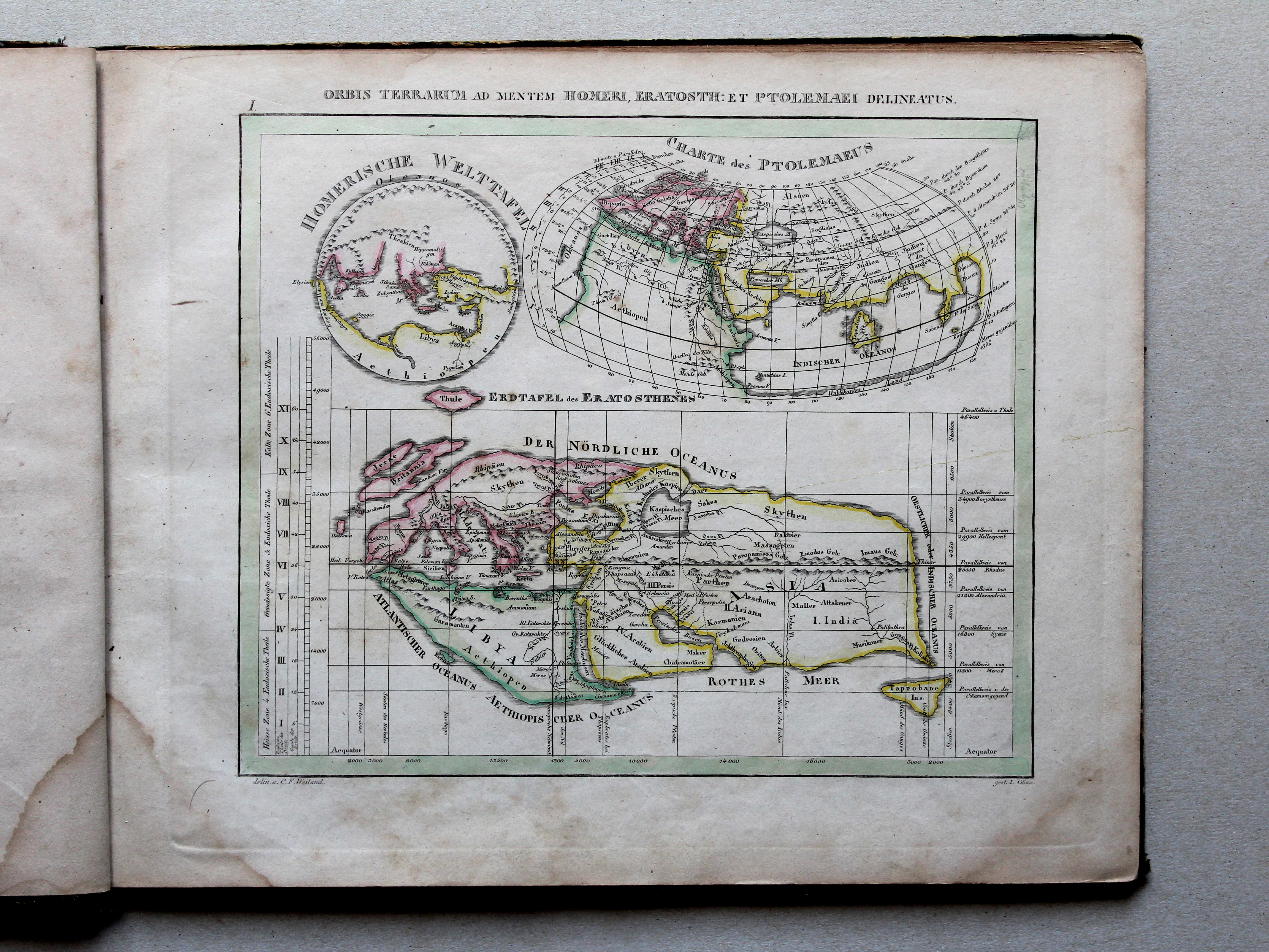
1B. Orbis terrarum ad mentem Homeri, Eratosth. et Ptolemaei delineatus
Wereldkaarten volgens Homerus, Eratosthenes en Ptolemaeus / World maps according to Homer, Eratosthenes and Ptolemy
 Atlas der alten Welt, 1828
I. Orbis terrarum ad mentem Homeri, Eratosth. et Ptolemaei delineatus XL
Wereldkaarten volgens Homerus, Eratosthenes en Ptolemaeus / World maps according to Homer, Eratosthenes and Ptolemy
 Nedzynski, Atlas Orbis Antiqui, 1825
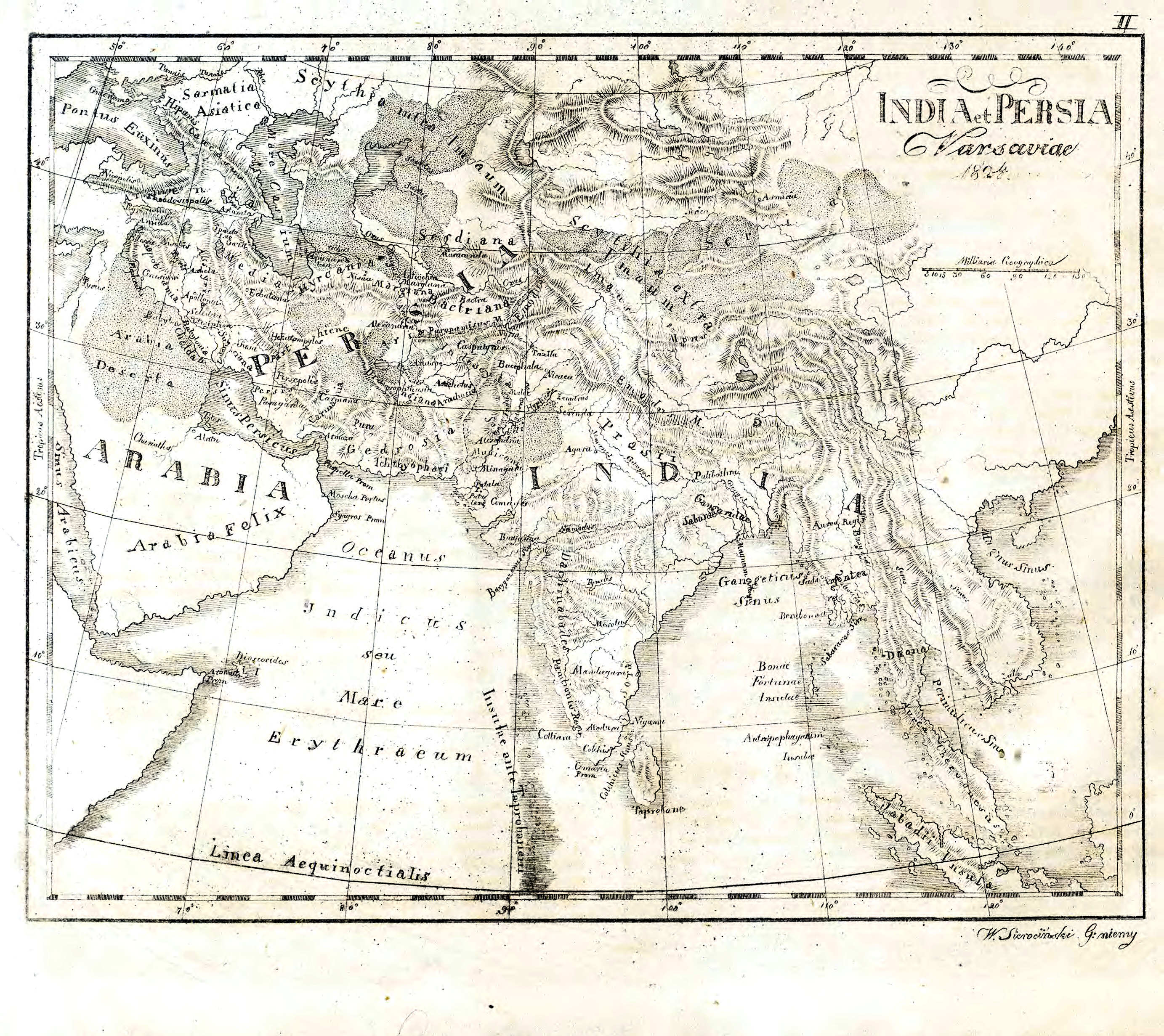
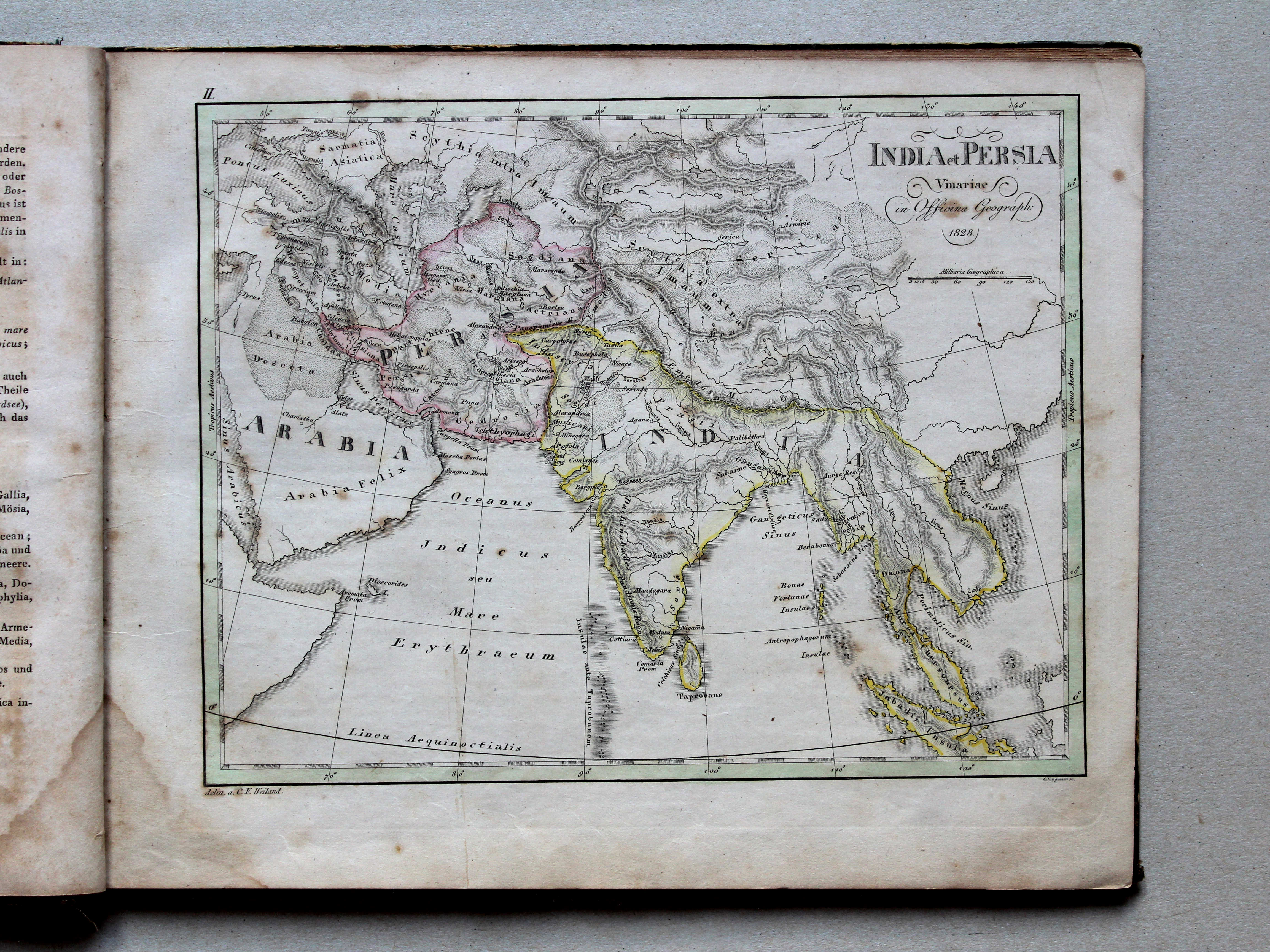
II. India et Persia
Indië en Perzië / India and Persia

 Nedzynski, Atlas Orbis Antiqui, 1825
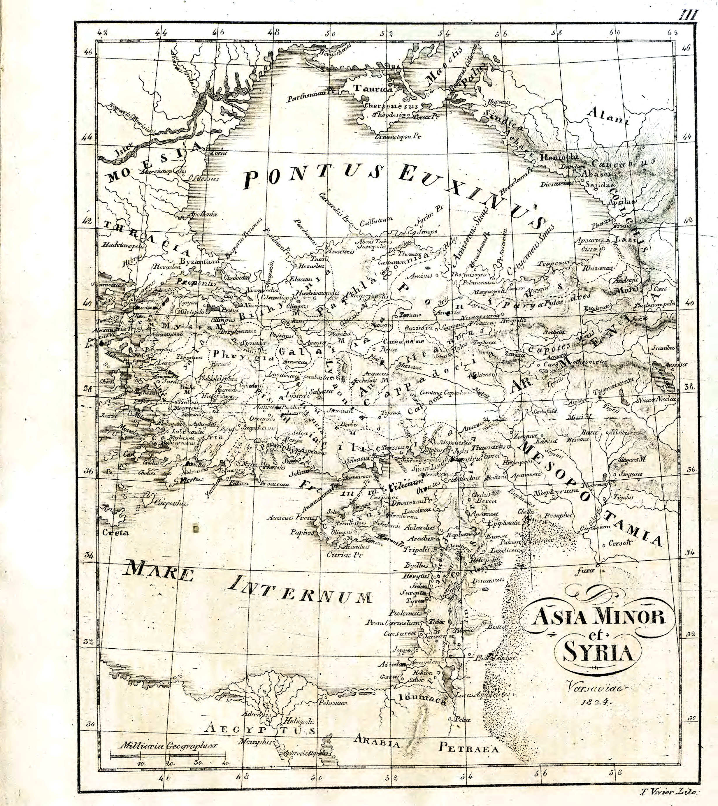
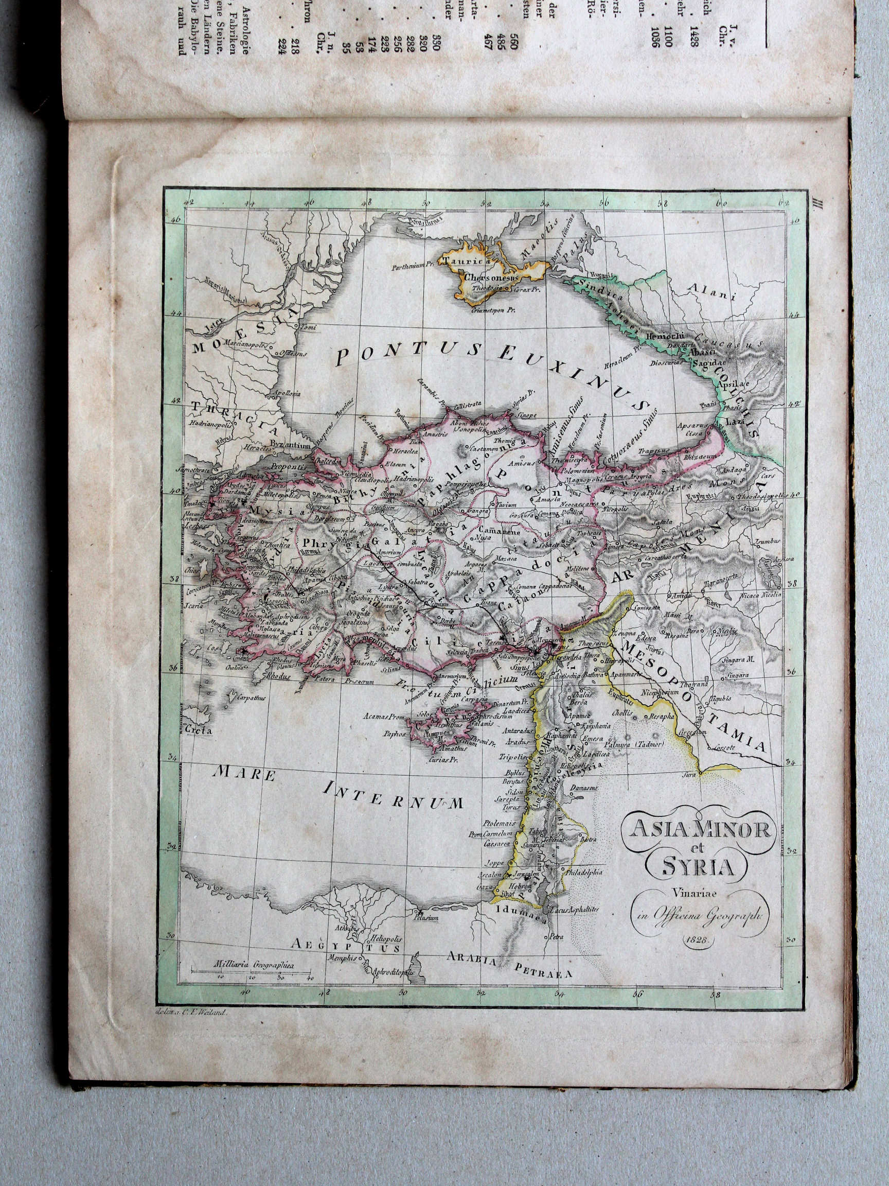
III. Asia Minor et Syria
Klein-Azië en Syria / Asia Minor and Syria
 Nedzynski, Atlas Orbis Antiqui, 1825
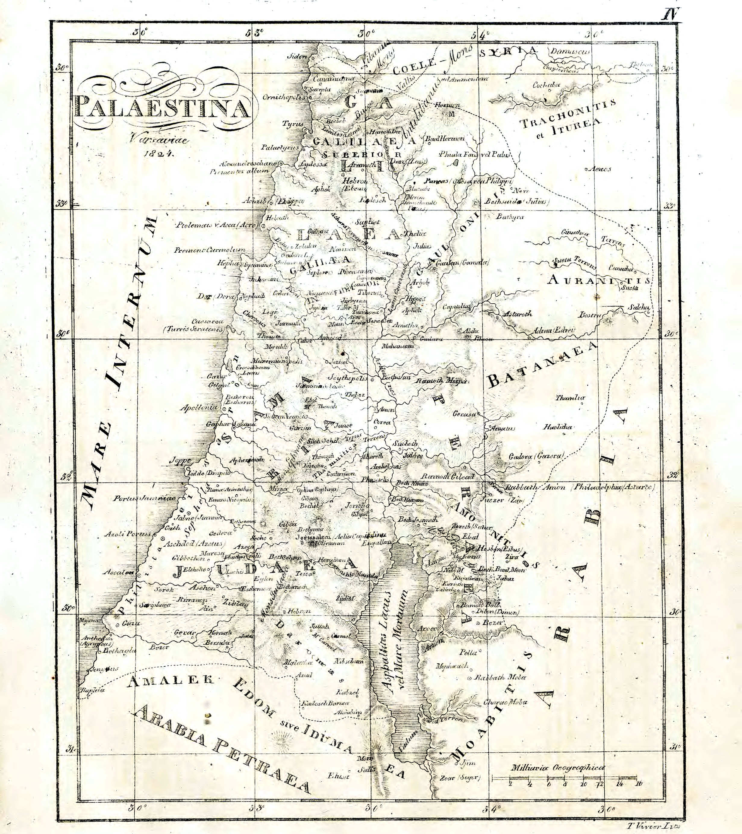
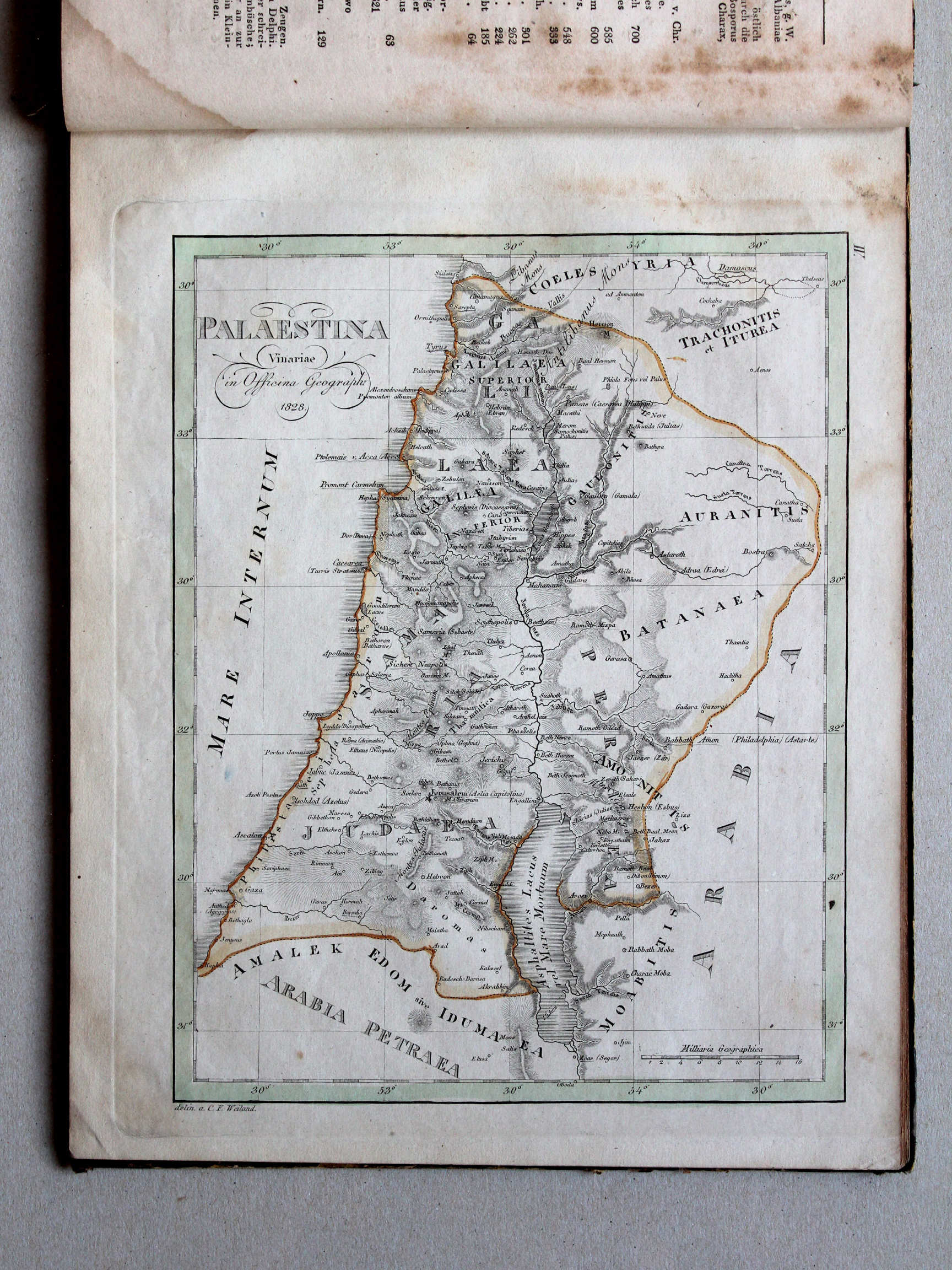
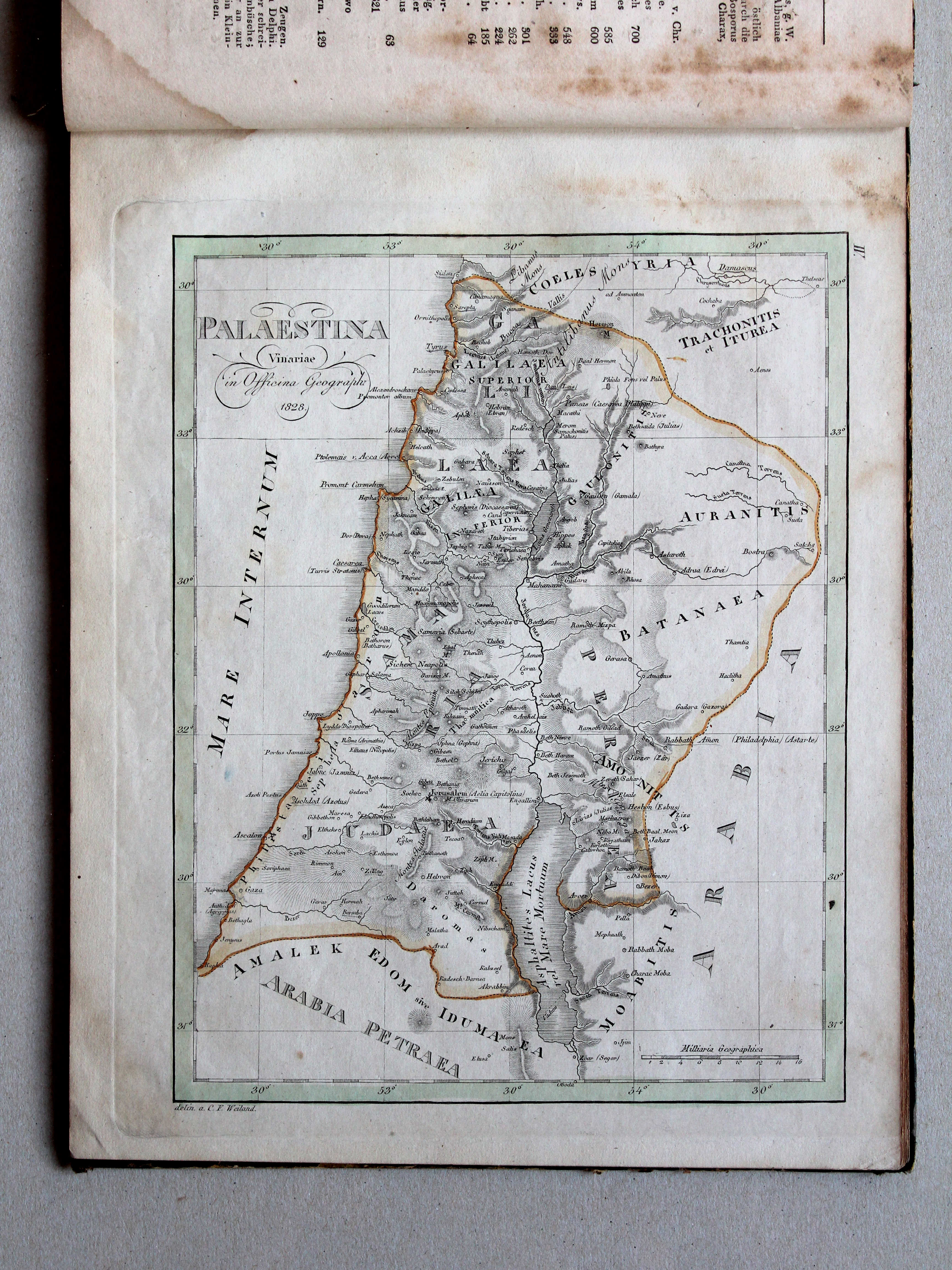
IV. Palaestina
Palestina / Palestine
 Nedzynski, Atlas Orbis Antiqui, 1825
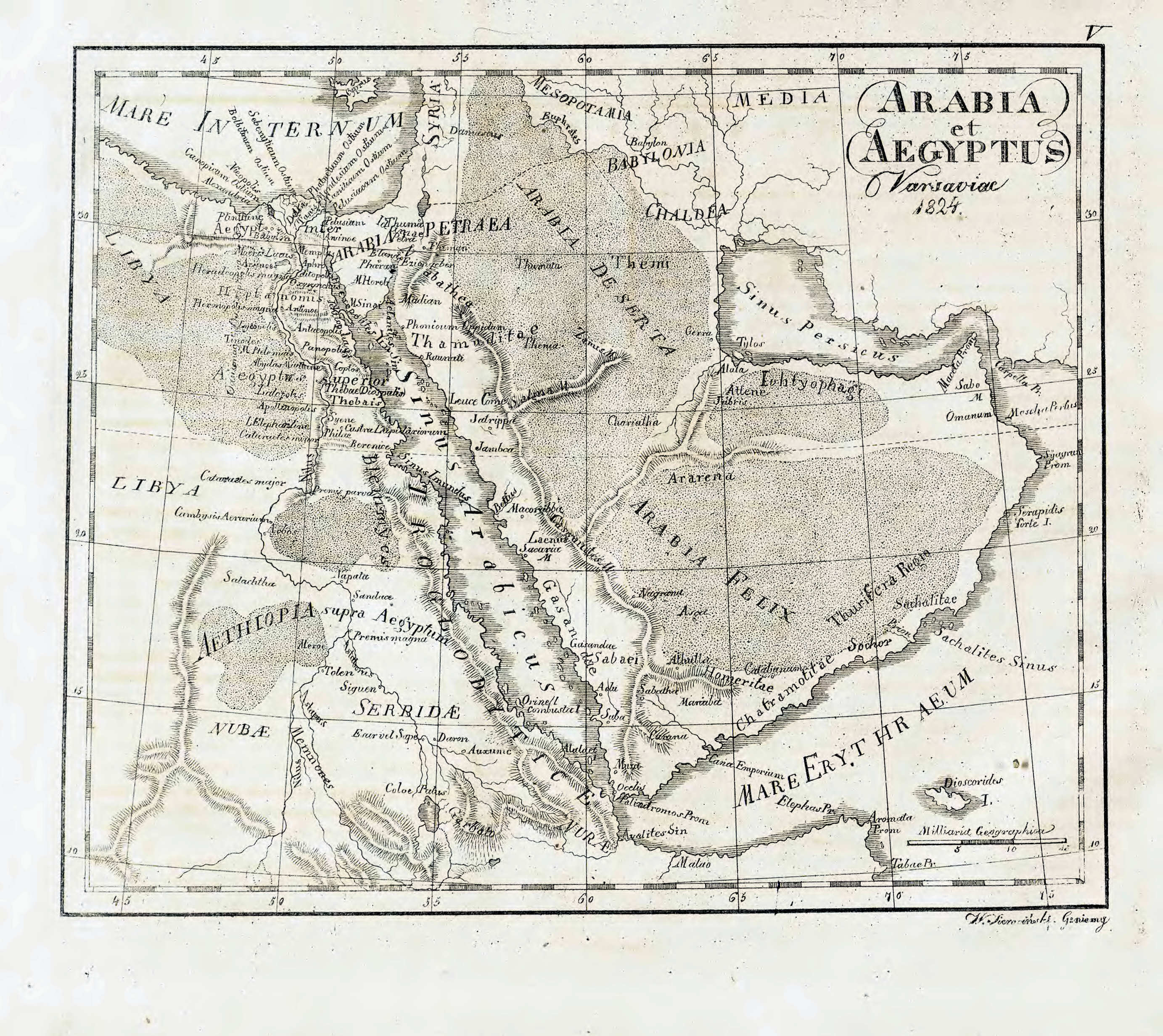
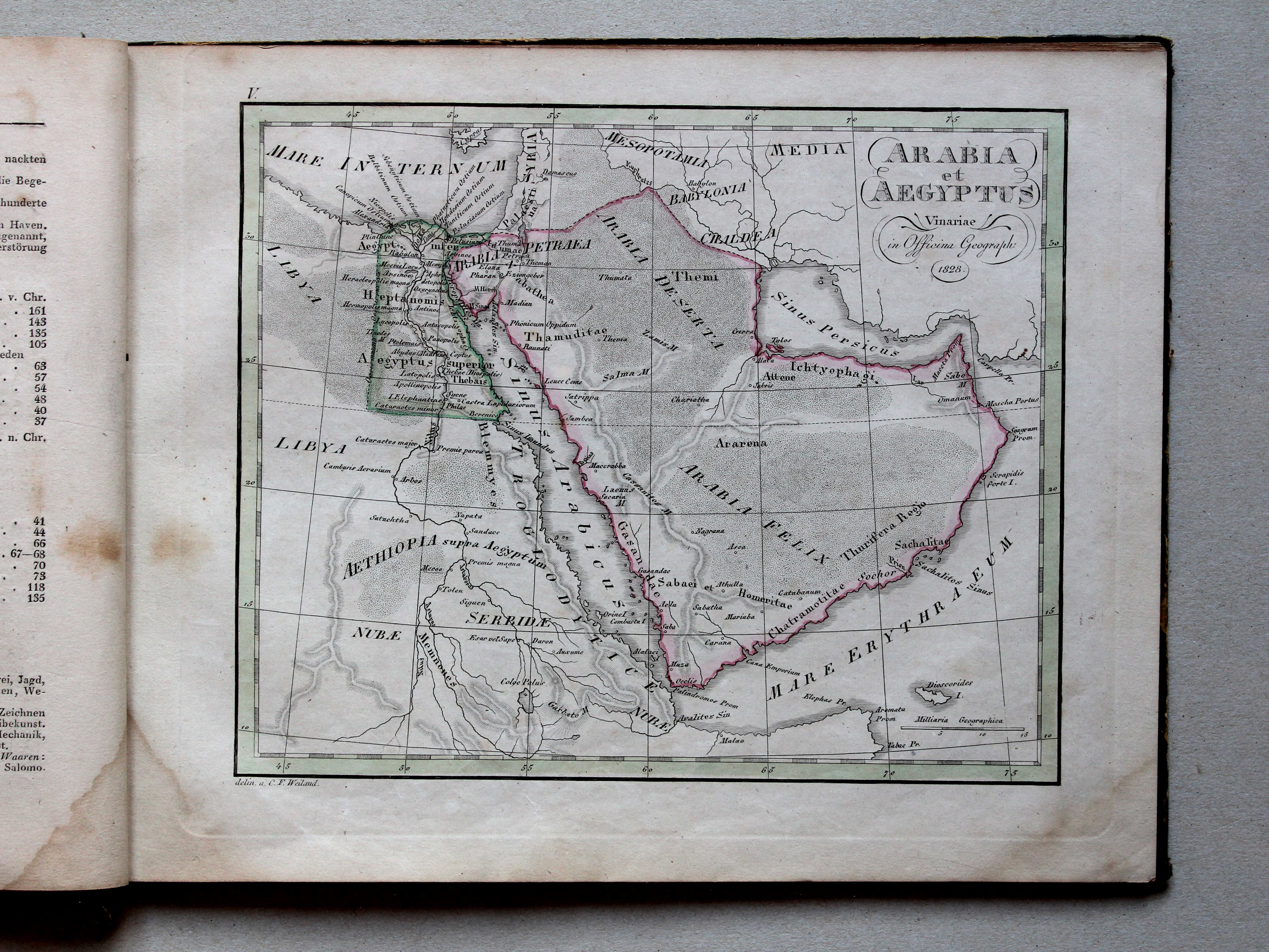
V. Arabia et Aegyptus
Arabië en Egypte / Arabia and Egypt

 Nedzynski, Atlas Orbis Antiqui, 1825
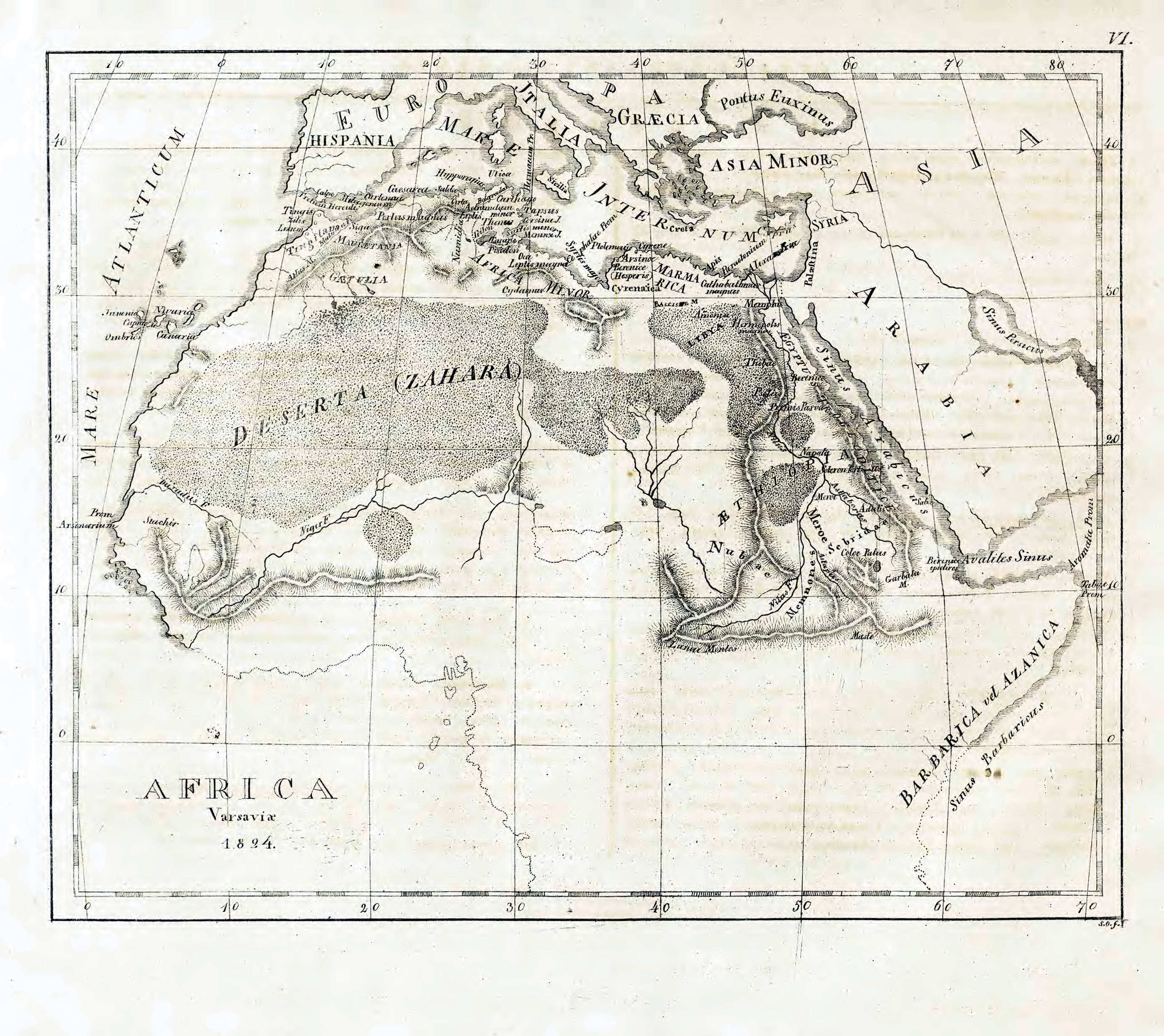
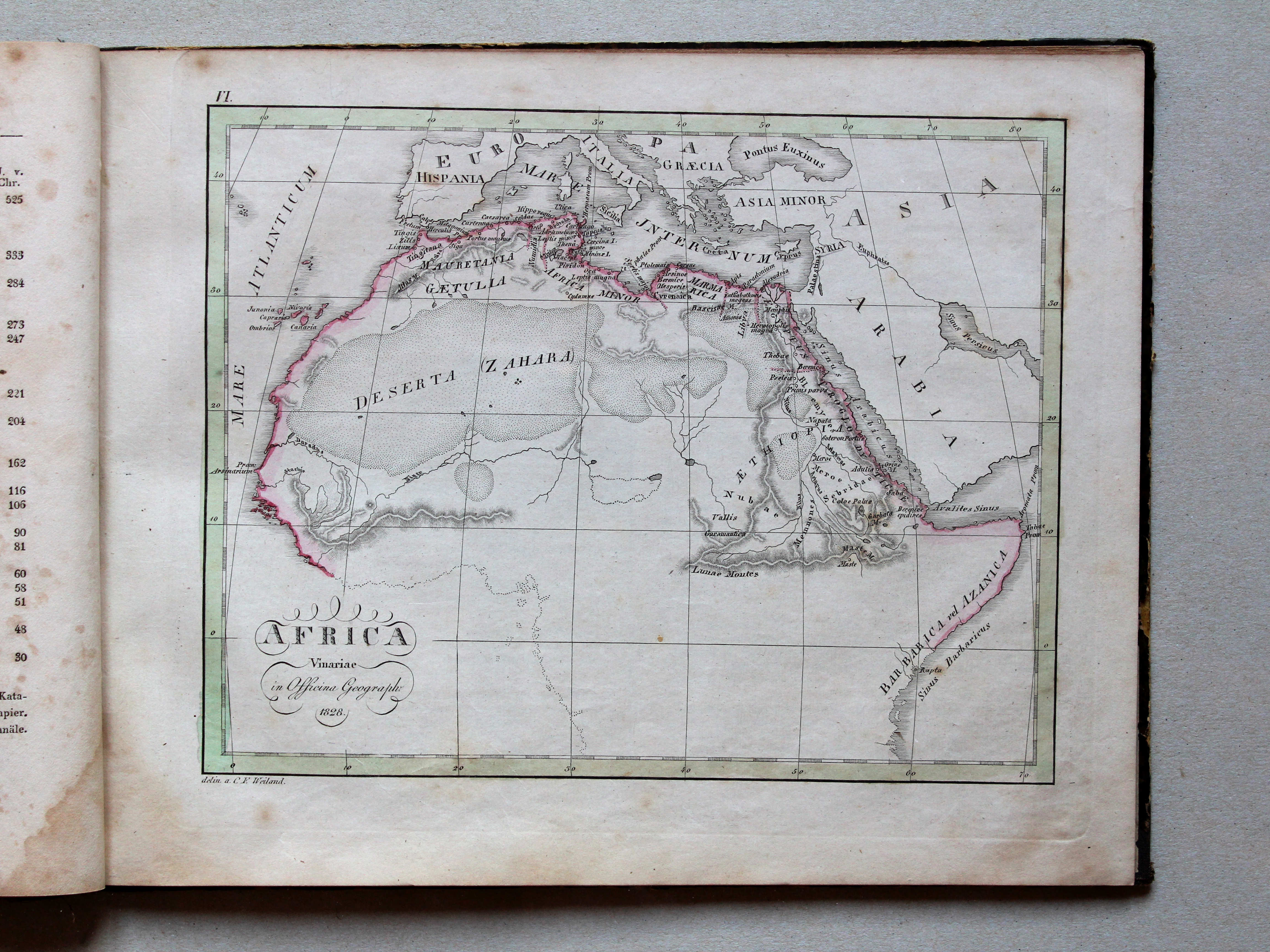
VI. Africa
Noordelijk Africa / Northern Africa

 Nedzynski, Atlas Orbis Antiqui, 1825
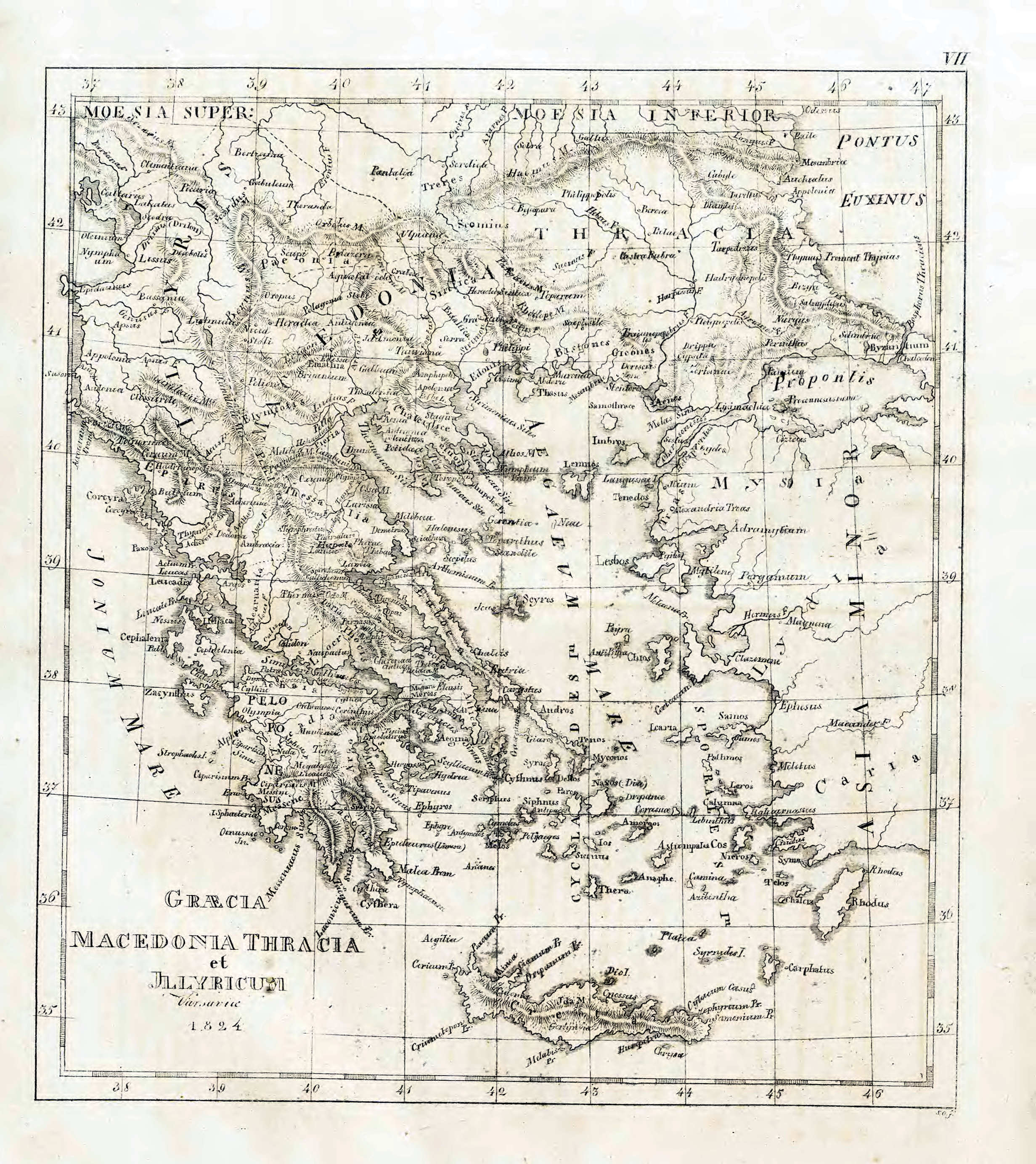
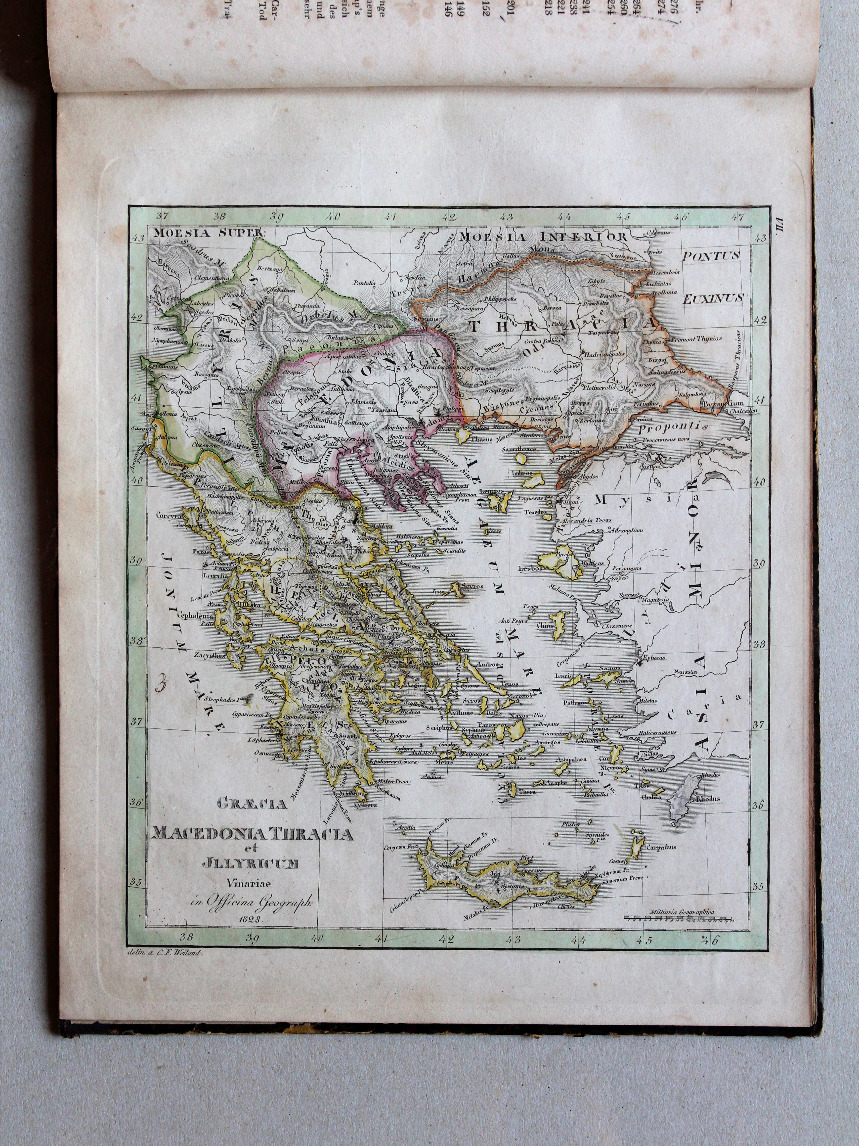
VII. Graecia, Macedonia, Thracia et Illyricum
Griekenland, Macedonië, Thracië en Illyrië / Greece, Macedonia, Thracia and Illyria
 Atlas der alten Welt, 1828
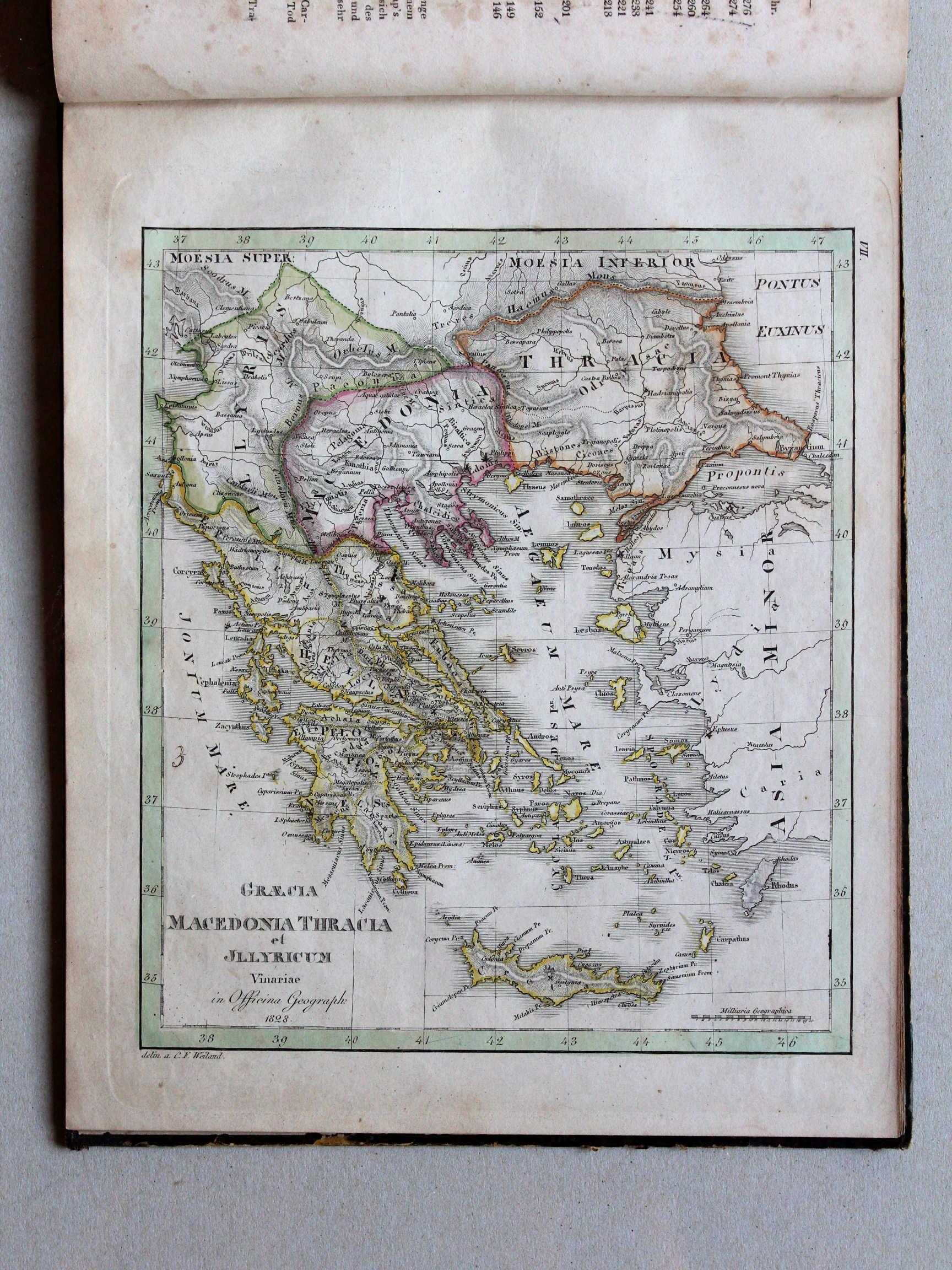
VII. Graecia, Macedonia, Thracia et Illyricum XL
Griekenland, Macedonië, Thracië en Illyrië / Greece, Macedonia, Thracia and Illyria
 Nedzynski, Atlas Orbis Antiqui, 1825
geen overeenkomstige kaart / no corresponding map
 Atlas der alten Welt, 1828
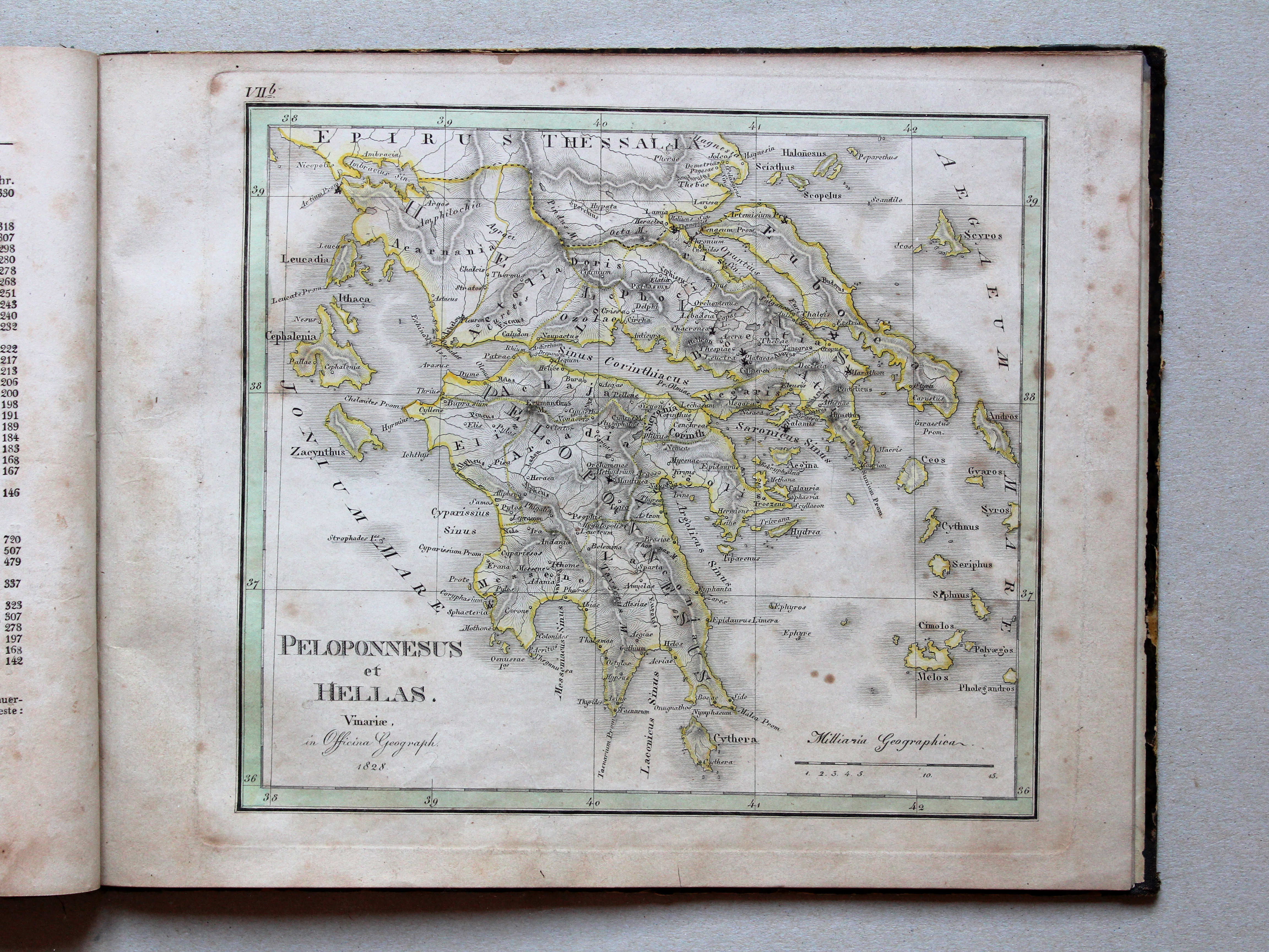
VIIb. Peloponnesus et Hellas XL
Peloponnesus en Hellas / Peloponnese and Hellas
 Nedzynski, Atlas Orbis Antiqui, 1825
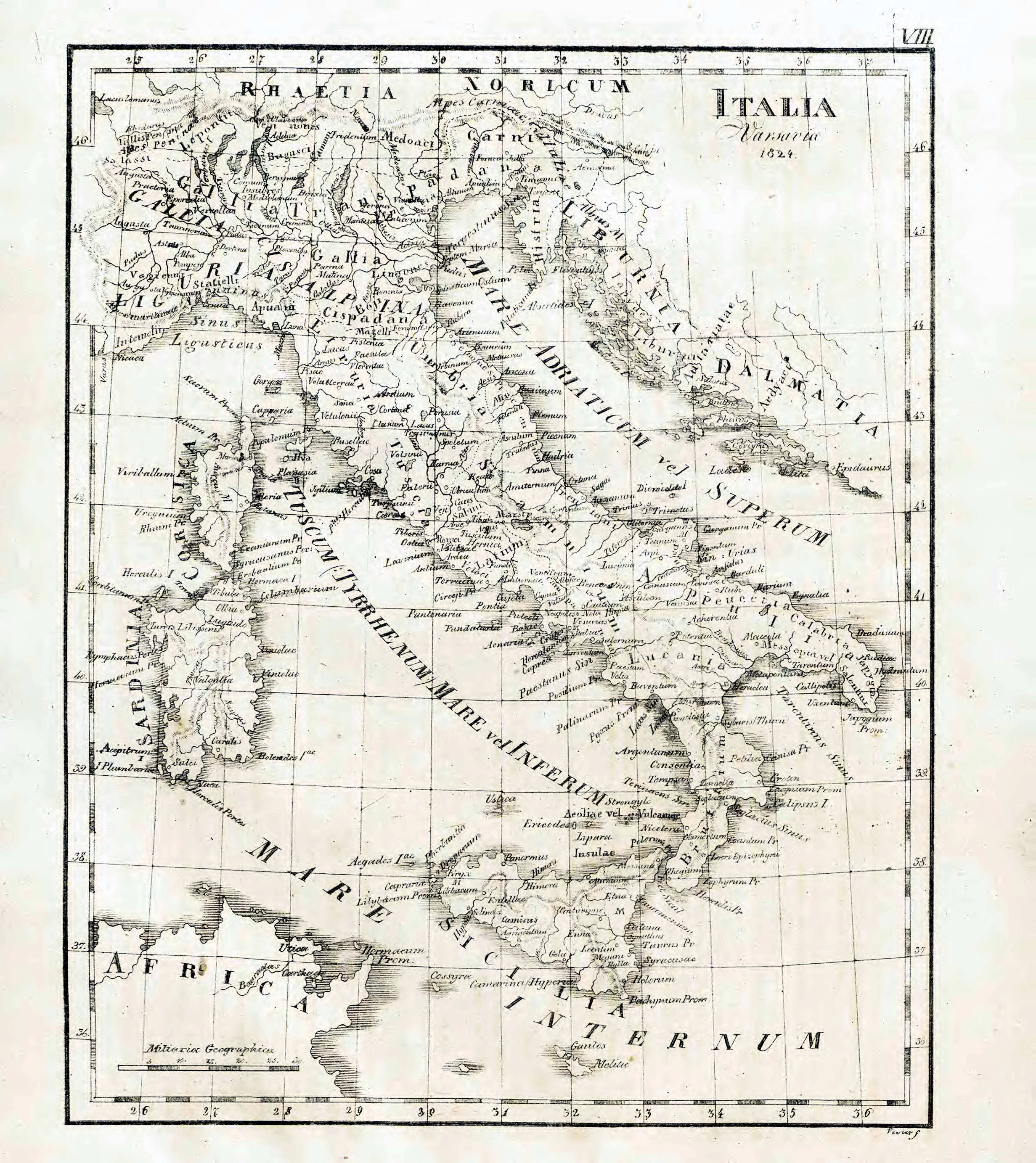
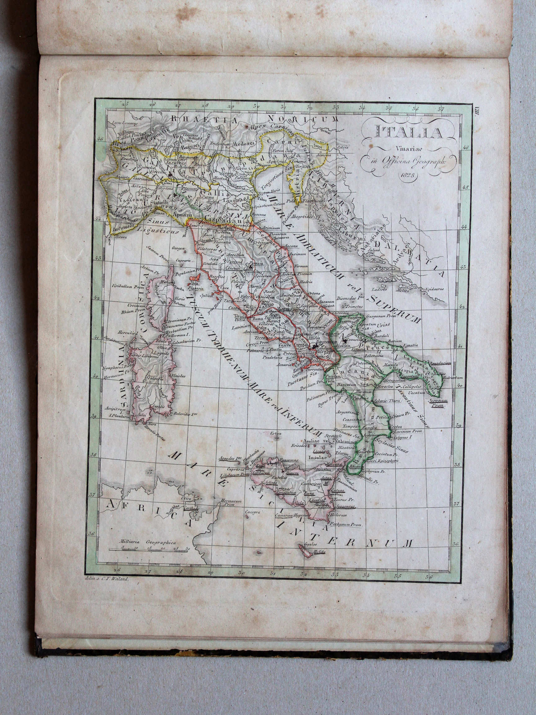
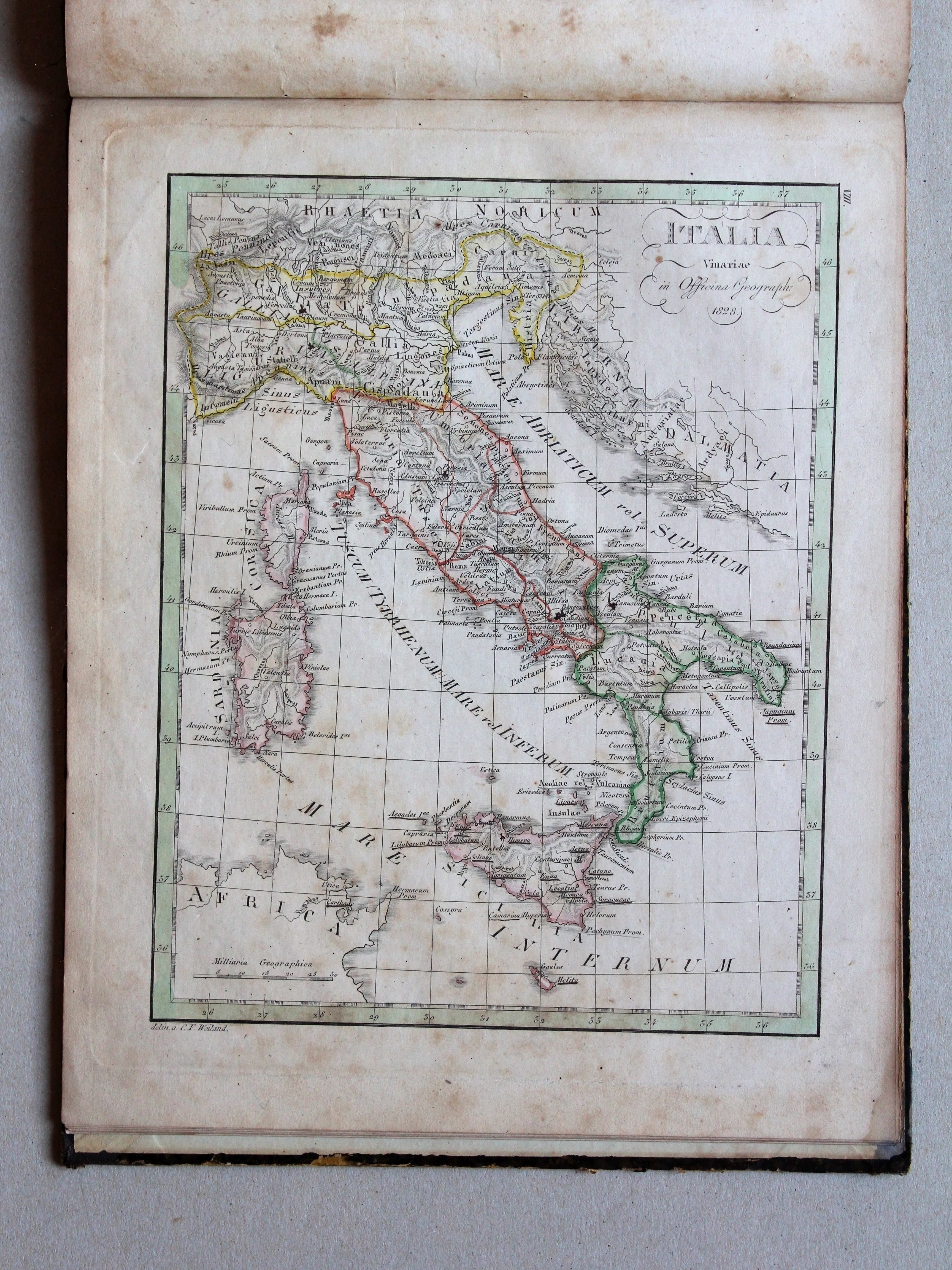
VIII. Italia
Italië / Italy
 Nedzynski, Atlas Orbis Antiqui, 1825
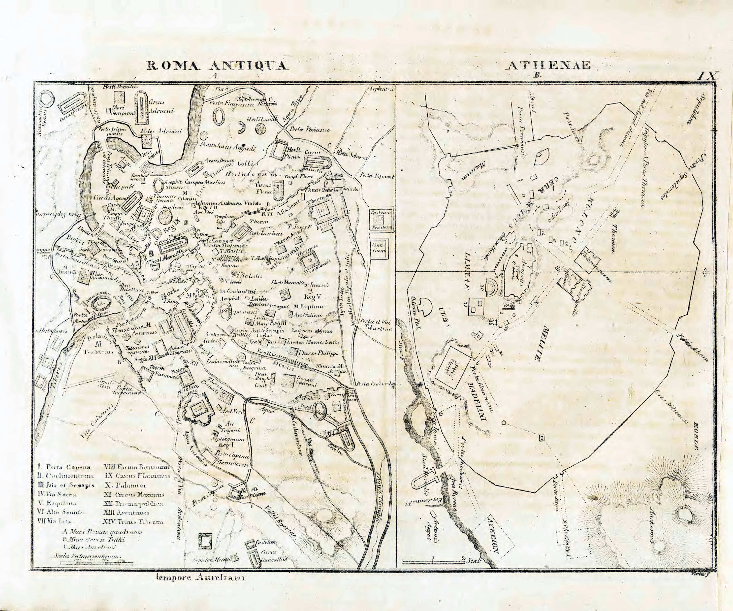
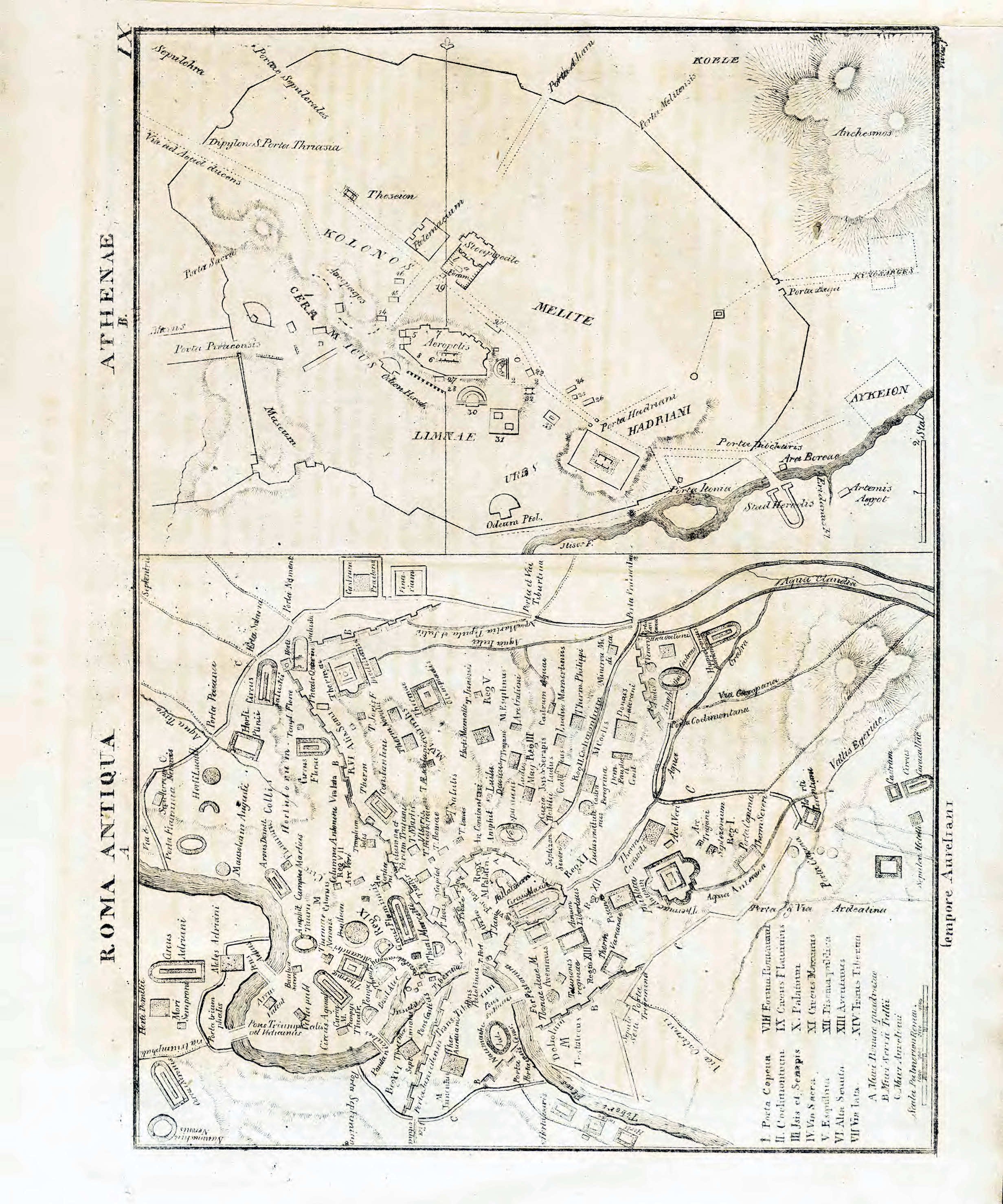
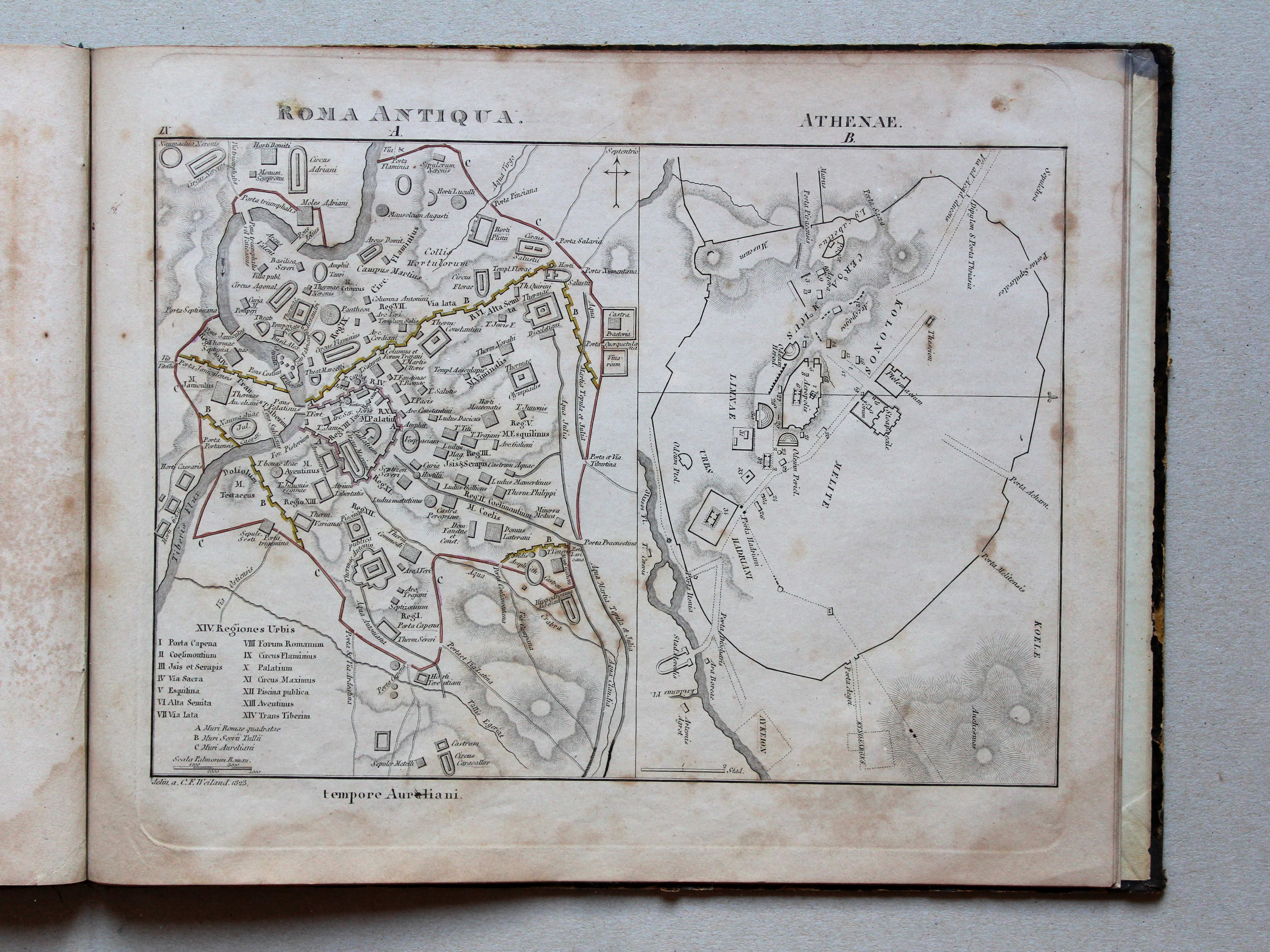
IX. Roma antiqua. Athenae
Rome in de Oudheid. Athene / Ancient Rome. Athens
 Atlas der alten Welt, 1828
IX. Roma Antiqua. Athenae XL
Rome in de Oudheid. Athene / Ancient Rome. Athens
 Nedzynski, Atlas Orbis Antiqui, 1825
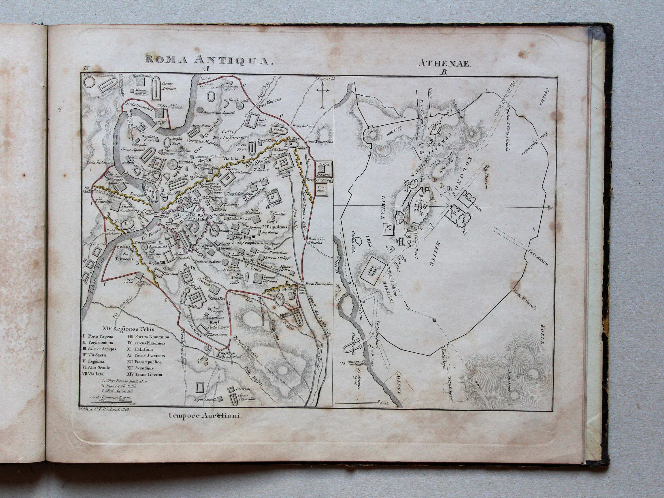
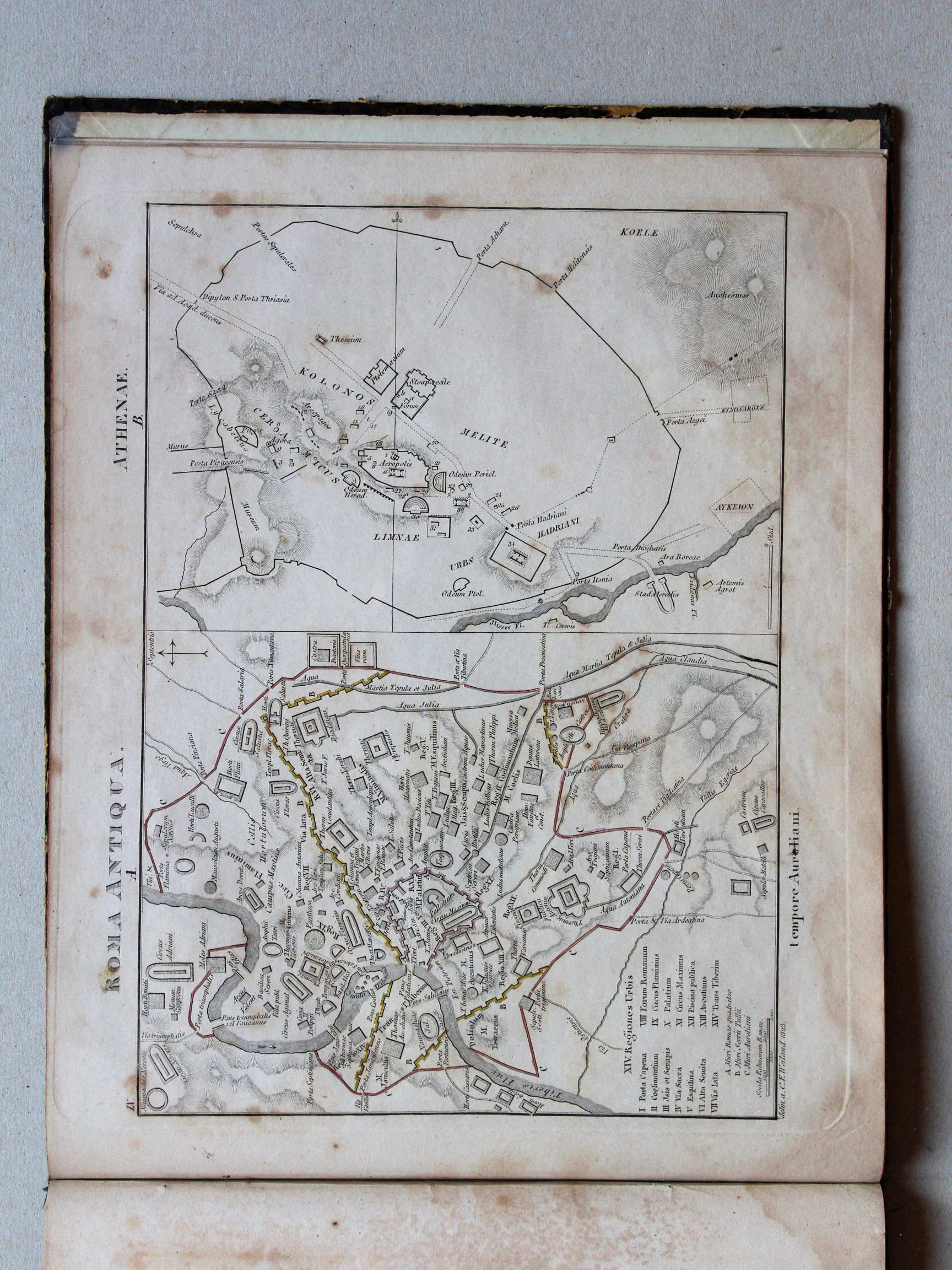
IX. Roma antiqua. Athenae
Rome in de Oudheid. Athene / Ancient Rome. Athens
 Atlas der alten Welt, 1828
IX. Roma Antiqua. Athenae XL
Rome in de Oudheid. Athene / Ancient Rome. Athens
 Nedzynski, Atlas Orbis Antiqui, 1825
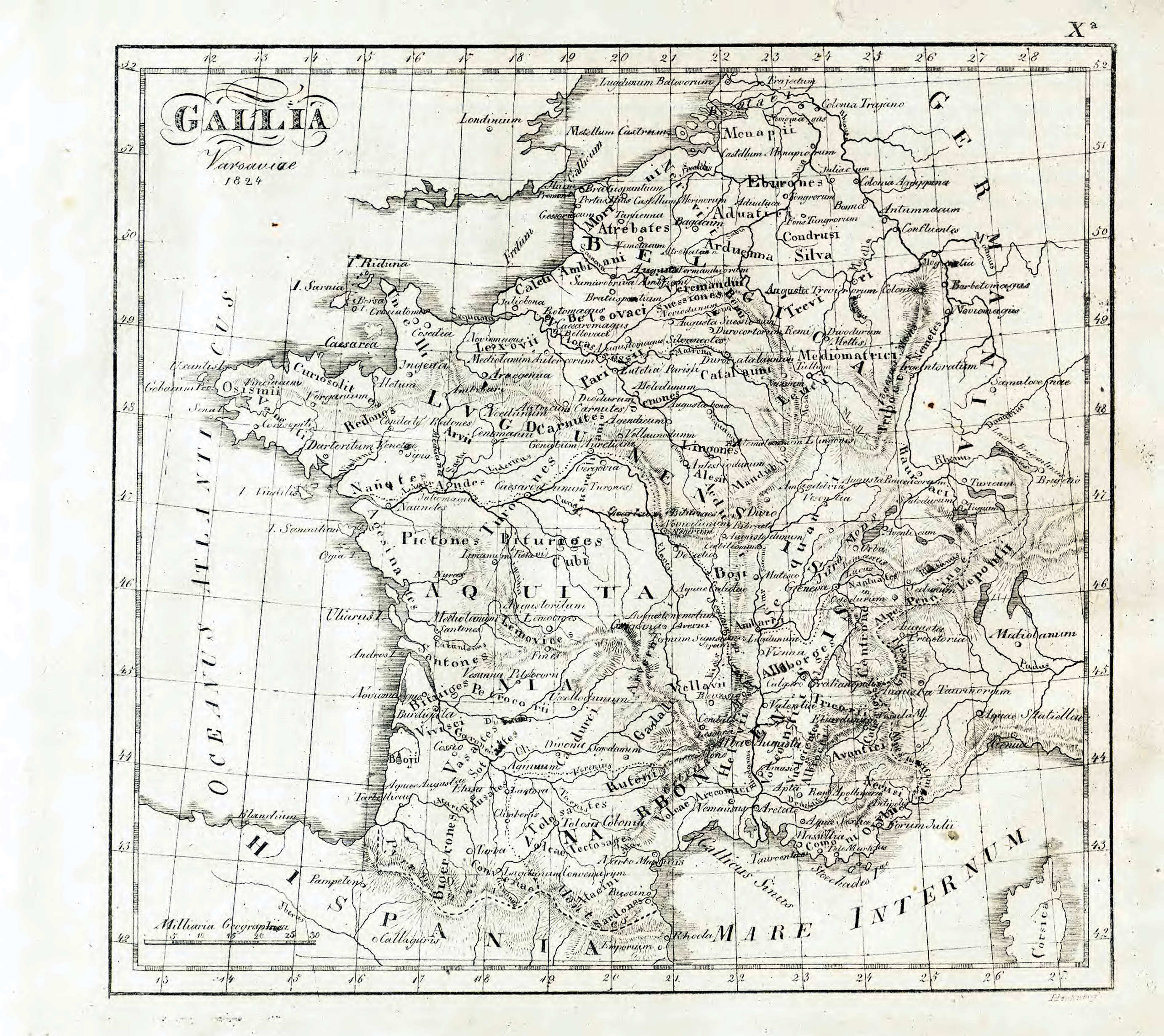
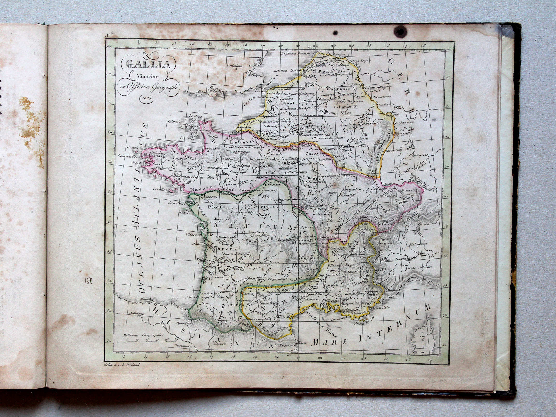
Xa. Gallia
Gallië / Gaul
 Nedzynski, Atlas Orbis Antiqui, 1825
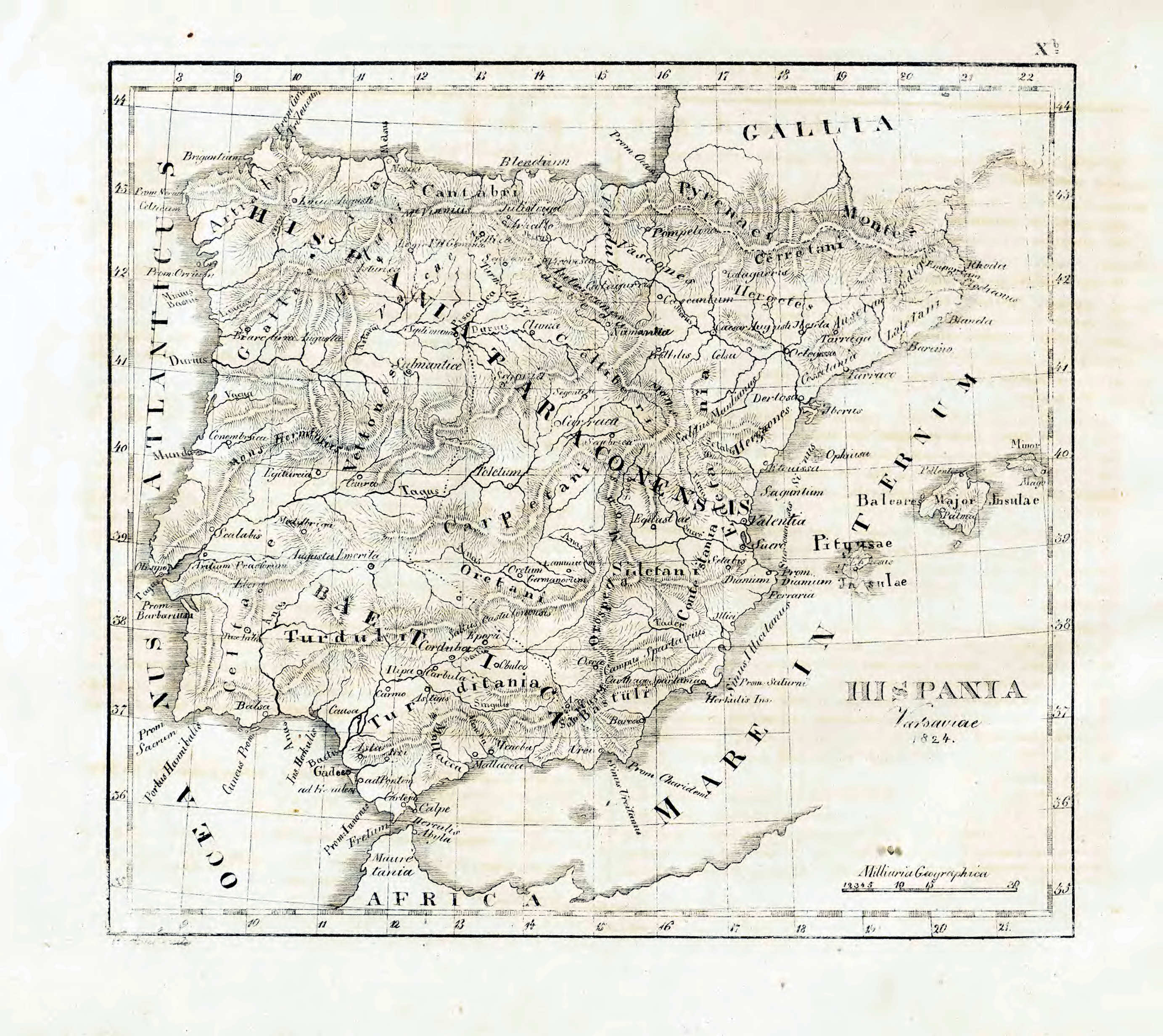
Xb. Hispania
Iberisch schiereiland / Iberian Peninsula
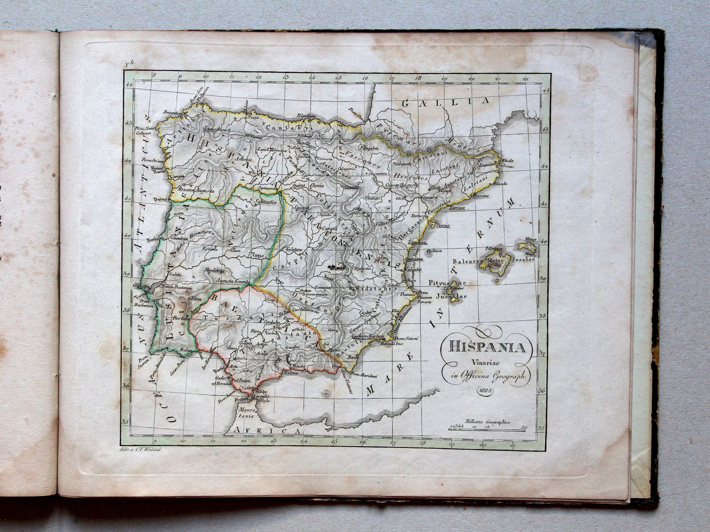
 Nedzynski, Atlas Orbis Antiqui, 1825
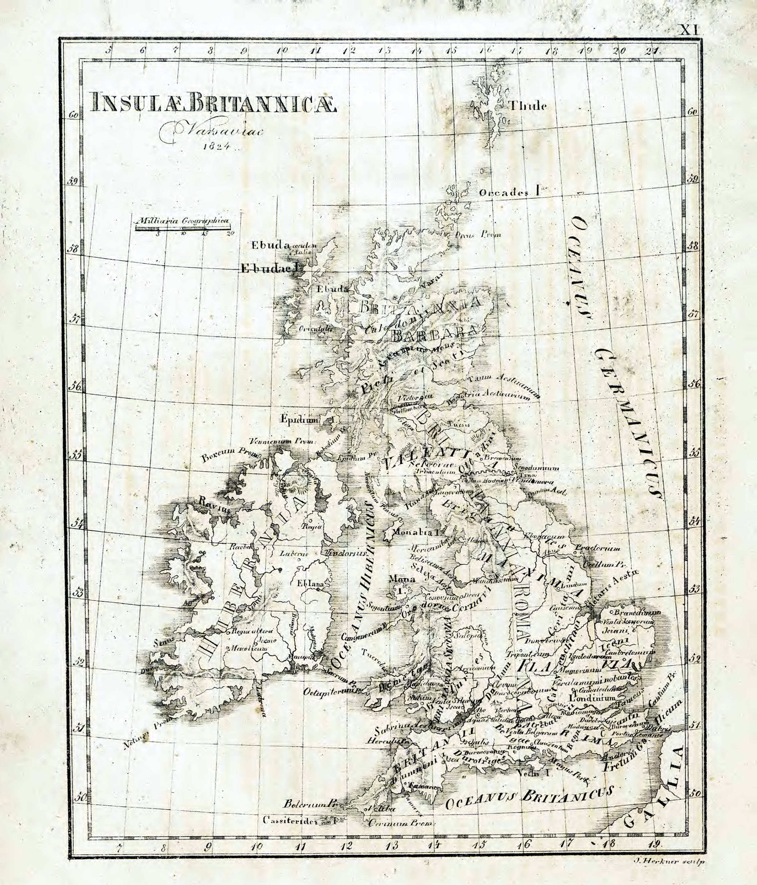
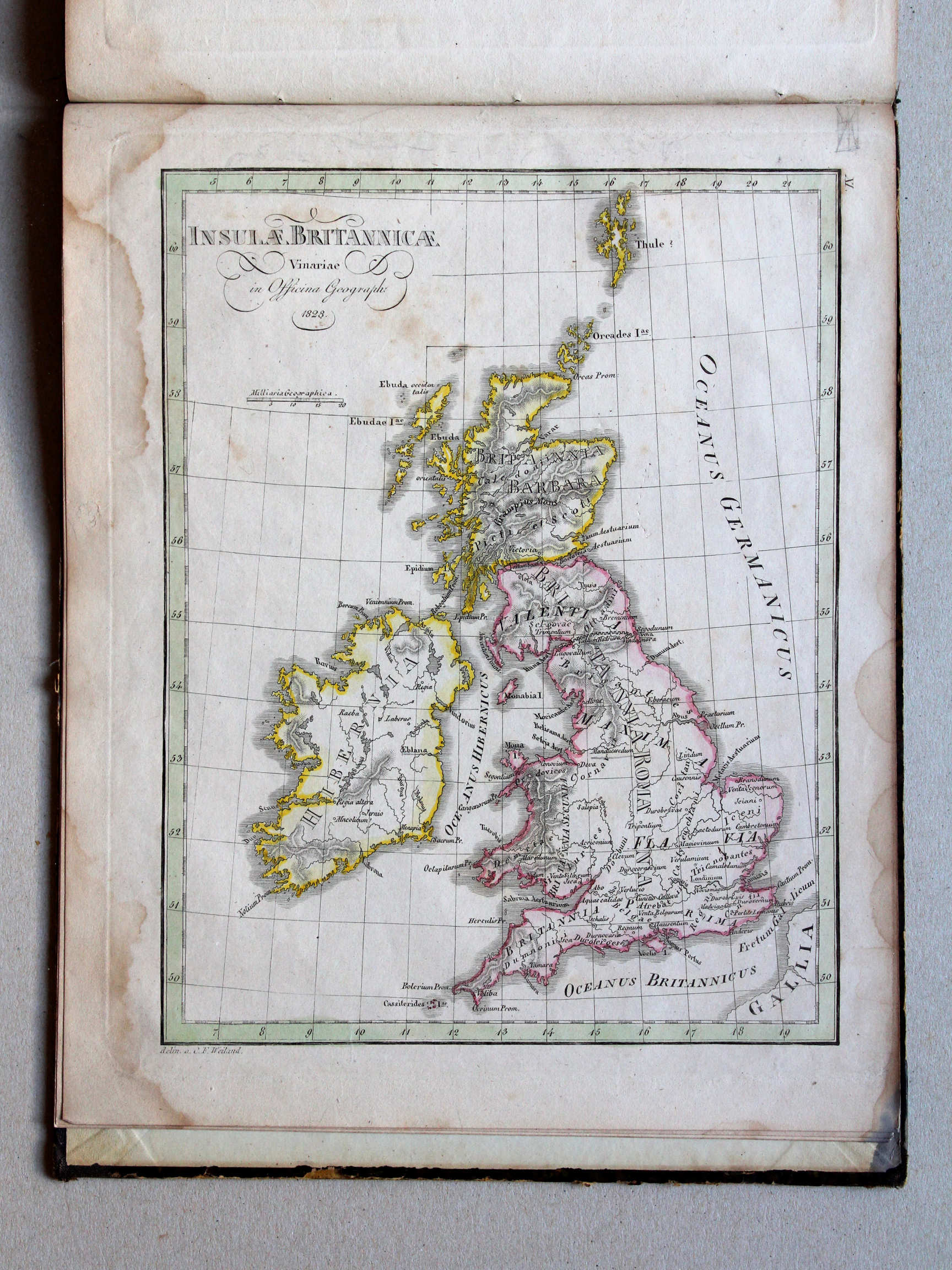
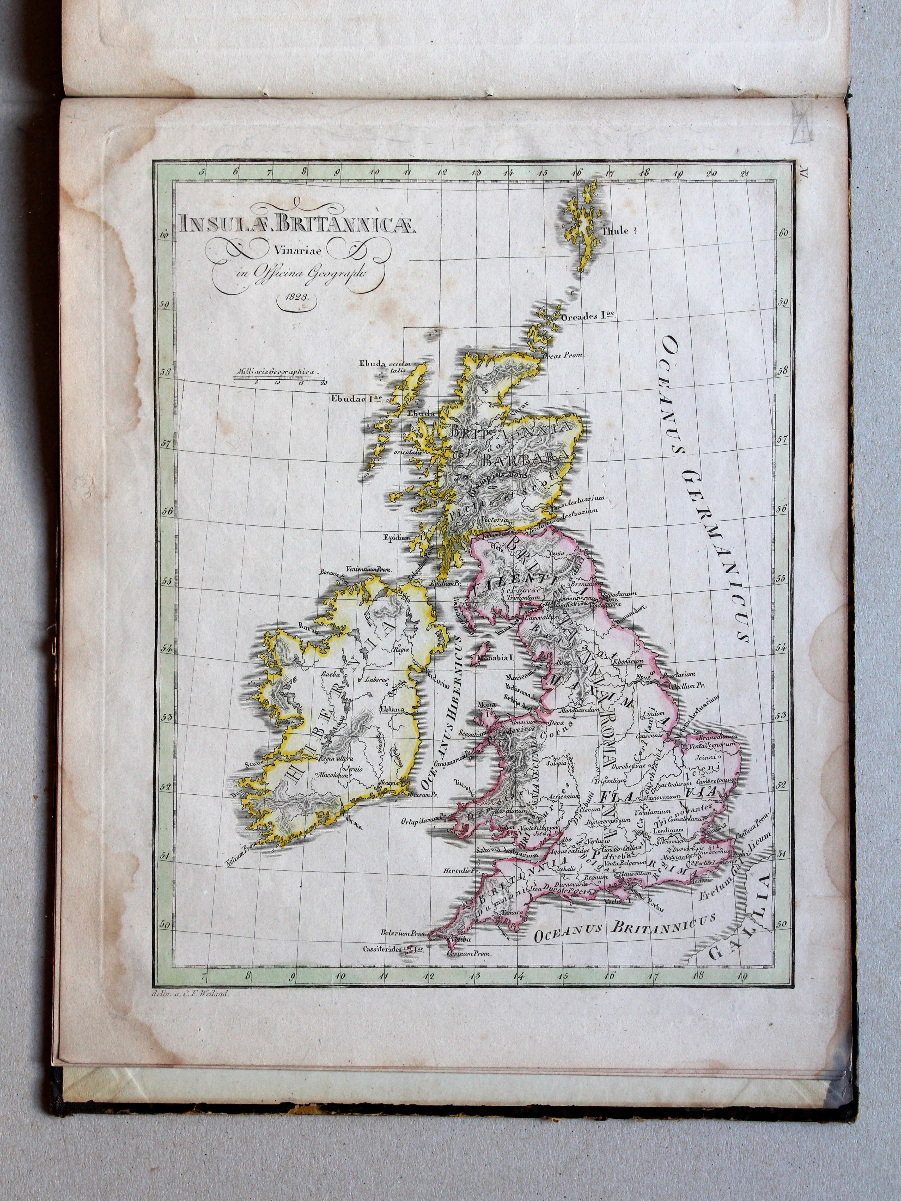
XI. Insulae Britannicae
Britse Eilanden / British Isles
 Nedzynski, Atlas Orbis Antiqui, 1825
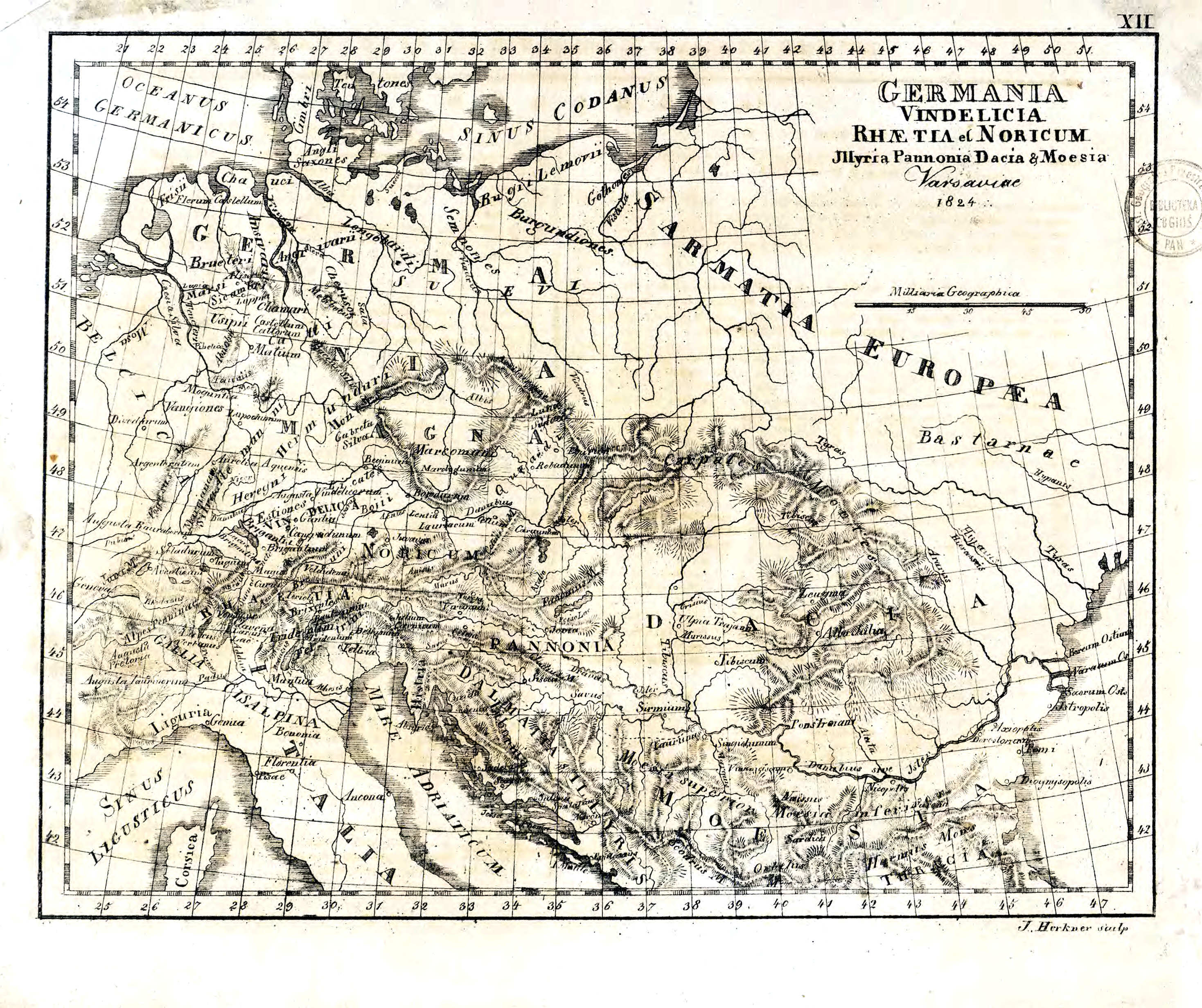
XII. Germania, Vindelicia, Rhaetia et Noricum, Illyria, Pannonia, Dacia & Moesia
Germanië, Vindelicia, Rhaetia en Noricum, Illyrië, Pannonia, Dacia en Moesië / Germania, Vindelicia, Rhaetia and Noricum, Illyria, Pannonia, Dacia and Moesia
 Atlas der alten Welt, 1828
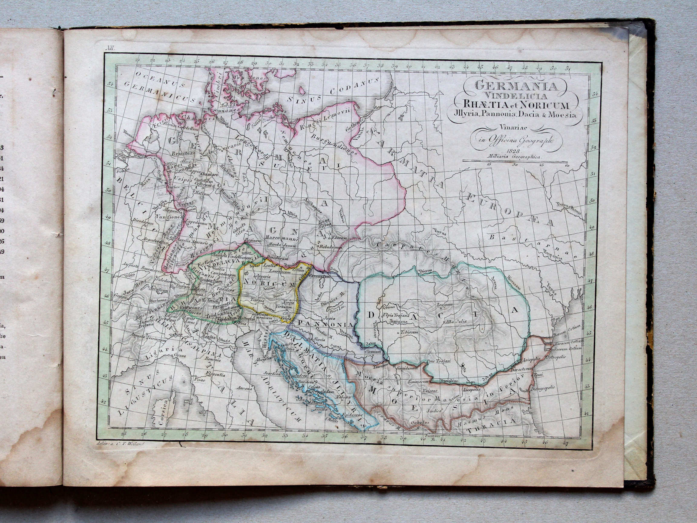
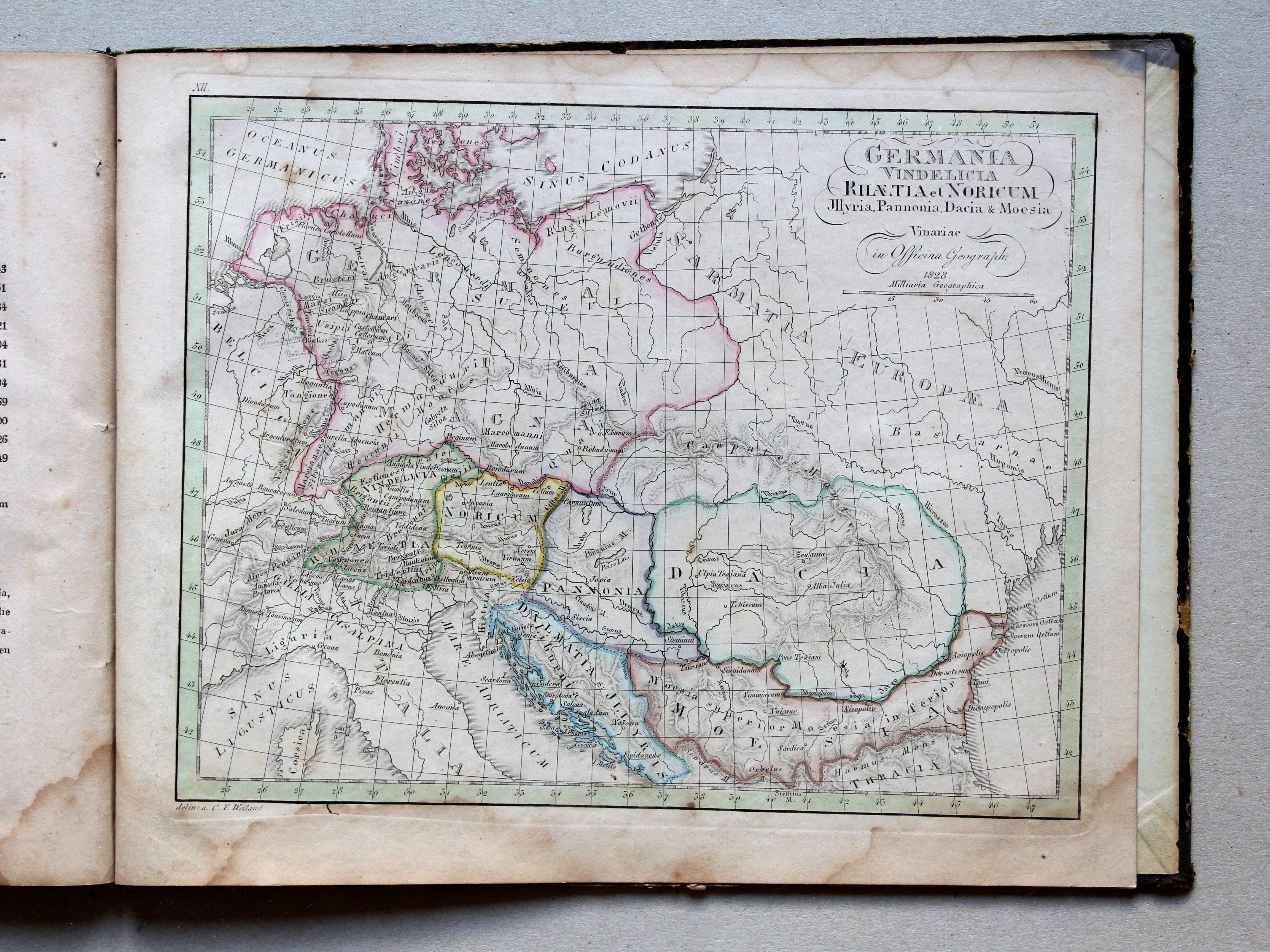
XII. Germania, Vindelicia, Rhaetia et Noricum, Illyria, Pannonia, Dacia & Moesia XL
Germanië, Vindelicia, Rhaetia en Noricum, Illyrië, Pannonia, Dacia en Moesië / Germania, Vindelicia, Rhaetia and Noricum, Illyria, Pannonia, Dacia and Moesia
© M. Witkam, 2015
met dank aan / courtesy of:
Repozytorium Cyfrowe Instytutów Naukowych
(Digital Repository of Scientific Institutes)
![]()
![]()