von Wedell's Historischer Hand-Atlas, 2e druk (1856)
See below for (a summary of) this text in English.
Hieronder staan plaatjes van de atlas. Daarbij horen ook de volgende pagina's
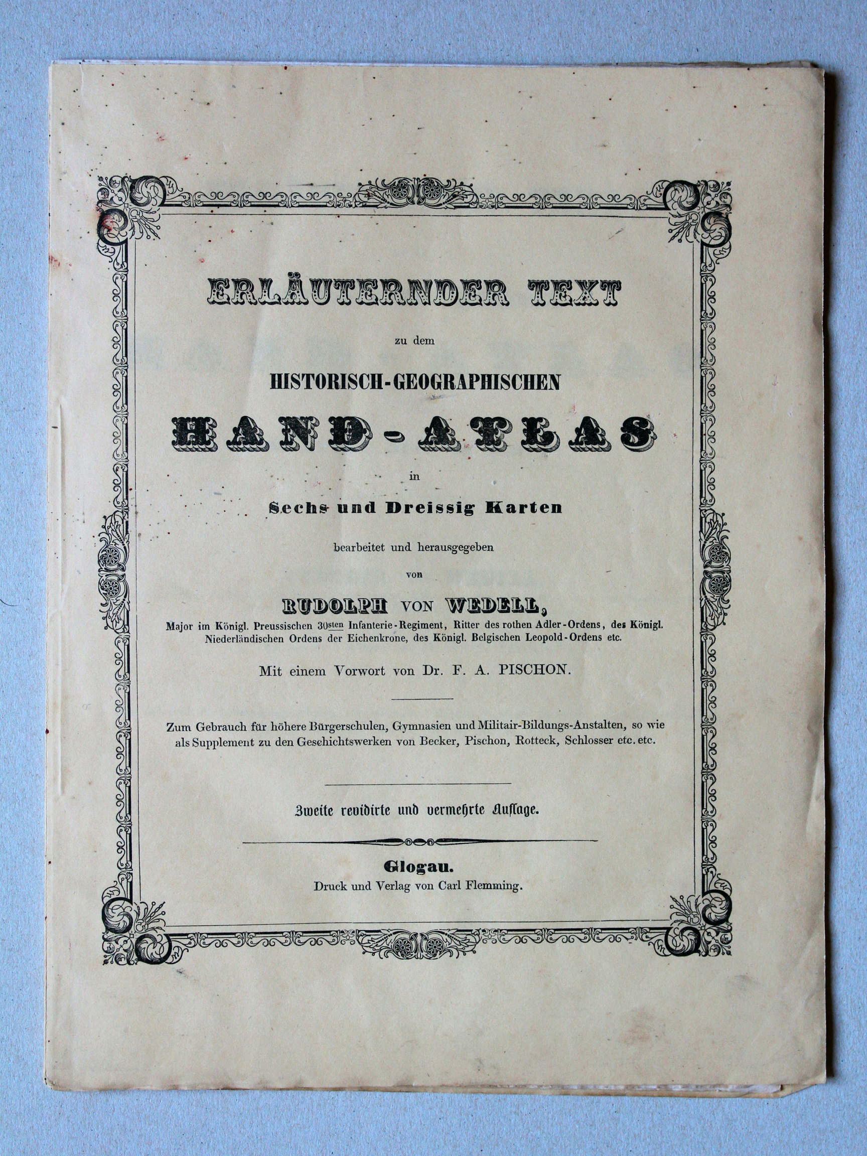
- Beschrijving van de atlas
- Voorwoord bij de atlas
- Tabellen en lijsten bij de atlas
Plaatjes
Klik op een plaatje voor een vergroting.
von Wedell's Historischer Hand-Atlas, 2nd edition (1856)
- Below are pictures of the atlas. Related pages
- Description of the atlas
- Preface to the atlas
- Tables and lists to the atlas
Pictures
Click on a picture to enlarge.
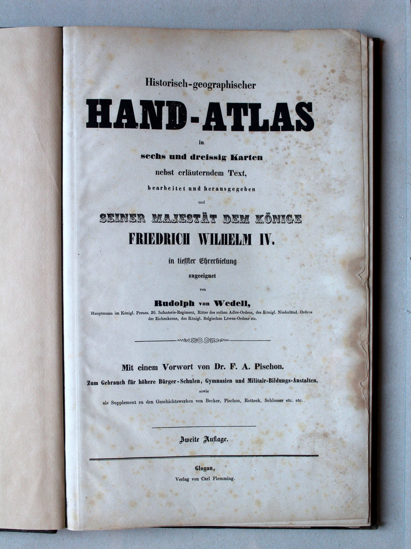
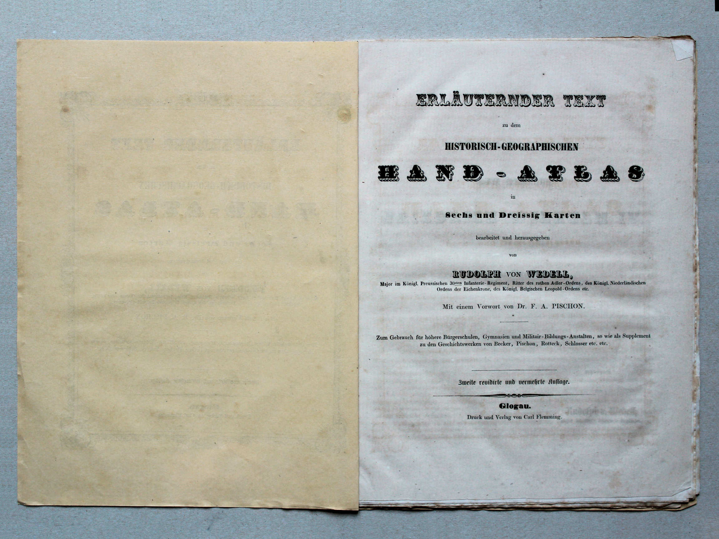
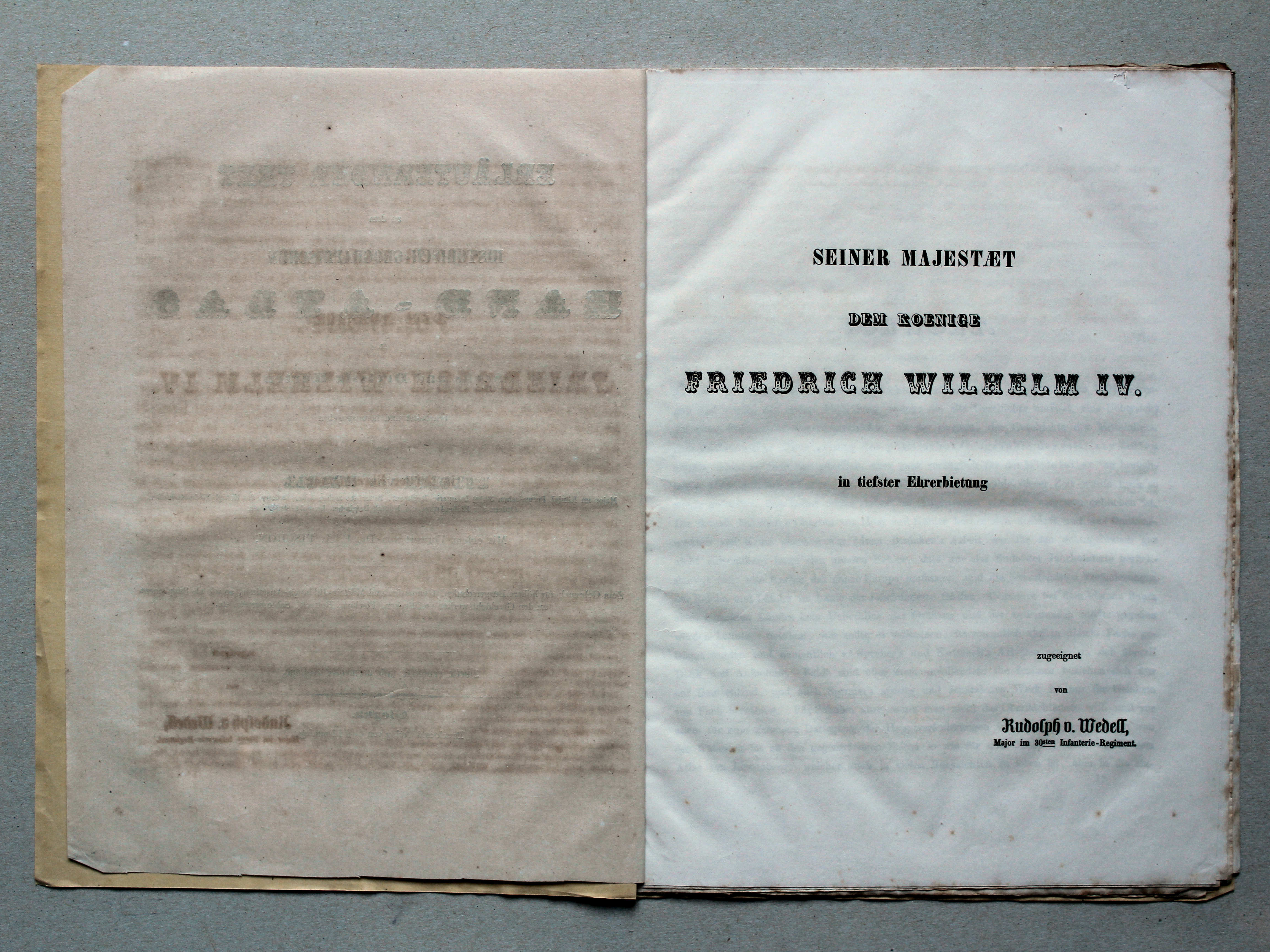
Atlasdeel: band, titelpagina / Atlas volume: binding, title page Tekstdeel: omslag, titelpagina, enz. / Text volume: cover, title page, etc.
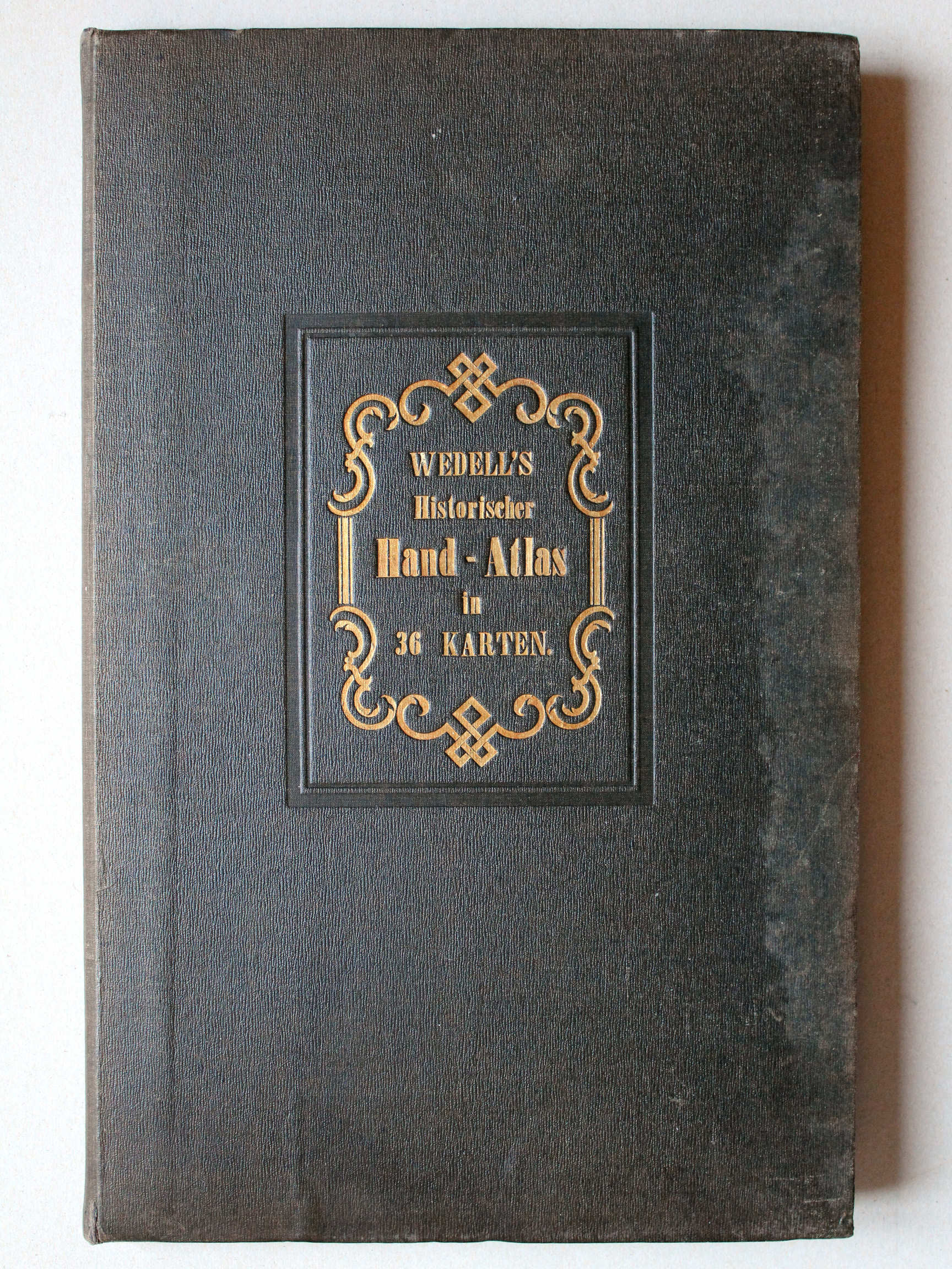
 von Wedell's Historischer Hand-Atlas, 1856
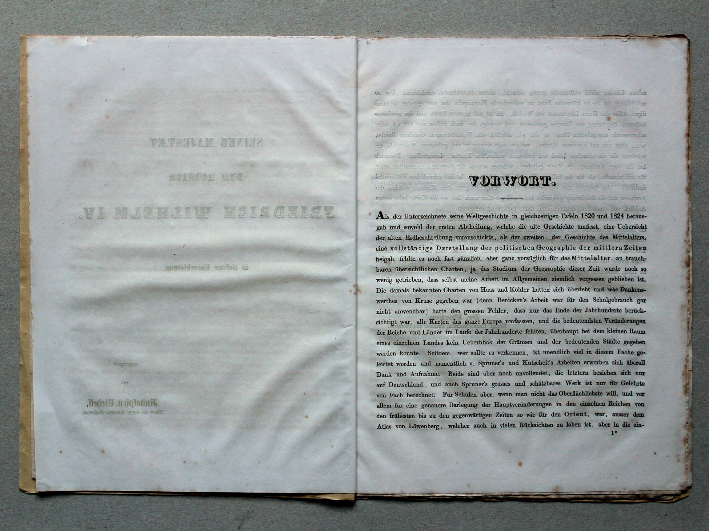
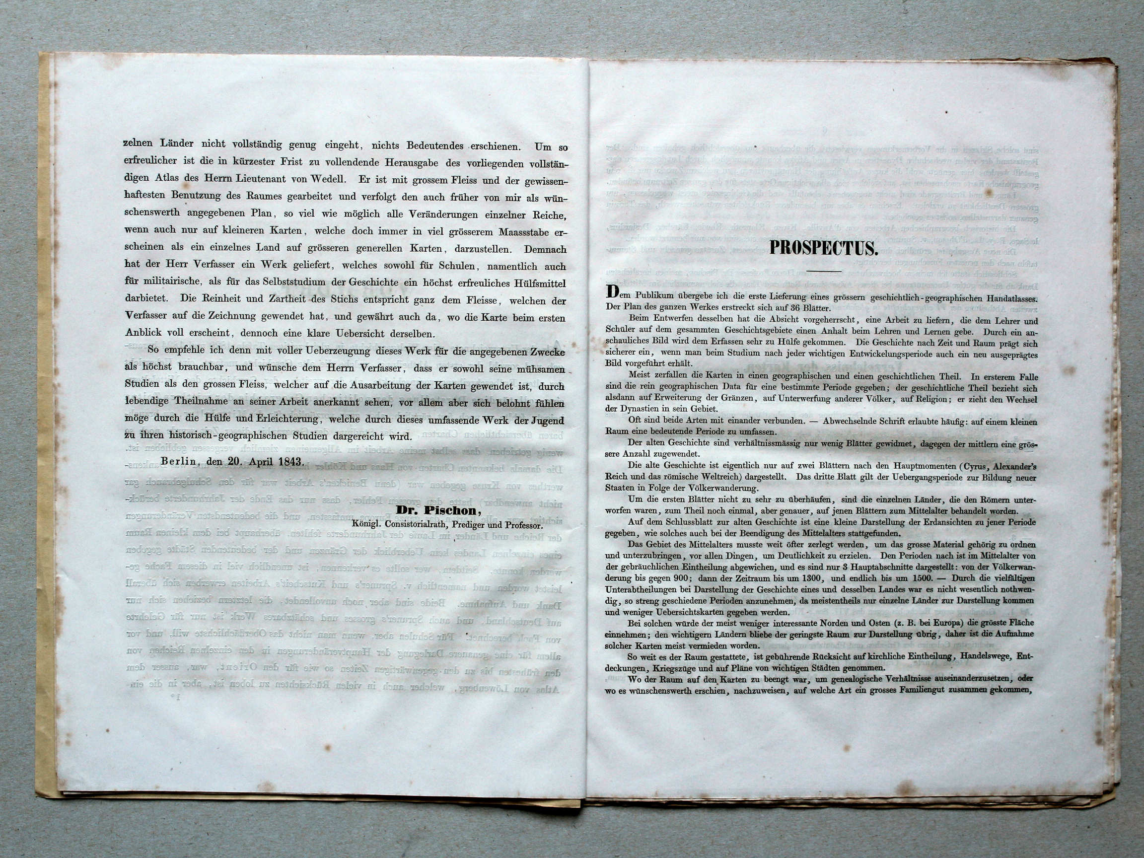
Tekstdeel: achterkant omslag / Text volume: back cover XL

 von Wedell's Historischer Hand-Atlas, 1856
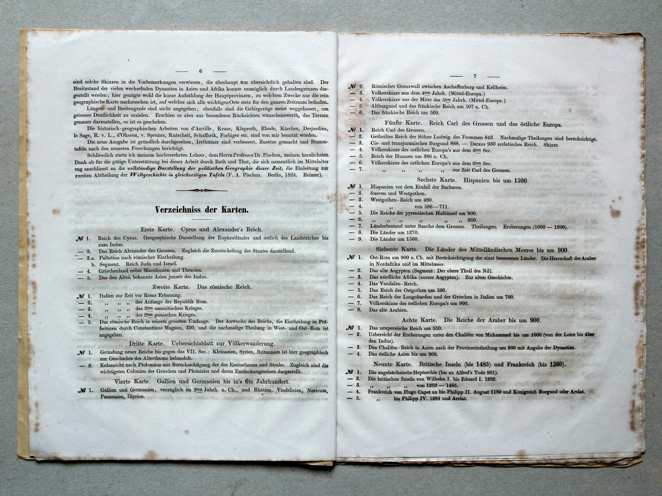
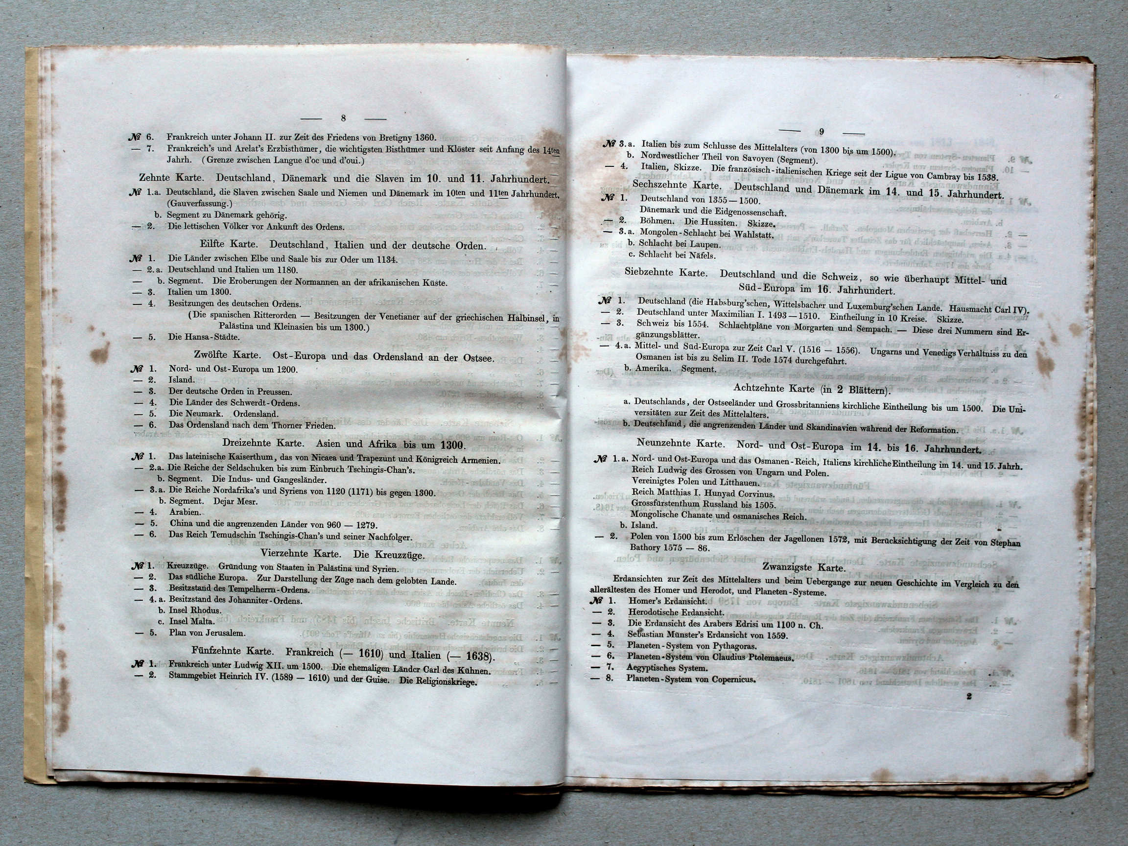
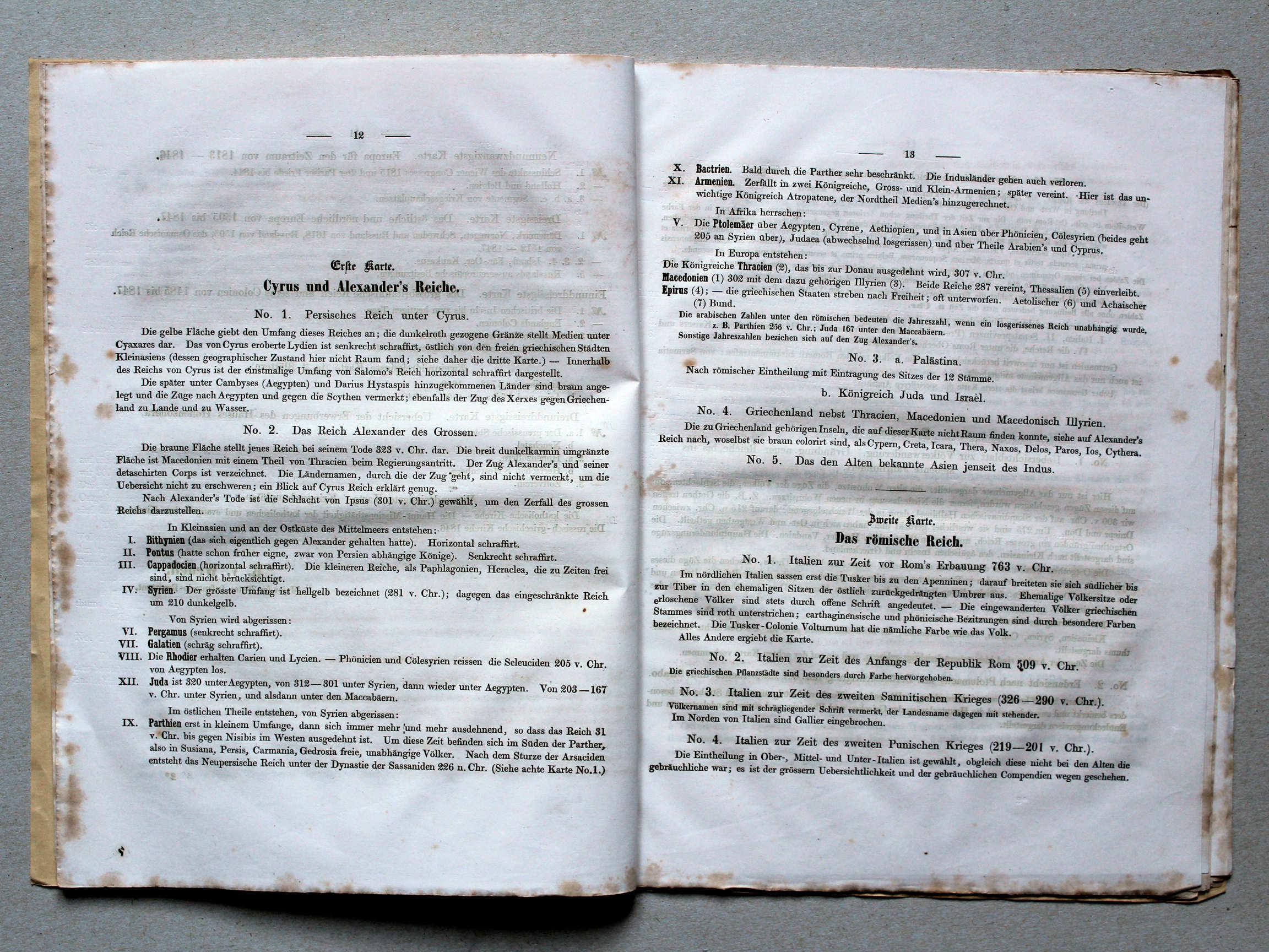
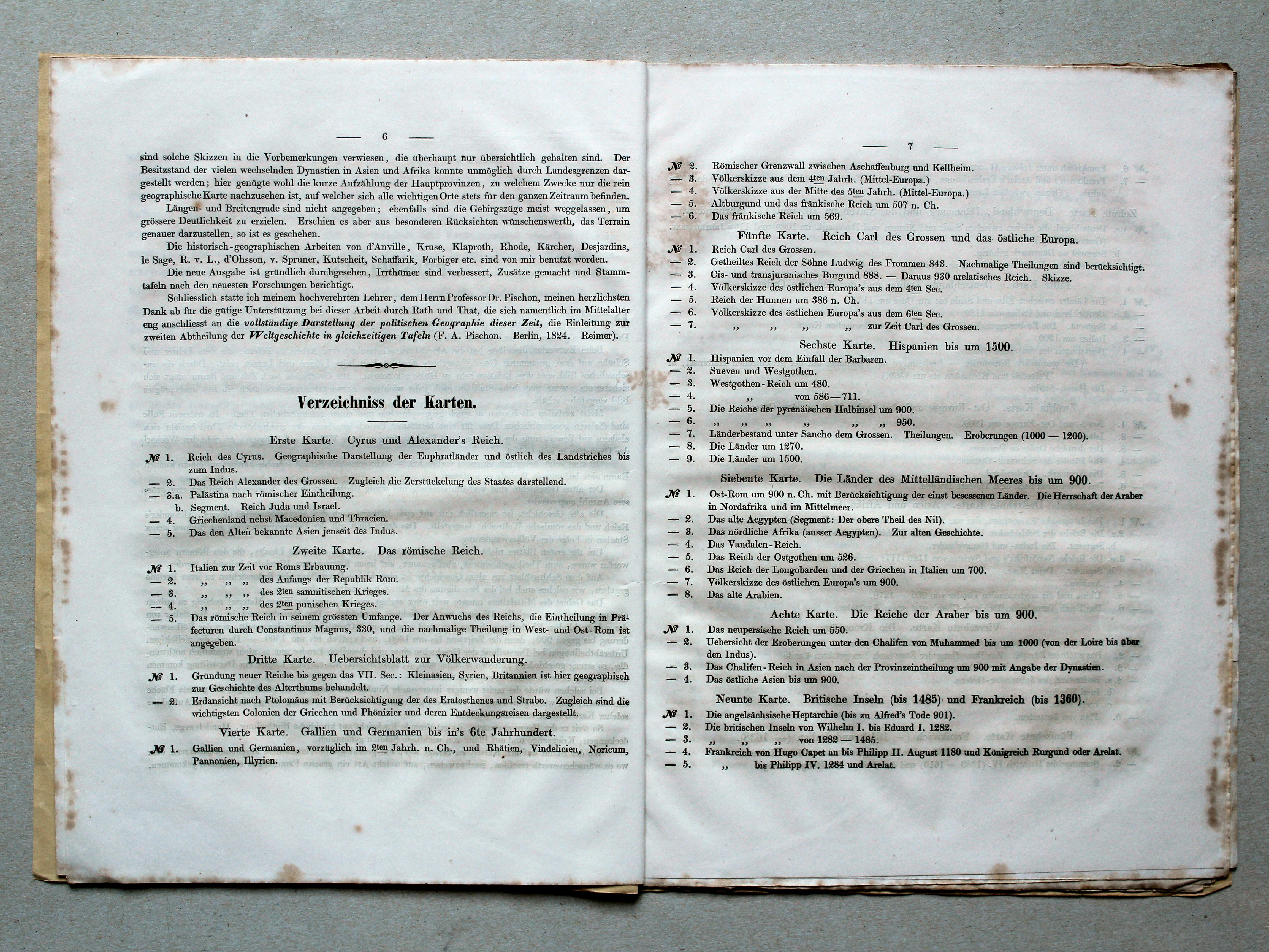
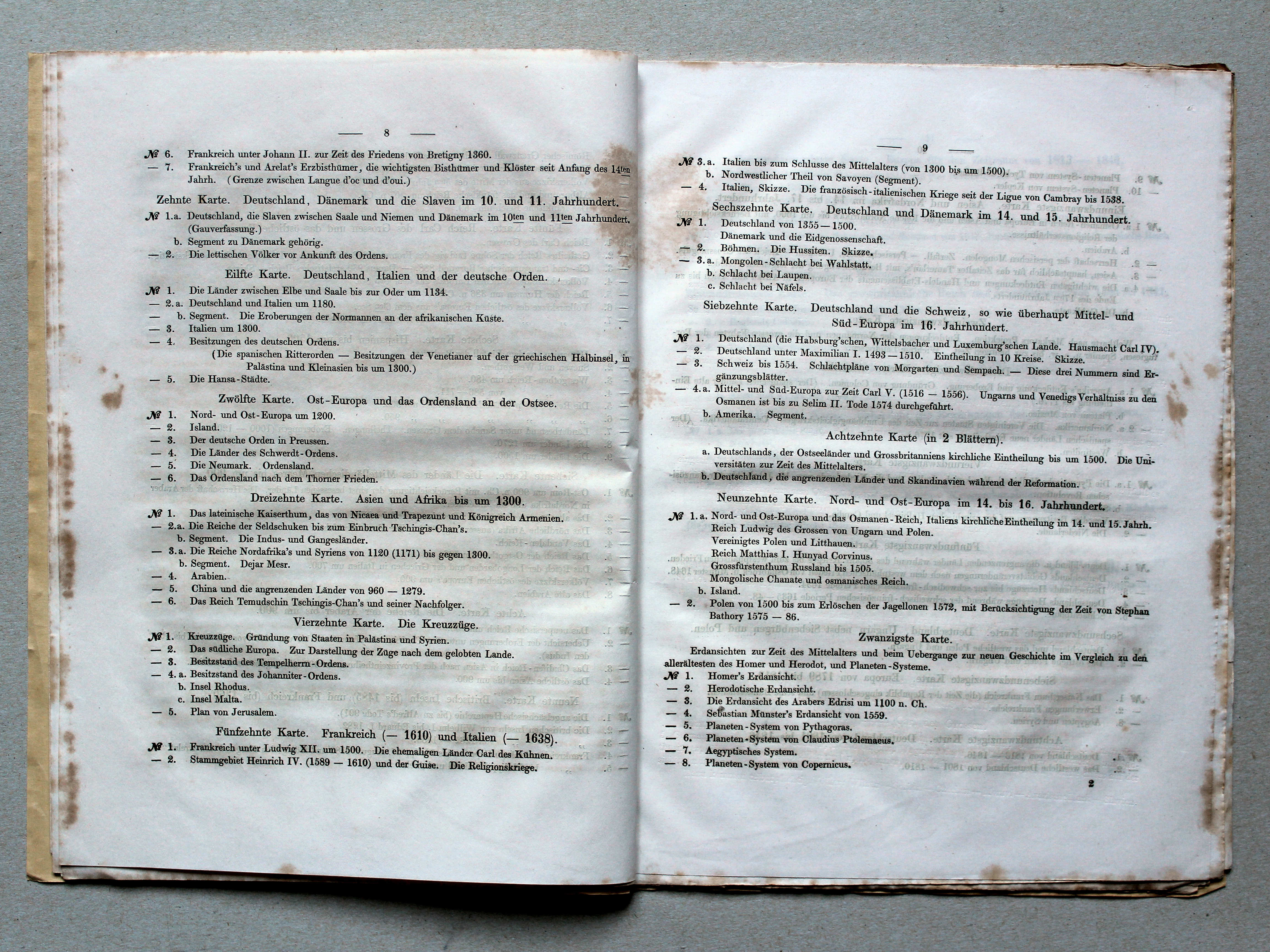
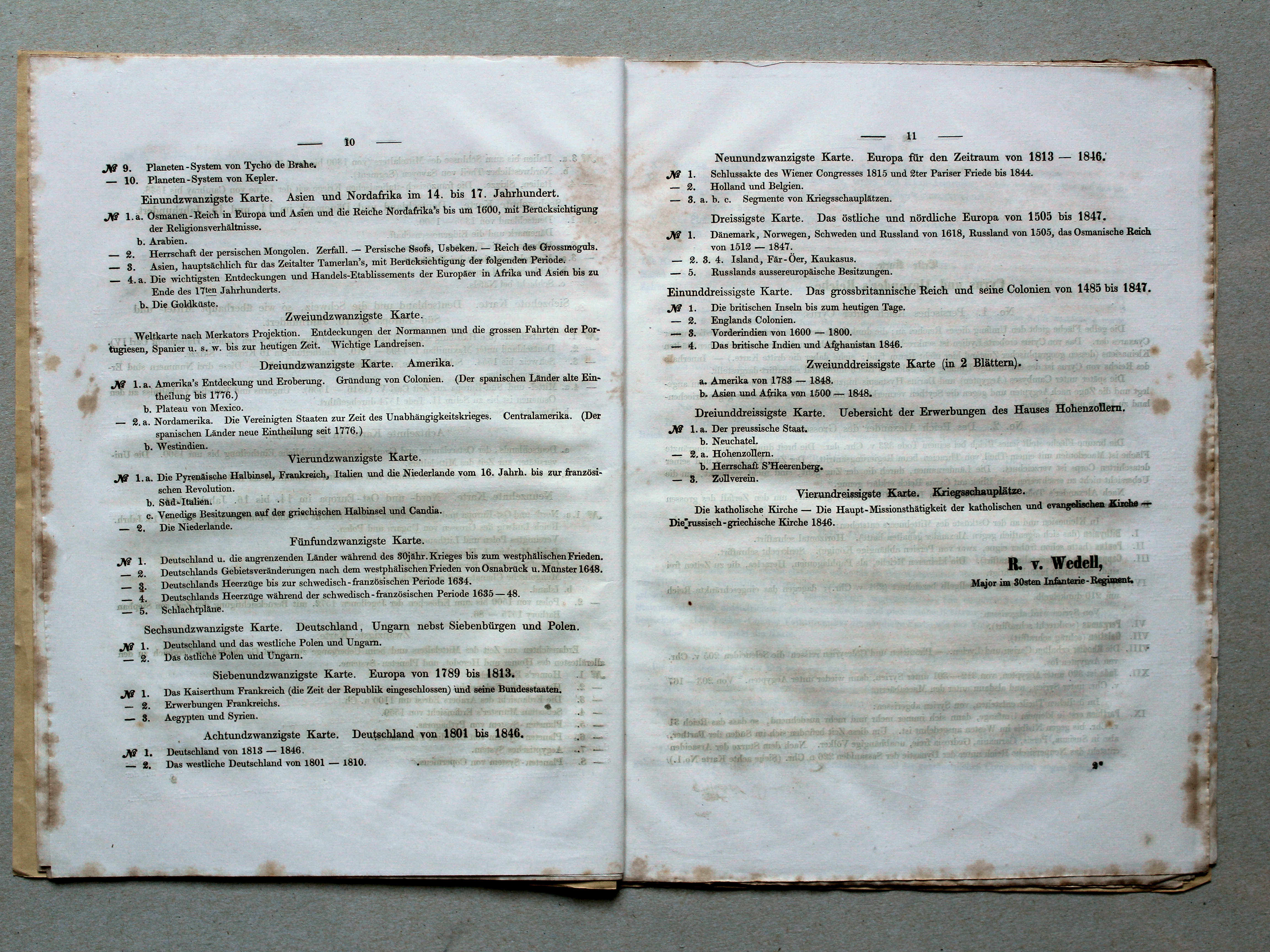
Prospectus, inhoudsopgave / Brochure, table of contents (p. 6-7) XL


![von Wedell's Historischer Hand-Atlas, 1856
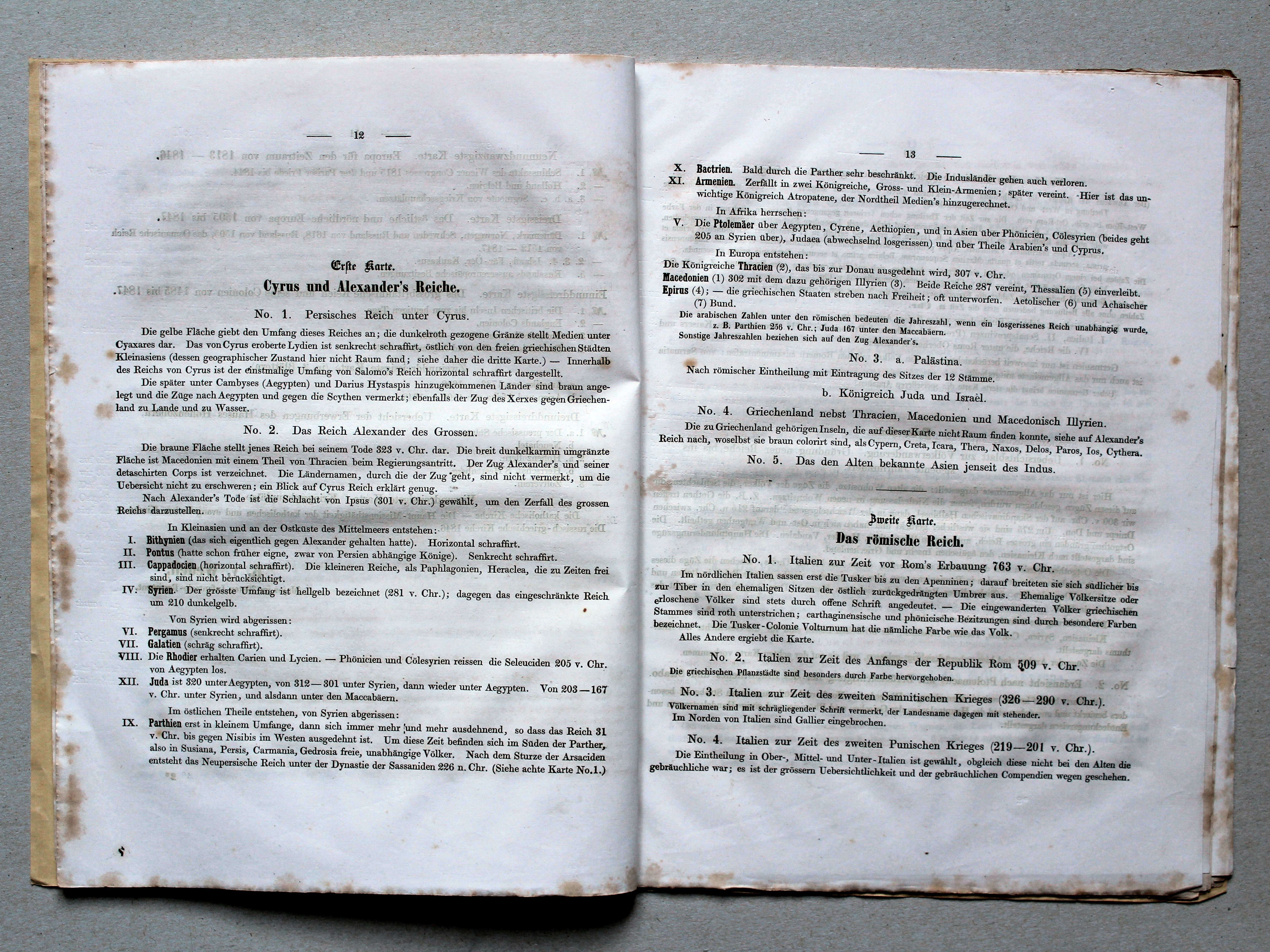
1. [Cyrus und Alexander's Reich]](picslarge/wedha1856k001.jpg) von Wedell's Historischer Hand-Atlas, 1856
von Wedell's Historischer Hand-Atlas, 1856
1. [Cyrus und Alexander's Reich] XL
De Rijken van Cyrus en van Alexander / The Empires of Cyrus and of Alexander
![von Wedell's Historischer Hand-Atlas, 1856
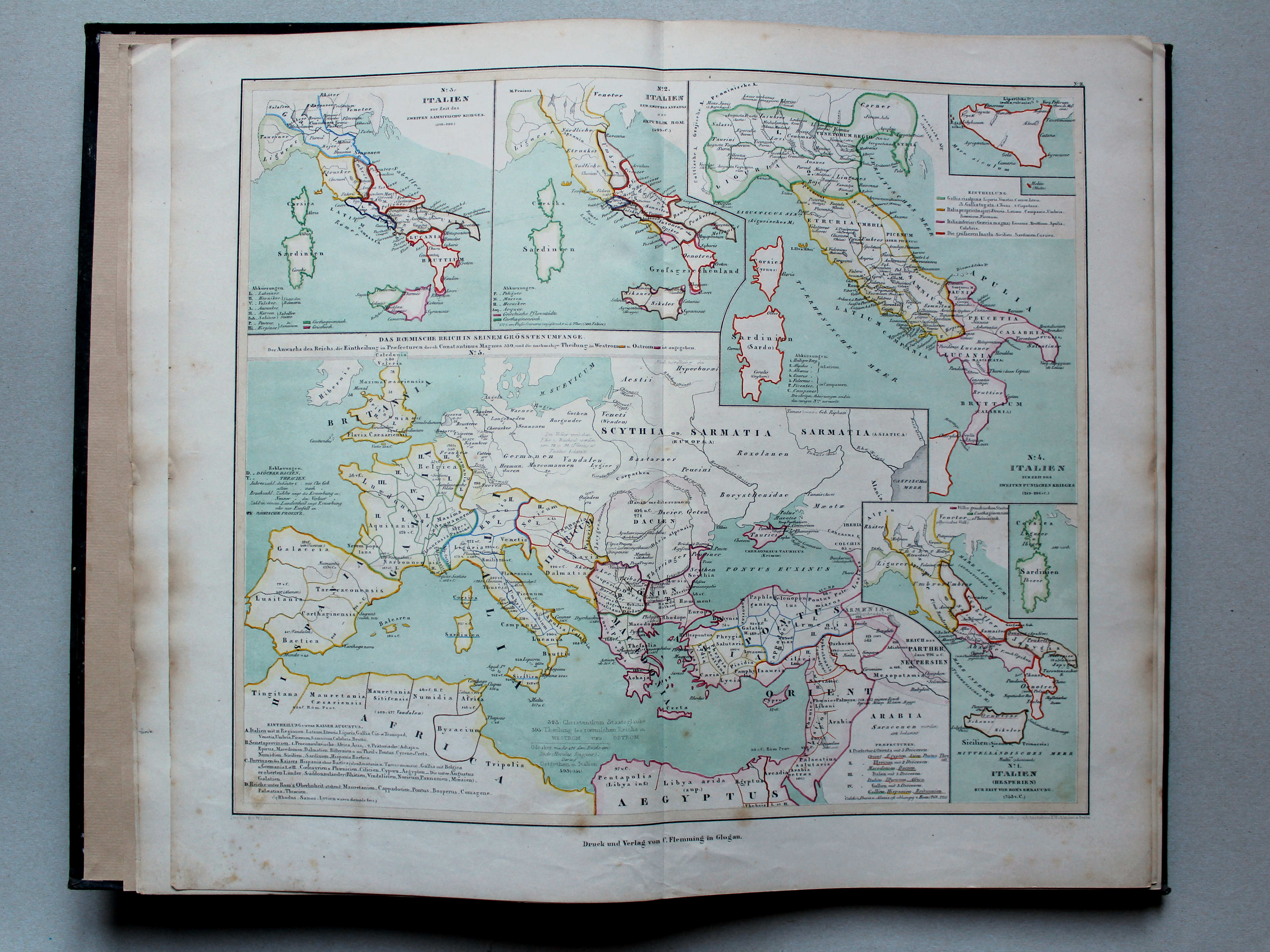
2. [Das römische Reich]](picslarge/wedha1856k002.jpg) von Wedell's Historischer Hand-Atlas, 1856
von Wedell's Historischer Hand-Atlas, 1856
2. [Das römische Reich] XL
Het Romeinse Rijk / The Roman Empire
![von Wedell's Historischer Hand-Atlas, 1856
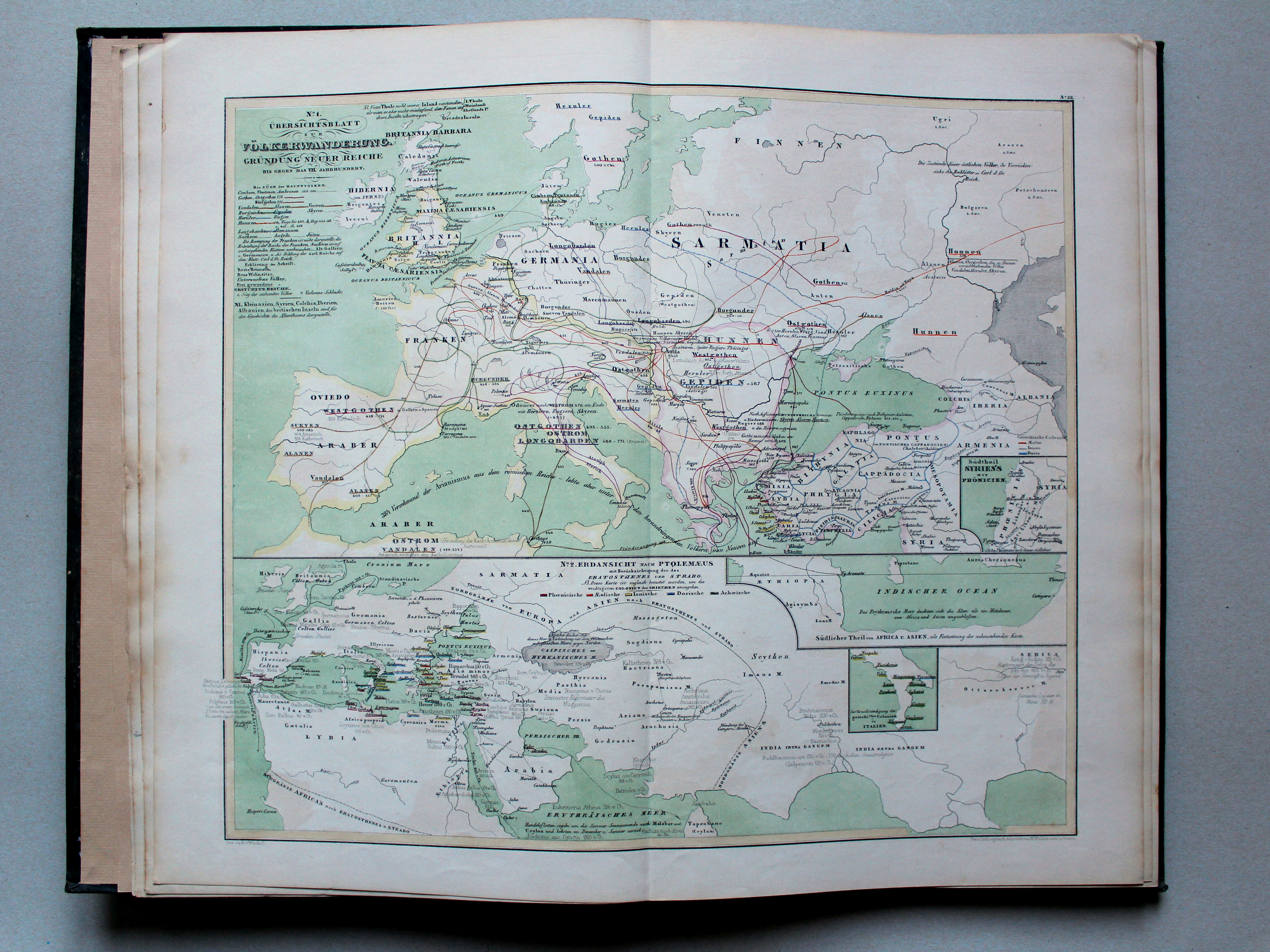
3. [Uebersichtsblatt zur Völkerwanderung]](picslarge/wedha1856k003.jpg) von Wedell's Historischer Hand-Atlas, 1856
von Wedell's Historischer Hand-Atlas, 1856
3. [Uebersichtsblatt zur Völkerwanderung] XL
Overzichtskaart van de Grote Volksverhuizing / Overview map of the Migration Period
![von Wedell's Historischer Hand-Atlas, 1856
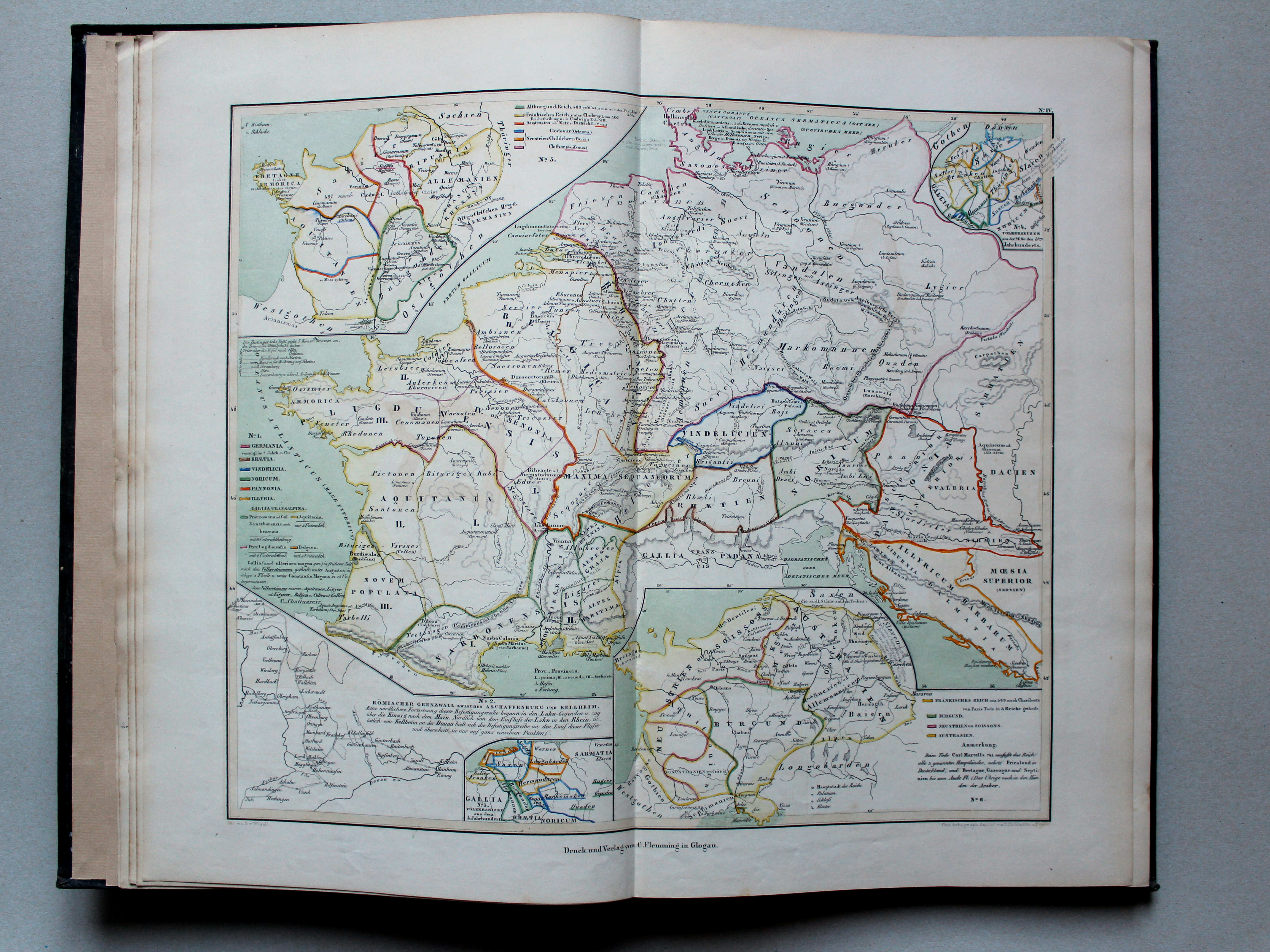
4. [Gallien und Germanien bis in's 6te Jahrhundert]](picslarge/wedha1856k004.jpg) von Wedell's Historischer Hand-Atlas, 1856
von Wedell's Historischer Hand-Atlas, 1856
4. [Gallien und Germanien bis in's 6te Jahrhundert] XL
Gallië en Germanië tot de 6e eeuw / Gaul and Germania until the 6th century
![von Wedell's Historischer Hand-Atlas, 1856
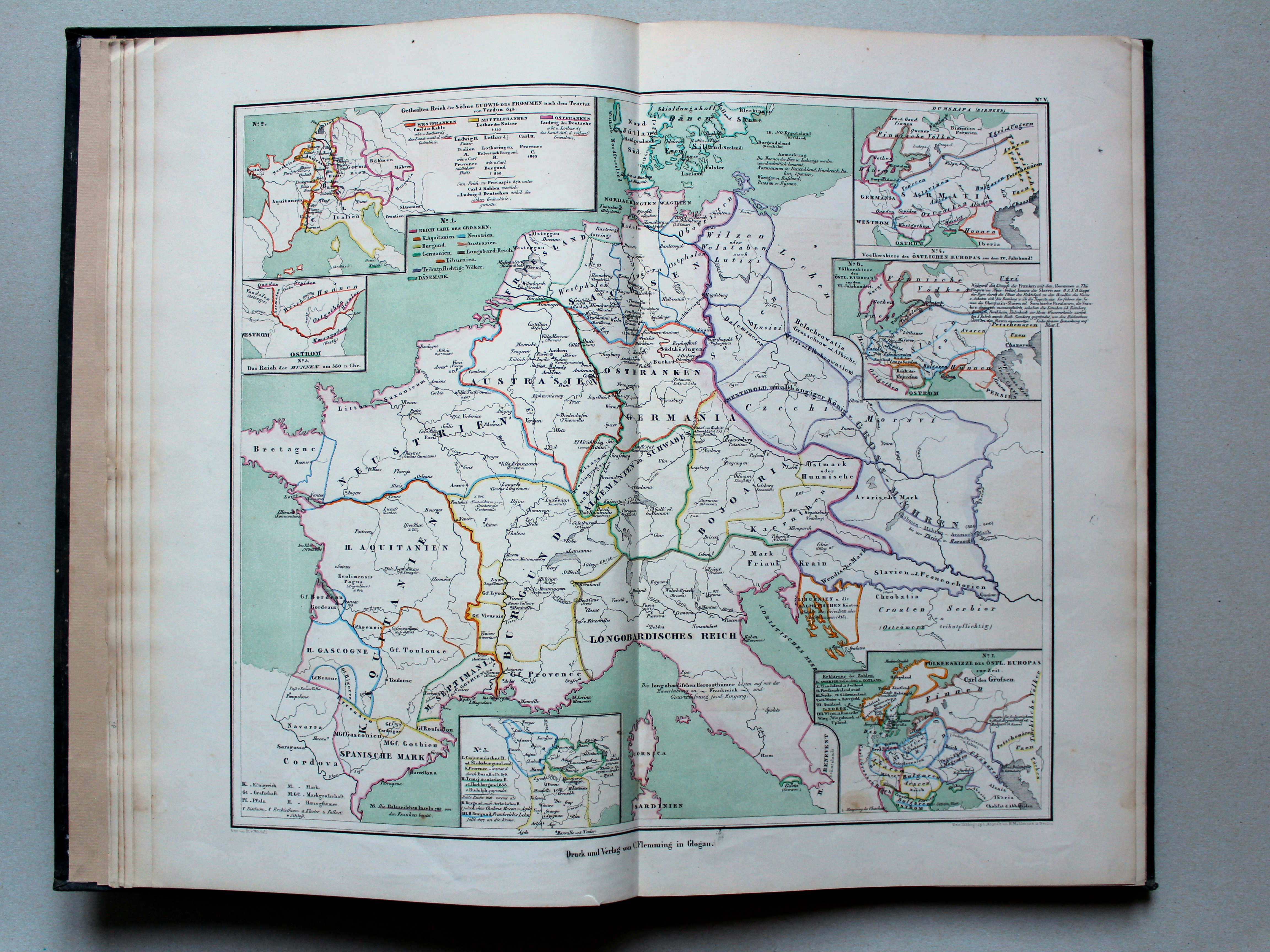
5. [Reich Carl des Grossen und das östliche Europa]](picslarge/wedha1856k005.jpg) von Wedell's Historischer Hand-Atlas, 1856
von Wedell's Historischer Hand-Atlas, 1856
5. [Reich Carl des Grossen und das östliche Europa] XL
Het Rijk van Karel de Grote en Oost-Europa / The Empire of Charlemagne and Eastern Europe
![von Wedell's Historischer Hand-Atlas, 1856
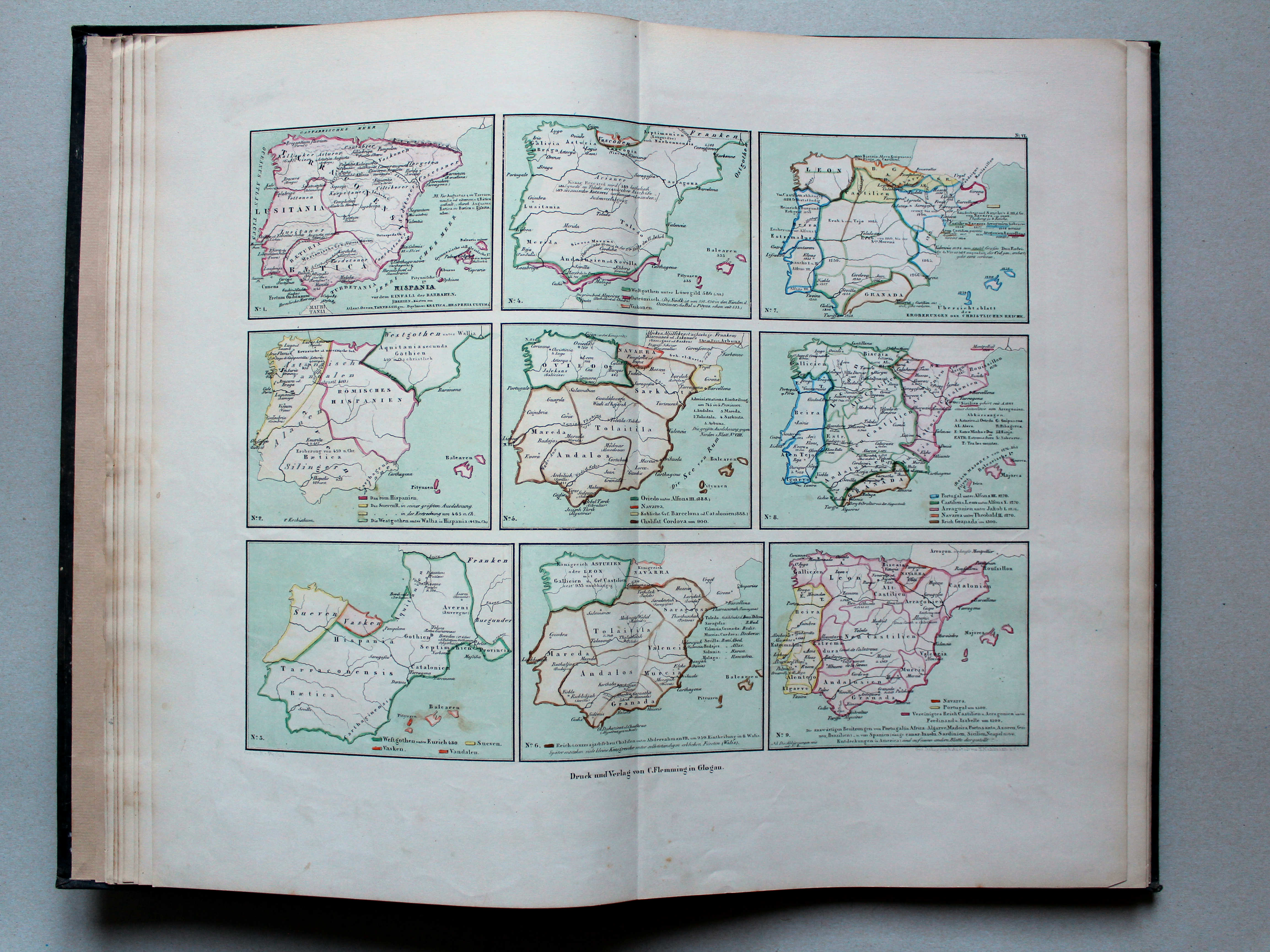
6. [Hispanien bis um 1500]](picslarge/wedha1856k006.jpg) von Wedell's Historischer Hand-Atlas, 1856
von Wedell's Historischer Hand-Atlas, 1856
6. [Hispanien bis um 1500] XL
Hispania-Spanje tot ongeveer 1500 / Hispania-Spain until around 1500
 von Wedell's Historischer Hand-Atlas, 1856
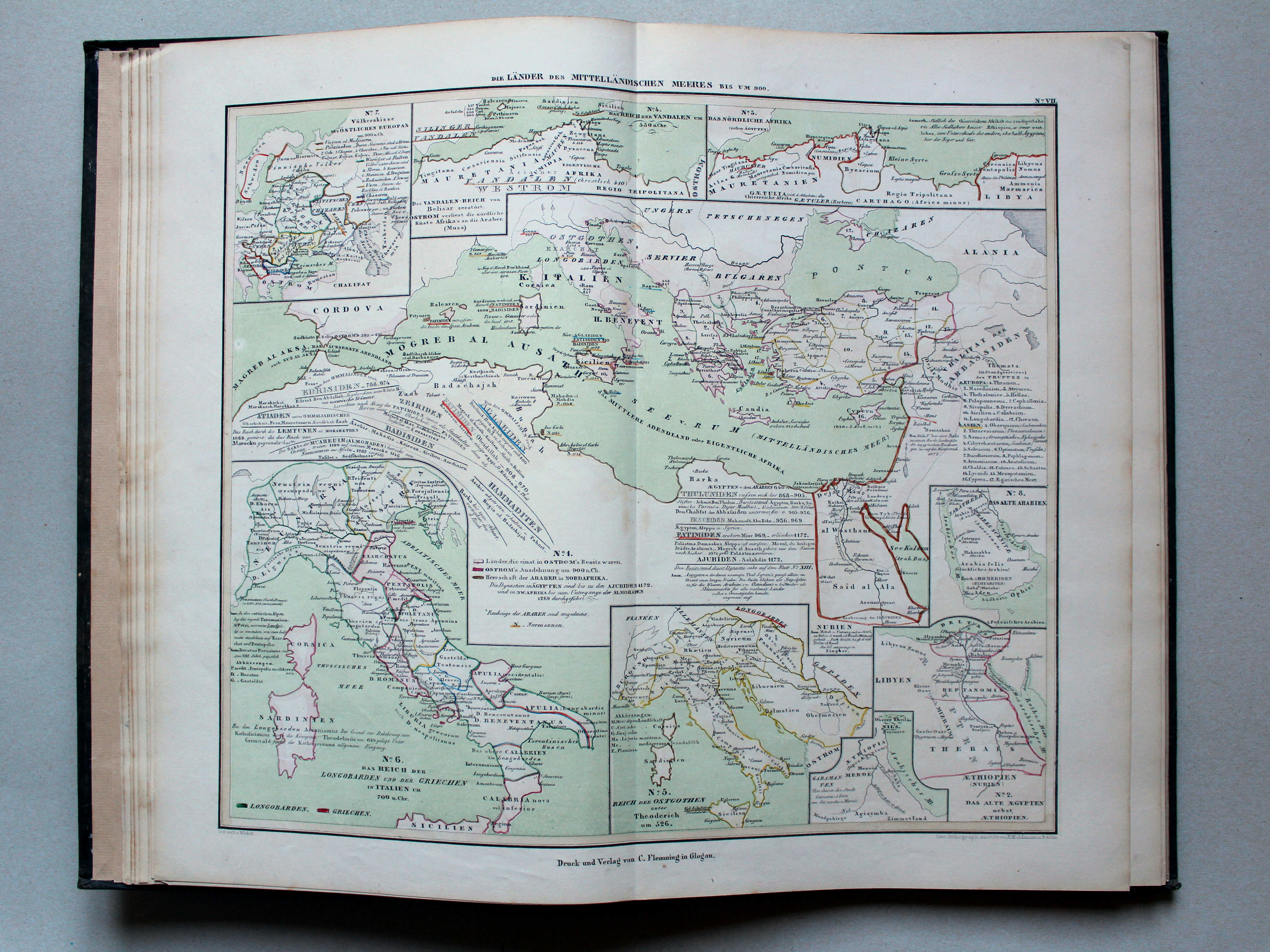
7. Die Länder des Mittelländischen Meeres bis um 900 XL
Die landen rondom de Middellandse Zee tot ongeveer 900 / The countries around the Mediterranean Sea until around 900
![von Wedell's Historischer Hand-Atlas, 1856
8. [Die Reiche der Araber bis um 900]](picslarge/wedha1856k008.jpg) von Wedell's Historischer Hand-Atlas, 1856
von Wedell's Historischer Hand-Atlas, 1856
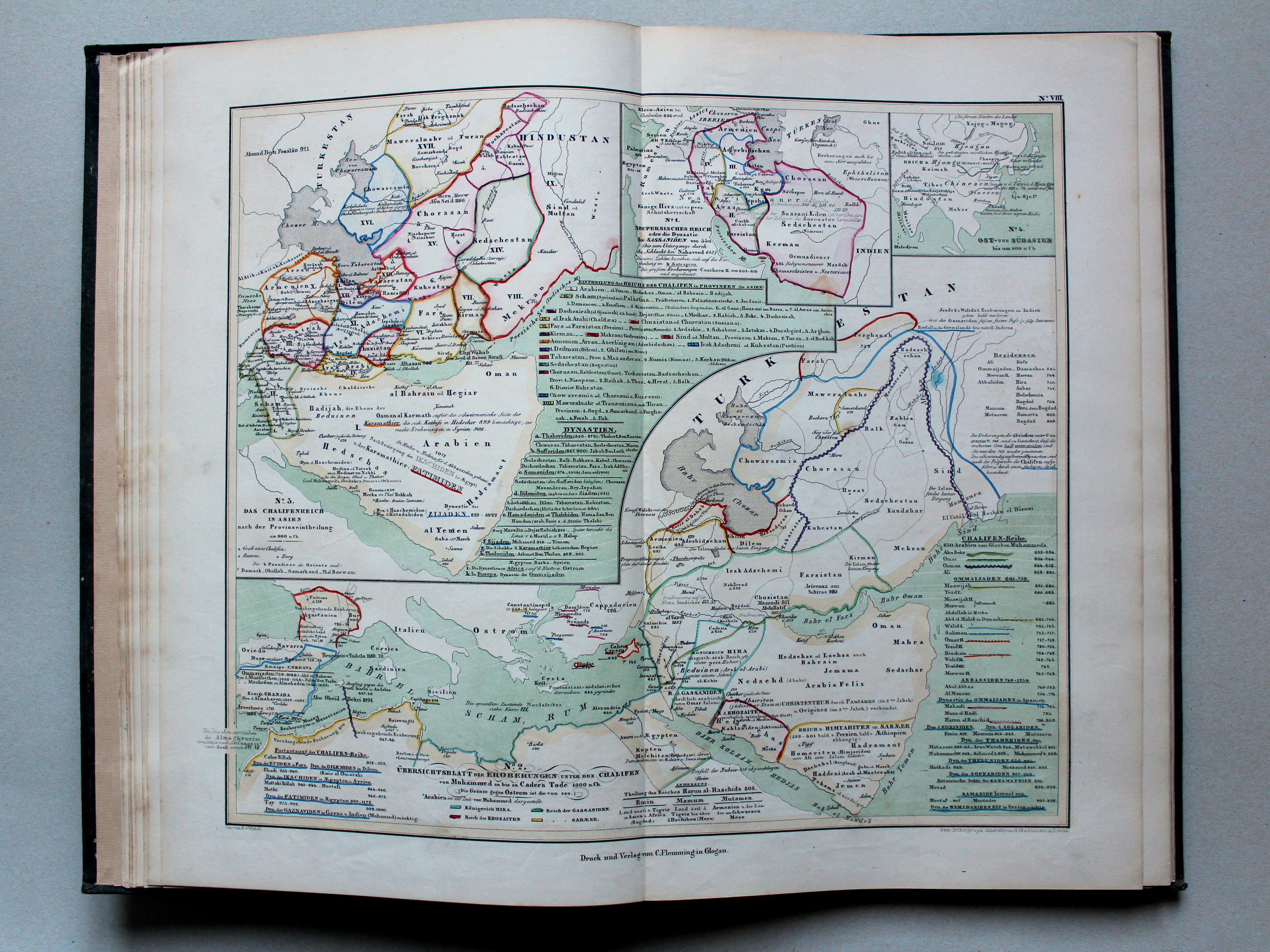
8. [Die Reiche der Araber bis um 900] XL
De Rijken van de Arabieren tot ongeveer 900 / The Empires of the Arabs until around 900
 von Wedell's Historischer Hand-Atlas, 1856
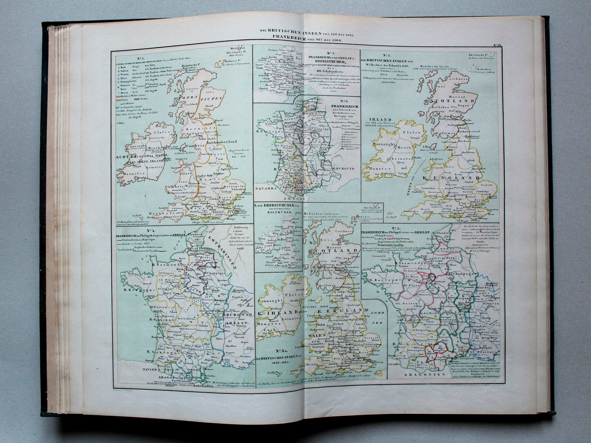
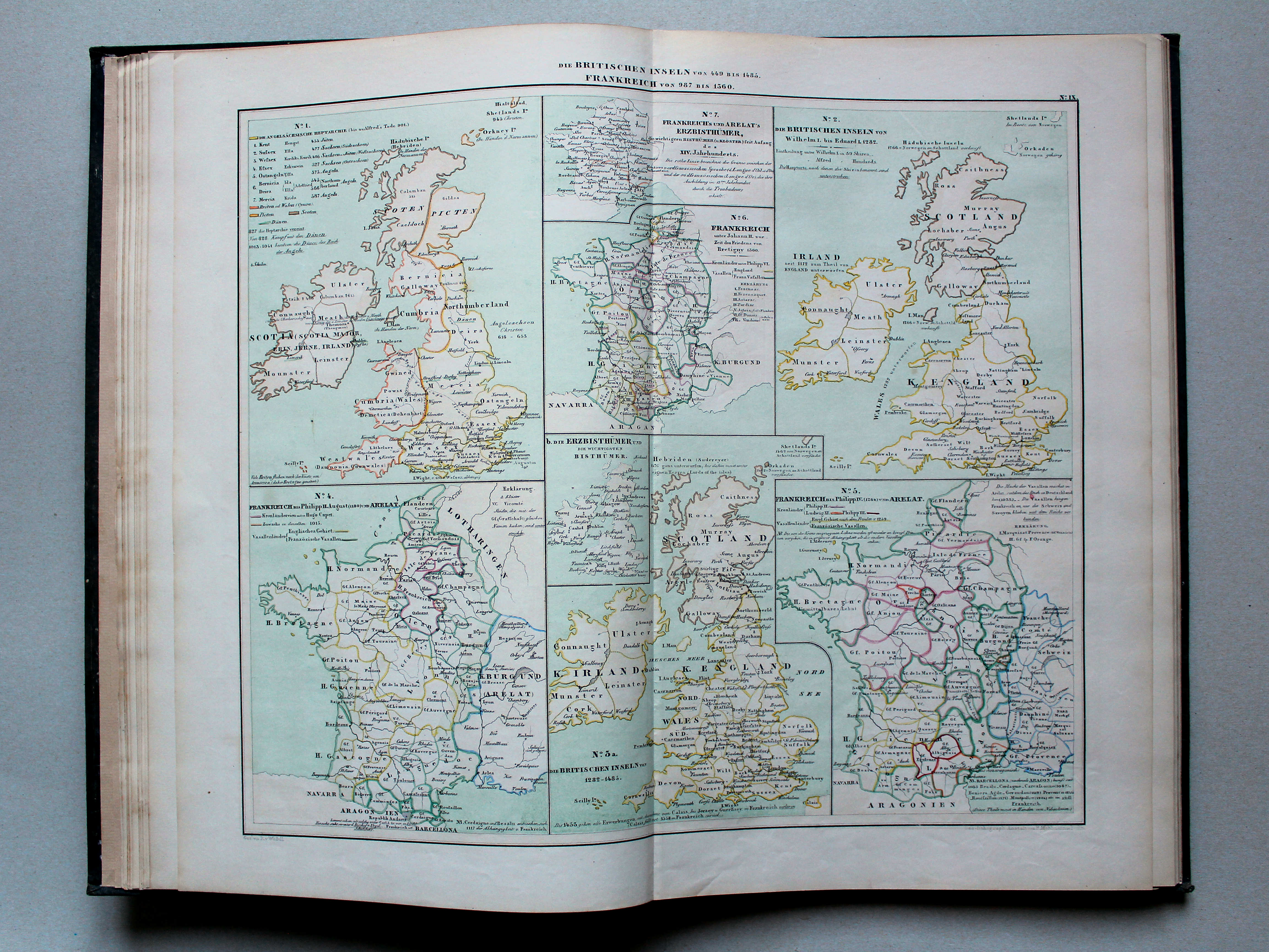
9. Die Britischen Inseln von 449 bis 1485. Frankreich von 987 bis 1360 XL
De Britse Eilanden van 449 tot 1485. Frankrijk van 987 tot 1360 / The British Isles from 449 until 1485. France from 987 until 1360
 von Wedell's Historischer Hand-Atlas, 1856
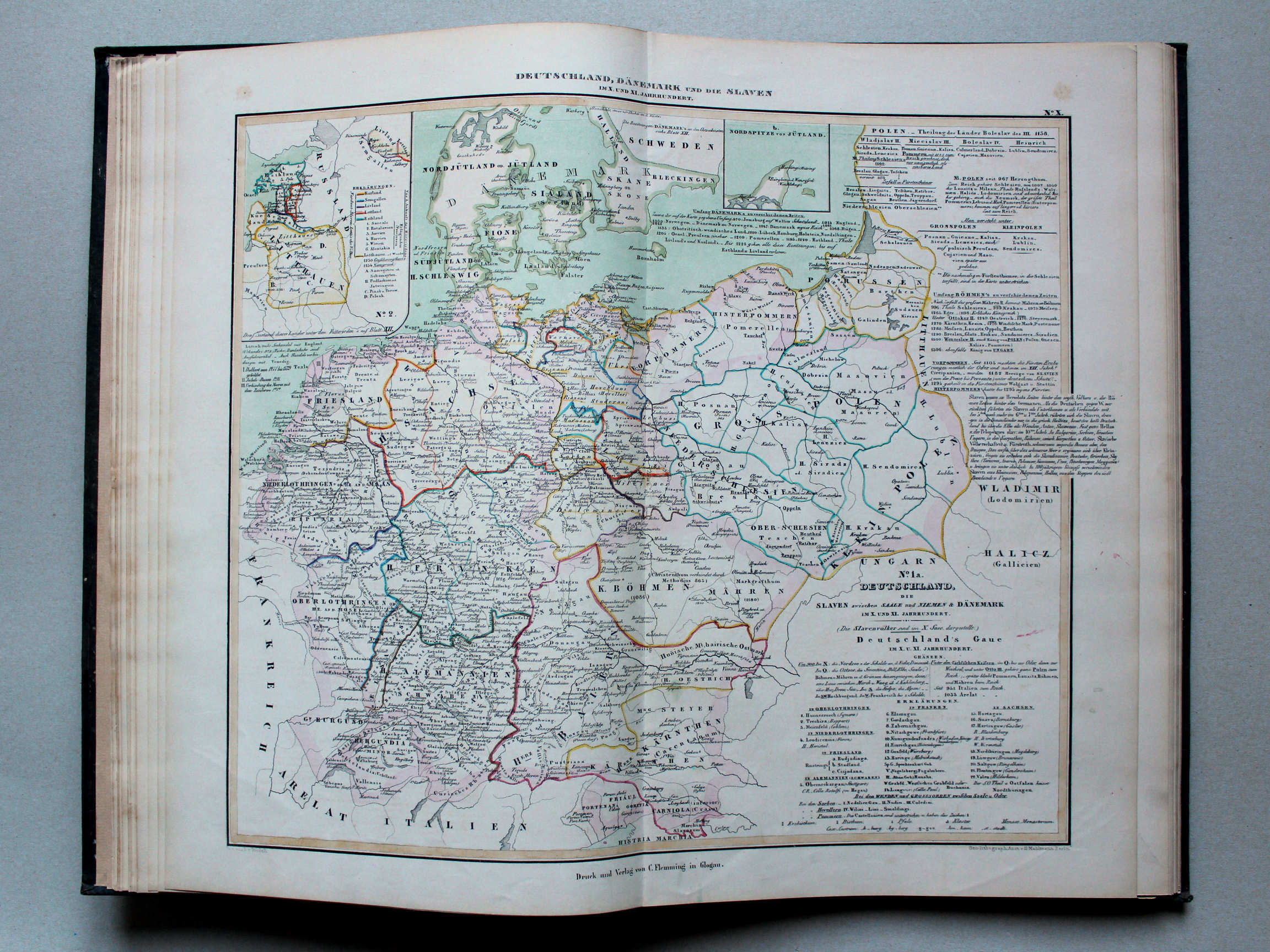
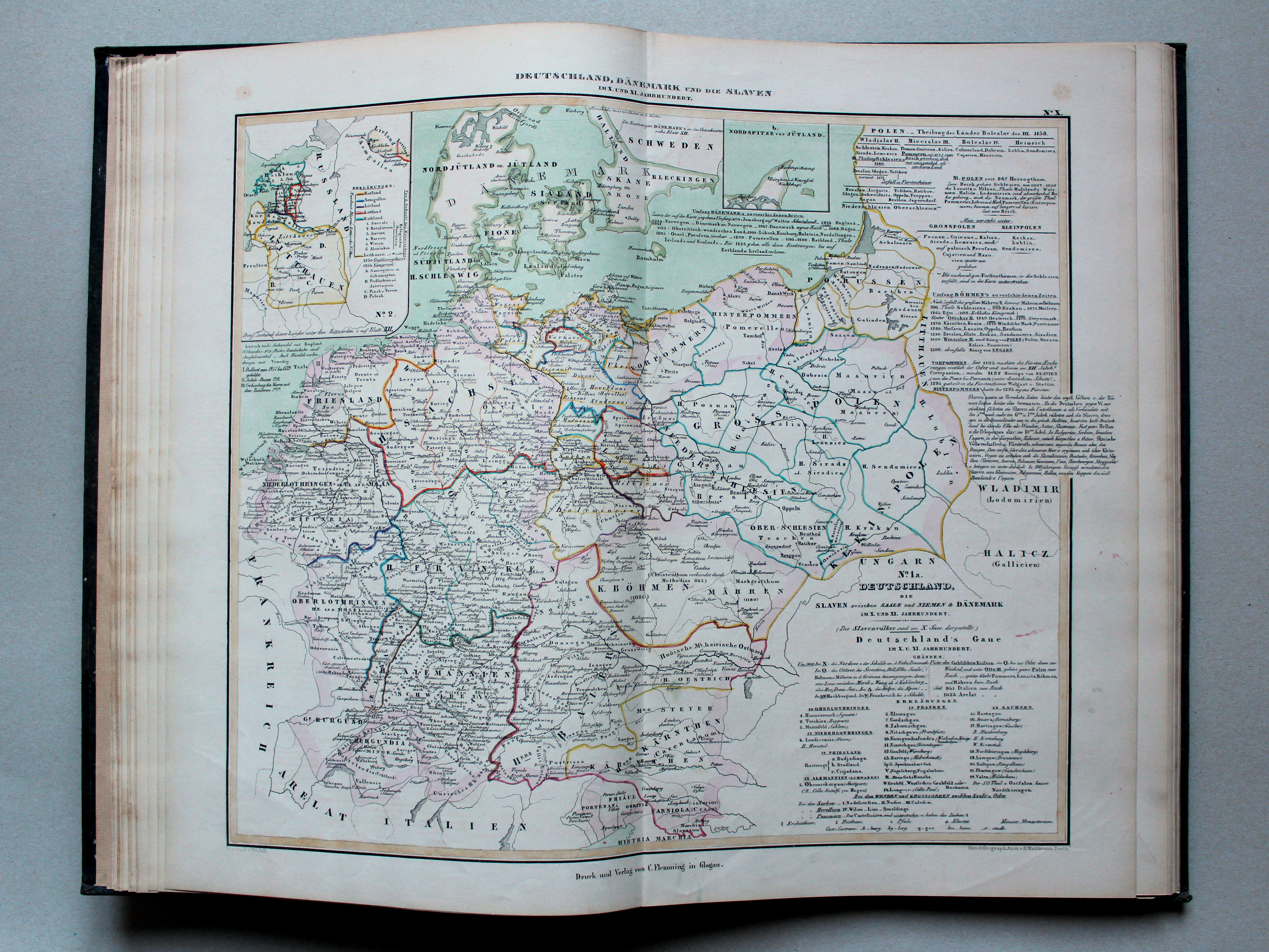
10. Deutschland, Dänemark und die Slaven im X. und XI. Jahrhundert XL
Duitsland, Denemarken en de Slavische landen in de 10e en 11e eeuw / Germany, Denmark and the Slavic countries in the 10th and 11th centuries
 von Wedell's Historischer Hand-Atlas, 1856
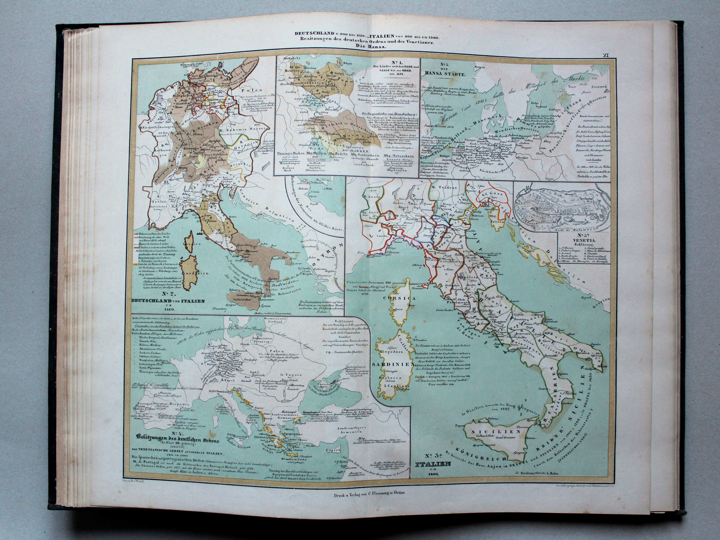
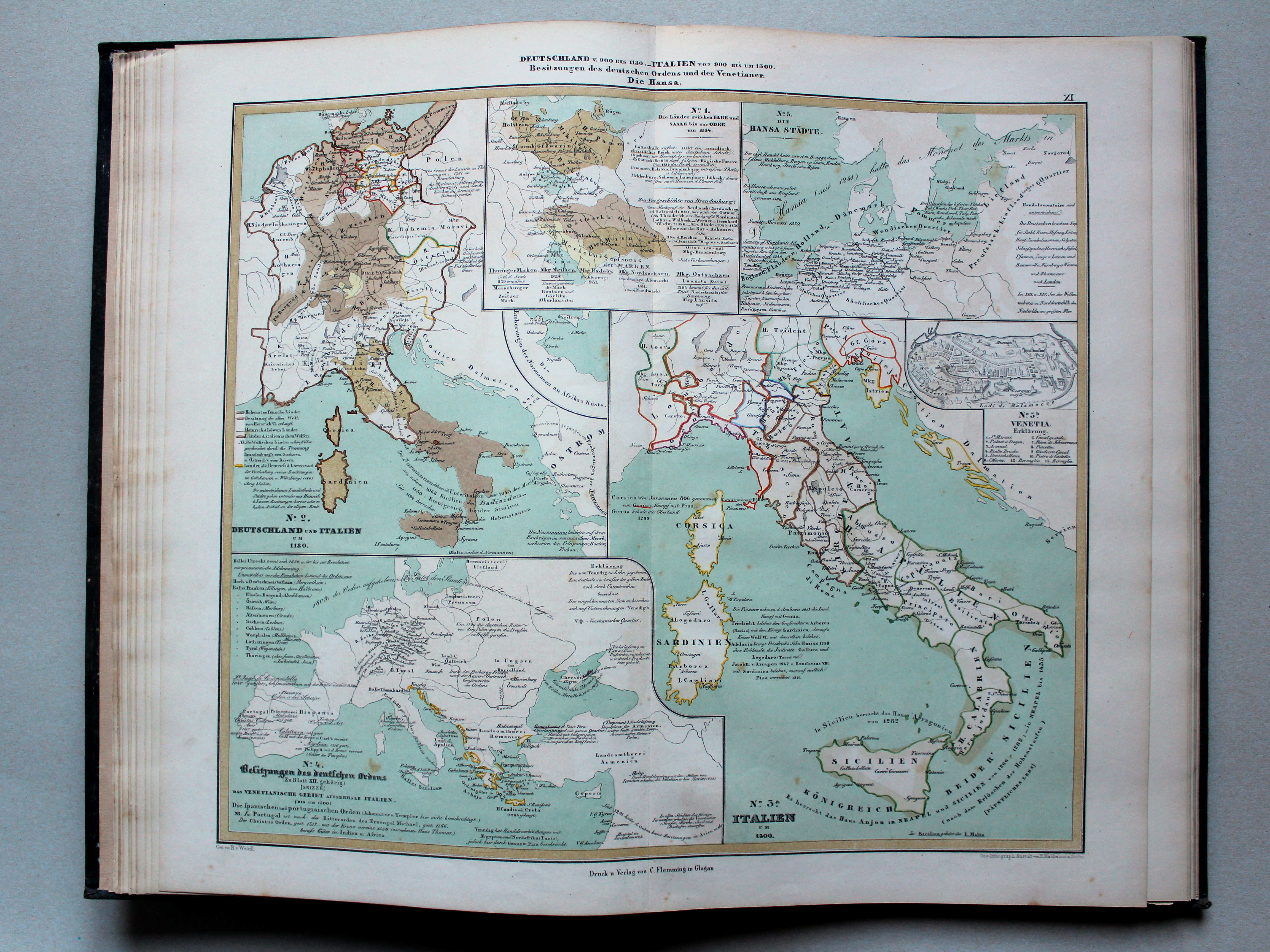
11. Deutschland v. 900 bis 1130. Italien von 900 bis um 1300. Besitzungen des deutschen Ordens und der Venetianer. Die Hansa XL
Duitsland van 900 tot 1130. Italië van 900 tot ongeveer 1300. Besittingen van de Duitse Orde de de Venetianen. De Hanze / Germany from 900 until 1130. Italiy from 900 until around 1300. Possessions of the Teutonic Order and the Venetians. The Hanseatic League
 von Wedell's Historischer Hand-Atlas, 1856
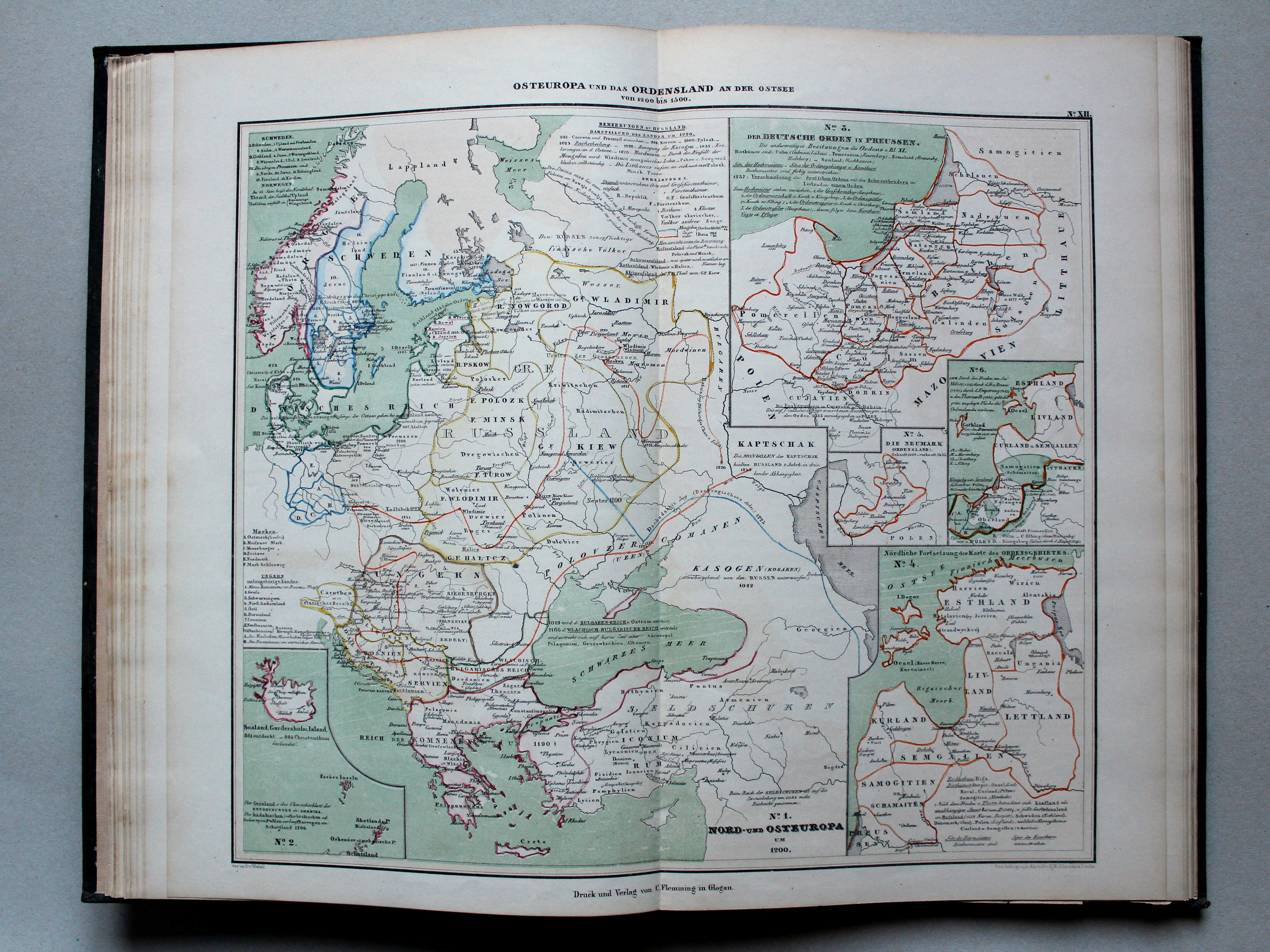
12. Ost-Europa und das Ordensland an der Ostsee von 1200 bis 1500 XL
Oost-Europa en het land van de Duitse Orde aan de Oostzee van 1200 tot 1500 / Eastern Europa and the country of the Teutonic Order at the Baltic Sea from 1200 until 1500
 von Wedell's Historischer Hand-Atlas, 1856
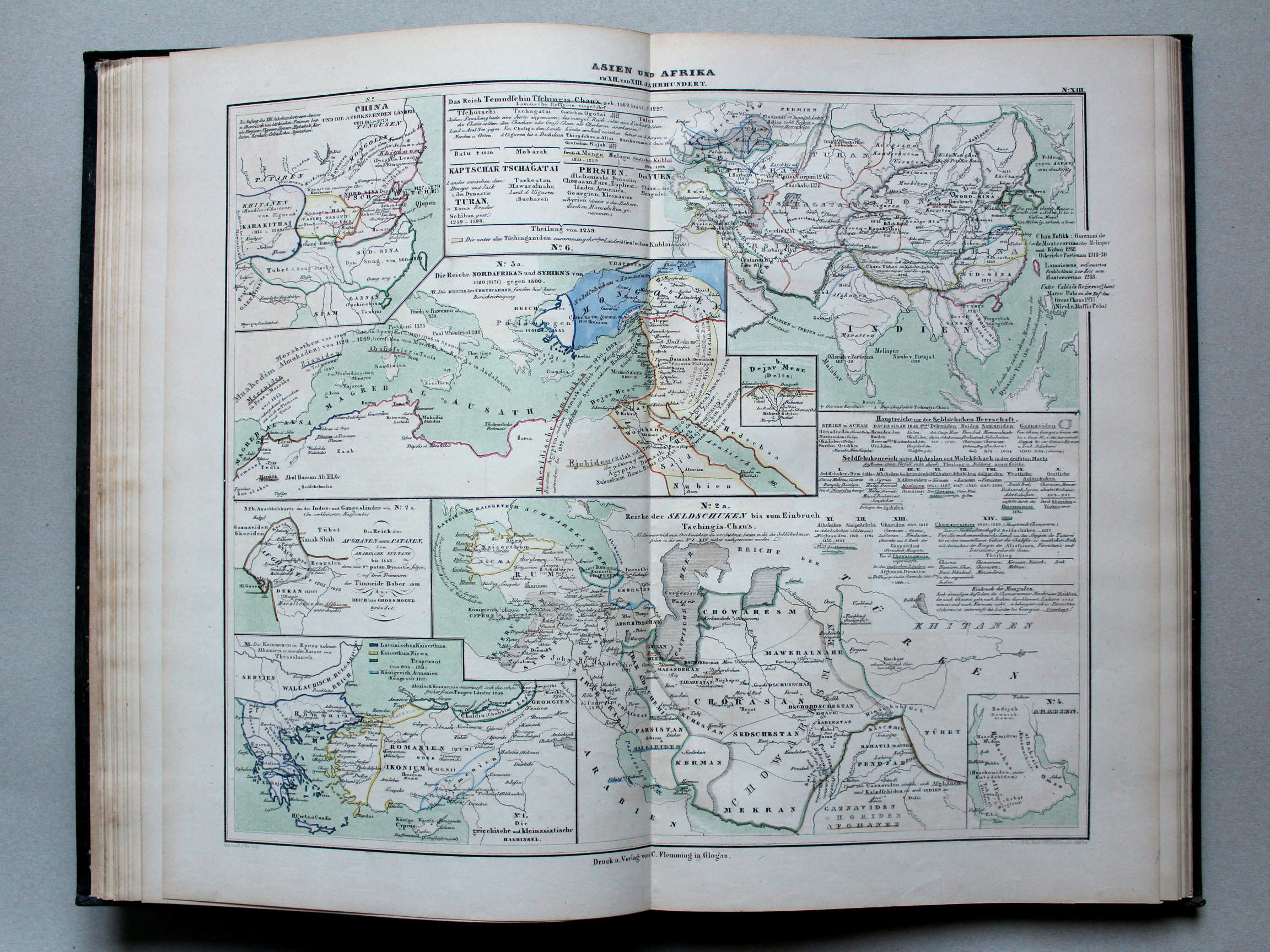
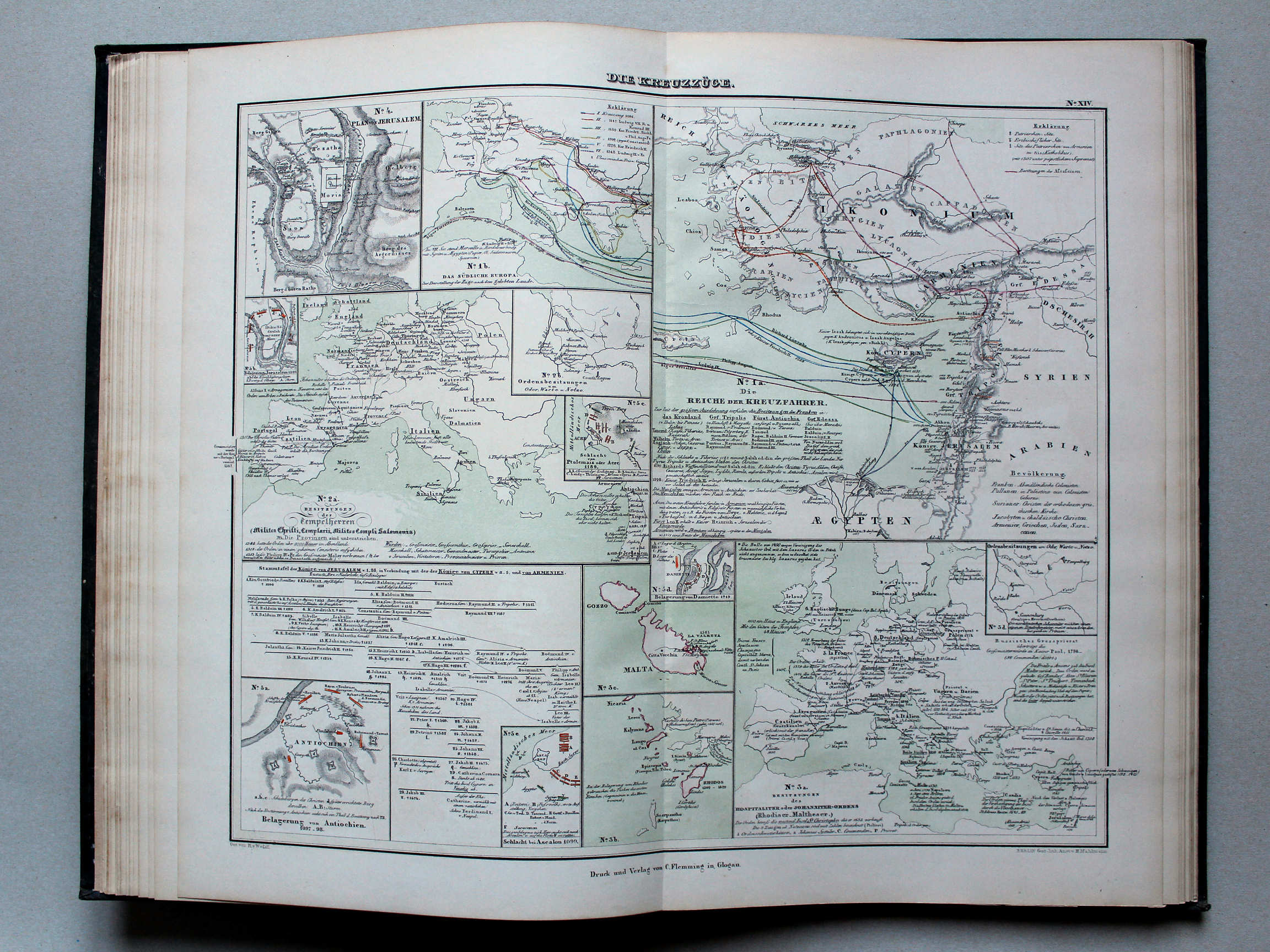
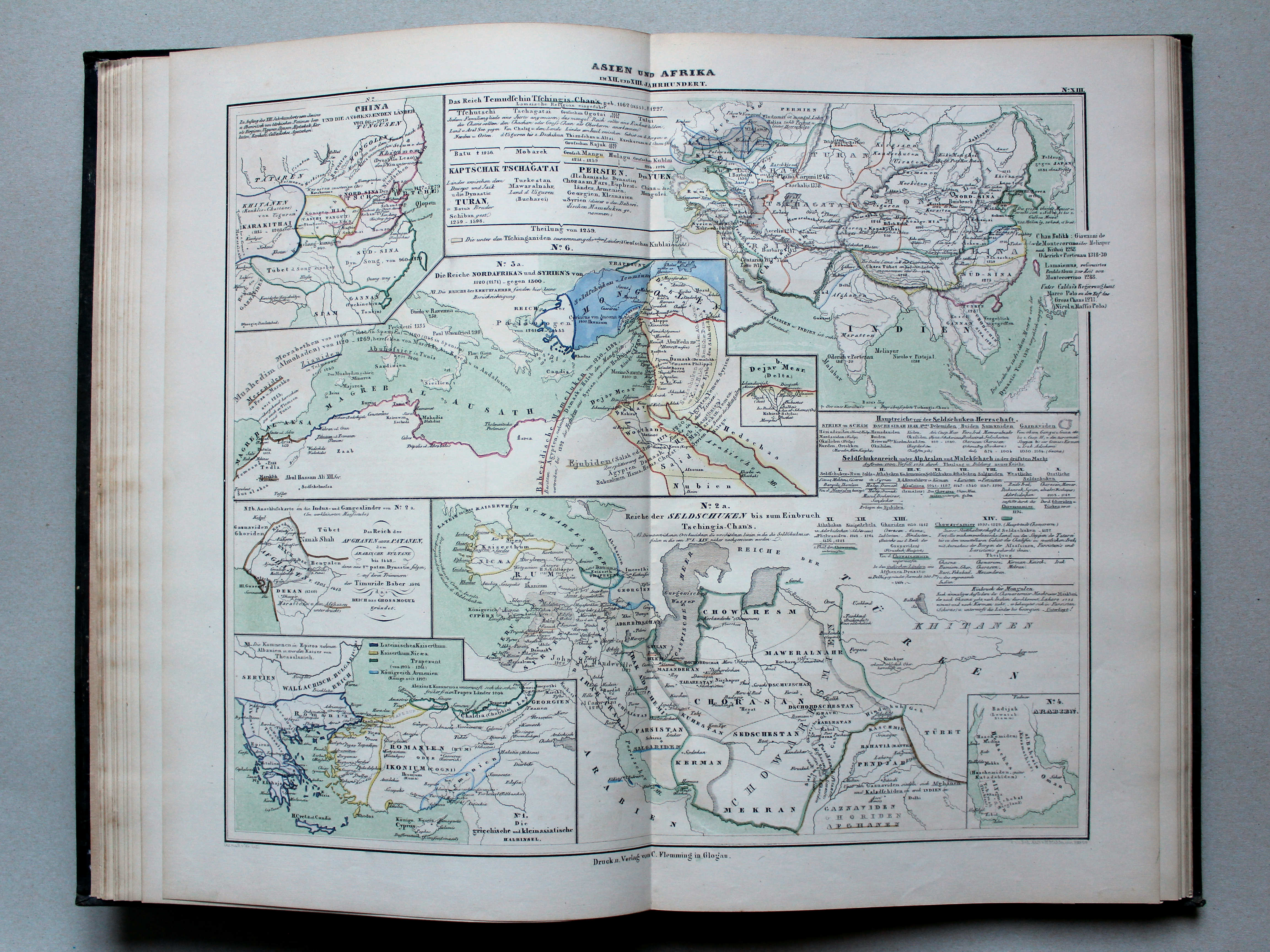
13. Asien und Afrika im XII. und XIII. Jahrhundert XL
Azië en Afrika in de 12e en 13e eeuw / Asia and Africa in the 12th and 13th centuries
 von Wedell's Historischer Hand-Atlas, 1856
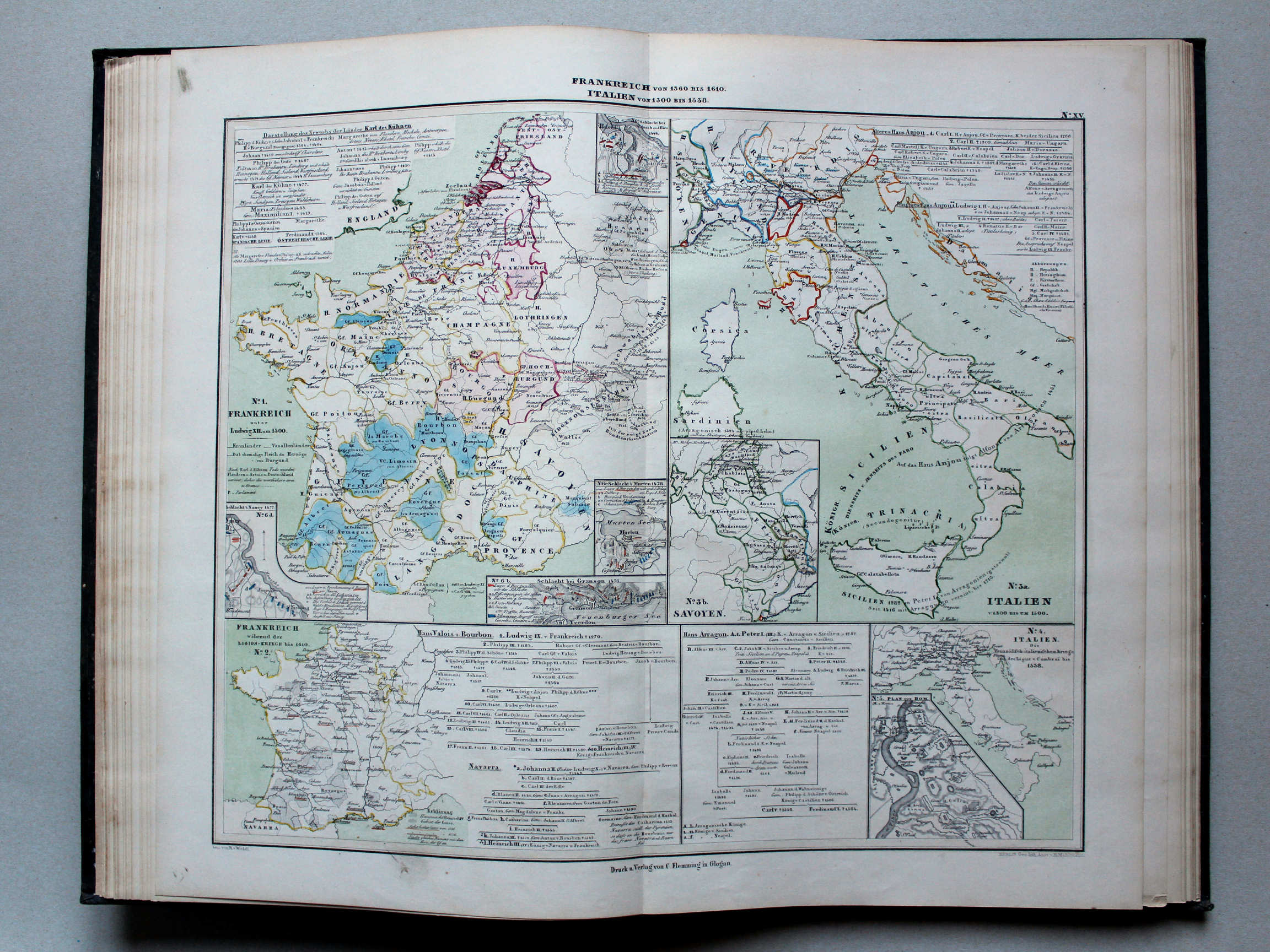
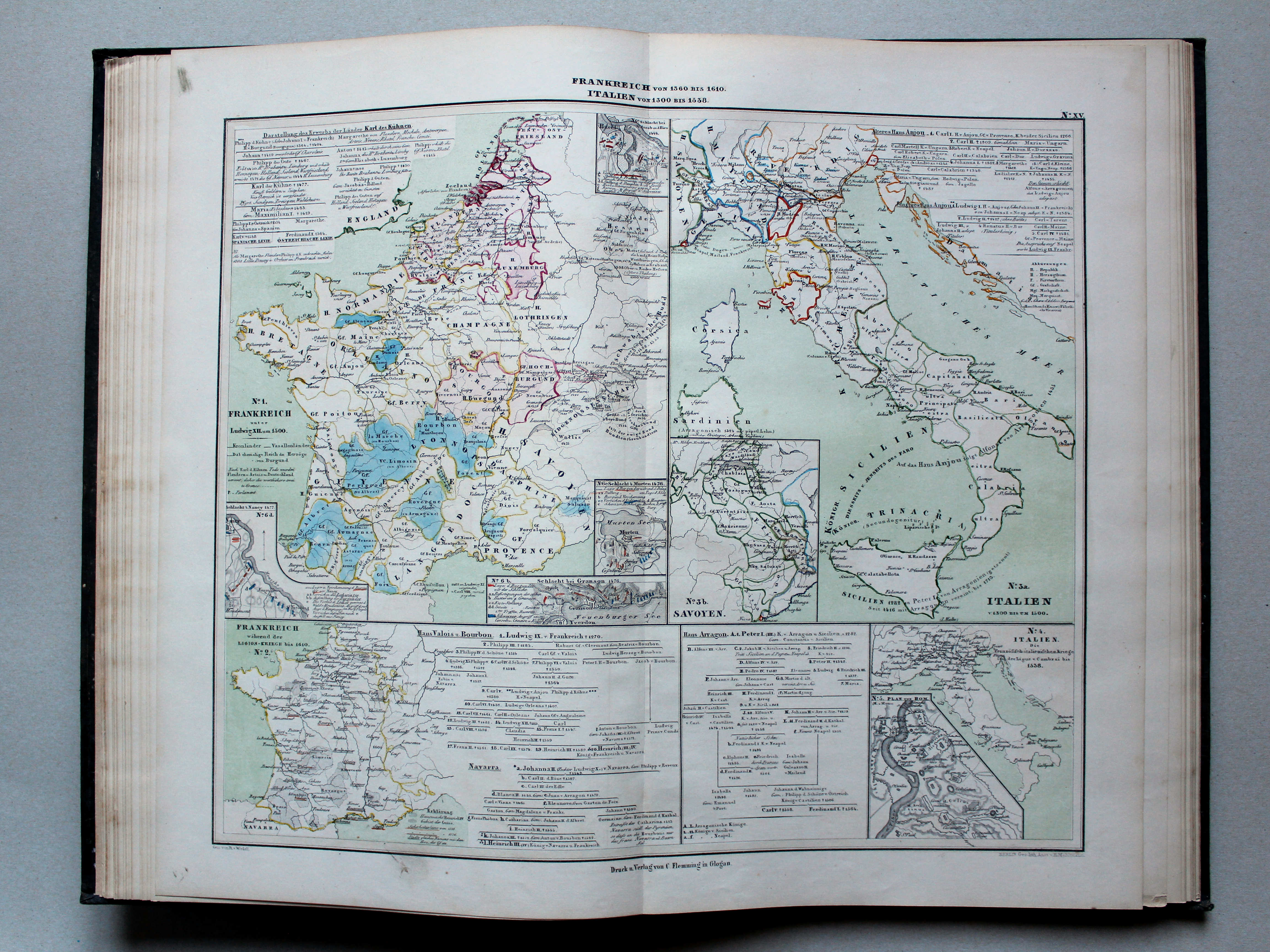
15. Frankreich von 1360 bis 1610. Italien von 1300 bis 1538 XL
Frankrijk van 1360 tot 1610. Italië van 1300 tot 1538 / France from 1360 until 1610. Italy from 1300 until 1538
 von Wedell's Historischer Hand-Atlas, 1856
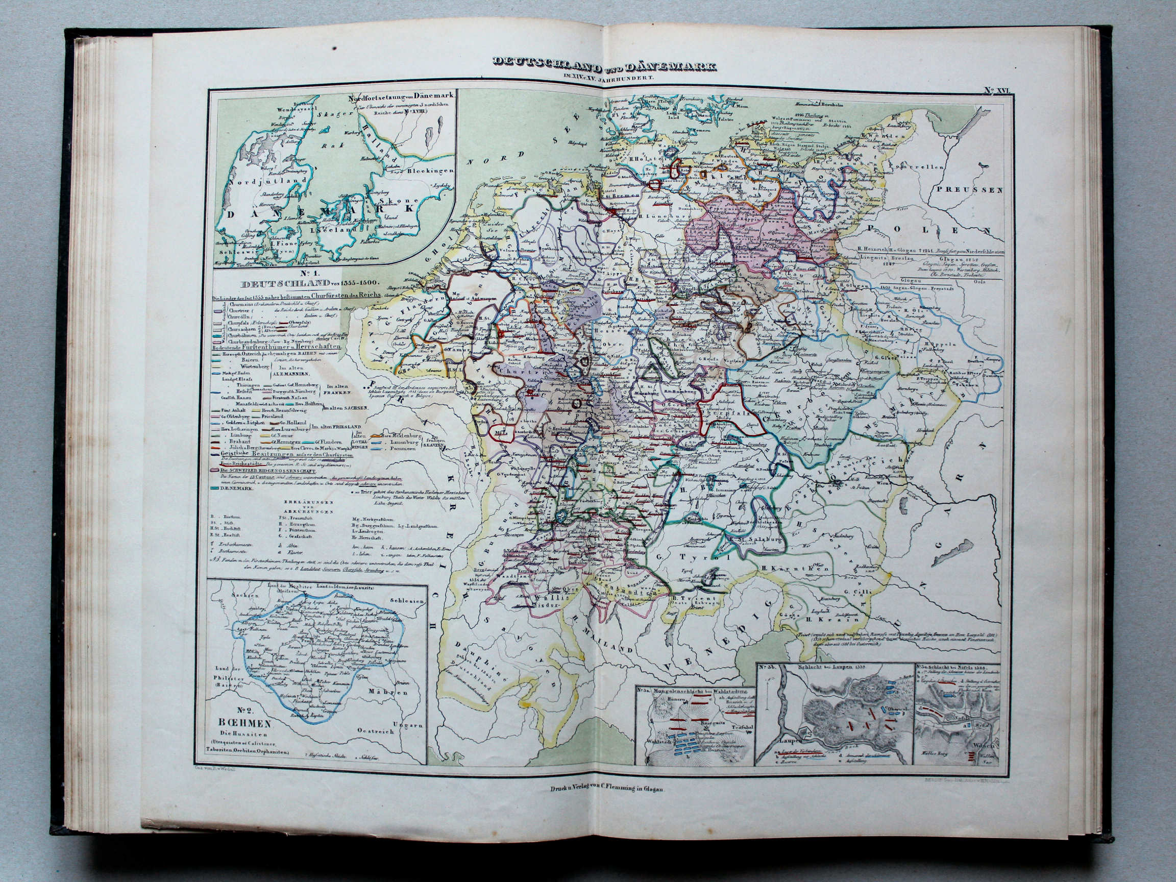
16. Deutschland und Dänemark im XIV. und XV. Jahrhundert XL
Duitsland en Denemarken in de 14e en 15e eeuw / Germany and Denmark in the 14th and 15th centuries
 von Wedell's Historischer Hand-Atlas, 1856
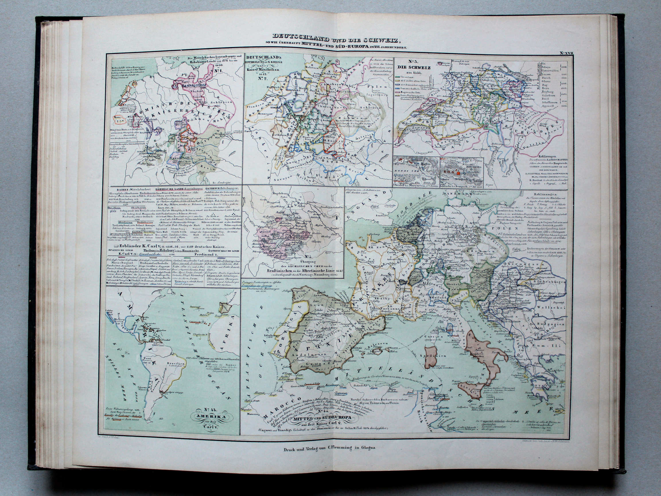
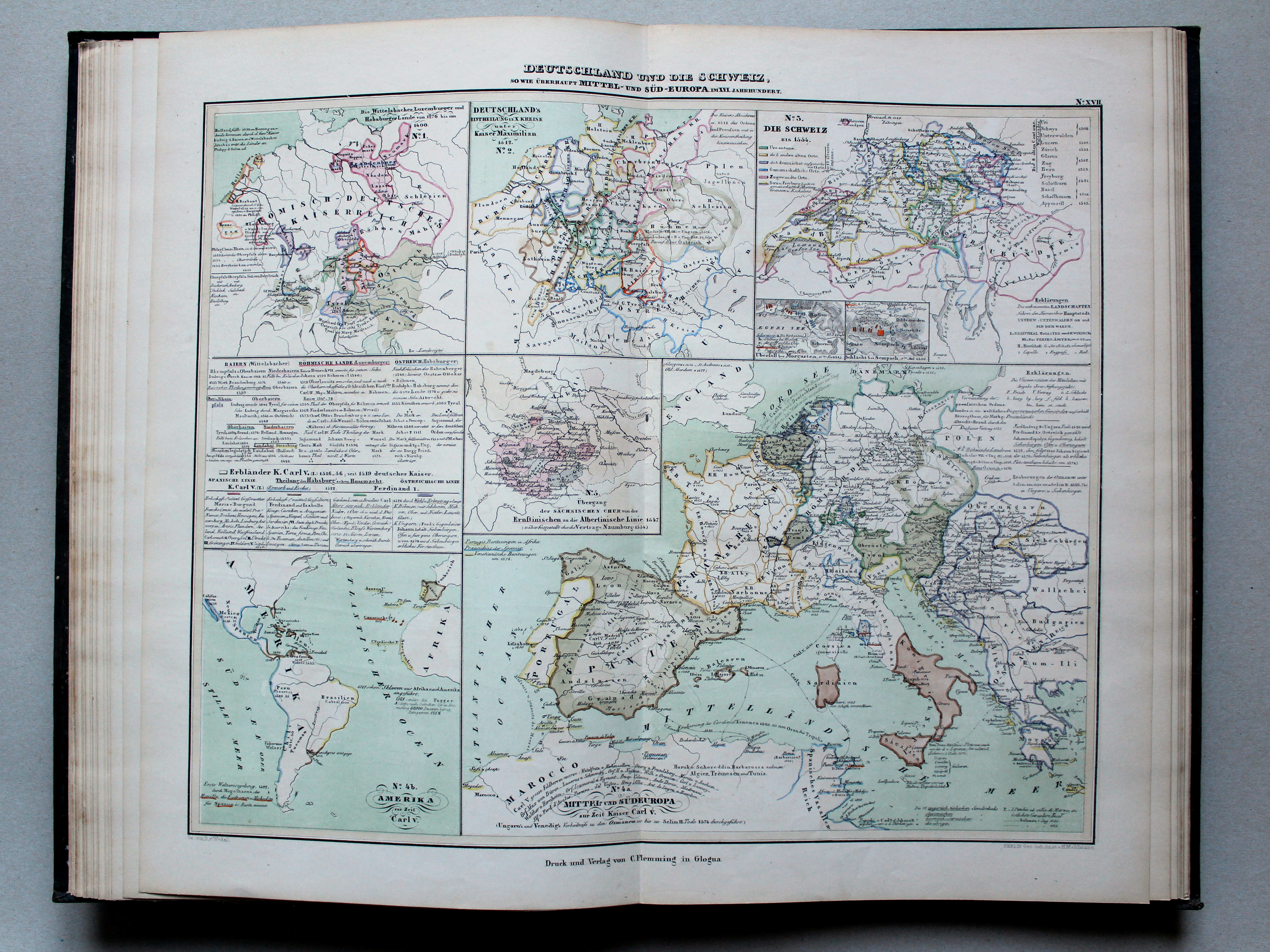
17. Deutschland und die Schweiz, so wie überhaupt Mittel- und Südost-Europa im XVI. Jahrhundert XL
Duitsland en Zwitserland, evenals Midden- en Zuidoost-Europa in de 16e eeuw / Germany and Switzerland, as well as Central and Southeastern Europe in the 16th century
 von Wedell's Historischer Hand-Atlas, 1856
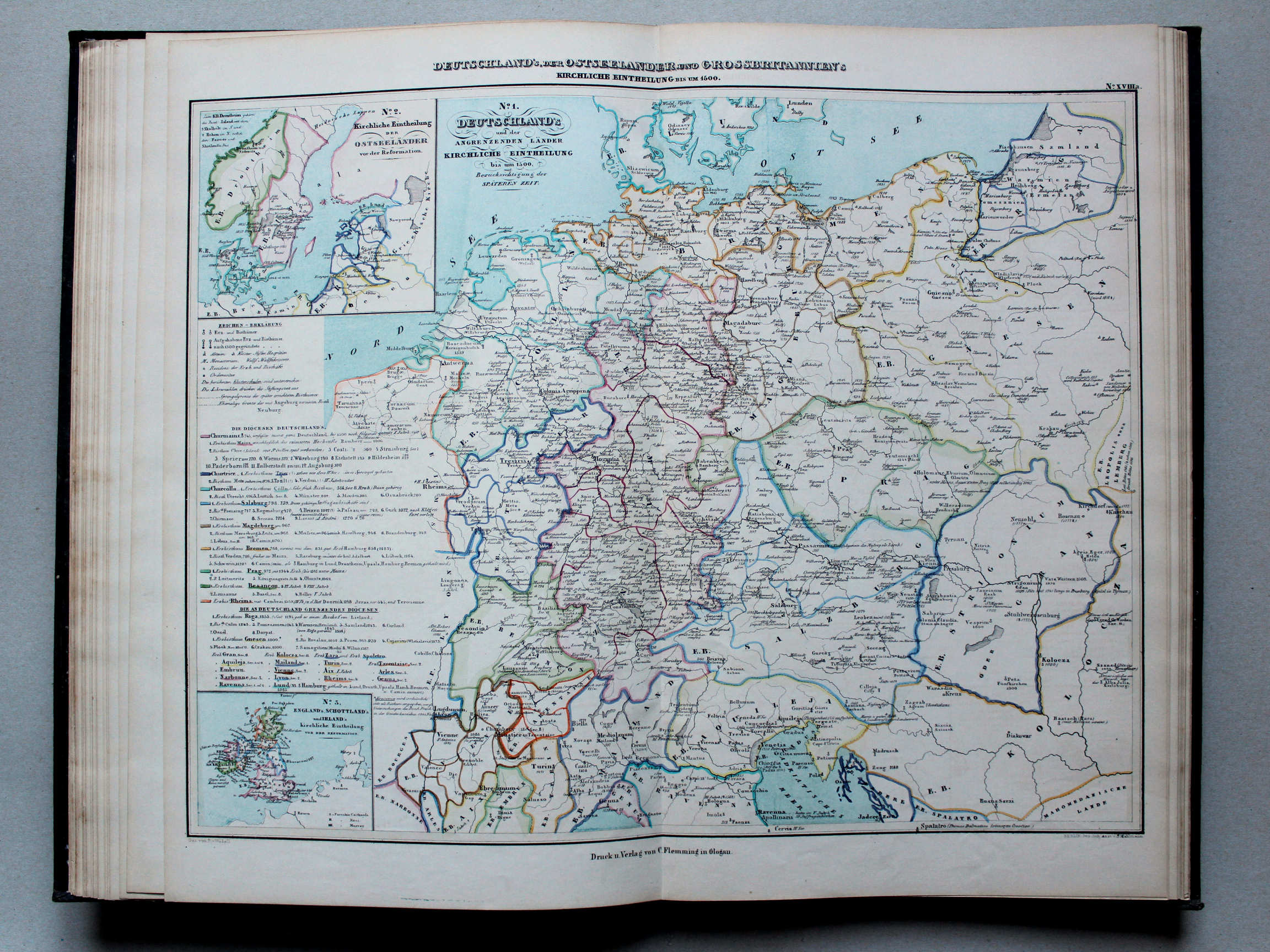
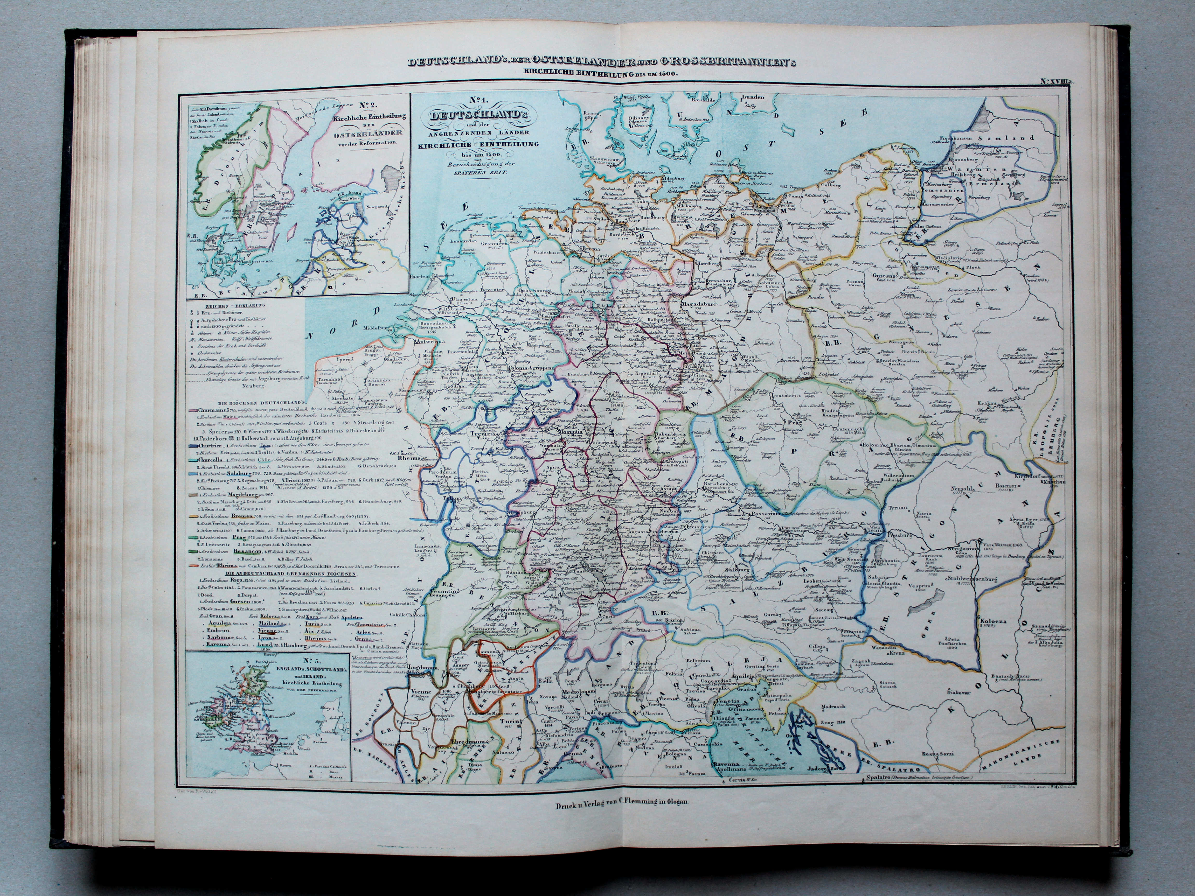
18a. Deutschland's, der Ostseeländer und Grossbritannien's kirchliche Eintheilung bis um 1500 XL
Kerkelijke indeling van Duitsland, de landen aan de Oostzee en Groot-Brittannië tot ongeveer 1500 / Ecclesiastical division of Germany, the Baltic countries and Great Britain until around 1500
 von Wedell's Historischer Hand-Atlas, 1856
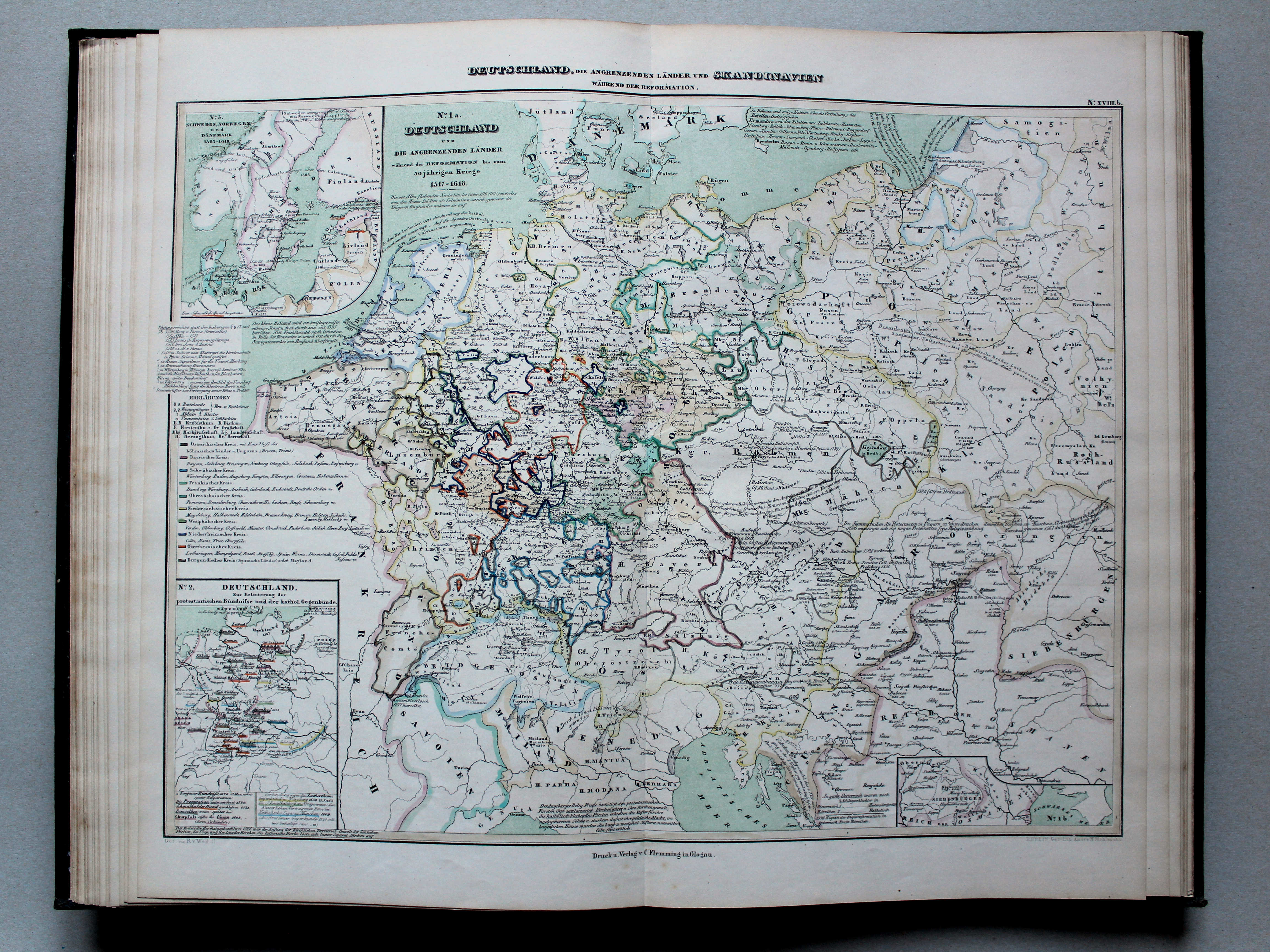
18b. Deutschland, die angrenzenden Länder und Skandinavien während der Reformation XL
Duitsland, de buurlanden en Scandinavië tijdens de Reformatie / Germany, the adjacent countries and Scandinavia during the Protestant Reformation
 von Wedell's Historischer Hand-Atlas, 1856
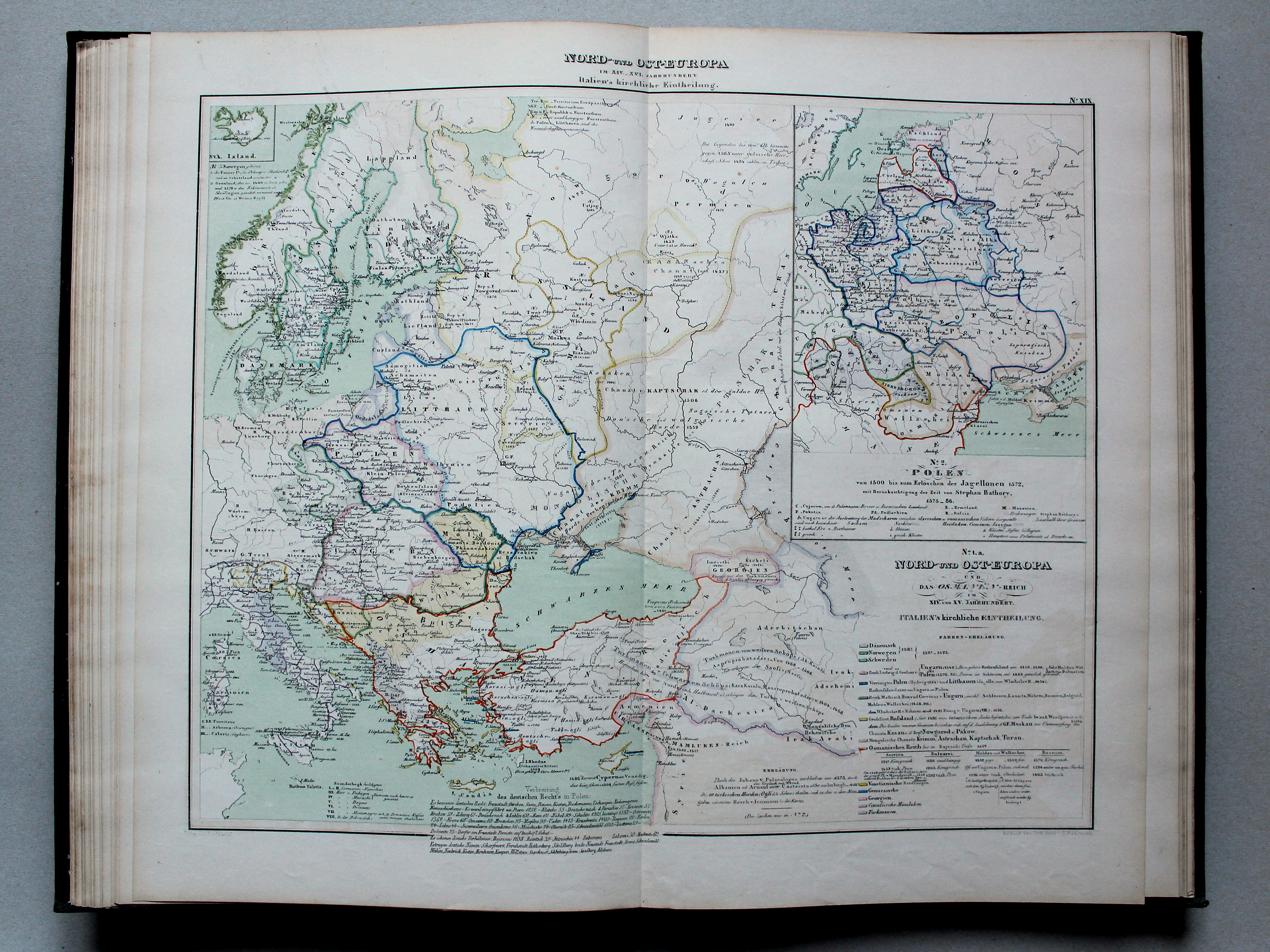
19. Nord- und Ost-Europa im XIV.-XVI. Jahrhundert. Italien's kirchliche Eintheilung XL
Noord- en Oost-Europa in de 14e-16e eeuw. Kerkelijke indeling van Italië / Northern and Eastern Europe in the 14th-16th centuries. Ecclesiastical division of Italy
 von Wedell's Historischer Hand-Atlas, 1856
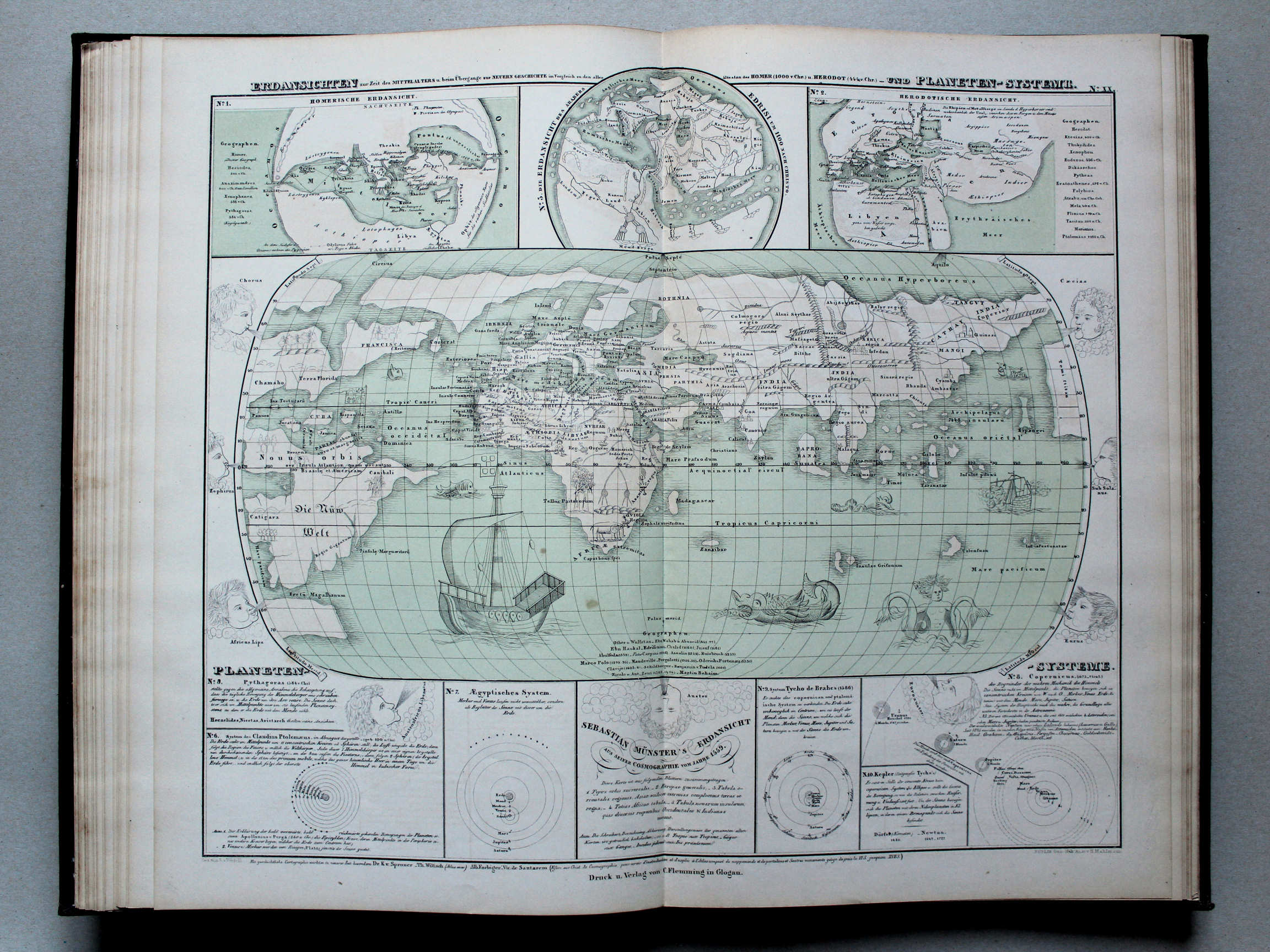
20. Erdansichten zur Zeit des Mittelalters u. beim Übergange zur neuen Geschichte im Vergleich zu den allerältesten des Homer (1000 v. Chr.) und Herodot (444 v. Chr.) - und Planeten-Systeme XL
Wereldkaarten in de Middeleeuwen en bij het begin van de Nieuwe Tijd, vergeleken met die uit de Oudheid van Homerus (1000 v. Chr.) en Herodotus (444 v. Chr.) Zonnestelels / World maps in the Middle Ages and at the beginning of Modern History as compared to thos in Antiquity from Homer (1000 BC) and Herodotus (444 BC). Solar systems
 von Wedell's Historischer Hand-Atlas, 1856
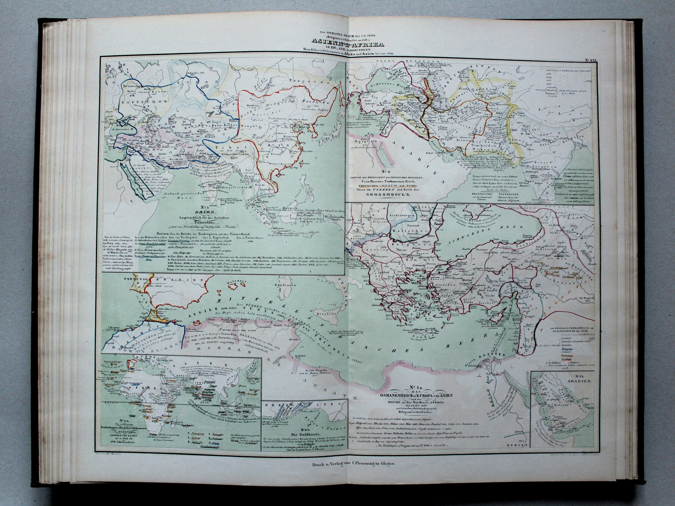
21. Das Osmanen-Reich bis um 1600. Asien, Nord-Afrika im XIV.-XVII. Jahrhundert. Handelsetablissements in Afrika und Asien bis um 1700 XL
Het Ottomaanse Rijk tot ongeveer 1600. Azië en Noord-Afrika in de 14e-17e eeuw. Handelsnederzettingen in Afrika en Azië tot ongeveer 1700 / The Ottoman Empire until around 1600. Asia and North Africa in the 14th-17th centuries. Settlements in Africa and Asia until around 1700
 von Wedell's Historischer Hand-Atlas, 1856
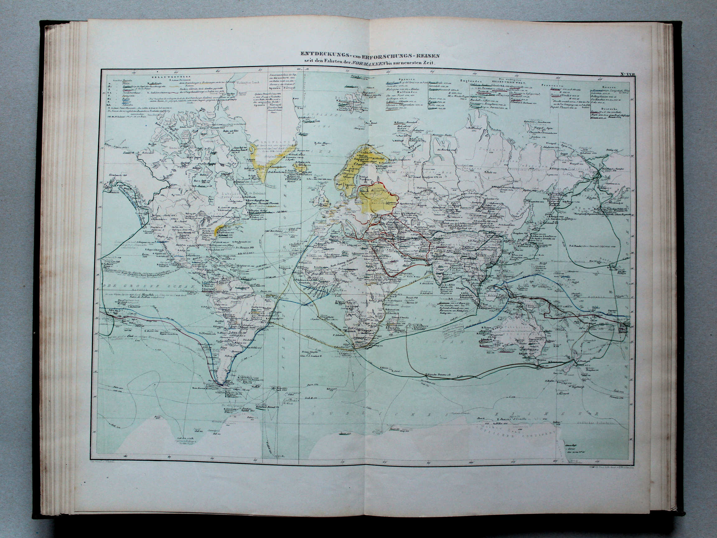
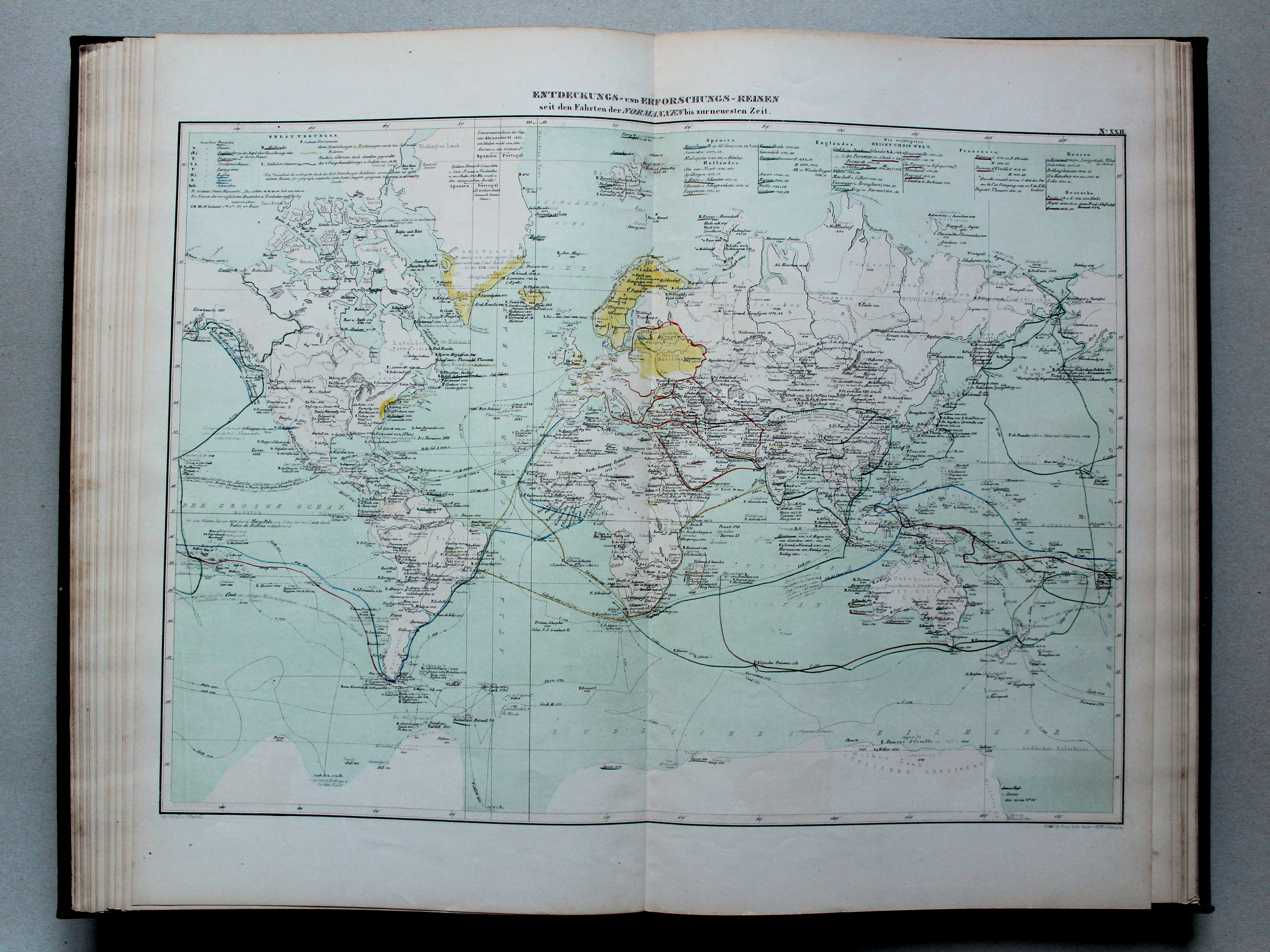
22. Entdeckungs- und Erforschungs-Reisen seit den Fahrten der Normannen bis zur neuesten Zeit XL
Ontdekkingsreizen vanaf de tochten van de Noormannen tot de Nieuwste Tijd / Discoveries from the journeys of the Normans until the modern period
 von Wedell's Historischer Hand-Atlas, 1856
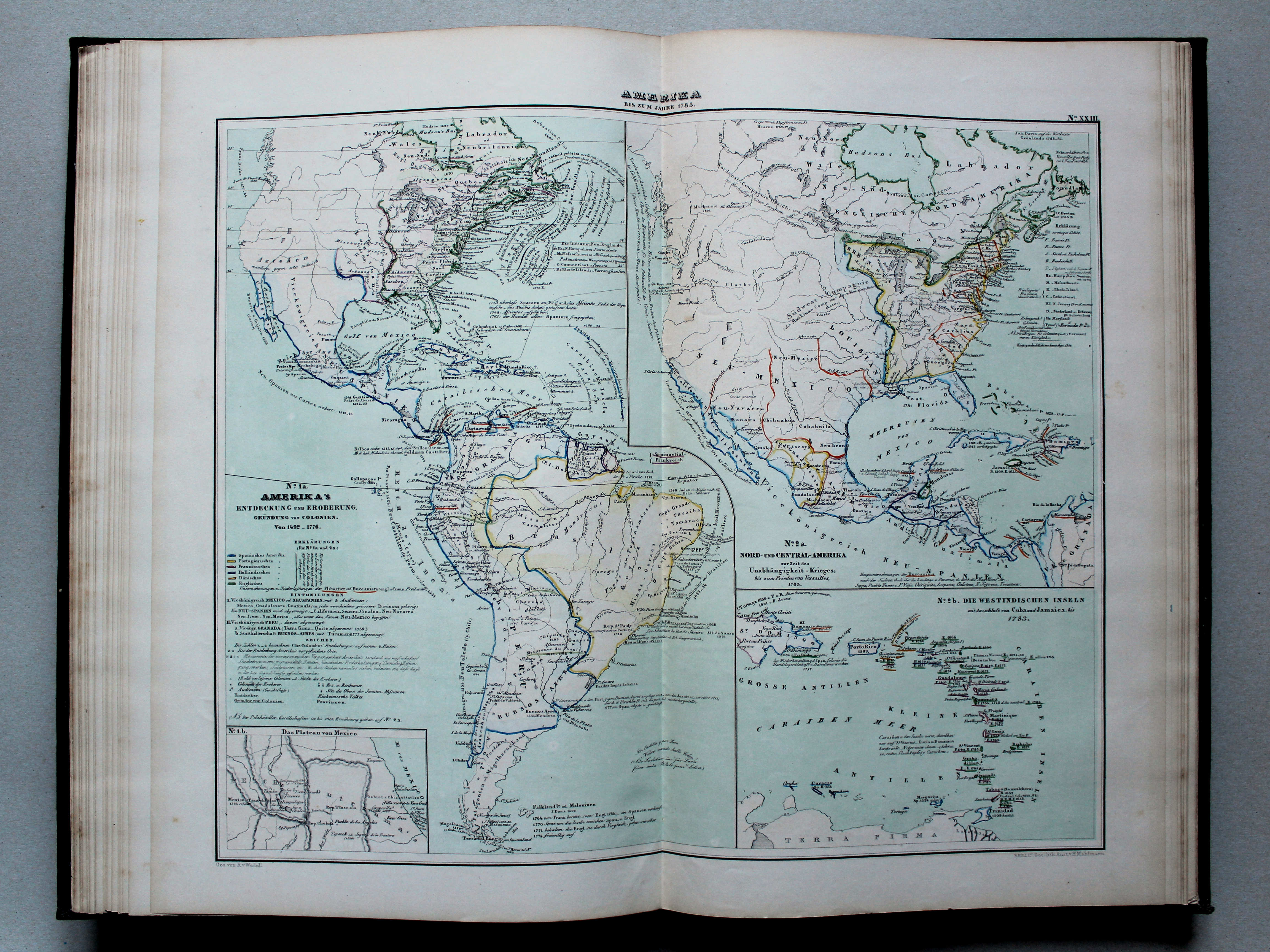
23. Amerika bis zum Jahre 1783 XL
America tot 1783 / The Americas until 1783
 von Wedell's Historischer Hand-Atlas, 1856
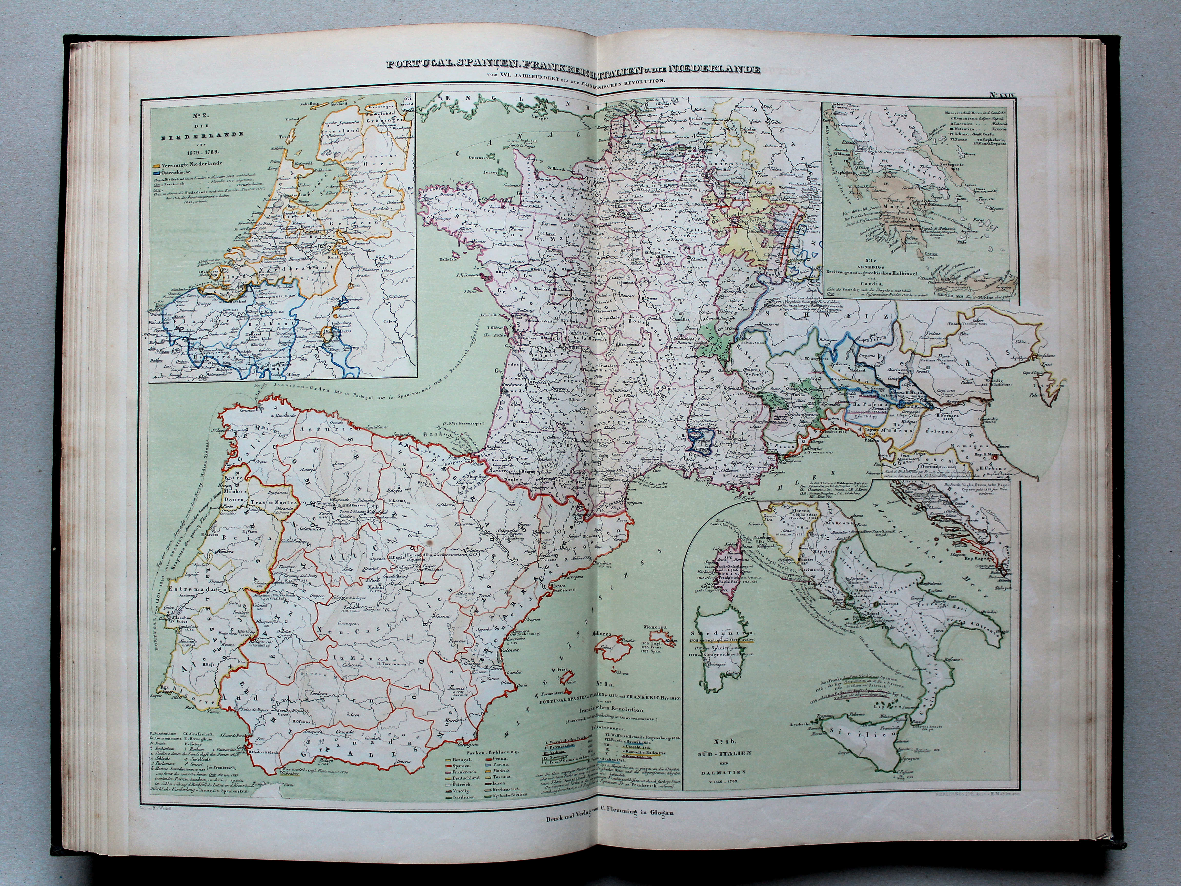
24. Portugal, Spanien, Frankreich, Italien und die Niederlande vom XVI. Jahrhundert bis zur französischen Revolution XL
Portugal, Spanje, Frankrijk, Italië en de Nederlanden van de 16e eeuw tot de Franse Revolutie / Portugal, Spain, France, Italy and the Netherlands from the 16th century unti the French Revolution
 von Wedell's Historischer Hand-Atlas, 1856
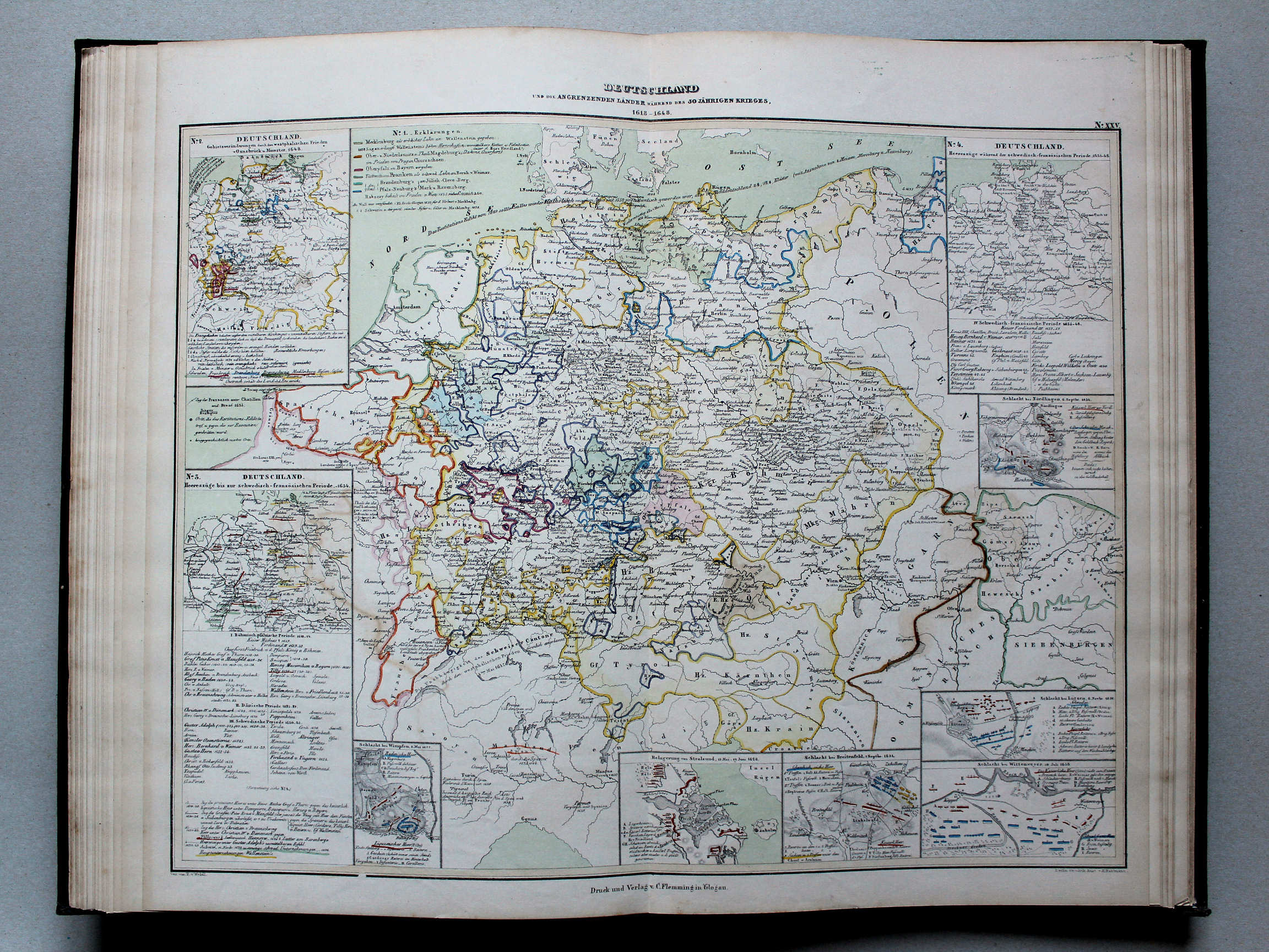
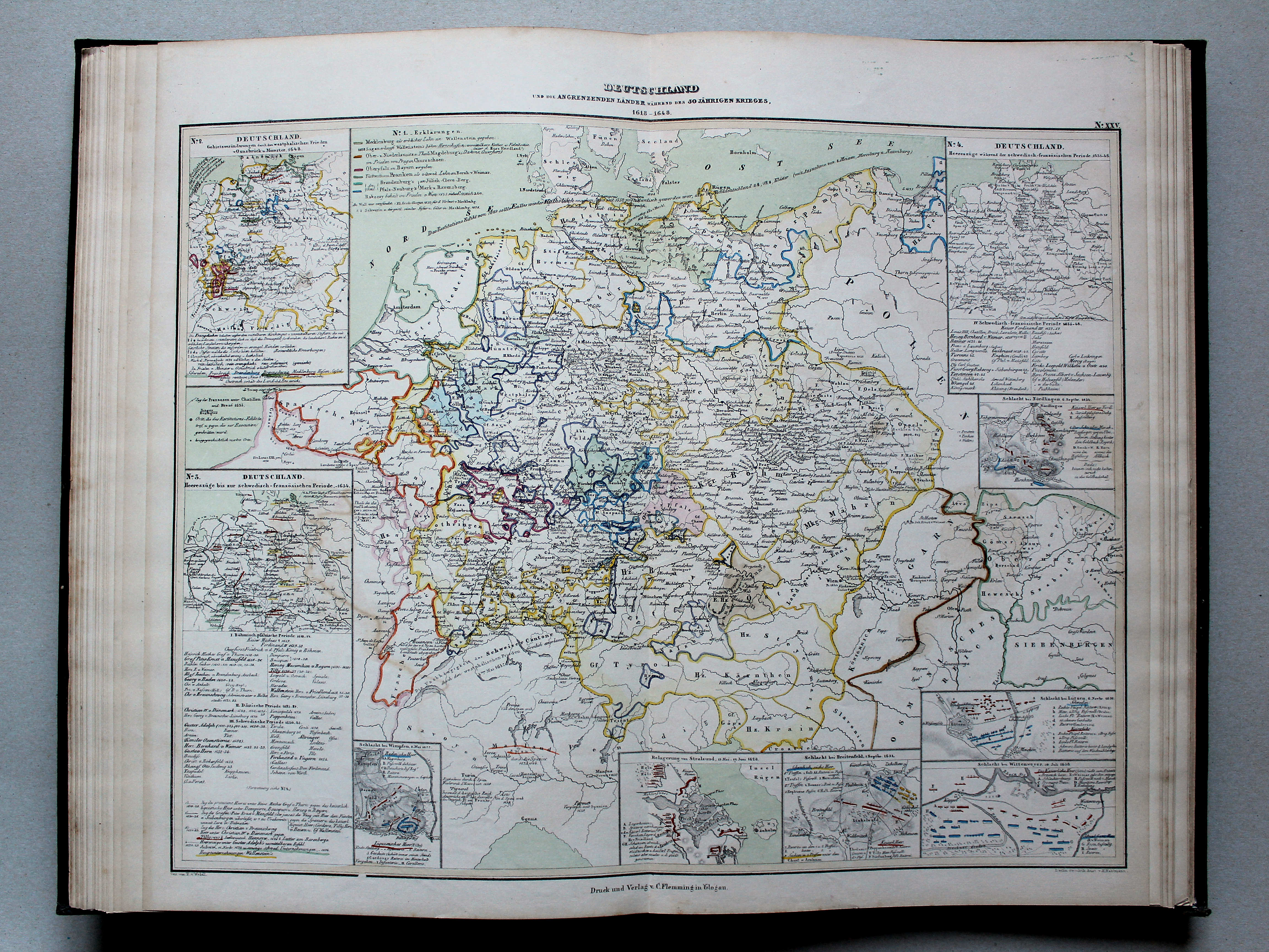
25. Deutschland und die angrenzenden Länder während des 30 jährigen Krieges, 1618-1648 XL
Duitsland en de buurlanden tijdens de Dertigjarige Oorlog, 1618-1648 / Germany and the adjacent countries during the Thirty Years' War, 1618-1648
 von Wedell's Historischer Hand-Atlas, 1856
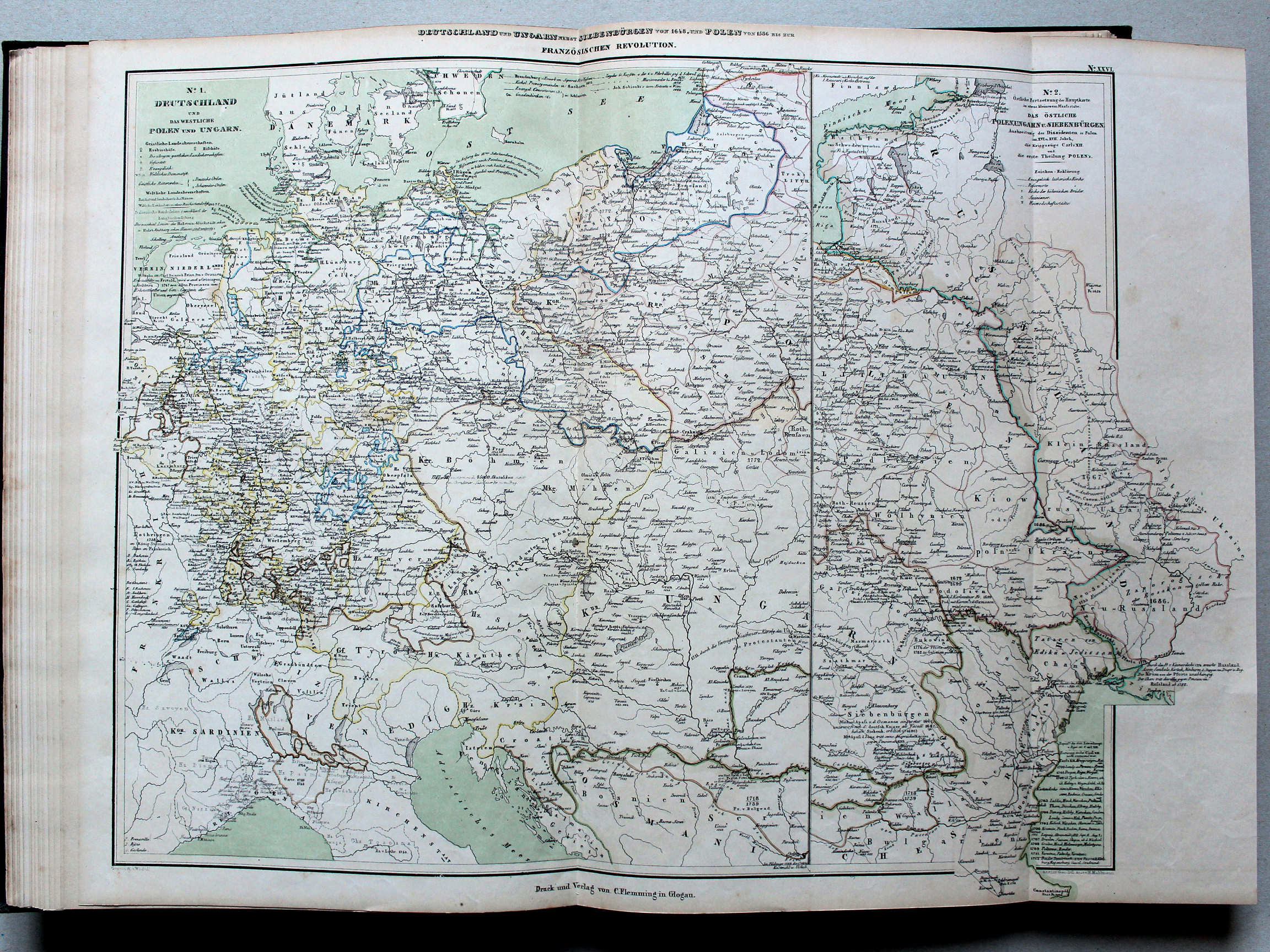
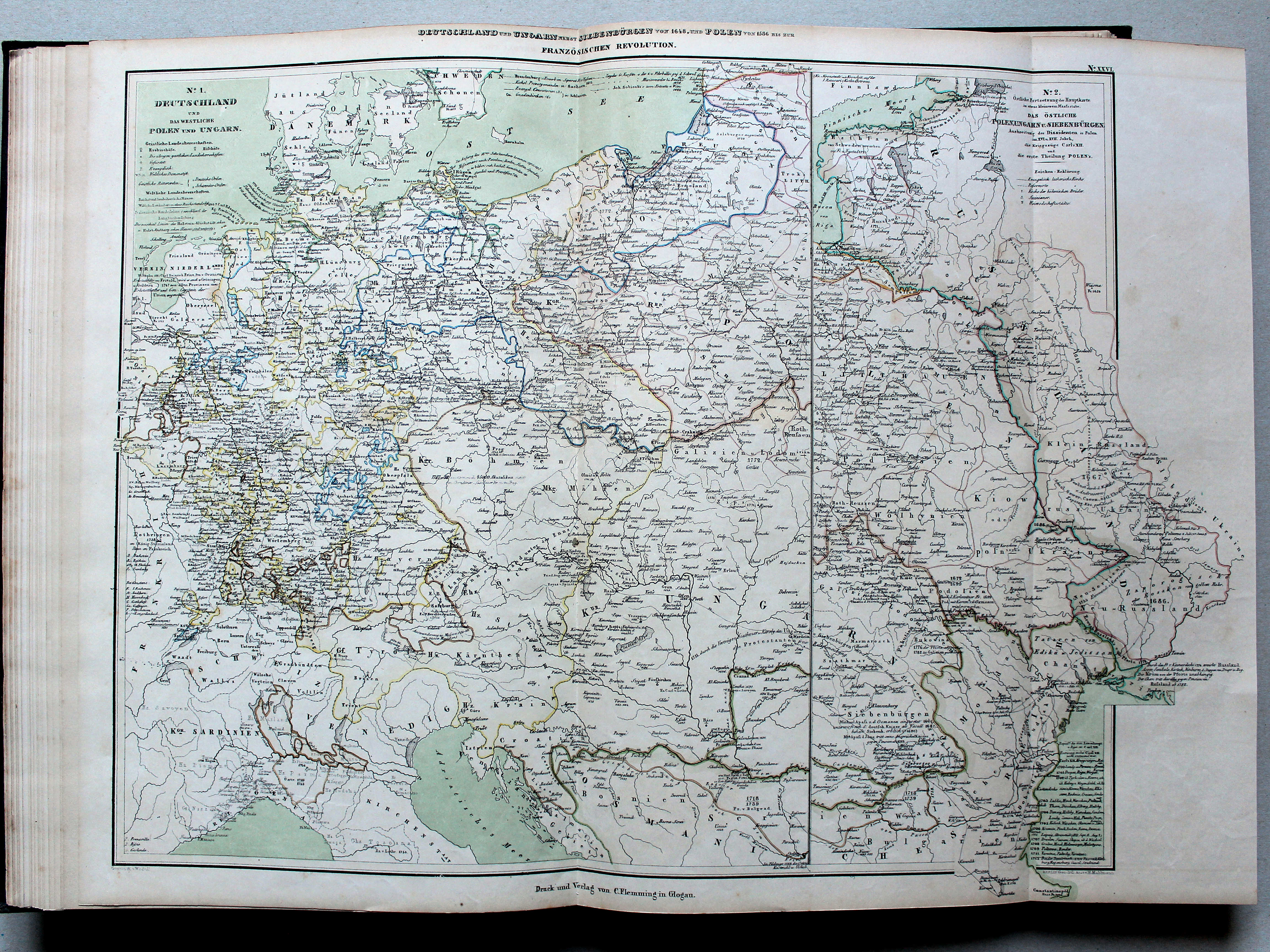
26. Deutschland und Ungarn nebst Siebenbürgen von 1648, und Polen von 1586 bis zur französischen Revolution XL
Duitsland en Hongarije met Transsylvanië vanaf 1648, en Polen vanaf 1586, tot de Franse Revolutie / Germany and Hungary with Transylvania from 1648, and Poland from 1586, until the French Revolution
 von Wedell's Historischer Hand-Atlas, 1856
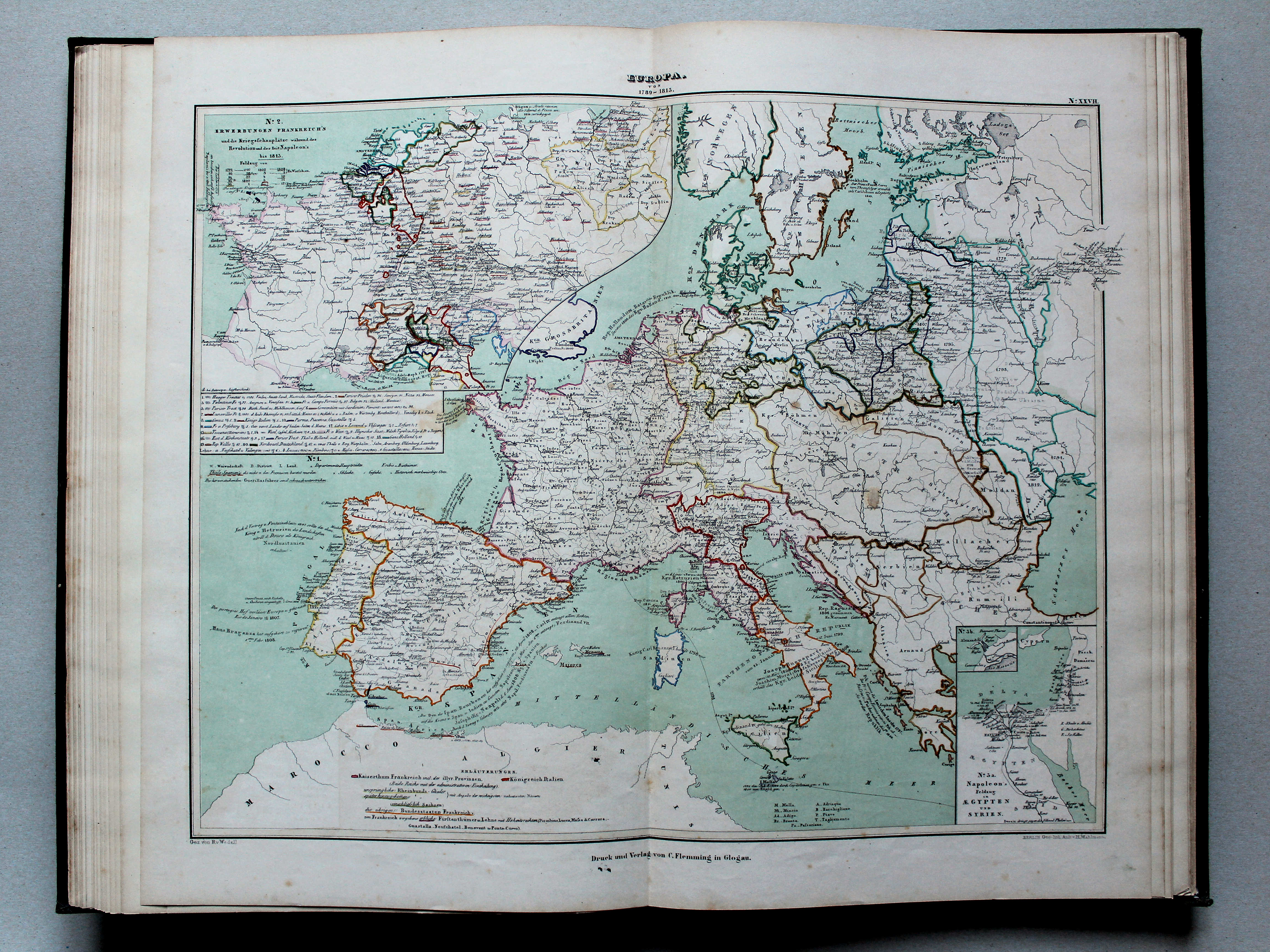
27. Europa von 1789-1813 XL
Europa 1789-1813 / Europe 1789-1813
 von Wedell's Historischer Hand-Atlas, 1856
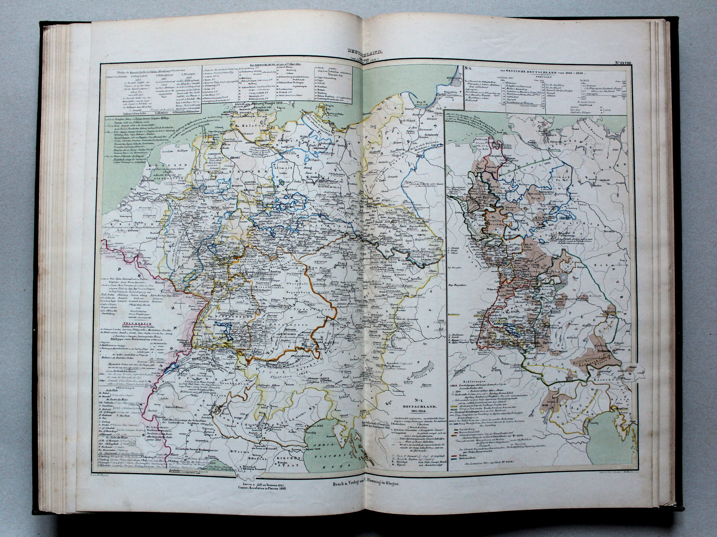
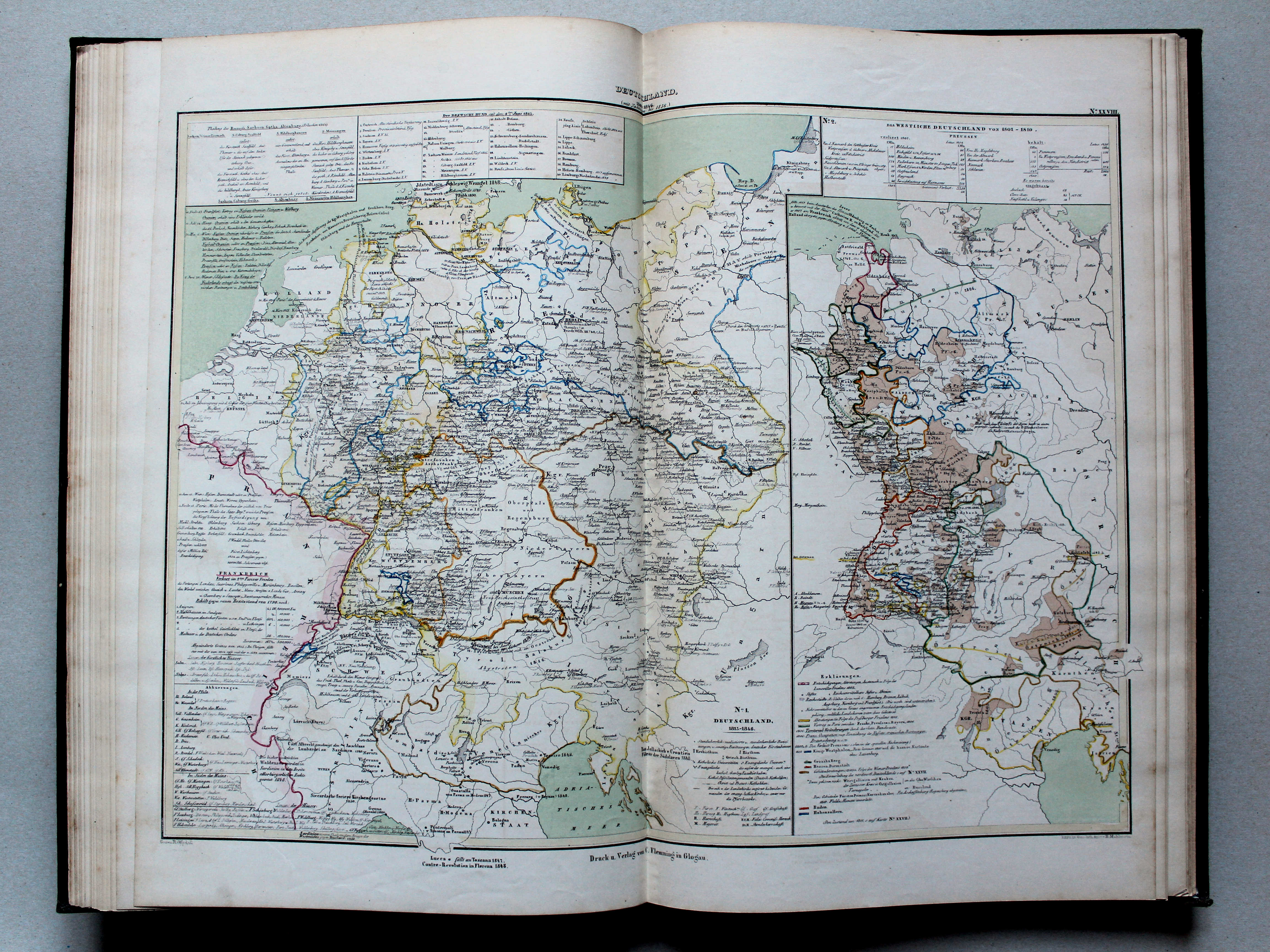
28. Deutschland von 1801-1846 (mit Nachträgen bis 1856) XL
Duitsland 1801-1846 (bijgewerkt tot 1856) / Germany 1801-1846 (with updates until 1856)
 von Wedell's Historischer Hand-Atlas, 1856
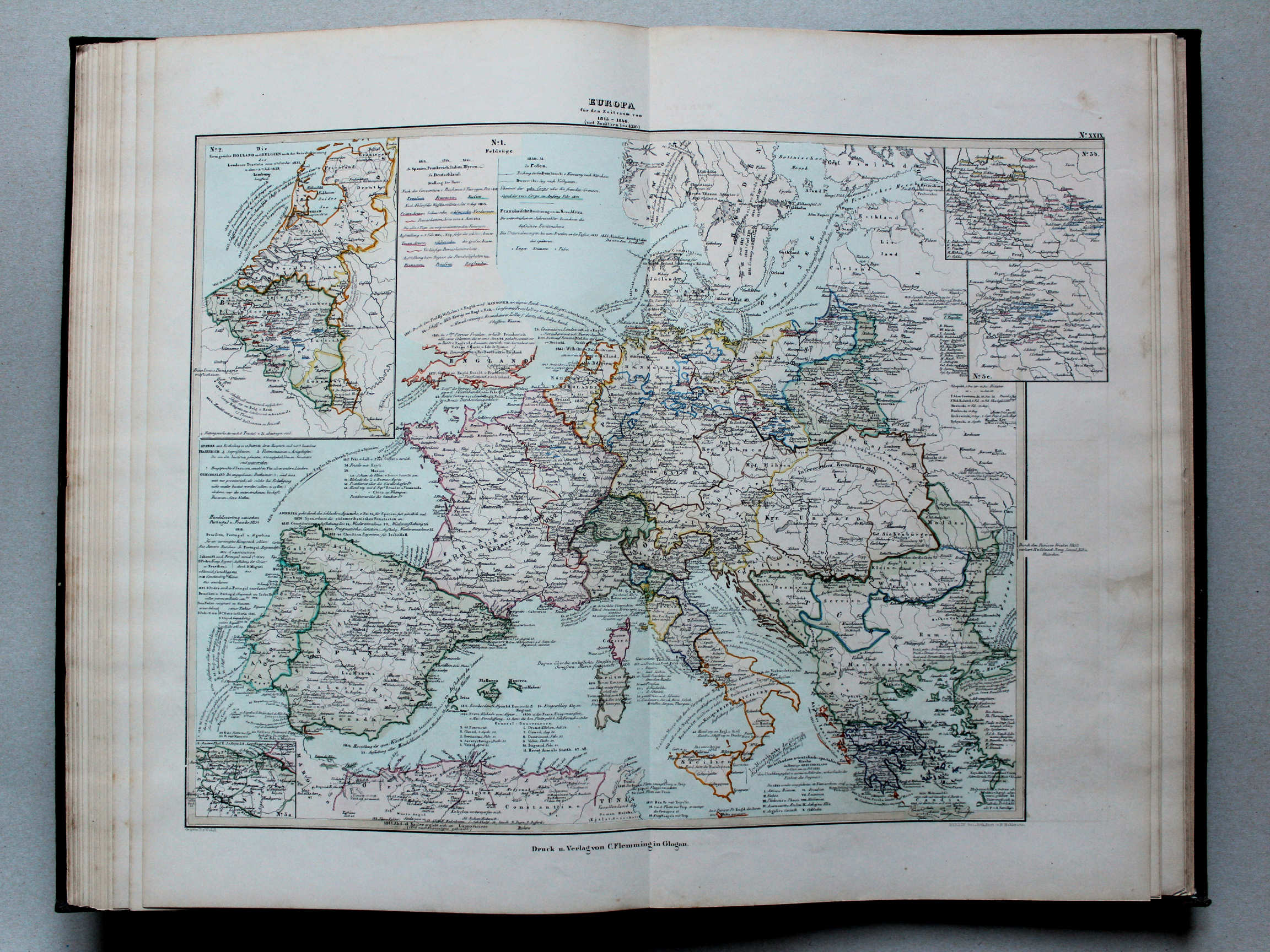
29. Europa für den Zeitraum von 1813-1846 (mit Zusätzen bis 1856) XL
Europa 1813-1846 (bijgewerkt tot 1856) / Europe 1813-1846 (with updates until 1856)
 von Wedell's Historischer Hand-Atlas, 1856
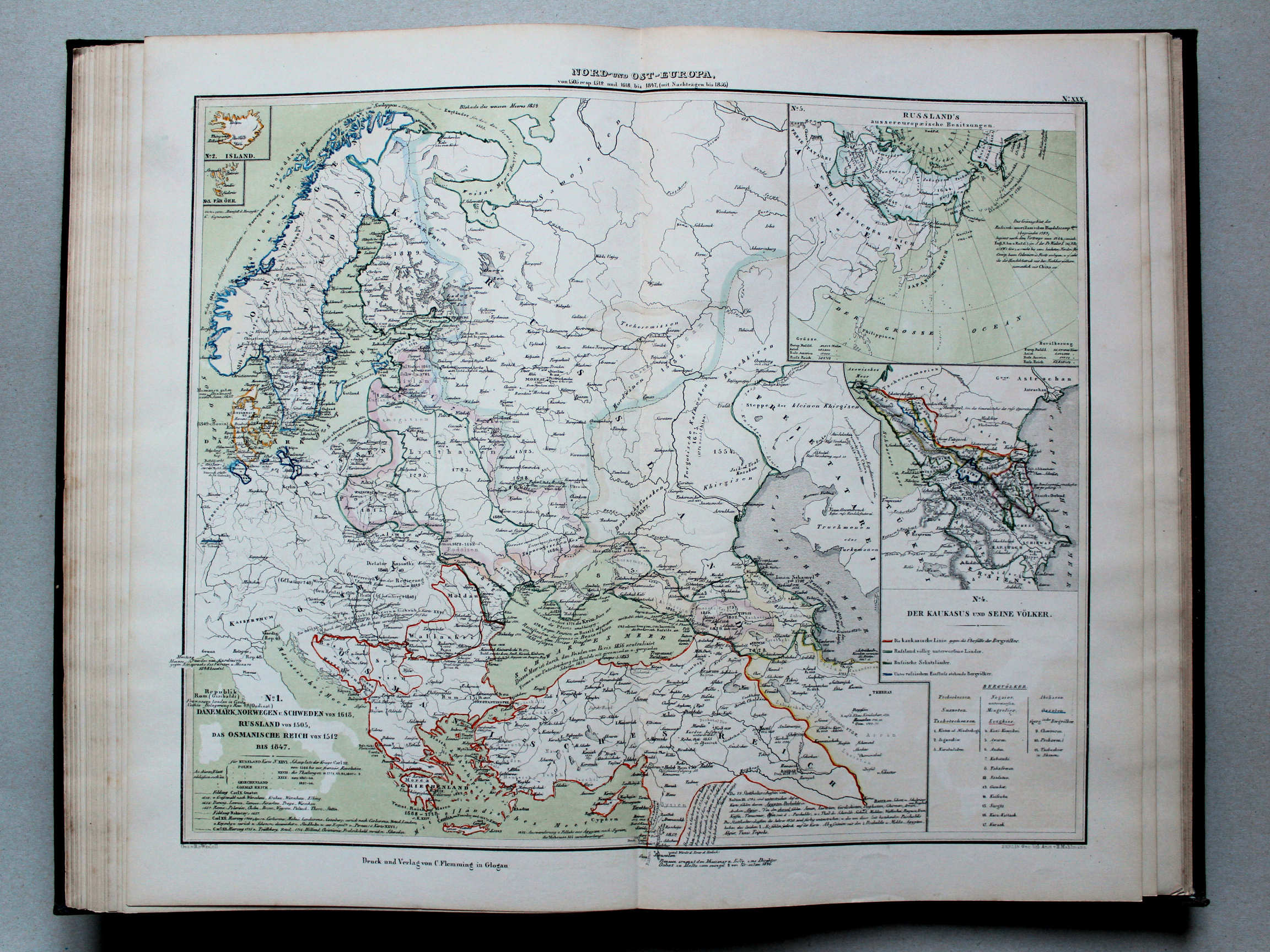
30. Nord- und Ost-Europa von 1505 resp. 1512 und 1618 bis 1847 (mit Nachträgen bis 1856) XL
Noord- en Oost-Europa vanaf 1505 resp. 1512 en 1618 tot 1847 (bijgewerkt tot 1856) / Northern and Eastern Europe from 1505, 1512 and 1618 respectively until 1847 (with updates until 1856)
 von Wedell's Historischer Hand-Atlas, 1856
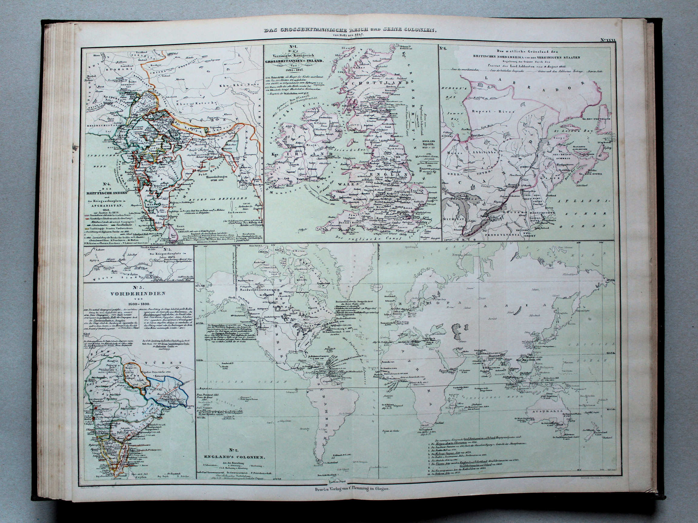
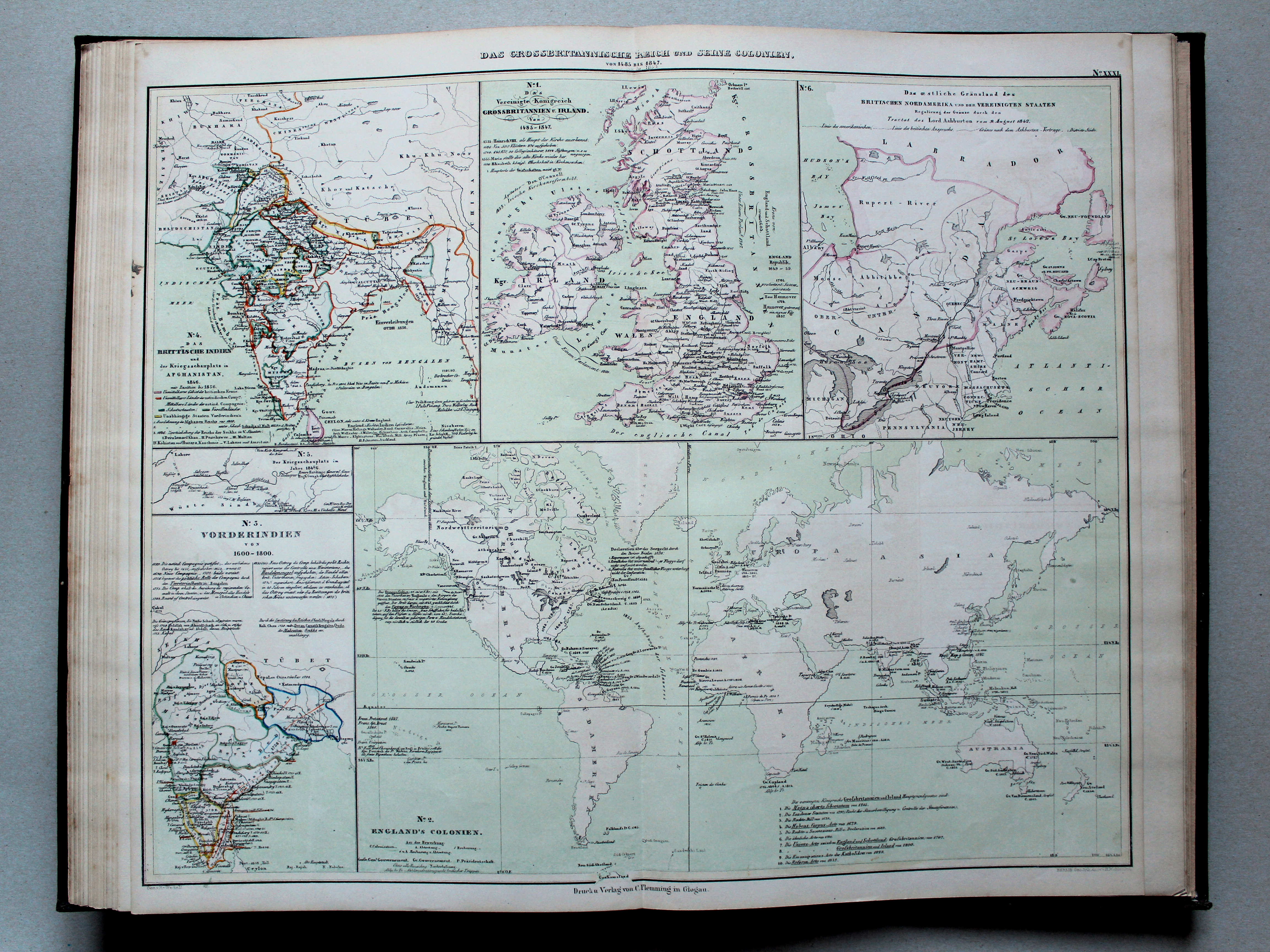
31. Das grossbritannische Reich und seine Colonien von 1485 bis 1847, mit Zusätzen bis 1856 XL
Groot-Brittannië en koloniën van 1485 tot 1847 (bijgewerkt tot 1856) / Great Britain and its colonies from 1485 until 1847 (with updates until 1856)
 von Wedell's Historischer Hand-Atlas, 1856
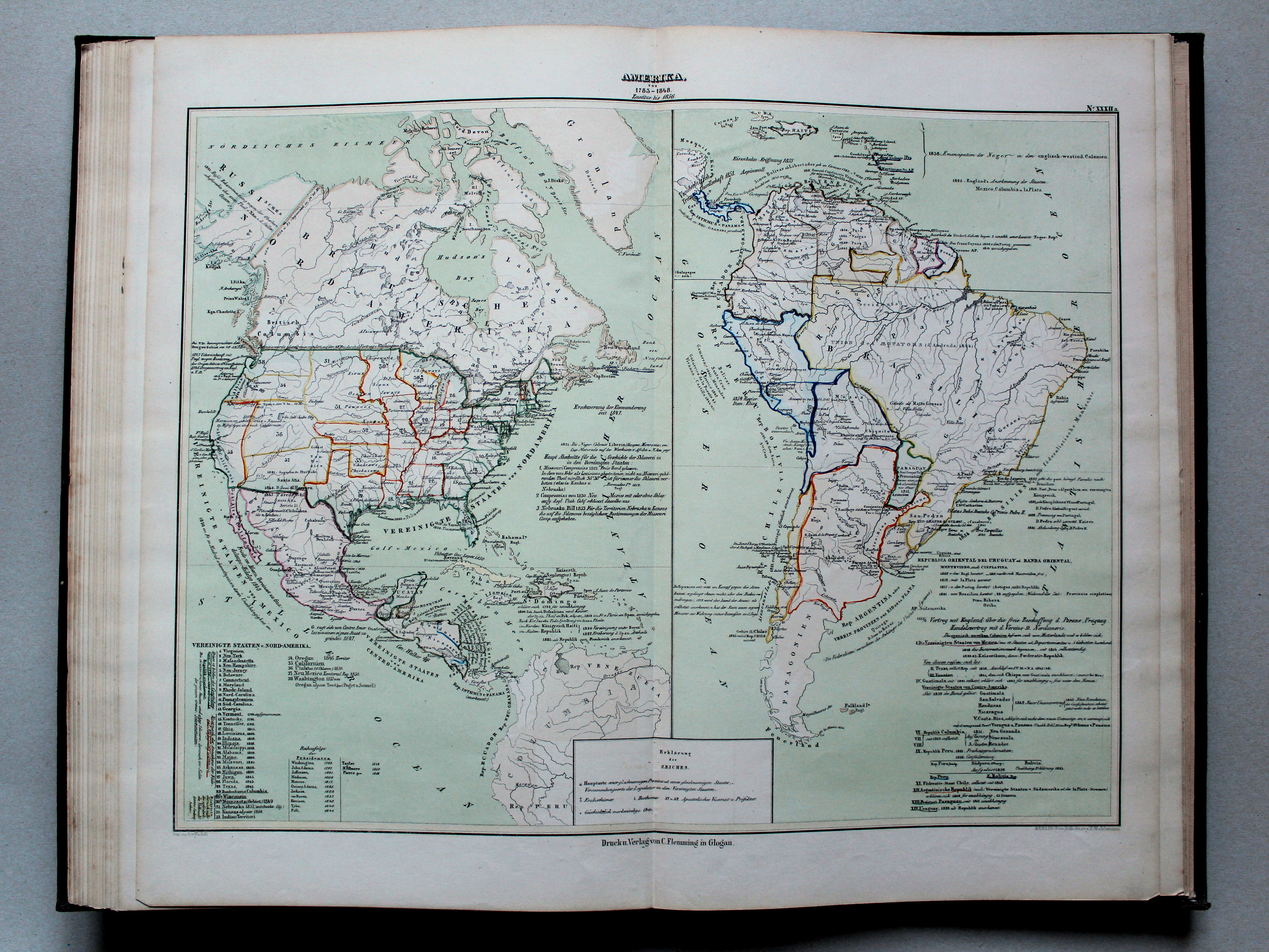
32a. Amerika von 1783-1848. Zusätze bis 1856 XL
Amerika van 1783 tot 1848 (bijgewerkt tot 1856) / The Americas from 1783 unril 1848 (with updates until 1856)
 von Wedell's Historischer Hand-Atlas, 1856
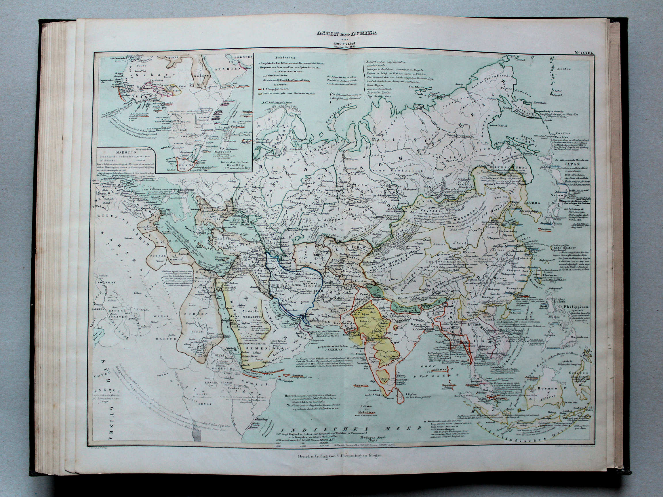
32b. Asien und Afrika von 1500-1848. Zusätze bis 1856 XL
Azië en Afrika van 1500 tot 1848 (bijgewerkt tot 1856) / Asia and Africa from 1500 unril 1848 (with updates until 1856)
 von Wedell's Historischer Hand-Atlas, 1856
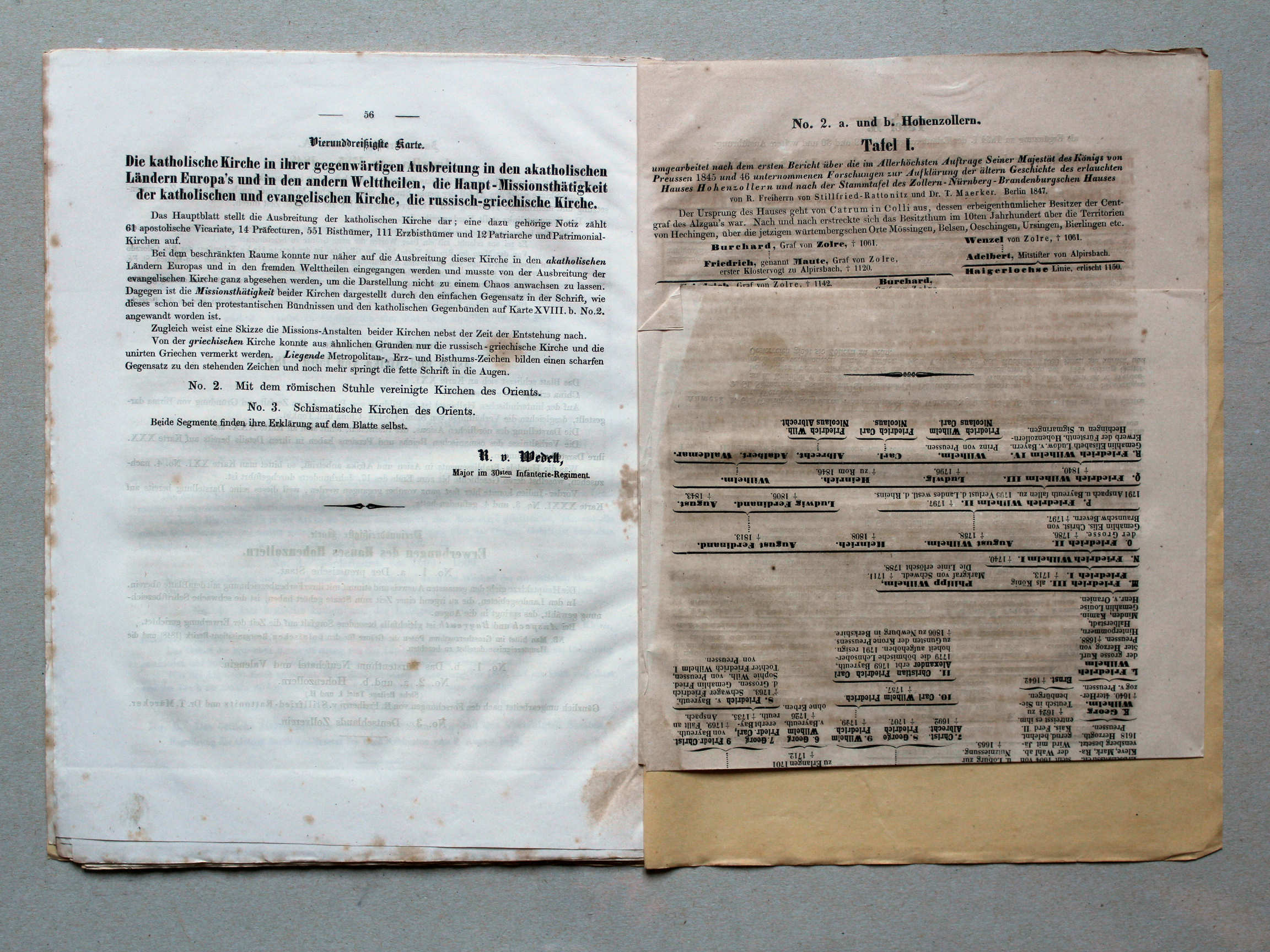
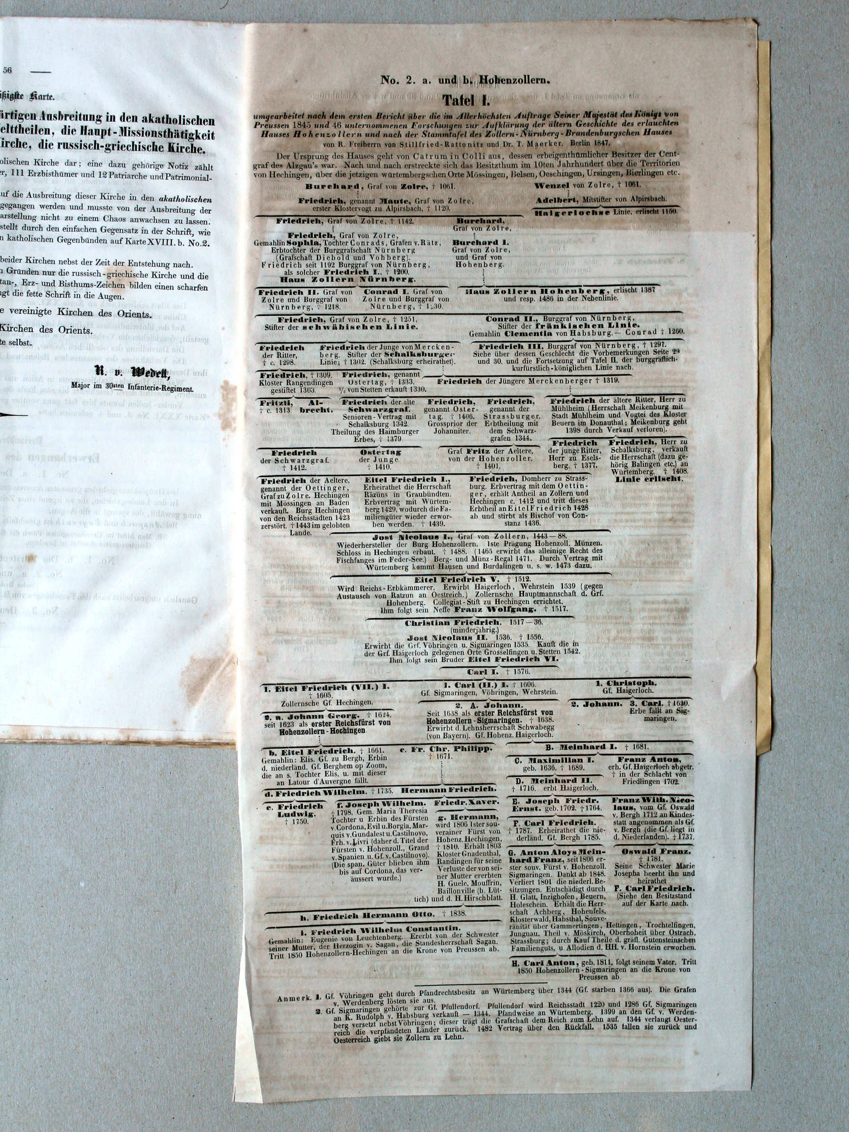
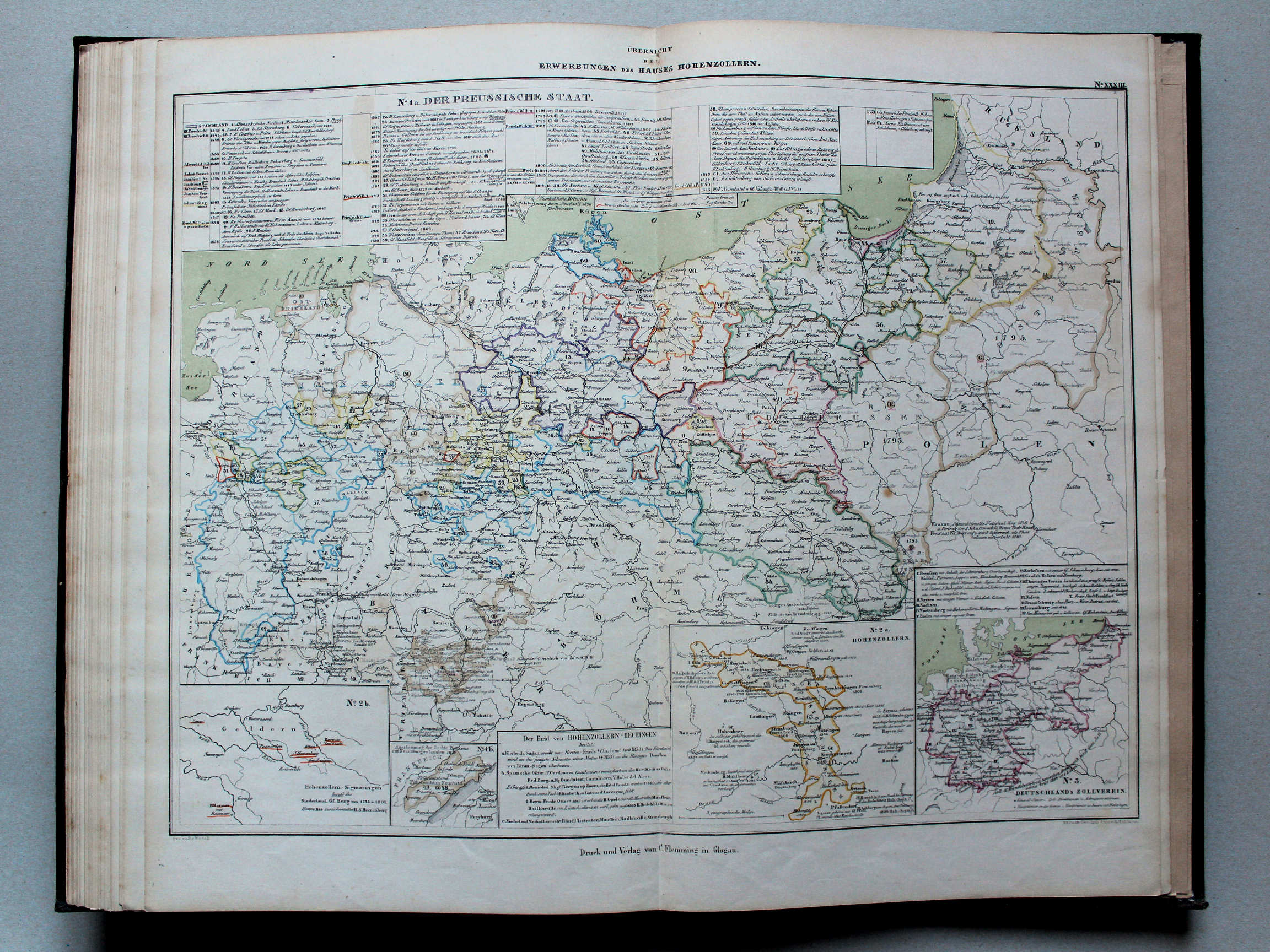
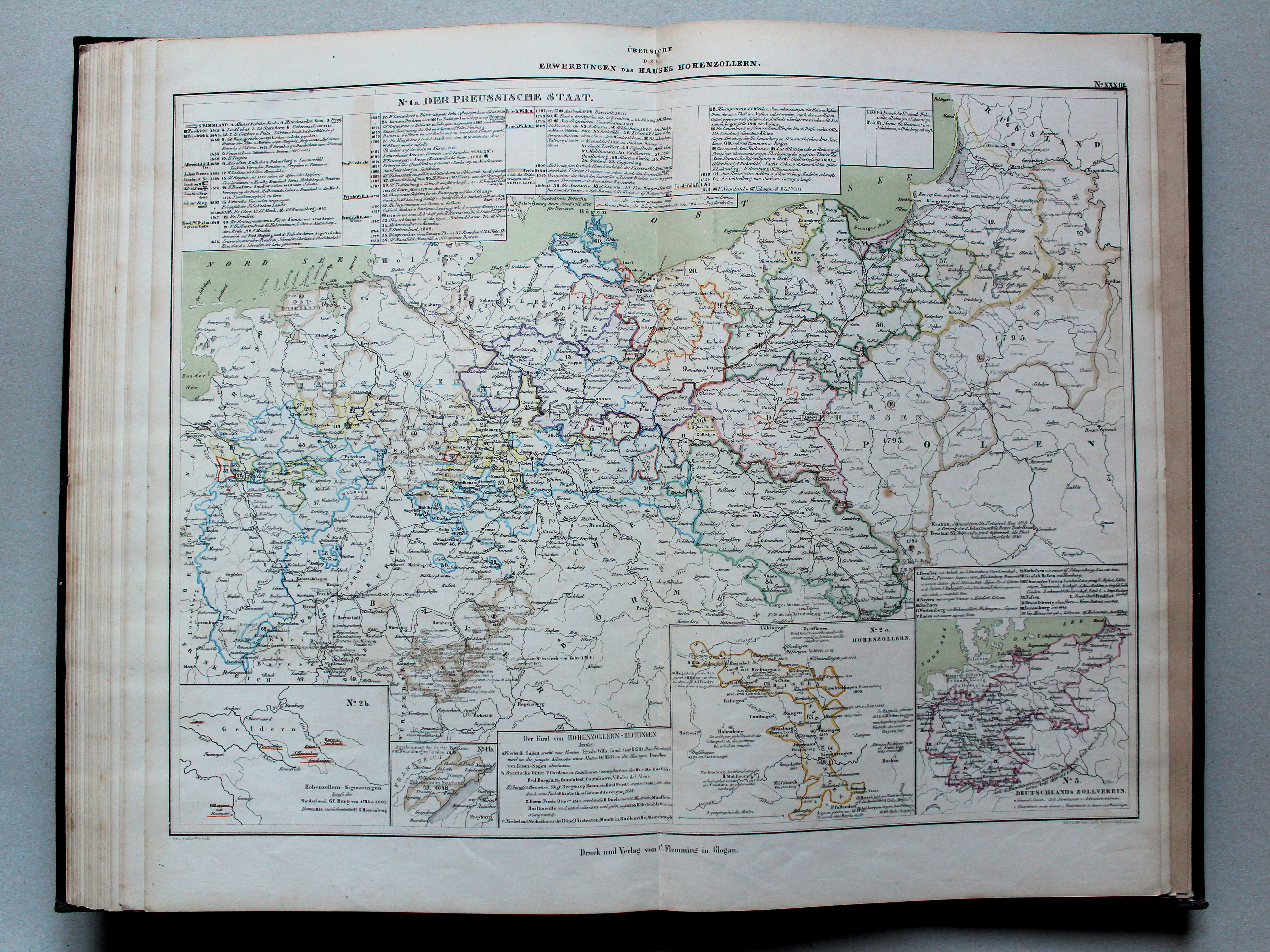
33. Übersicht der Erwerbungen des Hauses Hohenzollern XL
Overzicht van de bezittingen van het Huis Hohenzollern / Overview of the acquisitions of the House of Hohenzollern
 von Wedell's Historischer Hand-Atlas, 1856
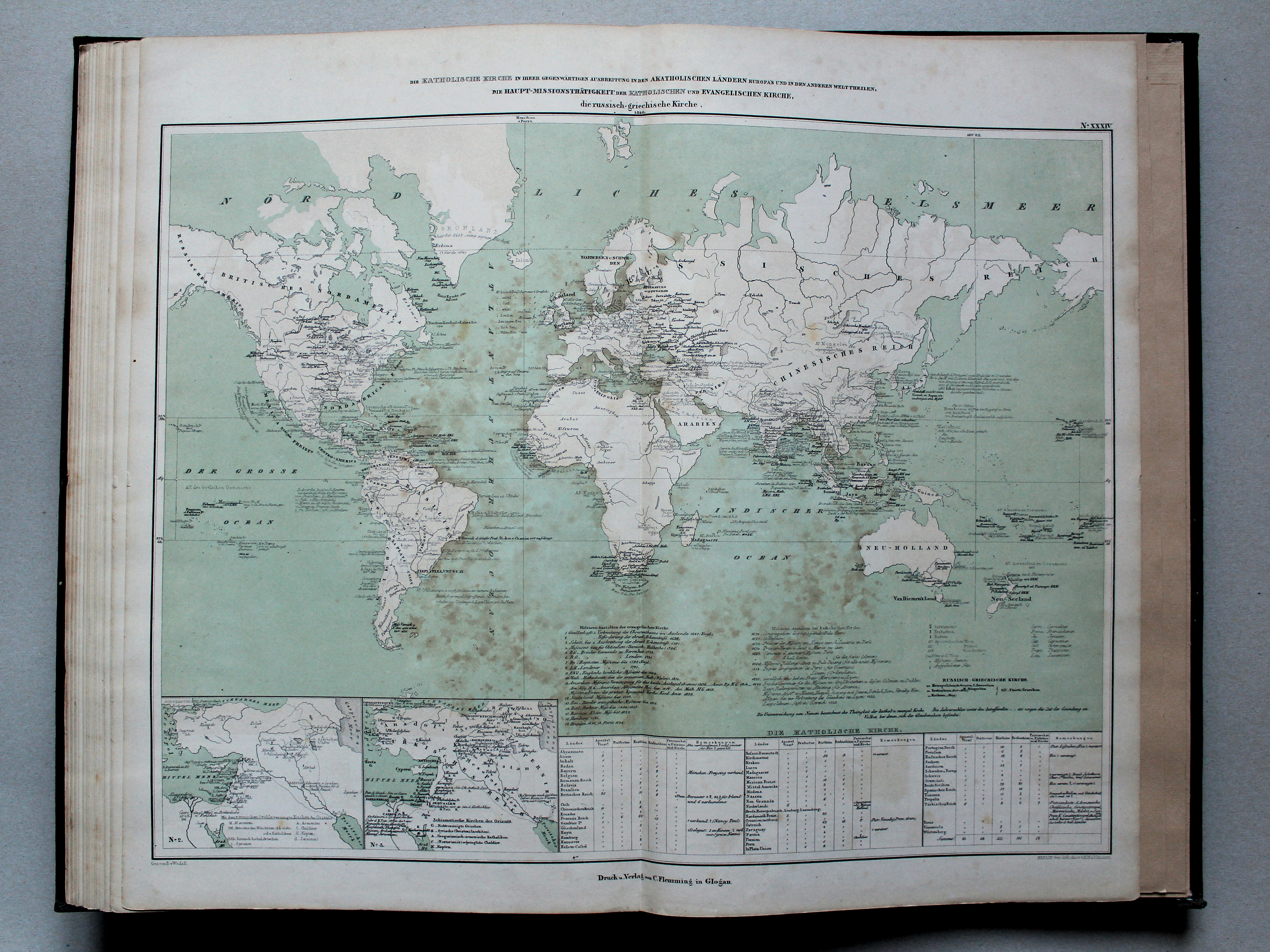
34. Die katholische Kirche in ihrer gegenwärtigen Ausbreitung in den akatholischen Ländern Europa's und in den anderen Welttheilen, die Haupt-Missionsthätigkeit der katholischen und evangelischen Kirche, die russisch-griechische Kirche, 1846 XL
De Katholieke Kerk in zijn huidige omvang in de niet-katholieke landen van Europa en in de andere werelddelen, de belangrijkste zendingsactiviteit van de Katholieke en Protestantse Kerk, de Orthodoxe Kerk, in 1846 / The Catholic Church in its current extent in the non-catholic countries of Europe and the other continents, the main mission activity of the Catholic and Protestant Churches, the Orthodox Church, in 1846
© M. Witkam, 2015
![]()
![]()