Meyer's Pfennig-Atlas (1834-1841)
en Meyer's Universal-Atlas (1830-1840)
See below for (a summary of) this text in English.
Hieronder staan de kaarten van Meyer's Pfennig-Atlas en Meyer's Universal-Atlas ter vergelijking naast elkaar. Daarbij horen ook de volgende pagina's.
- Beschrijving van Meyer's Pfennig-Atlas
- Plaatjes van Meyer's Pfennig-Atlas
- Tabellen en lijsten bij Meyer's Pfennig-Atlas
en
- Beschrijving van Meyer's Universal-Atlas
- Plaatjes van Meyer's Universal-Atlas
- Tabellen en lijsten bij Meyer's Universal-Atlas
Plaatjes
Klik op een plaatje voor een vergroting.
- Kaarten
Meyer's Pfennig-Atlas (1834-1841)
and Meyer's Universal-Atlas (1830-1840)
- Below are pictures of Meyer's Pfennig-Atlas and Meyer's Universal-Atlas
side by side for comparison purposes. Related pages
- Description of Meyer's Pfennig-Atlas
- Pictures of Meyer's Pfennig-Atlas
- Tables and lists to Meyer's Pfennig-Atlas
- Description of Meyer's Universal-Atlas
- Pictures of Meyer's Universal-Atlas
- Tables and lists to Meyer's Universal-Atlas
Pictures
Click on a picture to enlarge.
- Maps
Kaarten / Maps
- Kaartformaat Pfennig-Atlas: 18 × 11,5 cm (vergroot: 600dpi)
- Kaartformaat Universal-Atlas: 32 × 26,5 cm (vergroot: 300dpi)
- Map size Pfennig-Atlas: 18 × 11.5 cm (enlarged: 600dpi)
- Map size Universal-Atlas: 32 × 26.5 cm (enlarged: 300dpi)
 Meyer's Pfennig-Atlas (1834-1841)
1. Nördliche-Hemisphäre des Himmels (Lief. LX = 60)
Noordelijke sterrenhemel / Northern skies
 Meyer's Universal-Atlas (1830-1840)
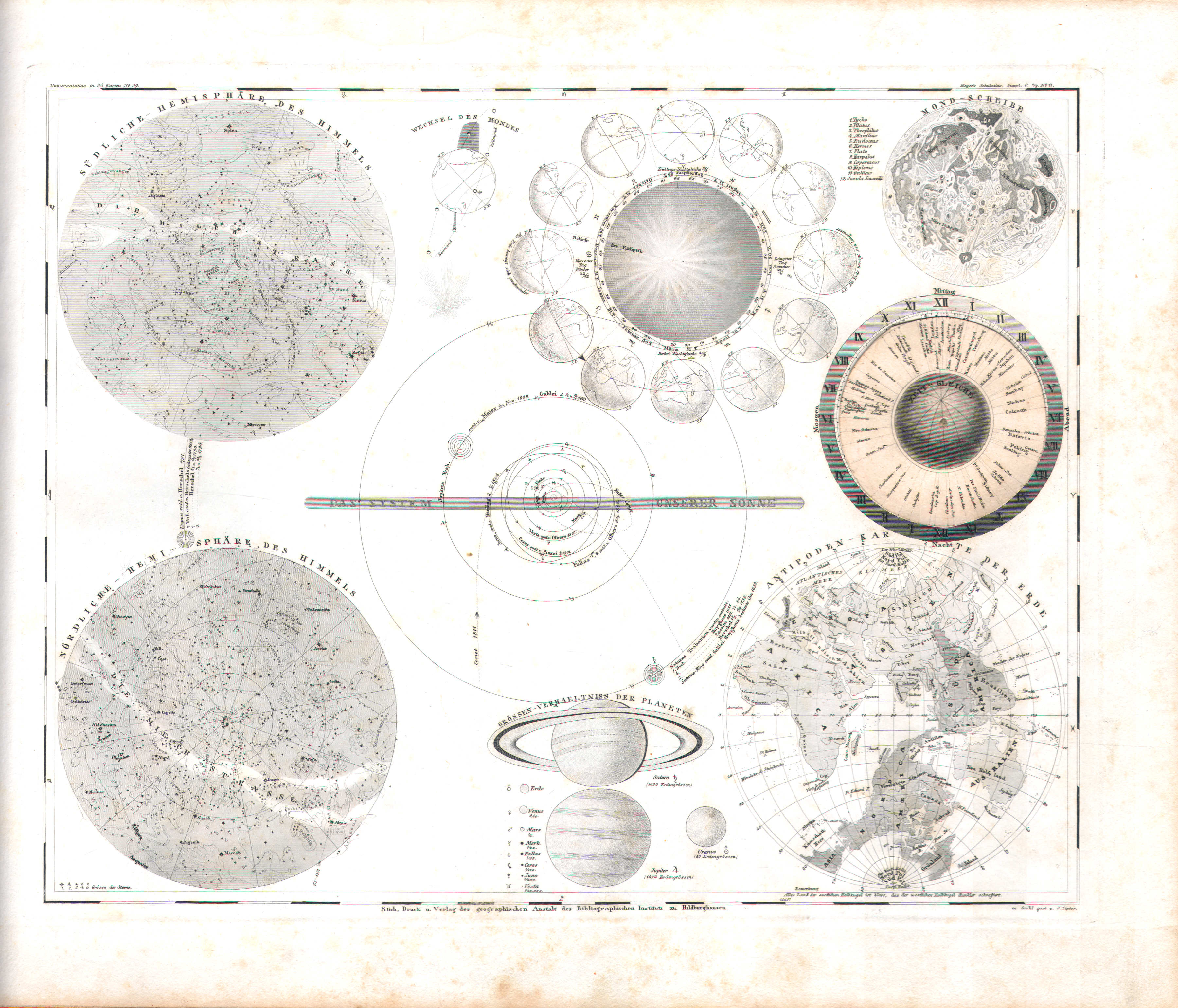
1. Himmelskarte (Nº 59)
Sterrenkunde (met draaibaar deel) / Astronomy (with rotating part)
 Meyer's Pfennig-Atlas (1834-1841)
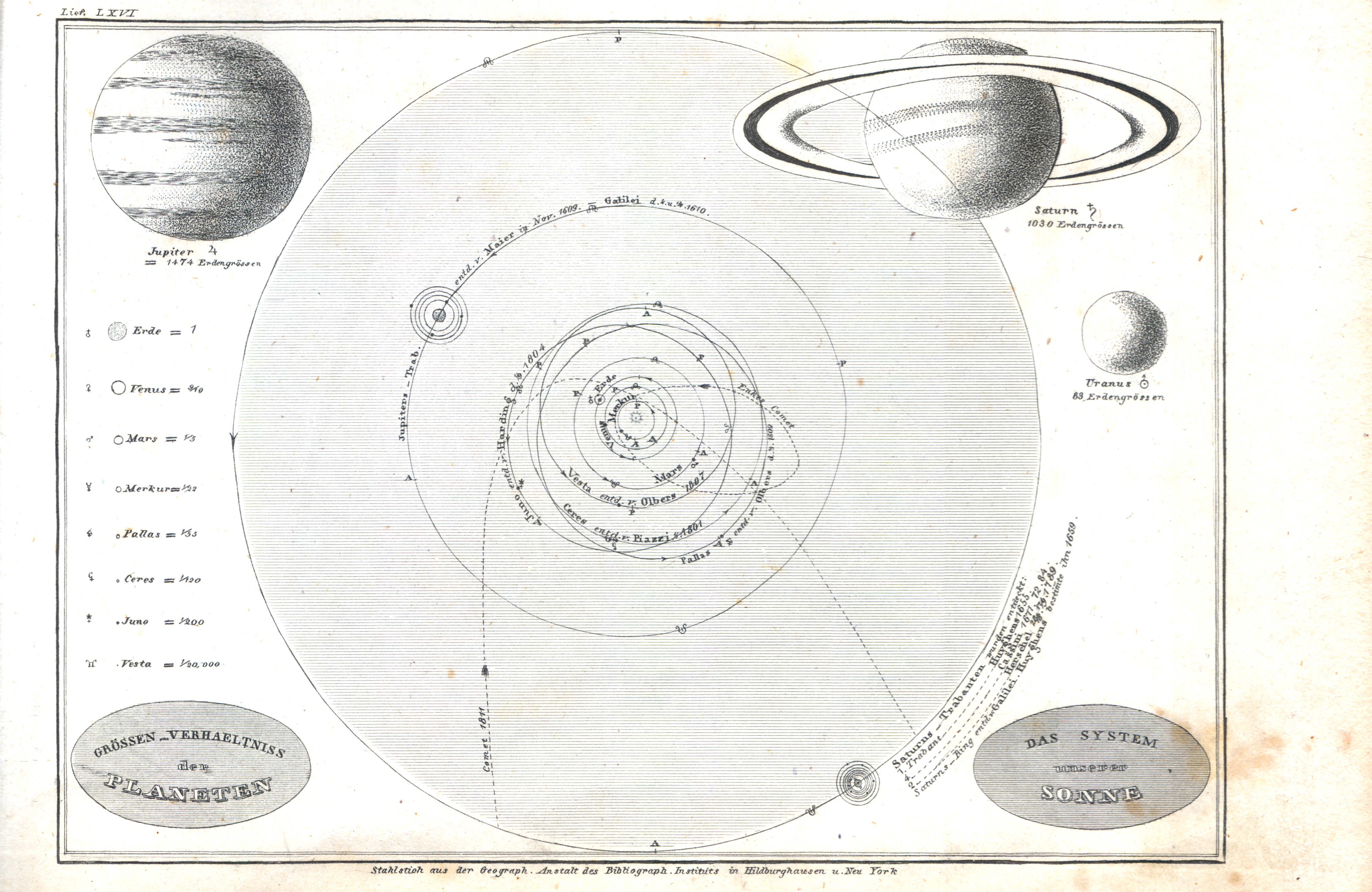
2. Das System unserer Sonne (Lief. LXVI = 66)
Zonnestelsel / Solar system
 Meyer's Universal-Atlas (1830-1840)
geen overeenkomstige kaart / no corresponding map
 Meyer's Pfennig-Atlas (1834-1841)
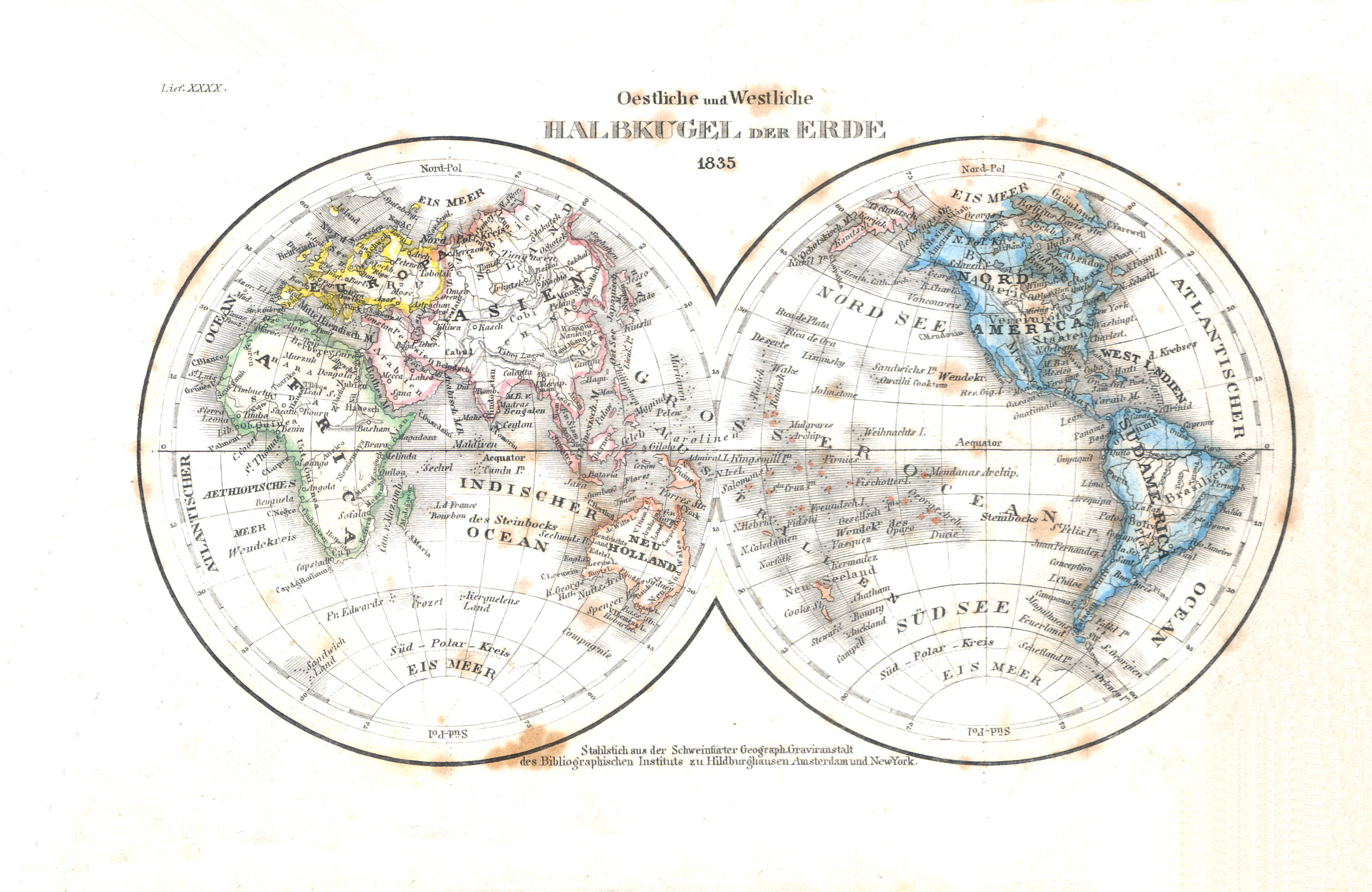
3. Oestliche und Westliche Halbkugel der Erde (Lief. XXXX = 40, 1835)
Oostelijk en westelijk halfrond / Eastern and western hemisphere
 Meyer's Universal-Atlas (1830-1840)
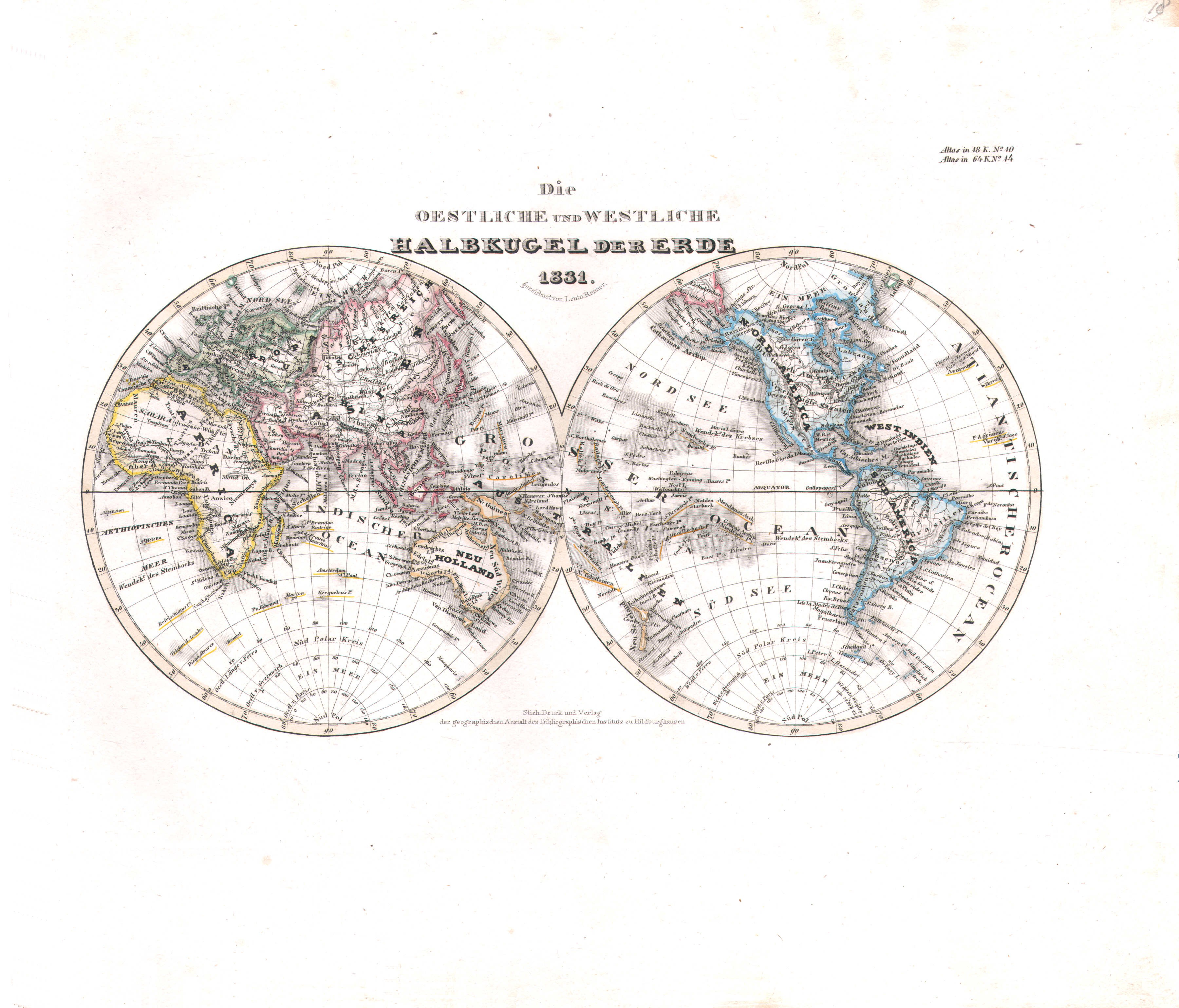
18. Die oestliche und westliche Halbkugel der Erde (Nº 14, 1831)
Oostelijk en westelijk halfrond / Eastern and western hemisphere
 Meyer's Pfennig-Atlas (1834-1841)
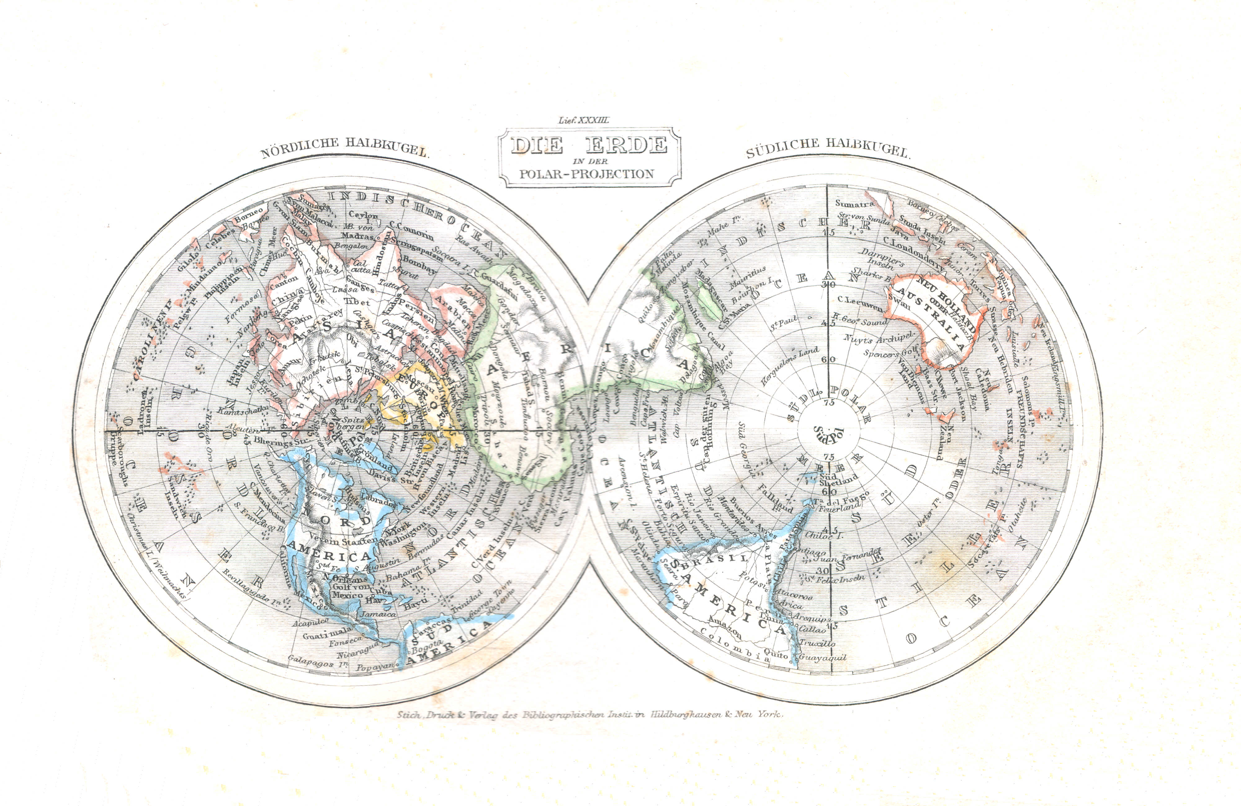
4. Die Erde in der Polar-Projection (Lief. XXXIII = 33)
De Aarde in poolprojectie / The Earth in polar projection
Meyer's Universal-Atlas (1830-1840)
geen overeenkomstige kaart / no corresponding map
 Meyer's Pfennig-Atlas (1834-1841)
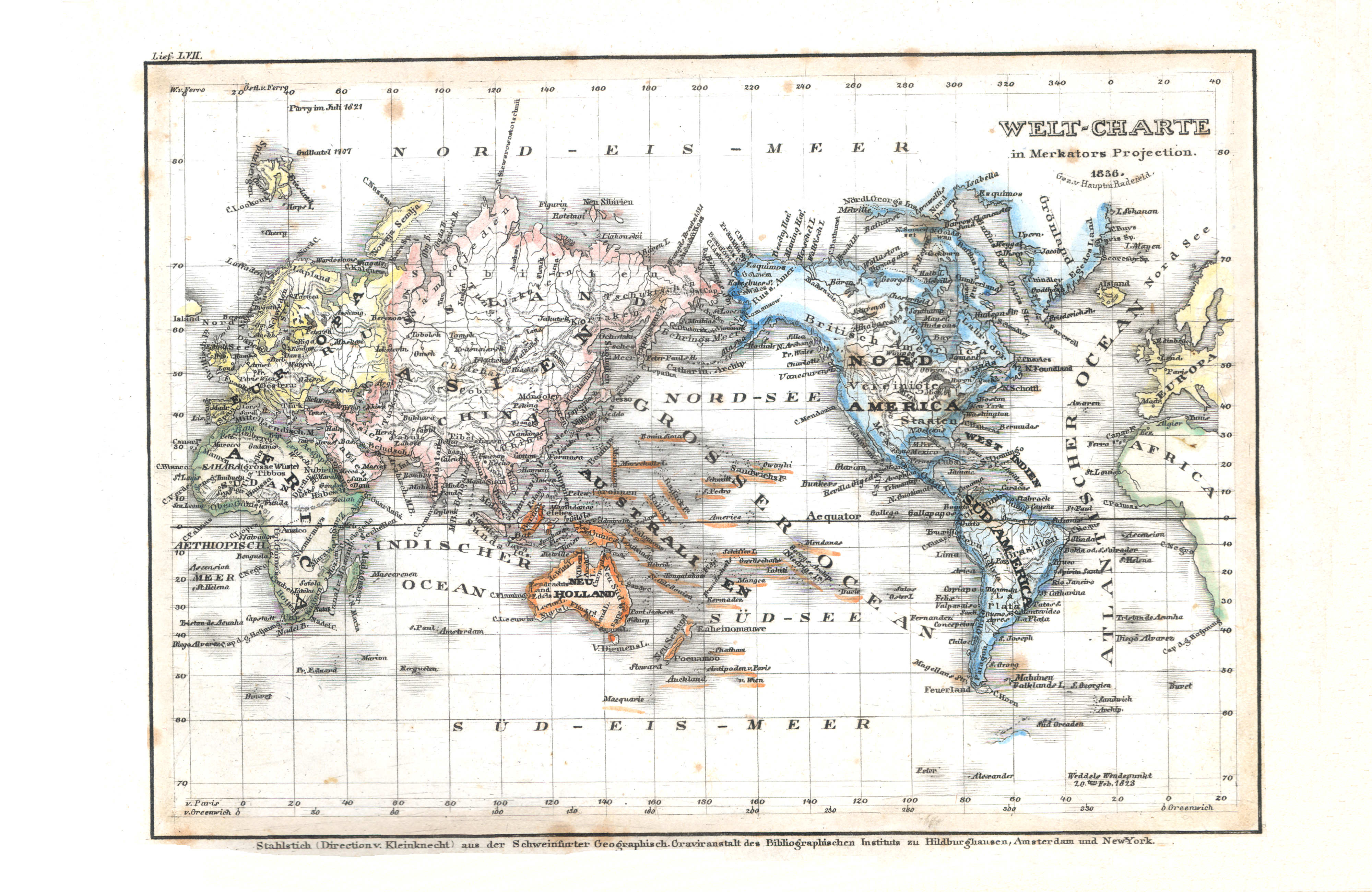
5. Welt-Charte in Mercators Projection (Lief. LVII = 57, 1836)
Wereldkaar in Mercatorprojectie / World map in Mercator projection
 Meyer's Universal-Atlas (1830-1840)
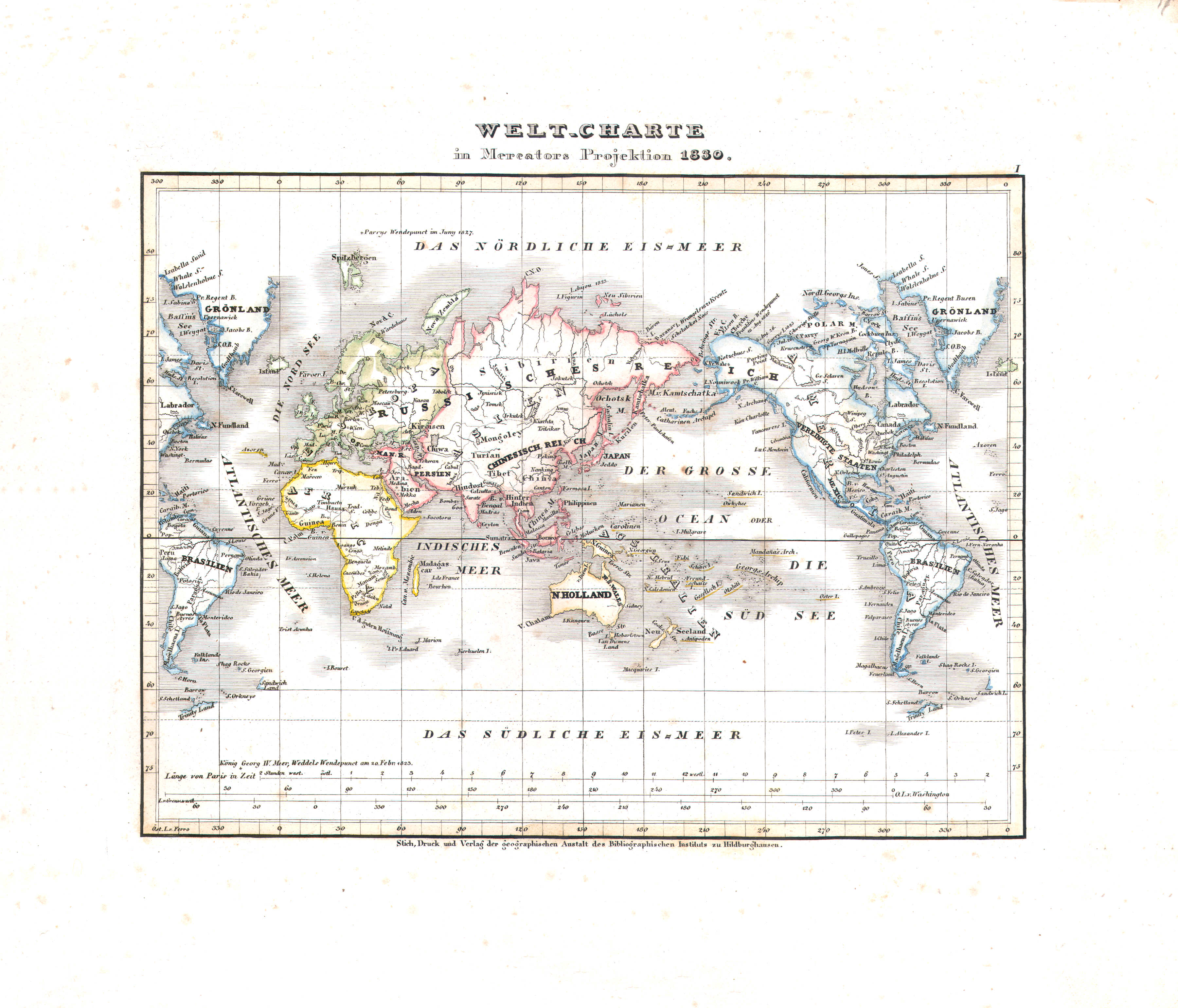
17. Welt-Charte in Mercators Projektion (Nº 1, 1830)
Wereldkaar in Mercatorprojectie / World map in Mercator projection
 Meyer's Pfennig-Atlas (1834-1841)
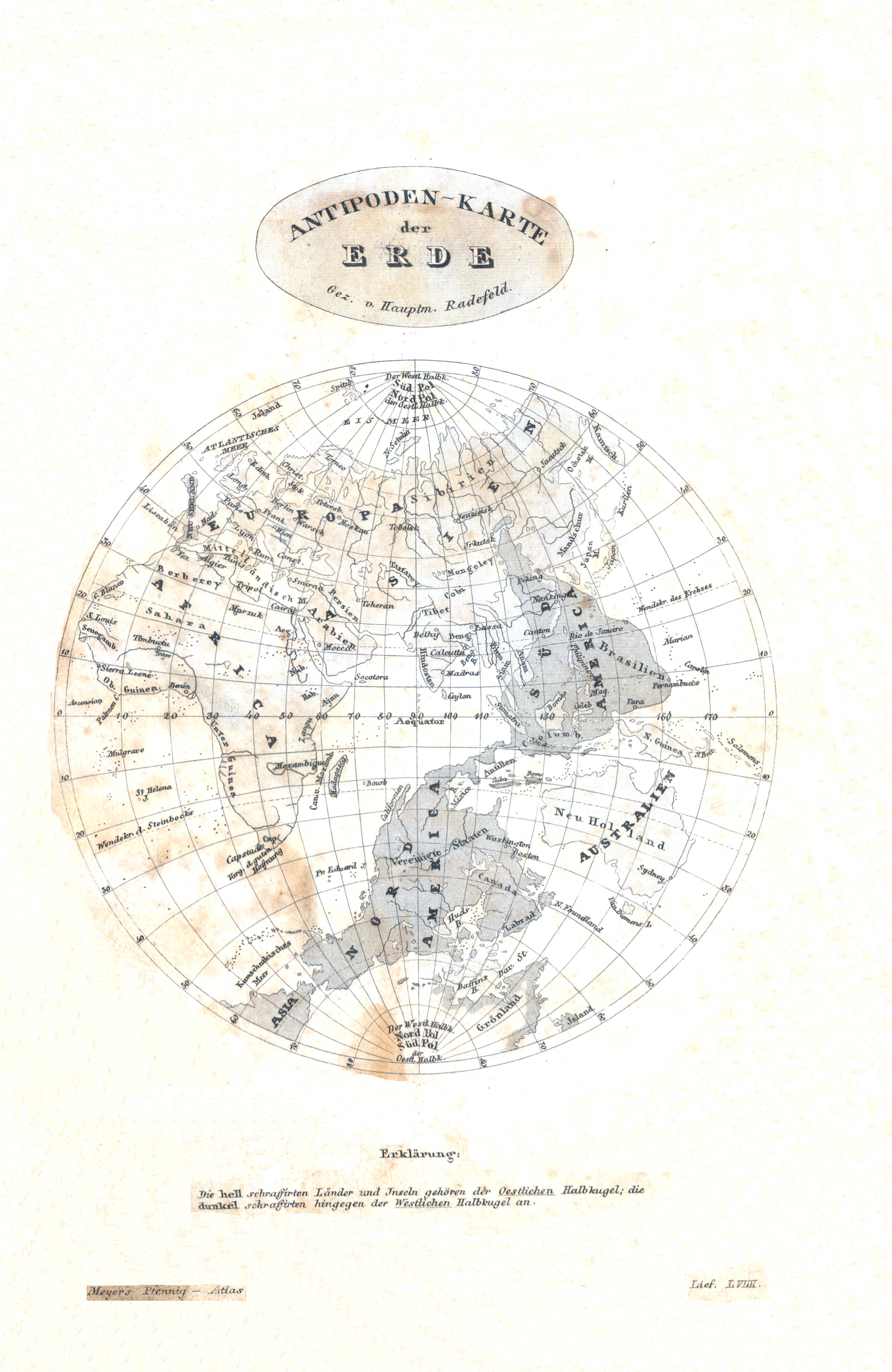
6. Antipoden-Karte der Erde (Lief. LVIIII = 59)
Antipodenkaart van de Aarde / Antipodes map of the Earth
 Meyer's Universal-Atlas (1830-1840)
geen overeenkomstige kaart / no corresponding map
 Meyer's Pfennig-Atlas (1834-1841)
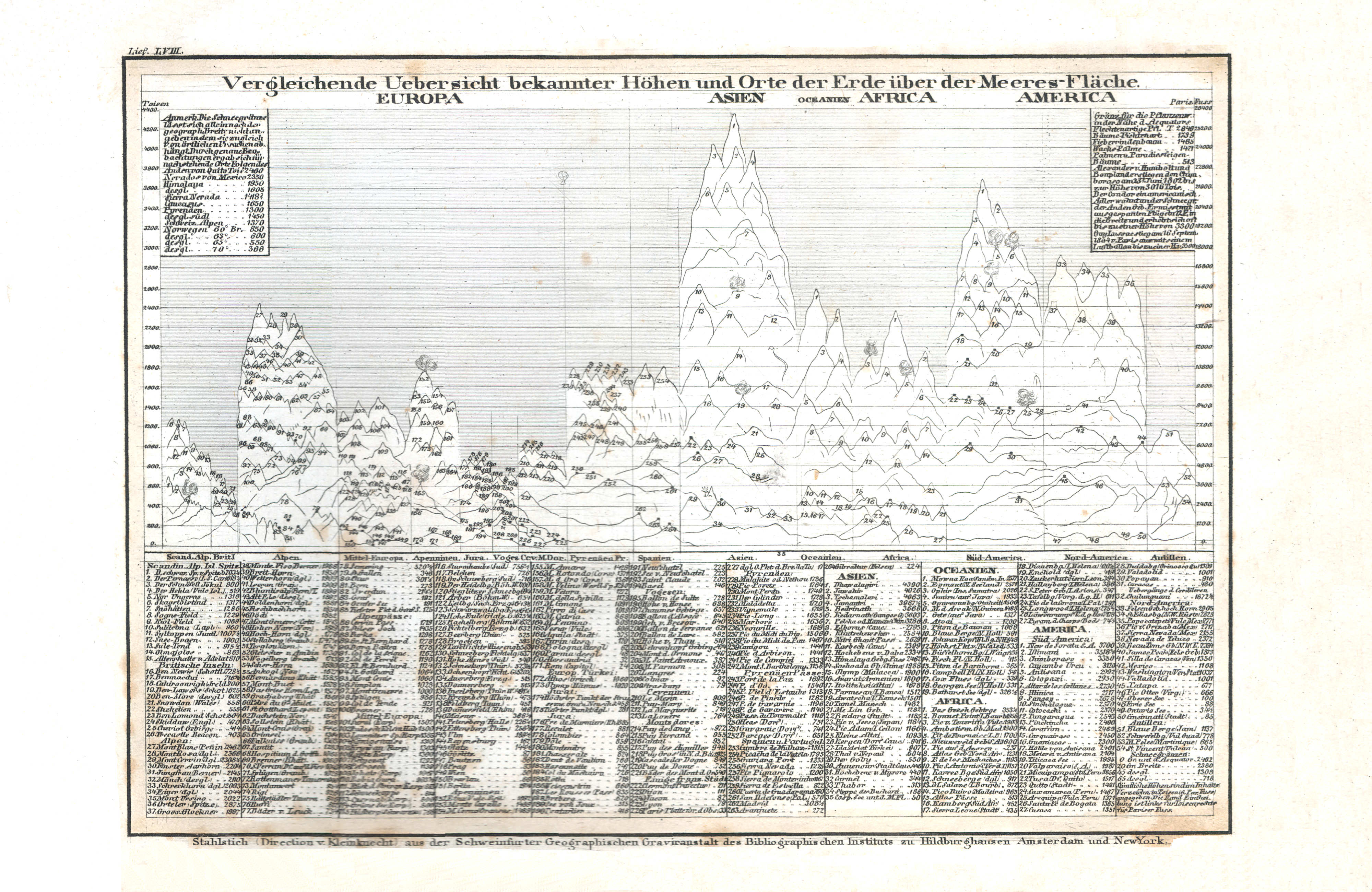
7. Vergleichende Uebersicht bekannter Höhen und Orte der Erde über der Meeres-Fläche (Lief. LVIII = 58)
Vergelijkend overzicht van hoogtes boven de zeespiegel / Comparative overview of altitudes above sea level
 Meyer's Universal-Atlas (1830-1840)
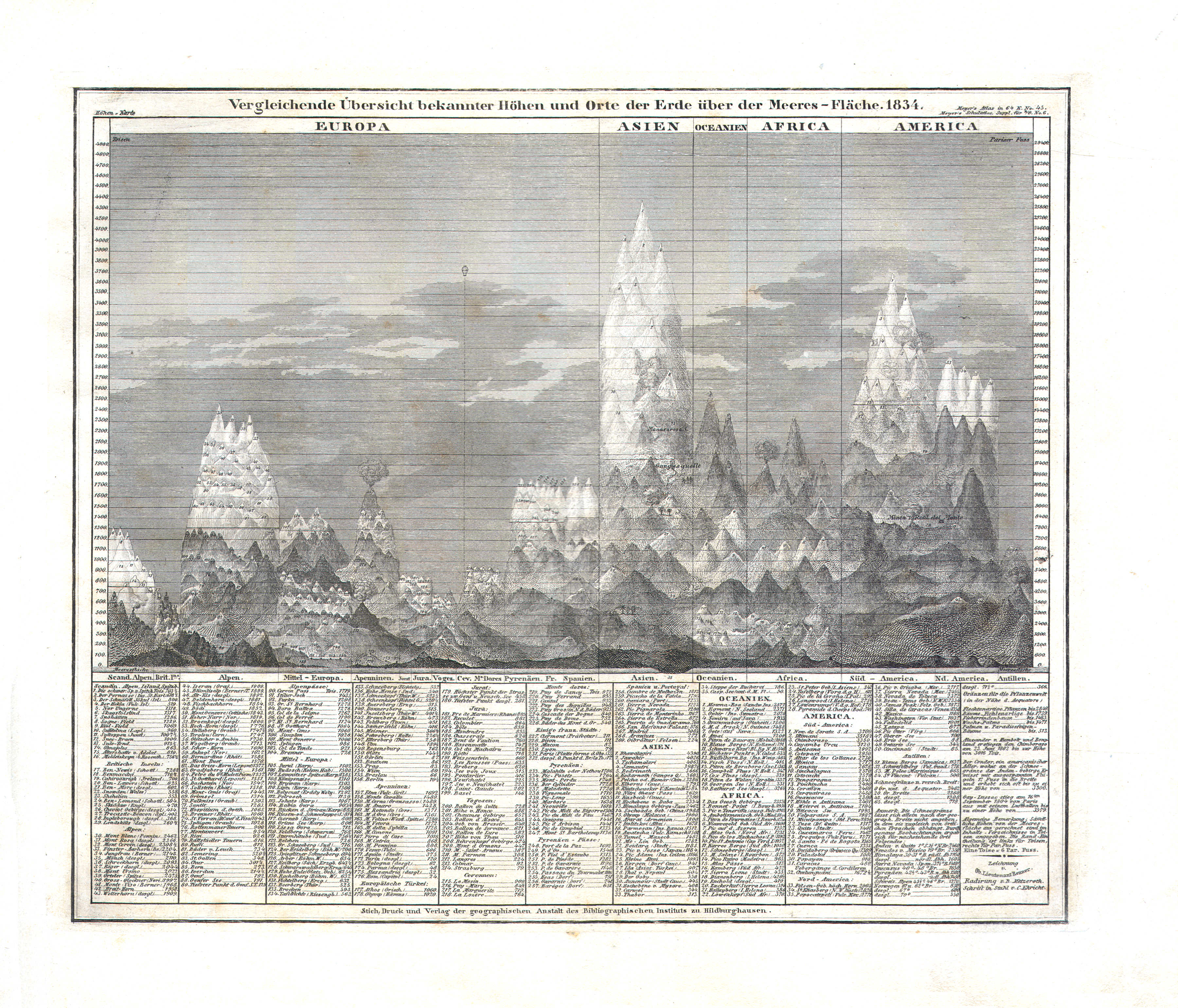
87. Vergleichende Übersicht bekannter Höhen und Orte der Erde über Meeres-Fläche (Nº 45, 1834)
Vergelijkend overzicht van hoogtes boven de zeespiegel / Comparative overview of altitudes above sea level
 Meyer's Pfennig-Atlas (1834-1841)
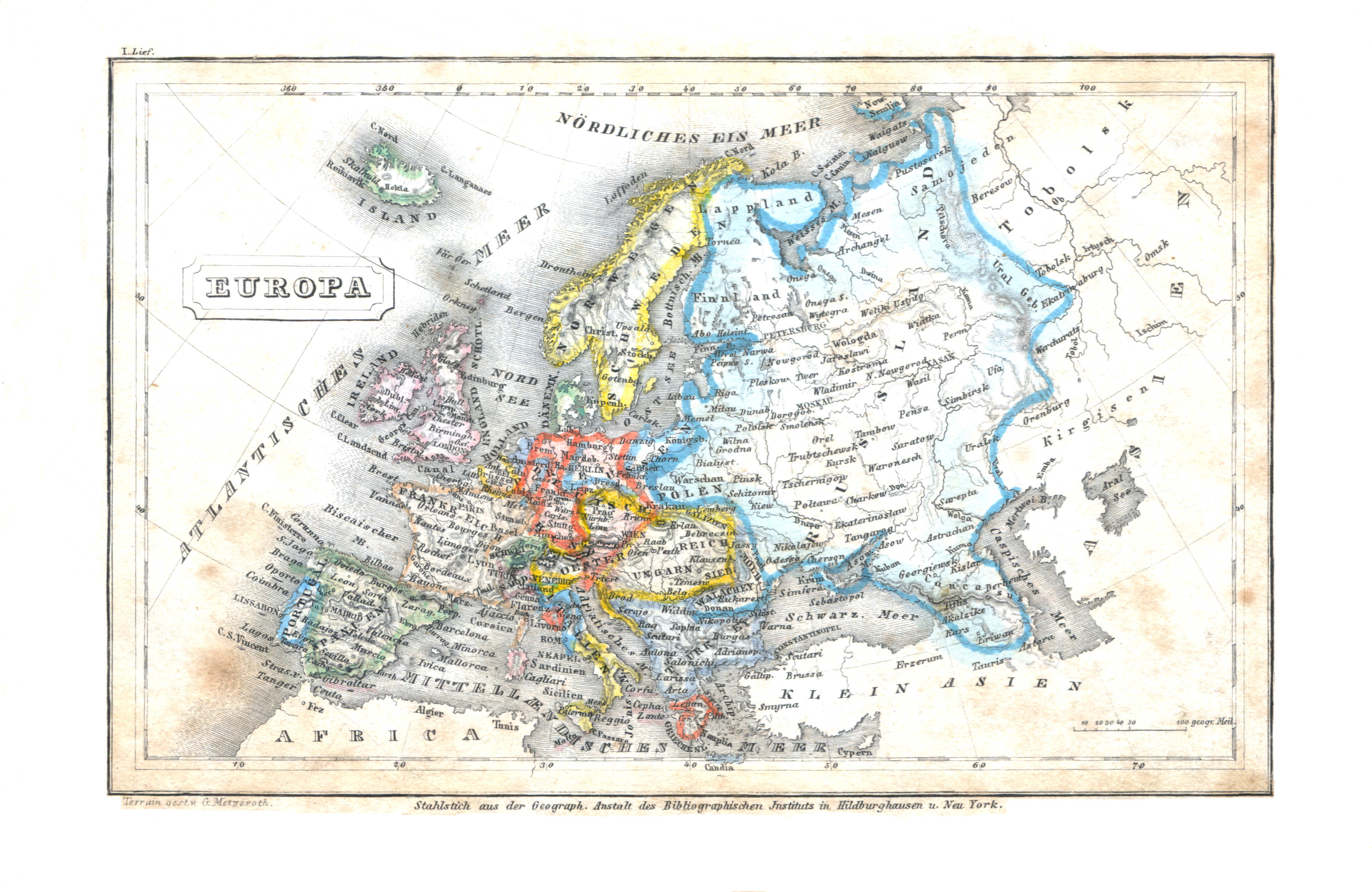
8. Europa (Lief. I = 1)
Europa / Europe
 Meyer's Universal-Atlas (1830-1840)
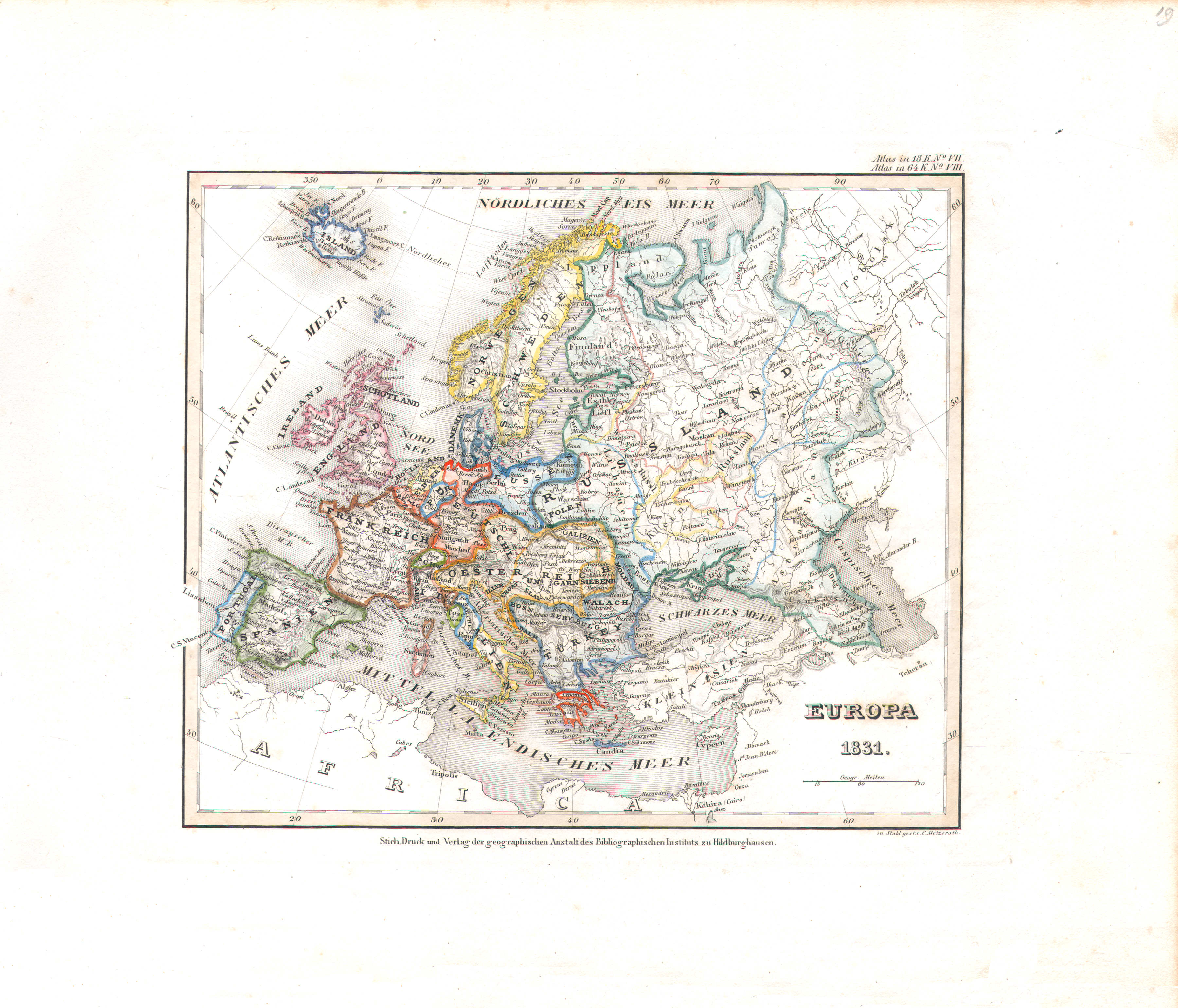
19. Europa (Nº 8, 1831)
Europa / Europe
 Meyer's Pfennig-Atlas (1834-1841)
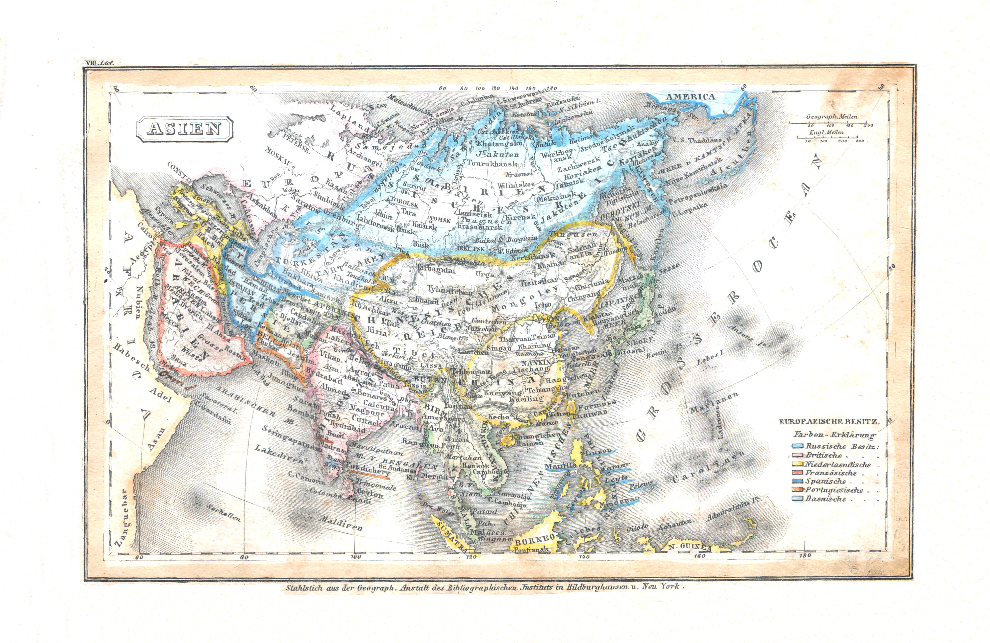
9. Asien (Lief. VIII = 8)
Azië / Asia
 Meyer's Universal-Atlas (1830-1840)
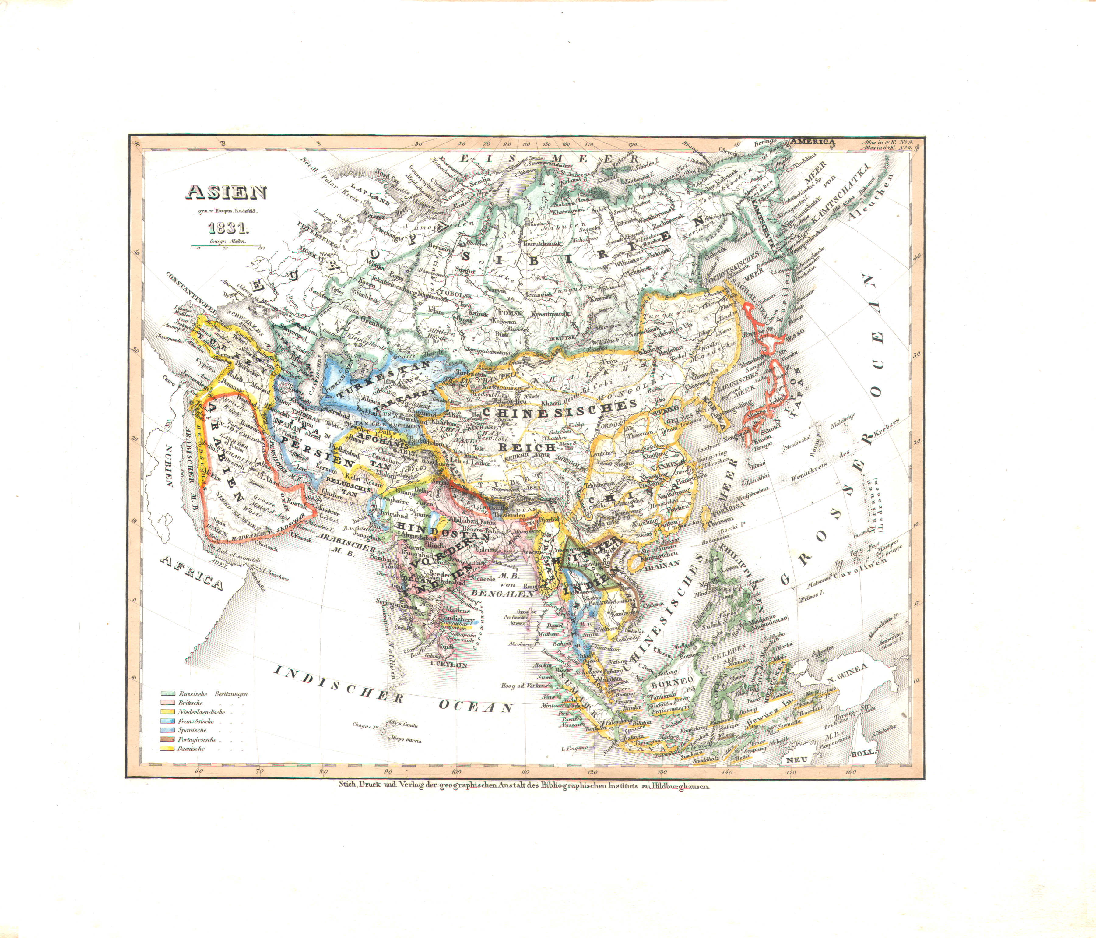
20. Asien (Nº 11, 1831)
Azië / Asia
 Meyer's Pfennig-Atlas (1834-1841)
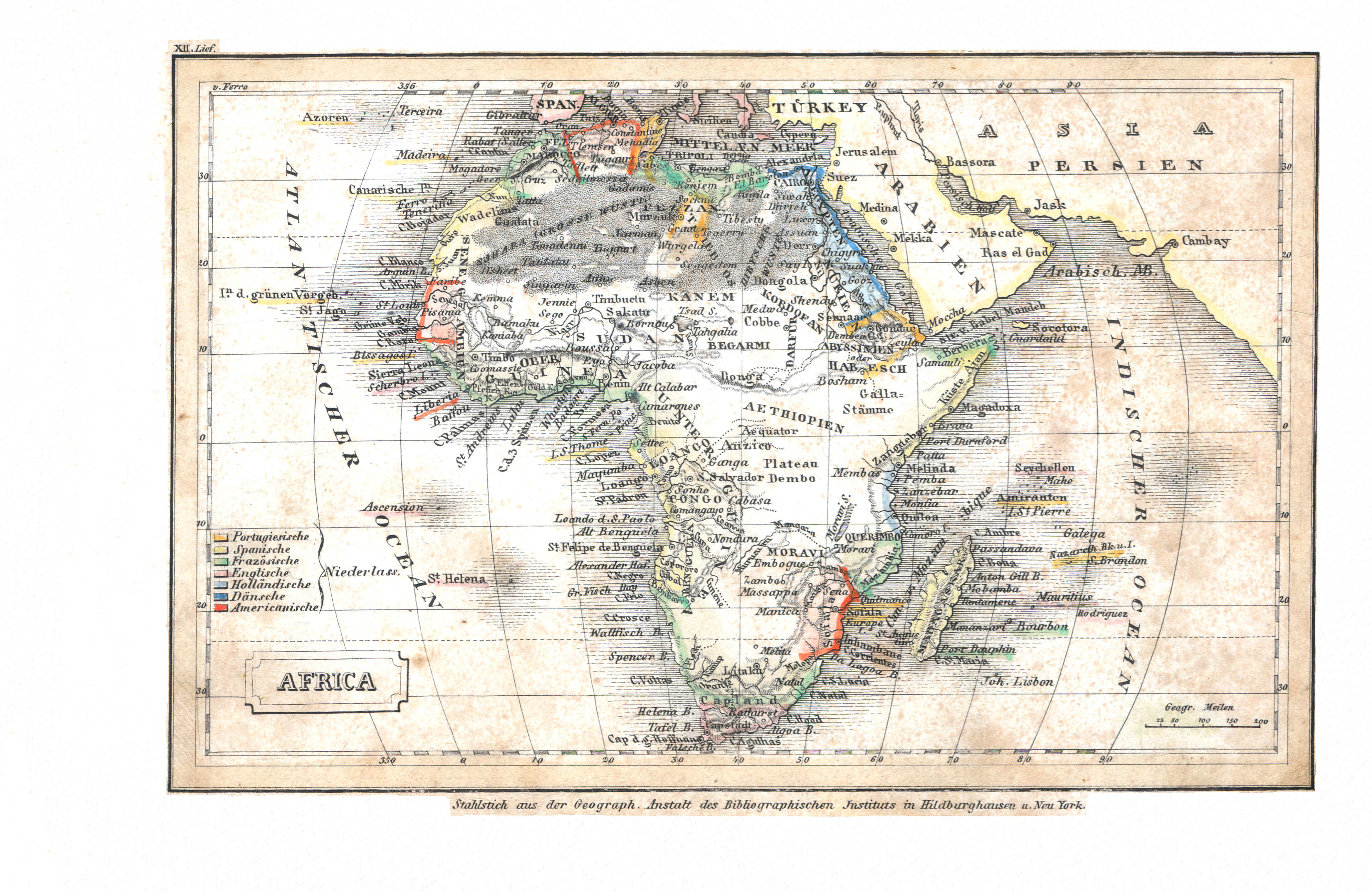
10. Africa (Lief. XII = 12)
Afrika / Africa
 Meyer's Universal-Atlas (1830-1840)
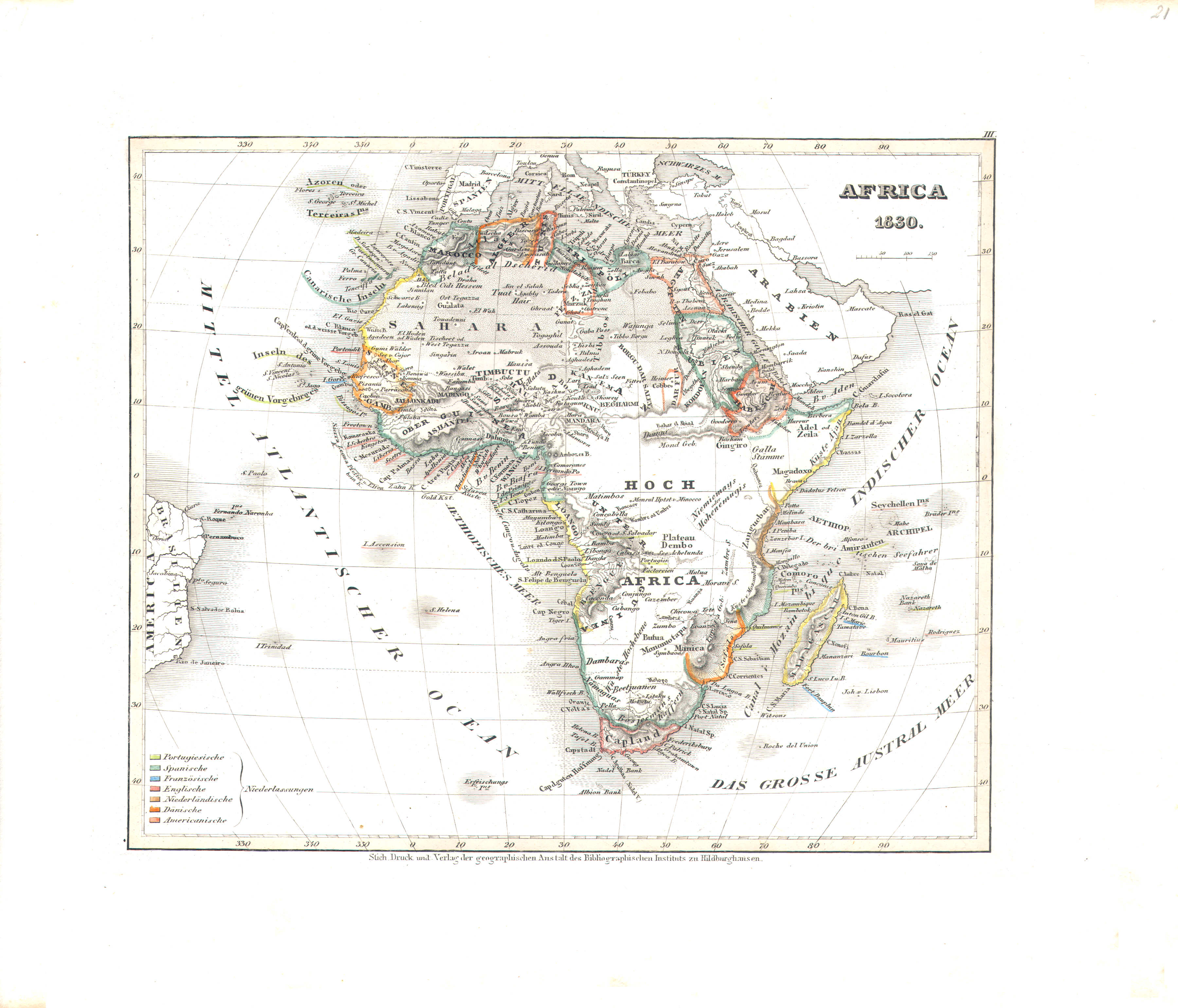
21. Africa (Nº 3, 1830)
Afrika / Africa
 Meyer's Pfennig-Atlas (1834-1841)
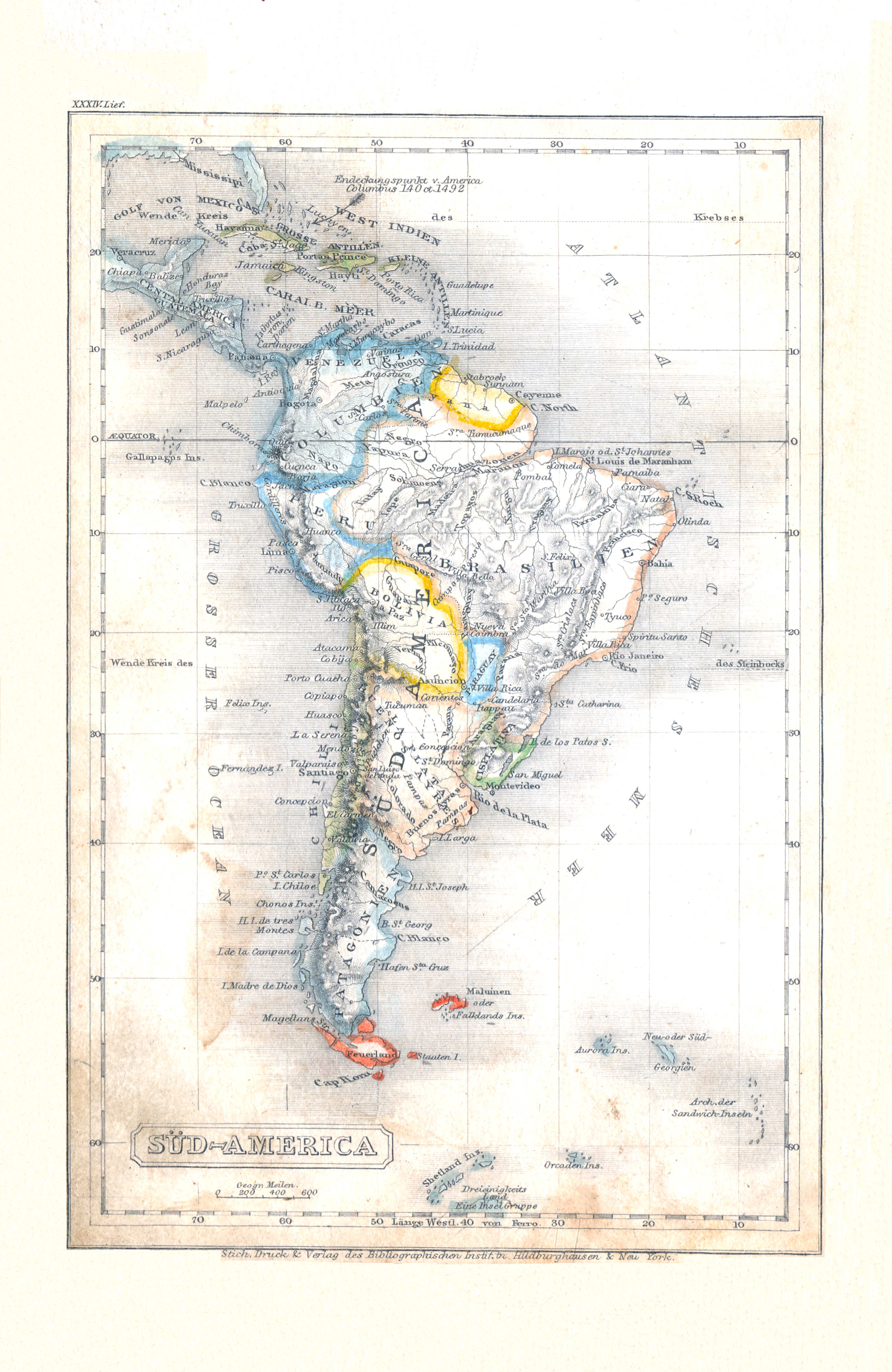
11. Süd-America (Lief. XXXIV = 34)
Zuid-Amerika / South America
 Meyer's Universal-Atlas (1830-1840)
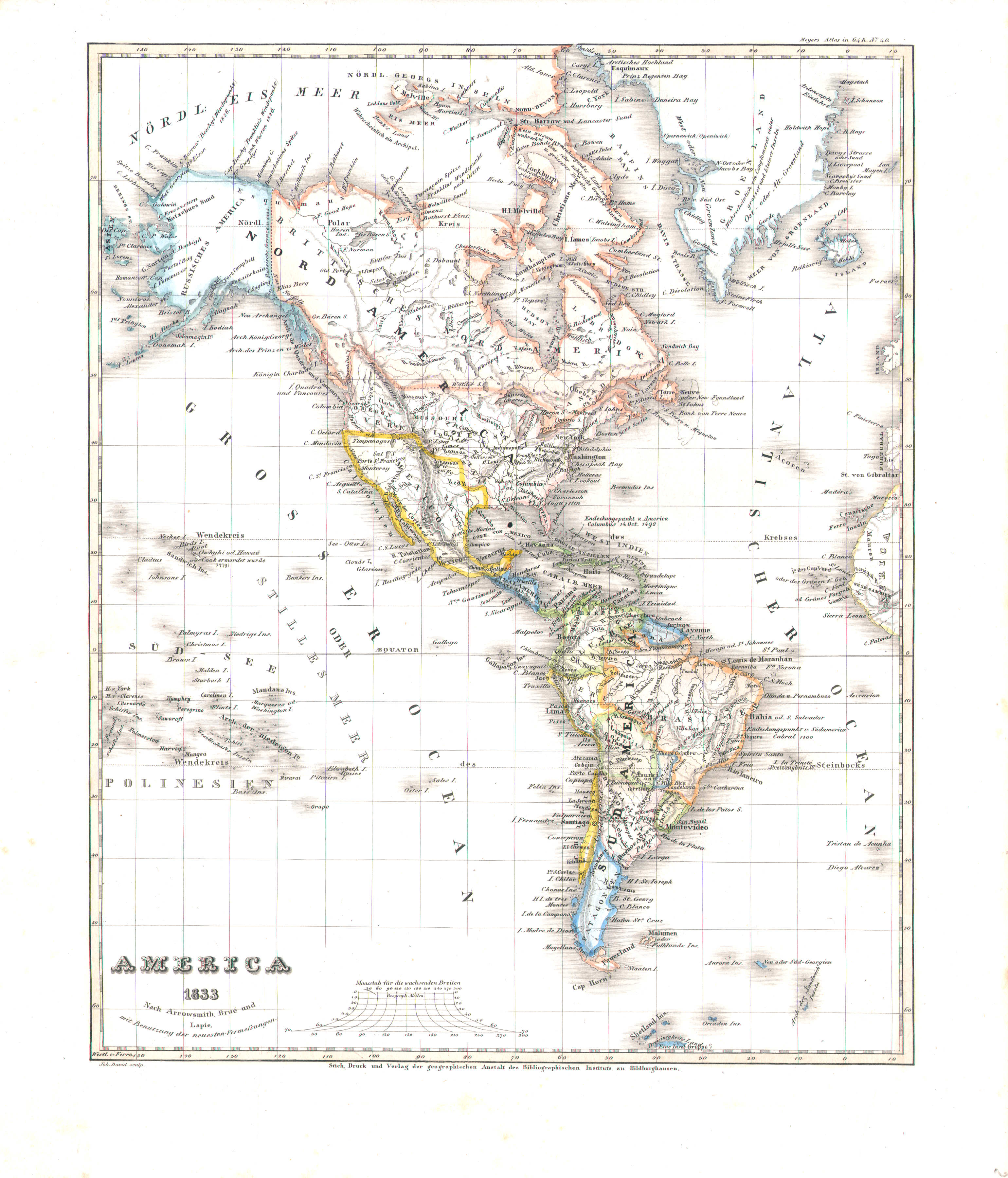
22. America (Nº 40, 1833)
Noord- en Zuid-Amerika / The Americas
 Meyer's Pfennig-Atlas (1834-1841)
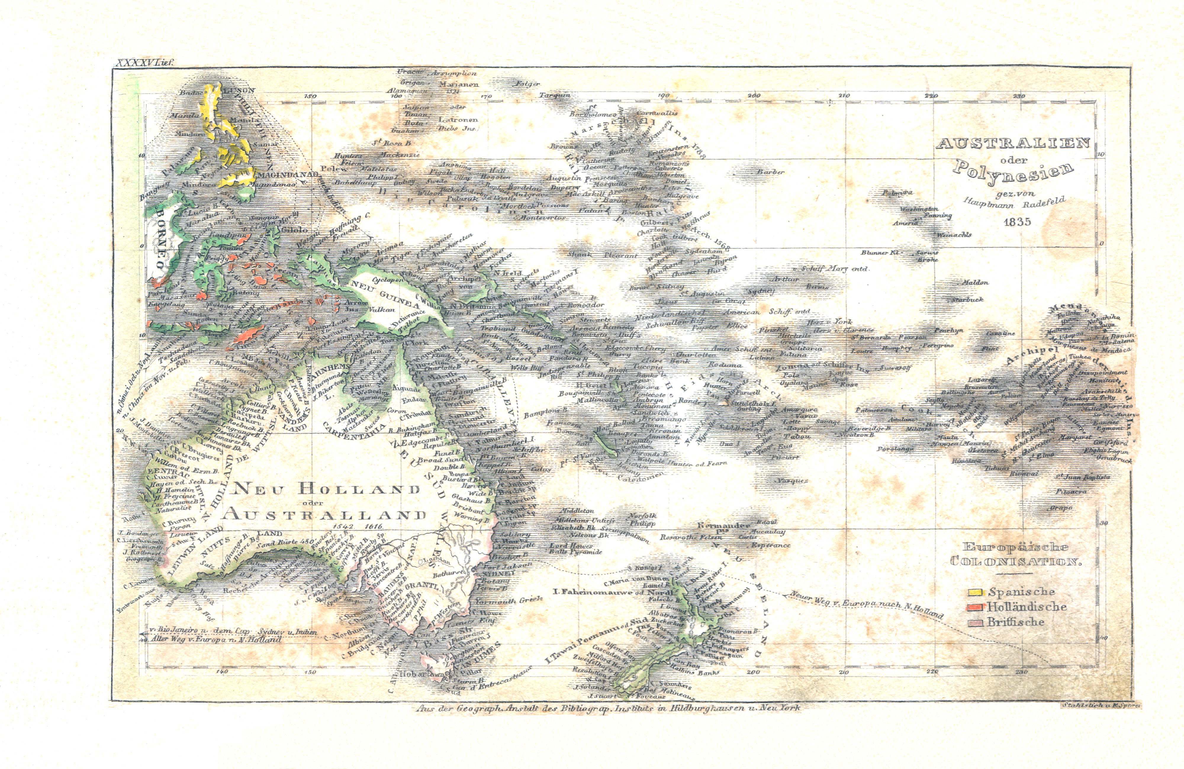
12. Australien oder Polynesien (Lief. XXXXV = 45, 1835)
Australië of Polynesië / Australia or Polynesia
Meyer's Universal-Atlas (1830-1840)
geen overeenkomstige kaart / no corresponding map
 Meyer's Pfennig-Atlas (1834-1841)
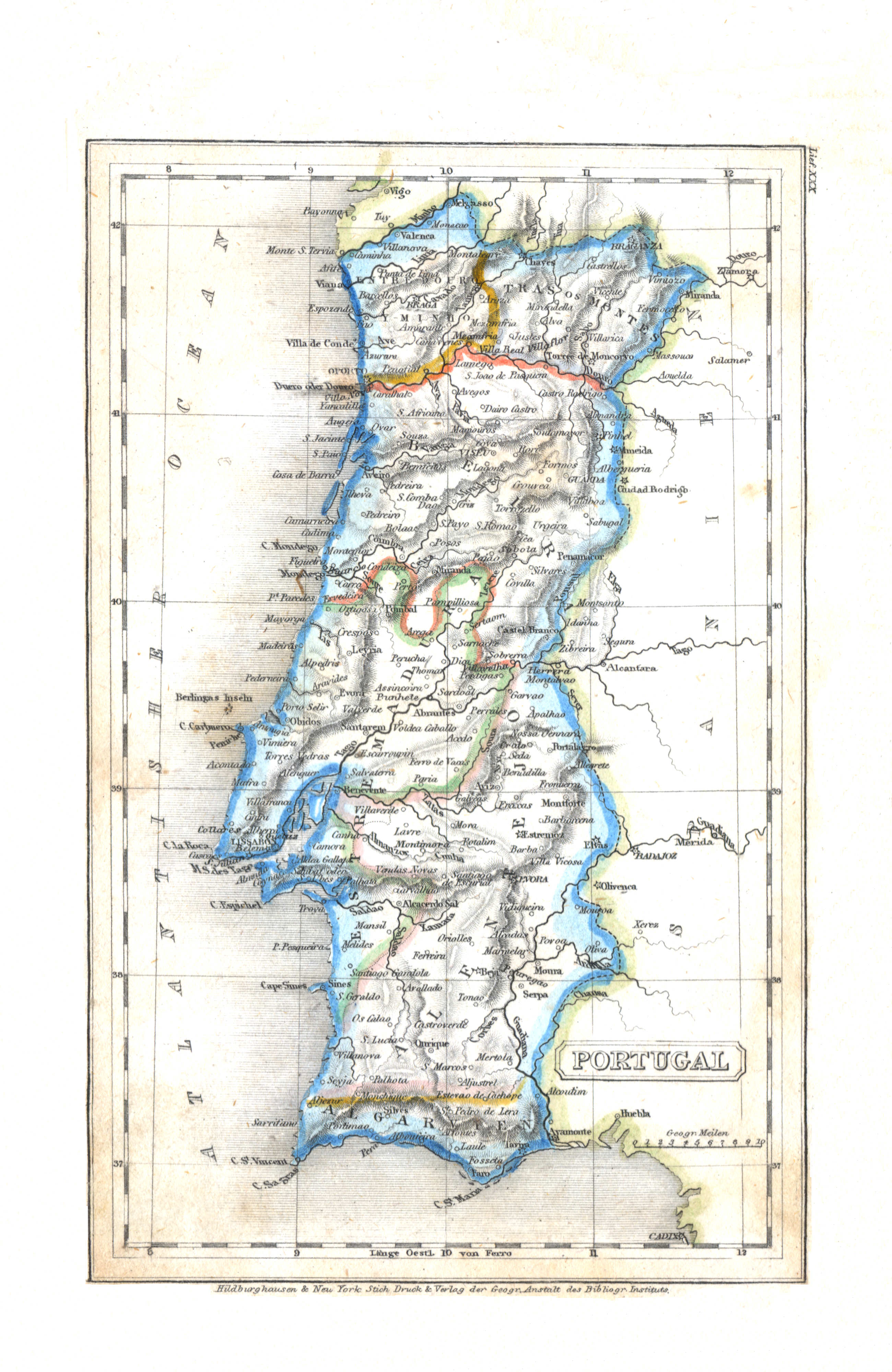
13. Portugal (Lief. XXX = 30)
Portugal
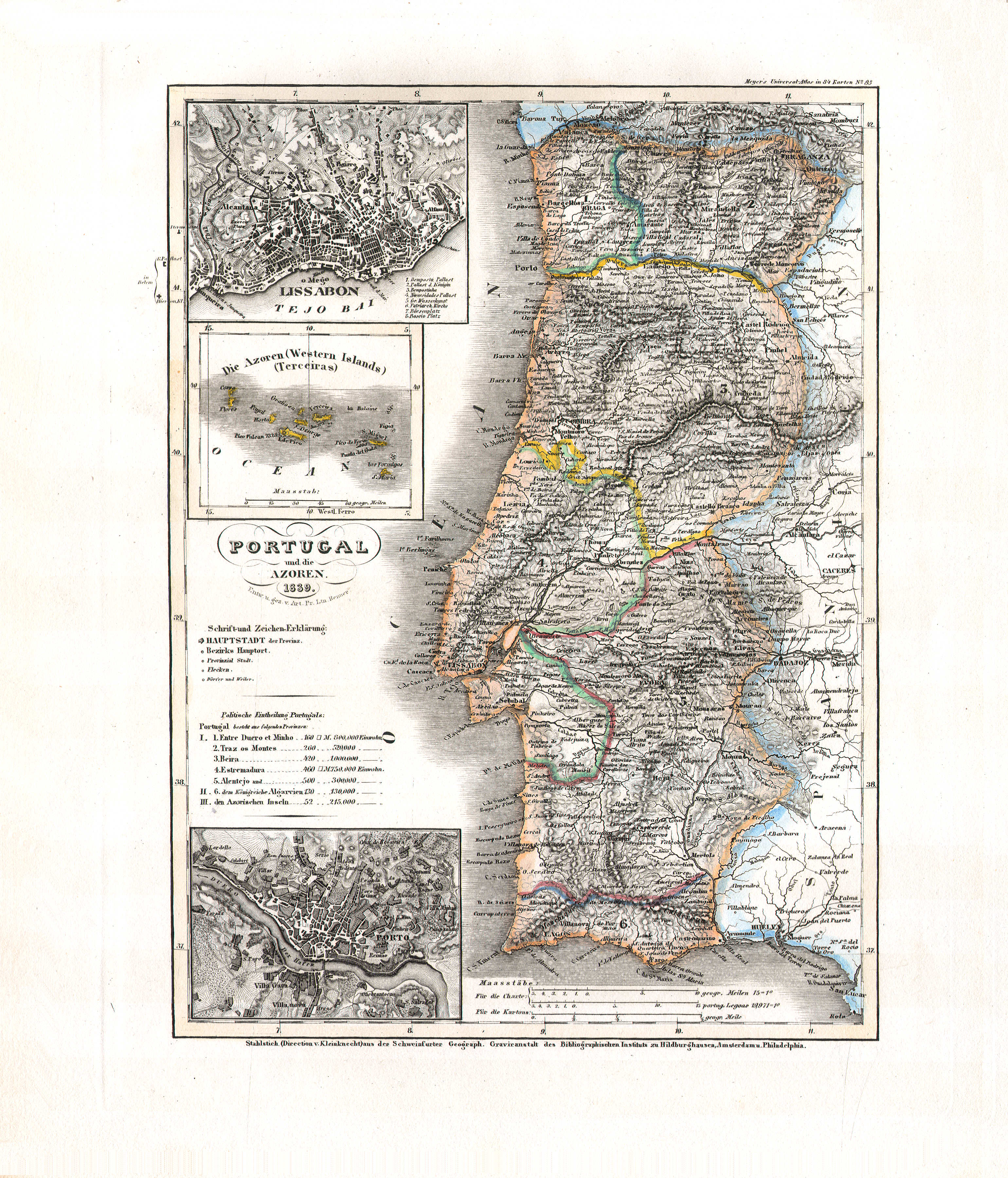 Meyer's Universal-Atlas (1830-1840)
76. Portugal und die Azoren (Nº 85, 1839)
Portugal en de Azoren / Portugal and the Azores
 Meyer's Pfennig-Atlas (1834-1841)
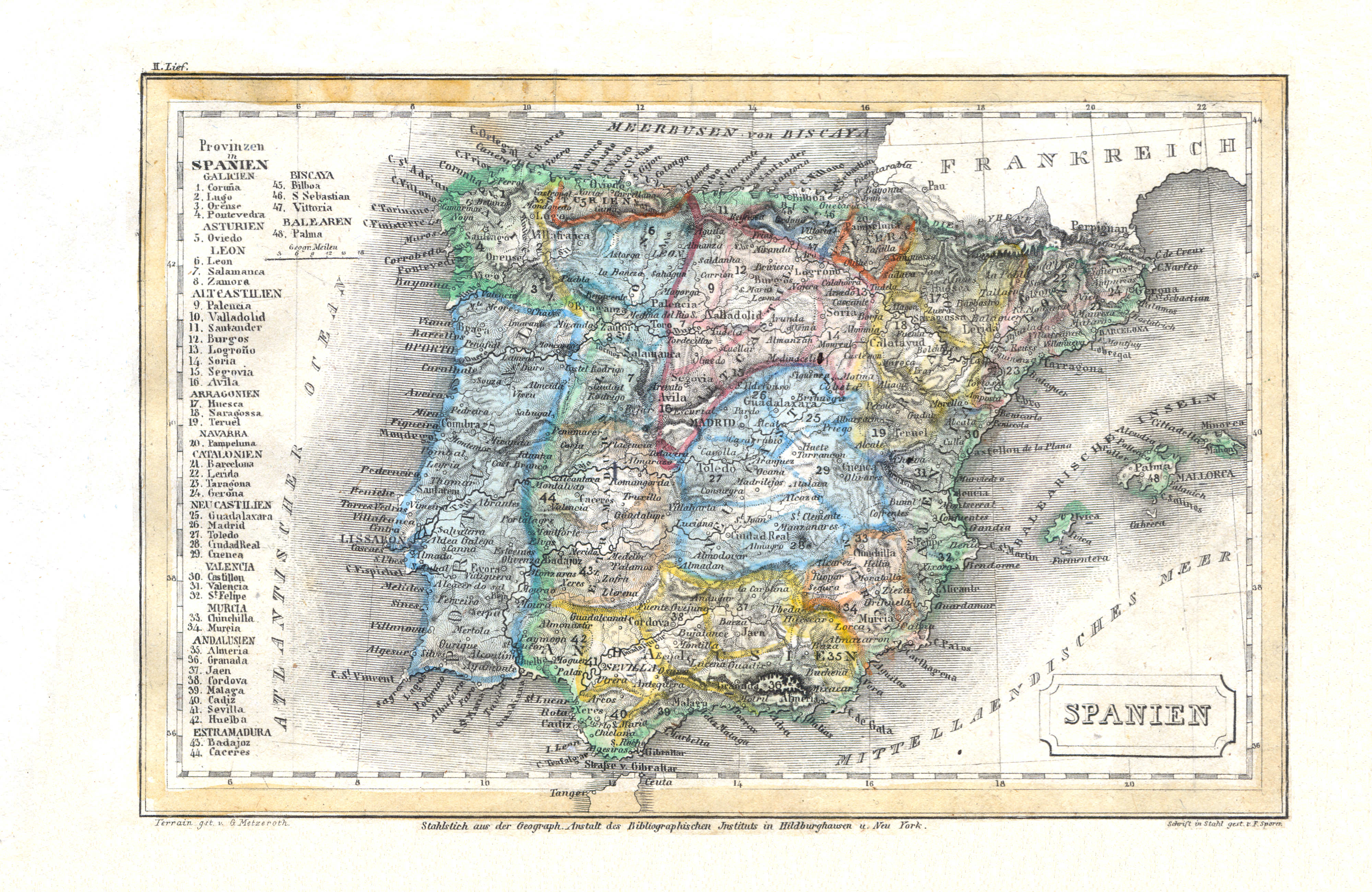
14. Spanien (Lief. II = 2)
Spanje / Spain
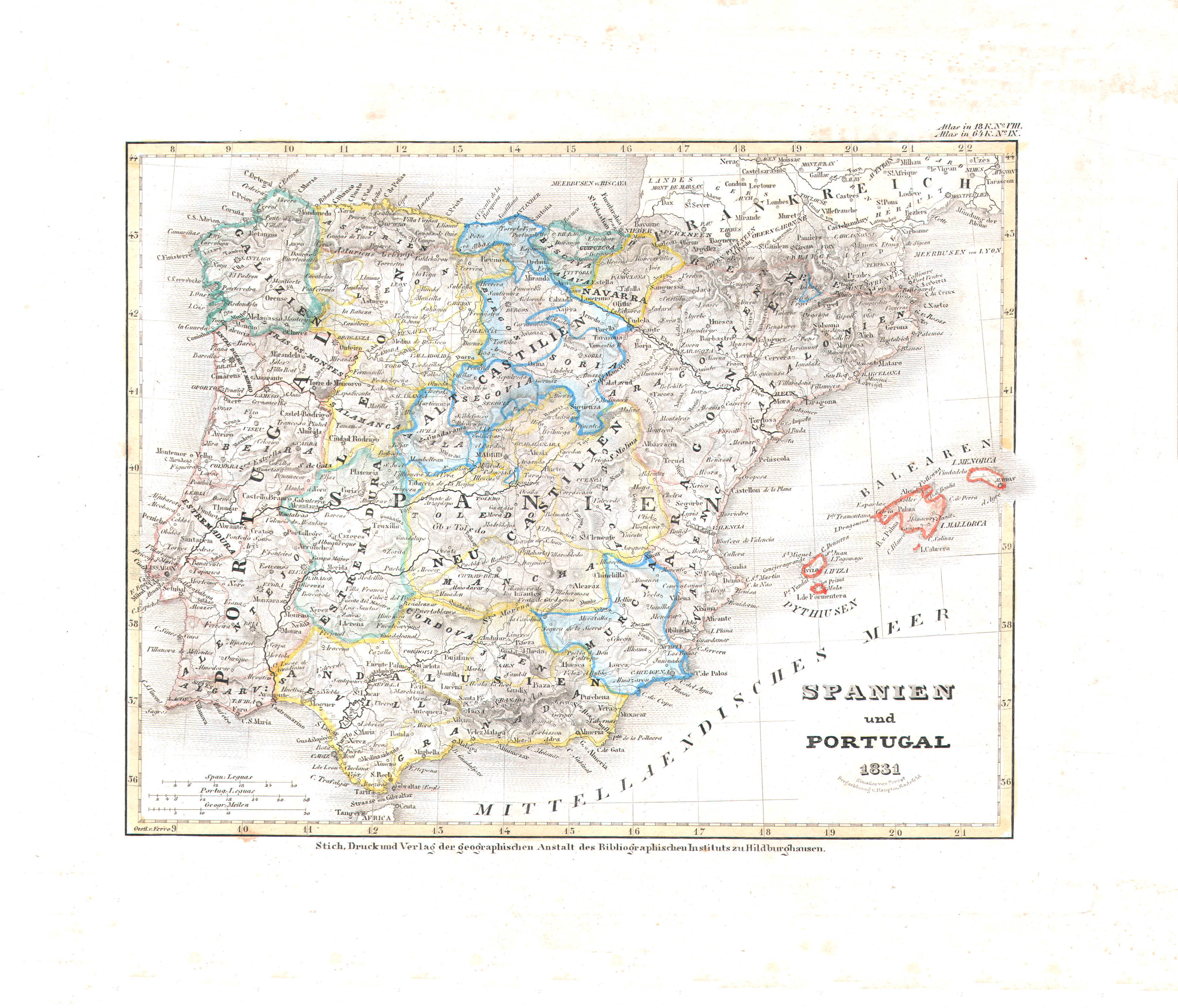 Meyer's Universal-Atlas (1830-1840)
24. Spanien und Portugal (Nº 9, 1831)
Spanje en Portugal / Spain and Portugal
 Meyer's Pfennig-Atlas (1834-1841)
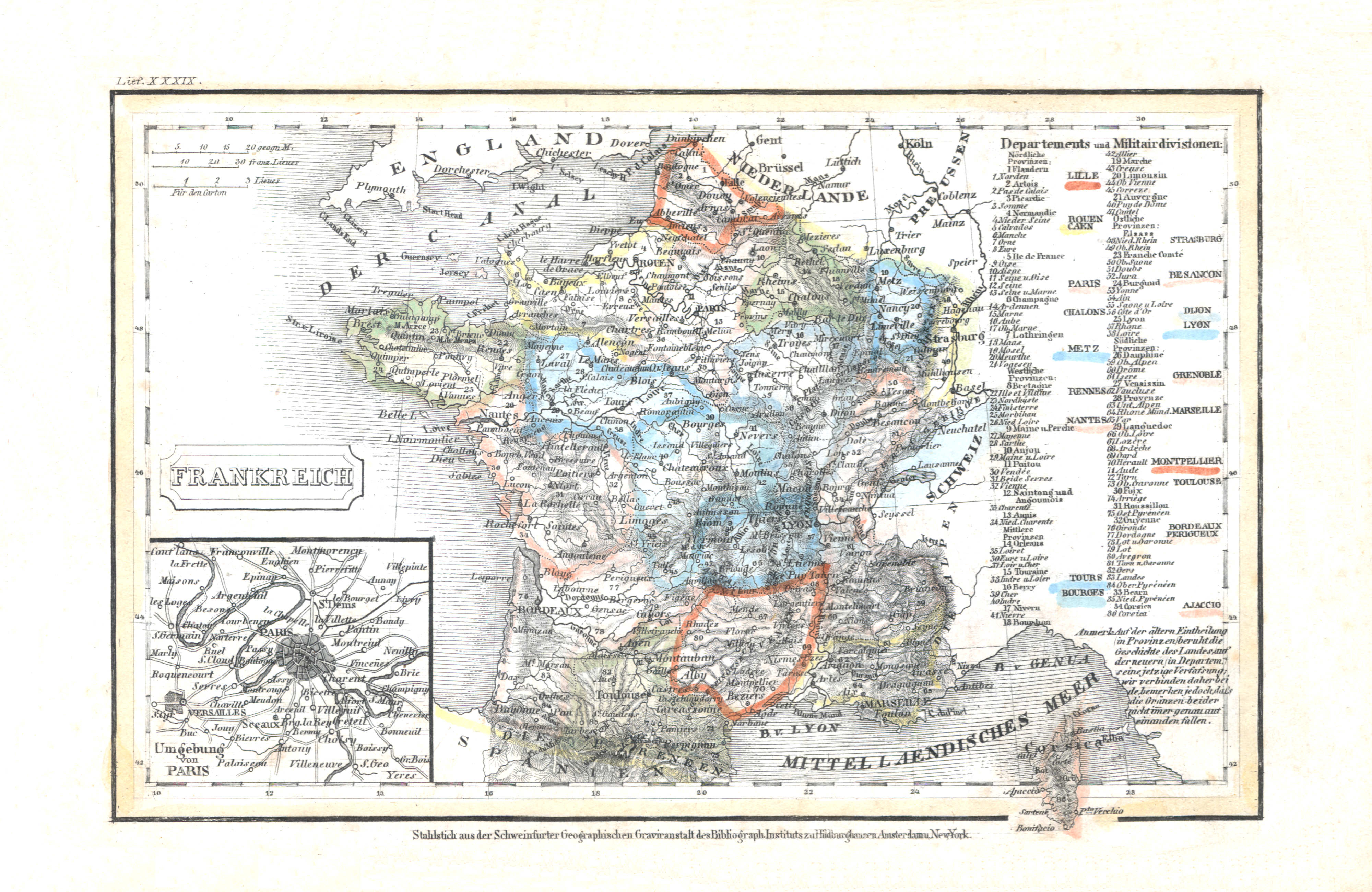
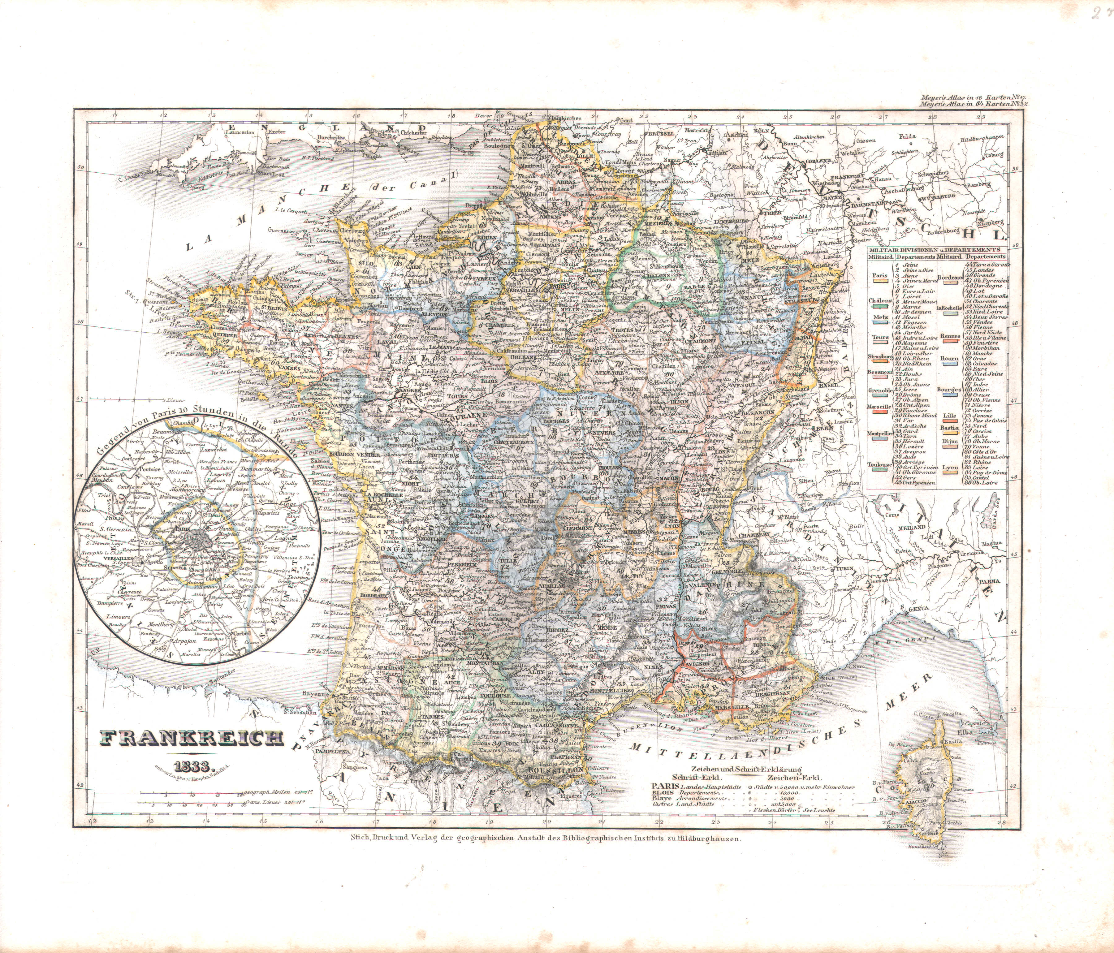
15. Frankreich (Lief. XXXIX = 39)
Frankrijk / France
 Meyer's Universal-Atlas (1830-1840)
25. Frankreich (Nº 32, 1833)
Frankrijk / France
 Meyer's Pfennig-Atlas (1834-1841)
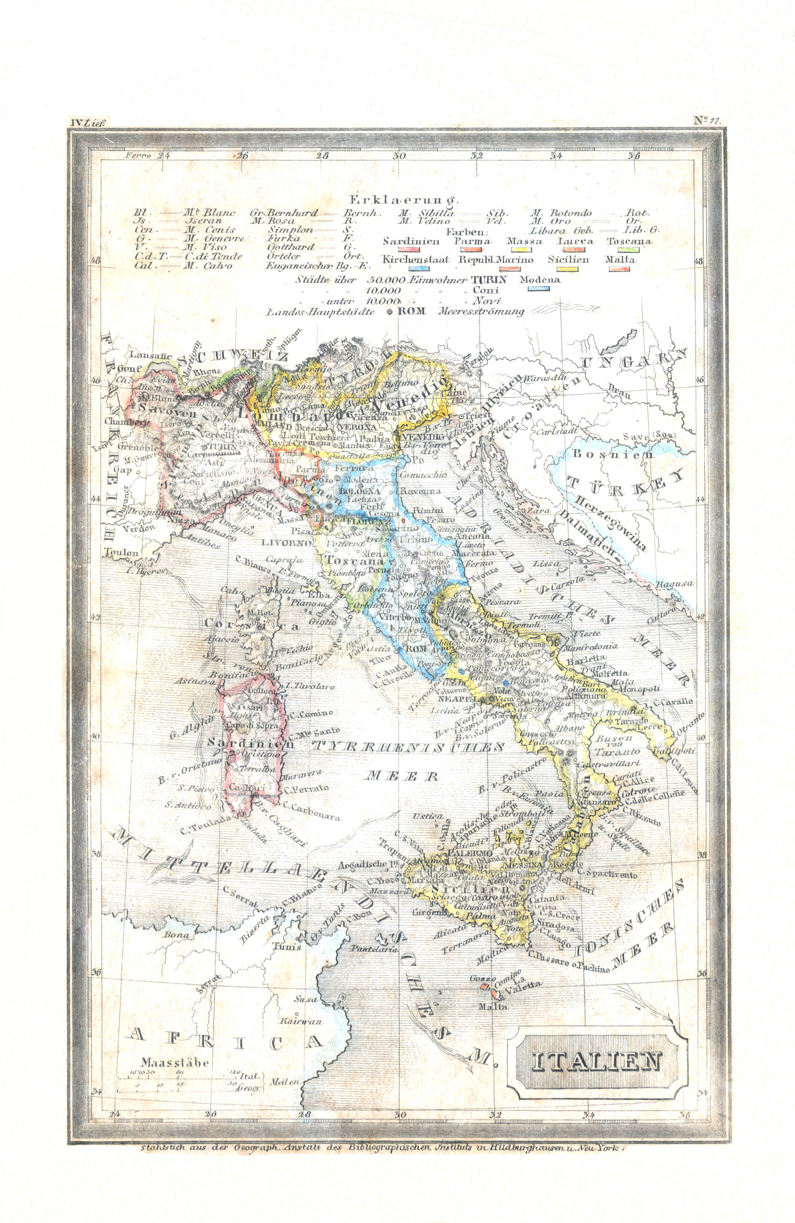
16. Italien (Lief. IV = 4)
Italië / Italy
 Meyer's Universal-Atlas (1830-1840)
26. Italien mit der Dalmat-Albanesischen Küste (Nº 13, 1831)
Italië en de kust van Dalmatië en Albanië / Italy and the shores of Dalmatia and Albania
 Meyer's Pfennig-Atlas (1834-1841)
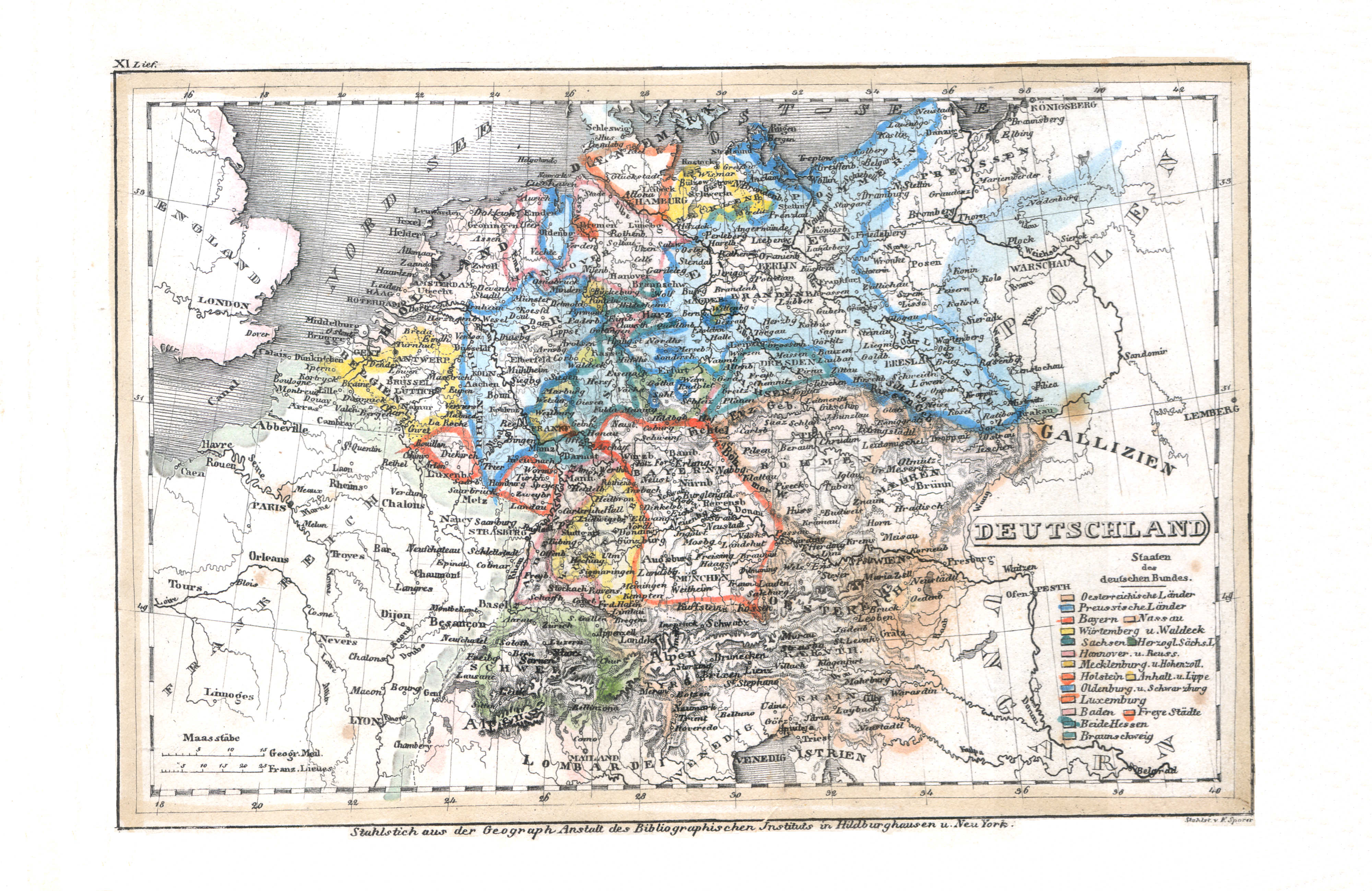
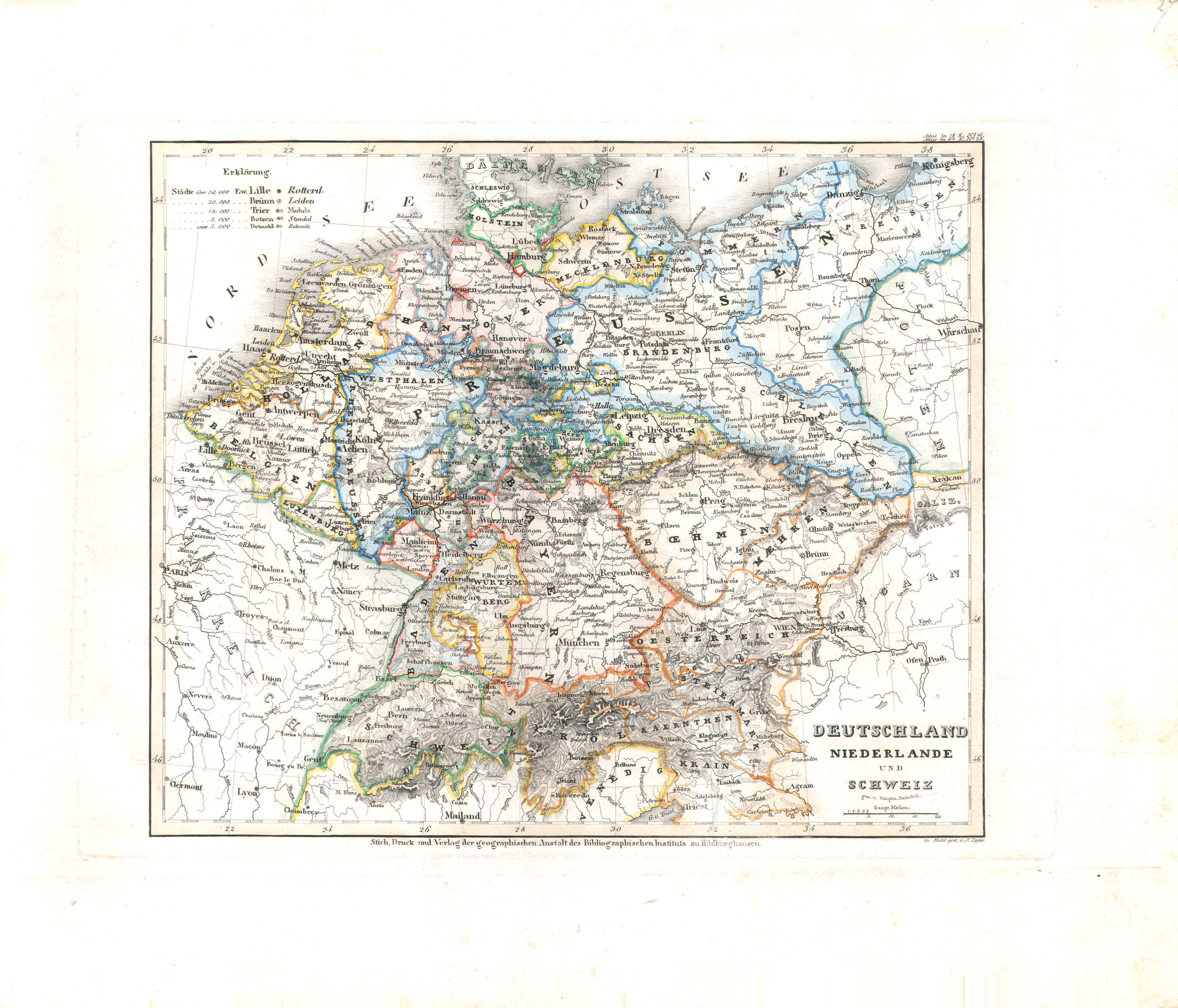
17. Deutschland (Lief. XI = 11)
Duitsland / Germany
 Meyer's Universal-Atlas (1830-1840)
27. Deutschland, Niederlande und Schweiz (Nº 28)
Duitsland, Nederland en Zwitserland / Germany, Netherlands and Switzerland
 Meyer's Pfennig-Atlas (1834-1841)
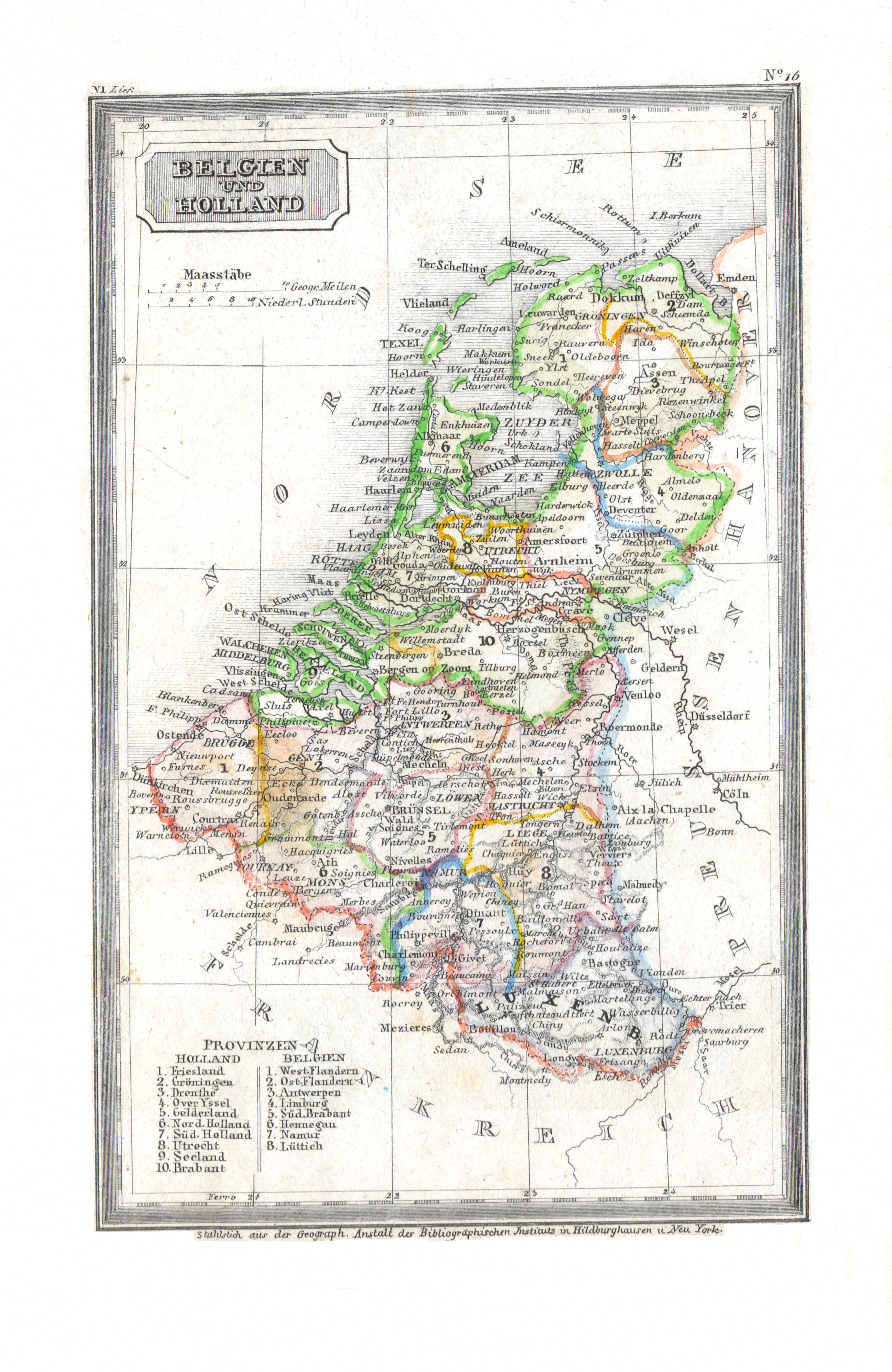
18. Belgien und Holland (Lief. VI = 6)
België en Nederland / Belgium and Netherlands
 Meyer's Universal-Atlas (1830-1840)
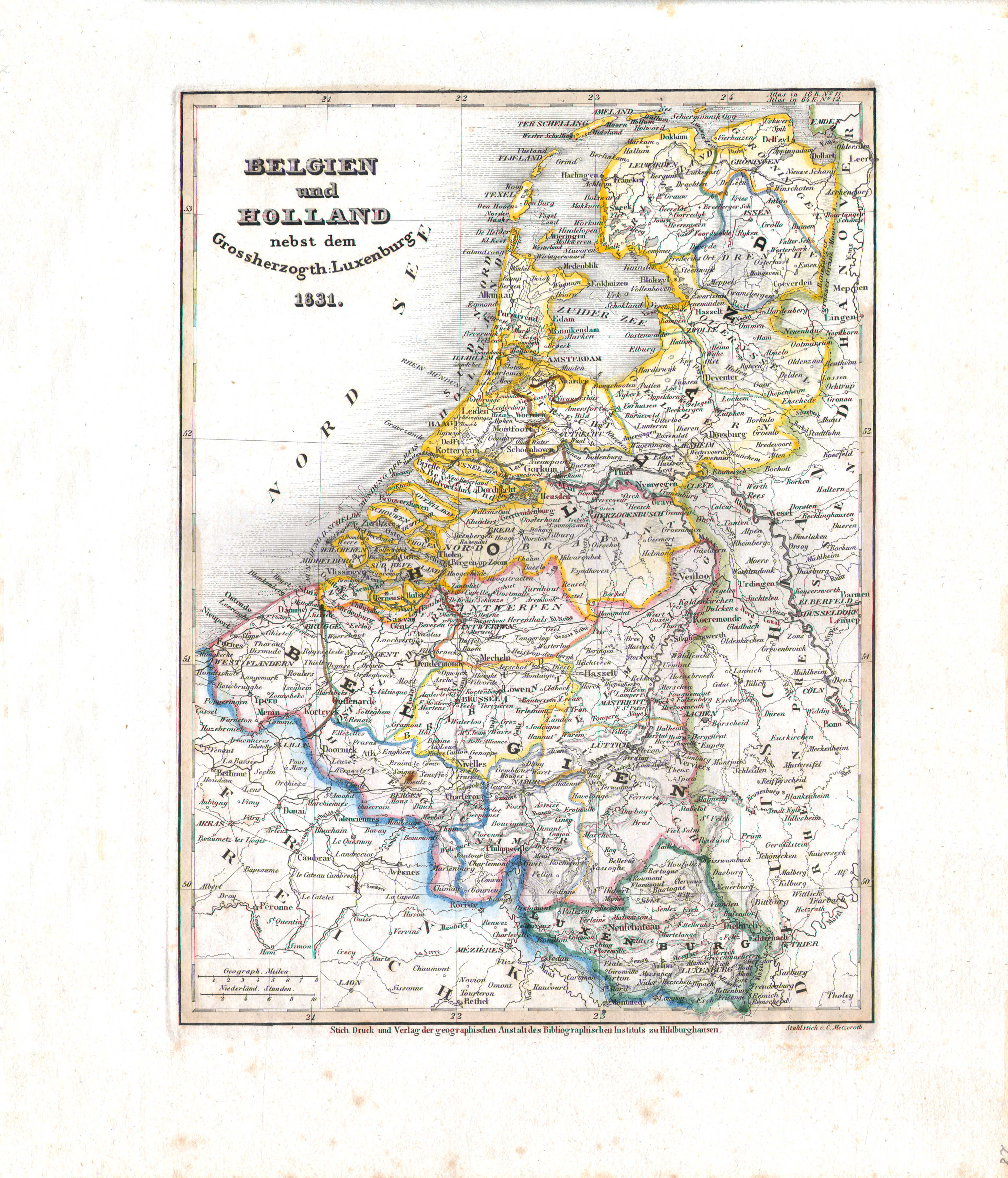
28. Belgien und Holland nebst dem Grossherzogth. Luxenburg (Nº 12, 1831)
België, Nederland en Luxemburg / Belgium, Netherlands and Luxembourg
 Meyer's Pfennig-Atlas (1834-1841)
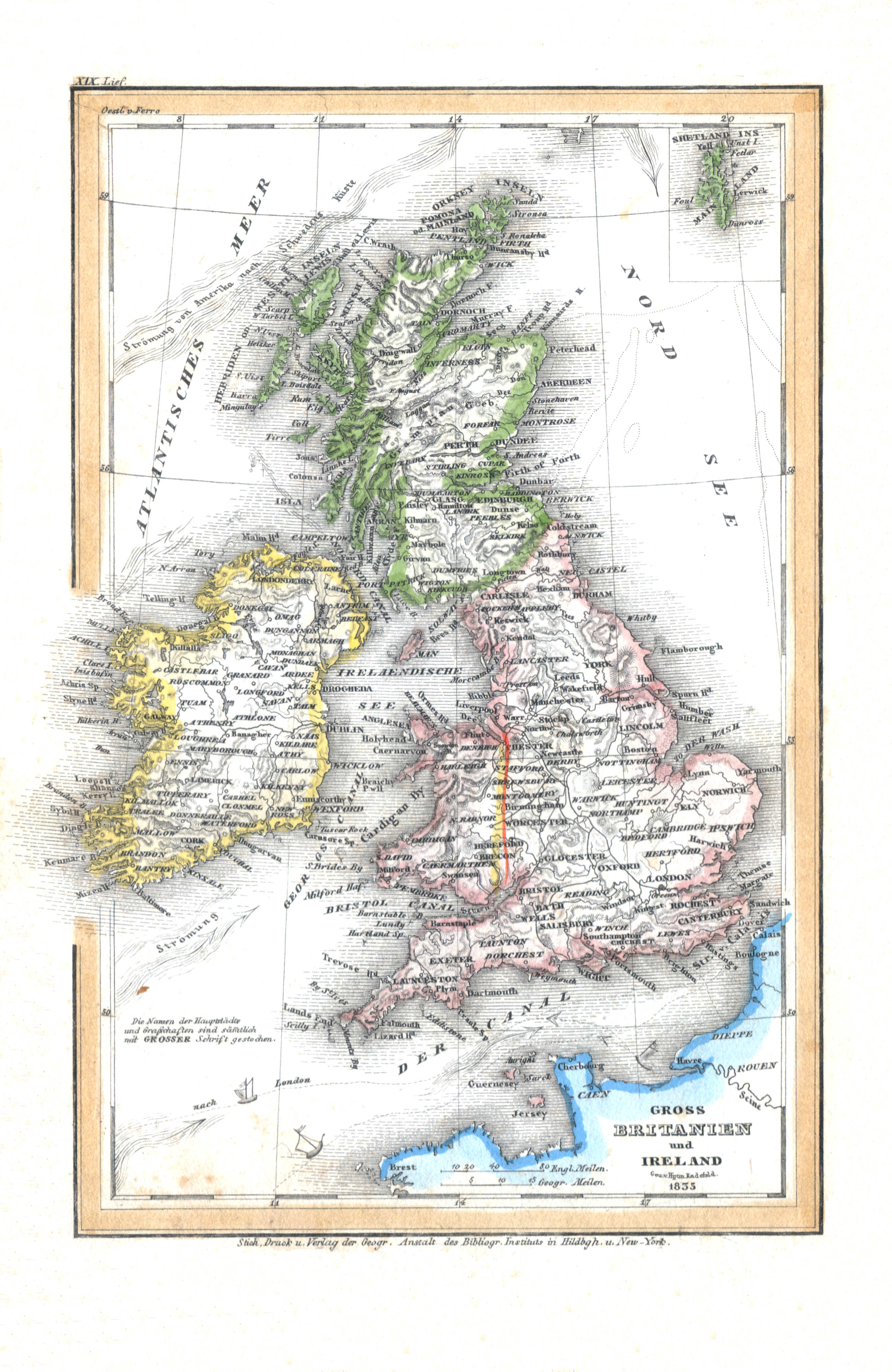
19. Gross Britannien und Ireland (Lief. XIX = 19, 1835)
Groot-Brittannië en Ierland / Great Britain and Ireland
 Meyer's Universal-Atlas (1830-1840)
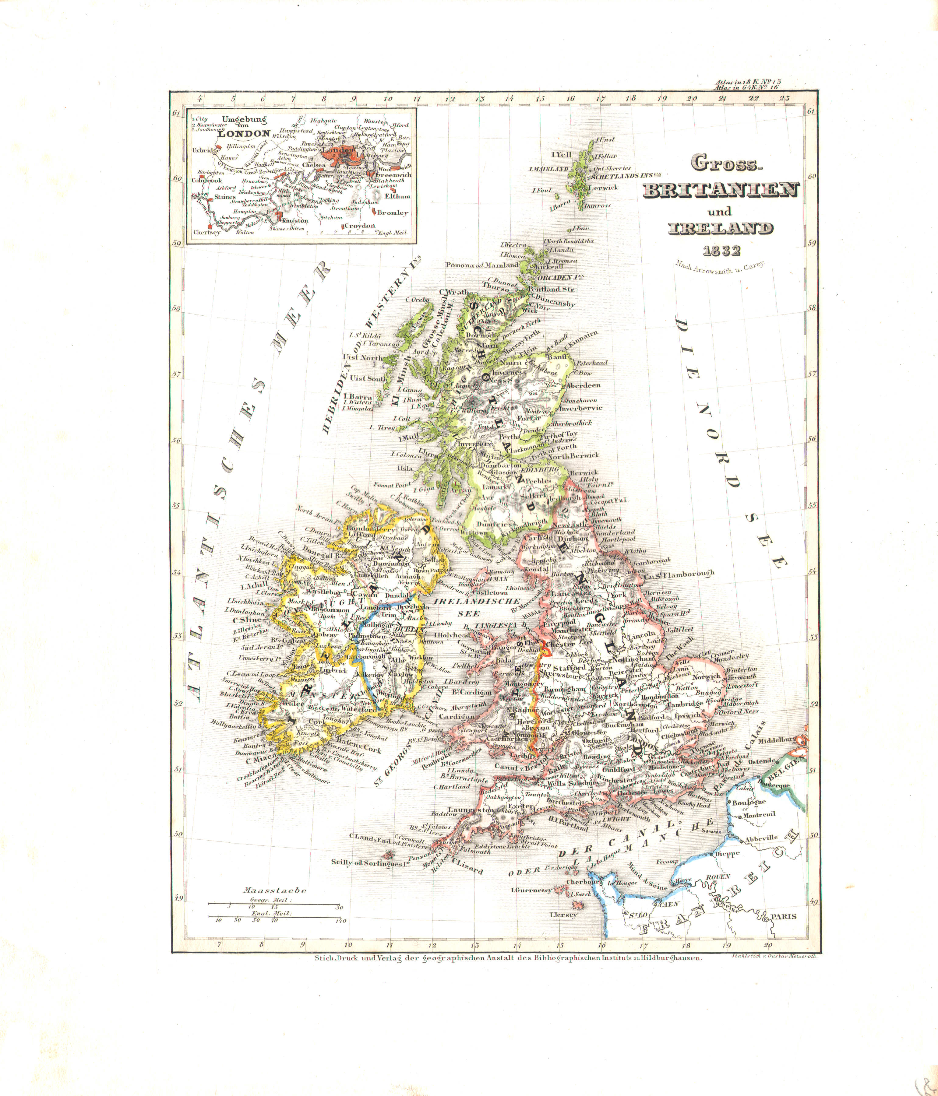
29. Gross-Britanien und Ireland (Nº 16, 1832)
Groot-Brittannië en Ierland / Great Britain and Ireland
 Meyer's Pfennig-Atlas (1834-1841)
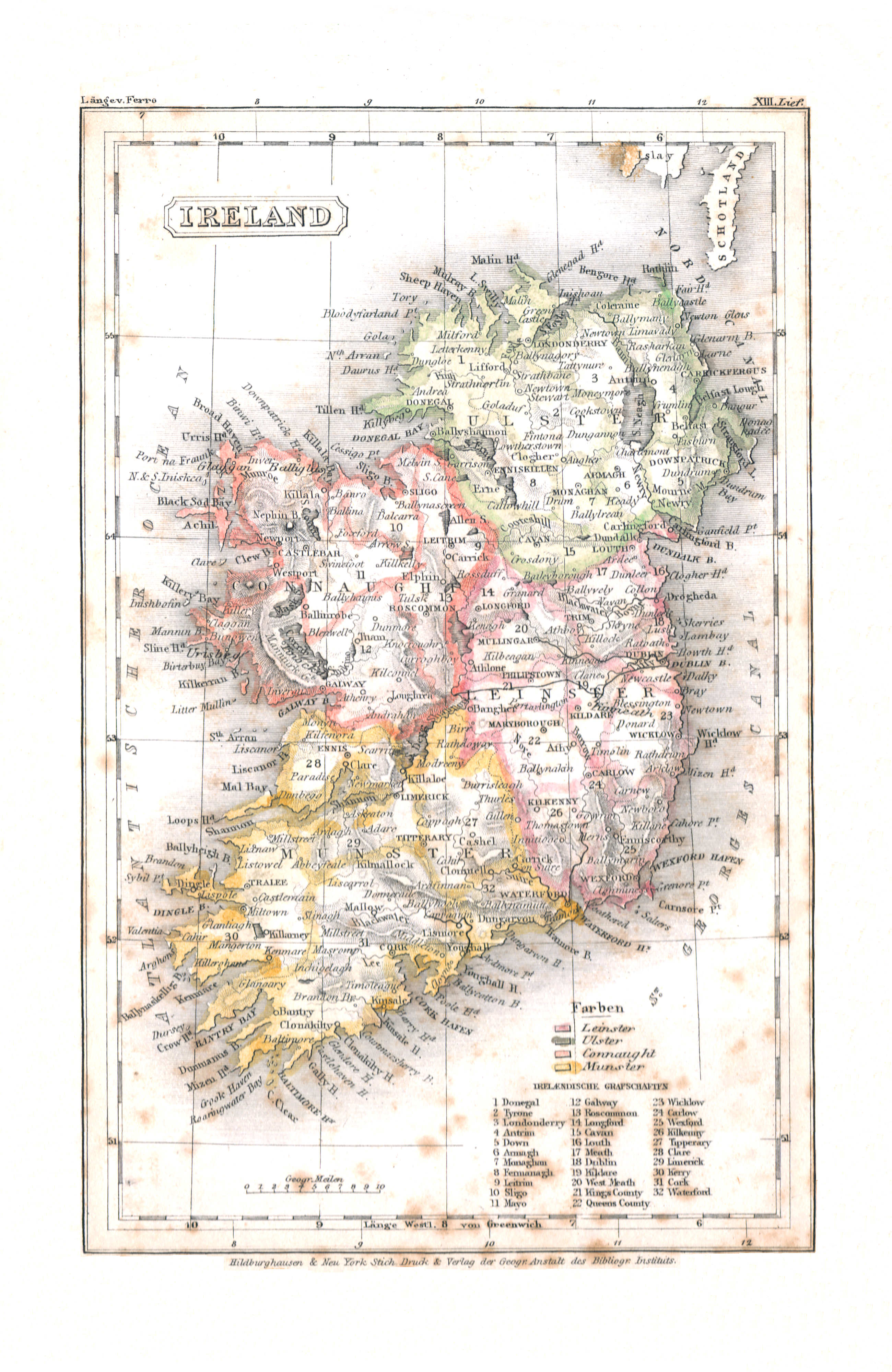
20. Ireland (Lief. XIII = 13)
Ierland / Ireland
 Meyer's Universal-Atlas (1830-1840)
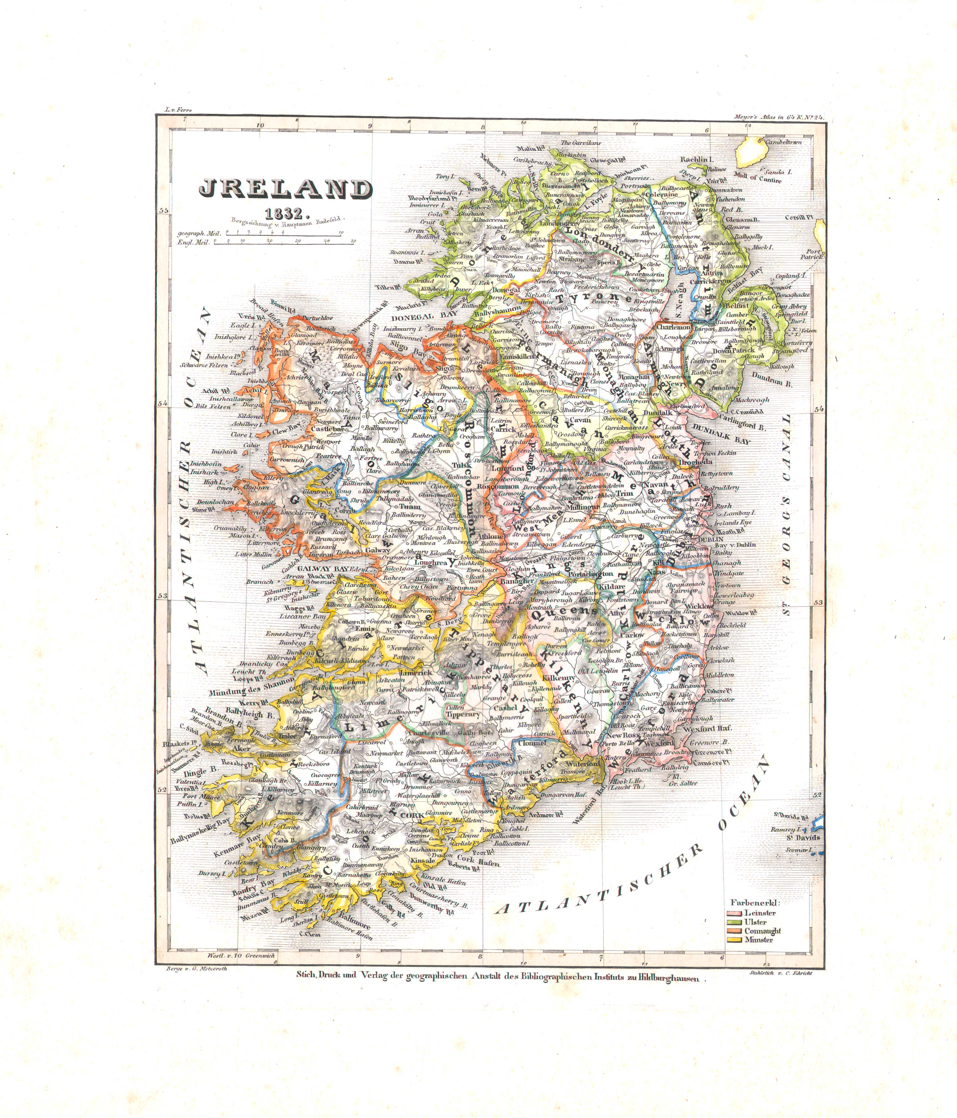
32. Ireland (Nº 24, 1832)
Ierland / Ireland
 Meyer's Pfennig-Atlas (1834-1841)
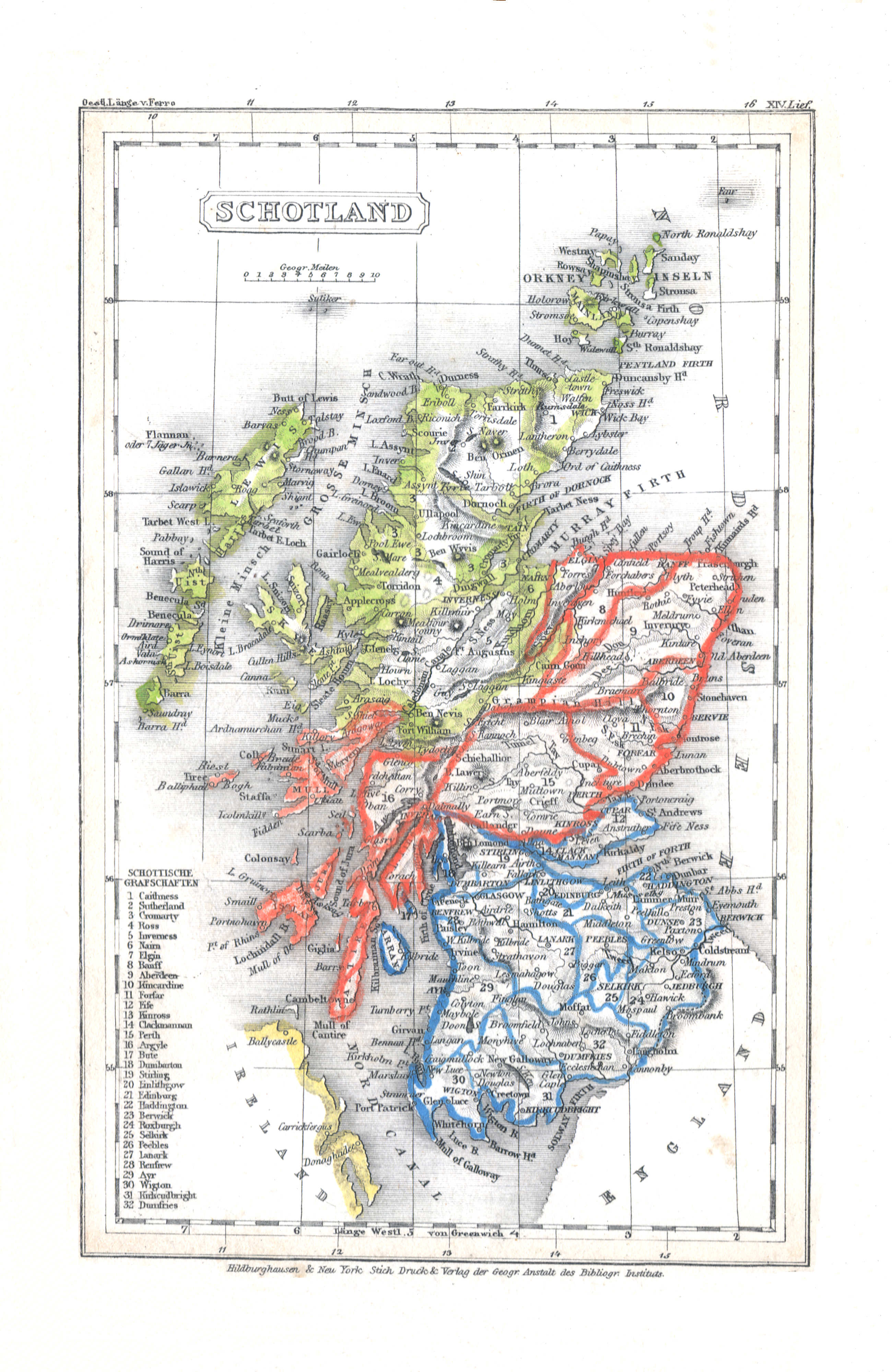
21. Schottland (Lief. XIV = 14)
Schotland / Scotland
 Meyer's Universal-Atlas (1830-1840)
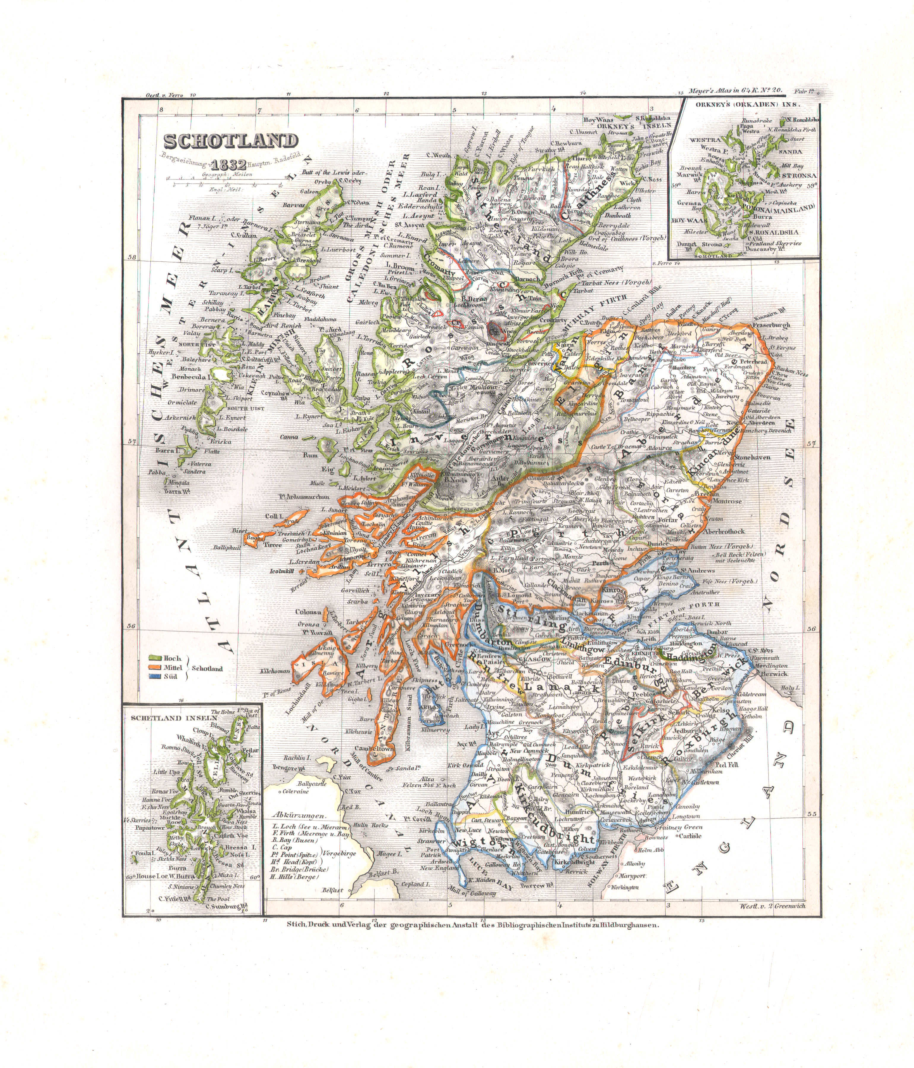
31. Schotland (Nº 20, 1832)
Schotland / Scotland
 Meyer's Pfennig-Atlas (1834-1841)
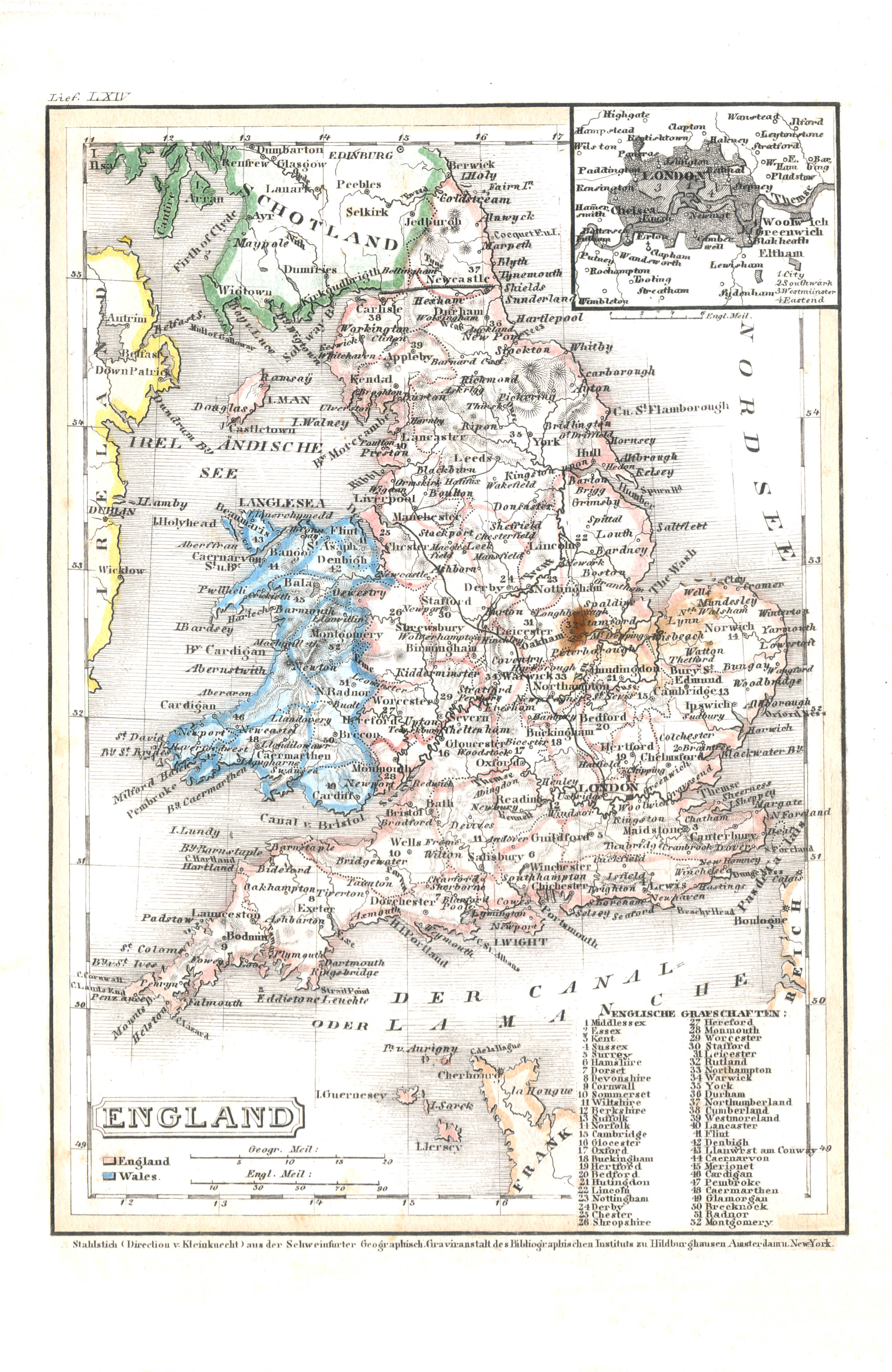
22. England (Lief. LXIV = 64)
Engeland / England
 Meyer's Universal-Atlas (1830-1840)
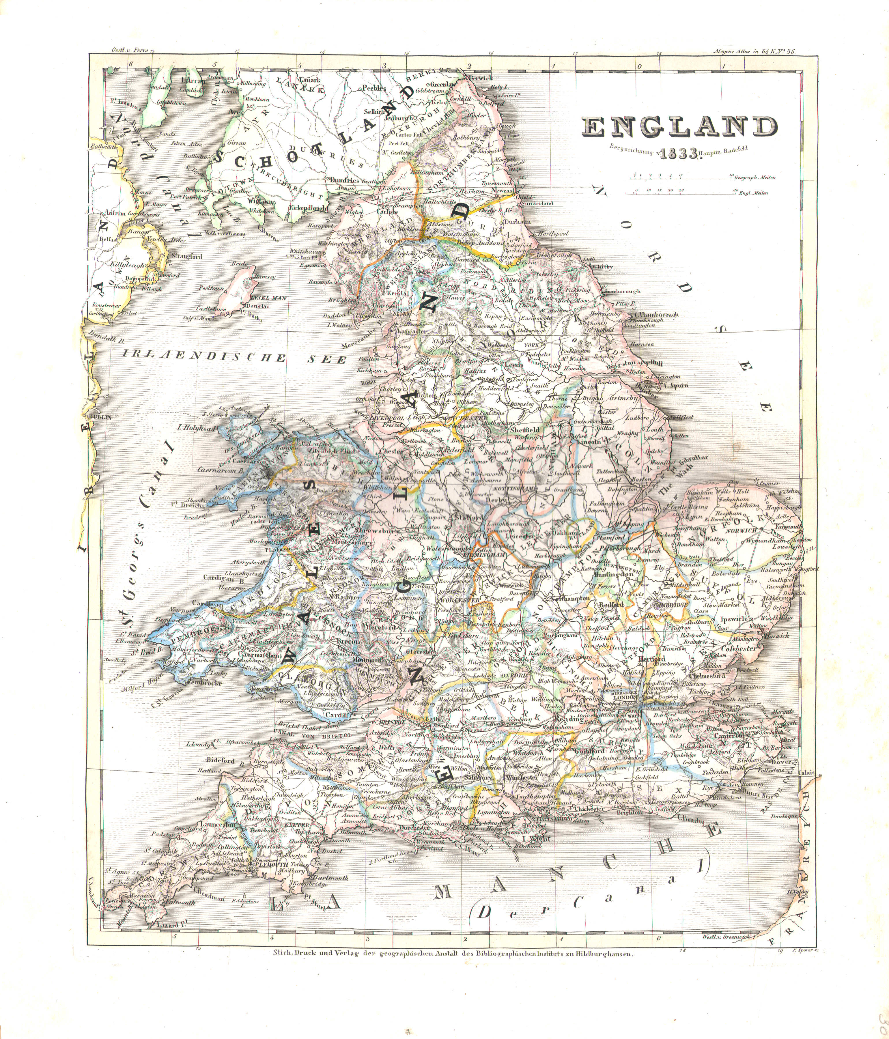
30. England (Nº 36, 1833)
Engeland / England
 Meyer's Pfennig-Atlas (1834-1841)
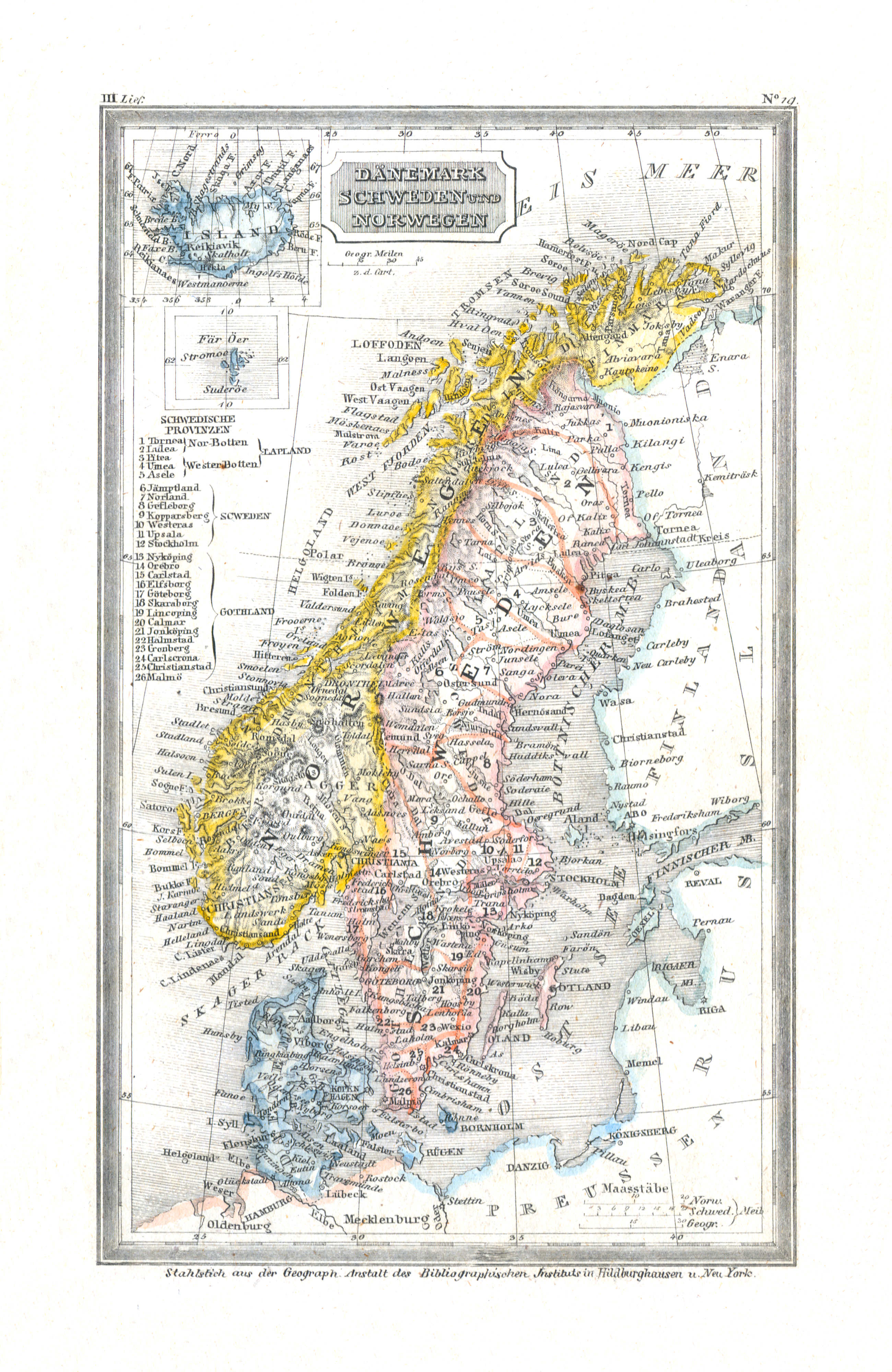
23. Dänemark, Schweden und Norwegen (Lief. III = 3)
Denemarken, Zweden en Noorwegen / Denmark, Sweden and Norway
 Meyer's Universal-Atlas (1830-1840)
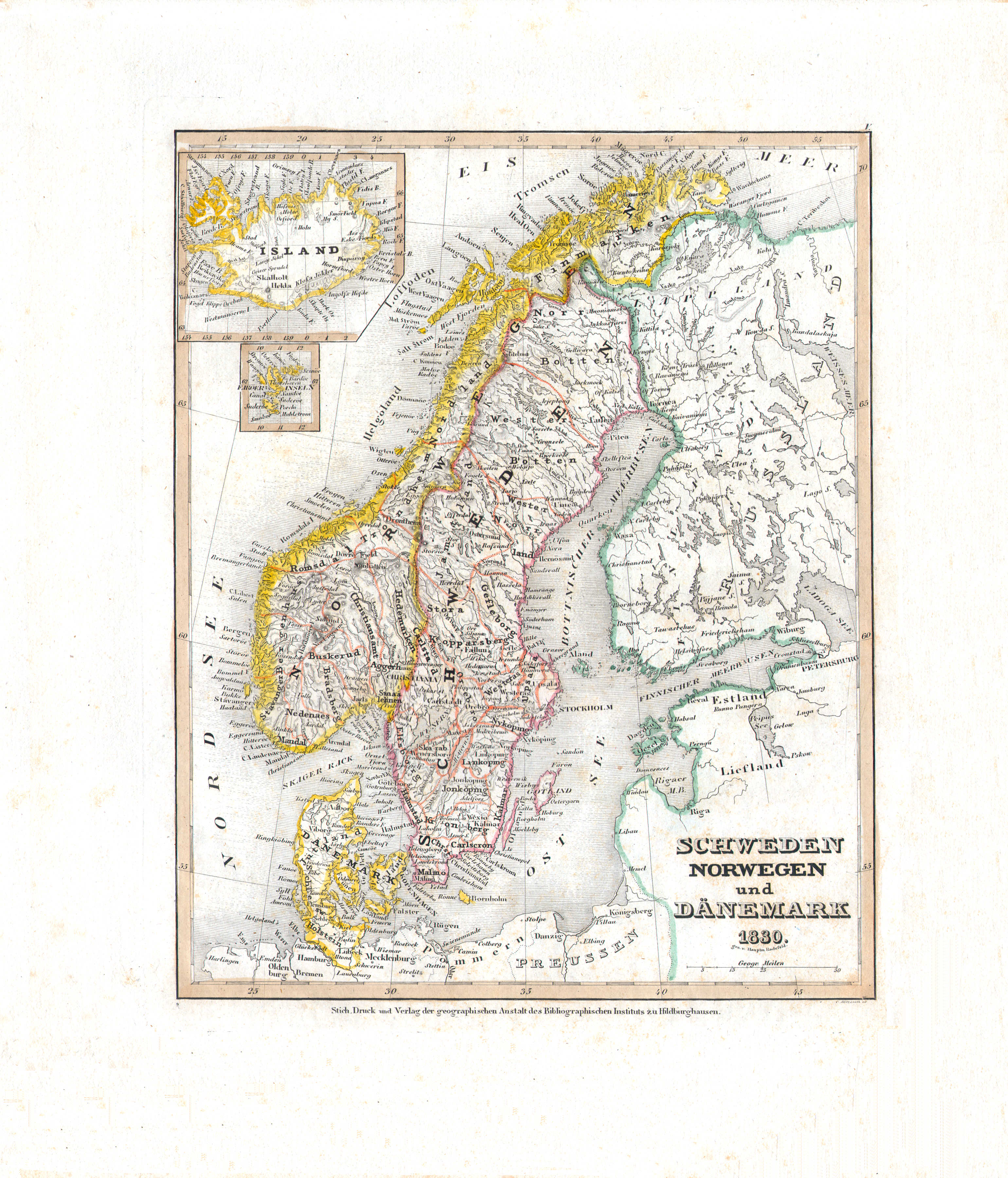
33. Schweden Norwegen und Dänemark (Nº 5, 1830)
Zweden, Noorwegen en Denemarken / Sweden, Norway and Denmark
 Meyer's Pfennig-Atlas (1834-1841)
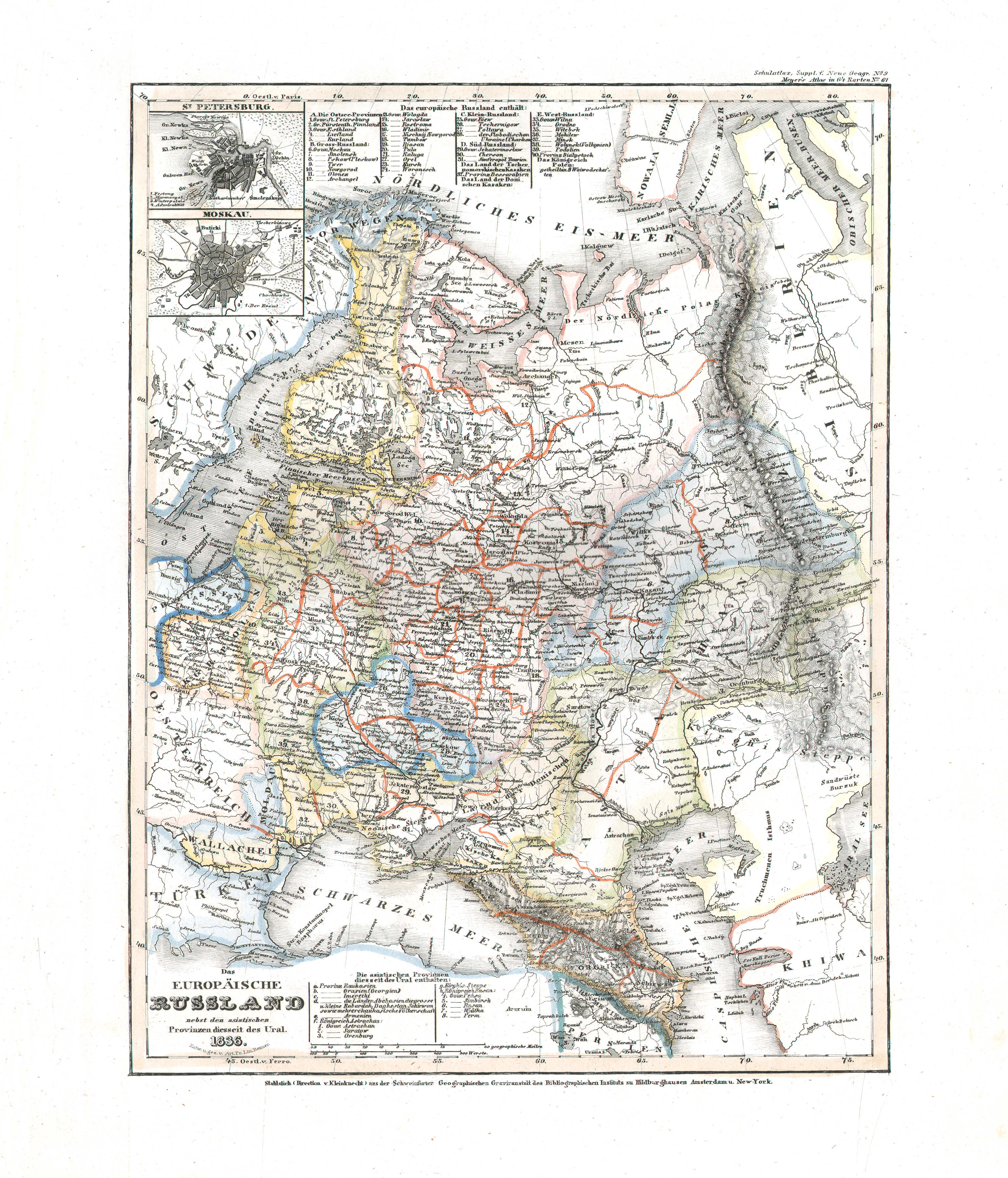
24. Europaeisches Russland (Lief. XX = 20, 1835)
Europees Rusland / Russia in Europe
 Meyer's Universal-Atlas (1830-1840)
37. Das europäische Russland nebst den asiatischen Provinzen diesseits des Ural (Nº 61, 1836)
Europees Rusland / Russia in Europe
 Meyer's Pfennig-Atlas (1834-1841)
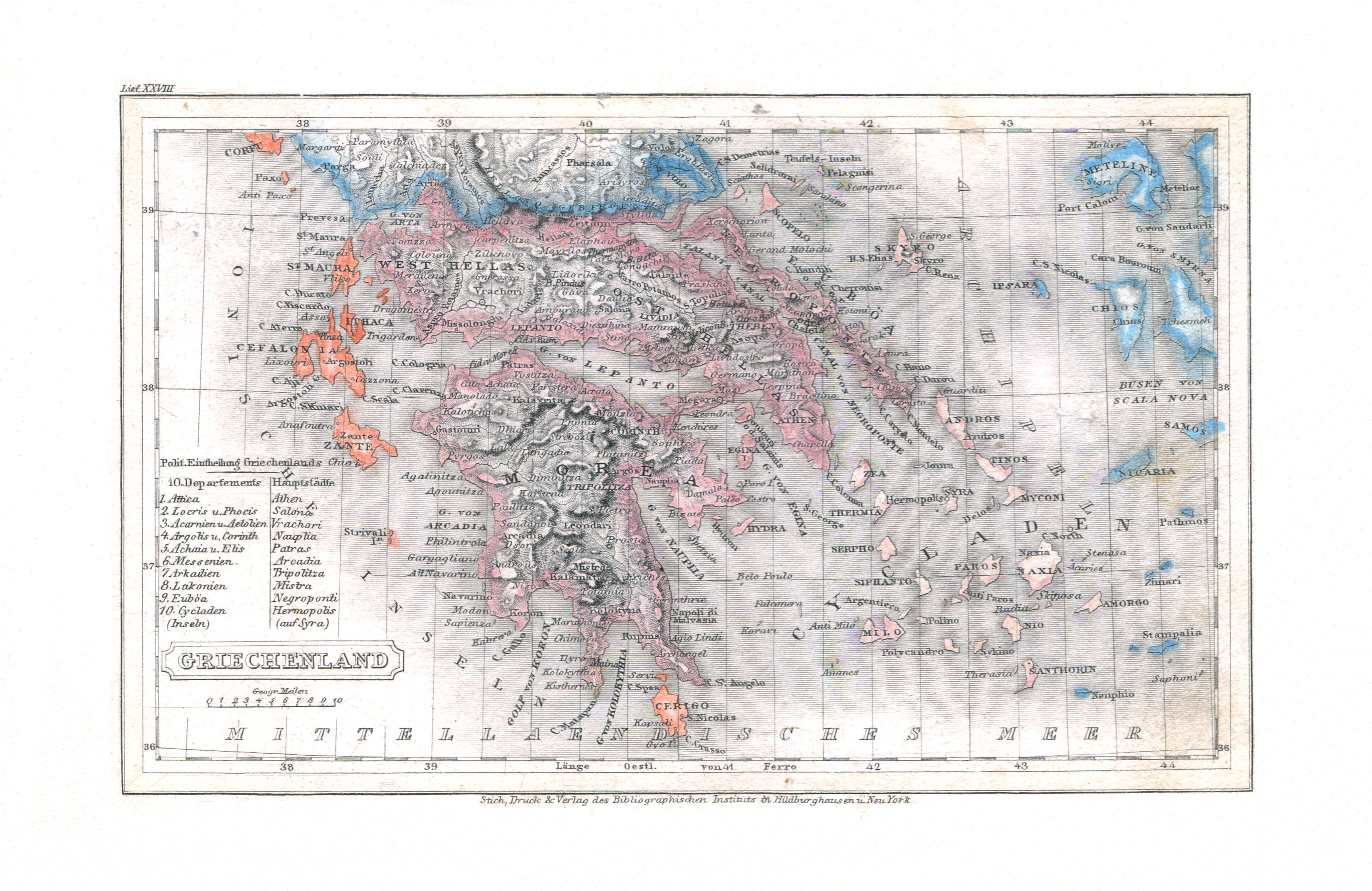
25. Griechenland (Lief. XXVIII = 28)
Griekenland / Greece
 Meyer's Universal-Atlas (1830-1840)
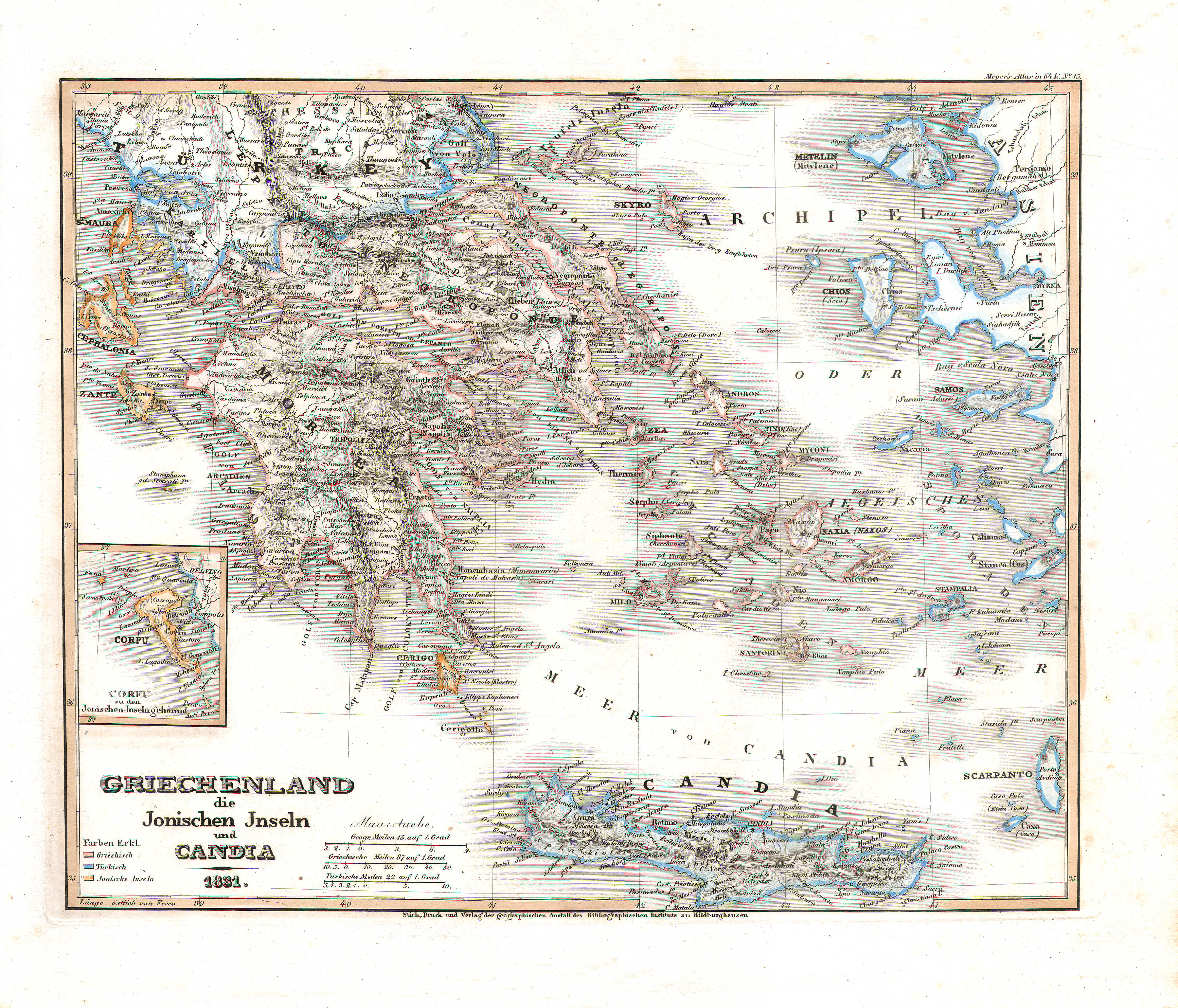
44. Griechenland, die Jonischen Inseln und Candia (Nº 15, 1831)
Griekenland, de Ionische Eilanden en Candia (Kreta) / Greece, the Ionian Islands and Candia (Crete)
 Meyer's Pfennig-Atlas (1834-1841)
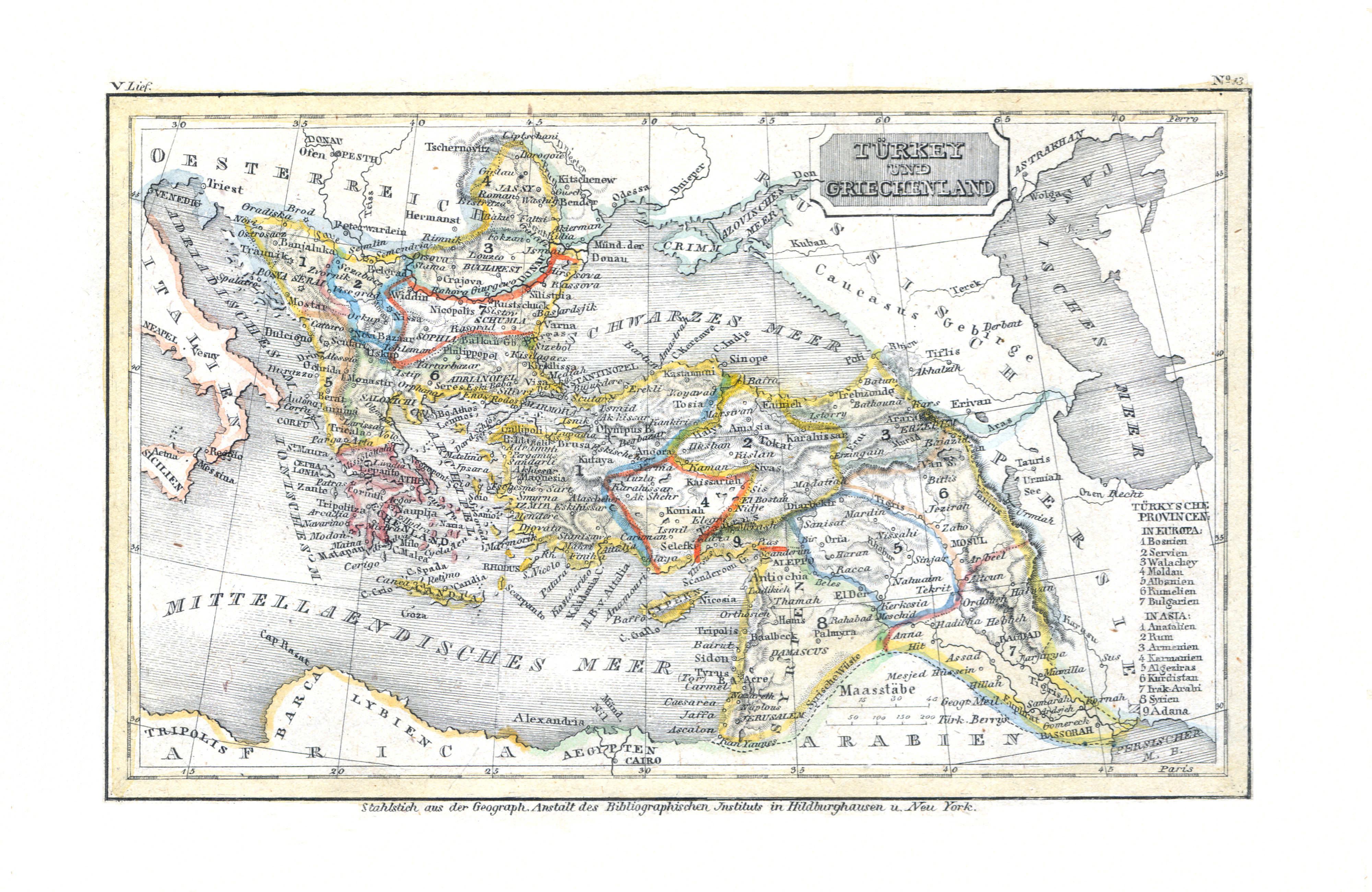
26. Türkey und Griechenland (Lief. V = 5)
Turkije en Griekenland / Turkey and Greece
Meyer's Universal-Atlas (1830-1840)
geen overeenkomstige kaart / no corresponding map
 Meyer's Pfennig-Atlas (1834-1841)
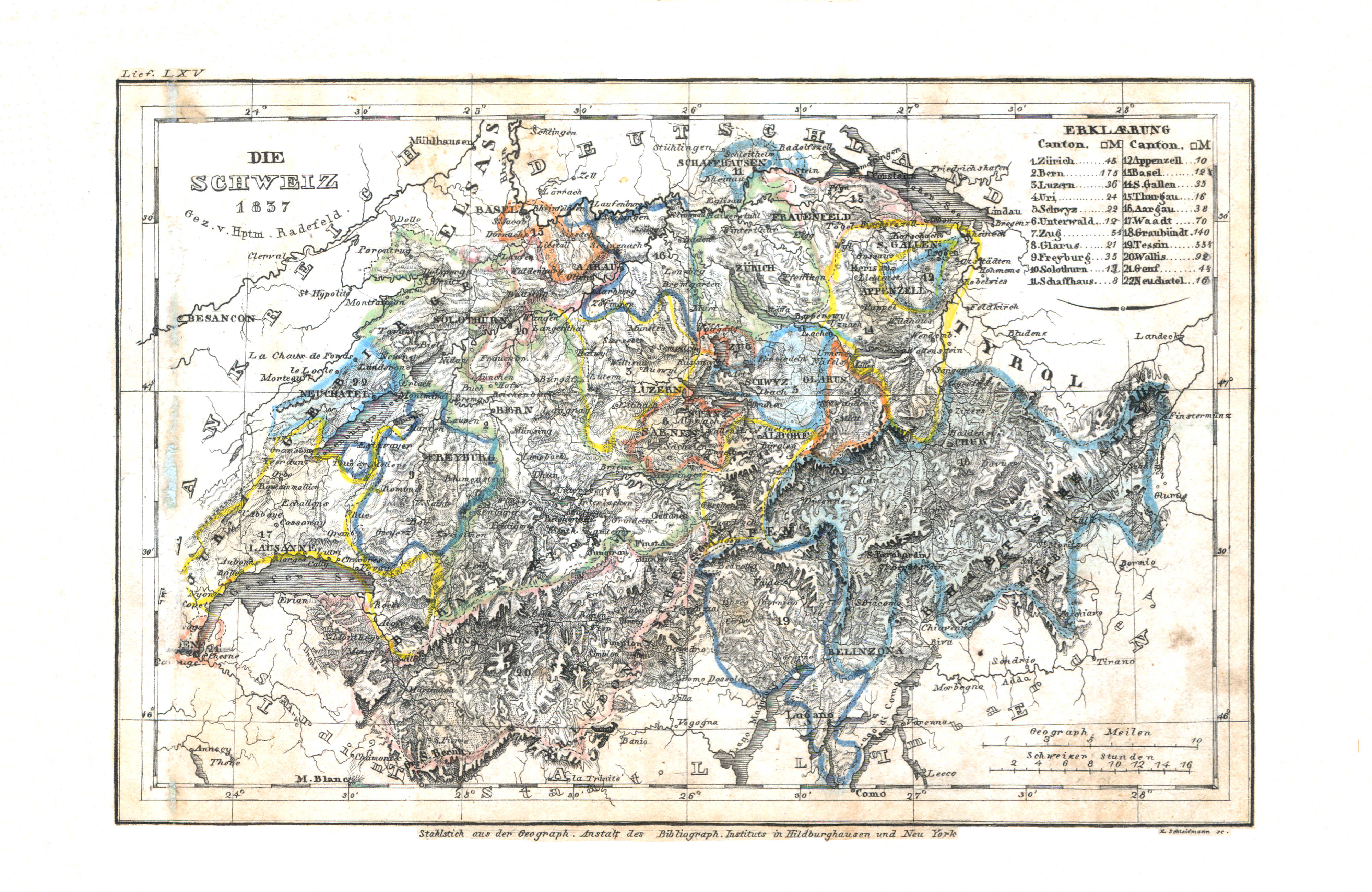
27. Die Schweiz (Lief. LXV = 65, 1837)
Zwitserland / Switzerland
 Meyer's Universal-Atlas (1830-1840)
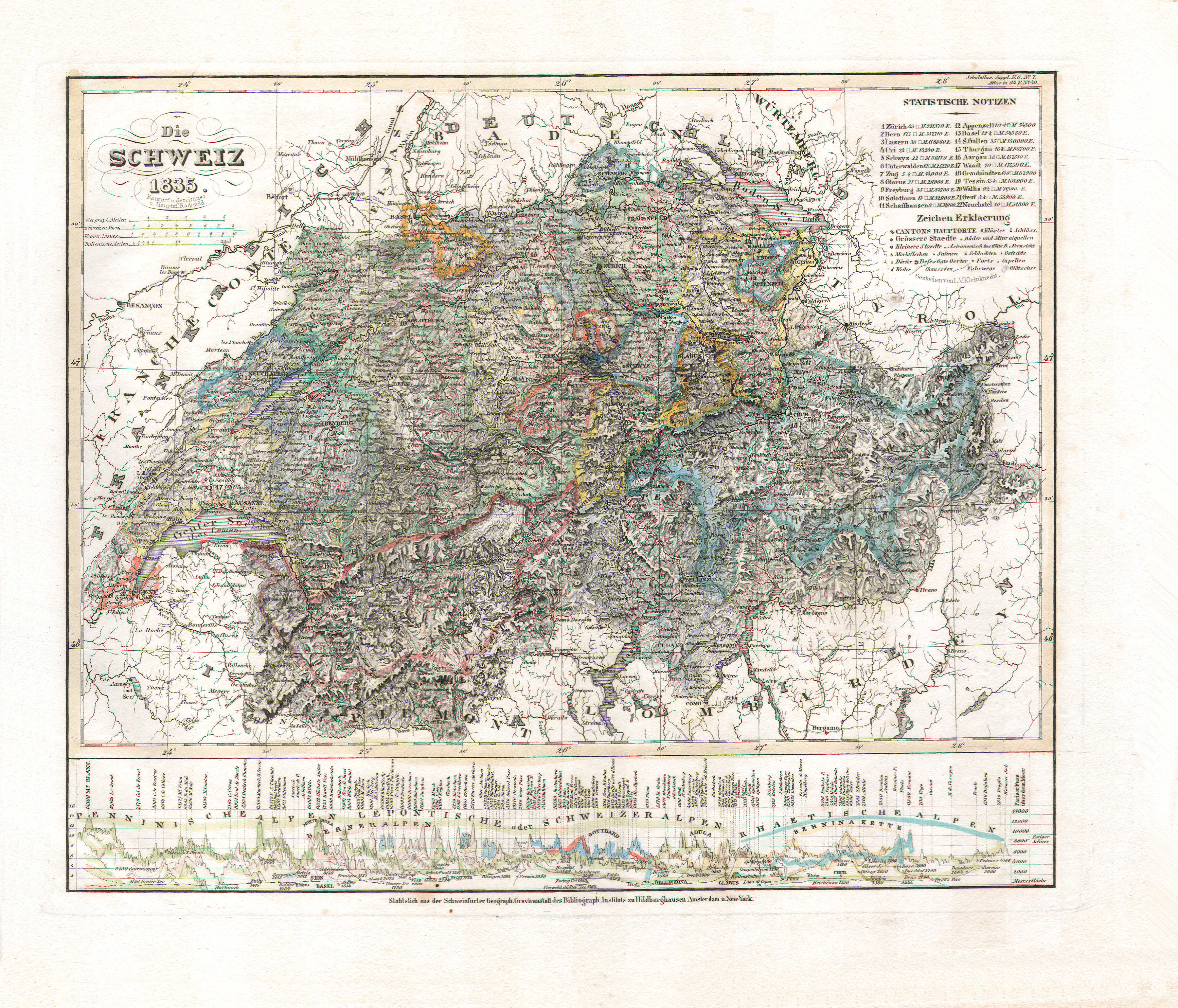
73. Die Schweiz (Nº 49, 1835)
Zwitserland / Switzerland
 Meyer's Pfennig-Atlas (1834-1841)
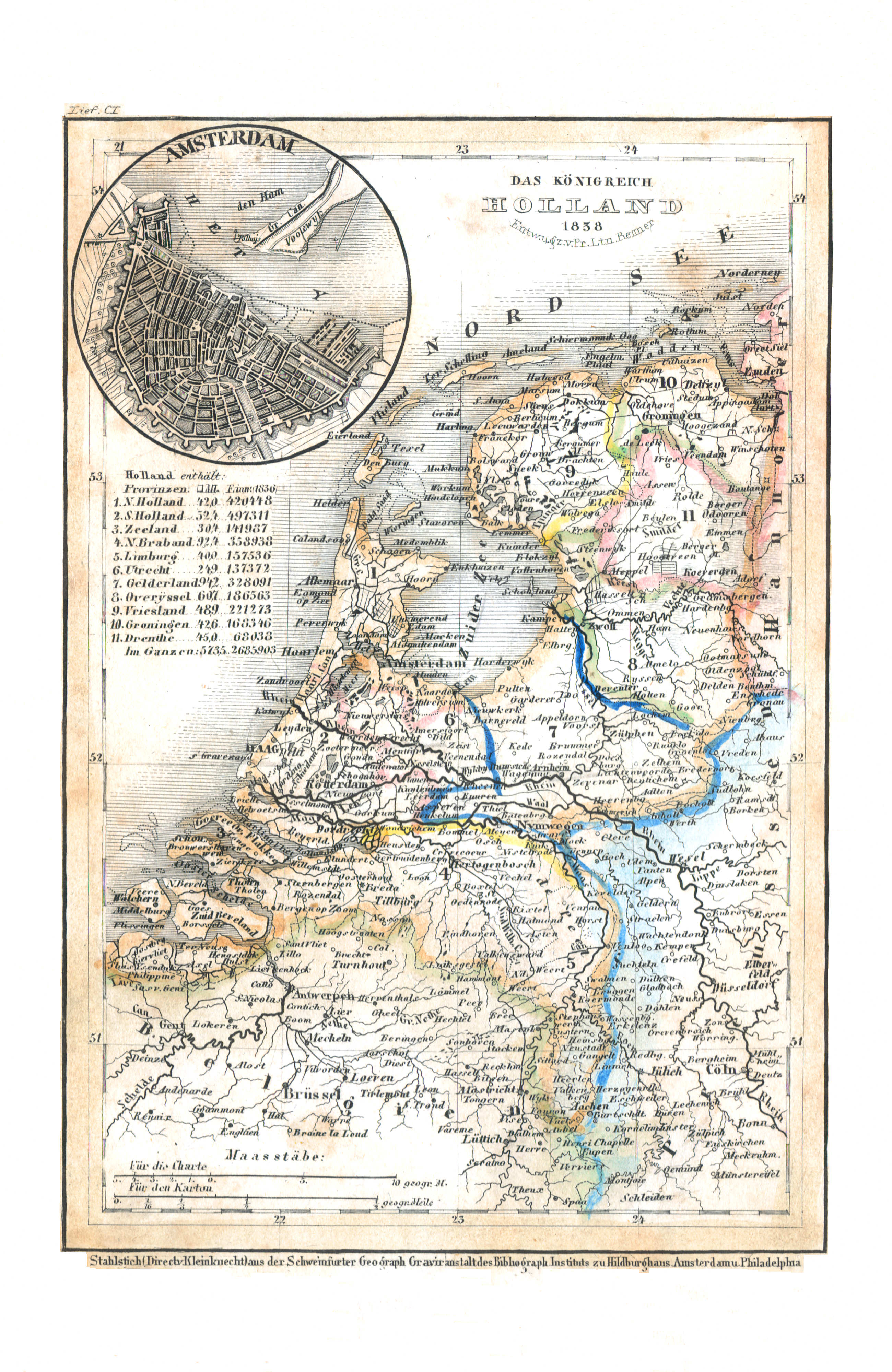
28. Holland (Lief. CI = 101, 1838)
Nederland / Netherlands
 Meyer's Universal-Atlas (1830-1840)
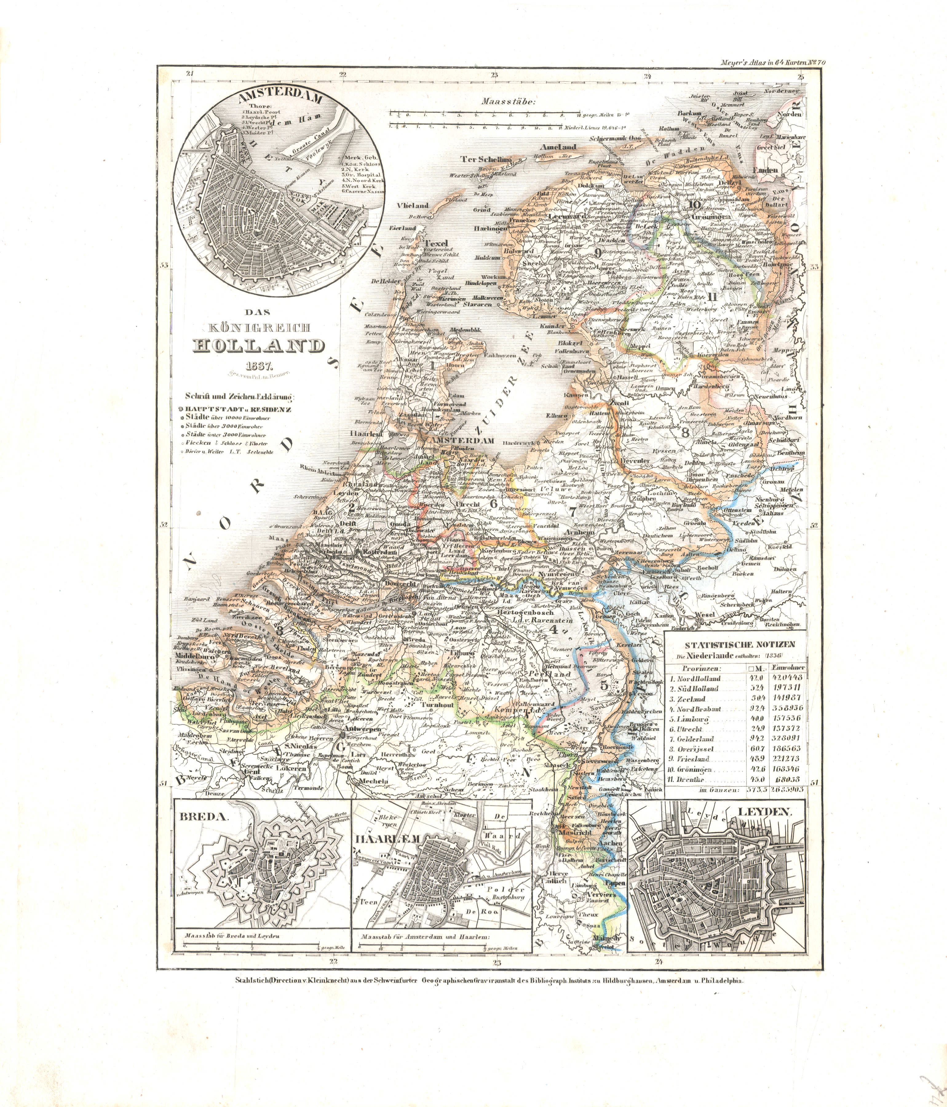
74. Das Königreich Holland (Nº 70, 1837)
Koninkrijk Nederland / Kingdom of the Netherlands
 Meyer's Pfennig-Atlas (1834-1841)
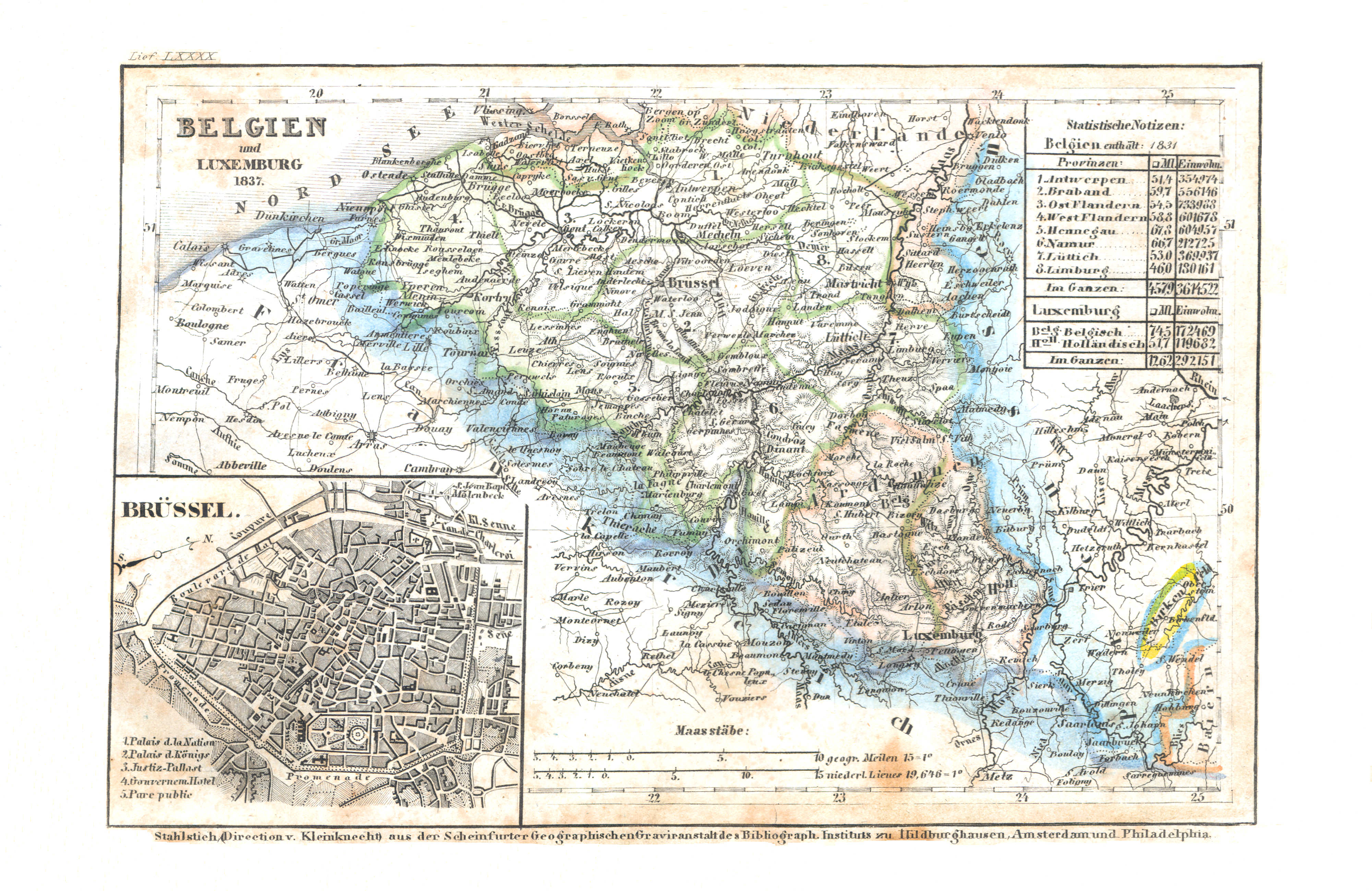
29. Belgien (Lief. LXXXX = 90, 1837)
België / Belgium
 Meyer's Universal-Atlas (1830-1840)
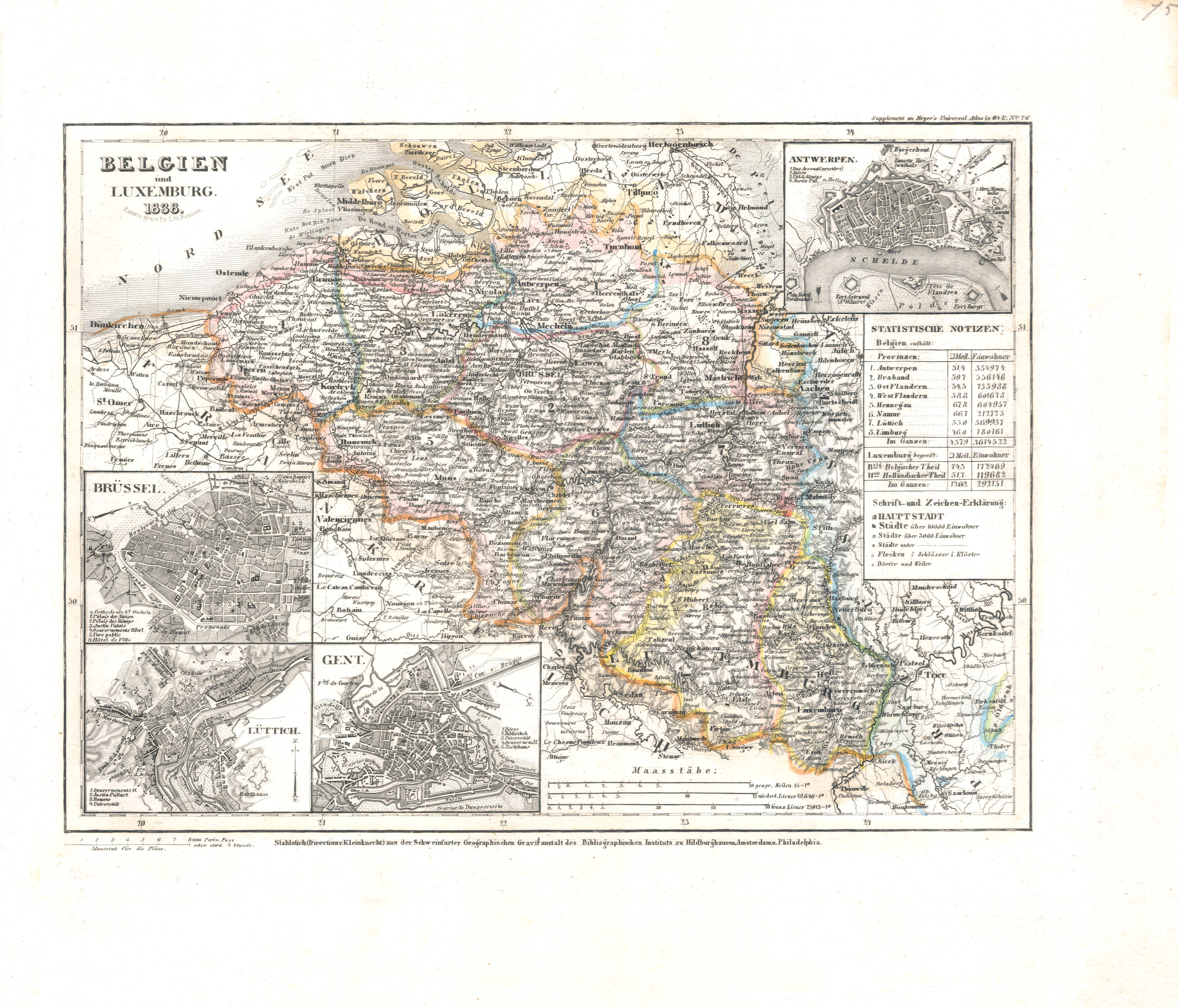
75. Belgien (Nº 76, 1838)
België / Belgium
 Meyer's Pfennig-Atlas (1834-1841)
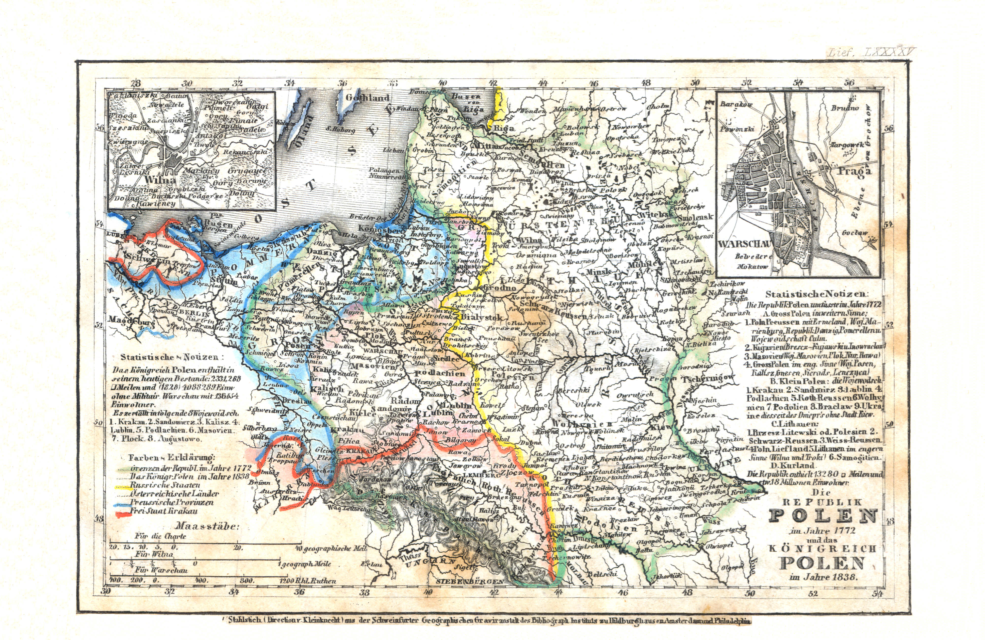
30. Die Republik Polen im Jahre 1772 und das Königreich Polen im Jahre 1838 (Lief. LXXXXV = 95, 1838)
Republiek Polen in 1772, Koninkrijk Polen in 1838 / Republic of Poland in 1772, Kingdom of Poland in 1838
 Meyer's Universal-Atlas (1830-1840)
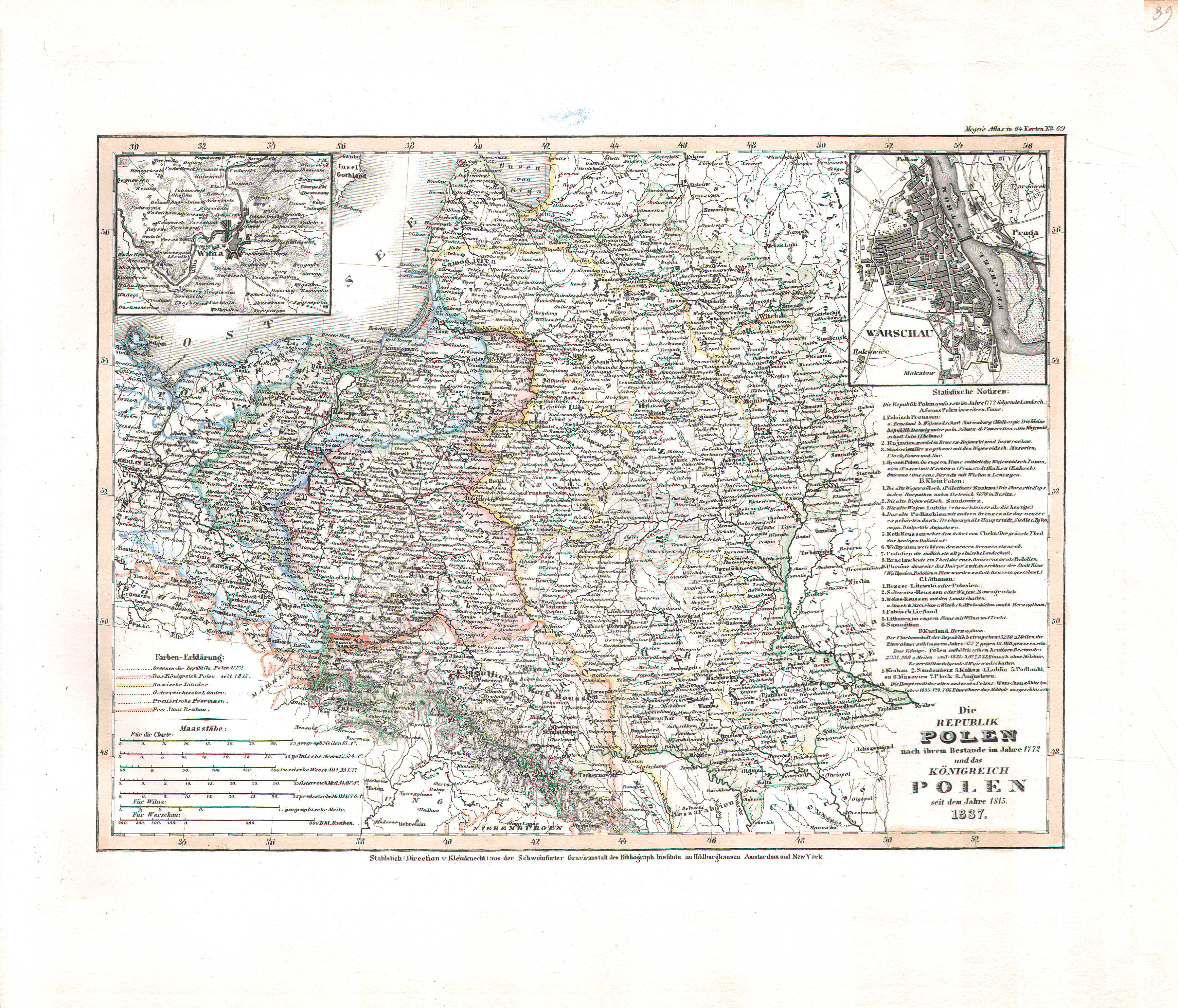
39. Die Republik Polen nach ihrem Bestande im Jahre 1772 und das Königreich Polen seit dem Jahre 1815 (Nº 39, 1837)
Republiek Polen 1772, Koninkrijk Polen vanaf 1815 / Republic of Poland 1772, Kingdom of Poland since 1815
 Meyer's Pfennig-Atlas (1834-1841)
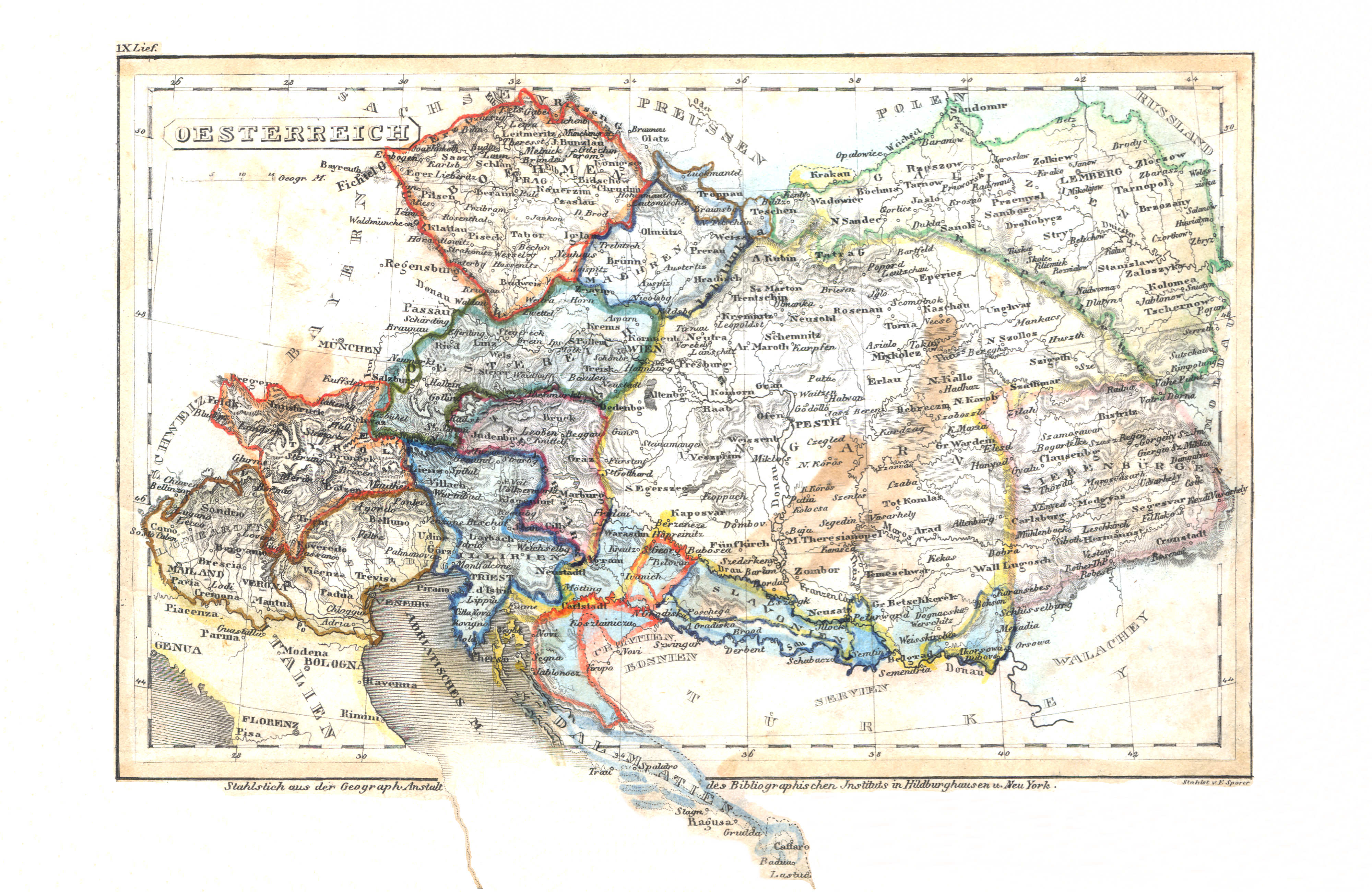
31. Oesterreich (Lief. IX = 9)
Oostenrijk / Austria
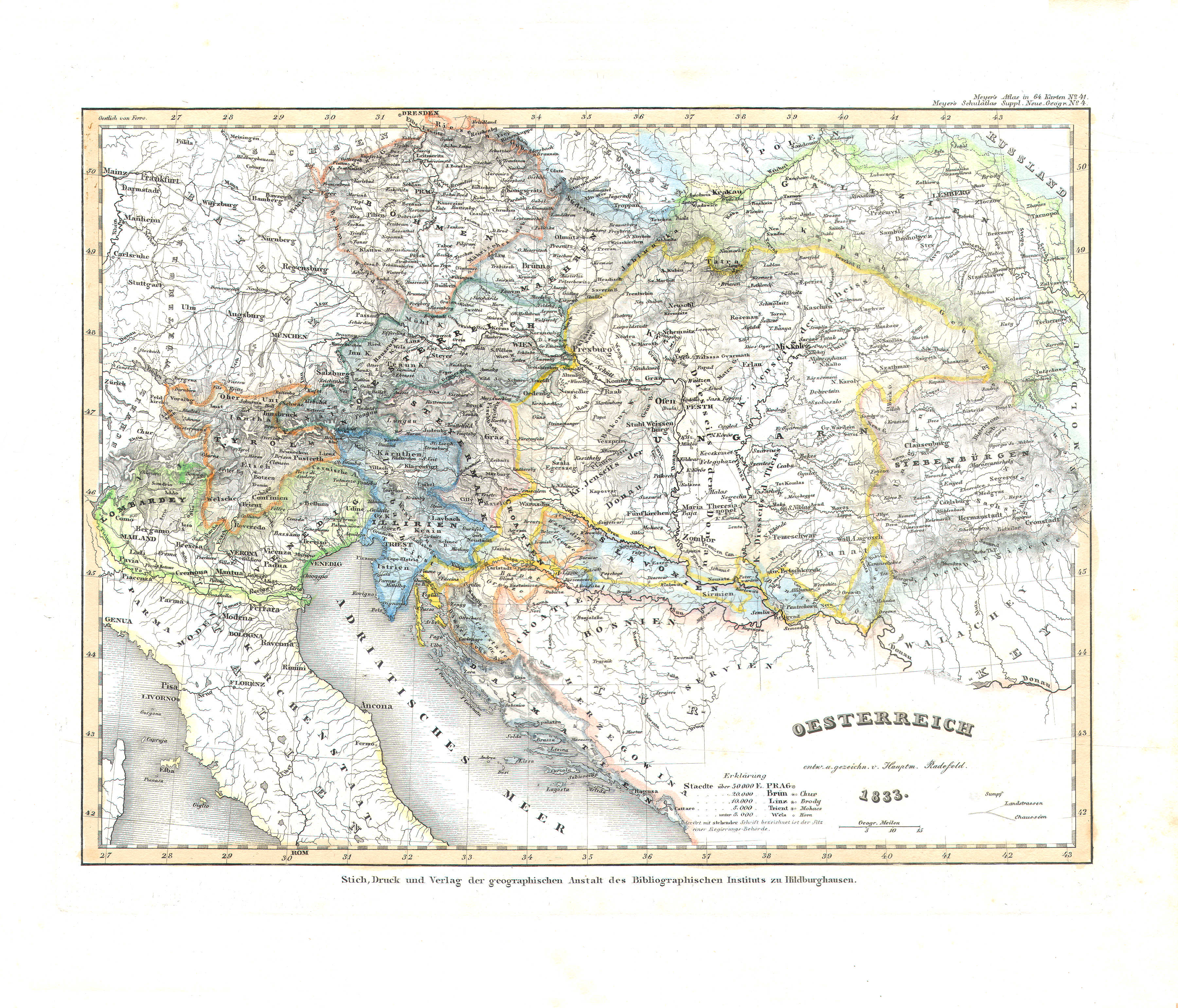 Meyer's Universal-Atlas (1830-1840)
45. Oesterreich (Nº 41, 1833)
Oostenrijk / Austria
 Meyer's Pfennig-Atlas (1834-1841)
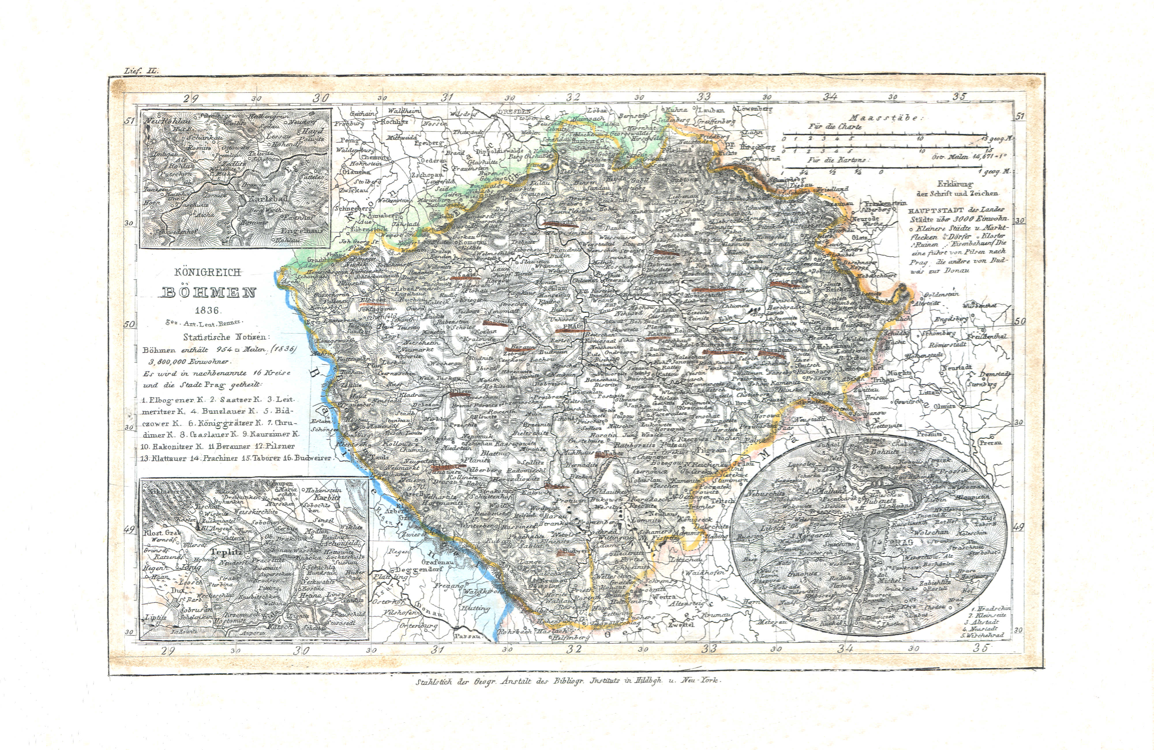
32. Königreich Böhmen (Lief. IL = 49, 1836)
Koninkrijk Bohemen / Kingdom of Bohemia
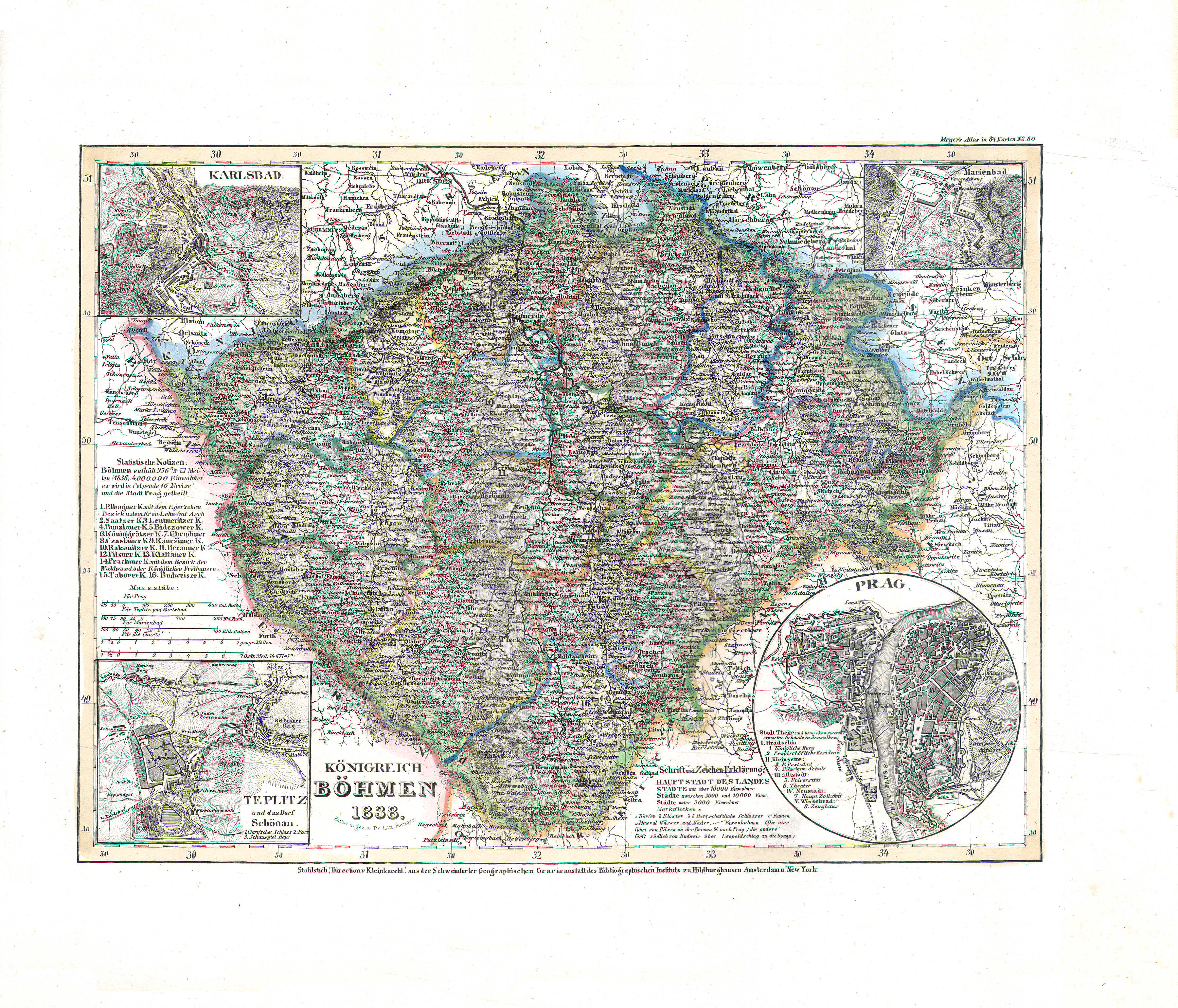 Meyer's Universal-Atlas (1830-1840)
47. Königreich Böhmen (Nº 80, 1838)
Koninkrijk Bohemen / Kingdom of Bohemia
 Meyer's Pfennig-Atlas (1834-1841)
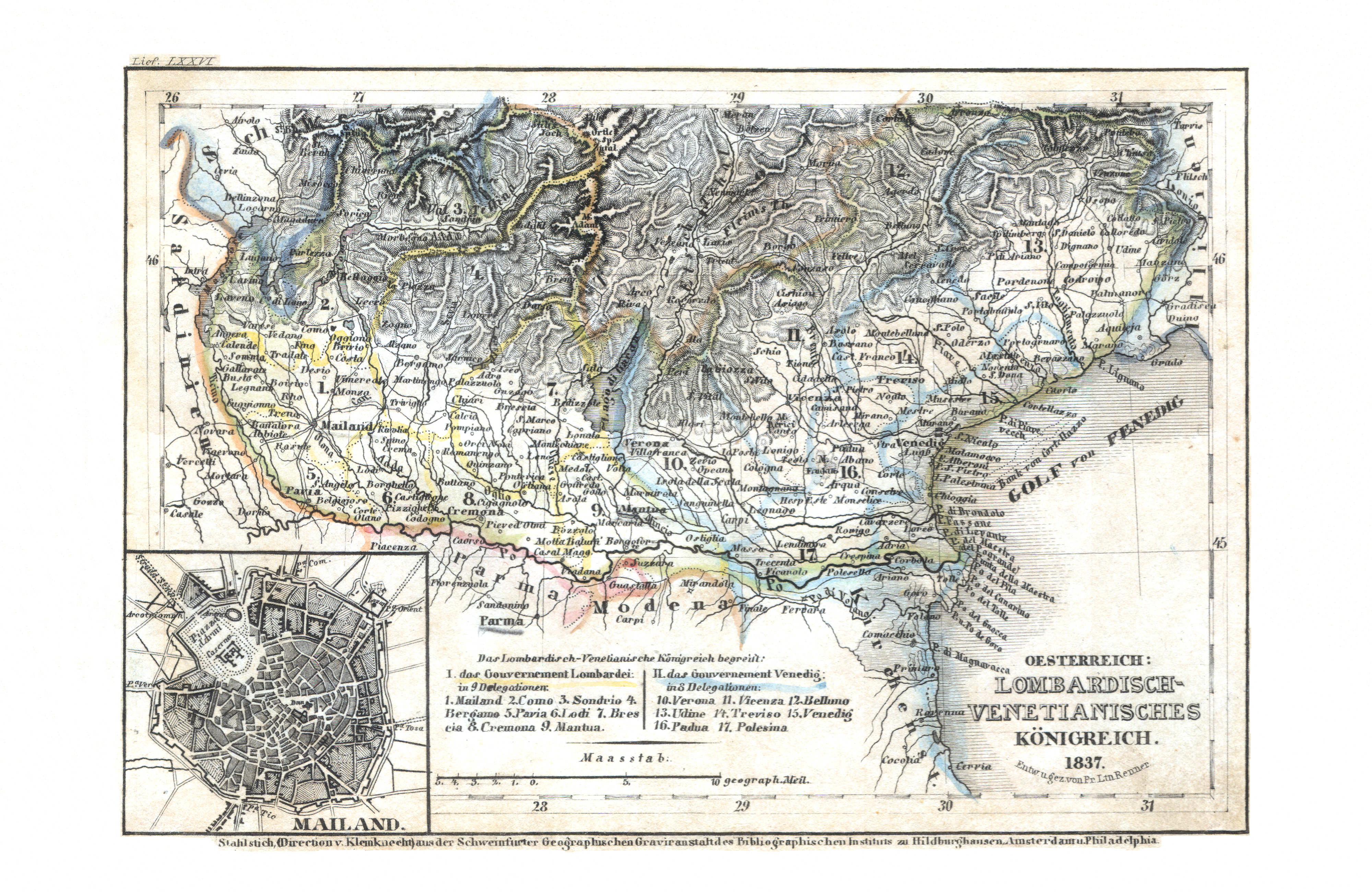
33. Oesterreich: Lombardisch-Venetianisches Königreich (Lief. LXXVI = 76, 1837)
Oostenrijk: Lombardo-Venetiaans Koninkrijk / Austria: Kingdom of Lombardy–Venetia
 Meyer's Universal-Atlas (1830-1840)
50. Österreich: Lombardisch-Venetianisches Königreich (Nº 73, 1837)
Oostenrijk: Lombardo-Venetiaans Koninkrijk / Austria: Kingdom of Lombardy–Venetia
 Meyer's Pfennig-Atlas (1834-1841)
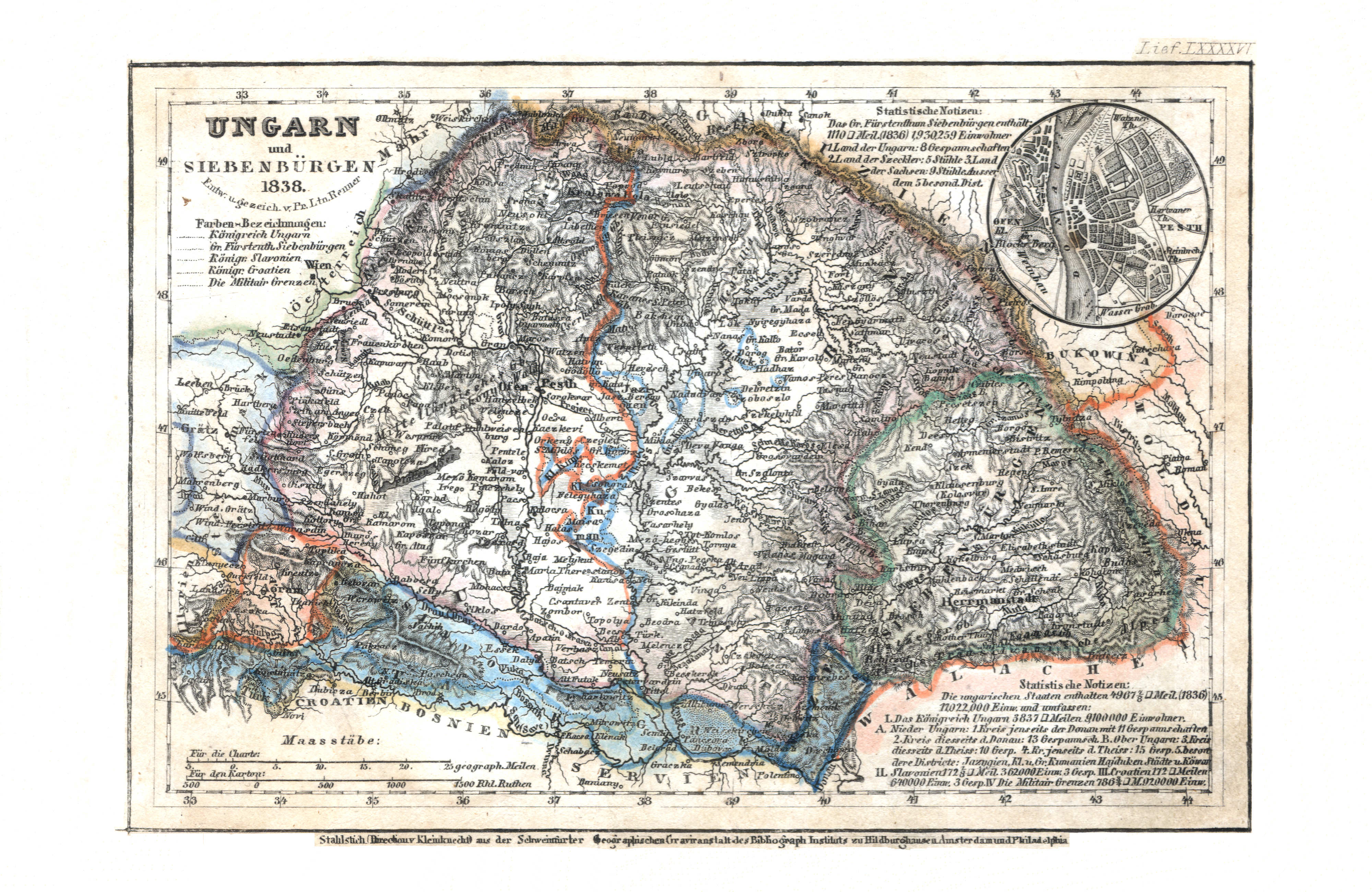
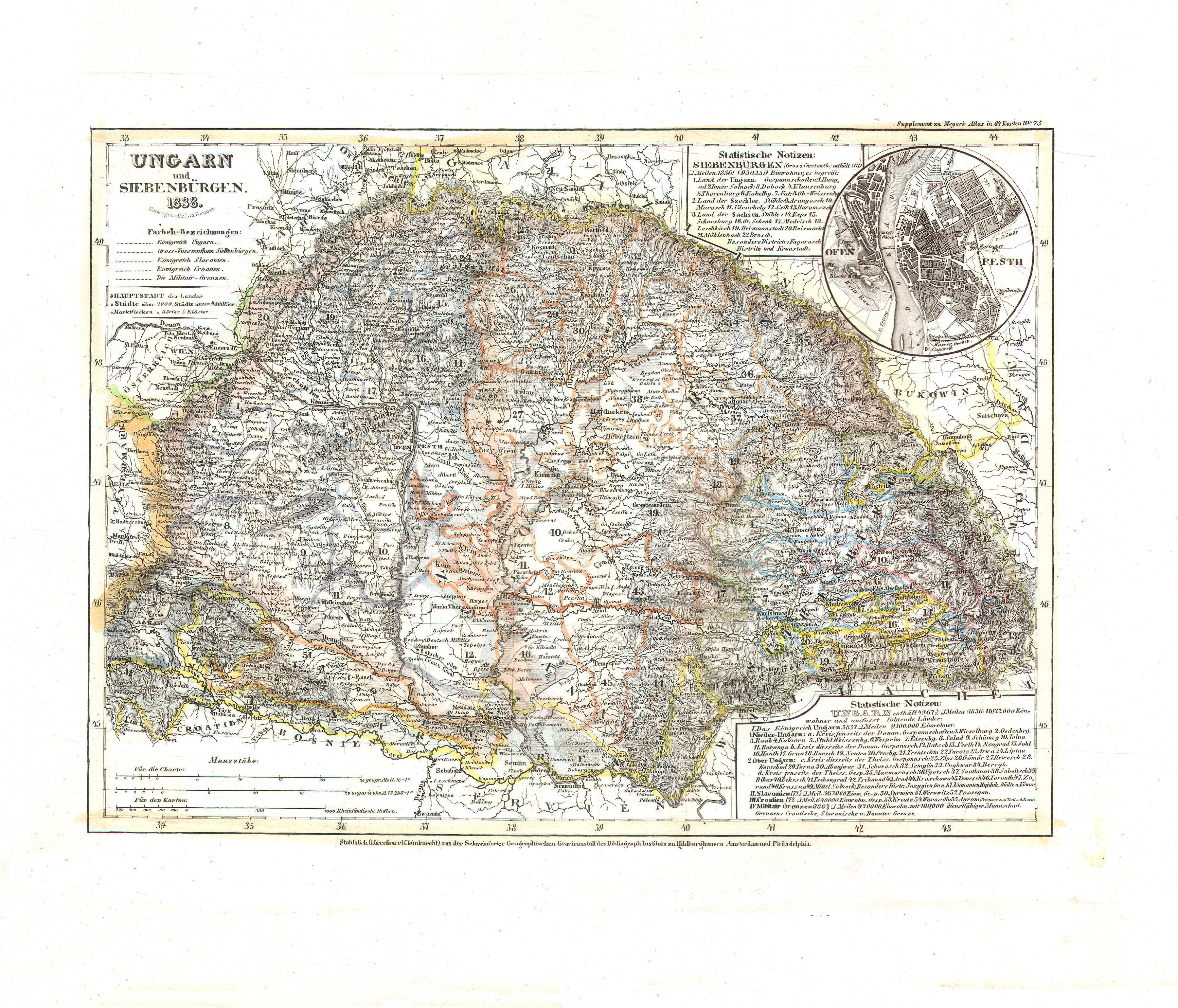
34. Ungarn und Siebenbürgen (Lief. LXXXXVI = 96, 1838)
Hongarije en Zevenburgen / Hungary and Transylvania
 Meyer's Universal-Atlas (1830-1840)
46. Ungarn und Siebenbürgen (Nº 75, 1838)
Hongarije en Zevenburgen / Hungary and Transylvania
 Meyer's Pfennig-Atlas (1834-1841)
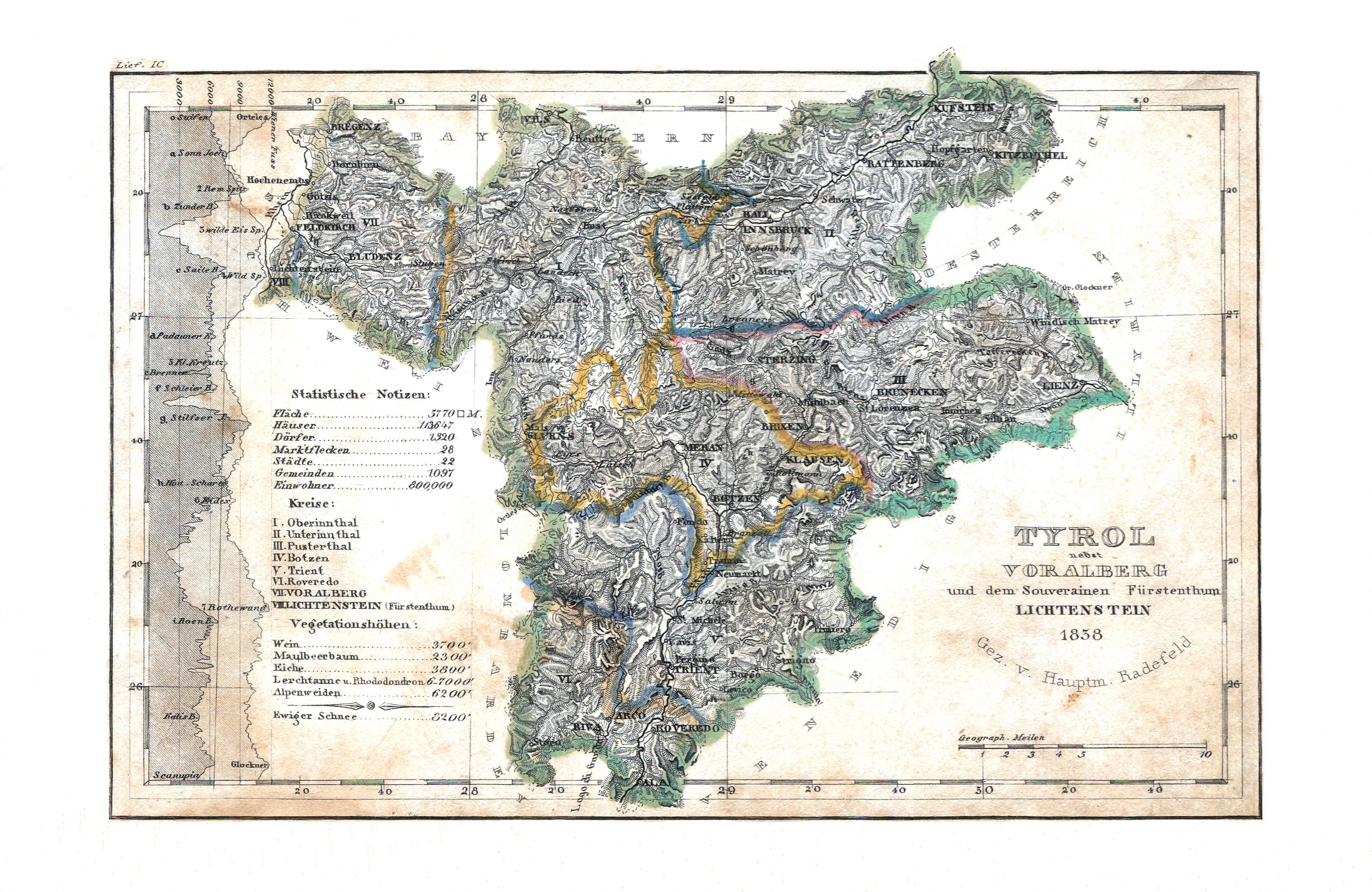
35. Tyrol nebst Vorarlberg und dem Souverainen Fürstenthum Lichtenstein (Lief. IC = 99, 1838)
Tirol, Vorarlberg en Liechtenstein / Tyrol, Vorarlberg and Liechtenstein
Meyer's Universal-Atlas (1830-1840)
geen overeenkomstige kaart / no corresponding map
 Meyer's Pfennig-Atlas (1834-1841)
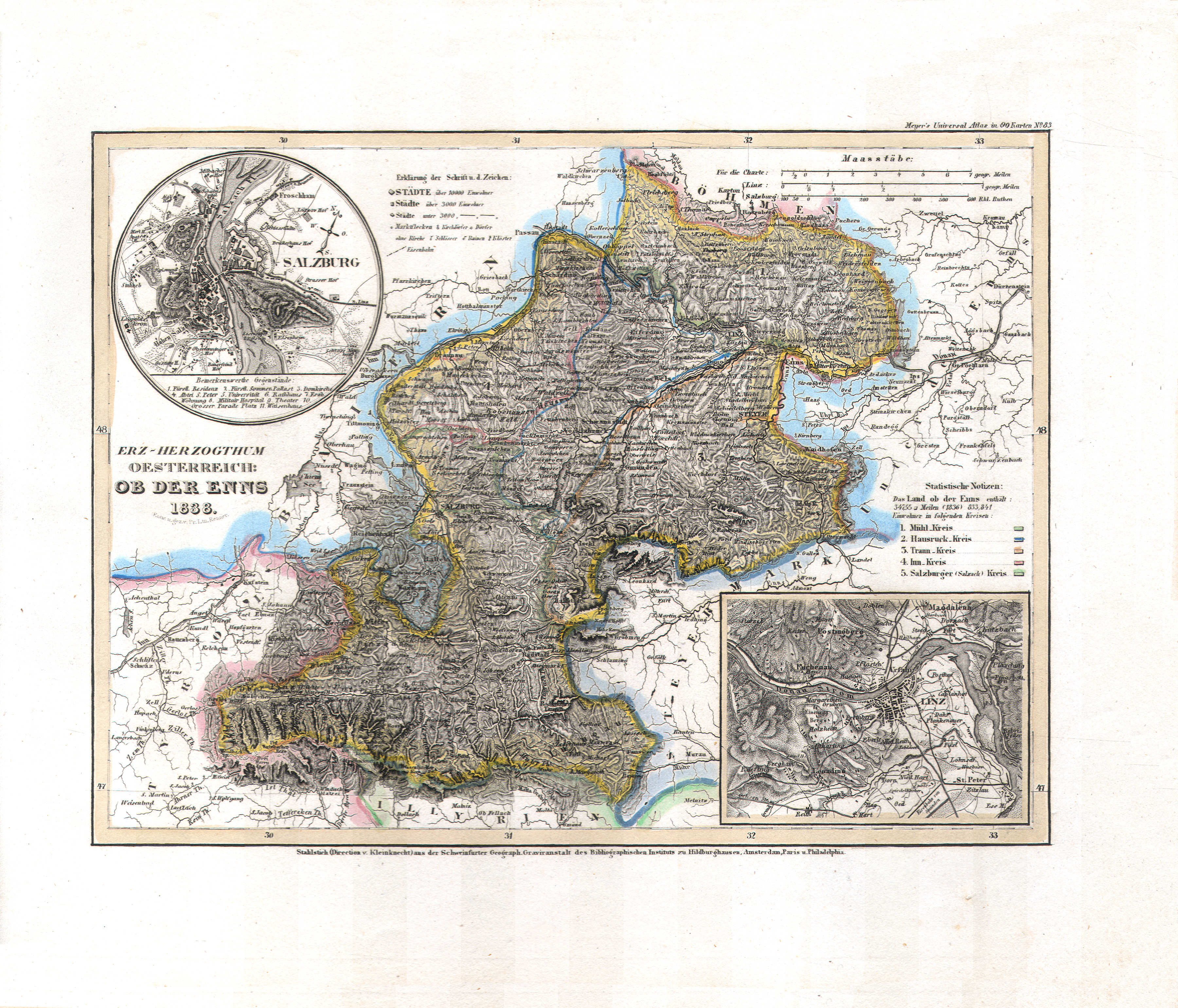
36. Erz-Herzogthum Oesterreich: Ob der Enns (Lief. CII = 102, 1838)
Aartshertogdom Oostenrijk boven de Enns / Archduchy of Austria above the Enns
 Meyer's Universal-Atlas (1830-1840)
49. Erz-Herzogthum Oesterreich: Ob der Enns (Nº 83, 1838)
Aartshertogdom Oostenrijk boven de Enns / Archduchy of Austria above the Enns
 Meyer's Pfennig-Atlas (1834-1841)
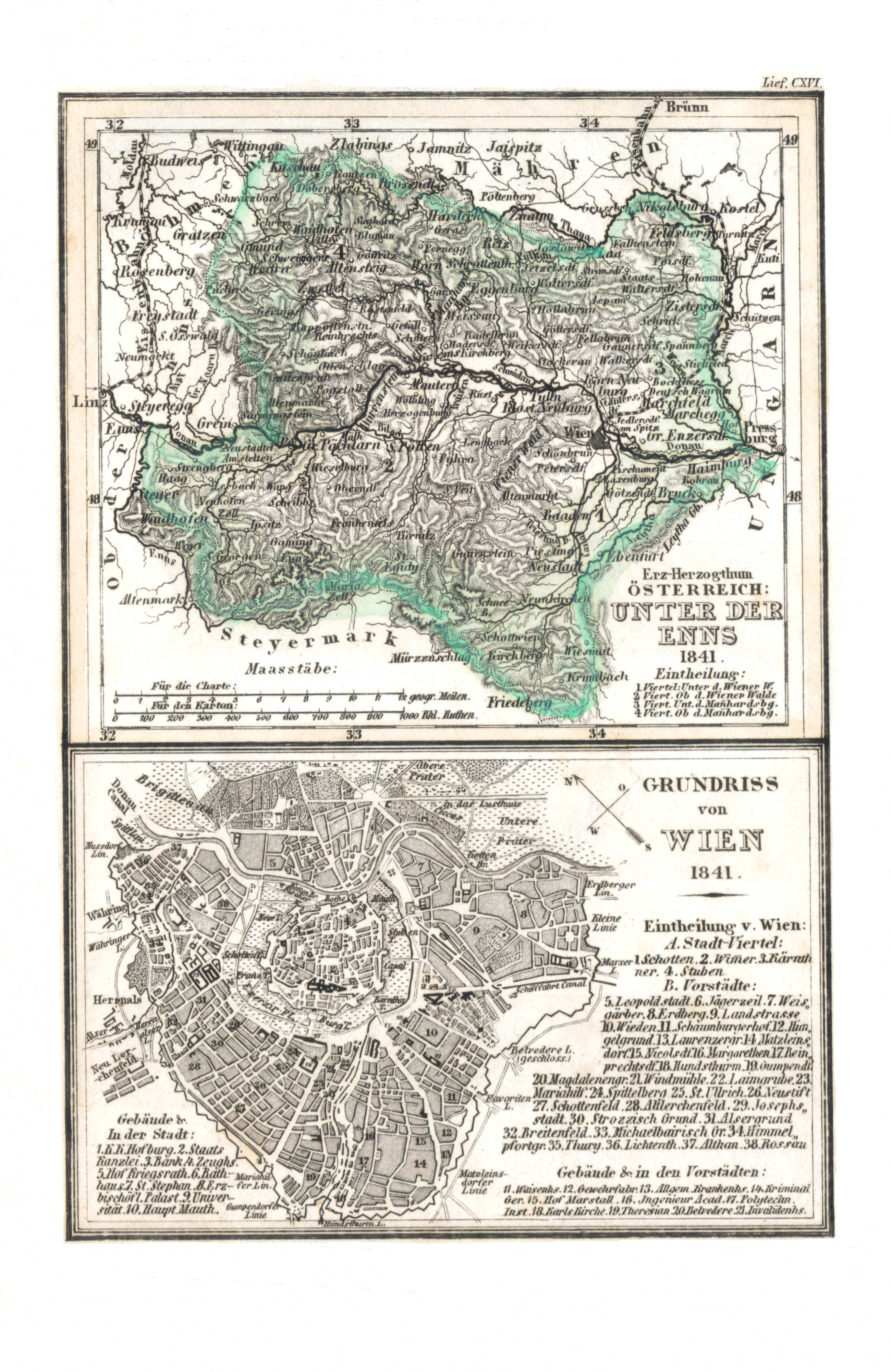
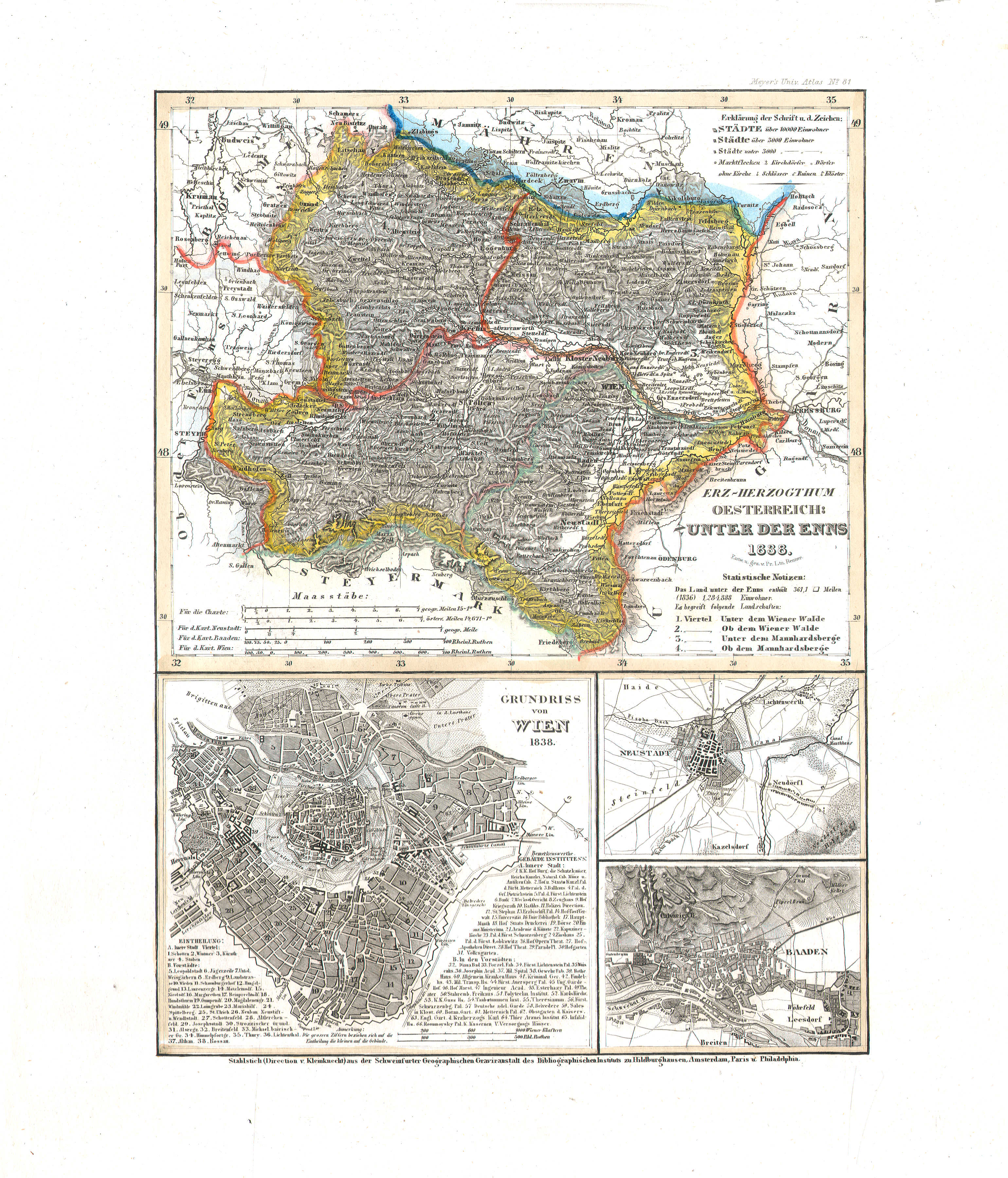
37. Erz-Herzogthum Oesterreich: Unter der Enns (Lief. CXVI = 116, 1841)
Aartshertogdom Oostenrijk beneden de Enns / Archduchy of Austria below the Enns
 Meyer's Universal-Atlas (1830-1840)
48. Erz-Herzogthum Oesterreich: Unter der Enns (Nº 81, 1838)
Aartshertogdom Oostenrijk beneden de Enns / Archduchy of Austria below the Enns
 Meyer's Pfennig-Atlas (1834-1841)
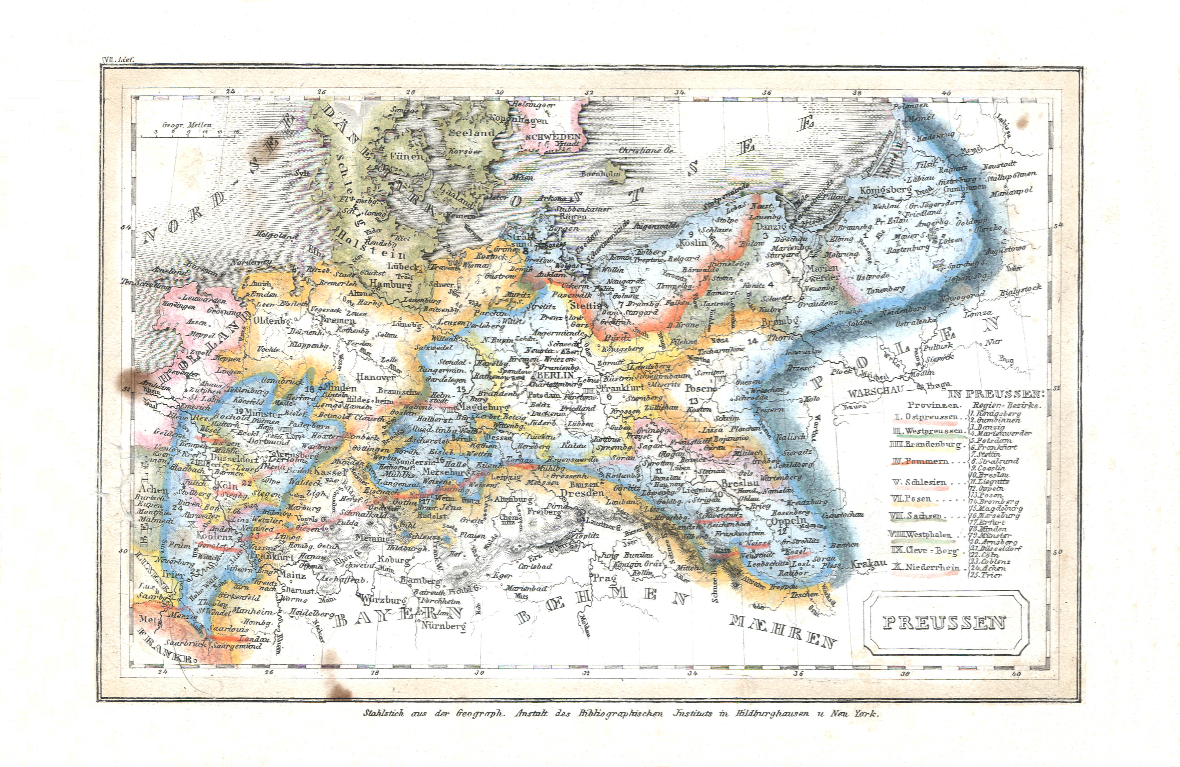
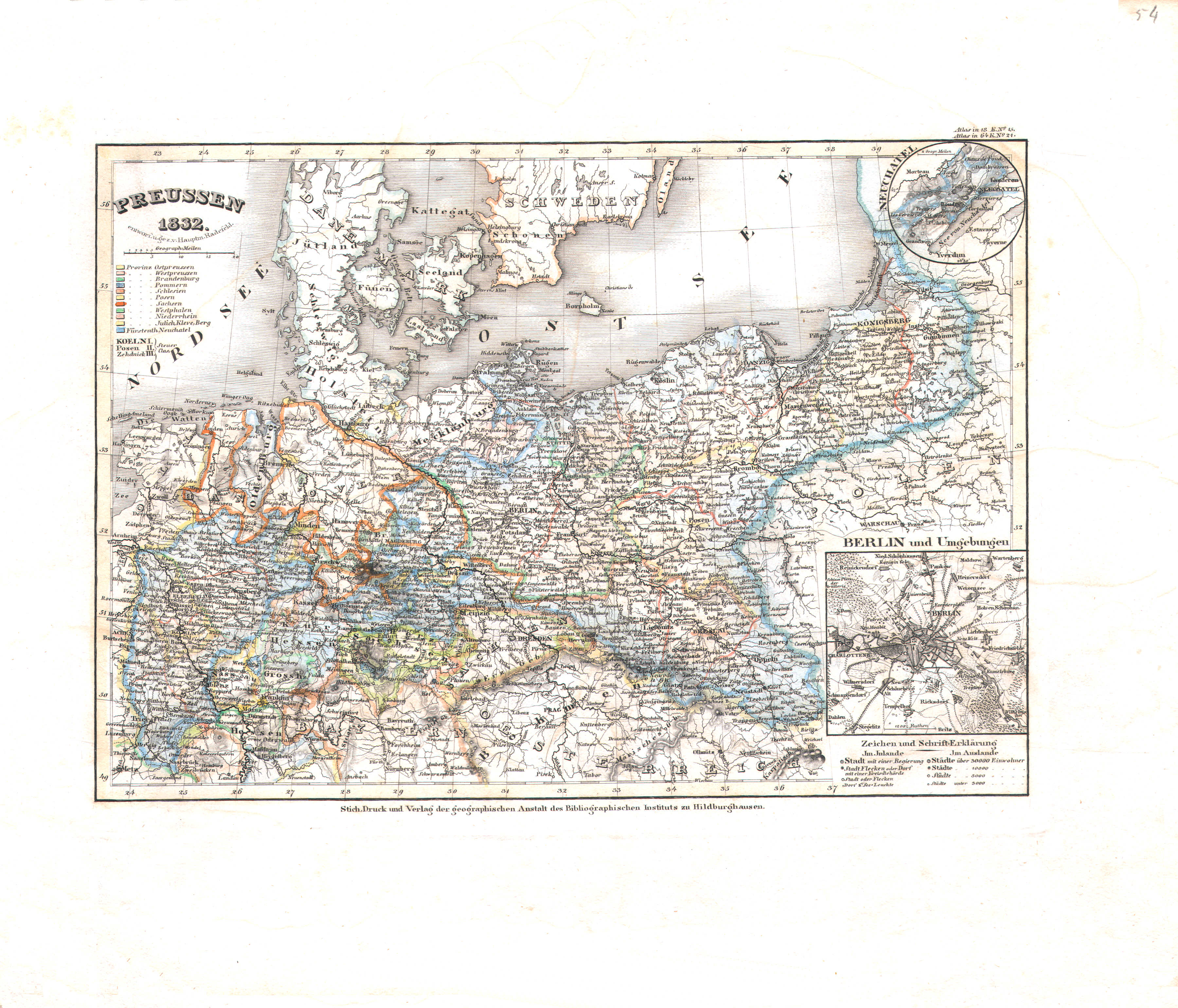
38. Preussen (Lief. VII = 7)
Pruisen / Prussia
 Meyer's Universal-Atlas (1830-1840)
54. Preussen (Nº 21, 1832)
Pruisen / Prussia
 Meyer's Pfennig-Atlas (1834-1841)
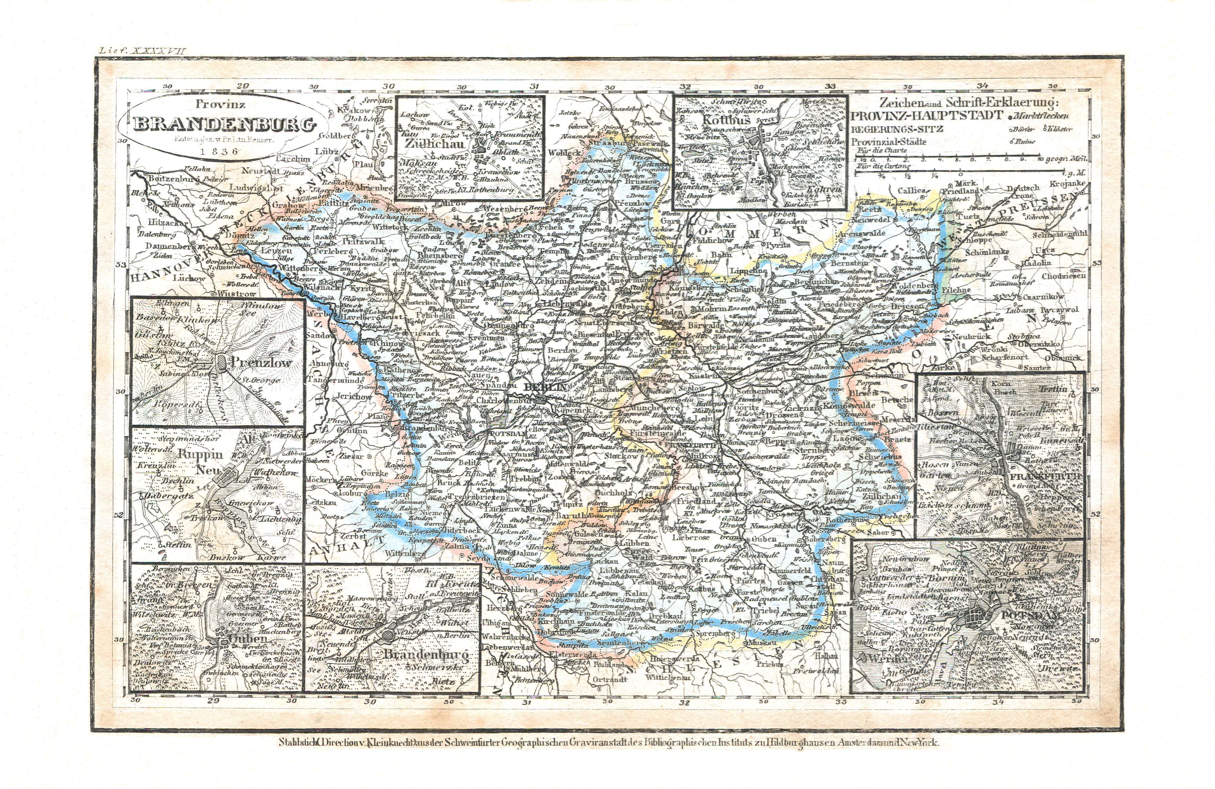
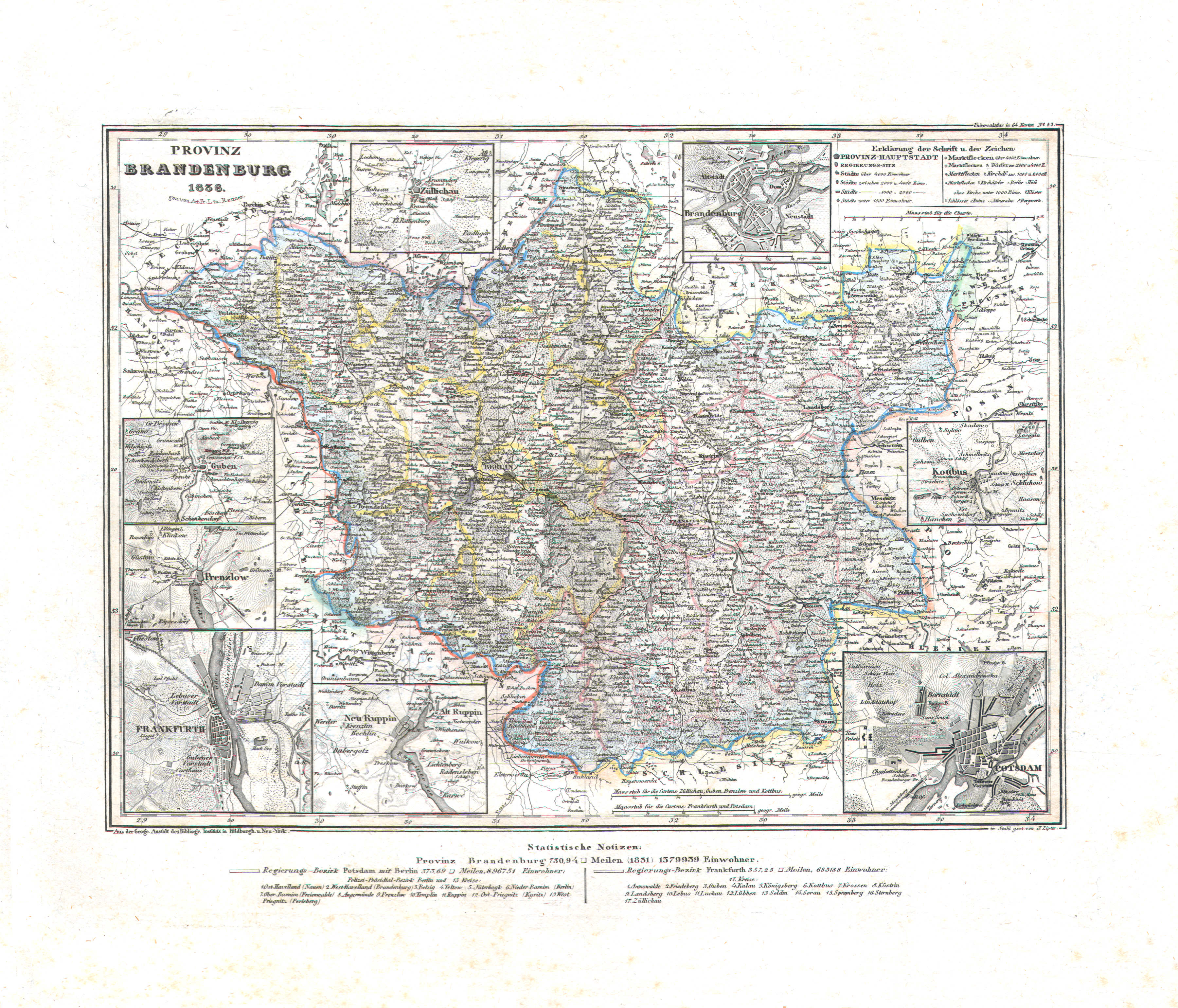
39. Provinz Brandenburg (Lief. XXXXVII = 47, 1836)
Provincie Brandenburg / Province of Brandenburg
 Meyer's Universal-Atlas (1830-1840)
55. Provinz Brandenburg (Nº 53, 1836)
Provincie Brandenburg / Province of Brandenburg
 Meyer's Pfennig-Atlas (1834-1841)
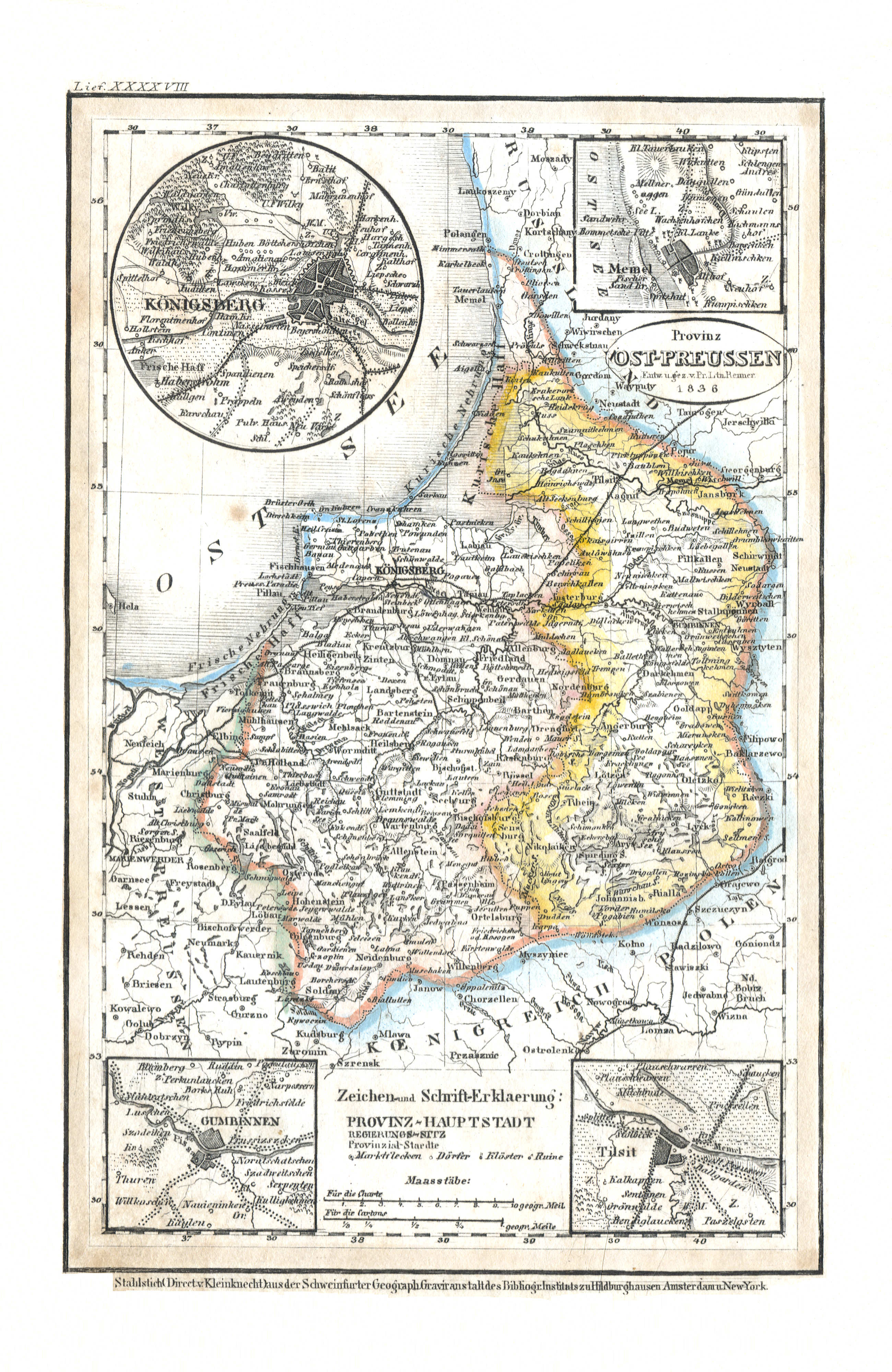
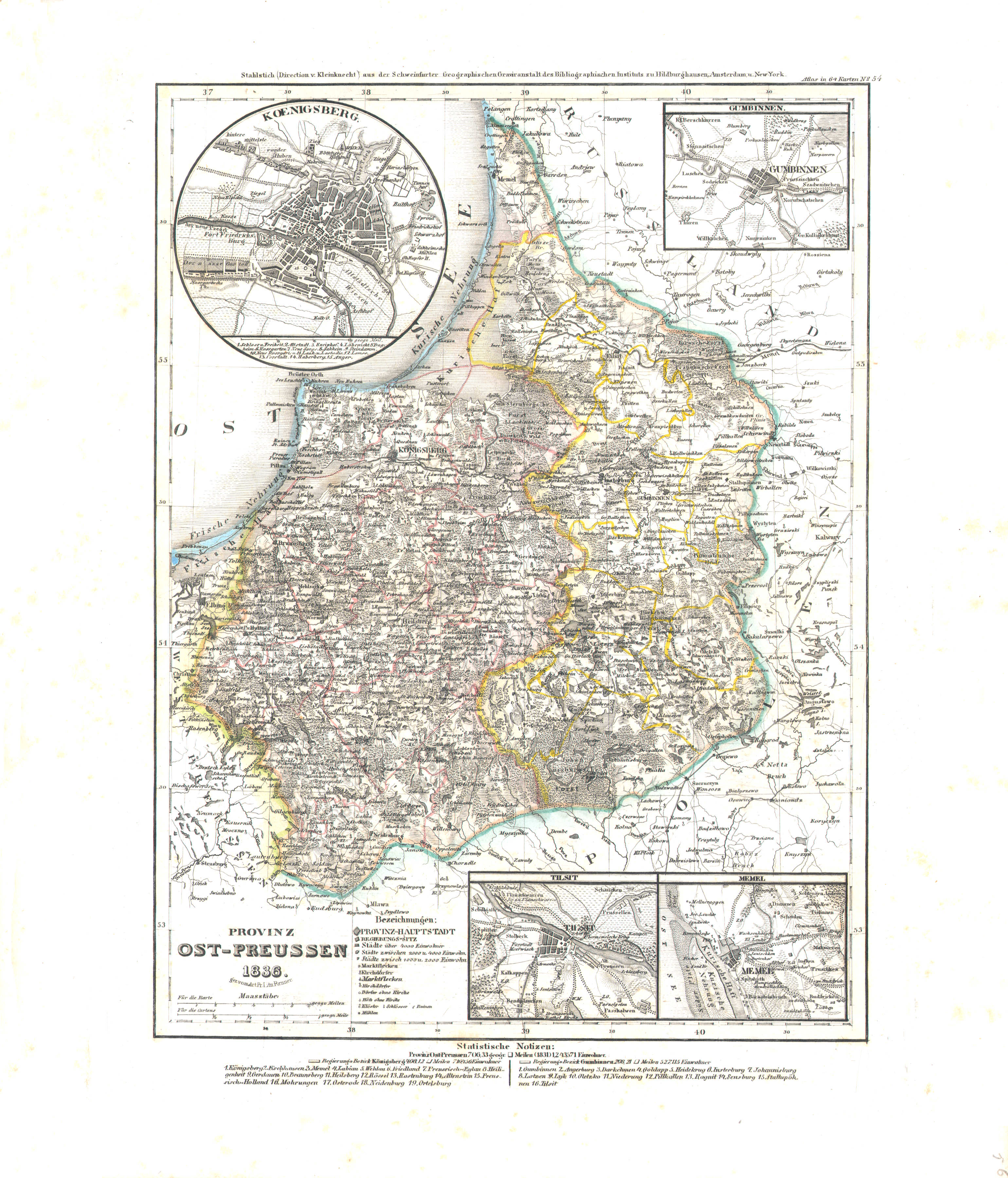
40. Provinz Ost-Preussen (Lief. XXXXVIII = 48, 1836)
Provincie Oost-Pruisen / Province of East Prussia
 Meyer's Universal-Atlas (1830-1840)
56. Provinz Ost-Preussen (Nº 54, 1836)
Provincie Oost-Pruisen / Province of East Prussia
 Meyer's Pfennig-Atlas (1834-1841)
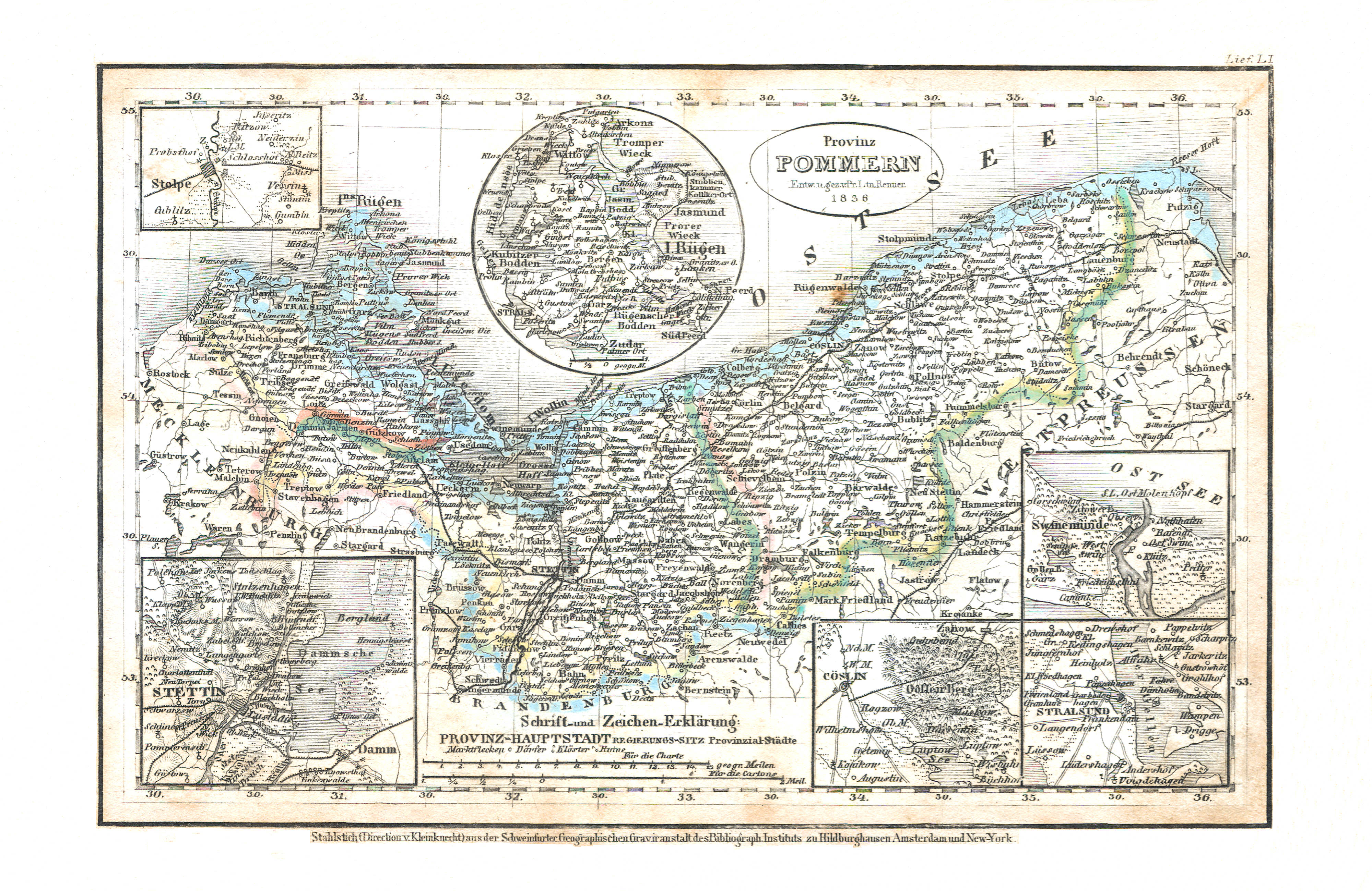
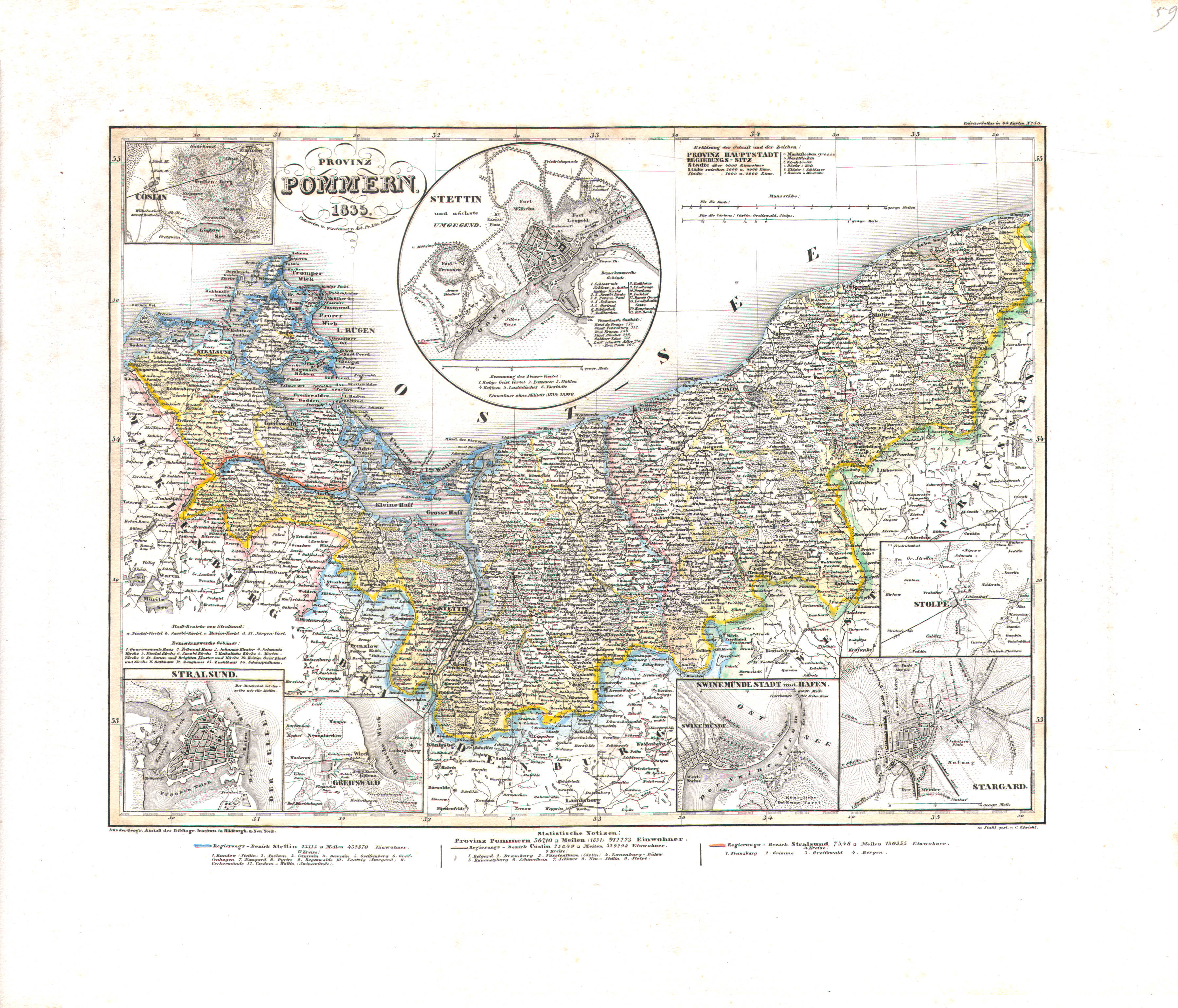
41. Provinz Pommern (Lief. LI = 51, 1836)
Provincie Pommeren / Province of Pomerania
 Meyer's Universal-Atlas (1830-1840)
59. Provinz Pommern (Nº 50, 1835)
Provincie Pommeren / Province of Pomerania
 Meyer's Pfennig-Atlas (1834-1841)
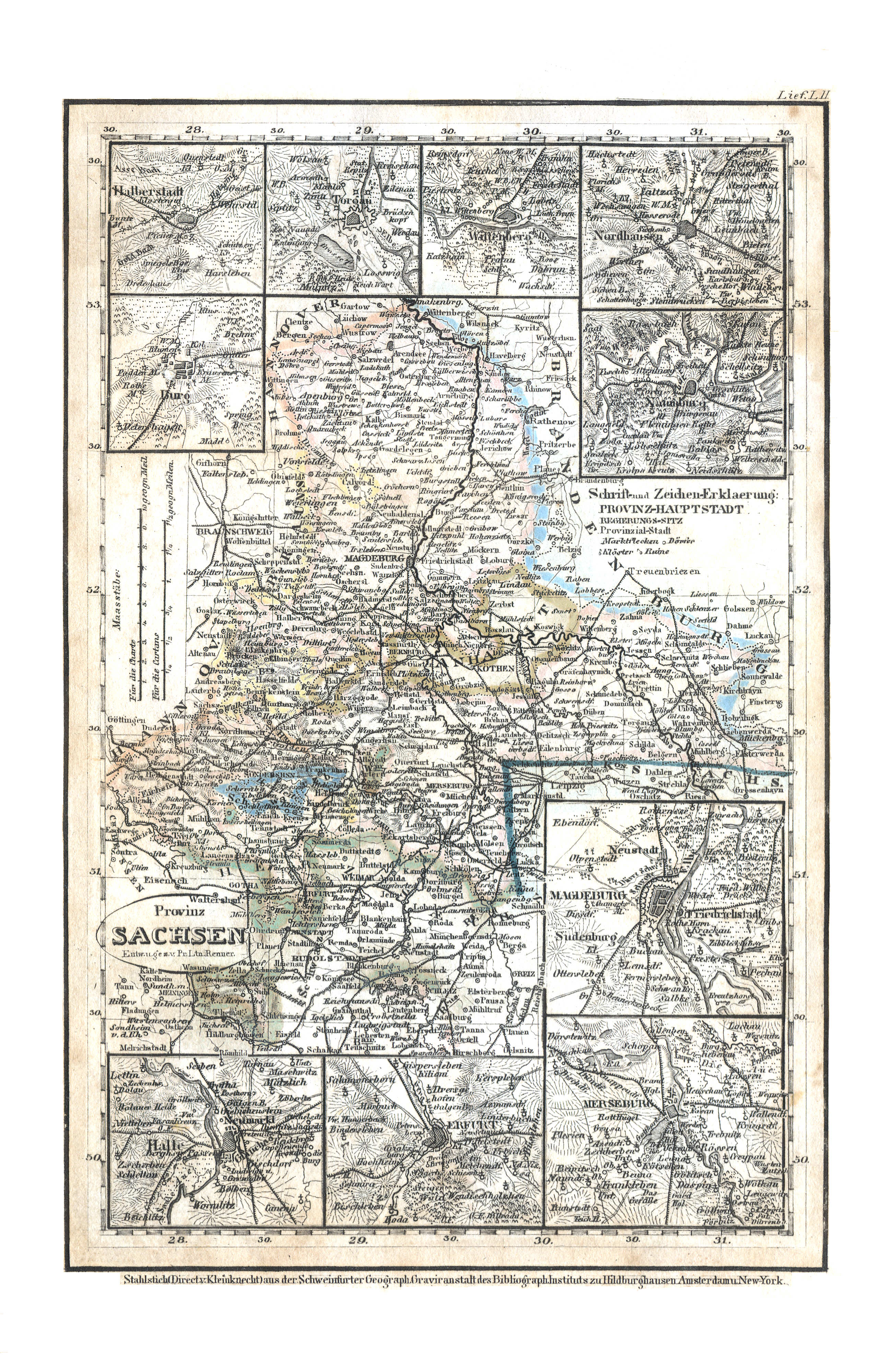
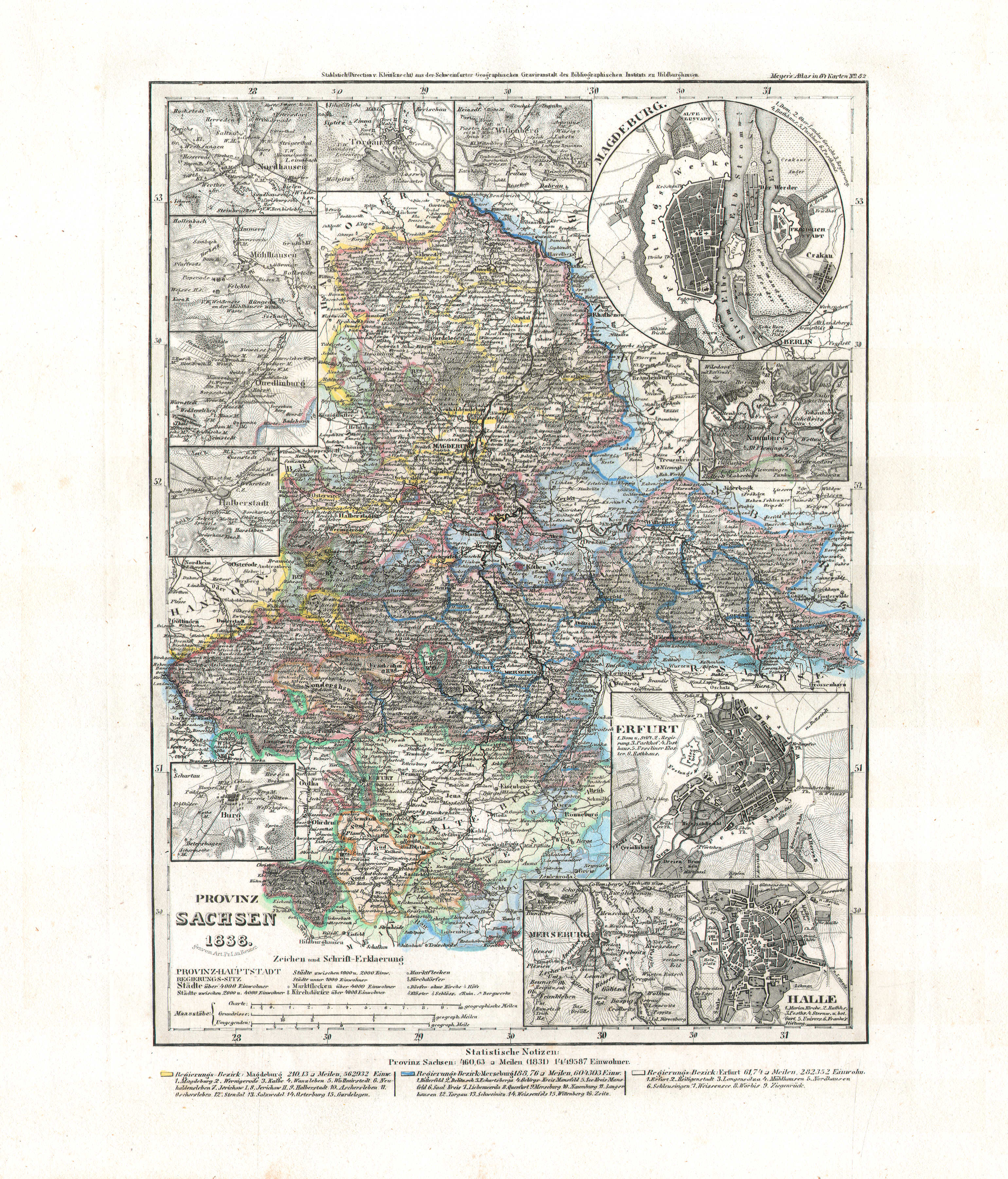
42. Provinz Sachsen (Lief. LII = 52)
Provincie Saksen / Province of Saxony
 Meyer's Universal-Atlas (1830-1840)
61. Provinz Sachsen (Nº 82, 1838)
Provincie Saksen / Province of Saxony
 Meyer's Pfennig-Atlas (1834-1841)
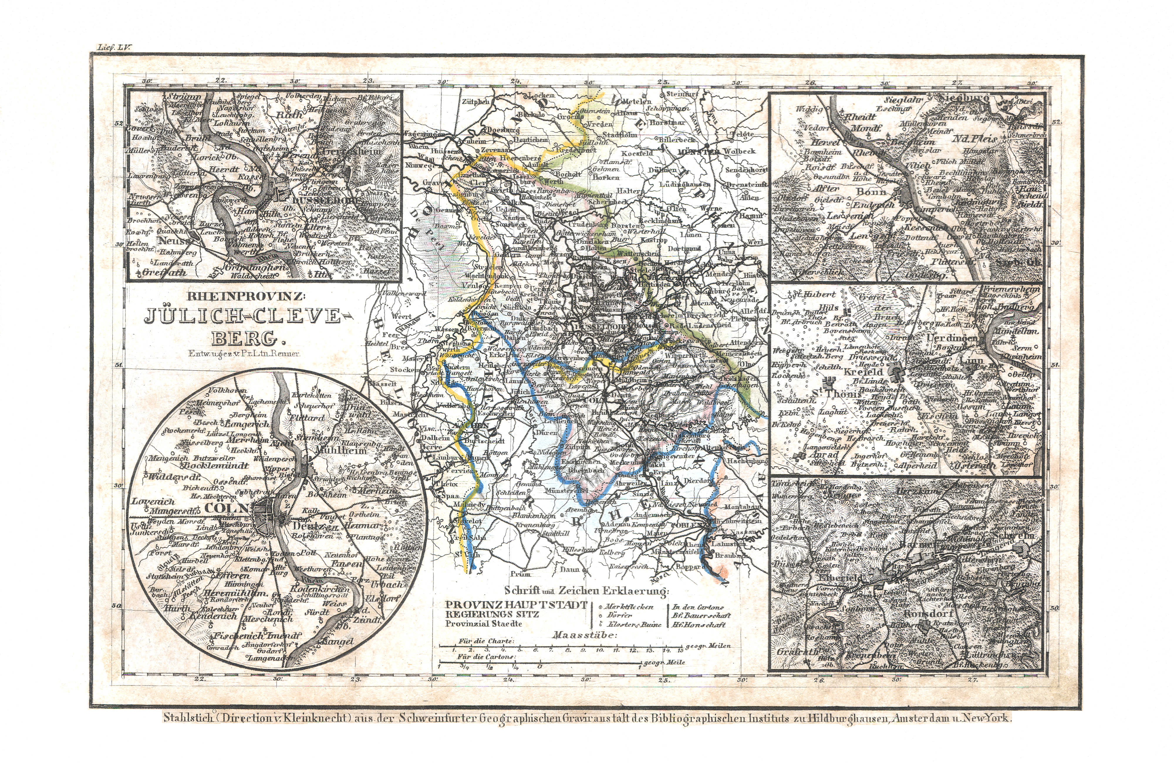
43. Rheinprovinz: Jülich-Cleve-Berg (Lief. LV = 55)
Provincie Gulik-Kleef-Berg / Province of Jülich-Cleves-Berg
 Meyer's Universal-Atlas (1830-1840)
63. Rheinprovinz Jülich-Cleve-Berg (Nº 58, 1836)
Provincie Gulik-Kleef-Berg / Province of Jülich-Cleves-Berg
 Meyer's Pfennig-Atlas (1834-1841)
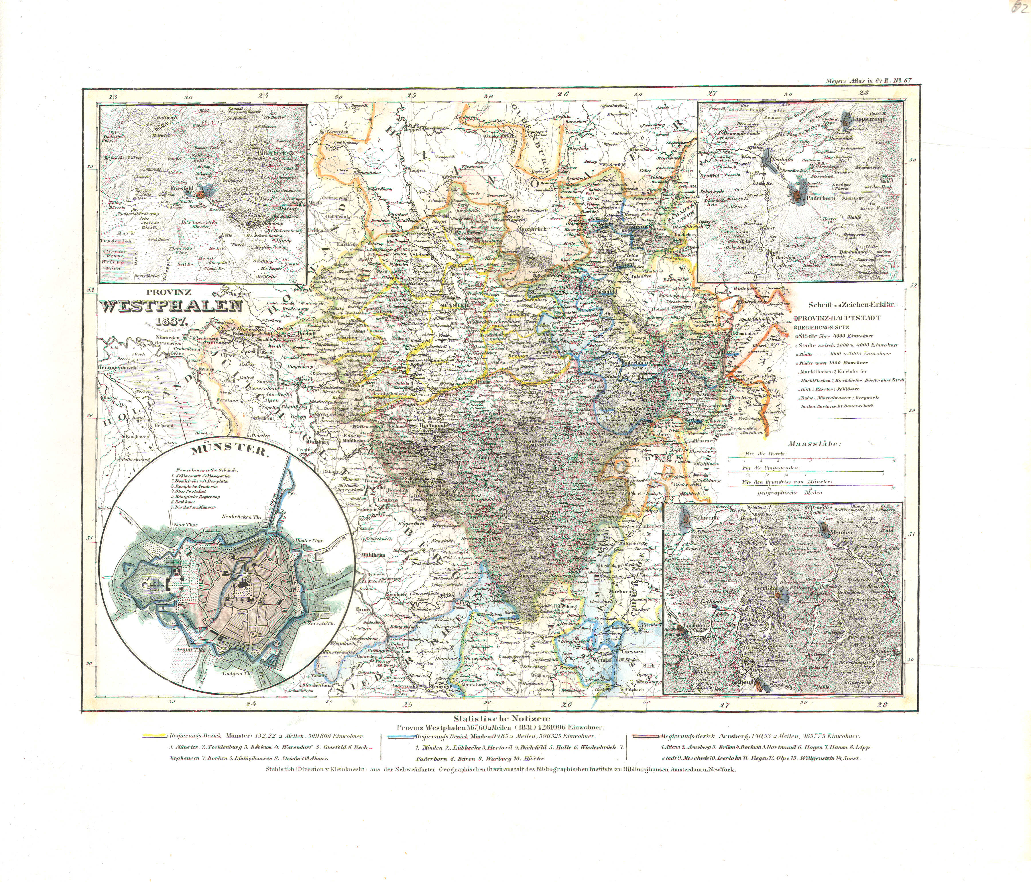
44. Provinz Westphalen (Lief. LVI = 56)
Provincie Westfalen / Province of Westphalia
 Meyer's Universal-Atlas (1830-1840)
62. Provinz Westphalen (Nº 67, 1837)
Provincie Westfalen / Province of Westphalia
 Meyer's Pfennig-Atlas (1834-1841)
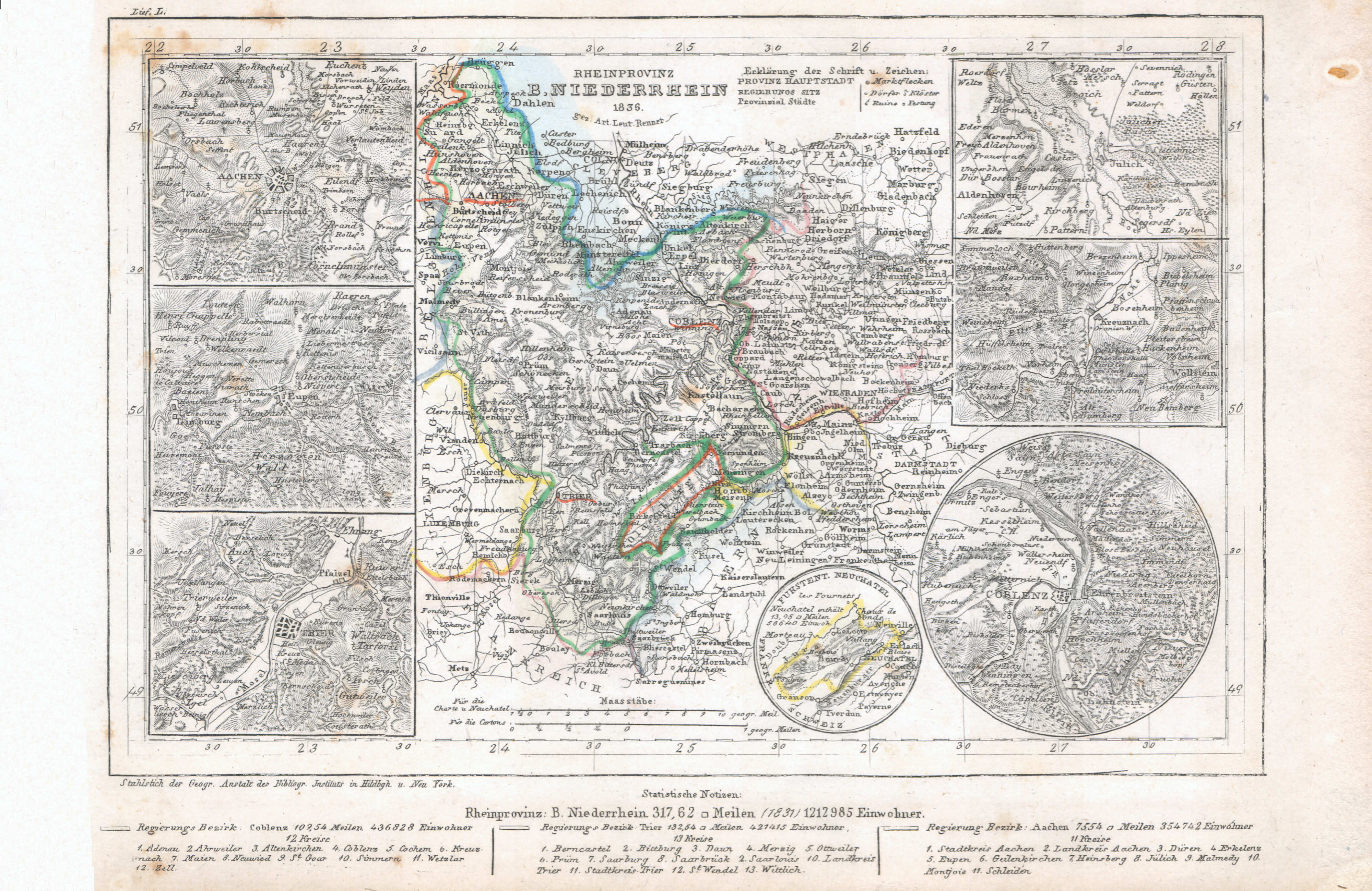
45. Rheinprovinz B. Niederrhein (Lief. L = 50, 1836)
Provincie Beneden-Rijn / Province of the Lower Rhine
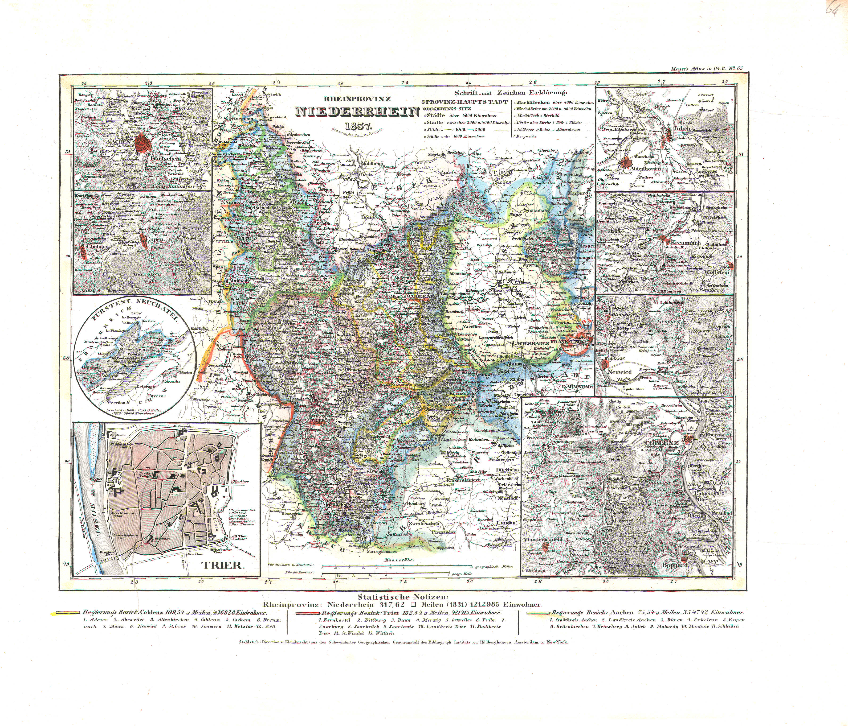 Meyer's Universal-Atlas (1830-1840)
64. Rheinprovinz Niederrhein (Nº 65, 1837)
Provincie Beneden-Rijn / Province of the Lower Rhine
 Meyer's Pfennig-Atlas (1834-1841)
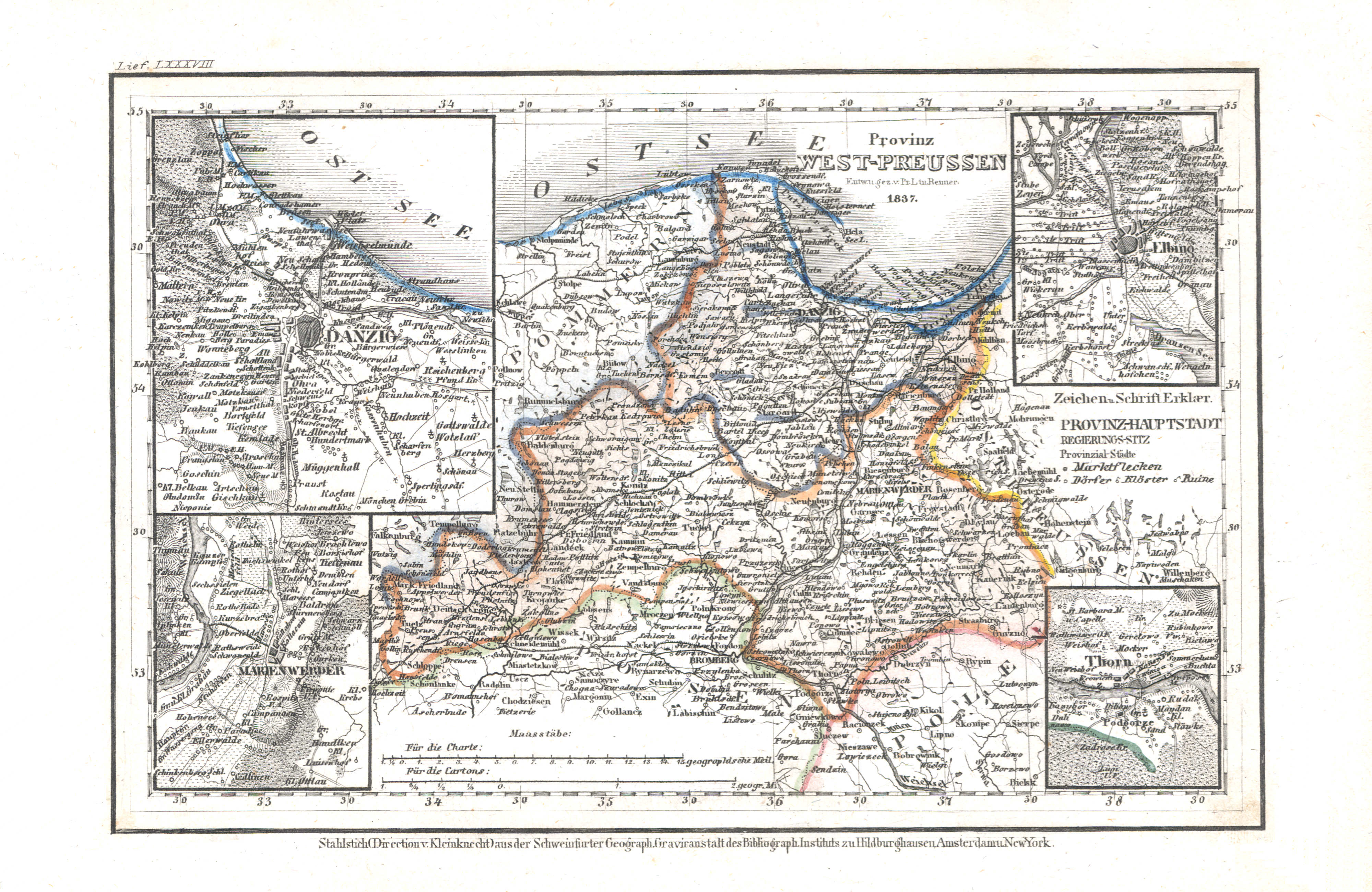
46. Provinz West-Preussen (Lief. LXXXVIII = 88, 1837)
Provincie West-Pruisen / Province of West Prussia
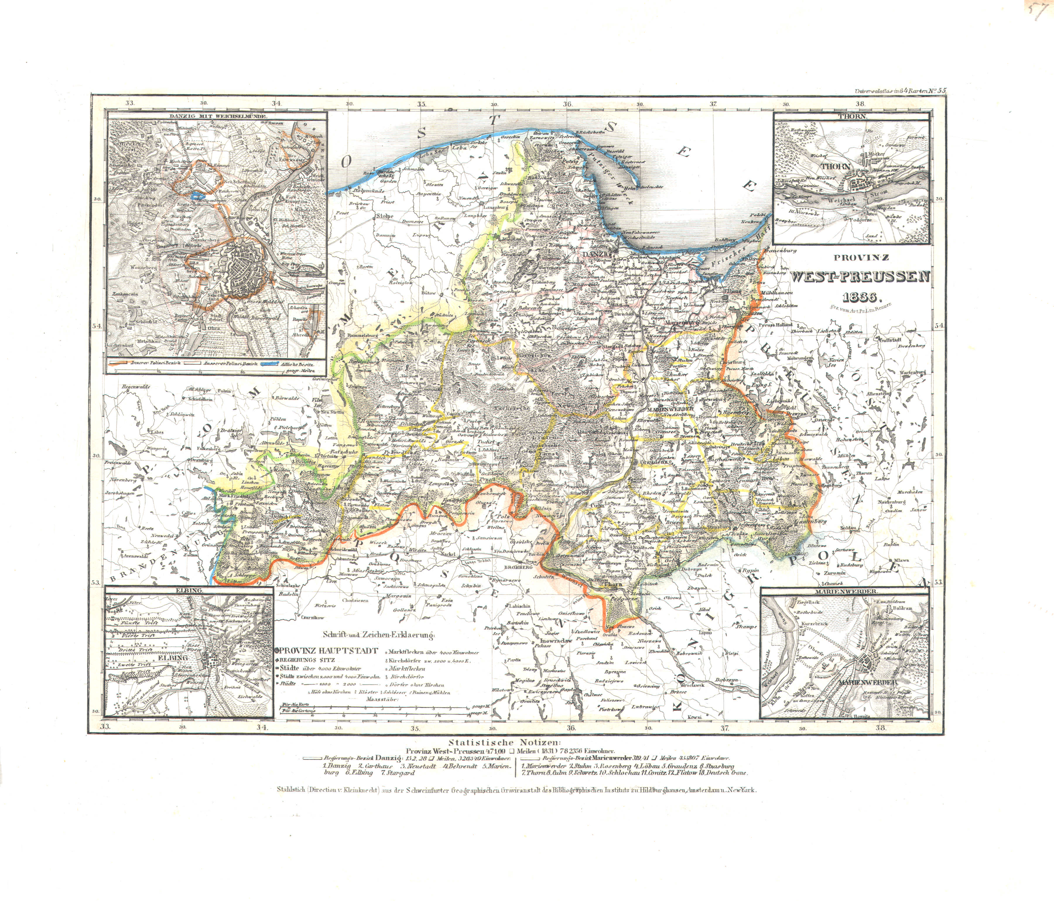 Meyer's Universal-Atlas (1830-1840)
57. Provinz West-Preussen (Nº 55, 1836)
Provincie West-Pruisen / Province of West Prussia
 Meyer's Pfennig-Atlas (1834-1841)
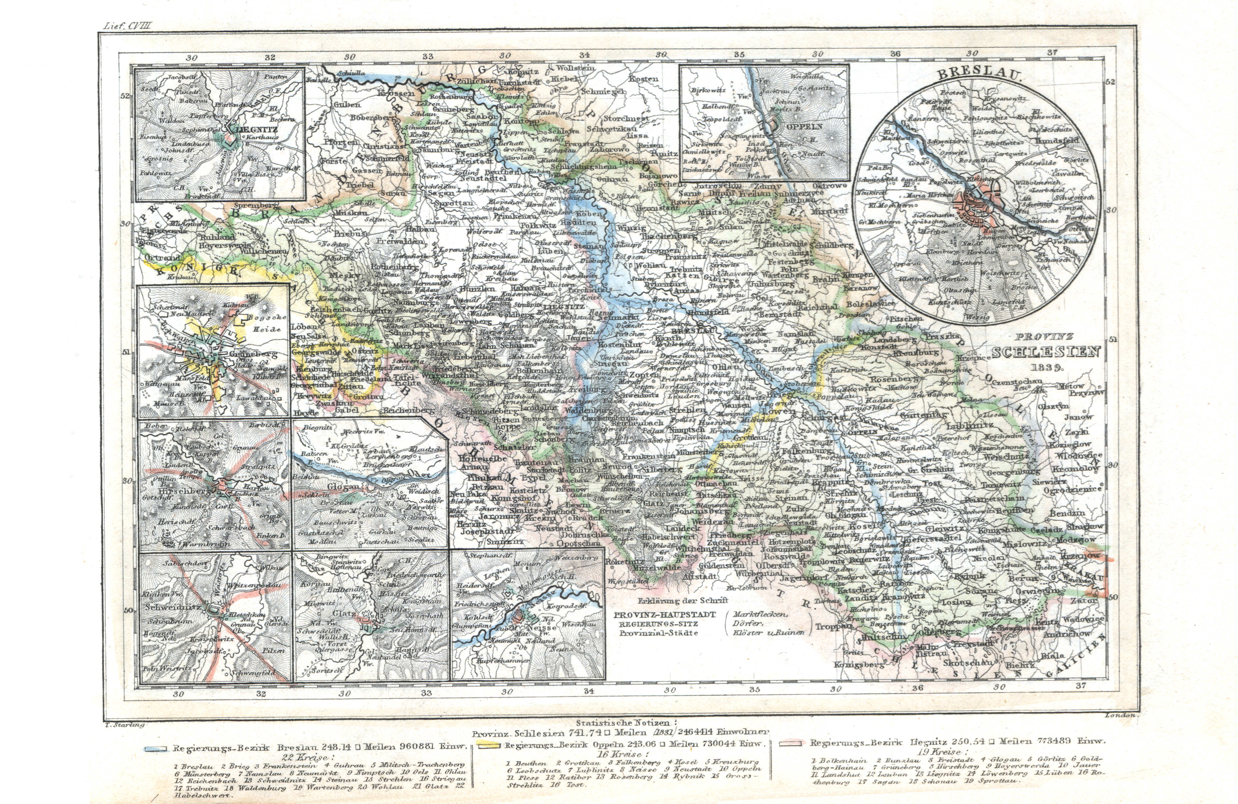
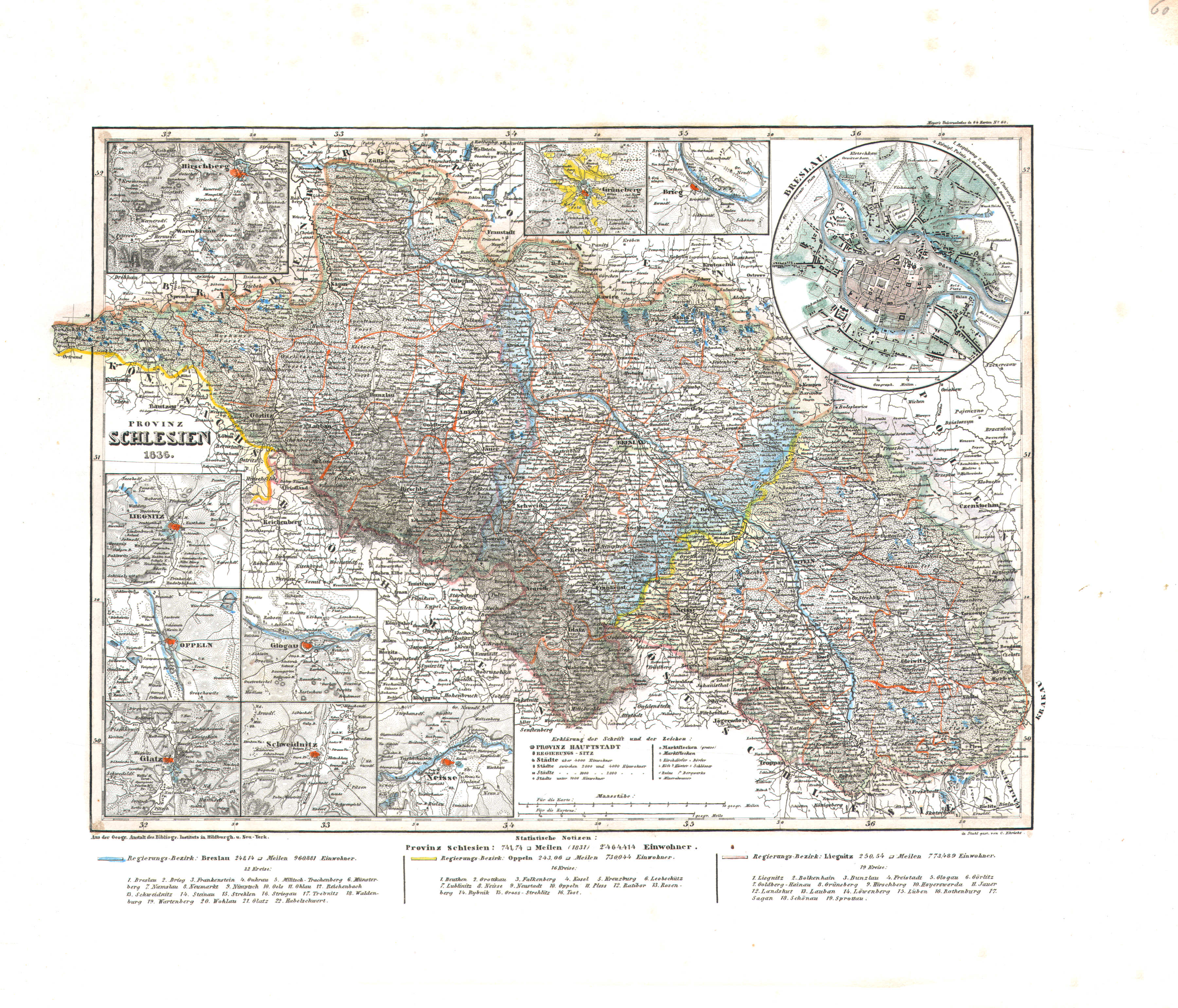
47. Provinz Schlesien (Lief. CVIII = 108, 1839)
Provincie Silesië / Province of Silesia
 Meyer's Universal-Atlas (1830-1840)
60. Provinz Schlesien (Nº 60, 1836)
Provincie Silesië / Province of Silesia
 Meyer's Pfennig-Atlas (1834-1841)
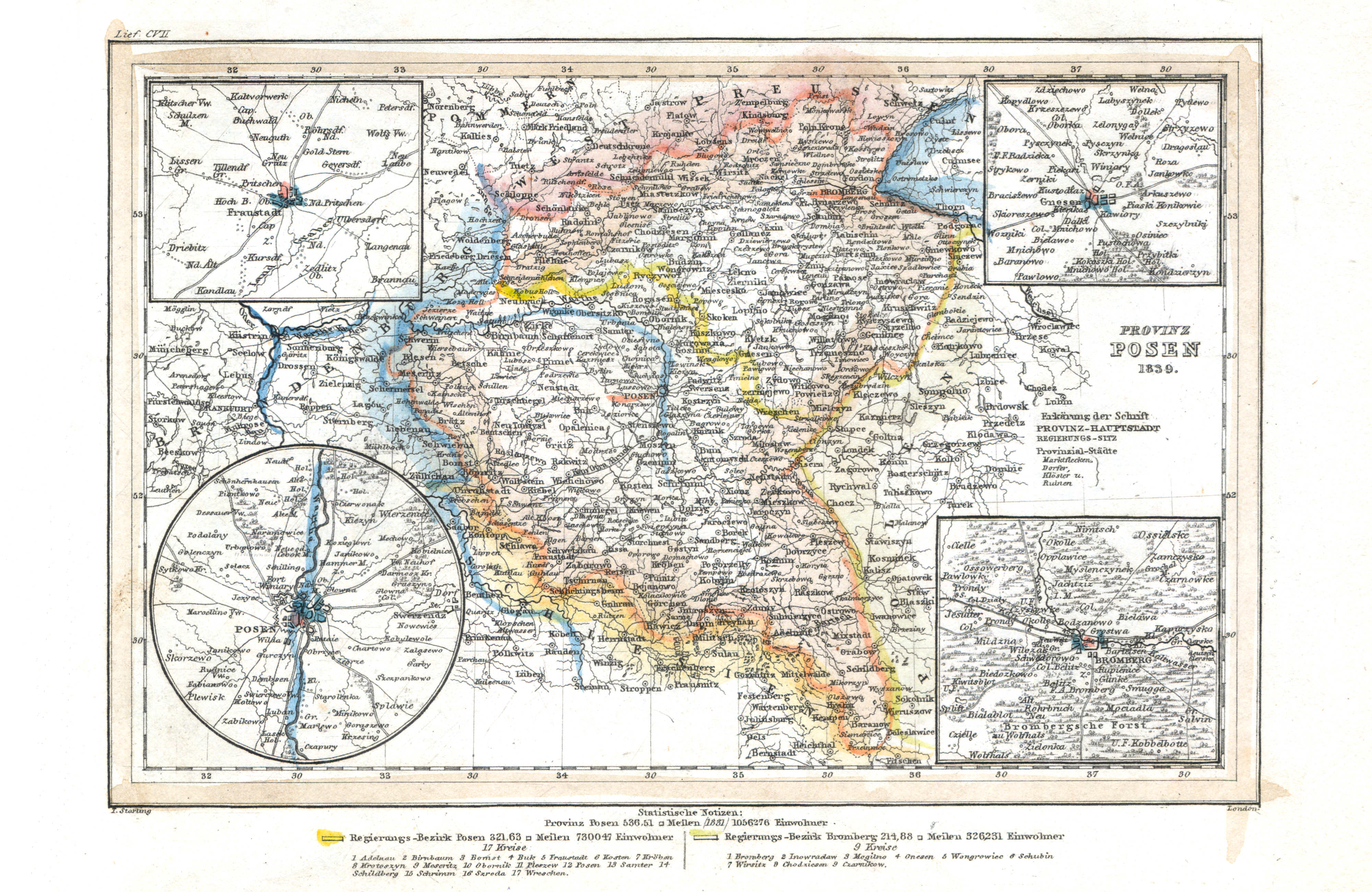
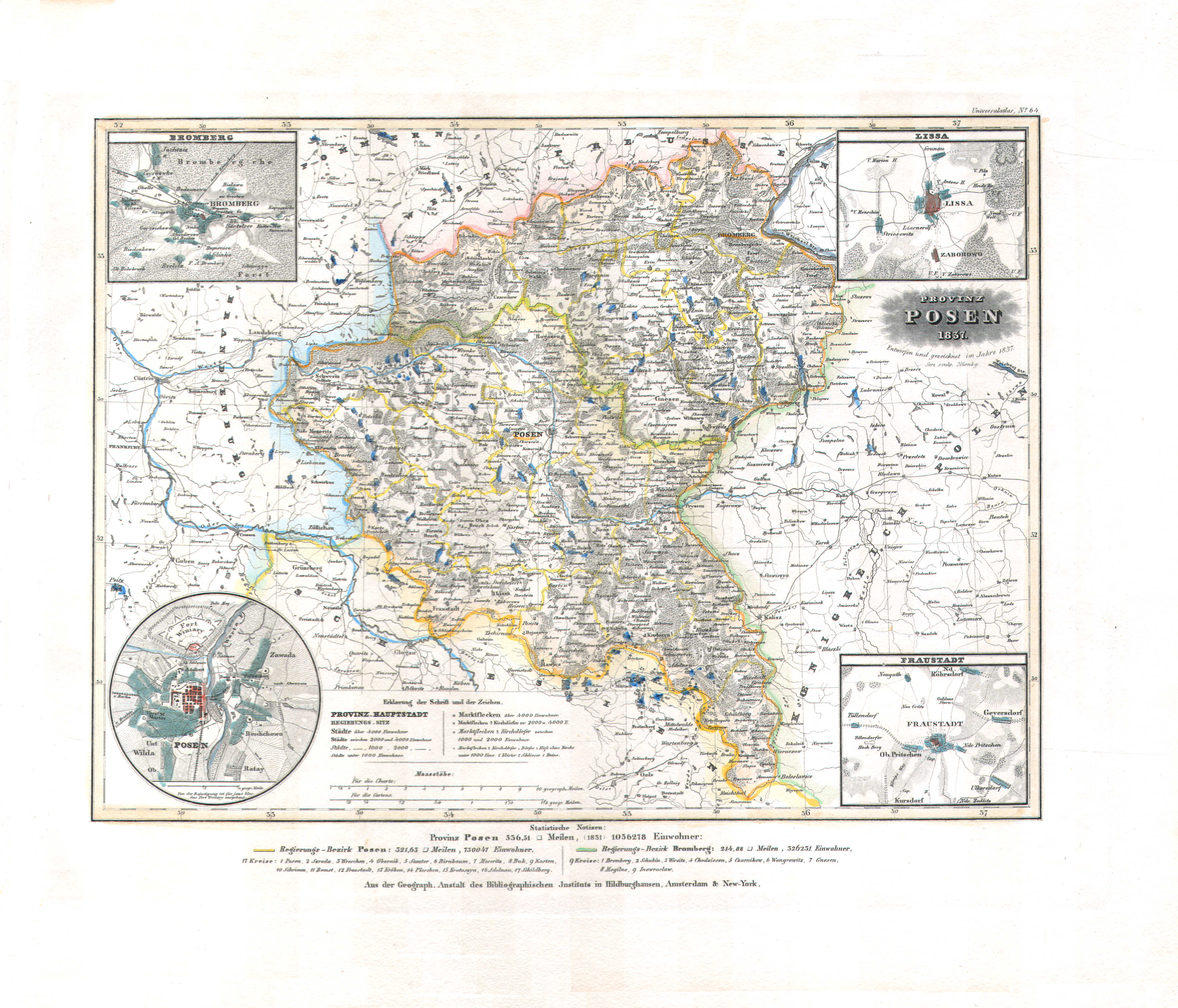
48. Provinz Posen (Lief. CVII = 107, 1839)
Provincie Posen / Province of Posen
 Meyer's Universal-Atlas (1830-1840)
58. Provinz Posen (Nº 64, 1837)
Provincie Posen / Province of Posen
 Meyer's Pfennig-Atlas (1834-1841)
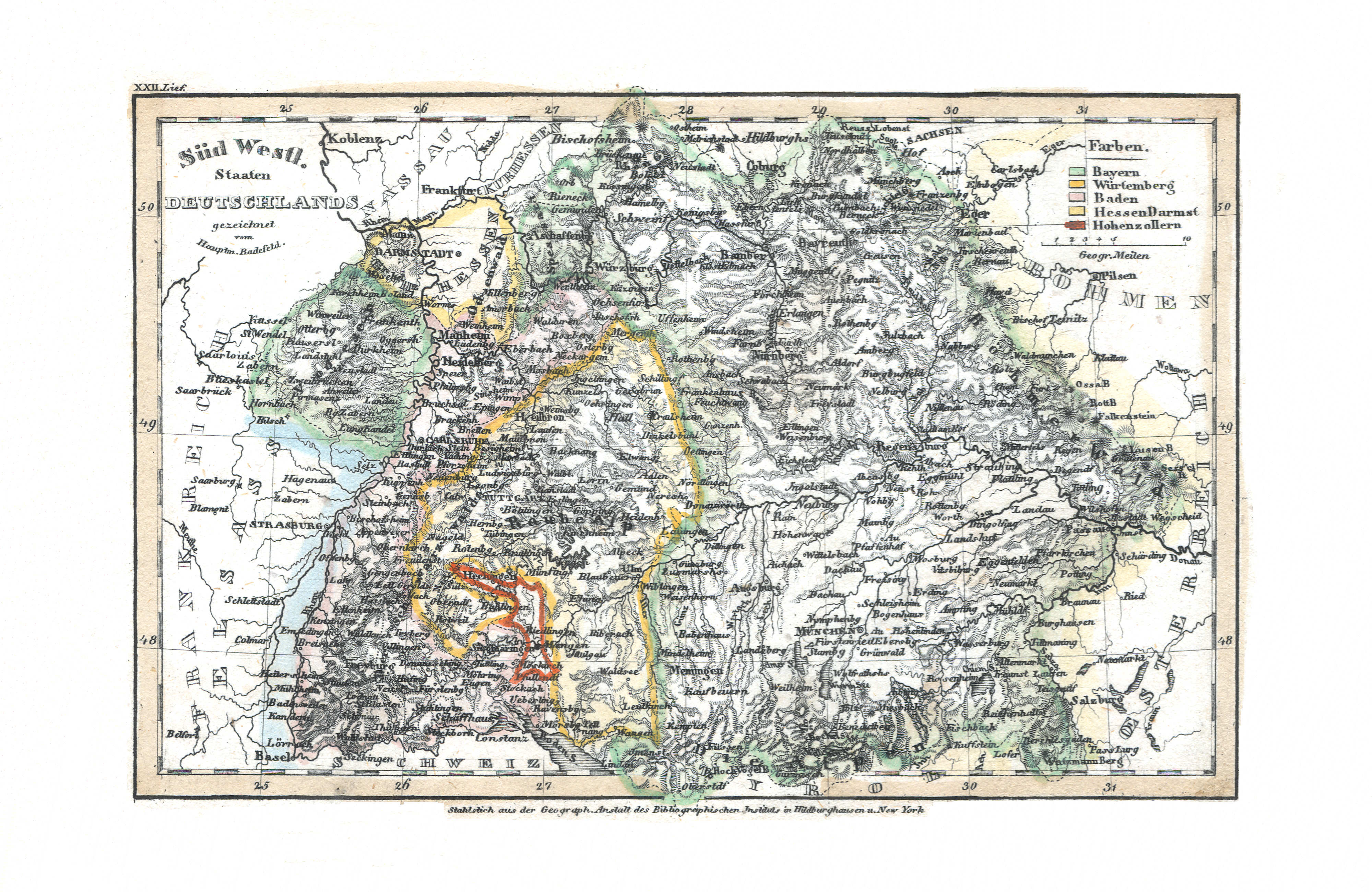
49. Süd Westl. Staaten Deutschlands (Lief. XXII = 22)
Zuidwestelijke staten in Duitsland / Southwestern states of Germany
 Meyer's Universal-Atlas (1830-1840)
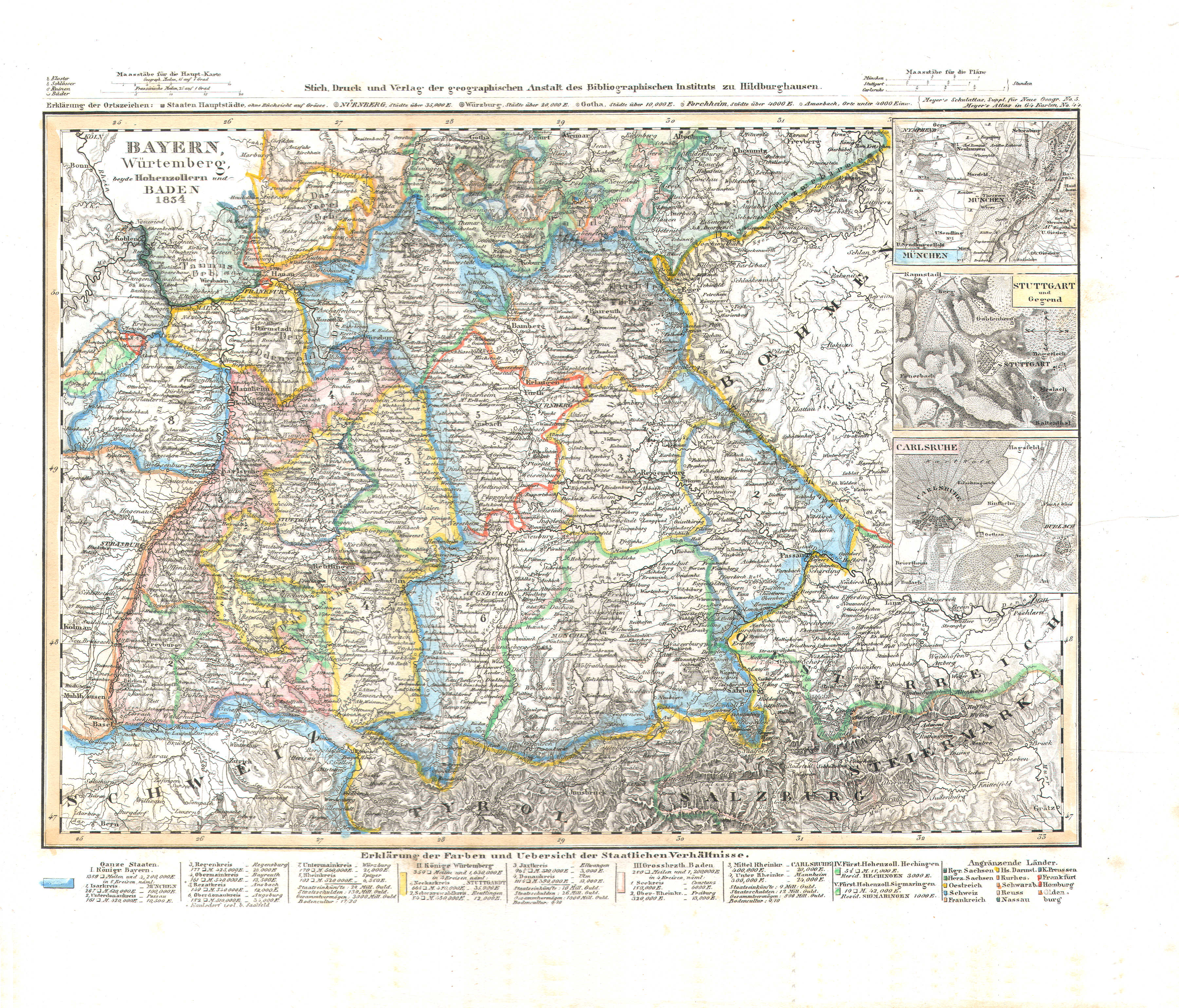
69. Bayern, Würtemberg, beyde Hohenzollern und Baden (Nº 44, 1834)
Beieren, Württemberg, Hohenzollern en Baden / Bavaria, Württemberg, Hohenzollern and Baden
 Meyer's Pfennig-Atlas (1834-1841)
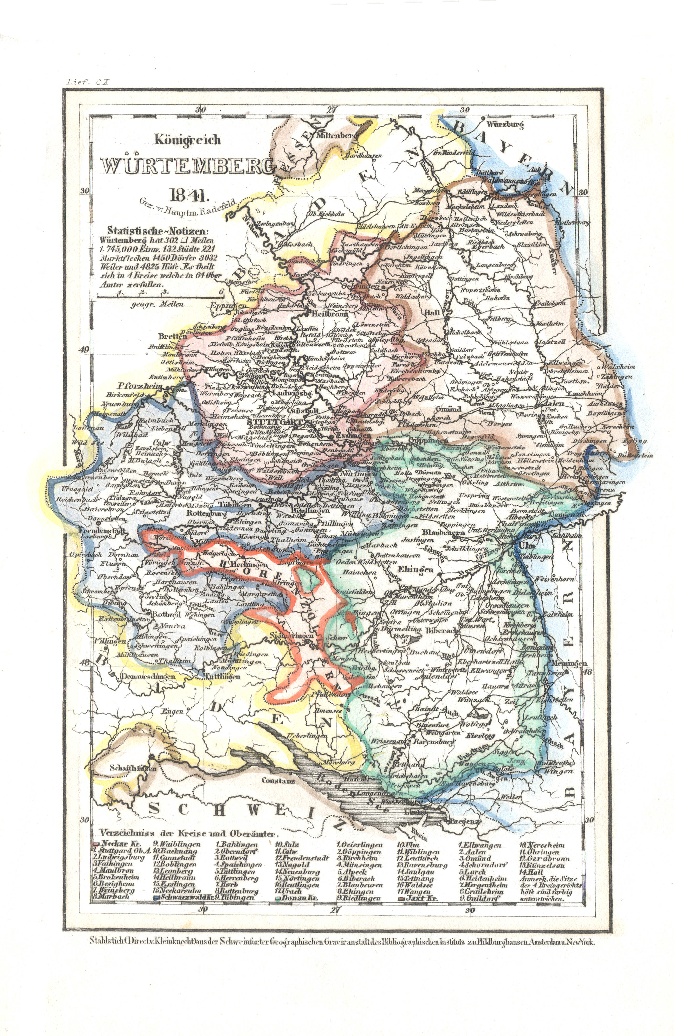
50. Königreich Würtemberg (Lief. CX = 119, 1841)
Koninkrijk Württemberg / Kingdom of Württemberg
Meyer's Universal-Atlas (1830-1840)
geen overeenkomstige kaart / no corresponding map
 Meyer's Pfennig-Atlas (1834-1841)
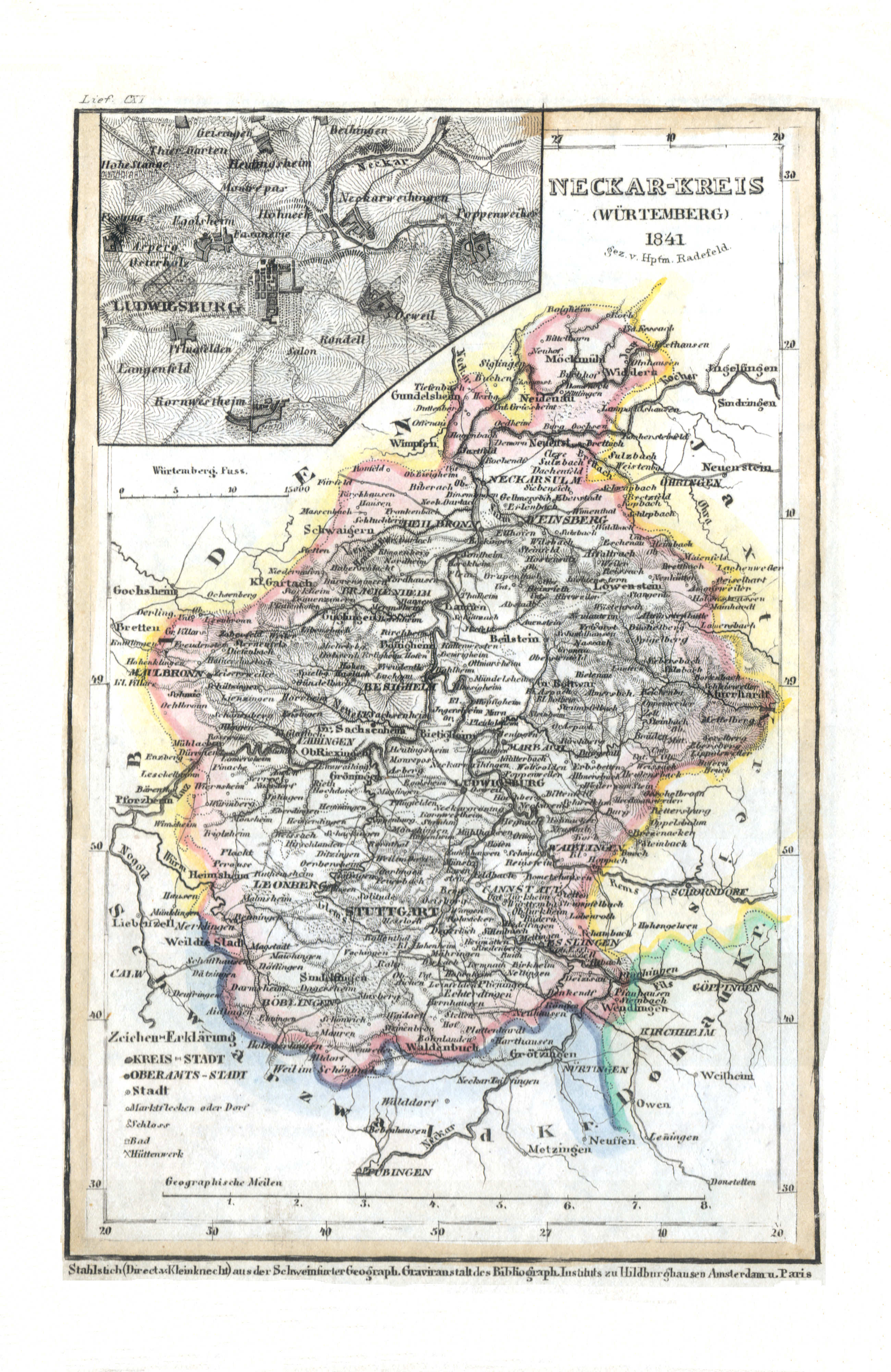
51. Neckar-Kreis (Würtemberg) (Lief. CXI = 111)
Württemberg: Neckarkreis
Meyer's Universal-Atlas (1830-1840)
geen overeenkomstige kaart / no corresponding map
 Meyer's Pfennig-Atlas (1834-1841)
52. Jaxt-Kreis (Würtemberg) (Lief. CXII = 112, 1841)
Württemberg: Jagstkreis
Meyer's Universal-Atlas (1830-1840)
geen overeenkomstige kaart / no corresponding map
 Meyer's Pfennig-Atlas (1834-1841)
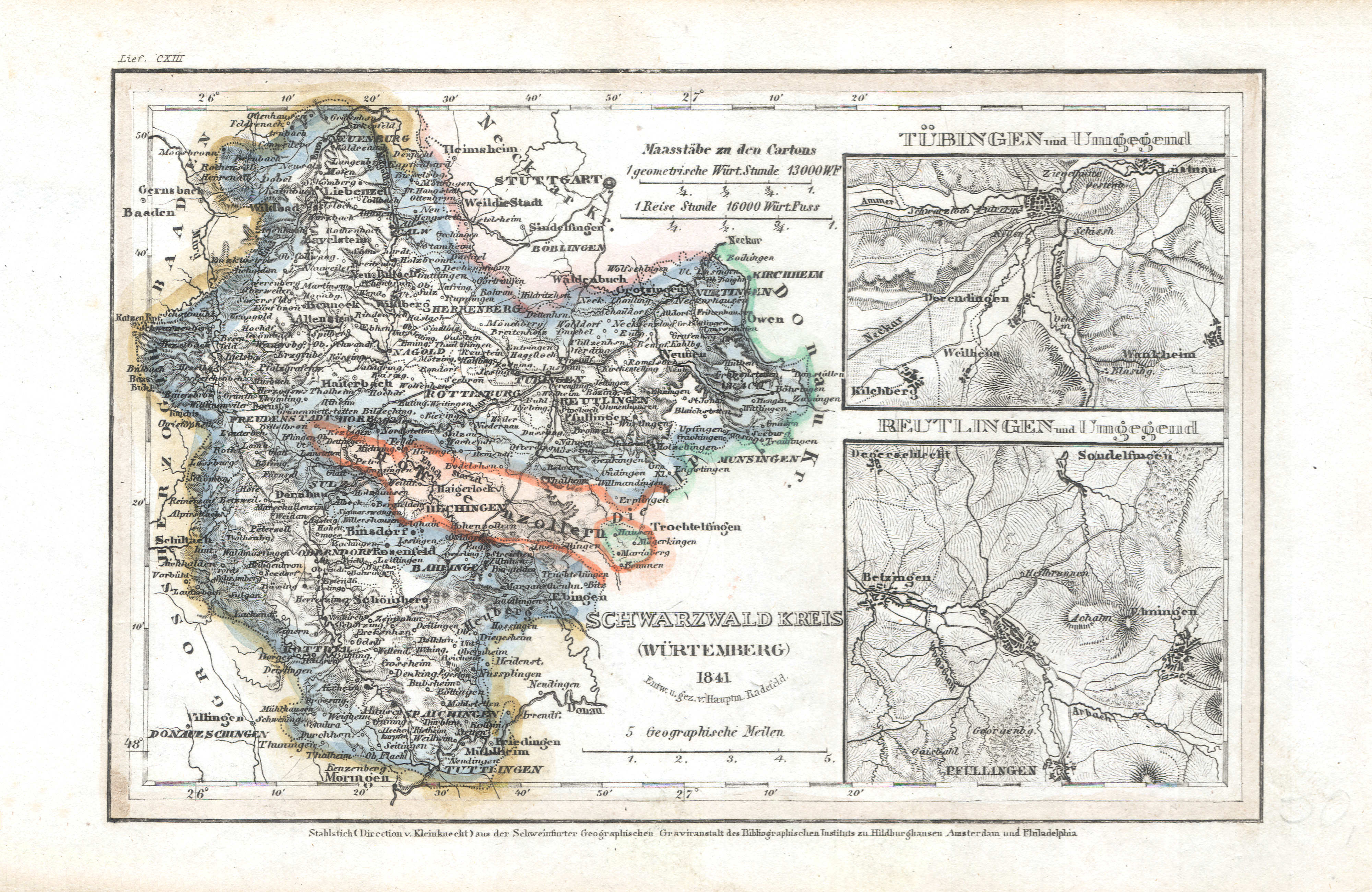
53. Schwarzwald-Kreis (Würtemberg) (Lief. CXIII = 113, 1841)
Württemberg: Schwarzwaldkreis
Meyer's Universal-Atlas (1830-1840)
geen overeenkomstige kaart / no corresponding map
 Meyer's Pfennig-Atlas (1834-1841)
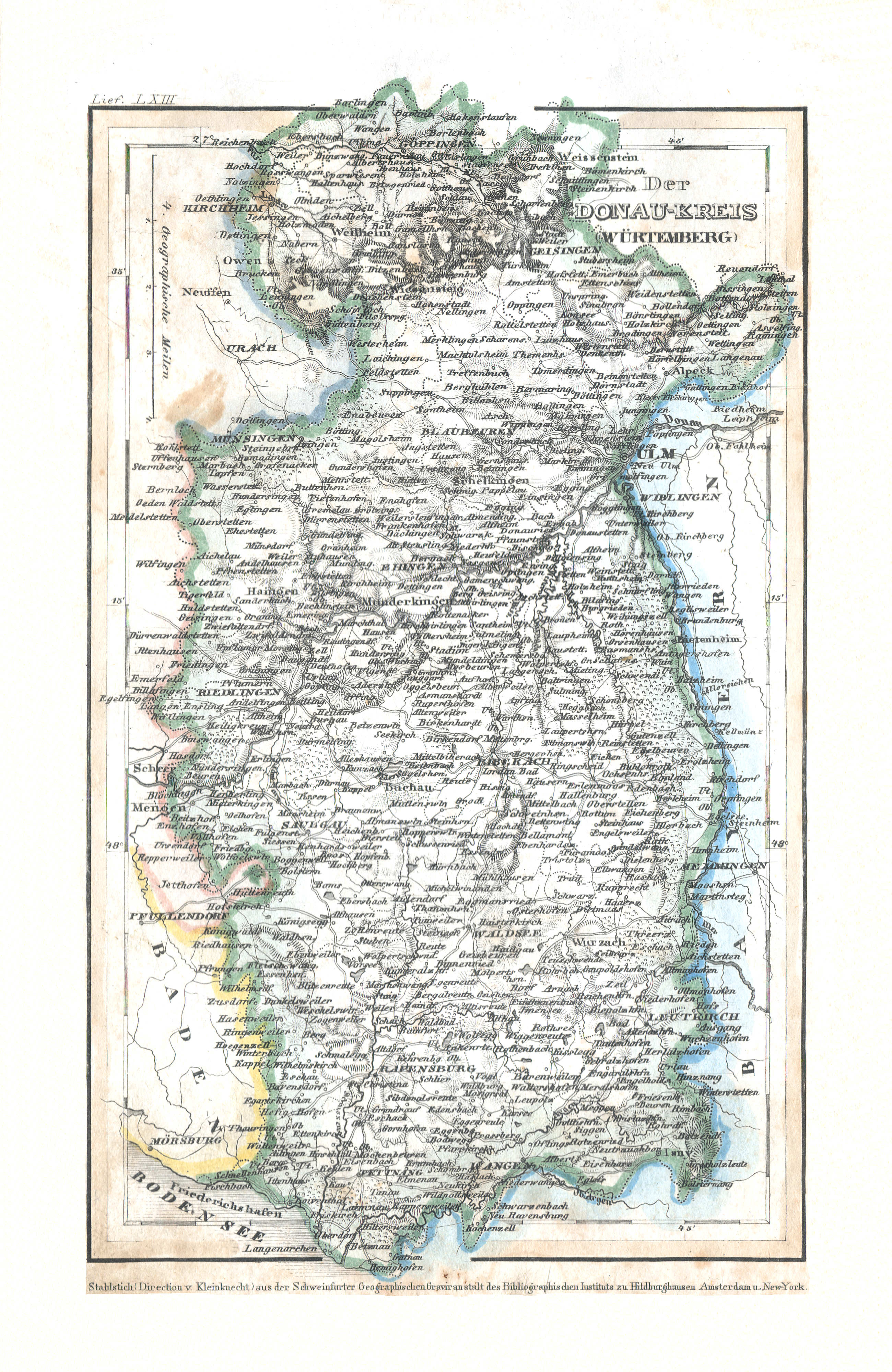
54. Der Donau-Kreis (Würtemberg) (Lief. LXIII = 63)
Württemberg: Donaukreis
Meyer's Universal-Atlas (1830-1840)
geen overeenkomstige kaart / no corresponding map
 Meyer's Pfennig-Atlas (1834-1841)
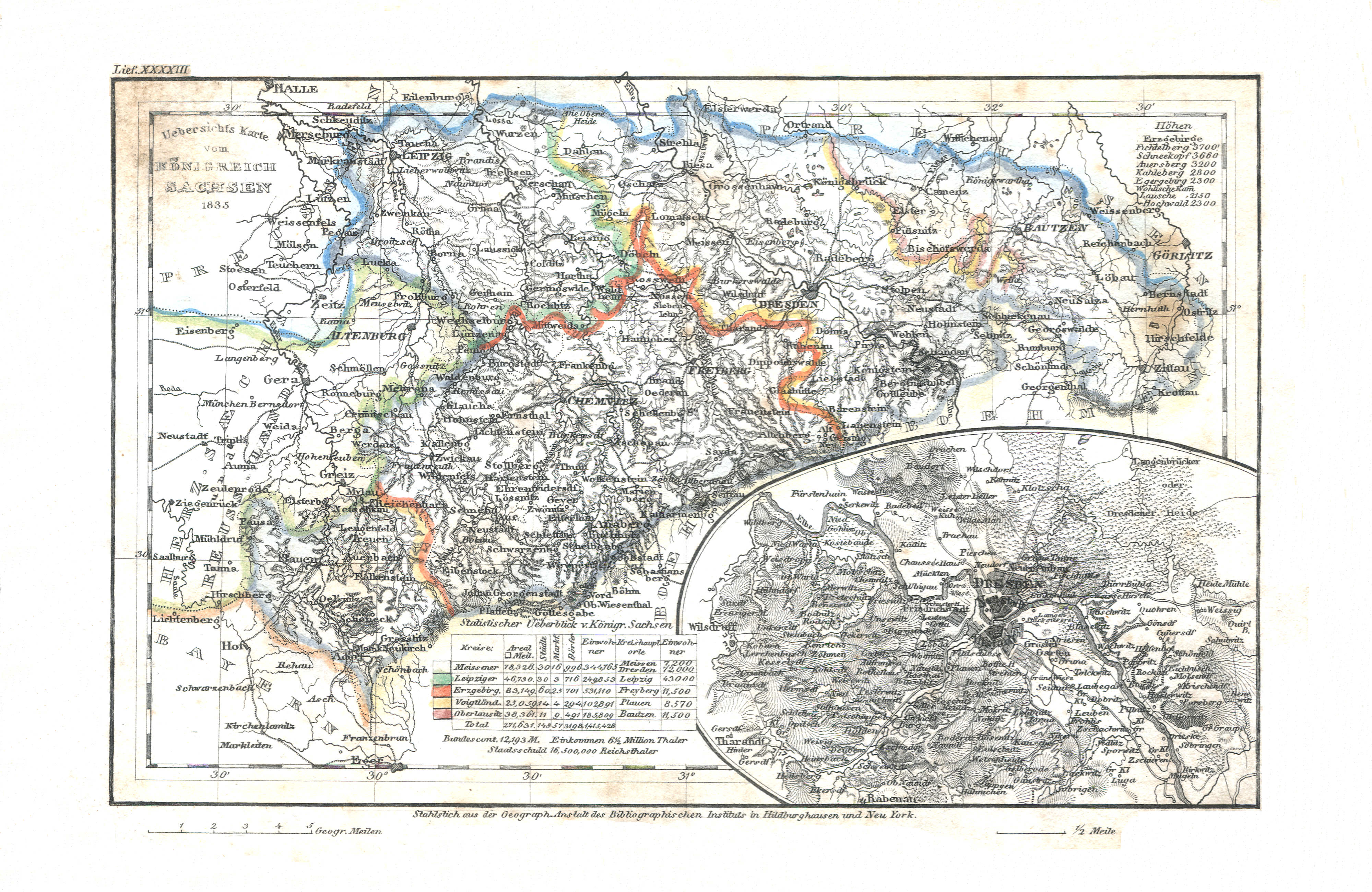
55. Uebersichts Karte vom Königreich Sachsen (Lief. XXXXIII = 43, 1835)
Koninkrijk Saksen / Kingdom of Saxony
 Meyer's Universal-Atlas (1830-1840)
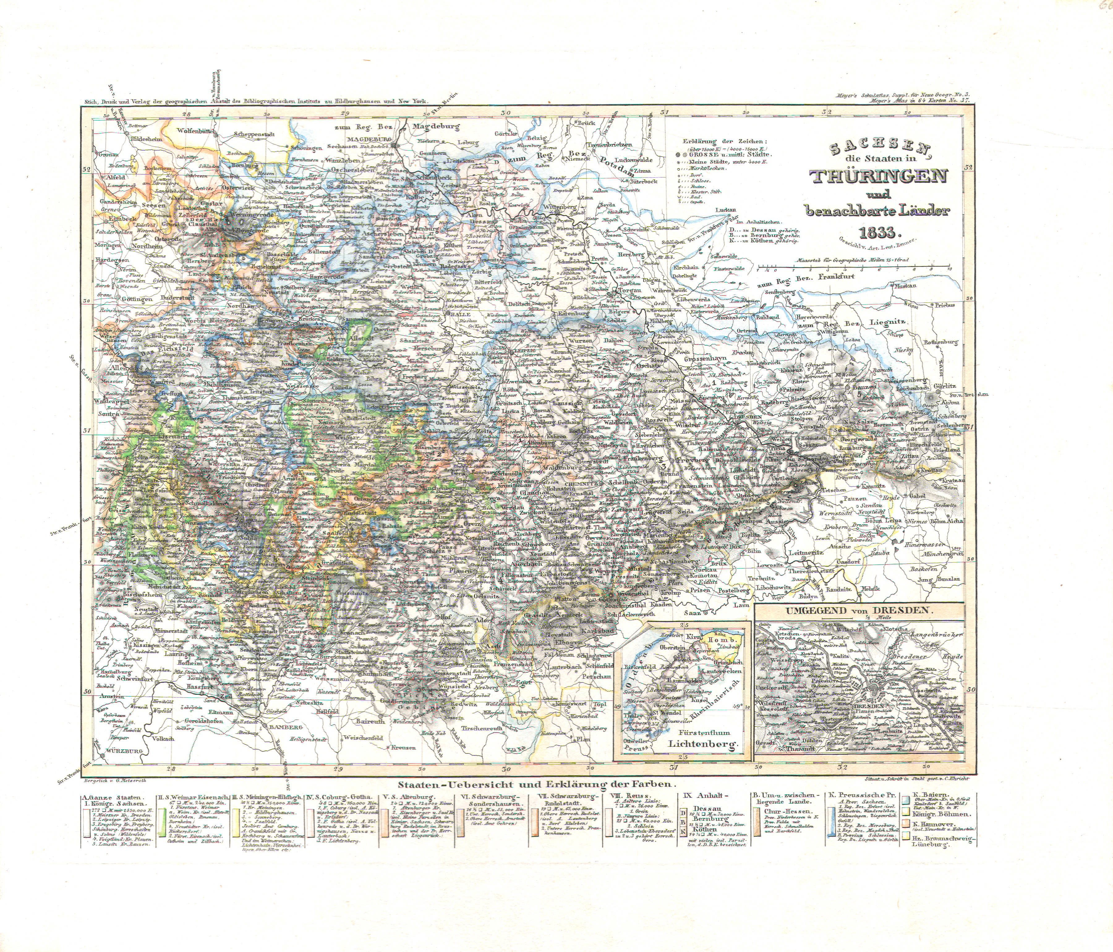
66. Sachsen, die Staaten in Thüringen und benachbarte Länder (Nº 37, 1833)
Saksen en Thüringen / Saxony and Thuringia
 Meyer's Pfennig-Atlas (1834-1841)
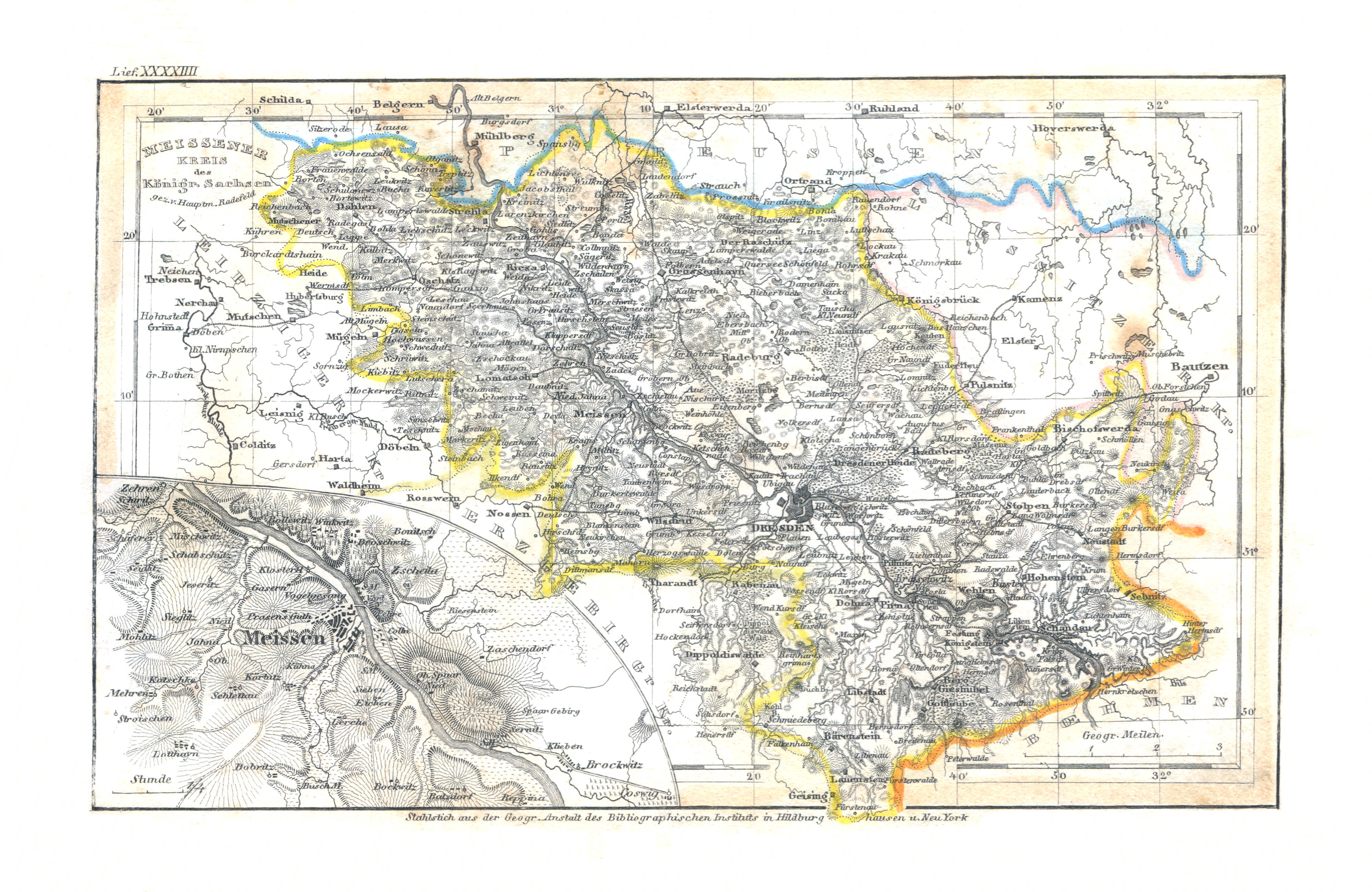
56. Meissener Kreis des Königr. Sachsen (Lief. XXXXIIII = 44)
Saksen / Saxony: Meissener Kreis
Meyer's Universal-Atlas (1830-1840)
geen overeenkomstige kaart / no corresponding map
 Meyer's Pfennig-Atlas (1834-1841)
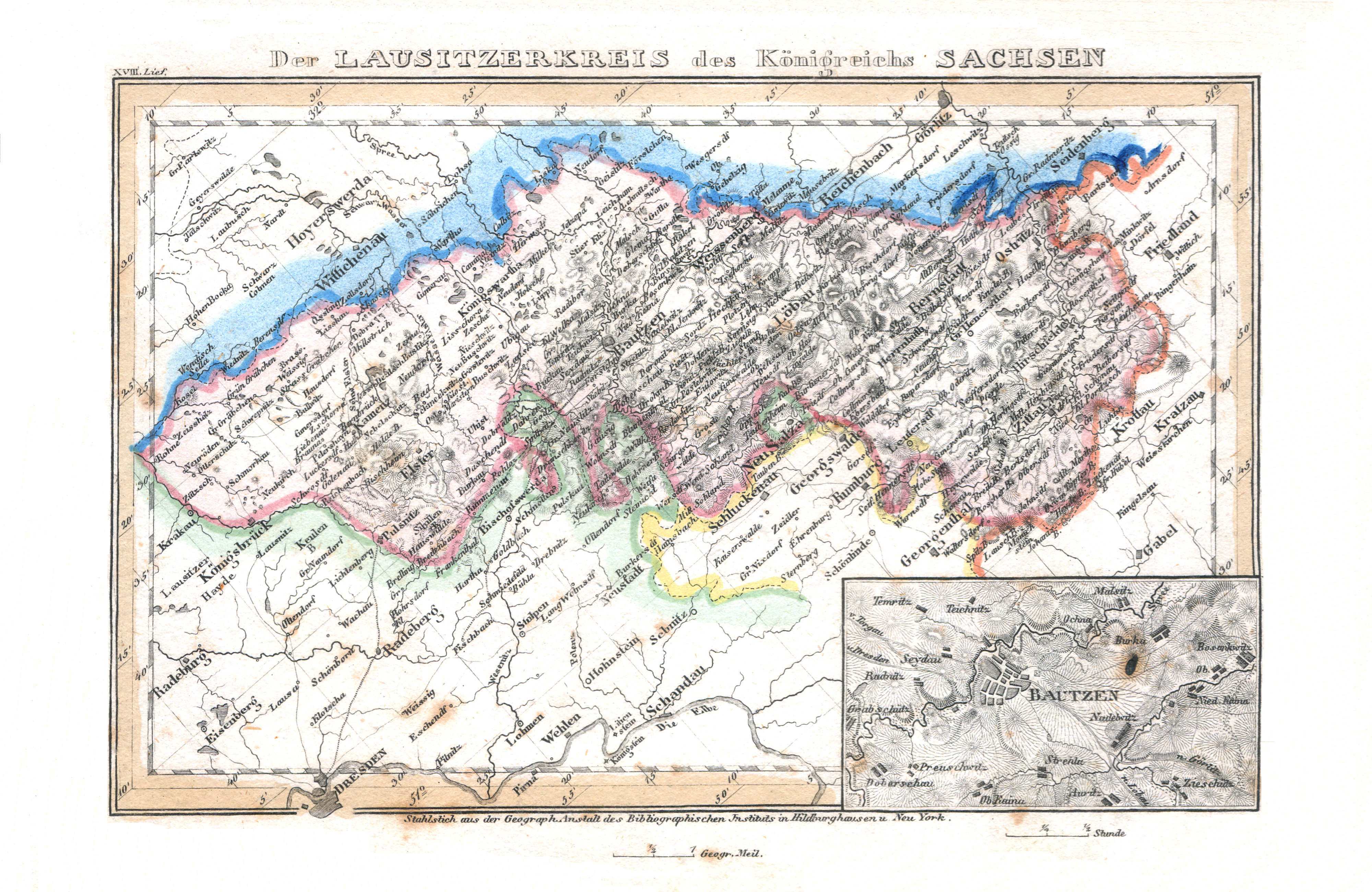
57. Der Lausitzerkreis des Königreichs Sachsen (Lief. XVIII = 18)
Saksen / Saxony: Lausitzerkreis
Meyer's Universal-Atlas (1830-1840)
geen overeenkomstige kaart / no corresponding map
 Meyer's Pfennig-Atlas (1834-1841)
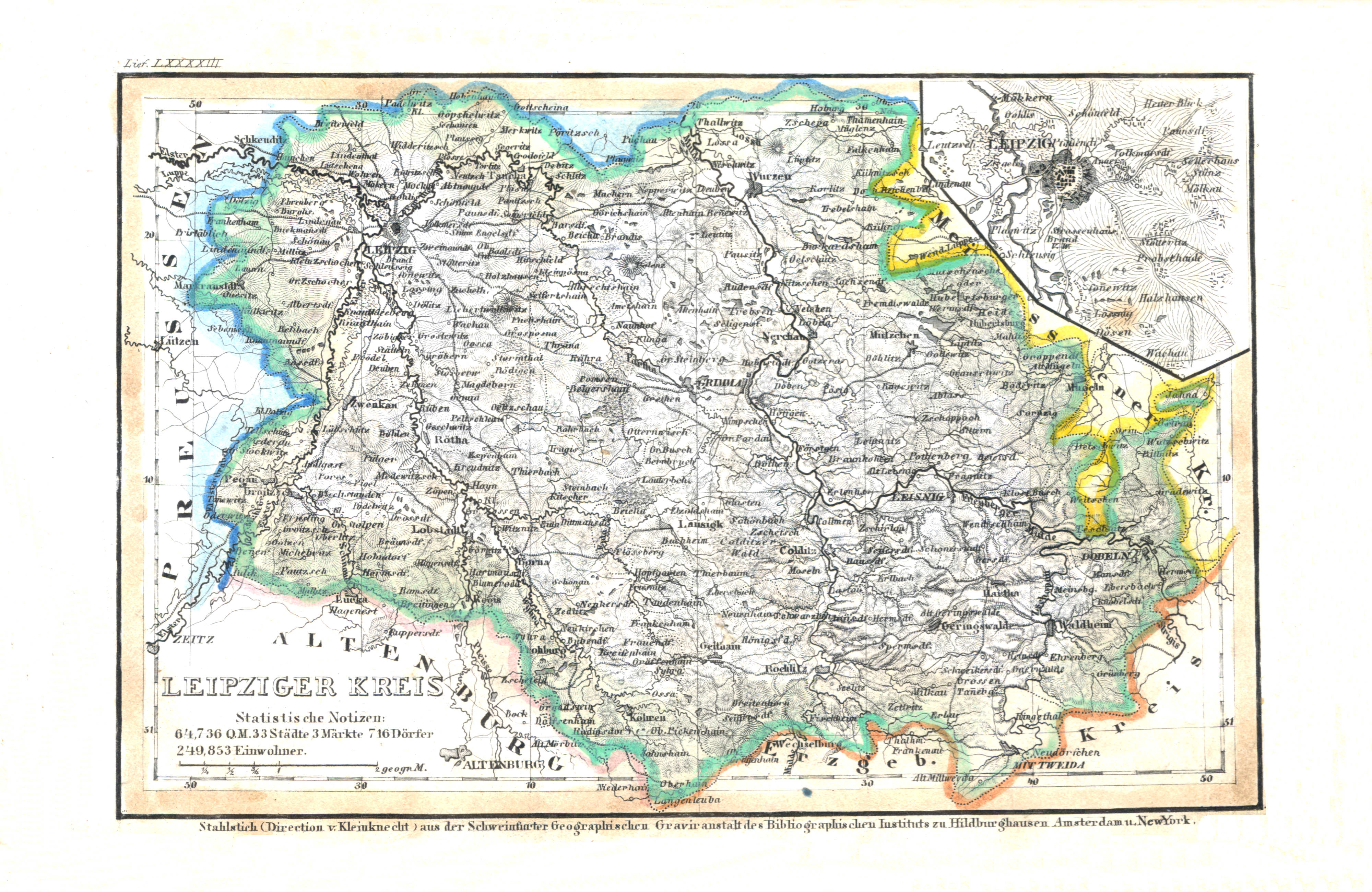
58. Leipziger Kreis (Lief. LXXXXIII = 93)
Saksen / Saxony: Leipziger Kreis
Meyer's Universal-Atlas (1830-1840)
geen overeenkomstige kaart / no corresponding map
 Meyer's Pfennig-Atlas (1834-1841)
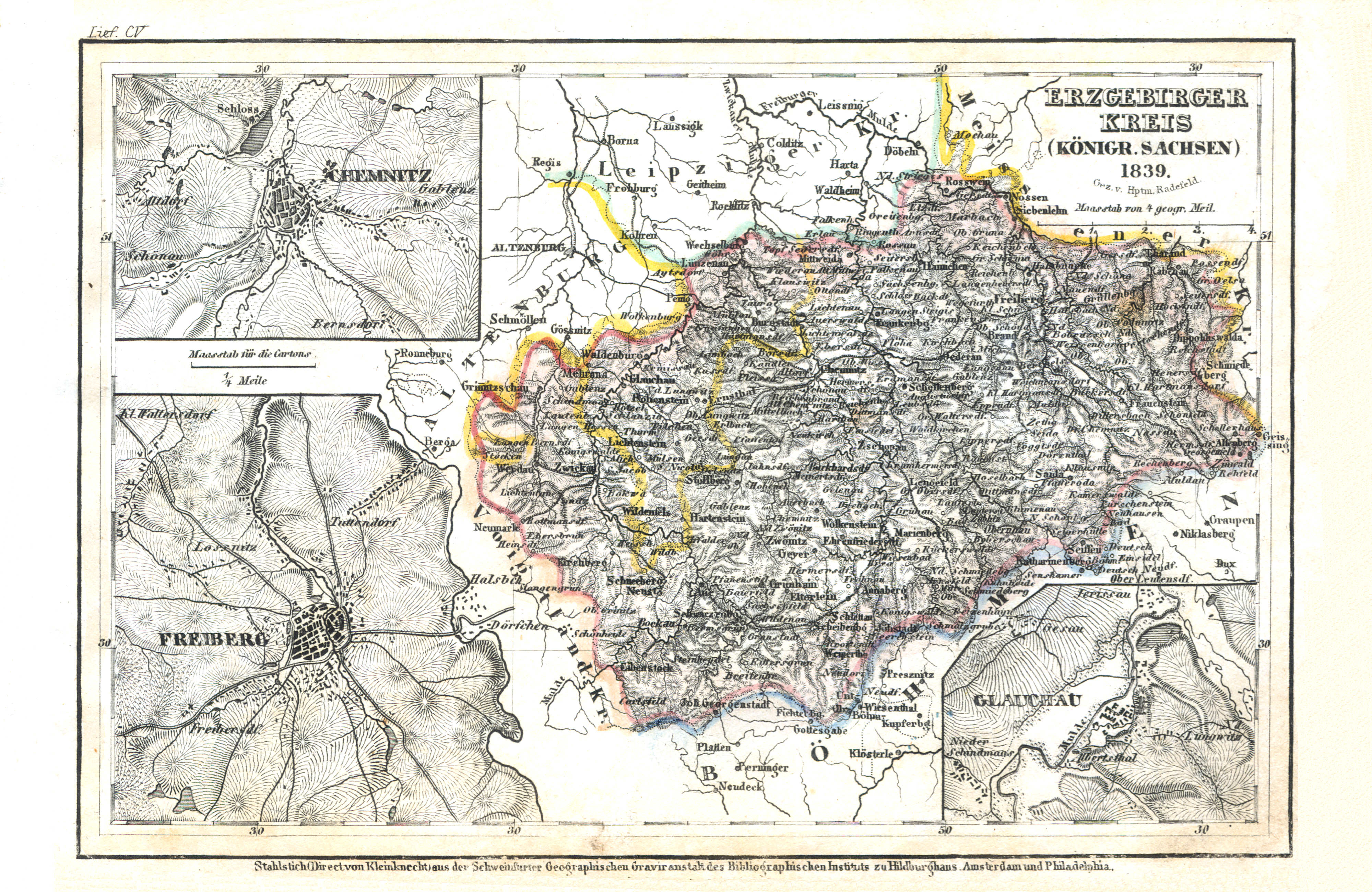
59. Erzgebirger Kreis (Königr. Sachsen) (Lief. CV = 105, 1839)
Saksen / Saxony: Erzgebirger Kreis
Meyer's Universal-Atlas (1830-1840)
geen overeenkomstige kaart / no corresponding map
 Meyer's Pfennig-Atlas (1834-1841)
60. Thüringen: enthaltend die Sachsen-Ernestinischen, Schwarzburgischen, Reussischen und angränzende Lande (Lief. LXVIII = 68)
Thüringse staten / Thuringian states
Meyer's Universal-Atlas (1830-1840)
66. Sachsen, die Staaten in Thüringen und benachbarte Länder (Nº 37, 1833)
Saksen en Thüringen / Saxony and Thuringia
 Meyer's Pfennig-Atlas (1834-1841)
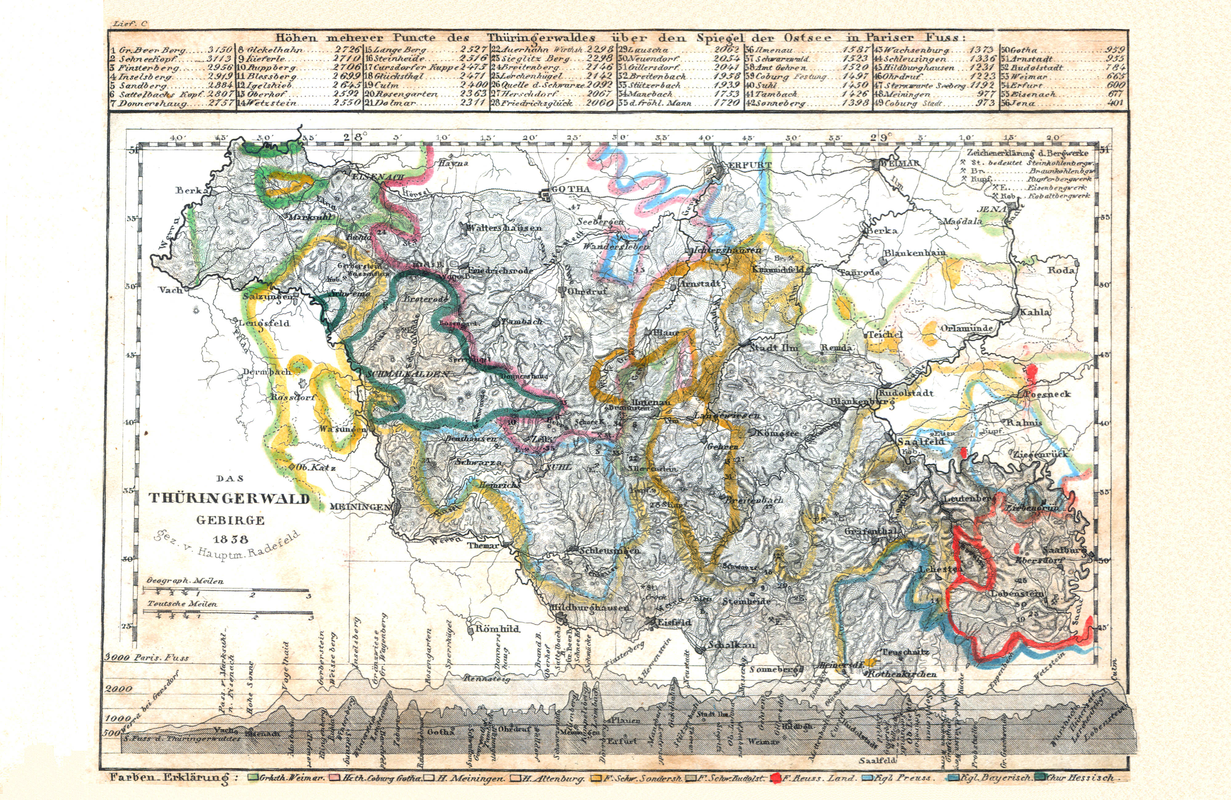
61. Das Thüringerwald Gebirge (Lief. C = 100, 1838)
Thüringer Woud / Thuringian Forest
Meyer's Universal-Atlas (1830-1840)
geen overeenkomstige kaart / no corresponding map
 Meyer's Pfennig-Atlas (1834-1841)
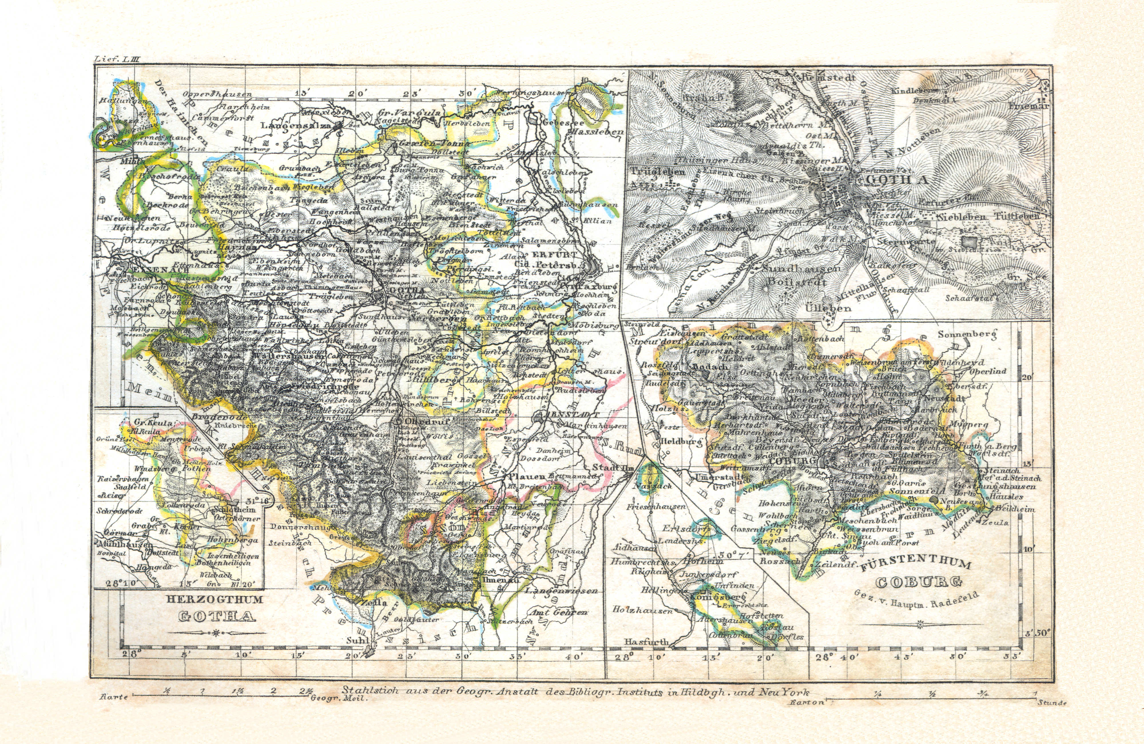
62. Herzogthum Gotha (Lief. LIII = 53)
Hertogdom Saksen-Coburg en Gotha / Duchy of Saxe-Coburg and Gotha
Meyer's Universal-Atlas (1830-1840)
geen overeenkomstige kaart / no corresponding map
 Meyer's Pfennig-Atlas (1834-1841)
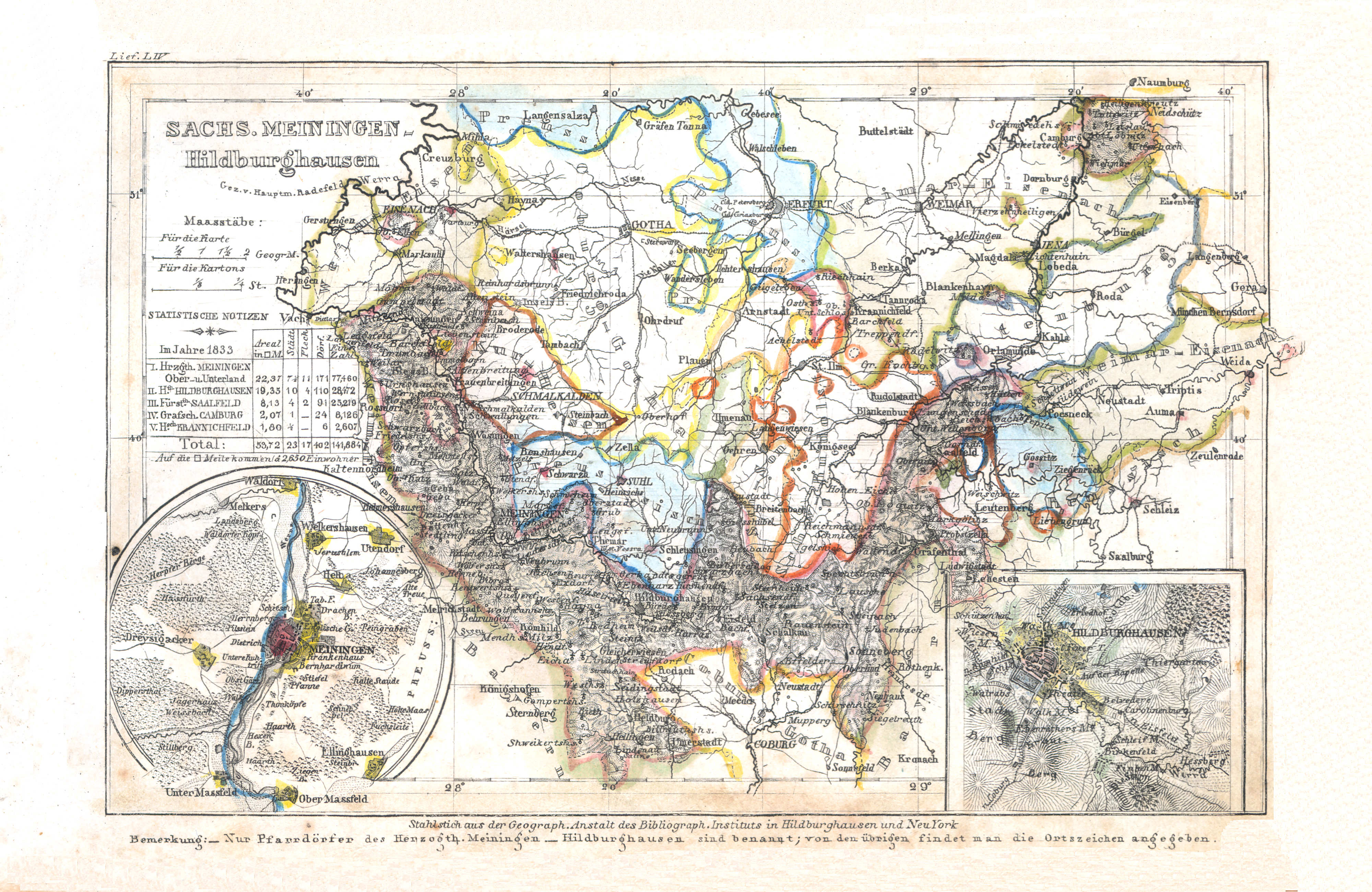
63. Sachs. Meiningen-Hildburghausen (Lief. LIV = 54)
Hertogdom Saksen-Meiningen-Hildburghausen / Duchy of Saxe-Meiningen-Hildburghausen
Meyer's Universal-Atlas (1830-1840)
geen overeenkomstige kaart / no corresponding map
 Meyer's Pfennig-Atlas (1834-1841)
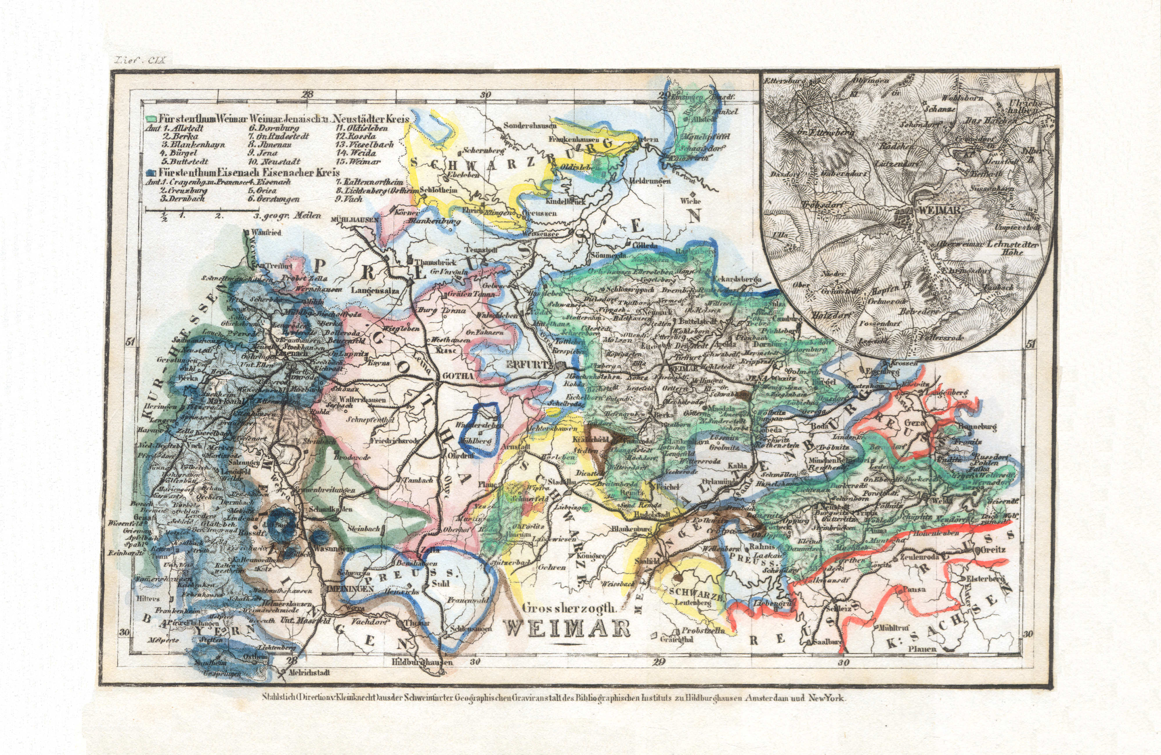
64. Grossherzogth. Weimar (Lief. CIX = 109)
Groothertogdom Saksen-Weimar-Eisenach / Grand Duchy of Saxe-Weimar-Eisenach
 Meyer's Universal-Atlas (1830-1840)
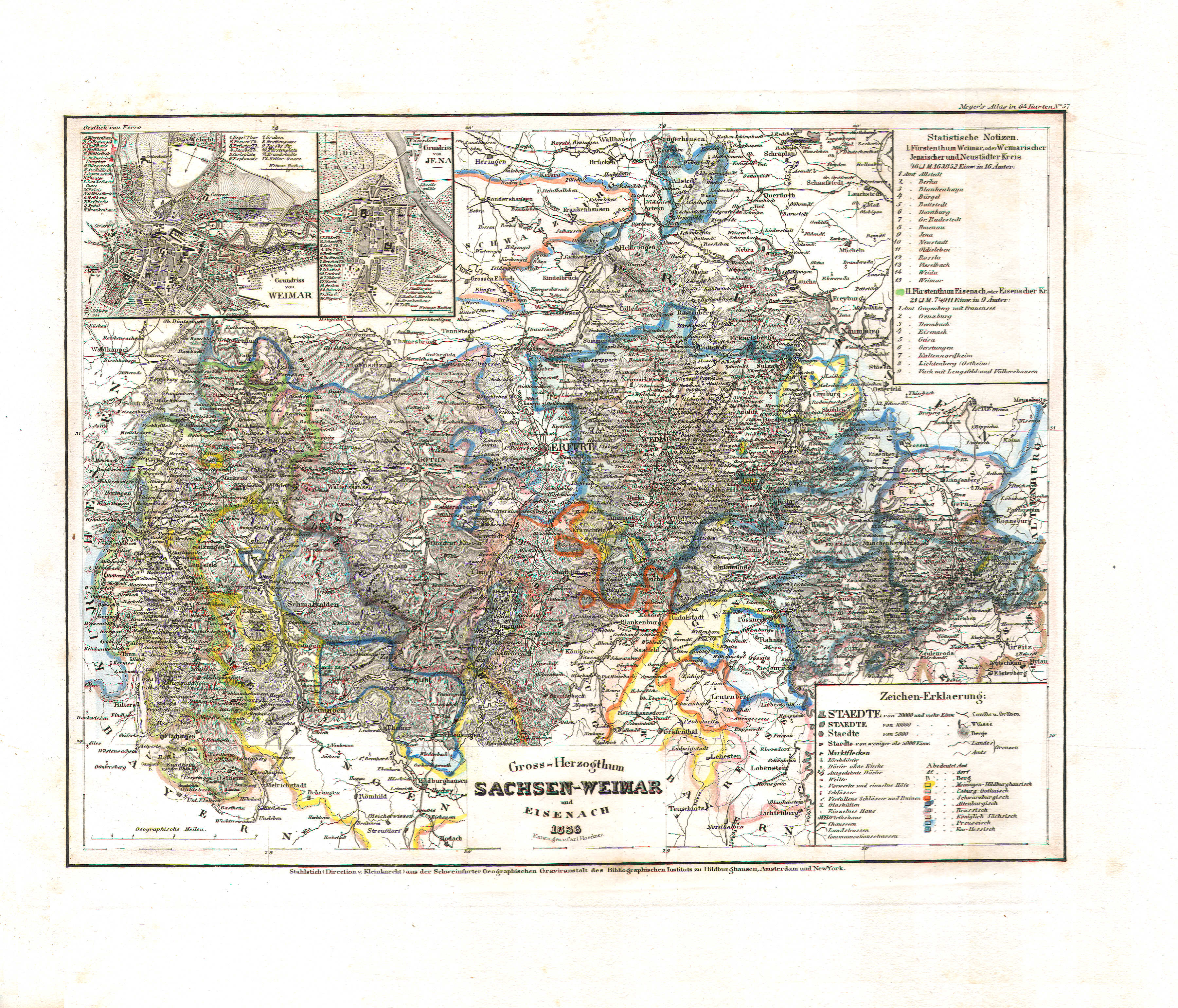
70. Gross-Herzogthum Sachsen-Weimar und Eisenach (Nº 57, 1836)
Groothertogdom Saksen-Weimar-Eisenach / Grand Duchy of Saxe-Weimar-Eisenach
 Meyer's Pfennig-Atlas (1834-1841)
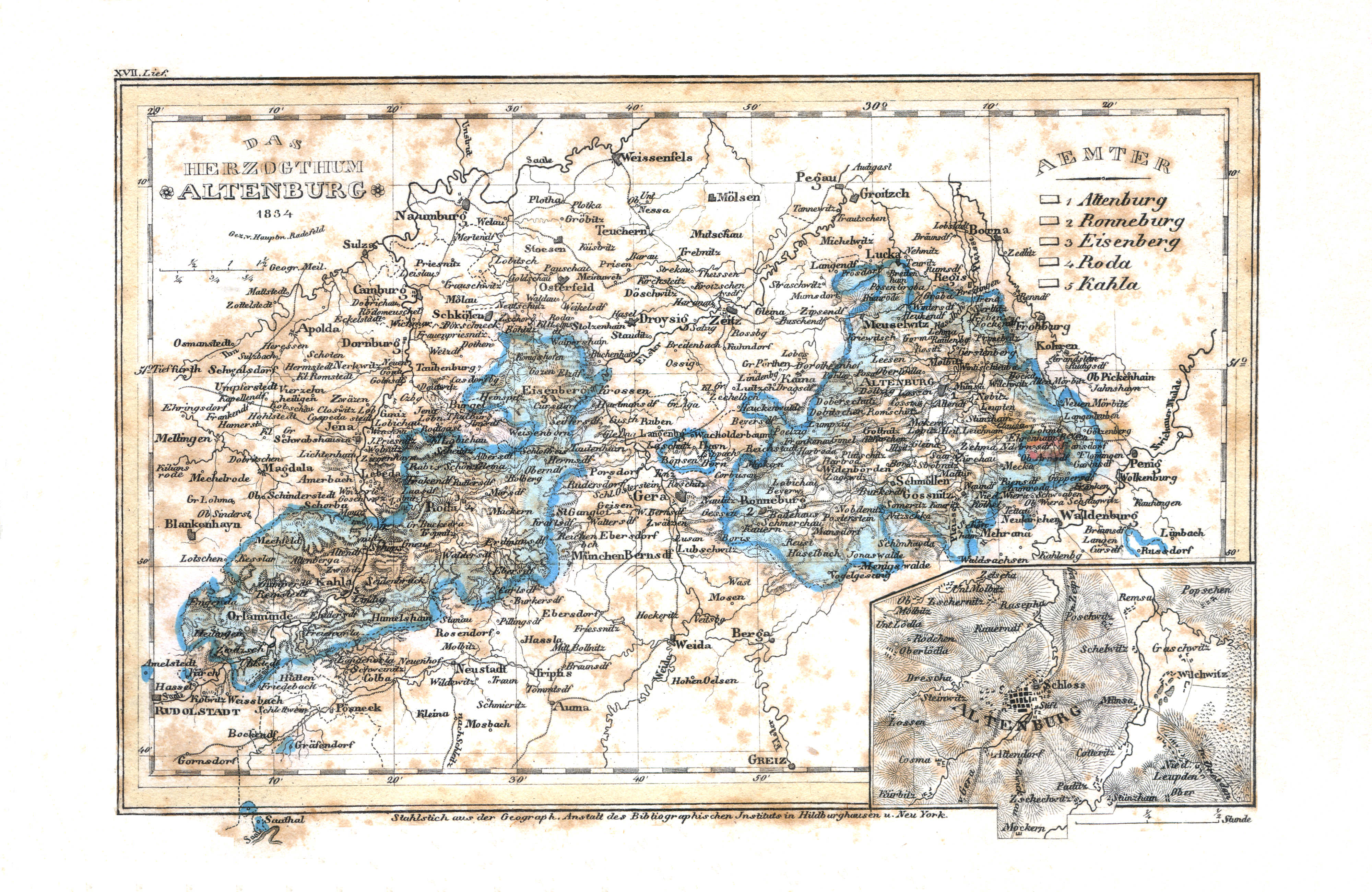
65. Das Herzogthum Altenburg (Lief. XVII = 17, 1834)
Hertogdom Saksen-Altenburg / Duchy of Saxe-Altenburg
Meyer's Universal-Atlas (1830-1840)
geen overeenkomstige kaart / no corresponding map
 Meyer's Pfennig-Atlas (1834-1841)
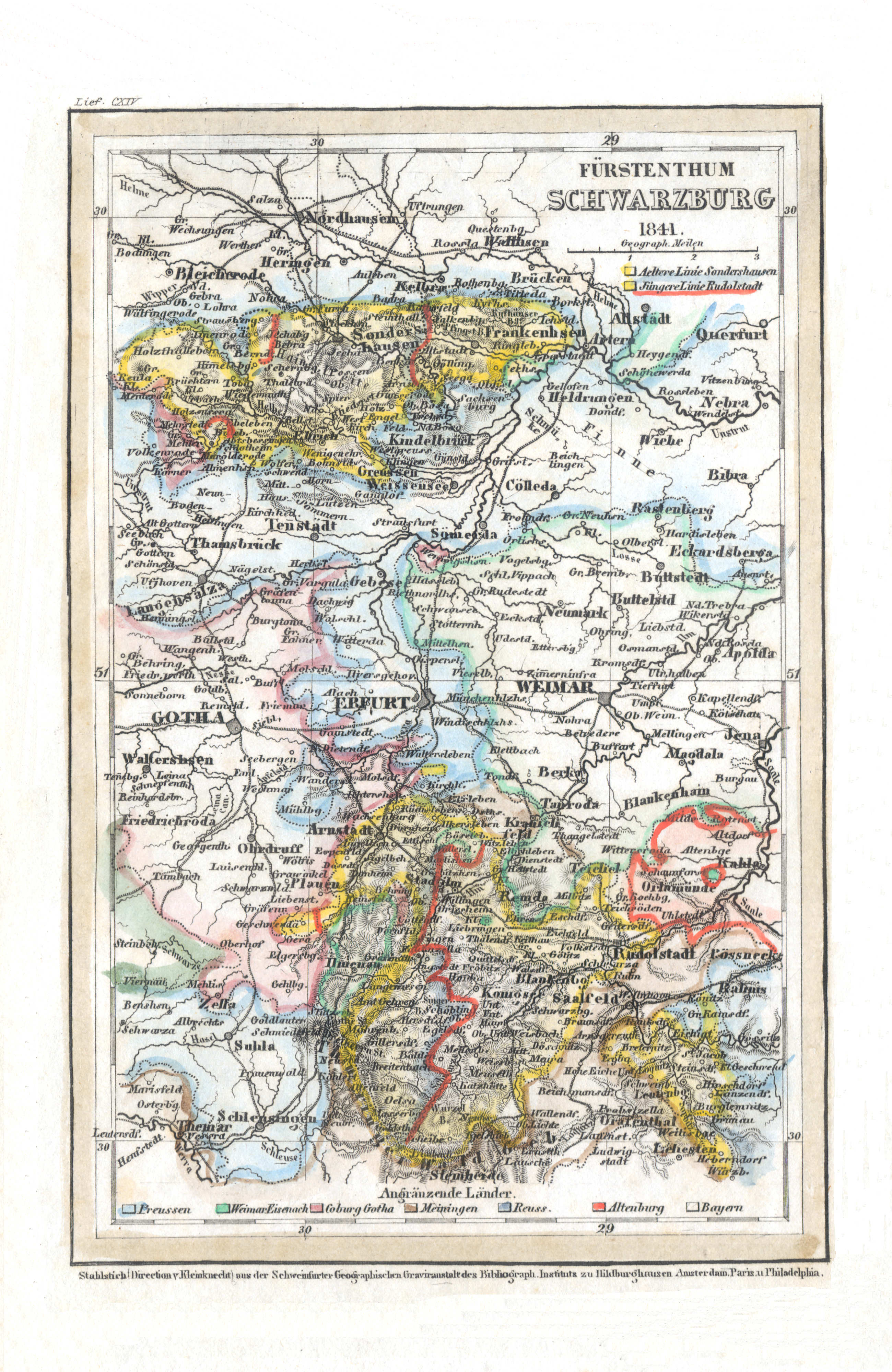
66. Fürstenthum Schwarzburg (Lief. CXIV = 114, 1841)
Vorstendommen Schwarzburg-Rudolstadt en Schwarzburg-Sondershausen / Principalities of Schwarzburg-Rudolstadt and Schwarzburg-Sondershausen
Meyer's Universal-Atlas (1830-1840)
geen overeenkomstige kaart / no corresponding map
 Meyer's Pfennig-Atlas (1834-1841)
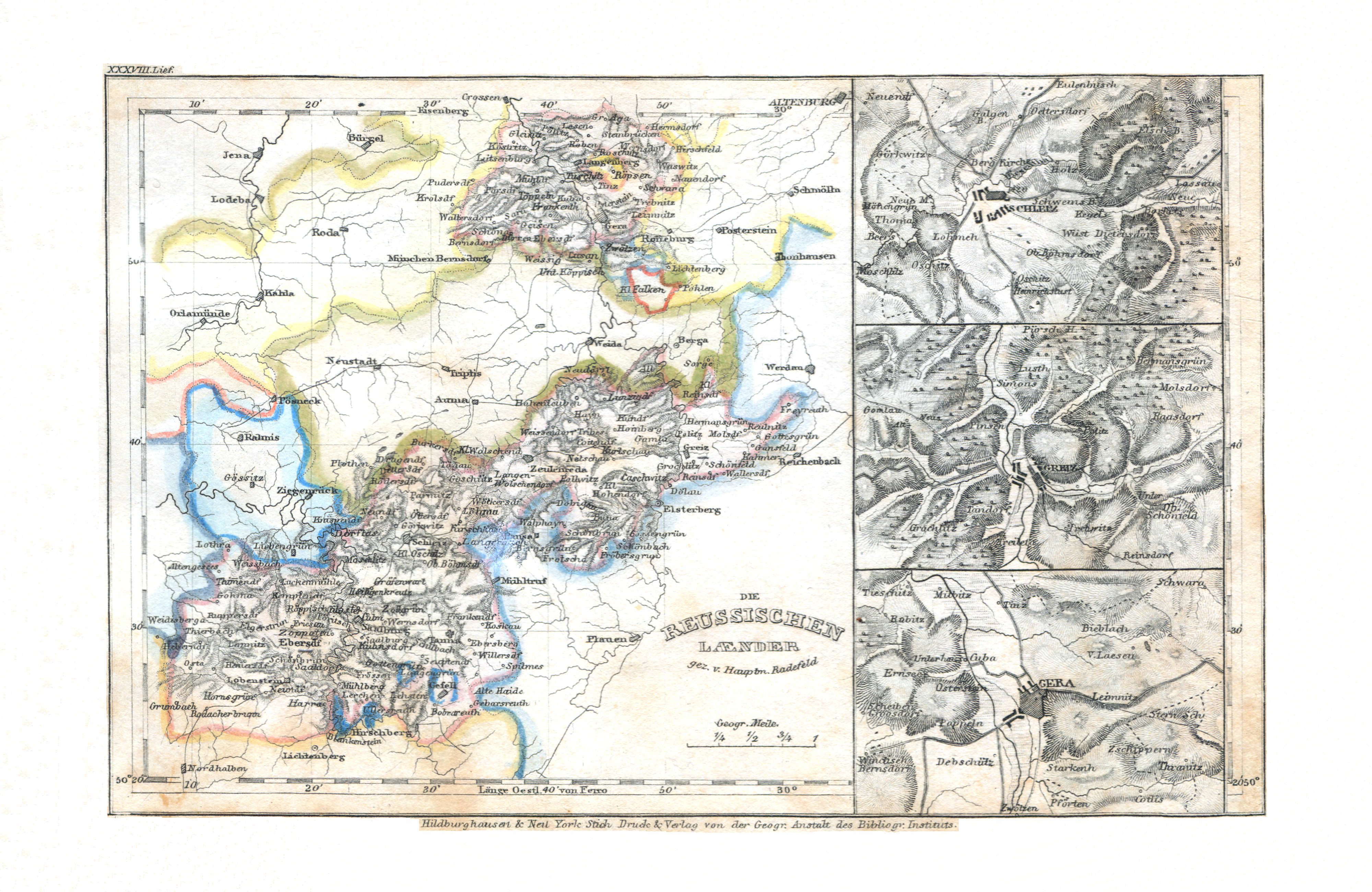
67. Die Reussischen Laender (Lief. XXXVIII = 38)
Vorstendommen Reuss oudere linie en Reuss jongere linie / Principalities of Reuss Elder Line and Reuss Younger Line
Meyer's Universal-Atlas (1830-1840)
geen overeenkomstige kaart / no corresponding map
 Meyer's Pfennig-Atlas (1834-1841)
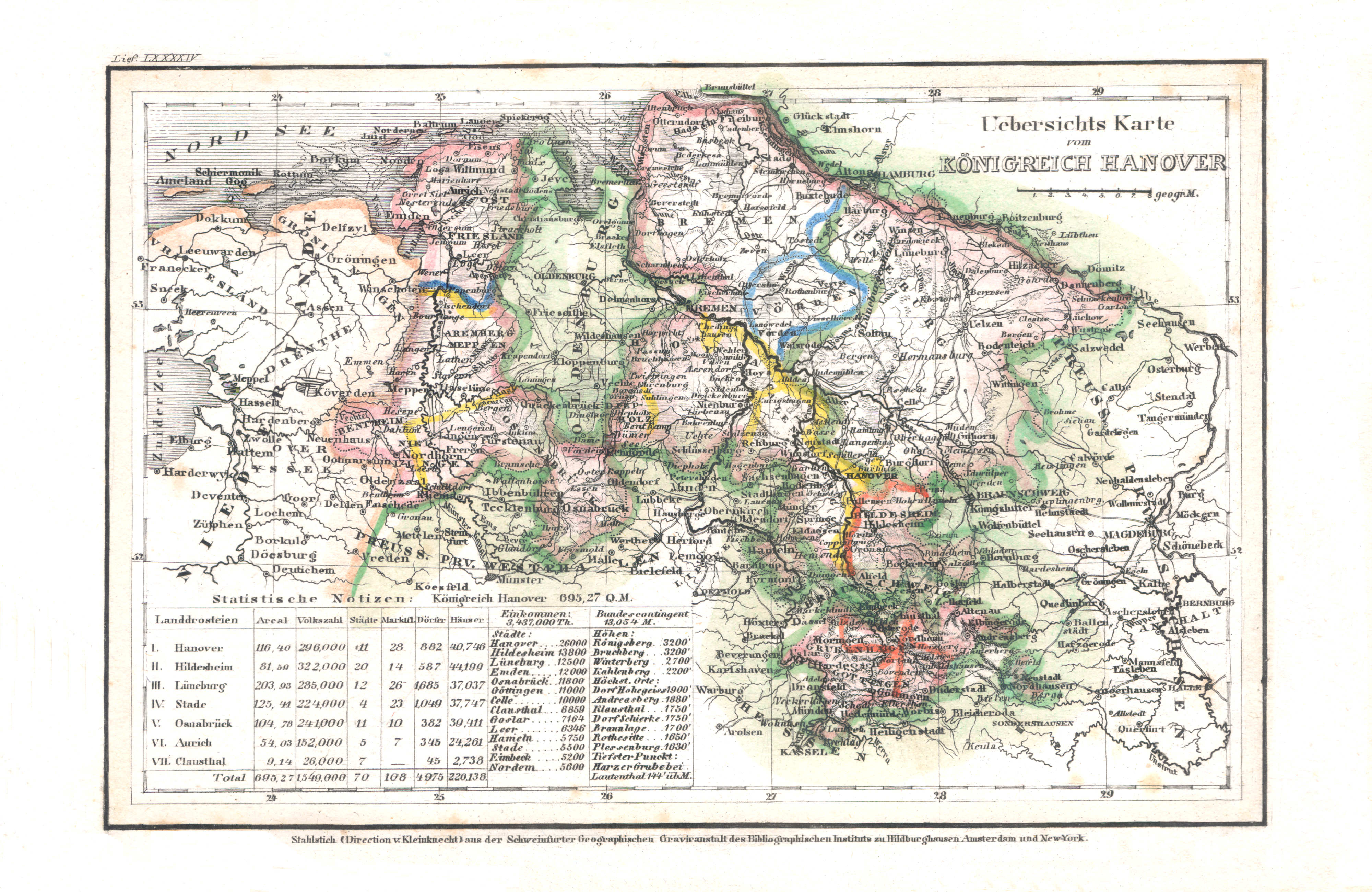
68. Uebersichtskarte vom Königreich Hanover (Lief. LXXXXIV = 94)
Overzichtskaart van het Koninkrijk Hannover / General map of the Kingdom of Hanover
Meyer's Universal-Atlas (1830-1840)
geen overeenkomstige kaart / no corresponding map
 Meyer's Pfennig-Atlas (1834-1841)
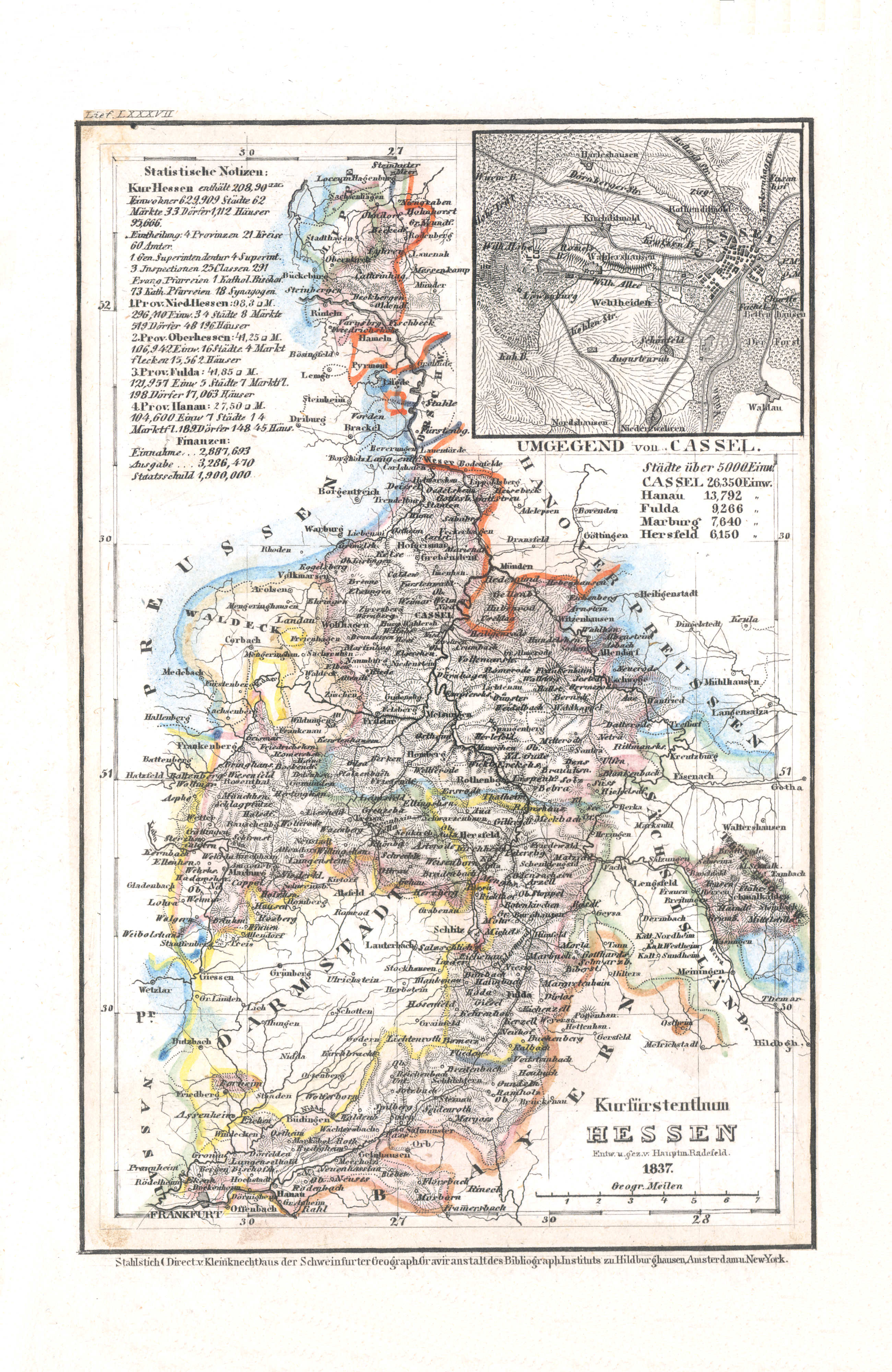
69. Kurfürstenthum Hessen (Lief. LXXXVII = 87, 1837)
Keurvorstendom Hessen-Kassel / Electorate of Hesse-Kassel
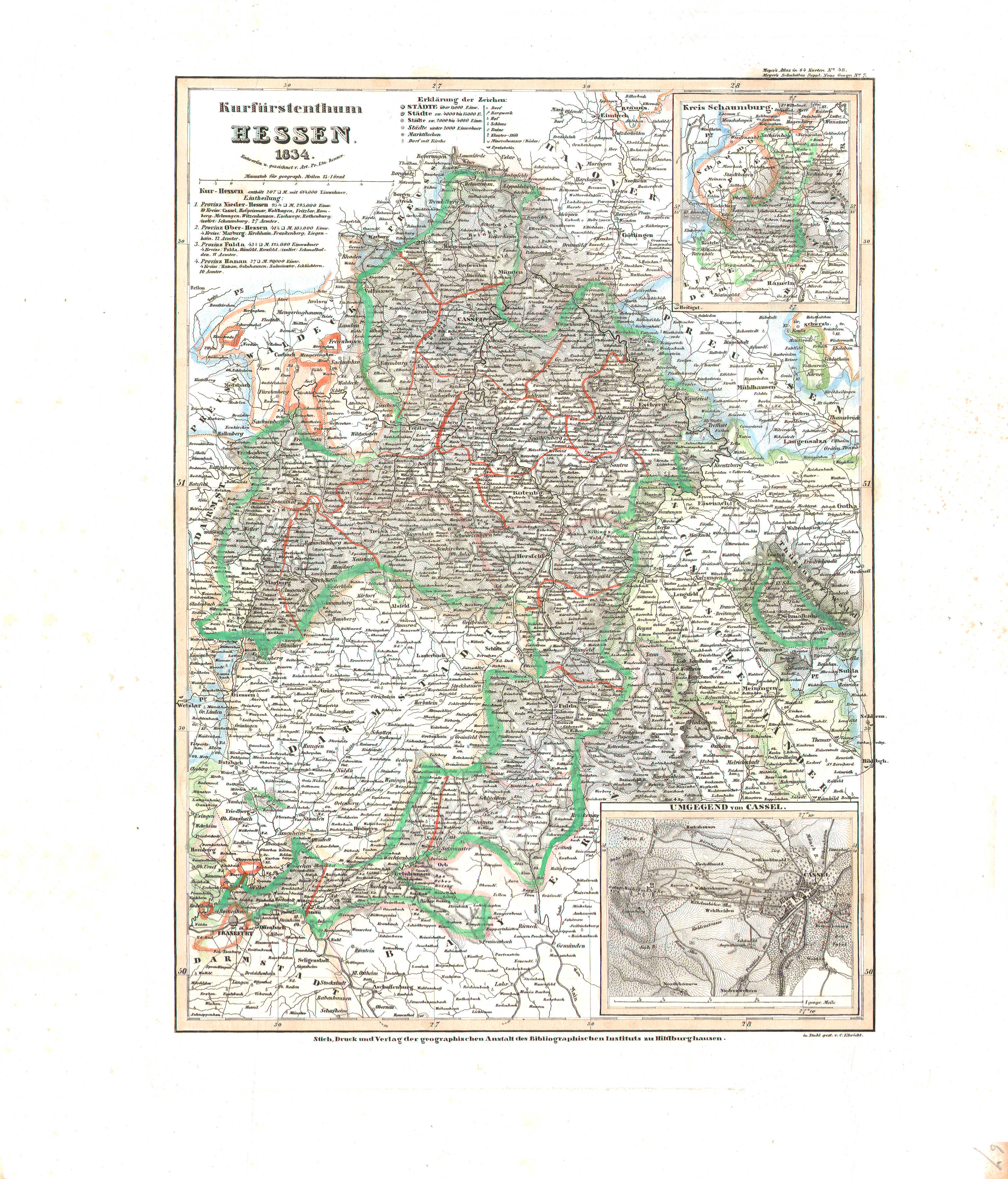 Meyer's Universal-Atlas (1830-1840)
67. Kurfürstenthum Hessen (Nº 48, 1834)
Hessen-Kassel / Hesse-Kassel
 Meyer's Pfennig-Atlas (1834-1841)
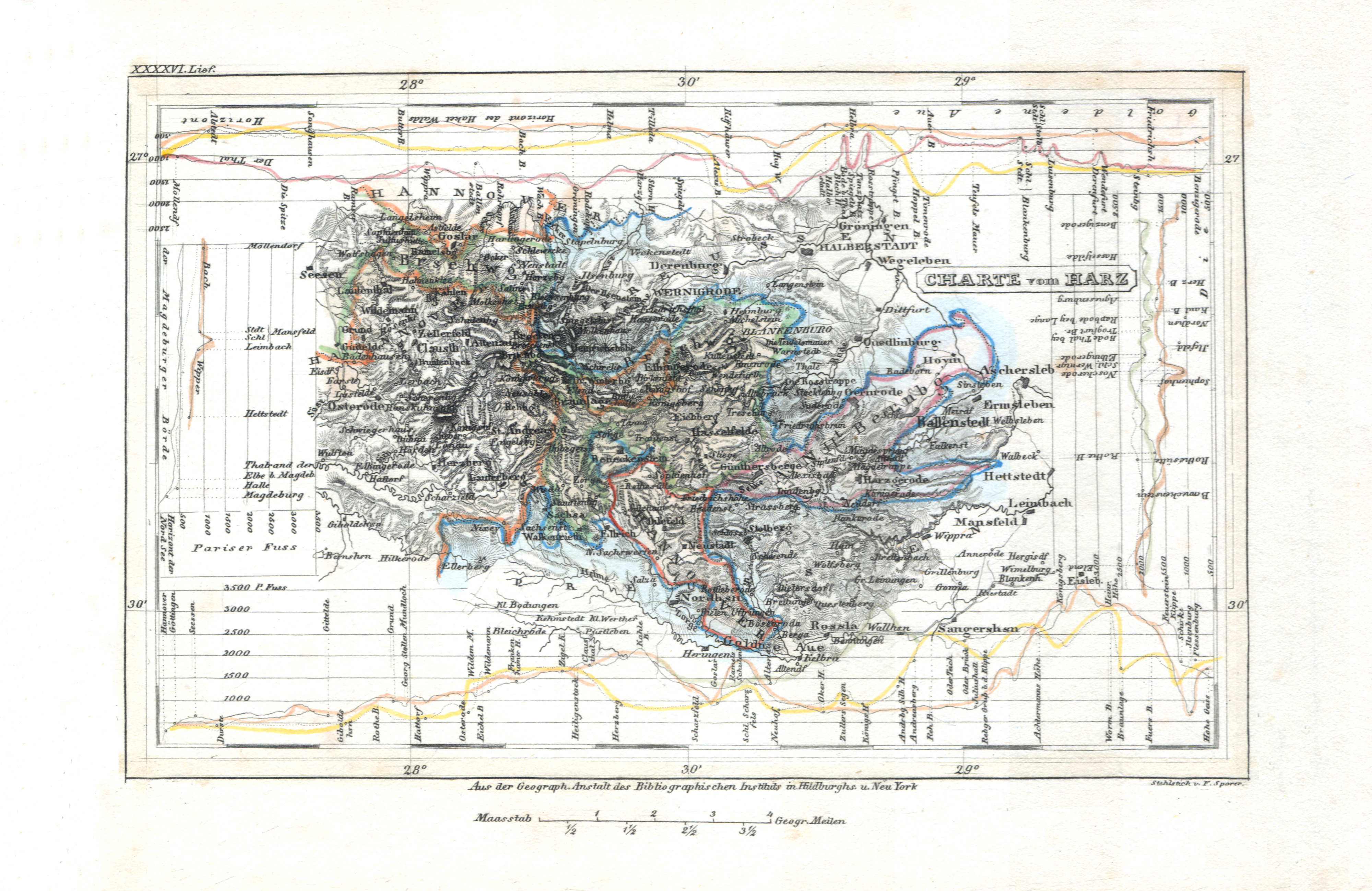
70. Charte vom Harz (Lief. XXXXVI = 46)
Kaart van het Harz-gebergte / Map of the Harz Mountains
Meyer's Universal-Atlas (1830-1840)
geen overeenkomstige kaart / no corresponding map
 Meyer's Pfennig-Atlas (1834-1841)
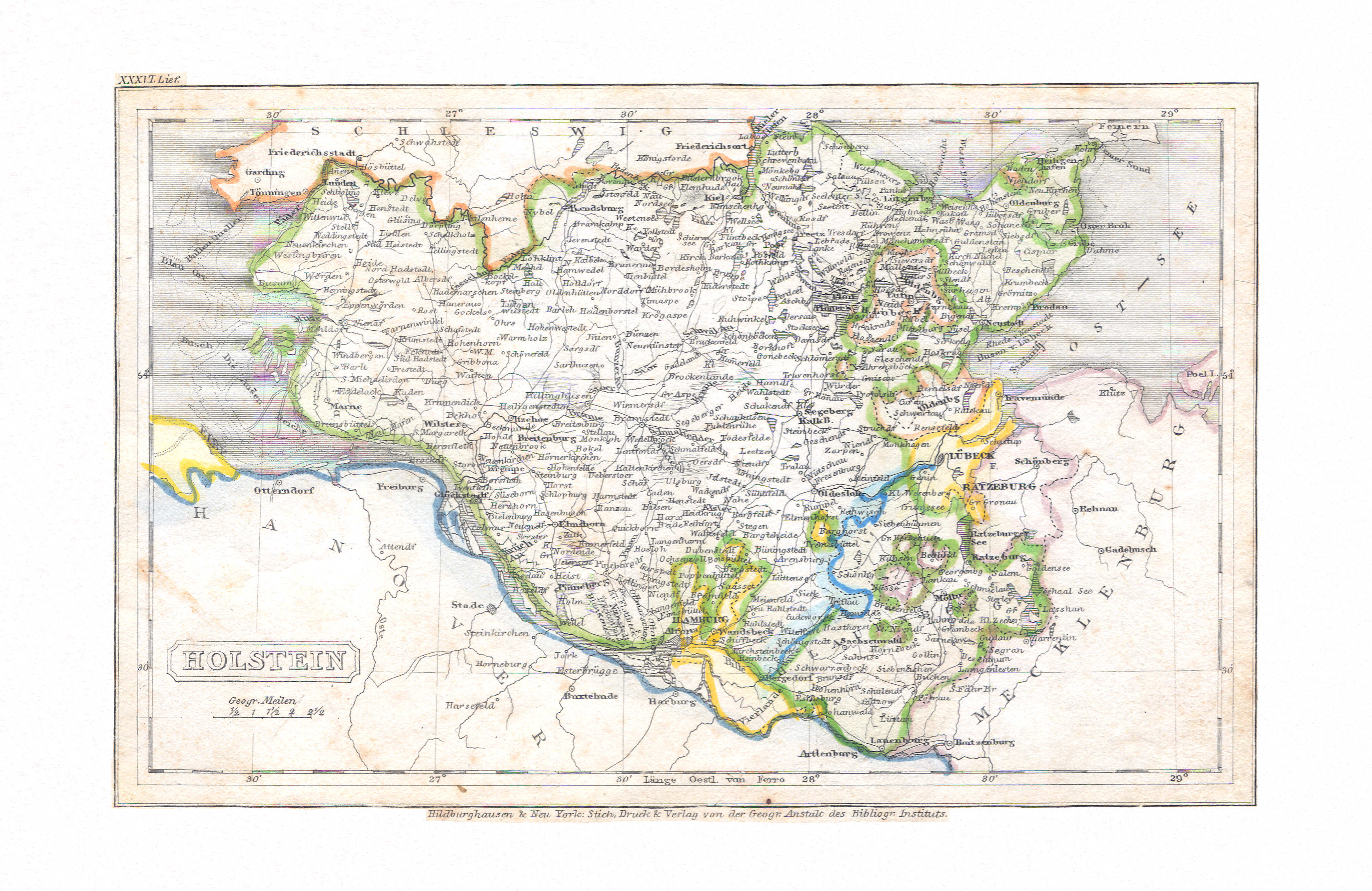
71. Holstein (Lief. XXXVI = 36)
Holstein
Meyer's Universal-Atlas (1830-1840)
geen overeenkomstige kaart / no corresponding map
 Meyer's Pfennig-Atlas (1834-1841)
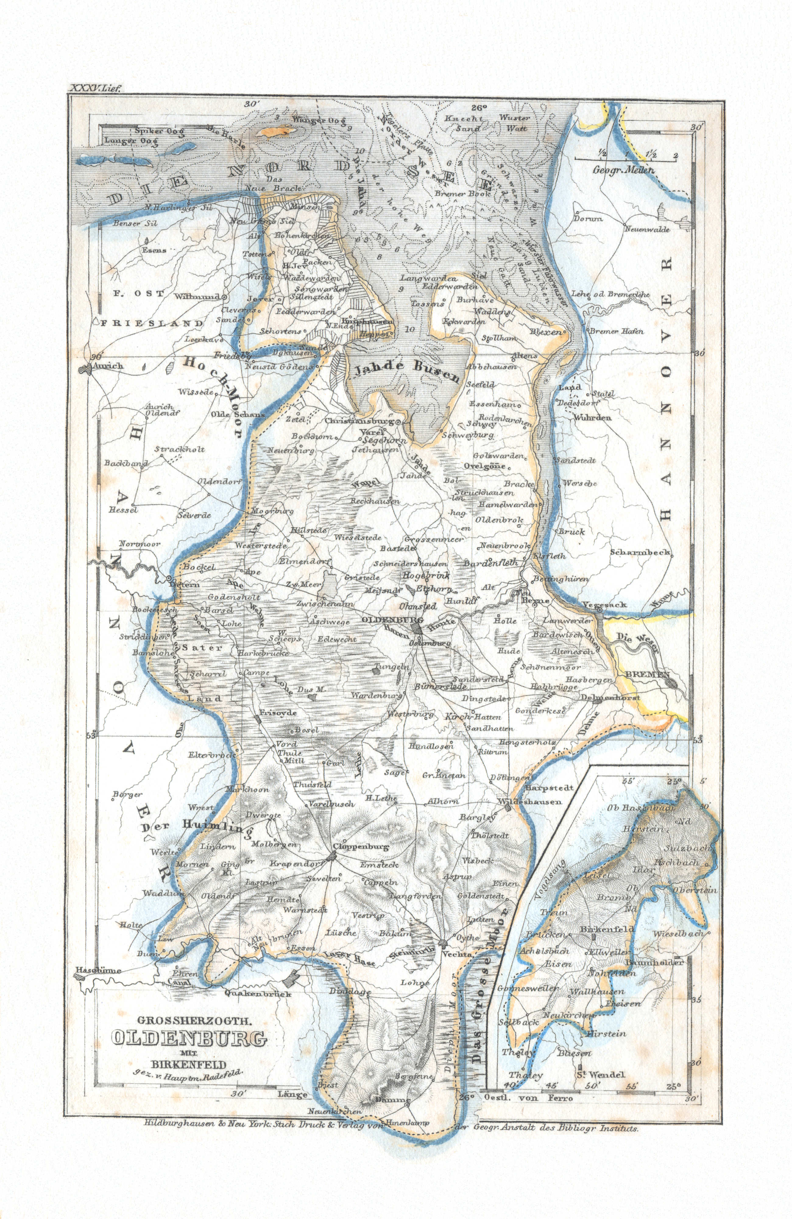
72. Grossherzogth. Oldenburg mit Birkenfeld (Lief. XXXV = 35)
Groothertogdom Oldenburg met Birkenfeld / Grand Duchy of Oldenburg with Birkenfeld
Meyer's Universal-Atlas (1830-1840)
geen overeenkomstige kaart / no corresponding map
 Meyer's Pfennig-Atlas (1834-1841)
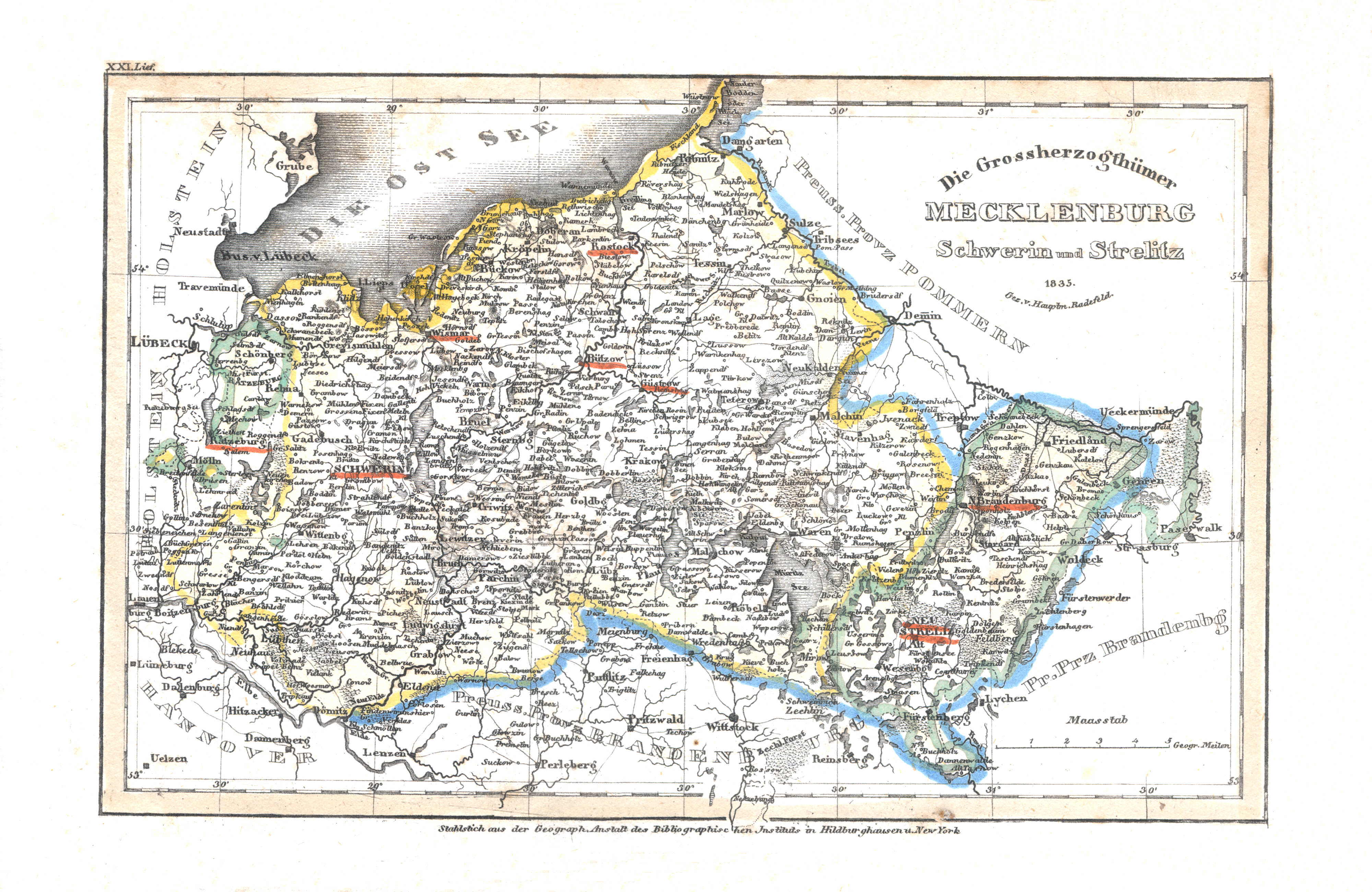
73. Die Grossherzogthümer Mecklenburg Schwerin und Strelitz (Lief. XXI = 21, 1835)
Groothertogdommen Mecklenburg-Schwerin en Mecklenburg-Strelitz / Grand Duchies of Mecklenburg-Schwerin en Mecklenburg-Strelitz
 Meyer's Universal-Atlas (1830-1840)
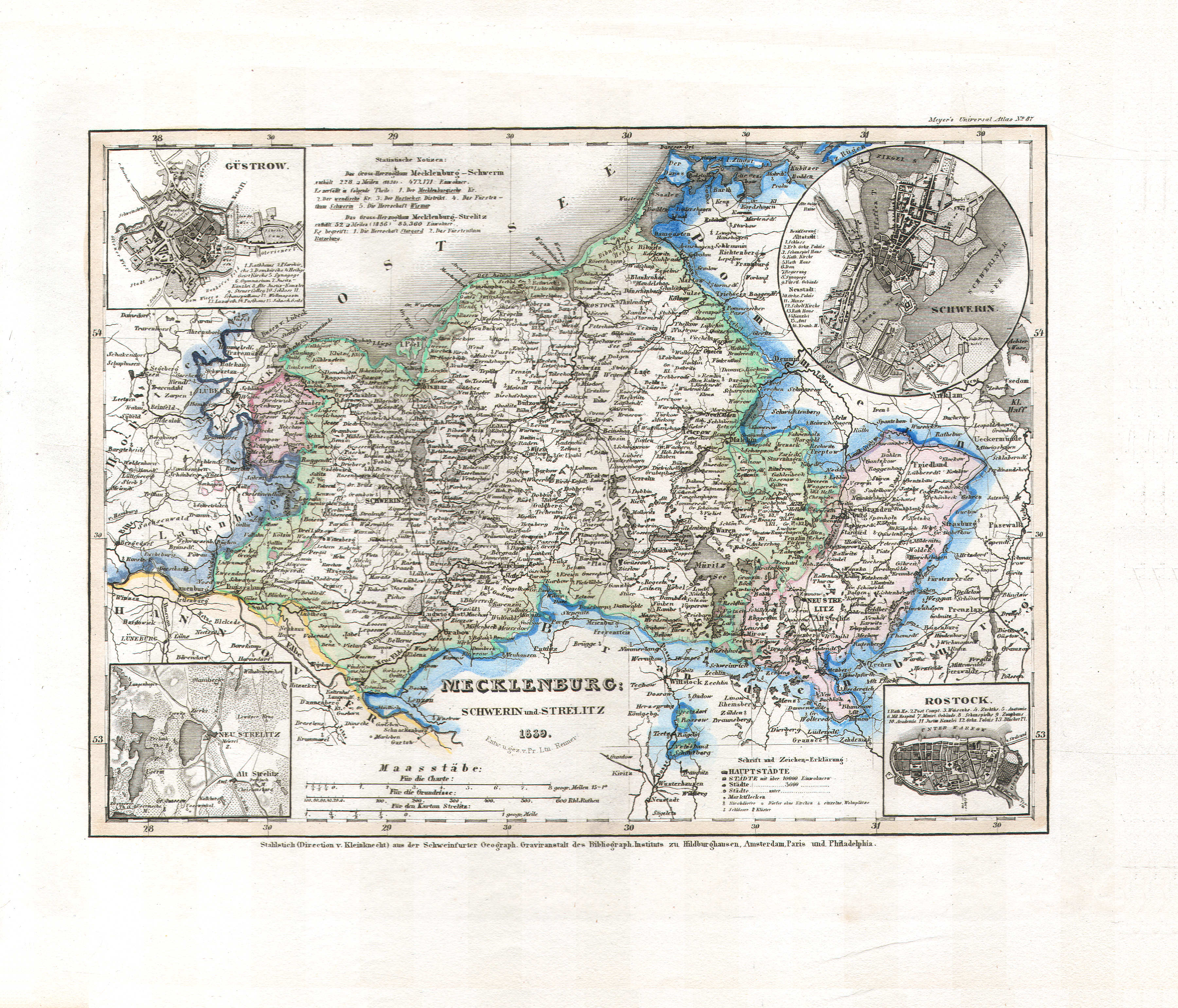
65. Mecklenburg Schwerin und Strelitz (Nº 87, 1839)
Mecklenburg-Schwerin, Mecklenburg-Strelitz
 Meyer's Pfennig-Atlas (1834-1841)
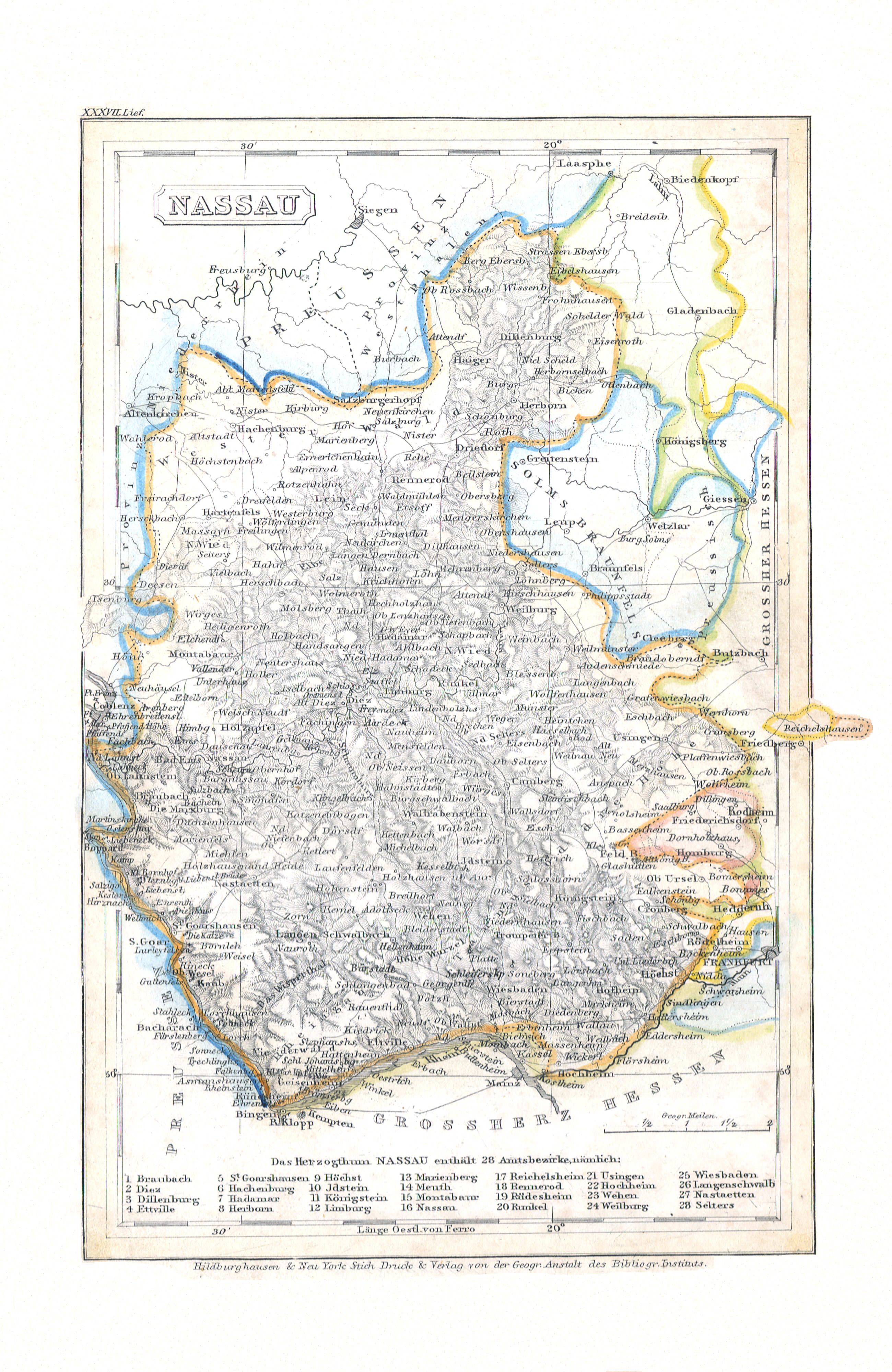
74. Nassau (Lief. XXXVII = 37)
Nassau
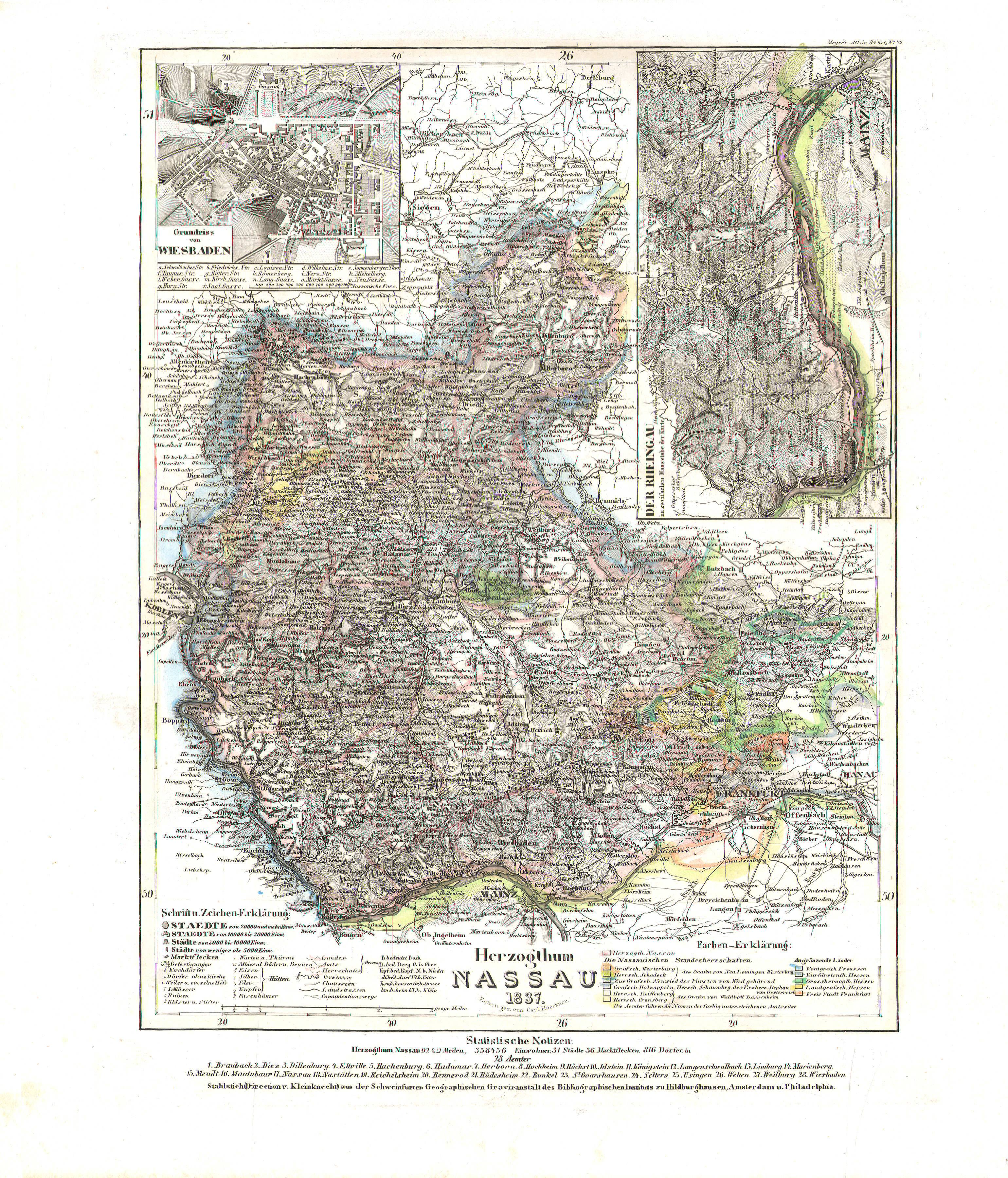 Meyer's Universal-Atlas (1830-1840)
72. Herzogthum Nassau (Nº 72, 1837)
Hertogdom Nassau / Duchy of Nassau
 Meyer's Pfennig-Atlas (1834-1841)
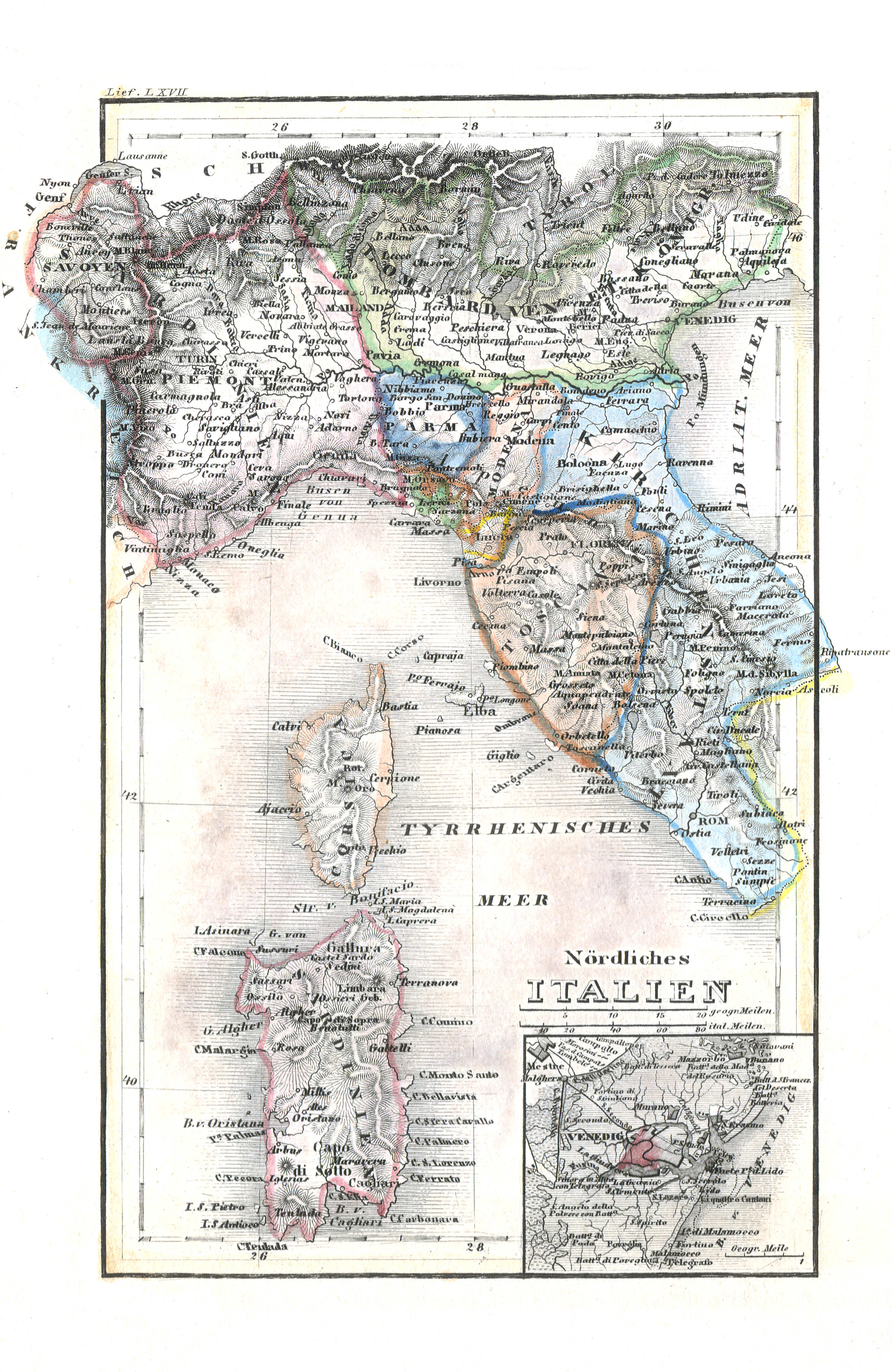
75. Nördliches Italien (Lief. LXVII = 67)
Noord-Italië / North Italy
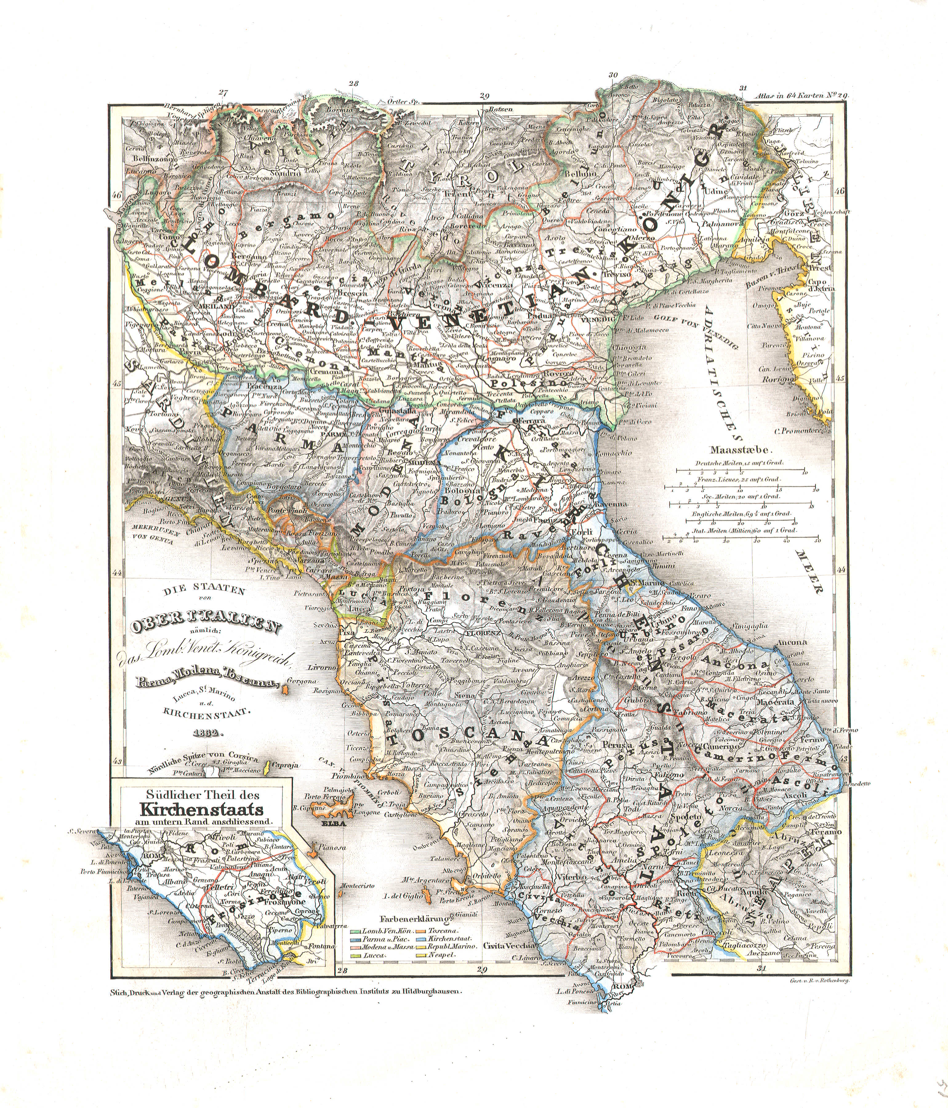 Meyer's Universal-Atlas (1830-1840)
51. Die Staaten von Ober Italien nämlich: das Lomb. Venet. Königreich, Parma, Modena, Toscana, Lucca, St. Marino u. d. Kirchenstaat (Nº 29, 1832)
De staten in Noord-Italië / The states in North Italy
 Meyer's Pfennig-Atlas (1834-1841)
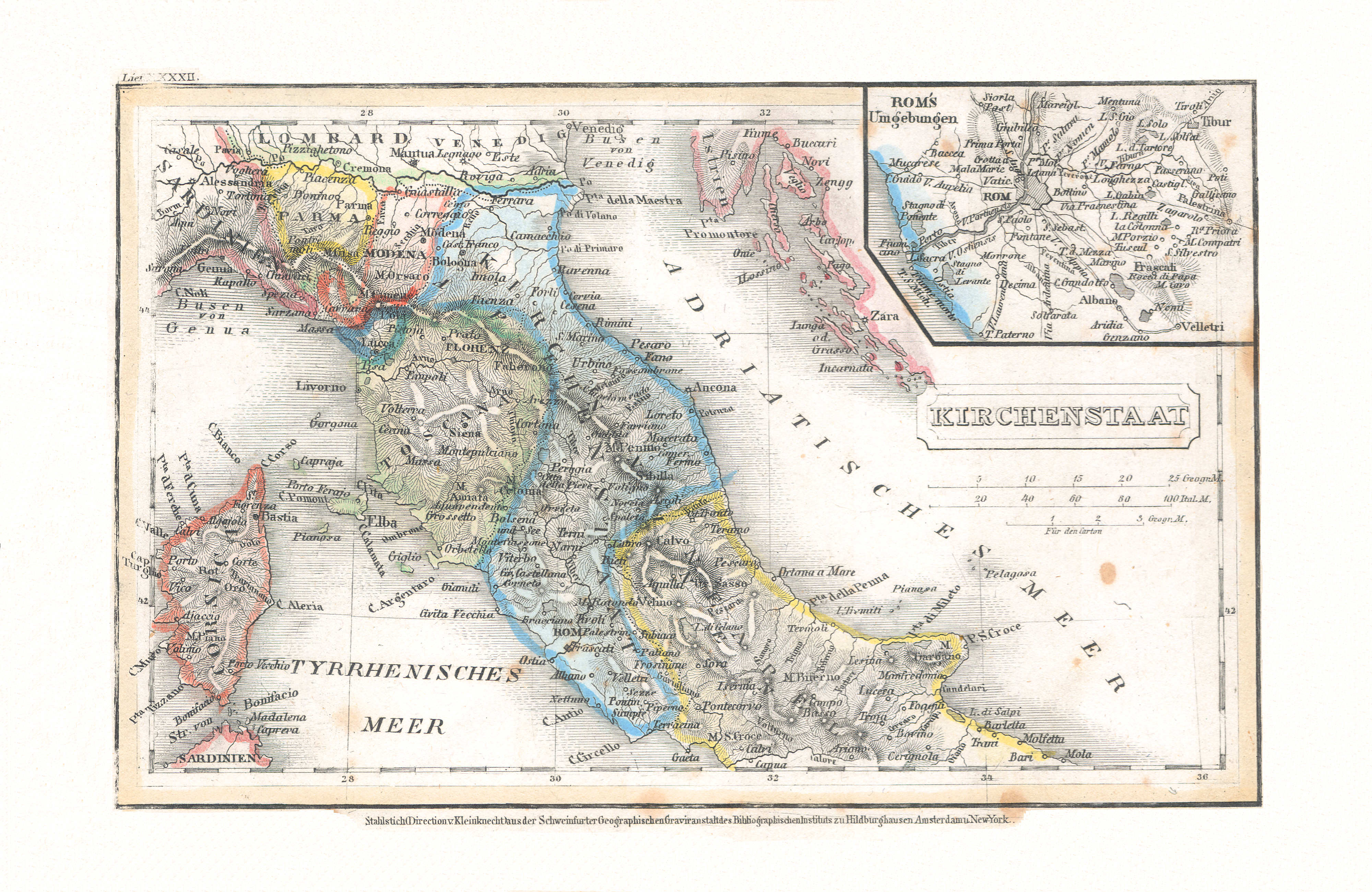
76. Kirchenstaat (Lief. XXXXII = 42)
Kerkelijke Staat / State of the Church
Meyer's Universal-Atlas (1830-1840)
51. Die Staaten von Ober Italien nämlich: das Lomb. Venet. Königreich, Parma, Modena, Toscana, Lucca, St. Marino u. d. Kirchenstaat (Nº 29, 1832)
De staten in Noord-Italië / The states in North Italy
 Meyer's Pfennig-Atlas (1834-1841)
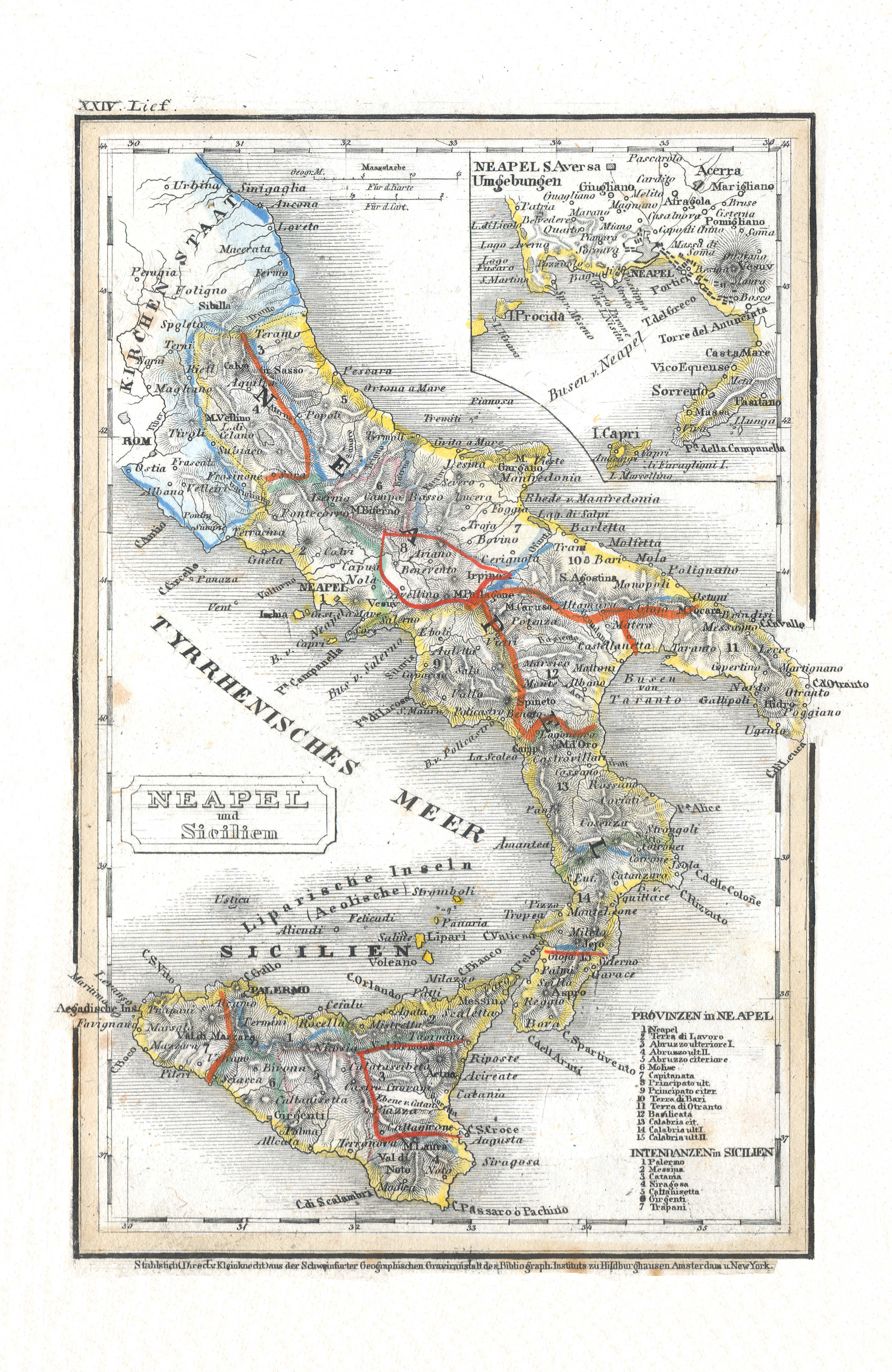
77. Neapel und Sicilien (Lief. XXIV = 24)
Napels en Sicilië / Naples and Sicily
 Meyer's Universal-Atlas (1830-1840)
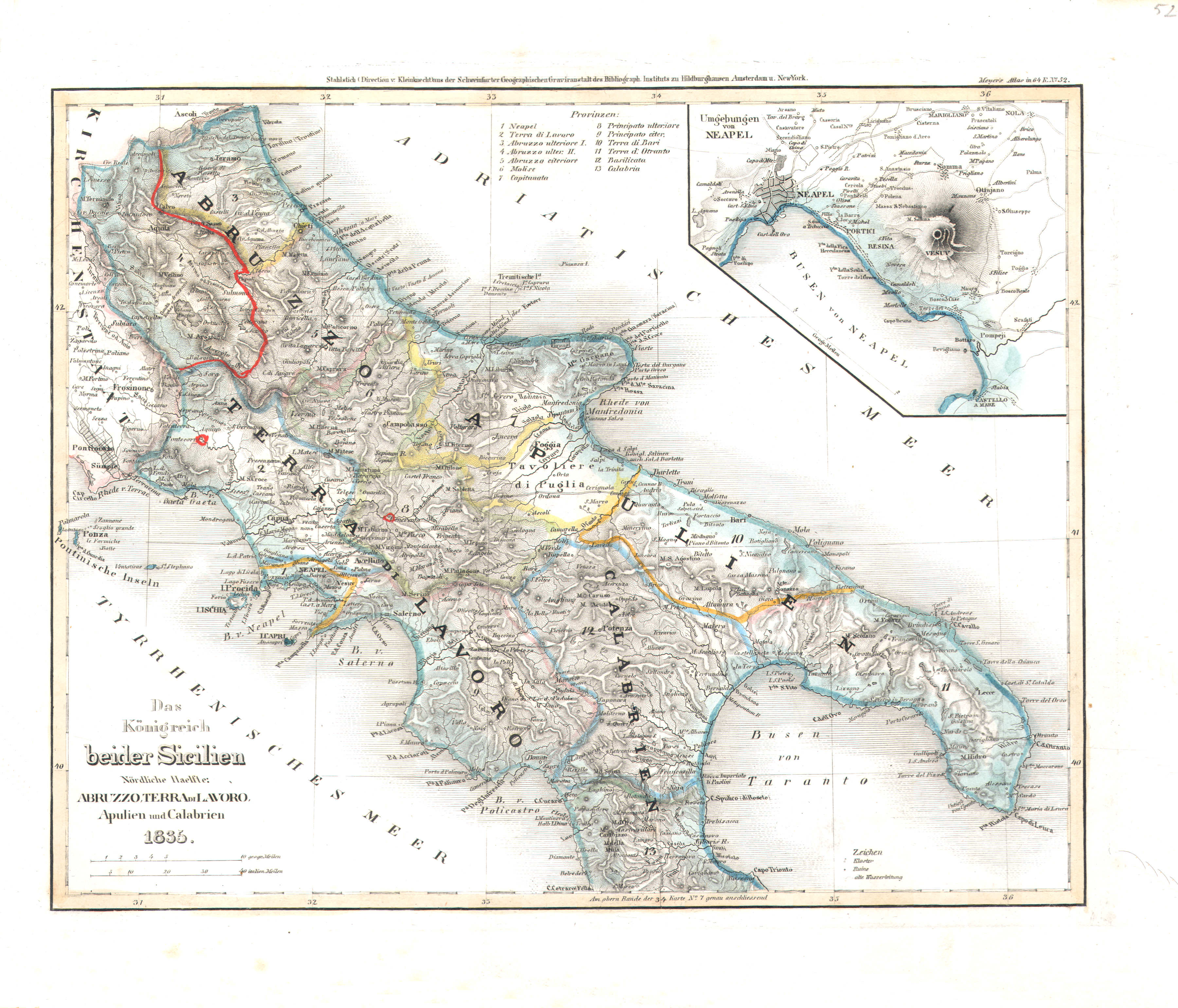
52. Das Königreich beider Sicilien, Nördliche Haelfte: Abruzzo, Terra di Lavoro, Apulien und Calabrien (Nº 52, 1835)
Koninkrijk der Beide Siciliën, noordelijk deel / Kingdom of the Two Sicilies, northern half
Meyer's Pfennig-Atlas (1834-1841)
77. Neapel und Sicilien (Lief. XXIV = 24)
Napels en Sicilië / Naples and Sicily
 Meyer's Universal-Atlas (1830-1840)
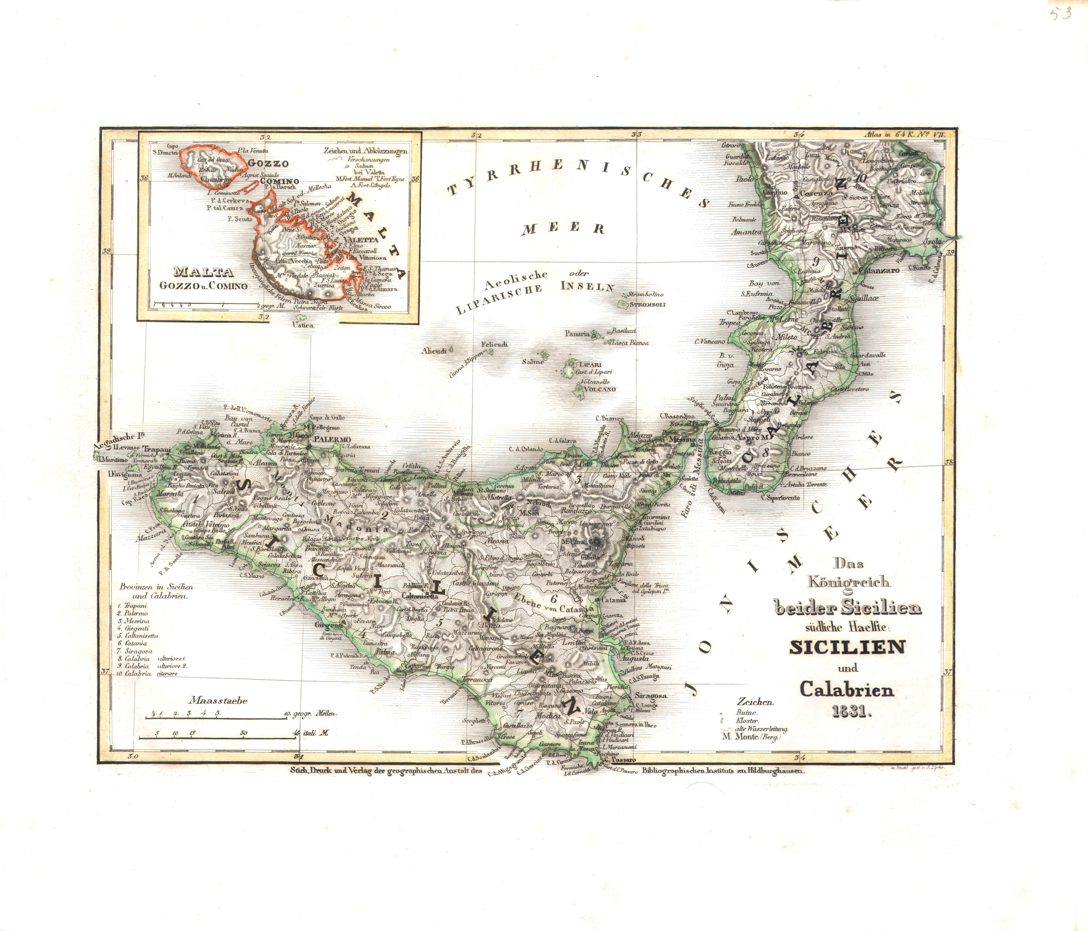
53. Das Königreich beider Sicilien, südliche Haelfte: Sicilien und Calabrien (Nº 7, 1831)
Koninkrijk der Beide Siciliën, zuidelijk deel / Kingdom of the Two Sicilies, southern half
 Meyer's Pfennig-Atlas (1834-1841)
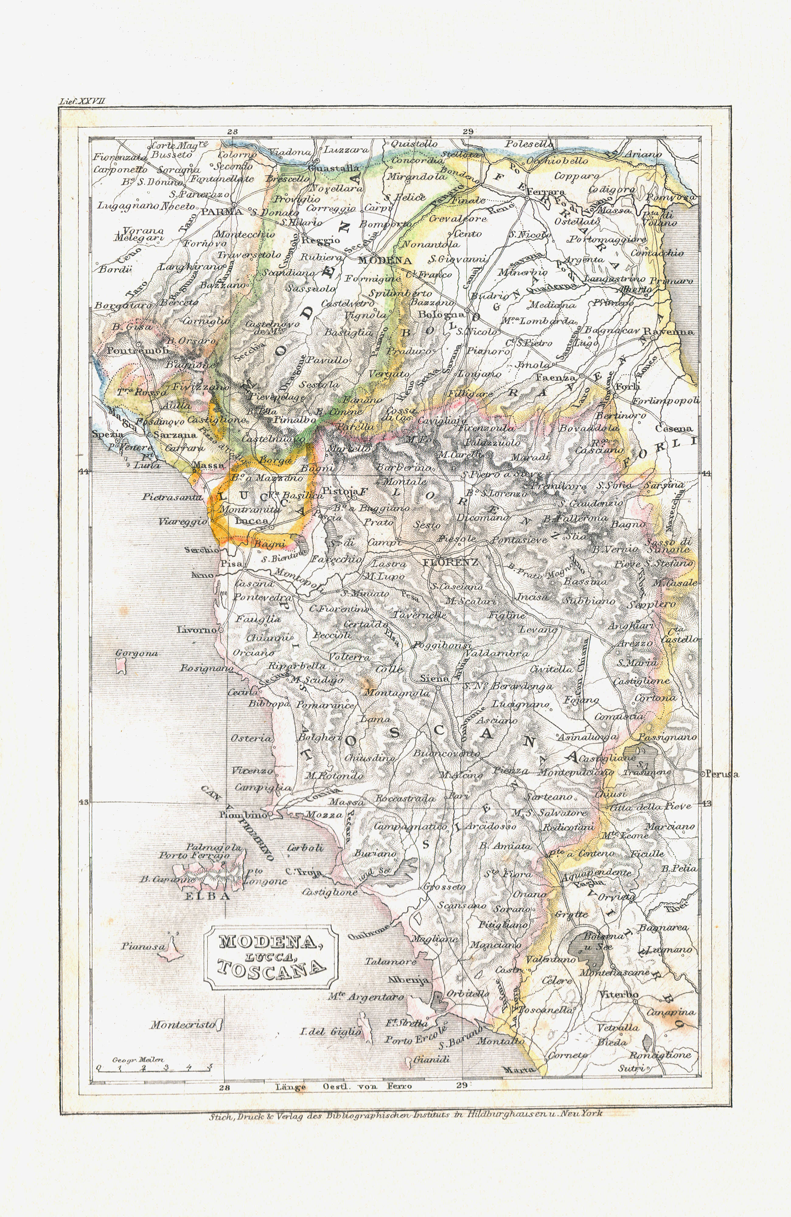
78. Modena, Lucca, Toscana (Lief. XXVII = 27)
Modena, Lucca, Toscana
Meyer's Universal-Atlas (1830-1840)
51. Die Staaten von Ober Italien nämlich: das Lomb. Venet. Königreich, Parma, Modena, Toscana, Lucca, St. Marino u. d. Kirchenstaat (Nº 29, 1832)
De staten in Noord-Italië / The states in North Italy
 Meyer's Pfennig-Atlas (1834-1841)
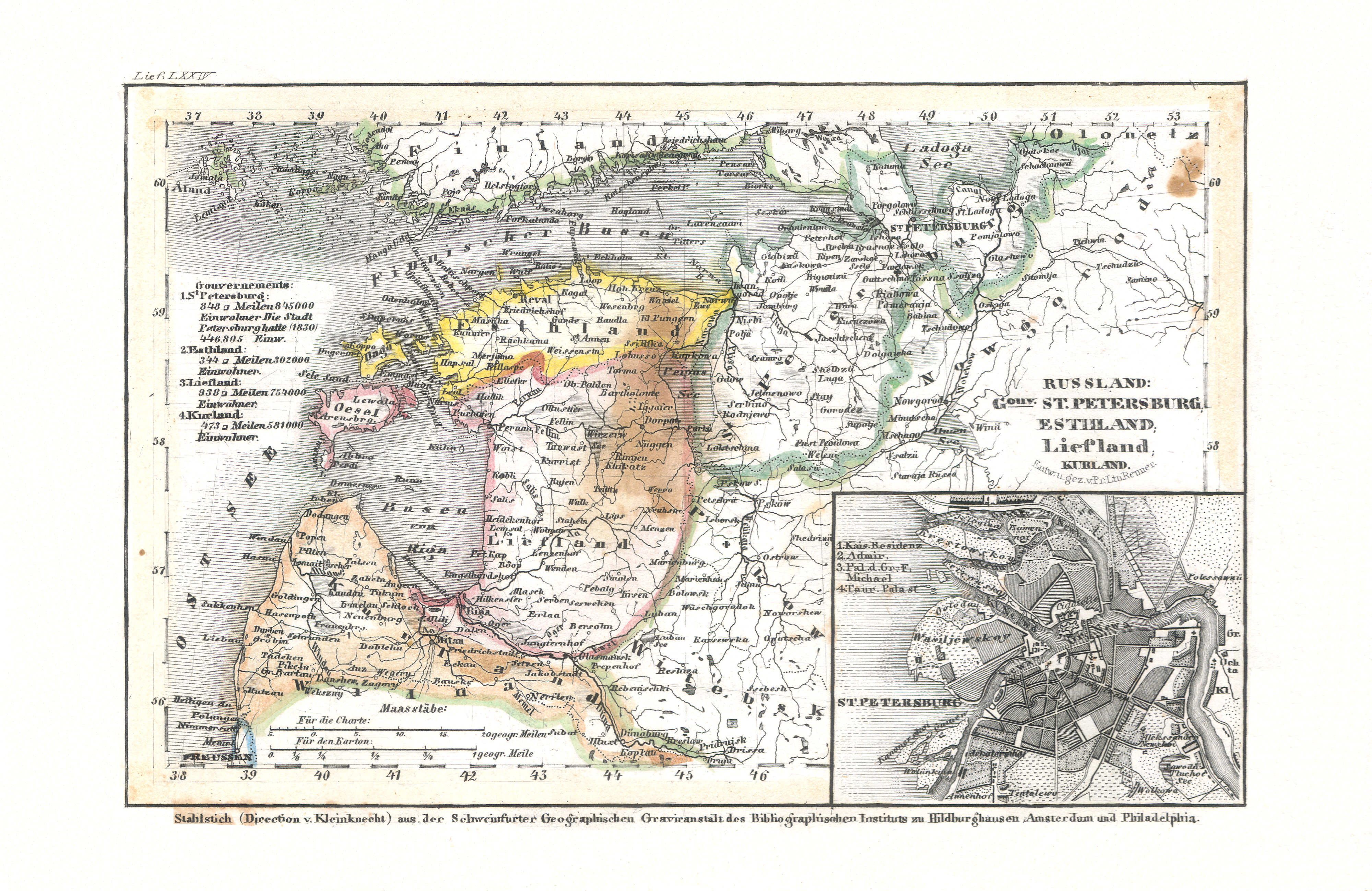
79. Russland: Gouv. St. Petersburg, Esthland, Liefland, Kurland (Lief. 74 = LXXIV)
Rusland: Sint-Petersburg, Estland, Lijfland, Koerland / Russia: Saint Petersburg, Estonia, Livonia, Courland
 Meyer's Universal-Atlas (1830-1840)
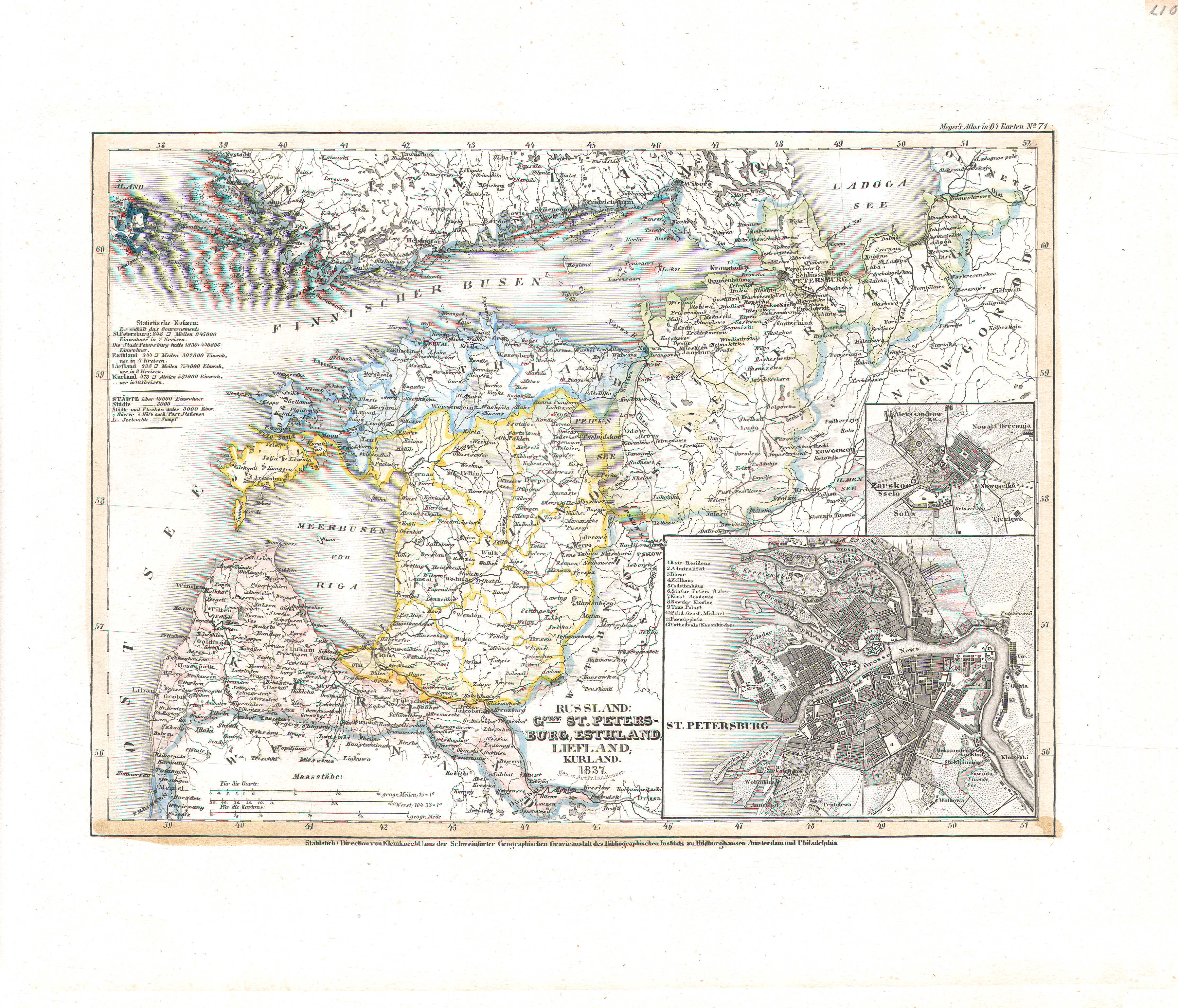
40. Russland: Gouv. St. Petersburg, Esthland, Liefland, Kurland (Nº 71, 1837)
Rusland: Sint-Petersburg, Estland, Lijfland, Koerland / Russia: Saint Petersburg, Estonia, Livonia, Courland
 Meyer's Pfennig-Atlas (1834-1841)
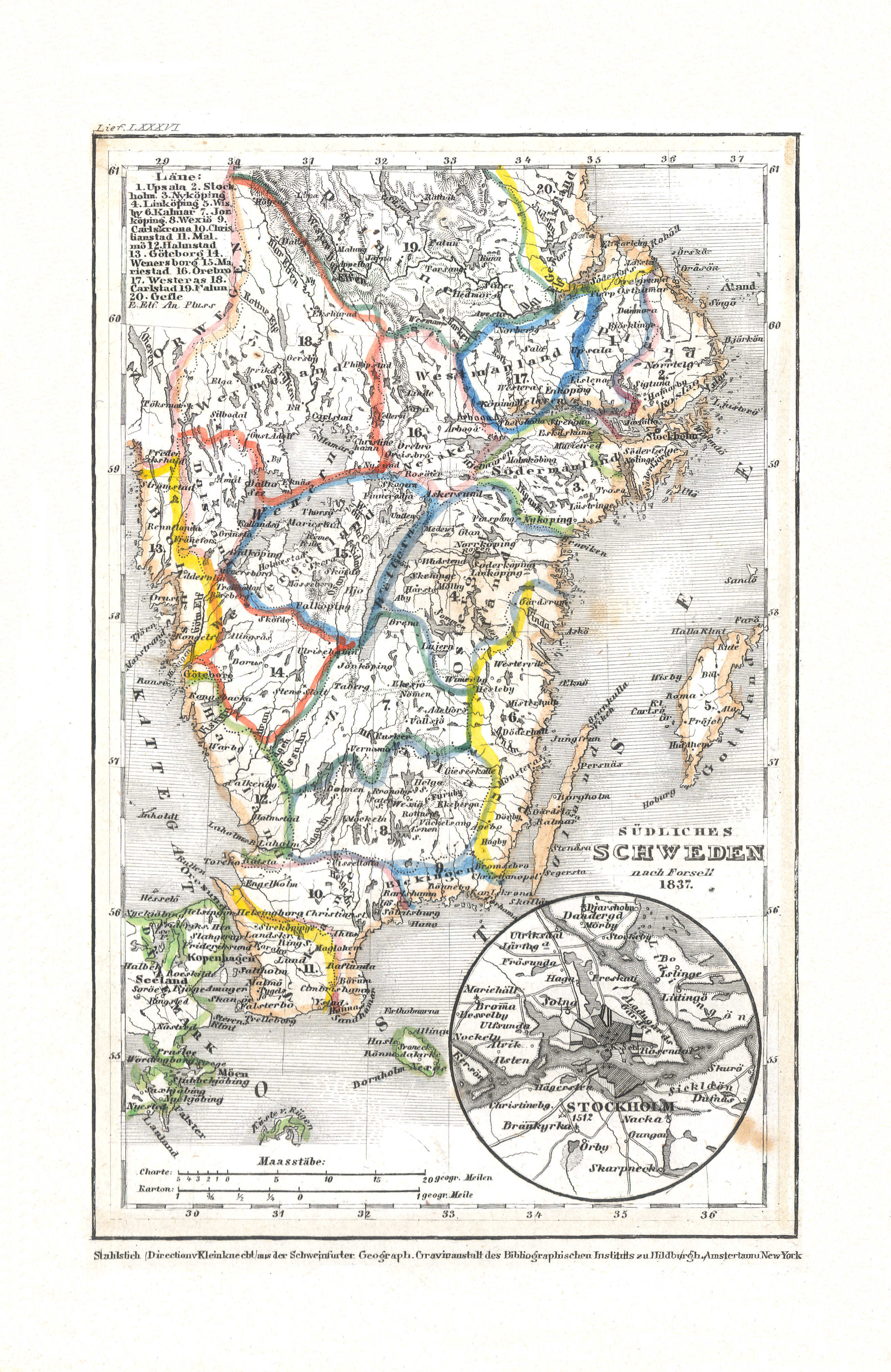
80. Südliches Schweden (Lief. LXXXVI = 86, 1837)
Zuid-Zweden / South Sweden
 Meyer's Universal-Atlas (1830-1840)
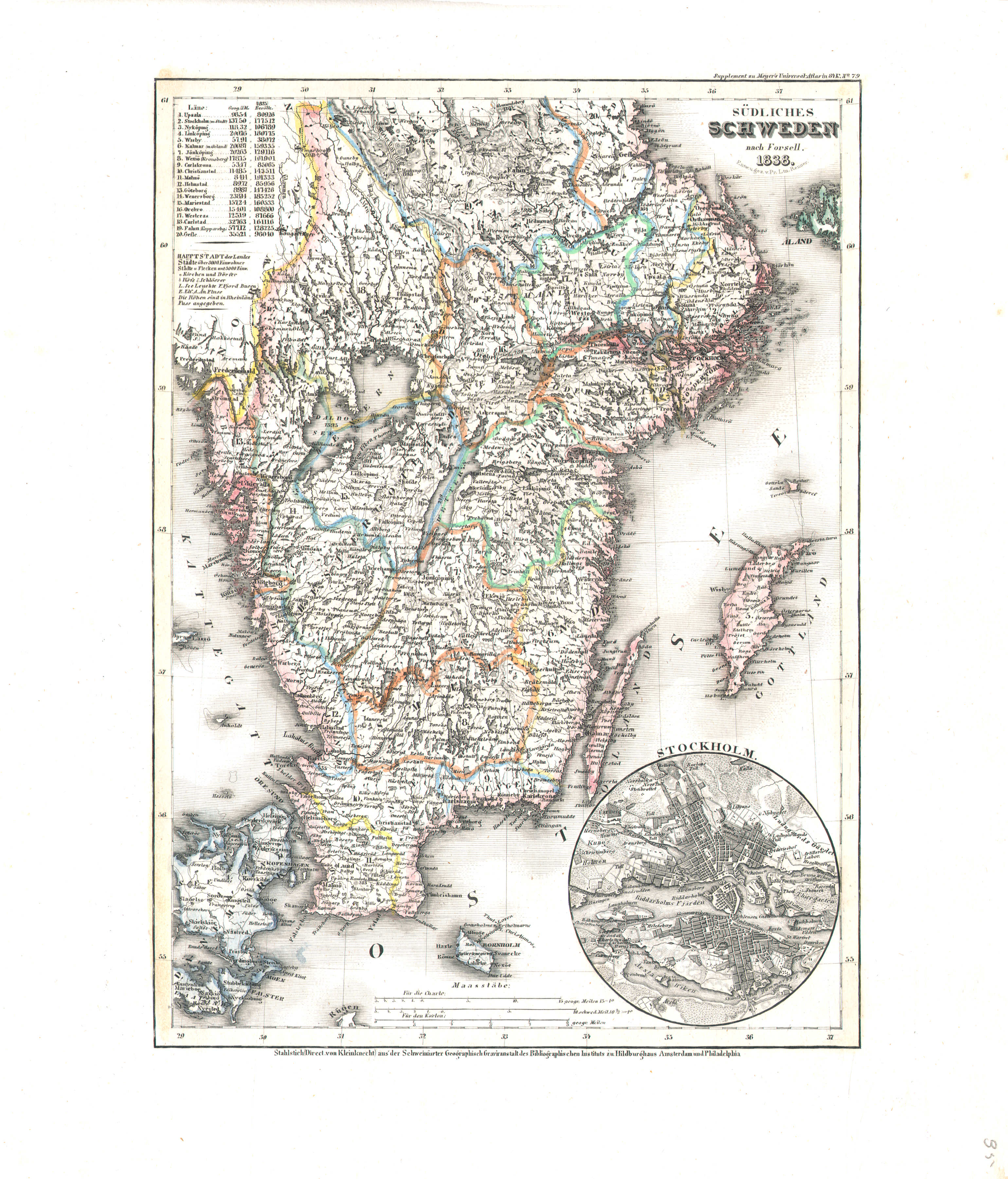
35. Südliches Schweden (Nº 79, 1838)
Zuid-Zweden / South Sweden
 Meyer's Pfennig-Atlas (1834-1841)
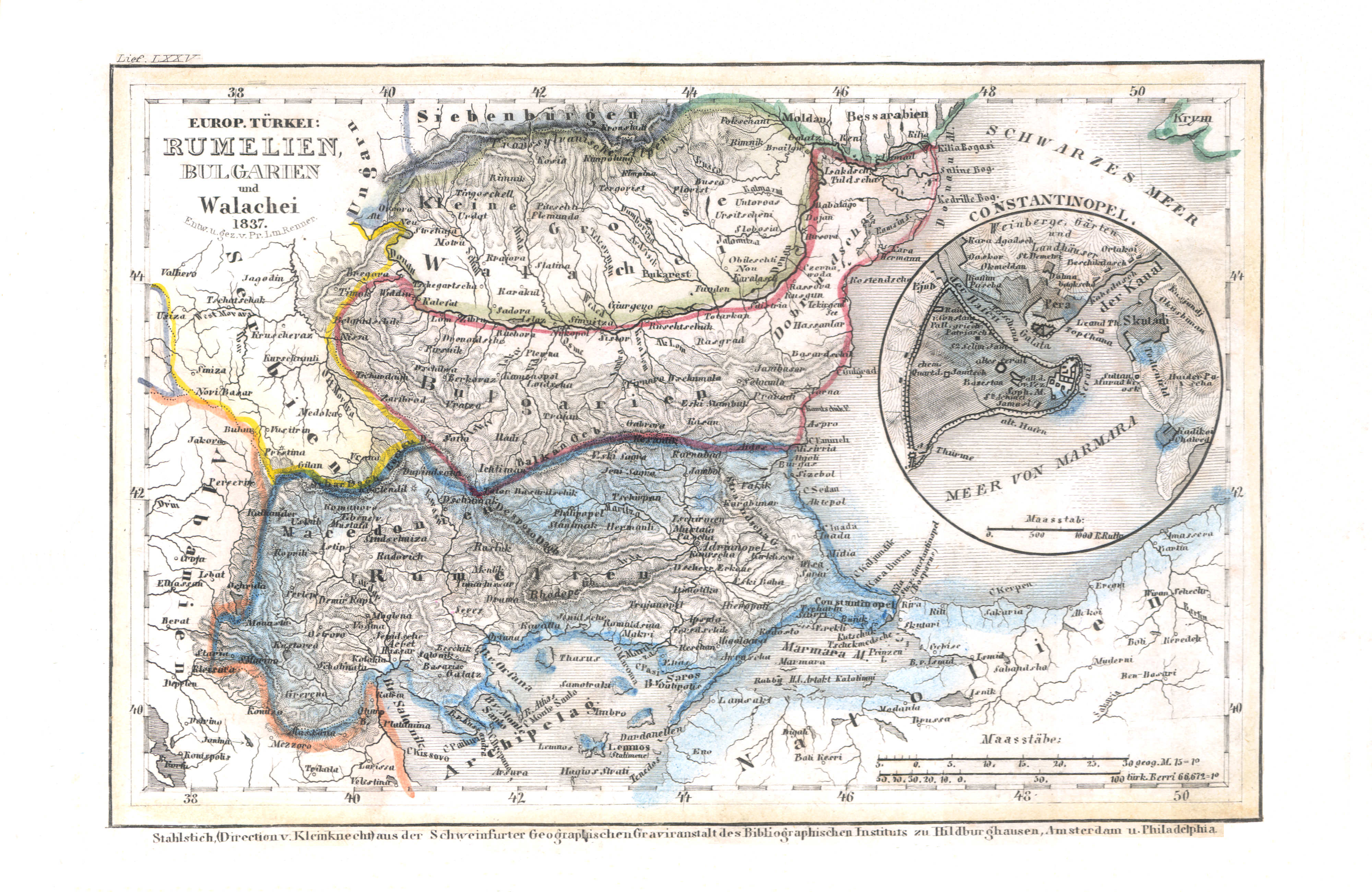
81. Europ. Türkei: Rumelien, Bulgarien und Walachei (Lief. LXXV = 75, 1837)
Europees Turkije: Roemelië, Bulgarije en Walachije / Turkey in Europe: Rumelia, Bulgaria and Wallachia
 Meyer's Universal-Atlas (1830-1840)
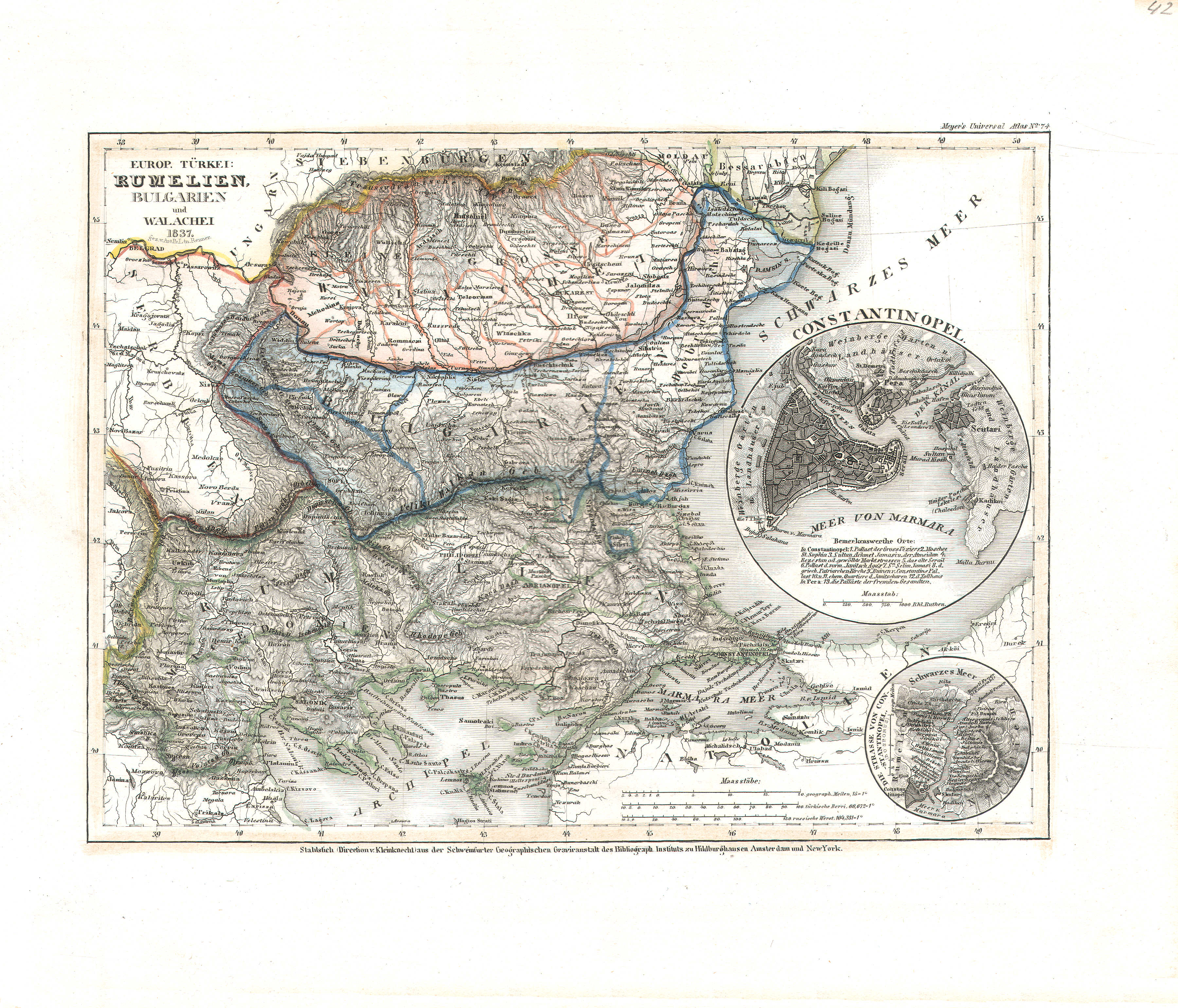
42. Europ. Türkei: Rumelien, Bulgarien und Walachei (Nº 74, 1837)
Europees Turkije: Roemelië, Bulgarije en Walachije / Turkey in Europe: Rumelia, Bulgaria and Wallachia
 Meyer's Pfennig-Atlas (1834-1841)
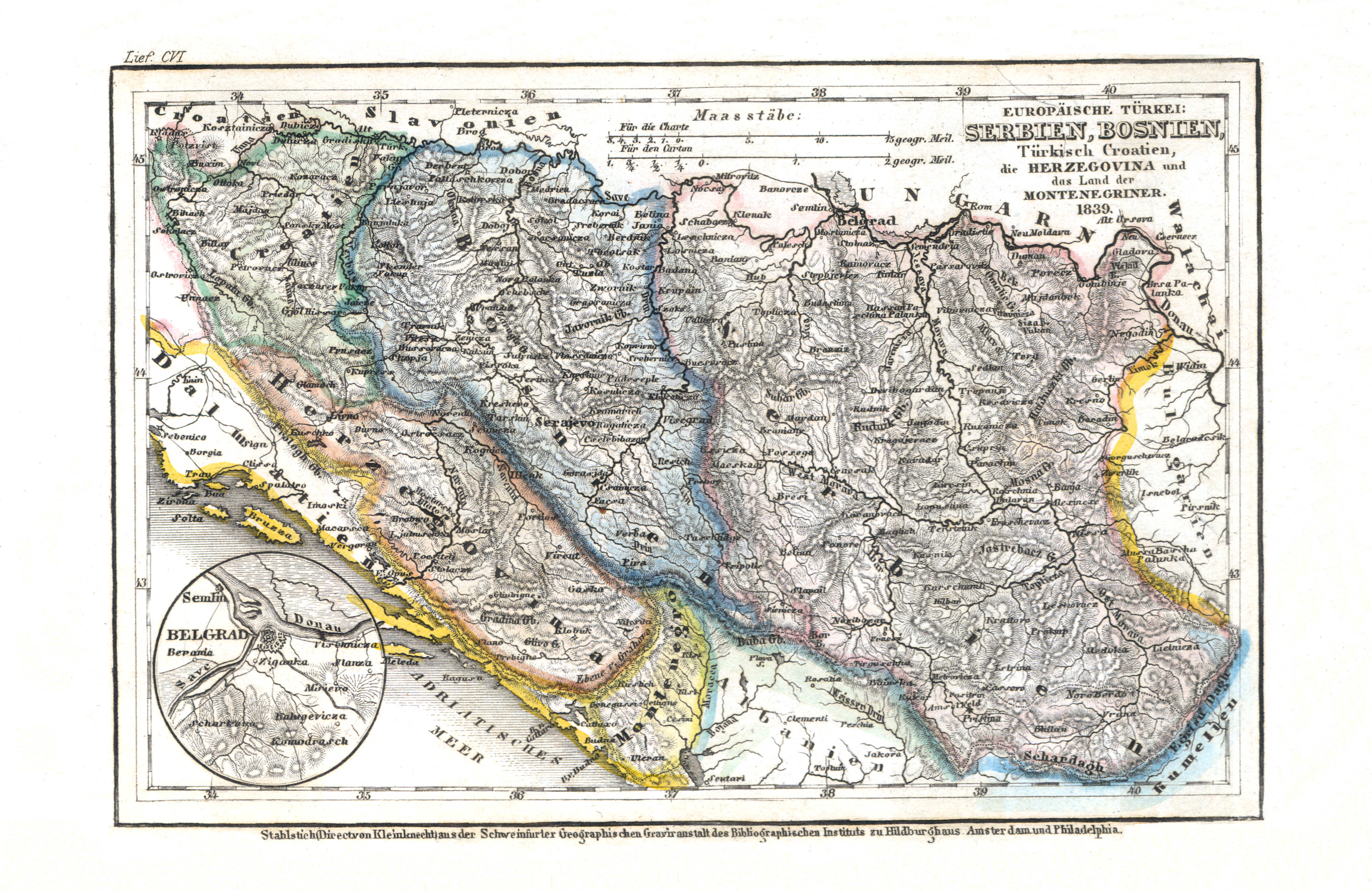
82. Europäische Türkei: Serbien, Bosnien, Türkisch Croatien, die Herzegovina und das Land der Montenegriner (Lief. CVI = 106, 1839)
Europees Turkije: Servië, Bosnië, Turks Kroatië, Herzegovina en Montenegro / Turkey in Europe: Serbia, Bosnia, Turkish Croatia, Herzegovina and Montenegro
 Meyer's Universal-Atlas (1830-1840)
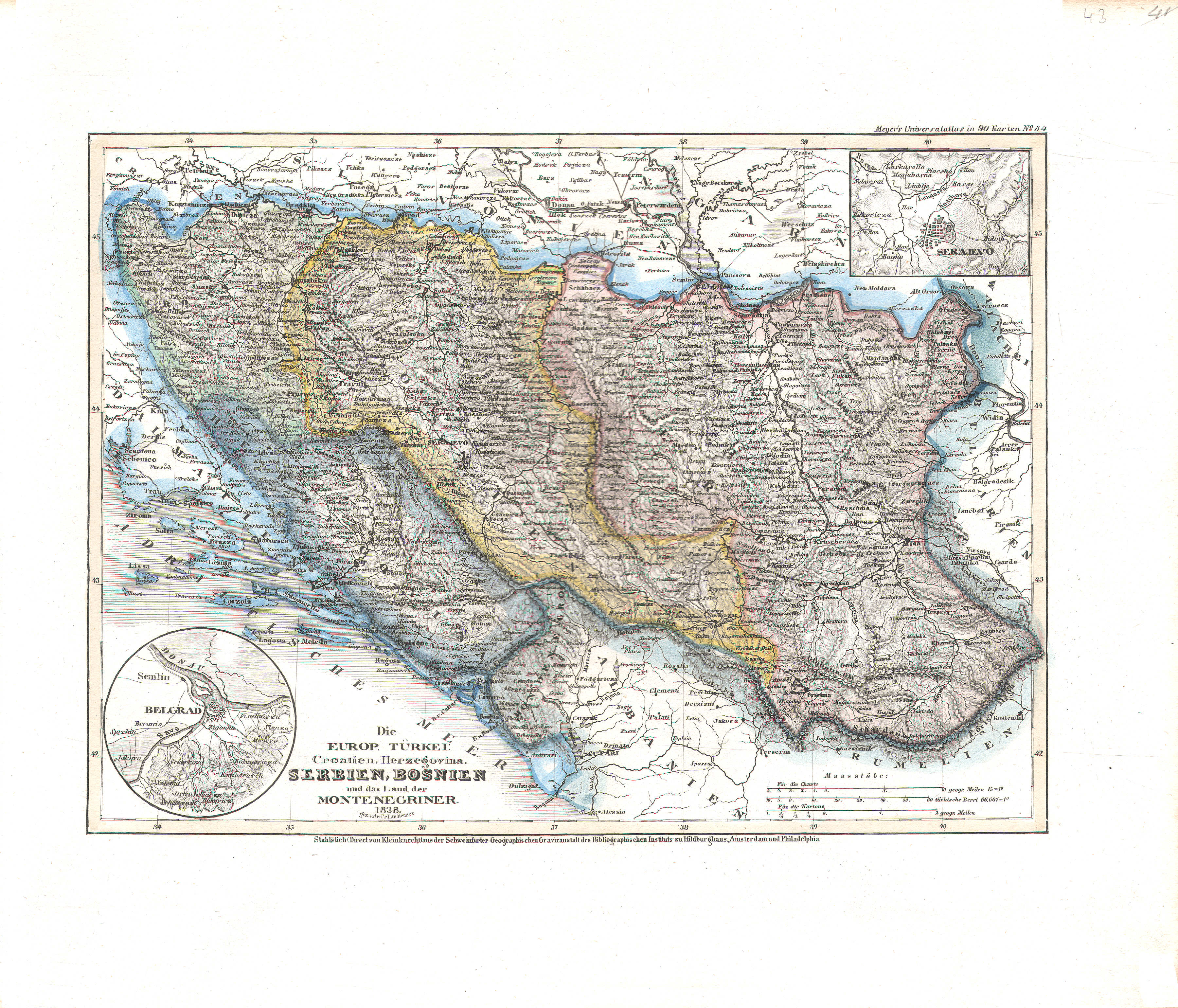
43. Die europ. Türkei: Croatien, Herzegovina, Serbien, Bosnien und das Land der Montenegriner (Nº 84, 1838)
Europees Turkije: Kroatië, Herzegovina, Servië, Bosnië en Montenegro / Turkey in Europe: Croatia, Herzegovina, Serbia, Bosnia and Montenegro
 Meyer's Pfennig-Atlas (1834-1841)
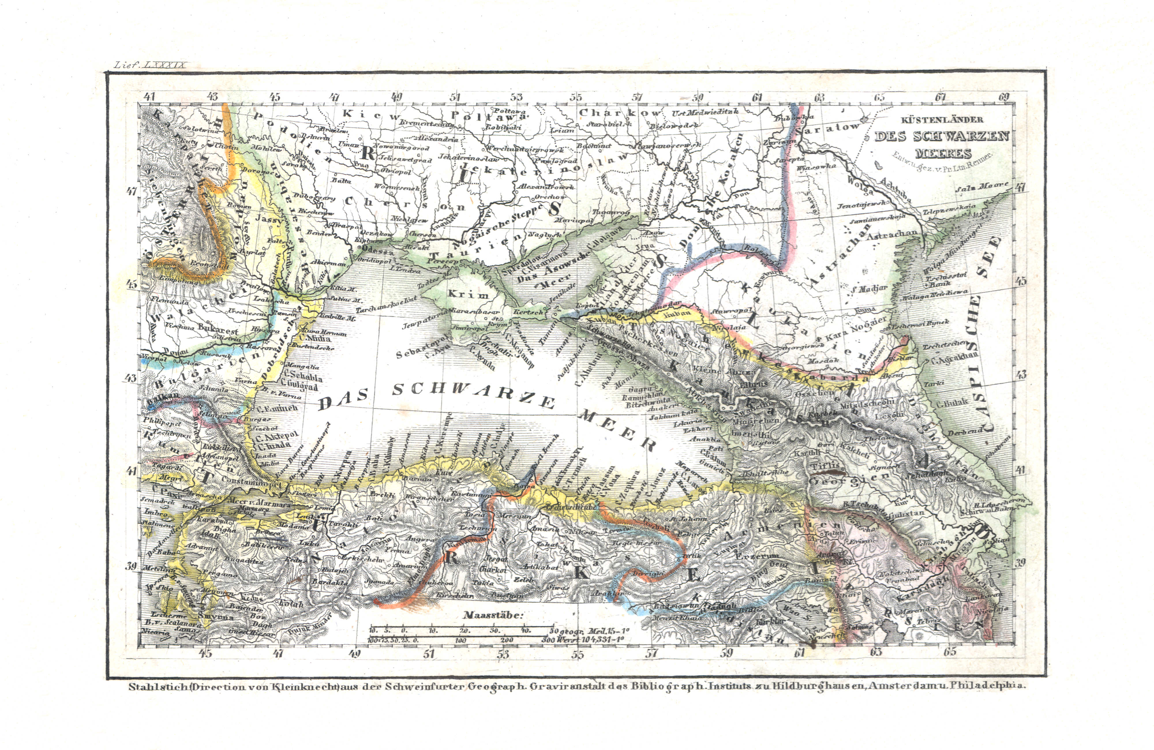
83. Küstenländer des Schwarzen Meeres (Lief. LXXXIX = 89)
De landen rond de Zwarte Zee / The countries around the Black Sea
 Meyer's Universal-Atlas (1830-1840)
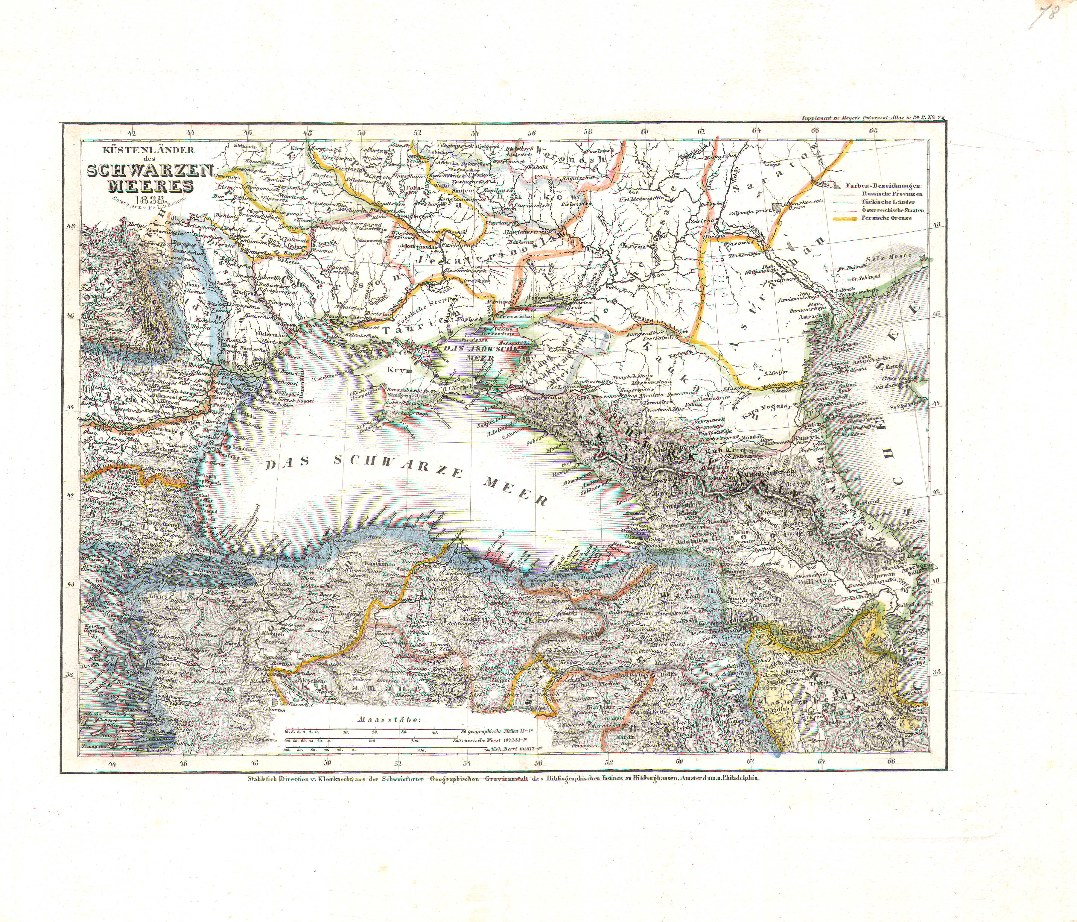
78. Küstenländer des Schwarzen Meeres (Nº 78, 1838)
De landen rond de Zwarte Zee / The countries around the Black Sea
 Meyer's Pfennig-Atlas (1834-1841)
84. Persien und Arabien (Lief. LXXXV = 85)
Perzië en Arabië / Persia and Arabia
Meyer's Universal-Atlas (1830-1840)
geen overeenkomstige kaart / no corresponding map
 Meyer's Pfennig-Atlas (1834-1841)
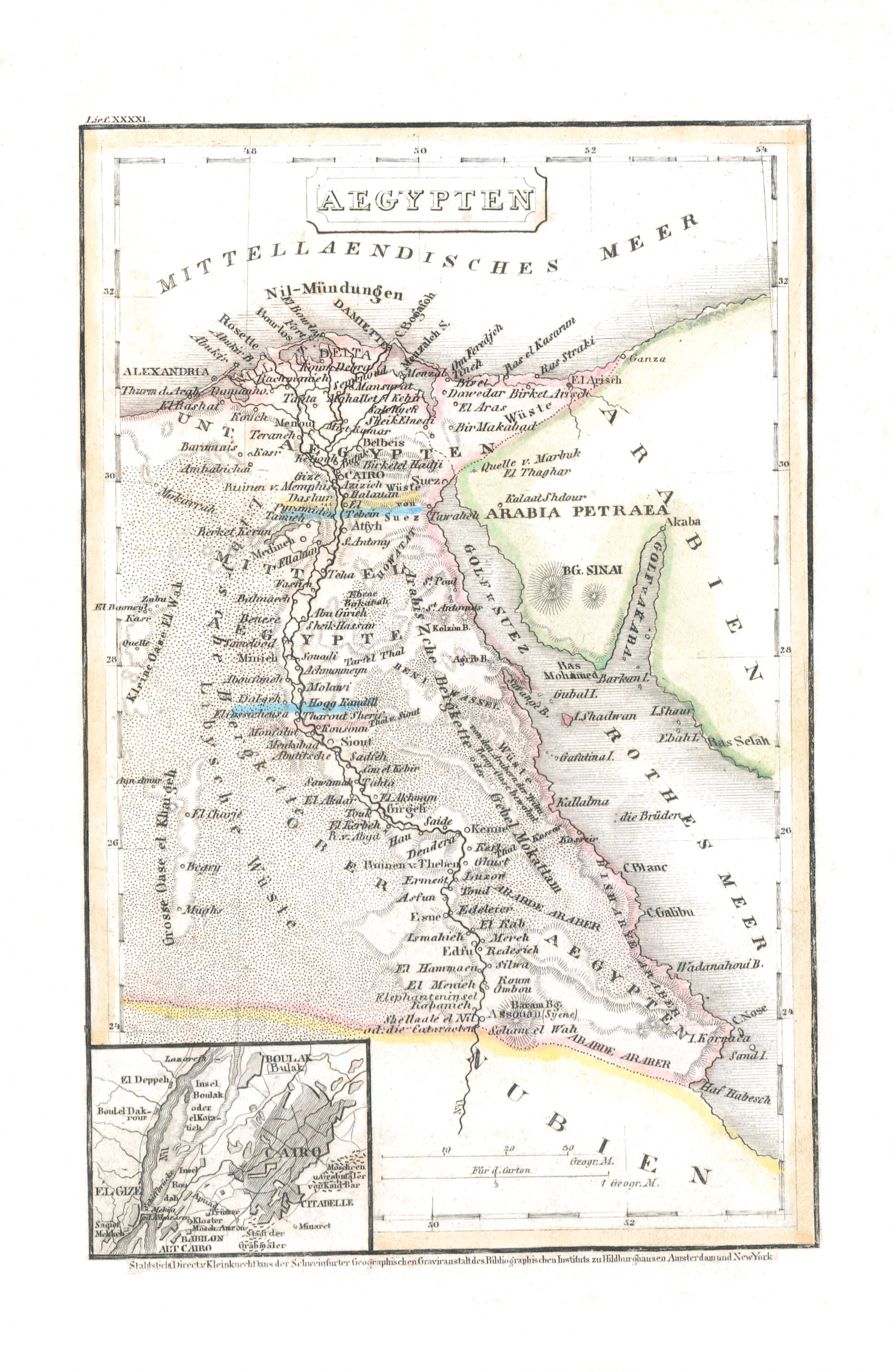
85. Aegypten (Lief. XXXXI = 41)
Egypte / Egypt
 Meyer's Universal-Atlas (1830-1840)
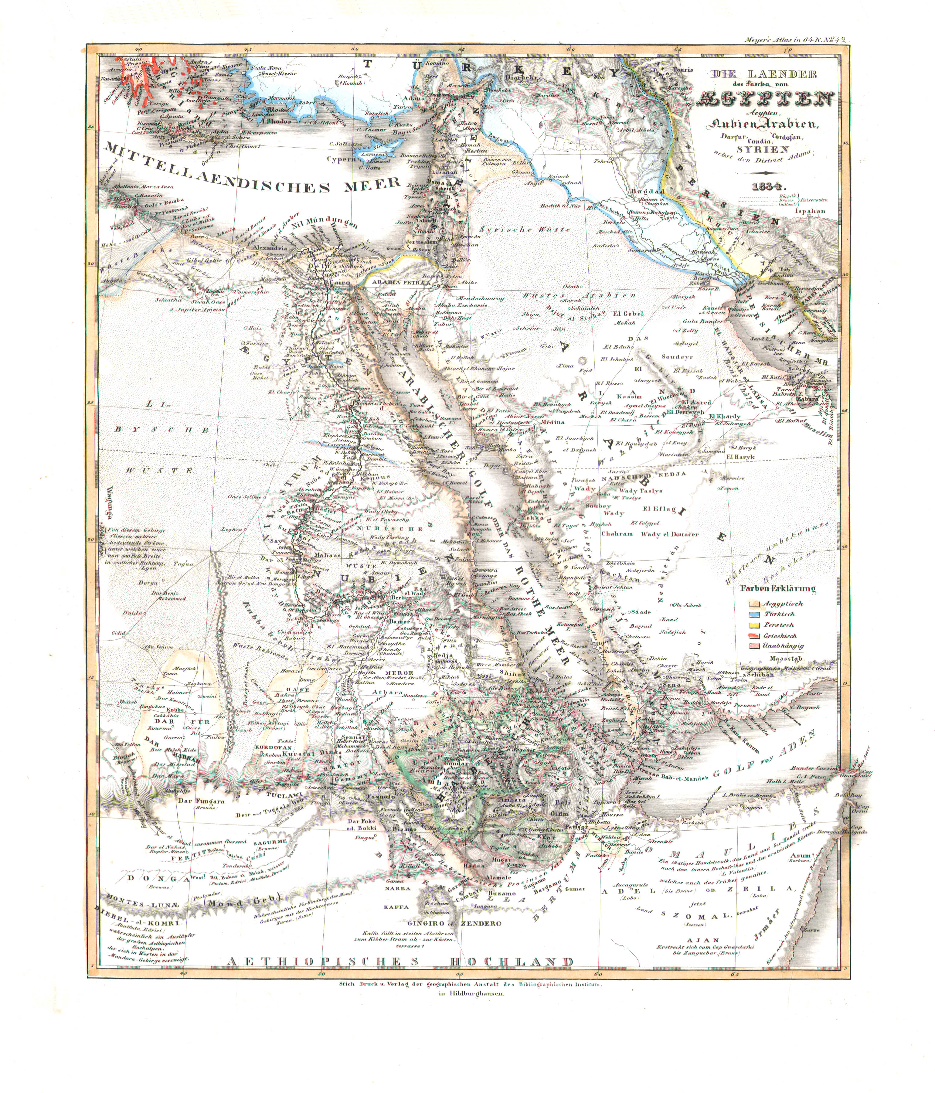
86. Die Laender des Pascha von Aegypten; Aeypten, Nubien, Arabien, Darfur, Cordofan, Candia, Syrien nebst den District Adana (Nº 42, 1834)
De landen van de Pasja van Egypte / The countries of the Pasha of Egypt
 Meyer's Pfennig-Atlas (1834-1841)
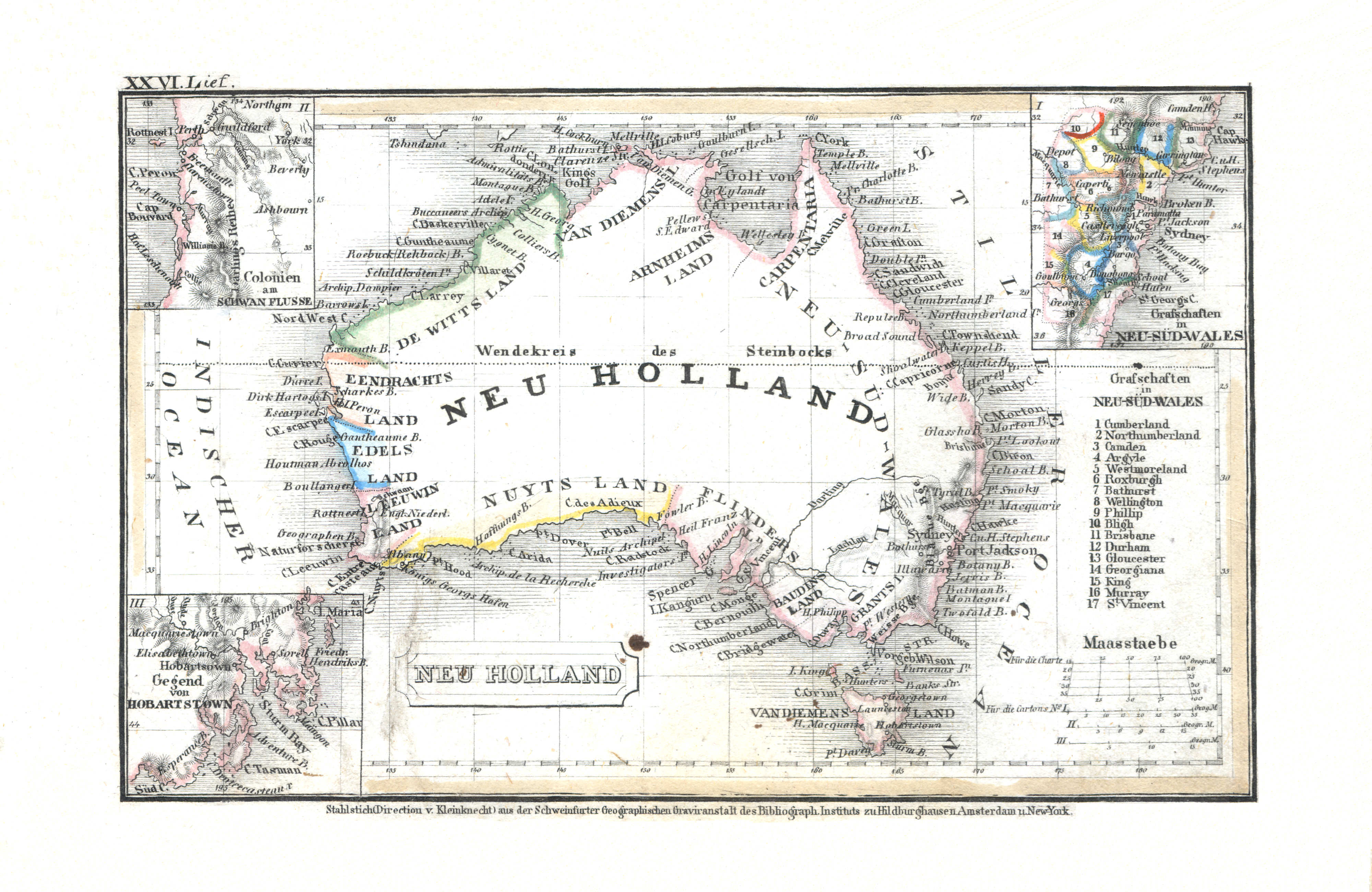
86. Neu Holland (Lief. XXVI = 26)
Nieuw-Holland / New Holland
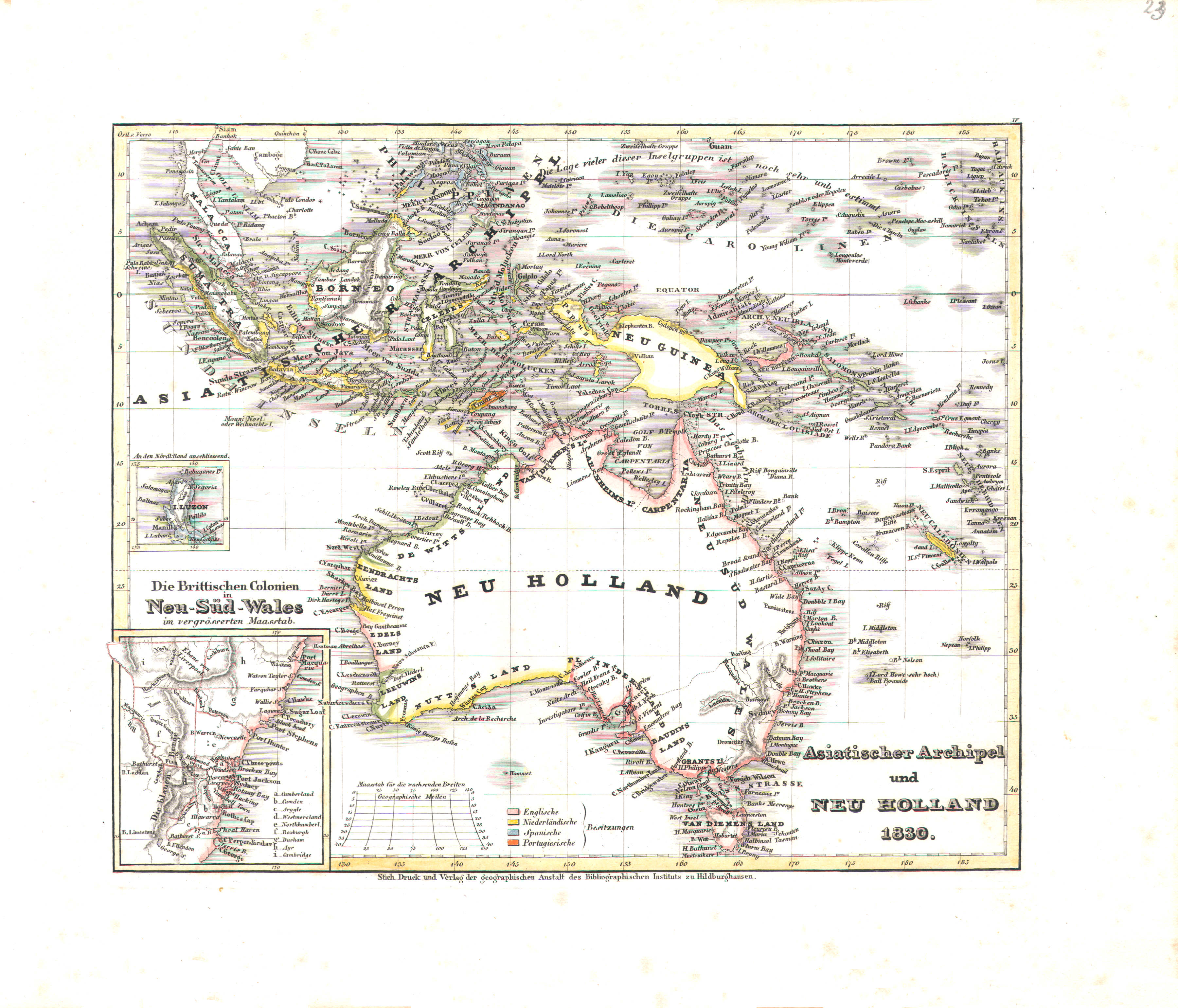 Meyer's Universal-Atlas (1830-1840)
23. Asiatischer Archipel und Neu Holland (Nº 4, 1830)
Indische Archipel en Nieuw-Holland / Malay Archipelago and New Holland
 Meyer's Pfennig-Atlas (1834-1841)
87. Hindostan (Lief. XV = 15)
Hindoestan / Hindustan
 Meyer's Universal-Atlas (1830-1840)
77. Ostindien (Nº 33, 1833)
Oost-Indië / East Indies
 Meyer's Pfennig-Atlas (1834-1841)
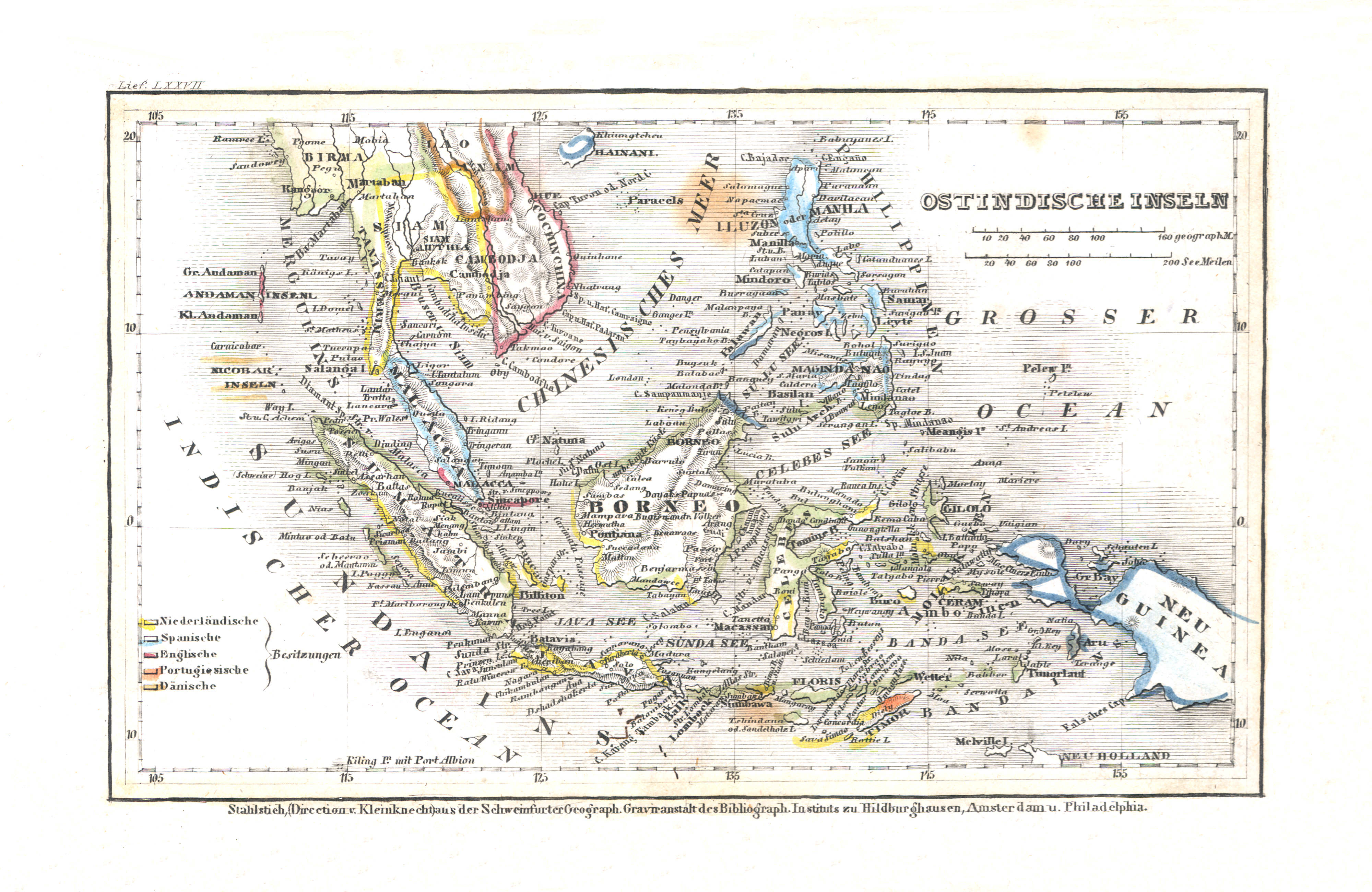
88. Ostindische Inseln (Lief. LXXVII = 77)
Indische Archipel / Malay Archipelago
Meyer's Universal-Atlas (1830-1840)
23. Asiatischer Archipel und Neu Holland (Nº 4, 1830)
Indische Archipel en Nieuw-Holland / Malay Archipelago and New Holland
 Meyer's Pfennig-Atlas (1834-1841)
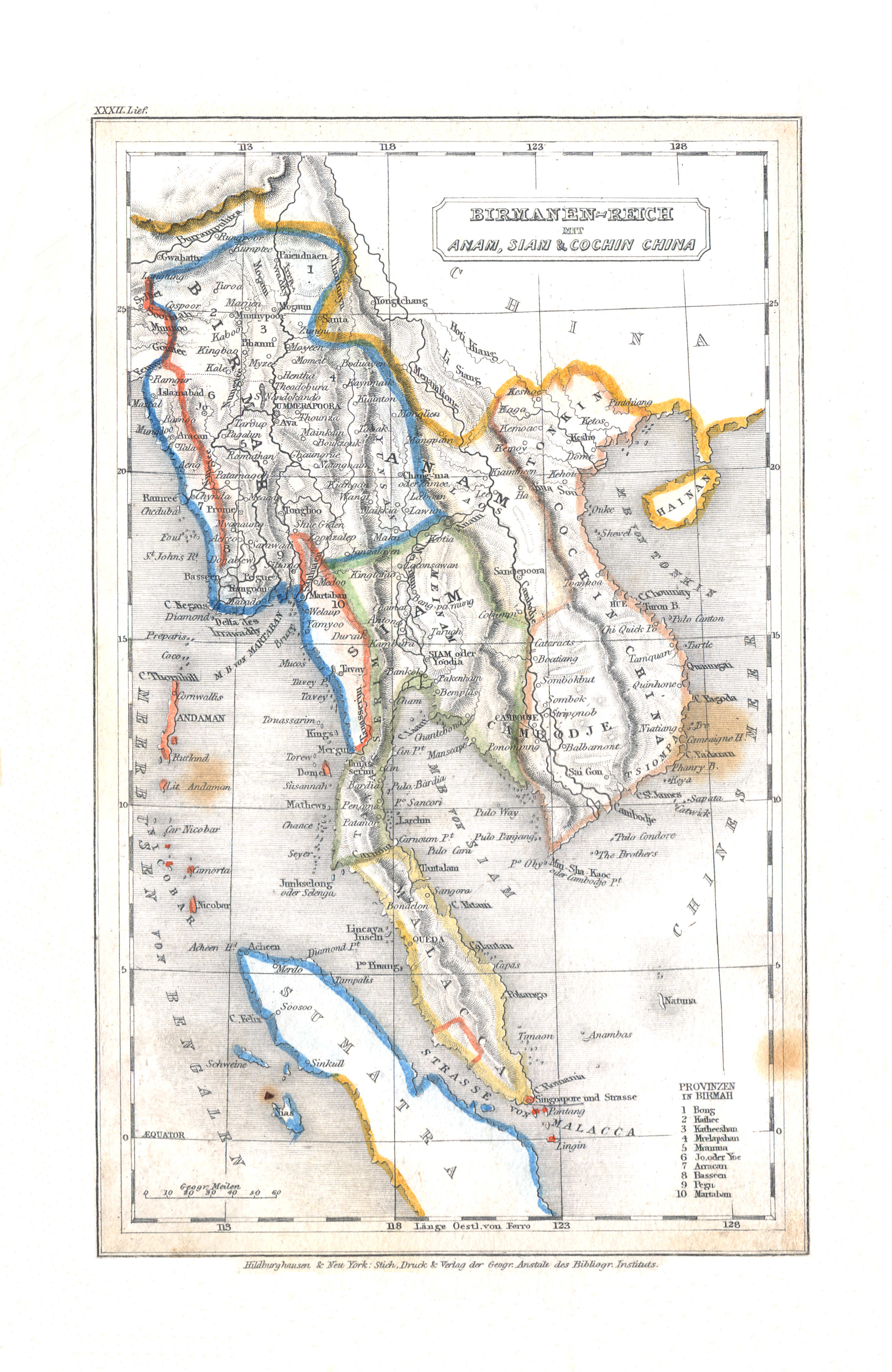
89. Birmanen-Reich mit Anam, Siam & Cochin China (Lief. XXXII = 32)
Birmaanse Rijk met Annam, Siam en Cochin-China / Burman Empire with Annam, Siam and Cochinchina
Meyer's Universal-Atlas (1830-1840)
77. Ostindien (Nº 33, 1833)
Oost-Indië / East Indies
 Meyer's Pfennig-Atlas (1834-1841)
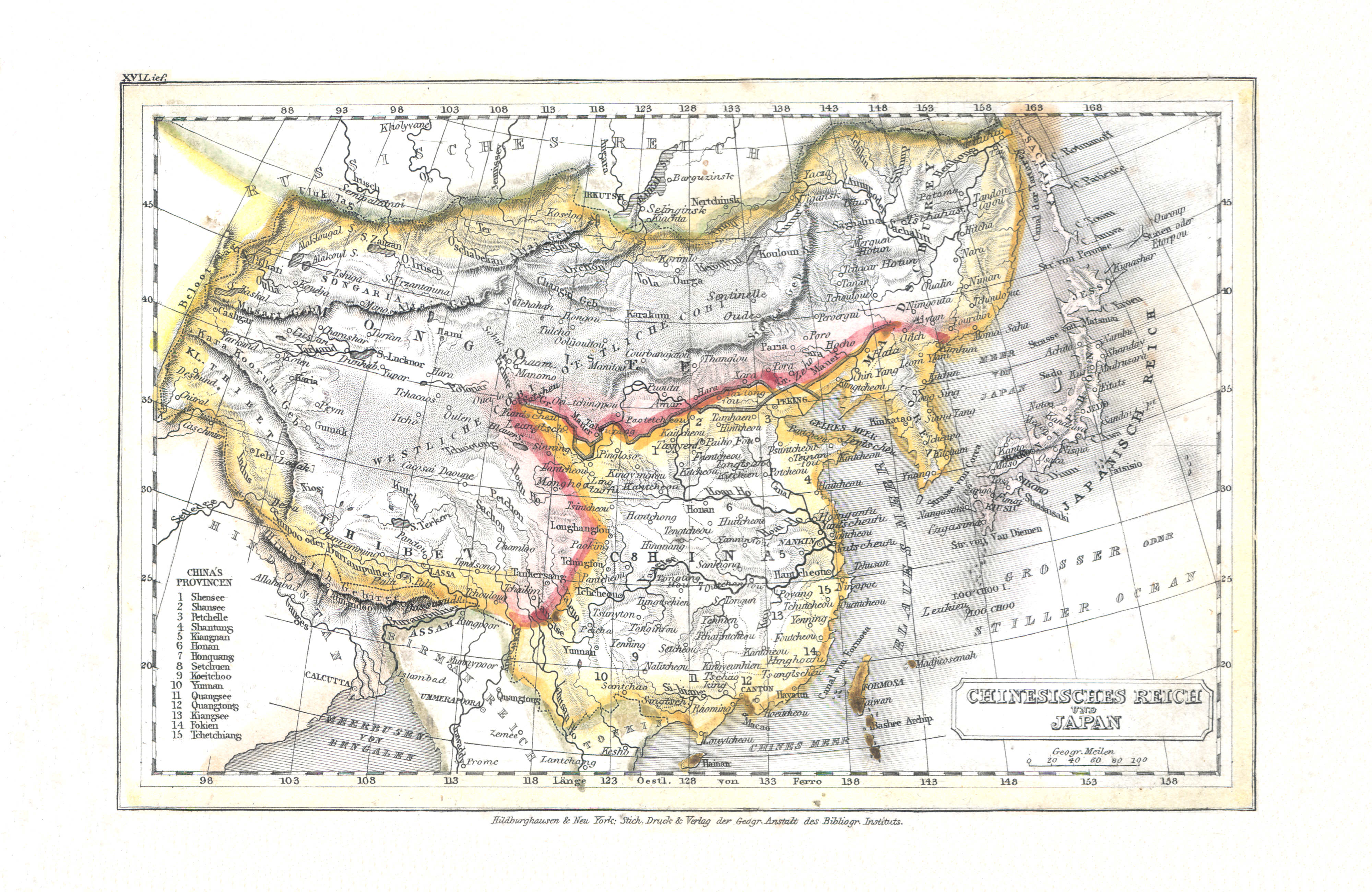
90. Chinesisches Reich und Japan (Lief. XVI = 16)
Het Chinese Rijk en Japan / The Chinese Empire and Japan
Meyer's Universal-Atlas (1830-1840)
geen overeenkomstige kaart / no corresponding map
 Meyer's Pfennig-Atlas (1834-1841)
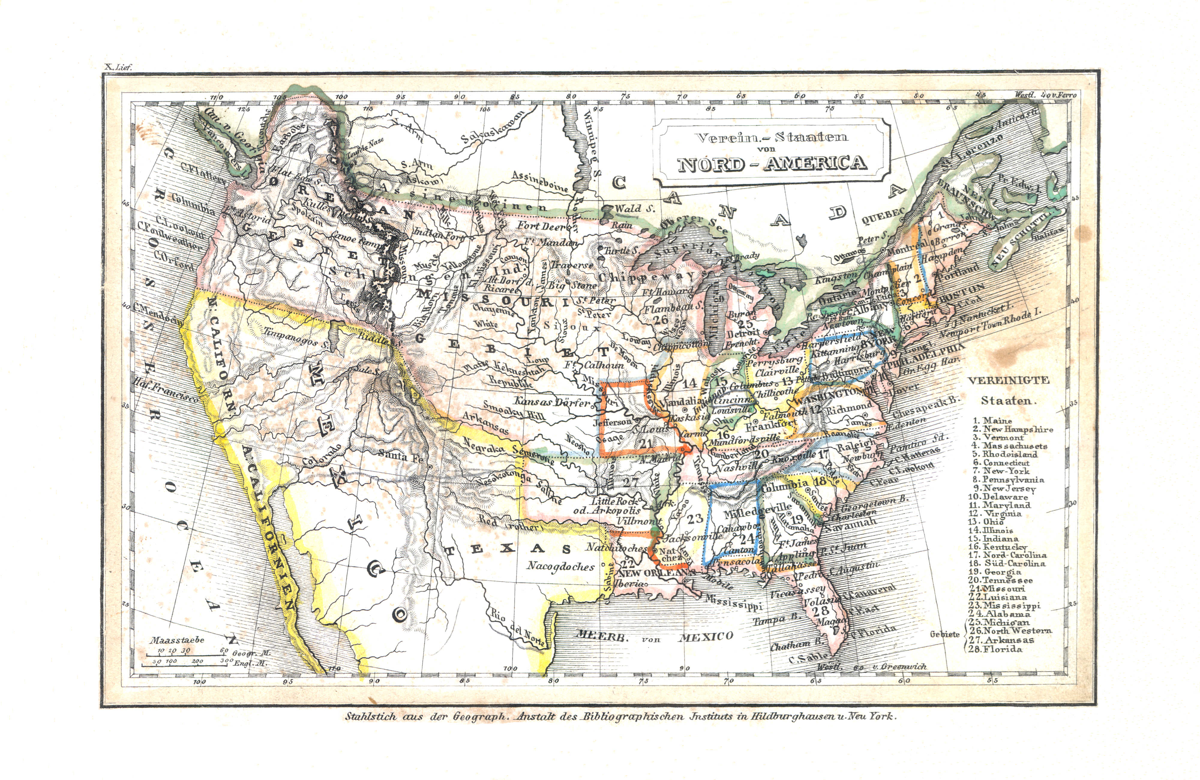
91. Verein.-Staaten von Nord-America (Lief. X = 10)
Verenigde Staten van Noord-Amerika / United States of North America
 Meyer's Universal-Atlas (1830-1840)
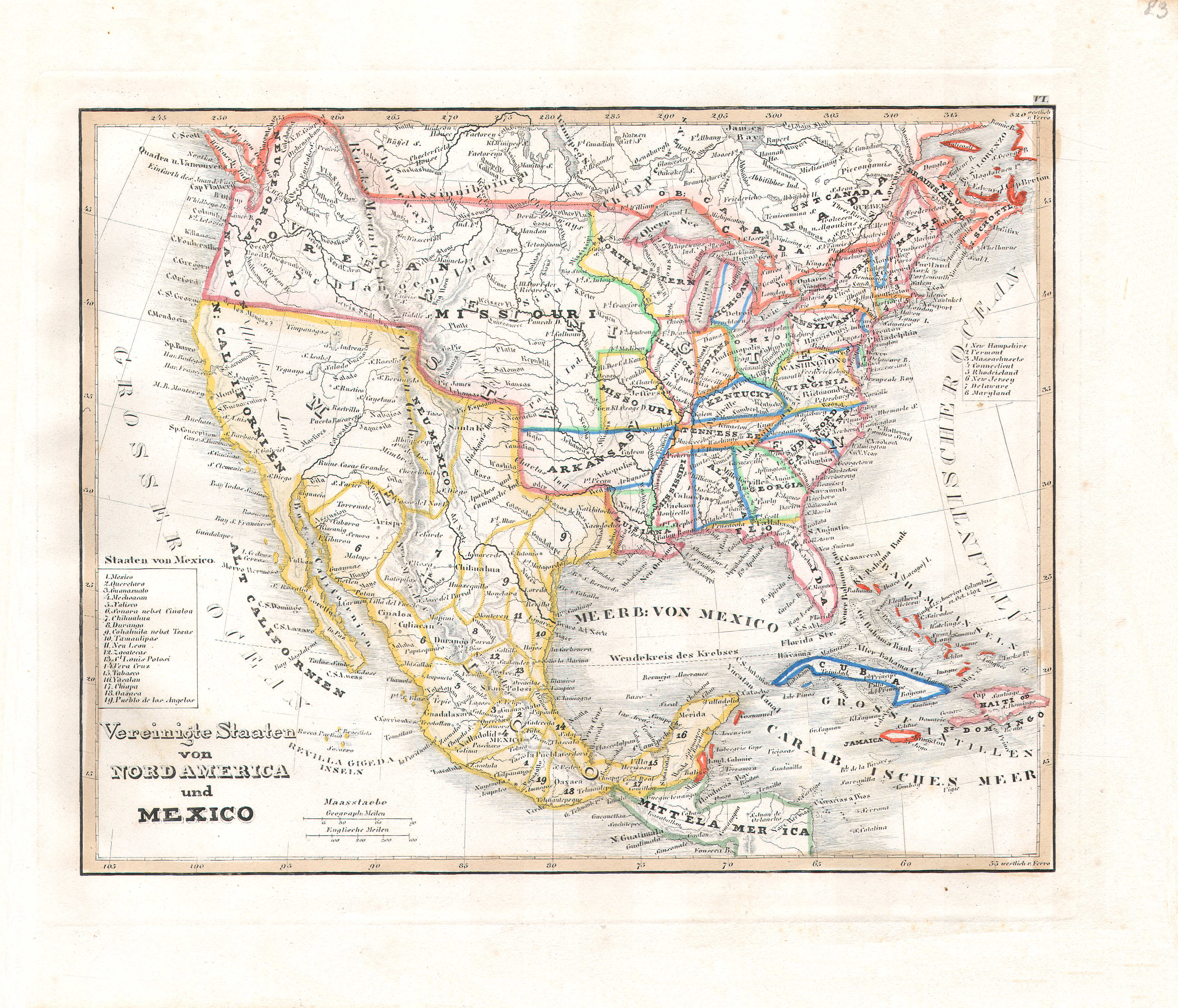
83. Vereinigte Staaten von Nord America und Mexico (Nº 6, 1831)
Verenigde Staten van Noord-Amerika en Mexico / United States of North America and Mexico
 Meyer's Pfennig-Atlas (1834-1841)
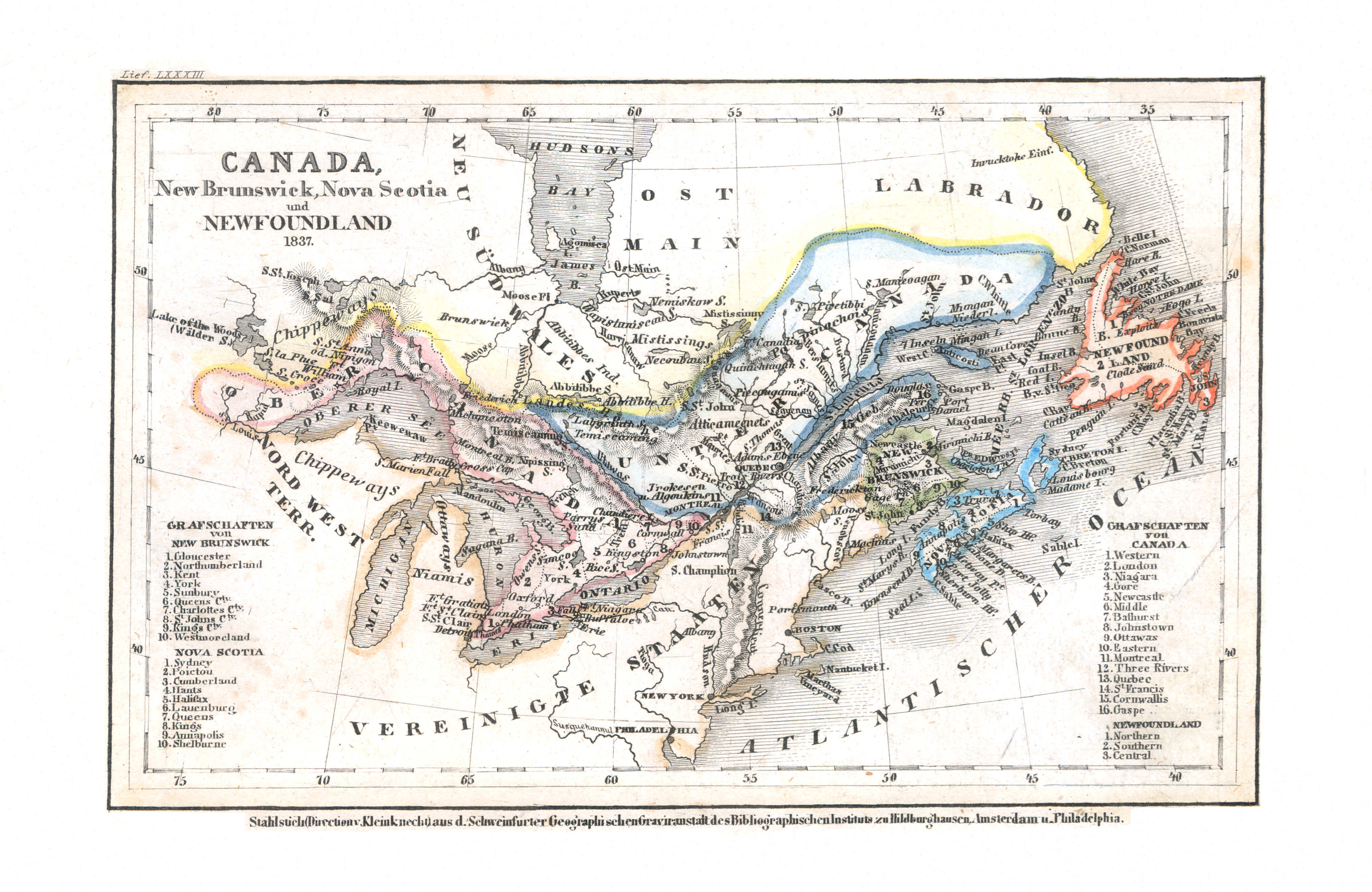
92. Canada, New Brunswick, Nova Scotia und Newfoundland (Lief. LXXXIII = 83, 1837)
Canada, New Brunswick, Nova Scotia, Newfoundland
Meyer's Universal-Atlas (1830-1840)
geen overeenkomstige kaart / no corresponding map
 Meyer's Pfennig-Atlas (1834-1841)
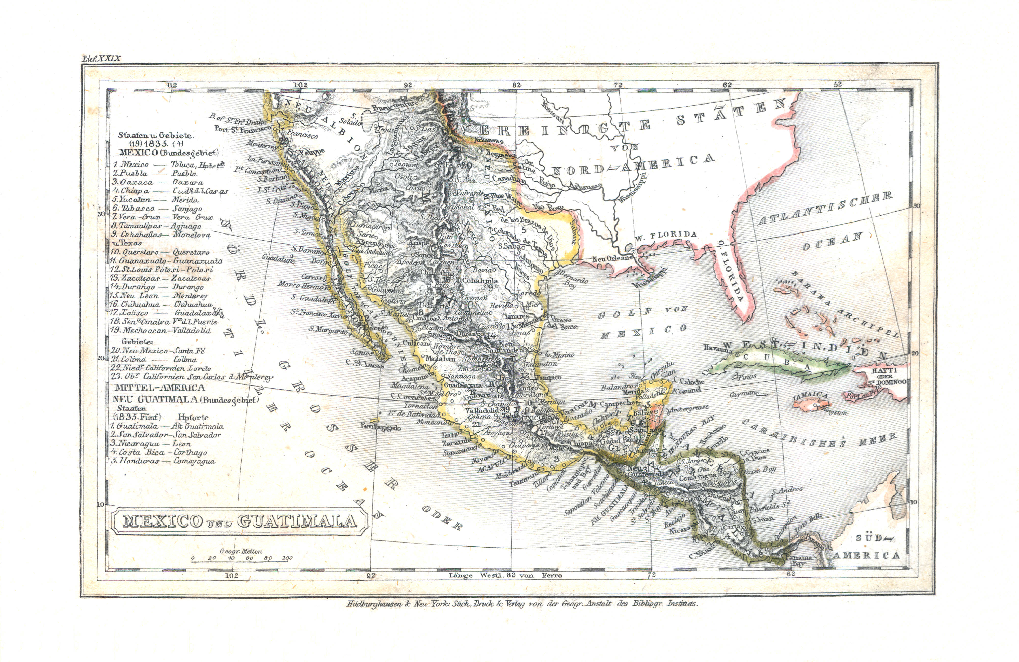
93. Mexico und Guatimala (Lief. XXIX = 29)
Mexico en Guatemala (Midden-Amerika) / Mexico and Guatemala (Central America)
Meyer's Universal-Atlas (1830-1840)
83. Vereinigte Staaten von Nord America und Mexico (Nº 6, 1831)
Verenigde Staten van Noord-Amerika en Mexico / United States of North America and Mexico
 Meyer's Pfennig-Atlas (1834-1841)
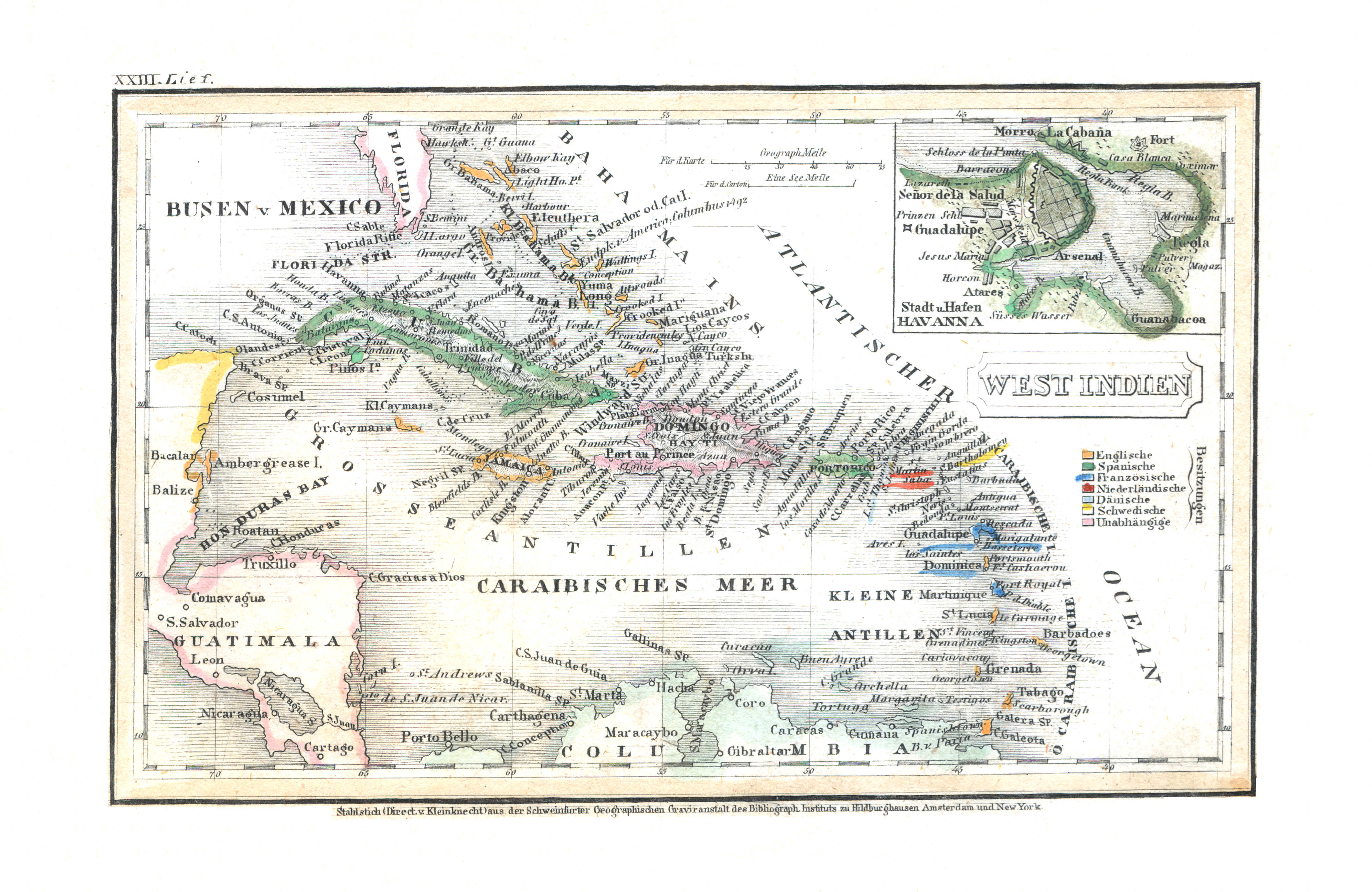
94. West Indien (Lief. XXIII = 23)
West-Indië / West Indies
 Meyer's Universal-Atlas (1830-1840)
79. West Indien und Mittel America (Nº 25, 1832)
West-Indië en Midden-Amerika / West Indies and central America
 Meyer's Pfennig-Atlas (1834-1841)
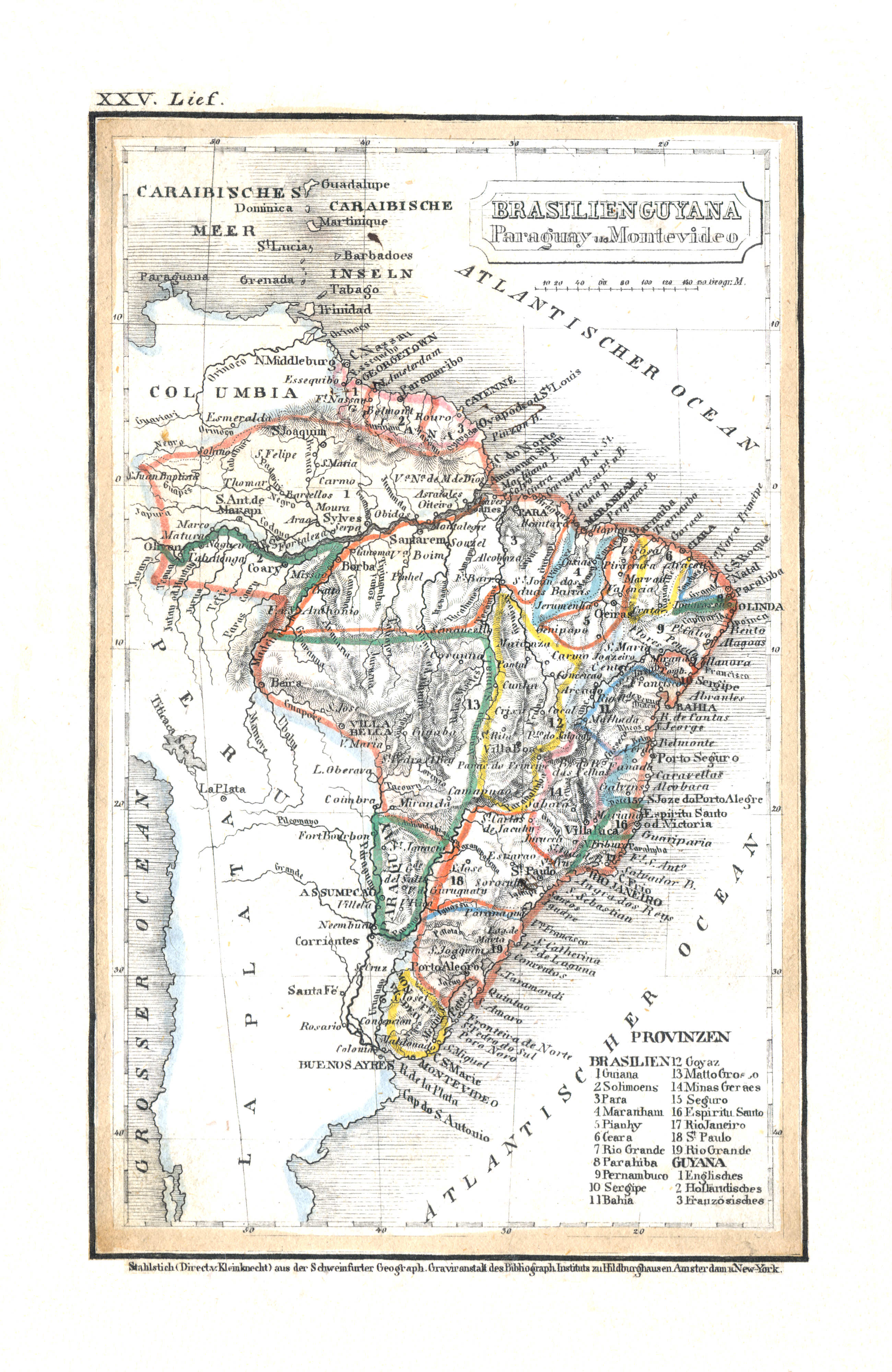
95. Brasilien Guyana Paraguay u. Montevideo (Lief. XXV = 25)
Brazilië, Guyana, Paraguay en Montevideo (Uruguay) / Brazil, Guyana, Paraguay and Montevideo (Uruguay)
Meyer's Universal-Atlas (1830-1840)
geen overeenkomstige kaart / no corresponding map
 Meyer's Pfennig-Atlas (1834-1841)
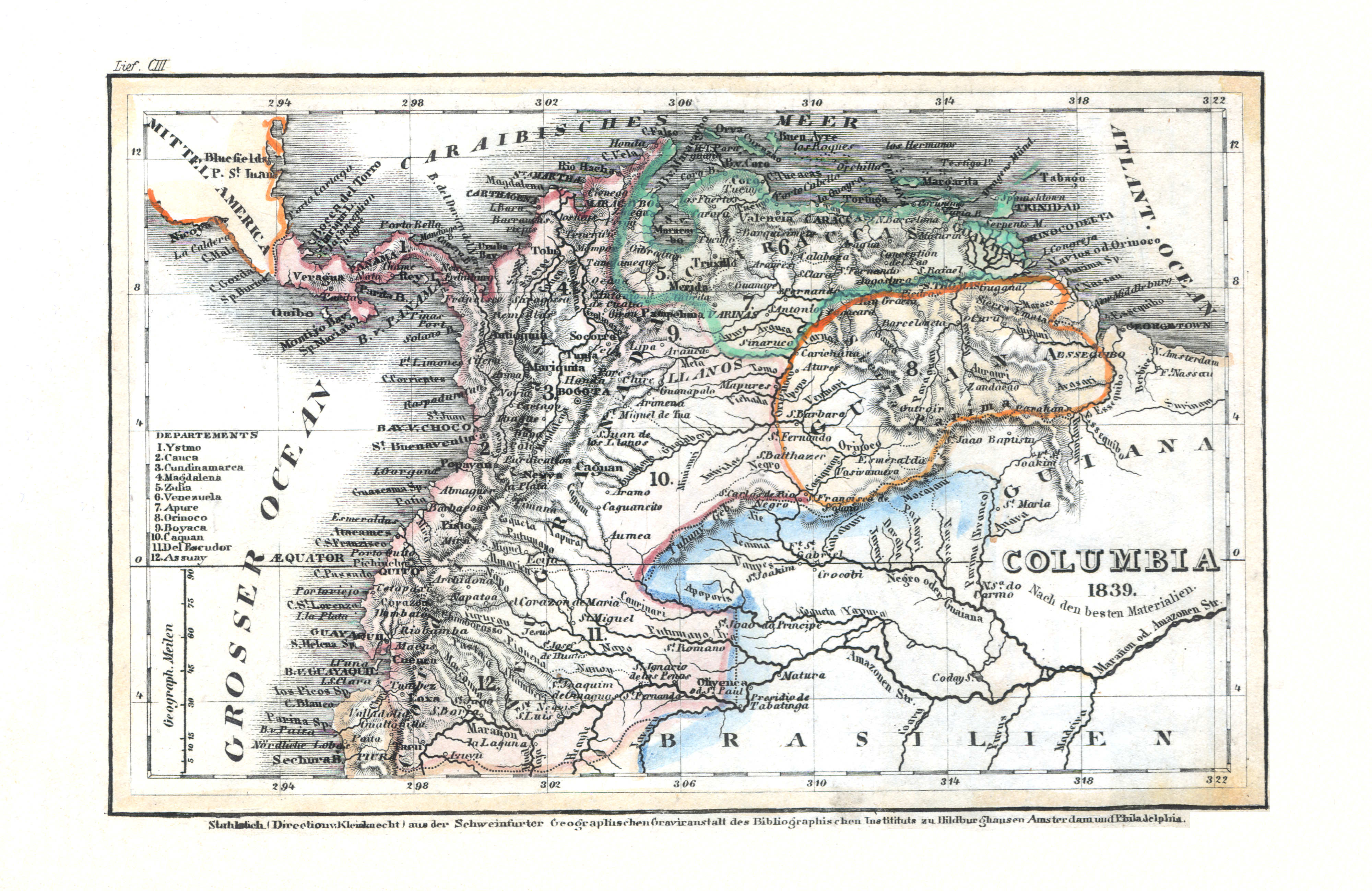
96. Columbia (Lief. CIII = 103, 1839)
Colombia (met Venezuela en Ecuador) / Colombia (with Venezuela and Ecuador)
Meyer's Universal-Atlas (1830-1840)
geen overeenkomstige kaart / no corresponding map
 Meyer's Pfennig-Atlas (1834-1841)
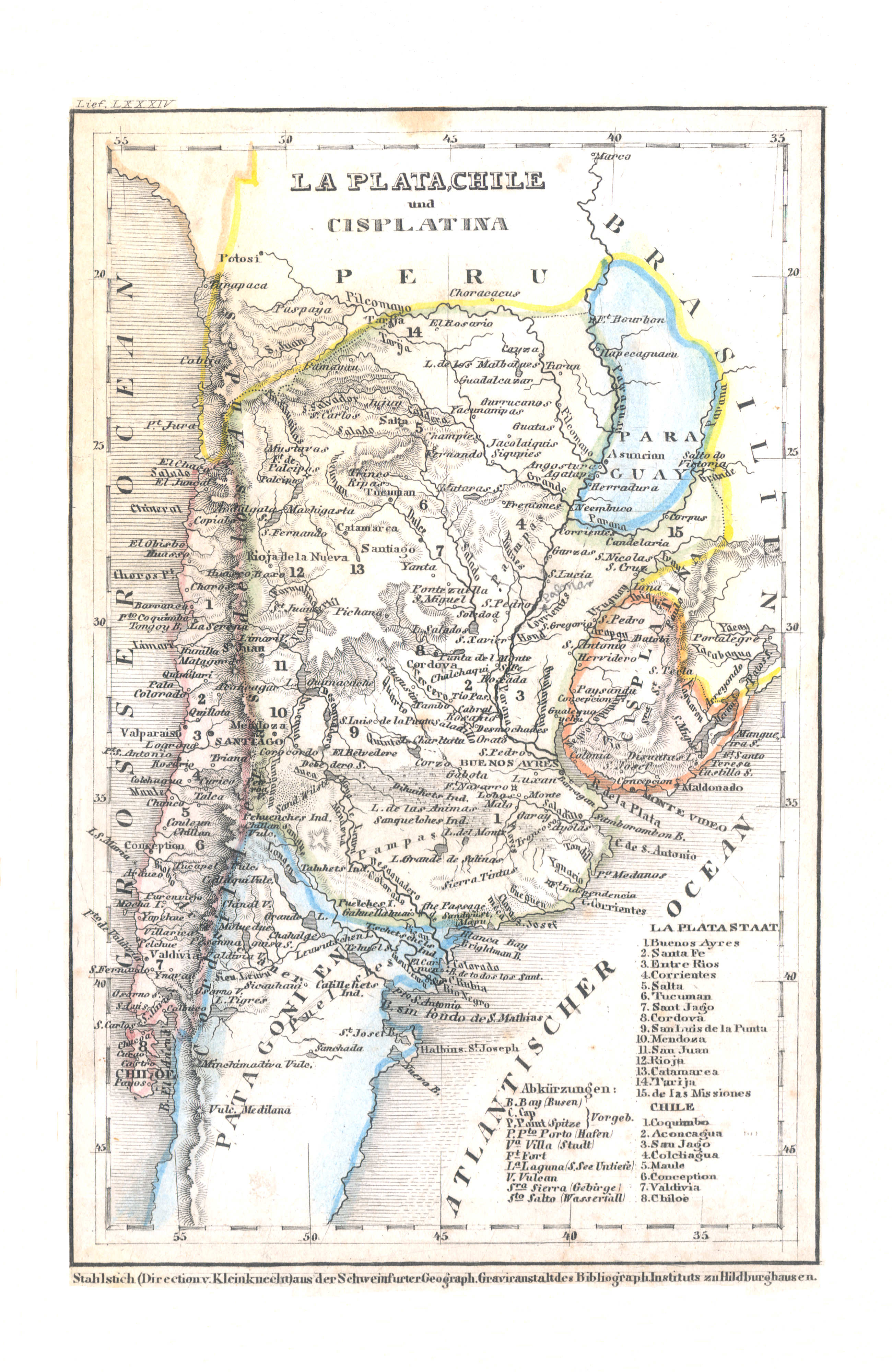
97. La Plata, Chile und Cisplatina (Lief. LXXXIV = 84)
La Plata (Argentinië), Chili en Cisplatina (Uruguay) / La Plata (Argentina), Chile and Cisplatina (Uruguay)
 Meyer's Universal-Atlas (1830-1840)
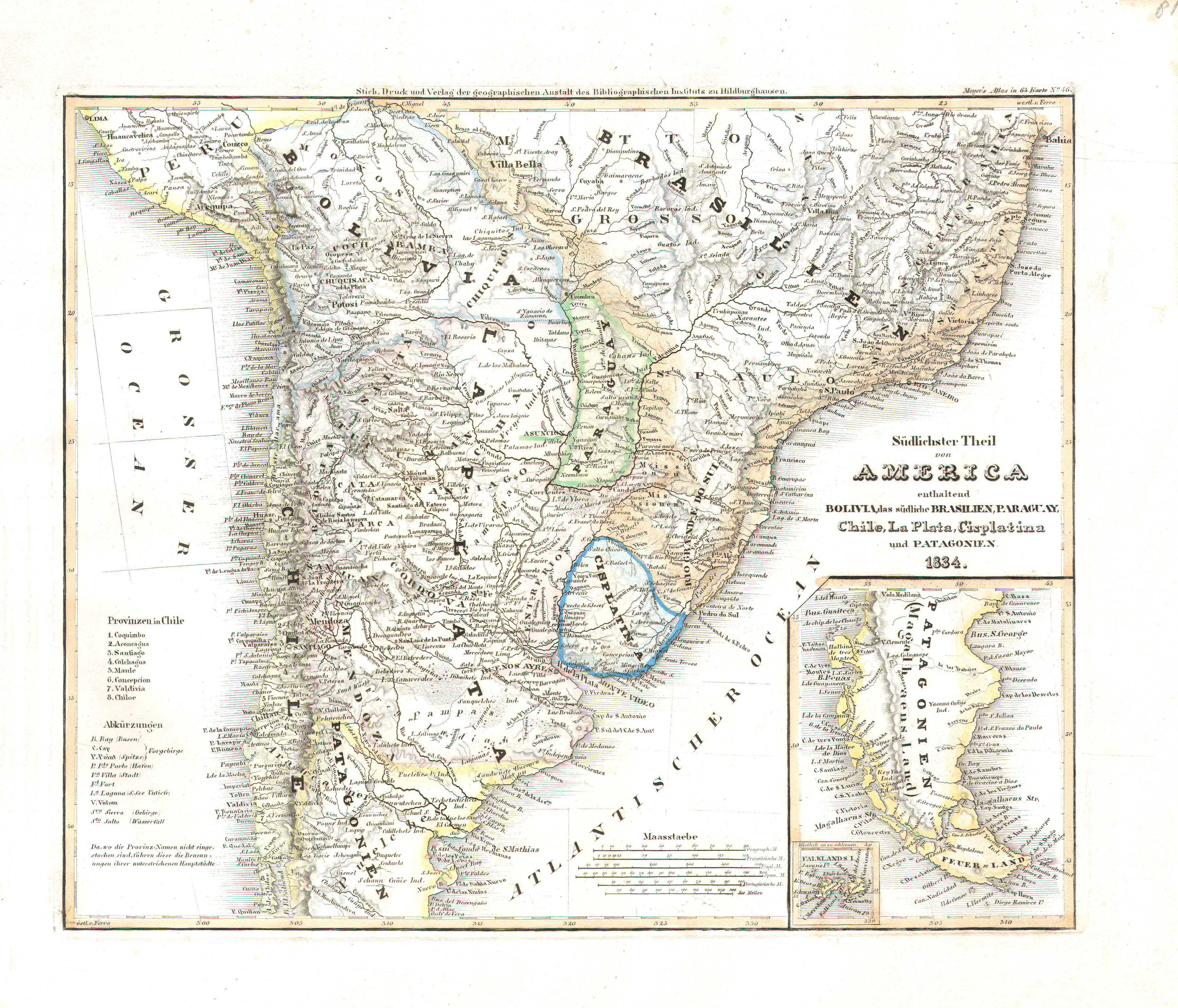
81. Südlichster Theil von America enthaltend Bolivia, das südliche Brasilien, Paraguay, Chile, La Plata, Cisplatina und Patagonien (Nº 46, 1834)
Zuidelijk deel van Zuid-Amerika met Bolivia, Zuid-Brazilië, Paraguay, Chili, La Plata (Argentinië), Cisplatina (Uruguay) en Patagonië / Southern part of South America with Bolivia, South Brazil, Paraguay, Chile, La Plata (Argentina), Cisplatina (Uruguay) and Patagonia
 Meyer's Pfennig-Atlas (1834-1841)
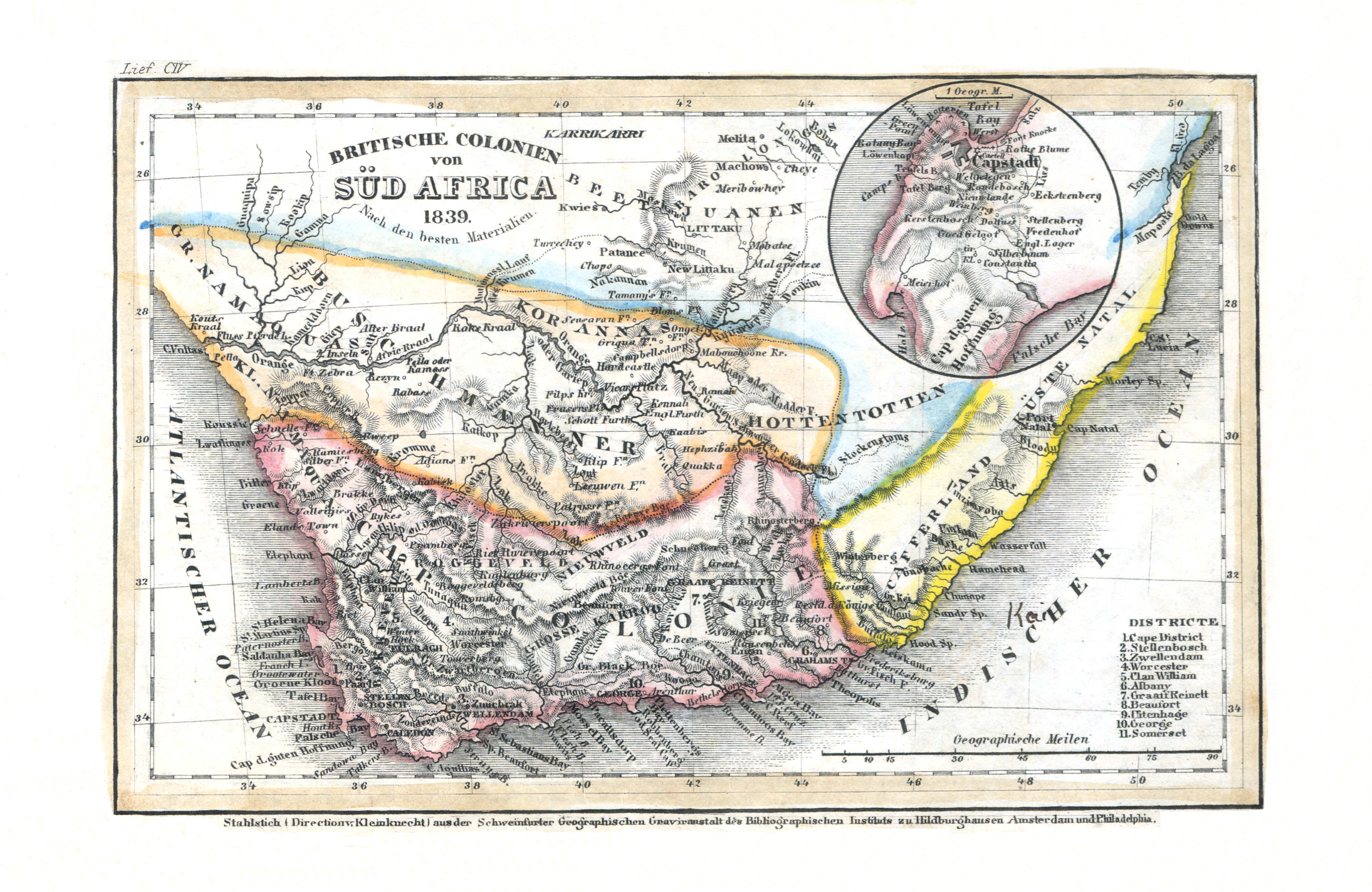
98. Britische Colonien von Süd Africa (Lief. CIV = 104, 1839)
Britse Koloniën in Zuid-Afrika / British Colonies in South Africa
 Meyer's Universal-Atlas (1830-1840)
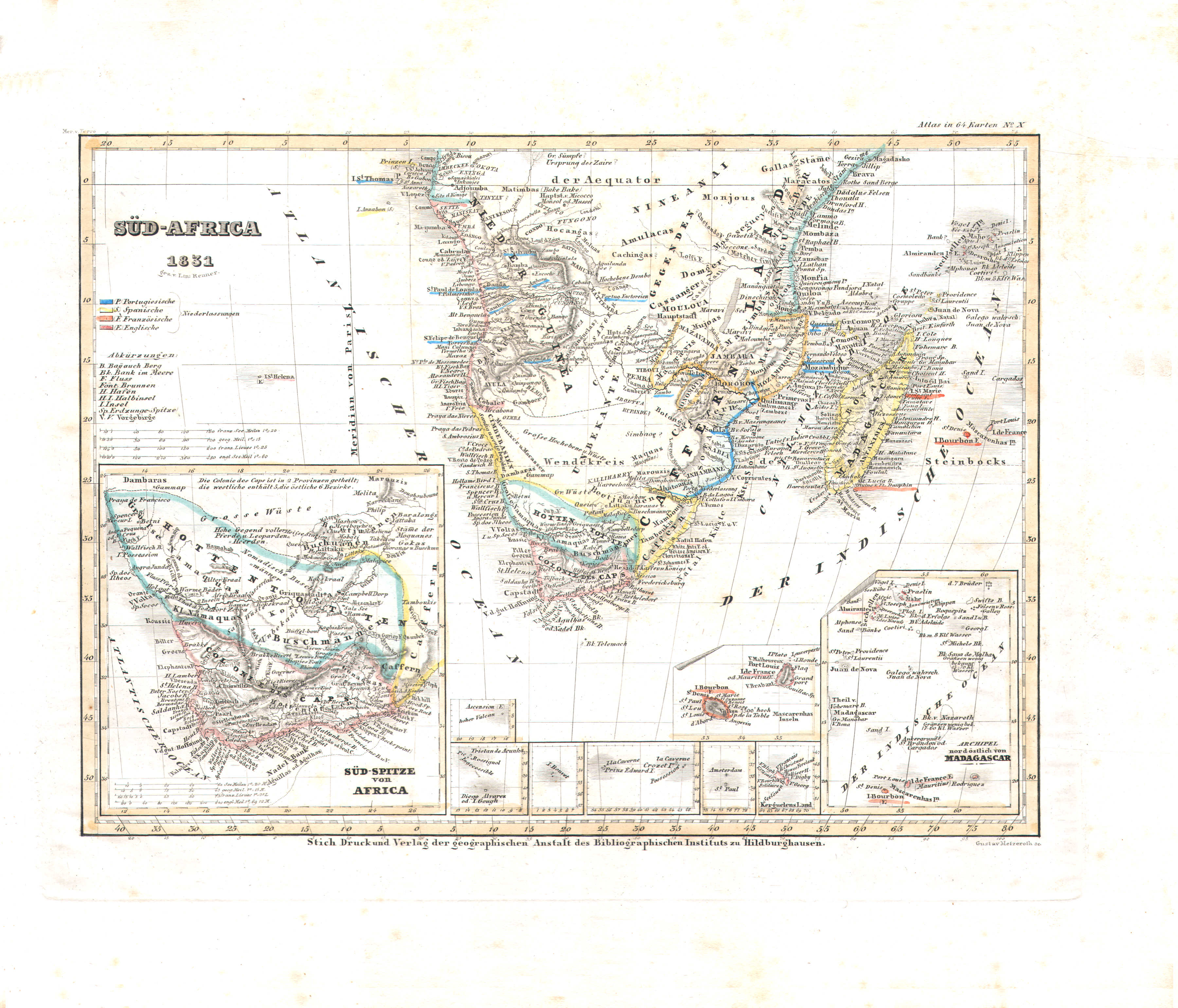
85. Süd-Africa (Nº 10, 1831)
Zuidelijk Afrika / Southern Africa
 Meyer's Pfennig-Atlas (1834-1841)
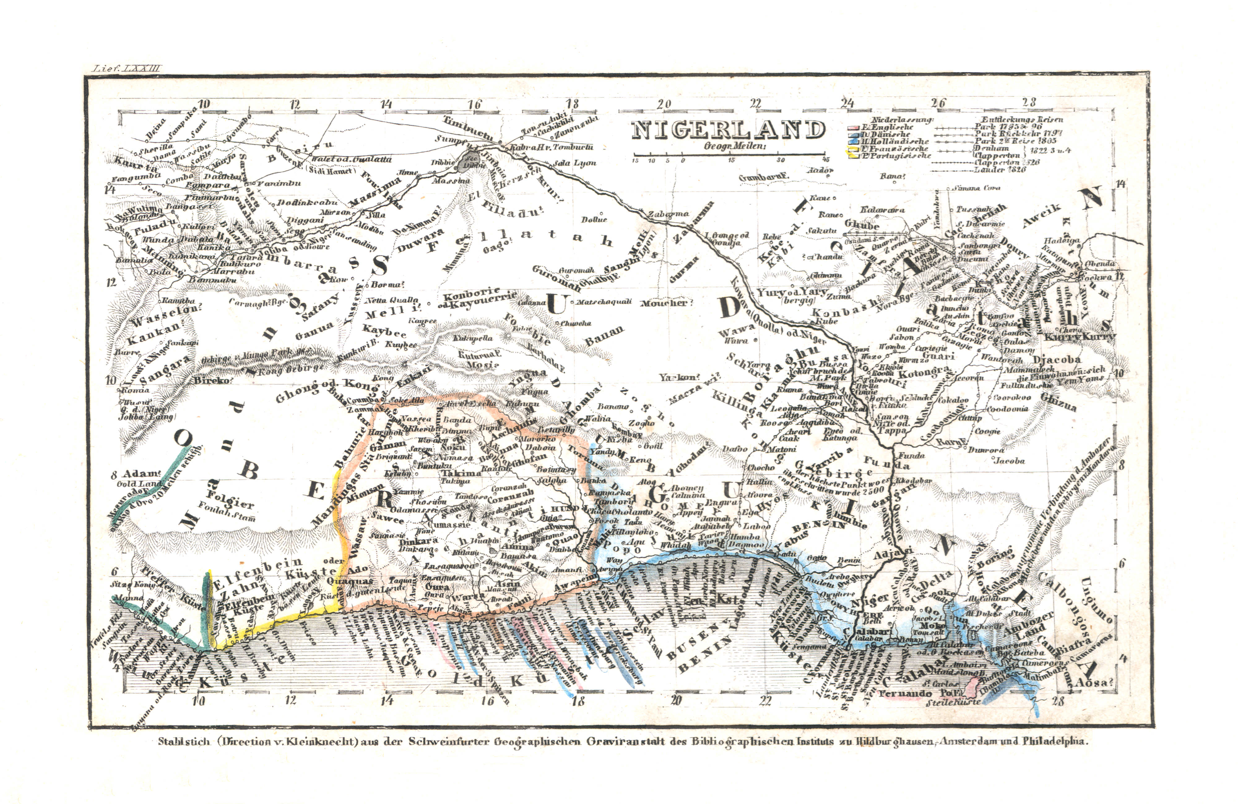
99. Nigerland (Lief. LXXIII = 73)
Landen van de Niger (West-Afrika) / Niger countries (West Africa)
 Meyer's Universal-Atlas (1830-1840)
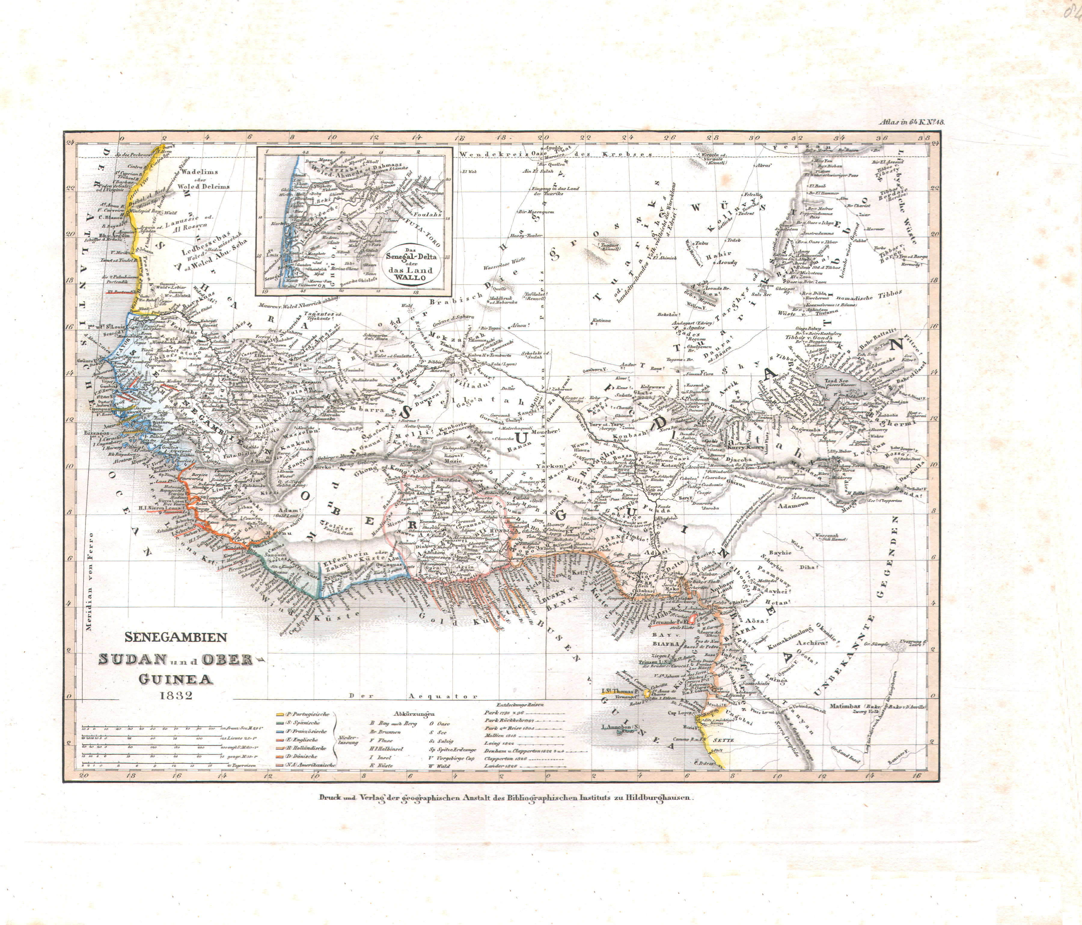
84. Senegambien Sudan und Ober-Guinea (Nº 18, 1832)
Senegambië, Soedan en Opper-Guinee / Senegambia, Sudan and Upper Guinea
 Meyer's Pfennig-Atlas (1834-1841)
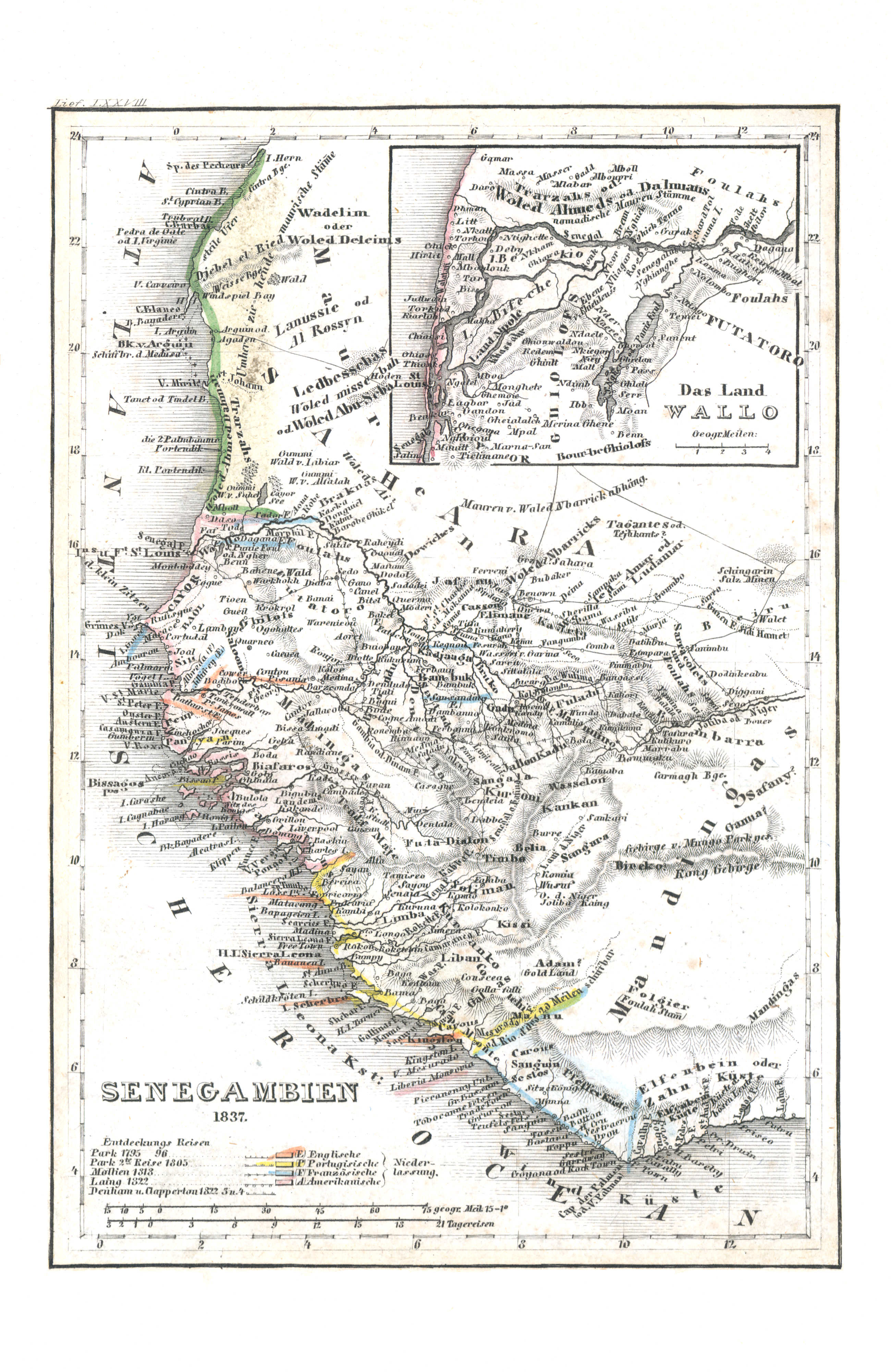
100. Senegambien (Lief. LXXVIII = 78, 1837)
Senegambië / Senegambia
Meyer's Universal-Atlas (1830-1840)
84. Senegambien Sudan und Ober-Guinea (Nº 18, 1832)
Senegambië, Soedan en Opper-Guinee / Senegambia, Sudan and Upper Guinea
 Meyer's Pfennig-Atlas (1834-1841)
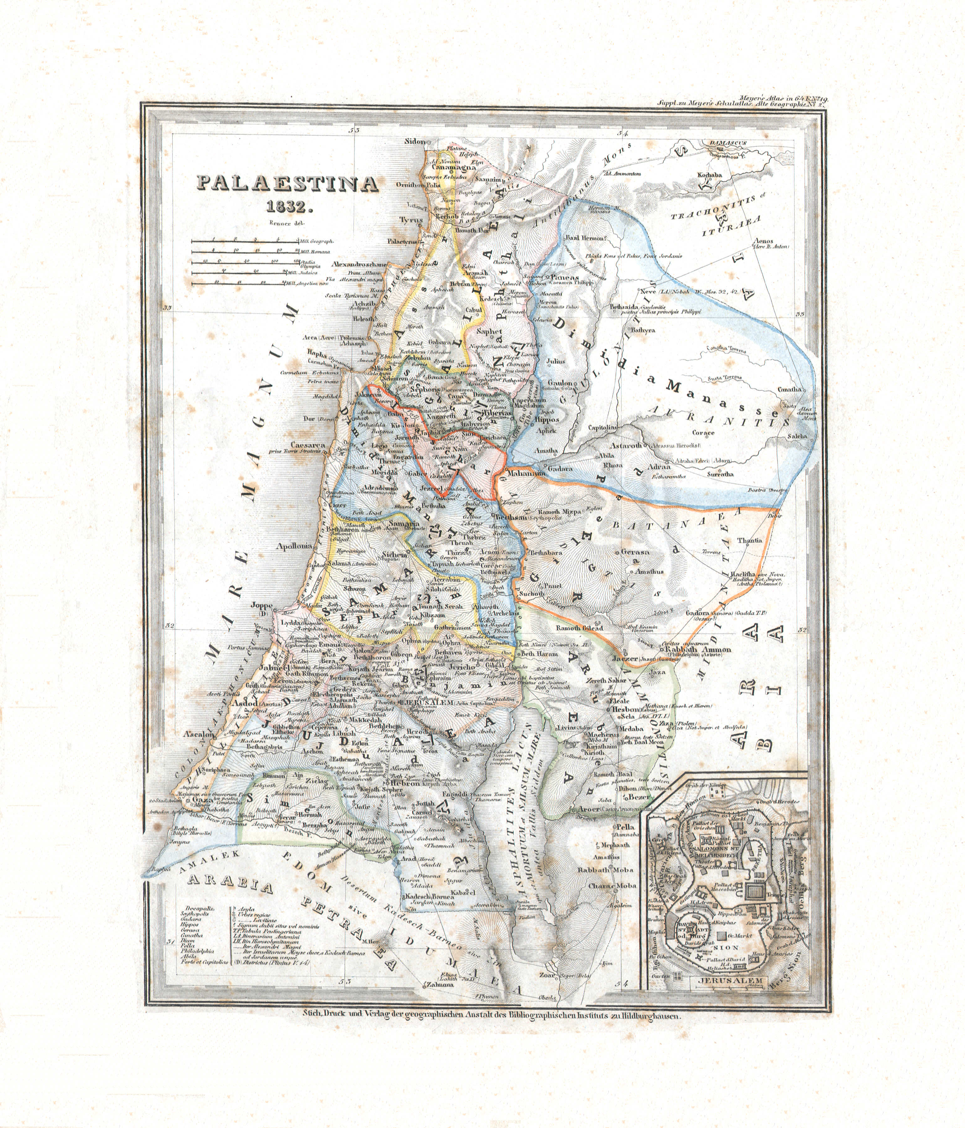
101. Das biblische Palaestina (Lief. XXXI = 31)
Bijbels Palestina / Biblical Palestine
 Meyer's Universal-Atlas (1830-1840)
14. Palaestina (Nº 19, 1832)
Palestina / Palestine
 Meyer's Pfennig-Atlas (1834-1841)
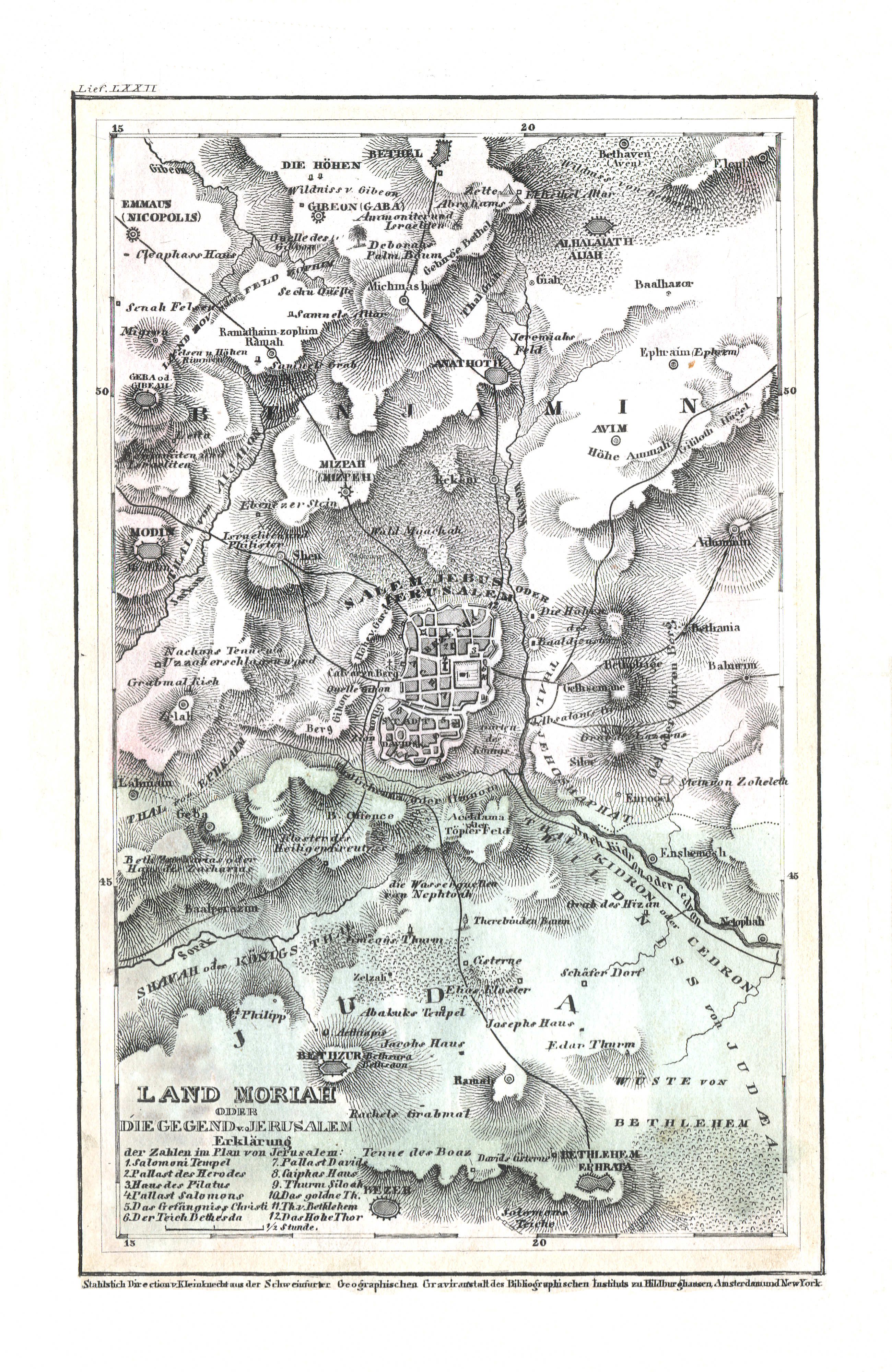
102. Land Moriah oder die Gegend v. Jerusalem (Lief. LXXII = 72)
Het land Moria of de omgeving van Jeruzalem / The Moriah region or the environs of Jerusalem
Meyer's Universal-Atlas (1830-1840)
geen overeenkomstige kaart / no corresponding map
 Meyer's Pfennig-Atlas (1834-1841)
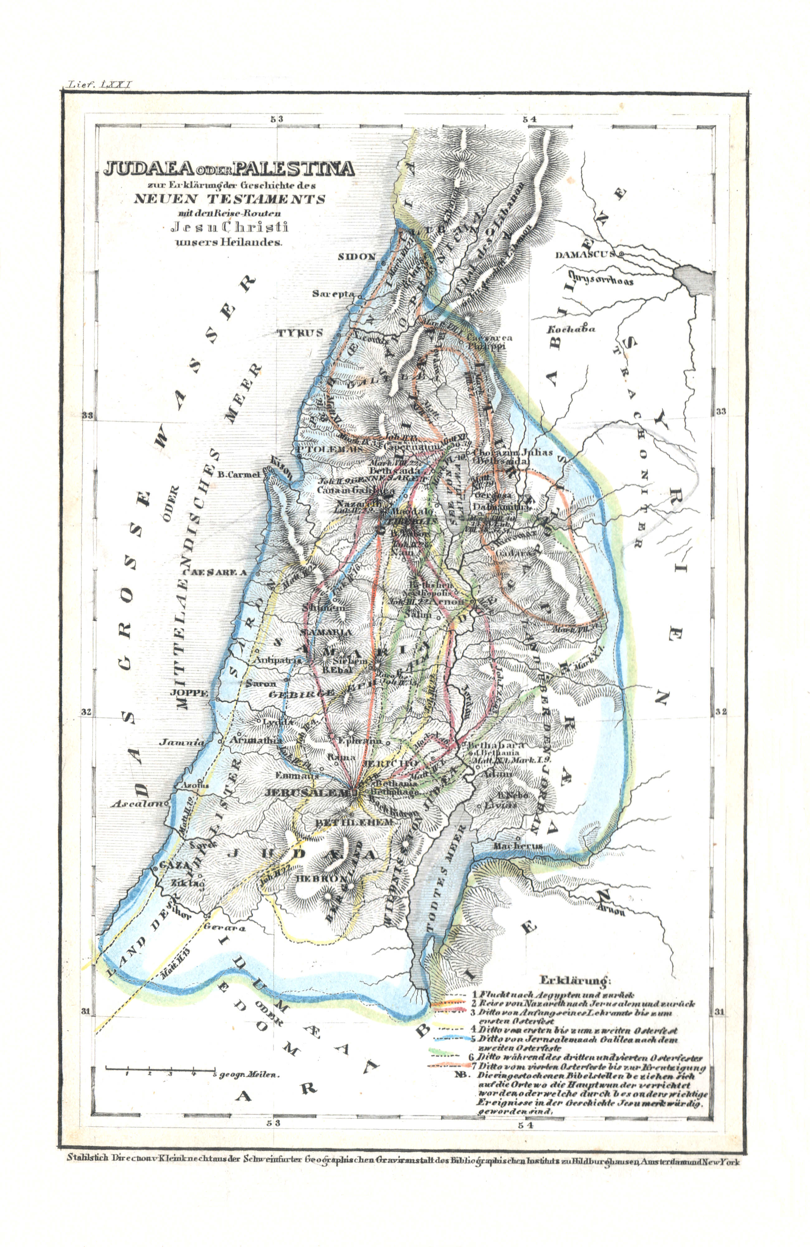
103. Judaea oder Palestina zur Erklärung der Geschichte des Neuen Testaments mit den Reise-Routen Jesu Christi unsers Heilandes (Lief. LXXI = 71)
Judea of Palestina / Judea or Palestine
Meyer's Universal-Atlas (1830-1840)
geen overeenkomstige kaart / no corresponding map
- Kaartformaat Pfennig-Atlas (halve kaart): 9 × 11,5 cm (vergroot: 600dpi)
- Bijkaartformaat Universal-Atlas: wisselend (vergroot: 600dpi)
- Map size Pfennig-Atlas (half map): 9 × 11.5 cm (enlarged: 600dpi)
- Inset map size Universal-Atlas: various (enlarged: 600dpi)
 Meyer's Pfennig-Atlas (1834-1841)
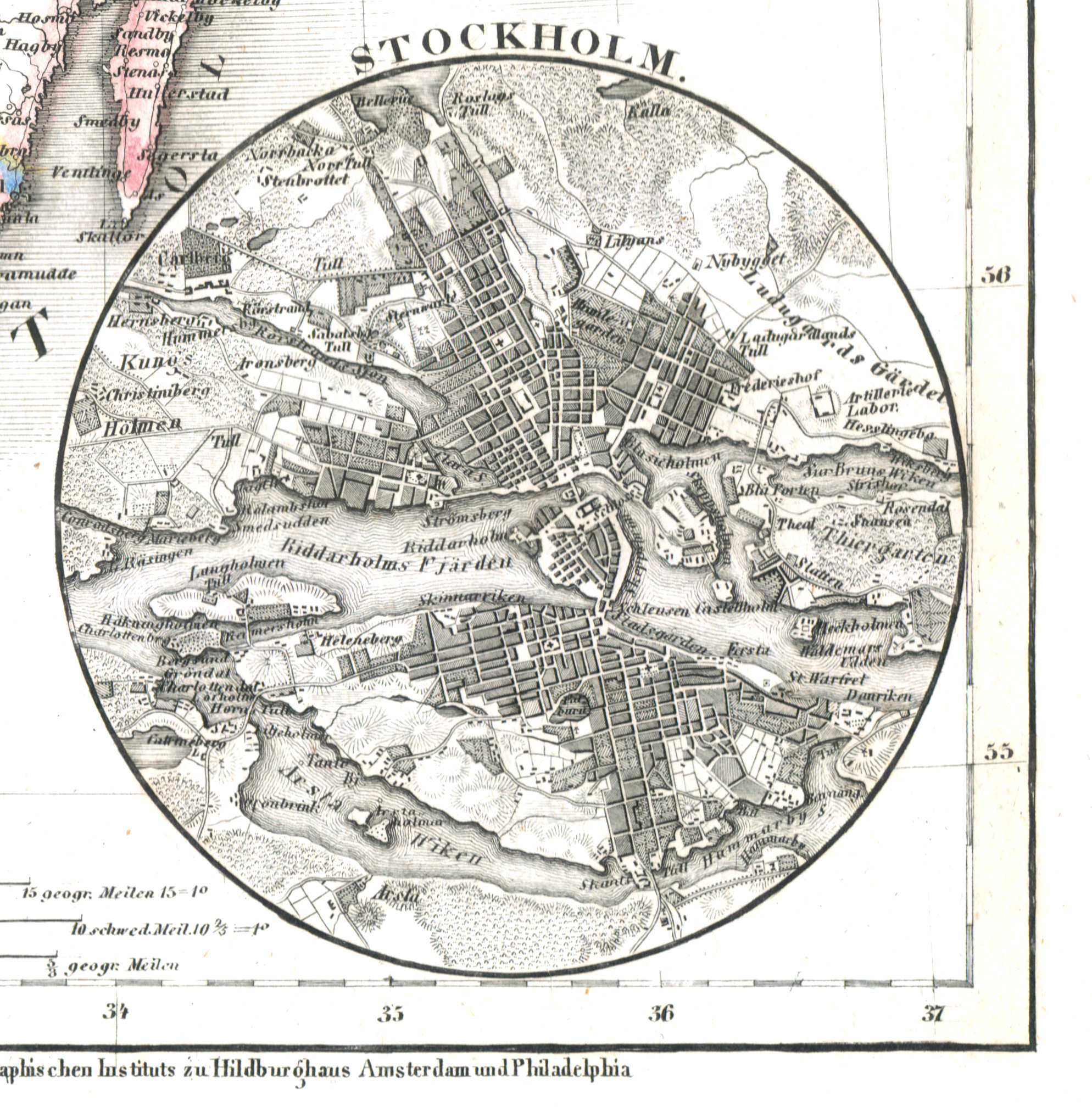
104. Stockholm, Lissabon (Lief. LXXXXVIII = 98, 1838)
Stockholm
 Meyer's Universal-Atlas (1830-1840)
35a. Stockholm (1838)
Stockholm
 Meyer's Pfennig-Atlas (1834-1841)
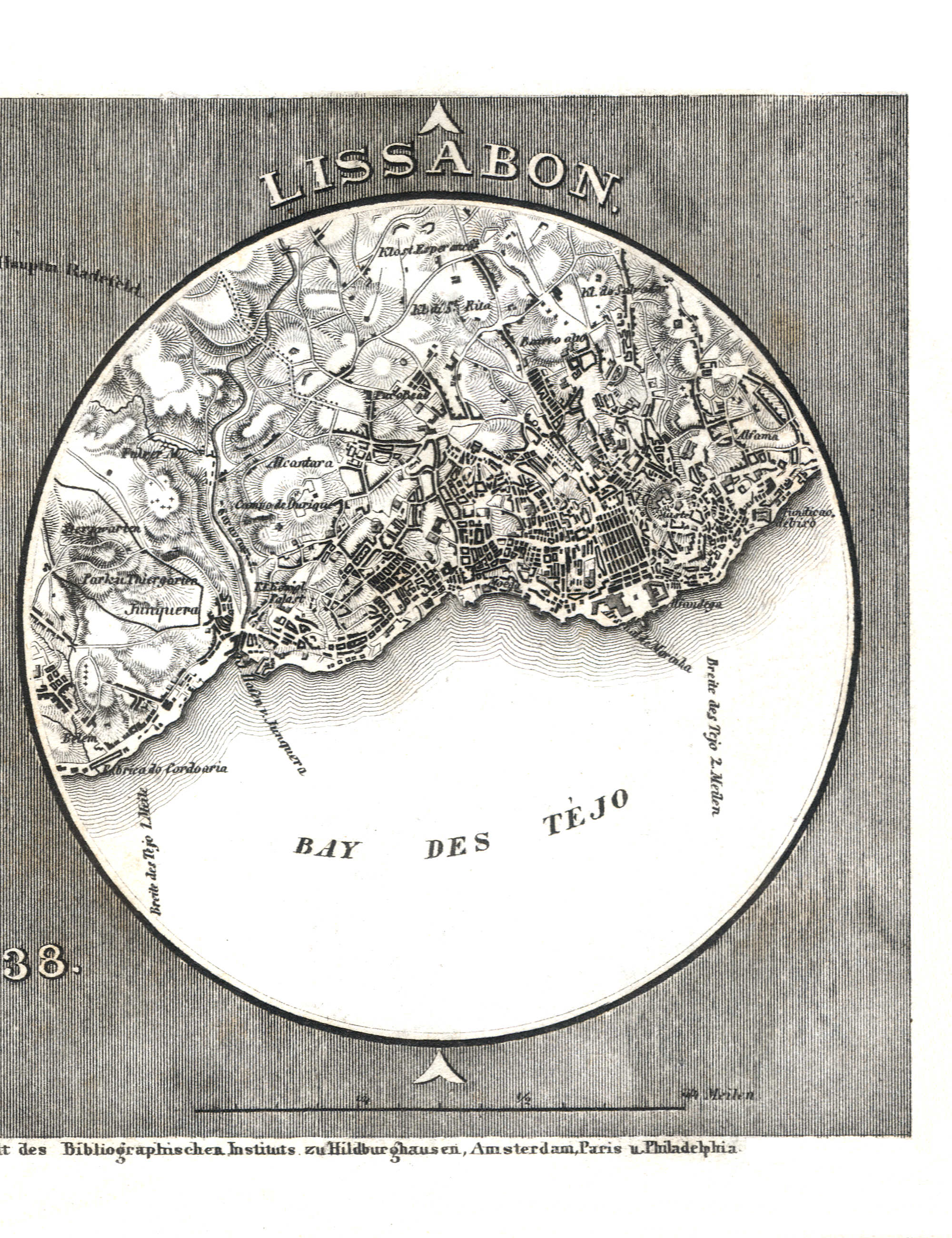
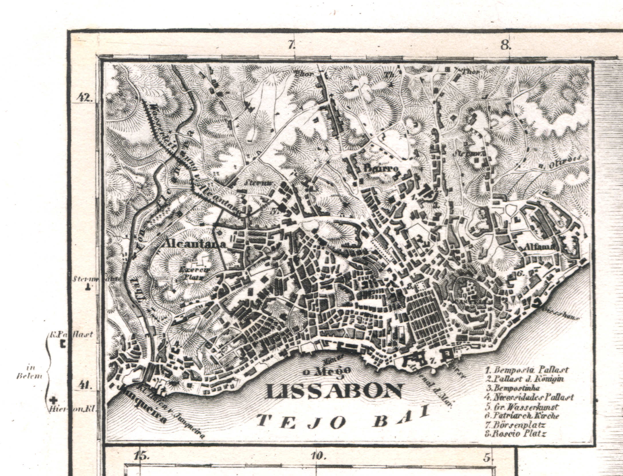
104. Stockholm, Lissabon (Lief. LXXXXVIII = 98, 1838)
Lissabon / Lisbon / Lisboa
 Meyer's Universal-Atlas (1830-1840)
76a. Lissabon (1839)
Lissabon / Lisbon / Lisboa
 Meyer's Pfennig-Atlas (1834-1841)
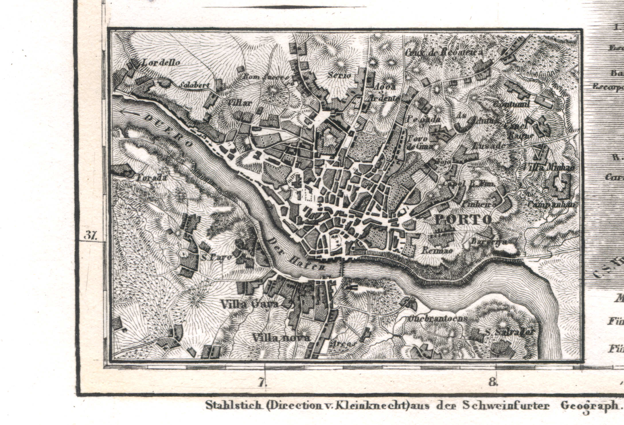
105. O Porto, Carlsruhe (Lief. LXXXXVII = 97, 1838)
Porto / Oporto
 Meyer's Universal-Atlas (1830-1840)
76c. Porto (1839)
Porto / Oporto
 Meyer's Pfennig-Atlas (1834-1841)
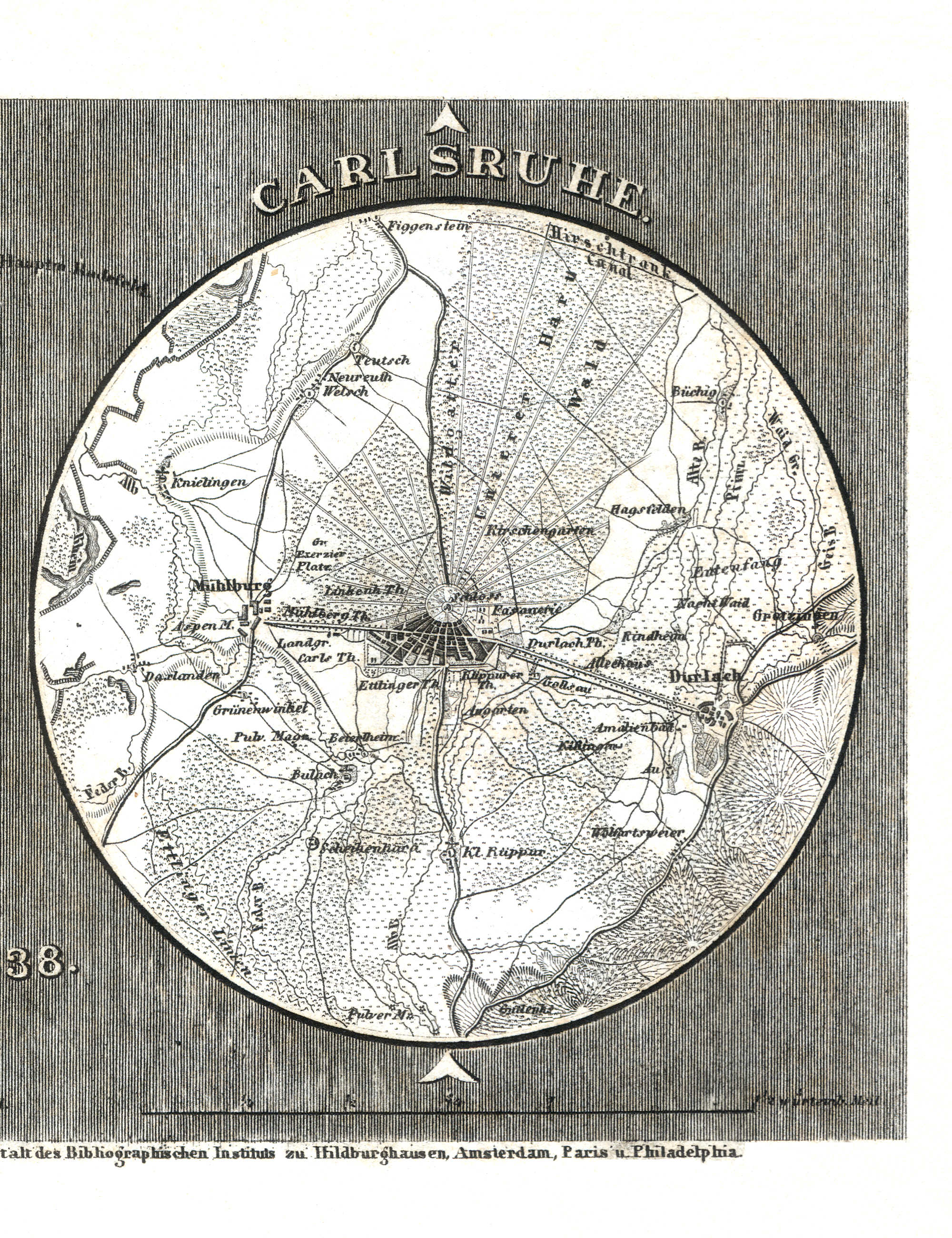
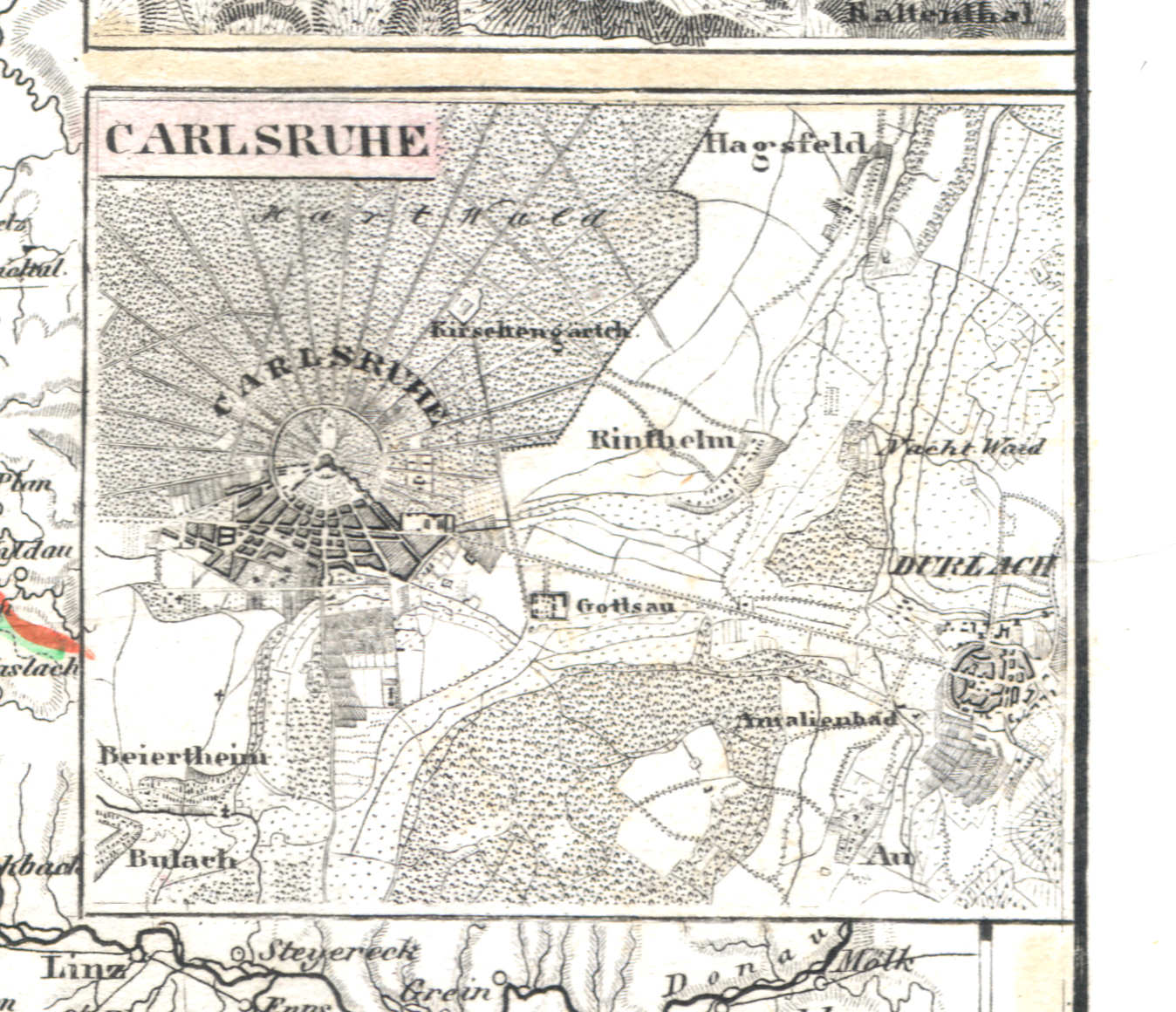
105. O Porto, Carlsruhe (Lief. LXXXXVII = 97, 1838)
Karlsruhe
 Meyer's Universal-Atlas (1830-1840)
69c. Carlsruhe (1834)
Karlsruhe
 Meyer's Pfennig-Atlas (1834-1841)
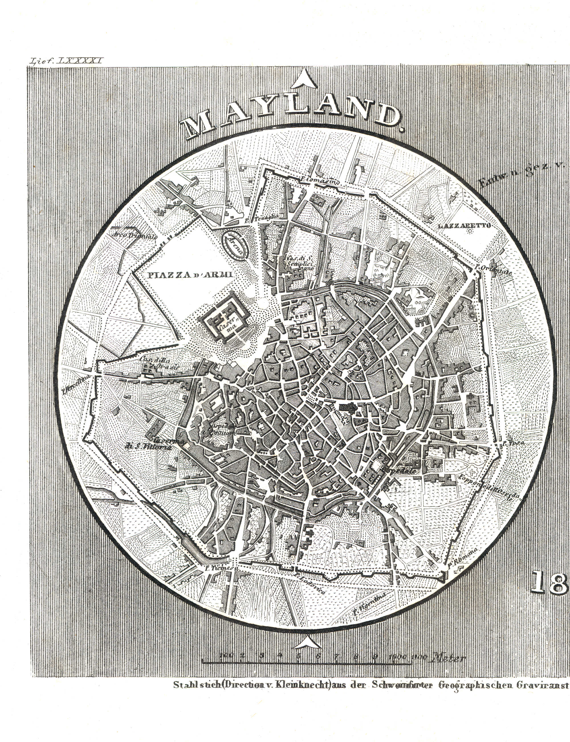
106. Mayland, Verona (Lief. LXXXXI = 91, 1838)
Milaan / Milan / Milano
 Meyer's Universal-Atlas (1830-1840)
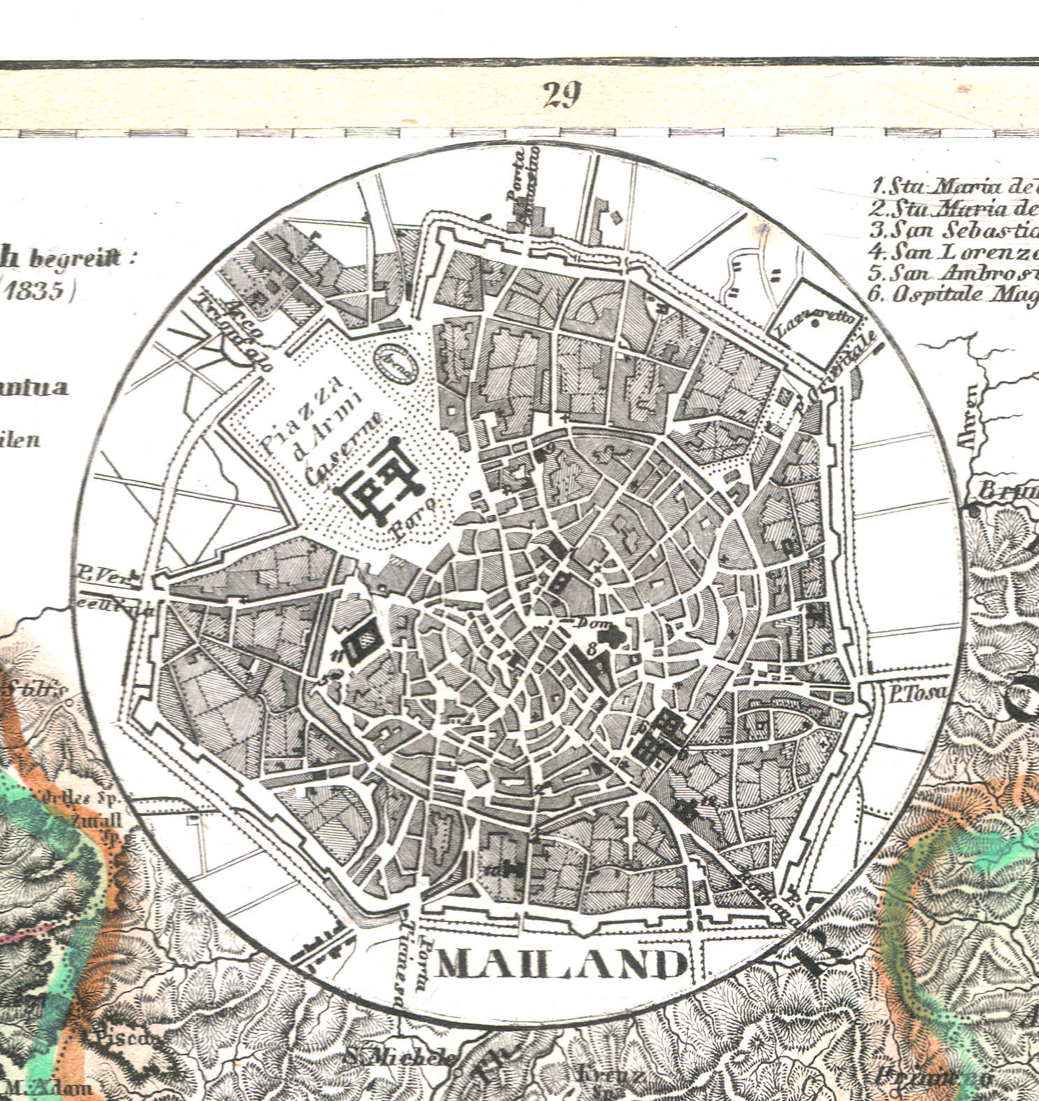
50b. Mailand (1837)
Milaan / Milan / Milano
 Meyer's Pfennig-Atlas (1834-1841)
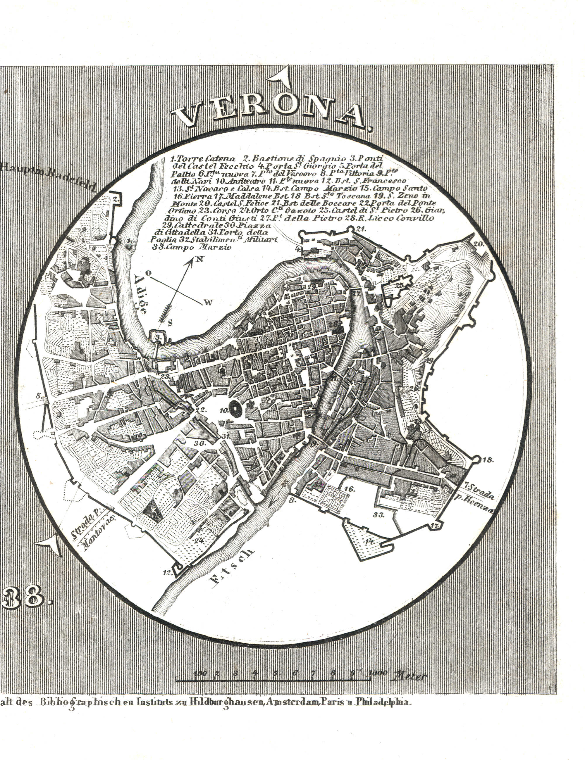
106. Mayland, Verona (Lief. LXXXXI = 91, 1838)
Verona
 Meyer's Universal-Atlas (1830-1840)
50a. Verona (1837)
Verona
 Meyer's Pfennig-Atlas (1834-1841)
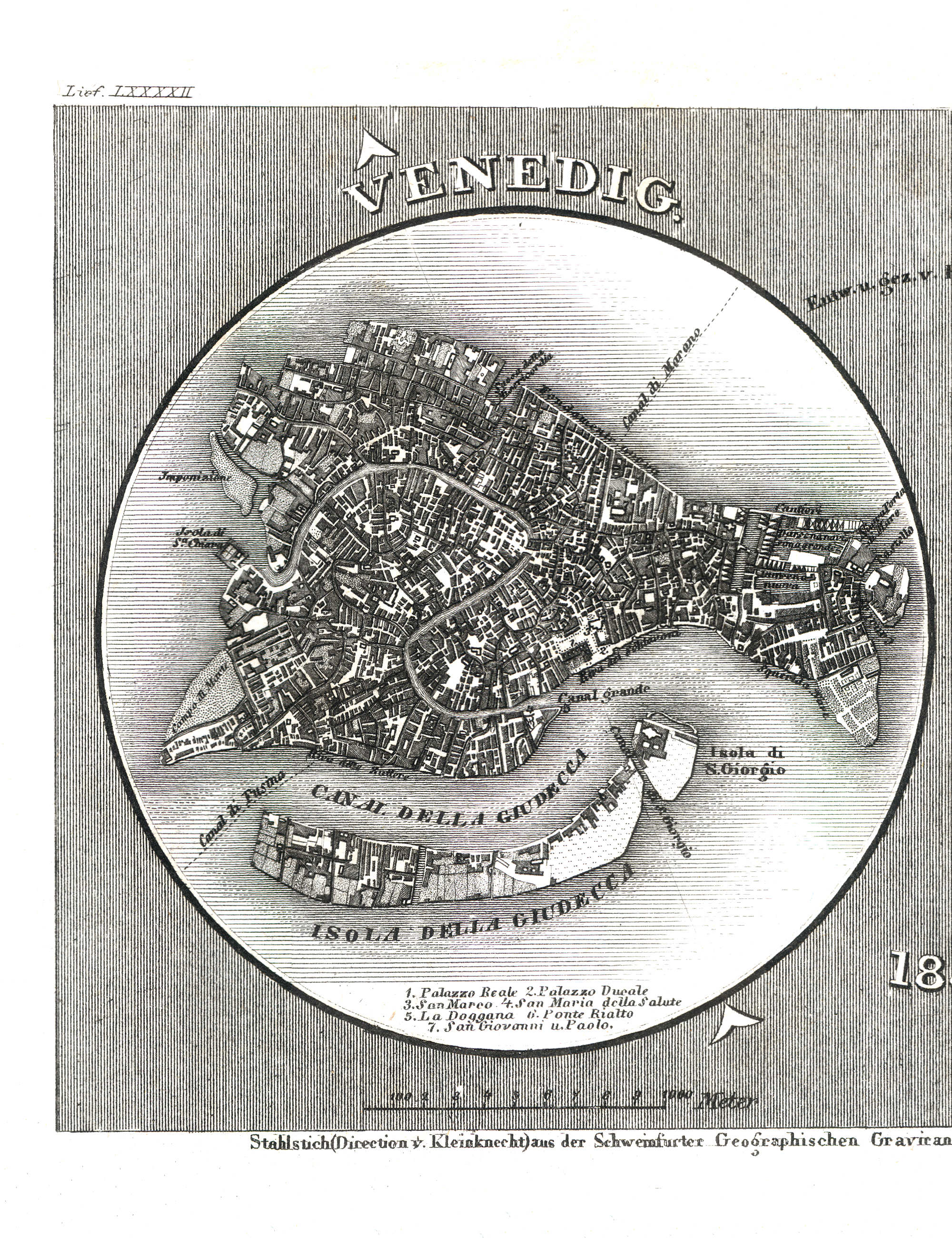
107. Venedig, Mantua (Lief. LXXXXII = 92, 1838)
Venetië / Venice / Venezia
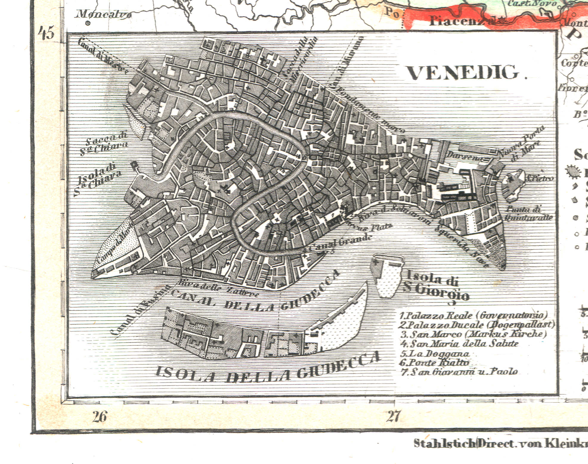 Meyer's Universal-Atlas (1830-1840)
50c. Venedig (1837)
Venetië / Venice / Venezia
 Meyer's Pfennig-Atlas (1834-1841)
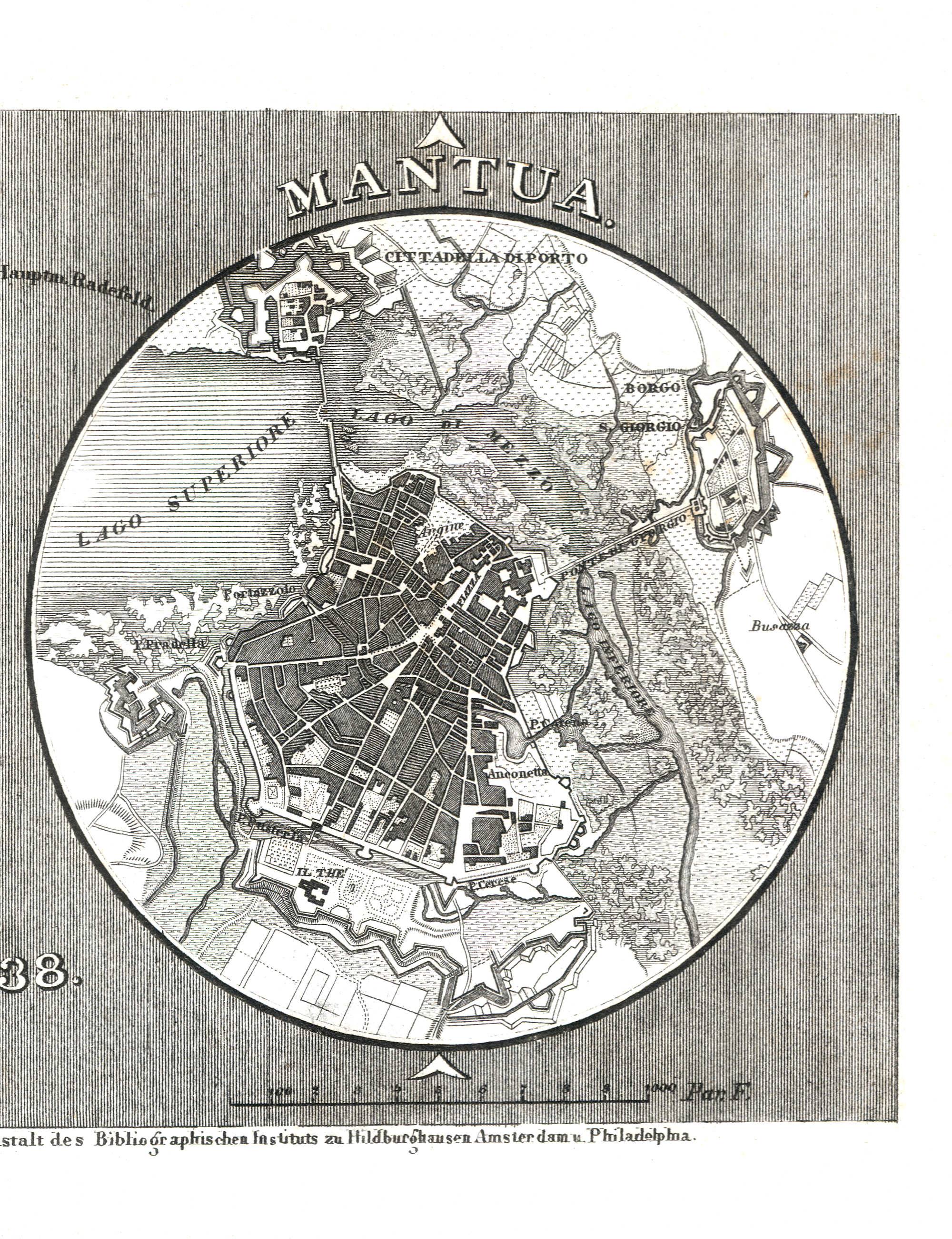
107. Venedig, Mantua (Lief. LXXXXII = 92, 1838)
Mantua / Mantova
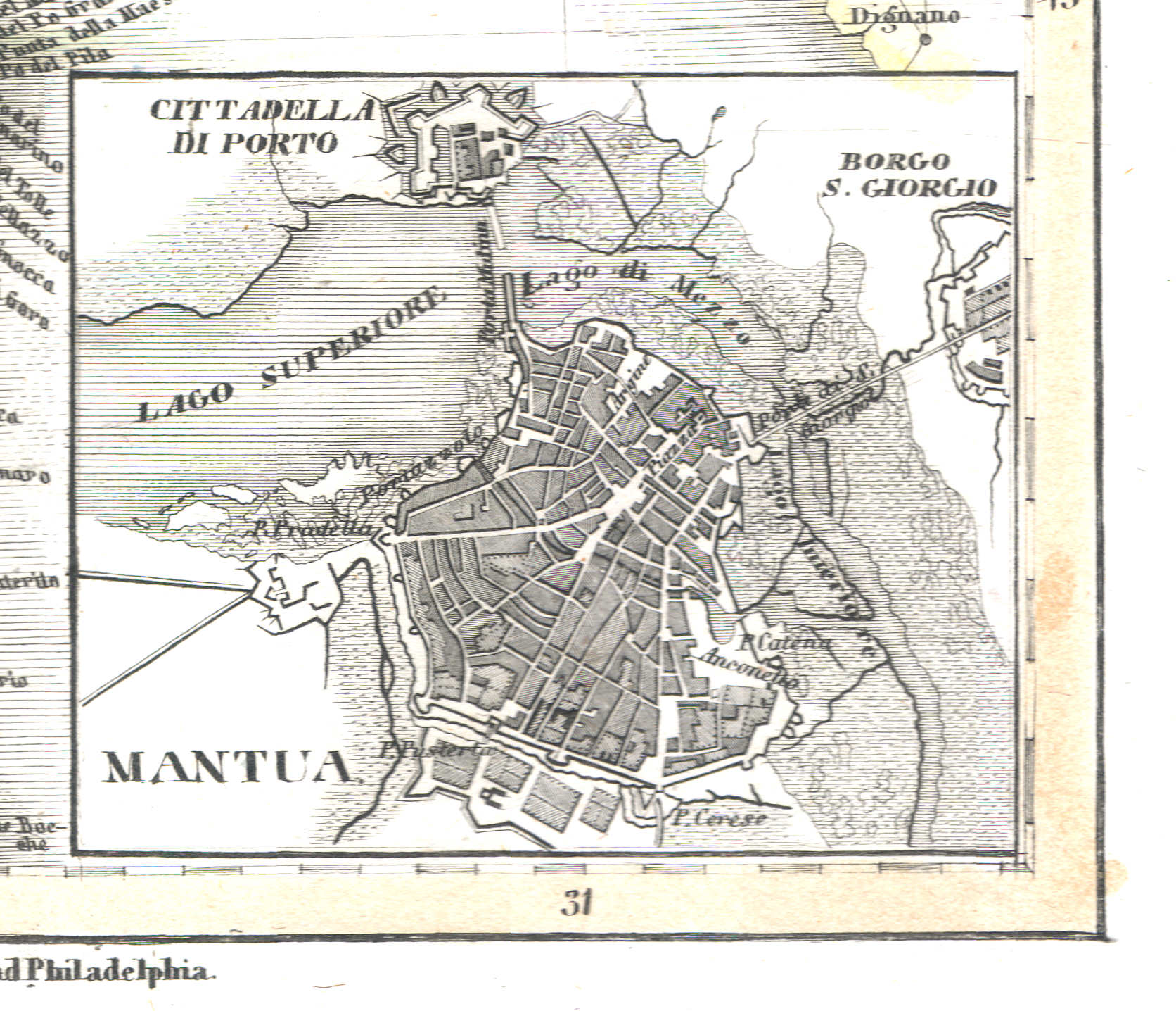 Meyer's Universal-Atlas (1830-1840)
50d. Mantua (1837)
Mantua / Mantova
 Meyer's Pfennig-Atlas (1834-1841)
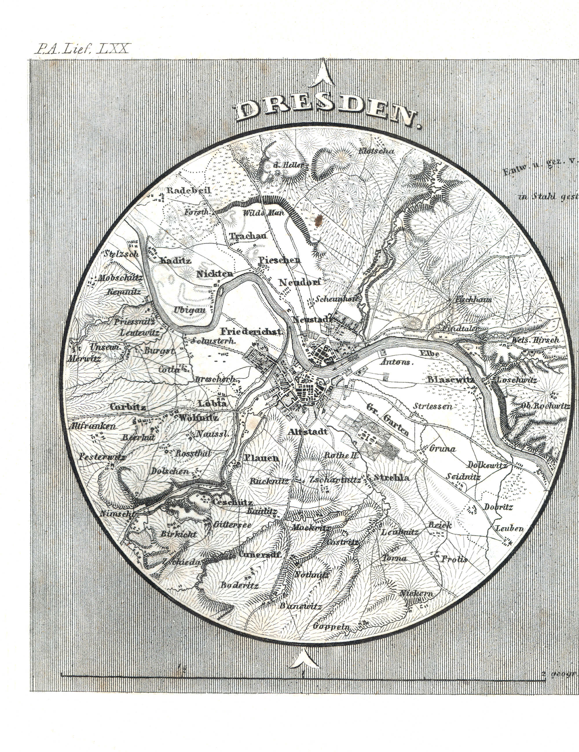
108. Dresden, Bremen (Lief. LXX = 70)
Dresden
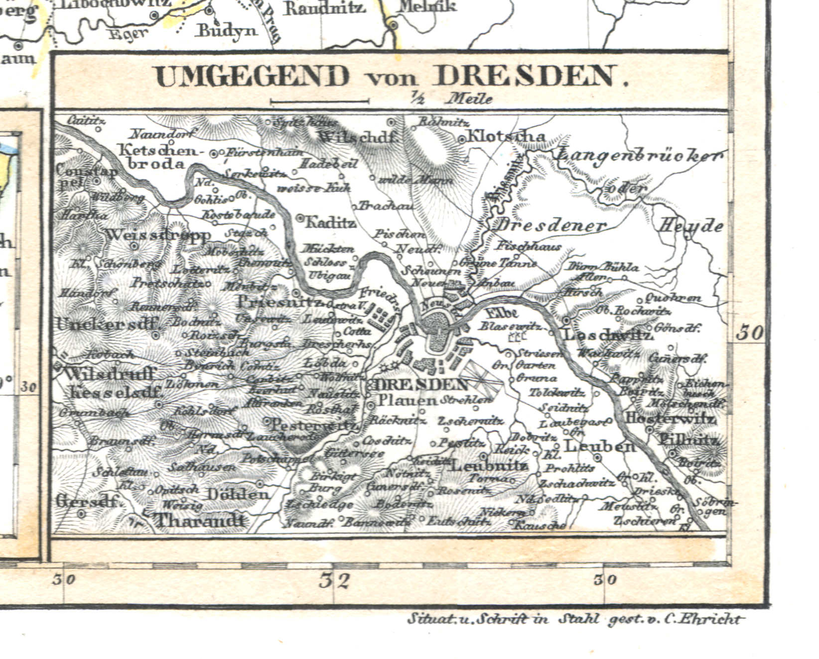 Meyer's Universal-Atlas (1830-1840)
66b. Umgebung von Dresden (1833)
Dresden en omgeving / Dresden and environs
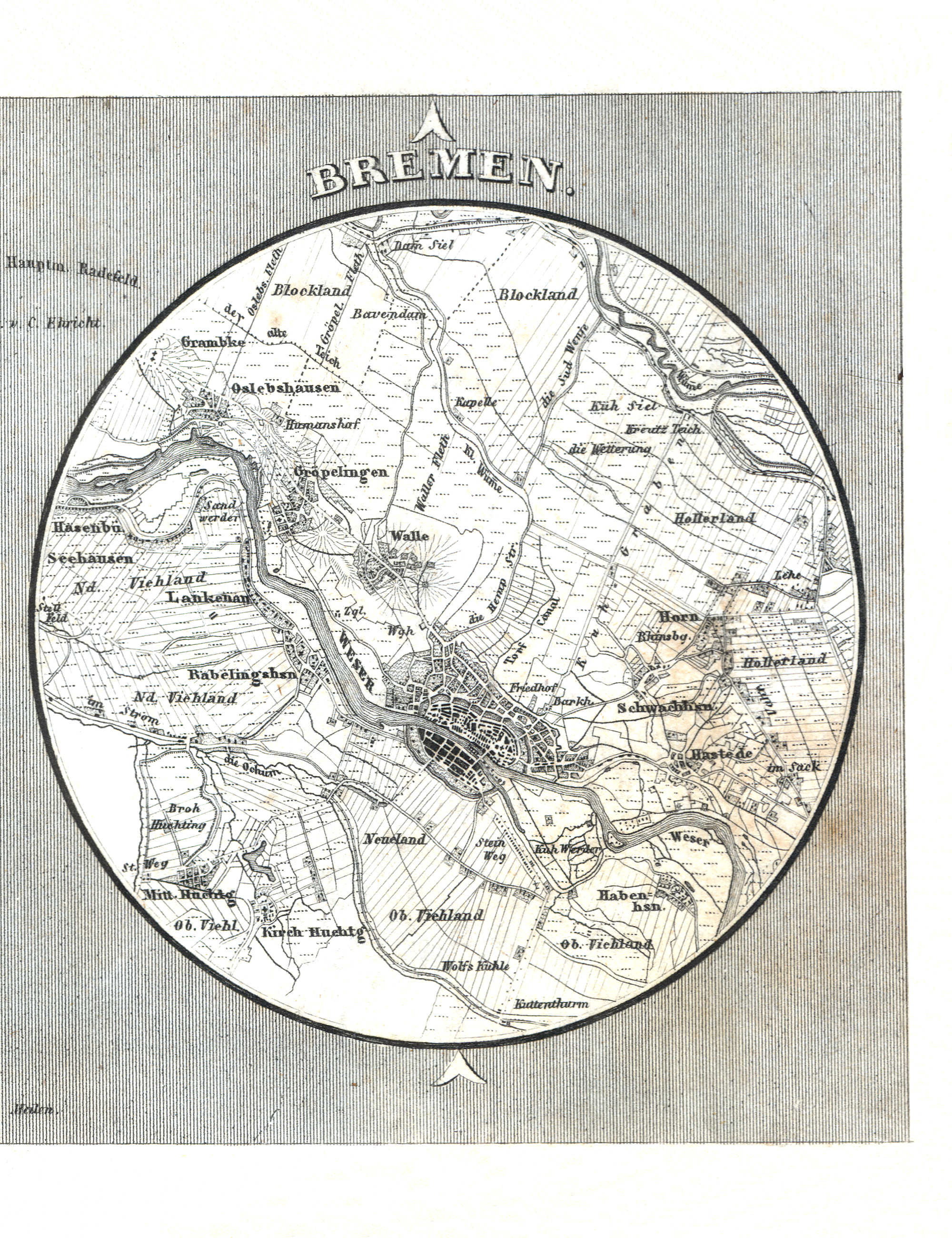 Meyer's Pfennig-Atlas (1834-1841)
108. Dresden, Bremen (Lief. LXX = 70)
Bremen
 Meyer's Universal-Atlas (1830-1840)
geen overeenkomstige kaart / no corresponding map
 Meyer's Pfennig-Atlas (1834-1841)
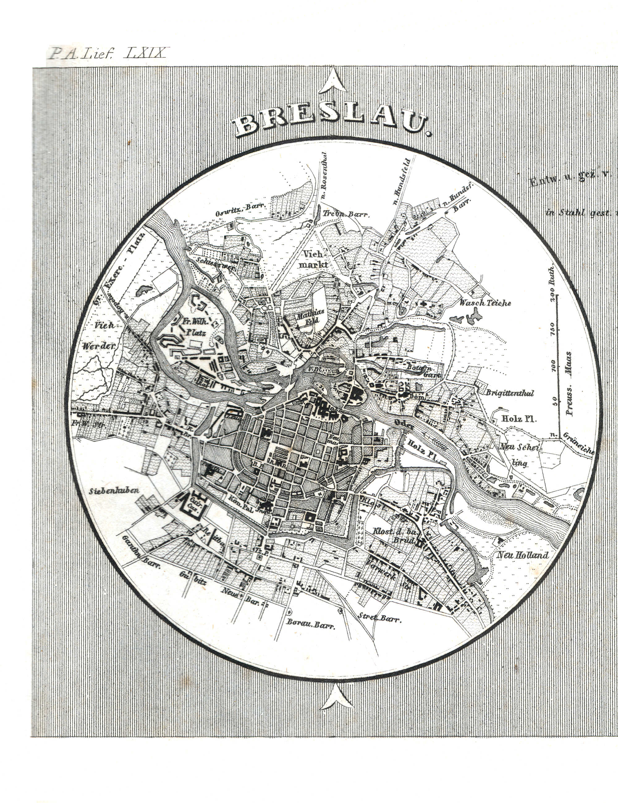
109. Breslau, Liegnitz (Lief. LXIX = 69)
Breslau / Wrocław
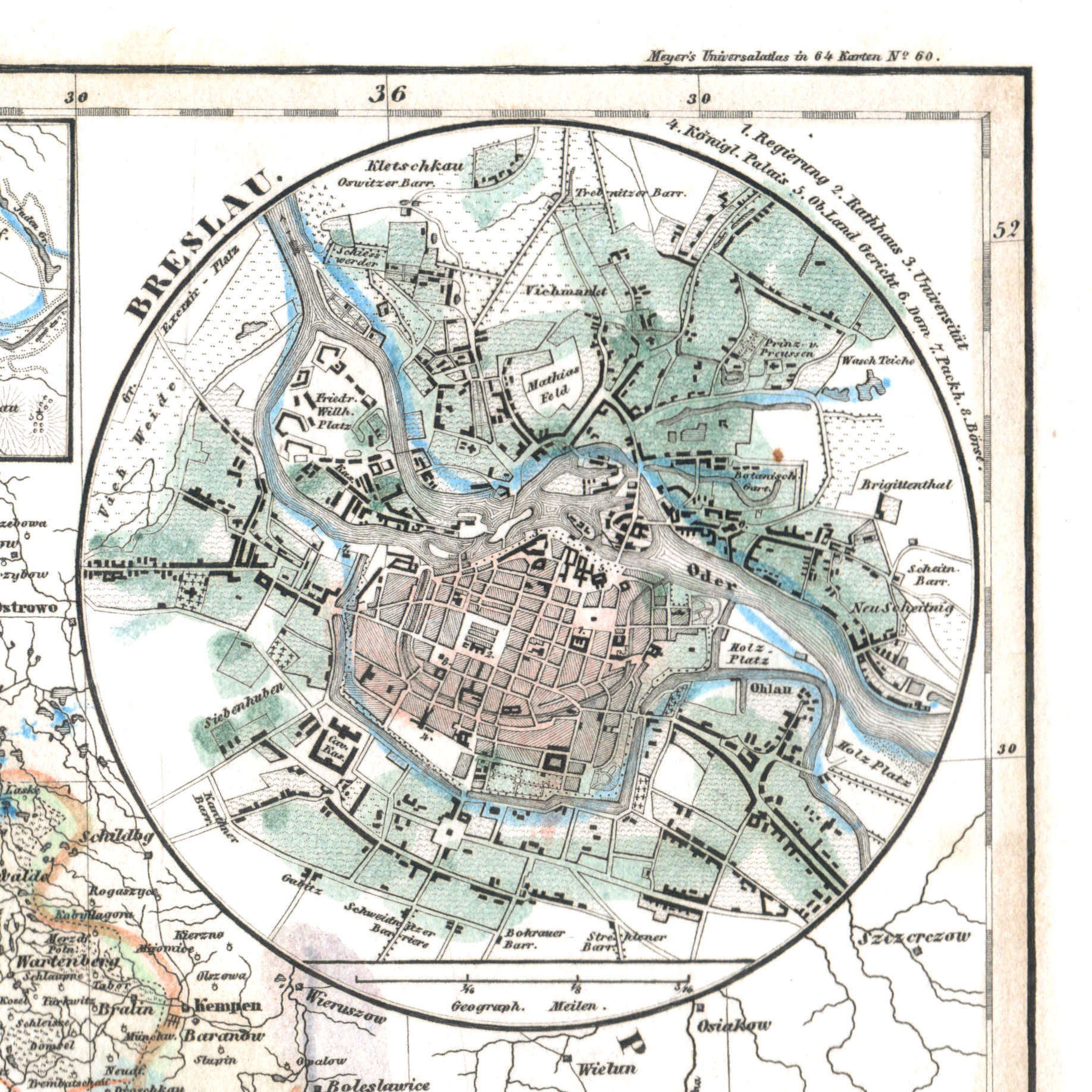 Meyer's Universal-Atlas (1830-1840)
60d. Breslau (1836)
Breslau / Wrocław
 Meyer's Pfennig-Atlas (1834-1841)
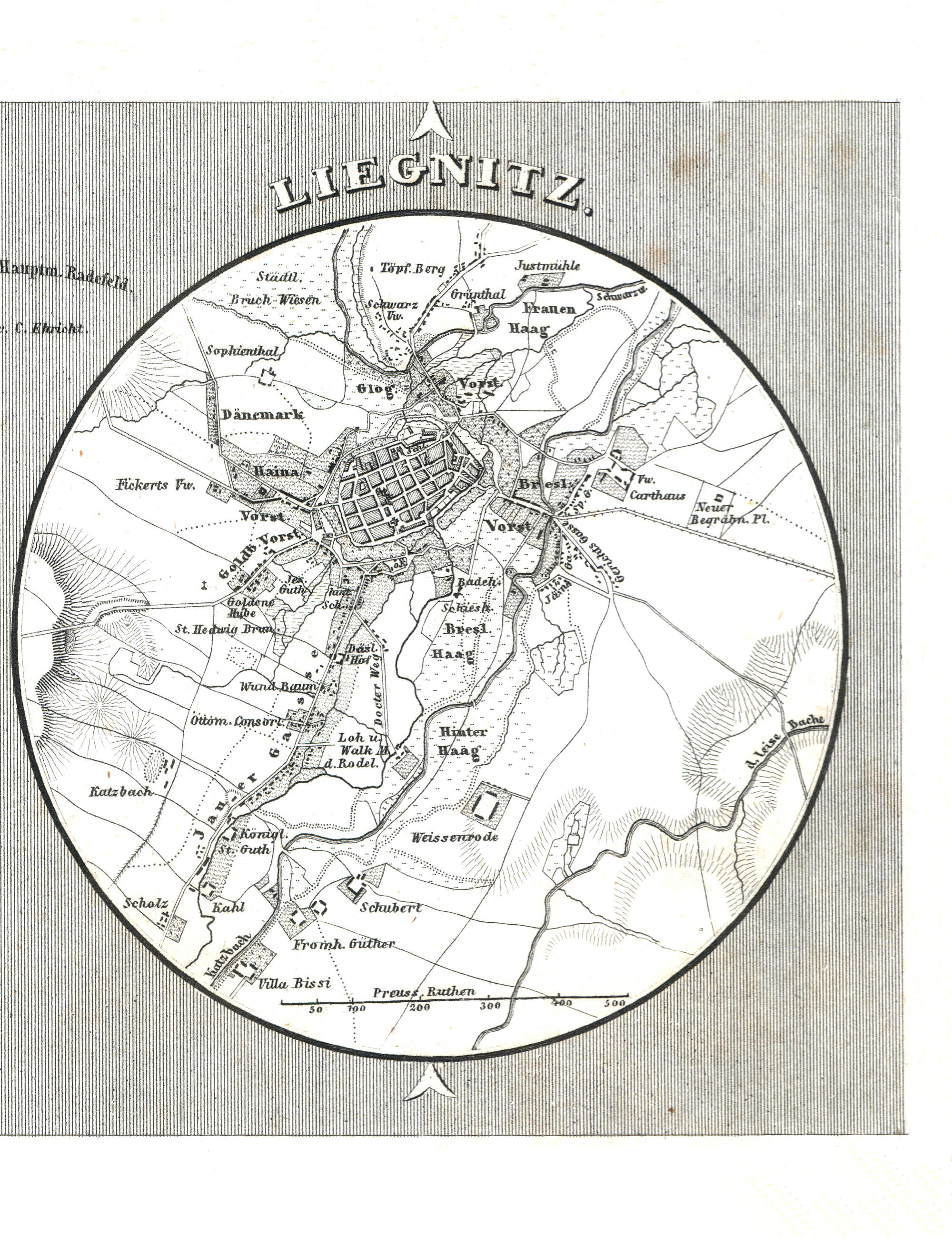
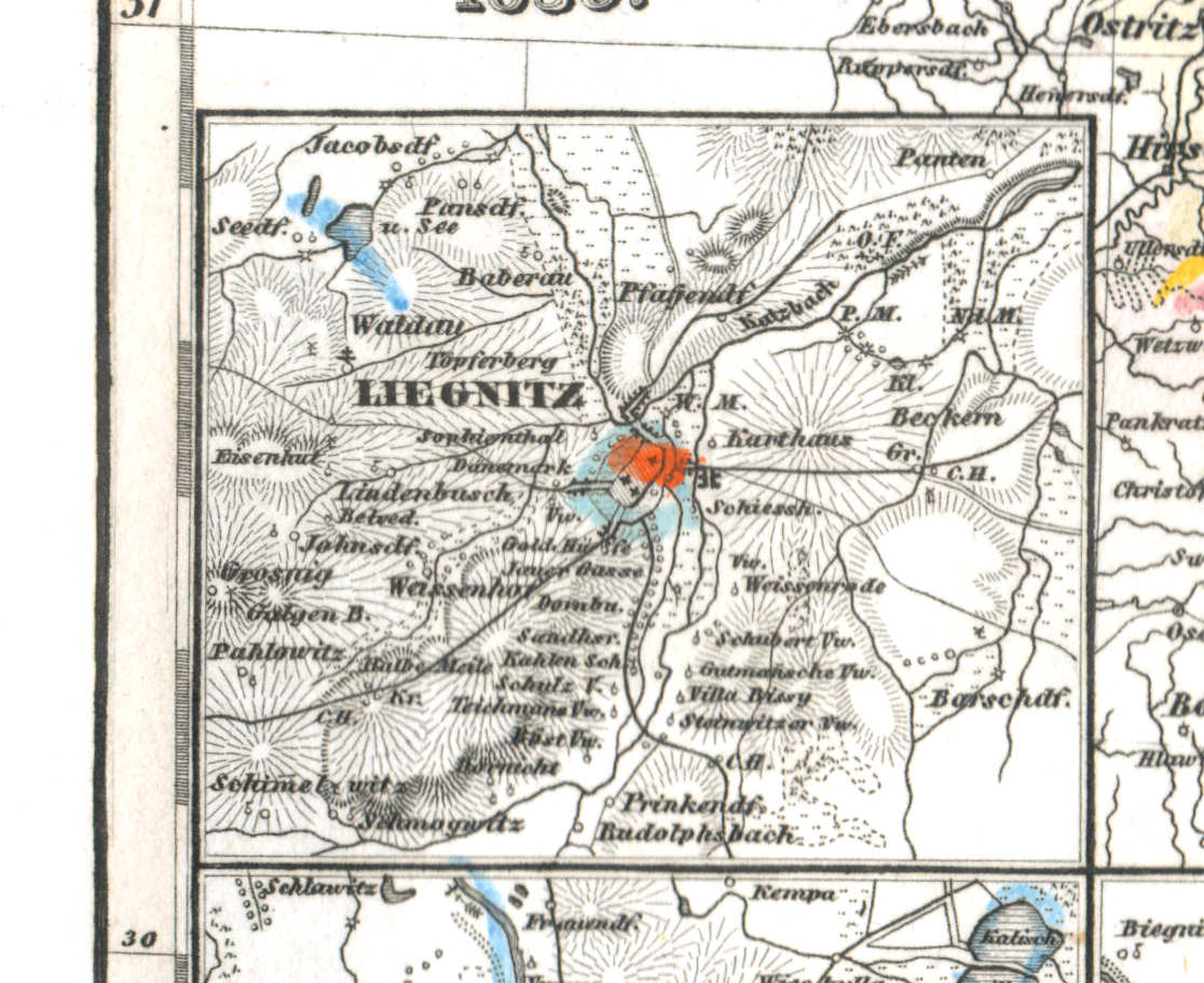
109. Breslau, Liegnitz (Lief. LXIX = 69)
Liegnitz / Legnica
 Meyer's Universal-Atlas (1830-1840)
60e. Liegnitz (1836)
Liegnitz / Legnica
 Meyer's Pfennig-Atlas (1834-1841)
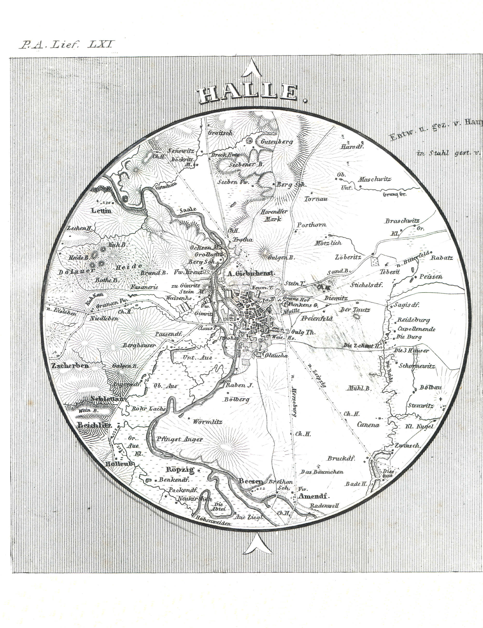
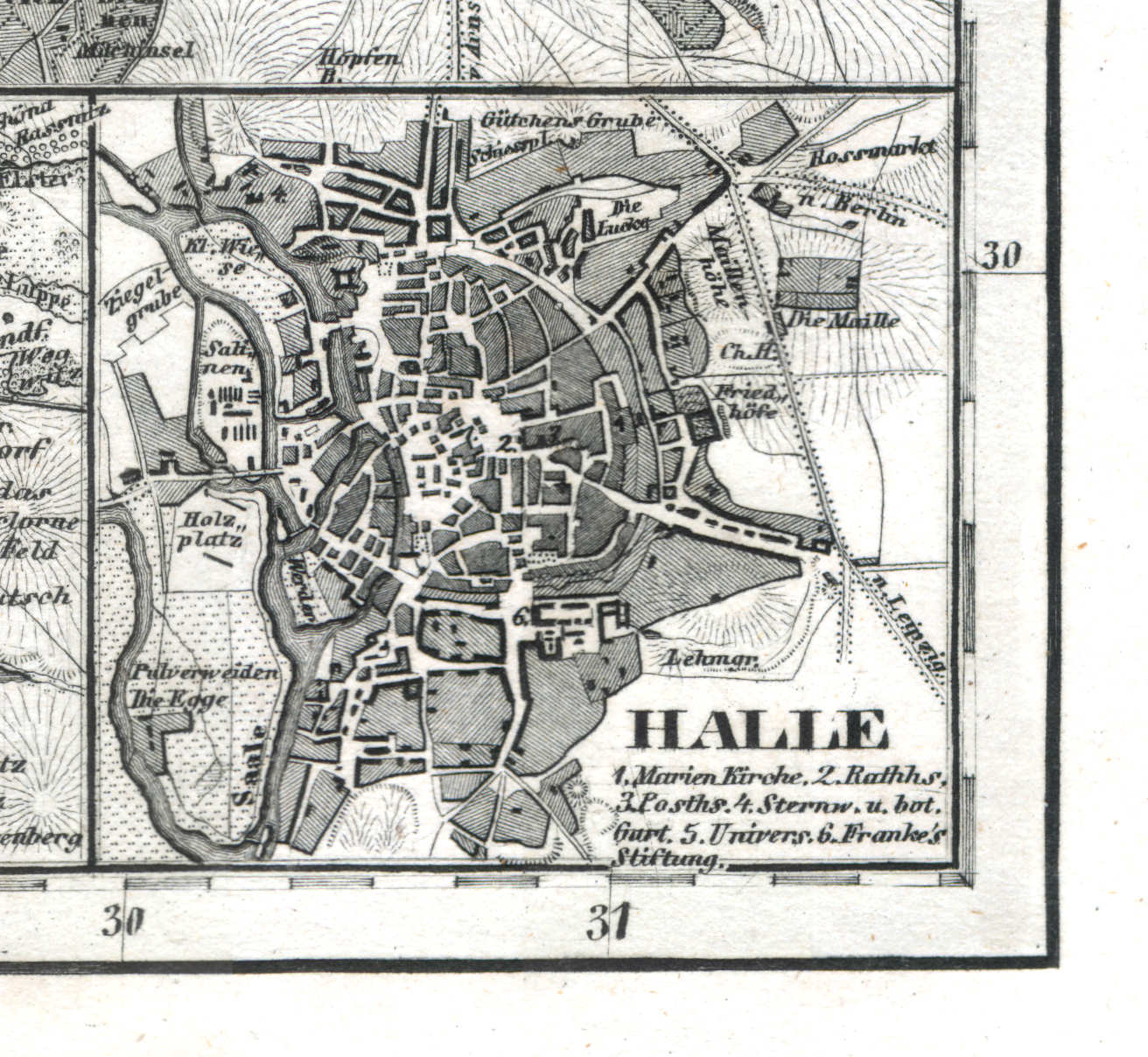
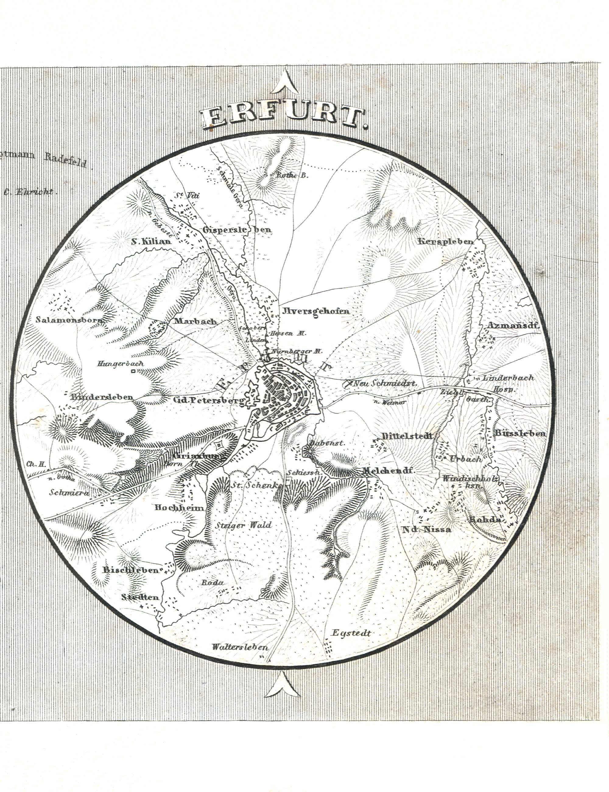
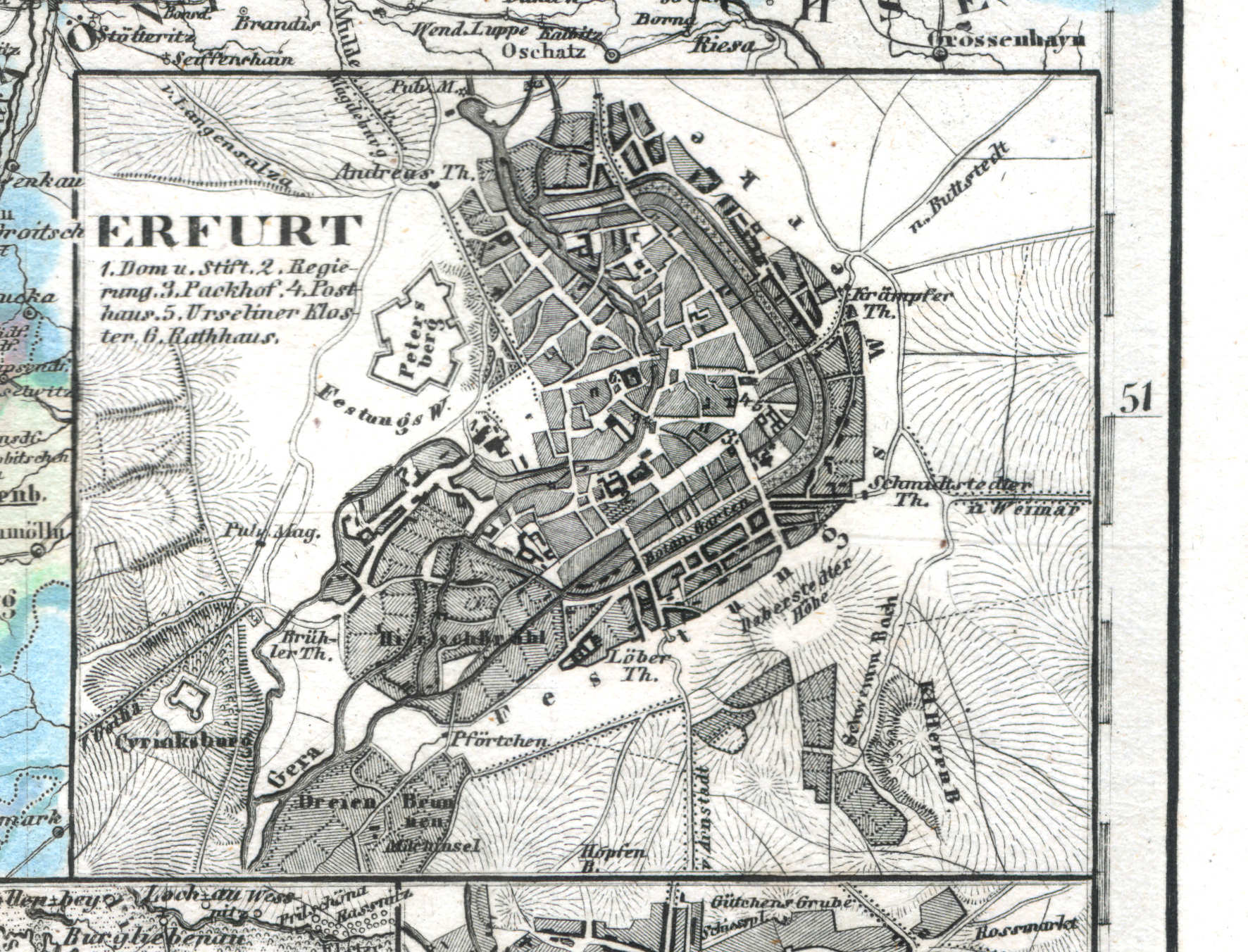
110. Halle, Erfurt (Lief. LXI = 61)
Halle
 Meyer's Universal-Atlas (1830-1840)
61l. Halle (1838)
Halle
 Meyer's Pfennig-Atlas (1834-1841)
110. Halle, Erfurt (Lief. LXI = 61)
Erfurt
 Meyer's Universal-Atlas (1830-1840)
61j. Erfurt (1838)
Erfurt
 Meyer's Pfennig-Atlas (1834-1841)
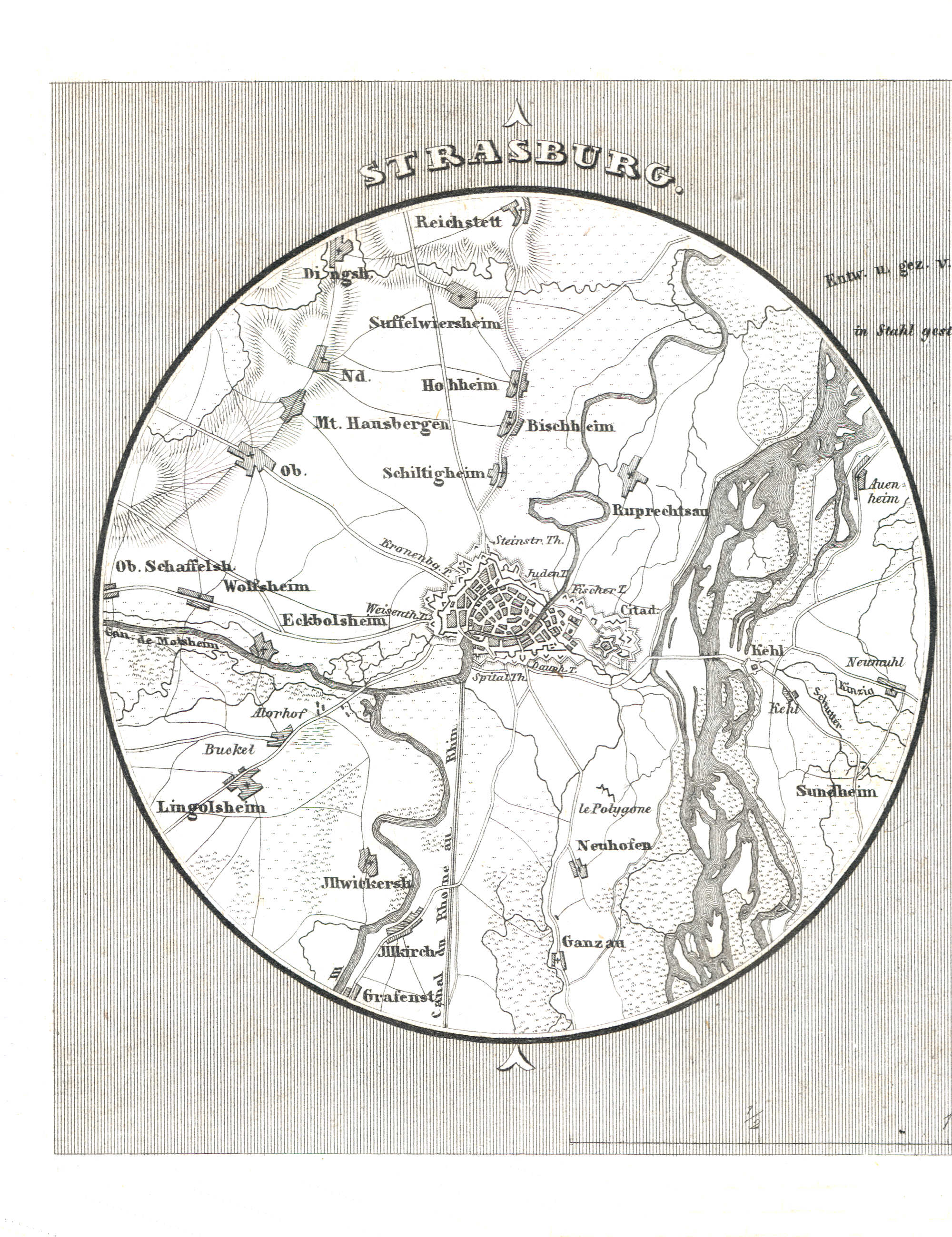
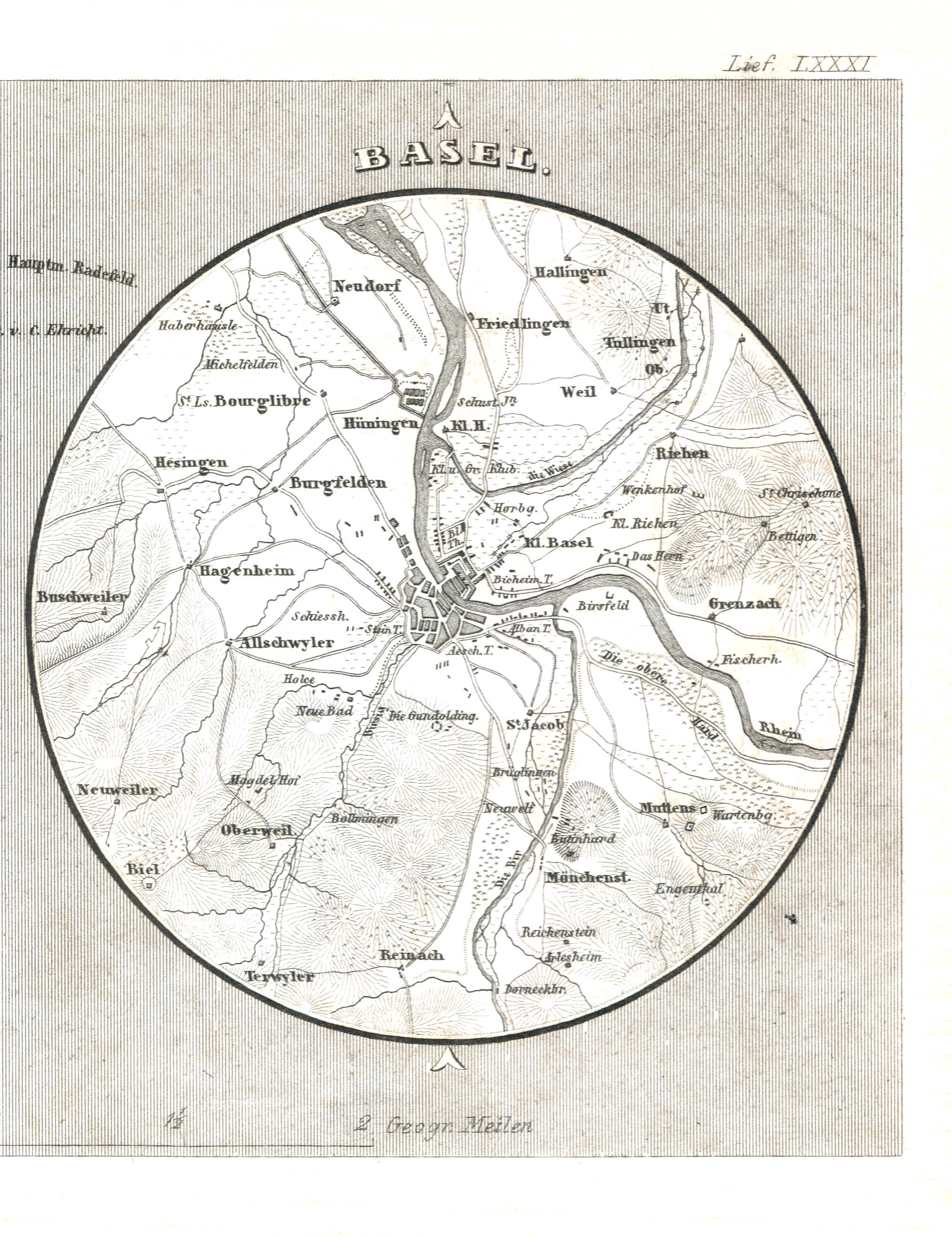
111. Strasburg, Basel (Lief. LXXXI = 81)
Straatsburg / Strasbourg
Meyer's Universal-Atlas (1830-1840)
geen overeenkomstige kaart / no corresponding map
 Meyer's Pfennig-Atlas (1834-1841)
111. Strasburg, Basel (Lief. LXXXI = 81)
Bazel / Basel
Meyer's Universal-Atlas (1830-1840)
geen overeenkomstige kaart / no corresponding map
 Meyer's Pfennig-Atlas (1834-1841)
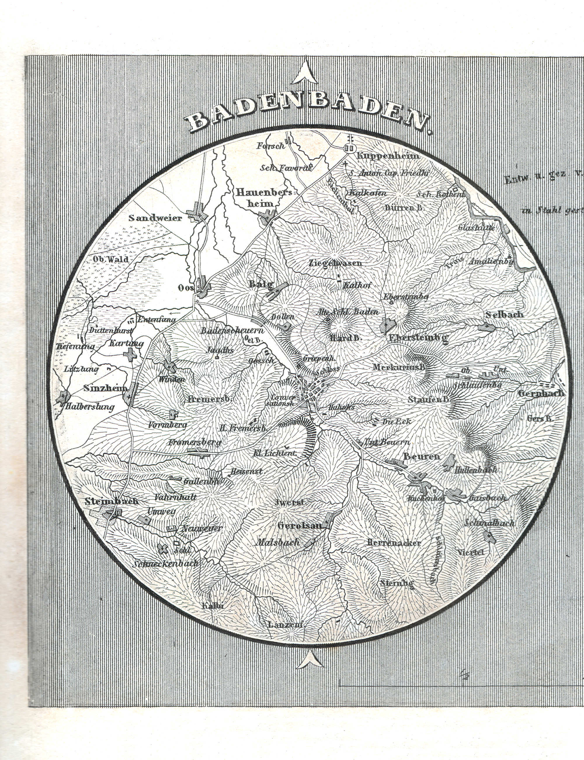
112. Baden-Baden, Heidelberg (Lief. LXXX = 80)
Baden-Baden
Meyer's Universal-Atlas (1830-1840)
geen overeenkomstige kaart / no corresponding map
 Meyer's Pfennig-Atlas (1834-1841)
112. Baden-Baden, Heidelberg (Lief. LXXX = 80)
Heidelberg
Meyer's Universal-Atlas (1830-1840)
geen overeenkomstige kaart / no corresponding map
 Meyer's Pfennig-Atlas (1834-1841)
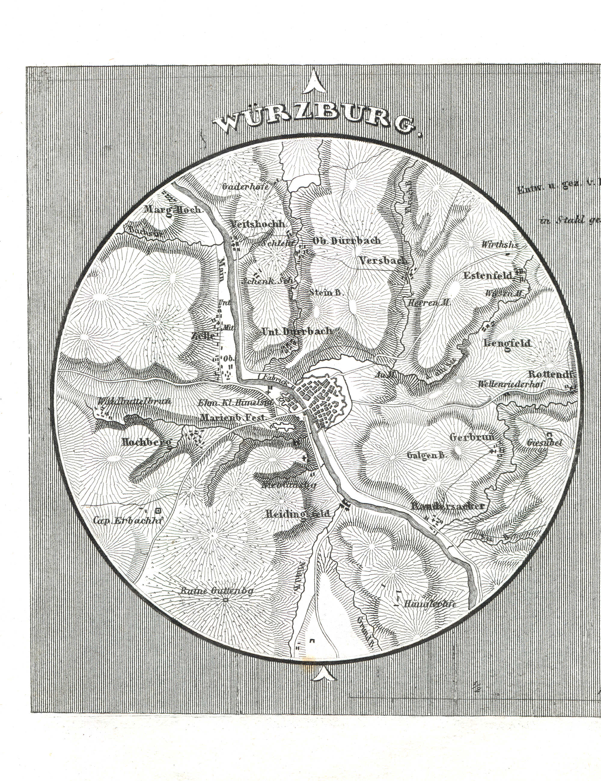
113. Würzburg, Ulm (Lief. LXXIX = 79)
Würzburg
Meyer's Universal-Atlas (1830-1840)
geen overeenkomstige kaart / no corresponding map
 Meyer's Pfennig-Atlas (1834-1841)
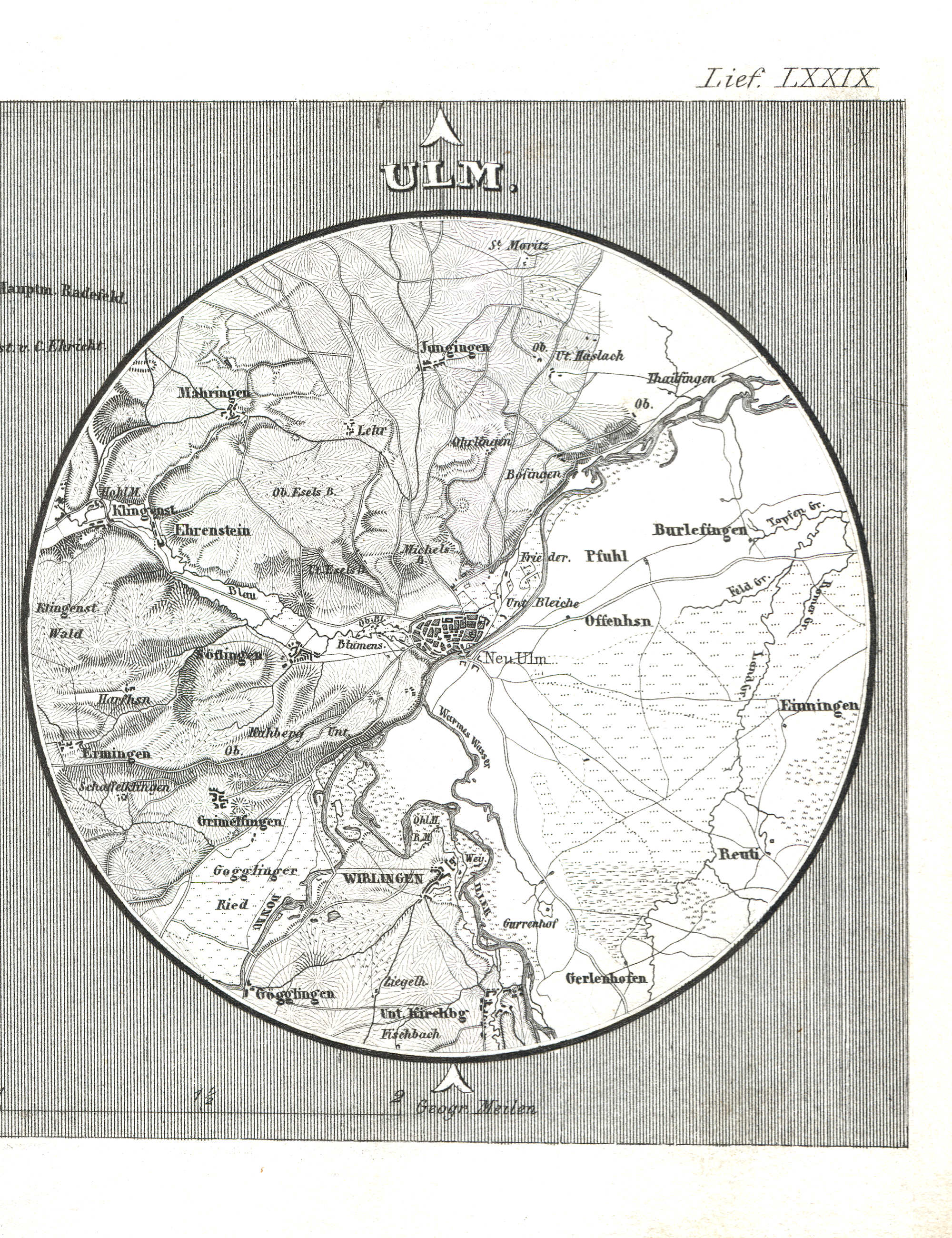
113. Würzburg, Ulm (Lief. LXXIX = 79)
Ulm
Meyer's Universal-Atlas (1830-1840)
geen overeenkomstige kaart / no corresponding map
 Meyer's Pfennig-Atlas (1834-1841)
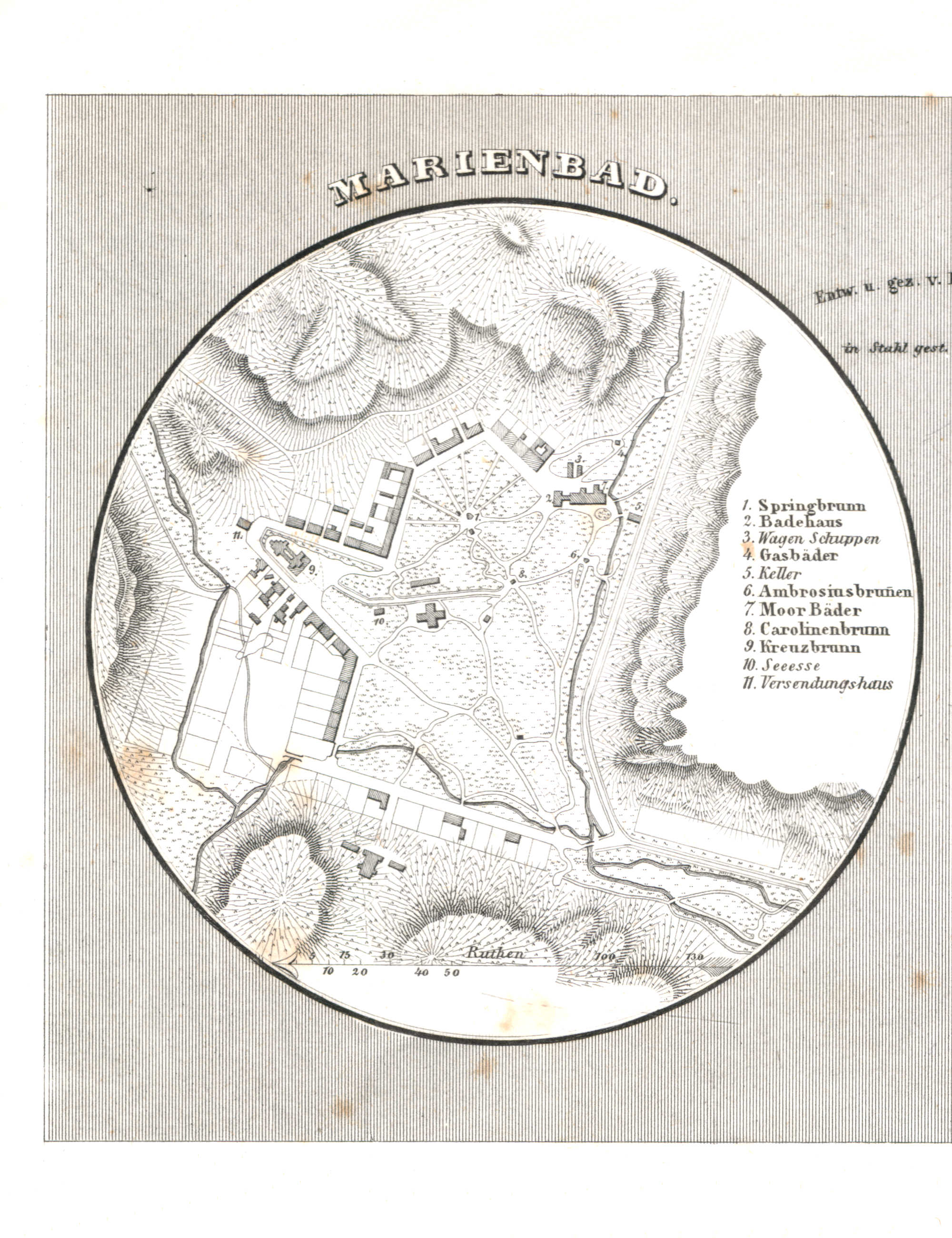
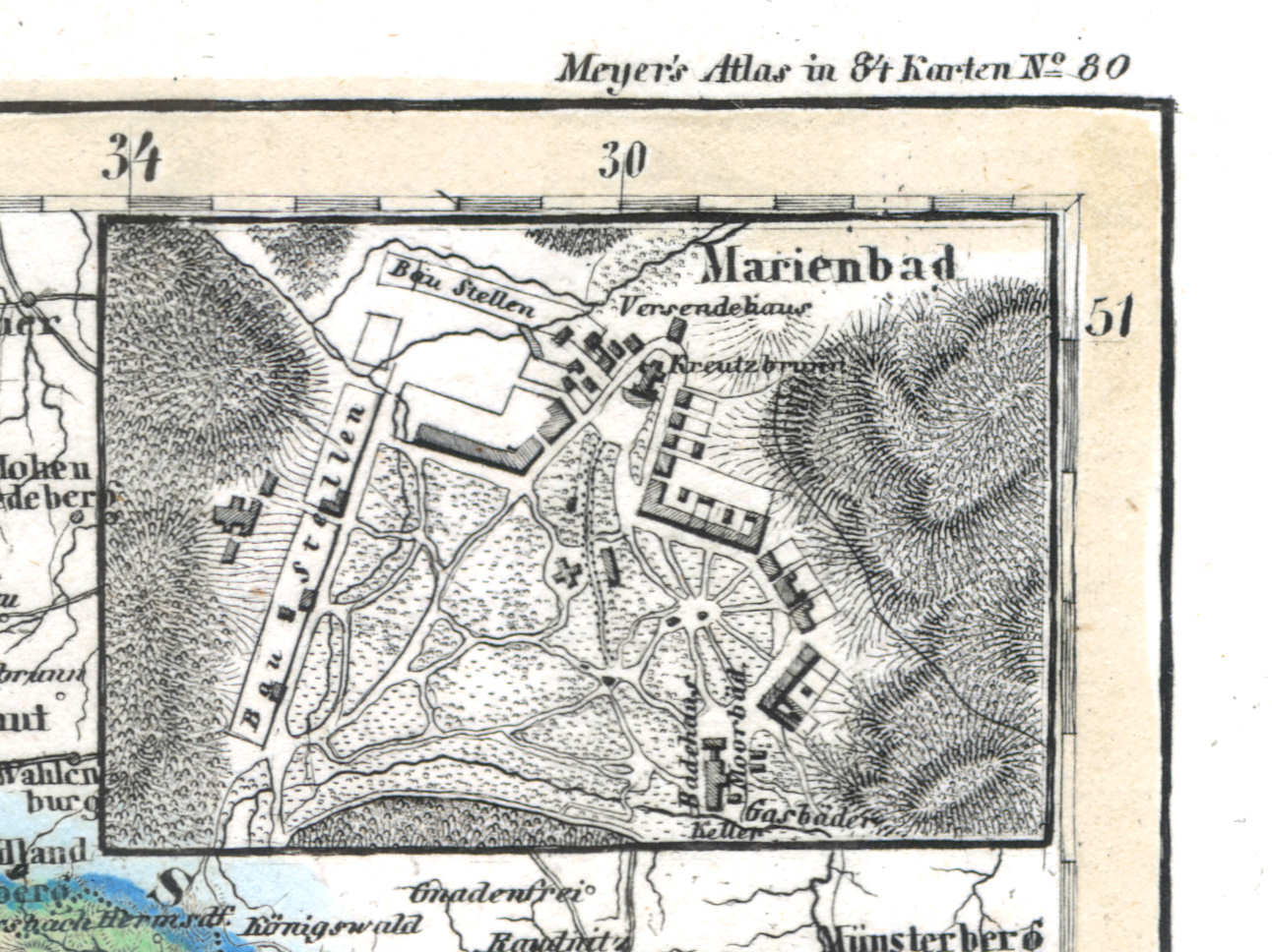
114. Marienbad, Teplitz (Lief. LXXXII = 82)
Mariënbad / Marienbad / Mariánské Lázně
 Meyer's Universal-Atlas (1830-1840)
47b. Marienbad (1838)
Mariënbad / Marienbad / Mariánské Lázně
 Meyer's Pfennig-Atlas (1834-1841)
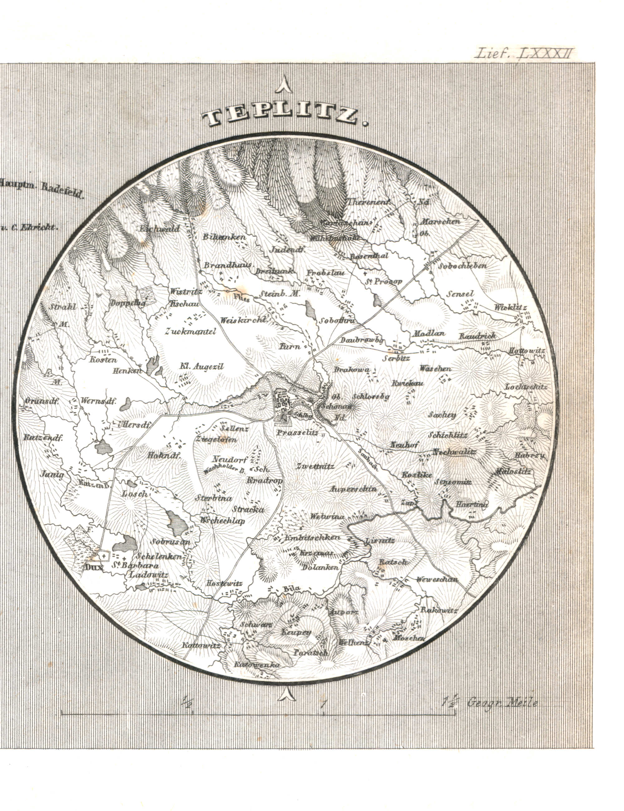
114. Marienbad, Teplitz (Lief. LXXXII = 82)
Teplitz / Teplice
 Meyer's Universal-Atlas (1830-1840)
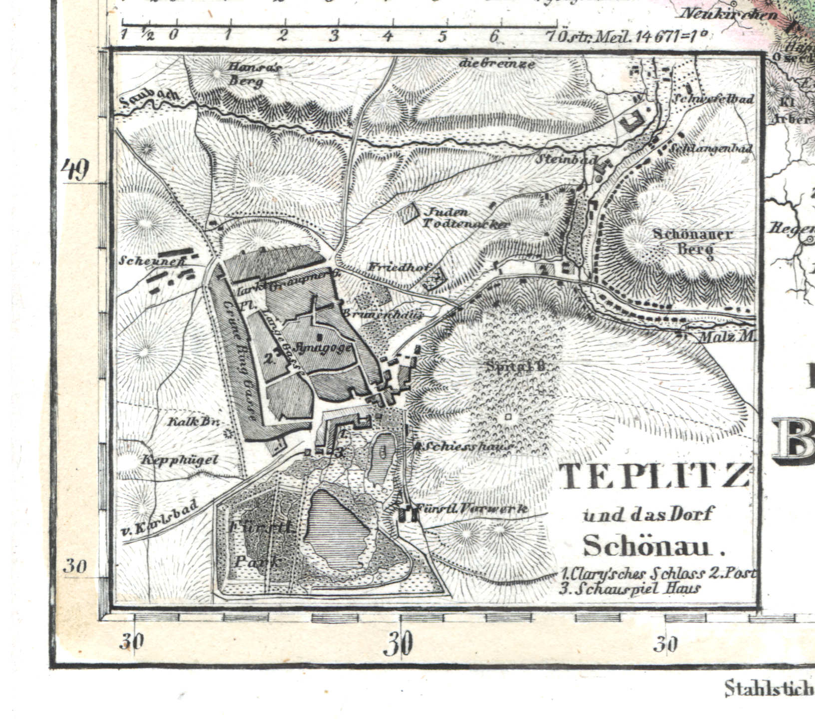
47c. Teplitz und das Dorf Schönau (1838)
Teplitz, Schönau / Teplice, Šanov
 Meyer's Pfennig-Atlas (1834-1841)
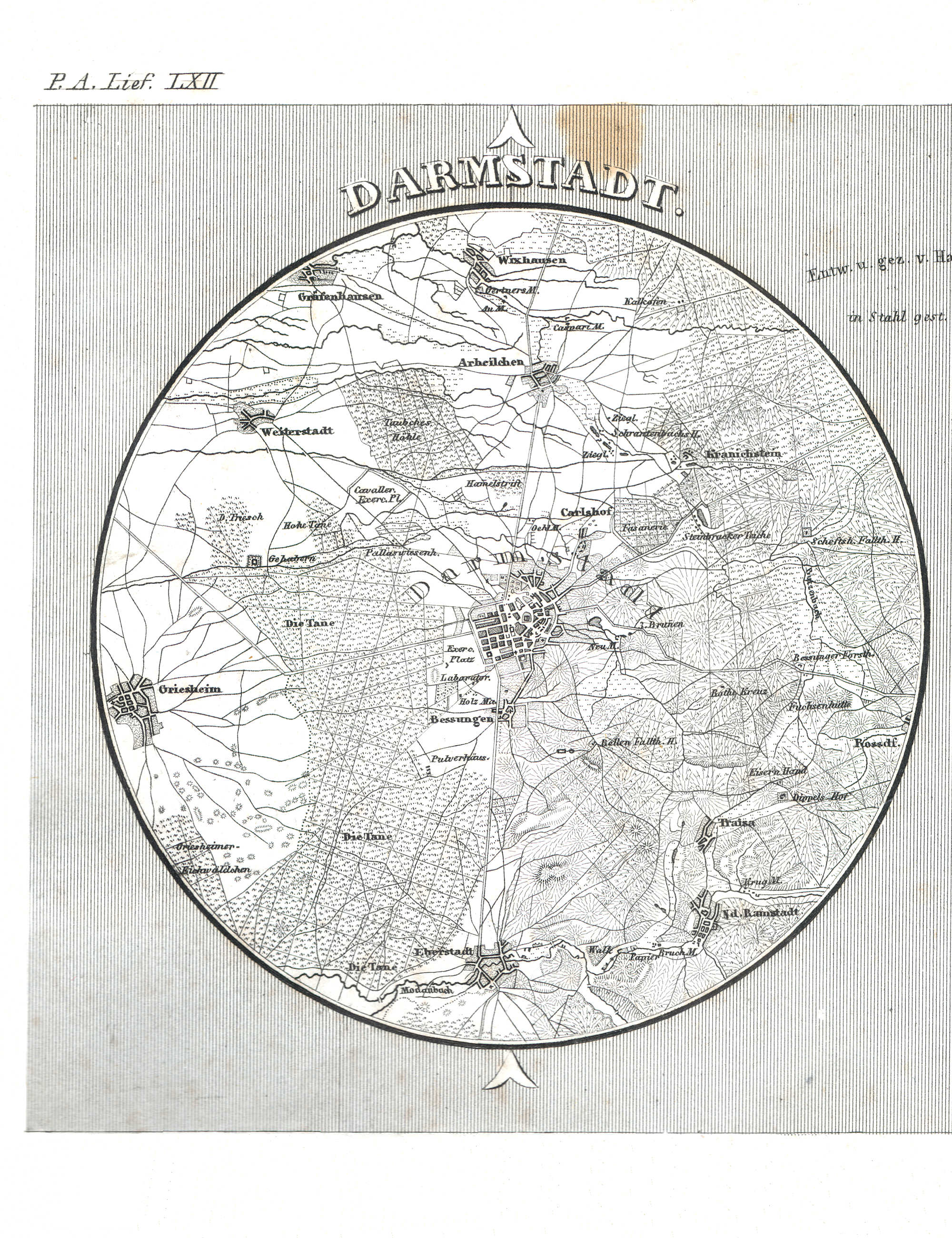
115. Darmstadt, Frankfurt a/M. (Lief. LXII = 62)
Darmstadt
Meyer's Universal-Atlas (1830-1840)
geen overeenkomstige kaart / no corresponding map
 Meyer's Pfennig-Atlas (1834-1841)
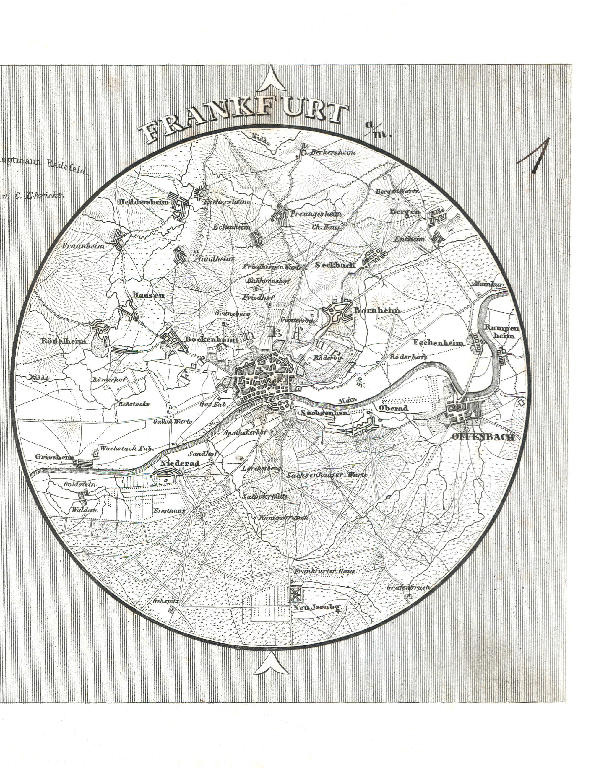
115. Darmstadt, Frankfurt a/M. (Lief. LXII = 62)
Frankfurt am Main
Meyer's Universal-Atlas (1830-1840)
geen overeenkomstige kaart / no corresponding map
met dank aan H. van 't Zelfde / courtesy of H. van 't Zelfde
© M. Witkam, 2010
![]()
![]()