Meyer's Universal-Atlas (1830-1840)
See below for (a summary of) this text in English.
Hieronder staan plaatjes van de atlas. Daarbij horen ook de volgende pagina's
- Beschrijving van de atlas
- Tabellen en lijsten bij de atlas
Plaatjes
Klik op een plaatje voor een vergroting.
Meyer's Universal-Atlas (1830-1840)
- Below are pictures of the atlas. Related pages
- Description of the atlas
- Tables and lists to the atlas
Pictures
Click on a picture to enlarge.
Titelpagina, inhoudsopgave / Title page, table of contents
 Meyer's Universal-Atlas (1830-1840)
Titelpagina / Title page
 Meyer's Universal-Atlas (1830-1840)
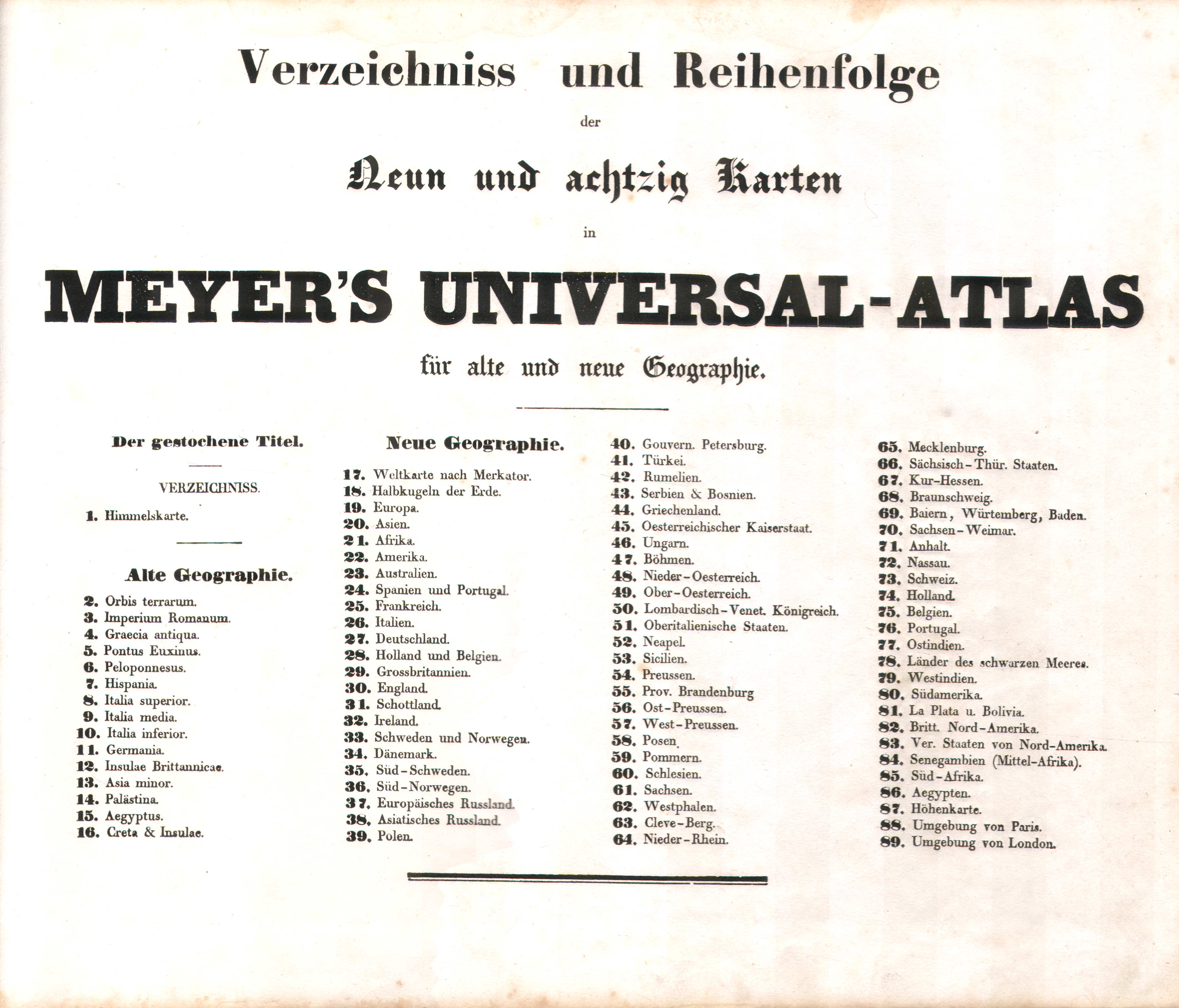
Inhoudsopgave / Table of contents
 Meyer's Universal-Atlas (1830-1840)
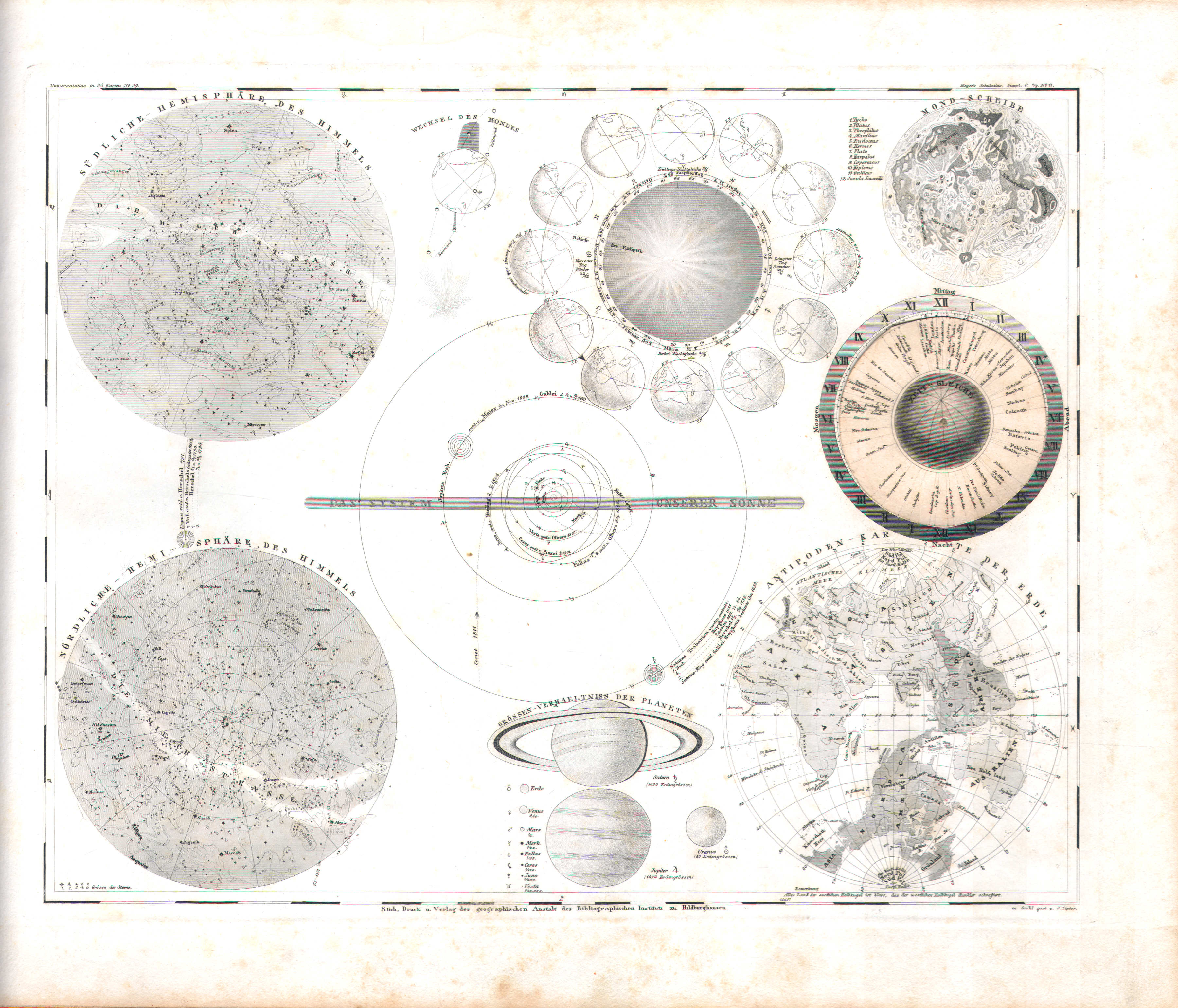
1. Himmelskarte (Nº 59)
Sterrenkunde (met draaibaar deel) / Astronomy (with rotating part)
 Meyer's Universal-Atlas (1830-1840)
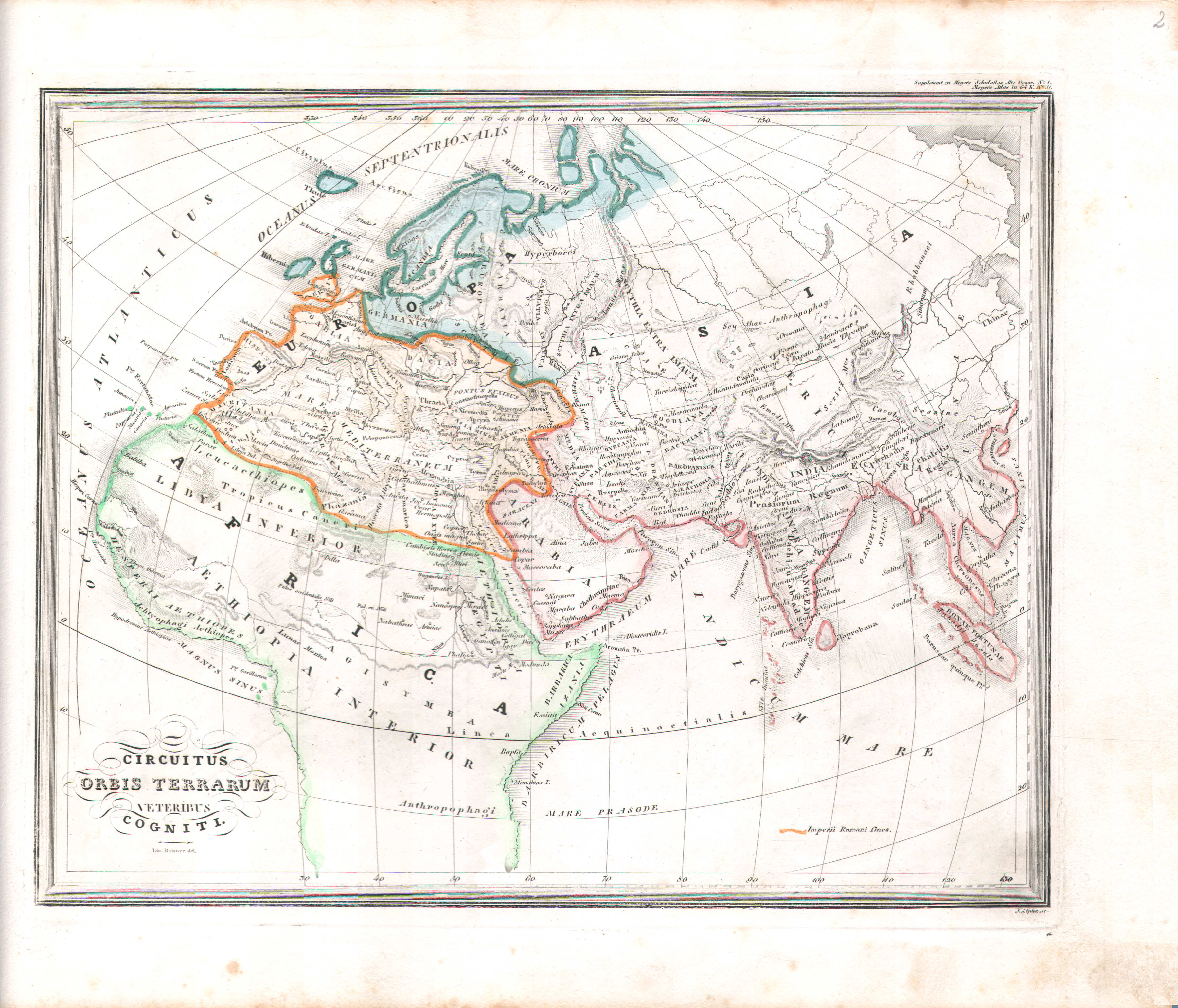
2. Circuitus Orbis Terrarum veteribus cogniti (Nº 31)
De in de Oudheid bekende wereld / The world as known to the Ancients
 Meyer's Universal-Atlas (1830-1840)
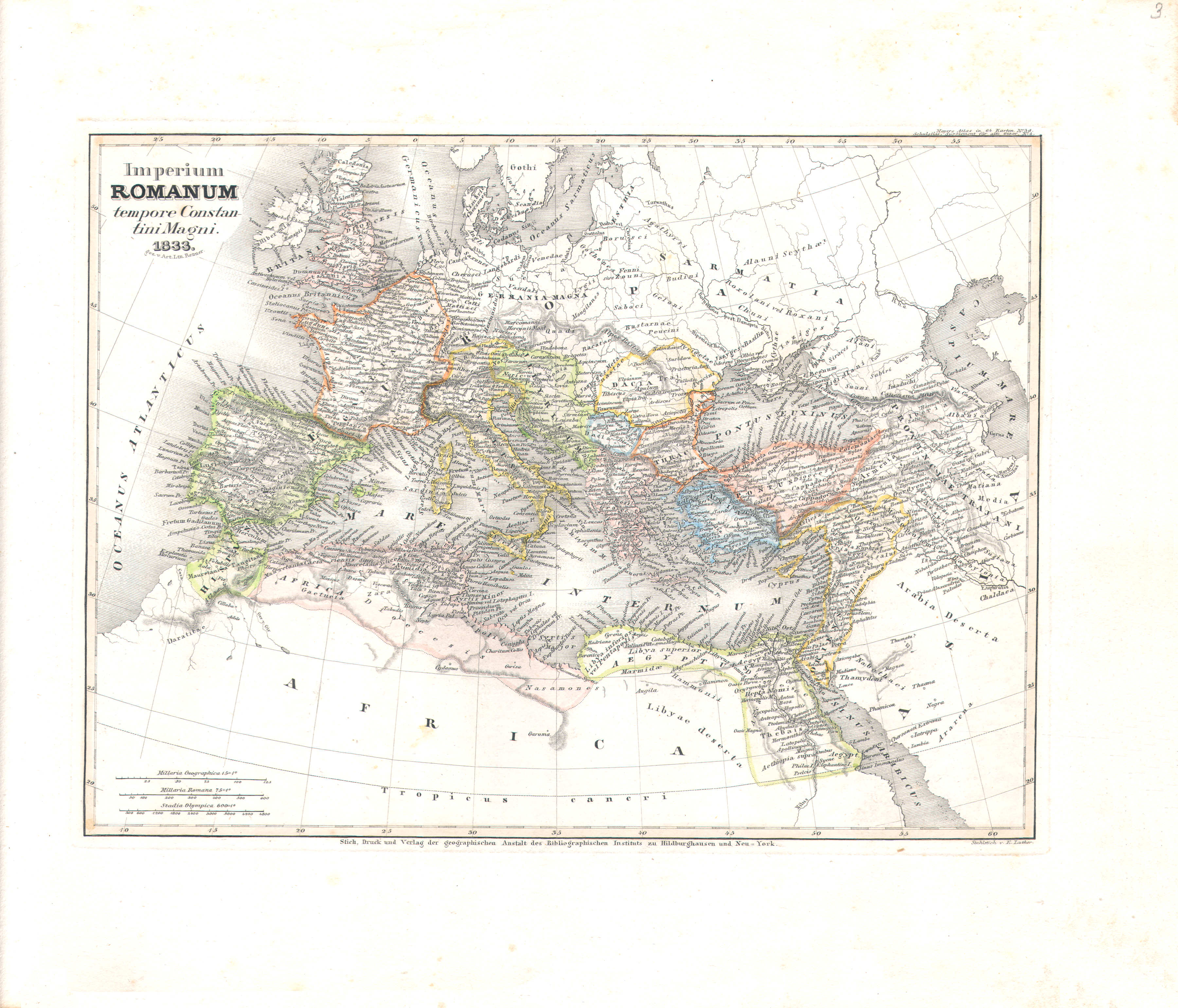
3. Imperium Romanum tempore Constantini Magni (Nº 39, 1833)
Het Romeinse rijk onder Constantijn de Grote / The Roman Empire under Constantine the Great
 Meyer's Universal-Atlas (1830-1840)
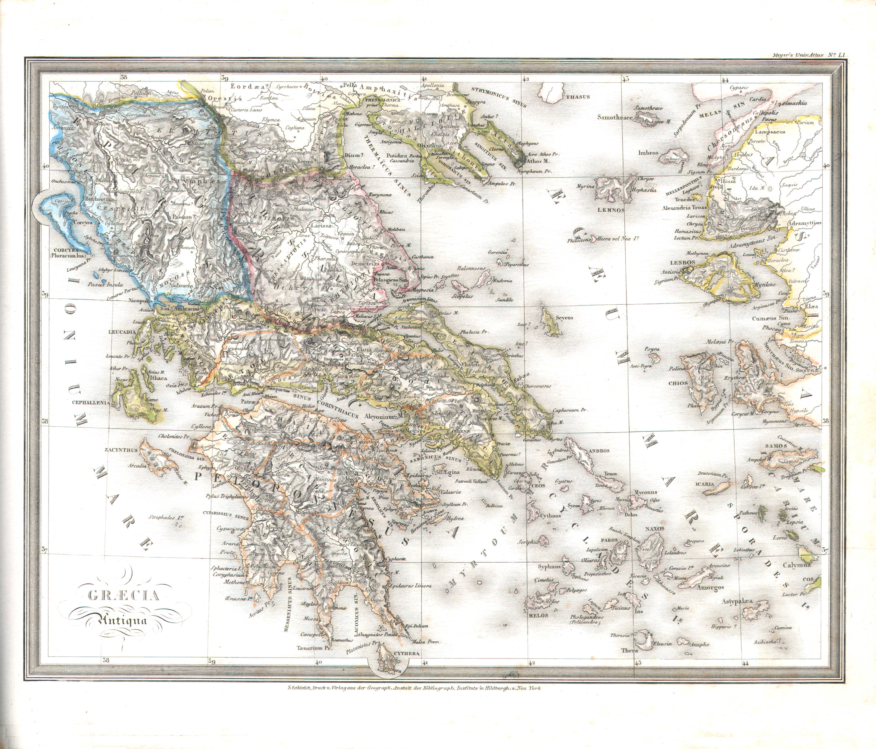
4. Graecia Antiqua (Nº 51)
Griekenland in de Oudheid / Ancient Greece
 Meyer's Universal-Atlas (1830-1840)
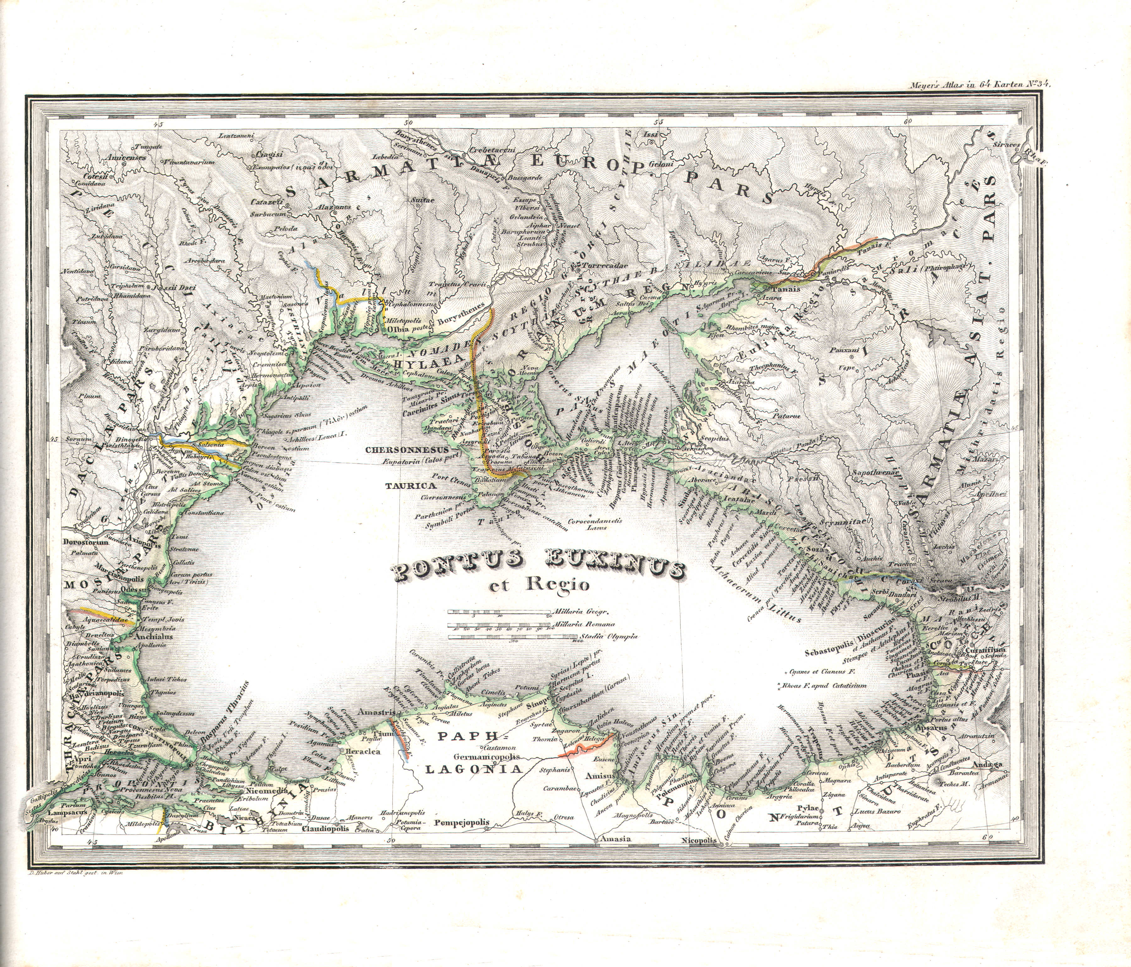
5. Pontus Euxinus et Regio (Nº 34)
Zwarte Zee / Black Sea
 Meyer's Universal-Atlas (1830-1840)
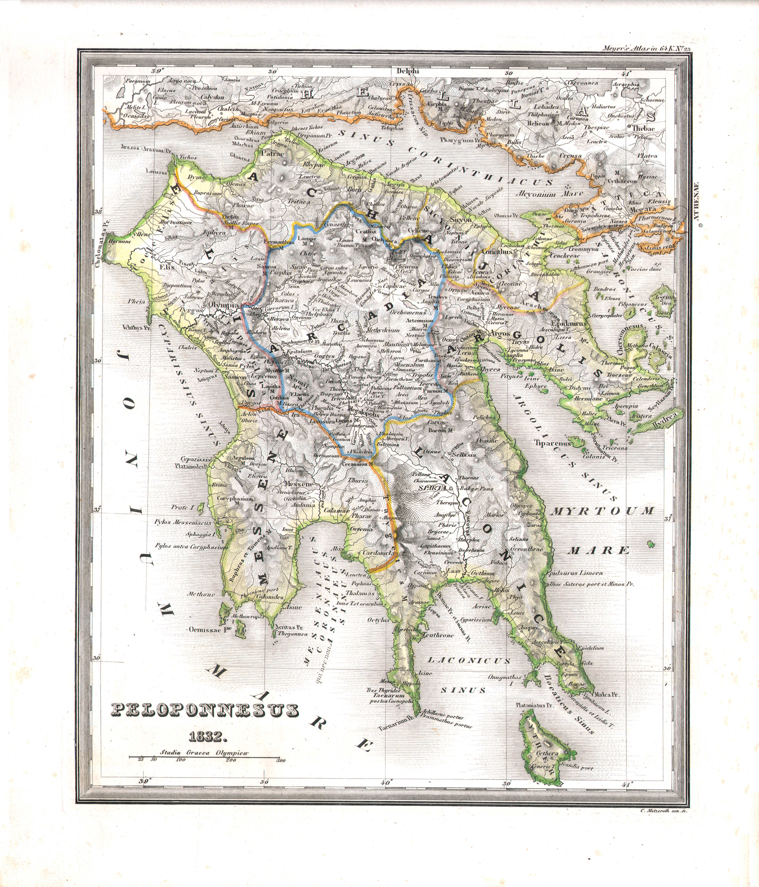
6. Peloponnesus (Nº 23, 1832)
Peloponnesus / Peloponnese
 Meyer's Universal-Atlas (1830-1840)
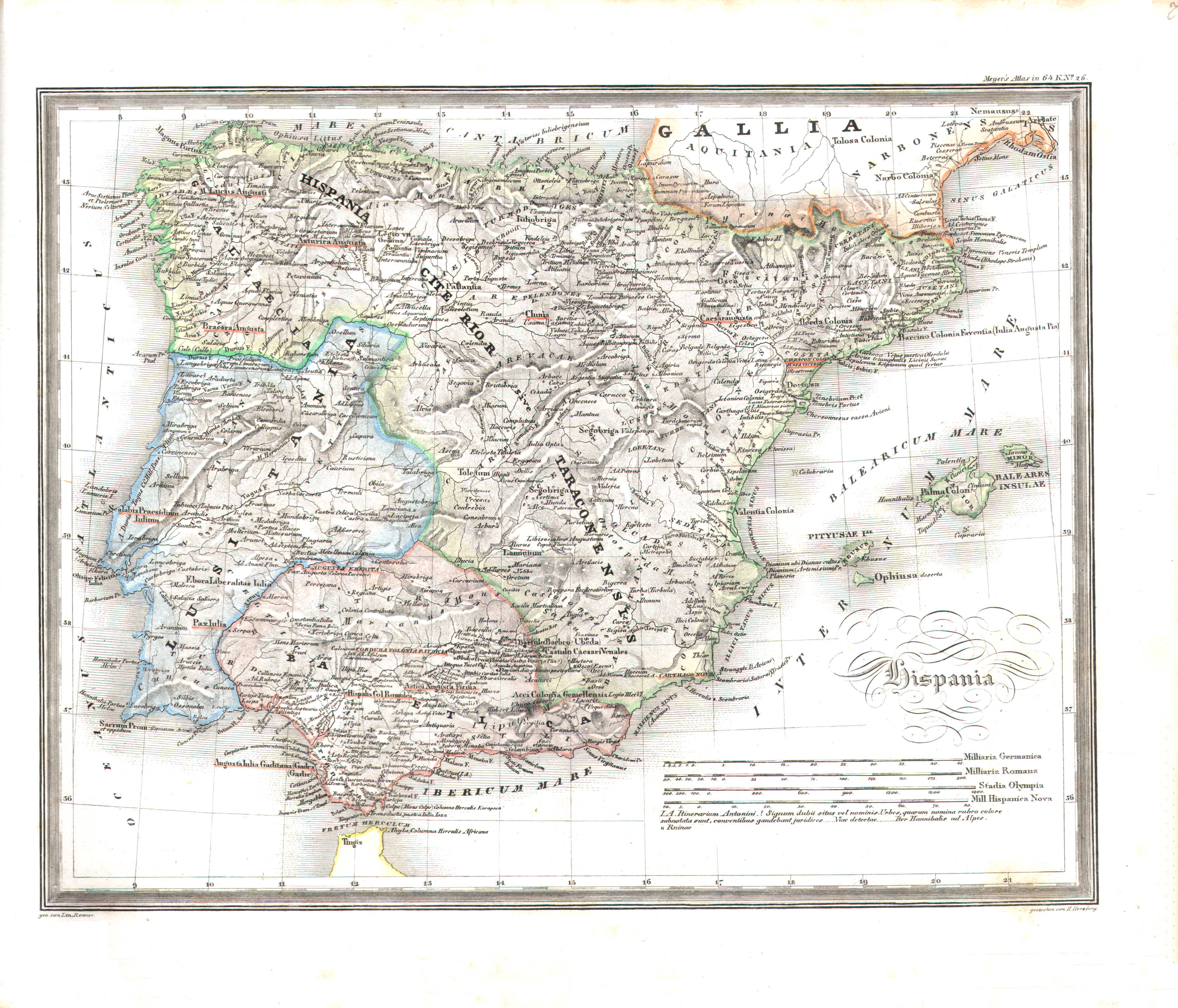
7. Hispania (Nº 26)
Hispania
 Meyer's Universal-Atlas (1830-1840)
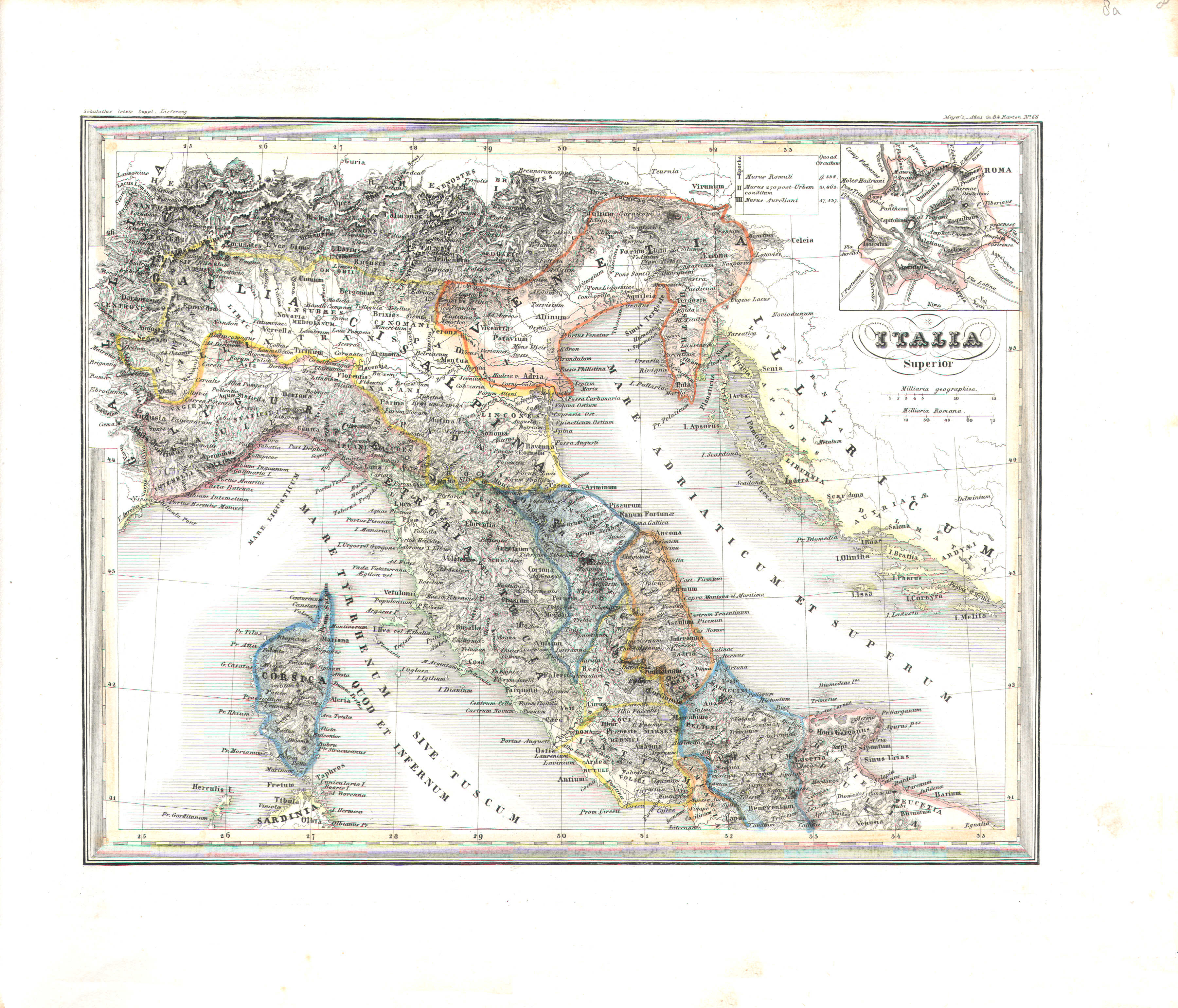
8a. Italia superior (Nº 66)
Noord-Italië / Northern Italy
 Meyer's Universal-Atlas (1830-1840)
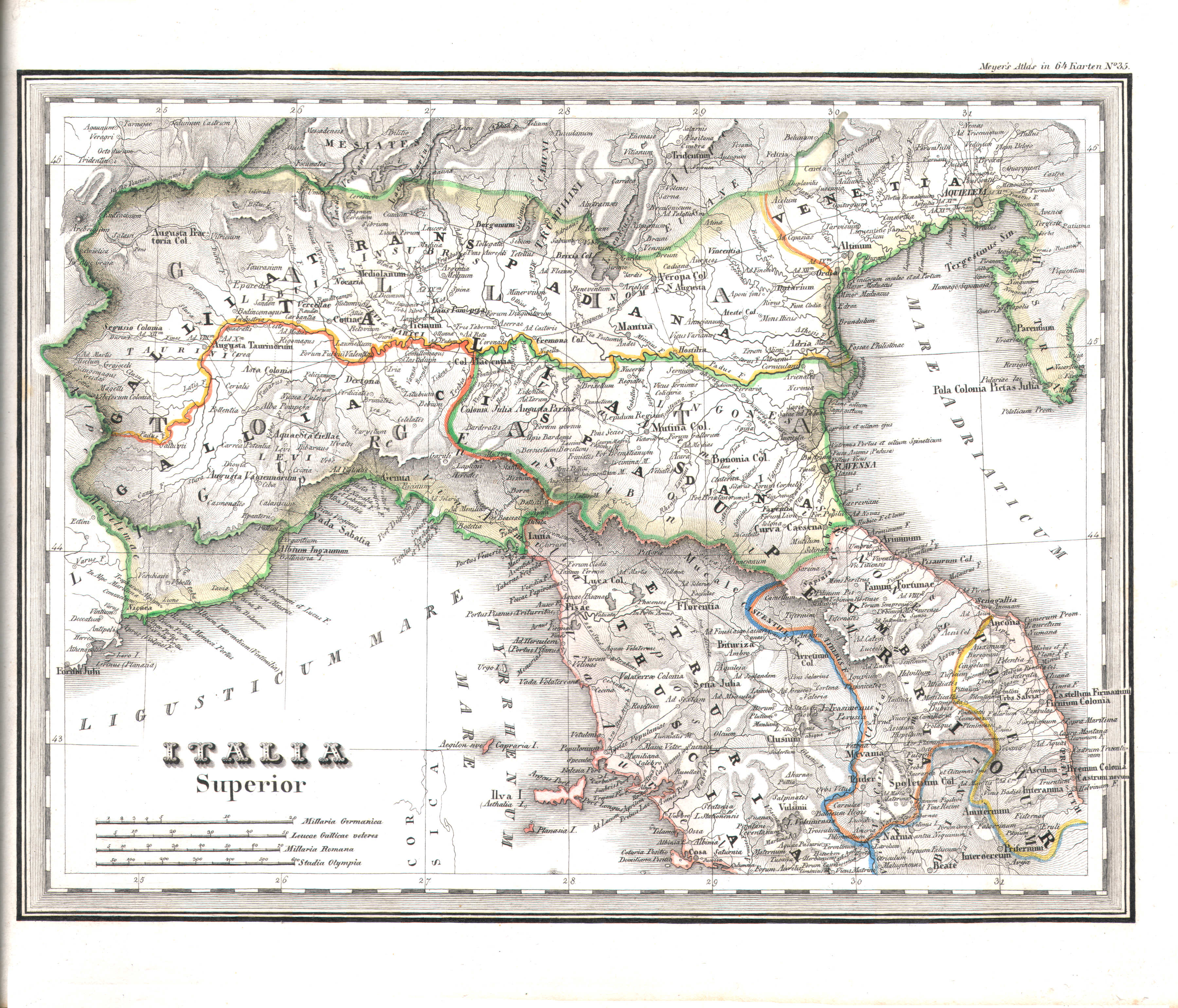
8. Italia superior (Nº 35)
Noord-Italië / Northern Italy
 Meyer's Universal-Atlas (1830-1840)
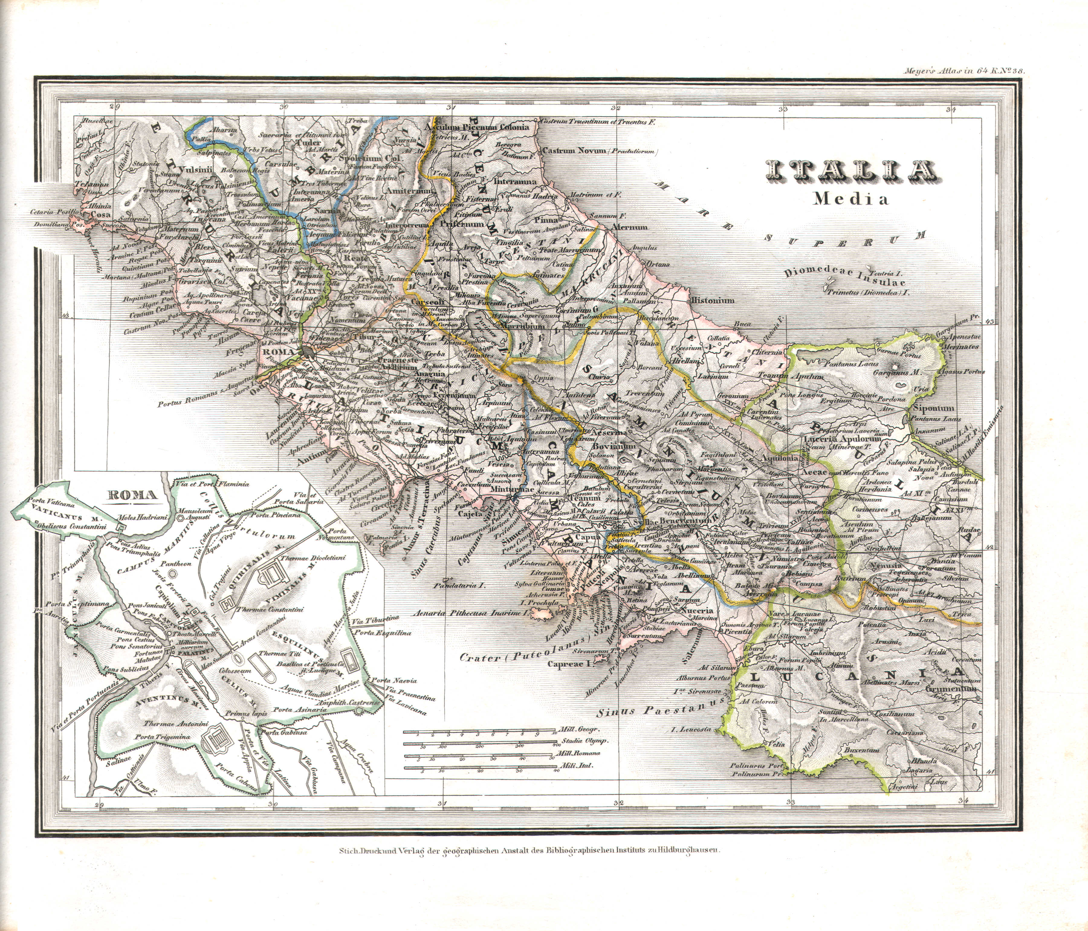
9. Italia media (Nº 38)
Midden-Italië / Central Italy
 Meyer's Universal-Atlas (1830-1840)
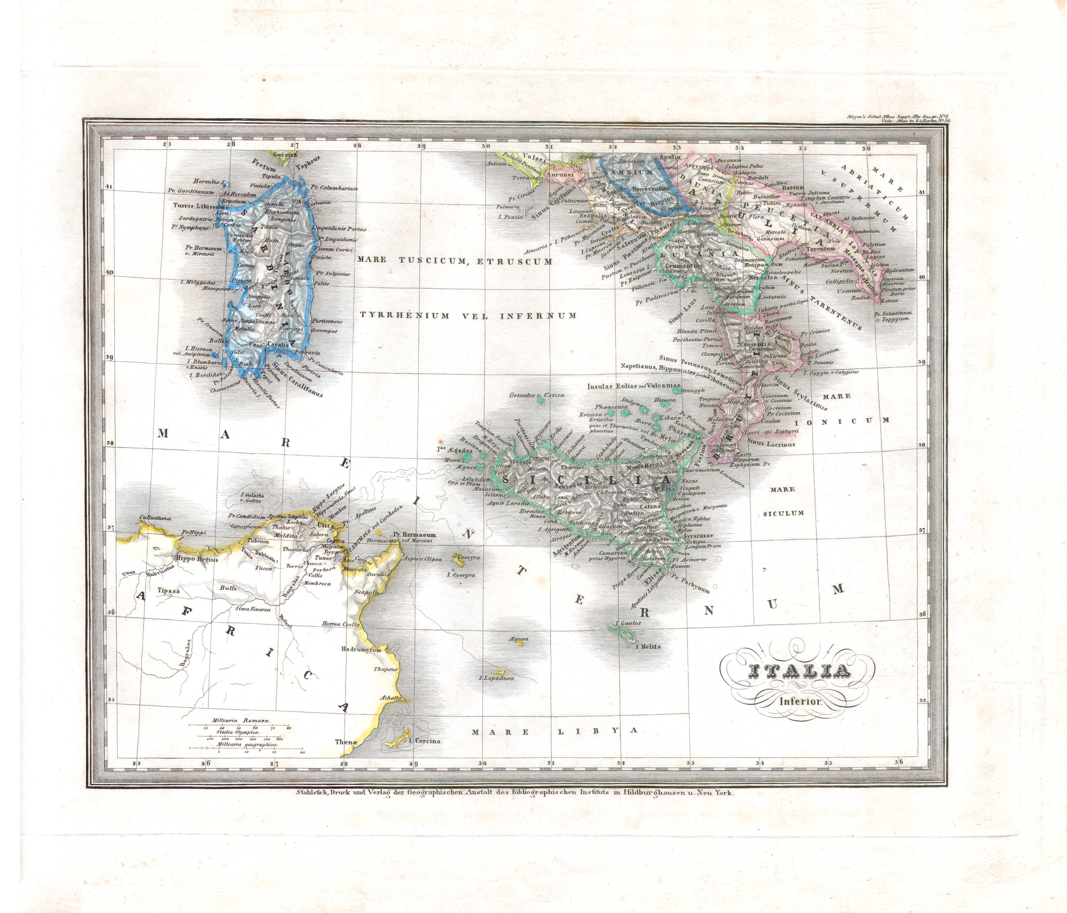
10. Italia inferior (Nº 56)
Zuid-Italië / Southern Italy
 Meyer's Universal-Atlas (1830-1840)
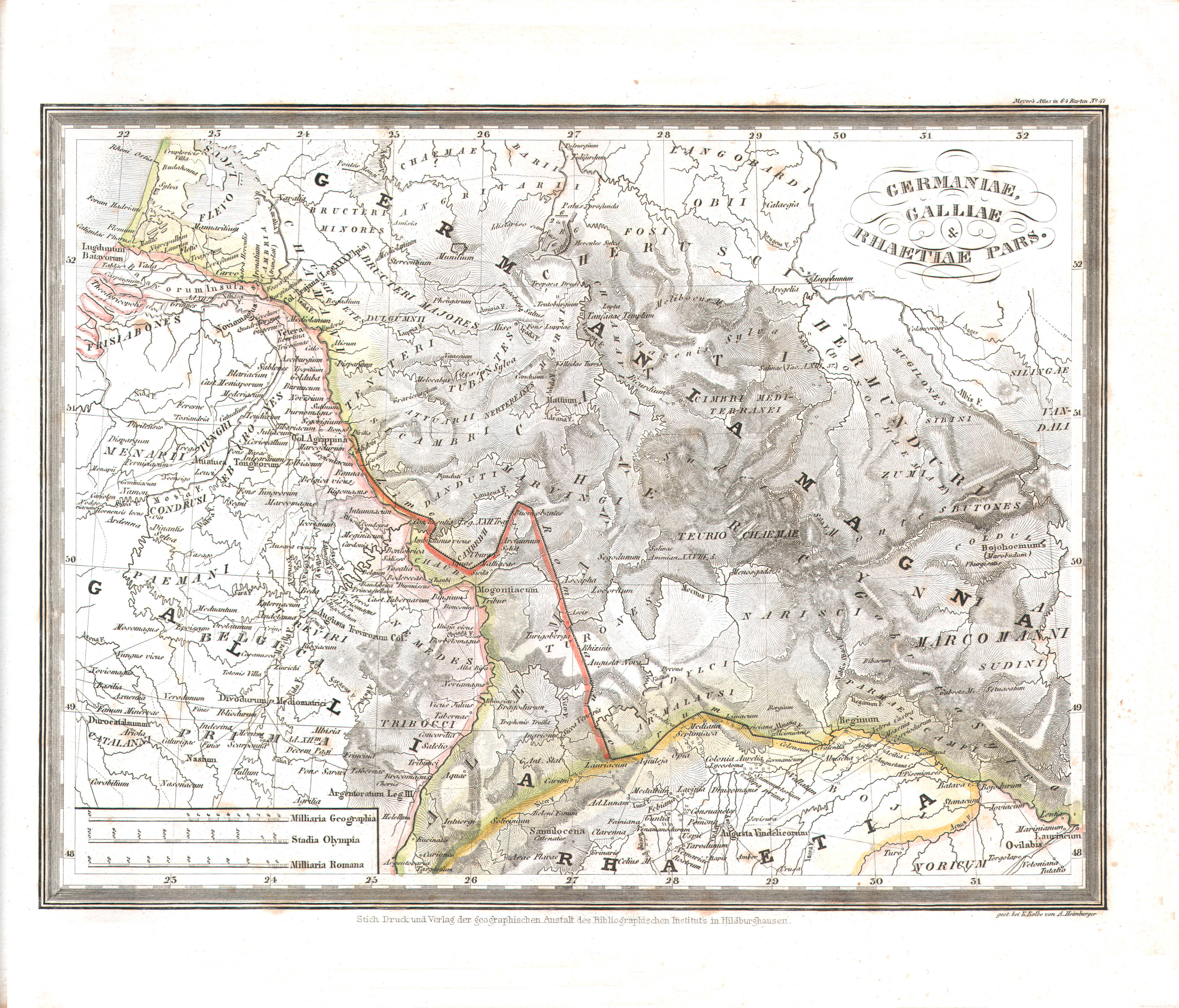
11. Germaniae, Galliae et Rhaetiae pars (Nº 47)
Deel van Germanië, Gallië en Rhetia / Part of Germania, Gaul and Rhaetia
 Meyer's Universal-Atlas (1830-1840)
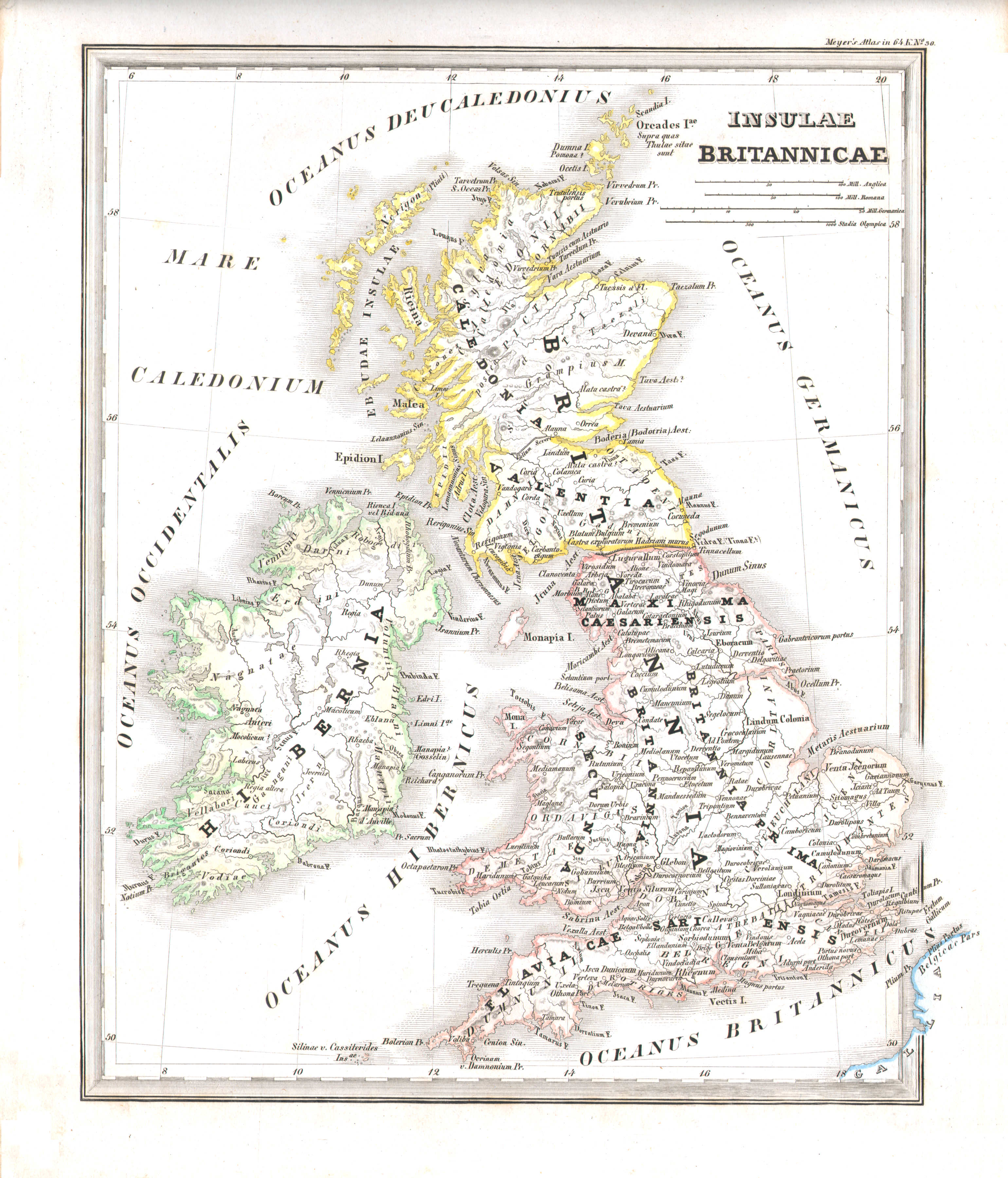
12. Insulae Britannicae (Nº 30)
Britse Eilanden / British Isles
 Meyer's Universal-Atlas (1830-1840)
13. Asia Minor, Syria, Armenia, Mesopotamia, Assyria, Palestina (Nº 27)
Klein-Azië, Syrië, Armenië, Mesopotamië, Assyrië, Palestina / Asia Minor, Syria, Armenia, Mesopotamia, Assyria, Palestine
 Meyer's Universal-Atlas (1830-1840)
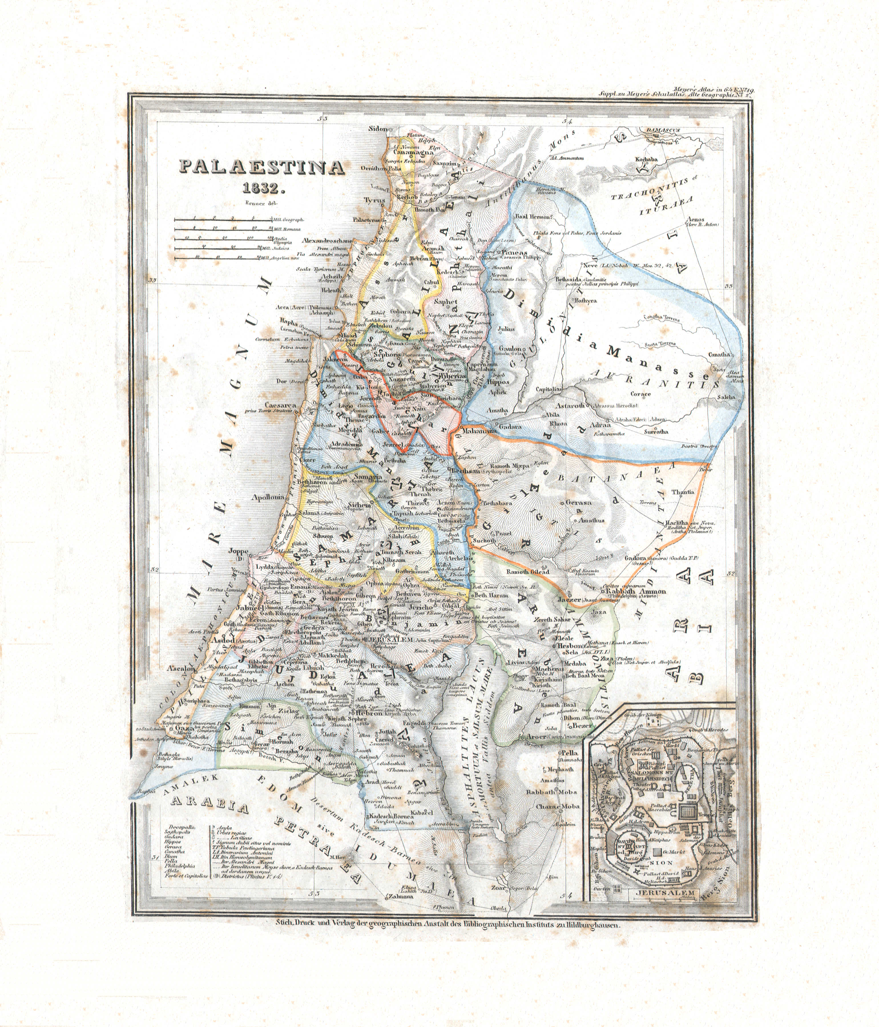
14. Palaestina (Nº 19, 1832)
Palestina / Palestine
 Meyer's Universal-Atlas (1830-1840)
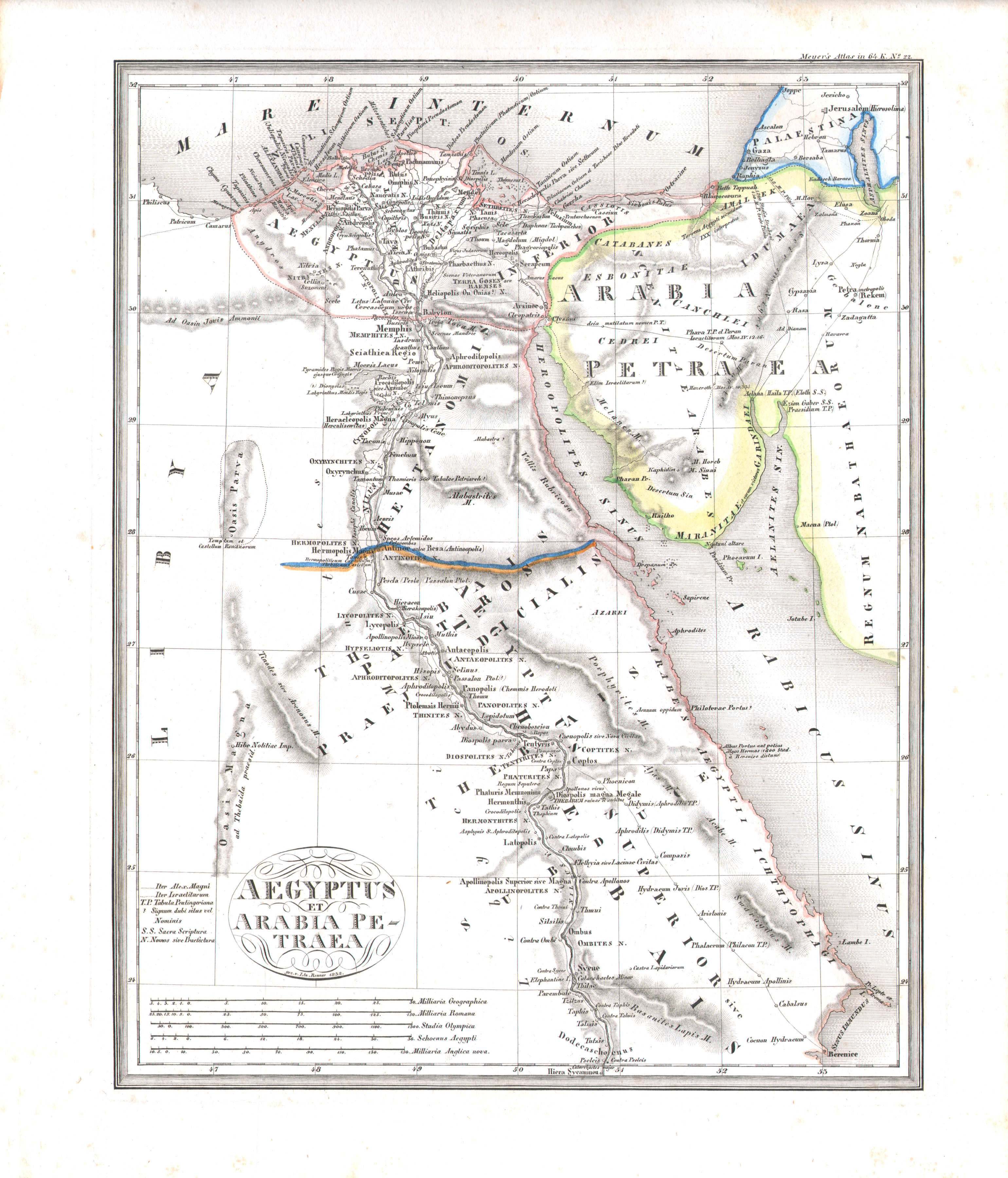
15. Aegyptus & Arabia Petraea (Nº 22, 1832)
Egypte en Arabia Petraea / Egypte and Arabia Petraea
 Meyer's Universal-Atlas (1830-1840)
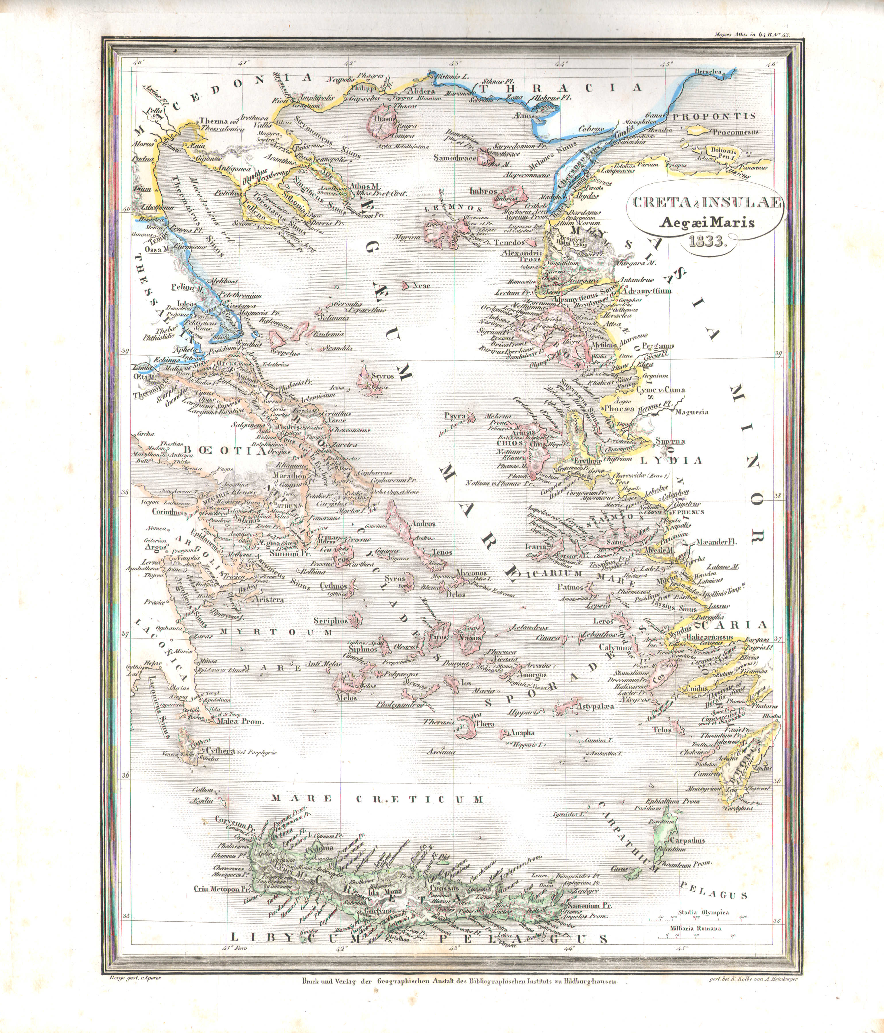
16. Creta & Insulae Aegaei Maris (Nº 43, 1833)
Kreta en de eilanden in de Egeïsche Zee / Crete and the Aegean Islands
 Meyer's Universal-Atlas (1830-1840)
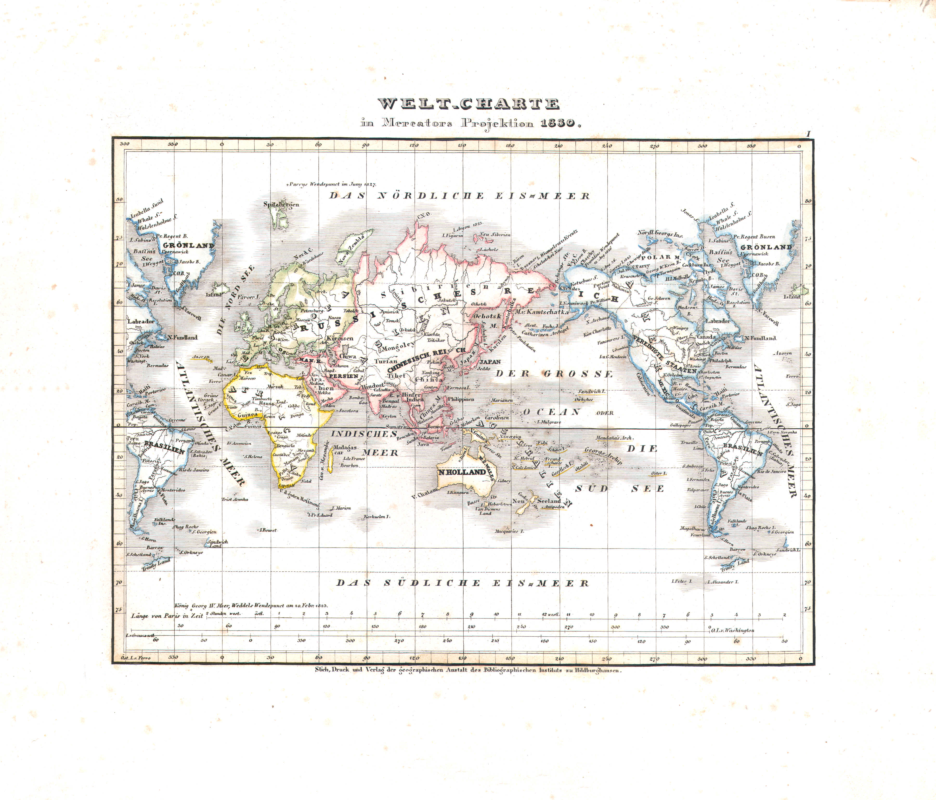
17. Welt-Charte in Mercators Projektion (Nº 1, 1830)
Wereldkaar in Mercatorprojectie / World map in Mercator projection
 Meyer's Universal-Atlas (1830-1840)
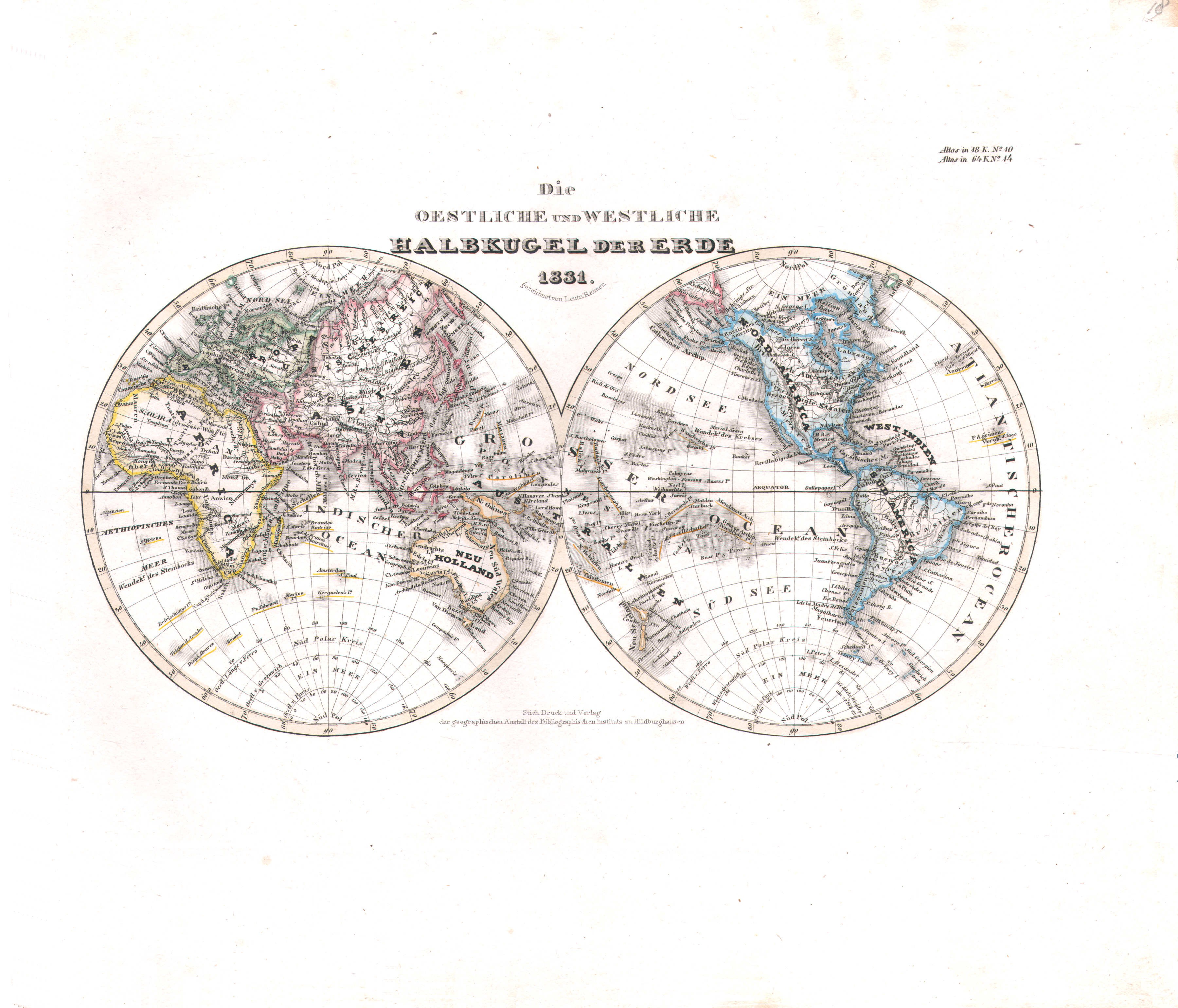
18. Die oestliche und westliche Halbkugel der Erde (Nº 14, 1831)
Oostelijk en westelijk halfrond / Eastern and western hemisphere
 Meyer's Universal-Atlas (1830-1840)
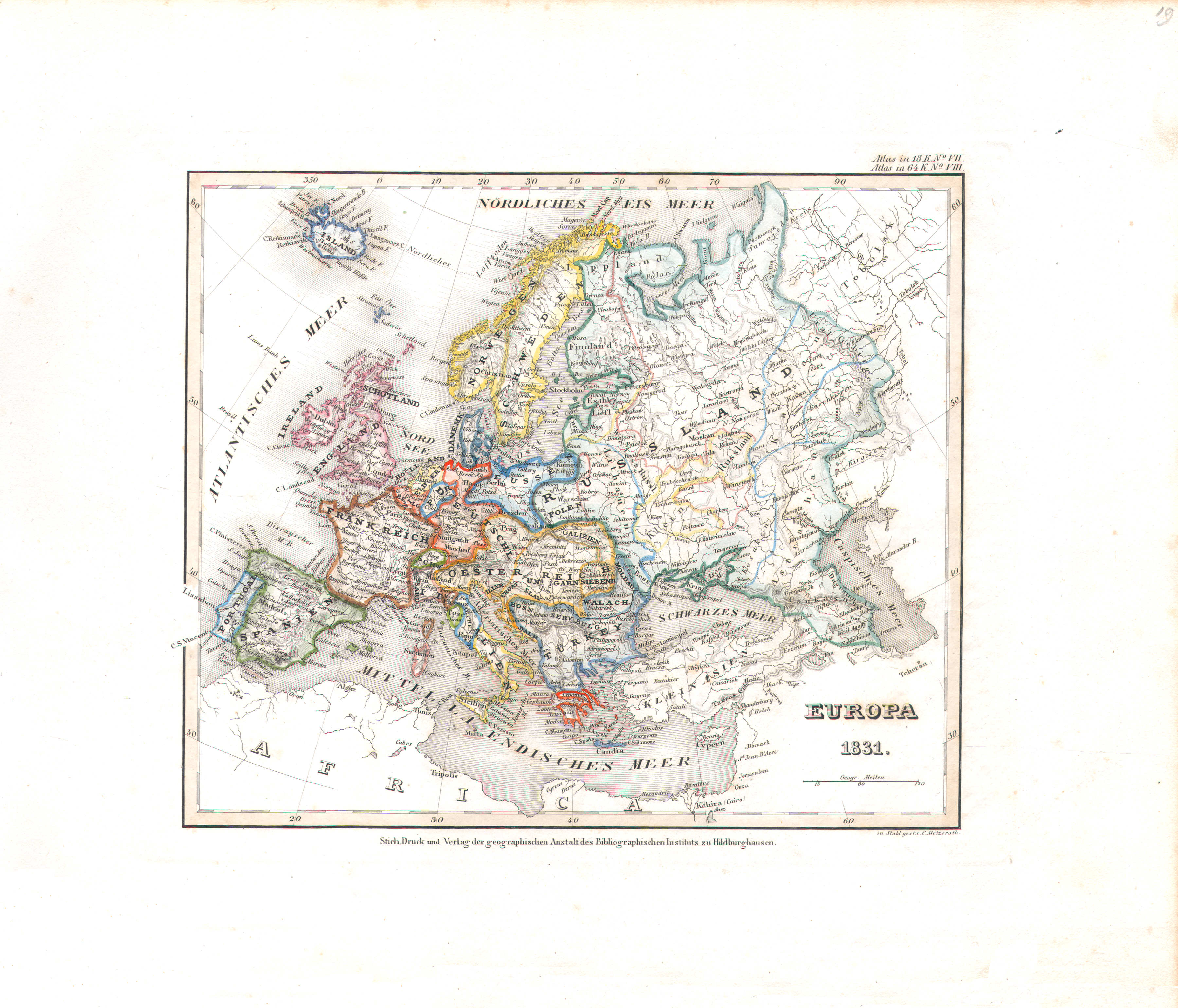
19. Europa (Nº 8, 1831)
Europa / Europe
 Meyer's Universal-Atlas (1830-1840)
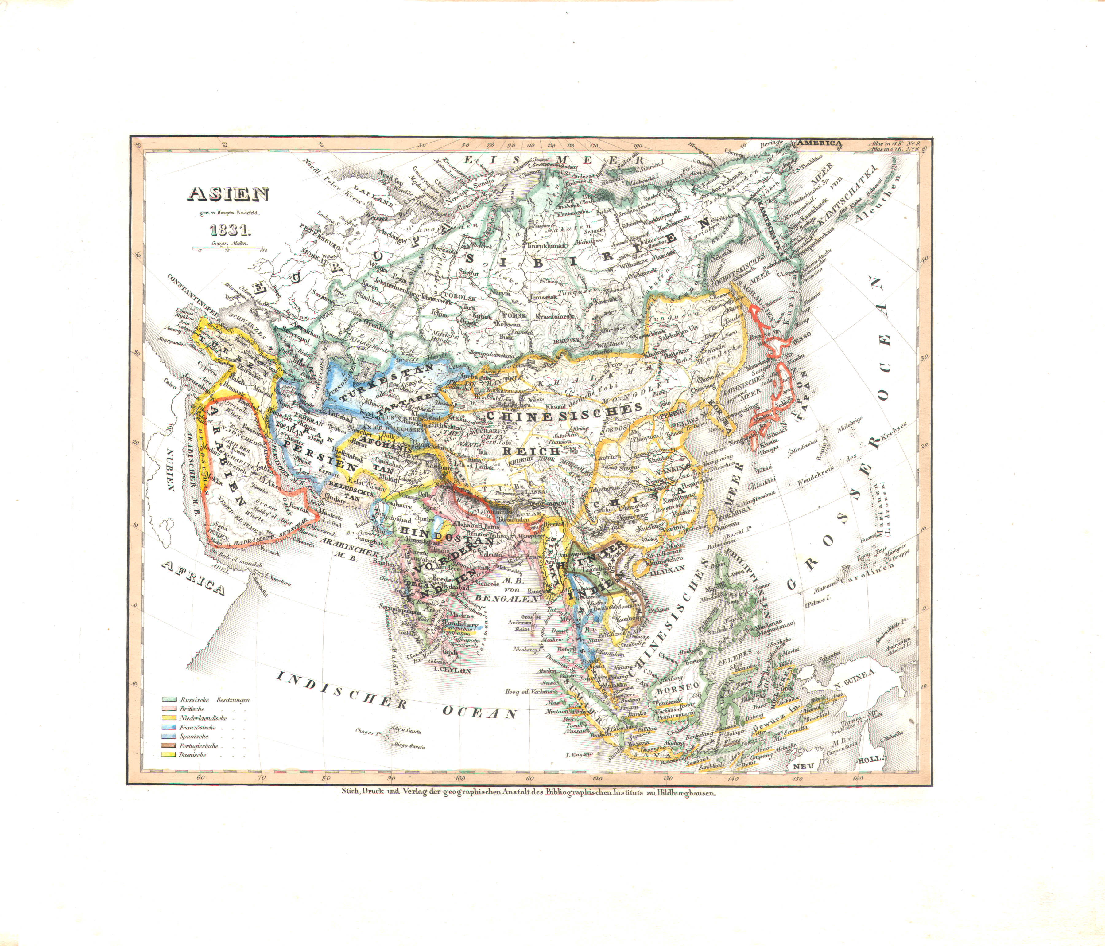
20. Asien (Nº 11, 1831)
Azië / Asia
 Meyer's Universal-Atlas (1830-1840)
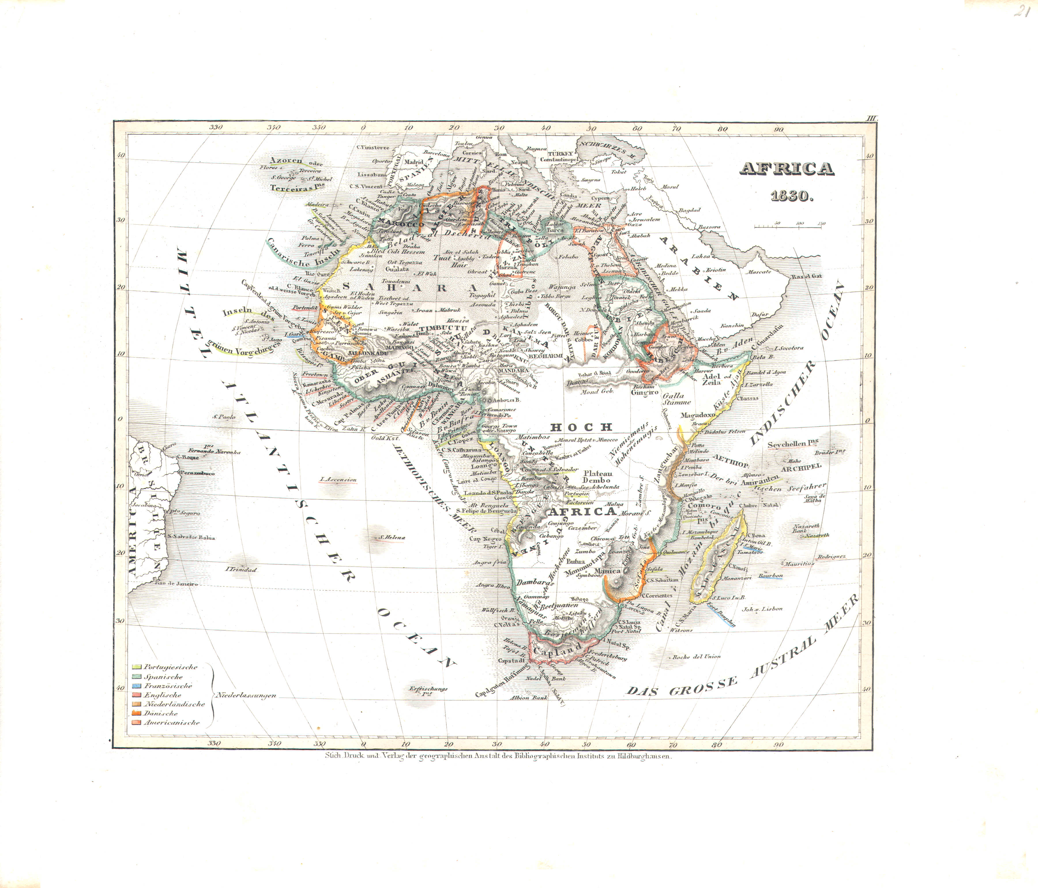
21. Africa (Nº 3, 1830)
Afrika / Africa
 Meyer's Universal-Atlas (1830-1840)
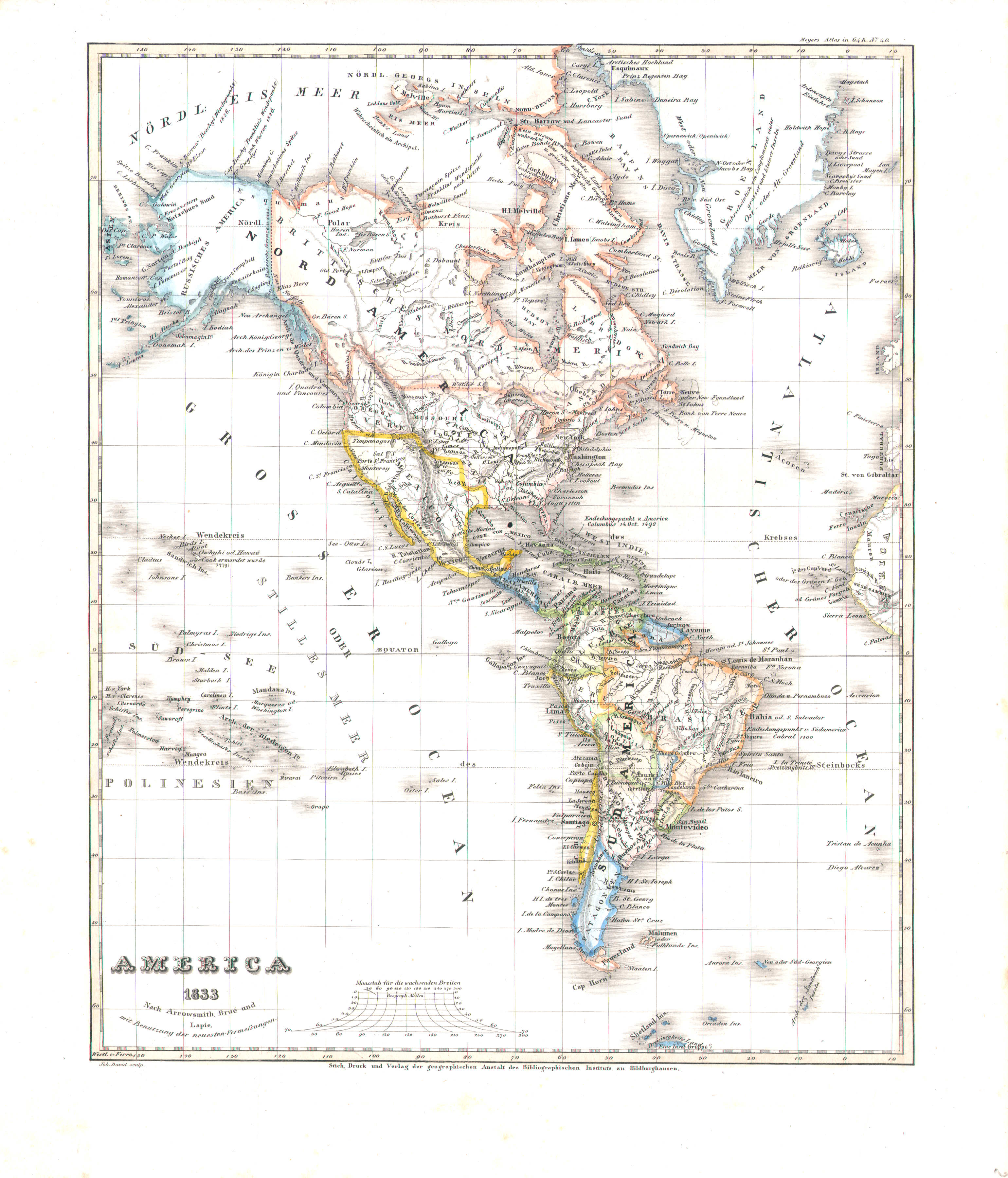
22. America (Nº 40, 1833)
Noord- en Zuid-Amerika / The Americas
 Meyer's Universal-Atlas (1830-1840)
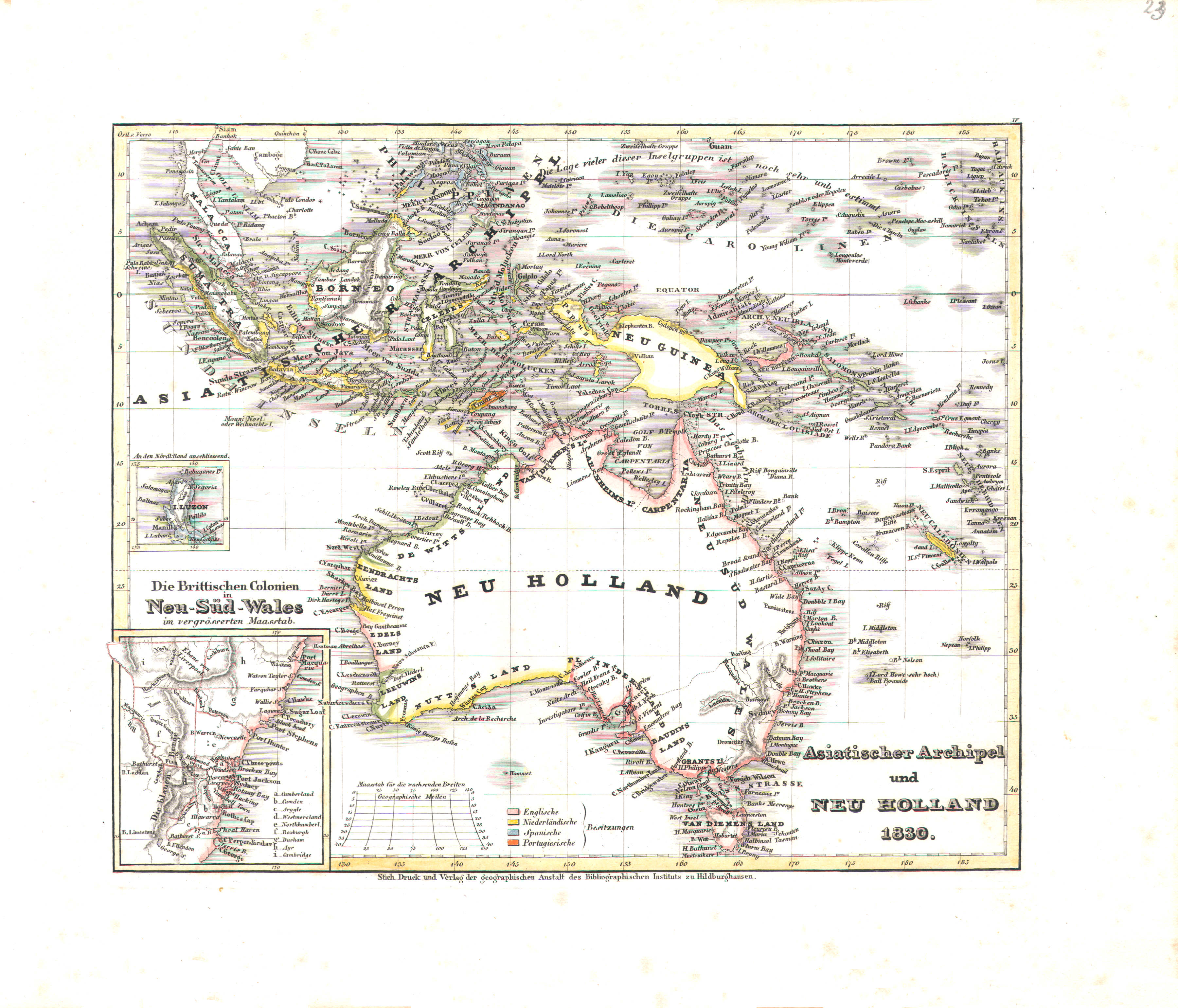
23. Asiatischer Archipel und Neu Holland (Nº 4, 1830)
Indische Archipel en Nieuw-Holland / Malay Archipelago and New Holland
 Meyer's Universal-Atlas (1830-1840)
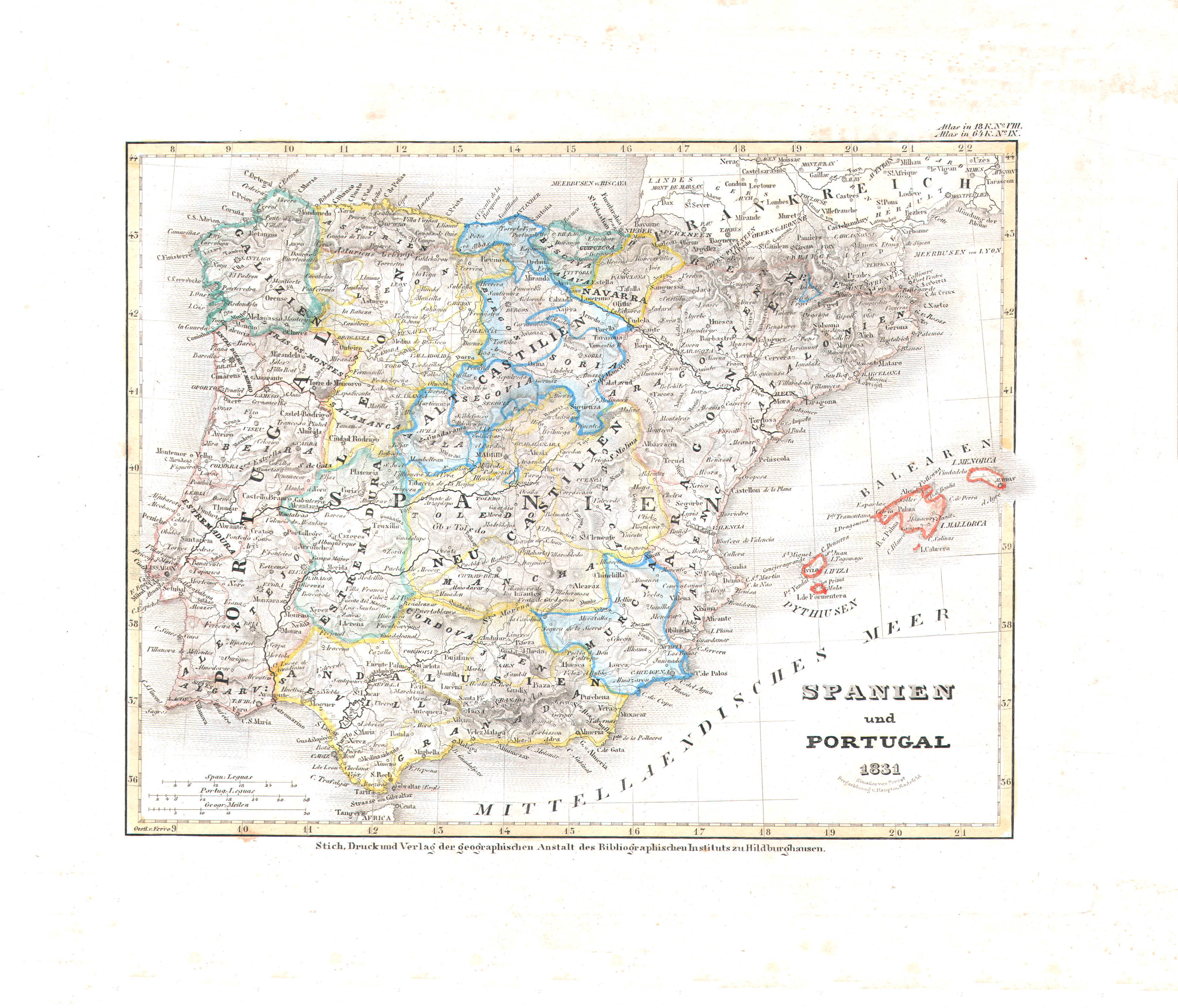
24. Spanien und Portugal (Nº 9, 1831)
Spanje en Portugal / Spain and Portugal
 Meyer's Universal-Atlas (1830-1840)
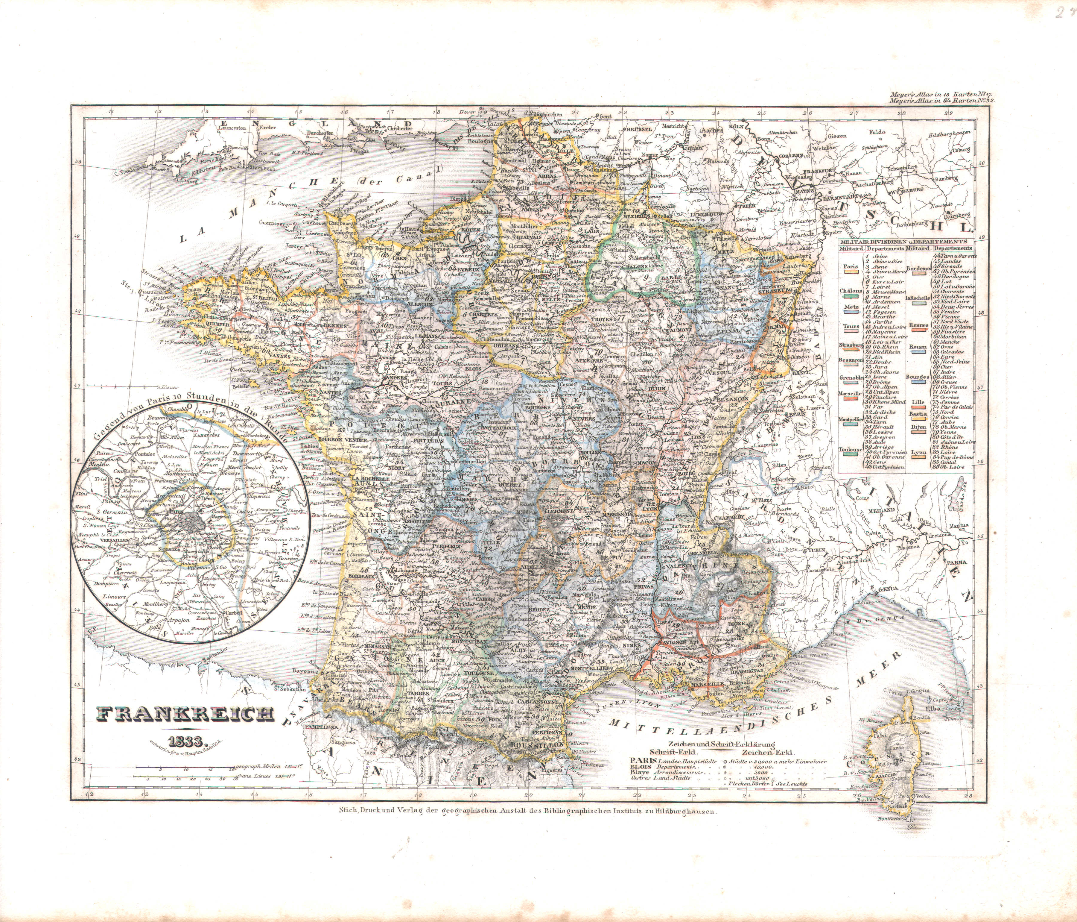
25. Frankreich (Nº 32, 1833)
Frankrijk / France
 Meyer's Universal-Atlas (1830-1840)
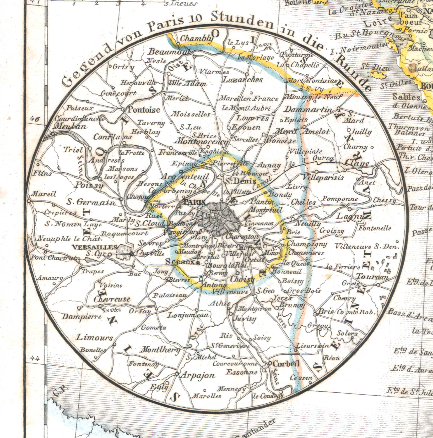
25a. Gegend von Paris 10 Stunden in die Runde
Parijs en omgeving / Paris and environs
 Meyer's Universal-Atlas (1830-1840)
26. Italien mit der Dalmat-Albanesischen Küste (Nº 13, 1831)
Italië en de kust van Dalmatië en Albanië / Italy and the shores of Dalmatia and Albania
 Meyer's Universal-Atlas (1830-1840)
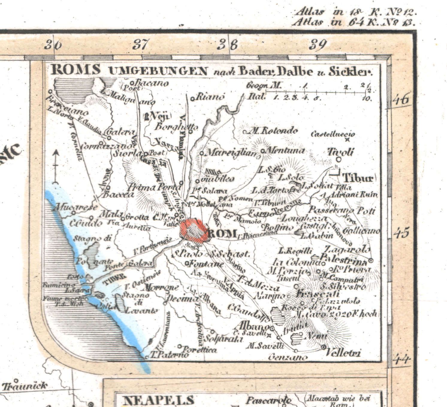
26a. Roms Umgebungen
Rome en omgeving / Rome and environs / Roma
 Meyer's Universal-Atlas (1830-1840)
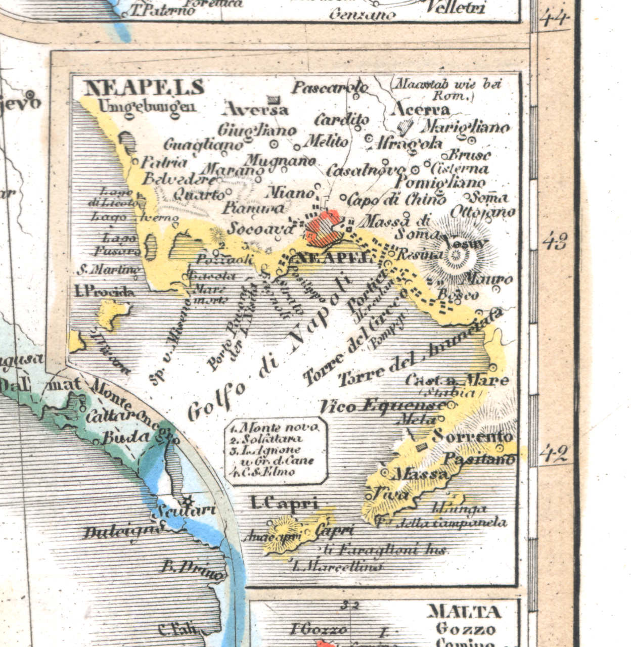
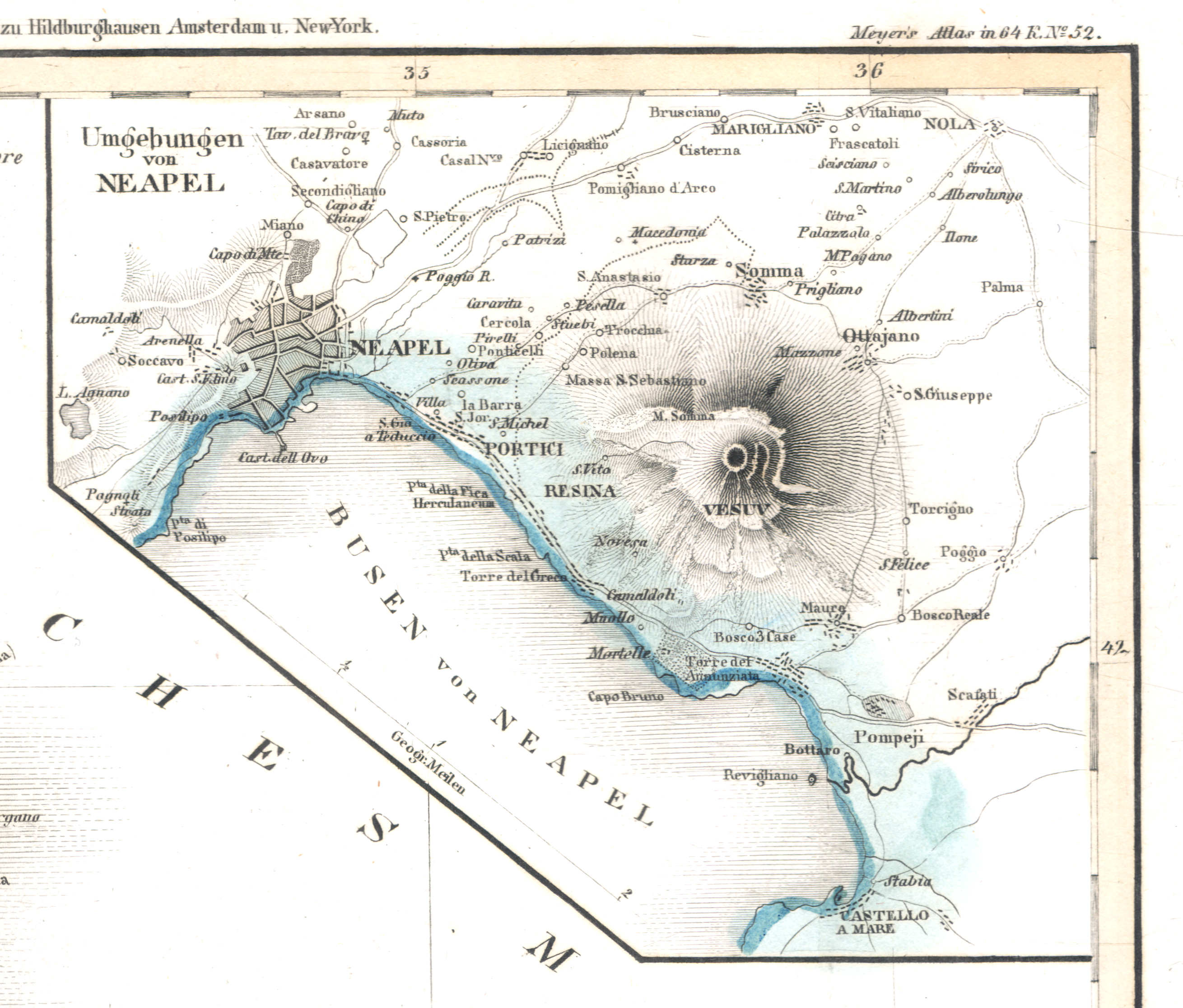
26b. Neapels Umgebungen
Napels en omgeving / Naples and environs / Napoli
 Meyer's Universal-Atlas (1830-1840)
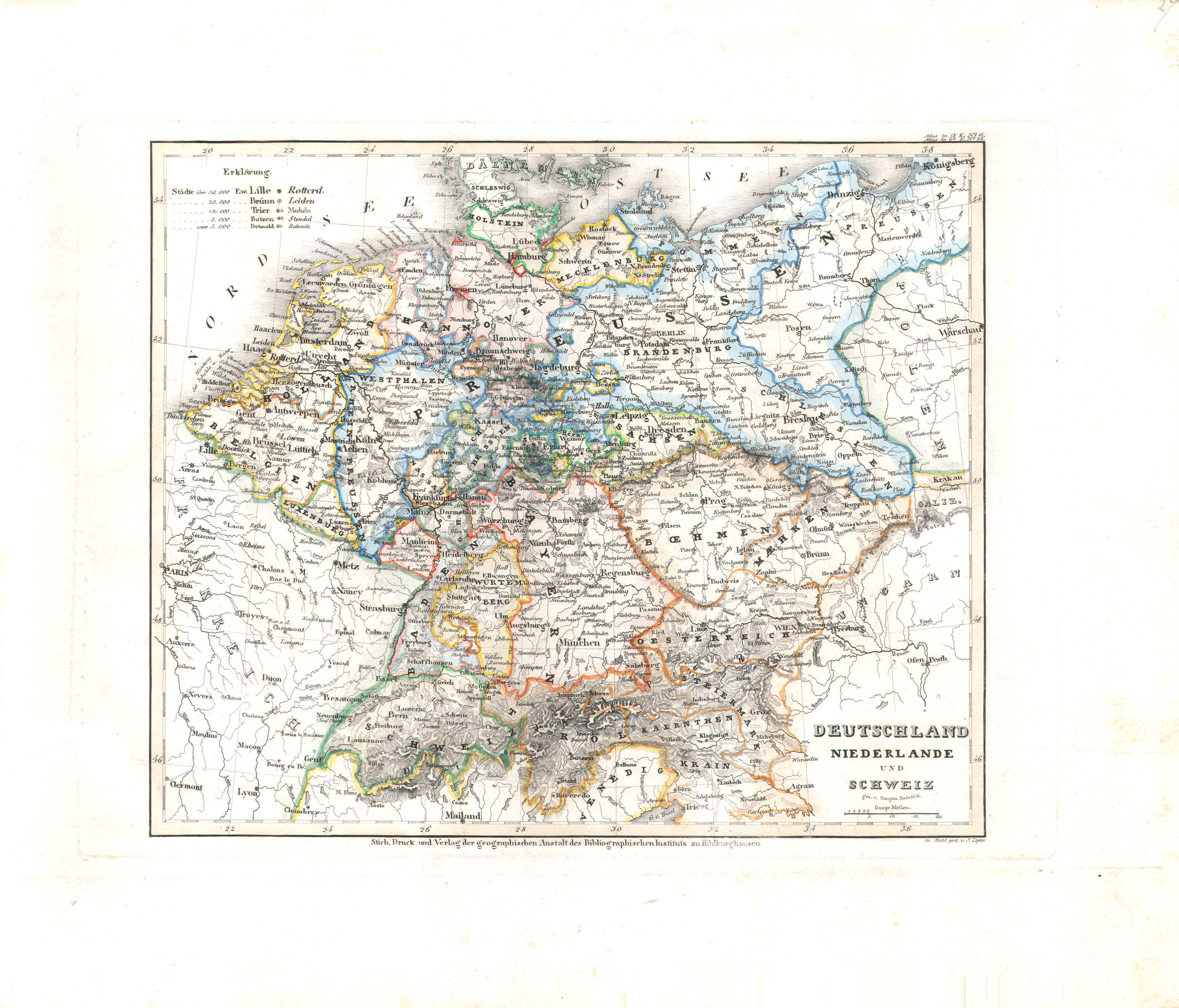
27. Deutschland, Niederlande und Schweiz (Nº 28)
Duitsland, Nederland en Zwitserland / Germany, Netherlands and Switzerland
 Meyer's Universal-Atlas (1830-1840)
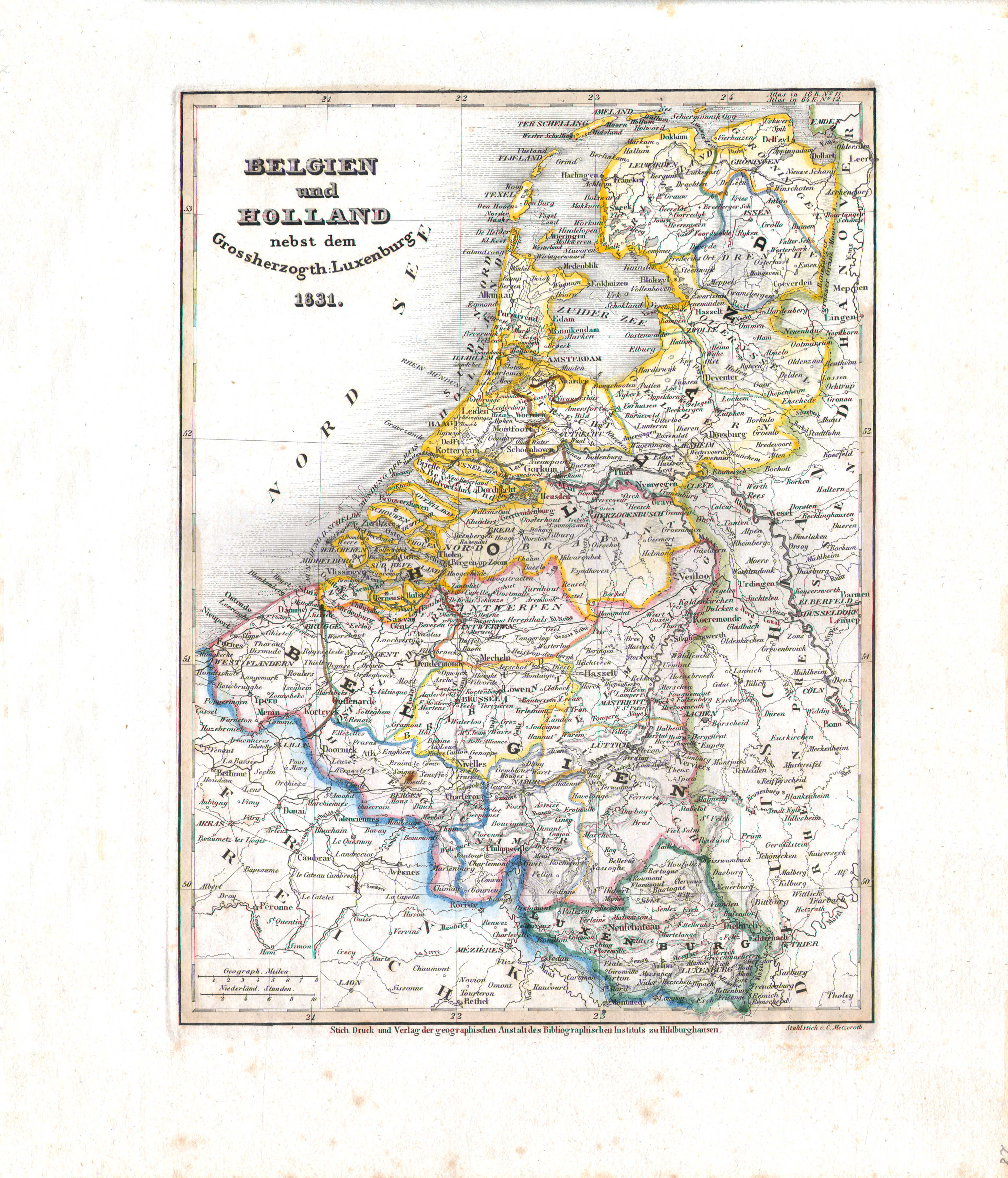
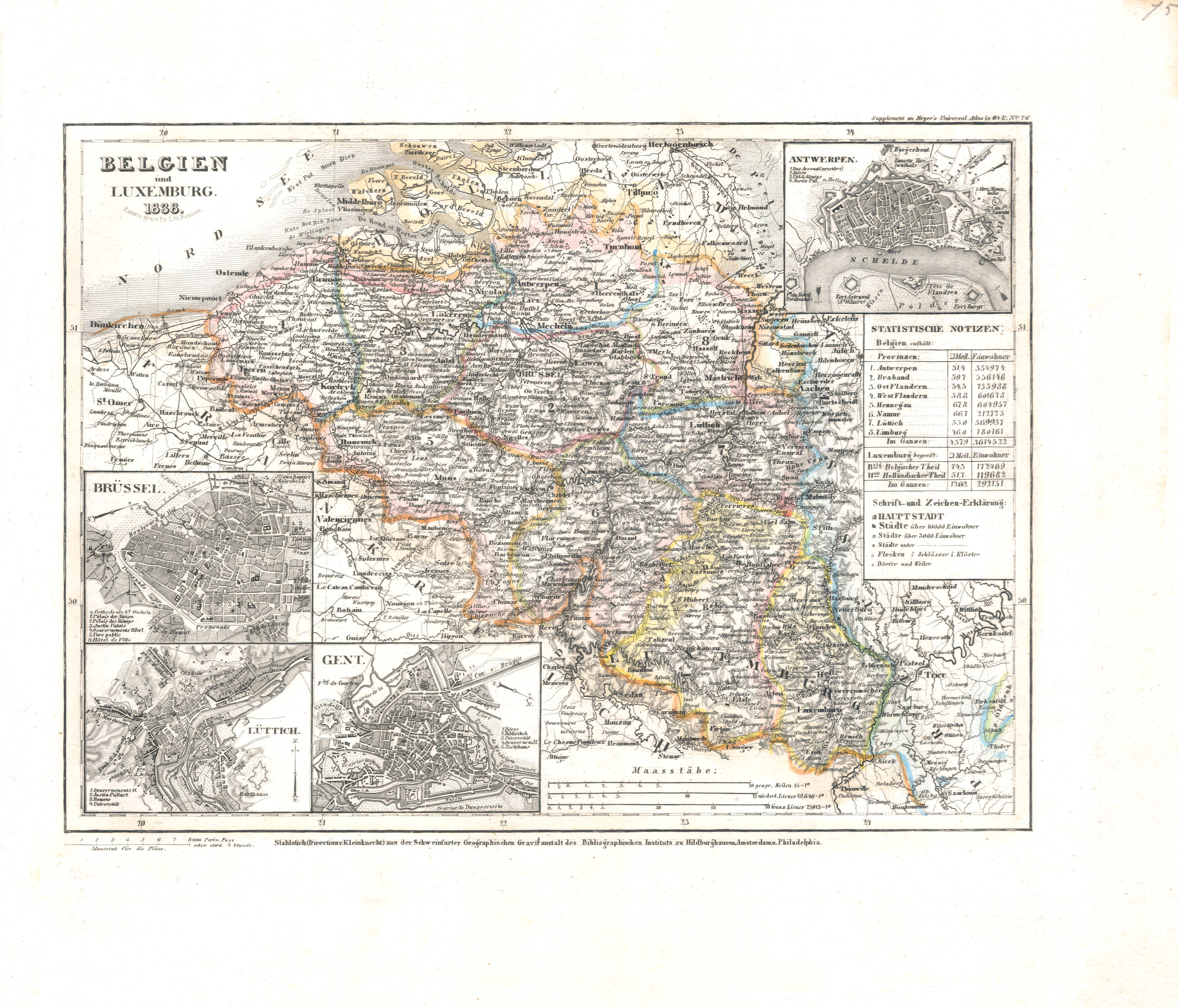
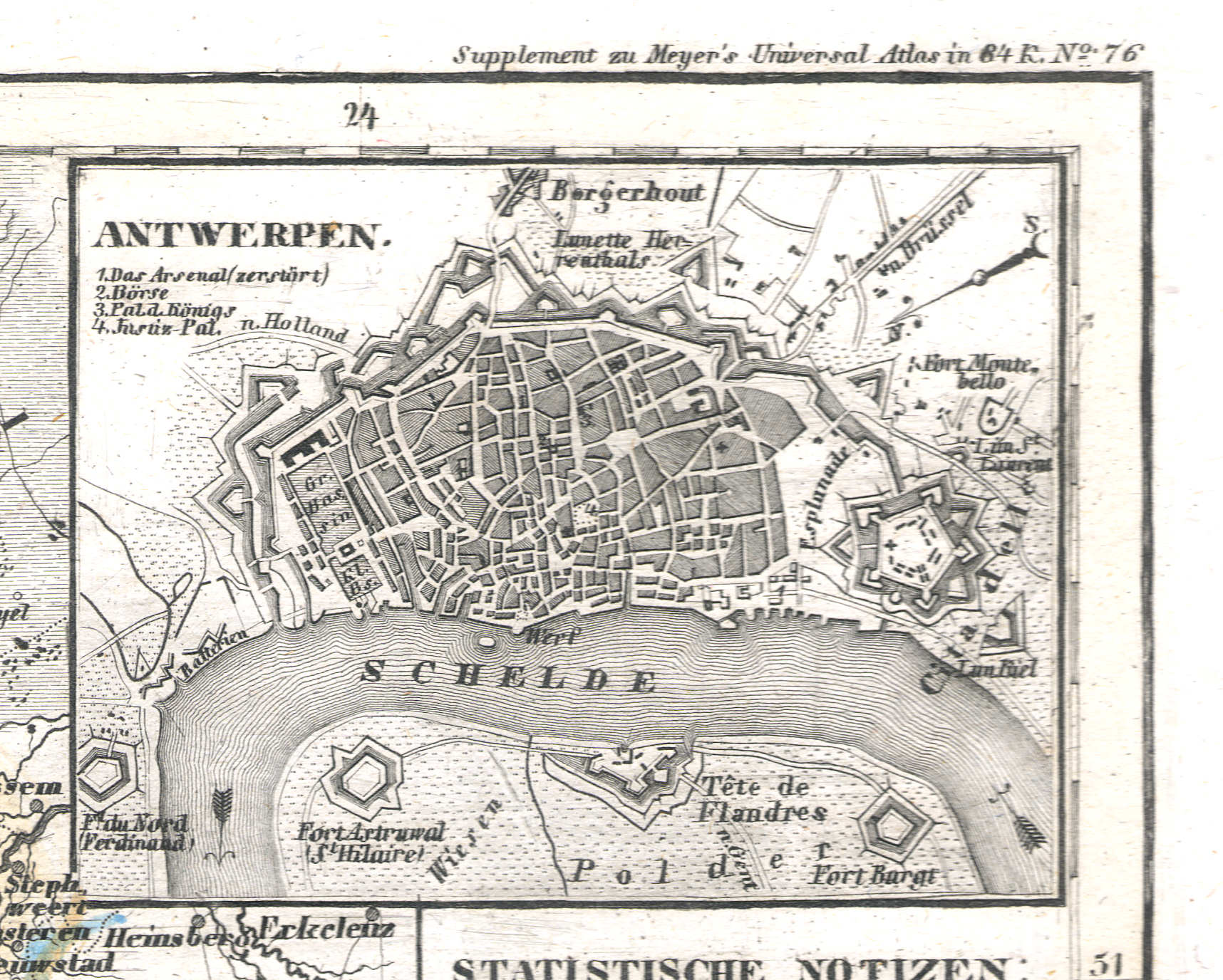
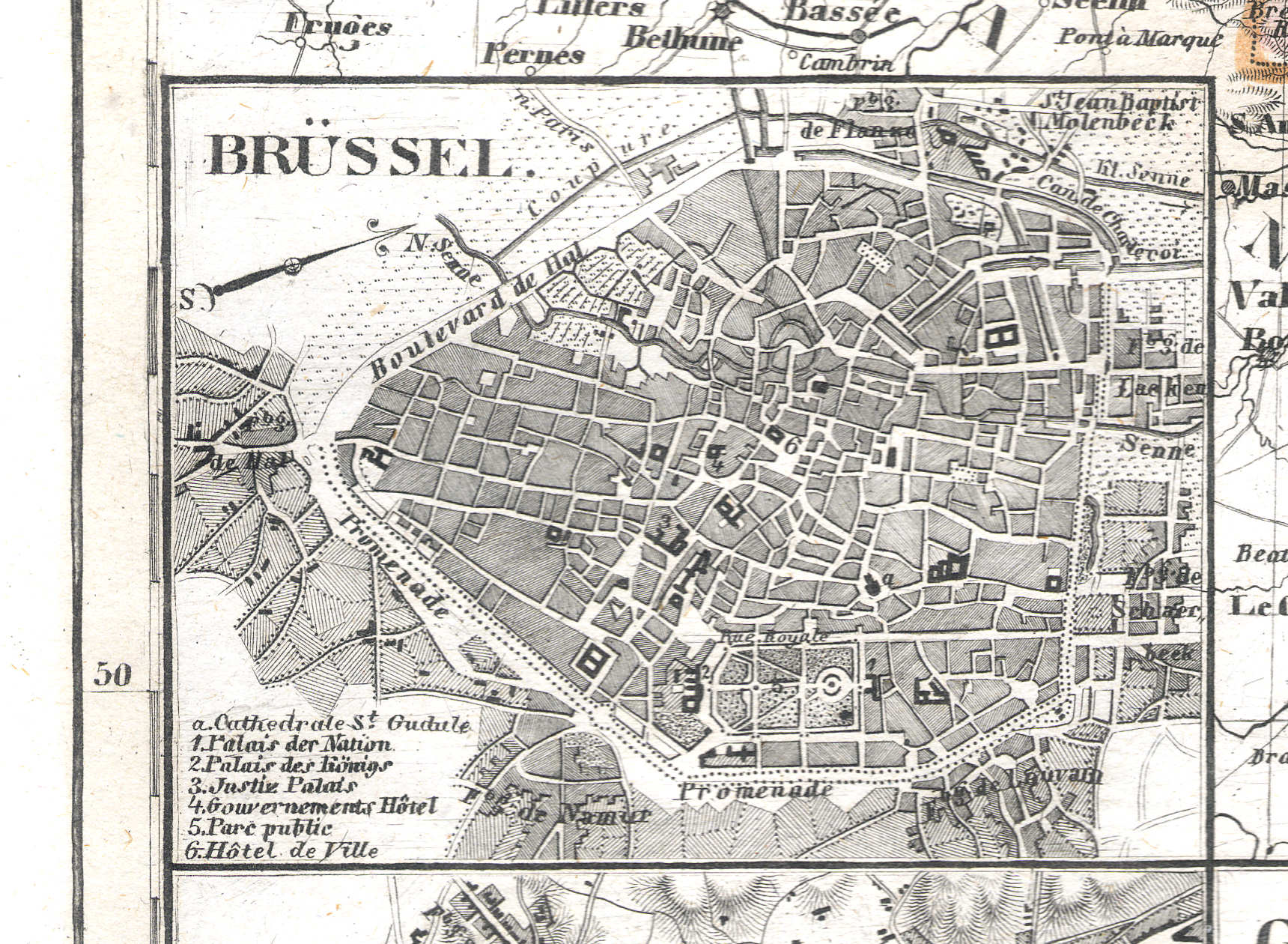
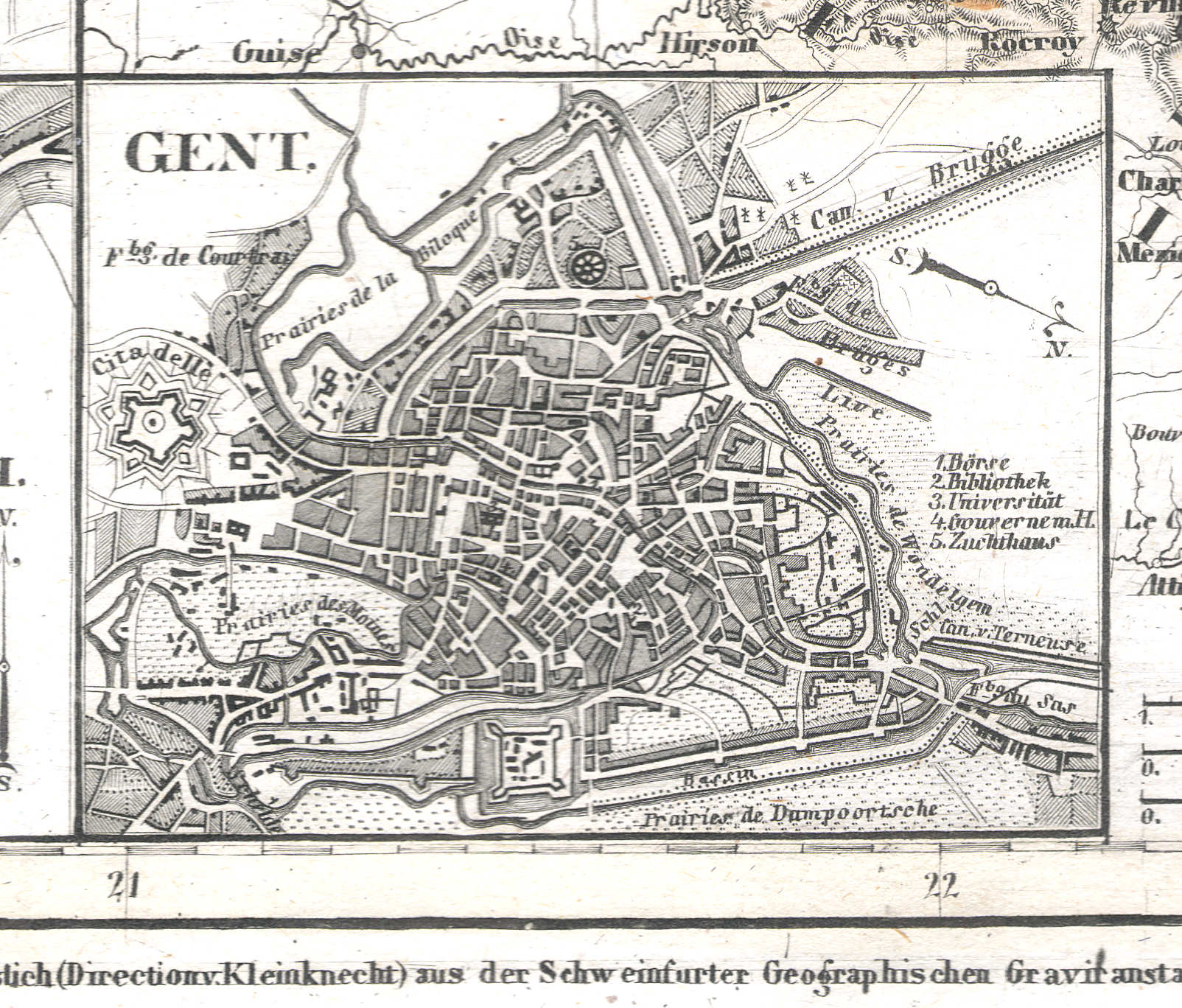
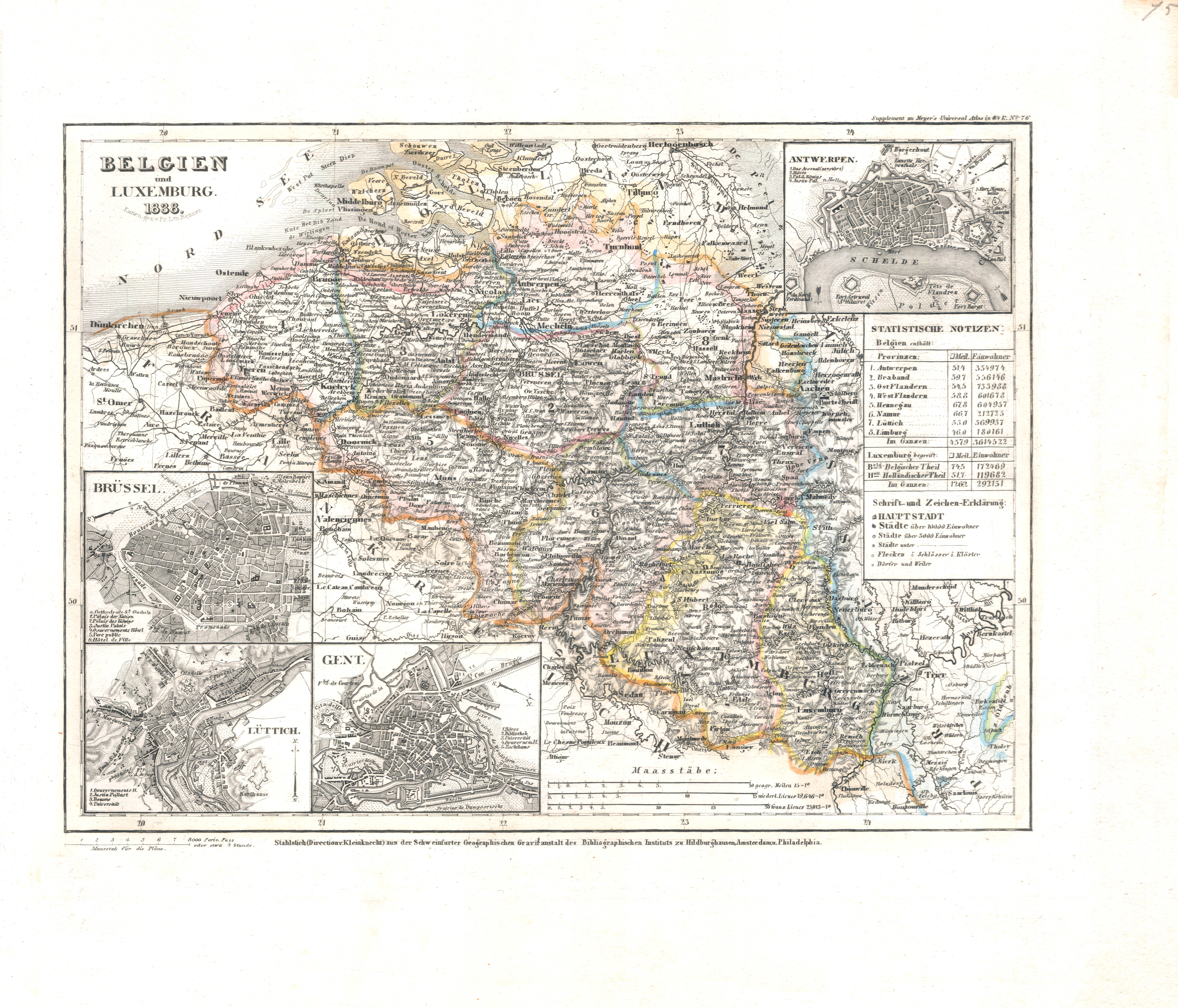
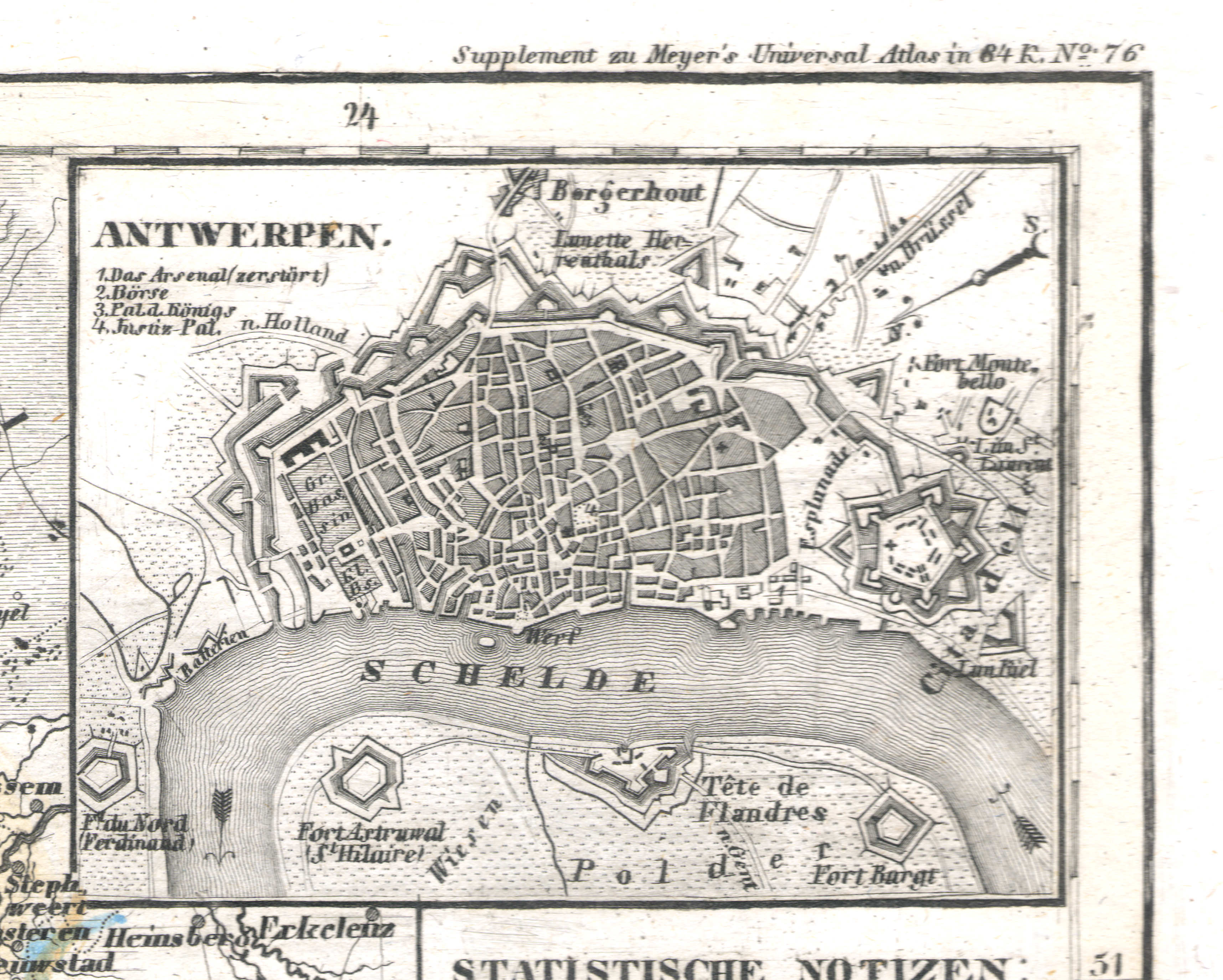
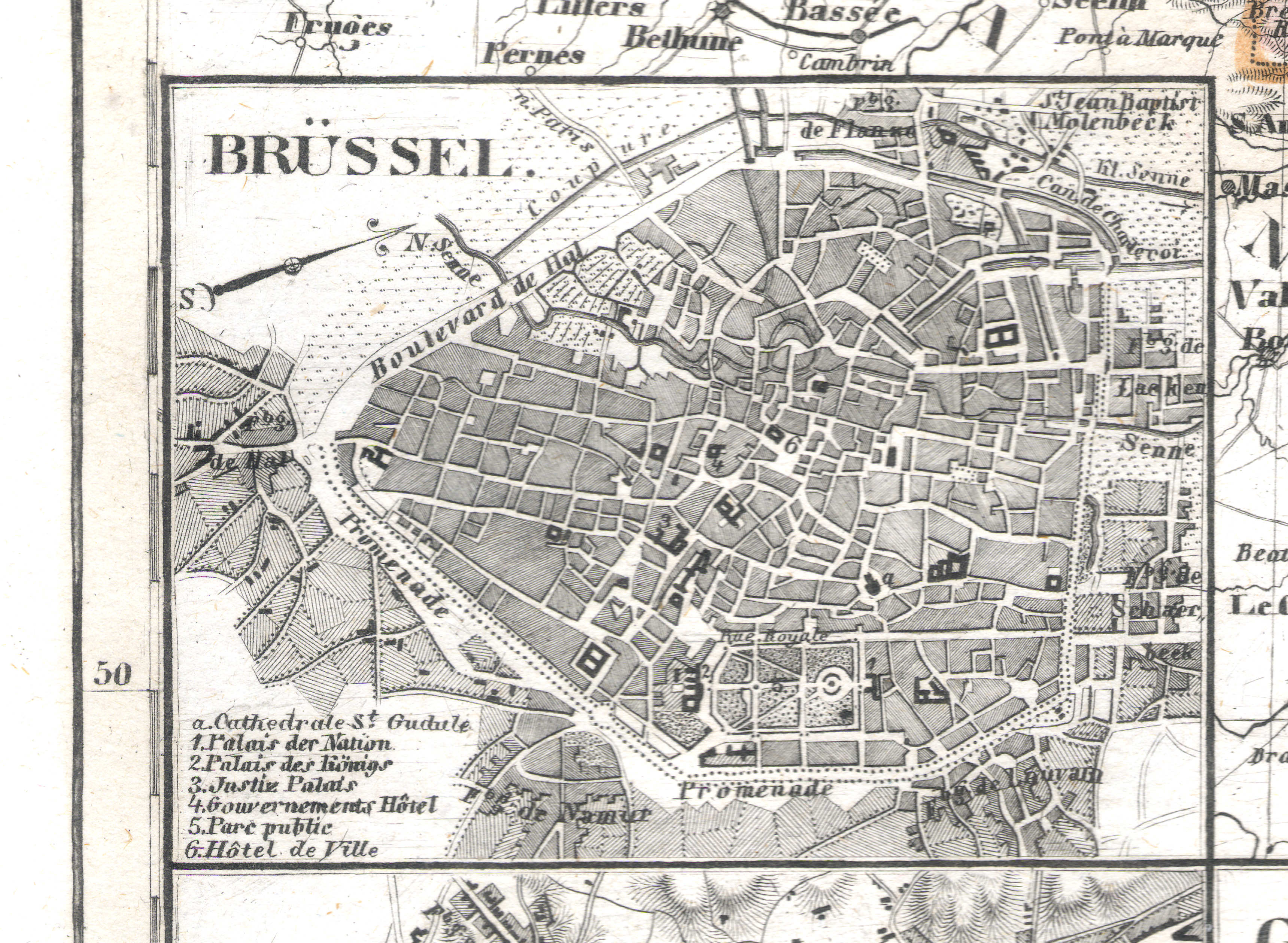
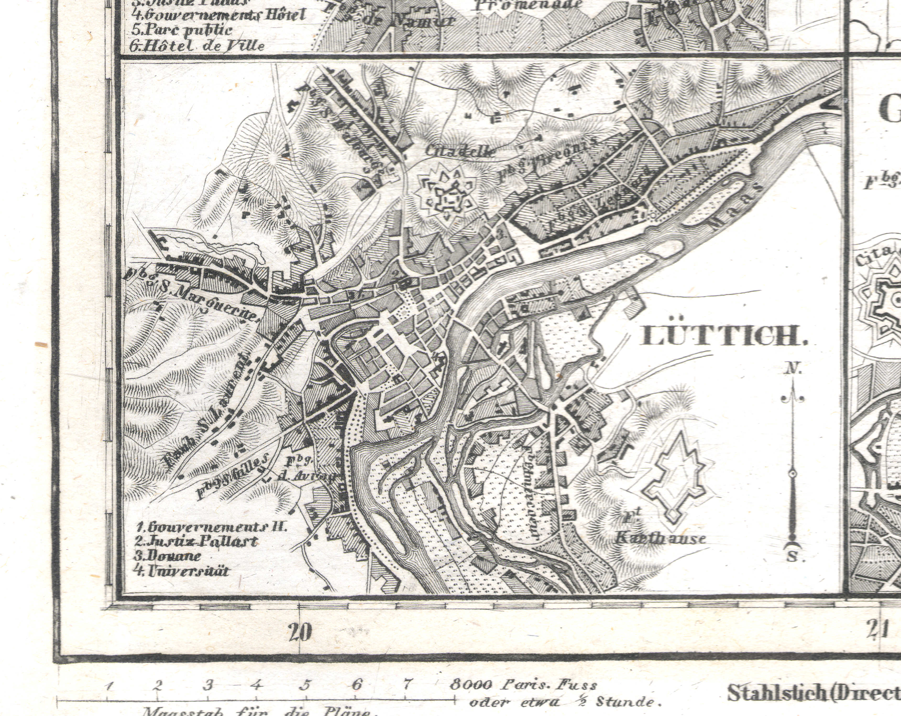
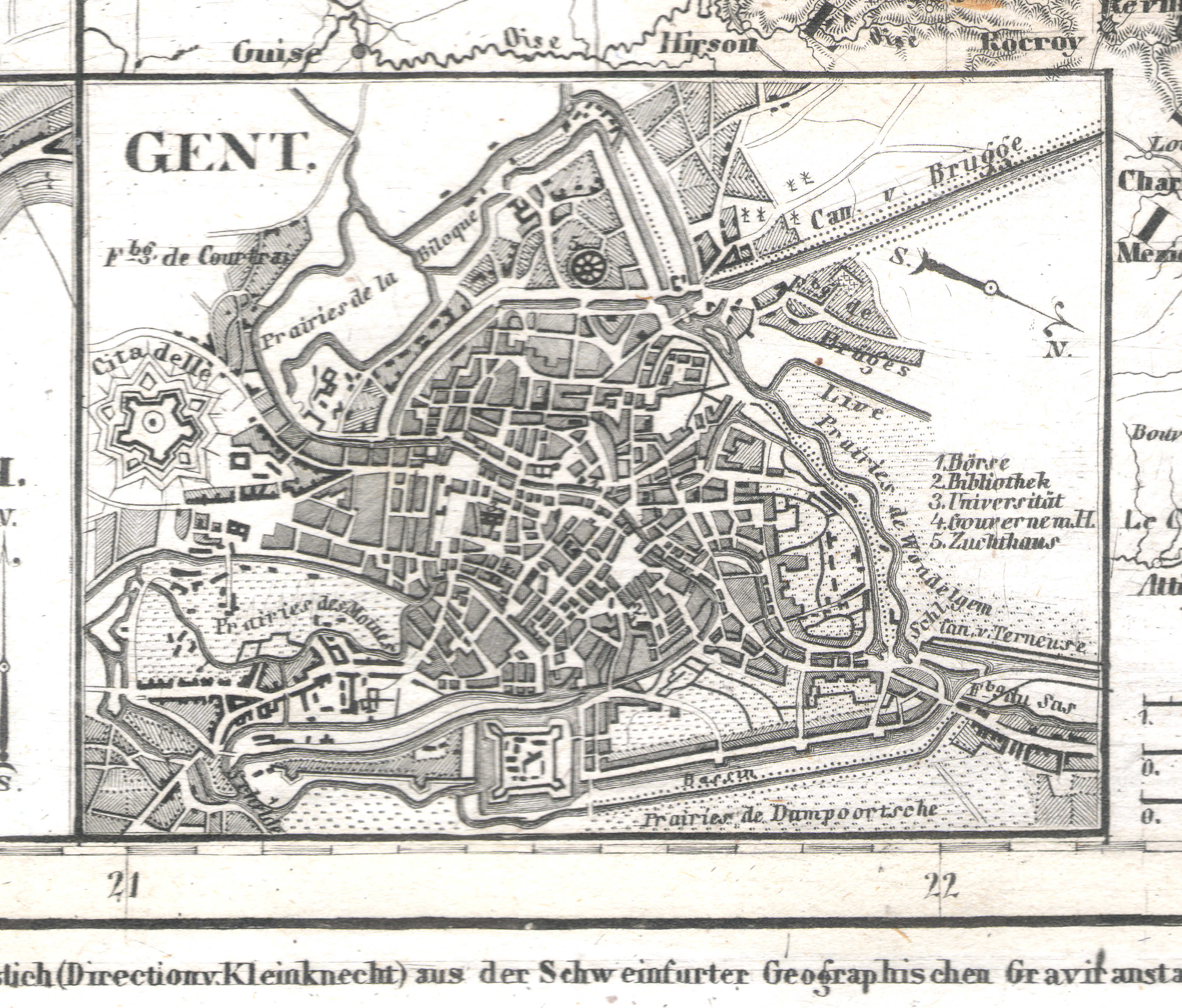
28. Belgien und Holland nebst dem Grossherzogth. Luxenburg (Nº 12, 1831)
België, Nederland en Luxemburg / Belgium, Netherlands and Luxembourg
 Meyer's Universal-Atlas (1830-1840)
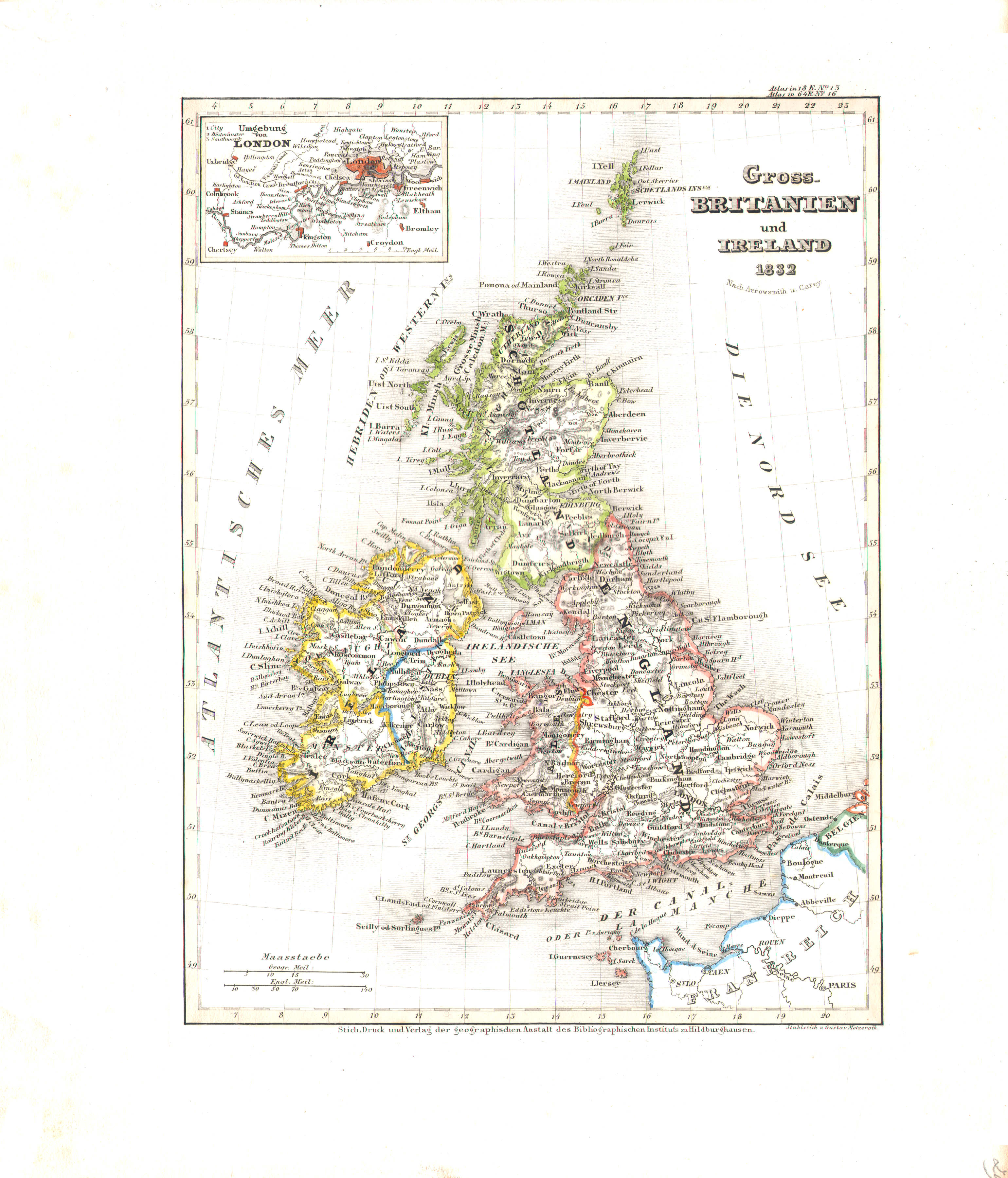
29. Gross-Britanien und Ireland (Nº 16, 1832)
Groot-Brittannië en Ierland / Great Britain and Ireland
 Meyer's Universal-Atlas (1830-1840)
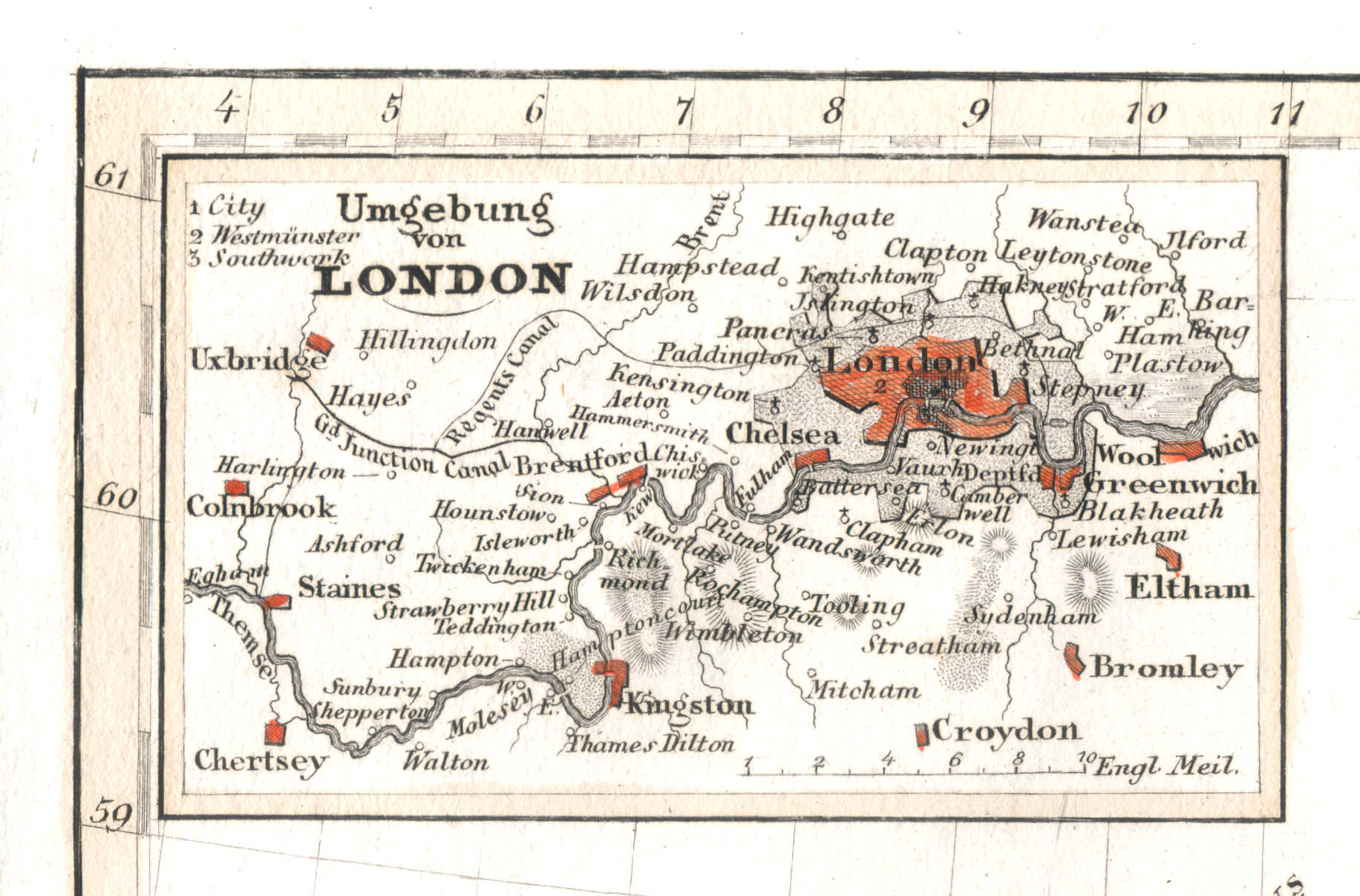
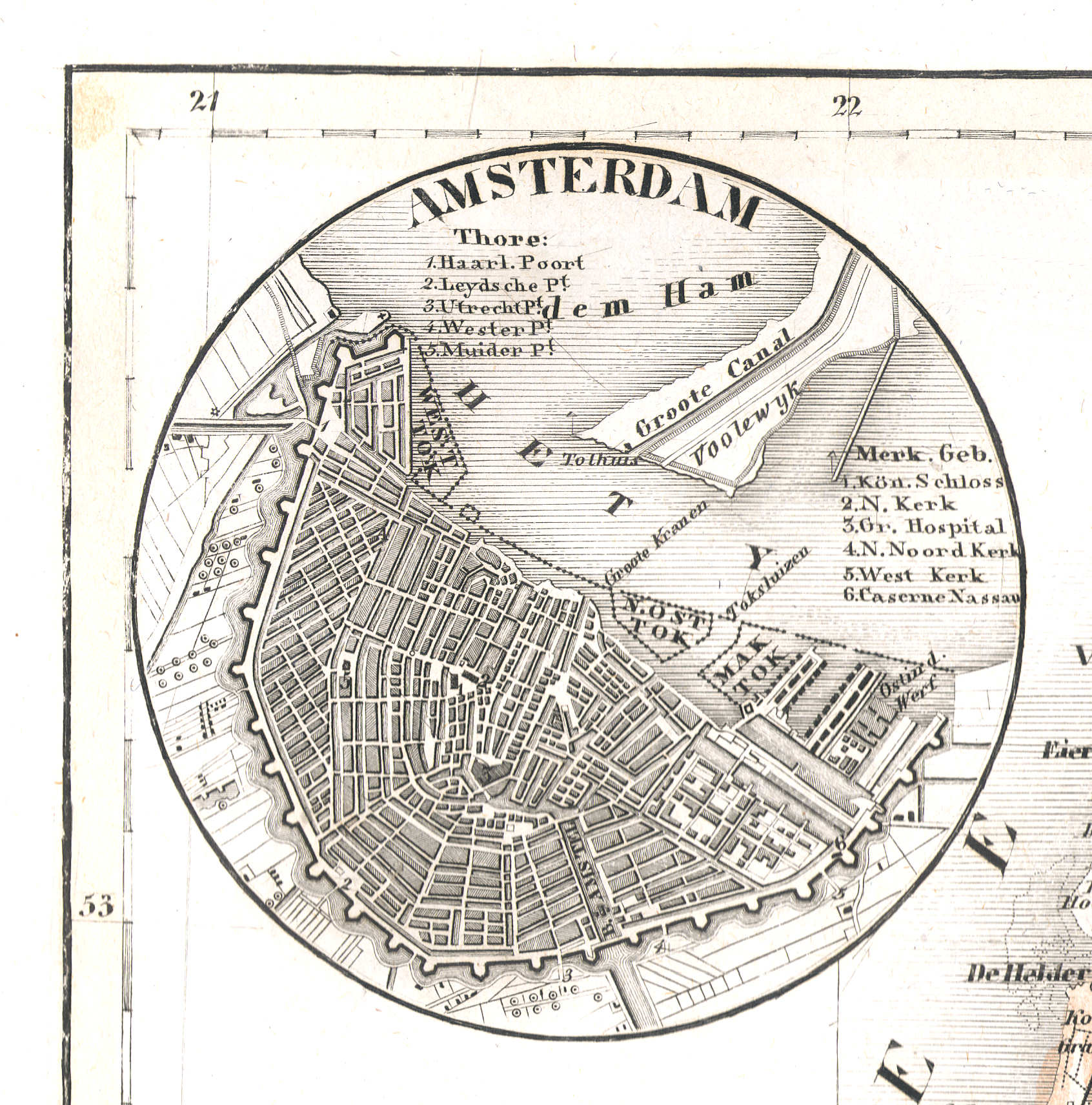
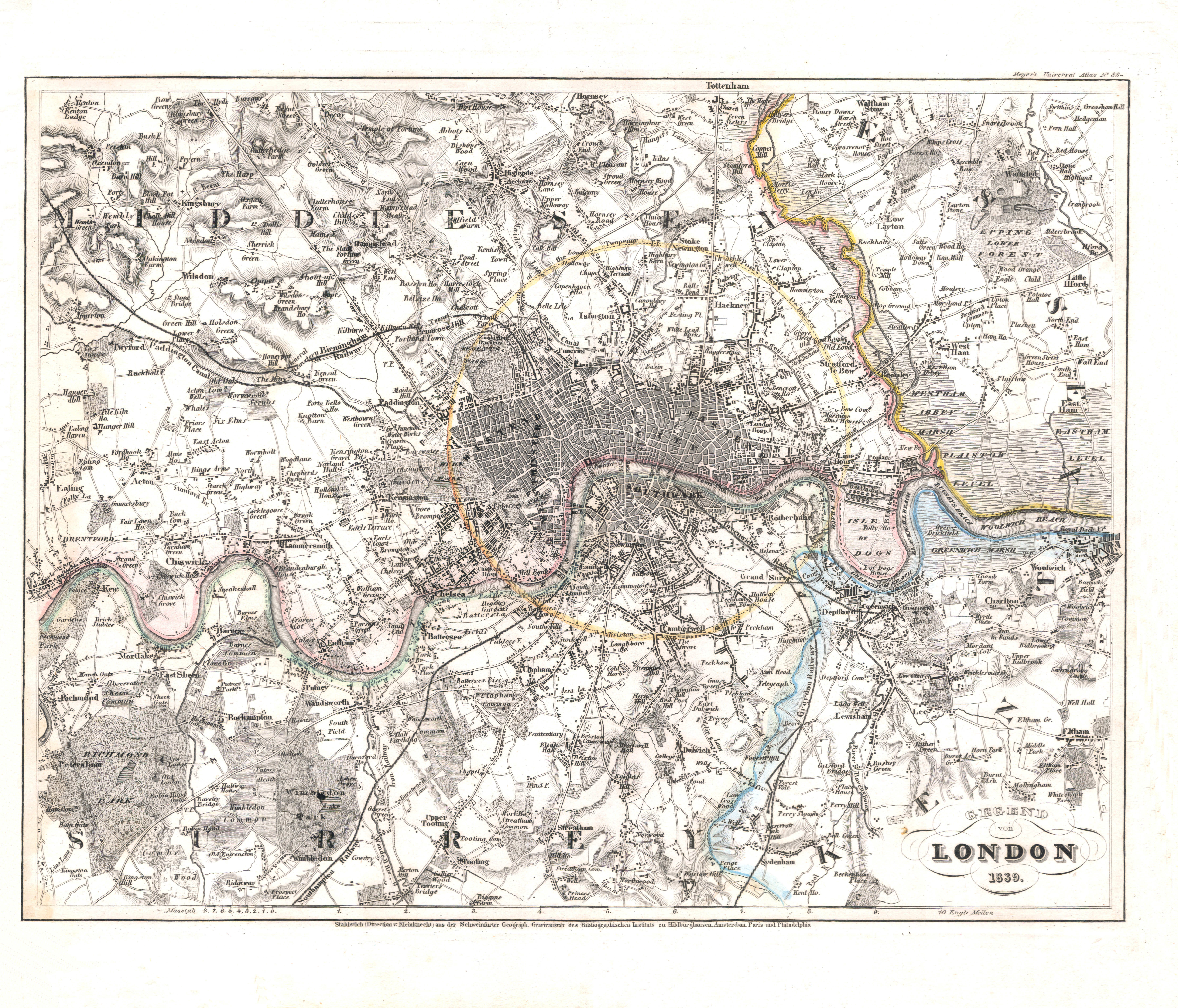
29a. Umgebung von London
Londen en omgeving / London and environs
 Meyer's Universal-Atlas (1830-1840)
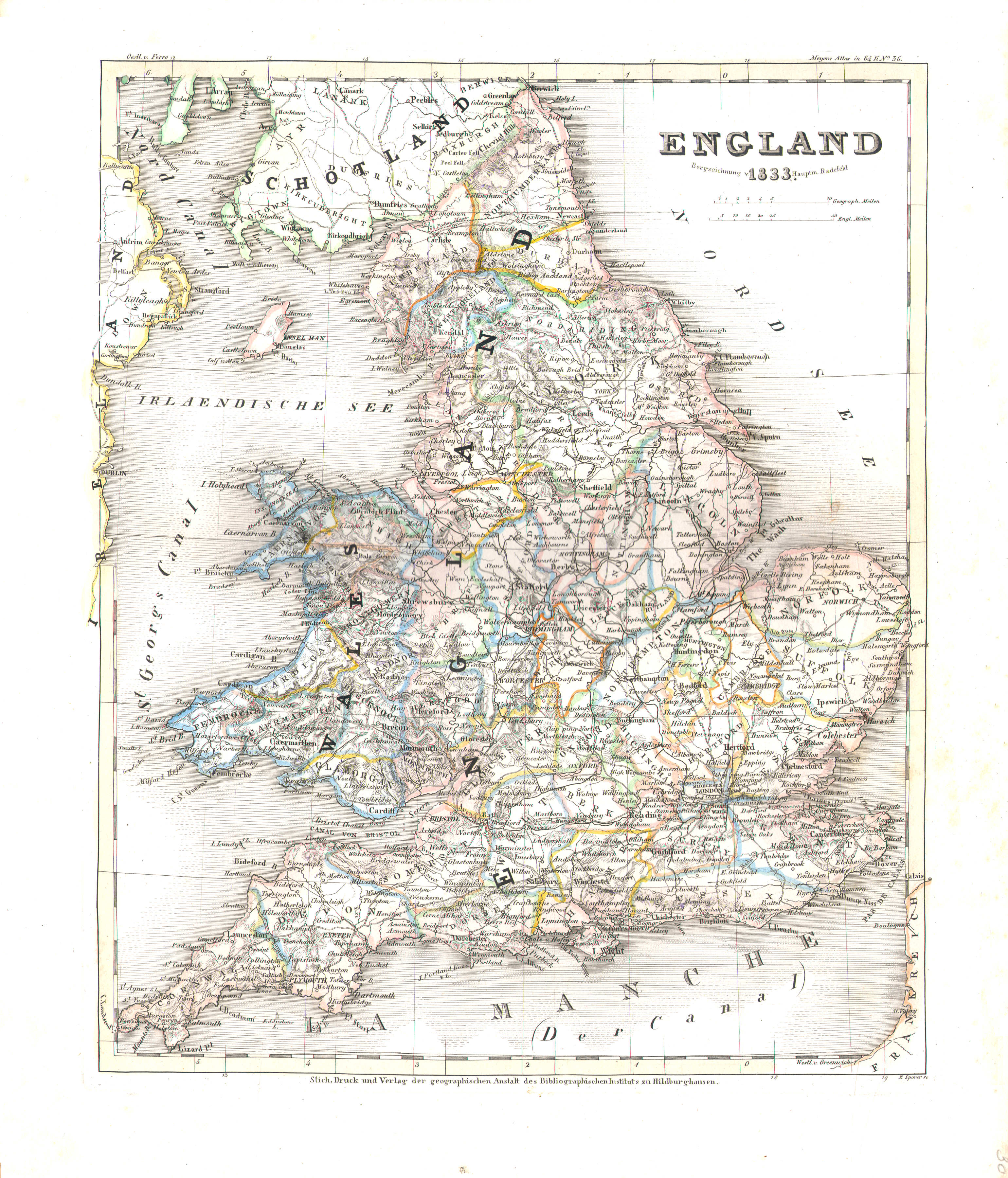
30. England (Nº 36, 1833)
Engeland / England
 Meyer's Universal-Atlas (1830-1840)
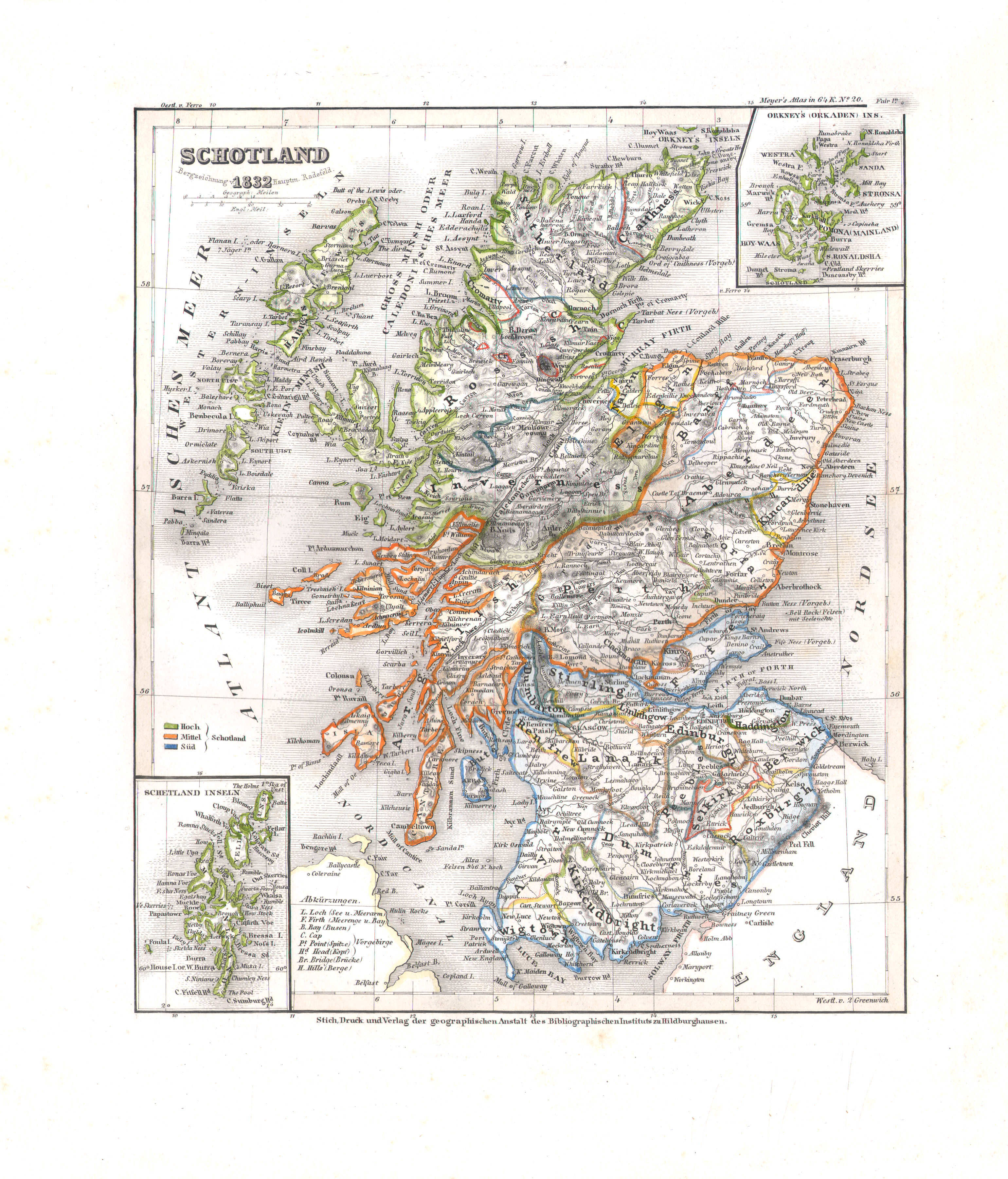
31. Schotland (Nº 20, 1832)
Schotland / Scotland
 Meyer's Universal-Atlas (1830-1840)
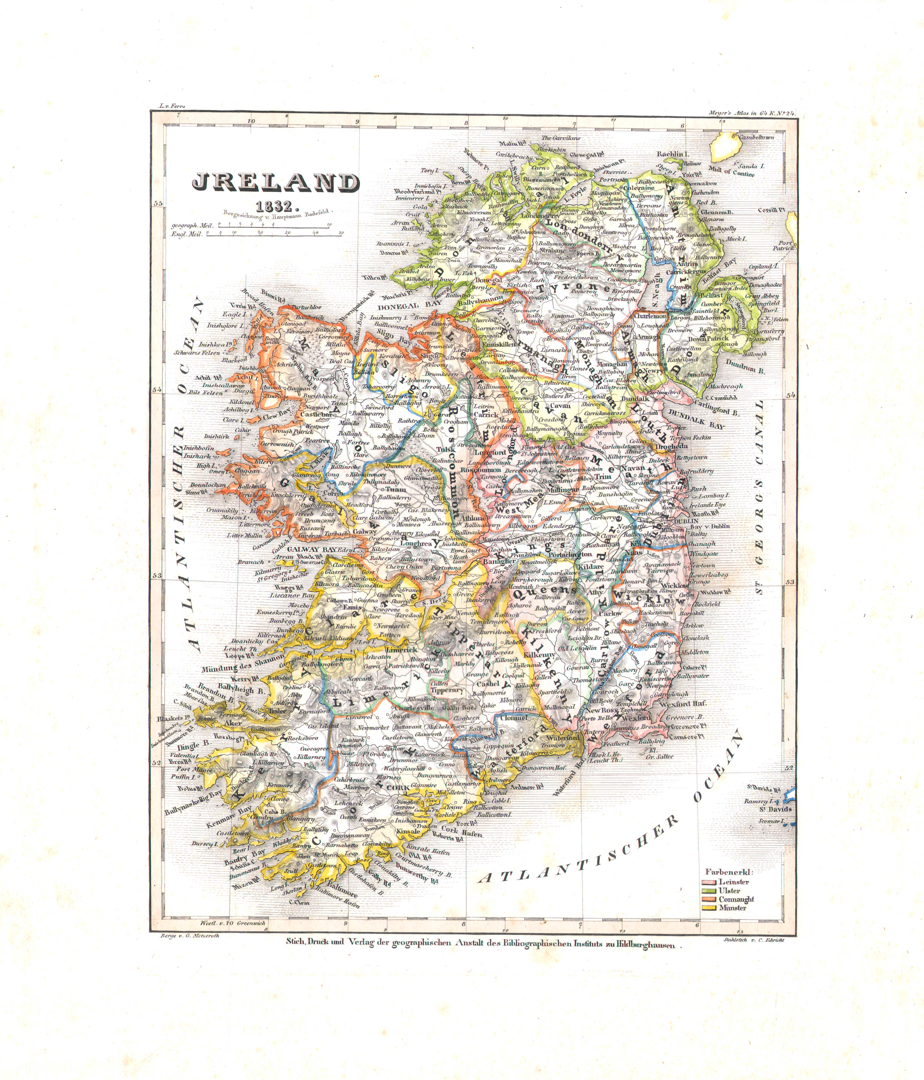
32. Ireland (Nº 24, 1832)
Ierland / Ireland
 Meyer's Universal-Atlas (1830-1840)
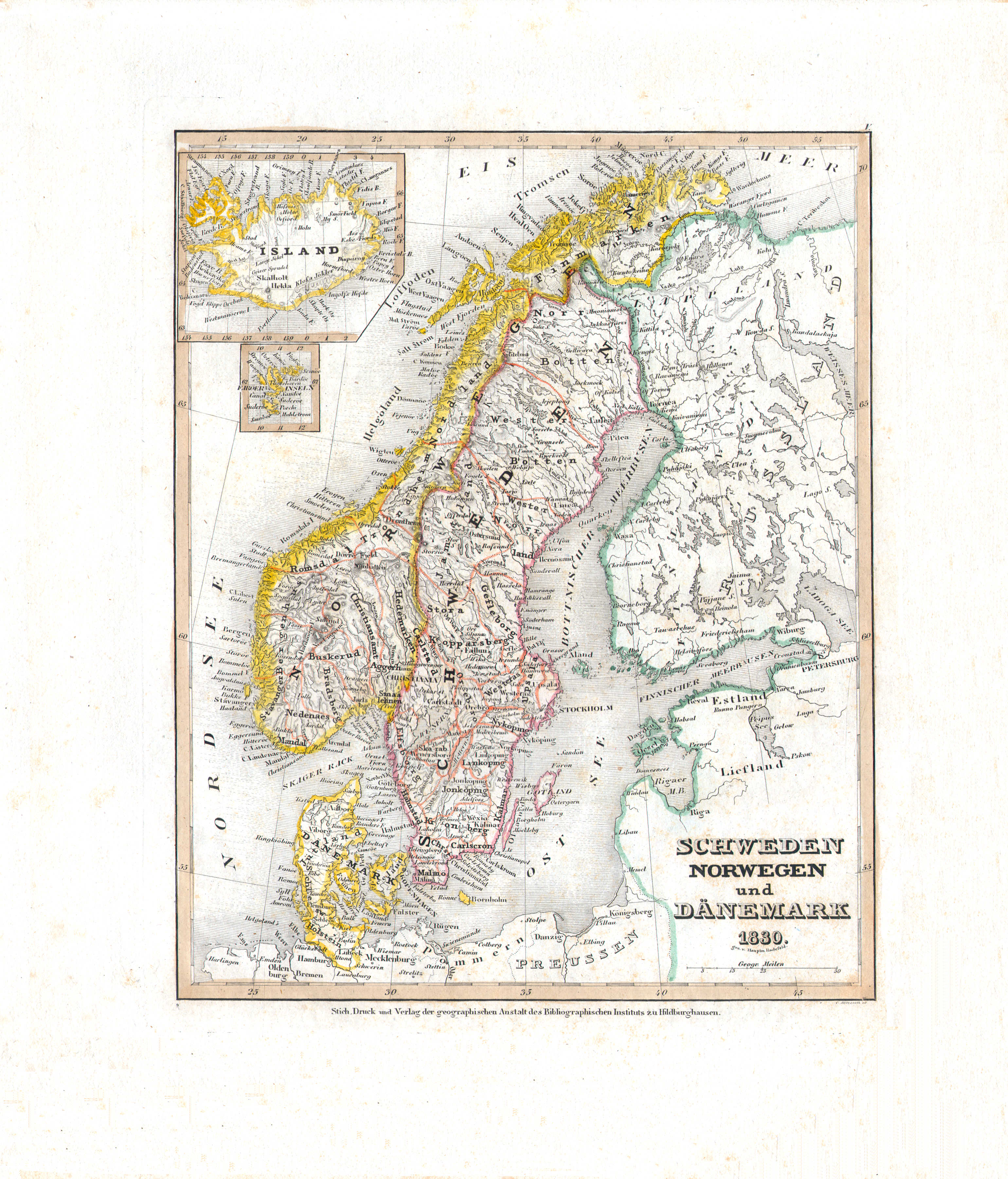
33. Schweden Norwegen und Dänemark (Nº 5, 1830)
Zweden, Noorwegen en Denemarken / Sweden, Norway and Denmark
 Meyer's Universal-Atlas (1830-1840)
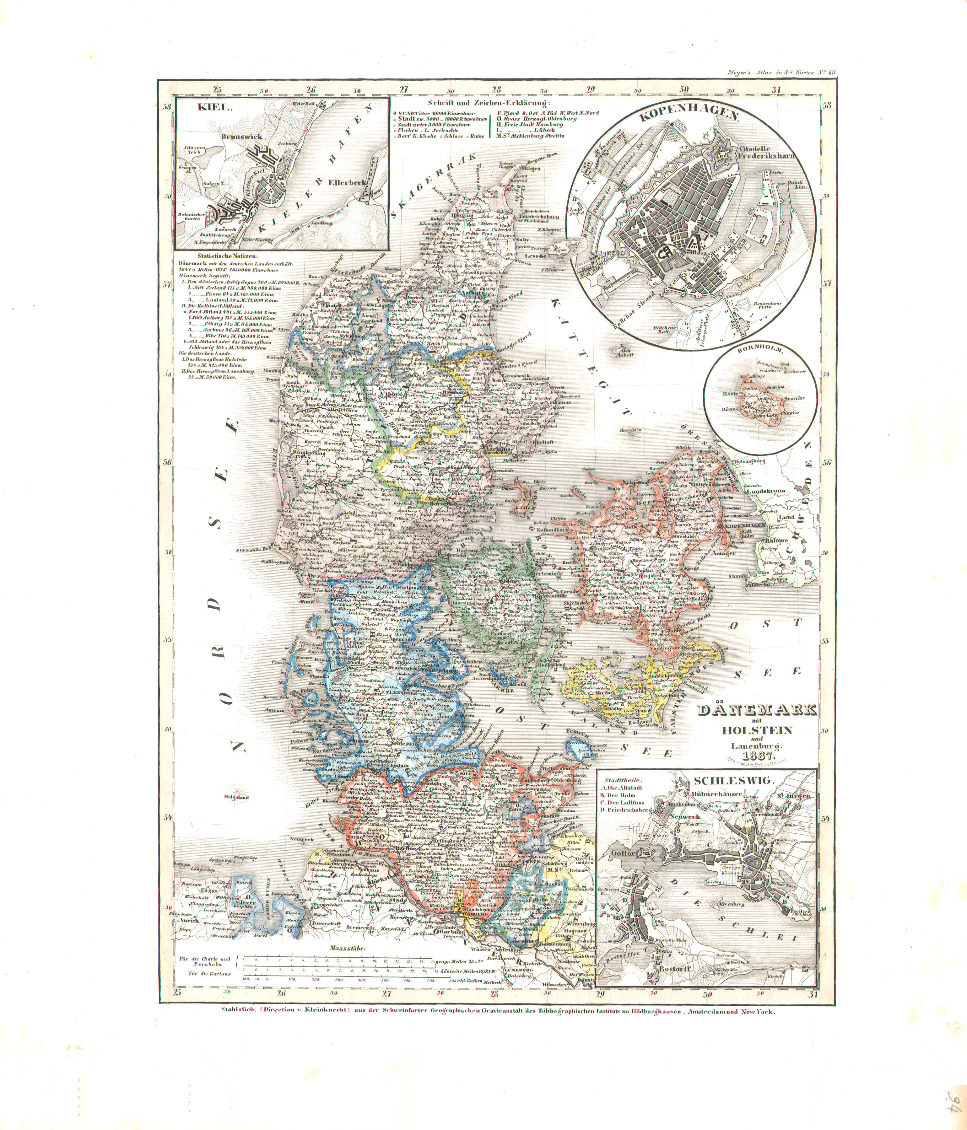
34. Dänemark mit Holstein und Lauenburg (Nº 68, 1837)
Denemarken met Holstein en Lauenburg / Denmark with Holstein and Lauenburg
 Meyer's Universal-Atlas (1830-1840)
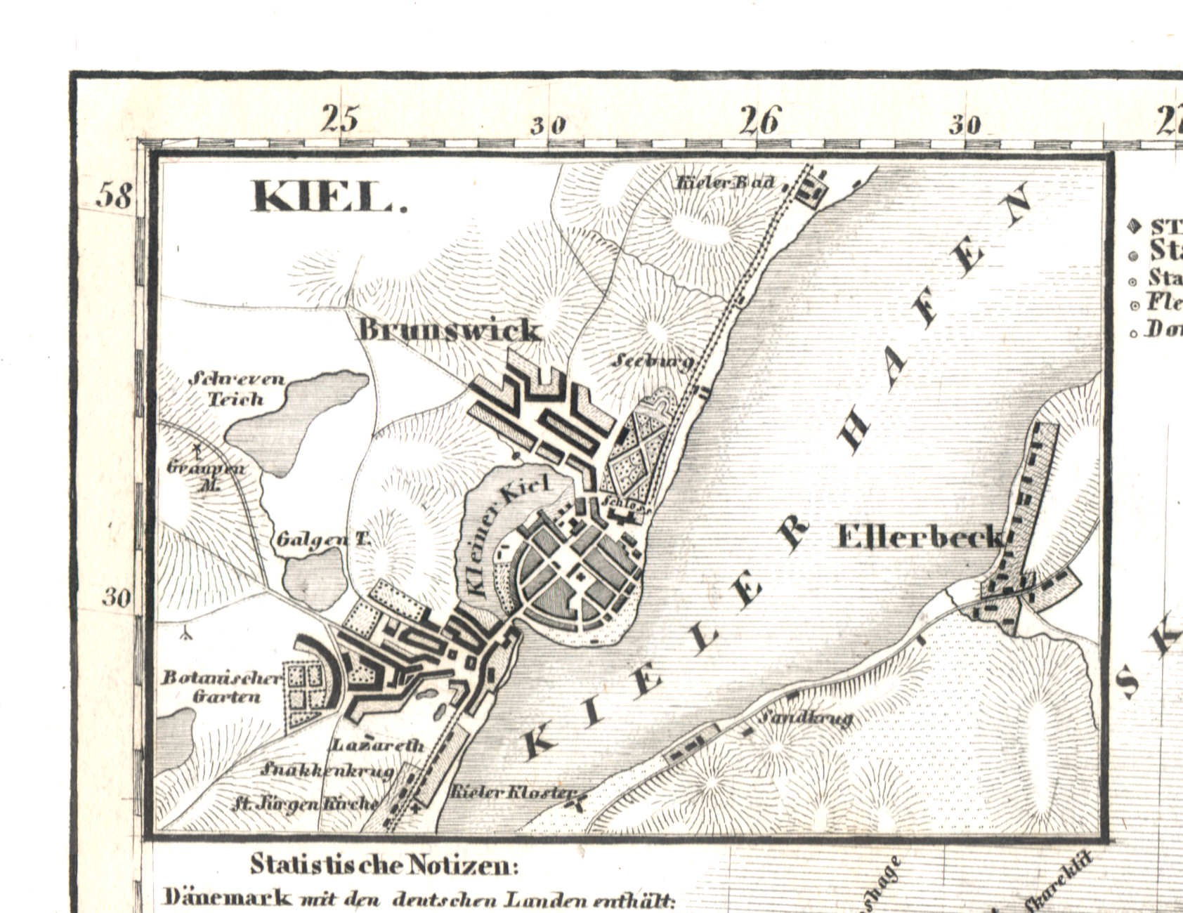
34a. Kiel
Kiel
 Meyer's Universal-Atlas (1830-1840)
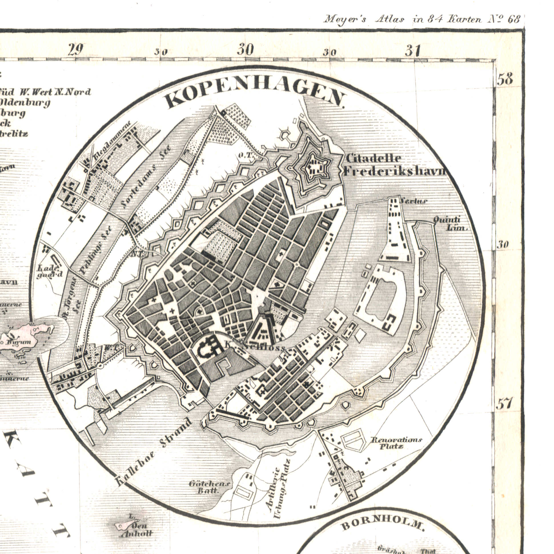
34b. Kopenhagen
Kopenhagen / Copenhagen / København
 Meyer's Universal-Atlas (1830-1840)
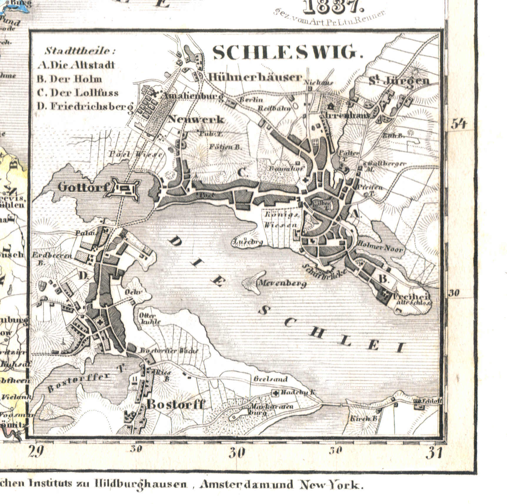
34d. Schleswig
Sleeswijk / Schleswig
 Meyer's Universal-Atlas (1830-1840)
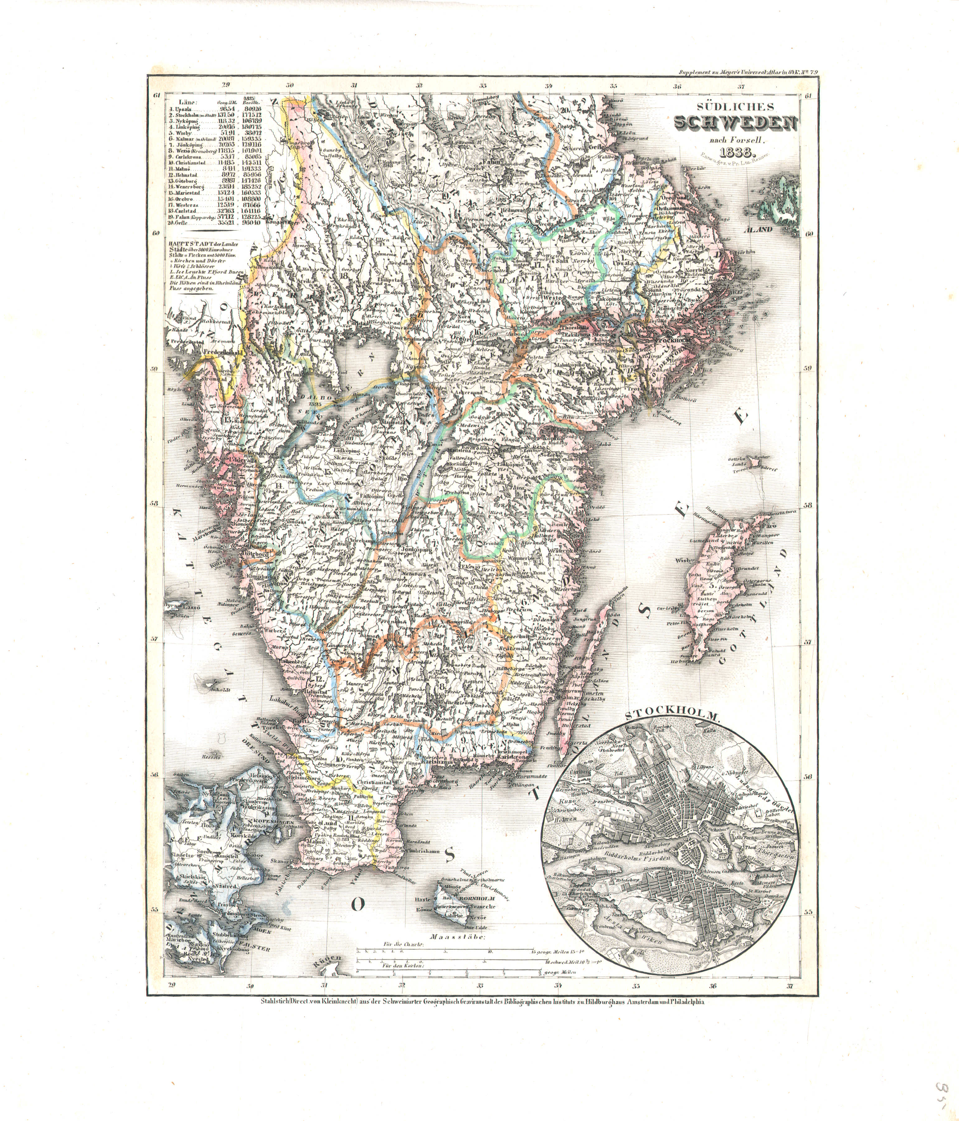
35. Südliches Schweden (Nº 79, 1838)
Zuid-Zweden / South Sweden
 Meyer's Universal-Atlas (1830-1840)
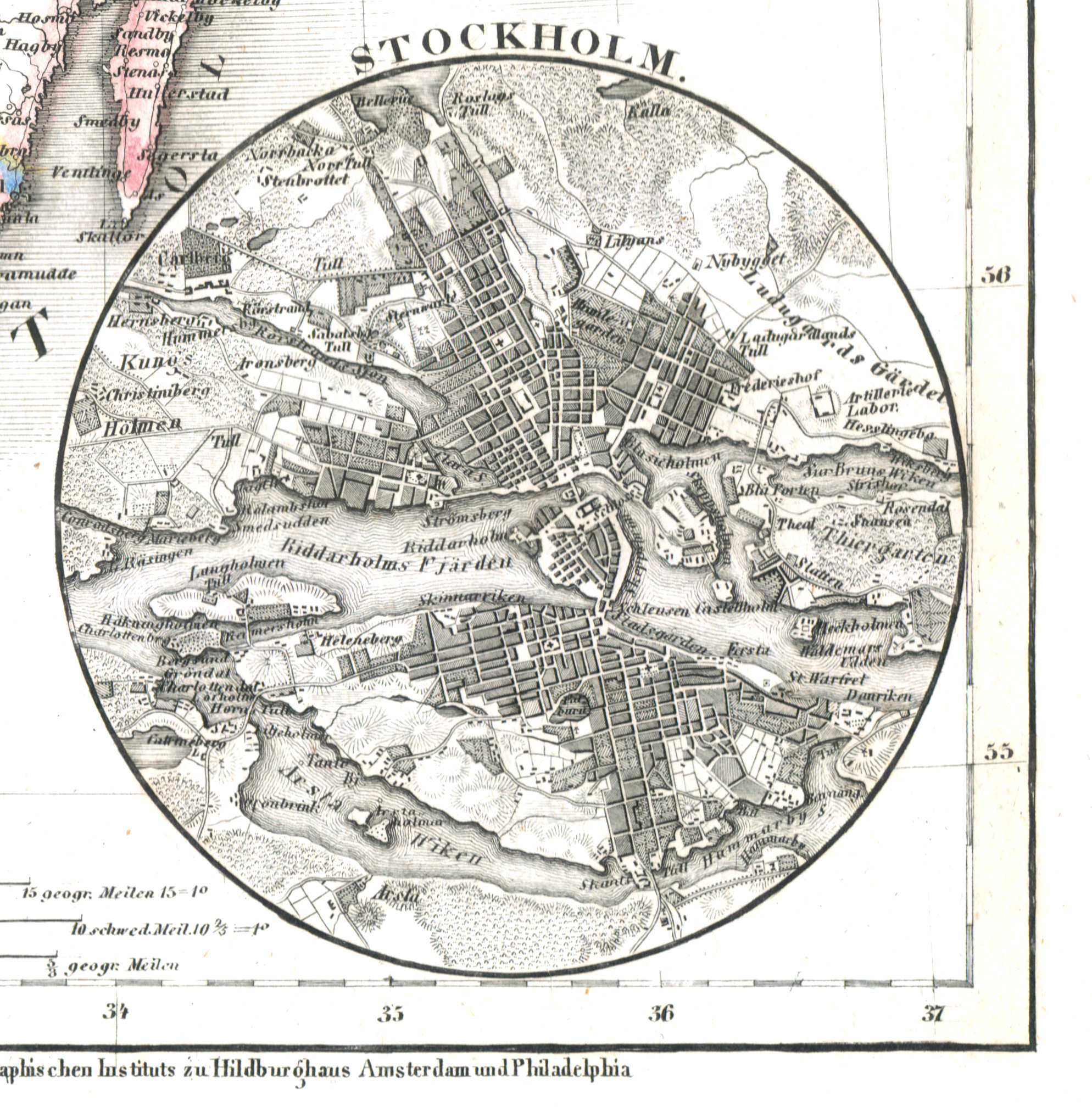
35a. Stockholm
Stockholm
 Meyer's Universal-Atlas (1830-1840)
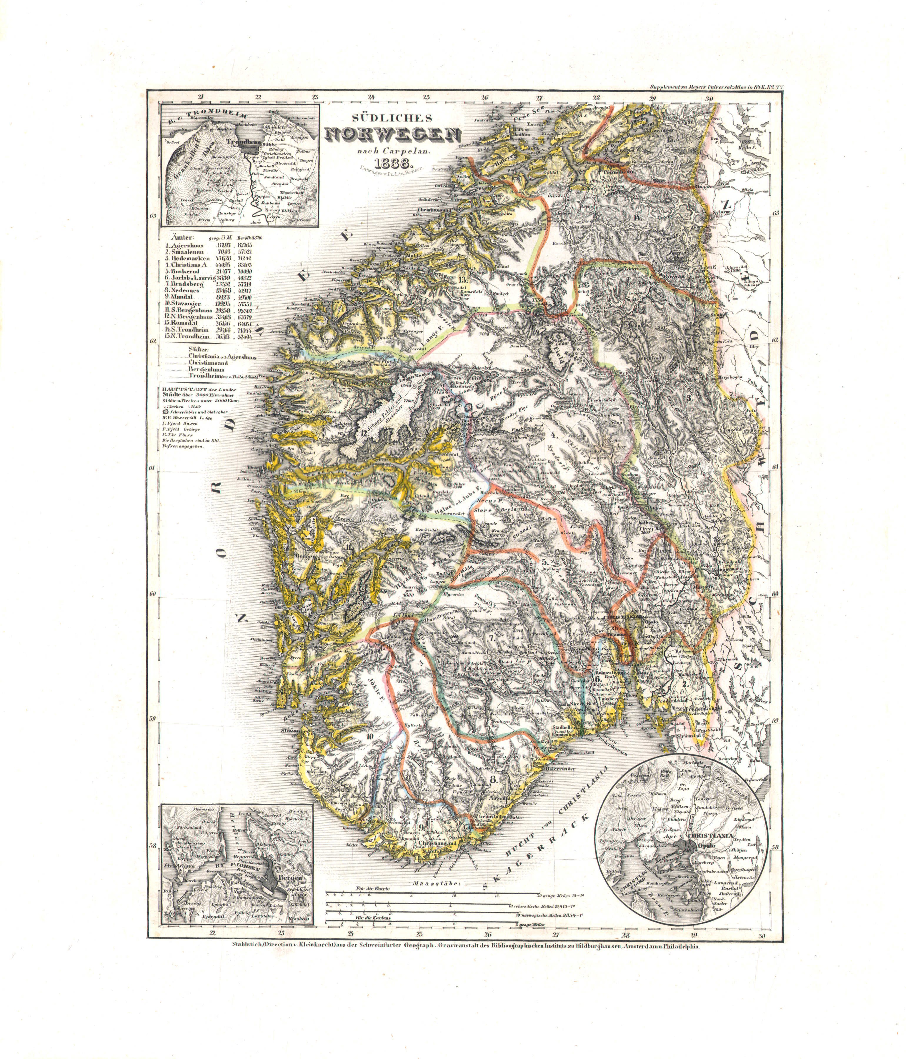
36. Südliches Norwegen (Nº 77, 1838)
Zuid-Noorwegen / South Norway
 Meyer's Universal-Atlas (1830-1840)
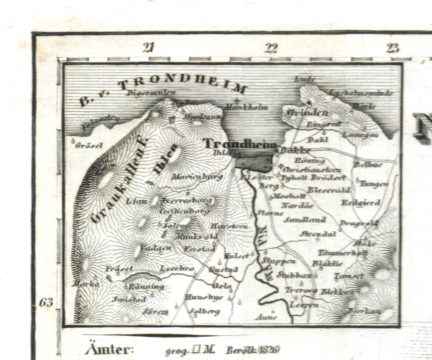
36a. Trondheim
Trondheim
 Meyer's Universal-Atlas (1830-1840)
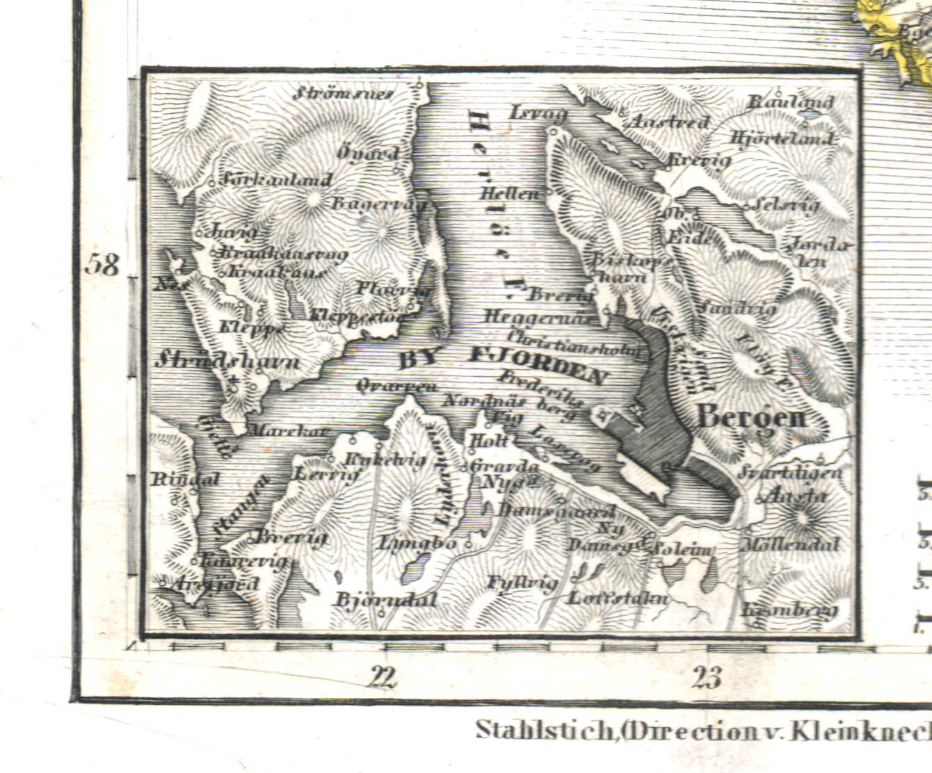
36b. Bergen
Bergen
 Meyer's Universal-Atlas (1830-1840)
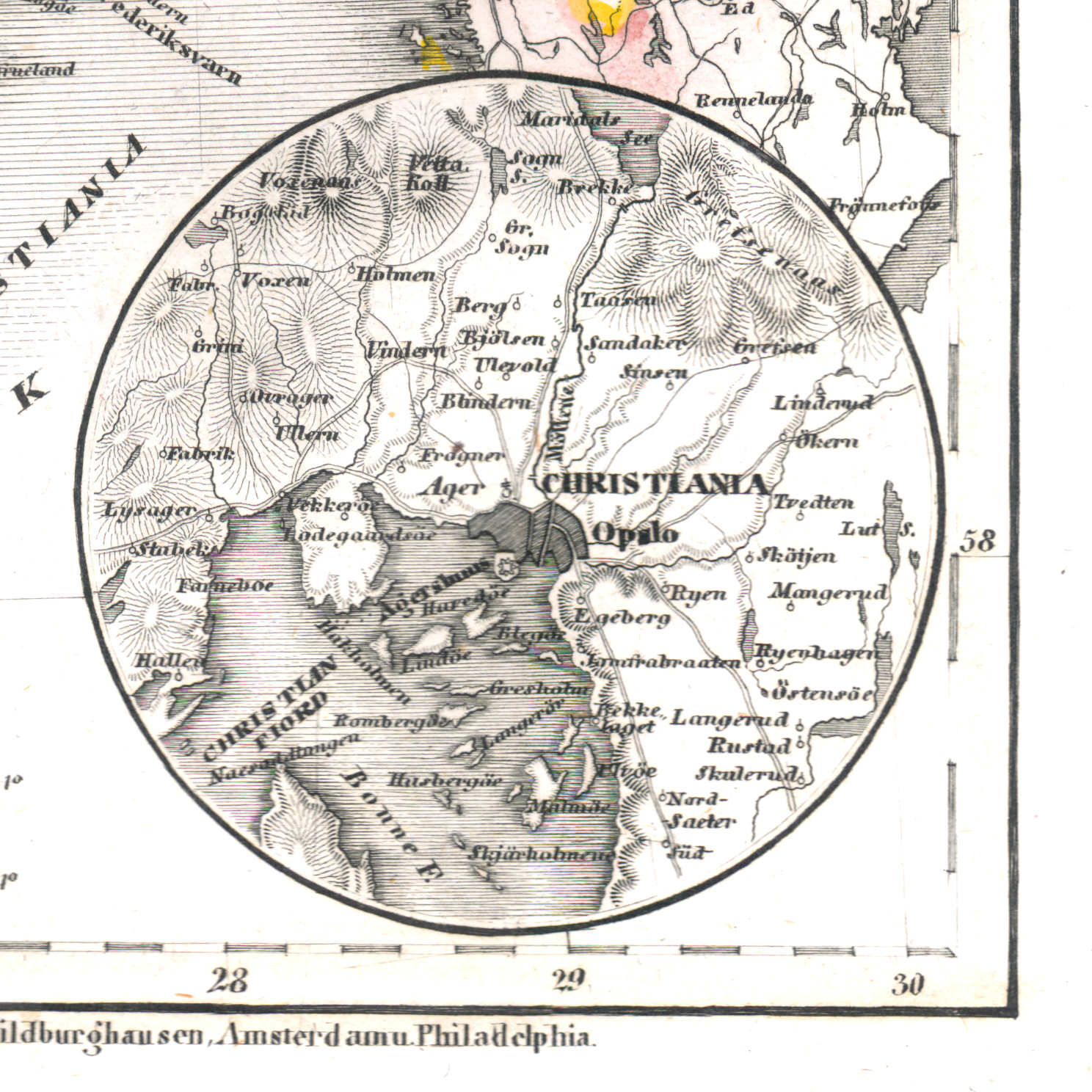
36c. Christiania
Christiania (Oslo)
 Meyer's Universal-Atlas (1830-1840)
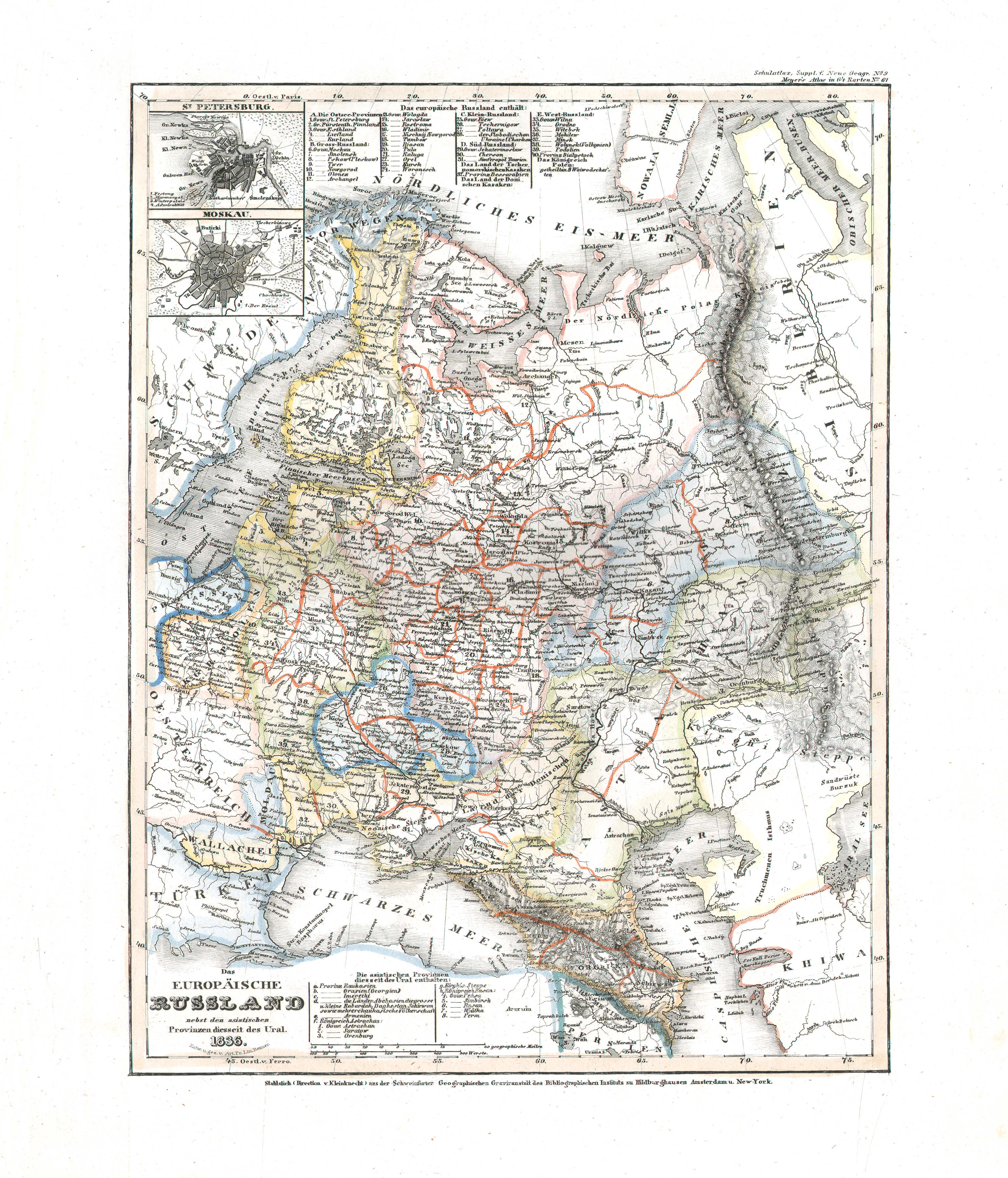
37. Das europäische Russland nebst den asiatischen Provinzen diesseits des Ural (Nº 61, 1836)
Europees Rusland / Russia in Europe
 Meyer's Universal-Atlas (1830-1840)
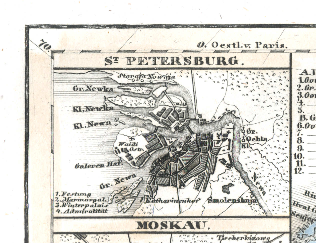
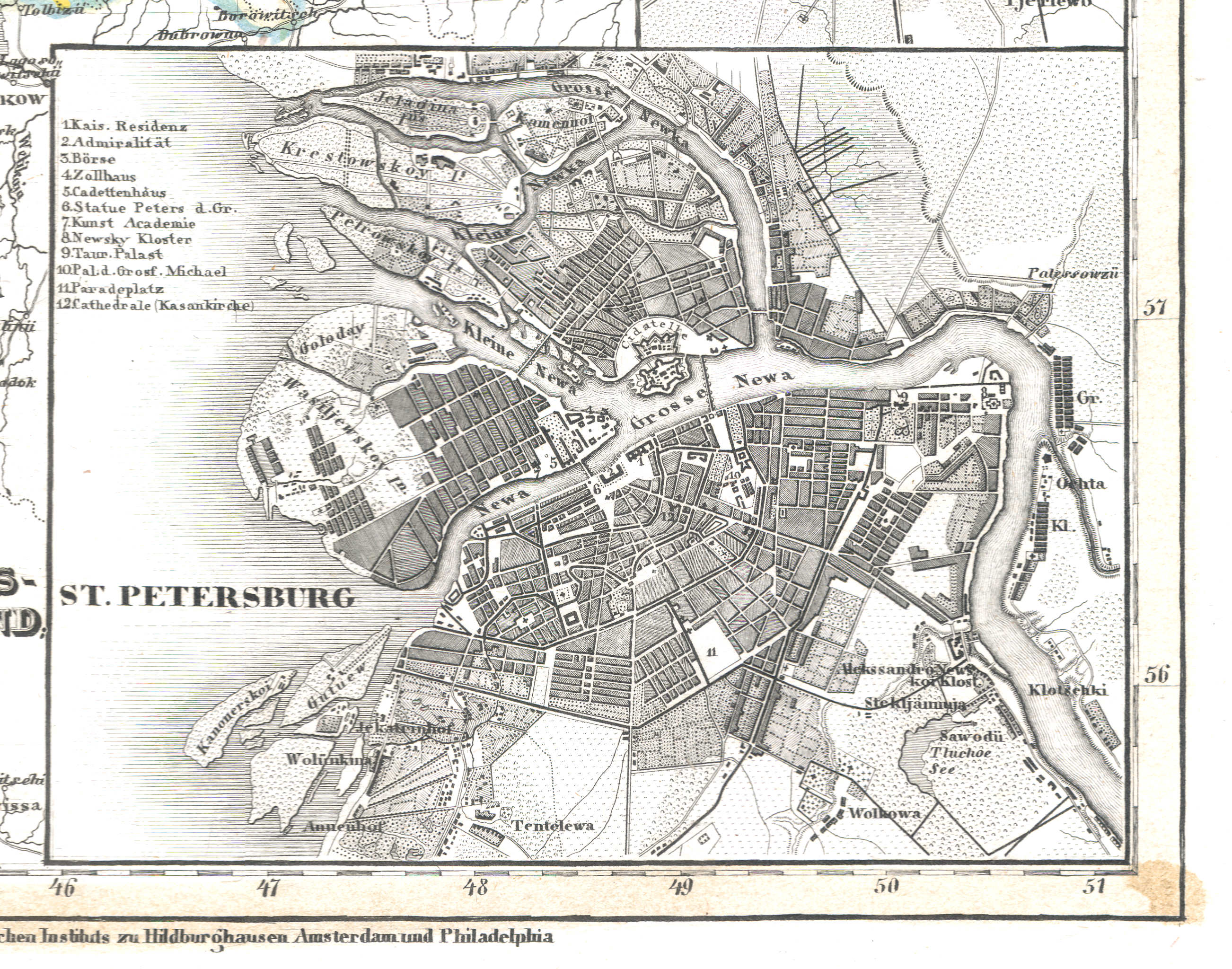
37a. St. Petersburg
Sint-Petersburg / Saint Petersburg / Санкт-Петербург, Sankt-Peterburg
 Meyer's Universal-Atlas (1830-1840)
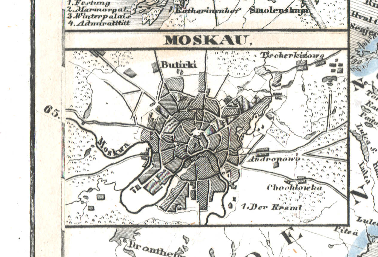
37b. Moskau
Moskou / Moscow / Москва, Moskva
 Meyer's Universal-Atlas (1830-1840)
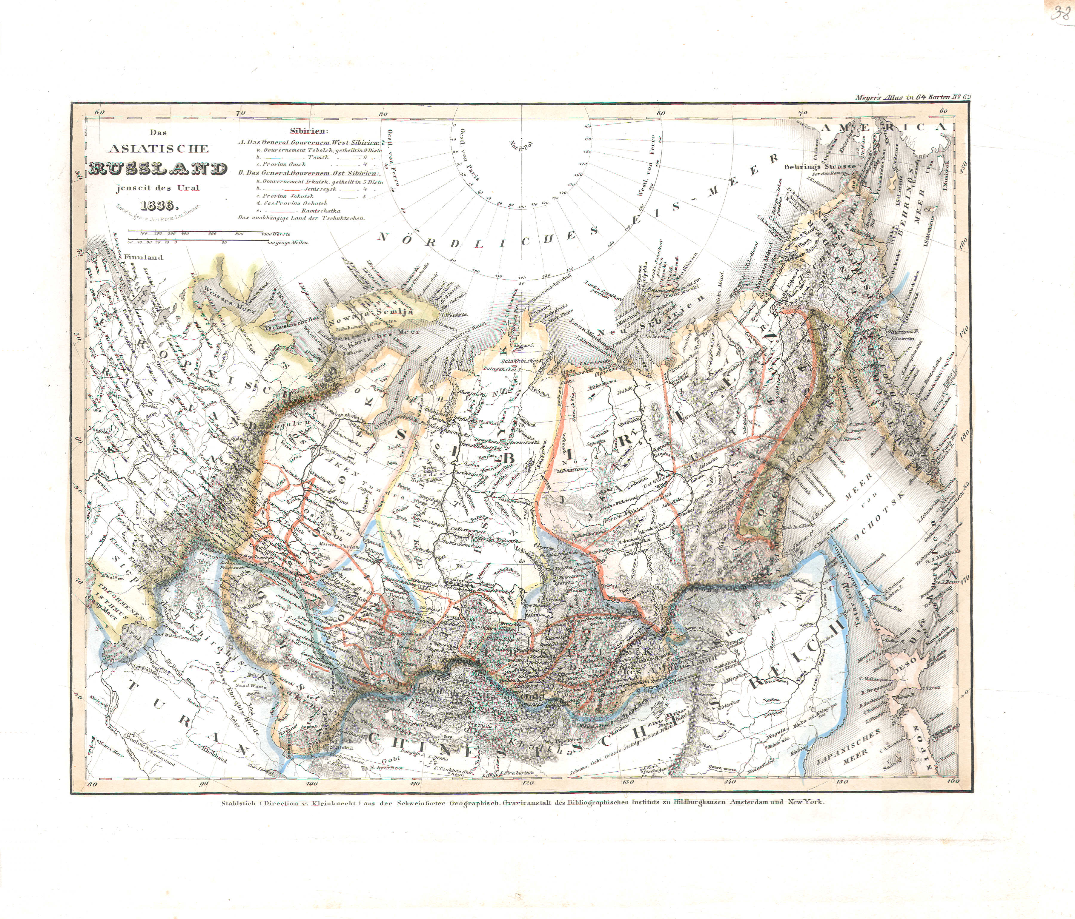
38. Das asiatische Russland jenseits des Ural (Nº 62, 1836)
Aziatisch Rusland / Russia in Asia
 Meyer's Universal-Atlas (1830-1840)
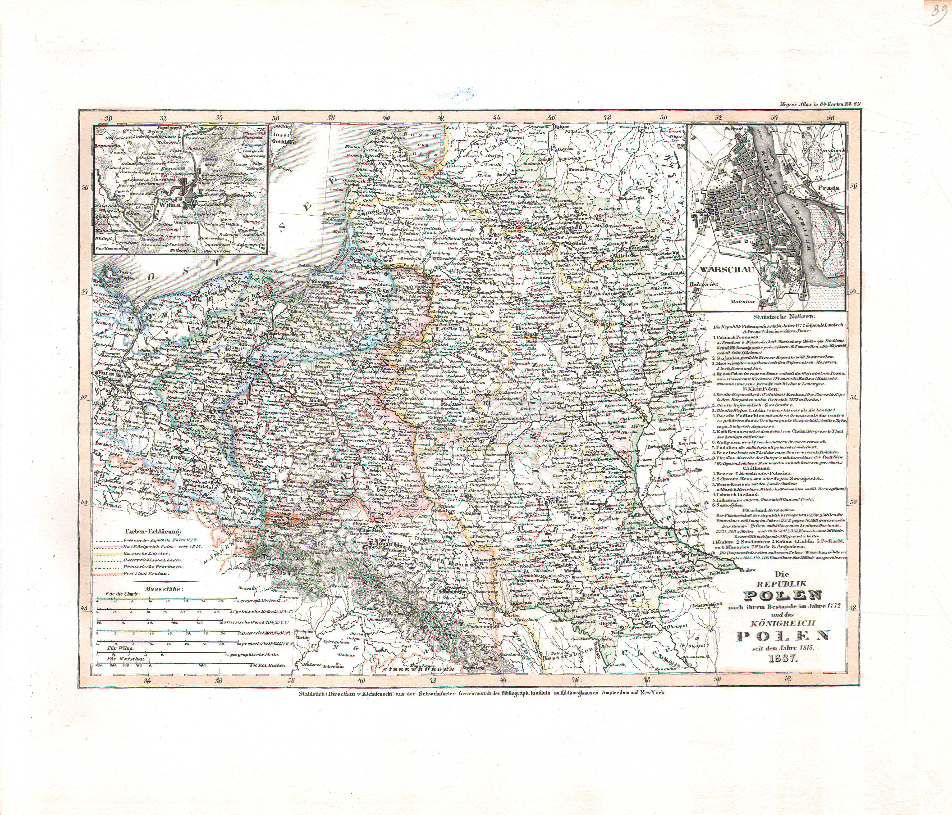
39. Die Republik Polen nach ihrem Bestande im Jahre 1772 und das Königreich Polen seit dem Jahre 1815 (Nº 39, 1837)
Republiek Polen 1772, Koninkrijk Polen vanaf 1815 / Republic of Poland 1772, Kingdom of Poland since 1815
 Meyer's Universal-Atlas (1830-1840)
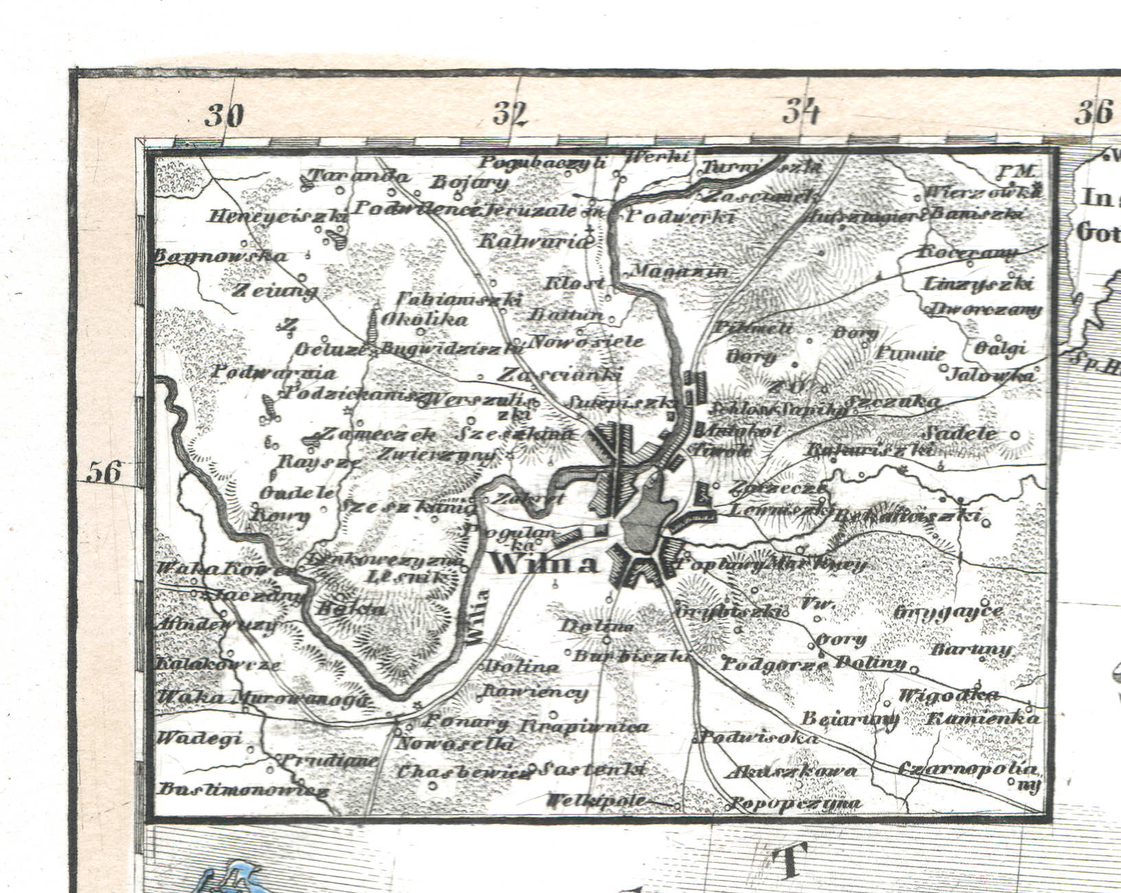
39a. Wilna
Vilnius
 Meyer's Universal-Atlas (1830-1840)
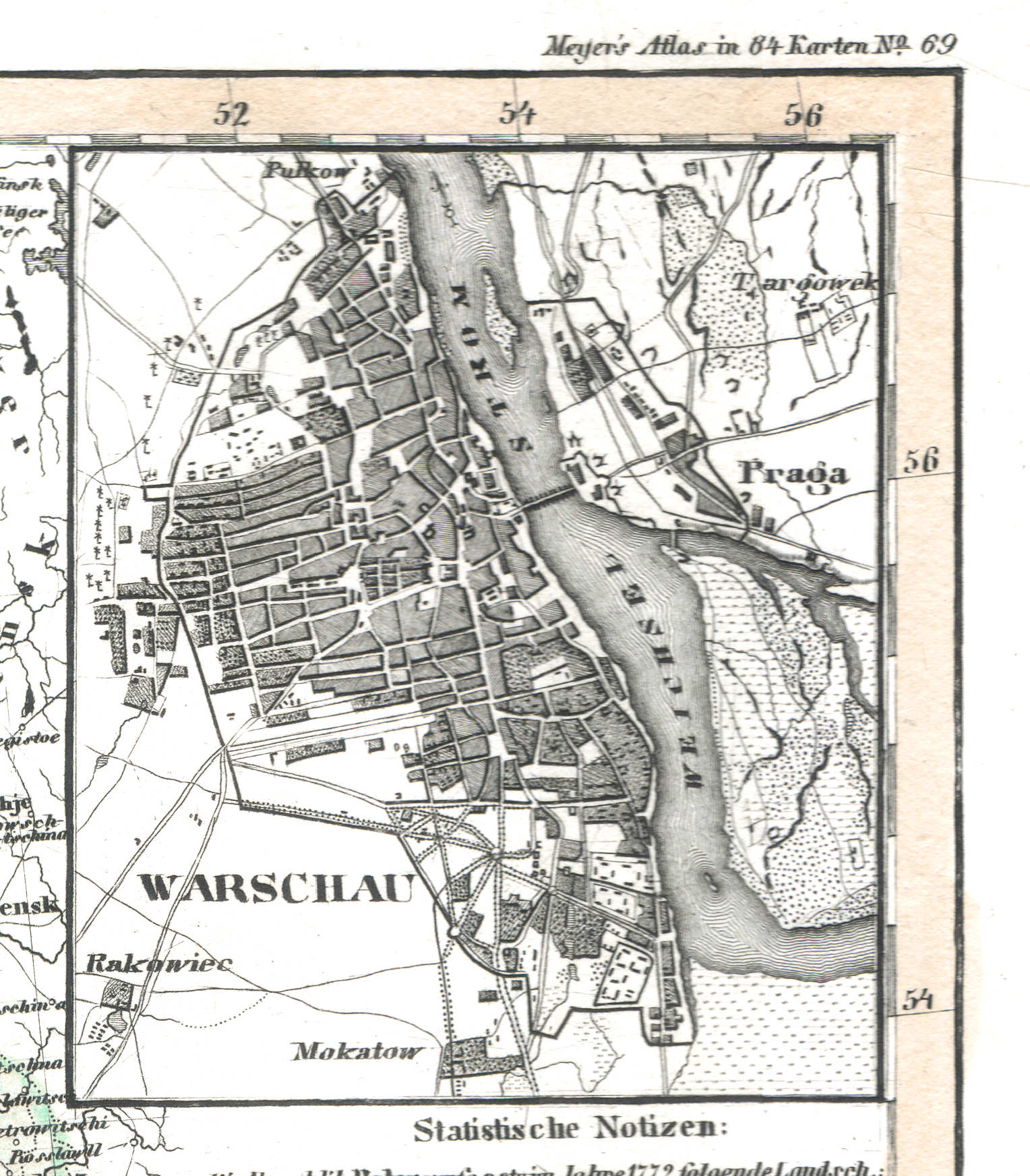
39b. Warschau
Warschau / Warsaw / Warszawa
 Meyer's Universal-Atlas (1830-1840)
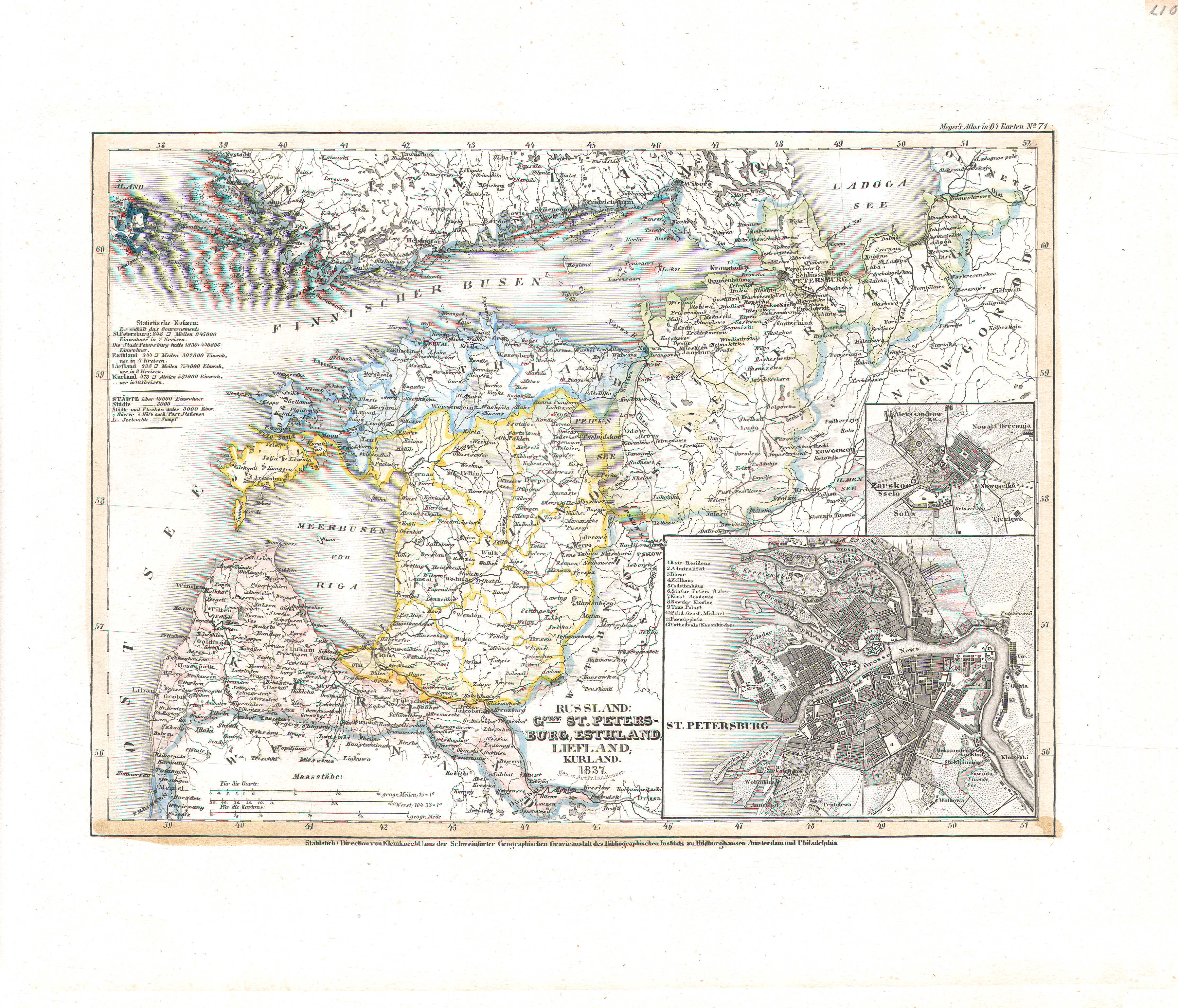
40. Russland: Gouv. St. Petersburg, Esthland, Liefland, Kurland (Nº 71, 1837)
Rusland: Sint-Petersburg, Estland, Lijfland, Koerland / Russia: Saint Petersburg, Estonia, Livonia, Courland
 Meyer's Universal-Atlas (1830-1840)
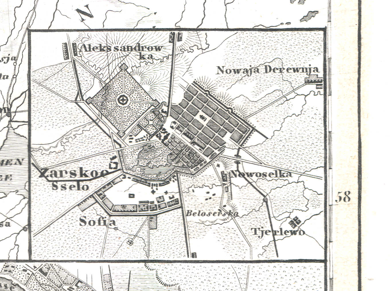
40a. Zarskoe Sselo
Tsarskoje Selo (Poesjkin) / Tsarskoye Selo (Pushkin) / Царское Село (Пушкин)
 Meyer's Universal-Atlas (1830-1840)
40b. St. Petersburg
Sint-Petersburg / Saint Petersburg / Санкт-Петербург, Sankt-Peterburg
 Meyer's Universal-Atlas (1830-1840)
41. Europaeische Türkey Griechenland und die Jonischen Inseln (Nº 17, 1832)
Europees Turkije, Griekenland en de Ionische Eilanden / Turkey in Europe, Greece and the Ionian Islands
 Meyer's Universal-Atlas (1830-1840)
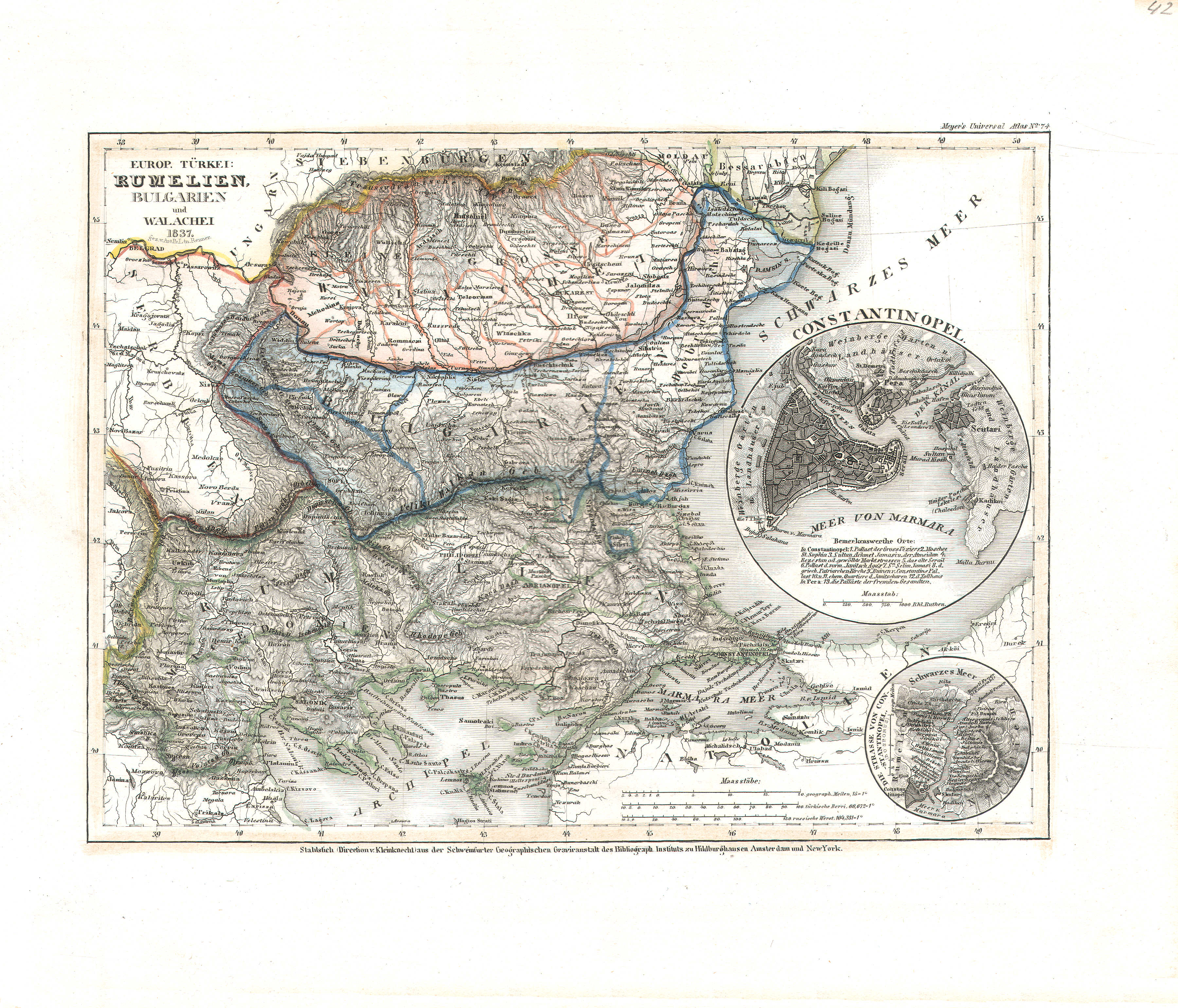
42. Europ. Türkei: Rumelien, Bulgarien und Walachei (Nº 74, 1837)
Europees Turkije: Roemelië, Bulgarije en Walachije / Turkey in Europe: Rumelia, Bulgaria and Wallachia
 Meyer's Universal-Atlas (1830-1840)
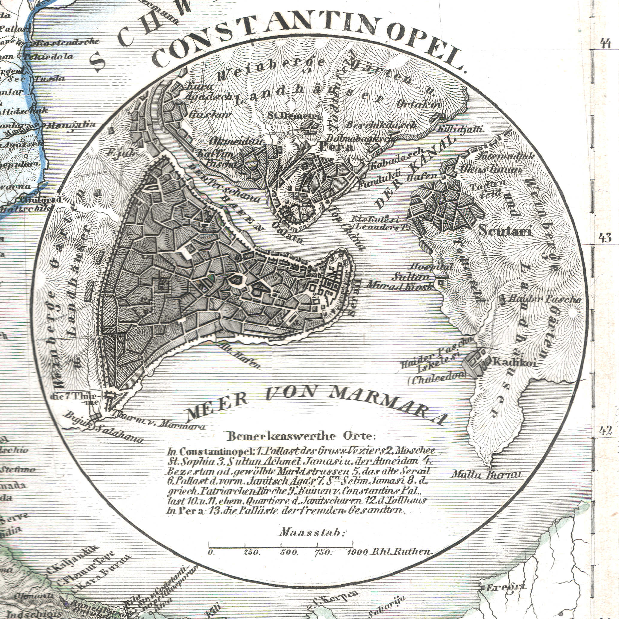
42a. Constantinopel
Constantinopel / Constantinople / İstanbul
 Meyer's Universal-Atlas (1830-1840)
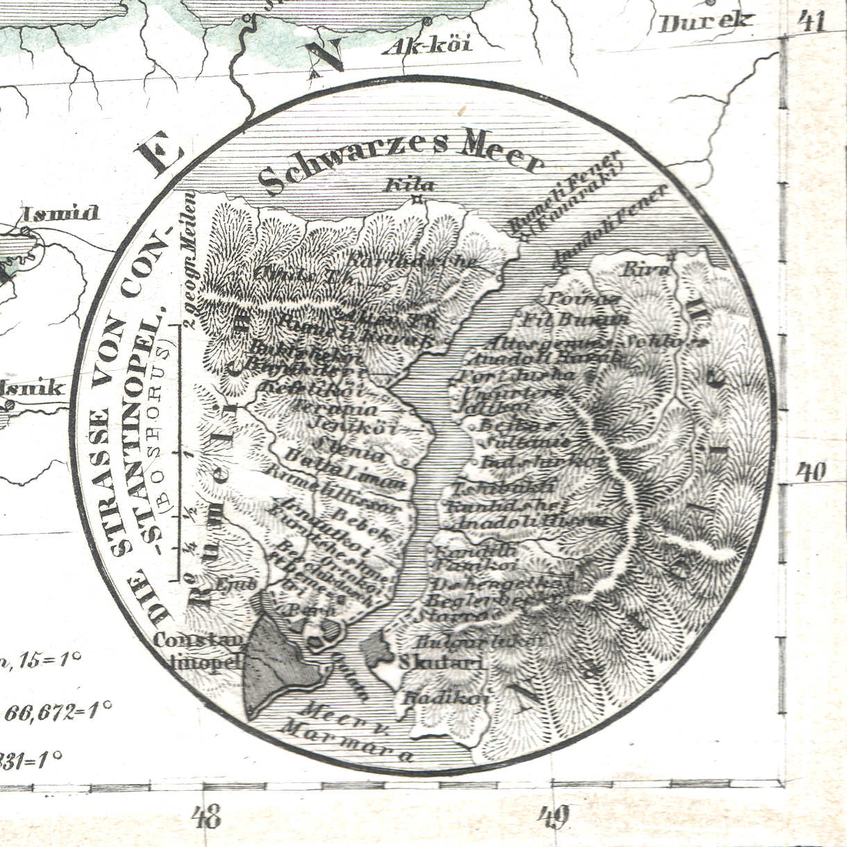
42b. Die Strasse von Constantinopel (Bosporus)
Bosporus / Bosphorus
 Meyer's Universal-Atlas (1830-1840)
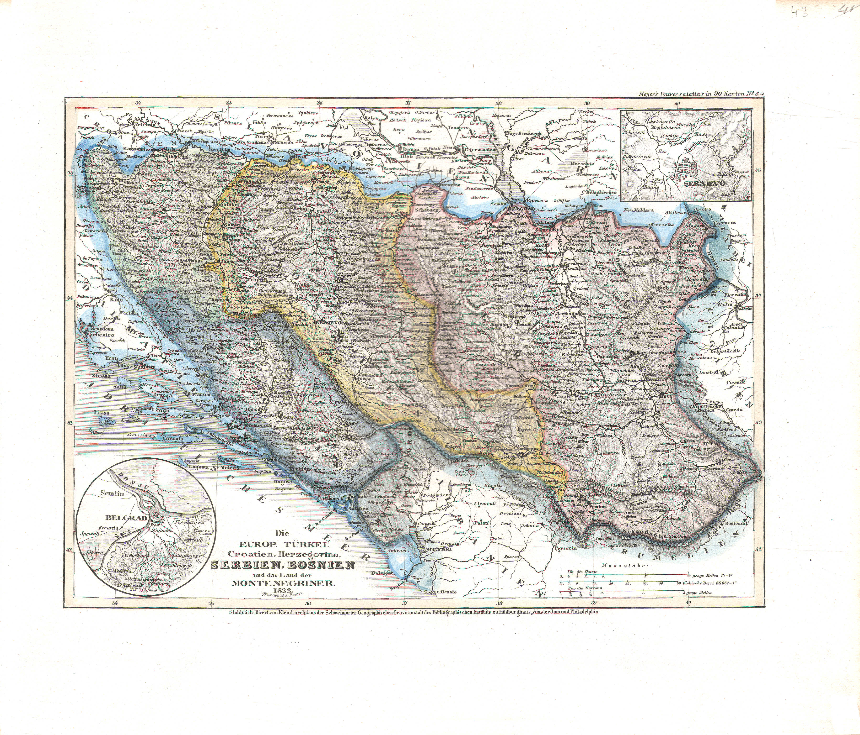
43. Die europ. Türkei: Croatien, Herzegovina, Serbien, Bosnien und das Land der Montenegriner (Nº 84, 1838)
Europees Turkije: Kroatië, Herzegovina, Servië, Bosnië en Montenegro / Turkey in Europe: Croatia, Herzegovina, Serbia, Bosnia and Montenegro
 Meyer's Universal-Atlas (1830-1840)
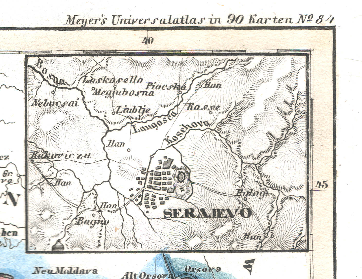
43a. Serajevo
Sarajevo
 Meyer's Universal-Atlas (1830-1840)
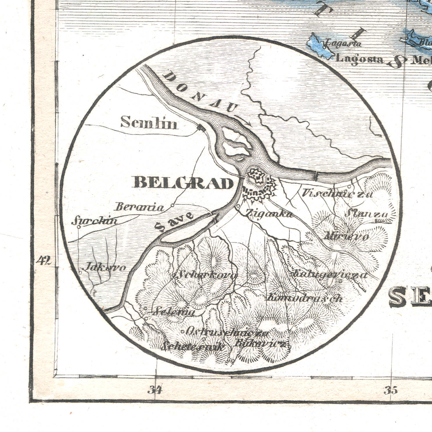
43b. Belgrad
Belgrado / Belgrade / Београд, Beograd
 Meyer's Universal-Atlas (1830-1840)
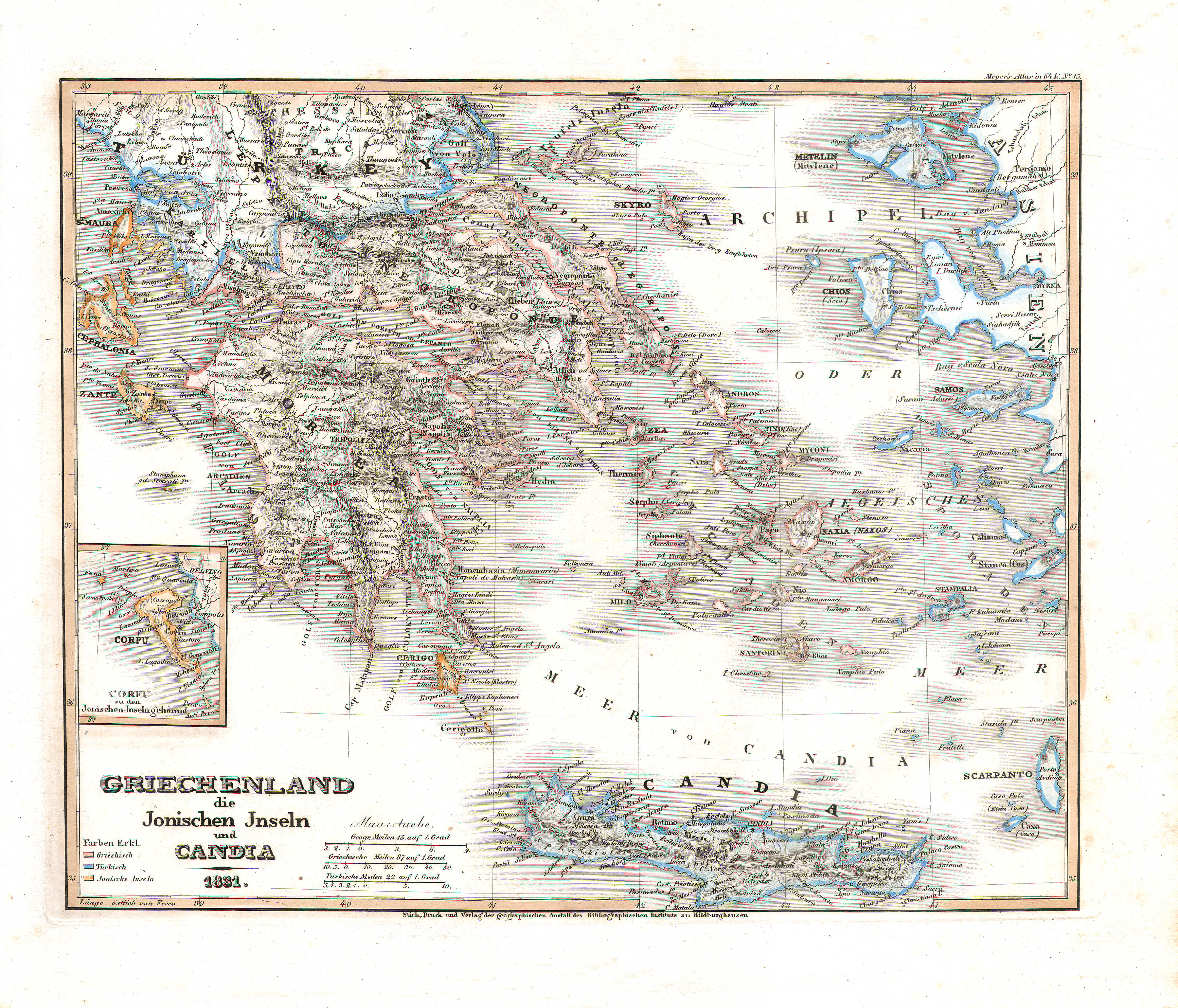
44. Griechenland, die Jonischen Inseln und Candia (Nº 15, 1831)
Griekenland, de Ionische Eilanden en Candia (Kreta) / Greece, the Ionian Islands and Candia (Crete)
 Meyer's Universal-Atlas (1830-1840)
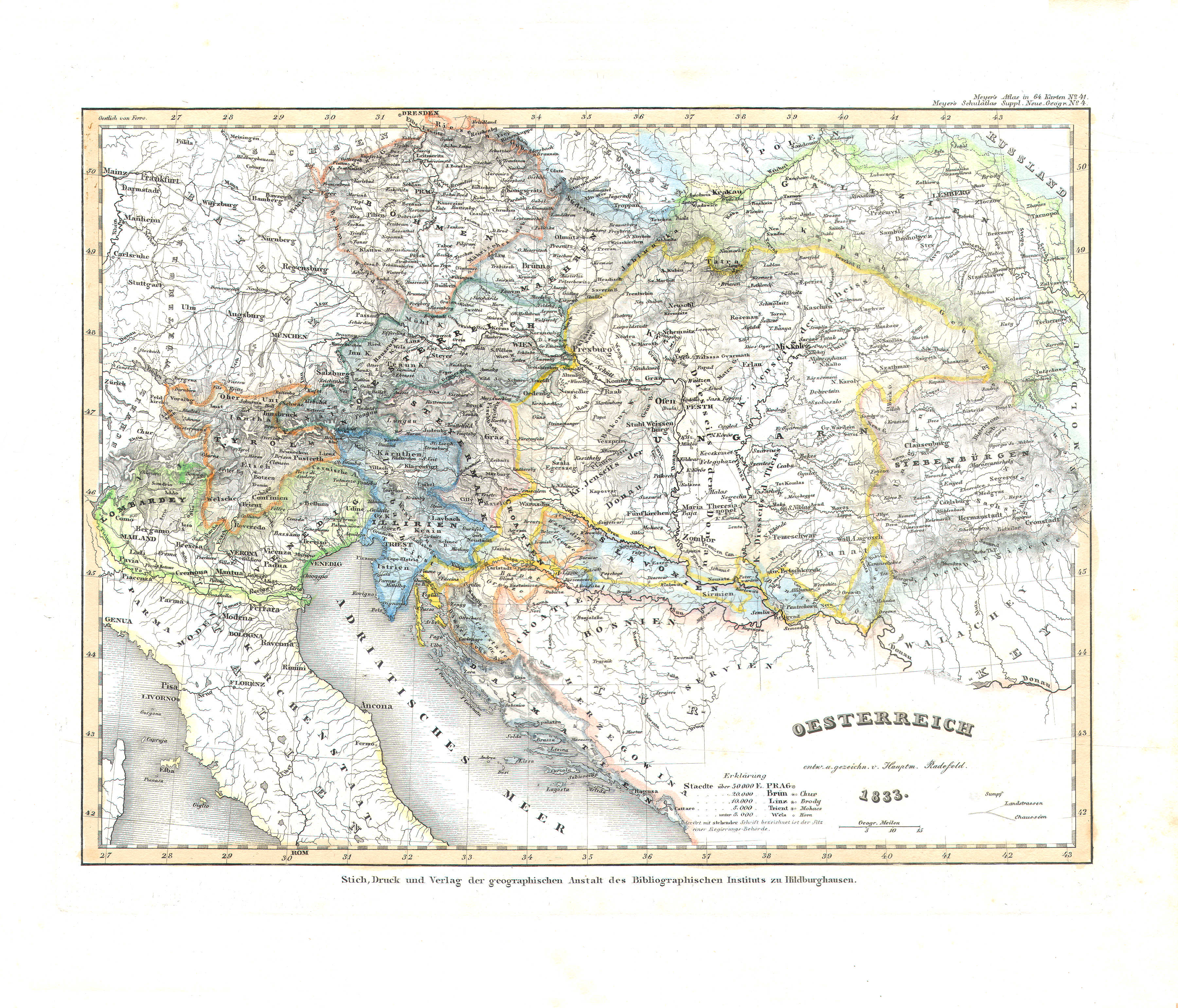
45. Oesterreich (Nº 41, 1833)
Oostenrijk / Austria
 Meyer's Universal-Atlas (1830-1840)
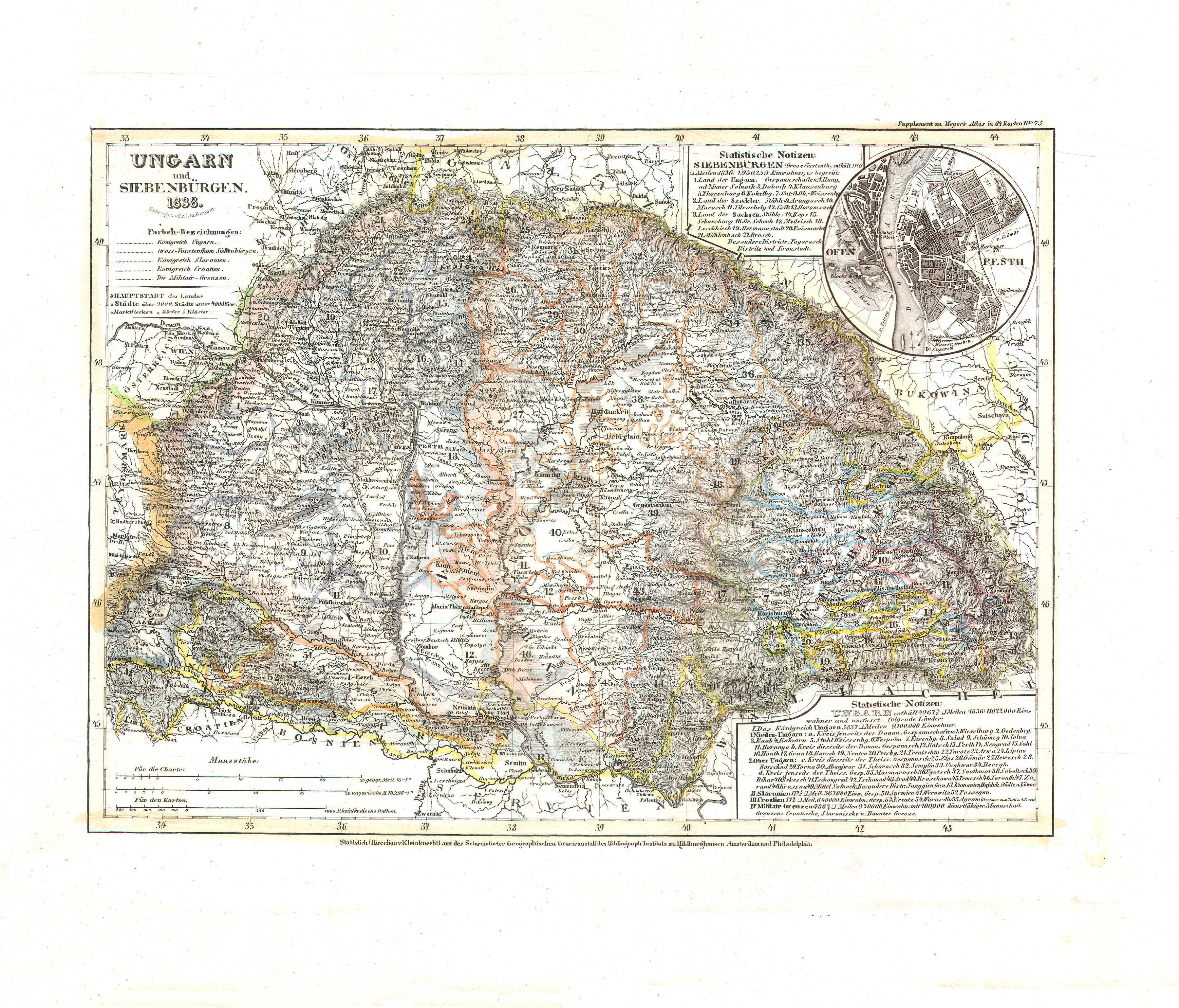
46. Ungarn und Siebenbürgen (Nº 75, 1838)
Hongarije en Zevenburgen / Hungary and Transylvania
 Meyer's Universal-Atlas (1830-1840)
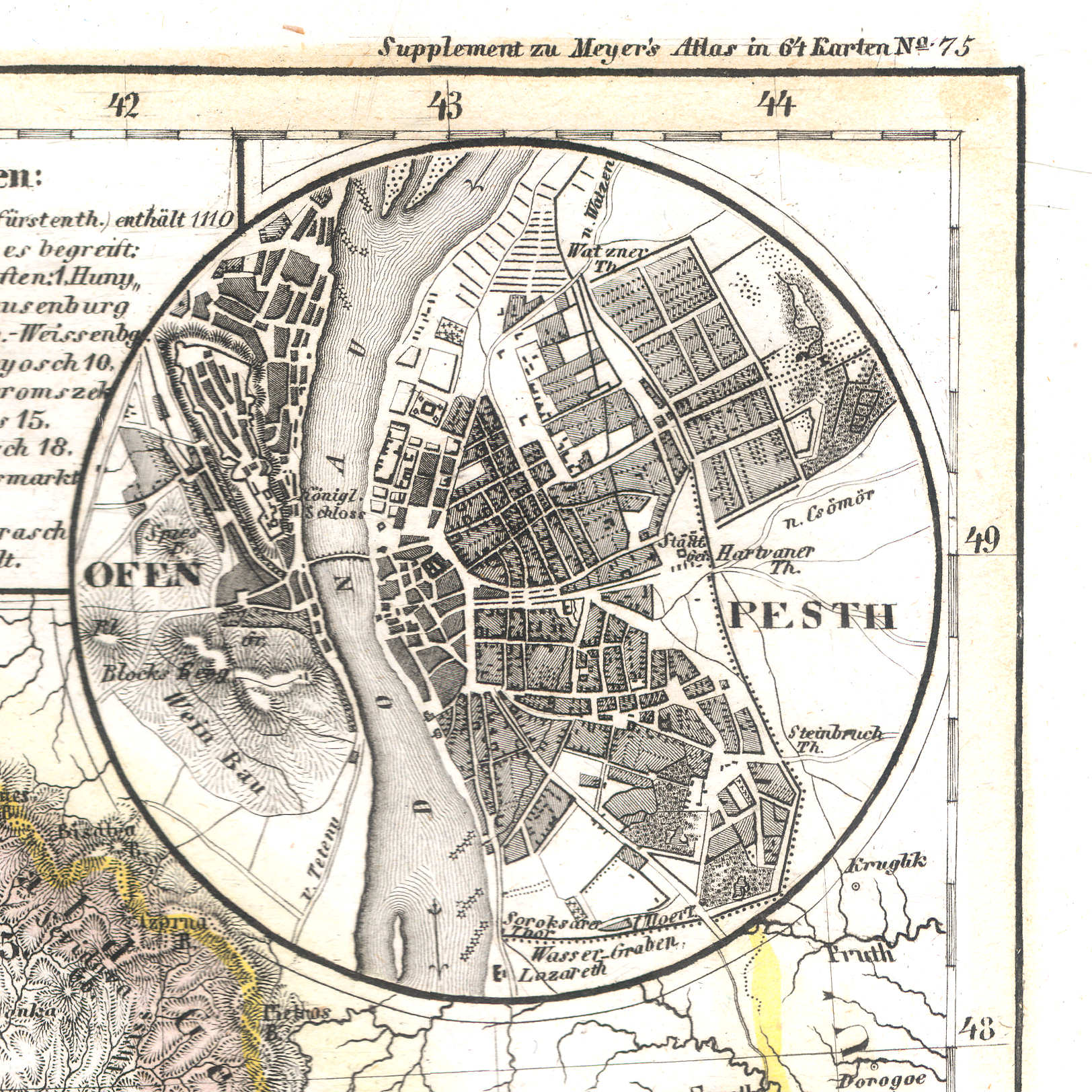
46a. Ofen, Pesth
Boeda, Pest / Buda, Pest
 Meyer's Universal-Atlas (1830-1840)
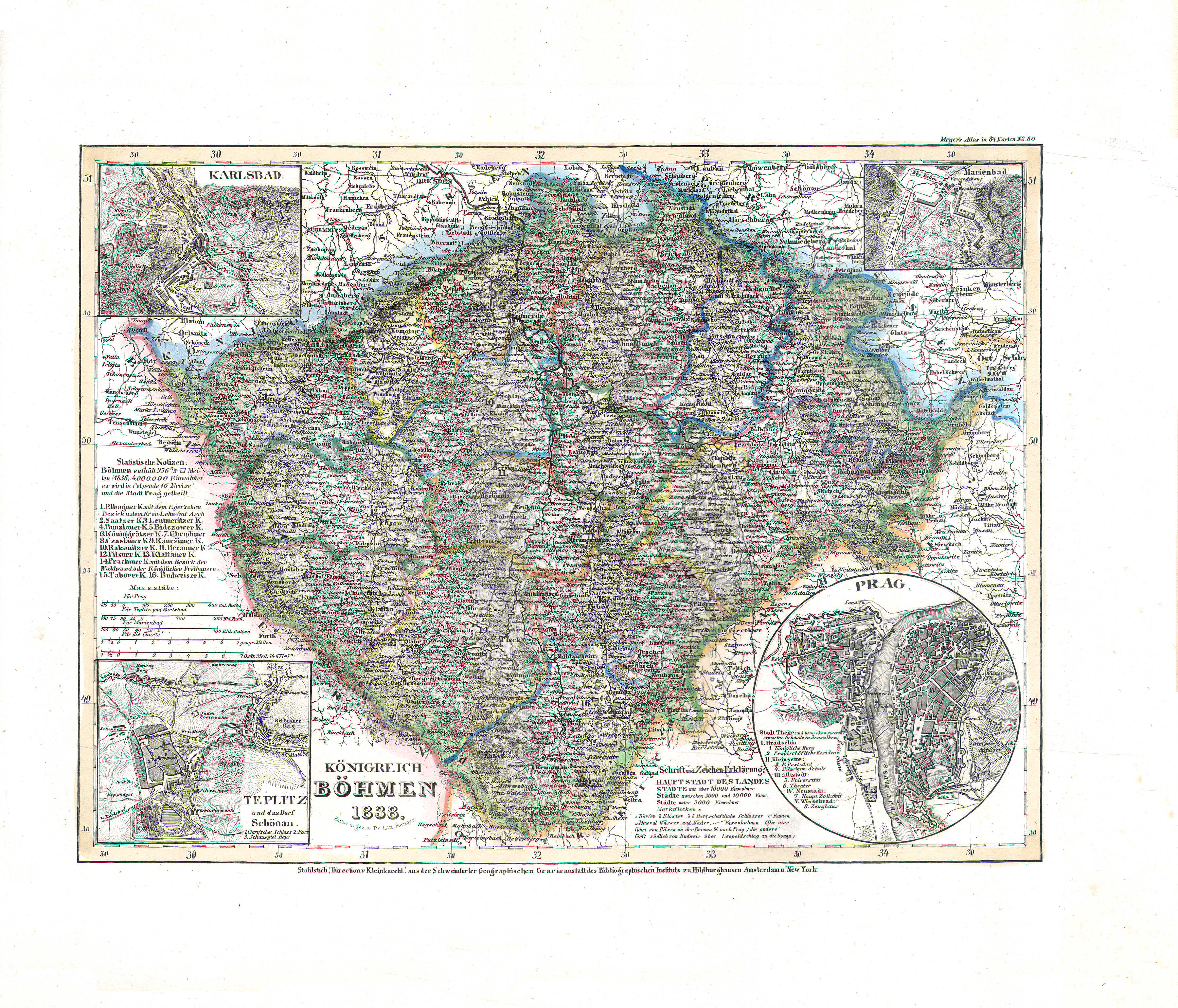
47. Königreich Böhmen (Nº 80, 1838)
Koninkrijk Bohemen / Kingdom of Bohemia
 Meyer's Universal-Atlas (1830-1840)
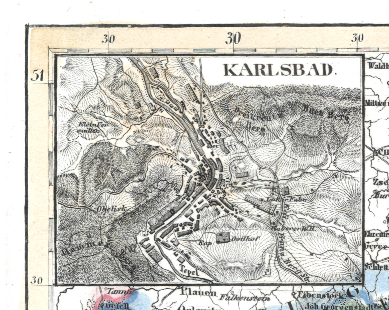
47a. Karlsbad
Karlsbad / Carlsbad / Karlovy Vary
 Meyer's Universal-Atlas (1830-1840)
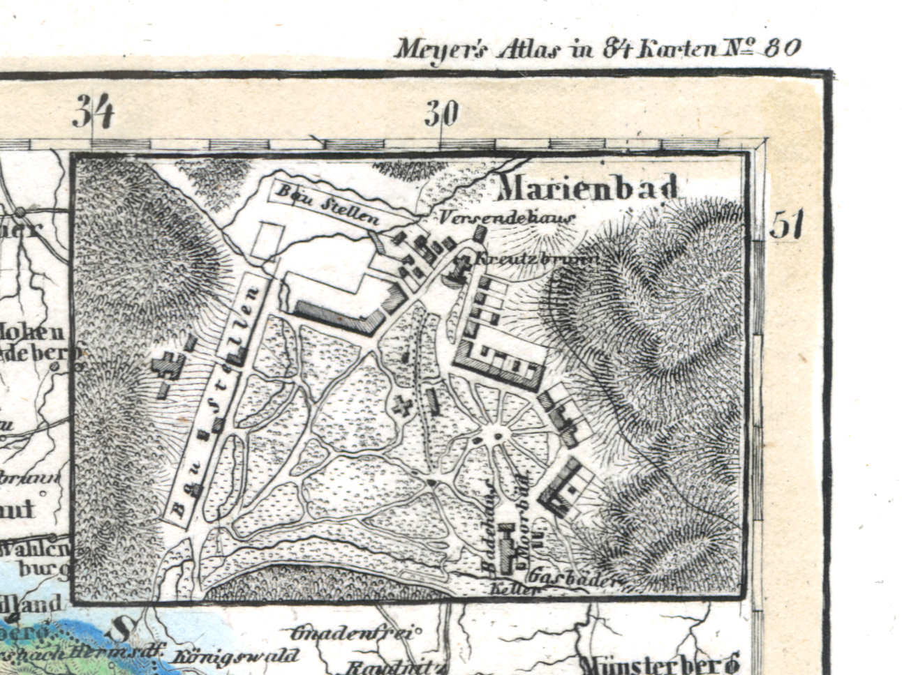
47b. Marienbad
Mariënbad / Marienbad / Mariánské Lázně
 Meyer's Universal-Atlas (1830-1840)
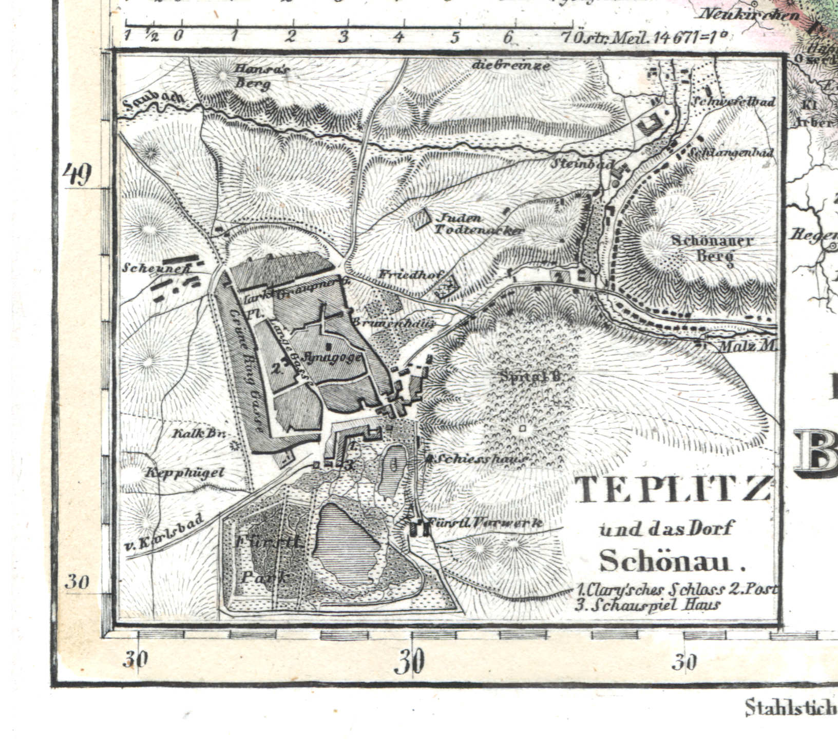
47c. Teplitz und das Dorf Schönau
Teplitz, Schönau / Teplice, Šanov
 Meyer's Universal-Atlas (1830-1840)
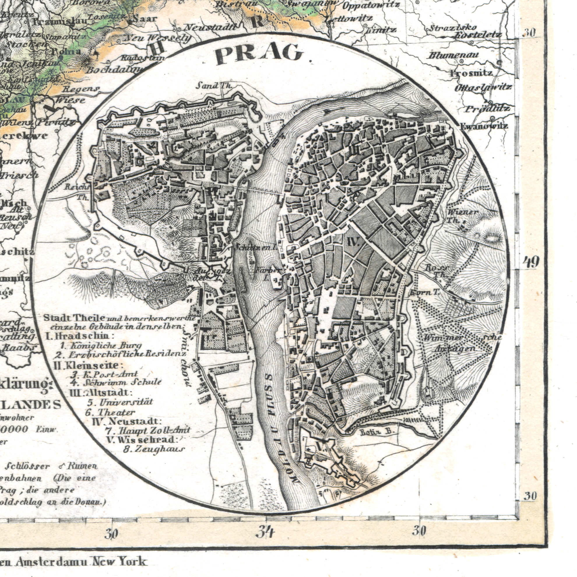
47d. Prag
Praag / Prague / Praha
 Meyer's Universal-Atlas (1830-1840)
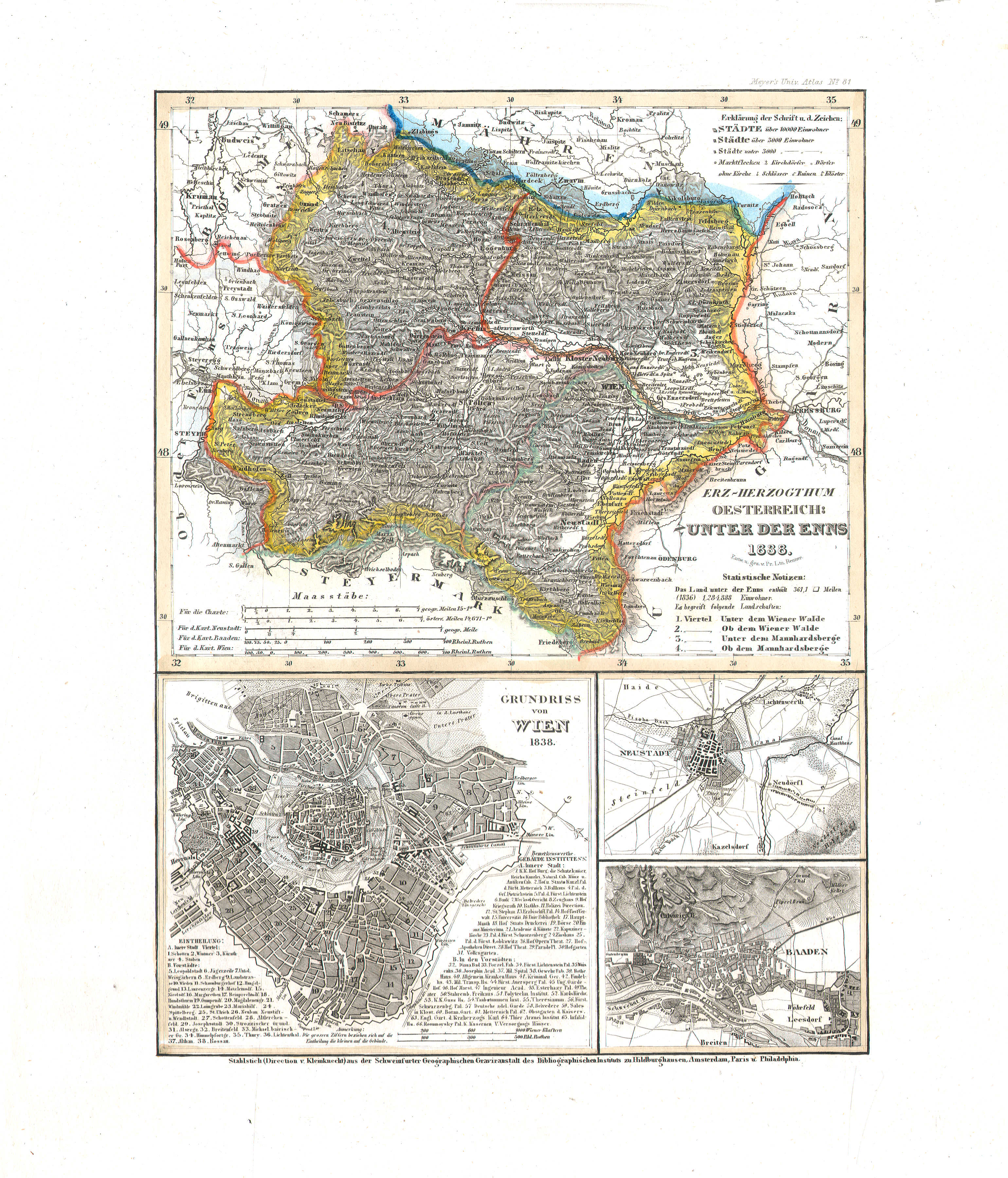
48. Erz-Herzogthum Oesterreich: Unter der Enns (Nº 81, 1838)
Aartshertogdom Oostenrijk beneden de Enns / Archduchy of Austria below the Enns
 Meyer's Universal-Atlas (1830-1840)
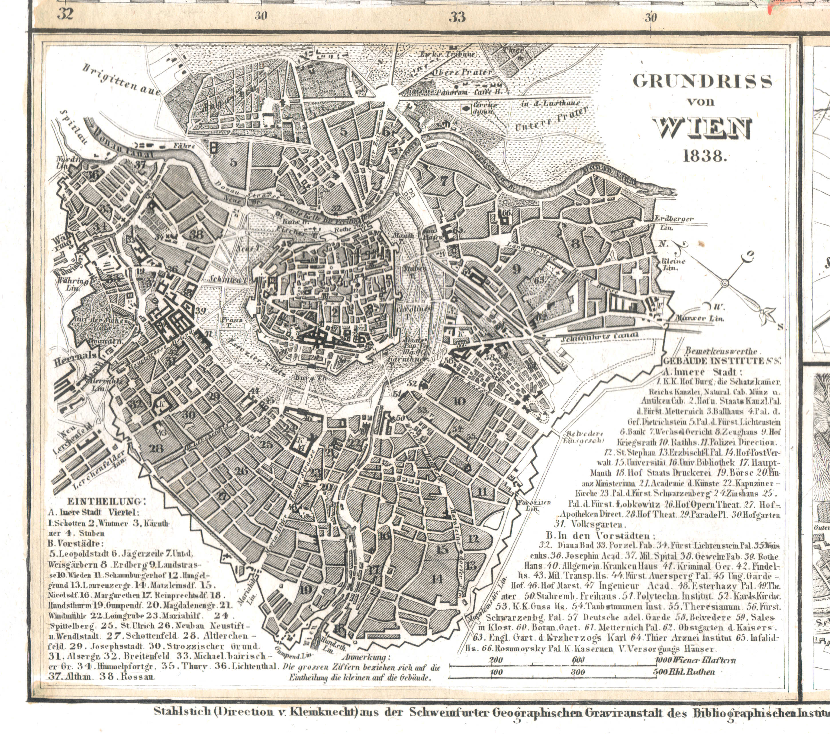
48a. Grundriss von Wien
Plattegrond van Wenen / Plan of Vienna
 Meyer's Universal-Atlas (1830-1840)
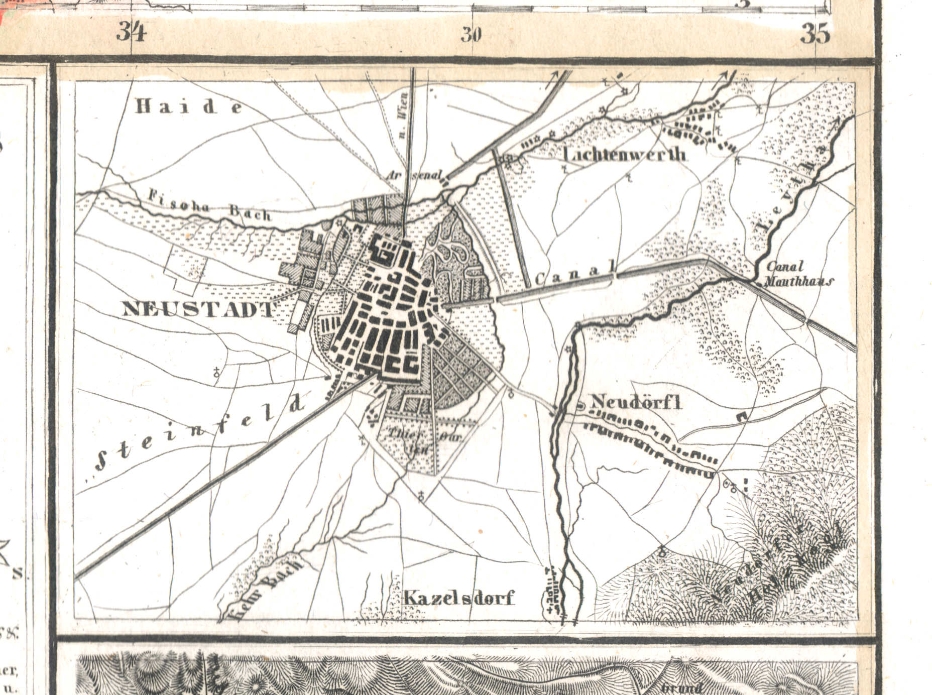
48b. Neustadt
Neustadt / Wiener Neustadt
 Meyer's Universal-Atlas (1830-1840)
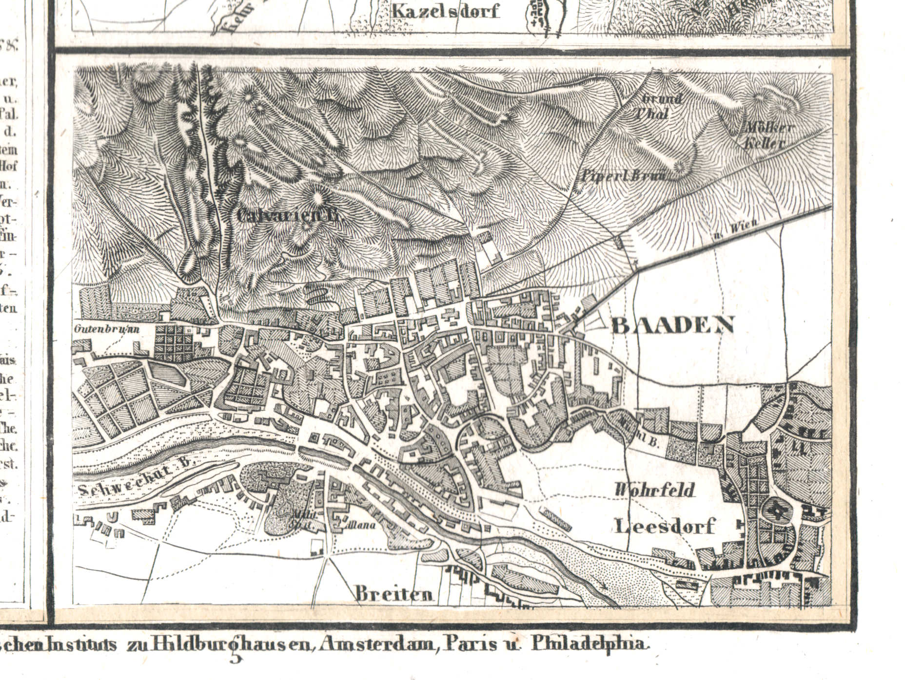
48c. Baaden
Baden / Baden bei Wien
 Meyer's Universal-Atlas (1830-1840)
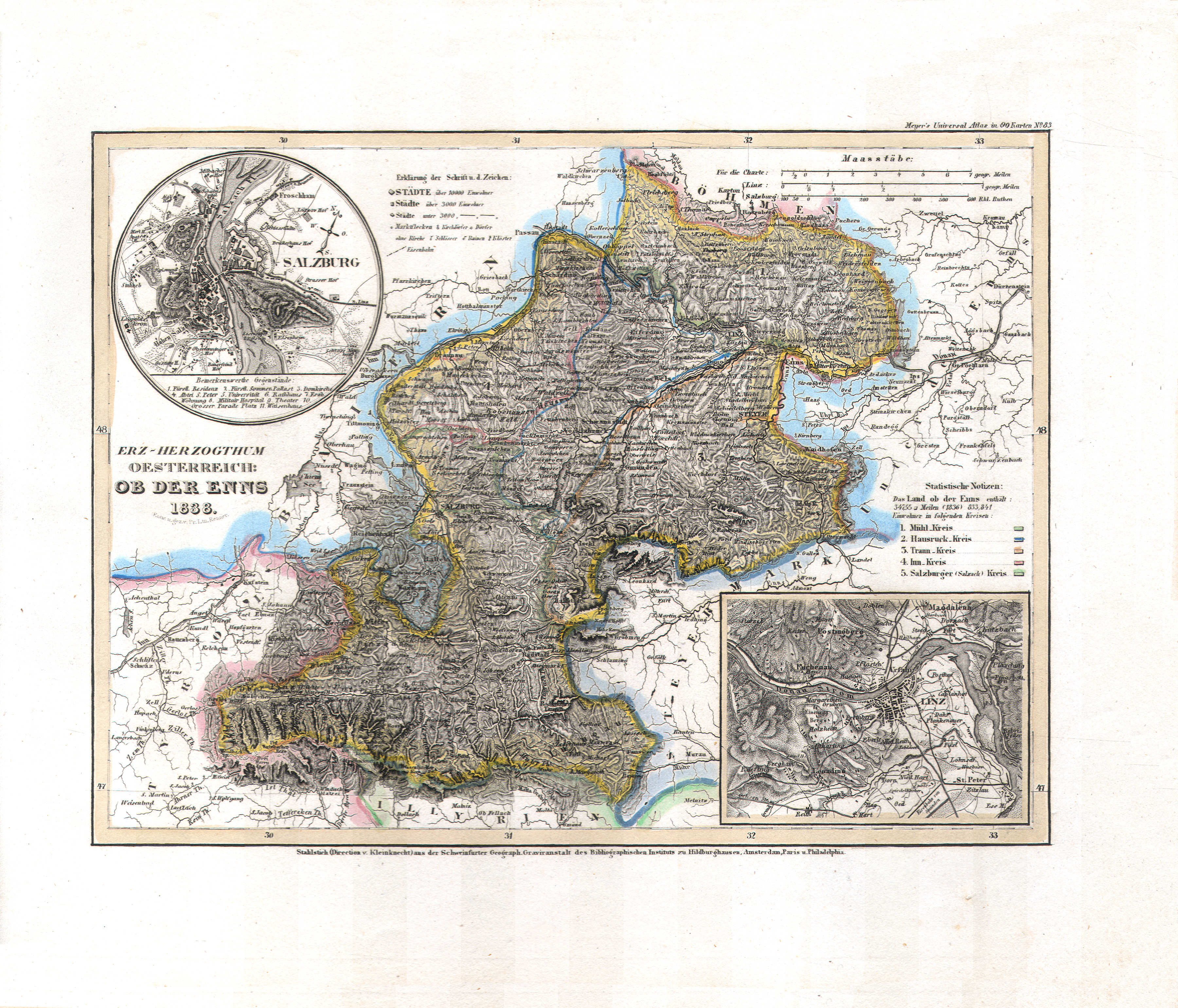
49. Erz-Herzogthum Oesterreich: Ob der Enns (Nº 83, 1838)
Aartshertogdom Oostenrijk boven de Enns / Archduchy of Austria above the Enns
 Meyer's Universal-Atlas (1830-1840)
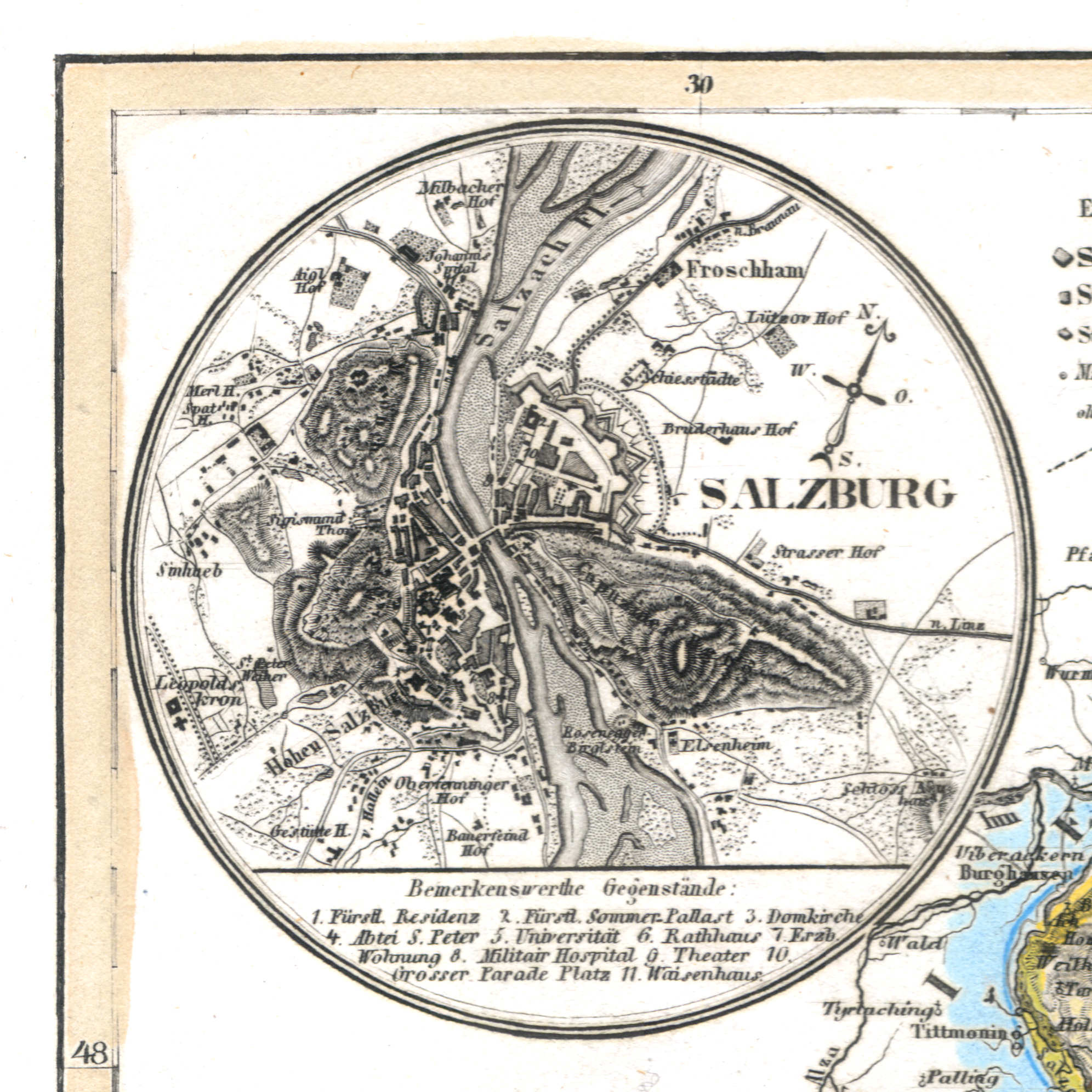
49a. Salzburg
Salzburg
 Meyer's Universal-Atlas (1830-1840)
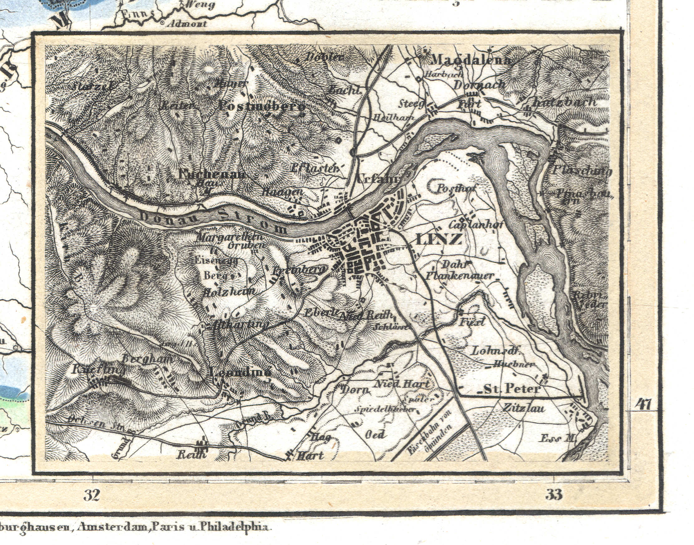
49b. Linz
Linz
 Meyer's Universal-Atlas (1830-1840)
50. Österreich: Lombardisch-Venetianisches Königreich (Nº 73, 1837)
Oostenrijk: Lombardo-Venetiaans Koninkrijk / Austria: Kingdom of Lombardy–Venetia
 Meyer's Universal-Atlas (1830-1840)
50a. Verona
Verona
 Meyer's Universal-Atlas (1830-1840)
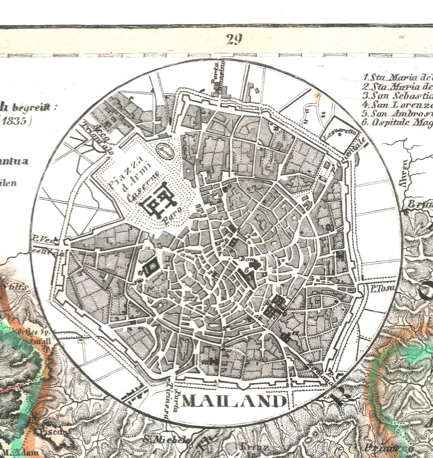
50b. Mailand
Milaan / Milan / Milano
 Meyer's Universal-Atlas (1830-1840)
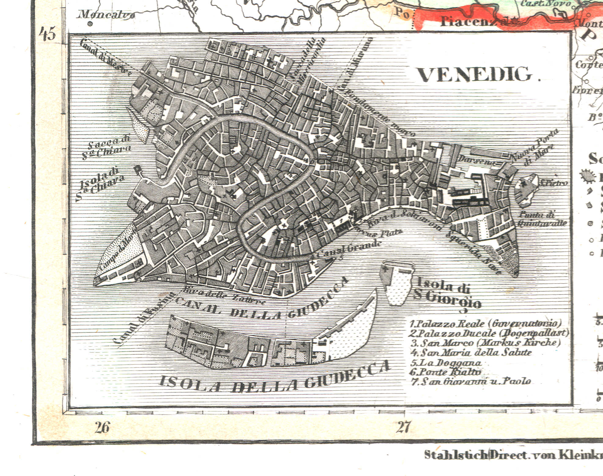
50c. Venedig
Venetië / Venice / Venezia
 Meyer's Universal-Atlas (1830-1840)
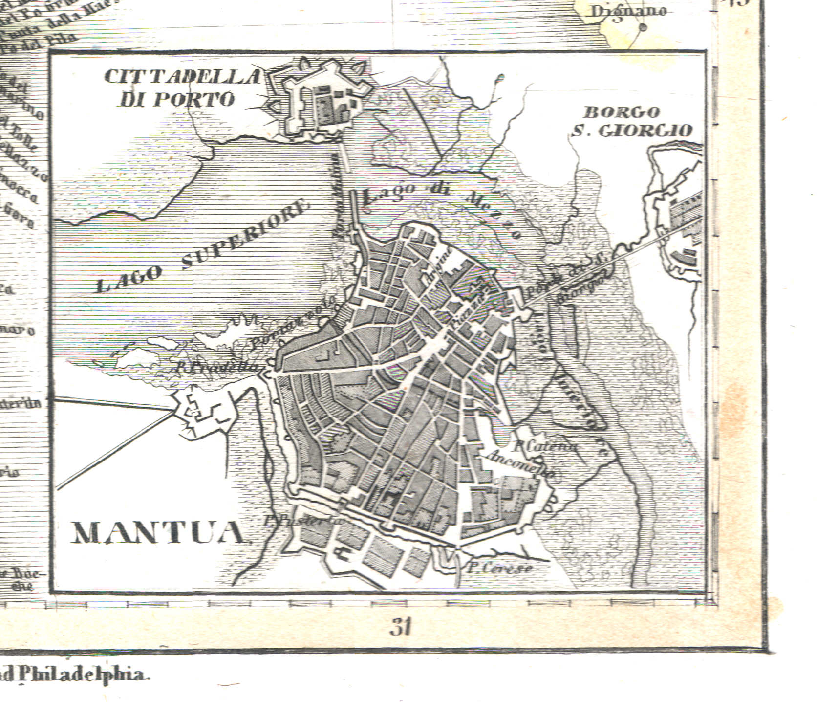
50d. Mantua
Mantua / Mantova
 Meyer's Universal-Atlas (1830-1840)
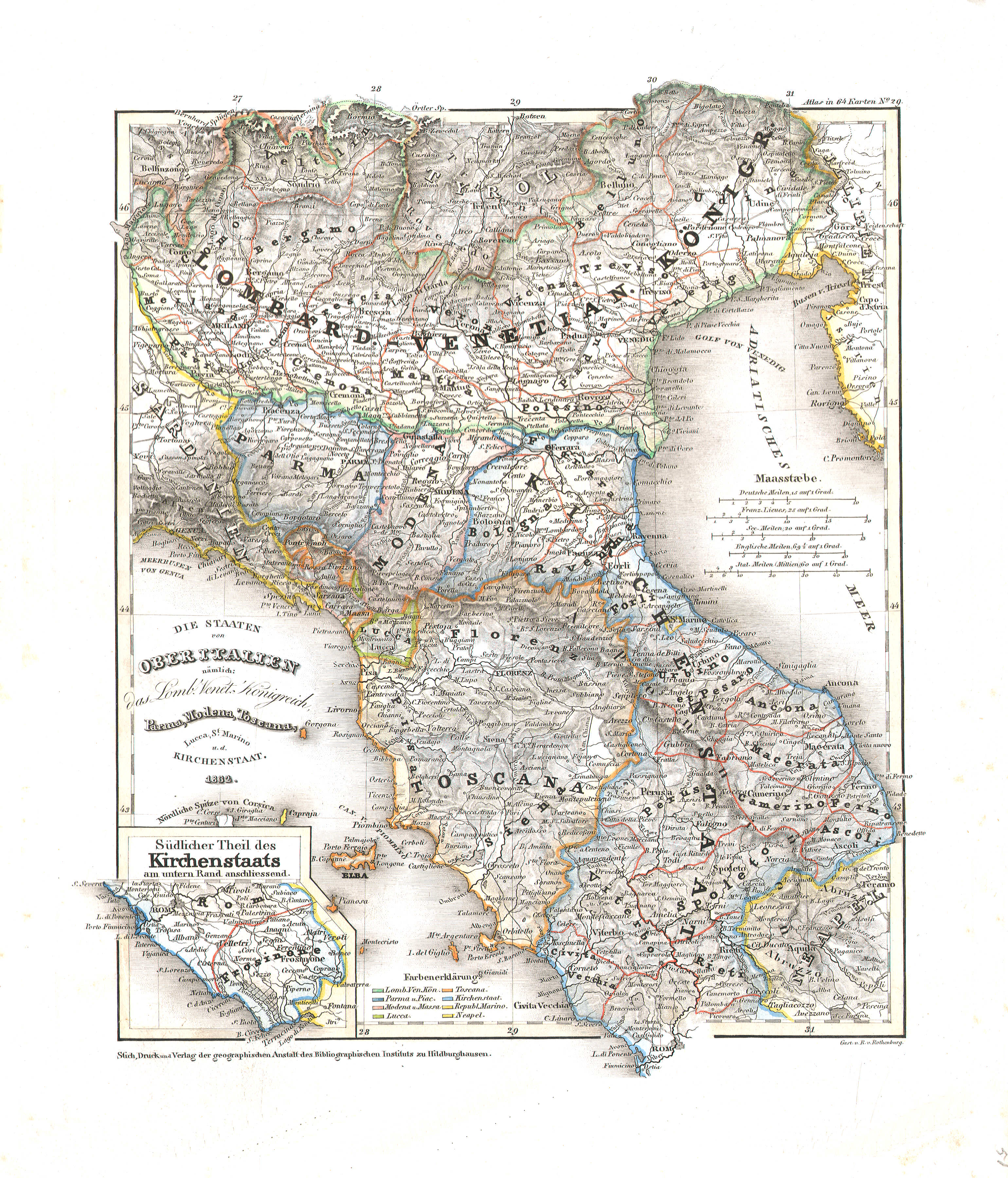
51. Die Staaten von Ober Italien nämlich: das Lomb. Venet. Königreich, Parma, Modena, Toscana, Lucca, St. Marino u. d. Kirchenstaat (Nº 29, 1832)
De staten in Noord-Italië / The states in North Italy
 Meyer's Universal-Atlas (1830-1840)
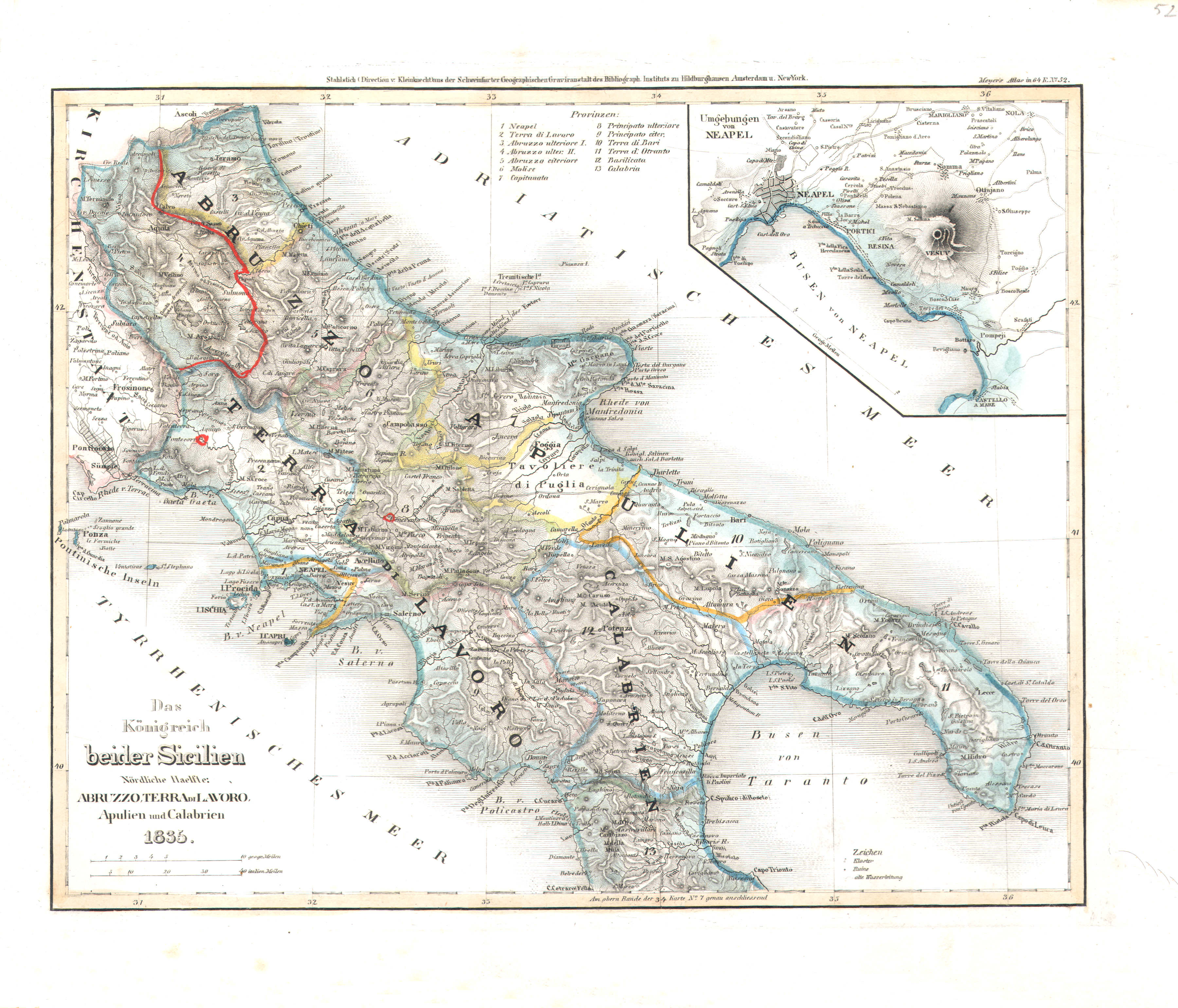
52. Das Königreich beider Sicilien, Nördliche Haelfte: Abruzzo, Terra di Lavoro, Apulien und Calabrien (Nº 52, 1835)
Koninkrijk der Beide Siciliën, noordelijk deel / Kingdom of the Two Sicilies, northern half
 Meyer's Universal-Atlas (1830-1840)
52a. Umgebungen von Neapel
Napels en omgeving / Naples and environs / Napoli
 Meyer's Universal-Atlas (1830-1840)
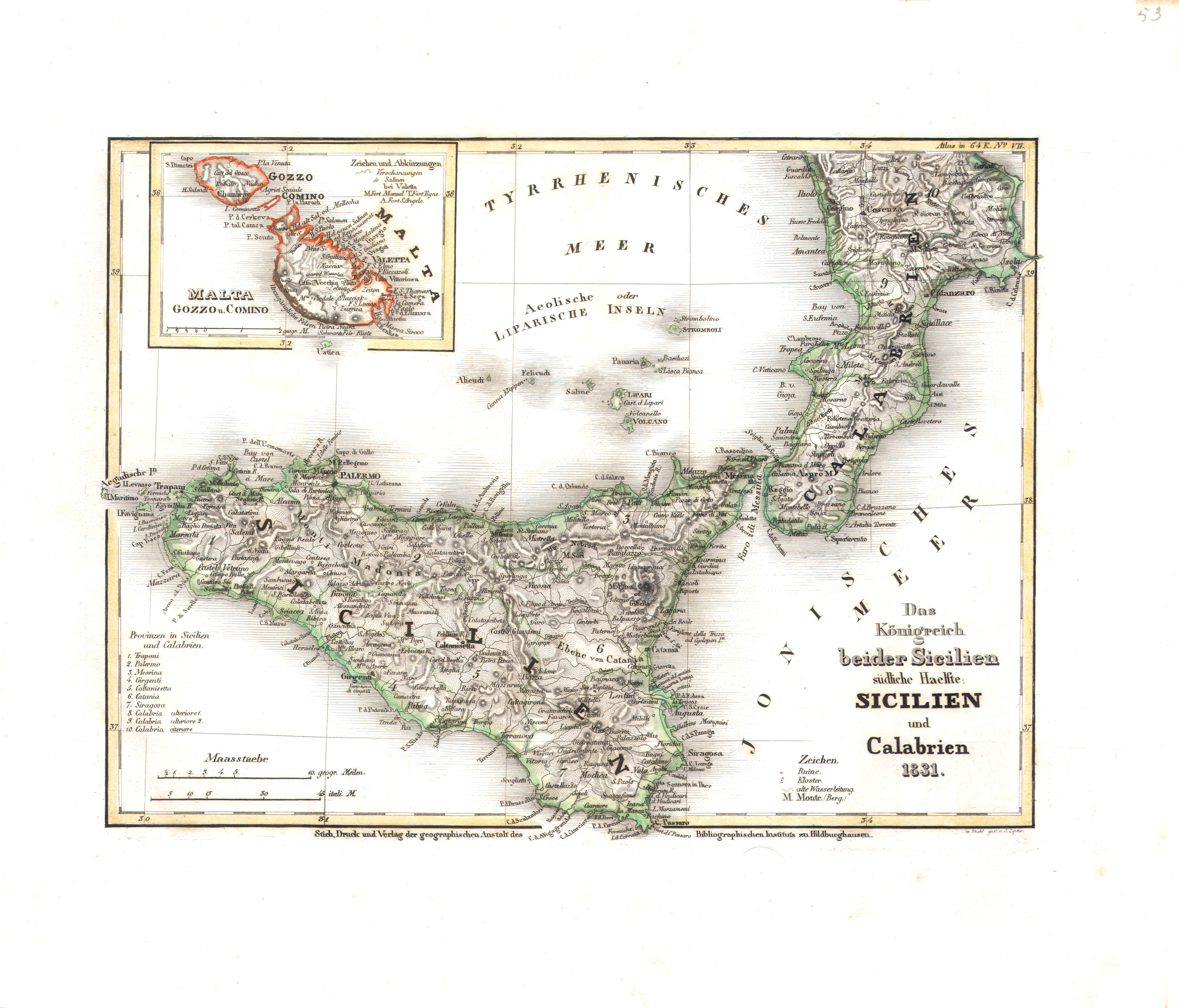
53. Das Königreich beider Sicilien, südliche Haelfte: Sicilien und Calabrien (Nº 7, 1831)
Koninkrijk der Beide Siciliën, zuidelijk deel / Kingdom of the Two Sicilies, southern half
 Meyer's Universal-Atlas (1830-1840)
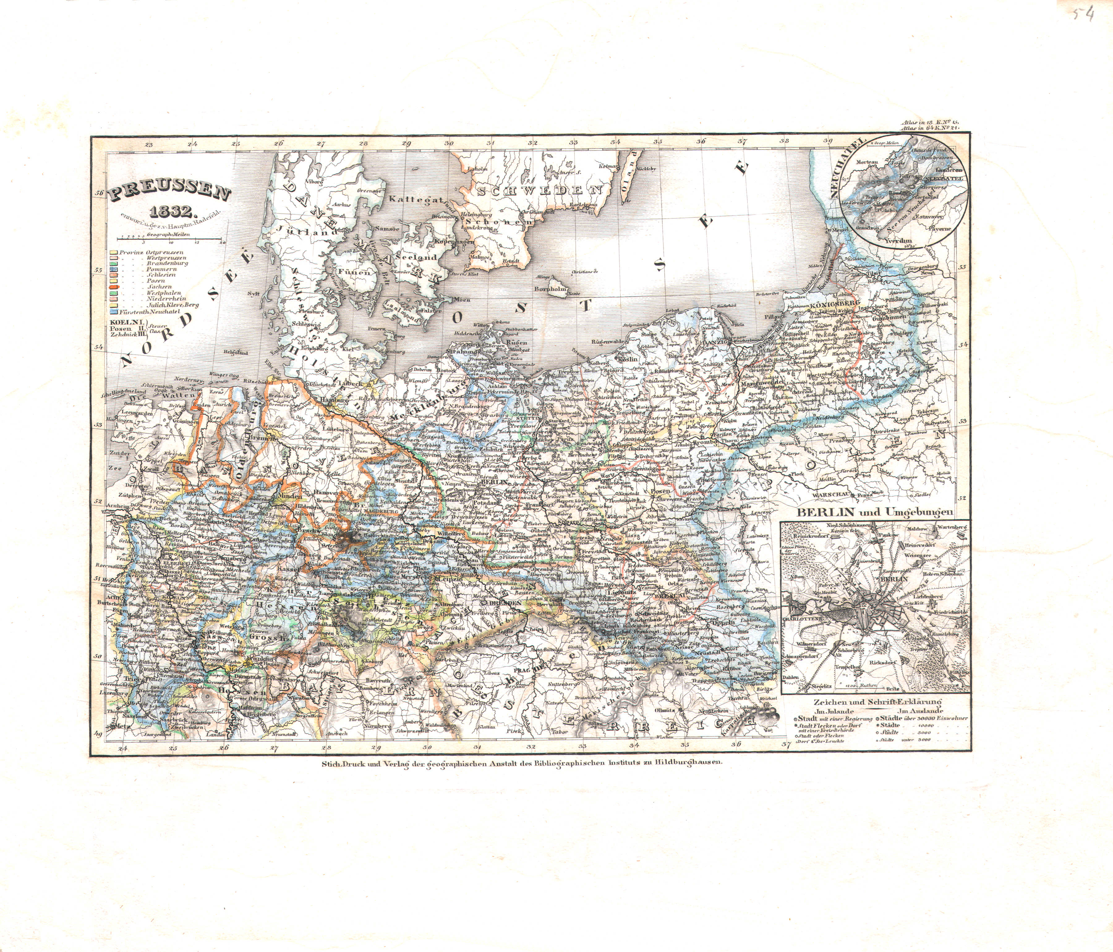
54. Preussen (Nº 21, 1832)
Pruisen / Prussia
 Meyer's Universal-Atlas (1830-1840)
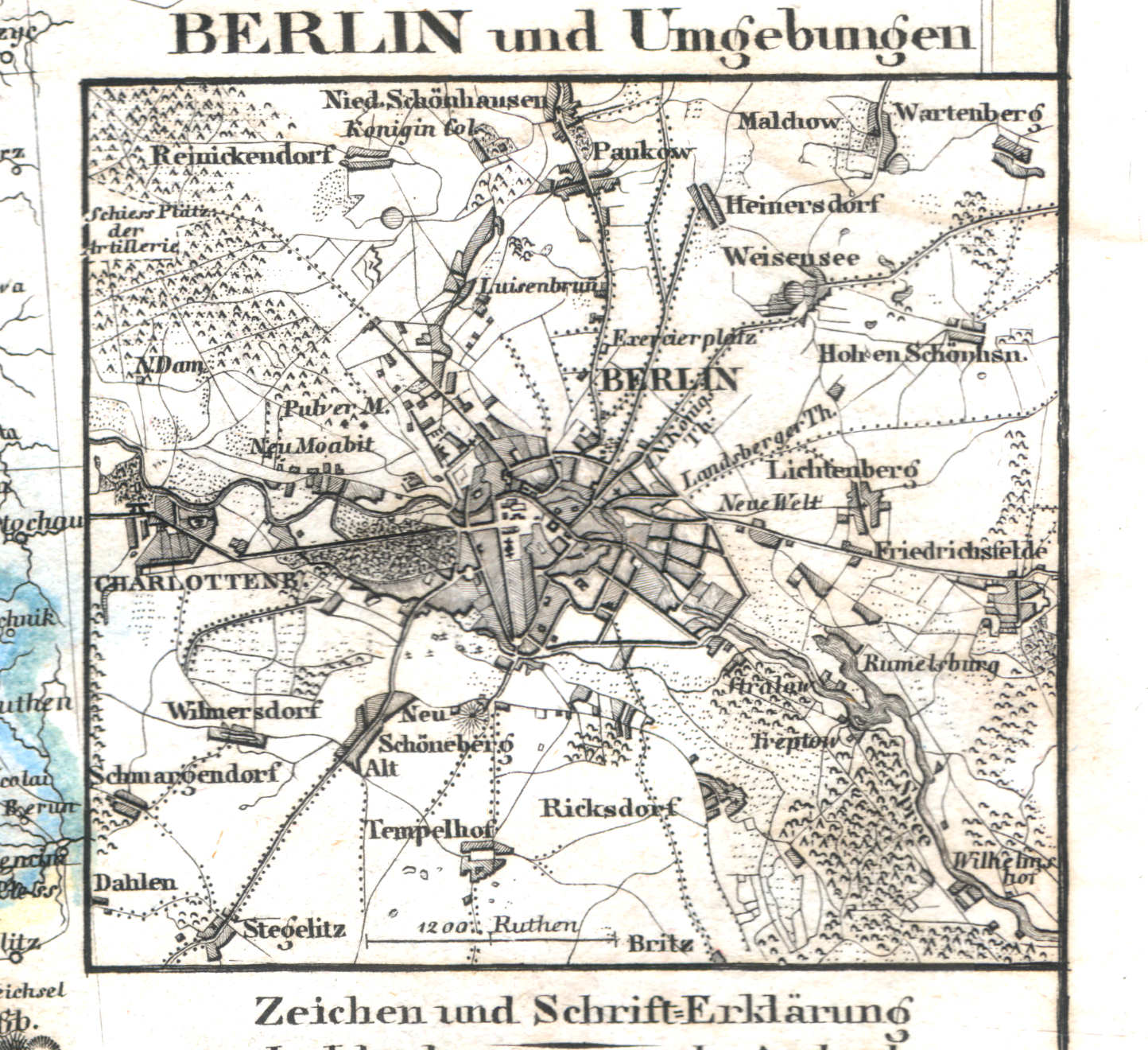
54b. Berlin und Umgebungen
Berlijn en omgeving / Berlin and environs
 Meyer's Universal-Atlas (1830-1840)
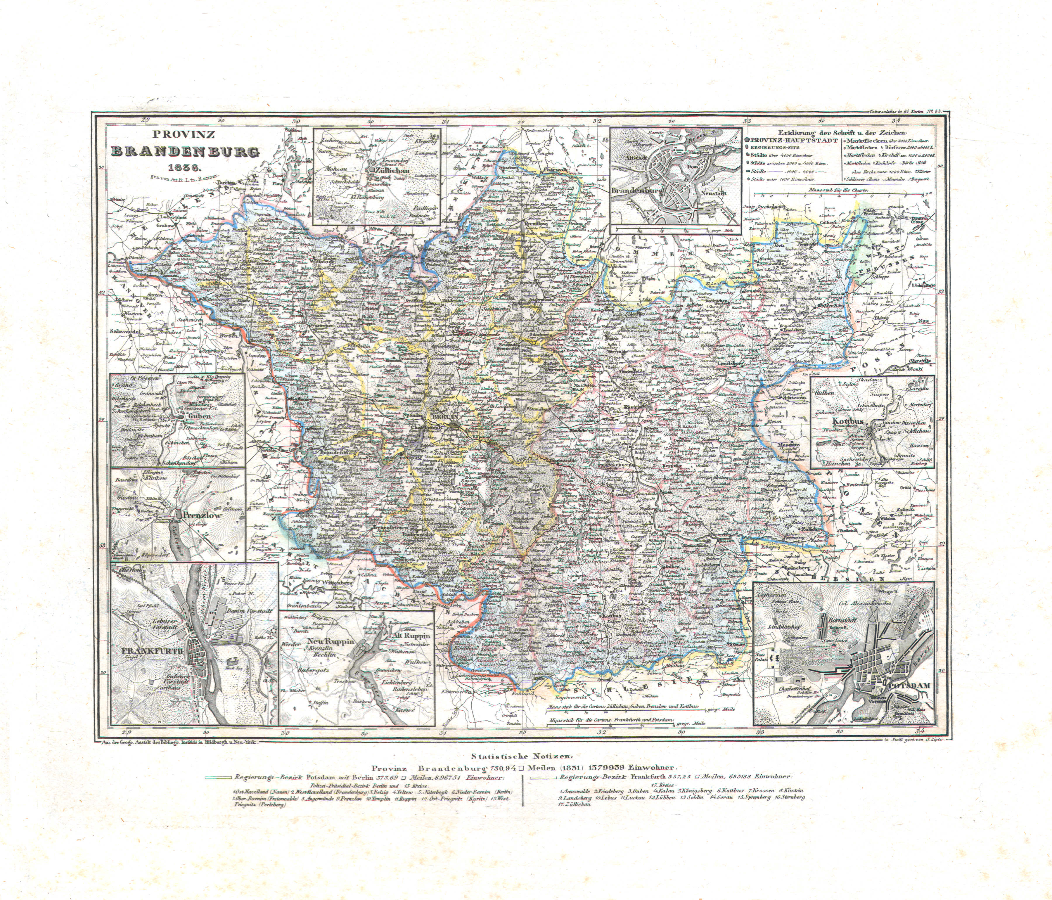
55. Provinz Brandenburg (Nº 53, 1836)
Provincie Brandenburg / Province of Brandenburg
 Meyer's Universal-Atlas (1830-1840)
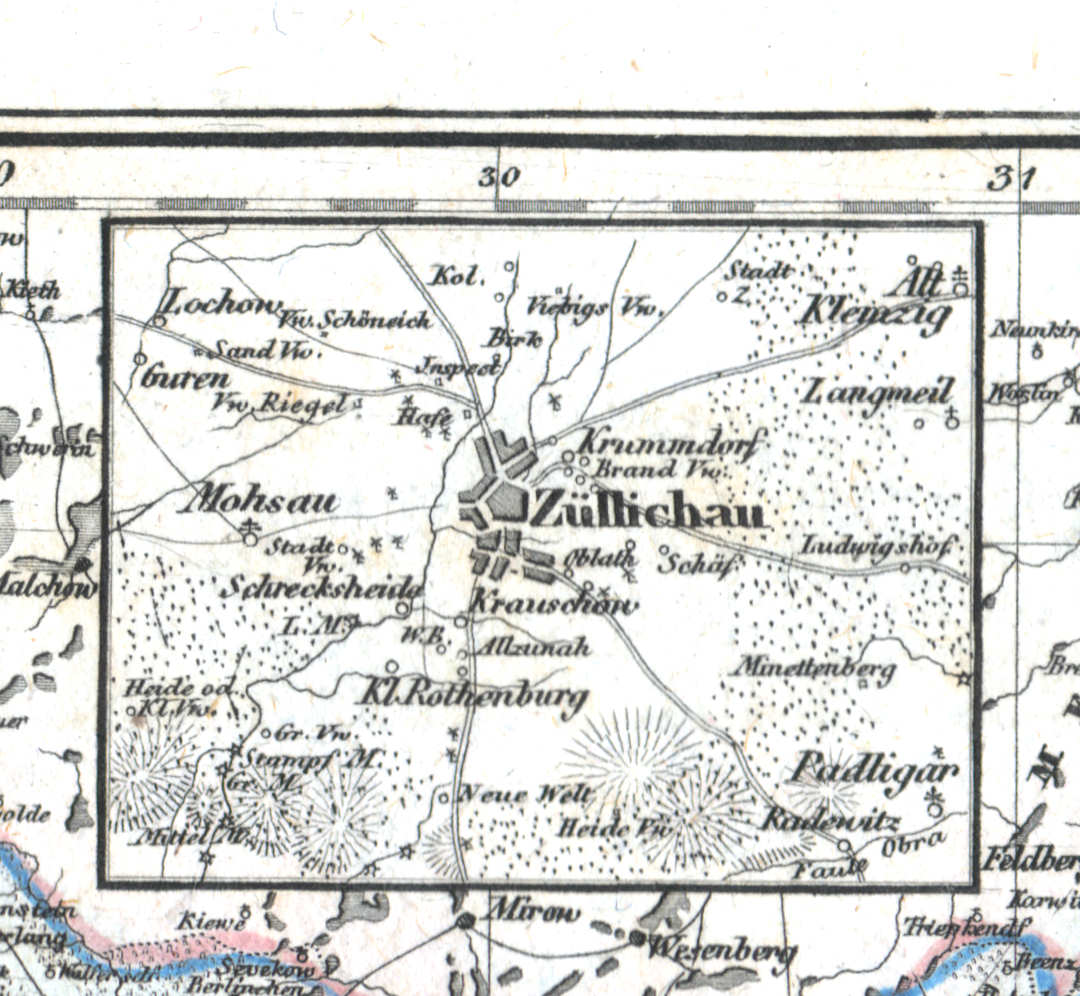
55a. Züllichau
Züllichau / Sulechów
 Meyer's Universal-Atlas (1830-1840)
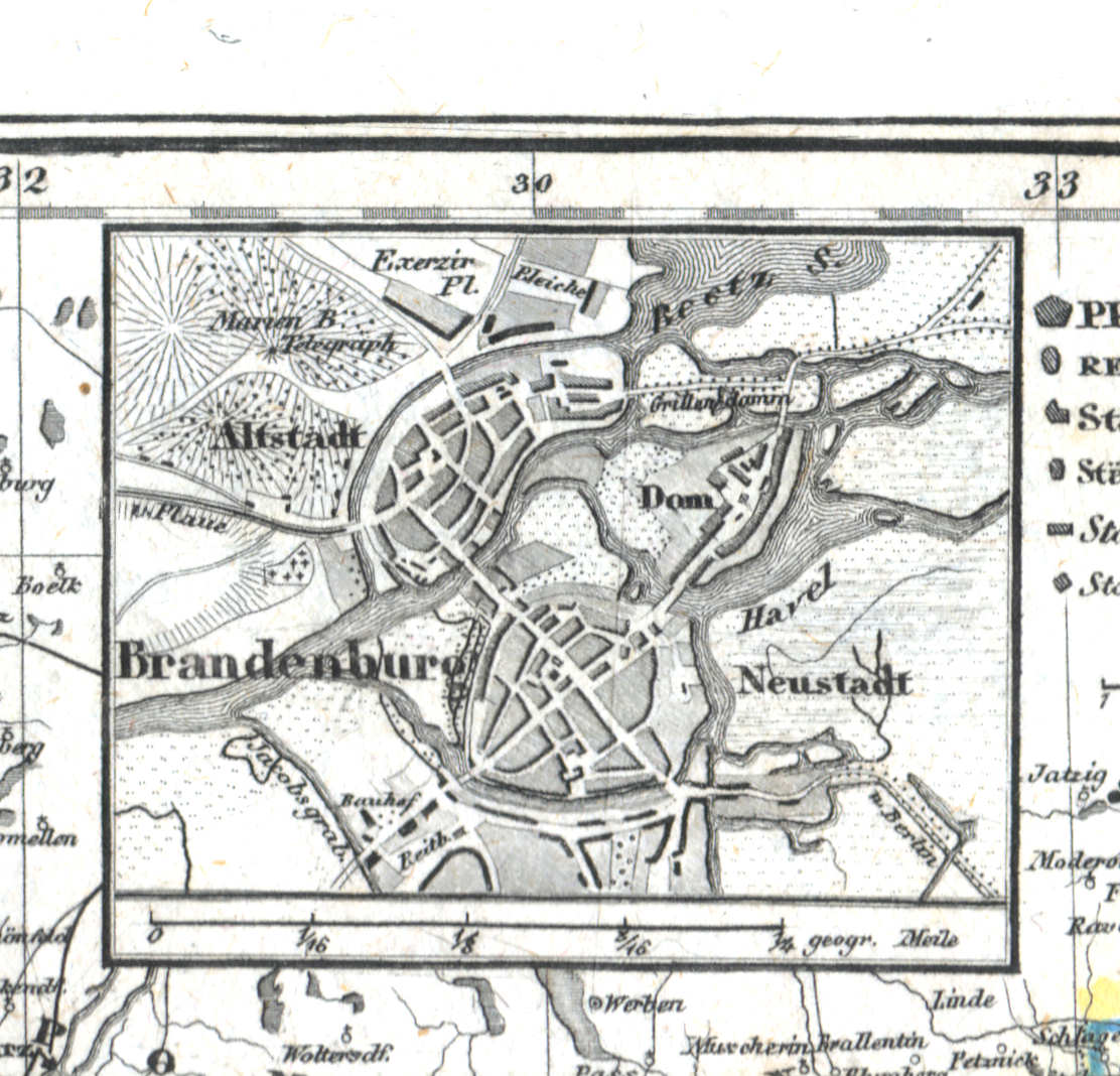
55b. Brandenburg
Brandenburg
 Meyer's Universal-Atlas (1830-1840)
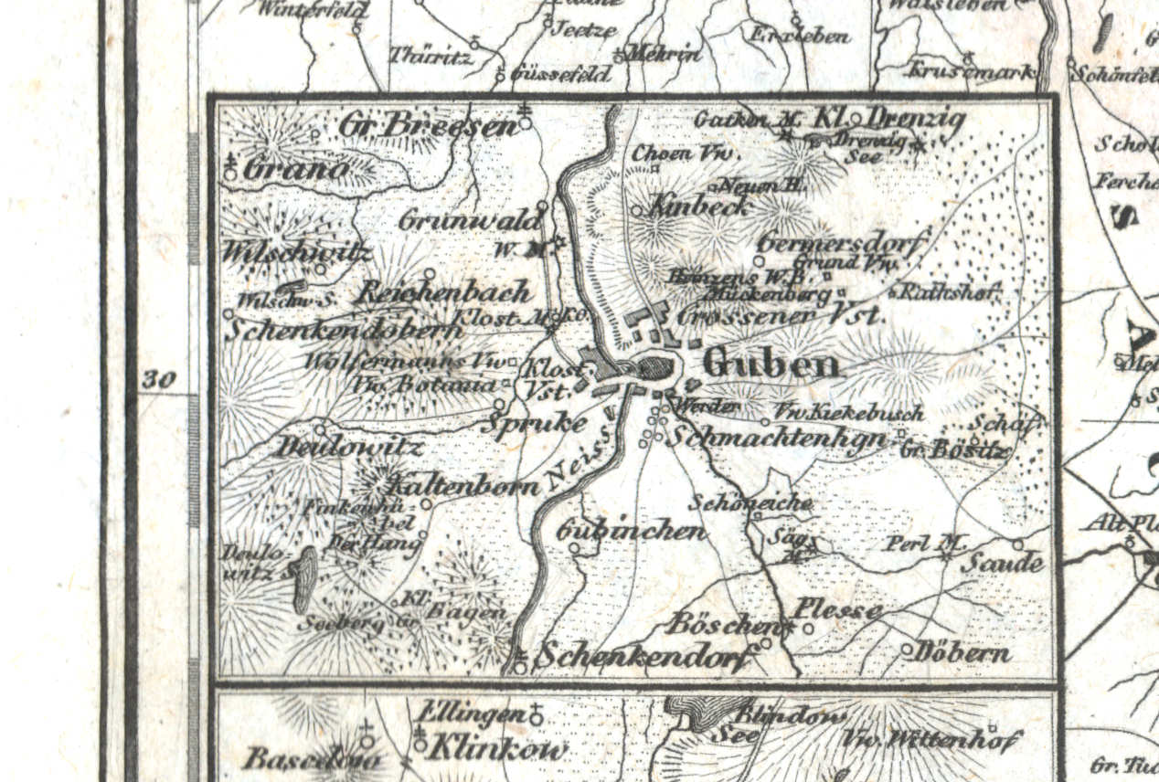
55c. Guben
Guben / Gubin
 Meyer's Universal-Atlas (1830-1840)
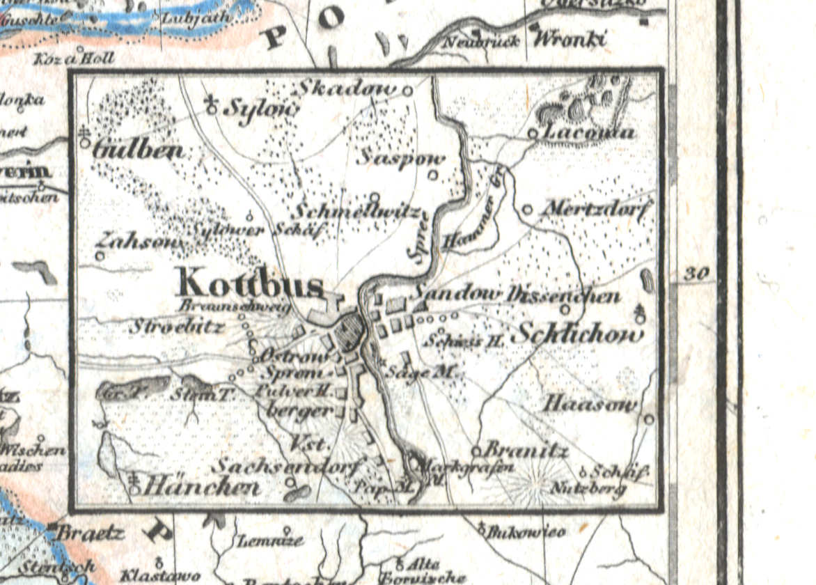
55d. Kottbus
Cottbus / Chóśebuz
 Meyer's Universal-Atlas (1830-1840)
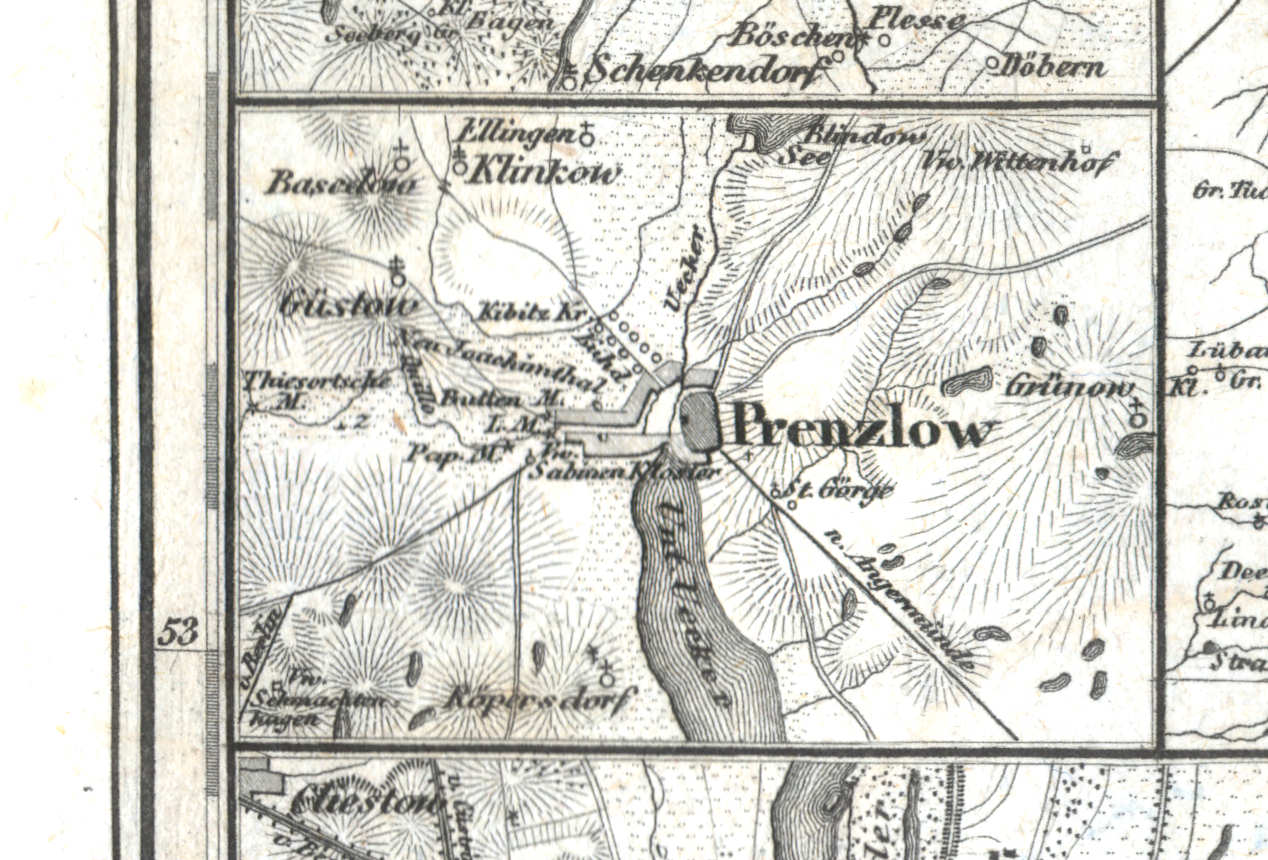
55e. Prenzlow
Prenzlau
 Meyer's Universal-Atlas (1830-1840)
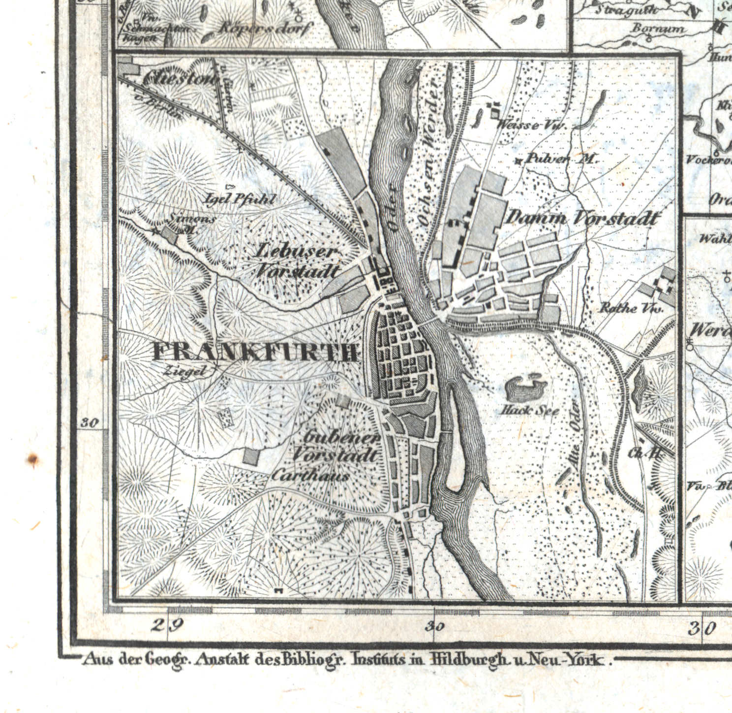
55f. Frankfurth
Frankfurt an der Oder / Słubice
 Meyer's Universal-Atlas (1830-1840)
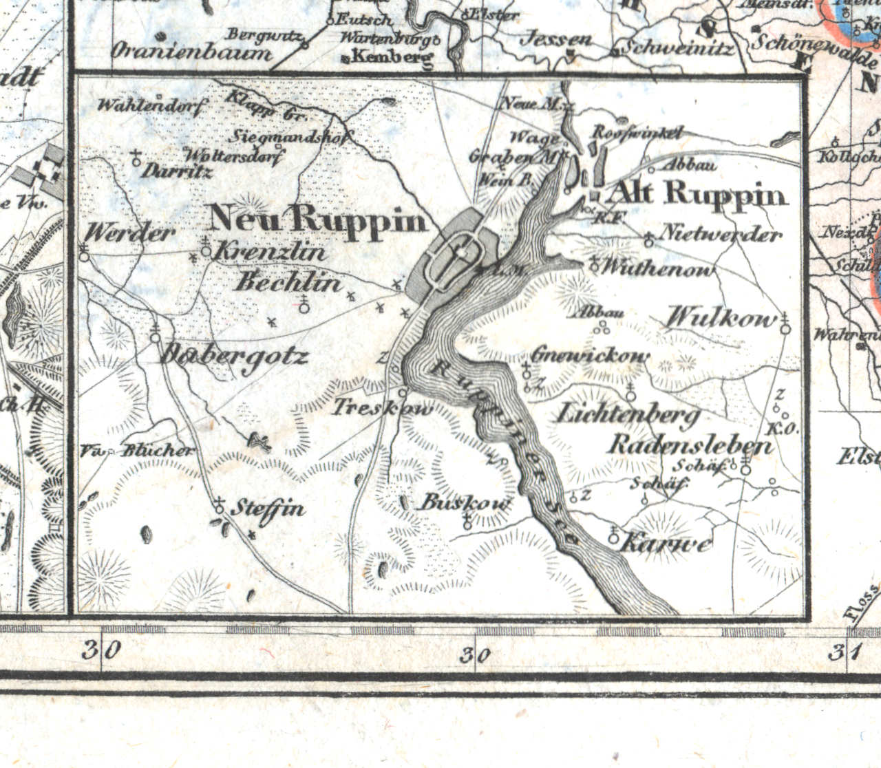
55g. Neu Ruppin, Alt Ruppin
Neuruppin, Alt Ruppin
 Meyer's Universal-Atlas (1830-1840)
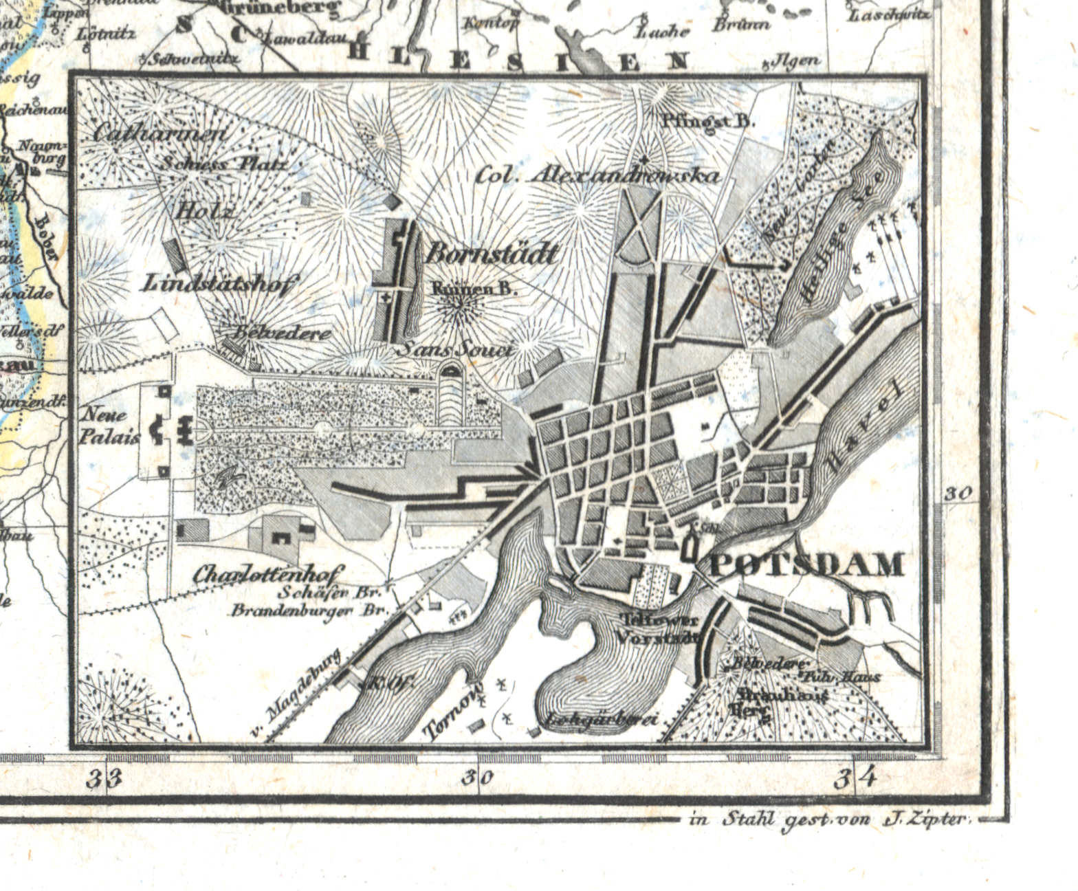
55h. Potsdam
Potsdam
 Meyer's Universal-Atlas (1830-1840)
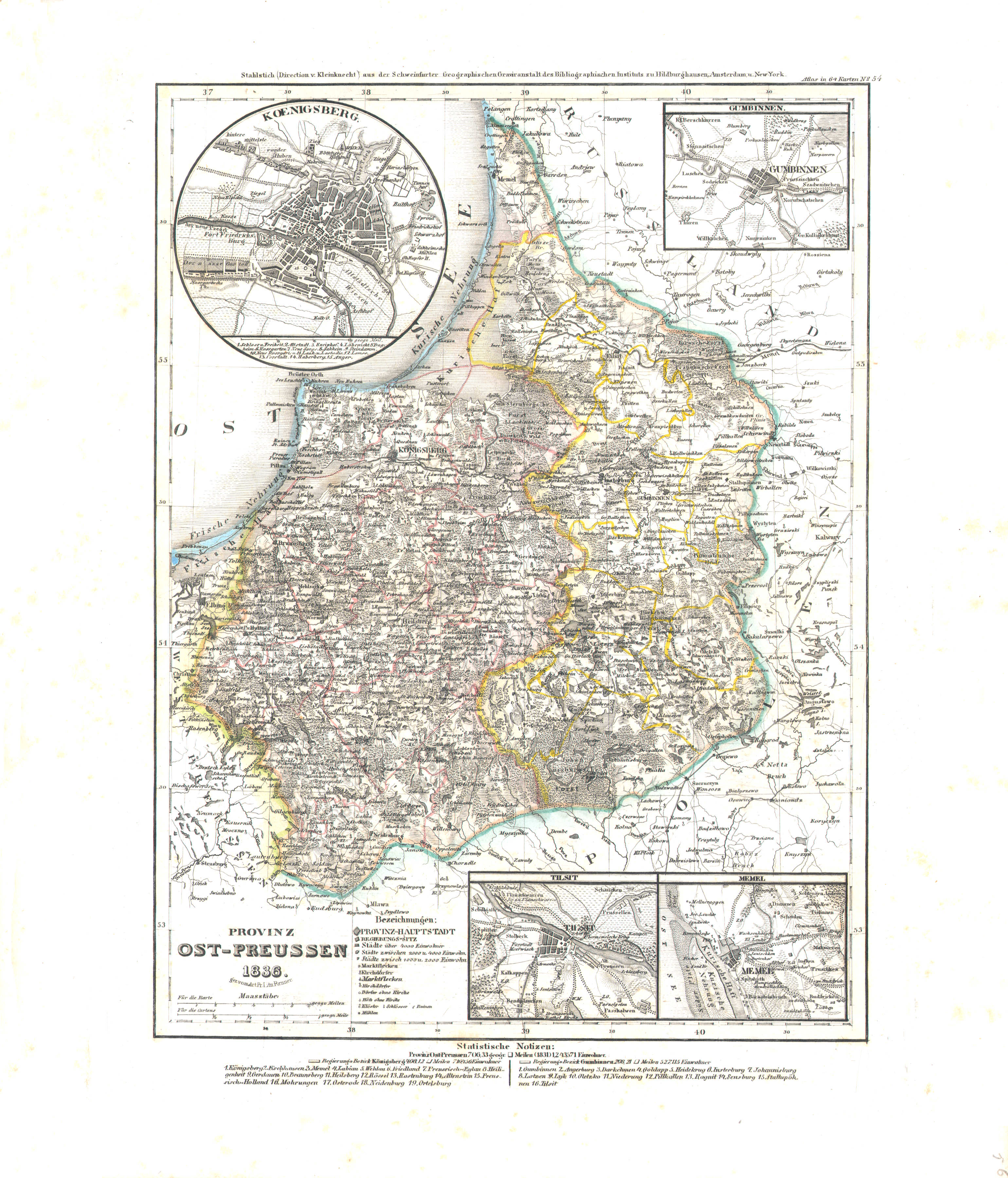
56. Provinz Ost-Preussen (Nº 54, 1836)
Provincie Oost-Pruisen / Province of East Prussia
 Meyer's Universal-Atlas (1830-1840)
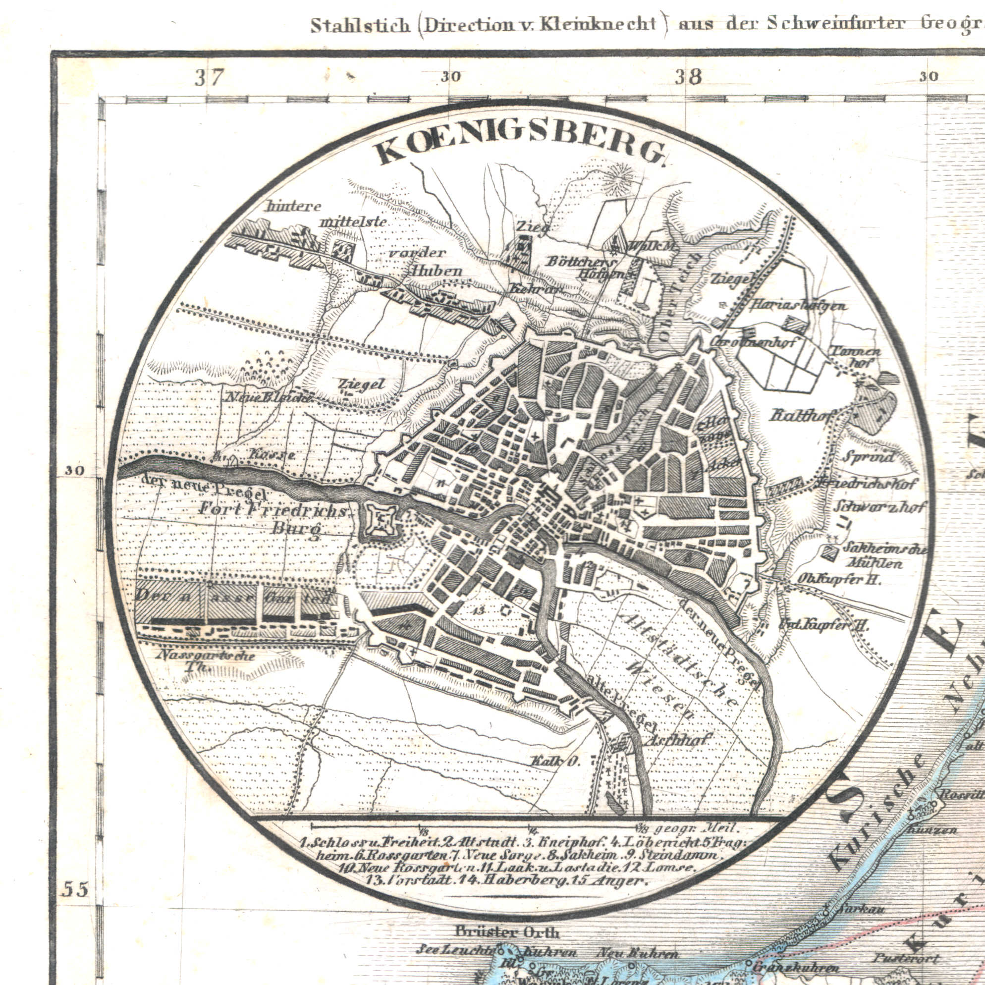
56a. Koenigsberg
Königsberg in Preußen / Koningsbergen / Królewiec / Karaliaučius / Kaliningrad, Калининград
 Meyer's Universal-Atlas (1830-1840)
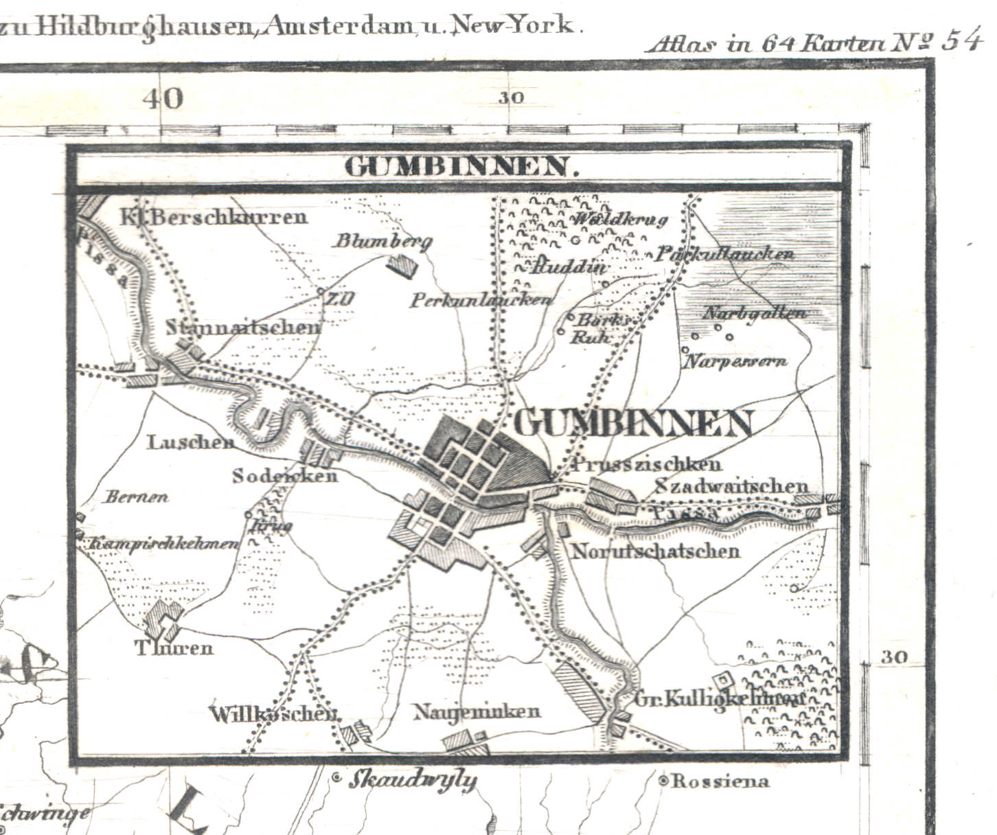
56b. Gumbinnen
Gumbinnen / Gusiew / Gusevas / Гусев, Gusev
 Meyer's Universal-Atlas (1830-1840)
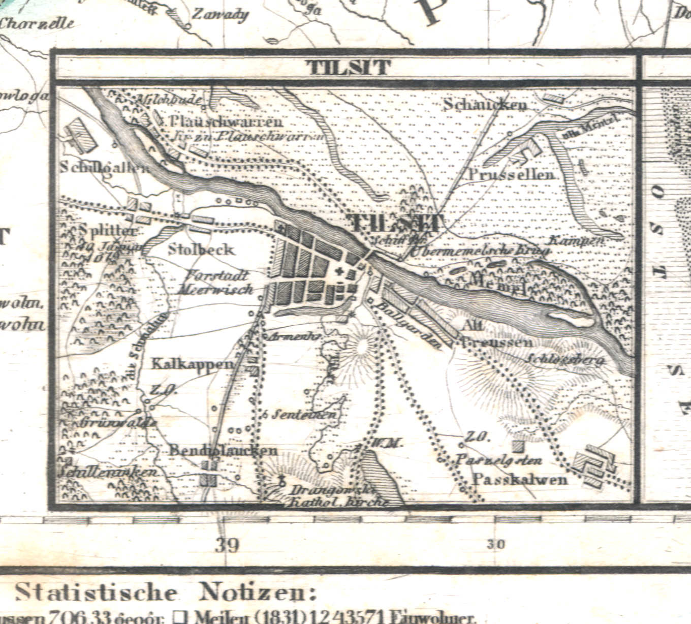
56c. Tilsit
Tilsit / Tilžė / Советск, Sovjetsk
 Meyer's Universal-Atlas (1830-1840)
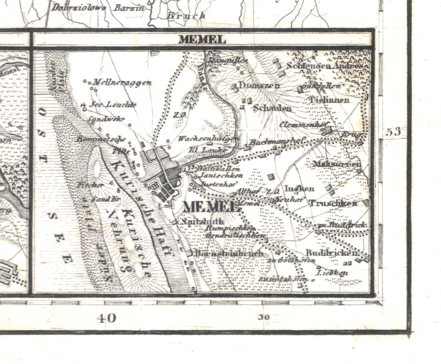
56d. Memel
Memel / Klaipėda
 Meyer's Universal-Atlas (1830-1840)
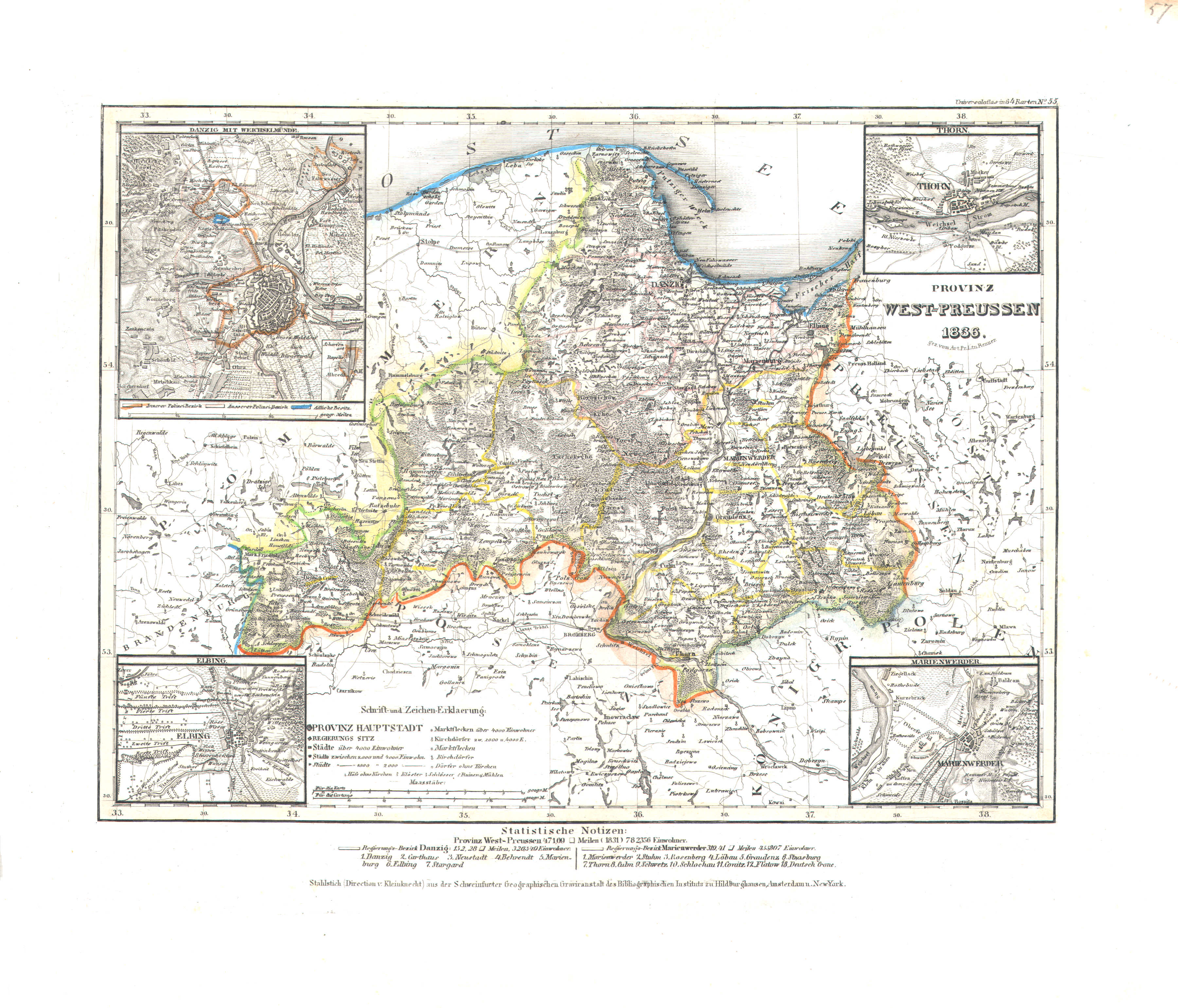
57. Provinz West-Preussen (Nº 55, 1836)
Provincie West-Pruisen / Province of West Prussia
 Meyer's Universal-Atlas (1830-1840)
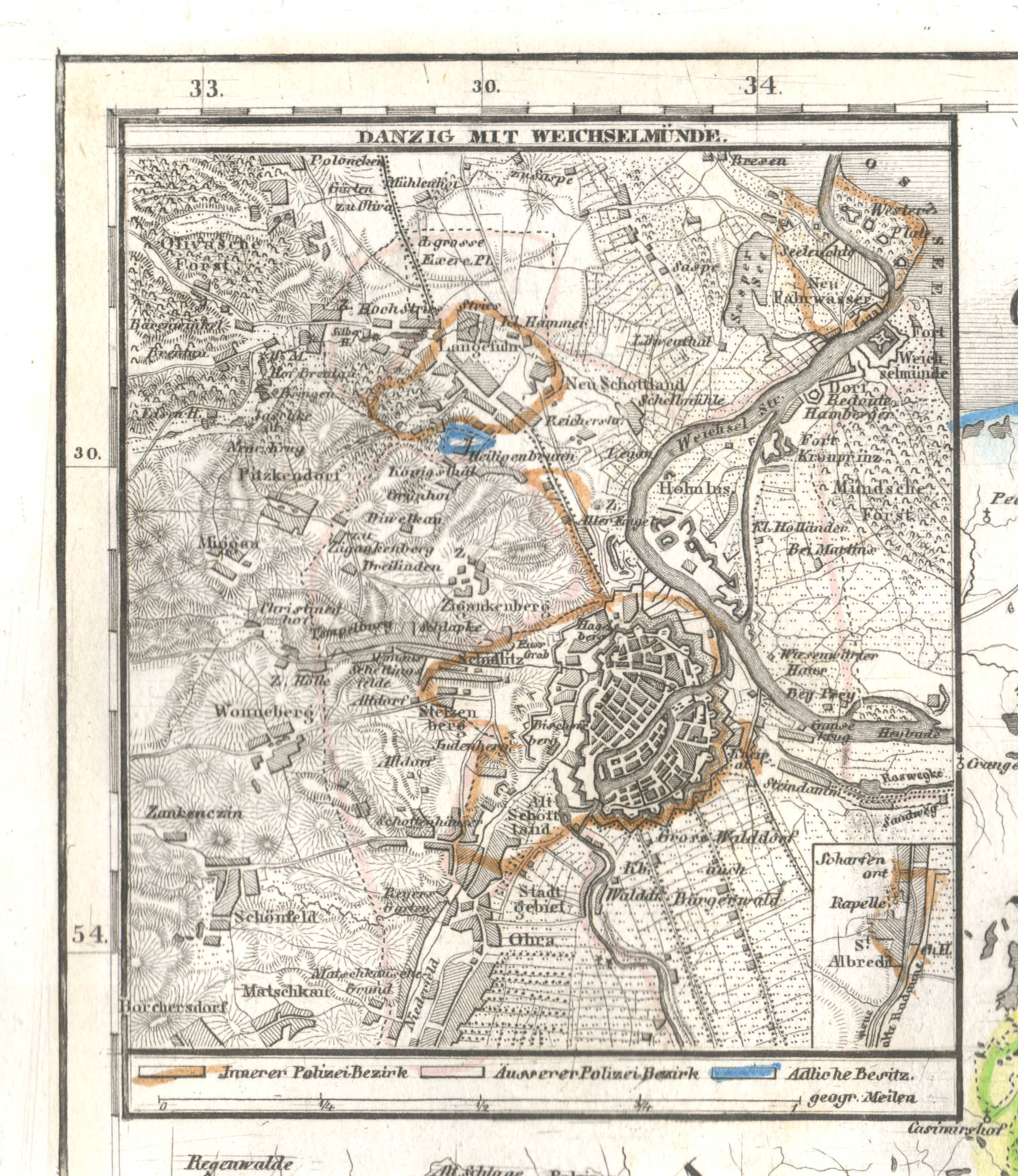
57a. Danzig mit Weichselmünde
Danzig en Weichselmonding / Danzig and mouth of the Vistula / Gdańsk, Wisła
 Meyer's Universal-Atlas (1830-1840)
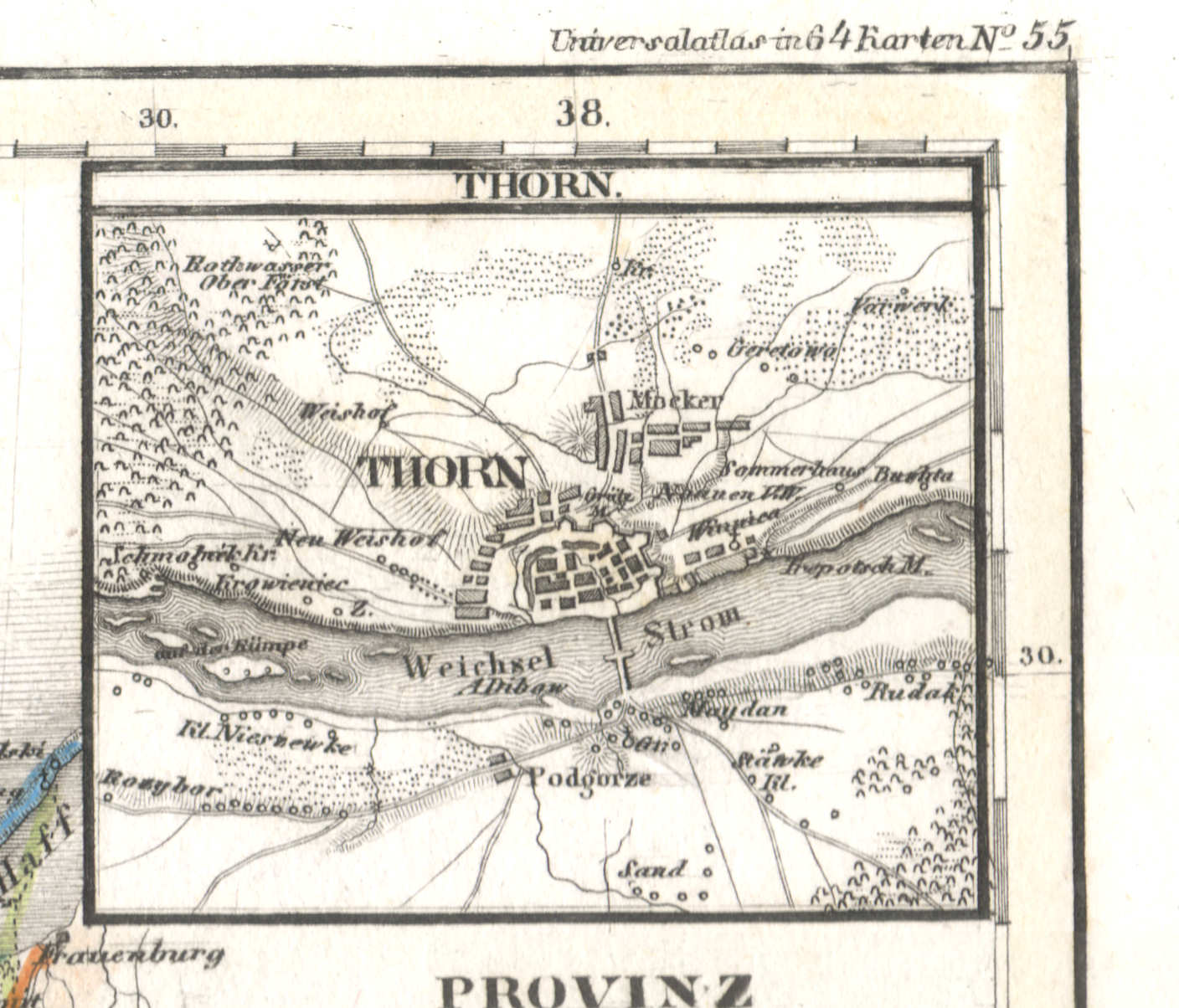
57b. Thorn
Thorn / Toruń
 Meyer's Universal-Atlas (1830-1840)
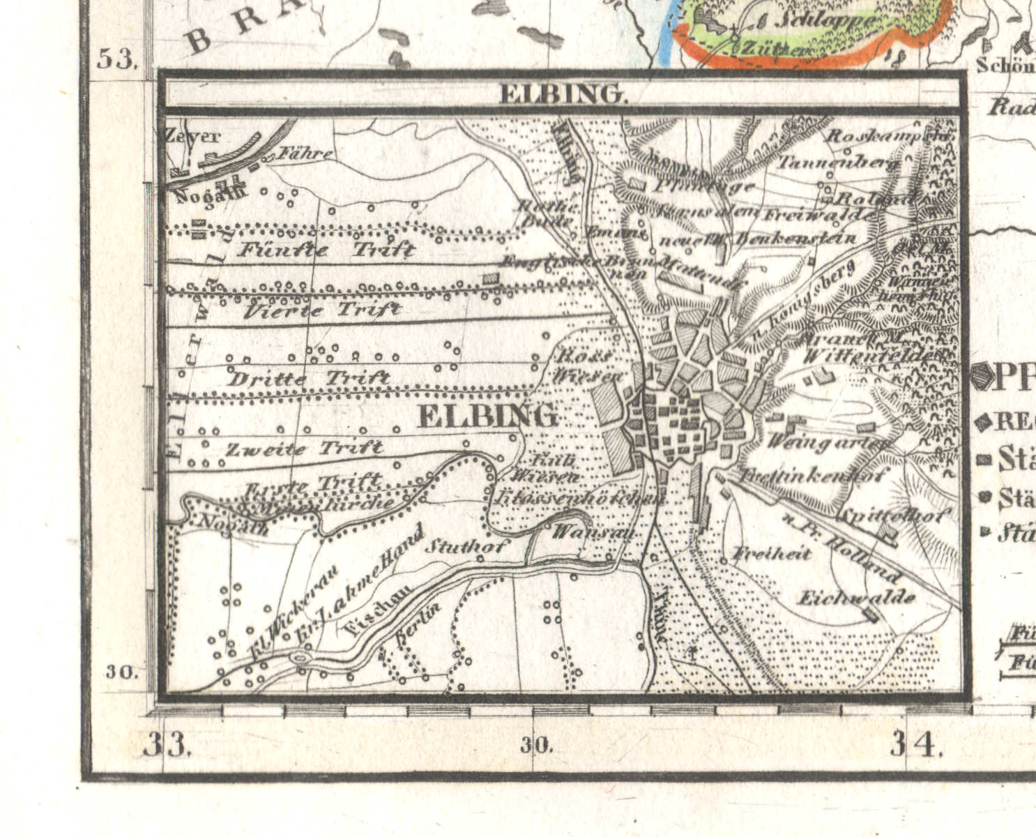
57c. Elbing
Elbing / Elbląg
 Meyer's Universal-Atlas (1830-1840)
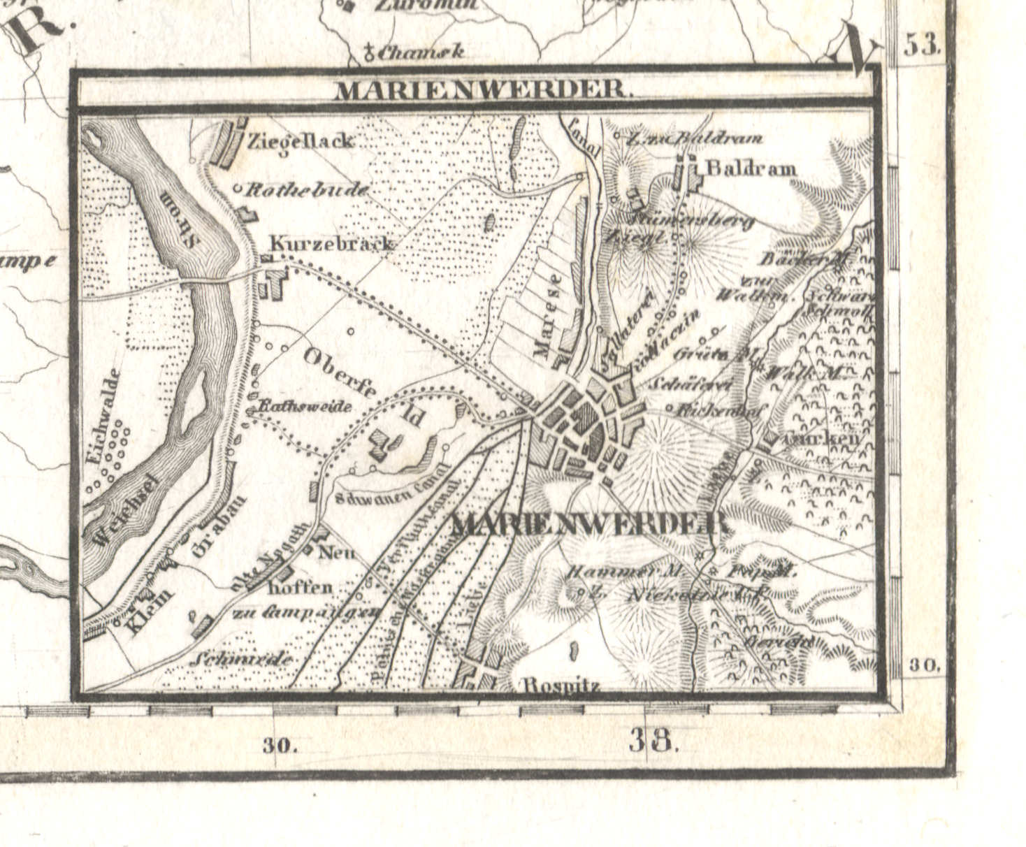
57d. Marienwerder
Marienwerder / Kwidzyn
 Meyer's Universal-Atlas (1830-1840)
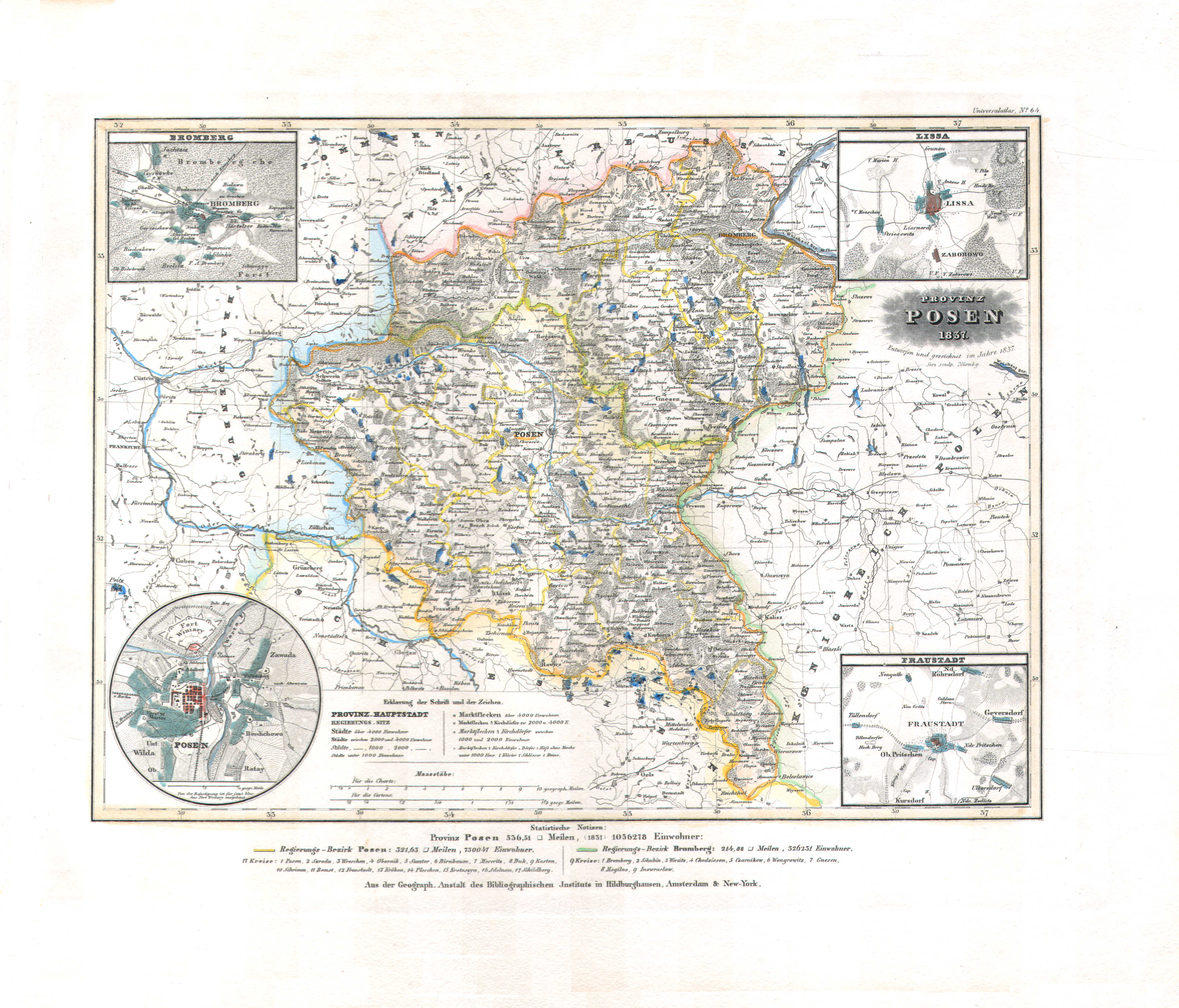
58. Provinz Posen (Nº 64, 1837)
Provincie Posen / Province of Posen
 Meyer's Universal-Atlas (1830-1840)
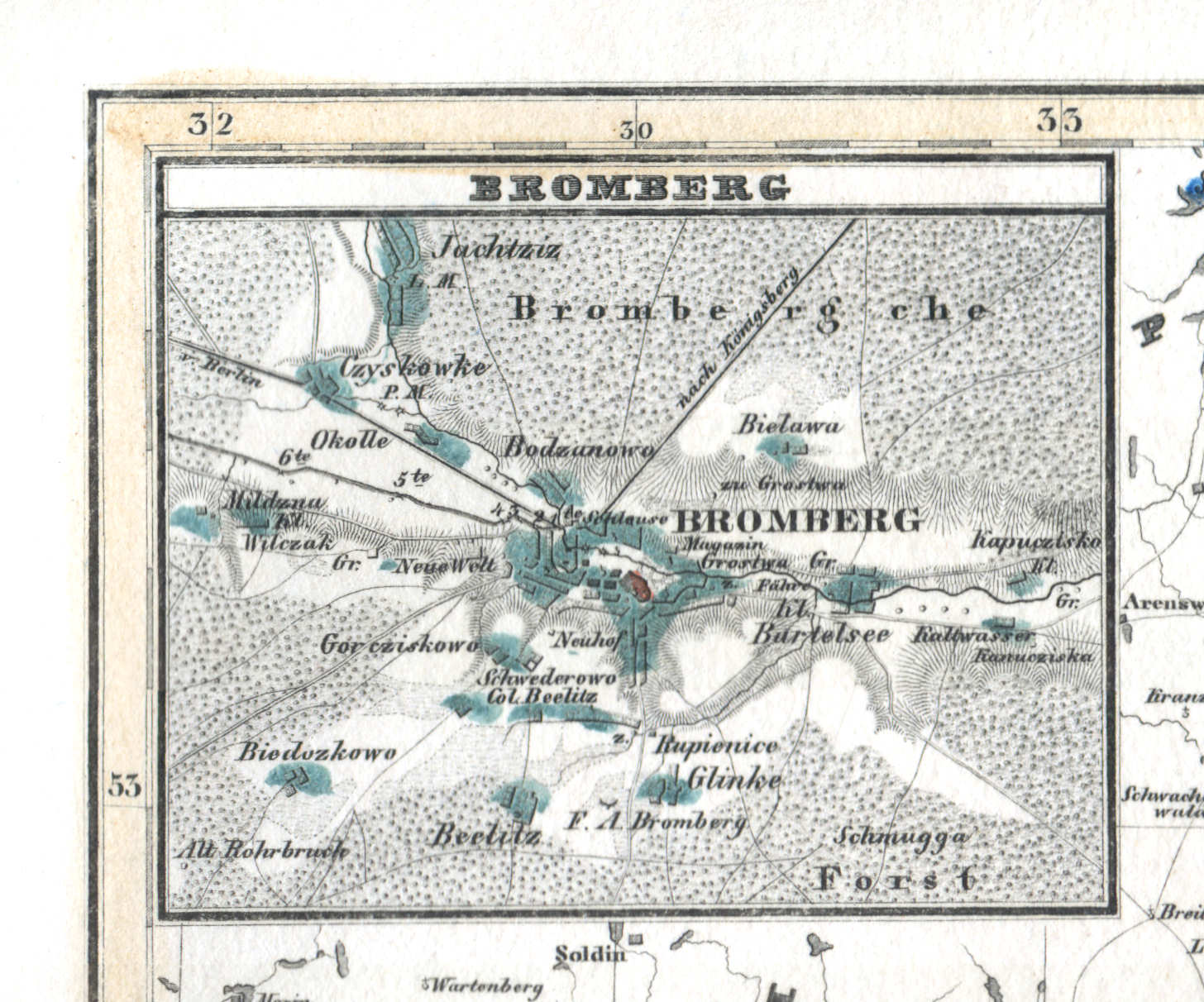
58a. Bromberg
Bromberg / Bydgoszcz
 Meyer's Universal-Atlas (1830-1840)
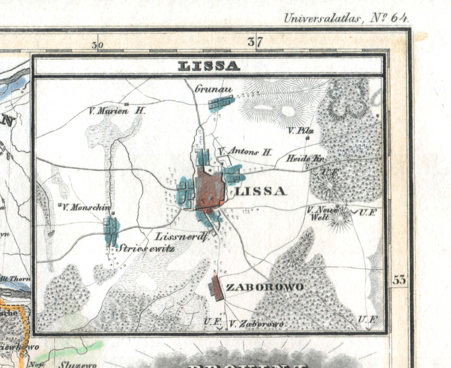
58b. Lissa
Lissa / Leszno
 Meyer's Universal-Atlas (1830-1840)
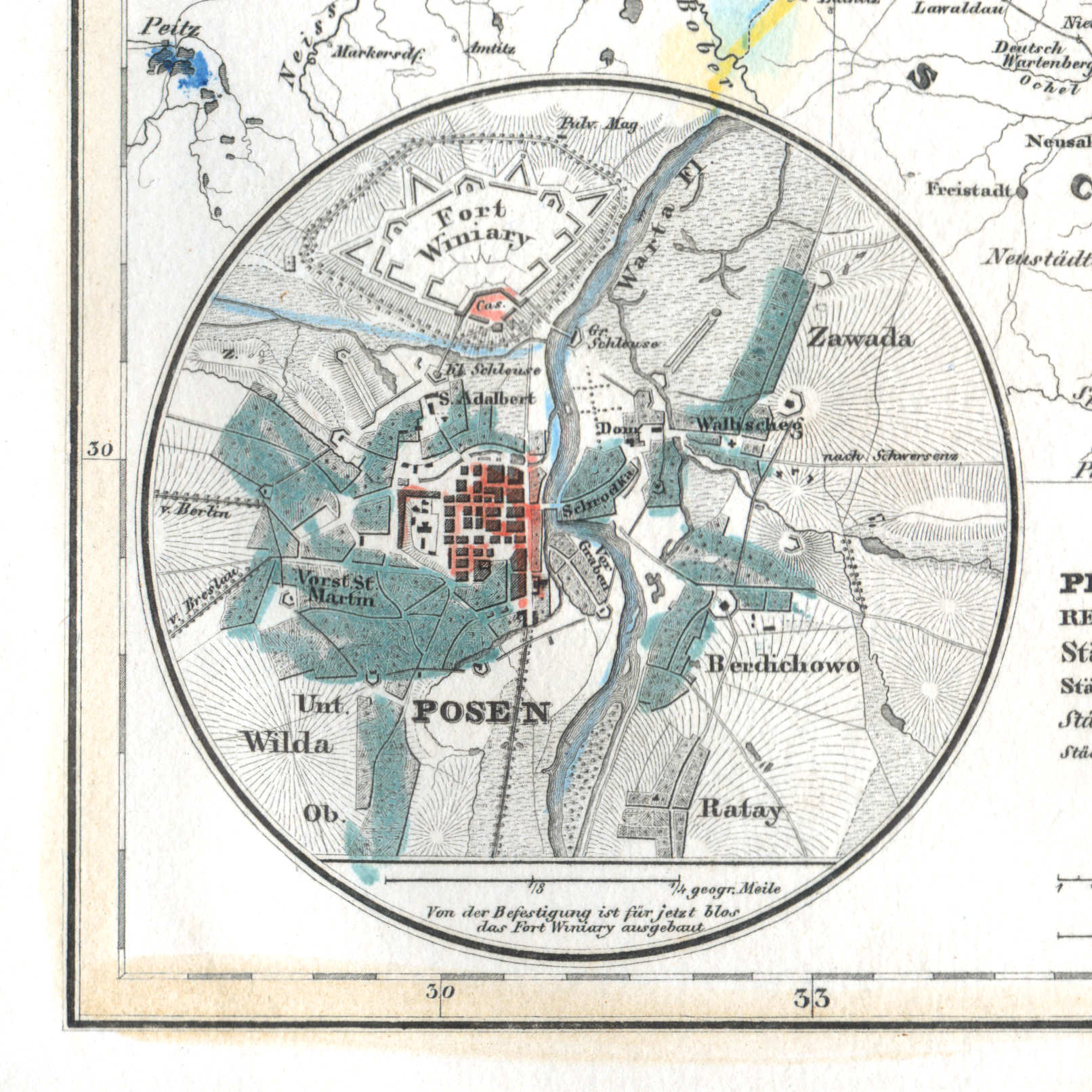
58c. Posen
Posen / Poznań
 Meyer's Universal-Atlas (1830-1840)
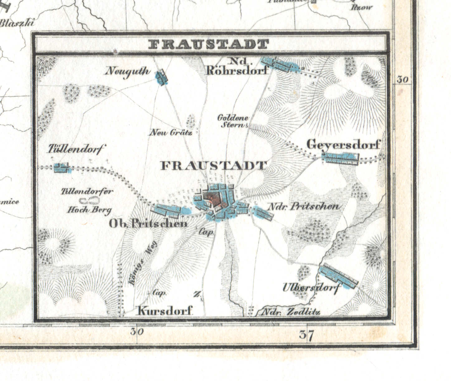
58d. Fraustadt
Fraustadt / Wschowa
 Meyer's Universal-Atlas (1830-1840)
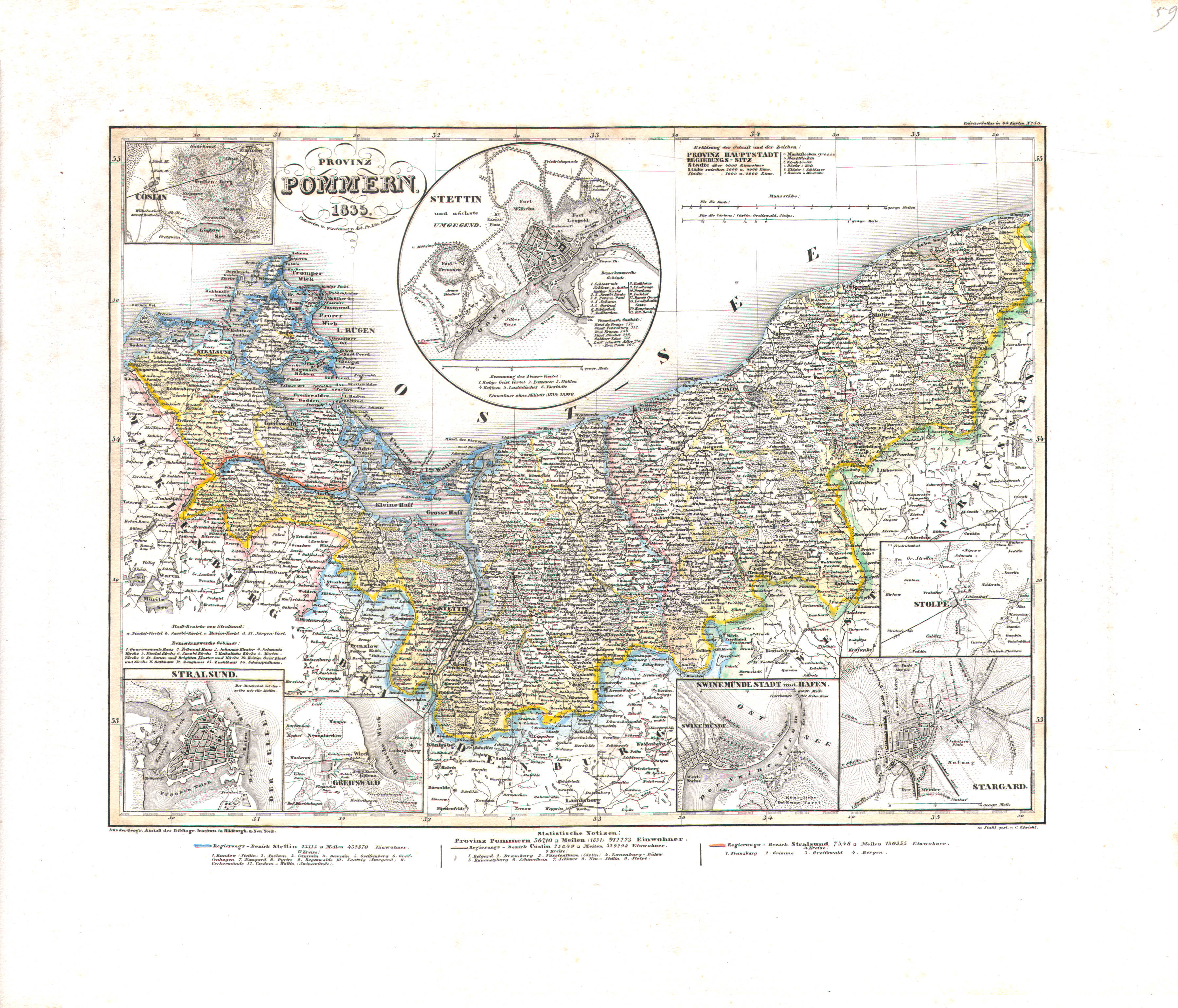
59. Provinz Pommern (Nº 50, 1835)
Provincie Pommeren / Province of Pomerania
 Meyer's Universal-Atlas (1830-1840)
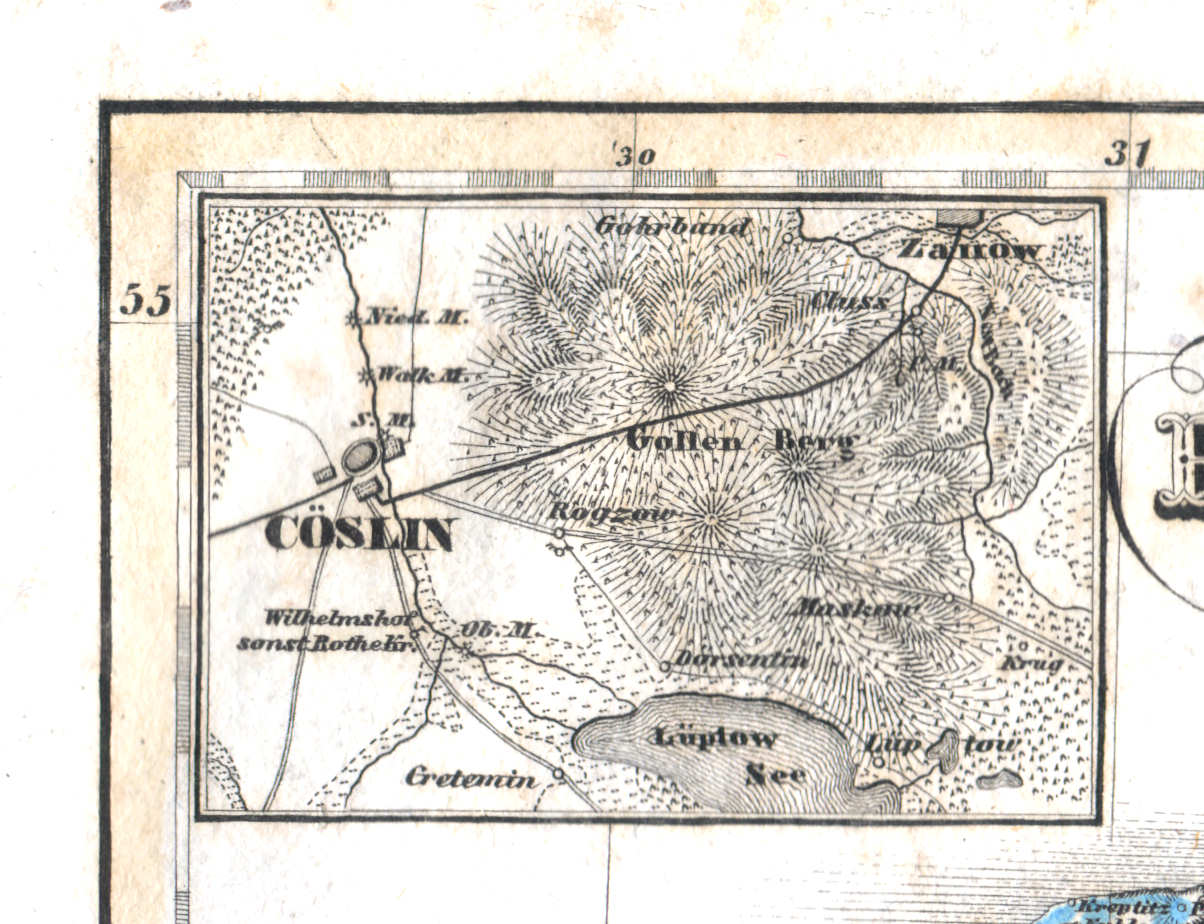
59a. Cöslin
Köslin / Koszalin
 Meyer's Universal-Atlas (1830-1840)
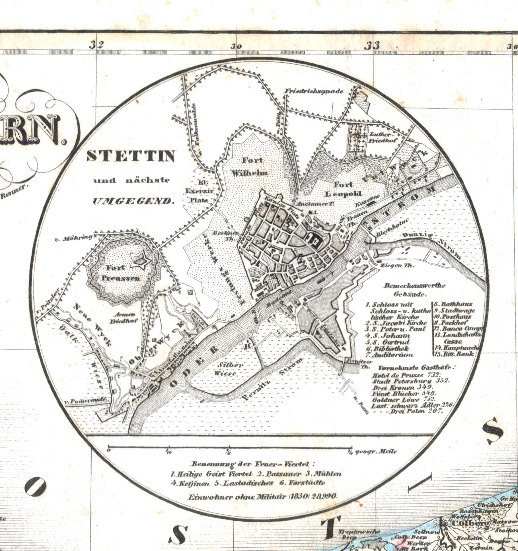
59b. Stettin und nächste Umgegend
Stettin / Szczecin
 Meyer's Universal-Atlas (1830-1840)
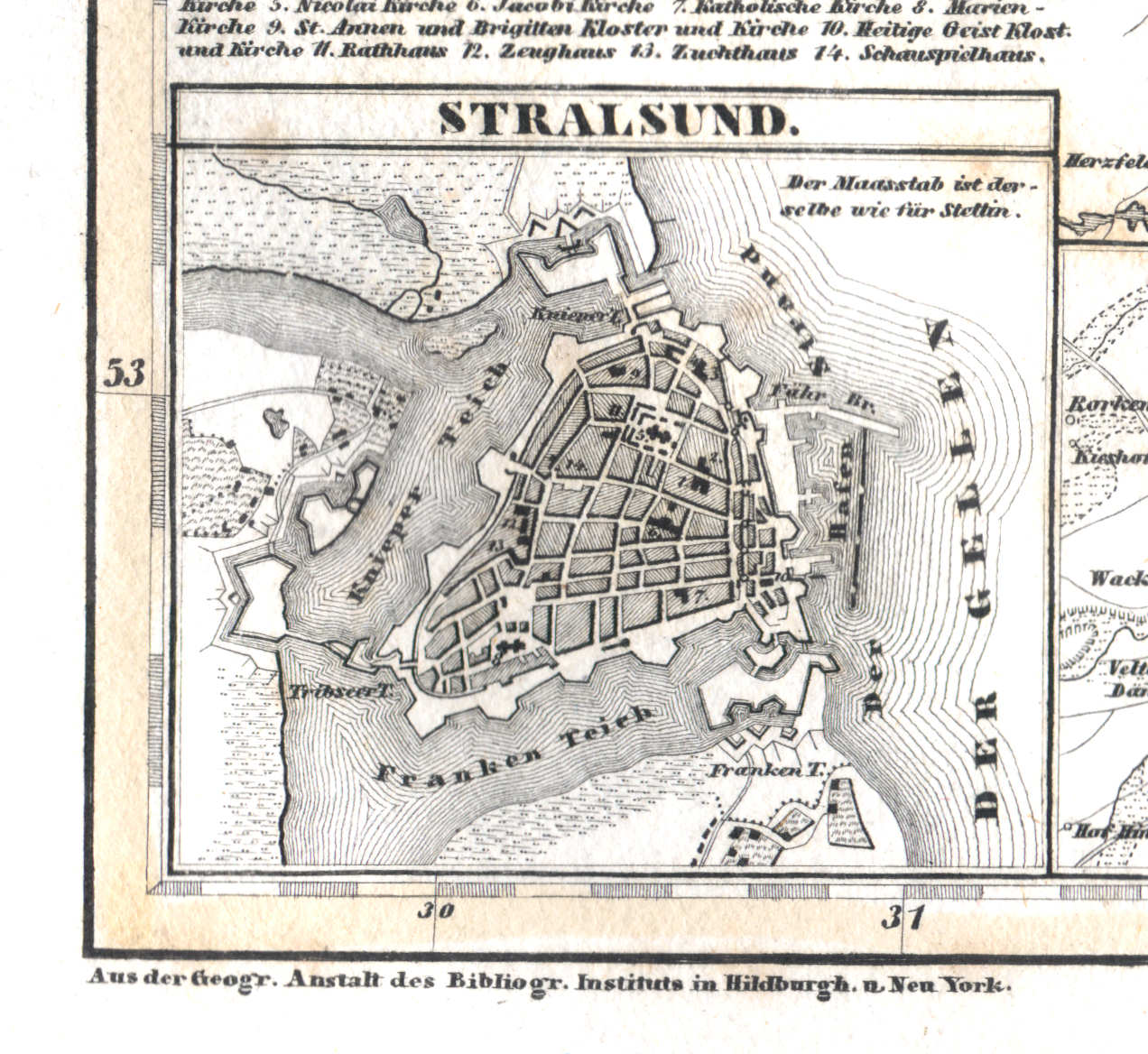
59c. Stralsund
Stralsund
 Meyer's Universal-Atlas (1830-1840)
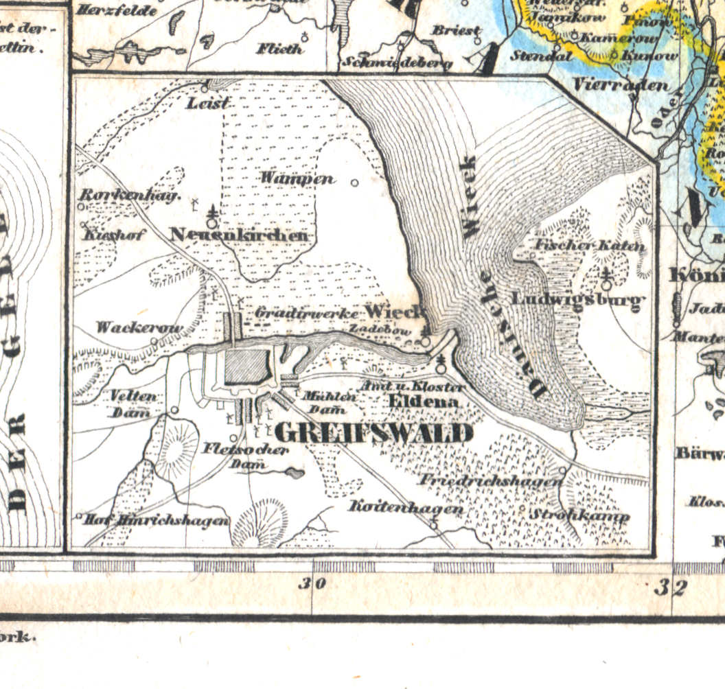
59d. Greifswald
Greifswald
 Meyer's Universal-Atlas (1830-1840)
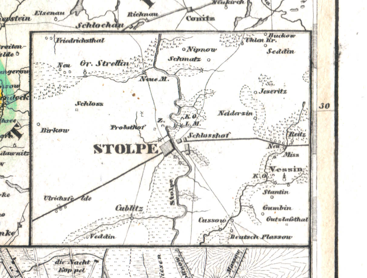
59e. Stolpe
Stolp / Słupsk
 Meyer's Universal-Atlas (1830-1840)
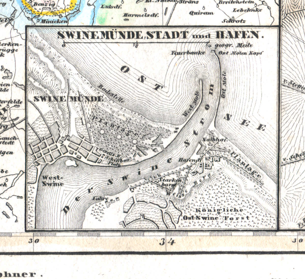
59f. Swinemünde, Stadt und Hafen
Swinemünde / Świnoujście
 Meyer's Universal-Atlas (1830-1840)
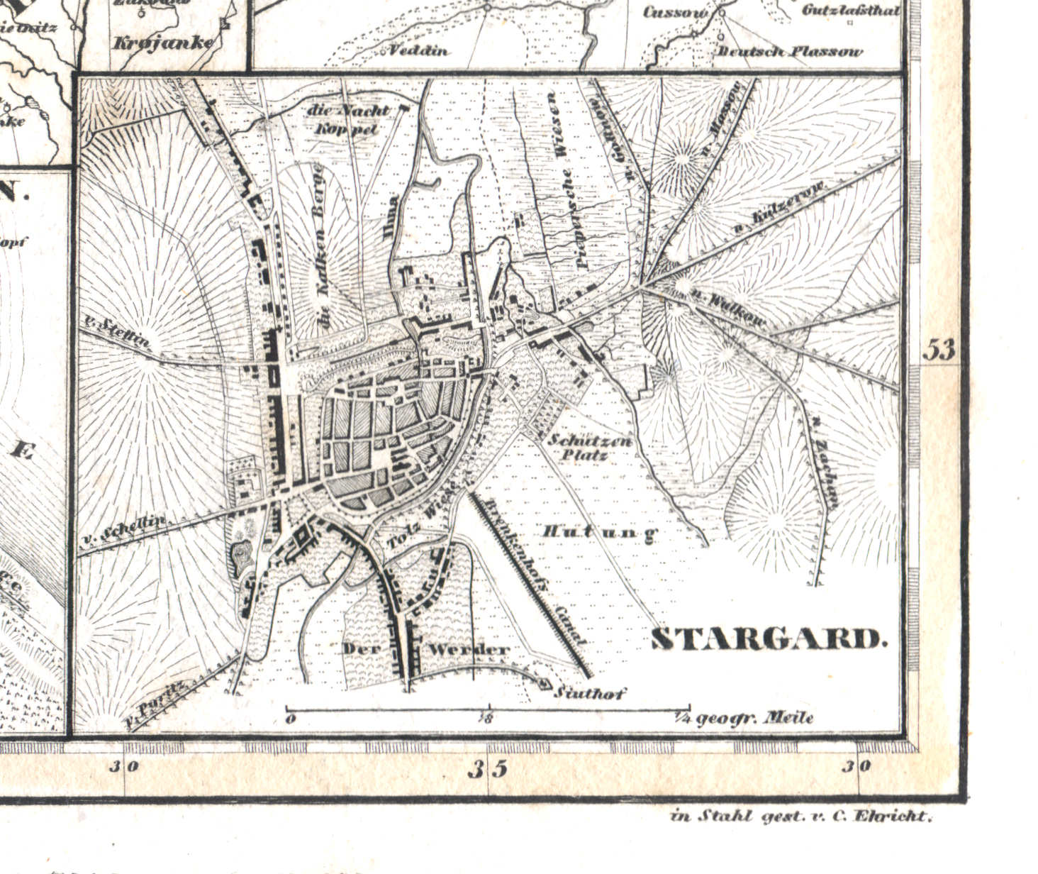
59g. Stargard
Stargard / Stargard Szczeciński
 Meyer's Universal-Atlas (1830-1840)
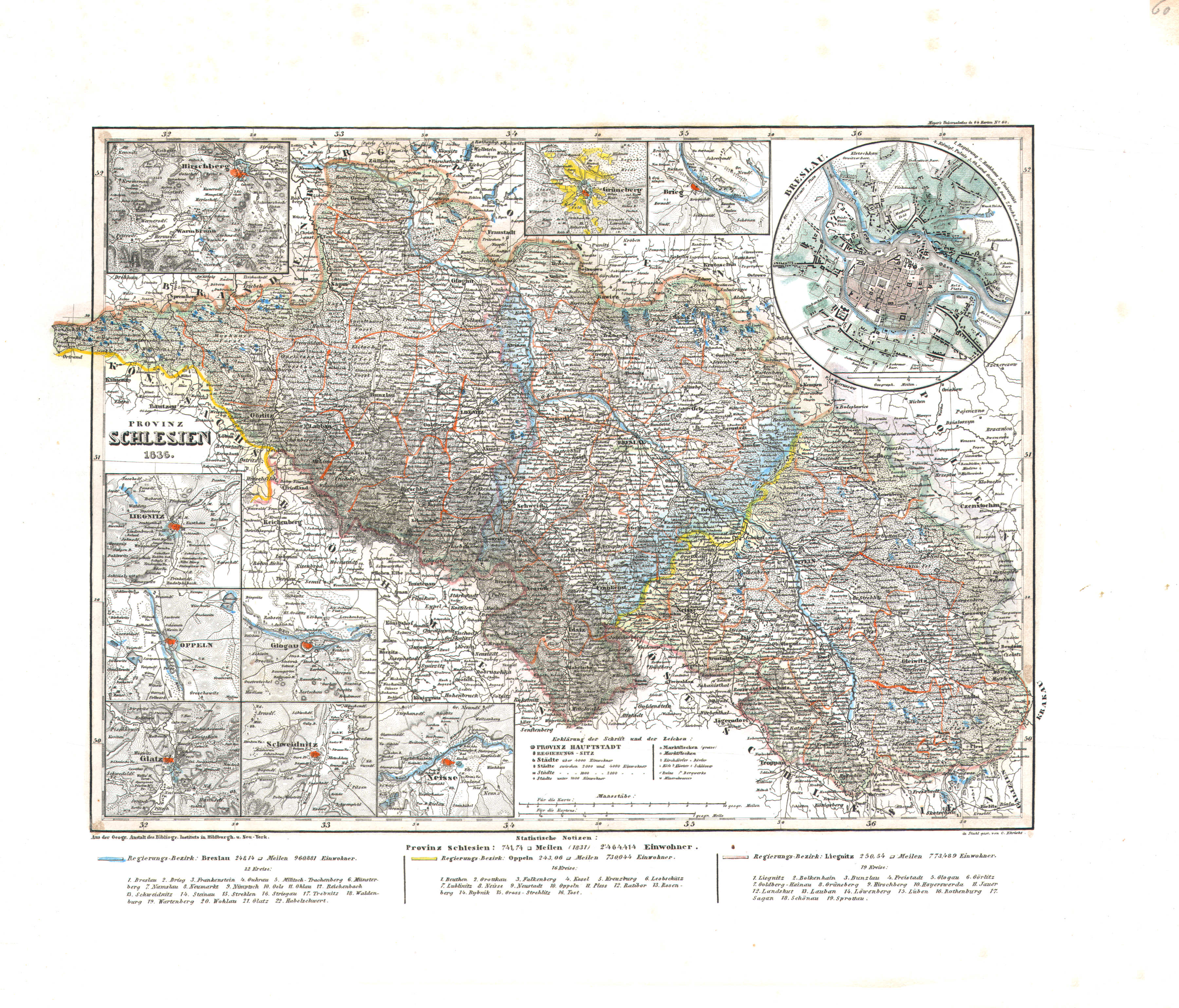
60. Provinz Schlesien (Nº 60, 1836)
Provincie Silesië / Province of Silesia
 Meyer's Universal-Atlas (1830-1840)
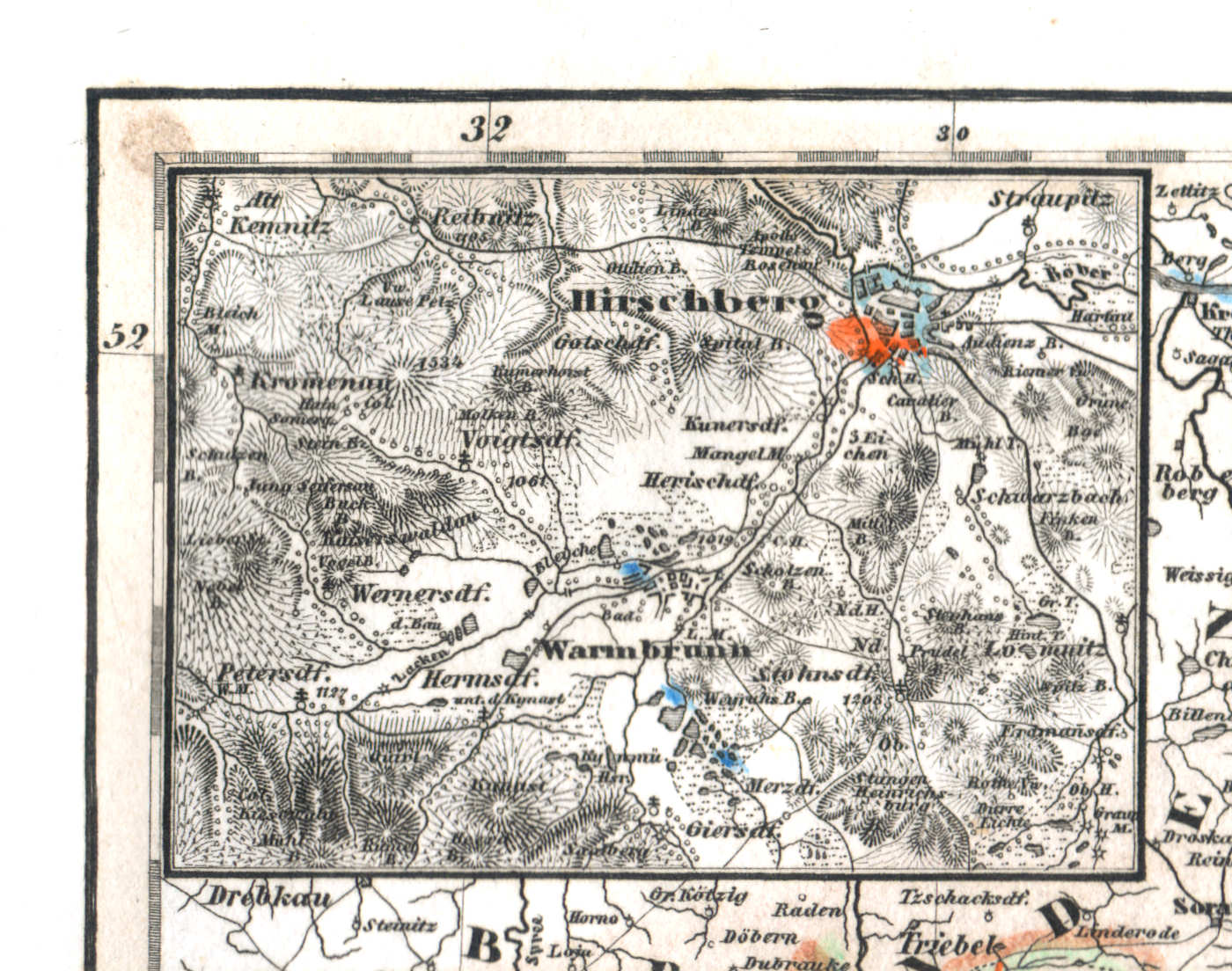
60a. Hirschberg
Hirschberg / Jelenia Góra
 Meyer's Universal-Atlas (1830-1840)
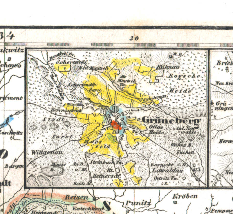
60b. Grüneberg
Grünberg in Schlesien / Zielona Góra
 Meyer's Universal-Atlas (1830-1840)
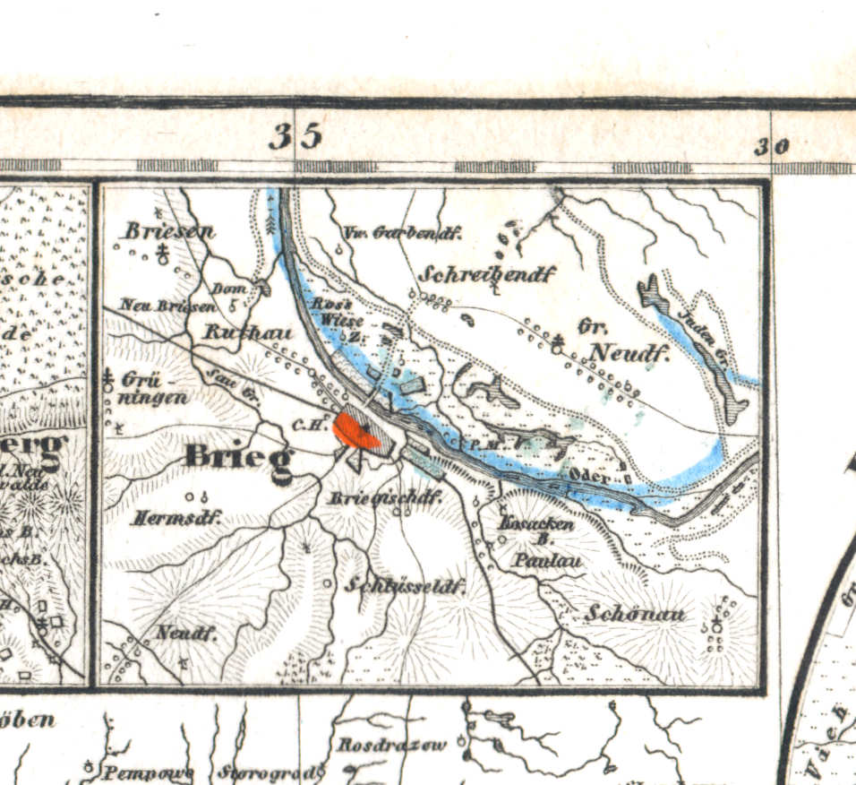
60c. Brieg
Brieg / Brzeg
 Meyer's Universal-Atlas (1830-1840)
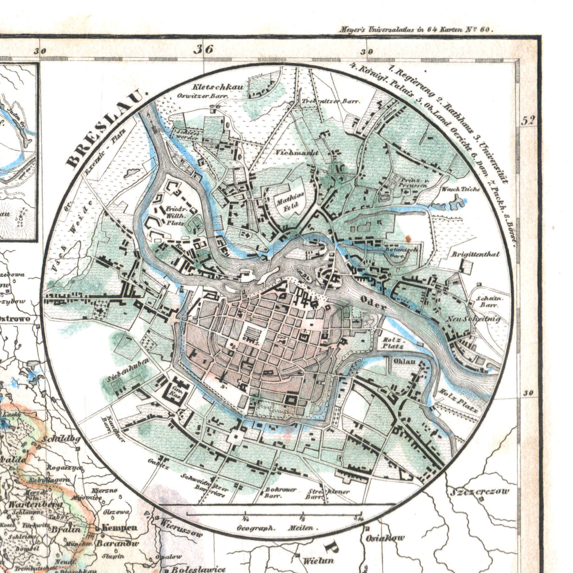
60d. Breslau
Breslau / Wrocław
 Meyer's Universal-Atlas (1830-1840)
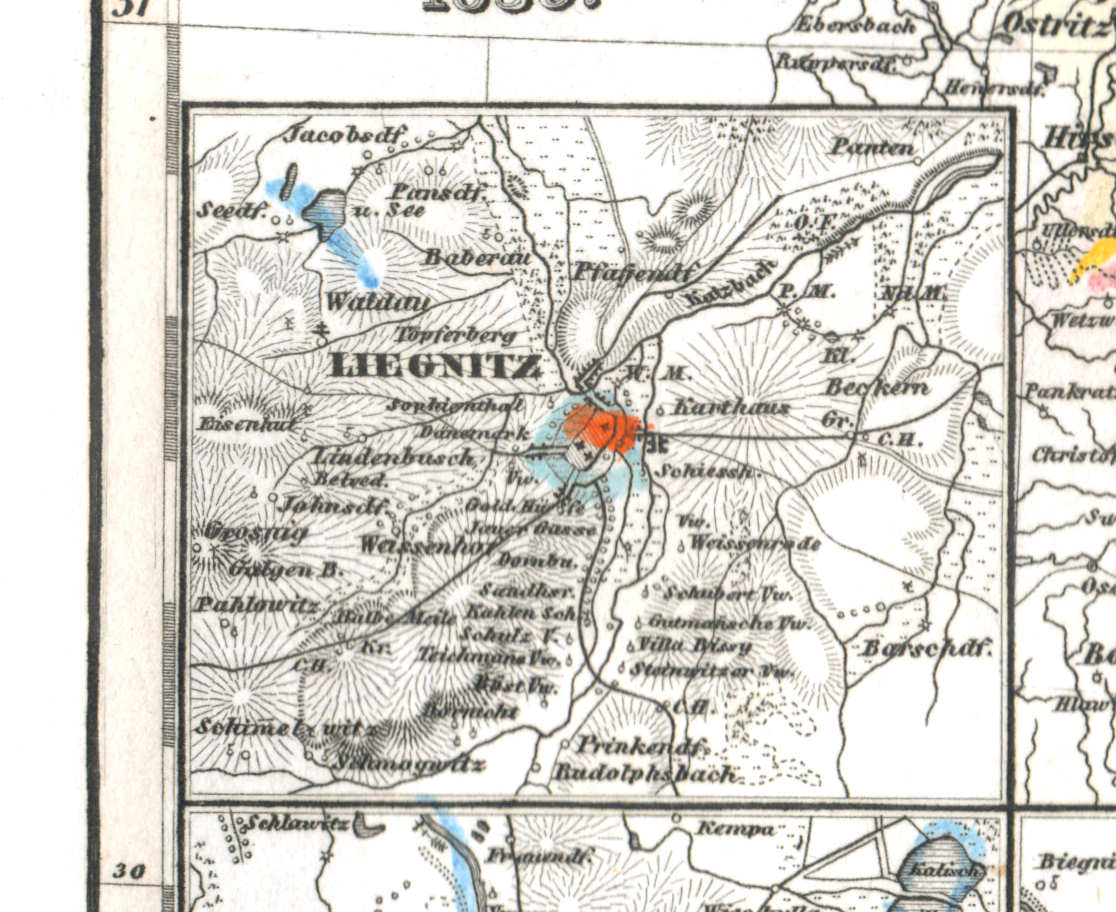
60e. Liegnitz
Liegnitz / Legnica
 Meyer's Universal-Atlas (1830-1840)
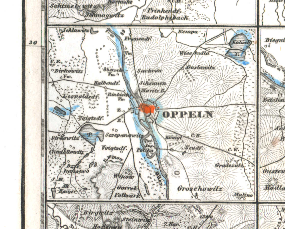
60f. Oppeln
Oppeln / Opole
 Meyer's Universal-Atlas (1830-1840)
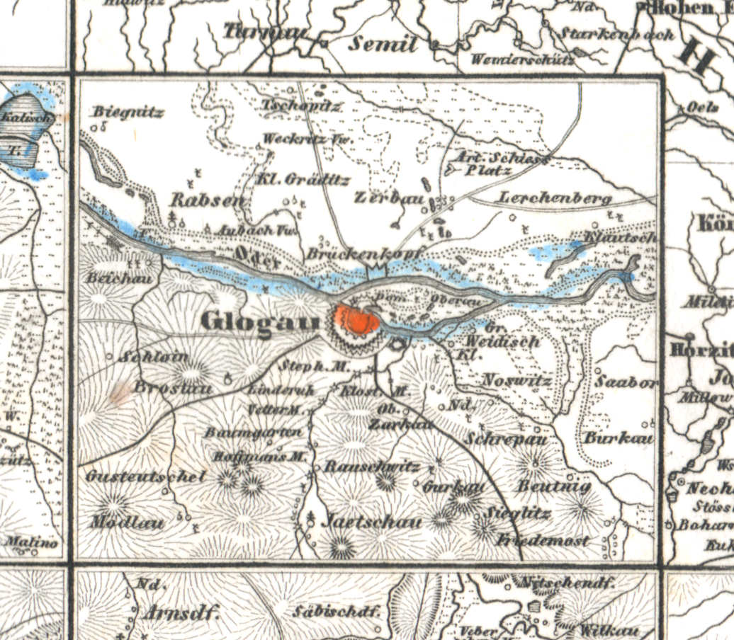
60g. Glogau
Glogau / Głogów
 Meyer's Universal-Atlas (1830-1840)
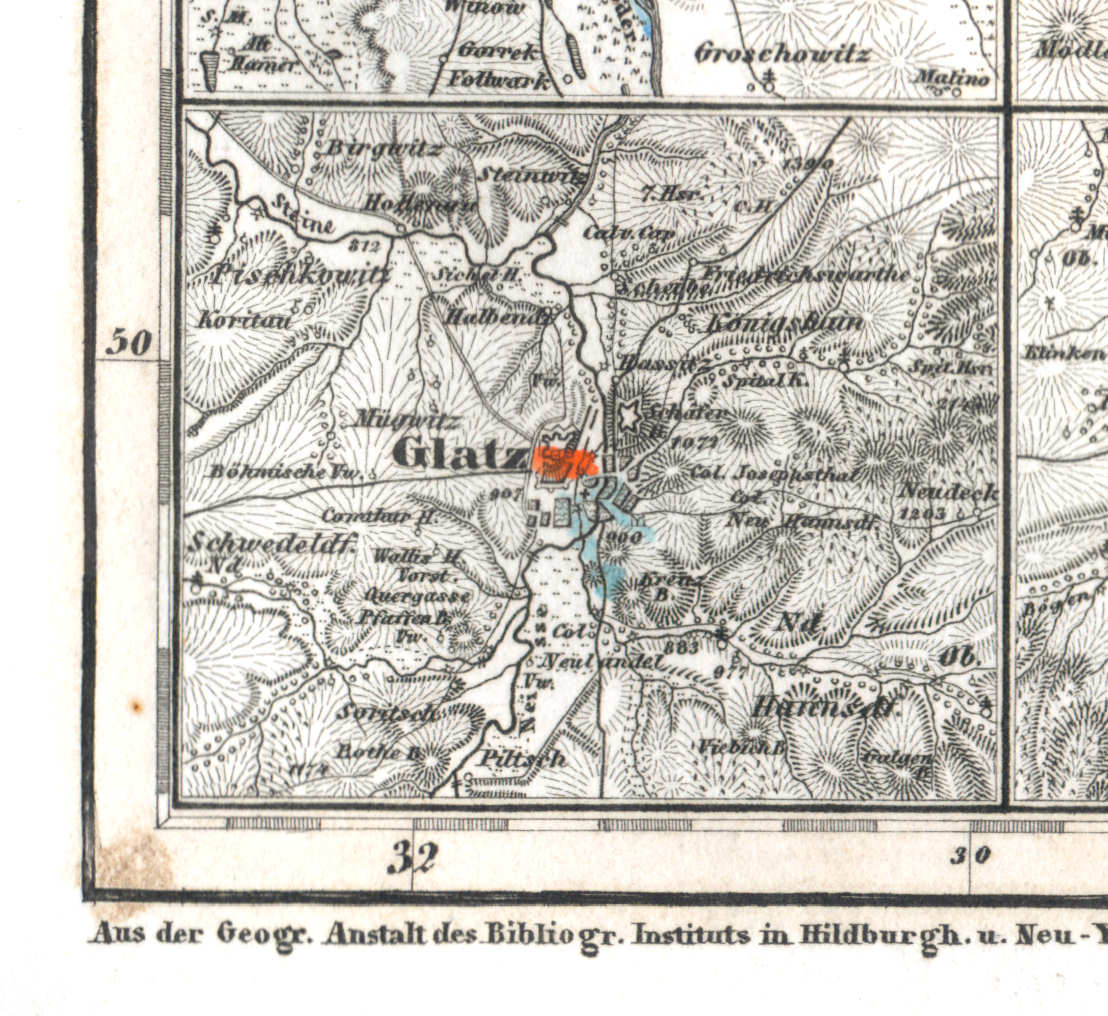
60h. Glatz
Glatz / Kłodzko
 Meyer's Universal-Atlas (1830-1840)
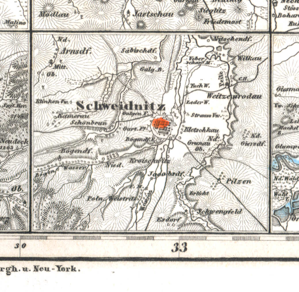
60i. Schweidnitz
Schweidnitz / Świdnica
 Meyer's Universal-Atlas (1830-1840)
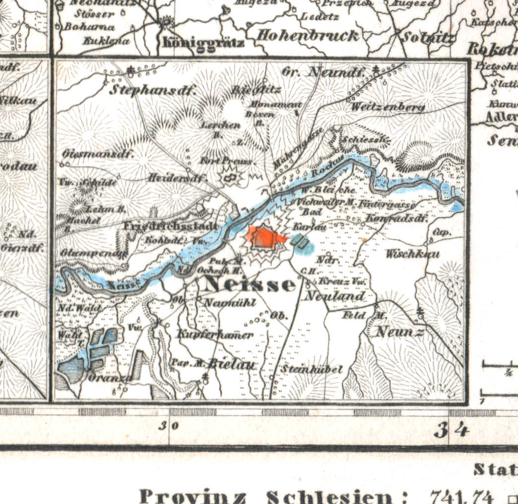
60j. Neisse
Neisse / Nysa
 Meyer's Universal-Atlas (1830-1840)
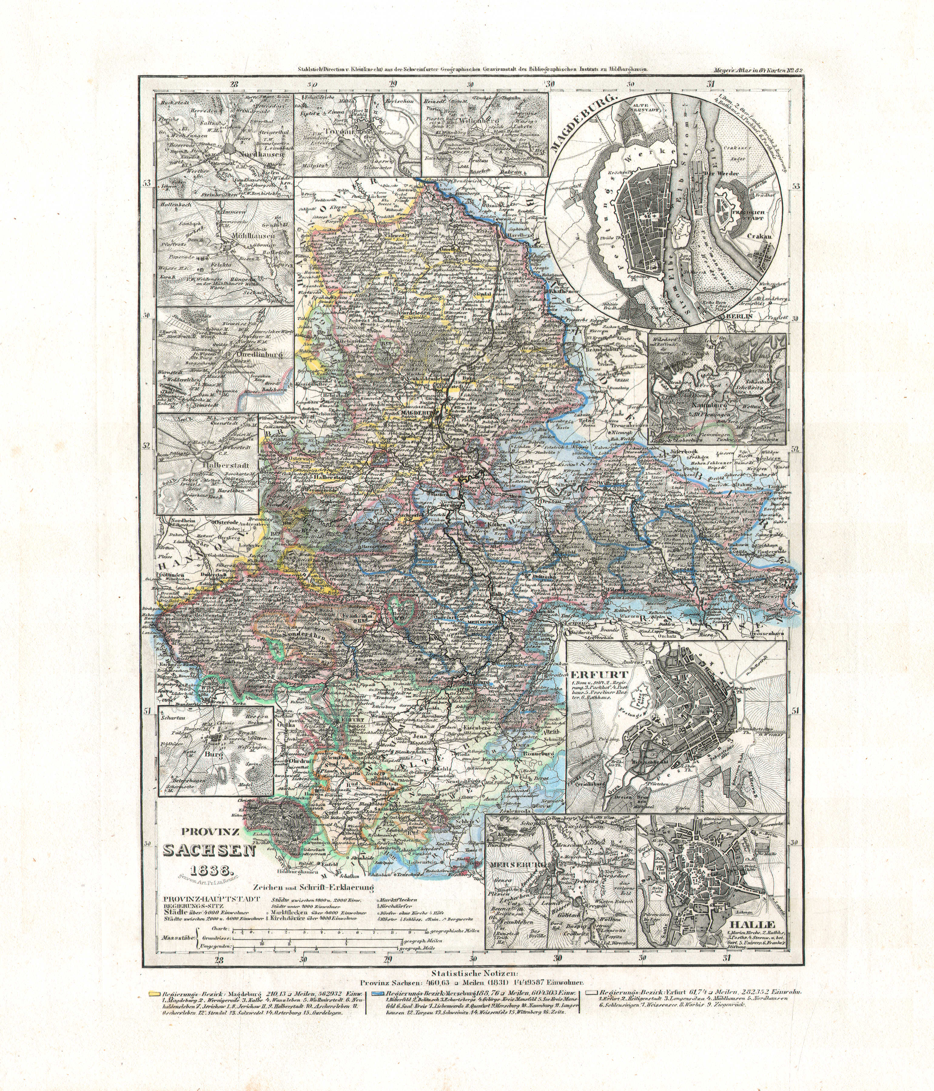
61. Provinz Sachsen (Nº 82, 1838)
Provincie Saksen / Province of Saxony
 Meyer's Universal-Atlas (1830-1840)
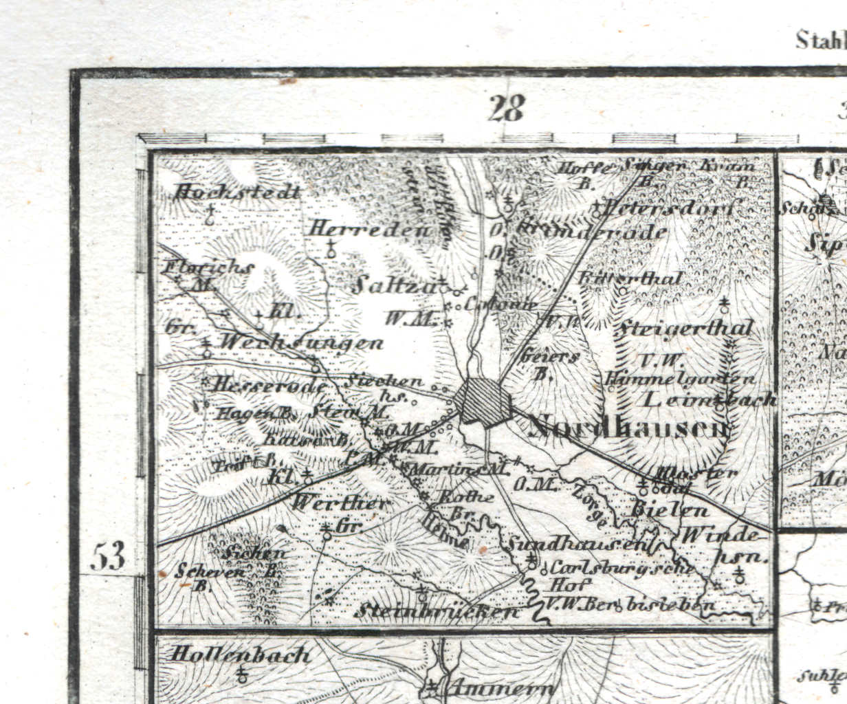
61a. Nordhausen
Nordhausen
 Meyer's Universal-Atlas (1830-1840)
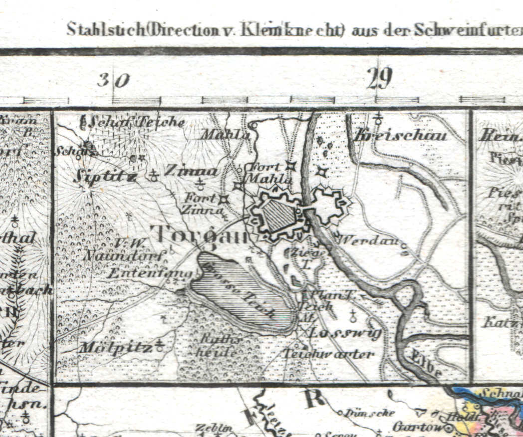
61b. Torgau
Torgau
 Meyer's Universal-Atlas (1830-1840)
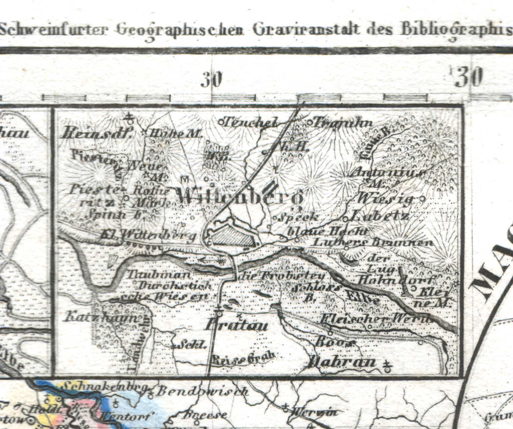
61c. Wittenberg
Wittenberg
 Meyer's Universal-Atlas (1830-1840)
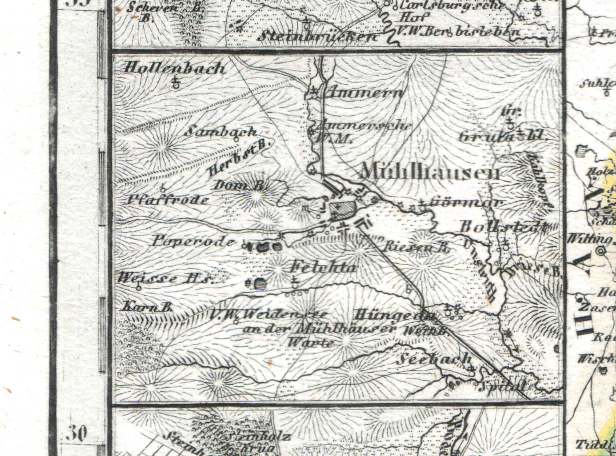
61d. Mühlhausen
Mühlhausen
 Meyer's Universal-Atlas (1830-1840)
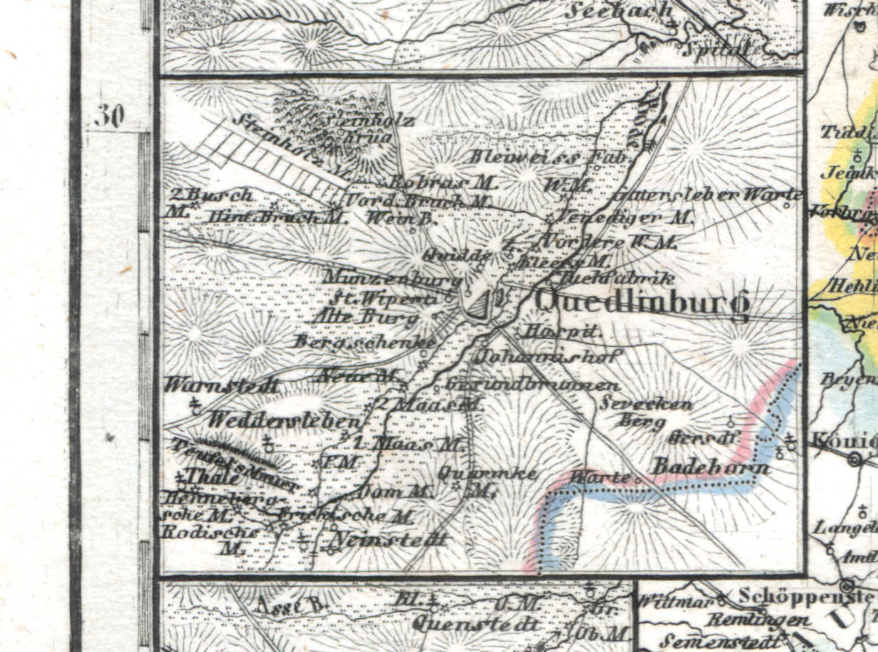
61e. Quedlinburg
Quedlinburg
 Meyer's Universal-Atlas (1830-1840)
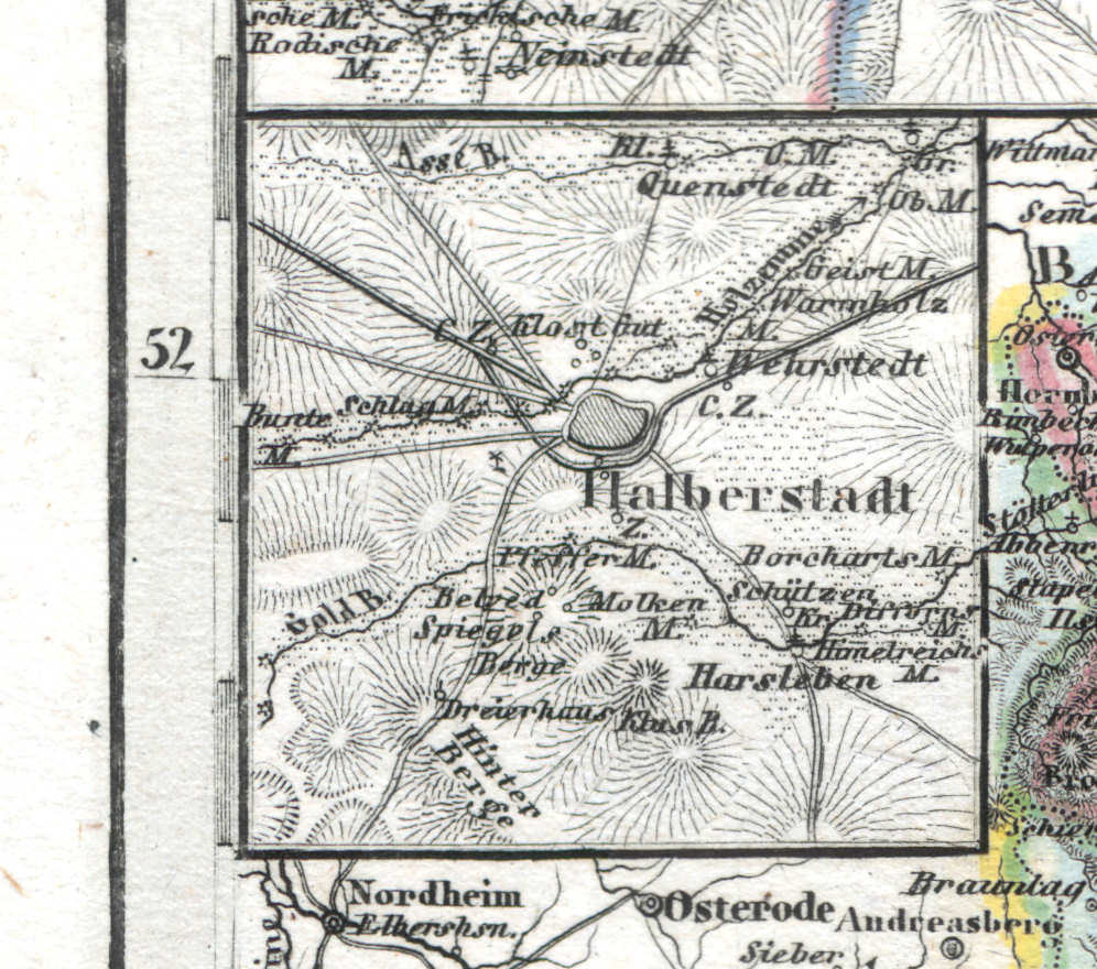
61f. Halberstadt
Halberstadt
 Meyer's Universal-Atlas (1830-1840)
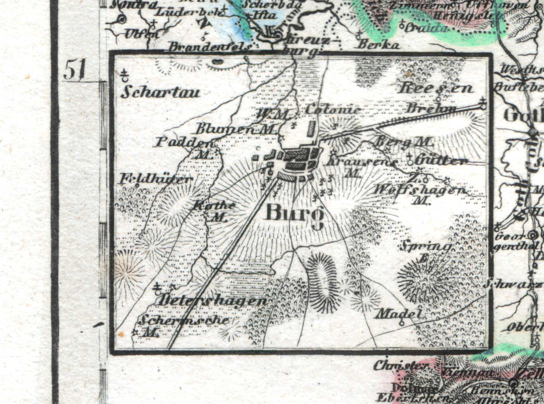
61g. Burg
Burg
 Meyer's Universal-Atlas (1830-1840)
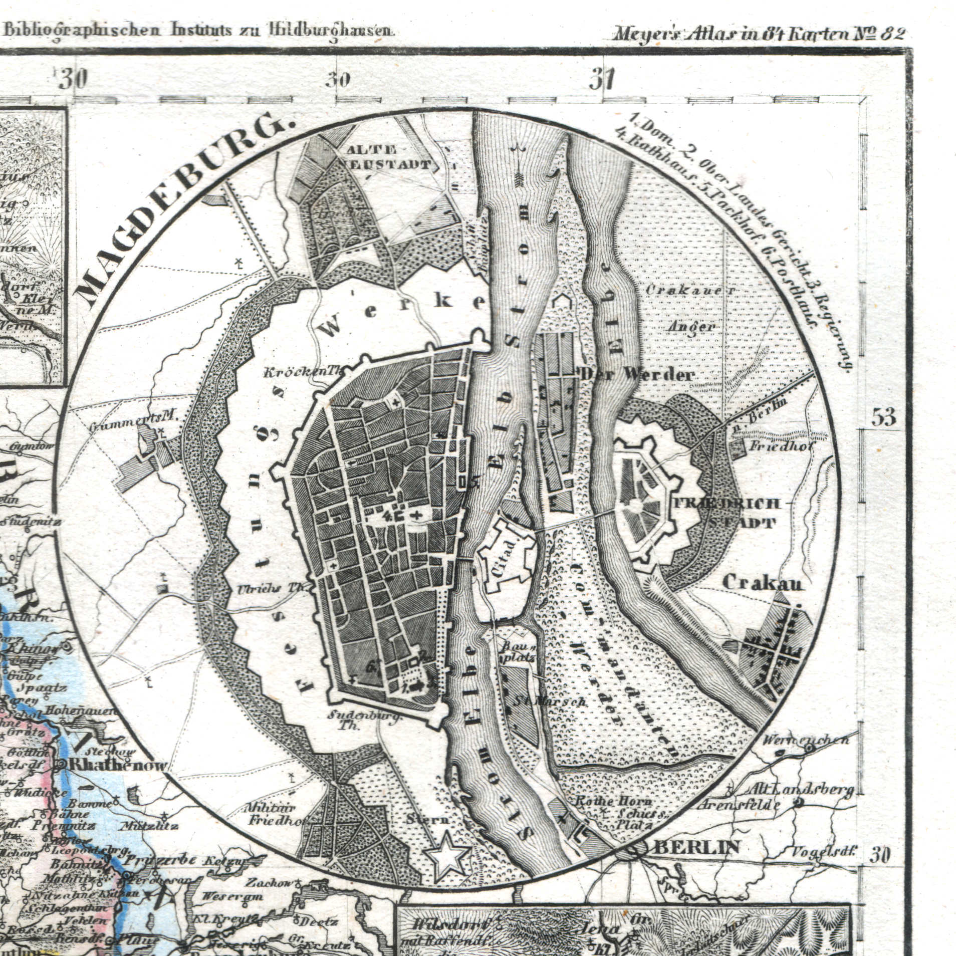
61h. Magdeburg
Maagdenburg / Magdeburg
 Meyer's Universal-Atlas (1830-1840)
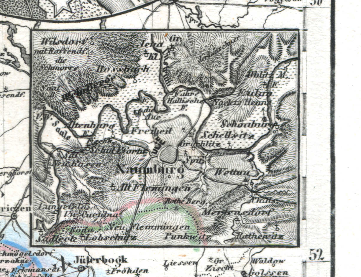
61i. Naumburg
Naumburg
 Meyer's Universal-Atlas (1830-1840)
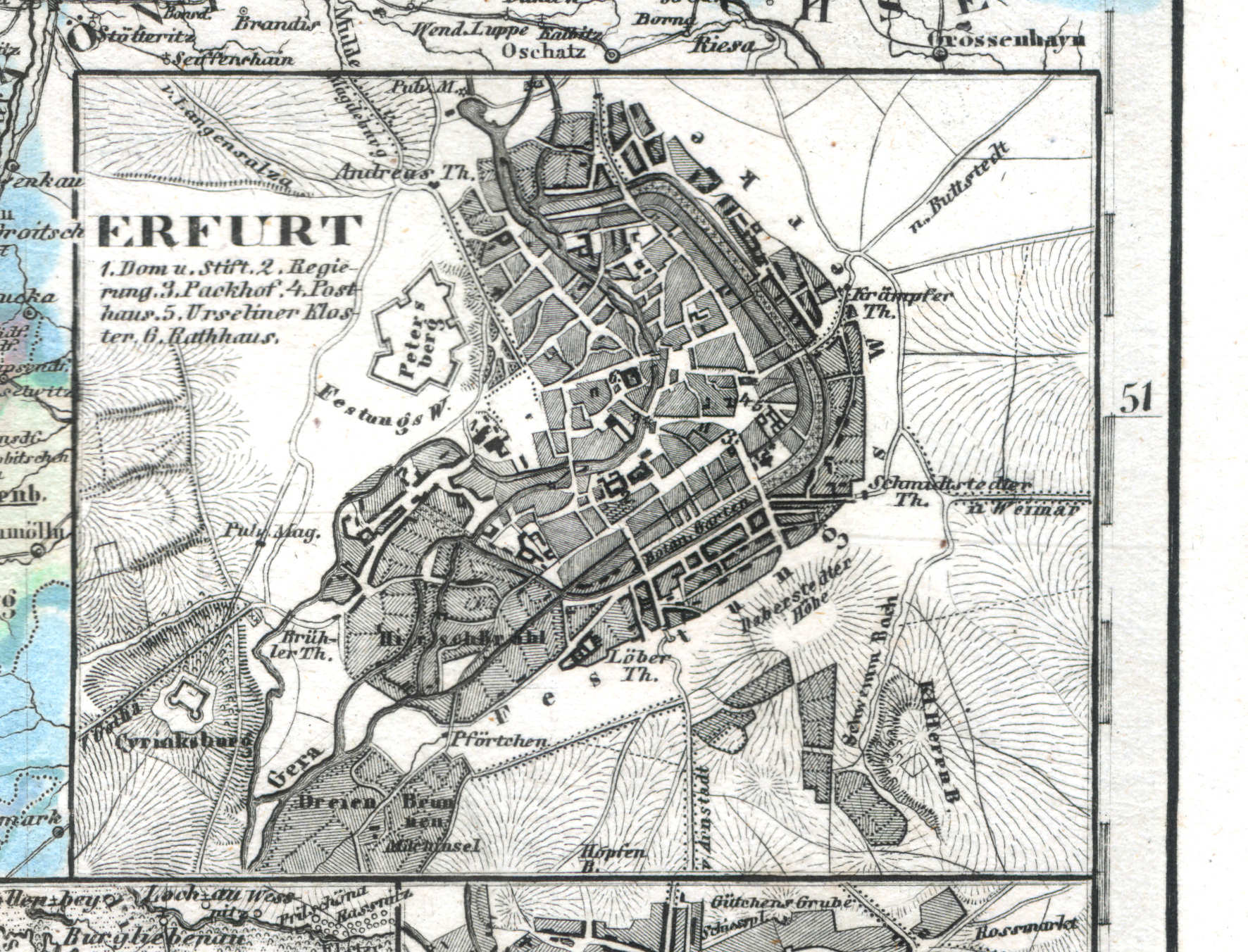
61j. Erfurt
Erfurt
 Meyer's Universal-Atlas (1830-1840)
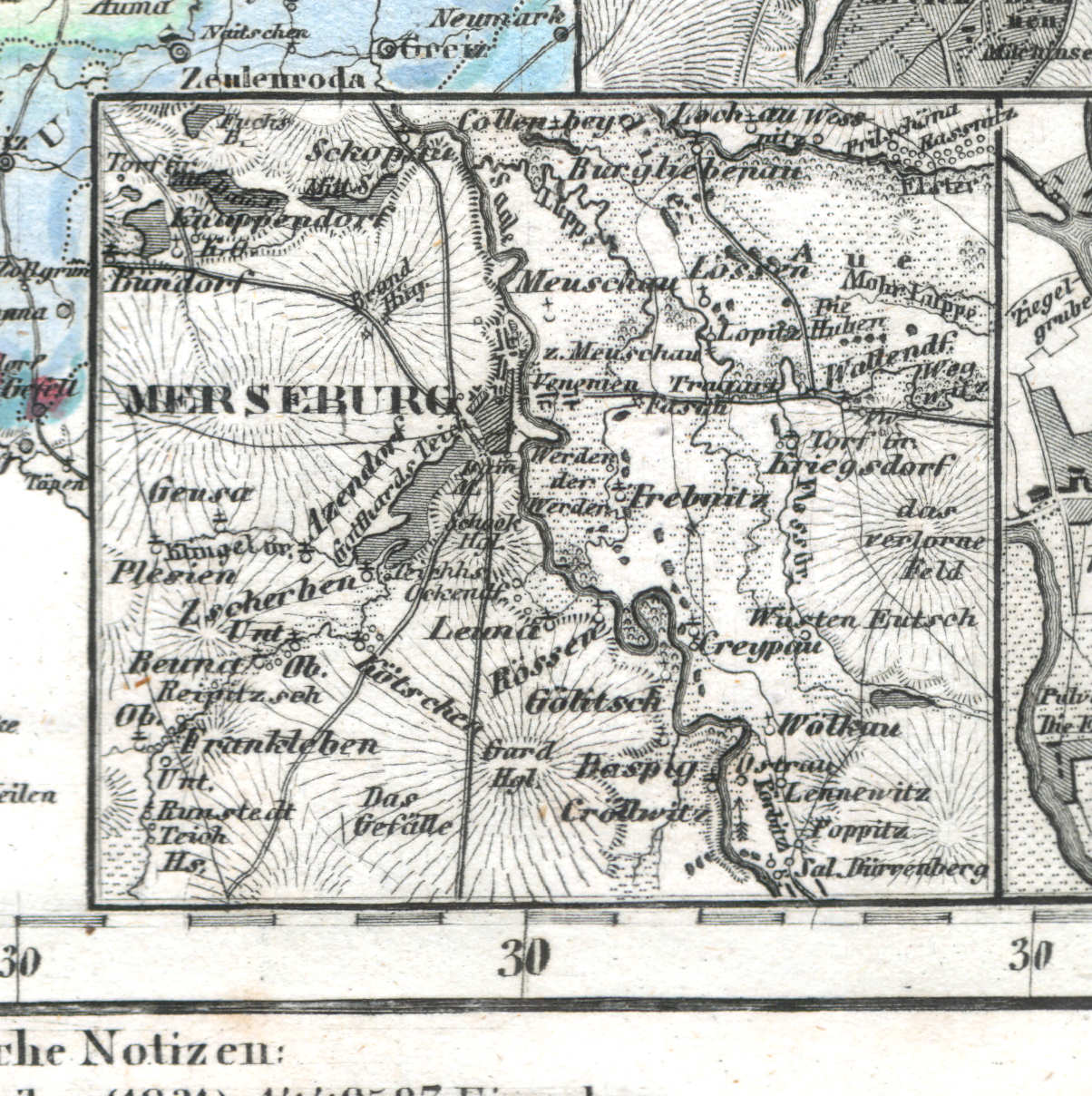
61k. Merseburg
Merseburg
 Meyer's Universal-Atlas (1830-1840)
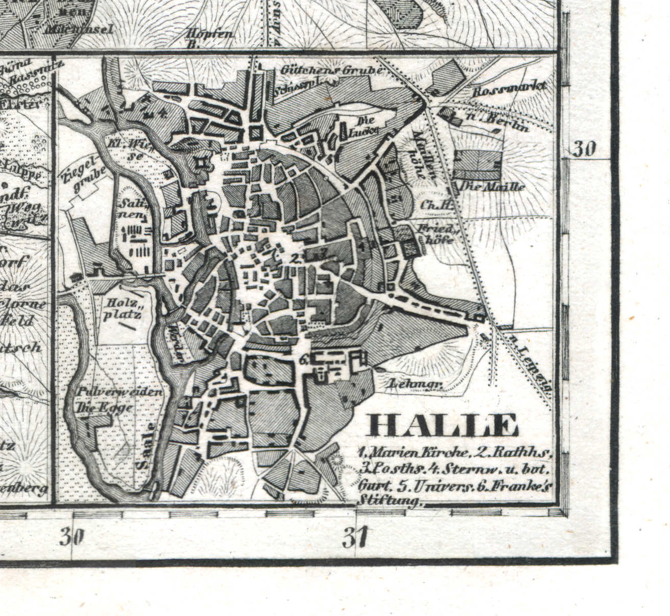
61l. Halle
Halle
 Meyer's Universal-Atlas (1830-1840)
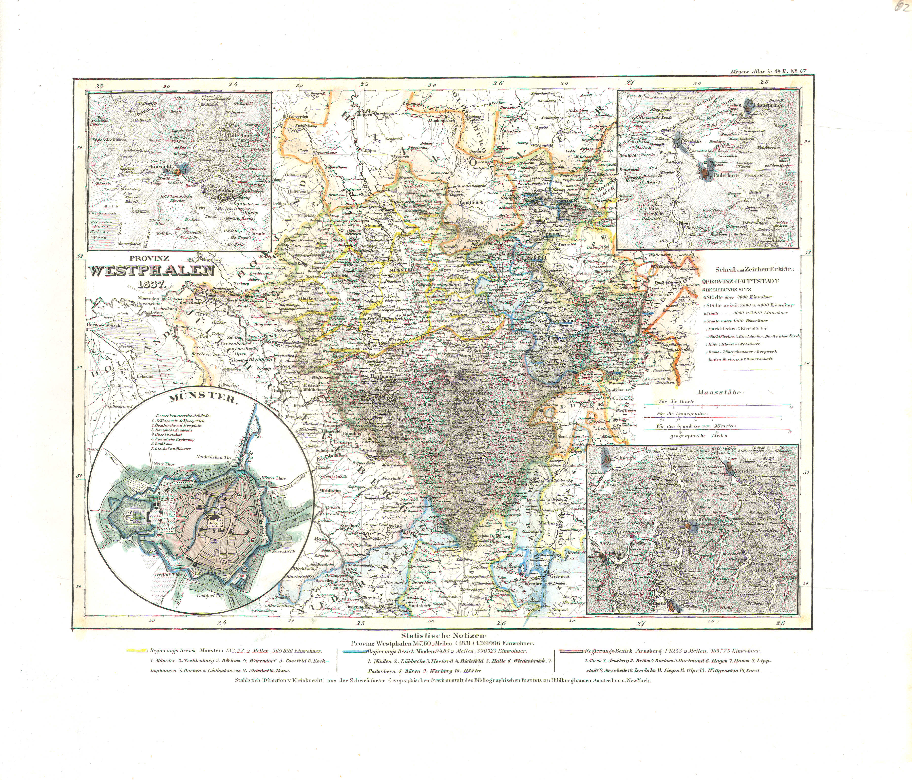
62. Provinz Westphalen (Nº 67, 1837)
Provincie Westfalen / Province of Westphalia
 Meyer's Universal-Atlas (1830-1840)
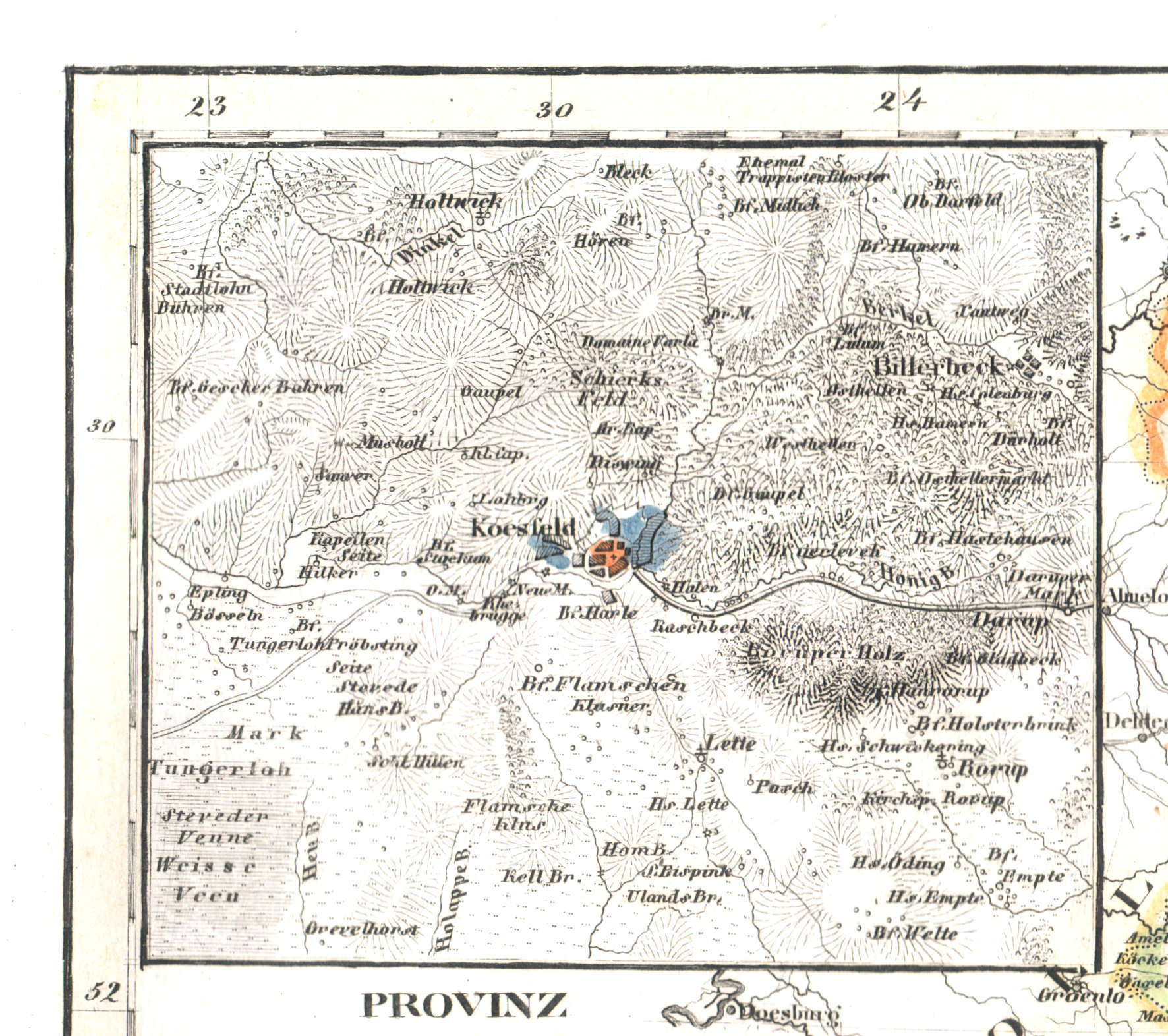
62a. Koesfeld
Koesfeld
 Meyer's Universal-Atlas (1830-1840)
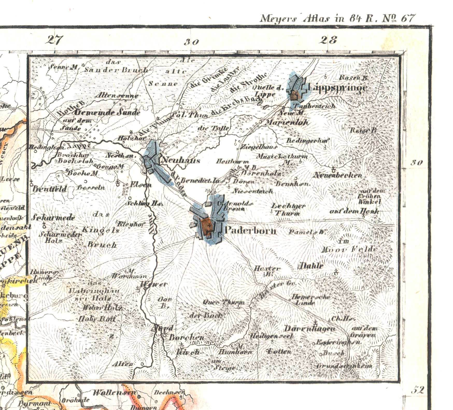
62b. Paderborn
Paderborn
 Meyer's Universal-Atlas (1830-1840)
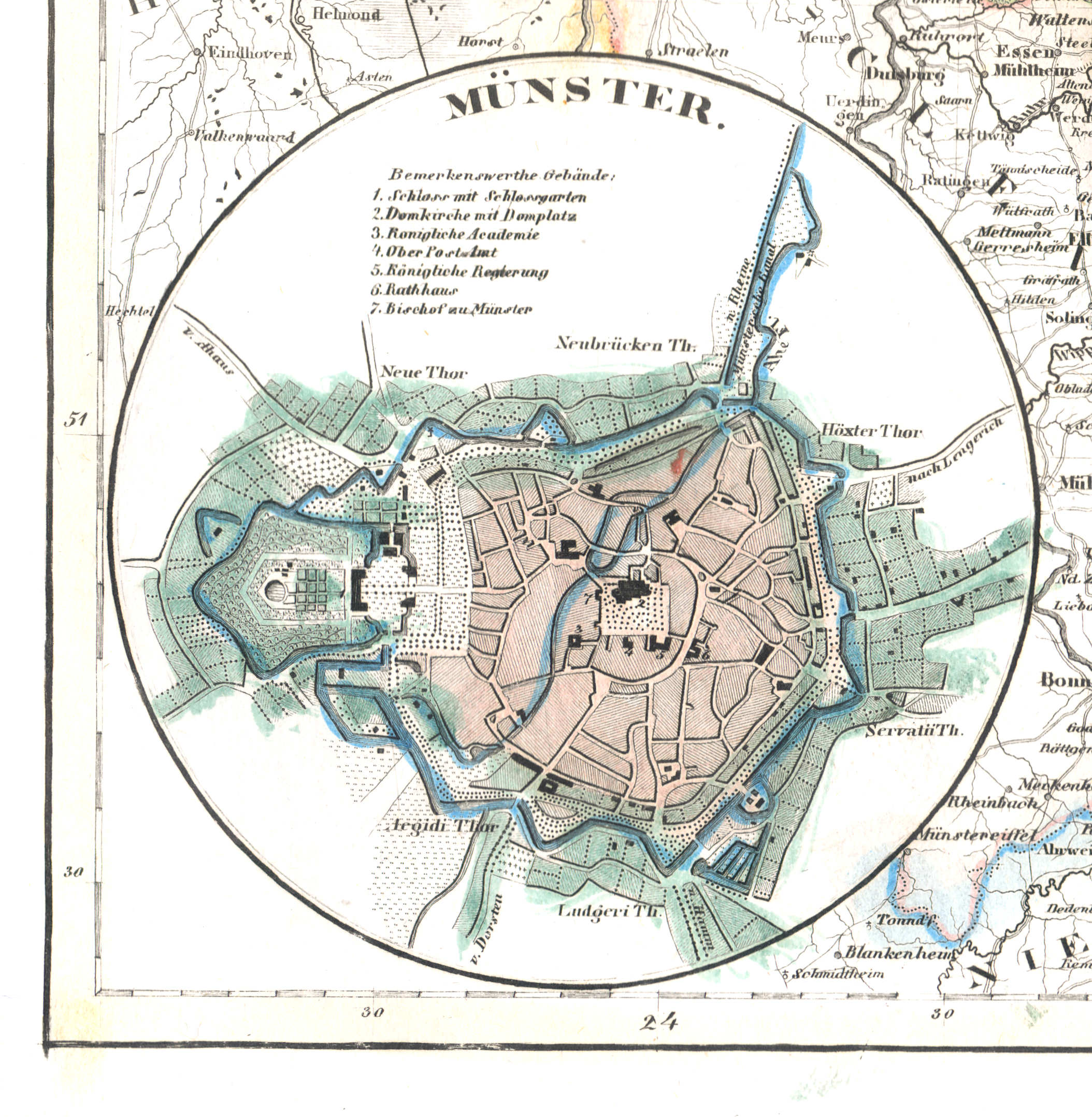
62c. Münster
Münster
 Meyer's Universal-Atlas (1830-1840)
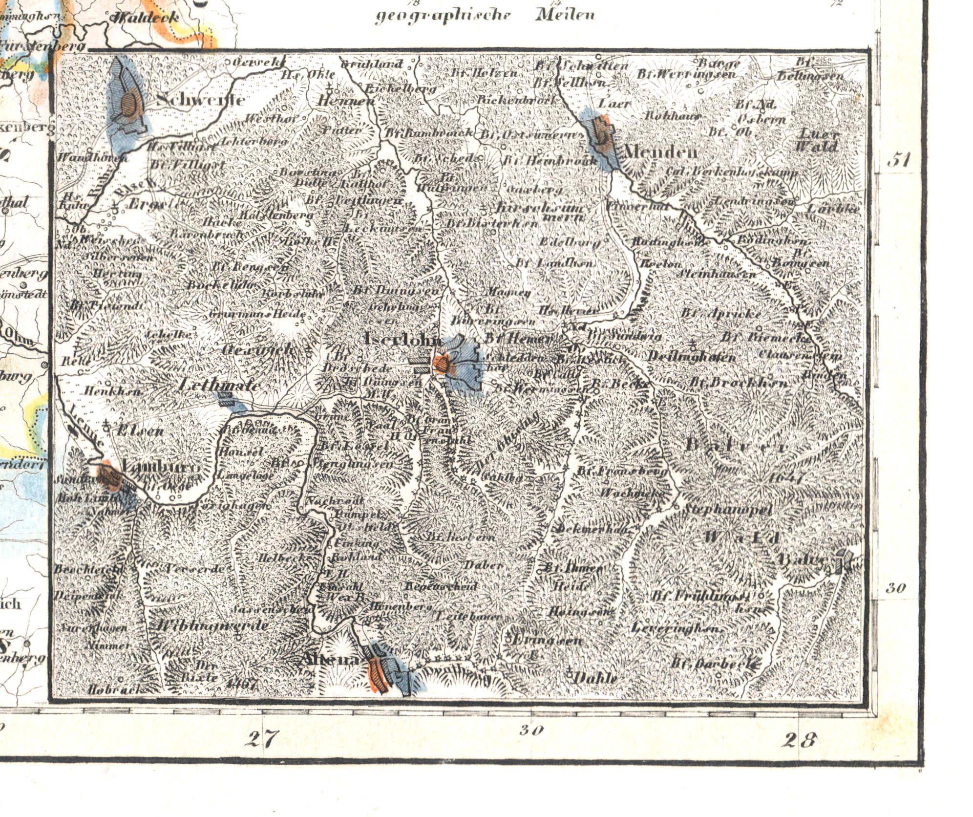
62d. Iserlohn
Iserlohn
 Meyer's Universal-Atlas (1830-1840)
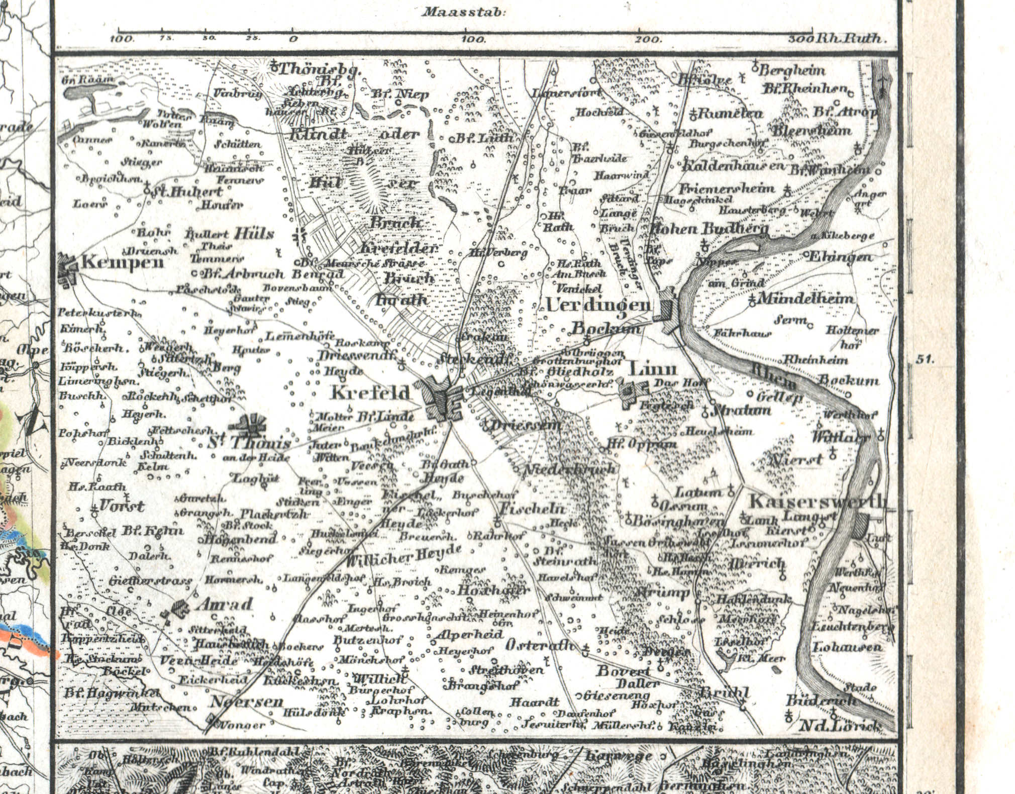
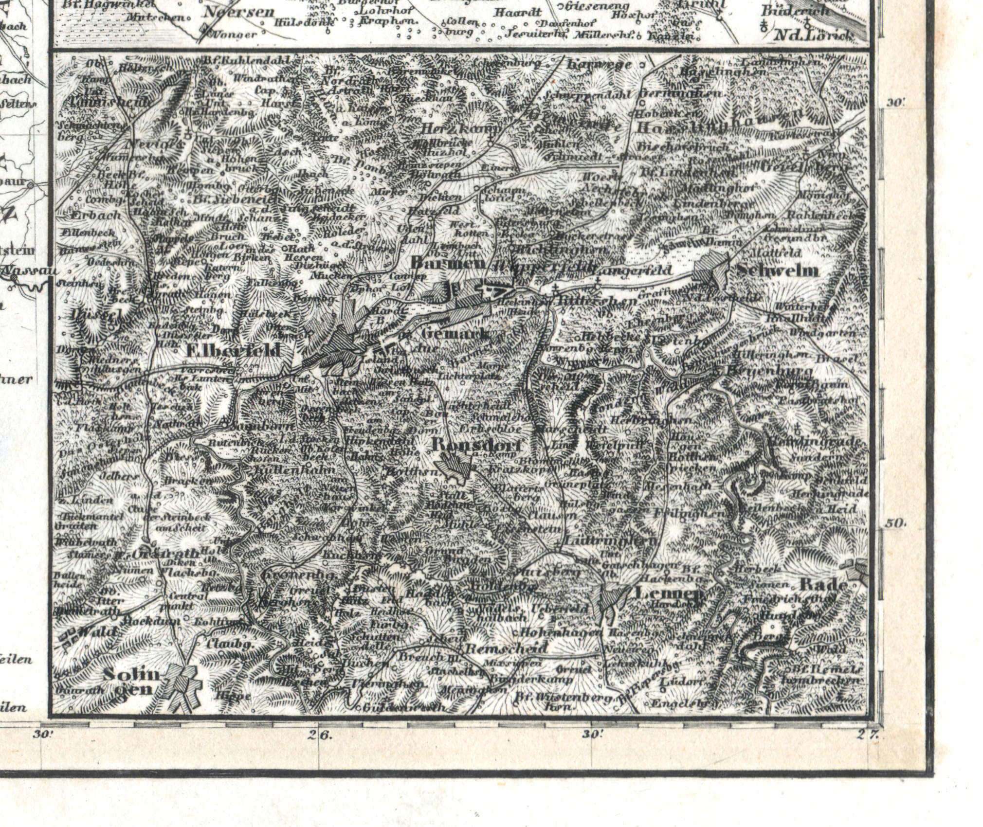
63. Rheinprovinz Jülich-Cleve-Berg (Nº 58, 1836)
Provincie Gulik-Kleef-Berg / Province of Jülich-Cleves-Berg
 Meyer's Universal-Atlas (1830-1840)
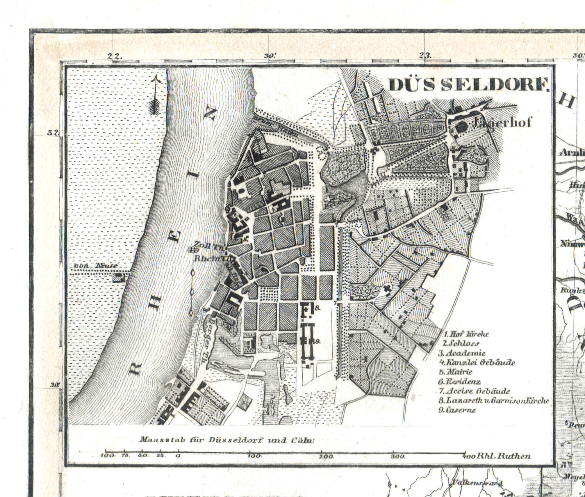
63a. Düsseldorf
Düsseldorf
 Meyer's Universal-Atlas (1830-1840)
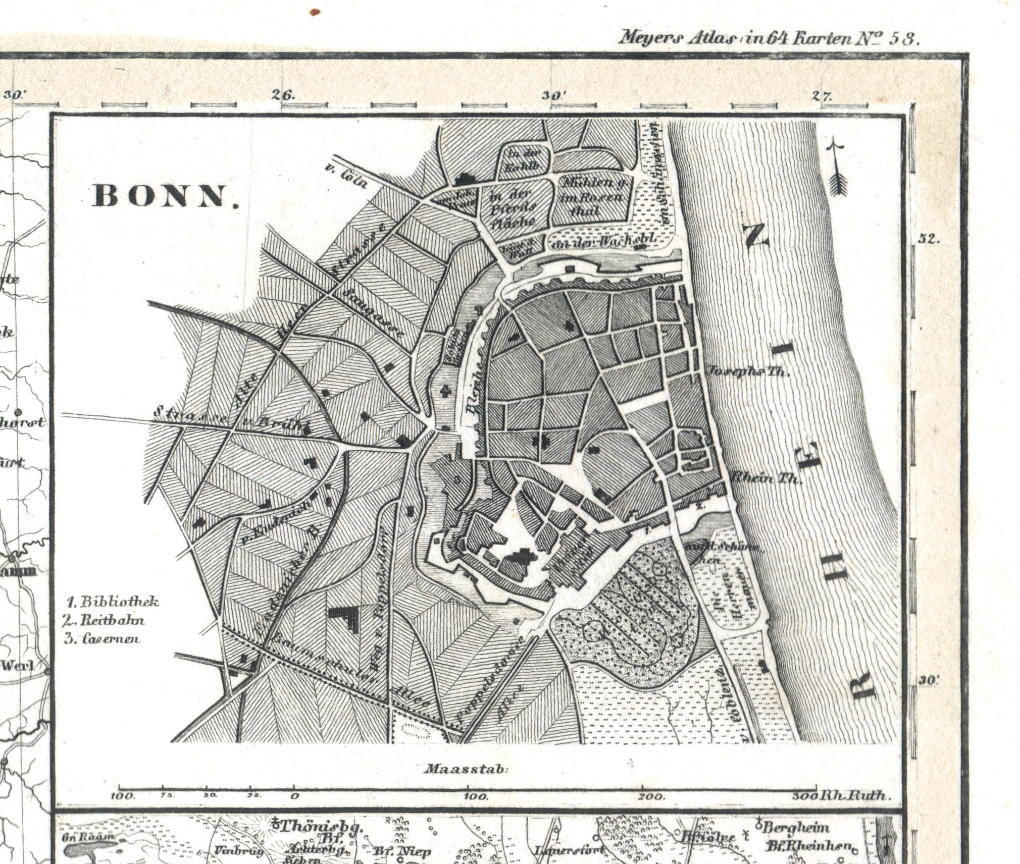
63b. Bonn
Bonn
 Meyer's Universal-Atlas (1830-1840)
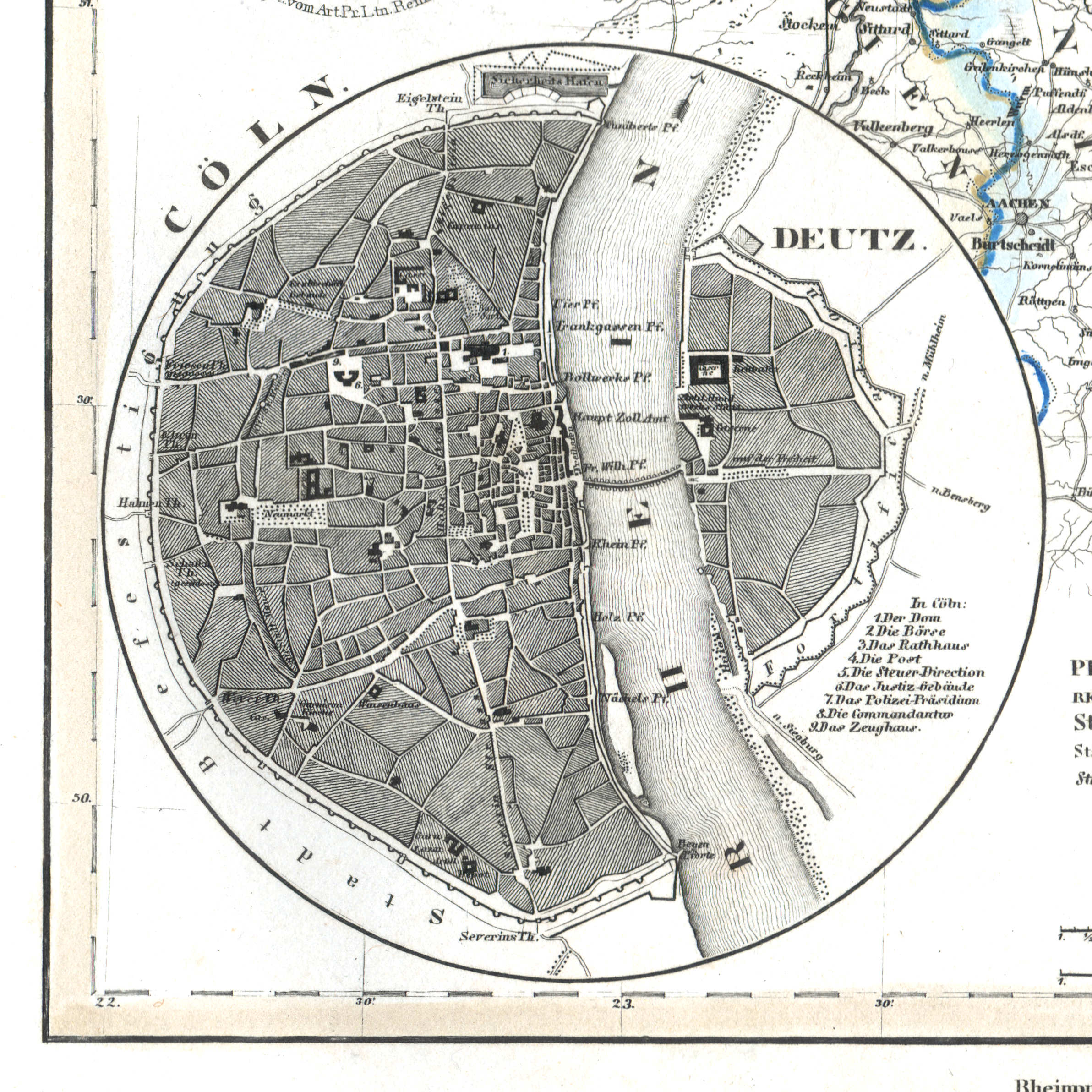
63c. Cöln
Keulen / Cologne / Köln
 Meyer's Universal-Atlas (1830-1840)
63d. Krefeld
Krefeld
 Meyer's Universal-Atlas (1830-1840)
63e. Elberfeld
Elberfeld (Wuppertal)
 Meyer's Universal-Atlas (1830-1840)
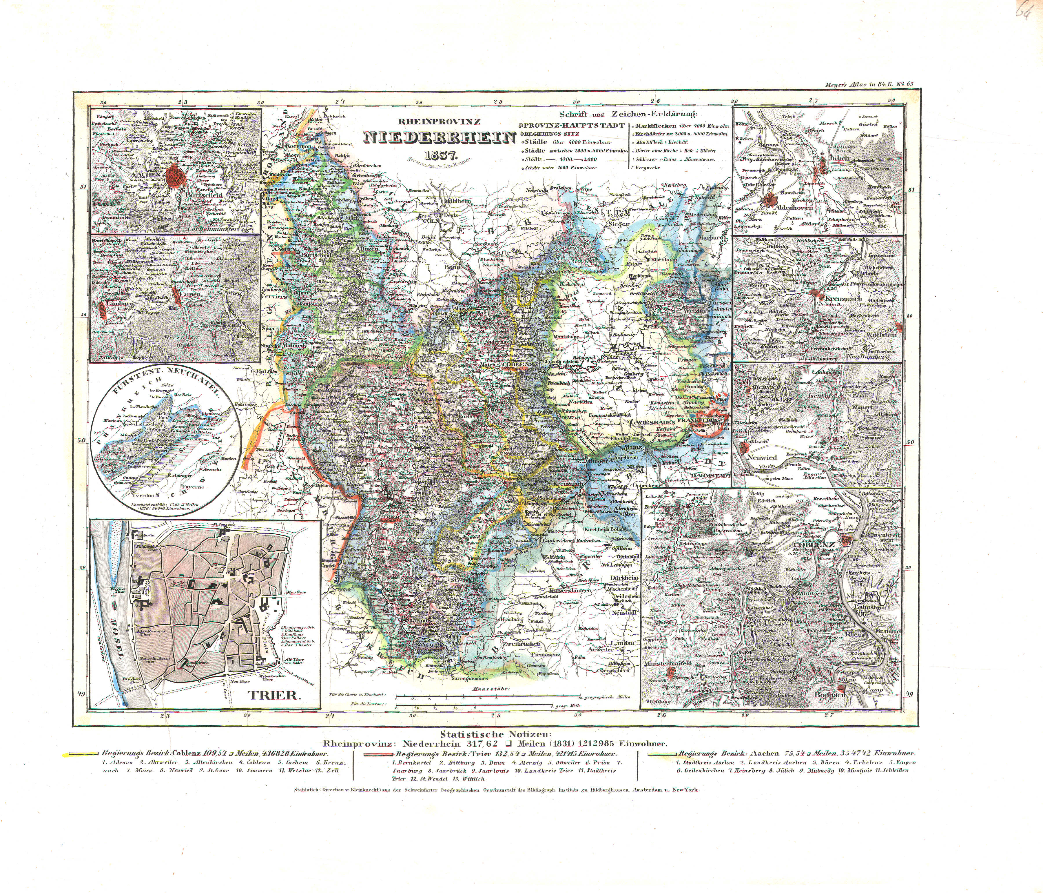
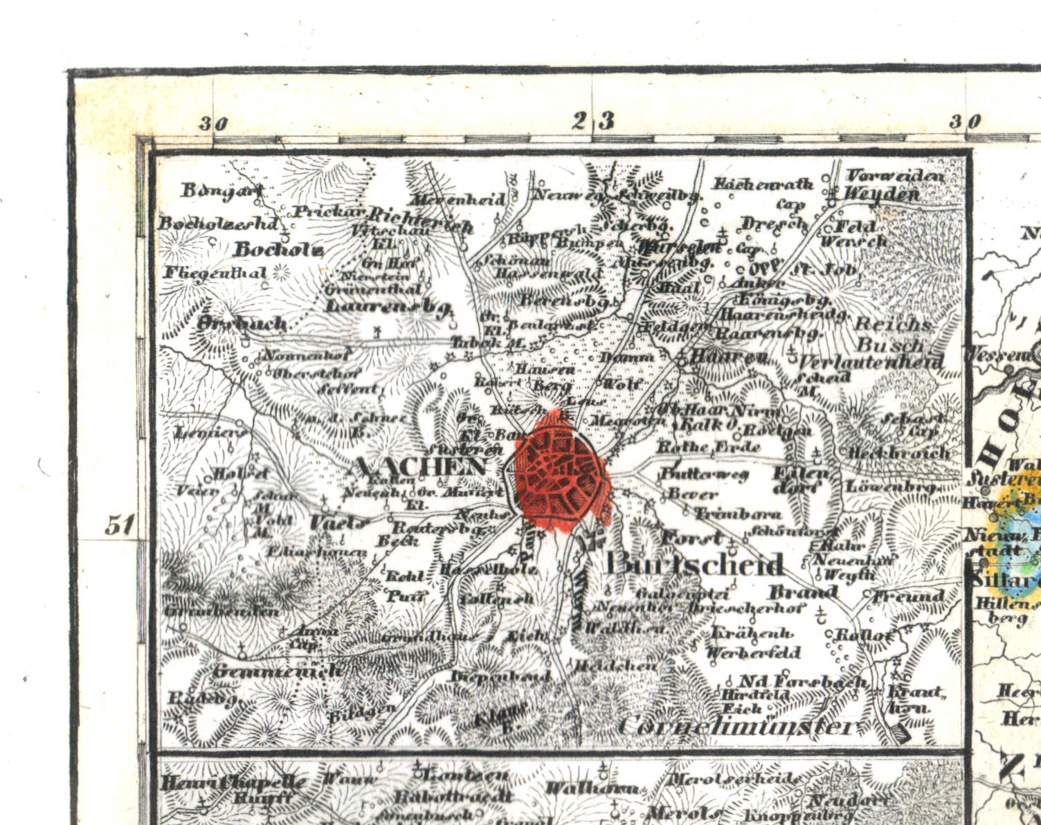
64. Rheinprovinz Niederrhein (Nº 65, 1837)
Provincie Beneden-Rijn / Province of the Lower Rhine
 Meyer's Universal-Atlas (1830-1840)
64a. Aachen
Aken / Aix-la-Chapelle
 Meyer's Universal-Atlas (1830-1840)
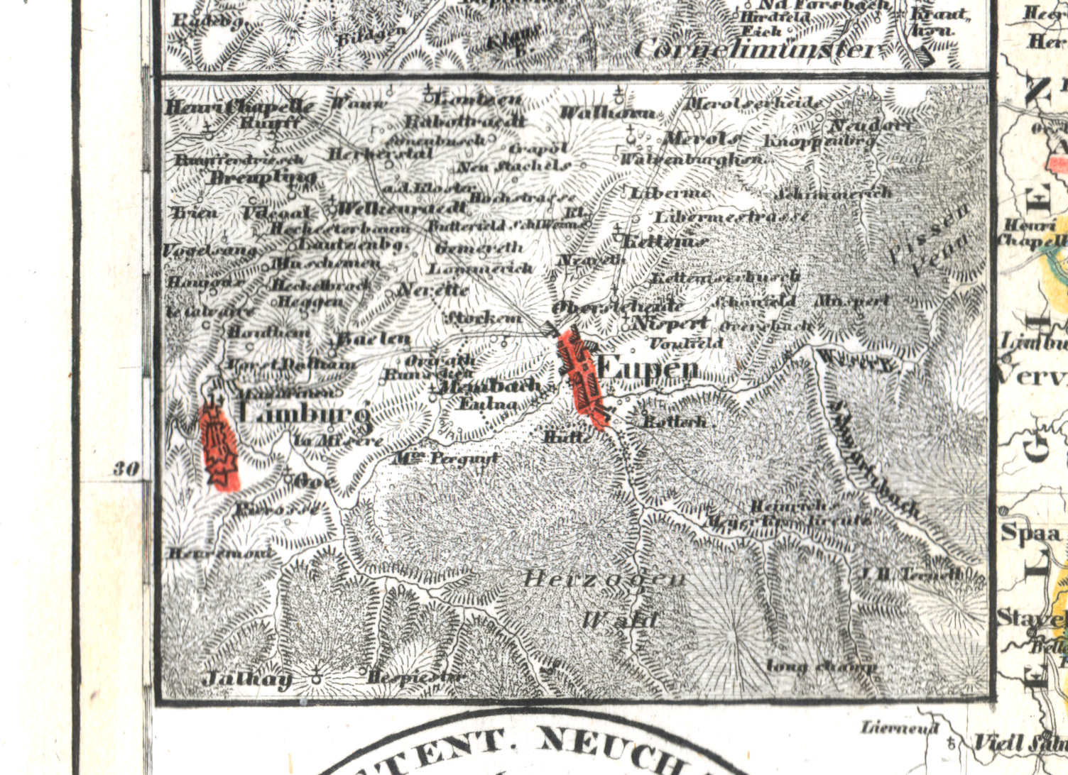
64b. Eupen
Eupen
 Meyer's Universal-Atlas (1830-1840)
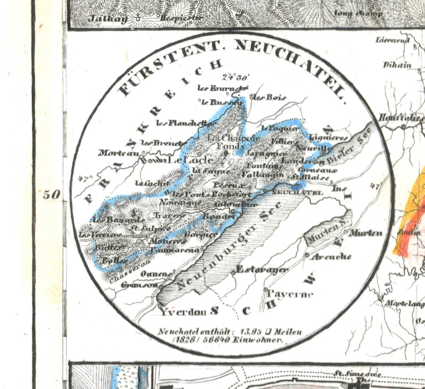
64c. Fürstent. Neuchatel
Vorstendom Neuchâtel / Principality of Neuchâtel
 Meyer's Universal-Atlas (1830-1840)
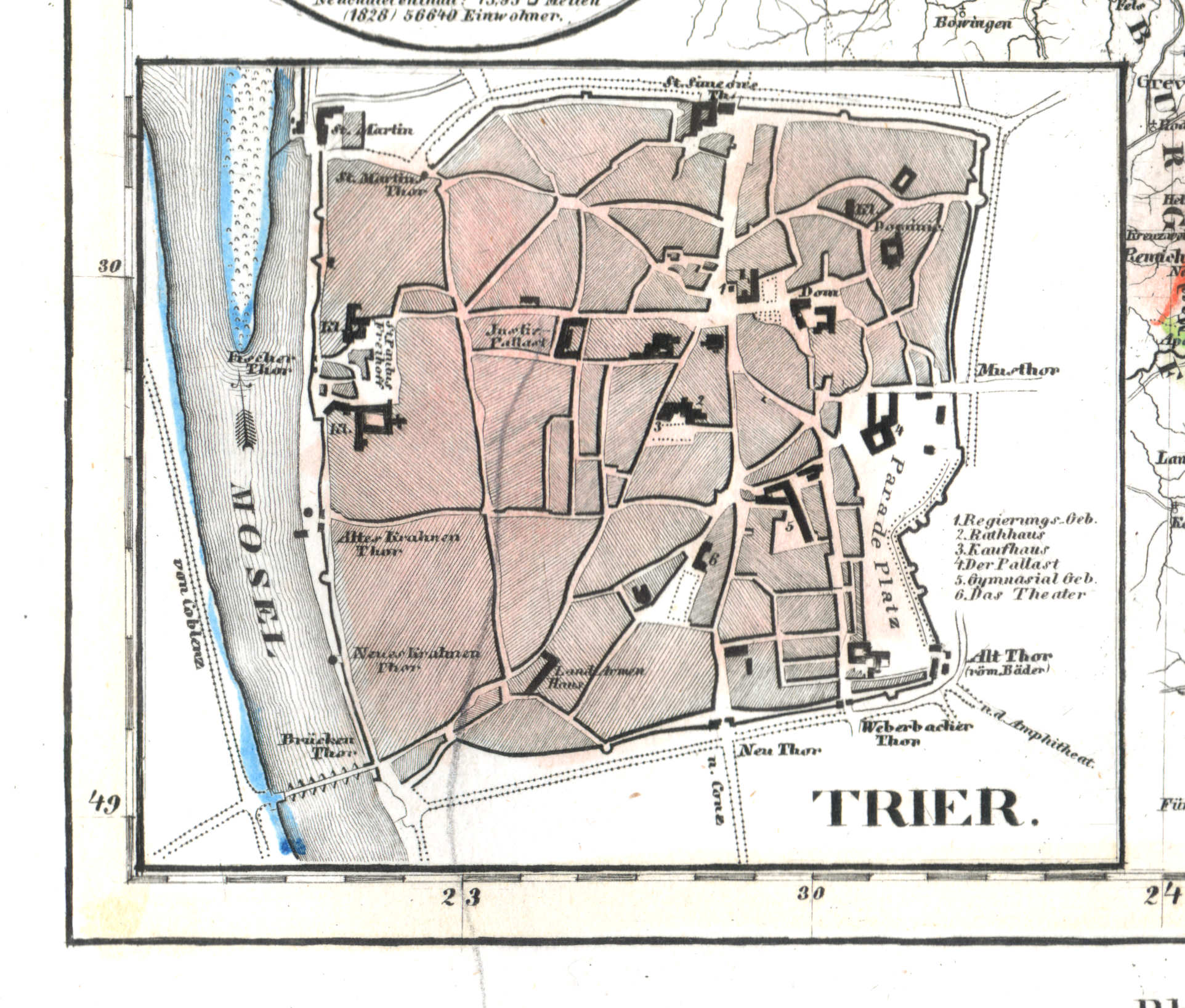
64d. Trier
Trier
 Meyer's Universal-Atlas (1830-1840)
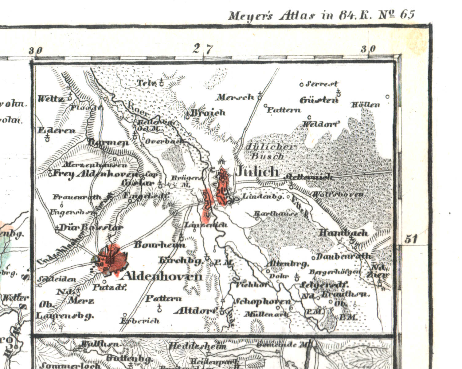
64e. Jülich
Gulik / Jülich
 Meyer's Universal-Atlas (1830-1840)
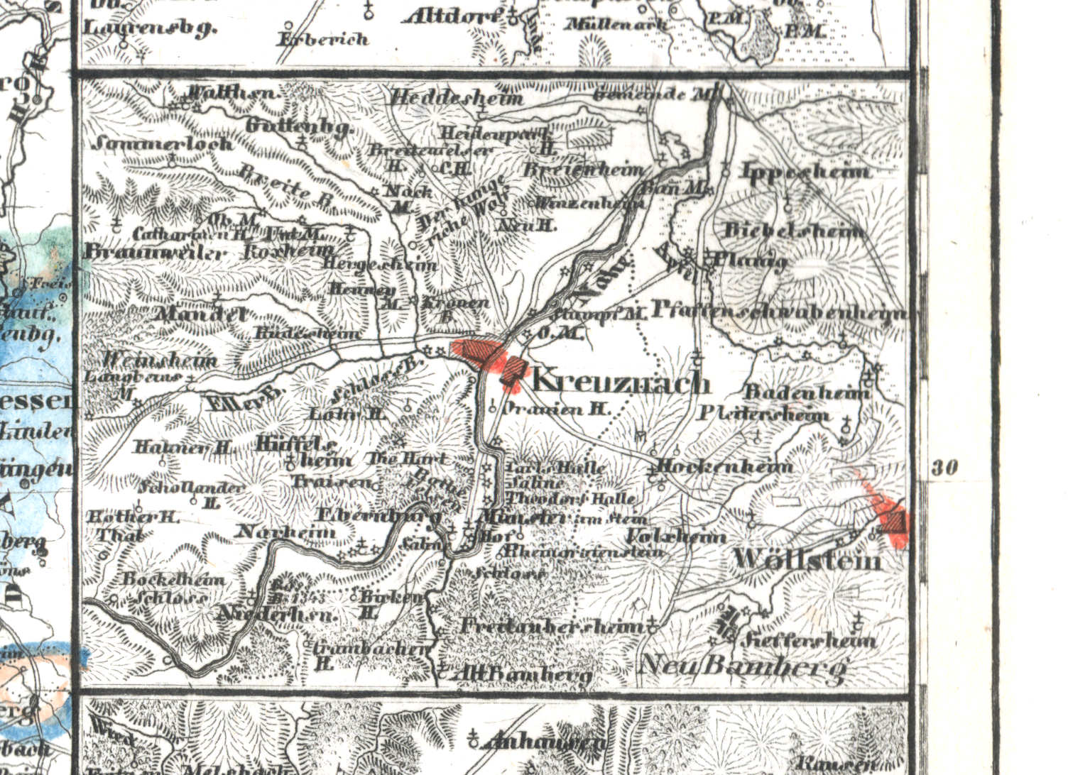
64f. Kreuznach
Kreuznach
 Meyer's Universal-Atlas (1830-1840)
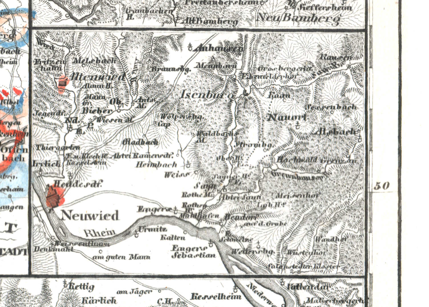
64g. Neuwied
Neuwied
 Meyer's Universal-Atlas (1830-1840)
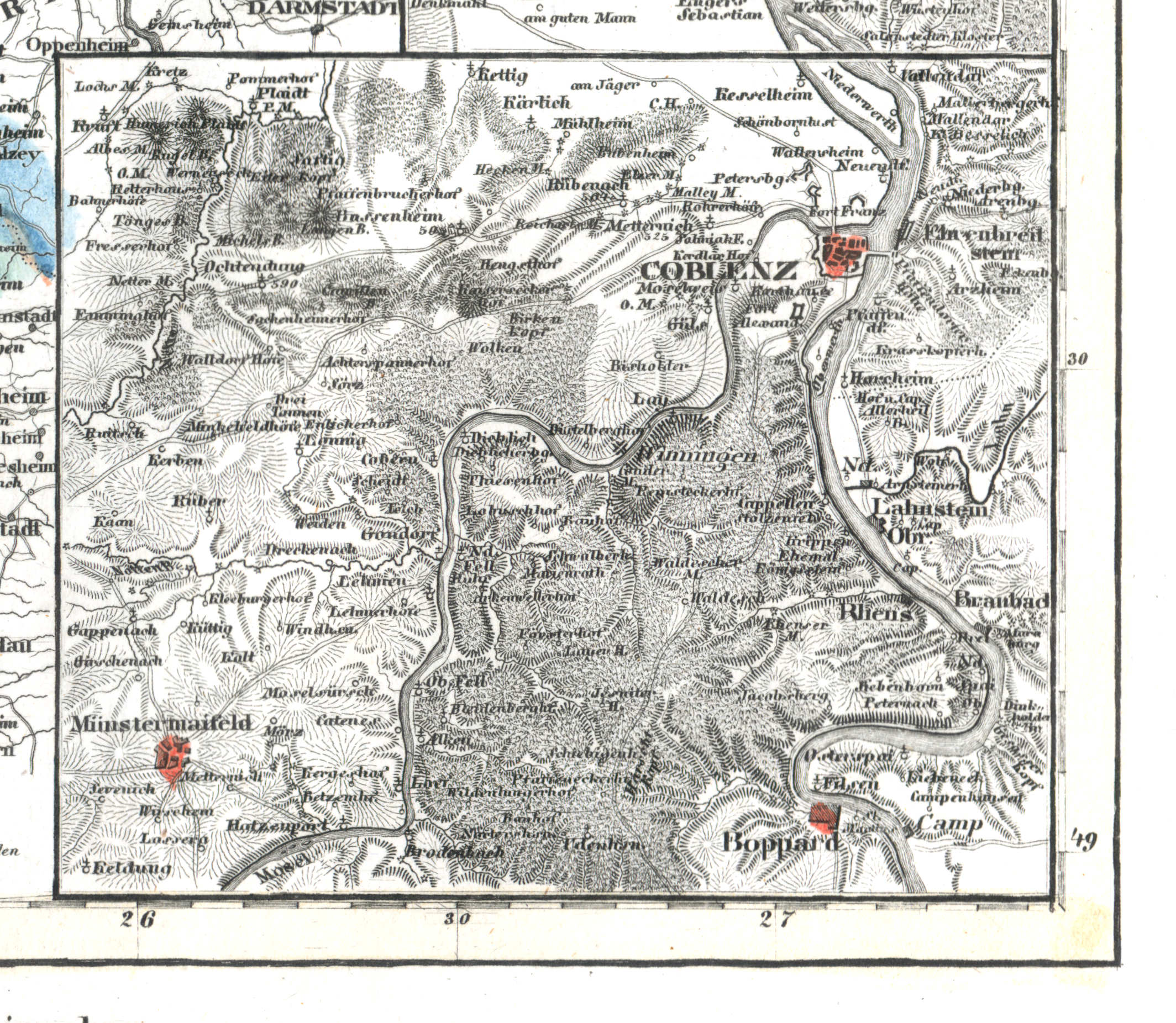
64h. Coblenz
Koblenz
 Meyer's Universal-Atlas (1830-1840)
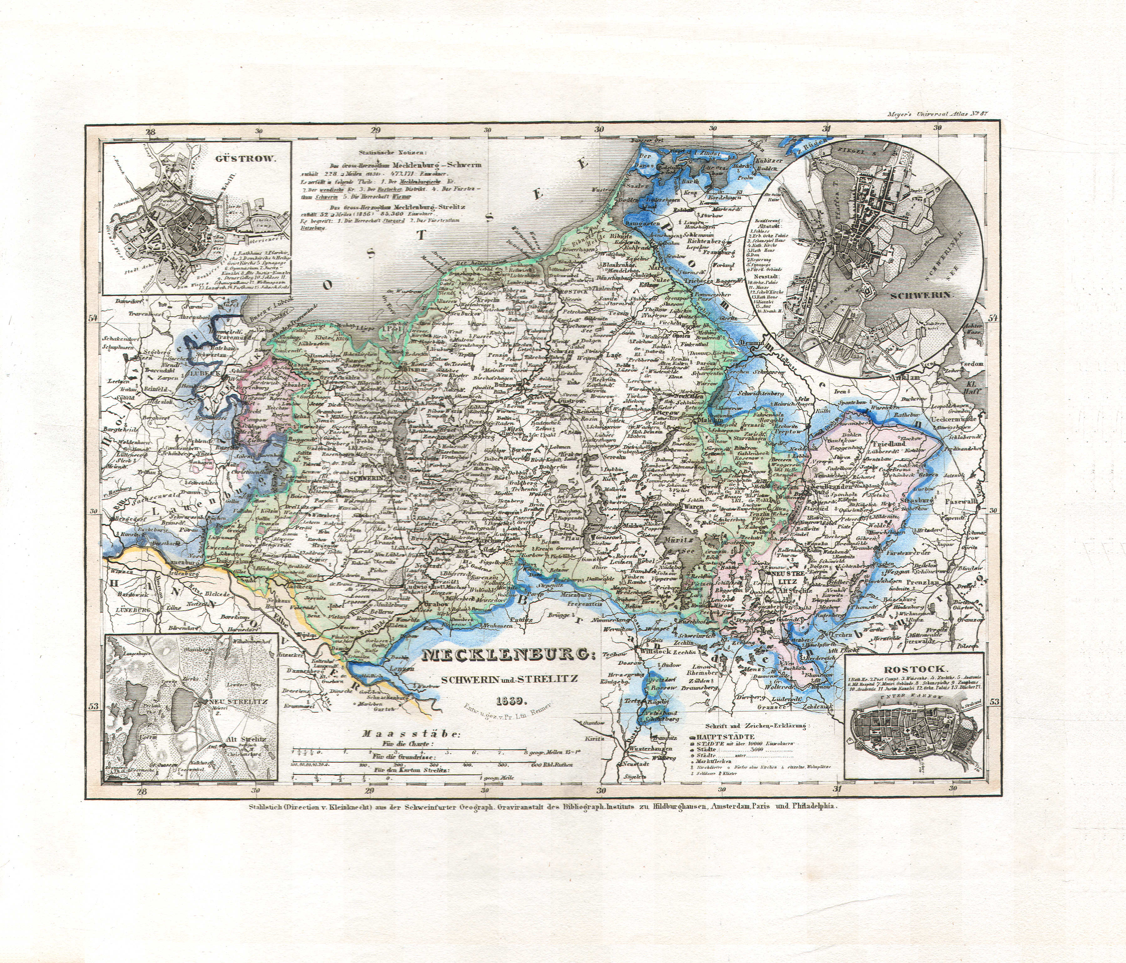
65. Mecklenburg Schwerin und Strelitz (Nº 87, 1839)
Mecklenburg-Schwerin, Mecklenburg-Strelitz
 Meyer's Universal-Atlas (1830-1840)
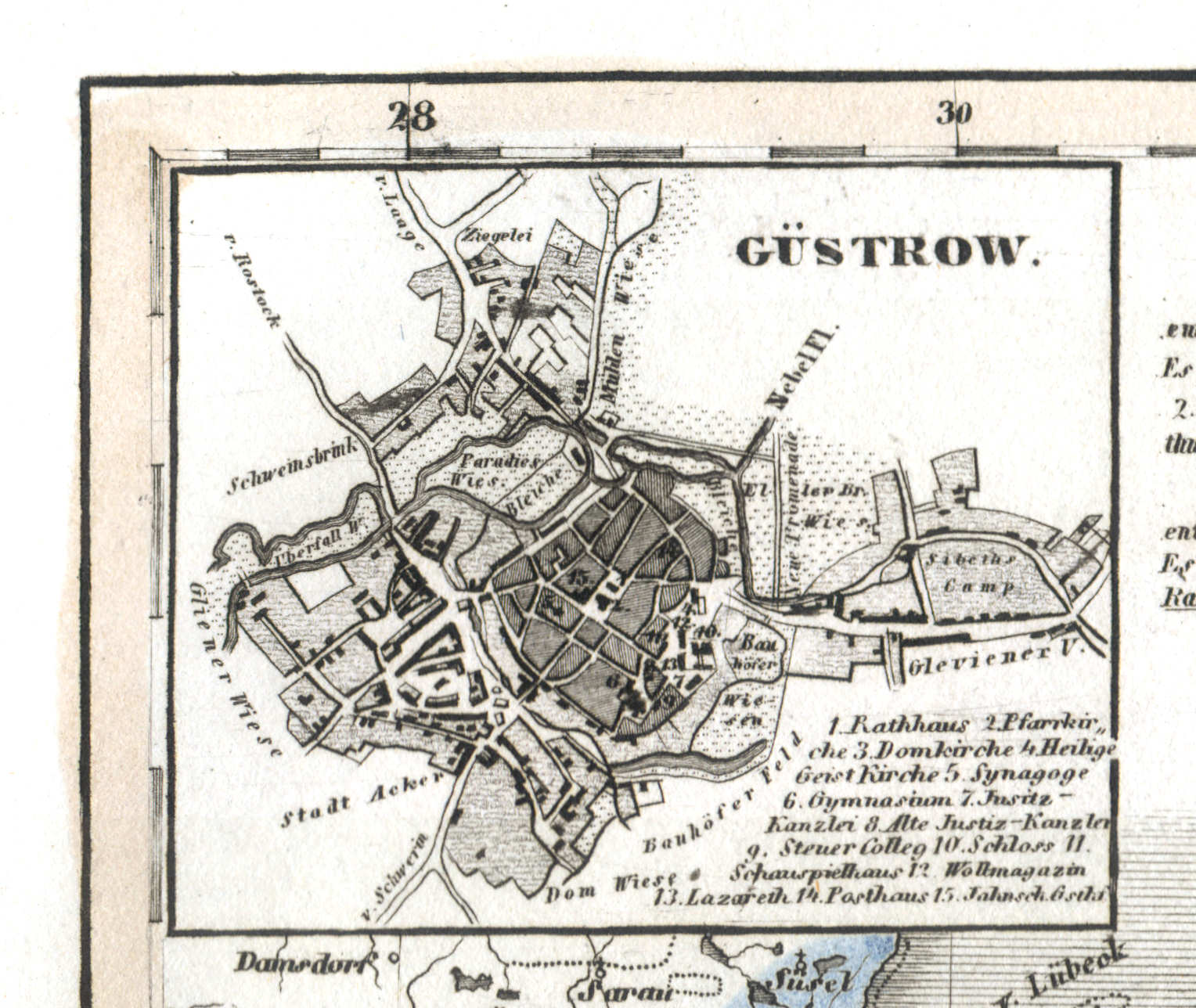
65a. Güstrow
Güstrow
 Meyer's Universal-Atlas (1830-1840)
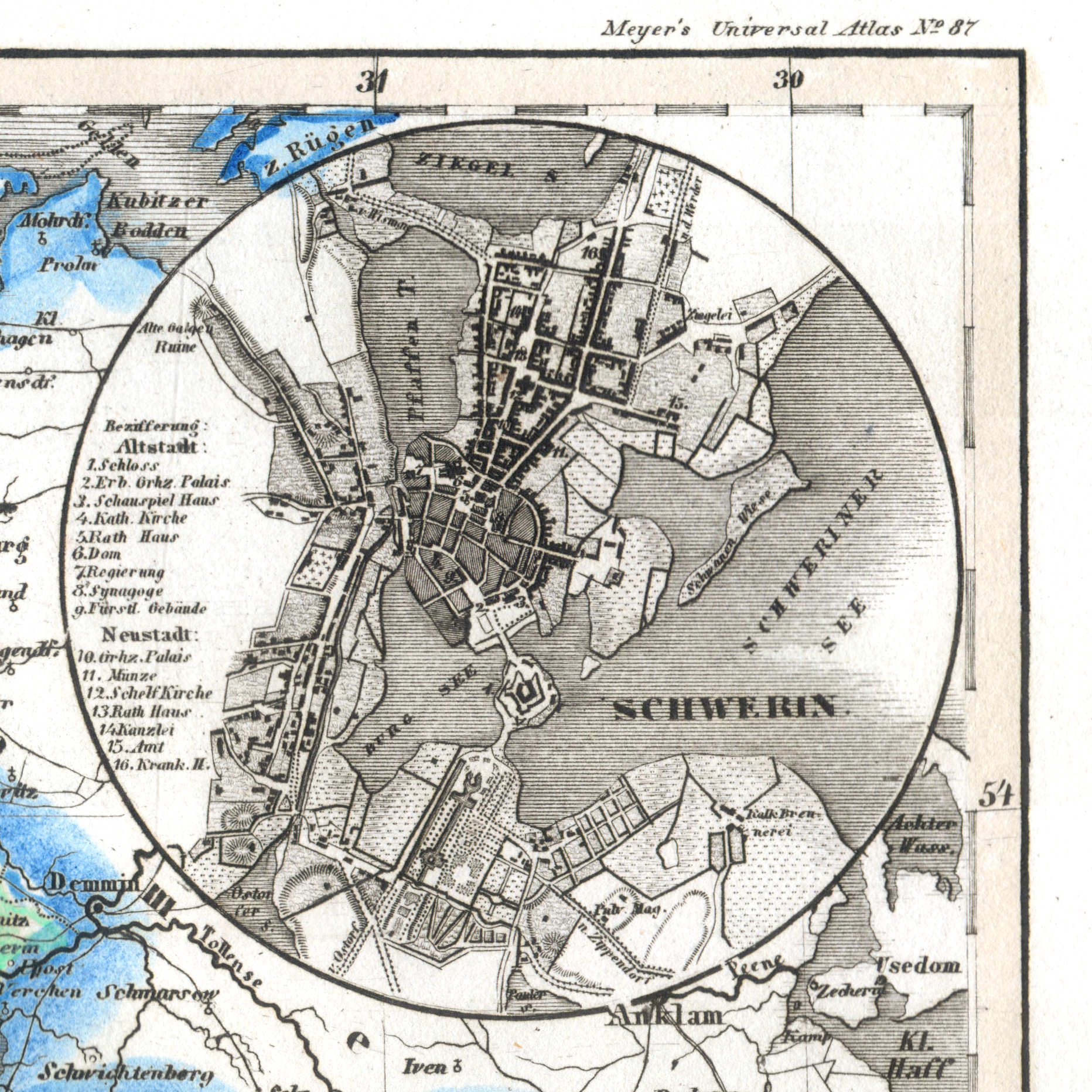
65b. Schwerin
Schwerin
 Meyer's Universal-Atlas (1830-1840)
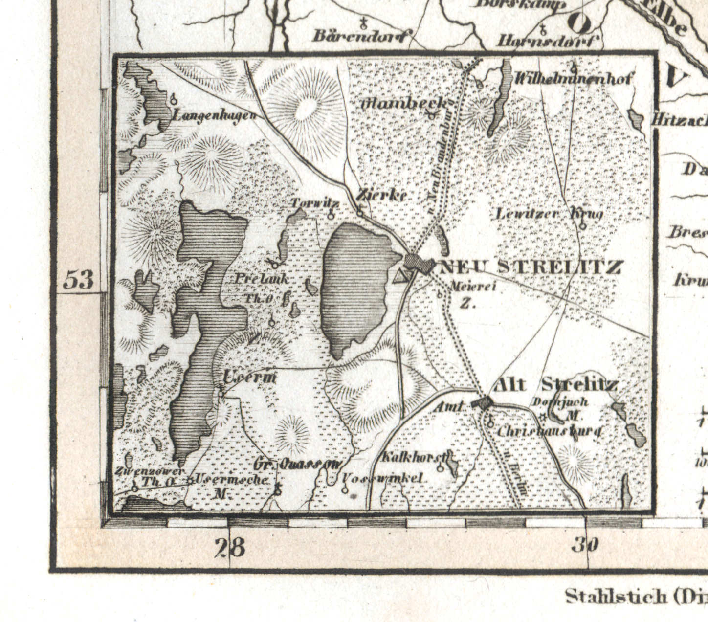
65c. Alt und Neu Strelitz
Alt und Neu Strelitz
 Meyer's Universal-Atlas (1830-1840)
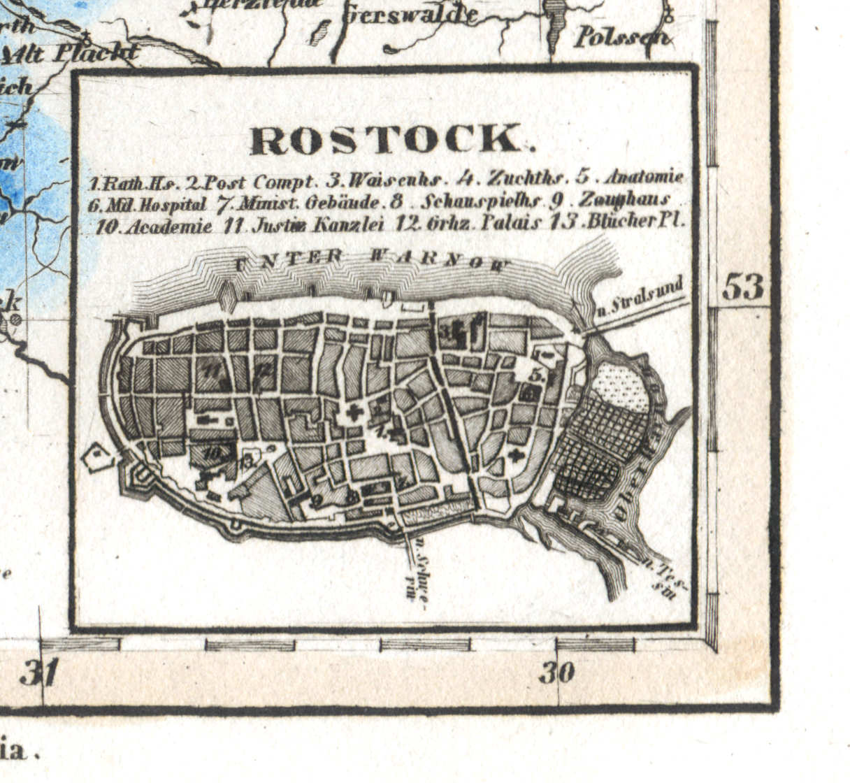
65d. Rostock
Rostock
 Meyer's Universal-Atlas (1830-1840)
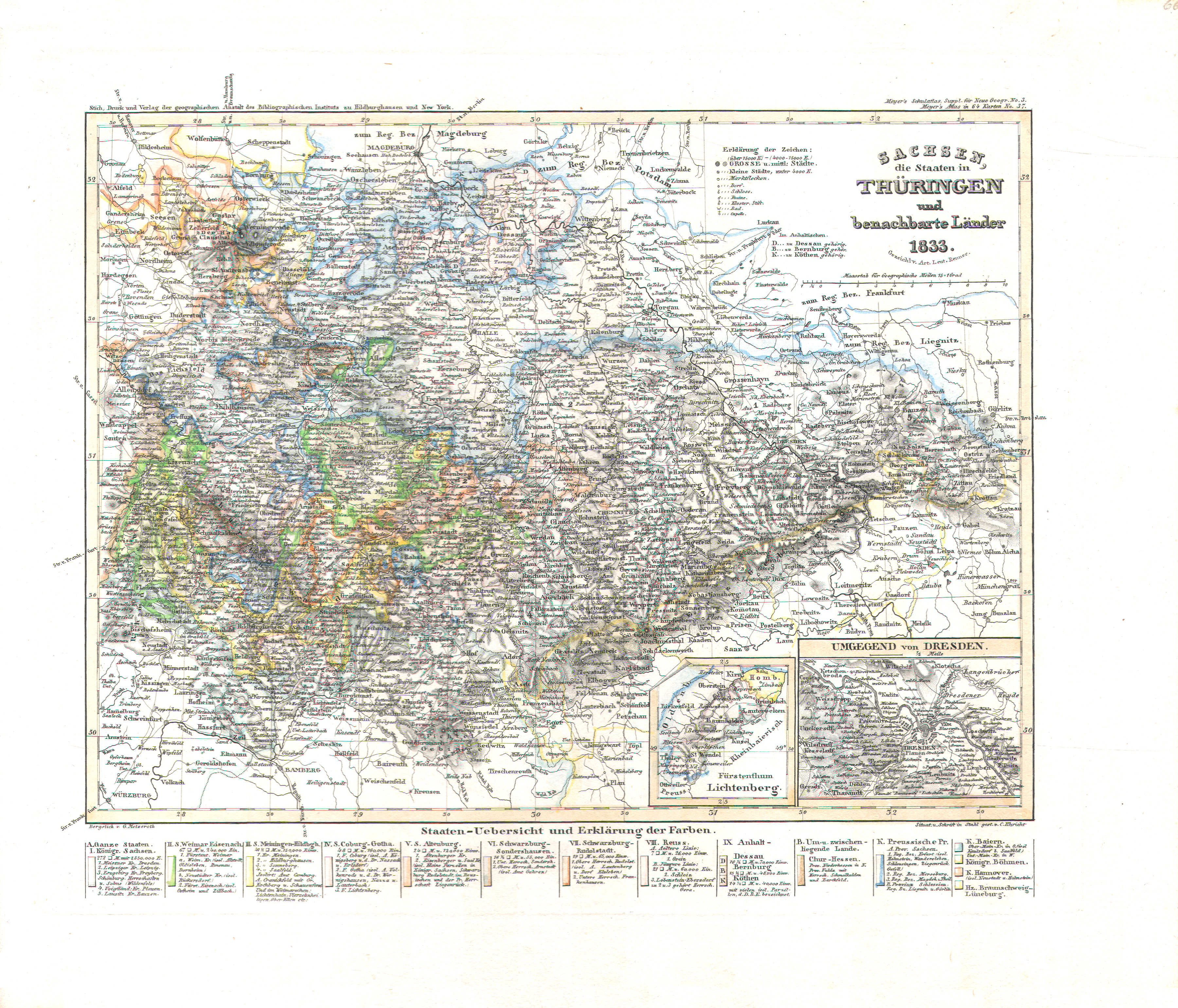
66. Sachsen, die Staaten in Thüringen und benachbarte Länder (Nº 37, 1833)
Saksen en Thüringen / Saxony and Thuringia
 Meyer's Universal-Atlas (1830-1840)
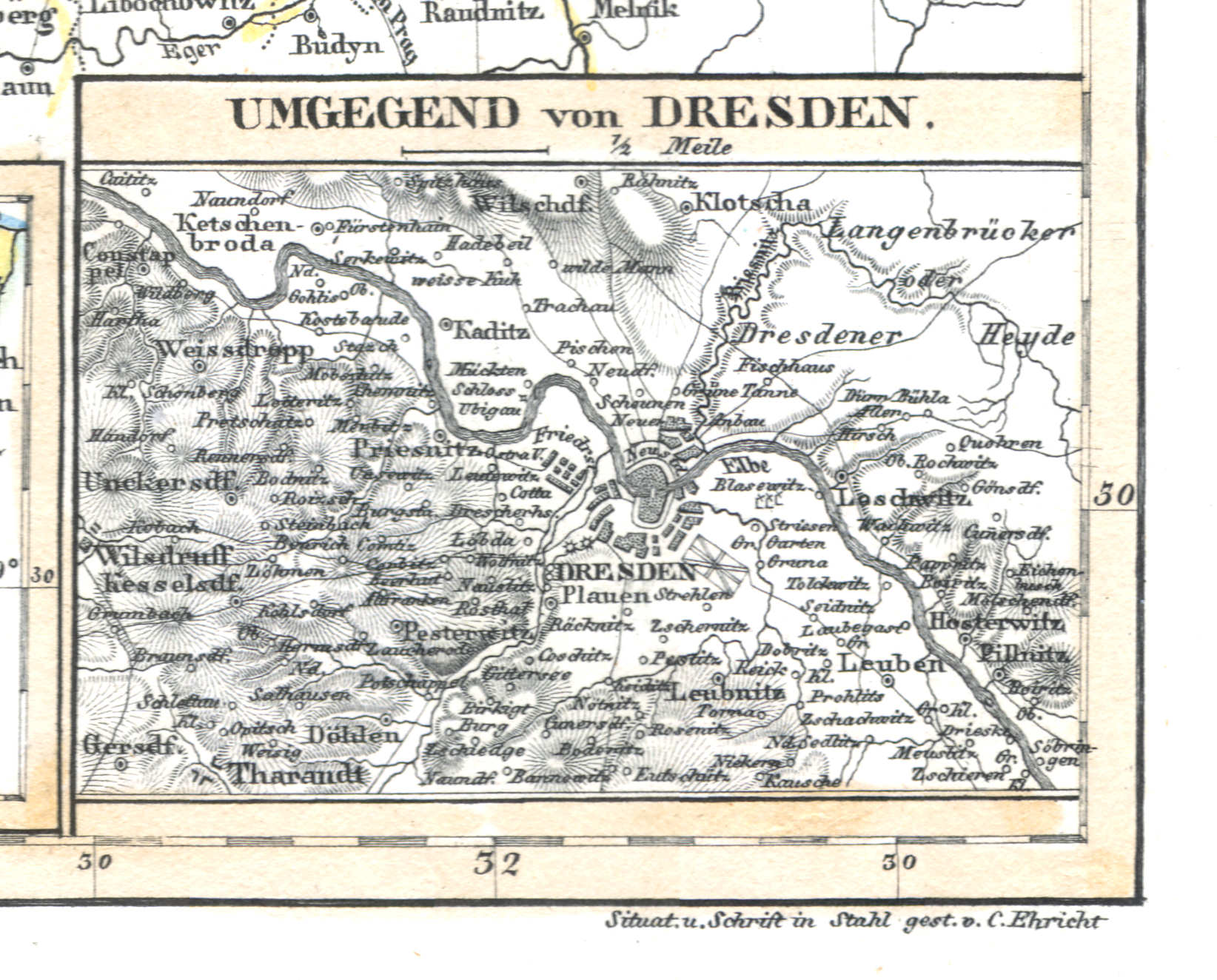
66b. Umgebung von Dresden
Dresden en omgeving / Dresden and environs
 Meyer's Universal-Atlas (1830-1840)
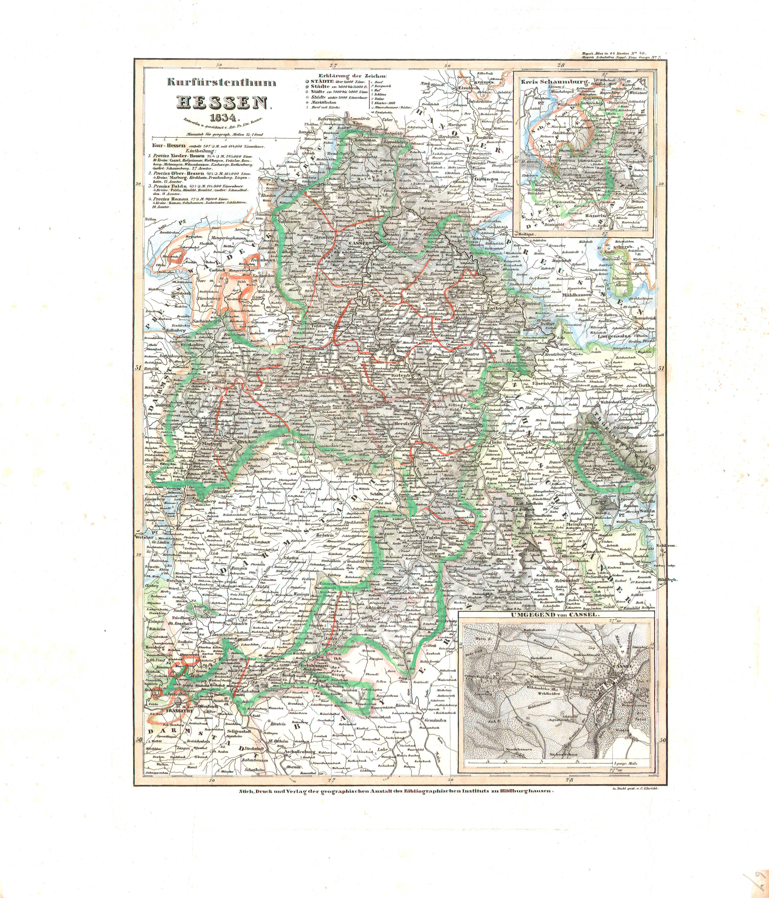
67. Kurfürstenthum Hessen (Nº 48, 1834)
Keurvorstendom Hessen-Kassel / Electorate of Hesse-Kassel
 Meyer's Universal-Atlas (1830-1840)
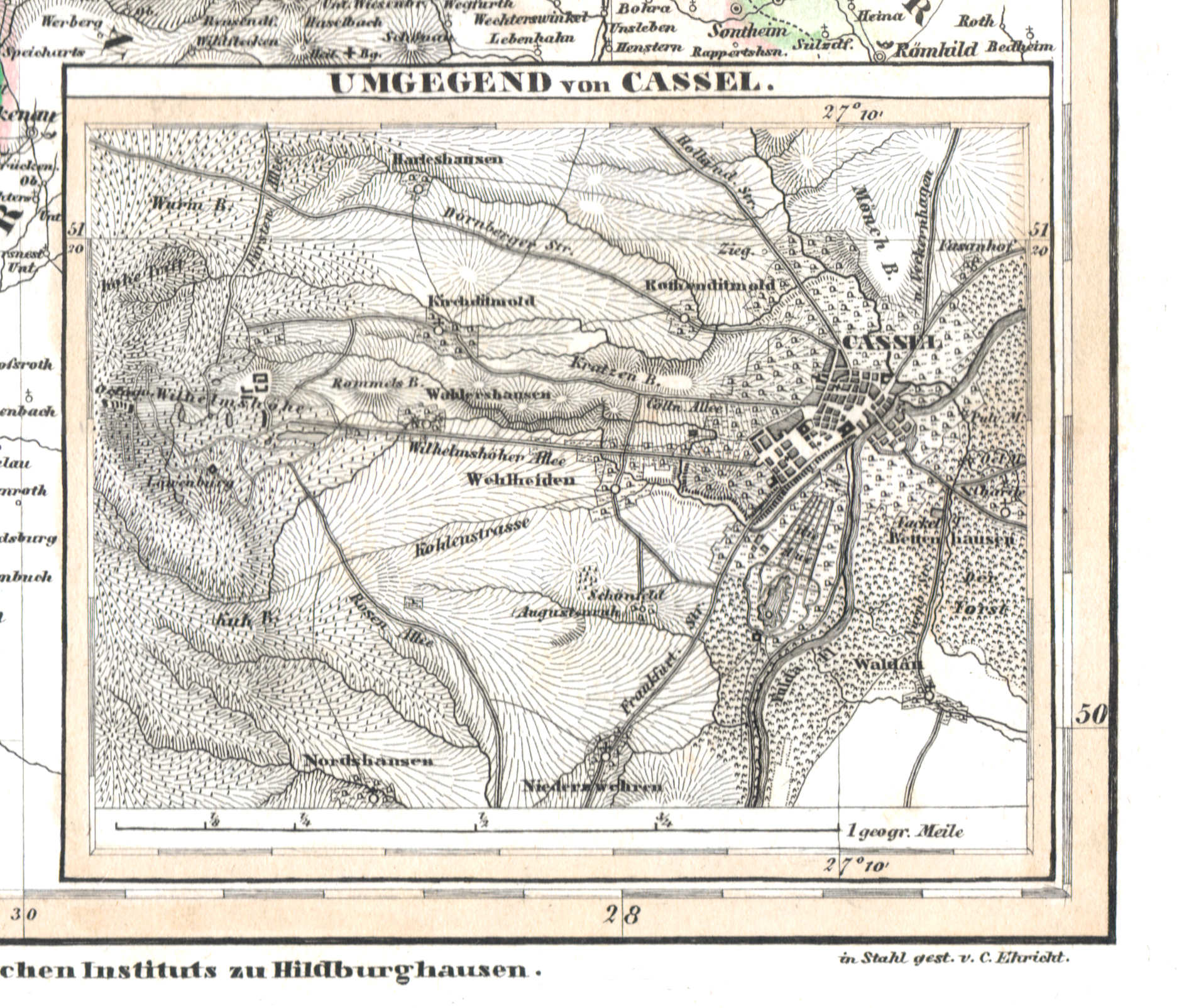
67b. Umgegend von Cassel
Kassel en omgeving / Kassel and environs
 Meyer's Universal-Atlas (1830-1840)
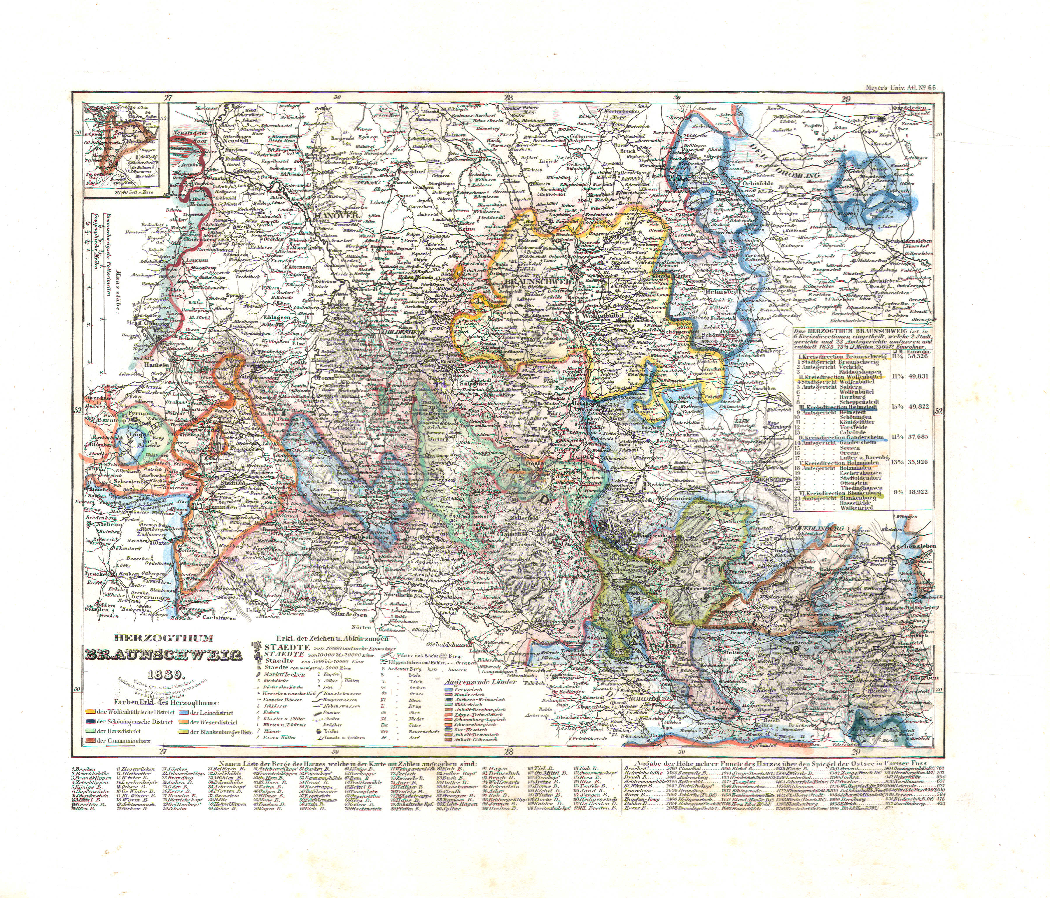
68. Herzogthum Braunschweig (Nº 86, 1839)
Hertogdom Brunswijk / Duchy of Brunswick
op de kaart / on the map: Nº 66
 Meyer's Universal-Atlas (1830-1840)
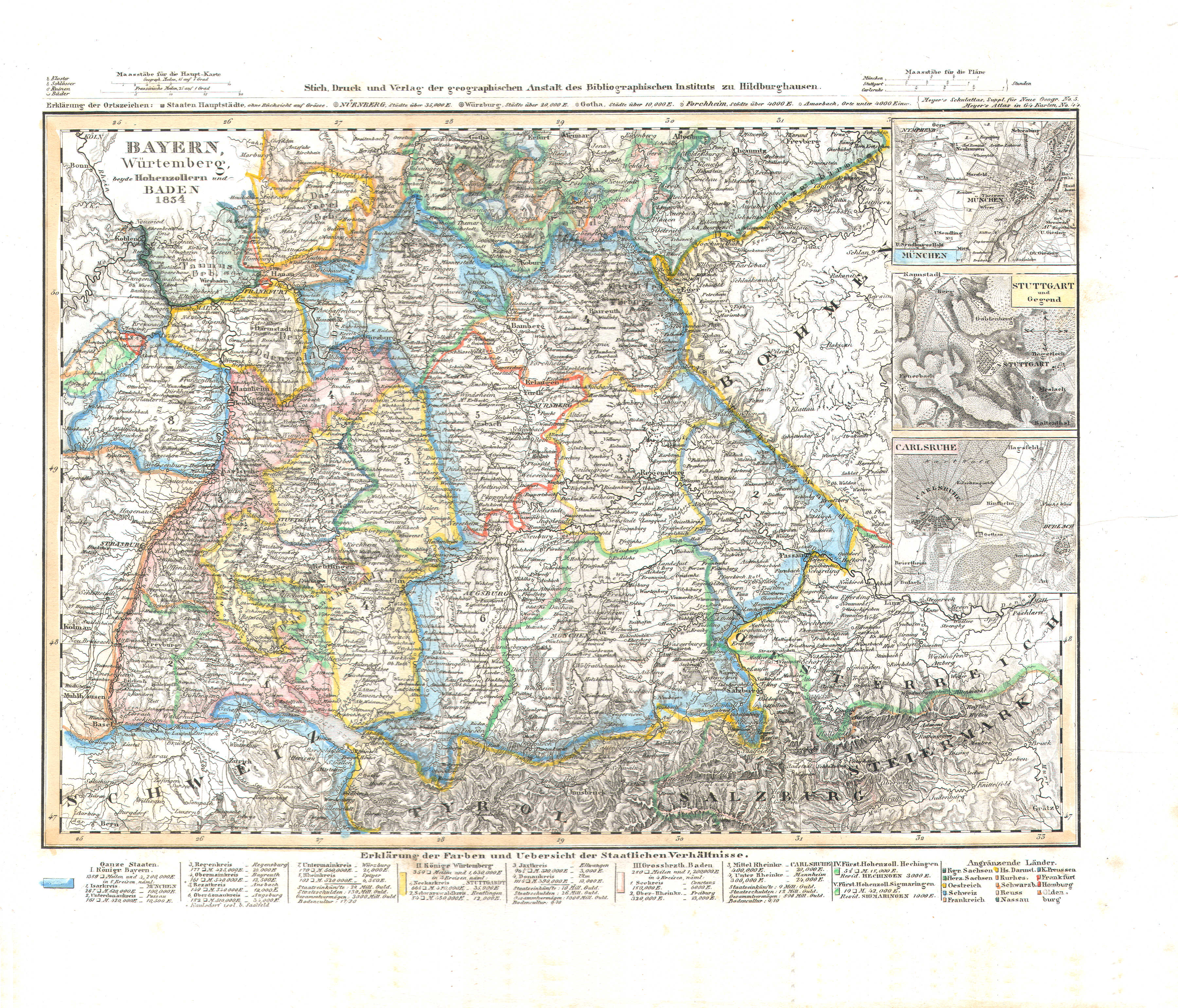
69. Bayern, Würtemberg, beyde Hohenzollern und Baden (Nº 44, 1834)
Beieren, Württemberg, Hohenzollern en Baden / Bavaria, Württemberg, Hohenzollern and Baden
 Meyer's Universal-Atlas (1830-1840)
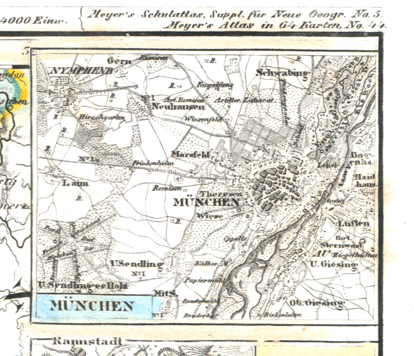
69a. München
München / Munich
 Meyer's Universal-Atlas (1830-1840)
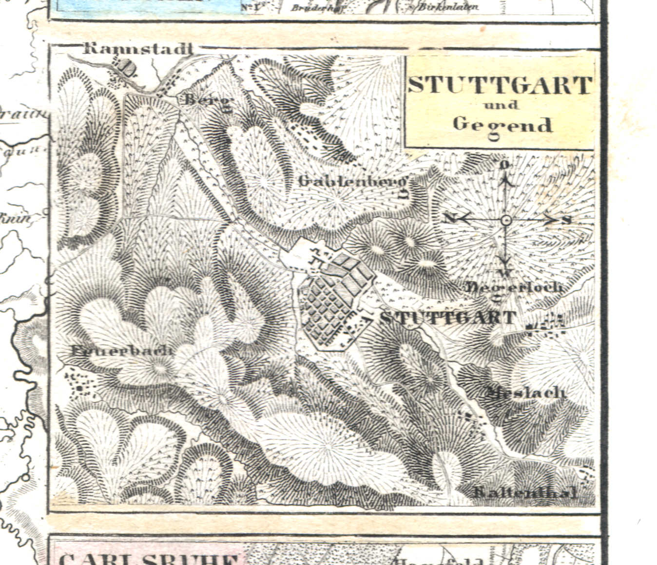
69b. Stuttgart und Gegend
Stuttgart en omgeving / Stuttgart and environs
 Meyer's Universal-Atlas (1830-1840)
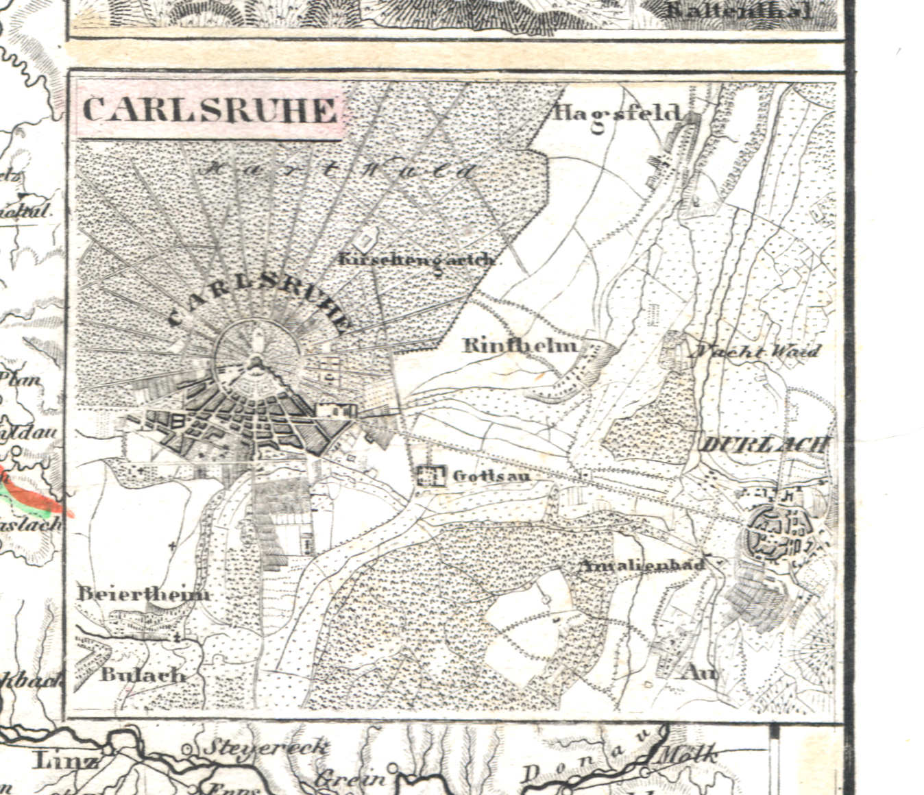
69c. Carlsruhe
Karlsruhe
 Meyer's Universal-Atlas (1830-1840)
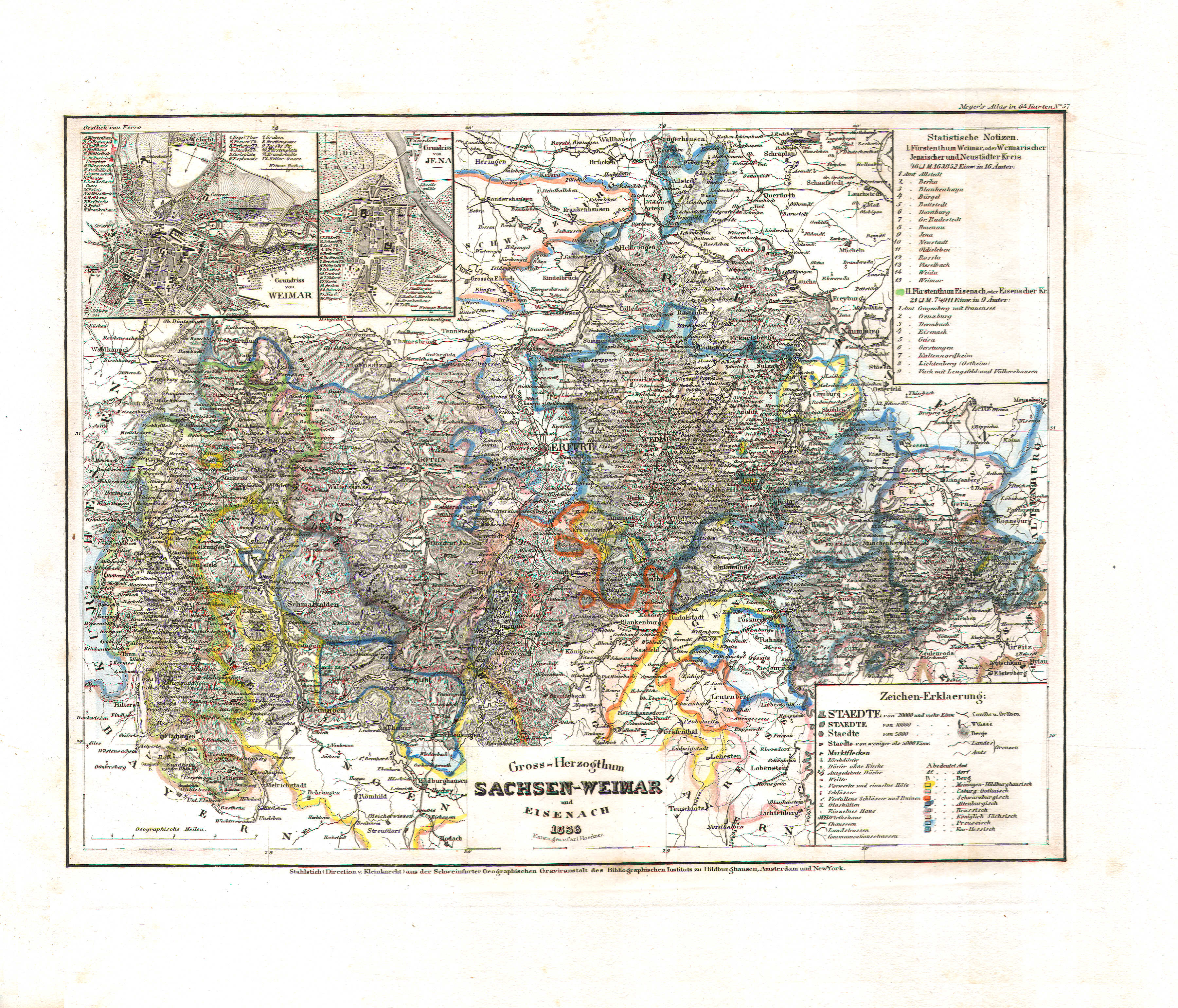
70. Gross-Herzogthum Sachsen-Weimar und Eisenach (Nº 57, 1836)
Groothertogdom Saksen-Weimar-Eisenach / Grand Duchy of Saxe-Weimar-Eisenach
 Meyer's Universal-Atlas (1830-1840)
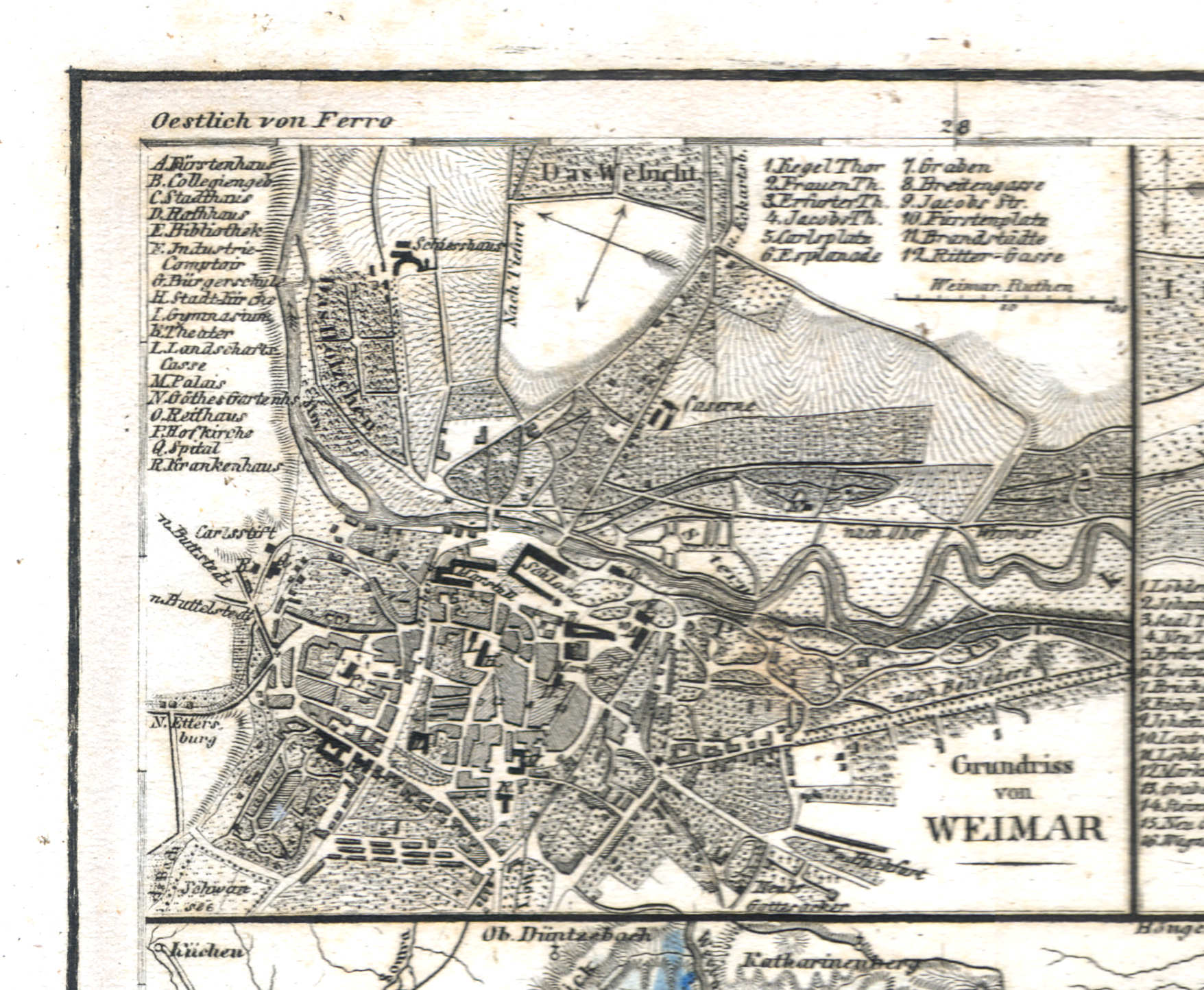
70a. Grundriss von Weimar
Plattegrond van Weimar / Plan of Weimar
 Meyer's Universal-Atlas (1830-1840)
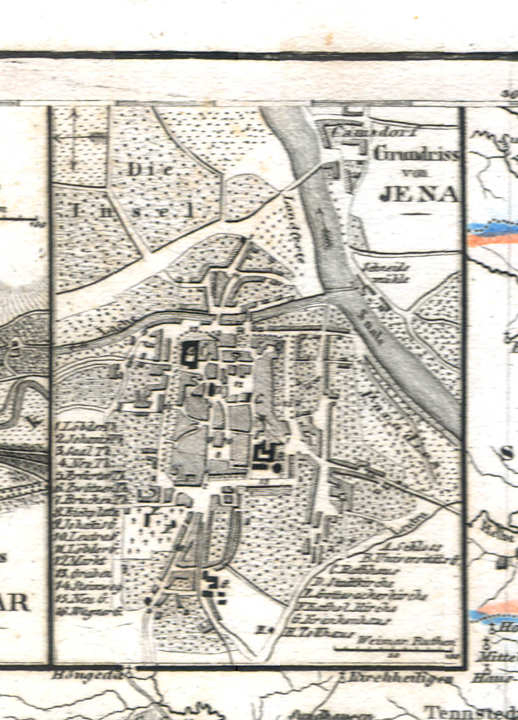
70b. Grundriss von Jena
Plattegrond van Jena / Plan of Jena
 Meyer's Universal-Atlas (1830-1840)
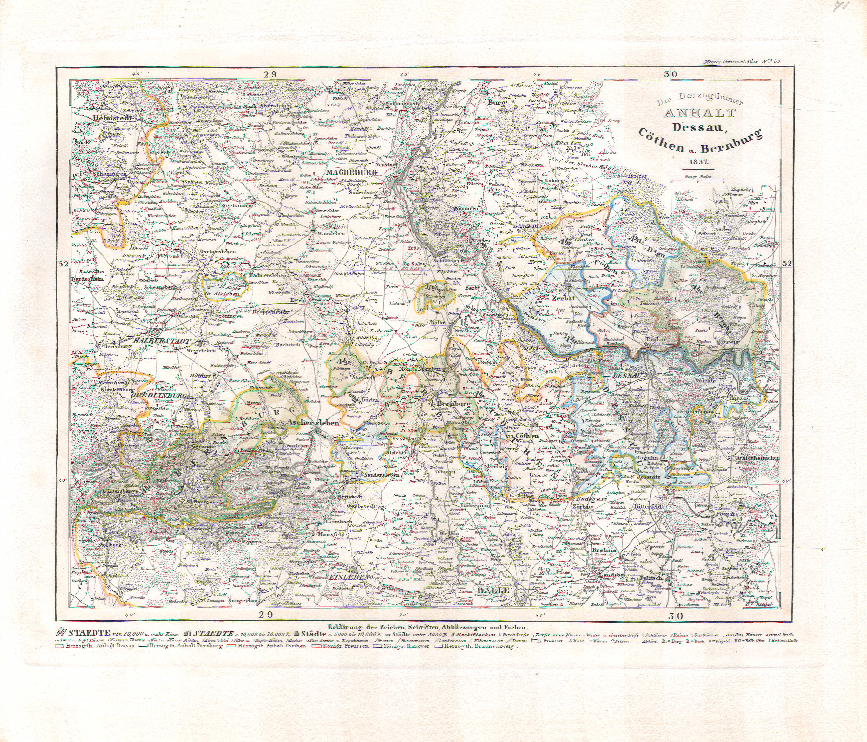
71. Die Herzogthümer Anhalt Dessau, Cöthen u. Bernburg (Nº 63, 1837)
De hertogdommen Anhalt / The duchies of Anhalt
 Meyer's Universal-Atlas (1830-1840)
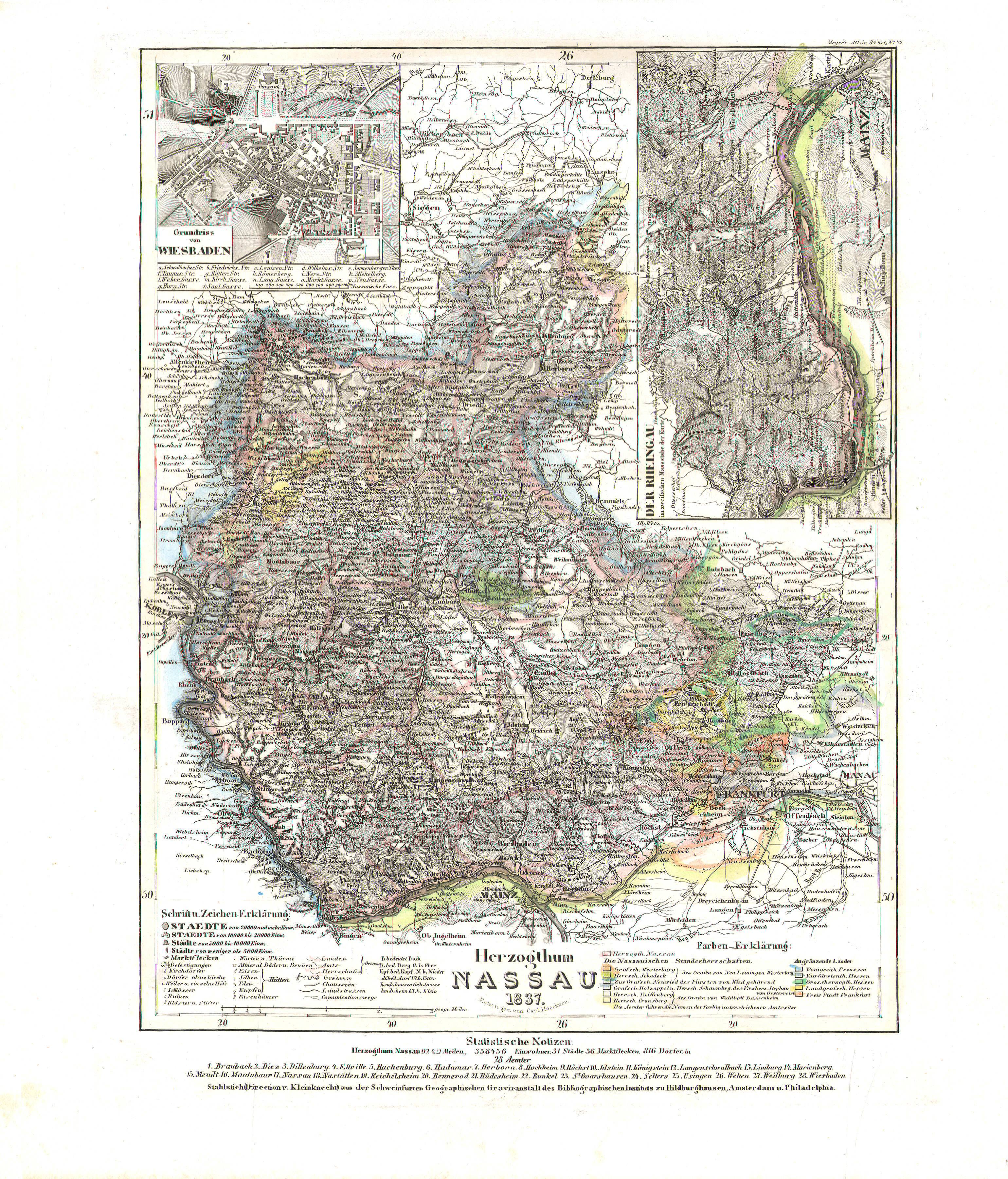
72. Herzogthum Nassau (Nº 72, 1837)
Hertogdom Nassau / Duchy of Nassau
 Meyer's Universal-Atlas (1830-1840)
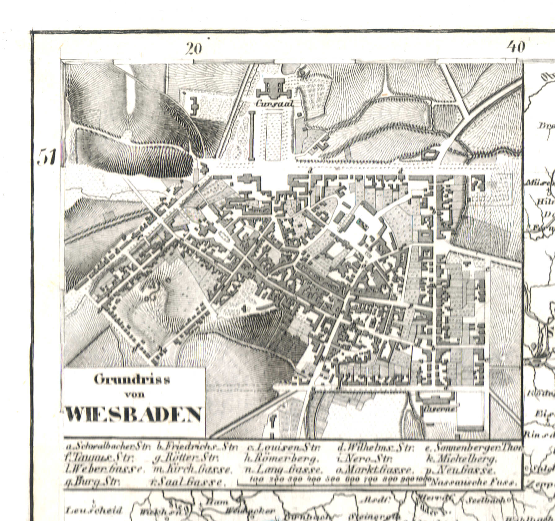
72a. Grundriss von Wiesbaden
Plattegrond van Wiesbaden / Plan of Wiesbaden
 Meyer's Universal-Atlas (1830-1840)
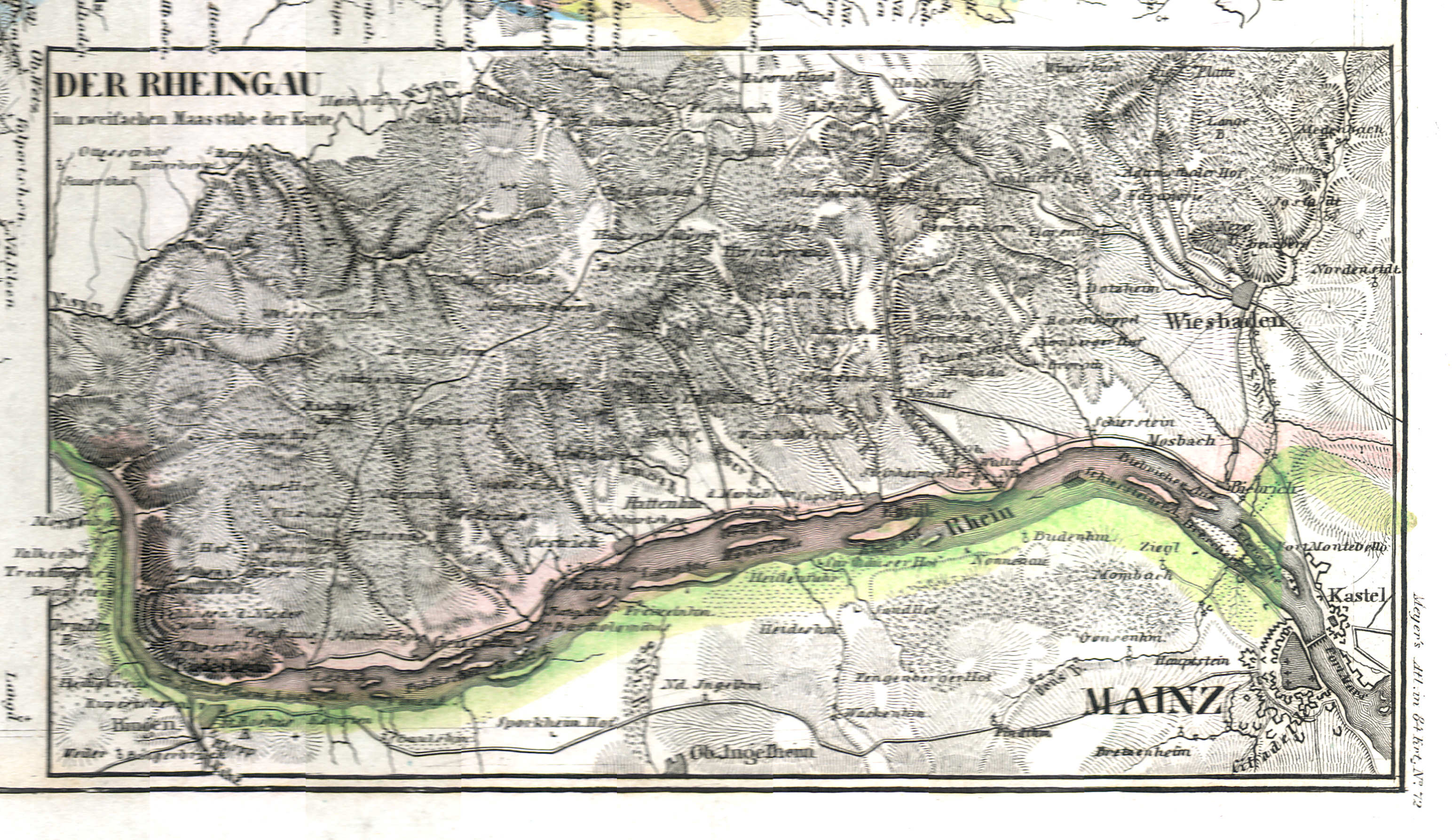
72b. Der Rheingau
De Rheingau / The Rheingau
 Meyer's Universal-Atlas (1830-1840)
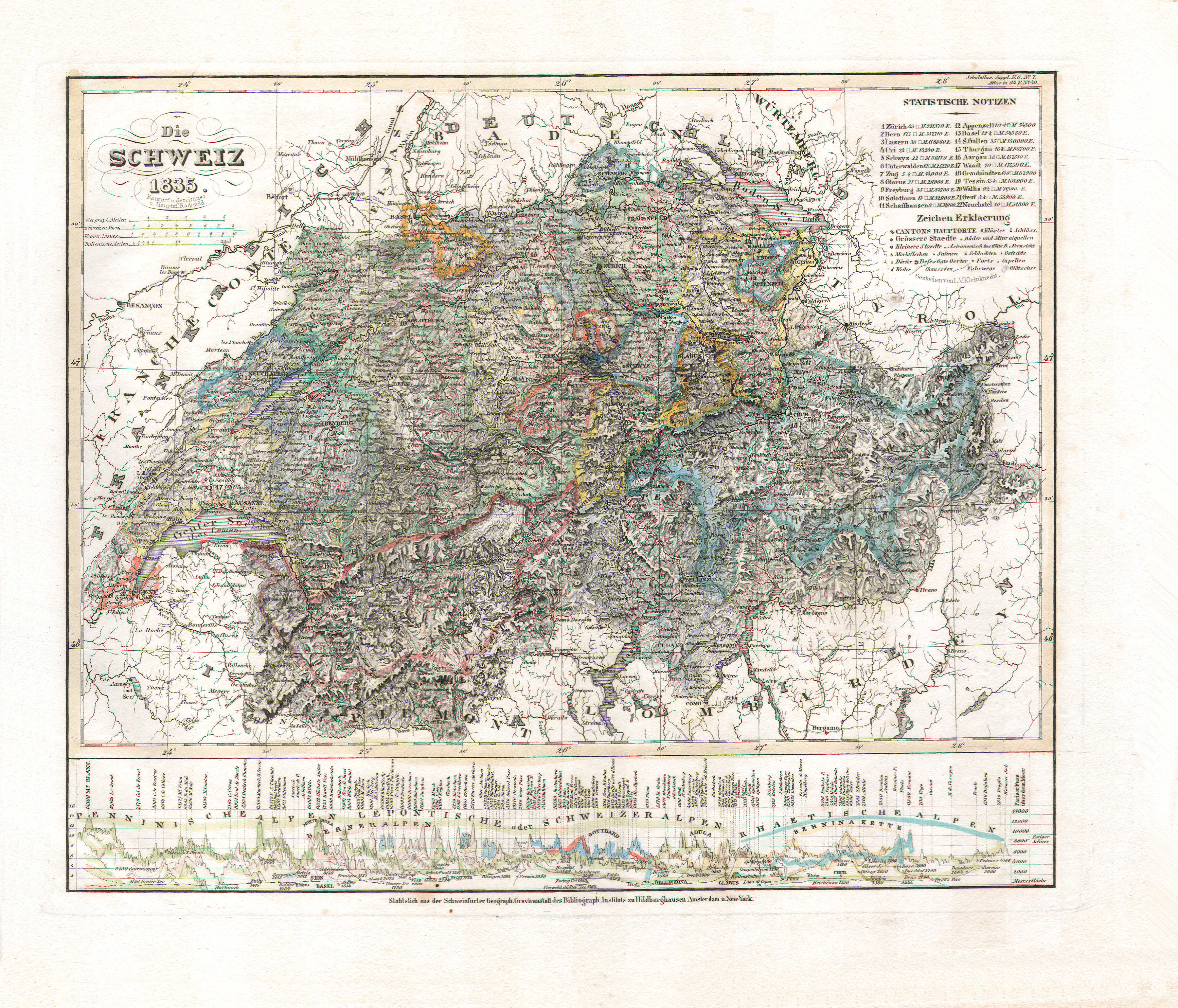
73. Die Schweiz (Nº 49, 1835)
Zwitserland / Switzerland
 Meyer's Universal-Atlas (1830-1840)
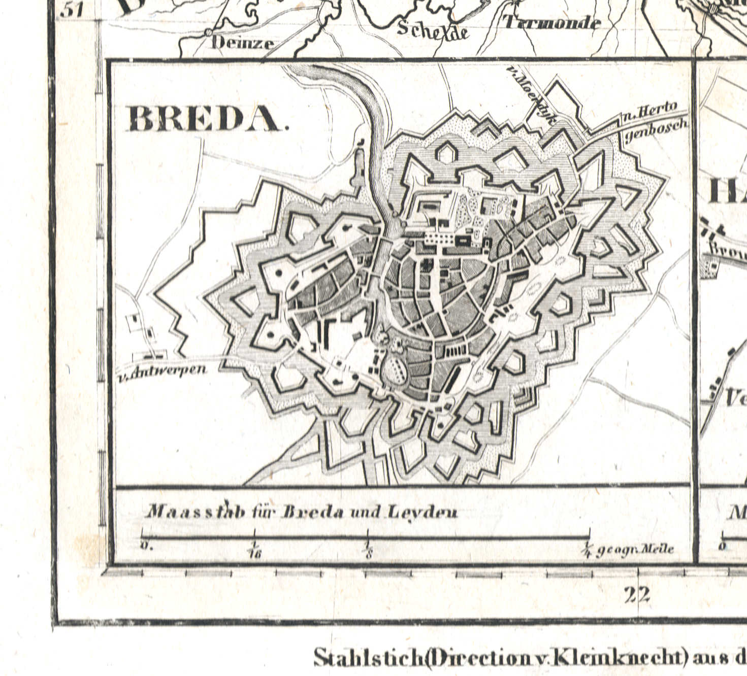
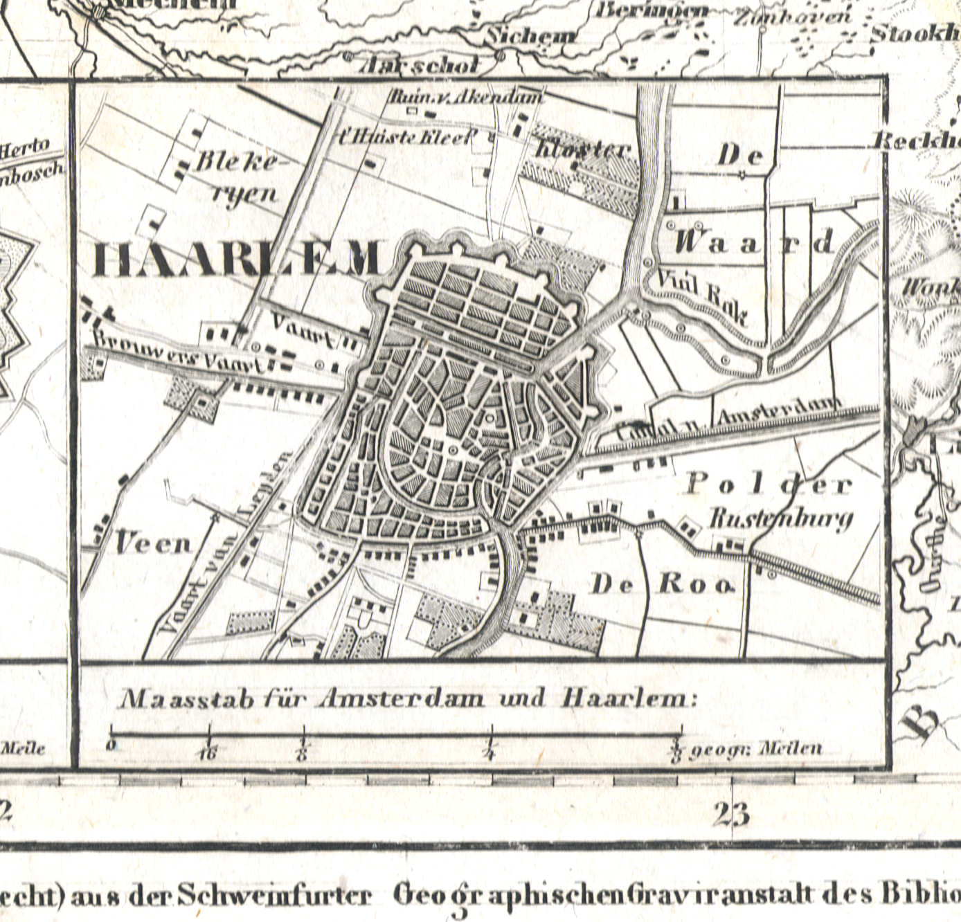
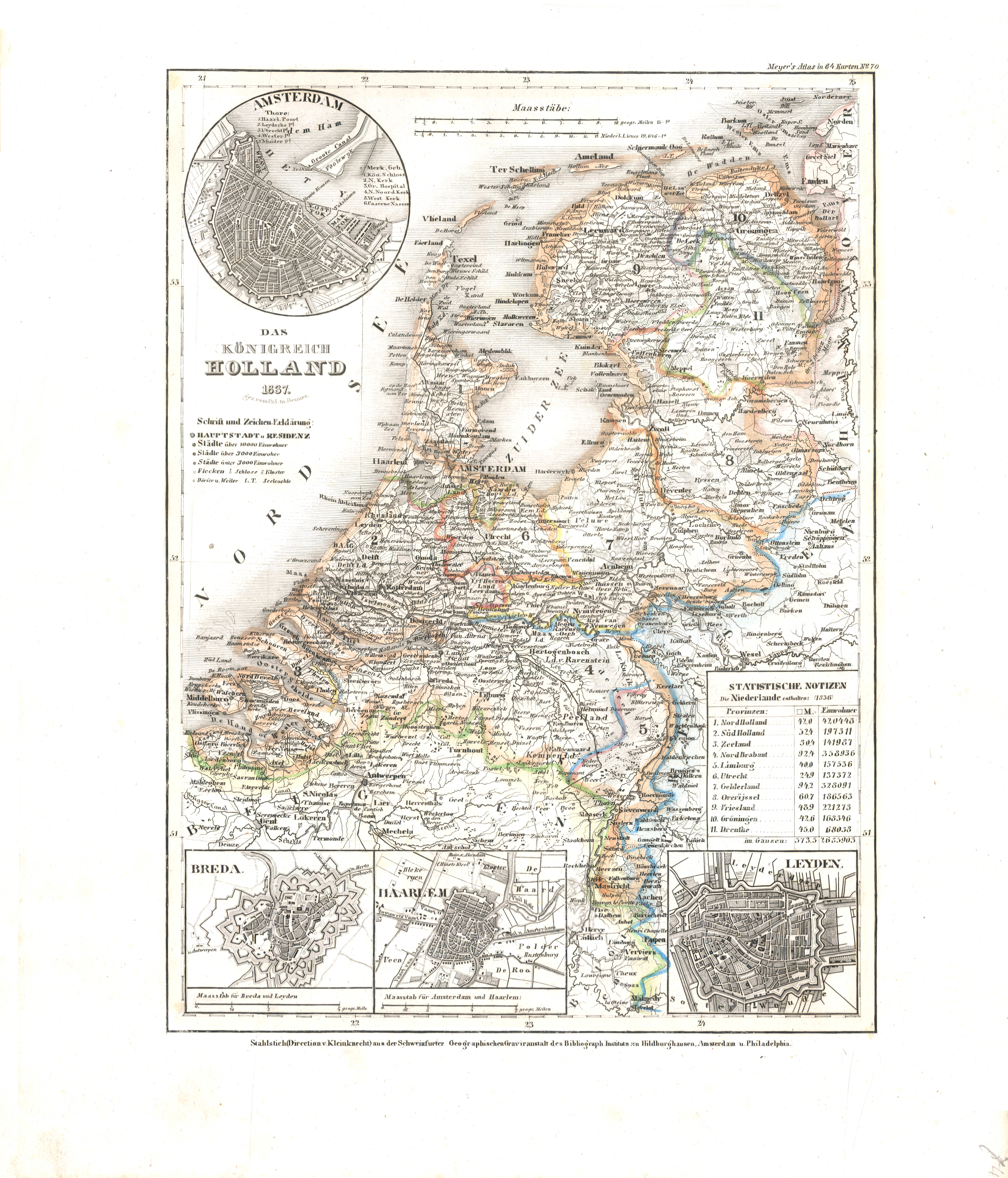
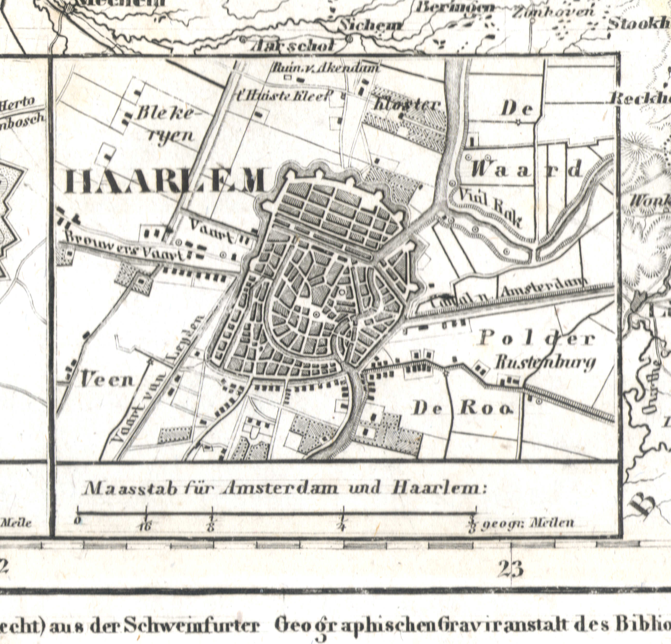
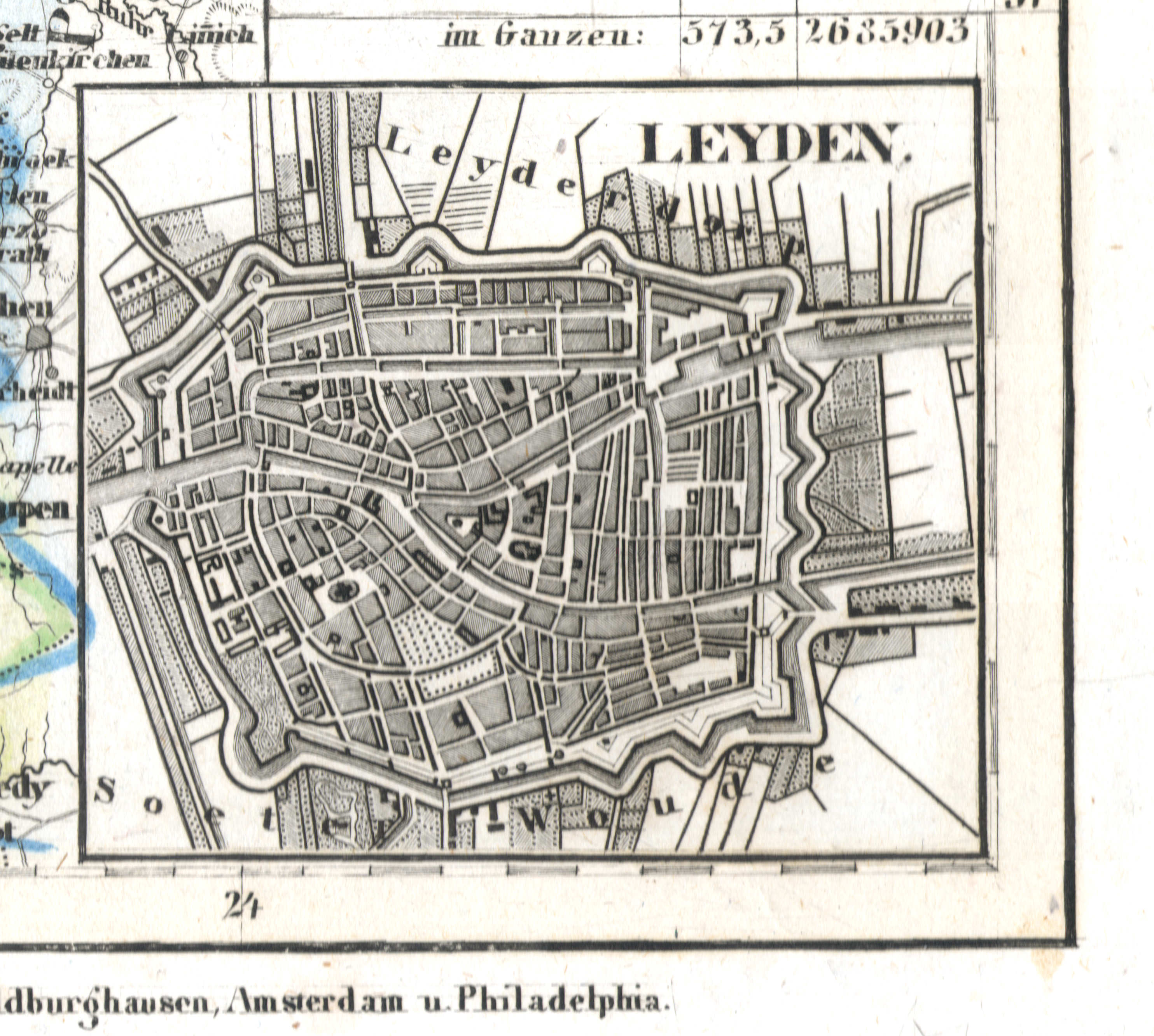
74. Das Königreich Holland (Nº 70, 1837) XL
Koninkrijk Nederland / Kingdom of the Netherlands


 Meyer's Universal-Atlas (1830-1840)
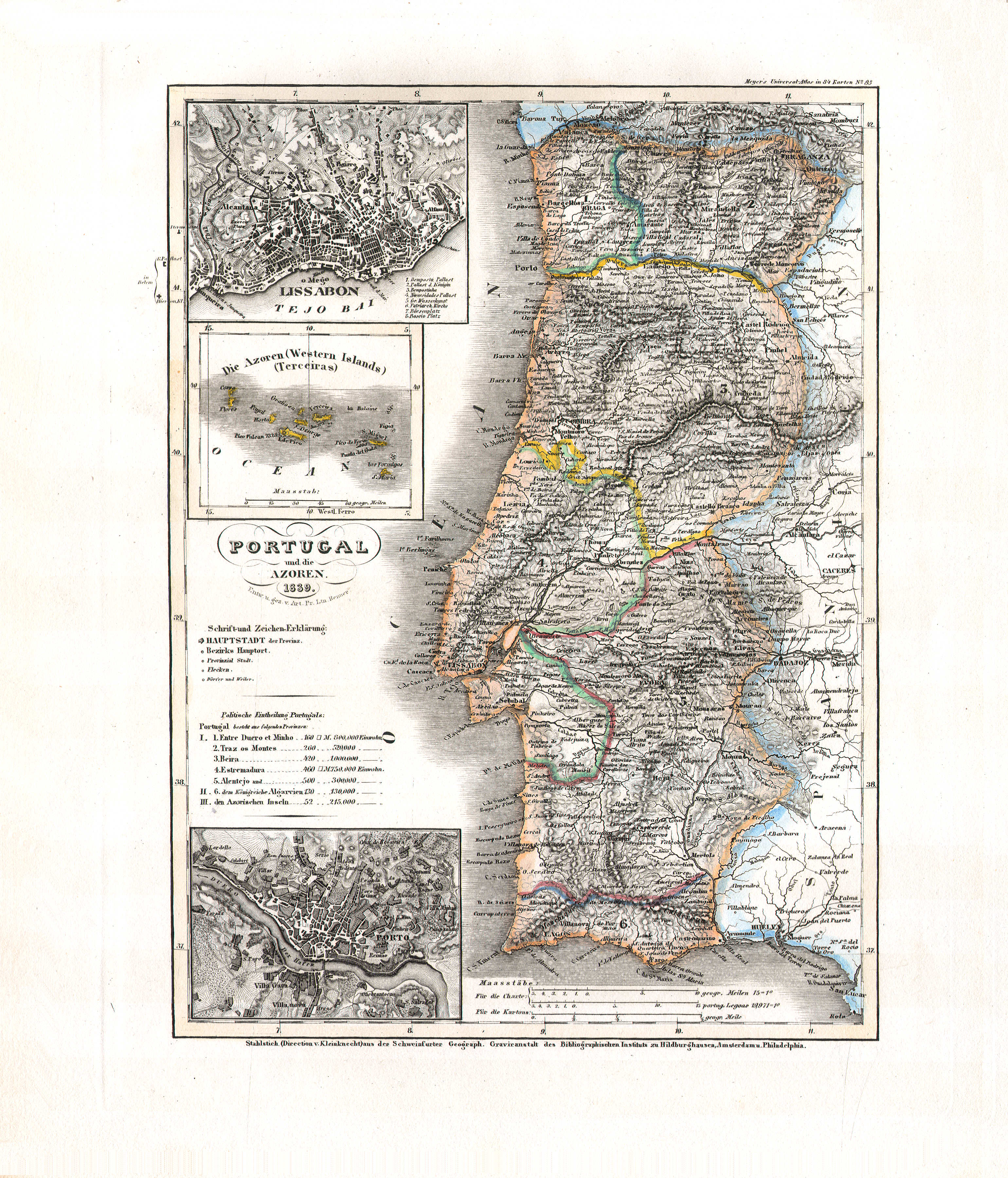
76. Portugal und die Azoren (Nº 85, 1839)
Portugal en de Azoren / Portugal and the Azores
 Meyer's Universal-Atlas (1830-1840)
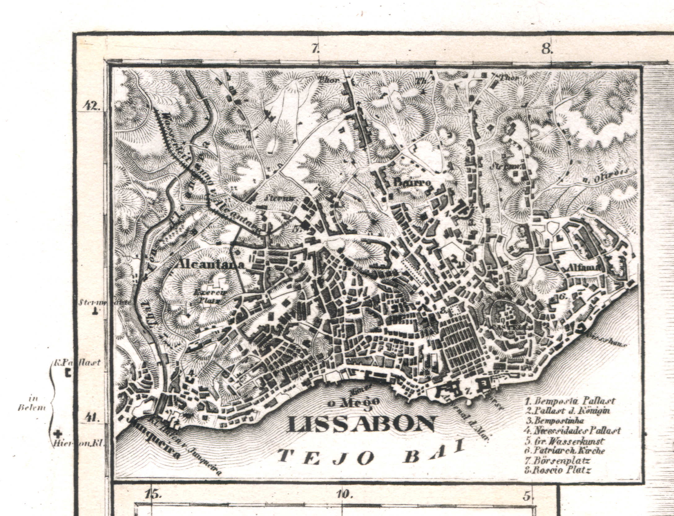
76a. Lissabon
Lissabon / Lisbon / Lisboa
 Meyer's Universal-Atlas (1830-1840)
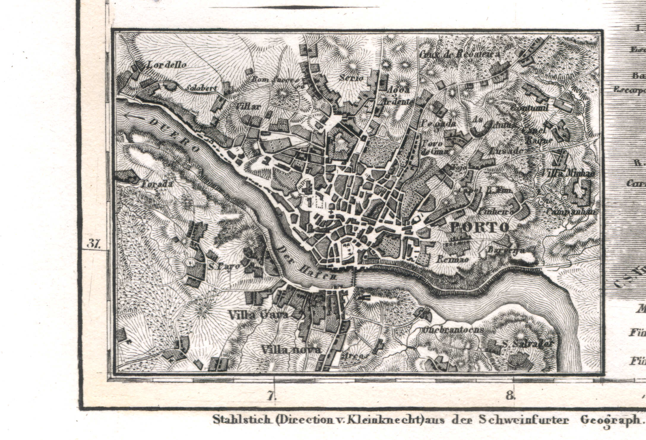
76c. Porto
Porto / Oporto
 Meyer's Universal-Atlas (1830-1840)
77. Ostindien (Nº 33, 1833)
Oost-Indië / East Indies
 Meyer's Universal-Atlas (1830-1840)
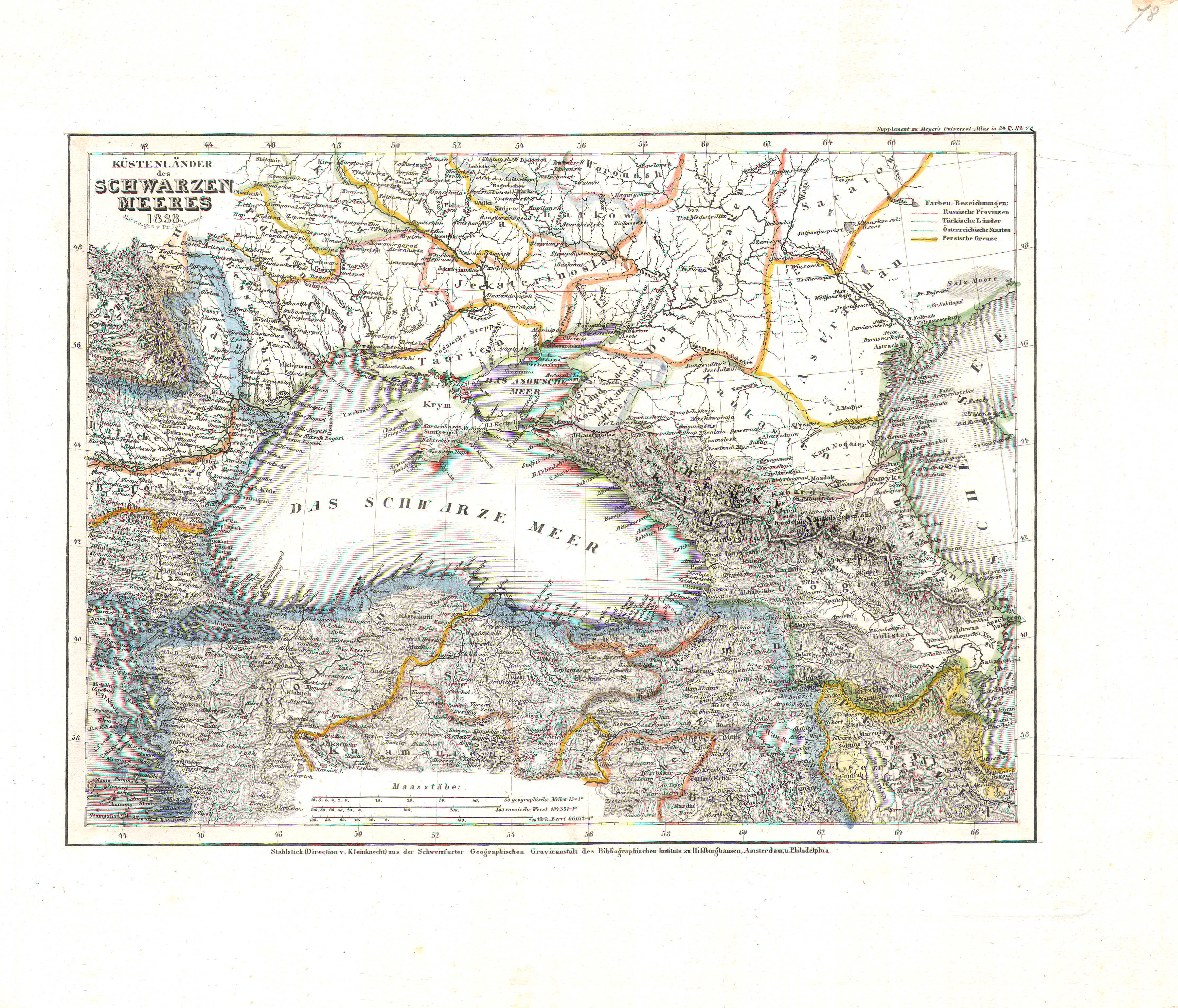
78. Küstenländer des Schwarzen Meeres (Nº 78, 1838)
De landen rond de Zwarte Zee / The countries around the Black Sea
 Meyer's Universal-Atlas (1830-1840)
79. West Indien und Mittel America (Nº 25, 1832)
West-Indië en Midden-Amerika / West Indies and central America
 Meyer's Universal-Atlas (1830-1840)
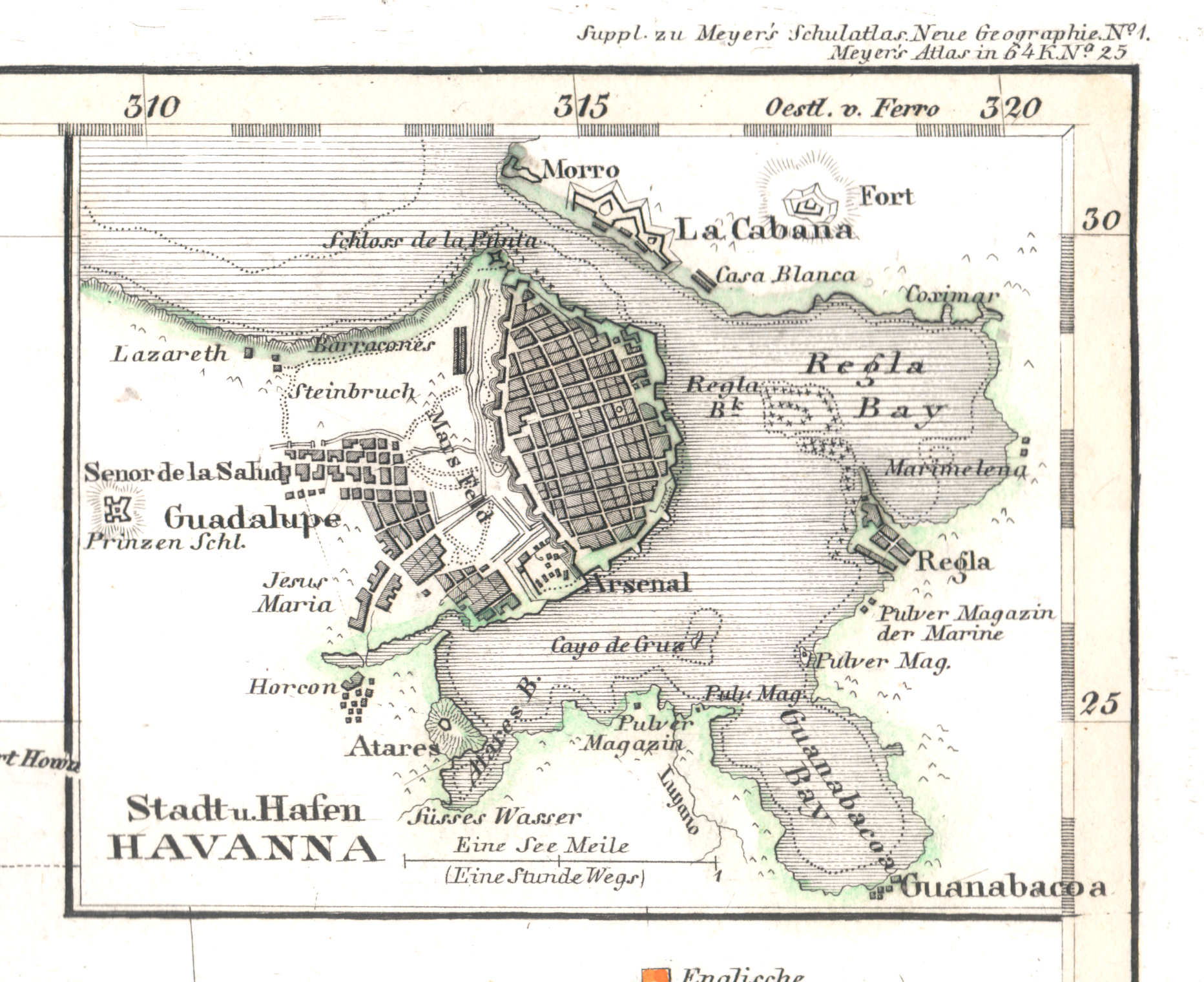
79a. Stadt u. Hafen Havanna
Stad en haven Havana / City and harbor of Havana / La Habana
 Meyer's Universal-Atlas (1830-1840)
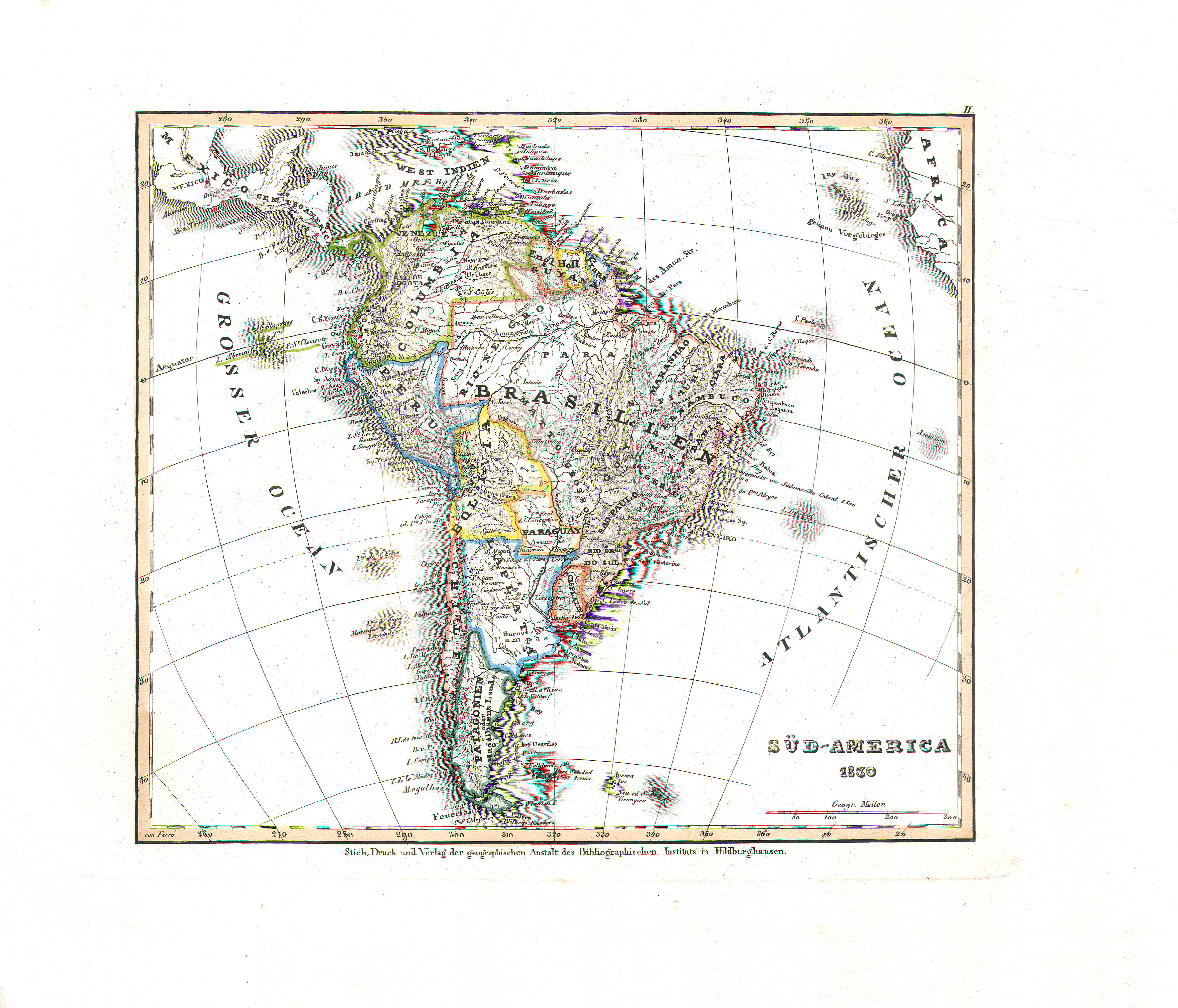
80. Süd-America (Nº 2, 1830)
Zuid-Amerika / South America
 Meyer's Universal-Atlas (1830-1840)
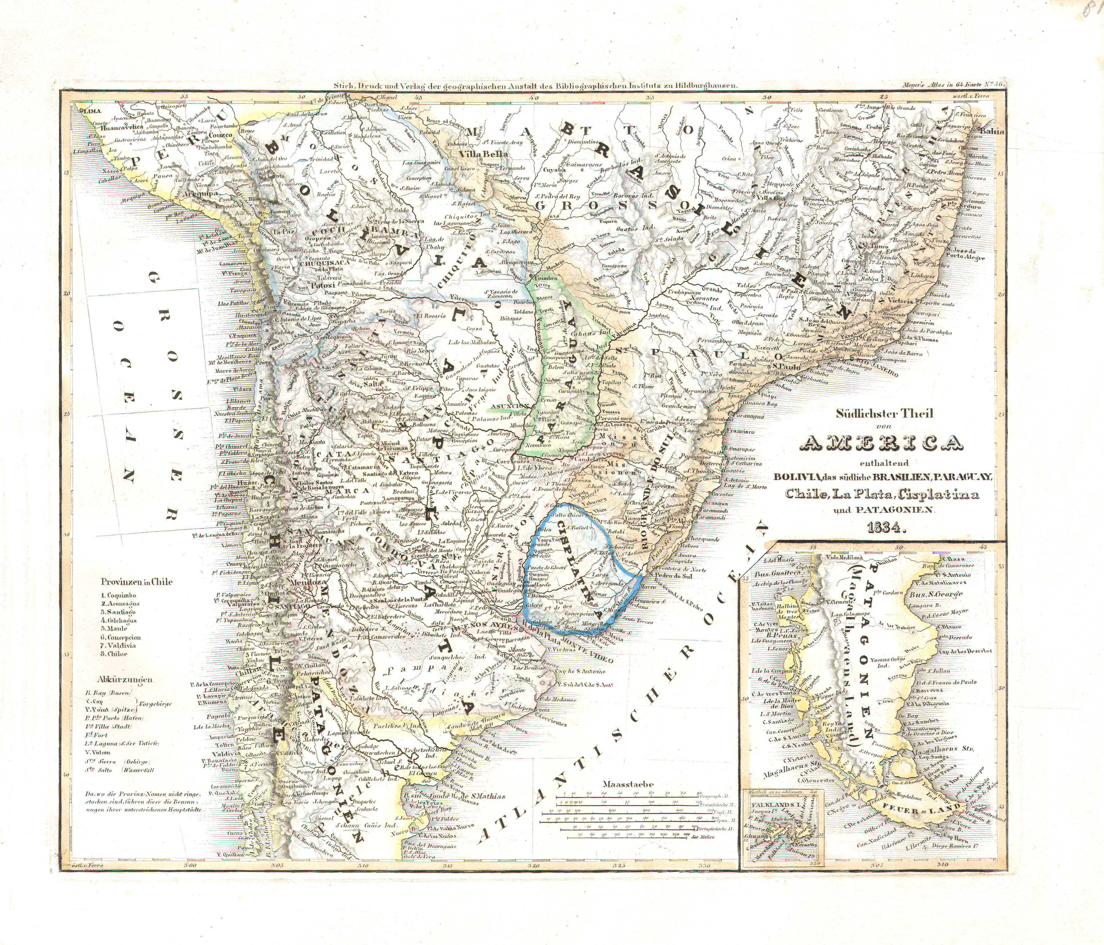
81. Südlichster Theil von America enthaltend Bolivia, das südliche Brasilien, Paraguay, Chile, La Plata, Cisplatina und Patagonien (Nº 46, 1834)
Zuidelijk deel van Zuid-Amerika met Bolivia, Zuid-Brazilië, Paraguay, Chili, La Plata (Argentinië), Cisplatina (Uruguay) en Patagonië / Southern part of South America with Bolivia, South Brazil, Paraguay, Chile, La Plata (Argentina), Cisplatina (Uruguay) and Patagonia
 Meyer's Universal-Atlas (1830-1840)
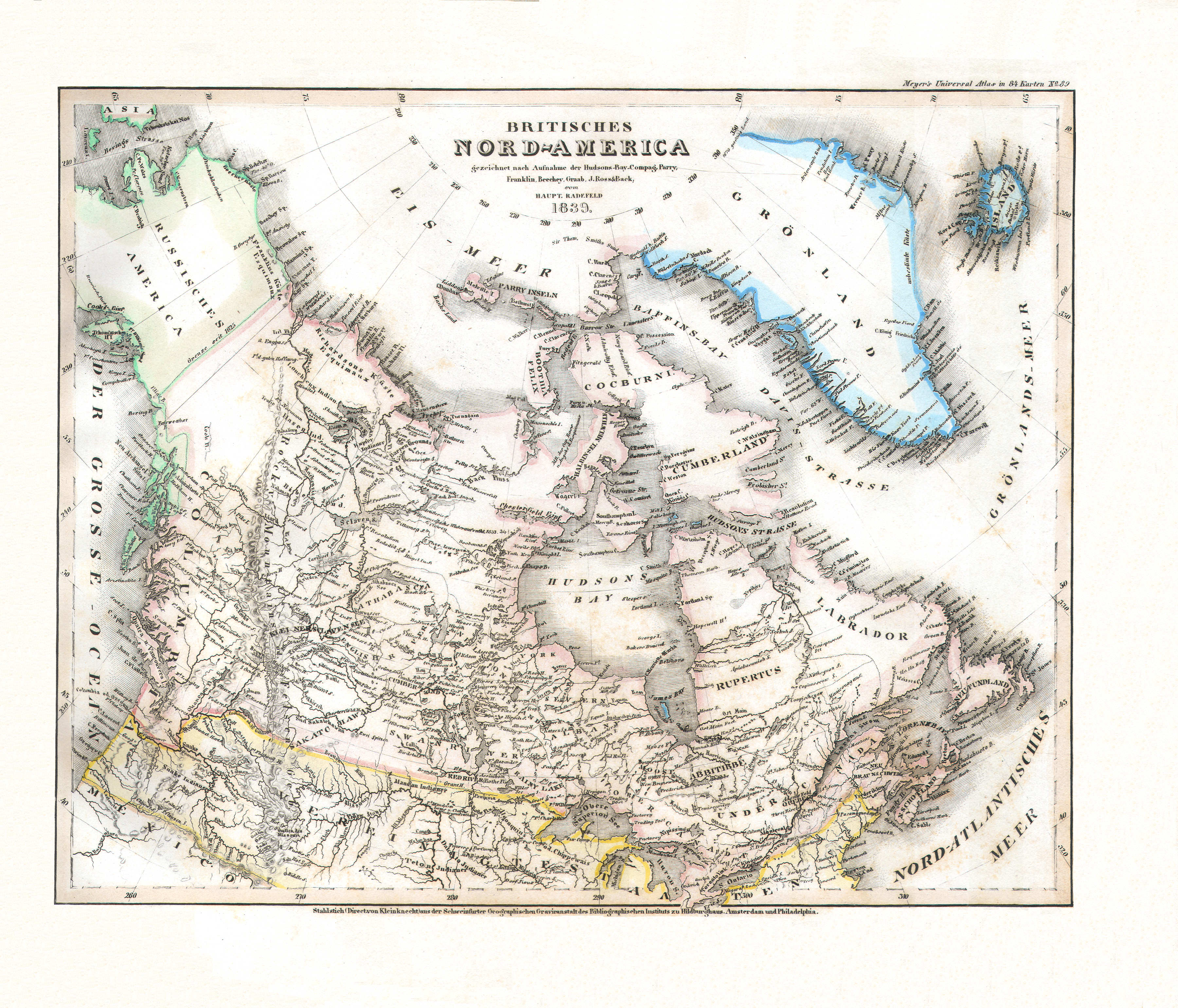
82. Britisches Nord-America (Nº 89, 1839)
Brits Noord-Amerika / British North America
 Meyer's Universal-Atlas (1830-1840)
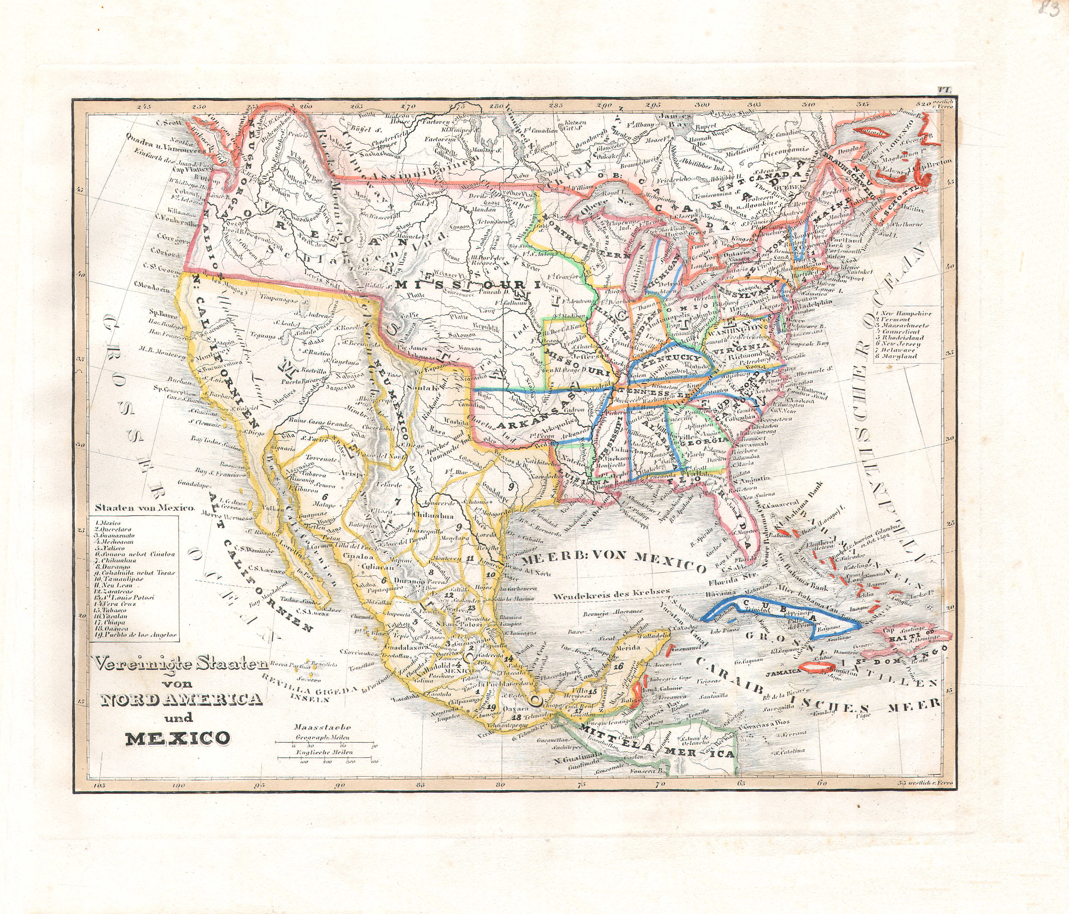
83. Vereinigte Staaten von Nord America und Mexico (Nº 6, 1831)
Verenigde Staten van Noord-Amerika en Mexico / United States of North America and Mexico
 Meyer's Universal-Atlas (1830-1840)
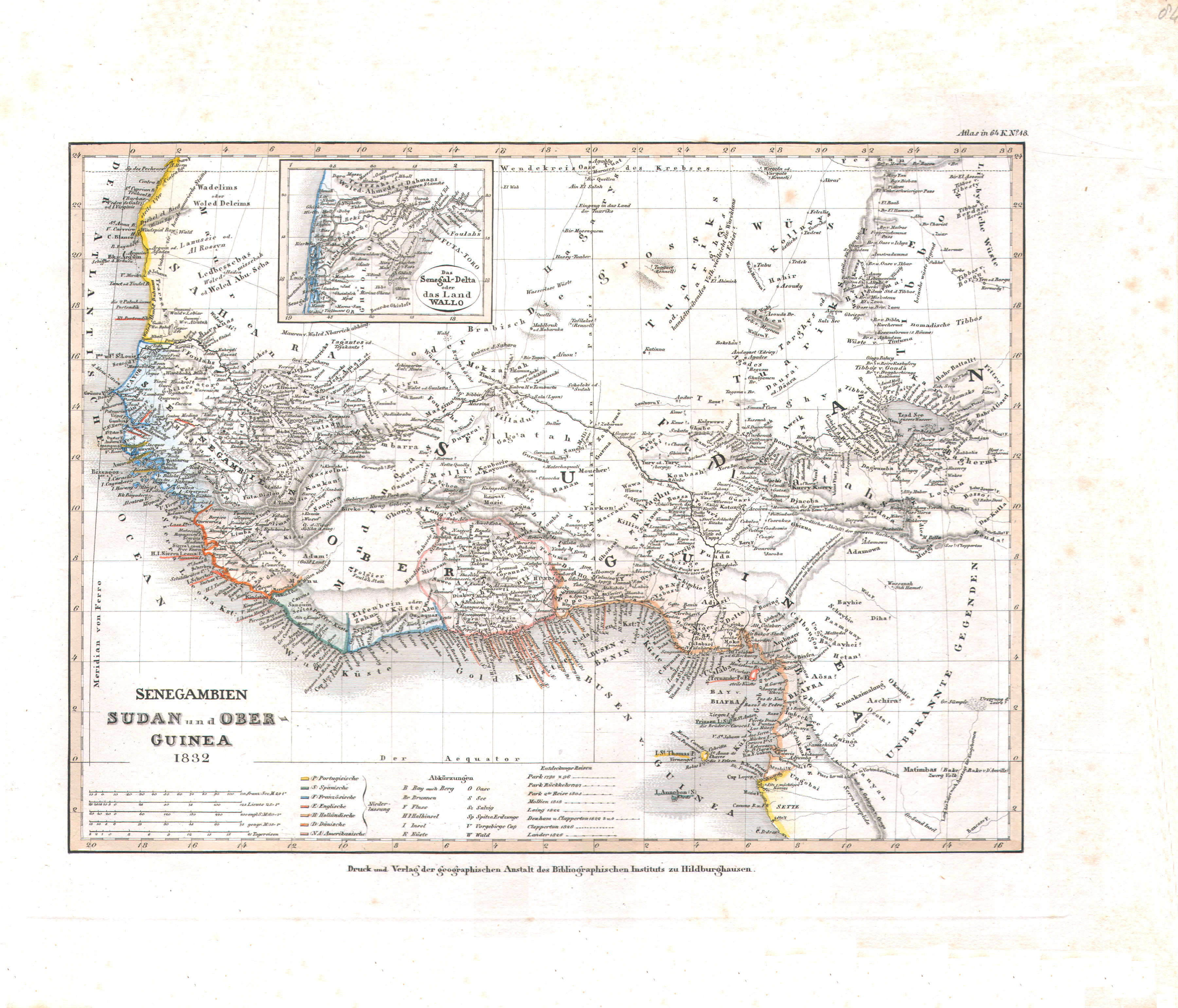
84. Senegambien Sudan und Ober-Guinea (Nº 18, 1832)
Senegambië, Soedan en Opper-Guinee / Senegambia, Sudan and Upper Guinea
 Meyer's Universal-Atlas (1830-1840)
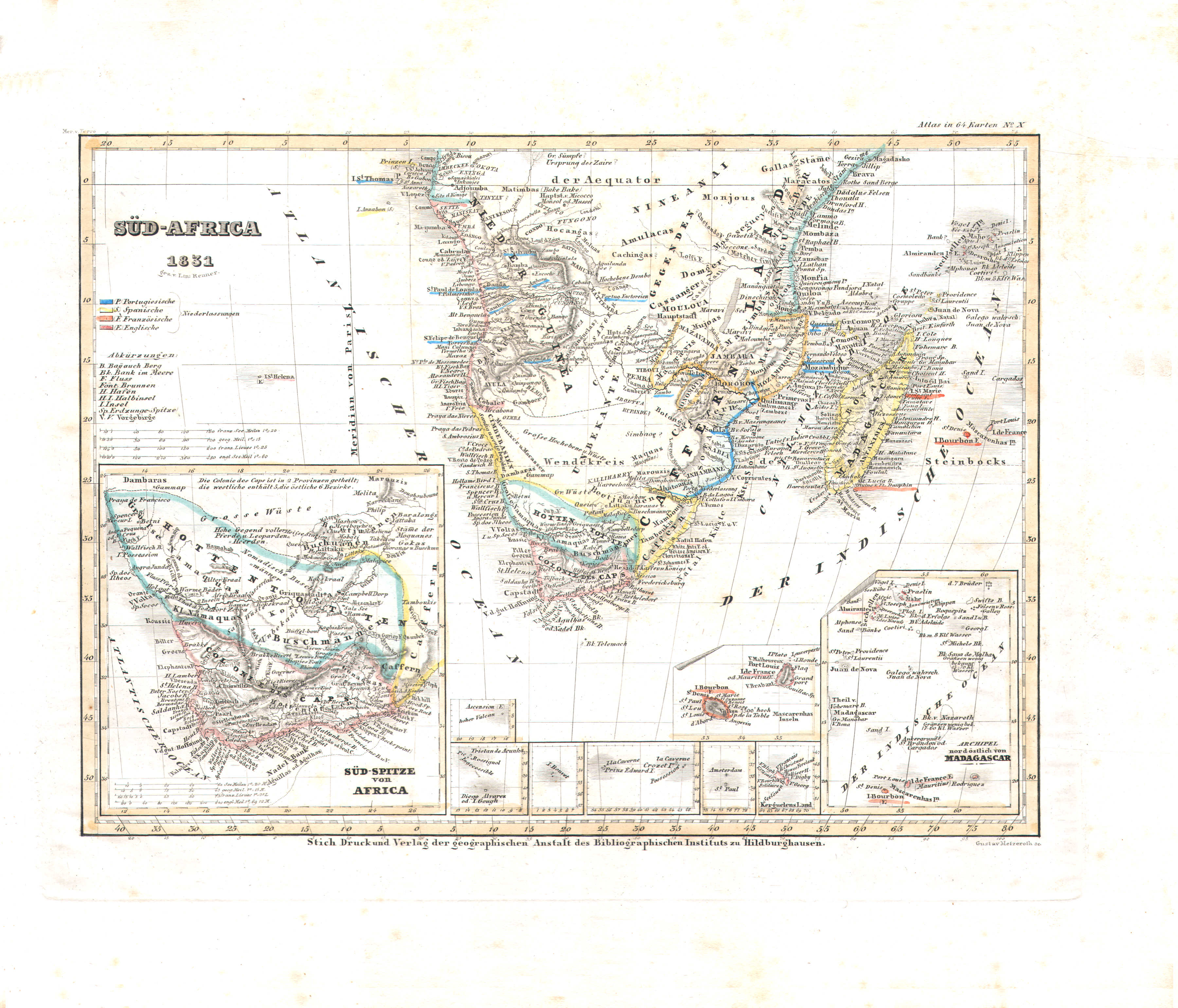
85. Süd-Africa (Nº 10, 1831)
Zuidelijk Afrika / Southern Africa
 Meyer's Universal-Atlas (1830-1840)
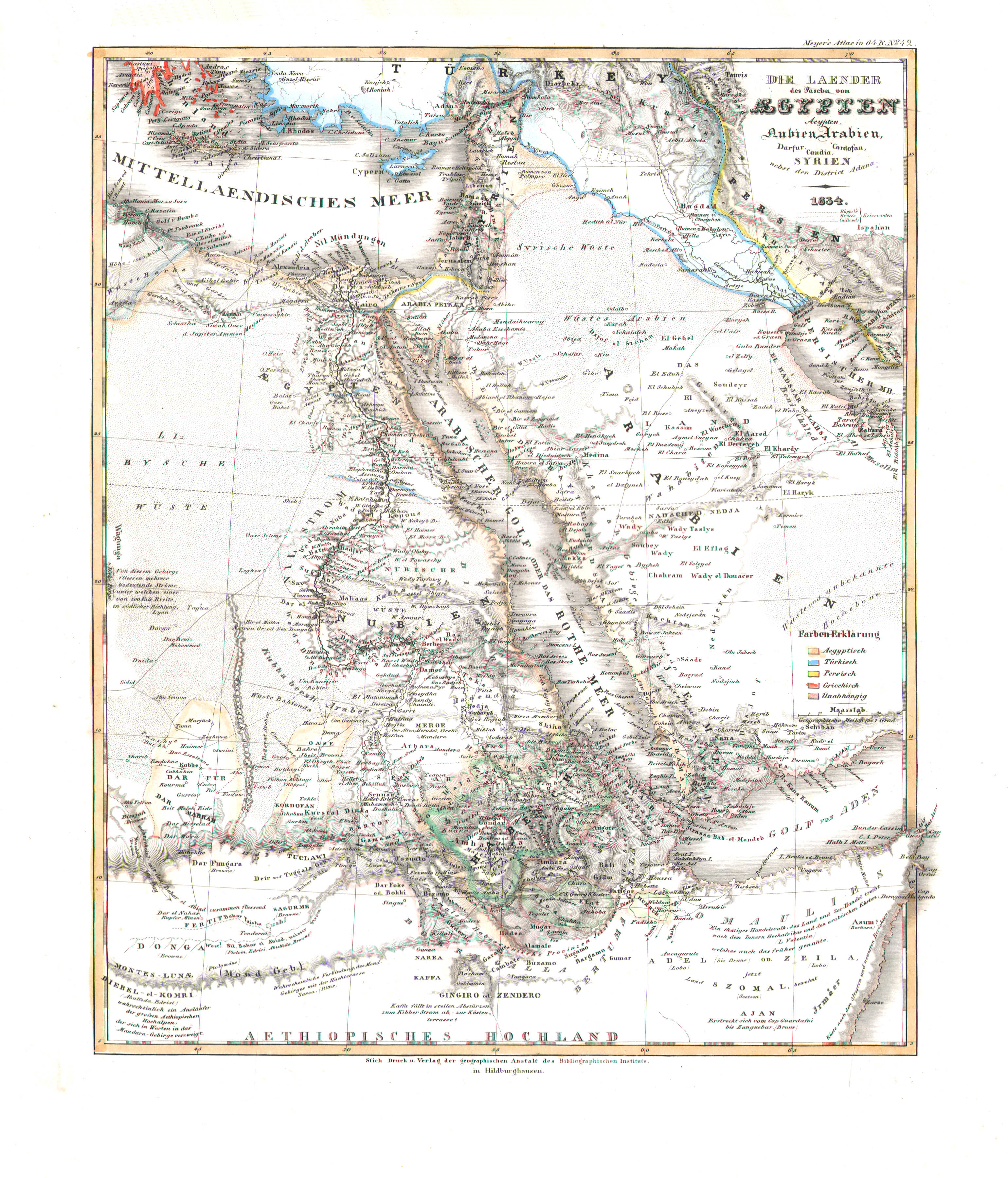
86. Die Laender des Pascha von Aegypten; Aeypten, Nubien, Arabien, Darfur, Cordofan, Candia, Syrien nebst den District Adana (Nº 42, 1834)
De landen van de Pasja van Egypte / The countries of the Pasha of Egypt
 Meyer's Universal-Atlas (1830-1840)
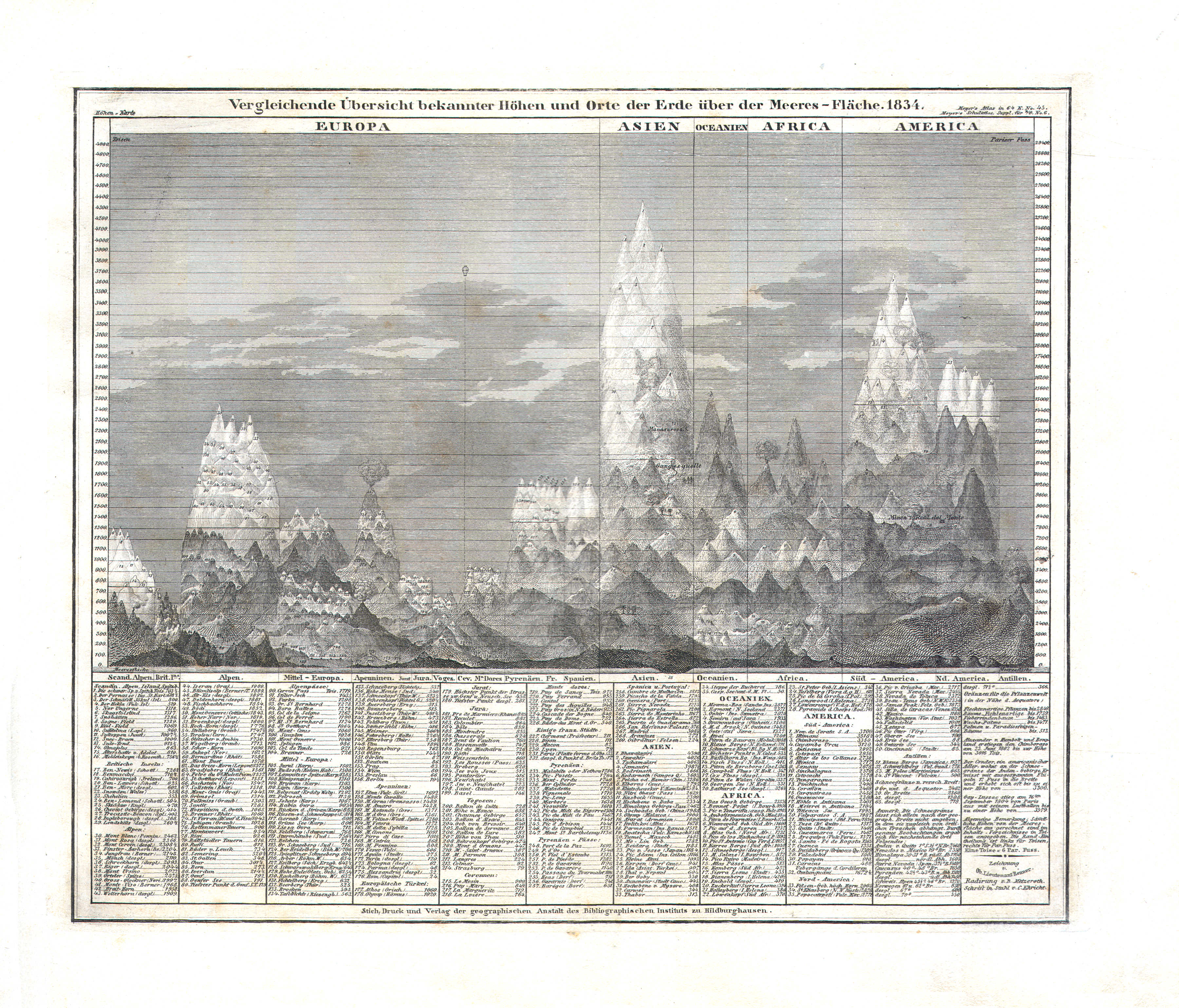
87. Vergleichende Übersicht bekannter Höhen und Orte der Erde über Meeres-Fläche (Nº 45, 1834)
Vergelijkend overzicht van hoogtes boven de zeespiegel / Comparative overview of altitudes above sea level
 Meyer's Universal-Atlas (1830-1840)
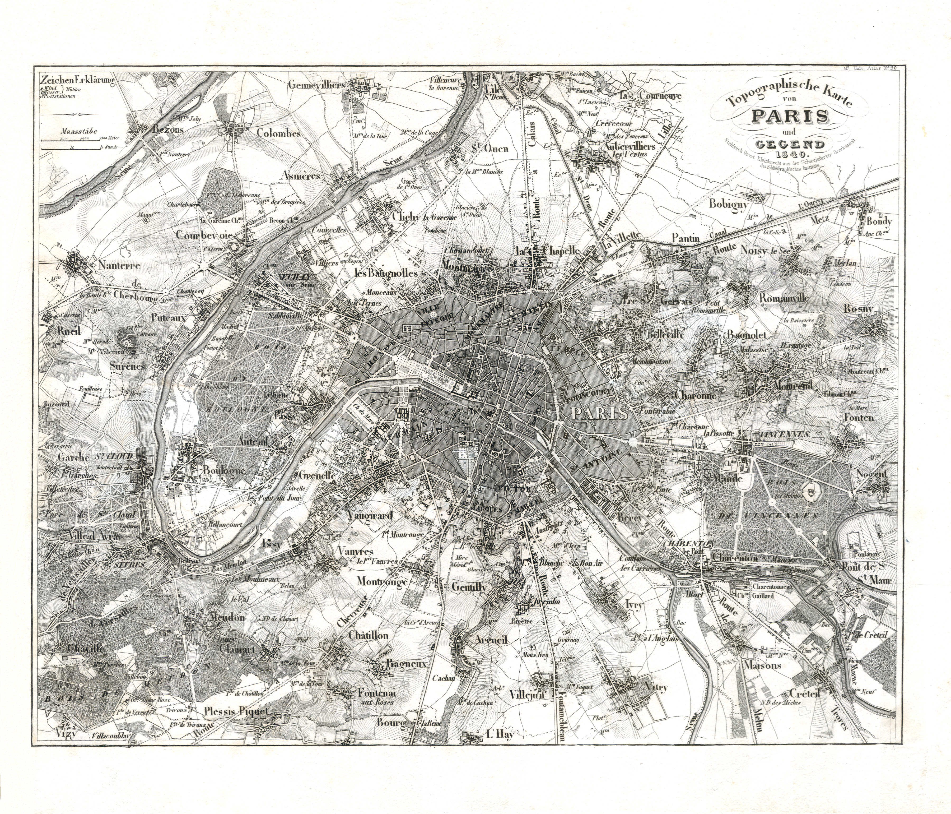
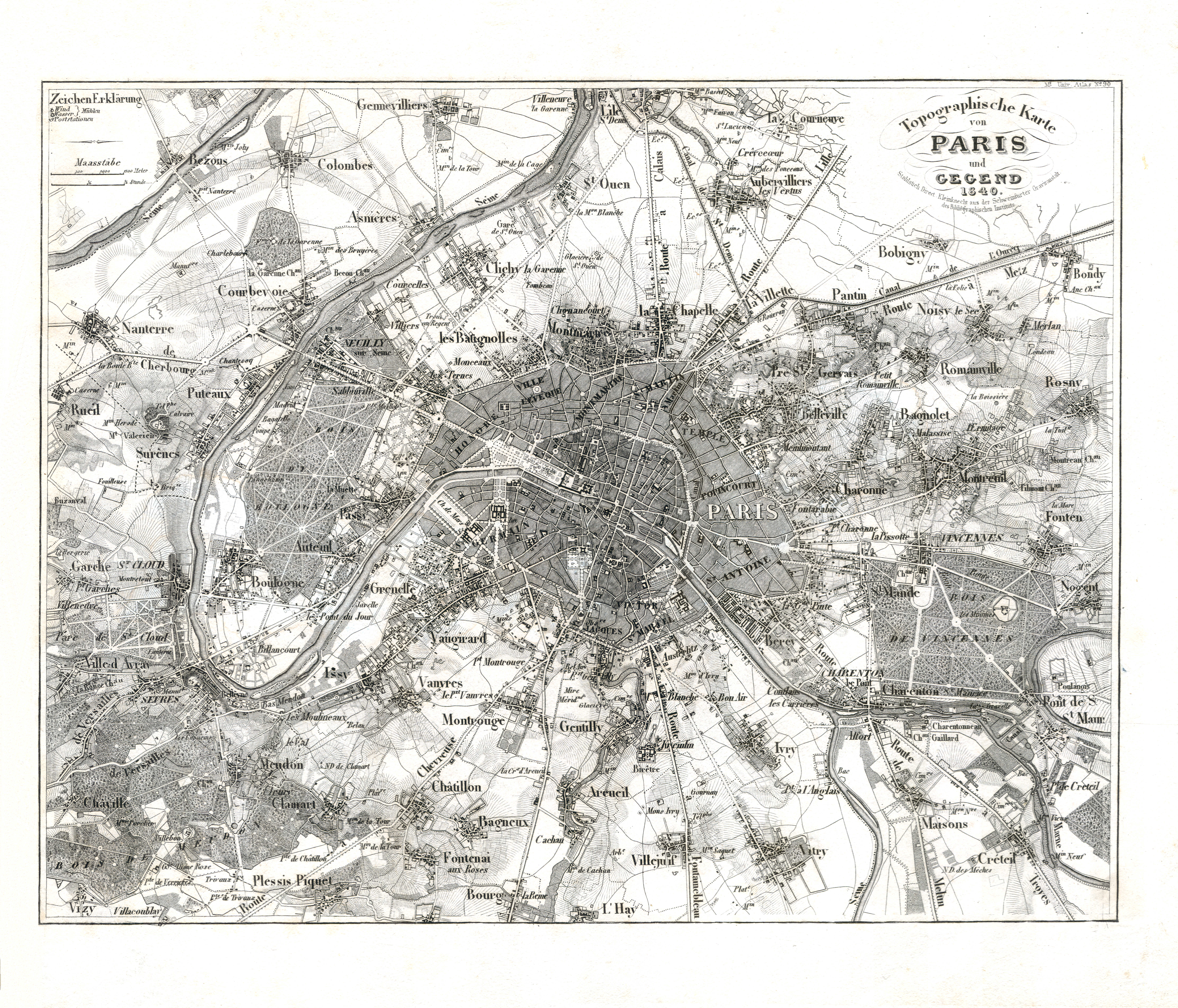
88. Topographische Karte von Paris und Gegend (Nº 90, 1840) XL
Parijs en omgeving / Paris and environs
 Meyer's Universal-Atlas (1830-1840)
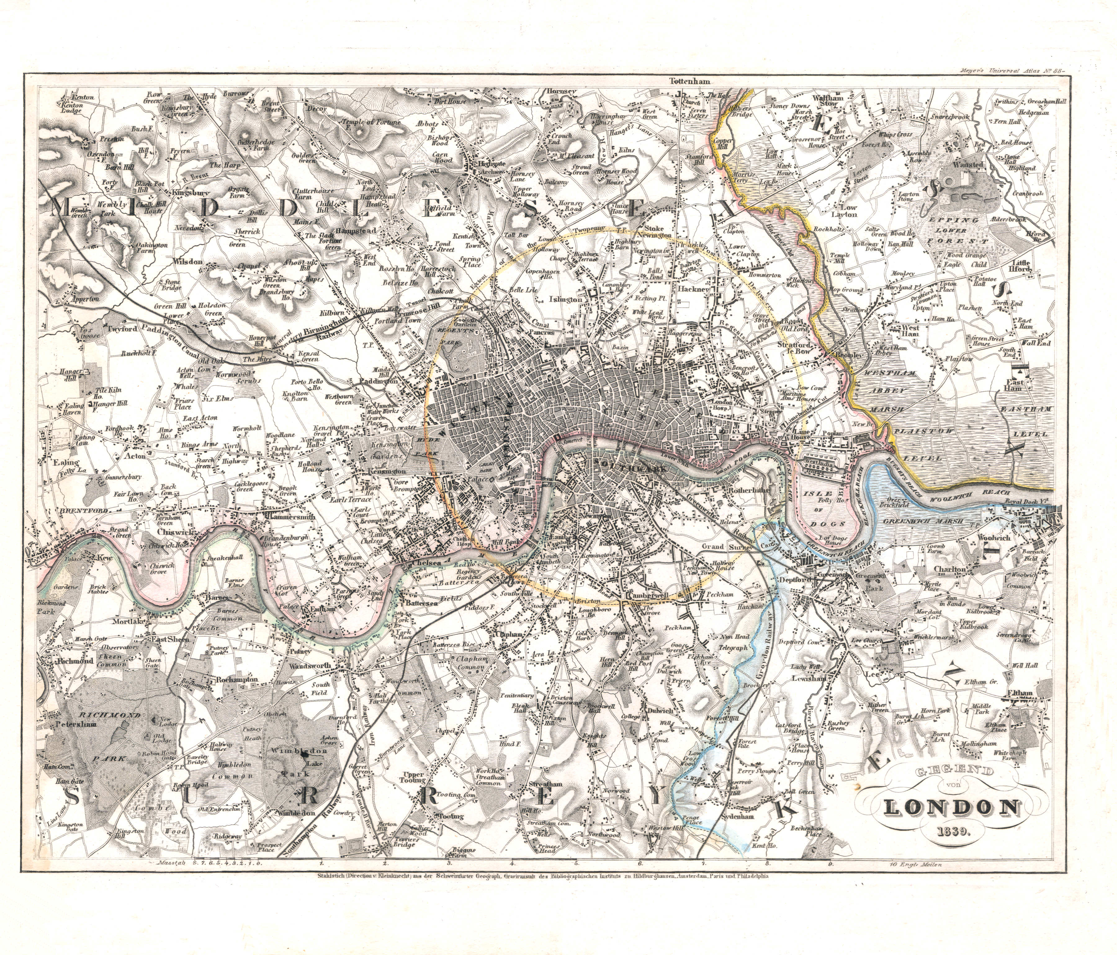
89. Umgebung von London (Nº 88, 1839) XL
Londen en omgeving / London and environs
 Meyer's Universal-Atlas (1830-1840)
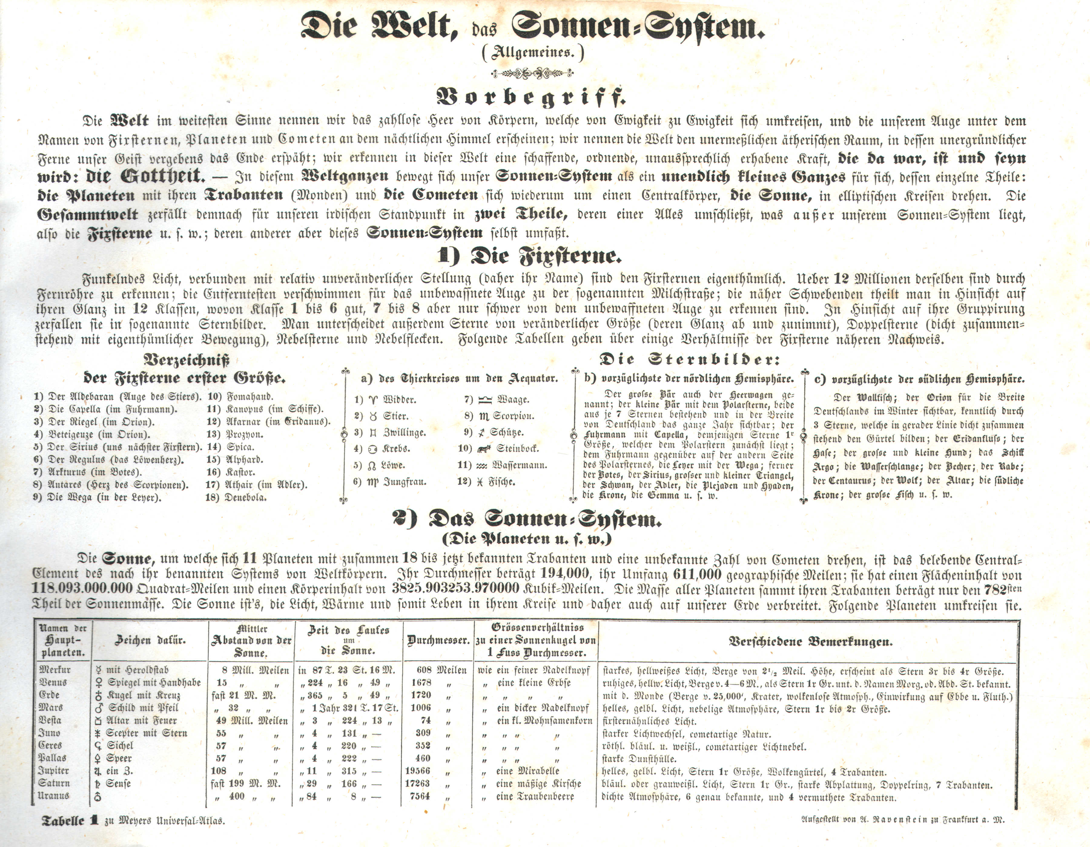
Tabelle 1. Die Welt, das Sonnen-System
Het heelal, het zonnestelsel / The universe, the solar system
 Meyer's Universal-Atlas (1830-1840)
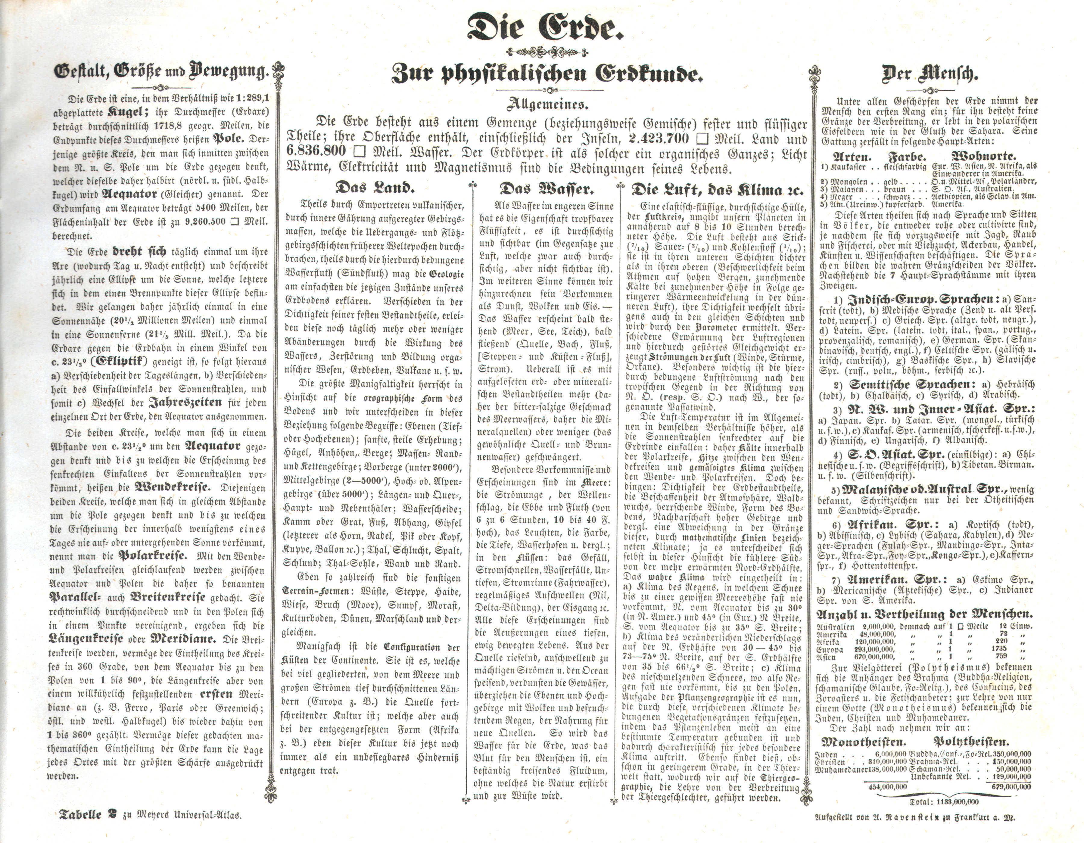
Tabelle 2. Die Erde. Zur physikalischen Erdkunde
De Aarde, fysiche geografie / The Earth, physical geography
 Meyer's Universal-Atlas (1830-1840)
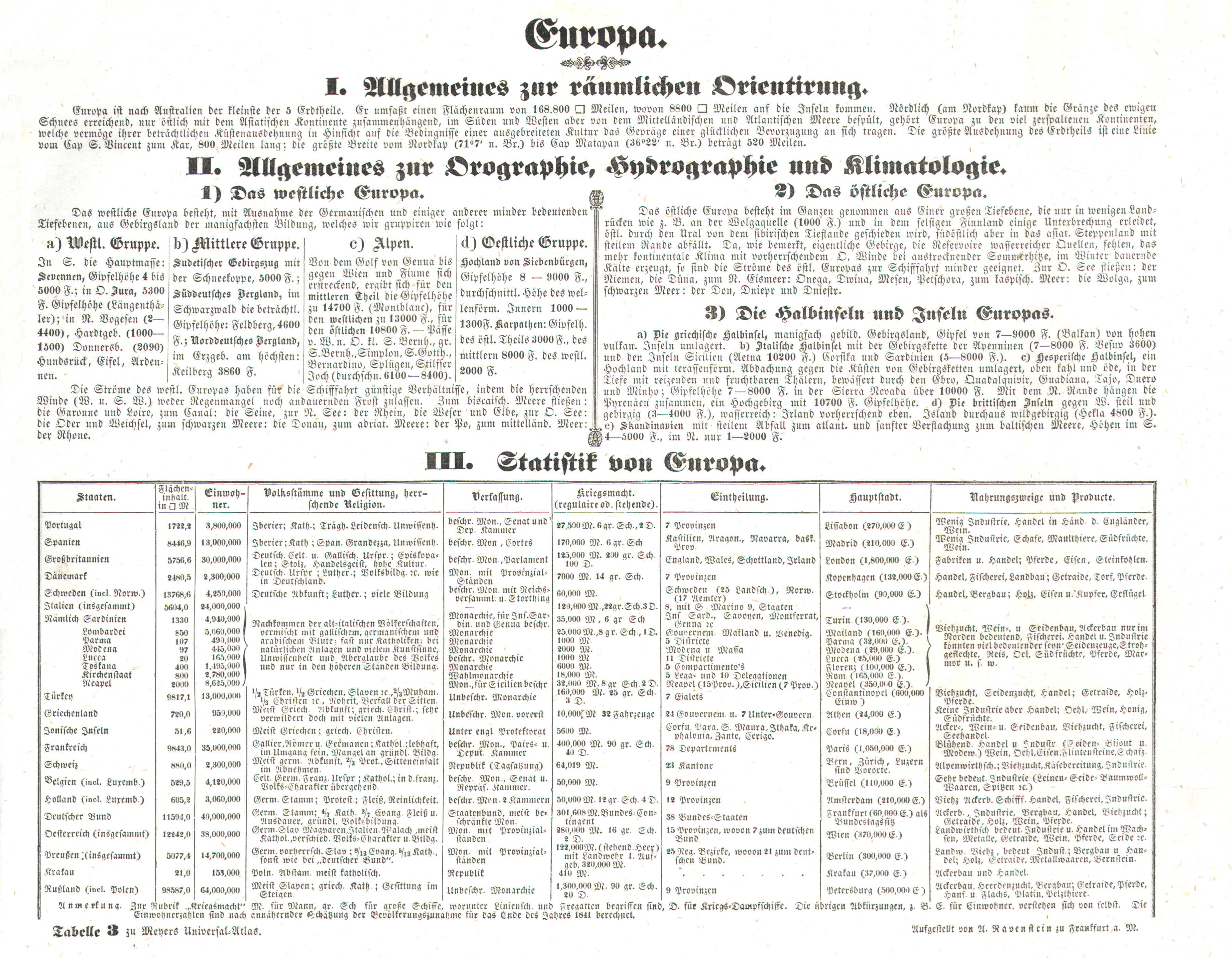
Tabelle 3. Europa
Europa / Europe
 Meyer's Universal-Atlas (1830-1840)
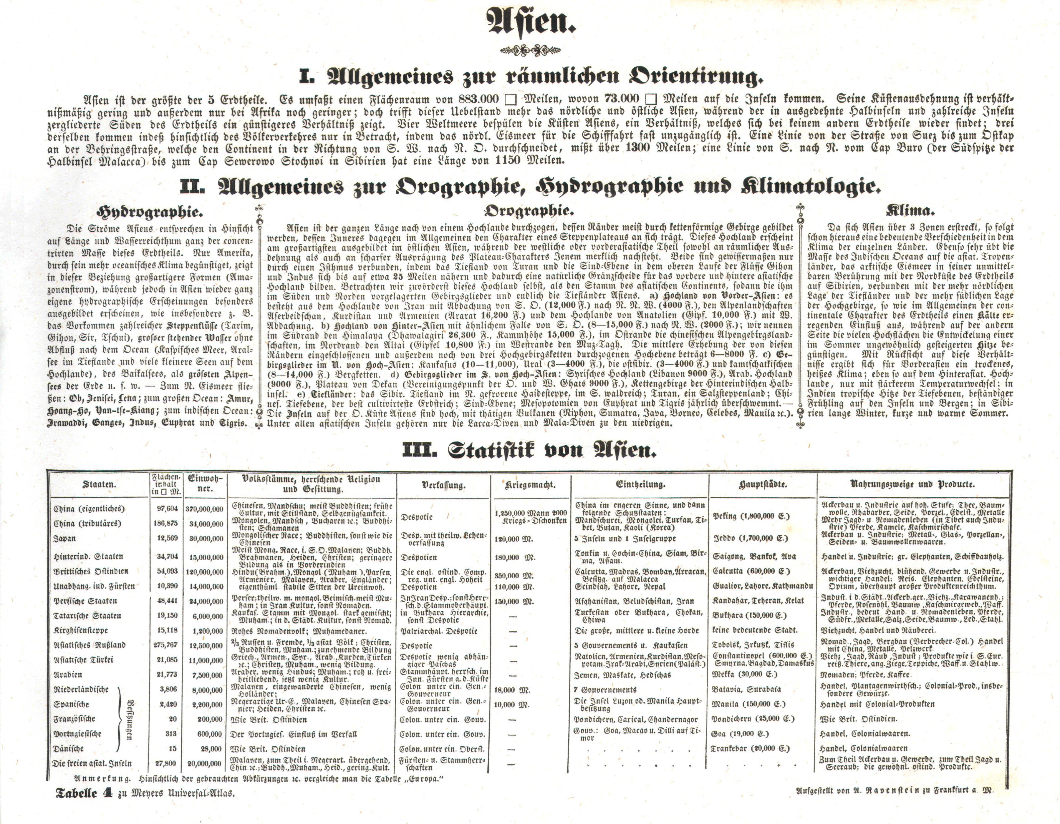
Tabelle 4. Asien
Azië / Asia
 Meyer's Universal-Atlas (1830-1840)
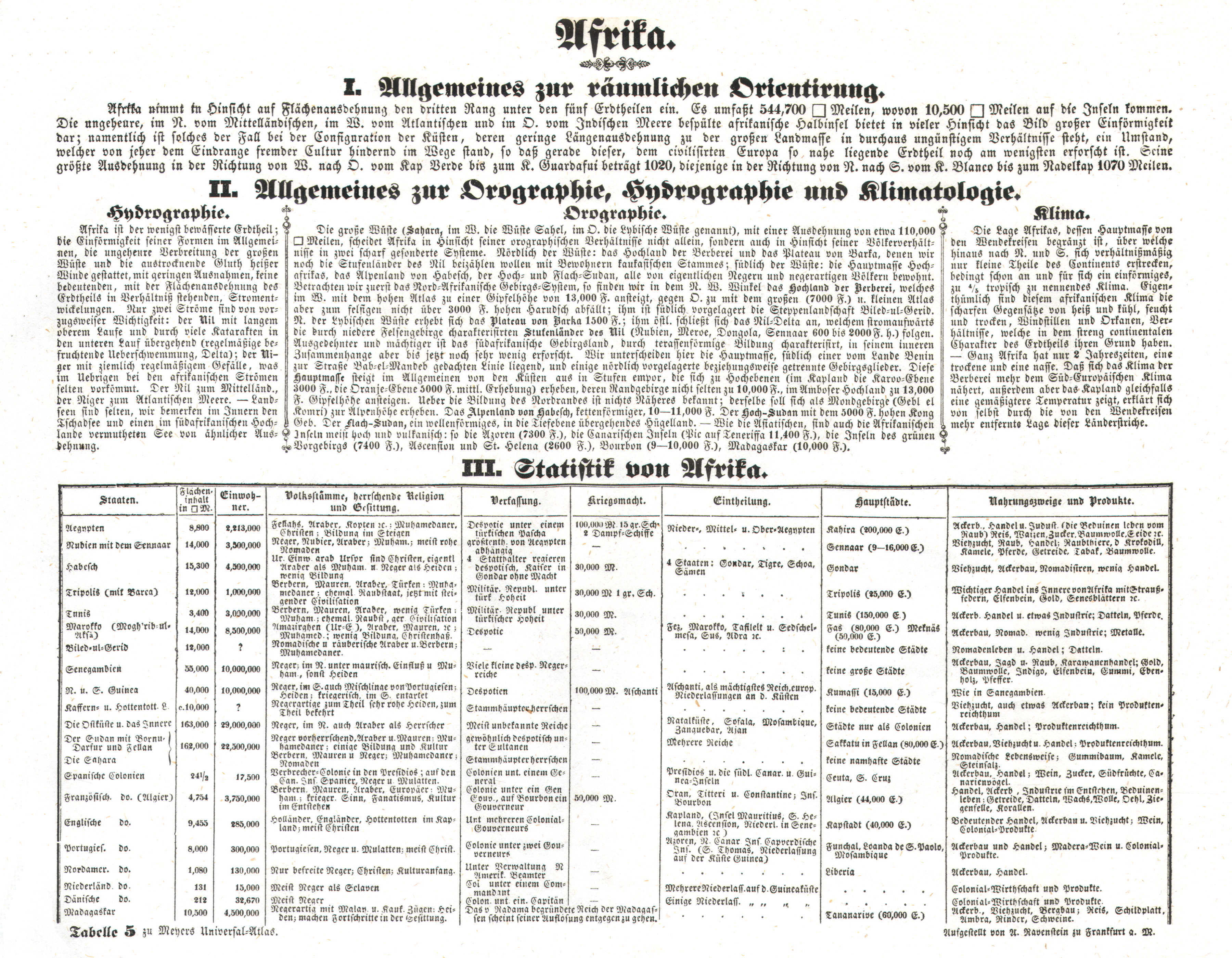
Tabelle 5. Afrika
Afrika / Africa
 Meyer's Universal-Atlas (1830-1840)
Tabelle 6. Amerika
Amerika / The Americas
 Meyer's Universal-Atlas (1830-1840)
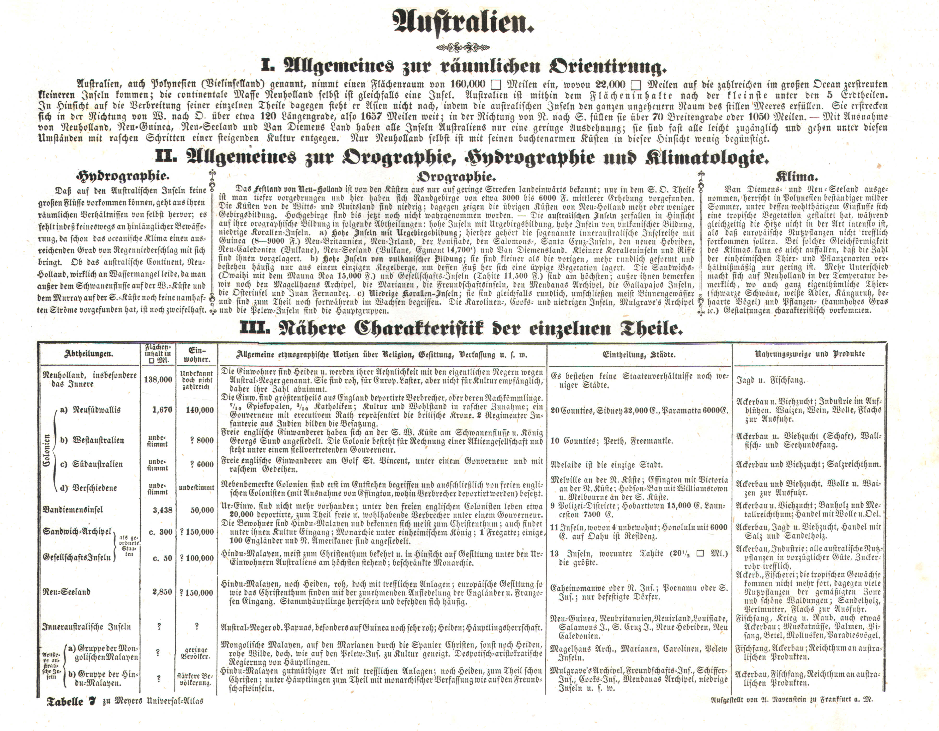
Tabelle 7. Australien
Australië / Australia
 Meyer's Universal-Atlas (1830-1840)
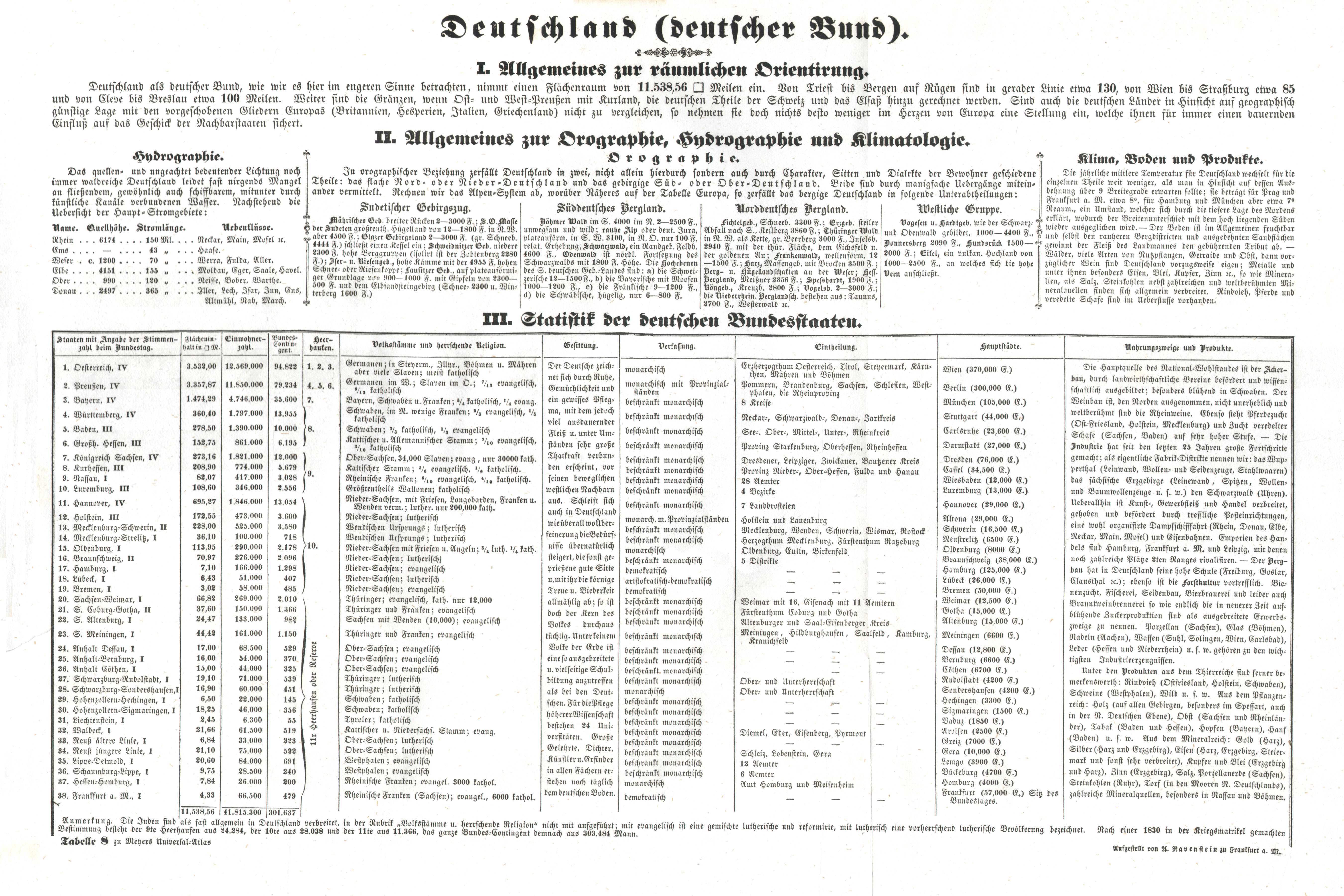
Tabelle 8. Deutschland (deutscher Bund)
Duitsland (Duitse Bond) / Germany (German Confederation)
 Meyer's Universal-Atlas (1830-1840)
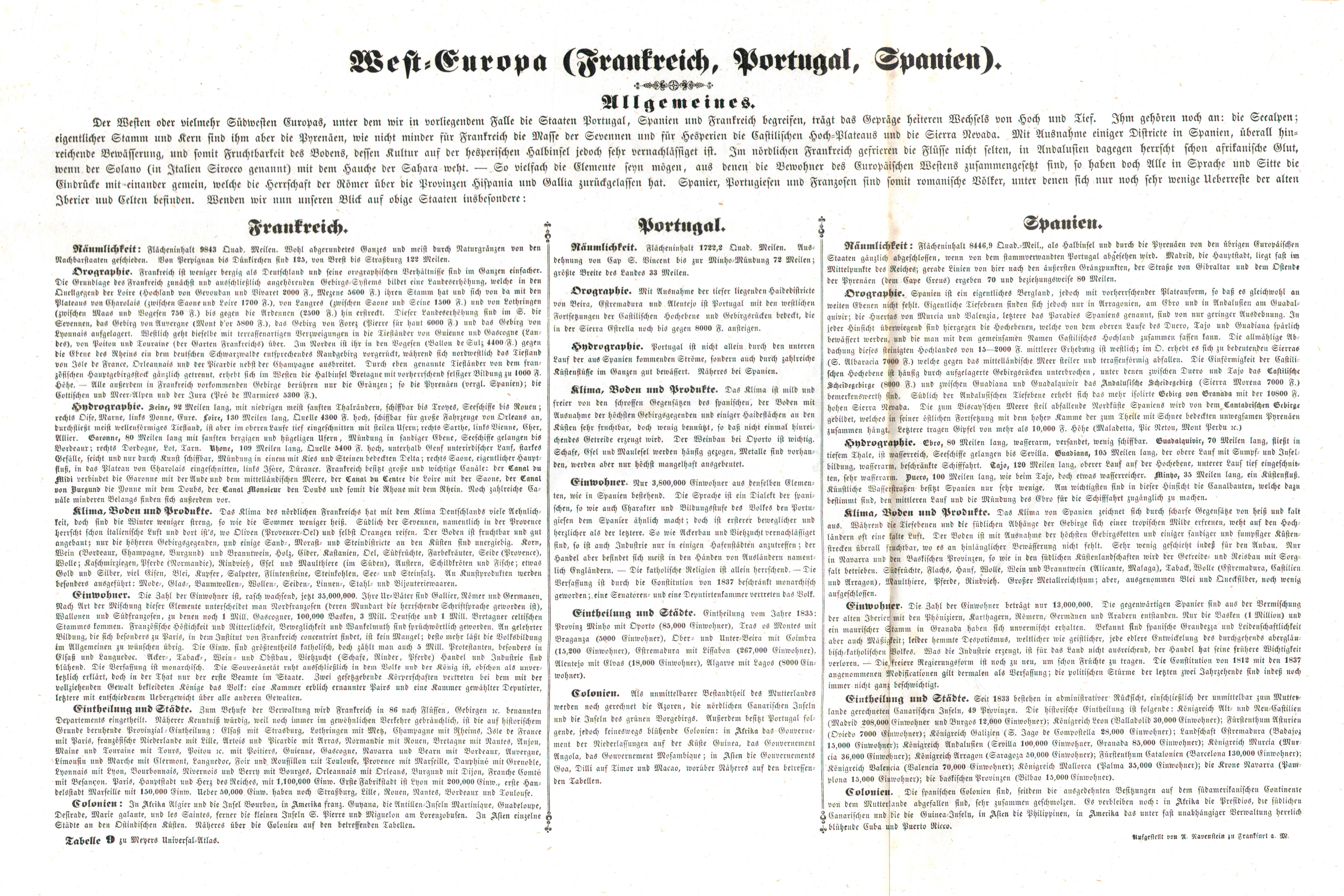
Tabelle 9. West-Europa (Frankreich, Portugal, Spanien)
West-Europa (Frankrijk, Portugal, Spanje) / Western Europe (France, Portugal, Spain)
 Meyer's Universal-Atlas (1830-1840)
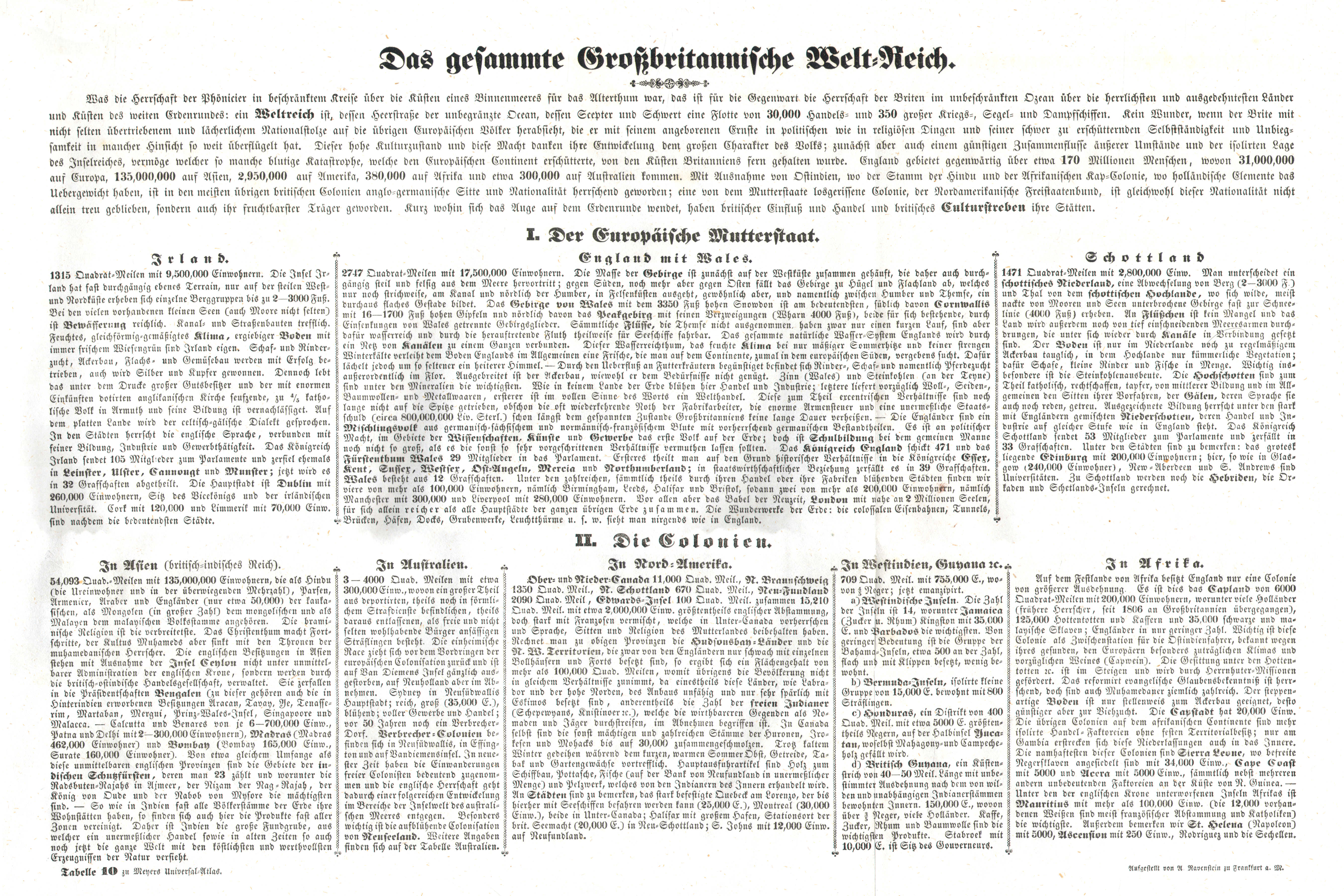
Tabelle 10. Das gesammte Grossbritannische Welt-Reich
Het Britse Rijk / The British Empire
 Meyer's Universal-Atlas (1830-1840)
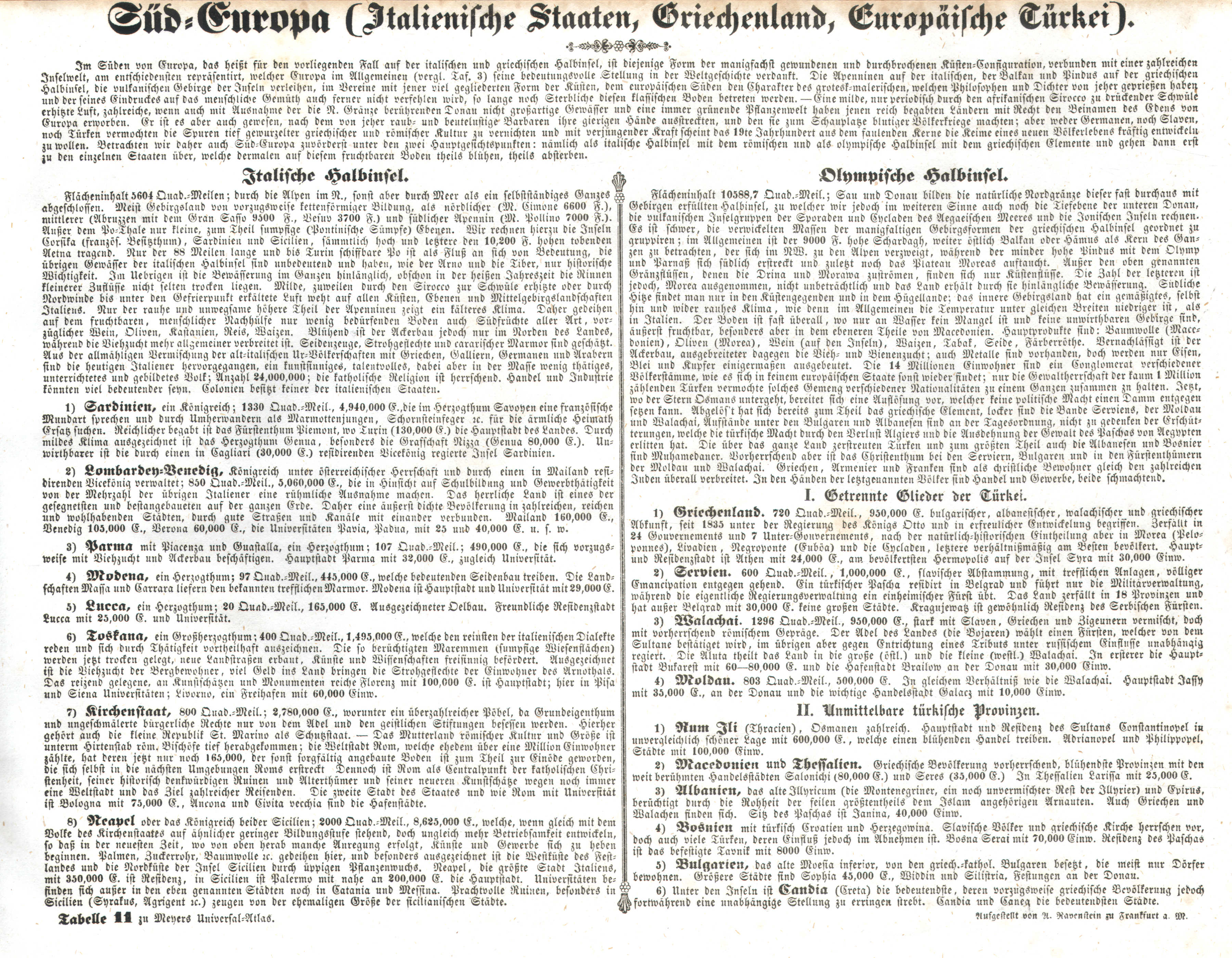
Tabelle 11. Süd-Europa (Italienische Staaten, Griechenland, Europäische Türkei)
Zuid-Europa (Italië, Griekenland, Europees Turkije) / Southern Europa (Italy, Greece, Turkey in Europe)
 Meyer's Universal-Atlas (1830-1840)
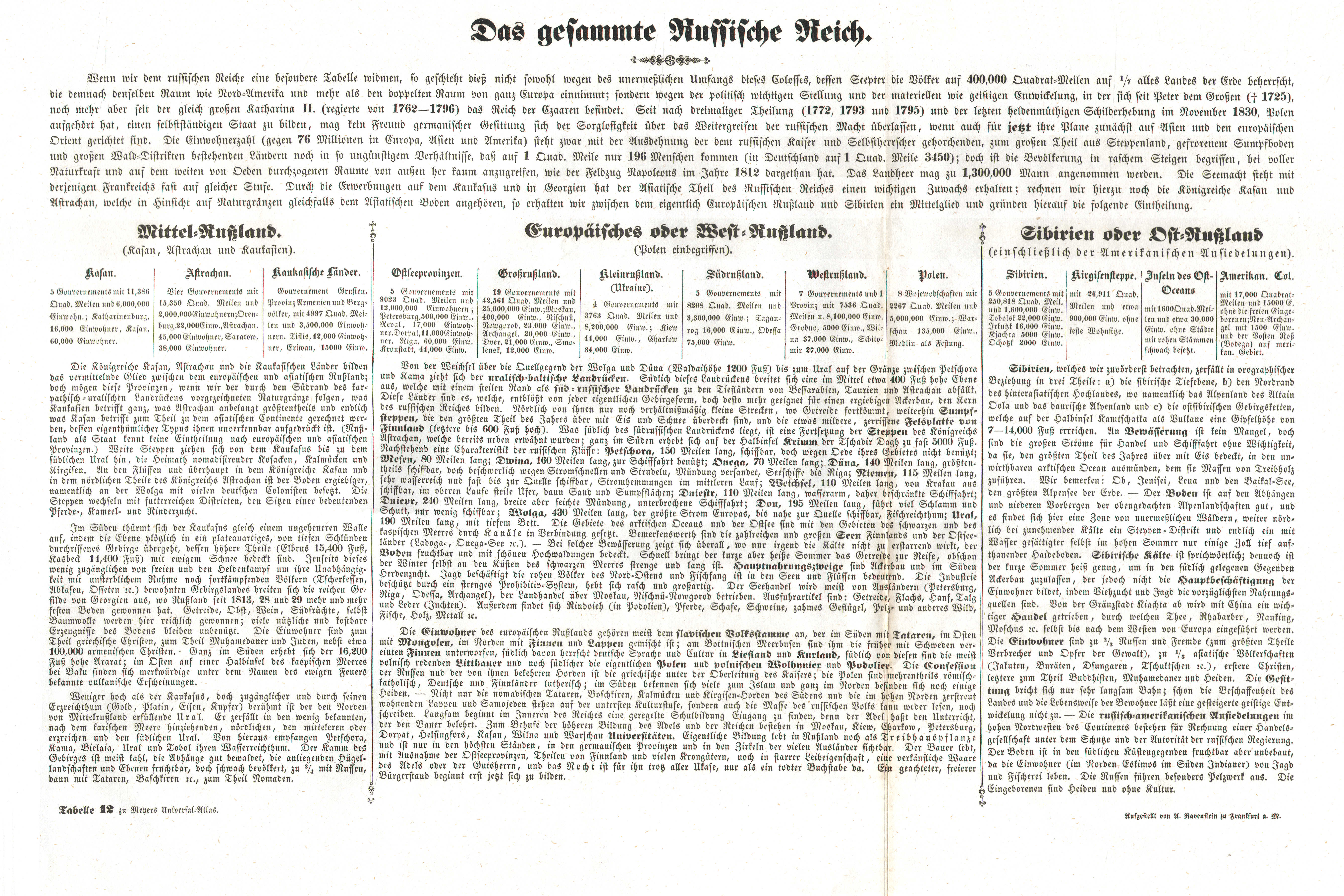
Tabelle 12. Das gesammte Russische Reich
Het Russische Rijk / The Russian Empire
© M. Witkam, 2010
![]()
![]()