Topographische kaart van het Koningrijk der Nederlanden op de schaal van 1:200 000
See below for (a summary of) this text in English.
Hieronder staan plaatjes van de kaartserie. Daarbij horen ook de volgende pagina's
- Beschrijving van de kaartserie
- Tabellen en lijsten bij de kaartserie
Plaatjes
Klik op een plaatje voor een vergroting.
- Band (uitgave 1867-1868)
- Titel, bladwijzer en legenda (uitgave 1867-1868)
- Kaarten (uitgave 1867-1868)
- Kaarten (uitgaven 1935-1955)
- Kaarten (uitgaven 1867-1868 en 1933-1955)
Topographische kaart van het Koningrijk der Nederlanden op de schaal van 1:200 000
- Below are pictures of the map series. Related pages
- Description of the map series
- Tables and lists to the map series
Pictures
Click on a picture to enlarge.
- Binding (1867-1868 edition)
- Title, sheet index and key to map symbols (1867-1868 edition)
- Maps (1867-1868 edition)
- Maps (1935-1955 editions)
- Maps (1867-1868 and 1933-1955 editions)
Band (uitgave 1867-1868) / Binding (1867-1868 edition)
 / Cover (portfolio)")
Titel, bladwijzer en legenda (uitgave 1867-1868) / Title, sheet index and key to map symbols (1867-1868 edition)


Kaarten (uitgave 1867-1868) / Maps (1867-1868 edition) Bladwijzers (uitgave 1867-1868) / Sheet indexes (1867-1868 edition)
 Topographische kaart Nederland 1:200.000, 1867-1868
Bladwijzer / Sheet index
(ook als / also as pdf, svg)
 Topographische kaart Nederland 1:200.000, 1867-1868
Bladwijzer met ook de bladnamen 1:50.000 / Sheet index with also the 1:50,000 sheet names
(ook als / also as pdf, svg)
| Topographische kaart van Nederland 1:200.000, 1867-1868 | 1 Wadden (1868) |
2 Hunsingoo (1868) |
|
| 3 Texel (1867) |
4 Oostergoo (1868) |
5 Westerwolde (1868) |
|
| 6 Kennemerland (1867) |
7 Zuiderzee (1868) |
8 Bargerveen (1868) |
|
| 9 Rijnland (1867) |
10 Veluwe (1868) |
11 Twenthe (1868) |
|
| 12 Schouwen (1868) |
13 Biesbosch (1868) |
14 Betuwe (1868) |
15 Munsterland (1868) |
| 16 Walcheren (1868) |
17 Kempen (1868) |
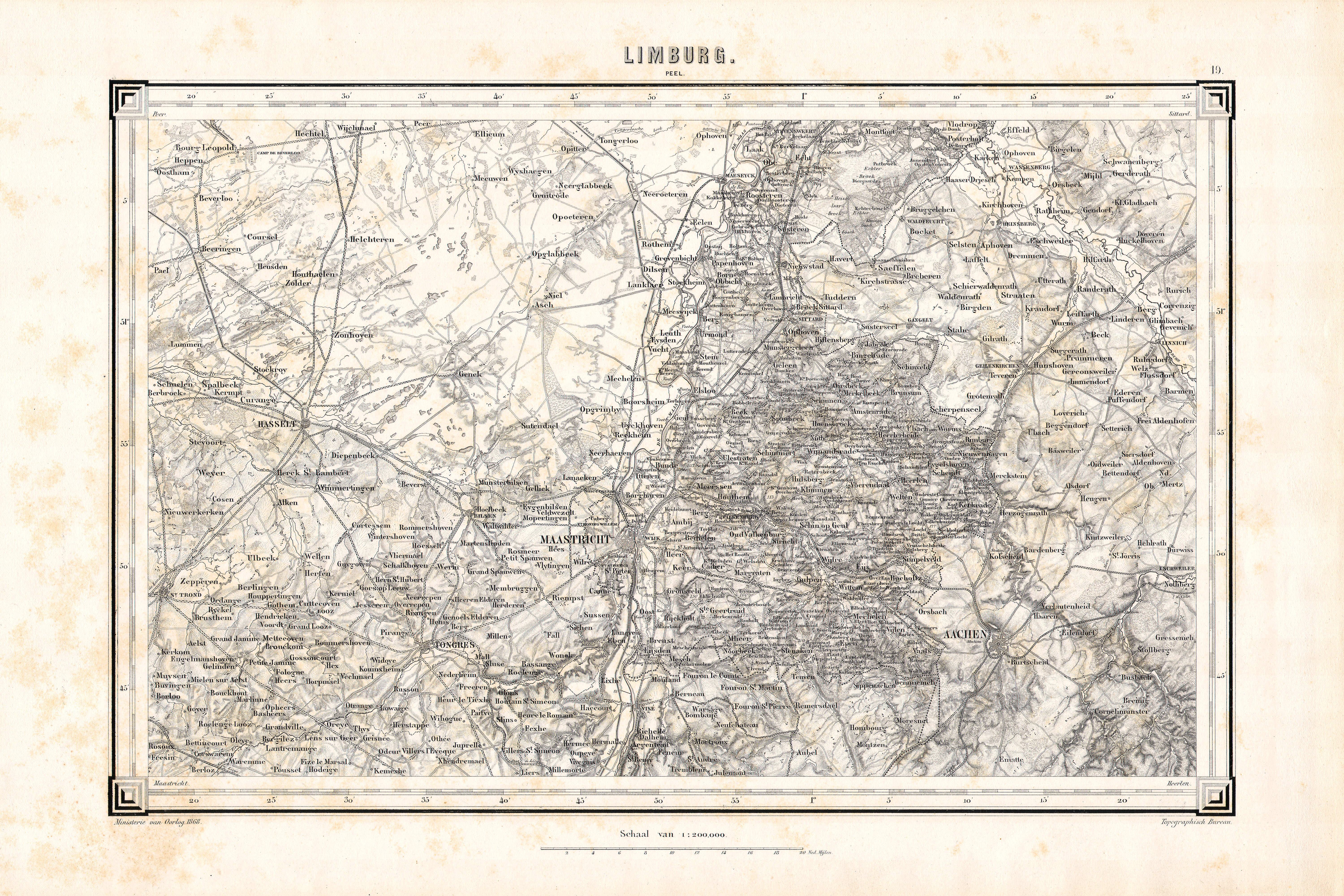
18 Peel (1868) |
|
| 19 Limburg (1868) |
|||
Samenstelling (uitgave 1867-1868) / Composition (1867-1868 edition)
| Topographische kaart van Nederland 1:200.000, 1867-1868 |
")
|
")
|
|
")
|
")
|
")
|
|
")
|
")
|
")
|
|
")
|
")
|
")
|
|
")
|
")
|
")
|
")
|
")
|
")
|
")
|
|
")
|
|||
 Topographische kaart Nederland 1:200.000, 1867-1868
Bladwijzer met bladnamen 1:50.000 / Sheet index with sheet names 1:50,000
(ook als / also as pdf, svg)
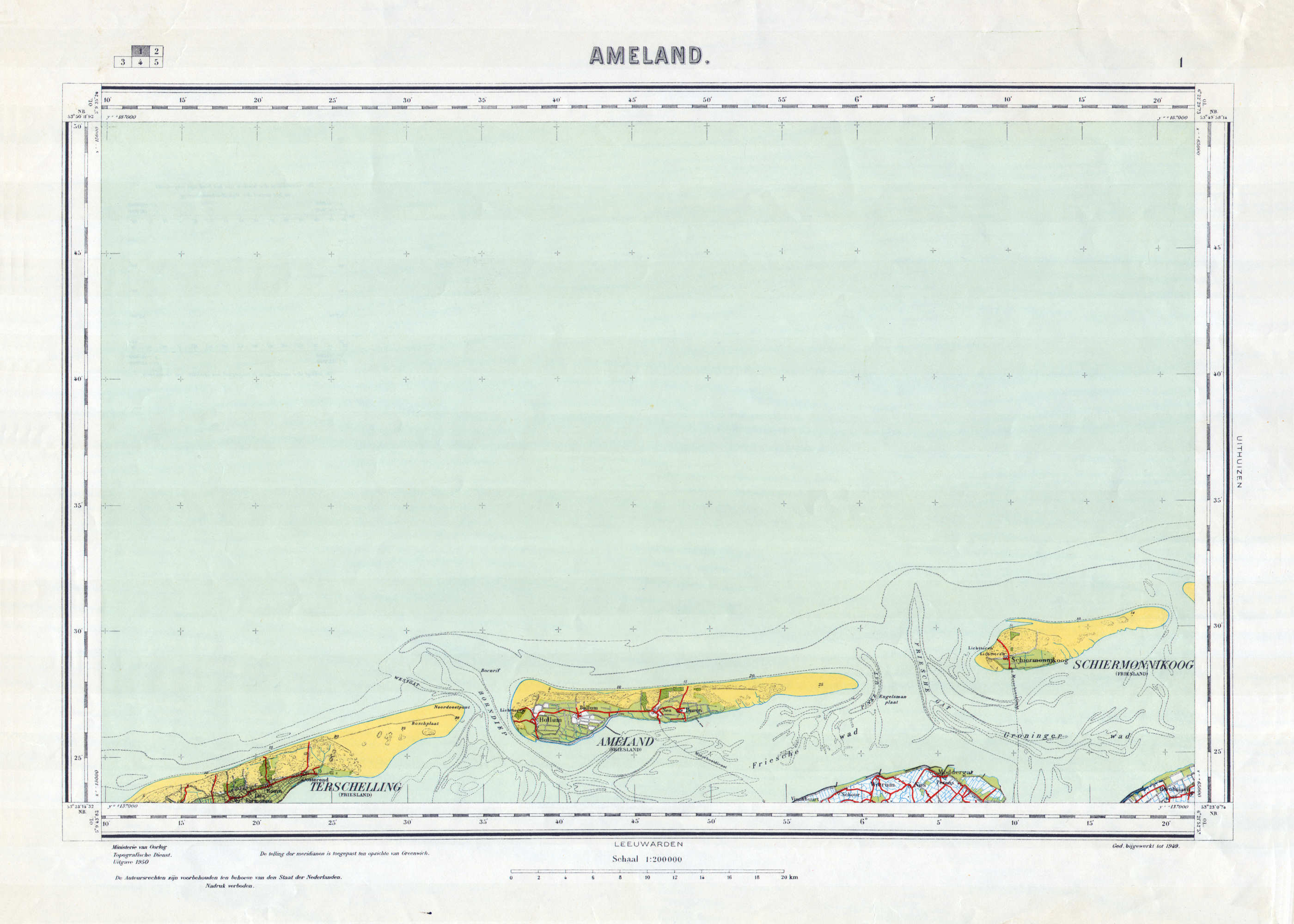
| Topographische kaart van Nederland 1:200.000, 1933-1955 | 1 Ameland (1946 / 1950) |
2 Uithuizen (1950) |
|
| 3 Tessel (1942) |
4 Leeuwarden (1941) |
5 Groningen (1934) |
|
| 6 Alkmaar (1949) |
7 Meppel (1933) |
8 Coevorden (1937) |
|
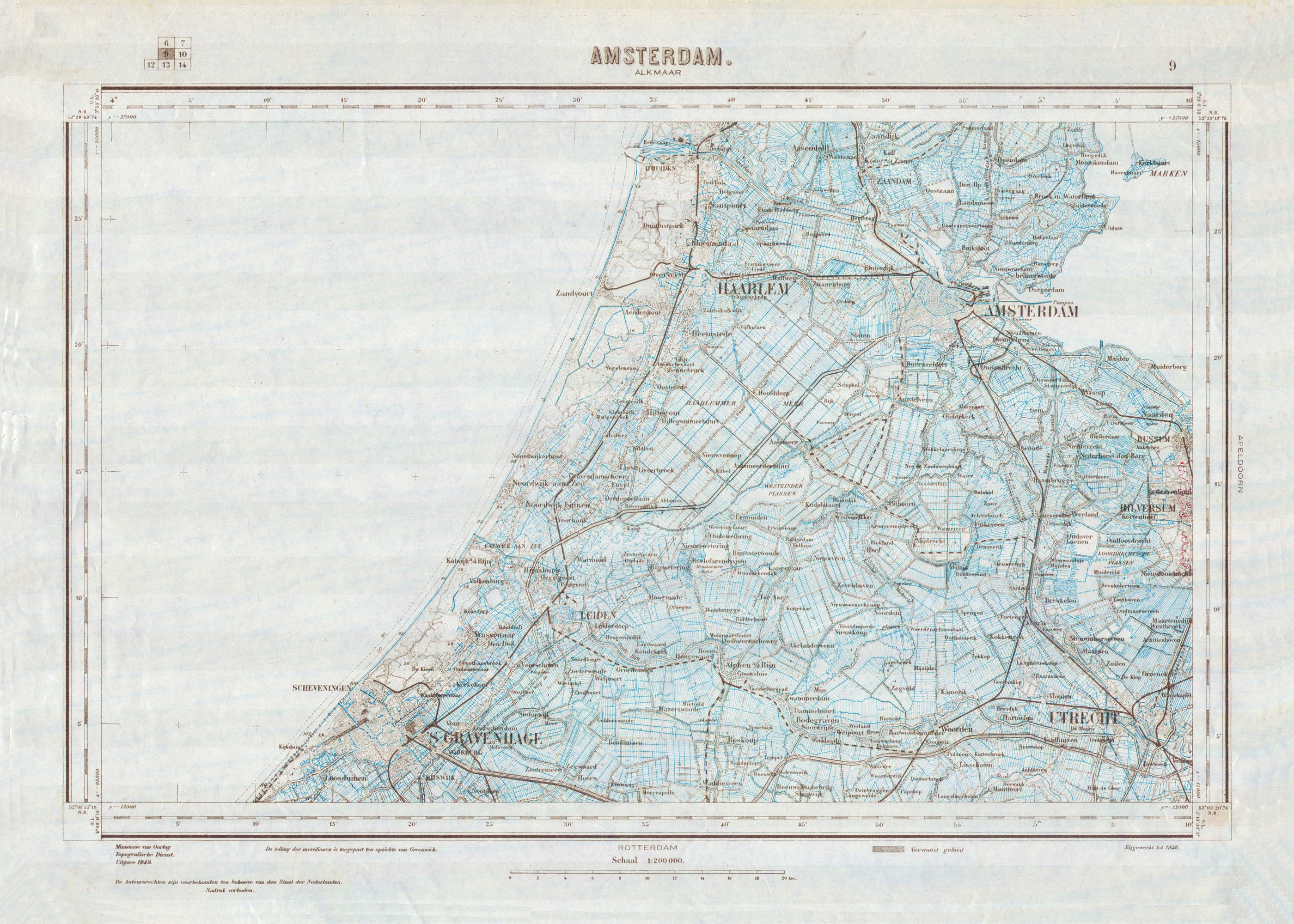
| 9 Amsterdam (1946 / 1949) |
10 Apeldoorn (1933) |
11 Enschede (1935) |
|
| 12 Zierikzee (1949) |
13 Rotterdam (1932) |
14 Nijmegen (1933) |
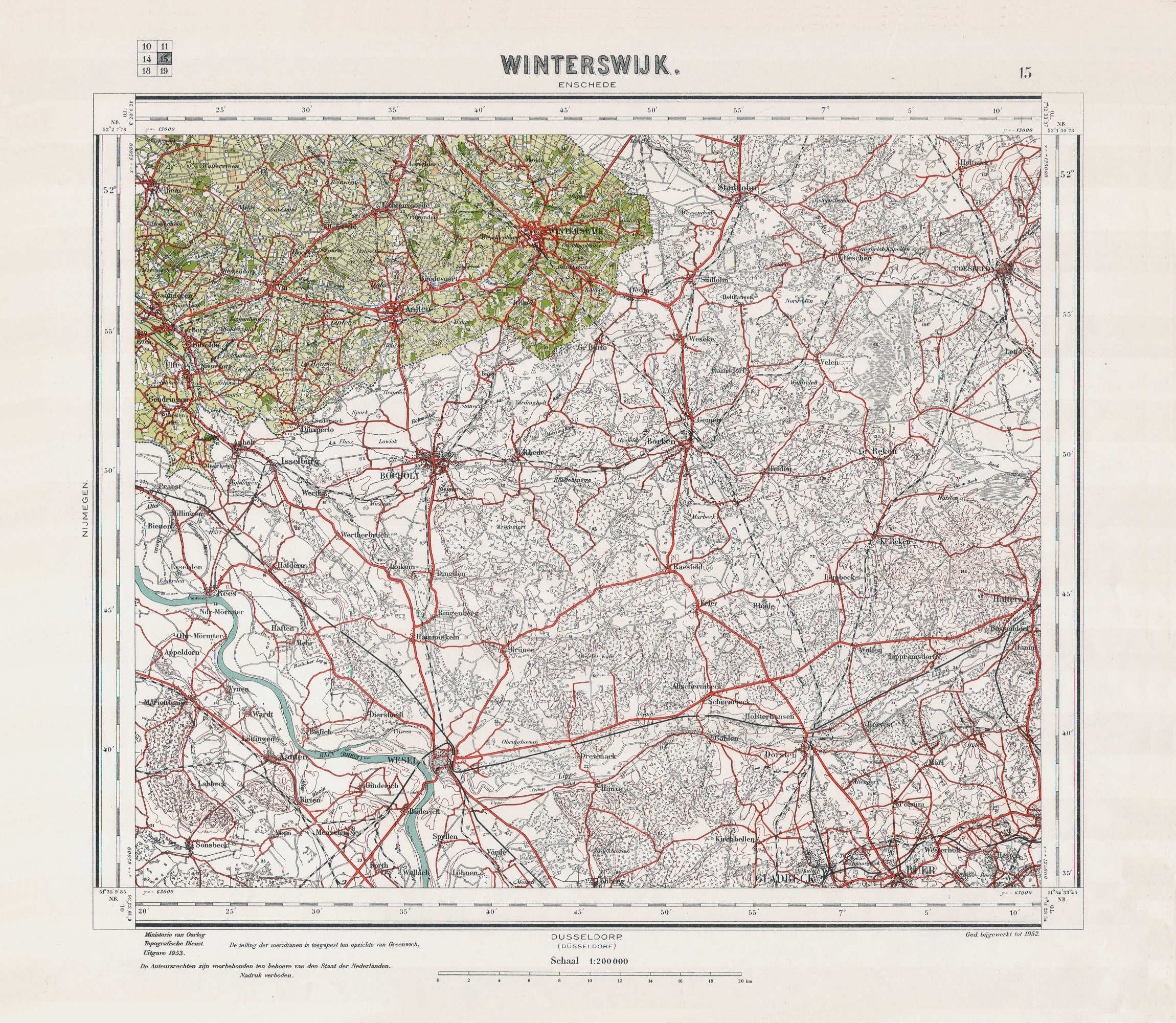
15 Winterswijk (1939 / 1953) |
| 16 Middelburg (1940) |
17 Bergen op Zoom (1950) |
18 Eindhoven (1938) |
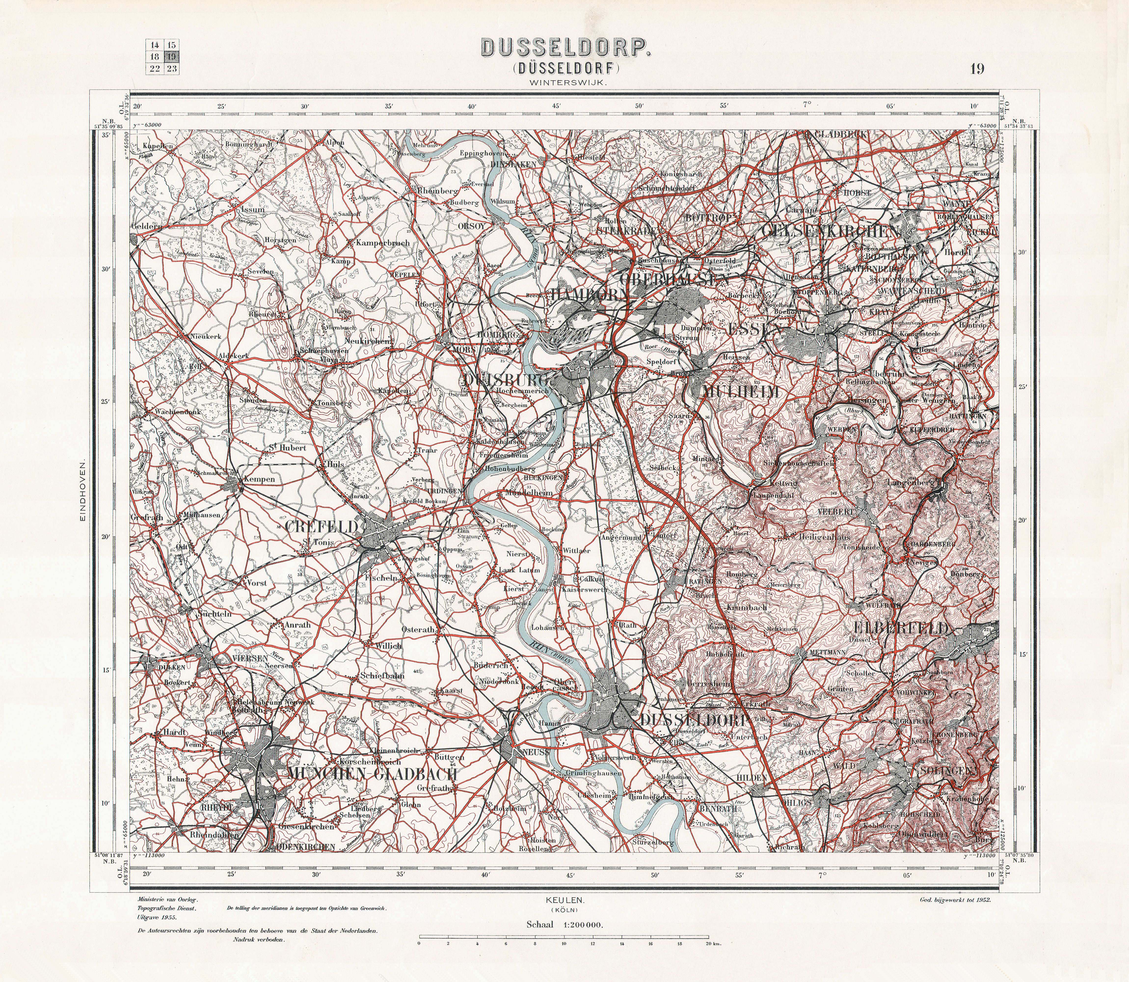
19 Dusseldorp (1936 / 1955) |
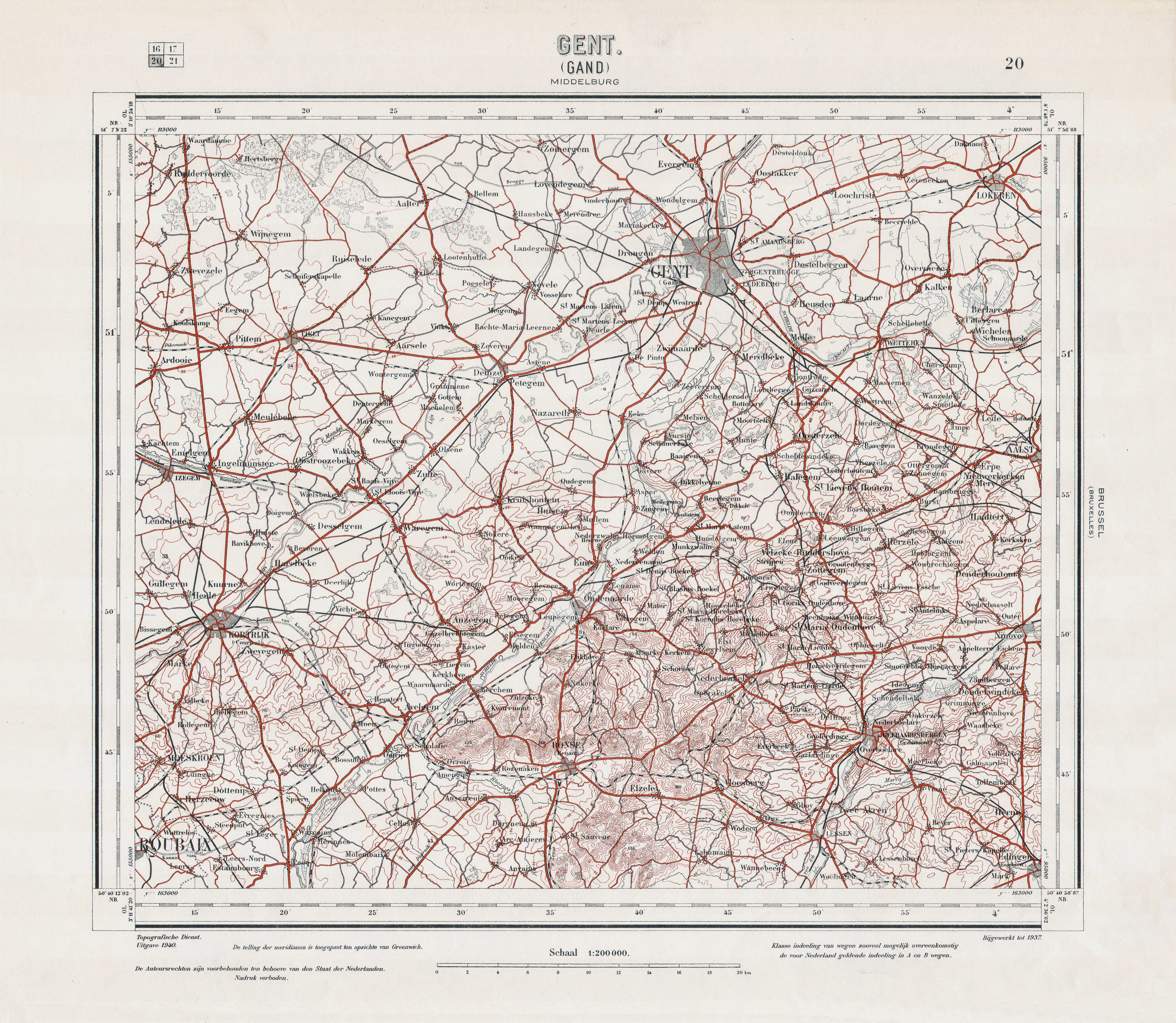
| 20 Gent (1940) |
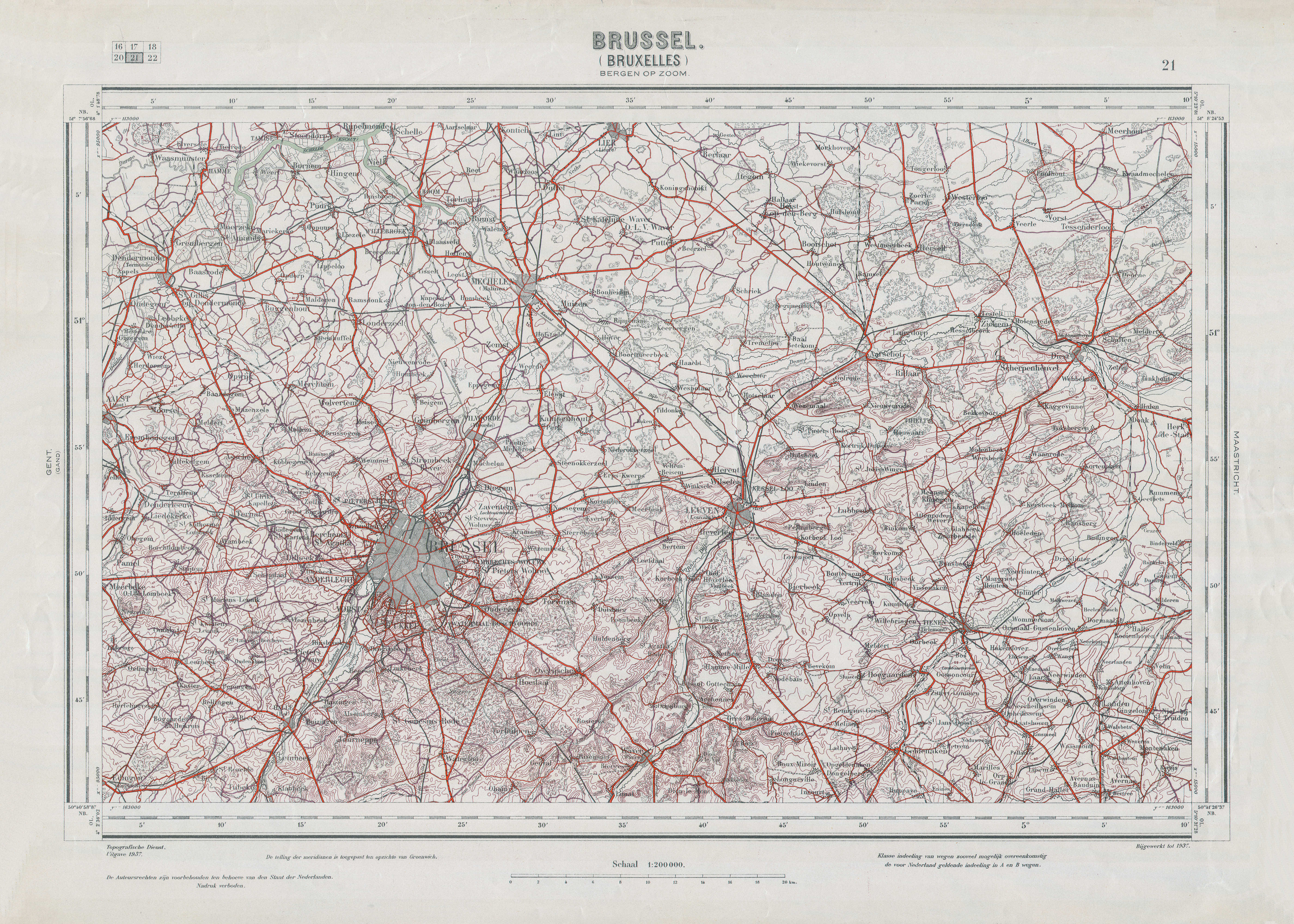
21 Brussel (1937) |
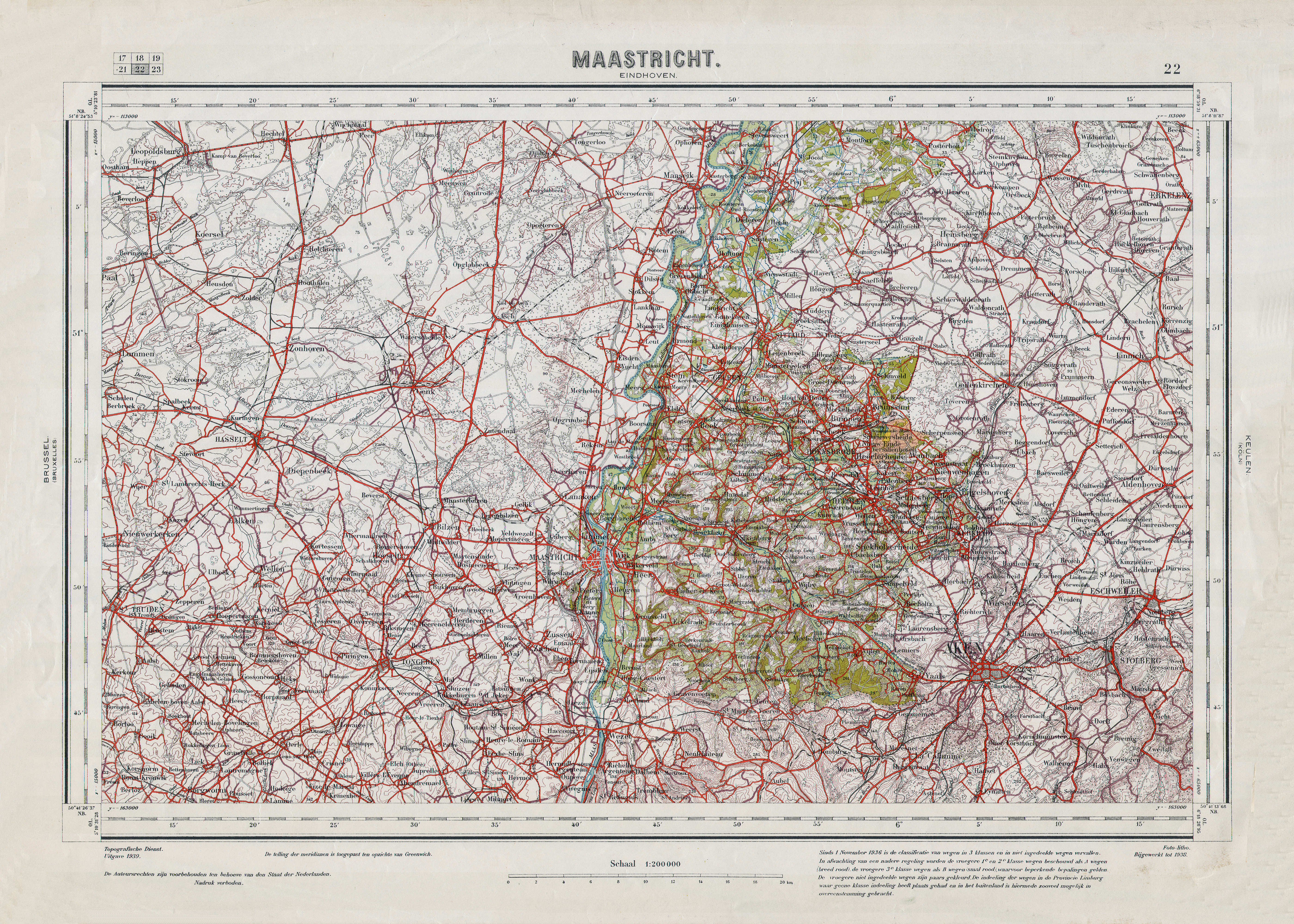
22 Maastricht (1939) |
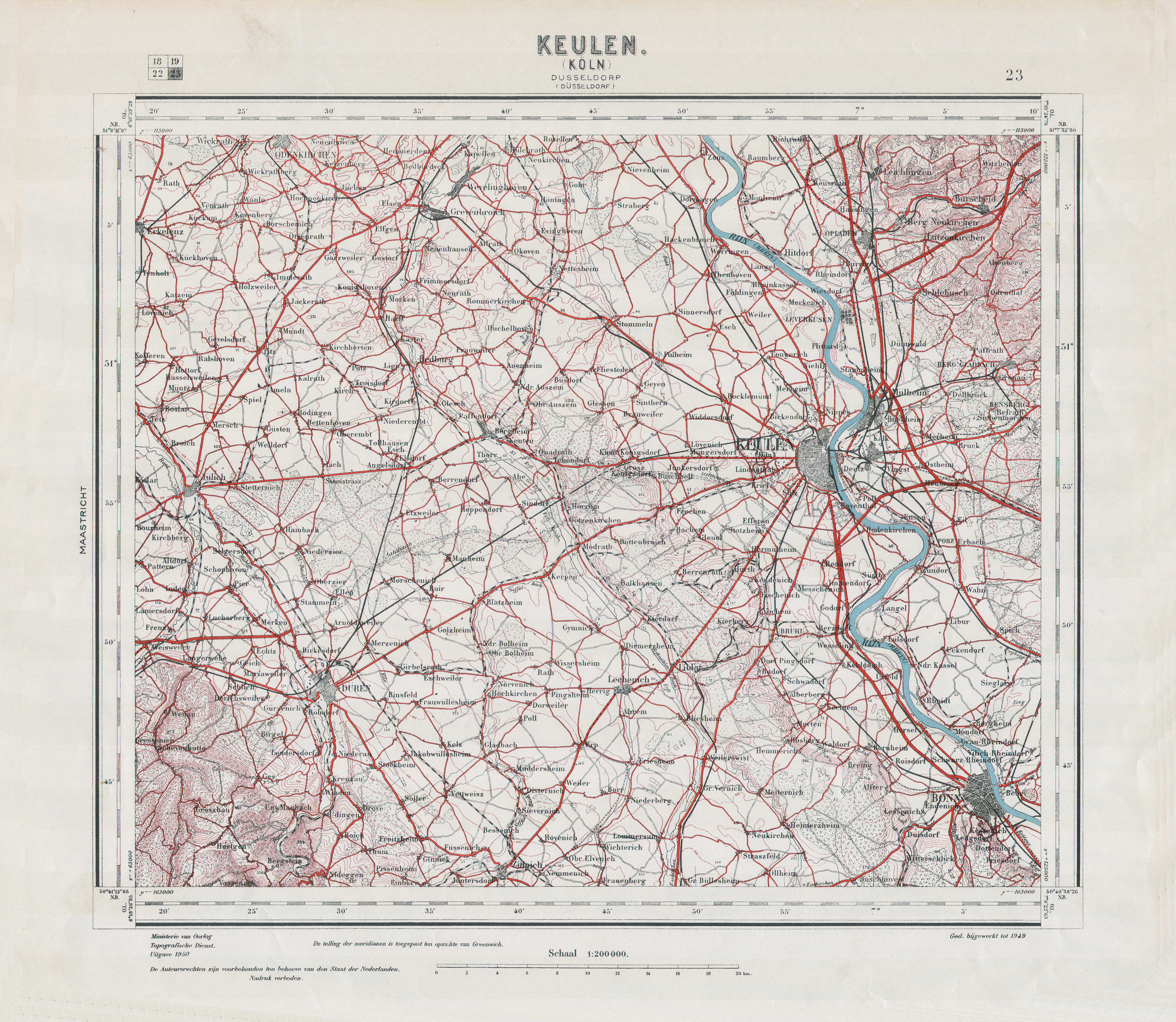
23 Keulen (1950) |
Samenstelling (uitgaven 1933-1955) / Composition (1933-1955 editions)
| Topographische kaart van Nederland 1:200.000, 1933-1955 |
")
|
")
|
|
")
|
")
|
")
|
|
")
|
")
|
")
|
|
")
|
")
|
")
|
|
")
|
")
|
")
|
")
|
")
|
")
|
")
|
")
|
")
|
")
|
")
|
")
|
Kaarten (uitgaven 1867-1868 en 1933-1955) / Maps (1867-1868 and 1933-1955 editions)
 Topographische kaart Nederland 1:200.000, 1933-1955
13. Rotterdam (ontbreekt / missing)
 Topographische kaart Nederland 1:200.000, 1867-1868
geen overeenkomstige kaart / no corresponding map
Topographische kaart Nederland 1:200.000, 1867-1868
geen overeenkomstige kaart / no corresponding map

 Topographische kaart Nederland 1:200.000, 1867-1868
geen overeenkomstige kaart / no corresponding map
Topographische kaart Nederland 1:200.000, 1867-1868
geen overeenkomstige kaart / no corresponding map
Topographische kaart Nederland 1:200.000, 1867-1868
geen overeenkomstige kaart / no corresponding map
HTML, JPG © M. Witkam, 2016
![]()
![]()