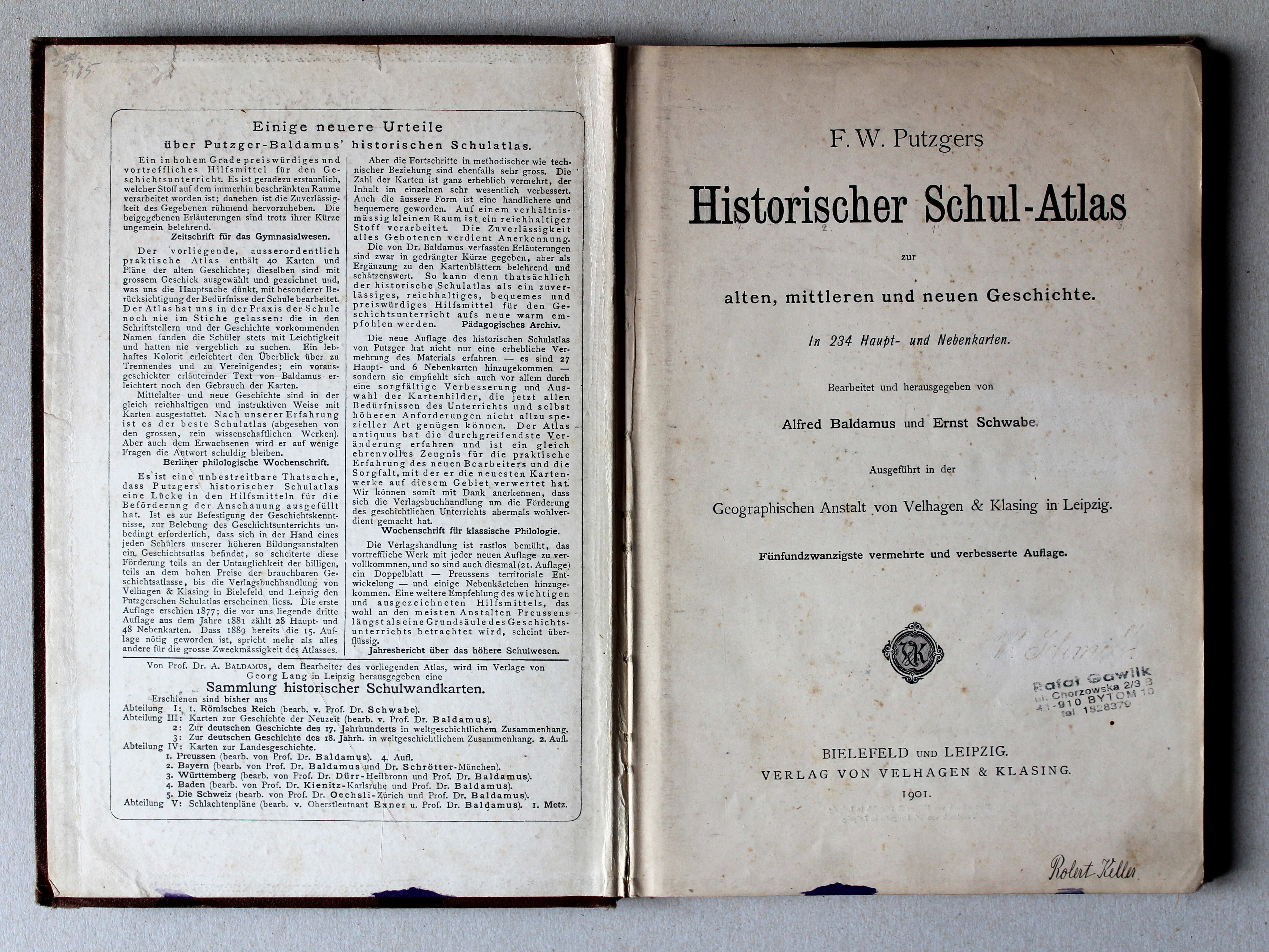
Putzgers Historischer Schul-Atlas, 25e druk (1901) en 24e druk (1900)
See below for (a summary of) this text in English.
Hieronder staan plaatjes van de 25e en 24e druk ter vergelijking naast elkaar. Daarbij horen ook de volgende pagina's
- Beschrijving van de 25e druk
- Plaatjes van 25e druk
- Tabellen en lijsten bij 25e druk
en
- Beschrijving van de 24e druk
- Plaatjes van de 24e druk
- Tabellen en lijsten bij de 24e druk
Plaatjes
Klik op een plaatje voor een vergroting.
Putzgers Historischer Schul-Atlas, 25th edition (1901) en 24th edition (1900)
- Below are pictures of the 25th and 24th editions side by side for comparison purposes. Related pages
- Description of the 25th edition
- Pictures of the 25th edition
- Tables and lists to the 25th edition
- Description of the 24th edition
- Pictures of the 24th edition
- Tables and lists to the 24th edition
Pictures
Click on a picture to enlarge.
Band / Binding Titelpagina, inhoudsopgave / Title page, table of contents


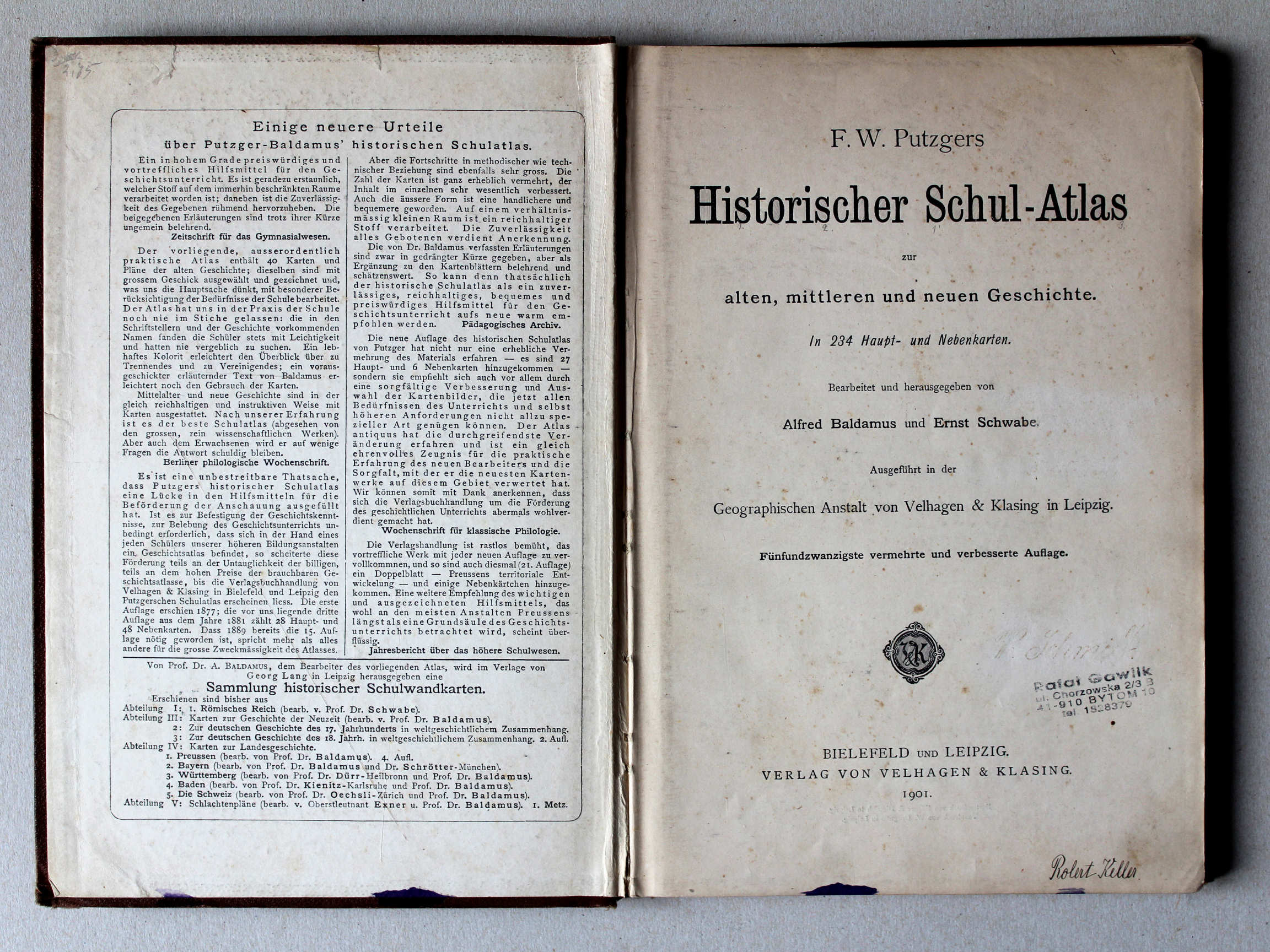 Putzgers Historischer Schul-Atlas, 1901
Schutblad voorin, titelpagina / Front endpaper, title page XL
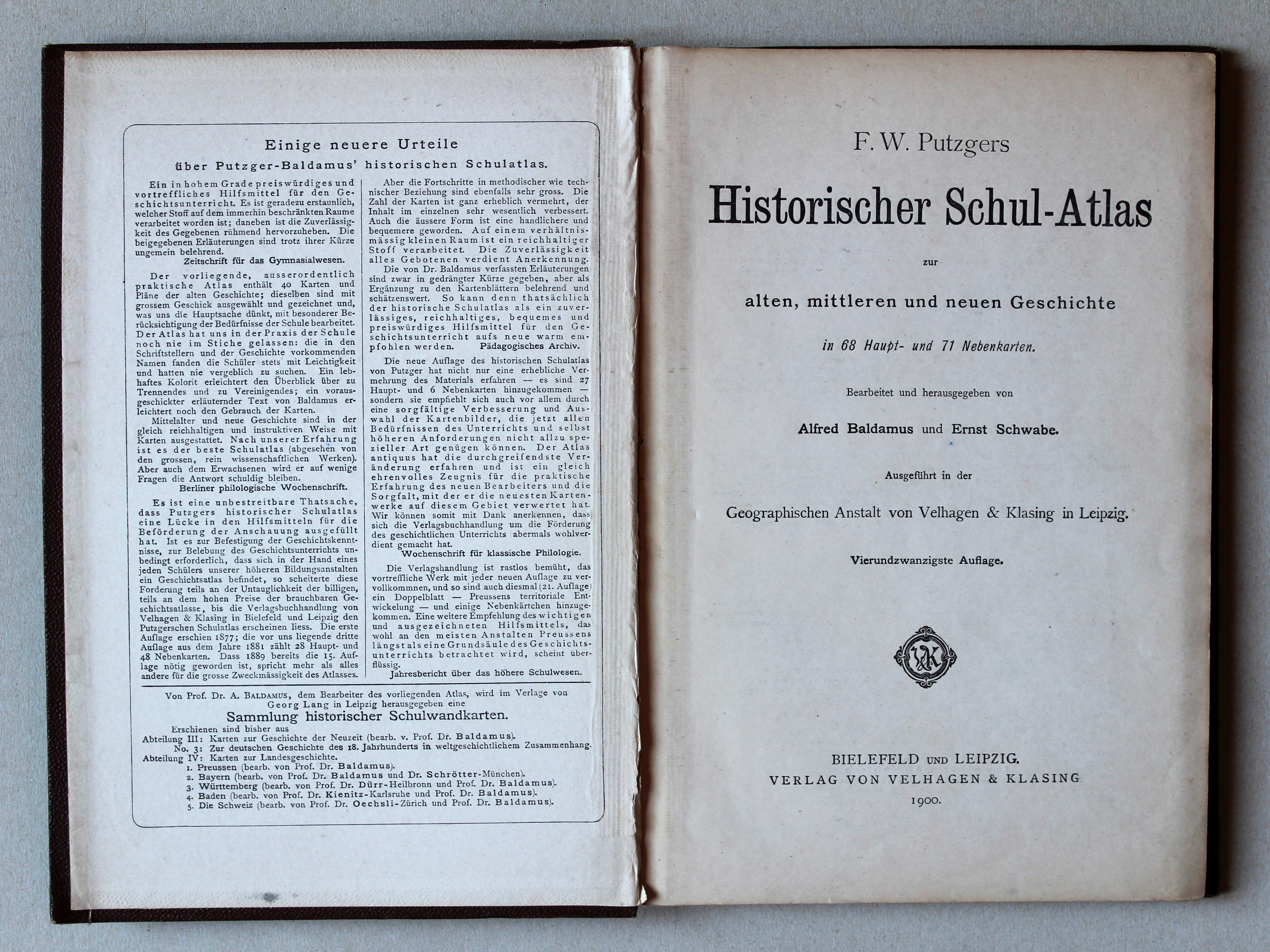
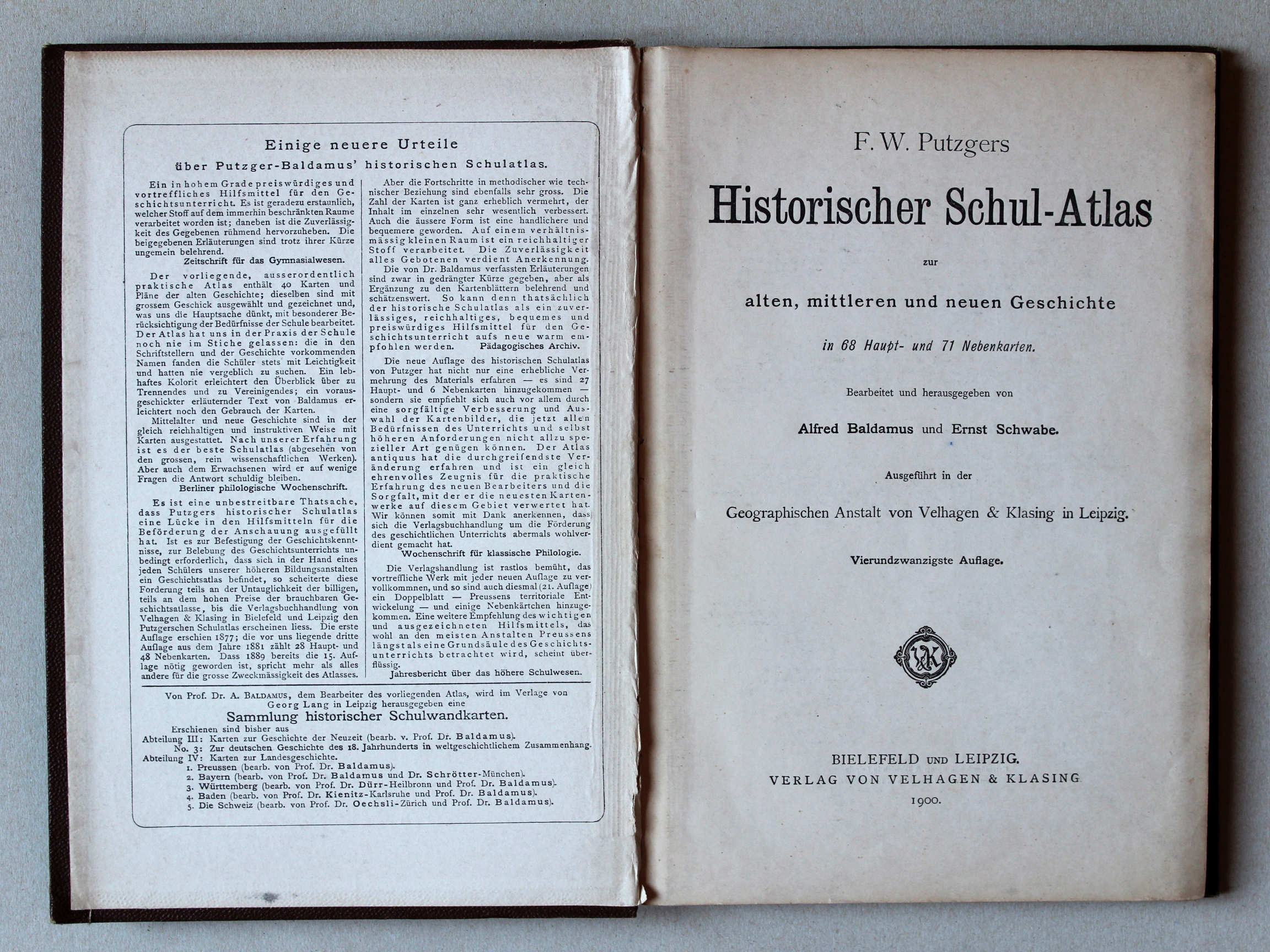 Putzgers Historischer Schul-Atlas, 1900
Schutblad voorin, titelpagina / Front endpaper, title page XL
 Putzgers Historischer Schul-Atlas, 1900
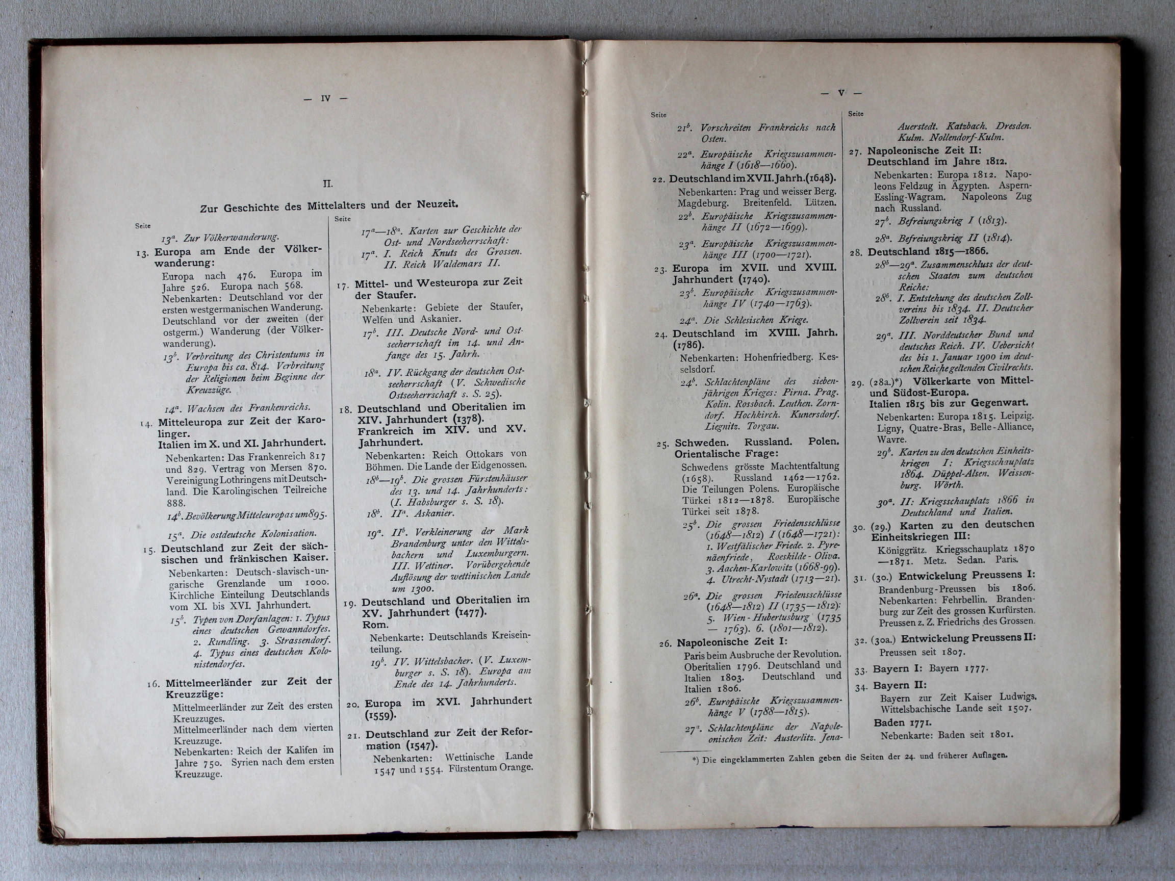
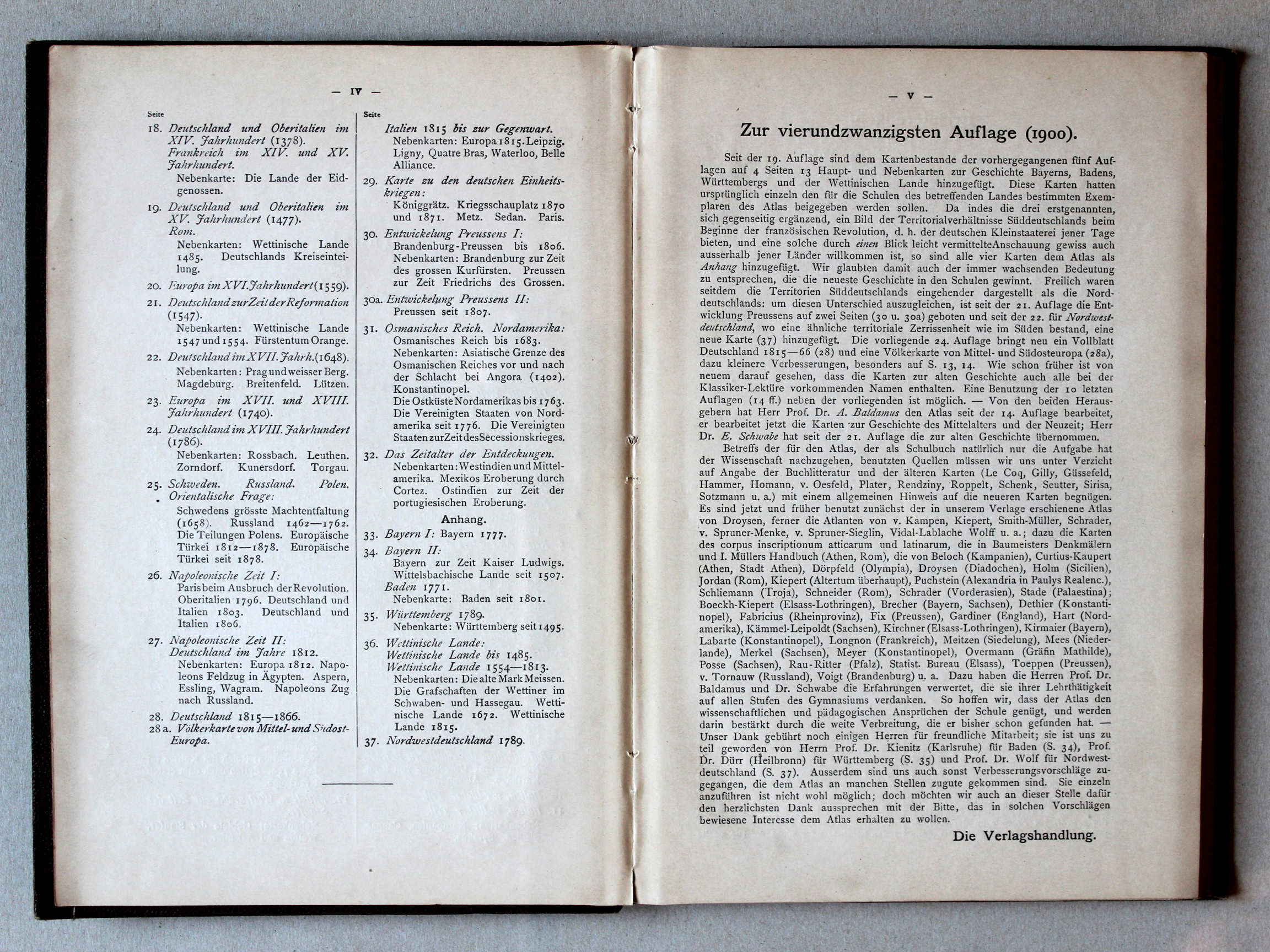
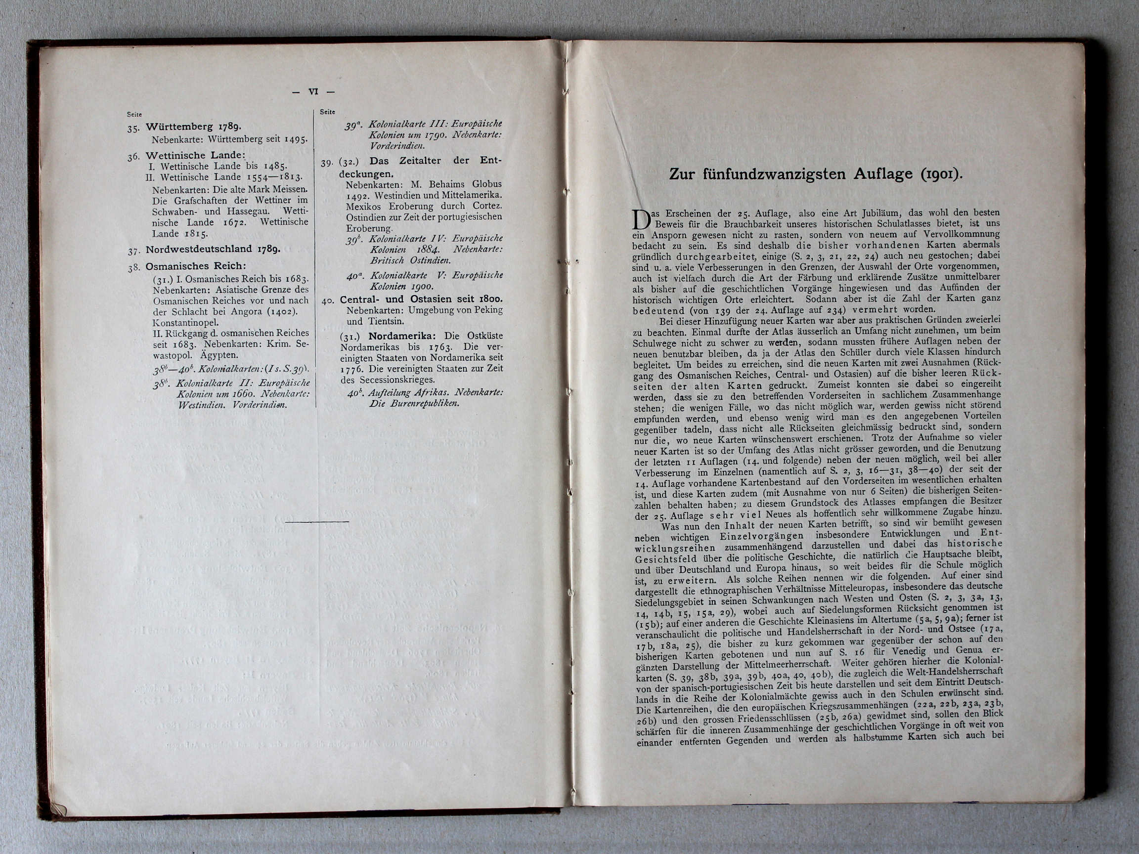
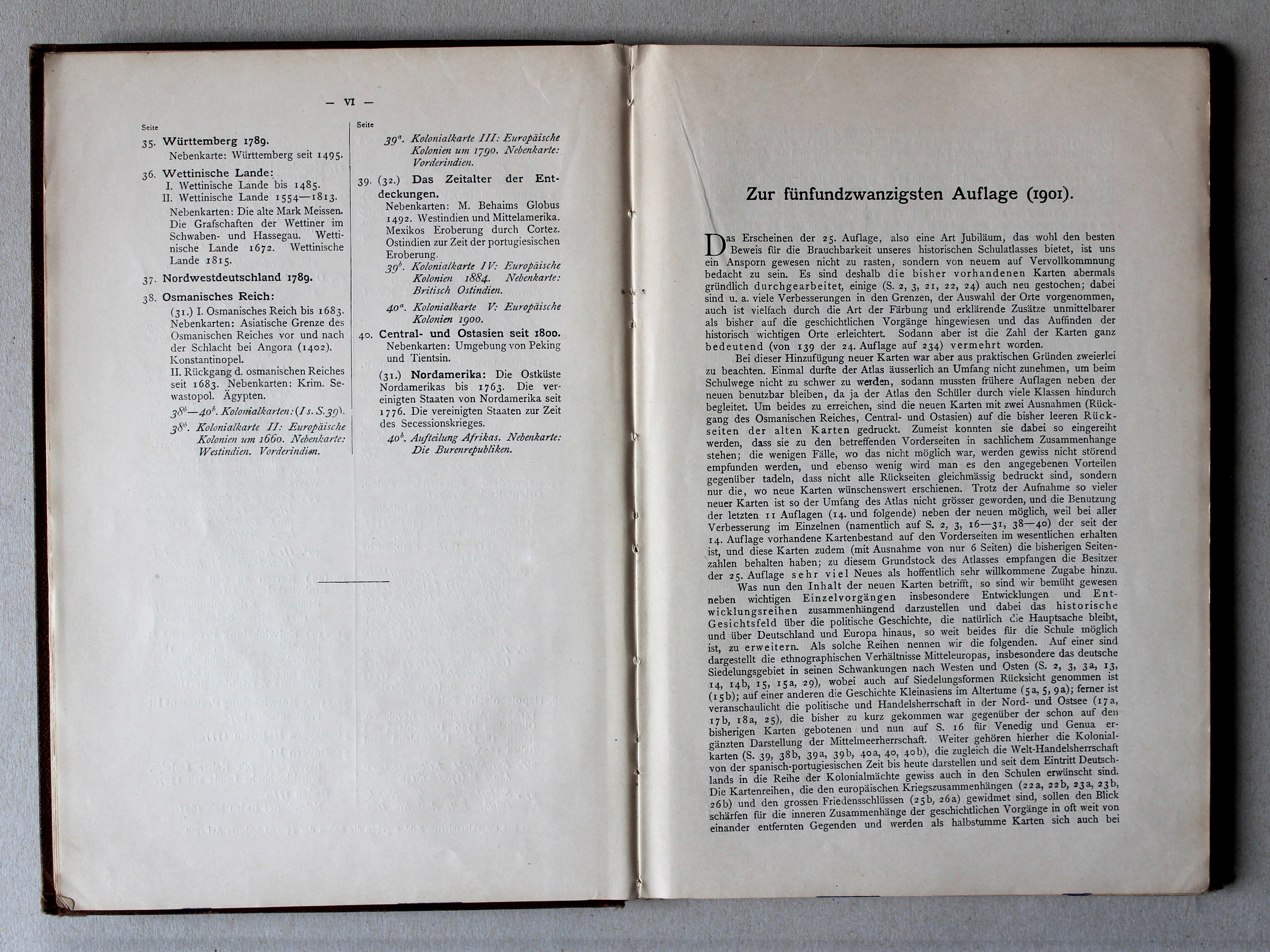
Inhoudsopgave 2, voorwoord / Table of contents 2, preface XL
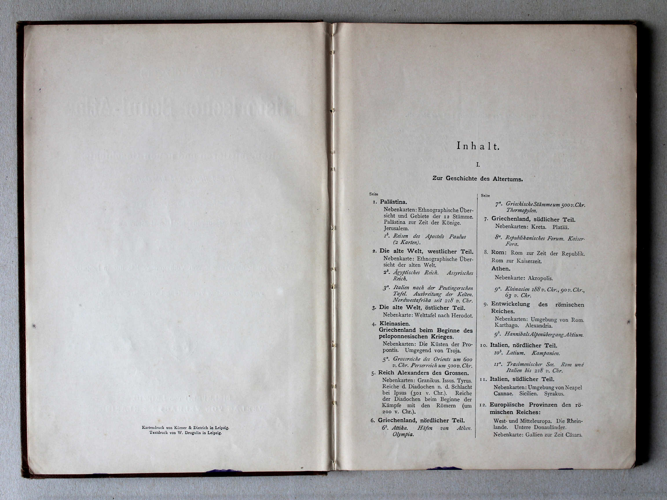
 Putzgers Historischer Schul-Atlas, 1901
Inhoudsopgave 3, voorwoord 1 / Table of contents 3, preface 1 XL
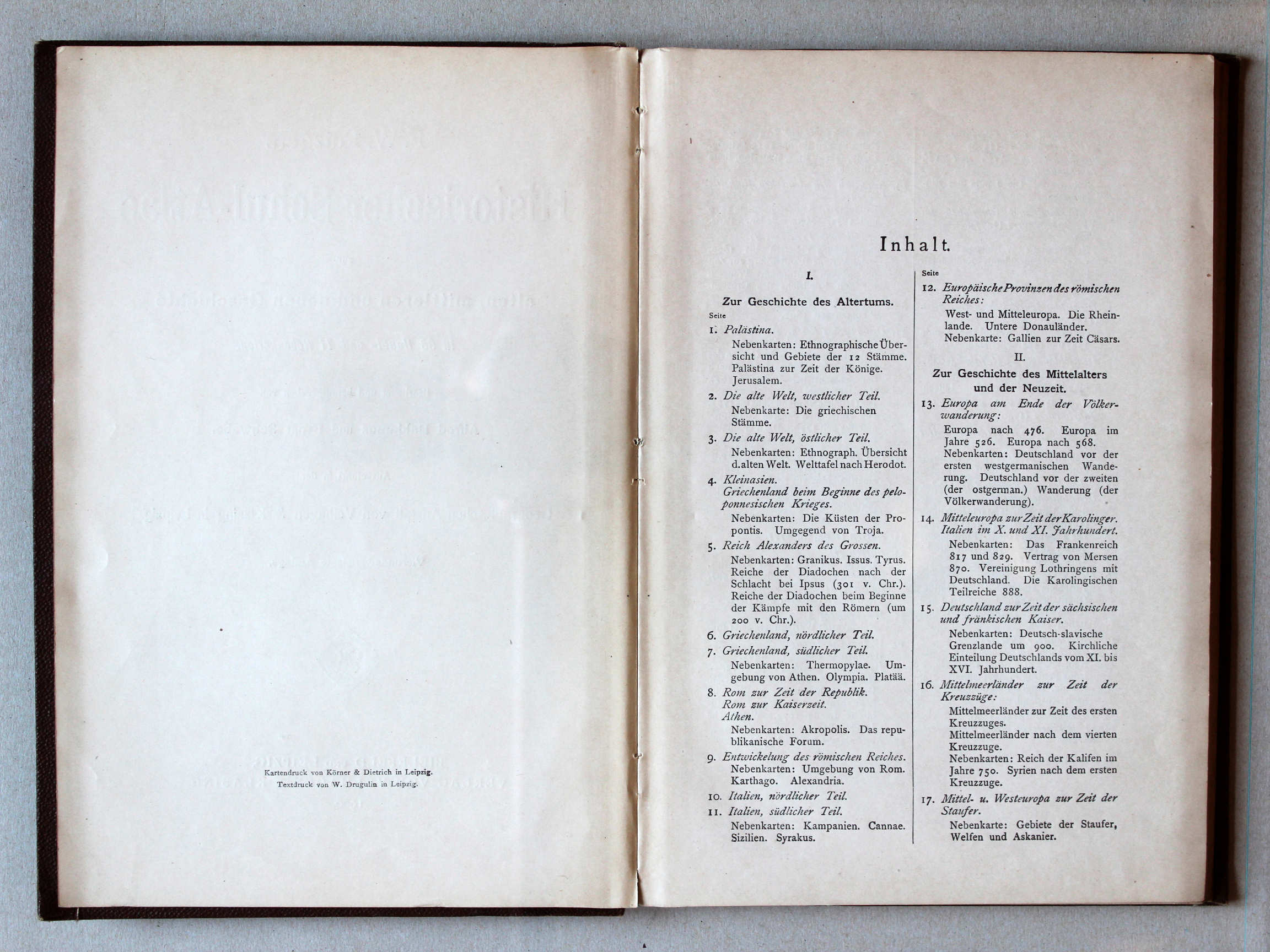
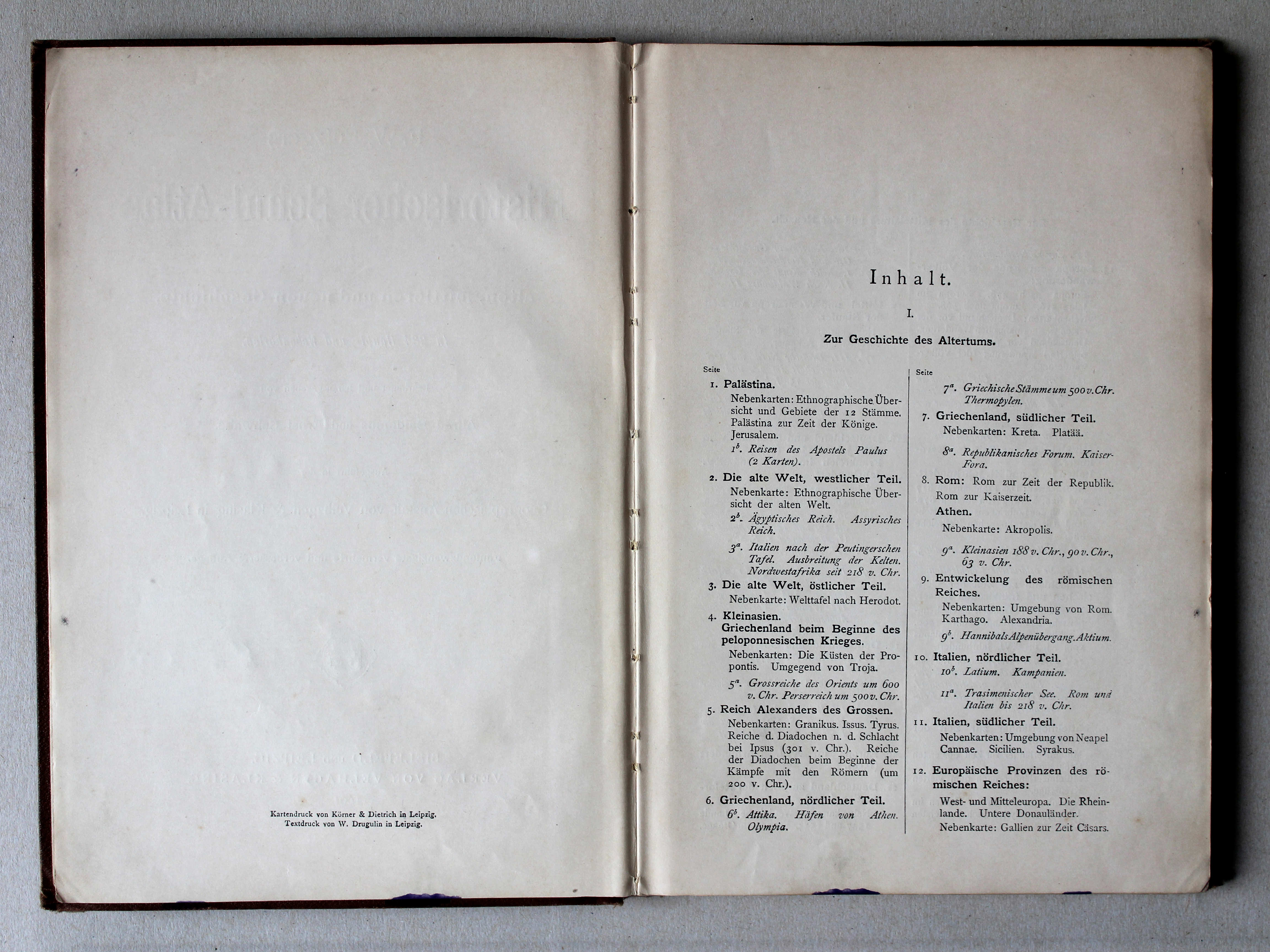
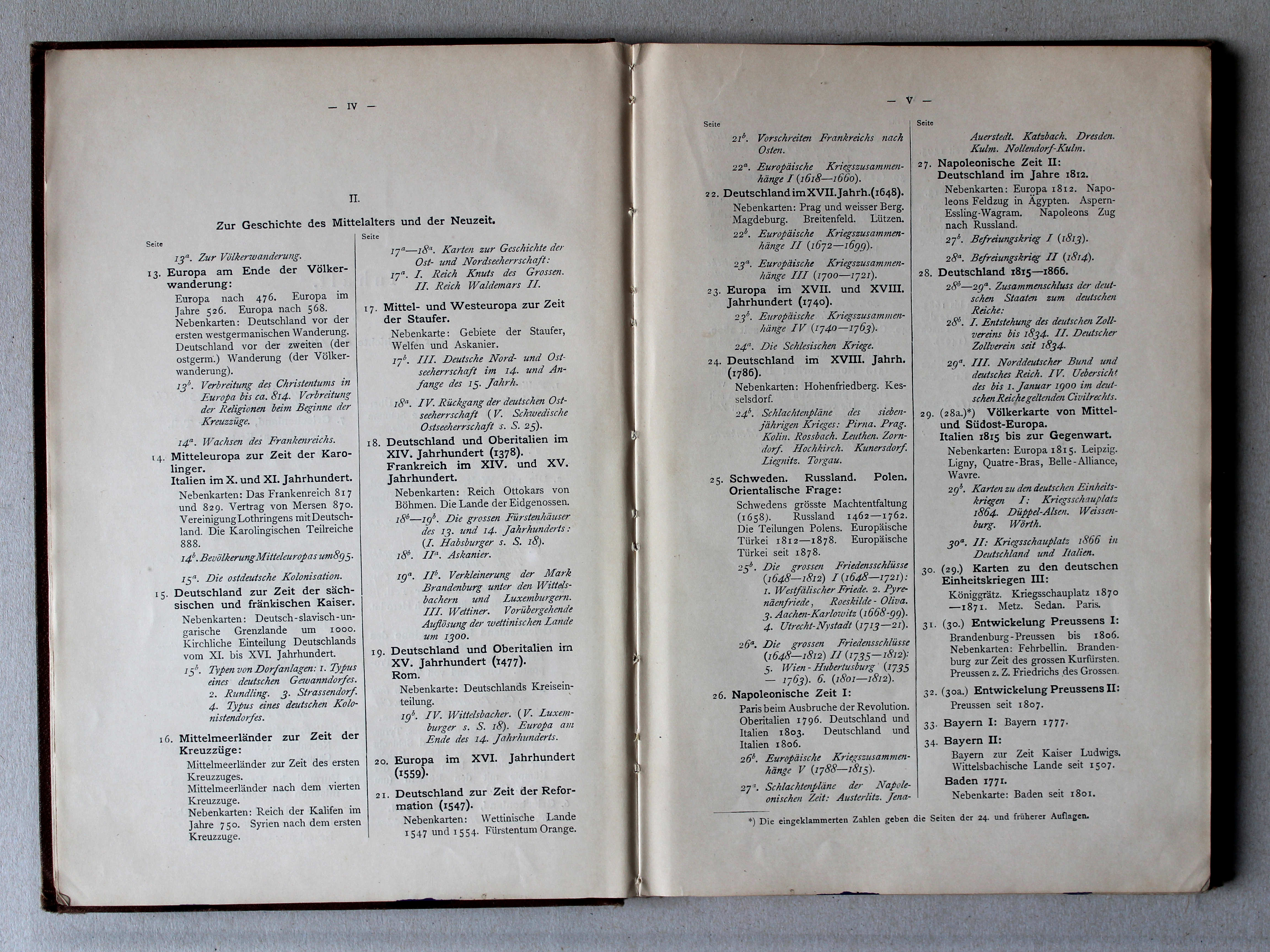
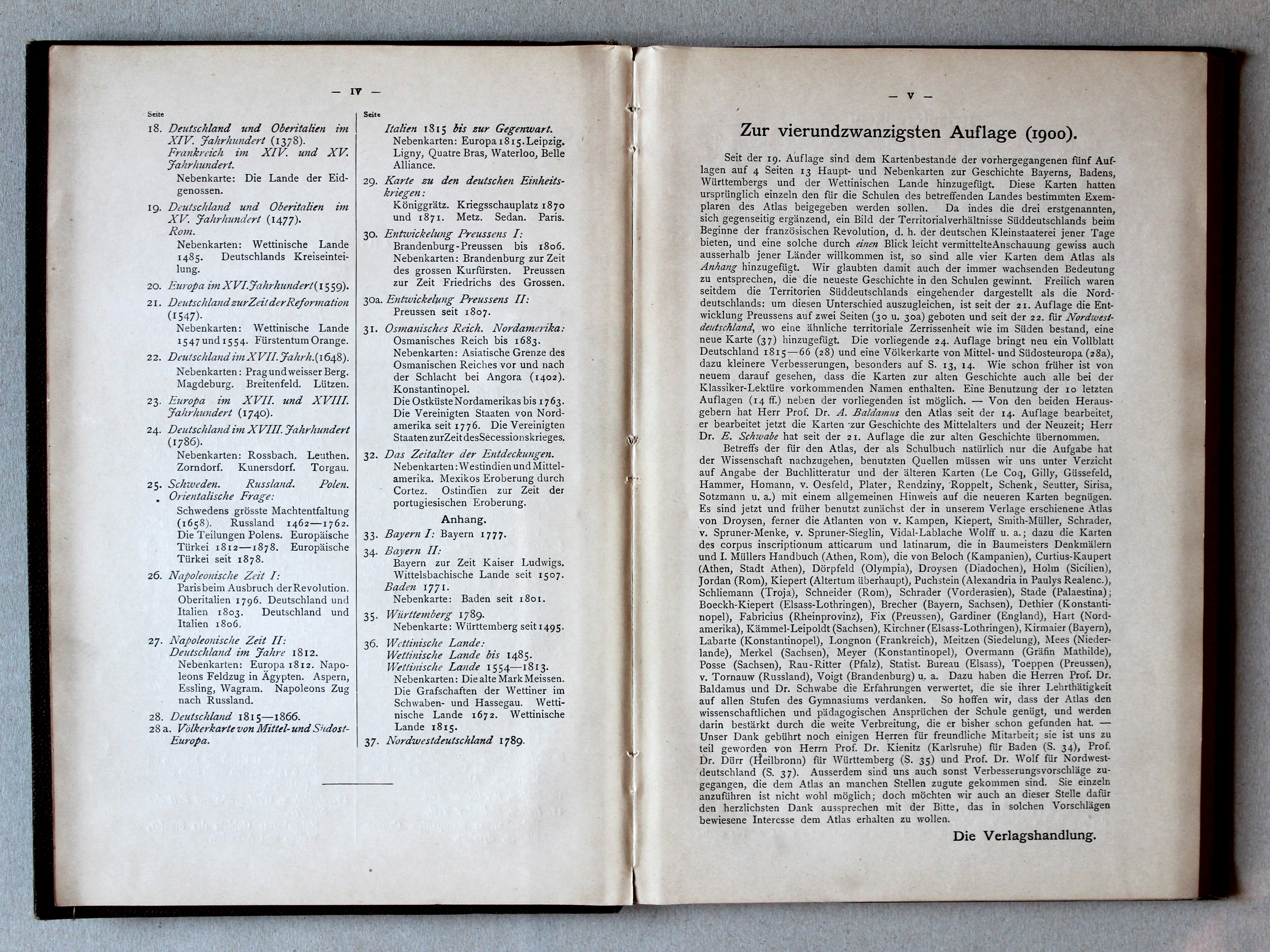
Putzgers Historischer Schul-Atlas, 1900
Inhoudsopgave 2, voorwoord / Table of contents 2, preface XL
(Oudheid / Ancient history)

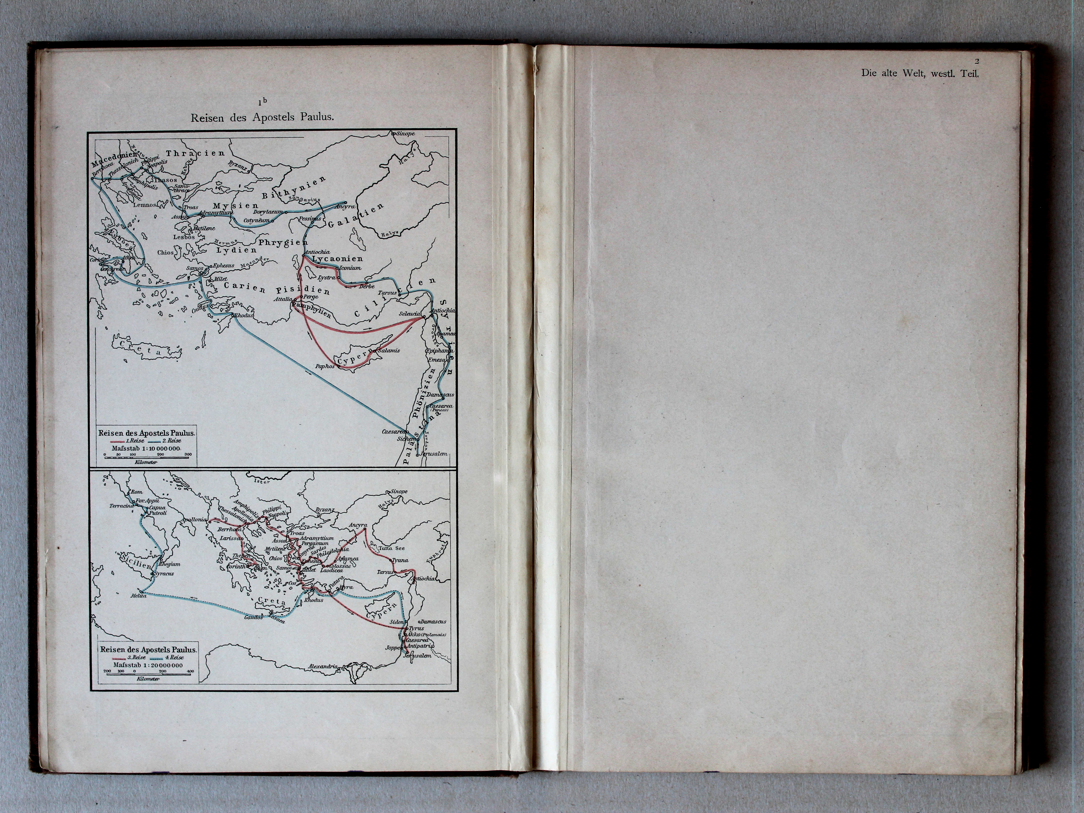
 Putzgers Historischer Schul-Atlas, 1901
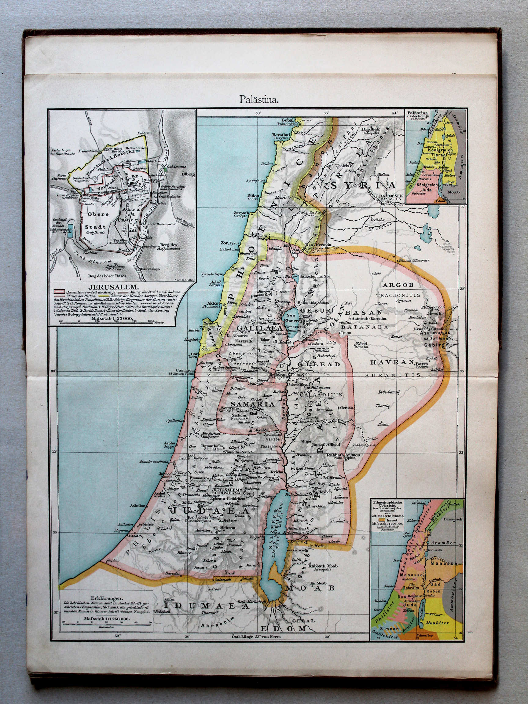
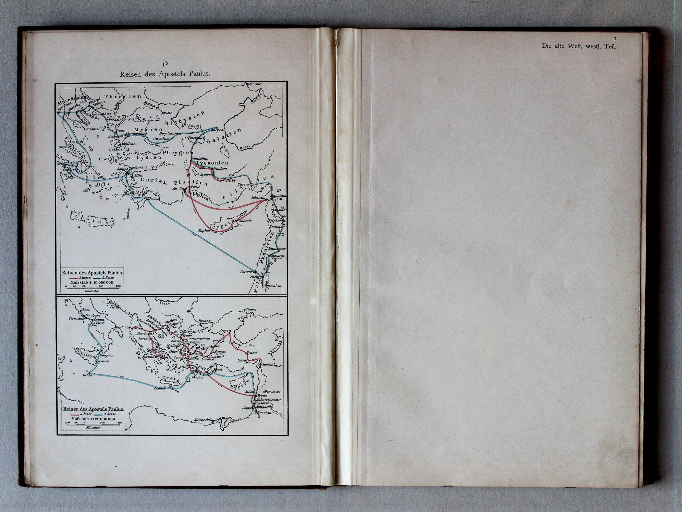
1b. Reisen des Apostels Paulus XL
Reizen van de Apostel Paulus / Journeys of Paul the Apostle
 Putzgers Historischer Schul-Atlas, 1900
geen overeenkomstige kaart / no corresponding map
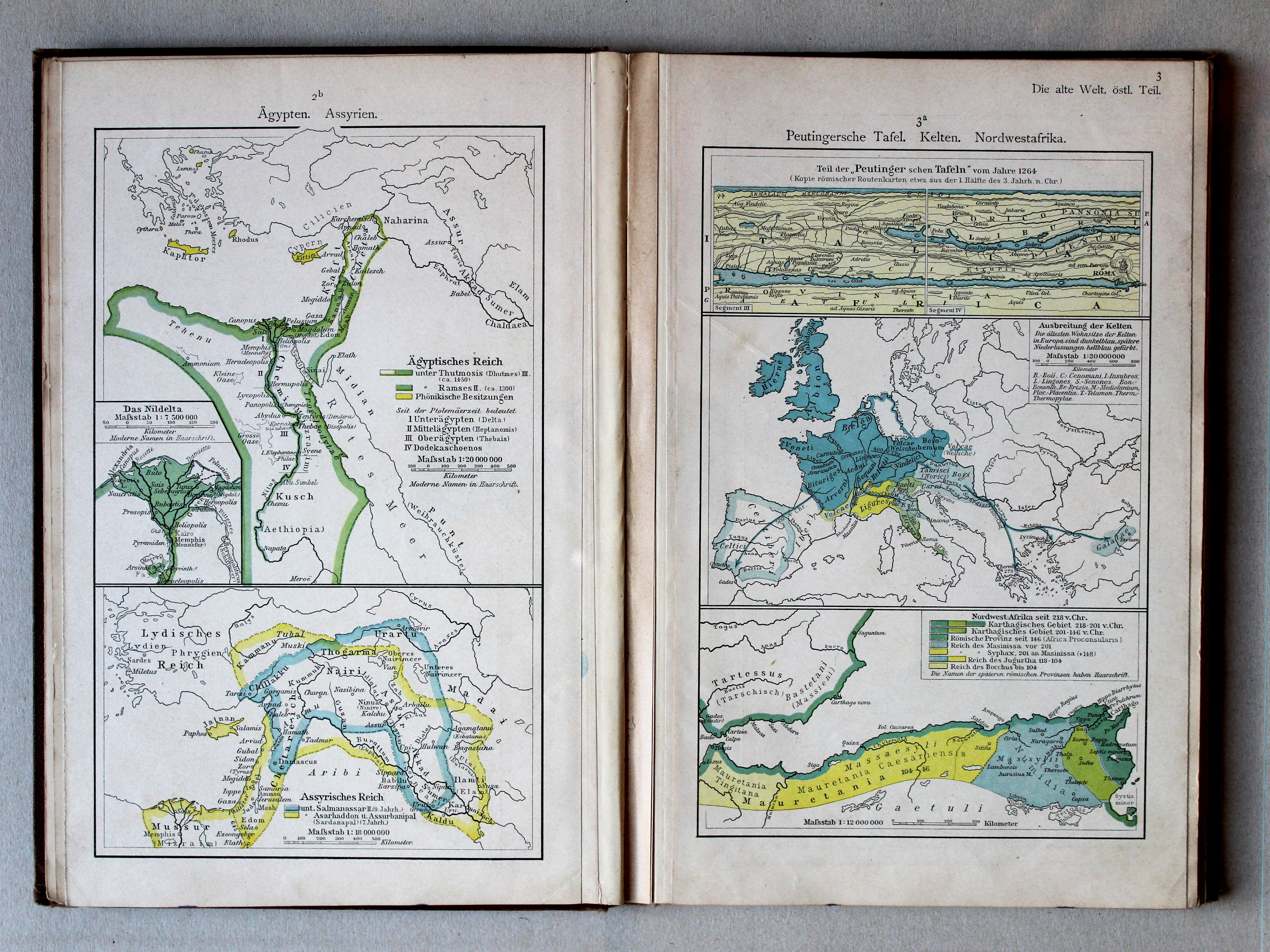
 Putzgers Historischer Schul-Atlas, 1901
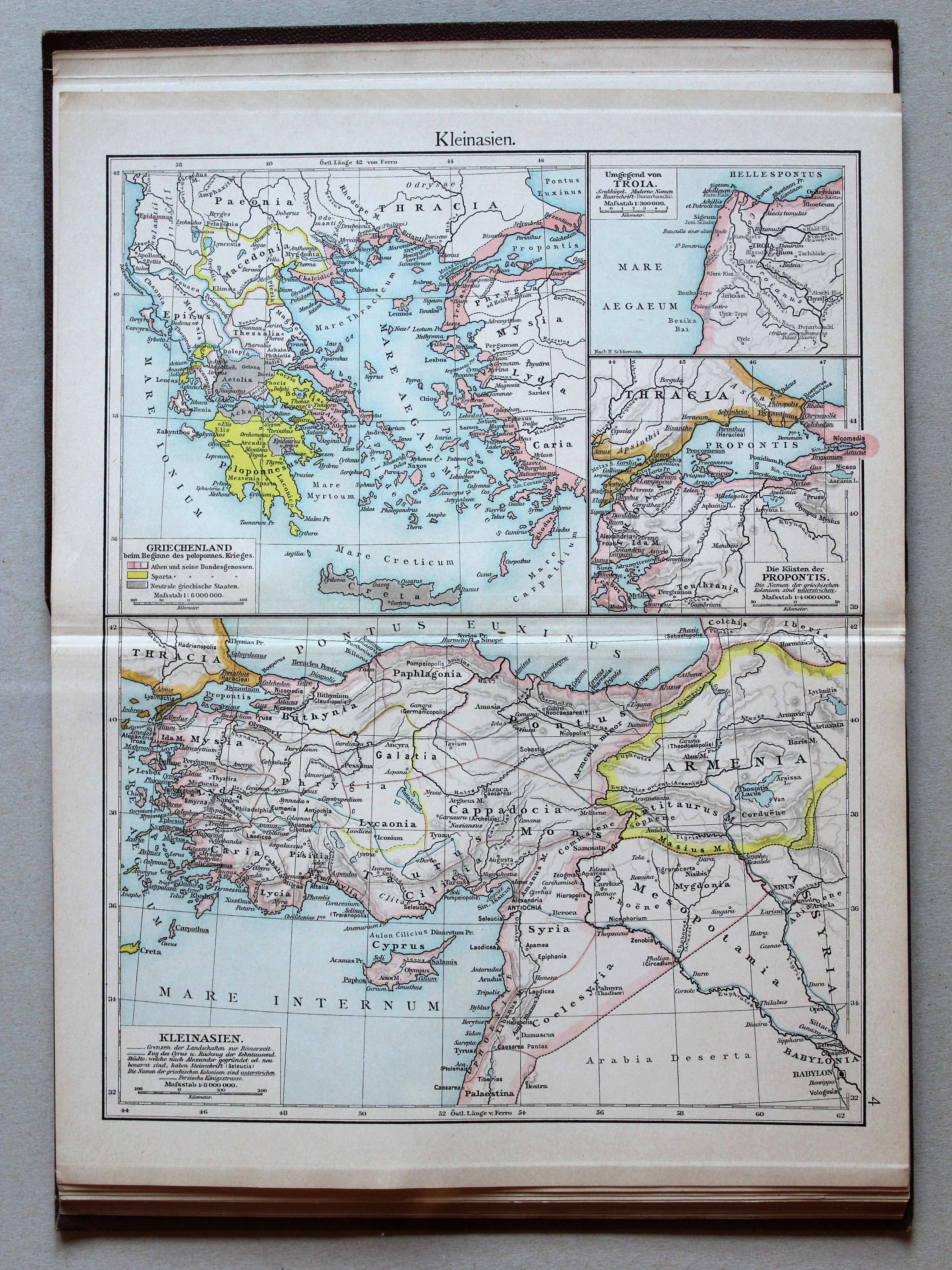
2b. Ägypten. Assyrien XL
Egypte. Assyrië / Egypt. Assyria
3a. Peutingersche Tafel. Kelten. Nordwestafrika XL
Tabula Peutingeriana. Kelten. Noordwest-Afrika / Tabula Peutingeriana. Celts. Northwest Africa
Putzgers Historischer Schul-Atlas, 1900
geen overeenkomstige kaart / no corresponding map
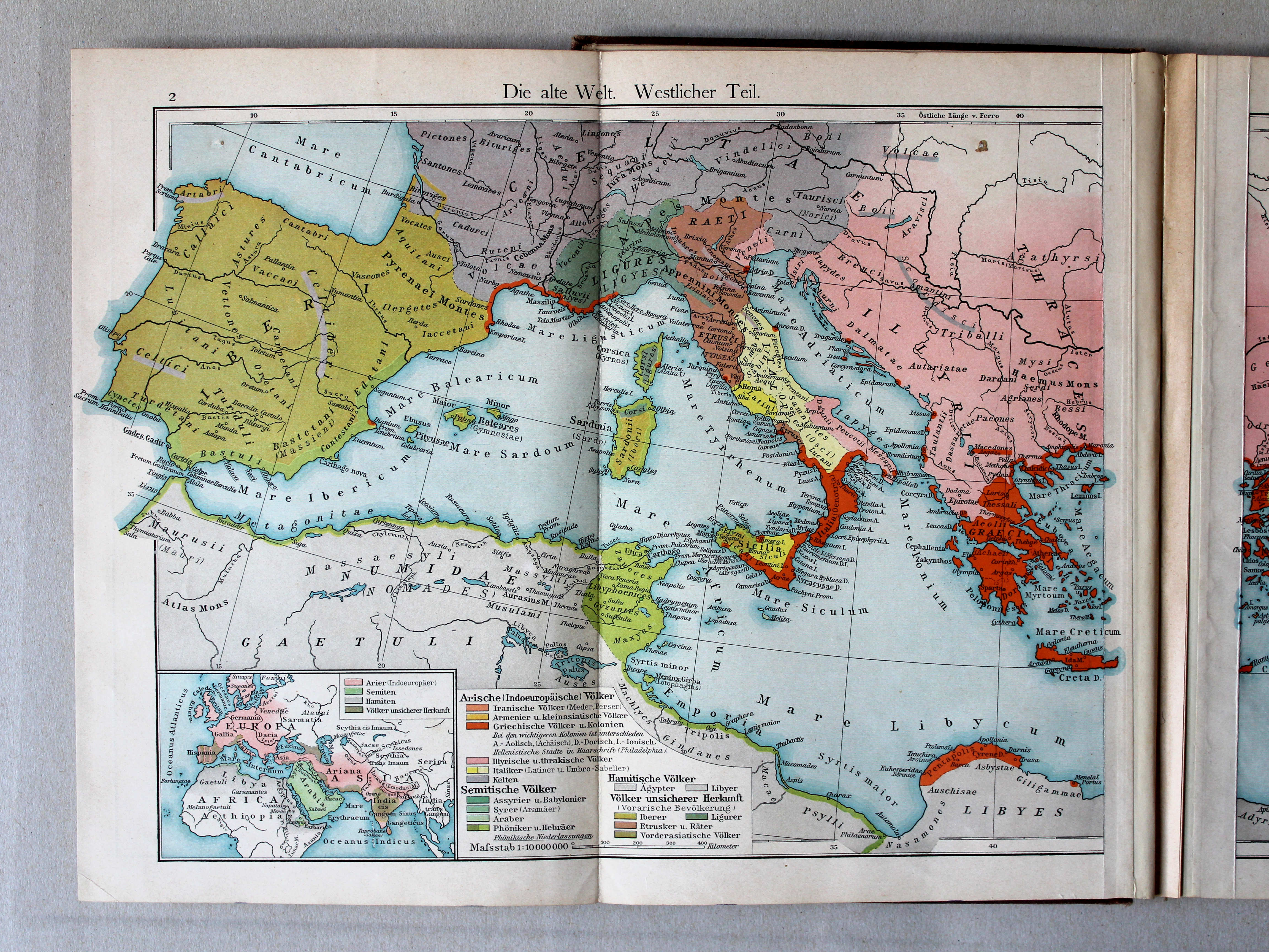
 Putzgers Historischer Schul-Atlas, 1901
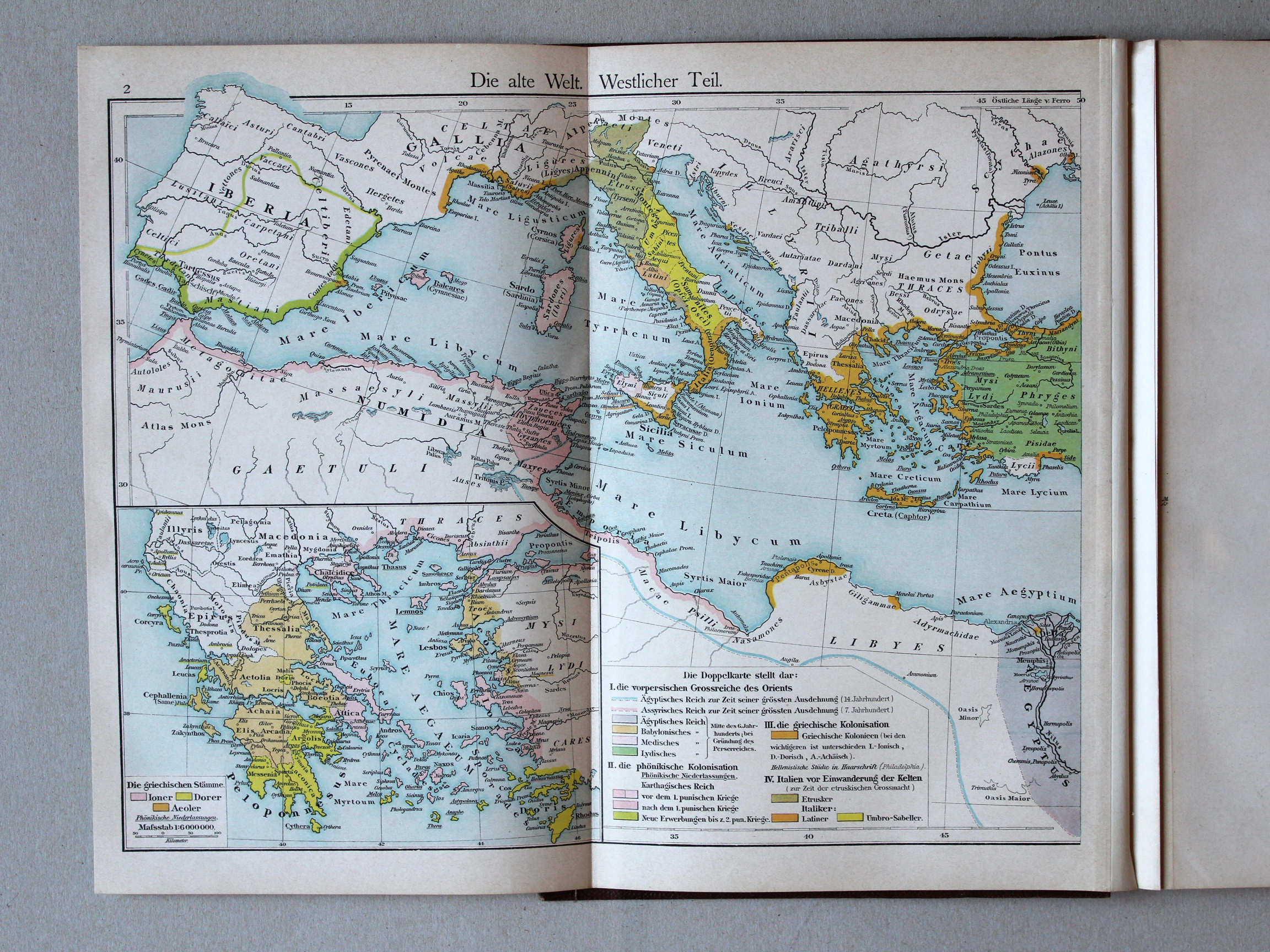
2. Die Alte Welt. Westlicher Teil XL
De wereld in de Oudheid, westelijk deel / The Ancient world, western part
 Putzgers Historischer Schul-Atlas, 1900
2. Die alte Welt. Westlicher Teil XL
De wereld in de Oudheid, westelijk deel / The Ancient world, western part
 Putzgers Historischer Schul-Atlas, 1901
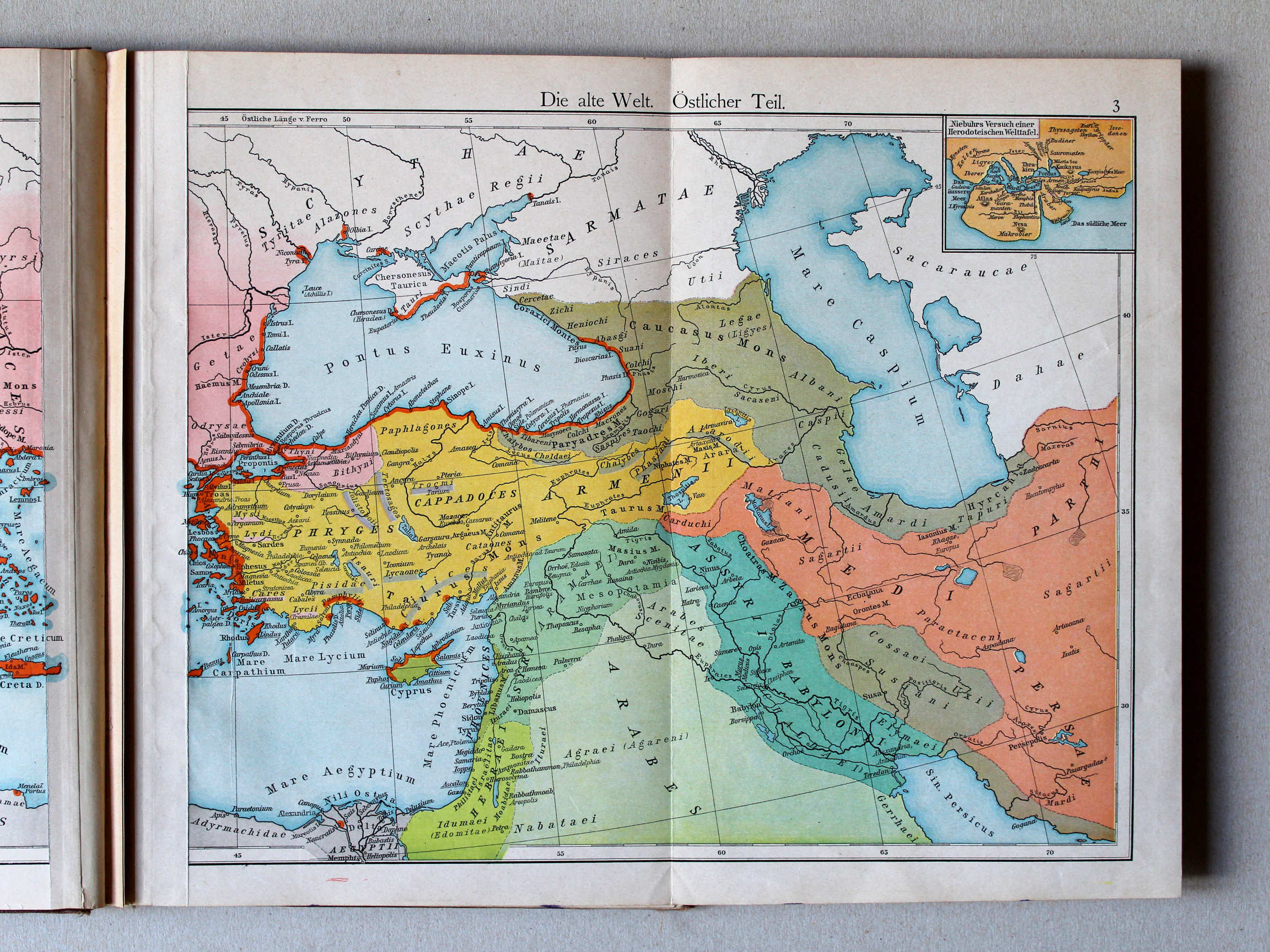
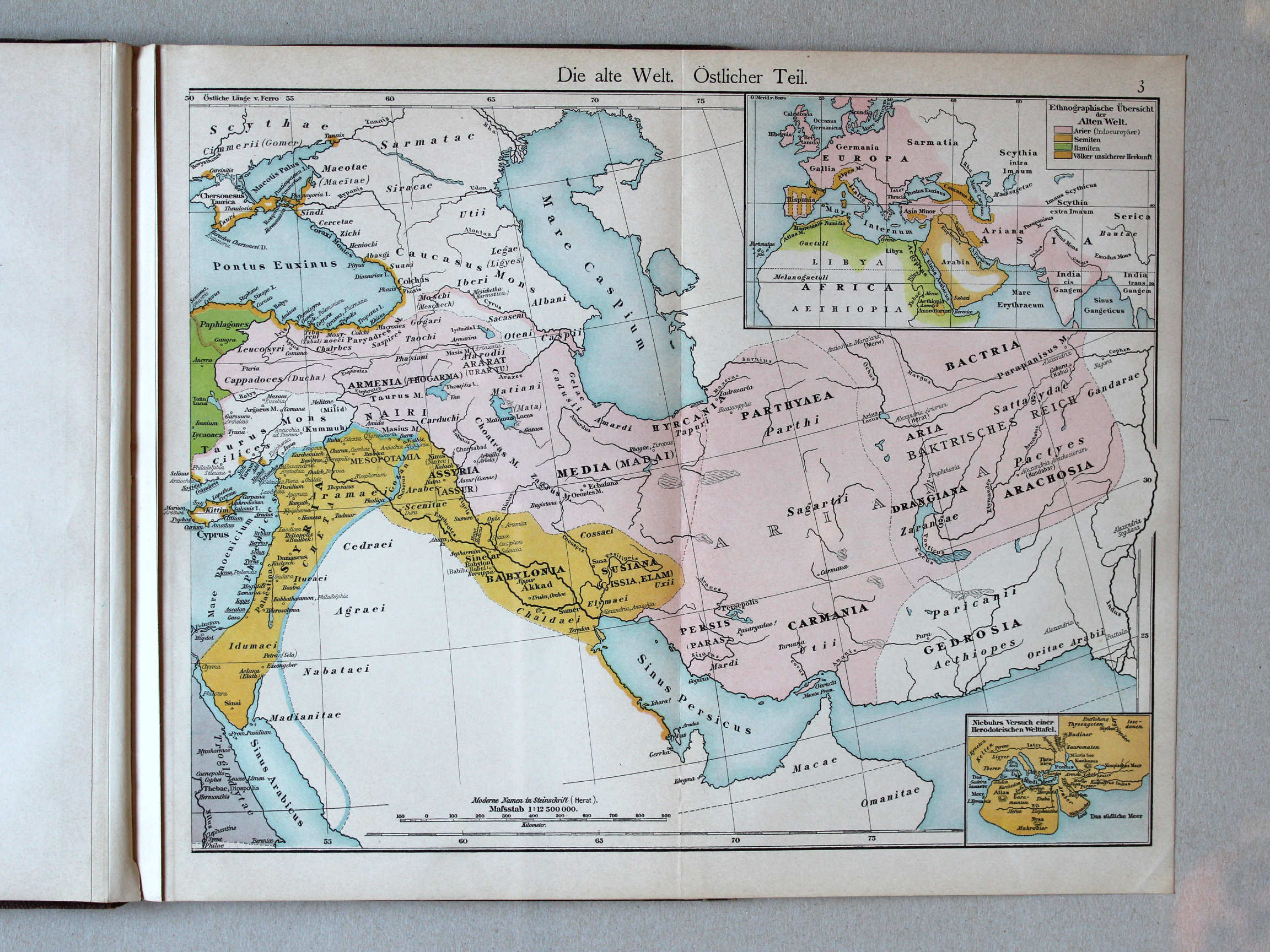
3. Die Alte Welt. Östlicher Teil XL
De wereld in de Oudheid, oostelijk deel / The Ancient world, eastern part
 Putzgers Historischer Schul-Atlas, 1900
3. Die alte Welt. Östlicher Teil XL
De wereld in de Oudheid, oostelijk deel / The Ancient world, eastern part

 Putzgers Historischer Schul-Atlas, 1901
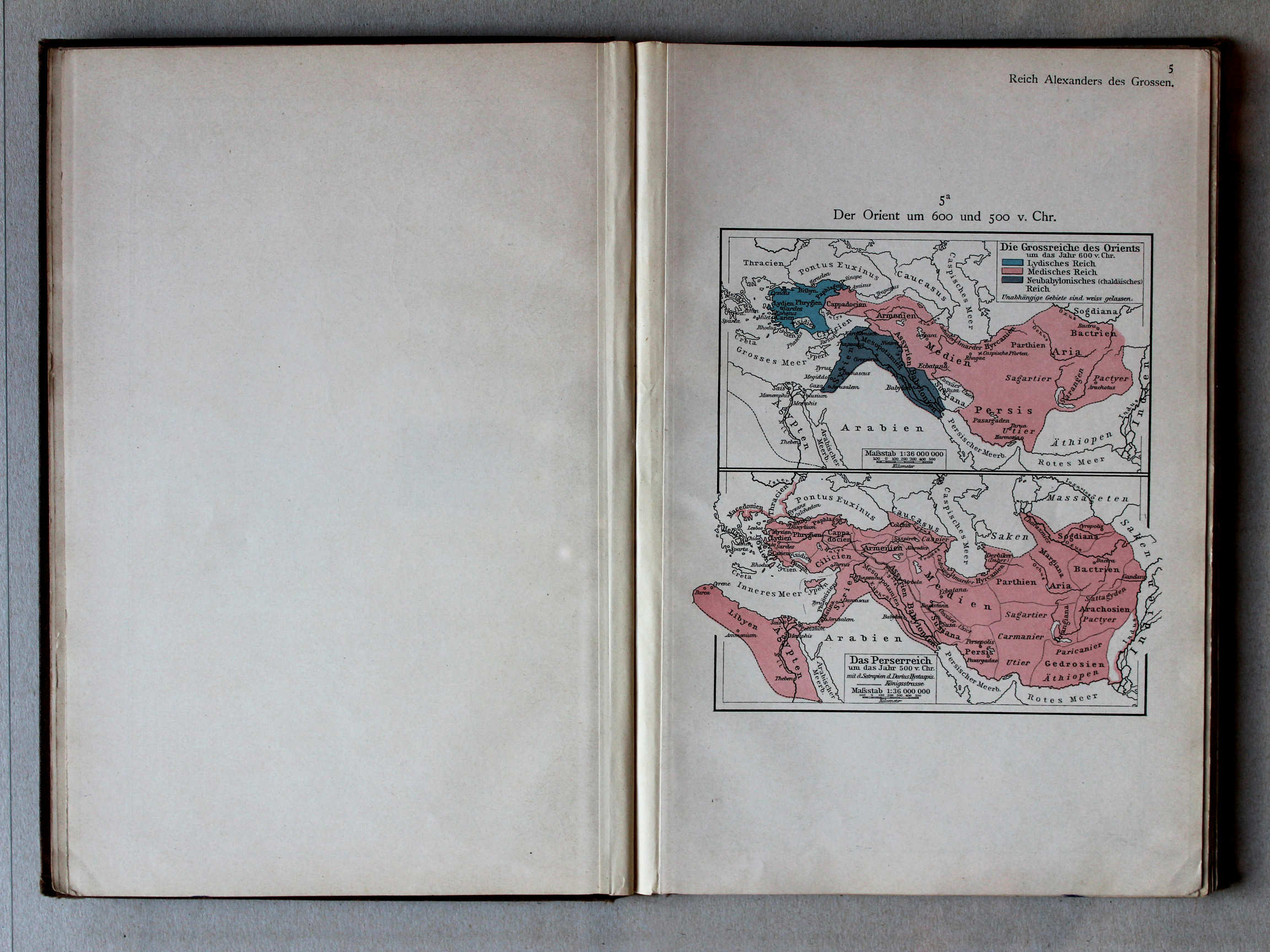
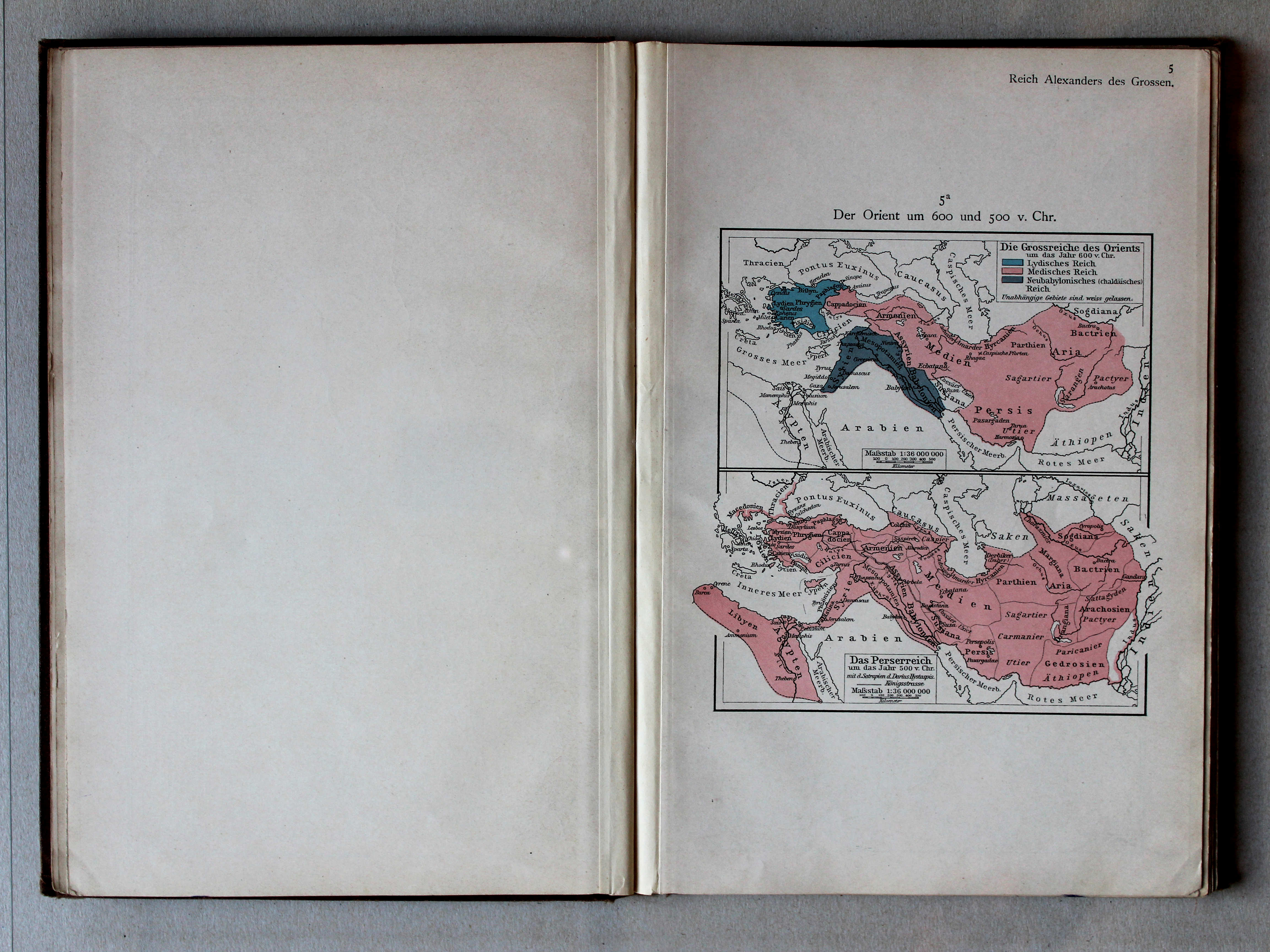
5a. Der Orient um 600 und 500 v. Chr. XL
Het Oosten rond 600 en 500 v. Chr. / The Orient around 600 and 500 BC
Putzgers Historischer Schul-Atlas, 1900
geen overeenkomstige kaart / no corresponding map
 Putzgers Historischer Schul-Atlas, 1901
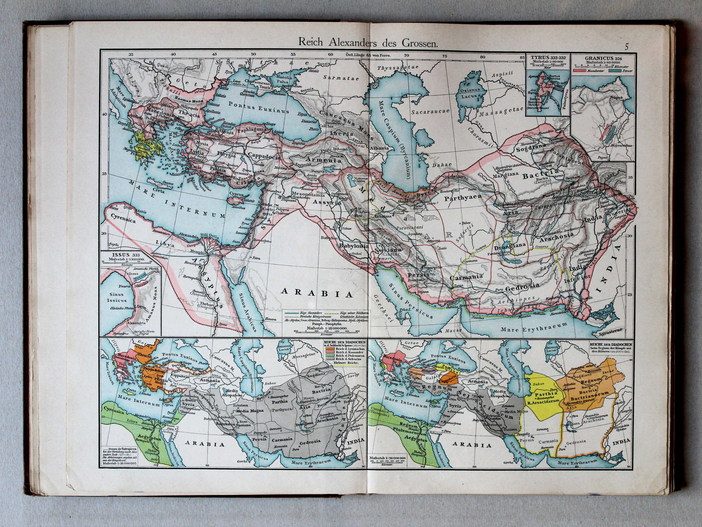
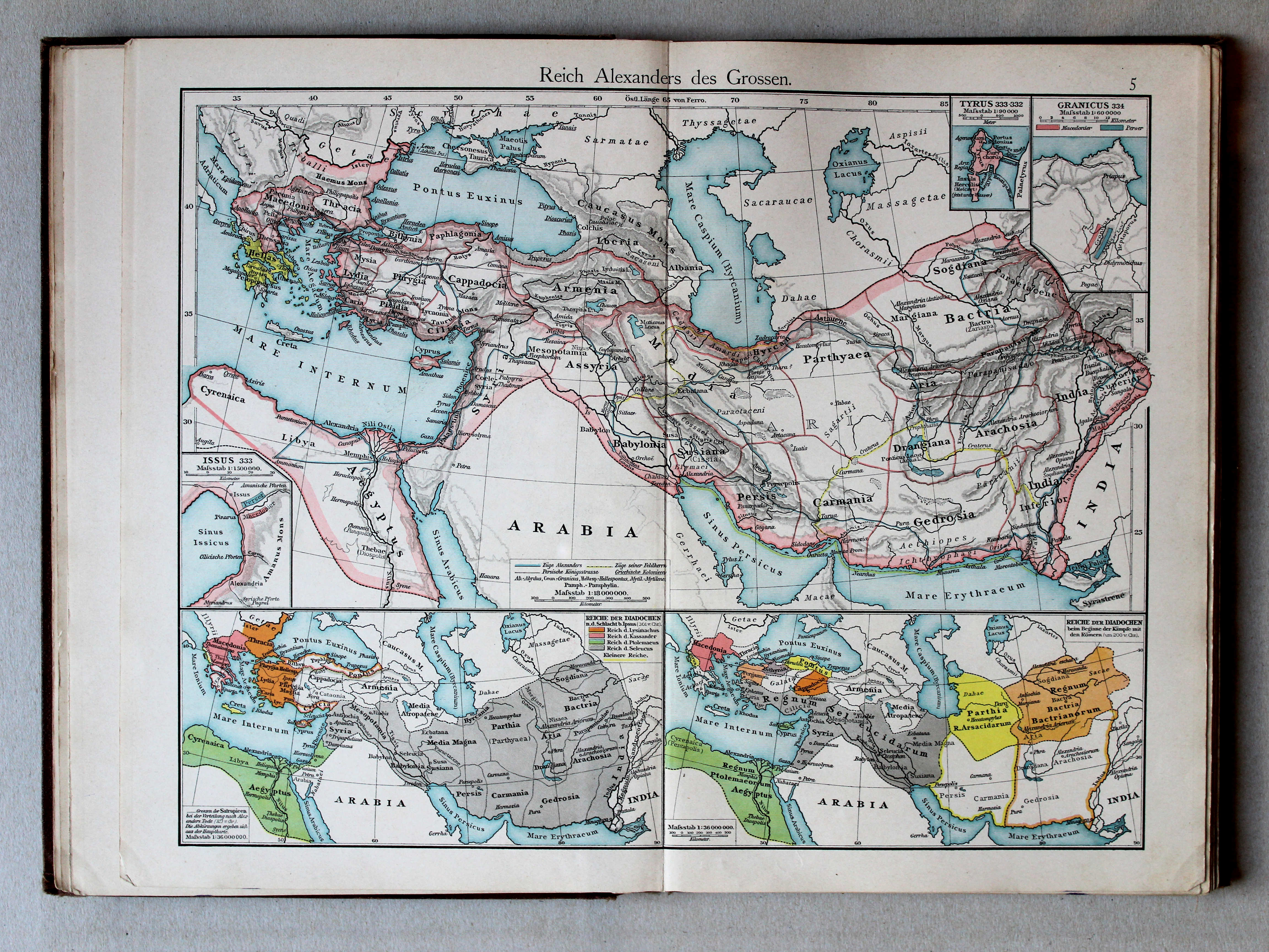
5. Reich Alexanders des Grossen XL
Het Rijk van Alexander de Grote / The Empire of Alexander the Great
 Putzgers Historischer Schul-Atlas, 1900
5. Reich Alexanders des Grossen XL
Het Rijk van Alexander de Grote / The Empire of Alexander the Great
 Putzgers Historischer Schul-Atlas, 1911
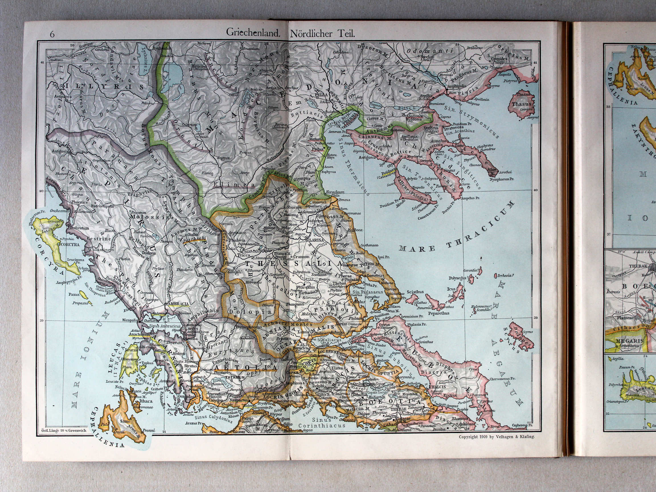
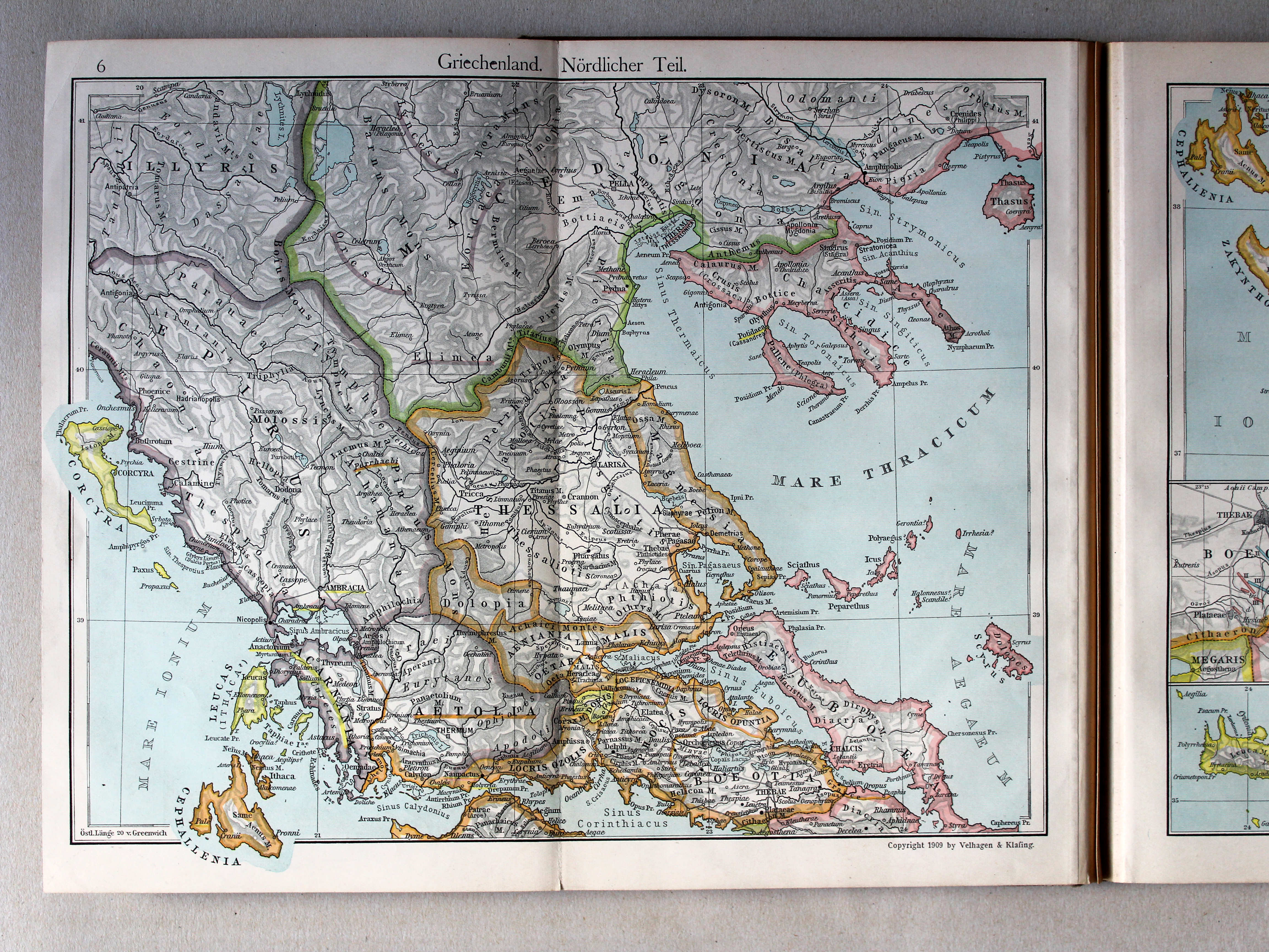
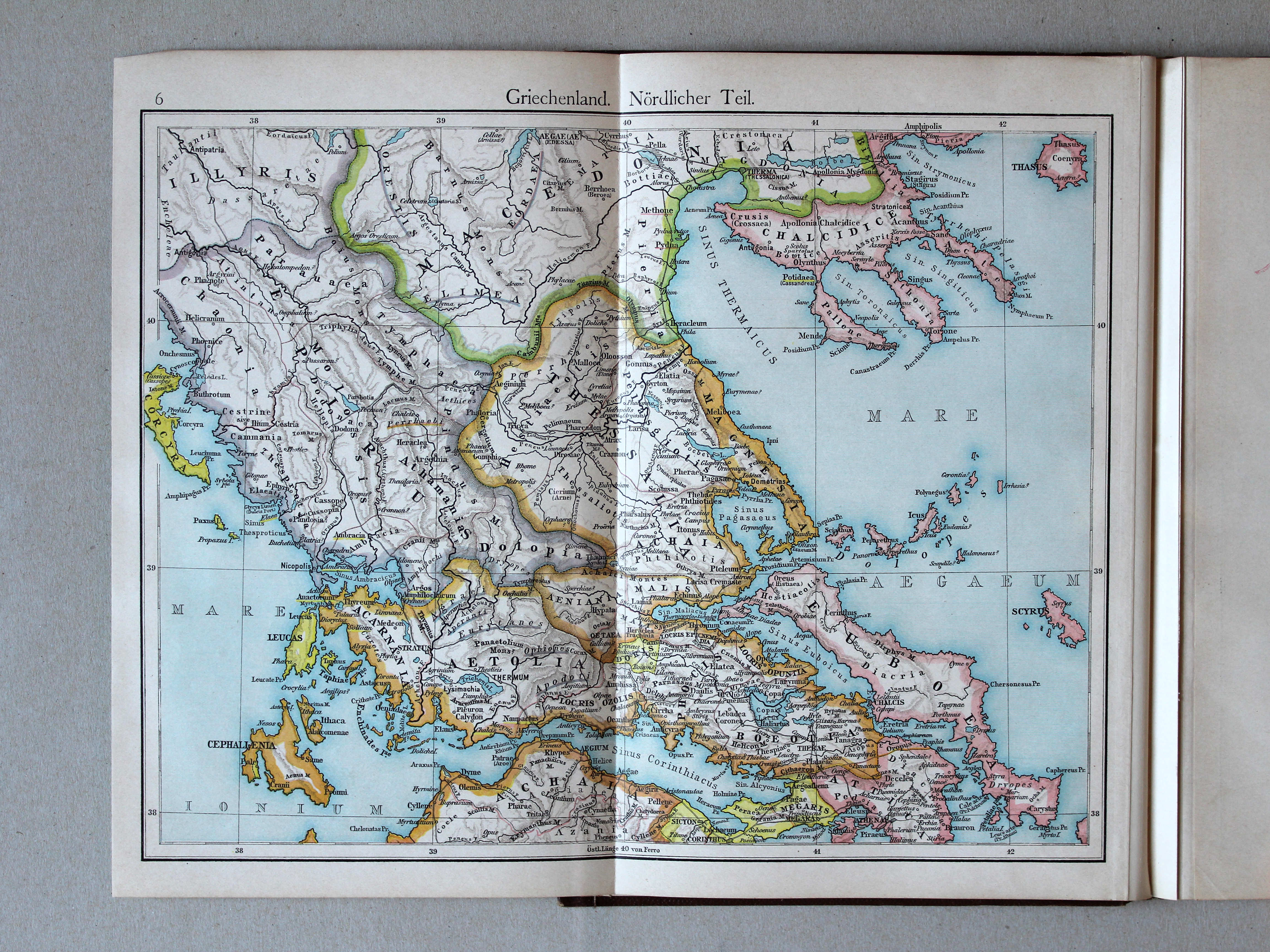
6. Griechenland. Nördlicher Teil XL
Griekenland, noordelijk deel / Greece, northern part
 Putzgers Historischer Schul-Atlas, 1900
6. Griechenland. Nördlicher Teil XL
Griekenland, noordelijk deel / Greece, northern part
 Putzgers Historischer Schul-Atlas, 1911
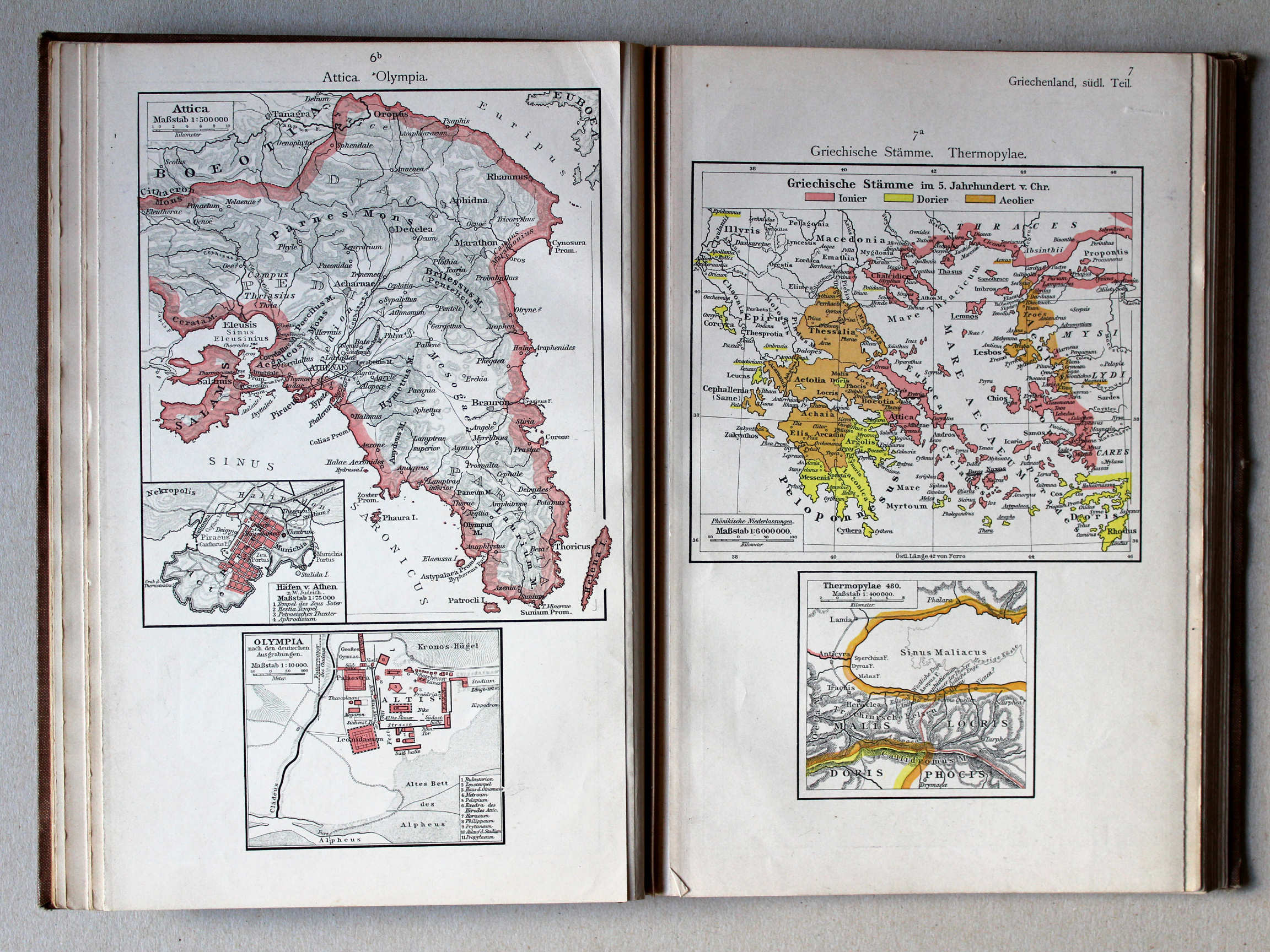
6b. Attica. Olympia XL
Attica. Olympia
7a. Griechische Stämme. Thermopylae XL
Griekse volkeren. Thermopylae / Greek nations. Thermopylae
 Putzgers Historischer Schul-Atlas, 1900
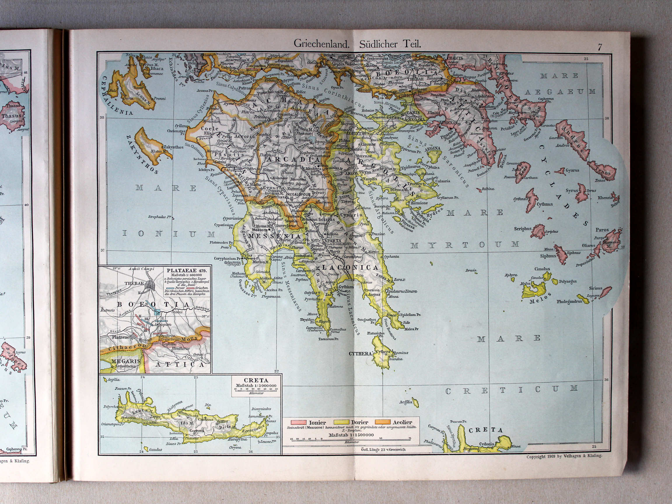
7. Griechenland. Südlicher Teil (Thermopylae, Olympia) XL
Griekenland, zuidelijk deel / Greece, southern part
(Thermopylae, Olympia)
 Putzgers Historischer Schul-Atlas, 1911
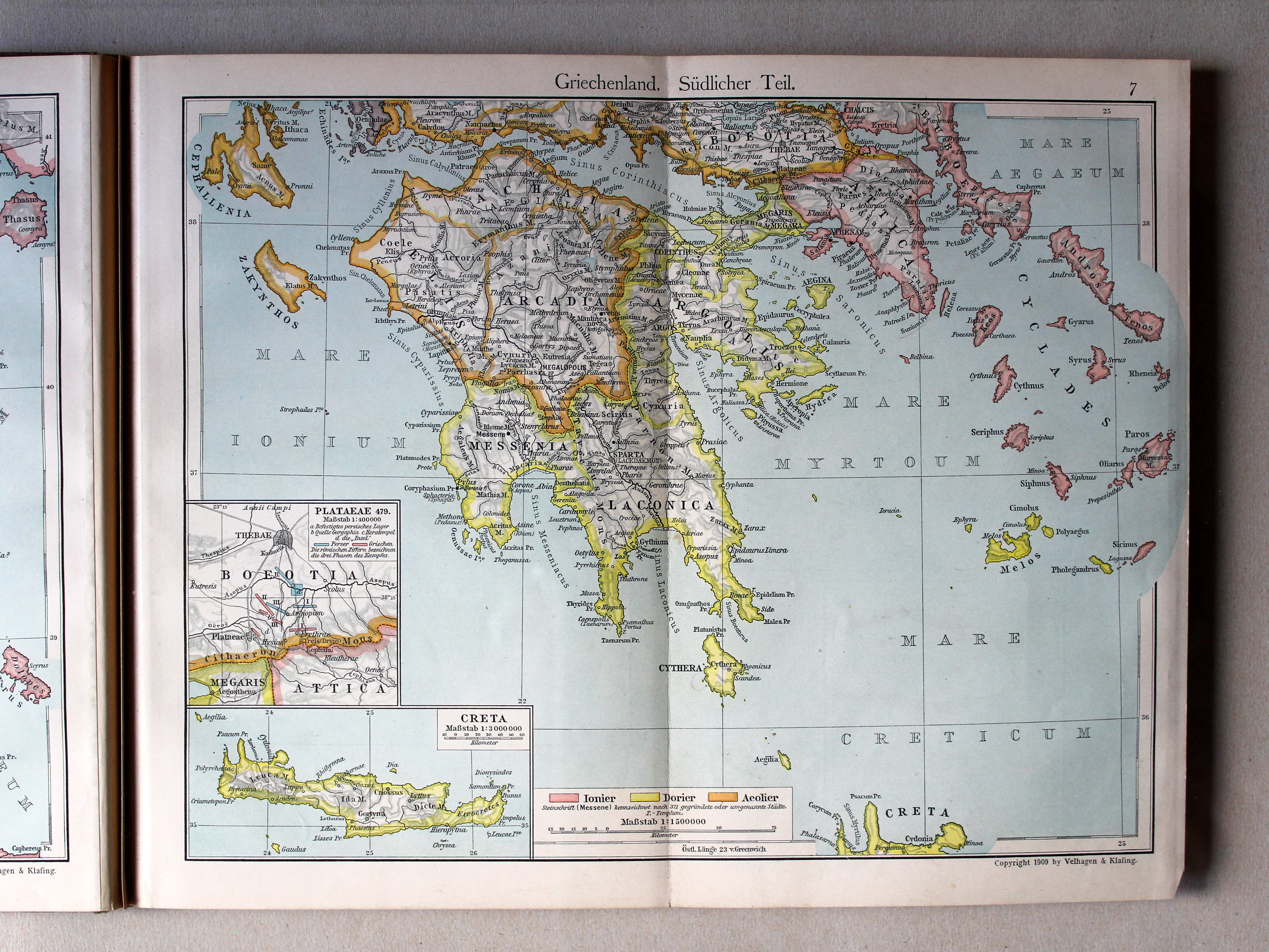
7. Griechenland. Südlicher Teil XL
Griekenland, zuidelijk deel / Greece, southern part
Putzgers Historischer Schul-Atlas, 1900
7. Griechenland. Südlicher Teil XL
Griekenland, zuidelijk deel / Greece, southern part
 Putzgers Historischer Schul-Atlas, 1911
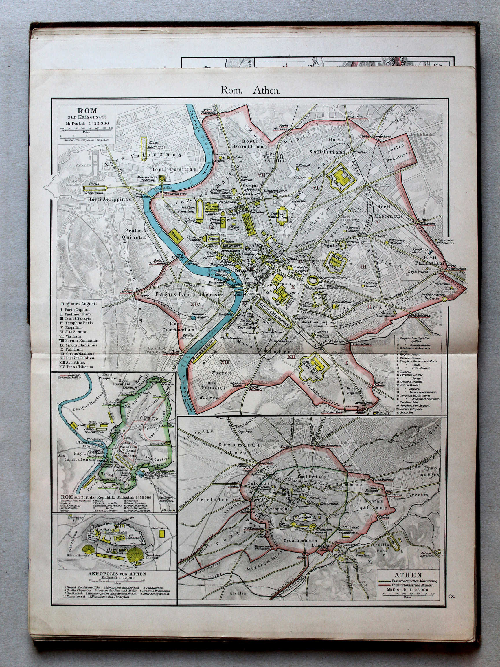
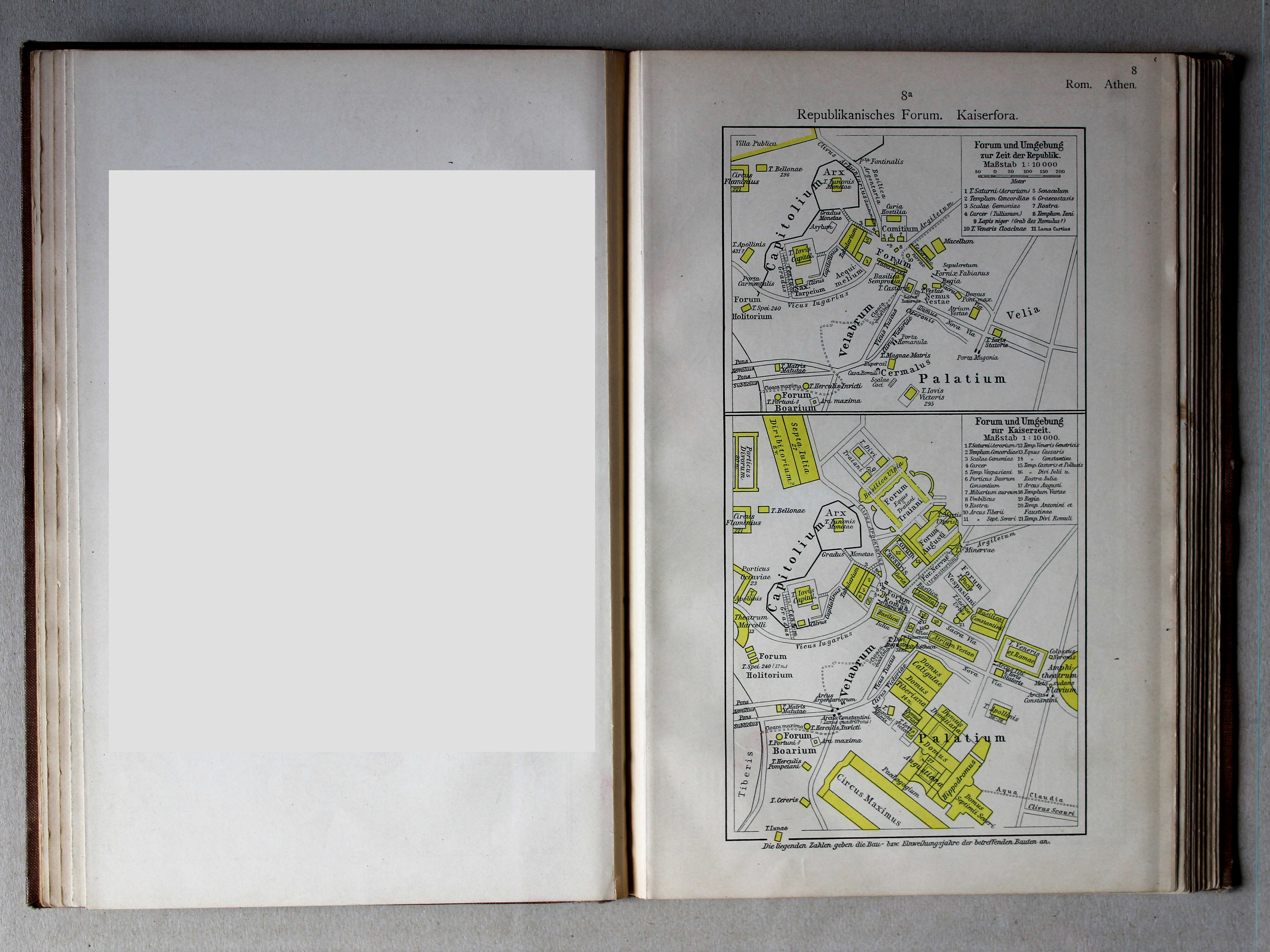
8a. Republikanisches Forum. Kaiserfora XL
Forum tijdens de Republiek. Fora in de Keizertijd / Forum during the Republic. Fora in the Imperial period
Putzgers Historischer Schul-Atlas, 1900
geen overeenkomstige kaart / no corresponding map

 Putzgers Historischer Schul-Atlas, 1901
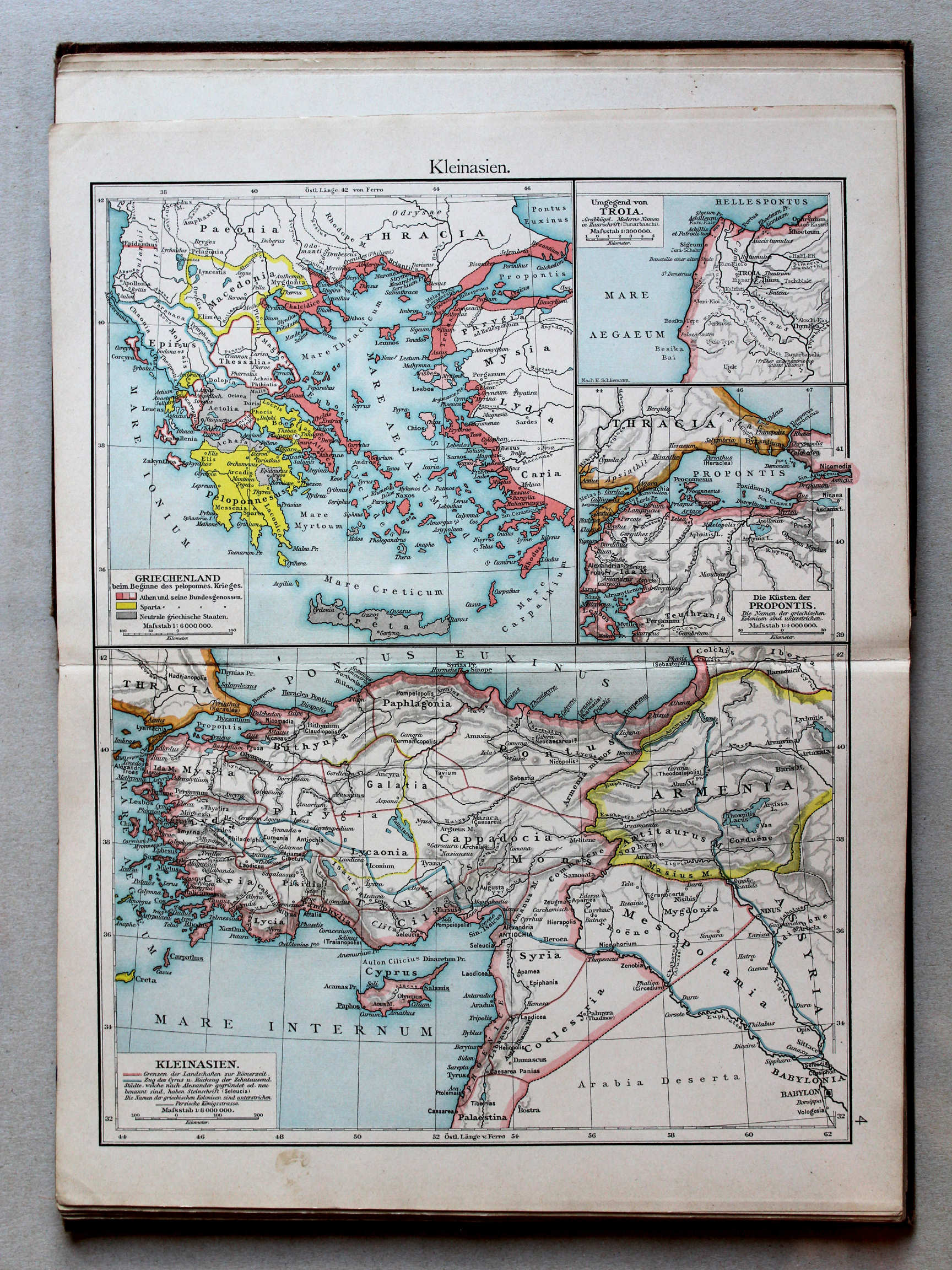
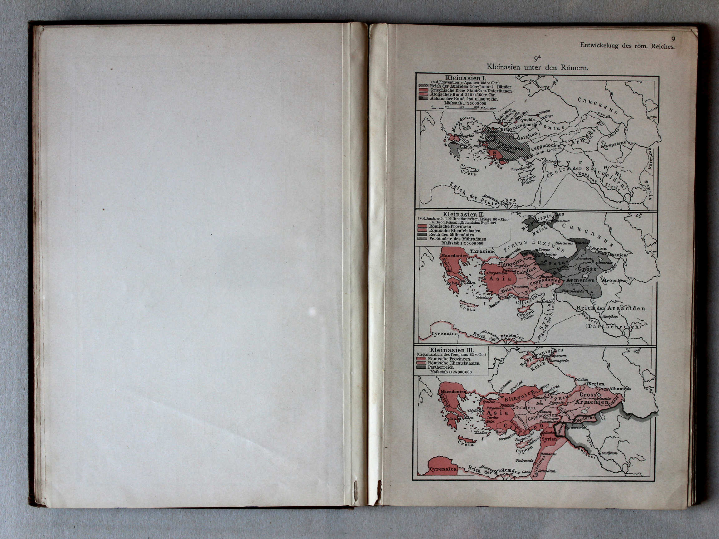
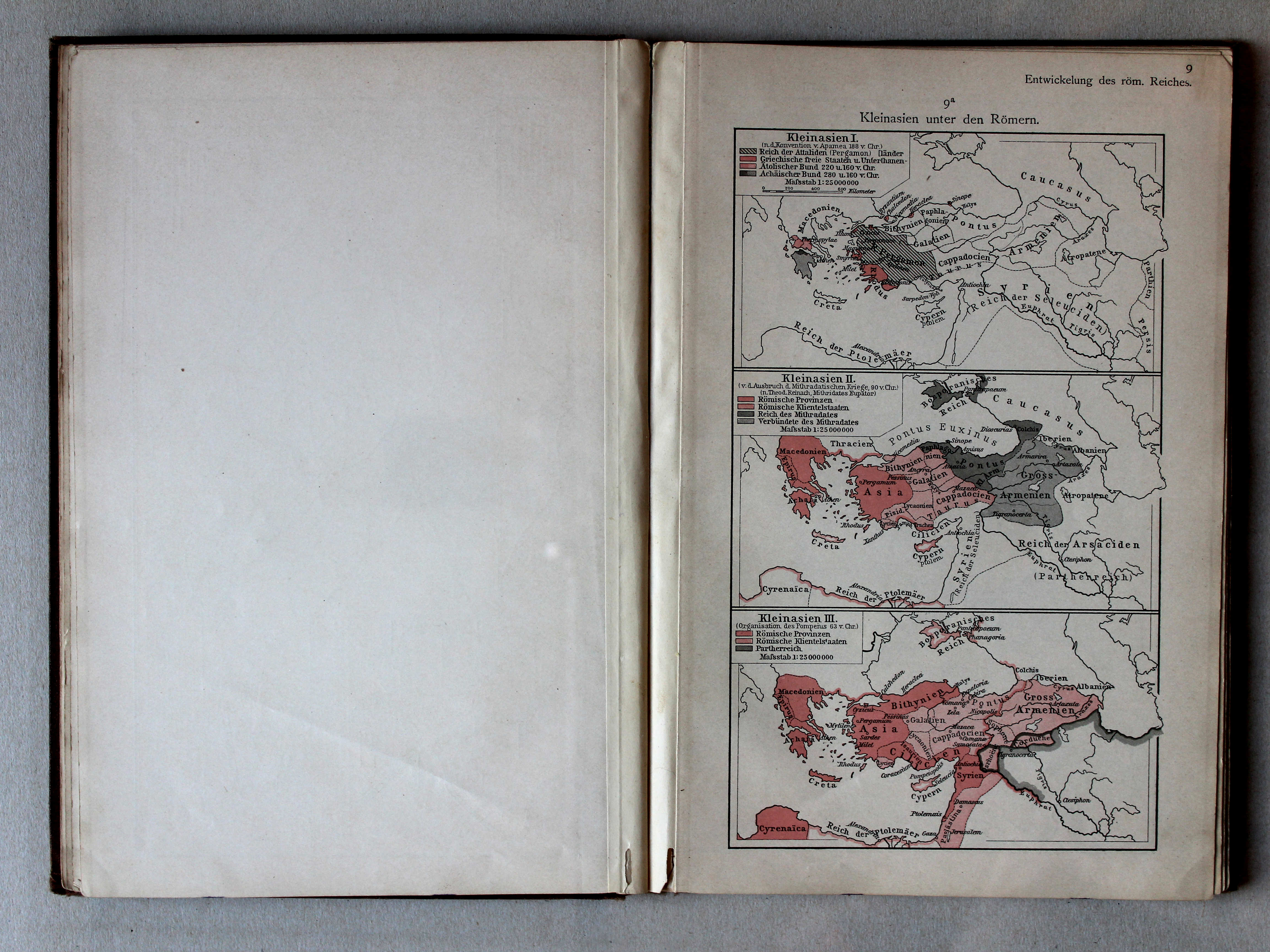
9a. Kleinasien unter den Römern XL
Klein-Azië onder de Romeinen / Asia Minor under the Romans
Putzgers Historischer Schul-Atlas, 1900
geen overeenkomstige kaart / no corresponding map
 Putzgers Historischer Schul-Atlas, 1901
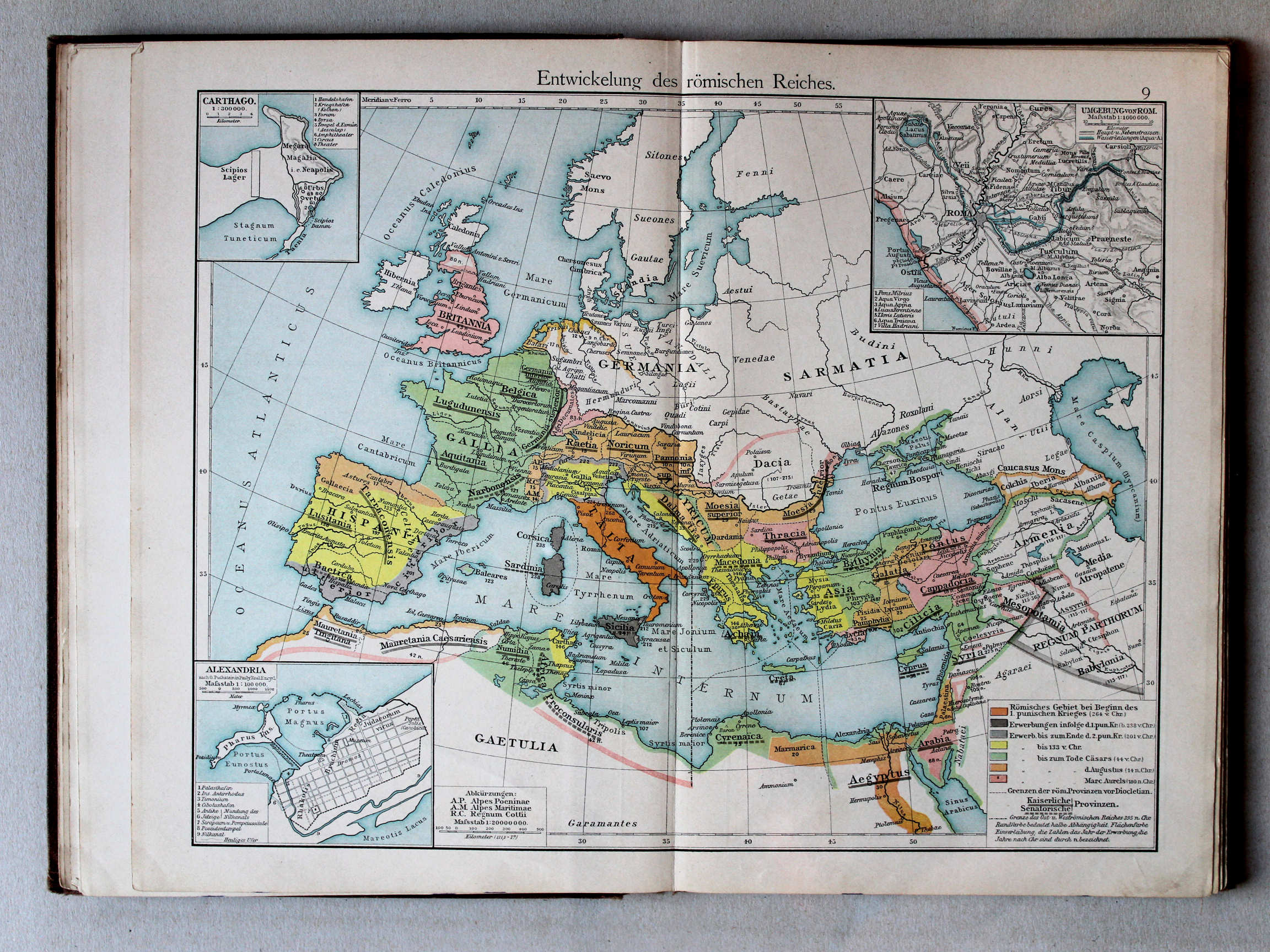
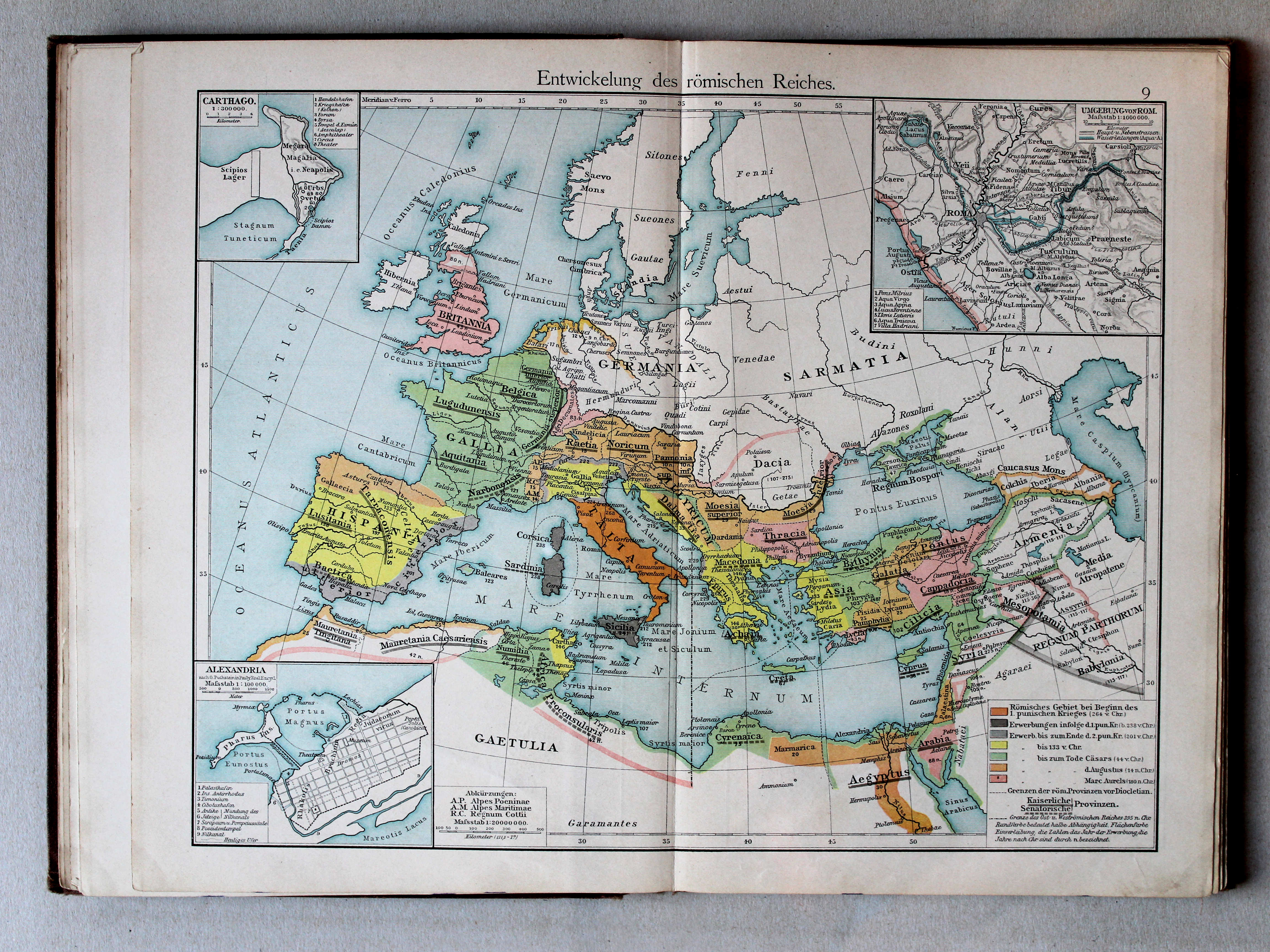
9. Entwickelung des römischen Reiches XL
Ontwikkeling van het Romeinse Rijk / Development of the Roman Empire
 Putzgers Historischer Schul-Atlas, 1900
9. Entwickelung des römischen Reiches XL
Ontwikkeling van het Romeinse Rijk / Development of the Roman Empire
 Putzgers Historischer Schul-Atlas, 1901
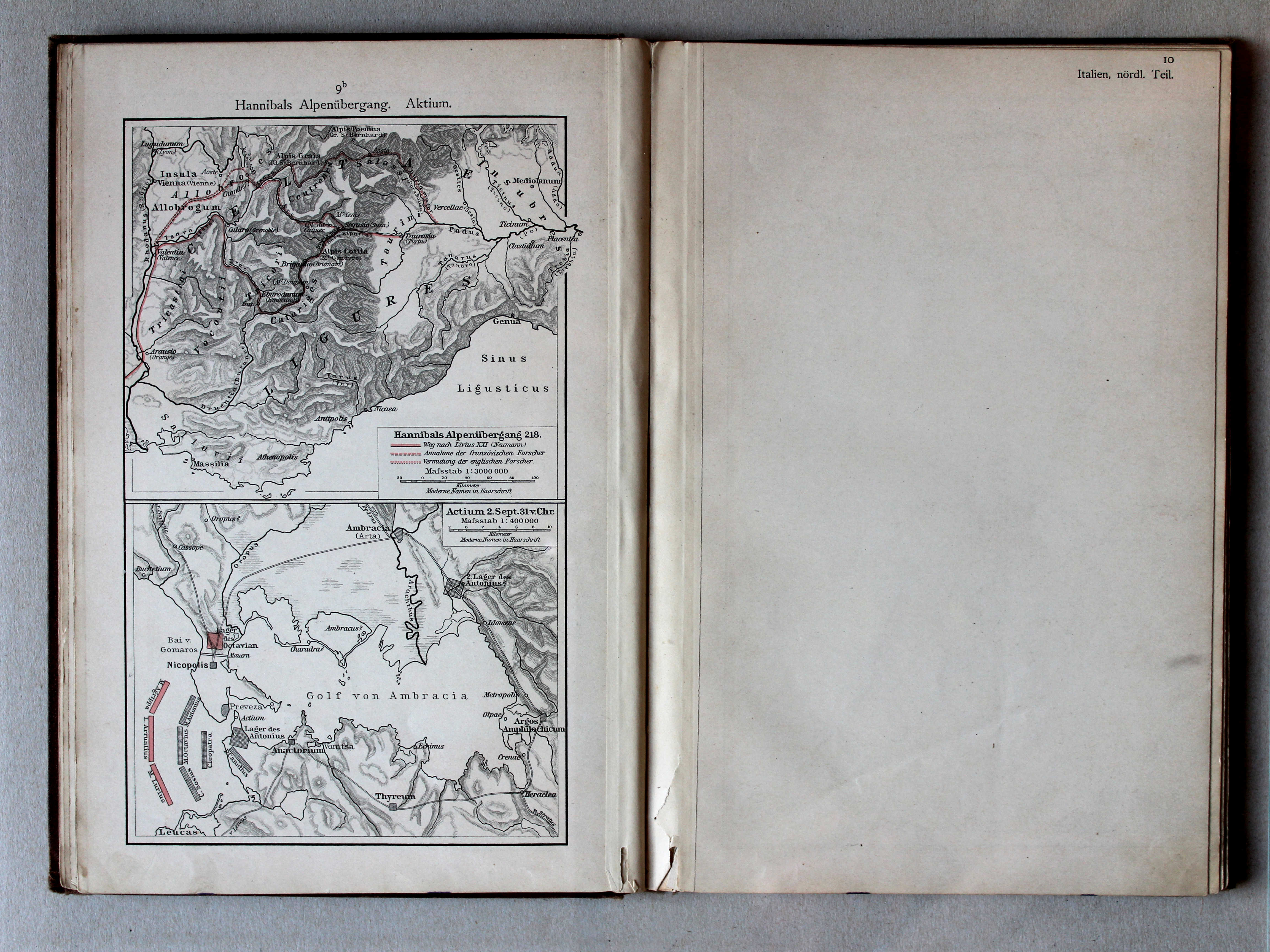
9b. Hannibals Alpenübergang. Aktium XL
Tocht van Hannibal over de Alpen. Actium / Hannibal crossing the Alps. Actium
Putzgers Historischer Schul-Atlas, 1900
geen overeenkomstige kaart / no corresponding map
 Putzgers Historischer Schul-Atlas, 1900
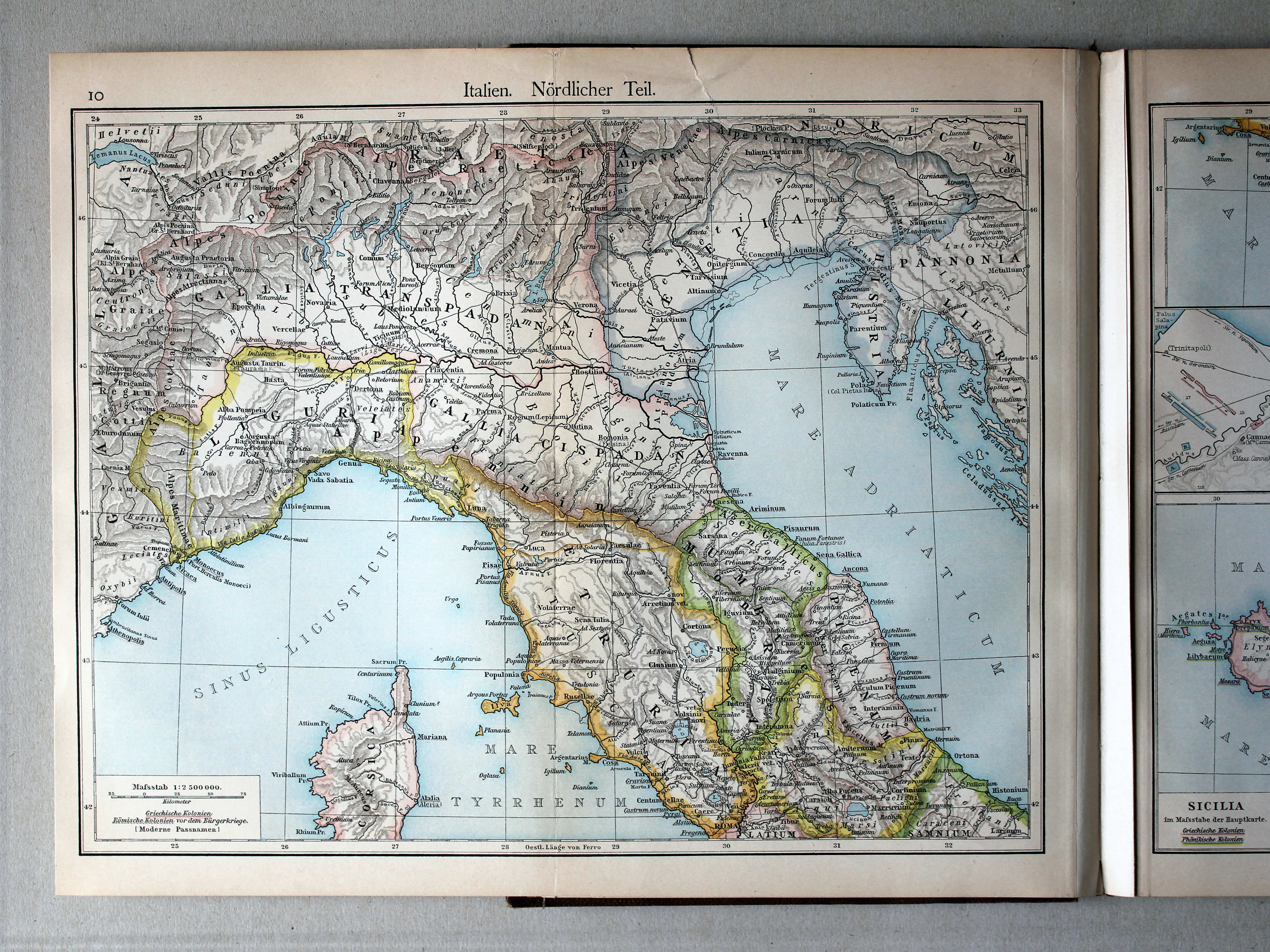
10. Italien. Nördlicher Teil XL
Italië, noordelijk deel / Italy, northern part
 Putzgers Historischer Schul-Atlas, 1900
10. Italien. Nördlicher Teil XL
Italië, noordelijk deel / Italy, northern part
 Putzgers Historischer Schul-Atlas, 1911
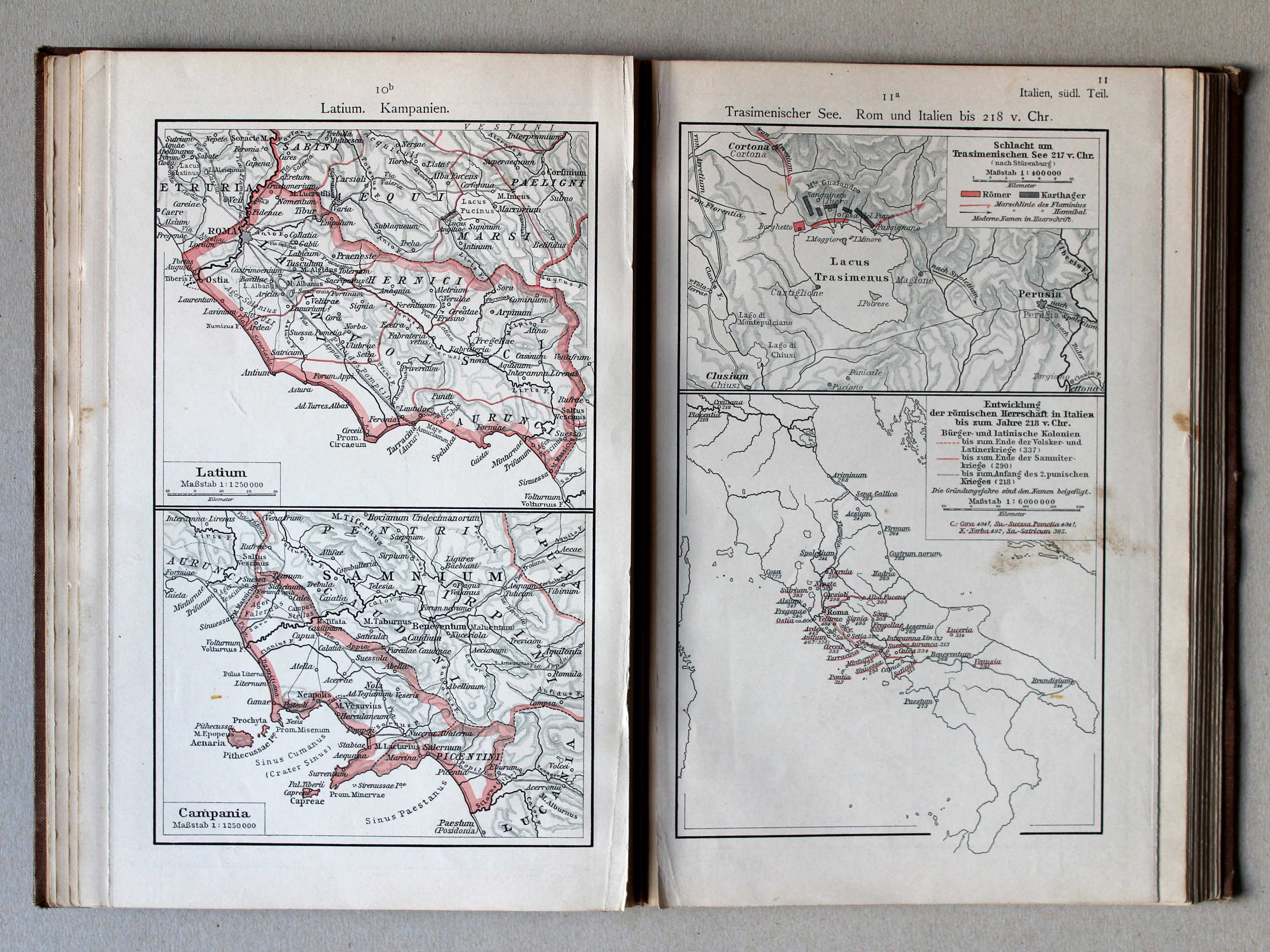
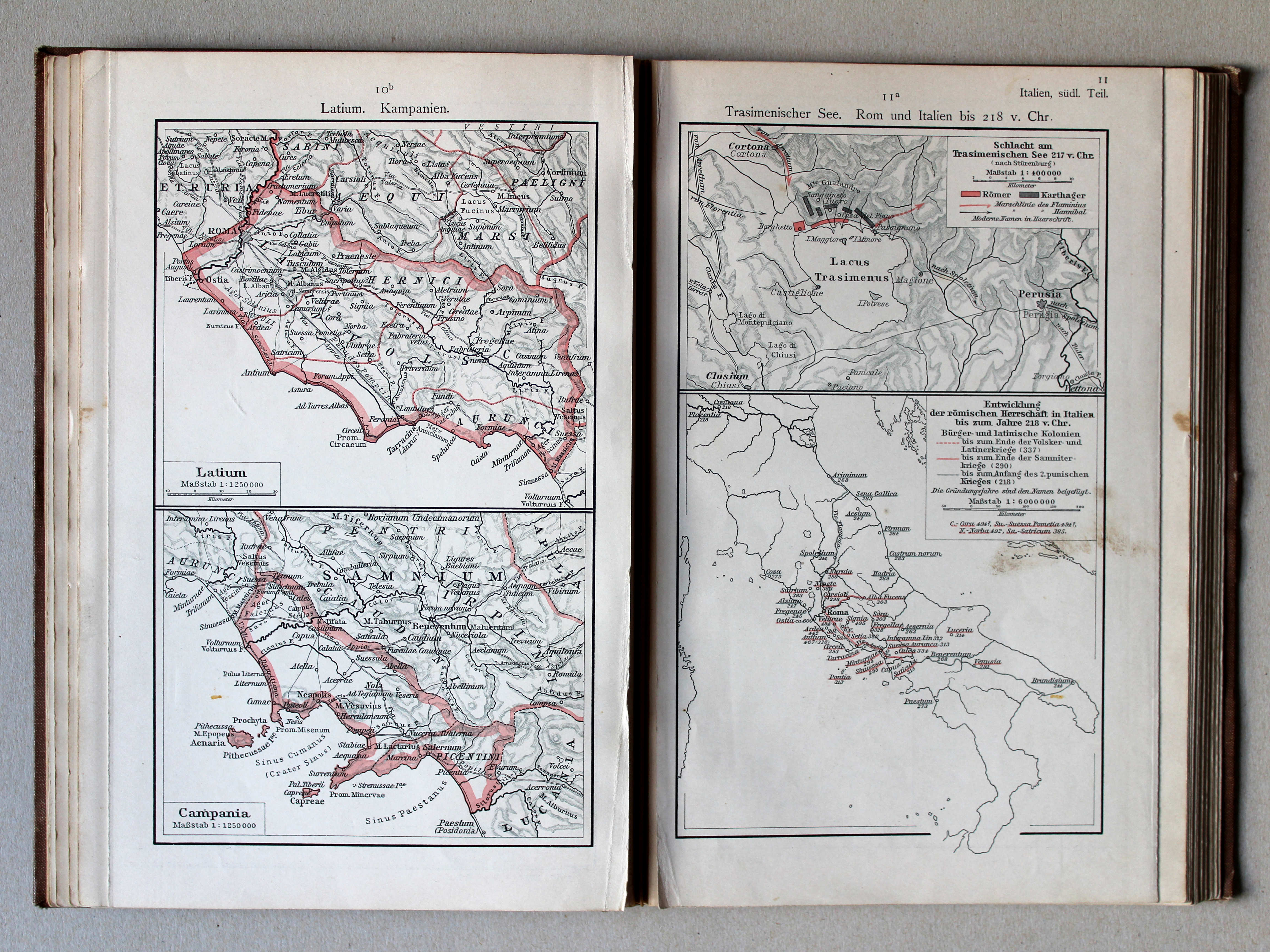
10b. Latium. Kampanien XL
Latium. Campania
11a. Trasimenischer See. Rom und Italien bis 218 v. Chr. XL
Trasimeense Meer. Rome en Italië tot 218 v. Chr. / Lake Trasimene. Rome and Italy until 218 BC
Putzgers Historischer Schul-Atlas, 1900
geen overeenkomstige kaart / no corresponding map
 Putzgers Historischer Schul-Atlas, 1900
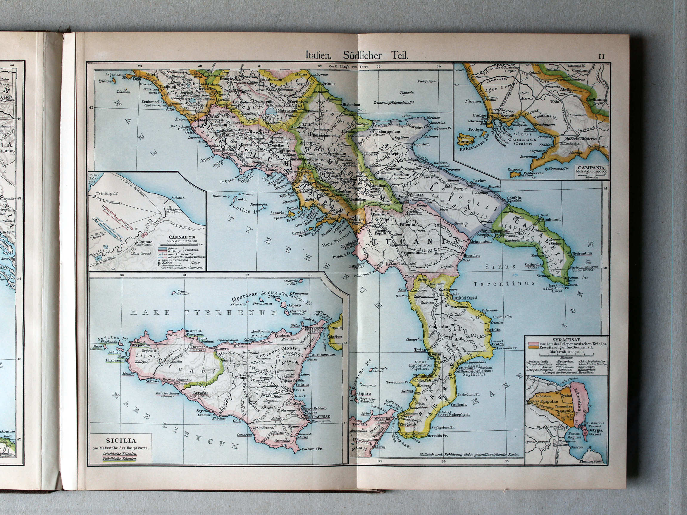
11. Italien. Südlicher Teil XL
Italië, zuidelijk deel / Italy, southern part
 Putzgers Historischer Schul-Atlas, 1900
11. Italien. Südlicher Teil XL
Italië, zuidelijk deel / Italy, southern part
 Putzgers Historischer Schul-Atlas, 1901
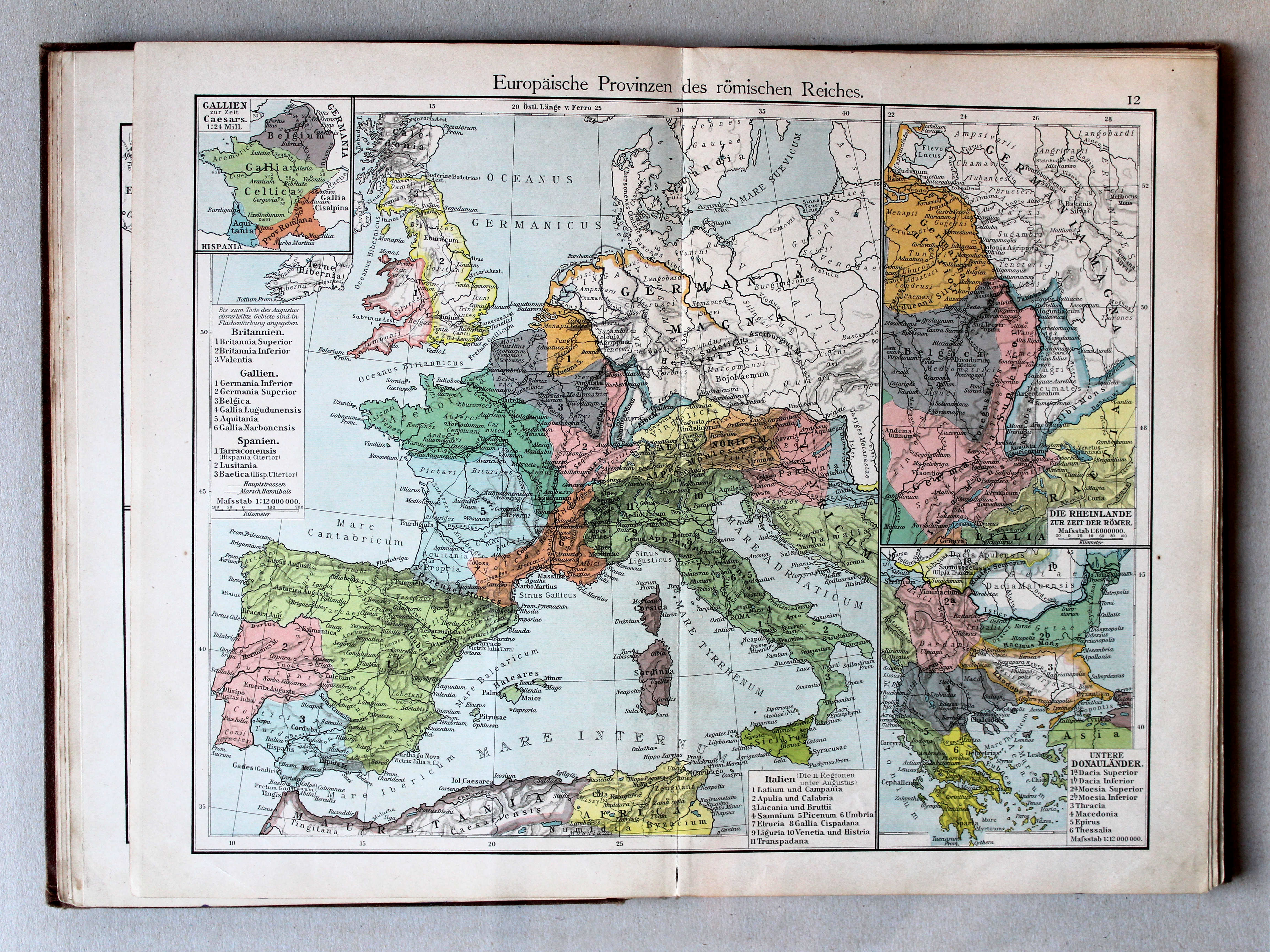
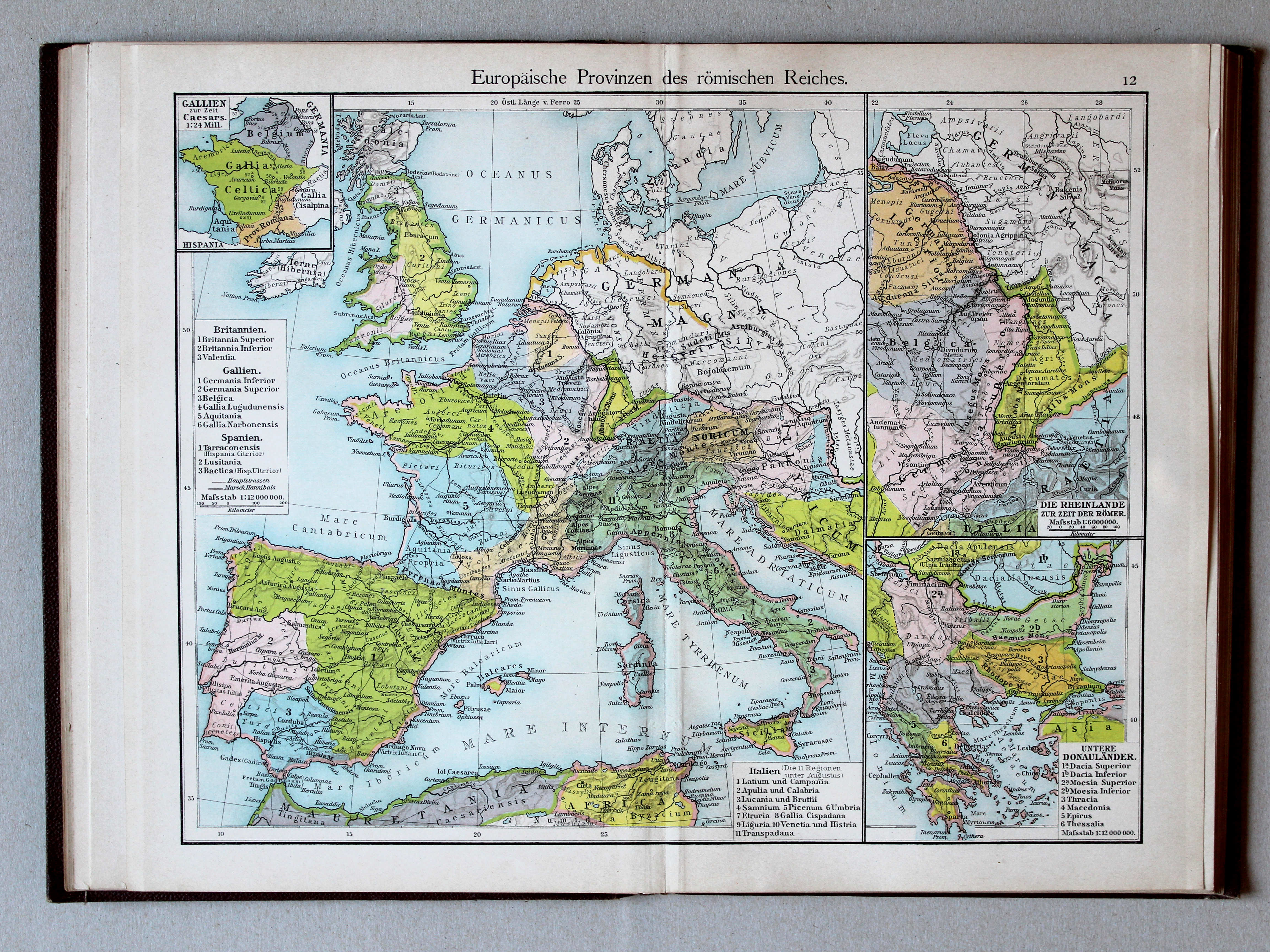
12. Europäische Provinzen des römischen Reiches XL
Europese provincies van het Romeinse Rijk / European provinces of the Roman Empire
 Putzgers Historischer Schul-Atlas, 1900
12. Europäische Provinzen des römischen Reiches XL
Europese provincies van het Romeinse Rijk / European provinces of the Roman Empire
(Middeleeuwen, Nieuwe Tijd / Middle Ages, modern history)
 Putzgers Historischer Schul-Atlas, 1901
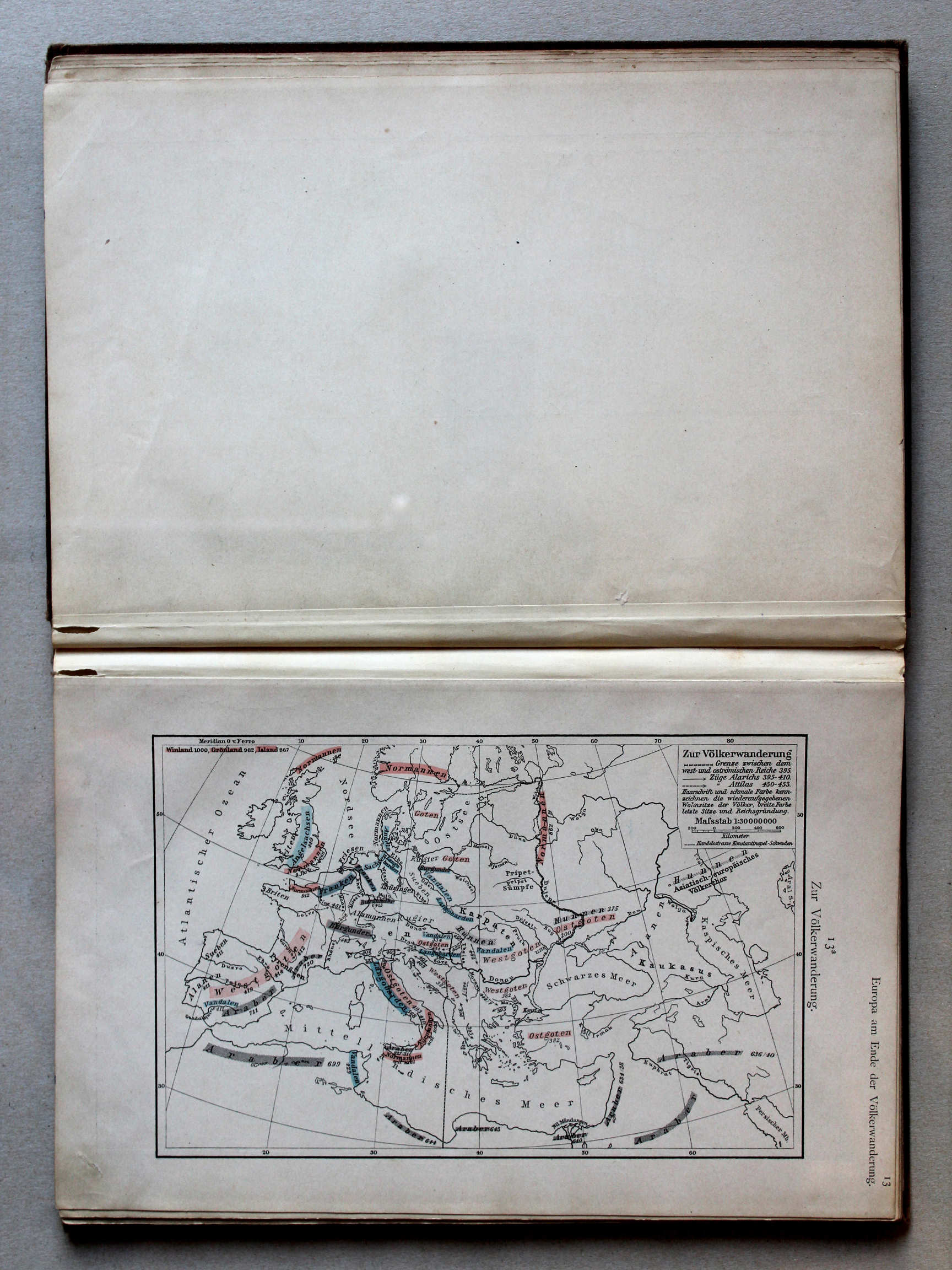
13a. Zur Völkerwanderung XL
De Volksverhuizing / The Migration Period
 Putzgers Historischer Schul-Atlas, 1900
geen overeenkomstige kaart / no corresponding map
 Putzgers Historischer Schul-Atlas, 1901
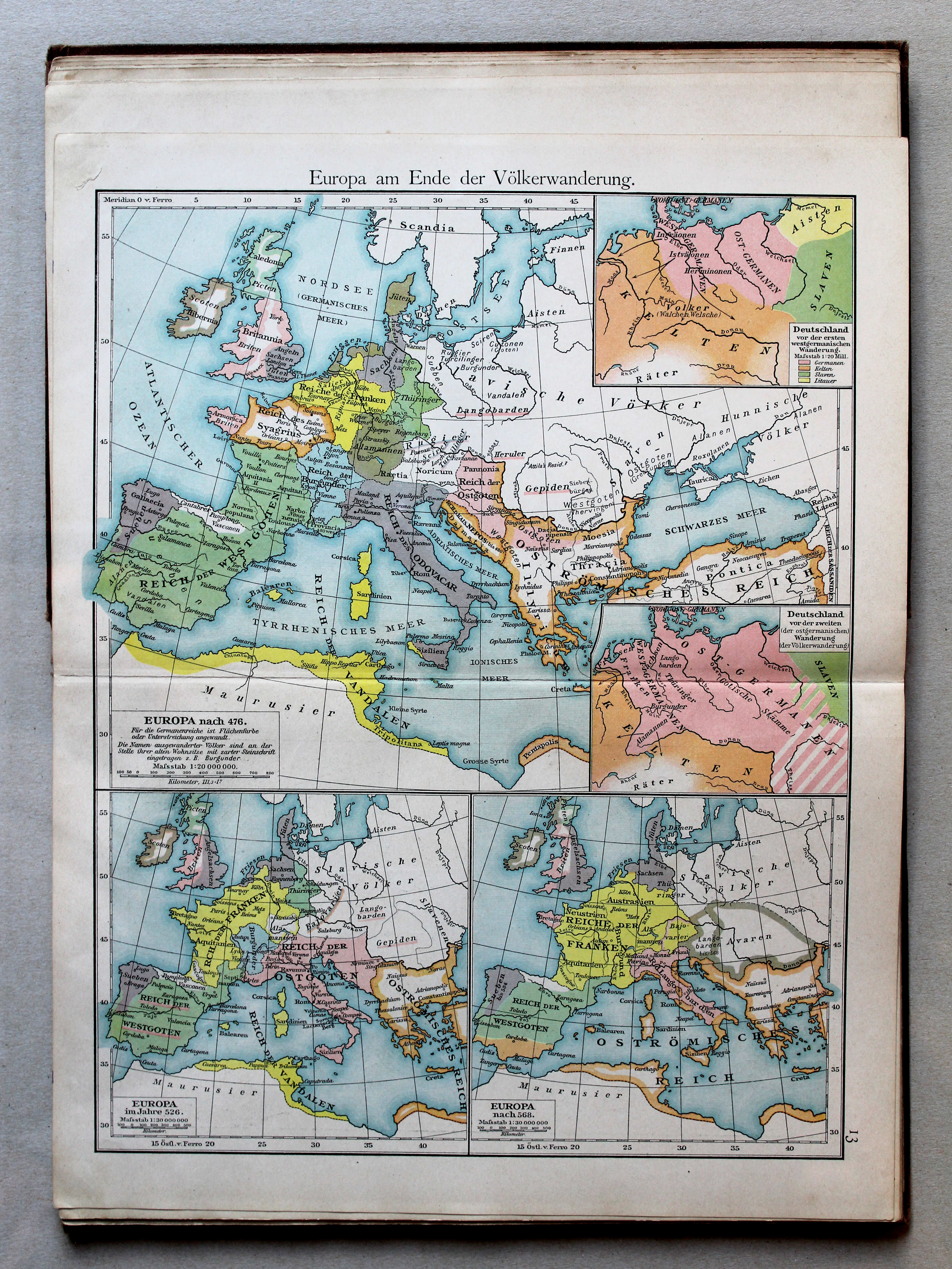
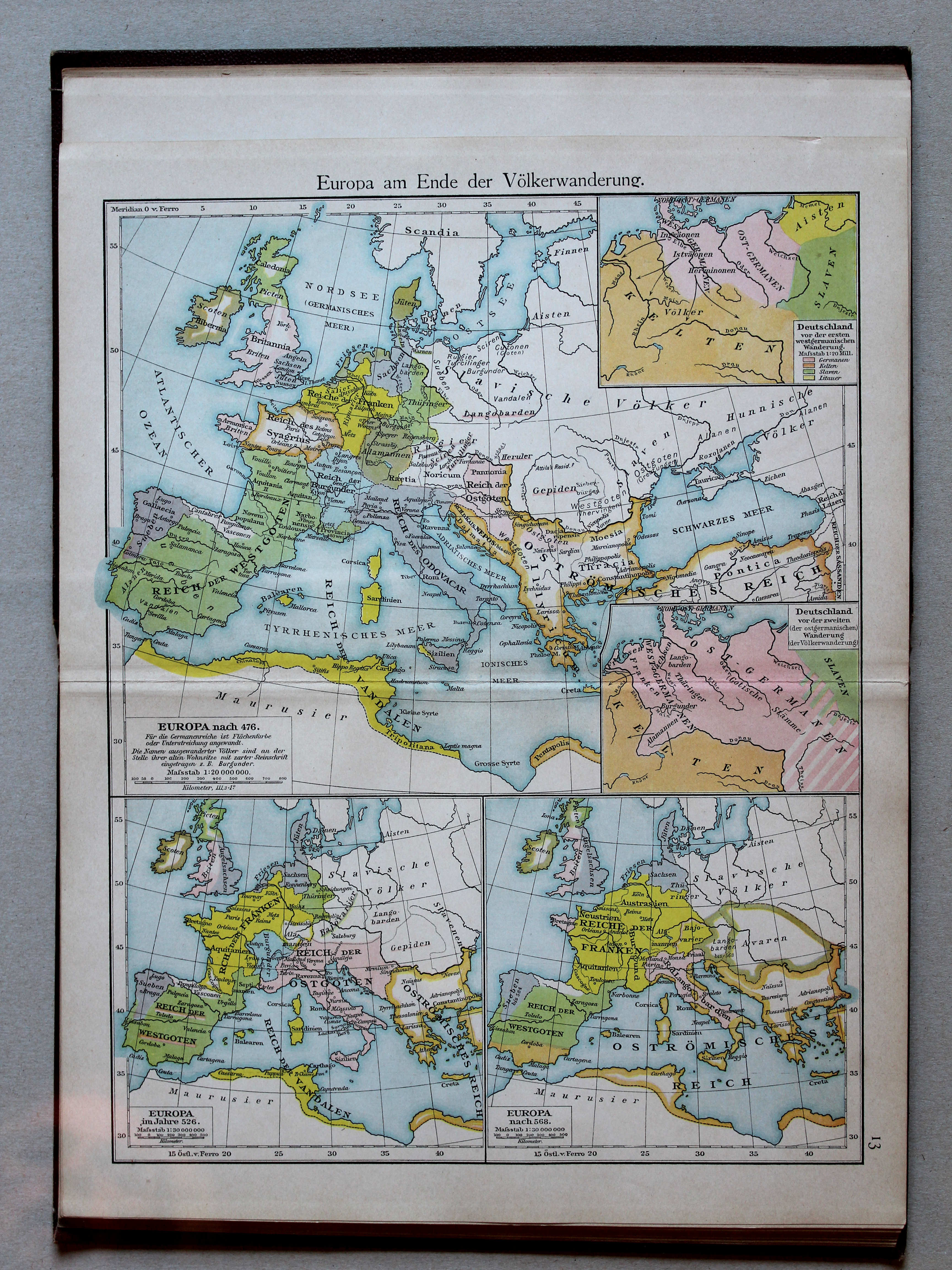
13. Europa am Ende der Völkerwanderung XL
Europa aan het einde van de Volksverhuizing / Europe at the end of the Migration Period
 Putzgers Historischer Schul-Atlas, 1900
13. Europa am Ende der Völkerwanderung XL
Europa aan het einde van de Volksverhuizing / Europe at the end of the Migration Period
 Putzgers Historischer Schul-Atlas, 1901
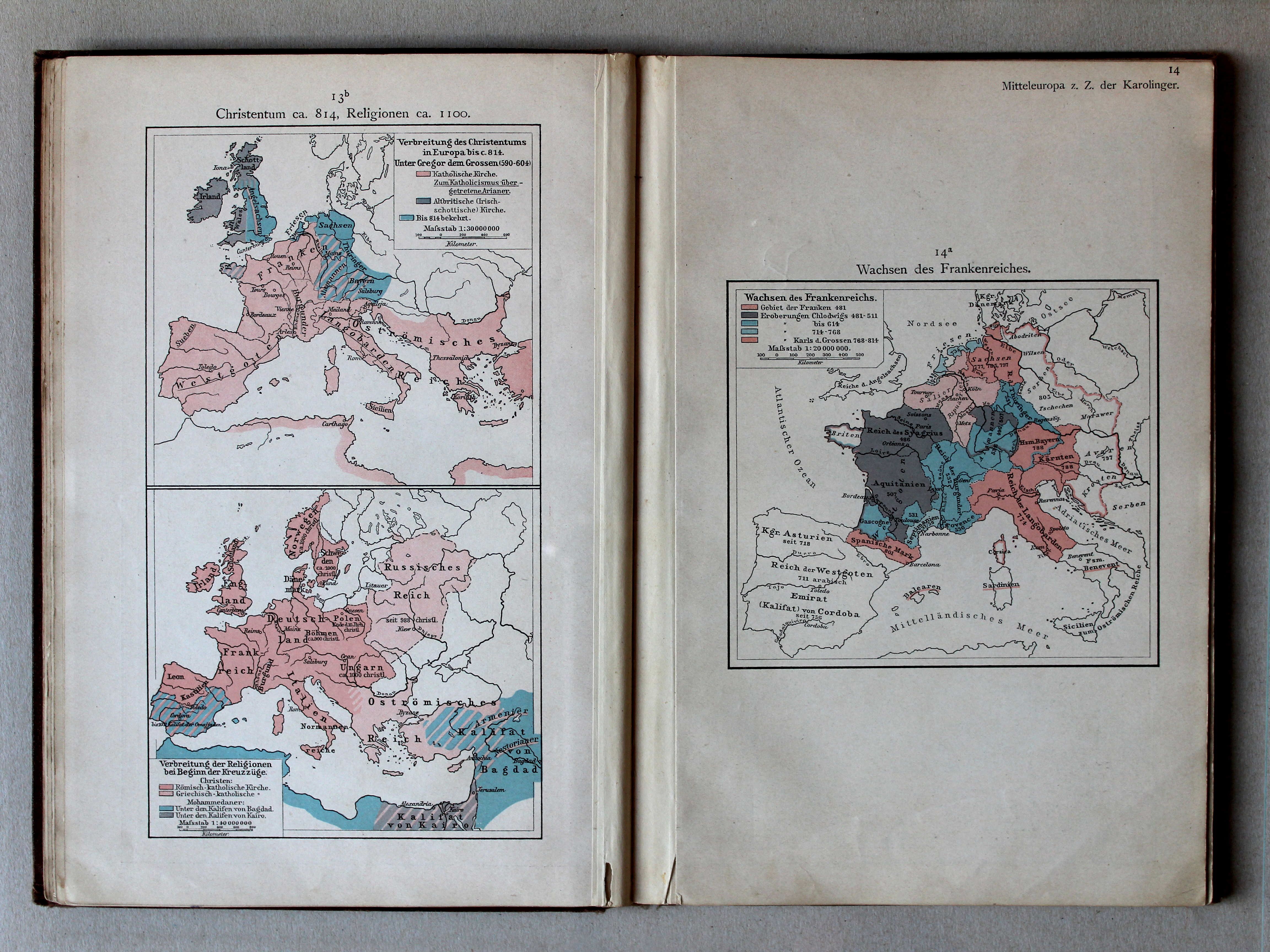
13b. Christentum ca. 814, Religionen ca. 1100 XL
Christendom ca. 814, godsdiensten ca. 1100 / Christianity ca. 814, religions ca. 1100
14a. Wachsen des Frankenreiches XL
Groei van het Frankische Rijk / Growth of the Frankish Empire
Putzgers Historischer Schul-Atlas, 1900
geen overeenkomstige kaart / no corresponding map
 Putzgers Historischer Schul-Atlas, 1901
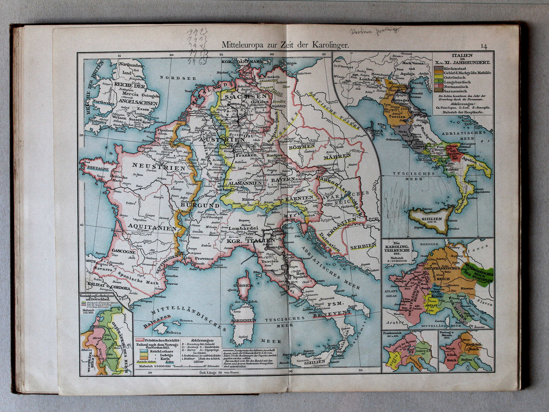
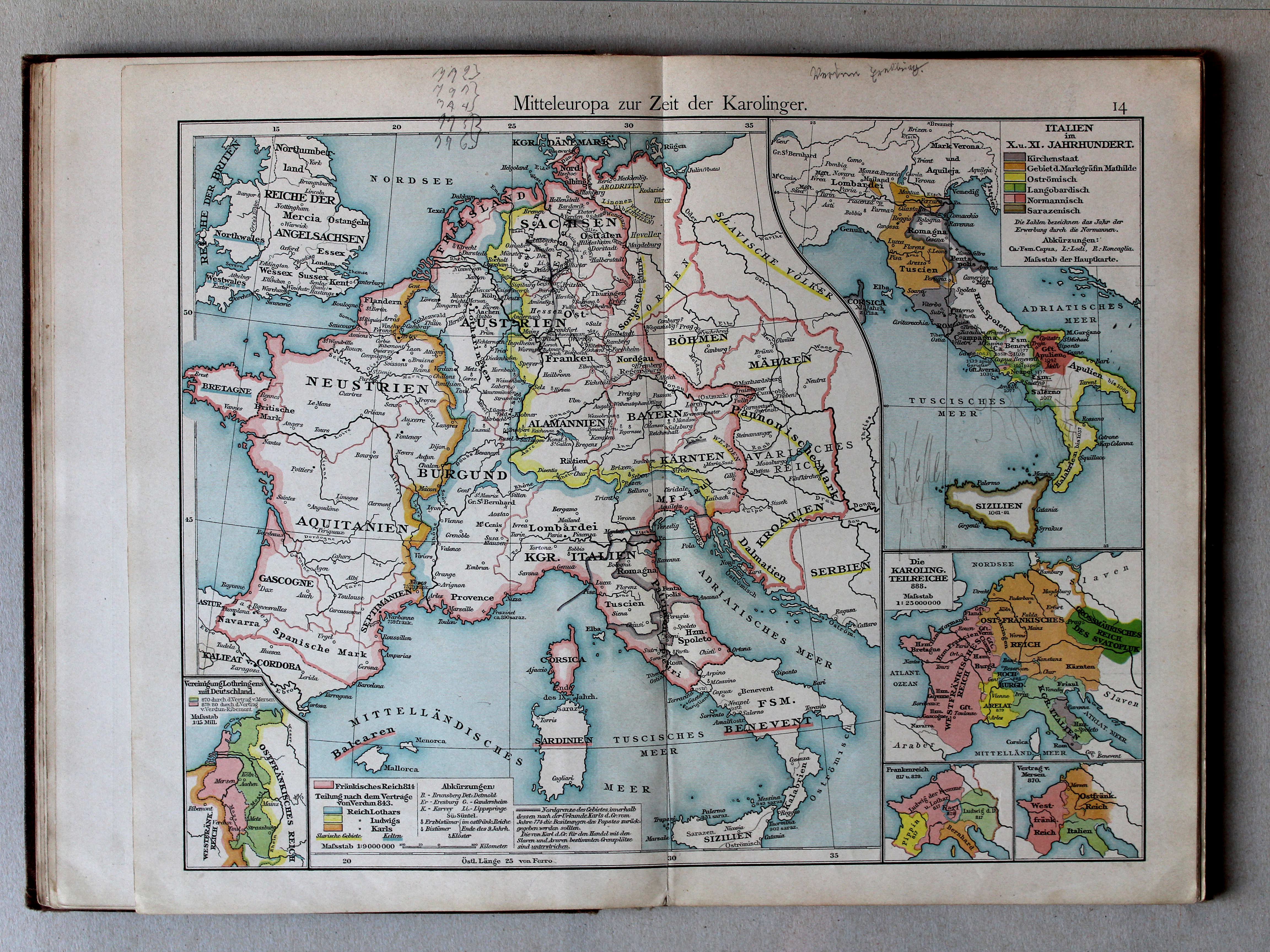
14. Mitteleuropa zur Zeit der Karolinger XL
Midden-Europa in de tijd van de Karolingen / Central Europe during the Carolingian dynasty
 Putzgers Historischer Schul-Atlas, 1900
14. Mitteleuropa zur Zeit der Karolinger XL
Midden-Europa in de tijd van de Karolingen / Central Europe during the Carolingian dynasty
 Putzgers Historischer Schul-Atlas, 1901
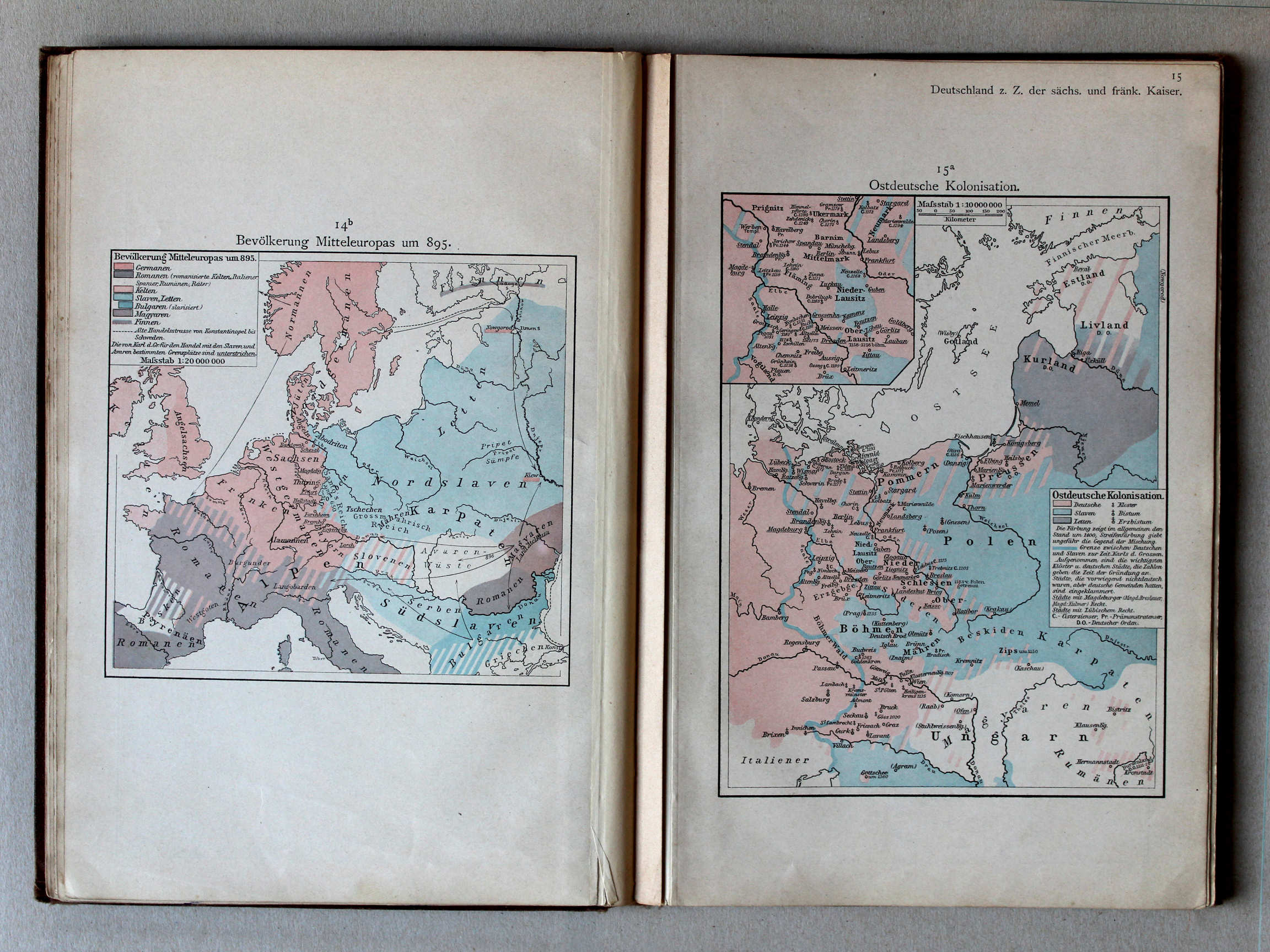
14b. Bevölkerung Mitteleuropas um 895 XL
Volkeren in Midden-Europa rond 895 / Nations in Central Europa around 895
15a. Ostdeutsche Kolonisation XL
Duitse kolonisatie naar het oosten / German colonization towards the east
Putzgers Historischer Schul-Atlas, 1900
geen overeenkomstige kaart / no corresponding map
 Putzgers Historischer Schul-Atlas, 1901
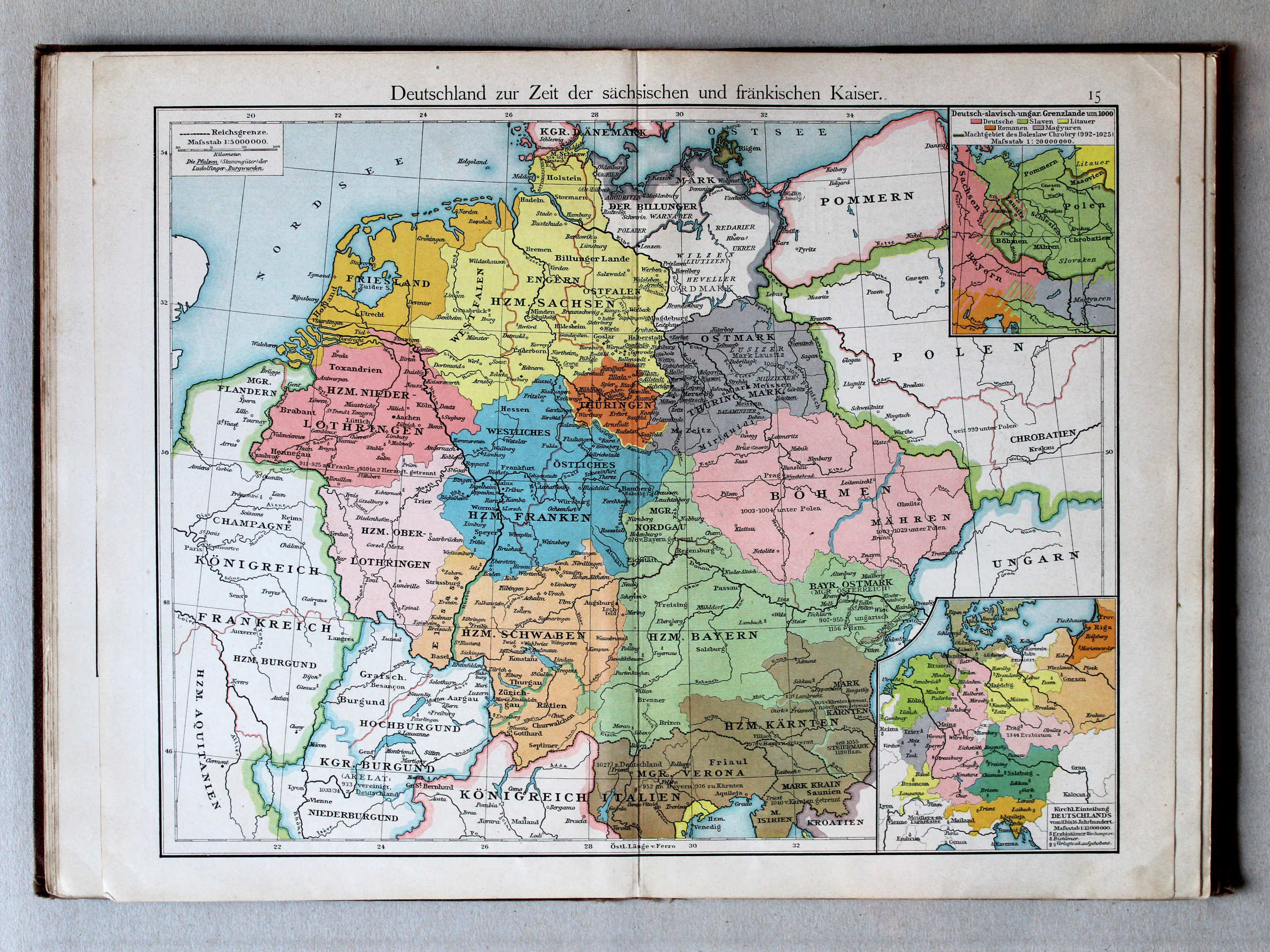
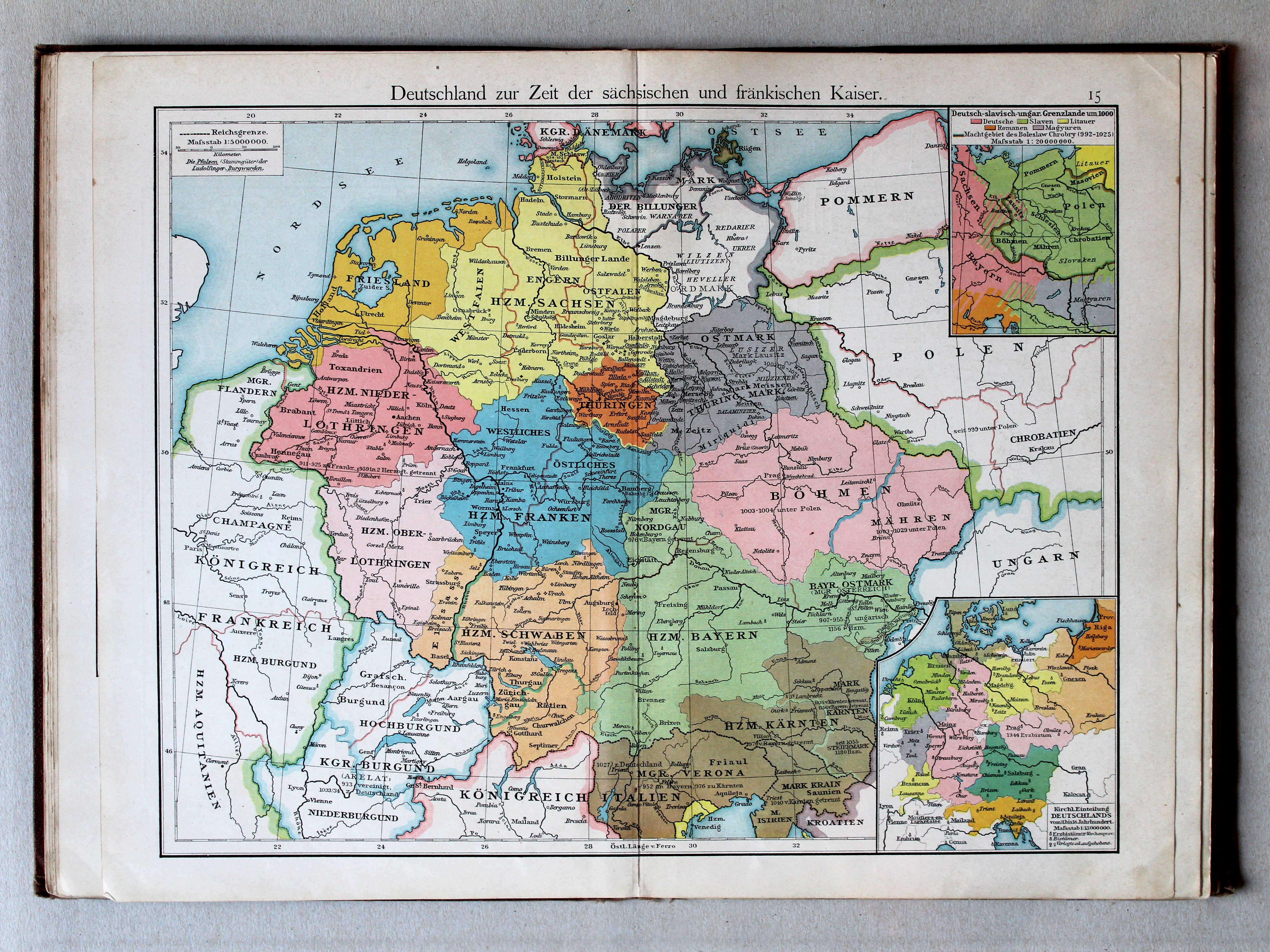
15. Deutschland zur Zeit der sächsischen und fränkischen Kaiser XL
Duitsland in de tijd van de Saksische en Frankische keizers / Germany during the Saxon and Frankish dynasties
 Putzgers Historischer Schul-Atlas, 1900
15. Deutschland zur Zeit der sächsischen und fränkischen Kaiser XL
Duitsland in de tijd van de Saksische en Frankische keizers / Germany during the Saxon and Frankish dynasties
 Putzgers Historischer Schul-Atlas, 1901
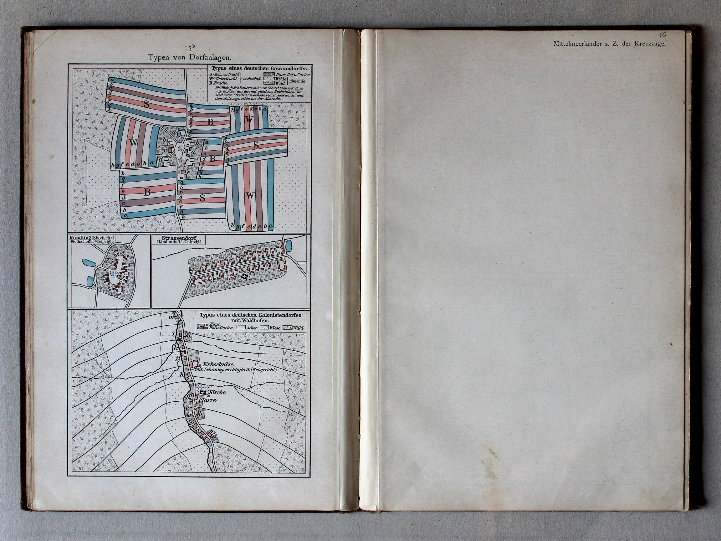
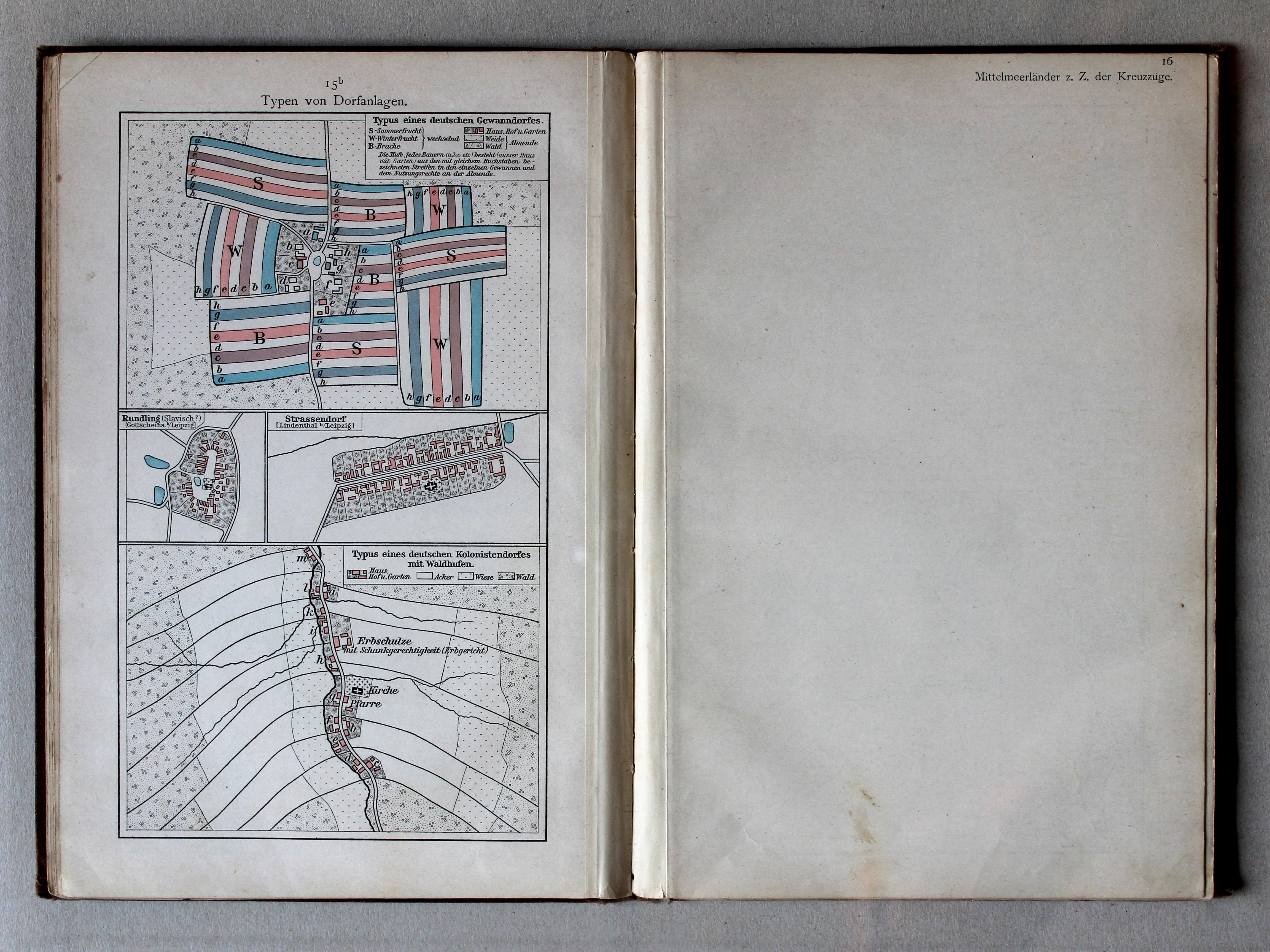
15b. Typen von Dorfanlagen XL
Enkele dorpstypen / Some village types
Putzgers Historischer Schul-Atlas, 1900
geen overeenkomstige kaart / no corresponding map
 Putzgers Historischer Schul-Atlas, 1901
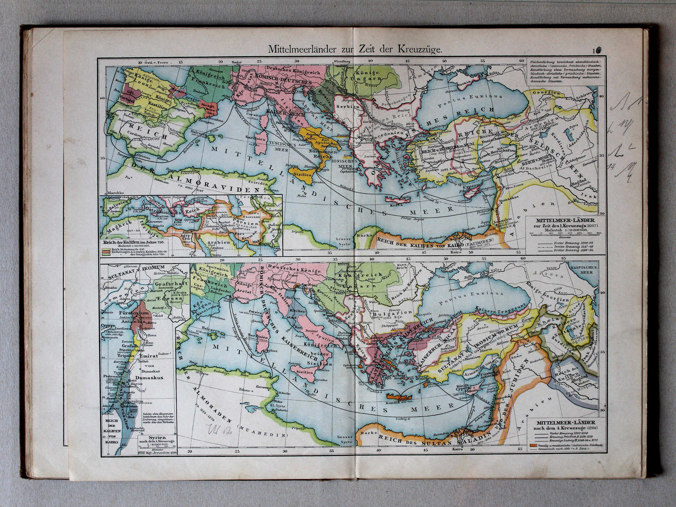
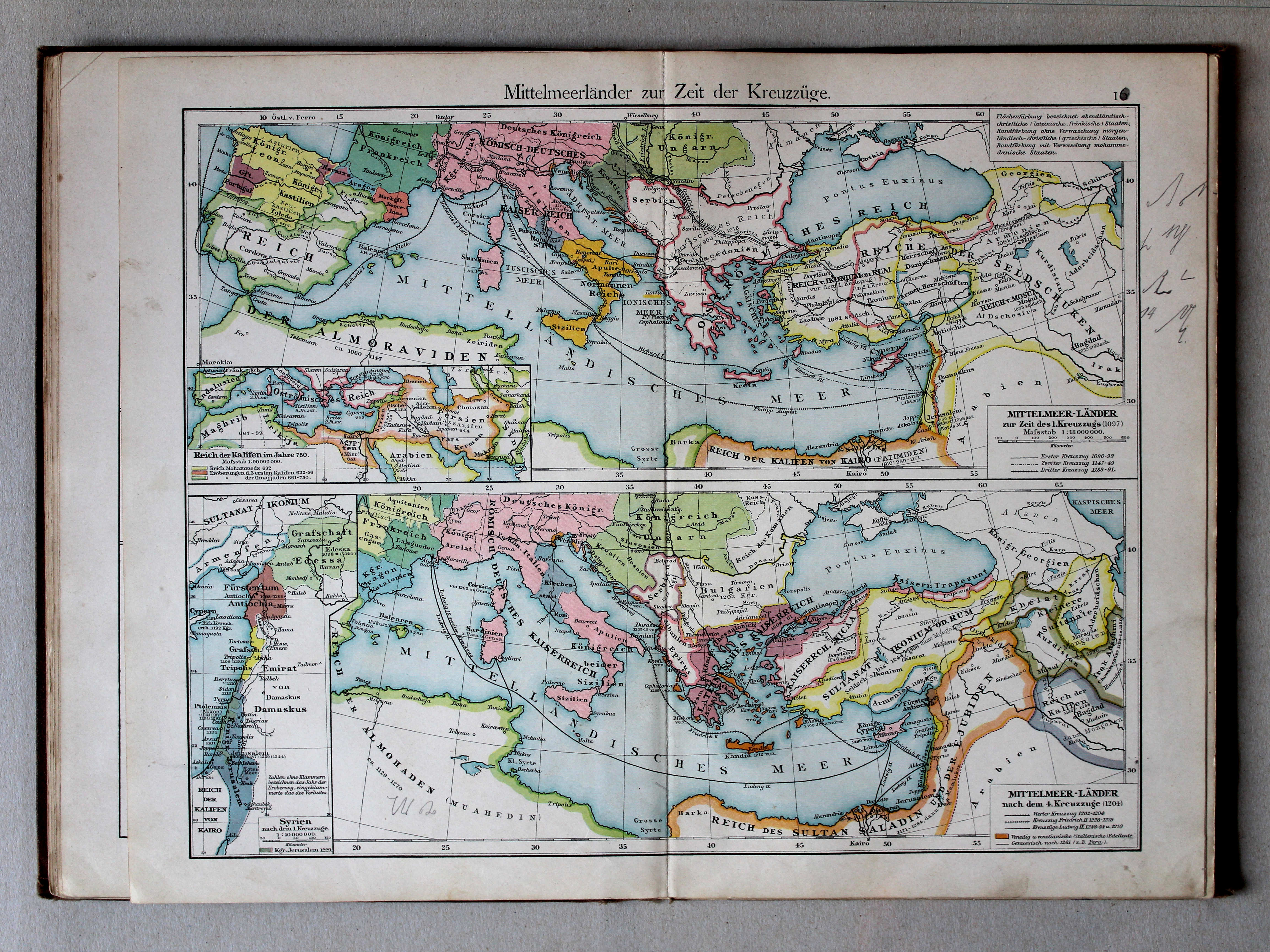
16. Mittelmeerländer zur Zeit der Kreuzzüge XL
Het Middellandse Zeegebied in de tijd van de Kruistochten / The Mediterranean region during the Crusades
 Putzgers Historischer Schul-Atlas, 1900
16. Mittelmeerländer zur Zeit der Kreuzzüge XL
Het Middellandse Zeegebied in de tijd van de Kruistochten / The Mediterranean region during the Crusades
 Putzgers Historischer Schul-Atlas, 1901
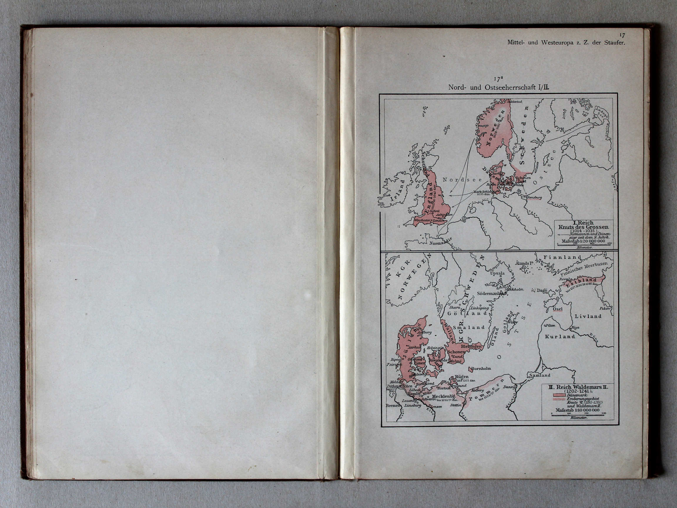
17a. Nord- und Ostseeherrschaft I/II XL
Heerschappij rond de Noord- en Oostzee I/II / Rule in the North Sea and Baltic region I/II
Putzgers Historischer Schul-Atlas, 1900
geen overeenkomstige kaart / no corresponding map
 Putzgers Historischer Schul-Atlas, 1901
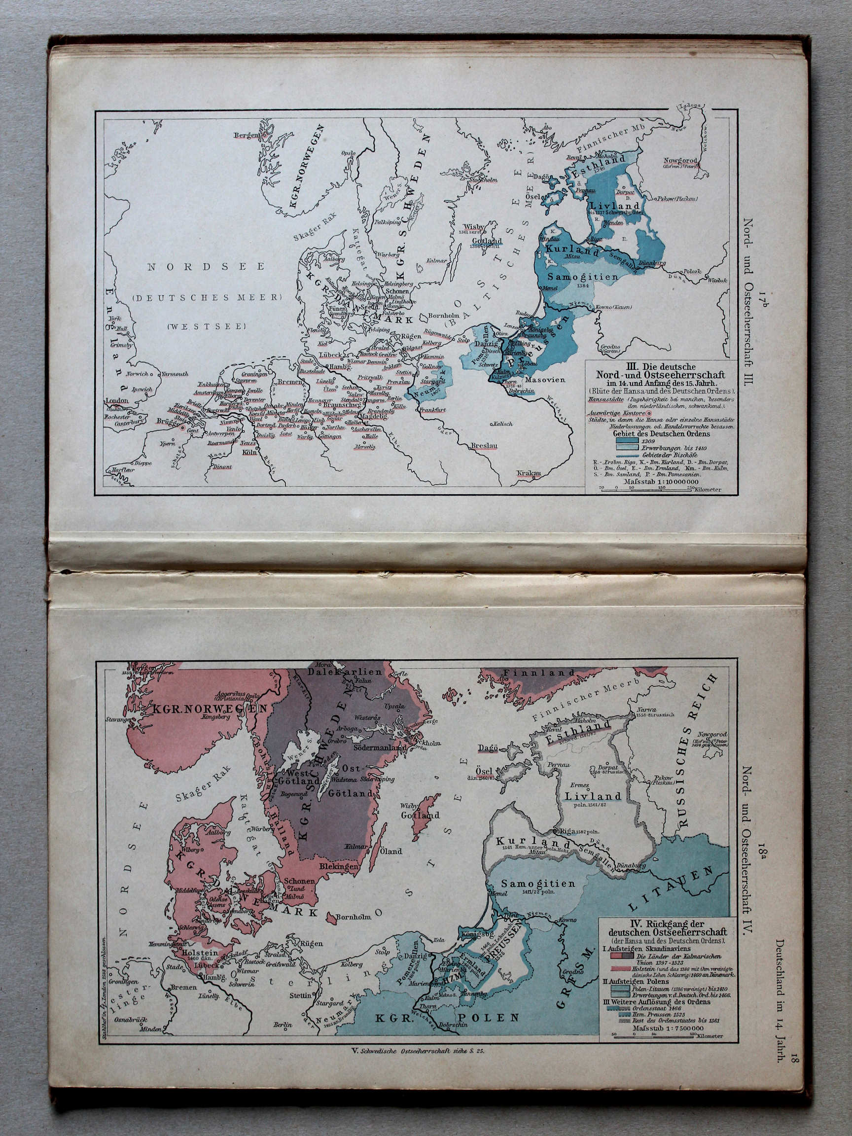
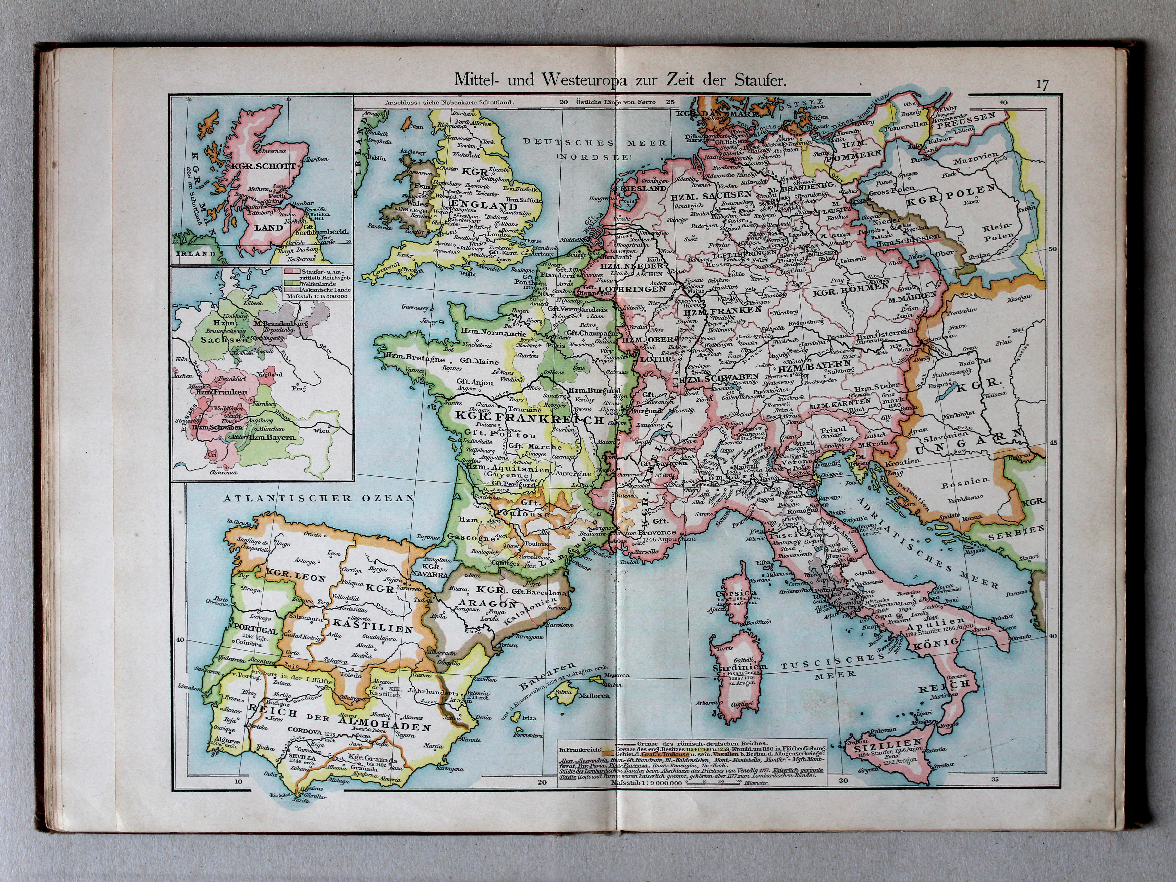
17. Mittel- und Westeuropa zur Zeit der Staufer XL
Midden- en West-Europa in de tijd van de Hohenstaufen / Central and Western Europe during the House of Hohenstaufen
 Putzgers Historischer Schul-Atlas, 1900
17. Mittel- und Westeuropa zur Zeit der Staufer XL
Midden- en West-Europa in de tijd van de Hohenstaufen / Central and Western Europe during the House of Hohenstaufen
 Putzgers Historischer Schul-Atlas, 1901
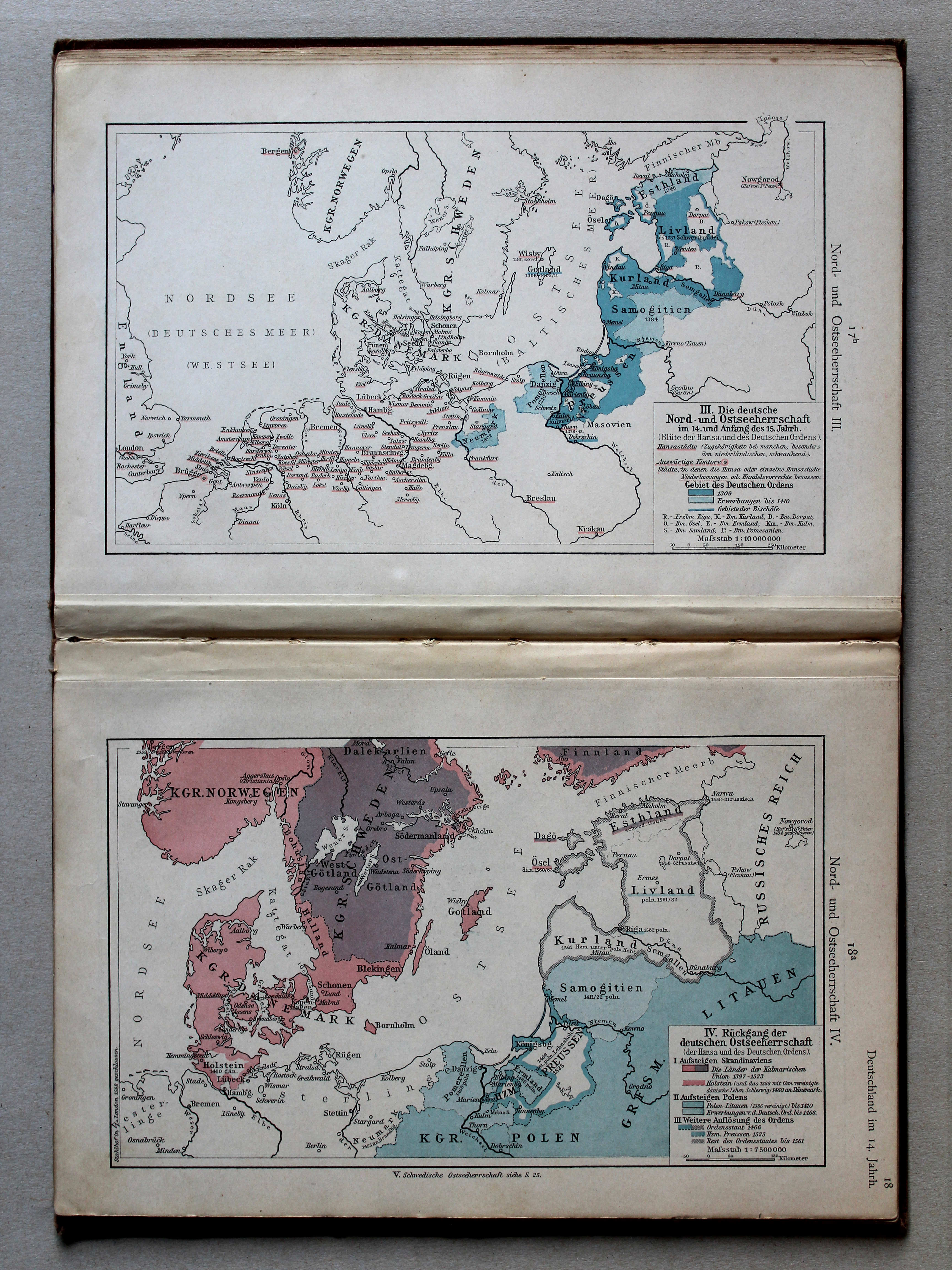
17b. Nord- und Ostseeherrschaft III XL
Heerschappij rond de Noord- en Oostzee III / Rule in the North Sea and Baltic region III
18a. Nord- und Ostseeherrschaft IV XL
Heerschappij rond de Noord- en Oostzee IV / Rule in the North Sea and Baltic region IV
Putzgers Historischer Schul-Atlas, 1900
geen overeenkomstige kaart / no corresponding map
 Putzgers Historischer Schul-Atlas, 1901
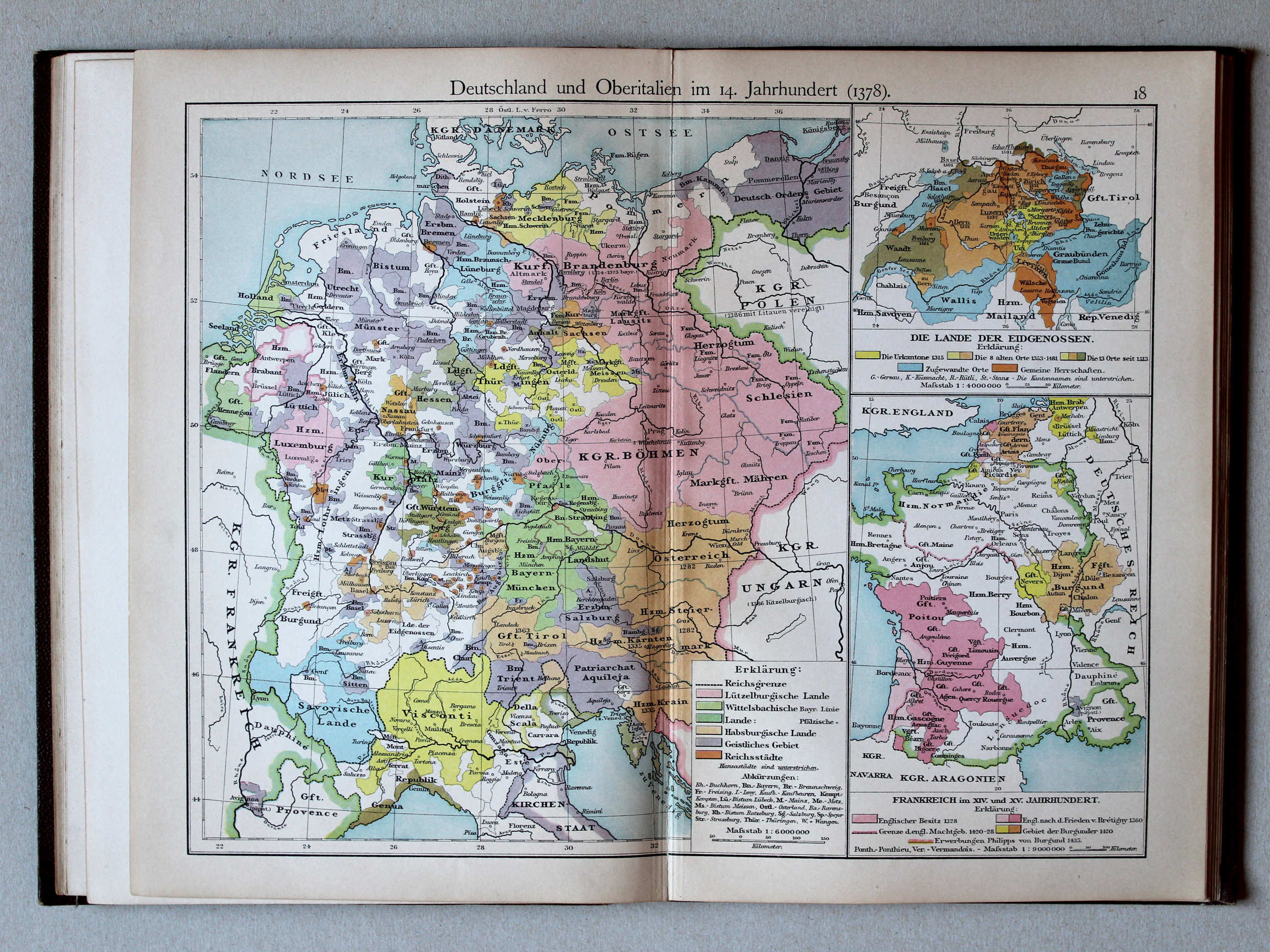
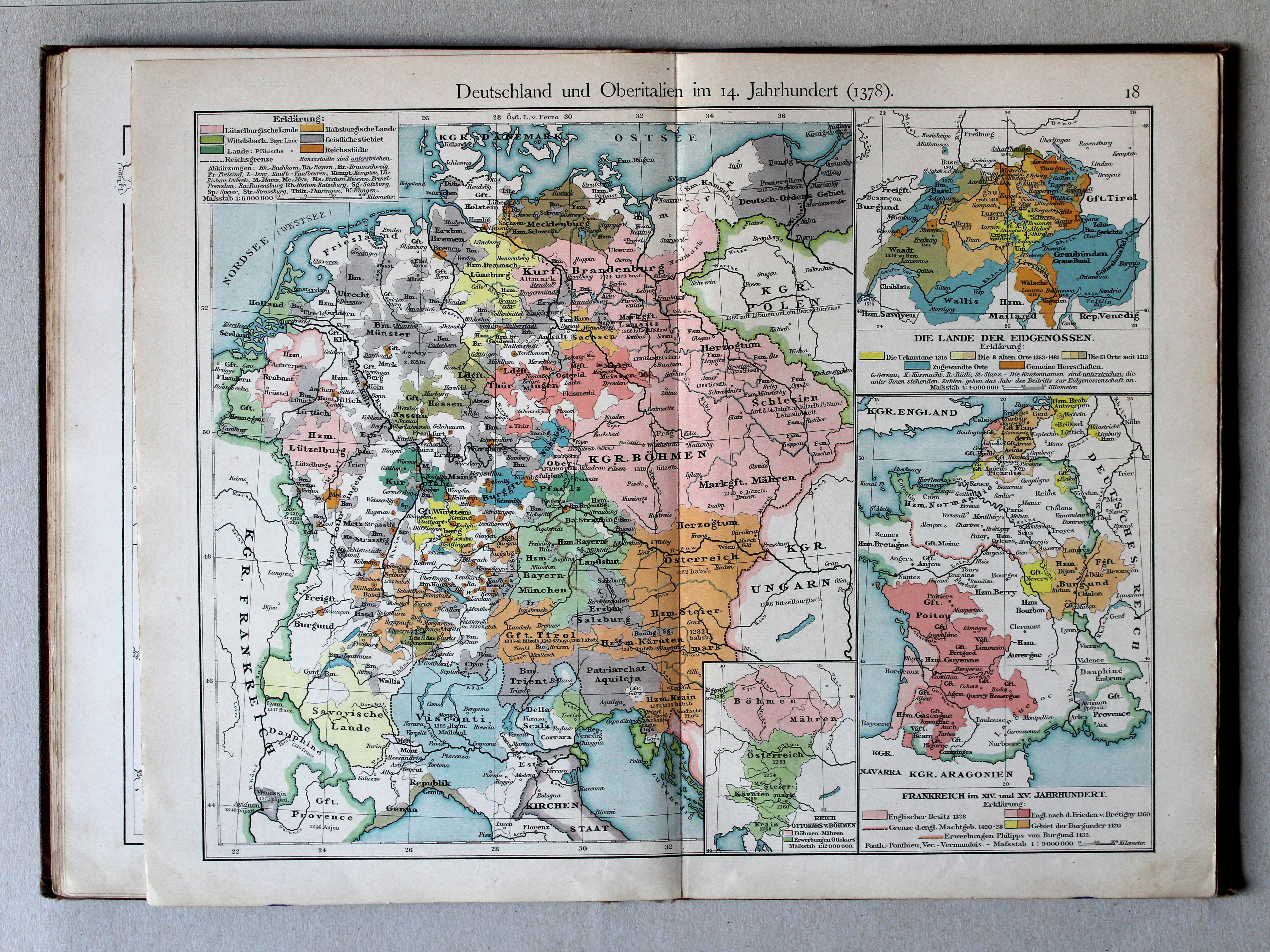
18. Deutschland und Oberitalien im 14. Jahrhundert (1378) XL
Duitsland en Noord-Italië in de 14e eeuw (1378) / Germany and Northern Italy in the 14th century (1378)
 Putzgers Historischer Schul-Atlas, 1900
18. Deutschland und Oberitalien im 14. Jahrhundert (1378) XL
Duitsland en Noord-Italië in de 14e eeuw (1378) / Germany and Northern Italy in the 14th century (1378)
 Putzgers Historischer Schul-Atlas, 1901
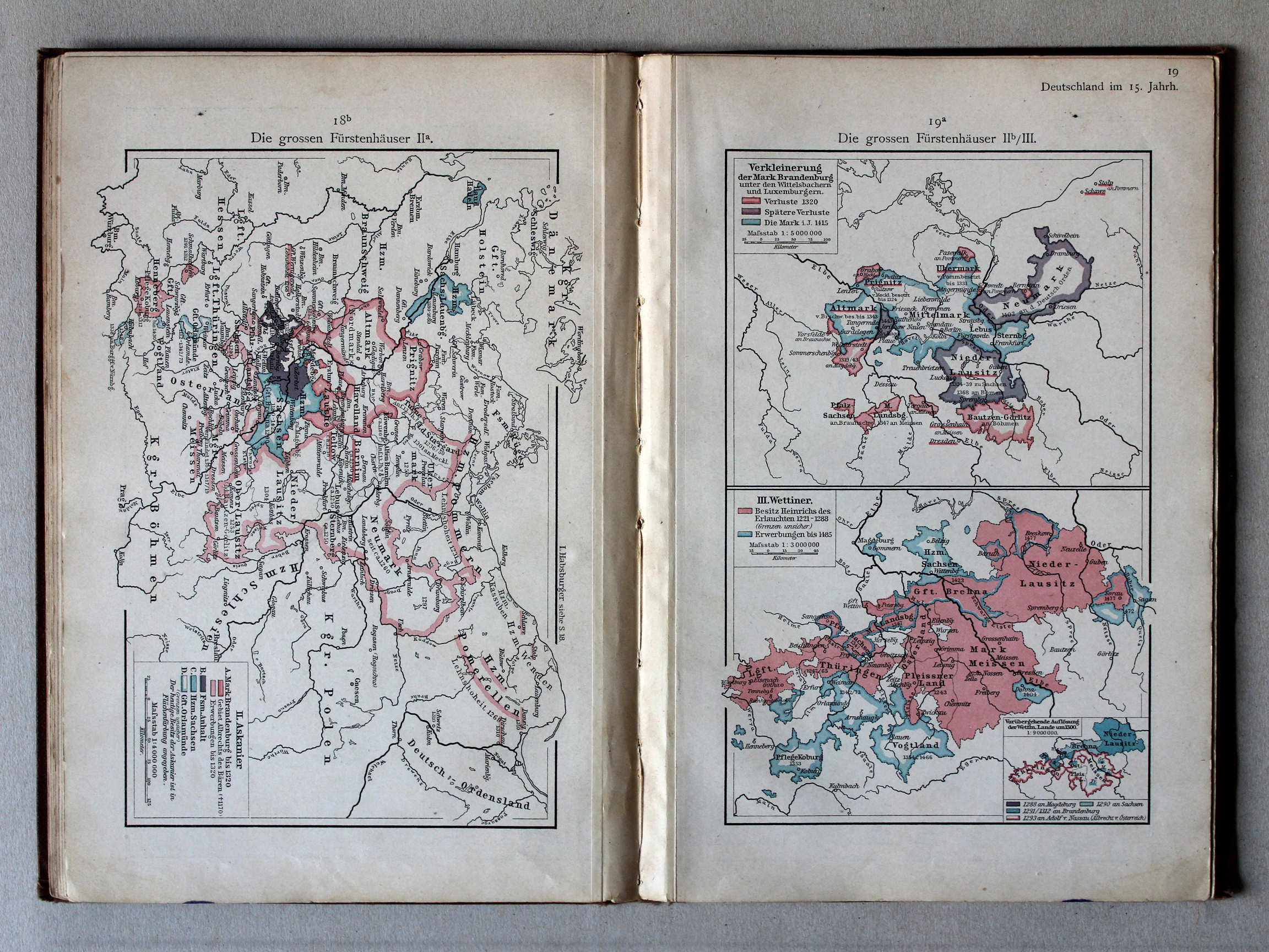
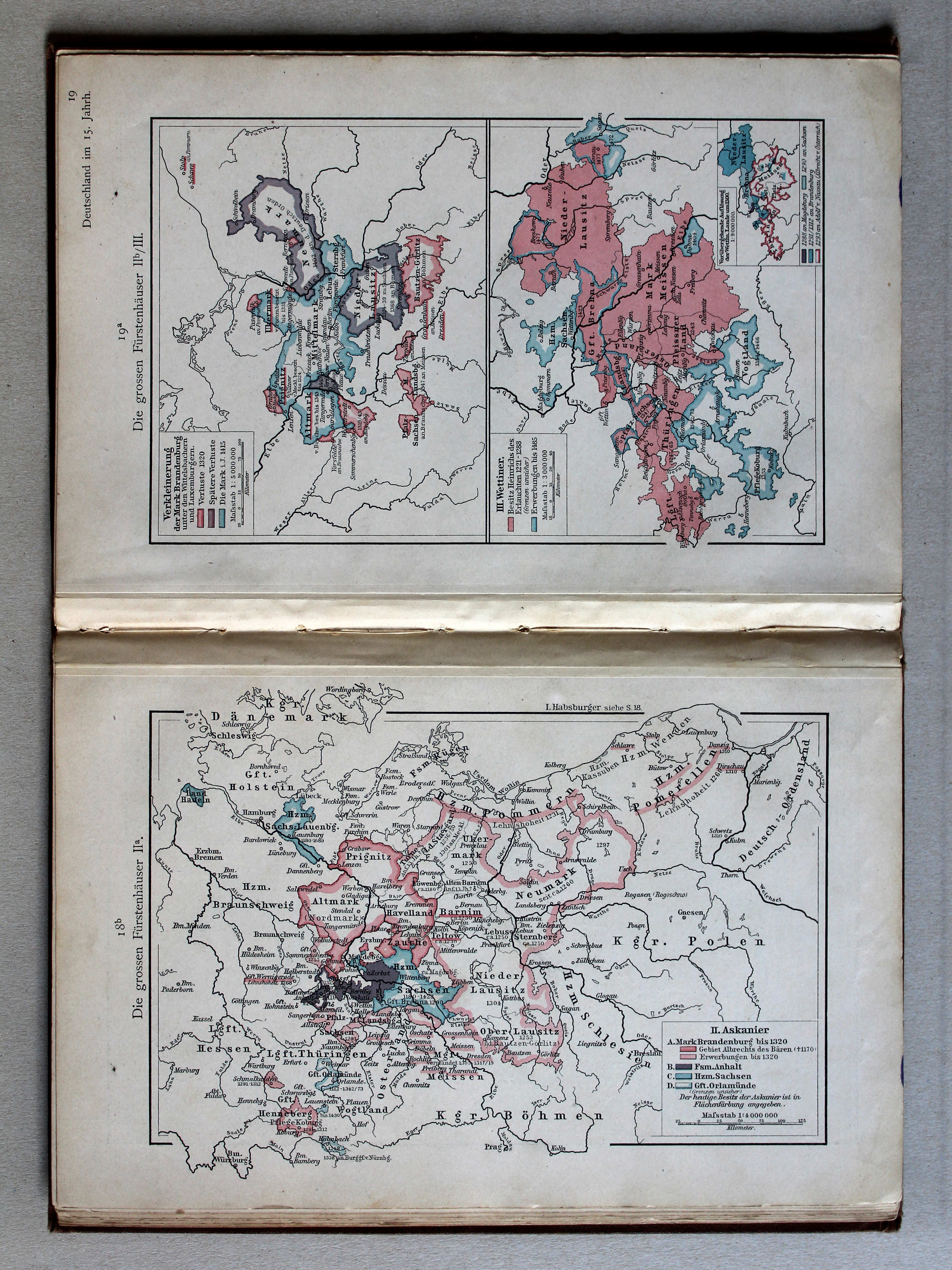
18b. Die grossen Fürstenhäuser IIa XL
De grote dynastieën IIa / The great dynasties IIa
Putzgers Historischer Schul-Atlas, 1900
geen overeenkomstige kaart / no corresponding map
 Putzgers Historischer Schul-Atlas, 1901
19a. Die grossen Fürstenhäuser IIb/III XL
De grote dynastieën IIb/III / The great dynasties IIb/III
Putzgers Historischer Schul-Atlas, 1900
geen overeenkomstige kaart / no corresponding map
 Putzgers Historischer Schul-Atlas, 1901
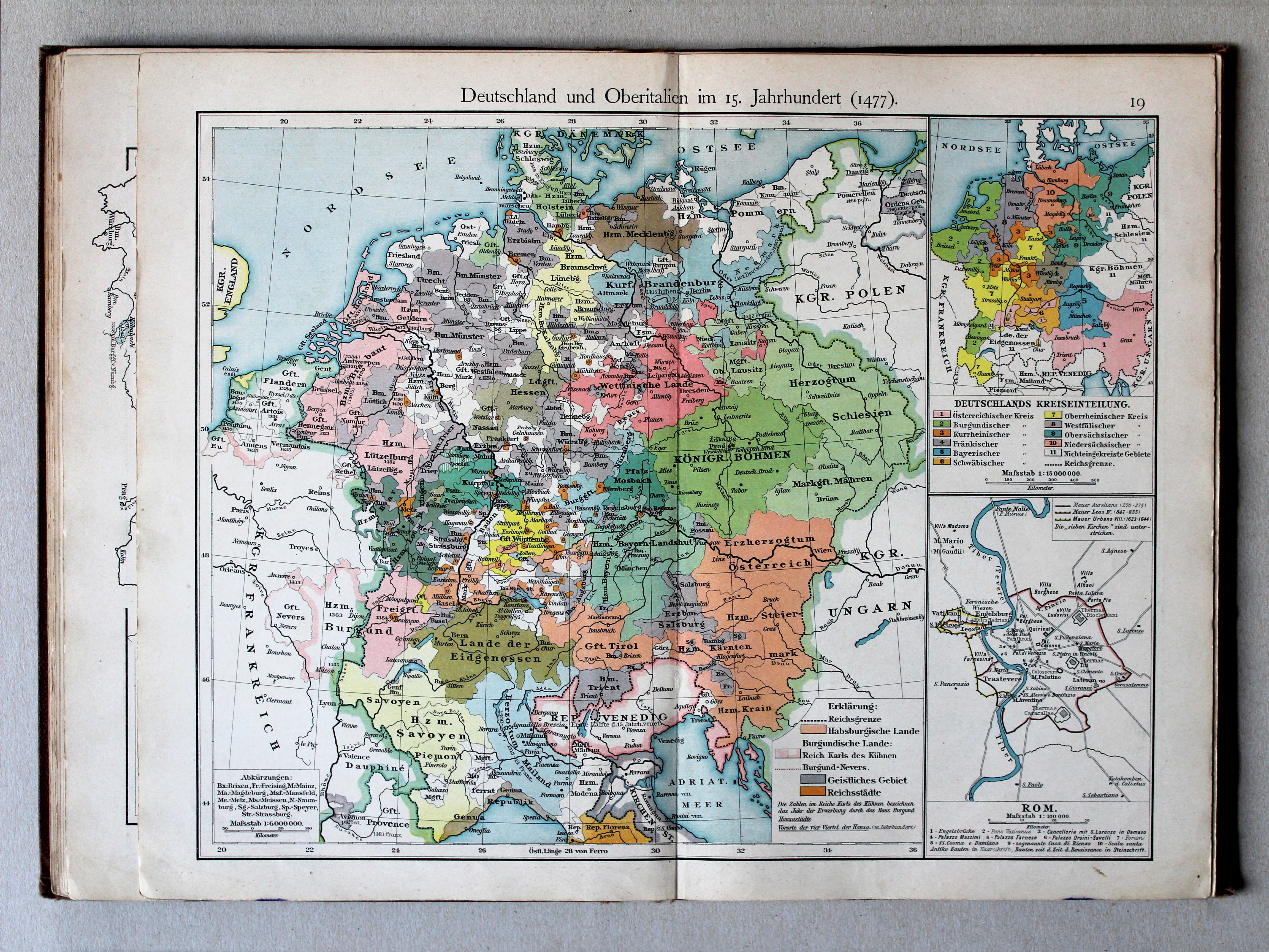
19. Deutschland und Oberitalien im 15. Jahrhundert (1477) XL
Duitsland en Noord-Italië in de 15e eeuw (1477) / Germany and Northern Italy in the 15th century (1477)
 Putzgers Historischer Schul-Atlas, 1900
19. Deutschland und Oberitalien im 15. Jahrhundert (1477) XL
Duitsland en Noord-Italië in de 15e eeuw (1477) / Germany and Northern Italy in the 15th century (1477)
 Putzgers Historischer Schul-Atlas, 1901
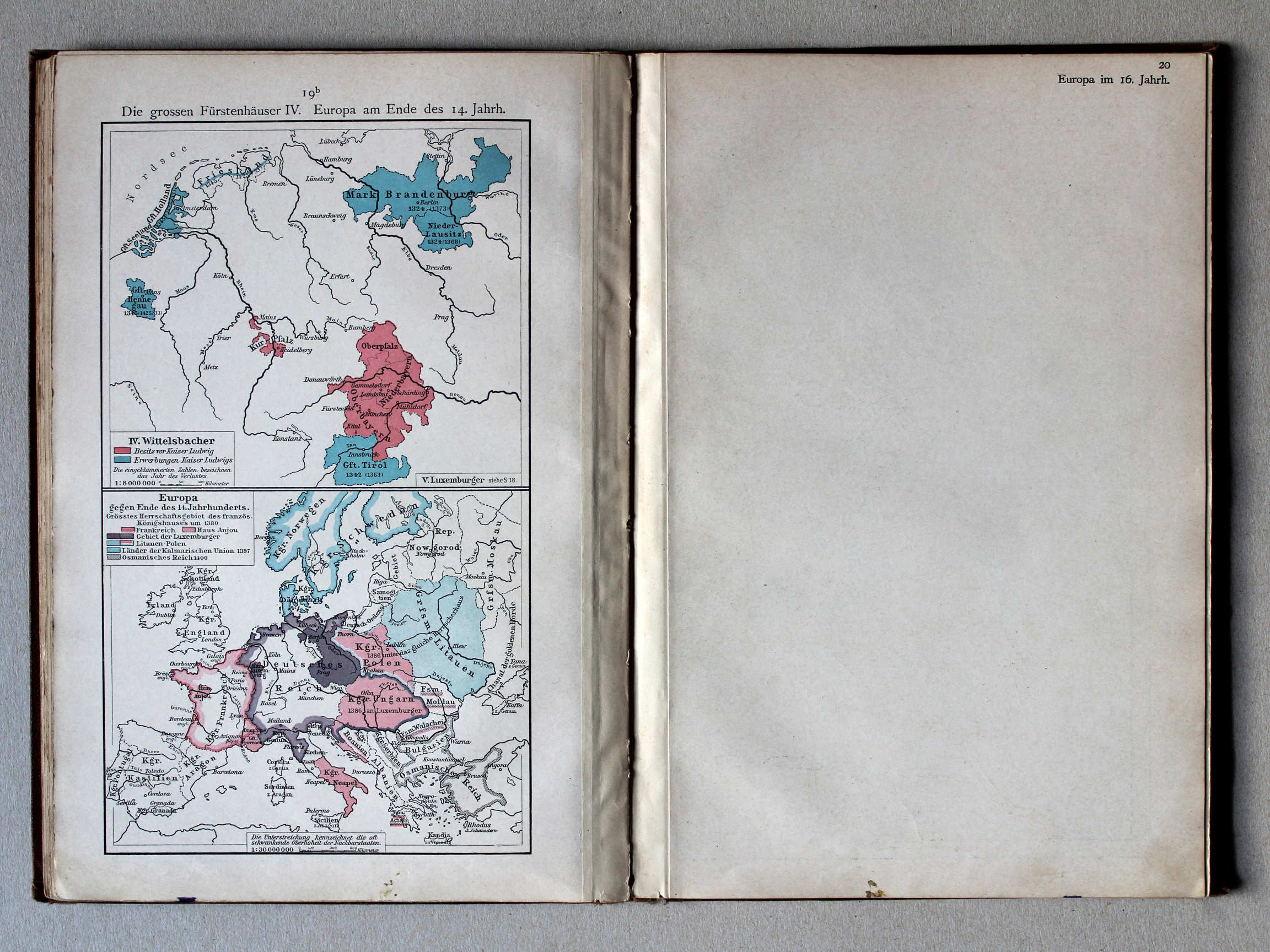
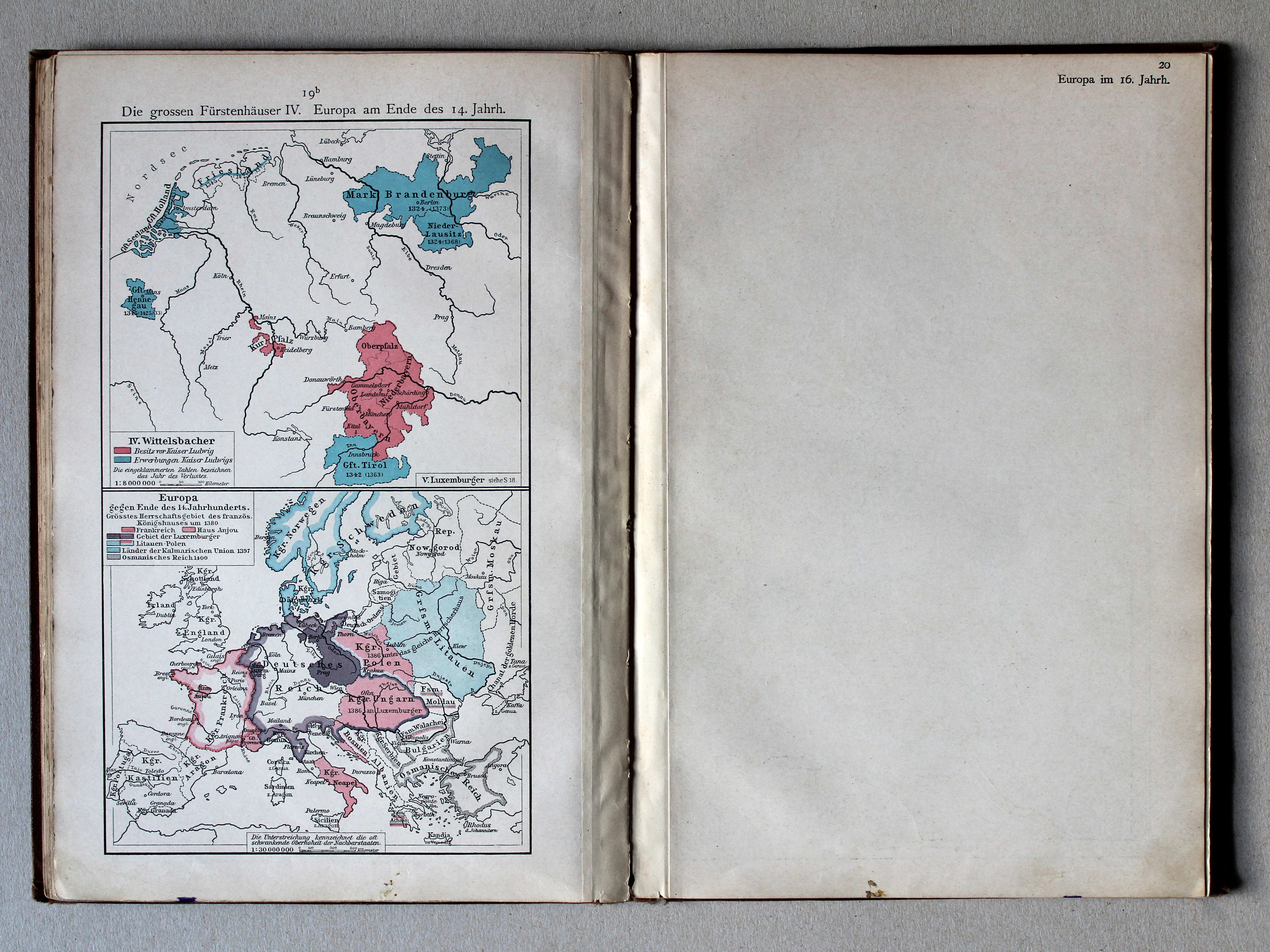
19b. Die grossen Fürstenhäuser IV. Europa am Ende des 14. Jahrh. XL
De grote dynastieën IV. Europa aan het eind van de 14e eeuw / The great dynasties IV. Europe at the end of the 14th century
Putzgers Historischer Schul-Atlas, 1900
geen overeenkomstige kaart / no corresponding map
 Putzgers Historischer Schul-Atlas, 1901
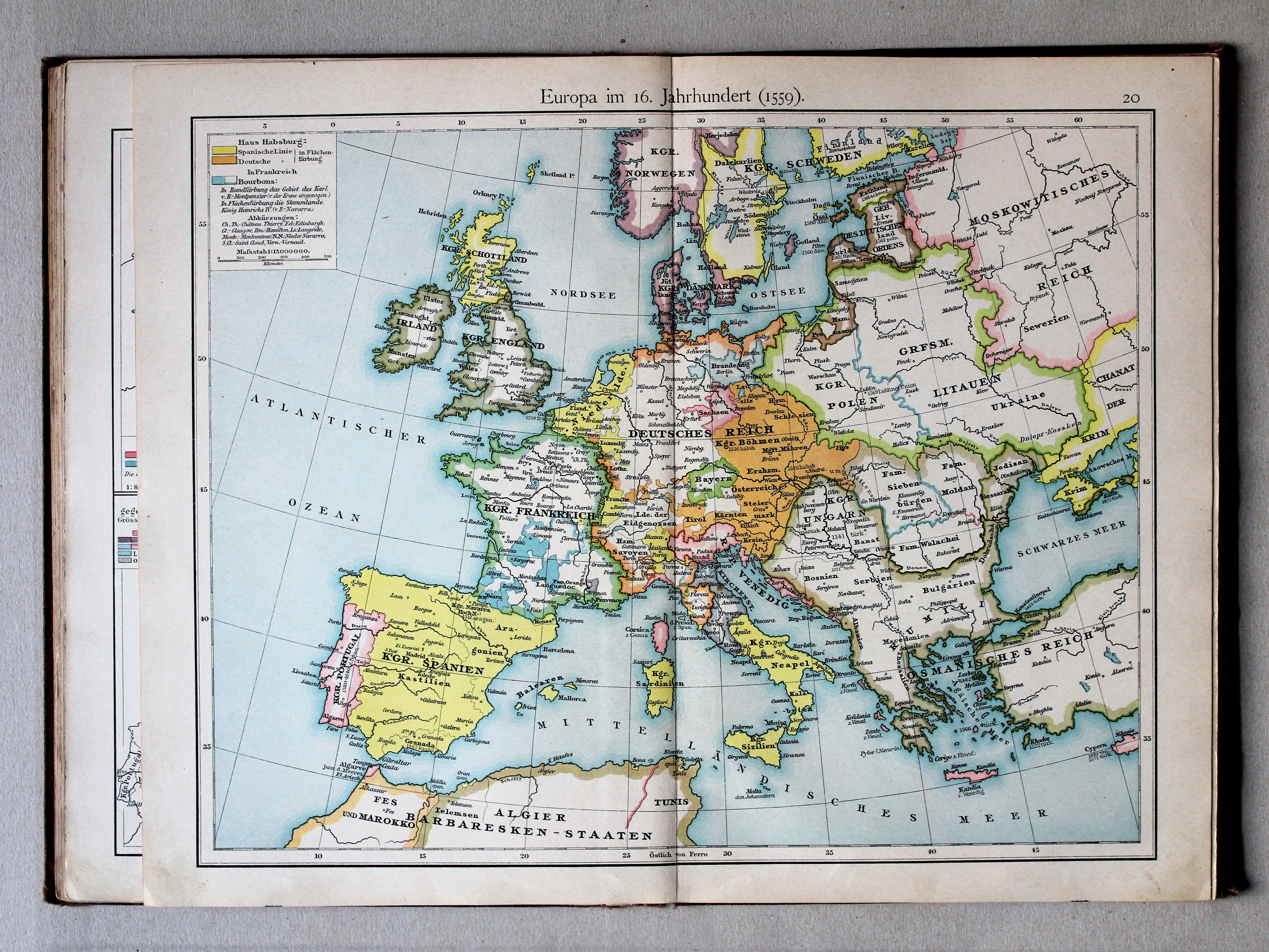
20. Europa im 16. Jahrhundert (1559) XL
Europa in de 16e eeuw (1559) / Europe in the 16th century (1559)
 Putzgers Historischer Schul-Atlas, 1900
20. Europa im 16. Jahrhundert (1559) XL
Europa in de 16e eeuw (1559) / Europe in the 16th century (1559)
 Putzgers Historischer Schul-Atlas, 1901
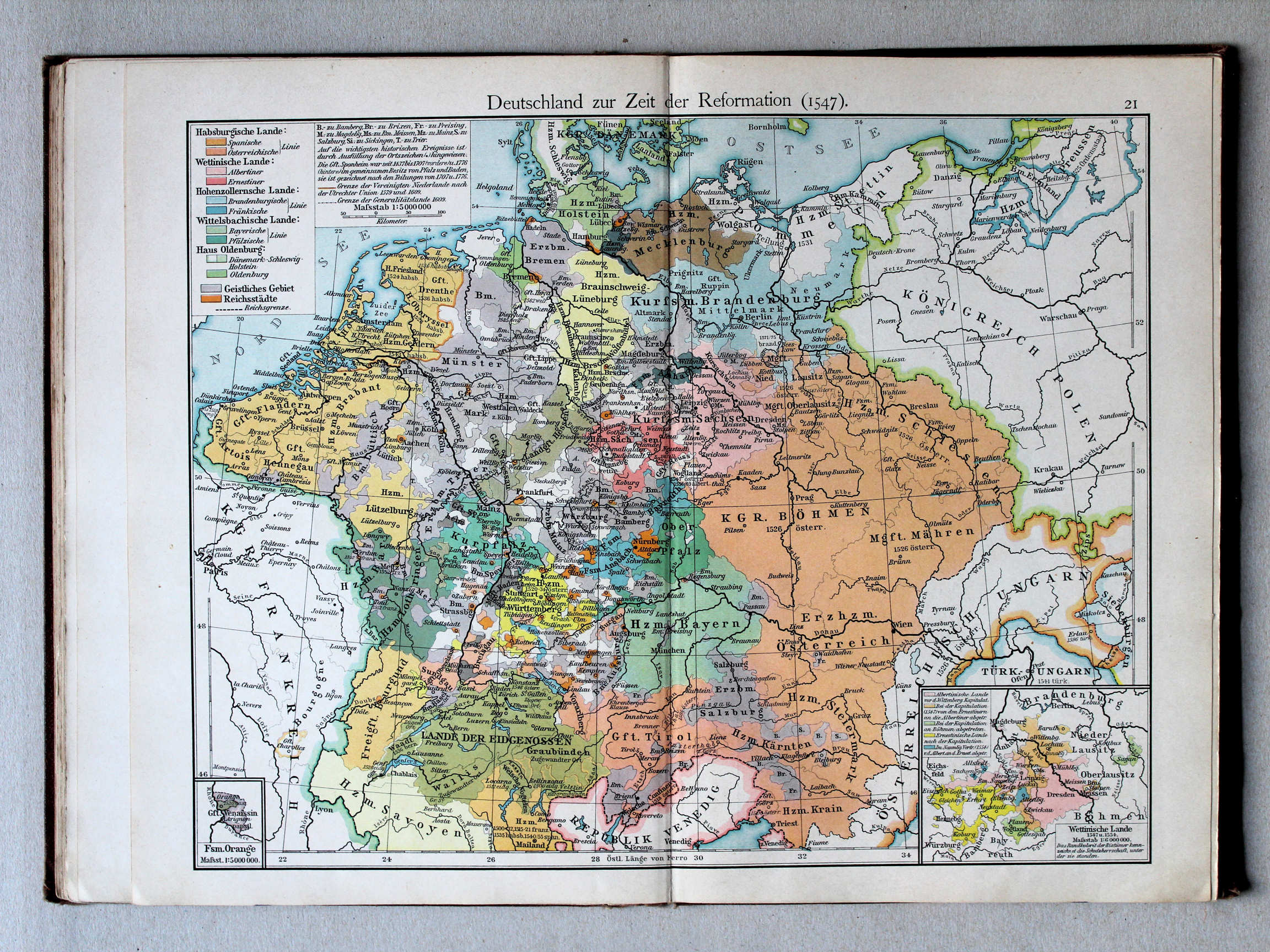
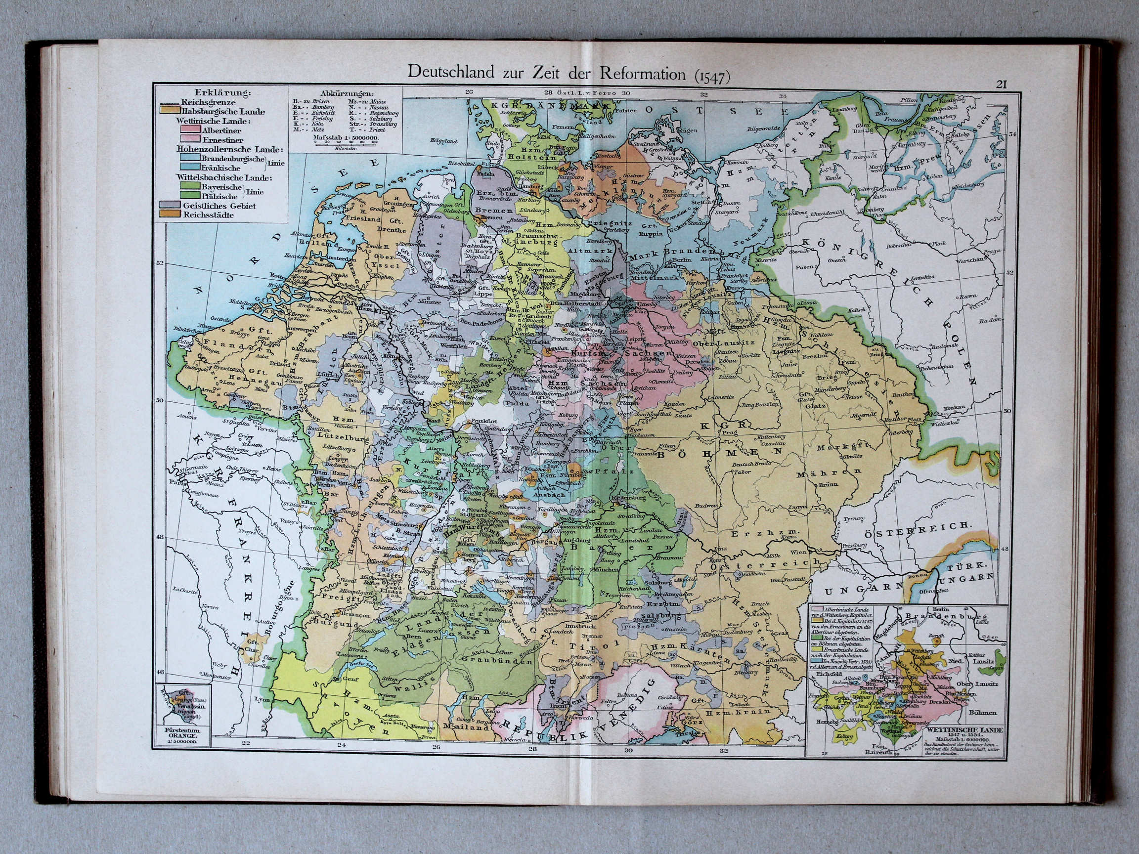
21. Deutschland zur Zeit der Reformation (1547) XL
Duitsland in de tijd van de Reformatie (1547) / Germany during the Protestant Reformation (1547)
 Putzgers Historischer Schul-Atlas, 1900
21. Deutschland zur Zeit der Reformation (1547) XL
Duitsland in de tijd van de Reformatie (1547) / Germany during the Protestant Reformation (1547)
 Putzgers Historischer Schul-Atlas, 1901
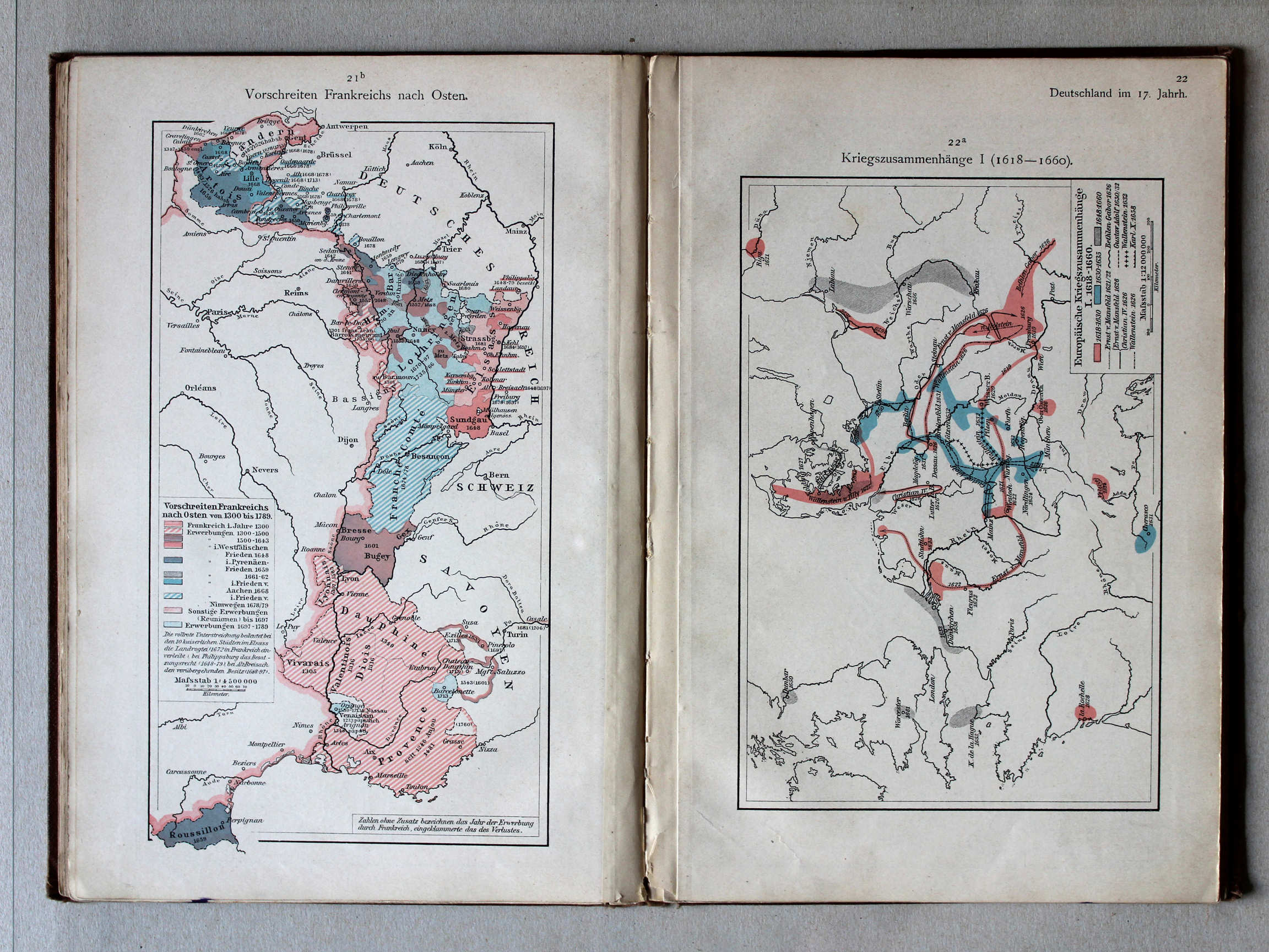
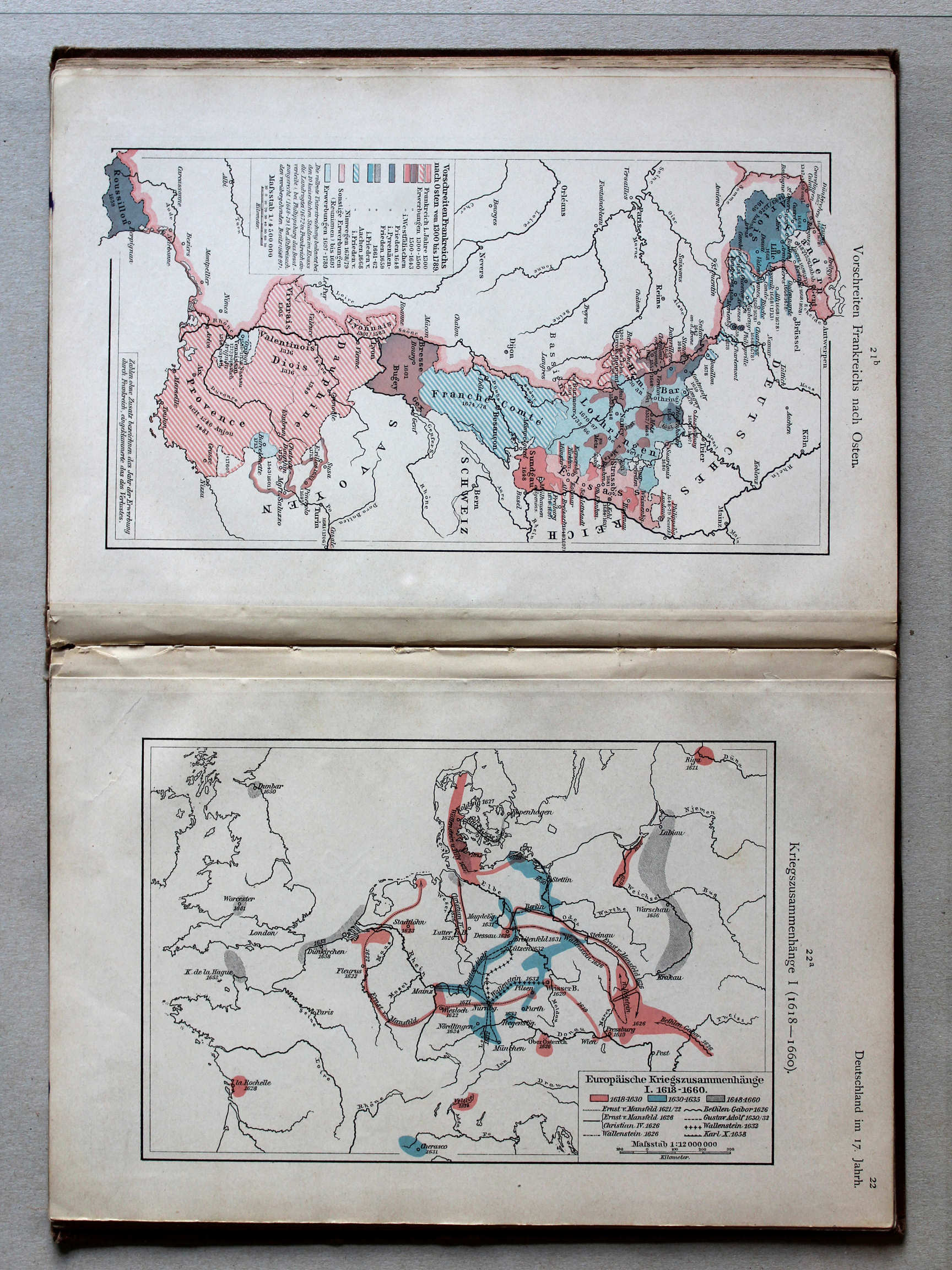
21b. Vorschreiten Frankreichs nach Osten XL
Uitbreiding van Frankrijk naar het oosten / Expansion of France towards the east
Putzgers Historischer Schul-Atlas, 1900
geen overeenkomstige kaart / no corresponding map
 Putzgers Historischer Schul-Atlas, 1901
22a. Kriegszusammenhänge I (1618-1660) XL
Oorlogen in Europa I (1618-1660) / European wars I (1618-1660)
Putzgers Historischer Schul-Atlas, 1900
geen overeenkomstige kaart / no corresponding map
 Putzgers Historischer Schul-Atlas, 1901
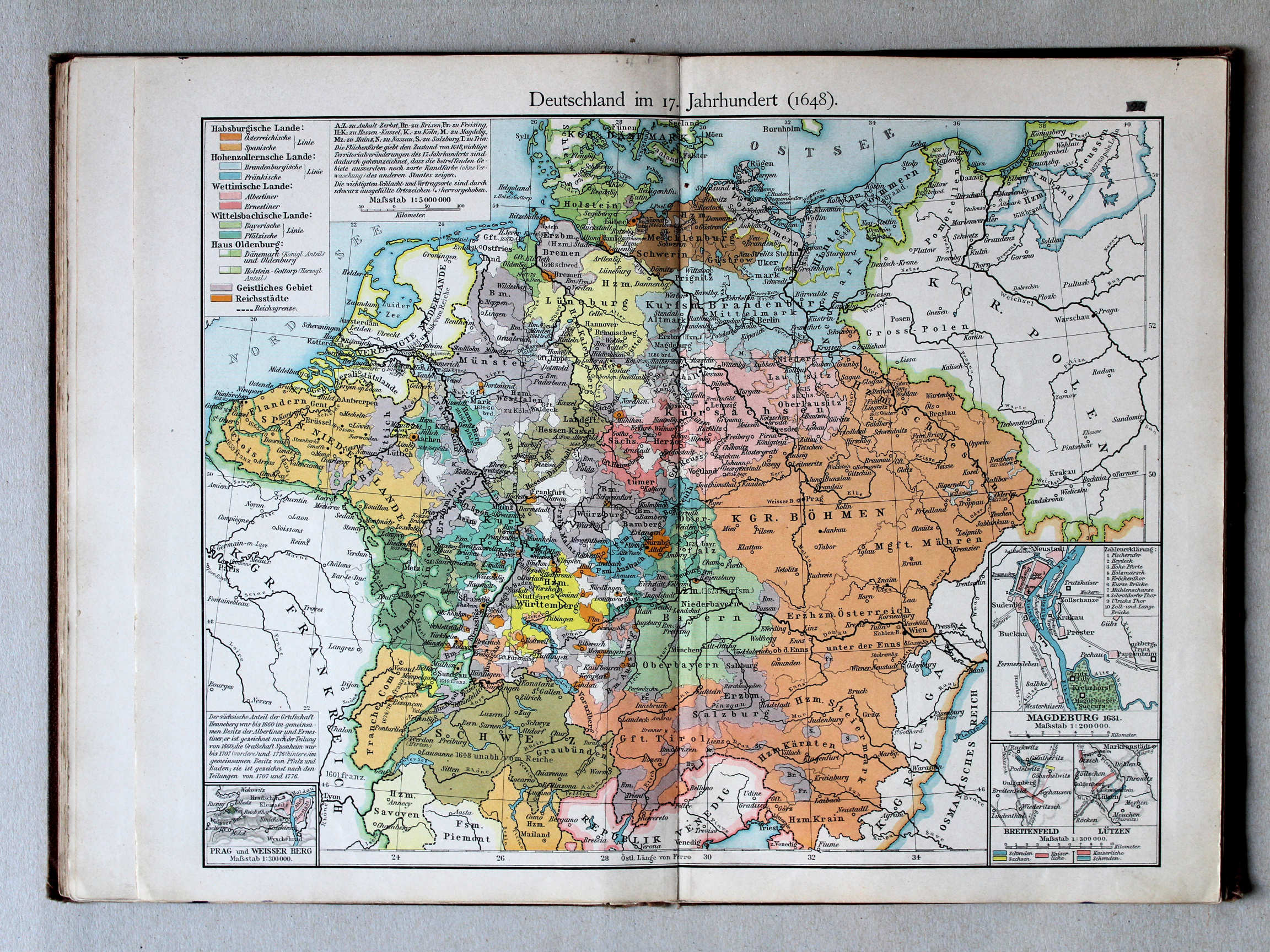
22. Deutschland im 17. Jahrhundert (1648) XL
Duitsland in de 17e eeuw (1648) / Germany in the 17th century (1648)
 Putzgers Historischer Schul-Atlas, 1900
22. Deutschland im 17. Jahrhundert (1648) XL
Duitsland in de 17e eeuw (1648) / Germany in the 17th century (1648)
 Putzgers Historischer Schul-Atlas, 1901
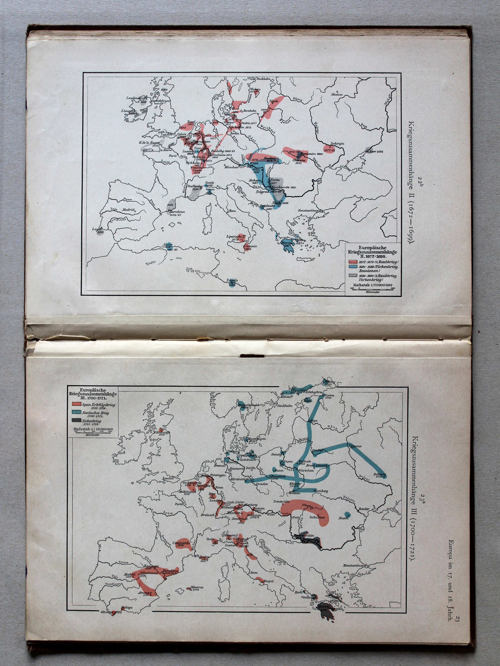
22b. Kriegszusammenhänge II (1672-1699) XL
Oorlogen in Europa II (1672-1699) / European wars II (1672-1699)
23a. Kriegszusammenhänge III (1700-1721) XL
Oorlogen in Europa III (1700-1721) / European wars III (1700-1721)
Putzgers Historischer Schul-Atlas, 1900
geen overeenkomstige kaart / no corresponding map
 Putzgers Historischer Schul-Atlas, 1901
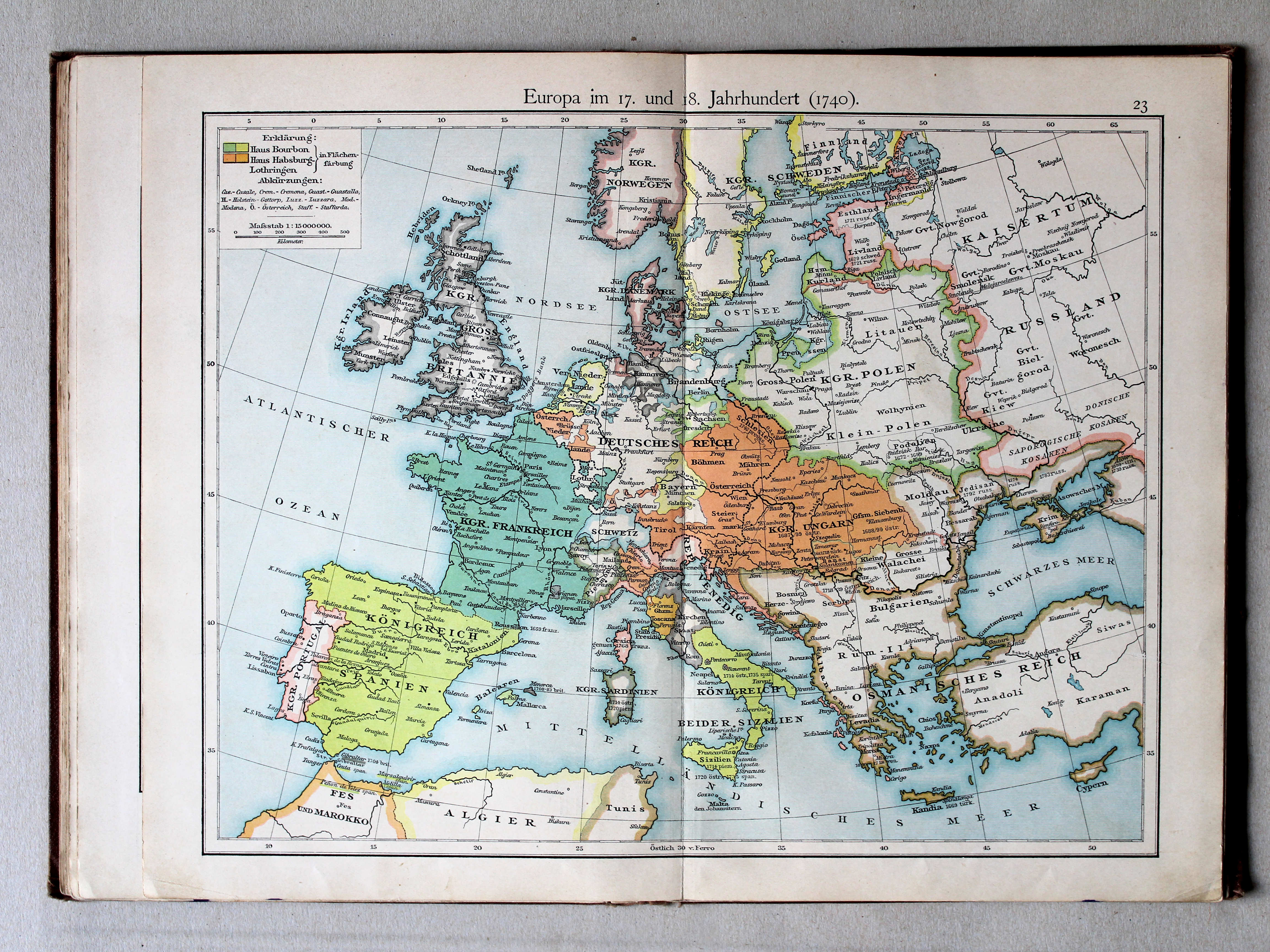
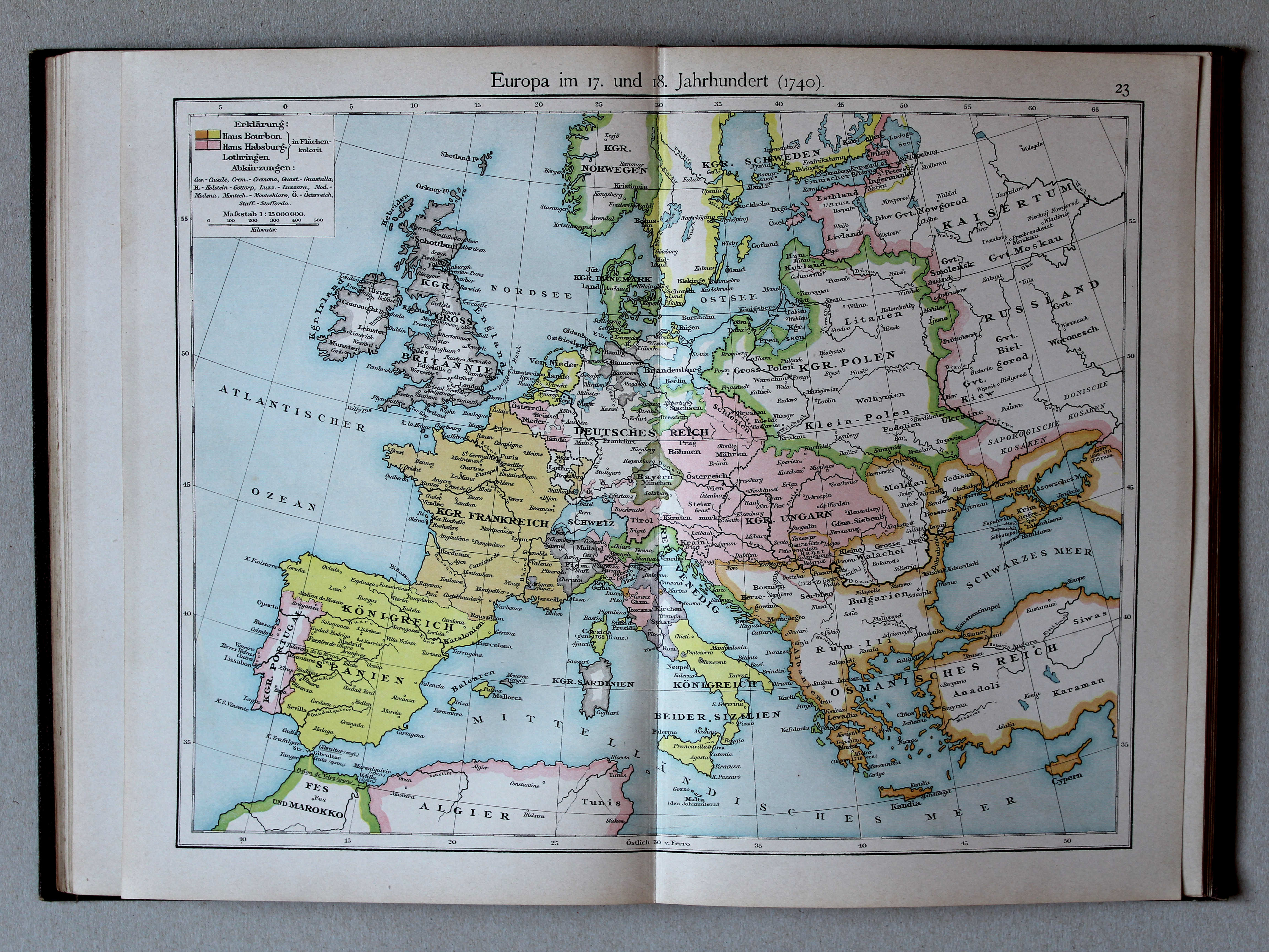
23. Europa im 17. und 18. Jahrhundert (1740) XL
Europa in de 17e en 18e eeuw (1740) / Europe in the 17th and 18th century (1740)
 Putzgers Historischer Schul-Atlas, 1900
23. Europa im 17. und 18. Jahrhundert (1740) XL
Europa in de 17e en 18e eeuw (1740) / Europe in the 17th and 18th century (1740)
 Putzgers Historischer Schul-Atlas, 1901
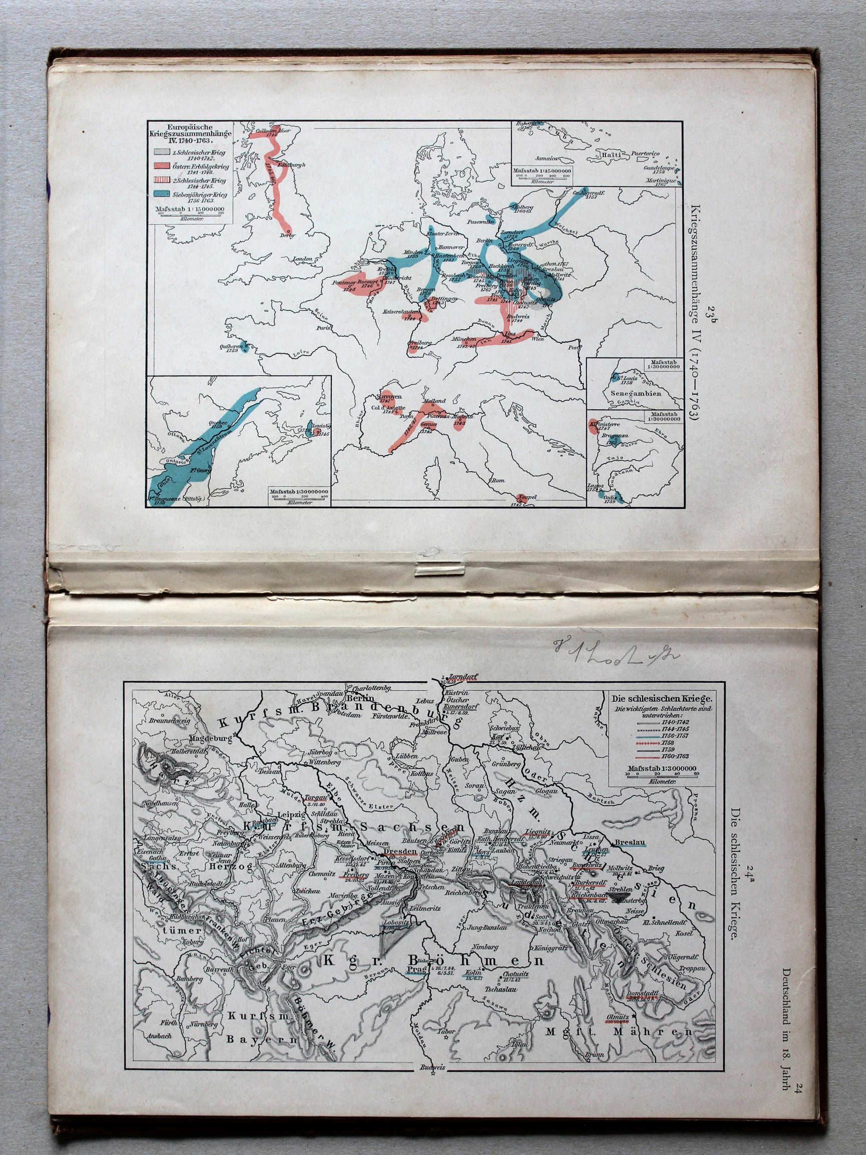
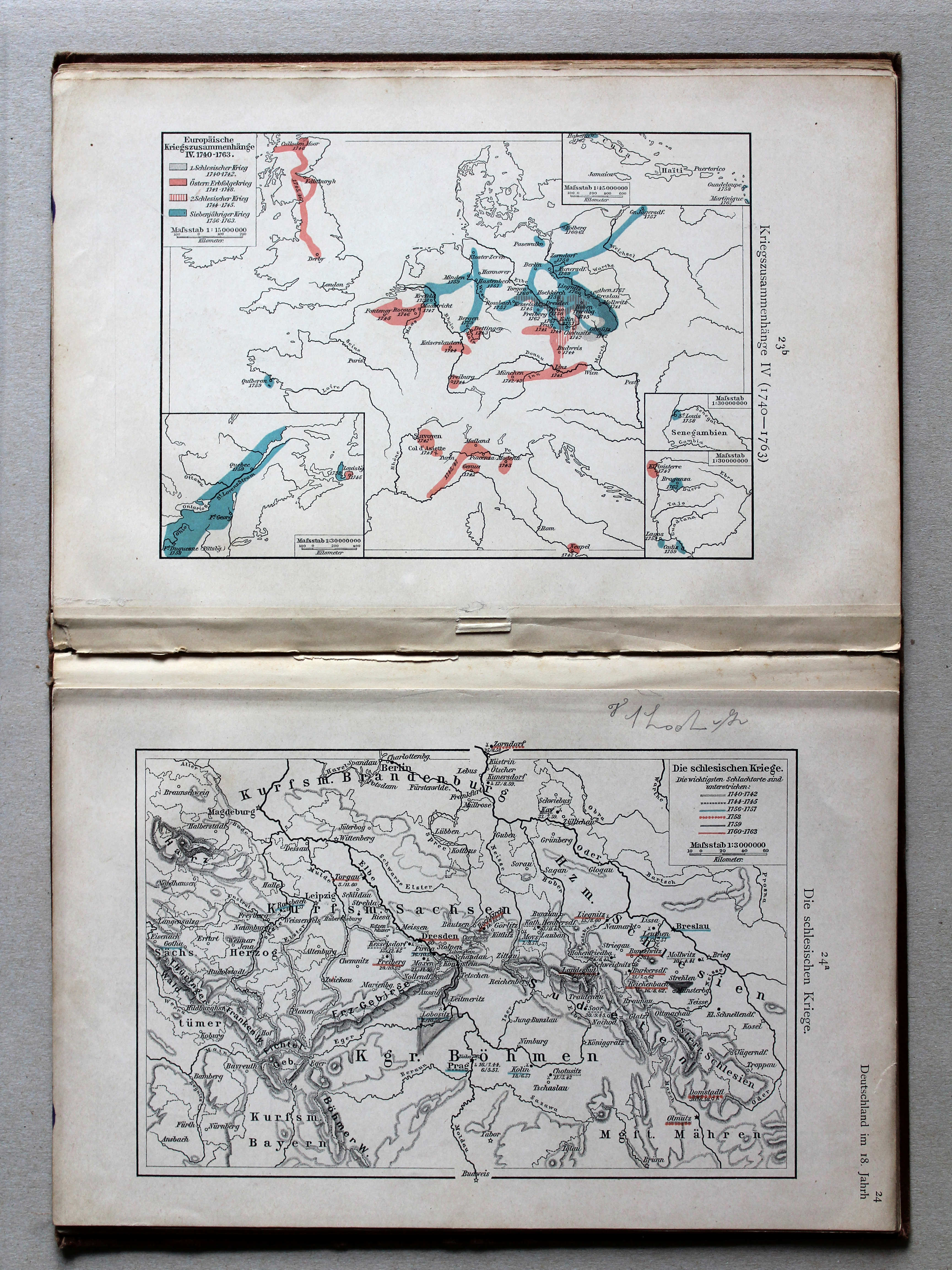
23b. Kriegszusammenhänge IV (1740-1763) XL
Oorlogen in Europa IV (1740-1763) / European wars IV (1740-1763)
24a. Die schlesischen Kriege XL
De Silezische Oorlogen / The Silesian Wars
Putzgers Historischer Schul-Atlas, 1900
geen overeenkomstige kaart / no corresponding map
 Putzgers Historischer Schul-Atlas, 1901
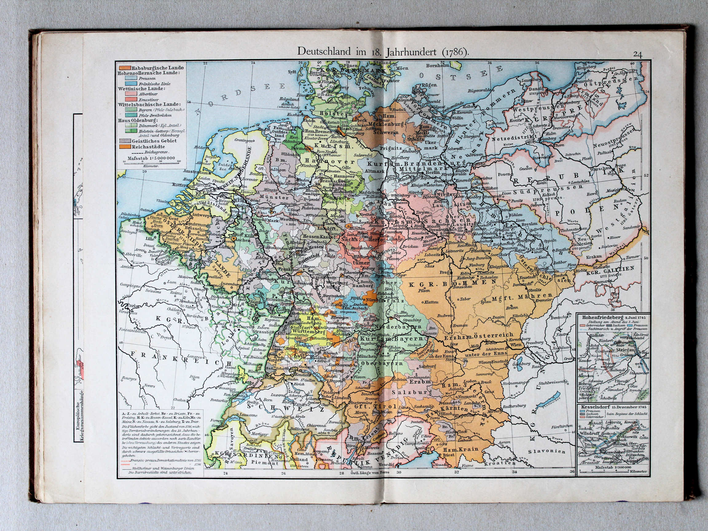
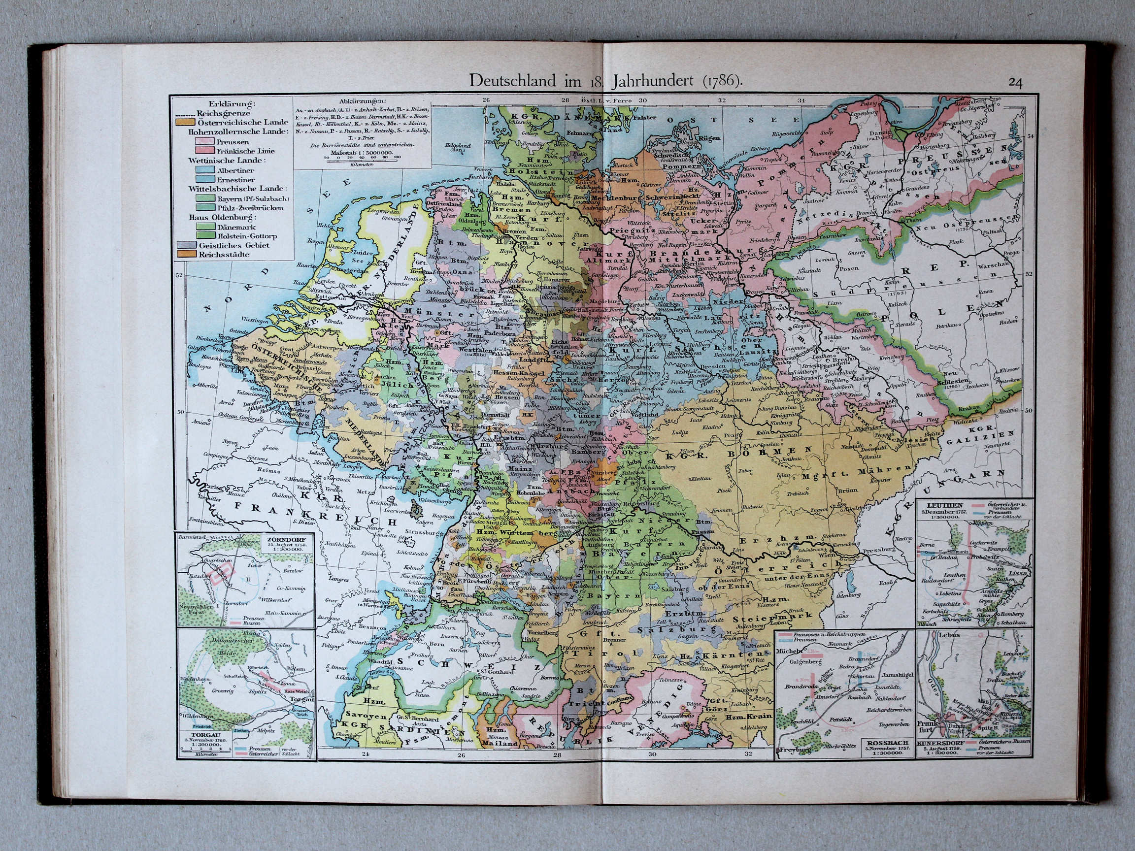
24. Deutschland im 18. Jahrhundert (1786) XL
Duitsland in de 18e eeuw (1786) / Germany in the 18th century (1786)
 Putzgers Historischer Schul-Atlas, 1900
24. Deutschland im 18. Jahrhundert (1786) XL
Duitsland in de 18e eeuw (1786) / Germany in the 18th century (1786)
 Putzgers Historischer Schul-Atlas, 1901
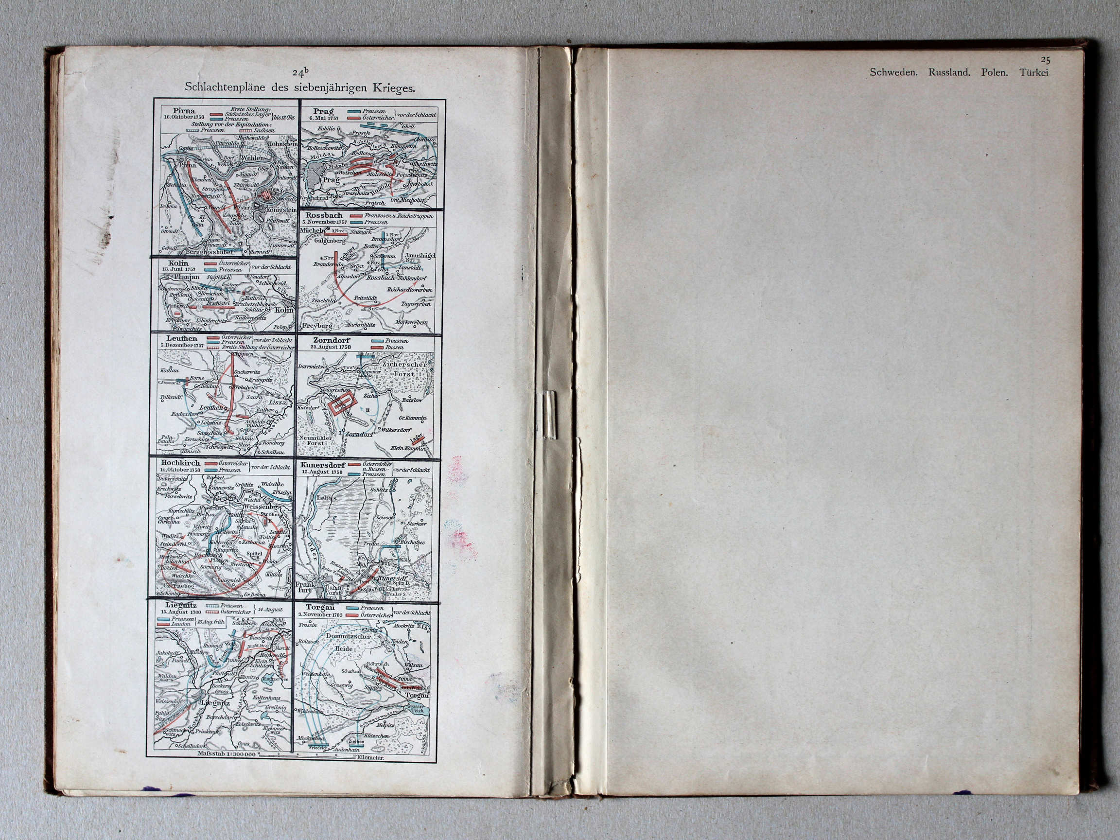
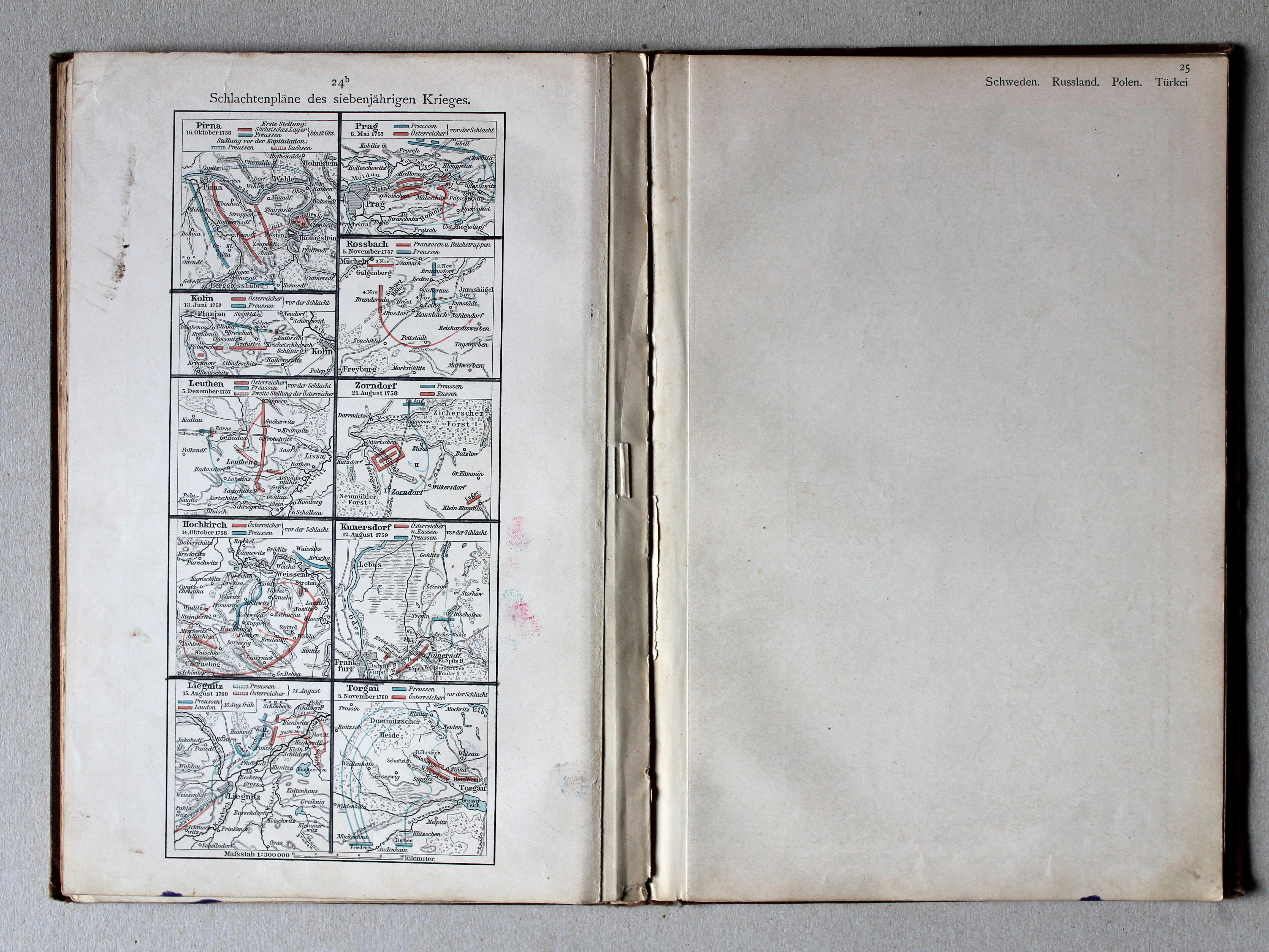
24b. Schlachtenpläne des siebenjährigen Krieges XL
Veldslagen in de Zevenjarige Oorlog / Battlefields during the Seven Years' War
(Rossbach, Leuthen, Zorndorf, Kunersdorf, Torgau, ...)
Putzgers Historischer Schul-Atlas, 1900
24. Deutschland im 18. Jahrhundert (1786) XL
Duitsland in de 18e eeuw (1786) / Germany in the 18th century (1786)
(Zorndorf, Torgau, Leuthen, Rossbach, Kunersdorf)
 Putzgers Historischer Schul-Atlas, 1901
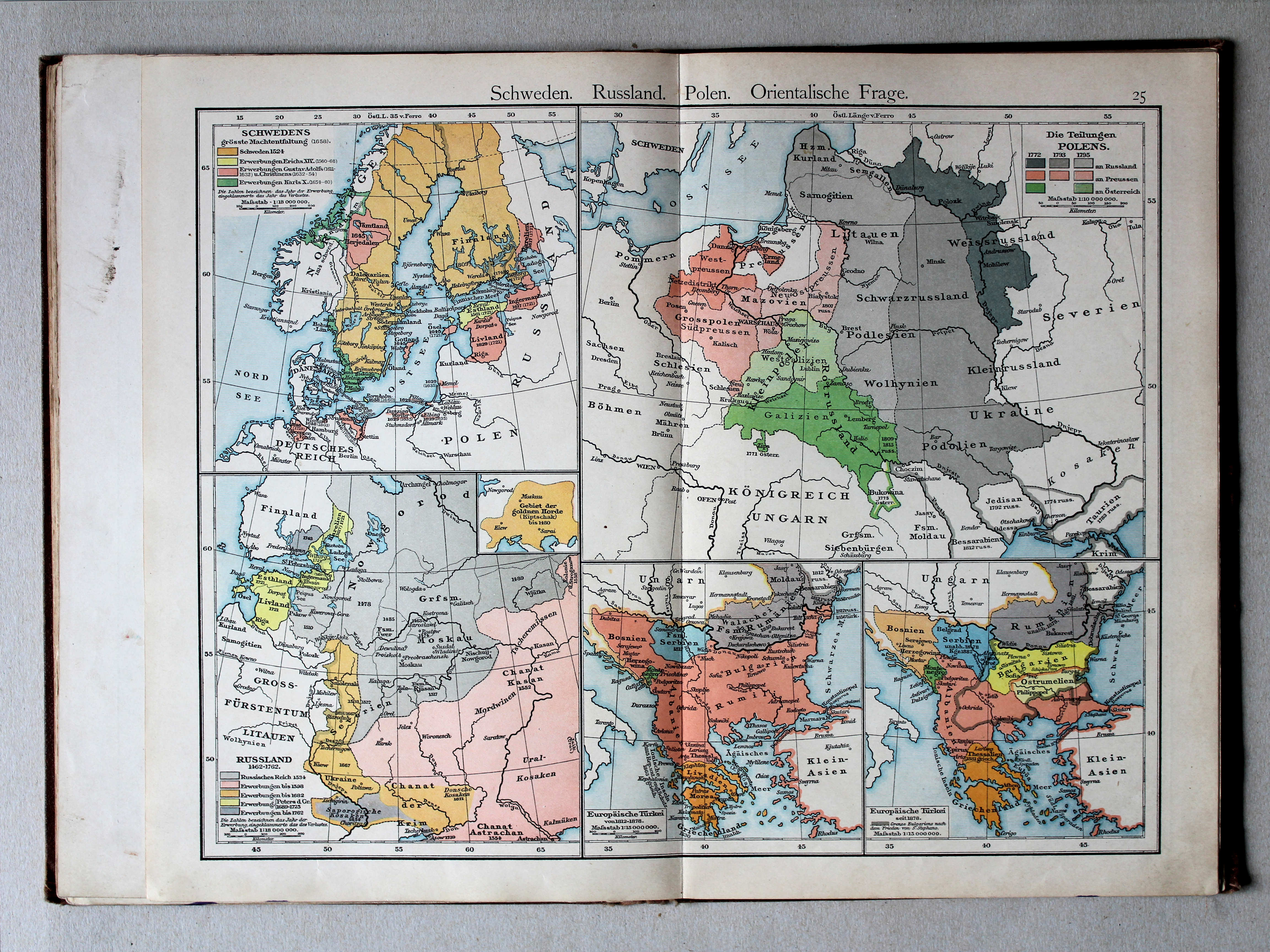
25. Schweden. Russland. Polen. Orientalische Frage XL
Zweden, Rusland, Polen, Oosterse Kwestie / Sweden, Russia, Poland, Eastern Question
 Putzgers Historischer Schul-Atlas, 1900
25. Schweden. Russland. Polen. Orientalische Frage XL
Zweden, Rusland, Polen, Oosterse Kwestie / Sweden, Russia, Poland, Eastern Question
 Putzgers Historischer Schul-Atlas, 1901
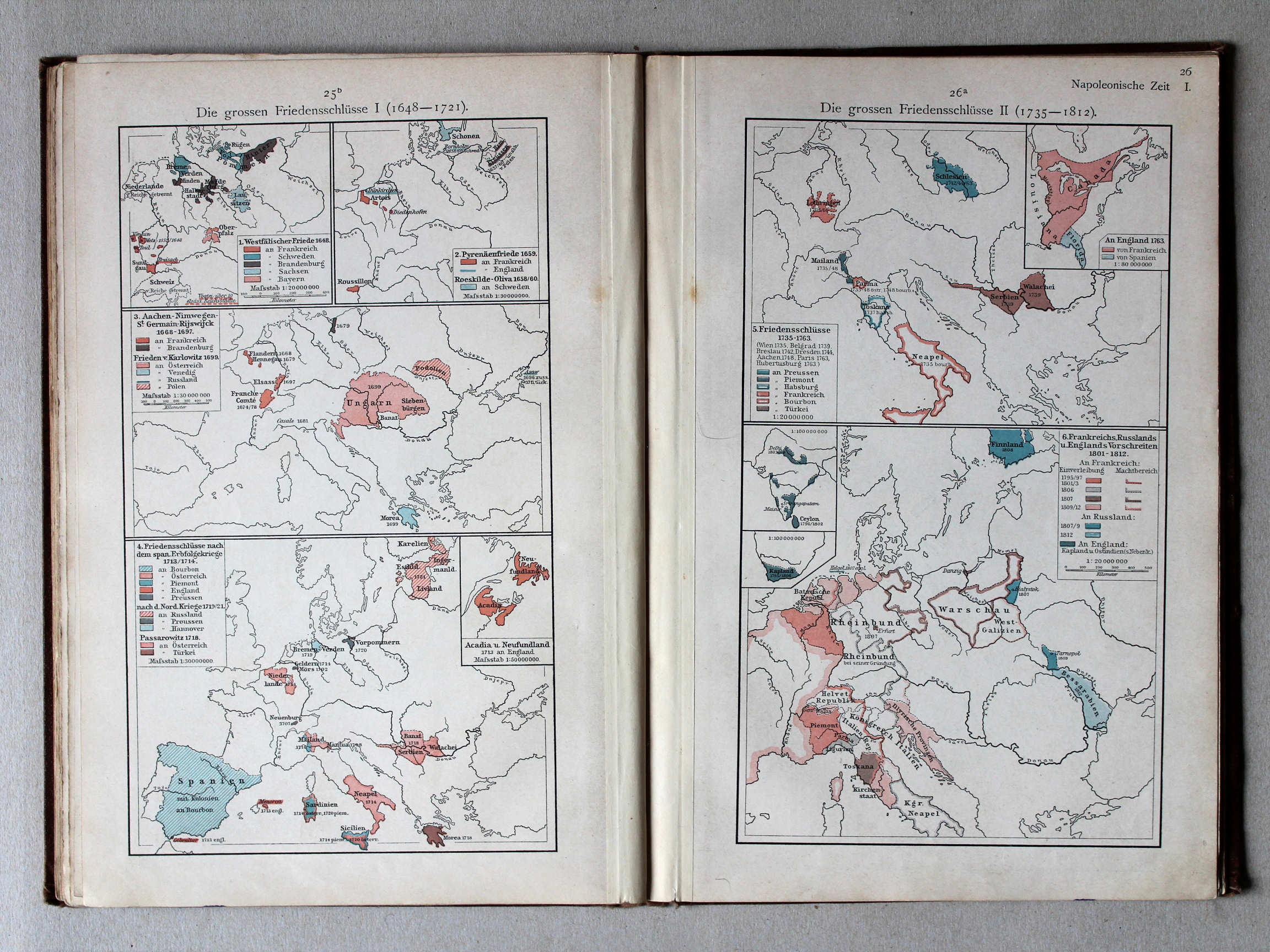
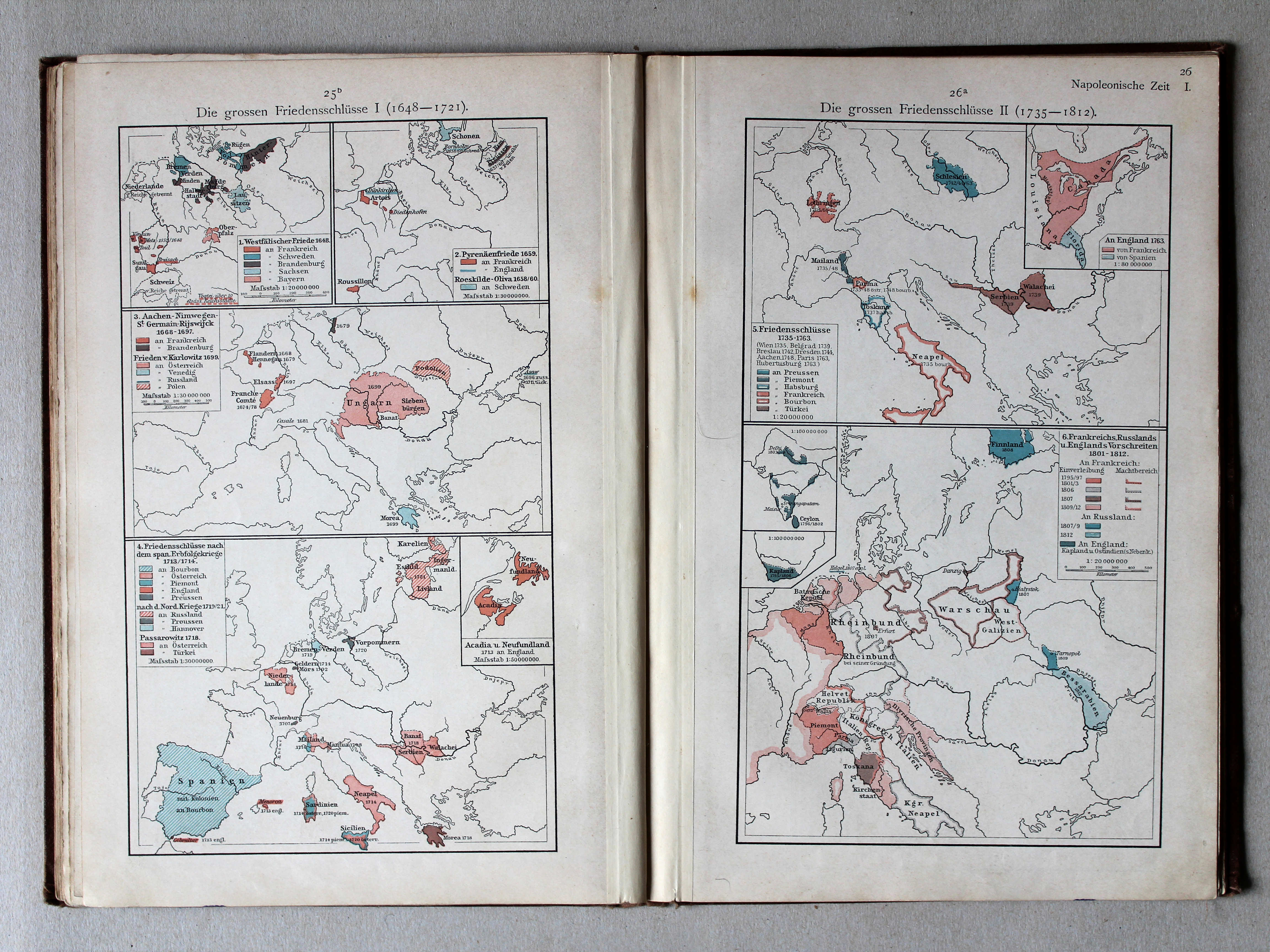
25b. Die grossen Friedensschlüsse I (1648-1721) XL
De belangrijkste vredesverdragen I (1648-1721) / The main peace treaties I (1648-1721)
26a. Die grossen Friedensschlüsse II (1735-1812) XL
De belangrijkste vredesverdragen II (1735-1812) / The main peace treaties II (1735-1812)
Putzgers Historischer Schul-Atlas, 1900
geen overeenkomstige kaart / no corresponding map
 Putzgers Historischer Schul-Atlas, 1901
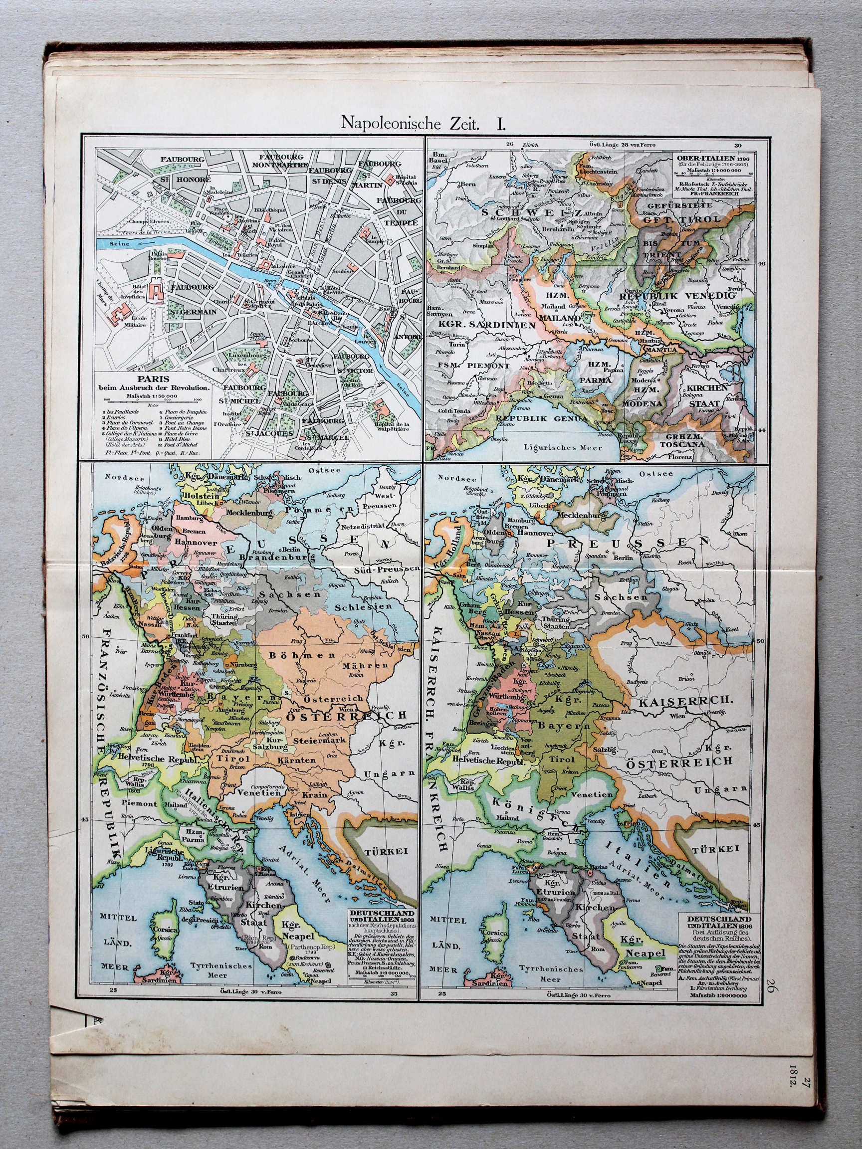
26. Napoleonische Zeit. I XL
Tijd van Napoleon I / Era of Napoleon I
 Putzgers Historischer Schul-Atlas, 1900
26. Napoleonische Zeit I XL
Tijd van Napoleon I / Era of Napoleon I
 Putzgers Historischer Schul-Atlas, 1901
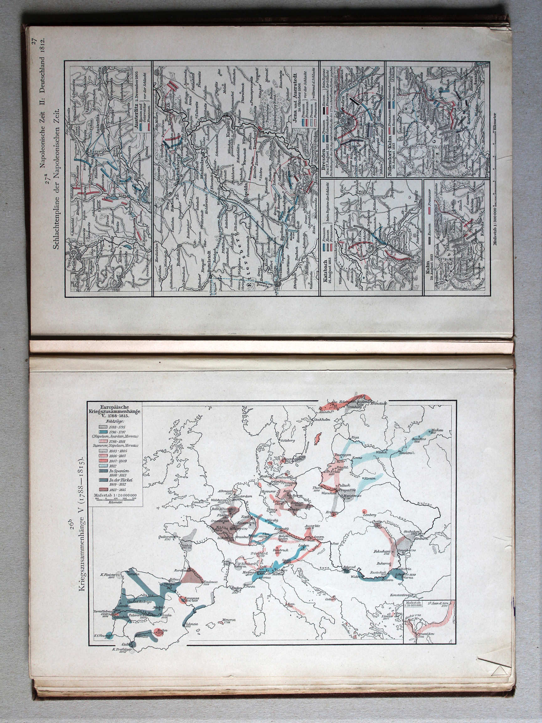
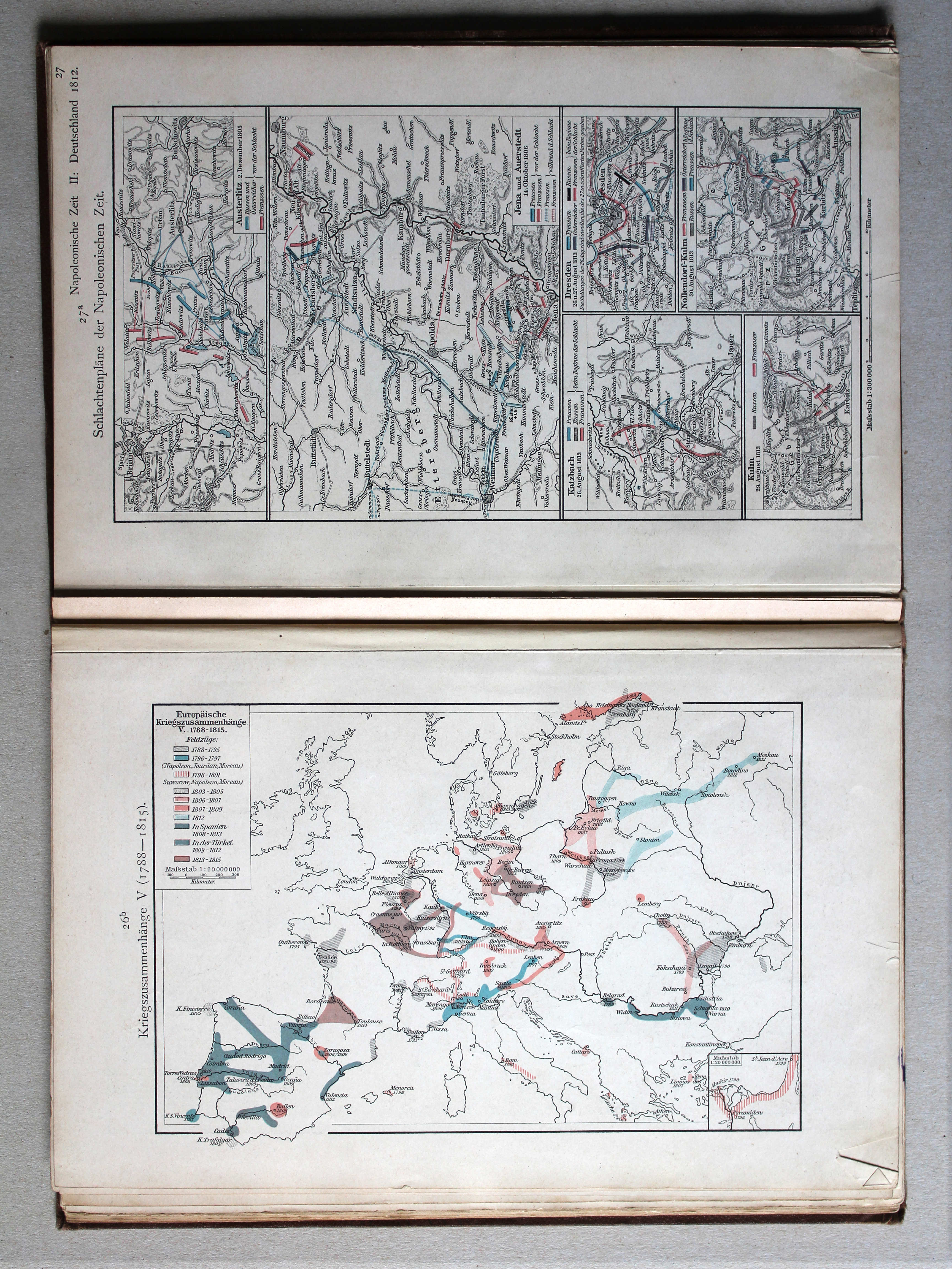
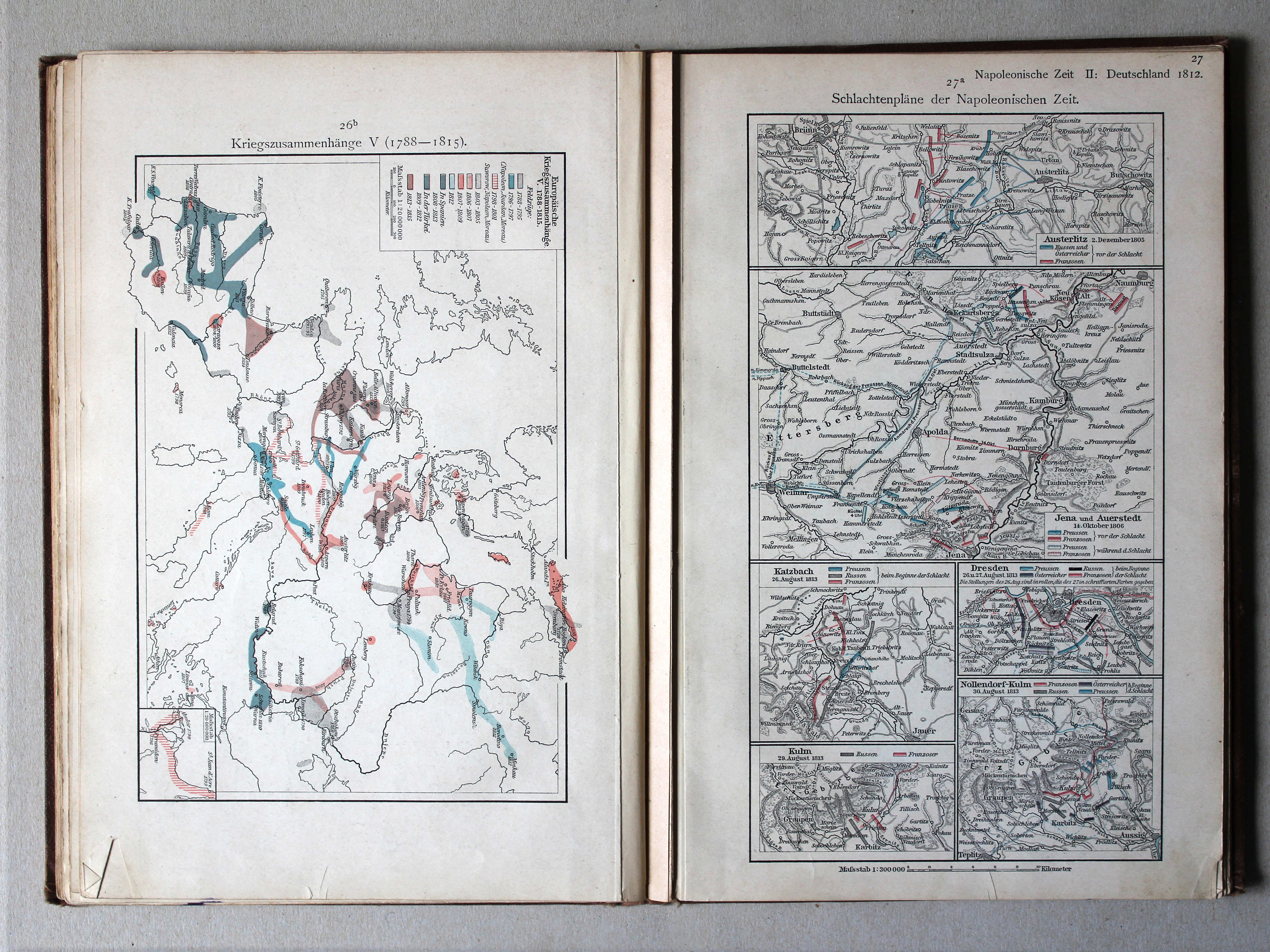
26b. Kriegszusammenhänge V (1788-1815) XL
Oorlogen in Europa V (1788-1815) / European wars V (1788-1815)
Putzgers Historischer Schul-Atlas, 1900
geen overeenkomstige kaart / no corresponding map
 Putzgers Historischer Schul-Atlas, 1901
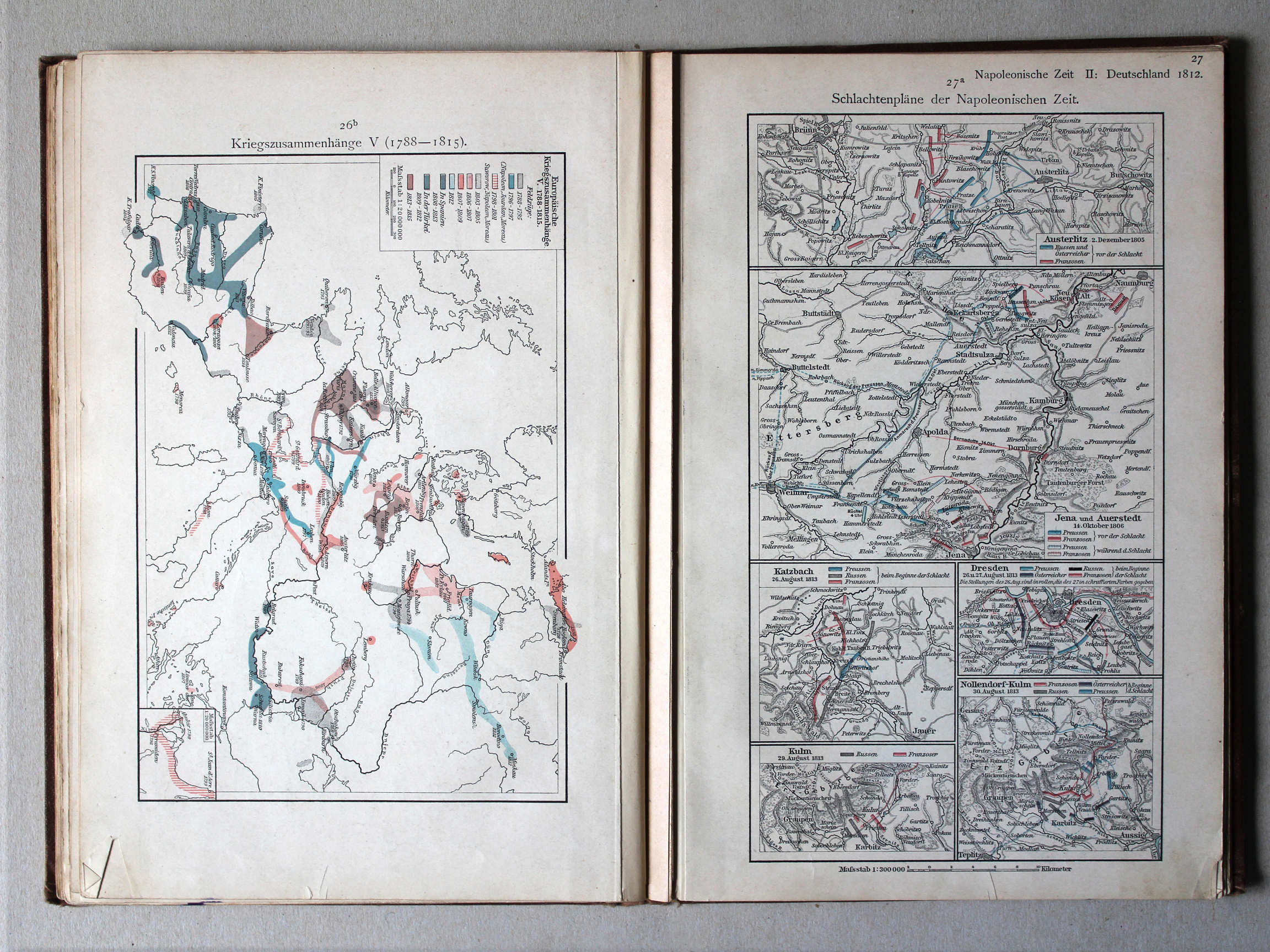
27a. Schlachtenpläne der Napoleonischen Zeit XL
Veldslagen in de tijd van Napoleon / Battlefields in the era of Napoleon
Putzgers Historischer Schul-Atlas, 1900
geen overeenkomstige kaart / no corresponding map
 Putzgers Historischer Schul-Atlas, 1901
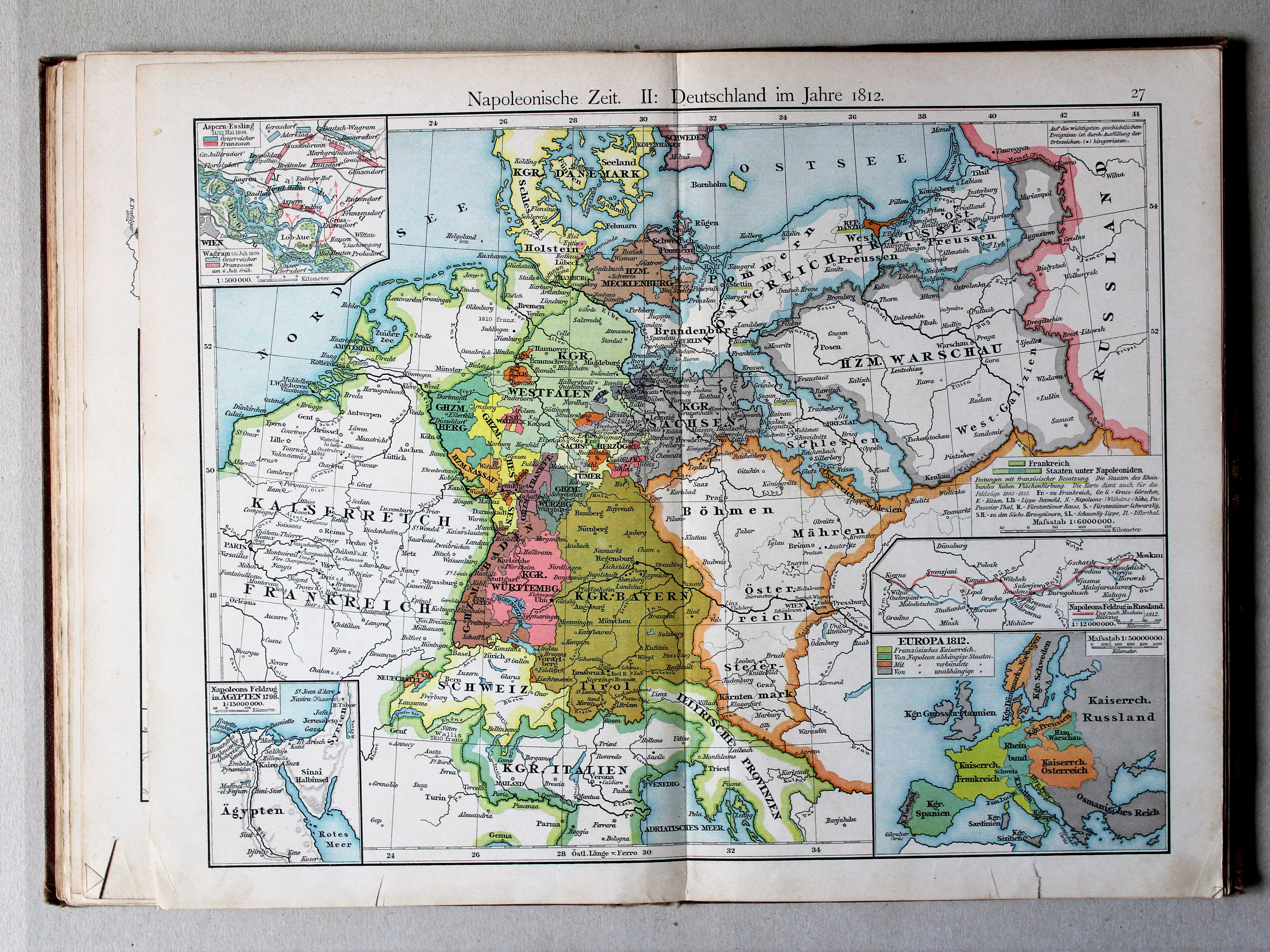
27. Napoleonische Zeit. II: Deutschland im Jahre 1812 XL
Tijd van Napoleon II: Duitsland in 1812 / Era of Napoleon II: Germany in 1812
 Putzgers Historischer Schul-Atlas, 1900
27. Napoleonische Zeit II: Deutschland im Jahre 1812 XL
Tijd van Napoleon II: Duitsland in 1812 / Era of Napoleon II: Germany in 1812
 Putzgers Historischer Schul-Atlas, 1901
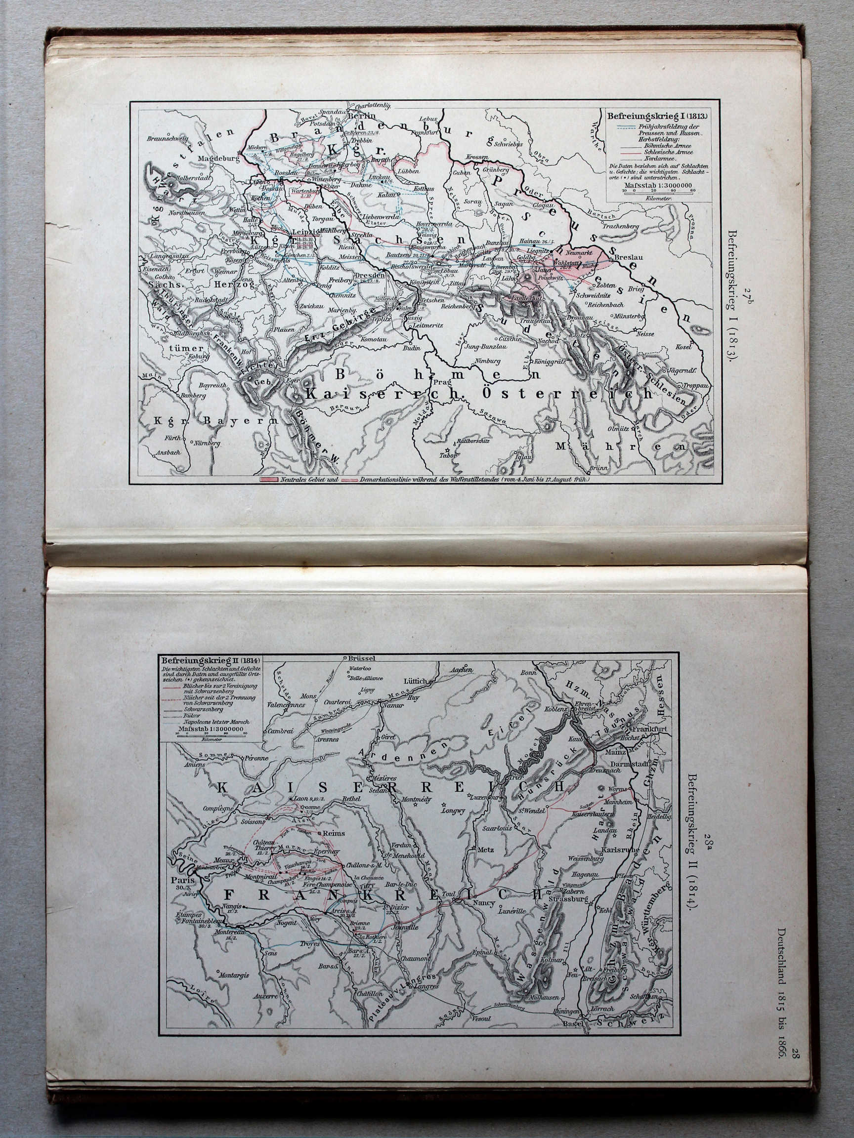
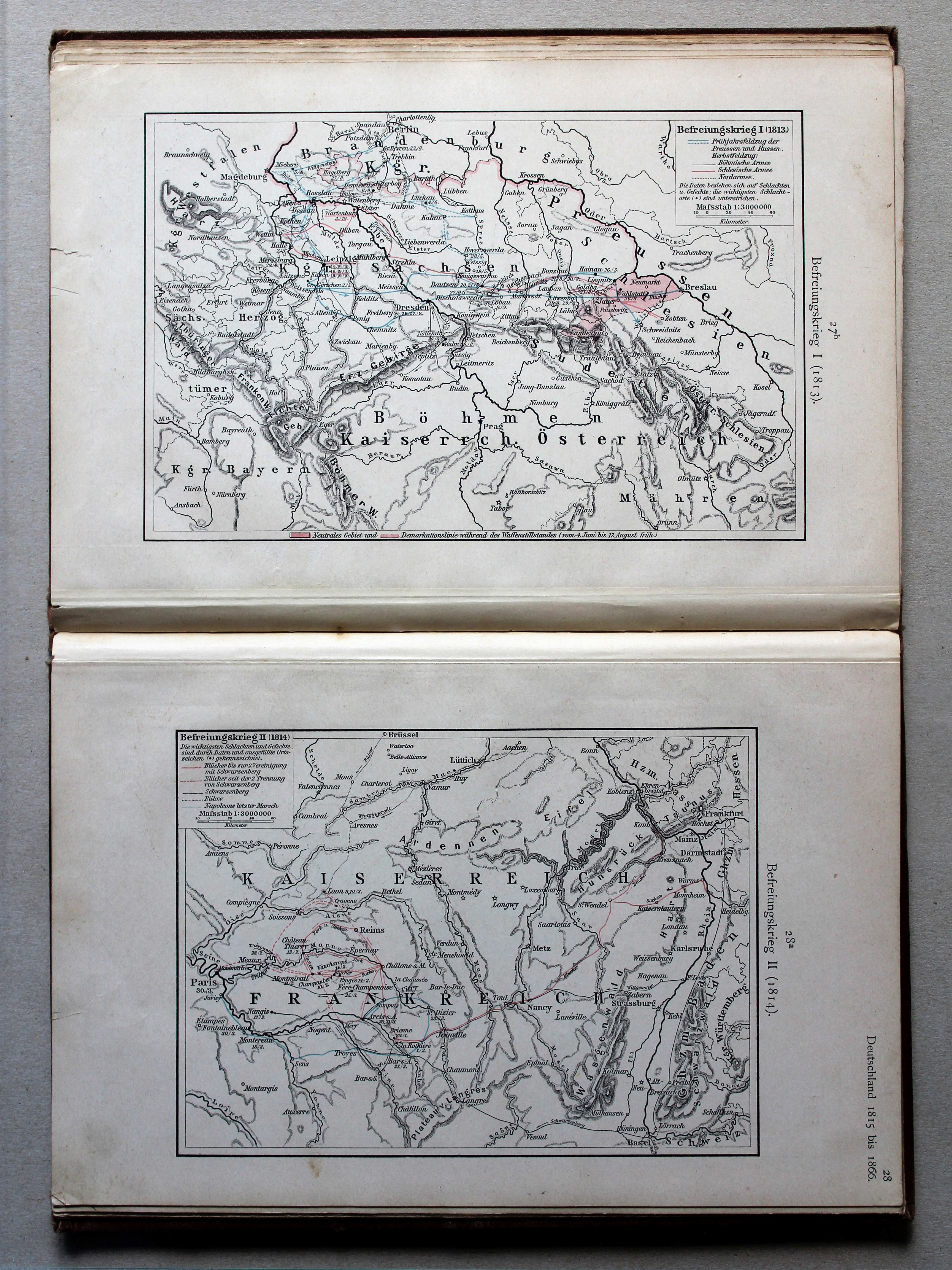
27b. Befreiungskrieg I (1813) XL
Duitse bevrijdingsoorlog I (1813) / German Campaign I (1813)
28a. Befreiungskrieg II (1814) XL
Duitse bevrijdingsoorlog II (1814) / German Campaign II (1814)
Putzgers Historischer Schul-Atlas, 1900
geen overeenkomstige kaart / no corresponding map
 Putzgers Historischer Schul-Atlas, 1901
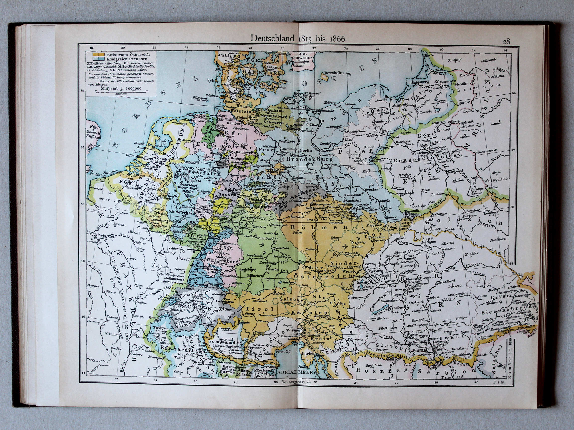
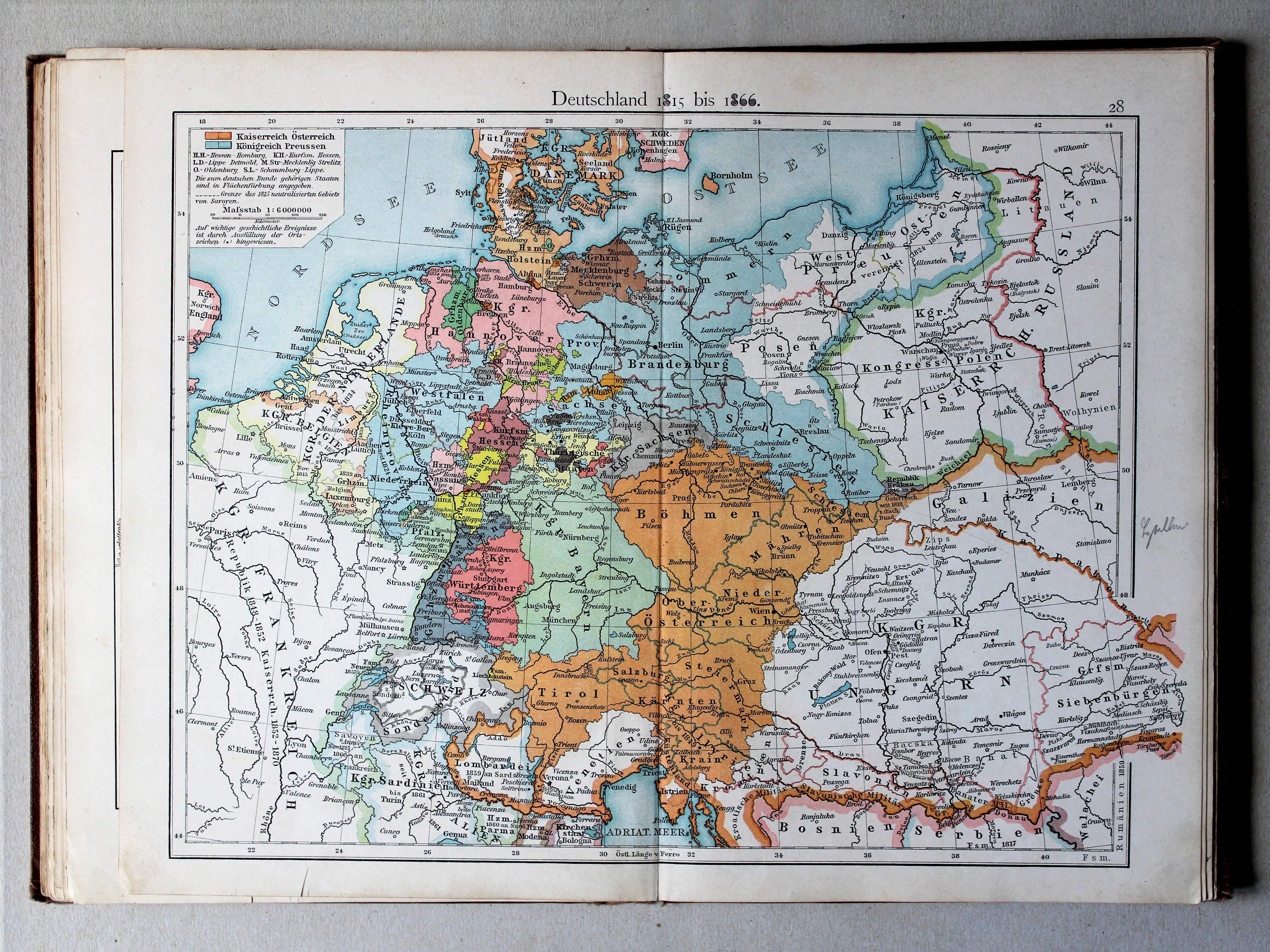
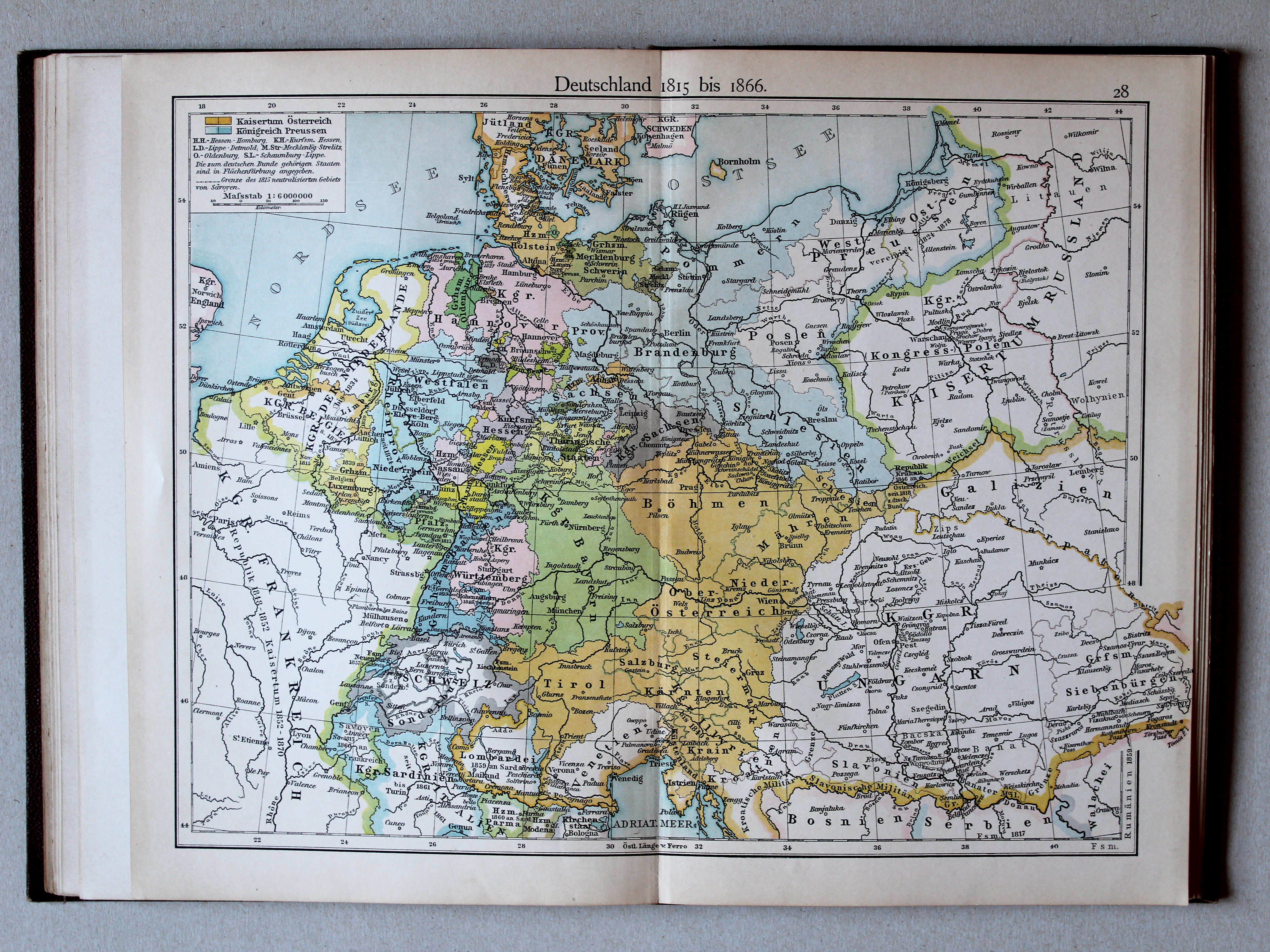
28. Deutschland 1815 bis 1866 XL
Duitsland 1815-1866 / Germany 1815-1866
 Putzgers Historischer Schul-Atlas, 1900
28. Deutschland 1815 bis 1866 XL
Duitsland 1815-1866 / Germany 1815-1866
 Putzgers Historischer Schul-Atlas, 1901
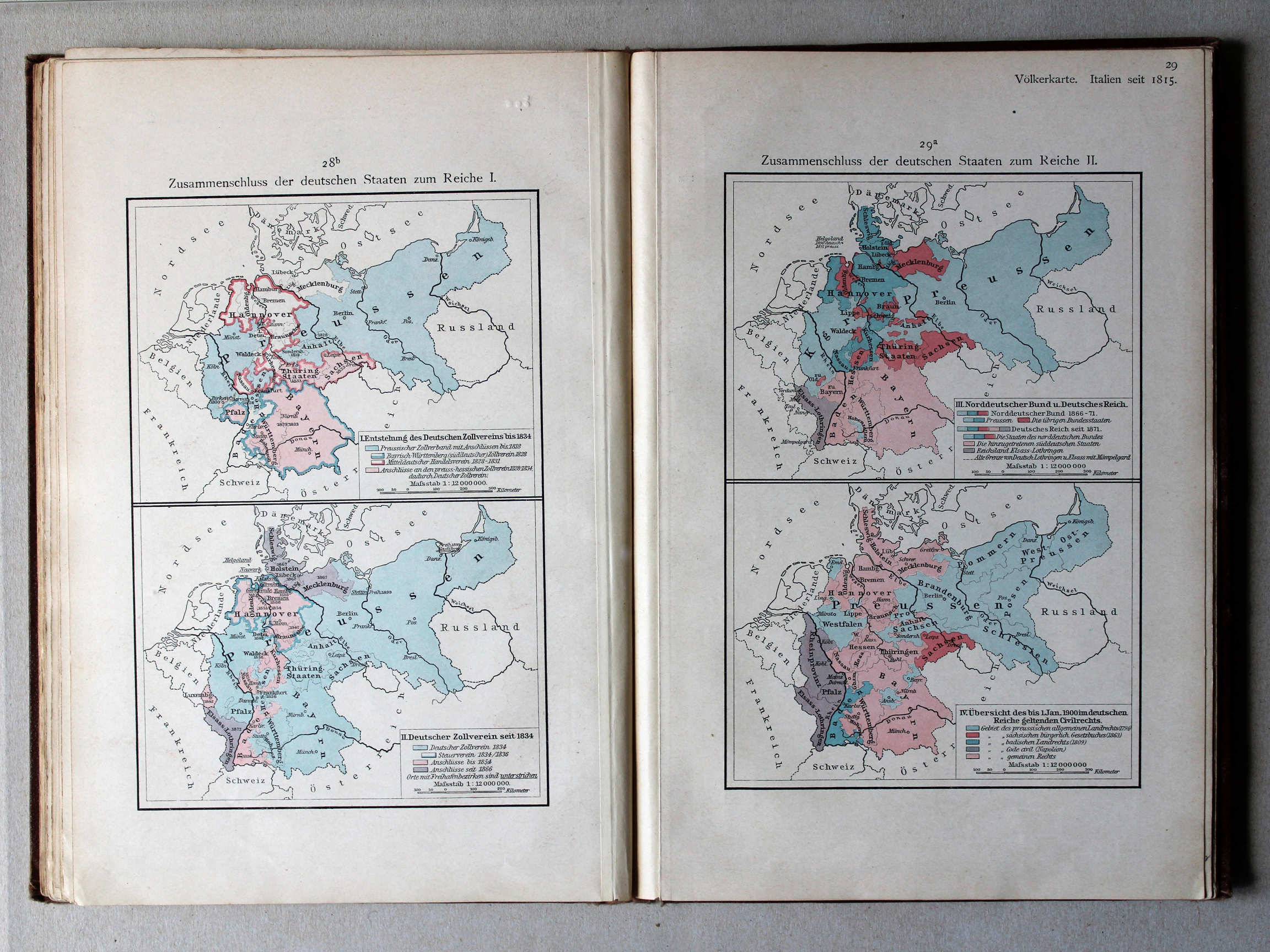
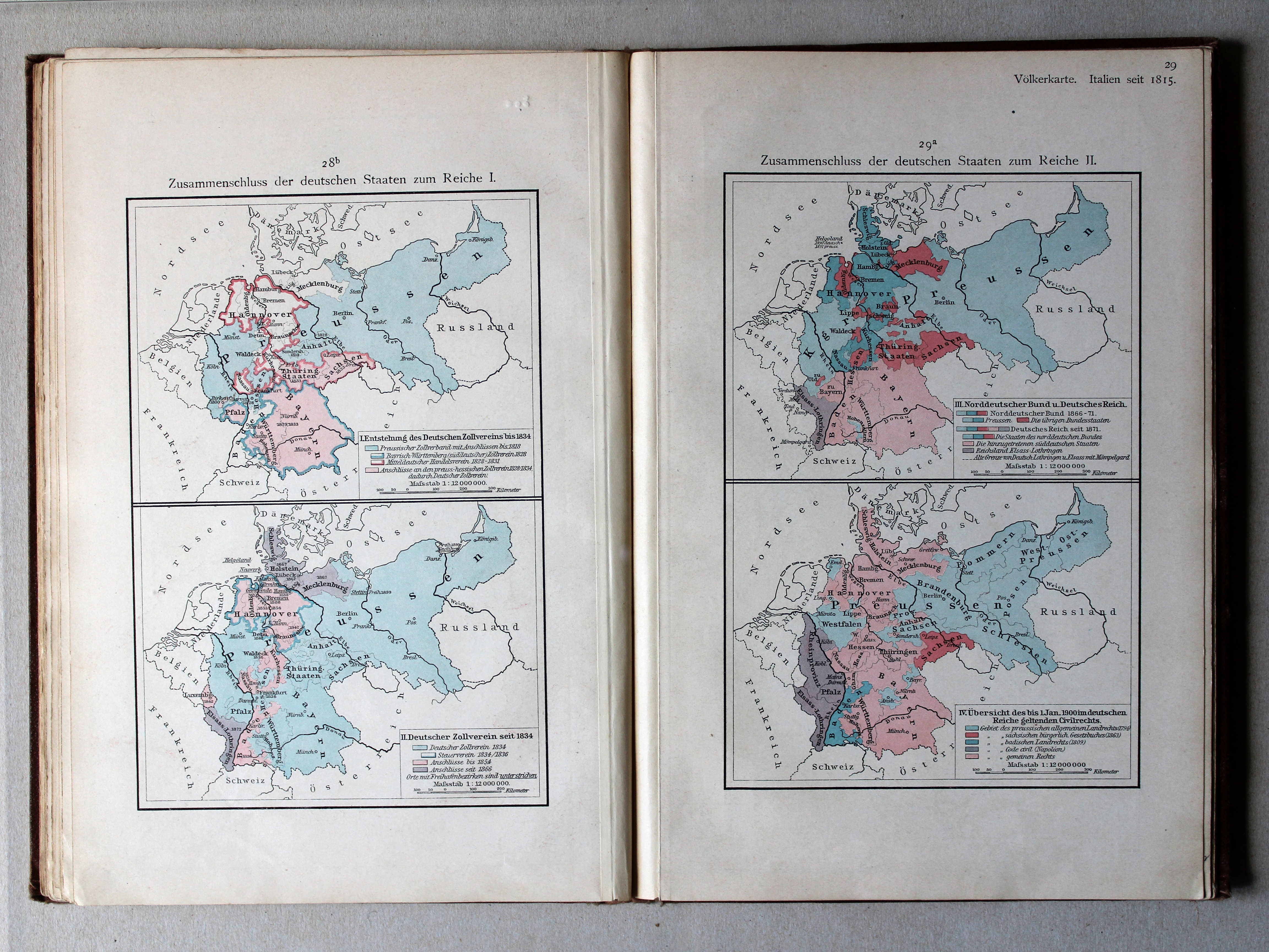
28b. Zusammenschluss der deutschen Staaten zum Reiche I XL
Duitse eenwording I / German unification I
29a. Zusammenschluss der deutschen Staaten zum Reiche II XL
Duitse eenwording II / German unification II
Putzgers Historischer Schul-Atlas, 1900
geen overeenkomstige kaart / no corresponding map
 Putzgers Historischer Schul-Atlas, 1901
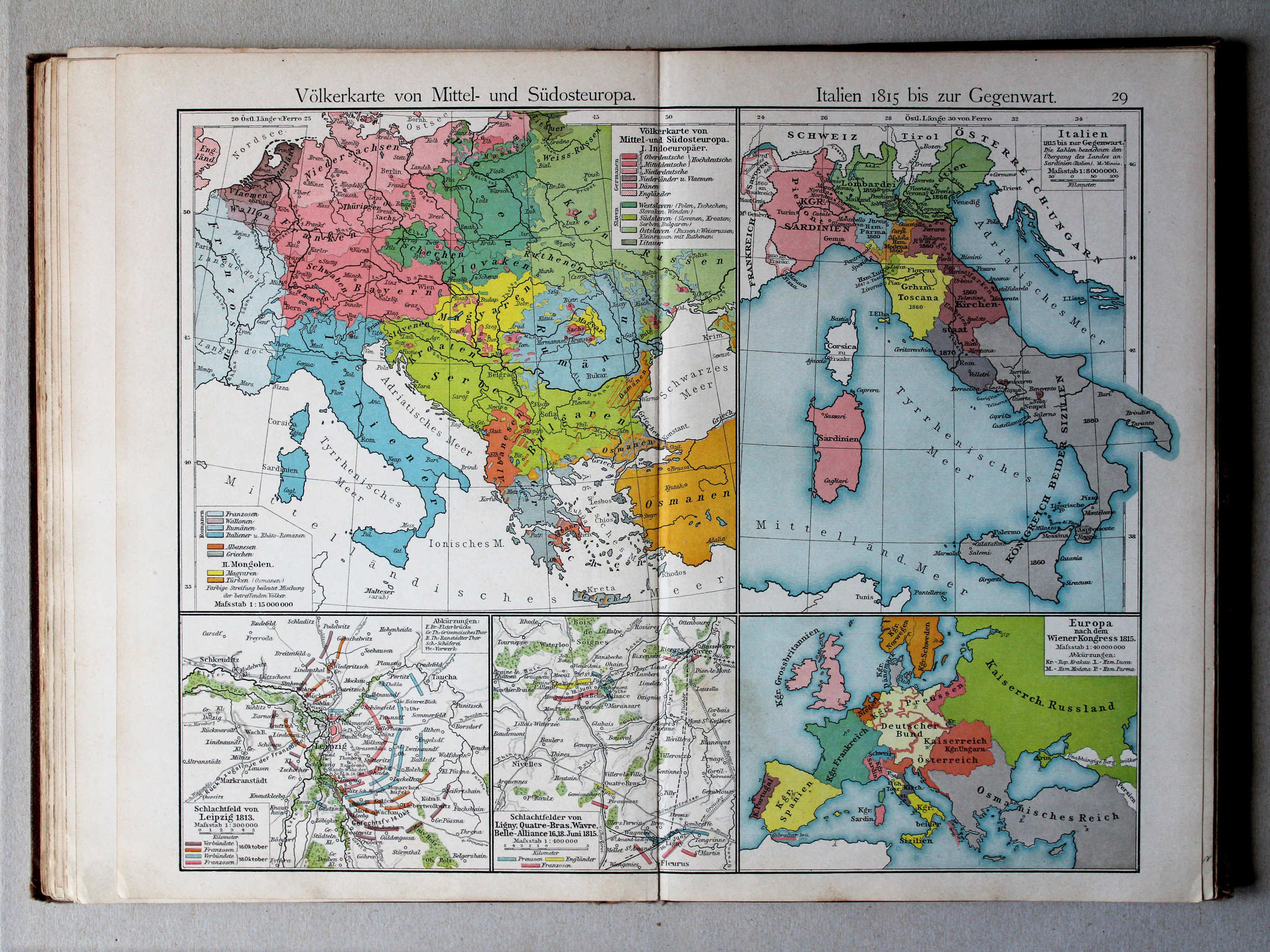
29. Völkerkarte von Mittel und Südost-Europa. Italien 1815 bis zur Gegenwart XL
Etnografische kaart van Midden- en Zuidoost Europa. Italië van 1815 tot heden / Ethnographic map of Central and Southeastern Europe. Italy from 1815 until today
 Putzgers Historischer Schul-Atlas, 1900
28a. Völkerkarte von Mittel- und Südost-Europa. Italien 1815 bis zur Gegenwart XL
Etnografische kaart van Midden- en Zuidoost Europa. Italië van 1815 tot heden / Ethnographic map of Central and Southeastern Europe. Italy from 1815 until today
 Putzgers Historischer Schul-Atlas, 1901
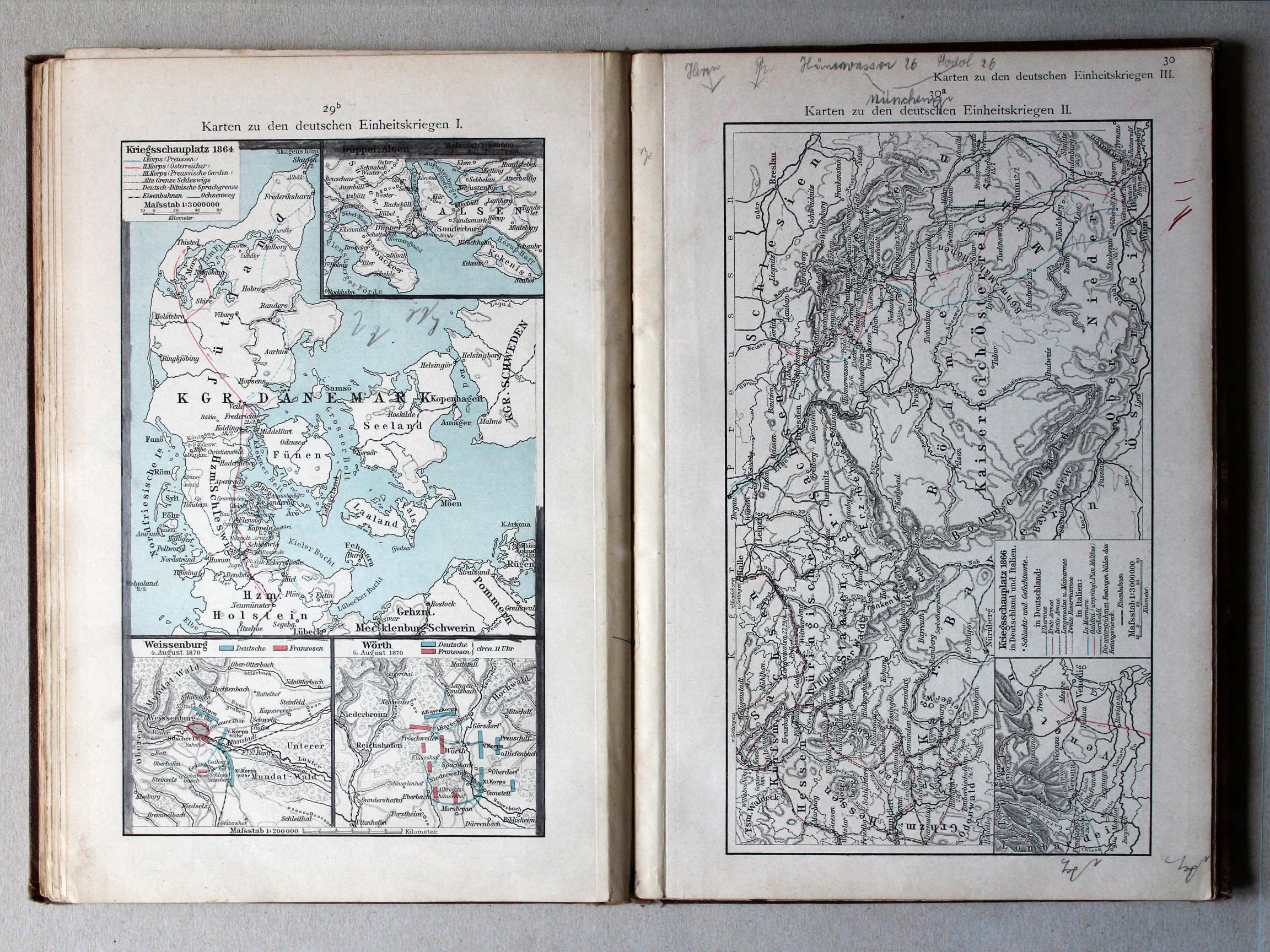
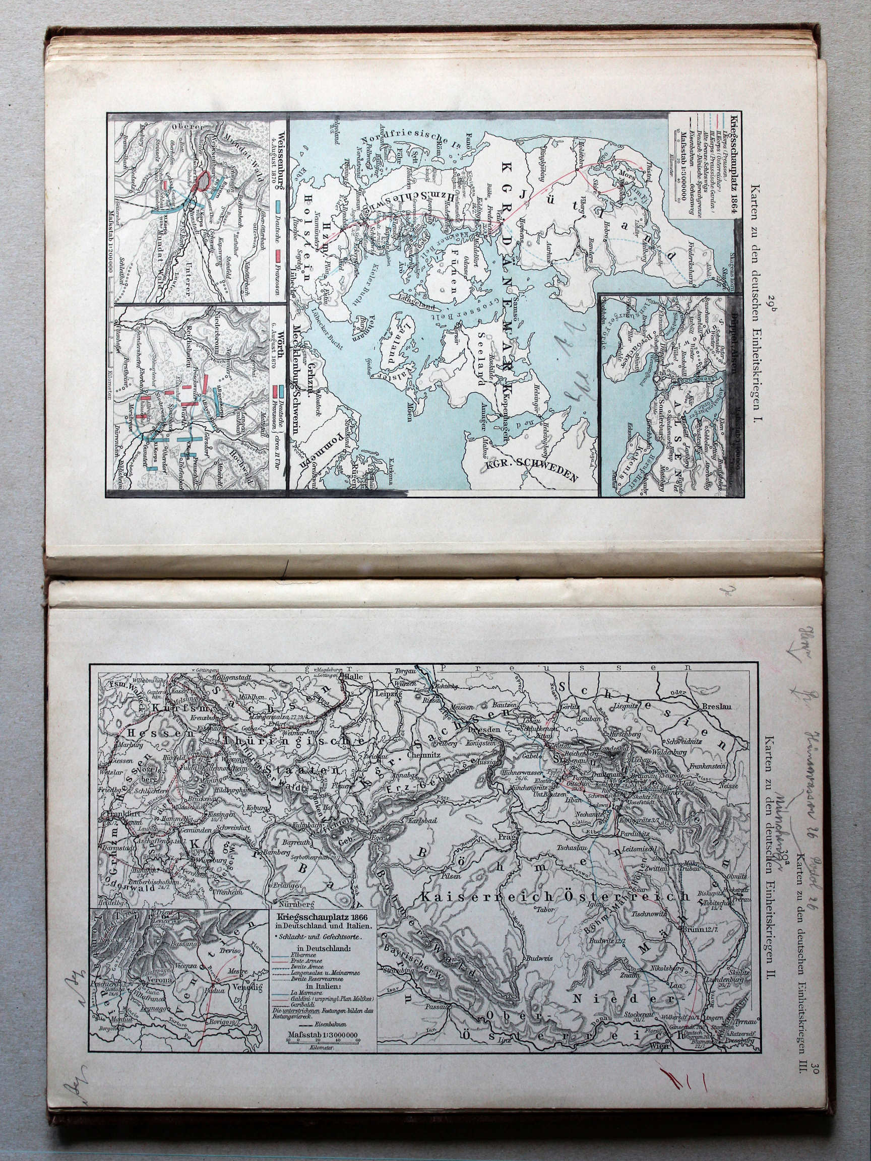
29b. Karten zu den deutschen Einheitskriegen I XL
Kaarten bij de Duitse eenwording I / Maps to the German unification I
Putzgers Historischer Schul-Atlas, 1900
geen overeenkomstige kaart / no corresponding map
 Putzgers Historischer Schul-Atlas, 1901
30a. Karten zu den deutschen Einheitskriegen II XL
Kaarten bij de Duitse eenwording II / Maps to the German unification II
Putzgers Historischer Schul-Atlas, 1900
geen overeenkomstige kaart / no corresponding map
 Putzgers Historischer Schul-Atlas, 1901
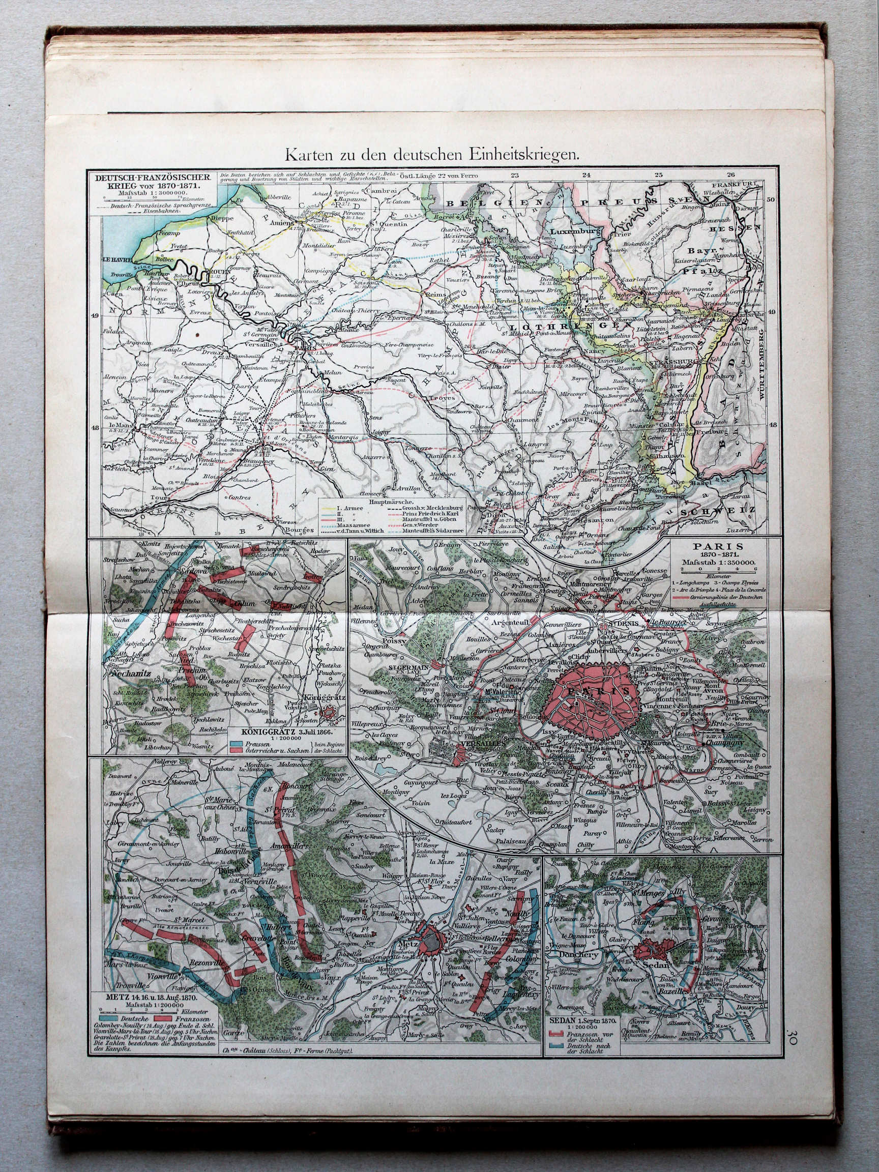
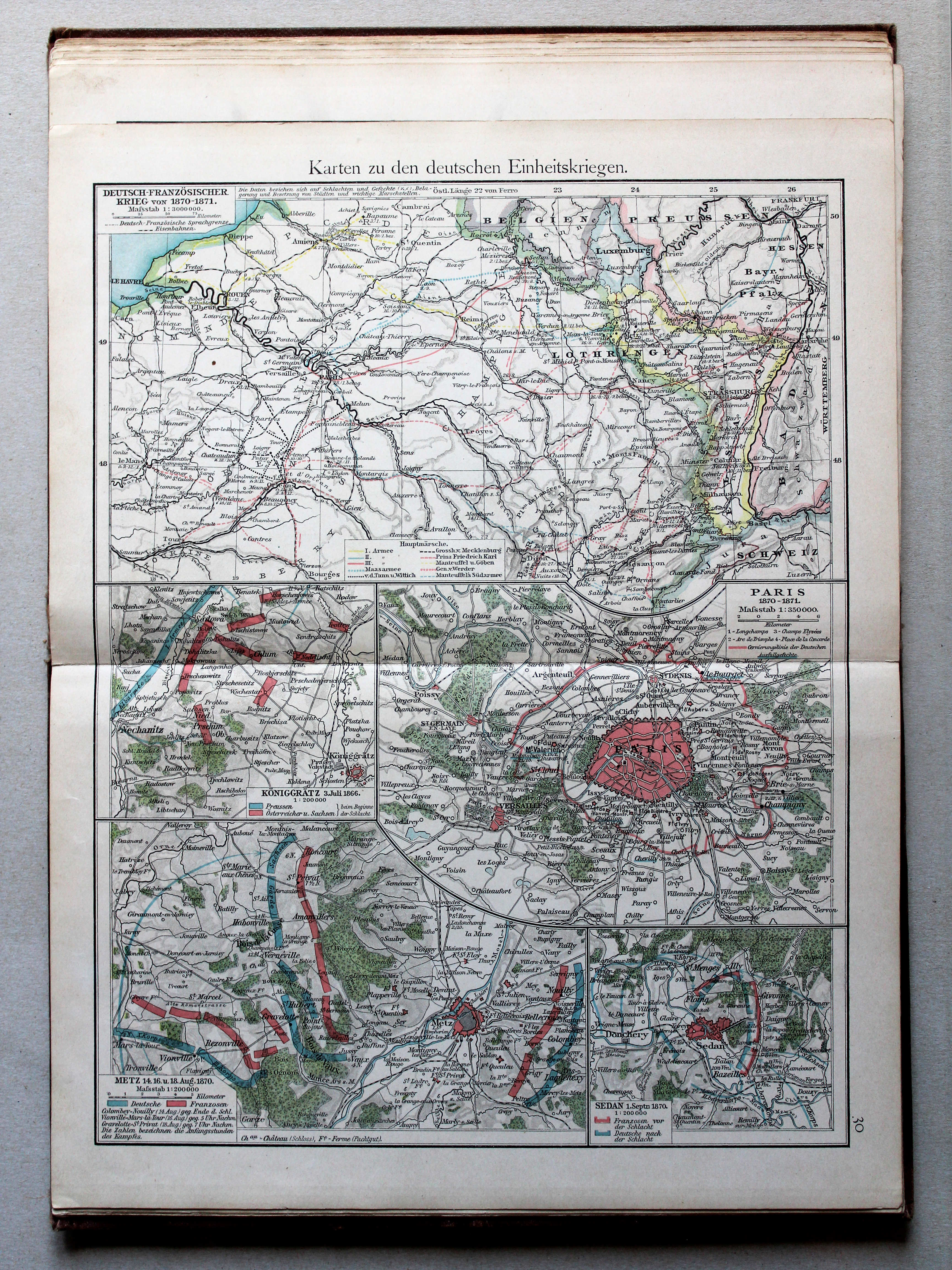
30. Karten zu den deutschen Einheitskriegen XL
Kaarten bij de Duitse eenwording / Maps to the German unification
 Putzgers Historischer Schul-Atlas, 1900
29. Karten zu den deutschen Einheitskriegen XL
Kaarten bij de Duitse eenwording / Maps to the German unification
 Putzgers Historischer Schul-Atlas, 1901
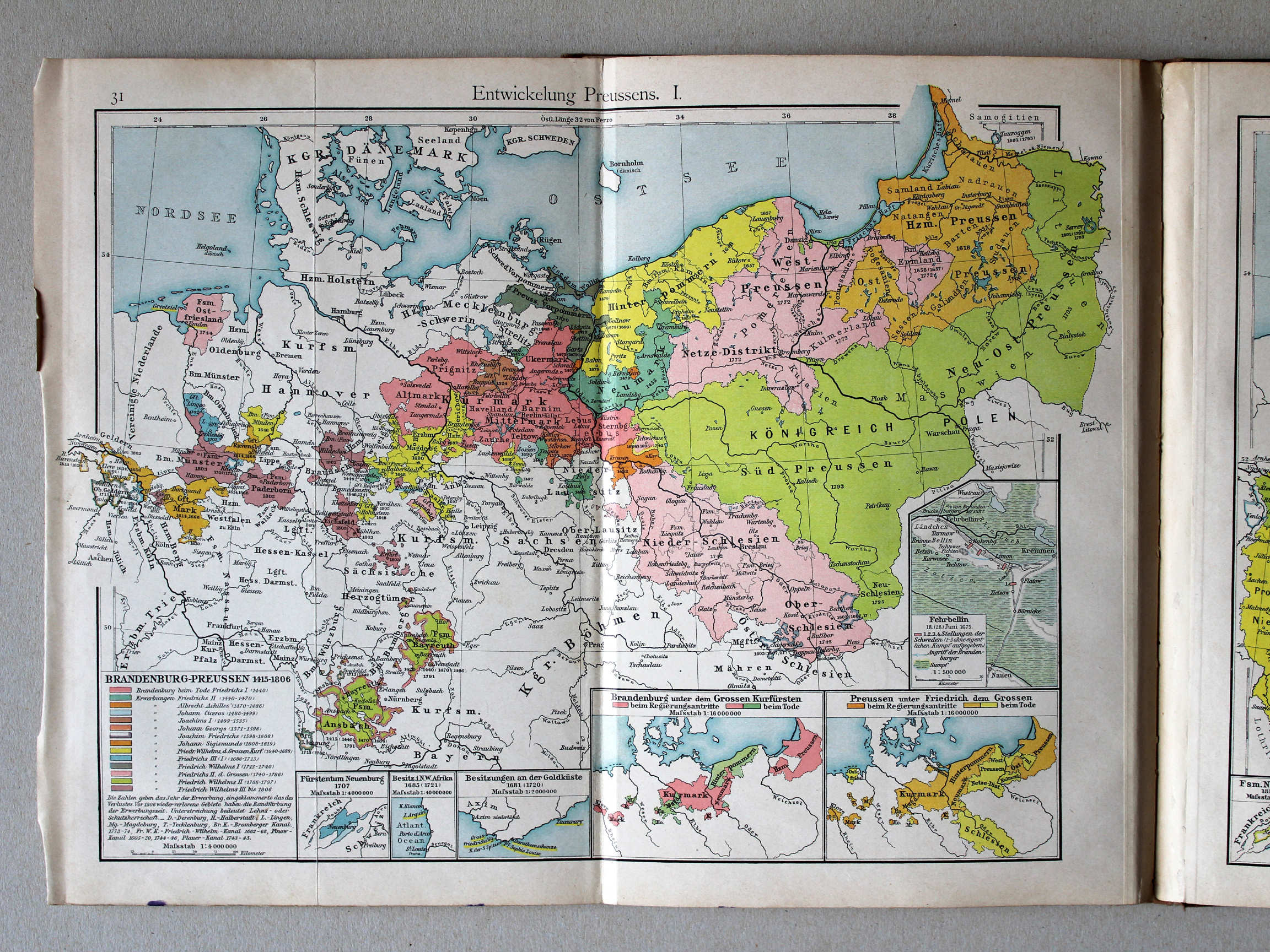
31. Entwickelung Preussens. I XL
Ontwikkeling van Pruisen I / Development of Prussia I
 Putzgers Historischer Schul-Atlas, 1900
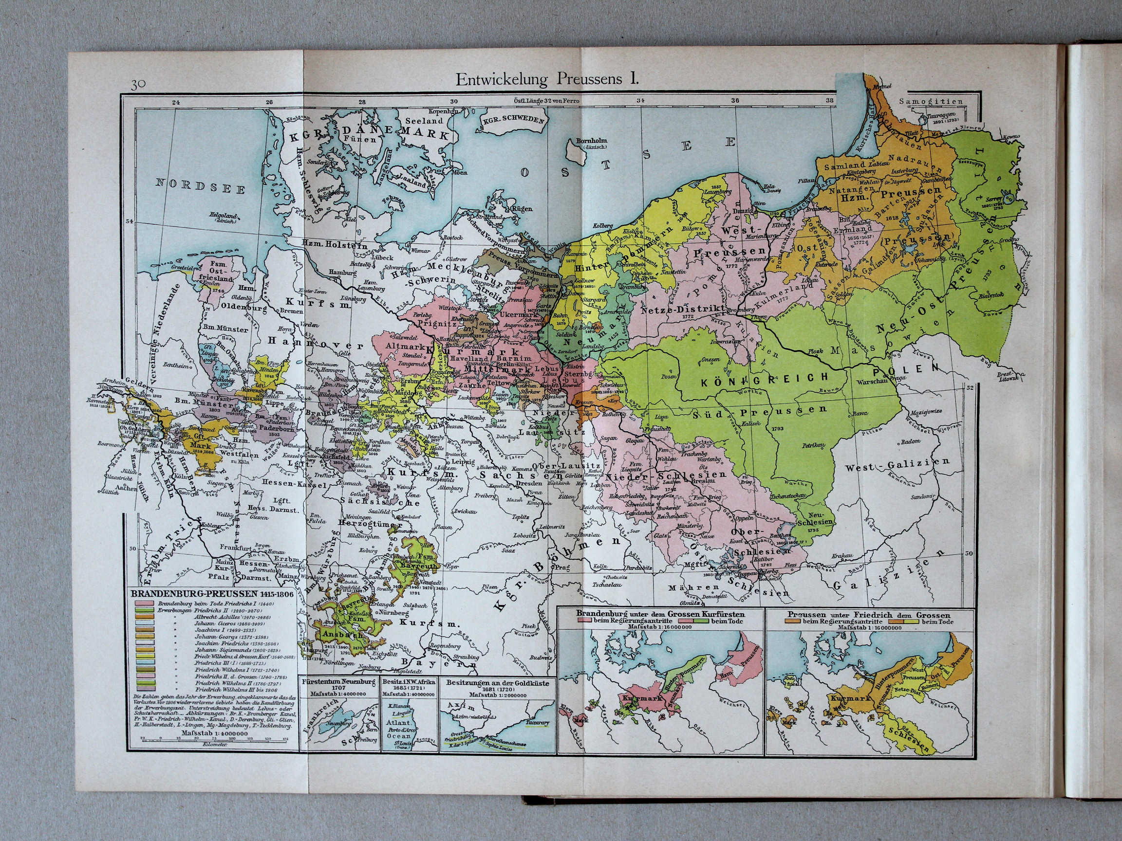
30. Entwickelung Preussens I XL
Ontwikkeling van Pruisen I / Development of Prussia I
 Putzgers Historischer Schul-Atlas, 1901
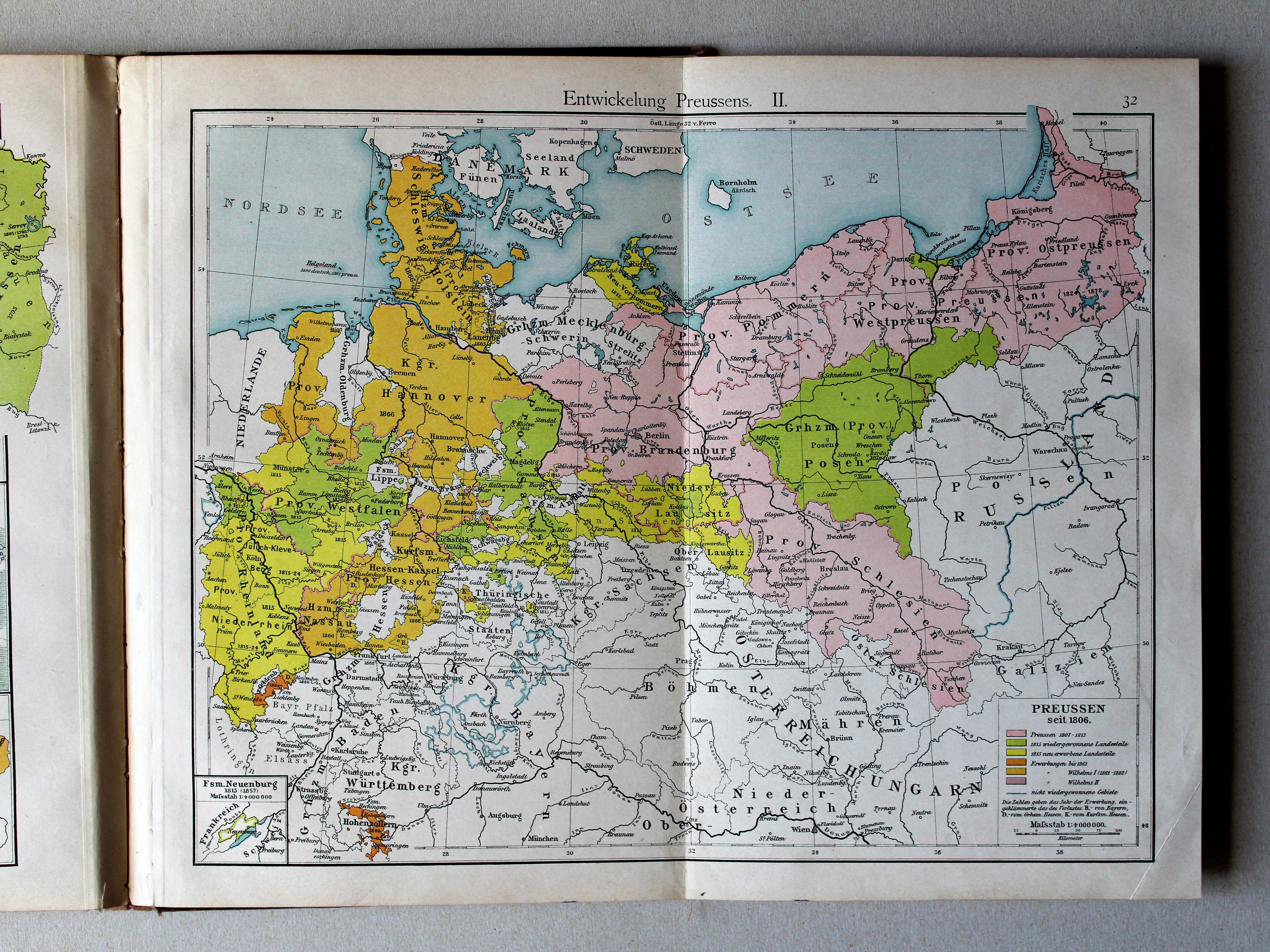
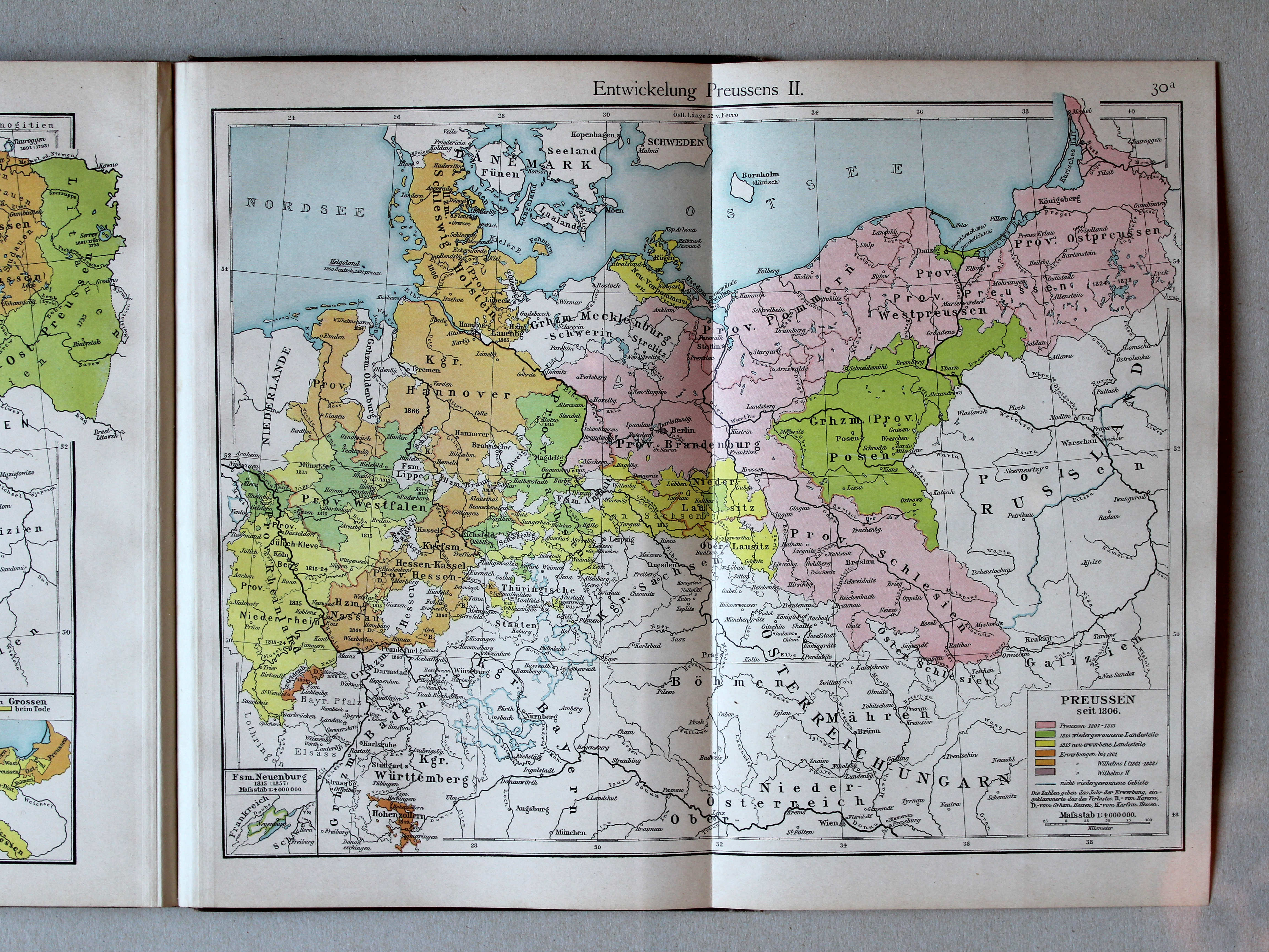
32. Entwickelung Preussens. II XL
Ontwikkeling van Pruisen II / Development of Prussia II
 Putzgers Historischer Schul-Atlas, 1900
30a. Entwickelung Preussens II XL
Ontwikkeling van Pruisen II / Development of Prussia II
 Putzgers Historischer Schul-Atlas, 1901
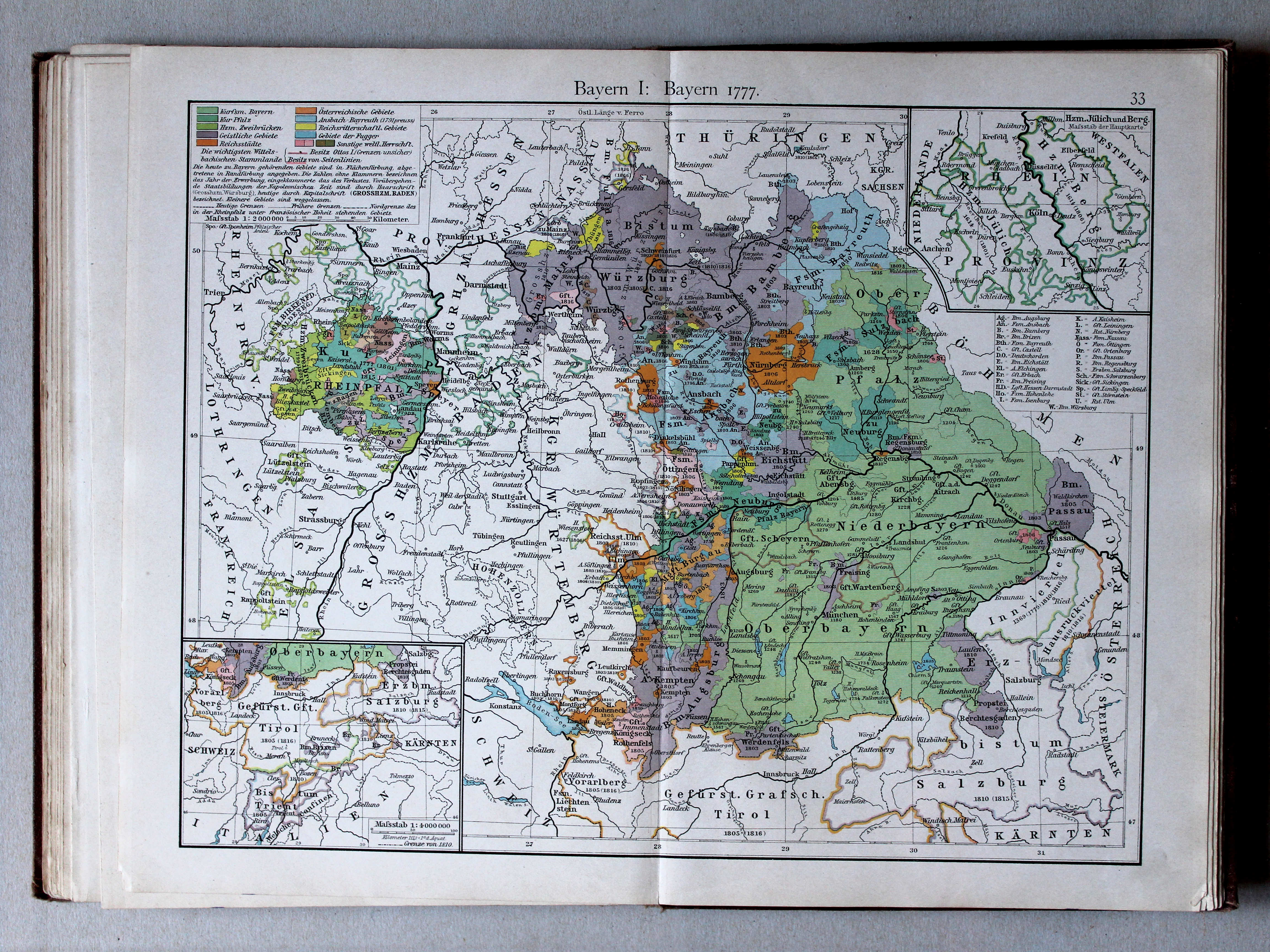
33. Bayern I: Bayern 1777 XL
Beieren I: Beieren 1777 / Bavaria I: Bavaria 1777
 Putzgers Historischer Schul-Atlas, 1900
33. Bayern I: Bayern 1777 XL
Beieren I: Beieren 1777 / Bavaria I: Bavaria 1777
 Putzgers Historischer Schul-Atlas, 1900
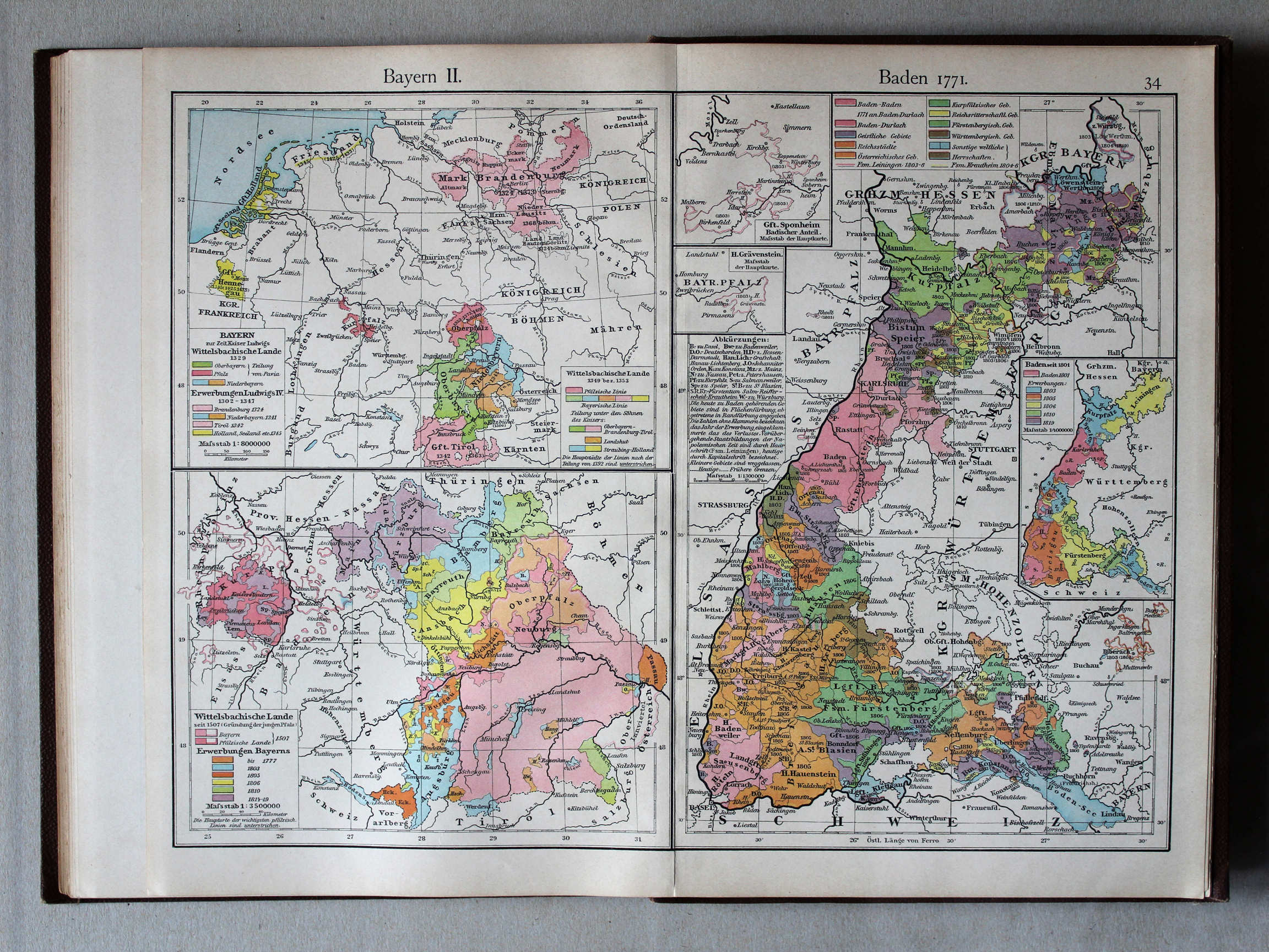
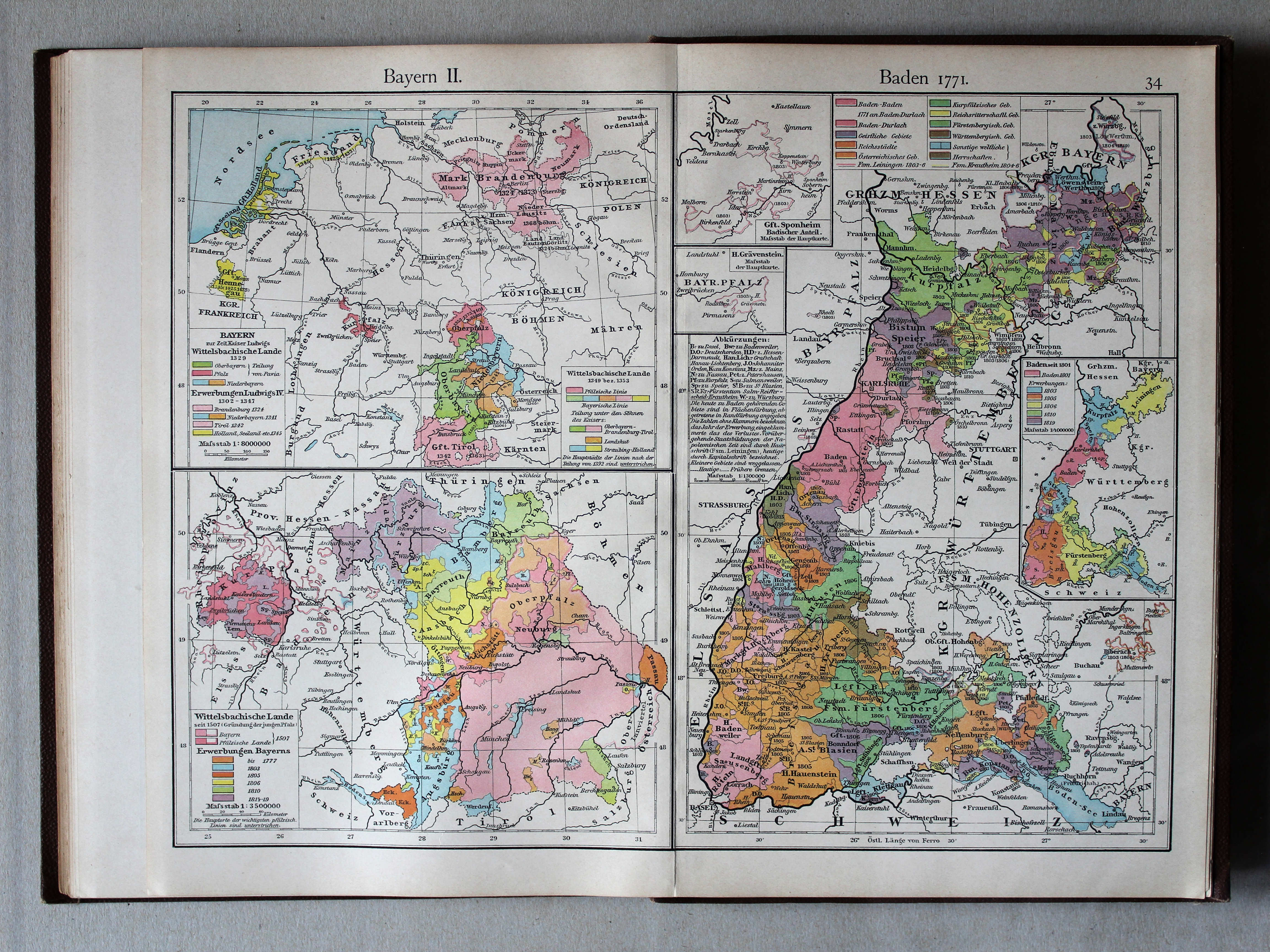
34. Bayern II. Baden 1771 XL
Beieren II, Baden 1771 / Bavaria II, Baden 1771
 Putzgers Historischer Schul-Atlas, 1900
34. Bayern II. Baden 1771 XL
Beieren II, Baden 1771 / Bavaria II, Baden 1771

 Putzgers Historischer Schul-Atlas, 1901
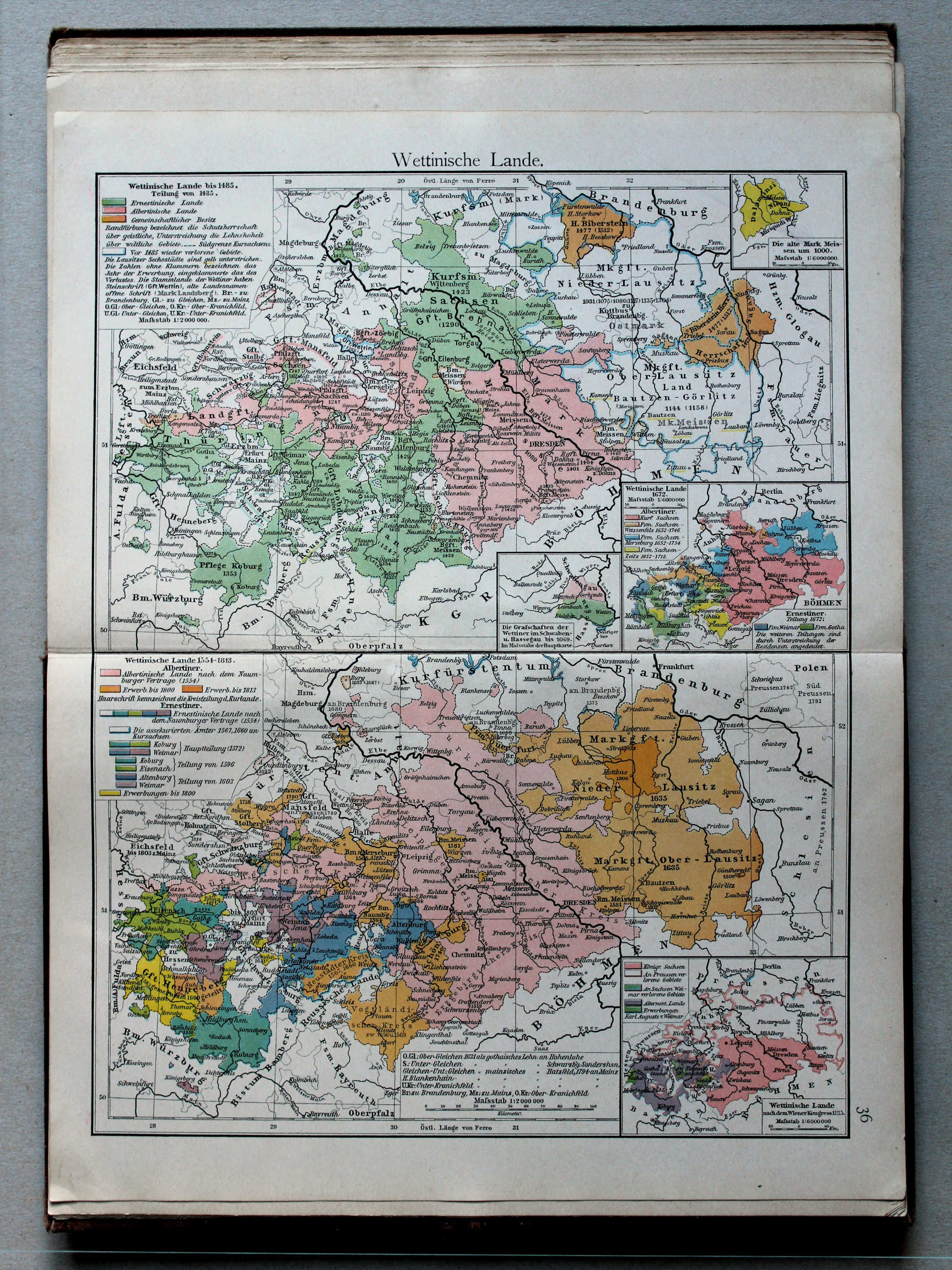
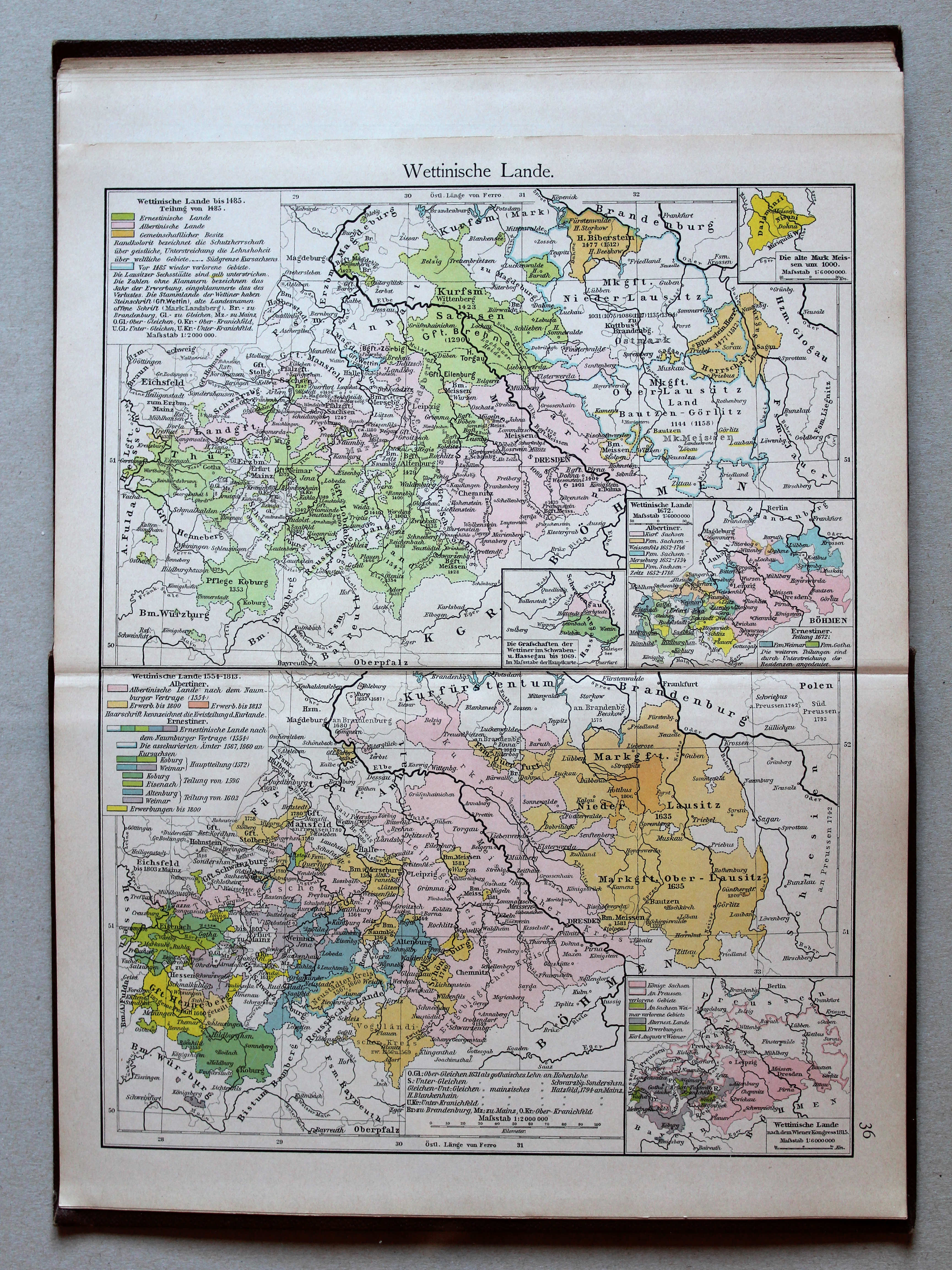
36. Wettinische Lande XL
Het gebied van het Huis Wettin / The lands of the House of Wettin
 Putzgers Historischer Schul-Atlas, 1900
36. Wettinische Lande XL
Het gebied van het Huis Wettin / The lands of the House of Wettin
 Putzgers Historischer Schul-Atlas, 1901
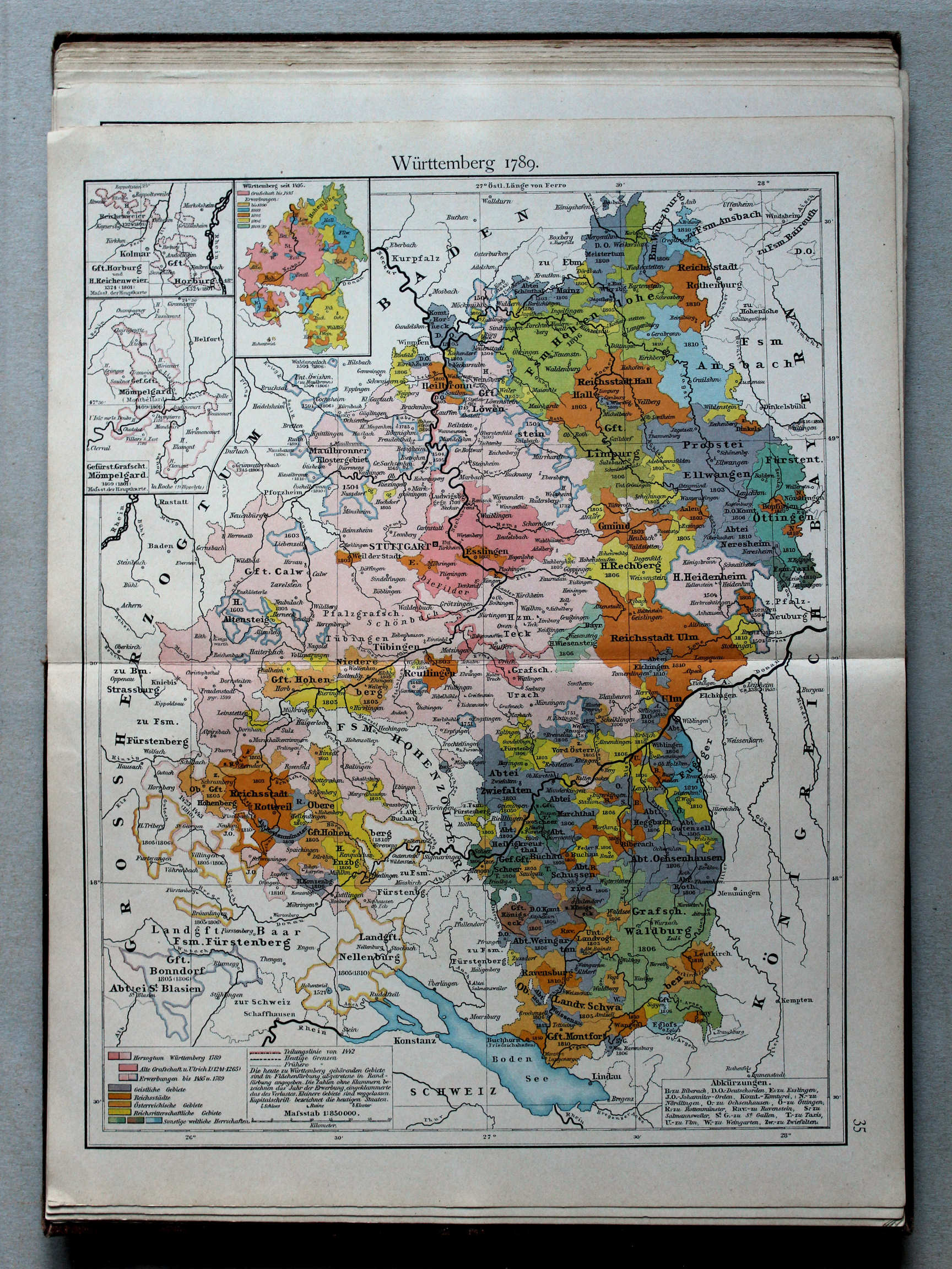
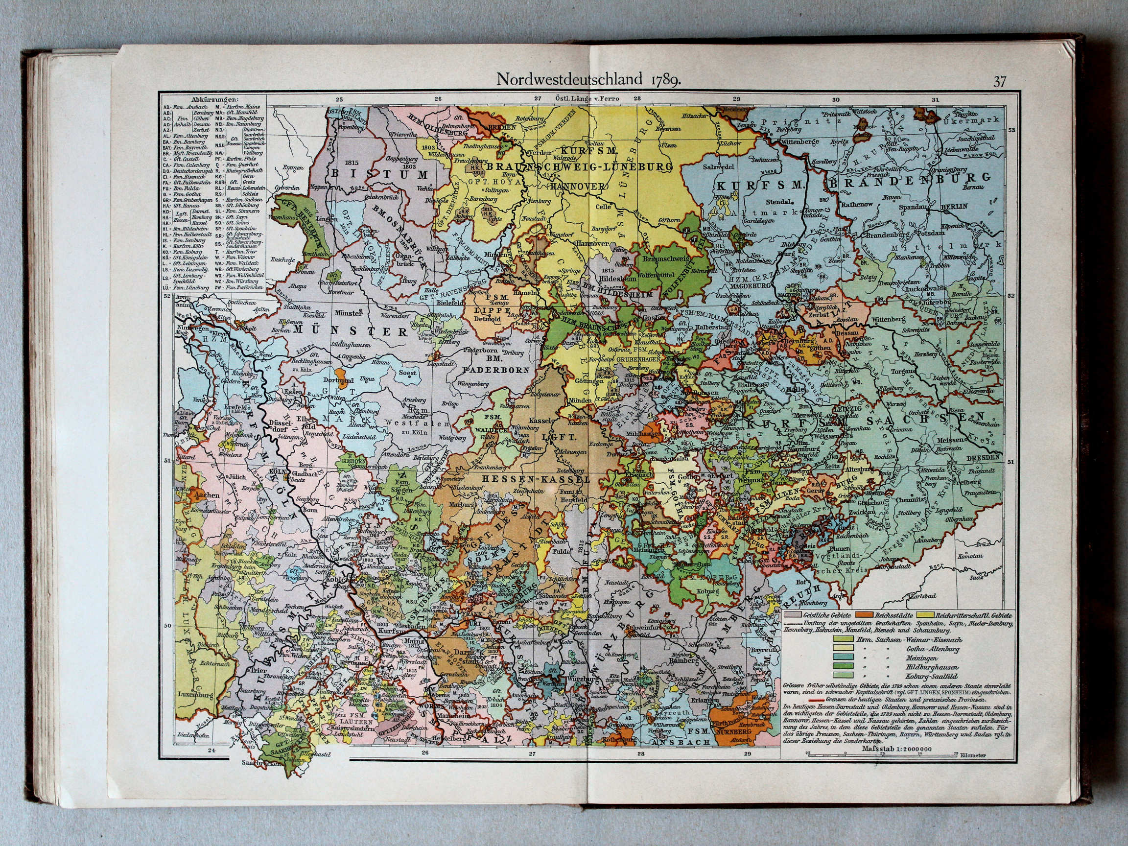
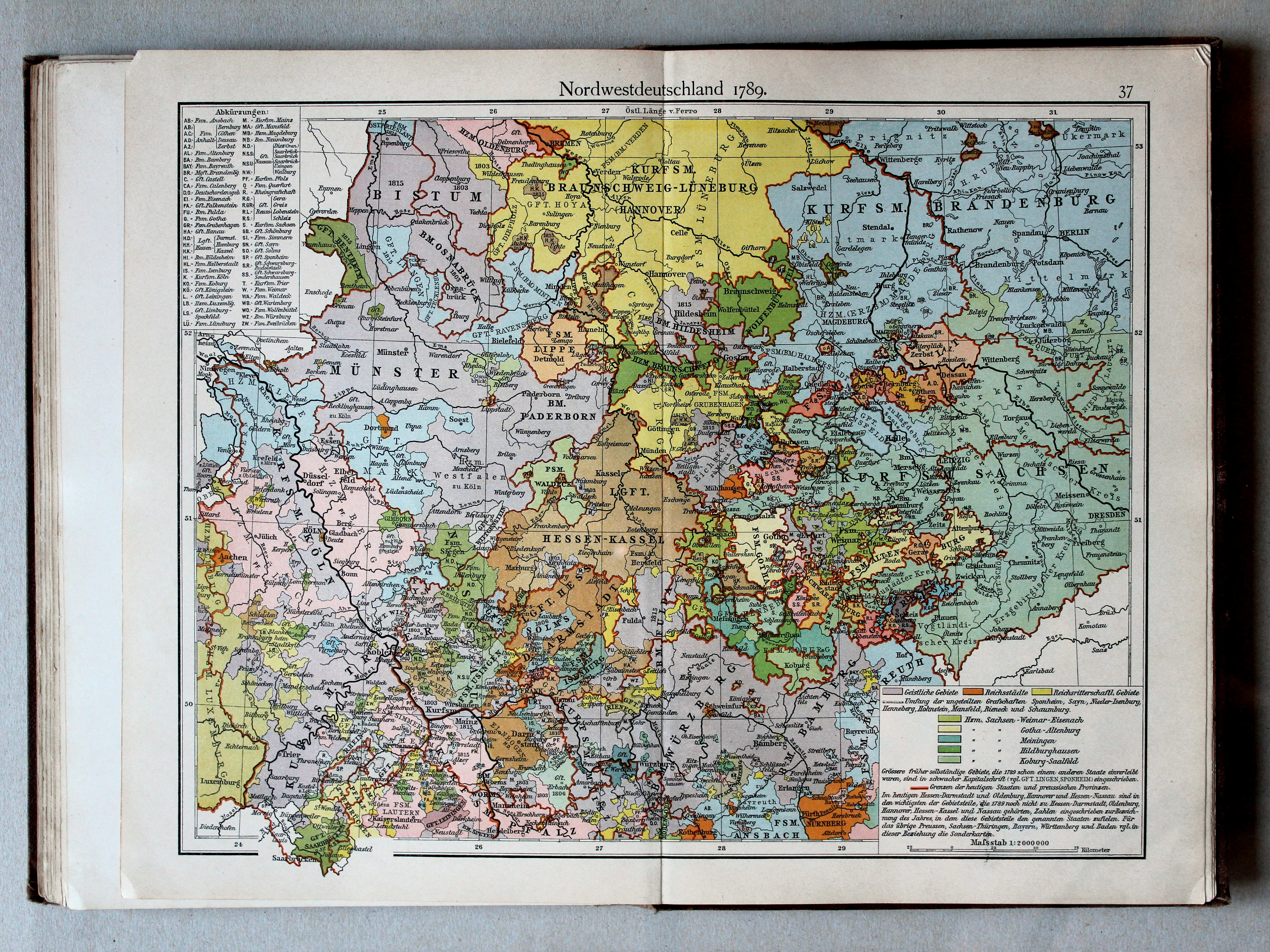
37. Nordwestdeutschland 1789 XL
Noordwest-Duitsland 1789 / Northwest Germany 1789
 Putzgers Historischer Schul-Atlas, 1900
37. Nordwestdeutschland 1789 XL
Noordwest-Duitsland 1789 / Northwest Germany 1789
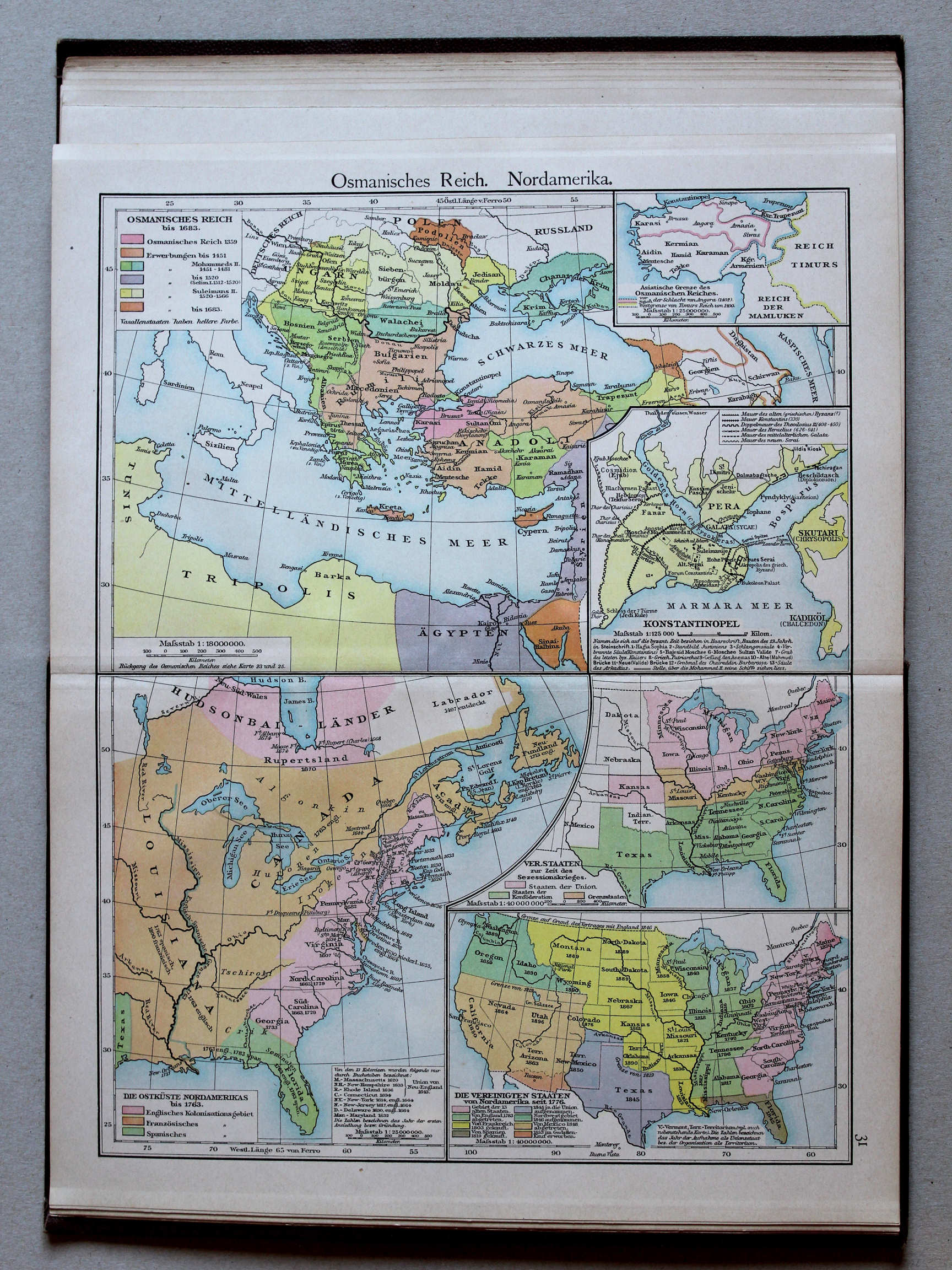 Putzgers Historischer Schul-Atlas, 1900
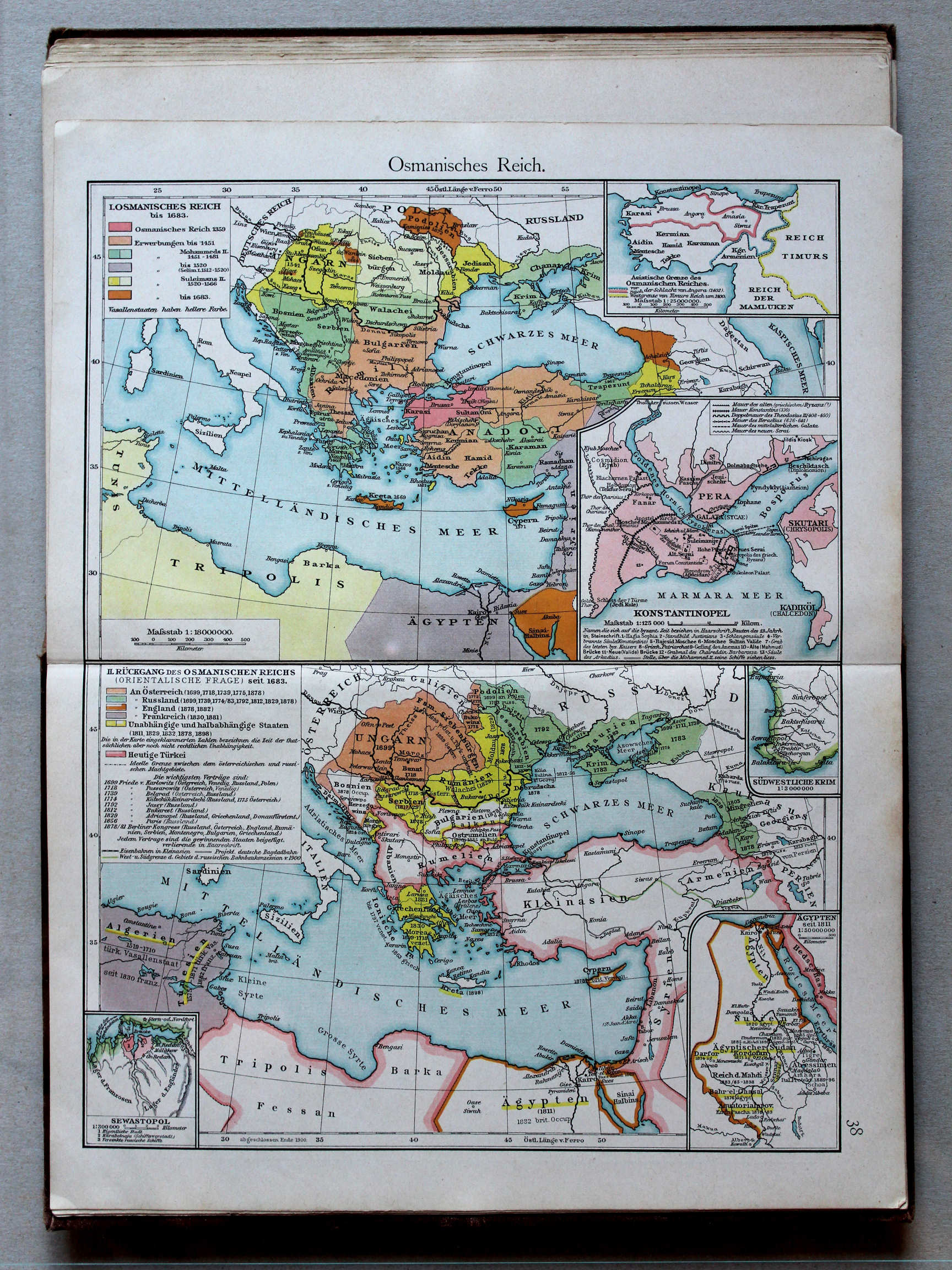
31. Osmanisches Reich. Nordamerika XL
Ottomaanse Rijk. Noord-Amerika / Ottoman Empire. North America
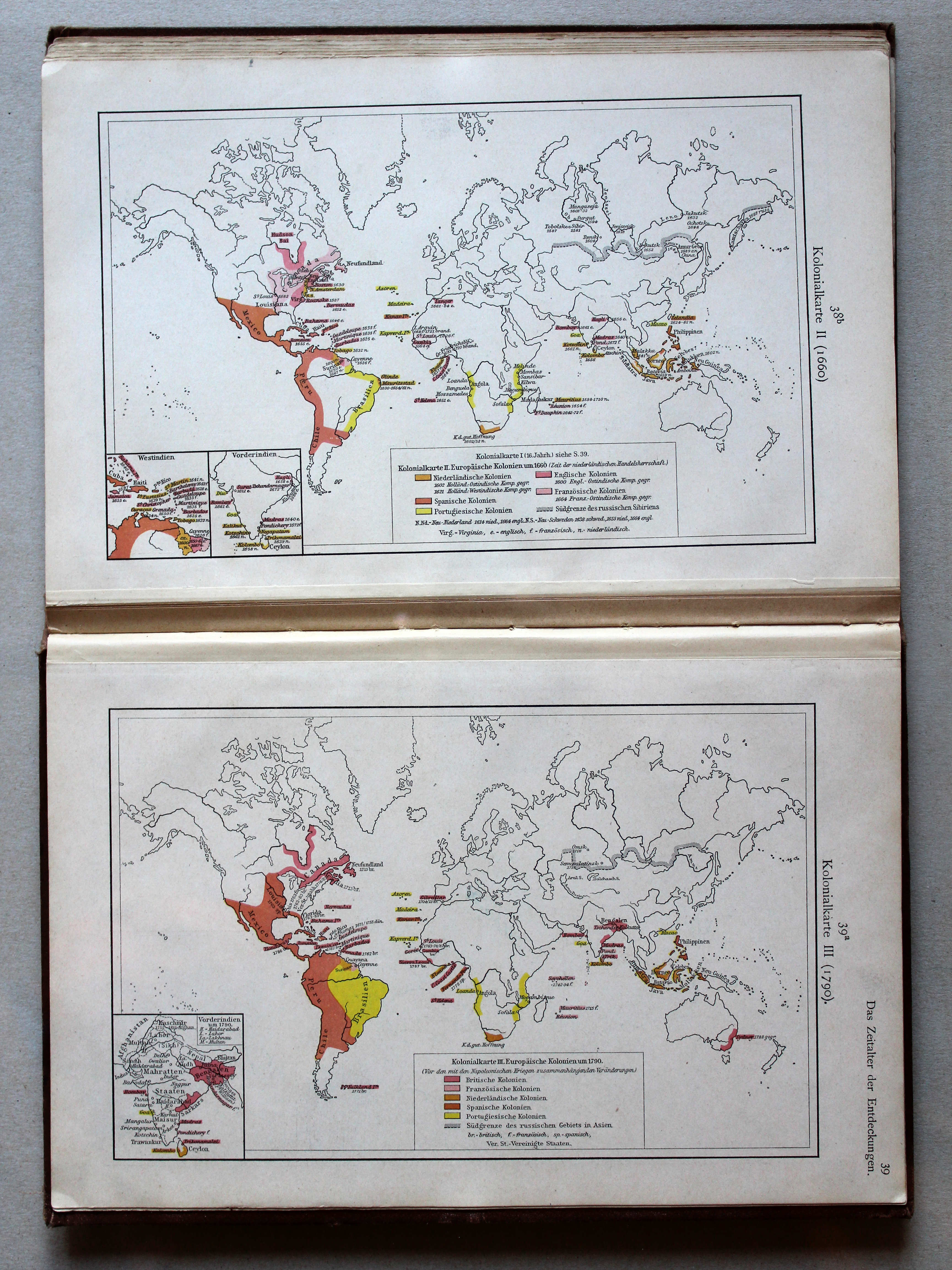
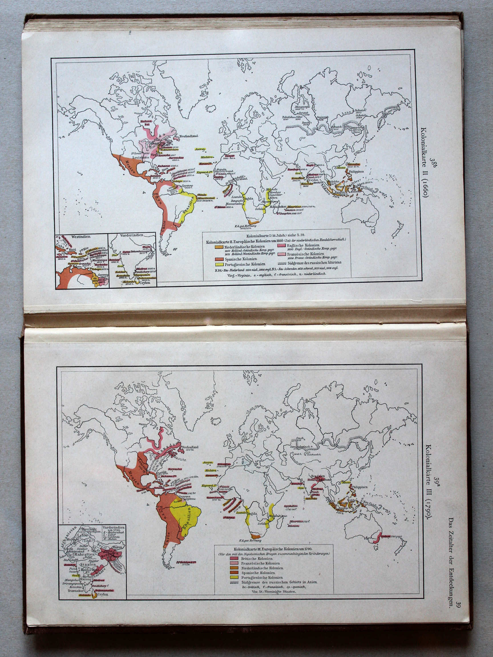 Putzgers Historischer Schul-Atlas, 1901
38b. Kolonialkarte II (1660) XL
Koloniën II (1660) / Colonies II (1660)
39a. Kolonialkarte III (1790) XL
Koloniën III (1790) / Colonies III (1790)
Putzgers Historischer Schul-Atlas, 1900
geen overeenkomstige kaart / no corresponding map
 Putzgers Historischer Schul-Atlas, 1901
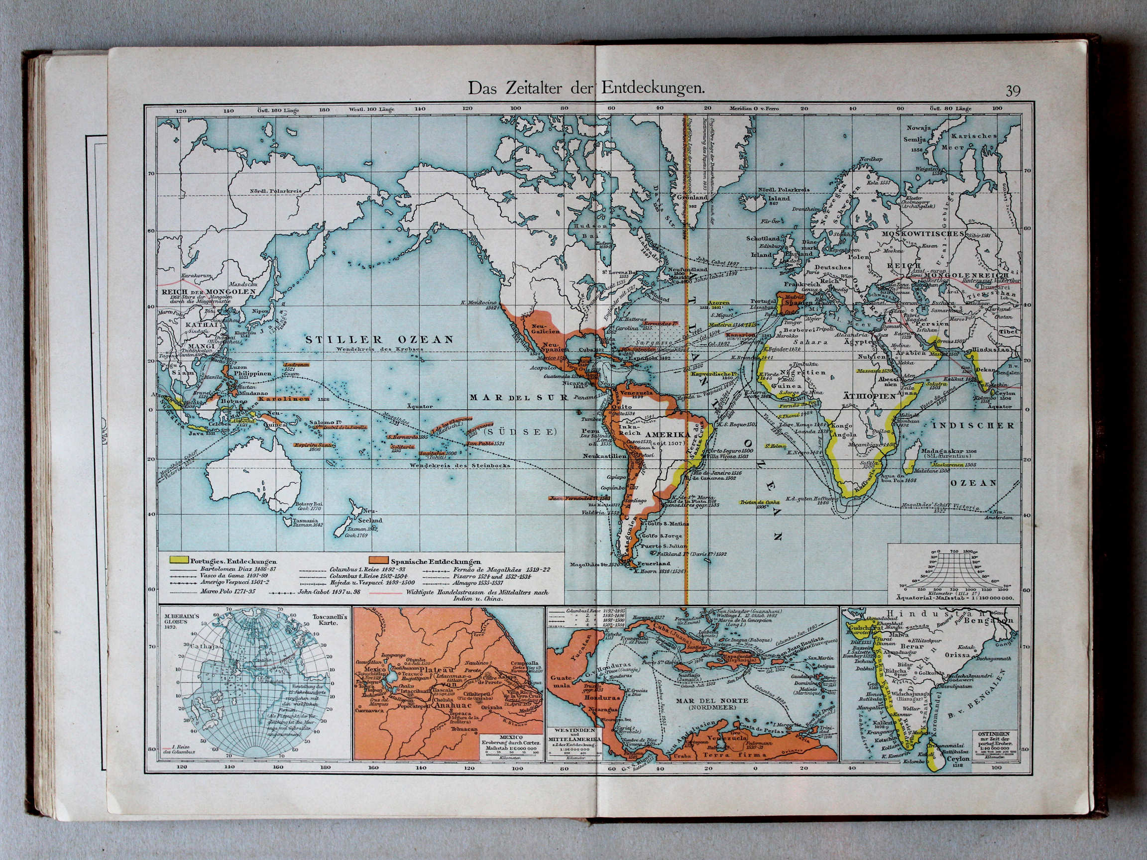
39. Das Zeitalter der Entdeckungen XL
Het tijdperk van de grote ontdekkingen / The Age of Discovery
 Putzgers Historischer Schul-Atlas, 1900
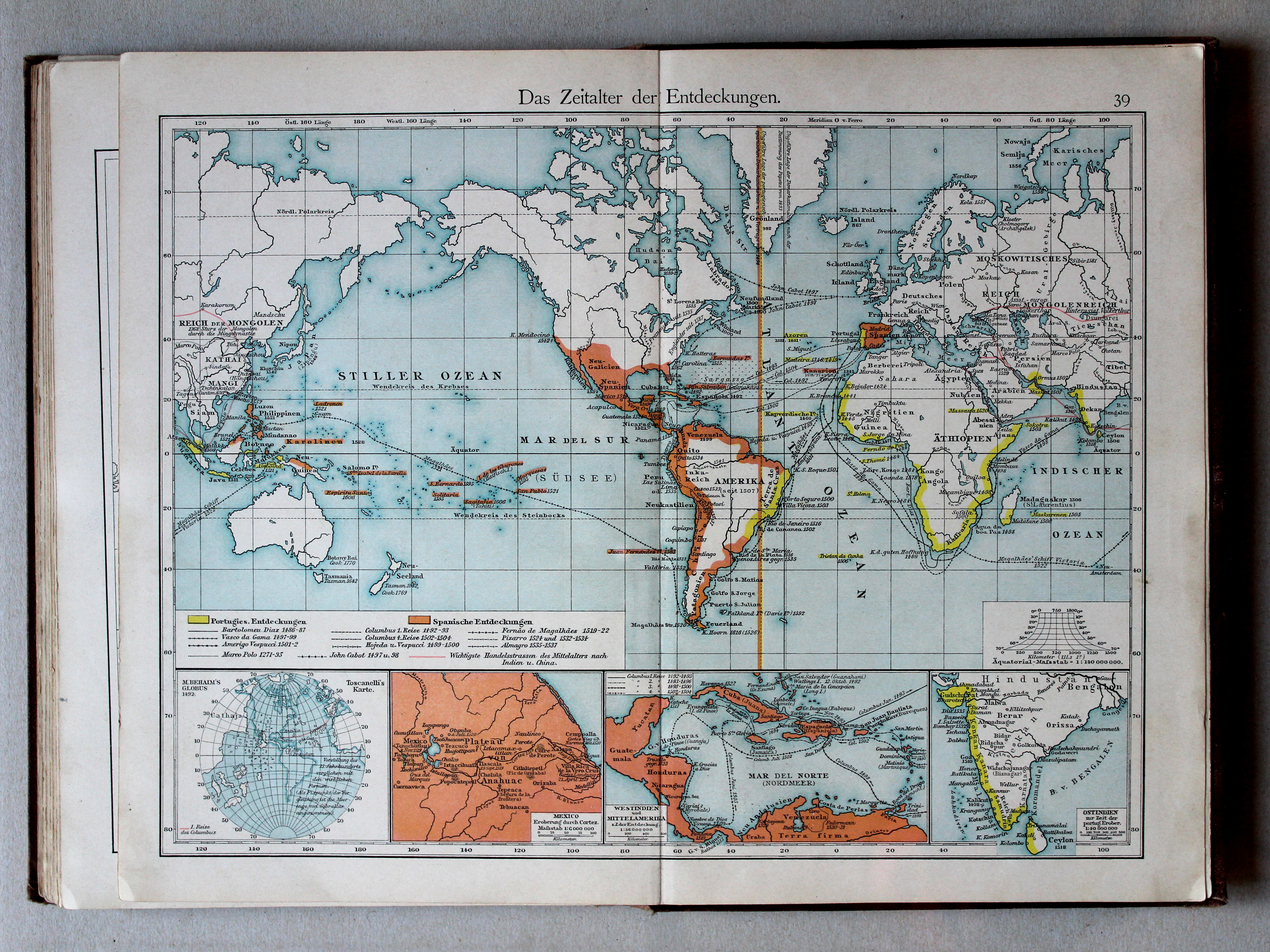
32. Das Zeitalter der Entdeckungen XL
Het tijdperk van de grote ontdekkingen / The Age of Discovery
 Putzgers Historischer Schul-Atlas, 1901
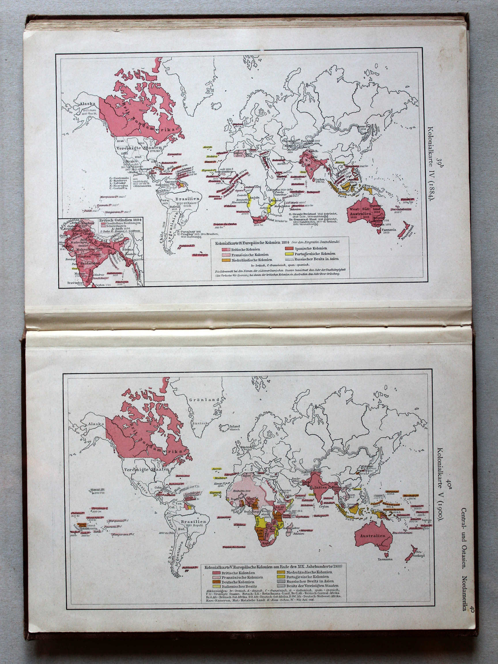
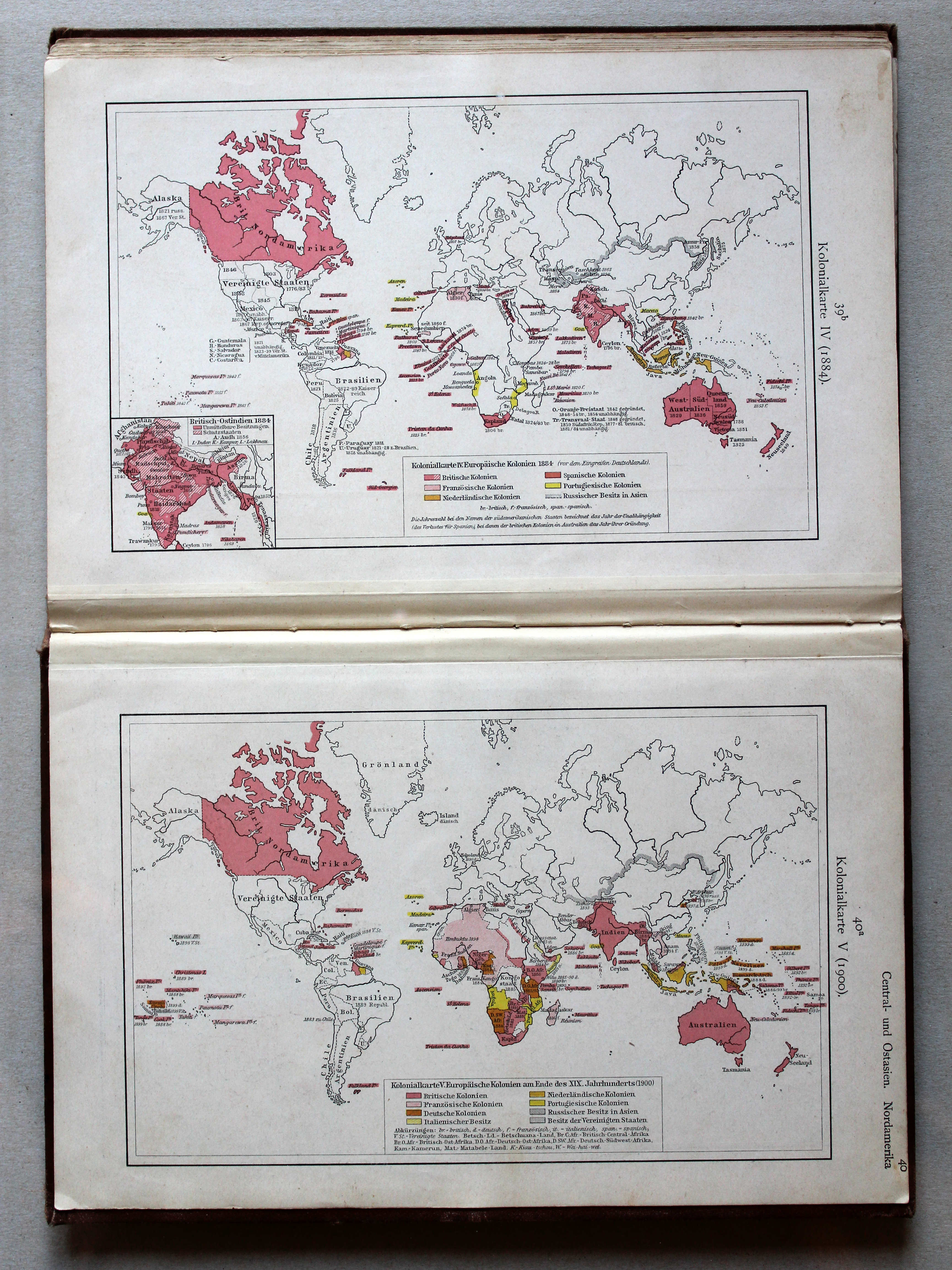
39b. Kolonialkarte IV (1884) XL
Koloniën IV (1884) / Colonies IV (1884)
40a. Kolonialkarte V (1900) XL
Koloniën V (1900) / Colonies V (1900)
Putzgers Historischer Schul-Atlas, 1900
geen overeenkomstige kaart / no corresponding map
 Putzgers Historischer Schul-Atlas, 1901
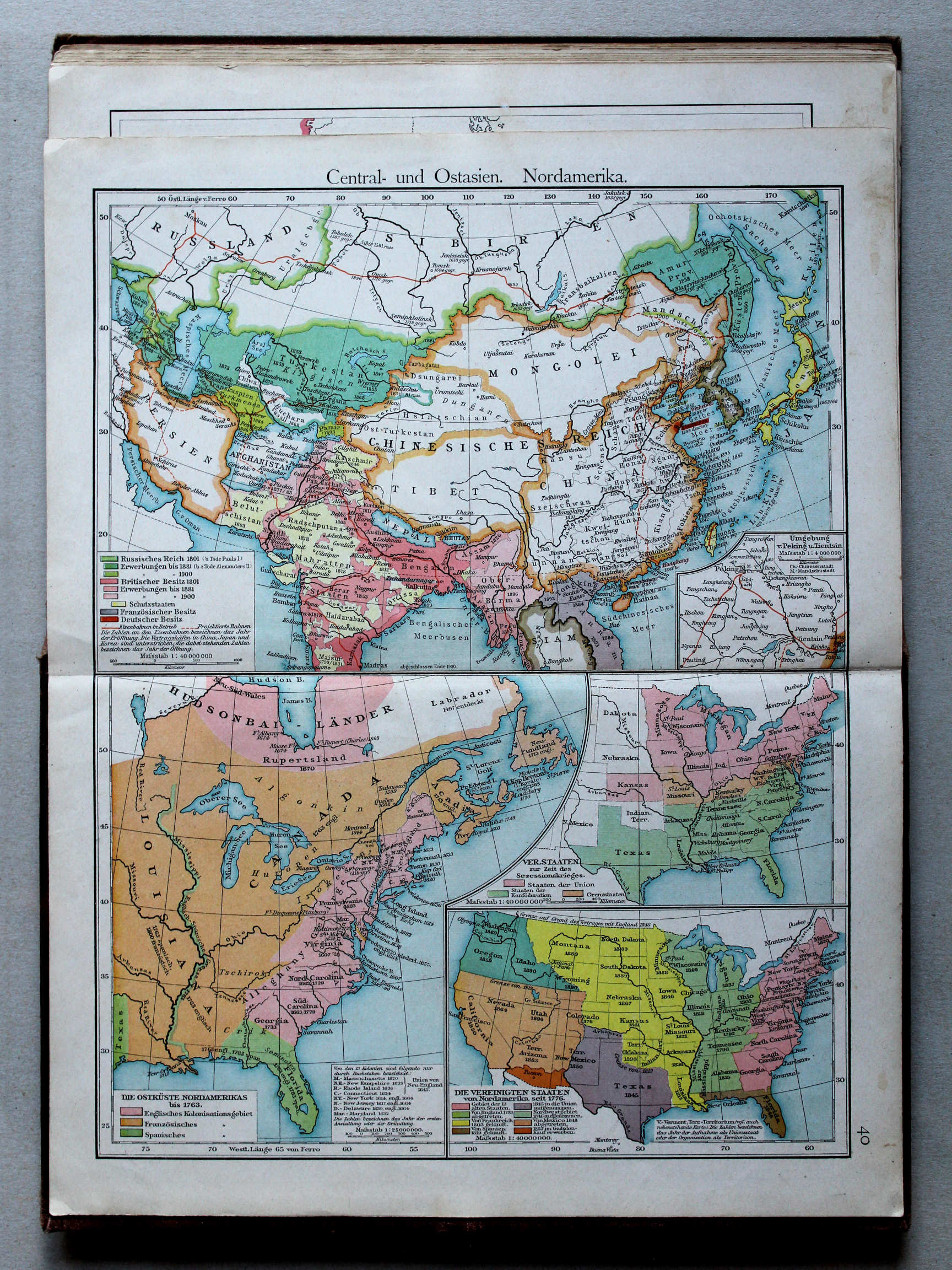
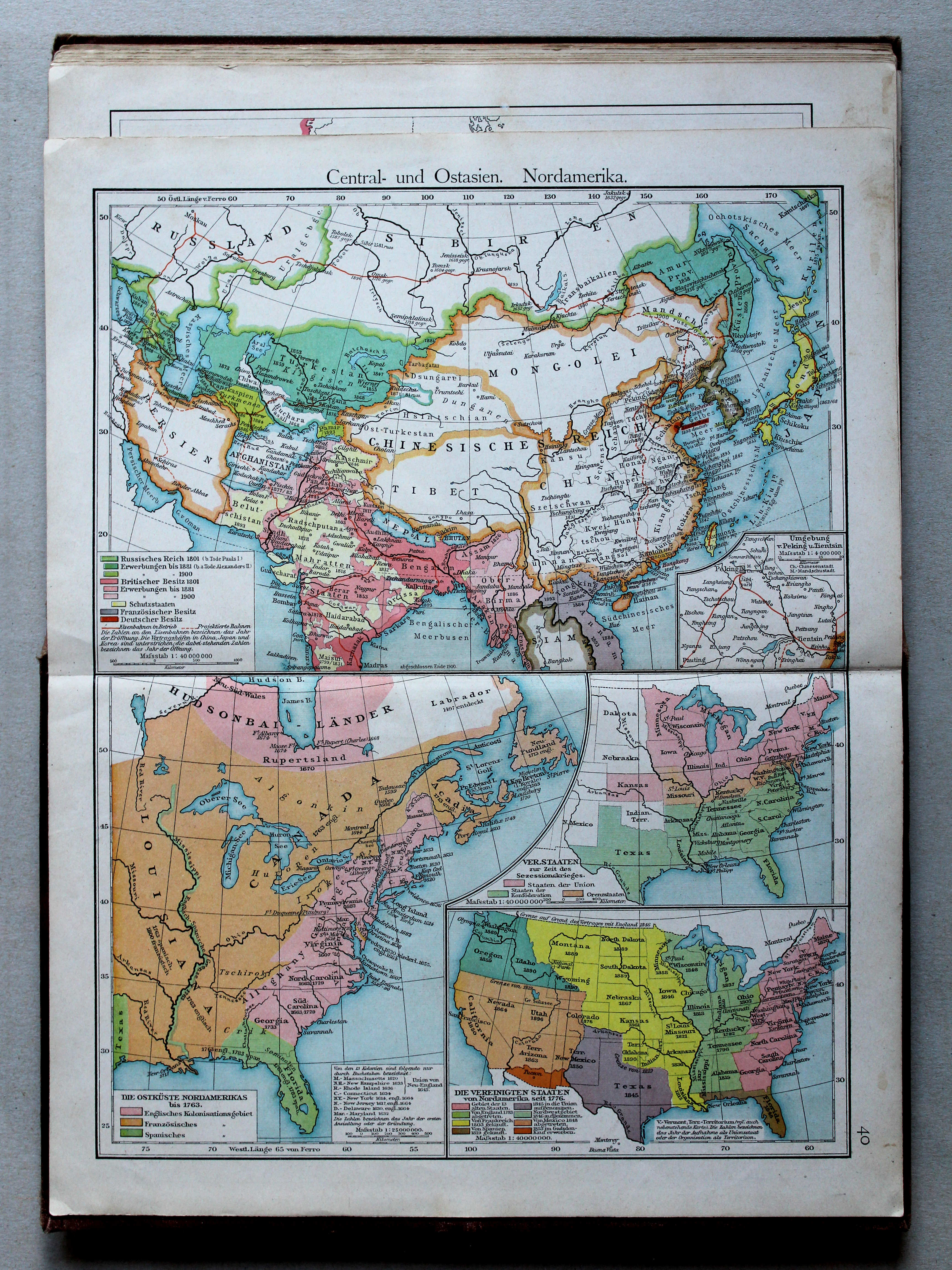
40. Zentral- und Ostasien. Nordamerika XL
Centraal- en Oost-Azië. Noord-Amerika / Central and East Asia. North America
Putzgers Historischer Schul-Atlas, 1900
31. Osmanisches Reich. Nordamerika XL
Ottomaanse Rijk. Noord-Amerika / Ottoman Empire. North America
 Putzgers Historischer Schul-Atlas, 1901
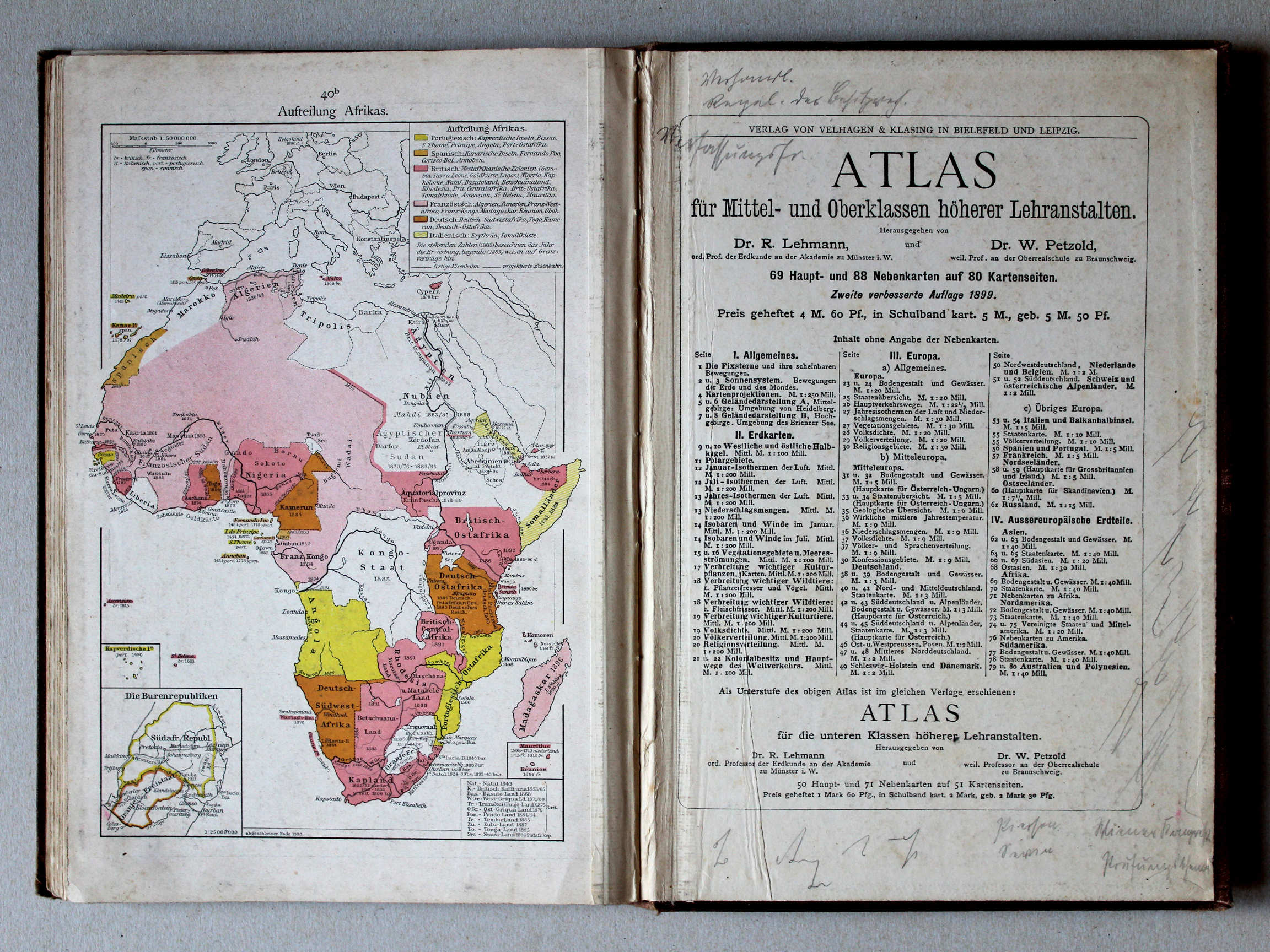
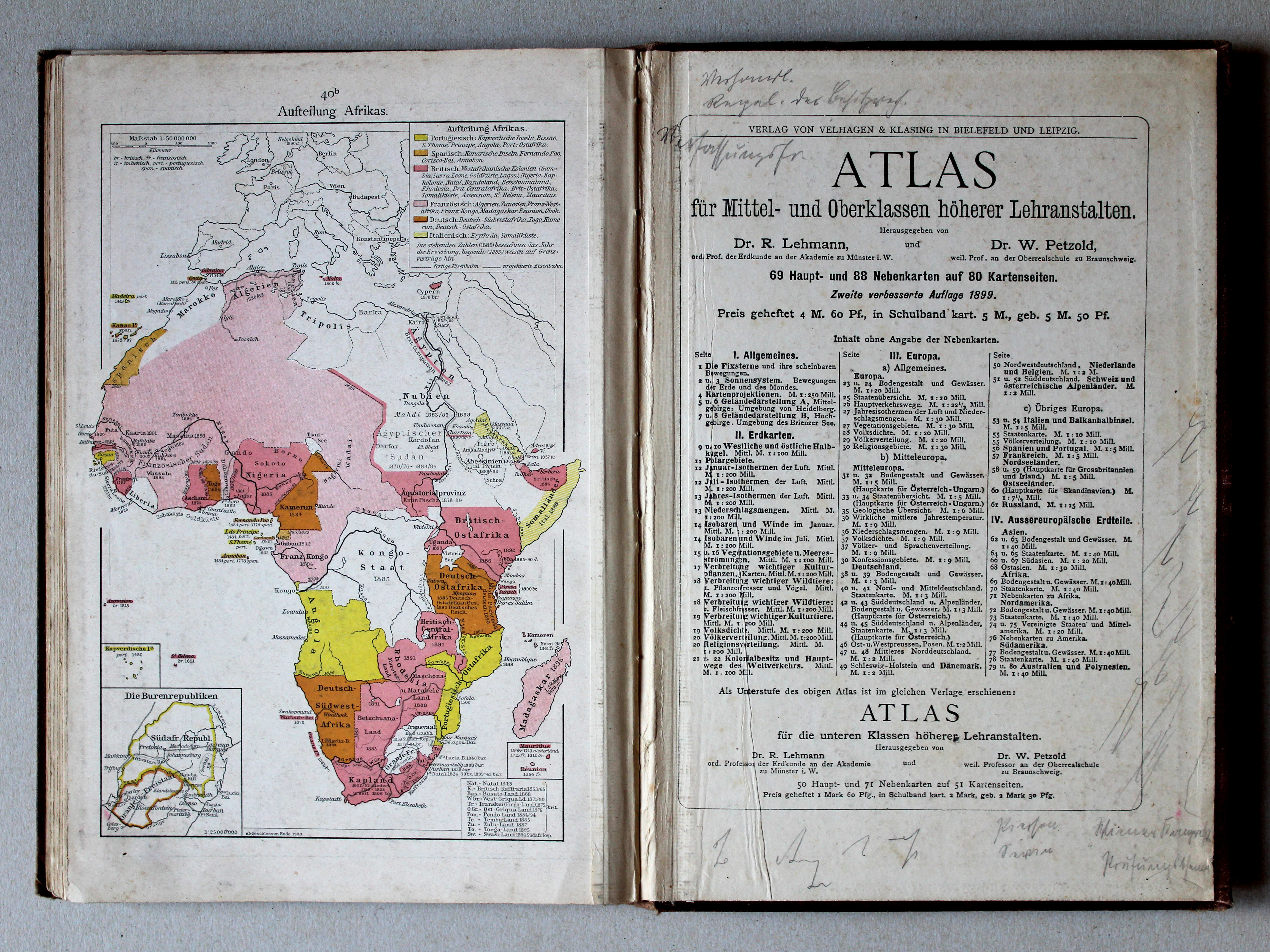
40b. Aufteilung Afrikas XL
Opdeling van Afrika / Scramble for Africa
Putzgers Historischer Schul-Atlas, 1900
geen overeenkomstige kaart / no corresponding map
© M. Witkam, 2013
![]()
![]()