Putzgers Historischer Schul-Atlas, 14e druk (1888) en
Droysens Historischer Handatlas (1886)
See below for (a summary of) this text in English.
Hieronder staan plaatjes van Putzgers Historischer Schul-Atlas (14e druk) en Droysens Historischer Handatlas ter vergelijking naast elkaar. Daarbij horen ook de volgende pagina's
- Beschrijving van Putzgers Historischer Schul-Atlas
- Plaatjes van Putzgers Historischer Schul-Atlas
- Tabellen en lijsten bij Putzgers Historischer Schul-Atlas
en
- Beschrijving van Droysens Historischer Handatlas
- Plaatjes van Droysens Historischer Handatlas
- Tabellen en lijsten bij Droysens Historischer Handatlas
Plaatjes
Klik op een plaatje voor een vergroting.
- Kaarten
- Karten zur Geschichte des Altertums (Oudheid)
- Karten zur Geschichte des Mittelaltes und der Neuzeit (Middeleeuwen, Nieuwe Tijd)
N.B. bladformaat in Putzgers Historischer Schul-Atlas: 33 × 25 cm;
in Droysens Historischer Handatlas: 2 bladzijden 55 × 41 cm,
1 bladzijde 27,5 × 41 cm (B × H)
Putzgers Historischer Schul-Atlas, 14th edition (1888) and
Droysens Historischer Handatlas (1886)
- Below are pictures a and b side by side for comparison purposes. Related pages
- Description of Putzgers Historischer Schul-Atlas
- Pictures of Putzgers Historischer Schul-Atlas
- Tables and lists to Putzgers Historischer Schul-Atlas
- Description of Droysens Historischer Handatlas
- Pictures of Droysens Historischer Handatlas
- Tables and lists to Droysens Historischer Handatlas
Pictures
Click on a picture to enlarge.
- Maps
- Karten zur Geschichte des Altertums (Ancient History)
- Karten zur Geschichte des Mittelaltes und der Neuzeit (Medieval and Modern History)
N.B. sheet size in Putzgers Historischer Schul-Atlas: 33 × 25 cm;
in Droysens Historischer Handatlas: 2 pages 55 × 41 cm,
1 page 27.5 × 41 cm (W × H)
Kaarten / Maps I. Karten zur Geschichte des Altertums
(Oudheid / Ancient history)

 Droysens Historischer Handatlas, 1886
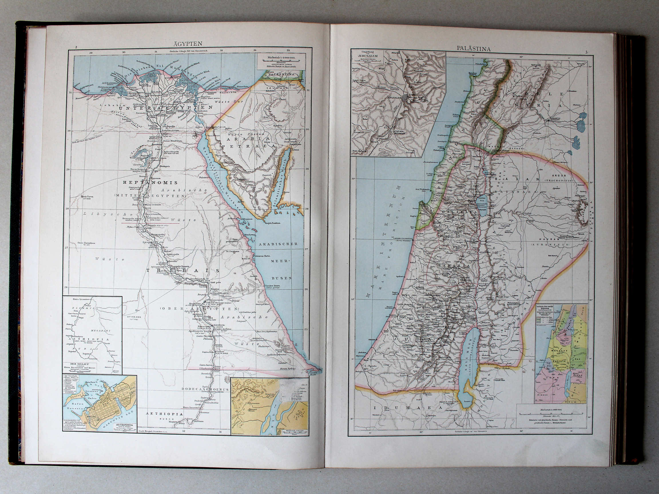
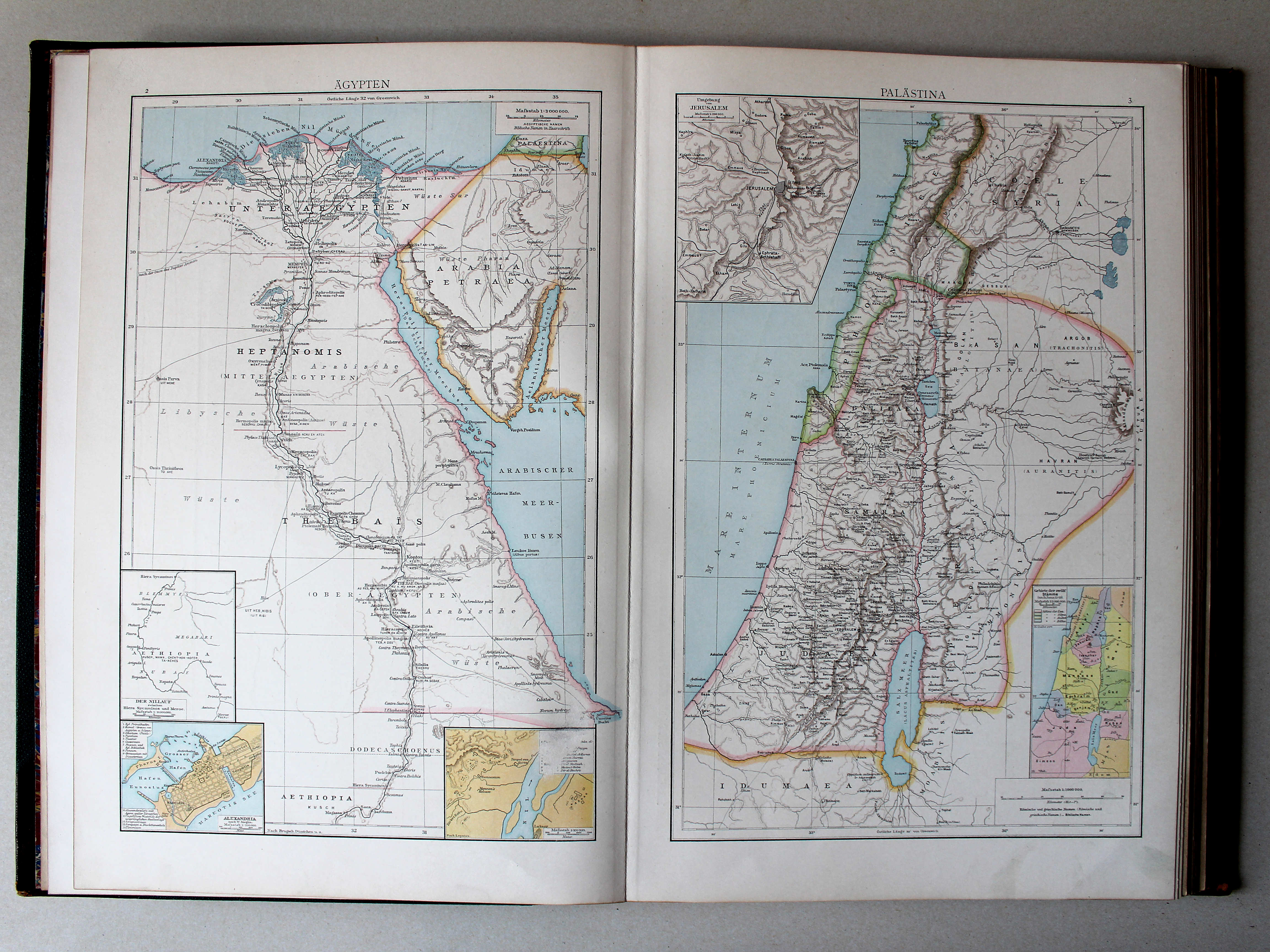
2. Ägypten XL
Egypte / Egypt
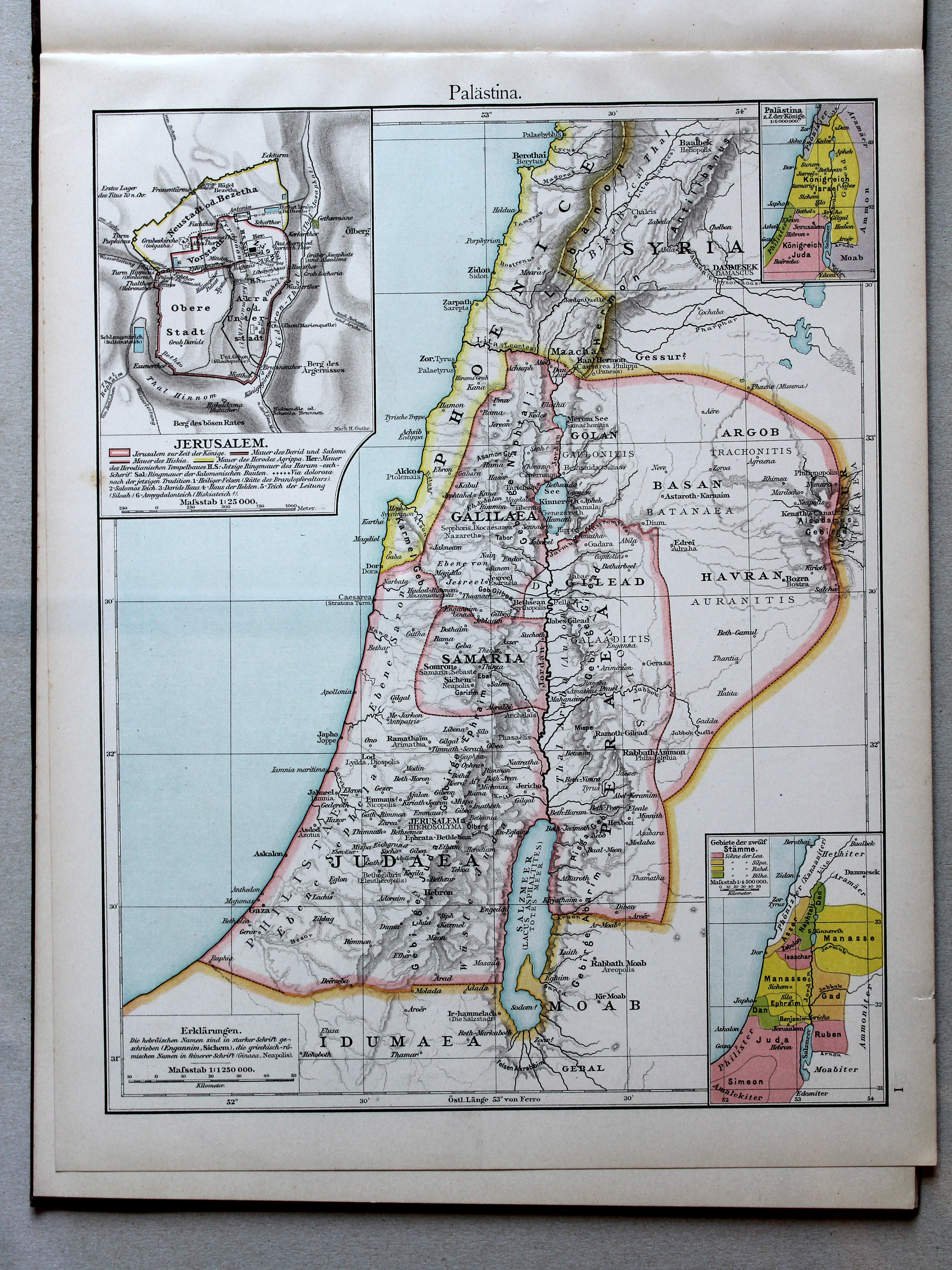
3. Palästina XL
Palestina / Palestine
 Putzgers Historischer Schul-Atlas, 1888
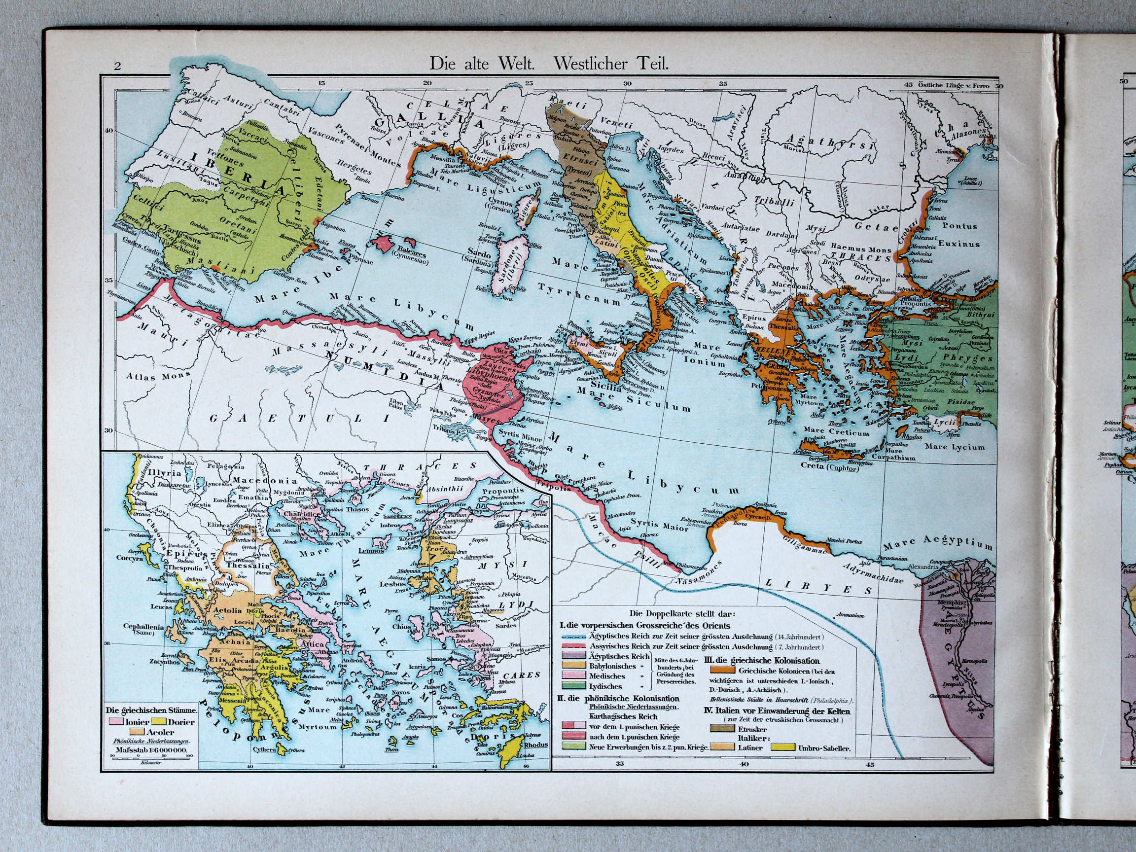
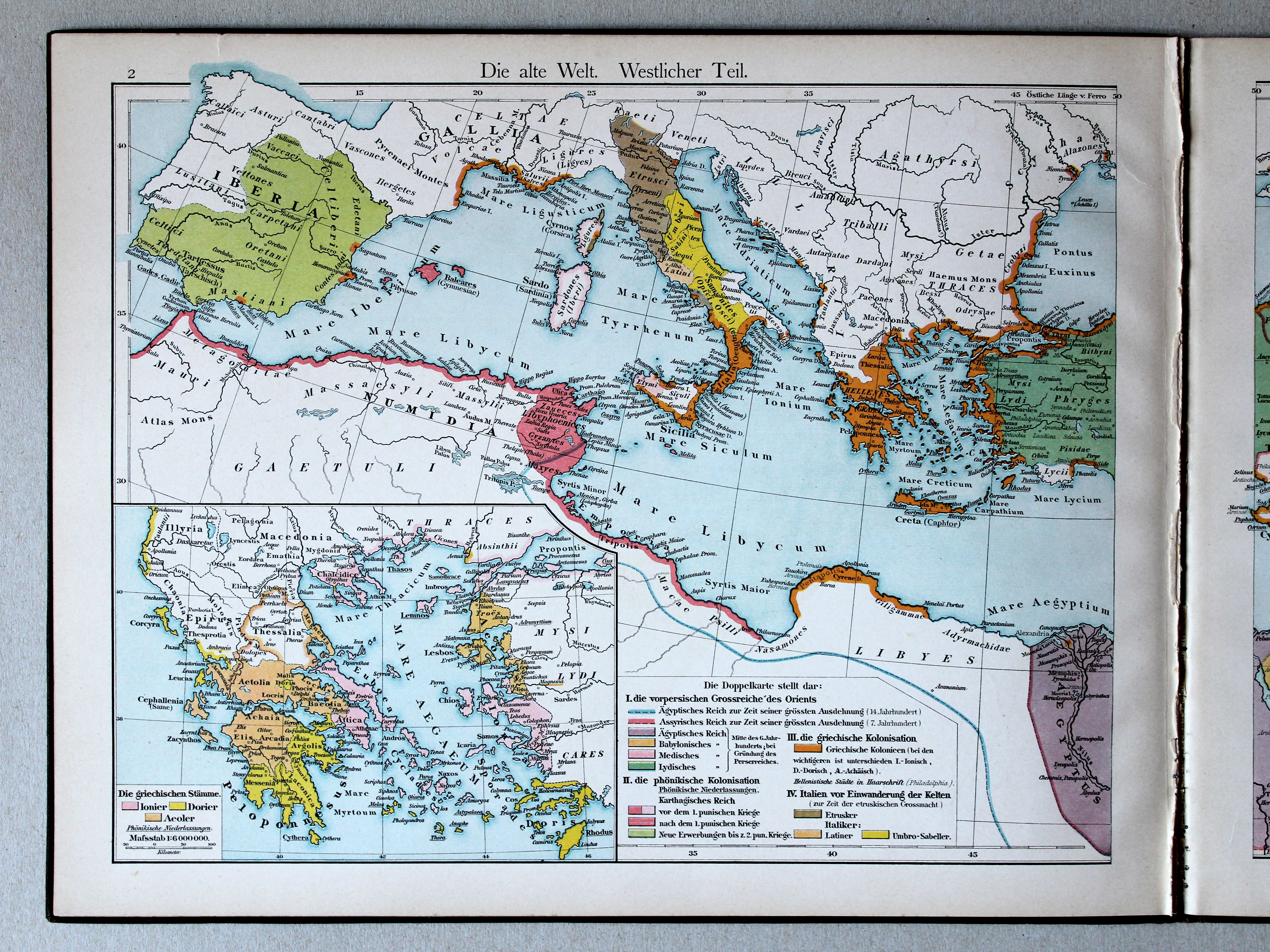
2. Die alte Welt. Westlicher Teil XL
De wereld in de Oudheid, westelijk deel / The Ancient world, western part
 Droysens Historischer Handatlas, 1886
geen overeenkomstige kaart / no corresponding map
 Putzgers Historischer Schul-Atlas, 1888
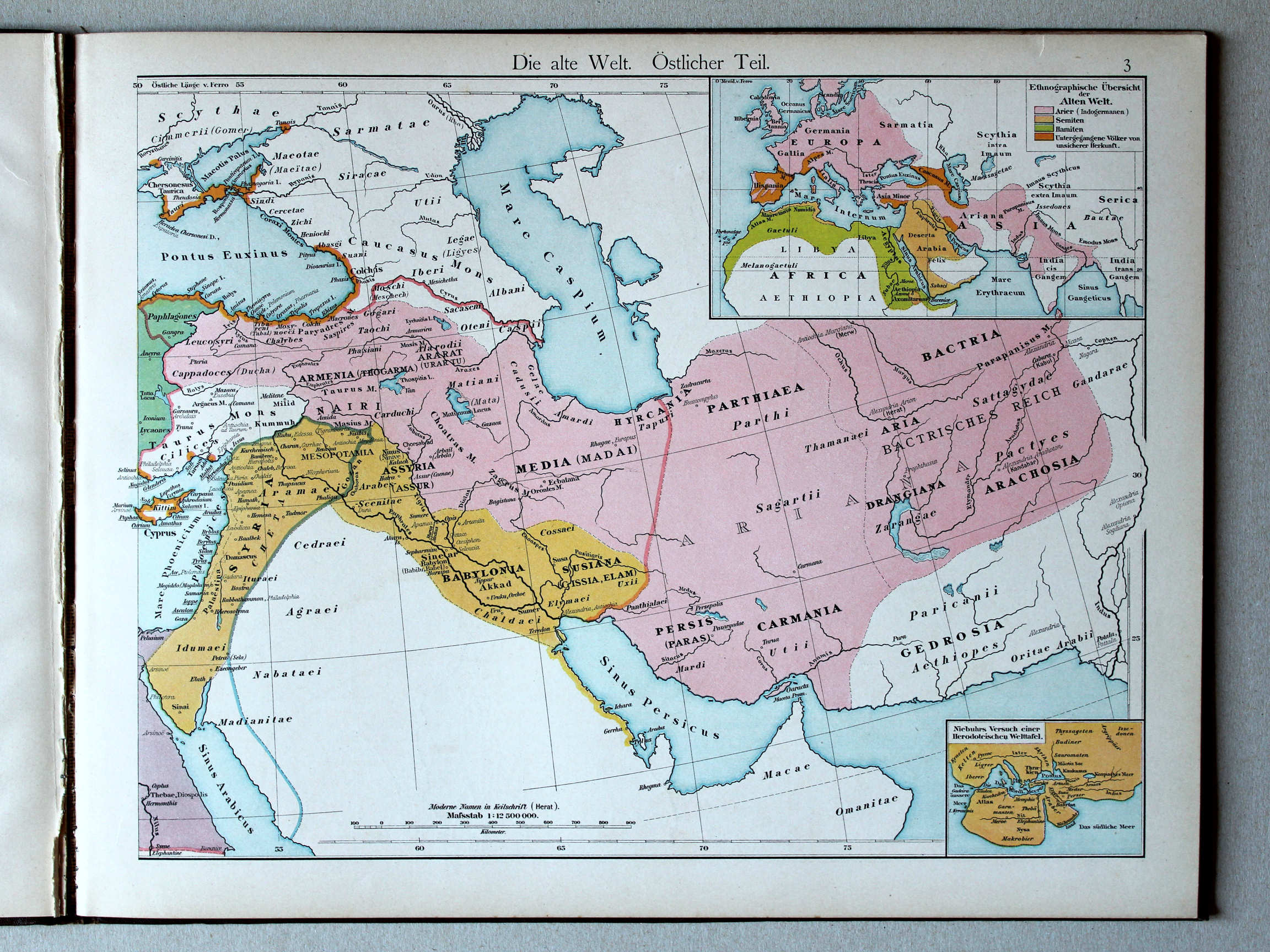
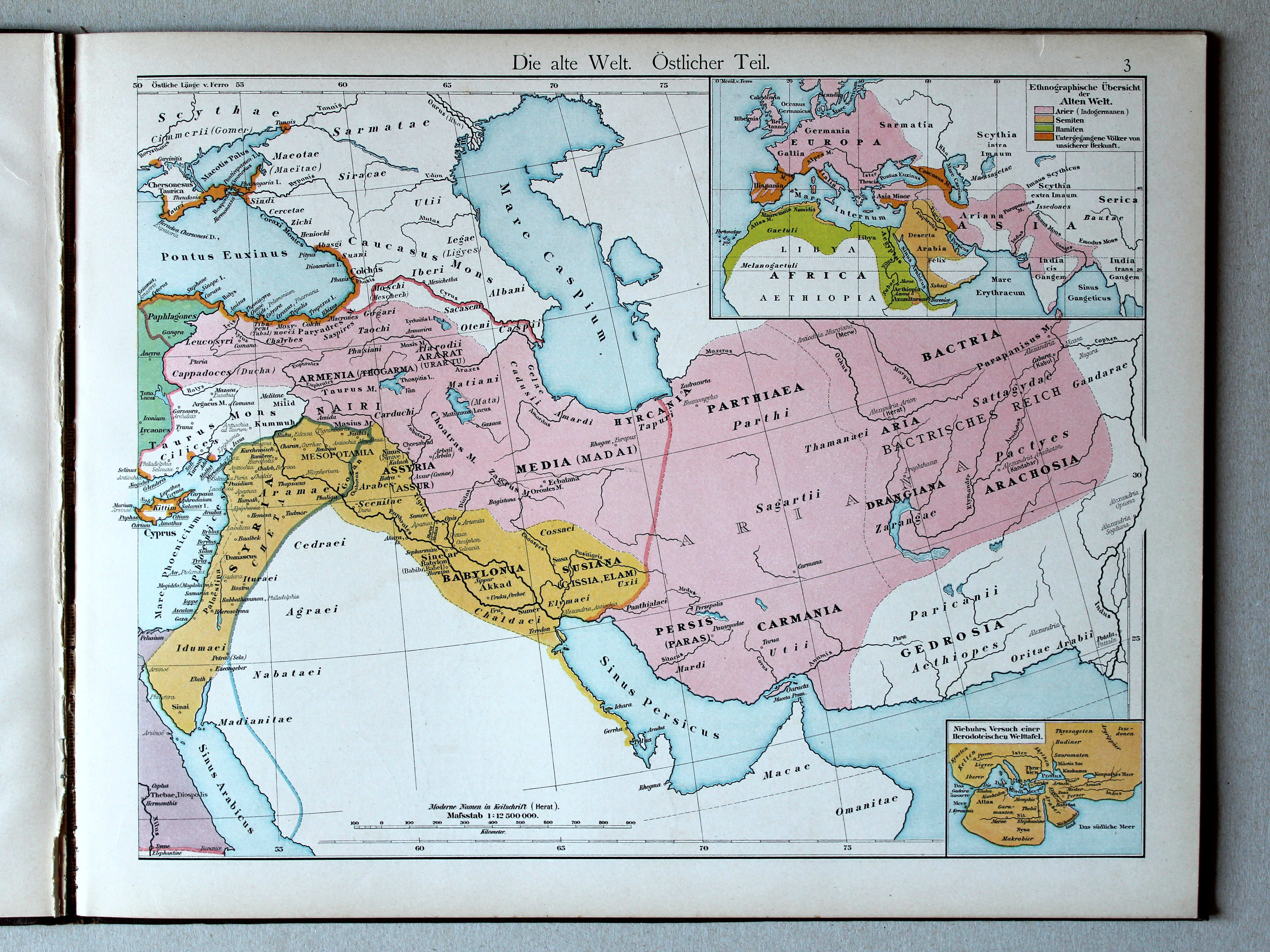
3. Die alte Welt. Östlicher Teil XL
De wereld in de Oudheid, oostelijk deel / The Ancient world, eastern part
Droysens Historischer Handatlas, 1886
geen overeenkomstige kaart / no corresponding map

 Putzgers Historischer Schul-Atlas, 1888
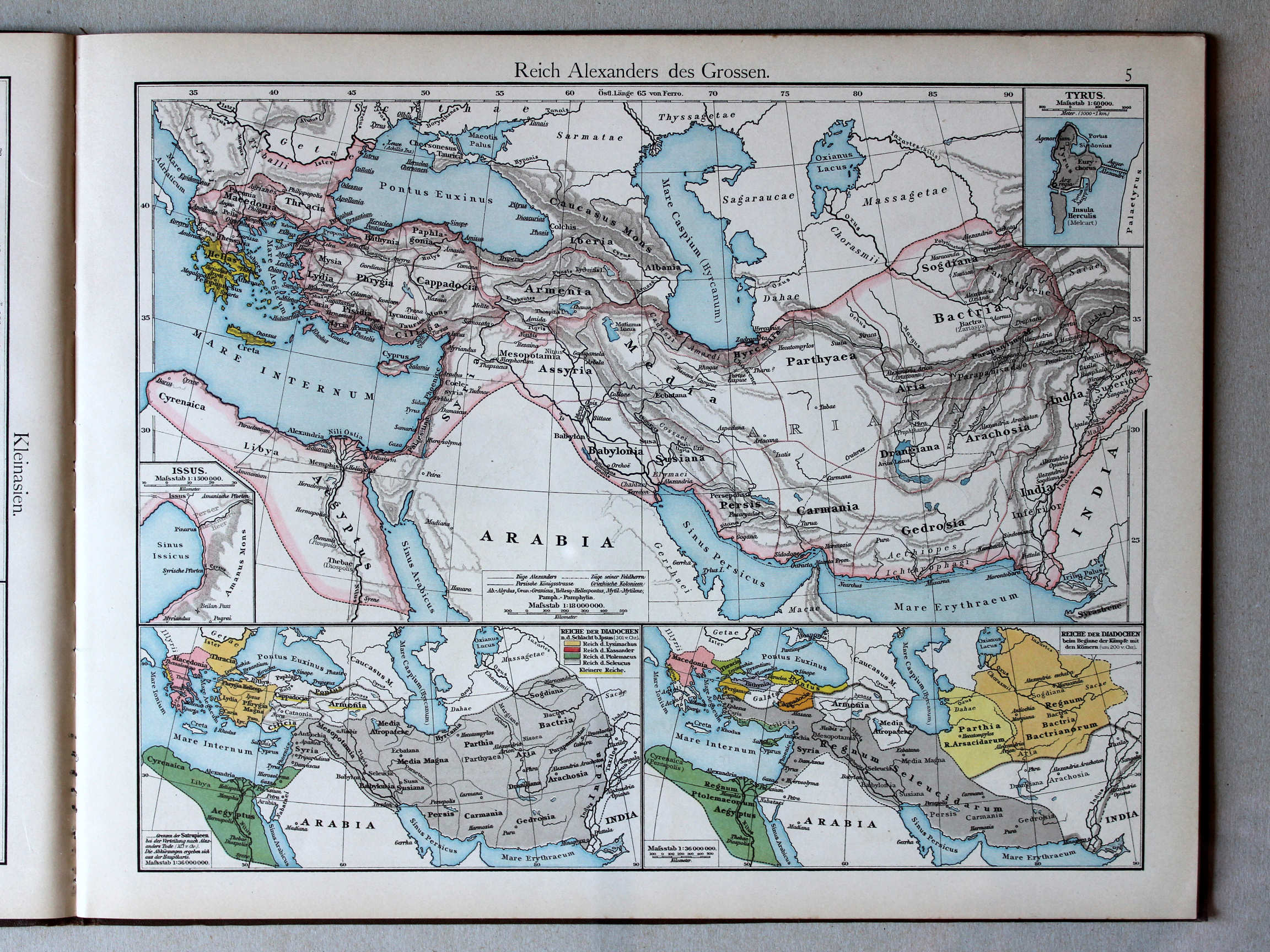
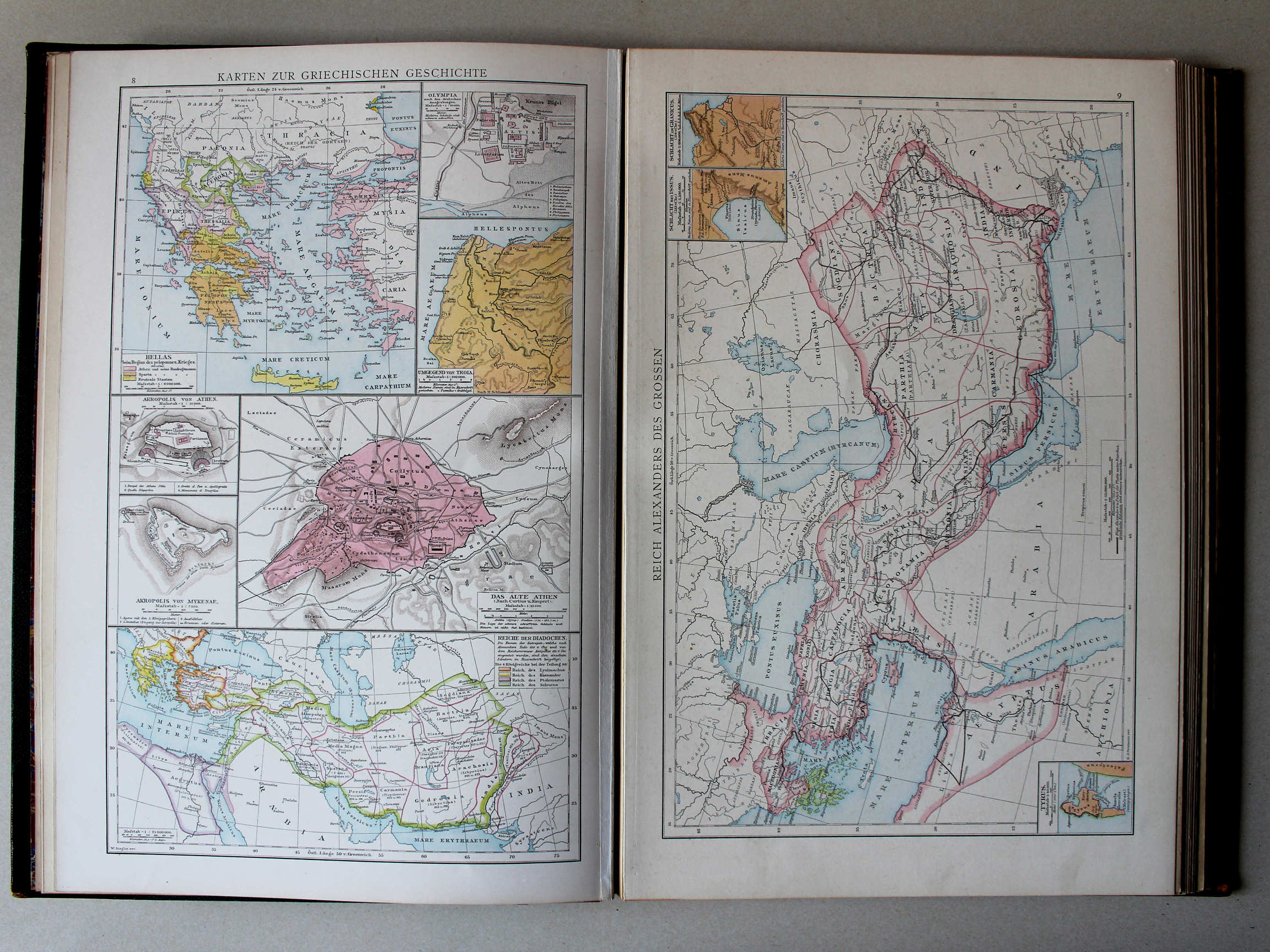
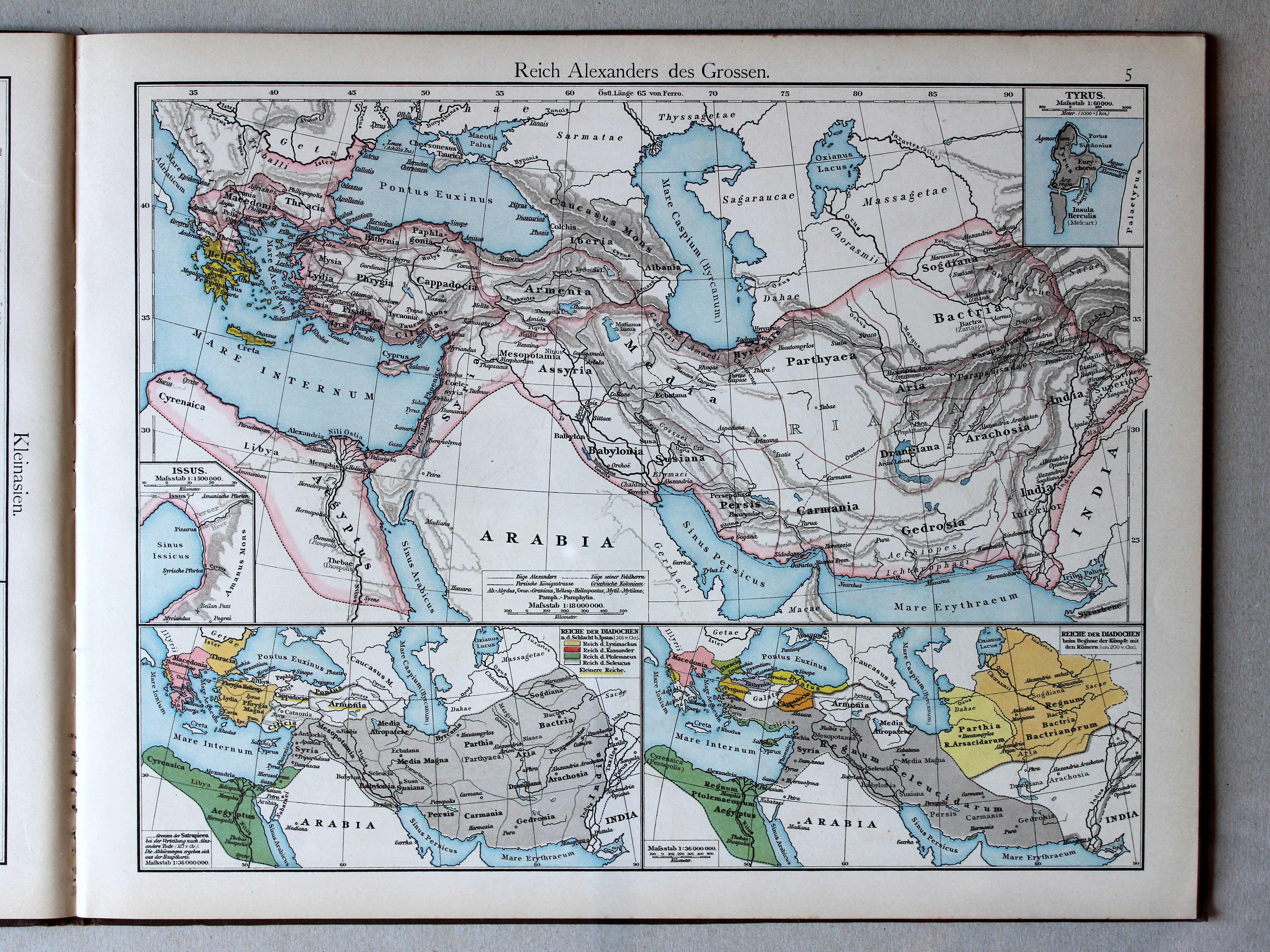
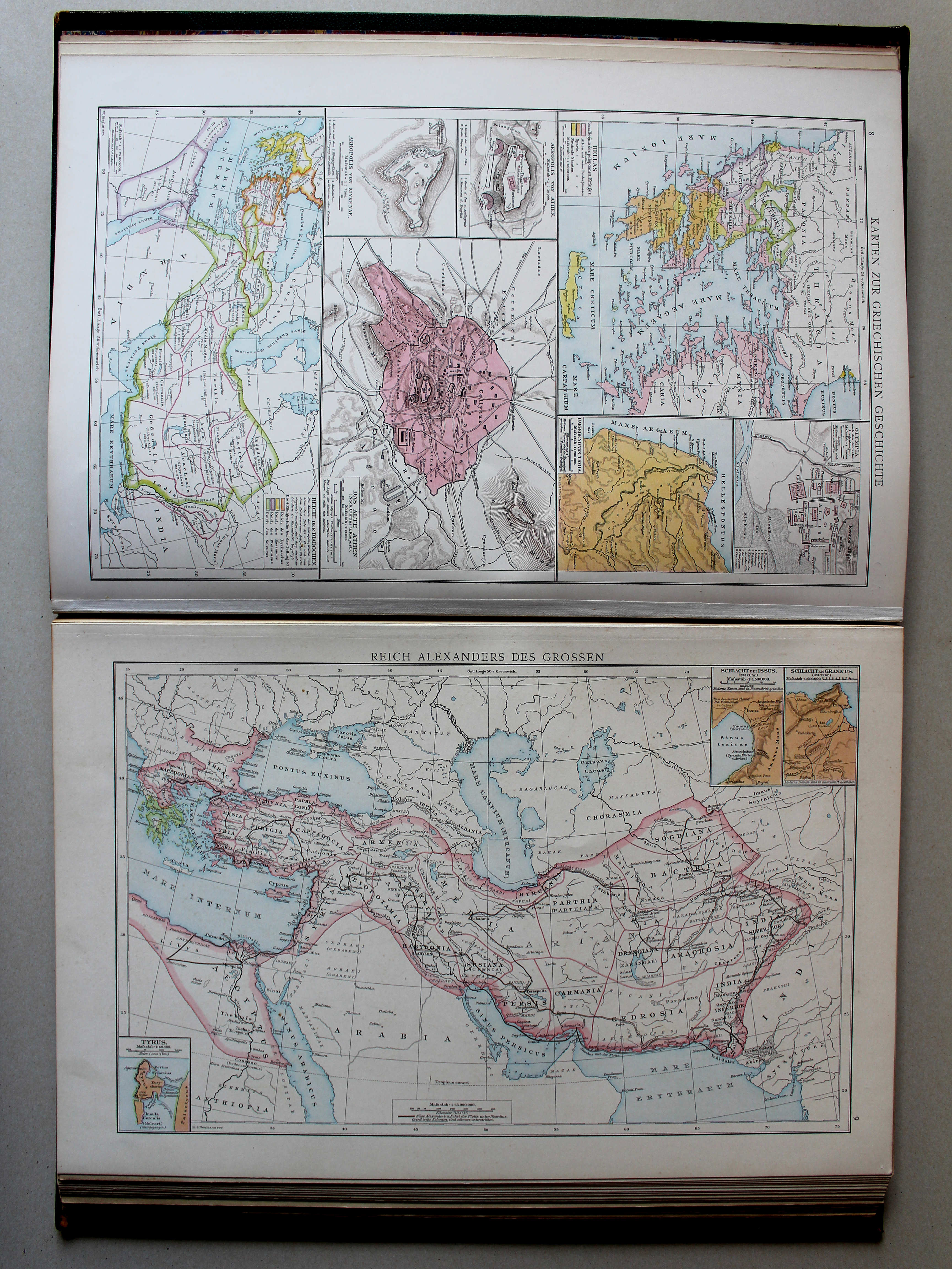
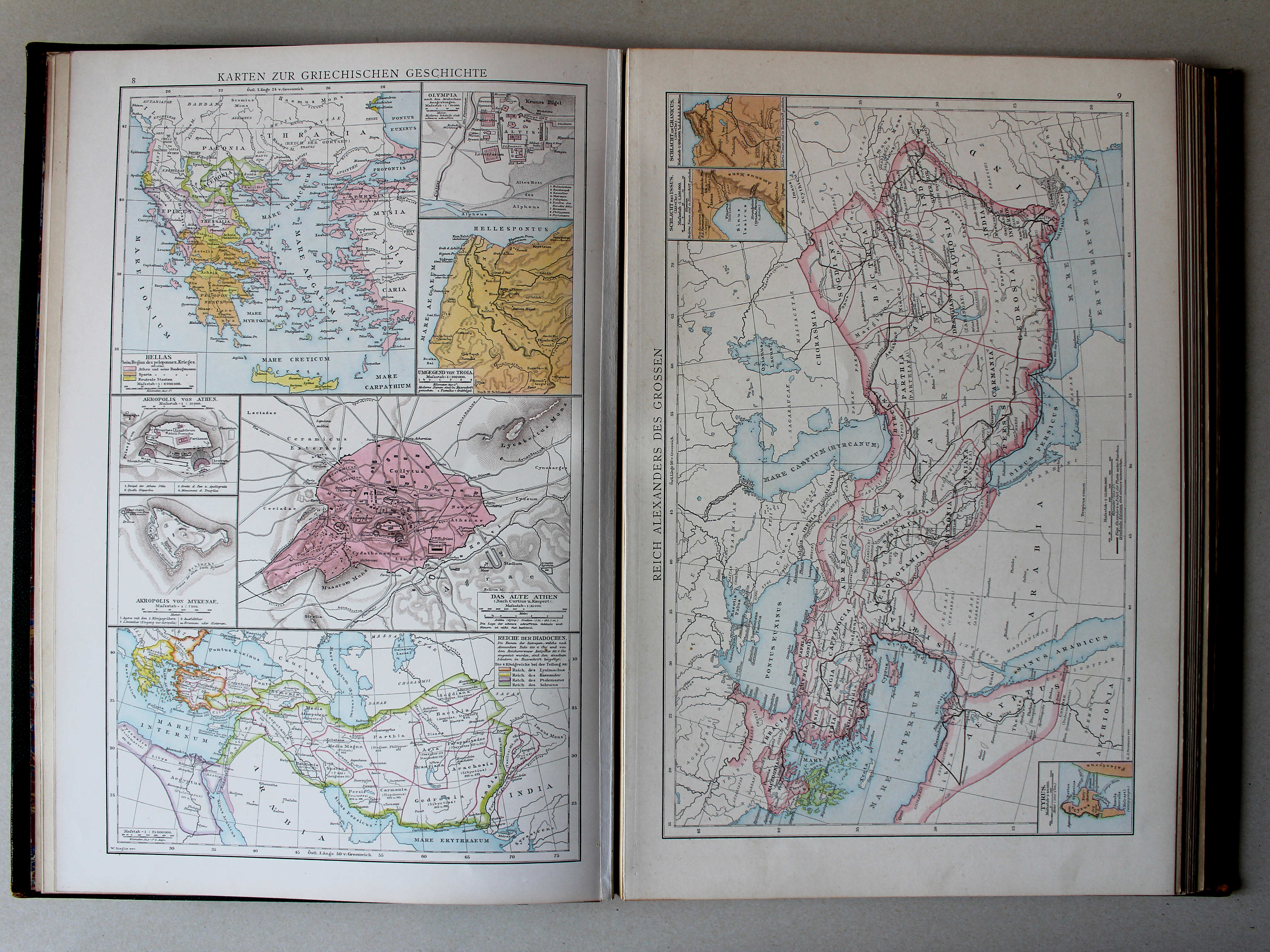
5. Reich Alexanders des Grossen XL
Het Rijk van Alexander de Grote / The Empire of Alexander the Great
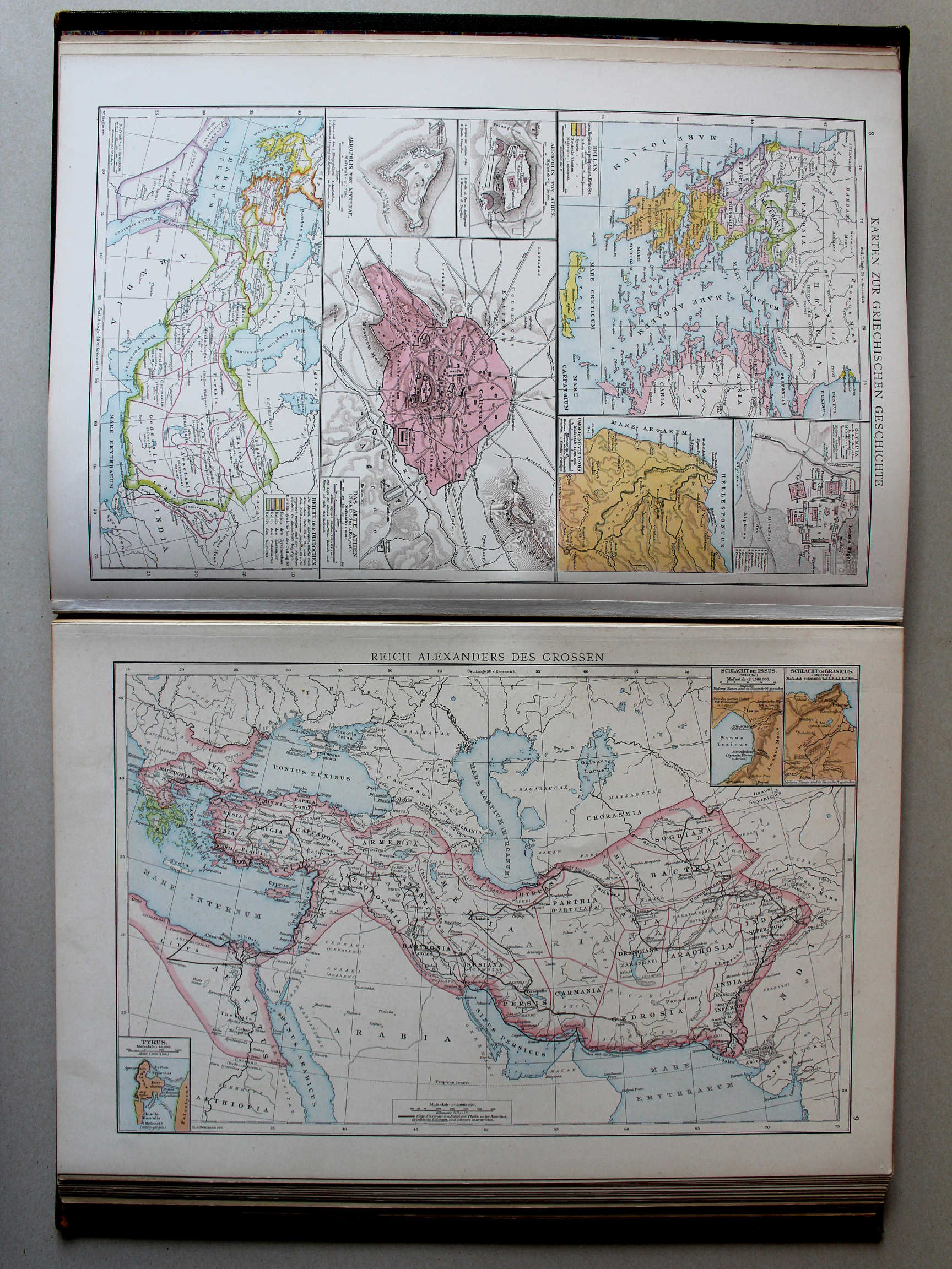 Droysens Historischer Handatlas, 1886
9. Reich Alexanders des Grossen XL
Het Rijk van Alexander de Grote / The Empire of Alexander the Great
 Putzgers Historischer Schul-Atlas, 1888
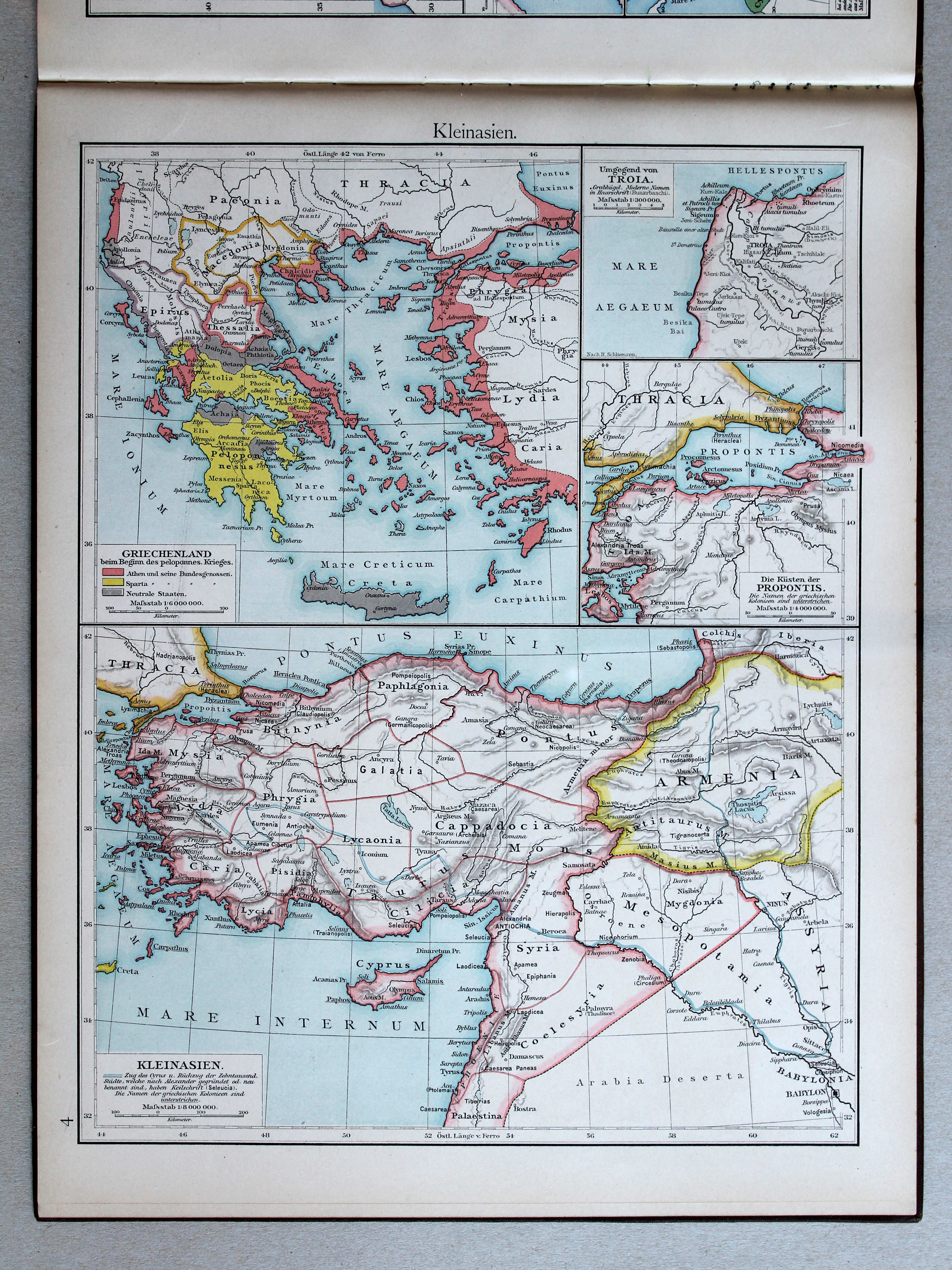
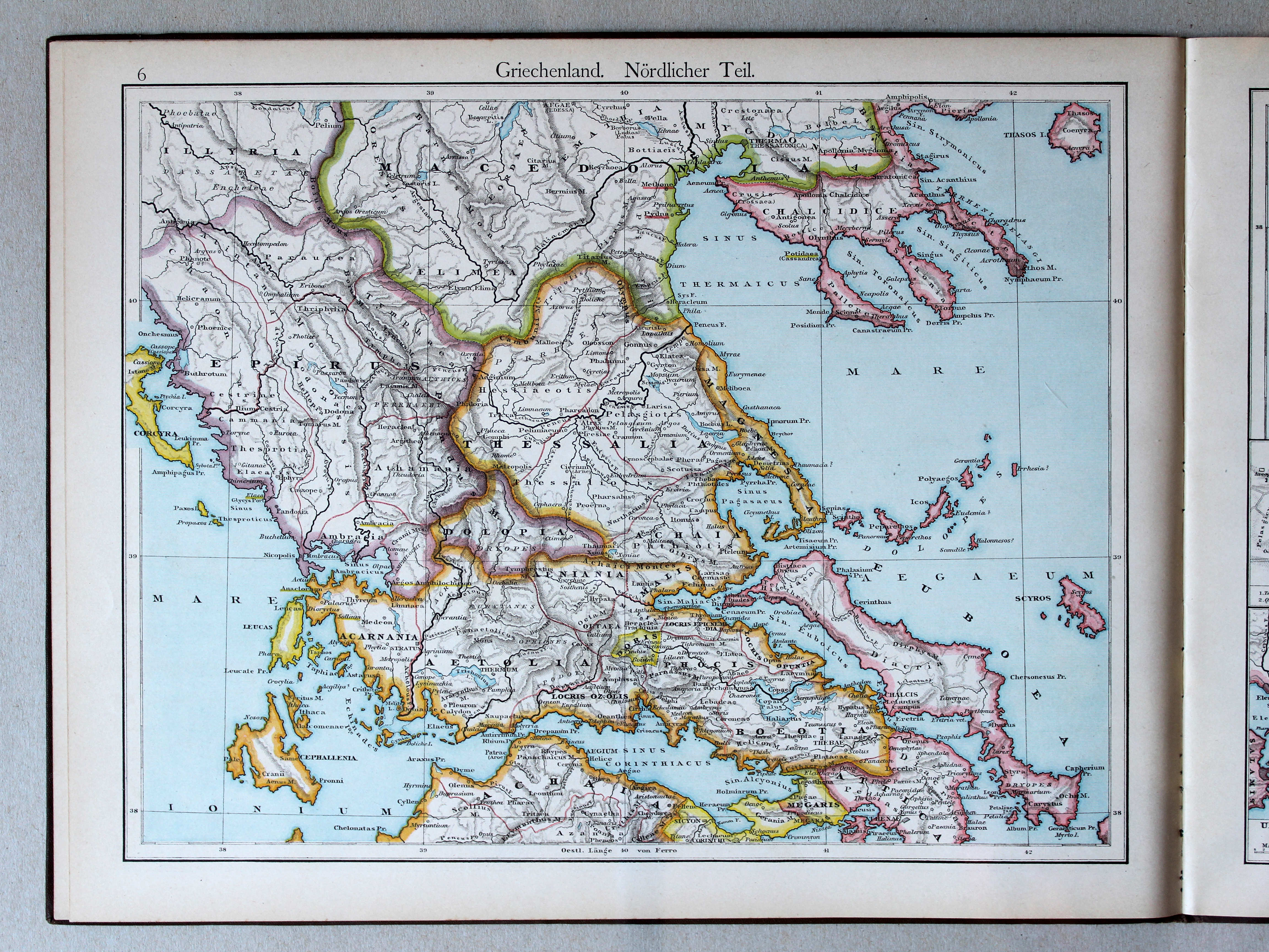
6. Griechenland. Nördlicher Teil XL
Griekenland, noordelijk deel / Greece, northern part

 Putzgers Historischer Schul-Atlas, 1888
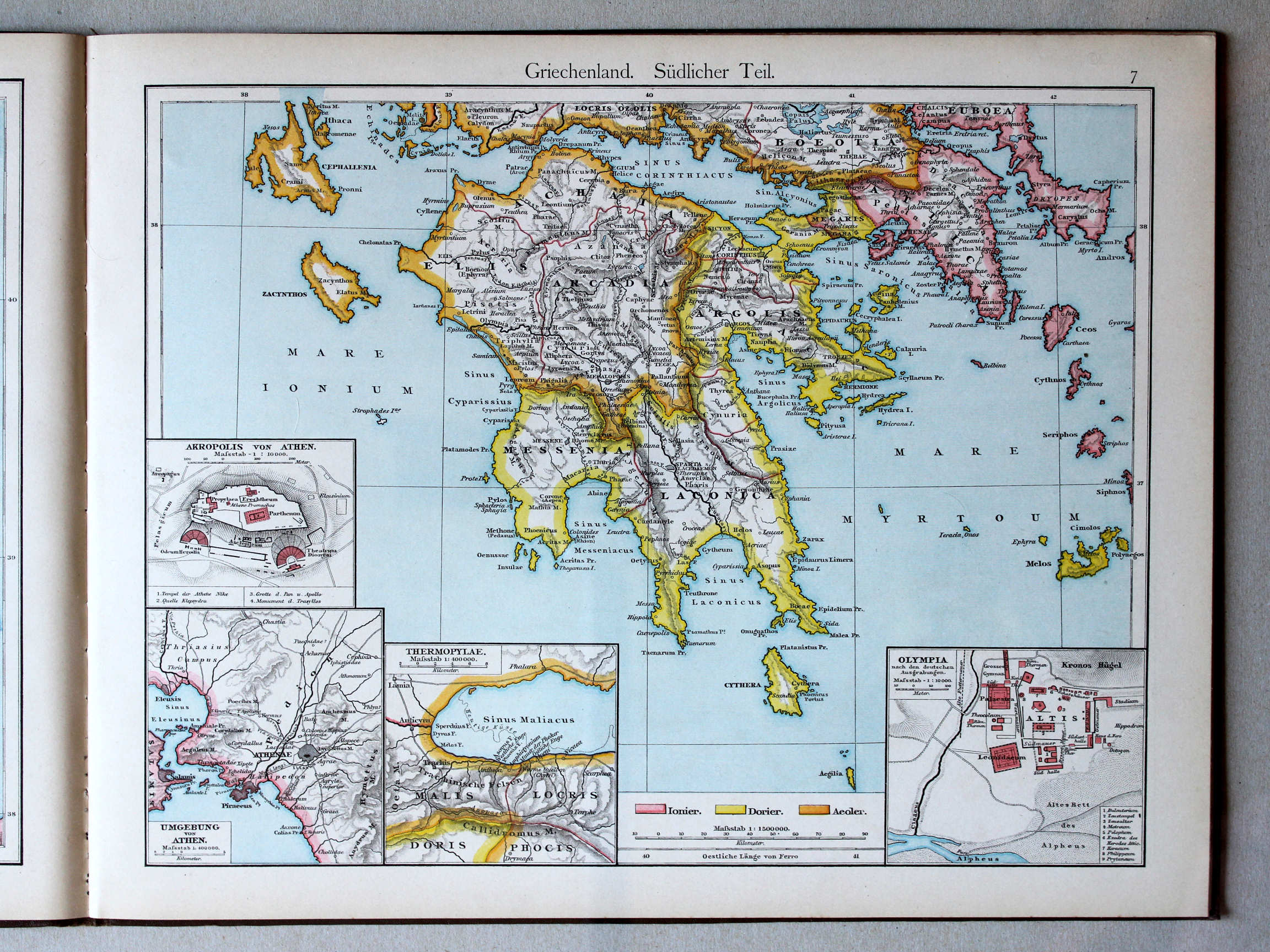
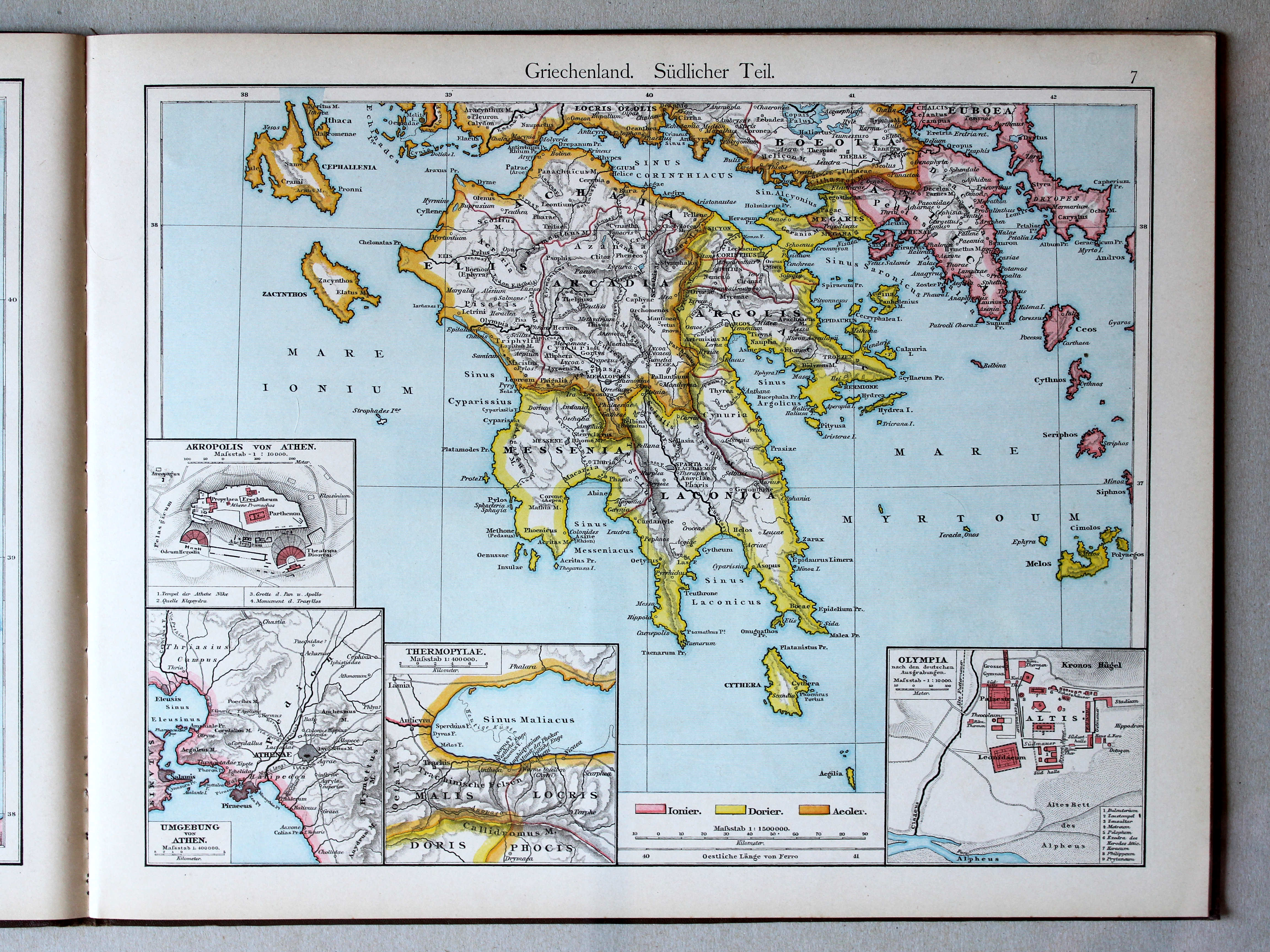
7. Griechenland. Südlicher Teil XL
Griekenland, zuidelijk deel / Greece, southern part
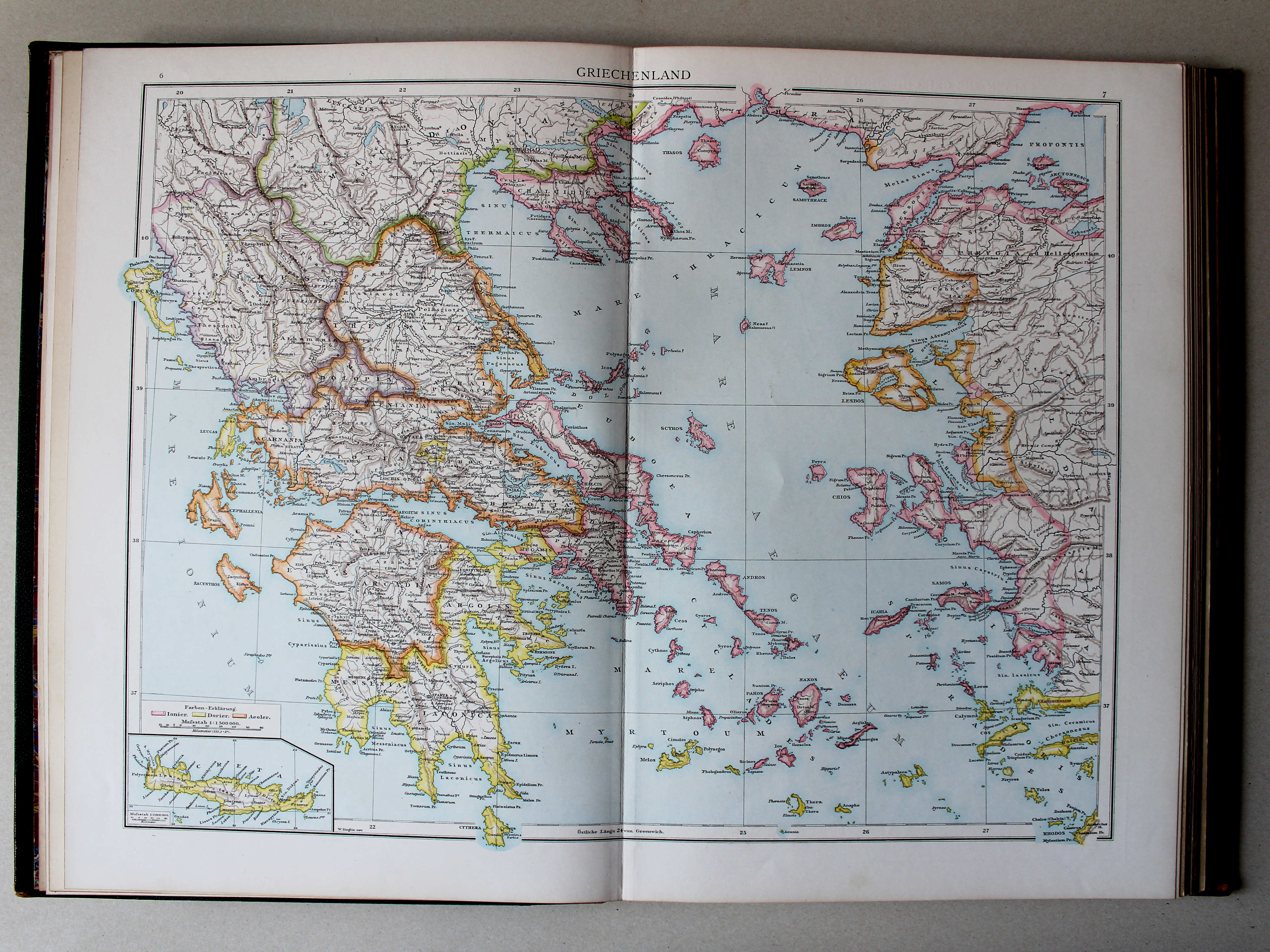
 Droysens Historischer Handatlas, 1886
8. Karten zur griechischen Geschichte XL
Geschiedenis van Griekenland / History of Greece
 Droysens Historischer Handatlas, 1886
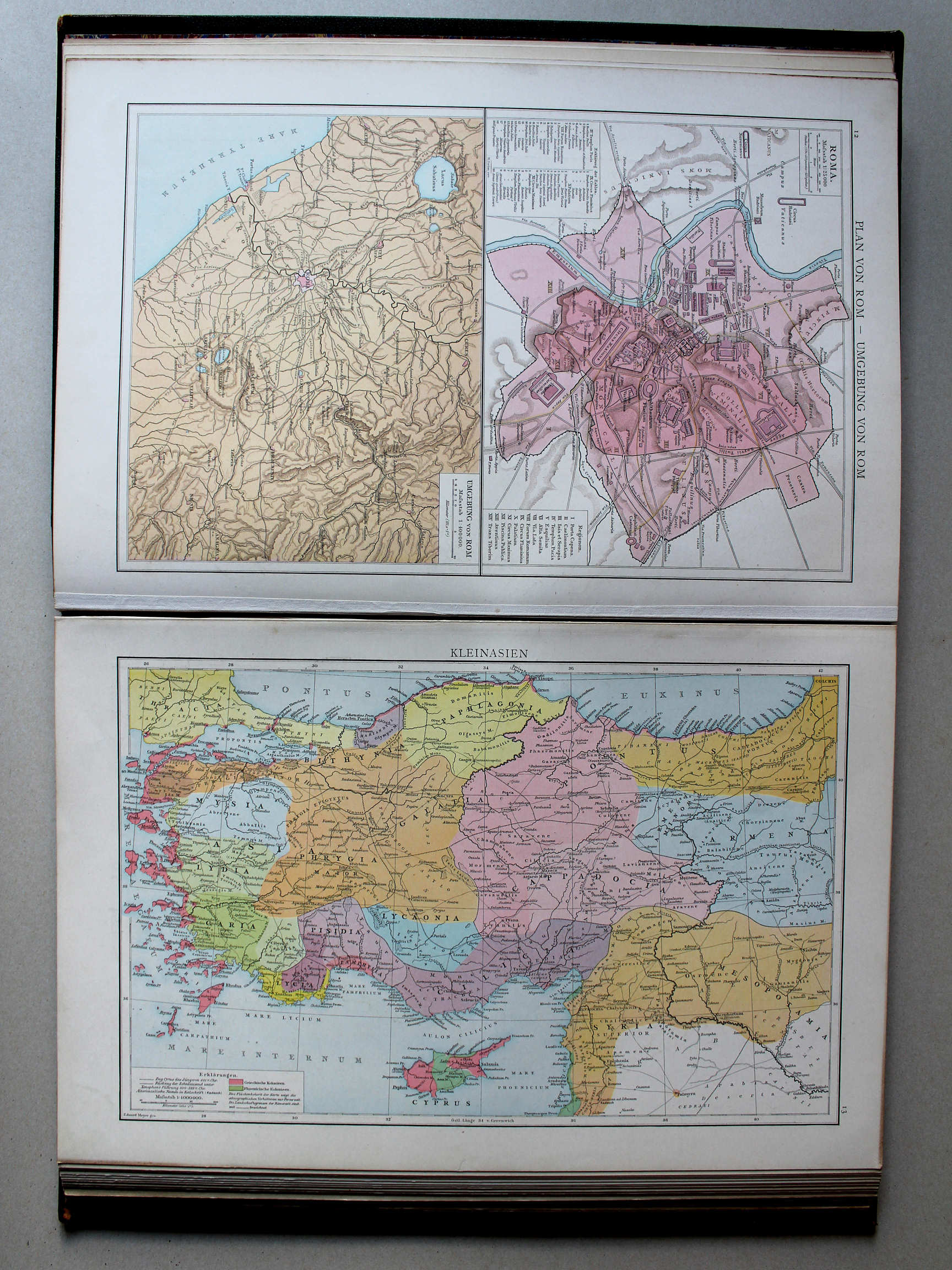
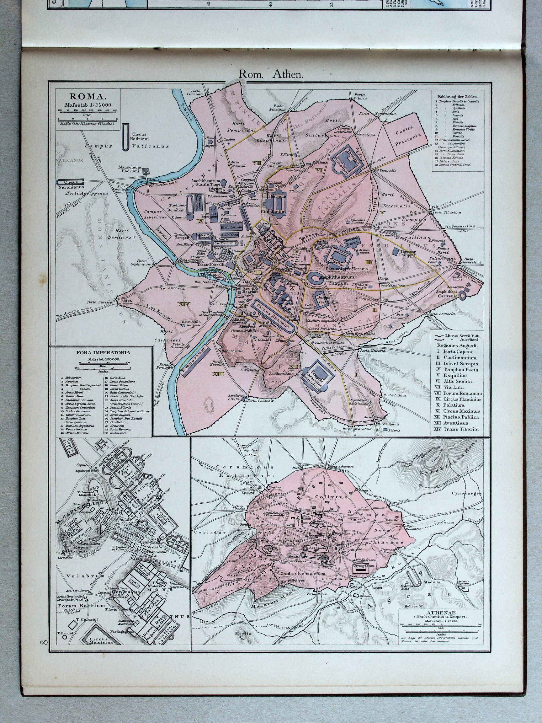
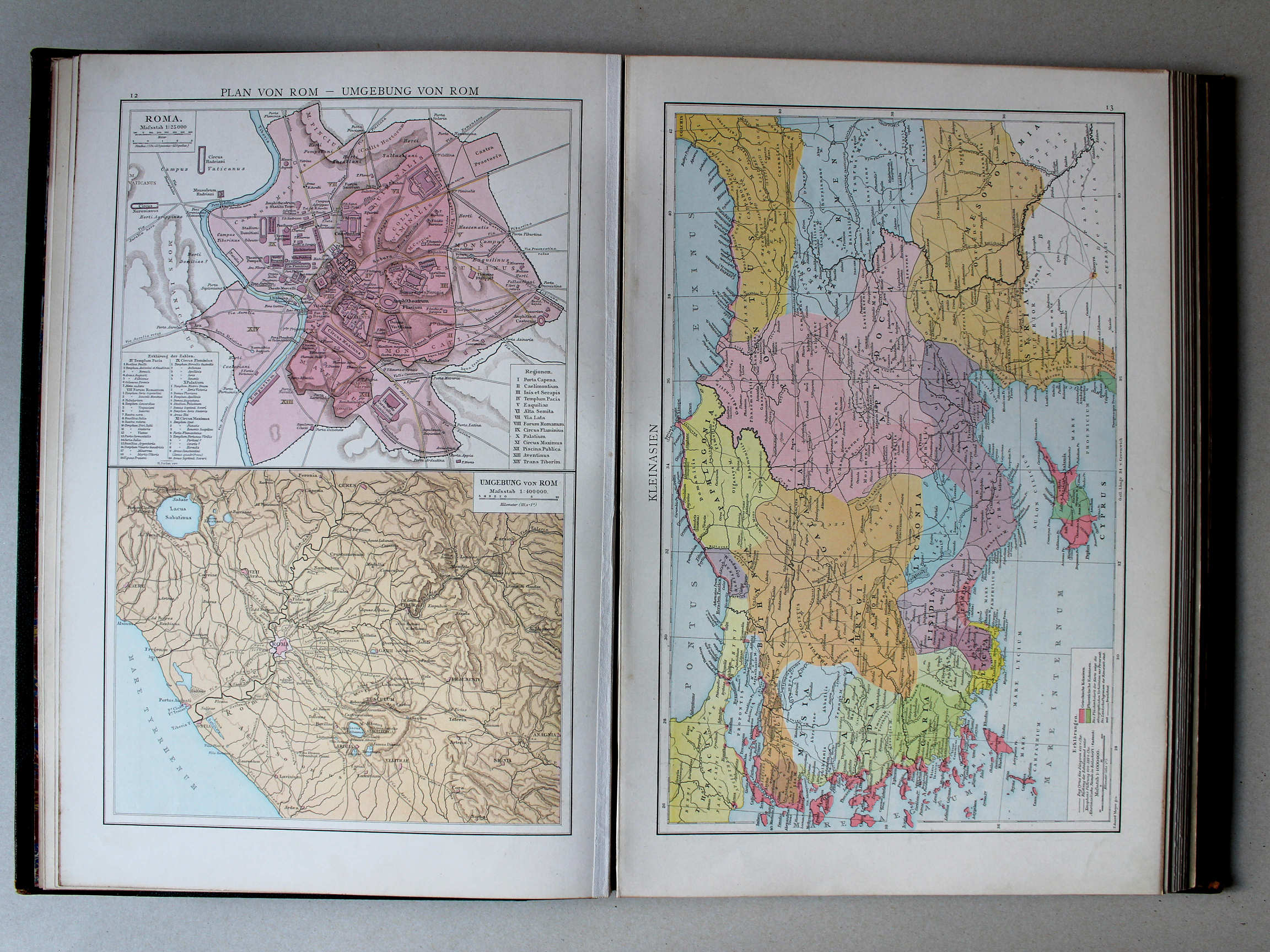
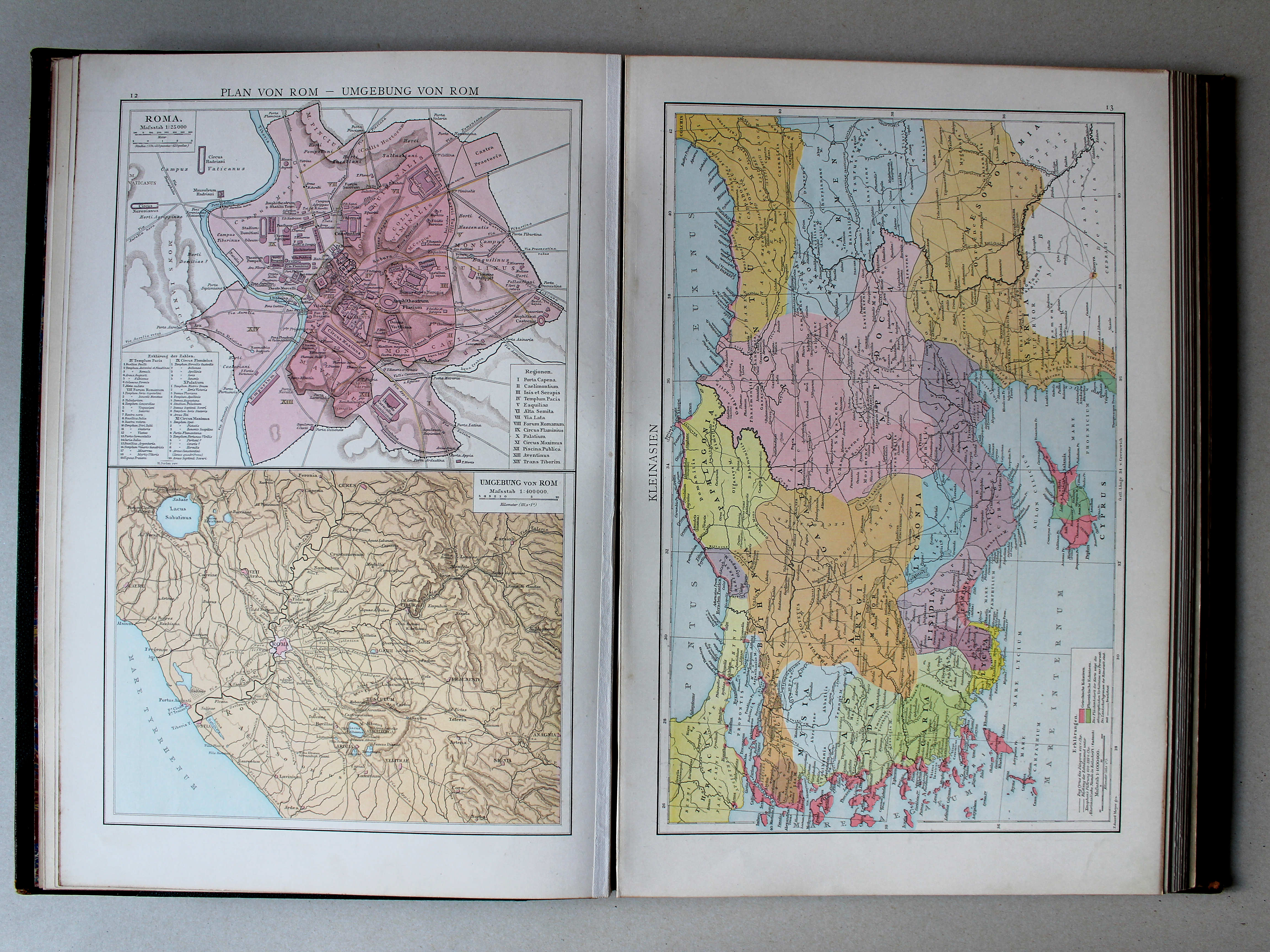
12. Plan von Rom – Umgebung von Rom XL
Plattegron van Rome. Omgeving van Rome / Plan of Rome. Environs of Rome
 Putzgers Historischer Schul-Atlas, 1888
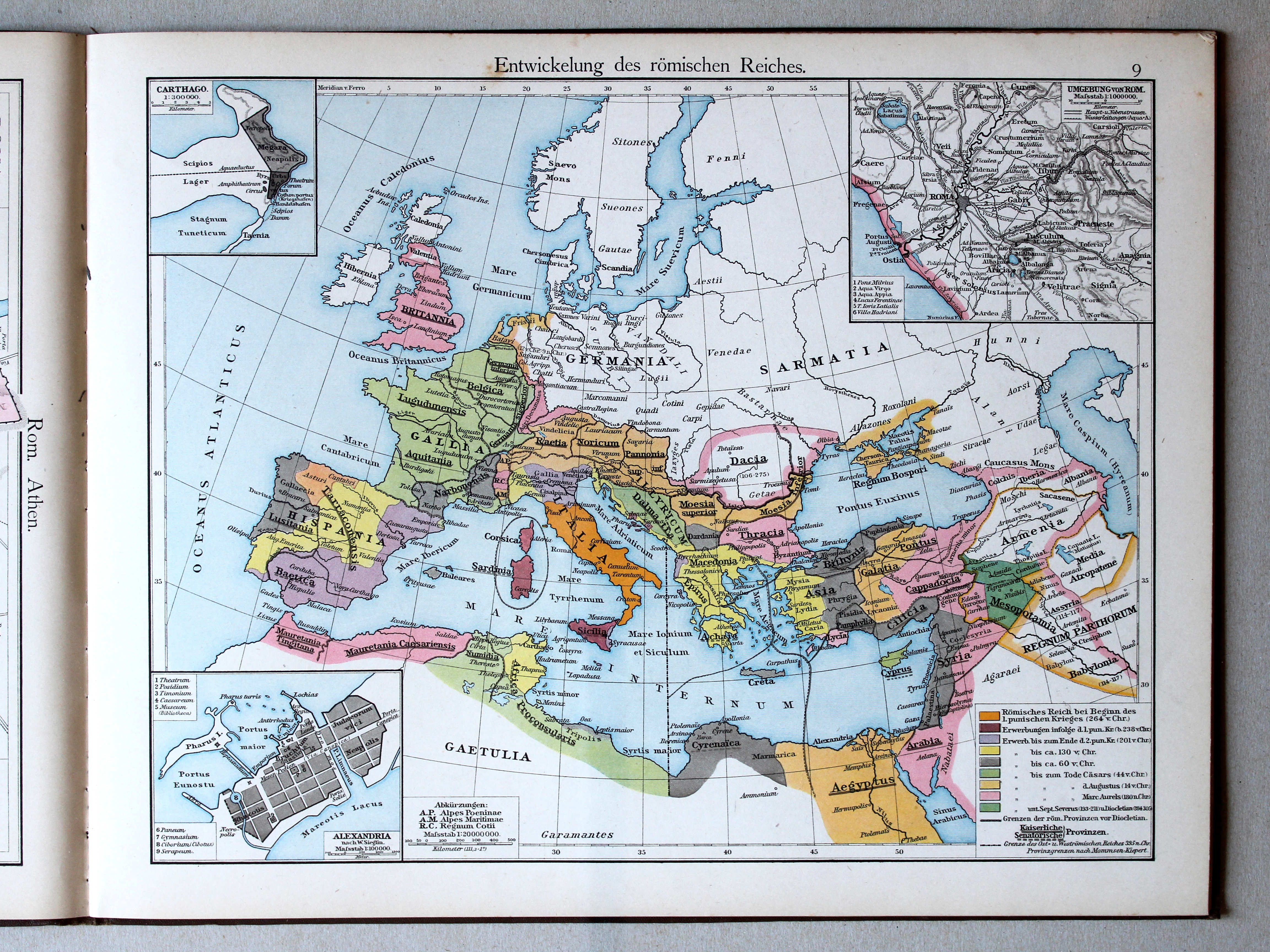
9. Entwickelung des römischen Reiches XL
Ontwikkeling van het Romeinse Rijk / Development of the Roman Empire
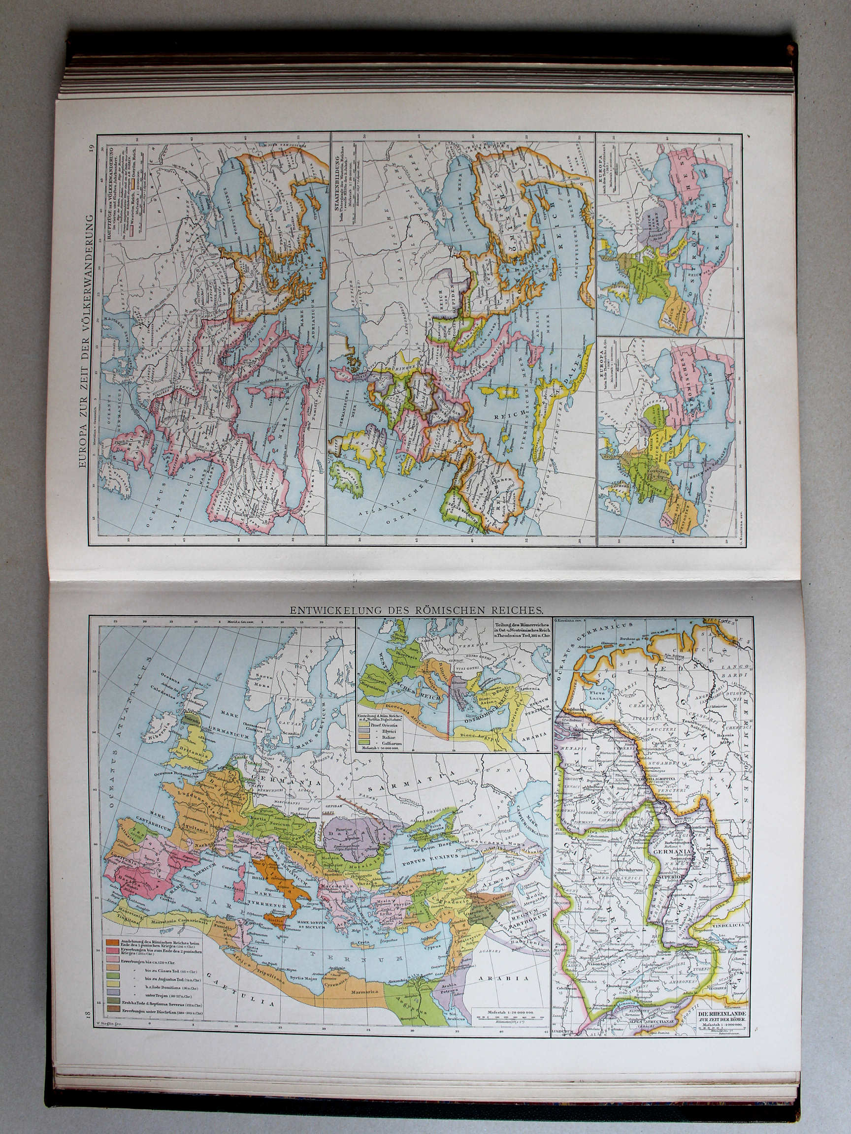 Droysens Historischer Handatlas, 1886
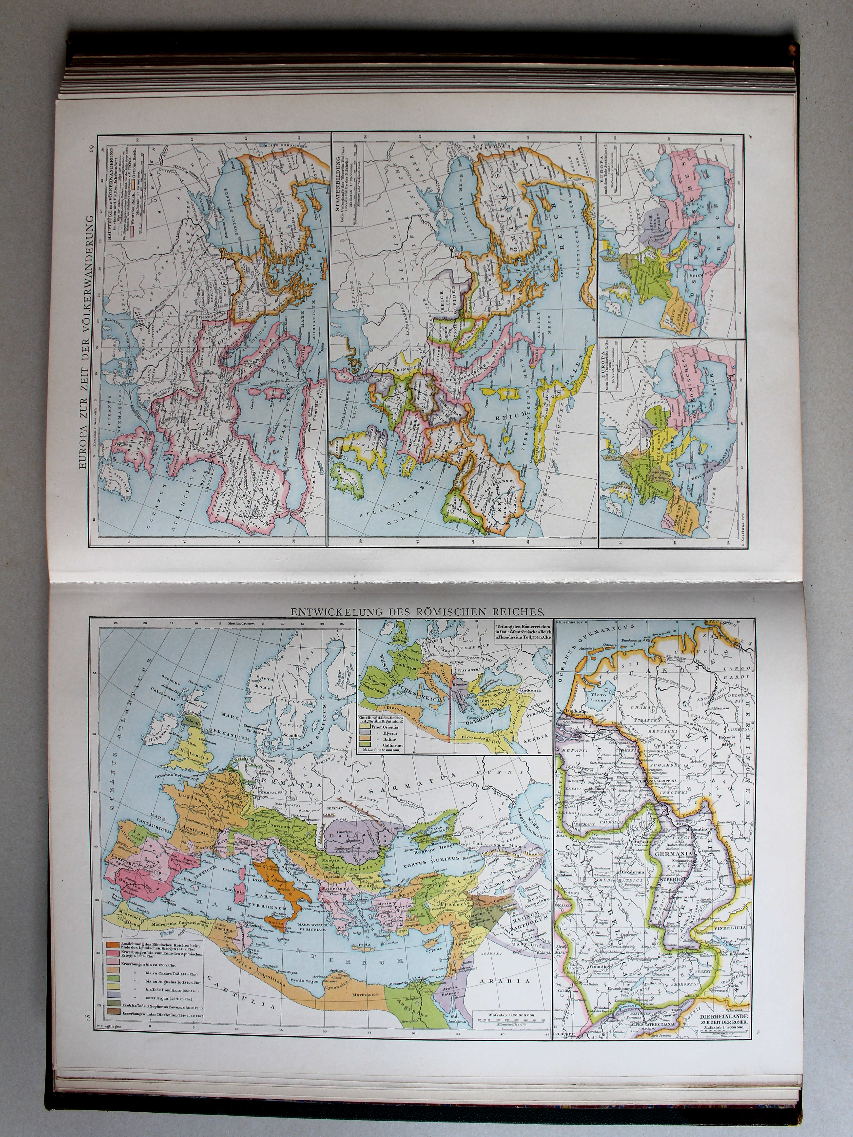
18. Entwickelung des römischen Reiches XL
Ontwikkeling van het Romeinse Rijk / Development of the Roman Empire
 Putzgers Historischer Schul-Atlas, 1888
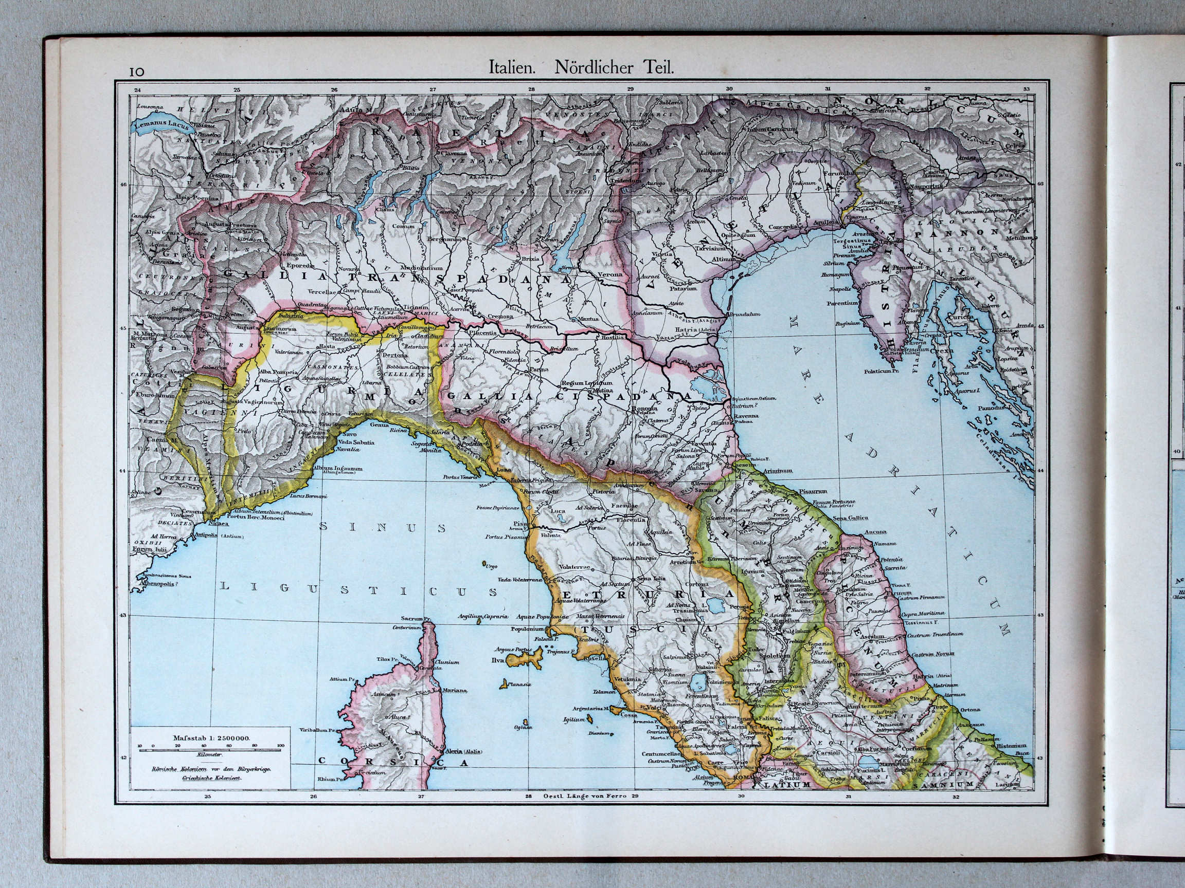
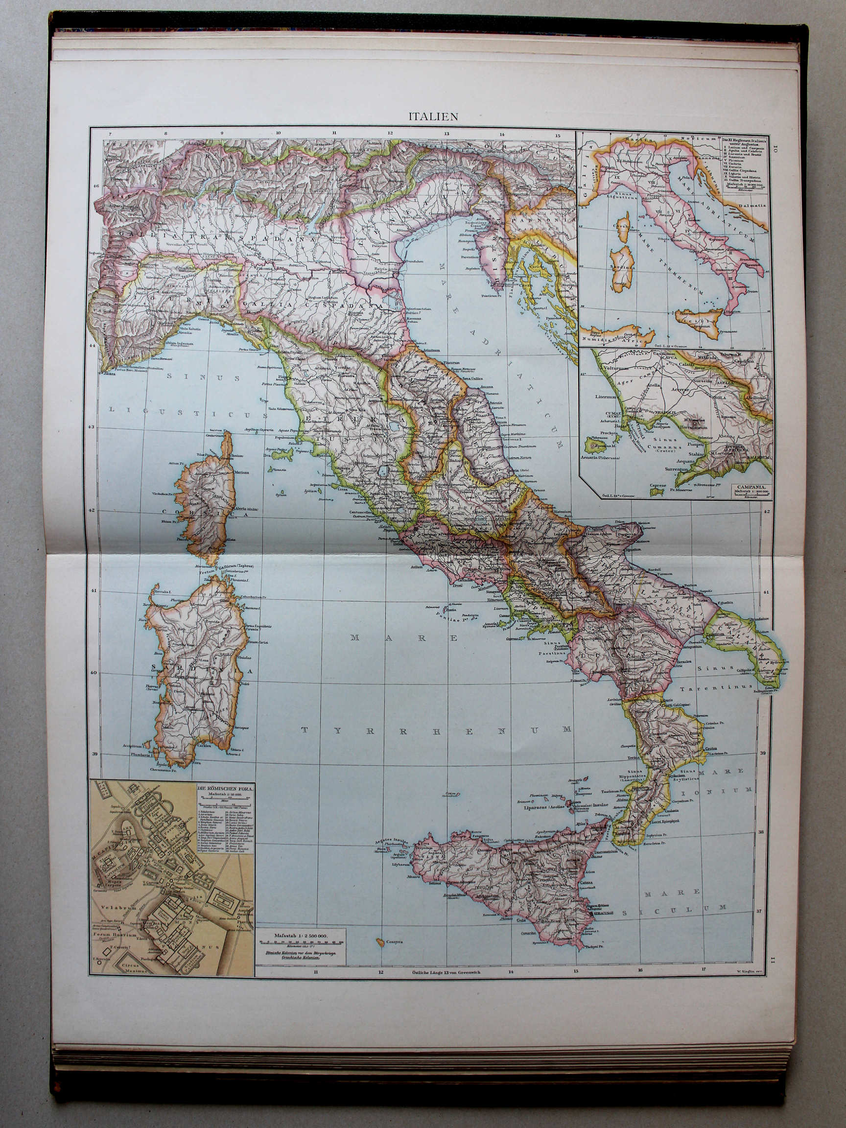
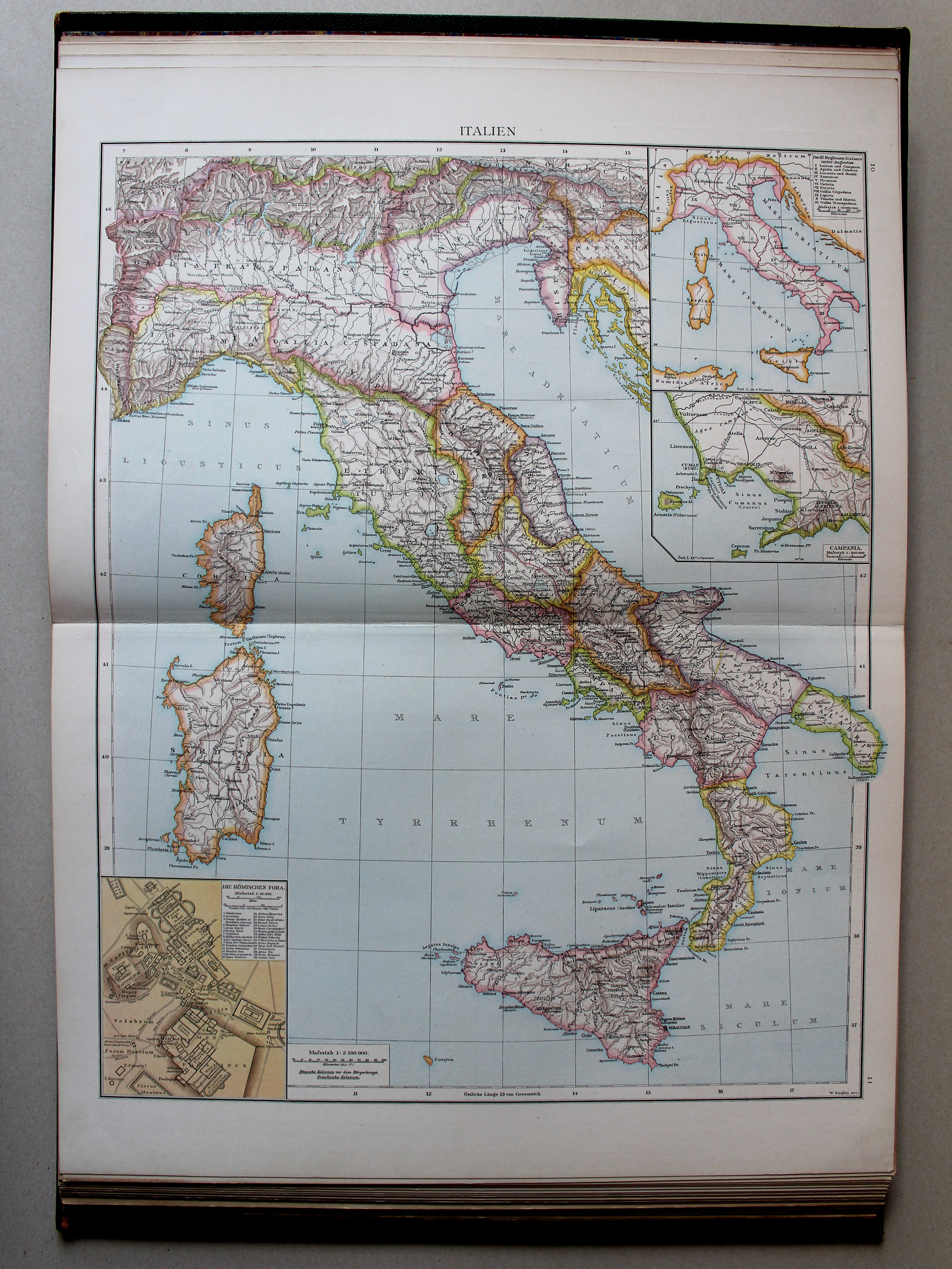
10. Italien. Nördlicher Teil XL
Italië, noordelijk deel / Italy, northern part
 Putzgers Historischer Schul-Atlas, 1888
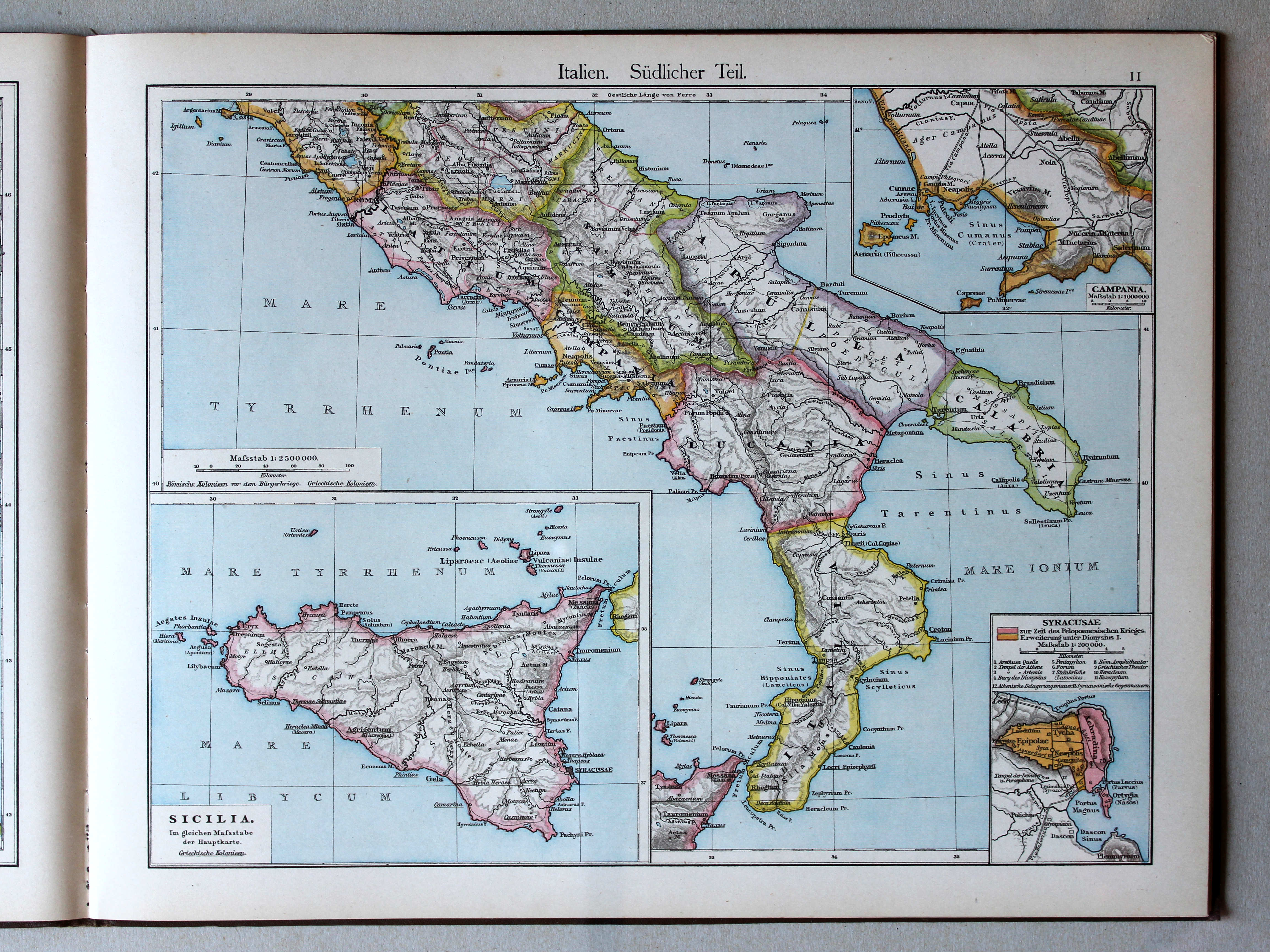
11. Italien. Südlicher Teil XL
Italië, zuidelijk deel / Italy, southern part
 Putzgers Historischer Schul-Atlas, 1888
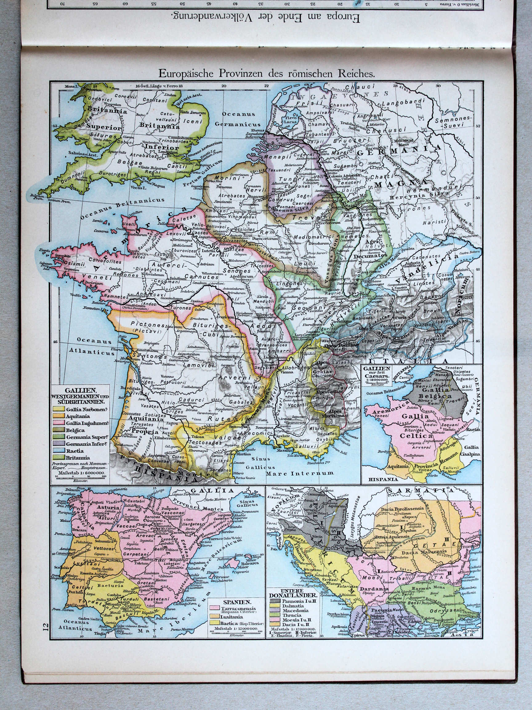
12. Europäische Provinzen des römischen Reiches XL
Europese provincies van het Romeinse Rijk / European provinces of the Roman Empire
 Droysens Historischer Handatlas, 1886
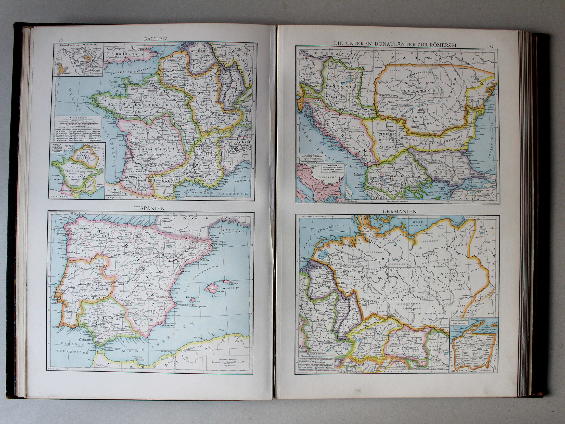
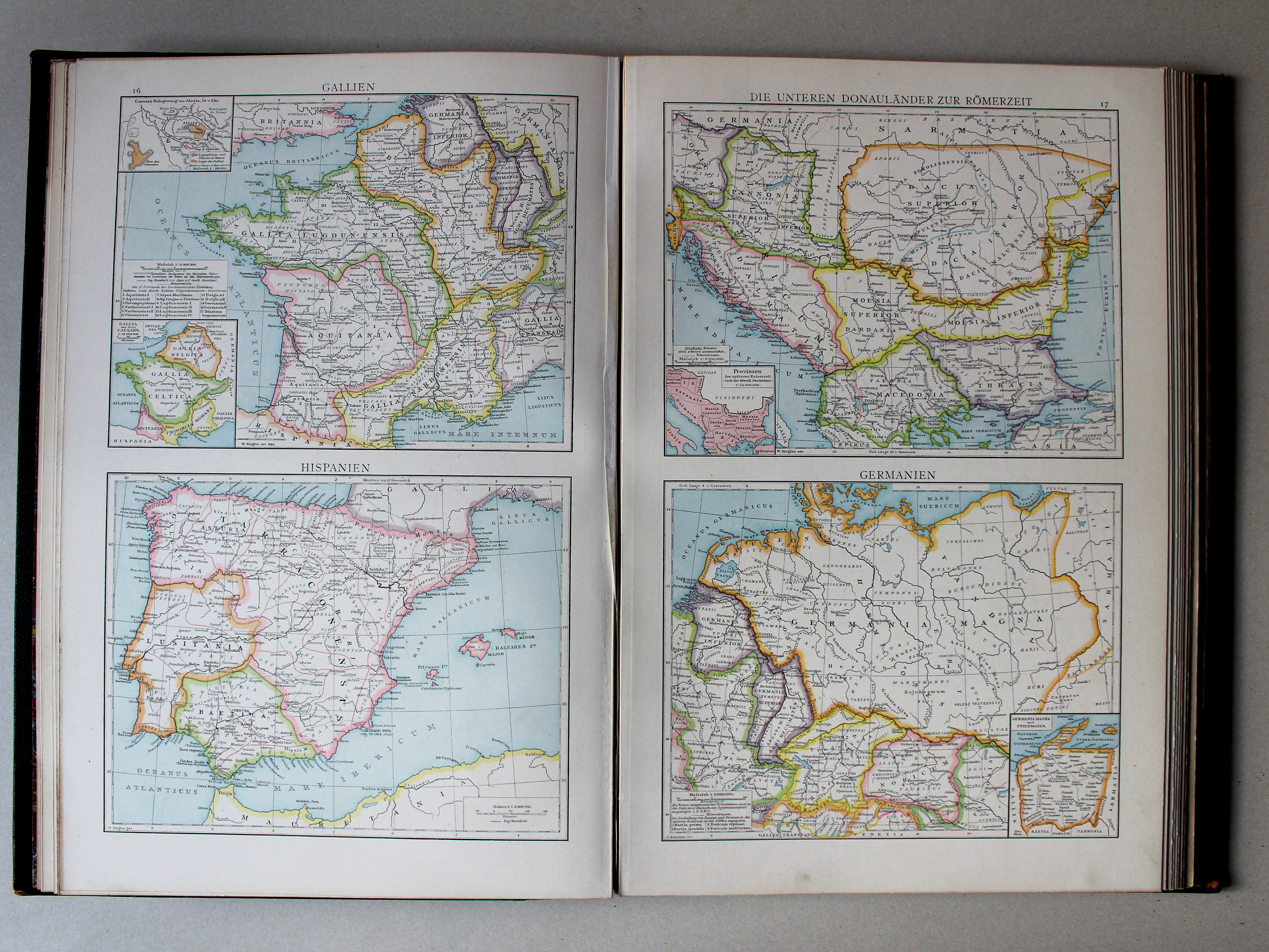
16. Gallien. Hispanien XL
Gallië. Hispanië / Gallia. Hispania
17. Die unteren Donauländer zur Römerzeit. Germanien XL
Benedenloop van de Donau in de Romeinse tijd. Germanië / Lower course of the Danube during in the Roman era. Germania
(Middeleeuwen, Nieuwe Tijd / Middle Ages, modern history)
 Putzgers Historischer Schul-Atlas, 1888
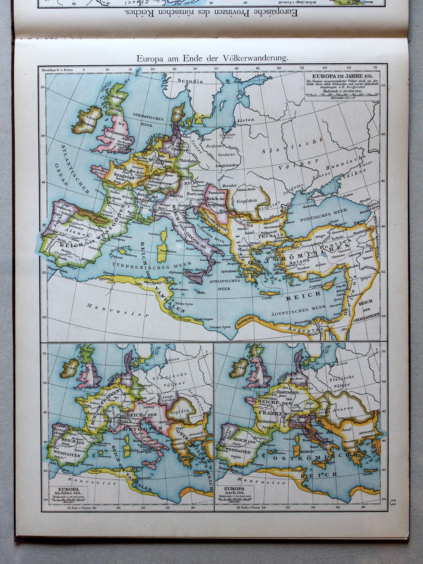
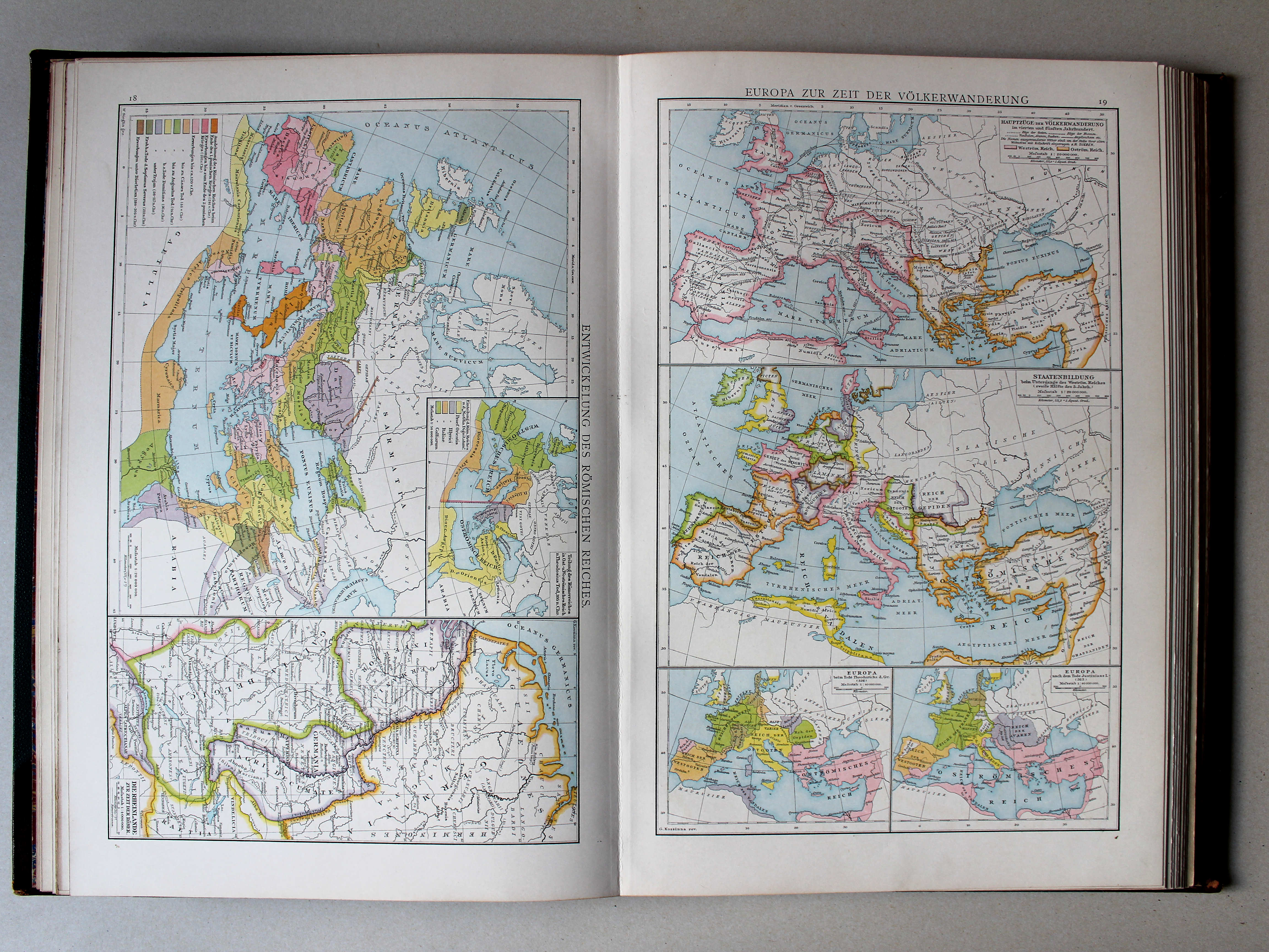
13. Europa am Ende der Völkerwanderung XL
Europa aan het einde van de Volksverhuizing / Europe at the end of the Migration Period
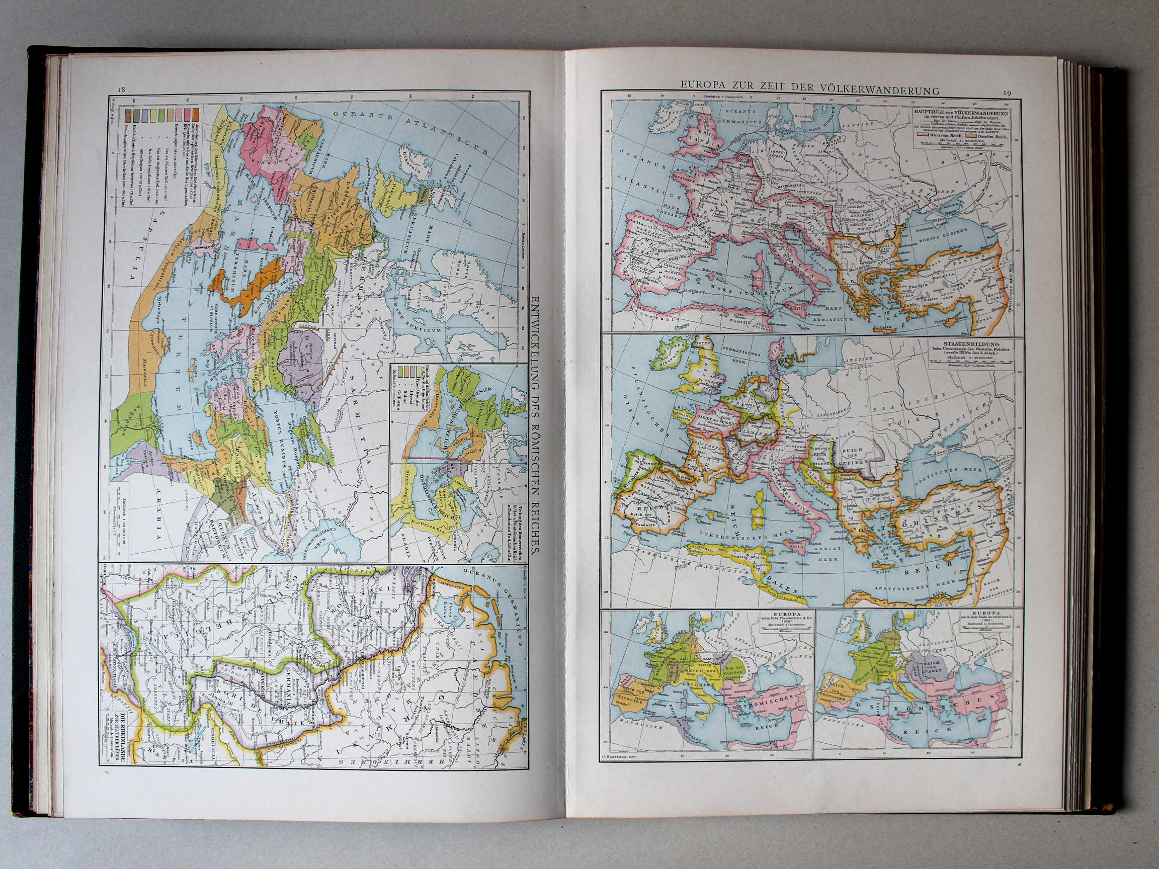 Droysens Historischer Handatlas, 1886
19. Europa zur Zeit der Völkerwanderung XL
Europa tijdens de Volksverhuizing / Europe during the Migration Period
 Putzgers Historischer Schul-Atlas, 1888
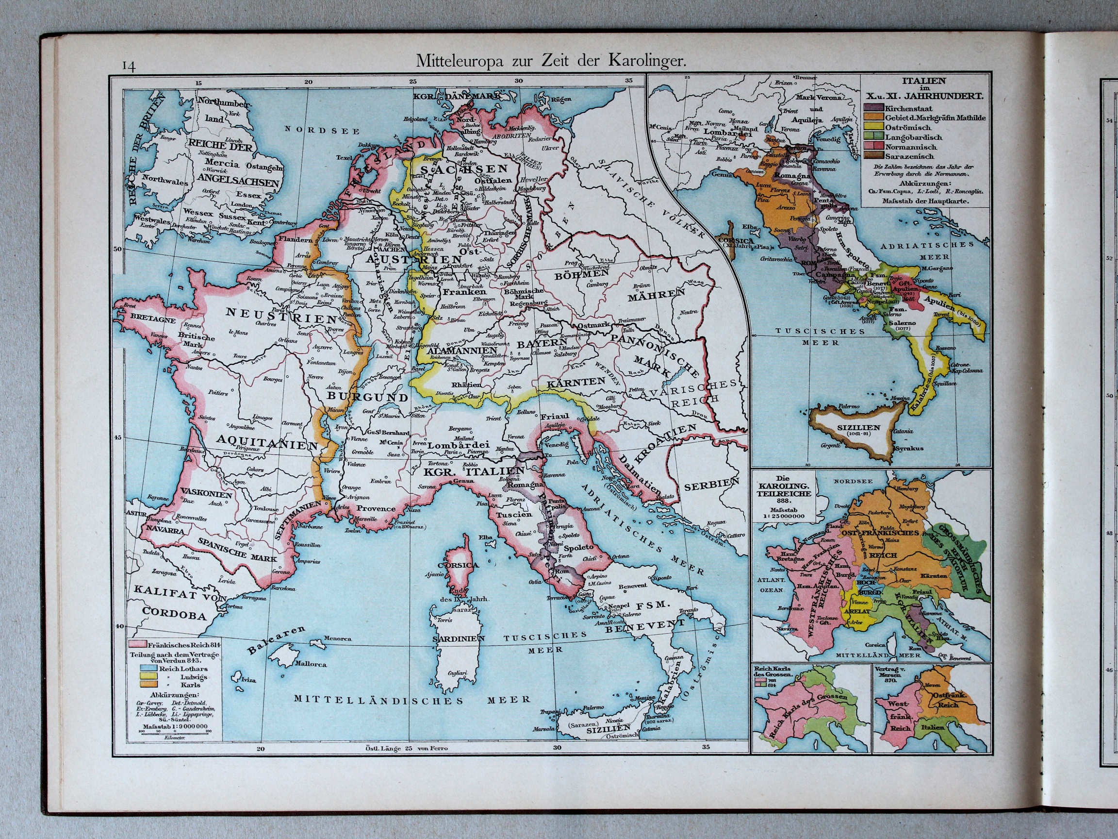
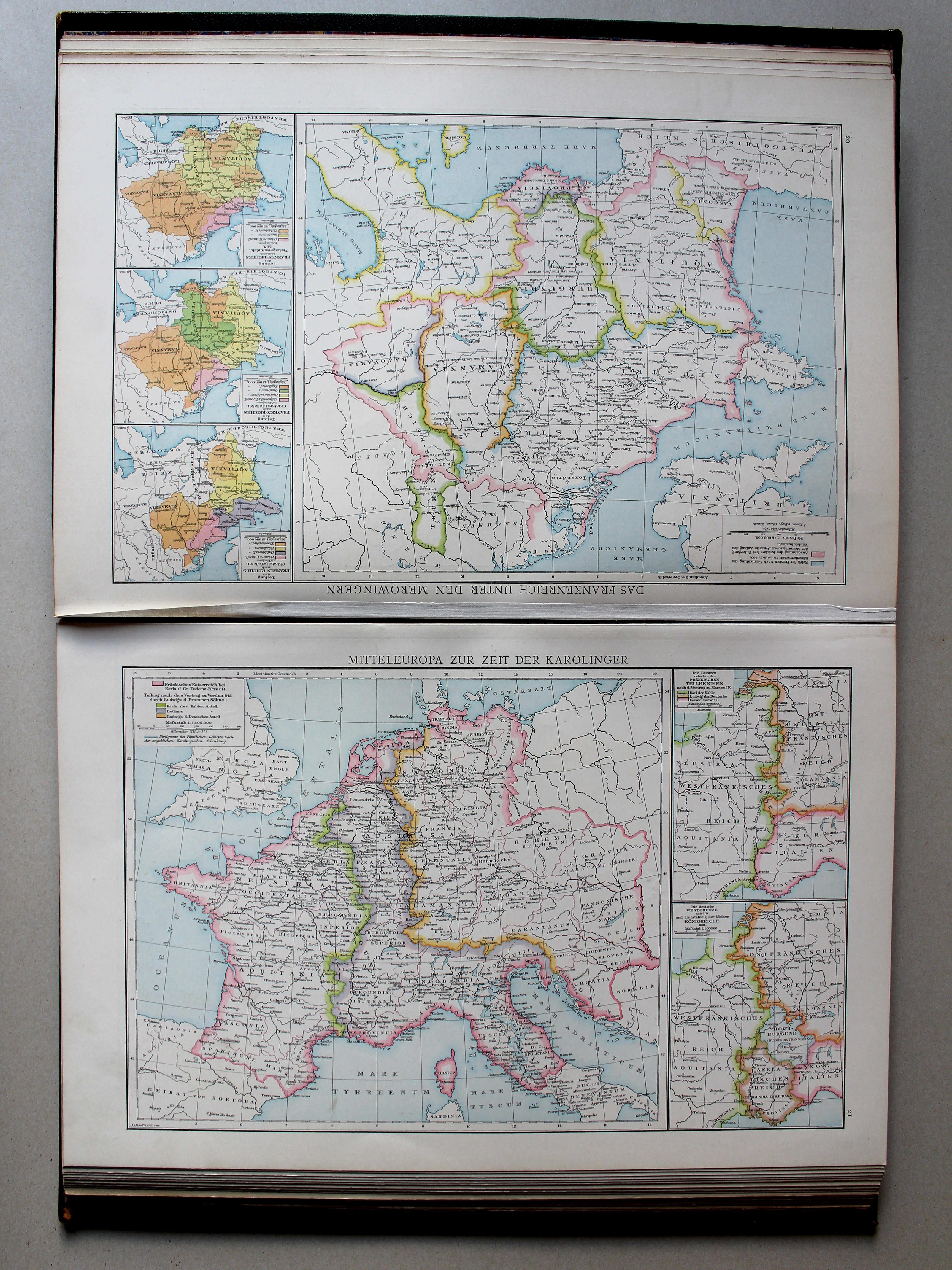
14. Mitteleuropa zur Zeit der Karolinger XL
Midden-Europa in de tijd van de Karolingen / Central Europe during the Carolingian dynasty
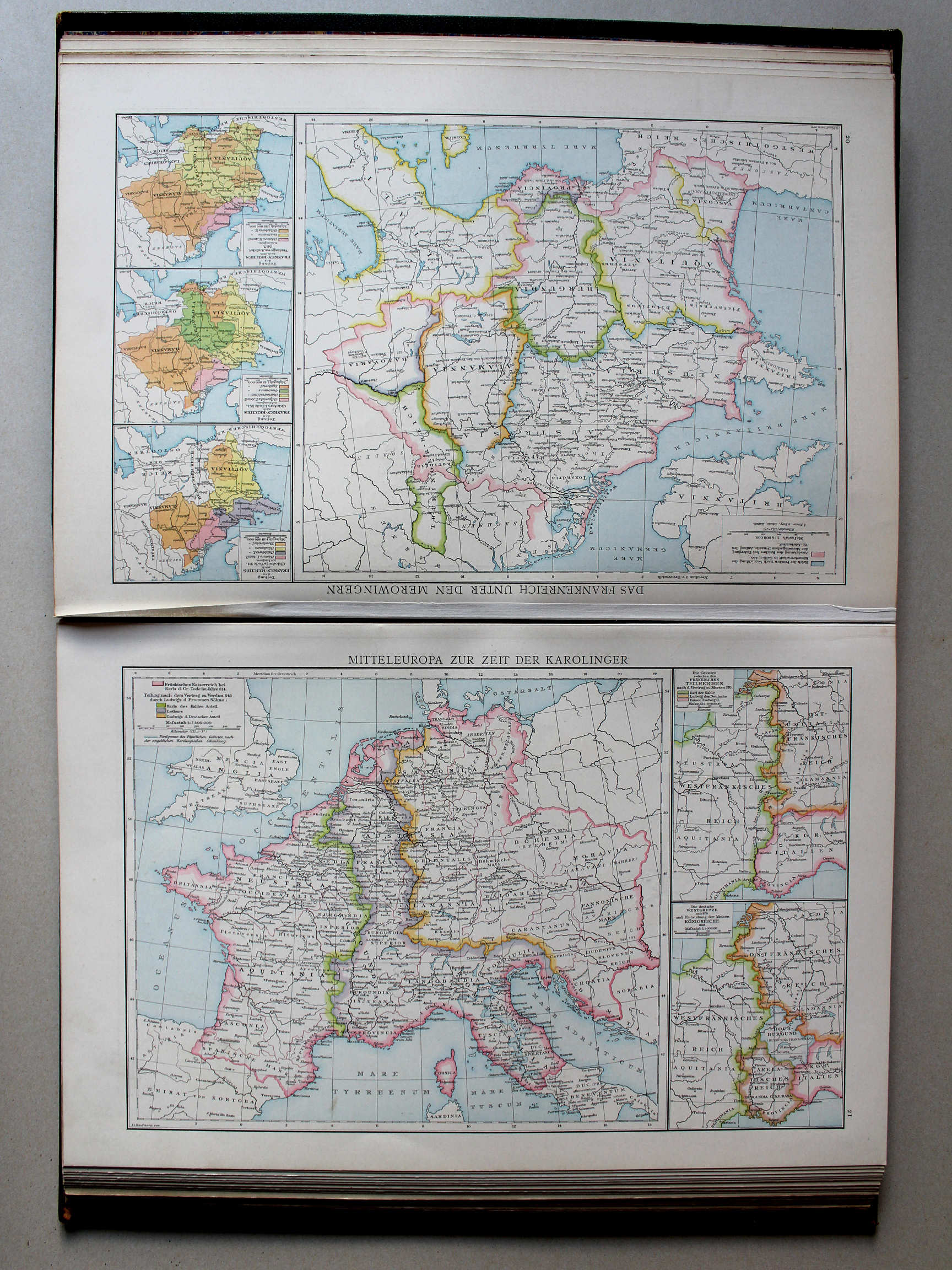 Droysens Historischer Handatlas, 1886
21. Mitteleuropa zur Zeit der Karolinger XL
Midden-Europa in de tijd van de Karolingen / Central Europe during the Carolingian dynasty
 Putzgers Historischer Schul-Atlas, 1888
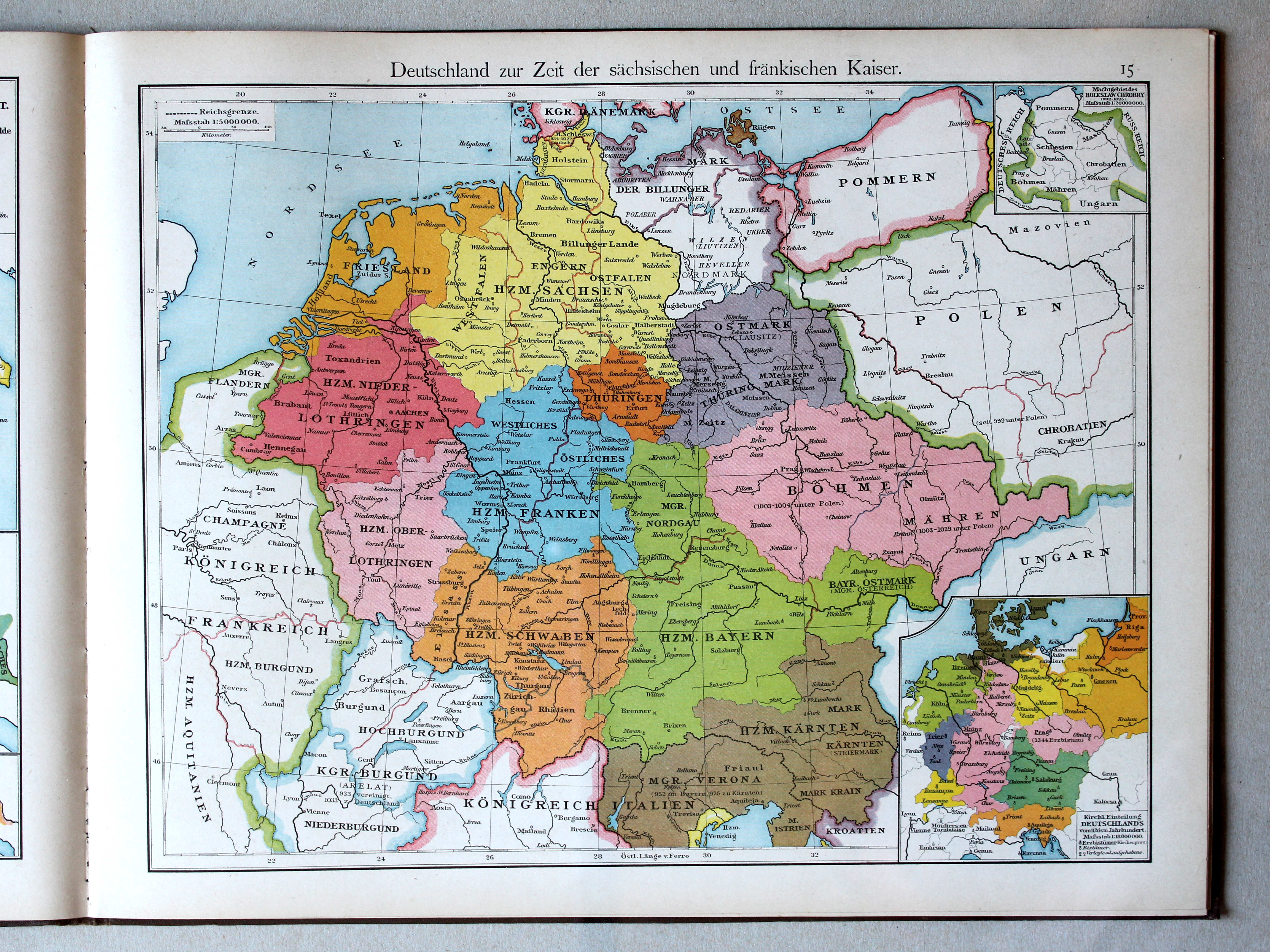
15. Deutschland zur Zeit der sächsischen und fränkischen Kaiser XL
Duitsland in de tijd van de Saksische en Frankische keizers / Germany during the Saxon and Frankish dynasties
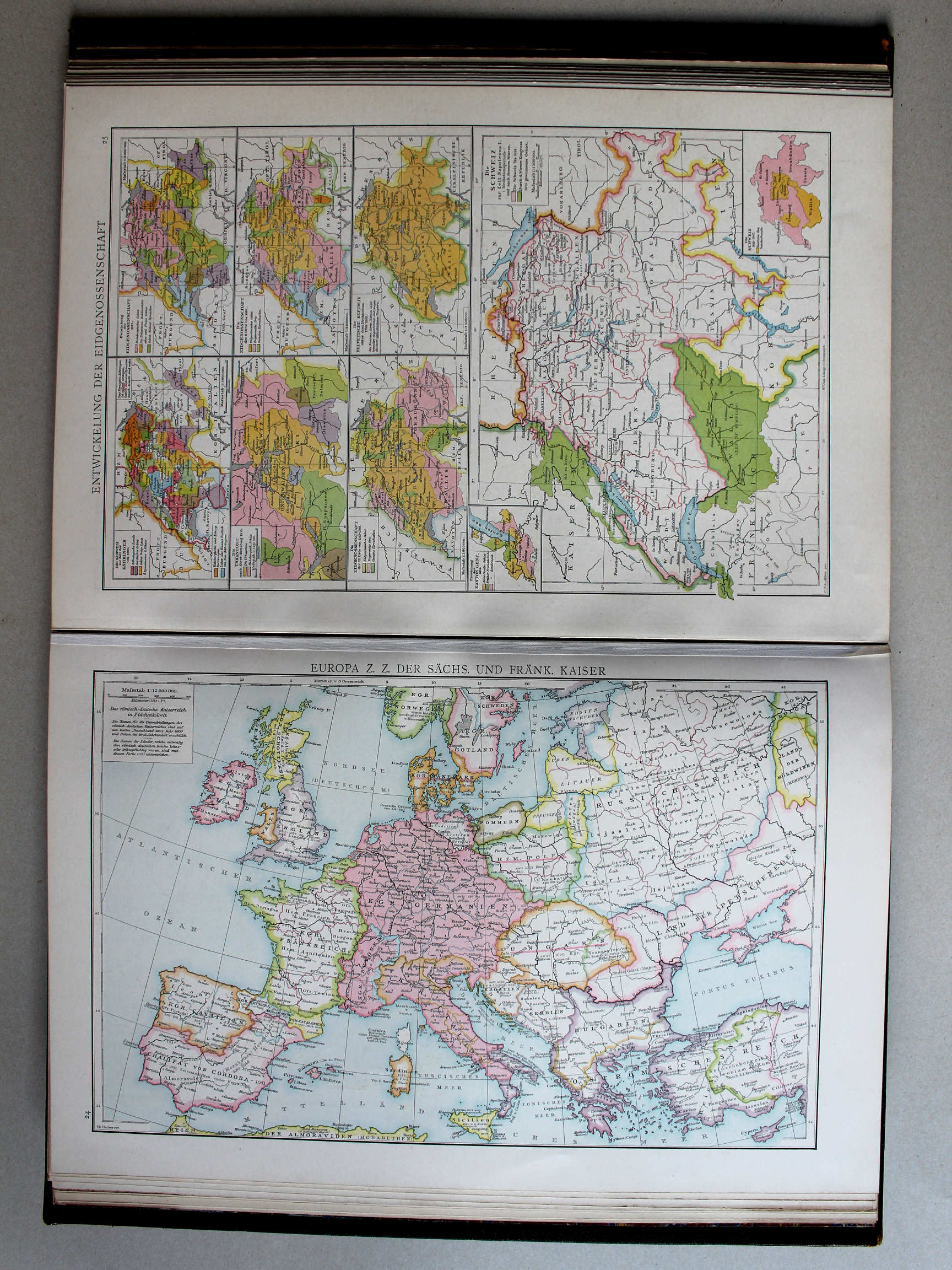 Droysens Historischer Handatlas, 1886
24. Europa zur Zeit der sächsischen und fränkischen Kaiser XL
Duitsland in de tijd van de Saksische en Frankische keizers / Germany during the Saxon and Frankish dynasties
 Putzgers Historischer Schul-Atlas, 1888
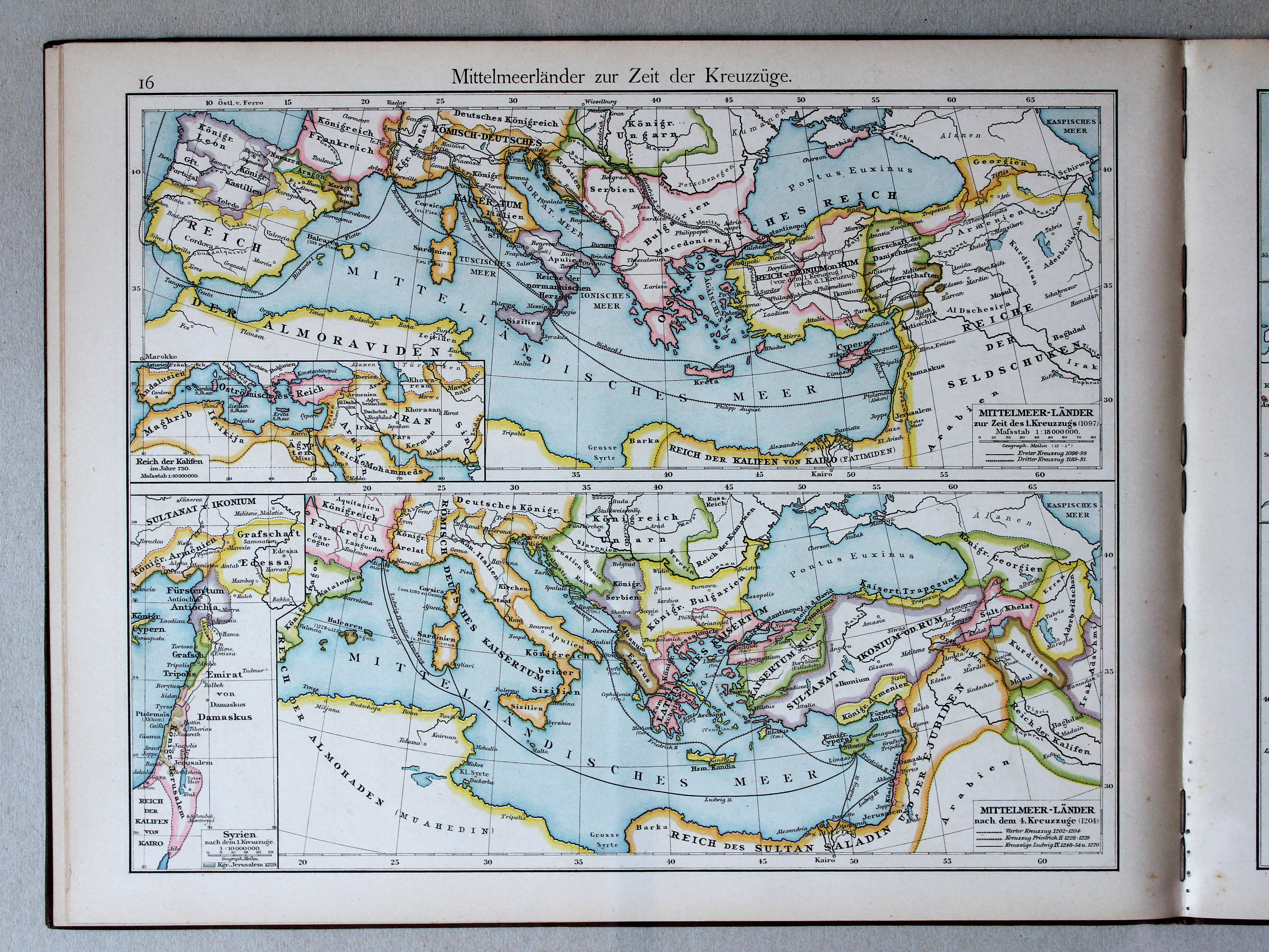
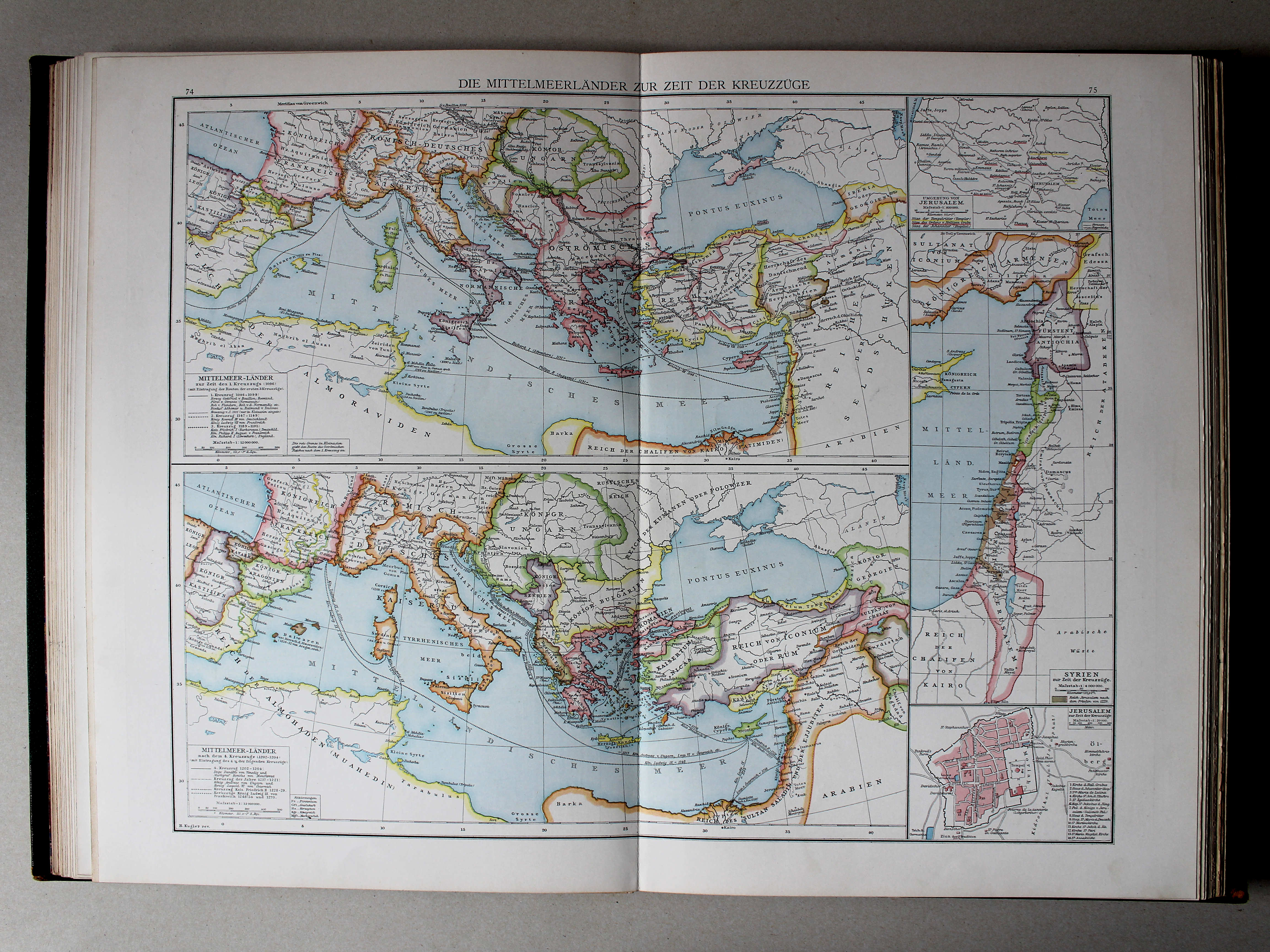
16. Mittelmeerländer zur Zeit der Kreuzzüge XL
Het Middellandse Zeegebied in de tijd van de Kruistochten / The Mediterranean region during the Crusades
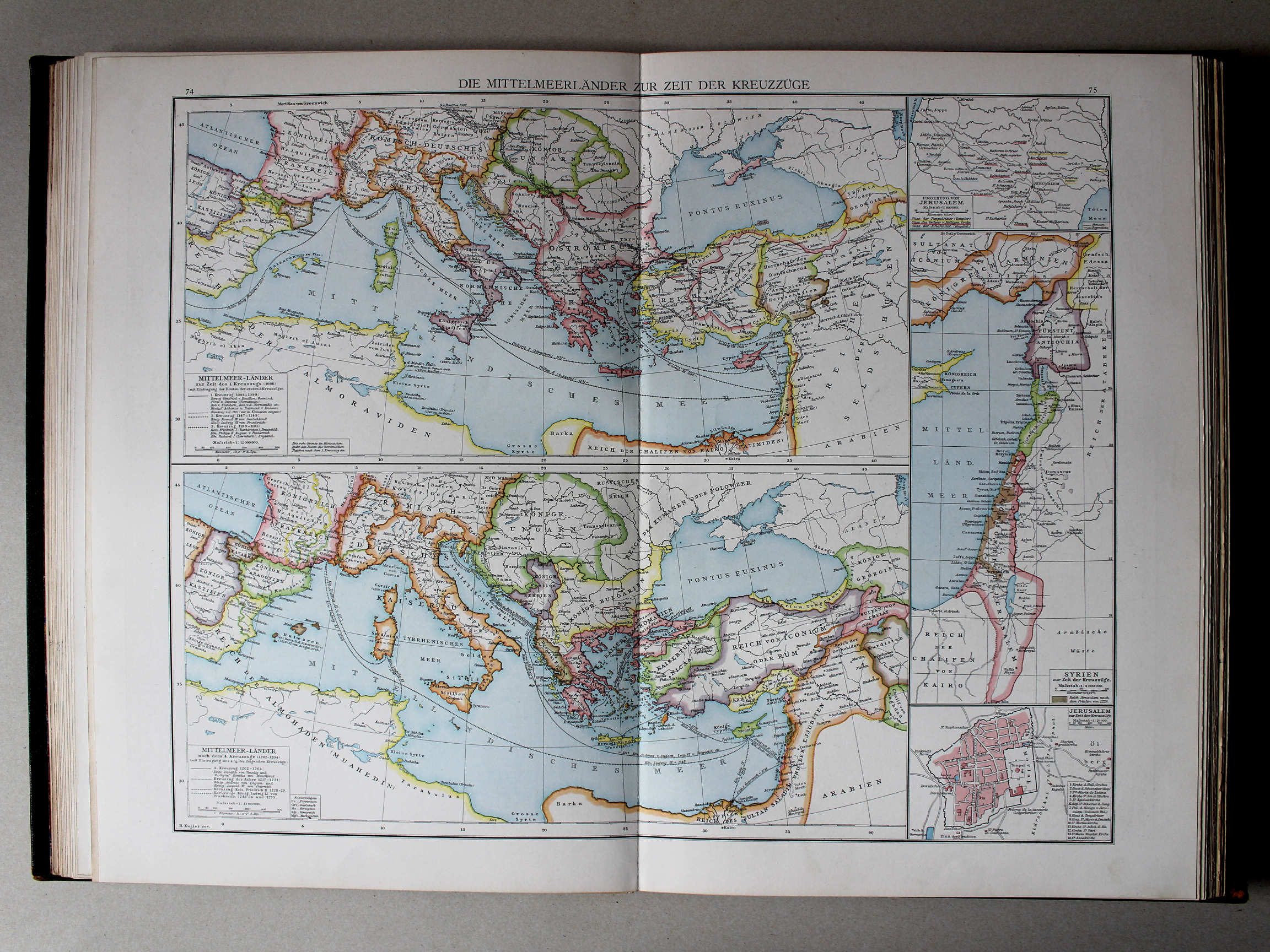 Droysens Historischer Handatlas, 1886
74.75. Die Mittelmeerländer zur Zeit der Kreuzzüge XL
Het Middellandse Zeegebied in de tijd van de Kruistochten / The Mediterranean region during the Crusades
 Putzgers Historischer Schul-Atlas, 1888
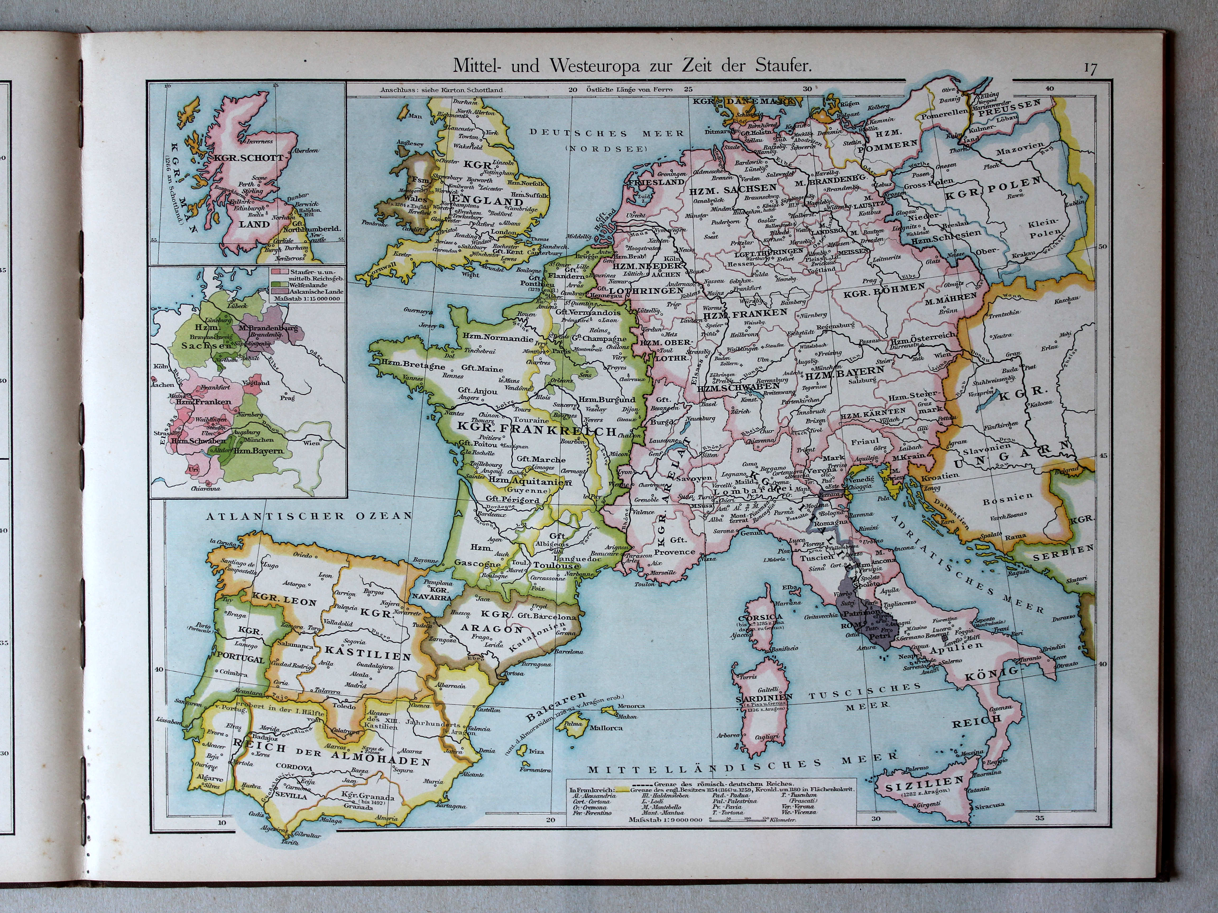
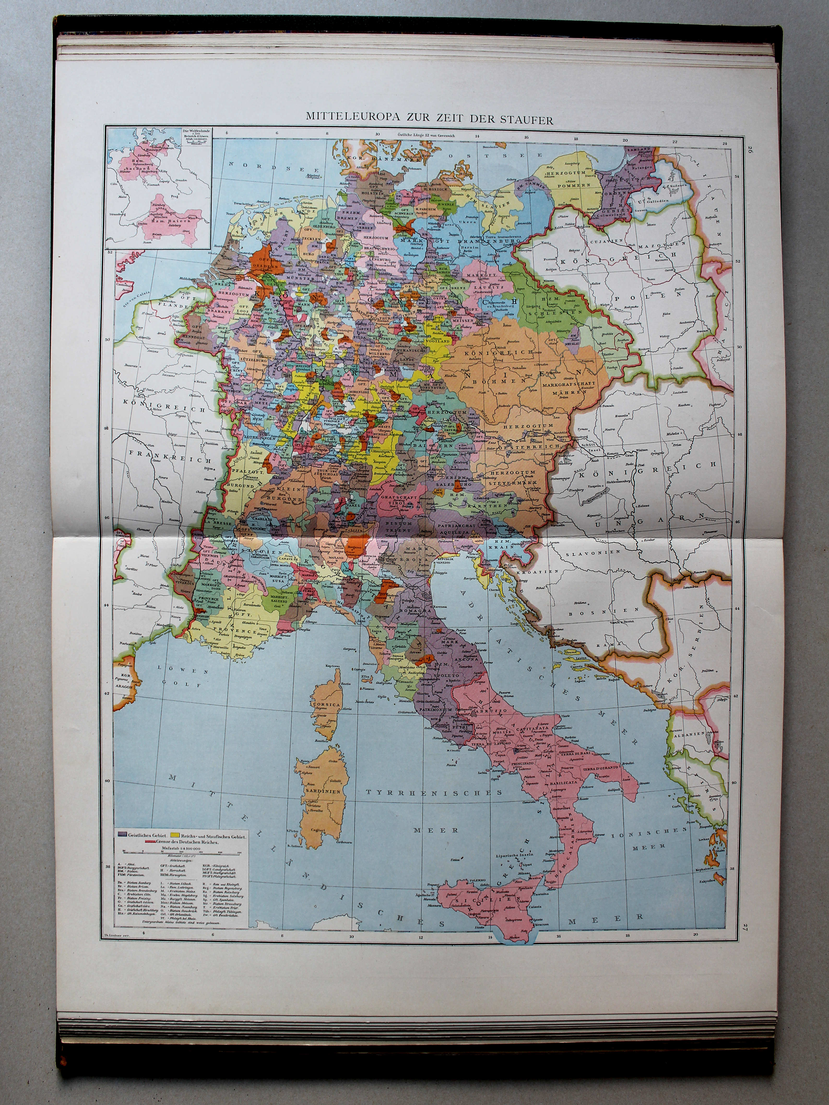
17. Mittel- und Westeuropa zur Zeit der Staufer XL
Midden- en West-Europa in de tijd van de Hohenstaufen / Central and Western Europe during the House of Hohenstaufen
 Droysens Historischer Handatlas, 1886
26.27. Mitteleuropa zur Zeit der Staufer XL
Midden-Europa in de tijd van de Hohenstaufen / Central Europe during the House of Hohenstaufen
 Putzgers Historischer Schul-Atlas, 1888
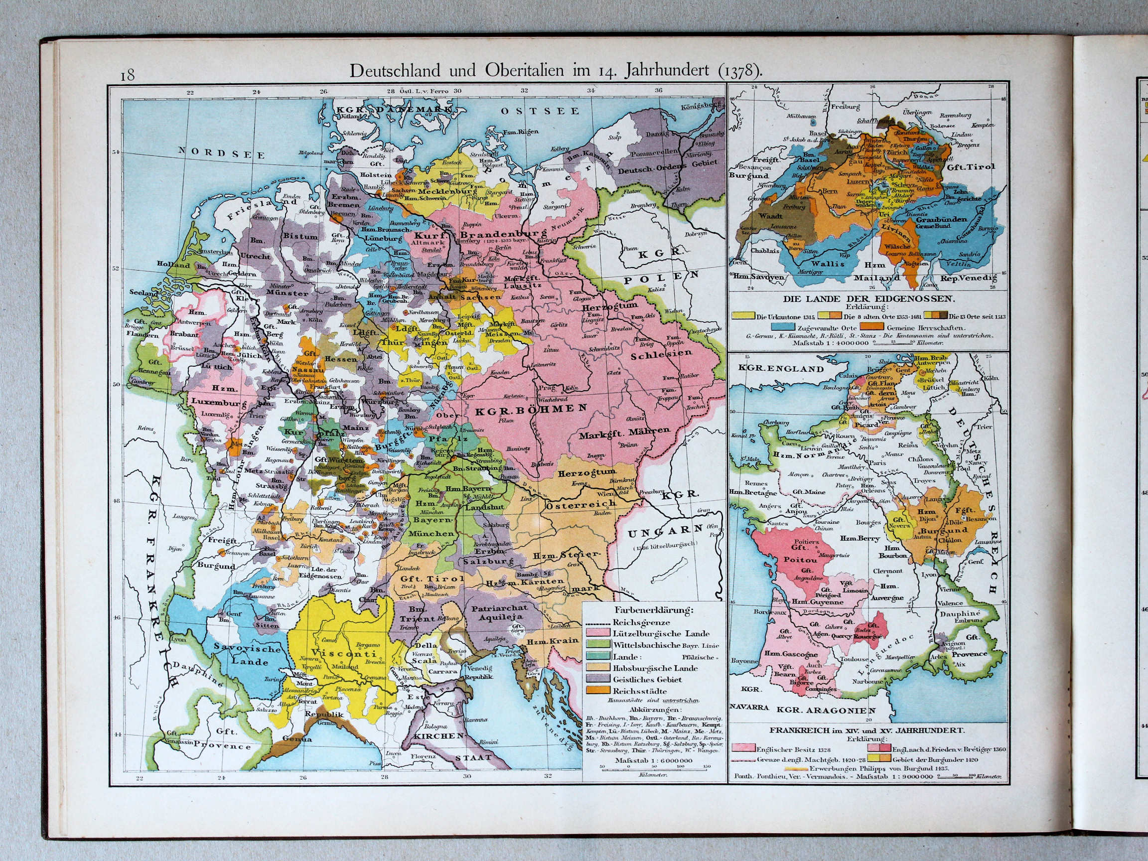
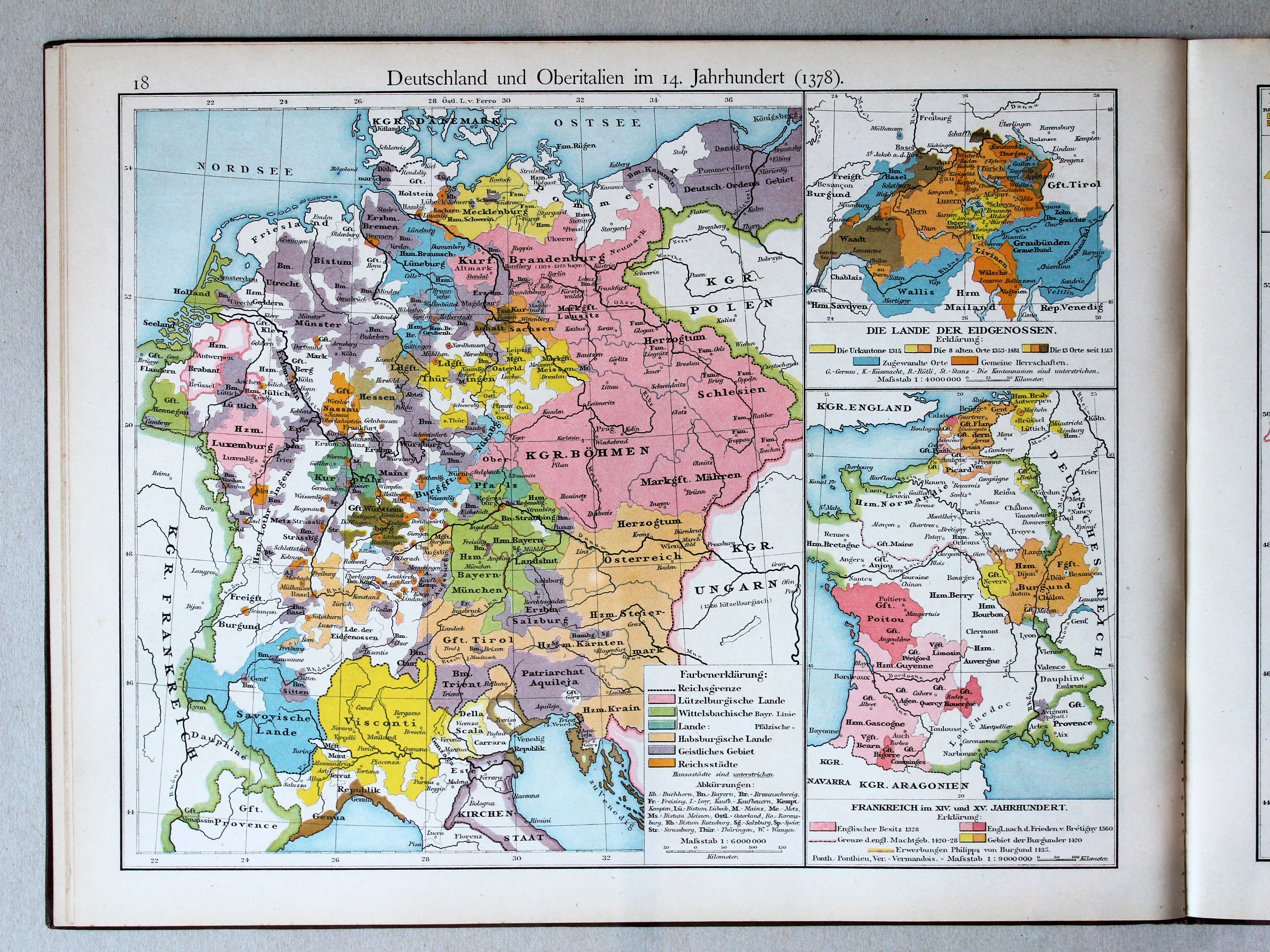
18. Deutschland und Oberitalien im 14. Jahrhundert (1378) XL
Duitsland en Noord-Italië in de 14e eeuw (1378) / Germany and Northern Italy in the 14th century (1378)
 Droysens Historischer Handatlas, 1886
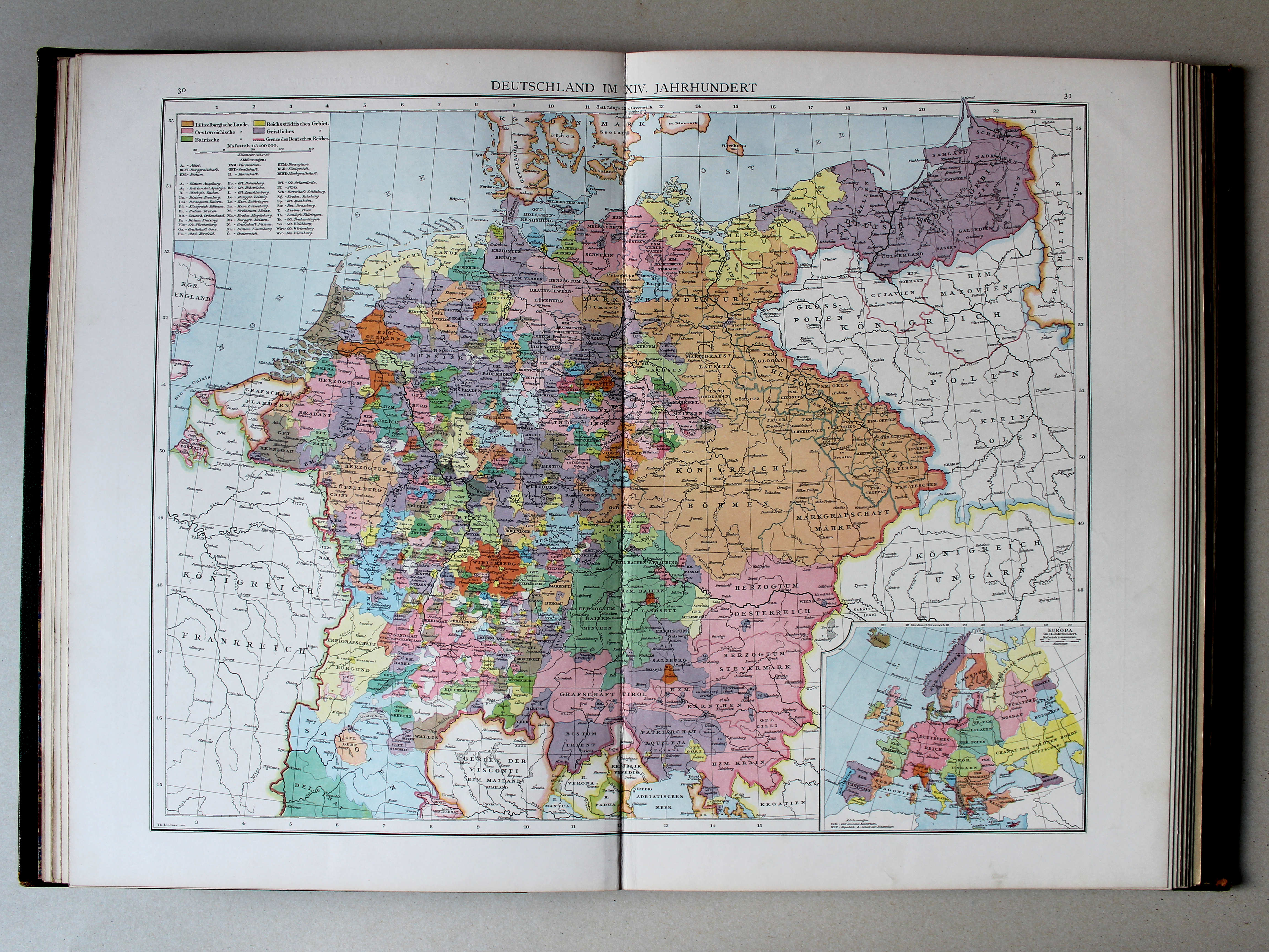
30.31. Deutschland im XIV. Jahrhundert XL
Duitsland in de 14e eeuw / Germany in the 14th century
 Putzgers Historischer Schul-Atlas, 1888
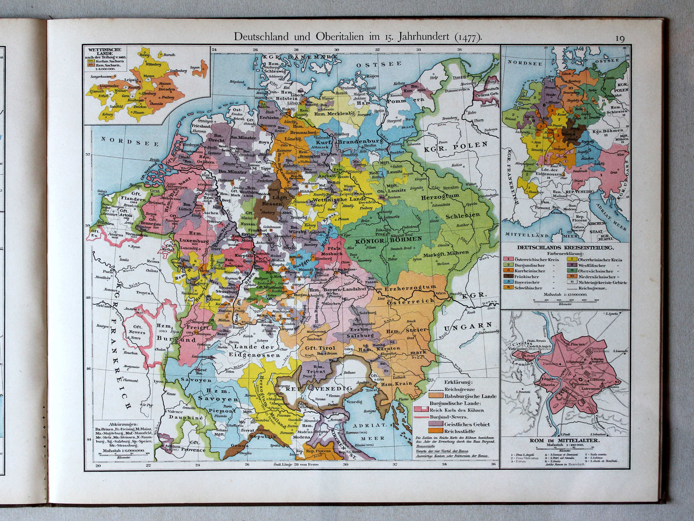
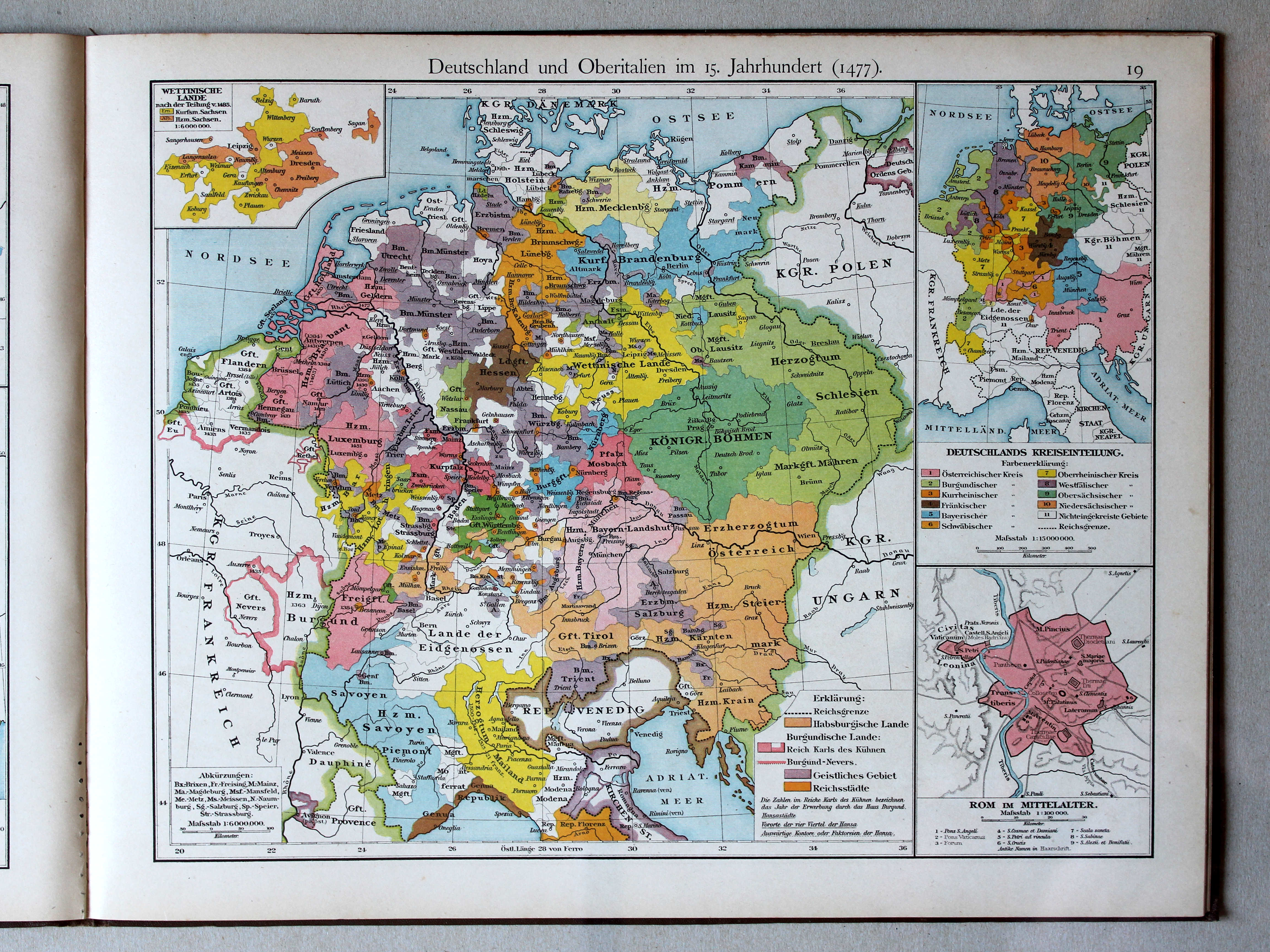
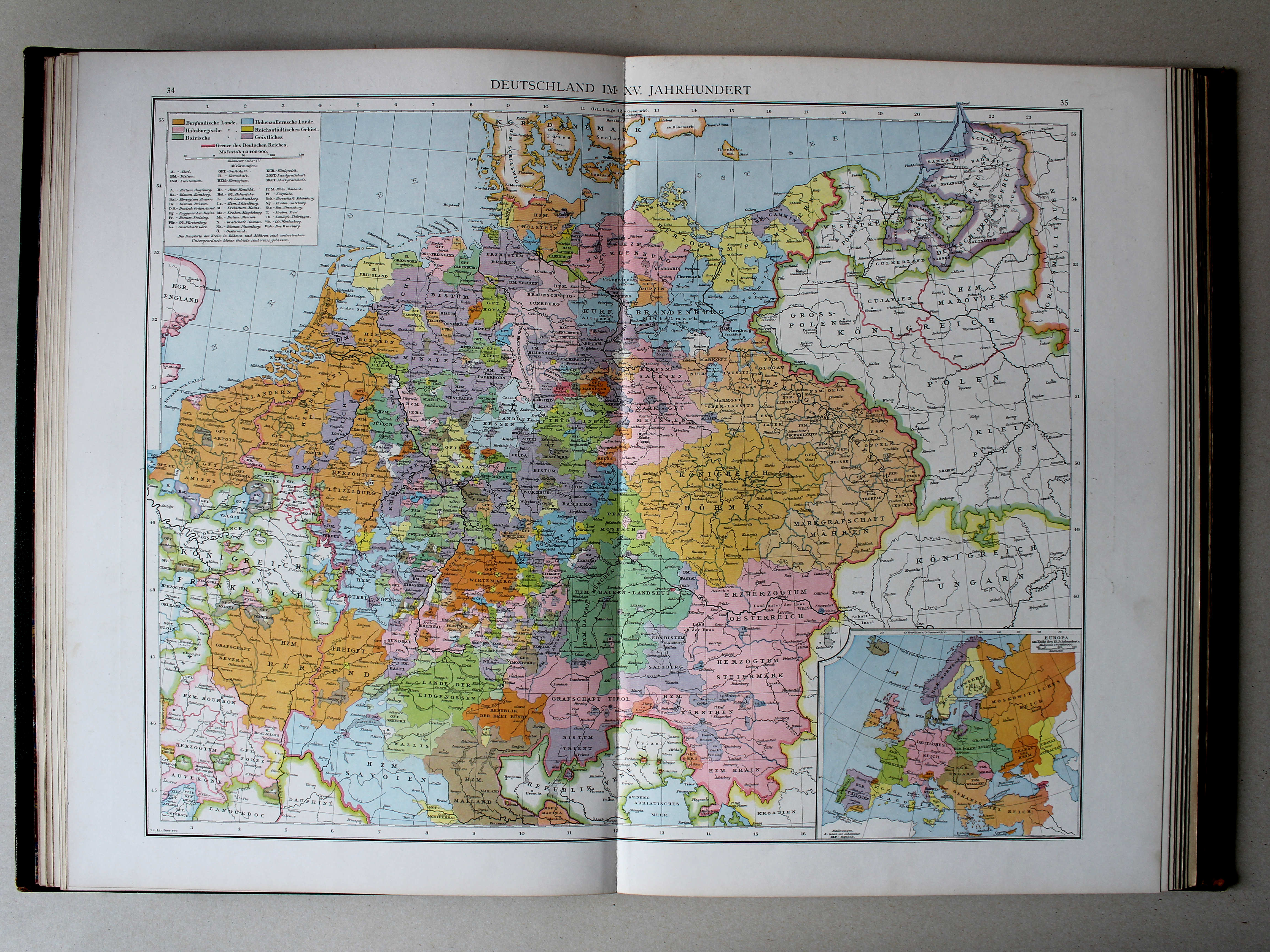
19. Deutschland und Oberitalien im 15. Jahrhundert (1477) XL
Duitsland en Noord-Italië in de 15e eeuw (1477) / Germany and Northern Italy in the 15th century (1477)
 Droysens Historischer Handatlas, 1886
34.35. Deutschland im XV. Jahrhundert XL
Duitsland in de 15e eeuw / Germany in the 15th century
 Putzgers Historischer Schul-Atlas, 1888
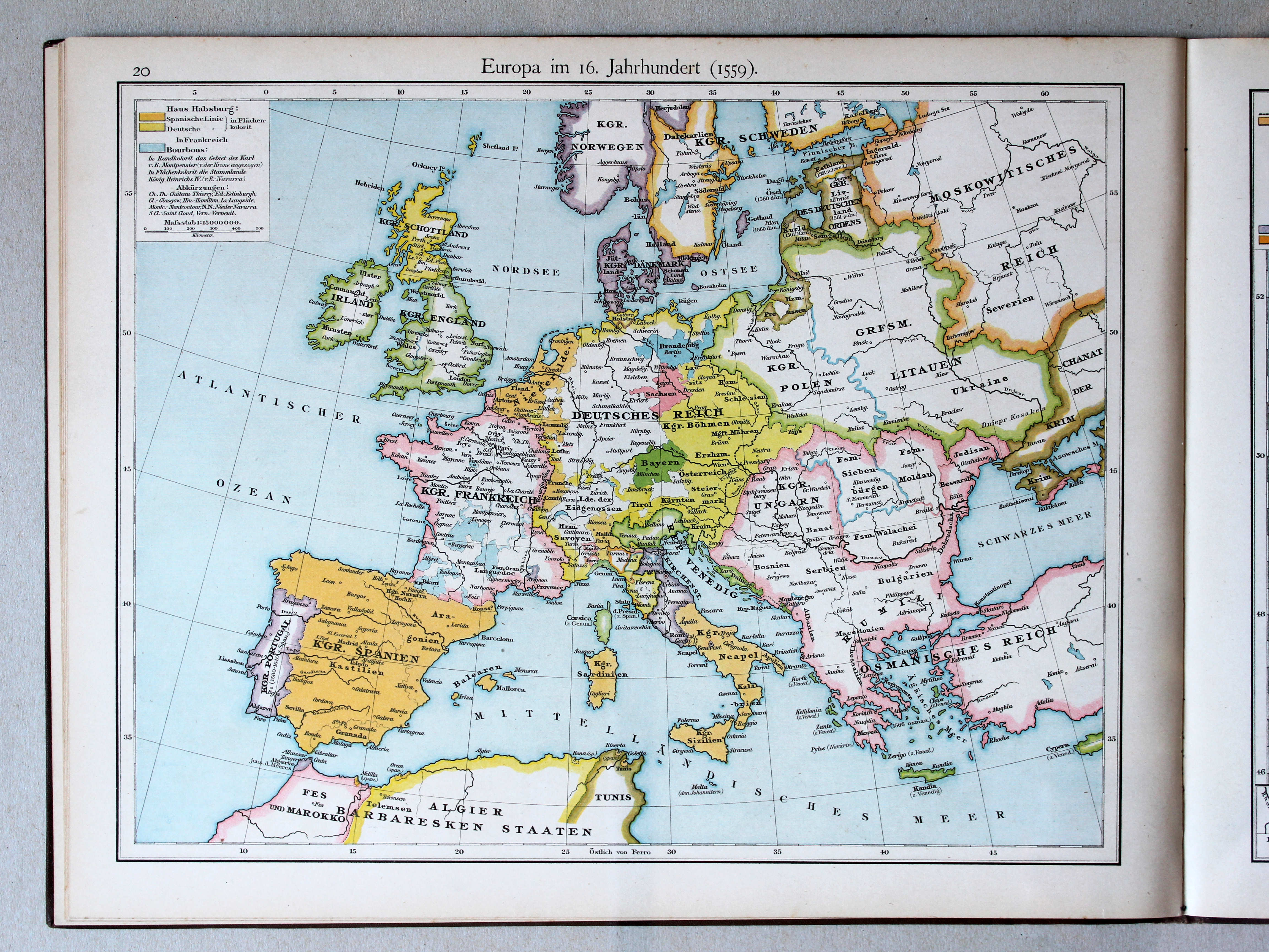
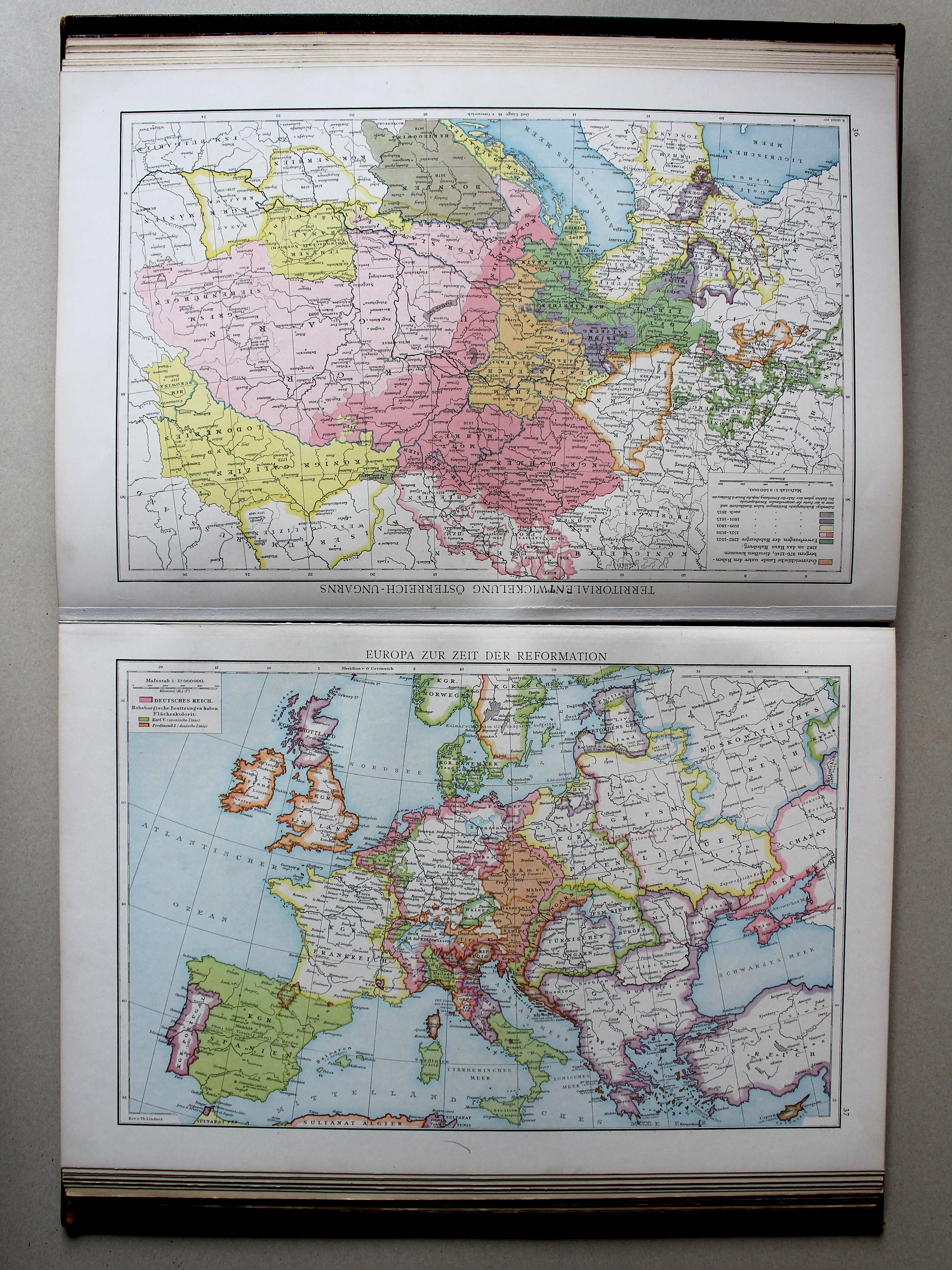
20. Europa im 16. Jahrhundert (1559) XL
Europa in de 16e eeuw (1559) / Europe in the 16th century (1559)
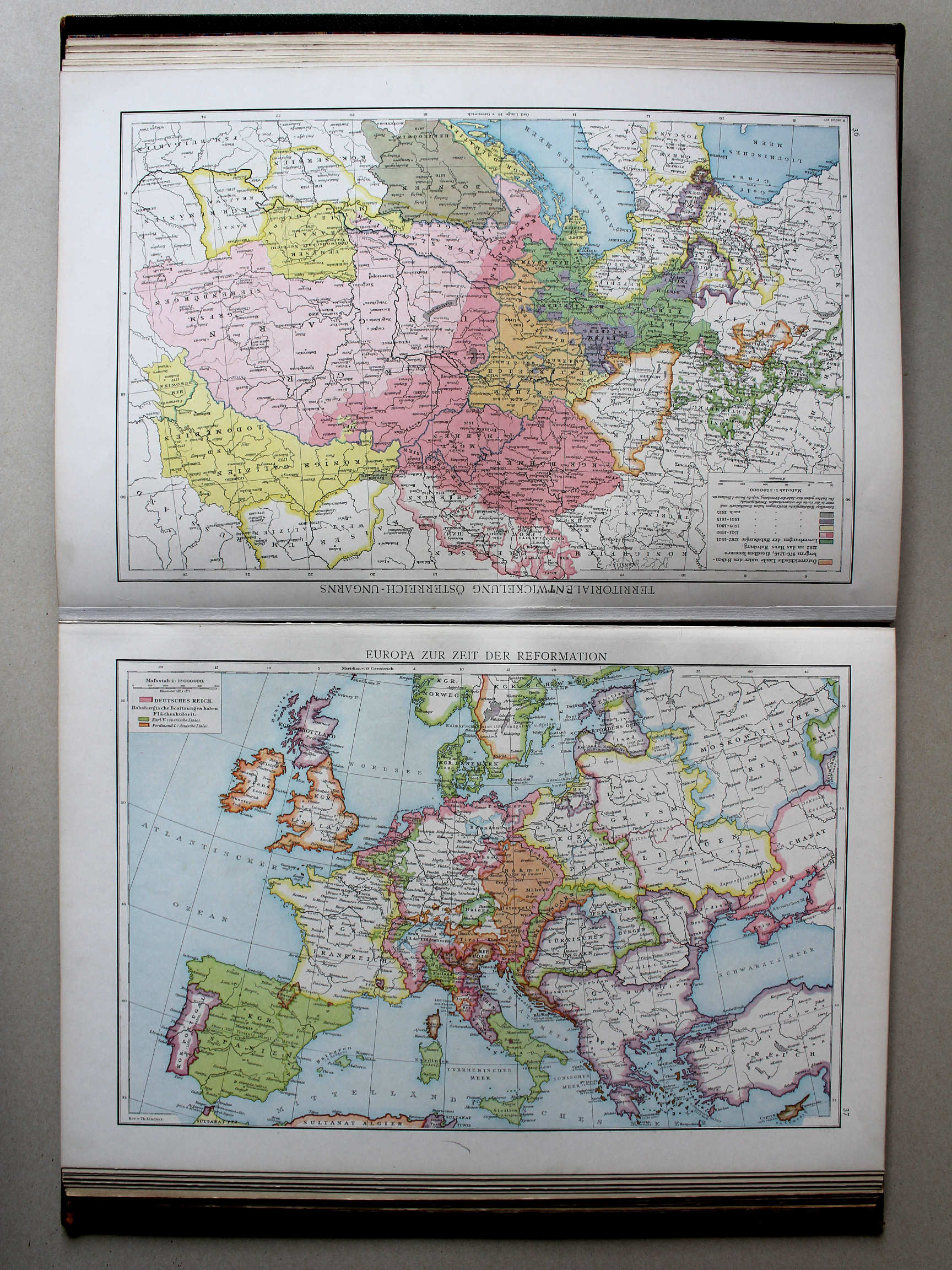 Droysens Historischer Handatlas, 1886
37. Europa zur Zeit der Reformation XL
Europa in de tijd van de Reformatie / Europe during the Protestant Reformation
 Putzgers Historischer Schul-Atlas, 1888
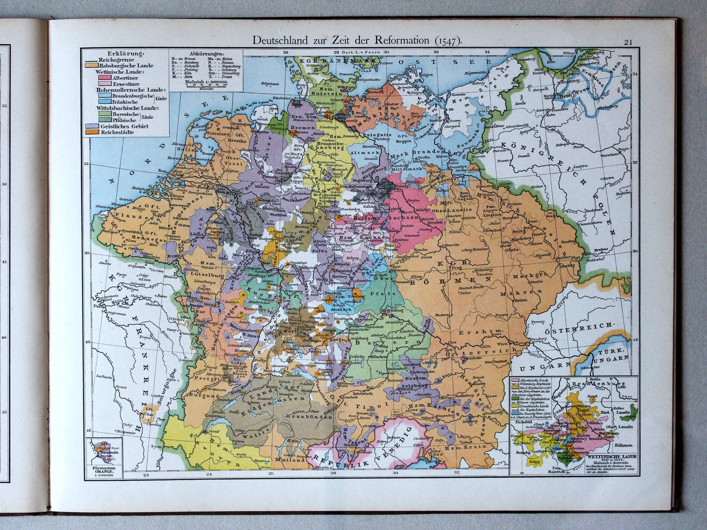
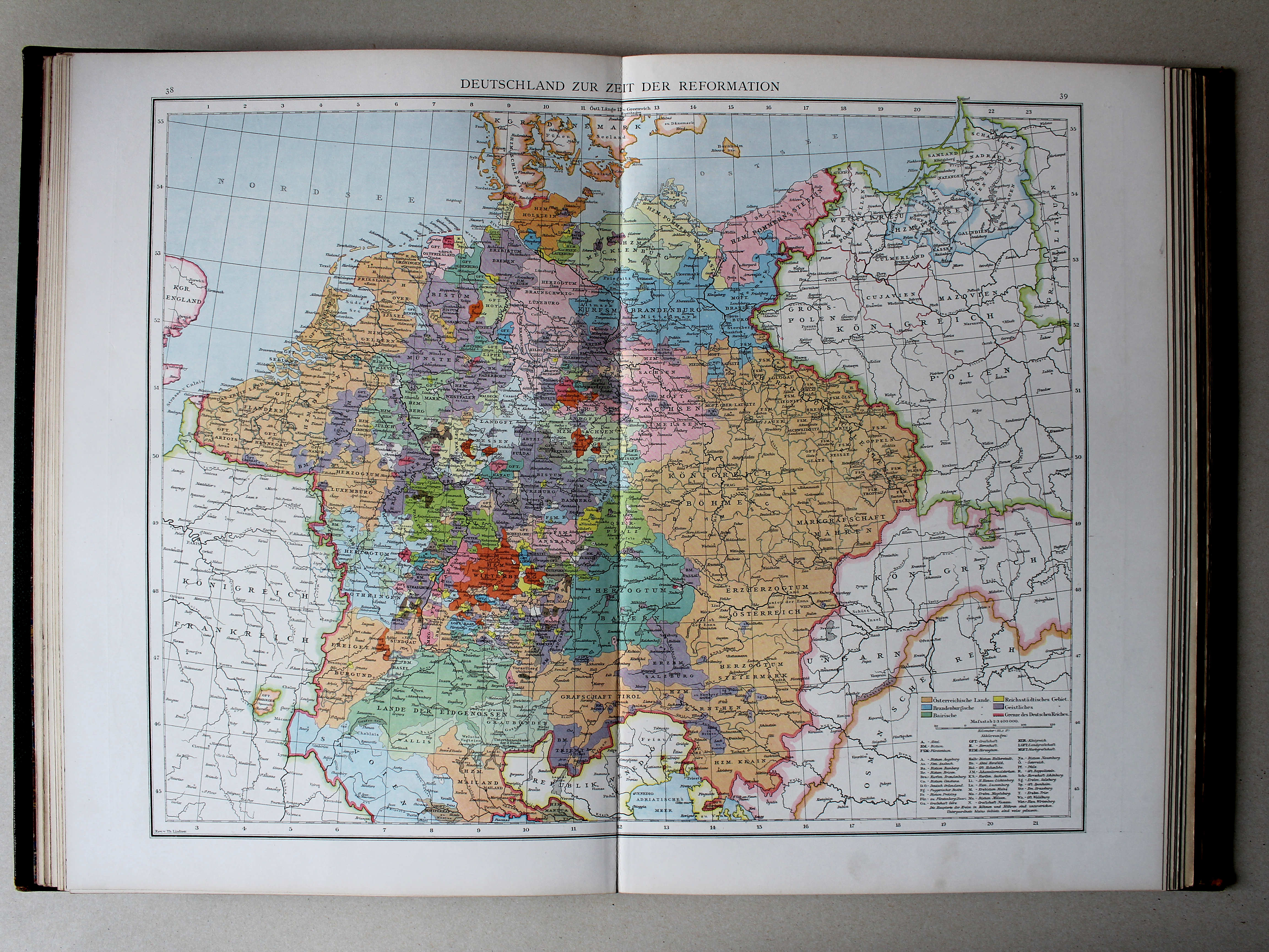
21. Deutschland zur Zeit der Reformation (1547) XL
Duitsland in de tijd van de Reformatie (1547) / Germany during the Protestant Reformation (1547)
 Droysens Historischer Handatlas, 1886
38.39. Deutschland zur Zeit der Reformation XL
Duitsland in de tijd van de Reformatie / Germany during the Protestant Reformation
 Putzgers Historischer Schul-Atlas, 1888
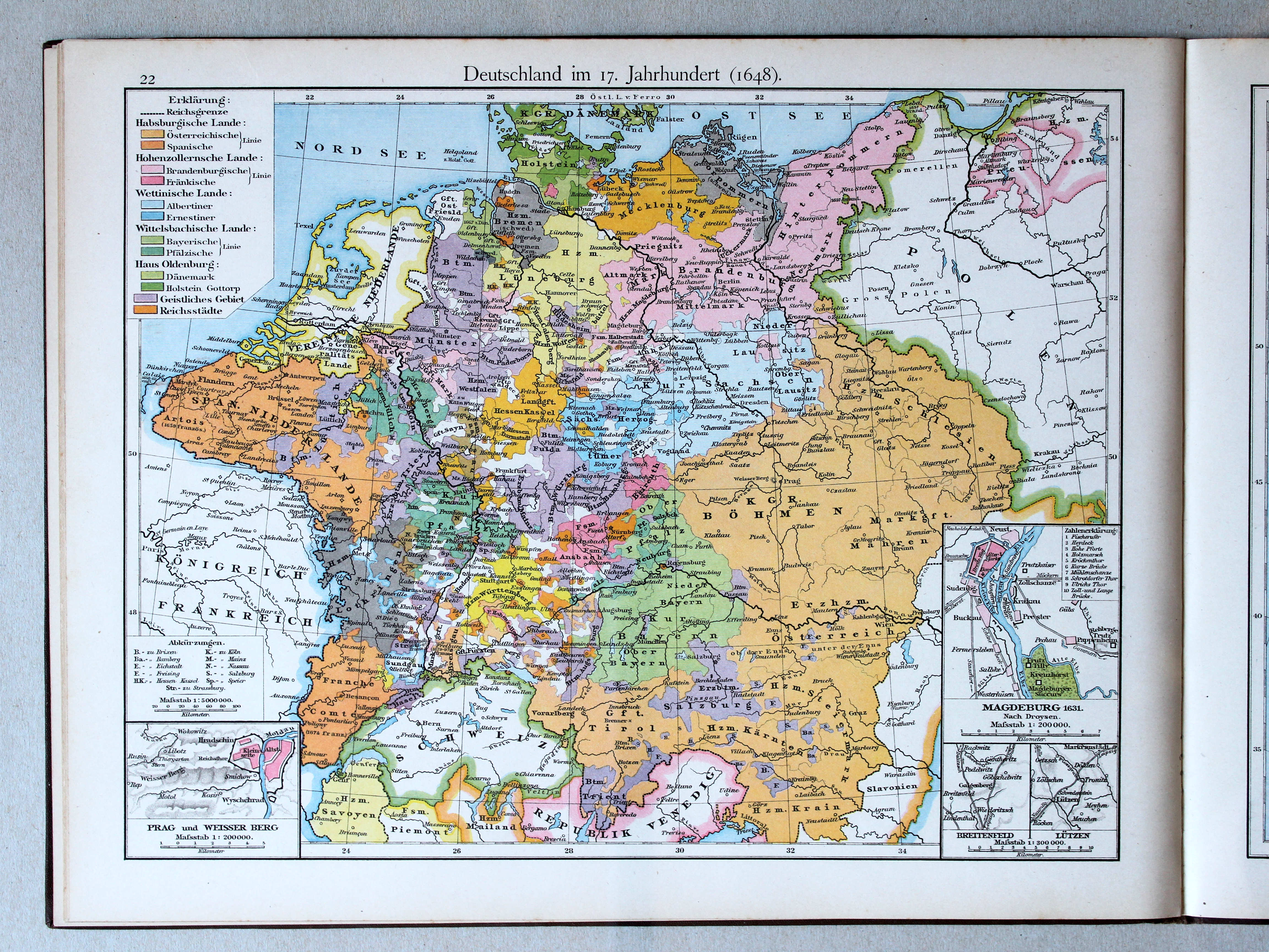
22. Deutschland im 17. Jahrhundert (1648) XL
Duitsland in de 17e eeuw (1648) / Germany in the 17th century (1648)
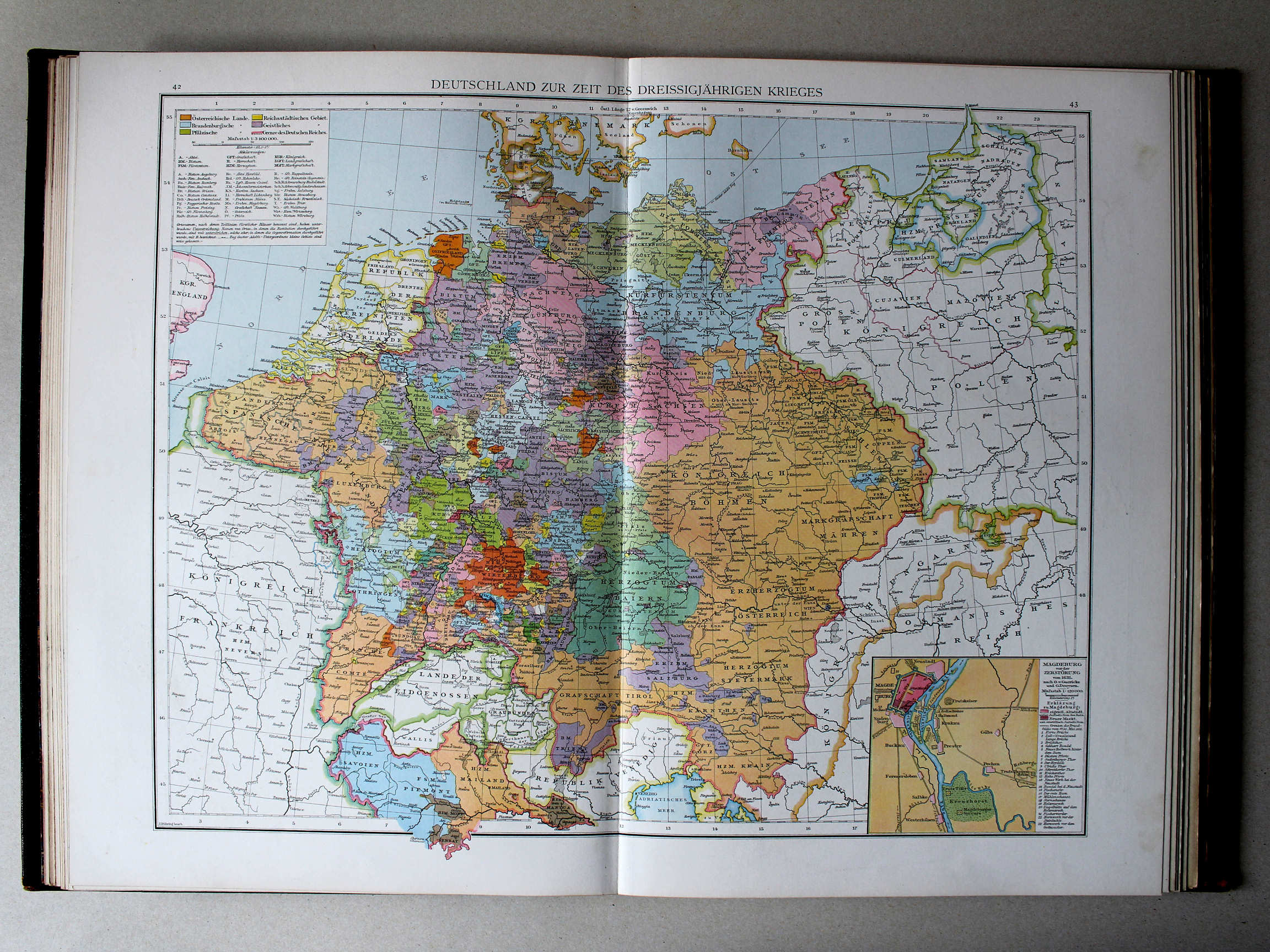 Droysens Historischer Handatlas, 1886
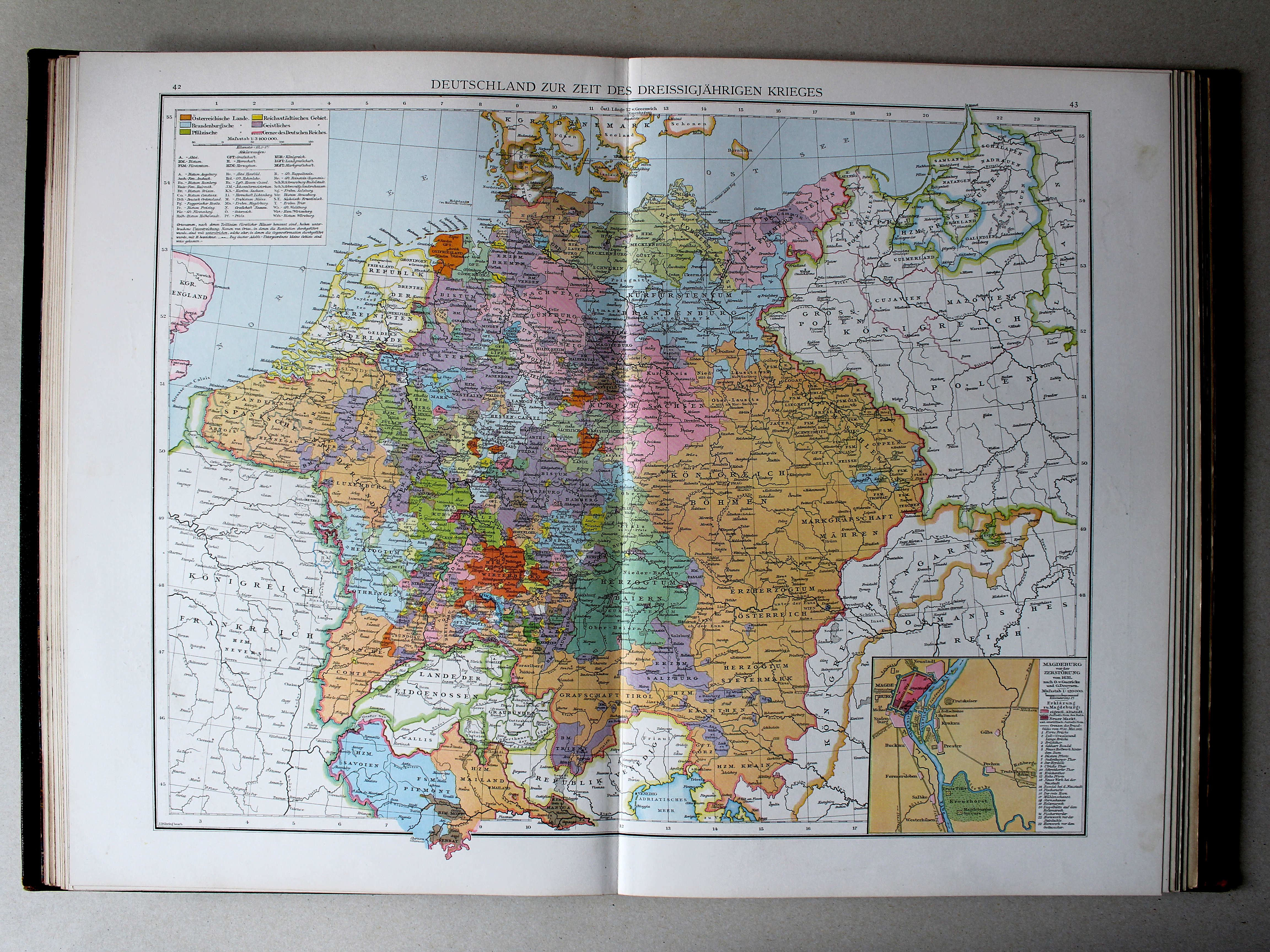
42.43. Deutschland zur Zeit des dreissigjährigen Krieges XL
Duitsland tijdens de Dertigjarige Oorlog / Germany during the Thirty Years' War
 Putzgers Historischer Schul-Atlas, 1888
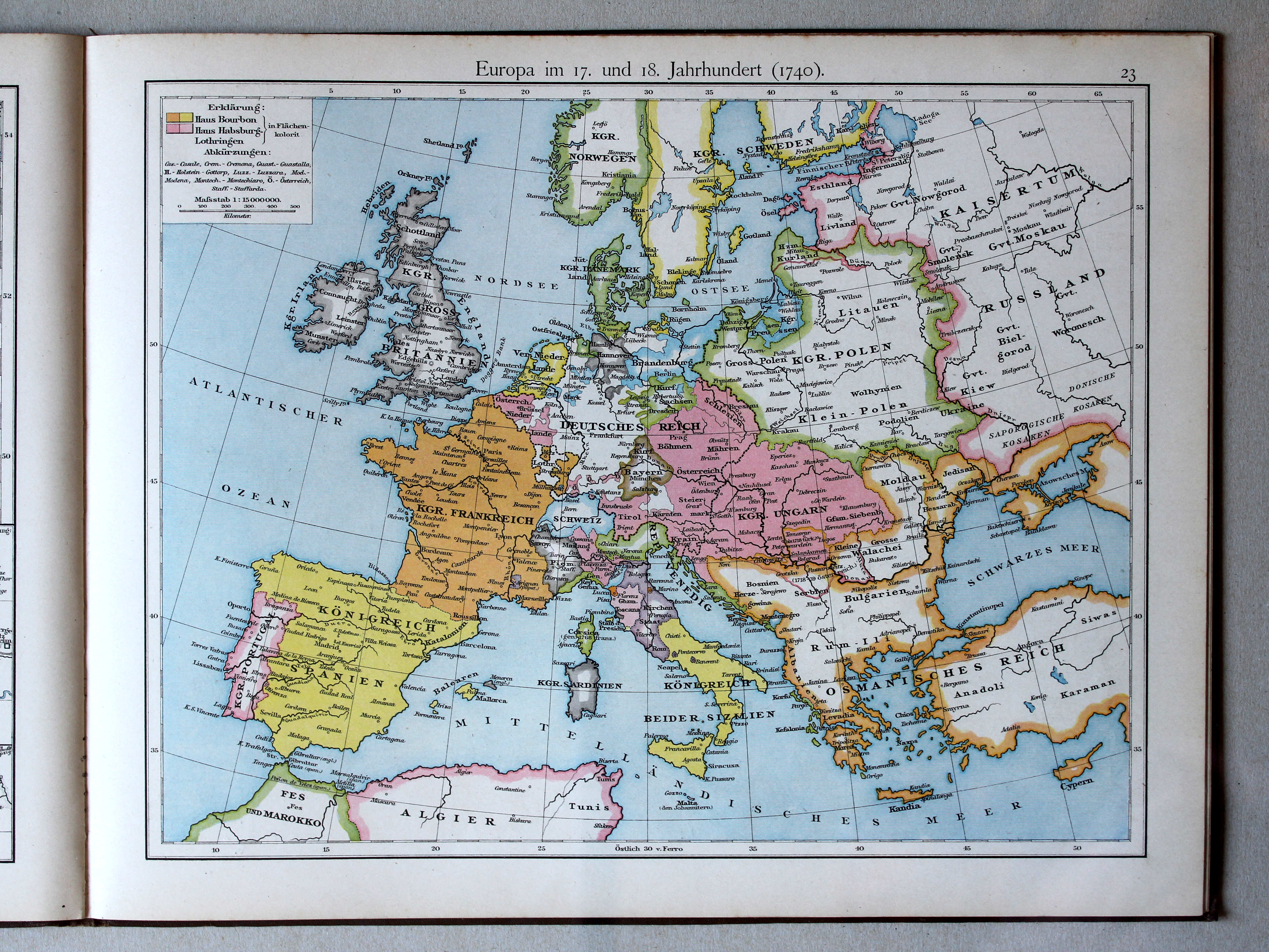
23. Europa im 17. und 18. Jahrhundert (1740) XL
Europa in de 17e en 18e eeuw (1740) / Europe in the 17th and 18th century (1740)
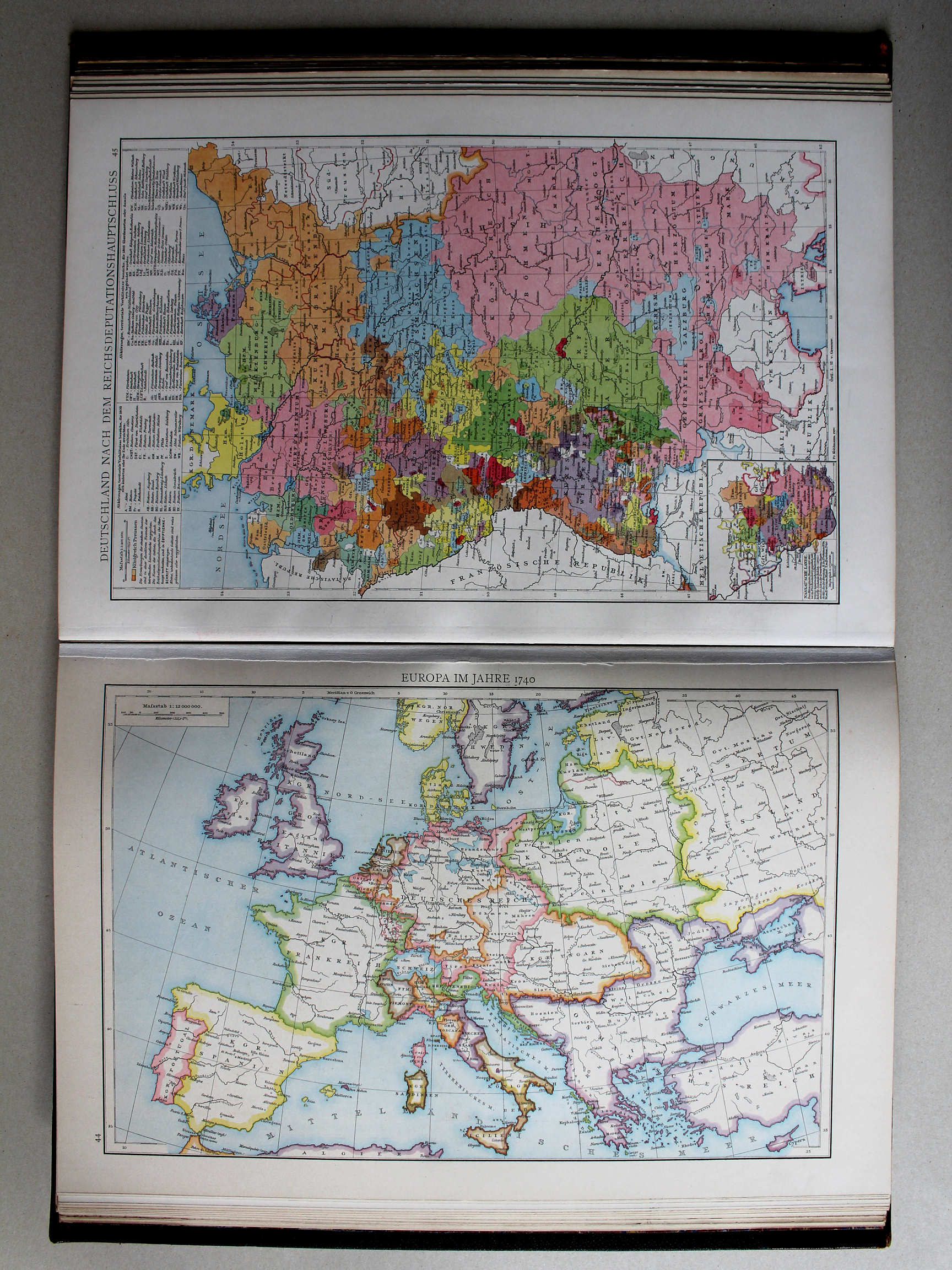
 Putzgers Historischer Schul-Atlas, 1888
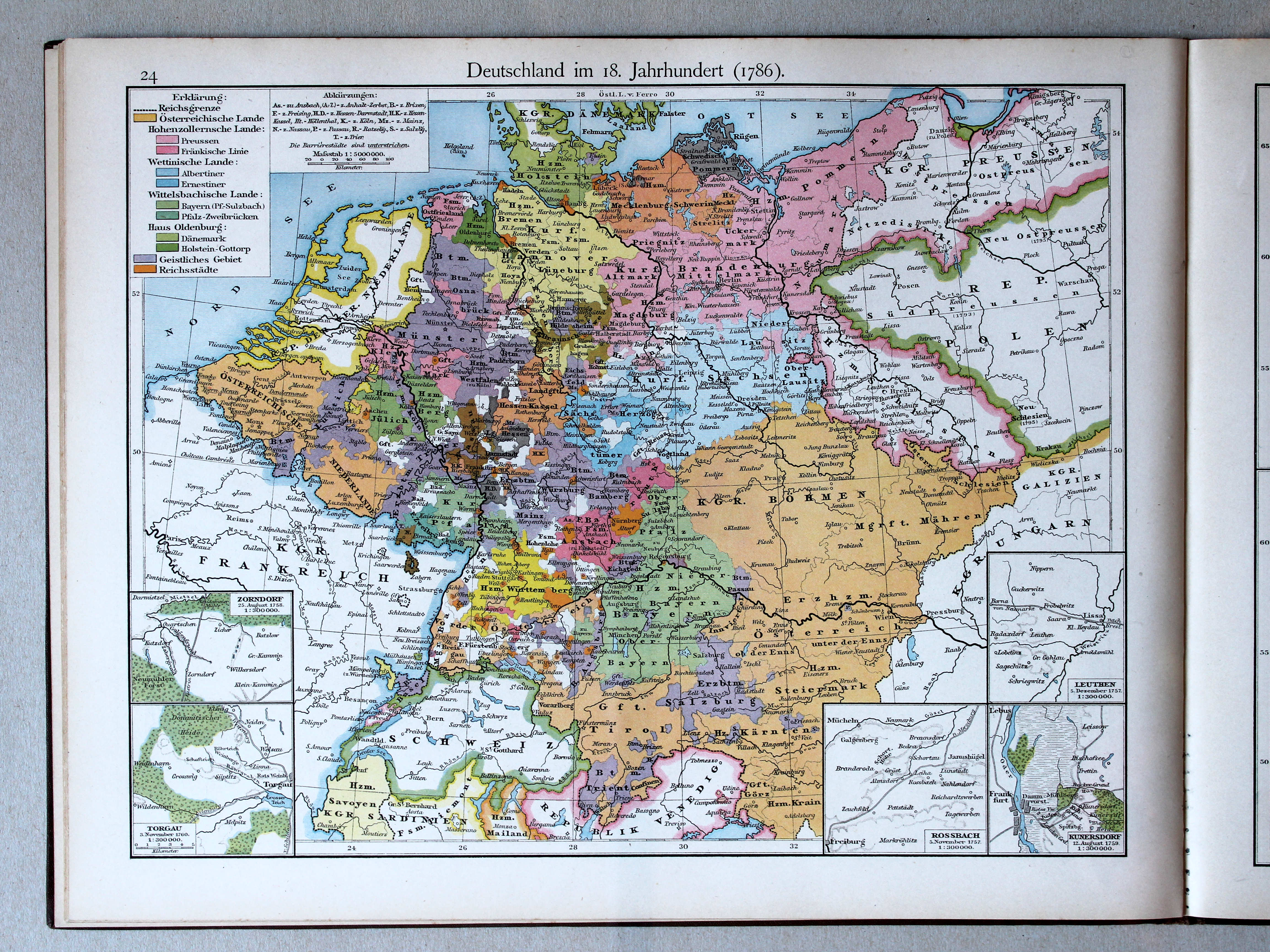
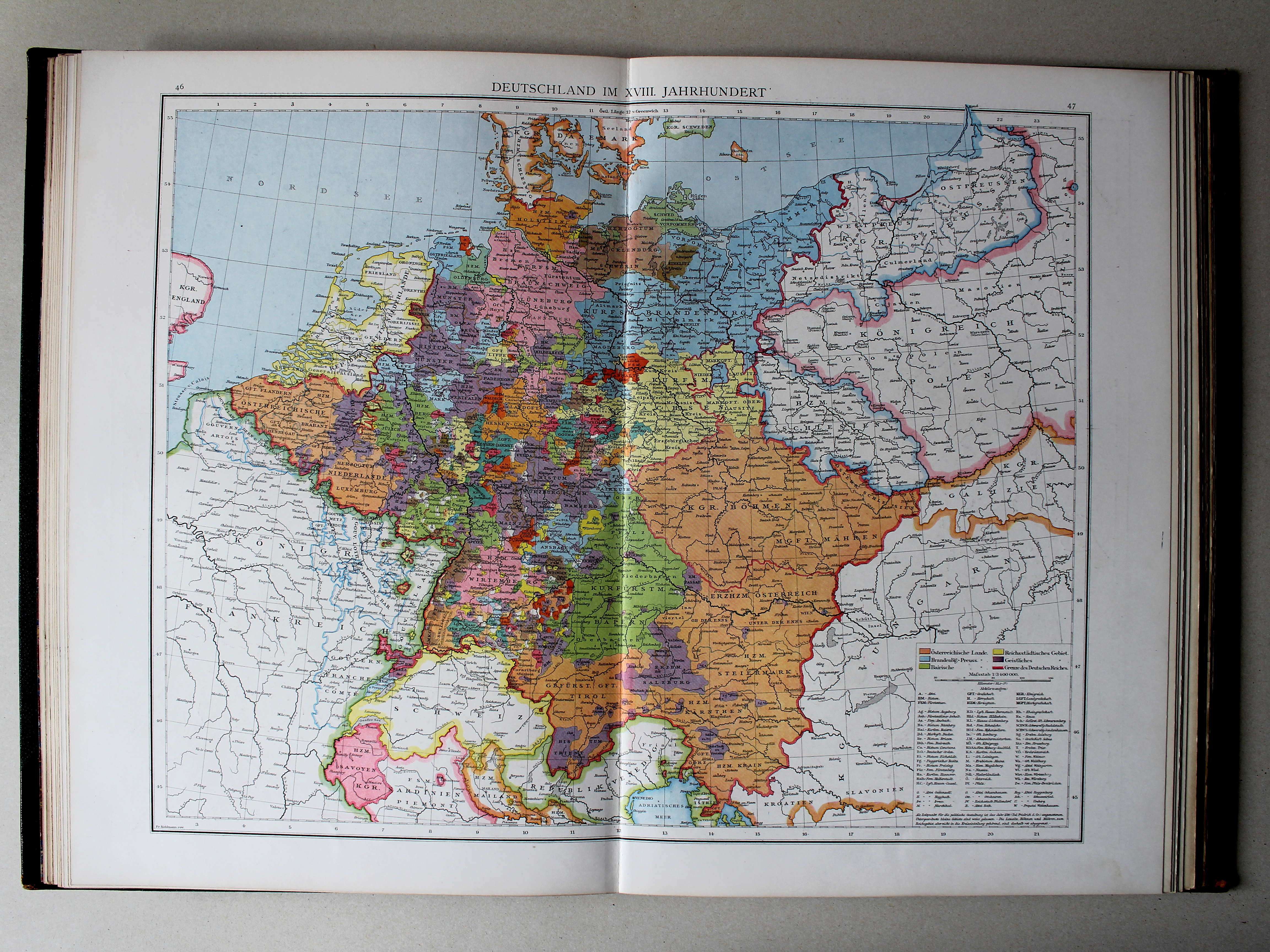
24. Deutschland im 18. Jahrhundert (1786) XL
Duitsland in de 18e eeuw (1786) / Germany in the 18th century (1786)
 Droysens Historischer Handatlas, 1886
46.47. Deutschland im XVIII. Jahrhundert XL
Duitsland in de 18e eeuw / Germany in the 18th century
 Putzgers Historischer Schul-Atlas, 1888
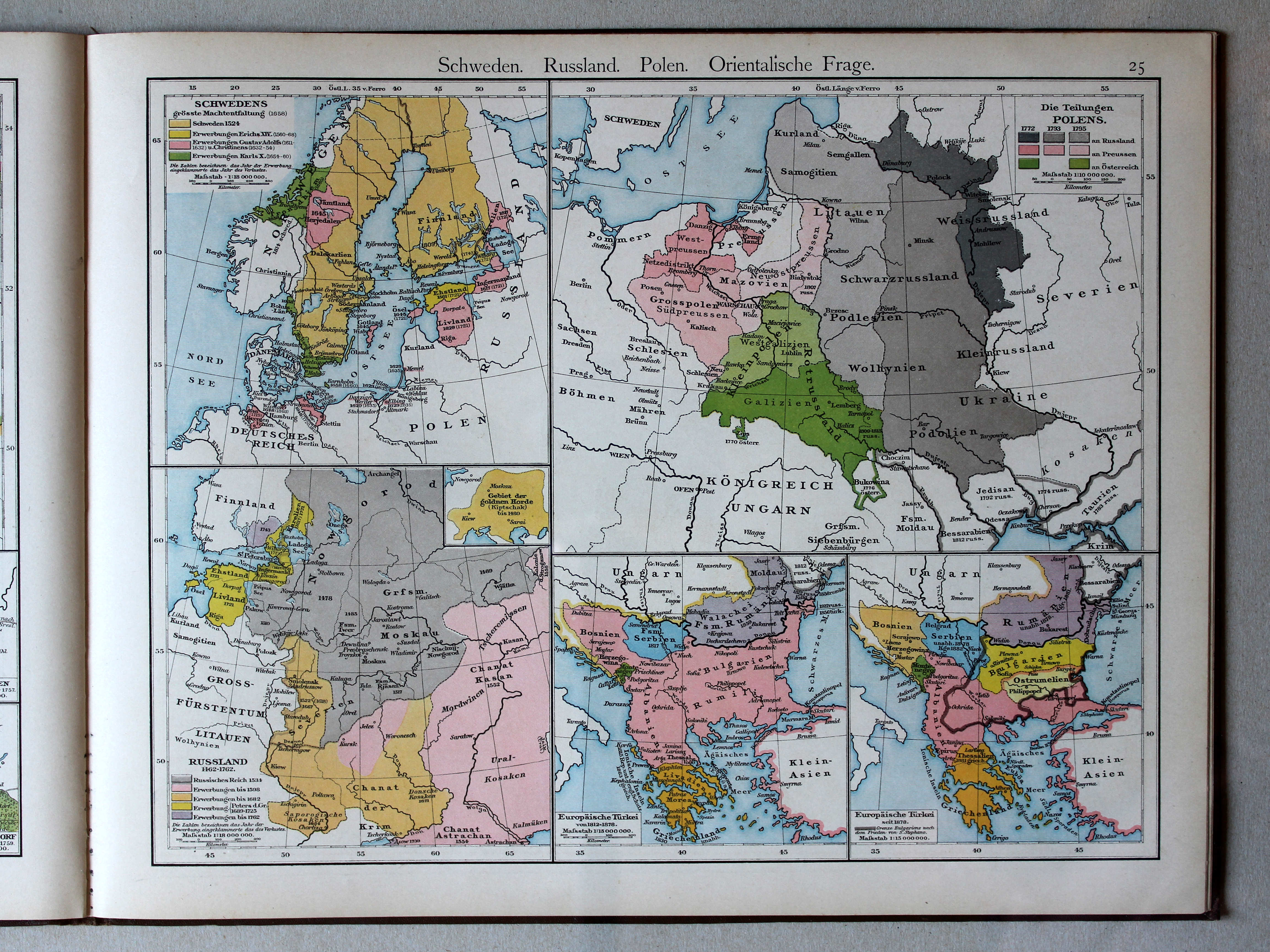
25. Schweden. Russland. Polen. Orientalische Frage XL
Zweden, Rusland, Polen, Oosterse Kwestie / Sweden, Russia, Poland, Eastern Question
 Droysens Historischer Handatlas, 1886
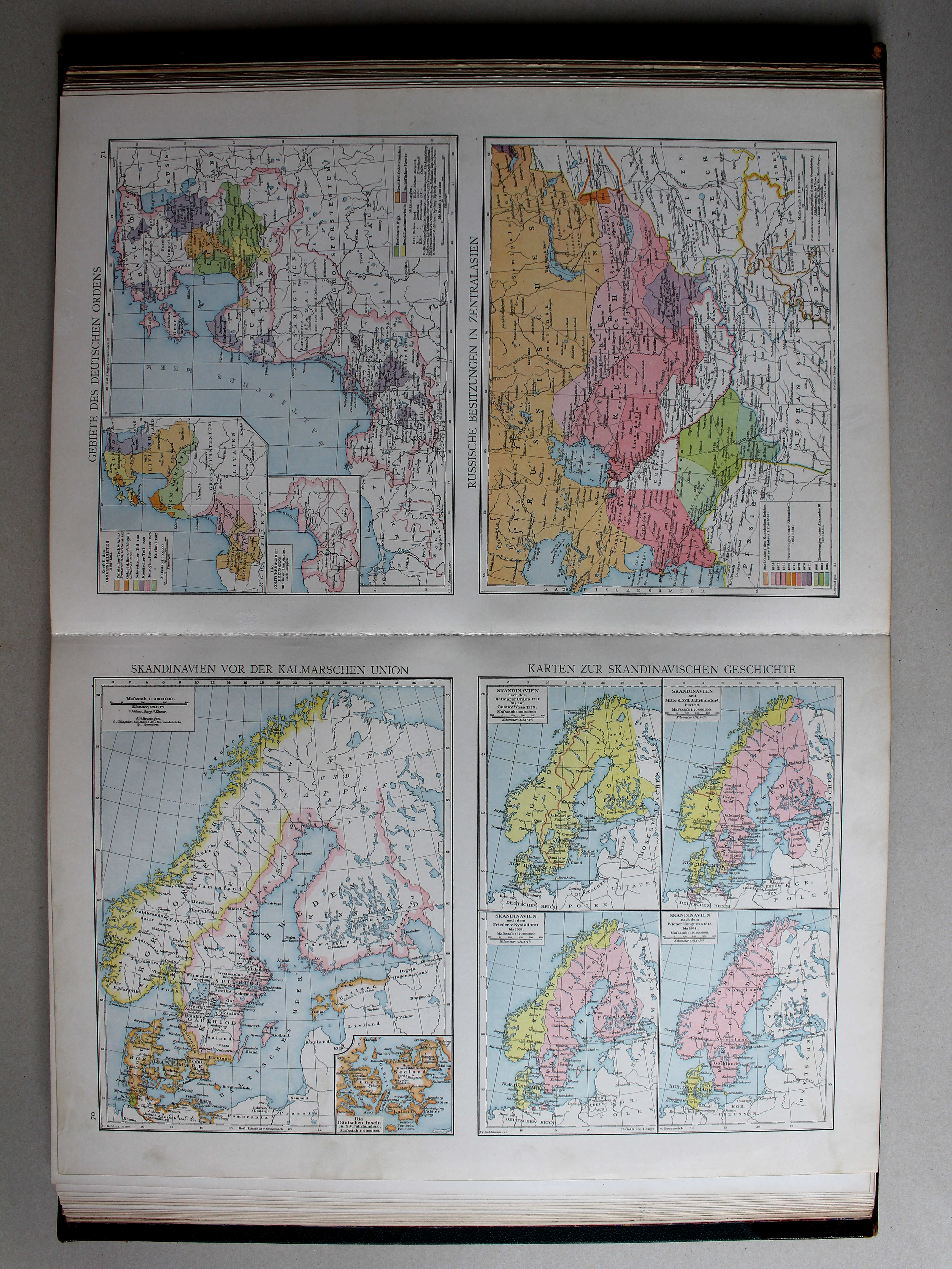
70. Skandinavien vor der Kalmarischen Union. Karten zur skandinavischen Geschichte XL
Scandinavië vóór de Unie van Kalmar. Geschiedenis van Scandinavië / Scandinavia before the Union of Kalmar. History of Scandinavia
Putzgers Historischer Schul-Atlas, 1888
25. Schweden. Russland. Polen. Orientalische Frage XL
Zweden, Rusland, Polen, Oosterse Kwestie / Sweden, Russia, Poland, Eastern Question
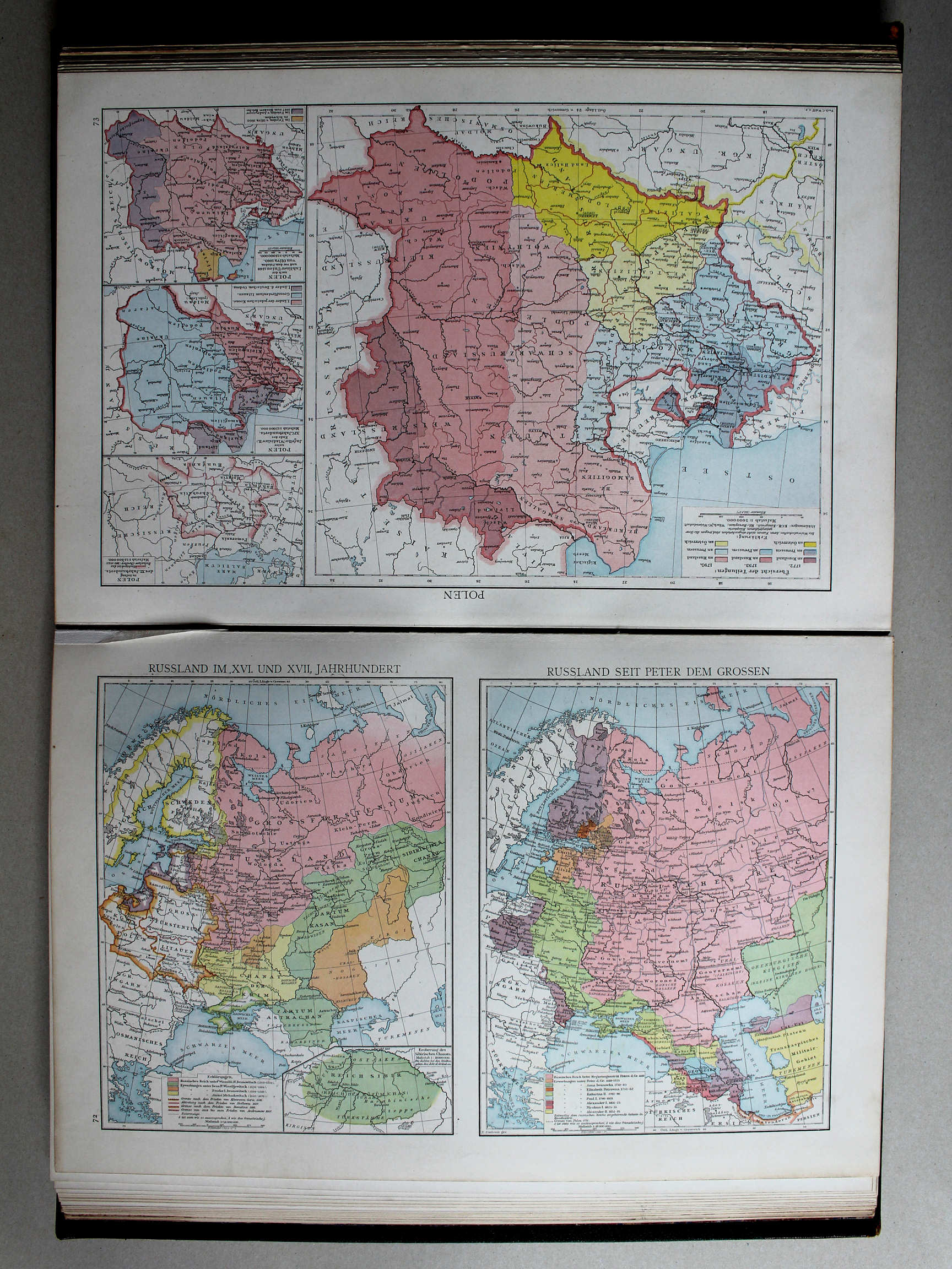 Droysens Historischer Handatlas, 1886
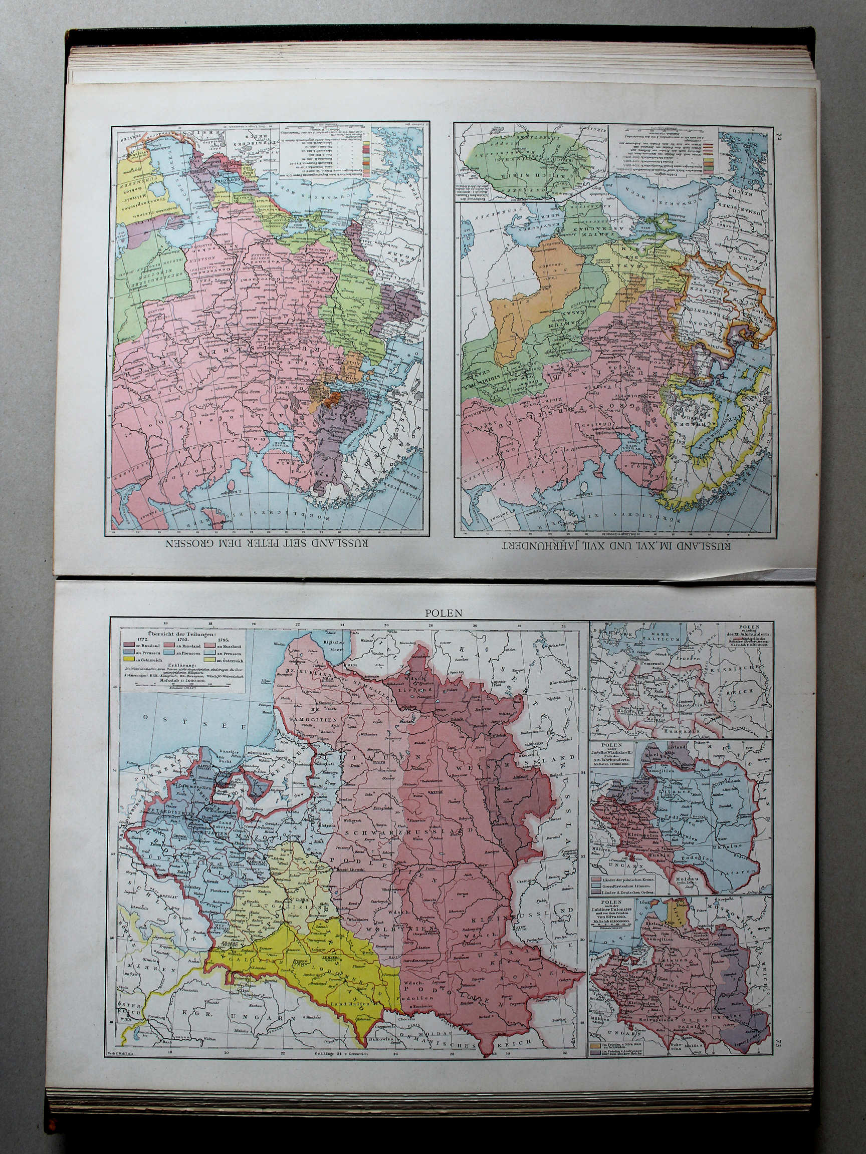
72. Russland im XVI. und XVII. Jahrhundert. Russland seit Peter dem Grossen XL
Rusland in de 16e en 17e eeuw. Rusland sinds Peter de Grote / Russia in the 16th and 17th centuries. Russia since Peter the Great
Putzgers Historischer Schul-Atlas, 1888
25. Schweden. Russland. Polen. Orientalische Frage XL
Zweden, Rusland, Polen, Oosterse Kwestie / Sweden, Russia, Poland, Eastern Question
 Putzgers Historischer Schul-Atlas, 1888
25. Schweden. Russland. Polen. Orientalische Frage XL
Zweden, Rusland, Polen, Oosterse Kwestie / Sweden, Russia, Poland, Eastern Question
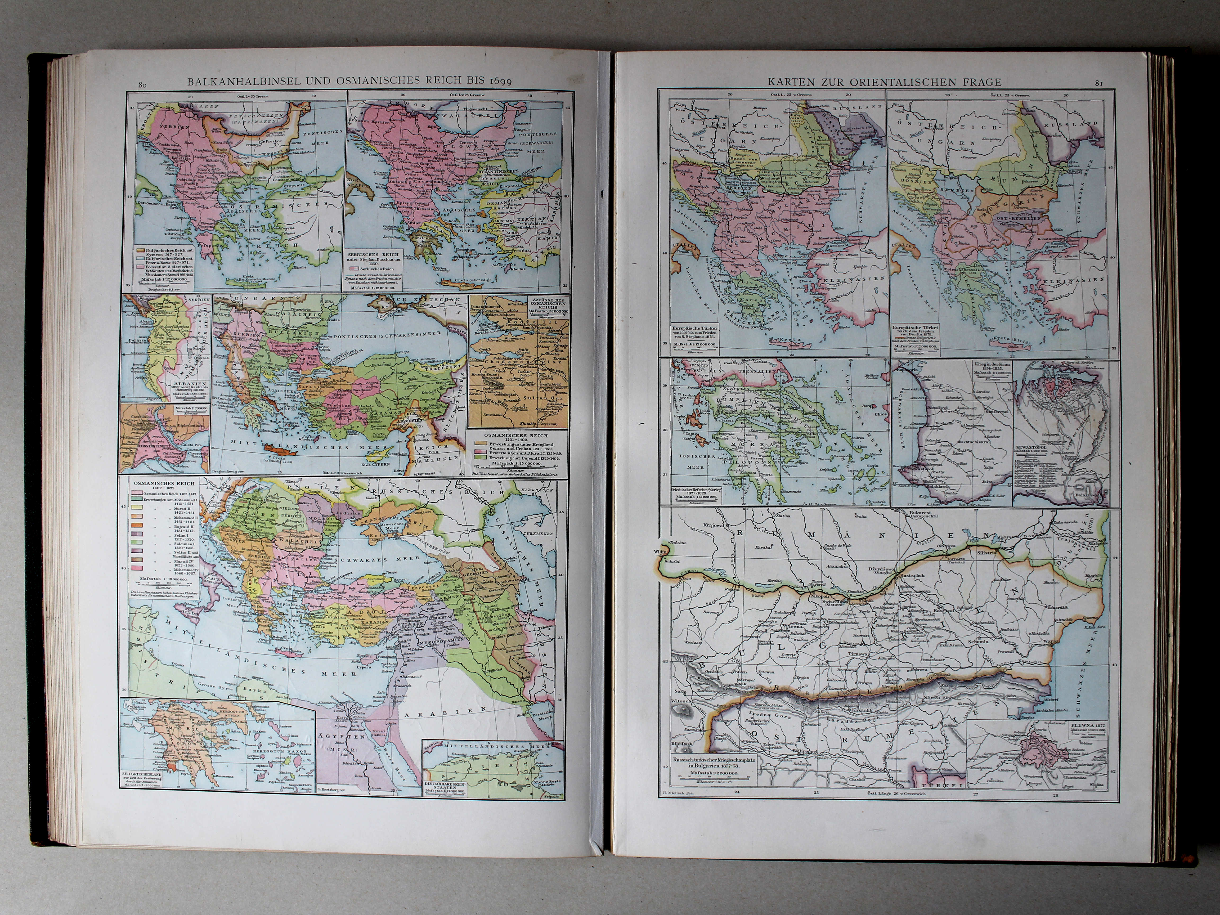
 Droysens Historischer Handatlas, 1886
80. Balkanhalbinsel und Osmanisches Reich bis 1699 XL
Het Balkanschiereiland en het Ottomaanse Rijk tot 1699 / The Balkan Peninsula and the Ottoman Empire until 1699
81. Karten zur orientalischen Frage XL
De Oosterse Kwestie / The Eastern Question
 Putzgers Historischer Schul-Atlas, 1888
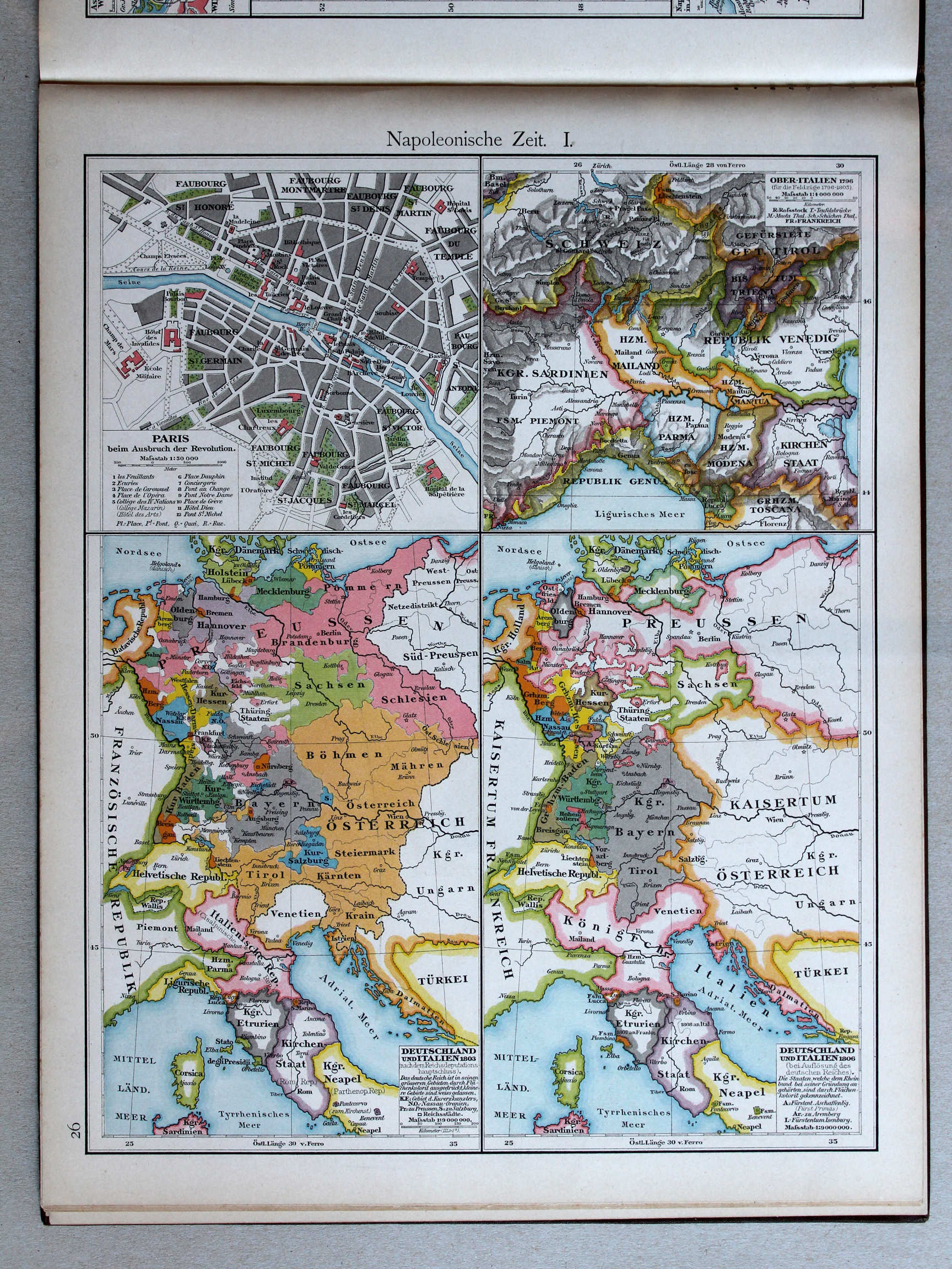
26. Napoleonische Zeit I XL
Tijd van Napoleon I / Era of Napoleon I
 Droysens Historischer Handatlas, 1886
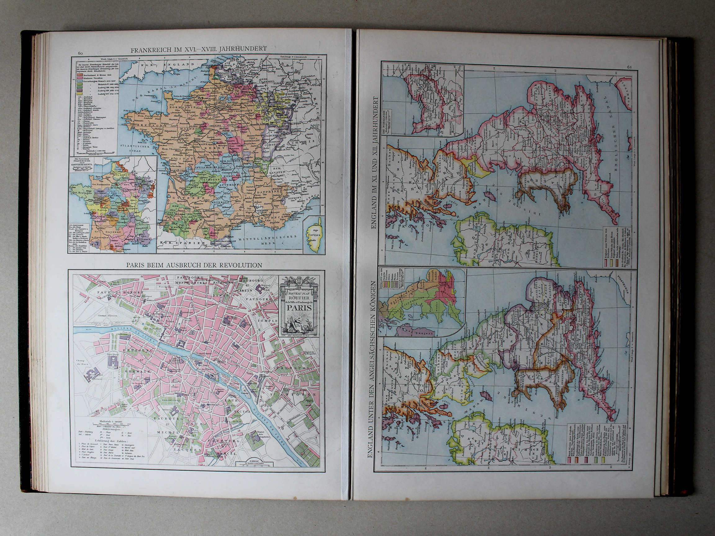
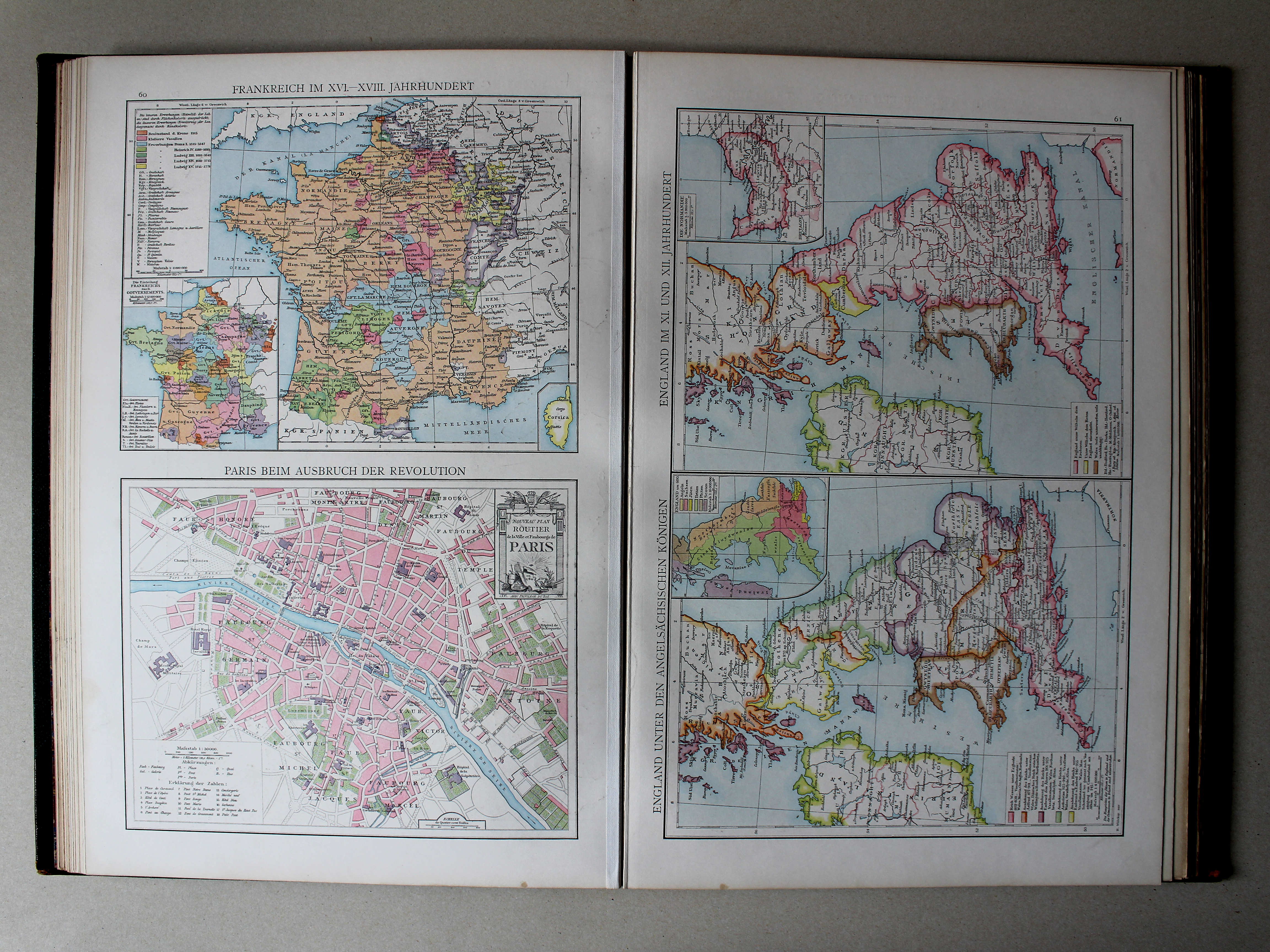
60. Frankreich im XVI.-XVIII. Jahrhundert. Paris beim Ausbruch der Revolution XL
Frankrijk in de 14e en 15e eeuw. Parijs bij het begin van de Franse Revolutie / France in the 14th and 15th centuries. Paris at the outbreak of the French Revolution
Putzgers Historischer Schul-Atlas, 1888
26. Napoleonische Zeit I XL
Tijd van Napoleon I / Era of Napoleon I
 Droysens Historischer Handatlas, 1886
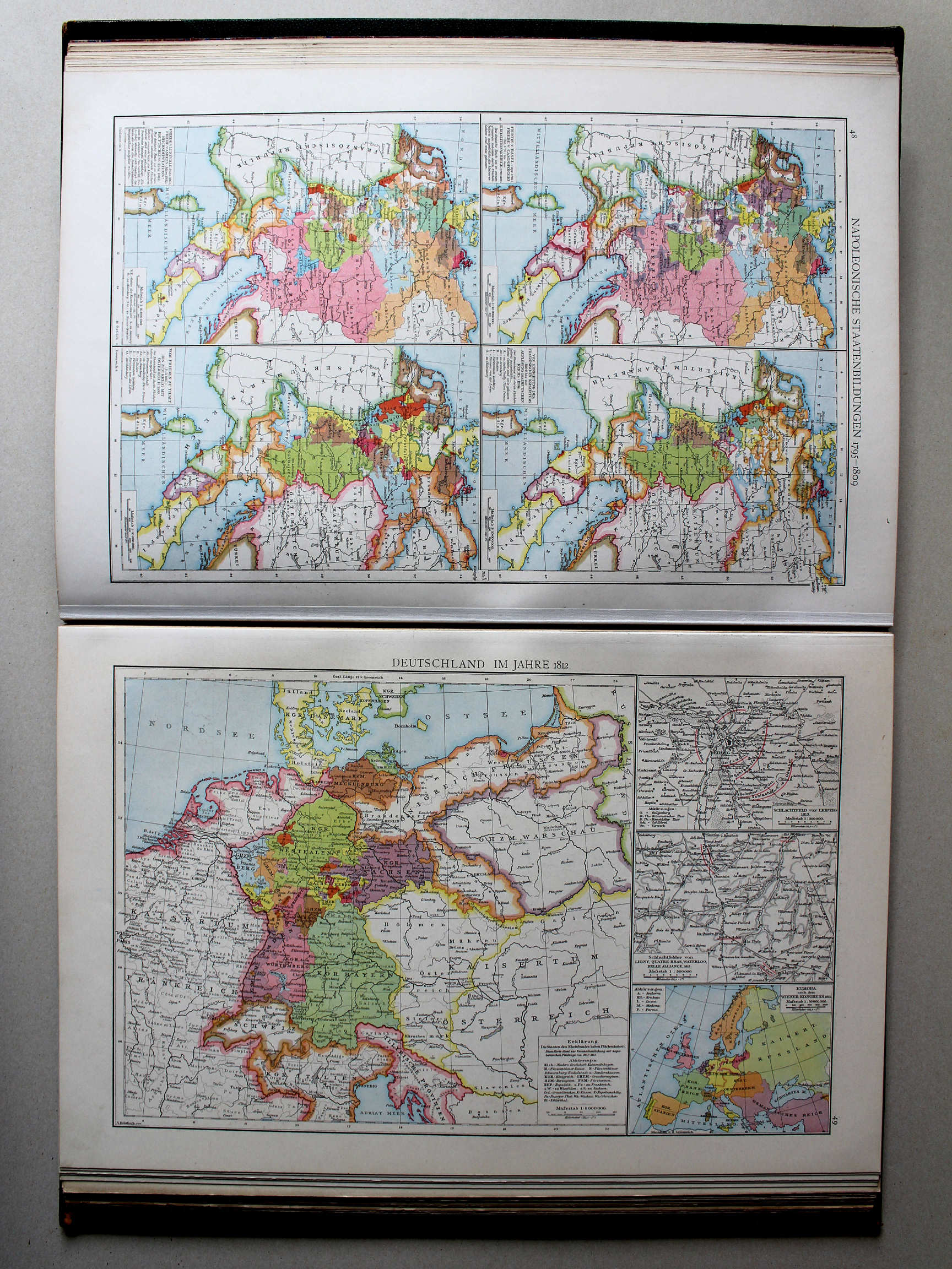
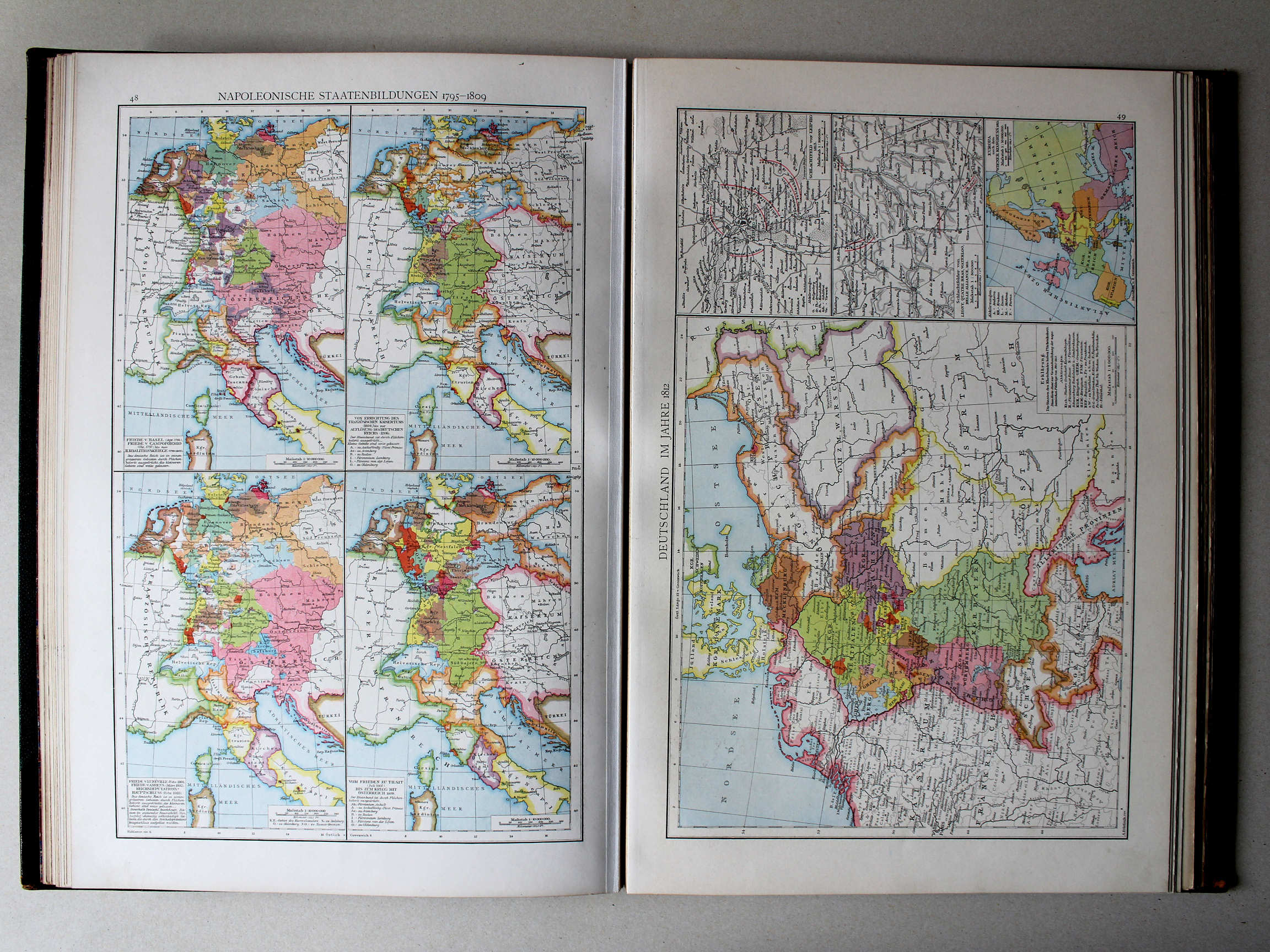
48. Napoleonische Staatenbildungen 1795-1809 XL
Staten gevormd onder Napoleon 1795-1809 / States created under Napoleon 1795-1809
 Putzgers Historischer Schul-Atlas, 1888
27. Napoleonische Zeit II: Deutschland im Jahre 1812 XL
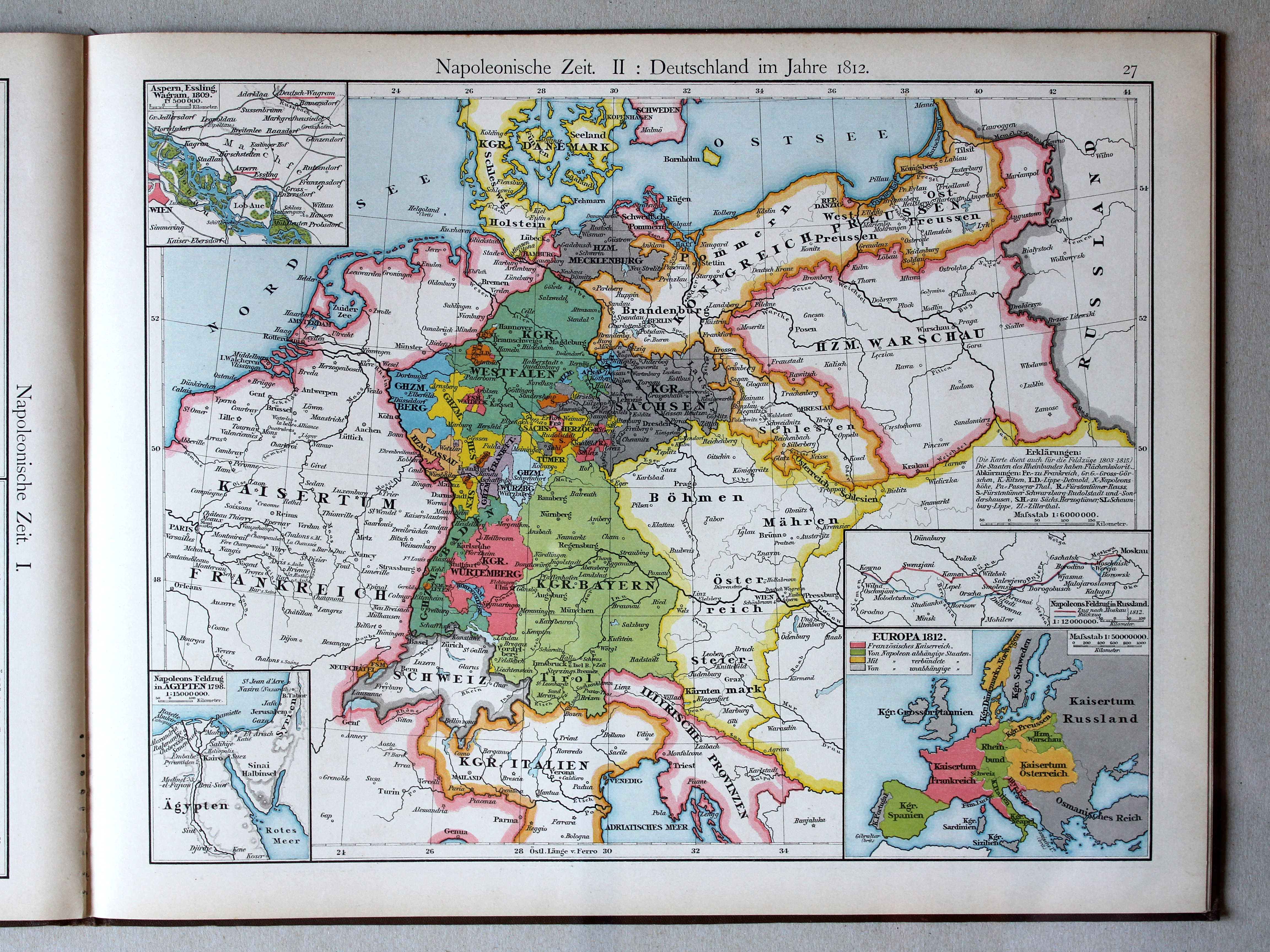
Tijd van Napoleon II: Duitsland in 1812 / Era of Napoleon II: Germany in 1812
 Droysens Historischer Handatlas, 1886
49. Deutschland im Jahre 1812 XL
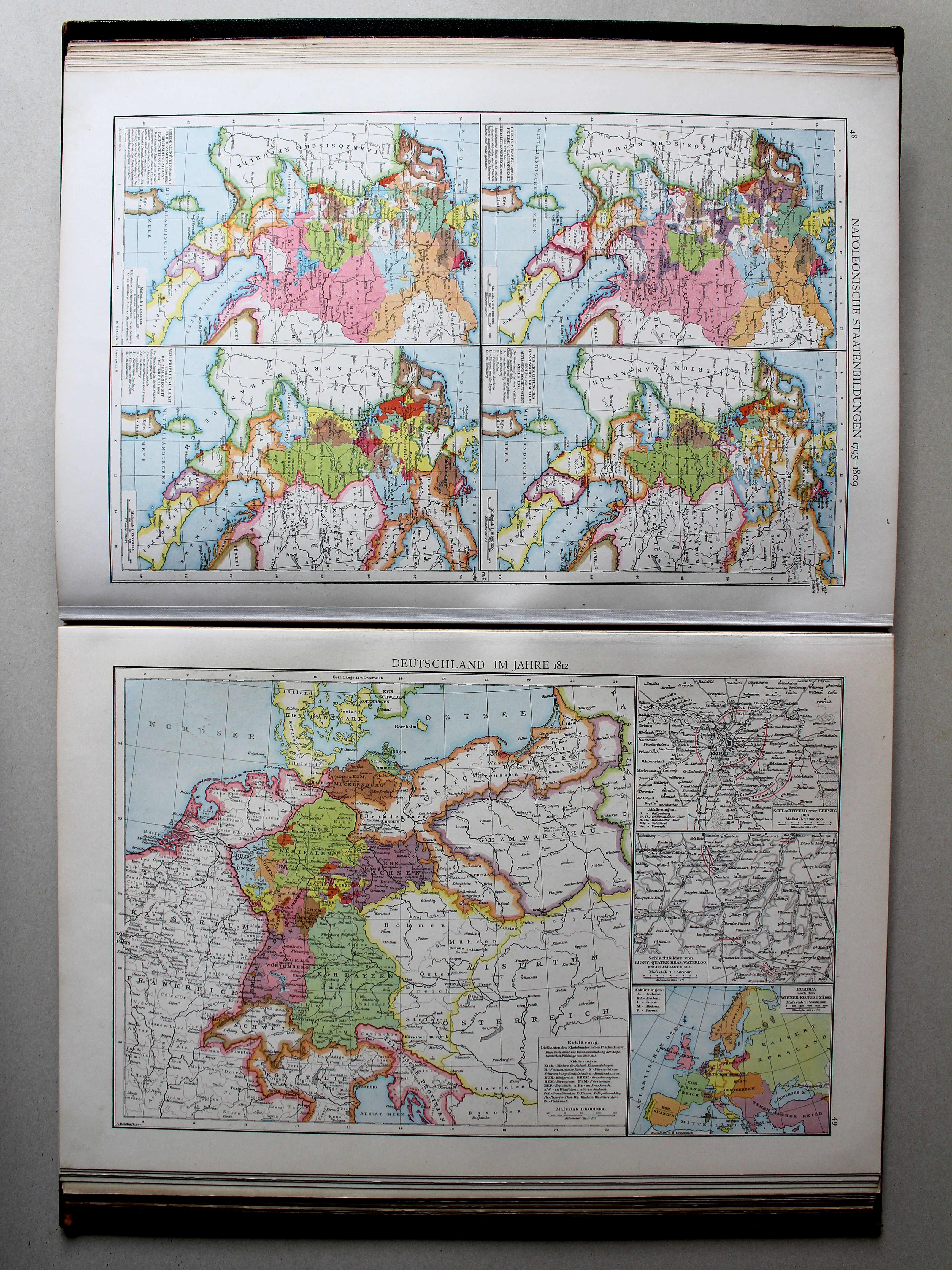
Duitsland in 1812 / Germany in 1812
 Putzgers Historischer Schul-Atlas, 1888
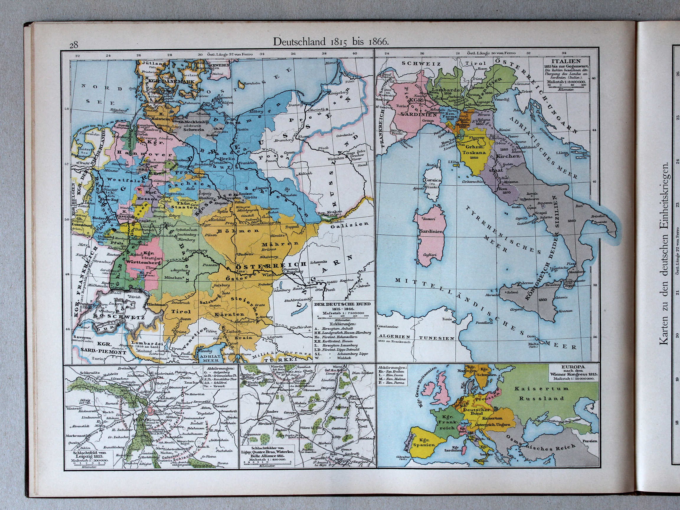
28. Deutschland 1815 bis 1866 XL
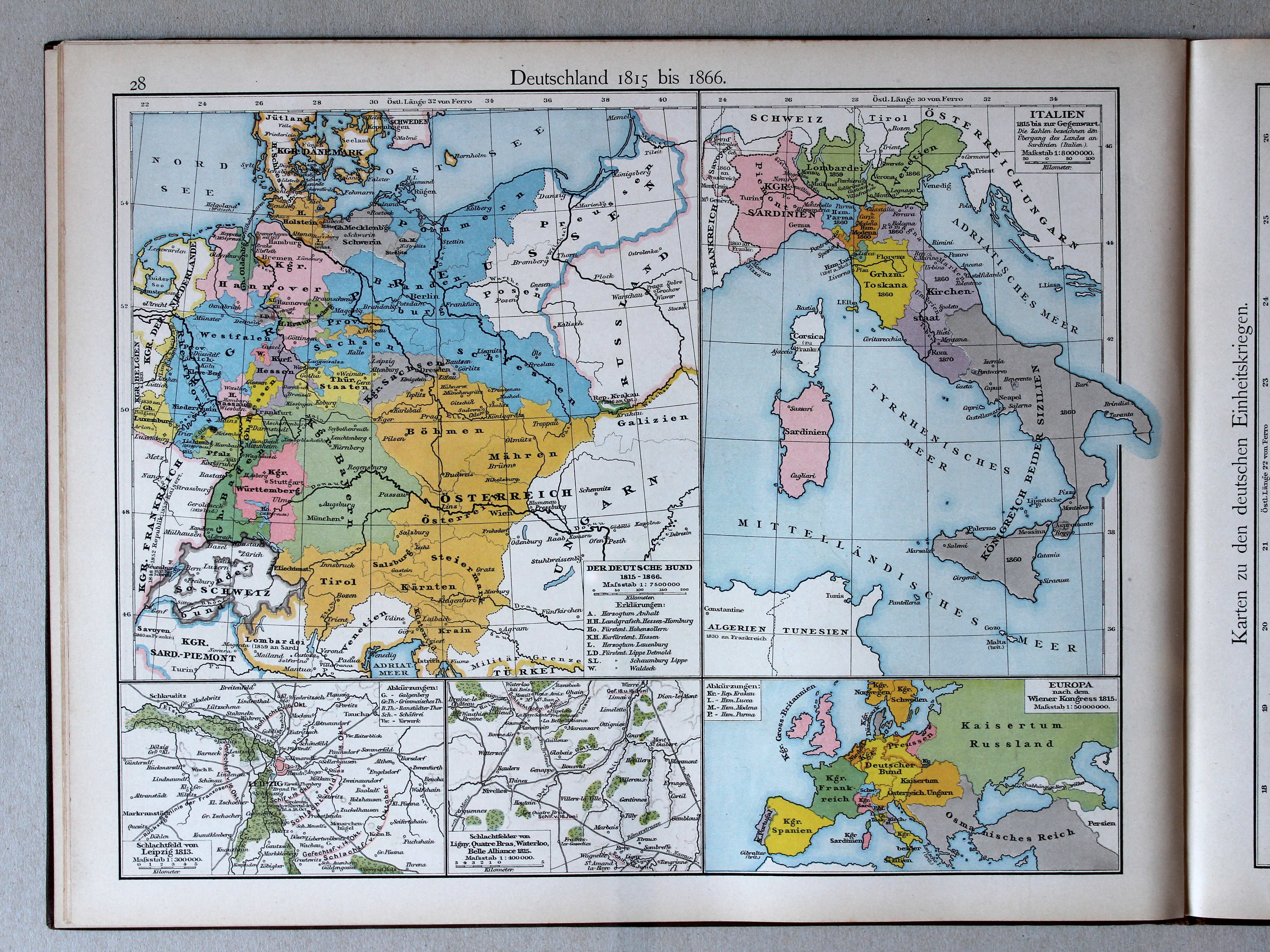
Duitsland 1815-1866 / Germany 1815-1866
 Droysens Historischer Handatlas, 1886
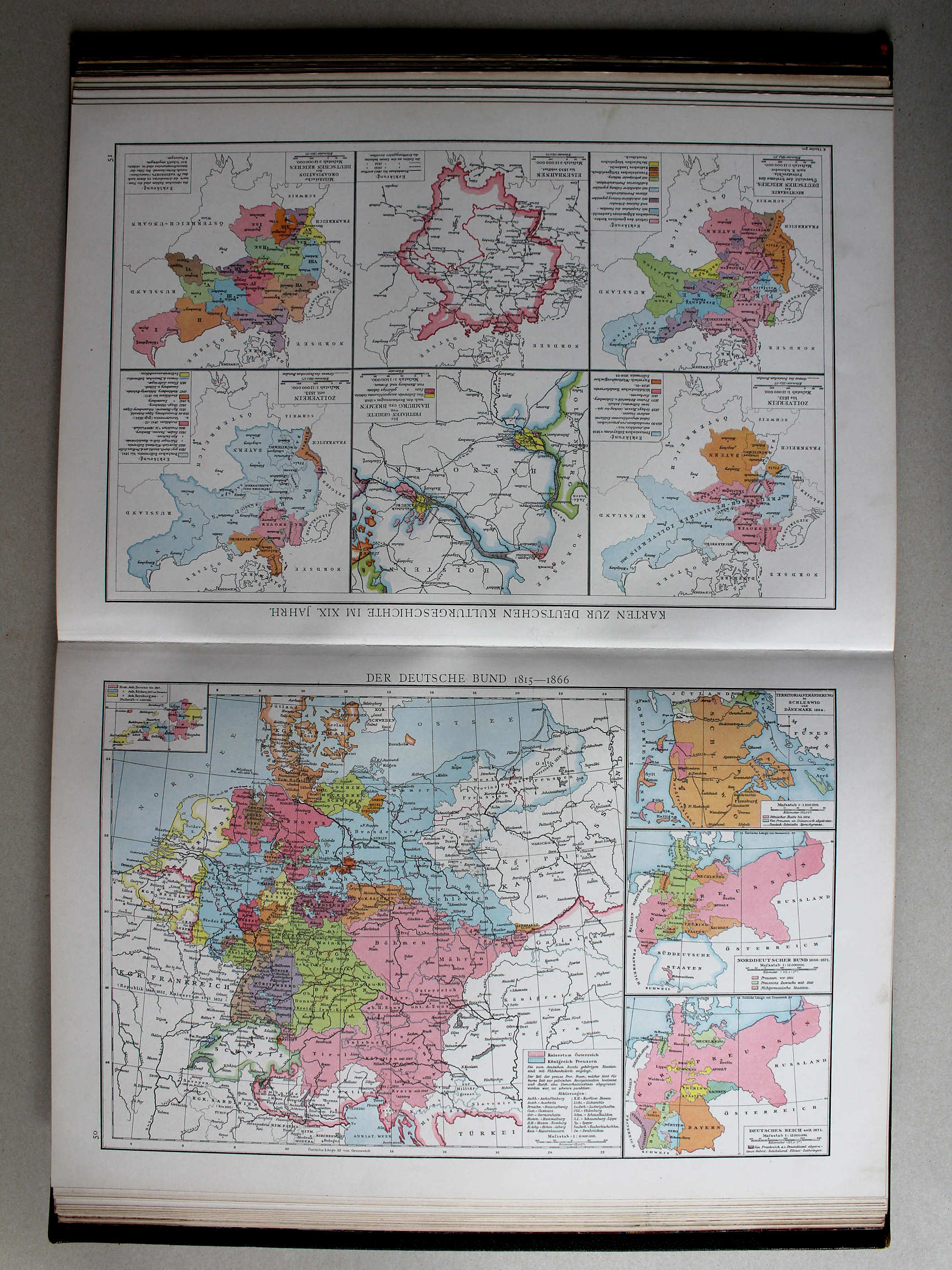
50. Der Deutsche Bund 1815-1866 XL
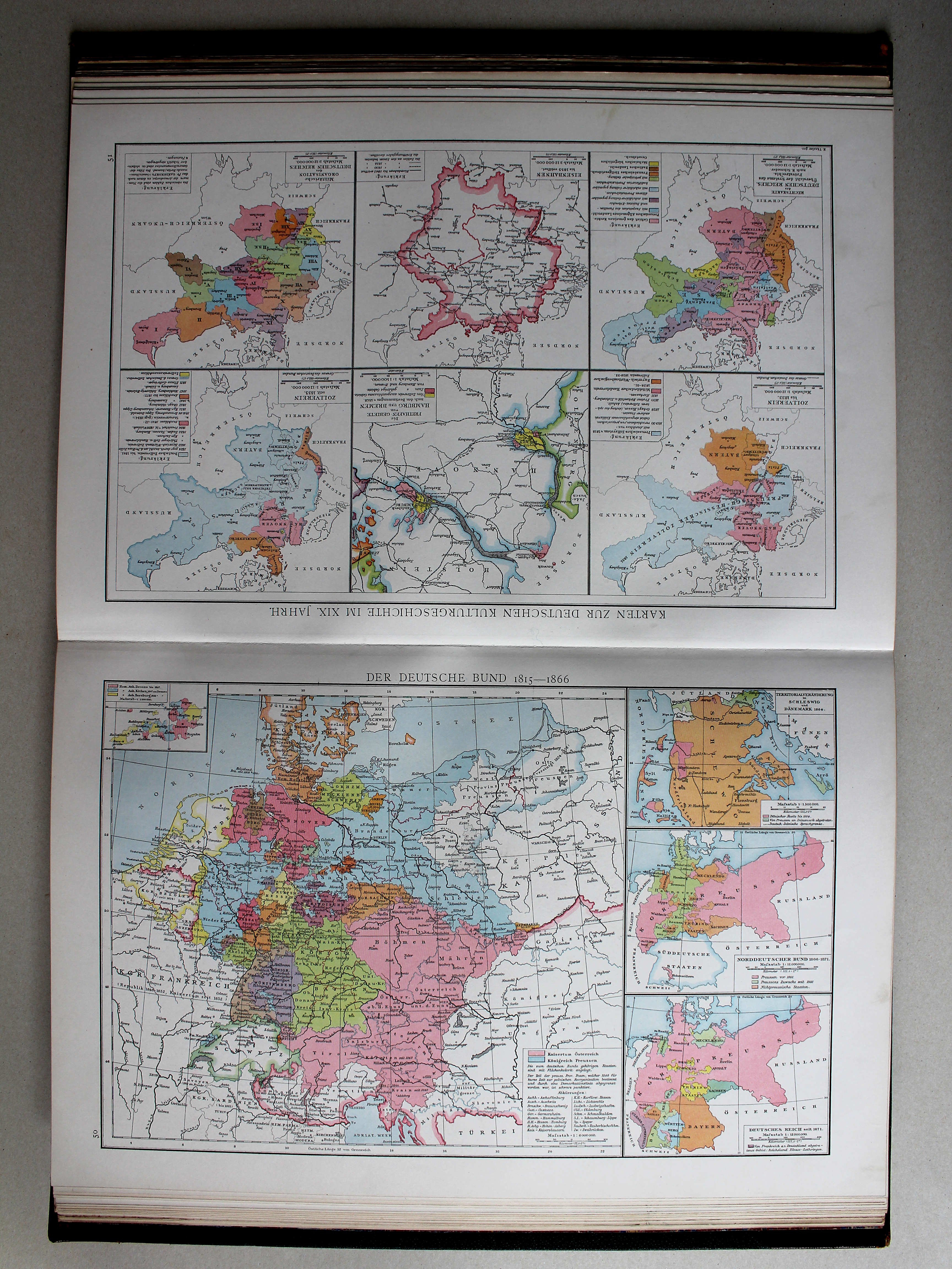
De Duitse Bond 1815-1866 / The German Confederation 1815-1866
Putzgers Historischer Schul-Atlas, 1888
28. Deutschland 1815 bis 1866 XL
Duitsland 1815-1866 / Germany 1815-1866
 Droysens Historischer Handatlas, 1886
68. Italien im Jahre 1799. Italienische Kriegsschauplätze XL
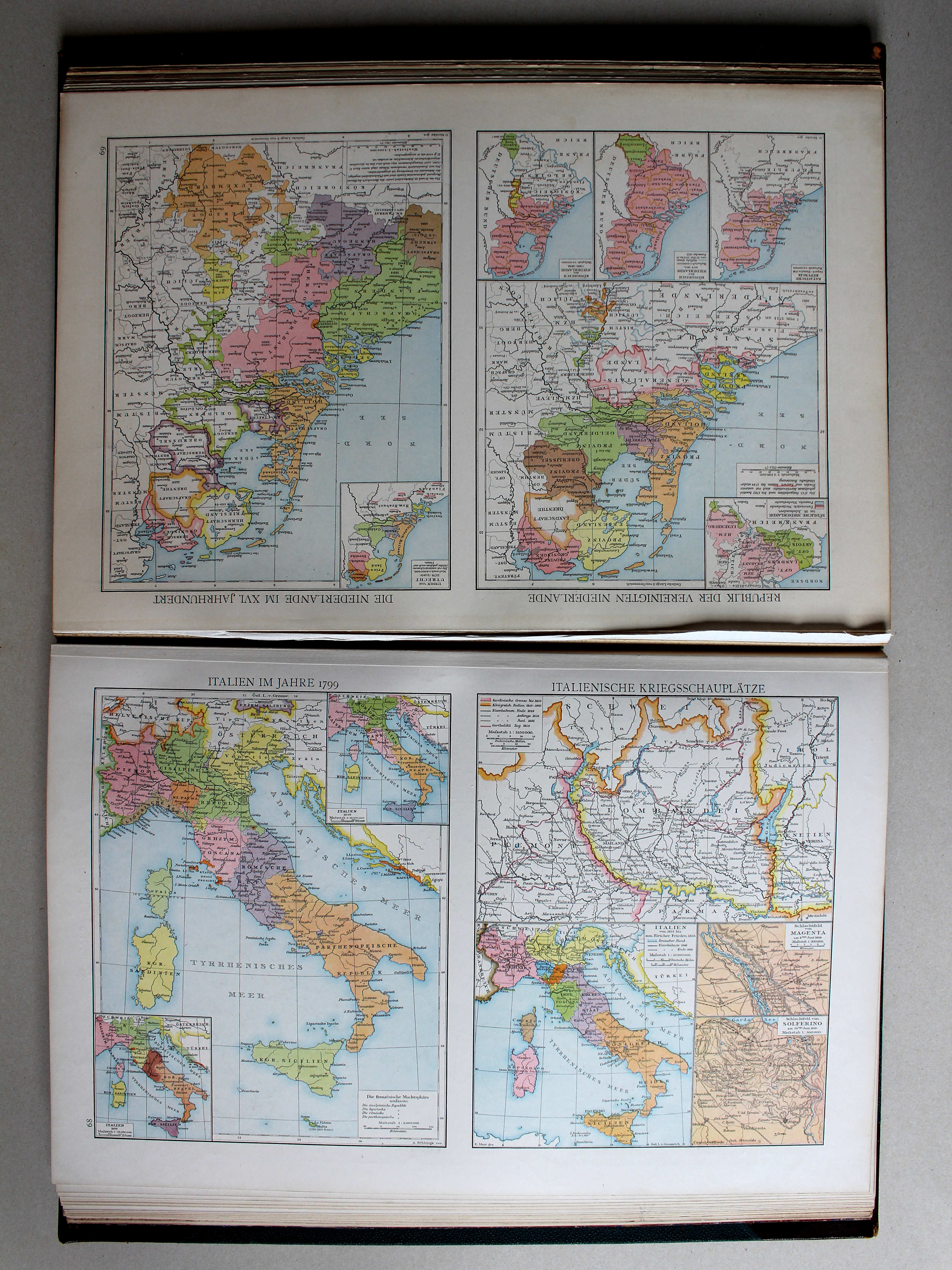
Italië in 1799. Italiaans krijgstoneel / Italy in 1799. Italian theaters of war
 Putzgers Historischer Schul-Atlas, 1888
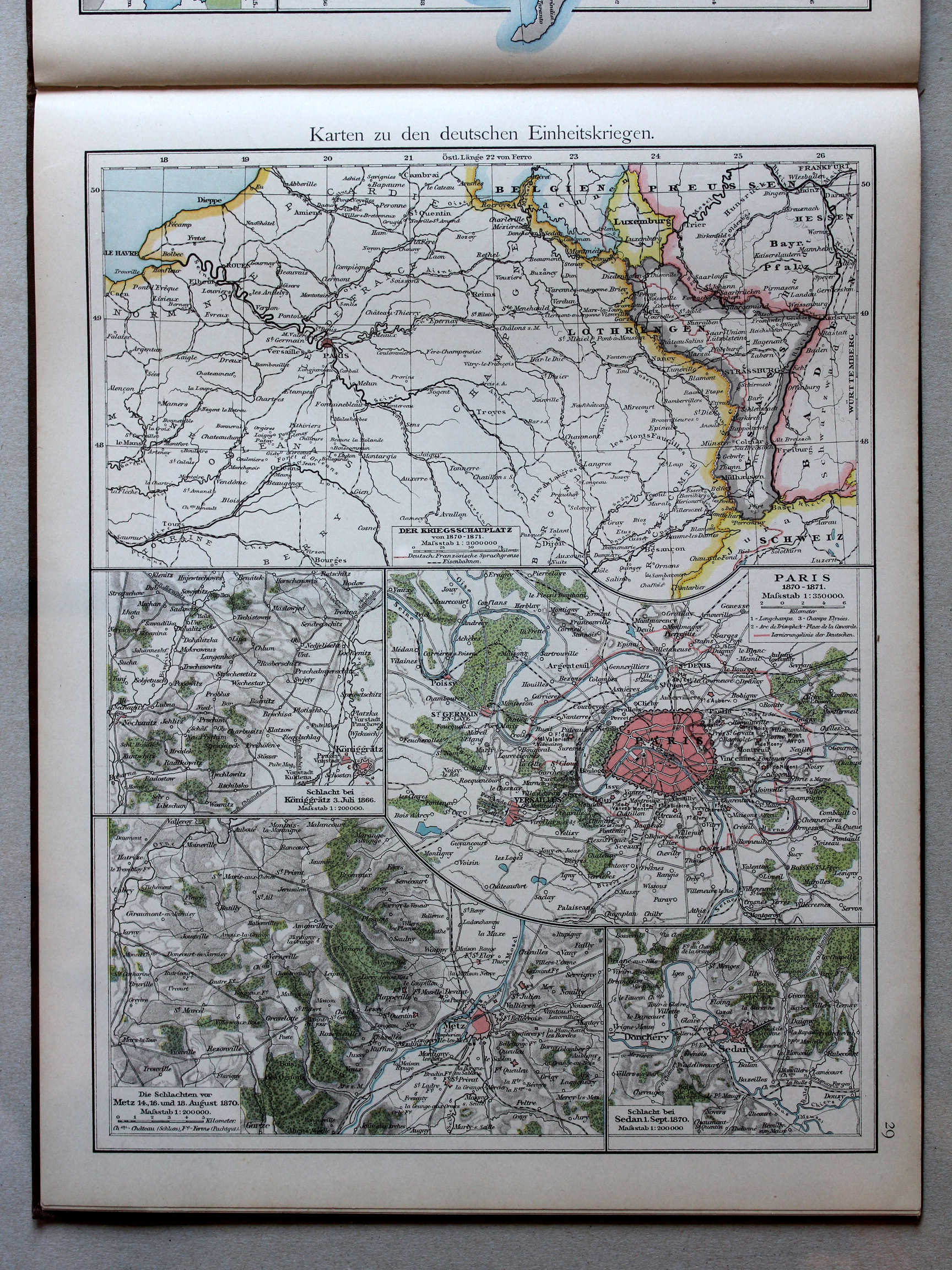
29. Karten zu den deutschen Einheitskriegen XL
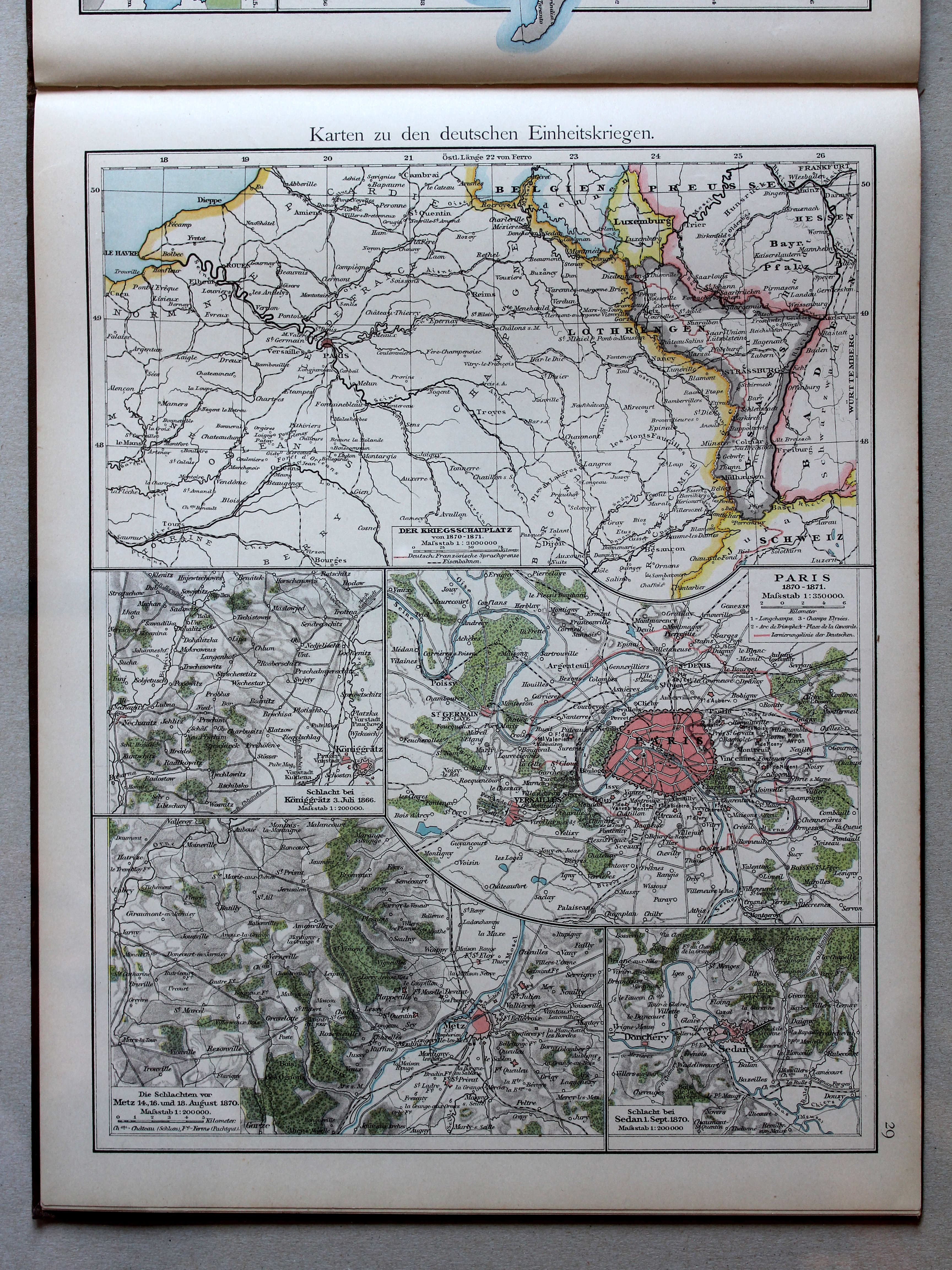
Kaarten bij de Duitse eenwording / Maps to the German unification
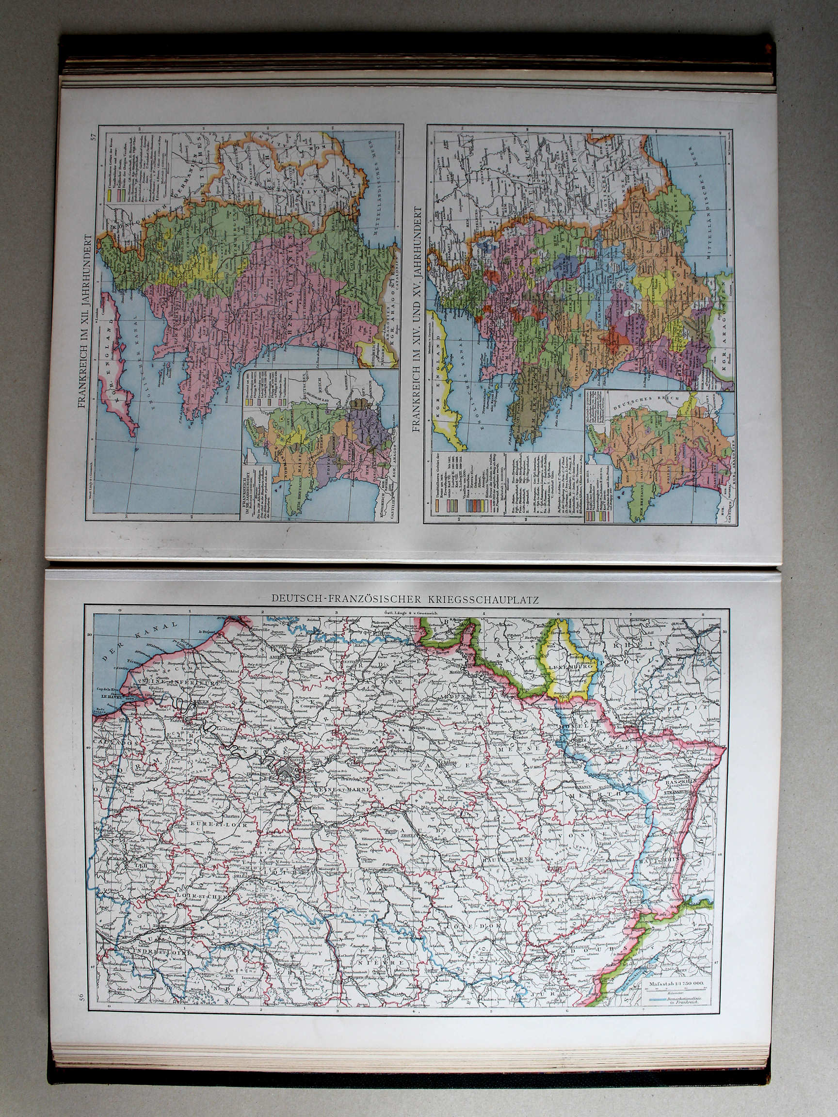 Droysens Historischer Handatlas, 1886
56. Deutsch-französischer Kriegsschauplatz XL
Krijgstoneel van de Frans-Duitse Oorlog / Theater of the Franco-Prussian War
Putzgers Historischer Schul-Atlas, 1888
29. Karten zu den deutschen Einheitskriegen XL
Kaarten bij de Duitse eenwording / Maps to the German unification
 Droysens Historischer Handatlas, 1886
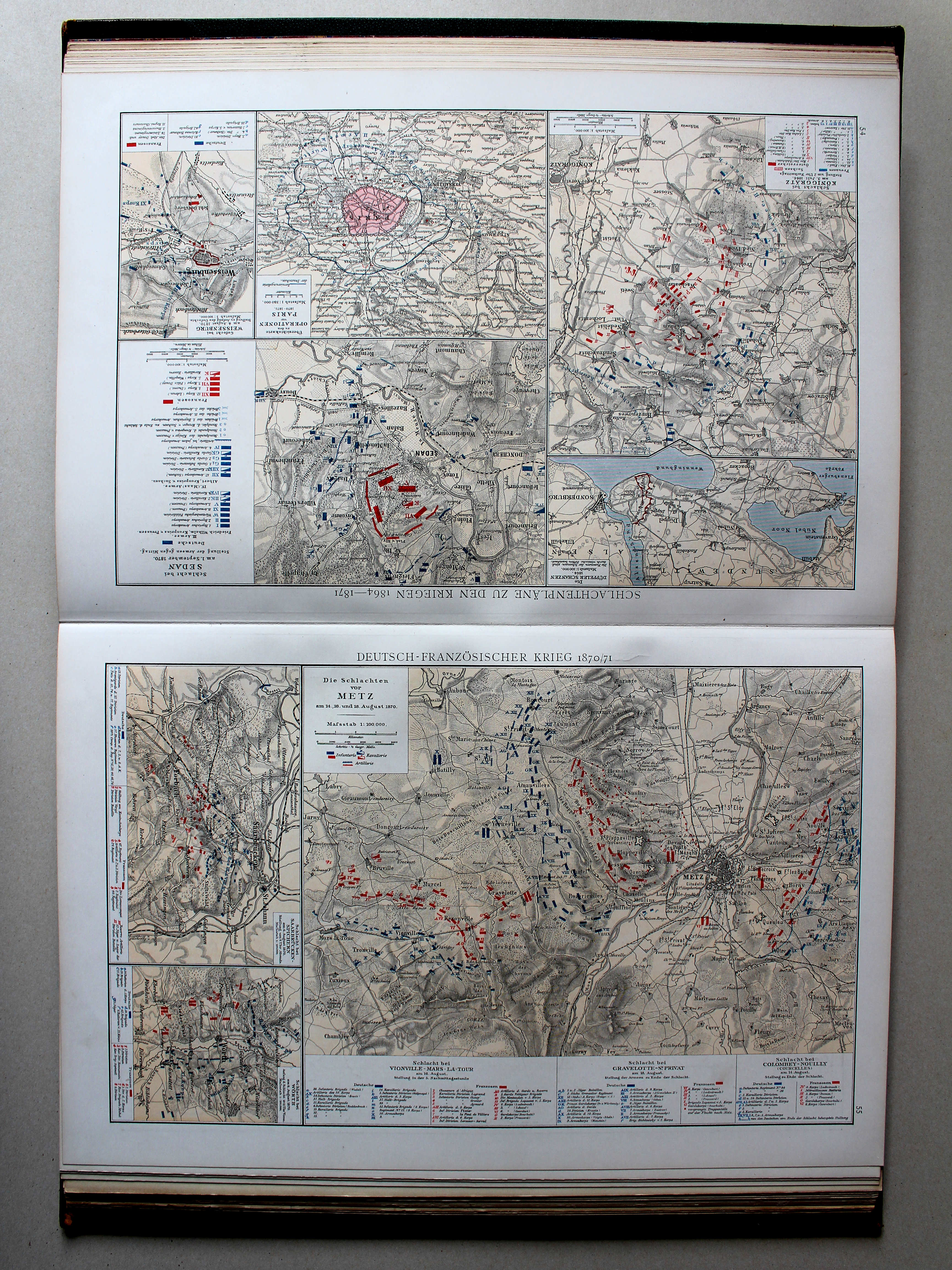
54. Schlachtenpläne zu den Kriegen 1864-1871 XL
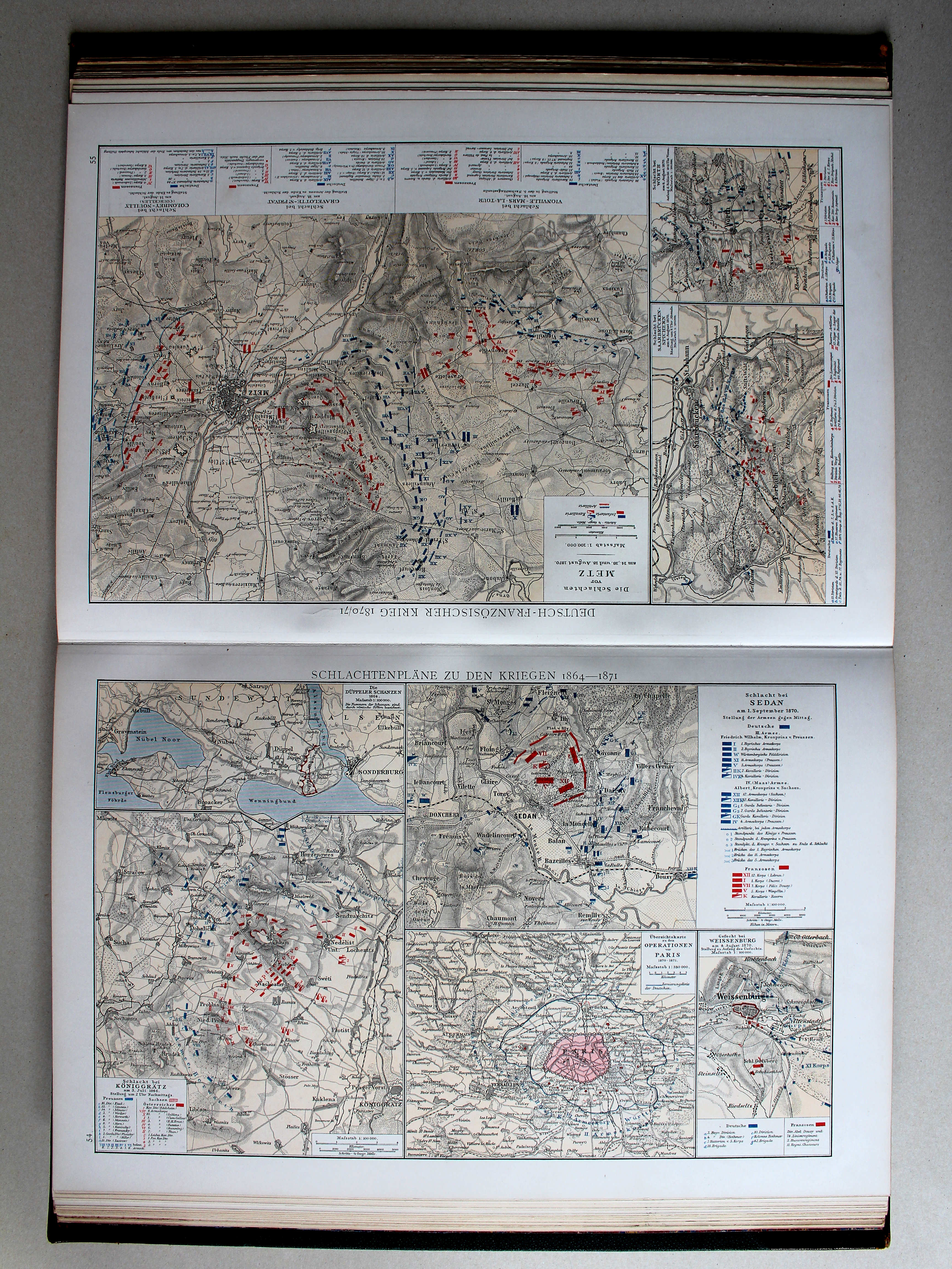
Slagvelden in de oorlogen van 1864 tot 1871 / Battlefields of the wars 1864-1871
Putzgers Historischer Schul-Atlas, 1888
29. Karten zu den deutschen Einheitskriegen XL
Kaarten bij de Duitse eenwording / Maps to the German unification
 Droysens Historischer Handatlas, 1886
55. Deutsch-französischer Krieg 1870/71 XL
Frans-Duitse Oorlog 1870-71 / Franco-Prussian War 1870-71
 Putzgers Historischer Schul-Atlas, 1888
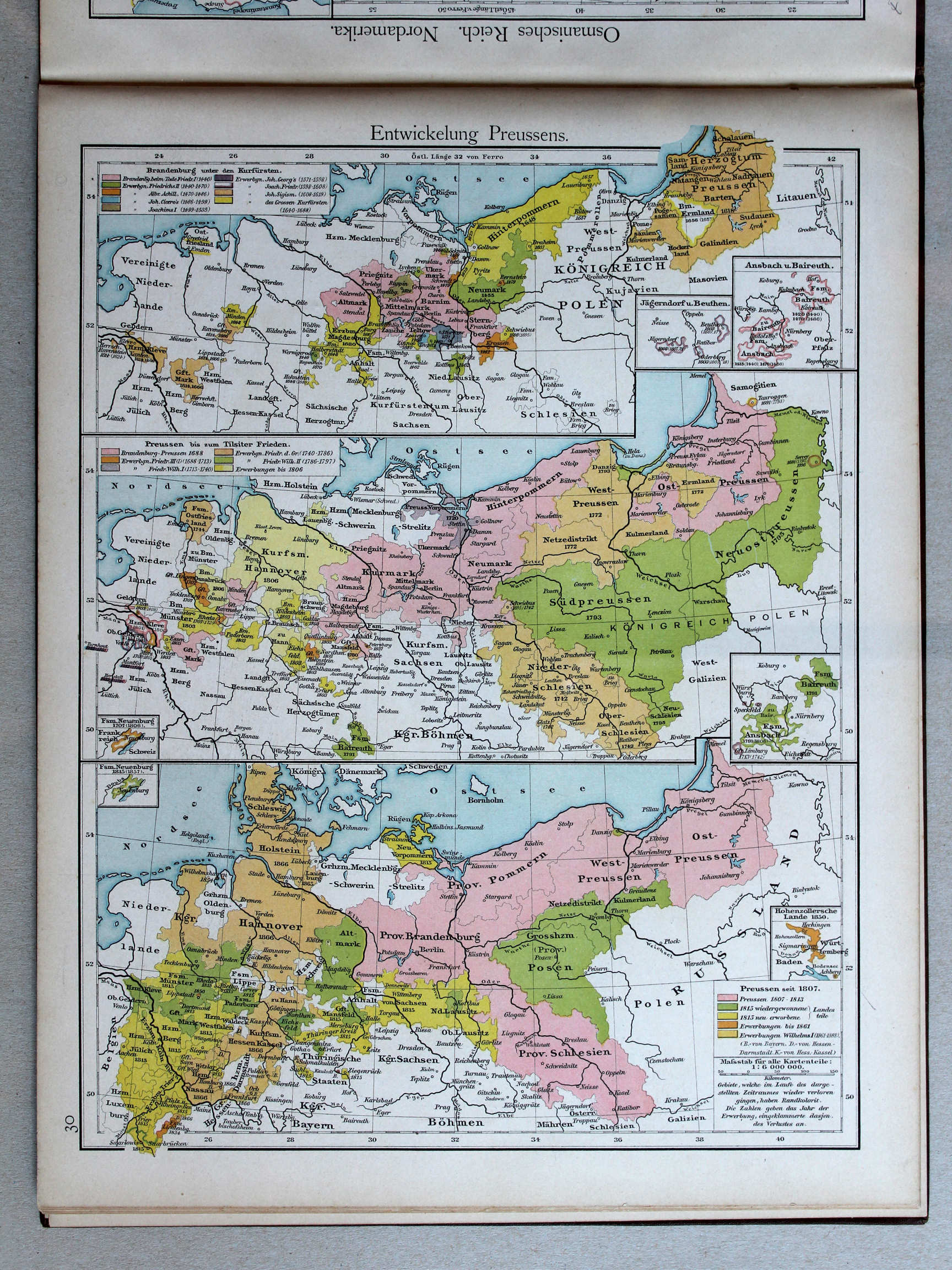
30. Entwickelung Preussens XL
Ontwikkeling van Pruisen / Development of Prussia
 Droysens Historischer Handatlas, 1886
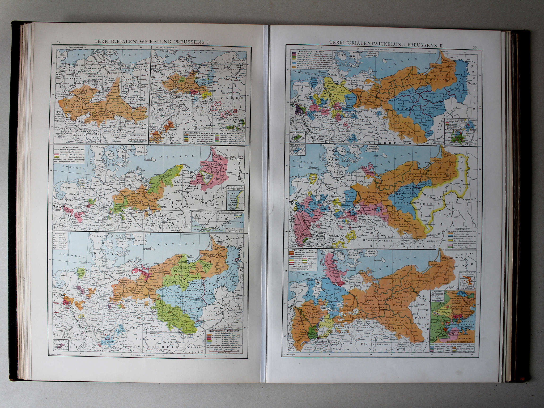
52. Territorialentwickelung Preussens I XL
Gebiedsuitbreiding van Pruisen I / Territorial expansion of Prussia I
53. Territorialentwickelung Preussens II XL
Gebiedsuitbreiding van Pruisen II / Territorial expansion of Prussia II
 Putzgers Historischer Schul-Atlas, 1888
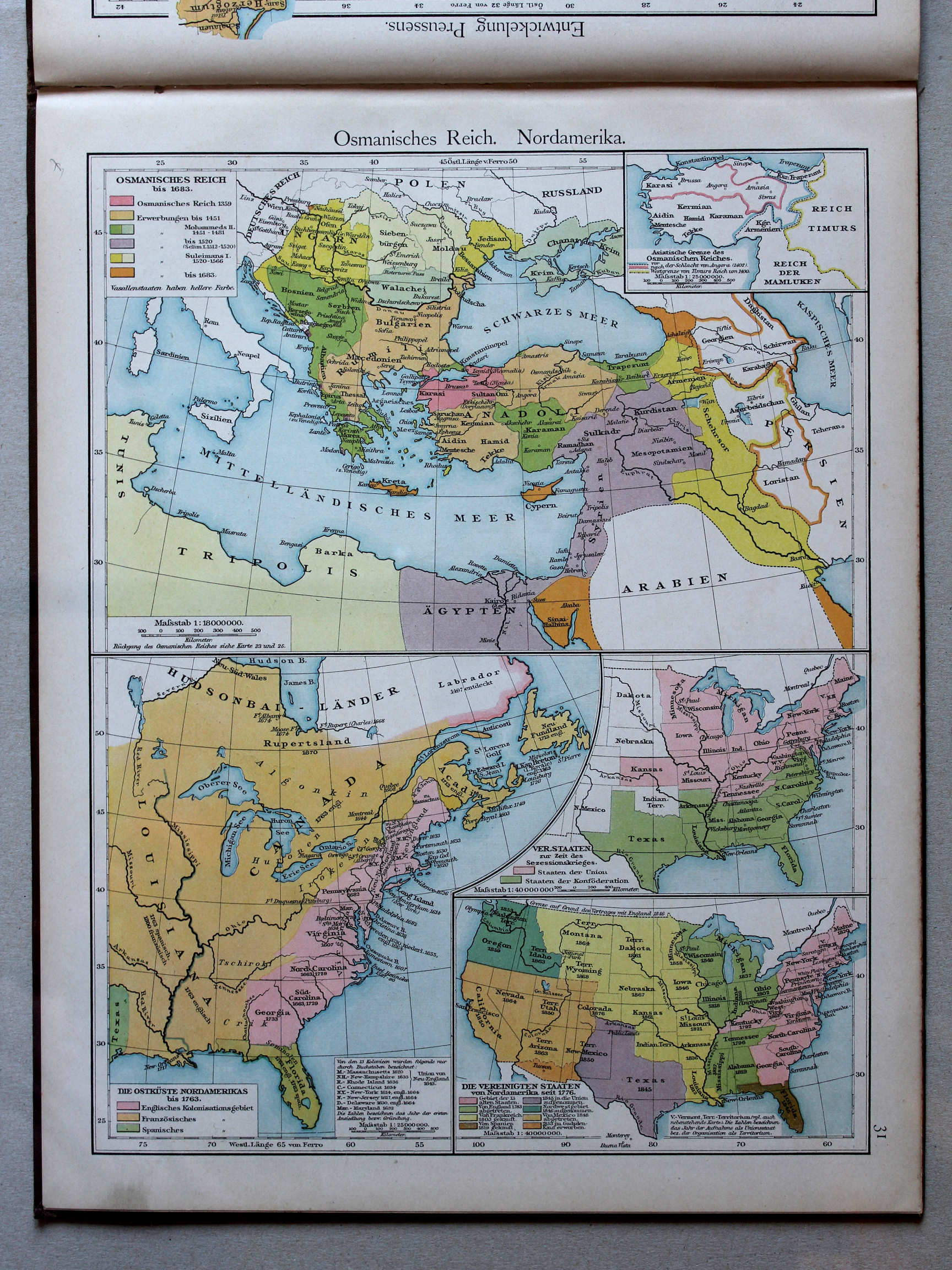
31. Osmanisches Reich. Nordamerika XL
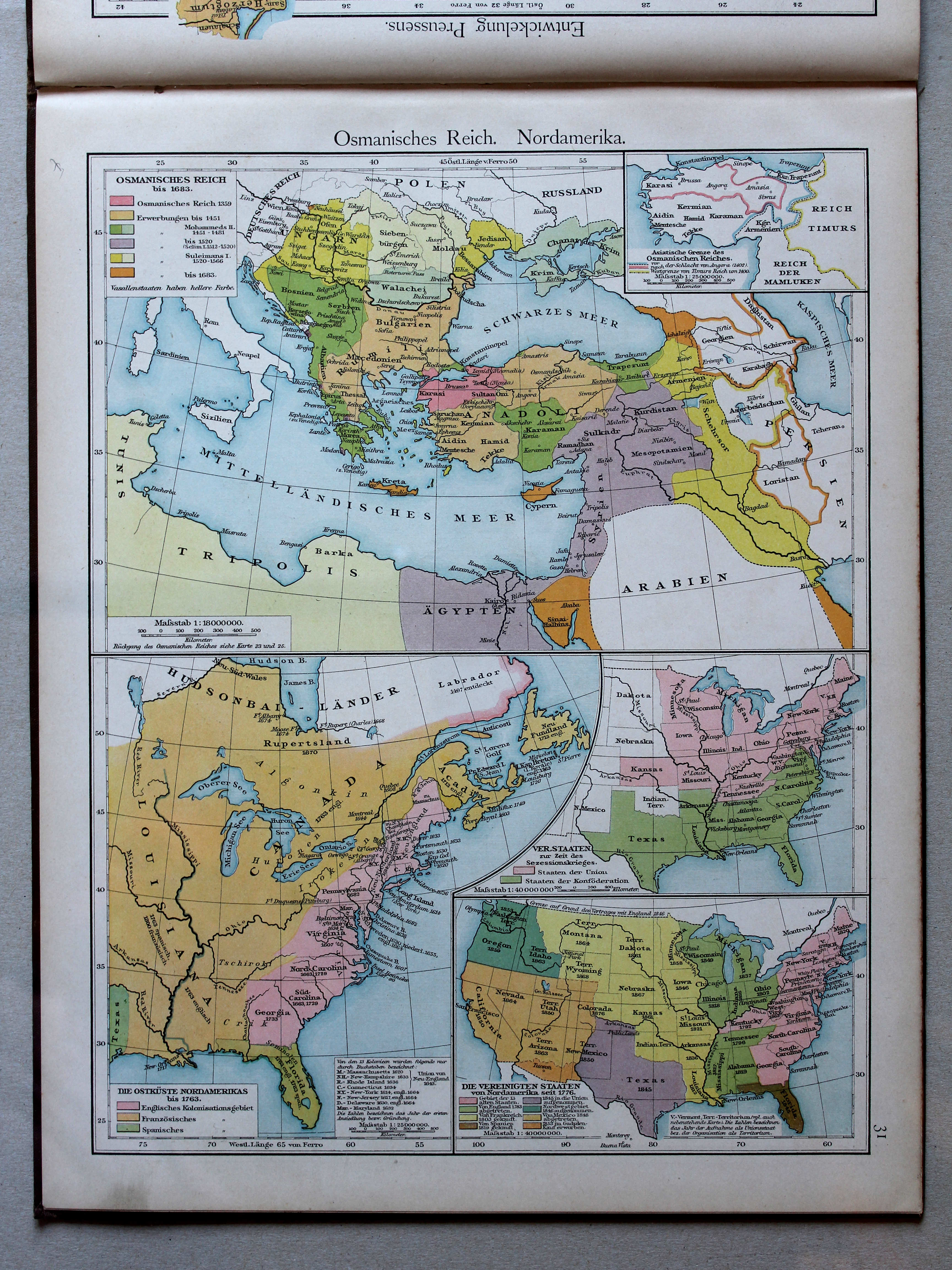
Ottomaanse Rijk. Noord-Amerika / Ottoman Empire. North America
Droysens Historischer Handatlas, 1886
80. Balkanhalbinsel und Osmanisches Reich bis 1699 XL
Het Balkanschiereiland en het Ottomaanse Rijk tot 1699 / The Balkan Peninsula and the Ottoman Empire until 1699
81. Karten zur orientalischen Frage XL
De Oosterse Kwestie / The Eastern Question
Putzgers Historischer Schul-Atlas, 1888
31. Osmanisches Reich. Nordamerika XL
Ottomaanse Rijk. Noord-Amerika / Ottoman Empire. North America
 Droysens Historischer Handatlas, 1886
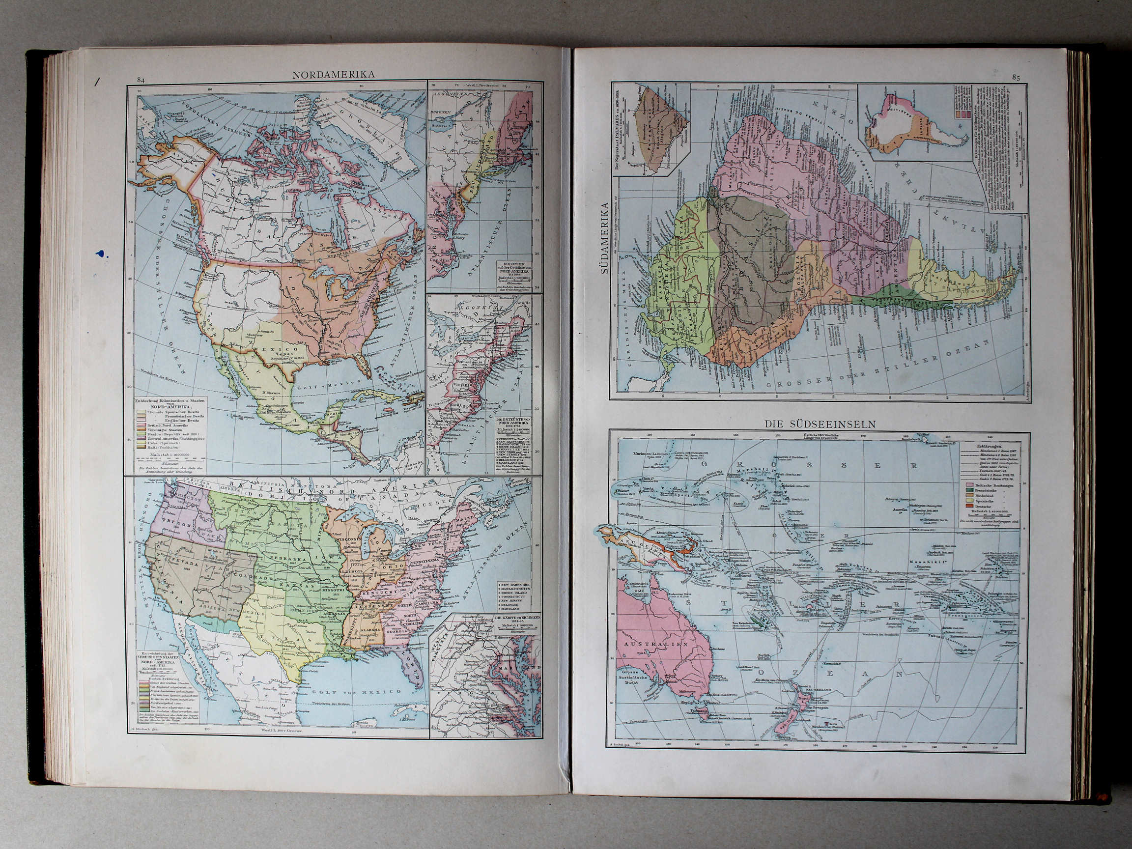
84. Nordamerika XL
Noord-Amerika / North America
85c. Die Südseeinseln XL
Eilanden in de Grote Oceaan / Pacific islands
 Putzgers Historischer Schul-Atlas, 1888
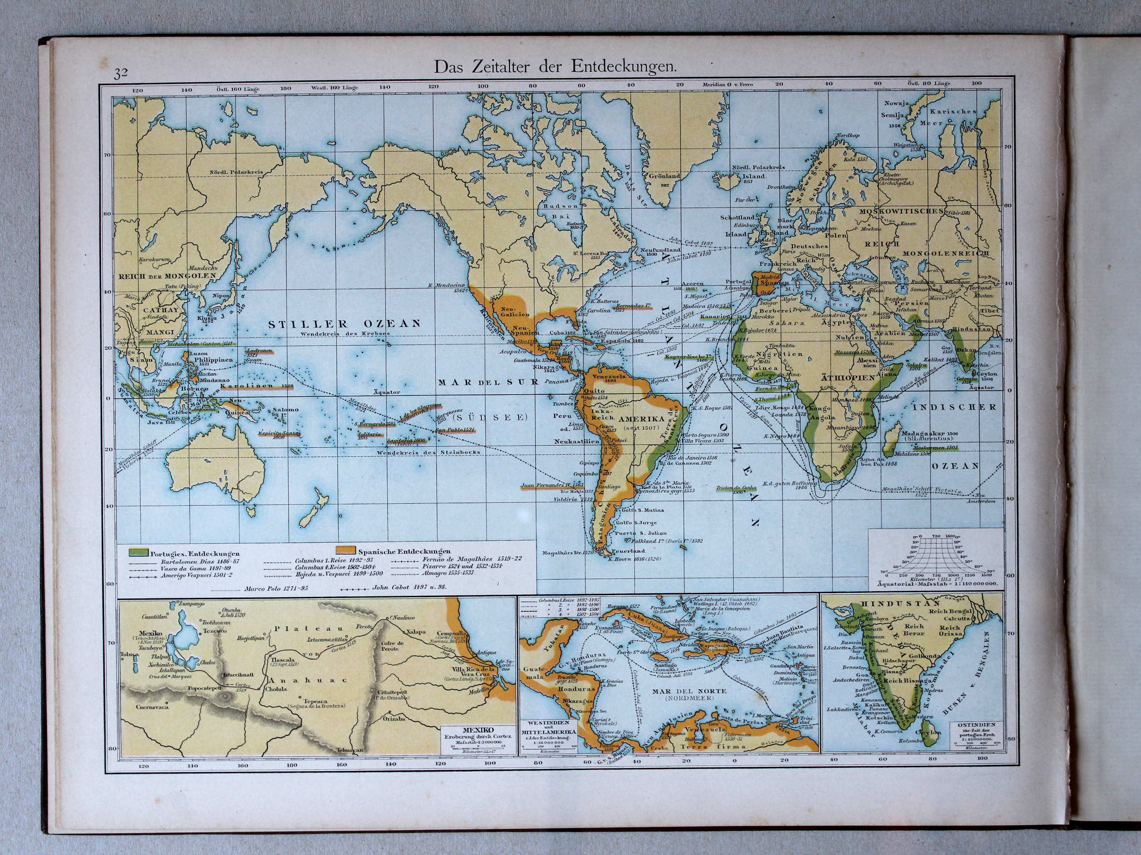
32. Das Zeitalter der Entdeckungen XL
Het tijdperk van de grote ontdekkingen / The Age of Discovery
 Droysens Historischer Handatlas, 1886
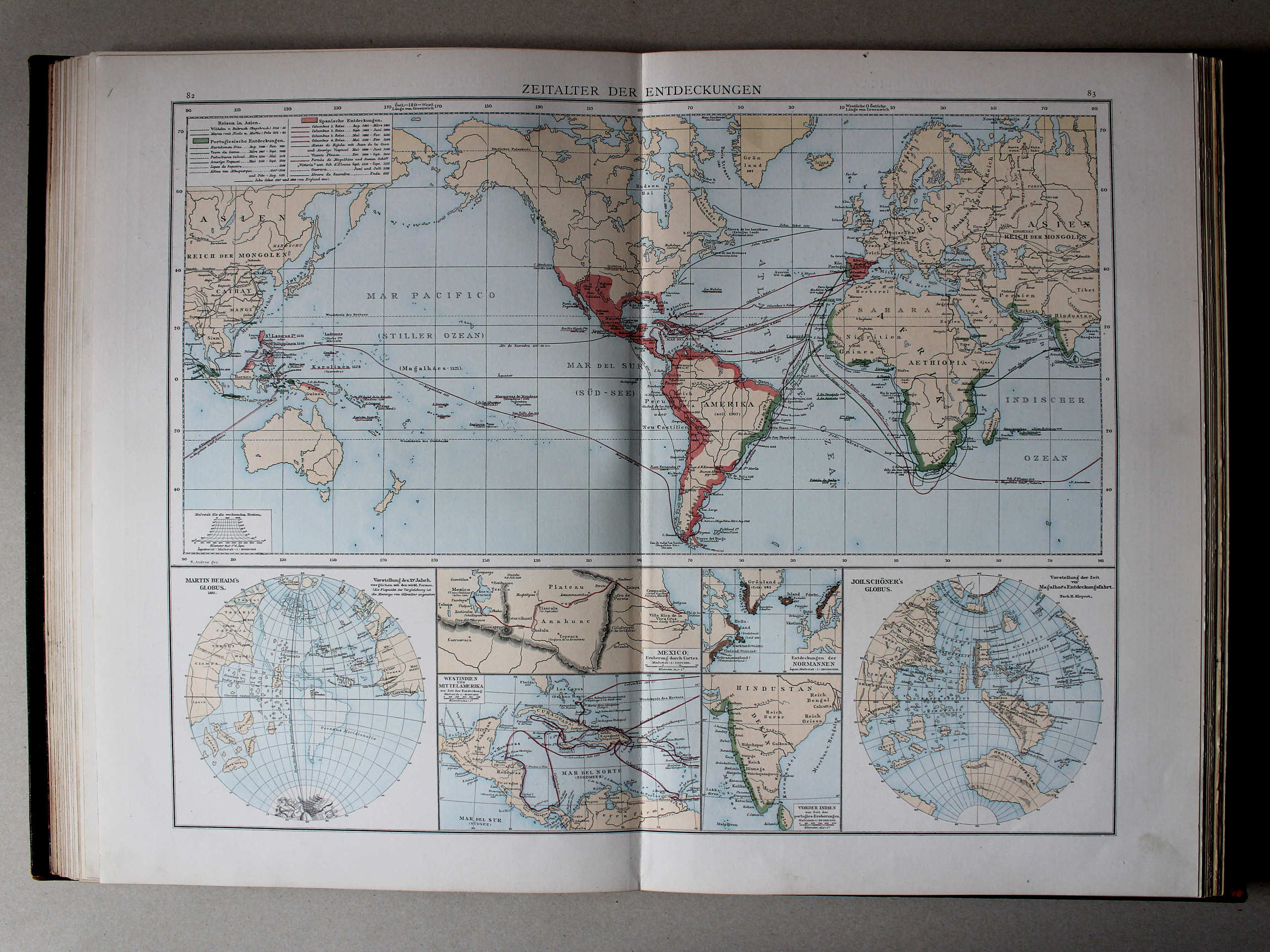
82.83. Zeitalter der Entdeckungen XL
Tijdperk van de grote ontdekkingen / Age of Discovery
© M. Witkam, 2013
![]()
![]()