Putzgers Historischer Schul-Atlas, 14e druk (1888) en 13e druk (1887)
See below for (a summary of) this text in English.
Hieronder staan plaatjes van de 14e en 13e druk ter vergelijking naast elkaar. Daarbij horen ook de volgende pagina's
- Beschrijving van de 14e druk
- Plaatjes van de 14e druk
- Tabellen en lijsten bij de 14e druk
en
- Beschrijving van de 13e druk
- Plaatjes van de 13e druk
- Tabellen en lijsten bij de 13e druk
Plaatjes
Klik op een plaatje voor een vergroting.
- Band
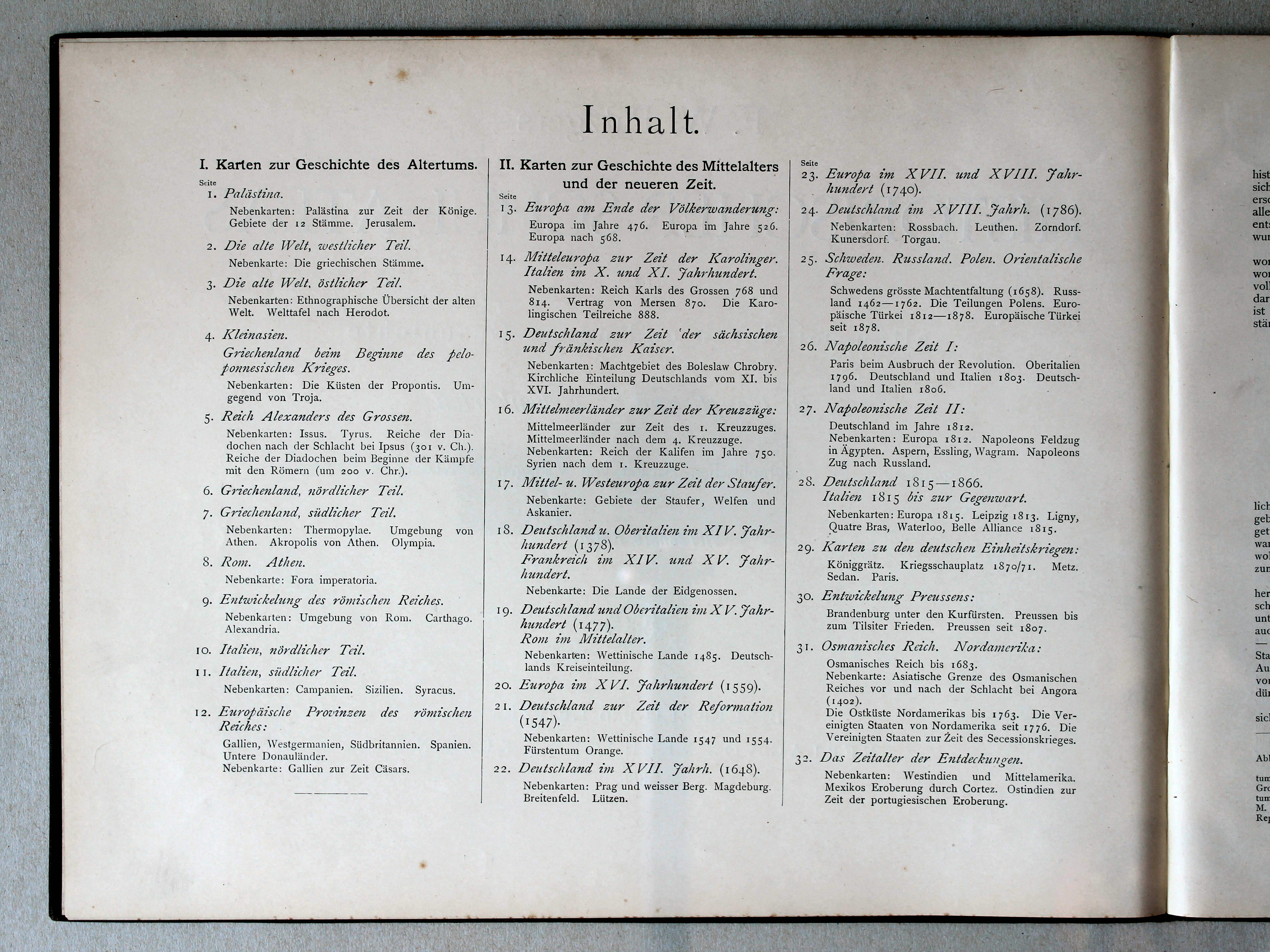
- Titelpagina, inhoudsopgave
- Kaarten
- Karten zur Geschichte des Altertums (Oudheid)
- Karten zur Geschichte des Mittelaltes und der Neuzeit (Middeleeuwen, Nieuwe Tijd)
Putzgers Historischer Schul-Atlas, 14th edition (1888) and 13th edition (1887)
- Below are pictures a and b side by side for comparison purposes. Related pages
- Description of the 14th edition
- Pictures of the 14th edition
- Tables and lists to the 14th edition
- Description of the 13th edition
- Pictures of the 13th edition
- Tables and lists to the 13th edition
Pictures
Click on a picture to enlarge.
- Binding
- Title page, table of contents
- Maps
- Karten zur Geschichte des Altertums (Ancient History)
- Karten zur Geschichte des Mittelaltes und der Neuzeit (Medieval and Modern History)
Band / Binding Titelpagina, inhoudsopgave / Title page, table of contents


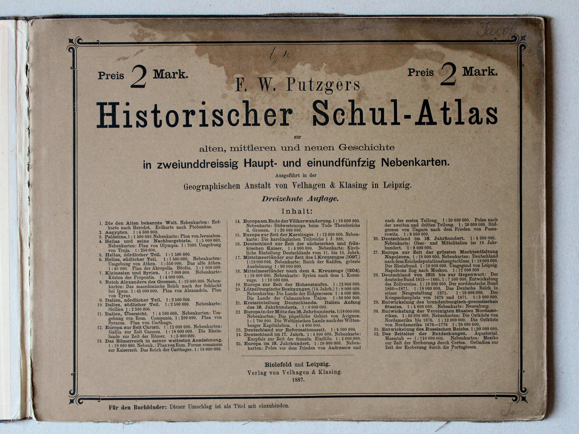 Putzger's Historischer Schul-Atlas, 1887
Titelpagina, inhoudsopgave / Title page, table of contents XL
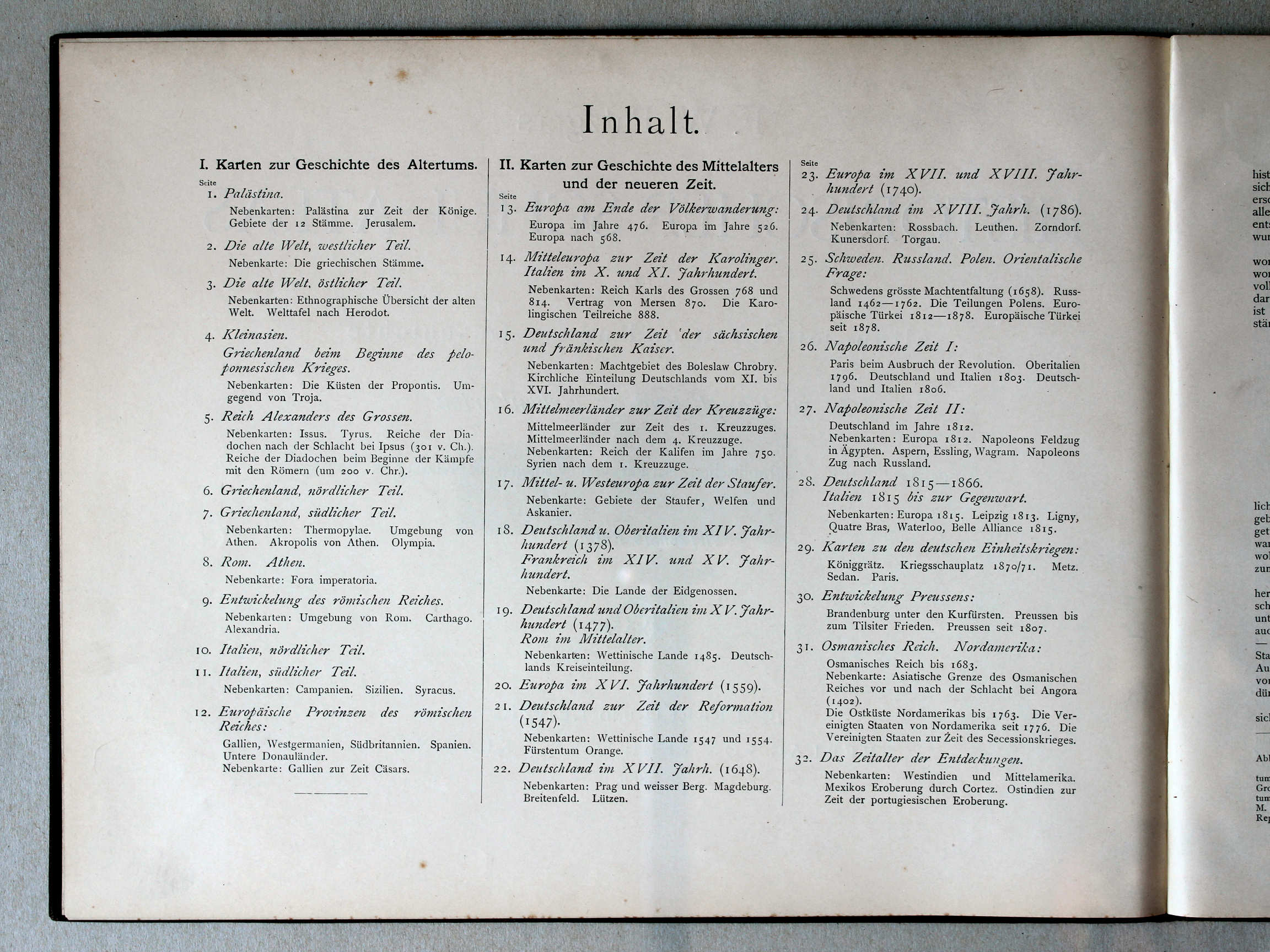 Putzger's Historischer Schul-Atlas, 1887
Titelpagina, inhoudsopgave / Title page, table of contents XL
(Oudheid / Ancient history)

 Putzger's Historischer Schul-Atlas, 1887
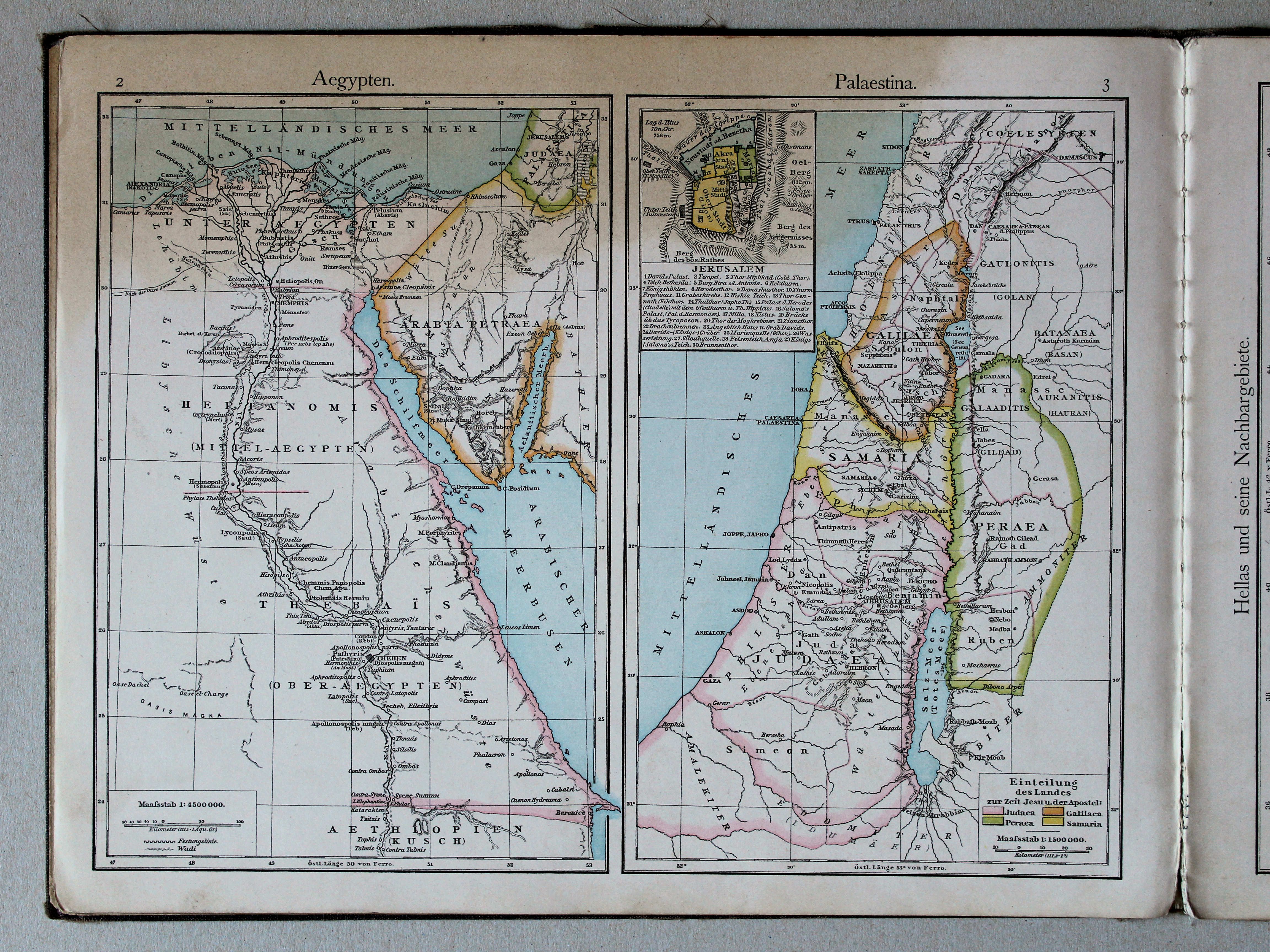
2. Aegypten XL
Egypte / Egypt
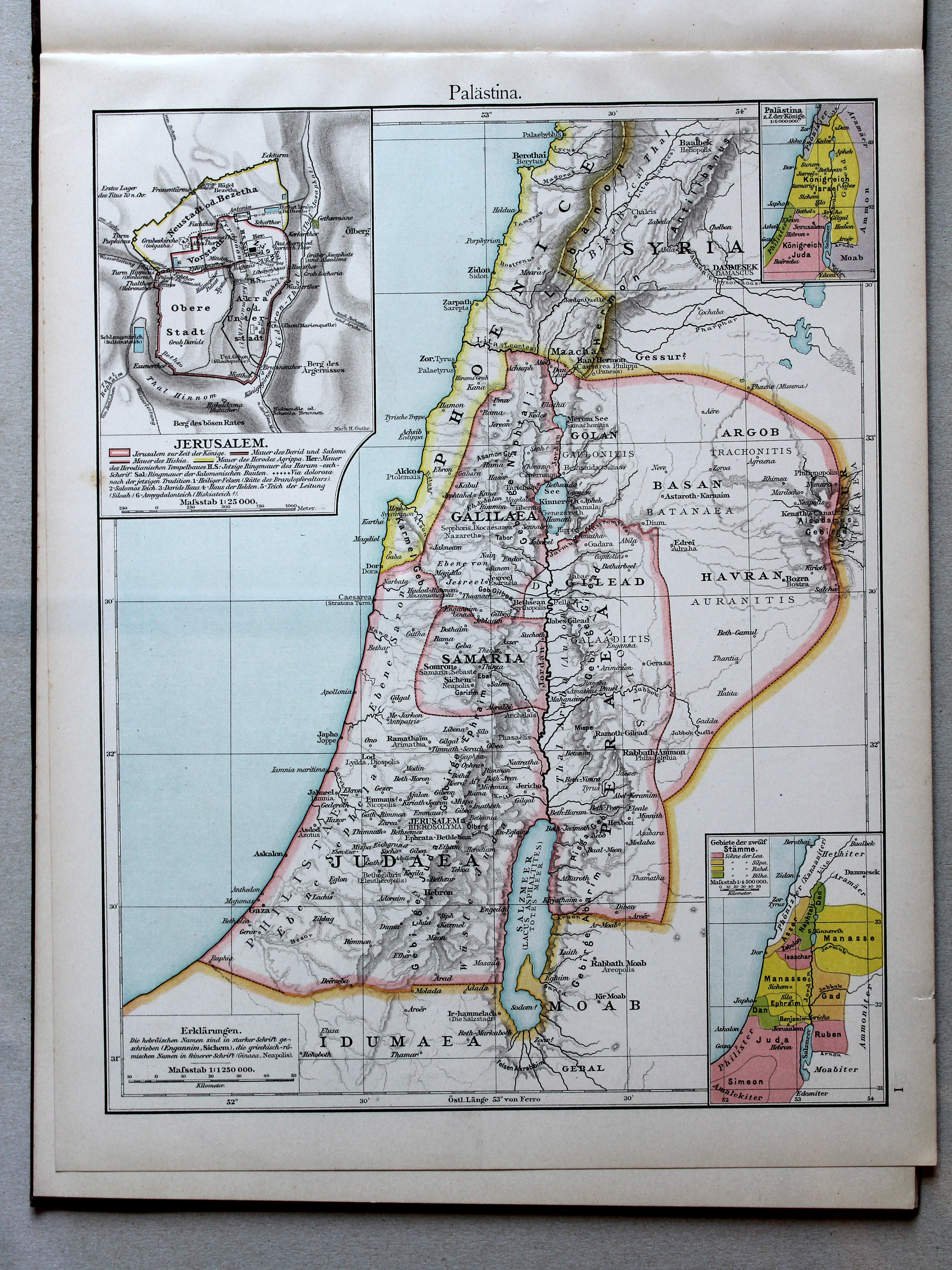
3. Palästina XL
Palestina / Palestine
 Putzgers Historischer Schul-Atlas, 1888
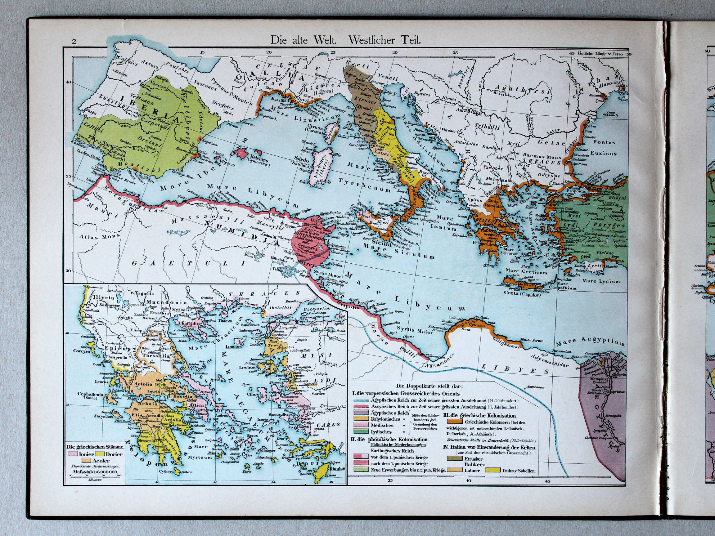
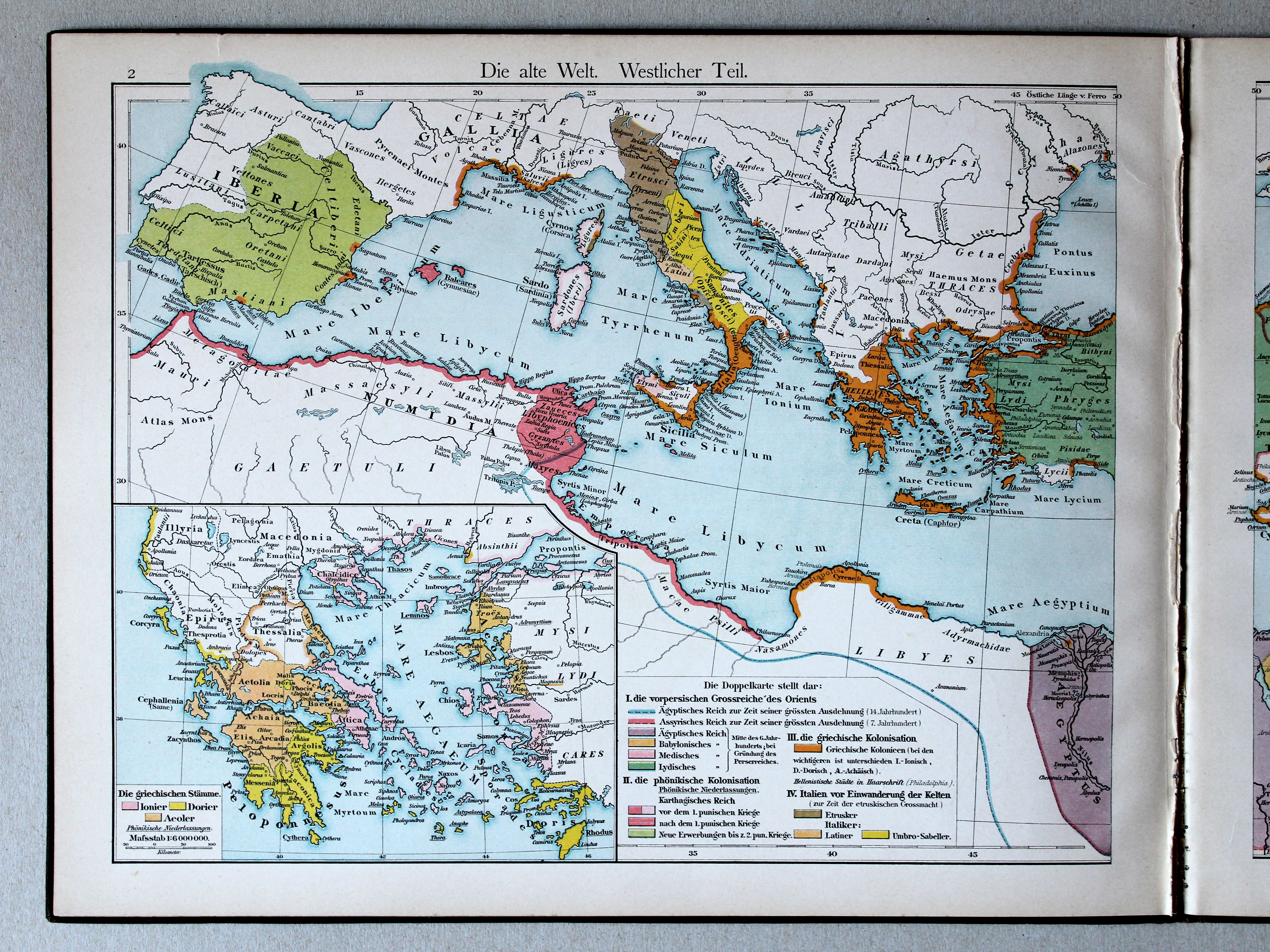
2. Die alte Welt. Westlicher Teil XL
De wereld in de Oudheid, westelijk deel / The Ancient world, western part
 Putzger's Historischer Schul-Atlas, 1887
geen overeenkomstige kaart / no corresponding map
 Putzgers Historischer Schul-Atlas, 1888
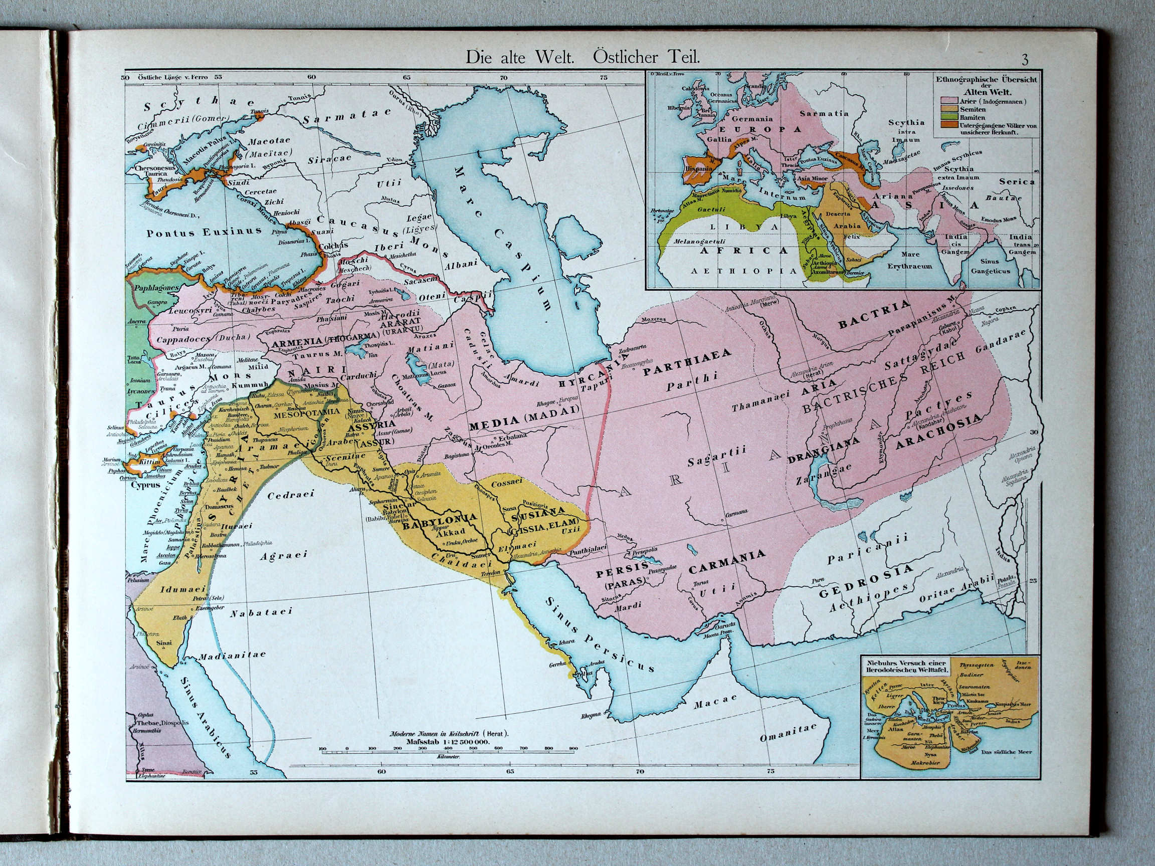
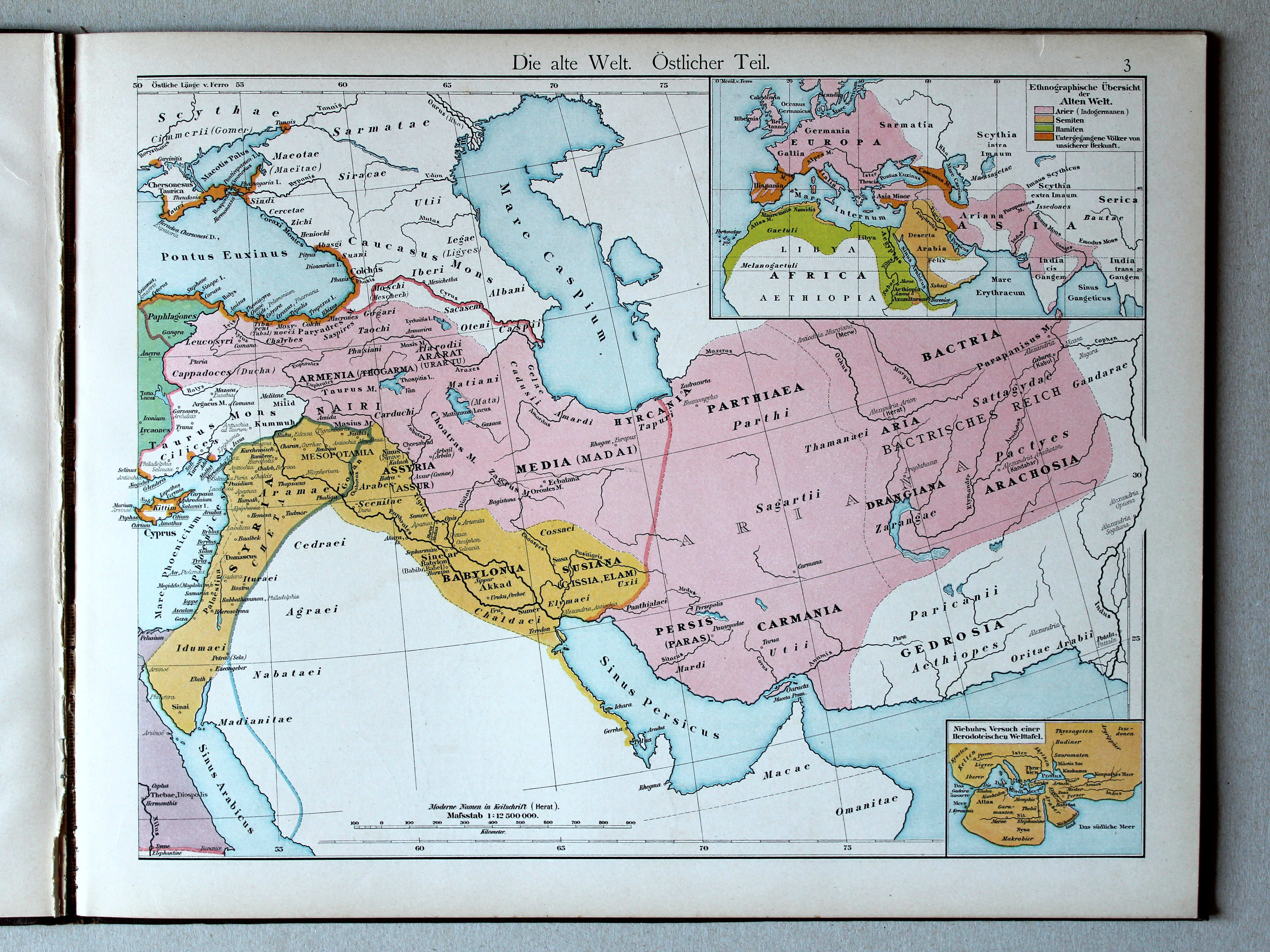
3. Die alte Welt. Östlicher Teil XL
De wereld in de Oudheid, oostelijk deel / The Ancient world, eastern part
Putzger's Historischer Schul-Atlas, 1887
geen overeenkomstige kaart / no corresponding map
 Putzgers Historischer Schul-Atlas, 1888
geen overeenkomstige kaart / no corresponding map
 Putzger's Historischer Schul-Atlas, 1887
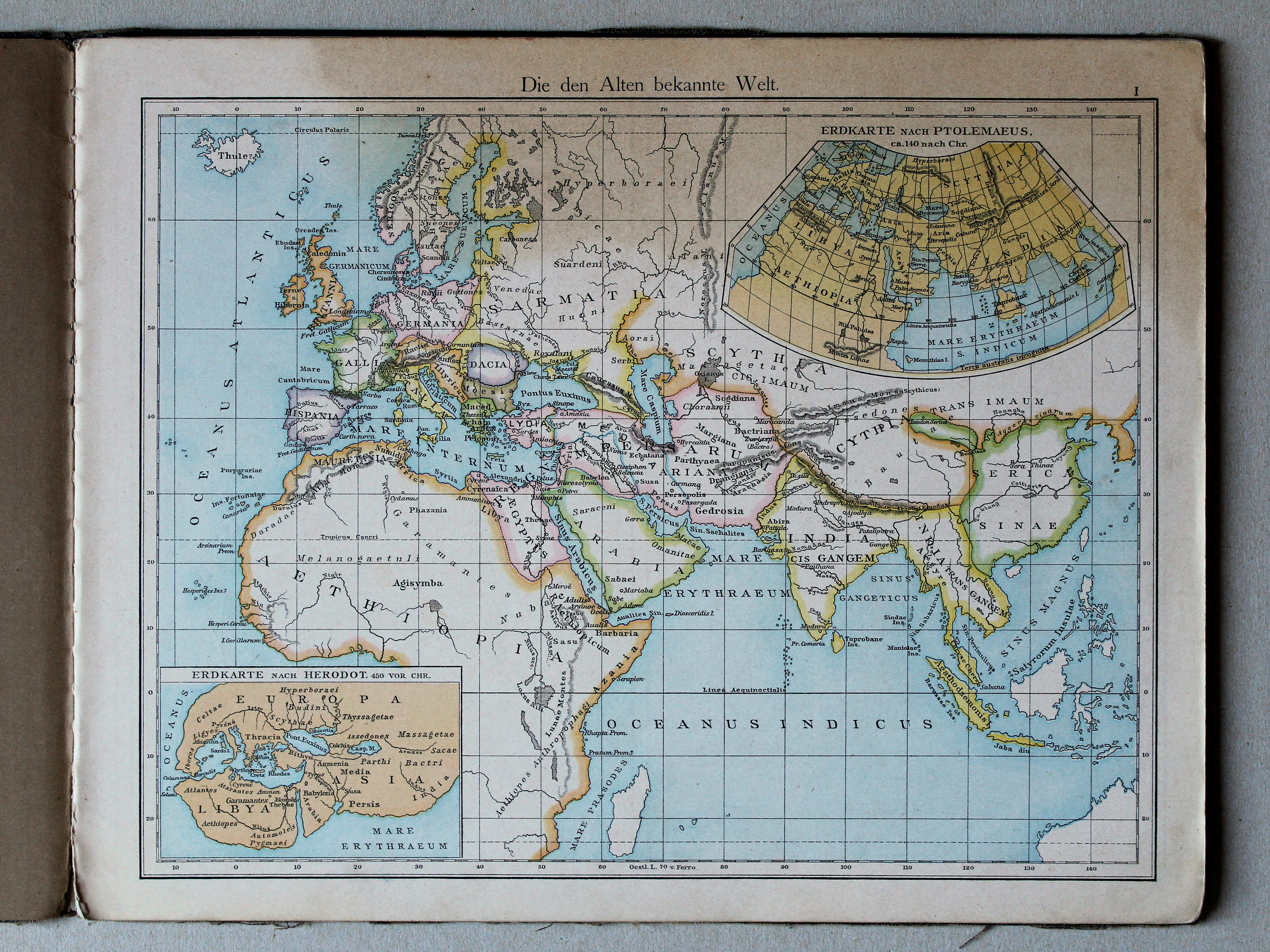
1. Die den Alten bekannte Welt XL
De in de Oudheid bekende wereld / The world as known to the Ancients

 Putzger's Historischer Schul-Atlas, 1887
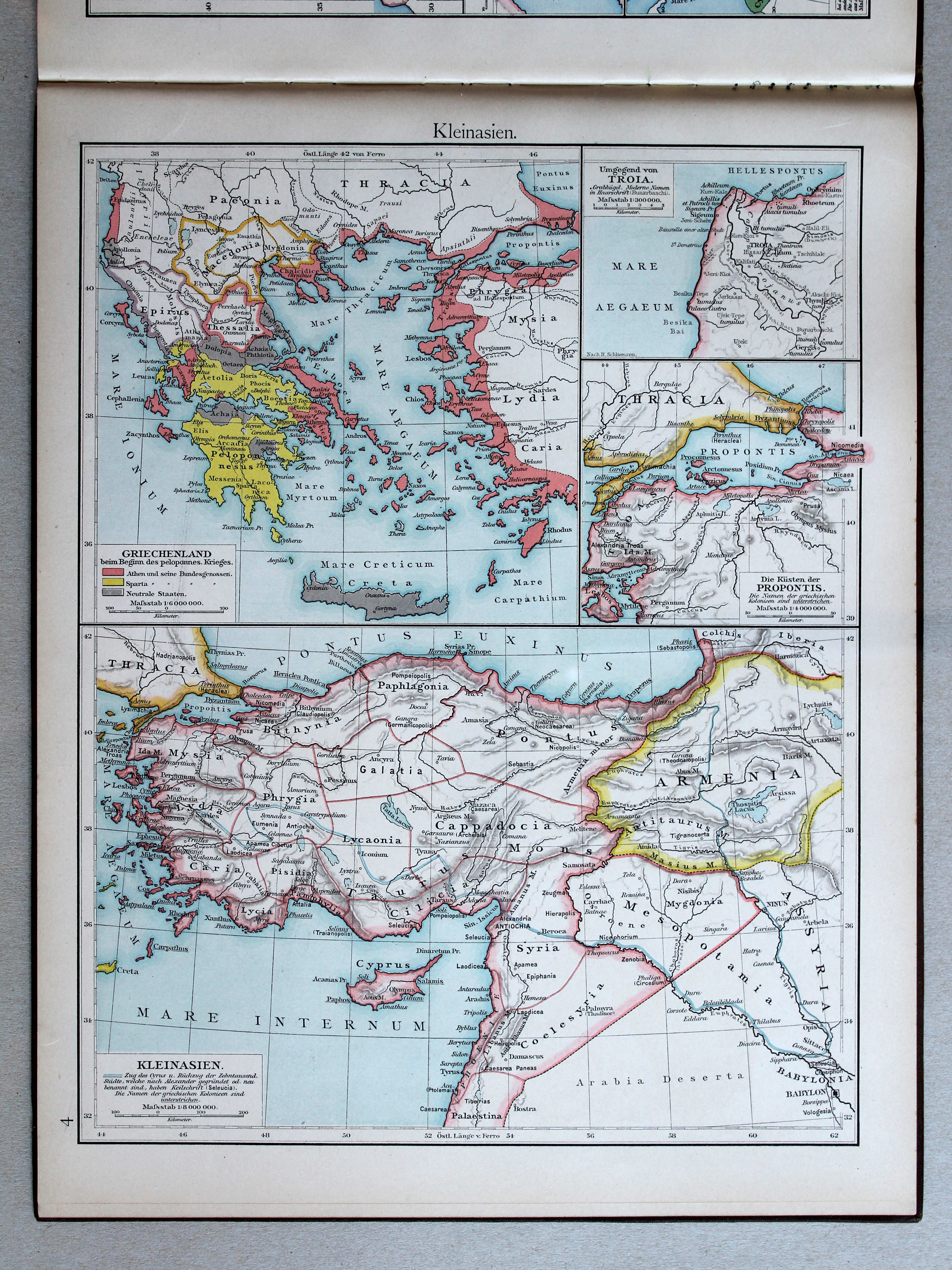
7. Kleinasien und Syrien XL
Klein-Azië en Syrië / Asia Minor and Syria
 Putzgers Historischer Schul-Atlas, 1888
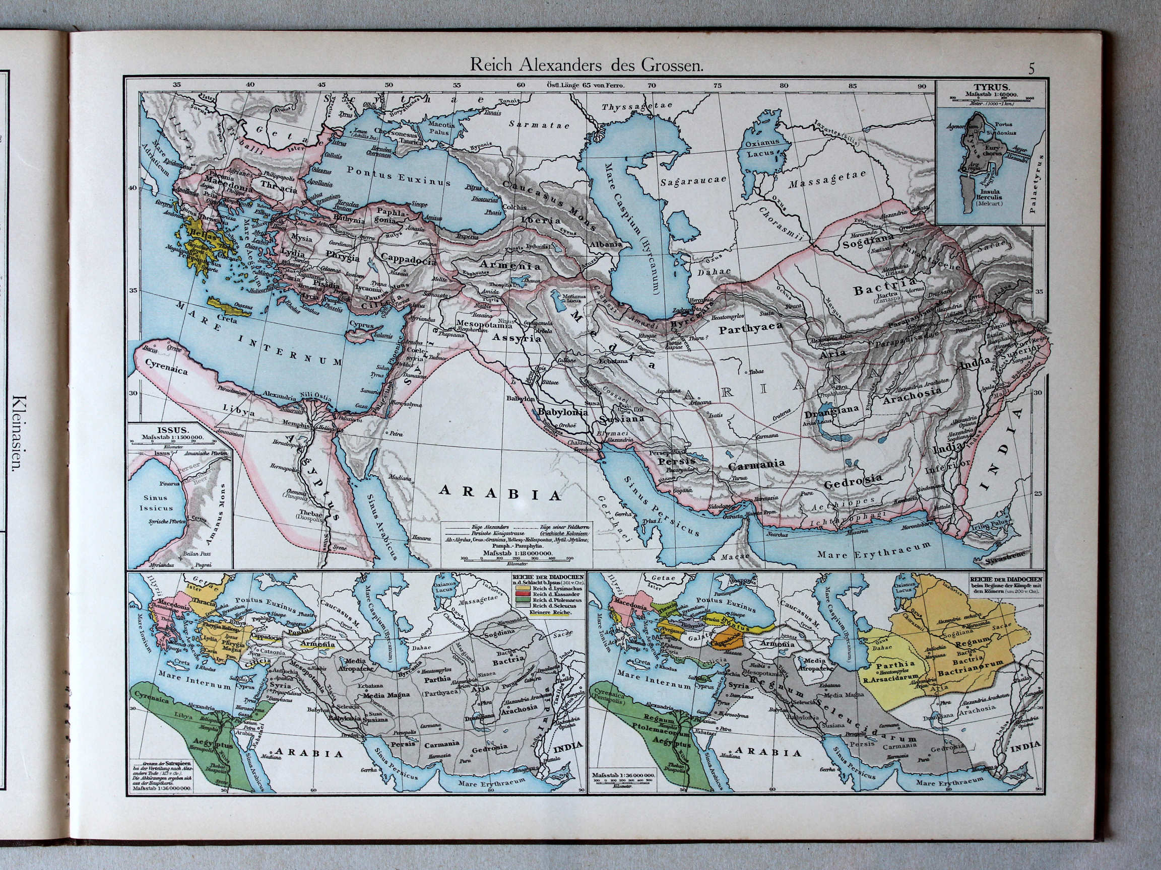
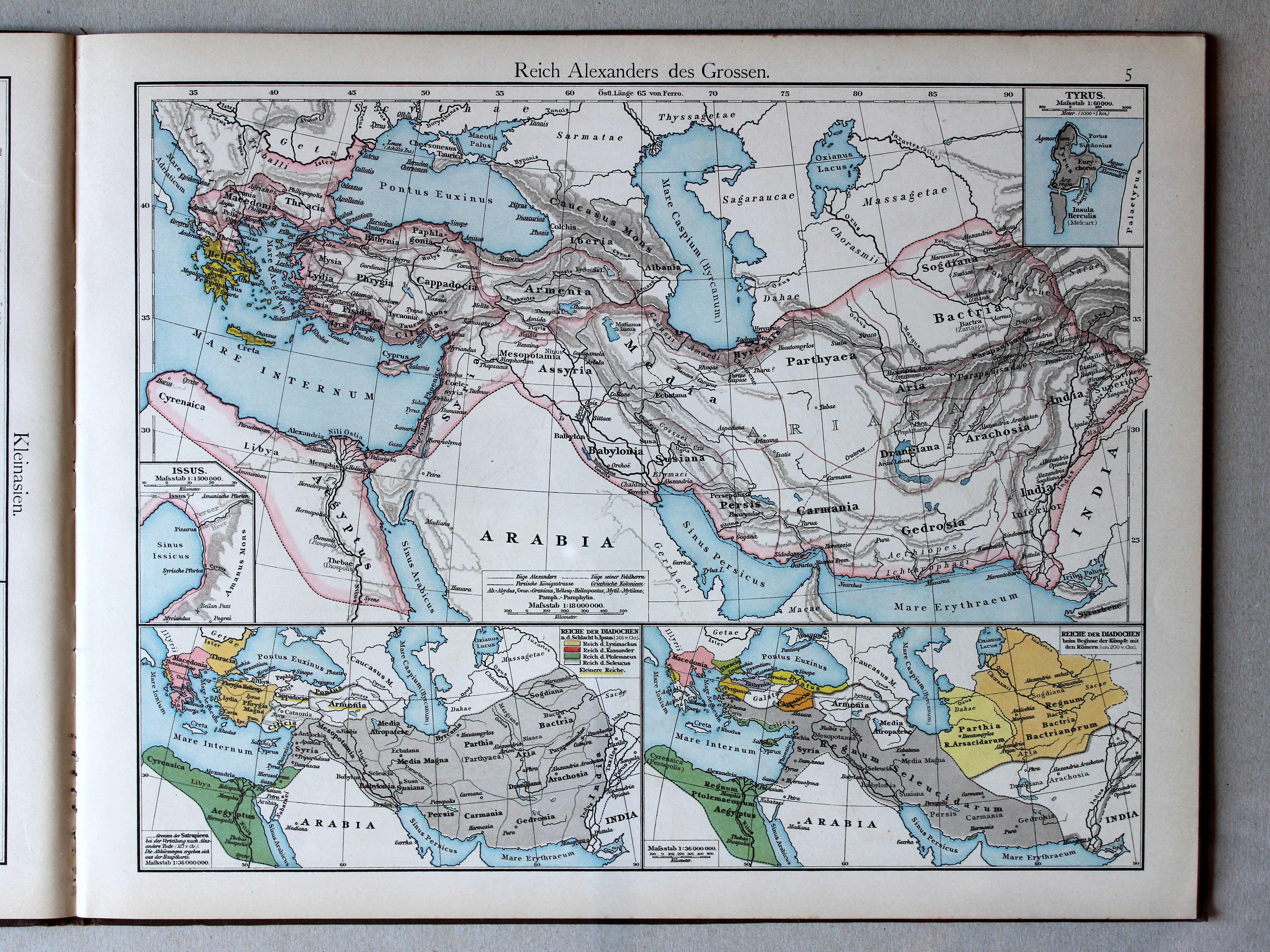
5. Reich Alexanders des Grossen XL
Het Rijk van Alexander de Grote / The Empire of Alexander the Great
 Putzger's Historischer Schul-Atlas, 1887
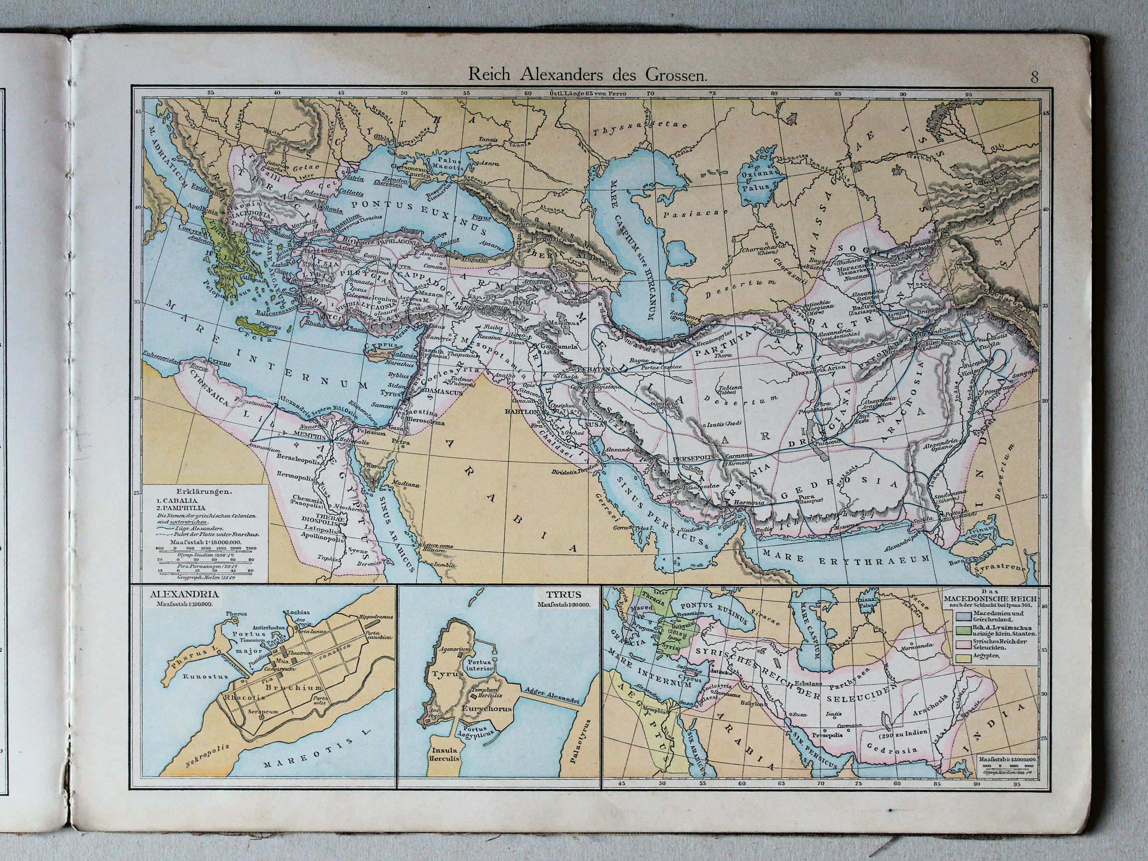
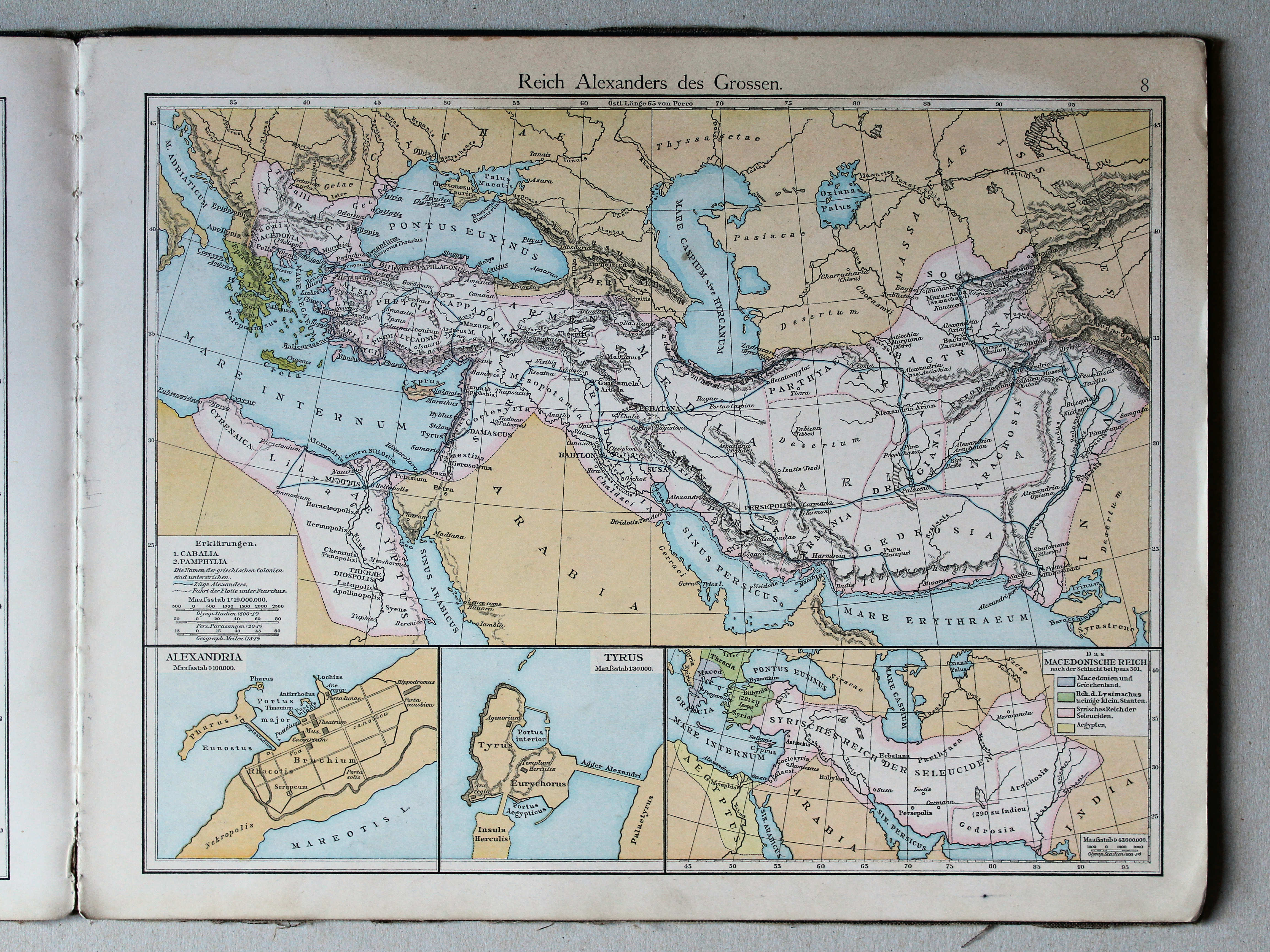
8. Reich Alexanders des Grossen XL
Het Rijk van Alexander de Grote / The Empire of Alexander the Great
 Putzgers Historischer Schul-Atlas, 1888
geen overeenkomstige kaart / no corresponding map
 Putzger's Historischer Schul-Atlas, 1887
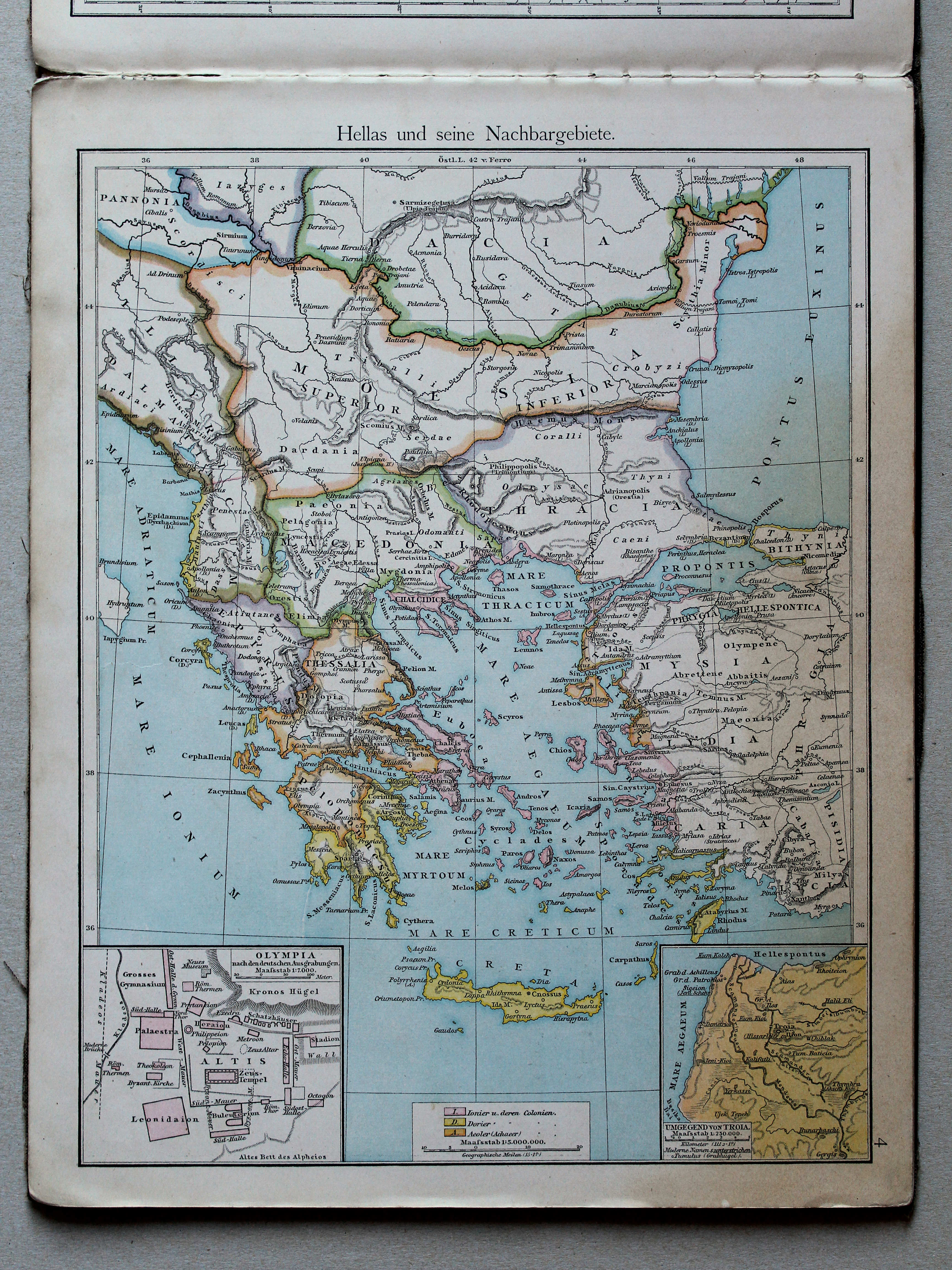
4. Hellas und seine Nachbargebiete XL
Griekenland en aangrenzende landen / Greece and adjacent countries
 Putzgers Historischer Schul-Atlas, 1888
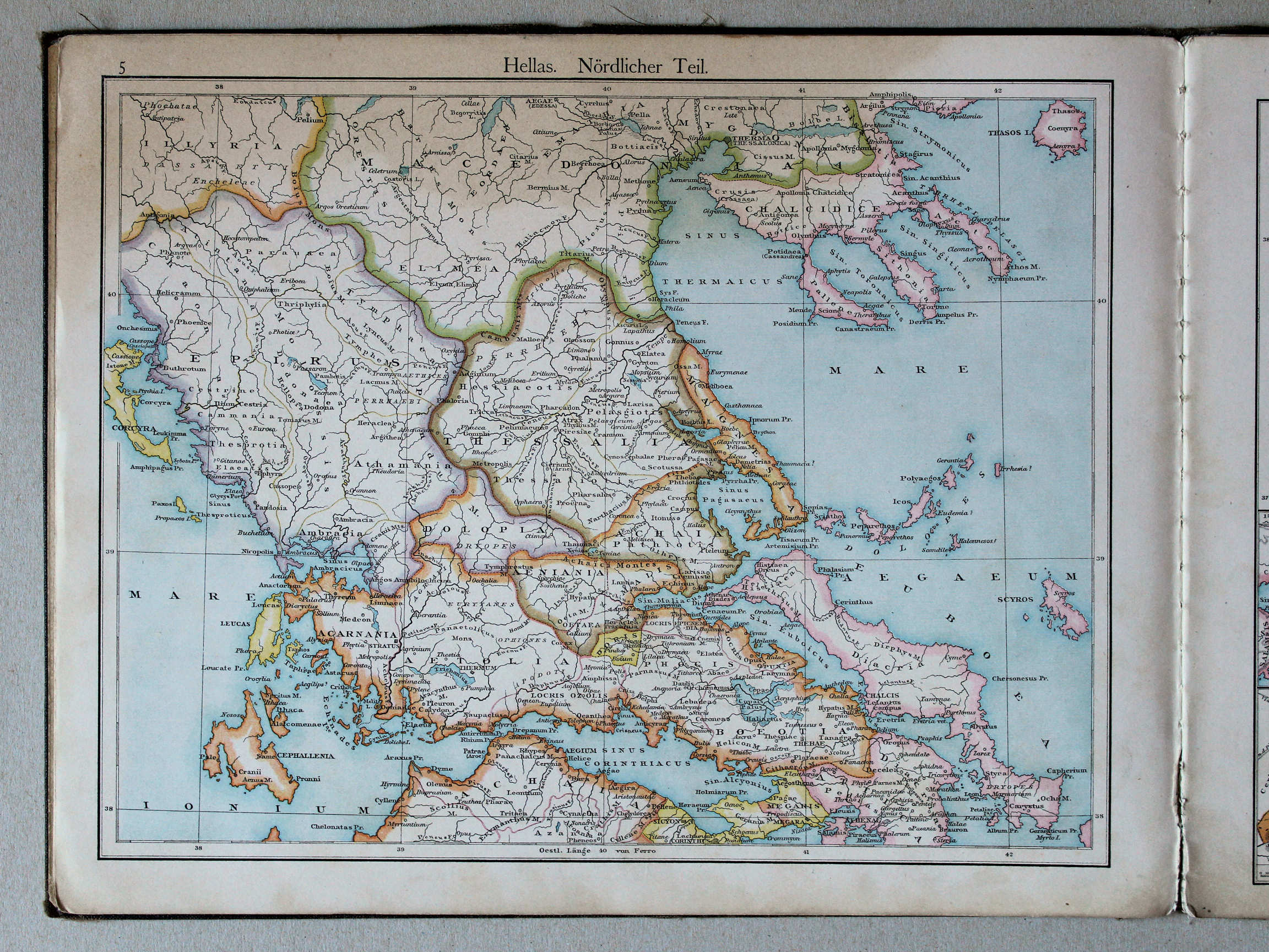
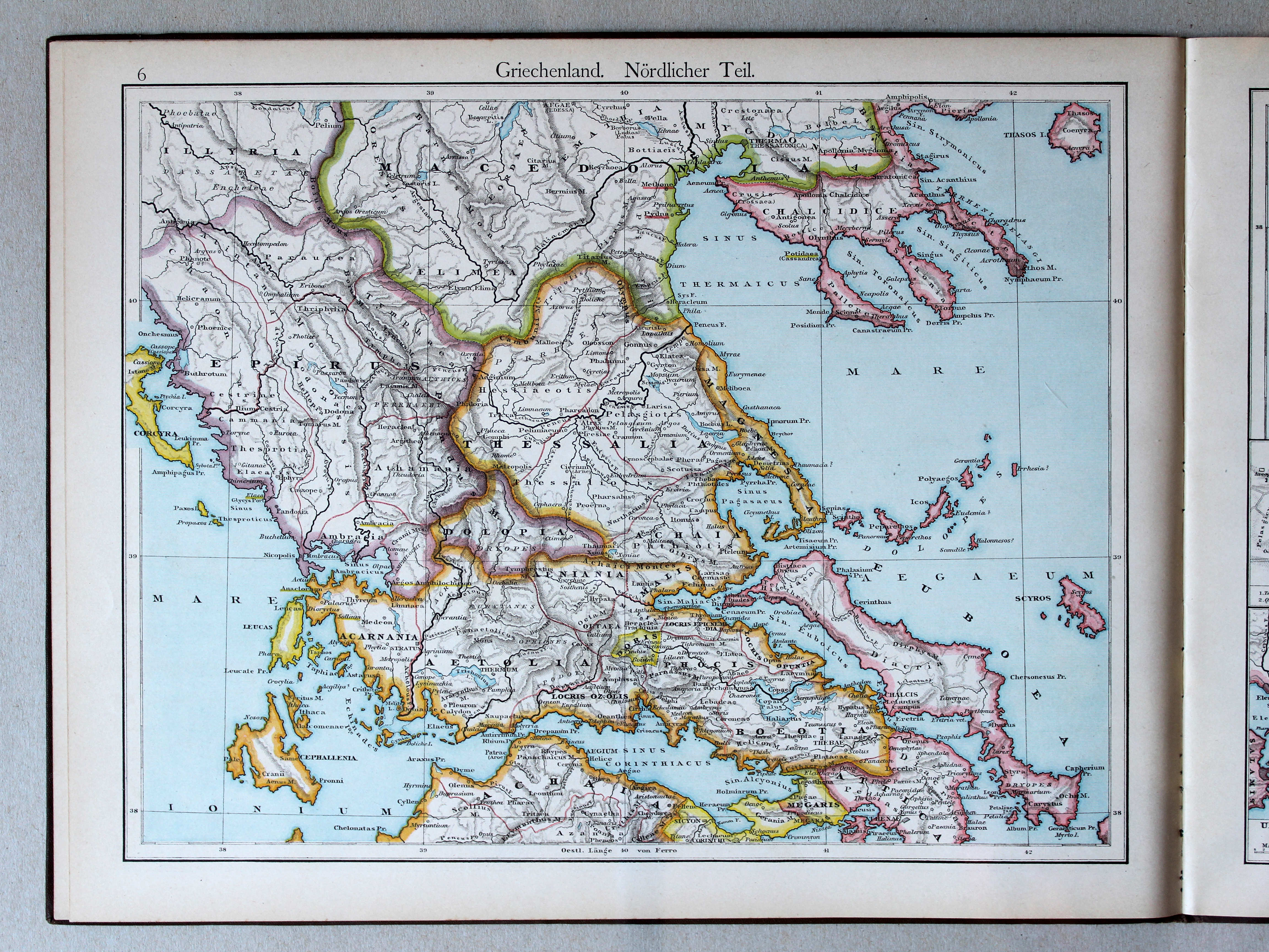
6. Griechenland. Nördlicher Teil XL
Griekenland, noordelijk deel / Greece, northern part
 Putzger's Historischer Schul-Atlas, 1887
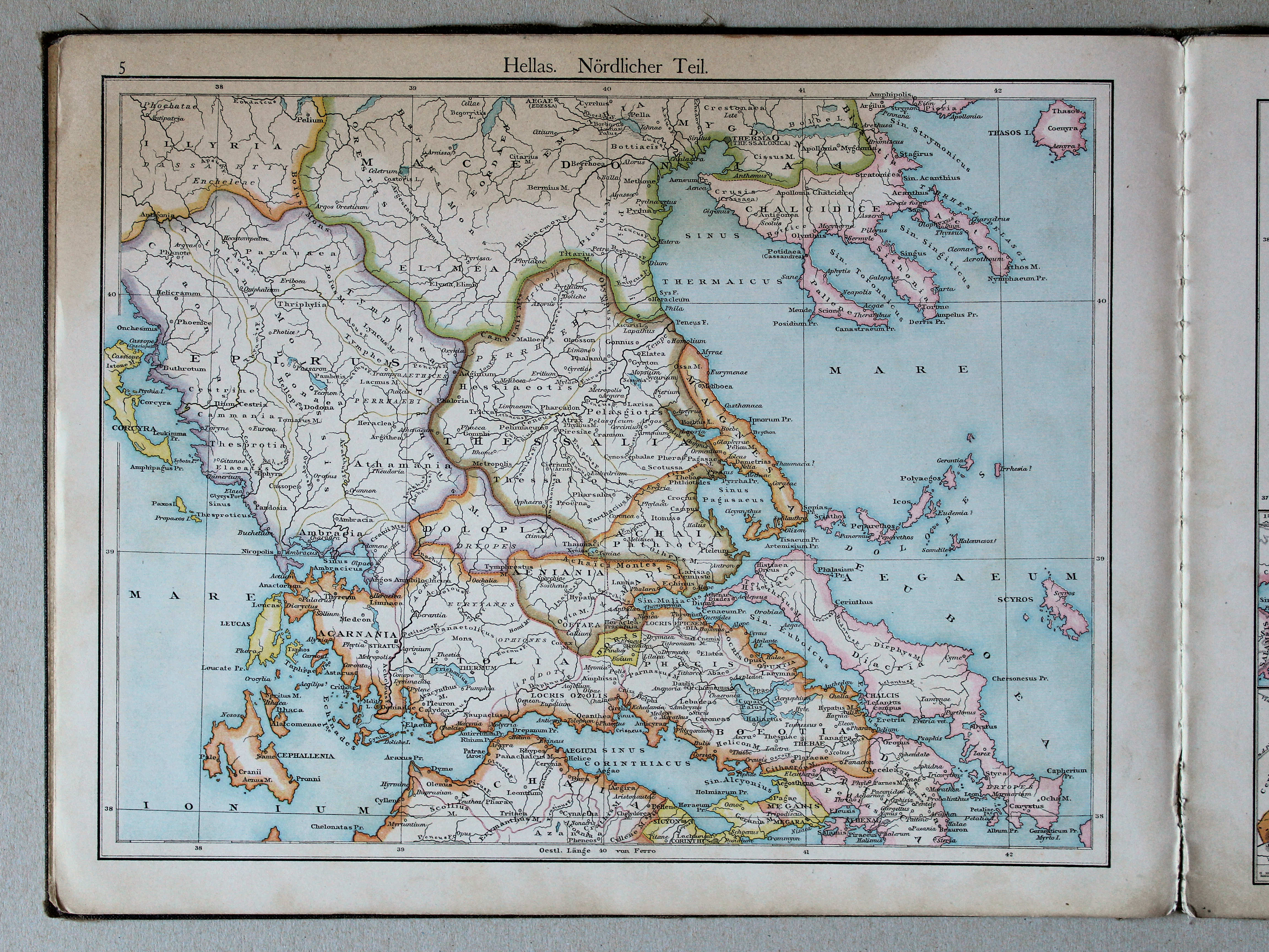
5. Hellas. Nördlicher Teil XL
Griekenland. Noordelijk deel / Greece. Northern part
 Putzgers Historischer Schul-Atlas, 1888
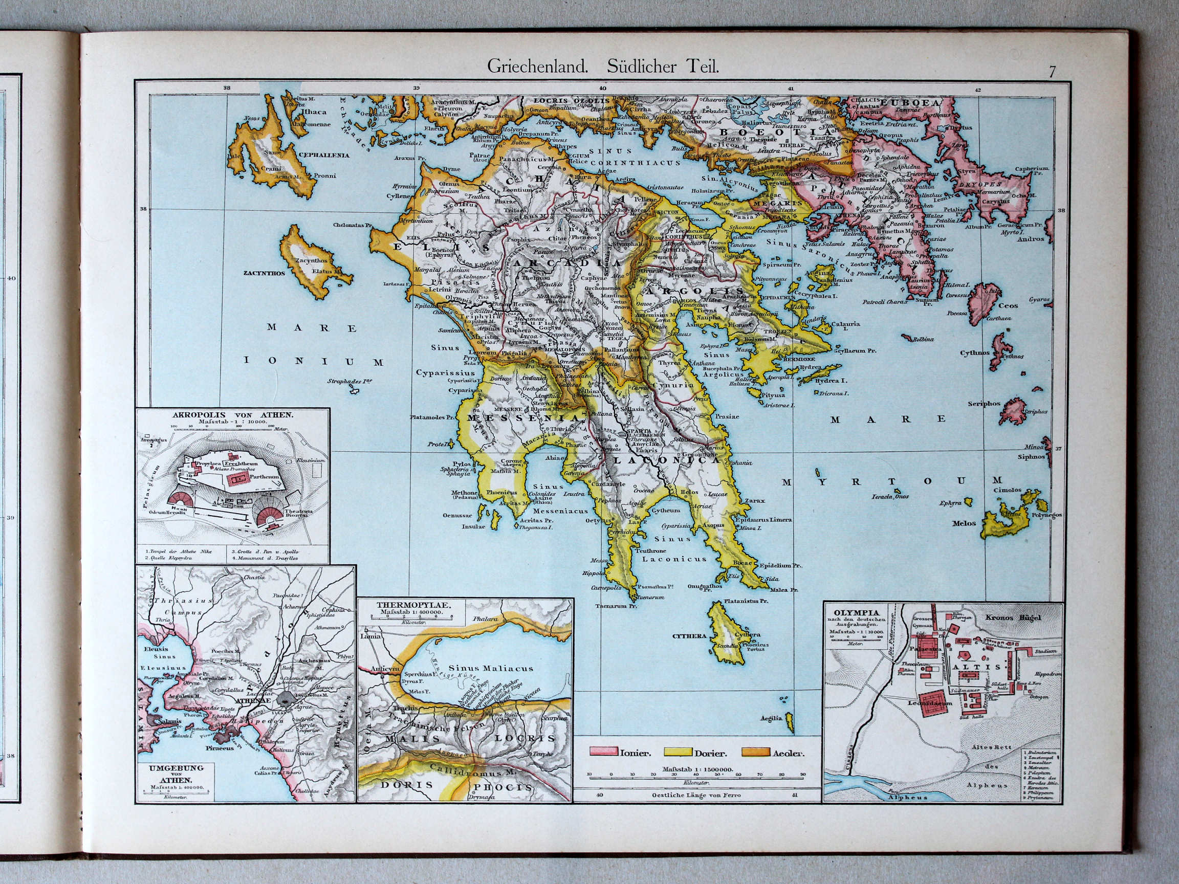
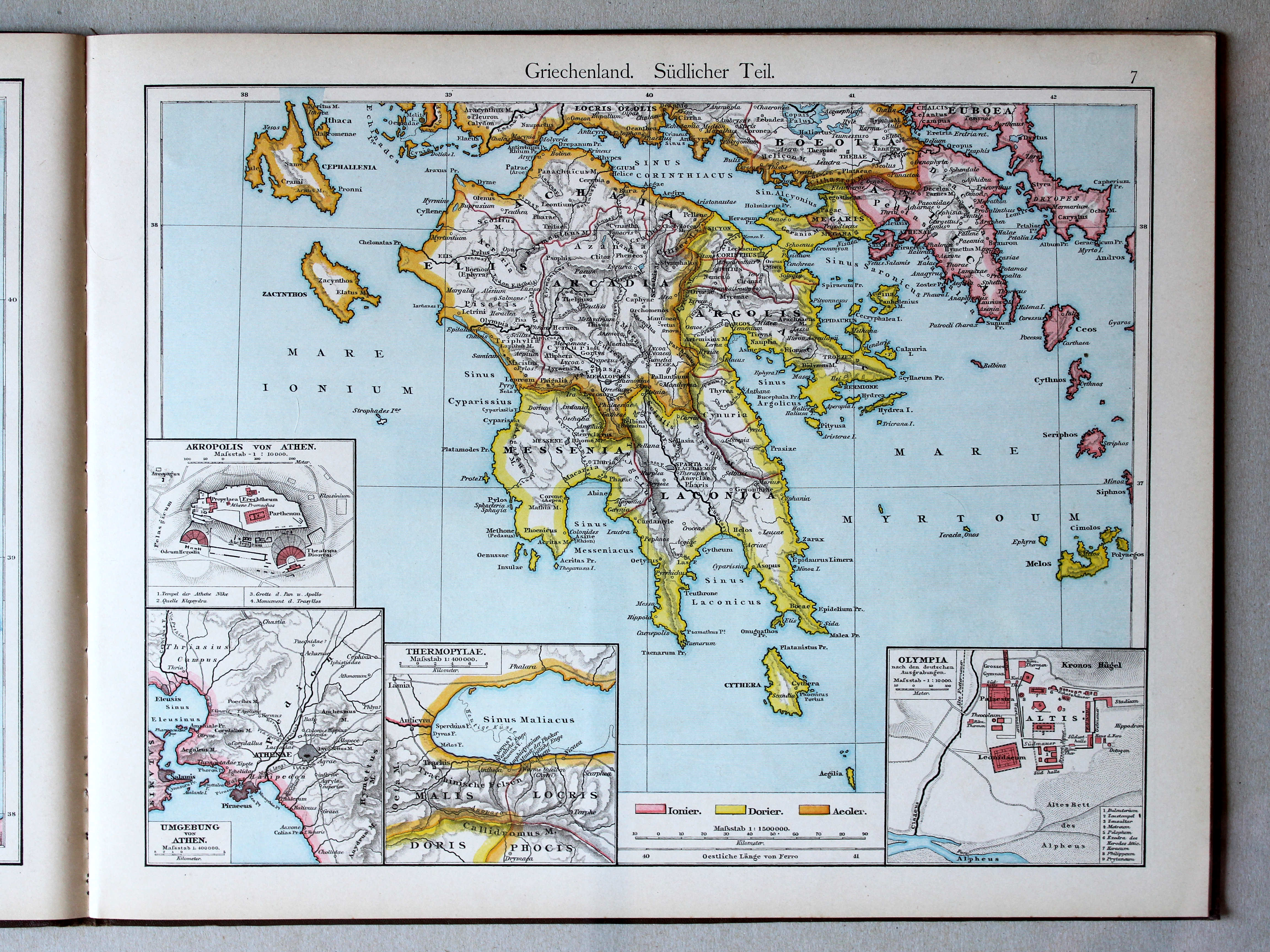
7. Griechenland. Südlicher Teil XL
Griekenland, zuidelijk deel / Greece, southern part
 Putzger's Historischer Schul-Atlas, 1887
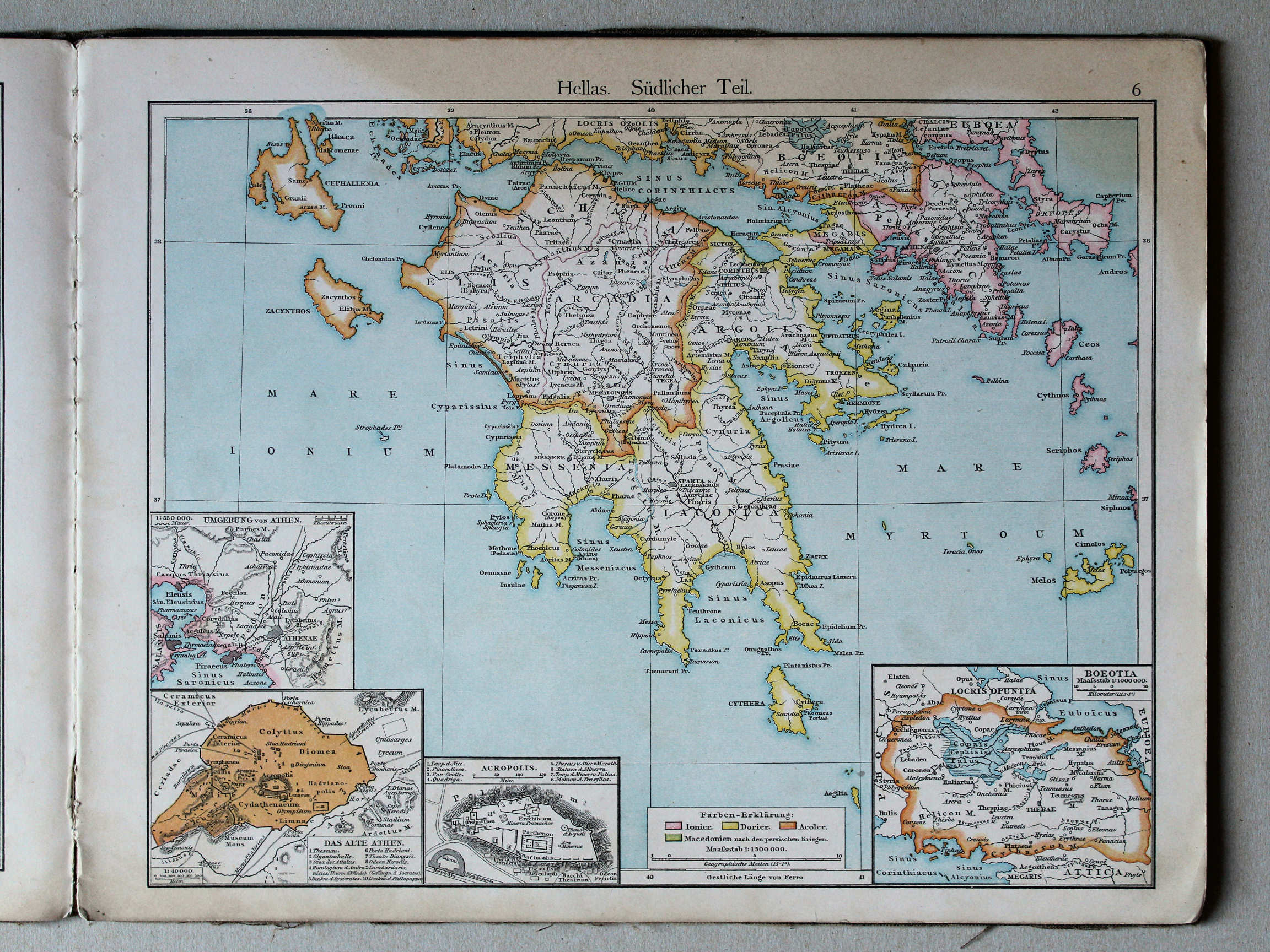
6. Hellas. Südlicher Teil XL
Griekenland. Zuidelijk deel / Greece. Southern part
 Putzger's Historischer Schul-Atlas, 1887
geen overeenkomstige kaart / no corresponding map
 Putzgers Historischer Schul-Atlas, 1888
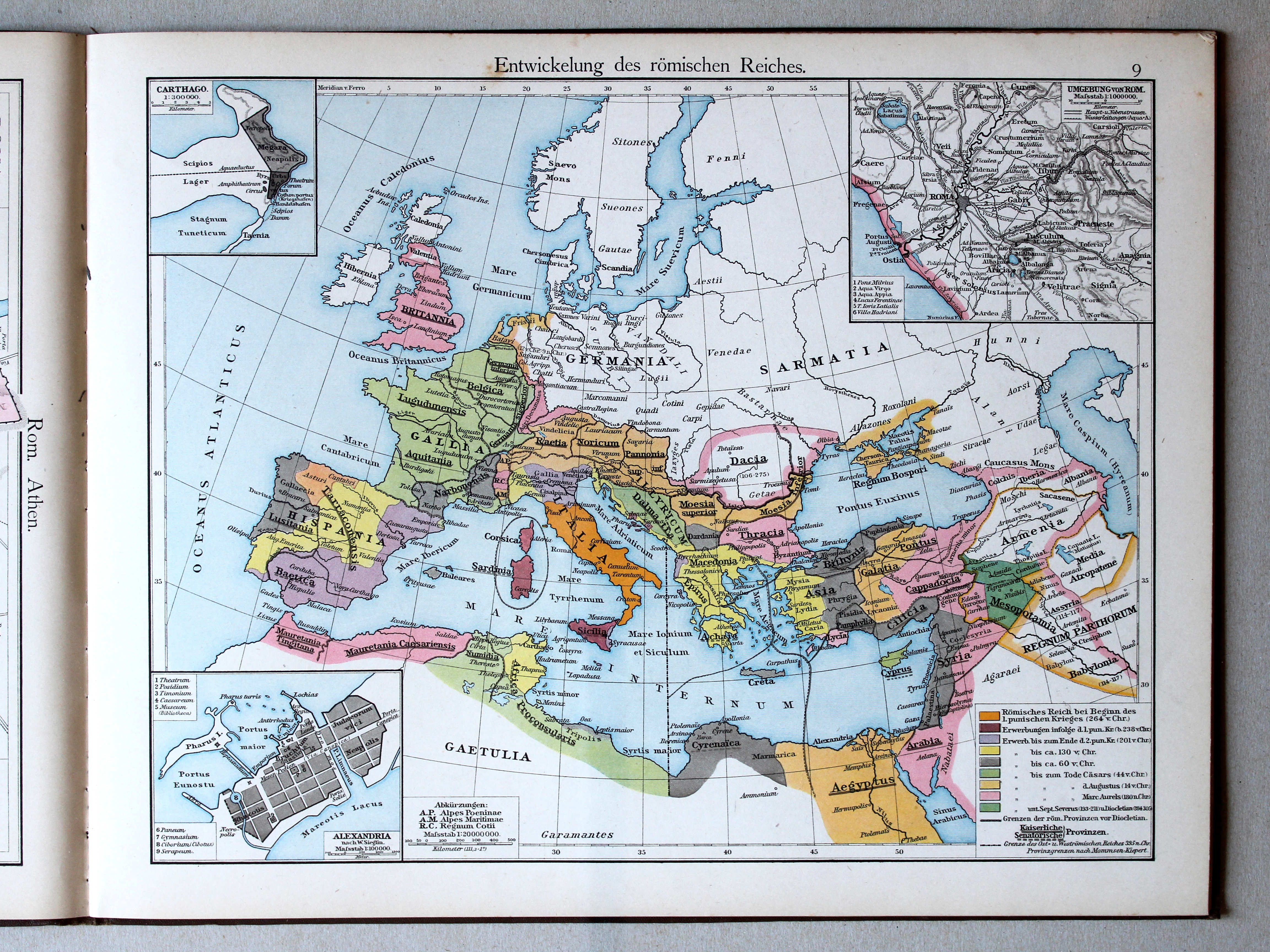
9. Entwickelung des römischen Reiches XL
Ontwikkeling van het Romeinse Rijk / Development of the Roman Empire
 Putzger's Historischer Schul-Atlas, 1887
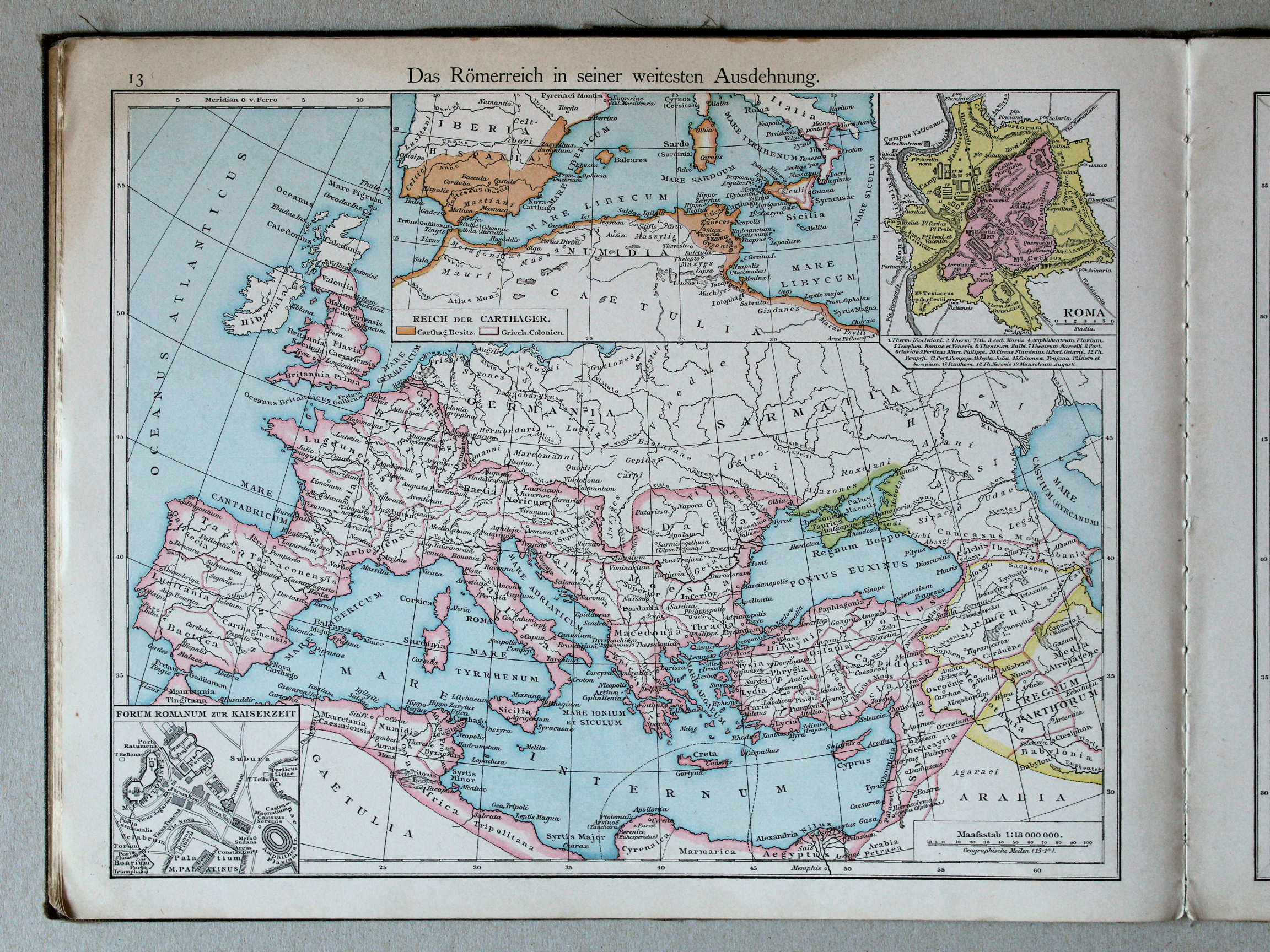
13. Das Römerreich in seiner weitesten Ausdehnung XL
Het Romeinse Rijk in zijn grootste uitbreiding / The Roman Empire in its greatest extent
 Putzgers Historischer Schul-Atlas, 1888
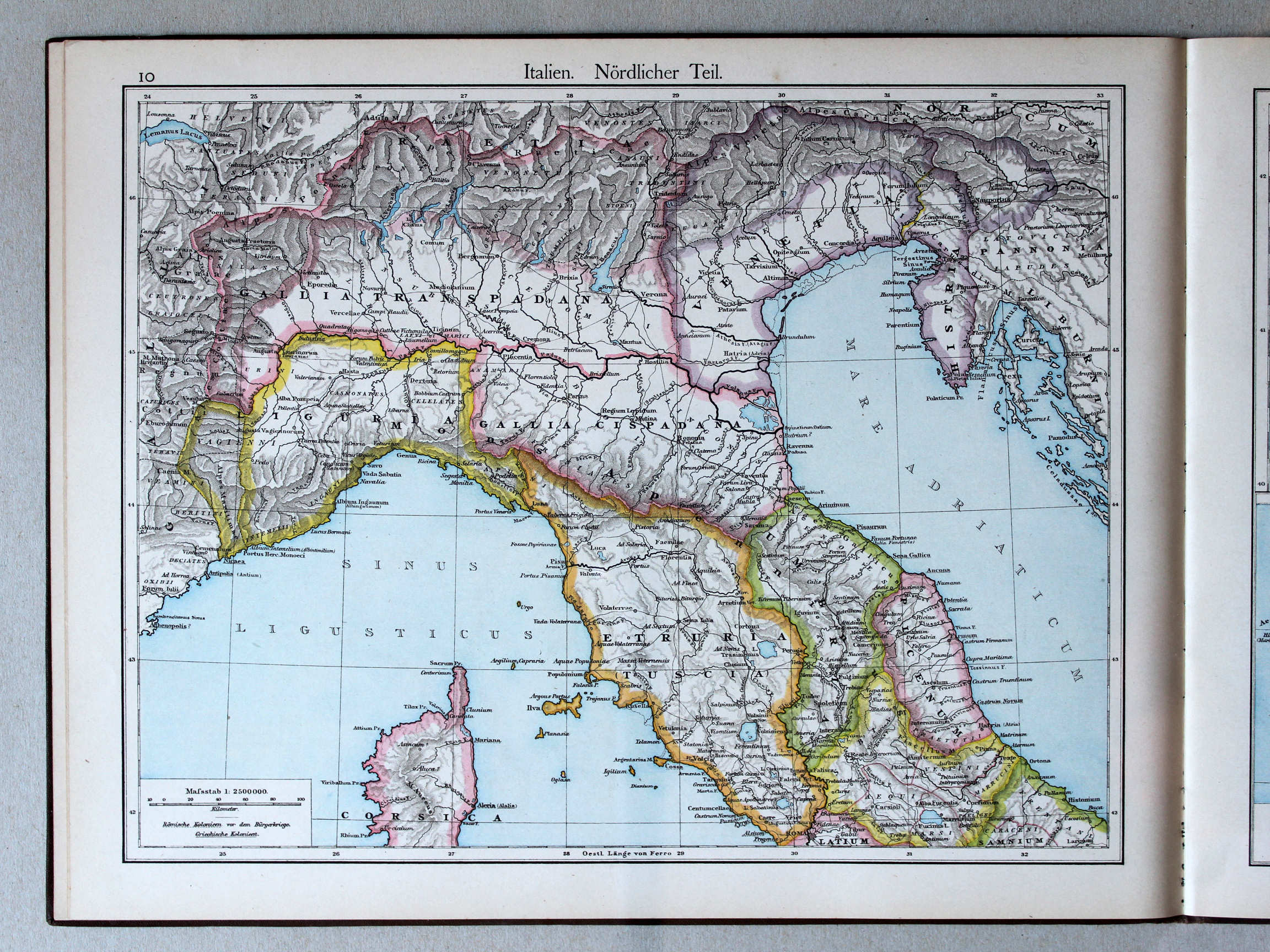
10. Italien. Nördlicher Teil XL
Italië, noordelijk deel / Italy, northern part
 Putzger's Historischer Schul-Atlas, 1887
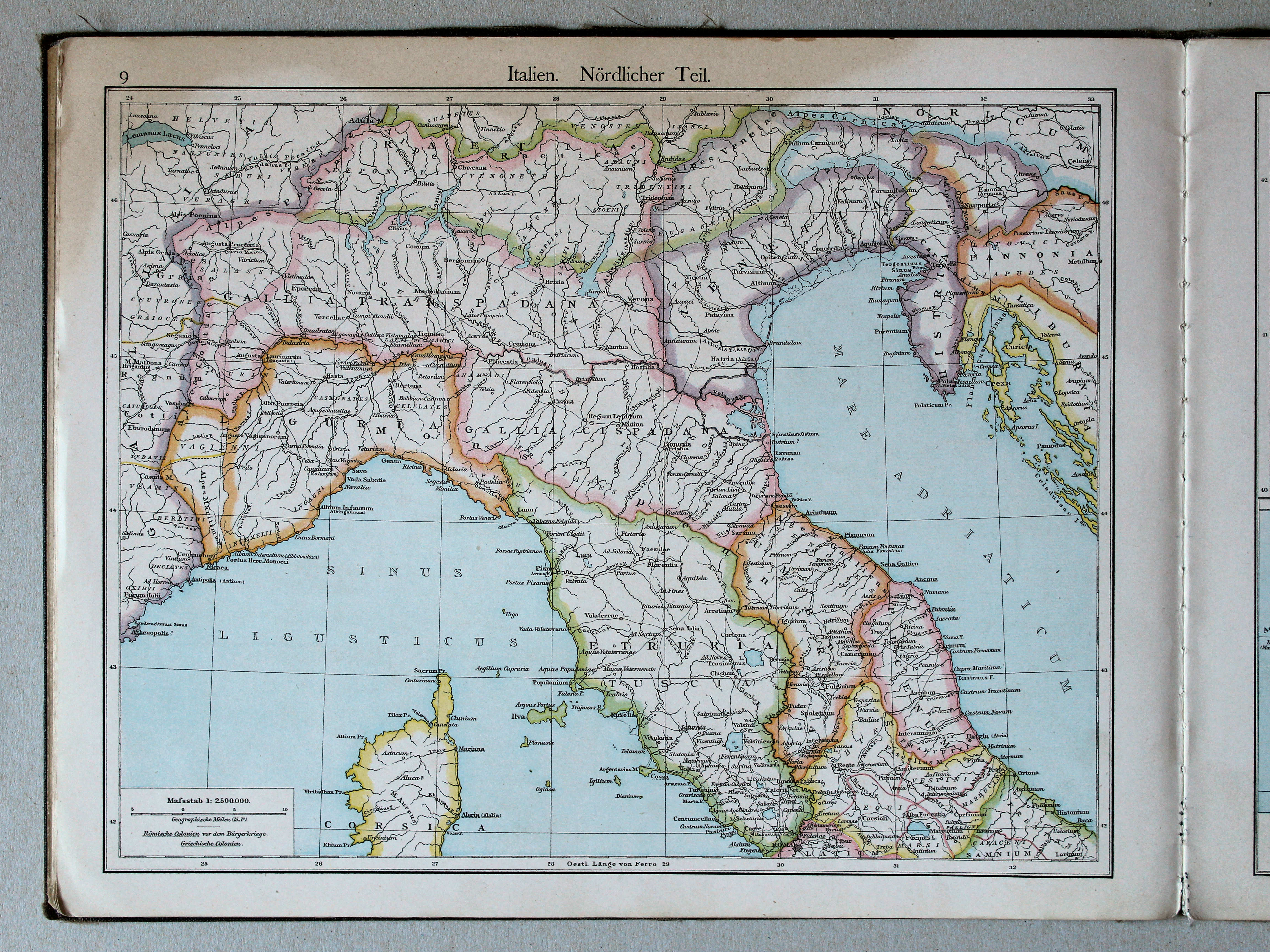
9. Italien. Nördlicher Teil XL
Italië. Noordelijk deel / Italy. Northern part
 Putzgers Historischer Schul-Atlas, 1888
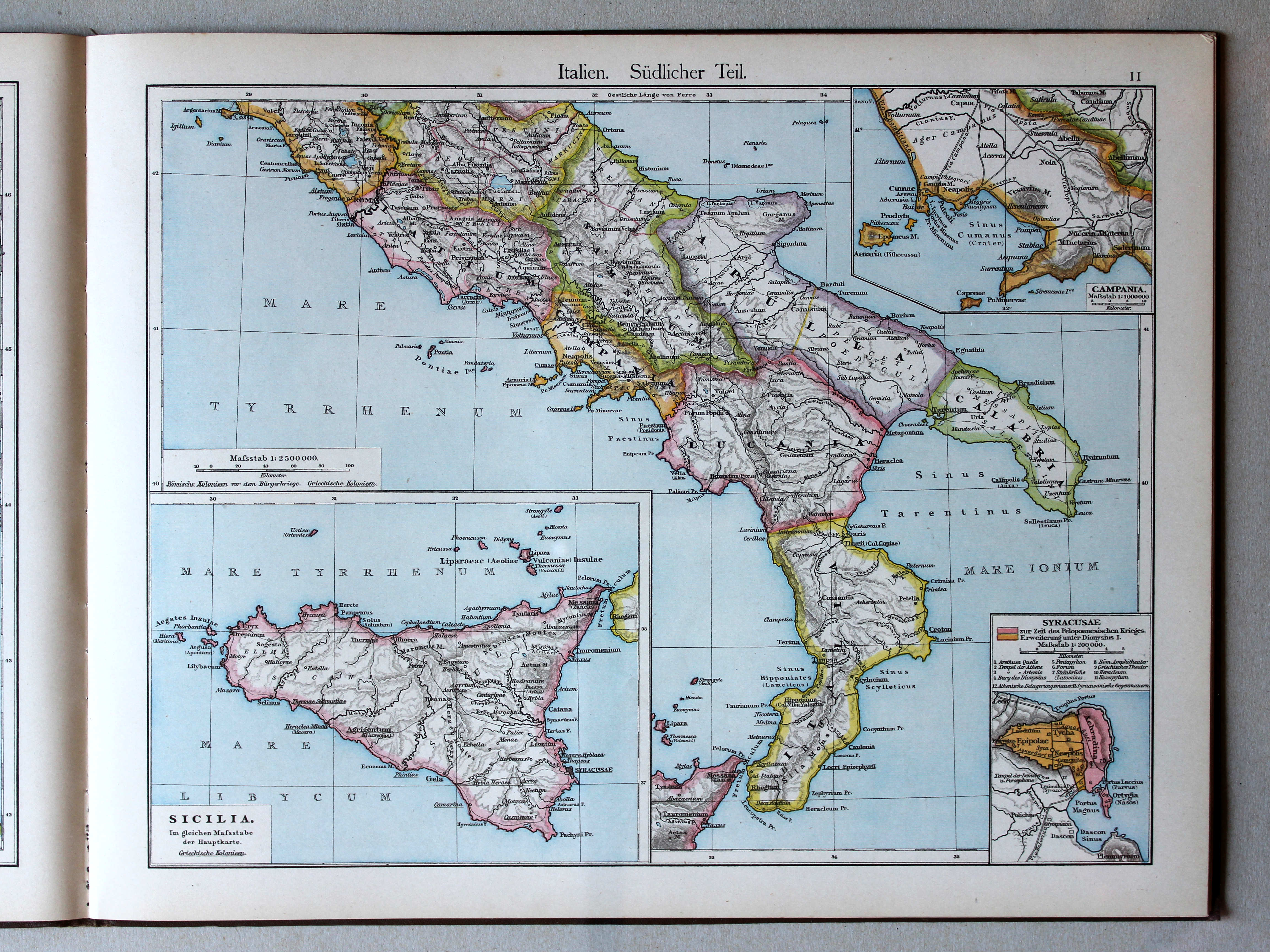
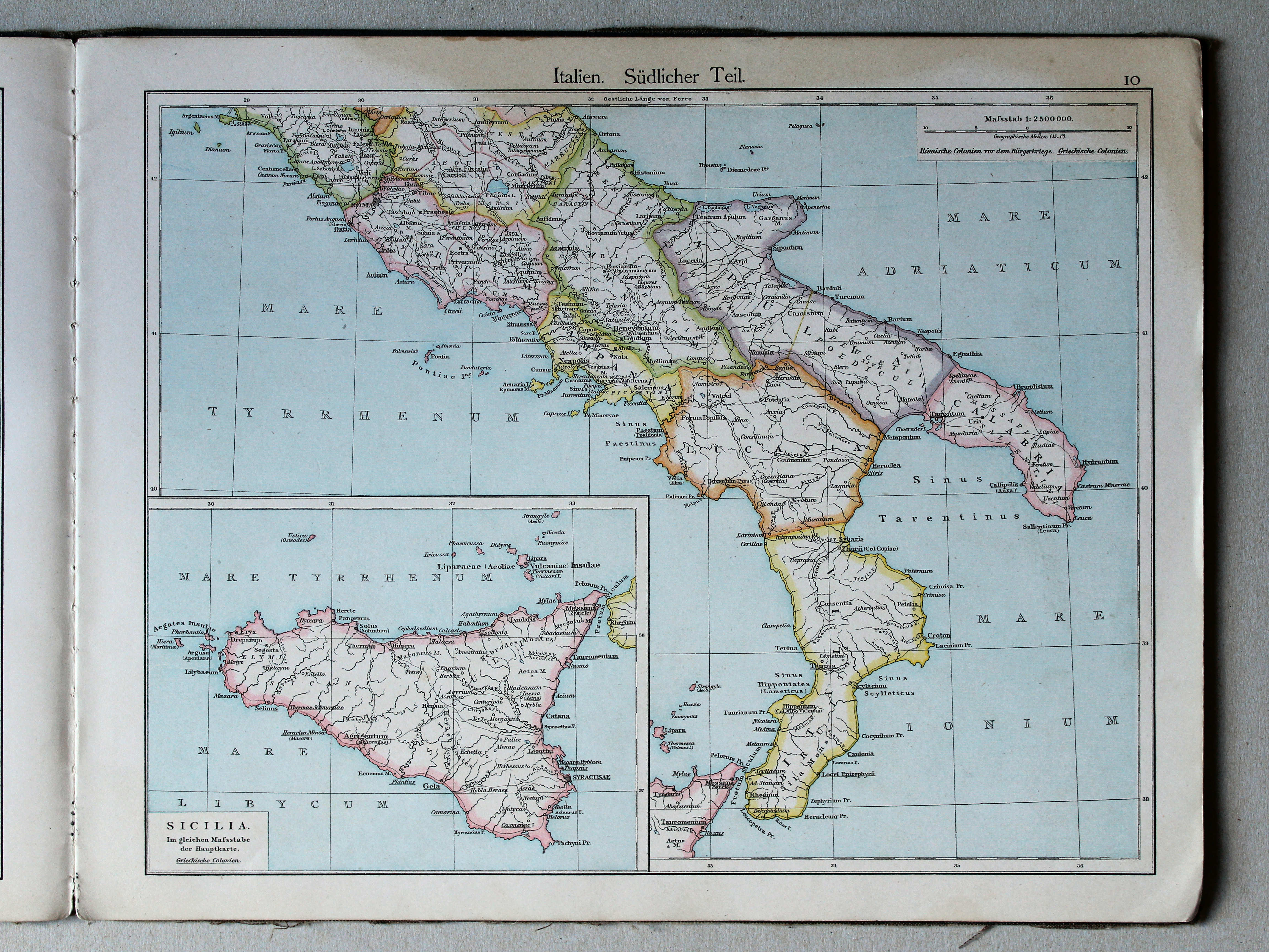
11. Italien. Südlicher Teil XL
Italië, zuidelijk deel / Italy, southern part
 Putzger's Historischer Schul-Atlas, 1887
10. Italien. Südlicher Teil XL
Italië. Zuidelijk deel / Italy. Southern part
Putzgers Historischer Schul-Atlas, 1888
geen overeenkomstige kaart / no corresponding map
 Putzger's Historischer Schul-Atlas, 1887
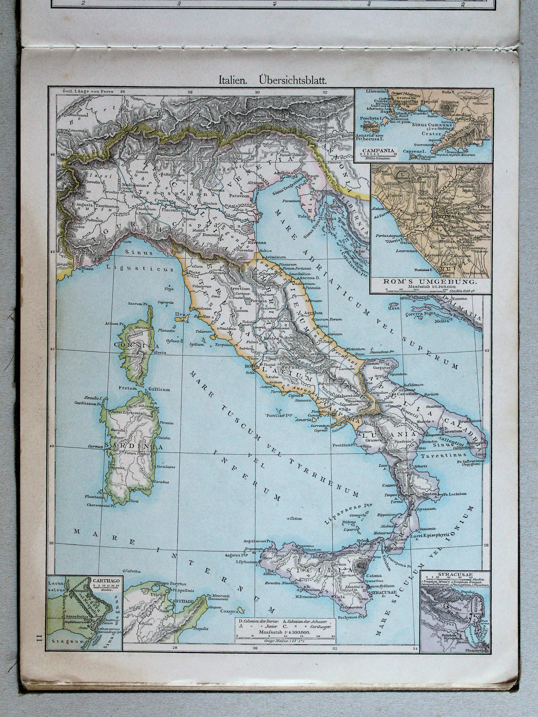
11. Italien. Übersichtsblatt XL
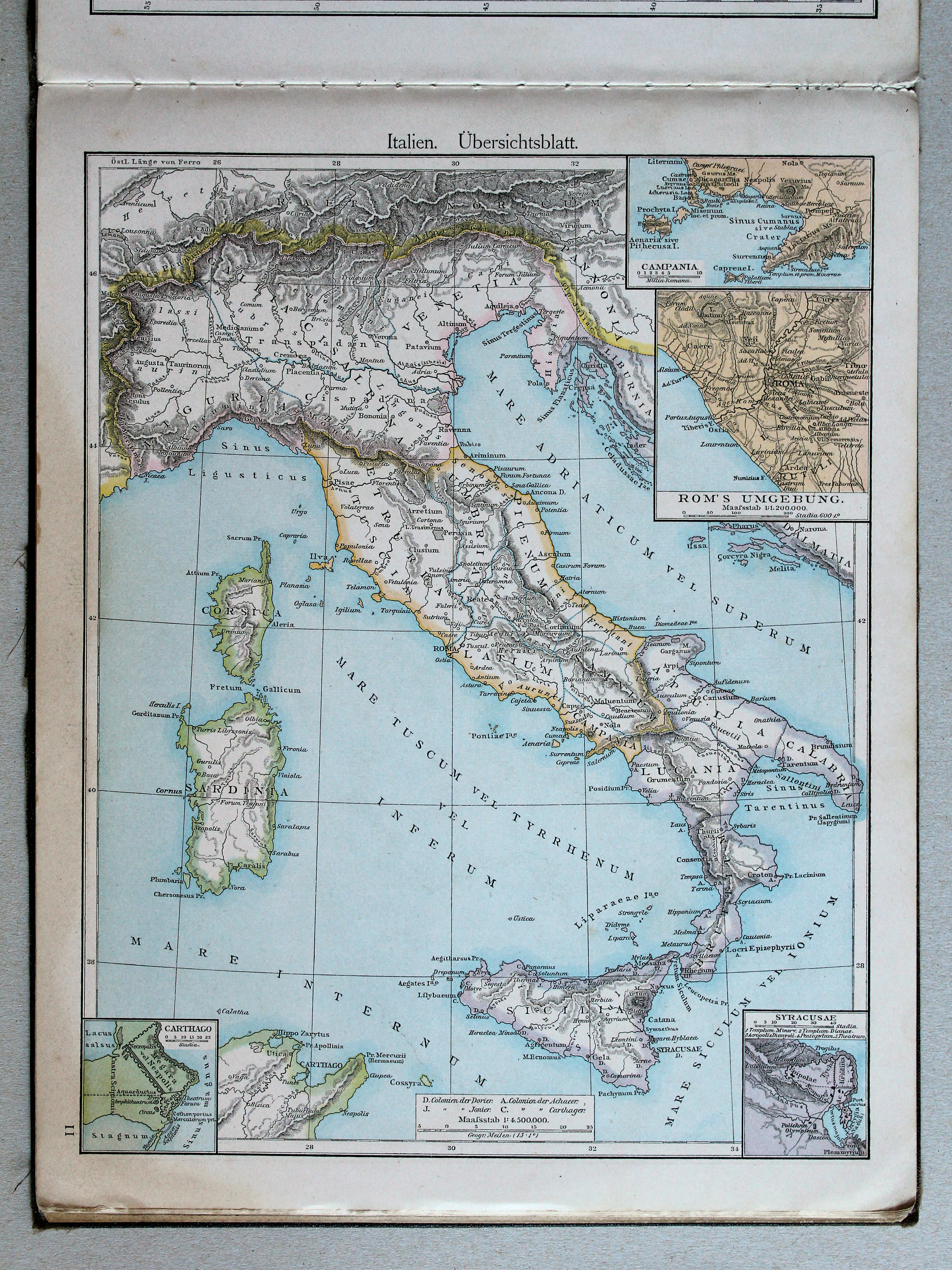
Italië. Overzichtskaart / Italy. General map
 Putzgers Historischer Schul-Atlas, 1888
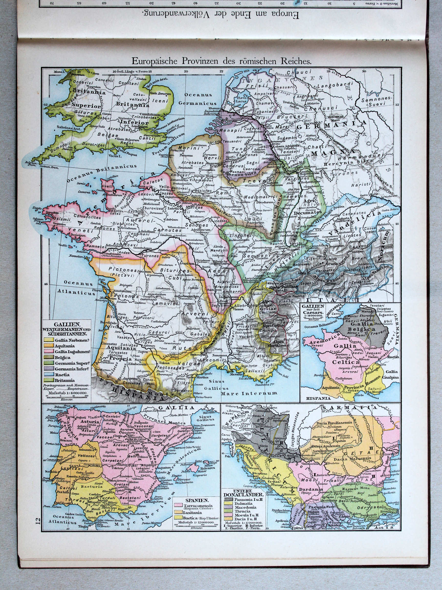
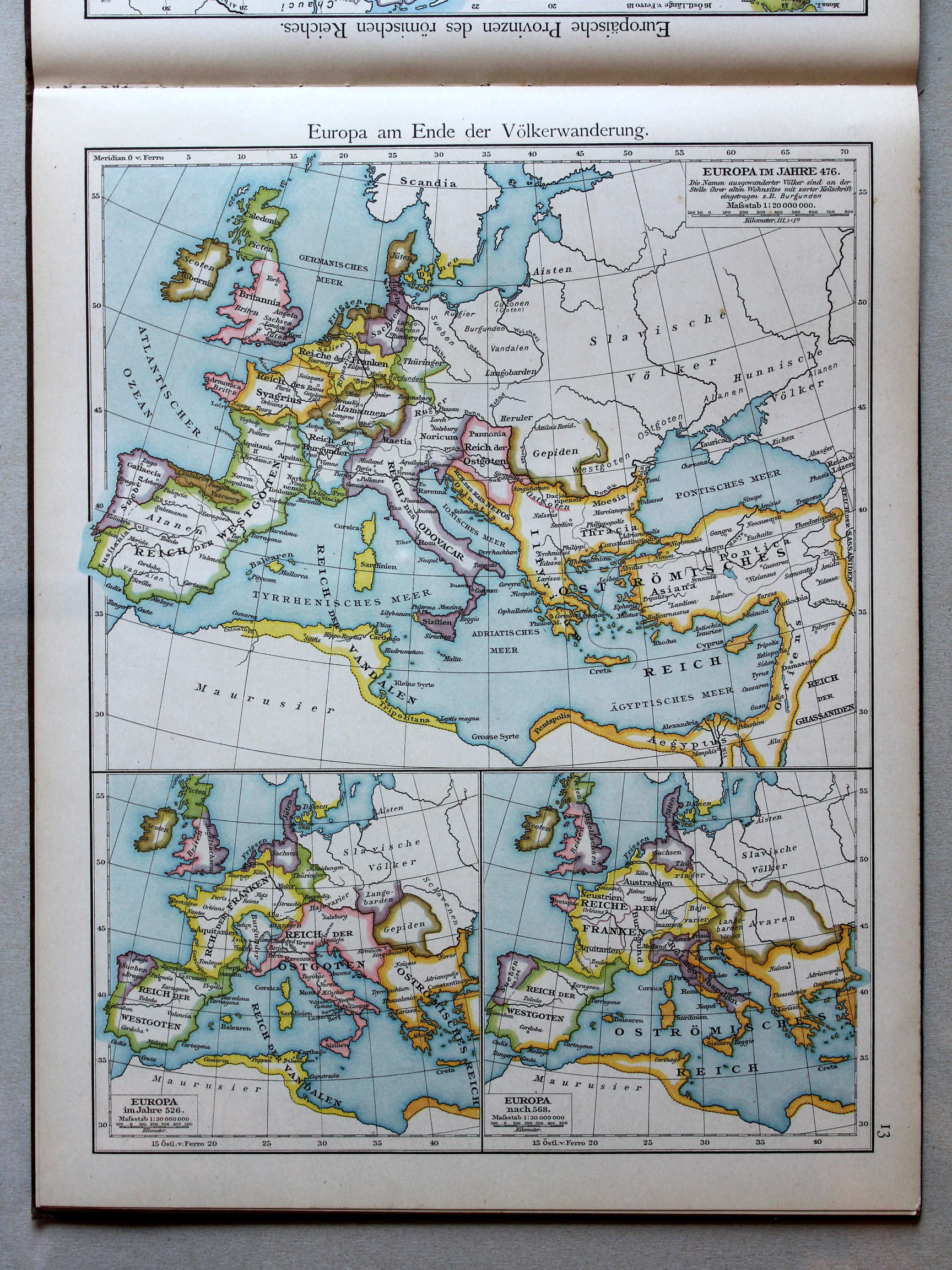
12. Europäische Provinzen des römischen Reiches XL
Europese provincies van het Romeinse Rijk / European provinces of the Roman Empire
 Putzger's Historischer Schul-Atlas, 1887
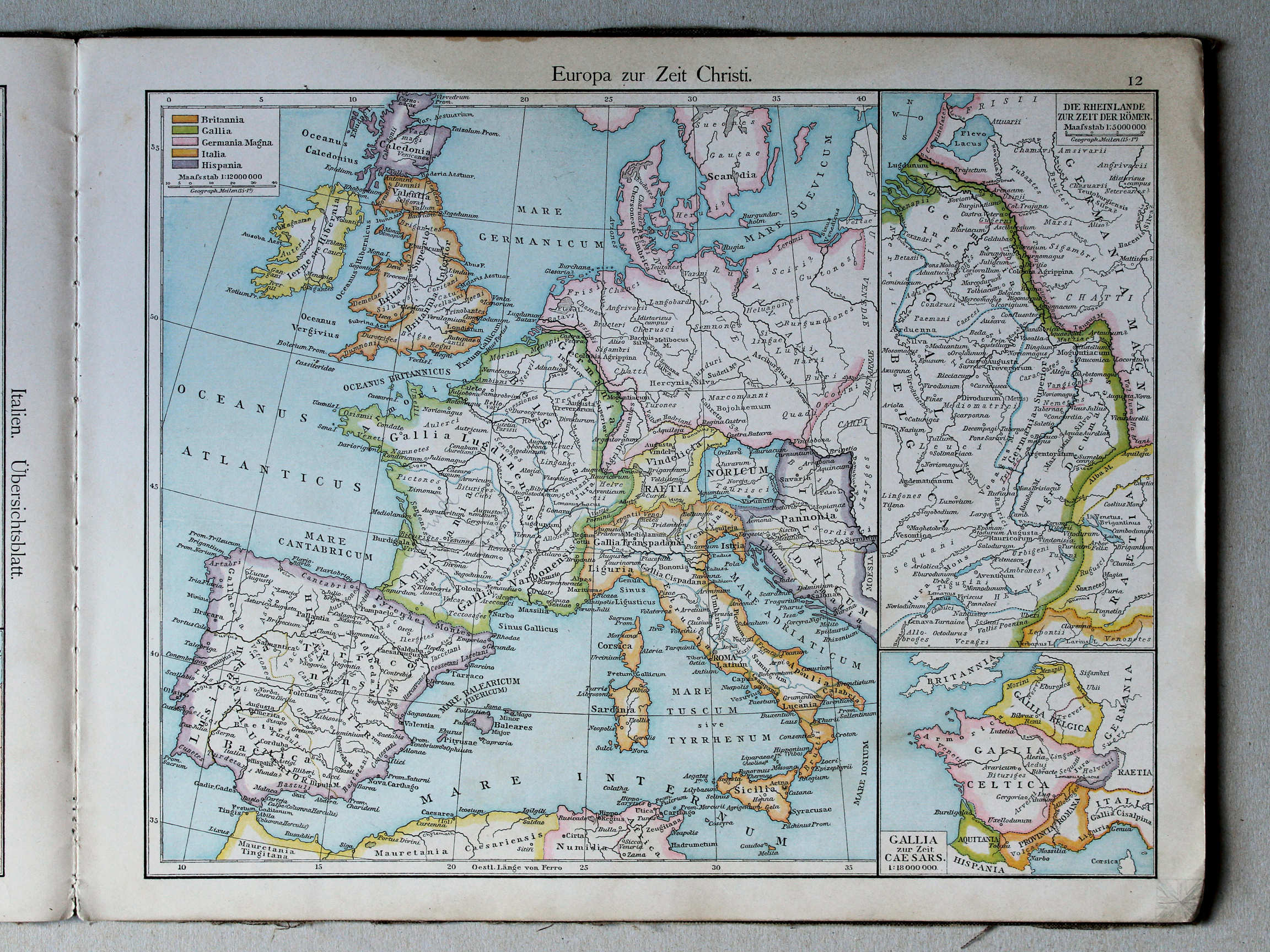
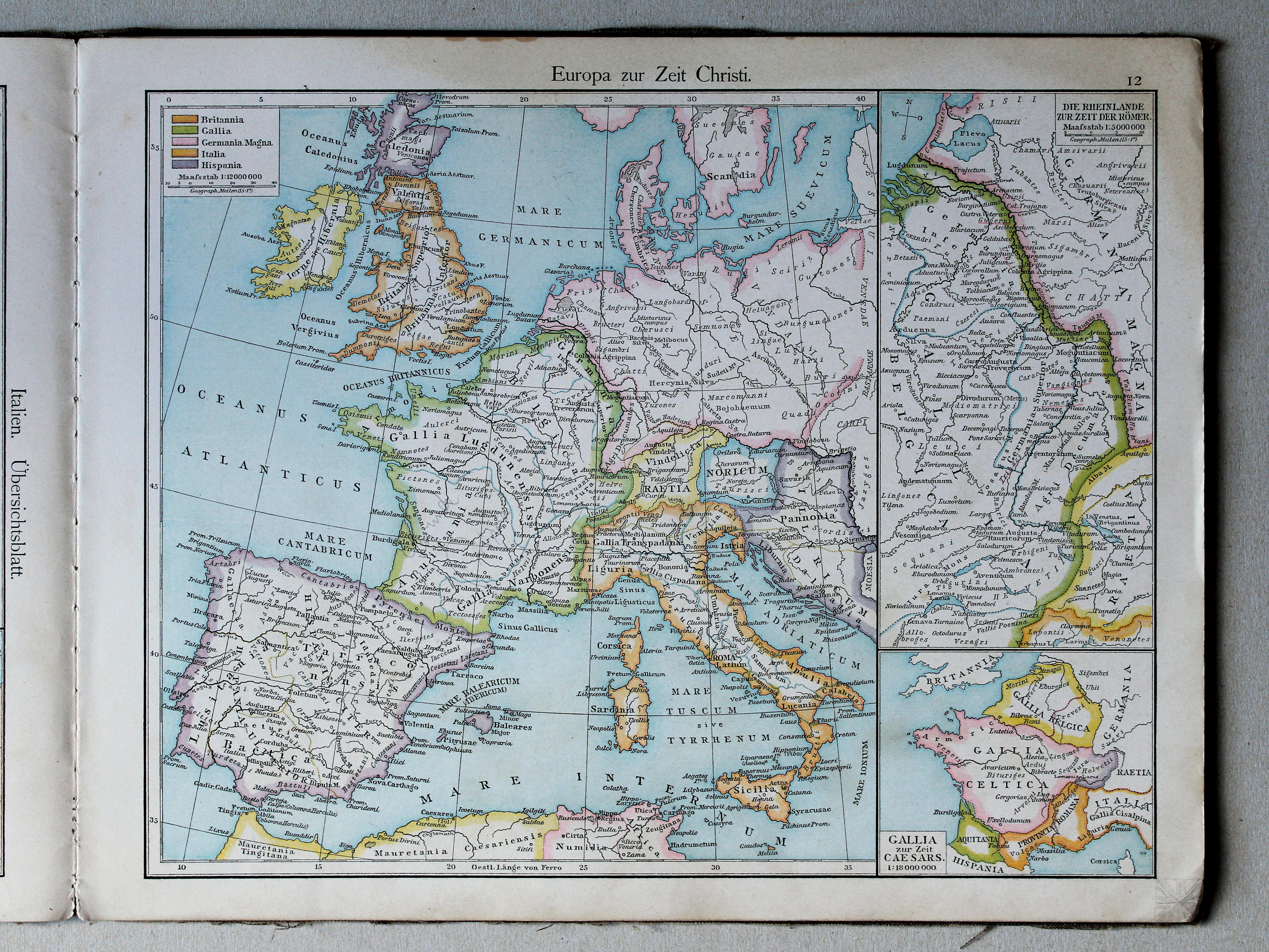
12. Europa zur Zeit Christi XL
Europa in de tijd van Christus / Europe in the era of Christ
(Middeleeuwen, Nieuwe Tijd / Middle Ages, modern history)
 Putzgers Historischer Schul-Atlas, 1888
13. Europa am Ende der Völkerwanderung XL
Europa aan het einde van de Volksverhuizing / Europe at the end of the Migration Period
 Putzger's Historischer Schul-Atlas, 1887
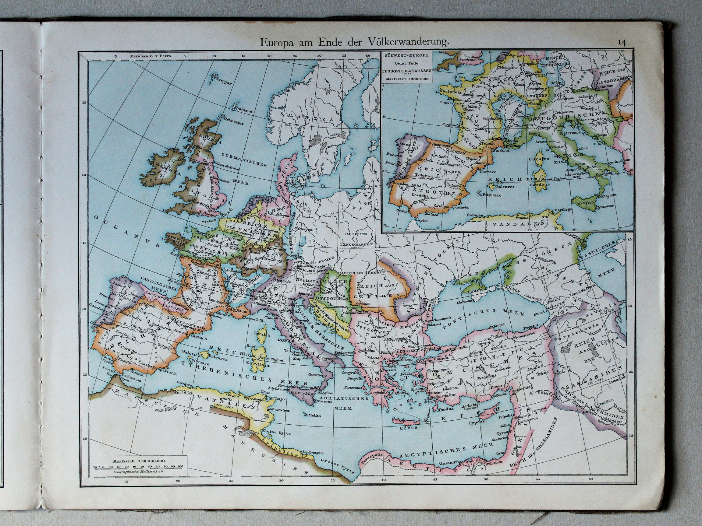
14. Europa am Ende der Völkerwanderung XL
Europa aan het einde van de Volksverhuizing / Europe at the end of the Migration Period
 Putzgers Historischer Schul-Atlas, 1888
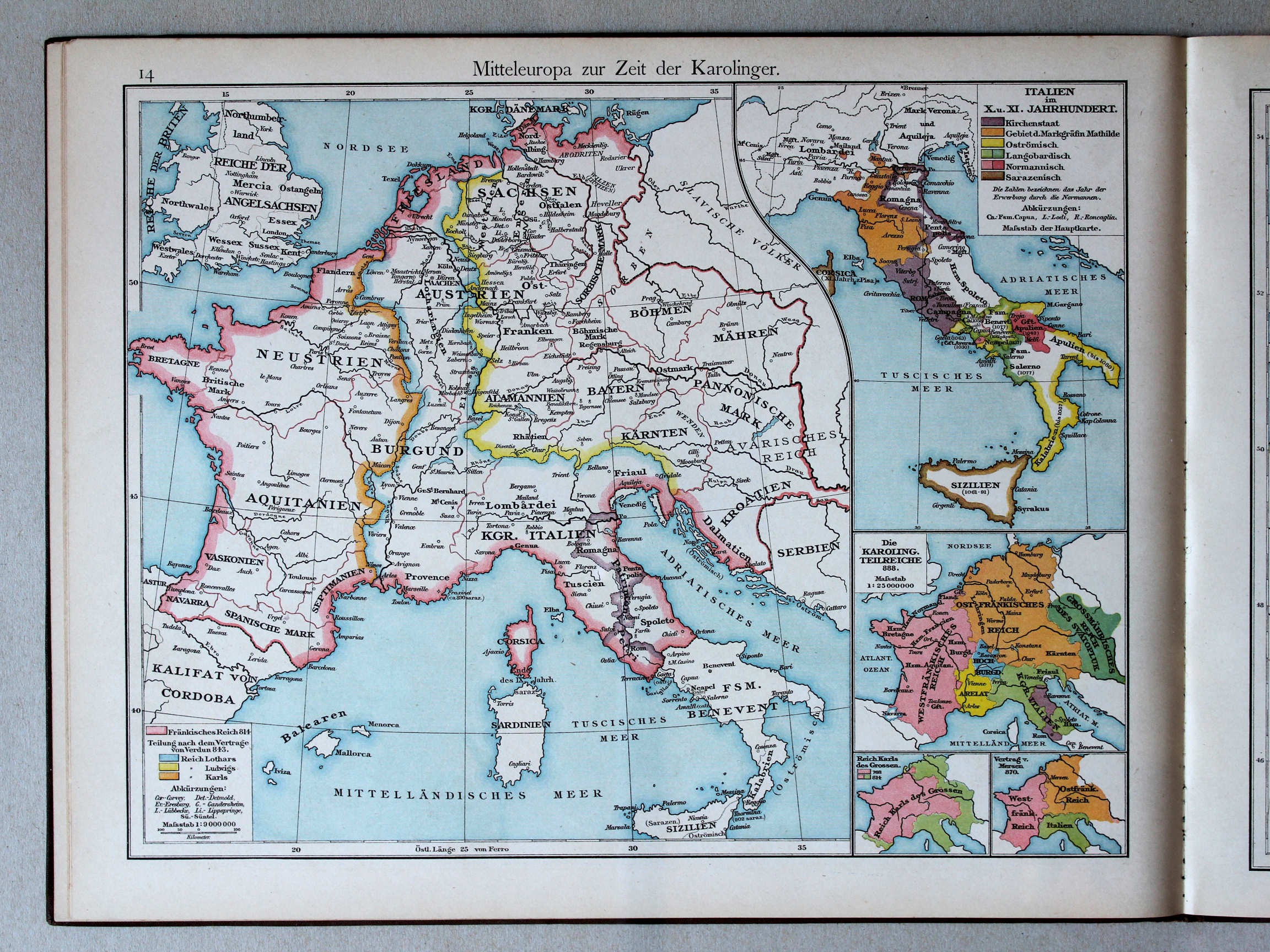
14. Mitteleuropa zur Zeit der Karolinger XL
Midden-Europa in de tijd van de Karolingen / Central Europe during the Carolingian dynasty
 Putzger's Historischer Schul-Atlas, 1887
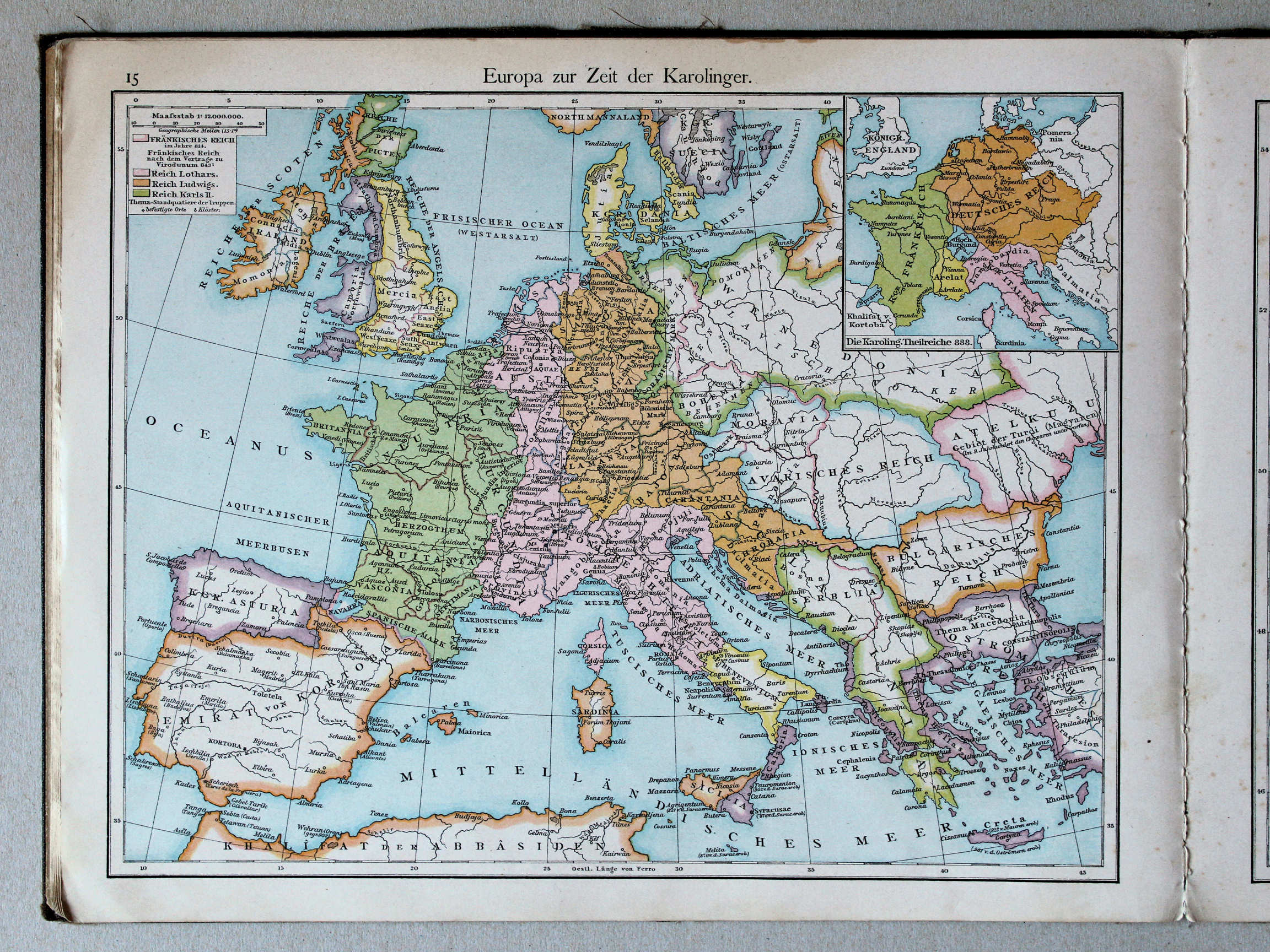
15. Europa zur Zeit der Karolinger XL
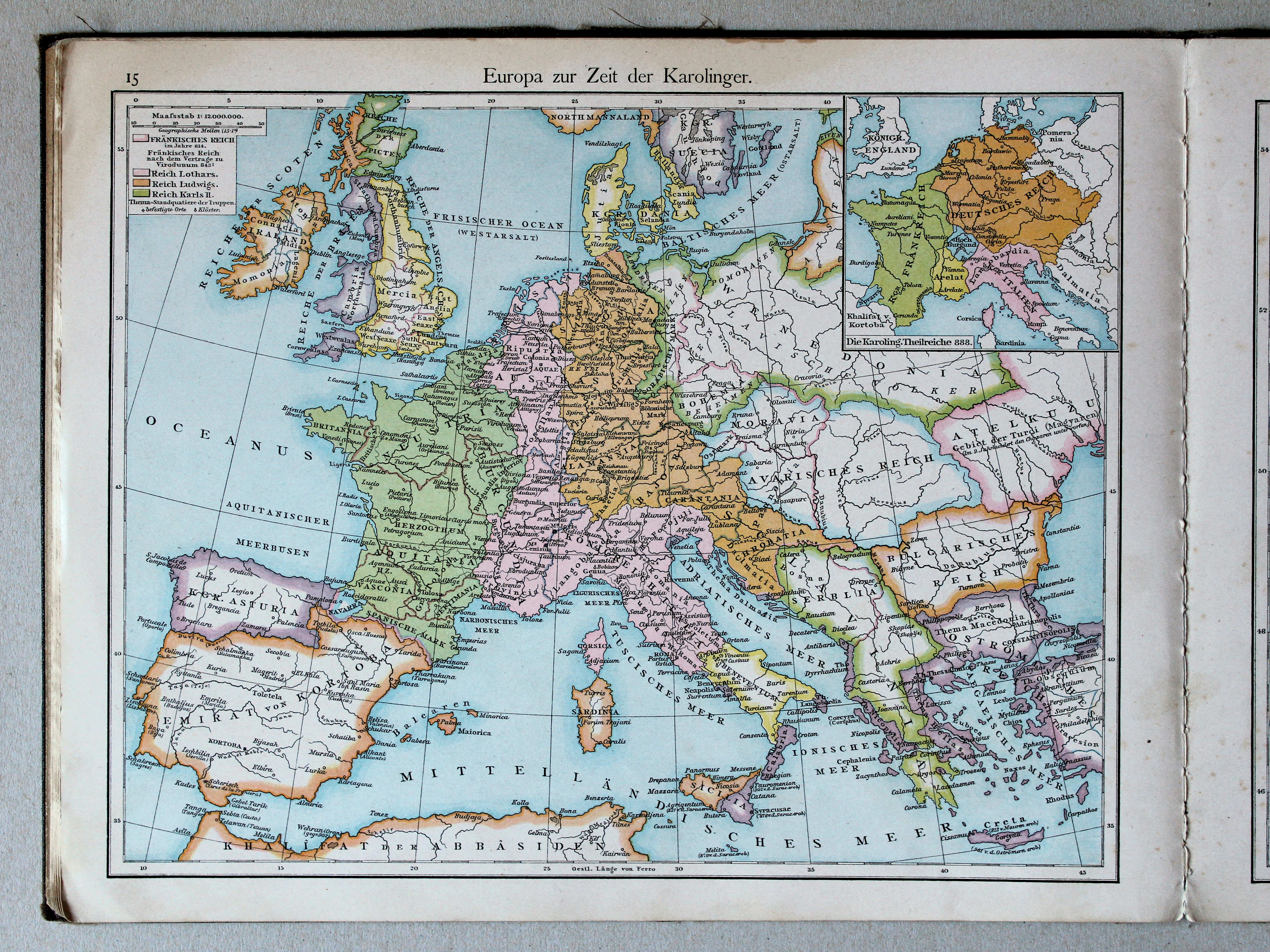
Europa in de tijd van de Karolingen / Europe during the Carolingian dynasty
 Putzgers Historischer Schul-Atlas, 1888
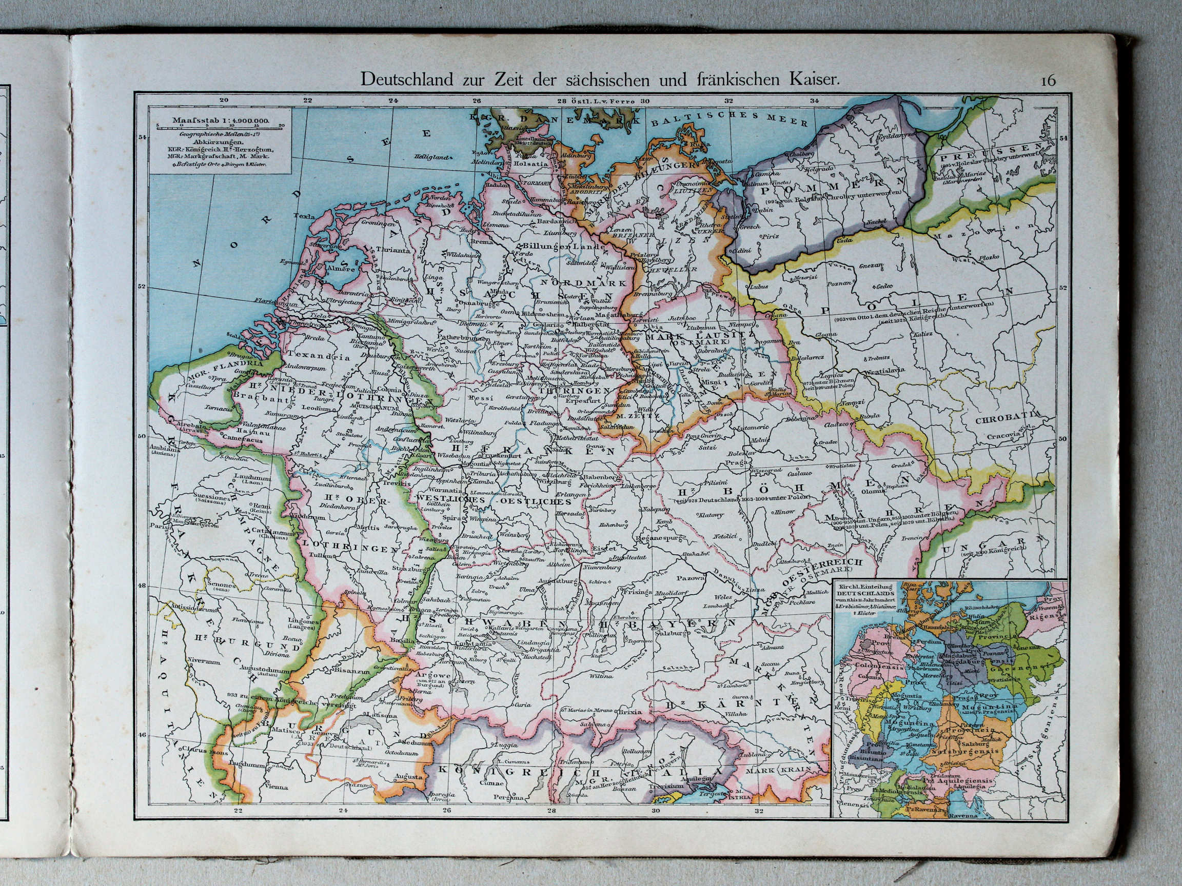
15. Deutschland zur Zeit der sächsischen und fränkischen Kaiser XL
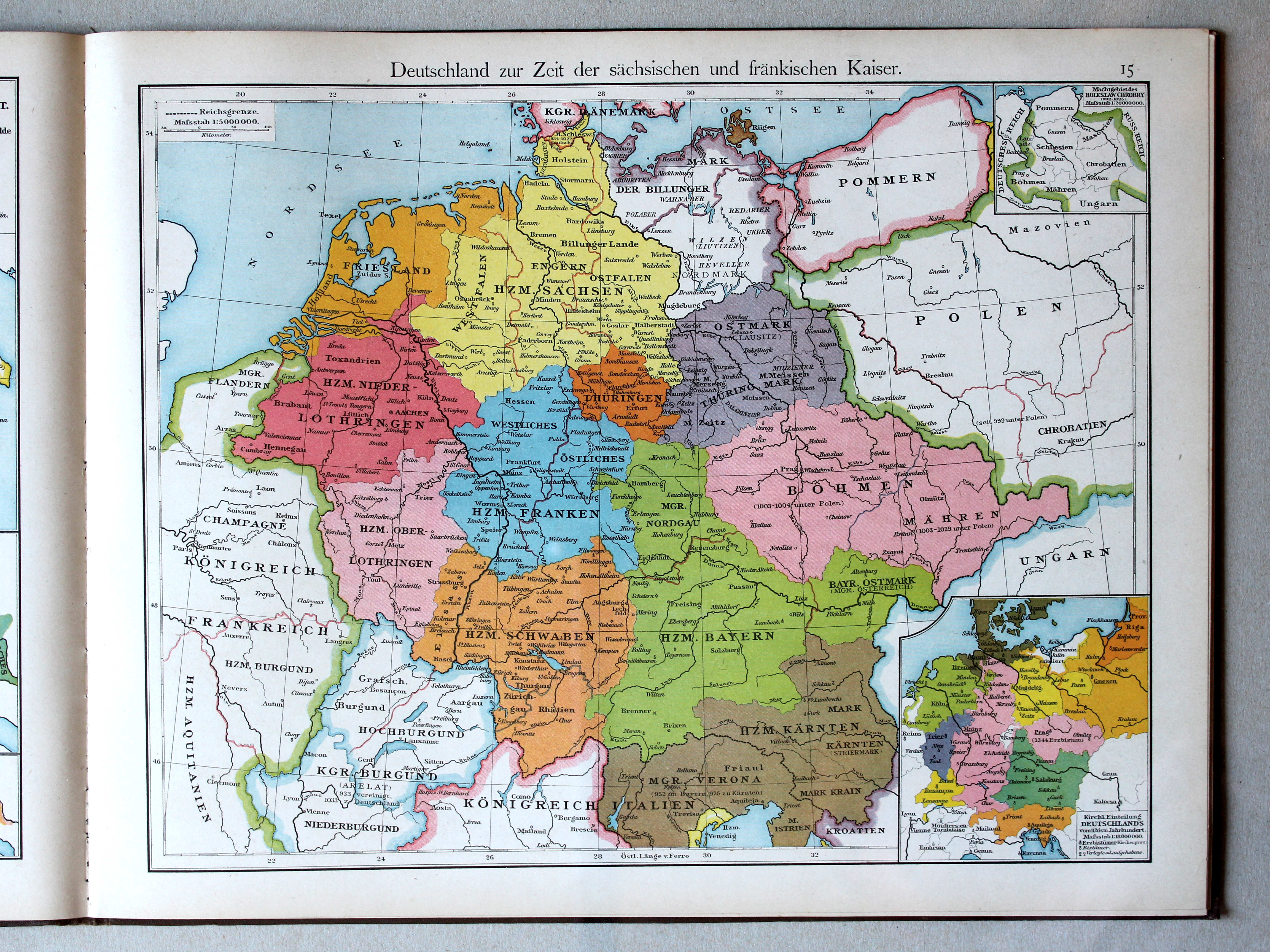
Duitsland in de tijd van de Saksische en Frankische keizers / Germany during the Saxon and Frankish dynasties
 Putzger's Historischer Schul-Atlas, 1887
16. Deutschland zur Zeit der sächsischen und fränkischen Kaiser XL
Duitsland in de tijd van de Saksische en Frankische keizers / Germany during the Saxon and Frankish dynasties
 Putzgers Historischer Schul-Atlas, 1888
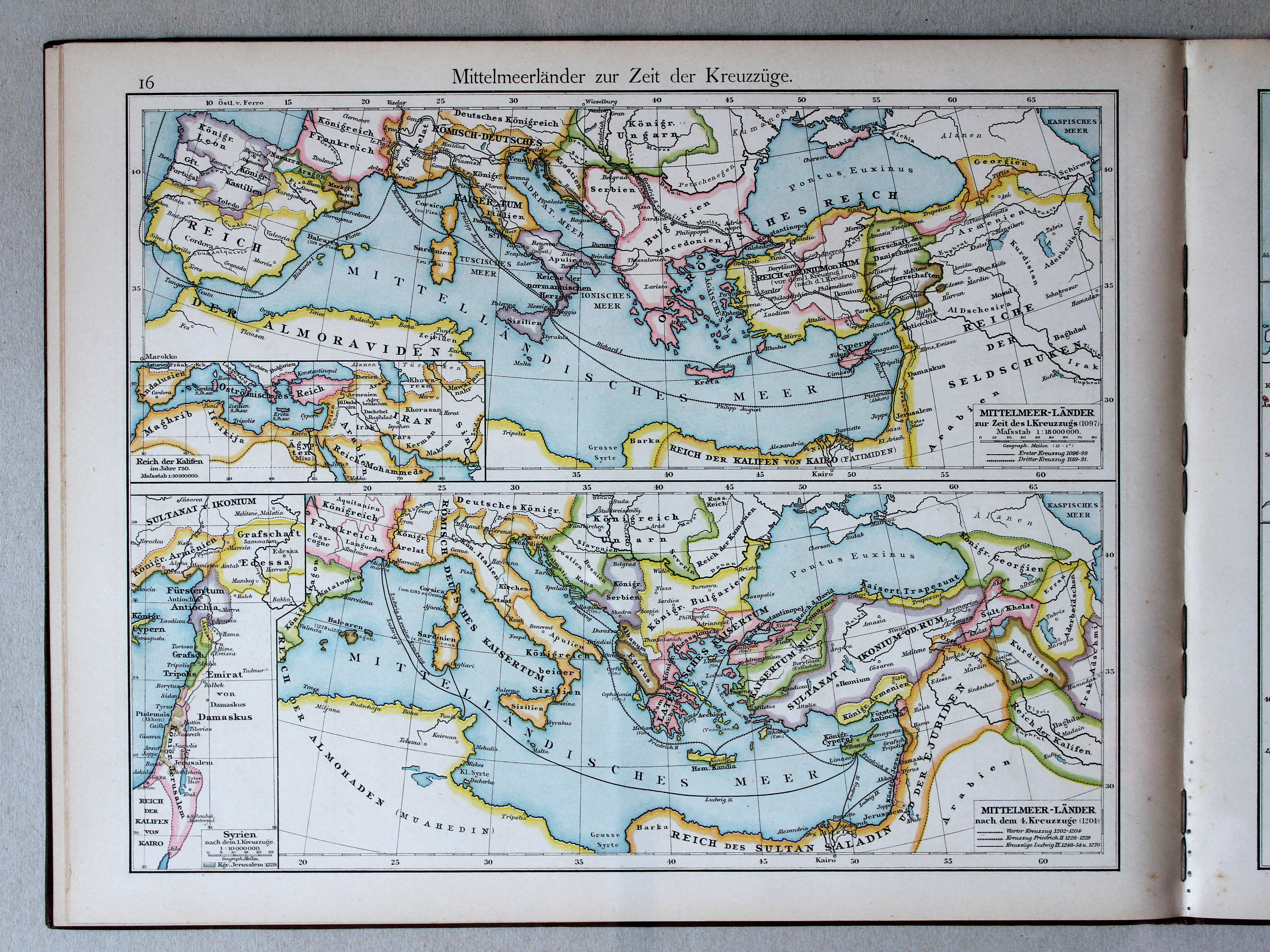
16. Mittelmeerländer zur Zeit der Kreuzzüge XL
Het Middellandse Zeegebied in de tijd van de Kruistochten / The Mediterranean region during the Crusades
 Putzger's Historischer Schul-Atlas, 1887
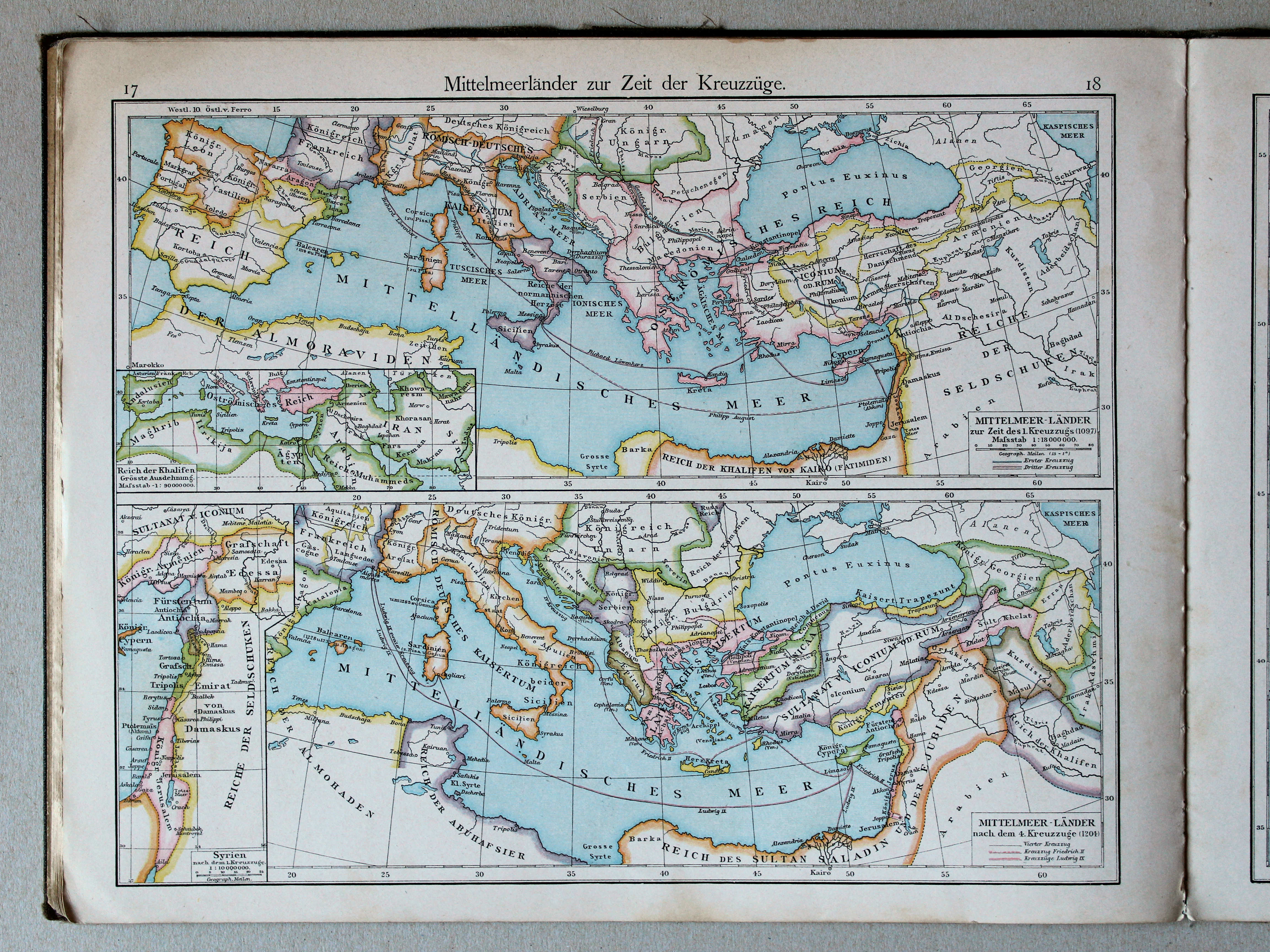
17.18. Mittelmeerländer zur Zeit der Kreuzzüge XL
Het Middellandse Zeegebied in de tijd van de Kruistochten / The Mediterranean region during the Crusades
 Putzgers Historischer Schul-Atlas, 1888
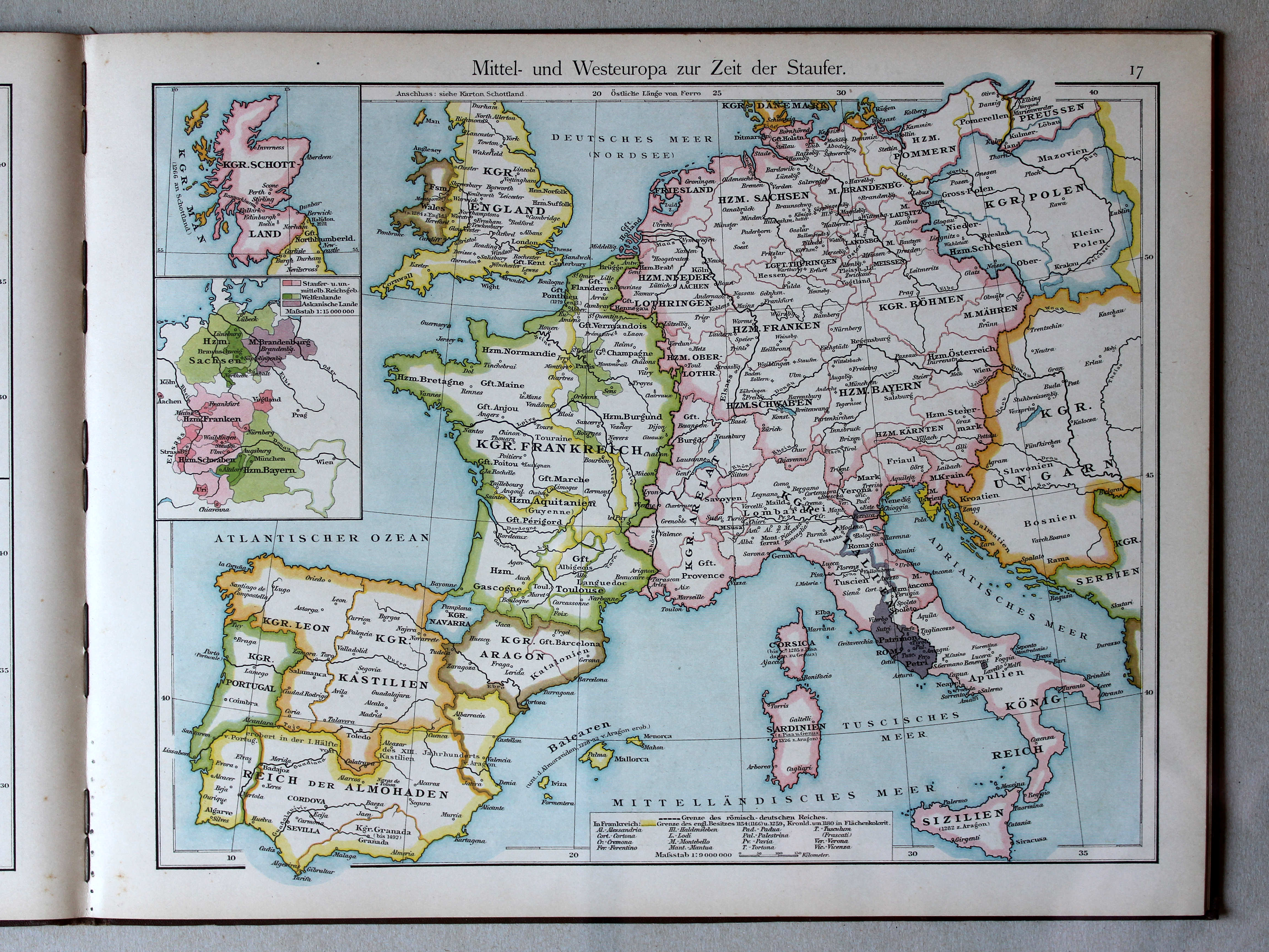
17. Mittel- und Westeuropa zur Zeit der Staufer XL
Midden- en West-Europa in de tijd van de Hohenstaufen / Central and Western Europe during the House of Hohenstaufen
 Putzger's Historischer Schul-Atlas, 1887
19. Europa zur Zeit der Hohenstaufen XL
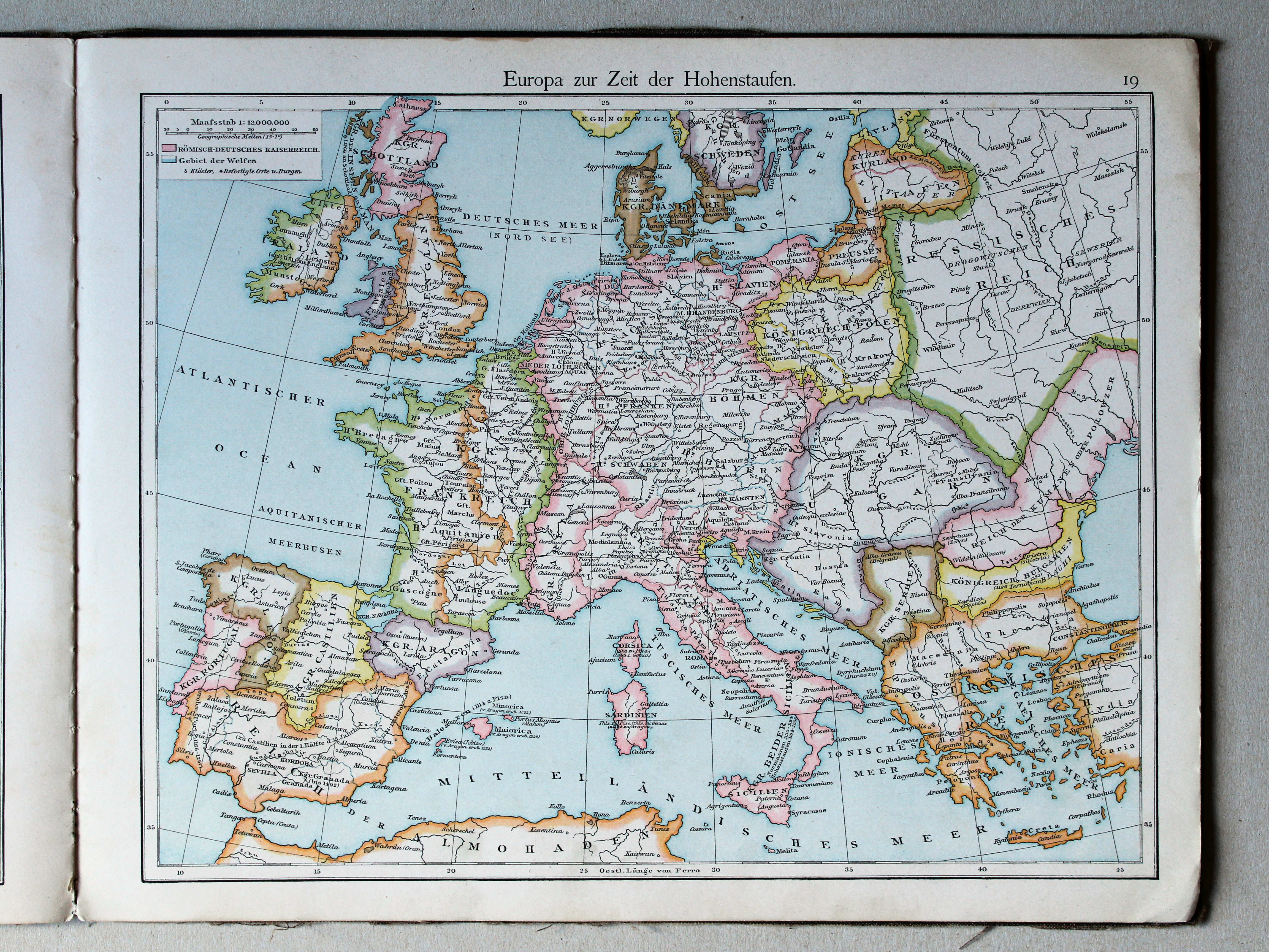
Europa in de tijd van de Hohenstaufen / Europe during the House of Hohenstaufen
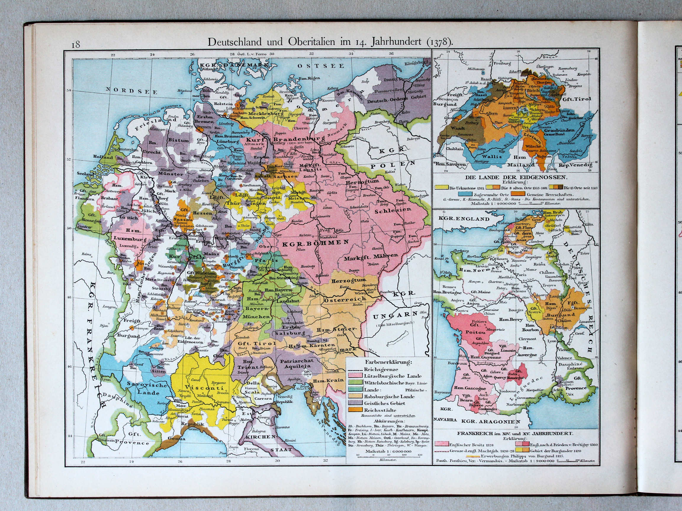 Putzgers Historischer Schul-Atlas, 1888
18. Deutschland und Oberitalien im 14. Jahrhundert (1378) XL
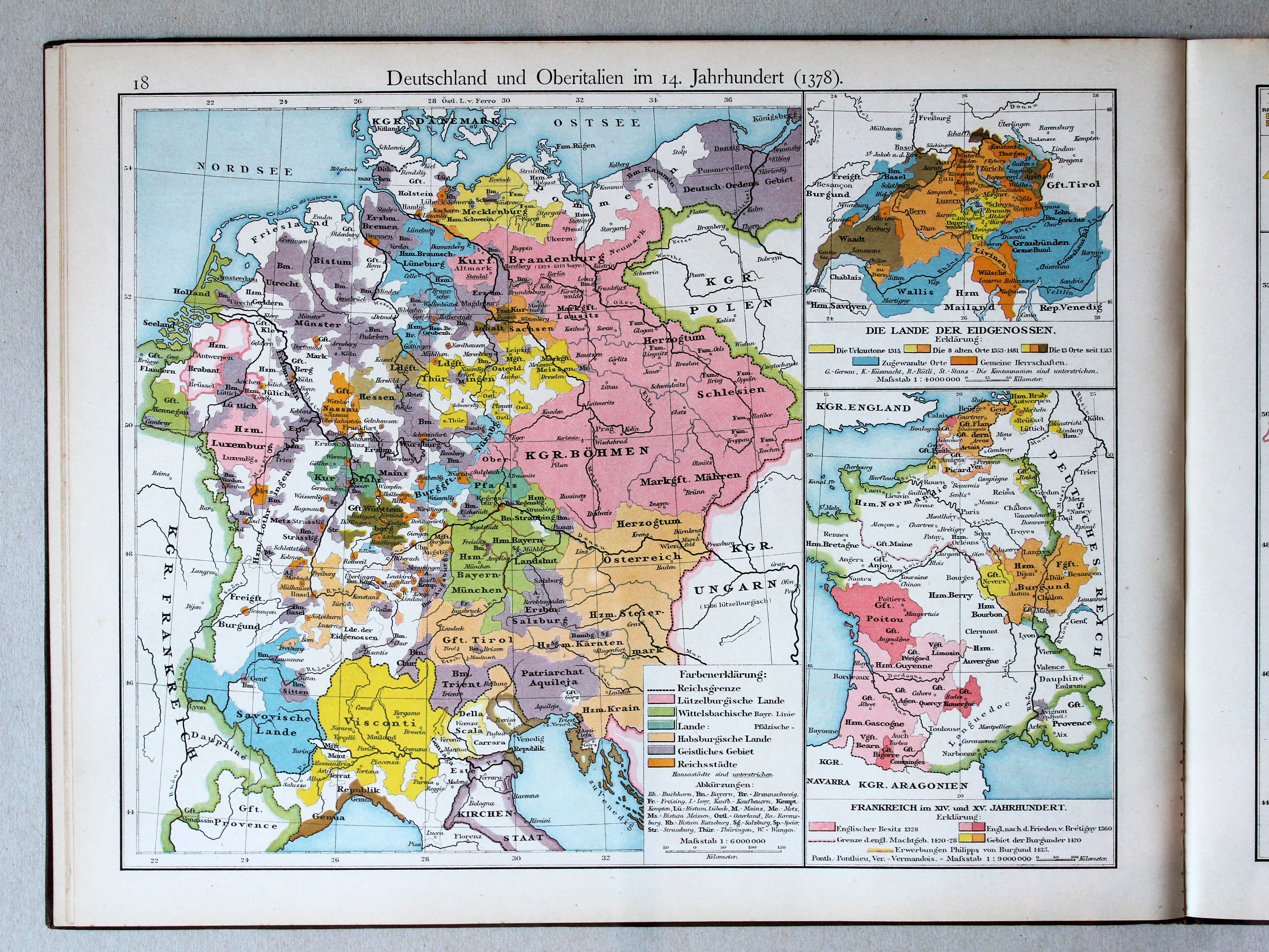
Duitsland en Noord-Italië in de 14e eeuw (1378) / Germany and Northern Italy in the 14th century (1378)
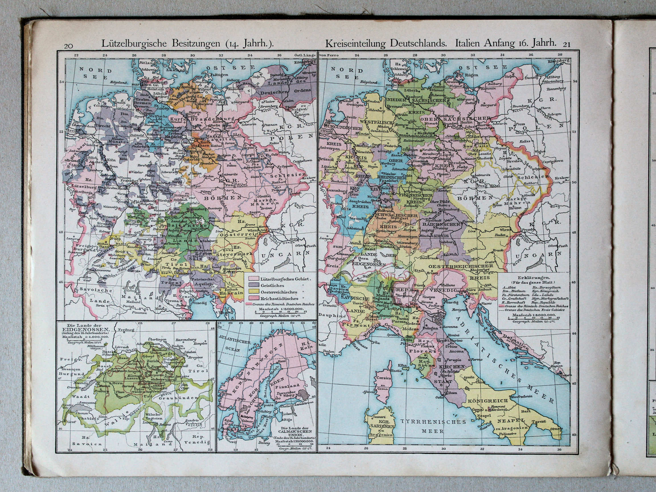 Putzger's Historischer Schul-Atlas, 1887
20. Lützelburgische Besitzungen (14. Jahrhundert) XL
Bezittingen van de Lützelburgers (14e eeuw) / Possessions of the House of Lützelburg (14th century)
21. Kreiseinteilung Deutschlands. Italien Anfang 16. Jahrhunderts XL
Verdeling van Duitsland in kreitsen. Italië aan het begin van de 16e eeuw / Subdivision of Germany in Imperial Circles. Italy at the beginning of the 16th century
 Putzgers Historischer Schul-Atlas, 1888
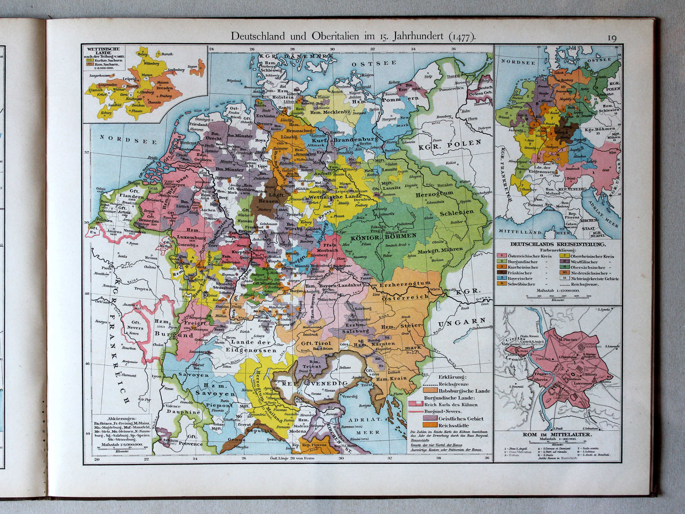
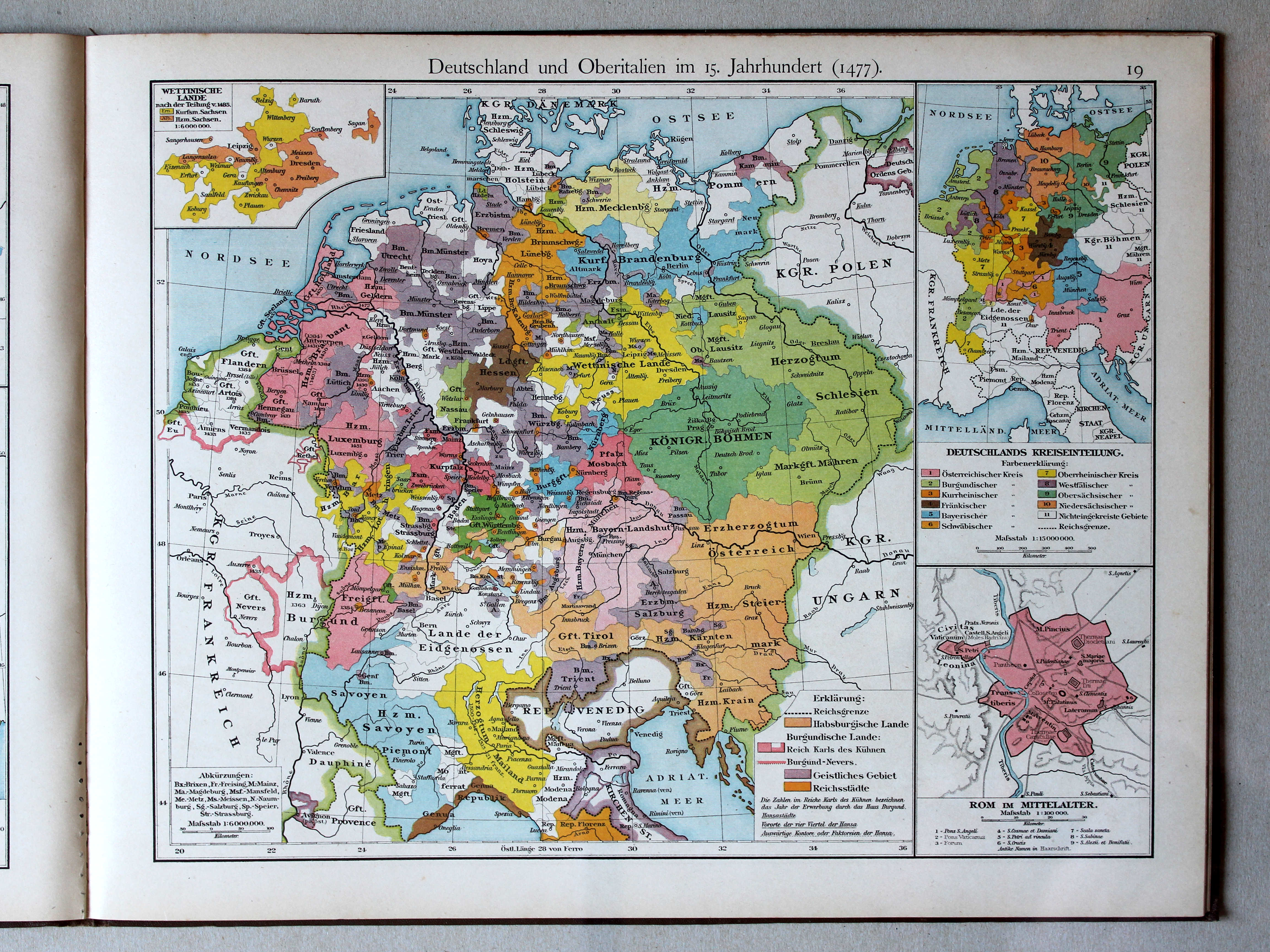
19. Deutschland und Oberitalien im 15. Jahrhundert (1477) XL
Duitsland en Noord-Italië in de 15e eeuw (1477) / Germany and Northern Italy in the 15th century (1477)
Putzger's Historischer Schul-Atlas, 1887
geen overeenkomstige kaart / no corresponding map
 Putzgers Historischer Schul-Atlas, 1888
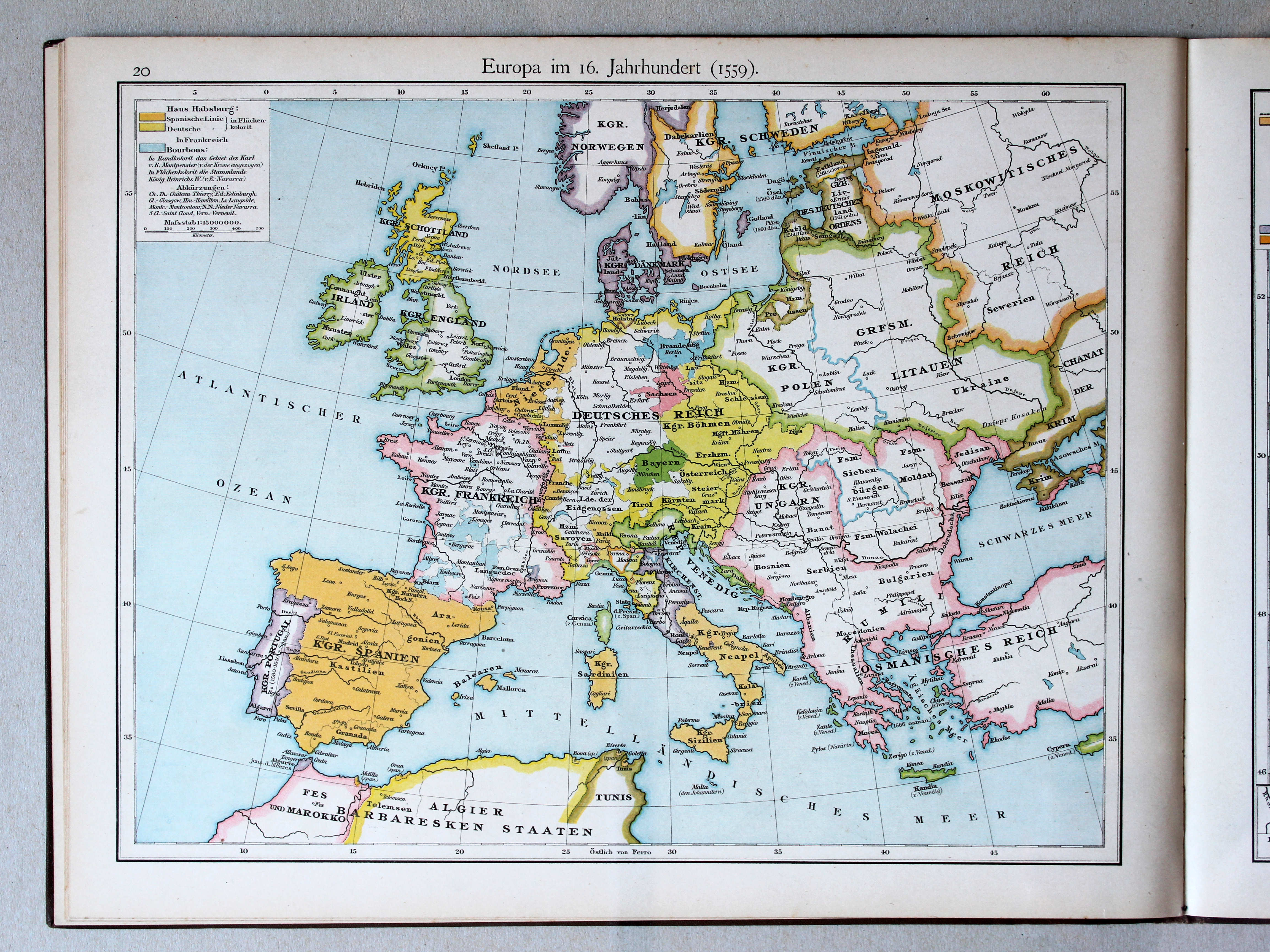
20. Europa im 16. Jahrhundert (1559) XL
Europa in de 16e eeuw (1559) / Europe in the 16th century (1559)
 Putzger's Historischer Schul-Atlas, 1887
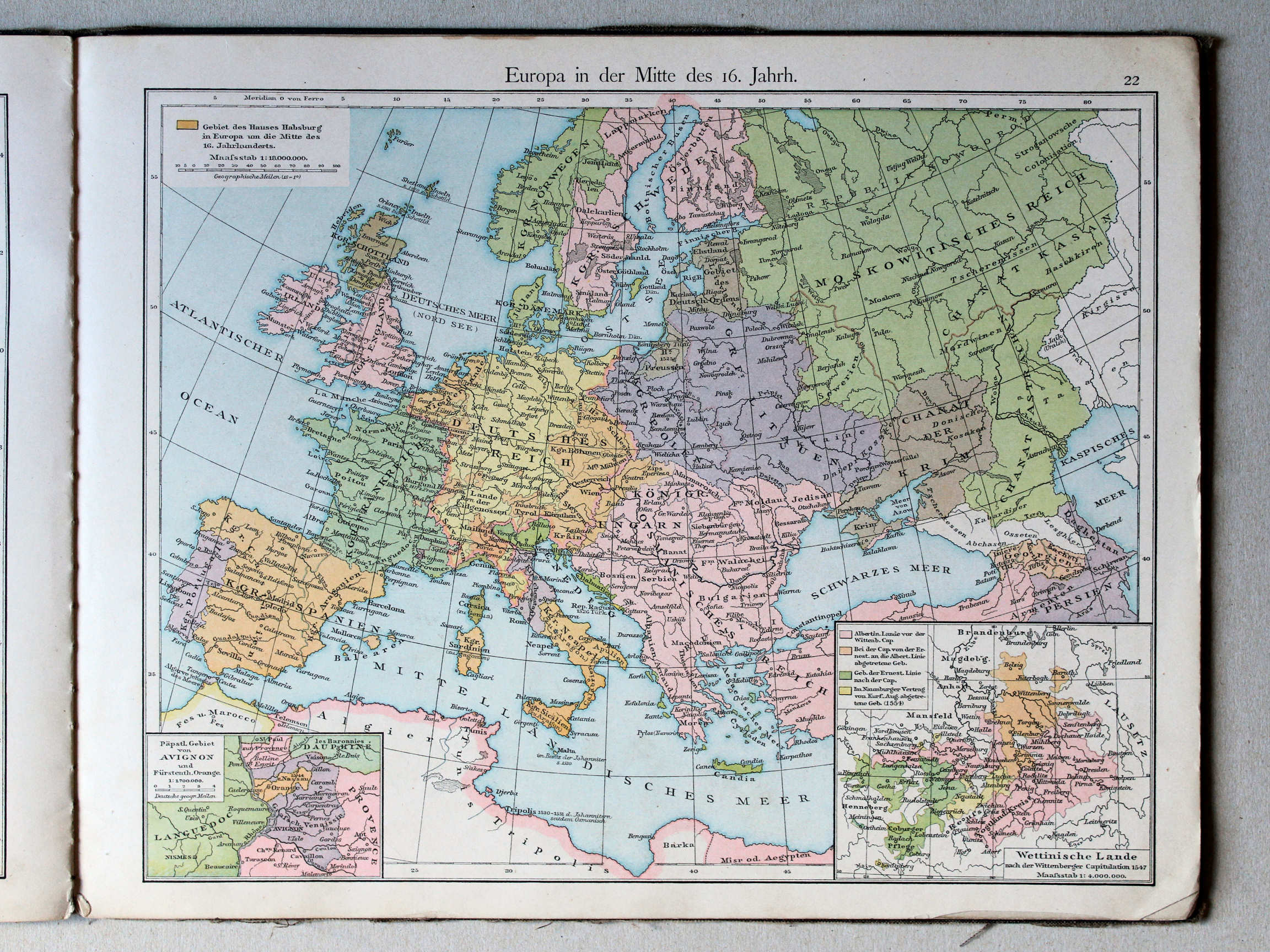
22. Europa in der Mitte des 16. Jahrhunderts XL
Europa halverwege de 16e eeuw / Europe halfway the 16th century
 Putzgers Historischer Schul-Atlas, 1888
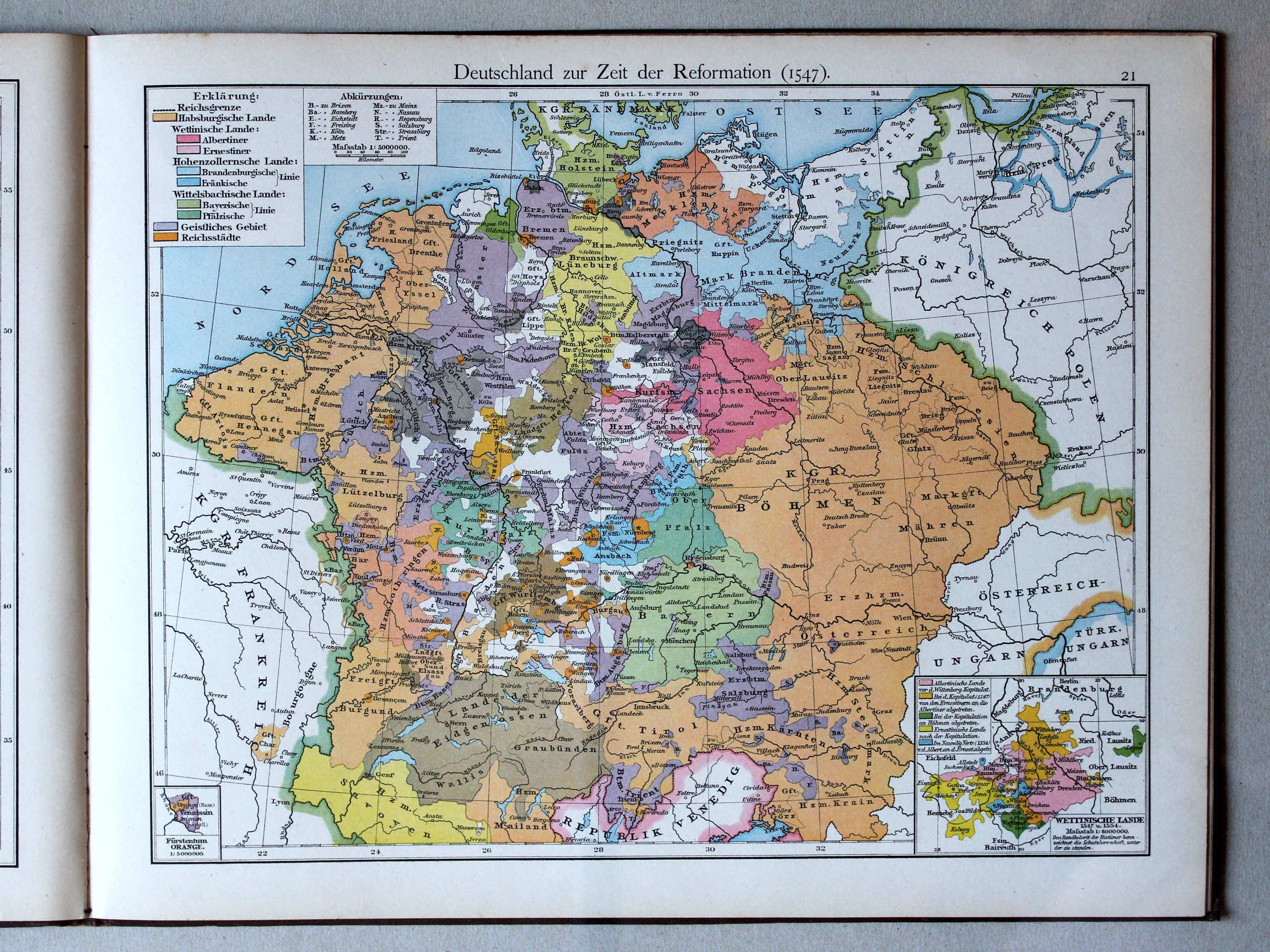
21. Deutschland zur Zeit der Reformation (1547) XL
Duitsland in de tijd van de Reformatie (1547) / Germany during the Protestant Reformation (1547)
 Putzger's Historischer Schul-Atlas, 1887
23. Deutschland zur Reformationszeit XL
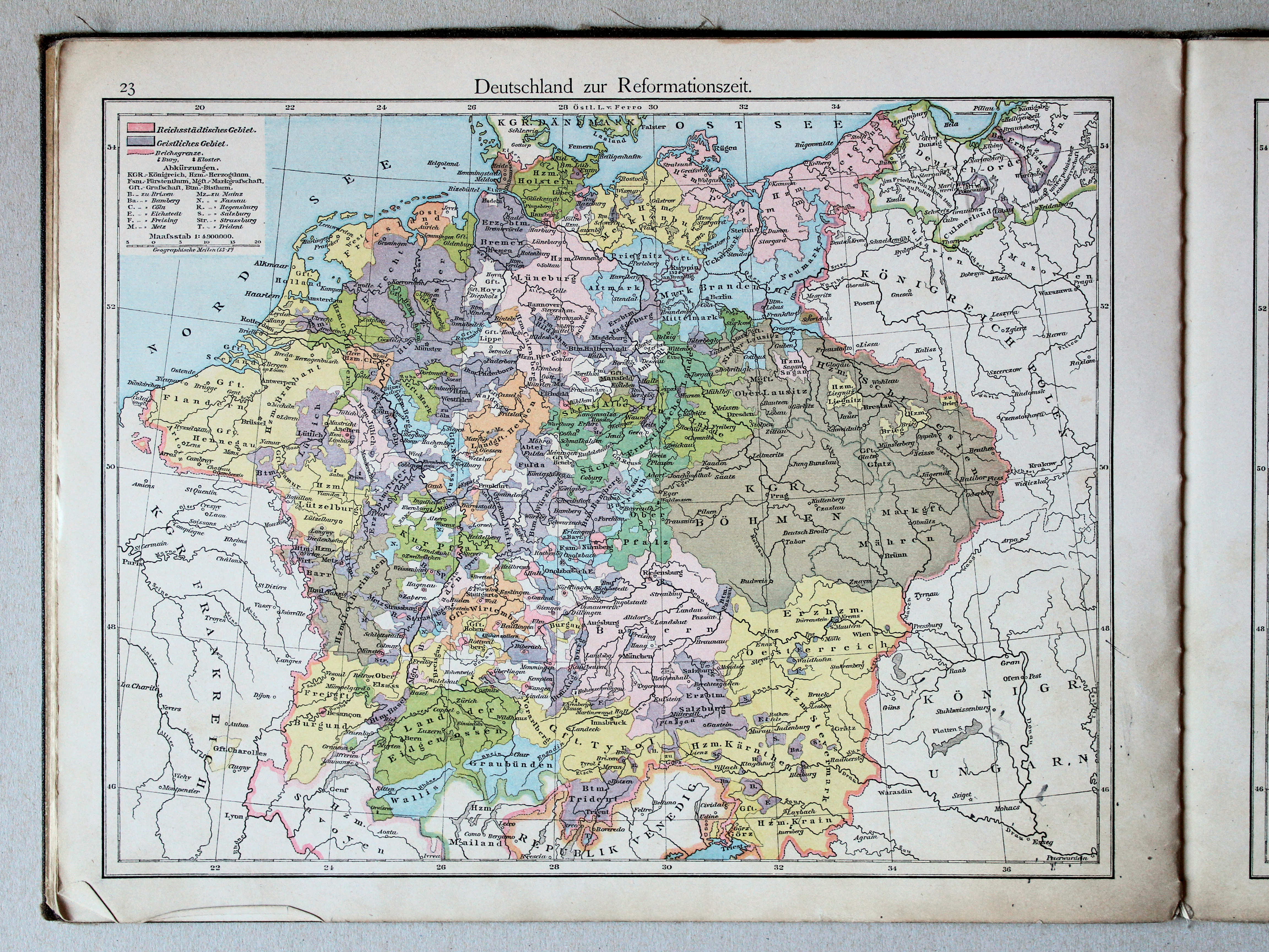
Duitsland in de tijd van de Reformatie / Germany during the Protestant Reformation
 Putzgers Historischer Schul-Atlas, 1888
22. Deutschland im 17. Jahrhundert (1648) XL
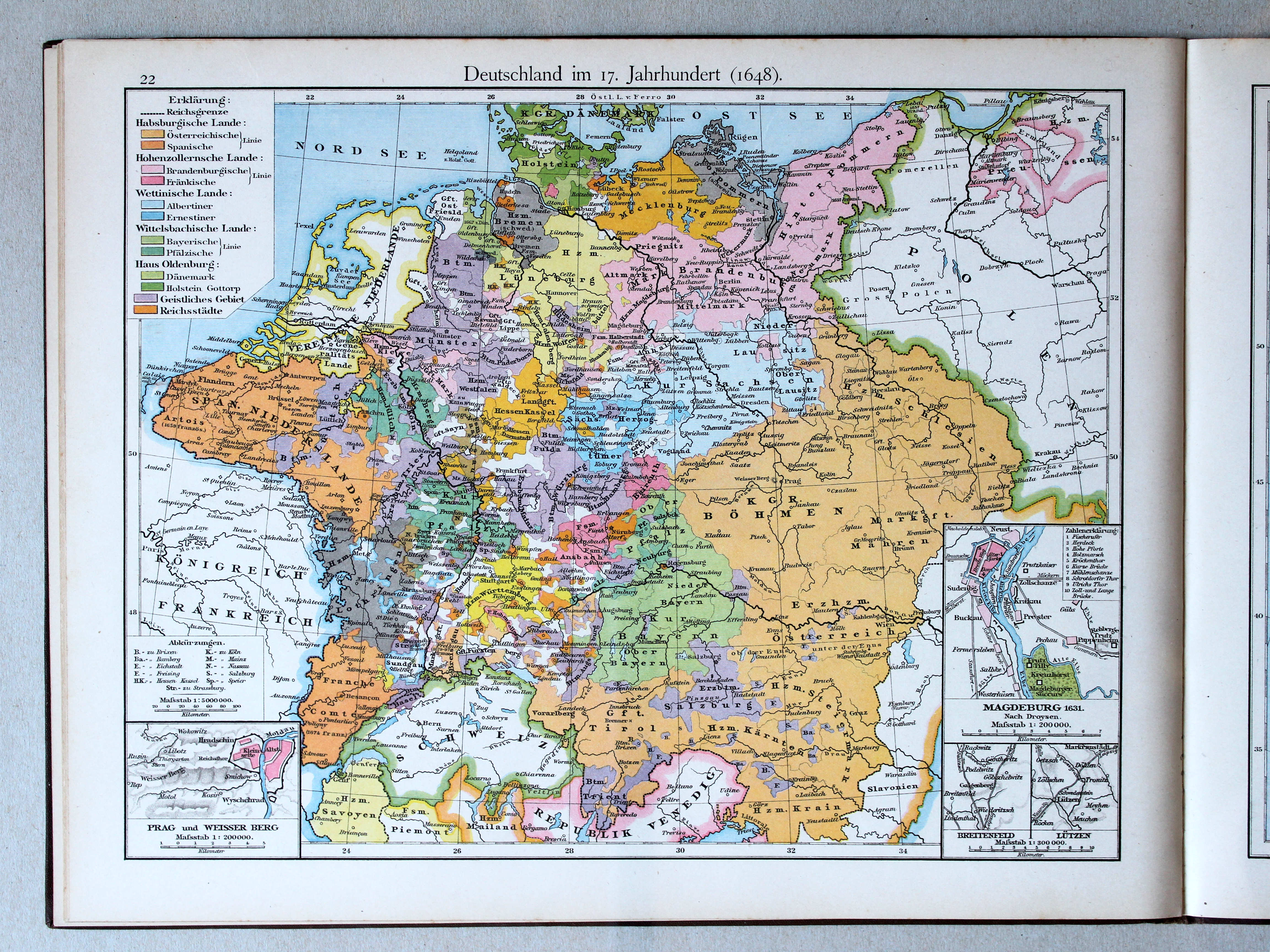
Duitsland in de 17e eeuw (1648) / Germany in the 17th century (1648)
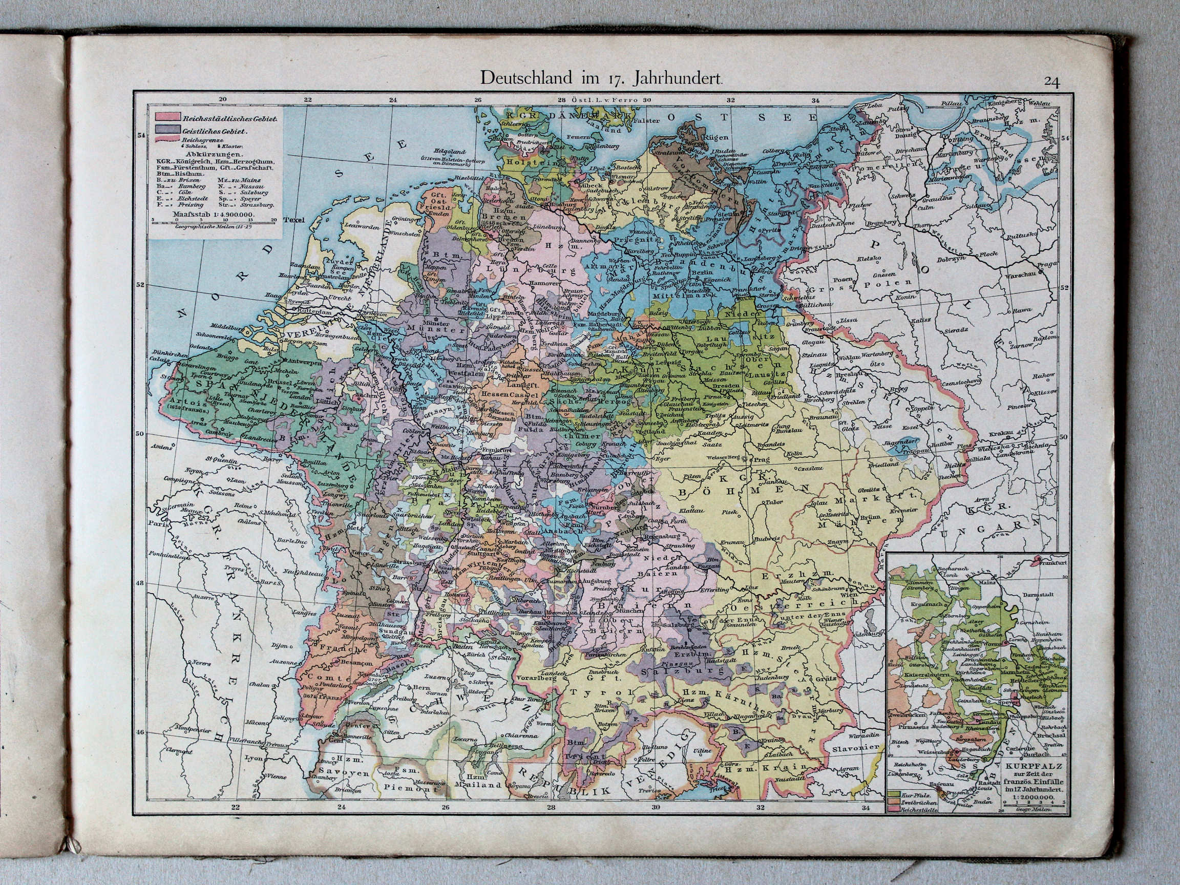 Putzger's Historischer Schul-Atlas, 1887
24. Deutschland im 17. Jahrhundert XL
Duitsland in de 17e eeuw / Germany during the 17th century
 Putzgers Historischer Schul-Atlas, 1888
23. Europa im 17. und 18. Jahrhundert (1740) XL
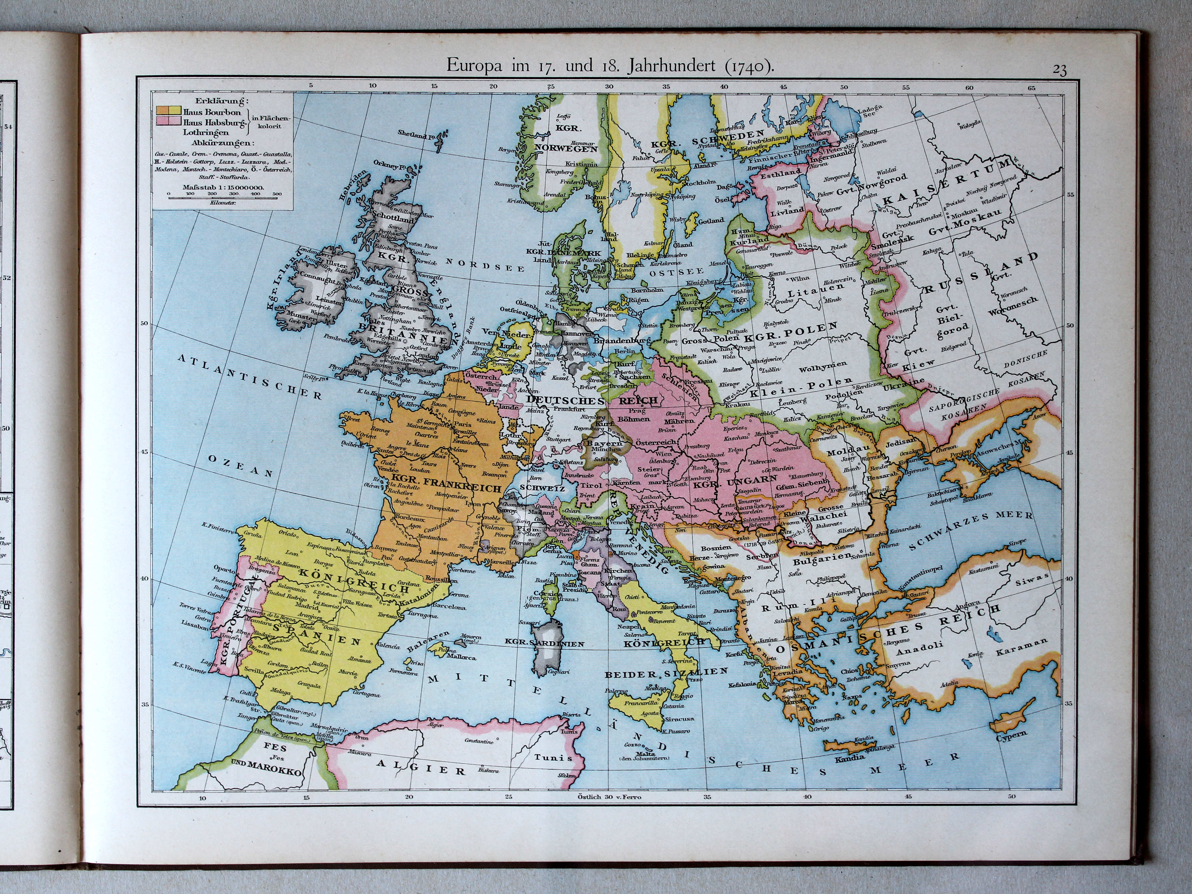
Europa in de 17e en 18e eeuw (1740) / Europe in the 17th and 18th century (1740)
 Putzger's Historischer Schul-Atlas, 1887
25. Europa im 18. Jahrhundert XL
Europa in de 18e eeuw / Europe during the 18th century
 Putzgers Historischer Schul-Atlas, 1888
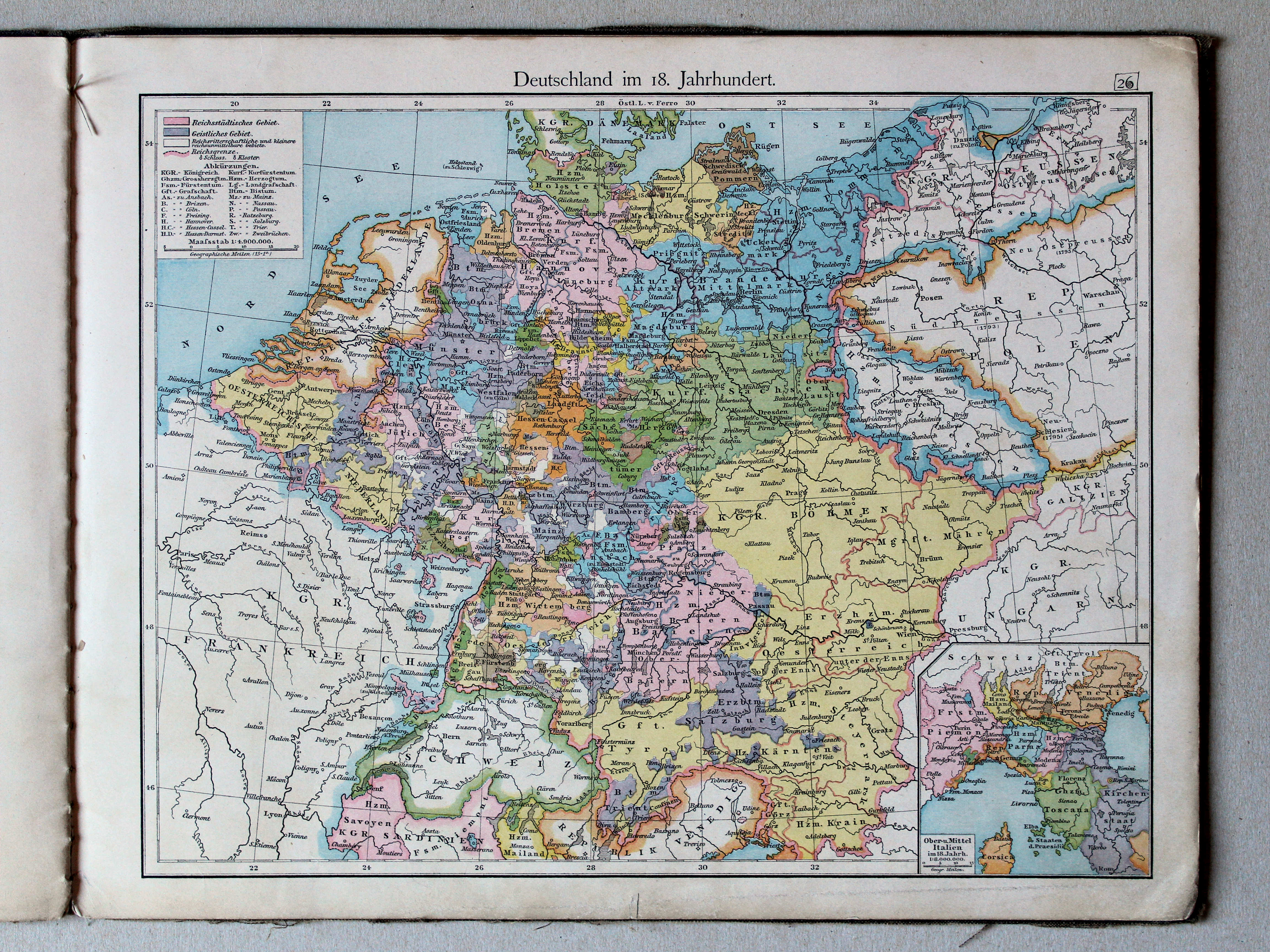
24. Deutschland im 18. Jahrhundert (1786) XL
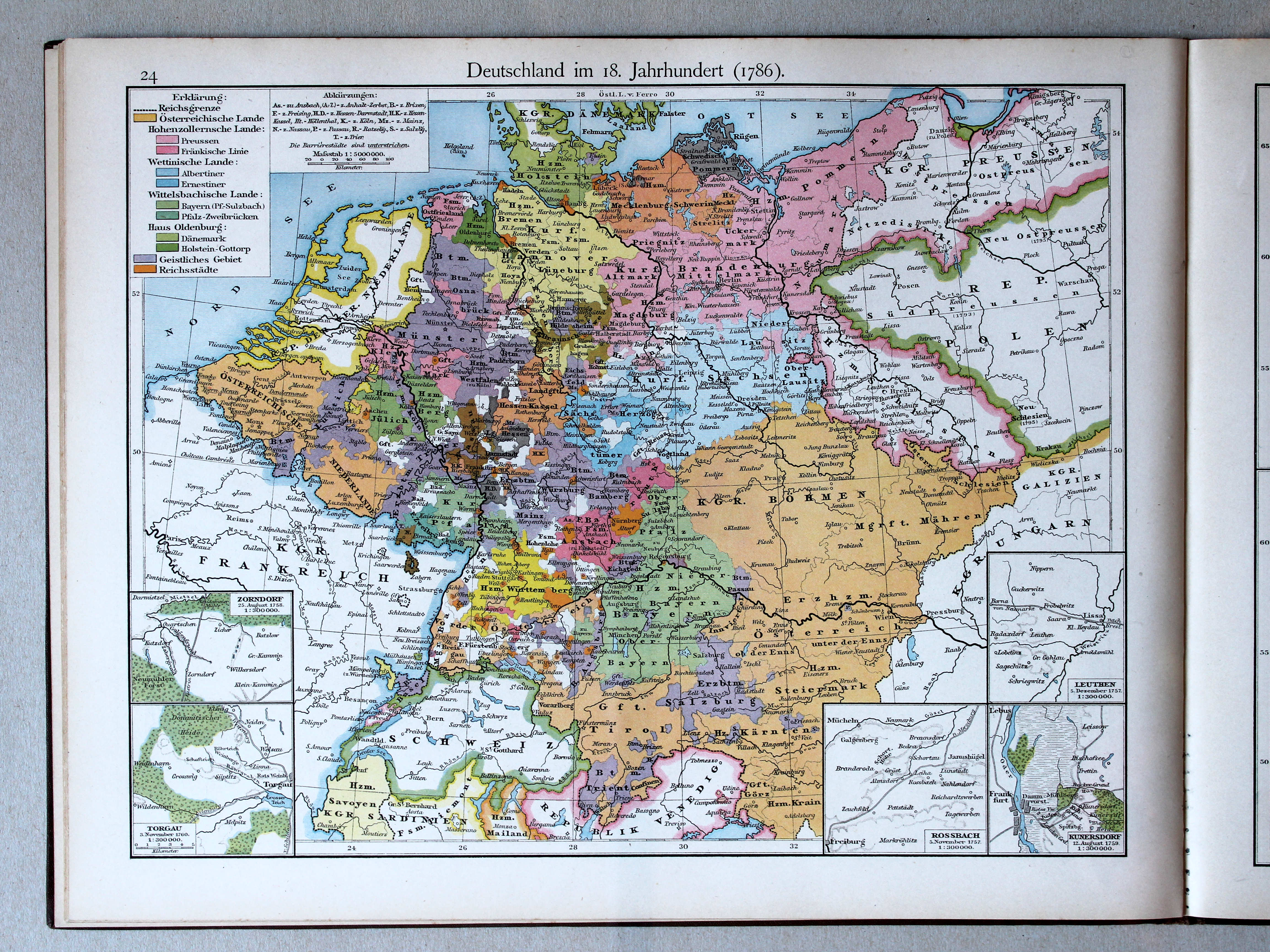
Duitsland in de 18e eeuw (1786) / Germany in the 18th century (1786)
 Putzger's Historischer Schul-Atlas, 1887
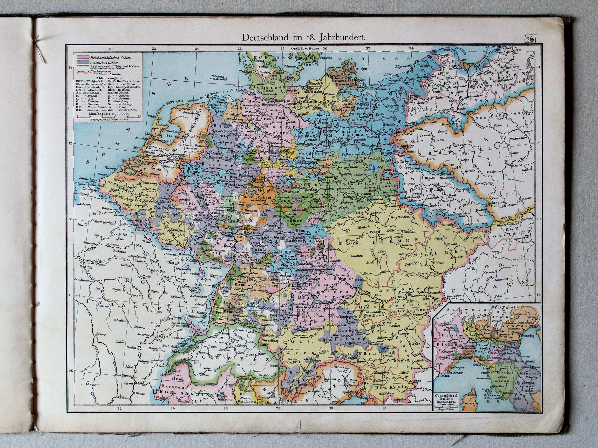
26. Deutschland im 18. Jahrhundert XL
Duitsland in de 18e eeuw / Germany during the 18th century
 Putzgers Historischer Schul-Atlas, 1888
25. Schweden. Russland. Polen. Orientalische Frage XL
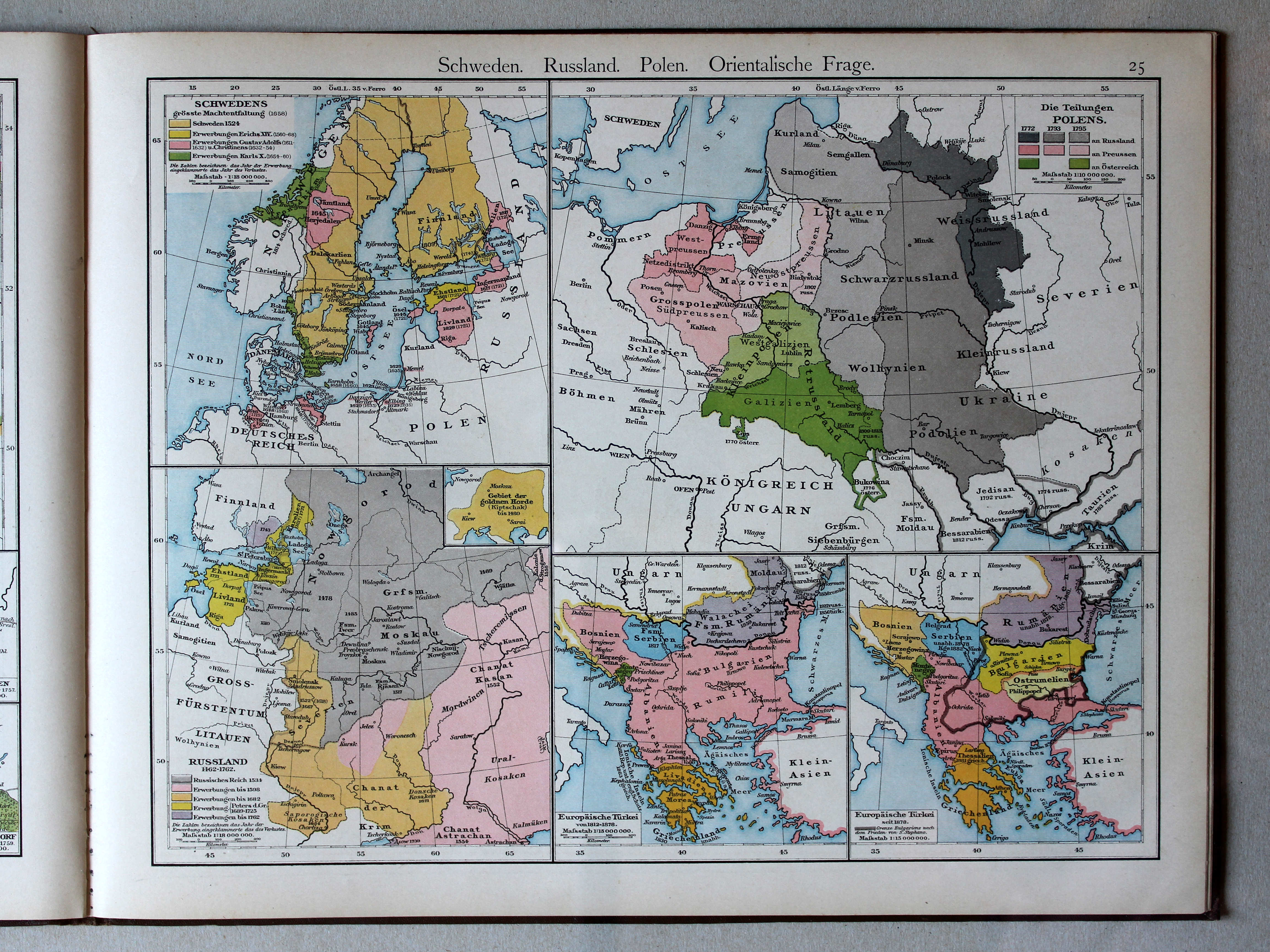
Zweden, Rusland, Polen, Oosterse Kwestie / Sweden, Russia, Poland, Eastern Question
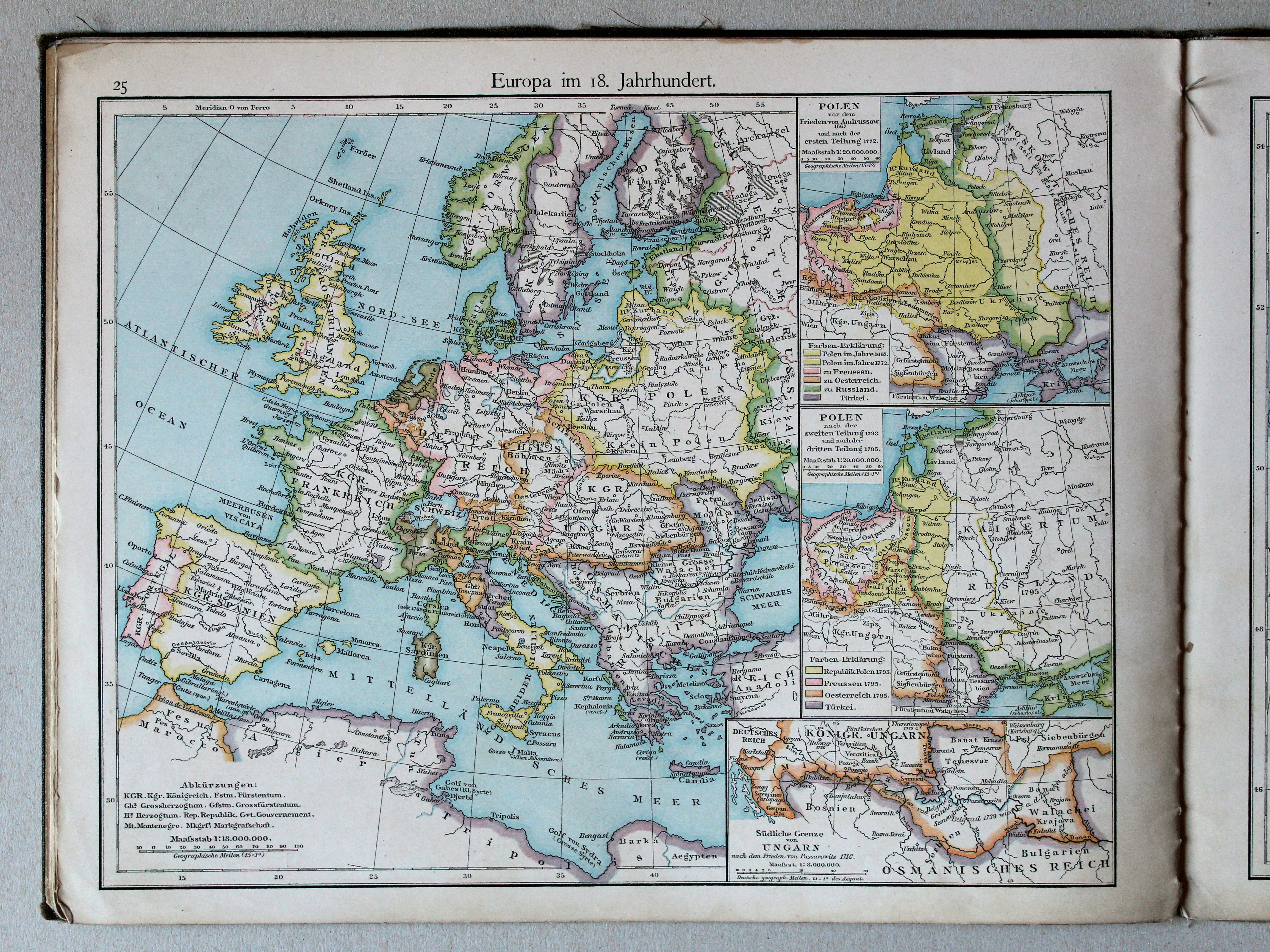
Putzger's Historischer Schul-Atlas, 1887
25. Europa im 18. Jahrhundert XL
Europa in de 18e eeuw / Europe during the 18th century
 Putzgers Historischer Schul-Atlas, 1888
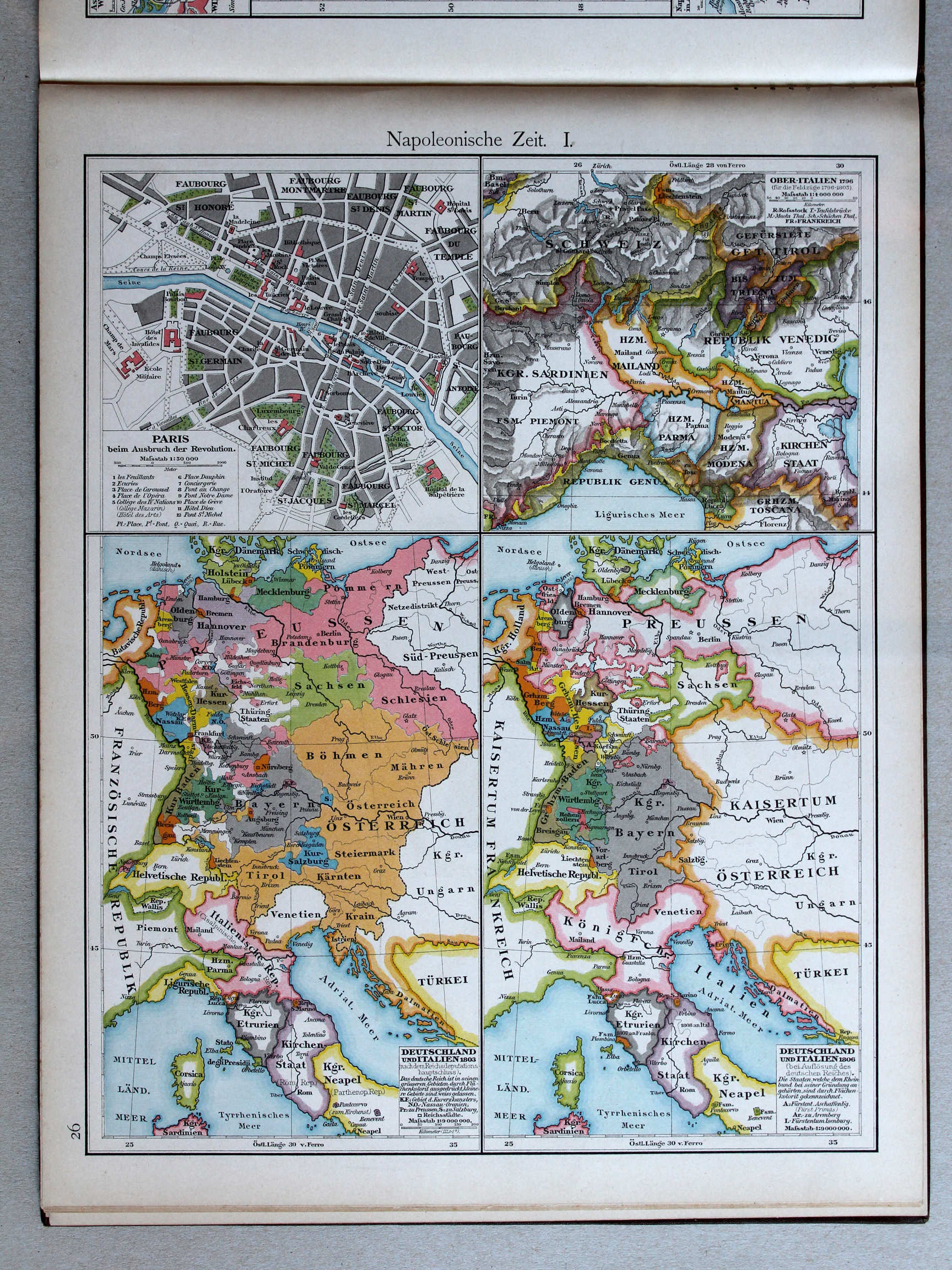
26. Napoleonische Zeit I XL
Tijd van Napoleon I / Era of Napoleon I
 Putzger's Historischer Schul-Atlas, 1887
27. Europa zur Zeit der grössten Machtentfaltung Napoleons I XL
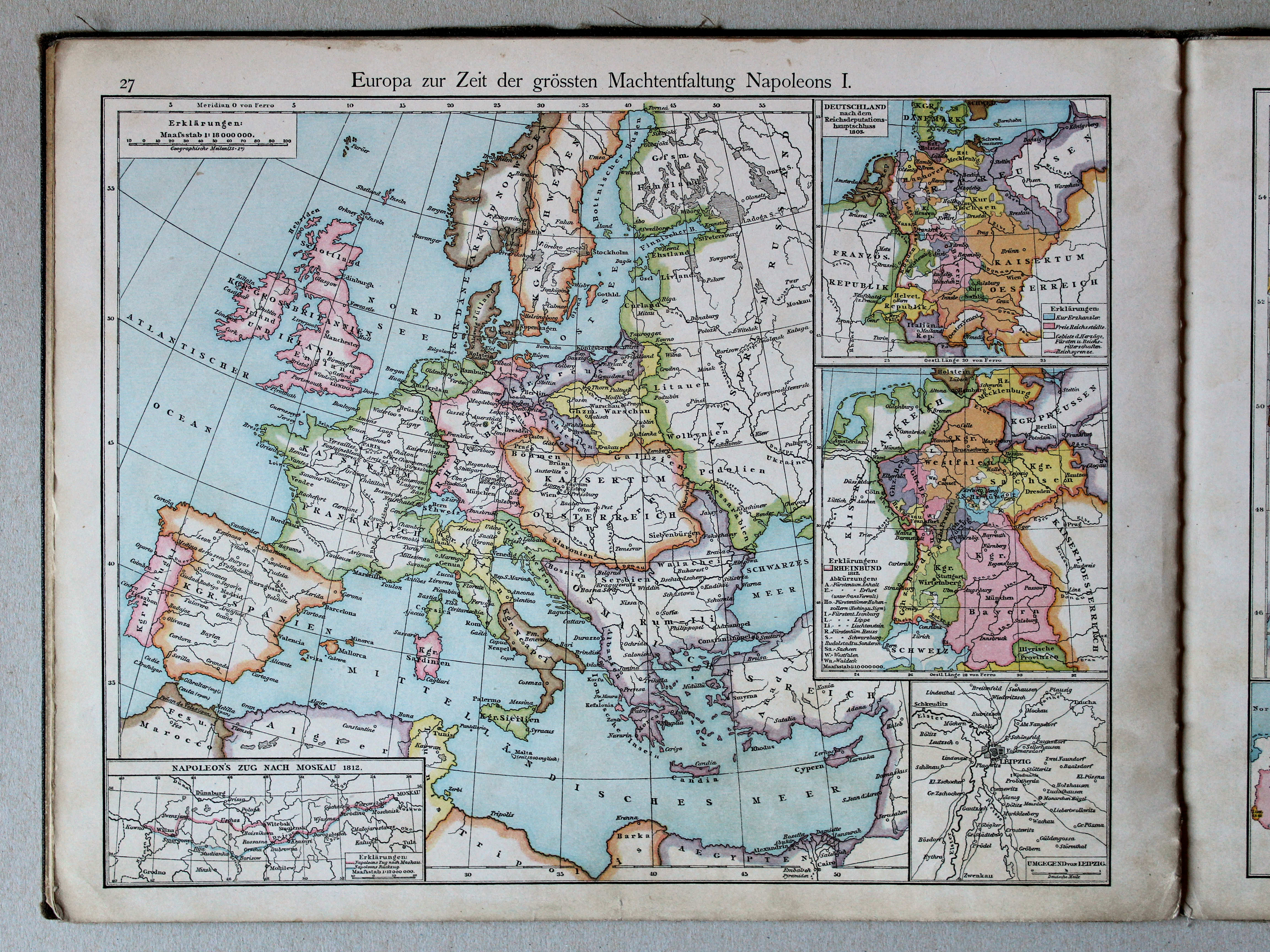
Europa in de tijd van het toppunt van Napoleons macht / Europe during the summit of Napoleons power
 Putzgers Historischer Schul-Atlas, 1888
27. Napoleonische Zeit II: Deutschland im Jahre 1812 XL
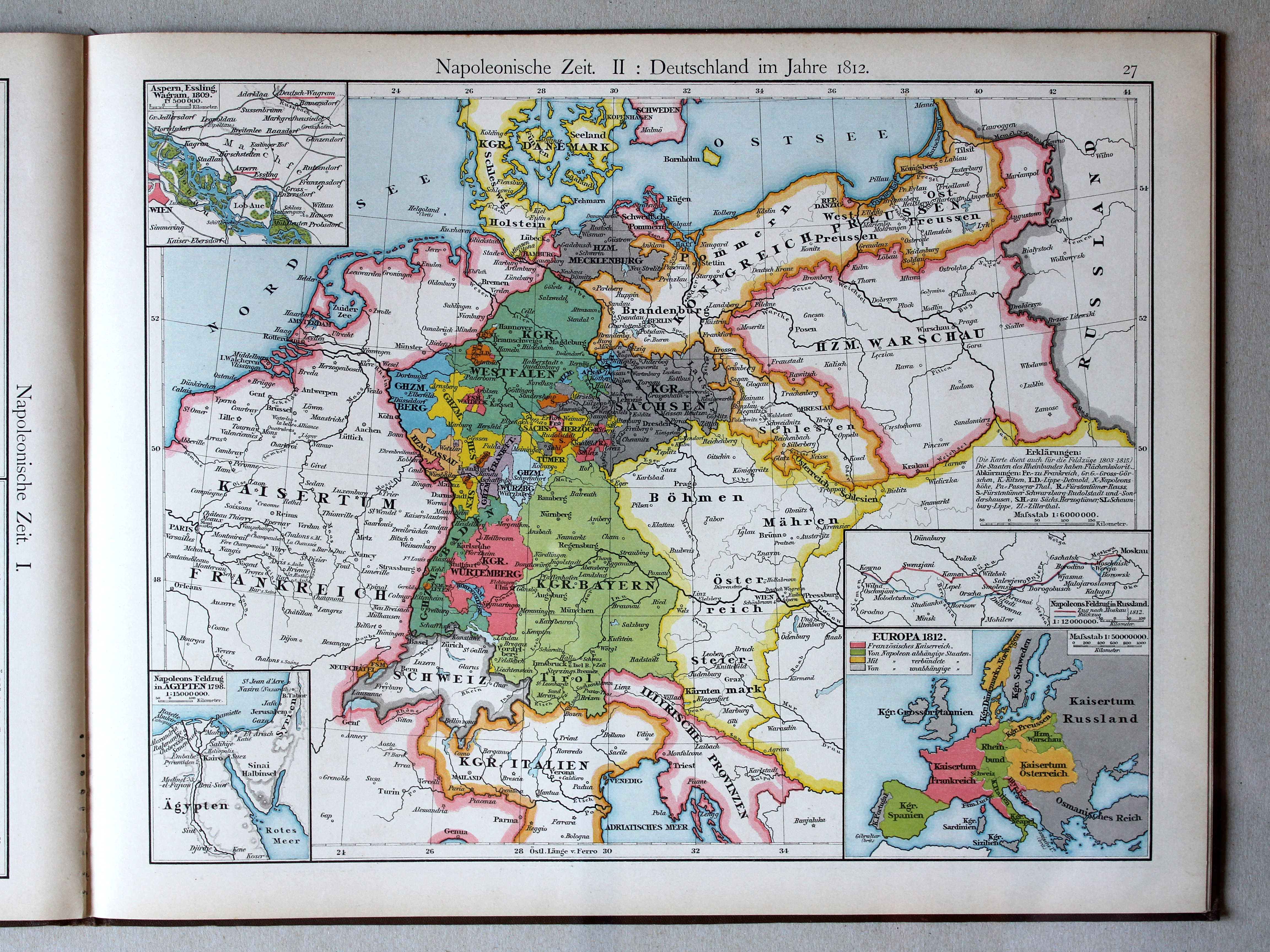
Tijd van Napoleon II: Duitsland in 1812 / Era of Napoleon II: Germany in 1812
Putzger's Historischer Schul-Atlas, 1887
27. Europa zur Zeit der grössten Machtentfaltung Napoleons I XL
Europa in de tijd van het toppunt van Napoleons macht / Europe during the summit of Napoleons power
 Putzgers Historischer Schul-Atlas, 1888
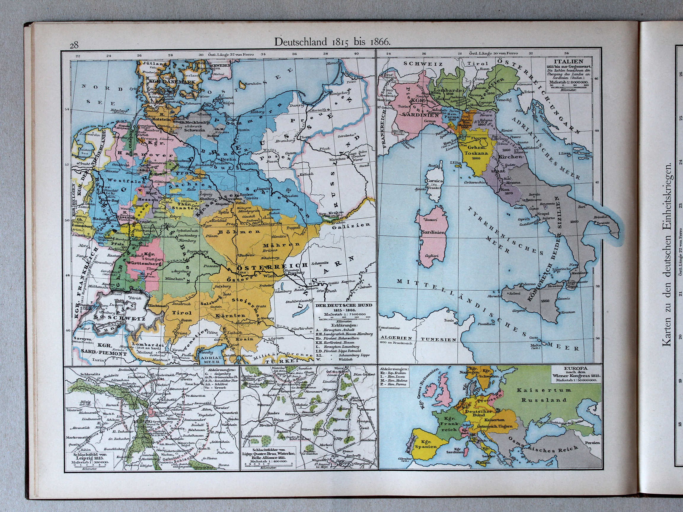
28. Deutschland 1815 bis 1866 XL
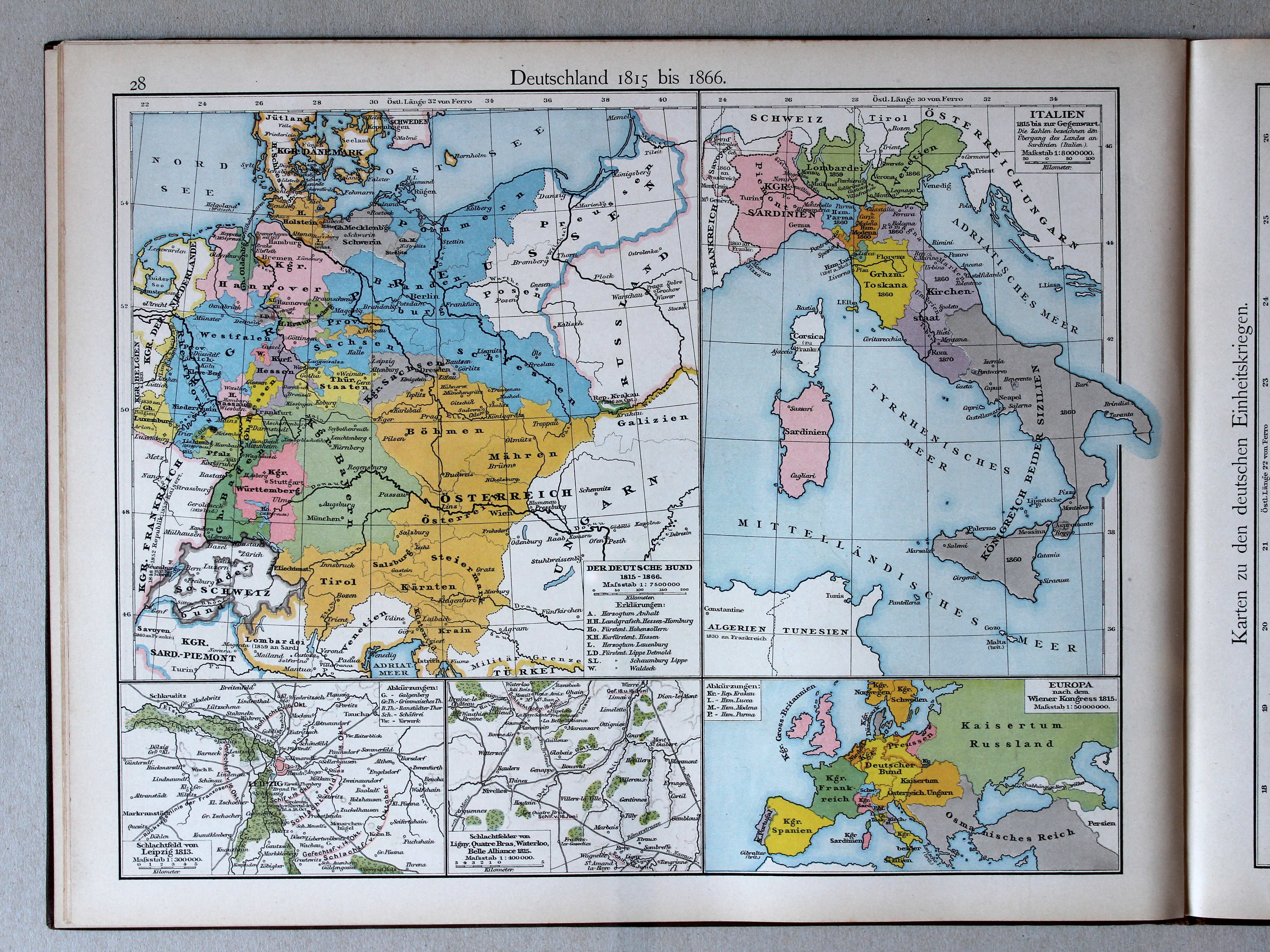
Duitsland 1815-1866 / Germany 1815-1866
 Putzger's Historischer Schul-Atlas, 1887
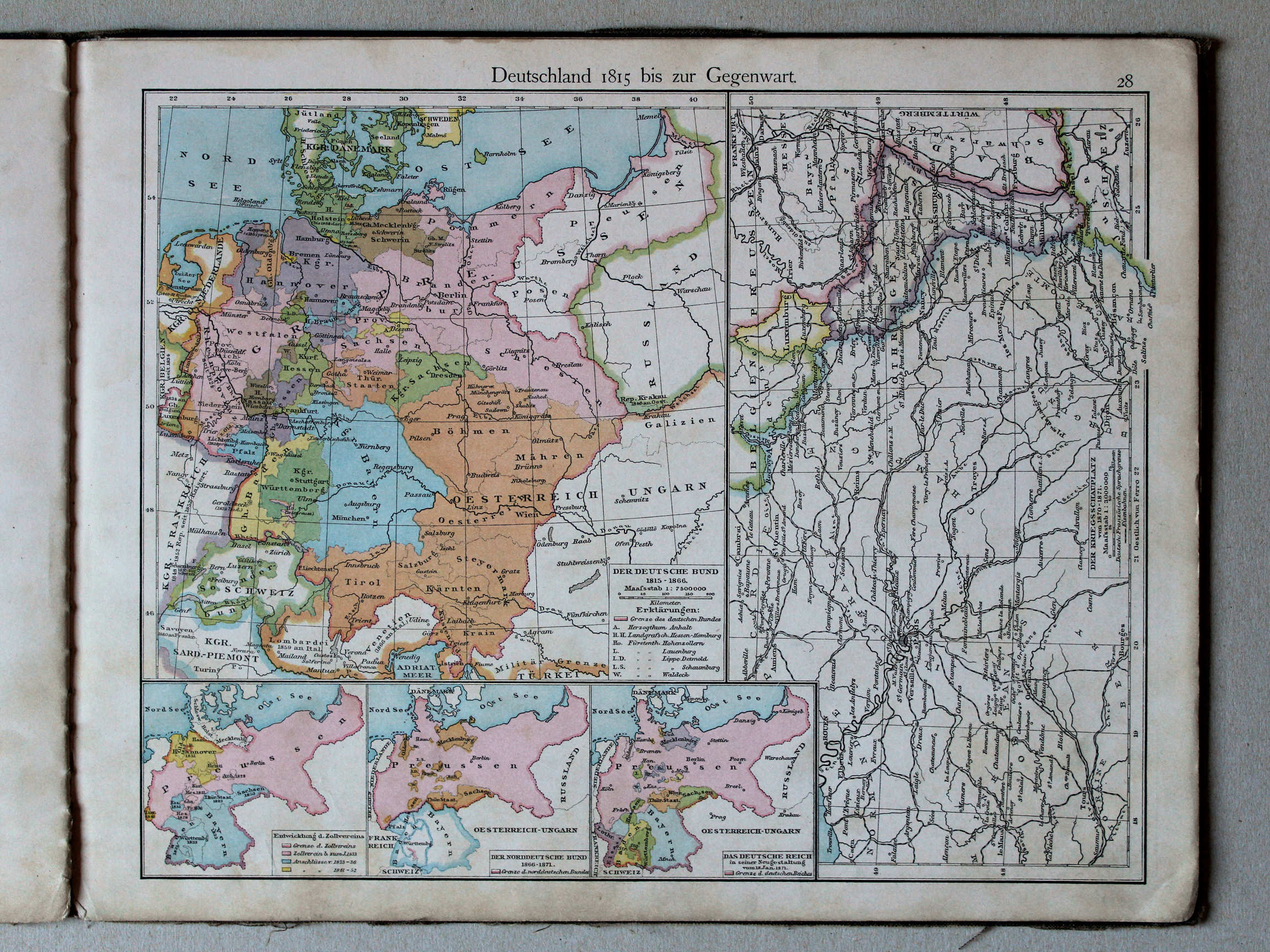
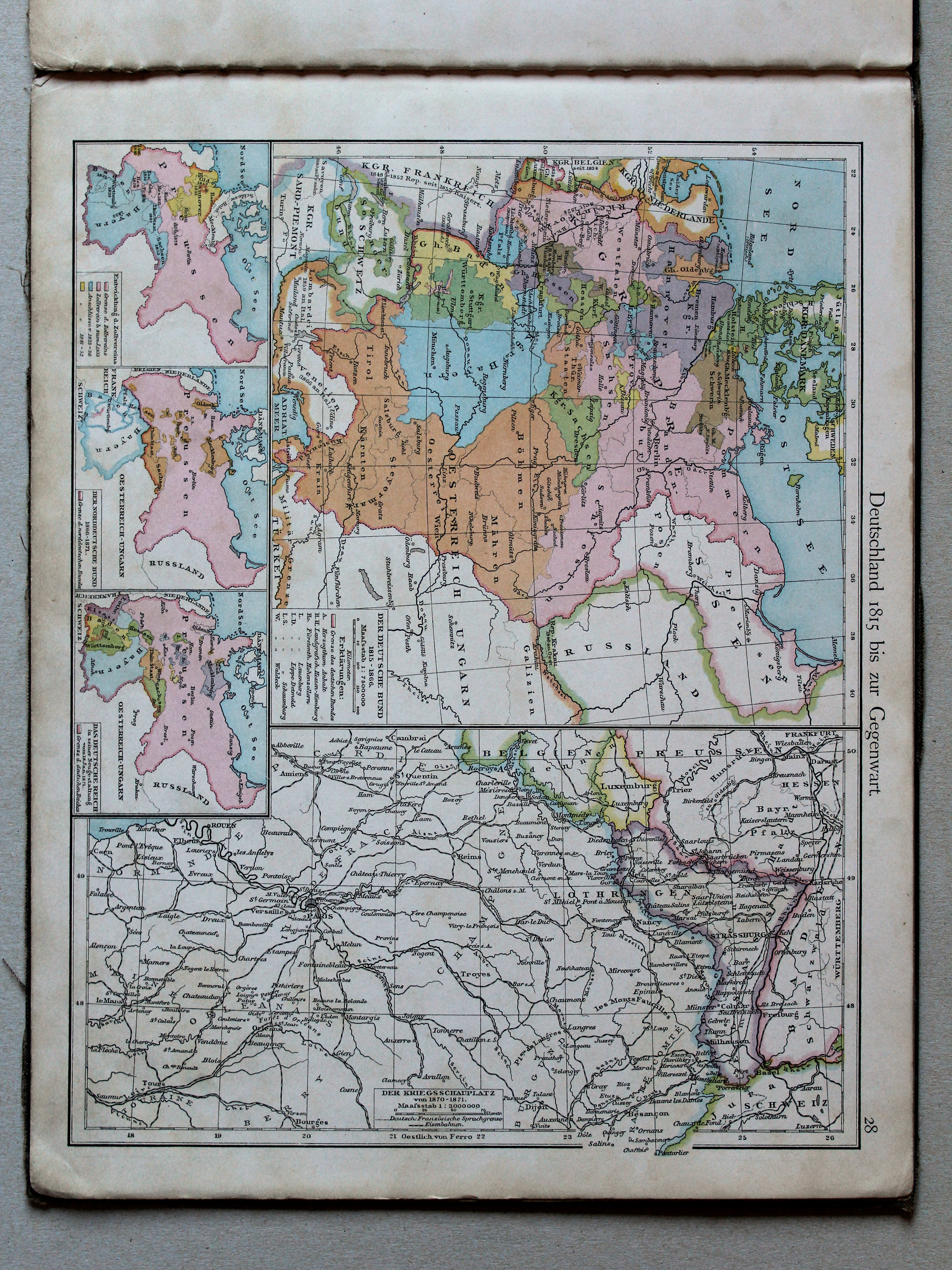
28. Deutschland 1815 bis zur Gegenwart XL
Duitsland van 1815 tot heden / Germany from 1815 to the present
 Putzgers Historischer Schul-Atlas, 1888
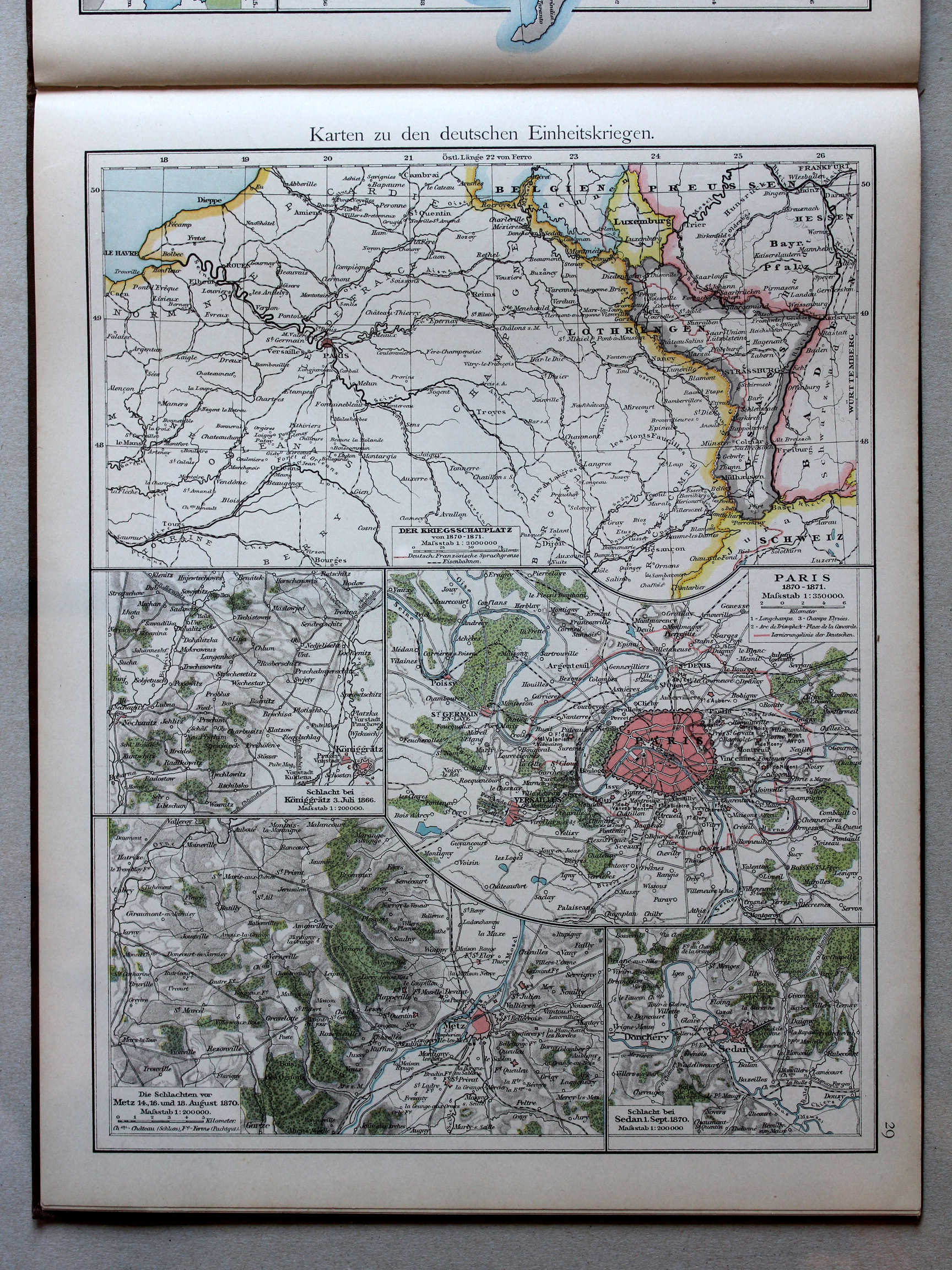
29. Karten zu den deutschen Einheitskriegen XL
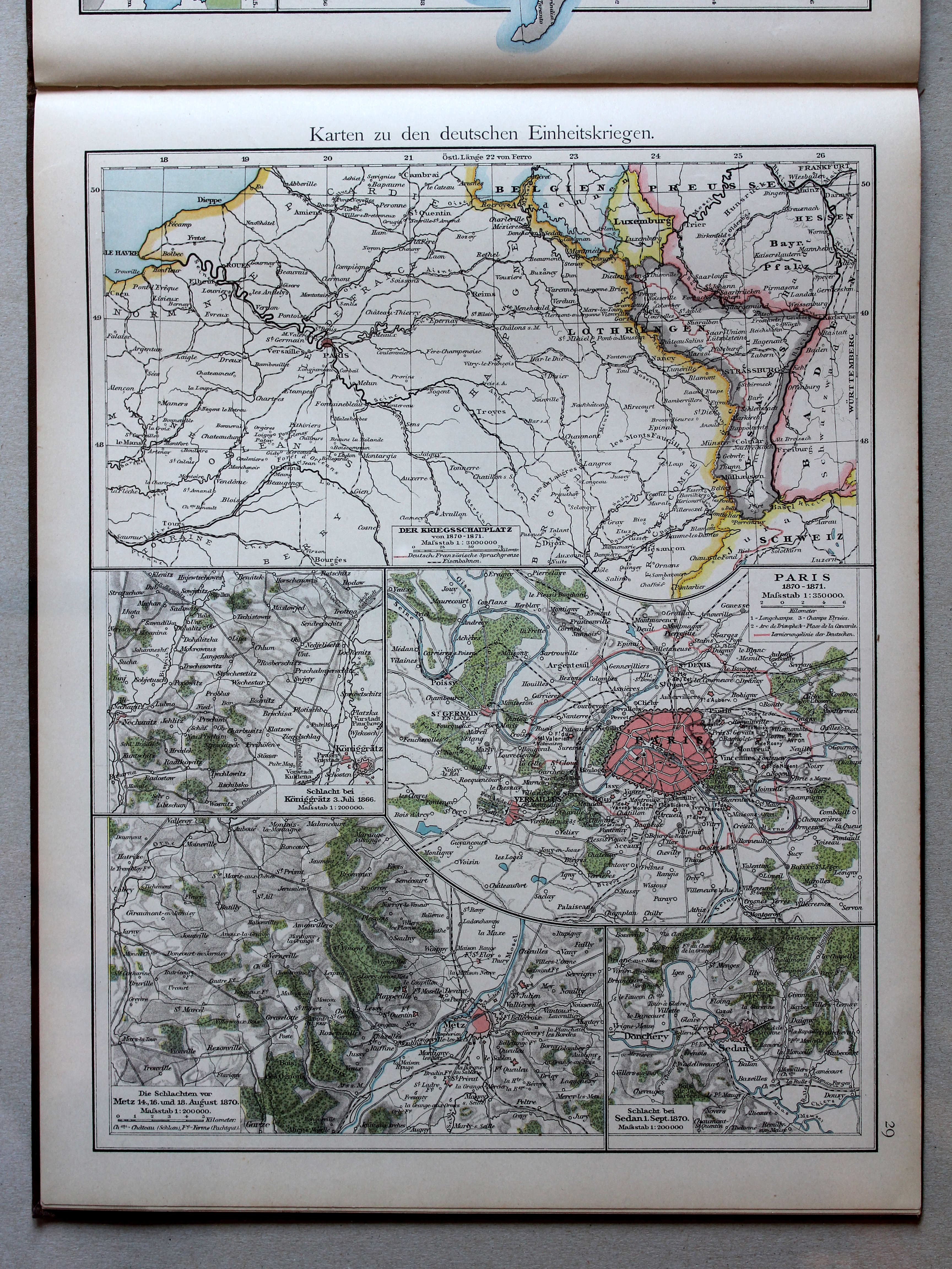
Kaarten bij de Duitse eenwording / Maps to the German unification
 Putzger's Historischer Schul-Atlas, 1887
28. Deutschland 1815 bis zur Gegenwart XL
Duitsland van 1815 tot heden / Germany from 1815 to the present
 Putzgers Historischer Schul-Atlas, 1888
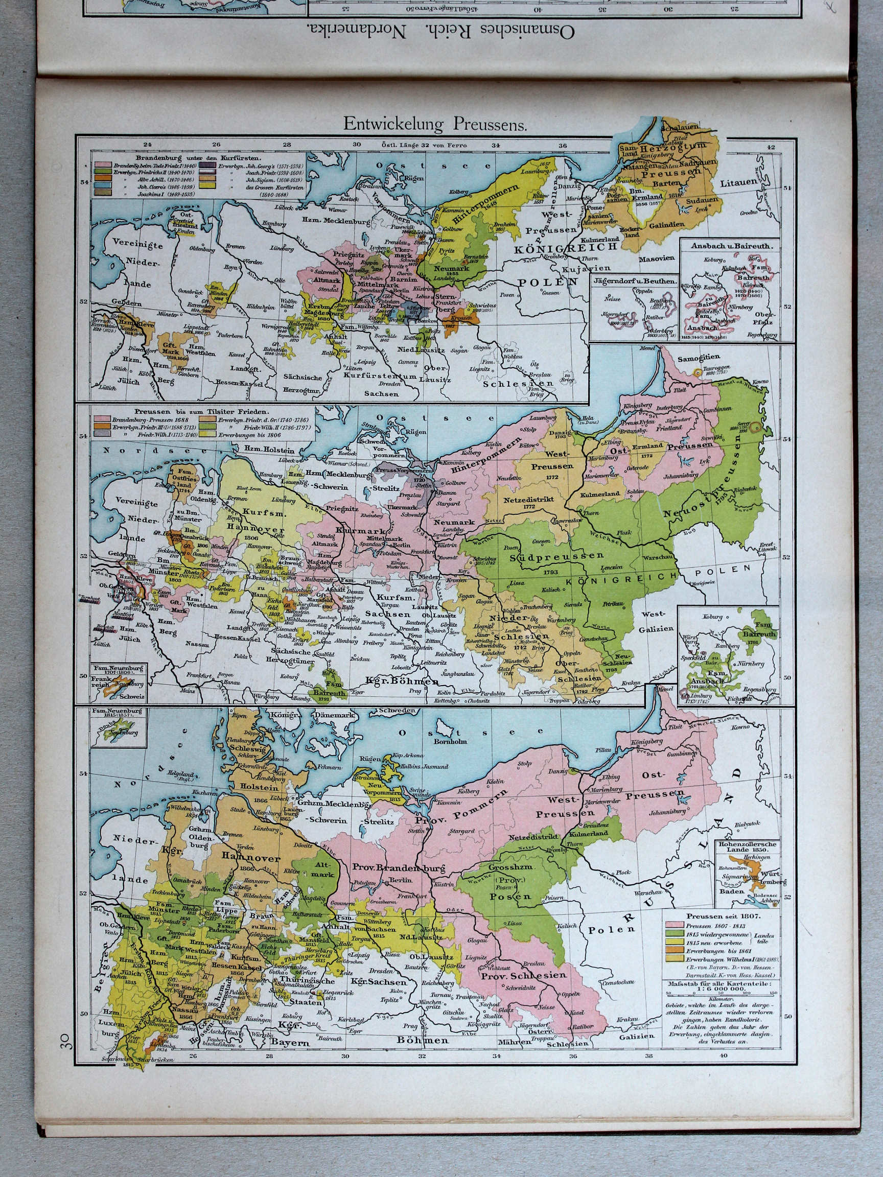
30. Entwickelung Preussens XL
Ontwikkeling van Pruisen / Development of Prussia
 Putzger's Historischer Schul-Atlas, 1887
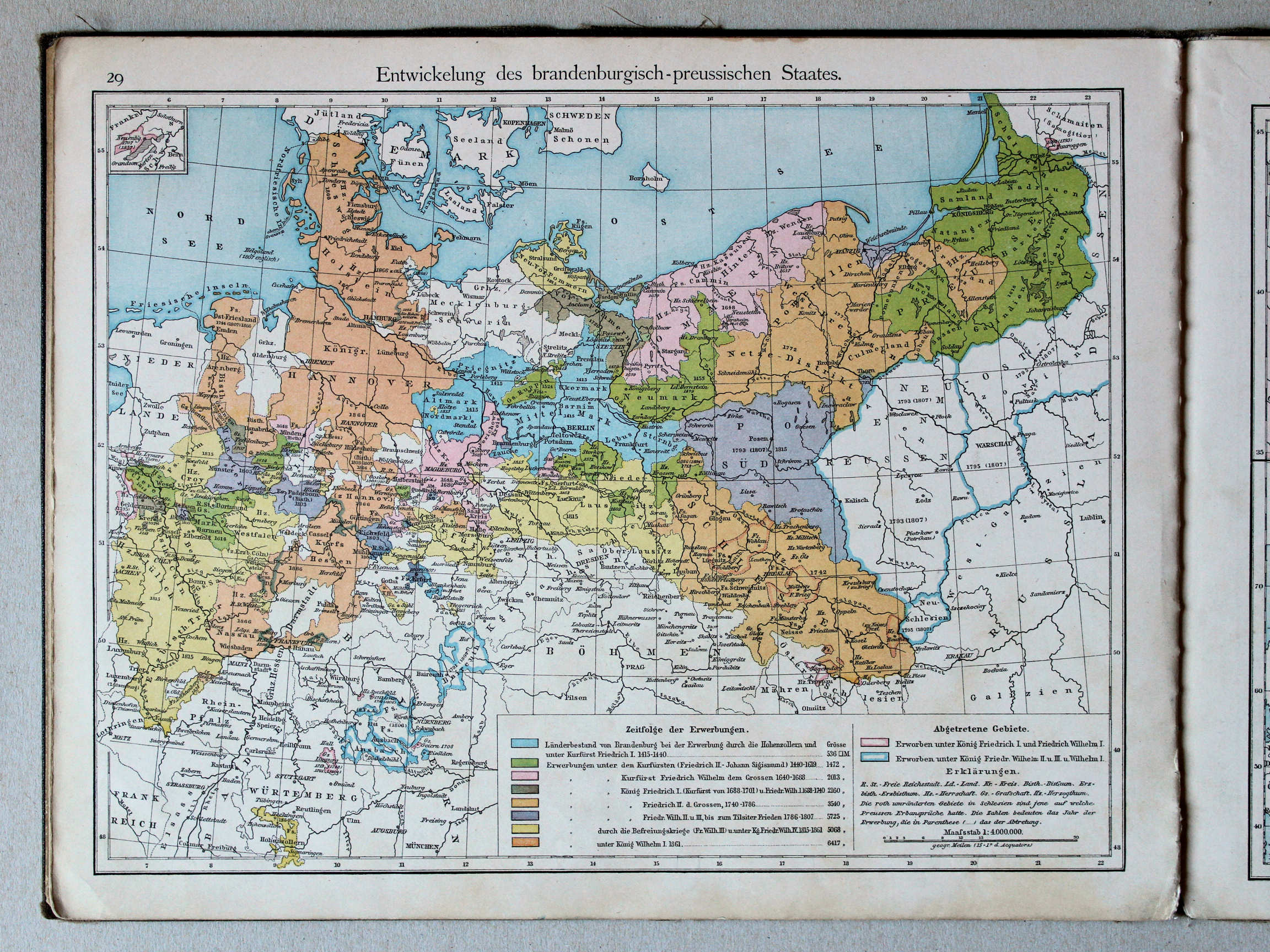
29. Entwickelung des brandenburgisch-preussischen Staates XL
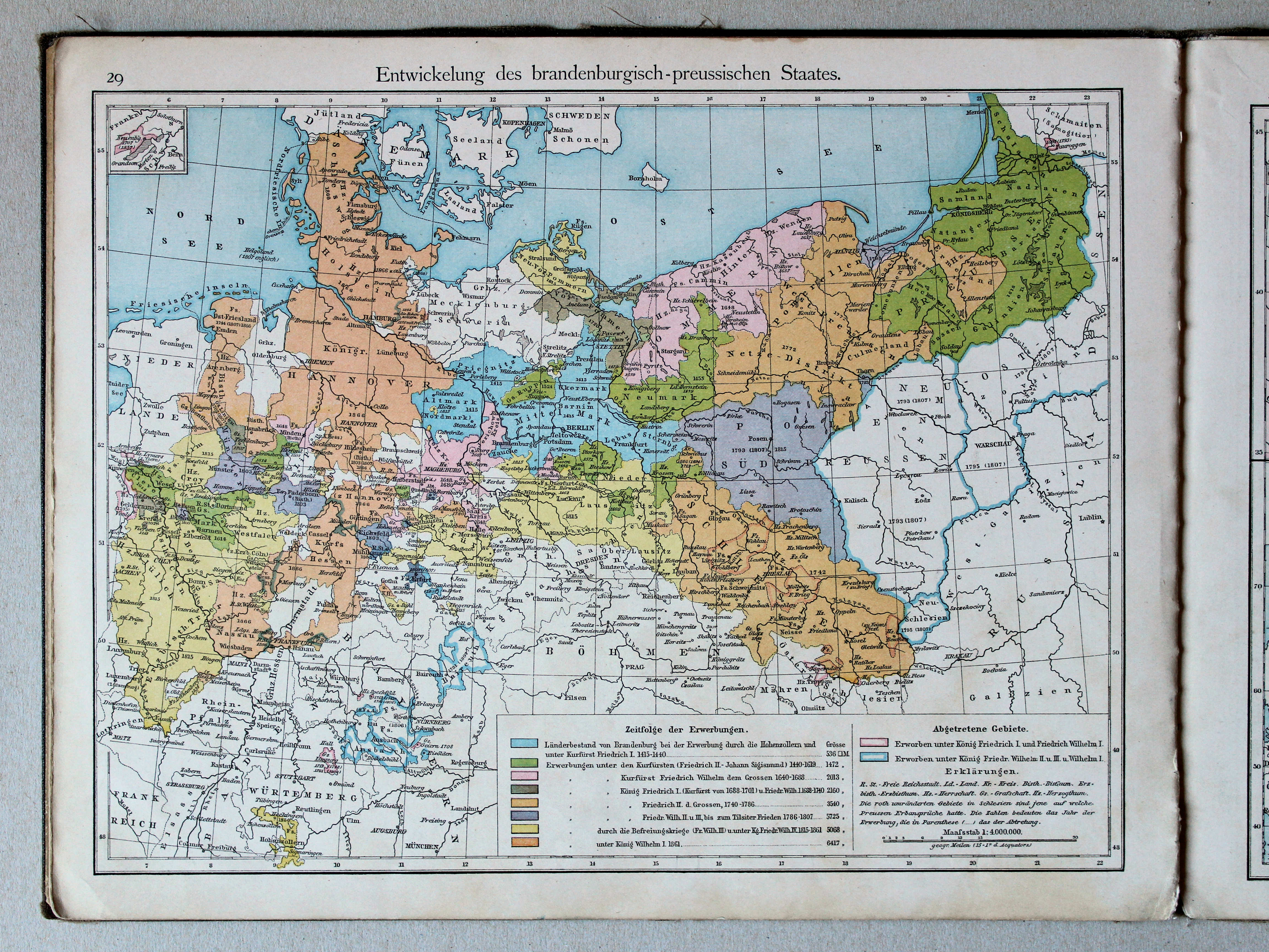
Ontwikkeling van Brandenburg-Pruisen / Development of Brandenburg-Prussia
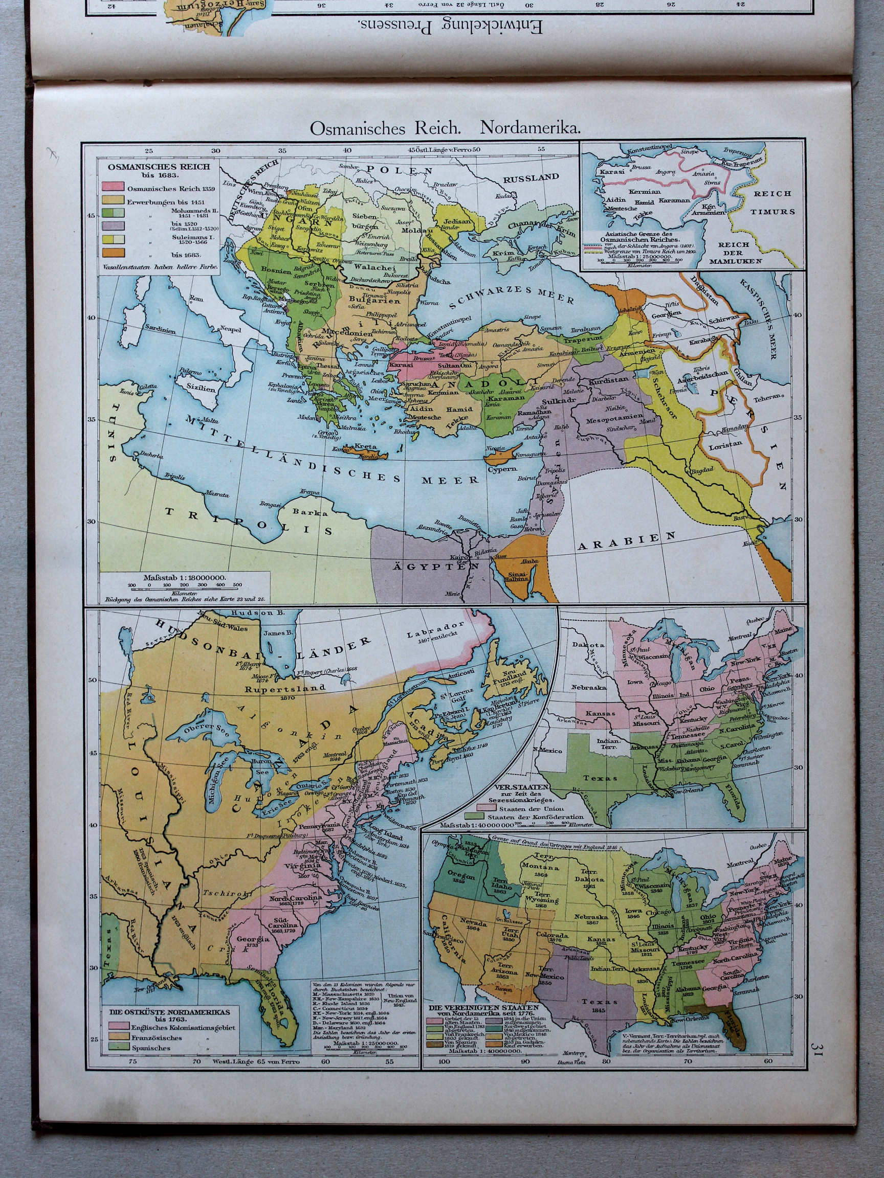 Putzgers Historischer Schul-Atlas, 1888
31. Osmanisches Reich. Nordamerika XL
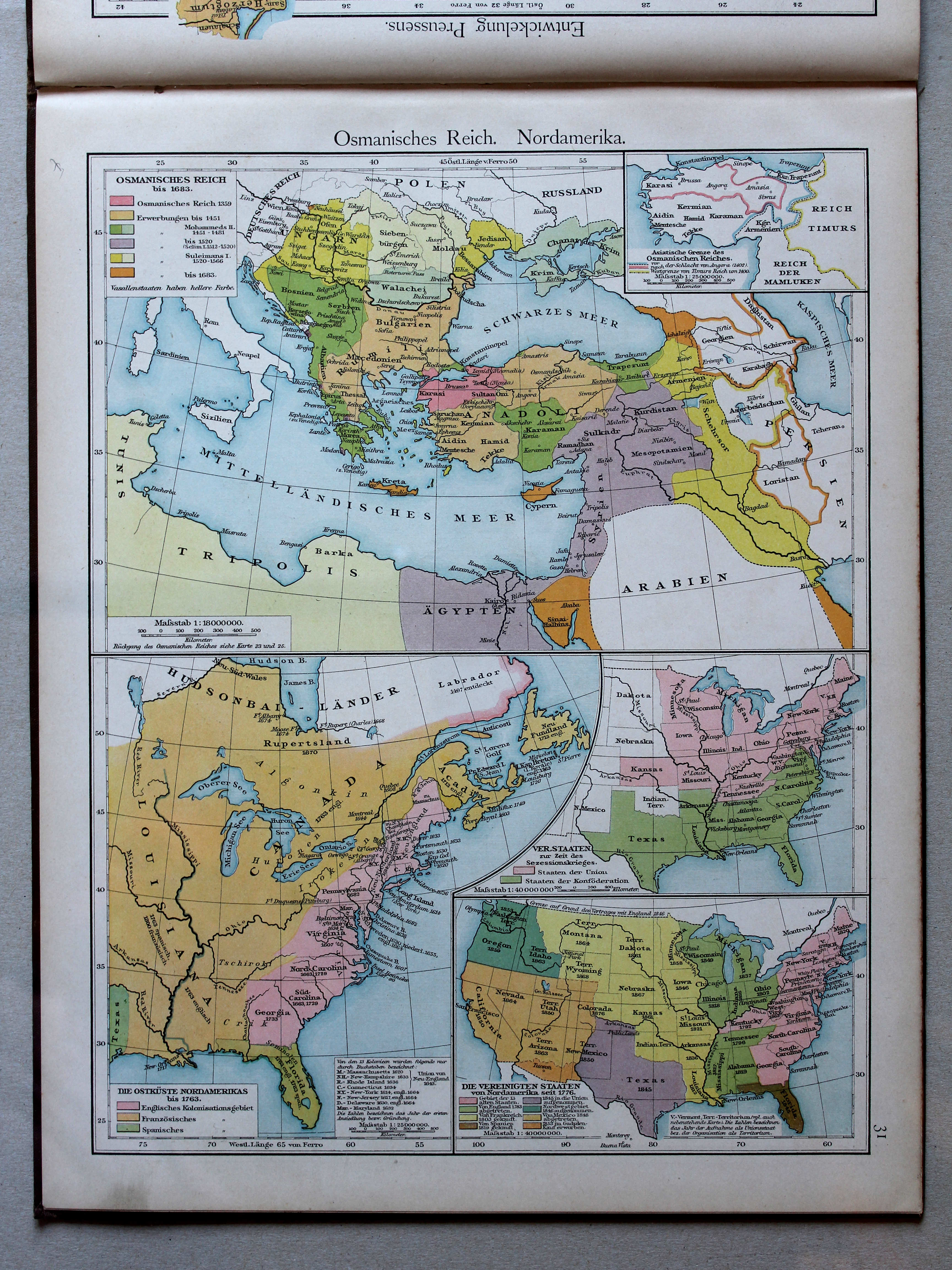
Ottomaanse Rijk. Noord-Amerika / Ottoman Empire. North America
 Putzger's Historischer Schul-Atlas, 1887
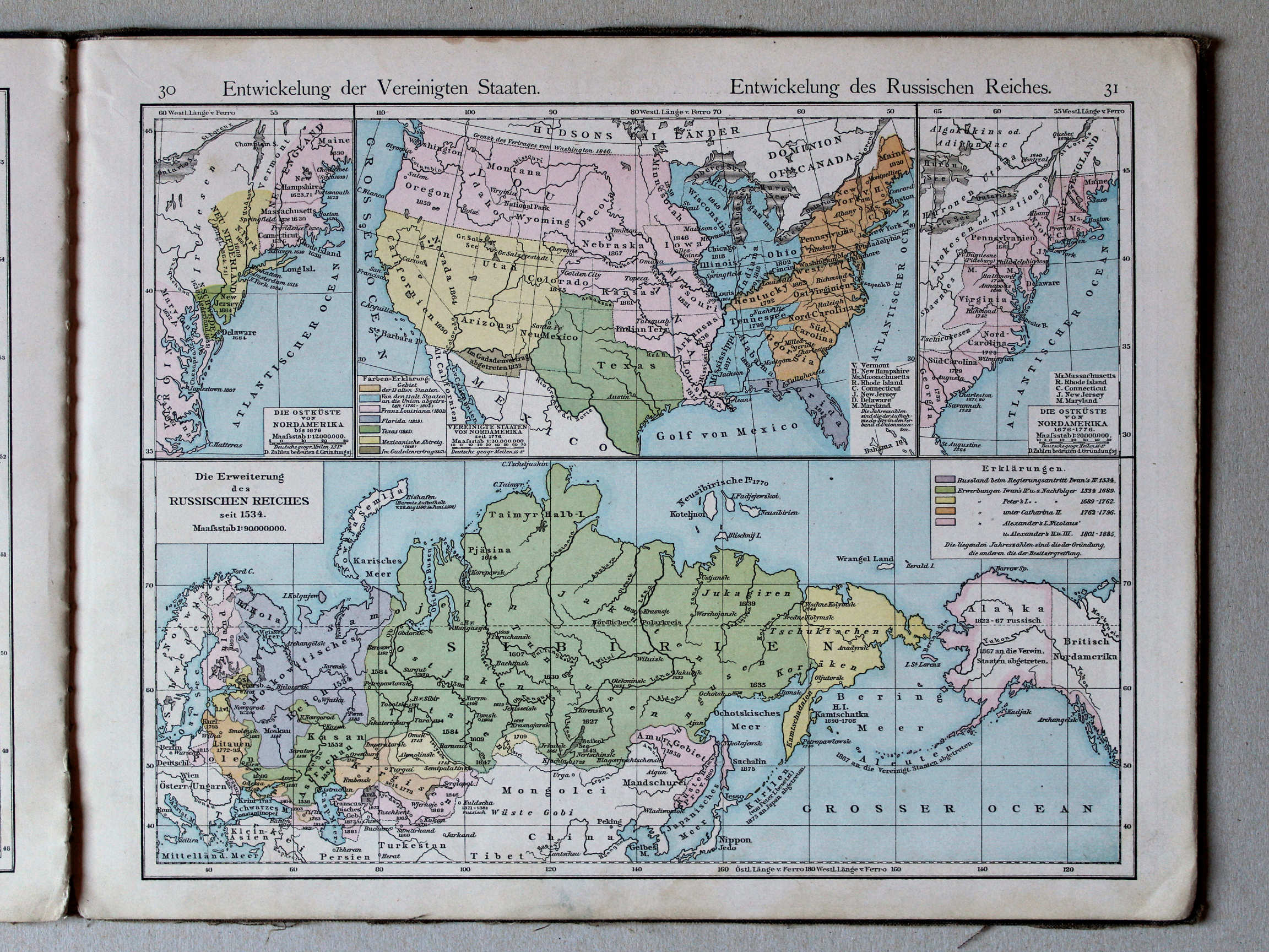
30. Entwickelung der Vereinigten Staaten XL
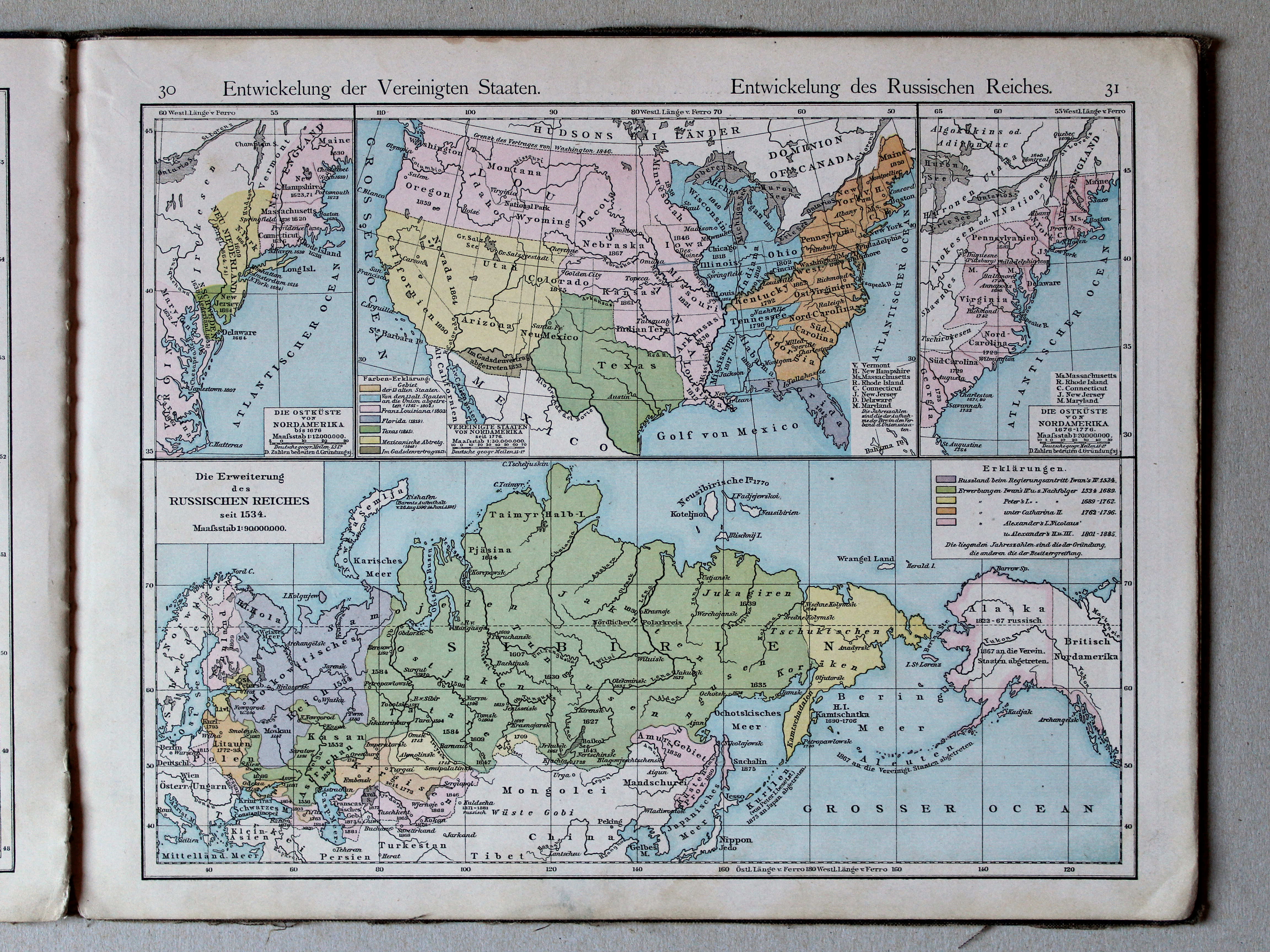
Ontwikkeling van de Verenigde Staten / Development of the United States
31. Entwickelung des Russischen Reiches XL
Ontwikkeling van het Russische Rijk / Development of the Russian Empire
 Putzgers Historischer Schul-Atlas, 1888
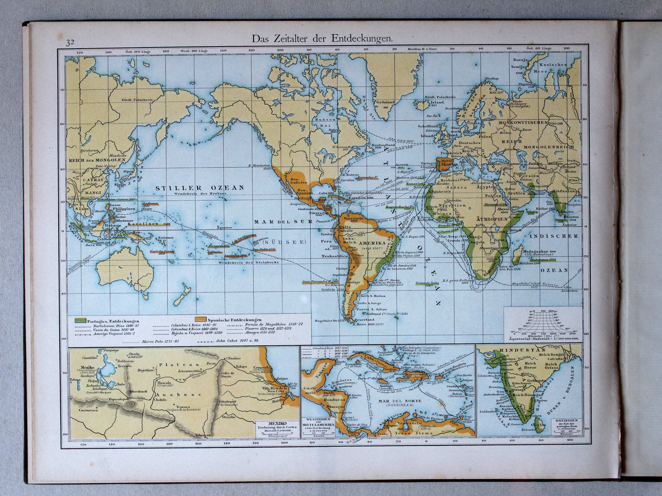
32. Das Zeitalter der Entdeckungen XL
Het tijdperk van de grote ontdekkingen / The Age of Discovery
 Putzger's Historischer Schul-Atlas, 1887
32. Das Zeitalter der Entdeckungen XL
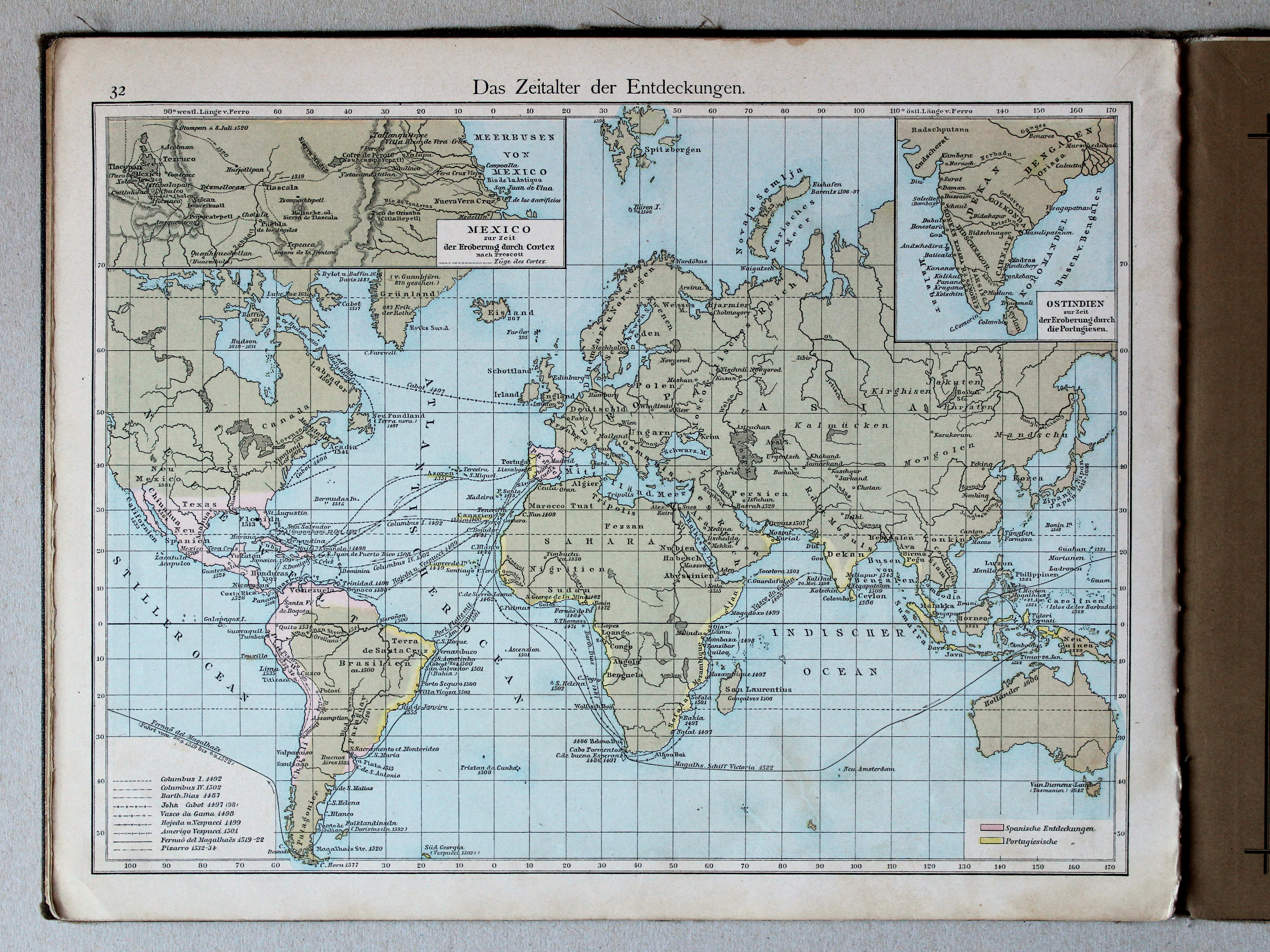
Het tijdperk van de grote ontdekkingen / The Age of Discovery
© M. Witkam, 2013
![]()
![]()