The Times Atlas (1900)
See below for (a summary of) this text in English.
Hieronder staan plaatjes van de atlas (uitgave 1900). Daarbij horen ook de volgende pagina's
- Beschrijving van de atlas
- Plaatjes van de atlas (1897)
- Tabellen en lijsten bij de atlas
Plaatjes
Klik op een plaatje voor een vergroting.
The Times Atlas (1900)
- Below are pictures of the atlas (1900 printing). Related pages
- Description of the atlas
- Pictures of the atlas (1897)
- Tables and lists to the atlas
Pictures
Click on a picture to enlarge.
Advertentie / Advertisement
 The Times Atlas 1900
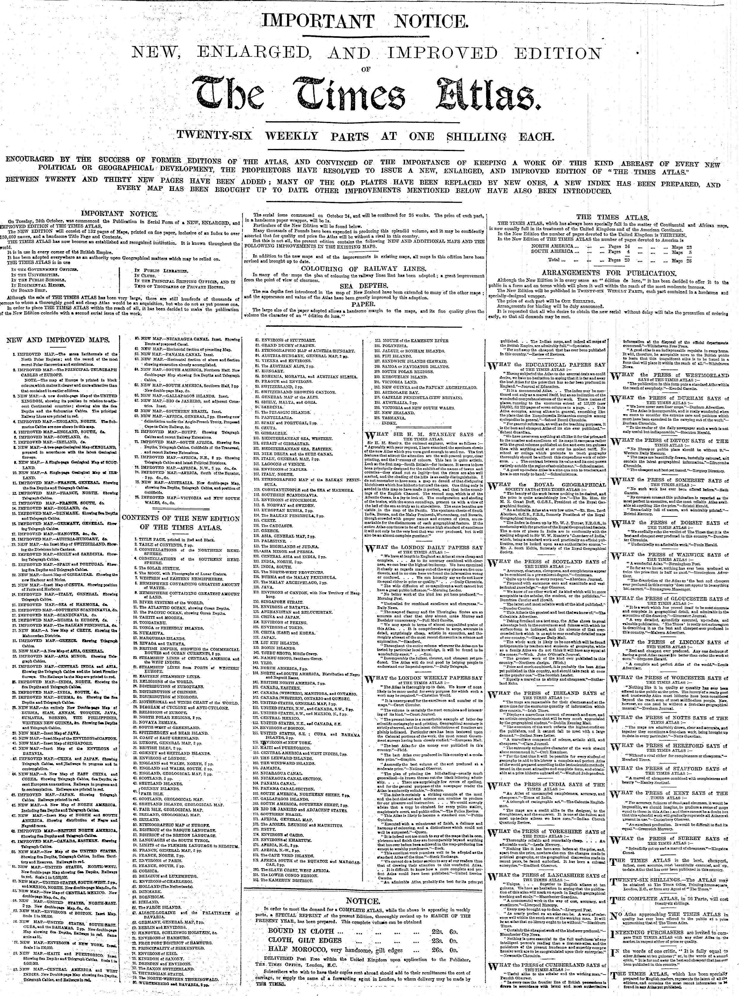
Advertentie in The Times, 25 oktober 1899
Advertisement in The Times, October 25, 1899
 The Times Atlas 1900
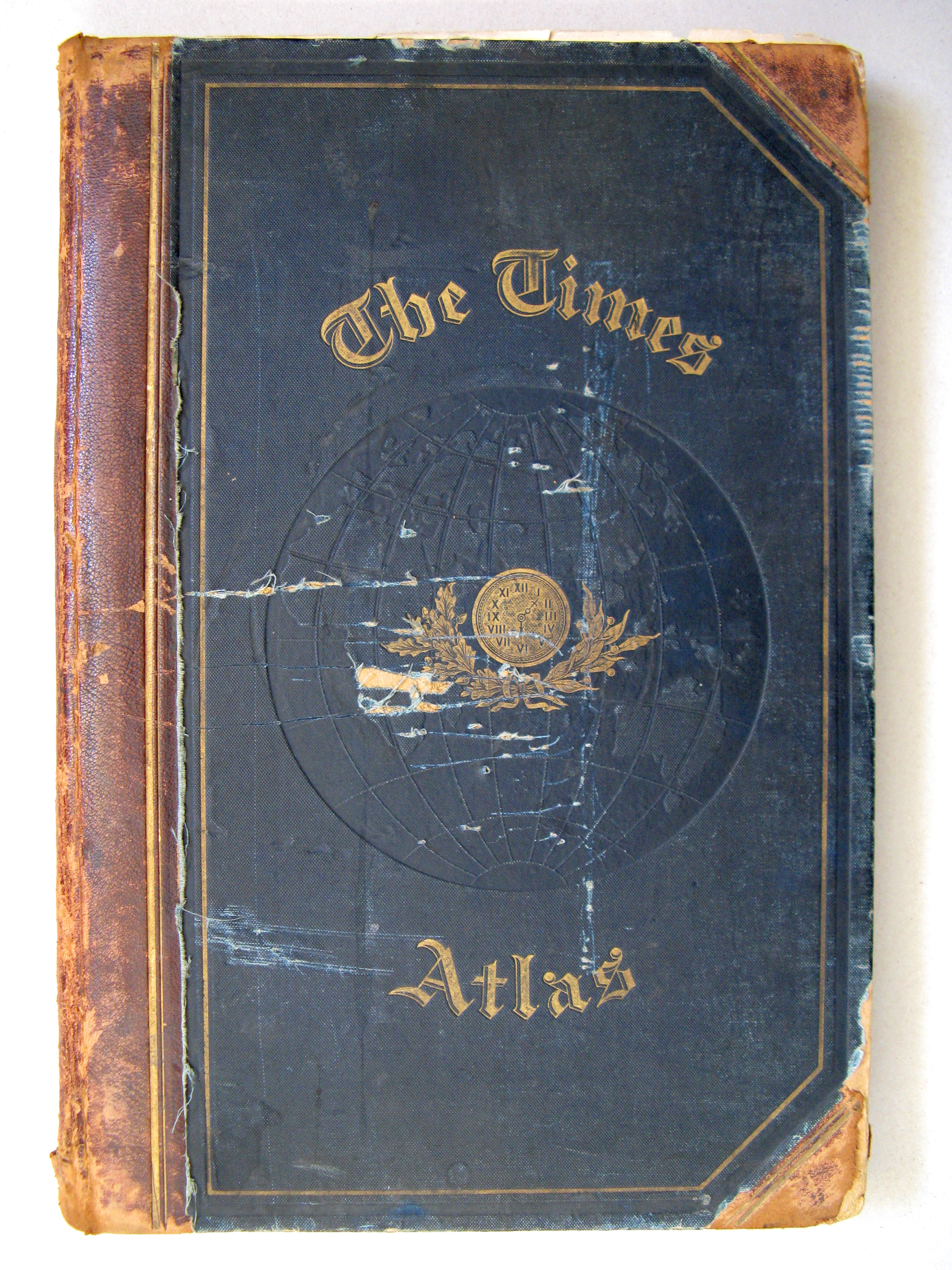
Voorkant band / Front cover
 The Times Atlas 1900
Schutblad achterin / Back endpaper
 The Times Atlas 1900
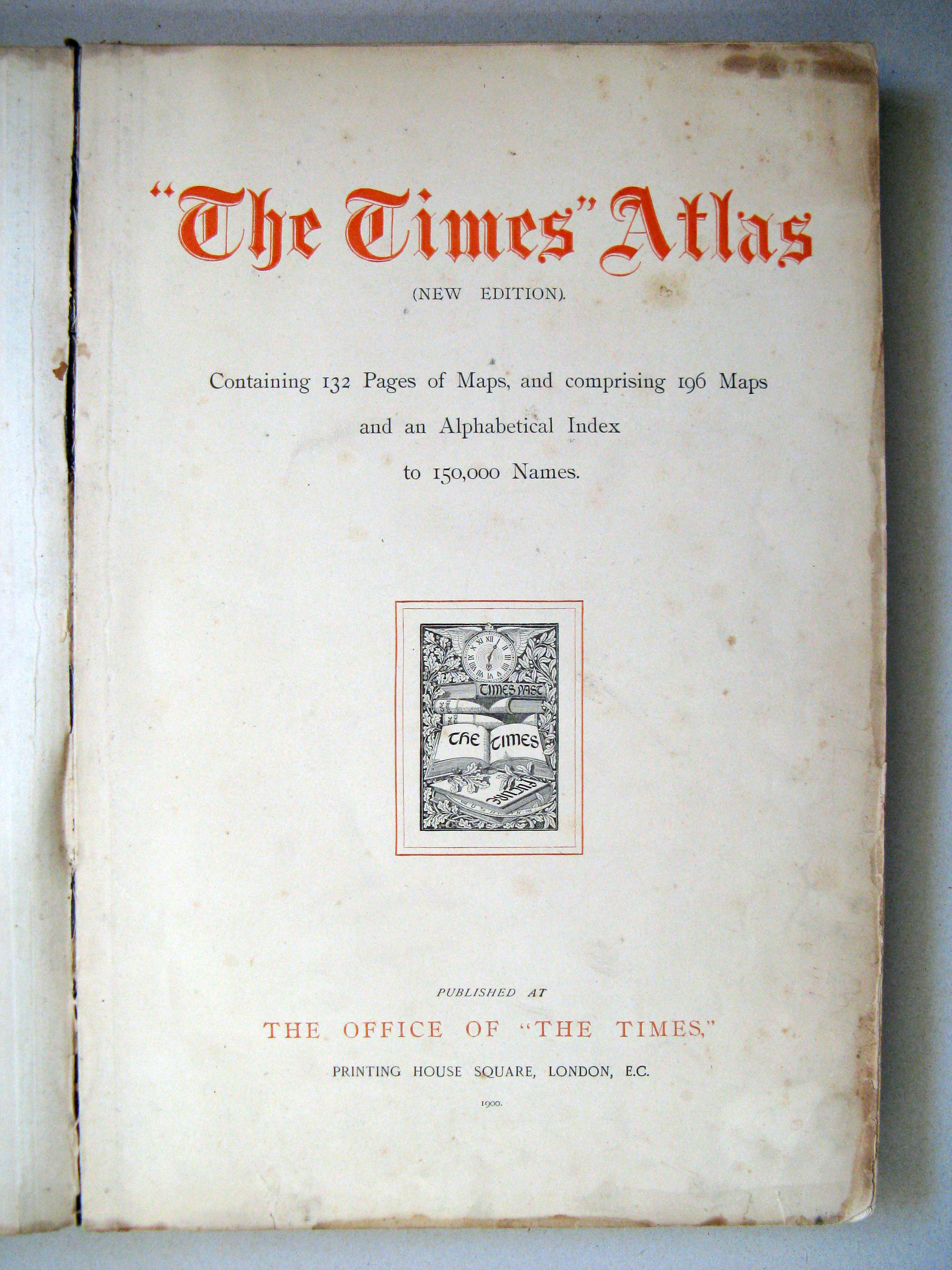
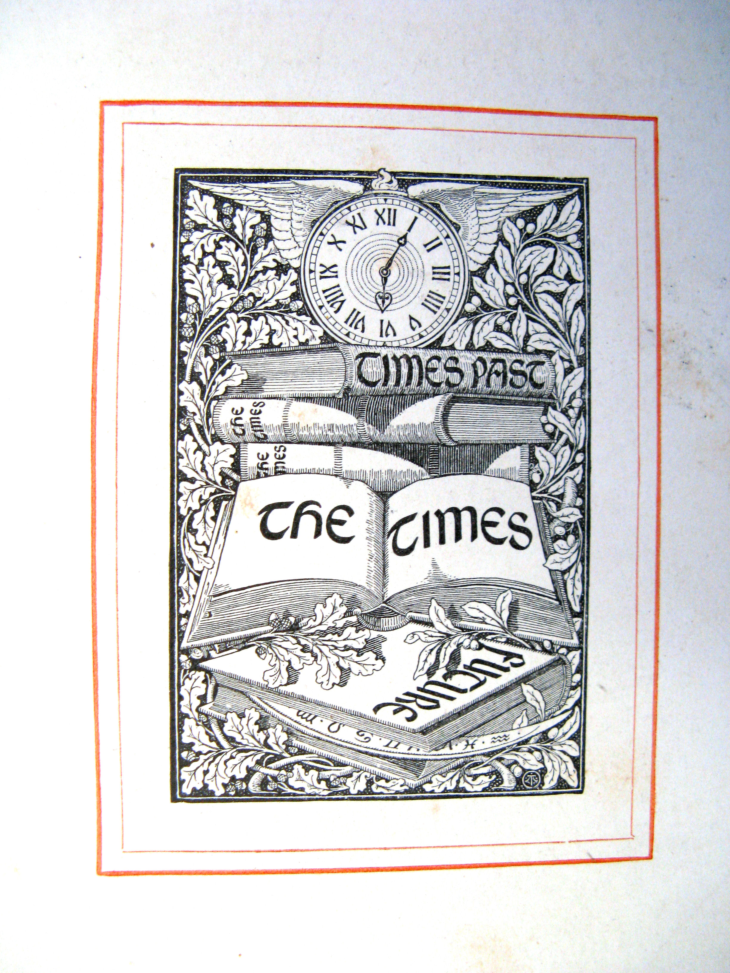
Titelpagina / Title page
 The Times Atlas 1900
Detail van de titelpagina / Title page detail
 The Times Atlas 1900
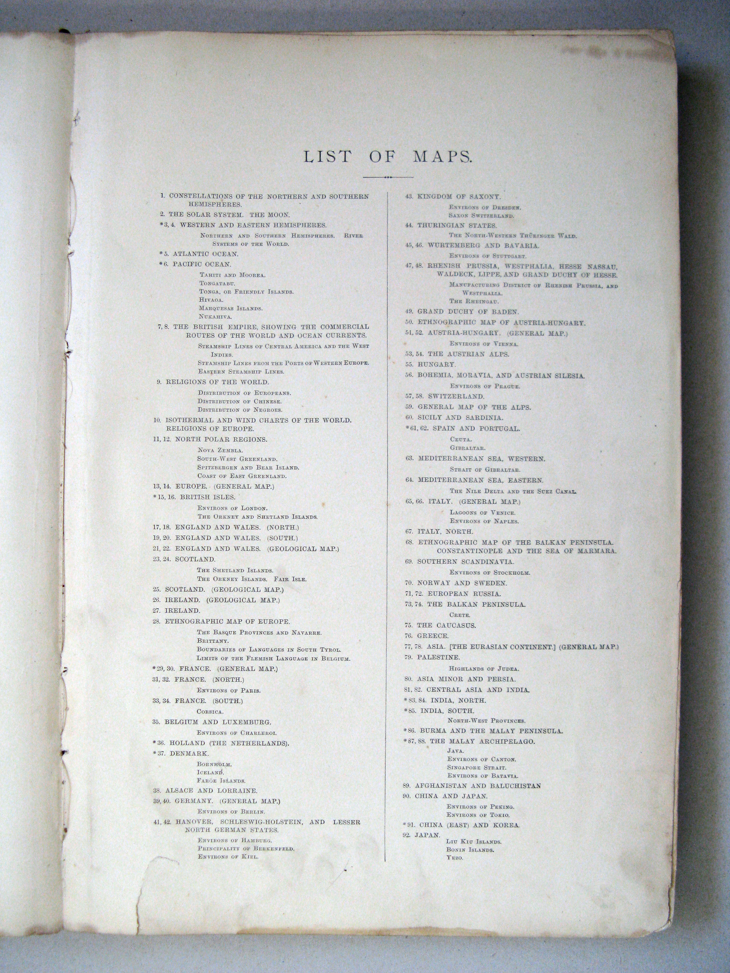
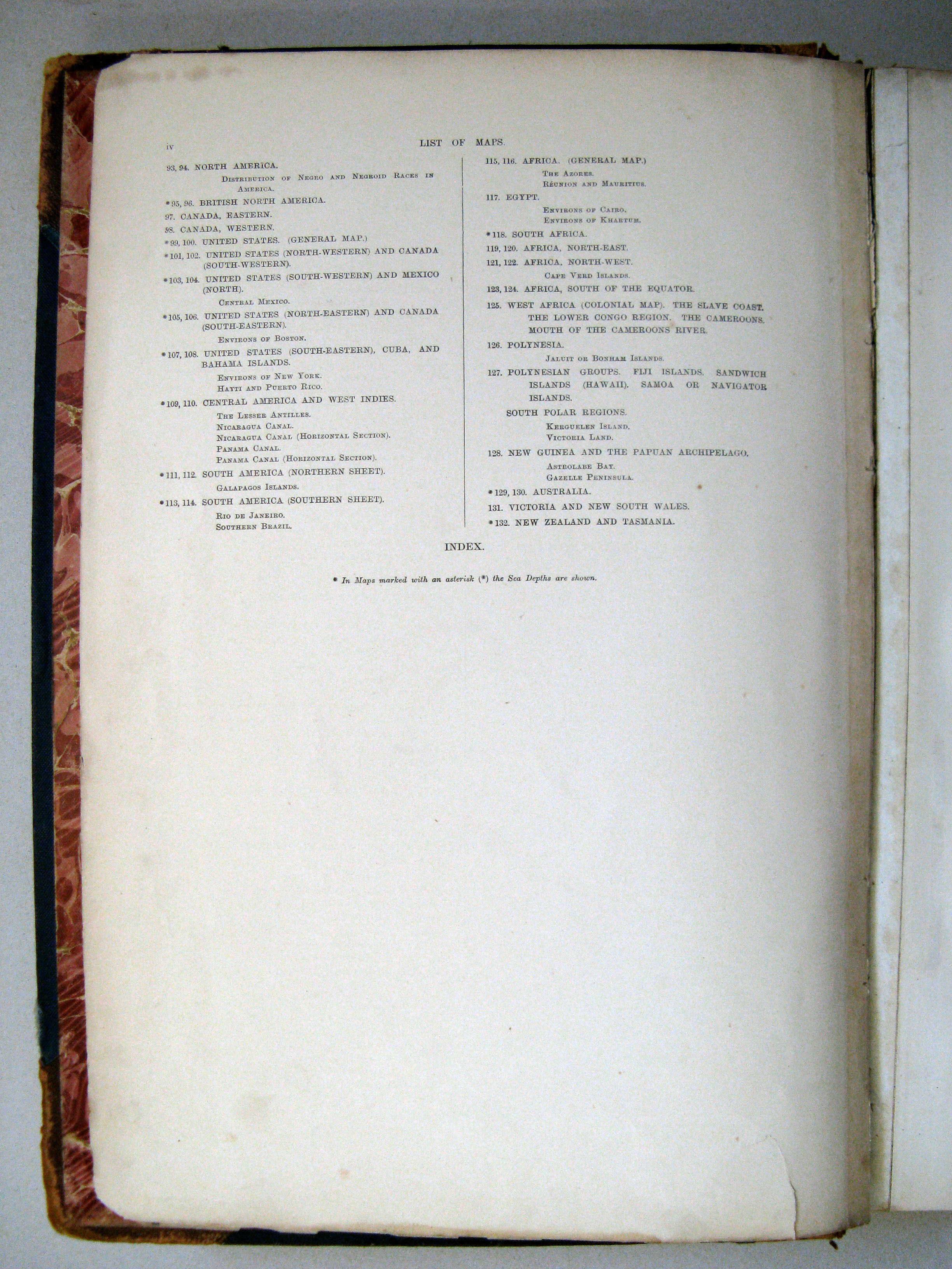
Inhoudsopgave / List of maps (1)
 The Times Atlas 1900
Inhoudsopgave / List of maps (2)
 The Times Atlas 1900
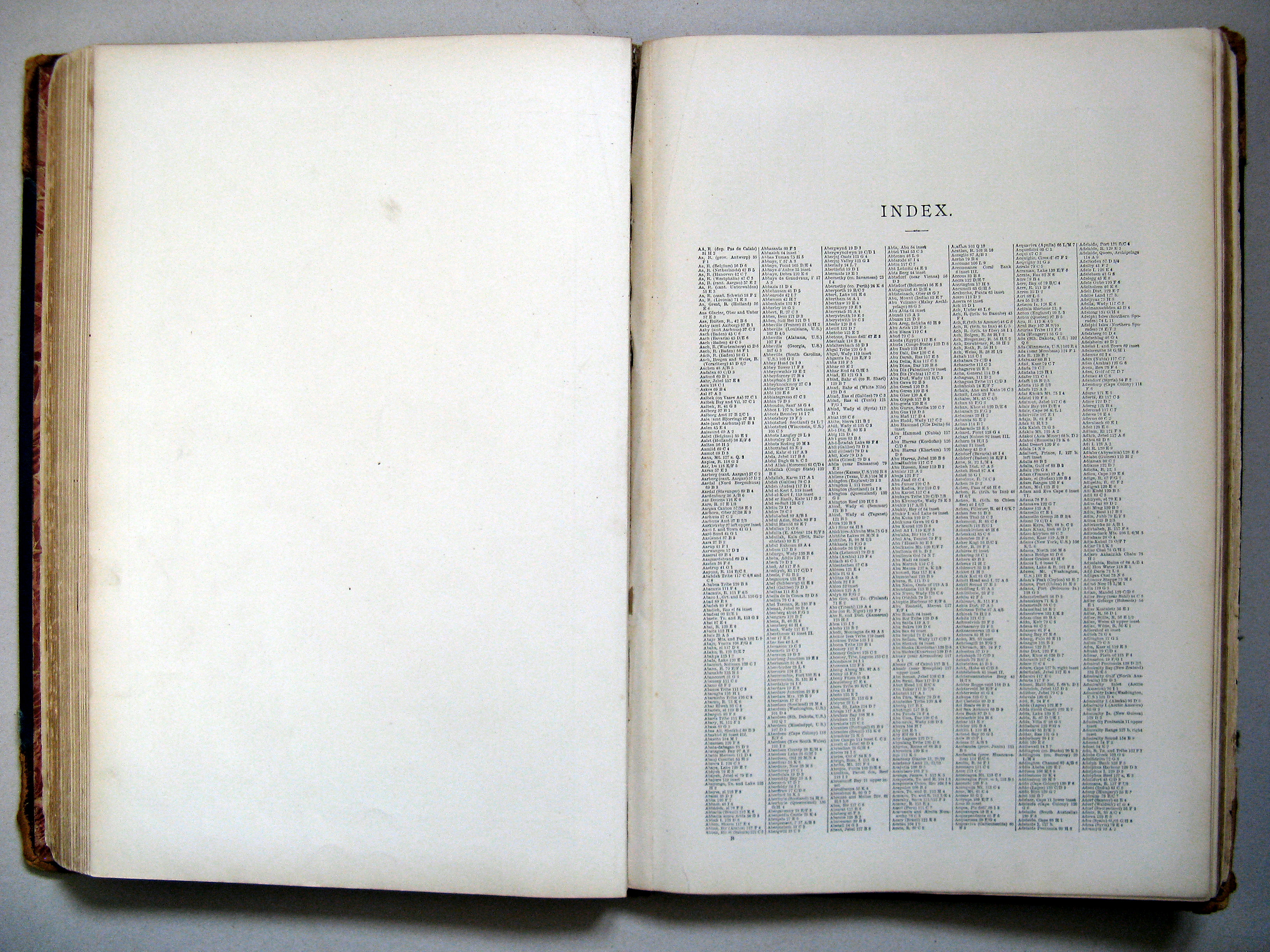
Register (blz. 1) / Index (p. 1)
 The Times Atlas 1900
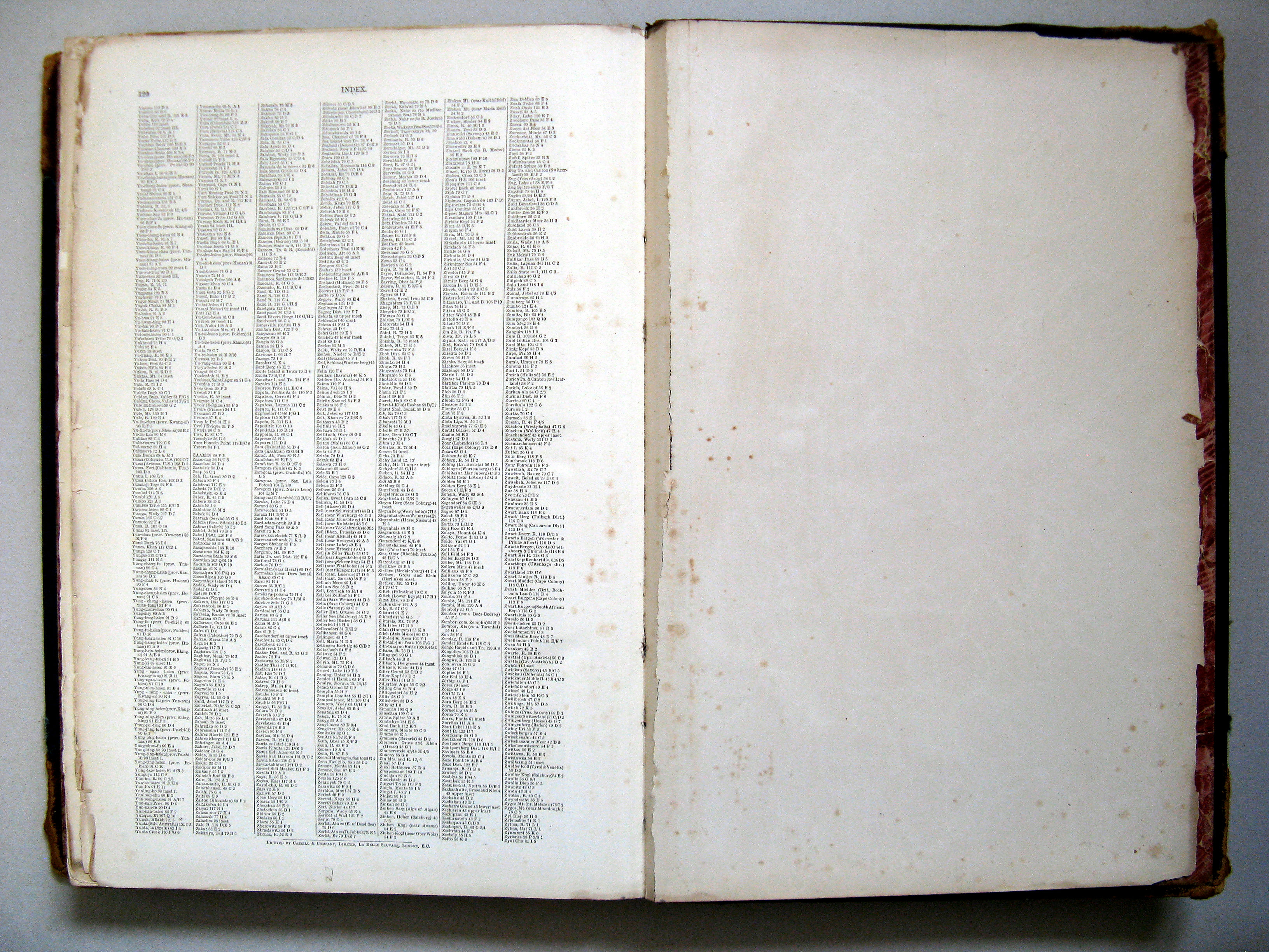
Register (blz. 120) / Index (p. 120)
 The Times Atlas 1900
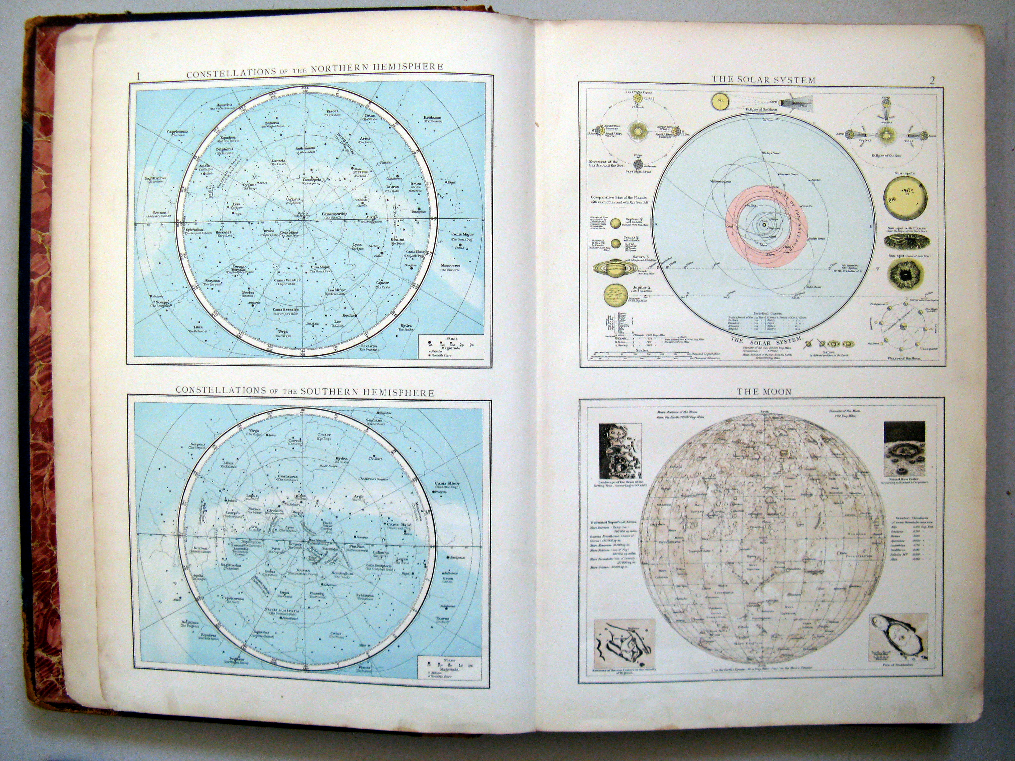
1. Constellations of the northern hemisphere. Constellations of the southern hemisphere
De noordelijke en zuidelijke sterrenhemel
2. The solar system. The Moon
Het zonnestelsel. De maan
 The Times Atlas 1900
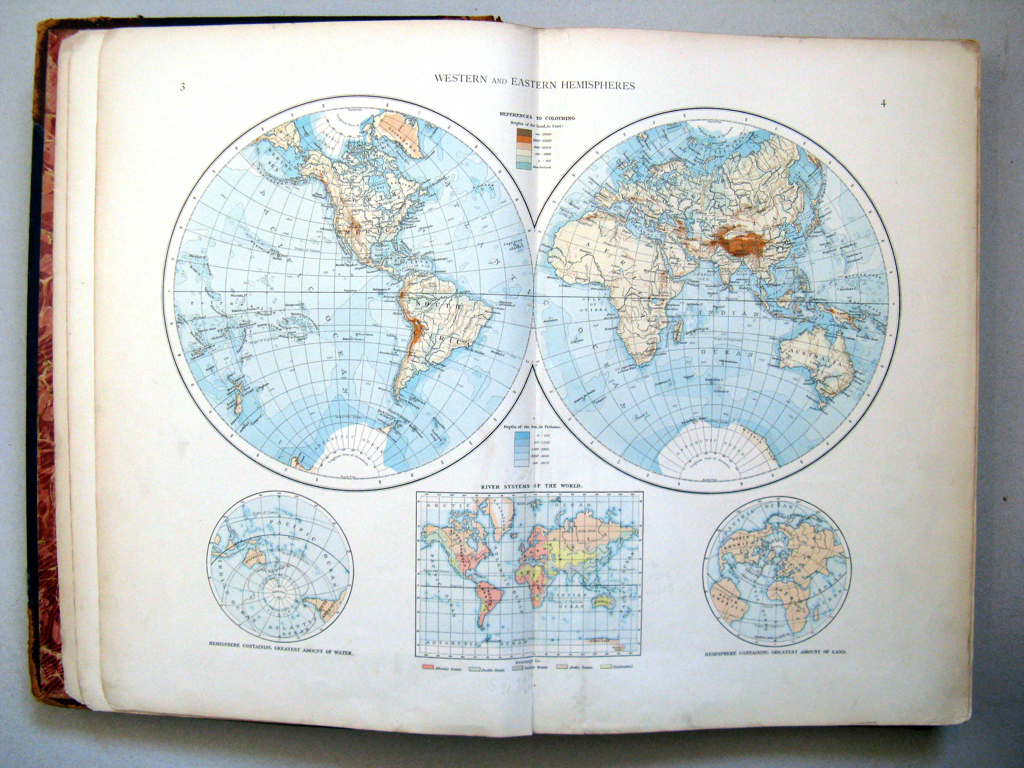
3.4. Western and eastern hemispheres
Westelijk en oostelijk halfrond
 The Times Atlas 1900
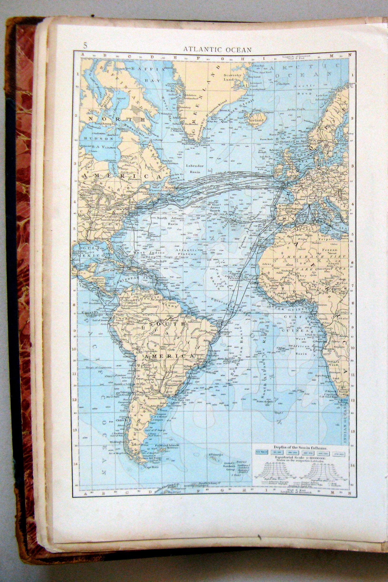
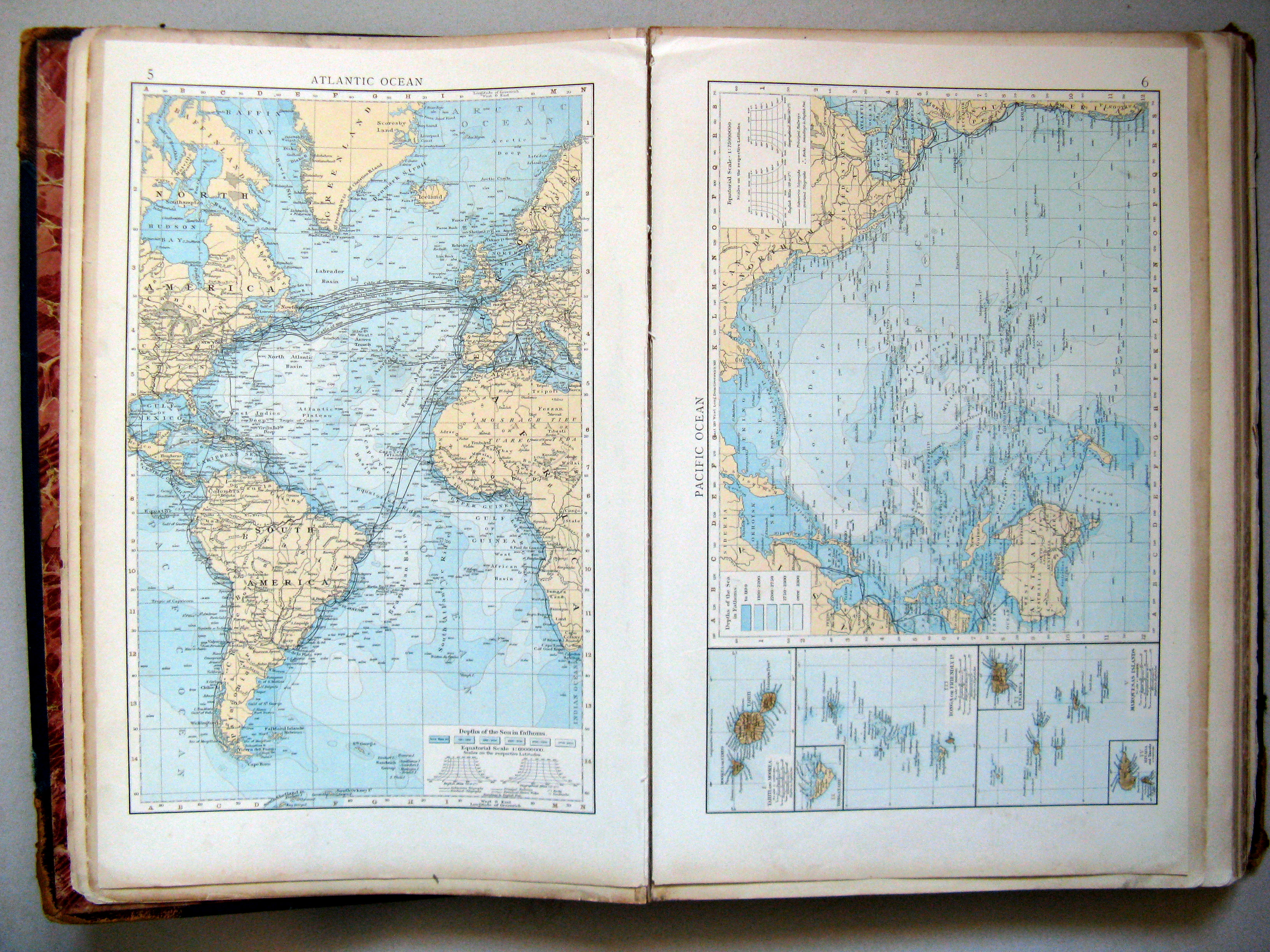
5. Atlantic Ocean
Atlantische Oceaan
 The Times Atlas 1900
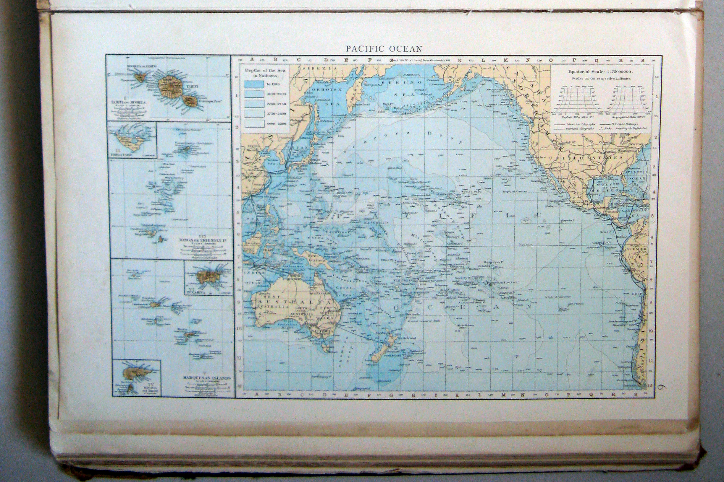
6. Pacific Ocean
Grote Oceaan
 The Times Atlas 1900
5. Atlantic Ocean
6. Pacific Ocean
 The Times Atlas 1900
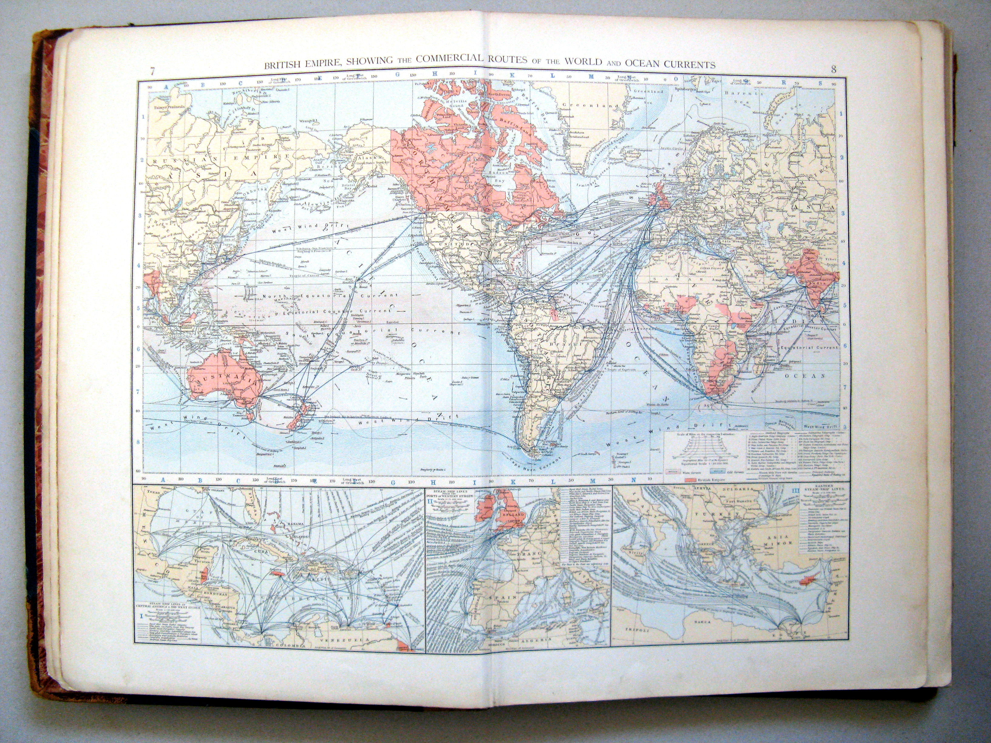
7.8. The British Empire, showing the commercial routes of the world and ocean currents
Het Britse Rijk, de handelsroutes en zeestromingen
 The Times Atlas 1900
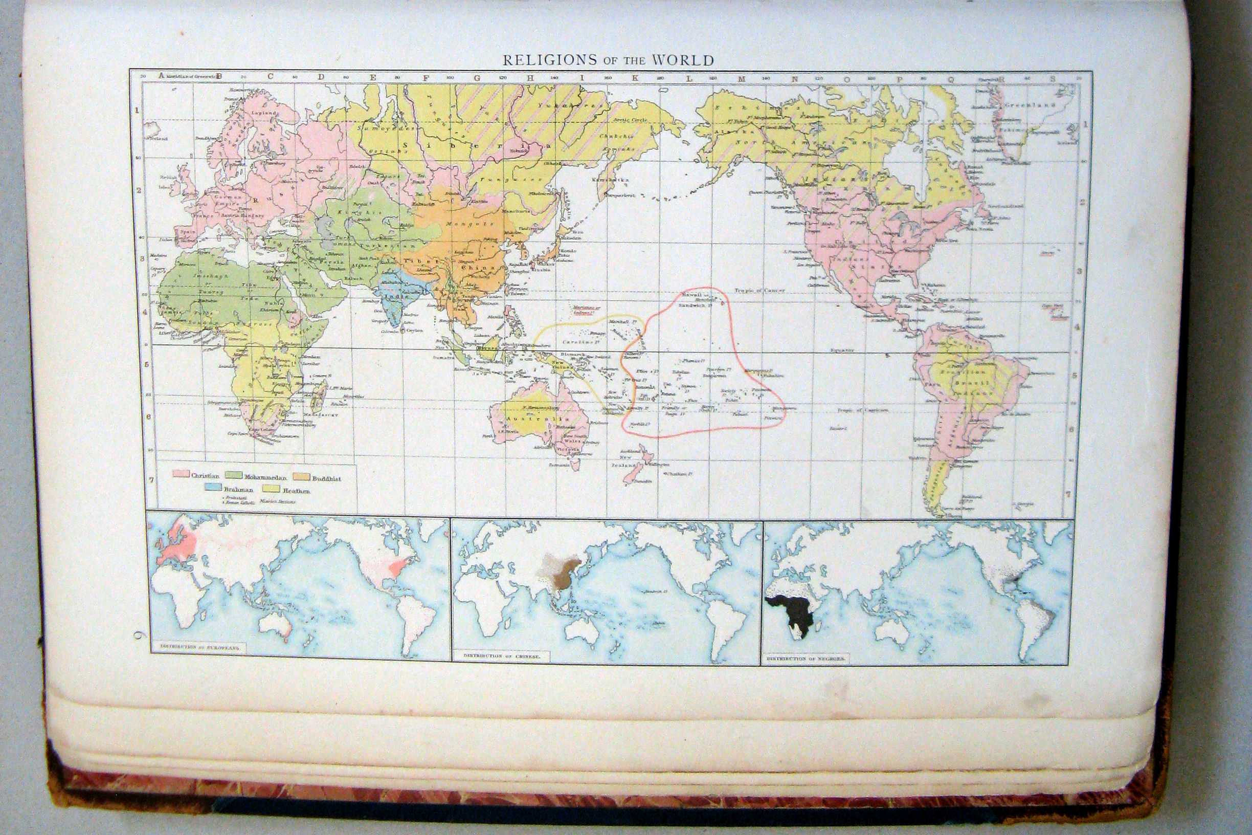
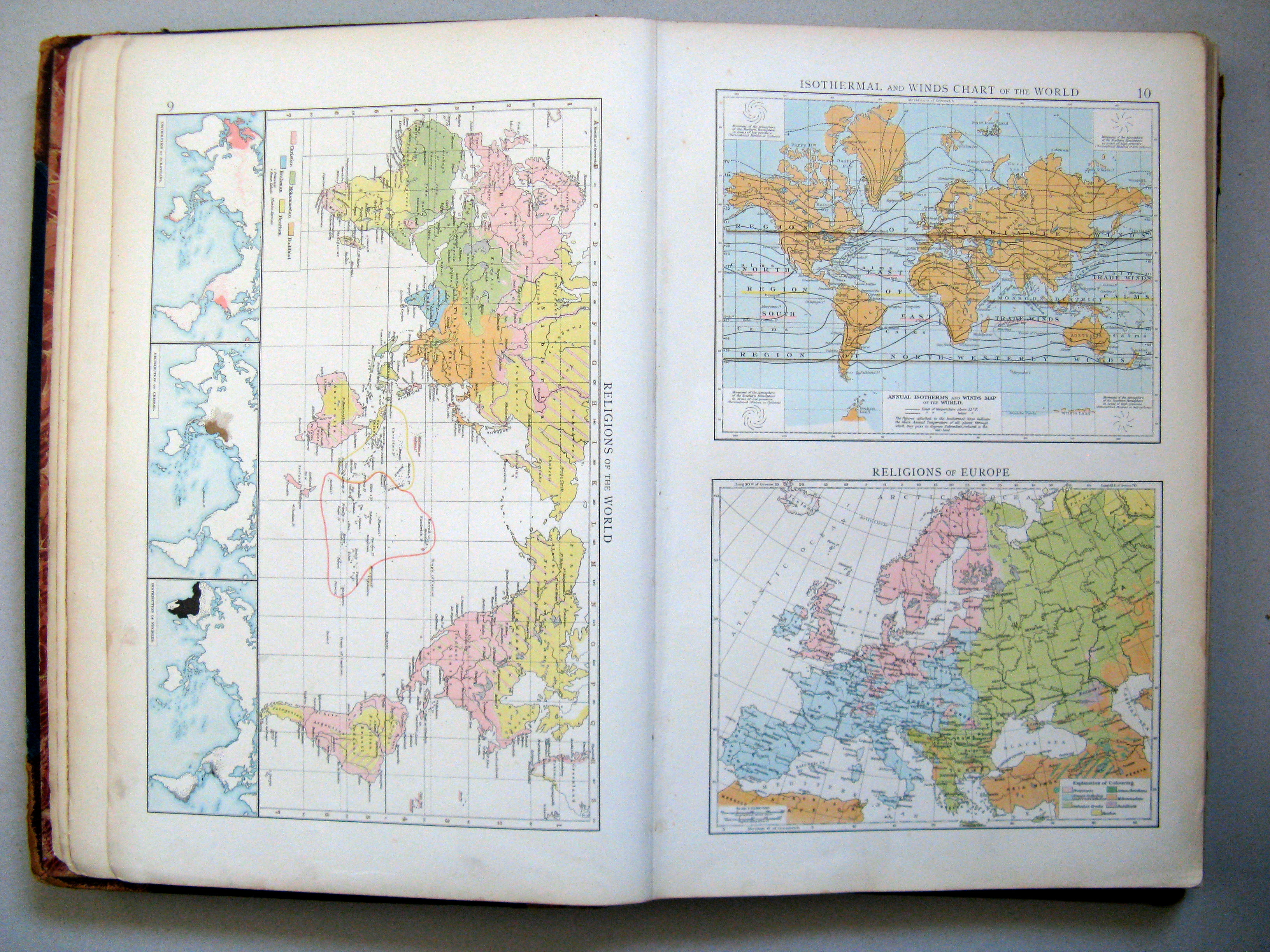
9. Religions of the world
Godsdiensten in de wereld
 The Times Atlas 1900
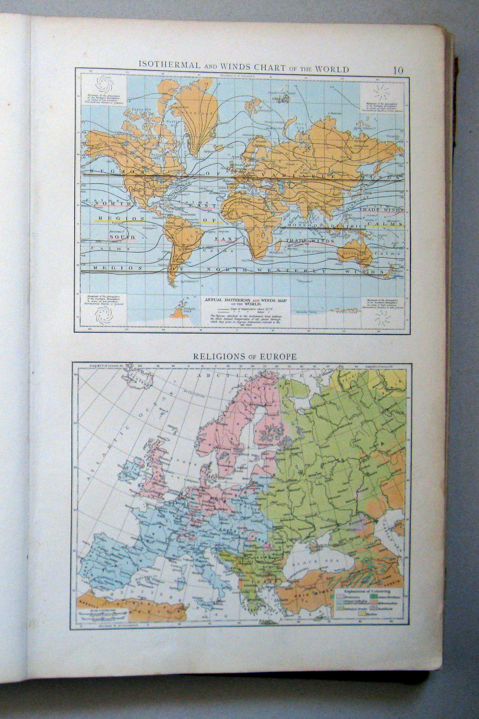
10. Isothermal and winds charts of the world. Religions of Europe
Isothermen en winden. Godsdiensten in de Europa
 The Times Atlas 1900
9. Religions of the world
10. Isothermal and winds charts of the world. Religions of Europe
 The Times Atlas 1900
11.12. North Polar regions
Noordpoolgebied
 The Times Atlas 1900
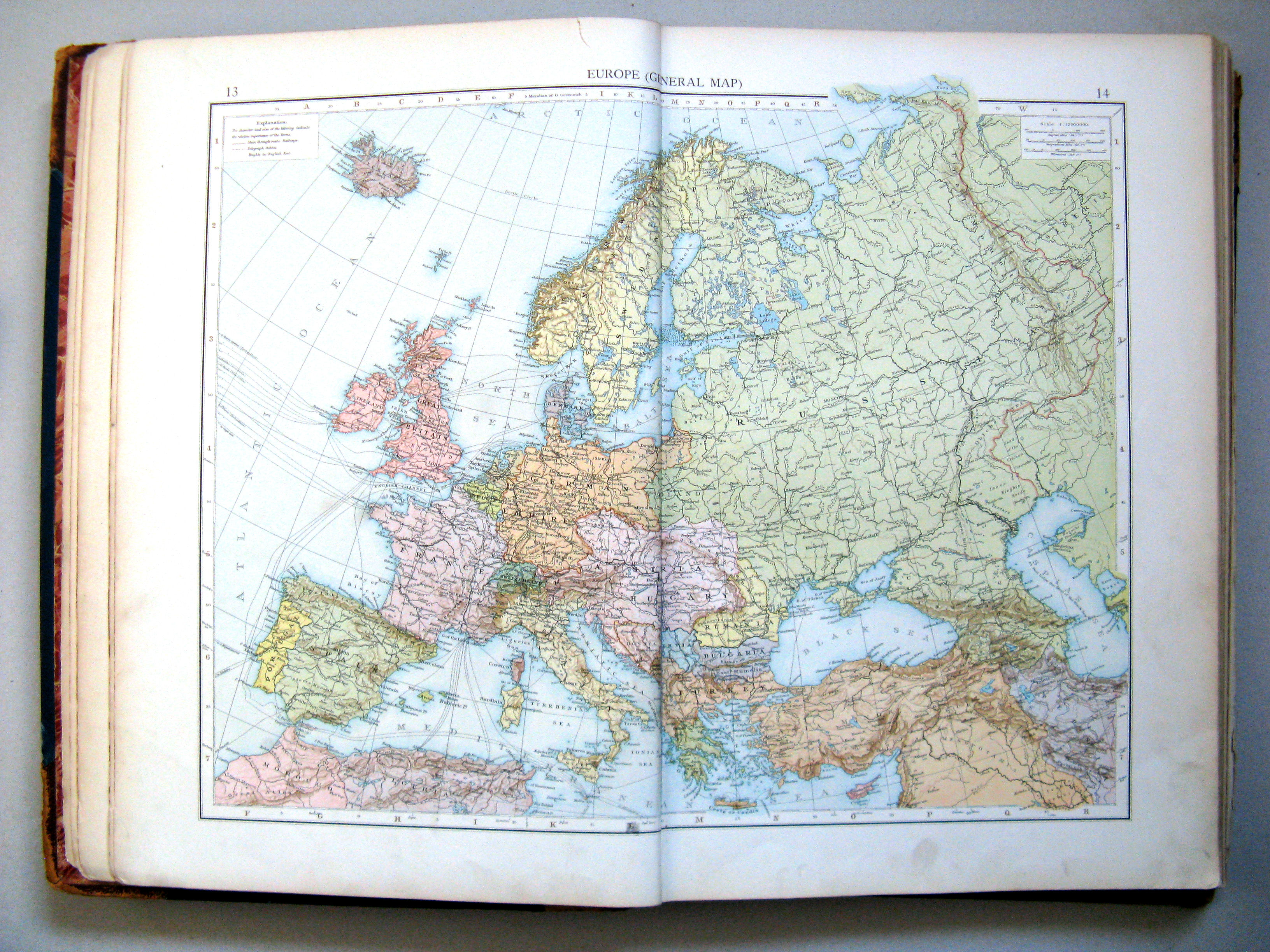
13.14. Europe (general map)
Europa (overzichtskaart)
 The Times Atlas 1900
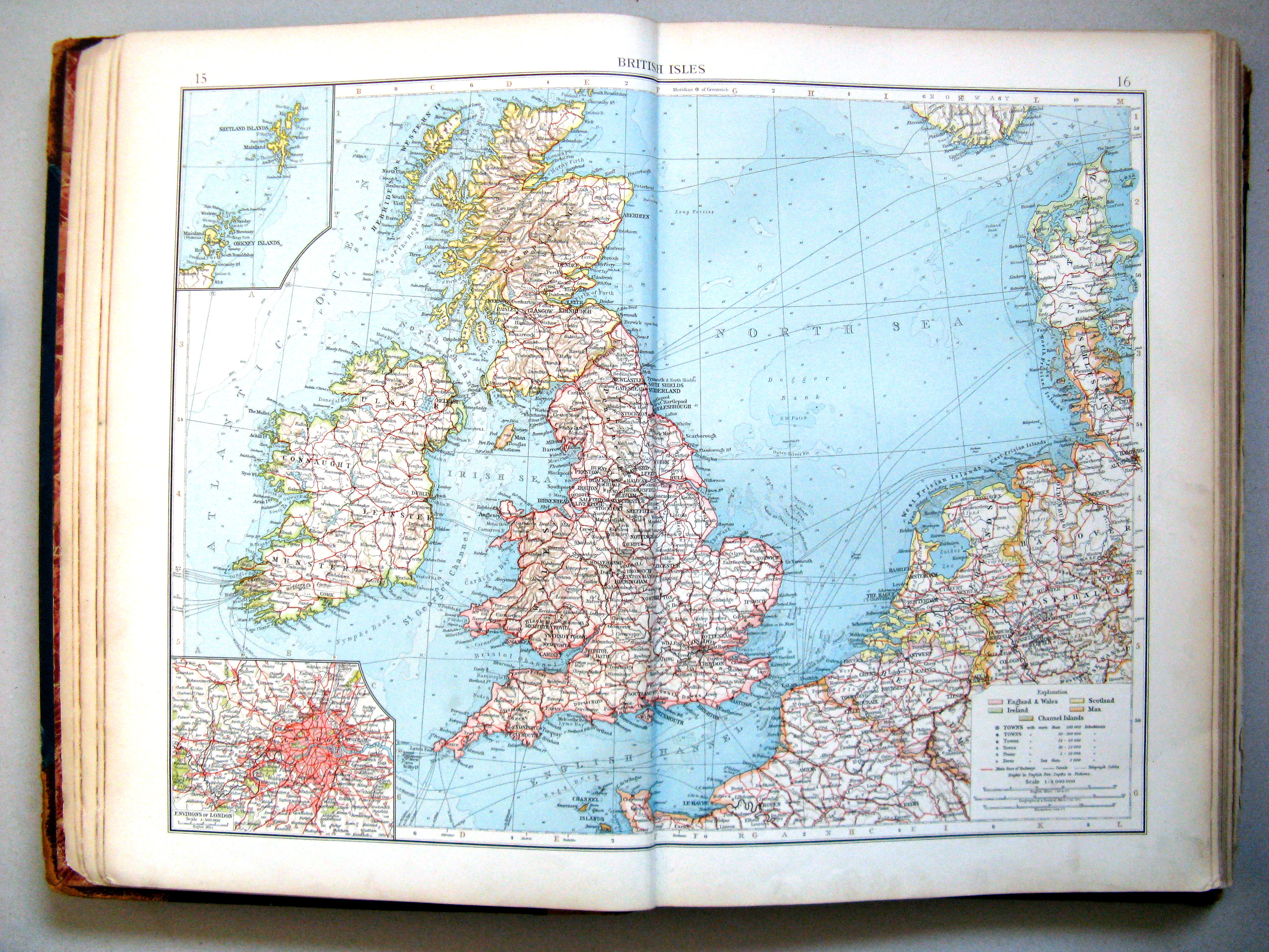
15.16. British Isles
Britse Eilanden
 The Times Atlas 1900
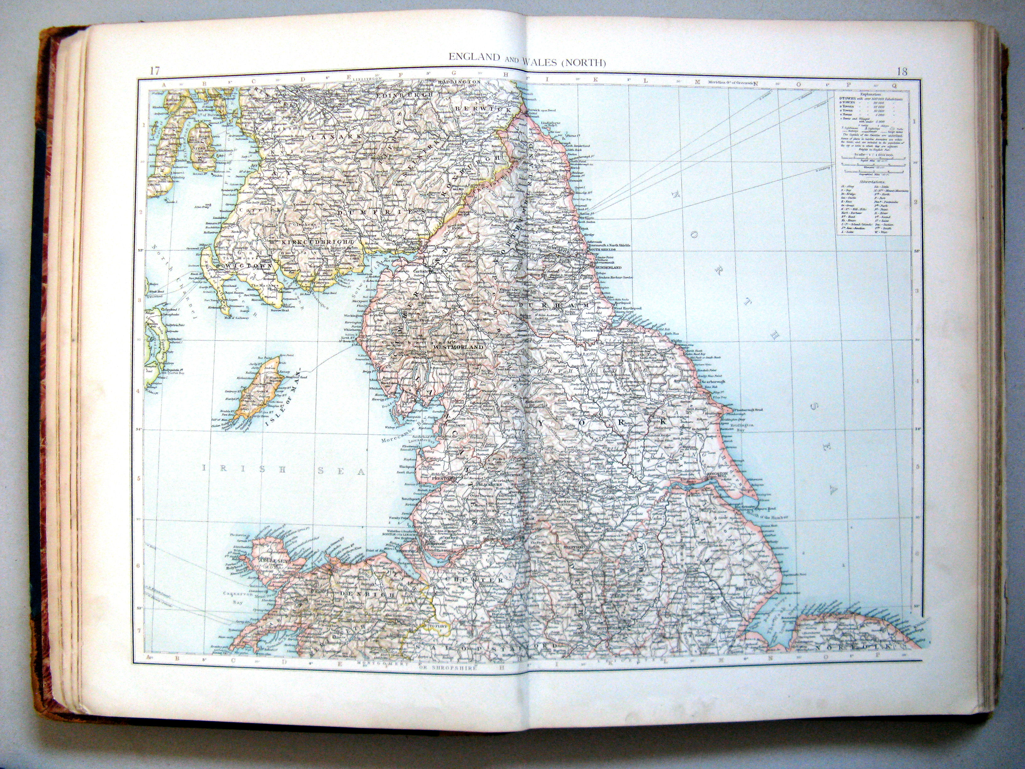
17.18. England and Wales (north)
Engeland en Wales (noord)
 The Times Atlas 1900
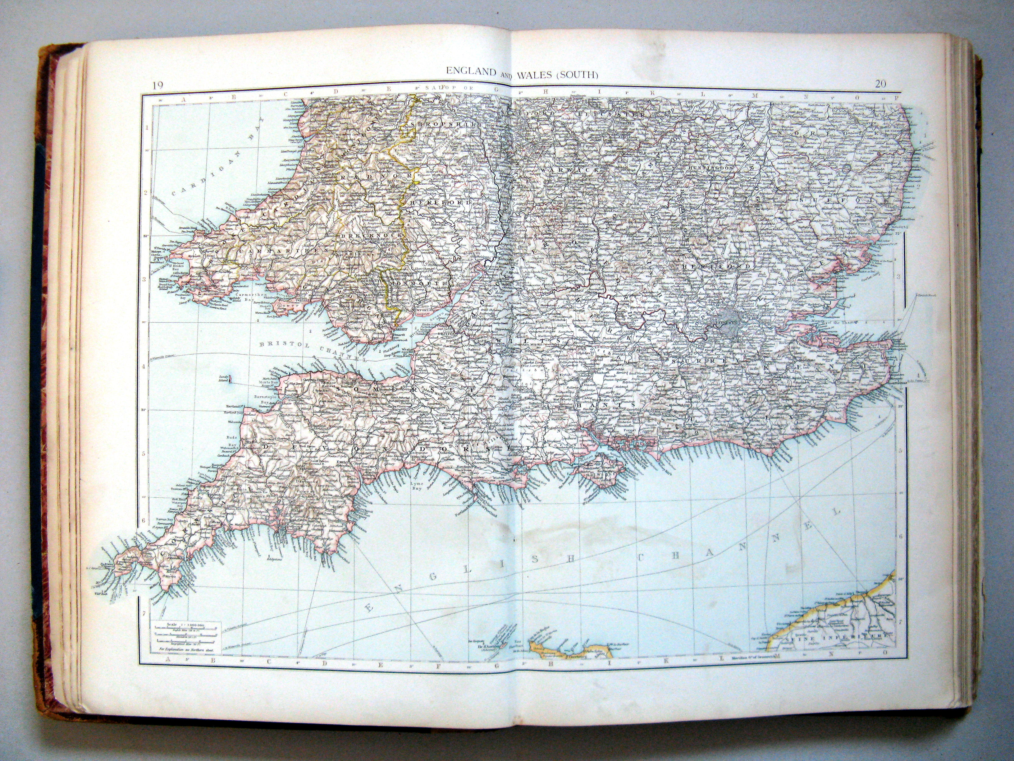
19.20. England and Wales (south)
Engeland en Wales (zuid)
 The Times Atlas 1900
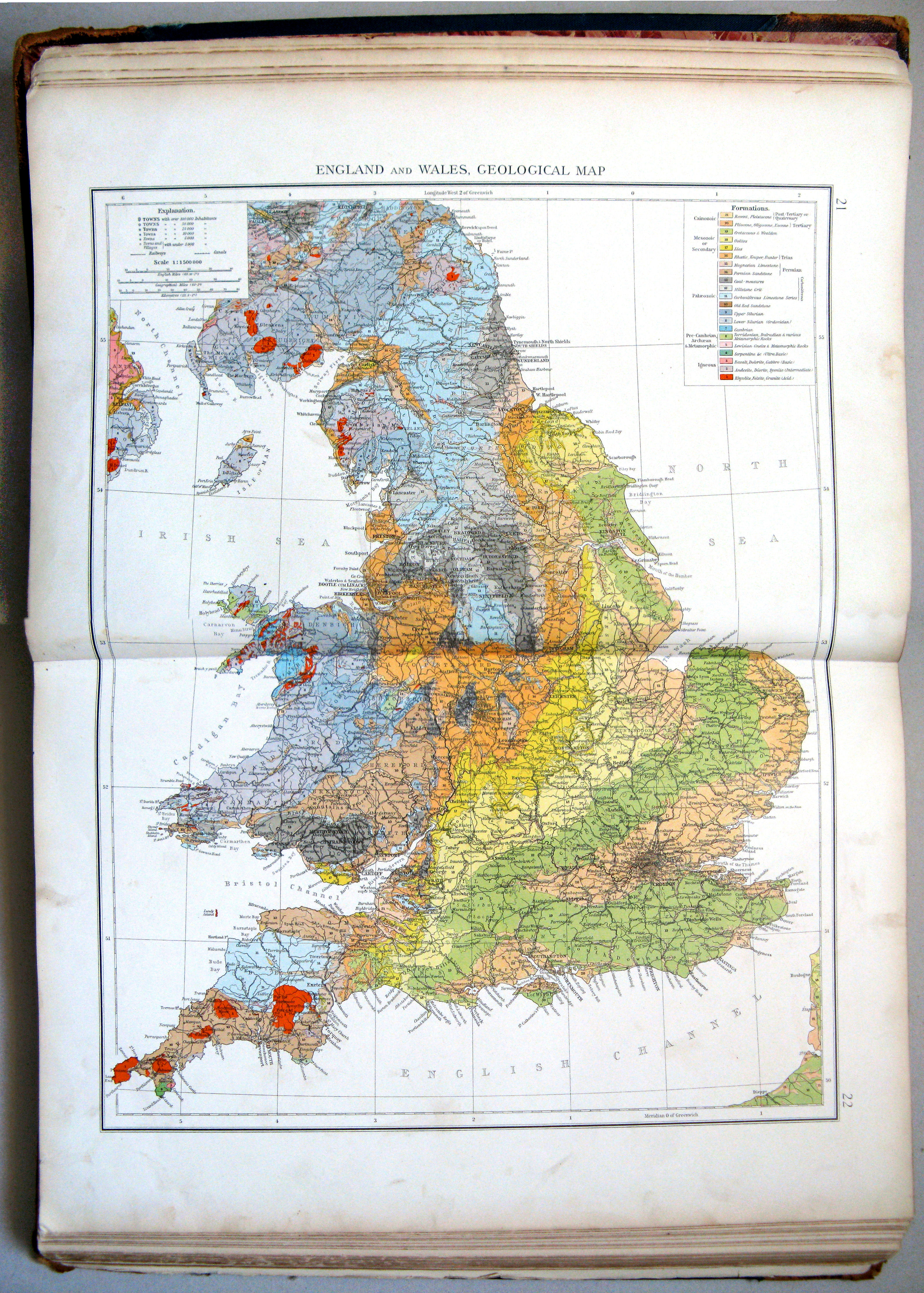
21.22. England and Wales, geological map
Engeland en Wales, geologisch
 The Times Atlas 1900
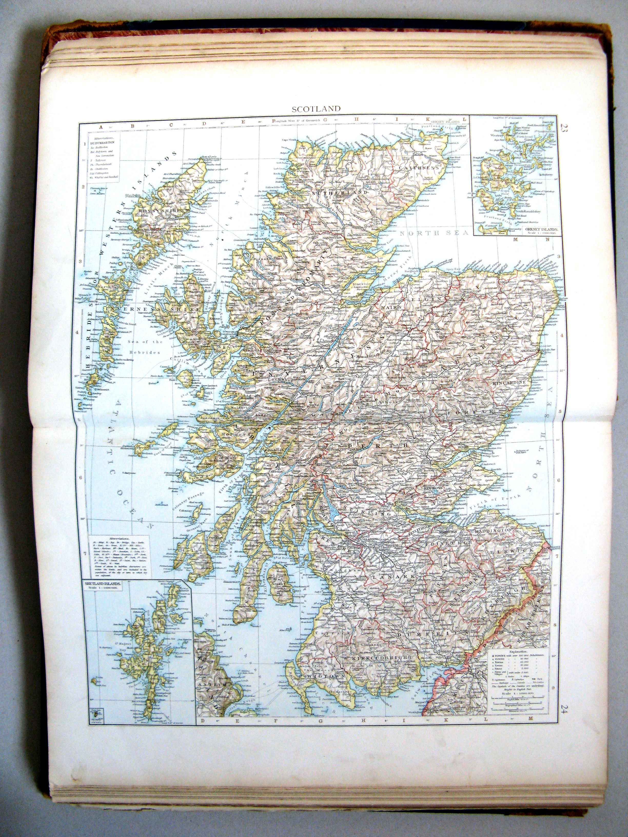
23.24. Scotland
Schotland
 The Times Atlas 1900
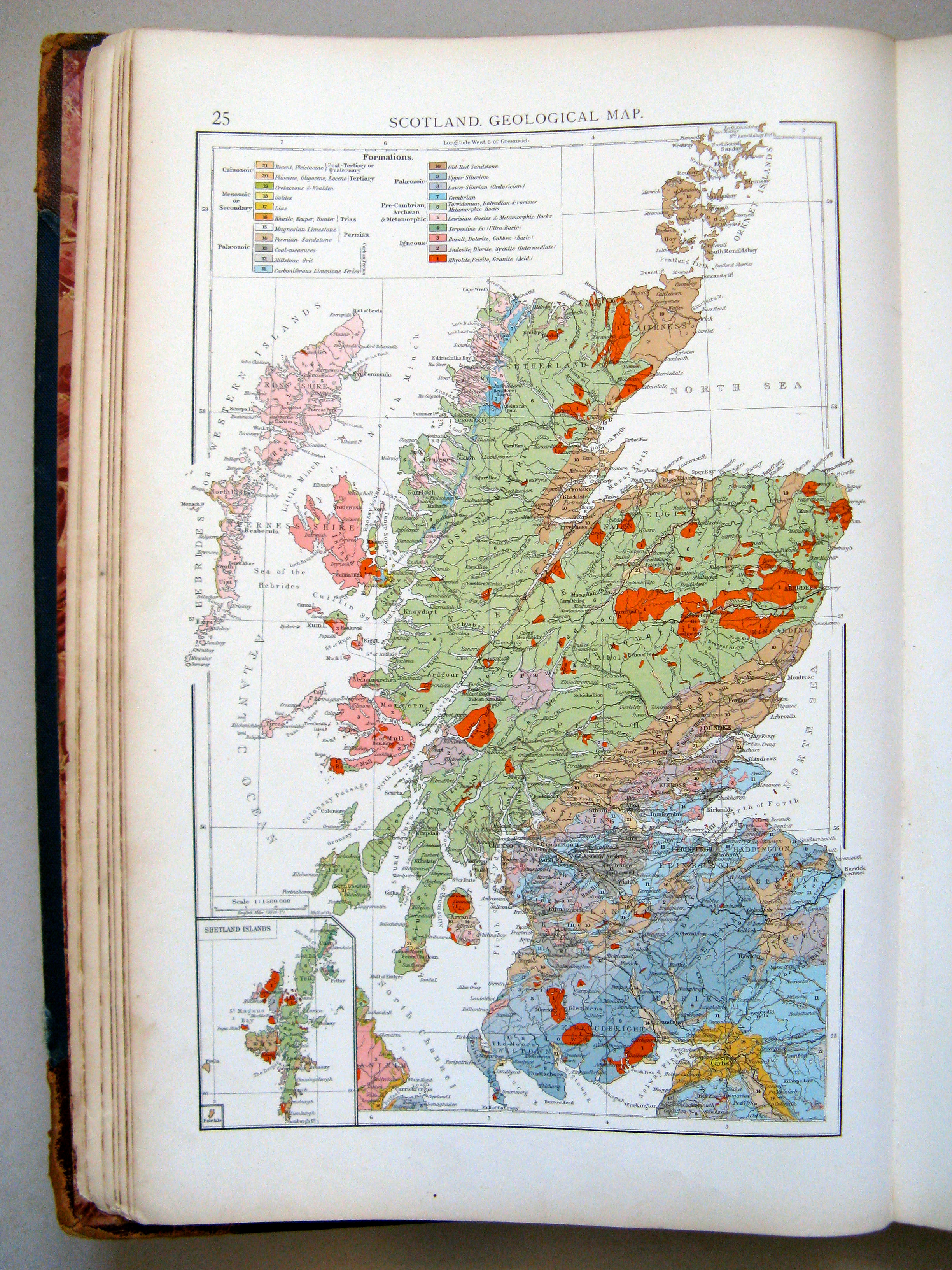
25. Scotland, geological map
Schotland, geologisch
 The Times Atlas 1900
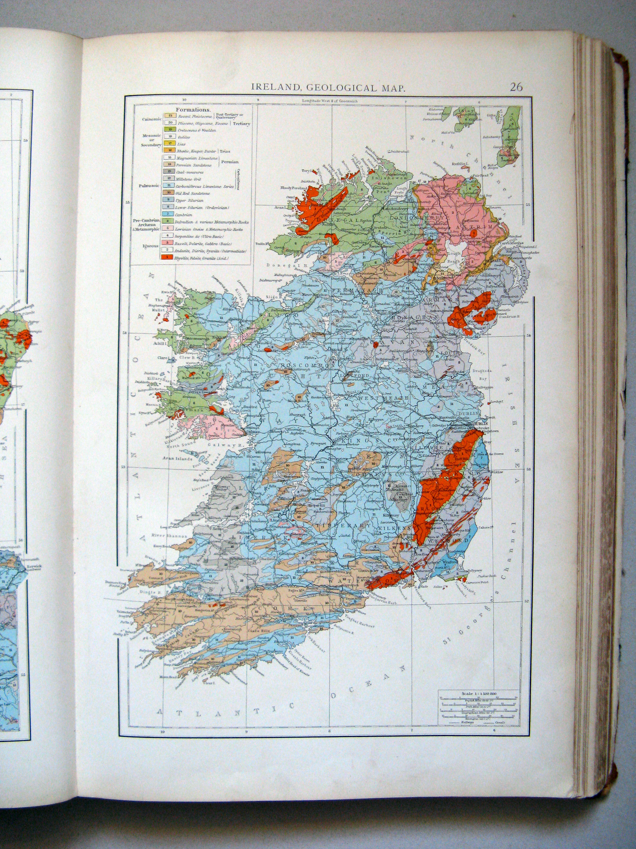
26. Ireland, geological map
Ierland, geologisch
 The Times Atlas 1900
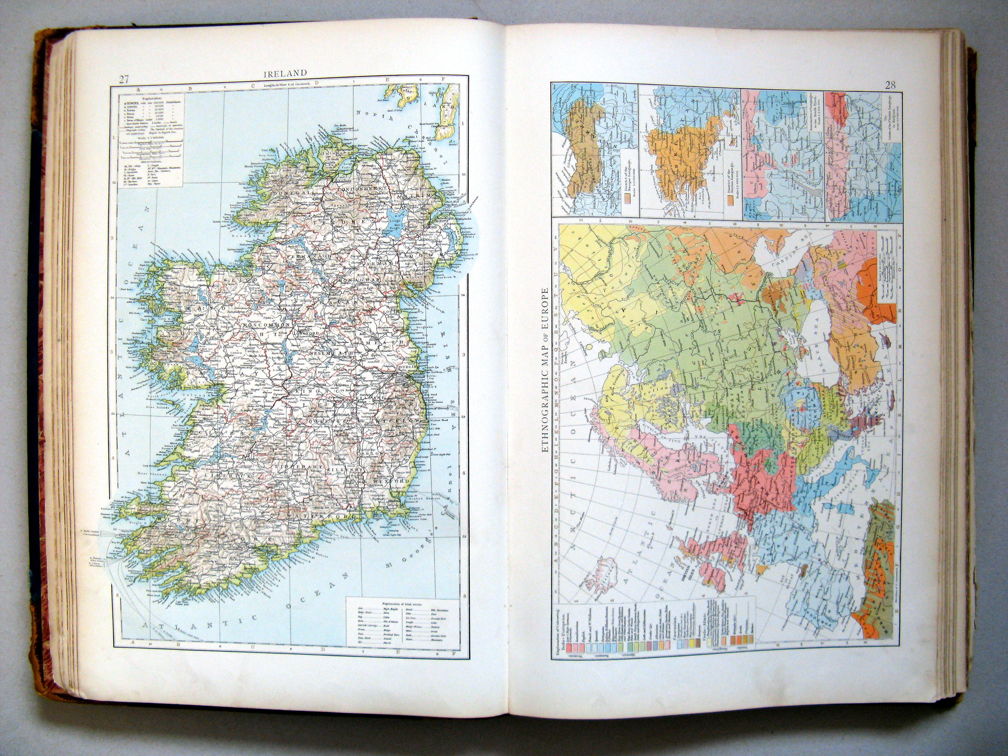
27. Ireland
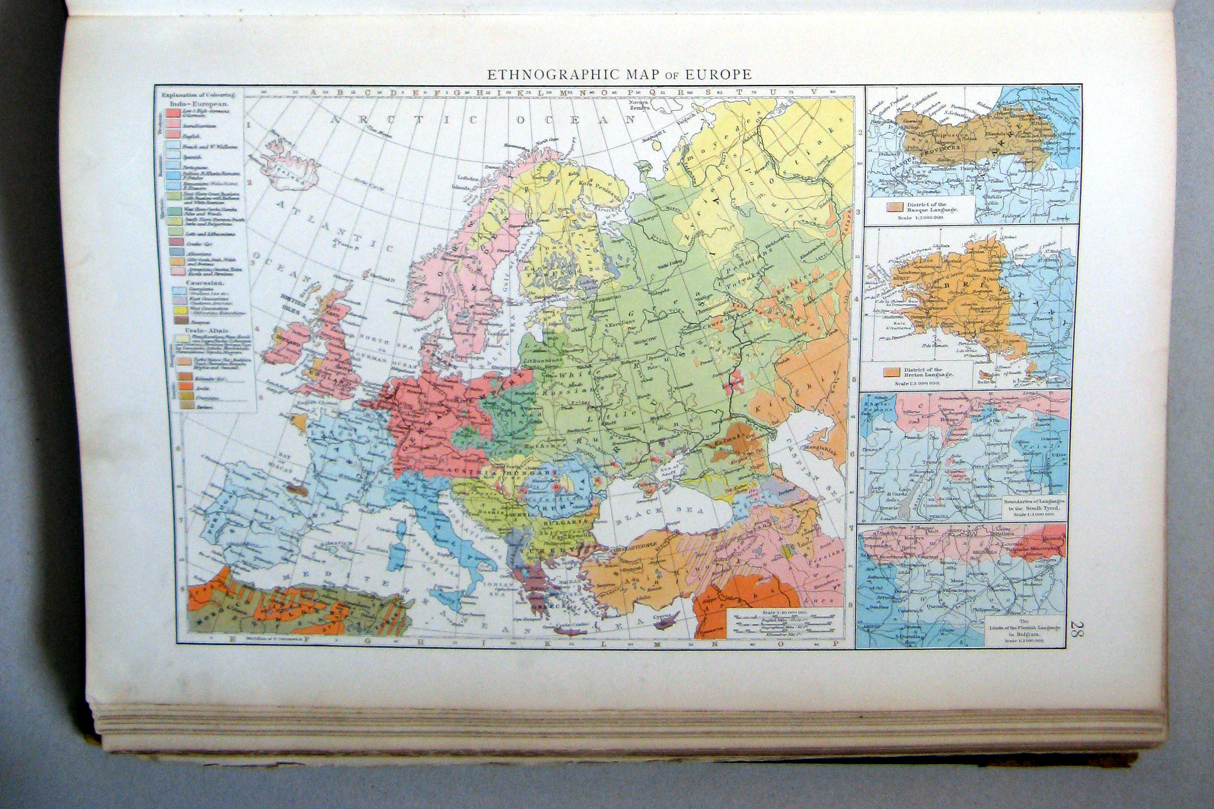
28. Ethnographic map of Europe
Ierland. Volkeren in Europa
 The Times Atlas 1900
28. Ethnographic map of Europe
Volkeren in Europa
 The Times Atlas 1900
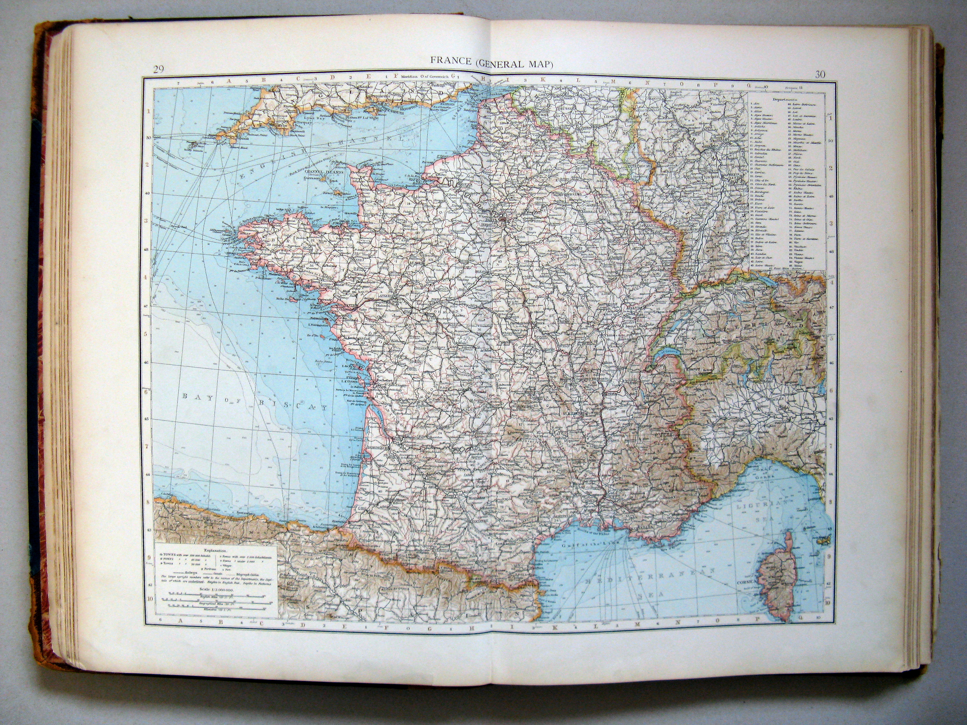
29.30. France (general map)
Frankrijk (overzichtskaart)
 The Times Atlas 1900
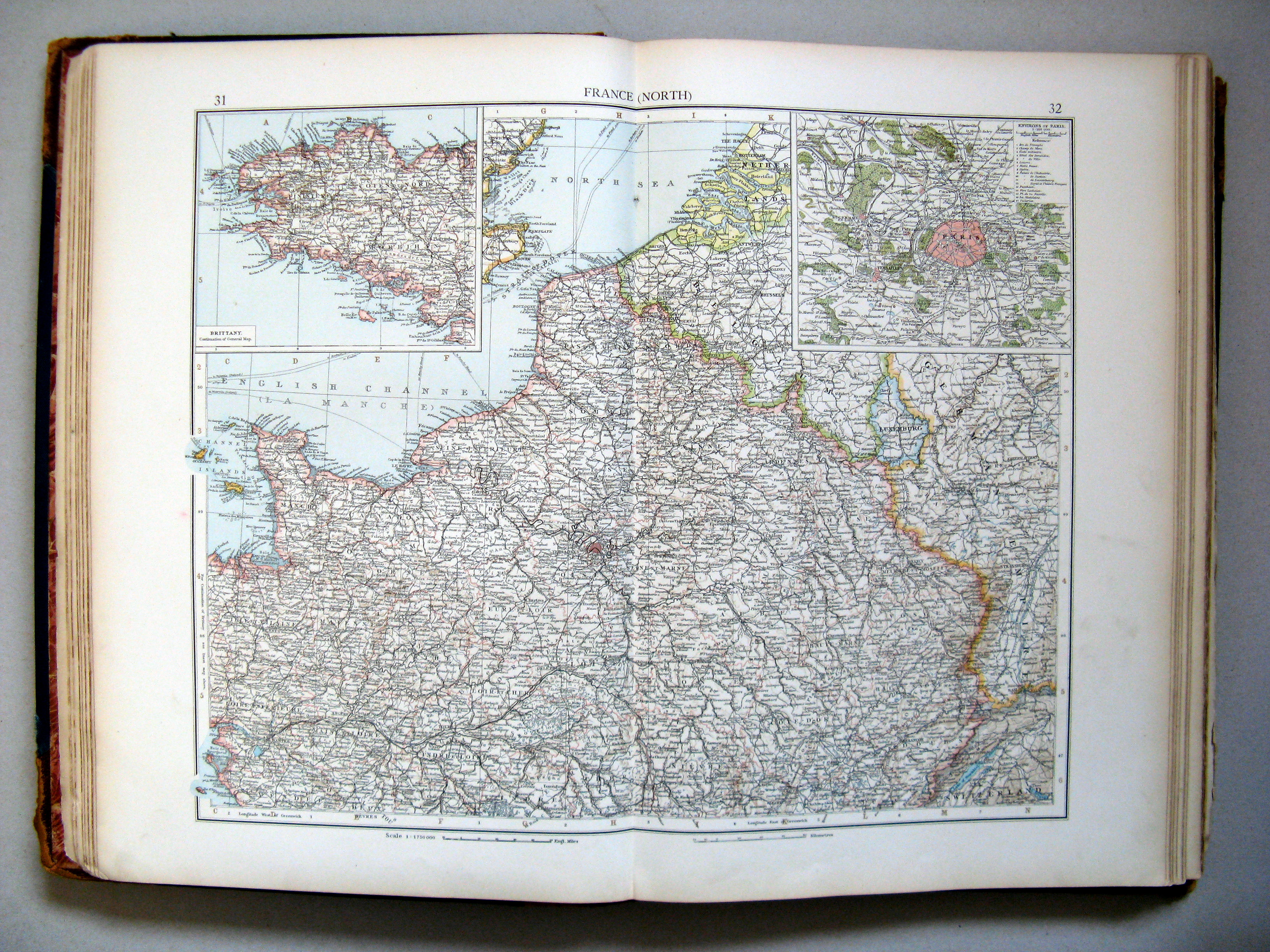
31.32. France (north)
Frankrijk (noord)
 The Times Atlas 1900
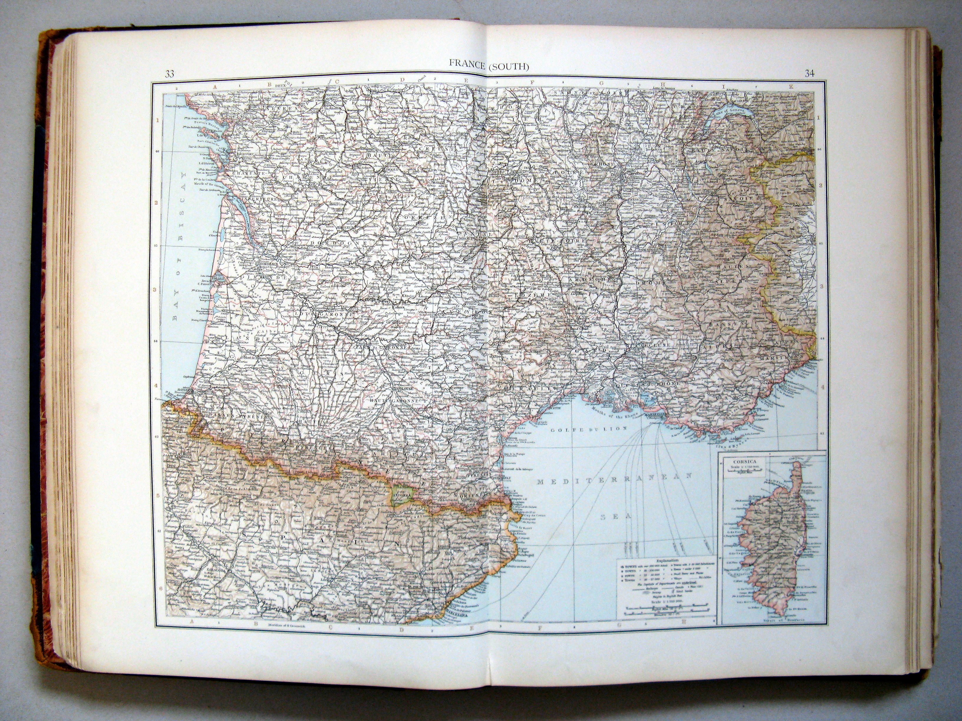
33.34. France (south)
Frankrijk (zuid)
 The Times Atlas 1900
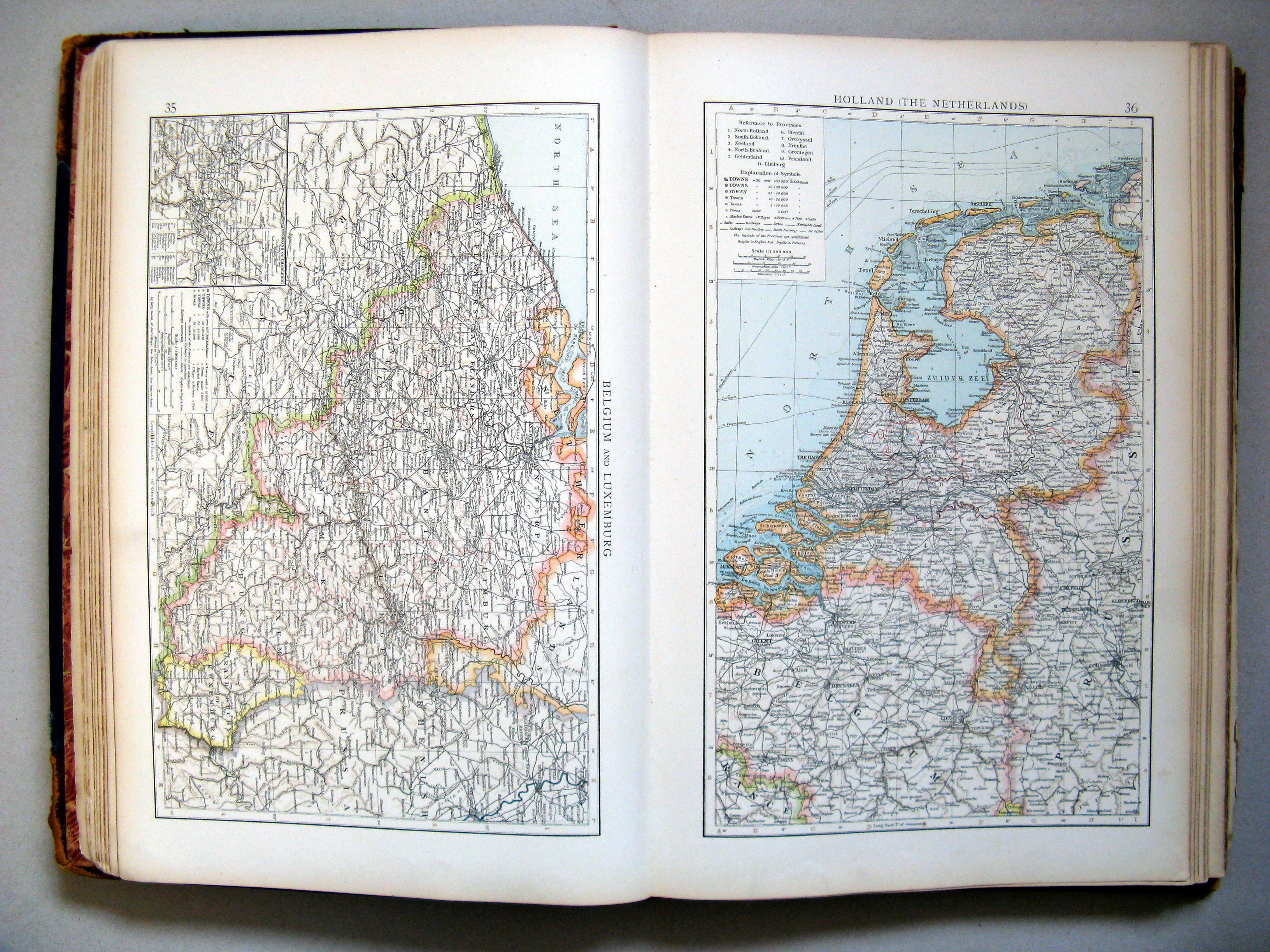
35. Belgium and Luxemburg
36. Holland (The Netherlands)
 The Times Atlas 1900
35. Belgium and Luxemburg
België en Luxemburg
 The Times Atlas 1900
36. Holland (The Netherlands)
Nederland
 The Times Atlas 1900
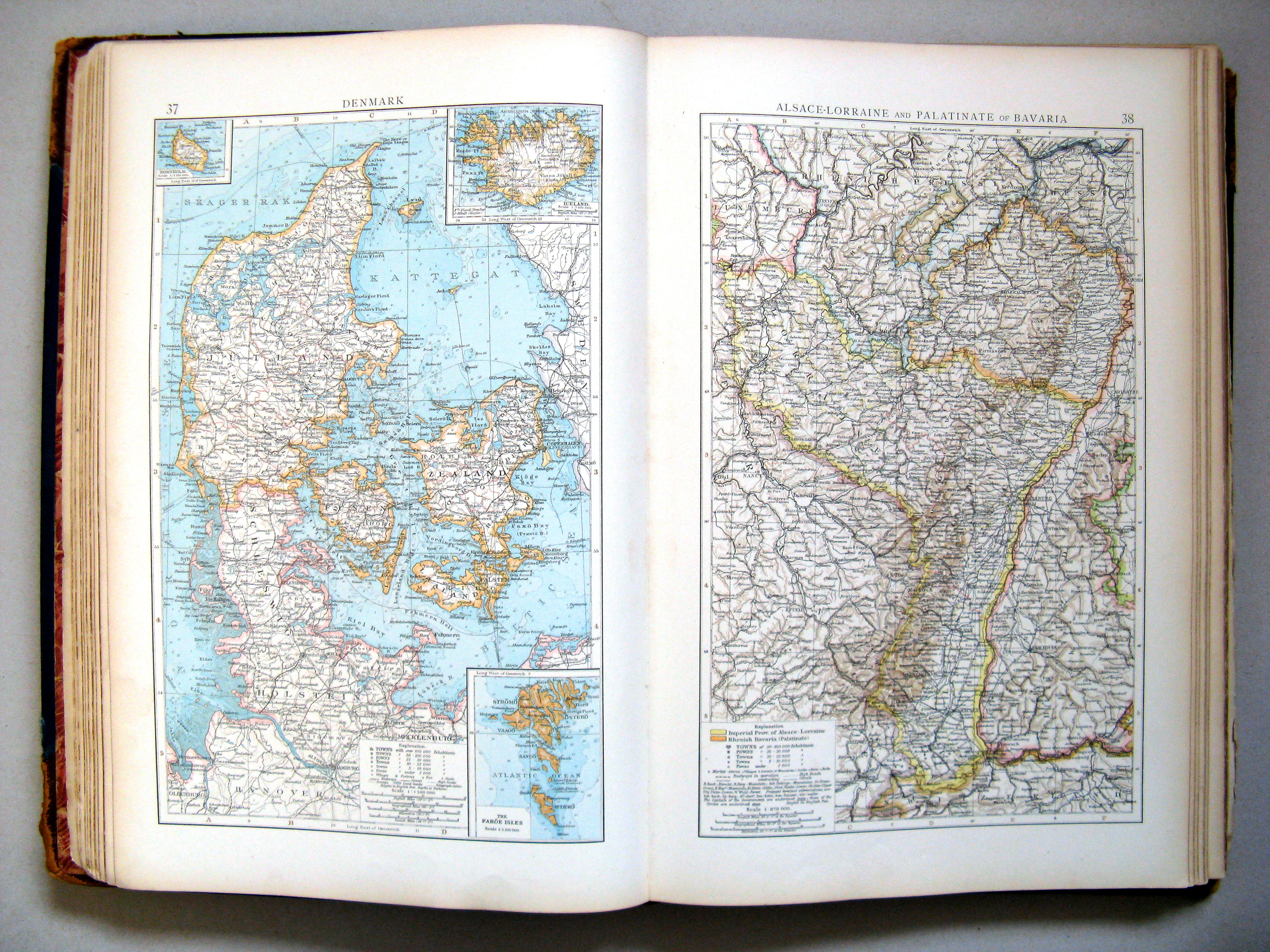
37. Denmark
38. Alsace-Lorraine and Palatinate of Bavaria
Denemarken. Elzas-Lotharingen en Beierse Palts
 The Times Atlas 1900
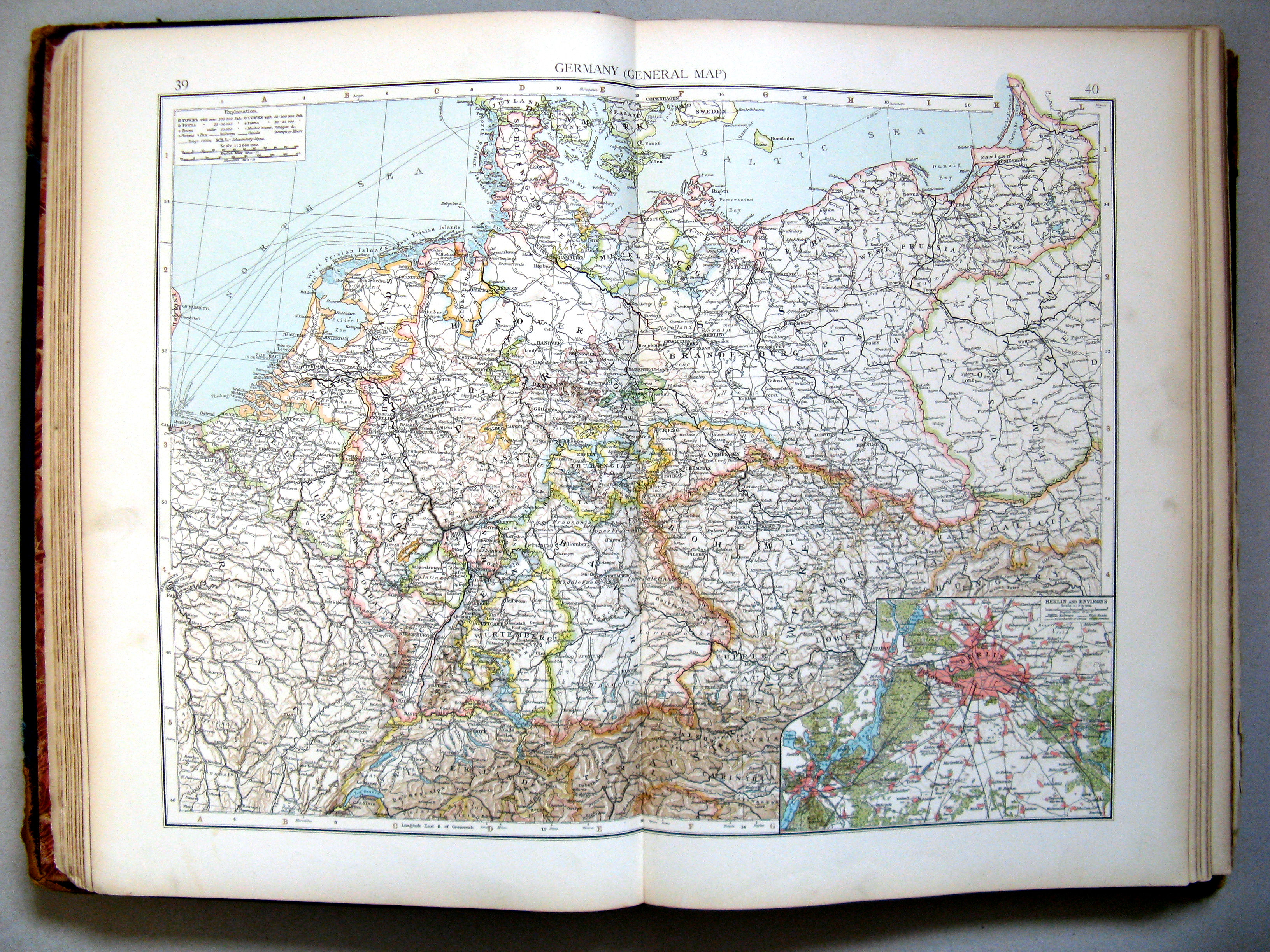
39.40. Germany (general map)
Duitsland (overzichtskaart)
 The Times Atlas 1900
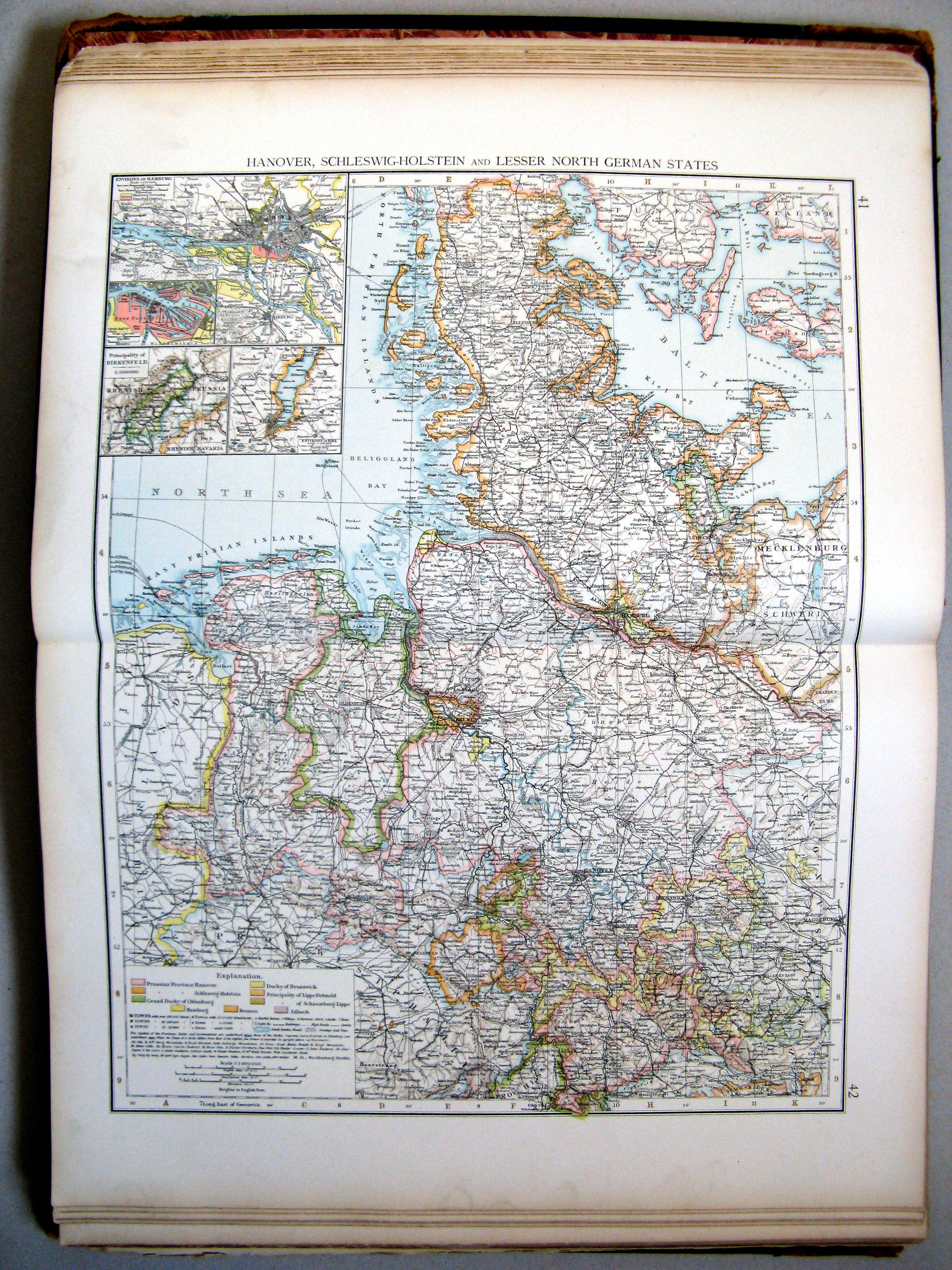
41.42. Hanover, Schleswig-Holstein, and lesser North German States
Hannover, Sleeswijk-Holstein en kleinere Noordduitse staten
 The Times Atlas 1900
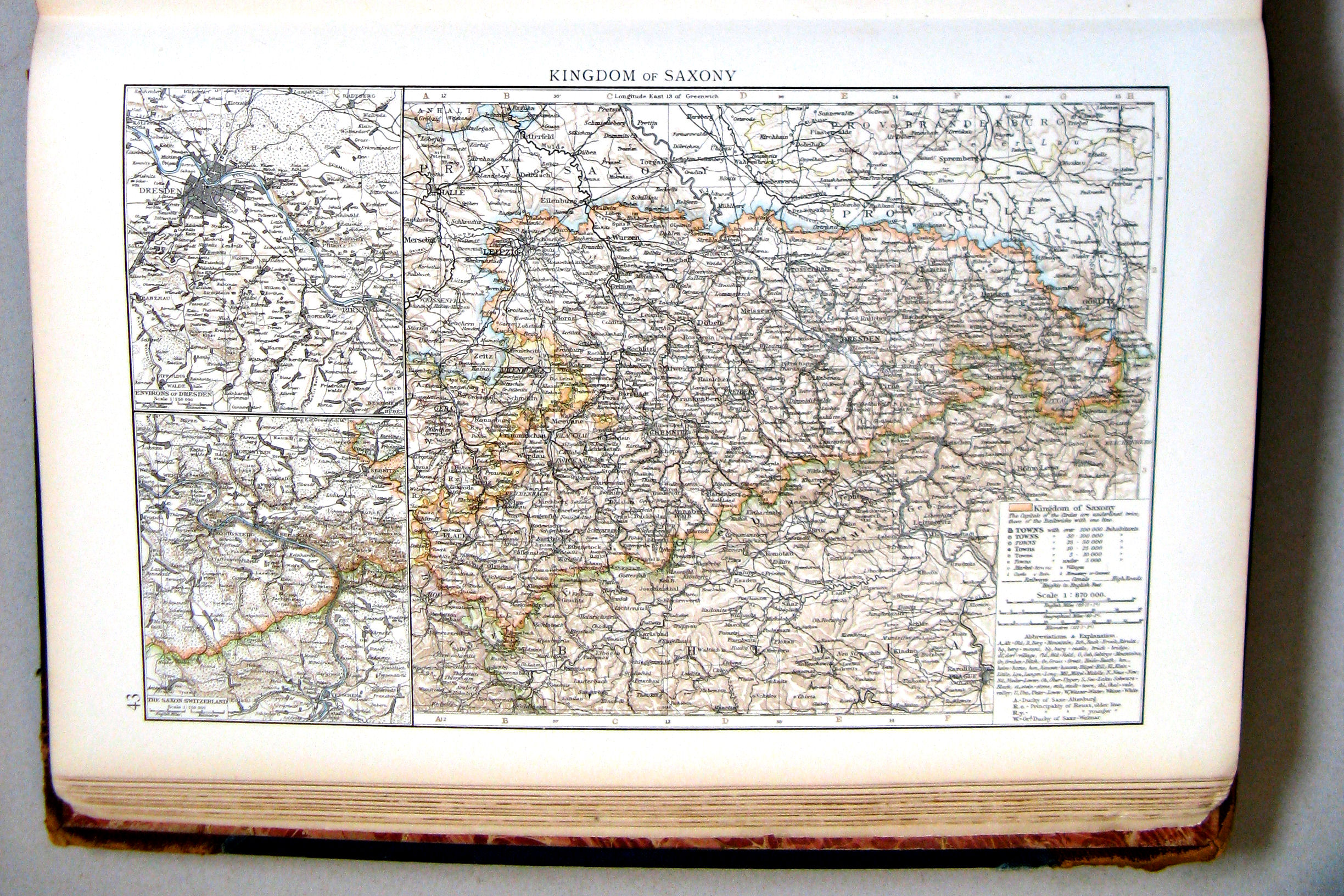
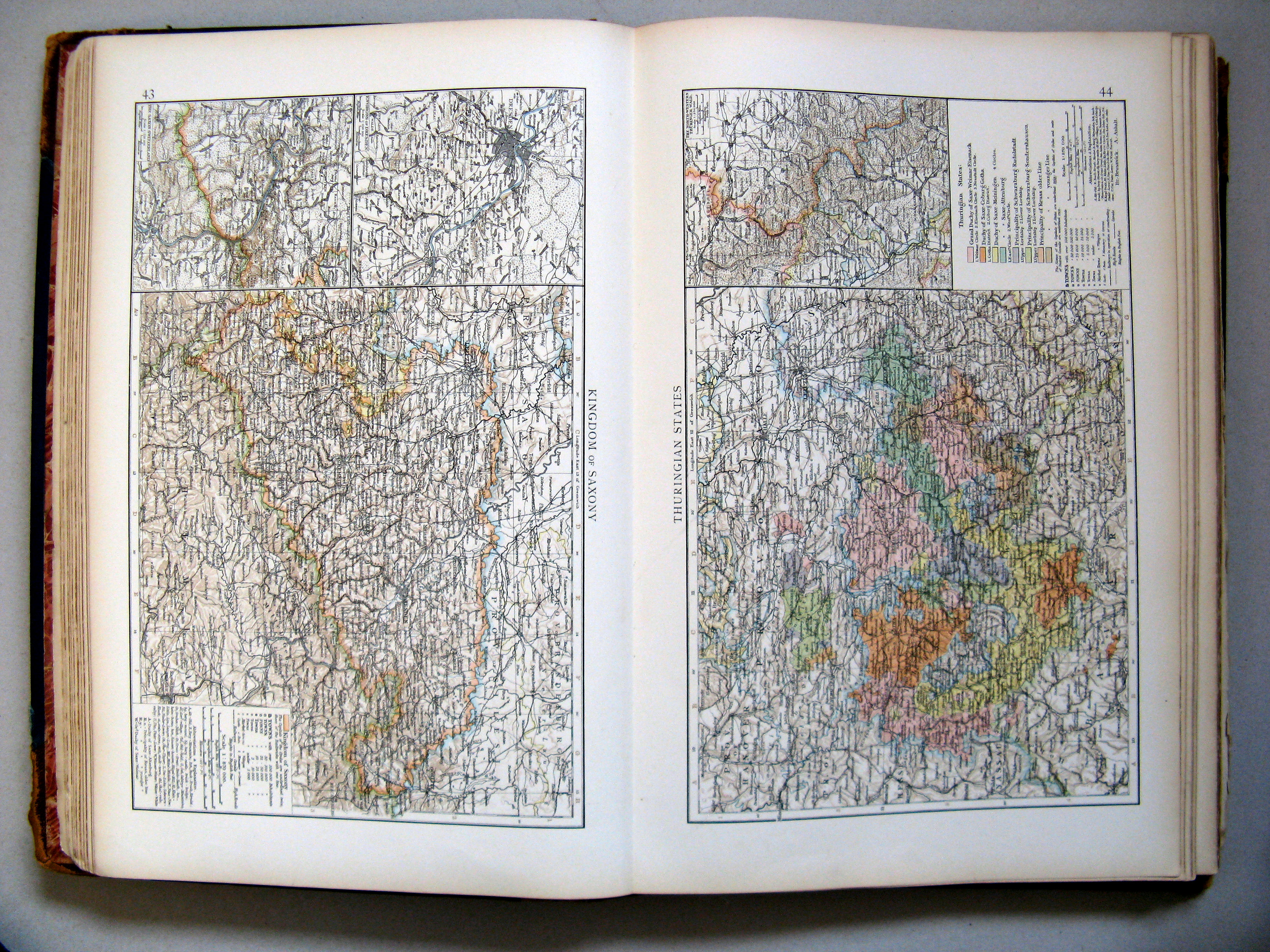
43. Kingdom of Saxony
Koninkrijk Saksen
 The Times Atlas 1900
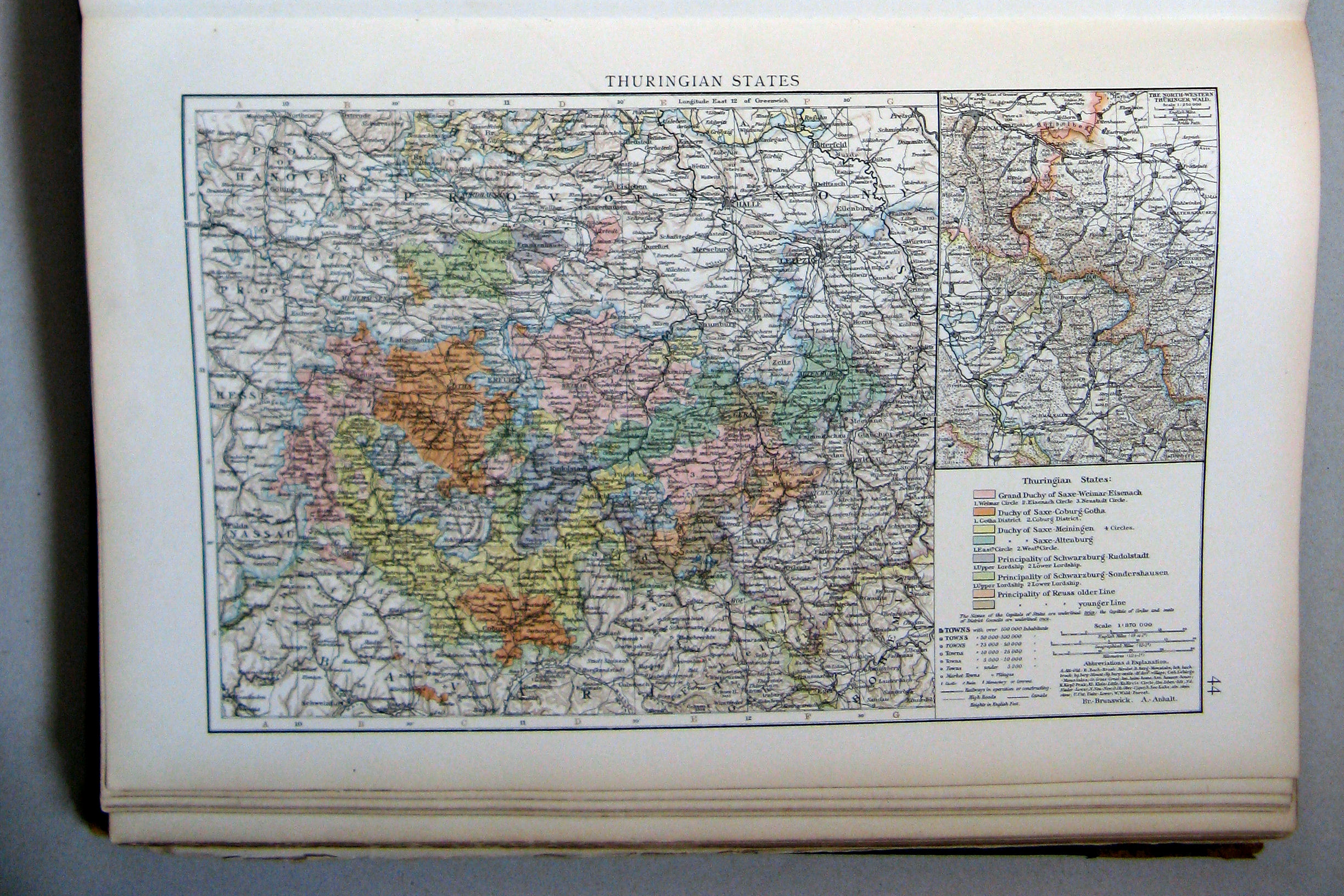
44. Thuringian States
Thüringse staten
 The Times Atlas 1900
43. Kingdom of Saxony
44. Thuringian States
 The Times Atlas 1900
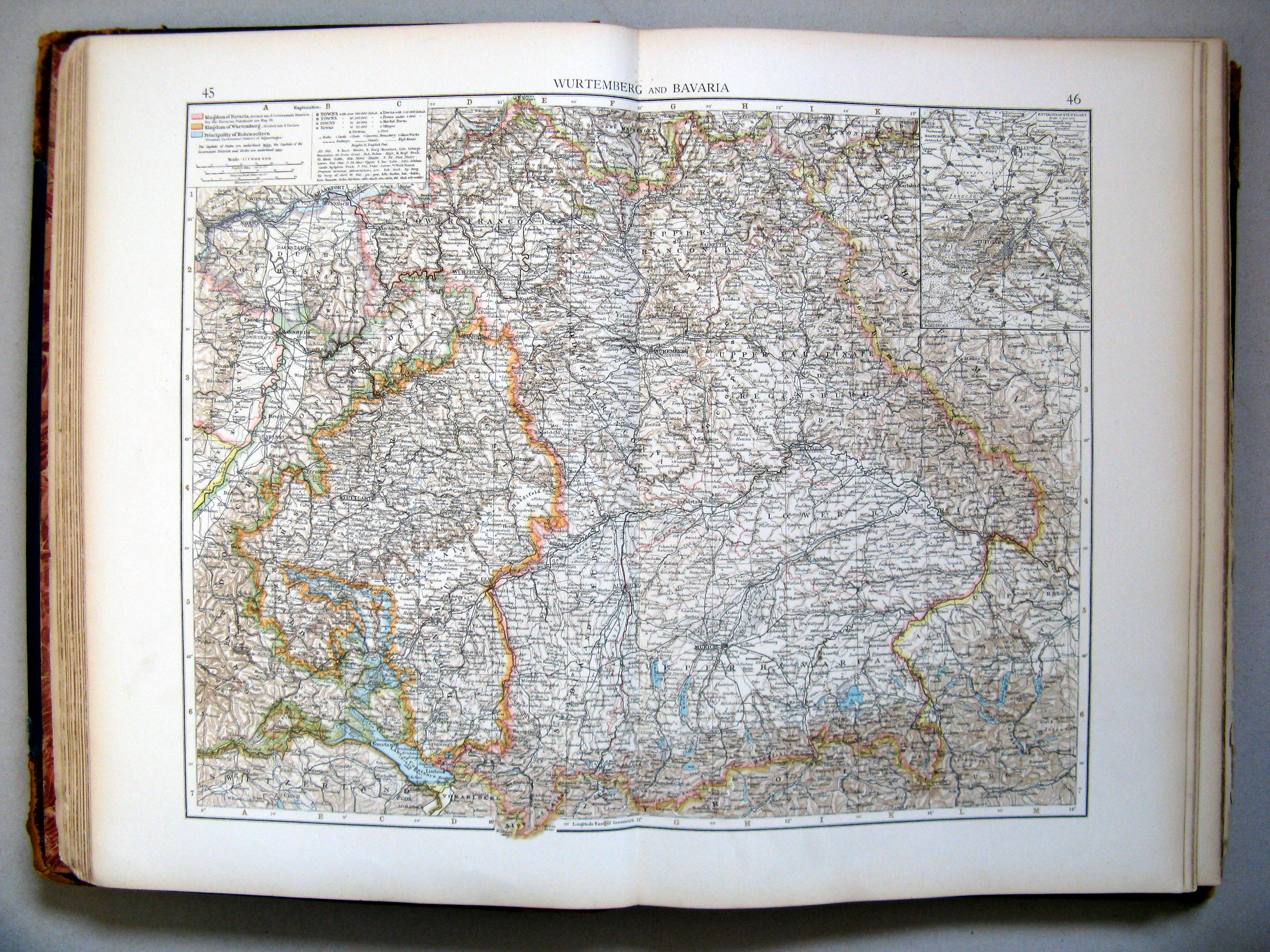
45.46. Wurtemberg and Bavaria
Württemberg en Beieren
 The Times Atlas 1900
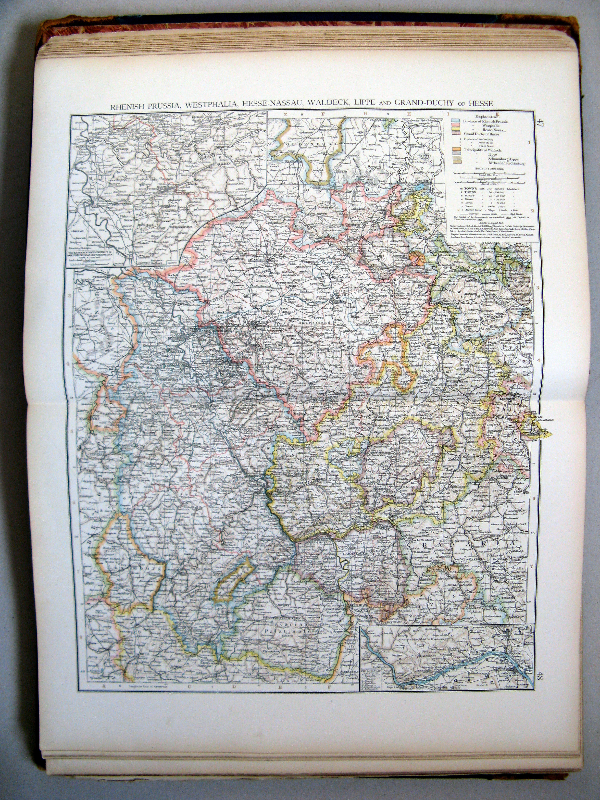
47.48. Rhenish Prussia, Westphalia, Hesse-Nassau, Waldeck, Lippe, and Grand-Duchy of Hesse
Rijnprovincie, Westfalen, Hessen-Nassau, Waldeck, Lippe en Groothertogdom Hessen
 The Times Atlas 1900
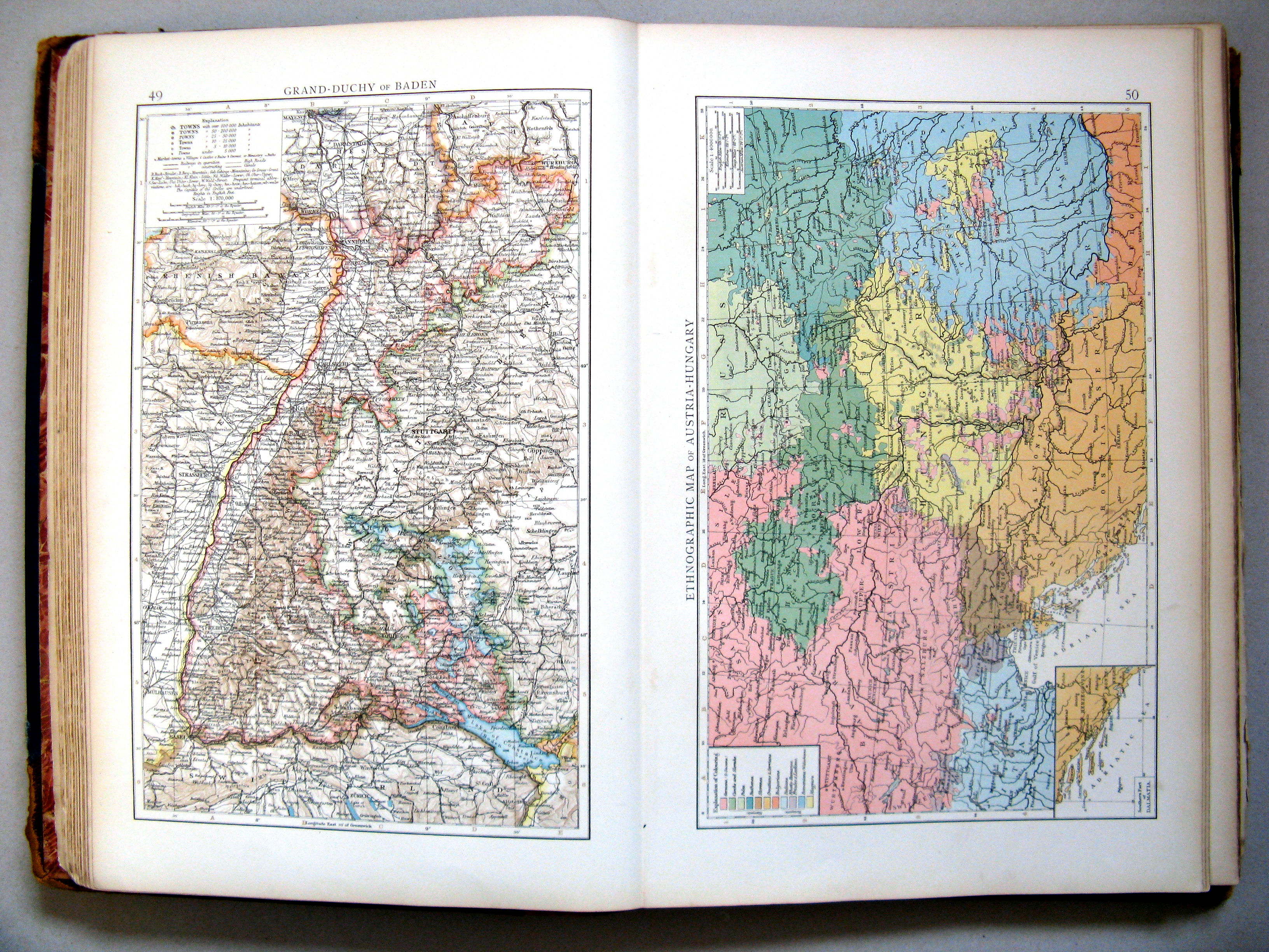
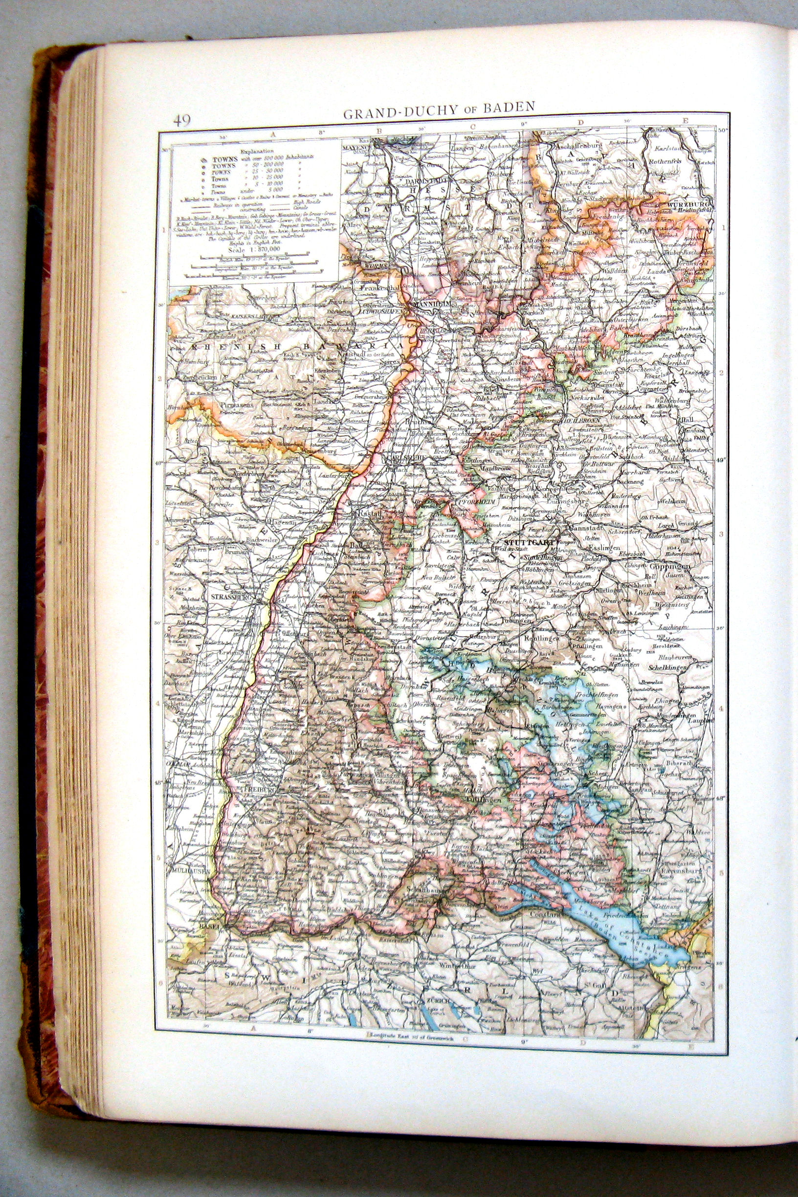
49. Grand-Duchy of Baden
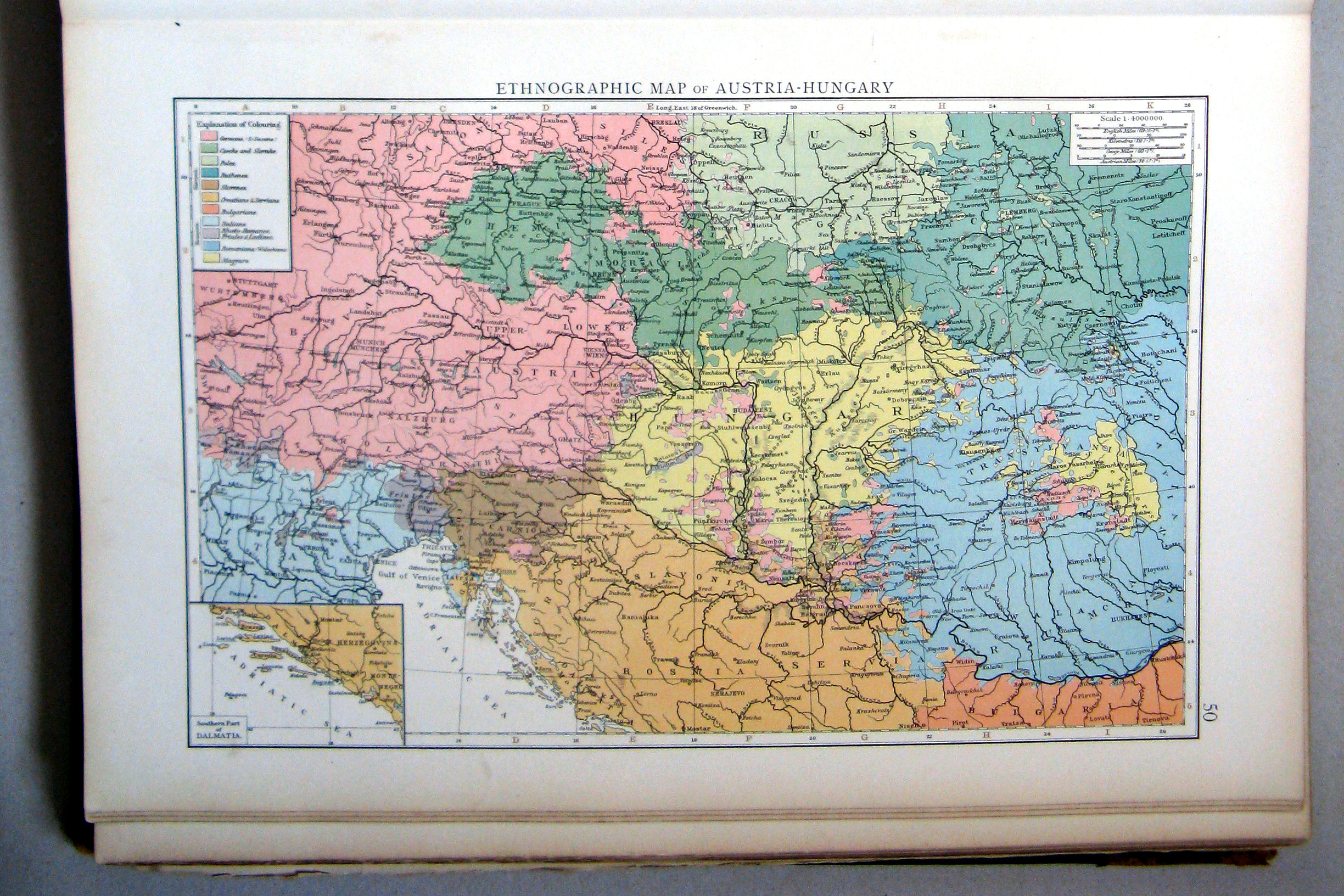
50. Ethnographic map of Austria-Hungary
 The Times Atlas 1900
49. Grand-Duchy of Baden
Groothertogdom Baden
 The Times Atlas 1900
50. Ethnographic map of Austria-Hungary
Volkeren in Oostenrijk-Hongarije
 The Times Atlas 1900
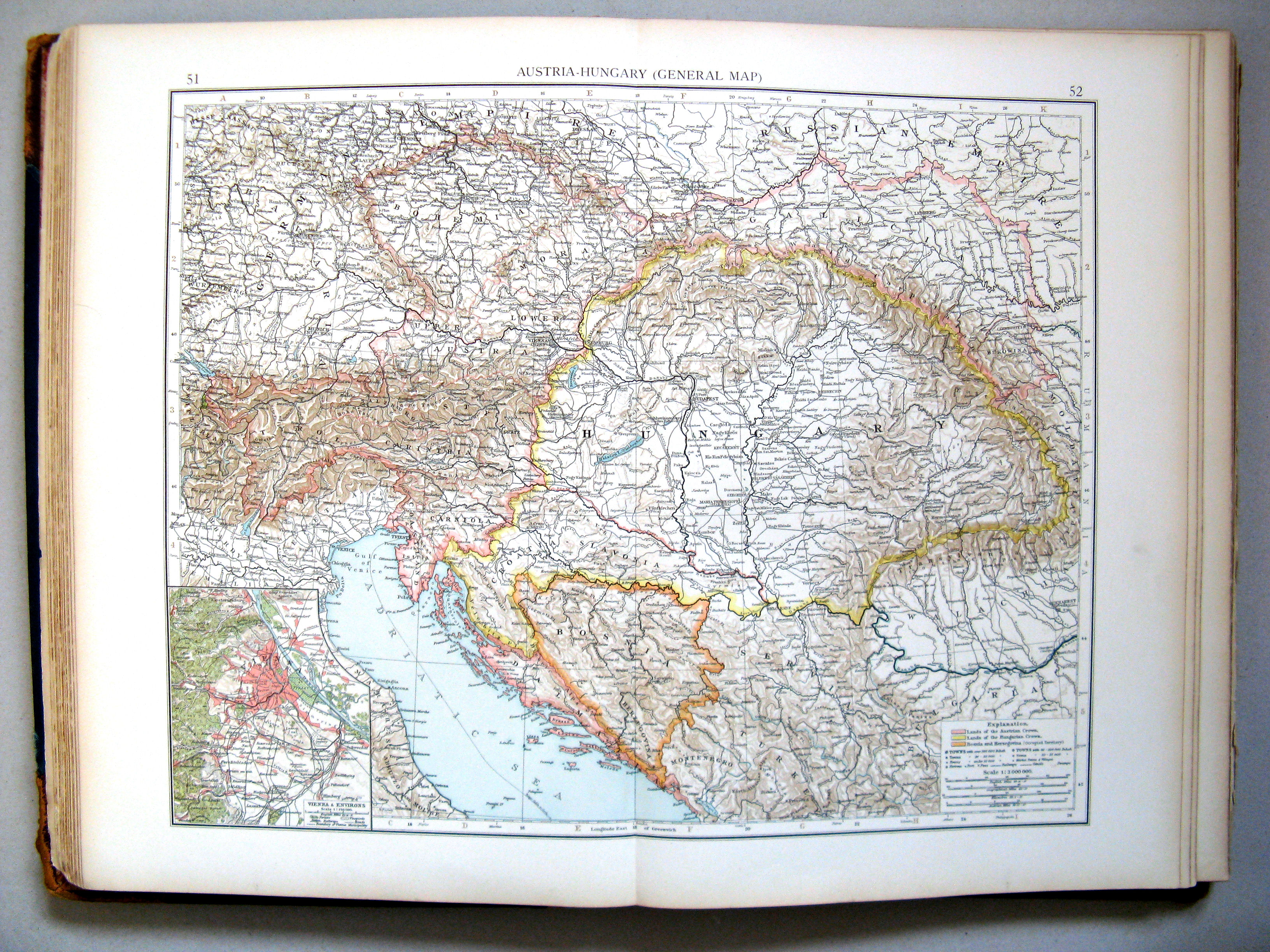
51.52. Austria-Hungary (general map)
Oostenrijk-Hongarije (overzichtskaart)
 The Times Atlas 1900
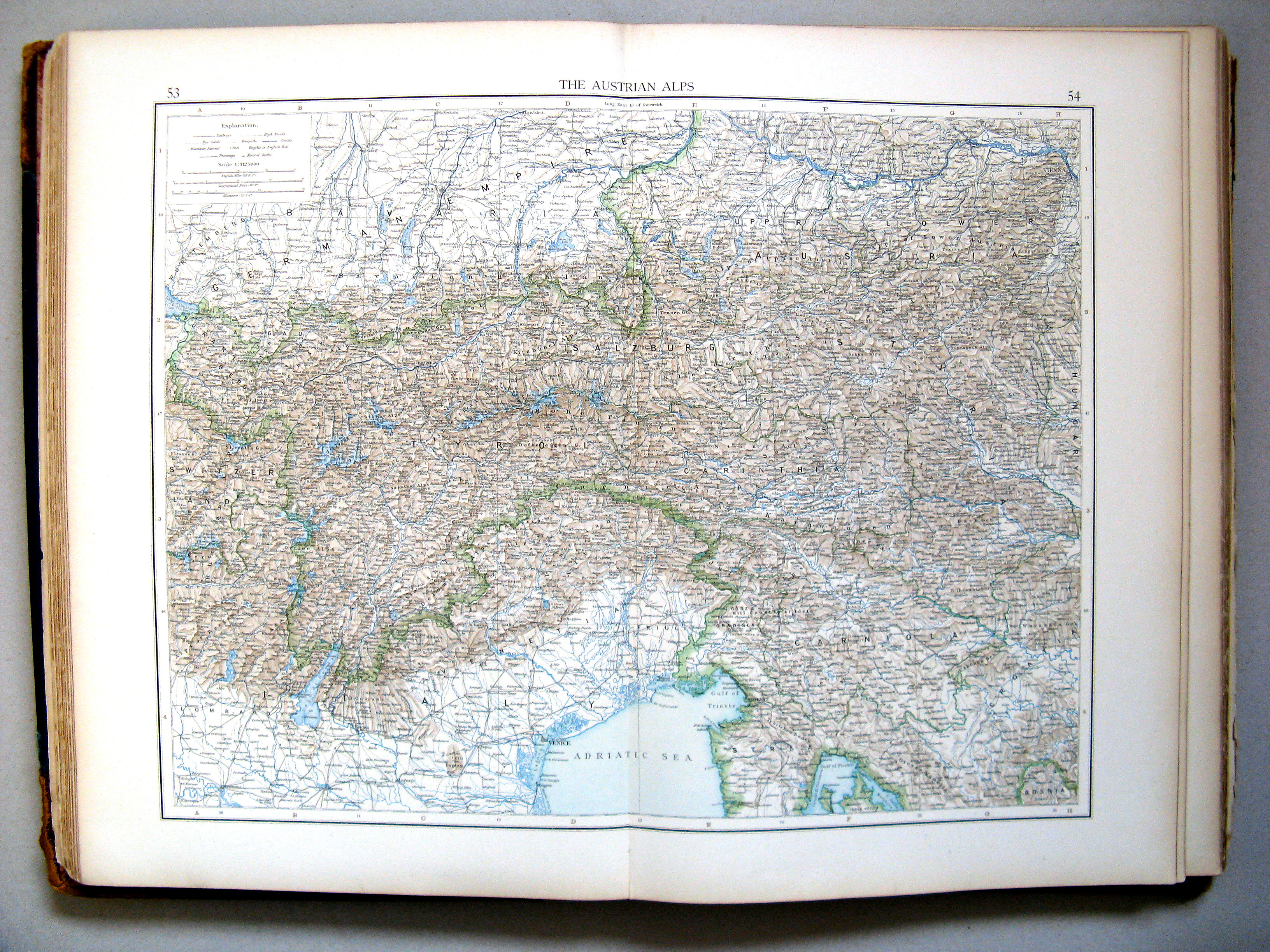
53.54. The Austrian Alps
Oostenrijkse Alpen
 The Times Atlas 1900
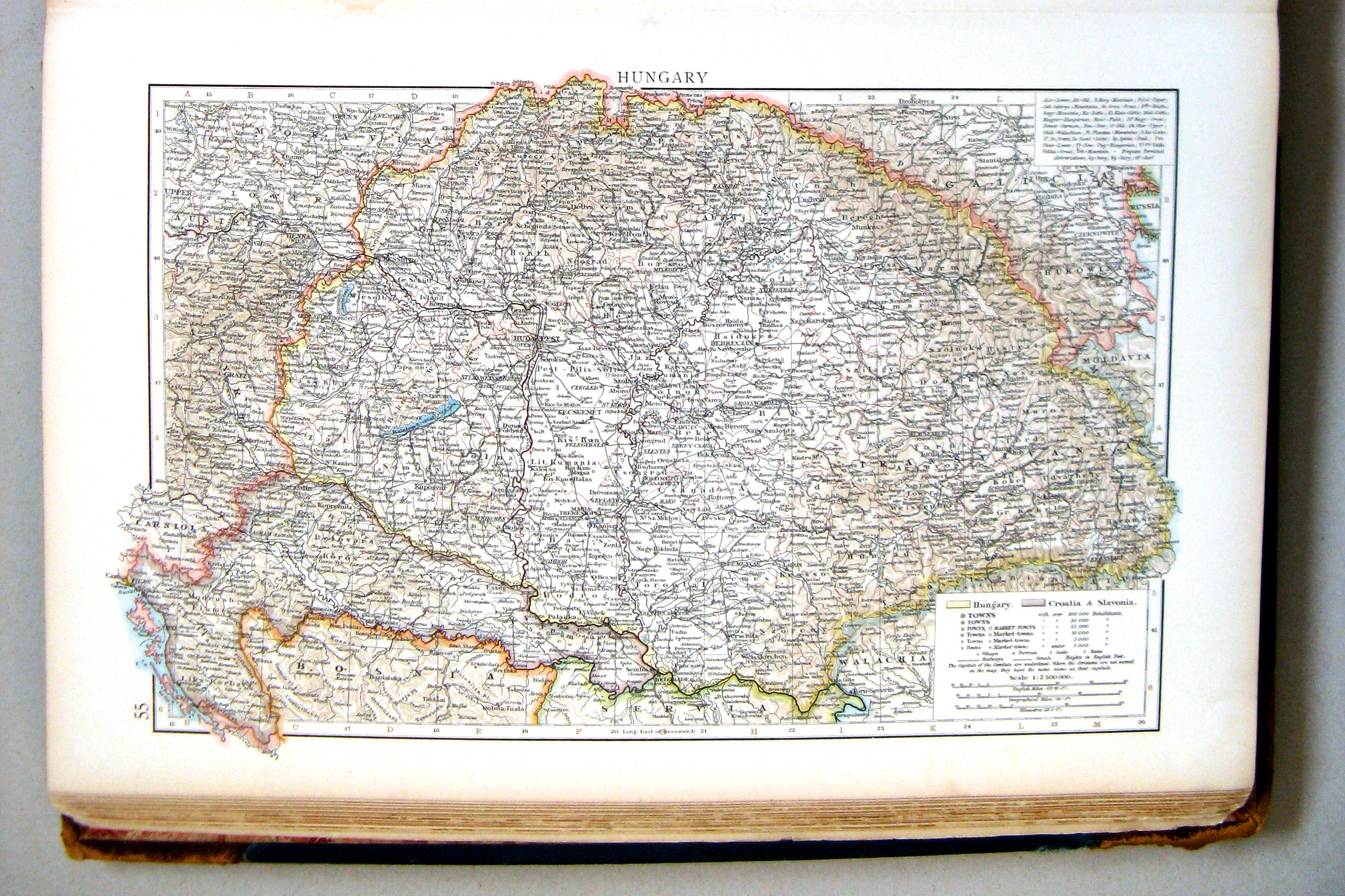
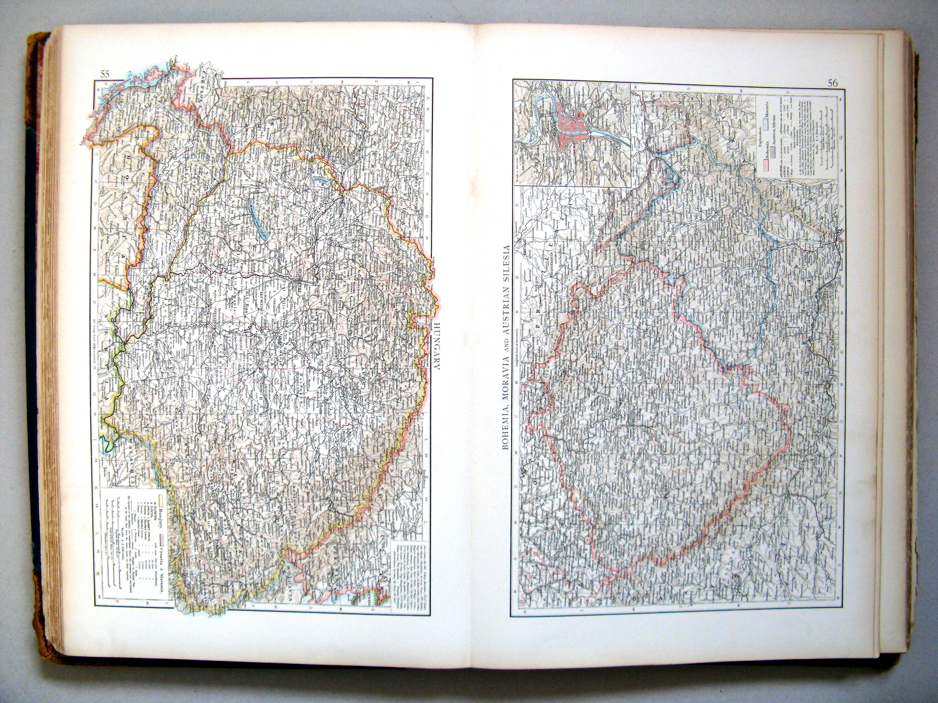
55. Hungary
Hongarije
 The Times Atlas 1900
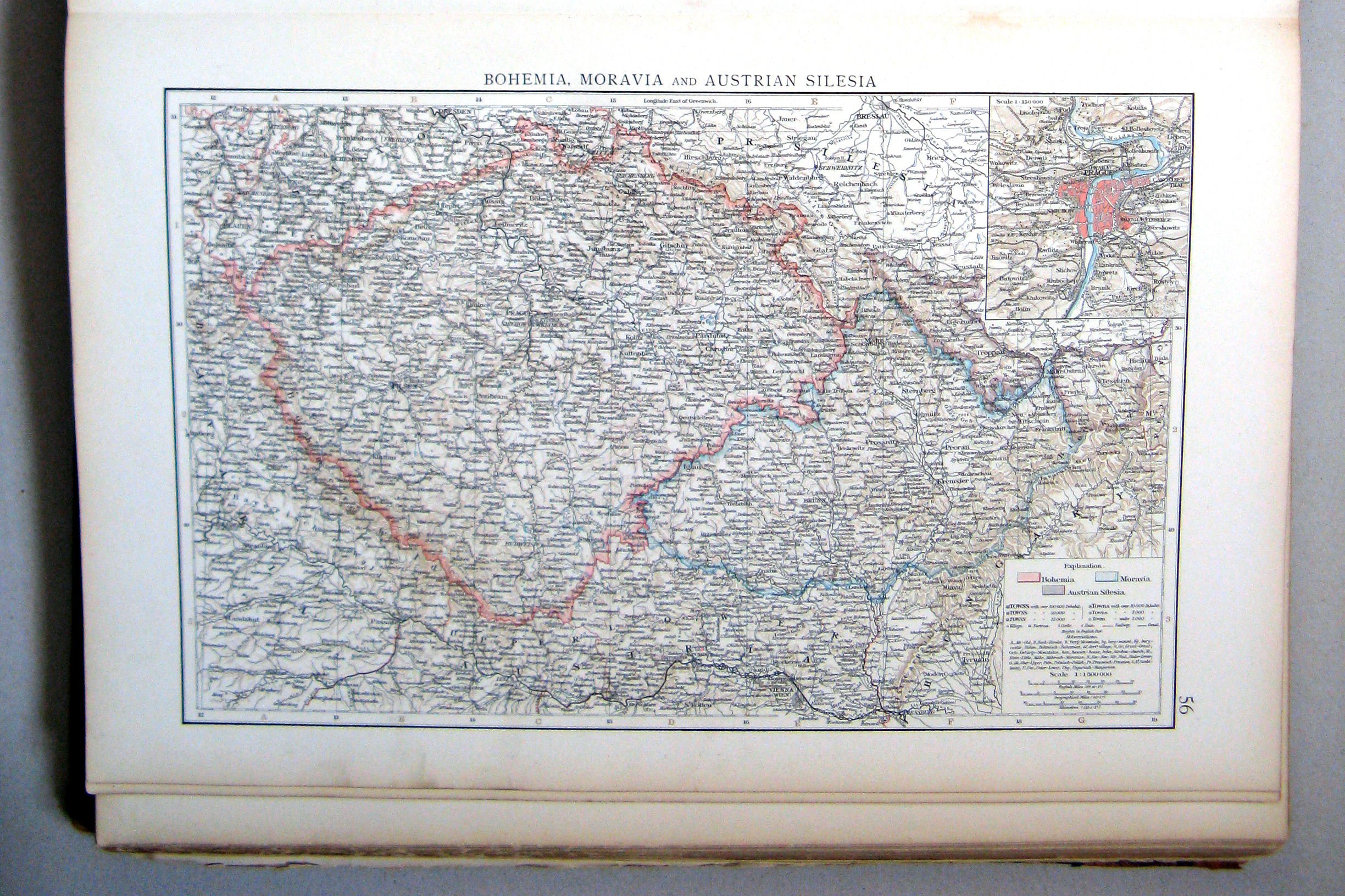
56. Bohemia, Moravia, and Austrian Silesia
Bohemen, Moravië en Oostenrijks-Silezië
 The Times Atlas 1900
55. Hungary
56. Bohemia, Moravia, and Austrian Silesia
 The Times Atlas 1900
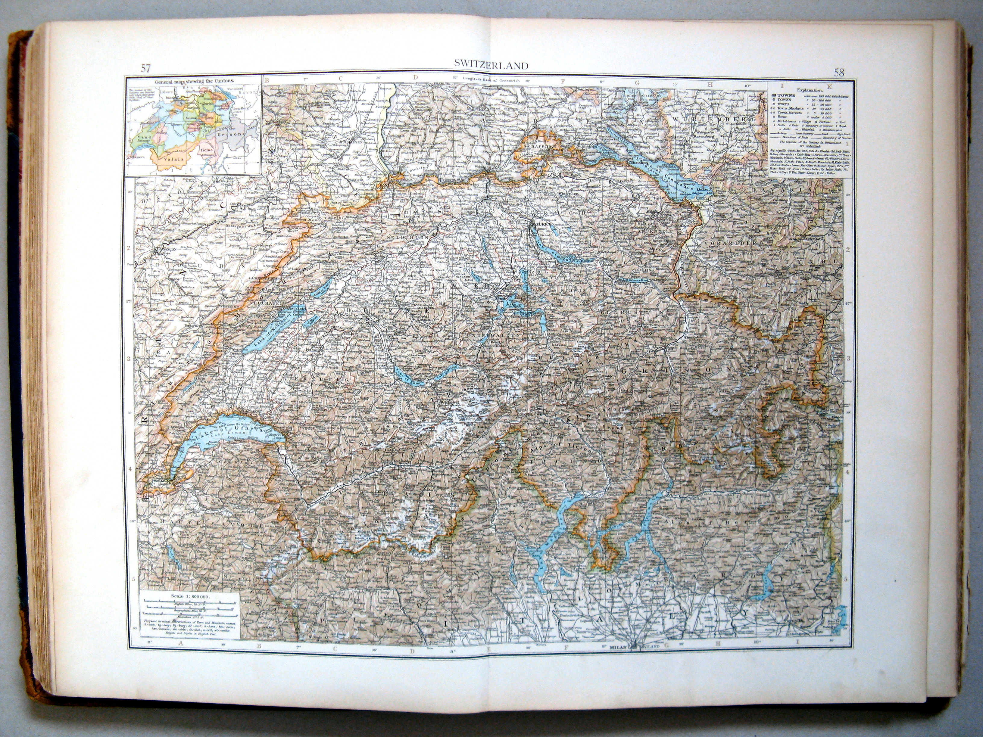
57.58. Switzerland
Zwitserland
 The Times Atlas 1900
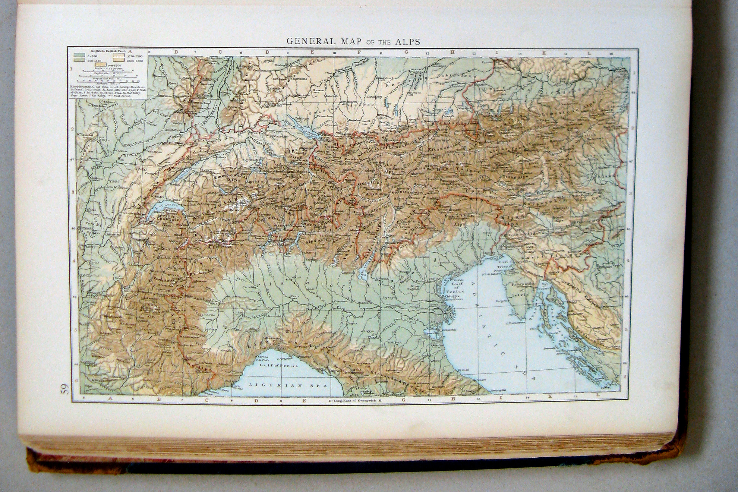
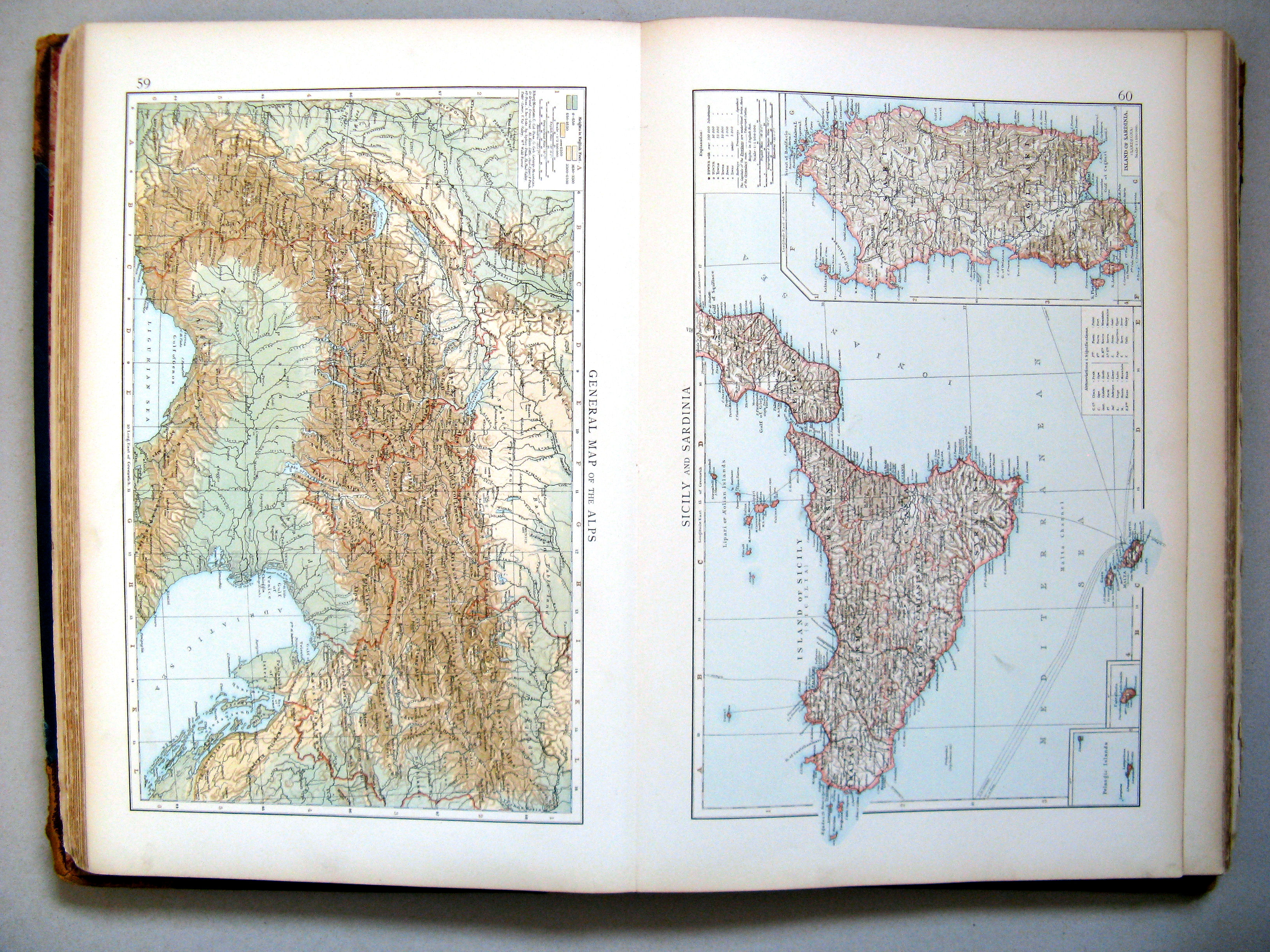
59. General map of the Alps
Overzichtskaart van de Alpen
 The Times Atlas 1900
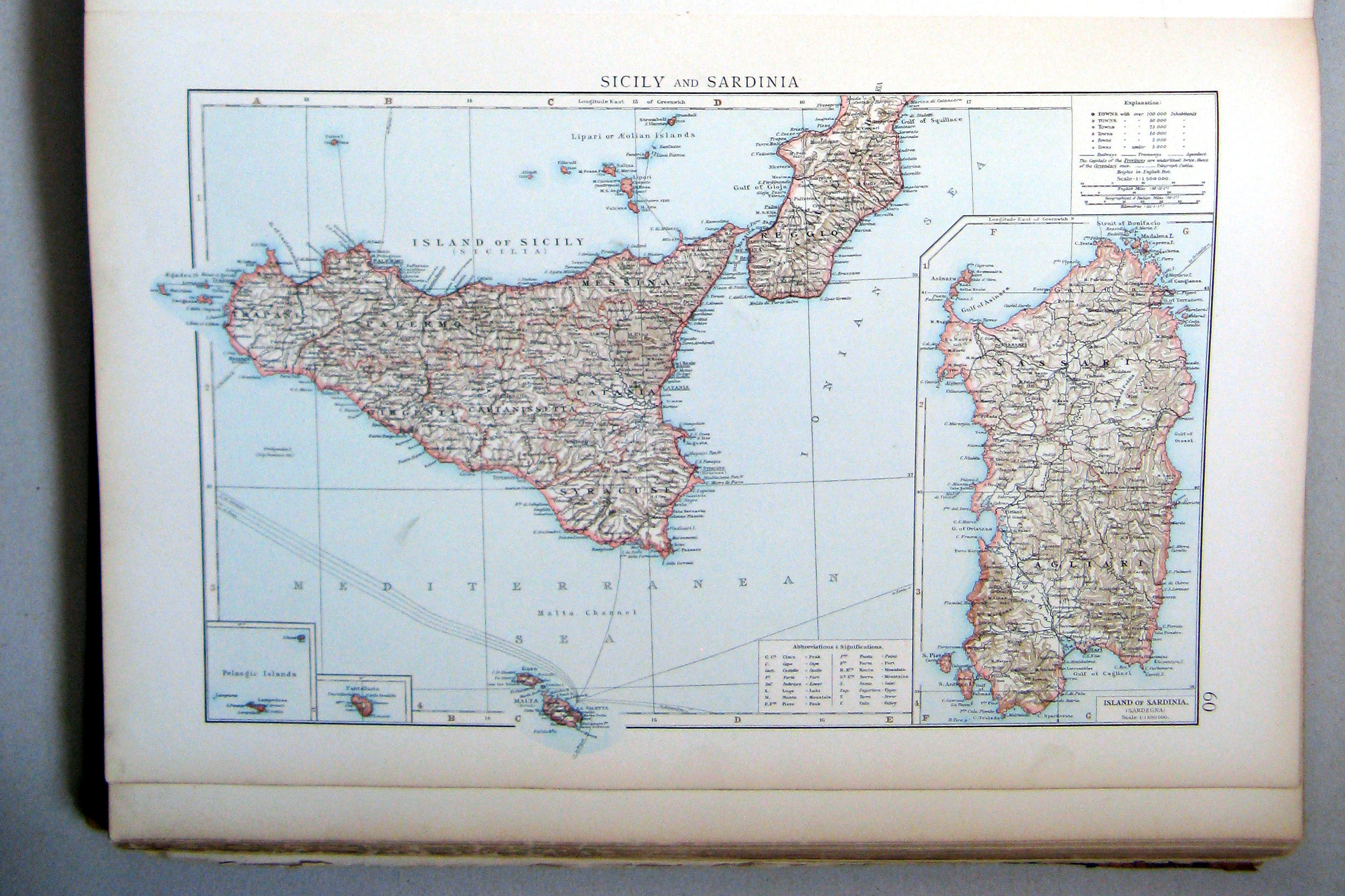
60. Sicily and Sardinia
Sicilië en Sardinië
 The Times Atlas 1900
59. General map of the Alps
60. Sicily and Sardinia
 The Times Atlas 1900
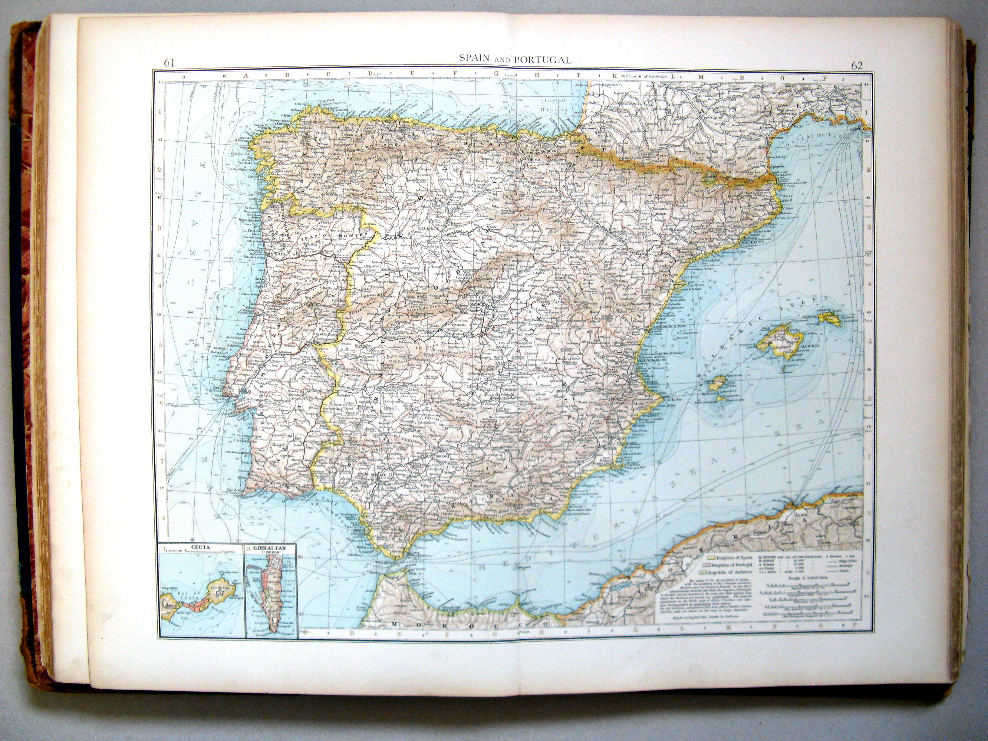
61.62. Spain and Portugal
Spanje en Portugal
 The Times Atlas 1900
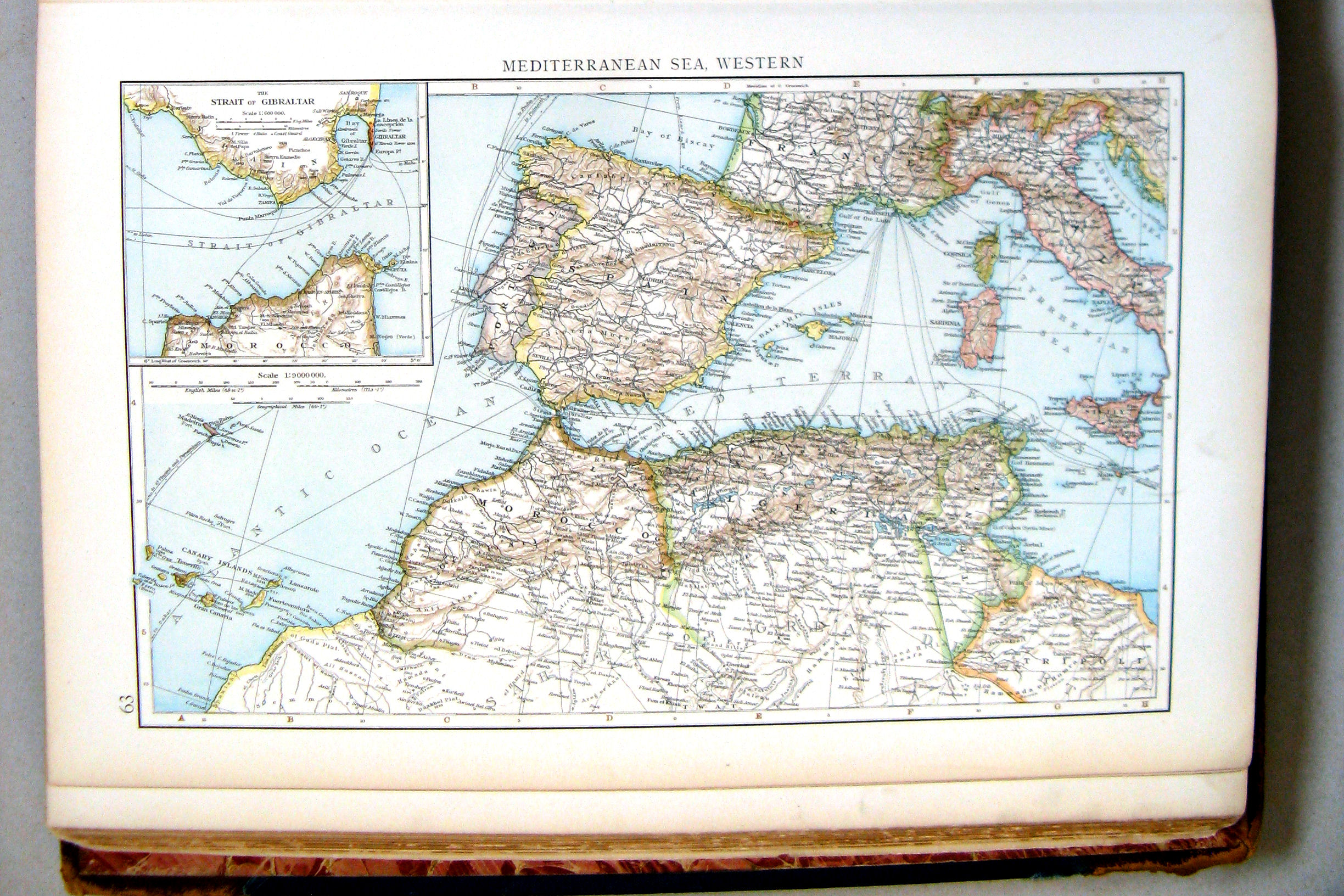
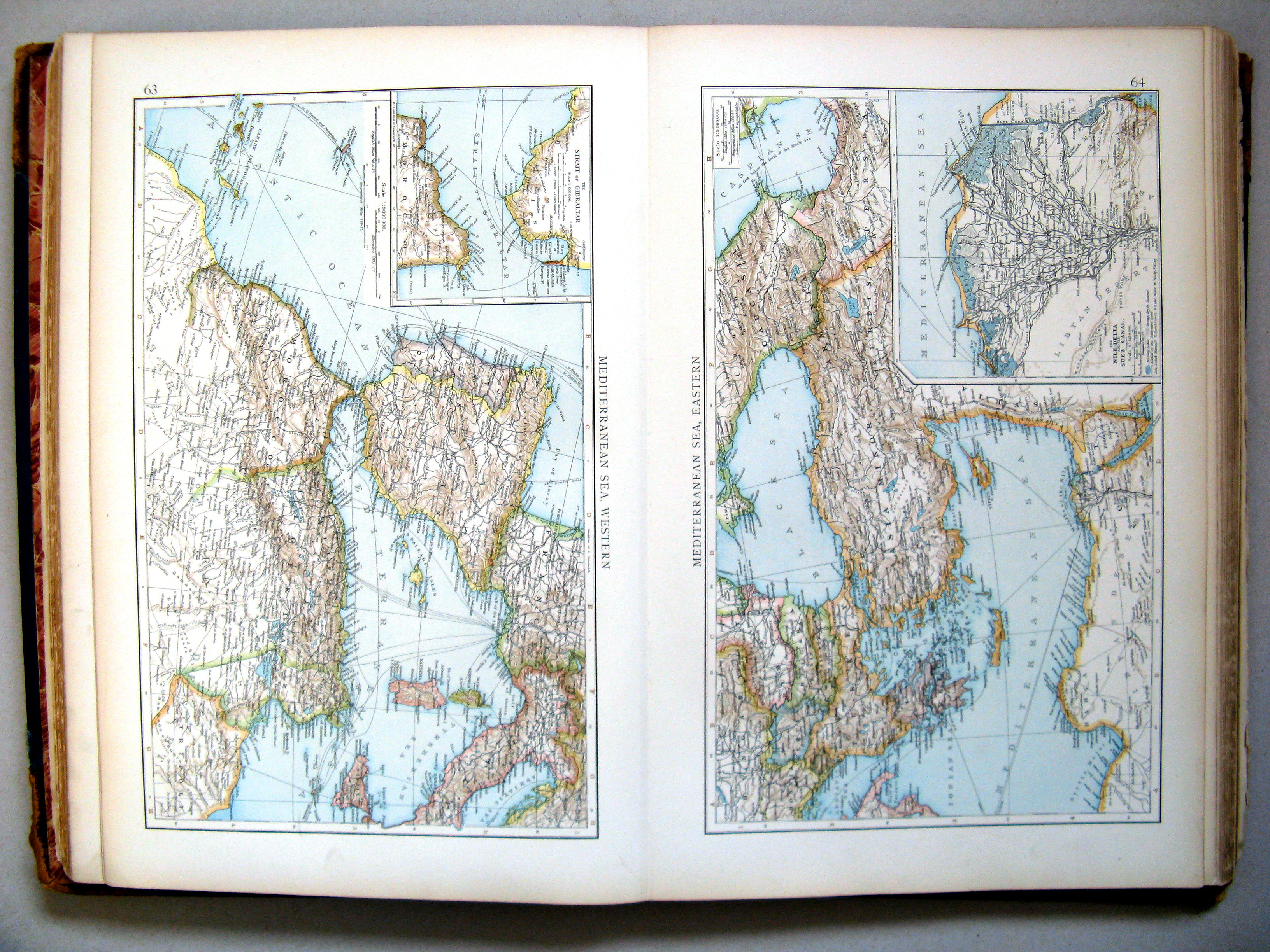
63. Mediterranean Sea, western
Middellandse Zee, westelijk deel
 The Times Atlas 1900
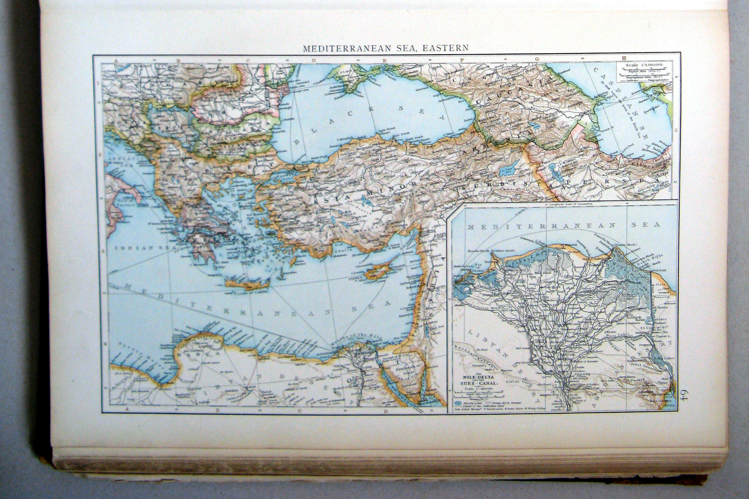
64. Mediterranean Sea, eastern
Middellandse Zee, oostelijk deel
 The Times Atlas 1900
63. Mediterranean Sea, western
64. Mediterranean Sea, eastern
 The Times Atlas 1900
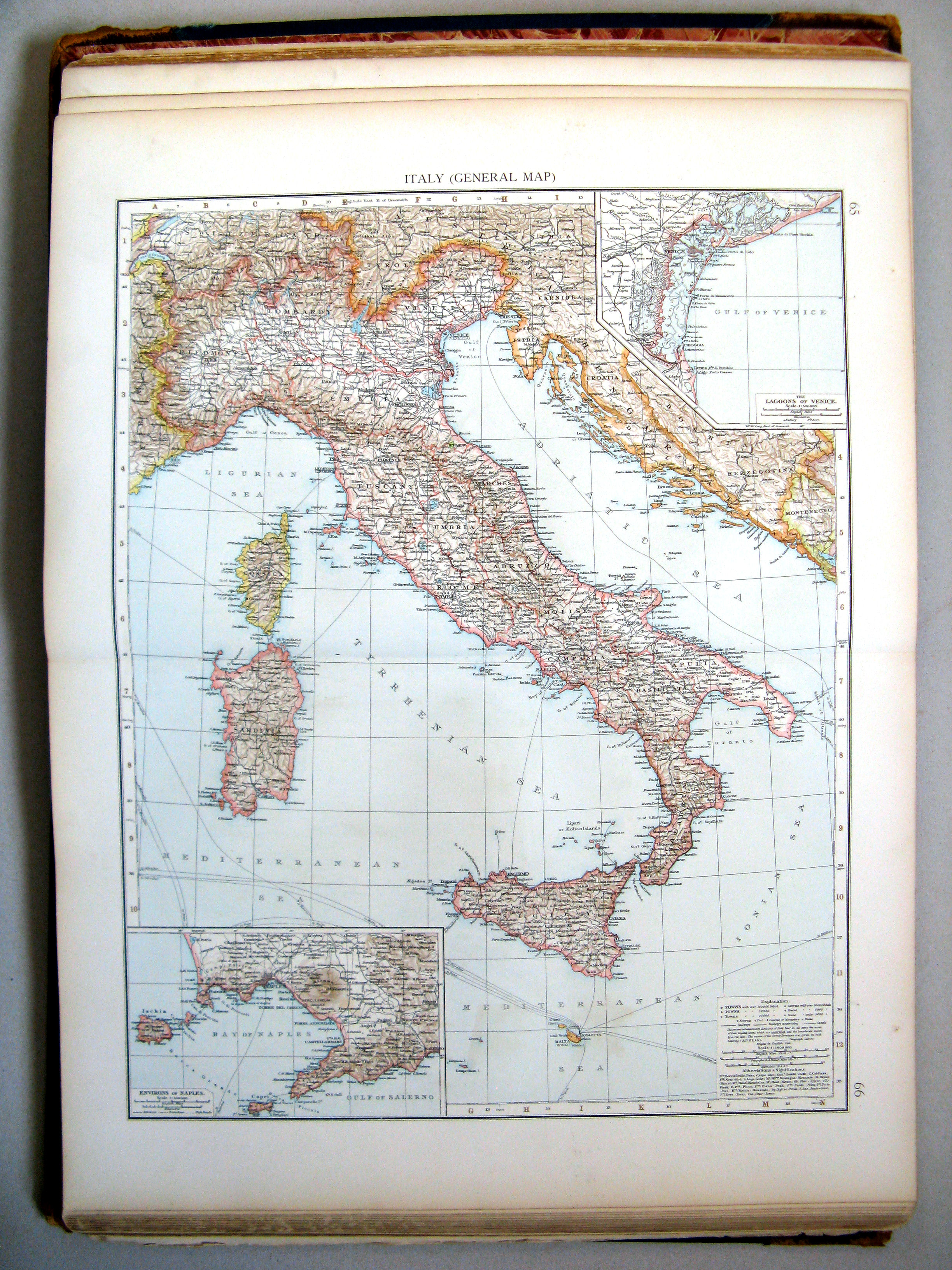
65.66. Italy (general map)
Italië (overzichtskaart)
 The Times Atlas 1900
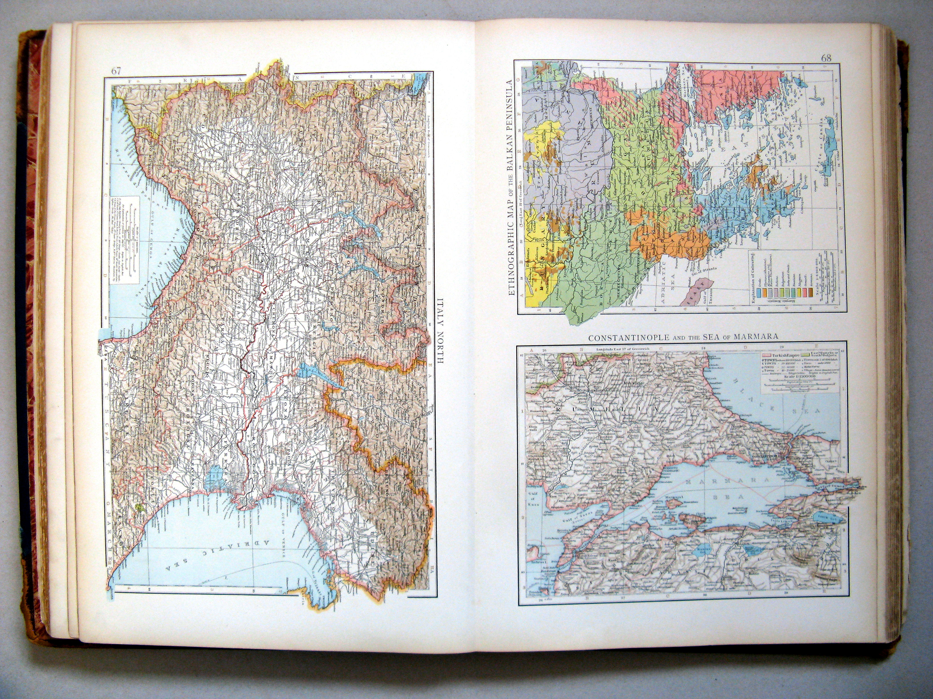
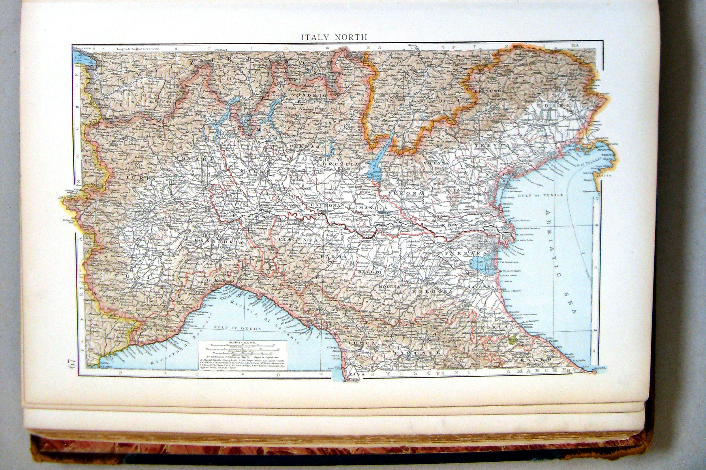
67. Italy, north
68. Ethnographic map of the Balkan Peninsula. Constantinople and the Sea of Marmara
 The Times Atlas 1900
67. Italy, north
Noord-Italië
 The Times Atlas 1900
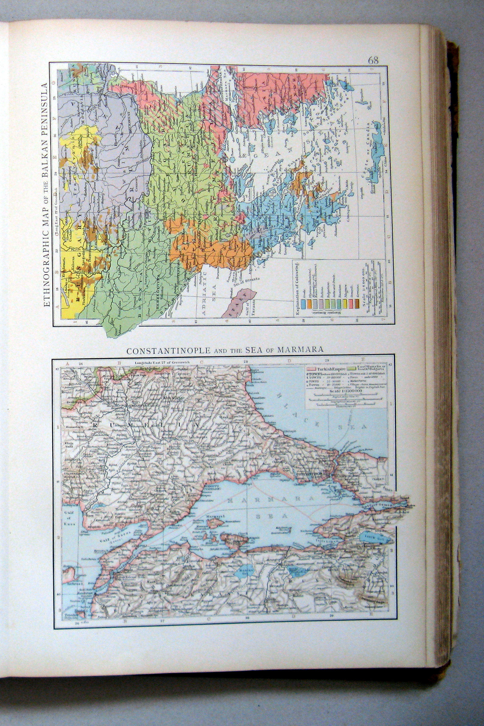
68. Ethnographic map of the Balkan Peninsula. Constantinople and the Sea of Marmara
 The Times Atlas 1900
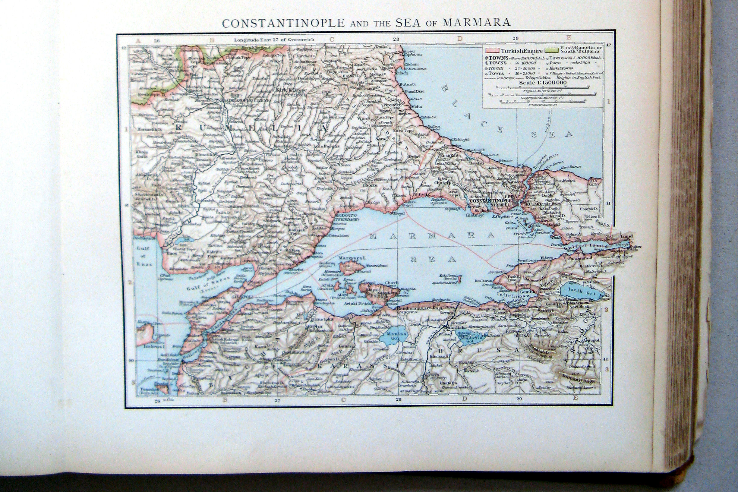
68.1. Constantinople and the Sea of Marmara
Constantinopel (İstanbul) en de Zee van Marmara
 The Times Atlas 1900
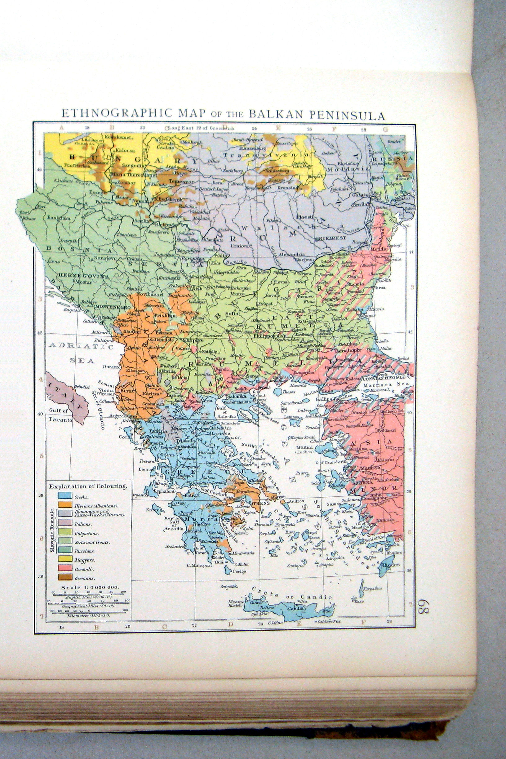
68.2. Ethnographic map of the Balkan Peninsula
Volkeren op het Balkanschiereiland
 The Times Atlas 1900
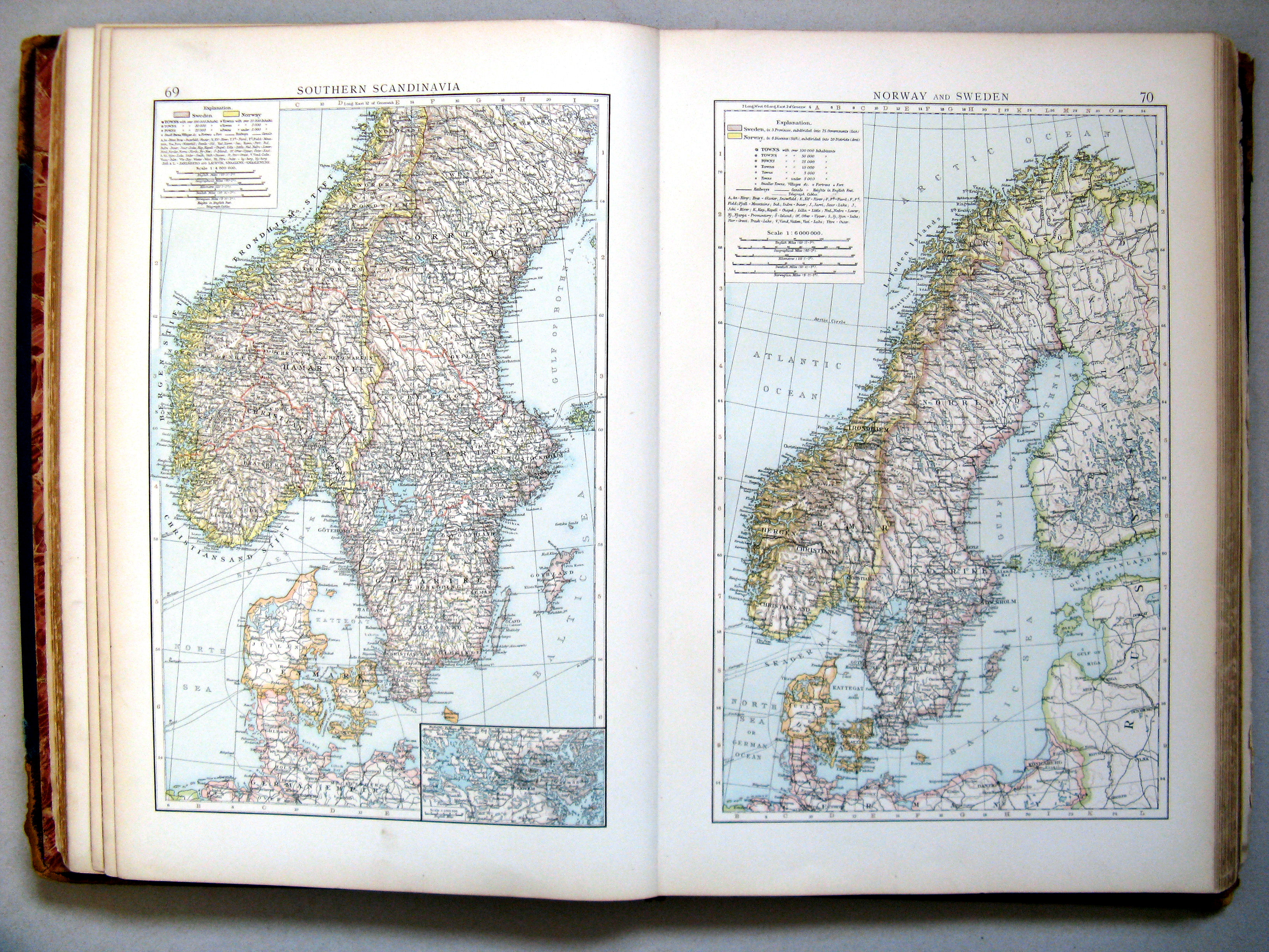
69. Southern Scandinavia
70. Norway and Sweden
Zuid-Scandinavië. Noorwegen en Zweden
 The Times Atlas 1900
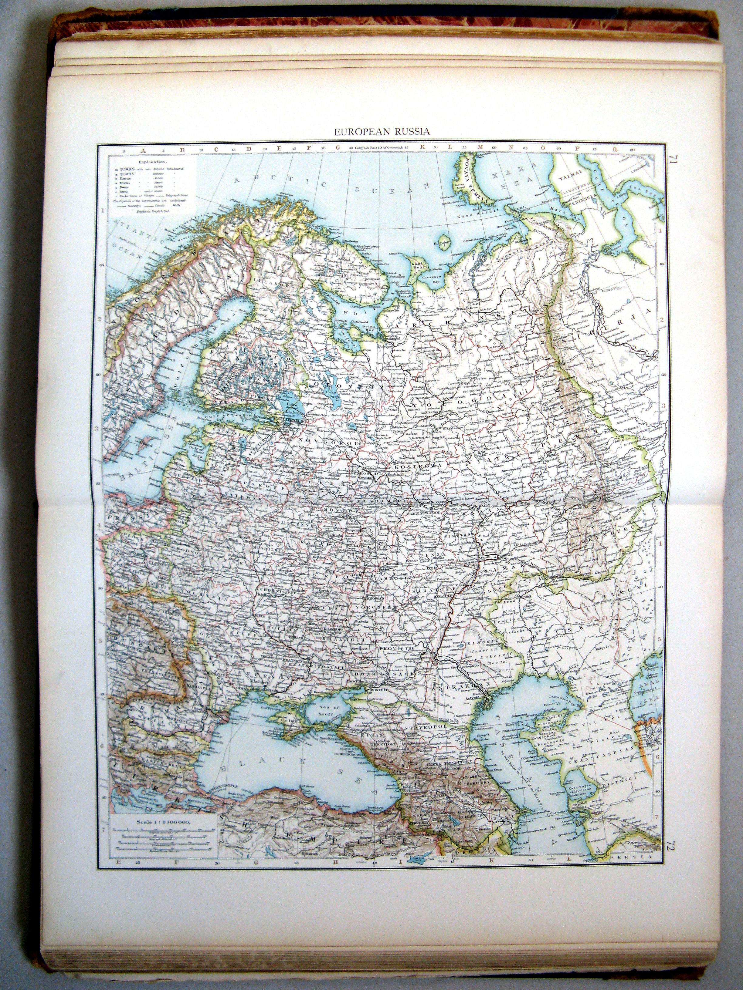
71.72. European Russia
Europees Rusland
 The Times Atlas 1900
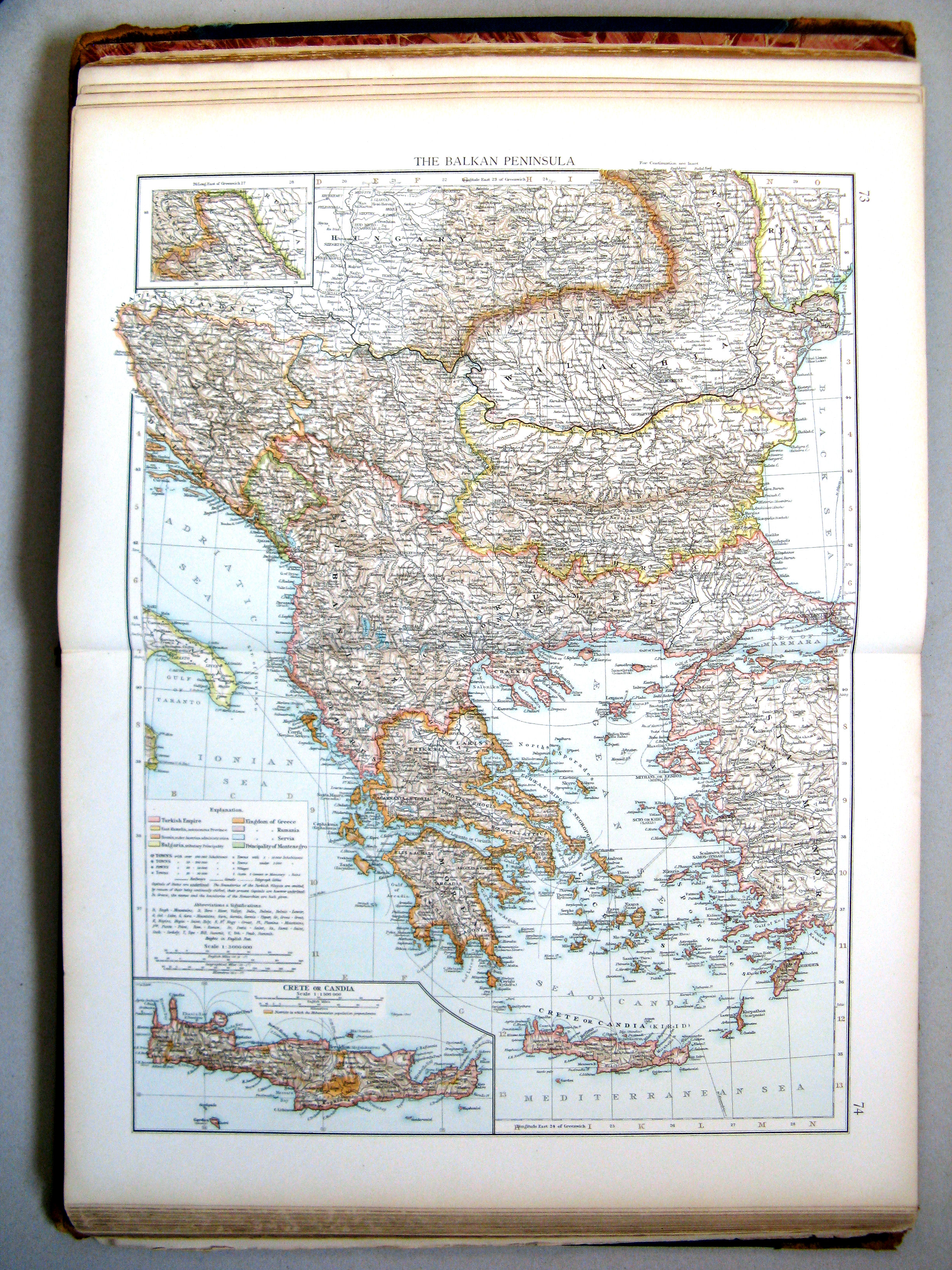
73.74. The Balkan Peninsula
Balkanschiereiland
 The Times Atlas 1900
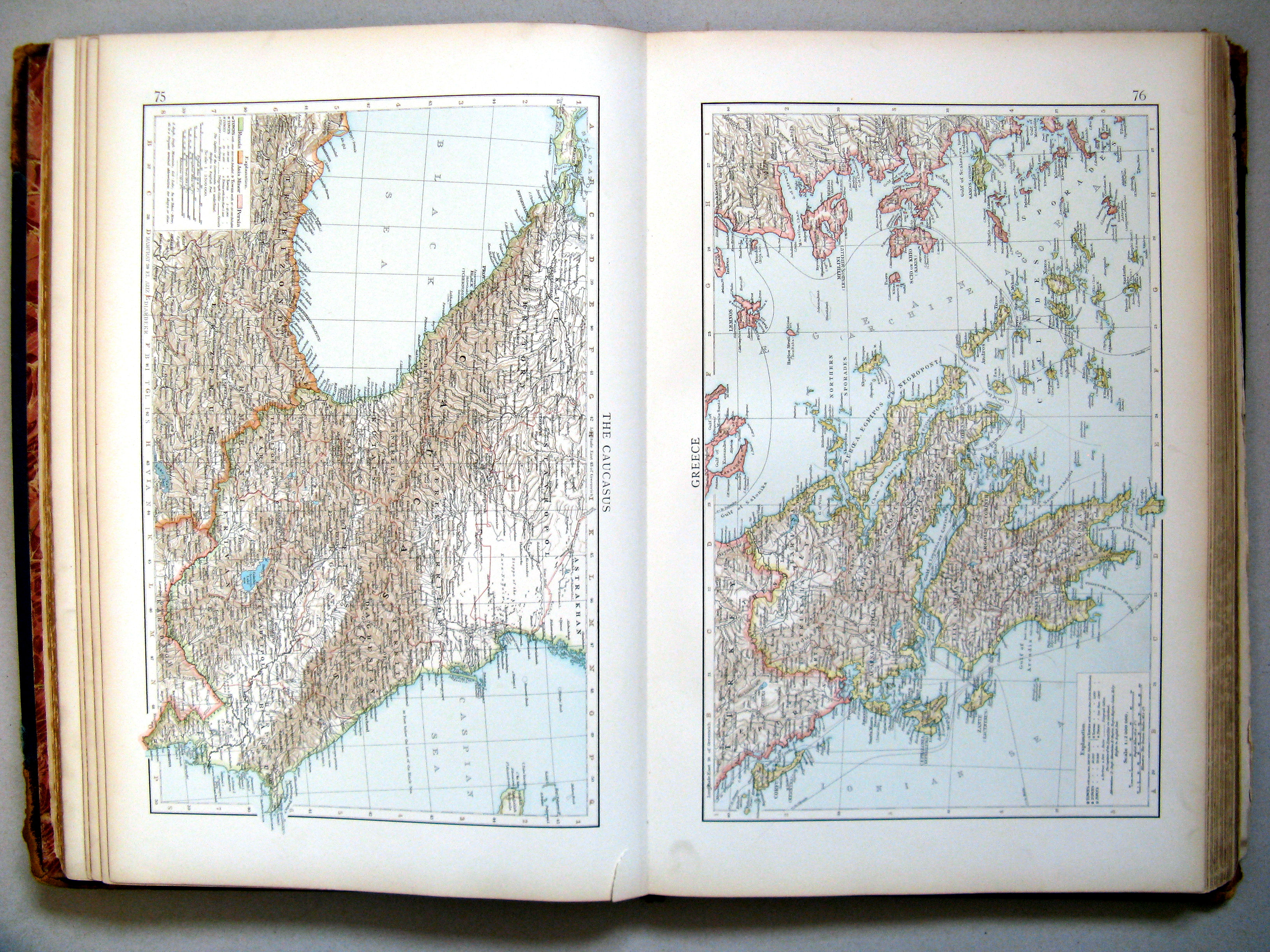
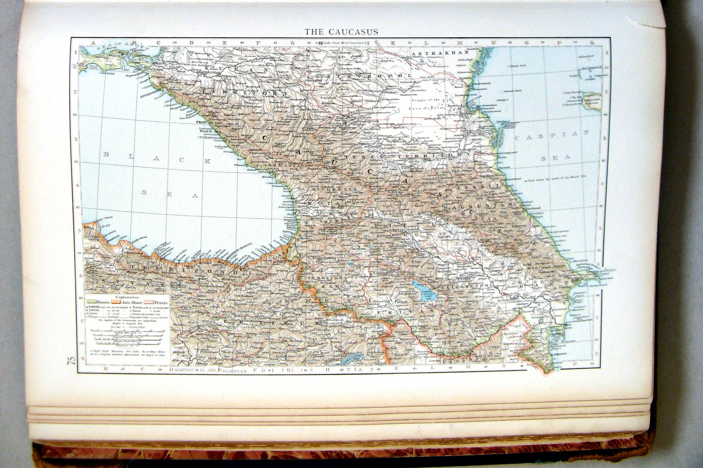
75. The Caucasus
76. Greece
 The Times Atlas 1900
75. The Caucasus
Kaukasus
 The Times Atlas 1900
76. Greece
Griekenland
 The Times Atlas 1900
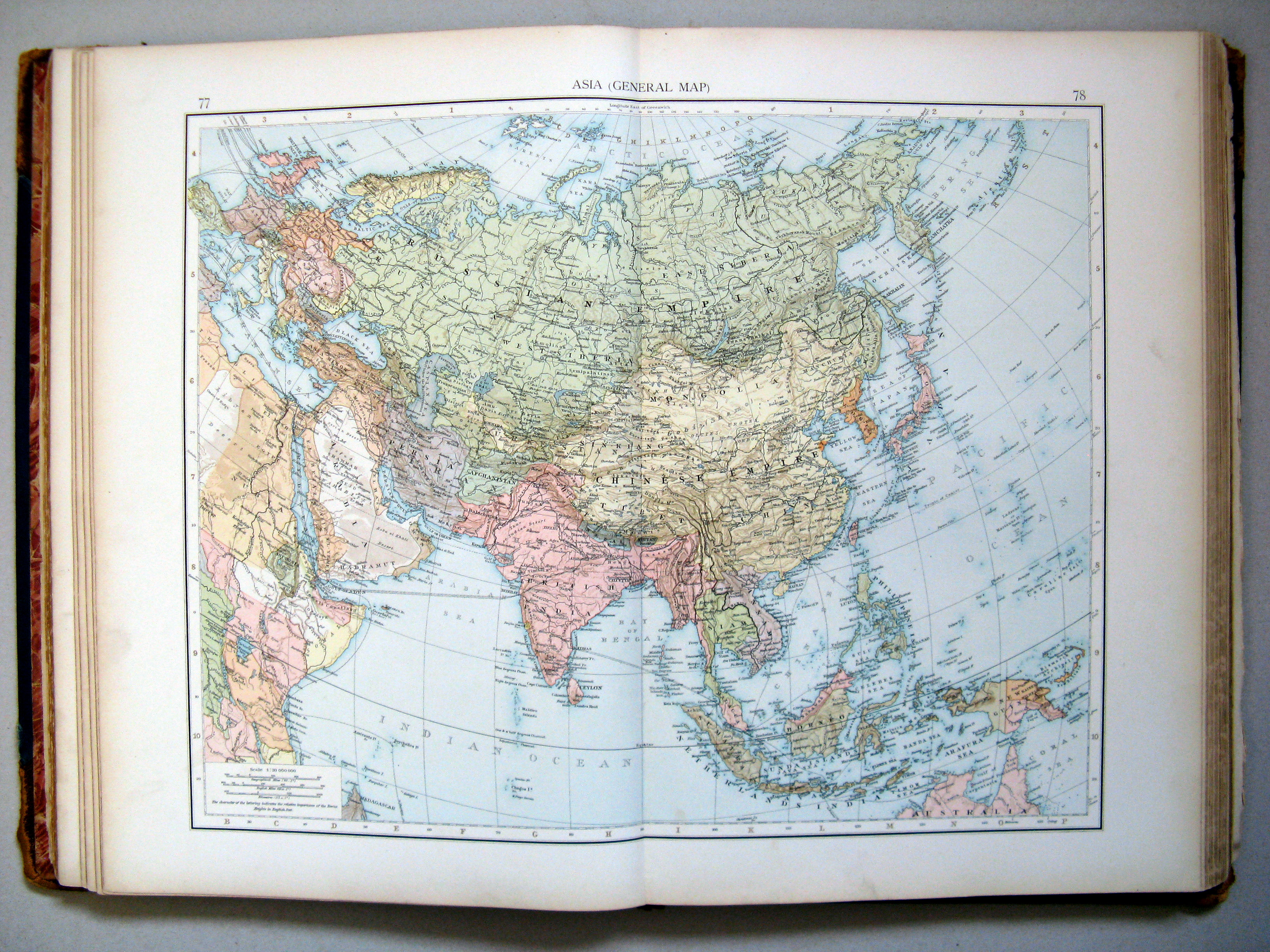
77.78. Asia (general map)
Azië (overzichtskaart)
 The Times Atlas 1900
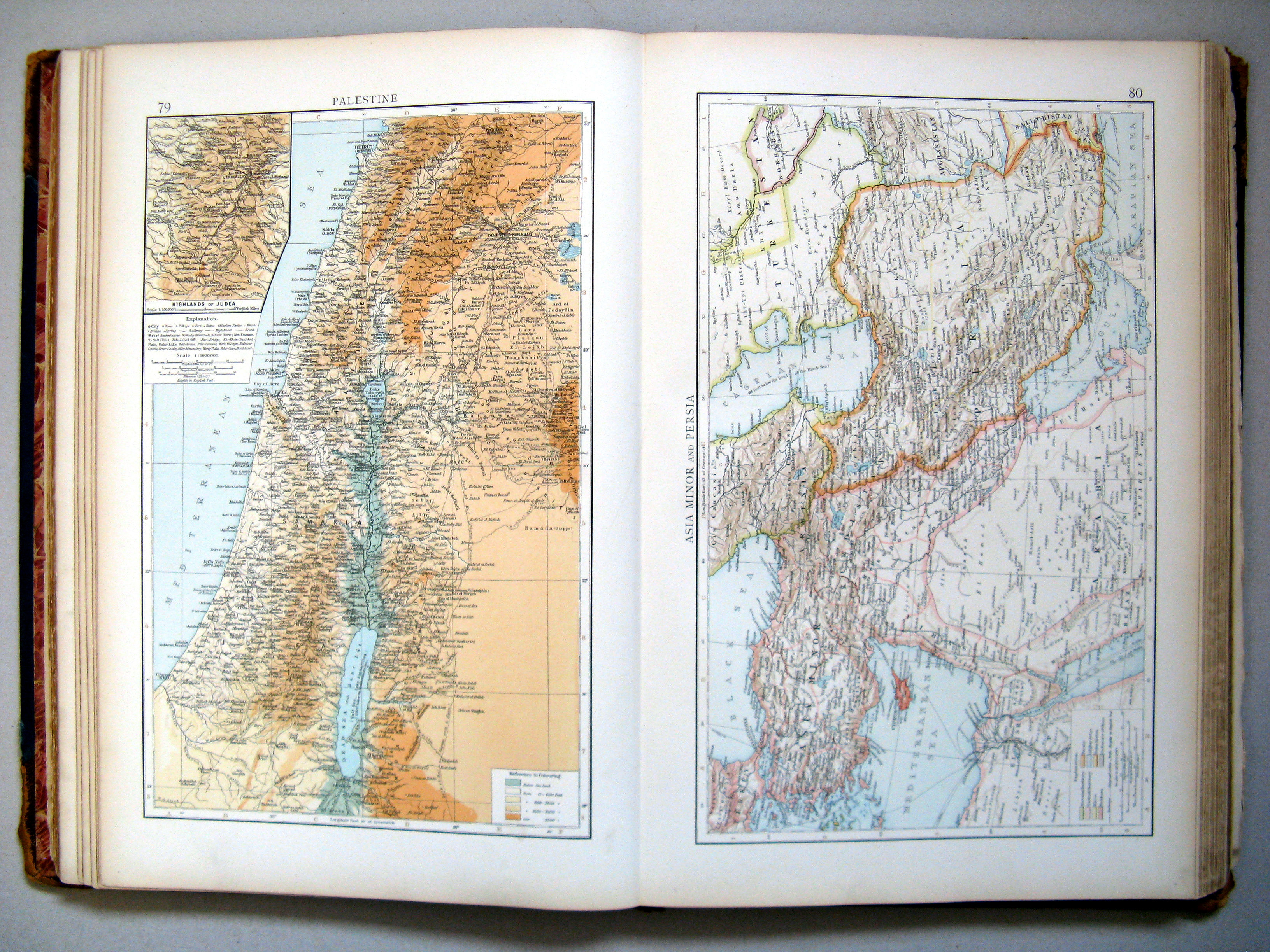
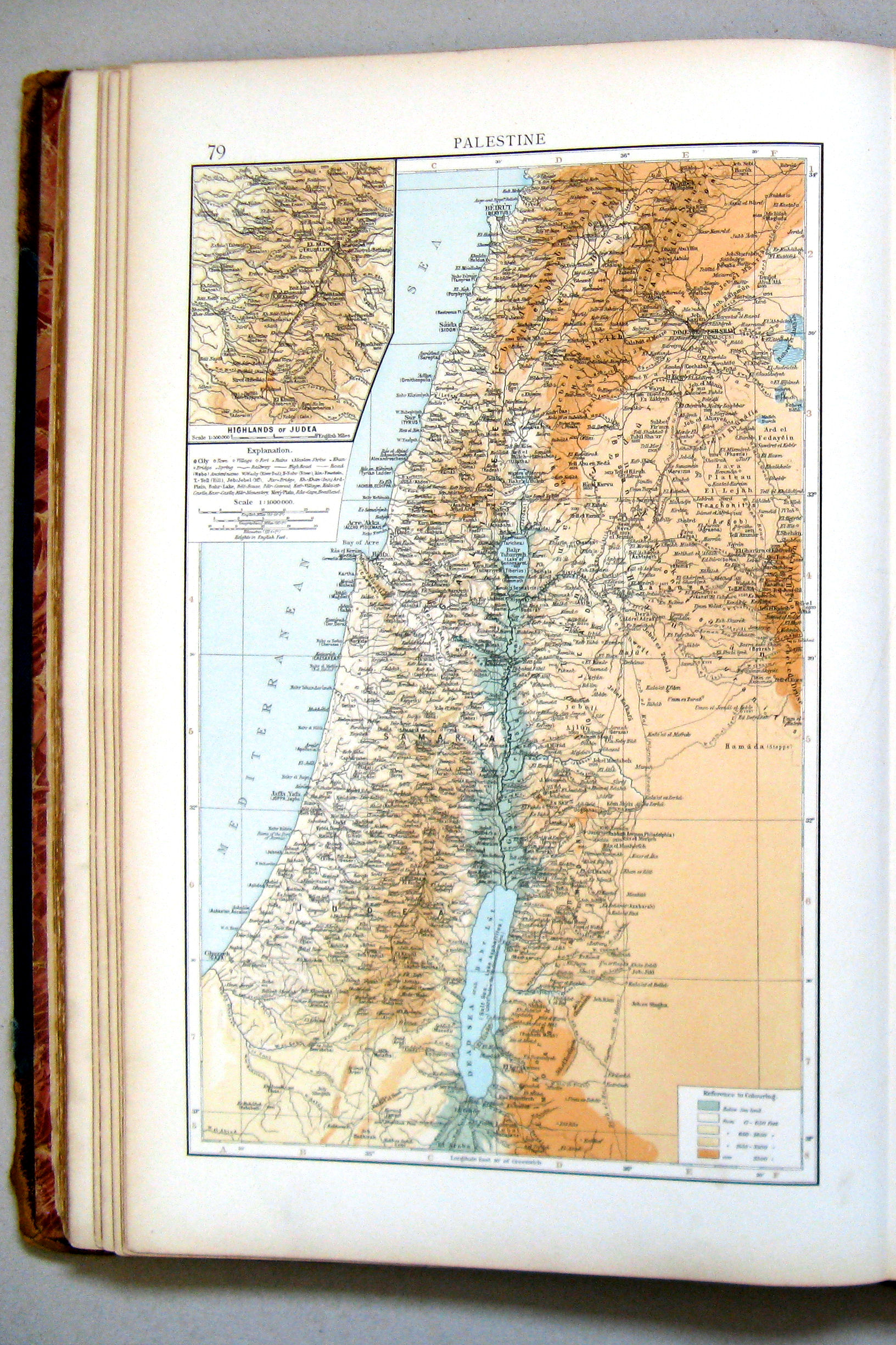
79. Palestine
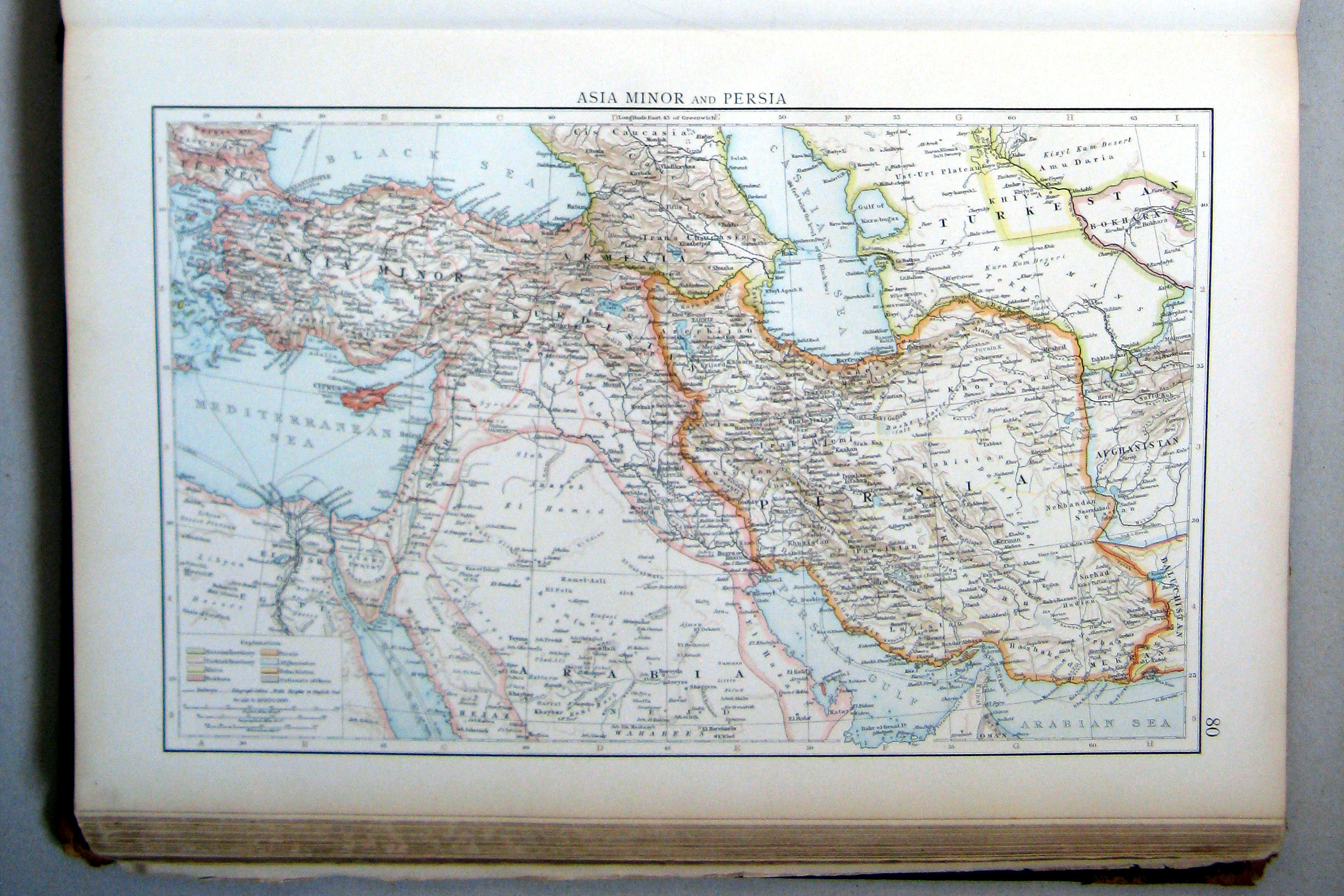
80. Asia Minor and Persia
 The Times Atlas 1900
79. Palestine
Palestina
 The Times Atlas 1900
80. Asia Minor and Persia
Klein-Azië en Perzië (Iran)
 The Times Atlas 1900
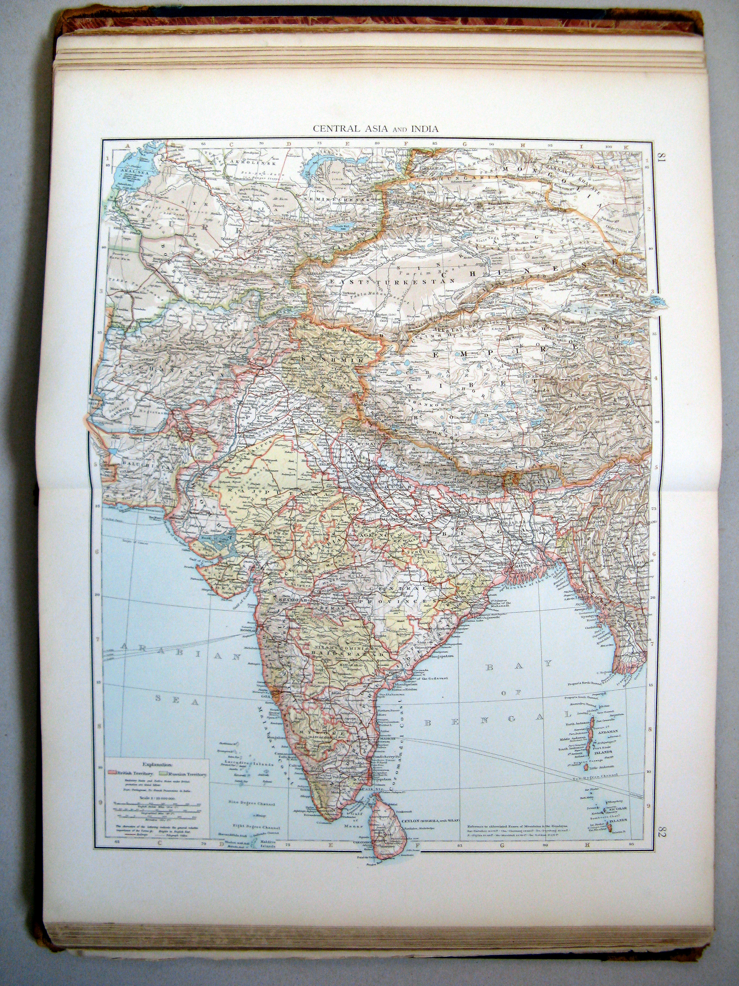
81.82. Central Asia and India
Centraal-Azië en Brits-Indië
 The Times Atlas 1900
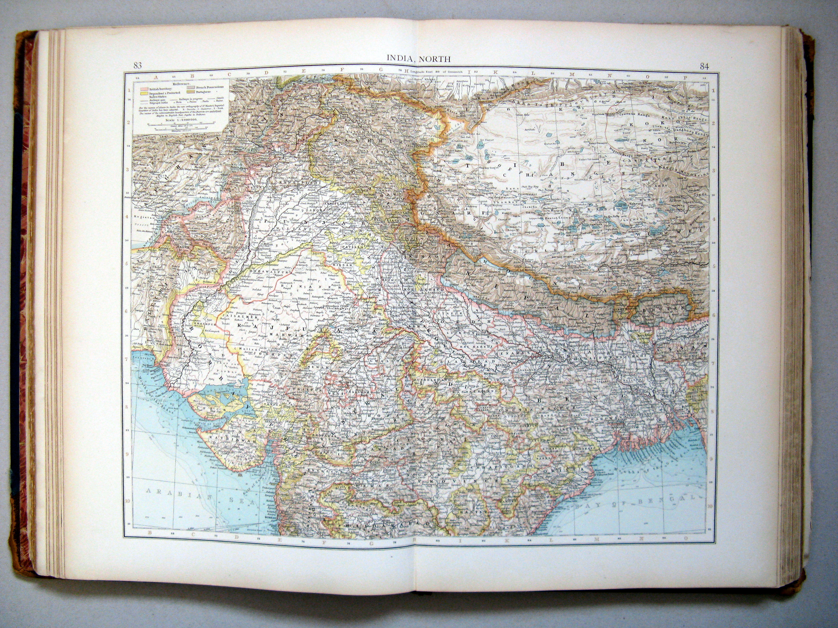
83.84. India, north
Brits-Indië, noordelijk deel
 The Times Atlas 1900
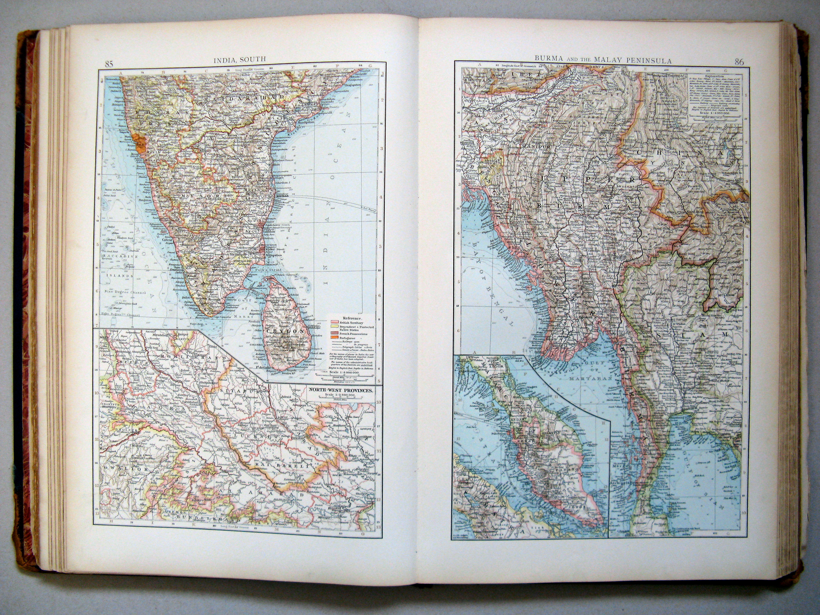
85. India, south
86. Burma and the Malay Peninsula
Brits-Indië, zuidelijk deel. Birma en Malakka
 The Times Atlas 1900
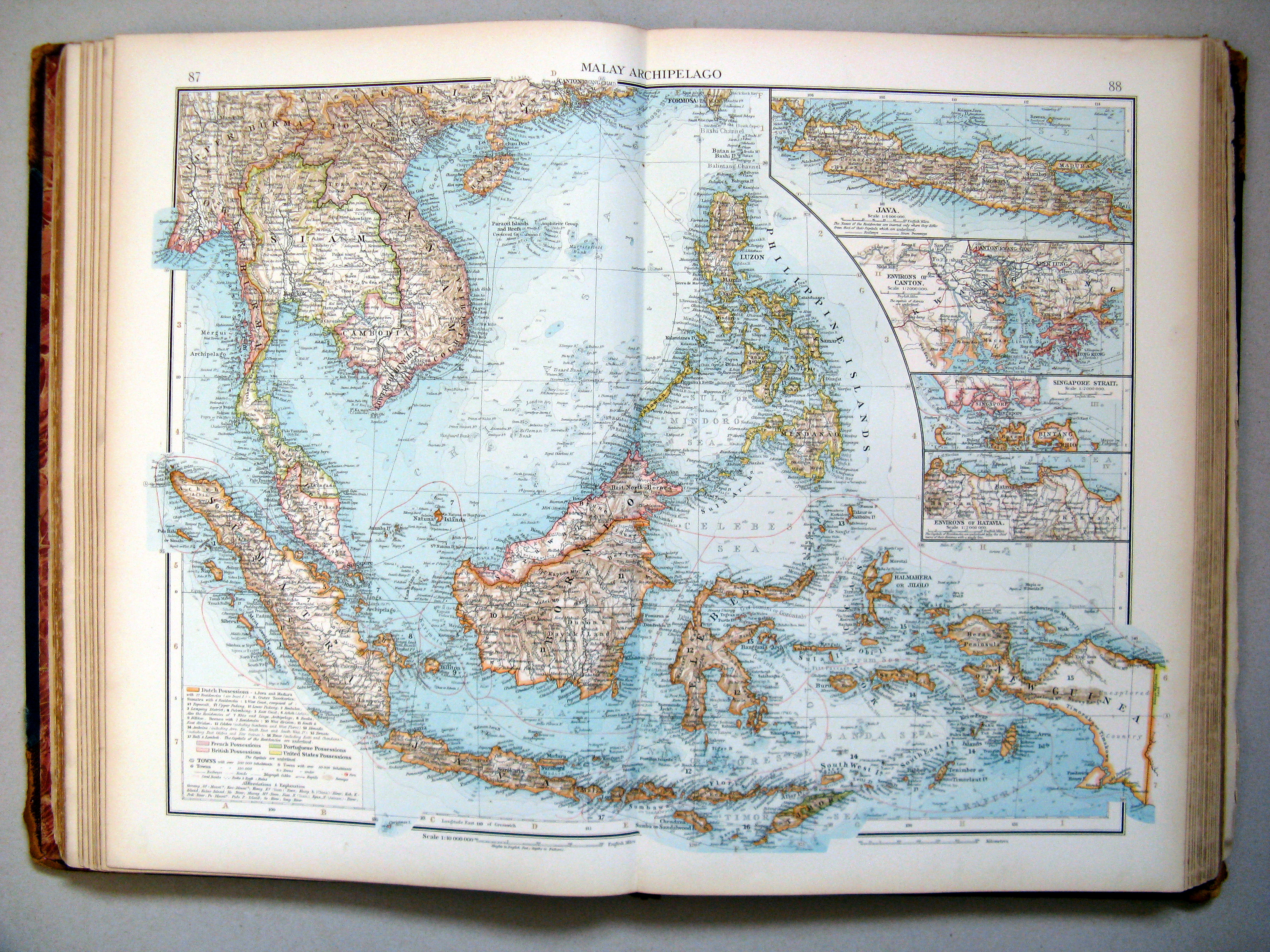
87.88. Malay Archipelago
Zuidoost-Azië
 The Times Atlas 1900
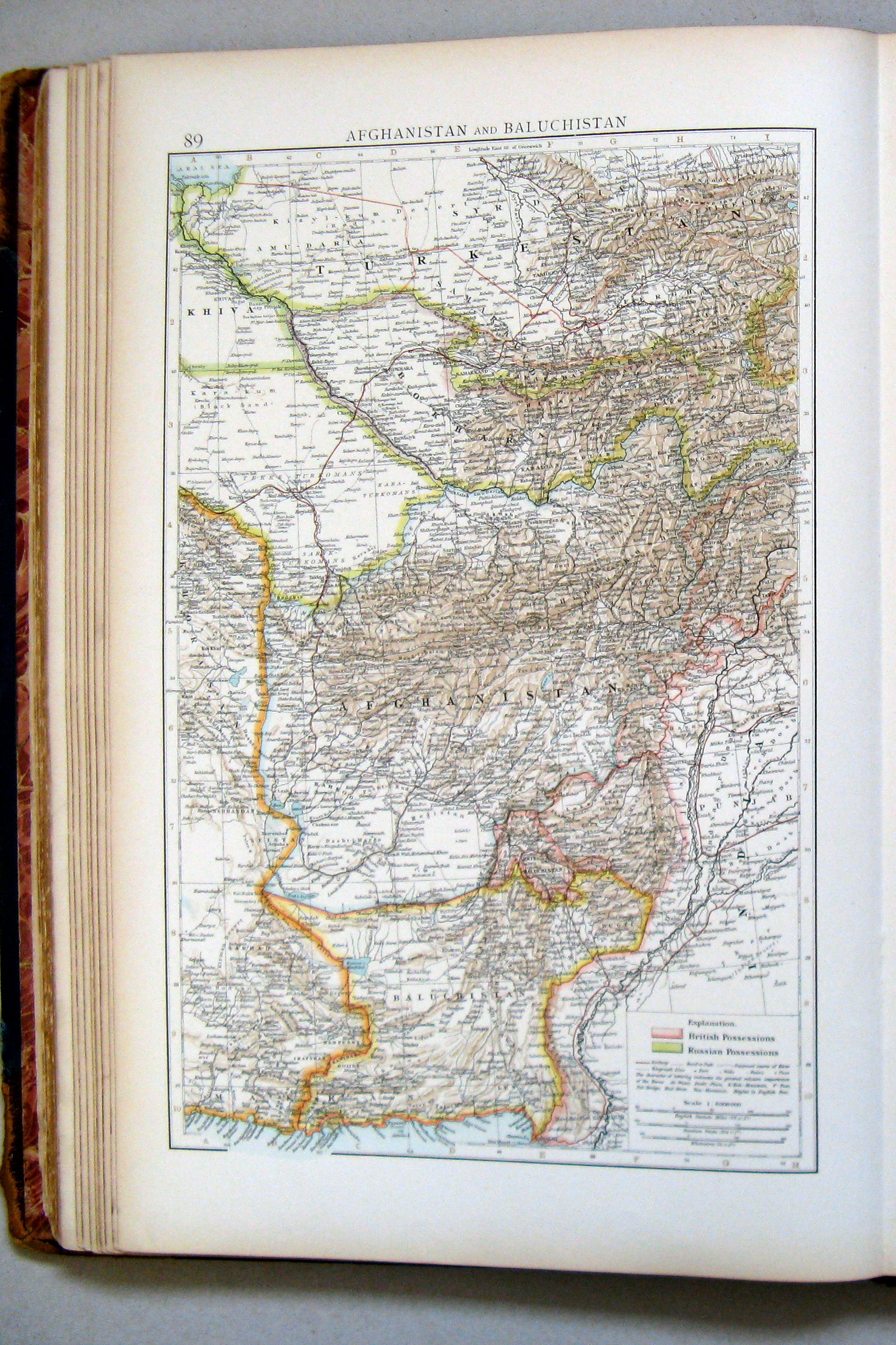
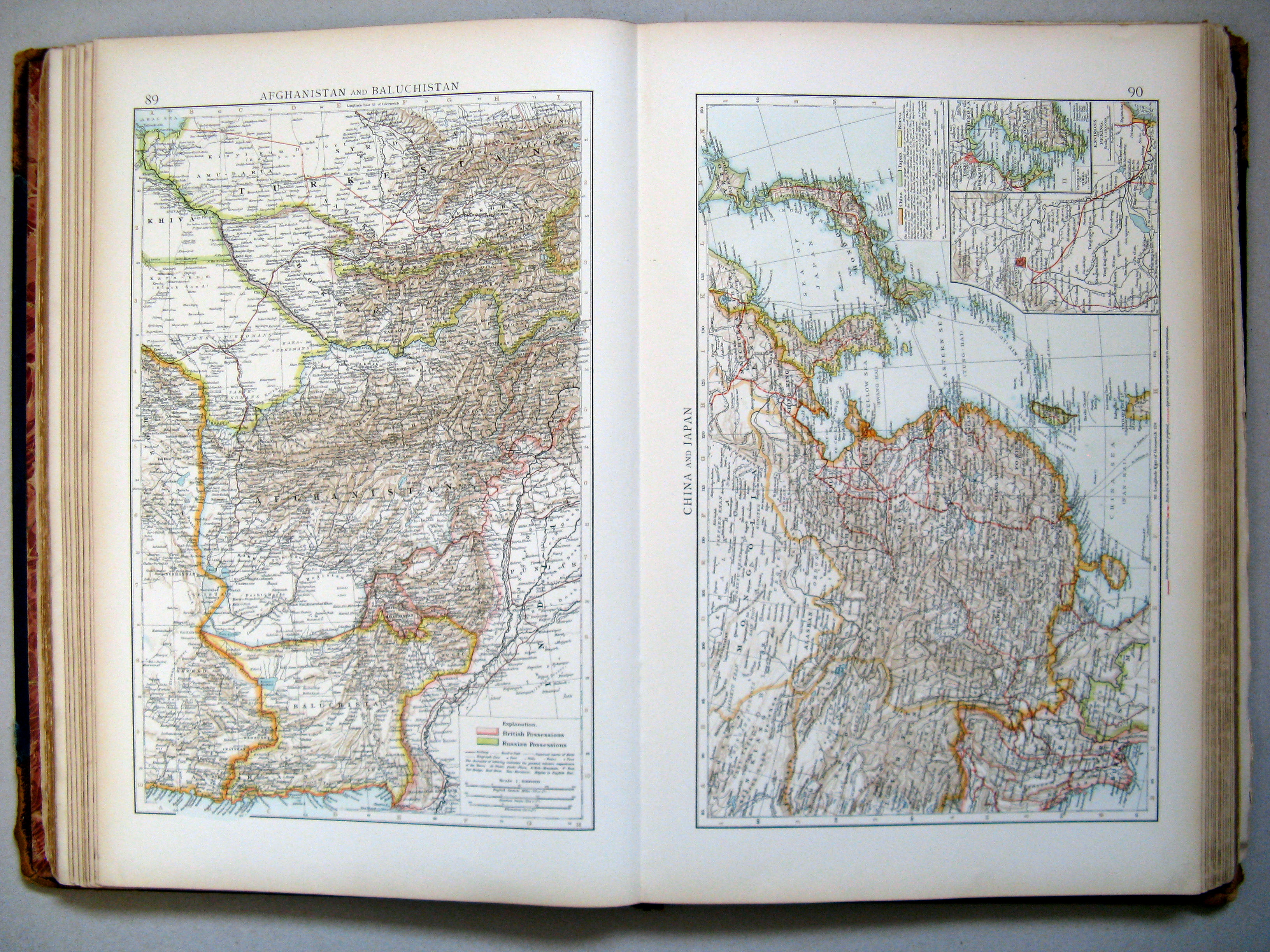
89. Afghanistan and Baluchistan
Afghanistan en Beloetsjistan
 The Times Atlas 1900
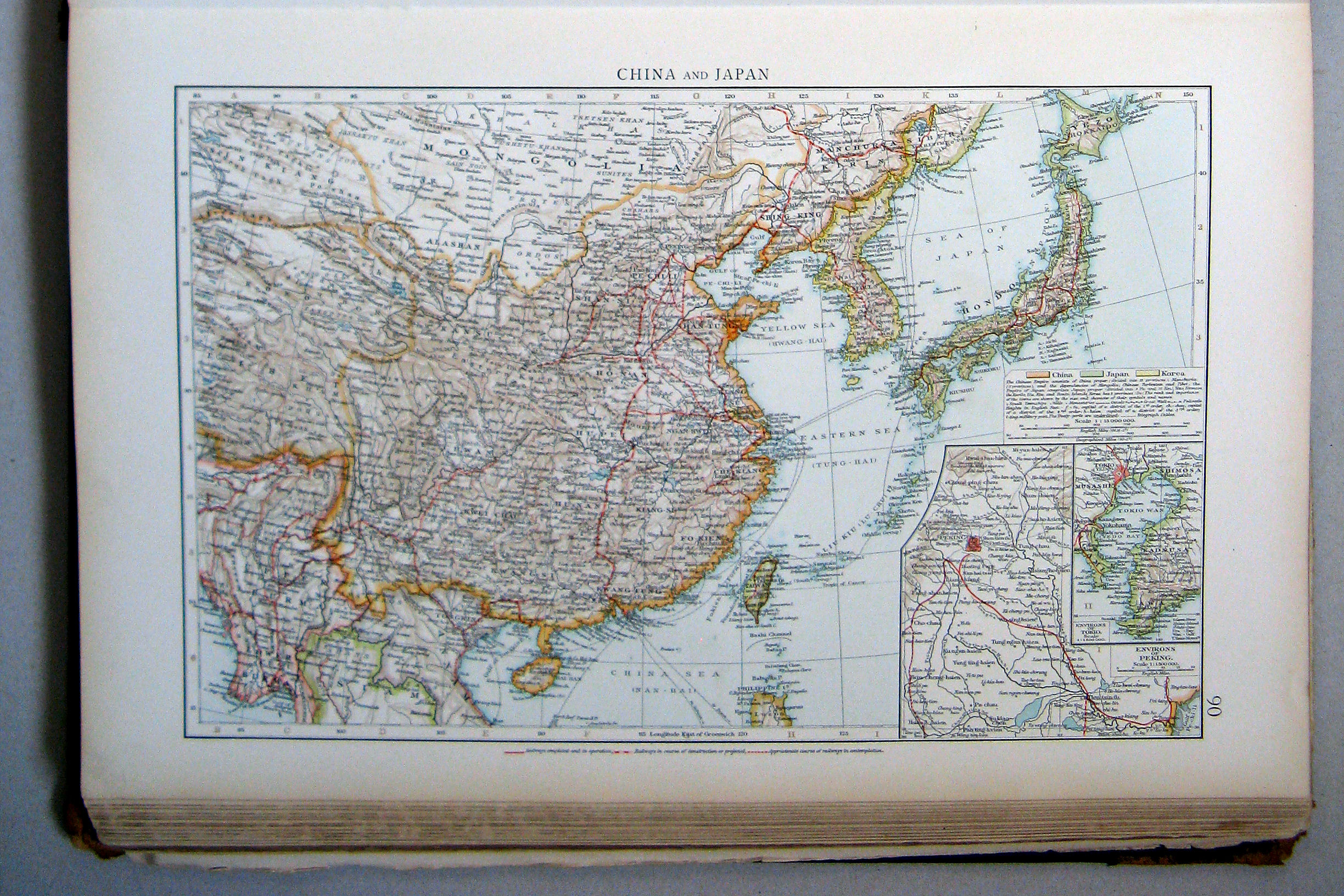
90. China and Japan
China en Japan
 The Times Atlas 1900
89. Afghanistan and Baluchistan
90. China and Japan
Afghanistan en Beloetsjistan. China en Japan
 The Times Atlas 1900
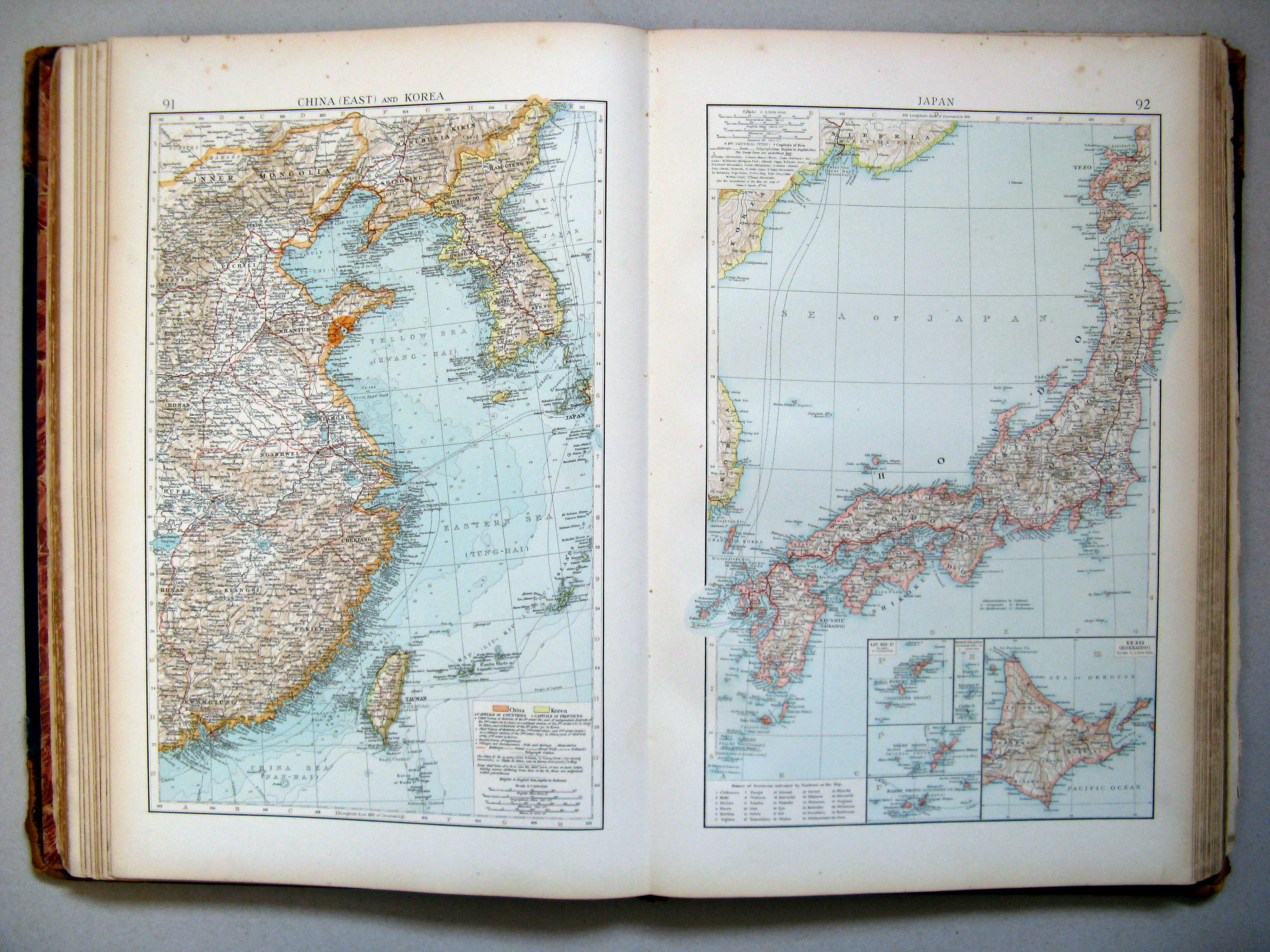
91. China (east) and Korea
92. Japan
Oost-China en Korea. Japan
 The Times Atlas 1900
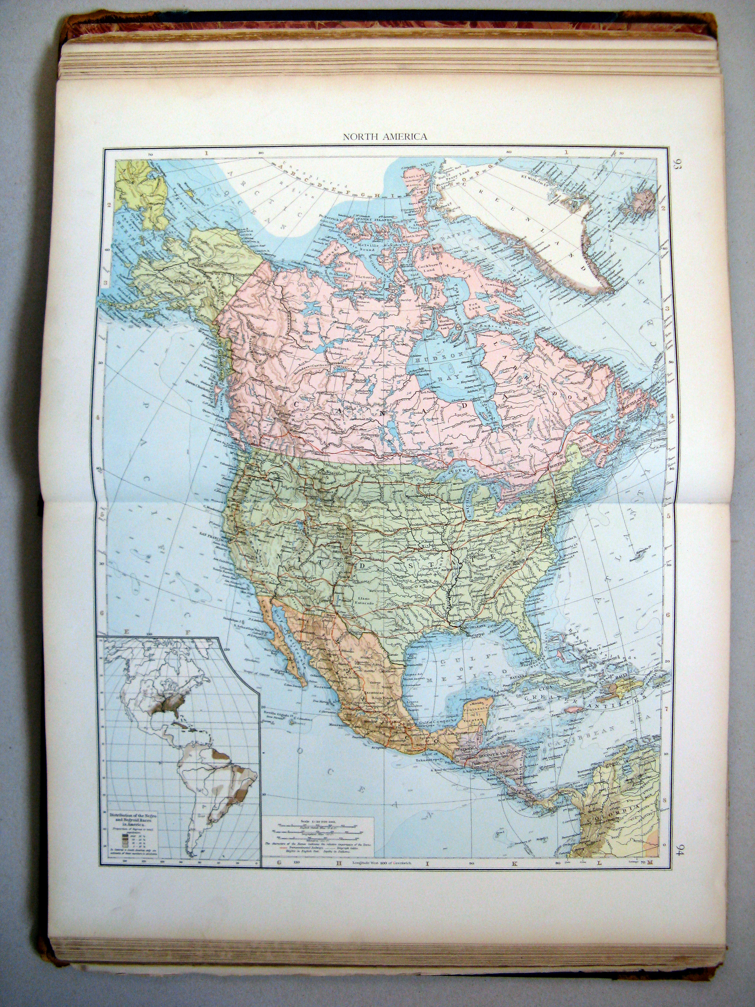
93.94. North America
Noord-Amerika
 The Times Atlas 1900
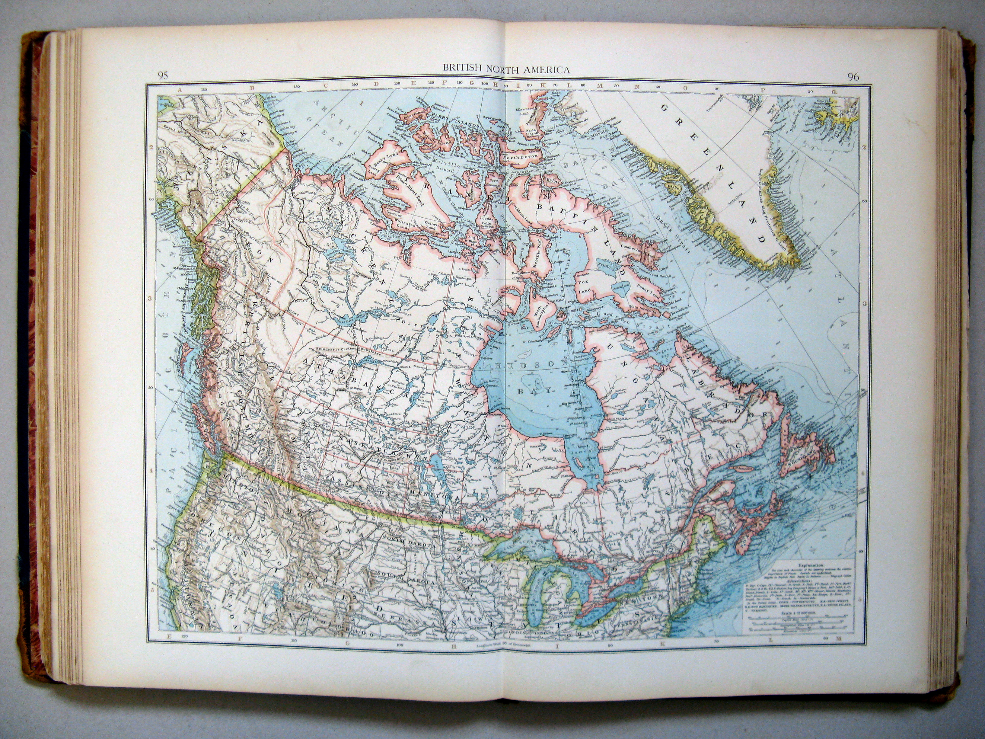
95.96. British North America
Brits Noord-Amerika
 The Times Atlas 1900
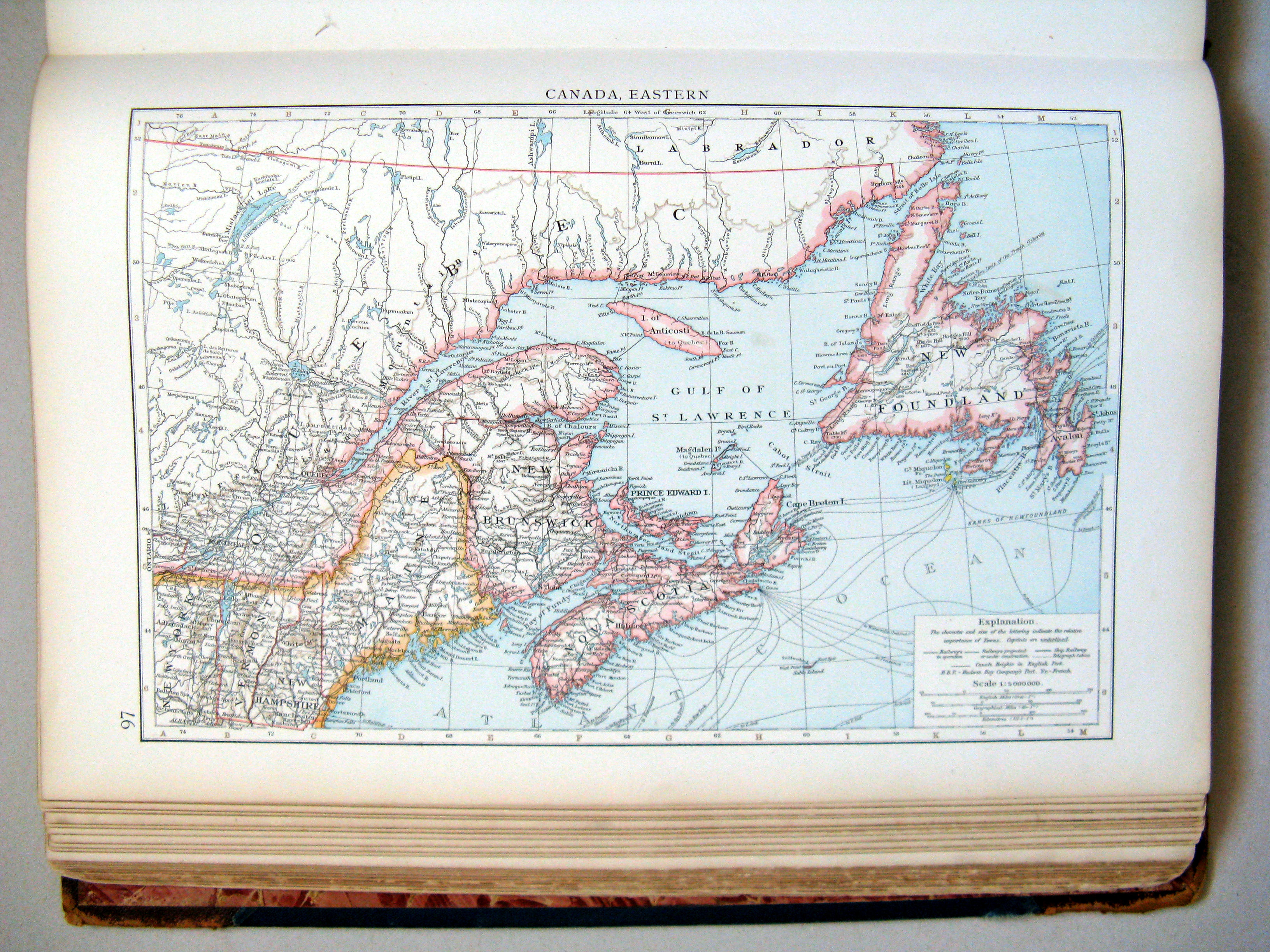
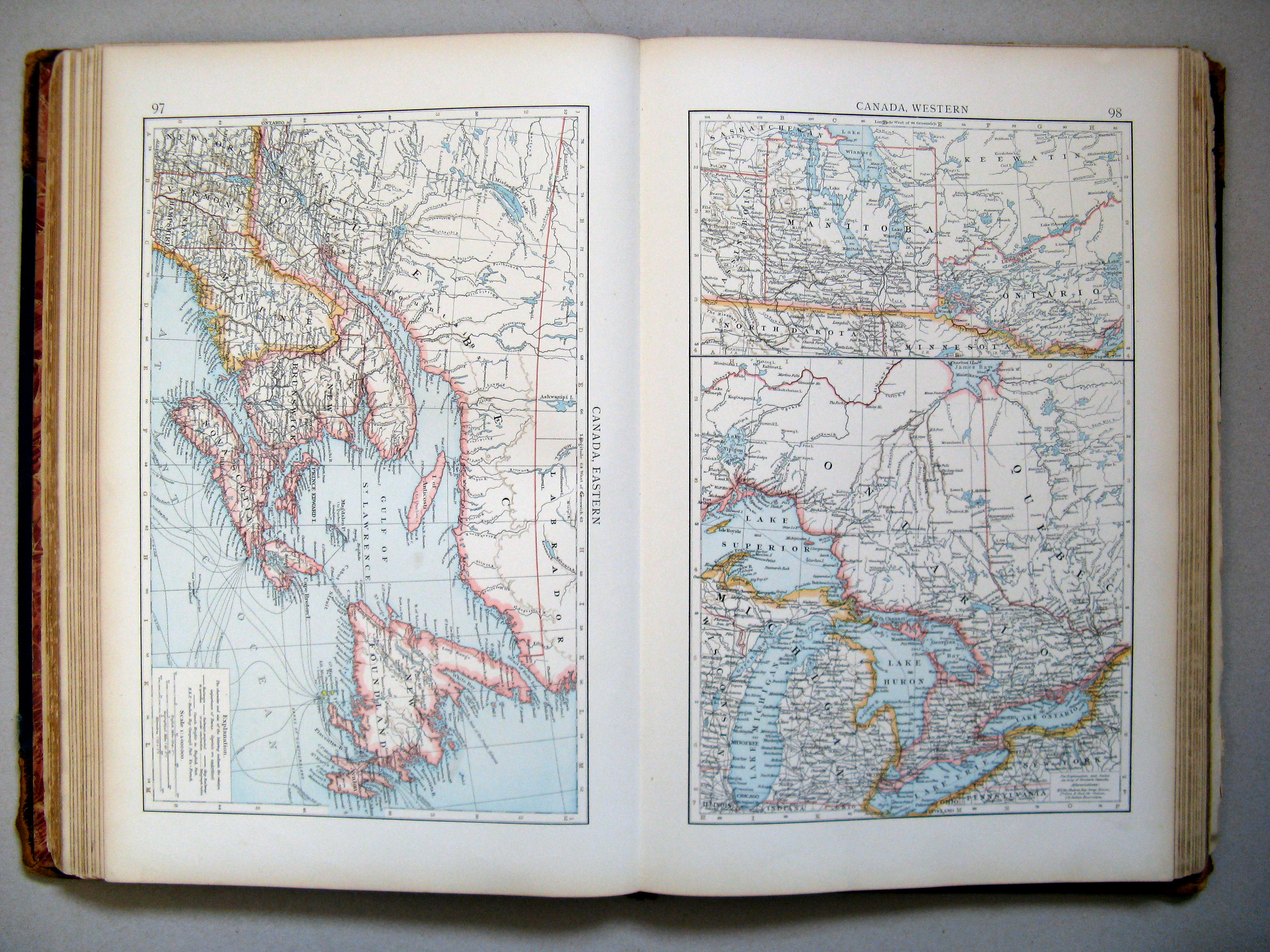
97. Canada, eastern
Canada, oostelijk deel
 The Times Atlas 1900
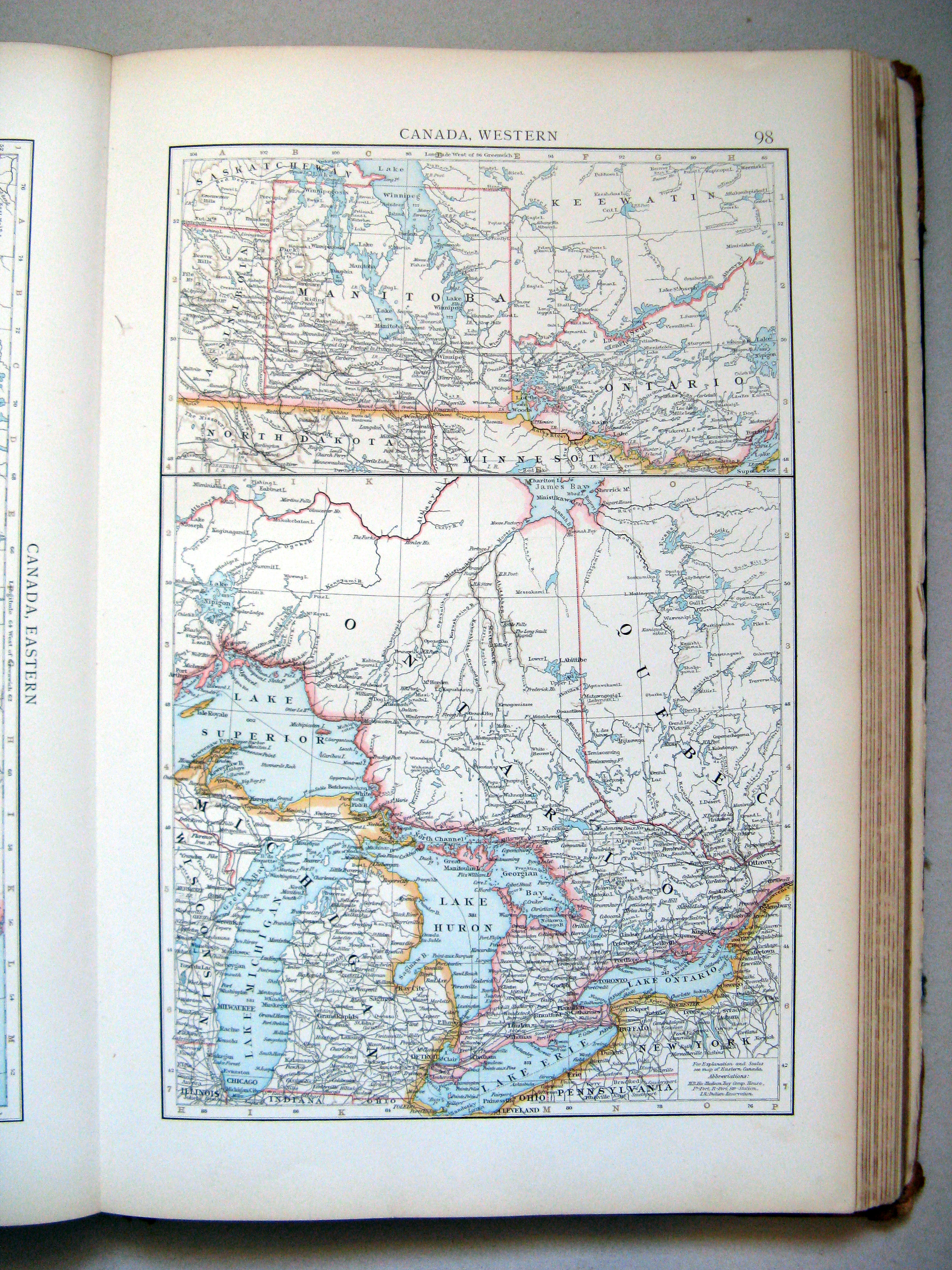
98. Canada, western
Canada, westelijk deel
 The Times Atlas 1900
97. Canada, eastern
98. Canada, western
 The Times Atlas 1900
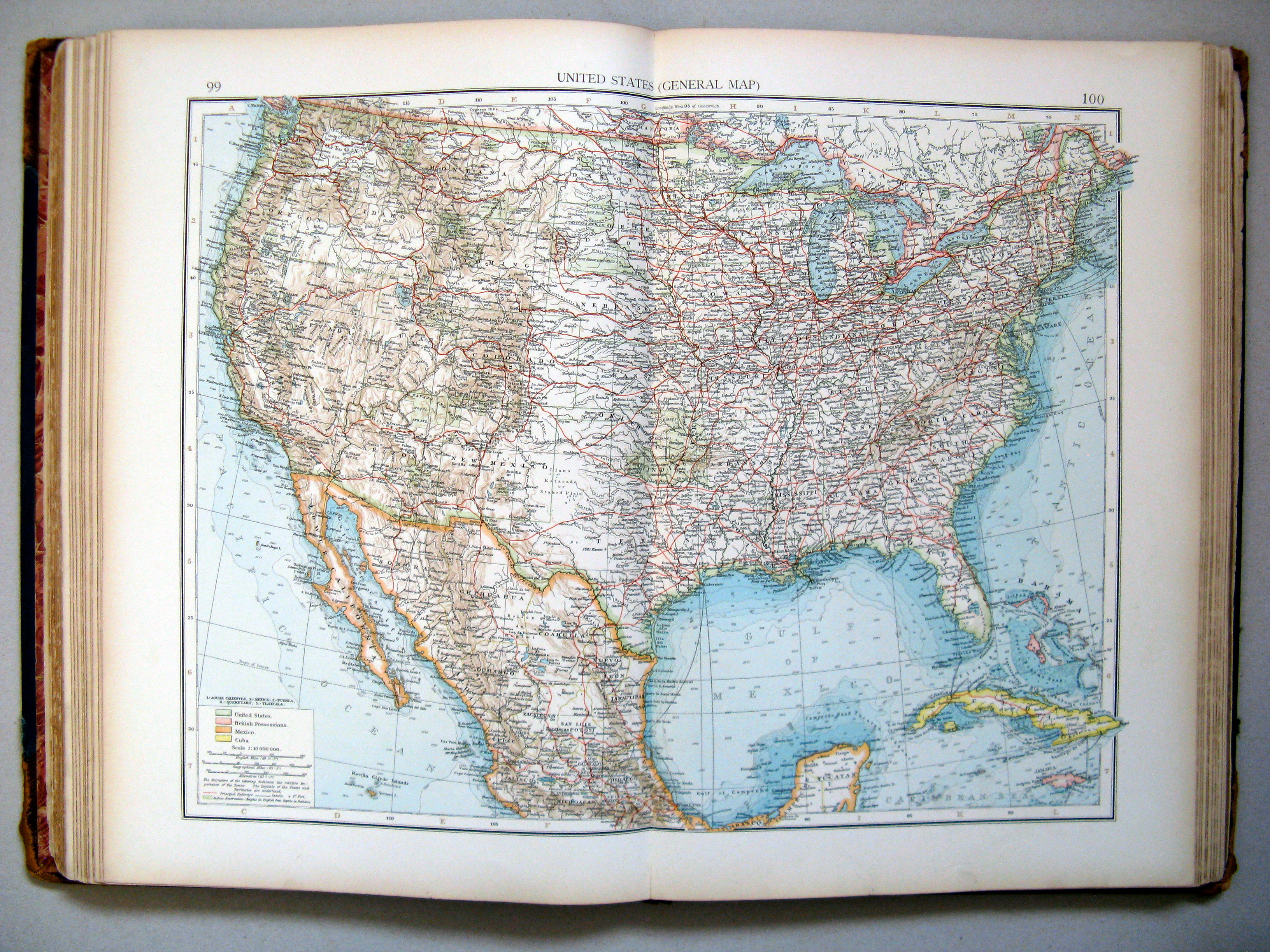
99.100. United States (general map)
Verenigde Staten (overzichtskaart)
 The Times Atlas 1900
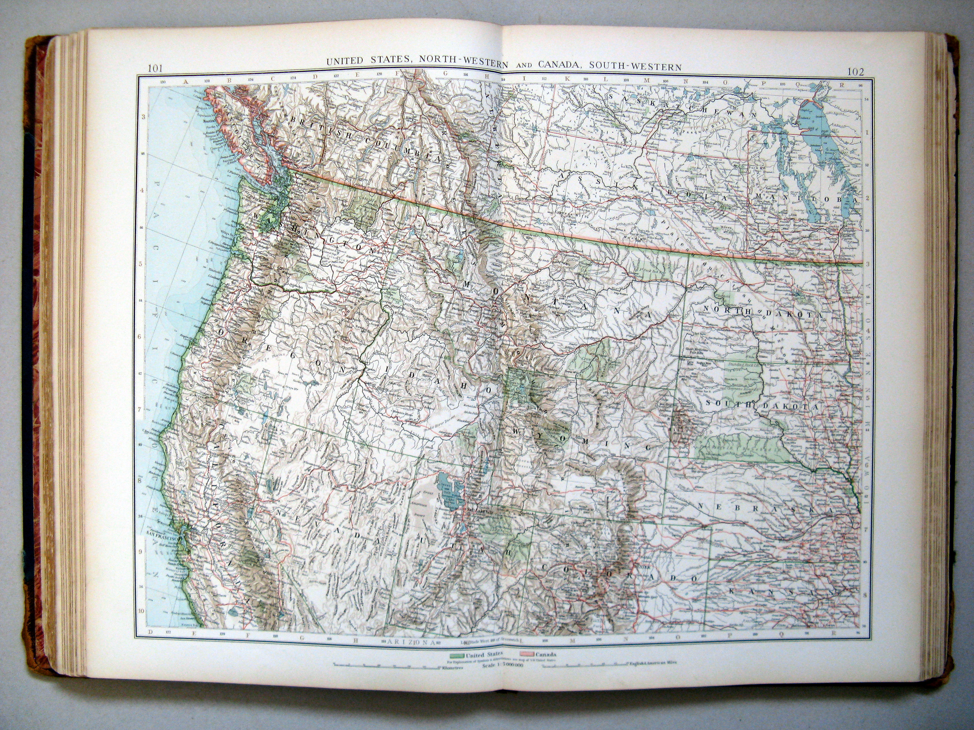
101.102. United States, north-western and Canada, south-western
Noordwestelijke Verenigde Staten en Zuidwest-Canada
 The Times Atlas 1900
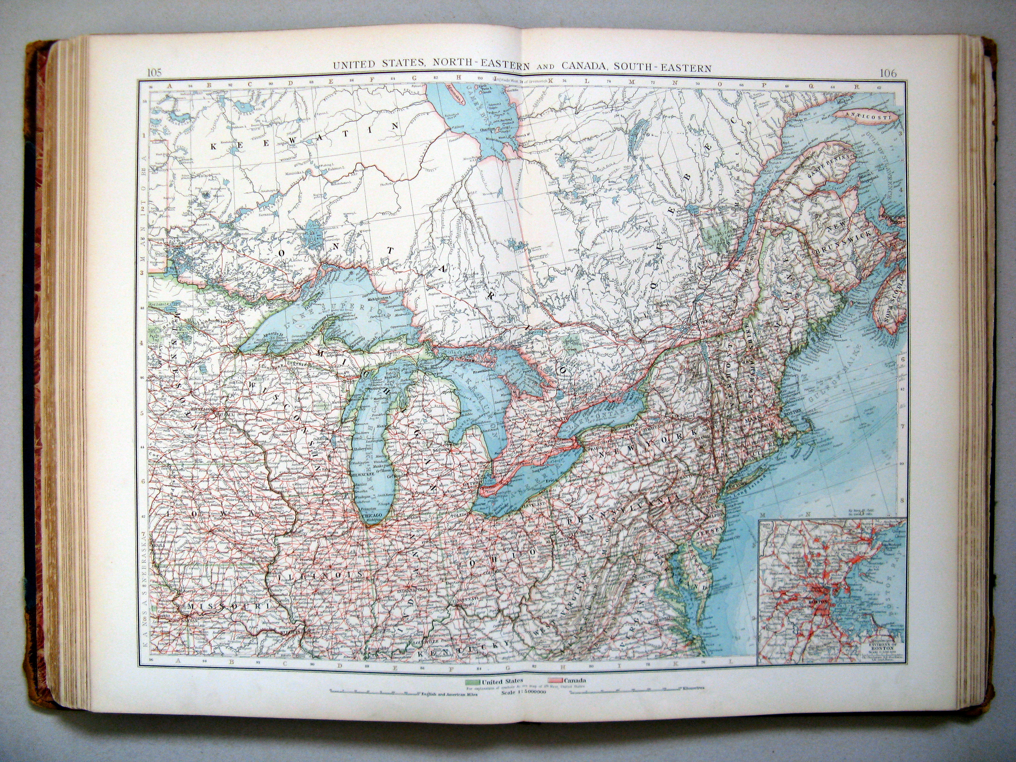
105.106. United States, north-eastern and Canada, south-eastern
Noordoostelijke Verenigde Staten en Zuidoost-Canada
 The Times Atlas 1900
103.104. United States, south-western and Mexico, north
Zuidwestelijke Verenigde Staten en Noord-Mexico
 The Times Atlas 1900
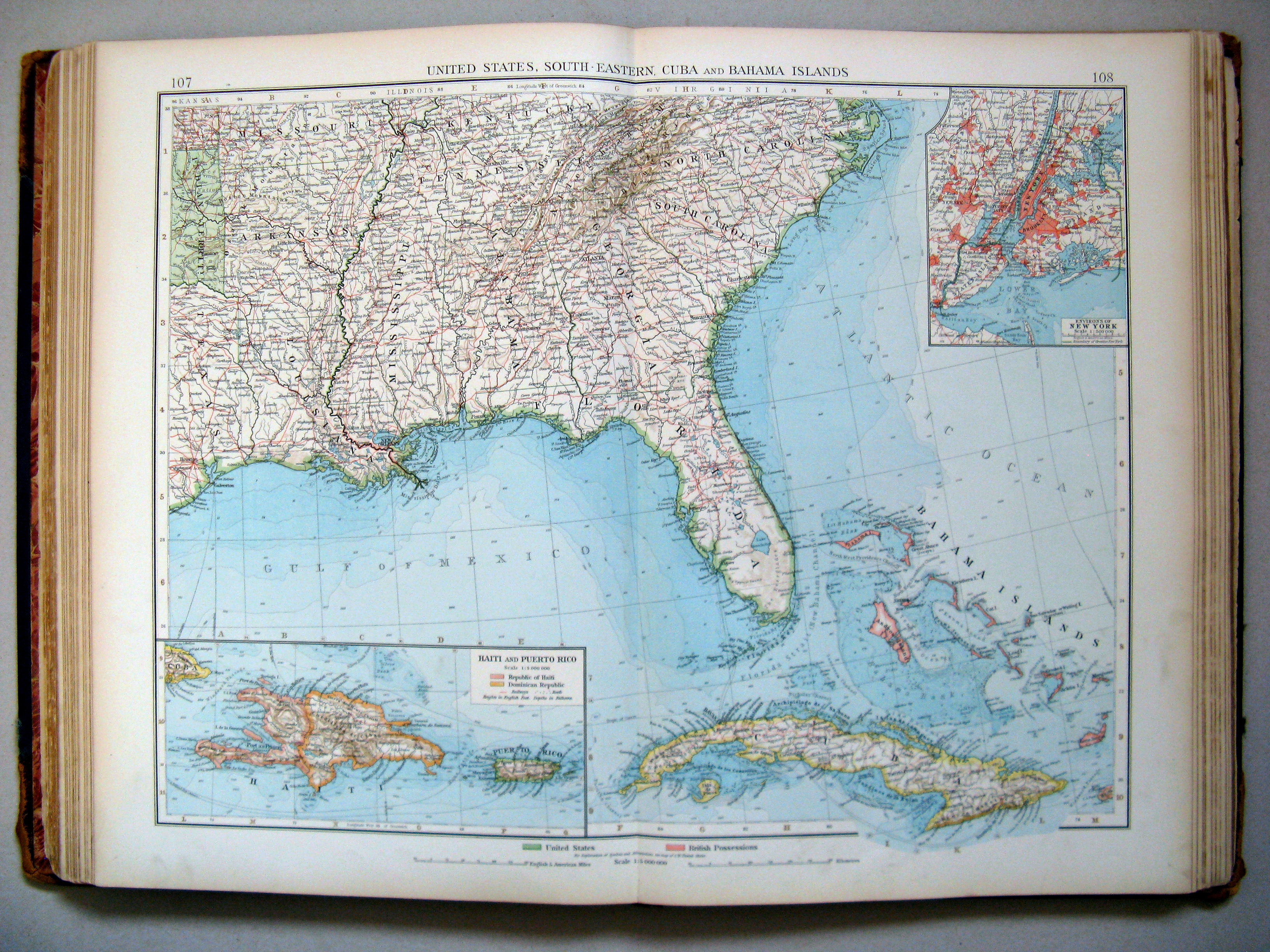
107.108. United States, south-eastern, Cuba and Bahama Islands
Zuidoostelijke Verenigde Staten, Cuba en de Bahama's
 The Times Atlas 1900
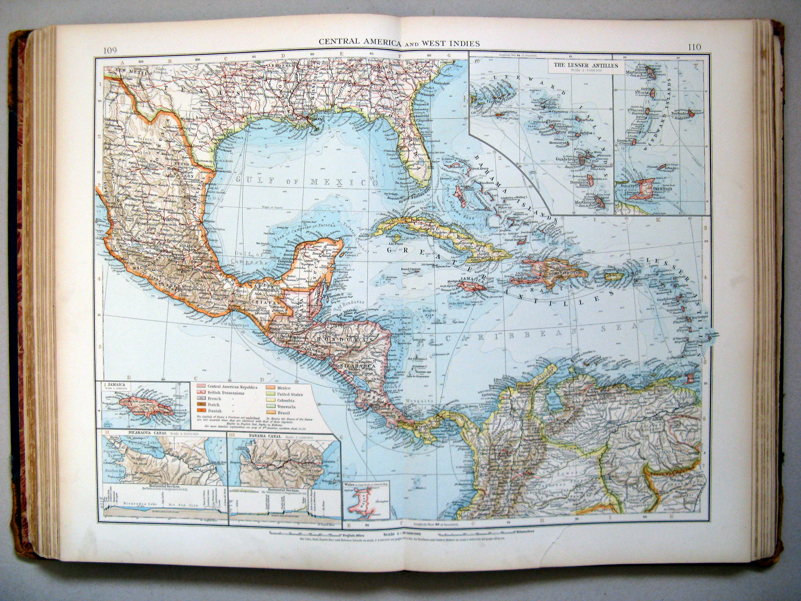
109.110. Central America and West Indies
Midden-Amerika en Westindië
 The Times Atlas 1900
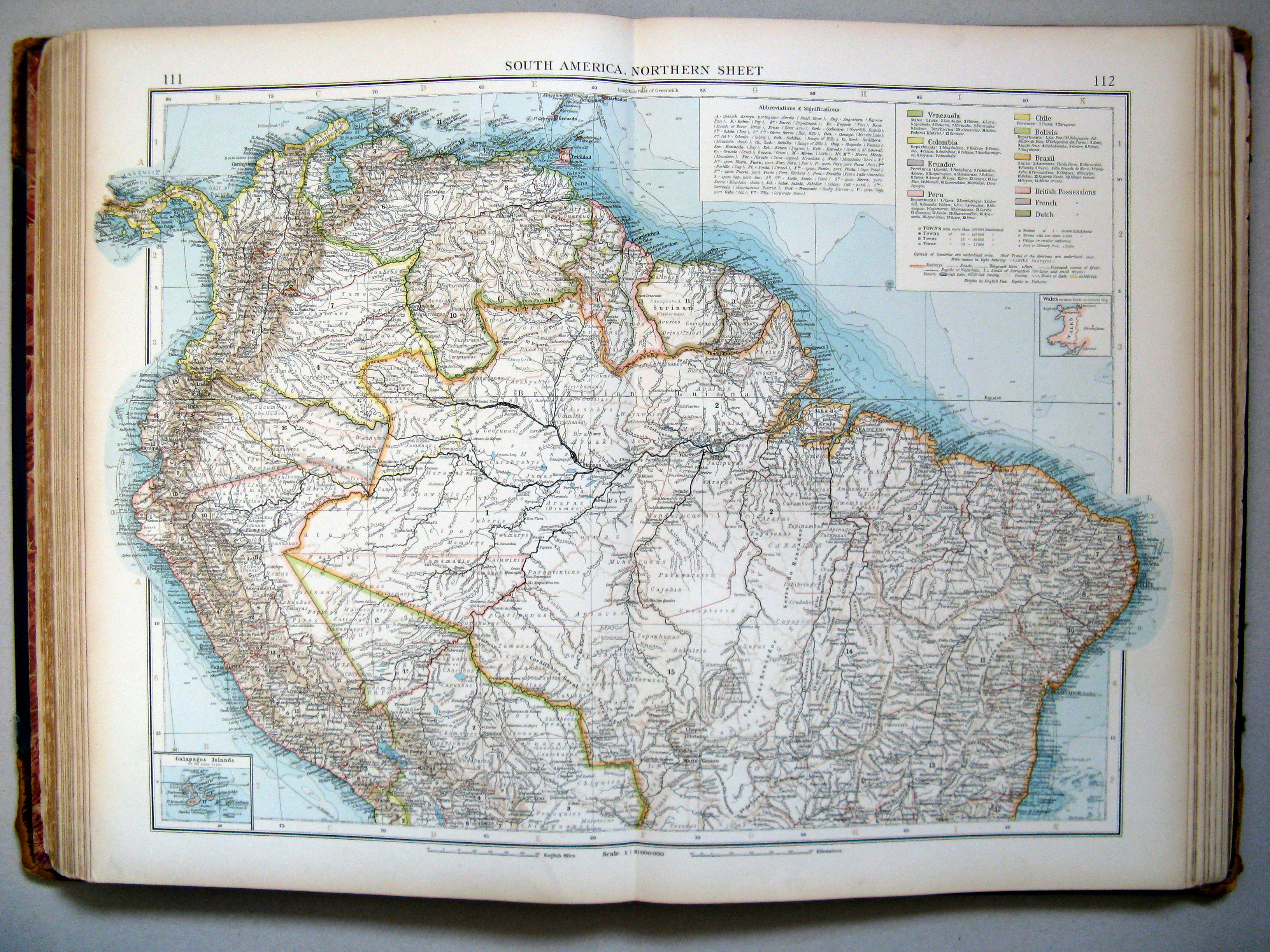
111.112. South America, northern sheet
Zuid-Amerika, noordblad
 The Times Atlas 1900
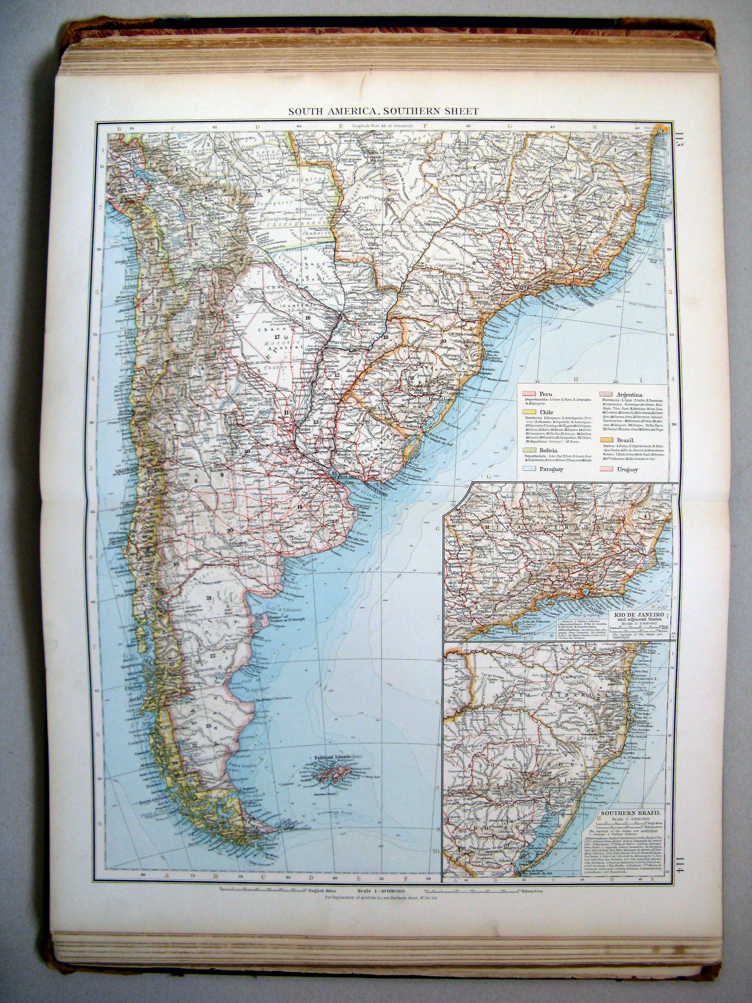
113.114. South America, southern sheet
Zuid-Amerika, noordblad
 The Times Atlas 1900
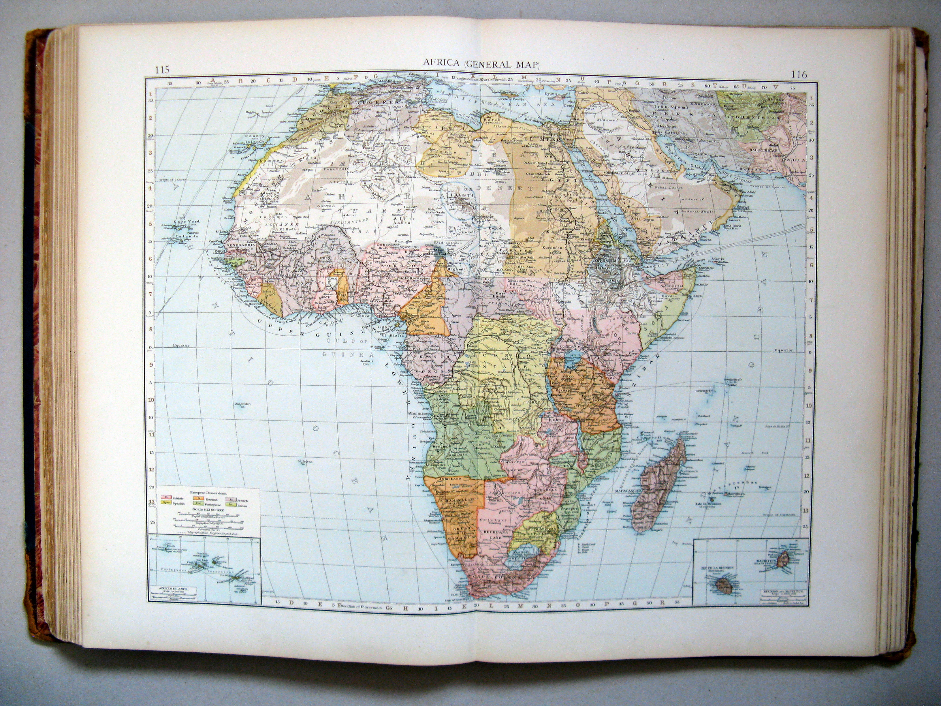
115.116. Africa (general map)
Afrika (overzichtskaart)
 The Times Atlas 1900
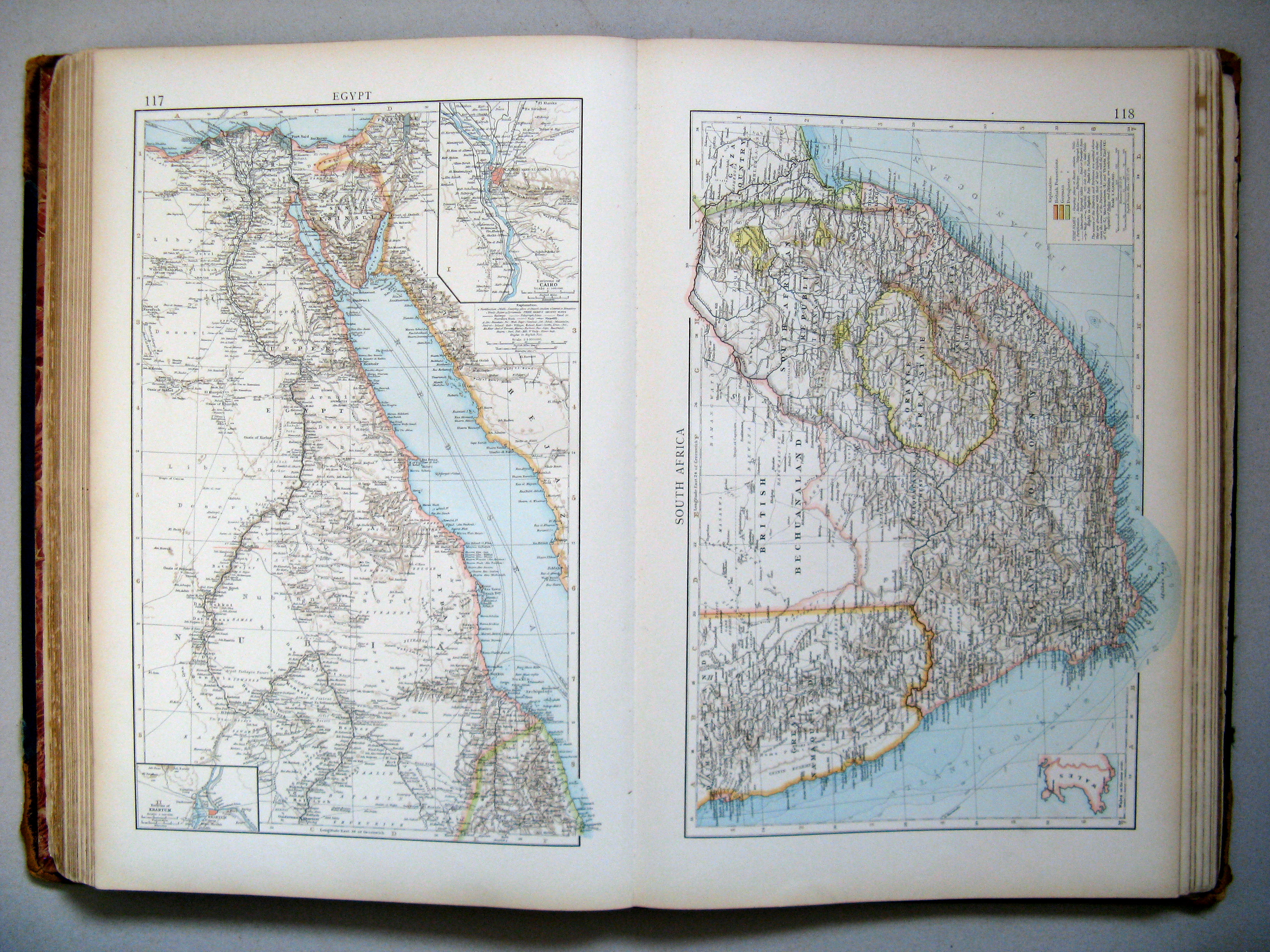
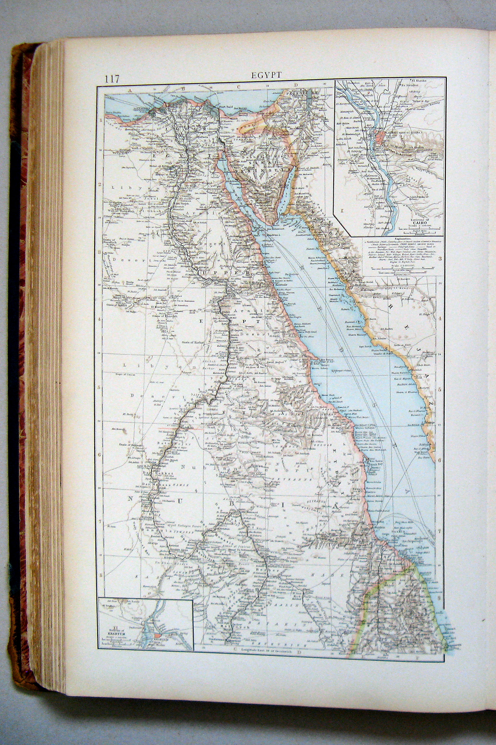
117. Egypt
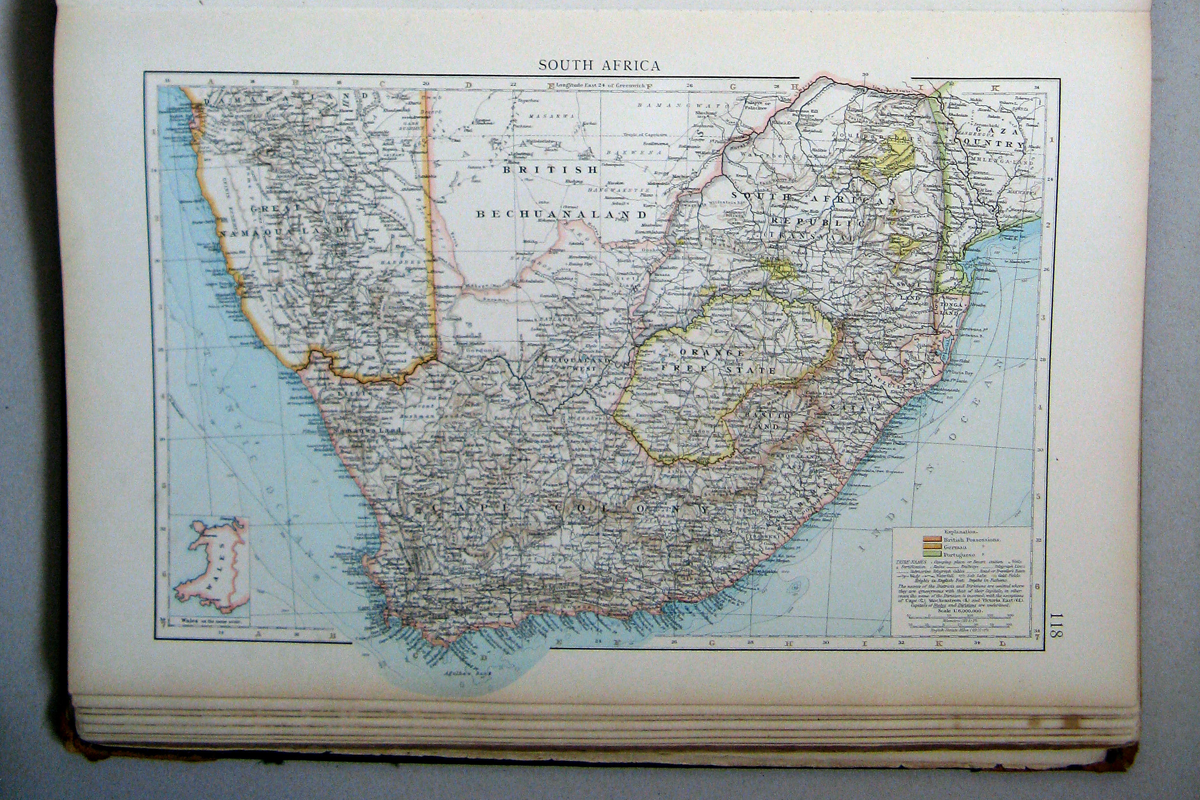
118. South Africa
 The Times Atlas 1900
117. Egypt
Egypte
 The Times Atlas 1900
118. South Africa
Zuid-Afrika
 The Times Atlas 1900
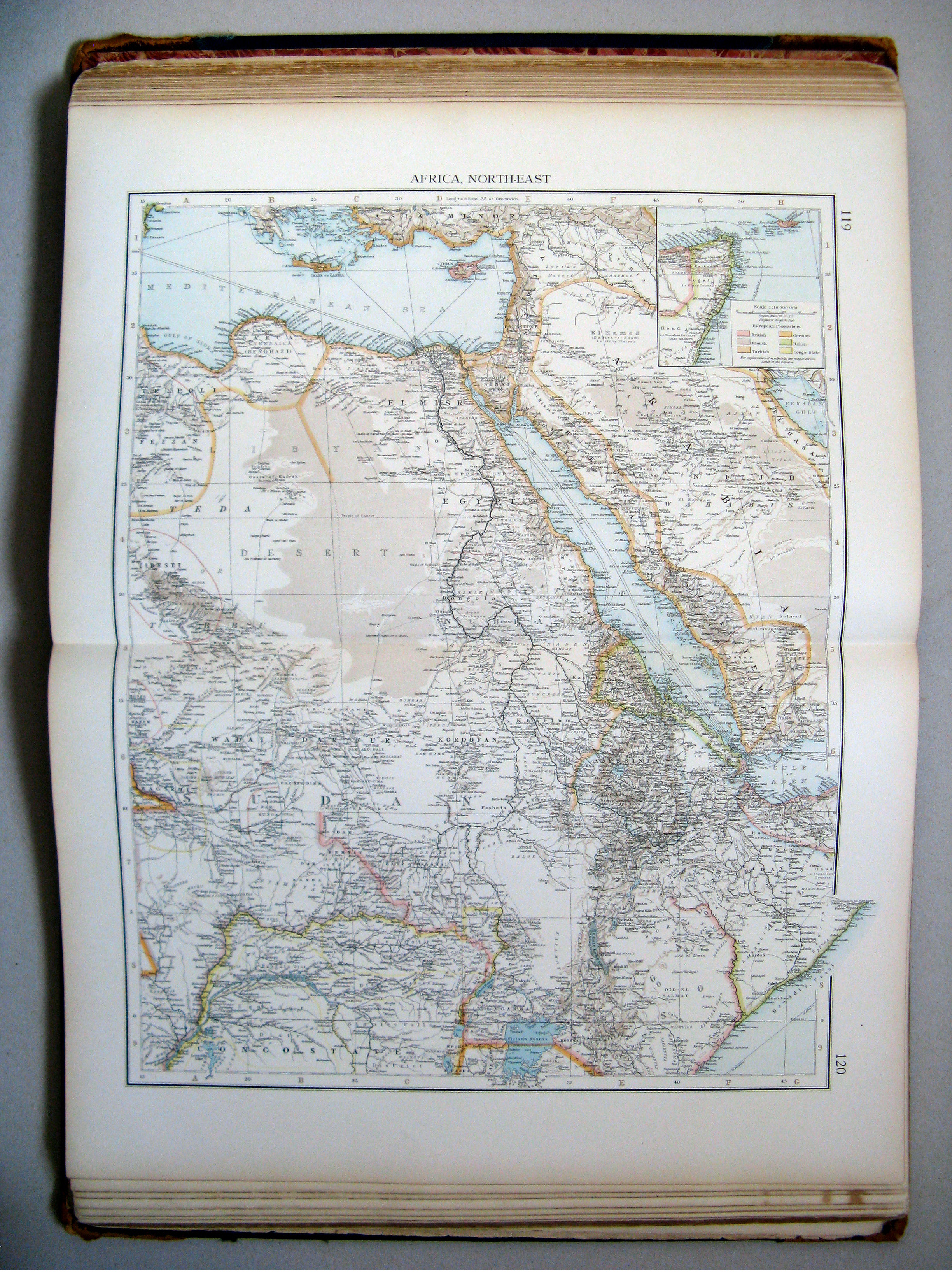
119.120. Africa, north-east
Noordoost-Afrika
 The Times Atlas 1900
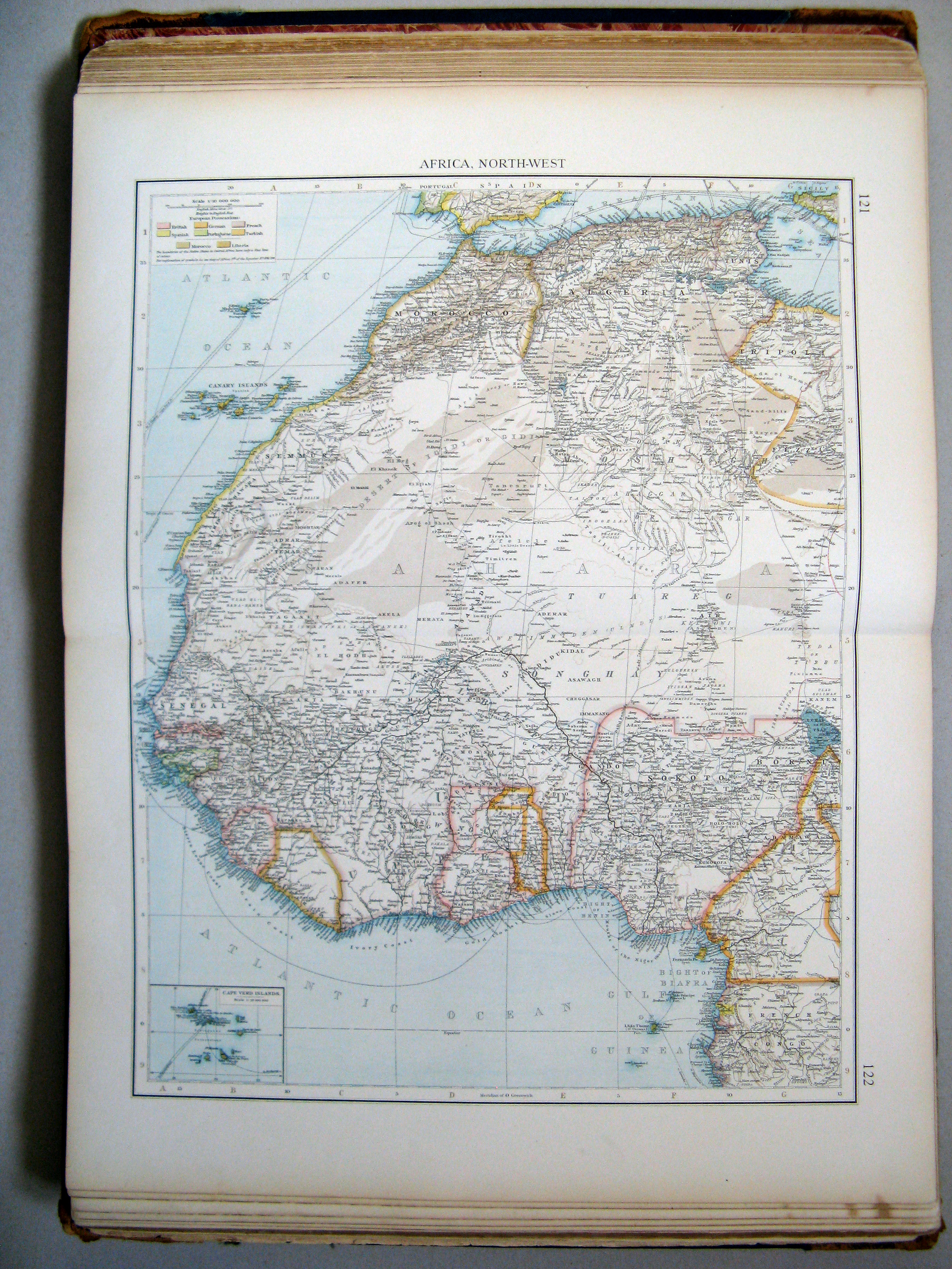
121.122. Africa, north-west
Noordwest-Afrika
 The Times Atlas 1900
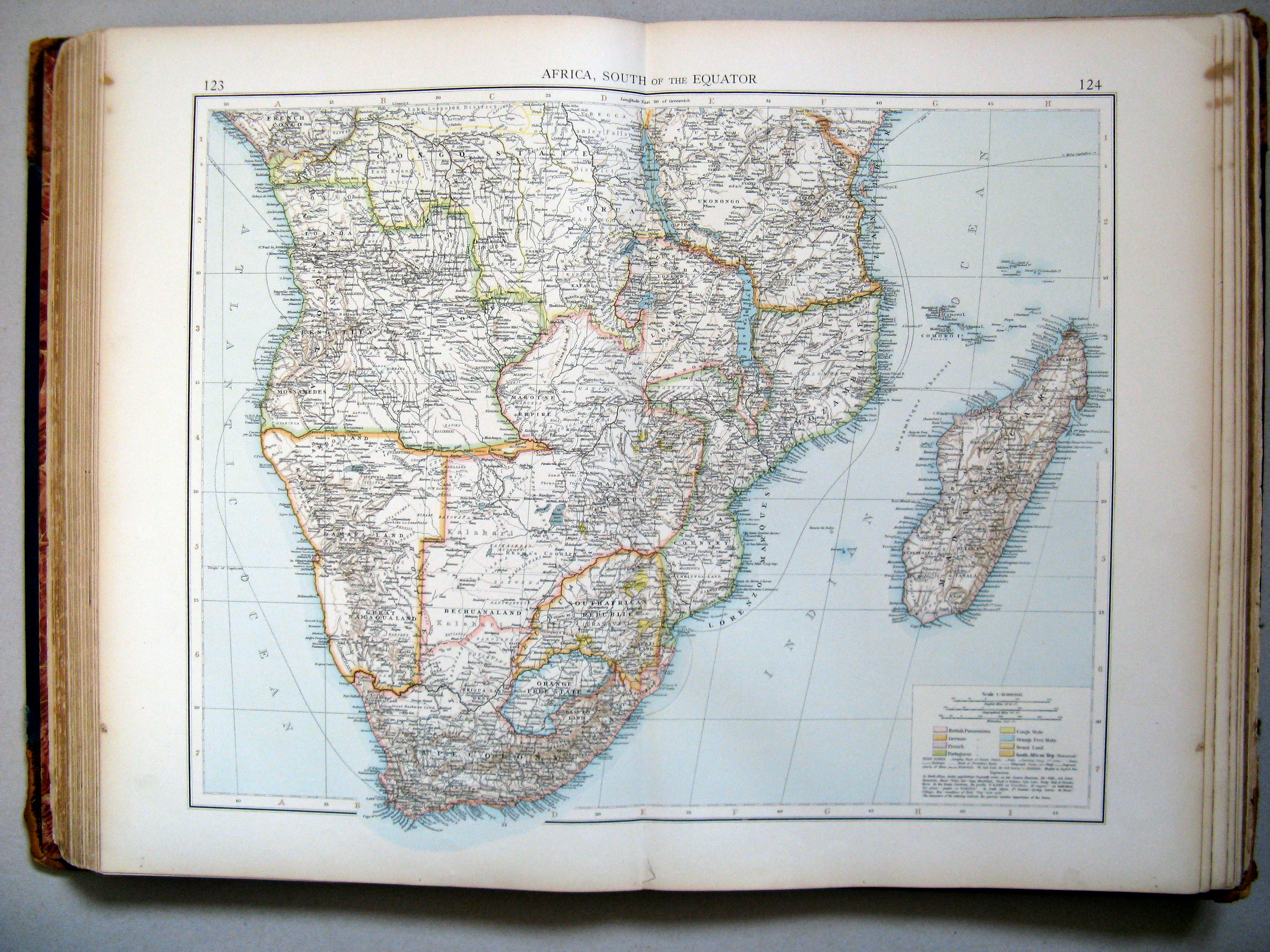
123.124. Africa, south of the Equator
Midden- en Zuid-Afrika
 The Times Atlas 1900
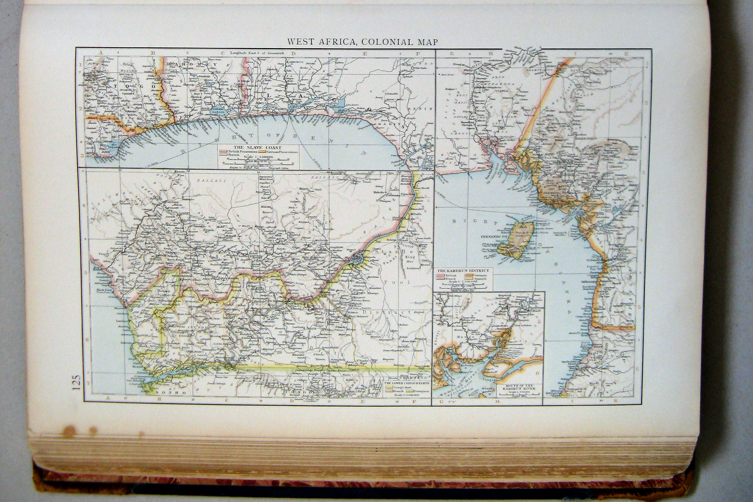
125. West Africa, colonial map
West-Afrika, koloniën
 The Times Atlas 1900
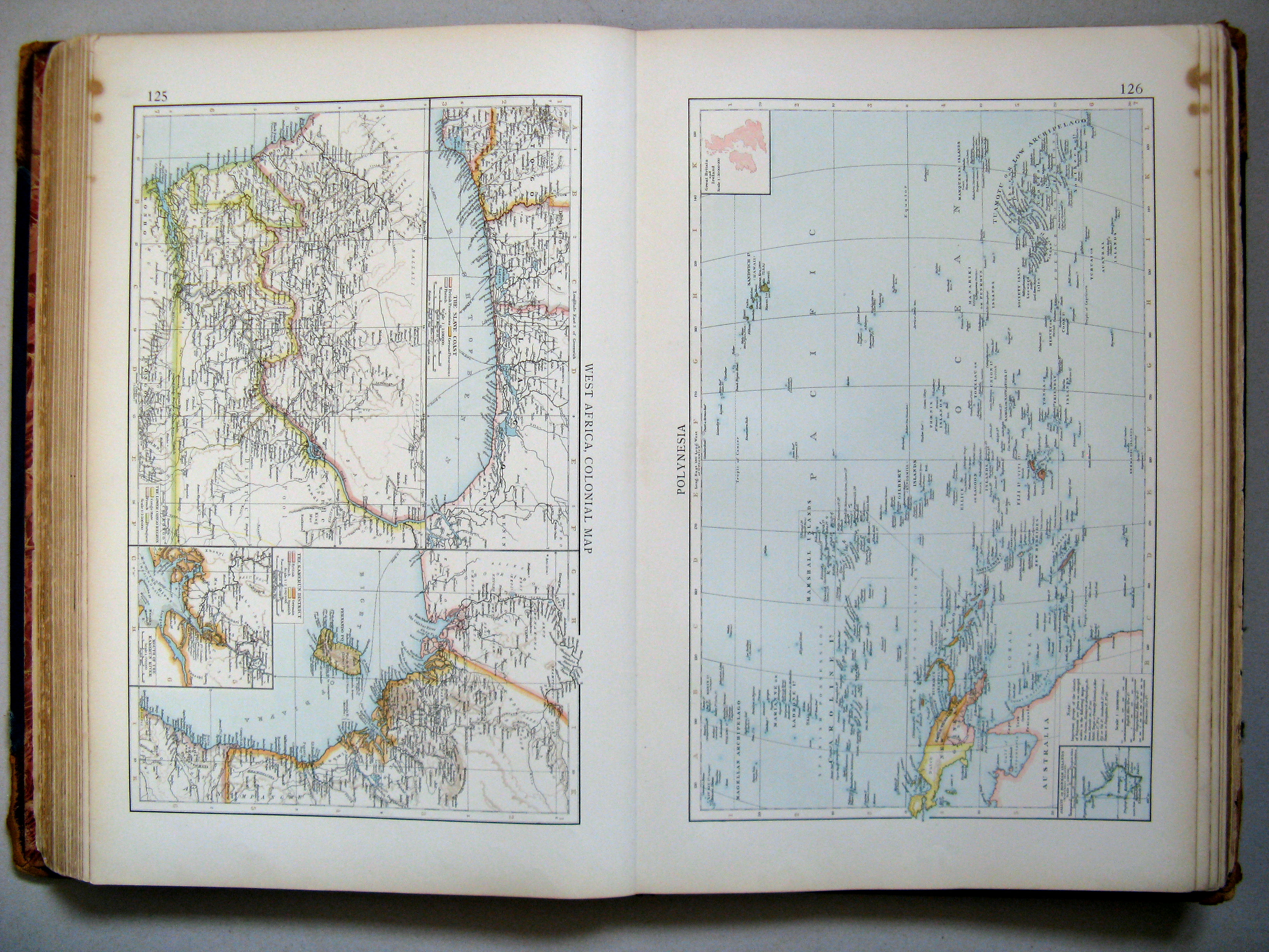
125. West Africa, colonial map
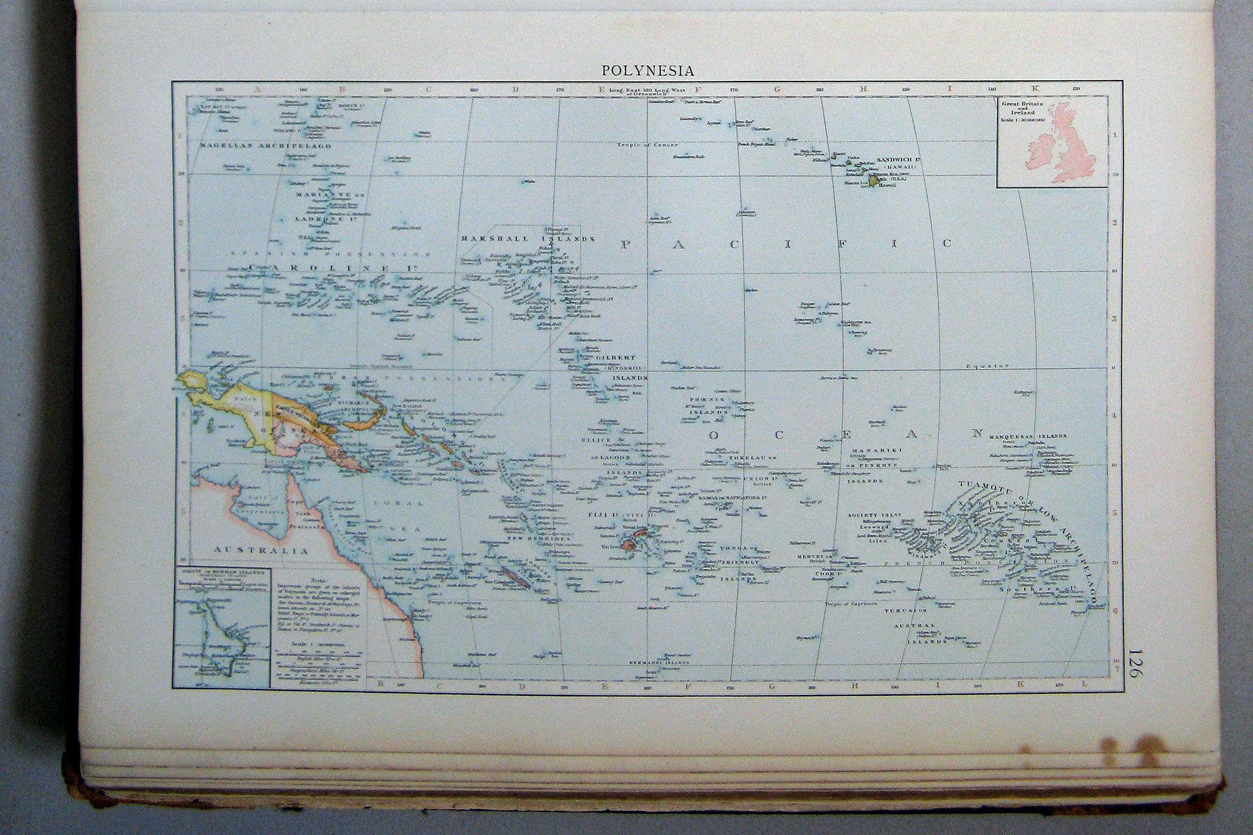
126. Polynesia
 The Times Atlas 1900
126. Polynesia
Polynesië
 The Times Atlas 1900
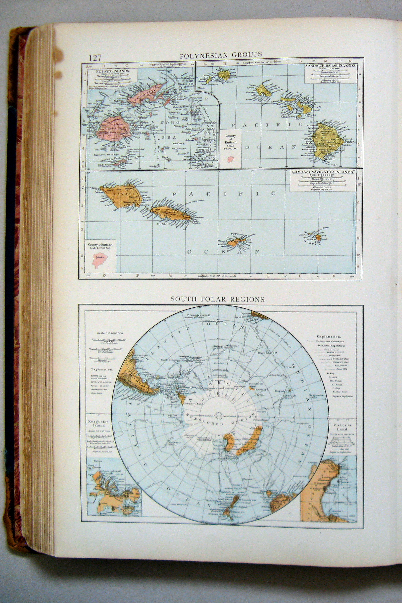
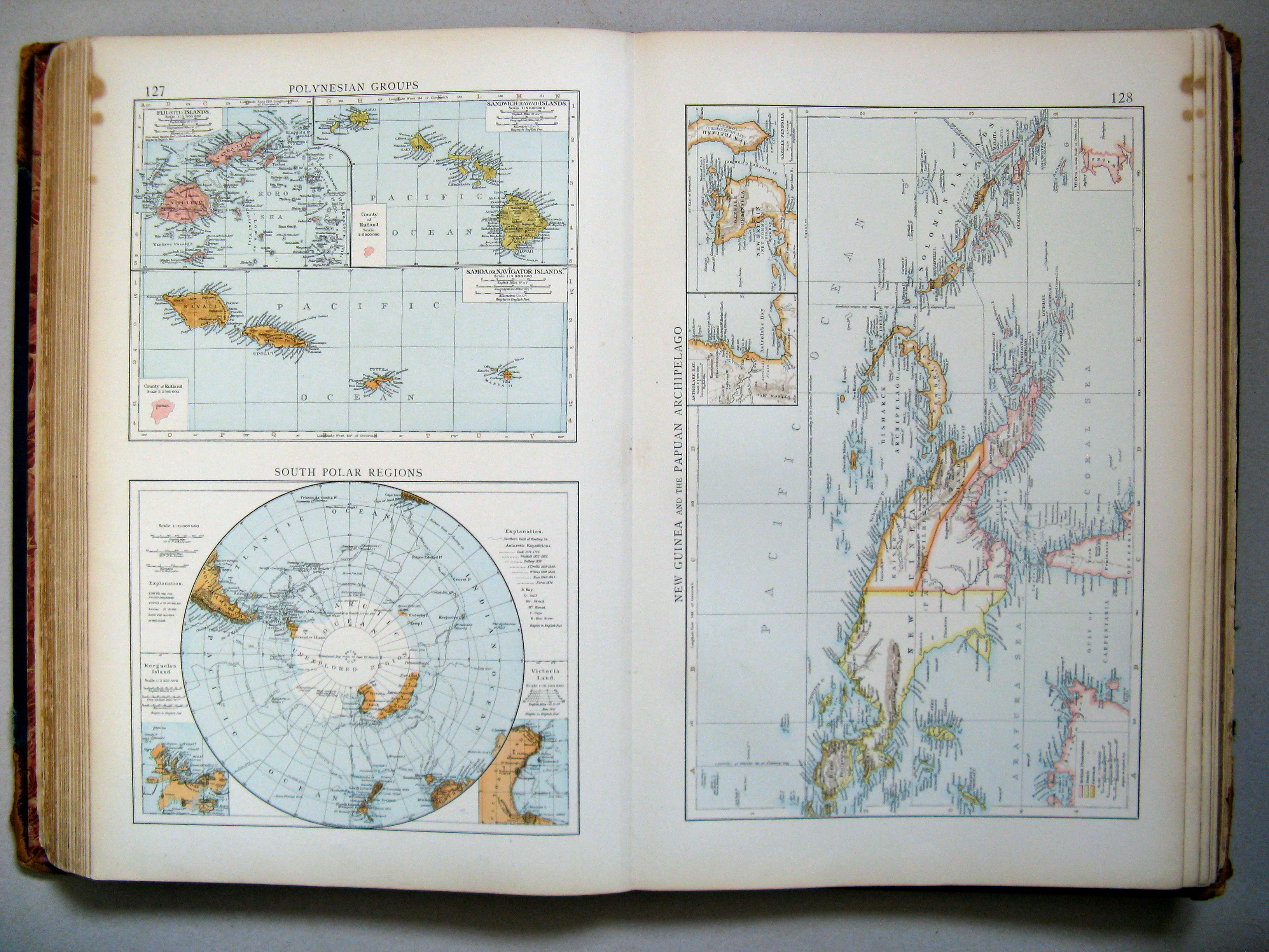
127. Polynesian Groups. South Polar Regions
Polynesische eilanden. Zuidpoolgebied
 The Times Atlas 1900
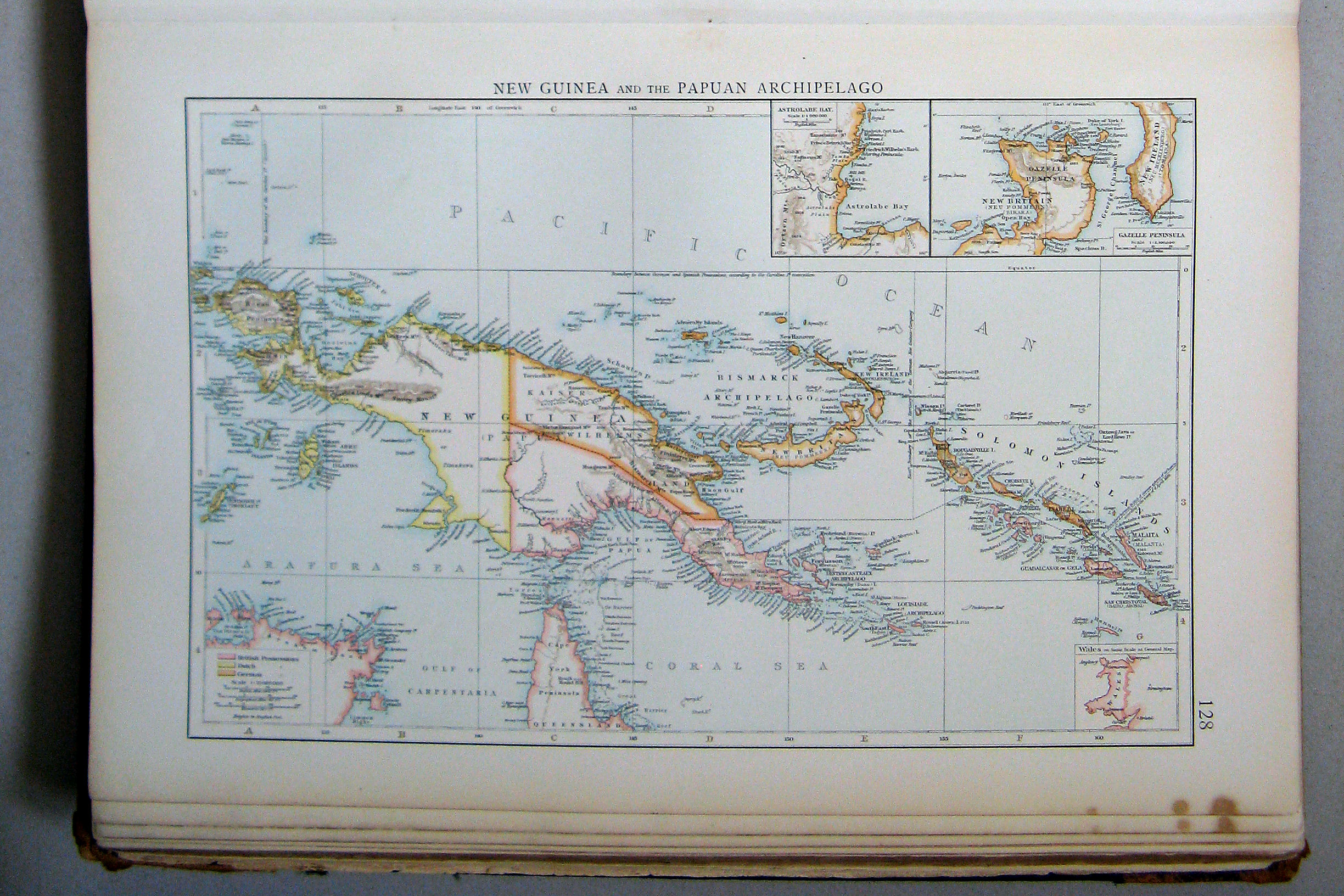
128. New Guinea and the Papuan Archipelago
Nieuw-Guinea en de Bismarck-archipel
 The Times Atlas 1900
127. Polynesian Groups. South Polar Regions
128. New Guinea and the Papuan Archipelago
 The Times Atlas 1900
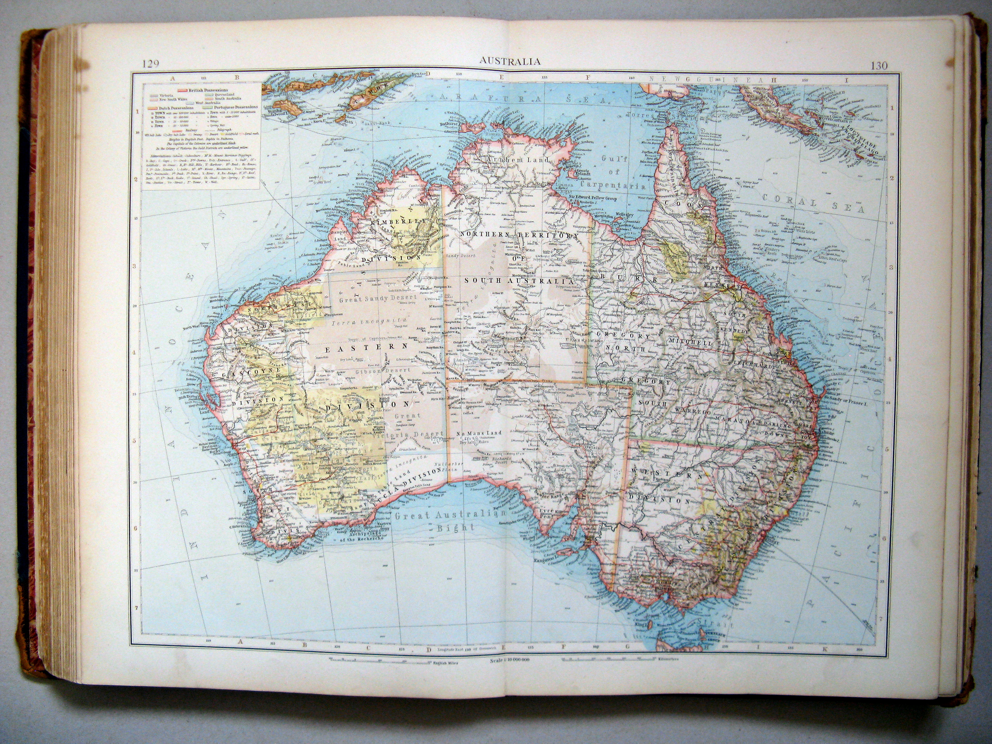
129.130. Australia
Australië
 The Times Atlas 1900
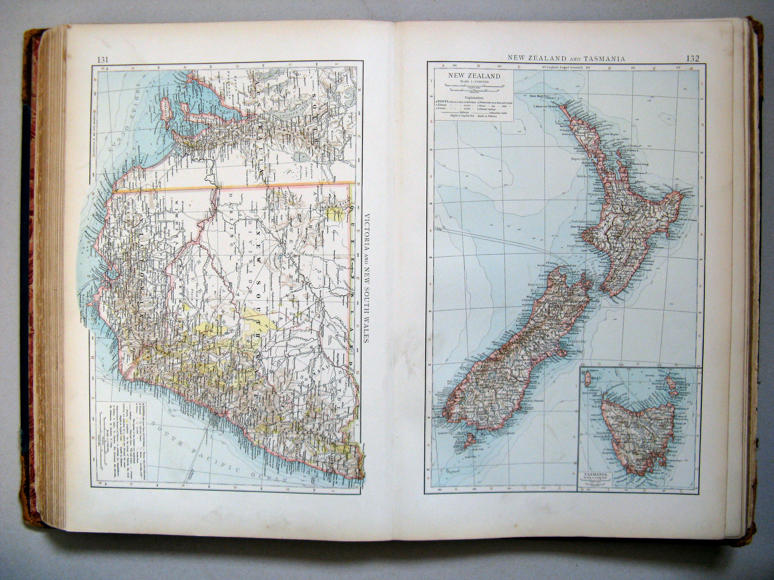
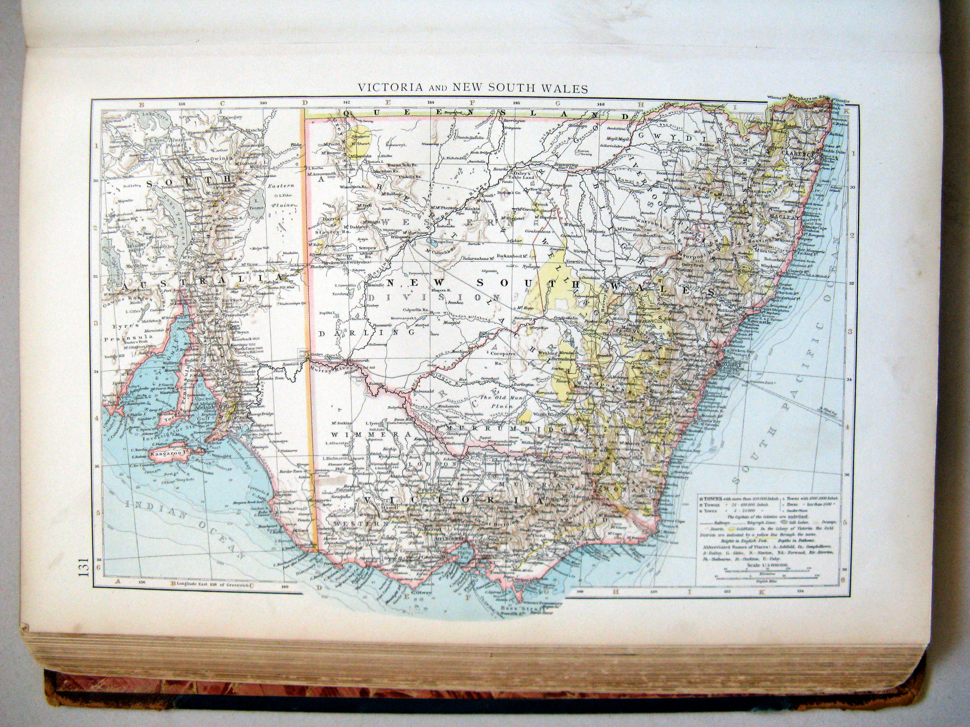
131. Victoria and New South Wales
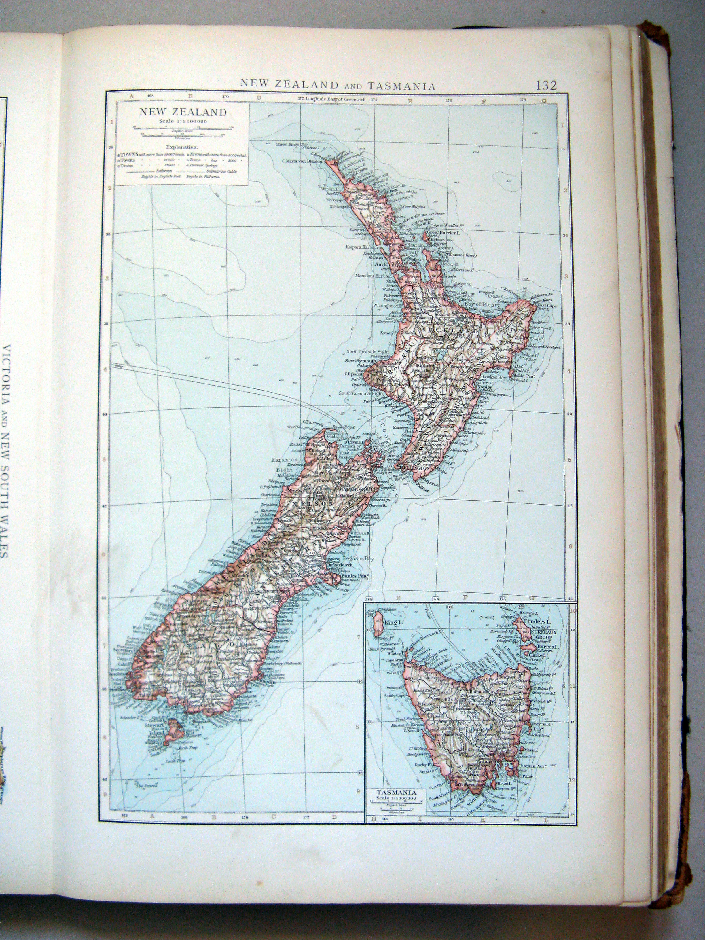
132. New Zealand and Tasmania
 The Times Atlas 1900
131. Victoria and New South Wales
Victoria en Nieuw-Zuid-Wales
 The Times Atlas 1900
132. New Zealand and Tasmania
Nieuw-Zeeland en Tasmanië
© M. Witkam, 2009
![]()
![]()