Spehr's geographischer Schul- und Hand-Atlas, 1e druk (1834-1835)
See below for (a summary of) this text in English.
Hieronder staan plaatjes van de atlas. Daarbij horen ook de volgende pagina's
- Beschrijving van de atlas
- Tabellen en lijsten bij de atlas
- Vergelijking (plaatjes) met Spehr's geographischer Universal-Atlas
Plaatjes
Klik op een plaatje voor een vergroting.
Spehr's geographischer Schul- und Hand-Atlas, 1st edition (1834-1835)
- Below are pictures of the atlas. Related pages
- Description of the atlas
- Tables and lists to the atlas
- Comparison (pictures) with Spehr's geographischer Universal-Atlas
Pictures
Click on a picture to enlarge.
Band, titelpagina / Binding, title page Kaarten / Maps Wereldkaart / World map


 Spehr's geographischer Schul- und Hand-Atlas, 1834-1835
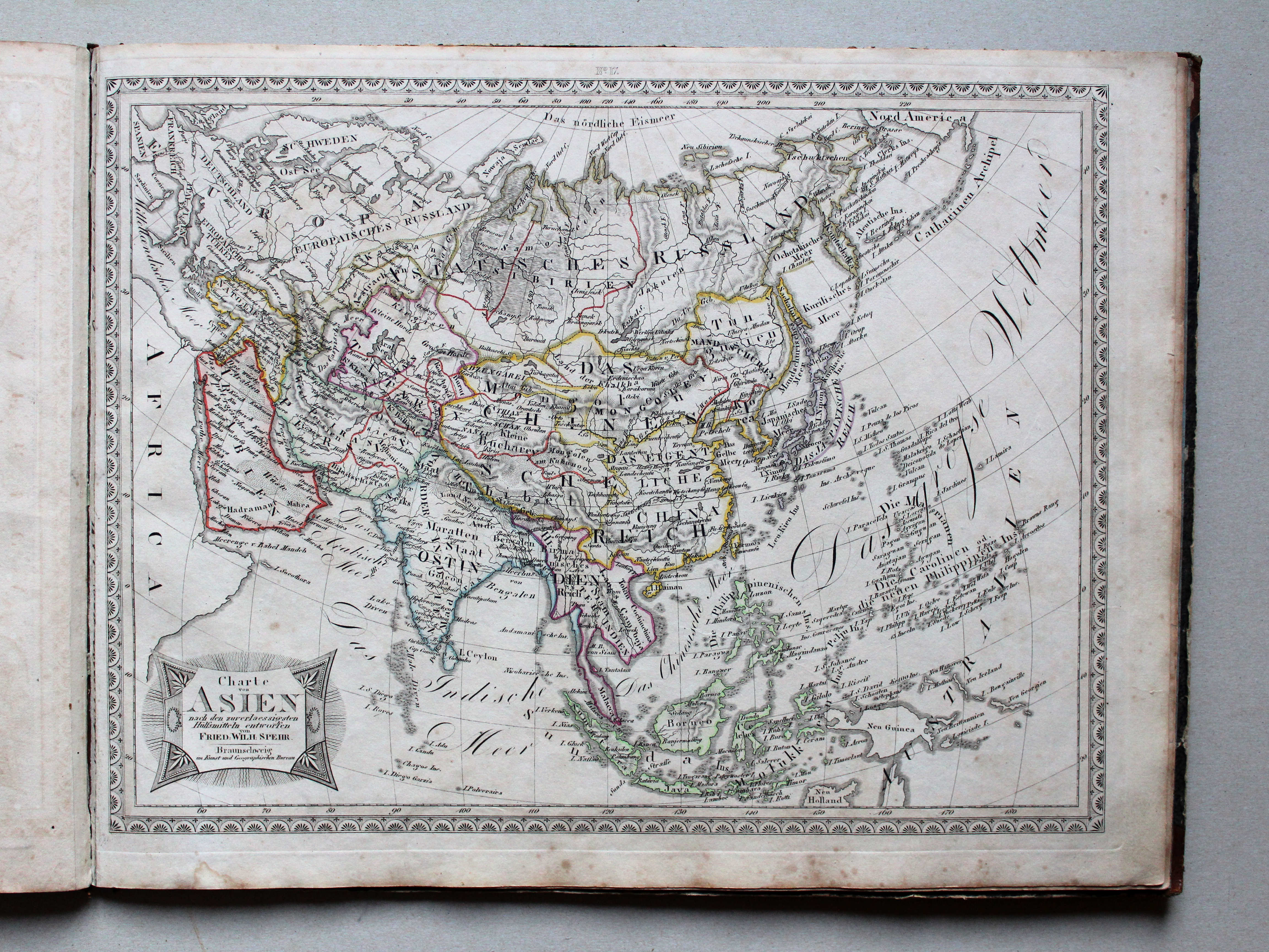
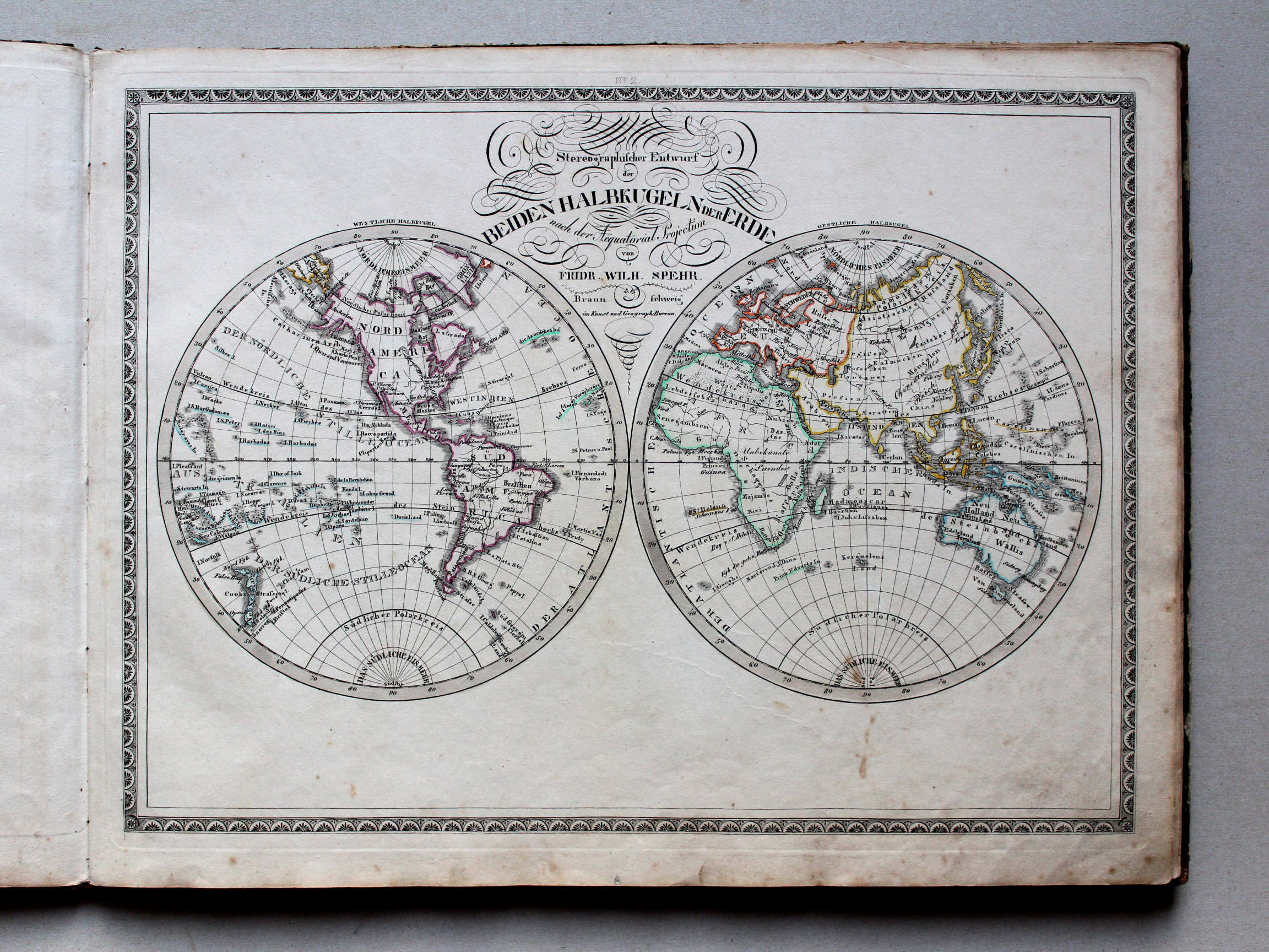
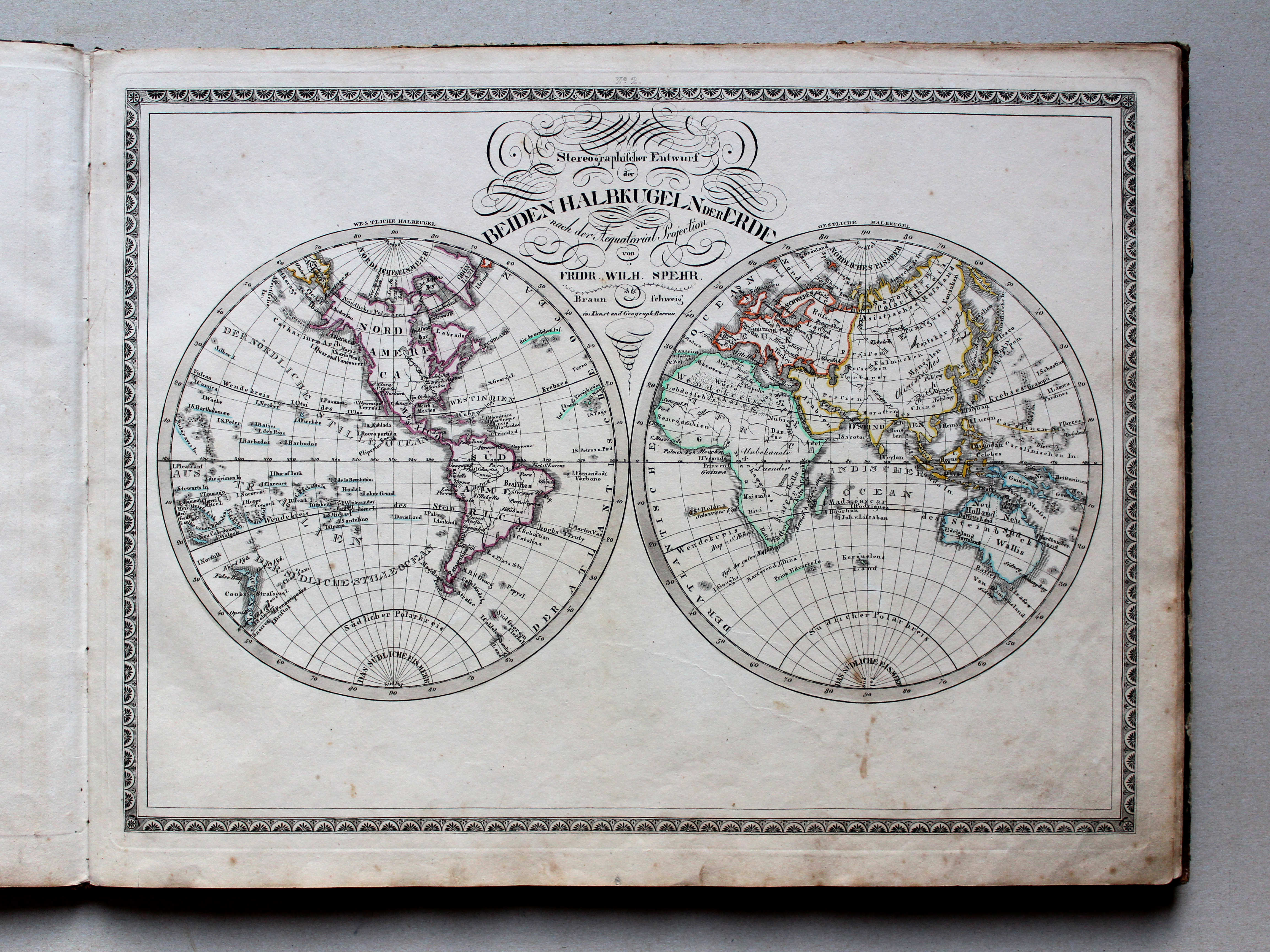
2. Stereographischer Entwurf der Beiden Halbkugeln der Erde XL
De halfronden in stereografische projectie / The hemispheres in stereographic projection
 Spehr's geographischer Schul- und Hand-Atlas, 1834-1835
4. Charte von Spanien u. Portugal XL
Spanje en Portugal / Spain and Portugal
 Spehr's geographischer Schul- und Hand-Atlas, 1834-1835
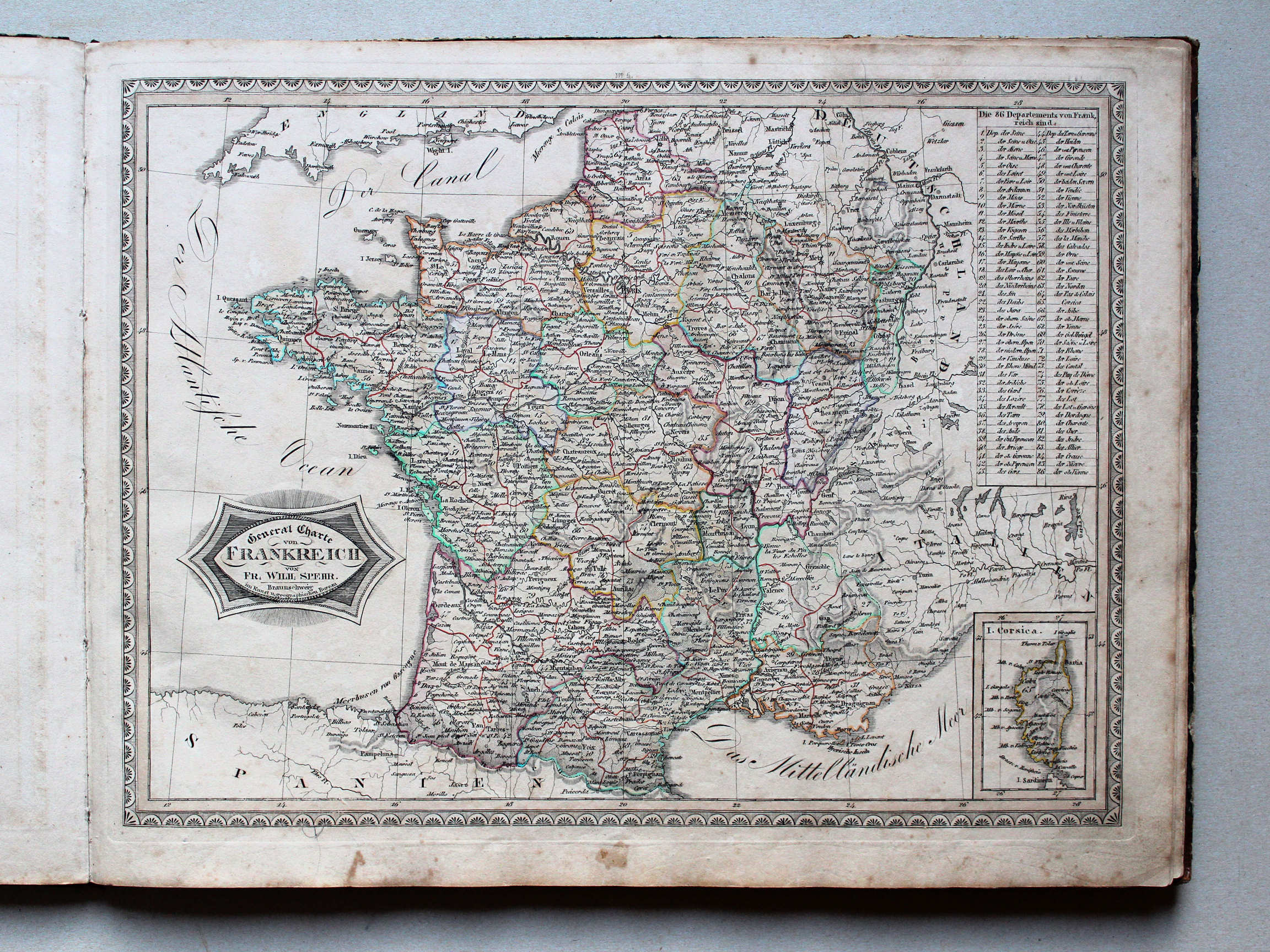
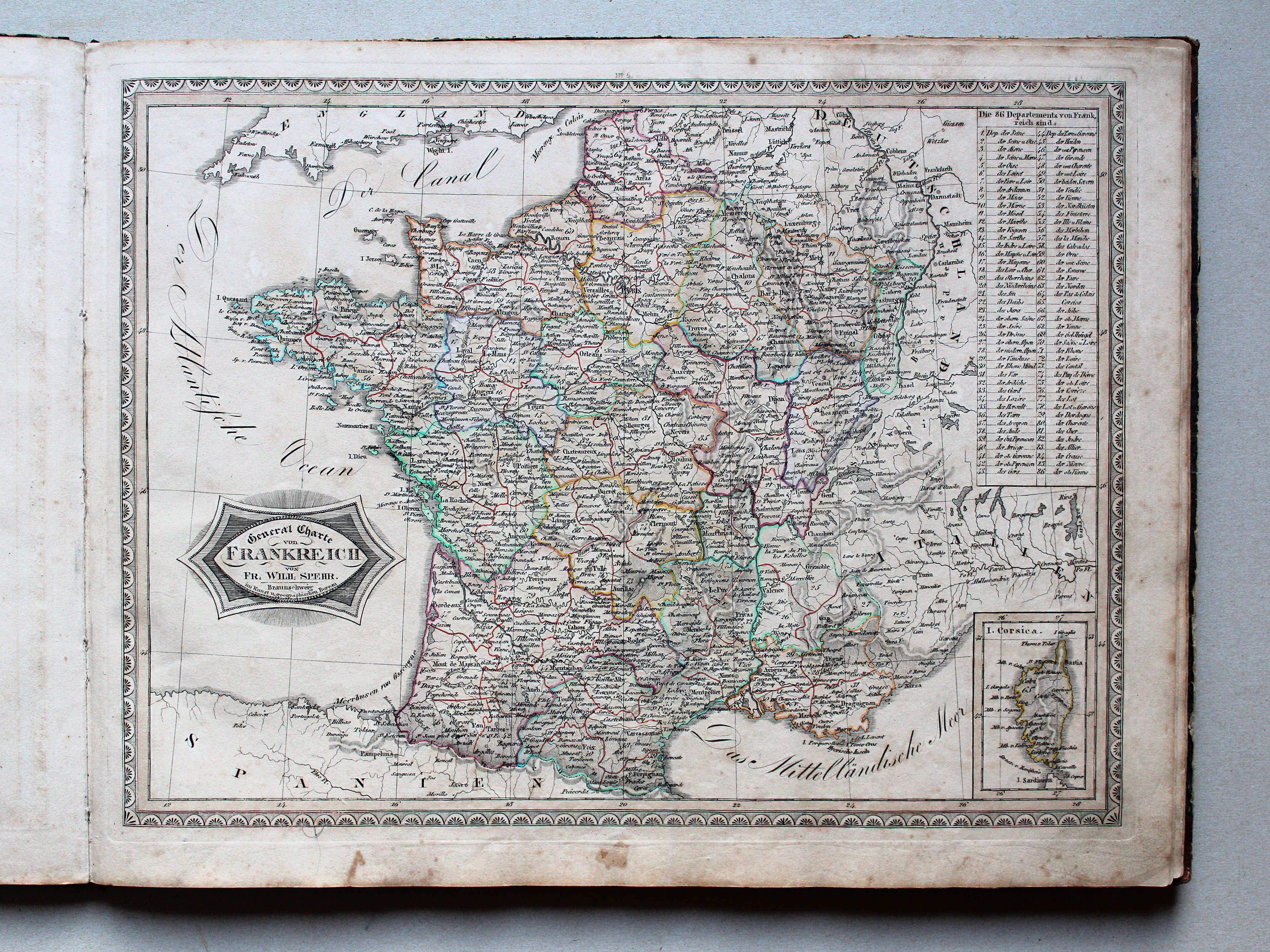
5. General Charte von Frankreich XL
Frankrijk / France
 Spehr's geographischer Schul- und Hand-Atlas, 1834-1835
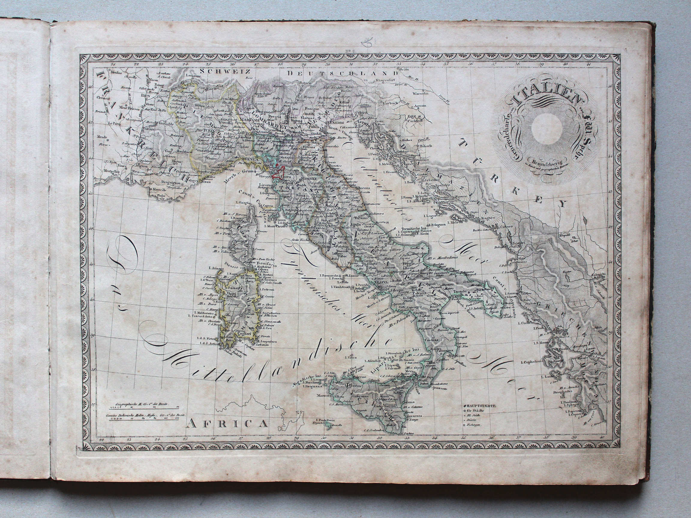
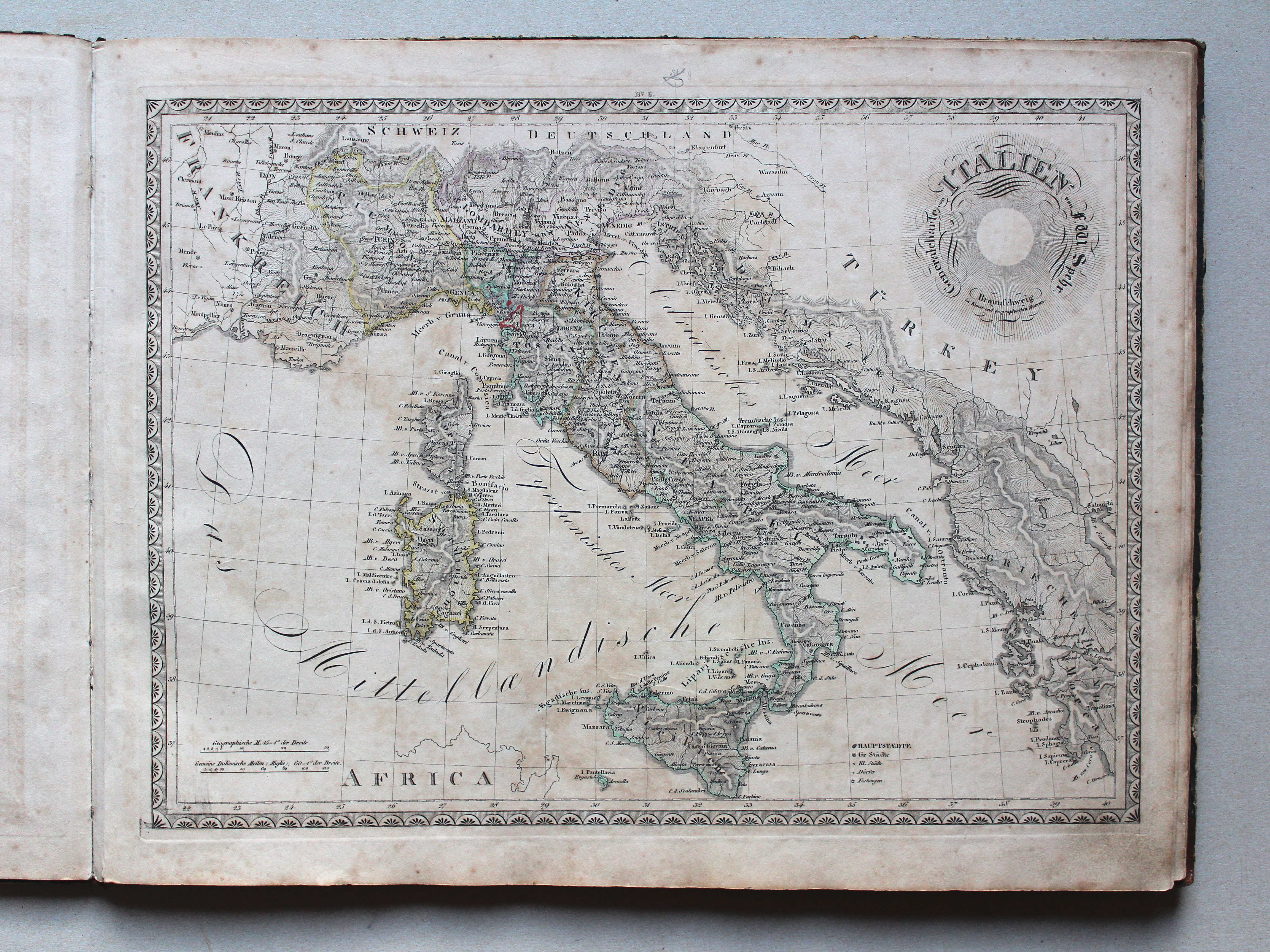
6. Generalcharte von Italien XL
Italië / Italy
 Spehr's geographischer Schul- und Hand-Atlas, 1834-1835
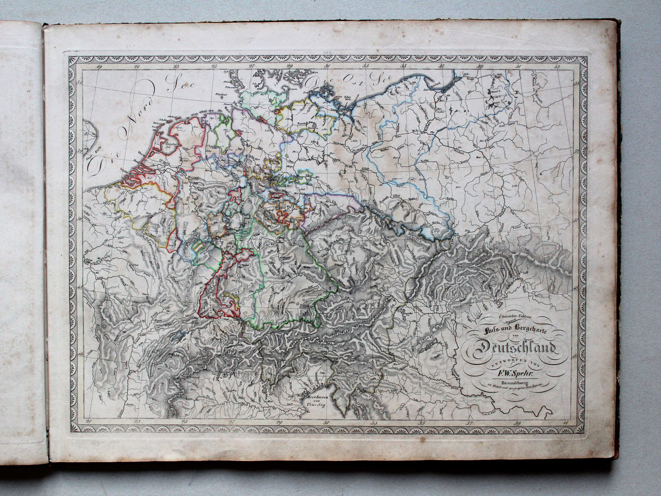
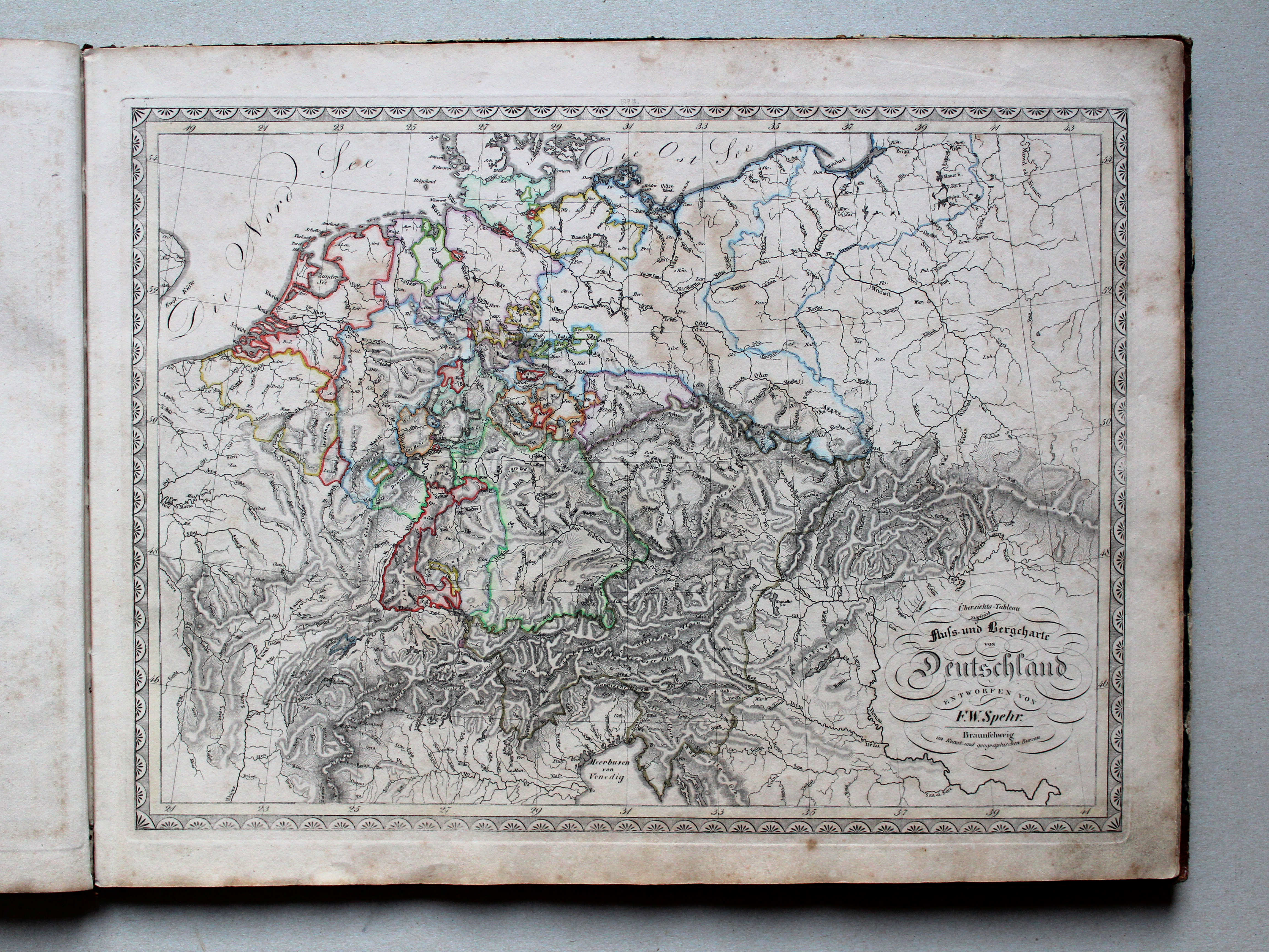
8. Übersichts-Tableau zugleich Fluss- und Bergcharte von Deutschland XL
Overzichtskaart en oro-hydrografische kaart van Duitsland / General and oro-hydrographical map of Germany
 Spehr's geographischer Schul- und Hand-Atlas, 1834-1835
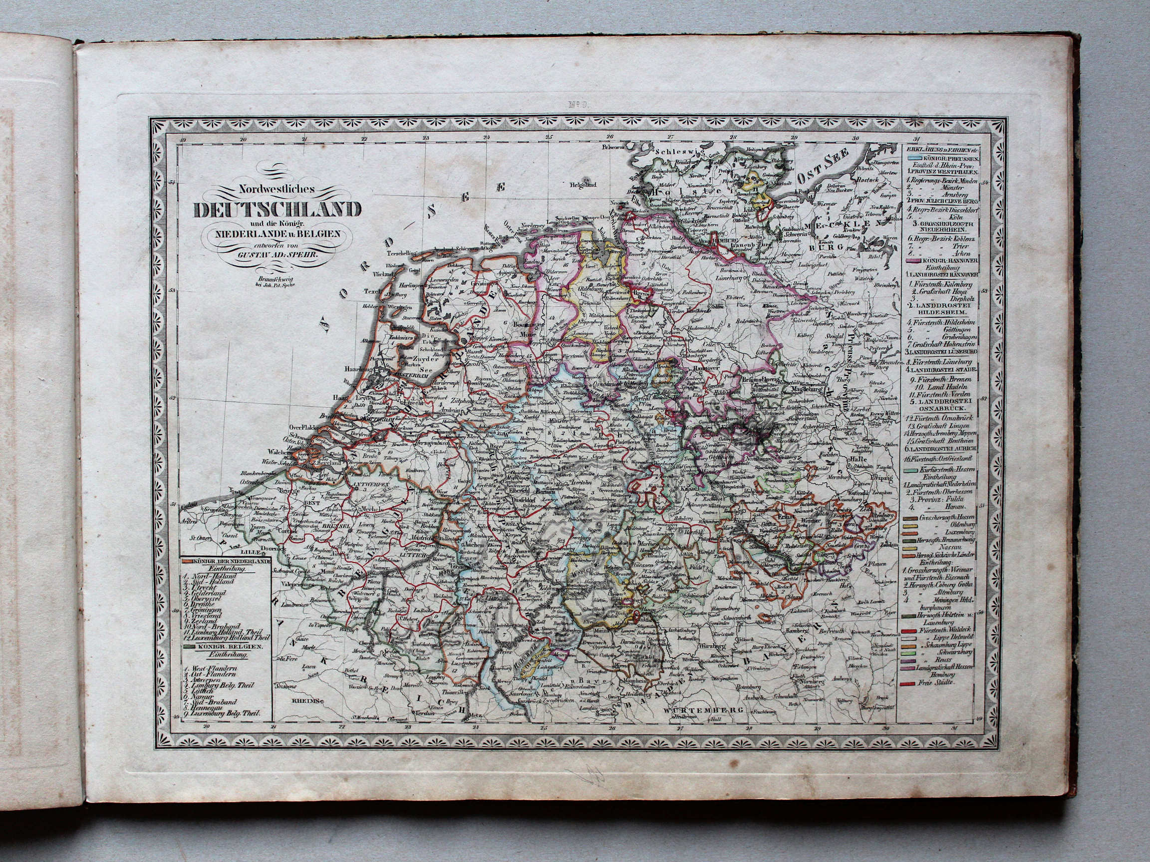
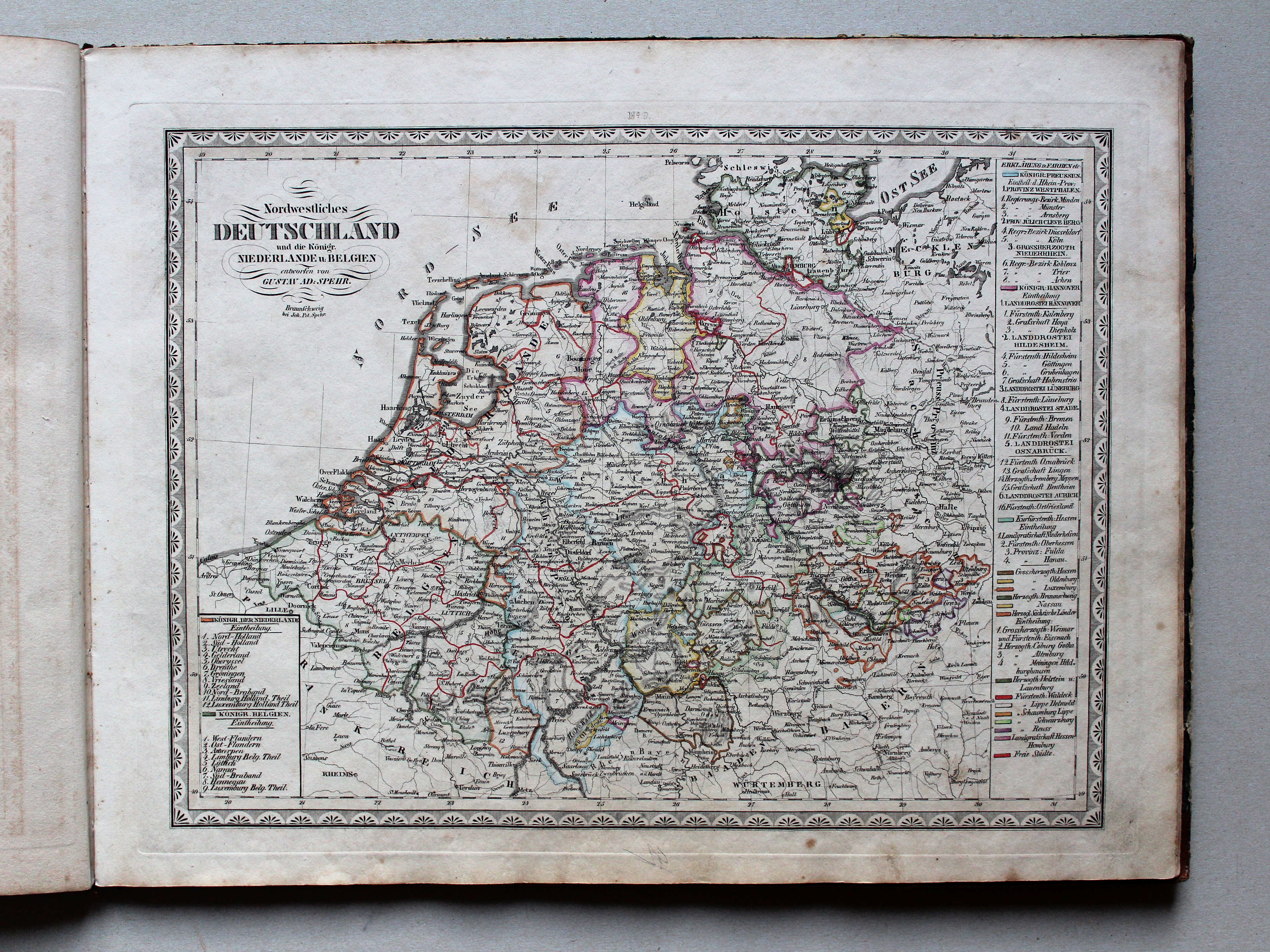
9. Nordwestliches Deutschland und die Königr. Niederlande u. Belgien XL
Noordwest-Duitsland en de koninkrijken Nederland en België / Northwestern Germany and the kingdoms of the Netherlands and Belgium
 Spehr's geographischer Schul- und Hand-Atlas, 1834-1835
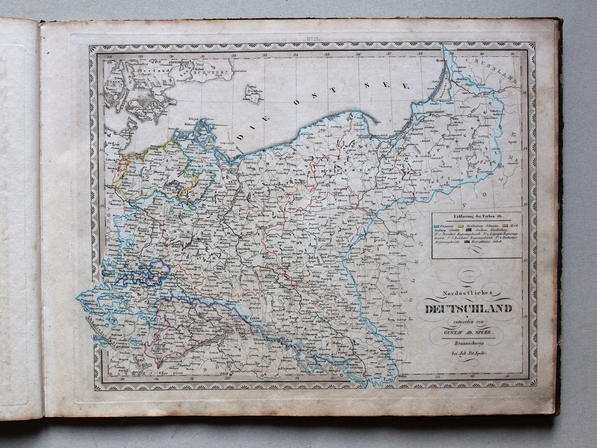
10. Nordöstliches Deutschland XL
Noordoost-Duitsland / Northeastern Germany
 Spehr's geographischer Schul- und Hand-Atlas, 1834-1835
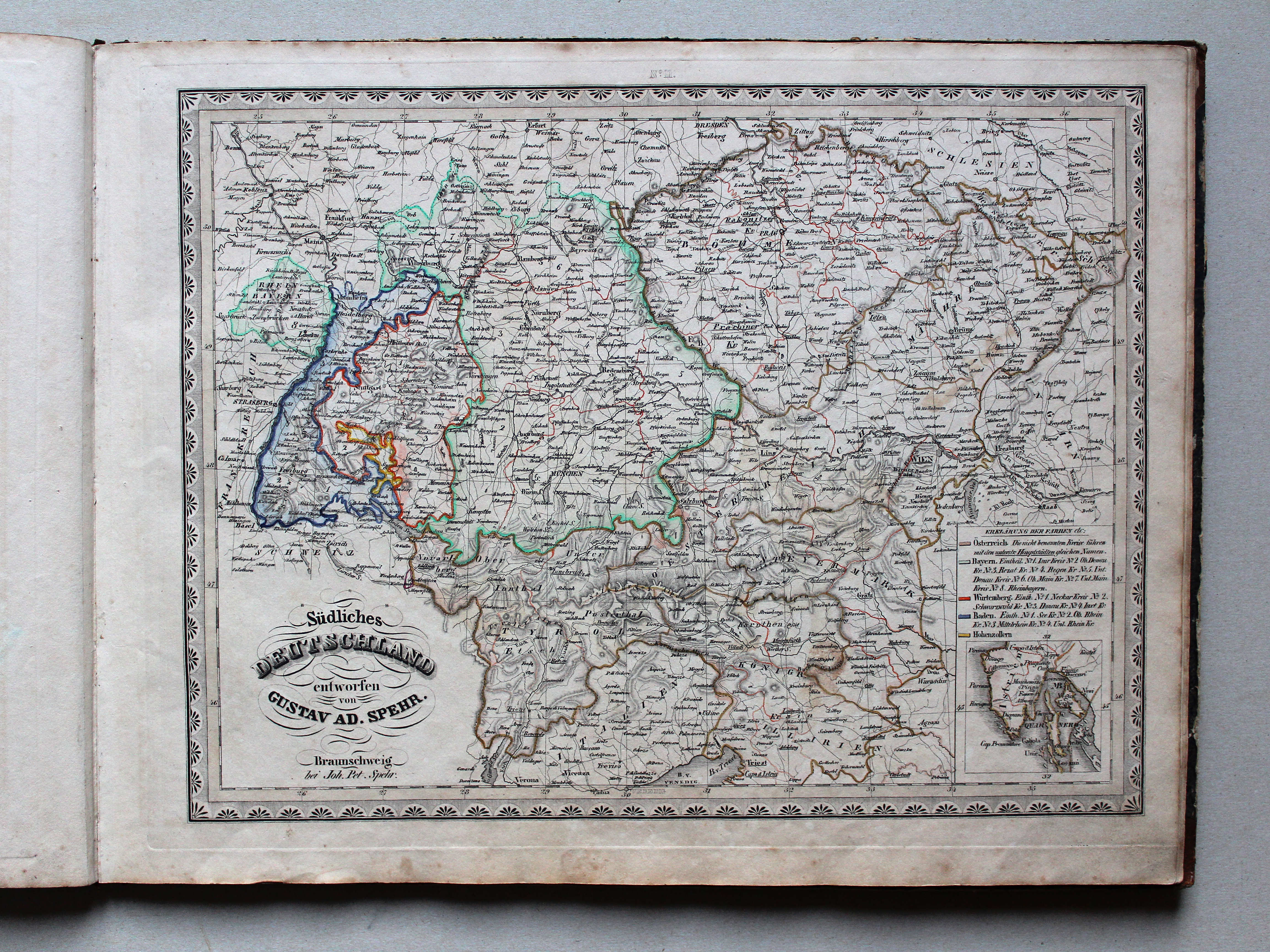
11. Südliches Deutschland XL
Zuid-Duitsland / Southern Germany
 Spehr's geographischer Schul- und Hand-Atlas, 1834-1835
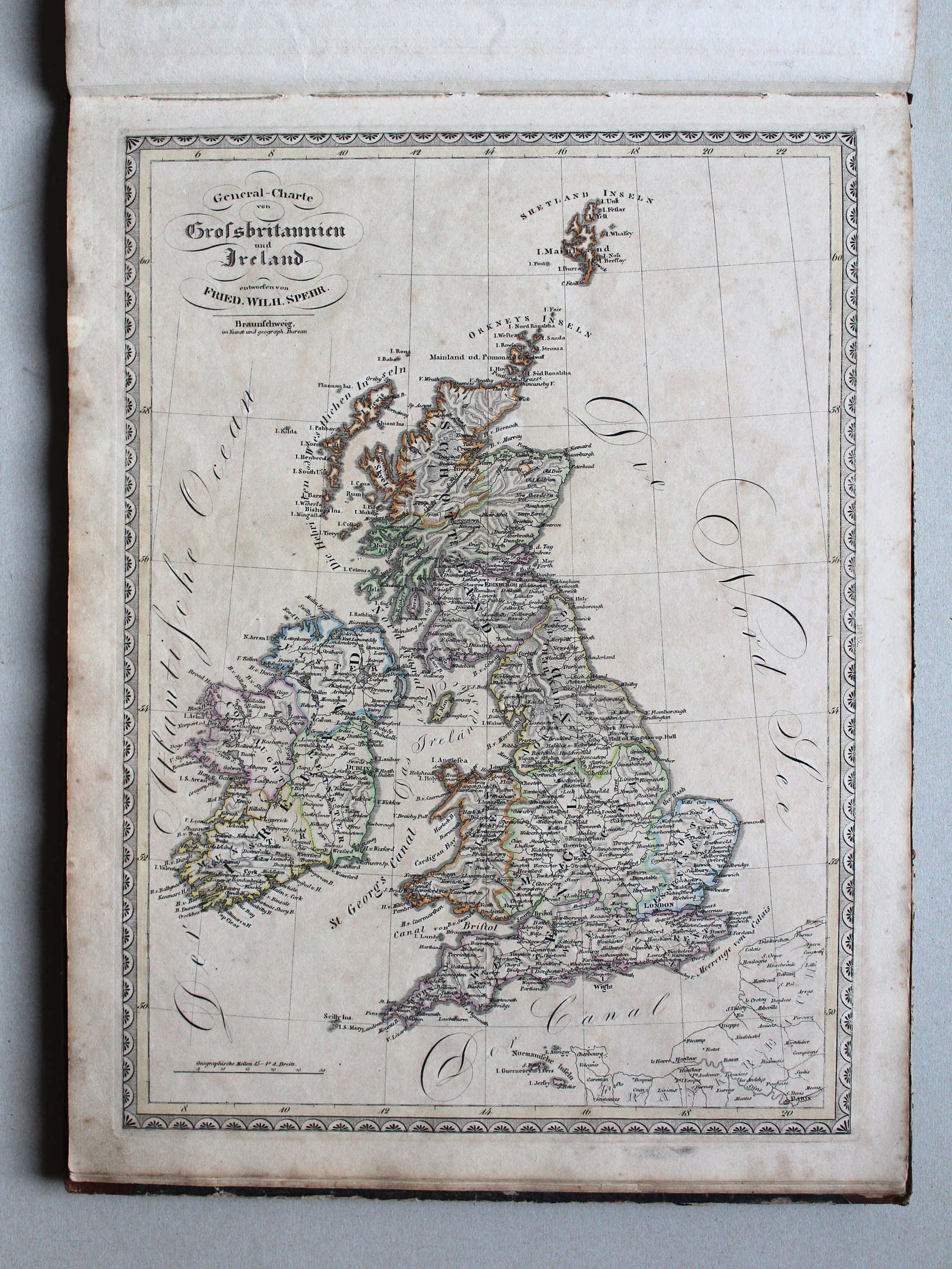
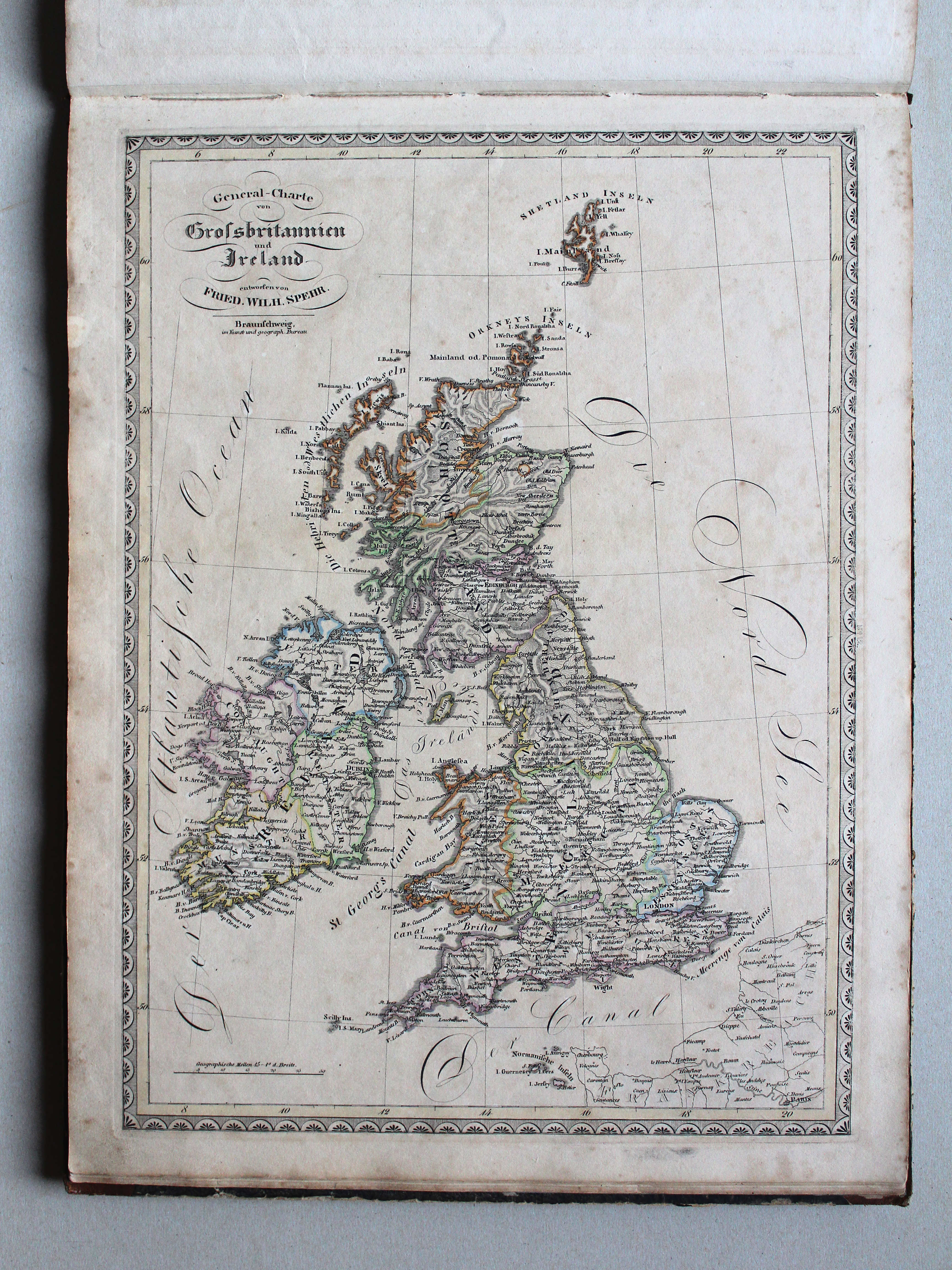
12. General-Charte von Grossbritannien und Ireland XL
Groot-Brittannië en Ierland / Great Britain and Ireland
 Spehr's geographischer Schul- und Hand-Atlas, 1834-1835
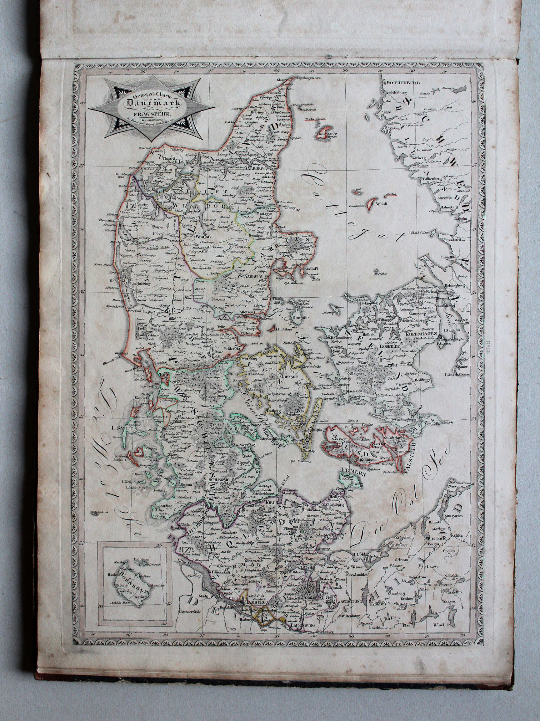
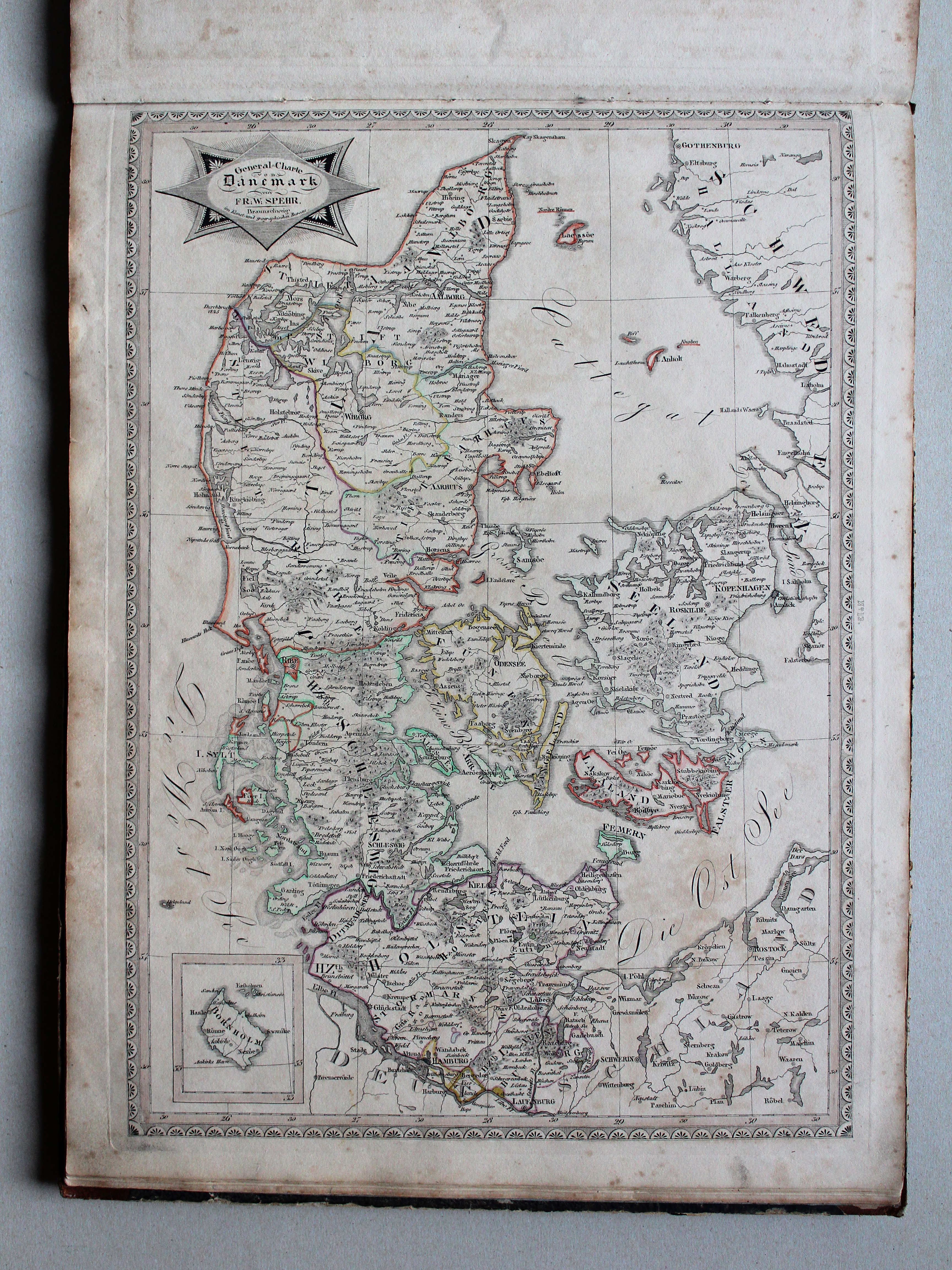
13. General-Charte von Dänemark XL
Denemarken / Denmark
 Spehr's geographischer Schul- und Hand-Atlas, 1834-1835
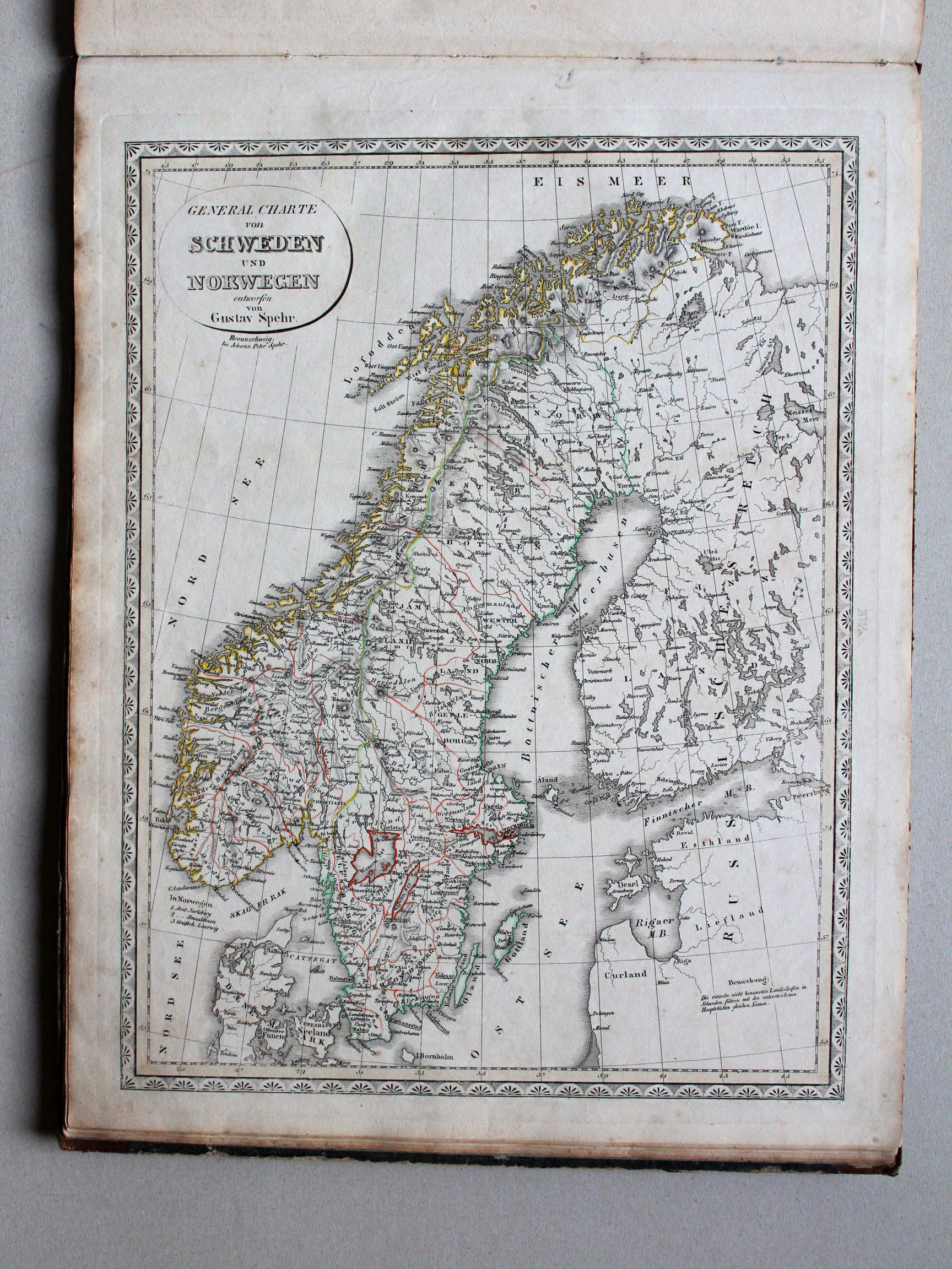
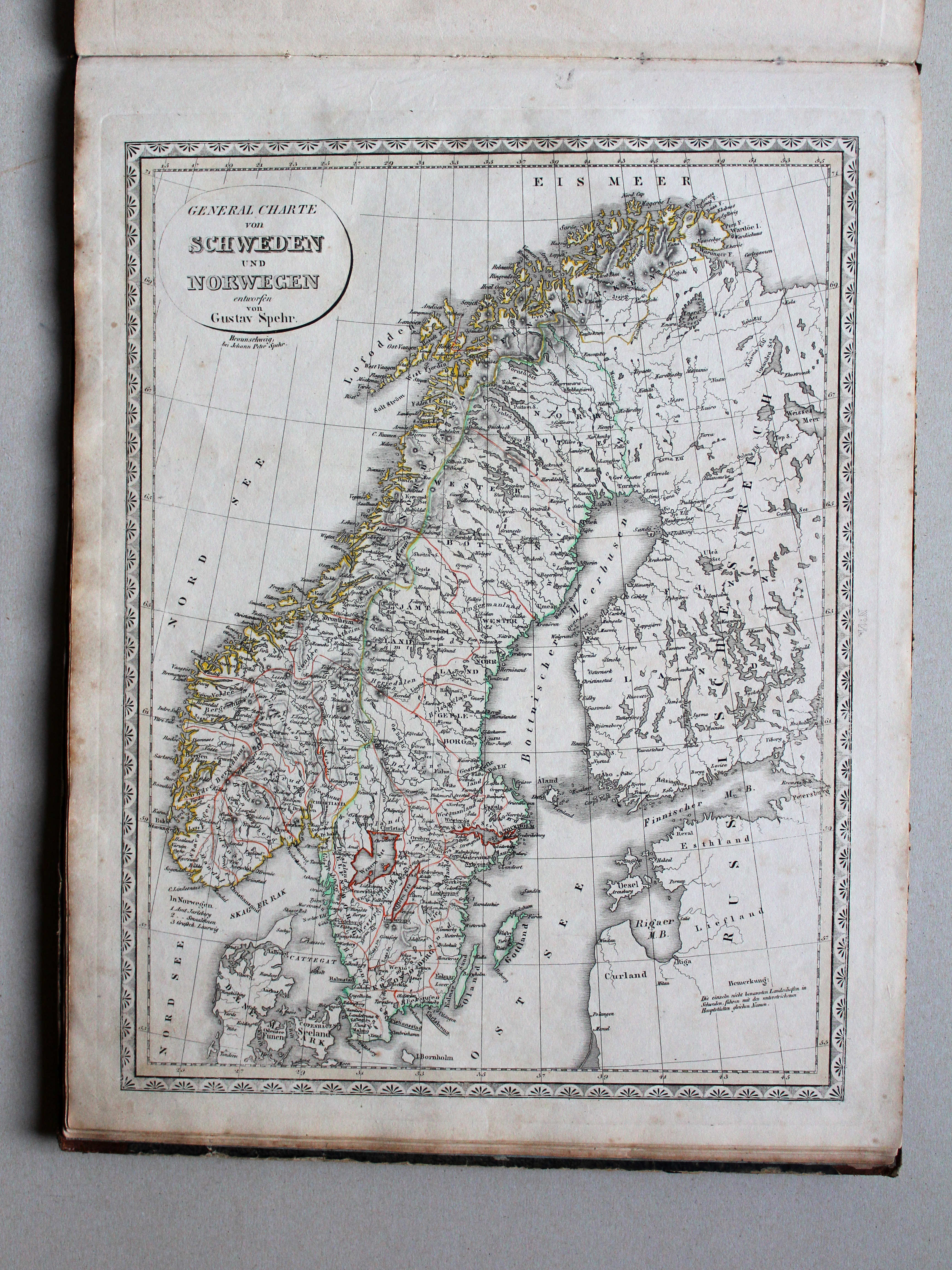
14. General Charte von Schweden und Norwegen XL
Zweden en Noorwegen / Sweden and Norway
 Spehr's geographischer Schul- und Hand-Atlas, 1834-1835
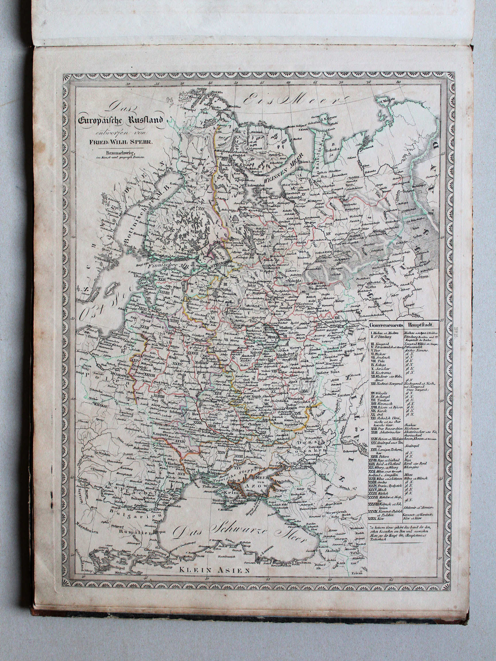
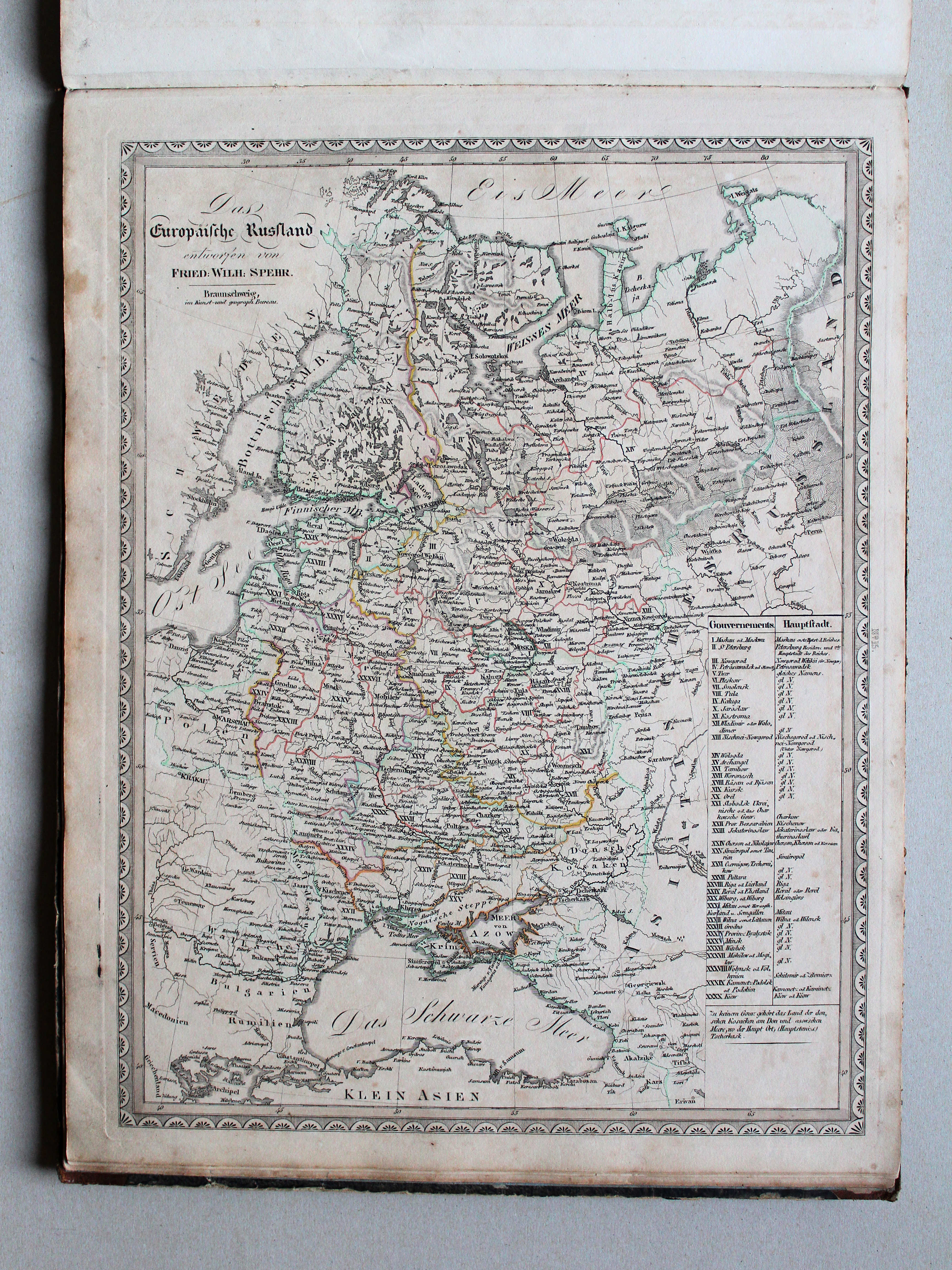
15. Das Europäische Russland XL
Europees Rusland / Russia in Europe
 Spehr's geographischer Schul- und Hand-Atlas, 1834-1835
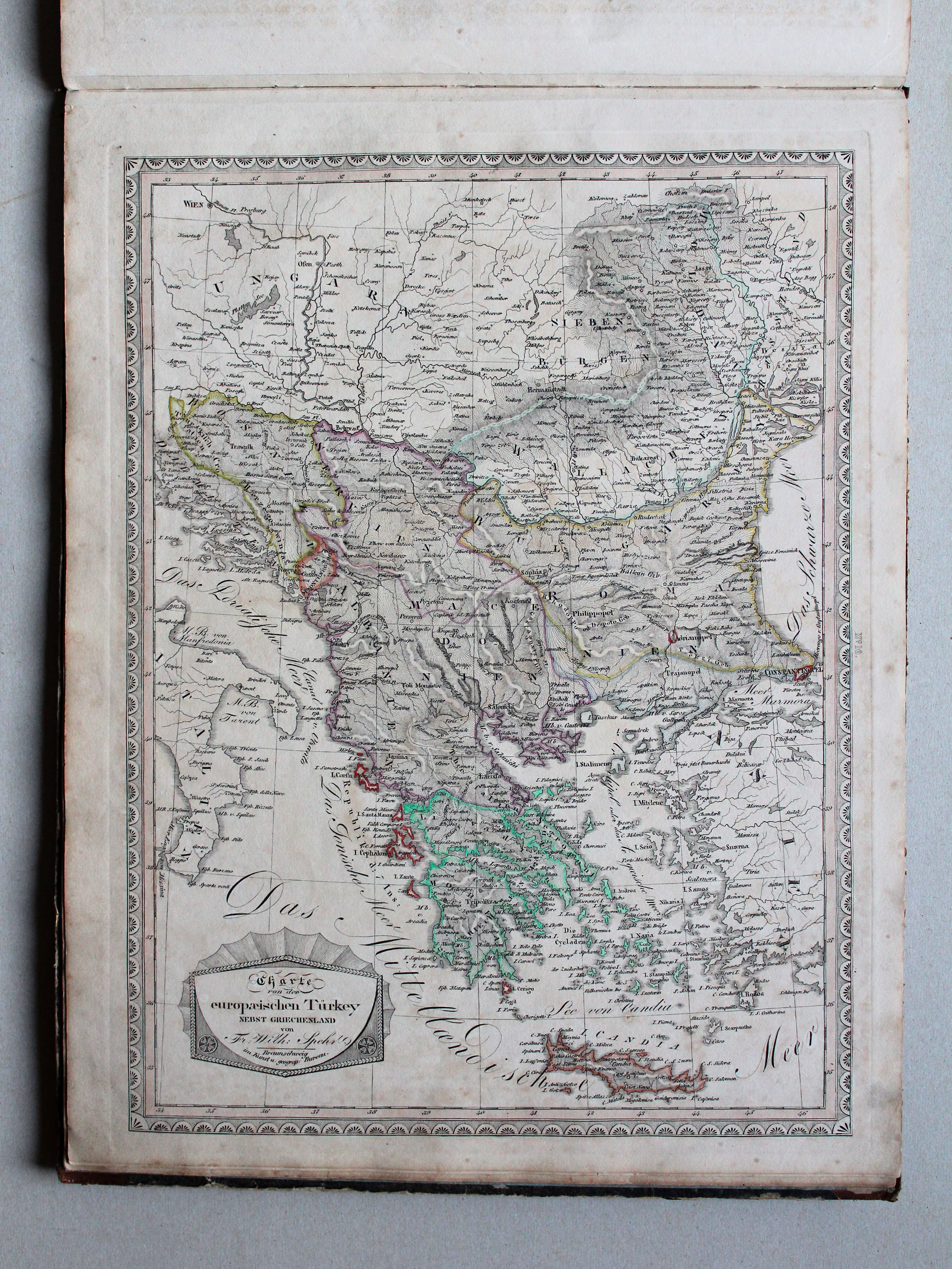
16. Charte von der europaeischen Türkey nebst Griechenland XL
Europees Turkije en Griekenland / Turkey in Europe and Greece


 Spehr's geographischer Schul- und Hand-Atlas, 1834-1835
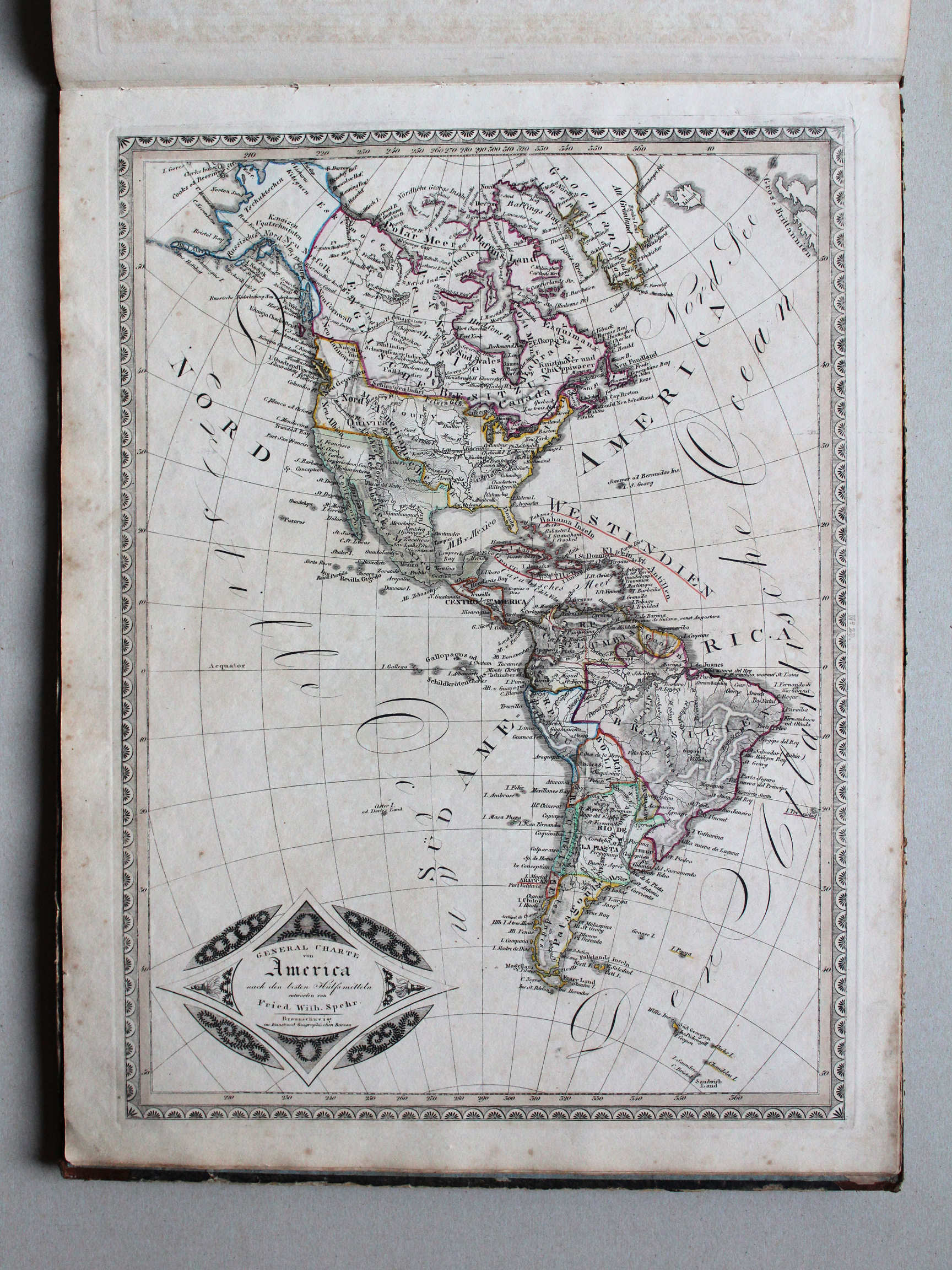
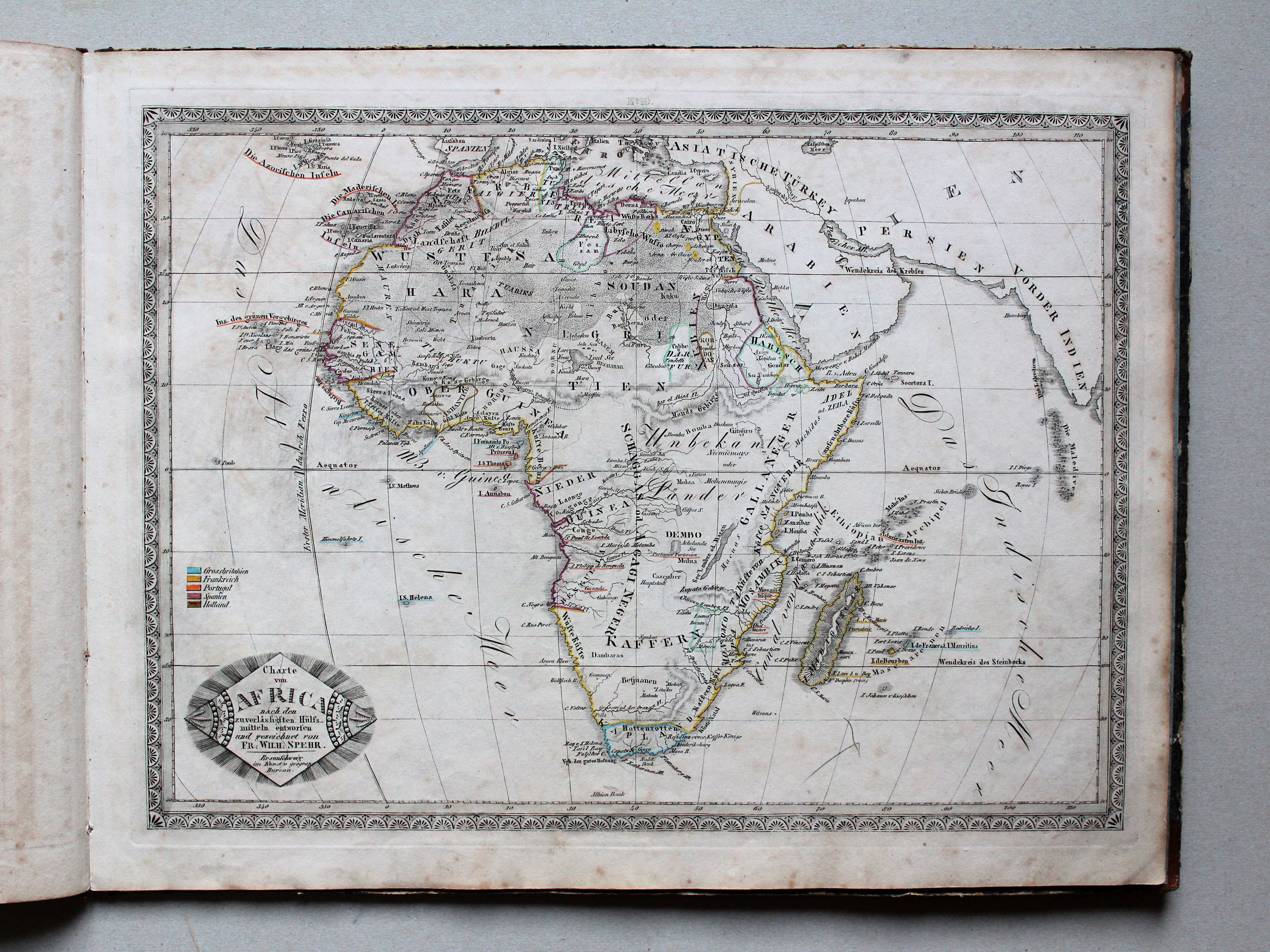
20. General Charte von America XL
Amerika / The Americas
 Spehr's geographischer Schul- und Hand-Atlas, 1834-1835
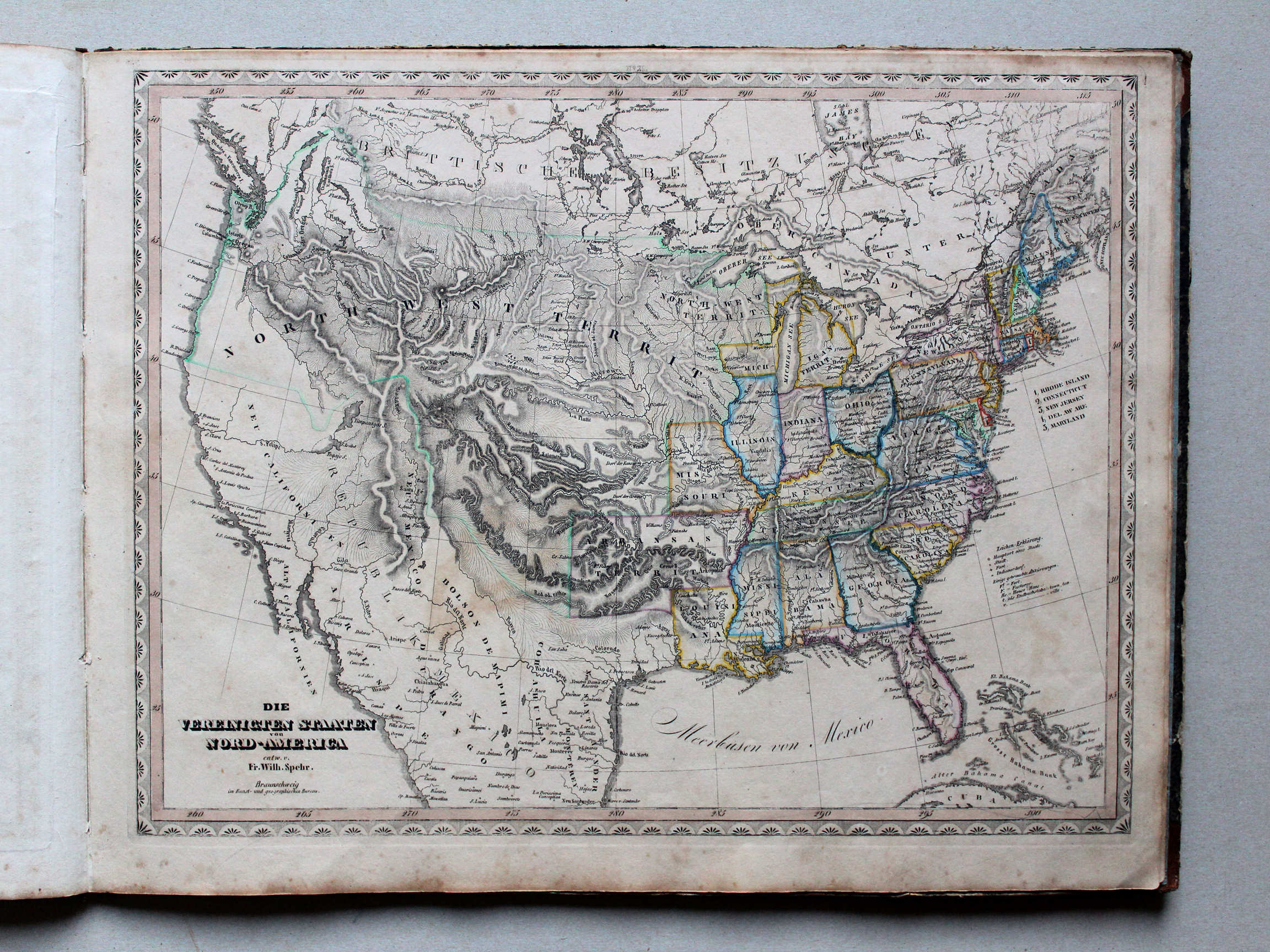
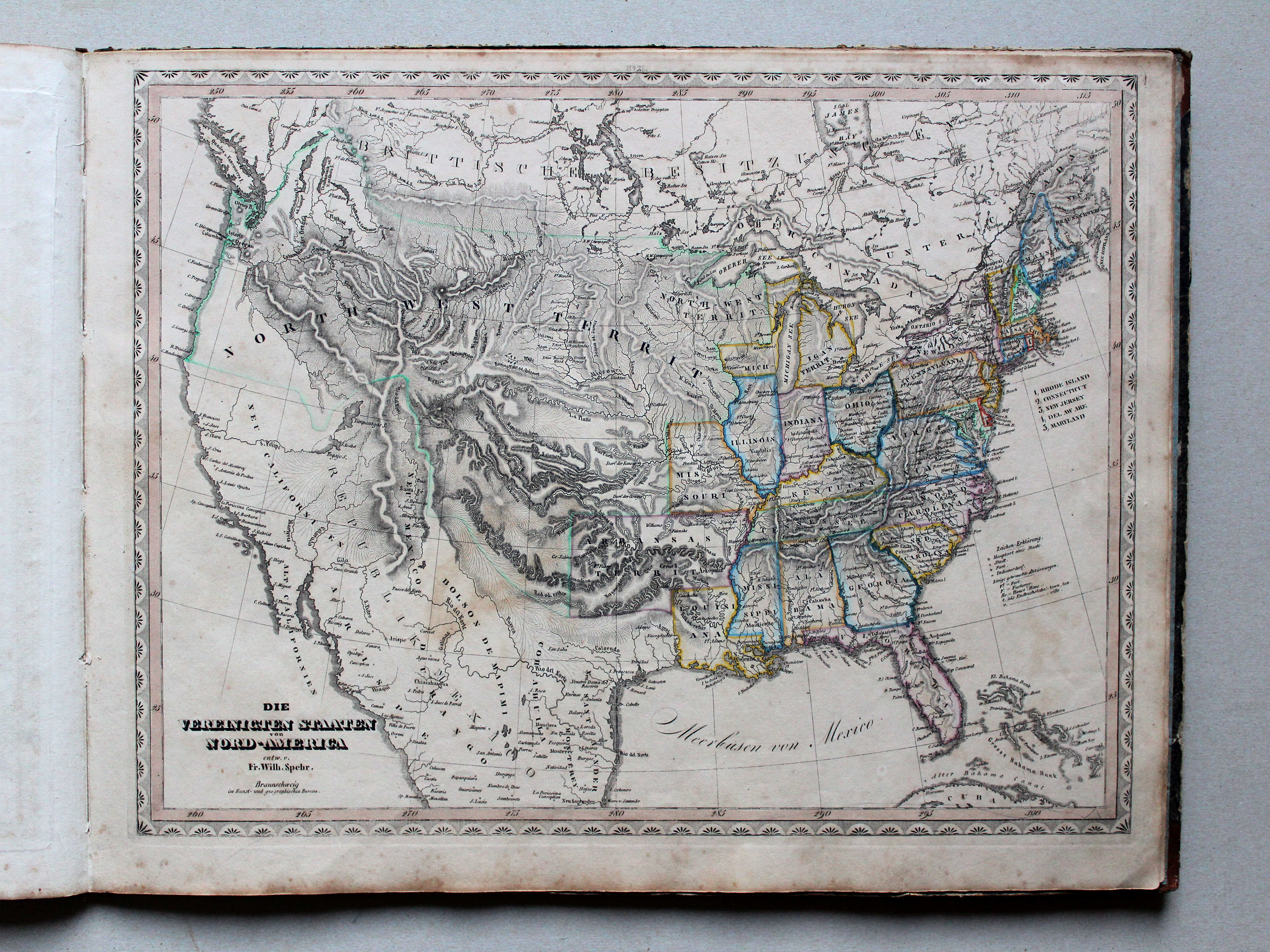
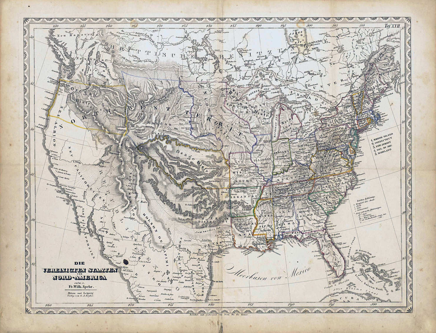
21. Die Vereinigten Staaten von Nord-America XL
Verenigde Staten van Noord-Amerika / United States of North America

 Spehr's geographischer Schul- und Hand-Atlas, 1834-1835
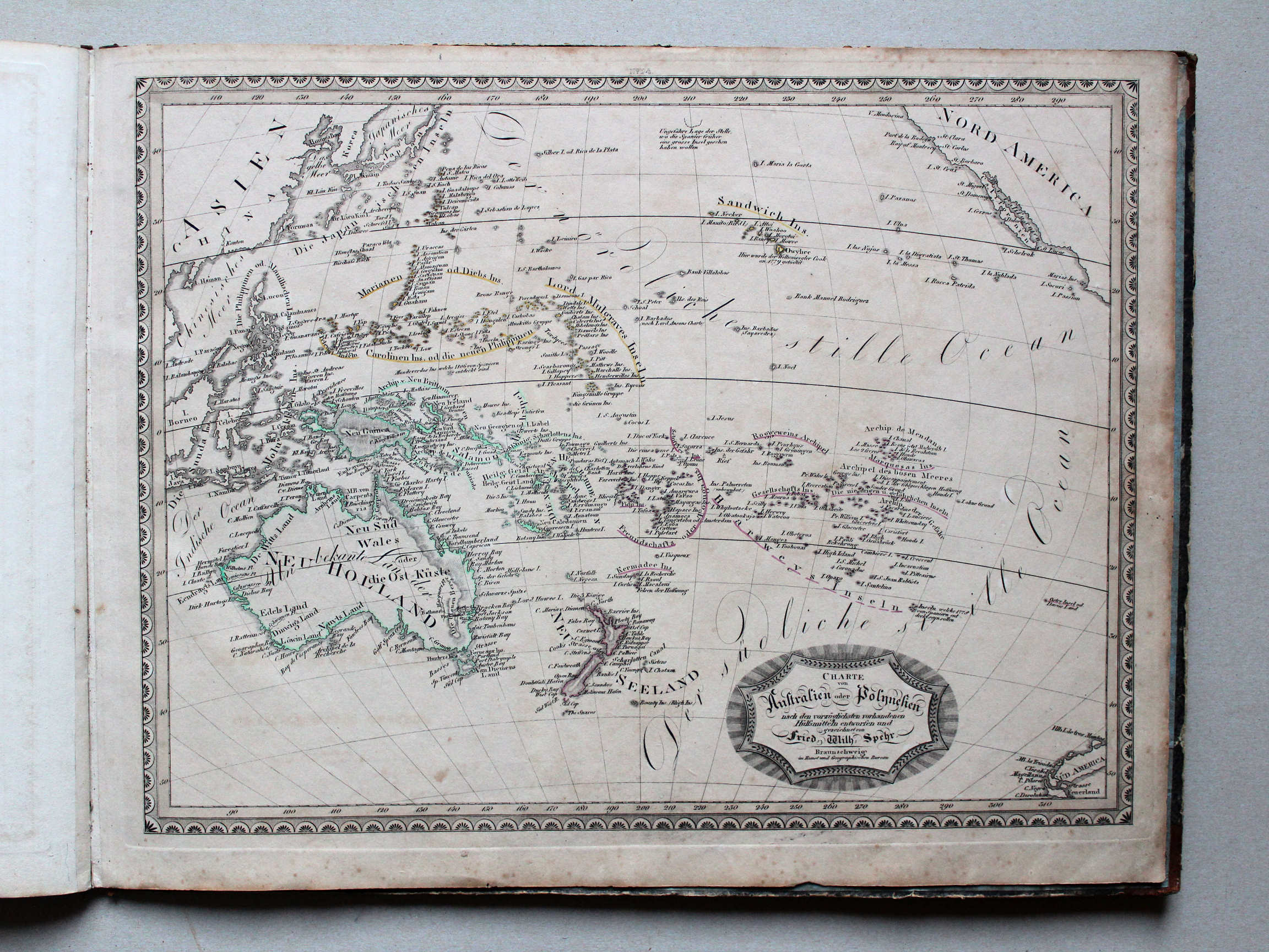
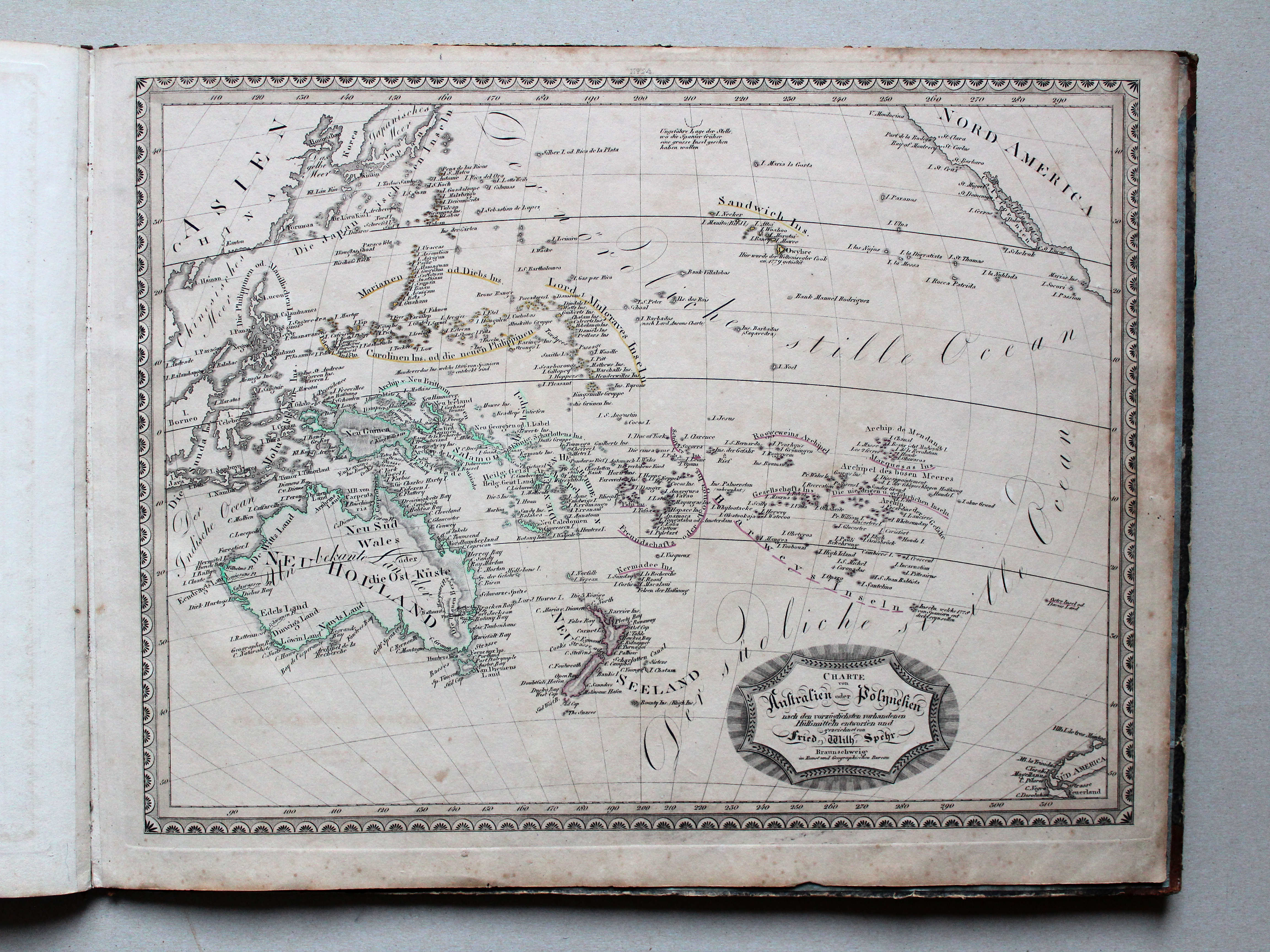
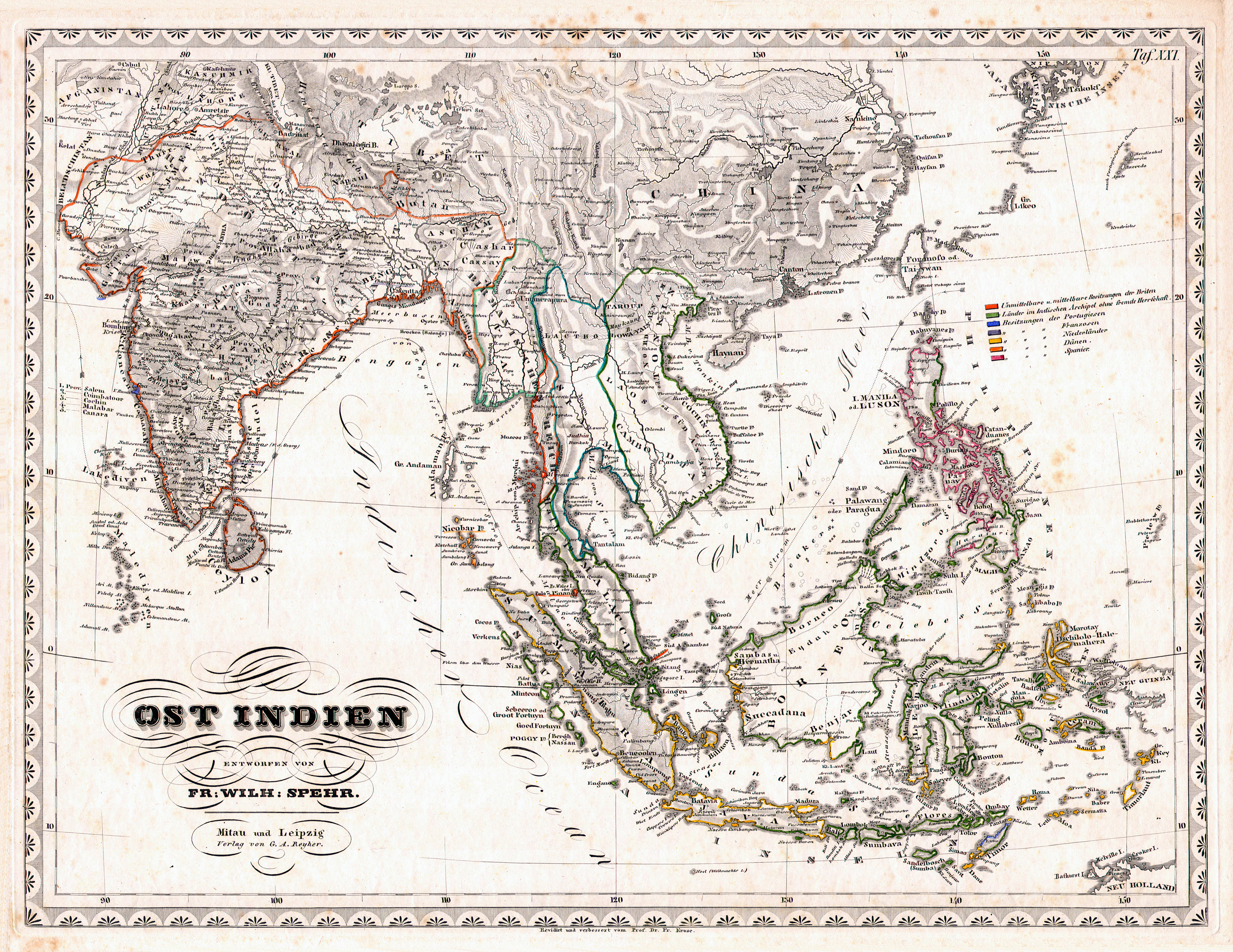
24. Charte von Australien oder Polynesien XL
Australië en Oceanië / Australia and Oceania
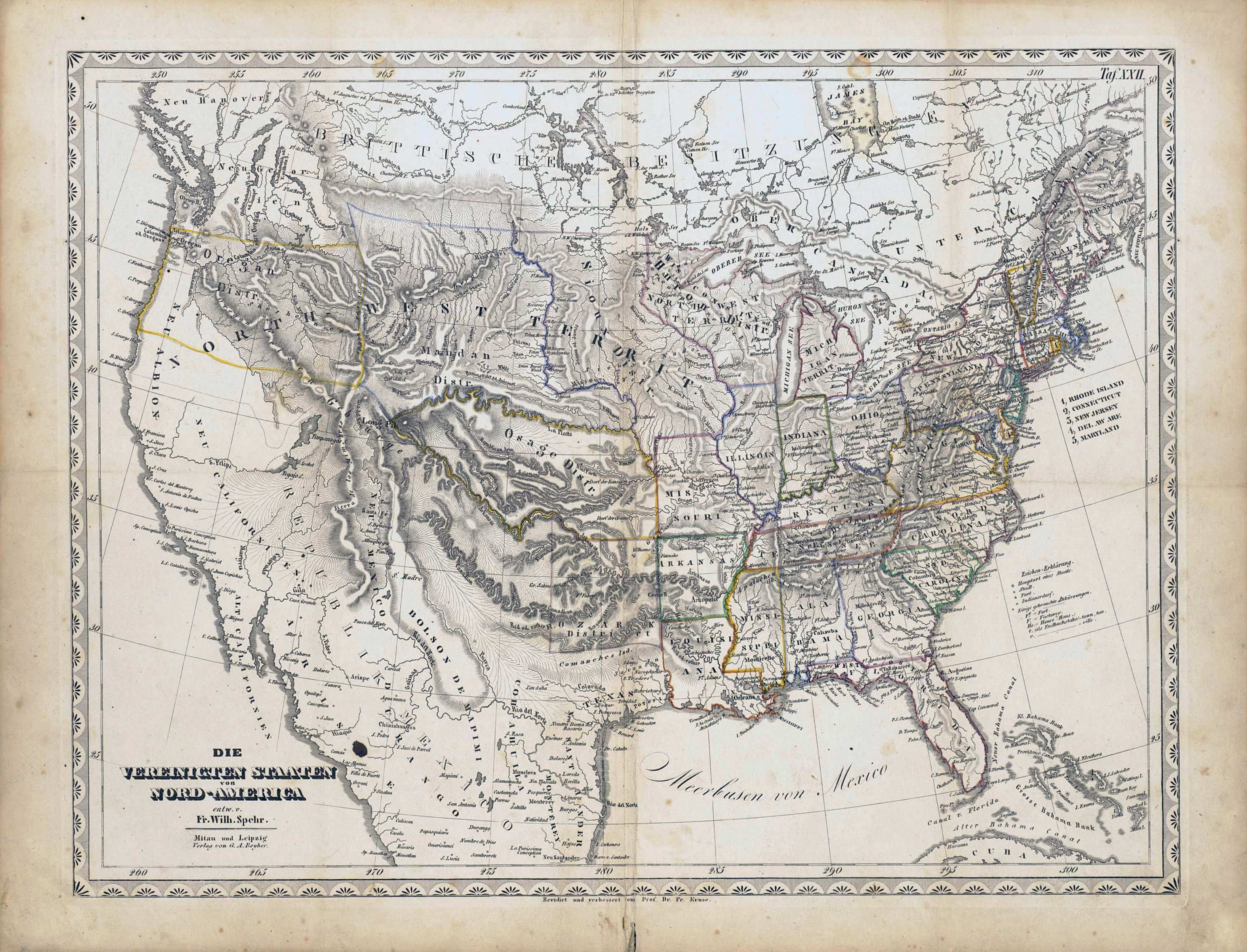
 Spehr's geographischer Schul- und Hand-Atlas, 1846
22. Die Vereinigten Staaten von Nord-America XL
Verenigde Staten van Noord-Amerika / United States of North America
met dank aan / courtesy of: University of Texas at Arlington
Spehr's geographischer Schul- und Hand-Atlas, 1834-1835
21. Die Vereinigten Staaten von Nord-America XL
Verenigde Staten van Noord-Amerika / United States of North America
© M. Witkam, 2014
met dank aan / courtesy of: E.M. Schipper
![]()
![]()