Cary's New Universal Atlas (1819)
See below for (a summary of) this text in English.
Hieronder staan plaatjes van de atlas. Daarbij horen ook de volgende pagina's
- Beschrijving van de atlas
- Tabellen en lijsten bij de atlas
Plaatjes
Klik op een plaatje voor een vergroting.
Cary's New Universal Atlas (1819)
- Below are pictures of the atlas. Related pages
- Description of the atlas
- Tables and lists to the atlas
Pictures
Click on a picture to enlarge.
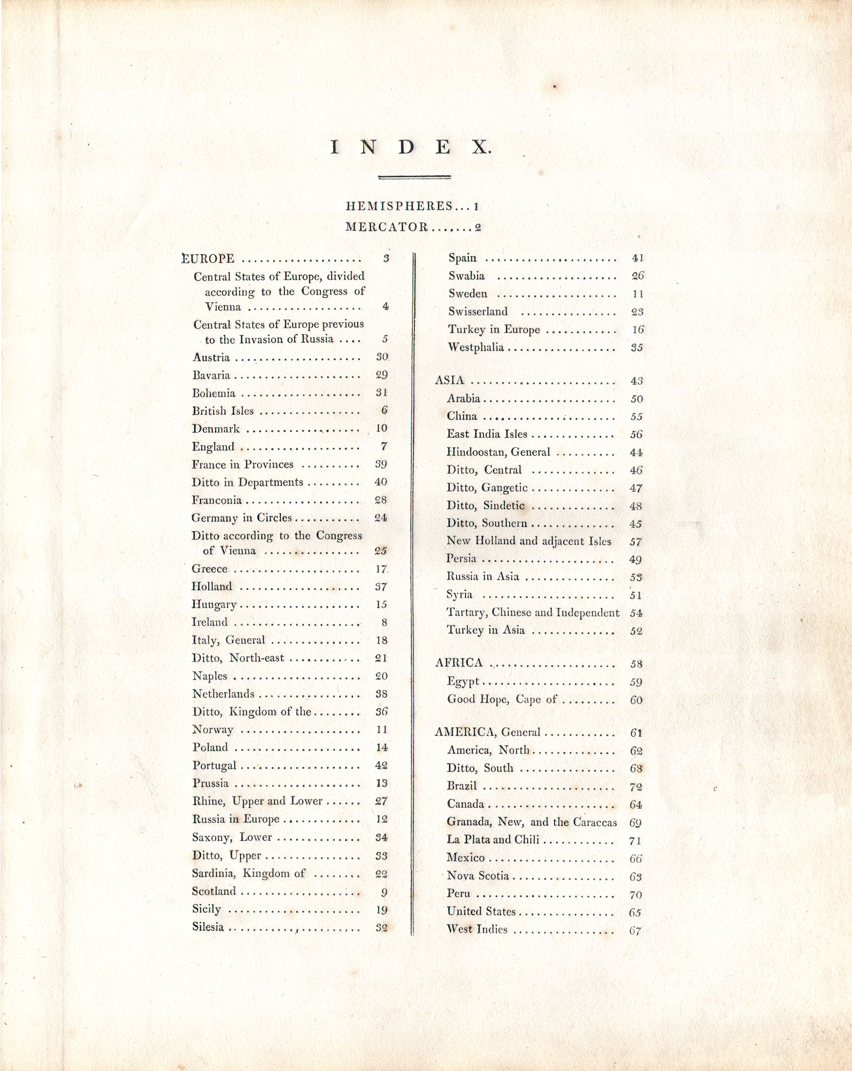
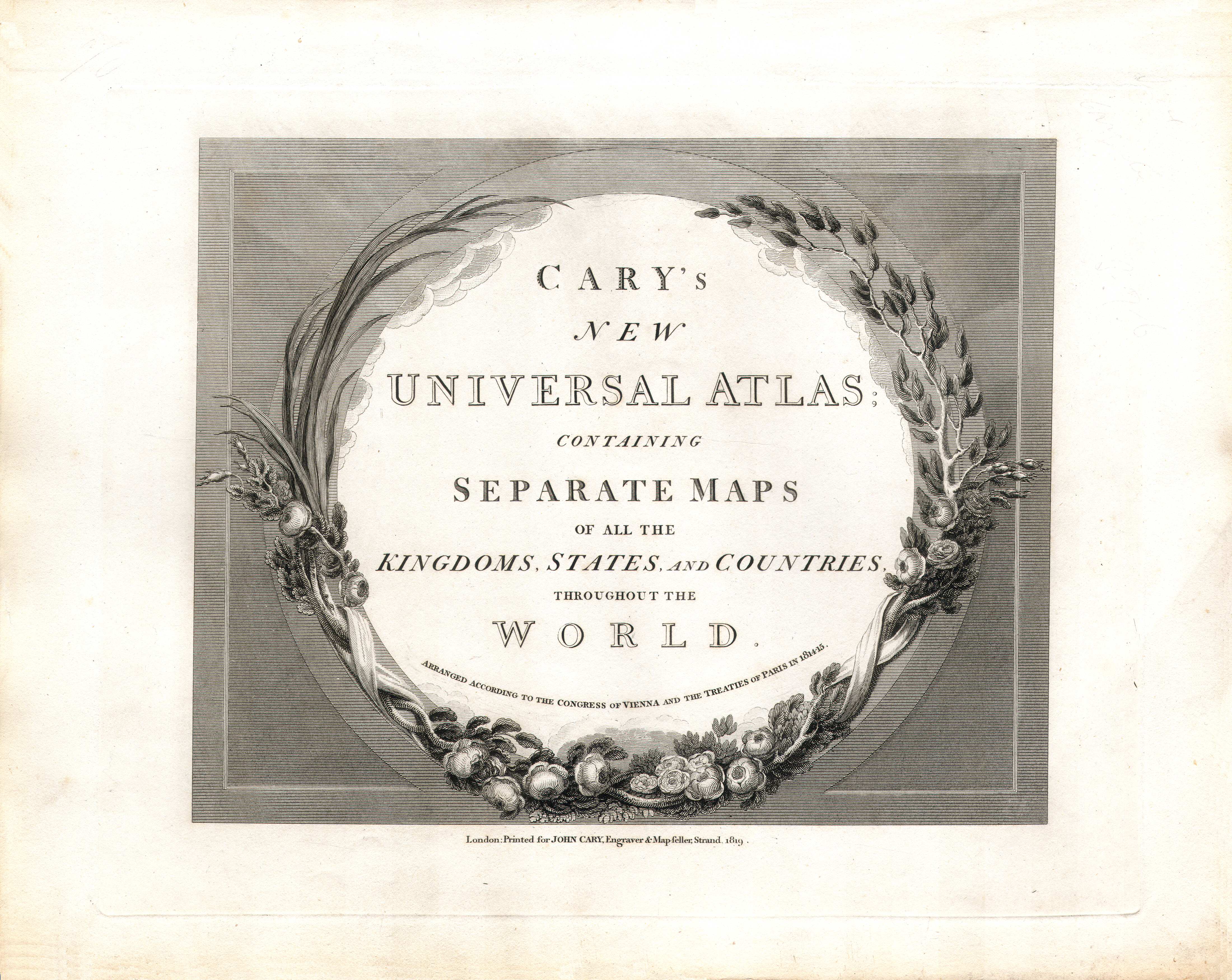
Titelpagina, kaartenregister / Title page, index of maps

 Cary's New Universal Atlas, 1819
Kaartenregister / Index of maps
 Cary's New Universal Atlas, 1819
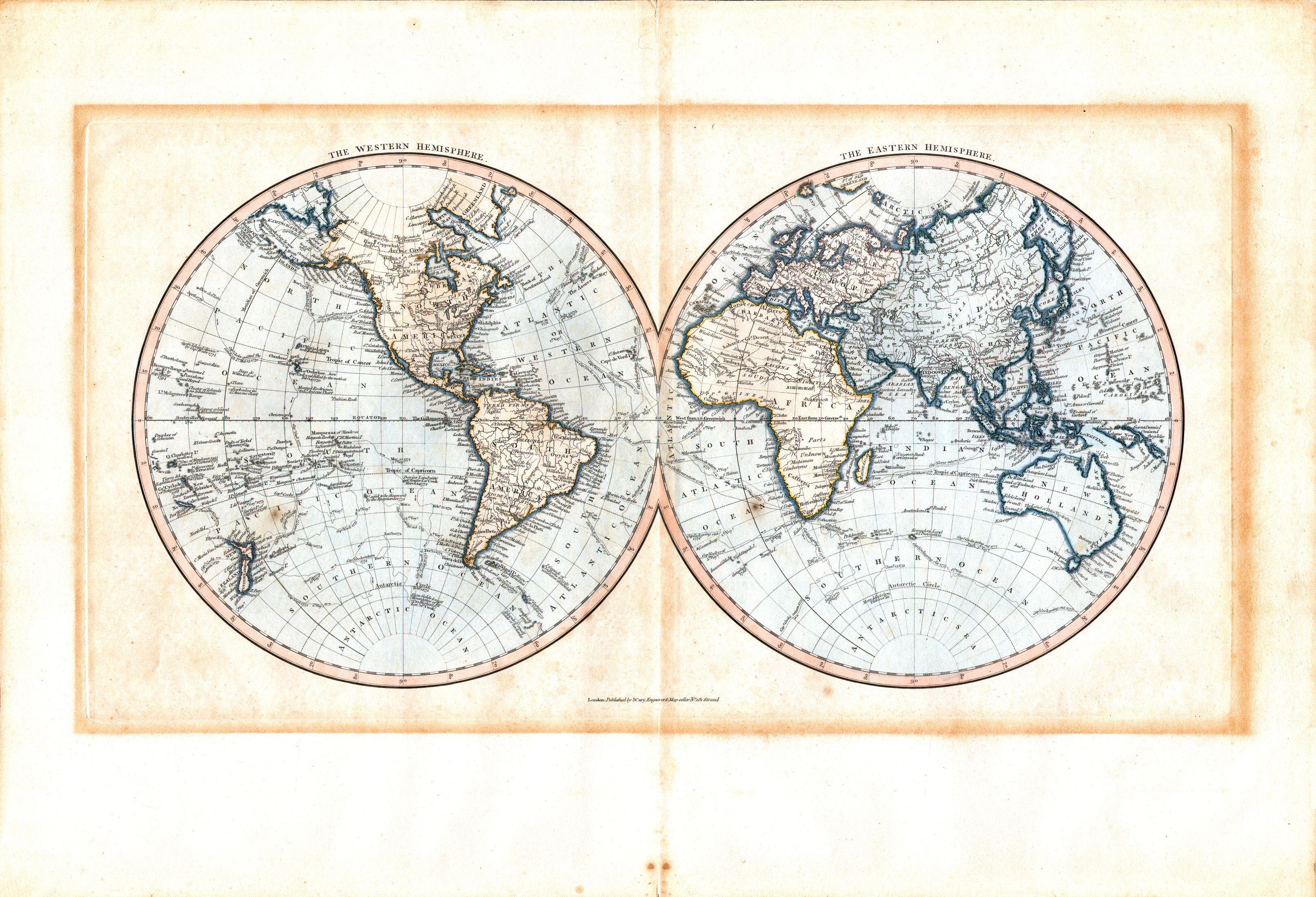
1. The Western Hemisphere. The Eastern Hemisphere
Westelijk halfrond. Oostelijk halfrond XL
 Cary's New Universal Atlas, 1819
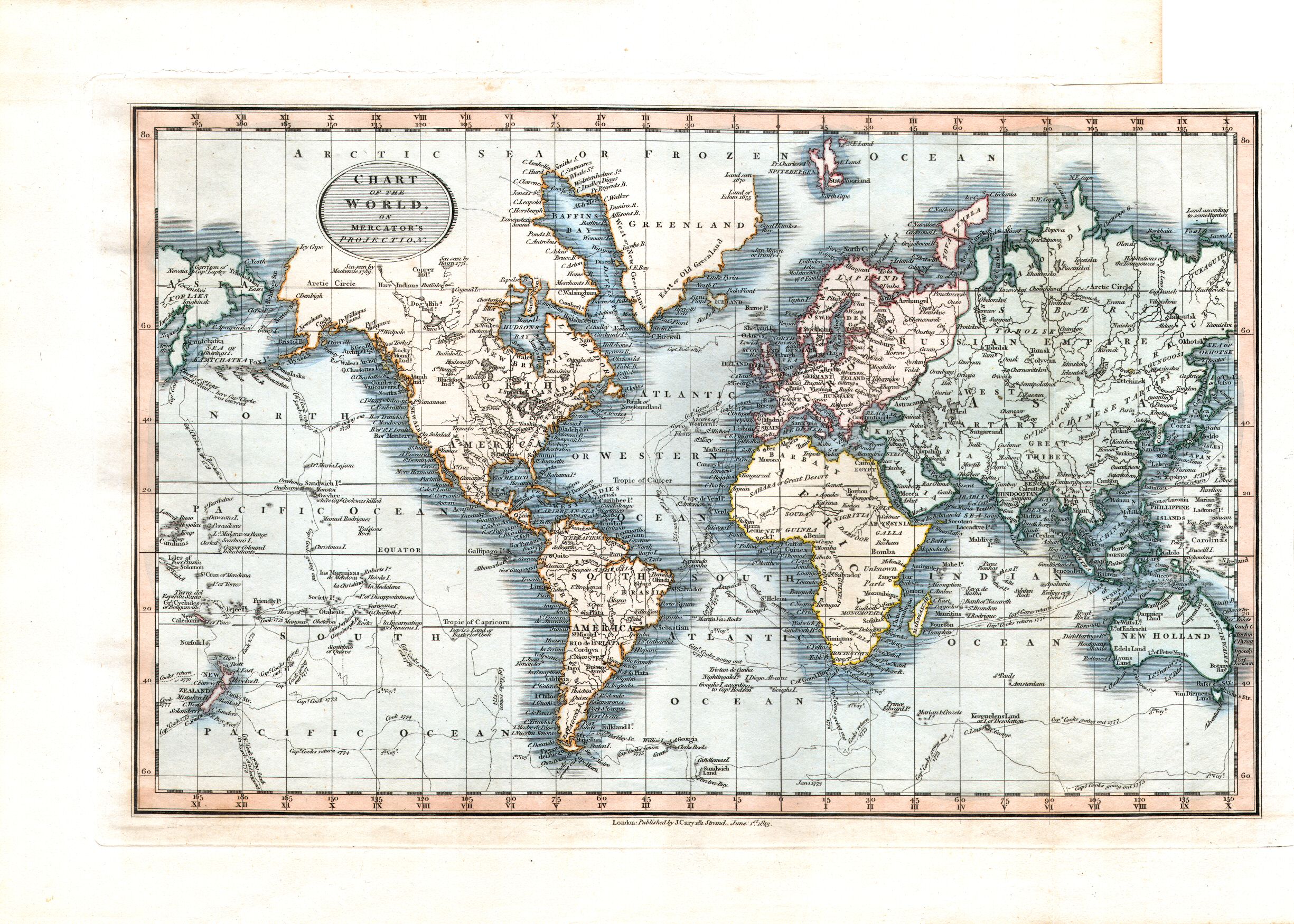
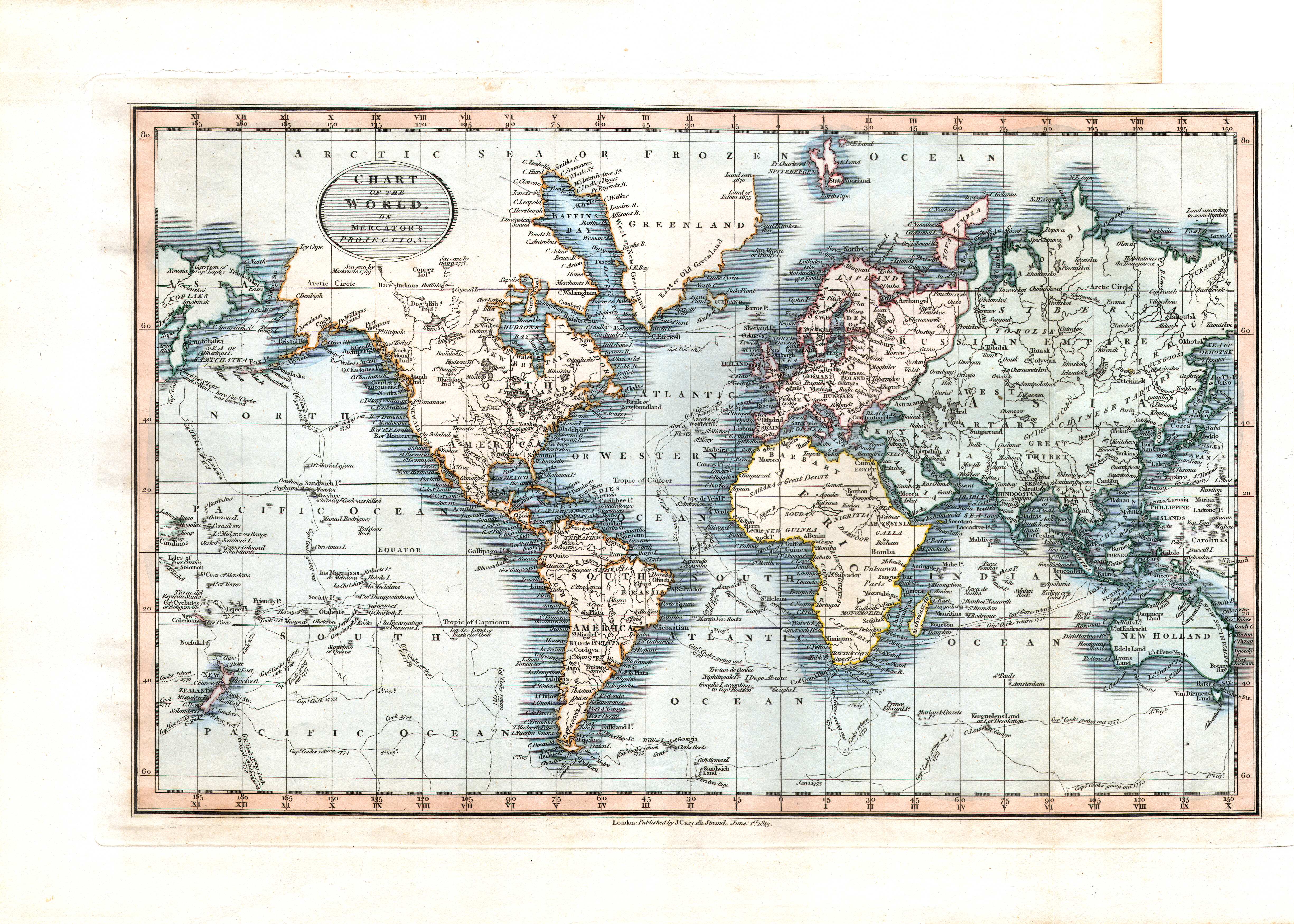
2. Chart of the World, on Mercator's Projection
Wereldkaart in Mercatorprojectie XL
 Cary's New Universal Atlas, 1819
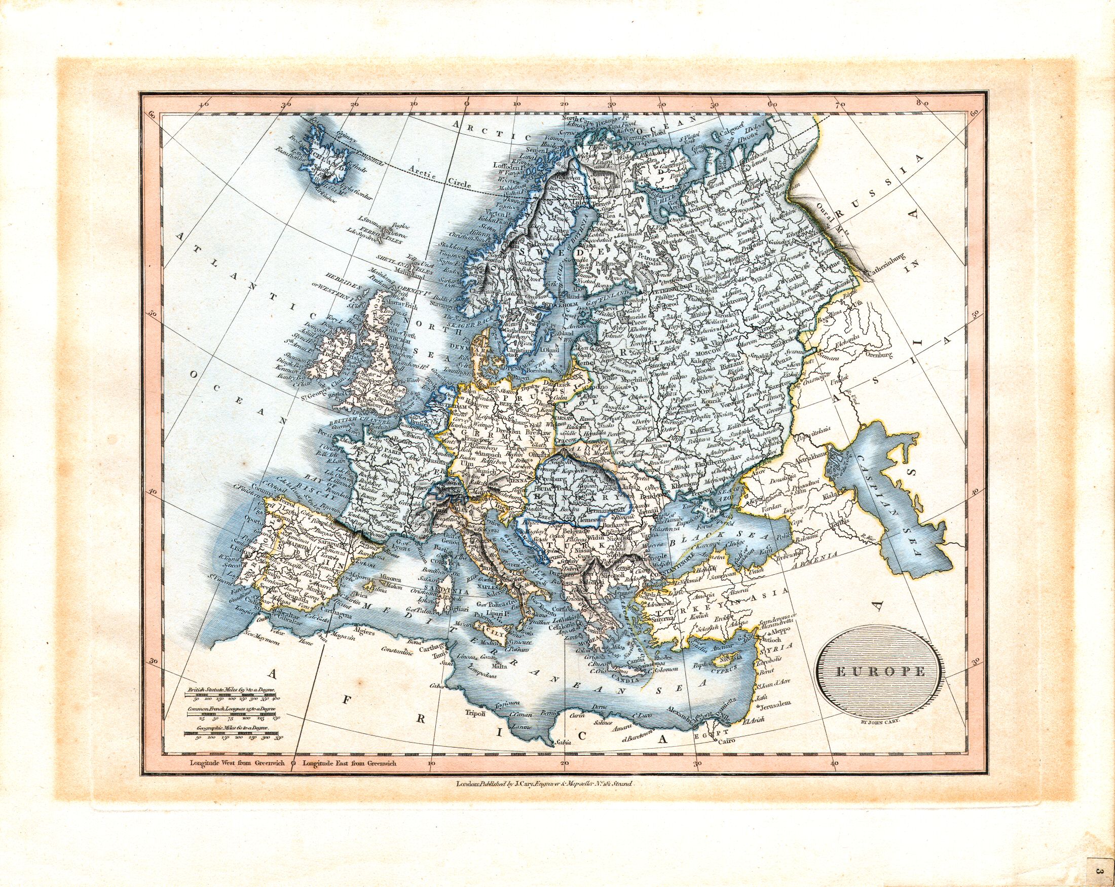
3. Europe
Europa
 Cary's New Universal Atlas, 1819
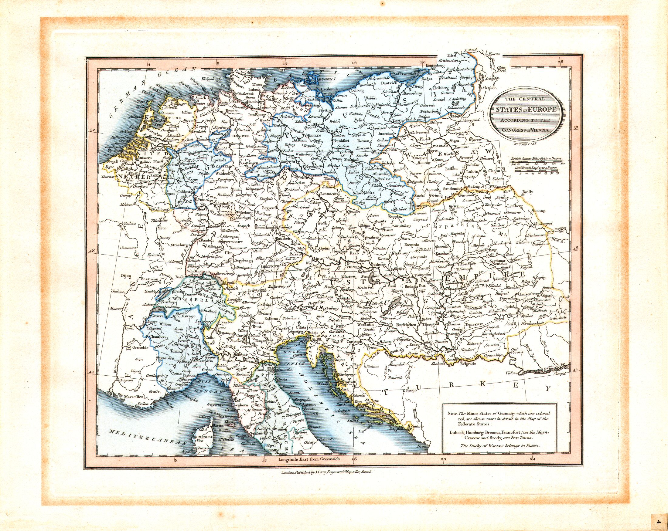
4. The Central States of Europe according to the Congress of Vienna
Midden-Europa, volgens het Congres van Wenen (1815)
 Cary's New Universal Atlas, 1819
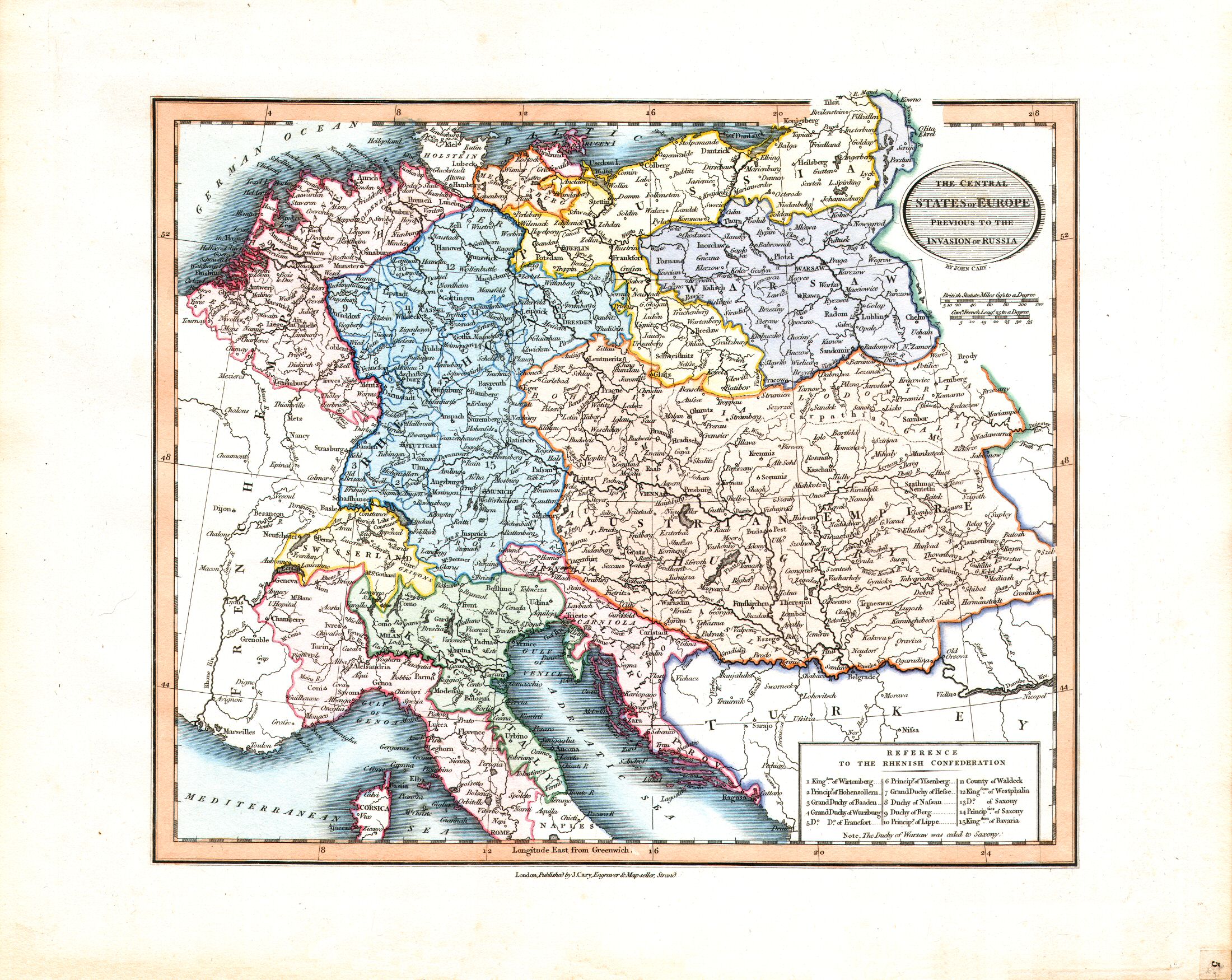
5. The Central States of Europe previous to the Invasion of Russia
Midden-Europa, voor de inval in Rusland (1812)
 Cary's New Universal Atlas, 1819
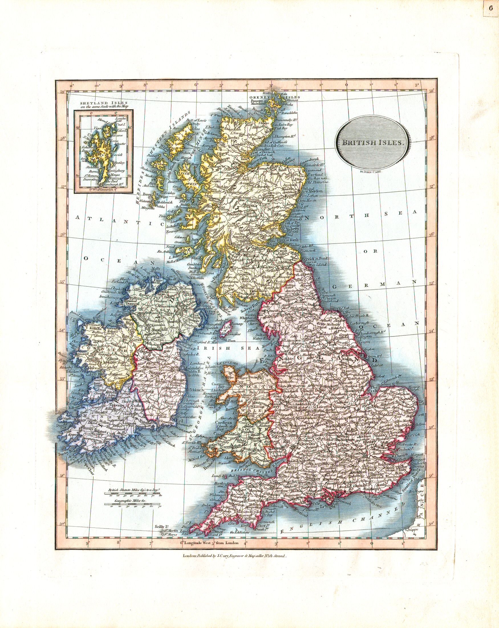
6. British Isles
Britse Eilanden
 Cary's New Universal Atlas, 1819
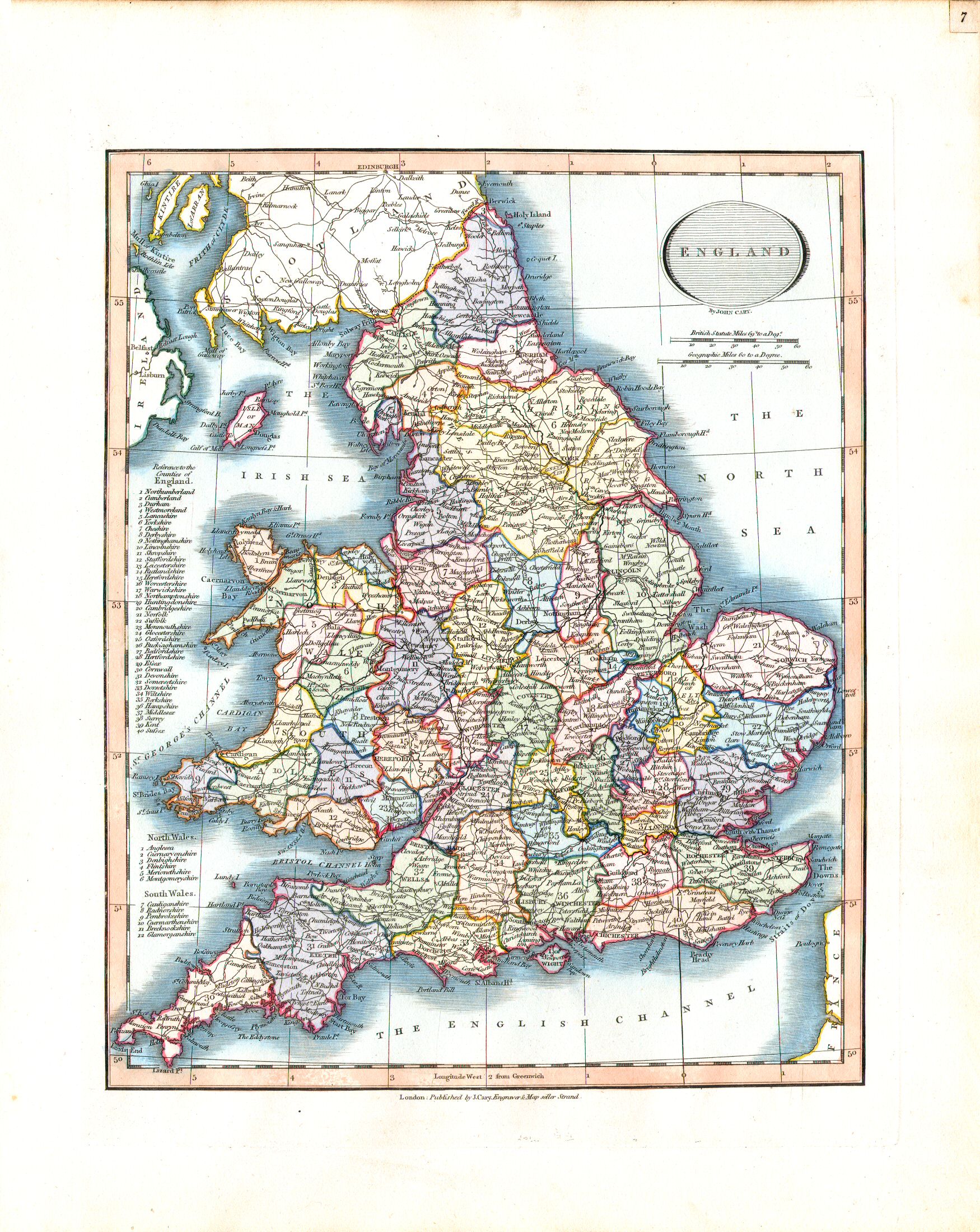
7. England
Engeland
 Cary's New Universal Atlas, 1819
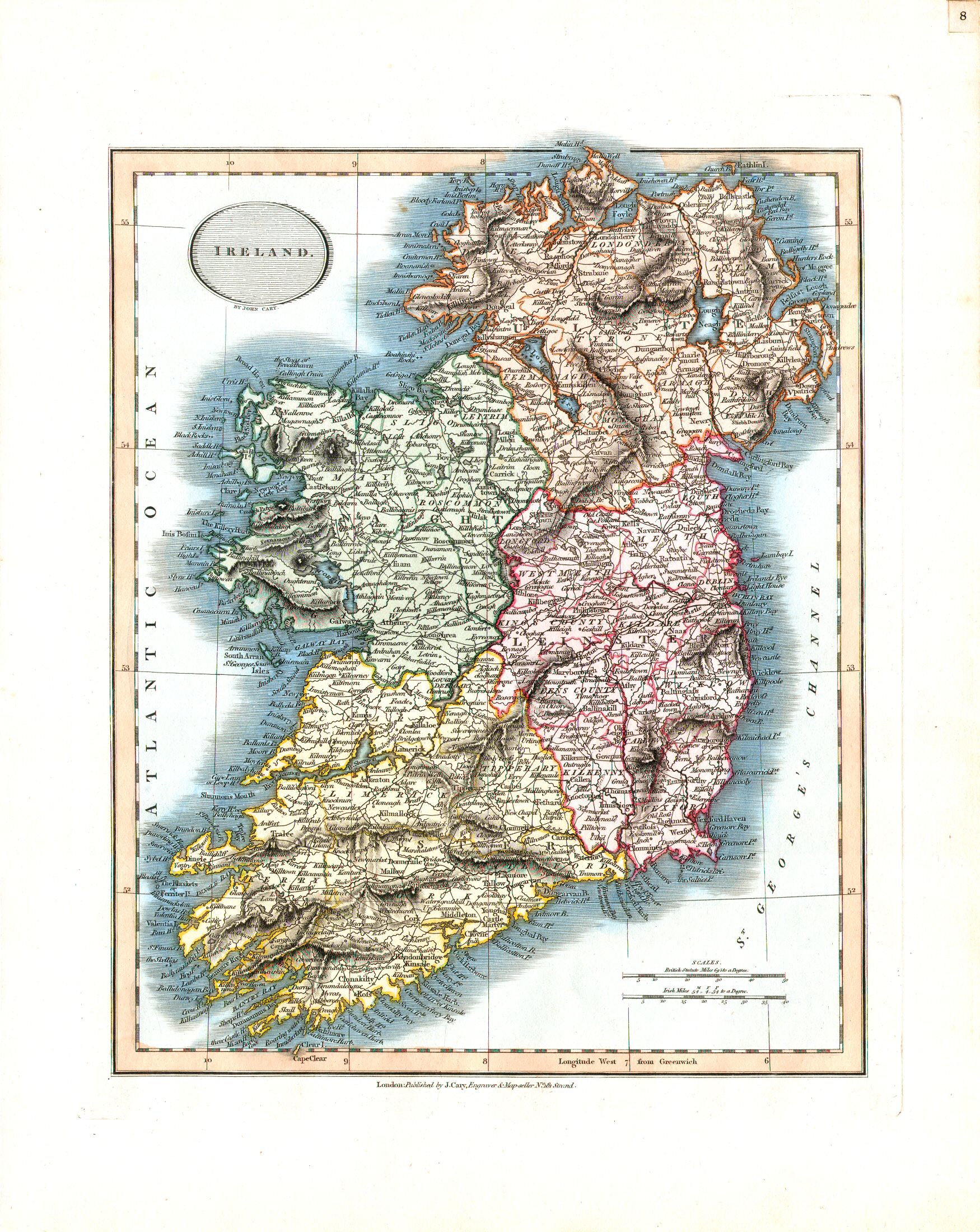
8. Ireland
Ierland
 Cary's New Universal Atlas, 1819
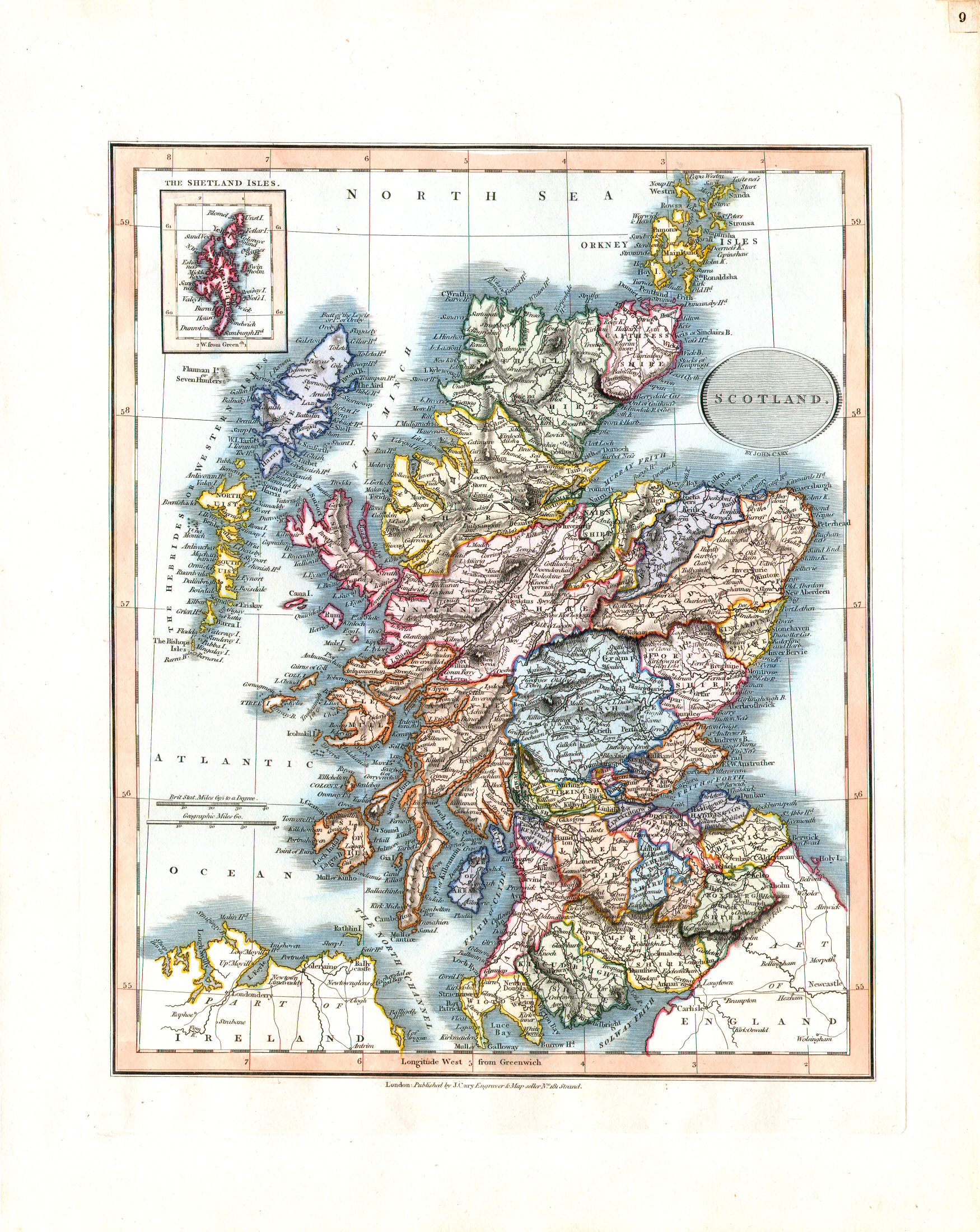
9. Scotland
Schotland
 Cary's New Universal Atlas, 1819
10. Denmark
Denemarken
 Cary's New Universal Atlas, 1819
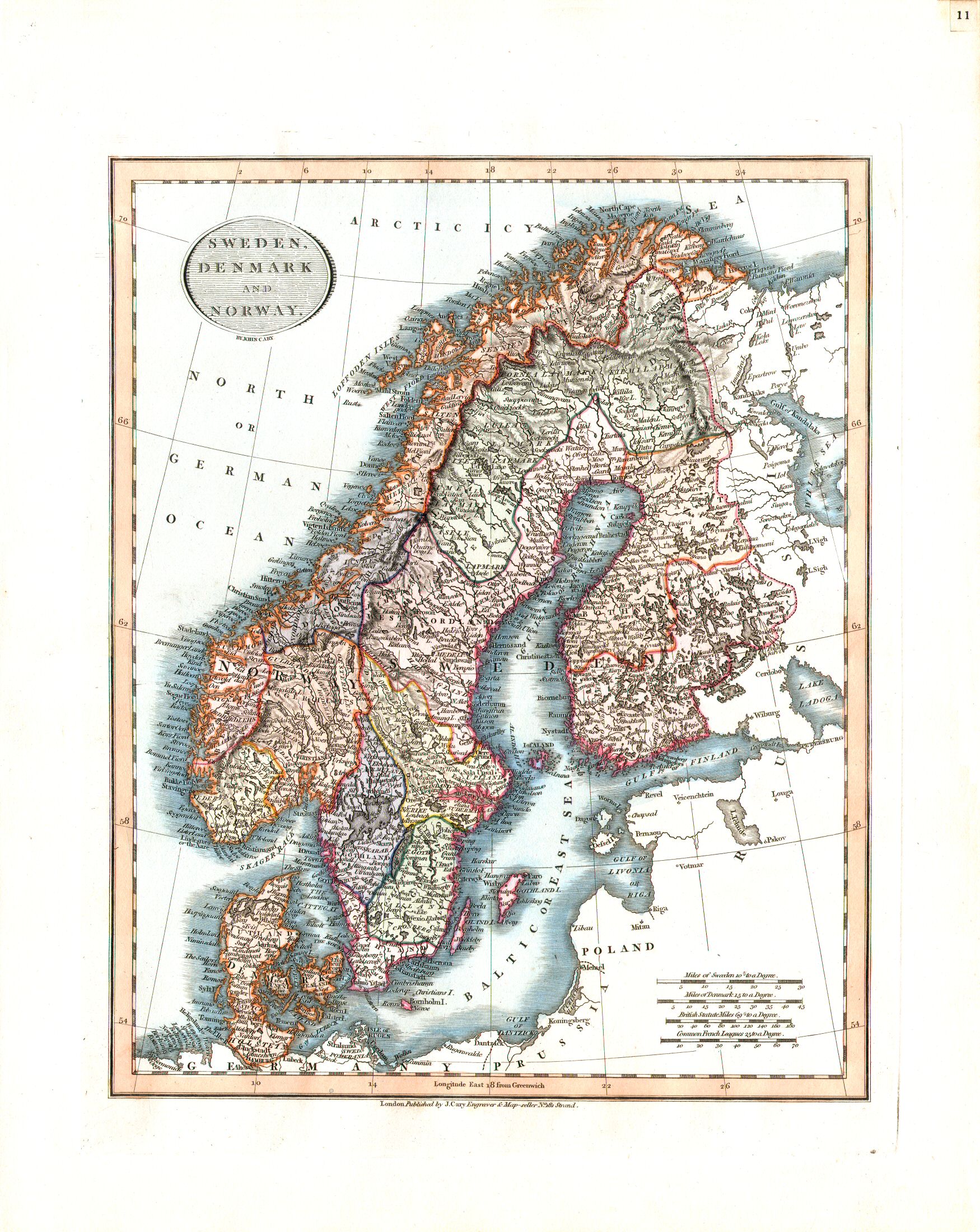
11. Sweden, Denmark and Norway
Zweden, Denemarken en Noorwegen
 Cary's New Universal Atlas, 1819
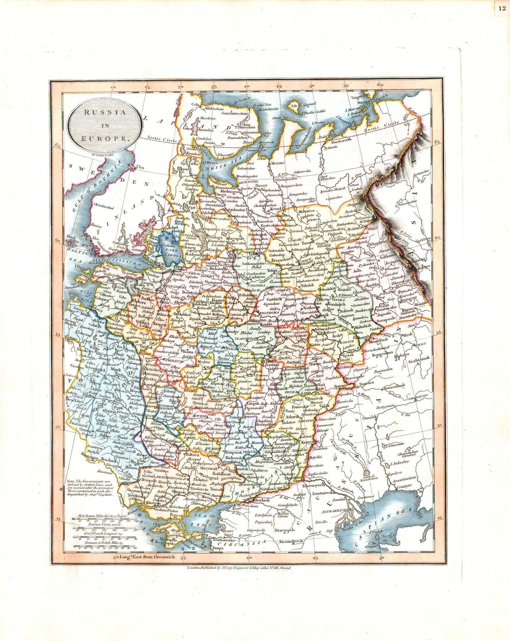
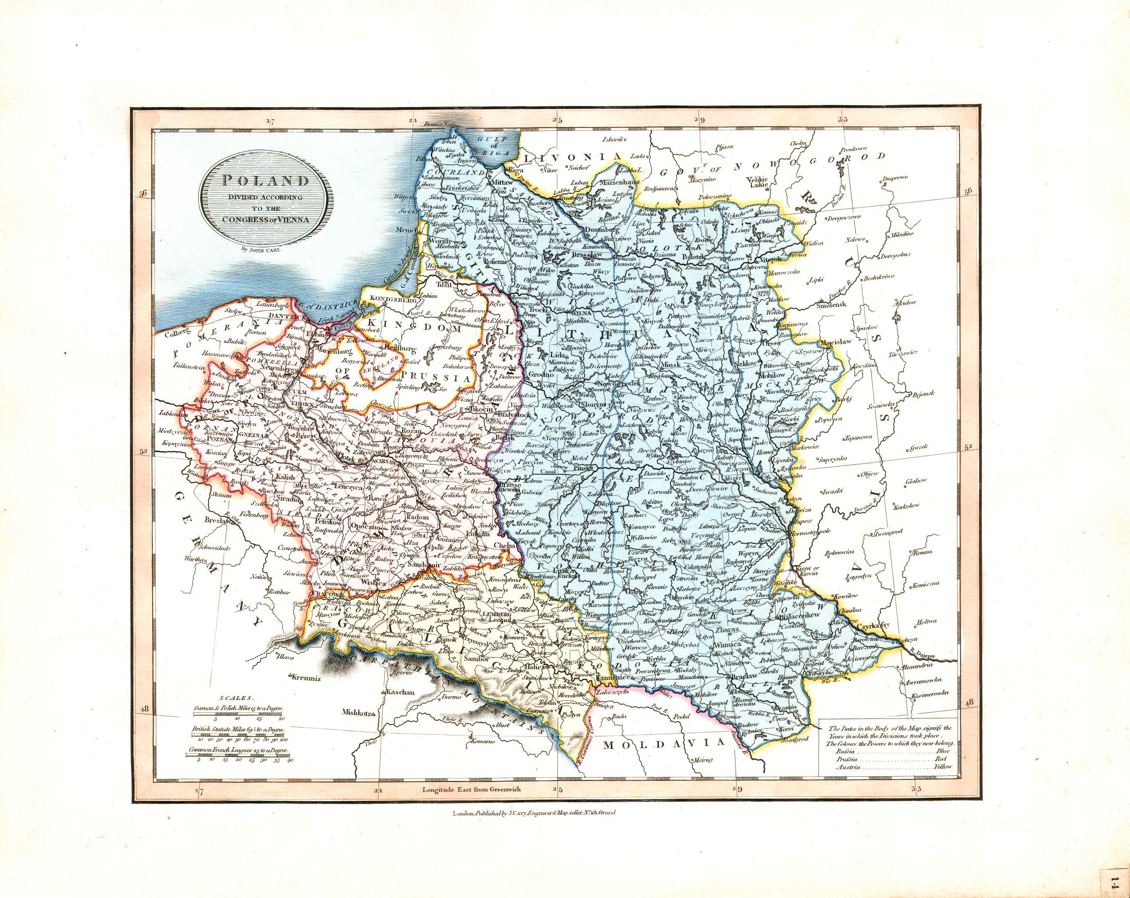
12. Russia in Europe
Europees Rusland
 Cary's New Universal Atlas, 1819
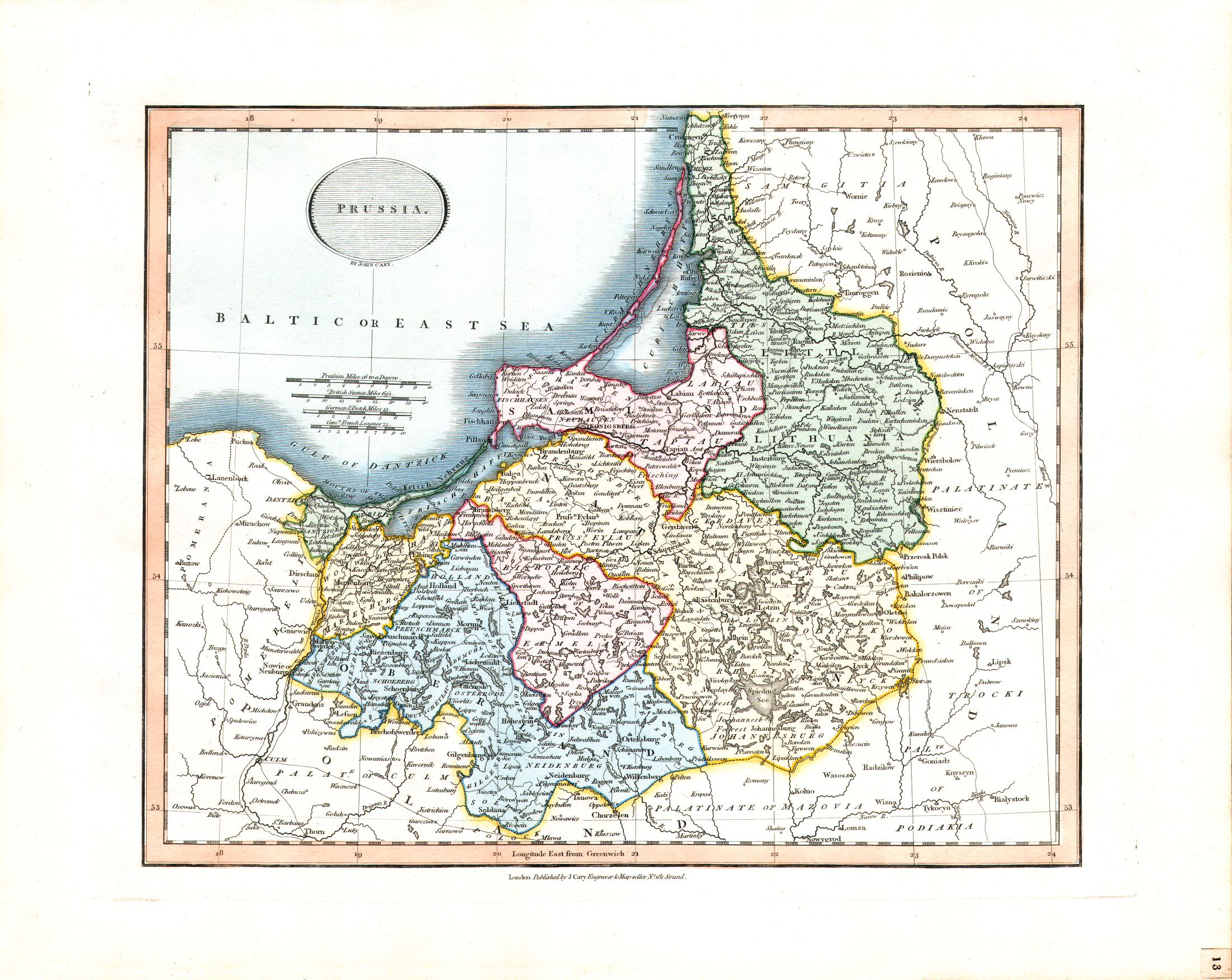
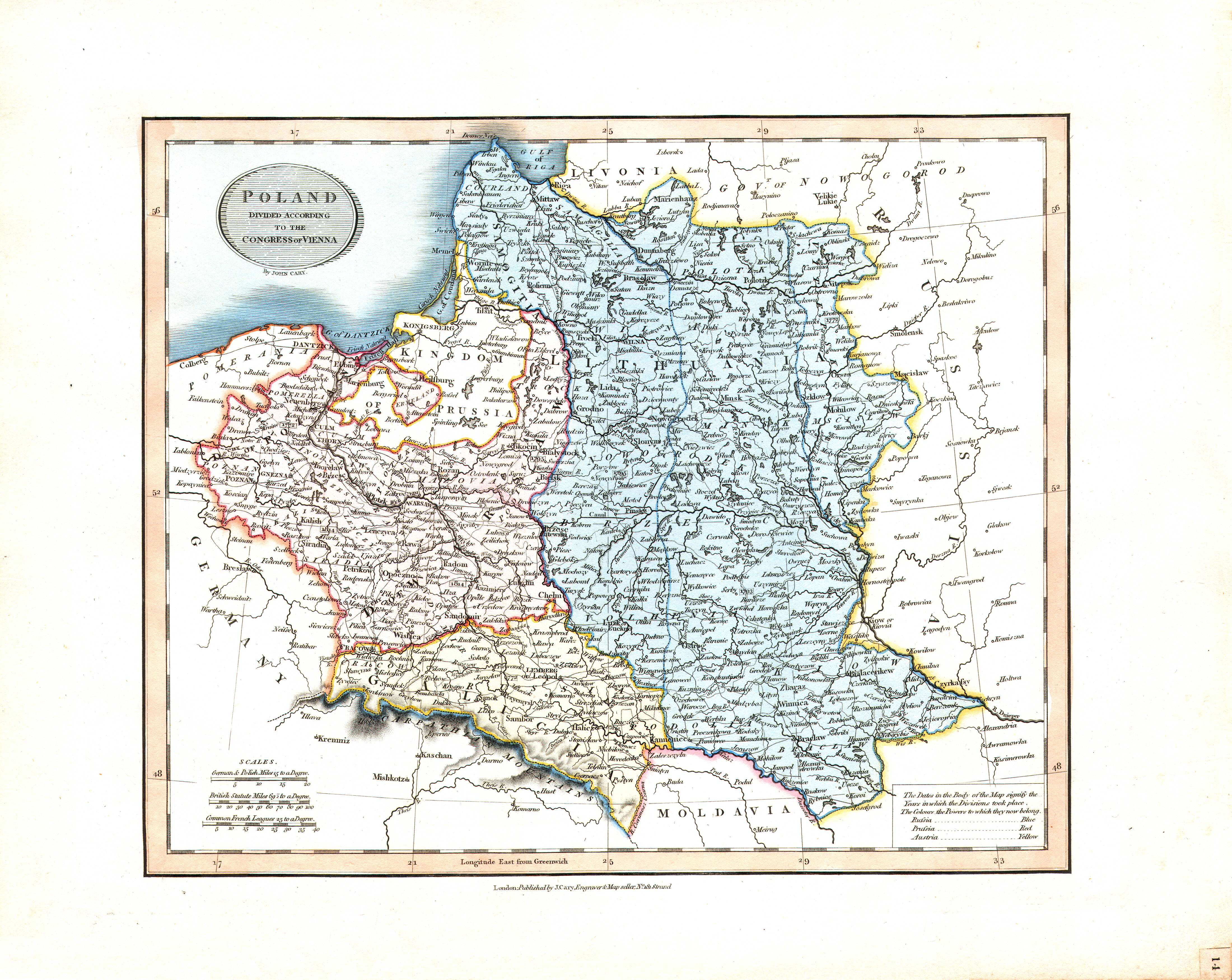
13. Prussia
Pruisen
 Cary's New Universal Atlas, 1819
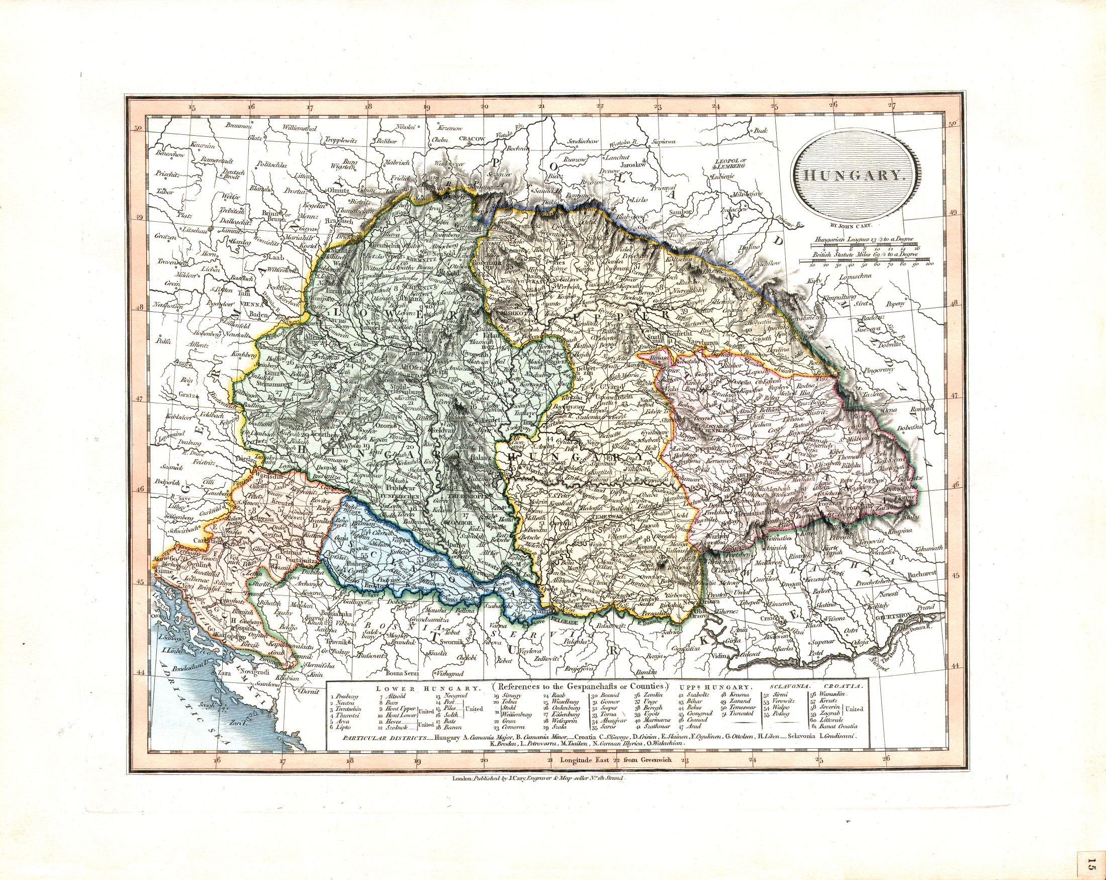
15. Hungary
Hongarije
 Cary's New Universal Atlas, 1819
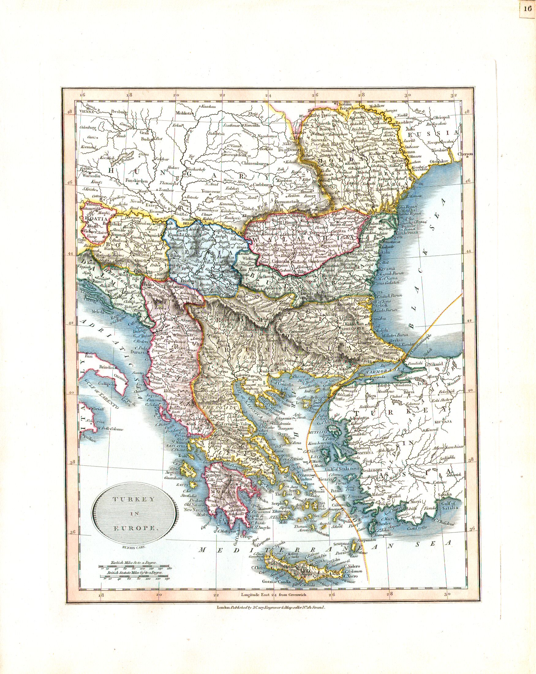
16. Turkey in Europe
Europees Turkije
 Cary's New Universal Atlas, 1819
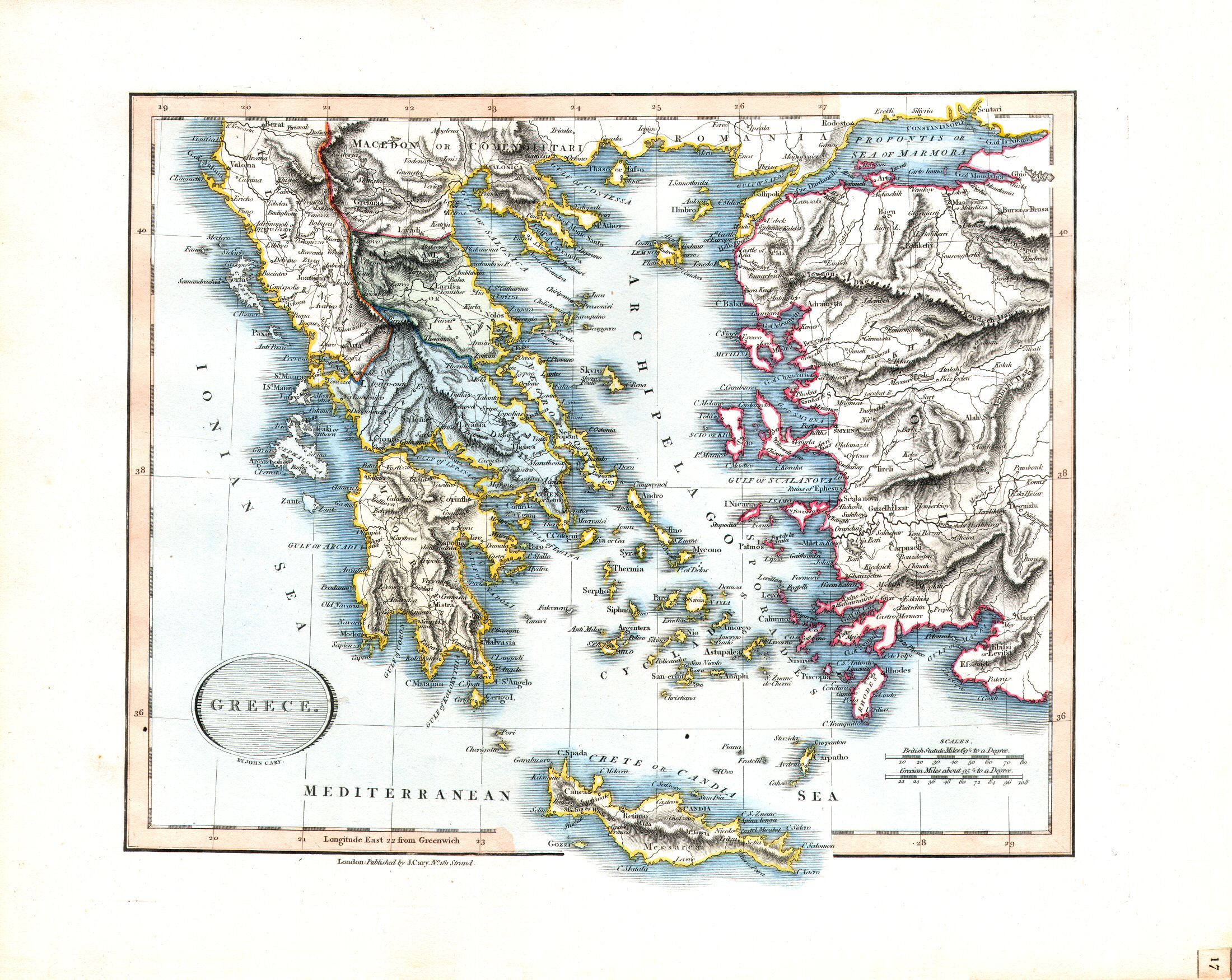
17. Greece
Griekenland
 Cary's New Universal Atlas, 1819
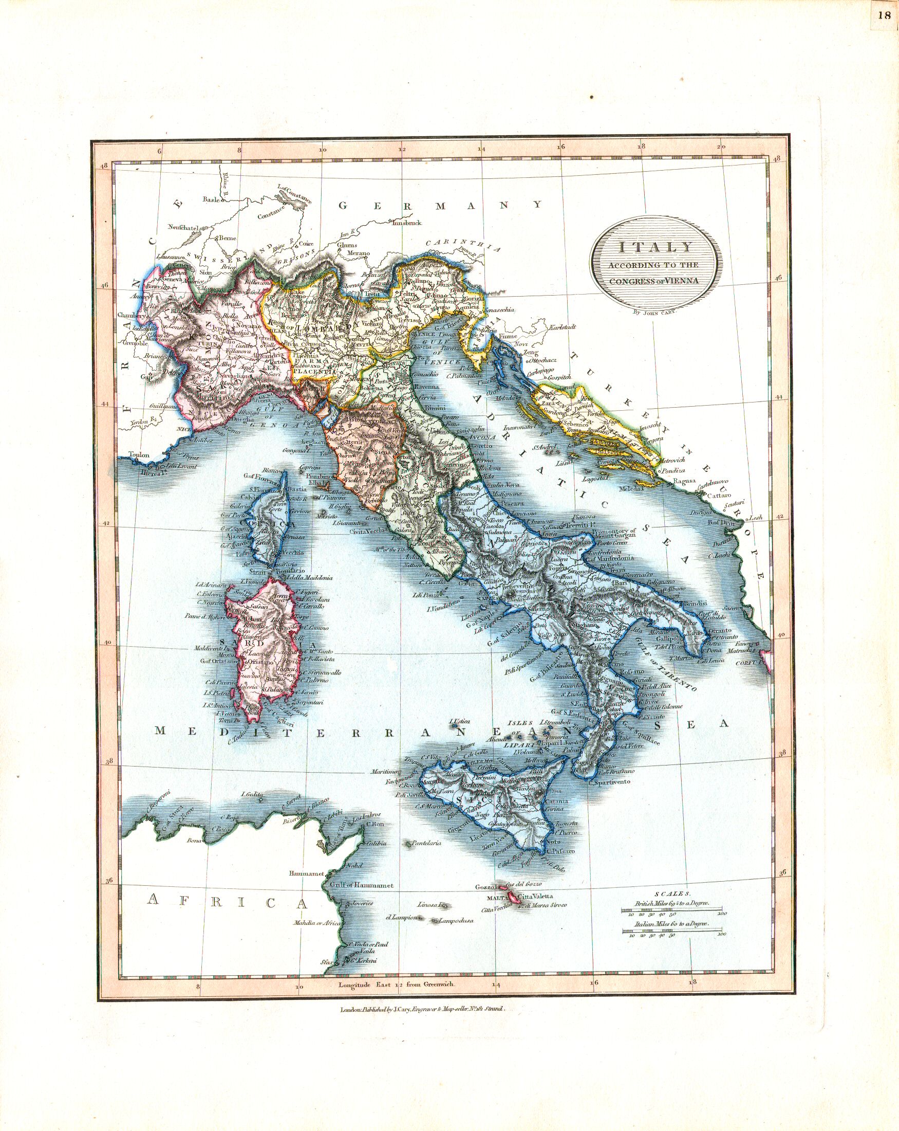
18. Italy according to the Congress of Vienna
Italië, volgens het Congres van Wenen (1815)
 Cary's New Universal Atlas, 1819
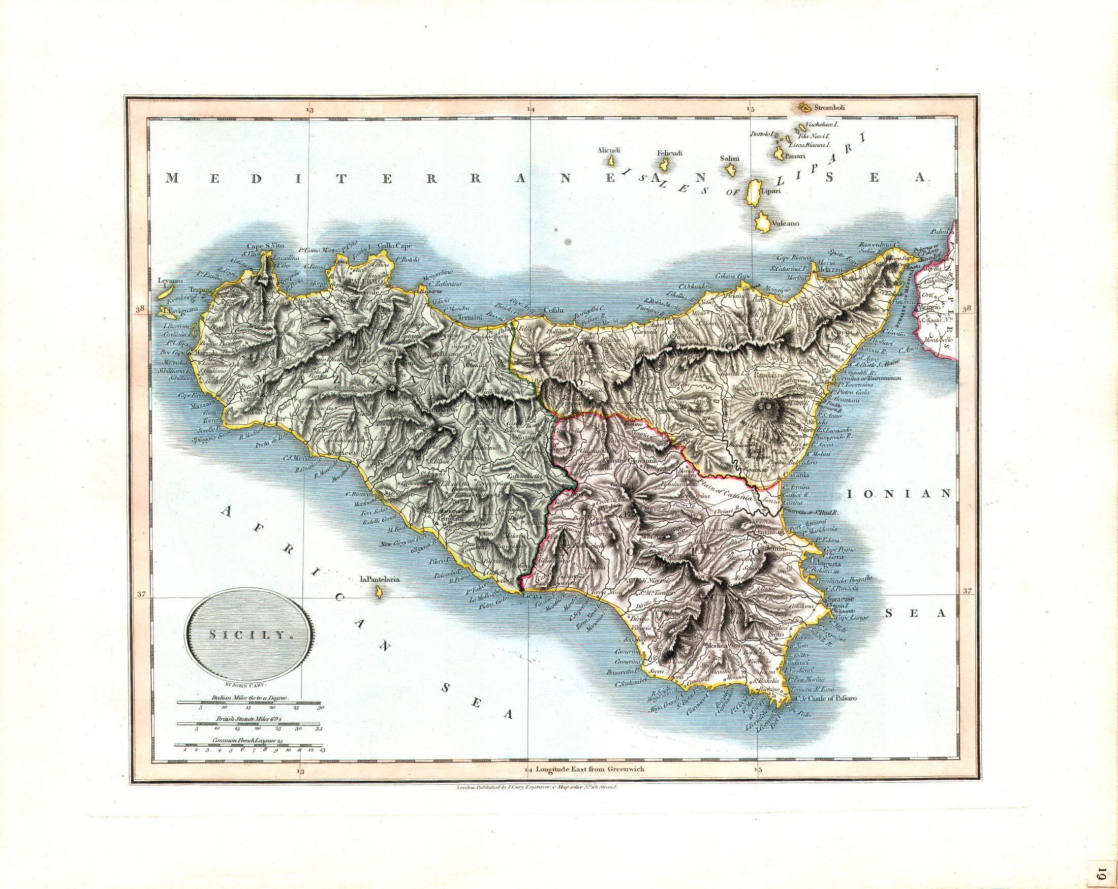
19. Sicily
Sicilië
 Cary's New Universal Atlas, 1819
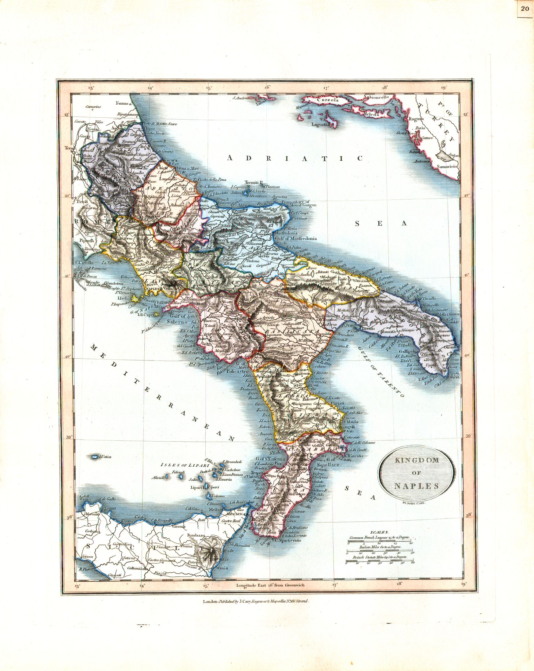
20. Kingdom of Naples
Koninkrijk Napels
 Cary's New Universal Atlas, 1819
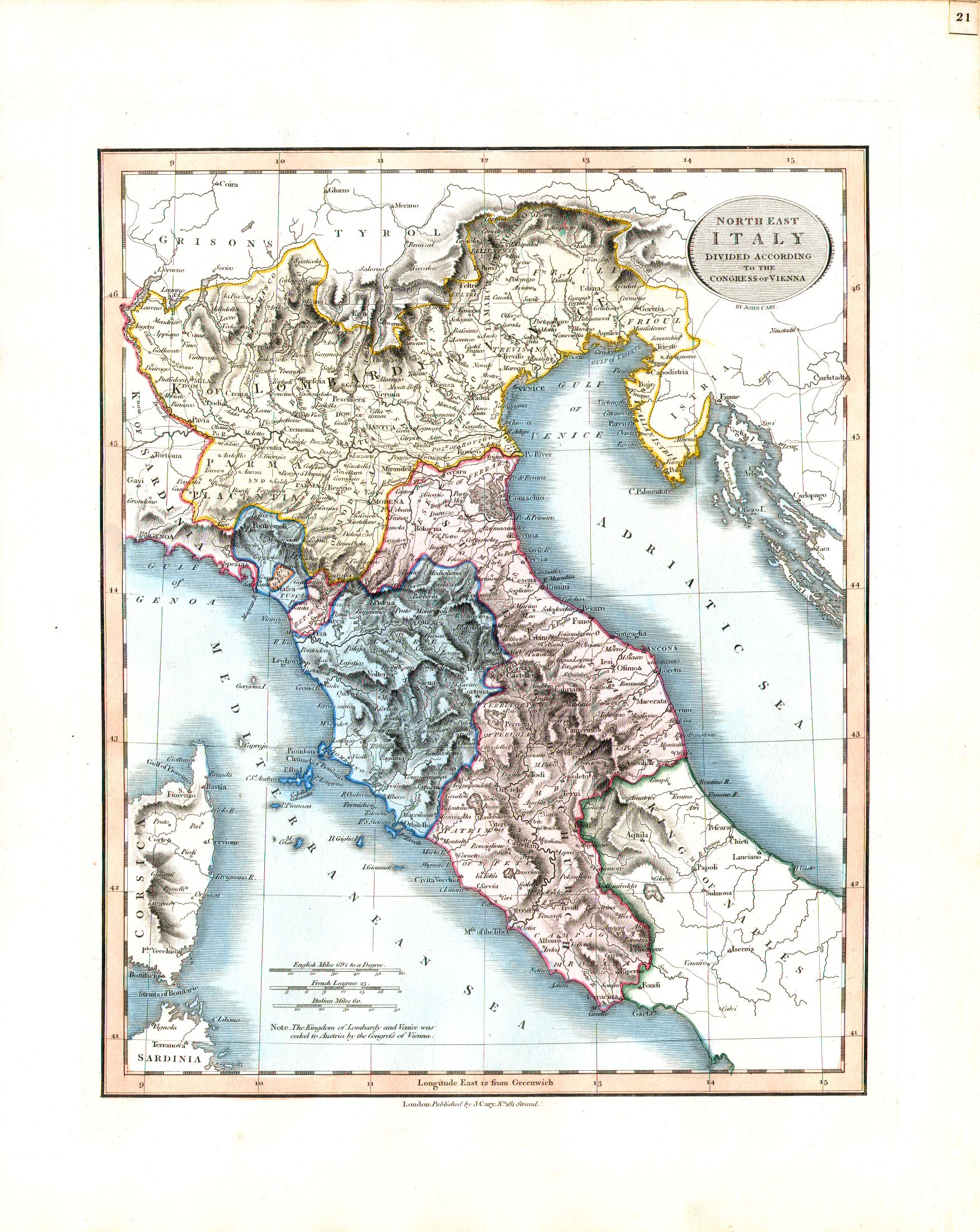
21. North East Italy divided according to the Congress of Vienna
Noordoost-Italië, volgens het Congres van Wenen (1815)
 Cary's New Universal Atlas, 1819
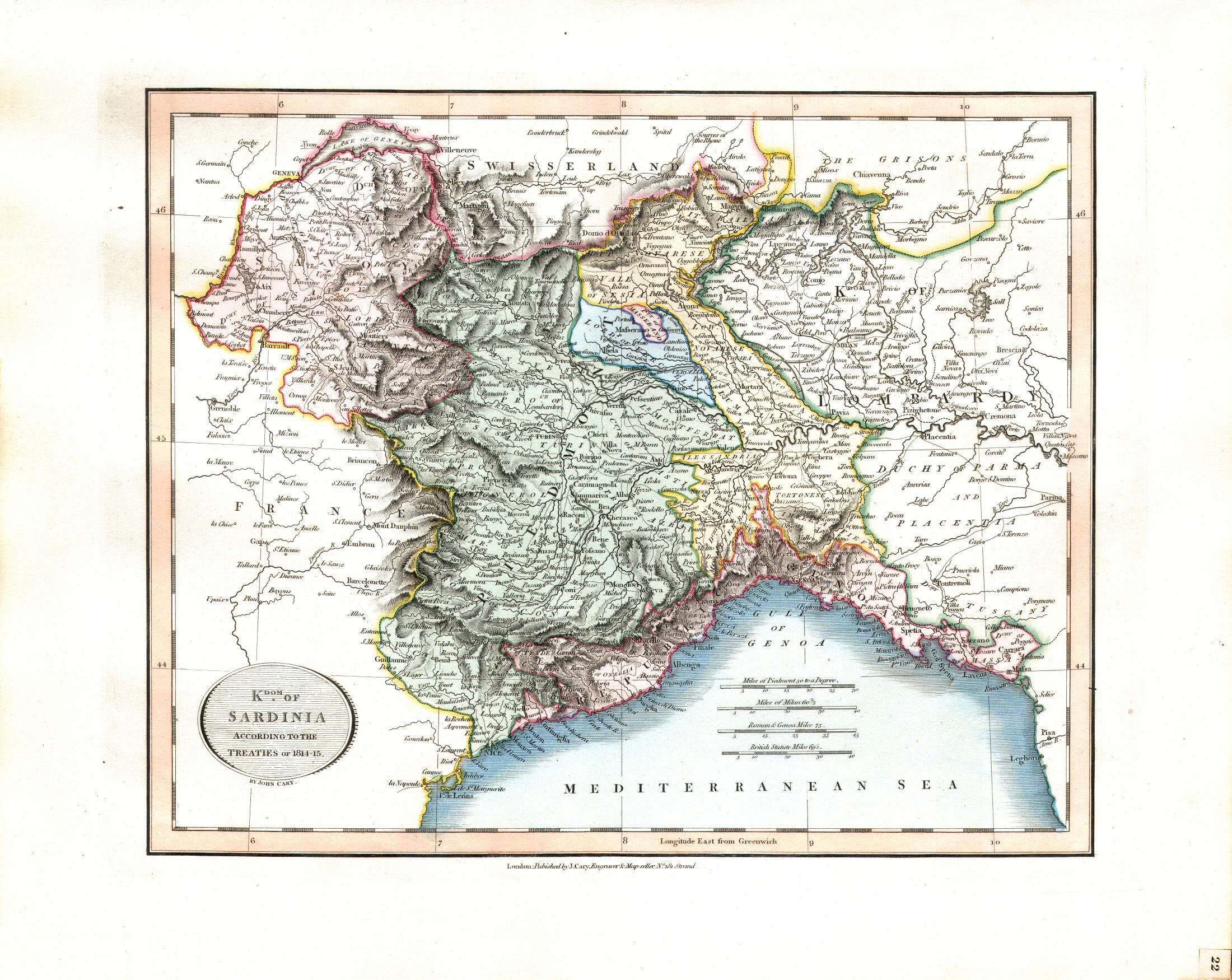
22. Kingdom of Sardinia according to the Treaties of 1814-15
Koninkrijk Sardinië, volgens de verdragen van 1814-15
 Cary's New Universal Atlas, 1819
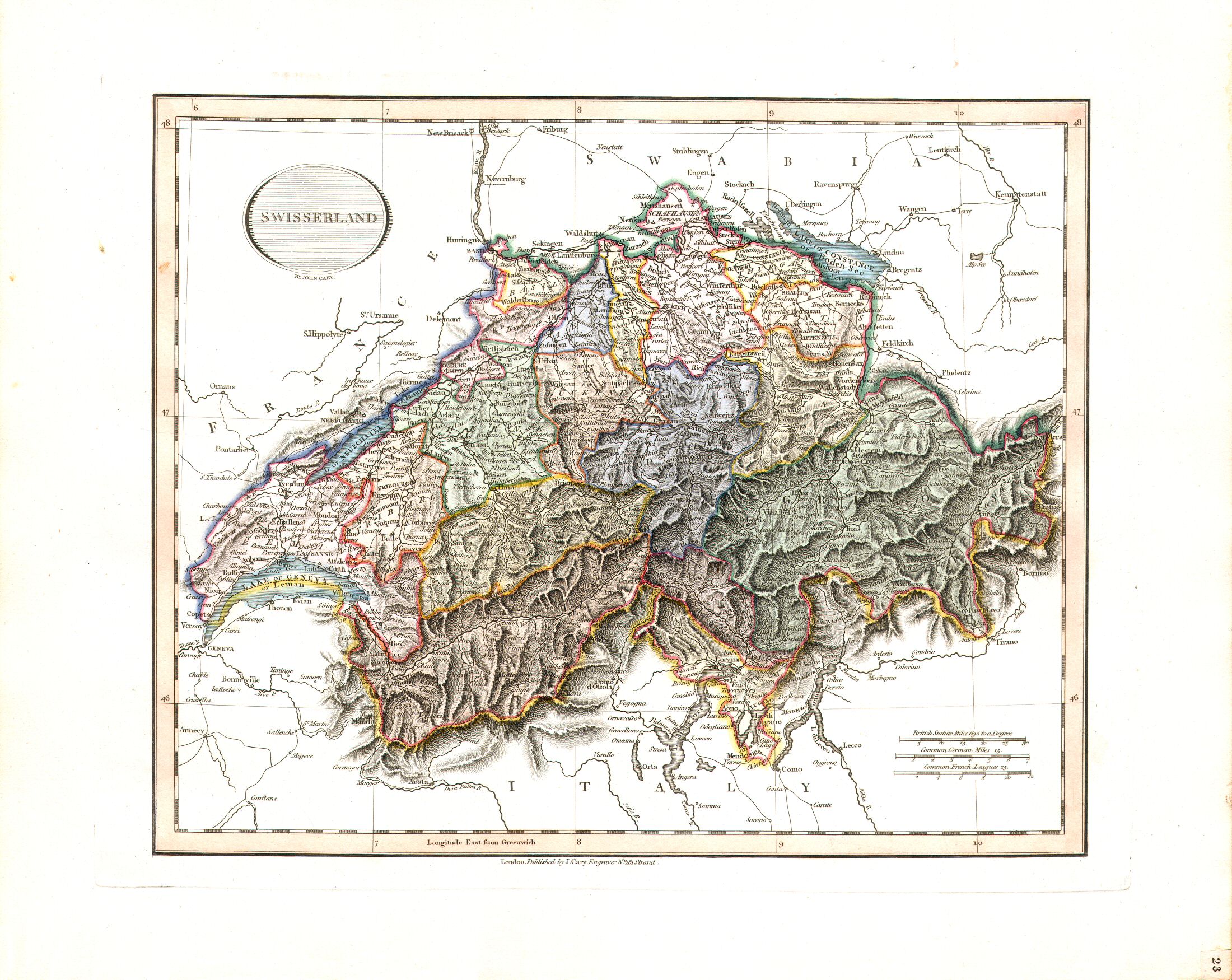
23. Swisserland
Zwitserland
 Cary's New Universal Atlas, 1819
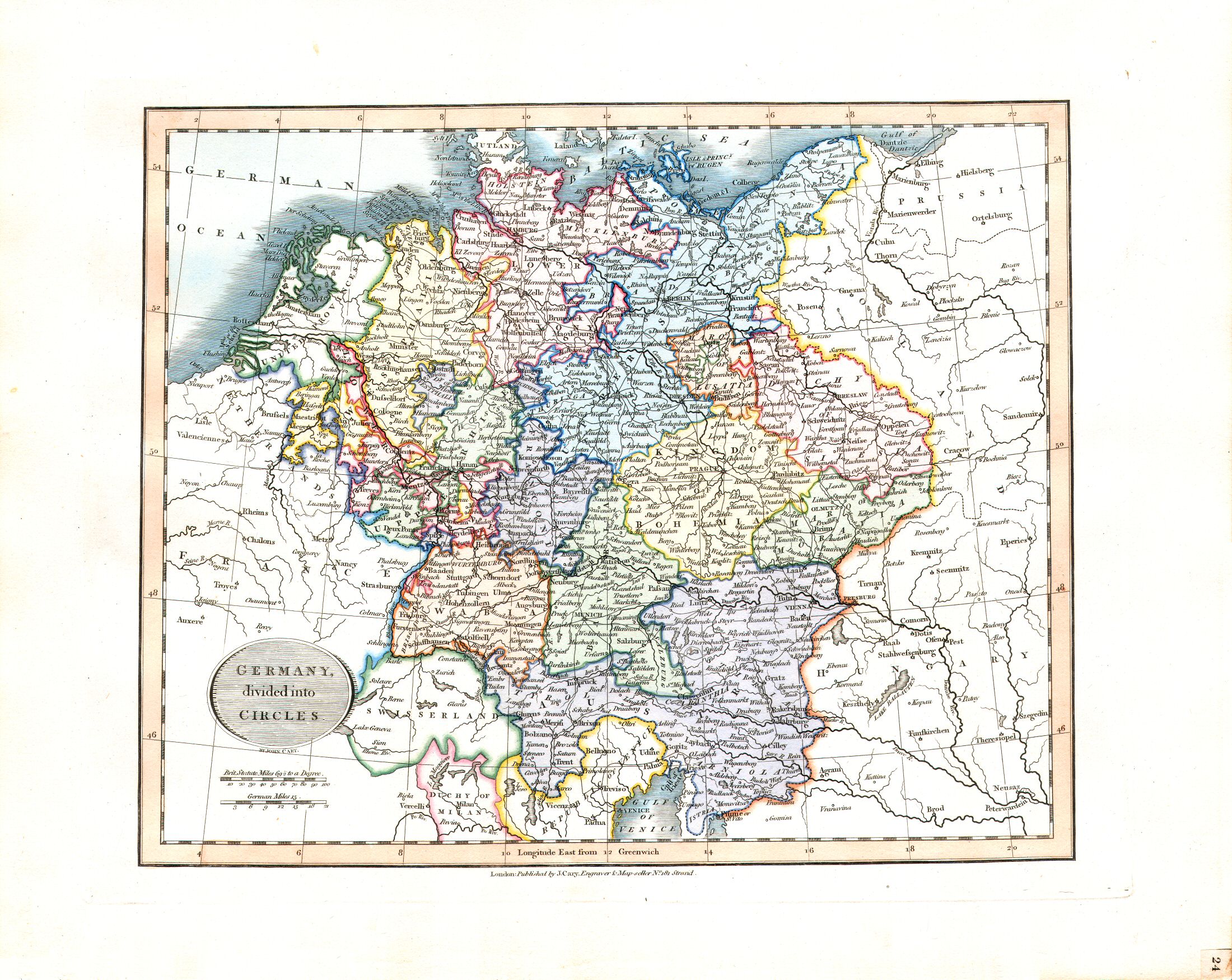
24. Germany, divided into Circles
Duitsland, ingedeeld in kreitsen (Reichskreise)
 Cary's New Universal Atlas, 1819
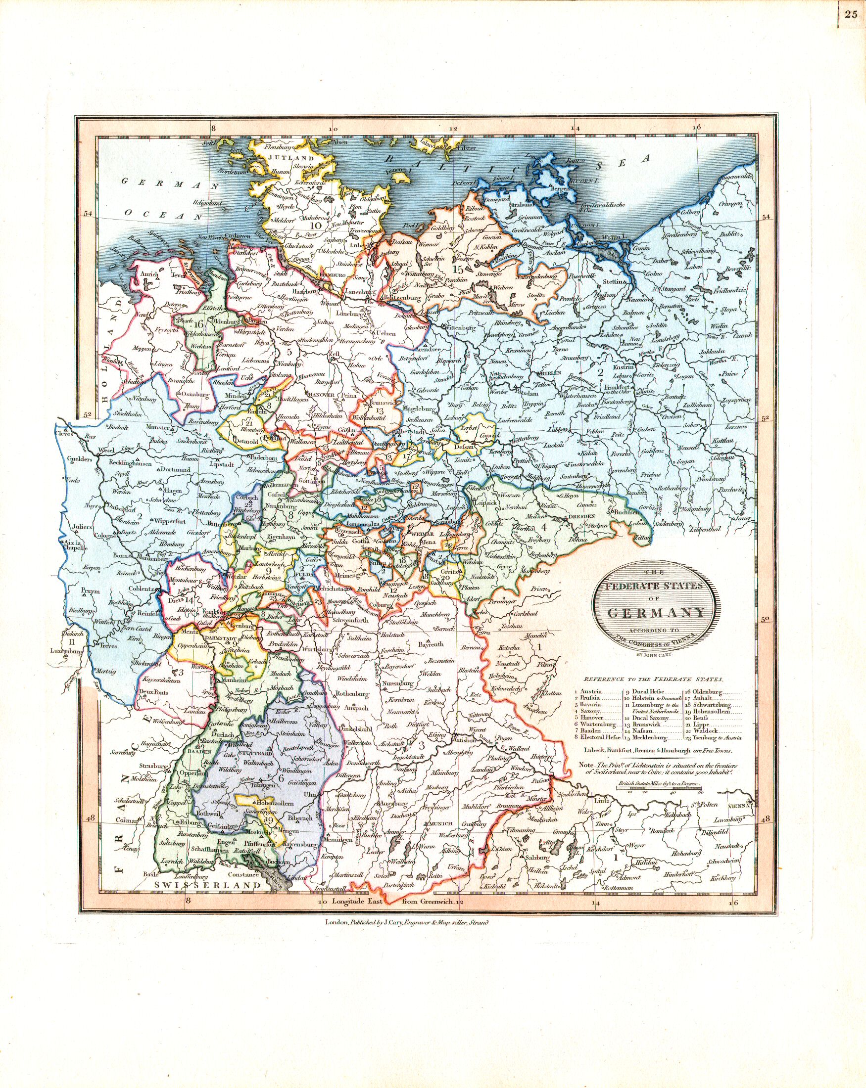
25. The Federate states of Germany according to the Congress of Vienna
De staten van de Duitse Bond, volgens het Congres van Wenen (1815)
 Cary's New Universal Atlas, 1819
26. Swabia
Zwaben (Schwaben)
 Cary's New Universal Atlas, 1819
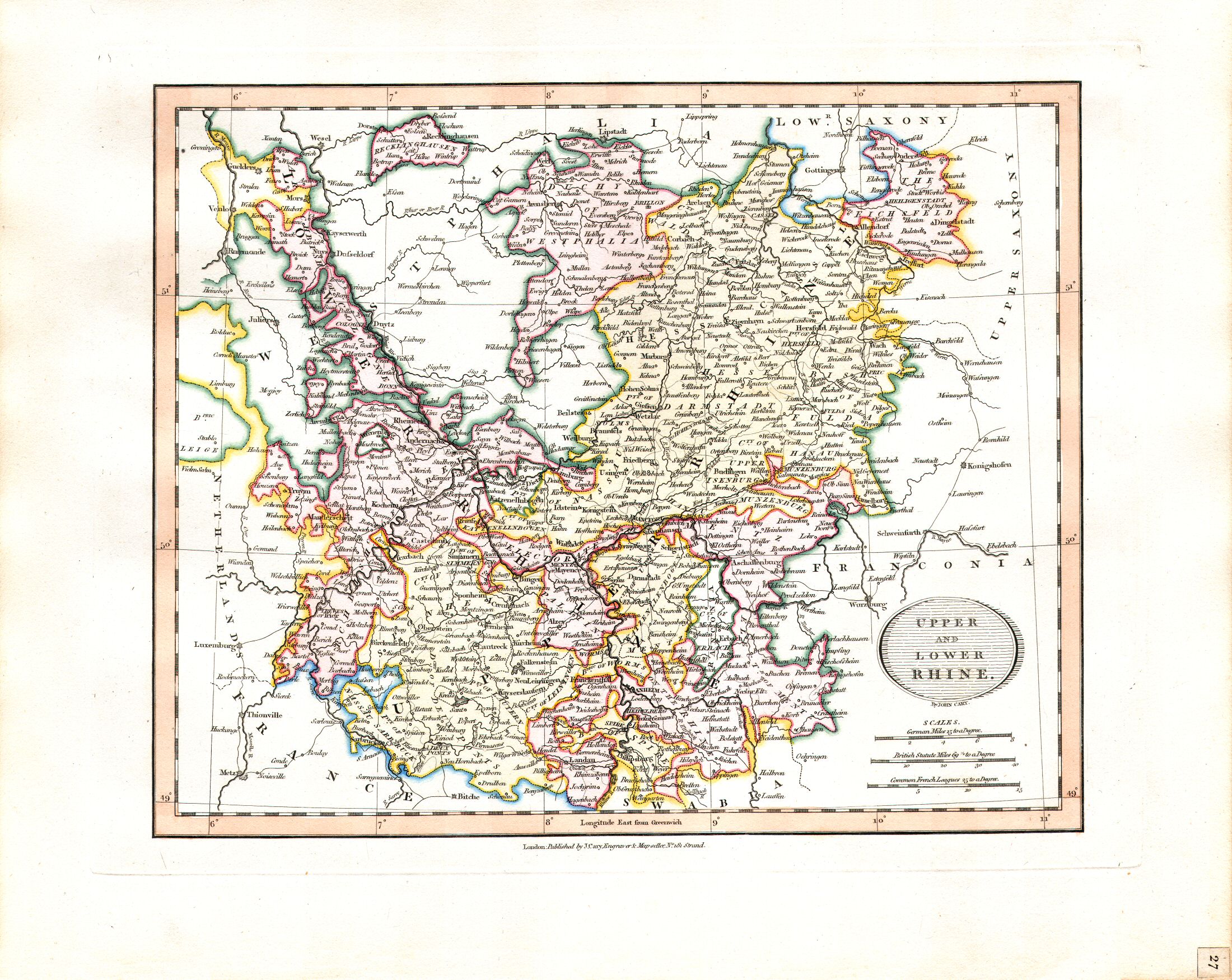
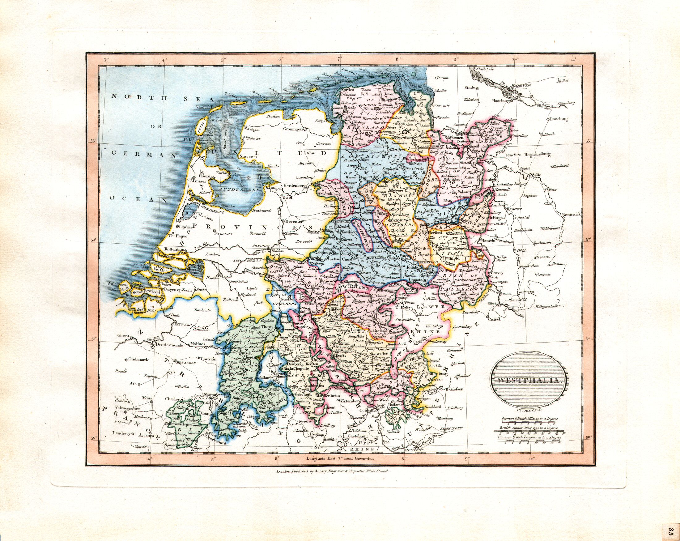
27. Upper and Lower Rhine
Opper- en Nederrijn
 Cary's New Universal Atlas, 1819
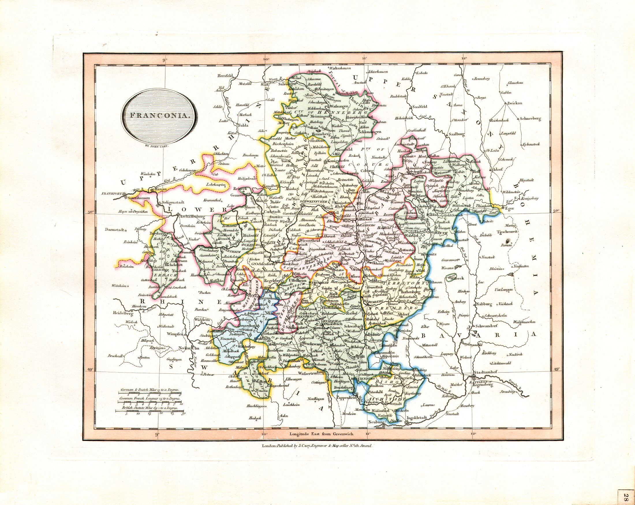
28. Franconia
Franken
 Cary's New Universal Atlas, 1819
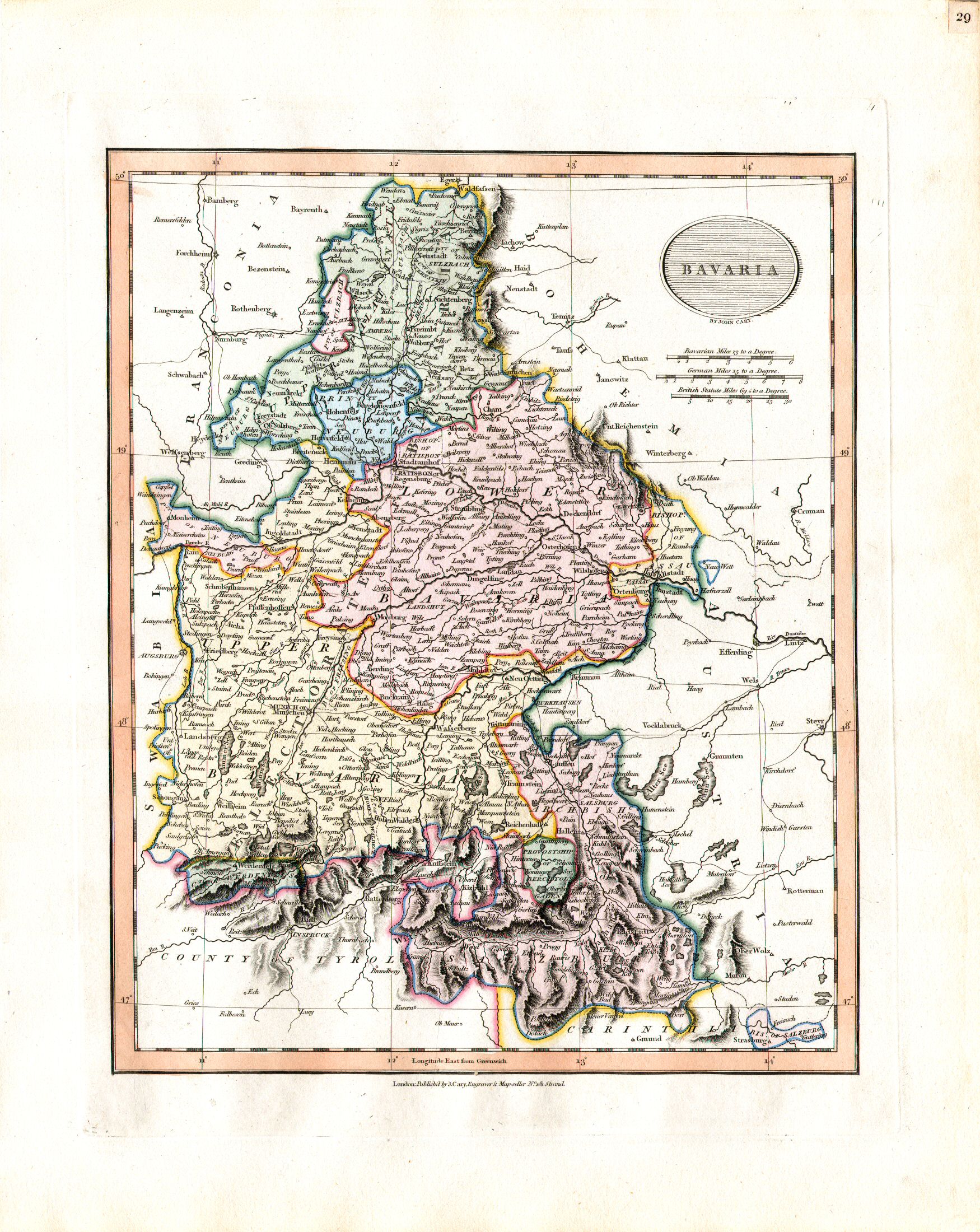
29. Bavaria
Beieren
 Cary's New Universal Atlas, 1819
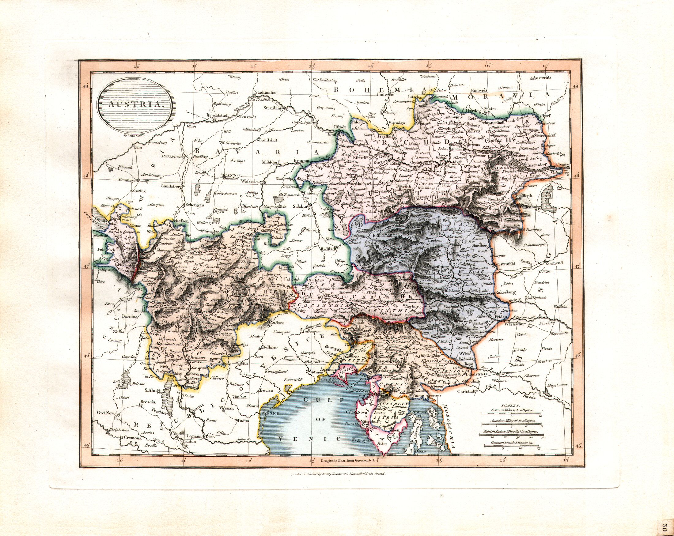
30. Austria
Oostenrijk
 Cary's New Universal Atlas, 1819
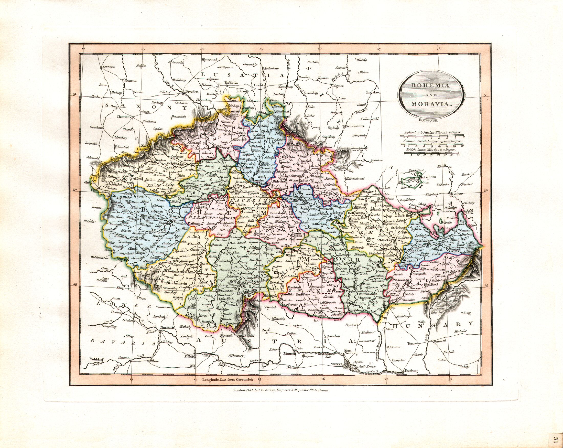
31. Bohemia and Moravia
Bohemen en Moravië
 Cary's New Universal Atlas, 1819
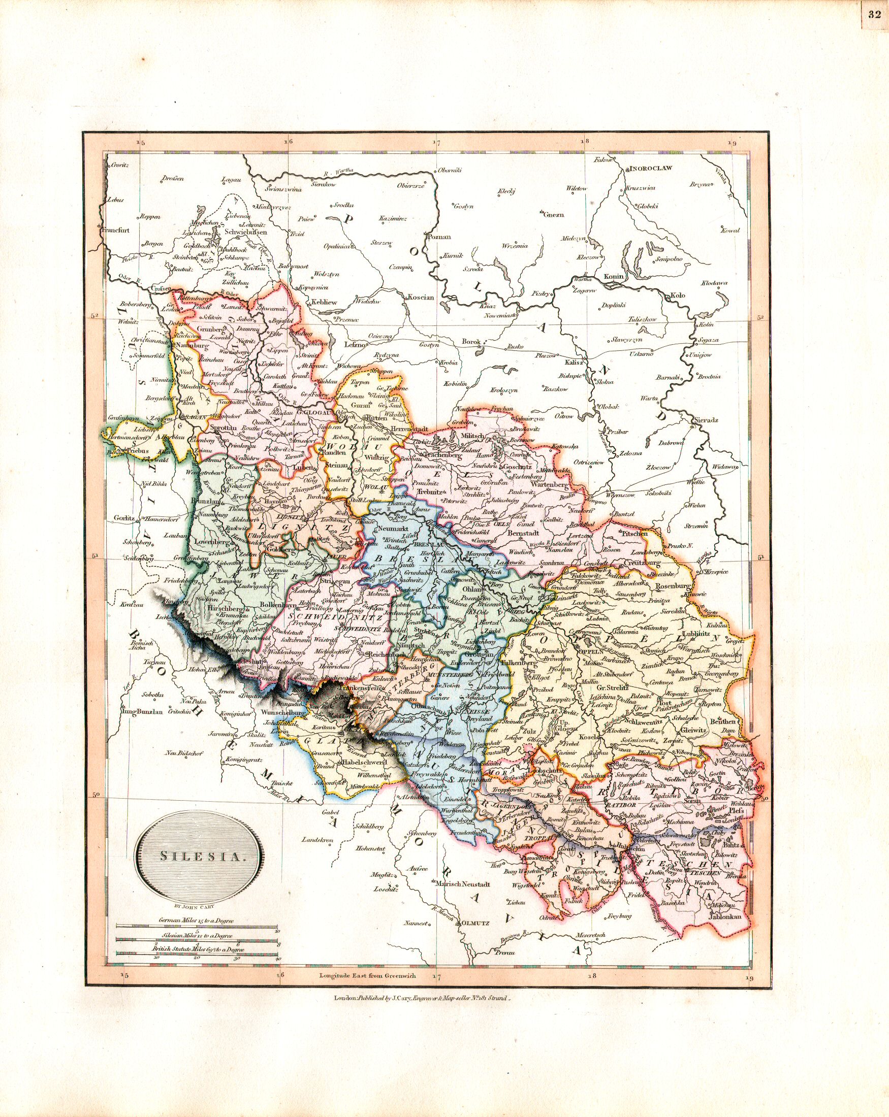
32. Silesia
Silezië
 Cary's New Universal Atlas, 1819
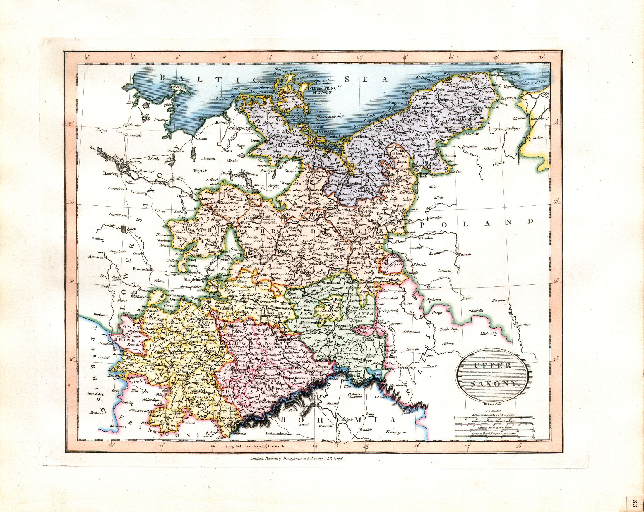
33. Upper Saxony
Oppersaksen
 Cary's New Universal Atlas, 1819
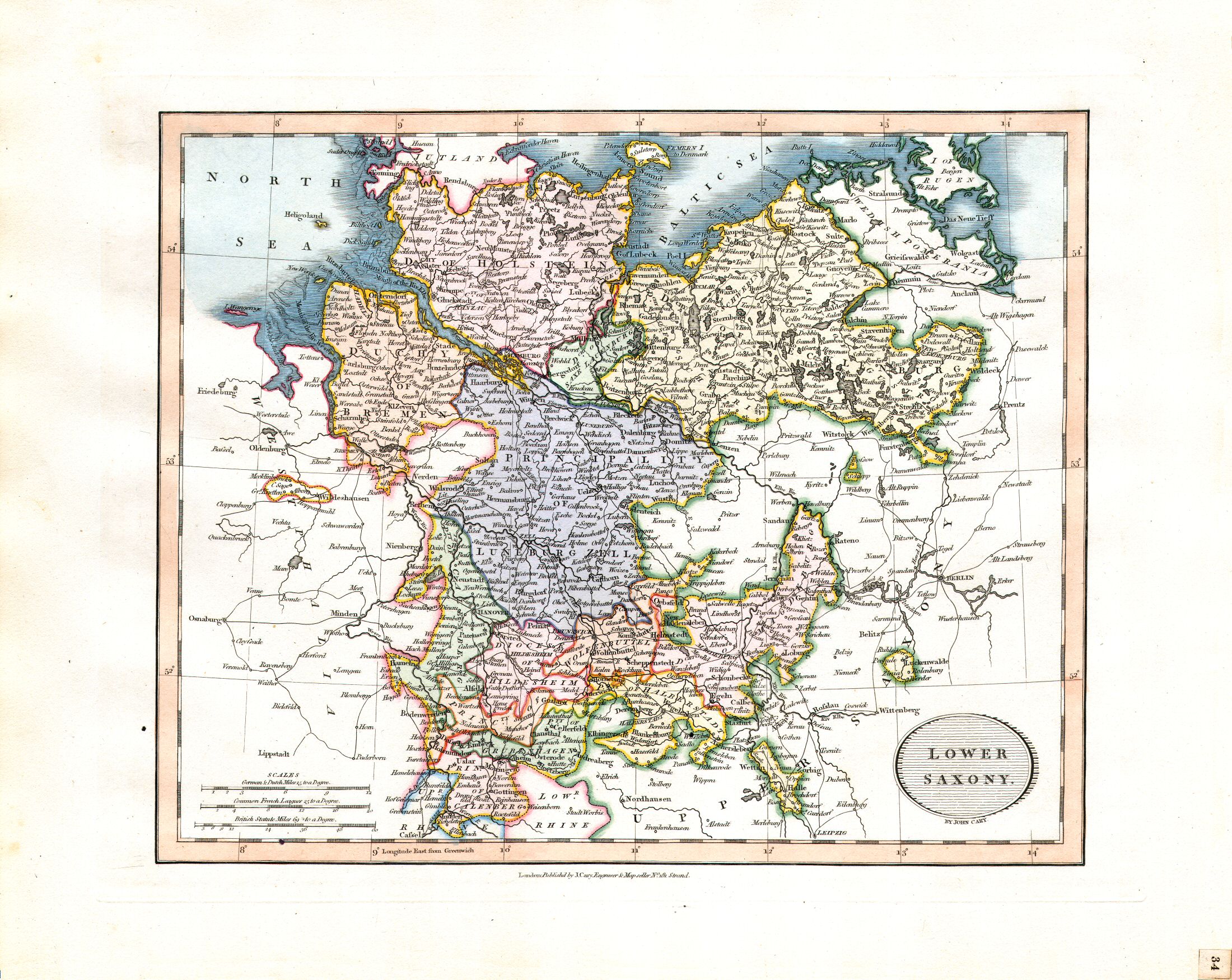
34. Lower Saxony
Nedersaksen
 Cary's New Universal Atlas, 1819
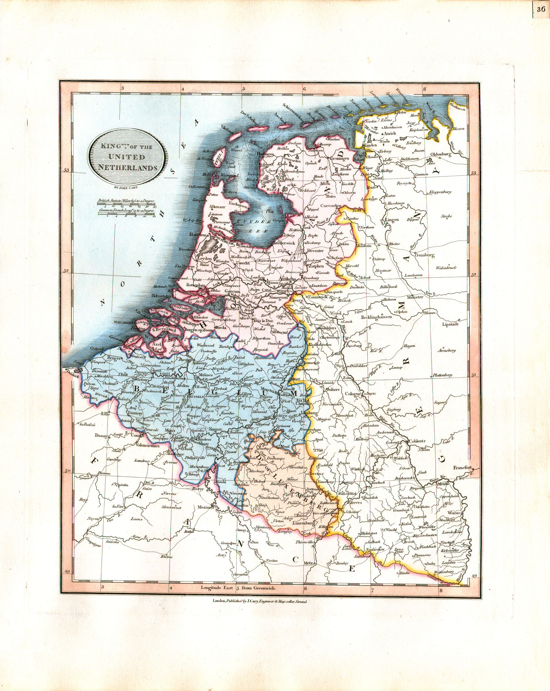
36. Kingdom of the United Netherlands
Koninkrijk der Nederlanden XL
 Cary's New Universal Atlas, 1819
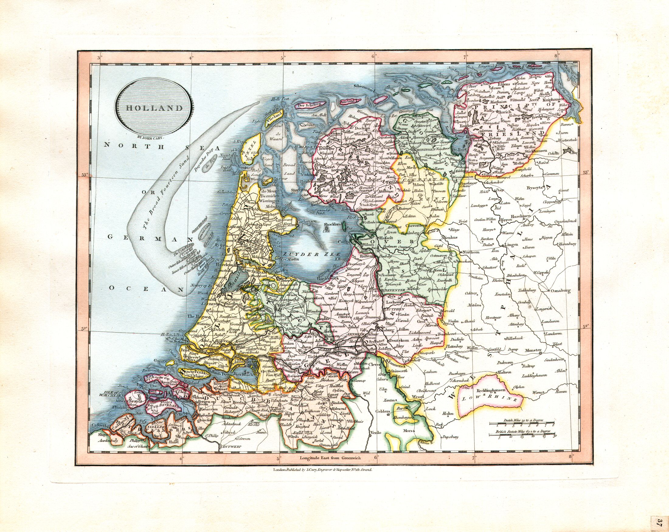
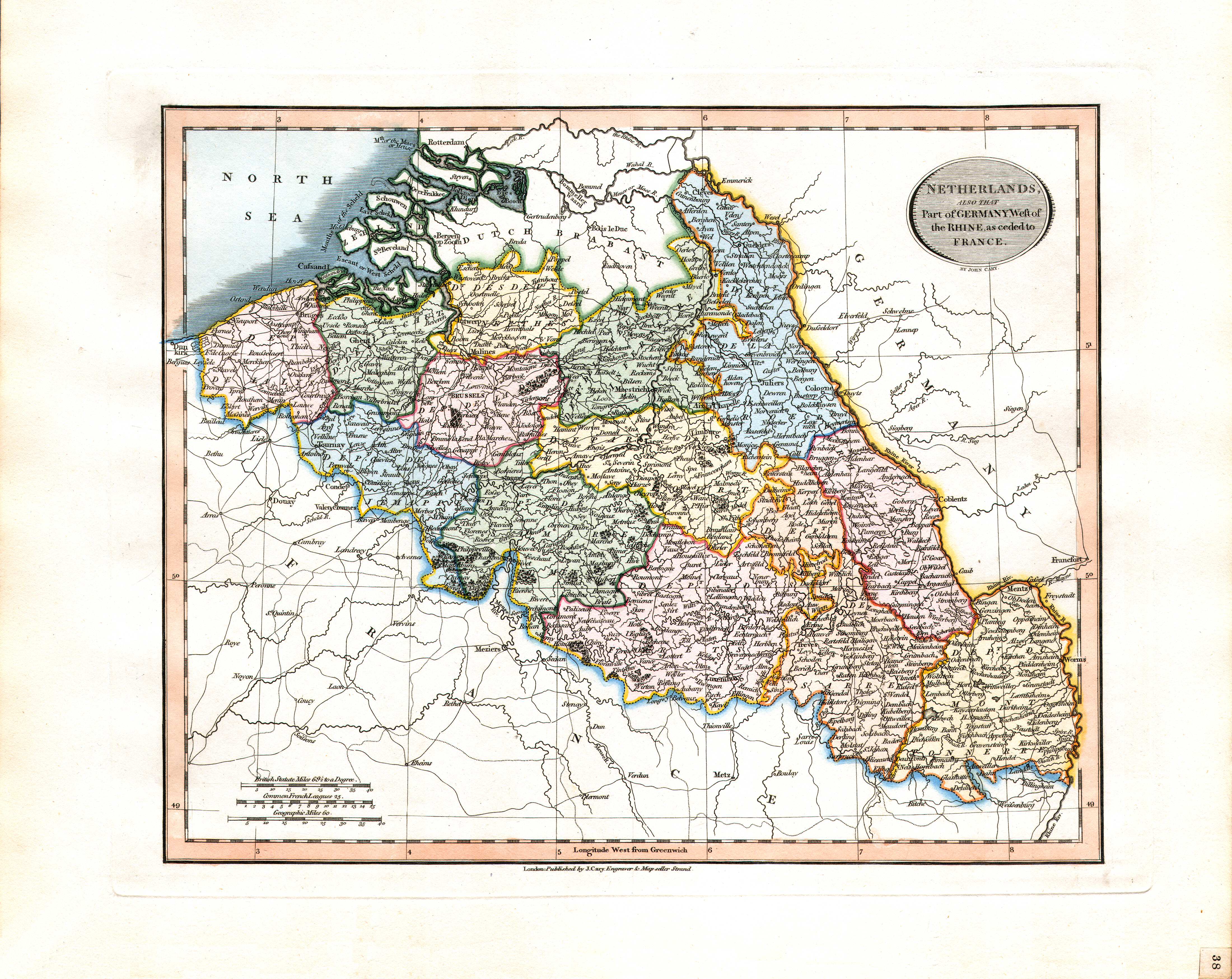
38. Netherlands, also that Part of Germany, West of the Rhine, as ceded to France
Zuidelijke Nederlanden, en het Duitse gebied ten westen van de Rijn, geannexeerd door Frankrijk XL
 Cary's New Universal Atlas, 1819
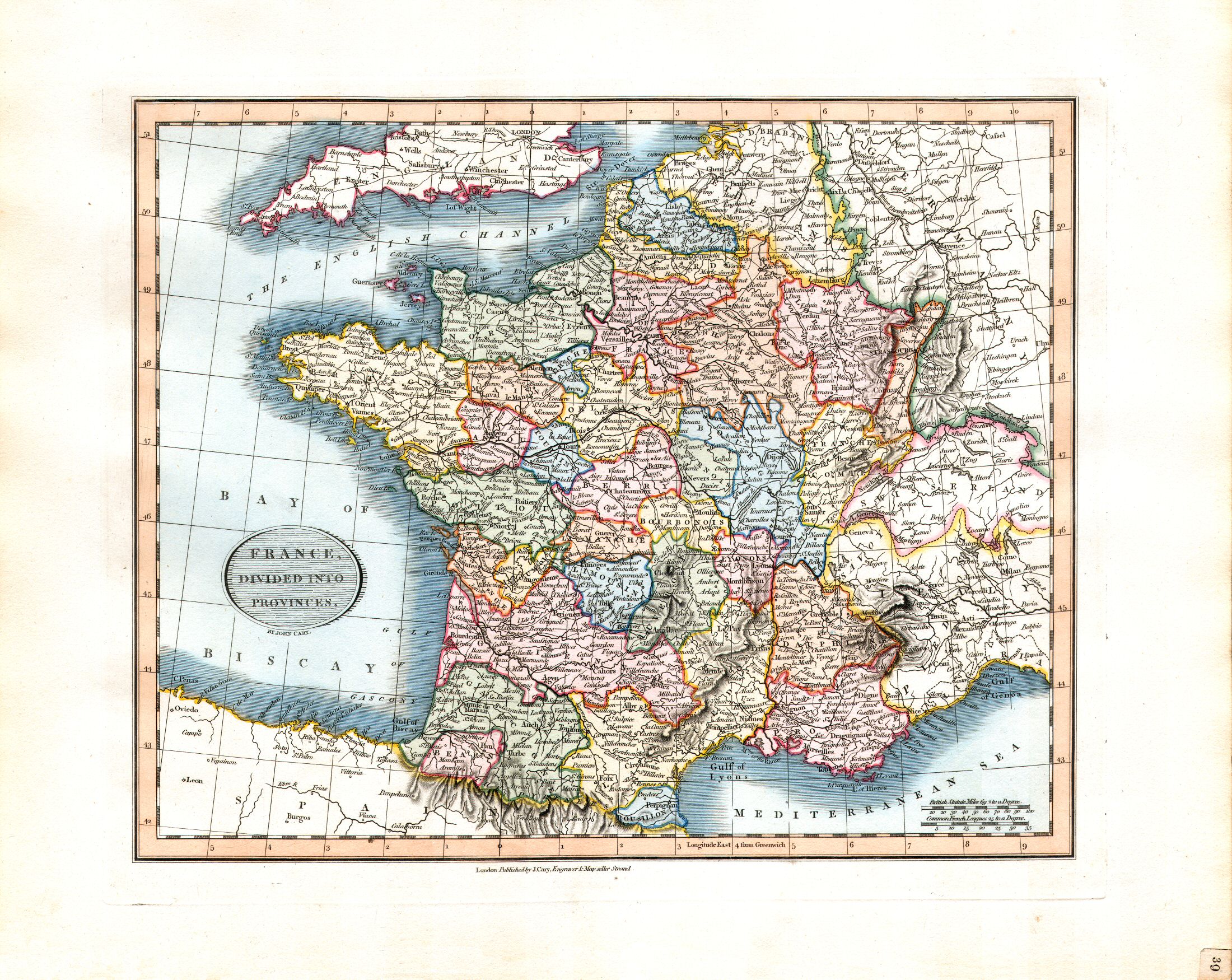
39. France, divided into Provinces
Frankrijk, ingedeeld in provincies (tot 1789)
 Cary's New Universal Atlas, 1819
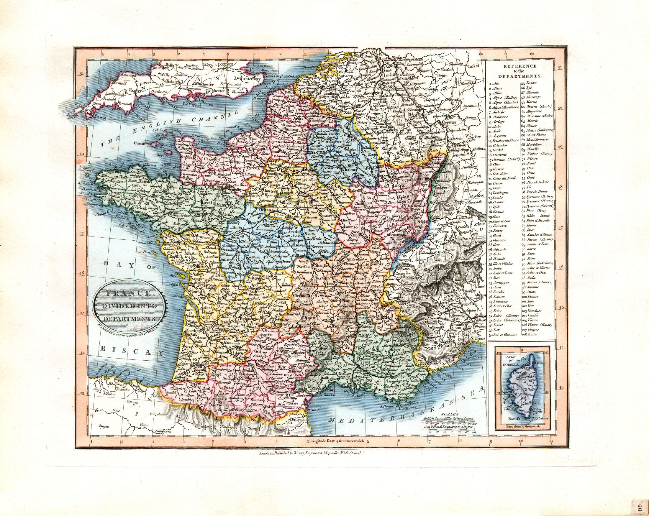
40. France, divided into Departments
Frankrijk, ingedeeld in departementen (vanaf 1789)
 Cary's New Universal Atlas, 1819
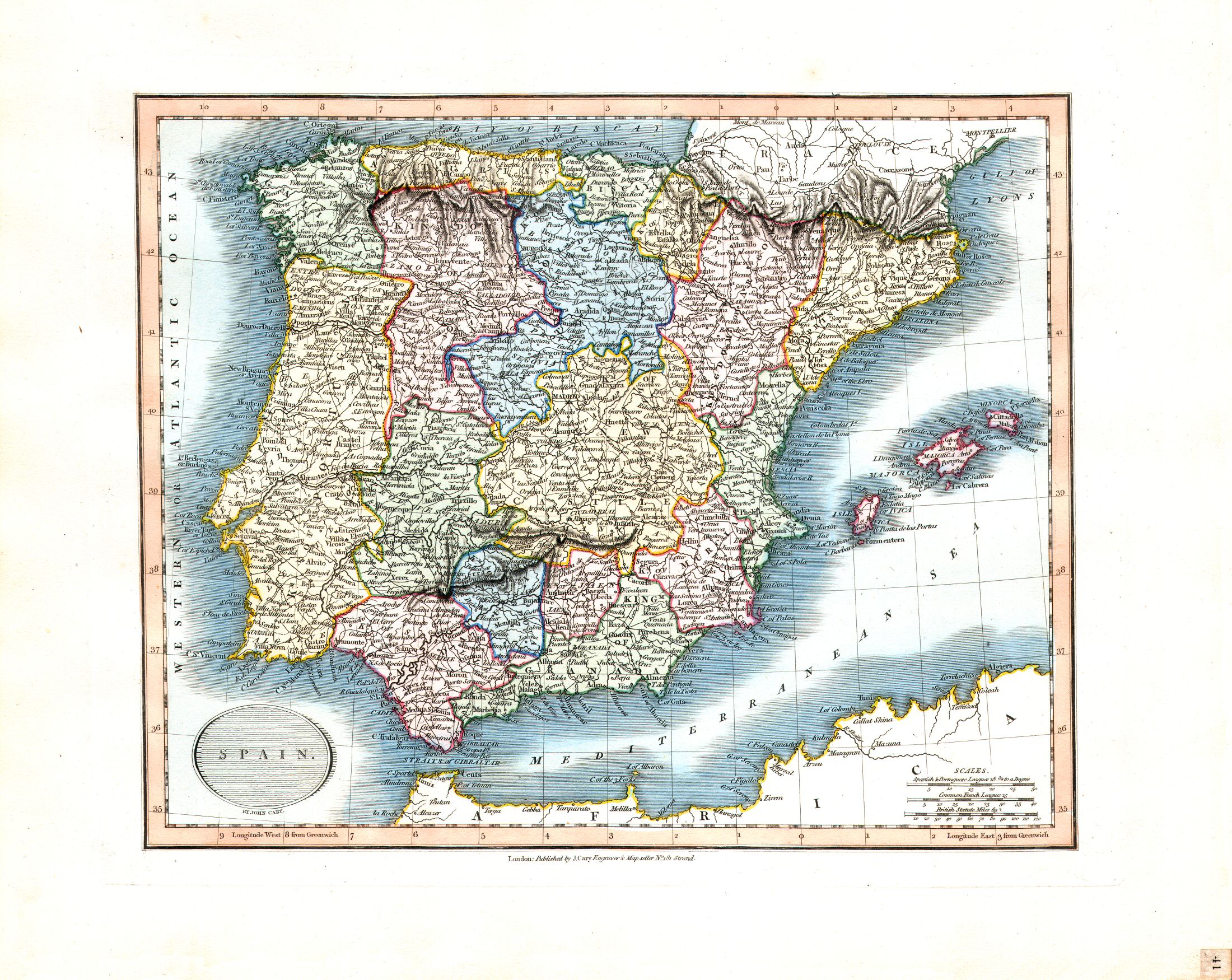
41. Spain
Spanje
 Cary's New Universal Atlas, 1819
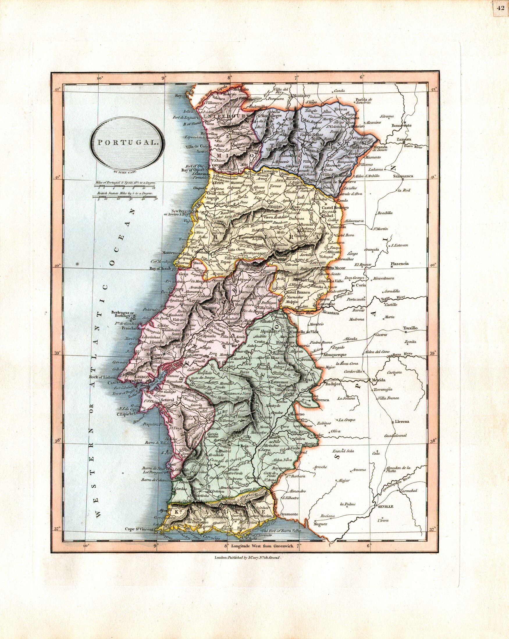
42. Portugal
Portugal
 Cary's New Universal Atlas, 1819
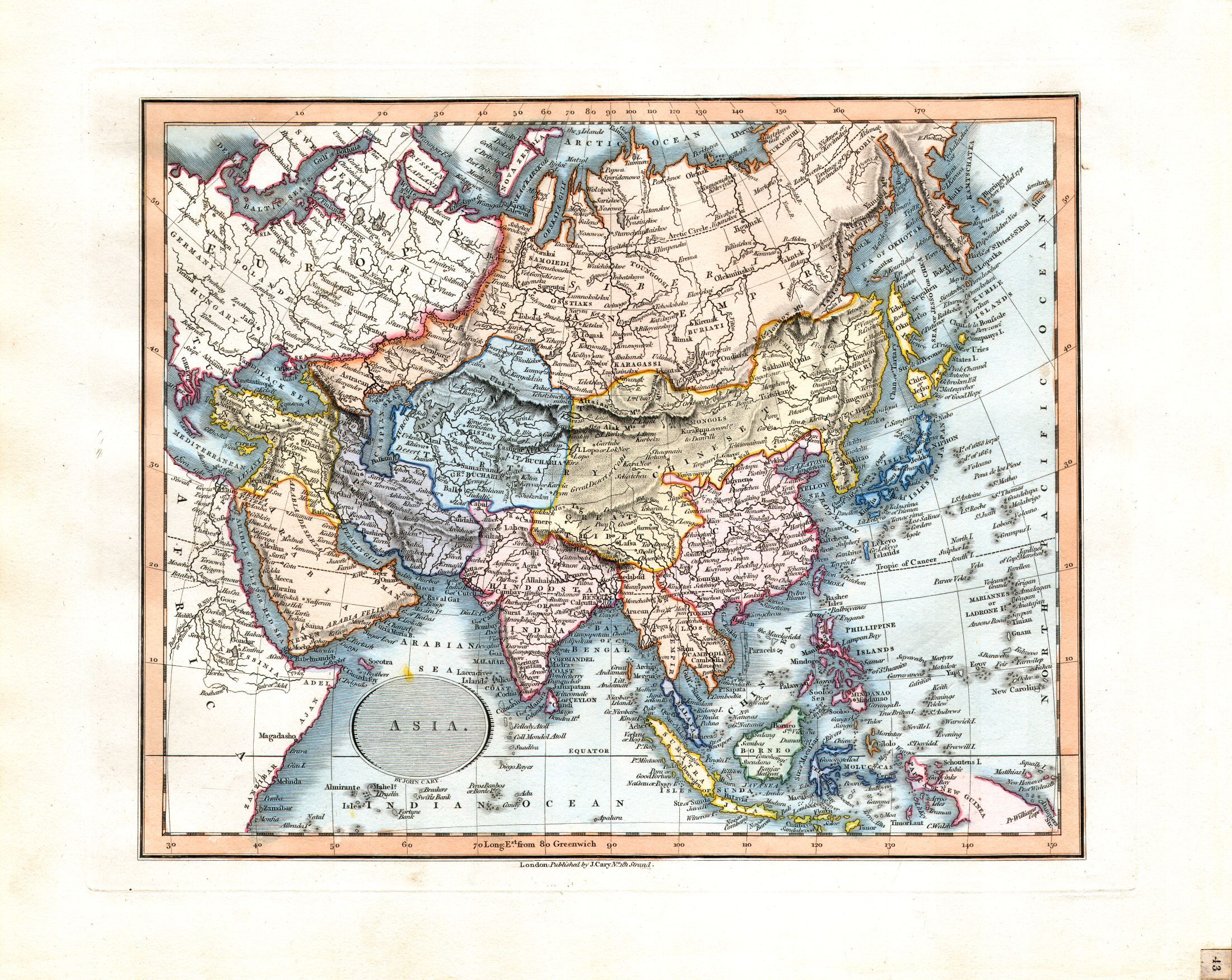
43. Asia
Azië
 Cary's New Universal Atlas, 1819
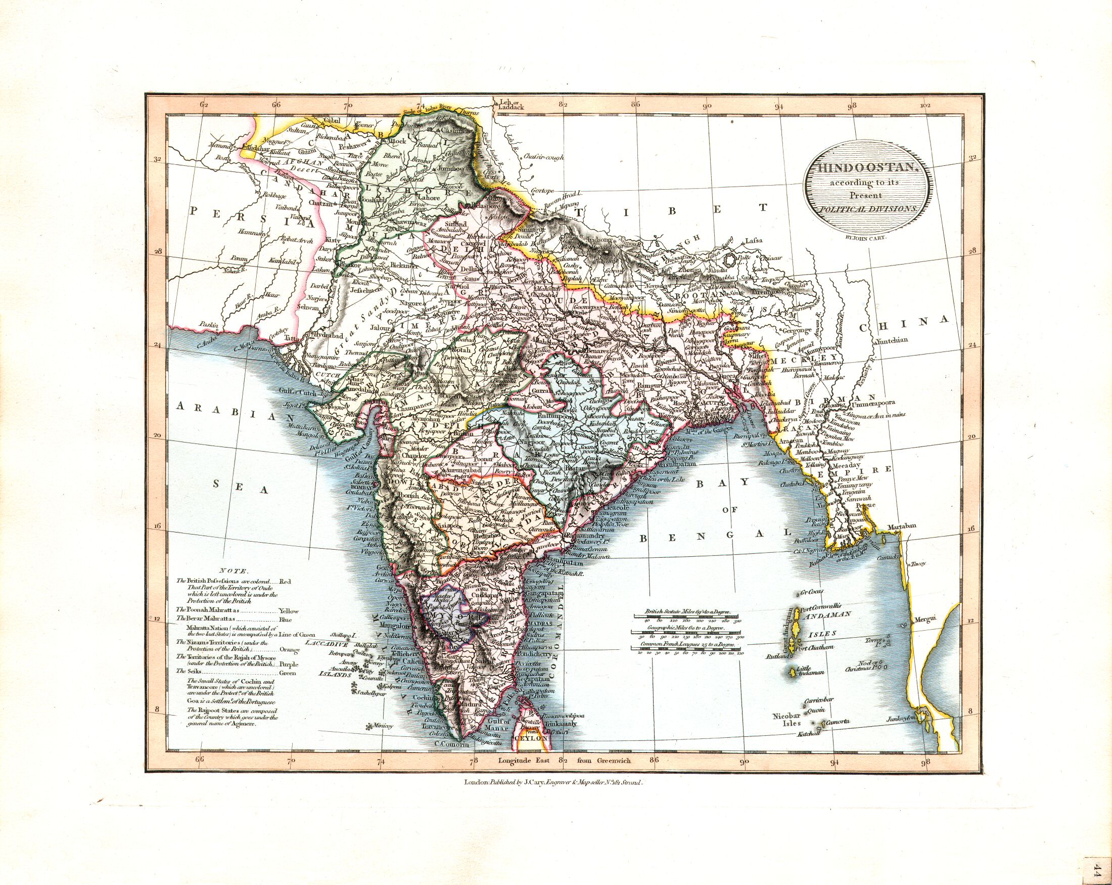
44. Hindoostan, according to its Present Political Divisions
Hindoestan, huidige indeling
 Cary's New Universal Atlas, 1819
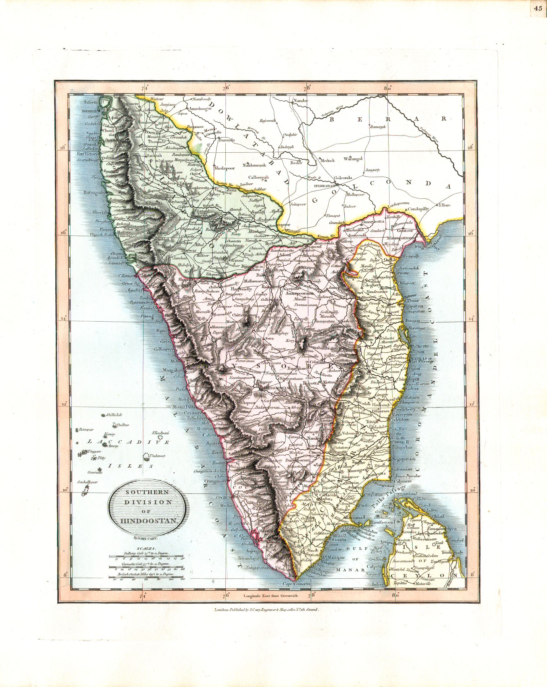
45. Southern Division of Hindoostan
Het zuiden van Hindoestan
 Cary's New Universal Atlas, 1819
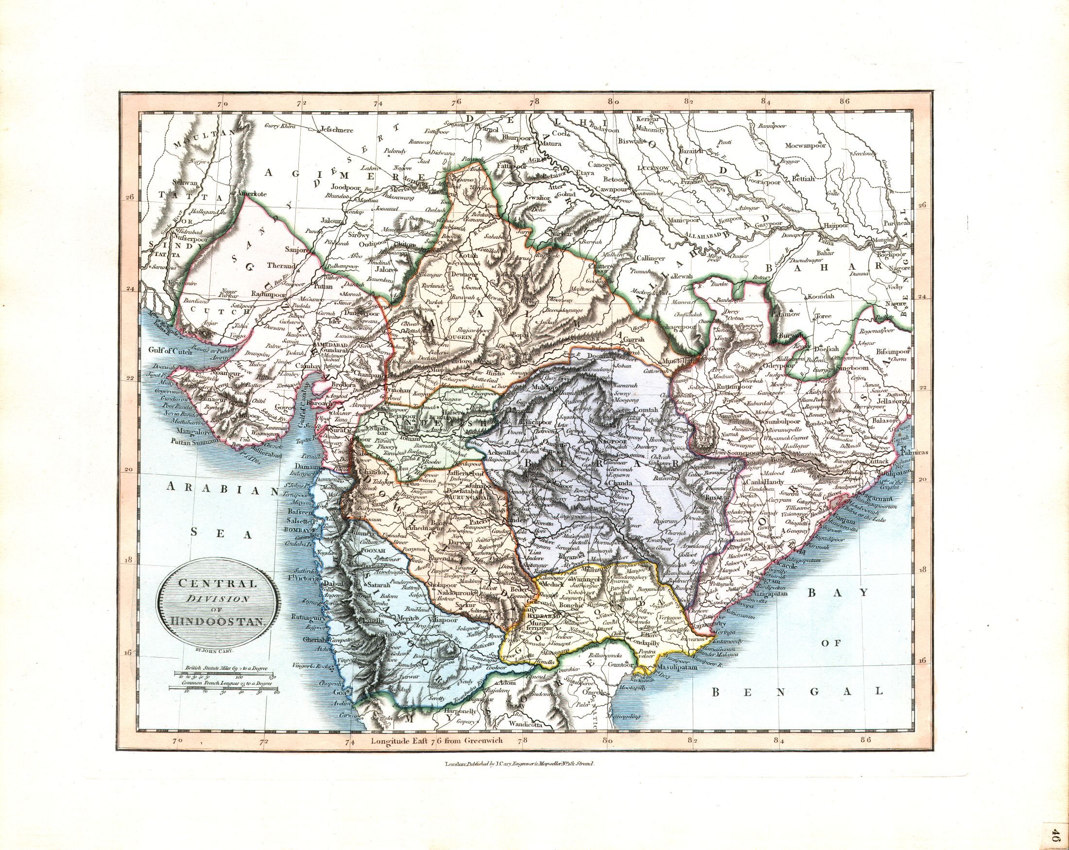
46. Central Division of Hindoostan
Het midden van Hindoestan
 Cary's New Universal Atlas, 1819
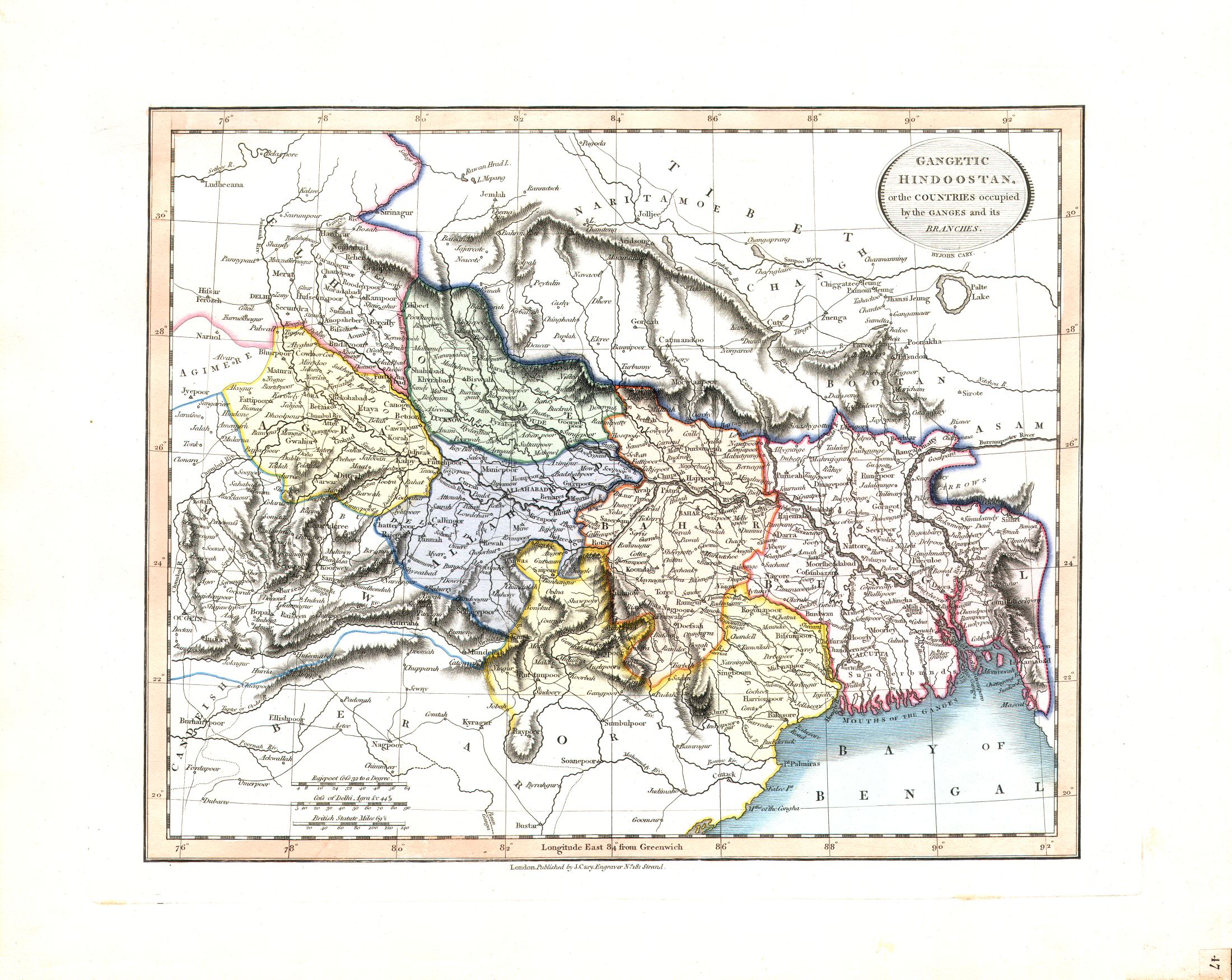
47. Gangetic Hindoostan, or the Countries occupied by the Ganges and its Branches
Hindoestan langs de Ganges
 Cary's New Universal Atlas, 1819
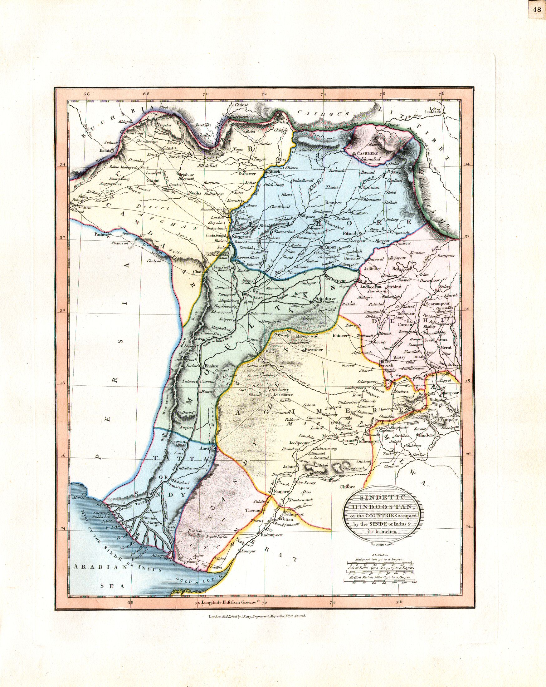
48. Sindetic Hindoostan, or the Countries occupied by the Sinde or Indus & its branches
Hindoestan langs de Indus
 Cary's New Universal Atlas, 1819
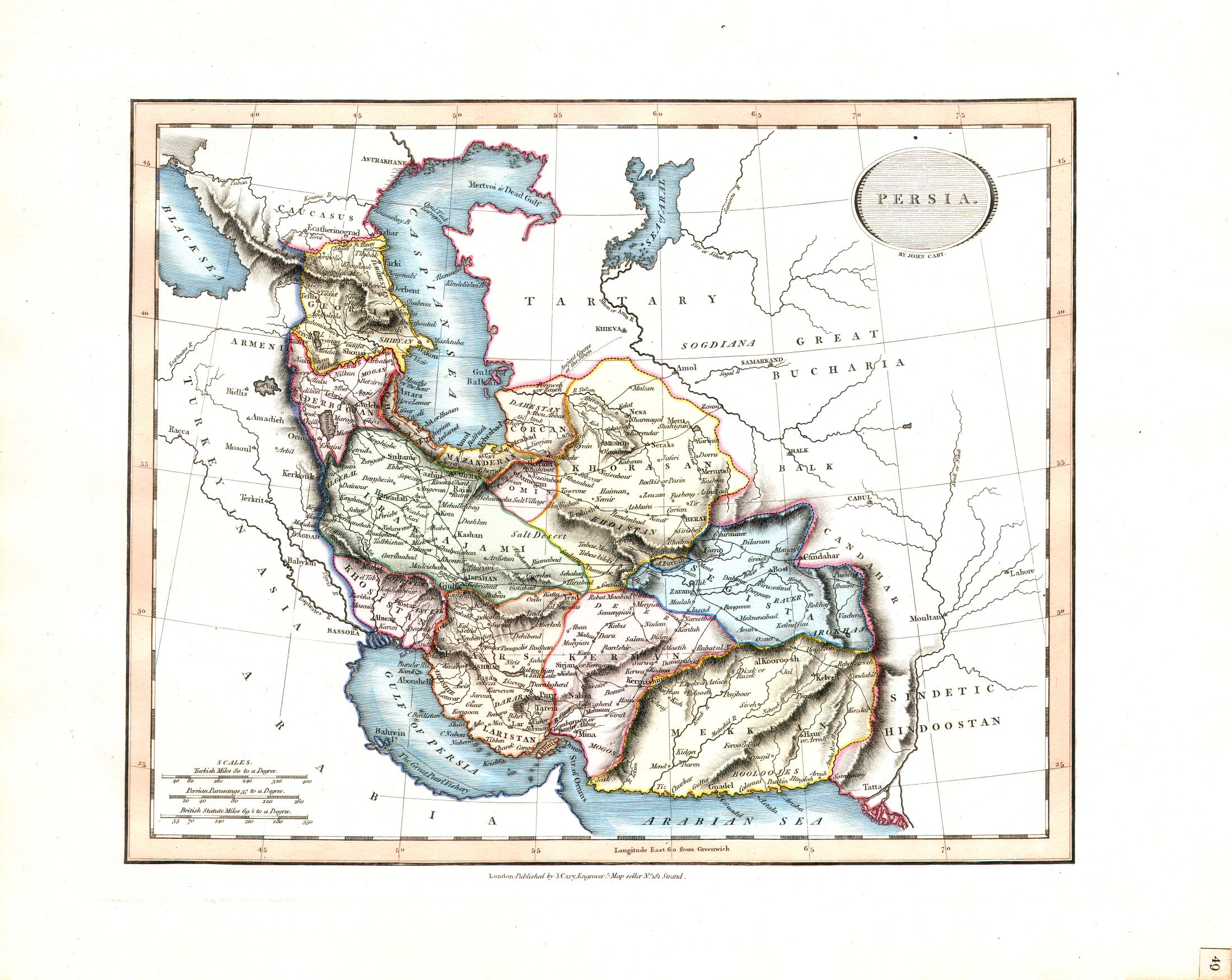
49. Persia
Perzië
 Cary's New Universal Atlas, 1819
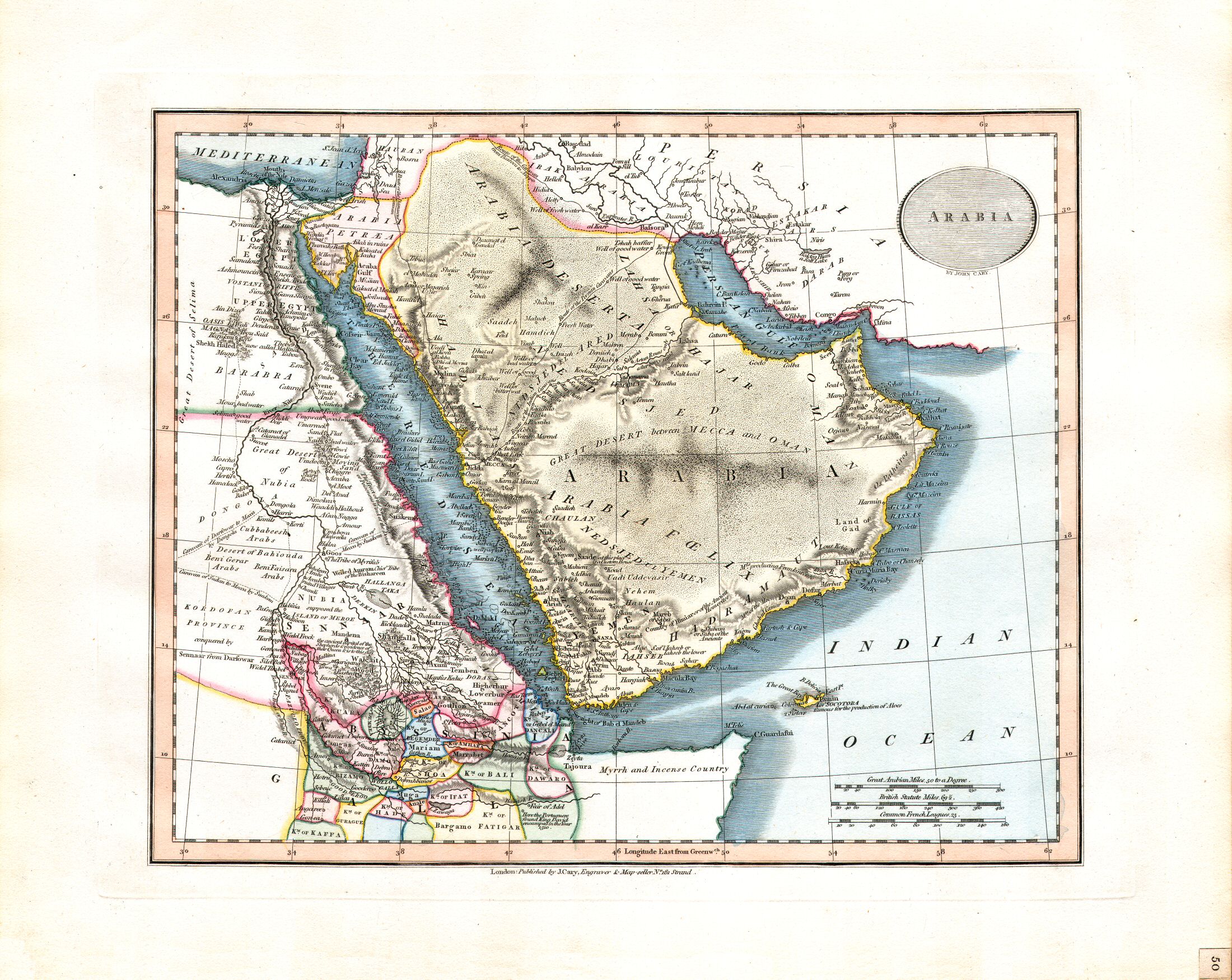
50. Arabia
Arabië
 Cary's New Universal Atlas, 1819
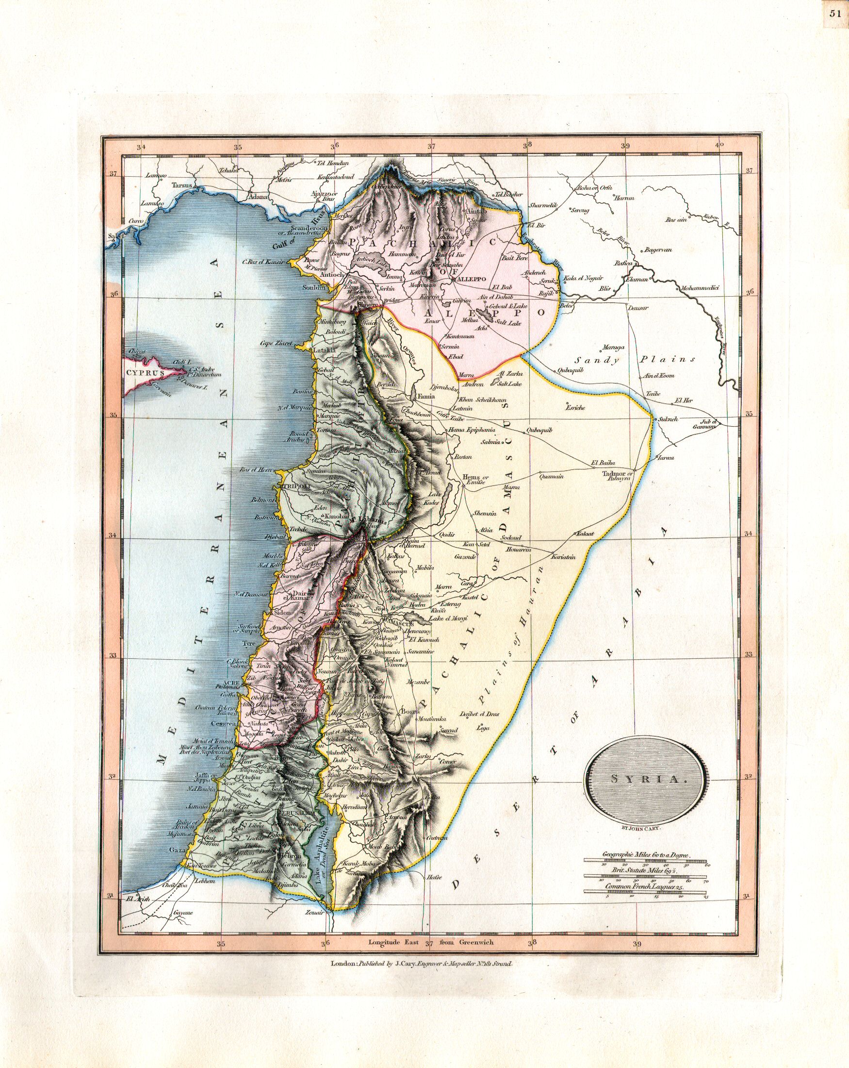
51. Syria
Syrië
 Cary's New Universal Atlas, 1819
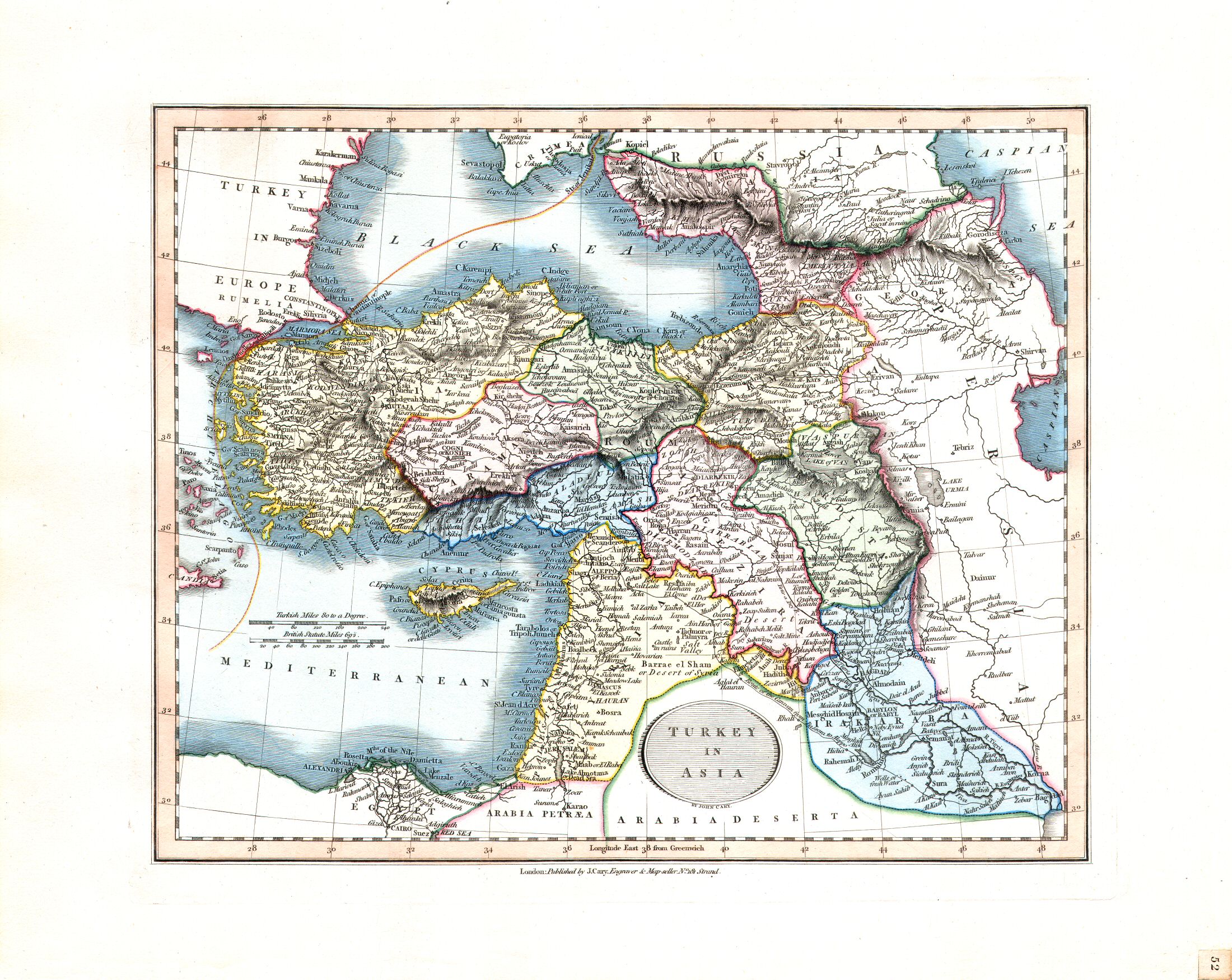
52. Turkey in Asia
Aziatisch Turkije
 Cary's New Universal Atlas, 1819
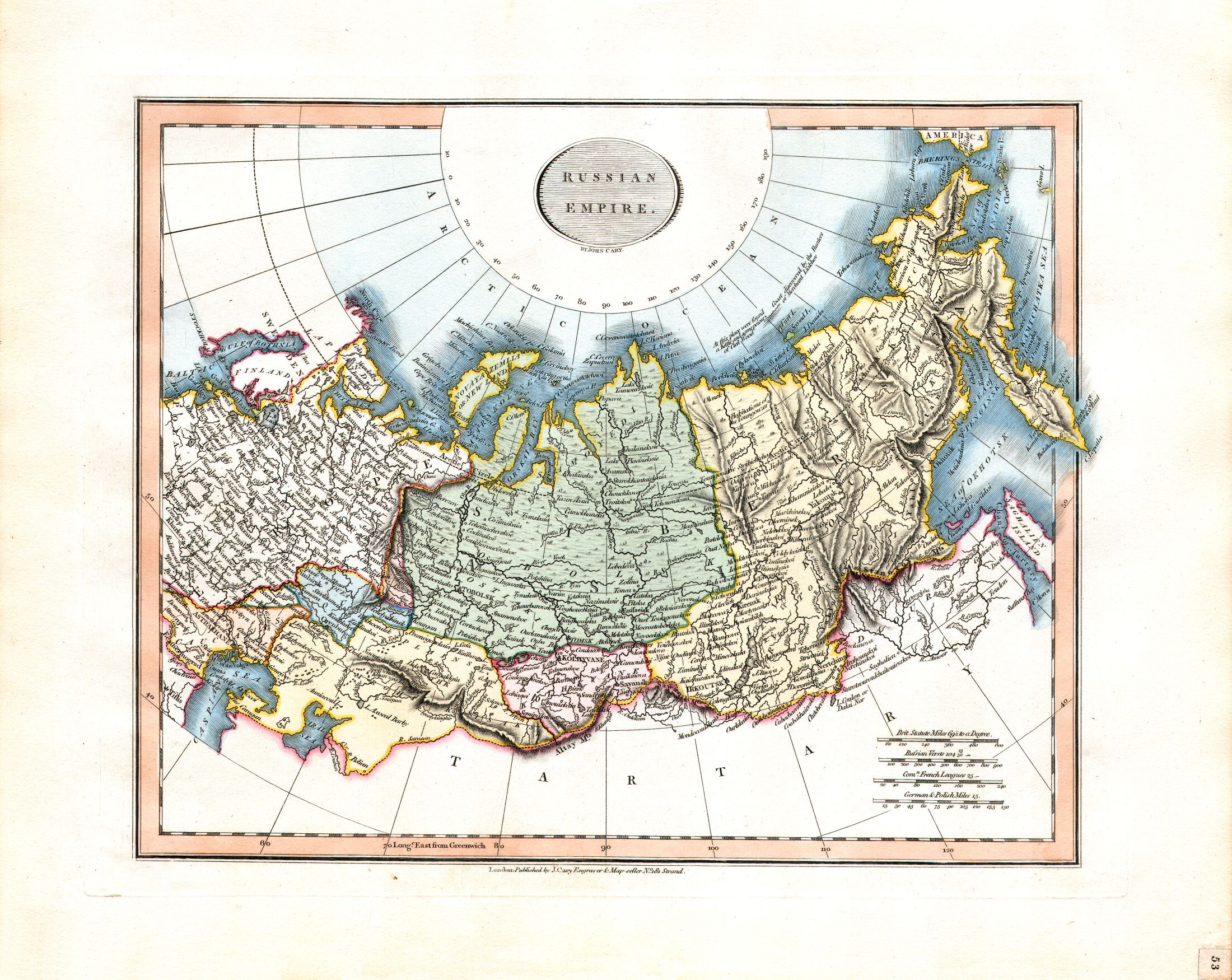
53. Russia in Asia
Aziatisch Rusland
 Cary's New Universal Atlas, 1819
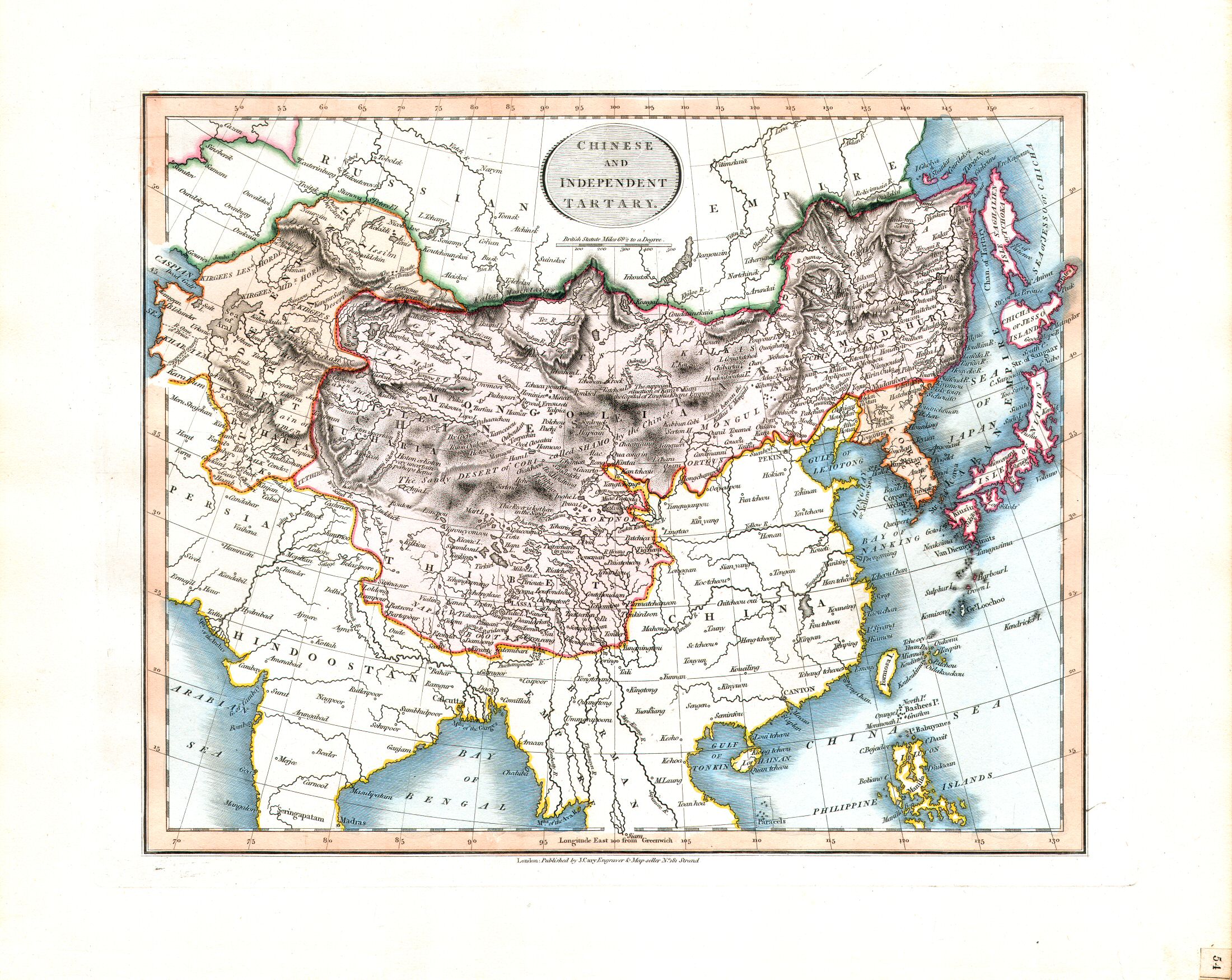
54. Chinese and Independent Tartary
Chinees en Onafhankelijk Tartarije
 Cary's New Universal Atlas, 1819
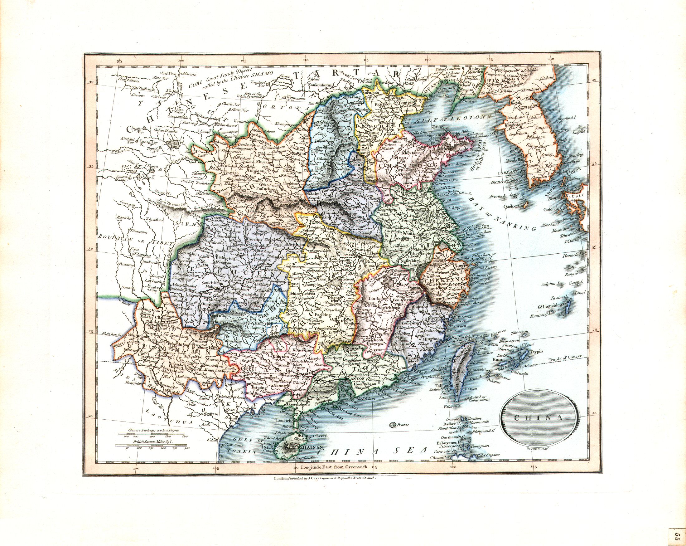
55. China
China
 Cary's New Universal Atlas, 1819
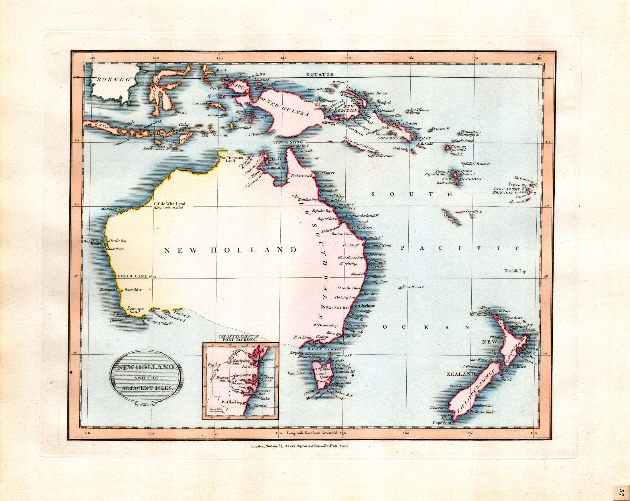
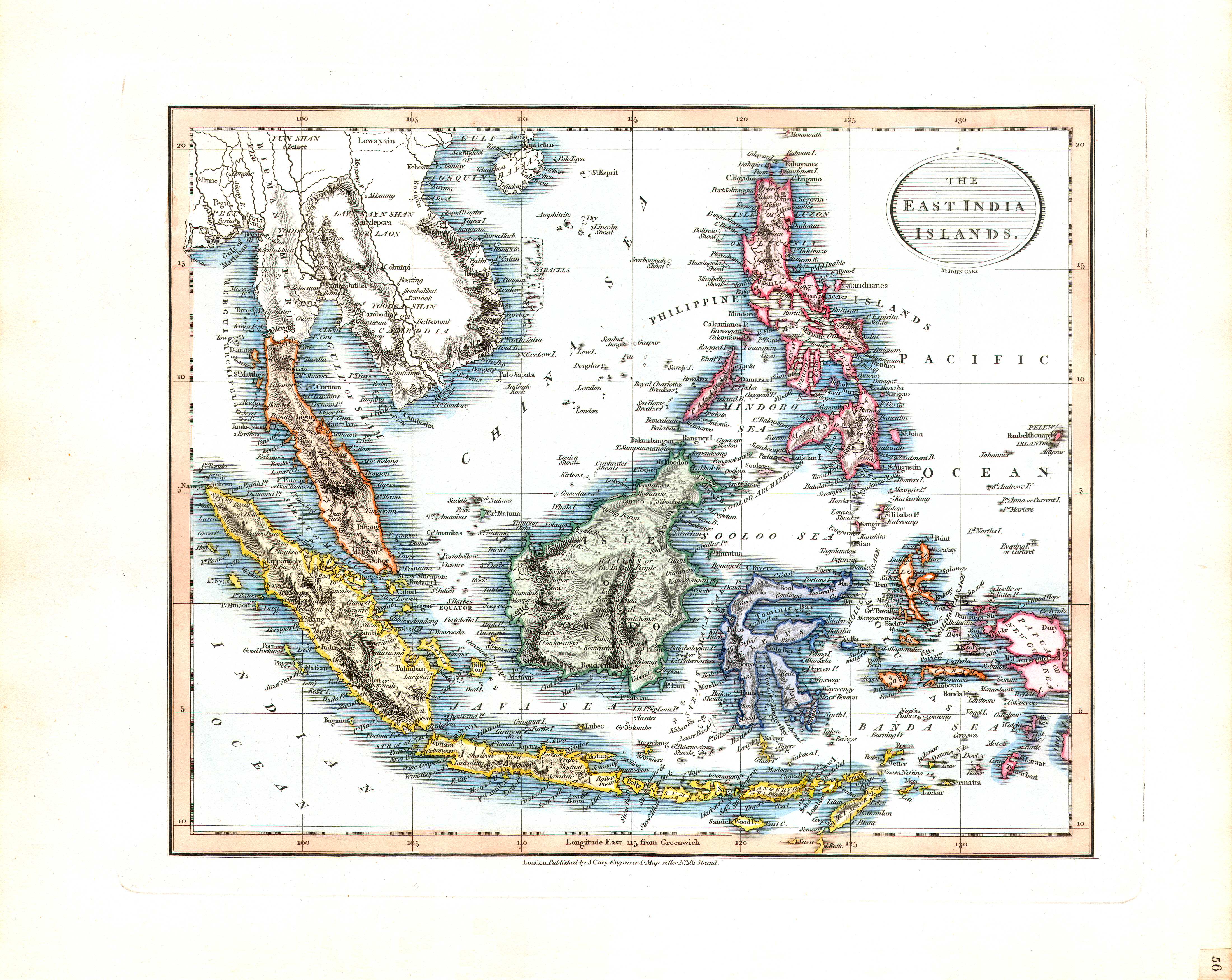
57. New Holland and the Adjacent Isles
Nieuw-Holland en naburige eilanden
 Cary's New Universal Atlas, 1819
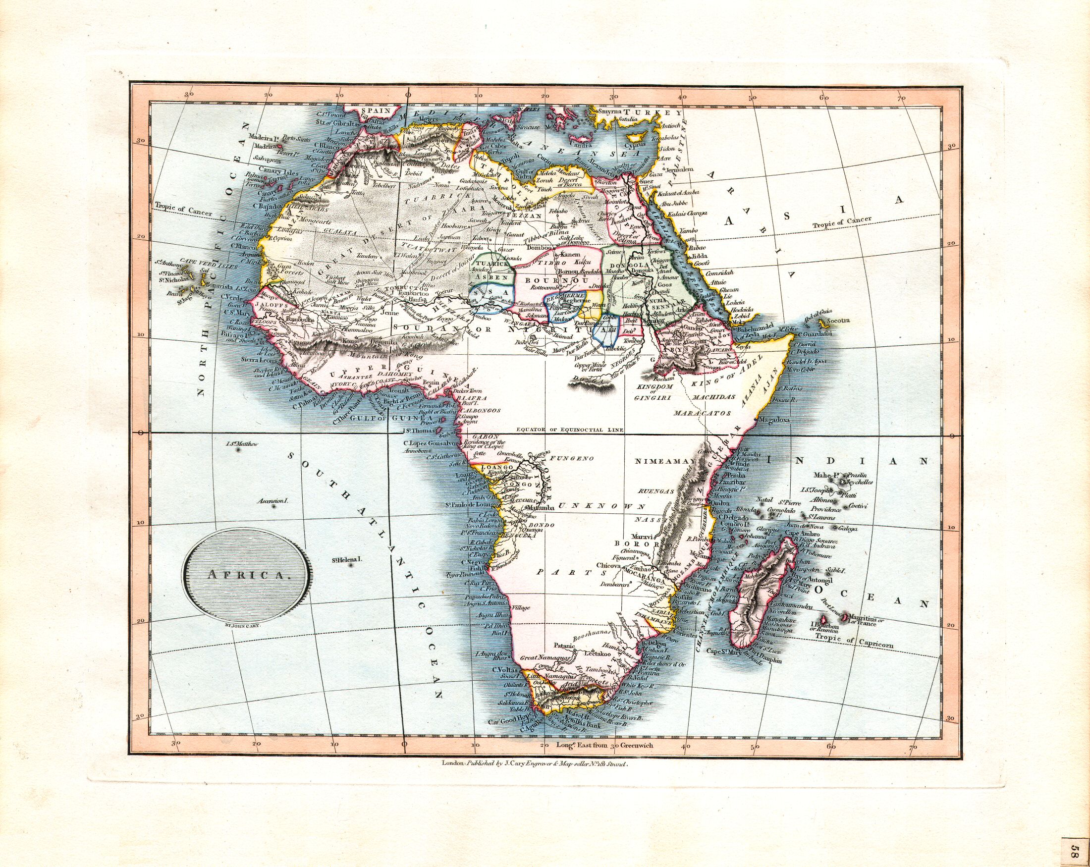
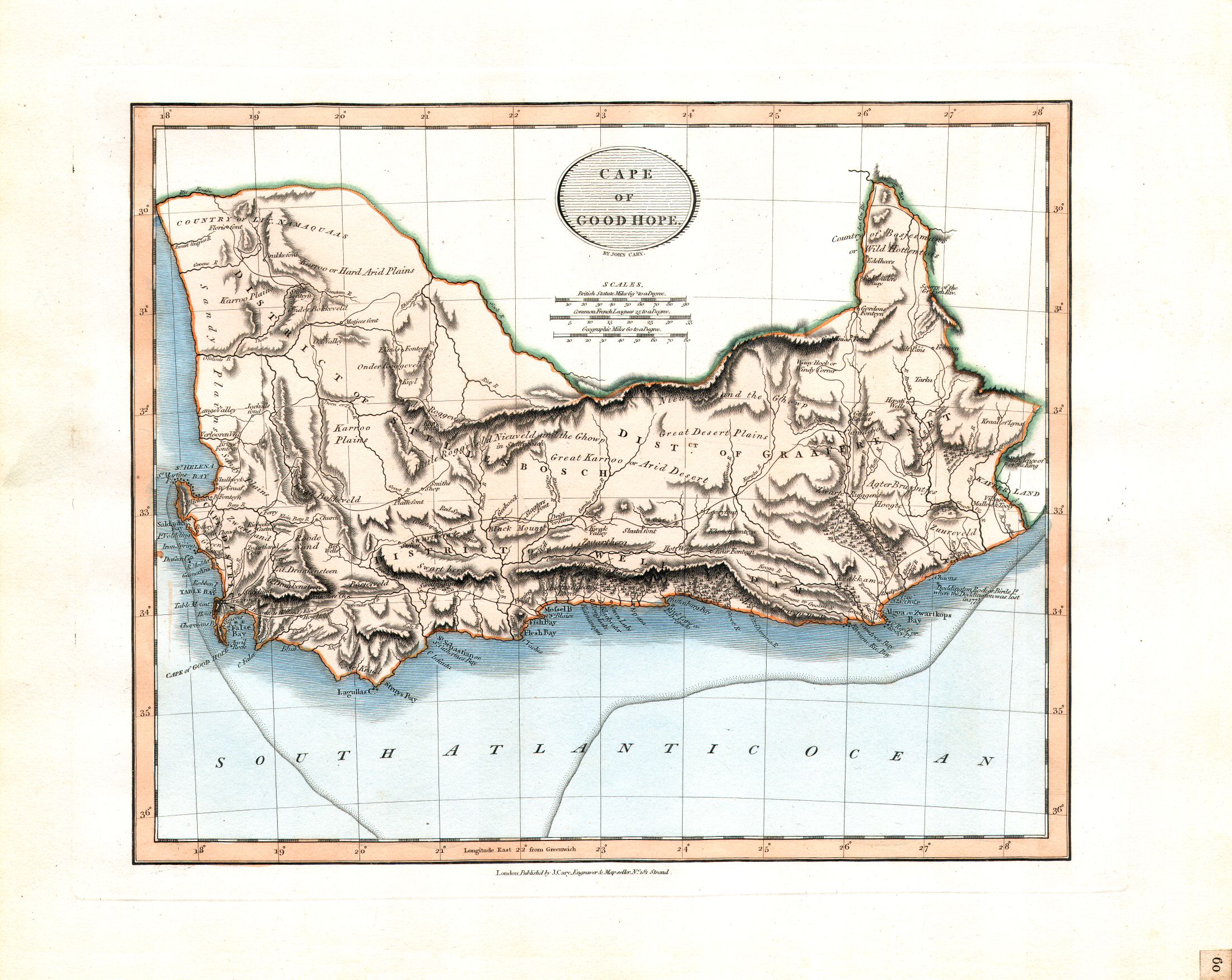
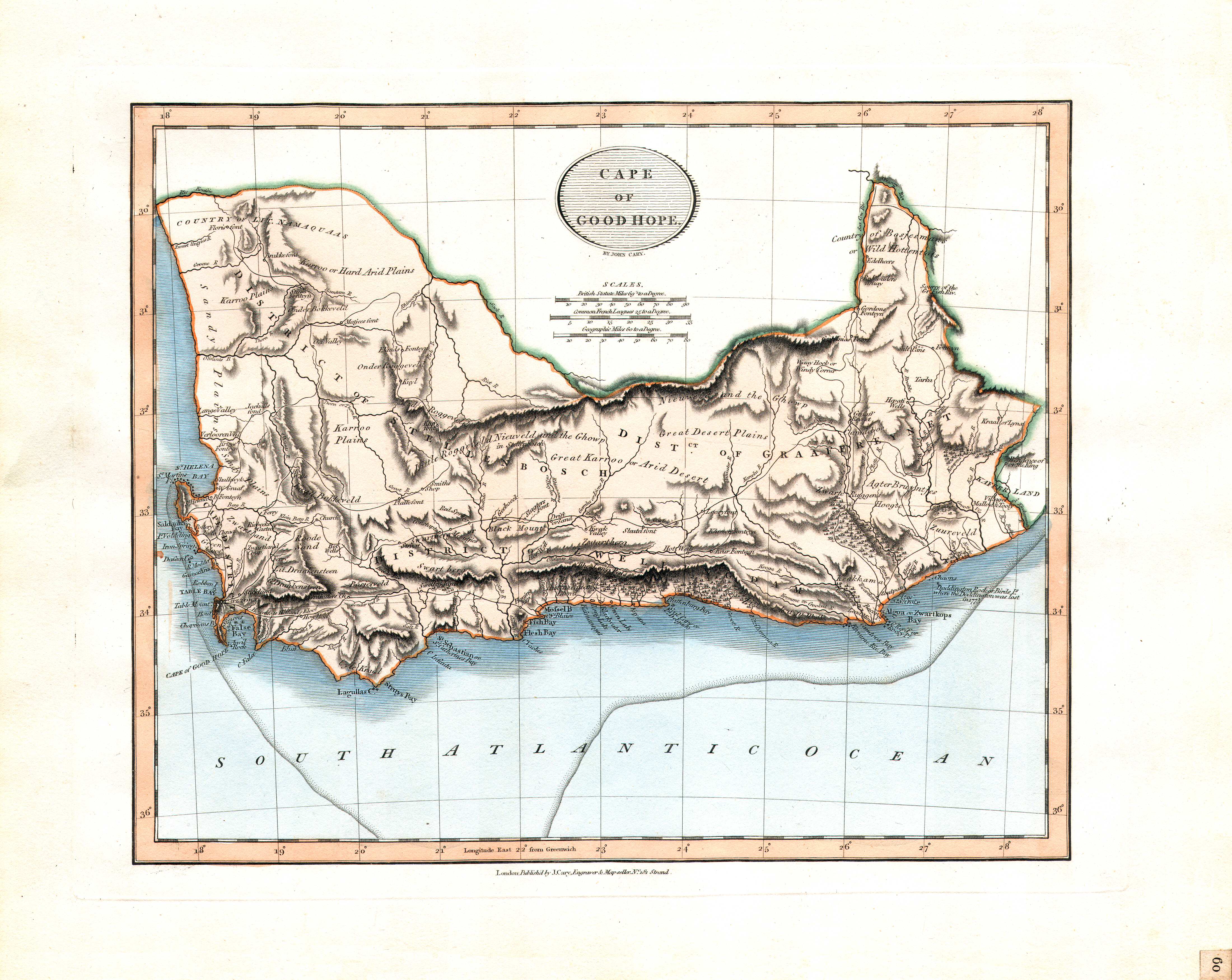
58. Africa
Afrika
 Cary's New Universal Atlas, 1819
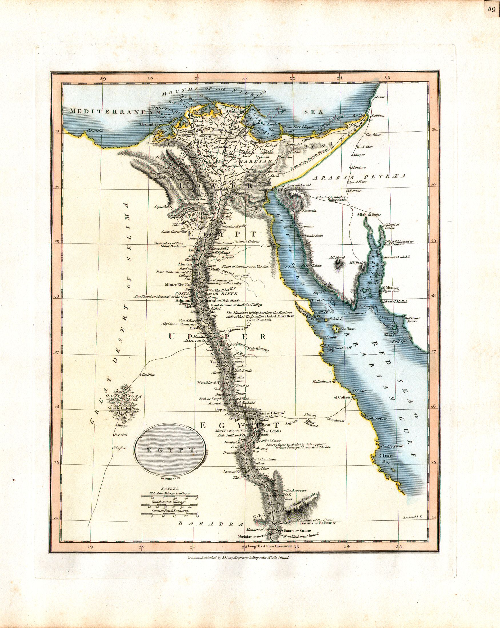
59. Egypt
Egypte
 Cary's New Universal Atlas, 1819
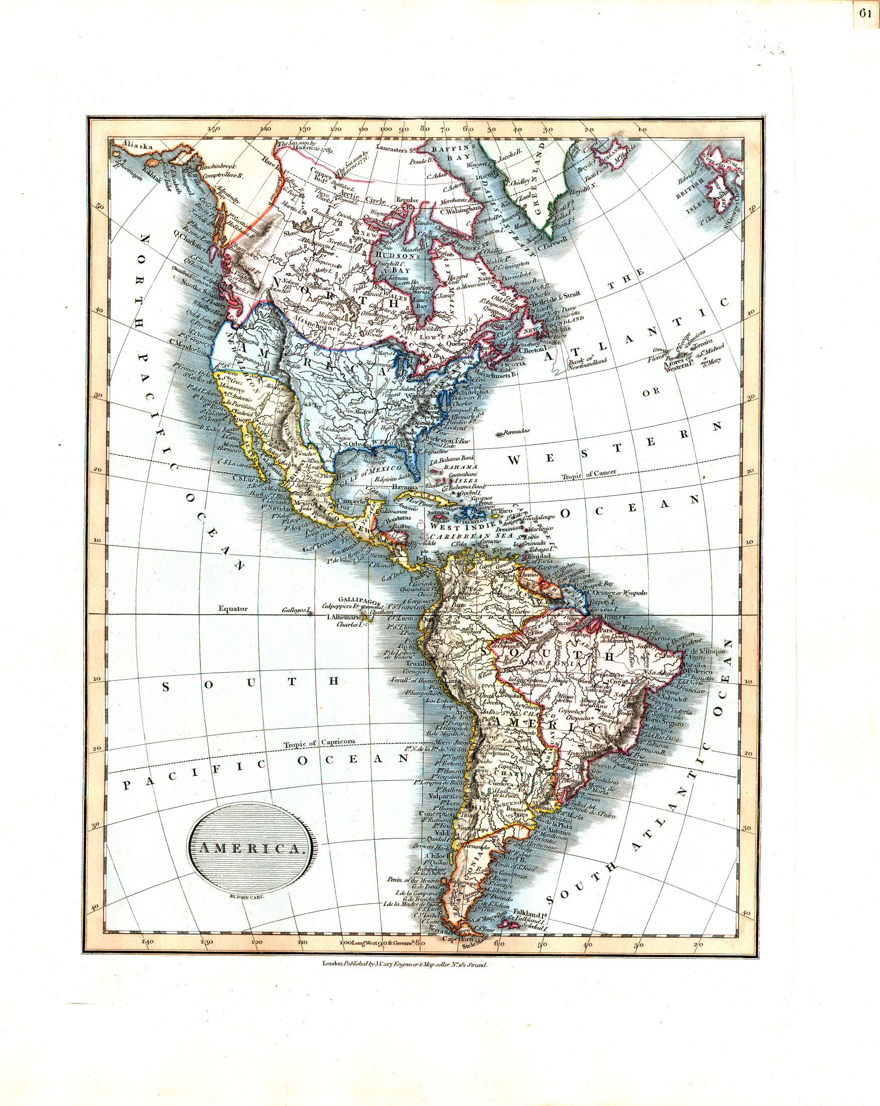
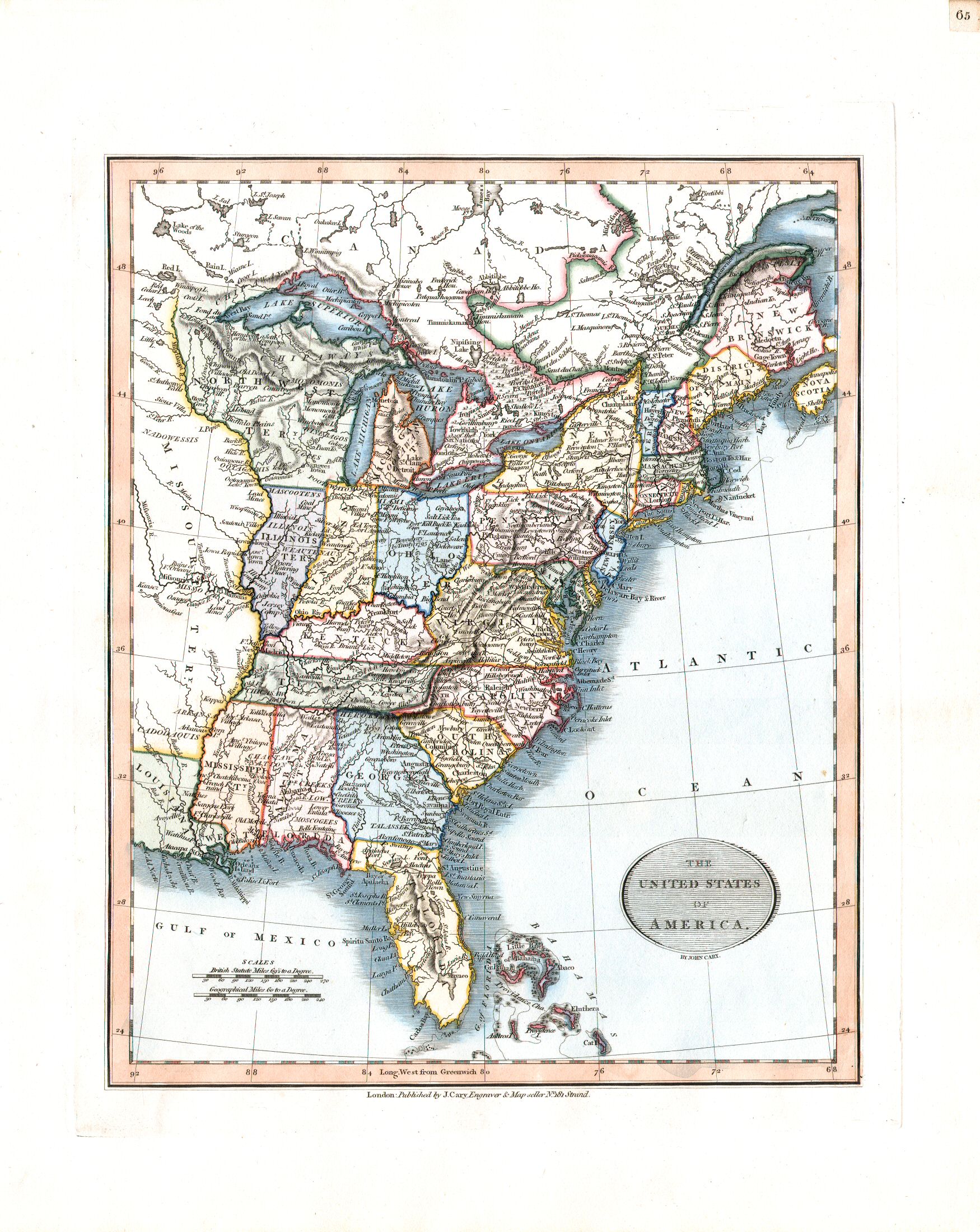
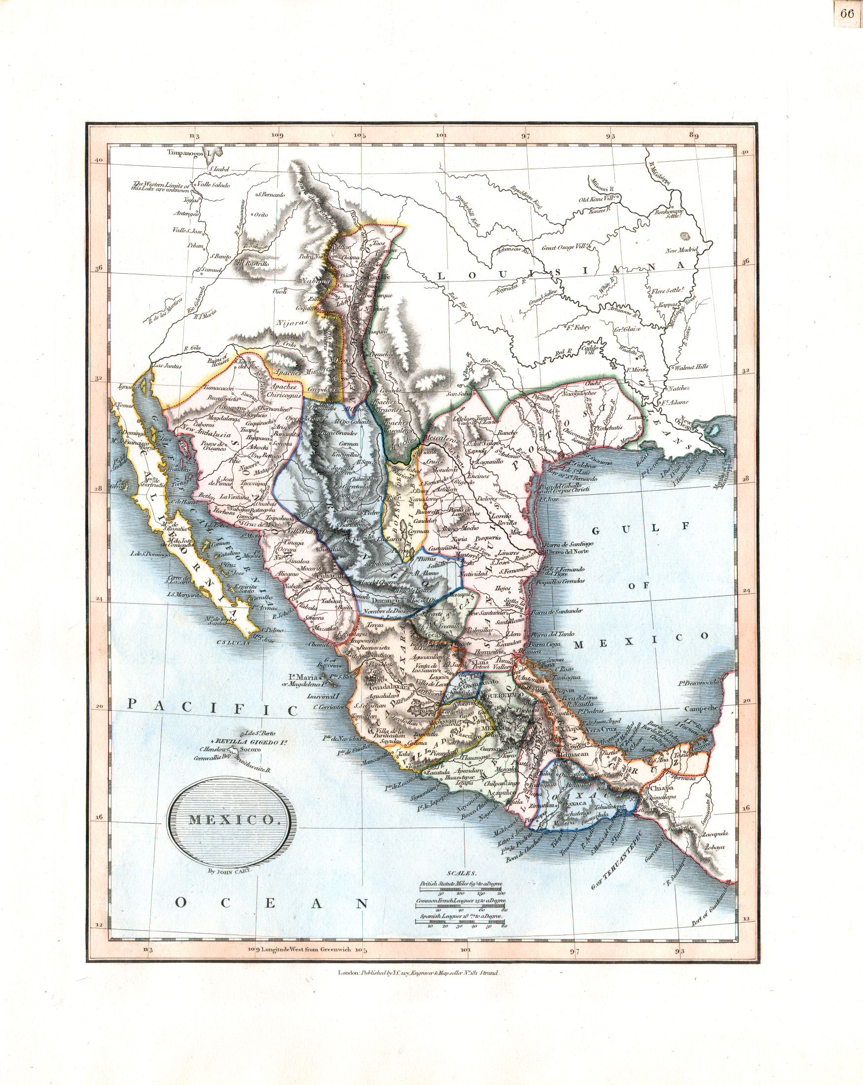
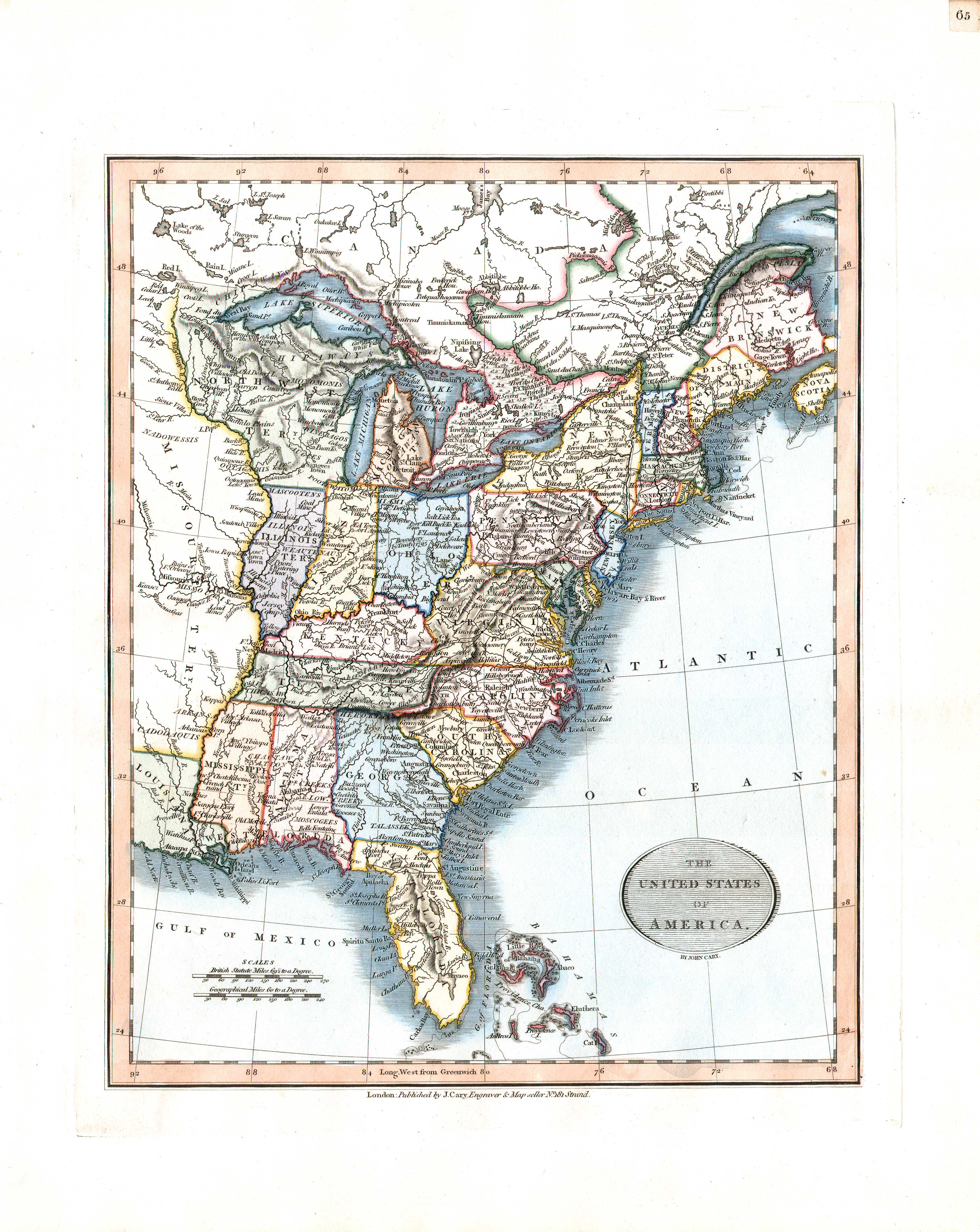
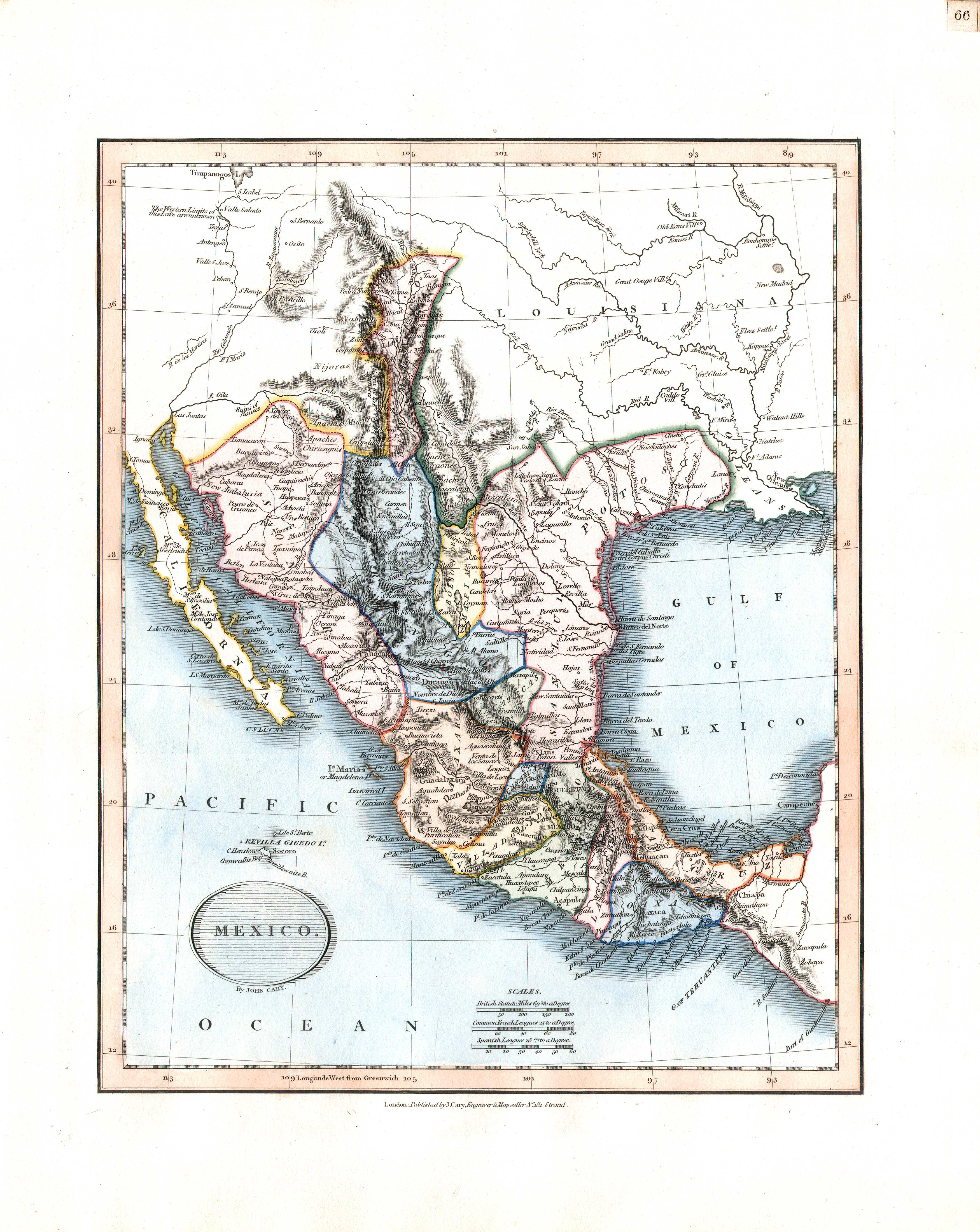
61. America
Amerika
 Cary's New Universal Atlas, 1819
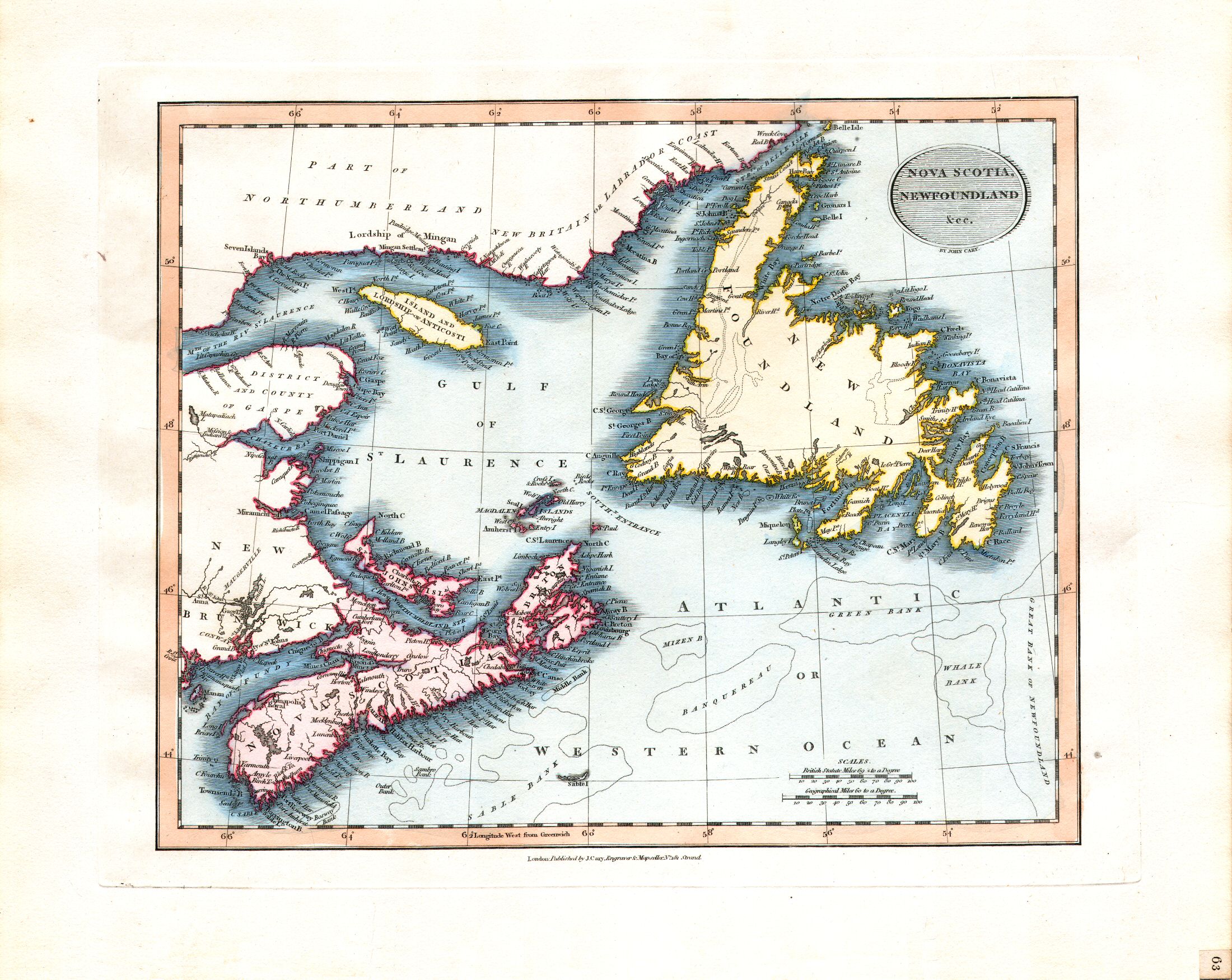
63. Nova Scotia, Newfoundland &cc.
Nova Scotia, Newfoundland etc.
 Cary's New Universal Atlas, 1819
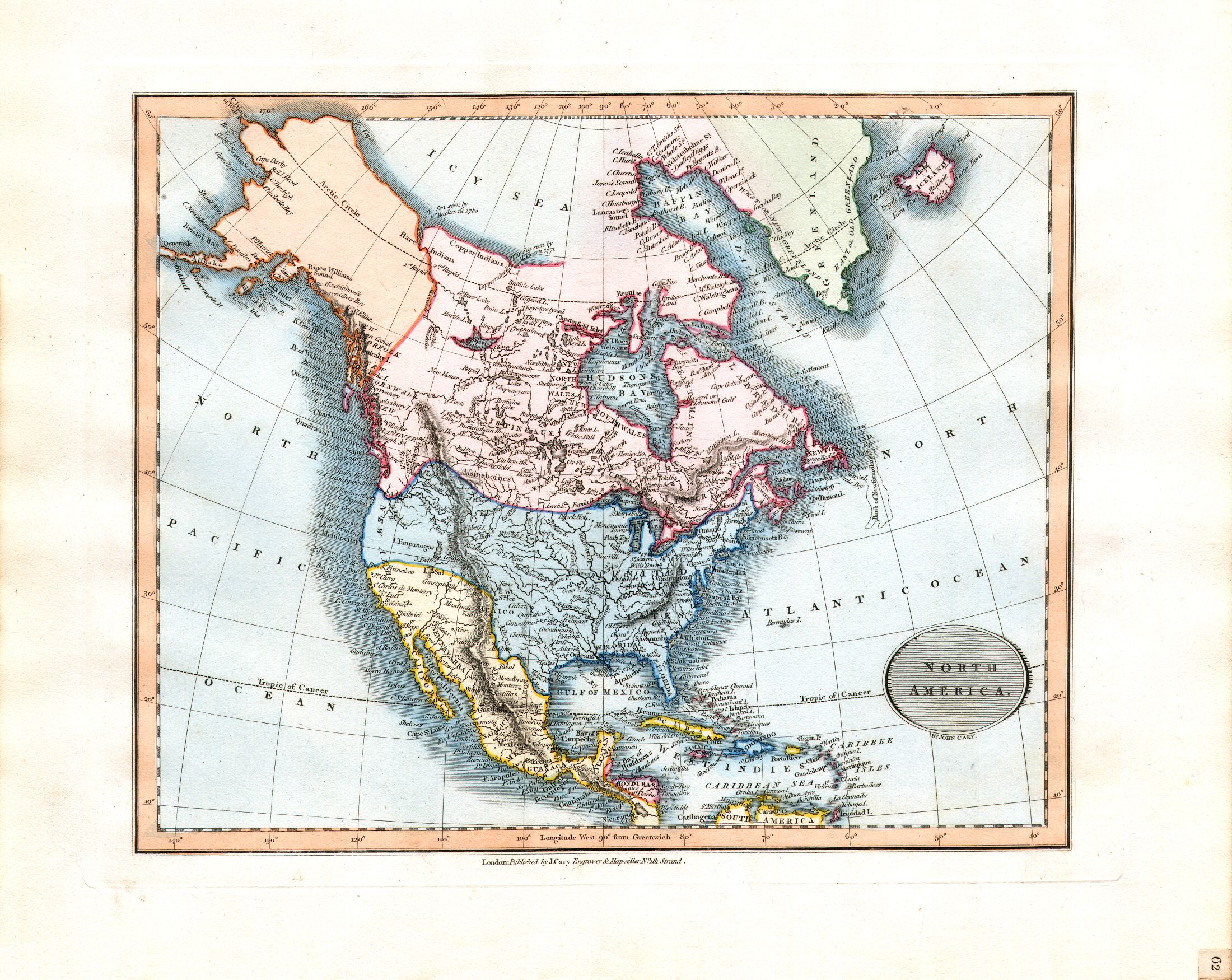
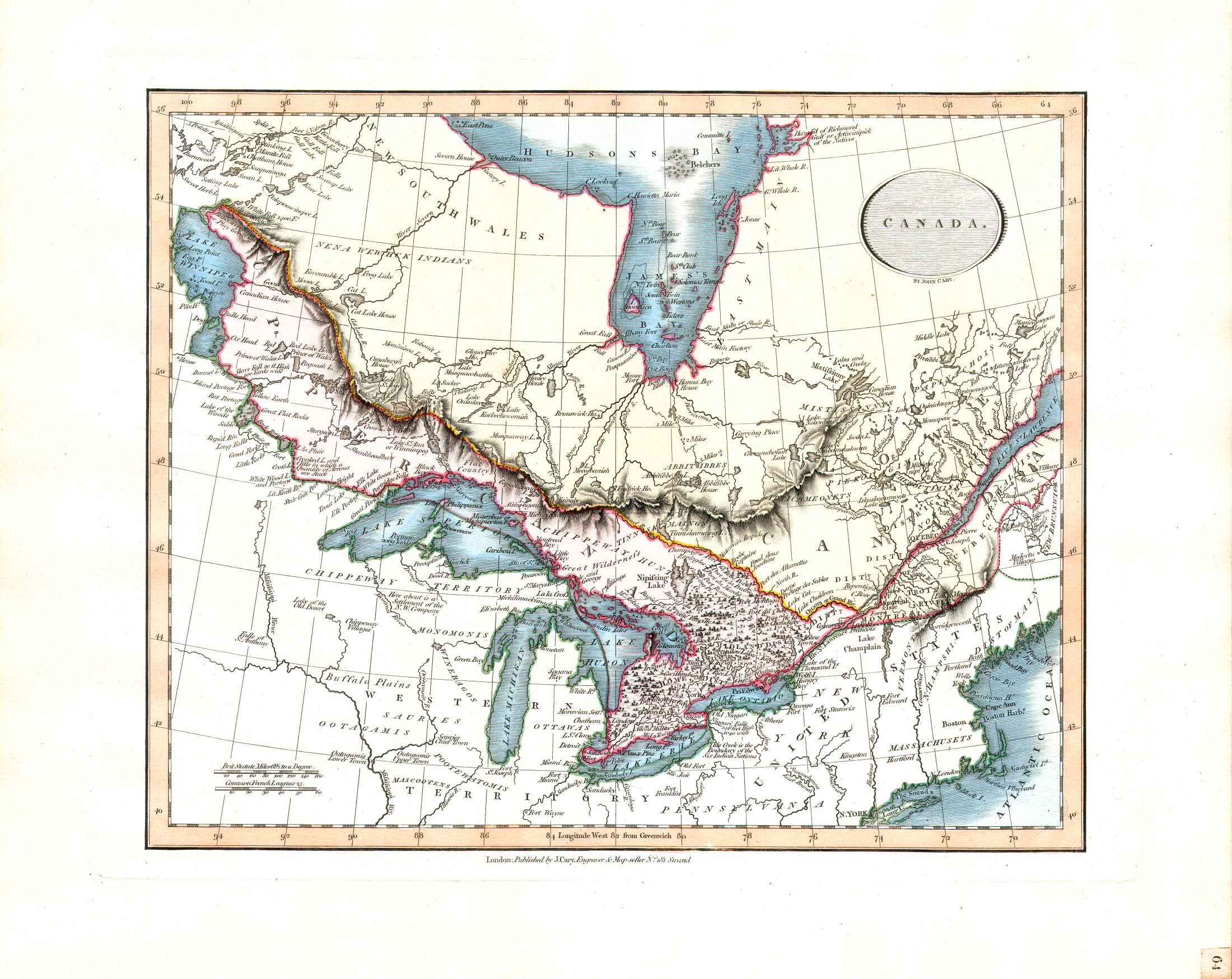
64. Canada
Canada
 Cary's New Universal Atlas, 1819
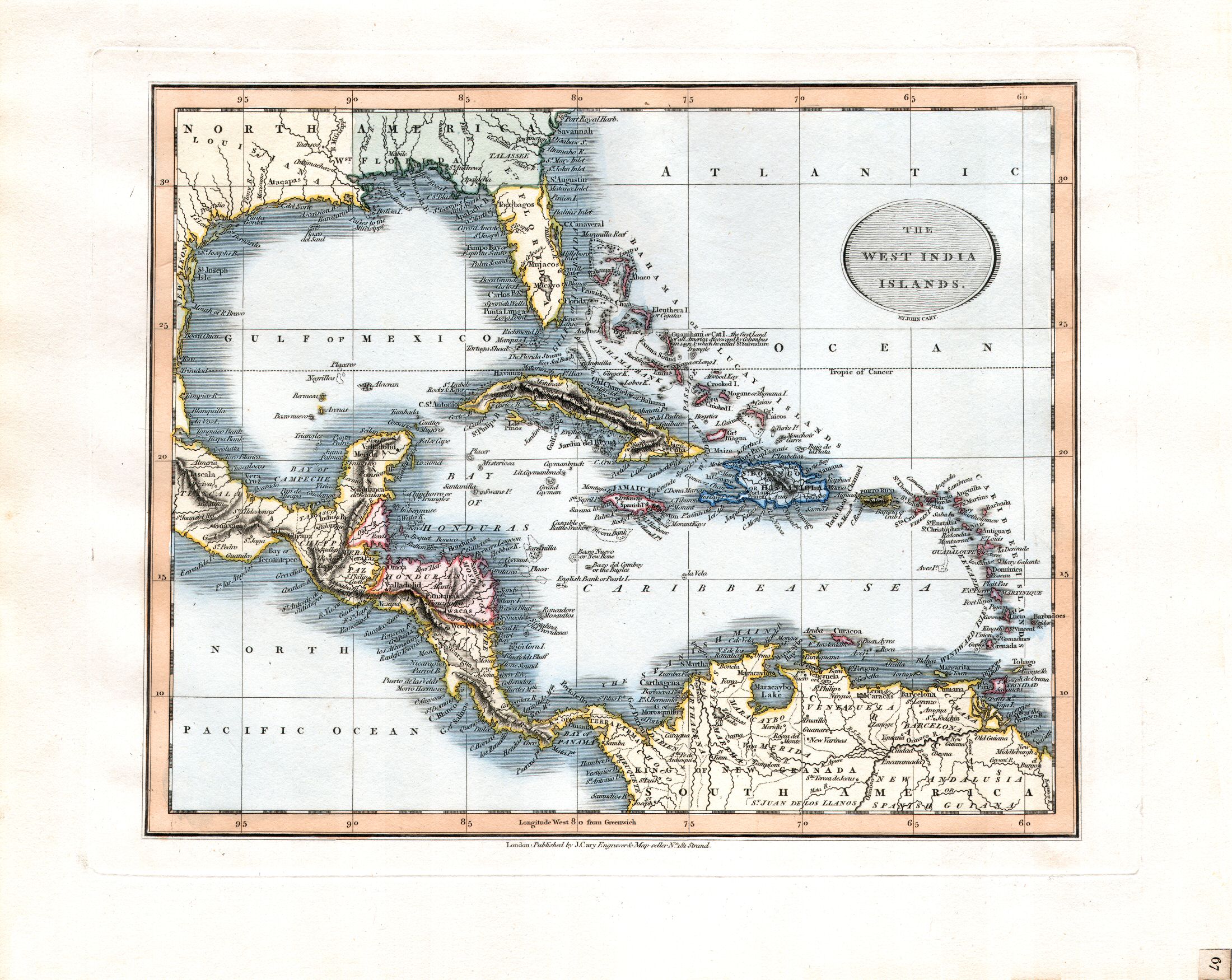
67. The West India Islands
Midden-Amerika, Antillen
 Cary's New Universal Atlas, 1819
68. South America
Zuid-Amerika
 Cary's New Universal Atlas, 1819
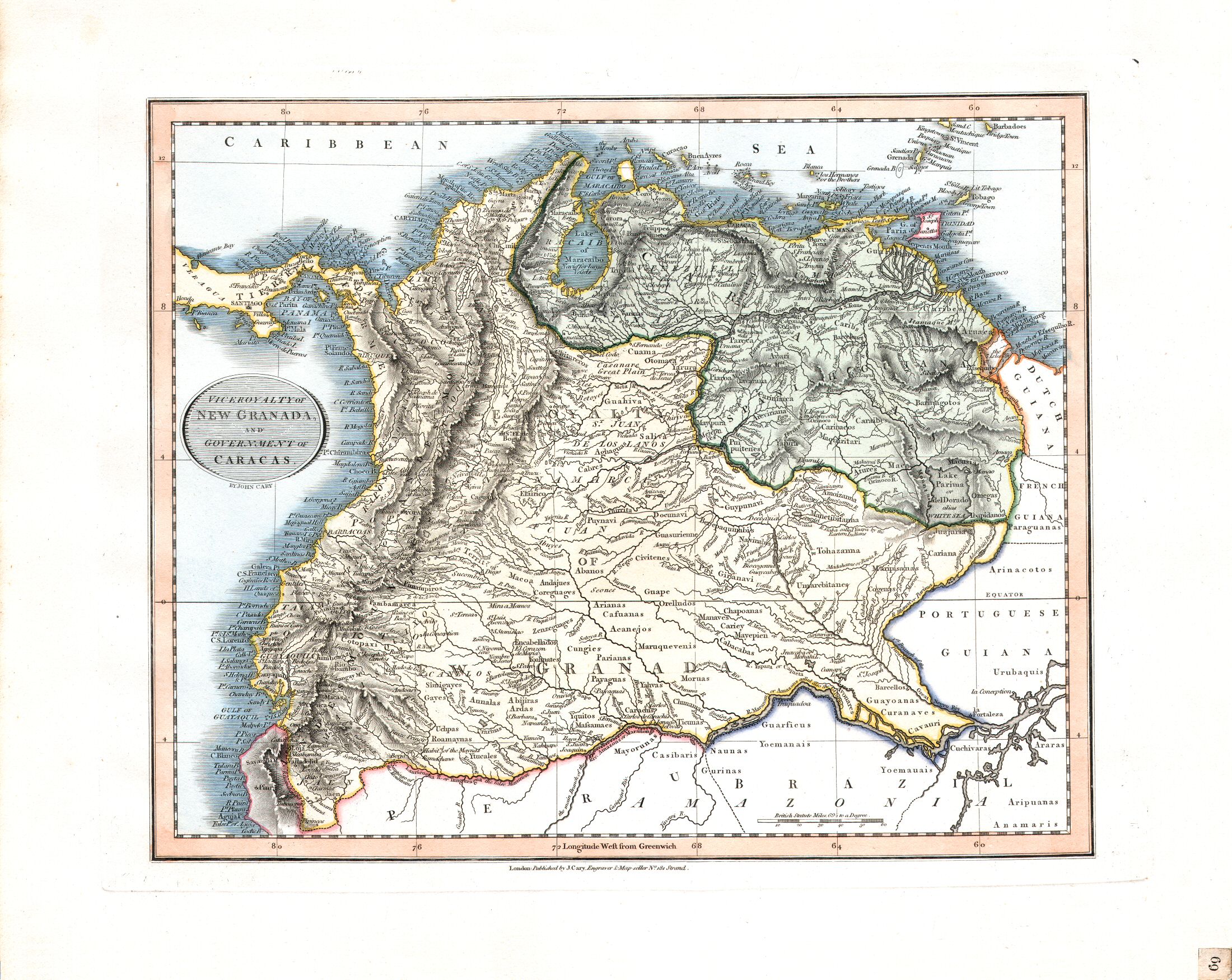
69. Viceroyalty of New Granada and Government of Caracas
Onderkoninkrijk Nieuw-Granada en Gouvernement Caracas
 Cary's New Universal Atlas, 1819
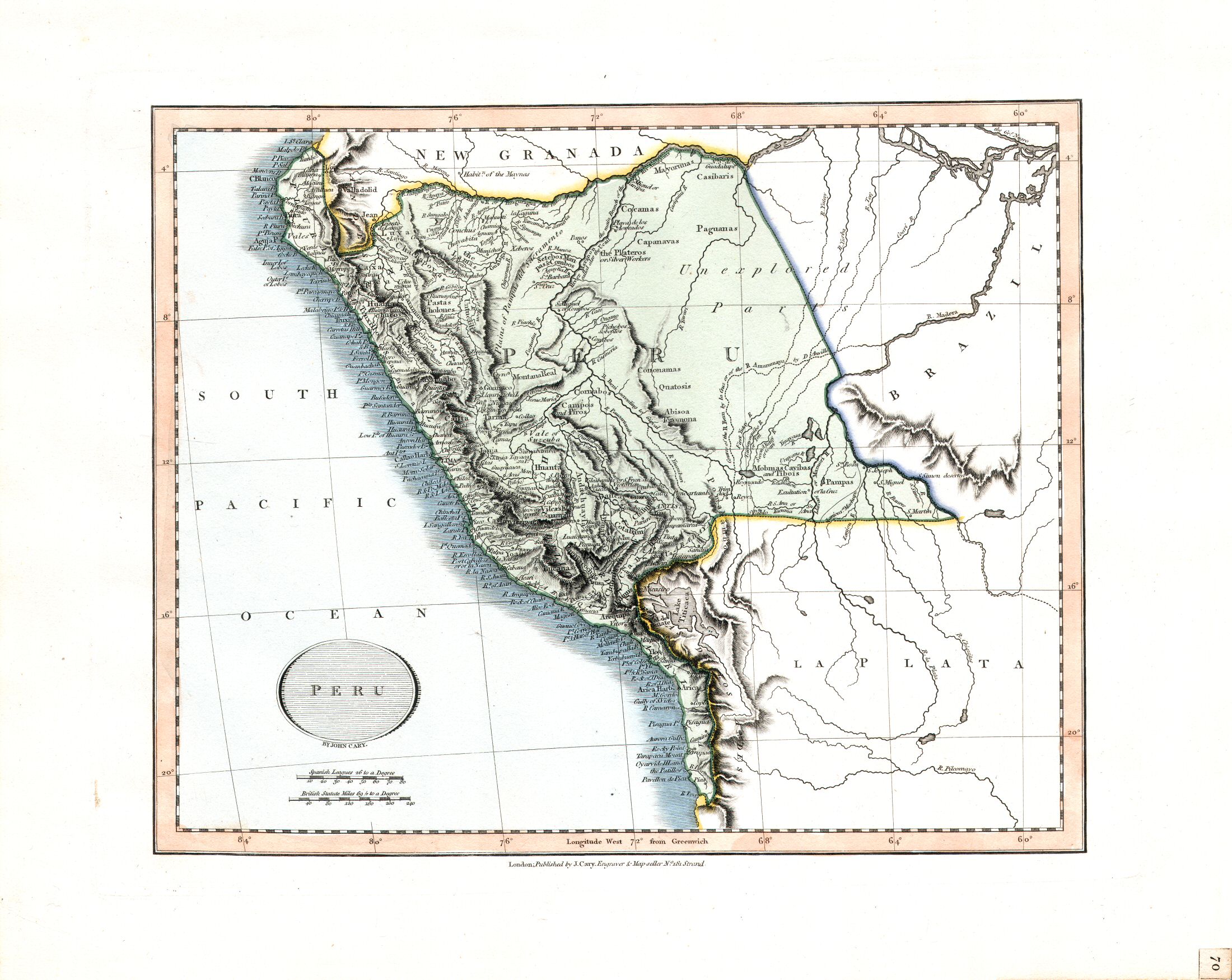
70. Peru
Peru
 Cary's New Universal Atlas, 1819
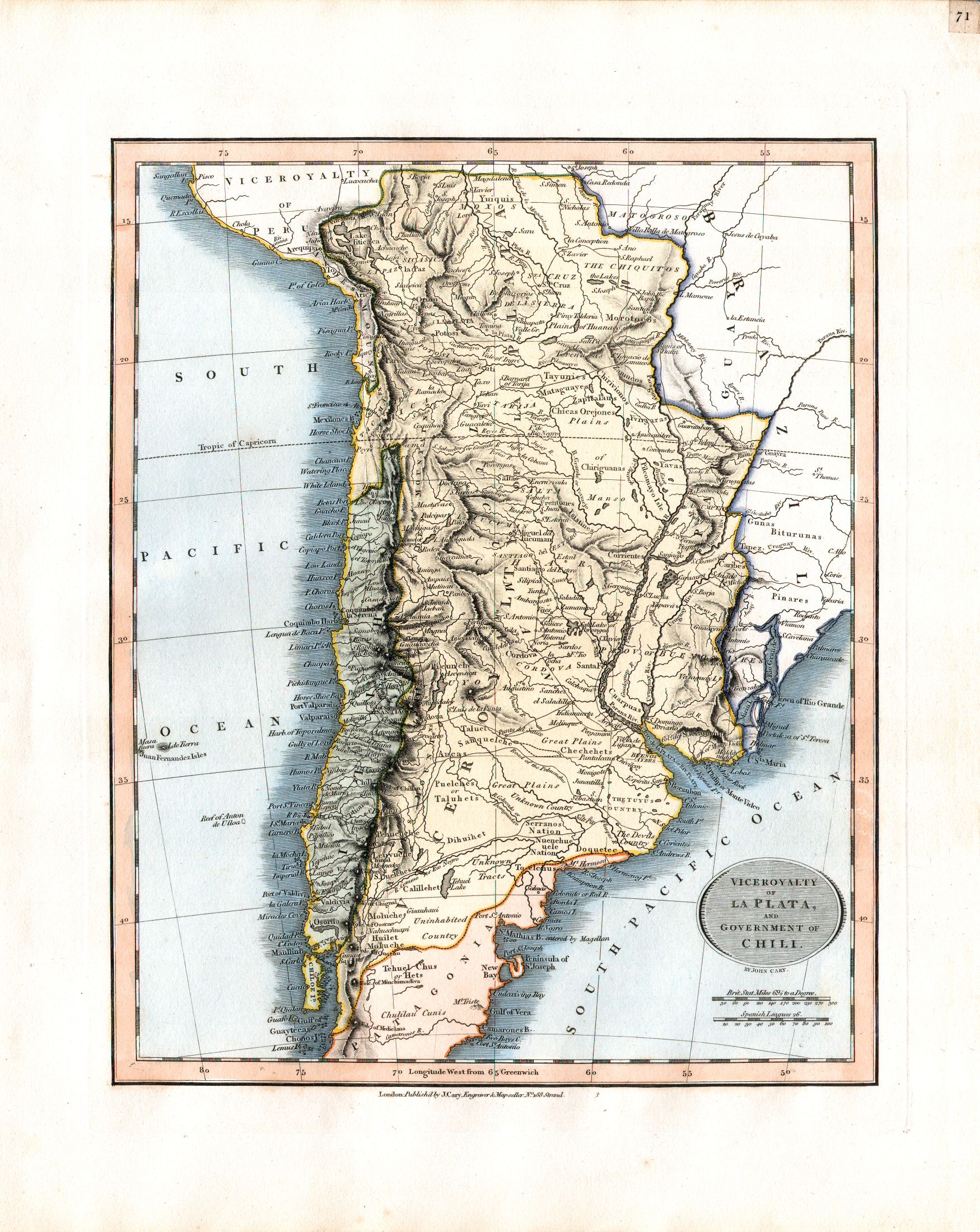
71. Viceroyalty of La Plata and Government of Chili
Onderkoninkrijk La Plata en Gouvernement Chili

© M. Witkam, 2008
![]()
![]()