Putzgers Historischer Schul-Atlas, Große Ausgabe, 50e druk (1931/33)
See below for (a summary of) this text in English.
Hieronder staan plaatjes van de atlas. Daarbij horen ook de volgende pagina's
- Beschrijving van de atlas
- Voorwoord bij de atlas
- Tabellen en lijsten bij de atlas
- Vergelijking (plaatjes) met de 44e druk
Plaatjes
Klik op een plaatje voor een vergroting.
Putzgers Historischer Schul-Atlas, Große Ausgabe, 50th edition (1931/33)
- Below are pictures of the atlas. Related pages
- Description of the atlas
- Preface to the atlas
- Tables and lists to the atlas
- Comparison (pictures) with the 44th edition
Pictures
Click on a picture to enlarge.
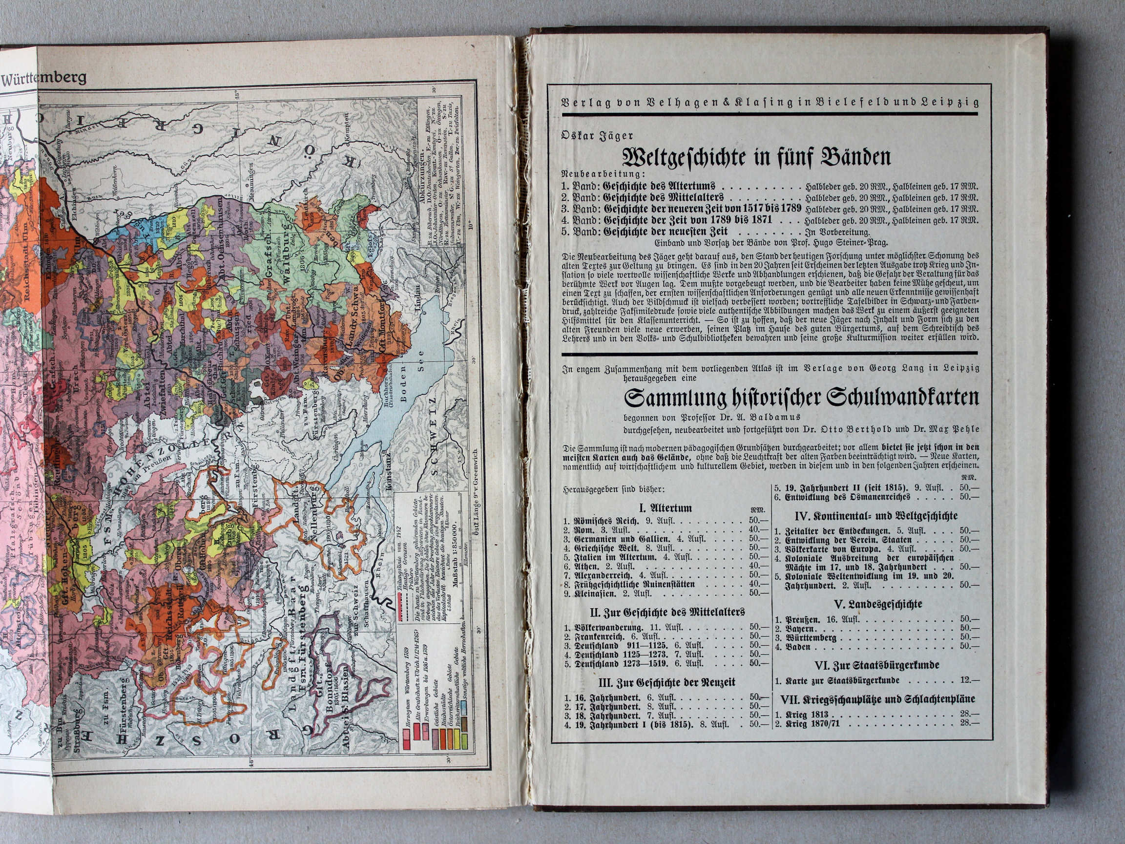
Band, voorwoord, titelpagina / Binding, preface, title page

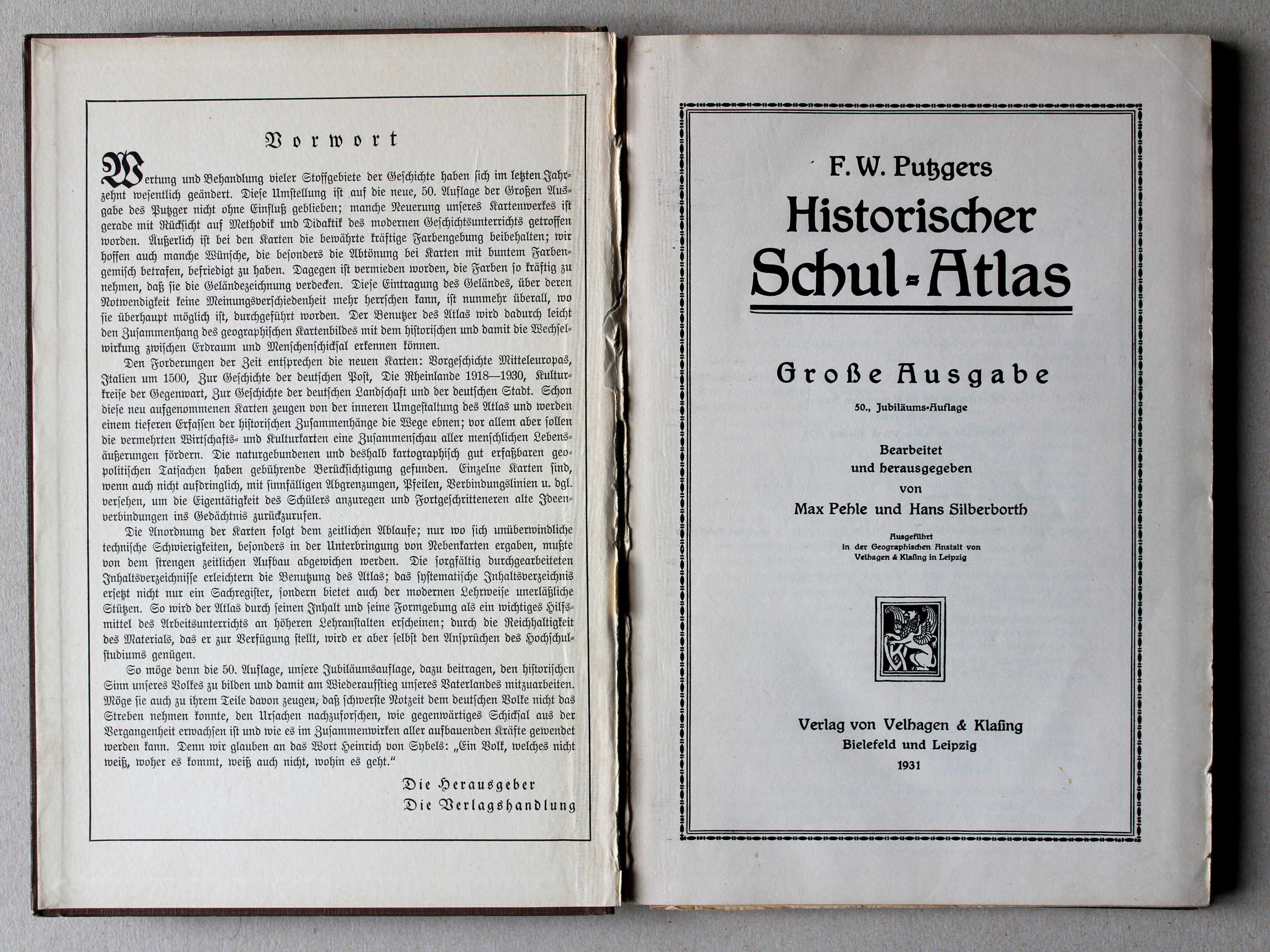 Putzgers Historischer Schul-Atlas, Große Ausgabe, 1931/33
Schutblad voorin met voorwoord, titelpagina / Front endpaper with preface, title page XL
 Putzgers Historischer Schul-Atlas, Große Ausgabe, 1931/33
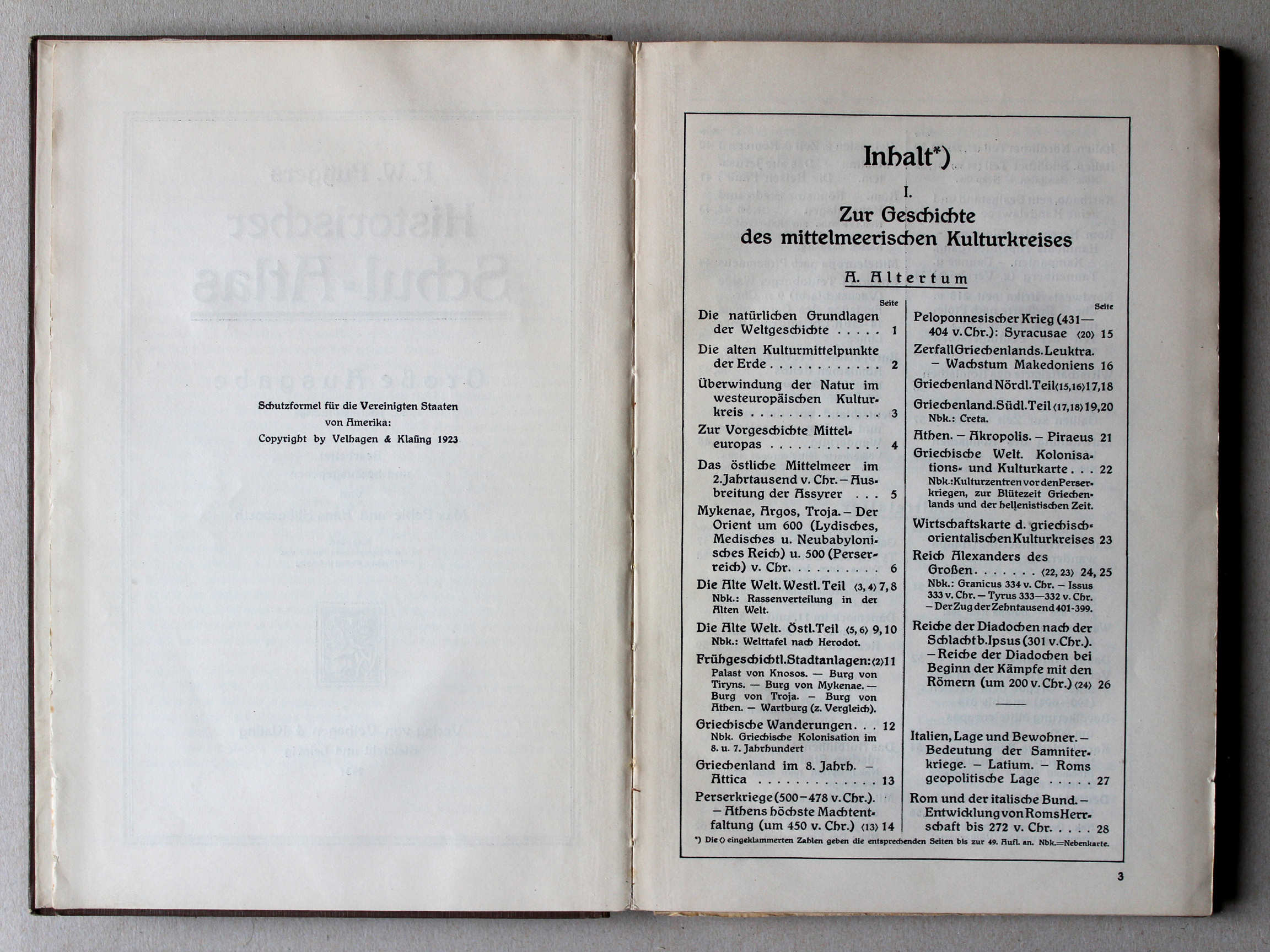
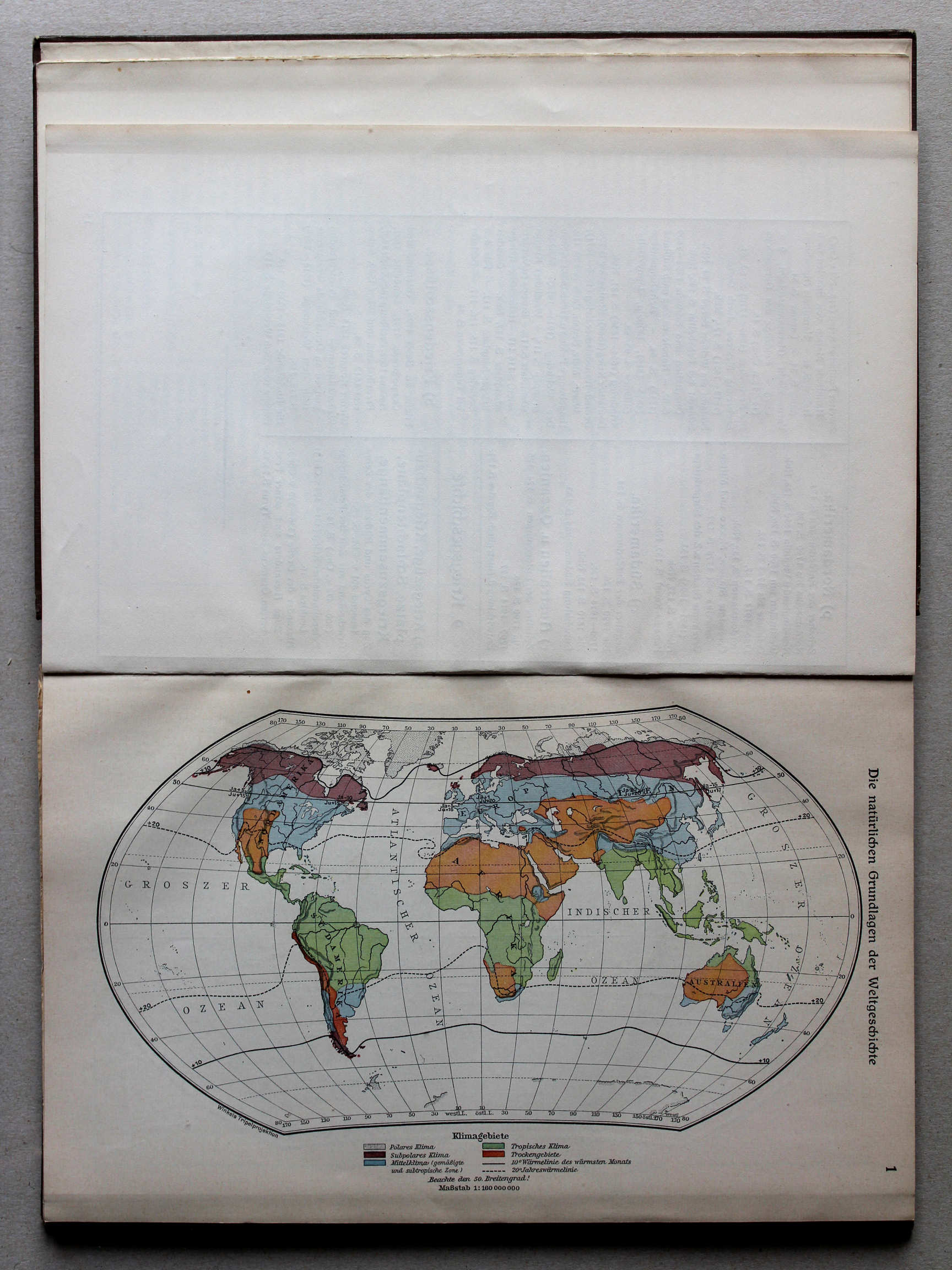
1. Die natürlichen Grundlagen der Weltgeschichte XL
De natuurlijke grondslagen van de geschiedenis / The natural foundations of history
 Putzgers Historischer Schul-Atlas, Große Ausgabe, 1931/33
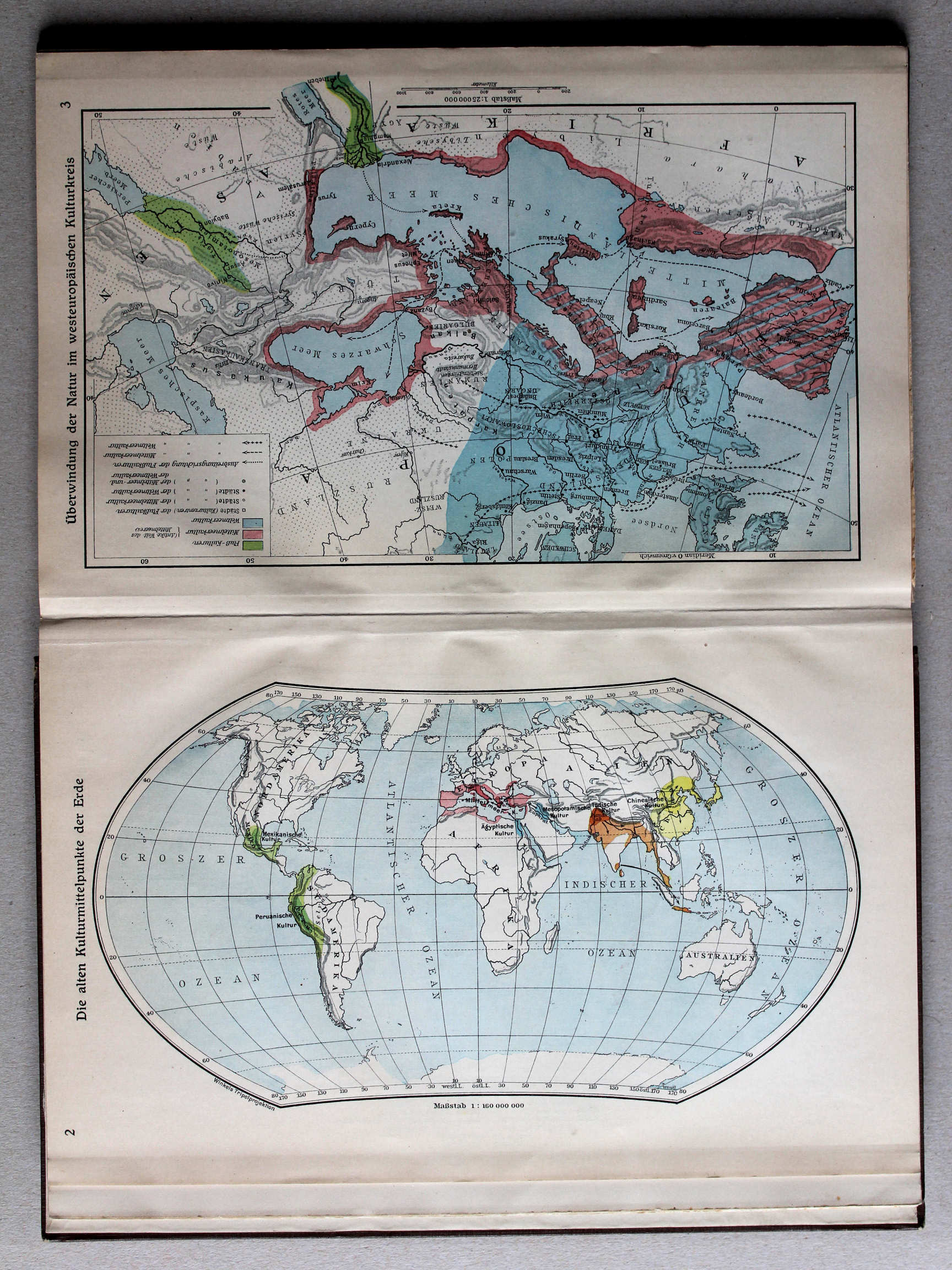
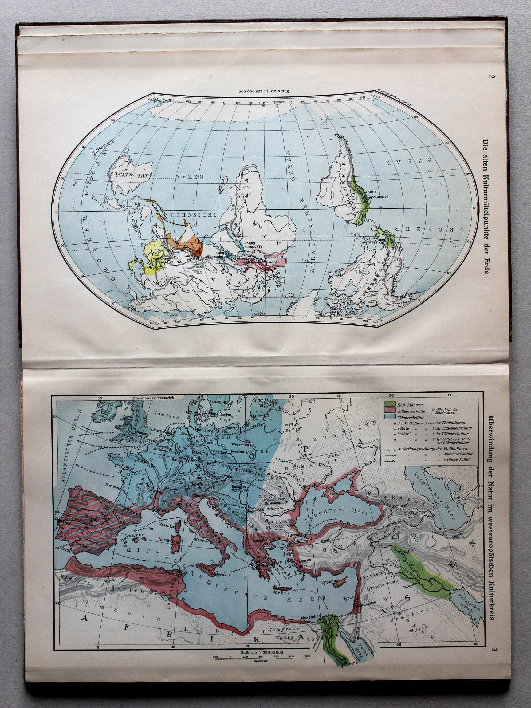
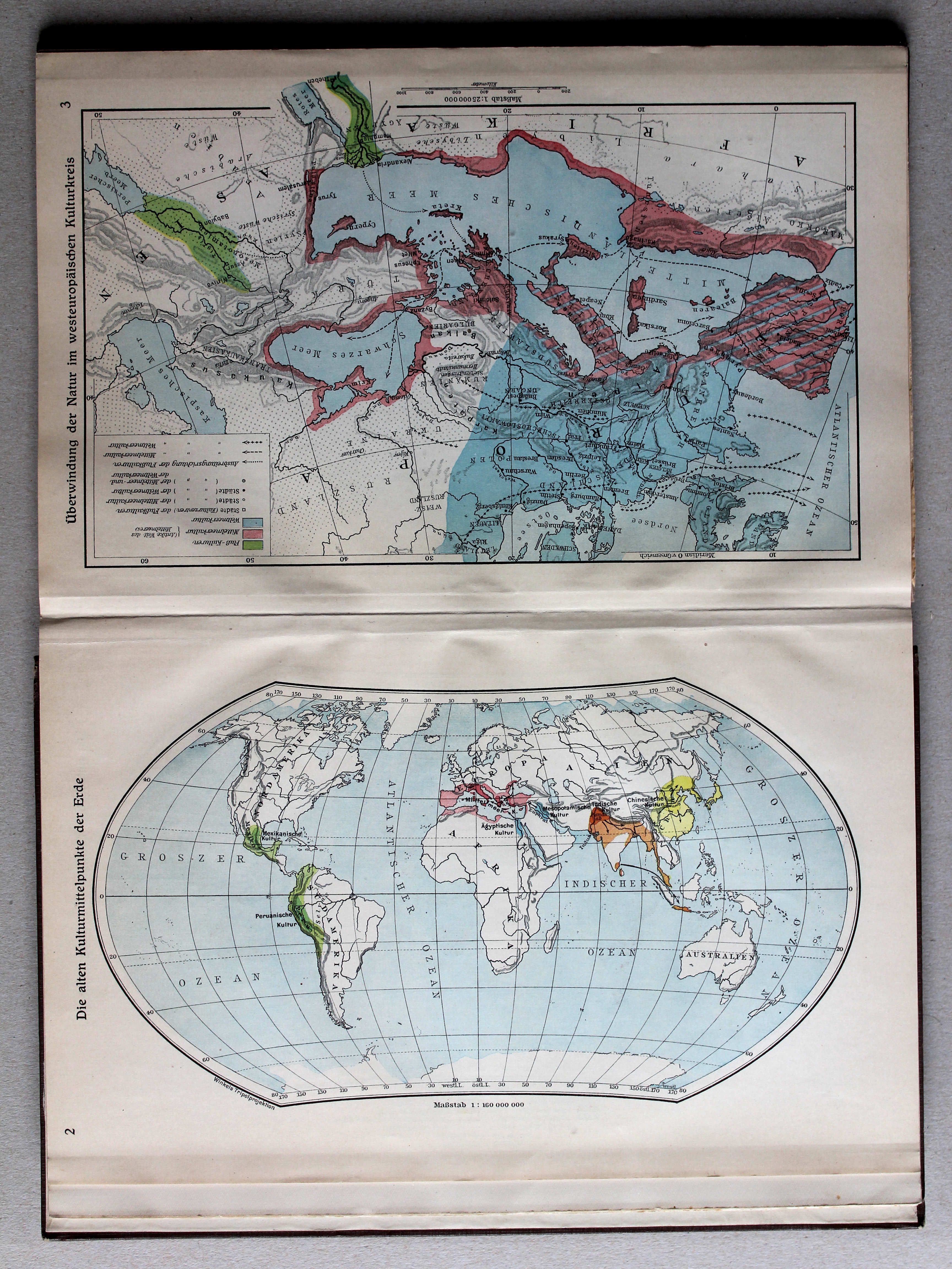
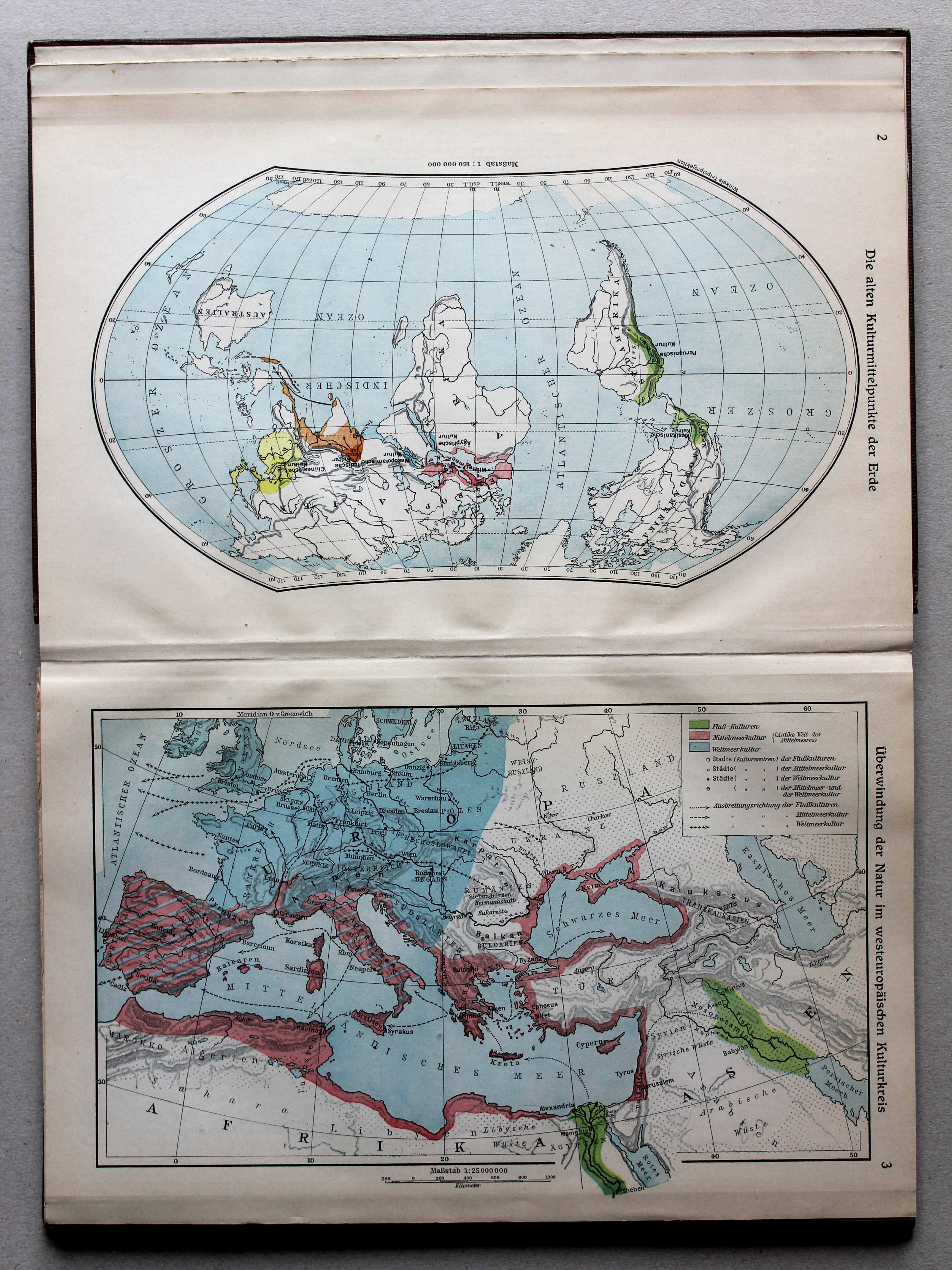
2. Die alten Kulturmittelpunkte der Erde XL
De oude beschavingscentra van de wereld / The old cultural centers of the world
 Putzgers Historischer Schul-Atlas, Große Ausgabe, 1931/33
3. Überwindung der Natur im westeuropäischen Kulturkreis XL
Het overwinnen van de natuur in West-Europa / Overcoming of nature in Western Europe
 Putzgers Historischer Schul-Atlas, Große Ausgabe, 1931/33
4. Zur Vorgeschichte Mitteleuropas XL
De prehistorie van Midden-Europa / The prehistory of Central Europe
5. Das östliche Mittelmeer im 2. Jahrtausend v. Chr. – Ausbreitung der Assyrer XL
Het oostelijke Middellandse Zeegebied in het 2e millennium voor Christus. Verspreiding van de Assyriërs / The Eastern Mediterranean in the 2nd millennium BC. Expansion of the Assyrians
 Putzgers Historischer Schul-Atlas, Große Ausgabe, 1931/33
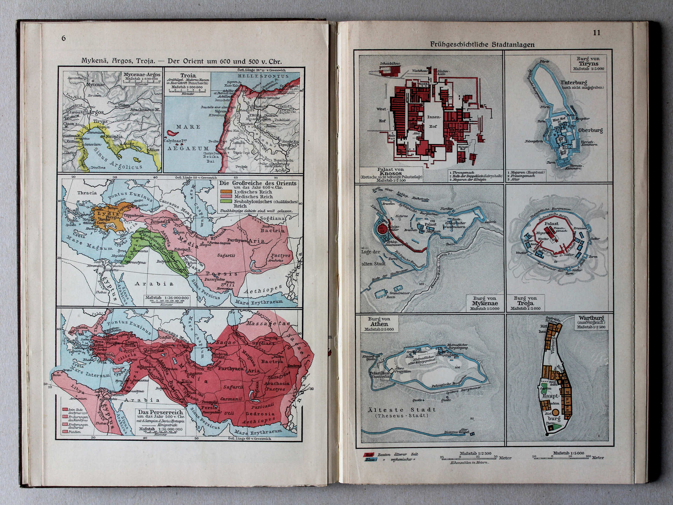
6. Mykenä, Argos, Troja – Der Orient um 600 u. 500 v. Chr. XL
Mycene, Argos, Troje. De Oriënt rond 600 en 500 voor Christus / Mycenae, Argos, Troy. The Orient around 600 and 500 BC
11. Frühgeschichtliche Stadtanlagen XL
Vroeghistorische steden / Early historic cities
 Putzgers Historischer Schul-Atlas, Große Ausgabe, 1931/33
|
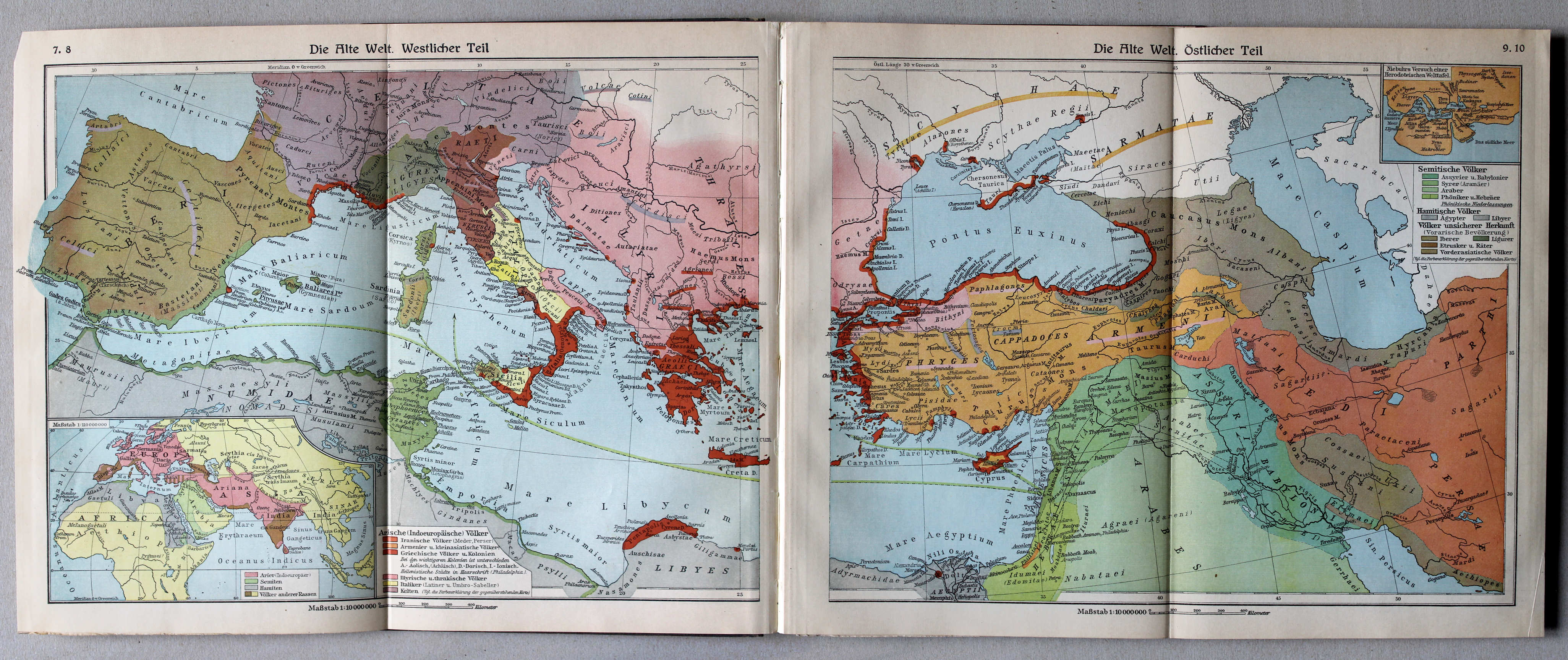
7.8. Die Alte Welt. Westlicher Teil
XL
De wereld in de Oudheid, westelijk deel / The Ancient world, western part |
9.10. Die Alte Welt. Östlicher Teil
XL
De wereld in de Oudheid, oostelijk deel / The Ancient world, eastern part |
 Putzgers Historischer Schul-Atlas, Große Ausgabe, 1931/33
12. Griechische Wanderungen XL
Griekse migratie / Greek migration
13. Griechenland im 8. Jahrhundert – Attica XL
Griekenland in de 8e eeuw. Attica / Greece in the 8th century. Attica
 Putzgers Historischer Schul-Atlas, Große Ausgabe, 1931/33
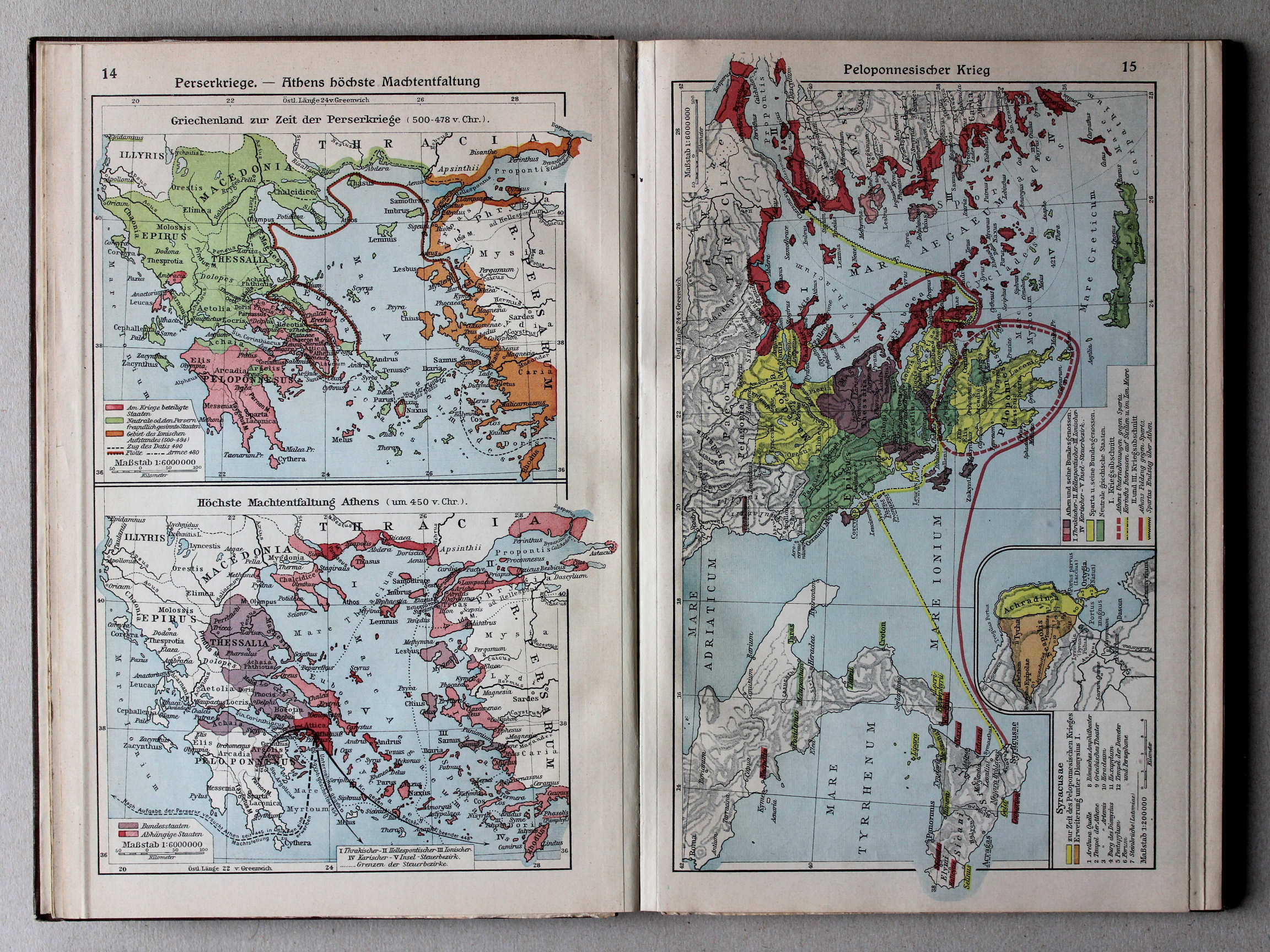
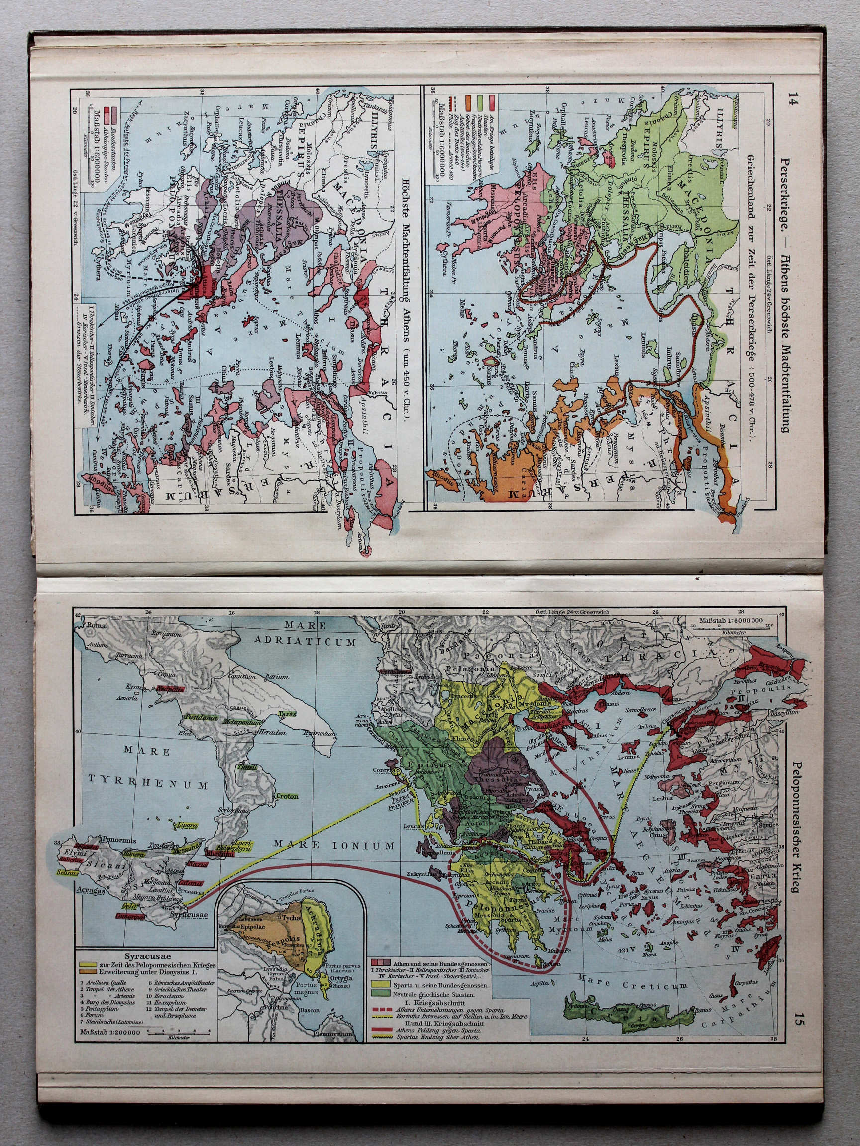
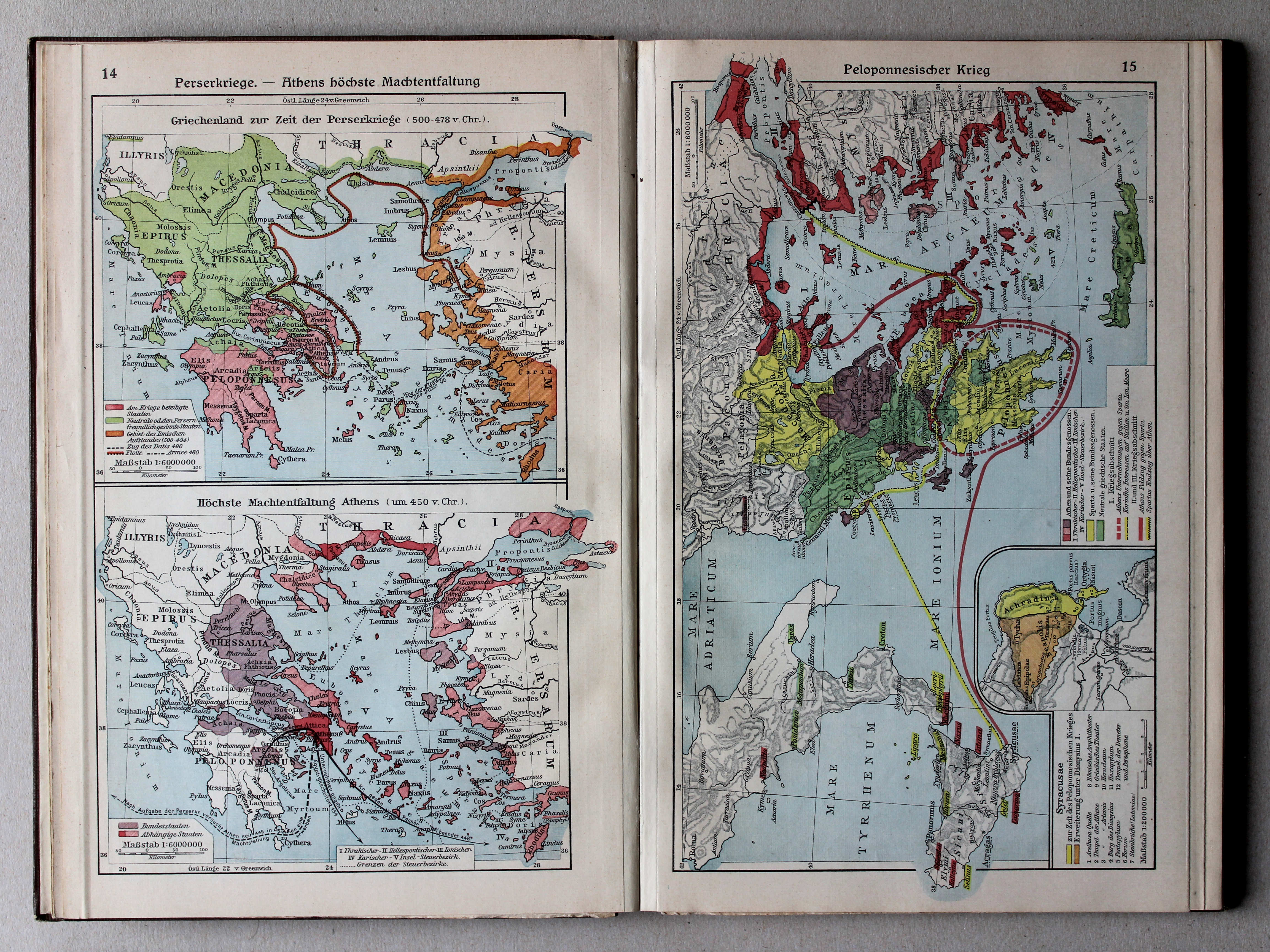
14. Perserkriege – Athens höchste Machtentfaltung XL
Perzische Oorlogen. Het toppunt van de macht van Athene / Greco-Persian Wars. The summit of Athens' power
 Putzgers Historischer Schul-Atlas, Große Ausgabe, 1931/33
15. Peloponnesischer Krieg XL
Peloponnesische Oorlog / Peloponnesian War
 Putzgers Historischer Schul-Atlas, Große Ausgabe, 1931/33
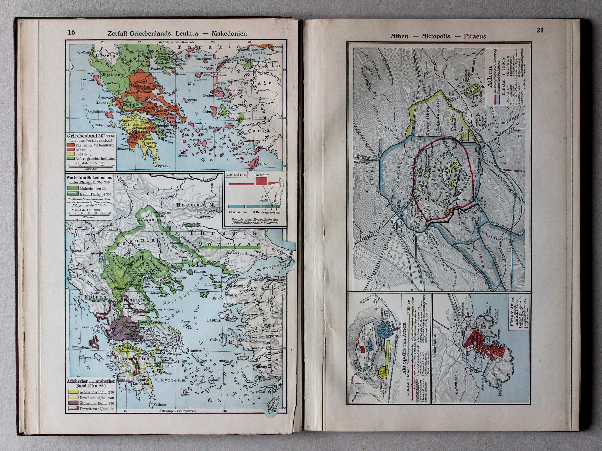
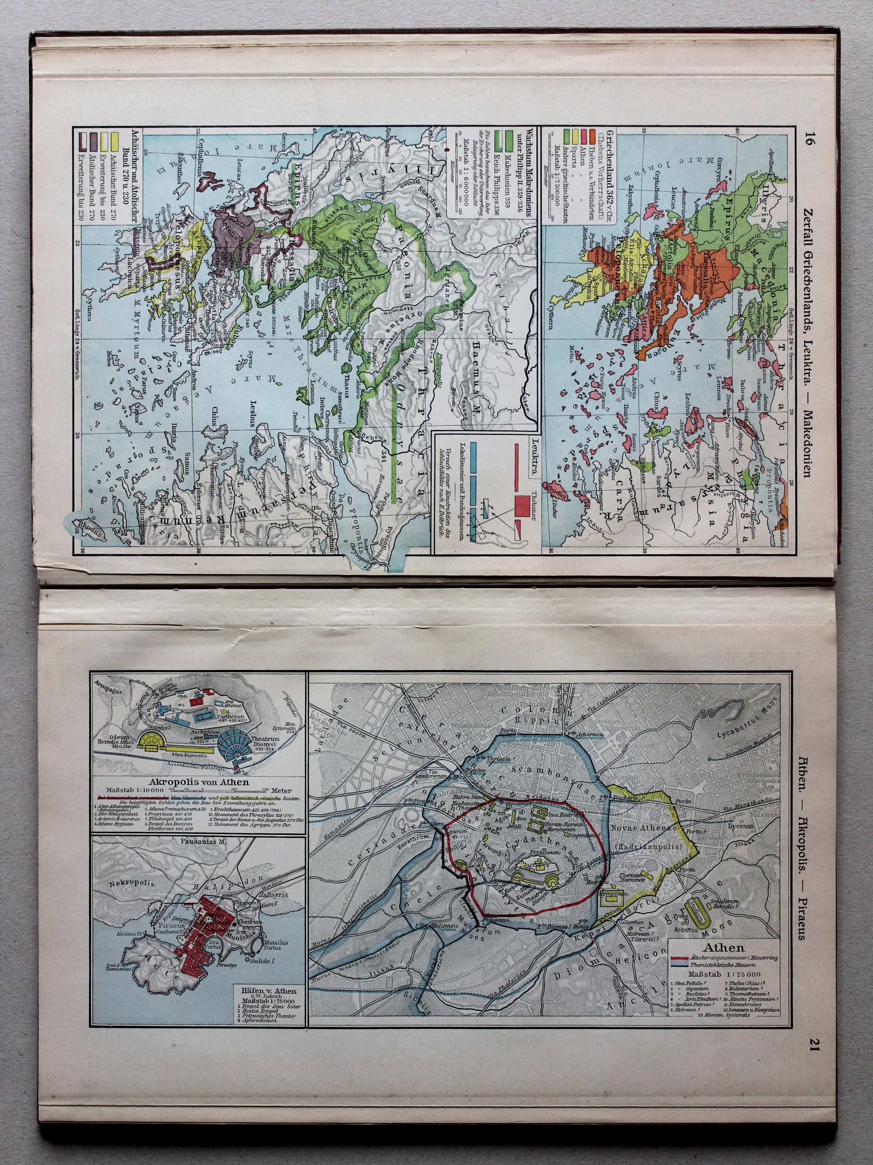
16. Zerfall Griechenlands, Leuktra – Makedonien XL
Verval van Griekenland, Leuktra. Macedonië / Decline of Greece, Leuctra. Macedonia
 Putzgers Historischer Schul-Atlas, Große Ausgabe, 1931/33
|
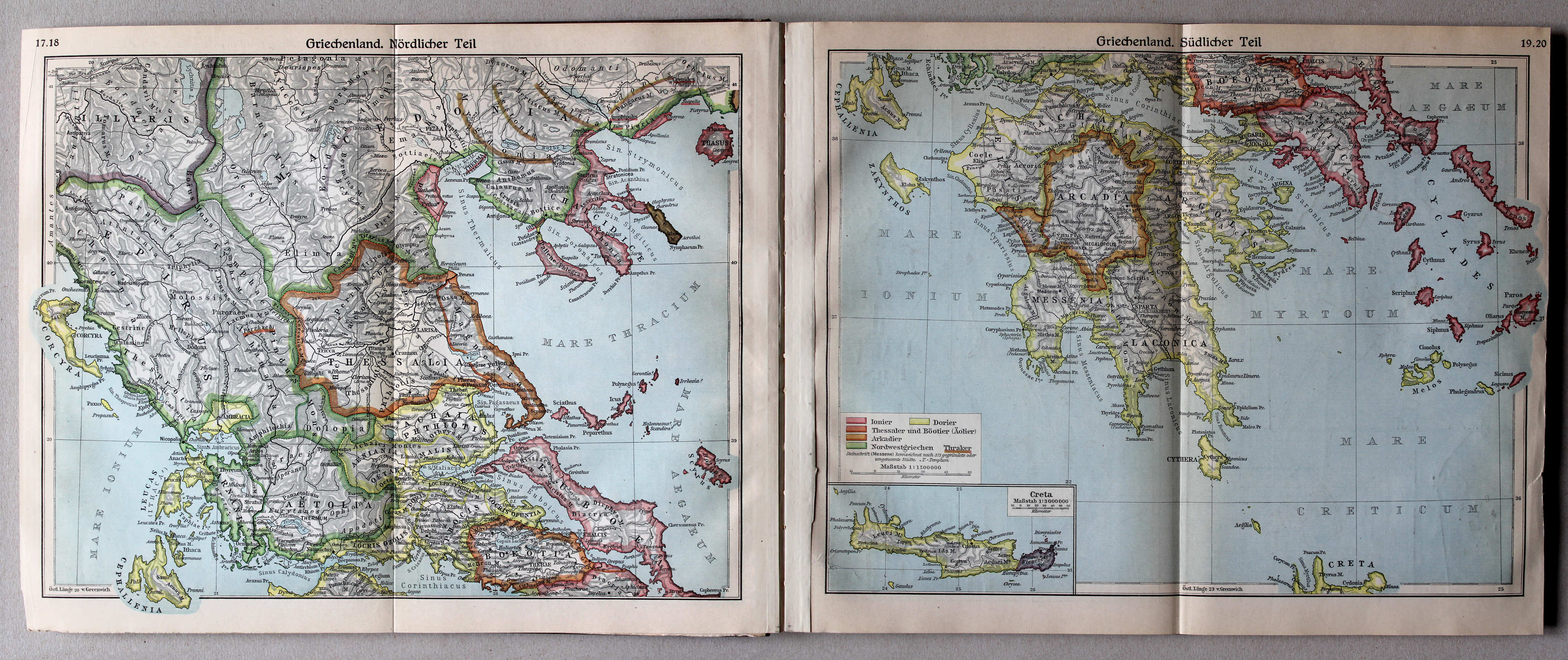
17.18. Griechenland. Nördlicher Teil
XL
Griekenland, noordelijk deel / Greece, northern part |
19.20. Griechenland. Südlicher Teil
XL
Griekenland, zuidelijk deel / Greece, southern part |
 Putzgers Historischer Schul-Atlas, Große Ausgabe, 1931/33
21. Athen – Akropolis – Piraeus XL
Athene. Akropolis. Piraeus / Athens. Acropolis. Piraeus
 Putzgers Historischer Schul-Atlas, Große Ausgabe, 1931/33
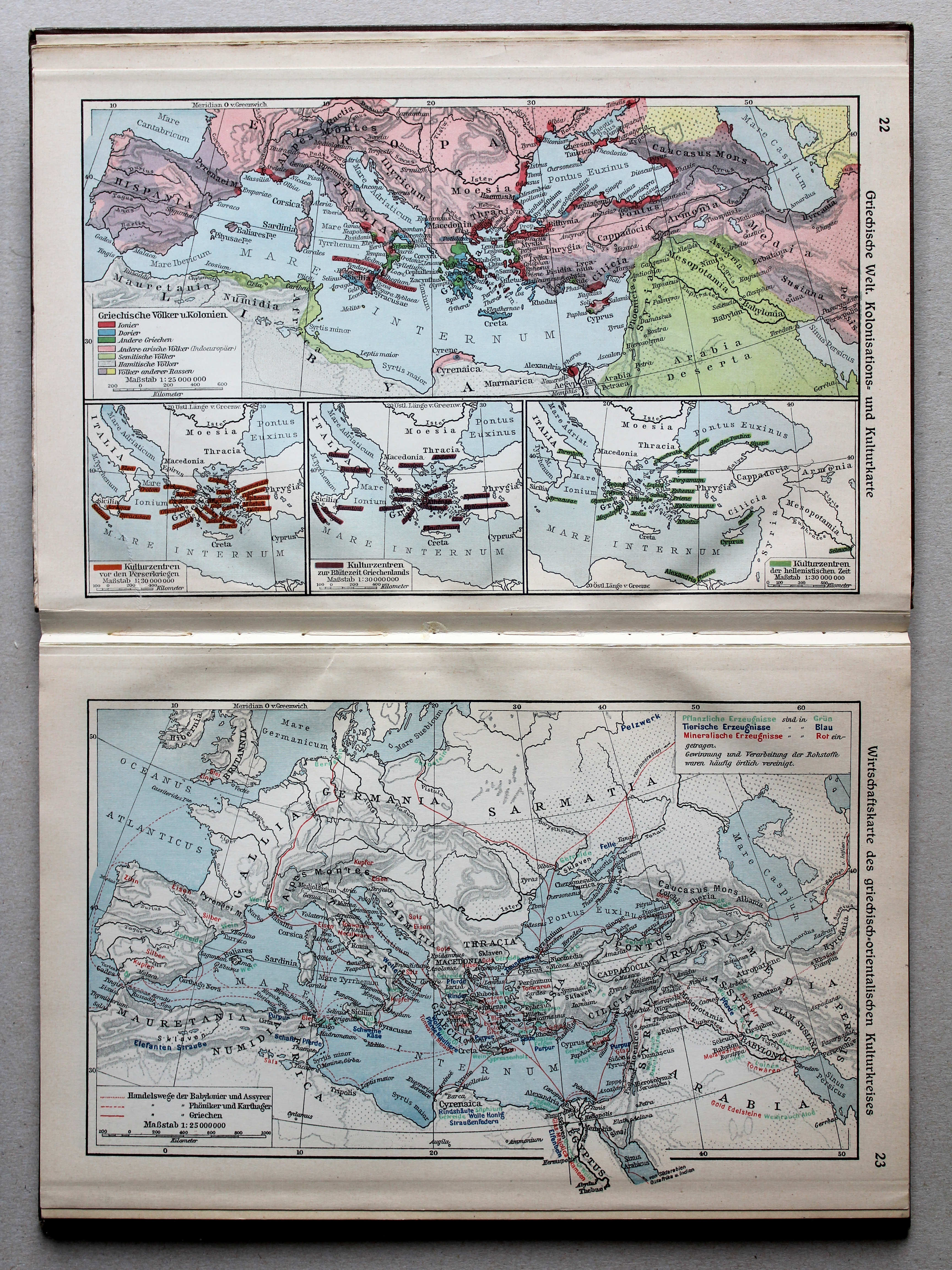
22. Griechische Welt. Kolonisations- und Kulturkarte XL
De Griekse wereld. Kaart van kolonisatie en cultuur / The Greek world. Colonisation and culture map
23. Wirtschaftskarte des griechisch-orientalischen Kulturkreises XL
Economische kaart van de Hellenistische periode / Economical map of the Hellenistic period
 Putzgers Historischer Schul-Atlas, Große Ausgabe, 1931/33
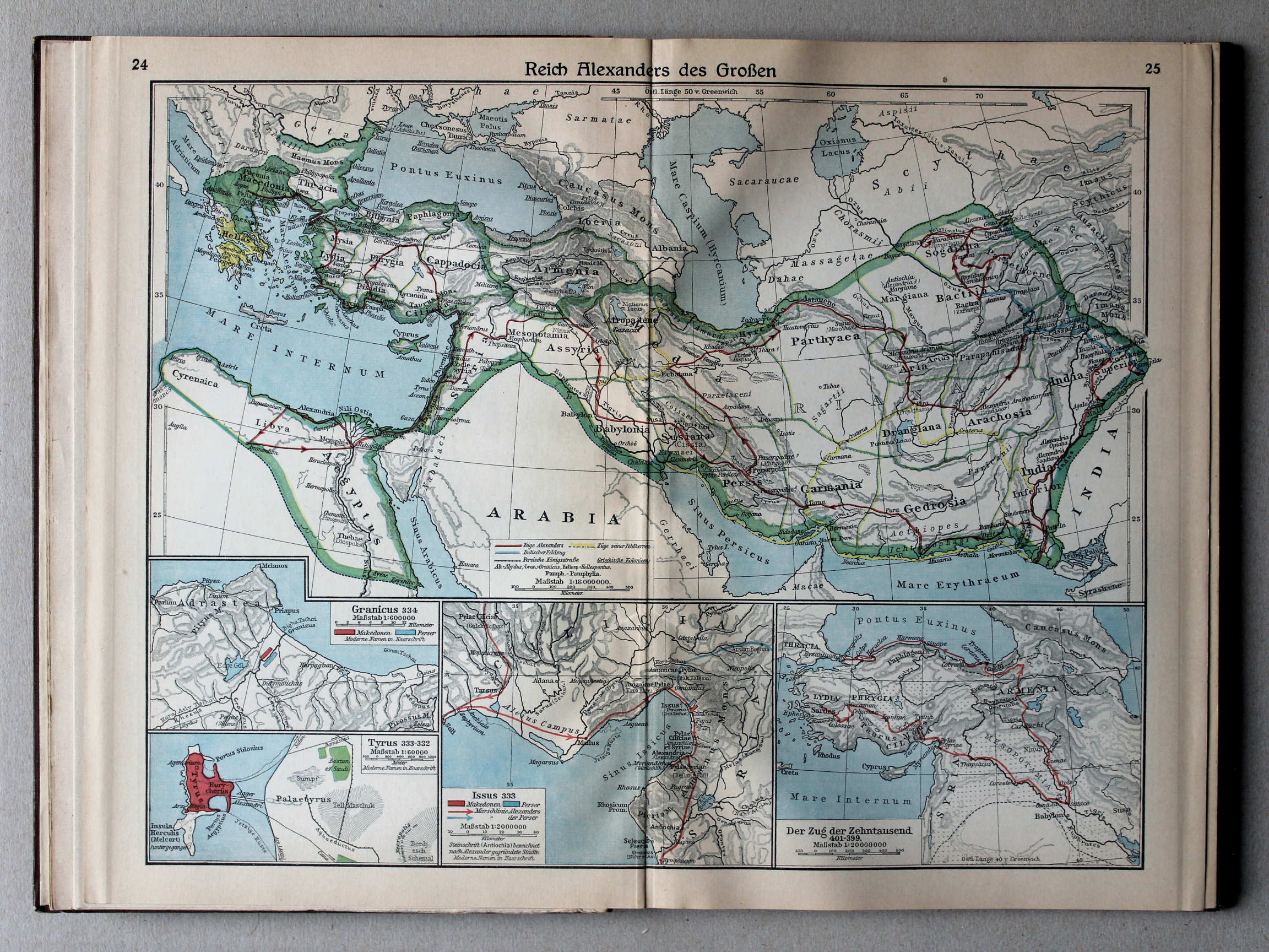
24.25. Reich Alexanders des Großen XL
Het Rijk van Alexander de Grote / The Empire of Alexander the Great
 Putzgers Historischer Schul-Atlas, Große Ausgabe, 1931/33
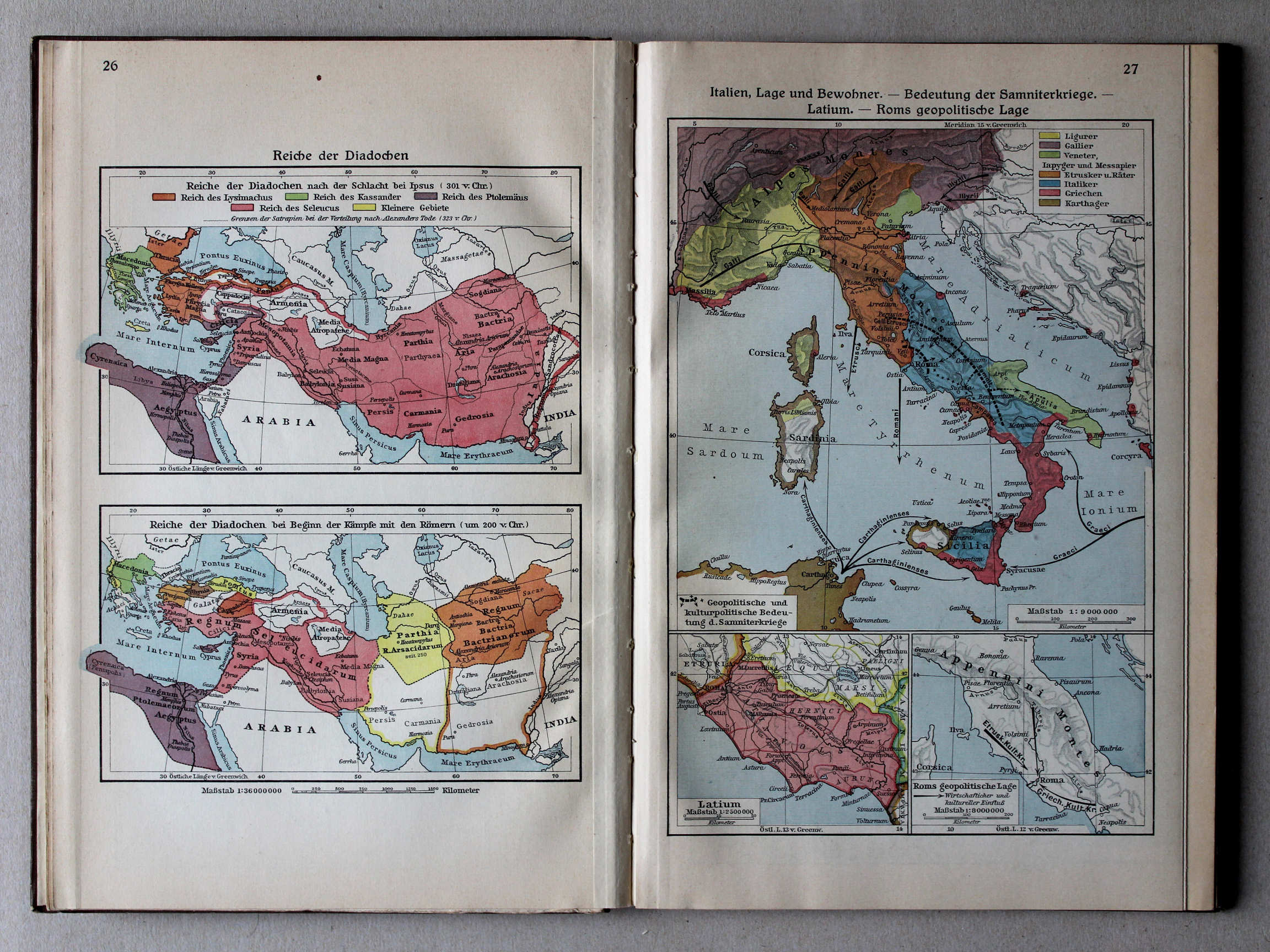
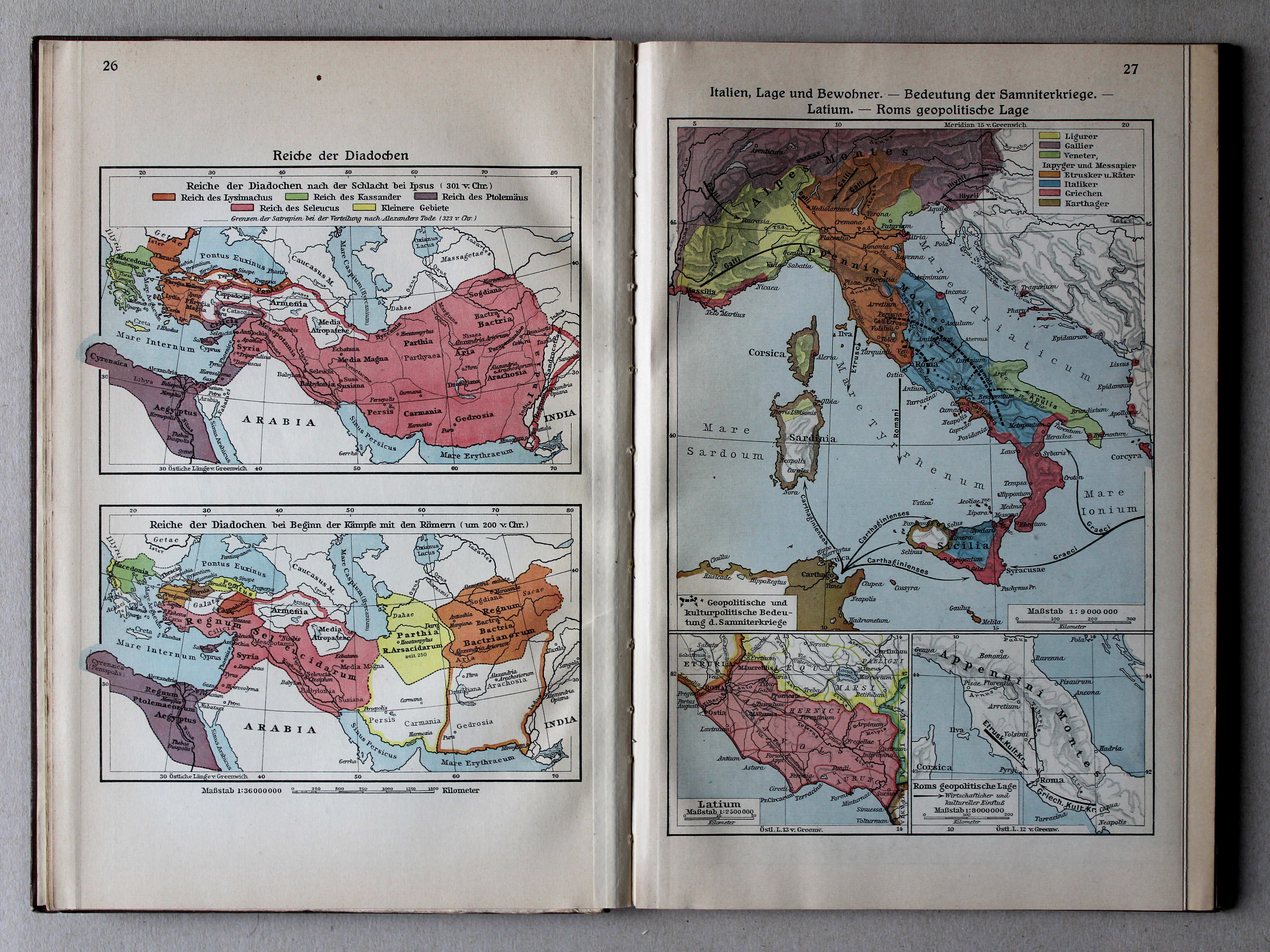
26. Reiche der Diadochen XL
Rijken van de Diadochen / Empires of the Diadochi
27. Italien, Lage und Bewohner – Bedeutung der Samniterkriege – Latium – Roms geopolitische Lage XL
Italië: ligging en inwoners. Betekenis van de Samnitische Oorlogen. Latium. Geopolitieke situatie van Rome / Italy: situation and inhabitants. Signification of the Samnite Wars. Latium. Geopolitical situation of Rome
 Putzgers Historischer Schul-Atlas, Große Ausgabe, 1931/33
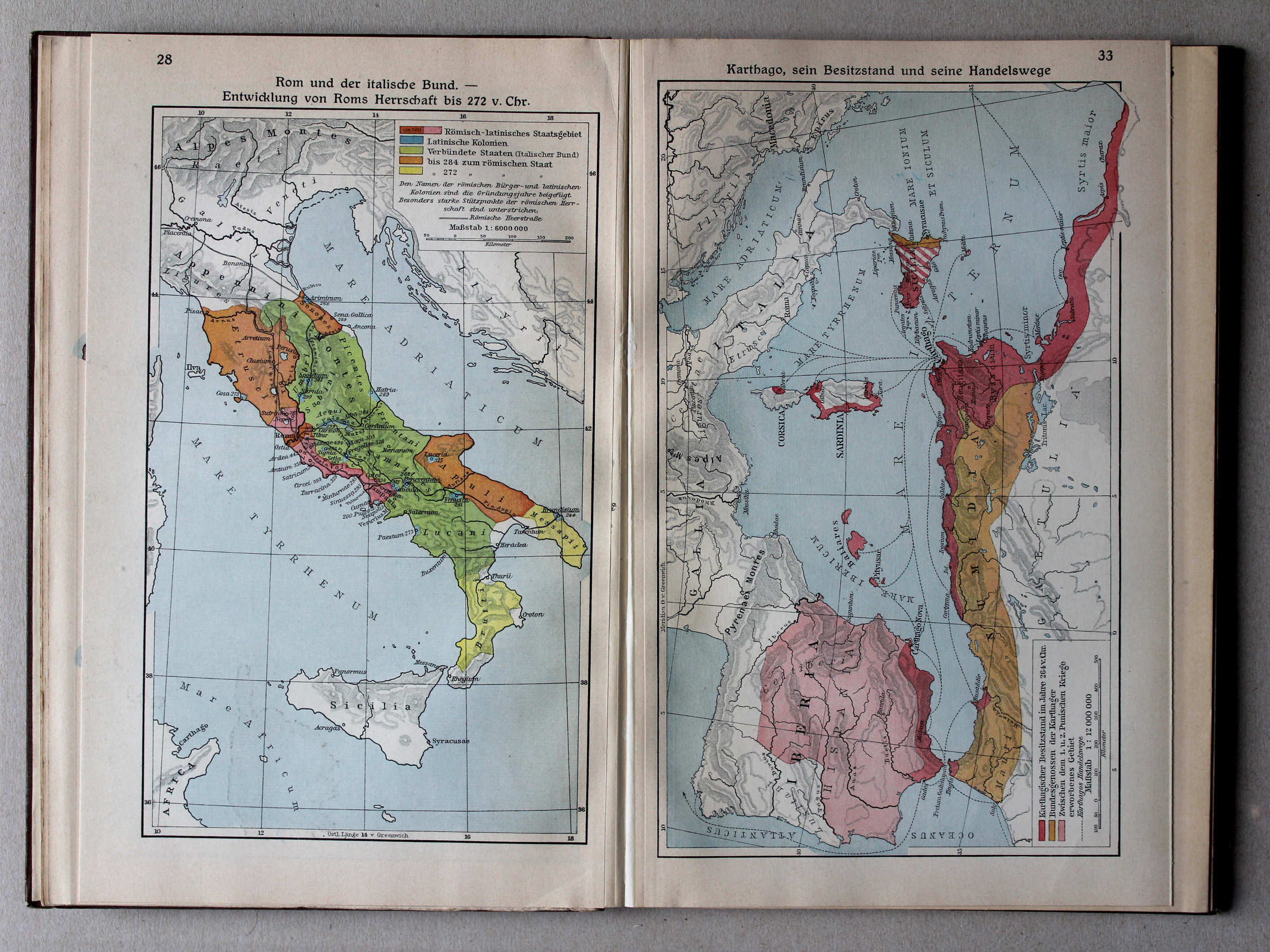
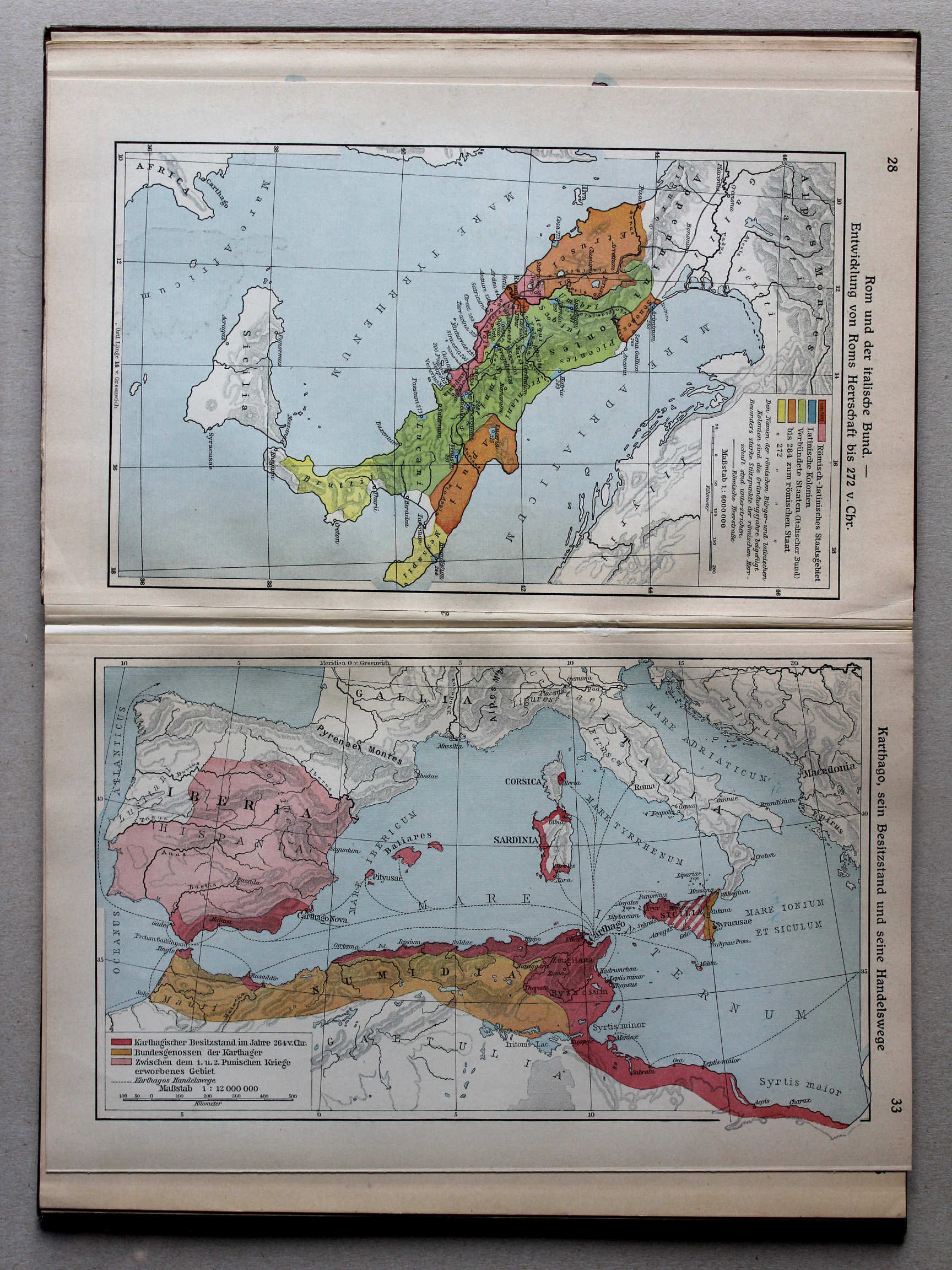
28. Rom und der italische Bund – Entwicklung von Roms Herrschaft bis 272 v. Chr. XL
Rome en de Italische Bond. Ontwikkeling van de Romeinse heerschappij tot 272 v. Chr. / Rome and the Italic Confederation. Development of Roman rule until 272 BC
 Putzgers Historischer Schul-Atlas, Große Ausgabe, 1931/33
|
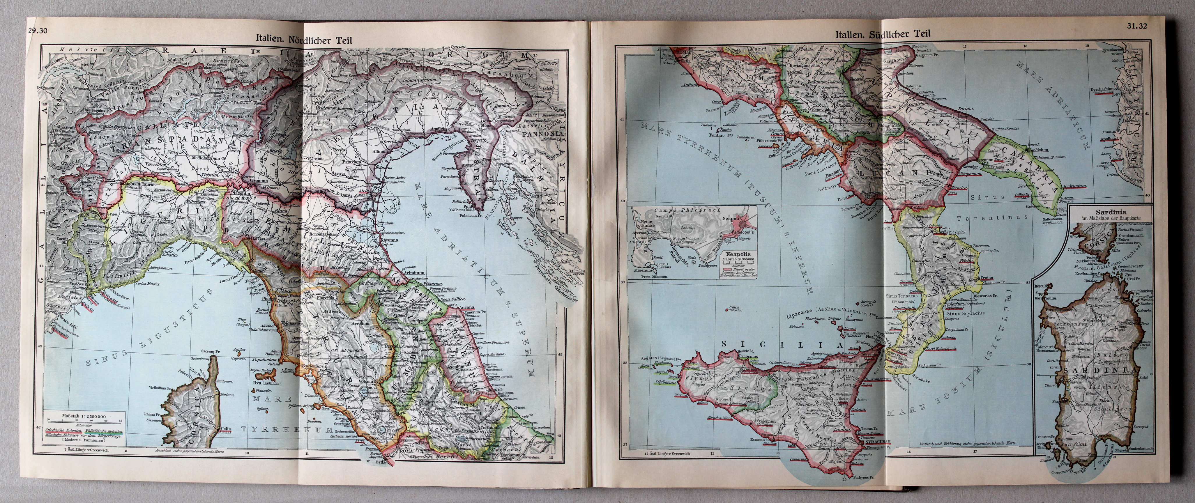
29.30. Italien. Nördlicher Teil
XL
Italië, noordelijk deel / Italy, northern part |
31.32. Italien. Südlicher Teil
XL
Italië, zuidelijk deel / Italy, southern part |
 Putzgers Historischer Schul-Atlas, Große Ausgabe, 1931/33
33. Karthago, sein Besitzstand und seine Handelswege XL
Carthago: bezittingen en handelsroutes / Carthage: possessions and trade routes
 Putzgers Historischer Schul-Atlas, Große Ausgabe, 1931/33
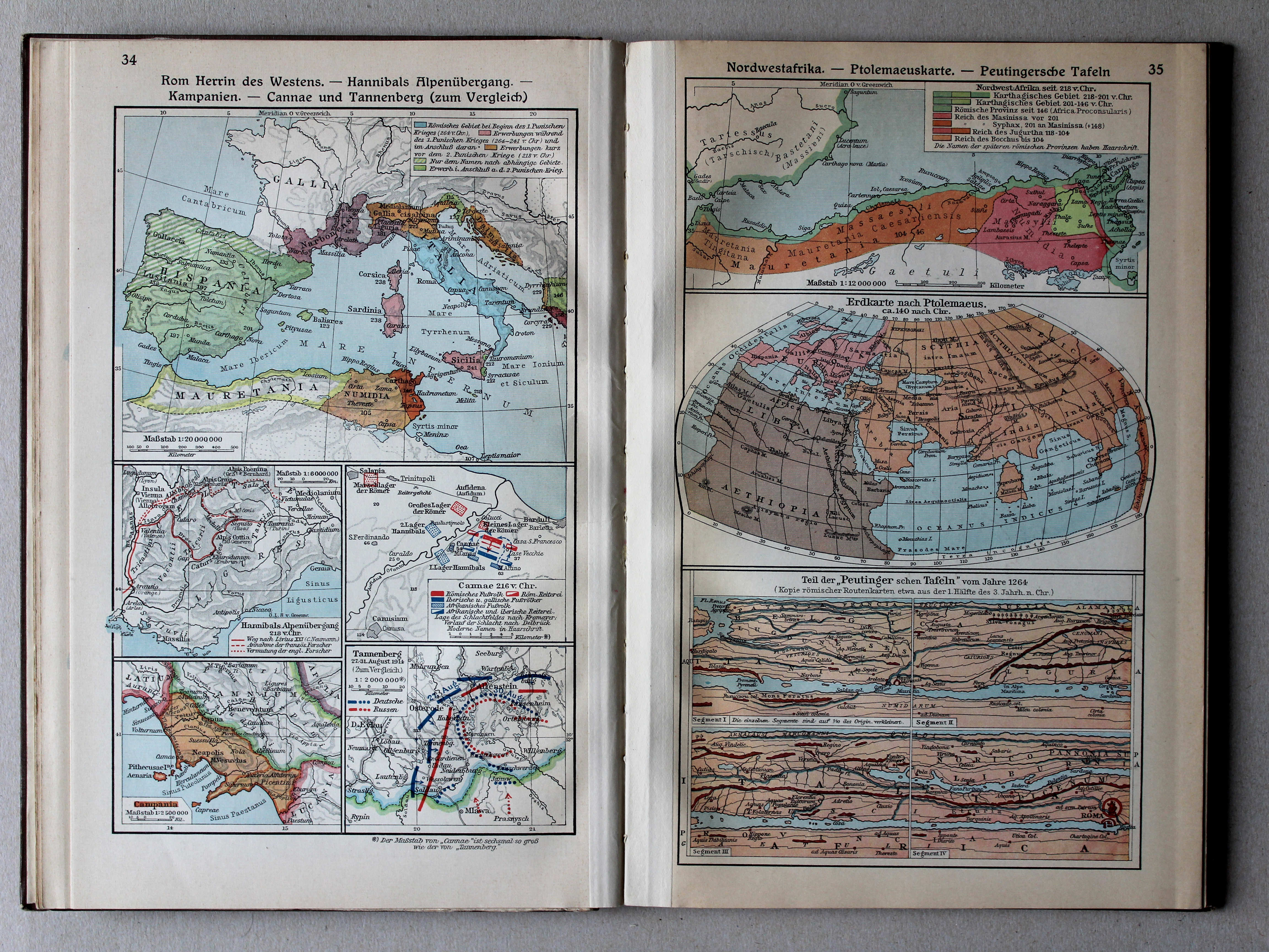
34. Rom Herrin des Westens – Hannibals Alpenübergang – Kampanien – Cannae und Tannenberg (zum Vergleich) XL
Rome als heerseres van het Westen. Tocht van Hannibal over de Alpen. Campania. Cannae en Tannenberg (ter vergelijking) / Rome as the empress of the West. Hannibal crossing the Alps. Campania. Cannae and Tannenberg (in comparison)
35. Nordwestafrika – Ptolemaeuskarte – Peutingersche Tafeln XL
Noordwest-Afrika. Kaart van Ptolemaeus. Tabula Peutingeriana / Northwest Africa. Map of Ptolemy. Tabula Peutingeriana
 Putzgers Historischer Schul-Atlas, Große Ausgabe, 1931/33
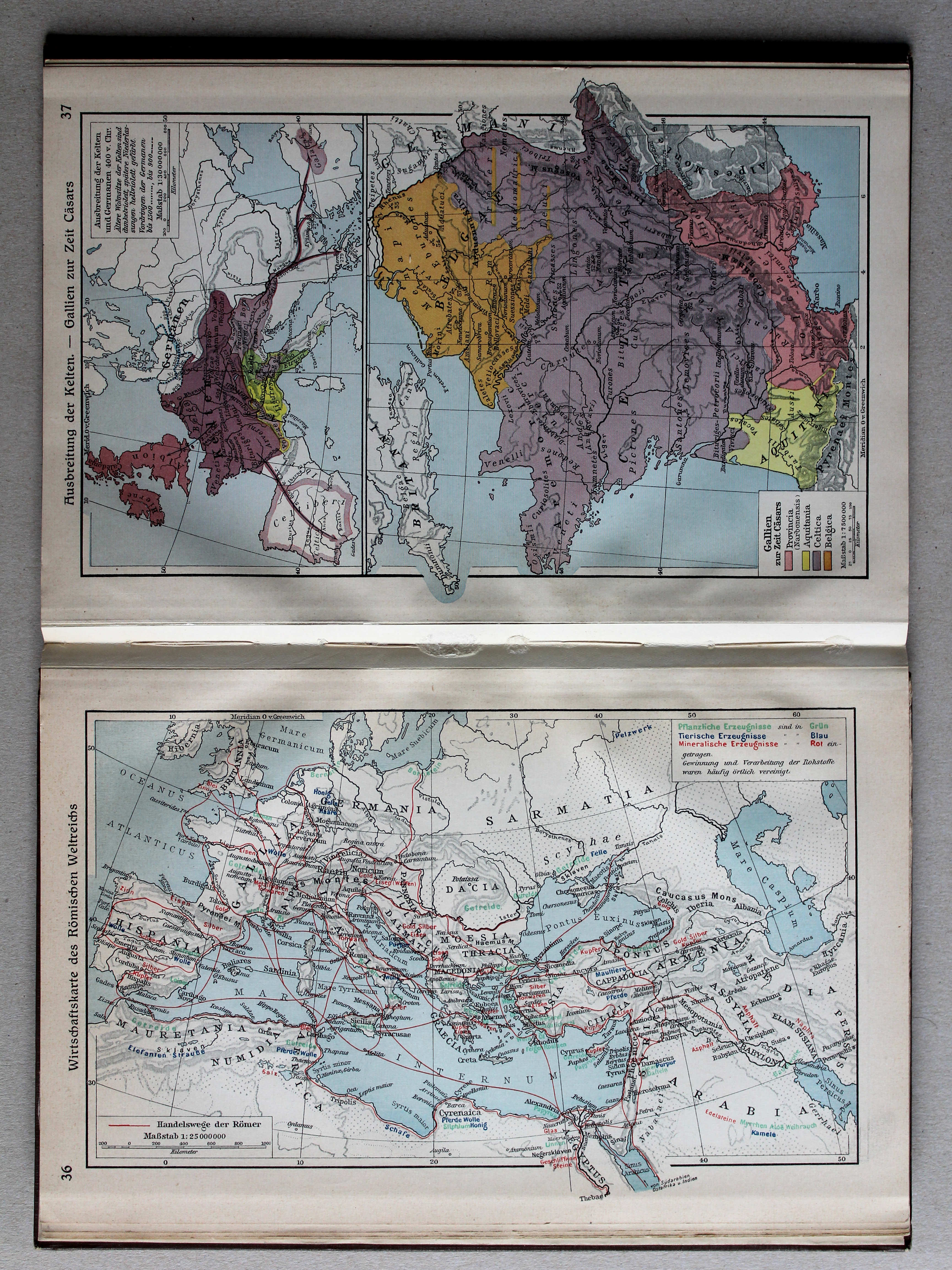
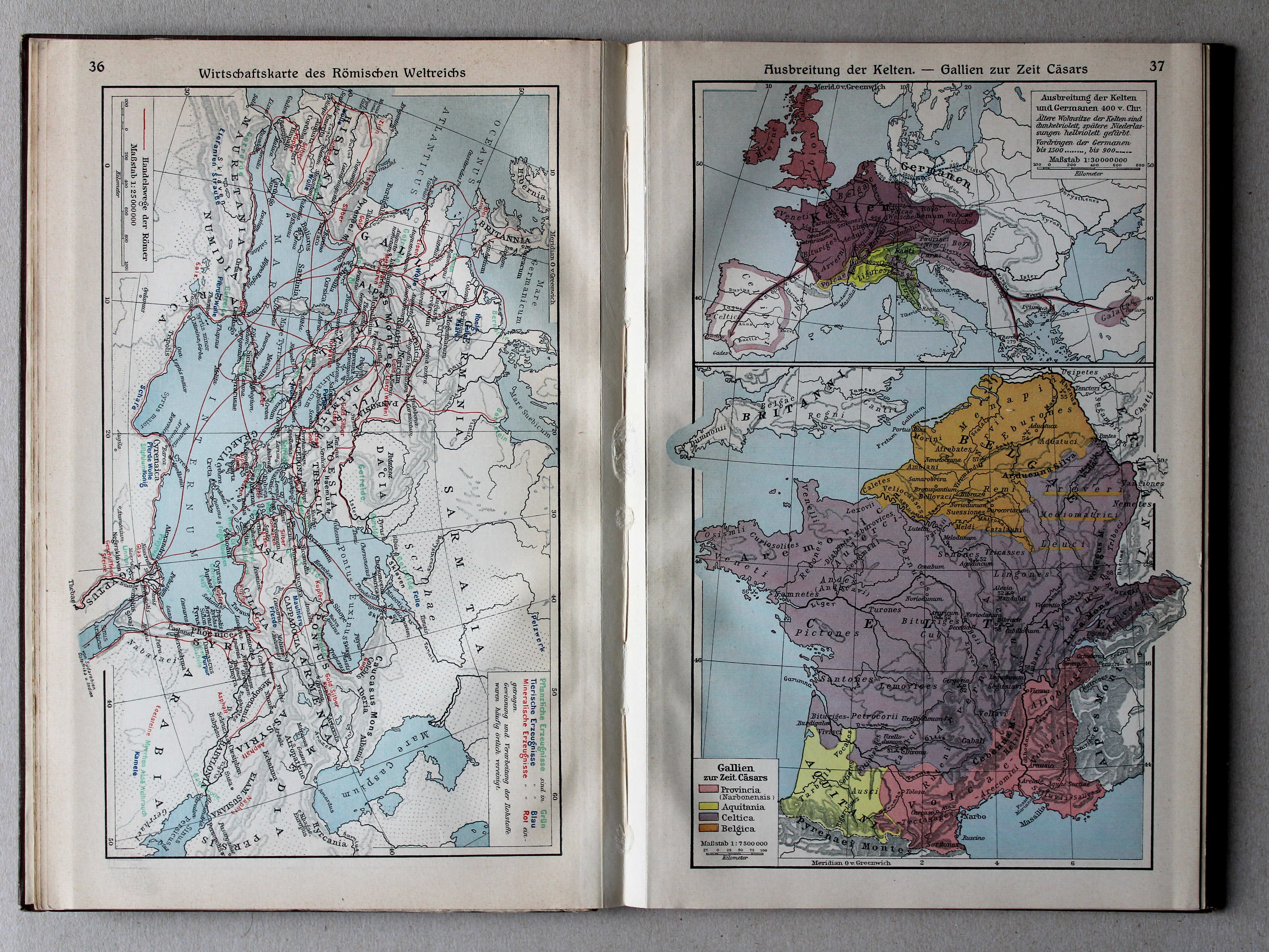
36. Wirtschaftskarte des Römischen Weltreichs XL
Economische kaart van het Romeinse Rijk / Economic map of the Roman Empire
 Putzgers Historischer Schul-Atlas, Große Ausgabe, 1931/33
37. Ausbreitung der Kelten – Gallien zur Zeit Cäsars XL
Verspreiding van de Kelten. Gallië in de tijd van Caesar / Expansion of the Celts. Gaul in Caesar's time
 Putzgers Historischer Schul-Atlas, Große Ausgabe, 1931/33
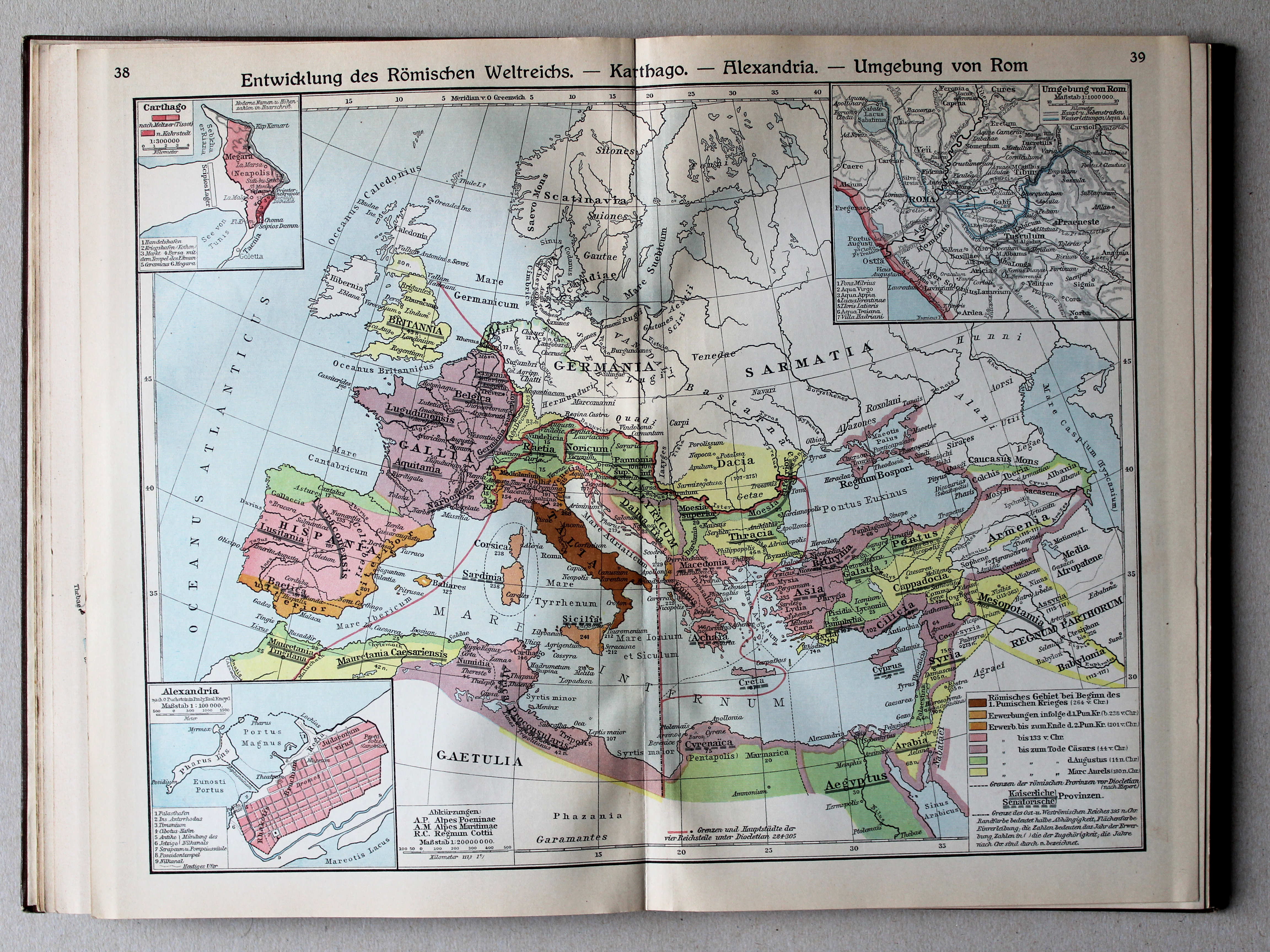
38.39. Entwicklung des Römischen Weltreichs – Karthago – Alexandria – Umgebung von Rom XL
Ontwikkeling van het Romeinse Rijk. Carthago. Alexandrië. Omgeving van Rome / Development of the Roman Empire. Carthage. Alexandria. Environs of Rome
 Putzgers Historischer Schul-Atlas, Große Ausgabe, 1931/33
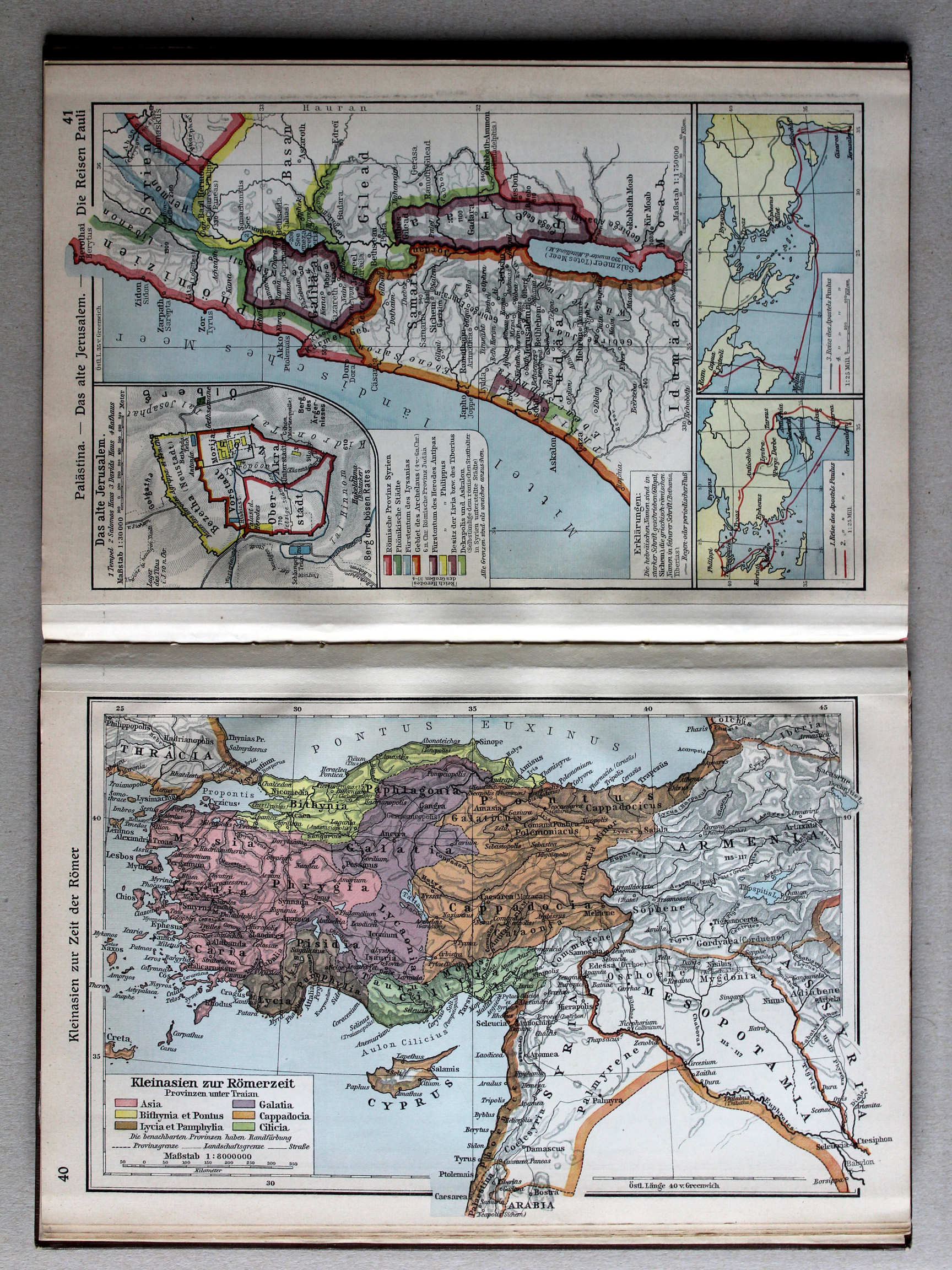
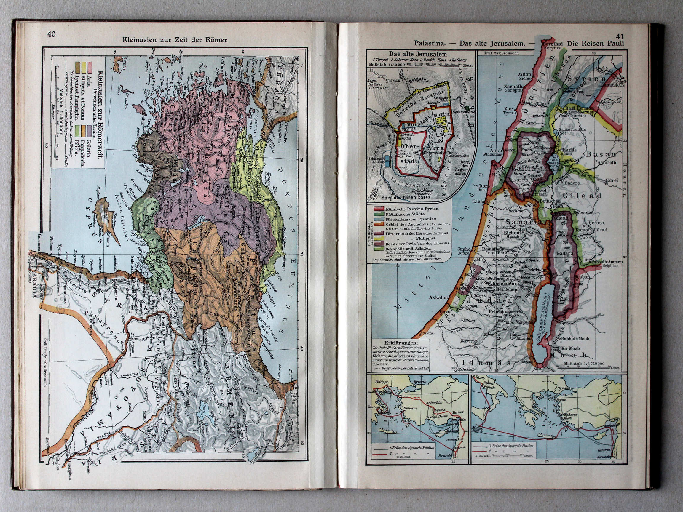
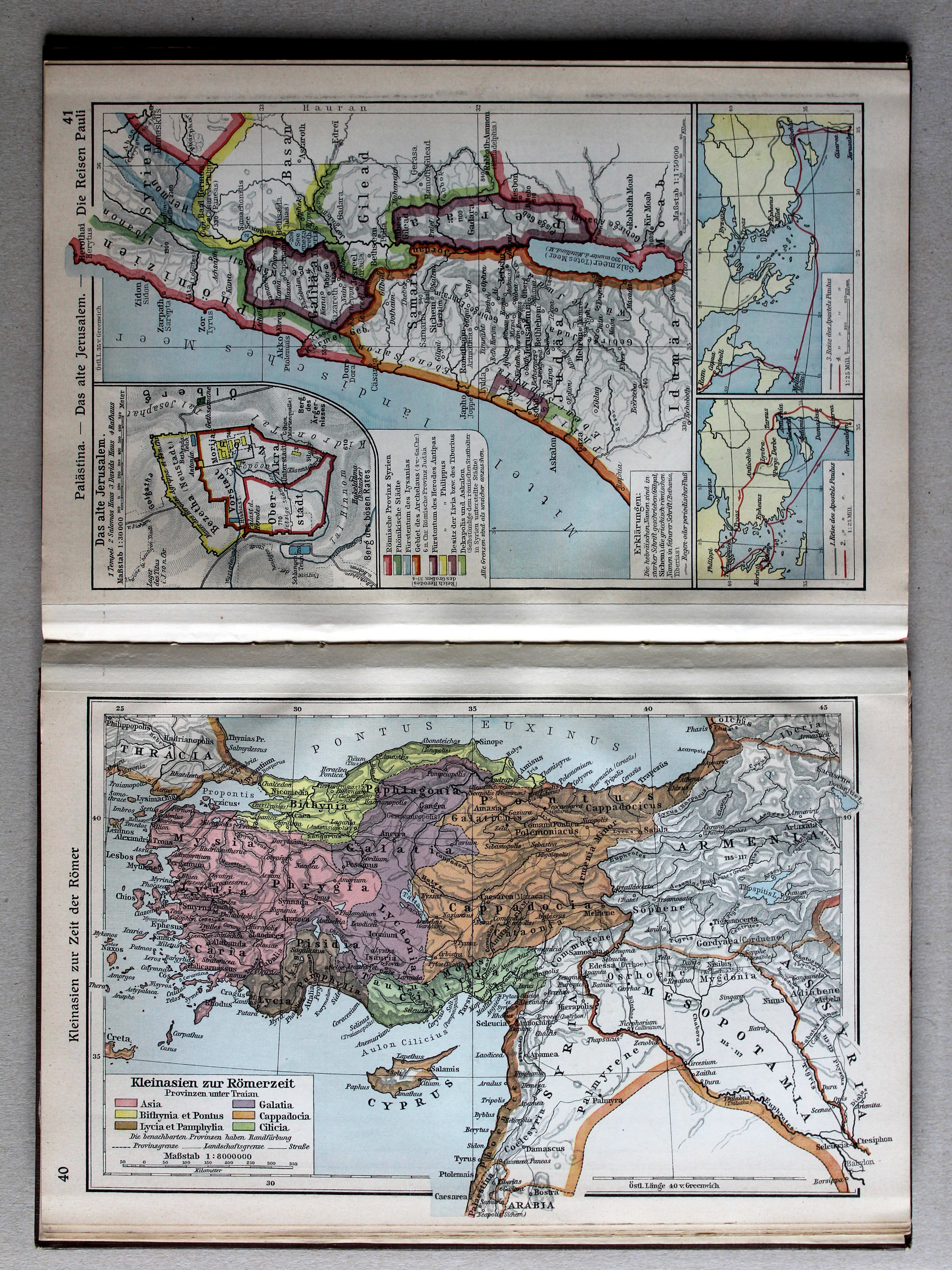
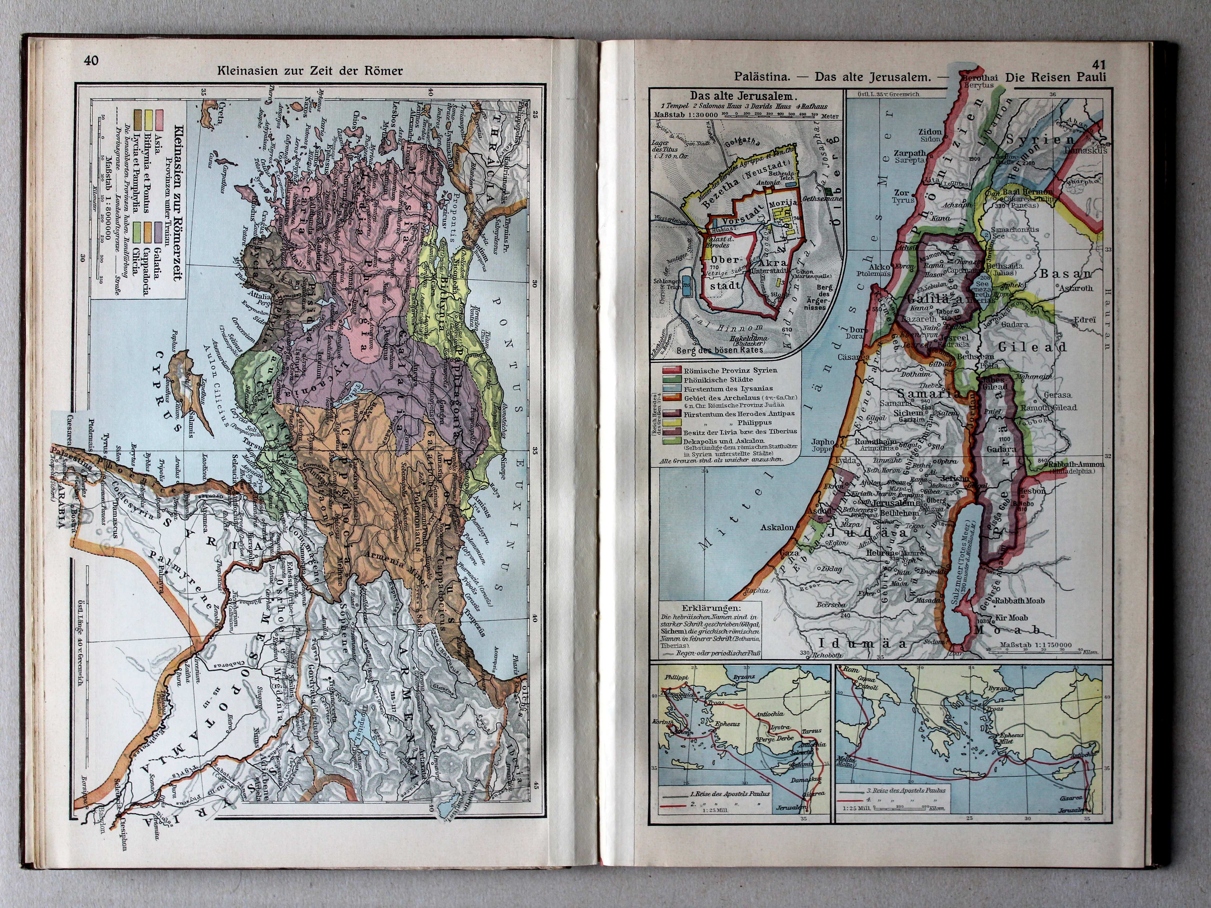
40. Kleinasien zur Zeit der Römer XL
Klein-Azië in de tijd van de Romeinen / Asia Minor under the Romans
 Putzgers Historischer Schul-Atlas, Große Ausgabe, 1931/33
41. Palästina – Das alte Jerusalem – Die Reisen Pauli XL
Palestina. Het oude Jeruzalem. Reizen van de Apostel Paulus / Palestine. Ancient Jerusalem. Journeys of Paul the Apostle
 Putzgers Historischer Schul-Atlas, Große Ausgabe, 1931/33
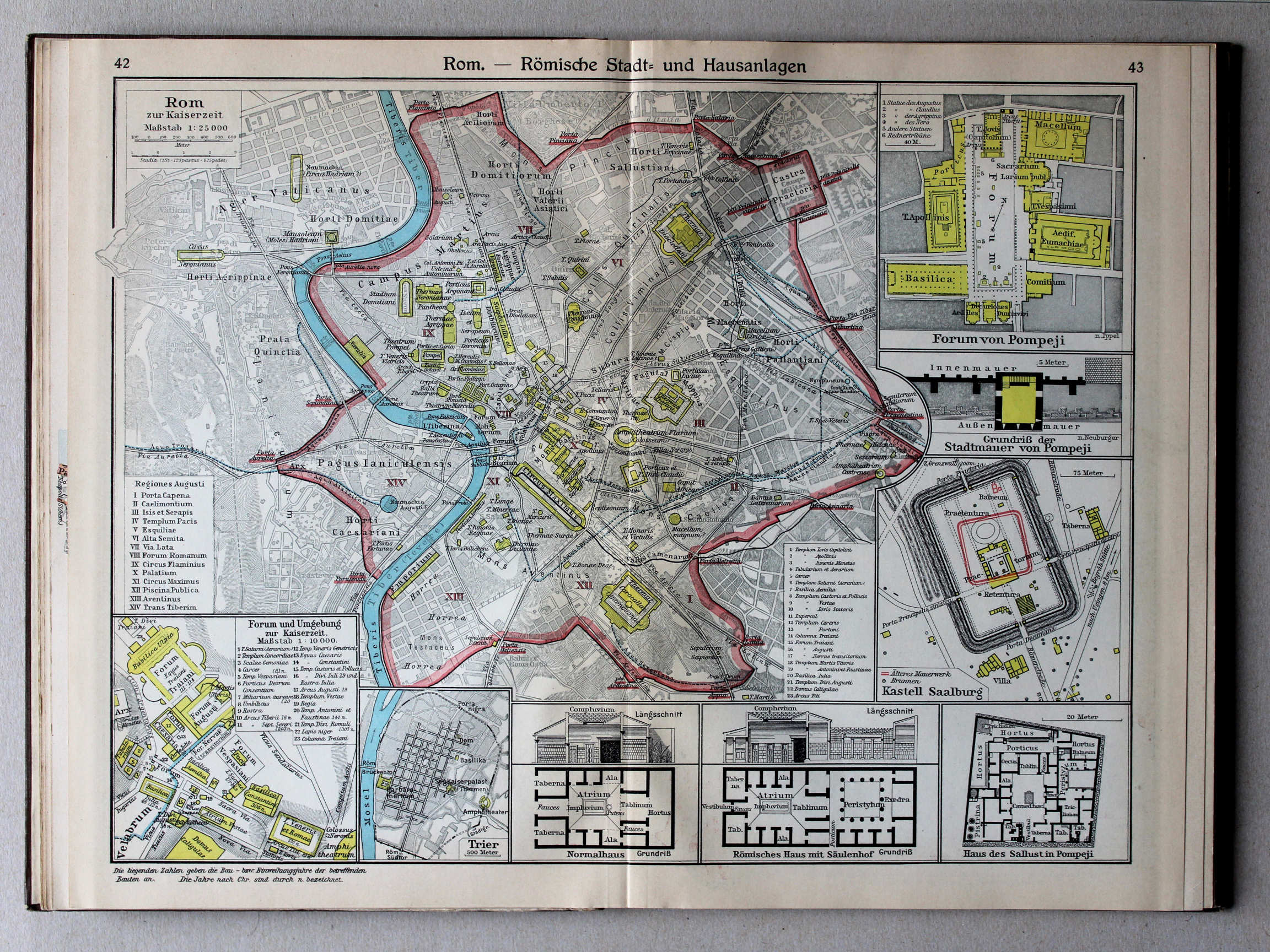
42.43. Rom – Römische Stadt- und Hausanlagen XL
Rome. Romeinse steden- en huizenbouw / Rome. Roman urban planning and housing architecture
 Putzgers Historischer Schul-Atlas, Große Ausgabe, 1931/33
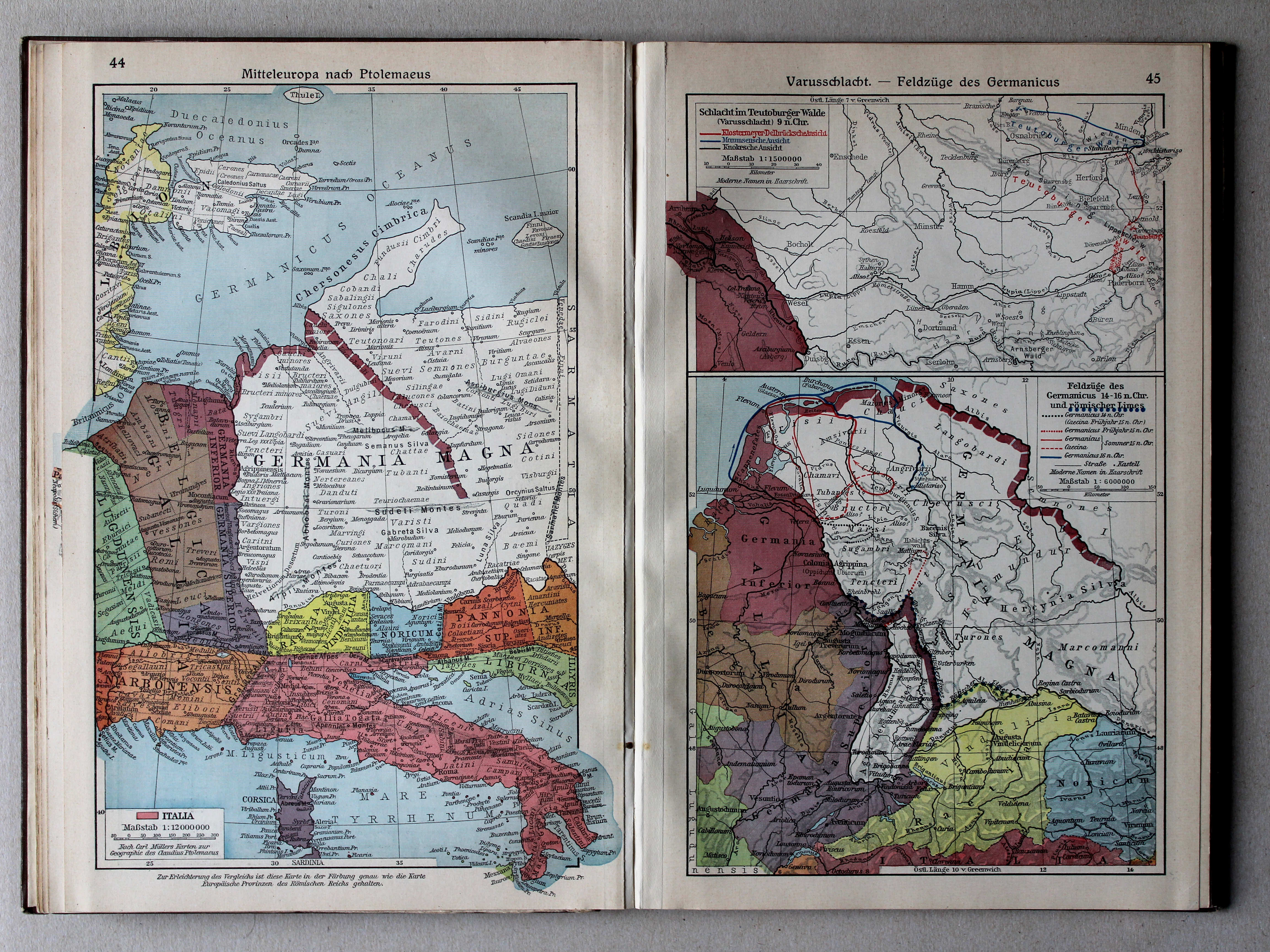
44. Mitteleuropa nach Ptolemaeus XL
Midden-Europa volgens Ptolemaeus / Central Europe after Ptolemy
45. Varusschlacht – Feldzüge des Germanicus XL
Slag bij het Teutoburgerwoud. Veldtochten van Germanicus / Battle of the Teutoburg Forest. Campaigns of Germanicus
 Putzgers Historischer Schul-Atlas, Große Ausgabe, 1931/33
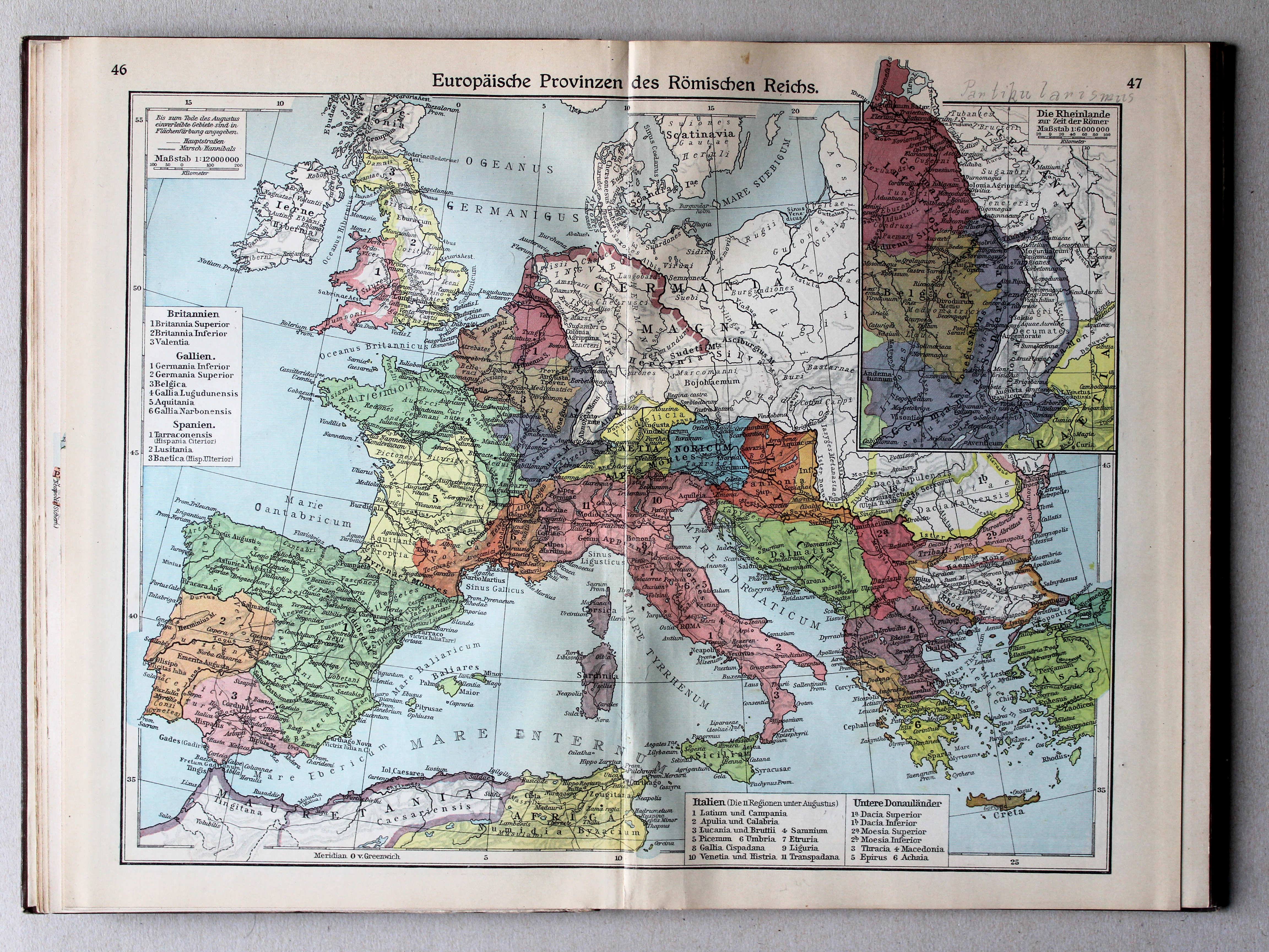
46.47. Europäische Provinzen des Römischen Reichs XL
Europese provincies van het Romeinse Rijk / European provinces of the Roman Empire
 Putzgers Historischer Schul-Atlas, Große Ausgabe, 1931/33
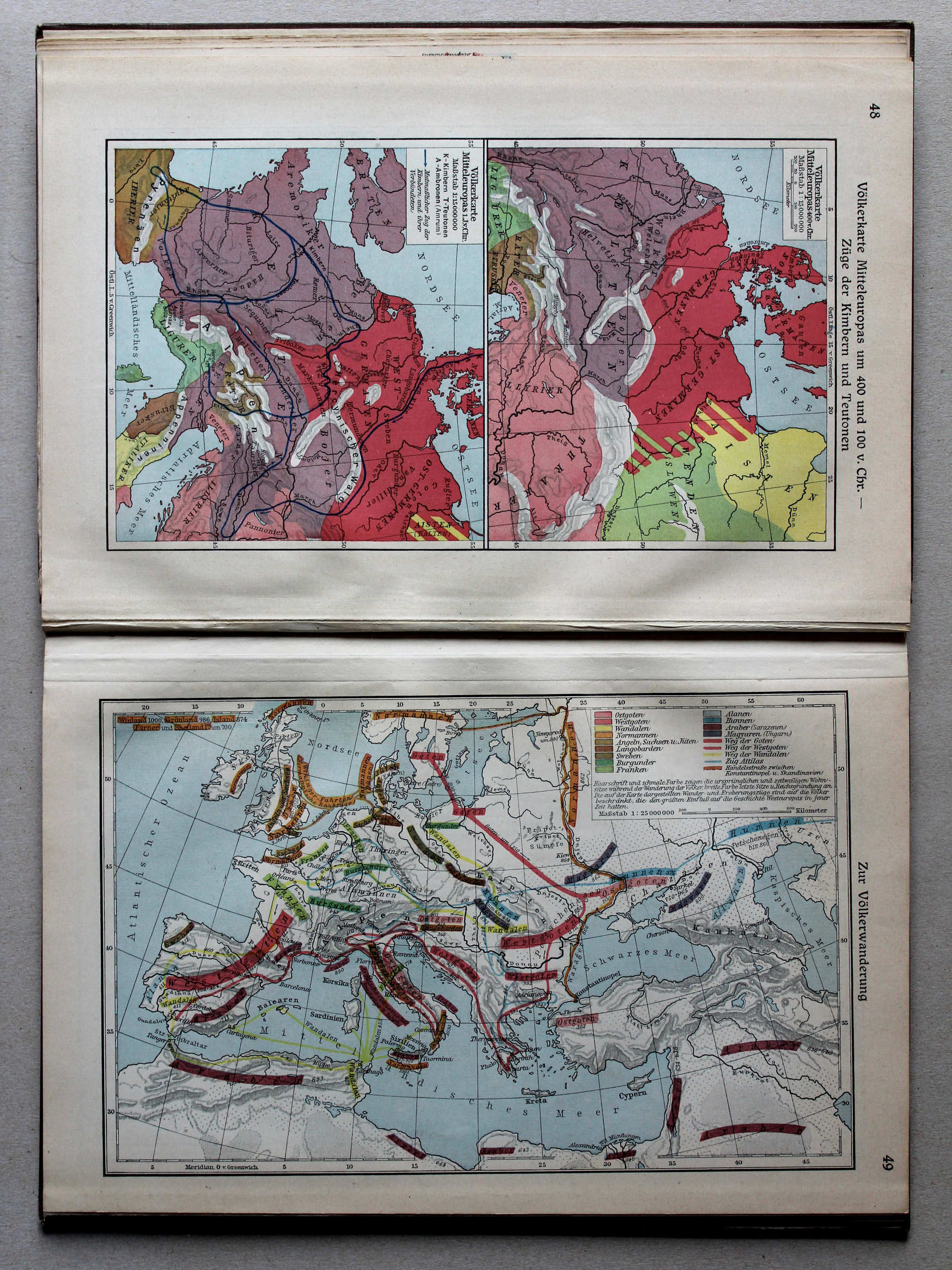
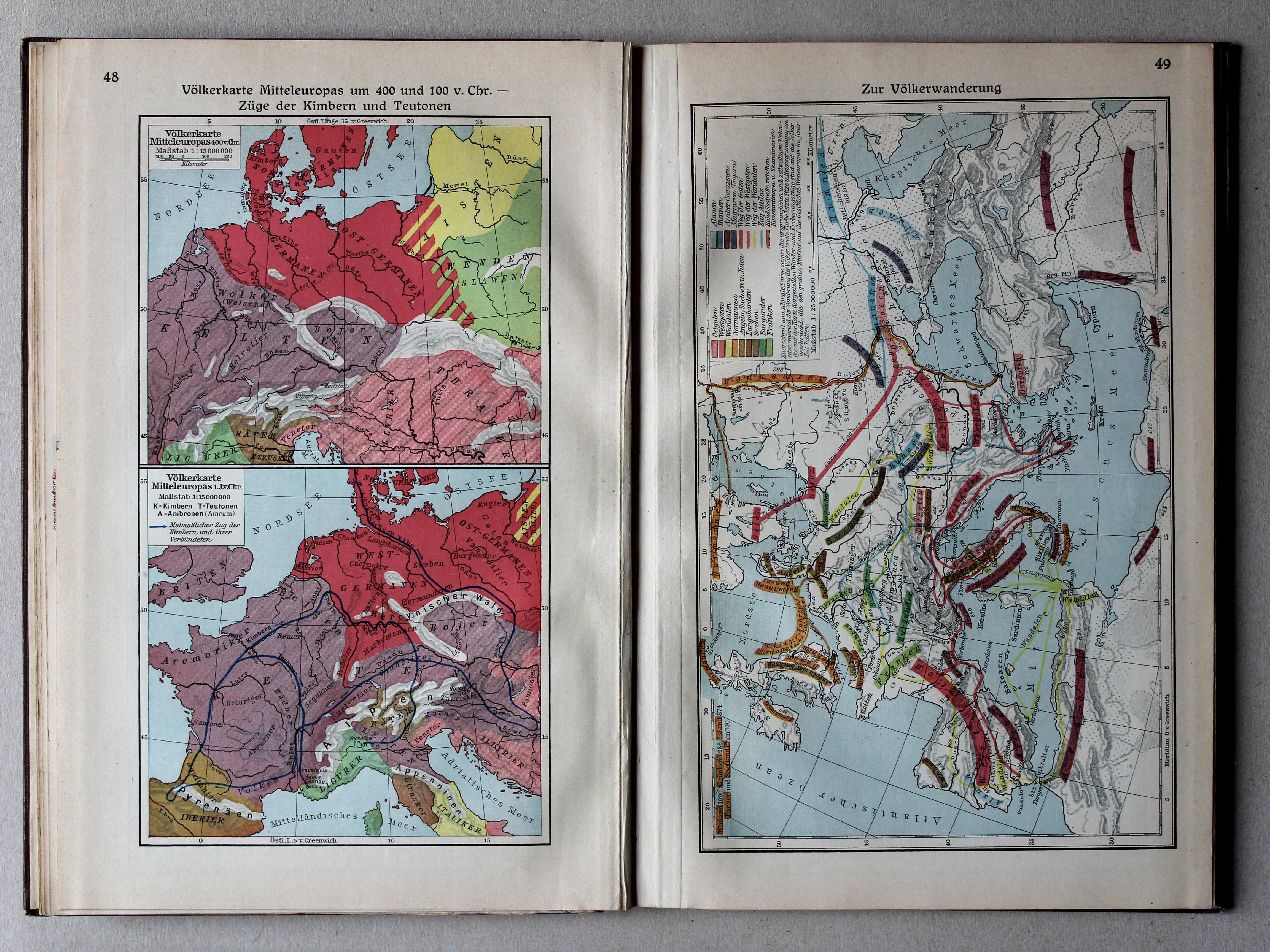
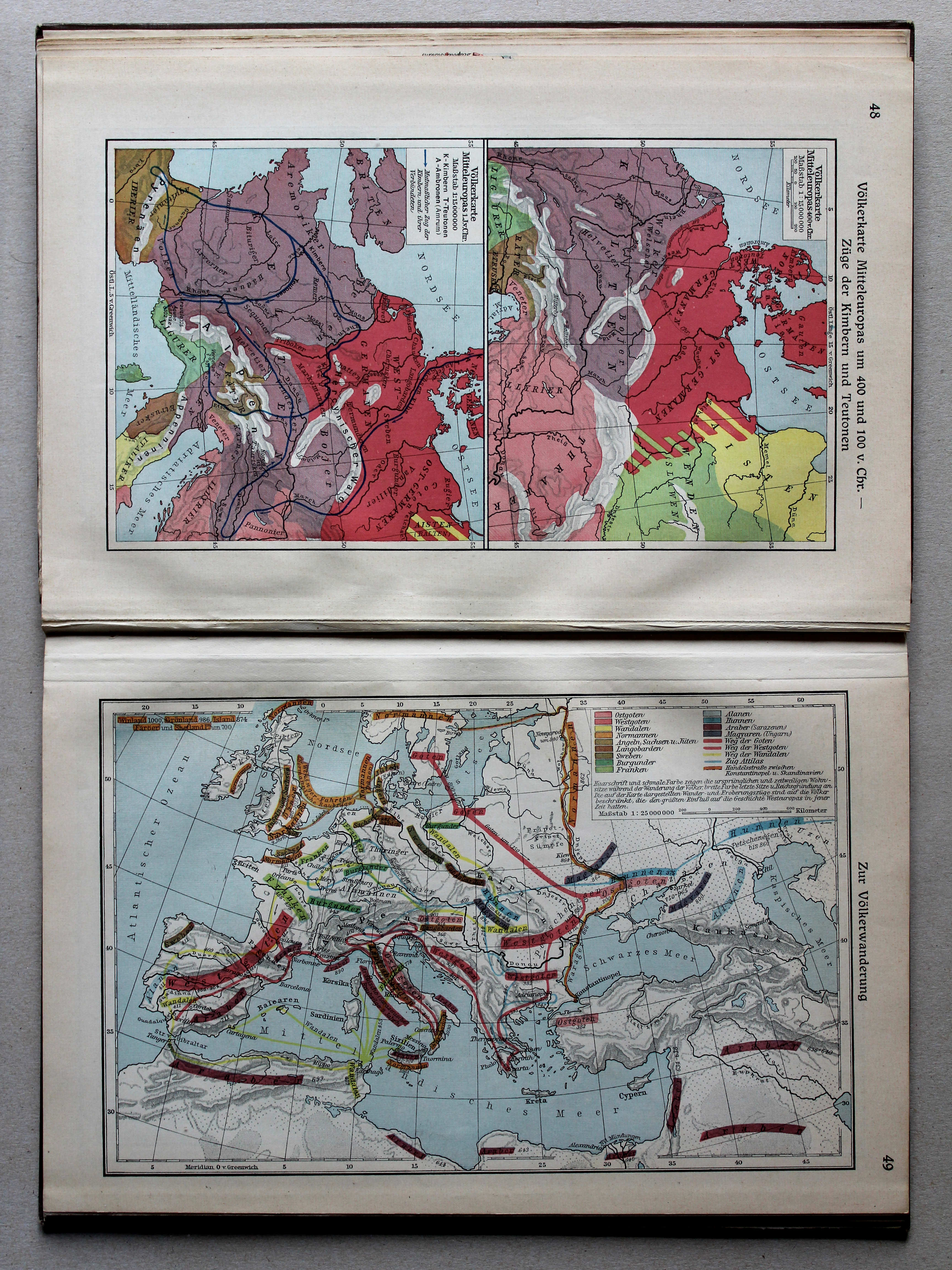
48. Völkerkarte Mitteleuropas um 400 und 100 v. Chr. – Züge der Kimbern und Teutonen XL
Etnografische kaart van Midden-Europa in 400 en 100 v. Chr. Tochten van de Kimbren en Teutonen / Ethnographic map of Central Europe in 400 and 100 BC. Journeys of the Cimbri and Teutones
 Putzgers Historischer Schul-Atlas, Große Ausgabe, 1931/33
49. Zur Völkerwanderung XL
De Volksverhuizing / The Migration Period
 Putzgers Historischer Schul-Atlas, Große Ausgabe, 1931/33
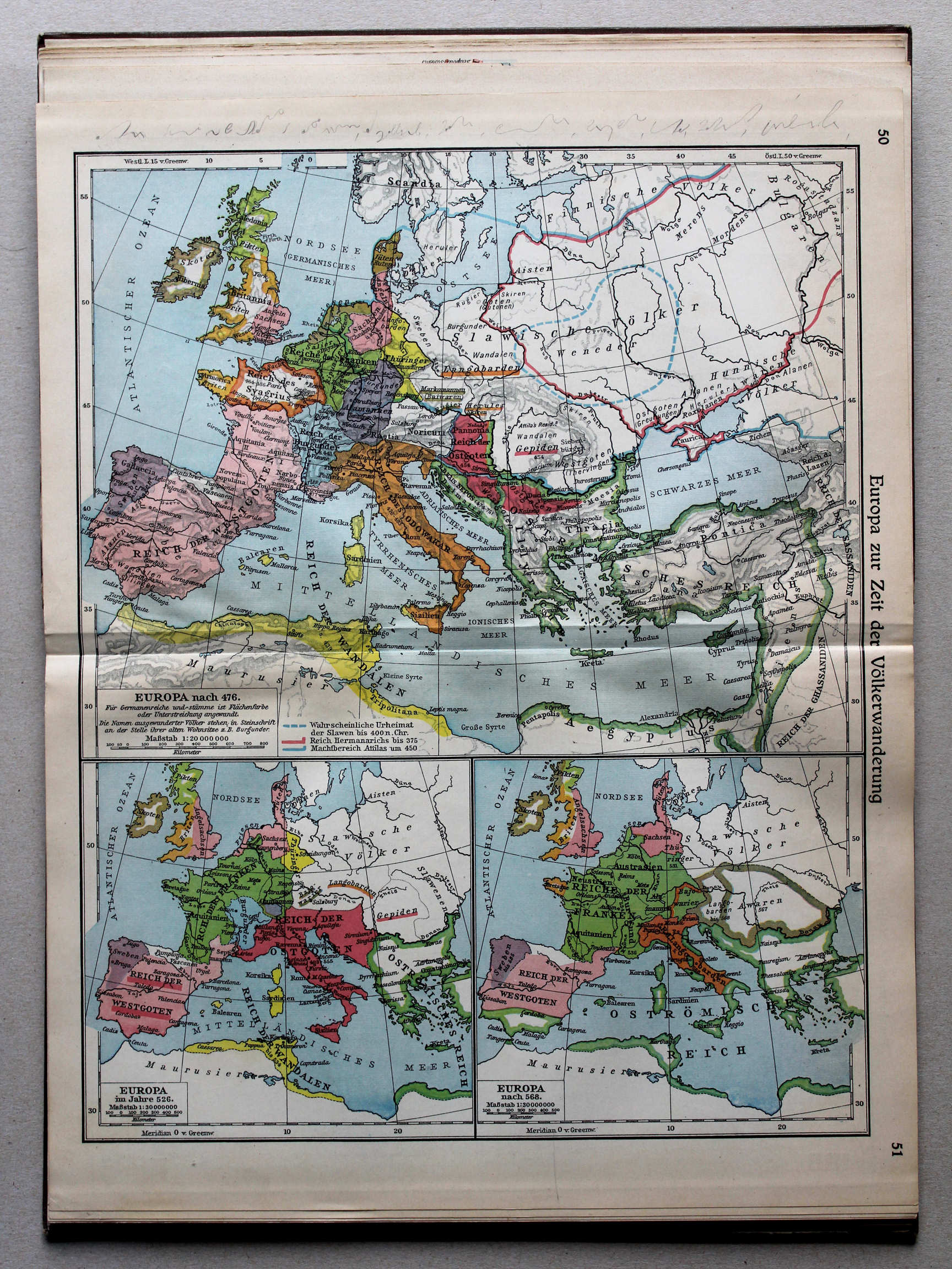
50.51. Europa zur Zeit der Völkerwanderung XL
Europa tijdens de Volksverhuizing / Europe during the Migration Period
 Putzgers Historischer Schul-Atlas, Große Ausgabe, 1931/33
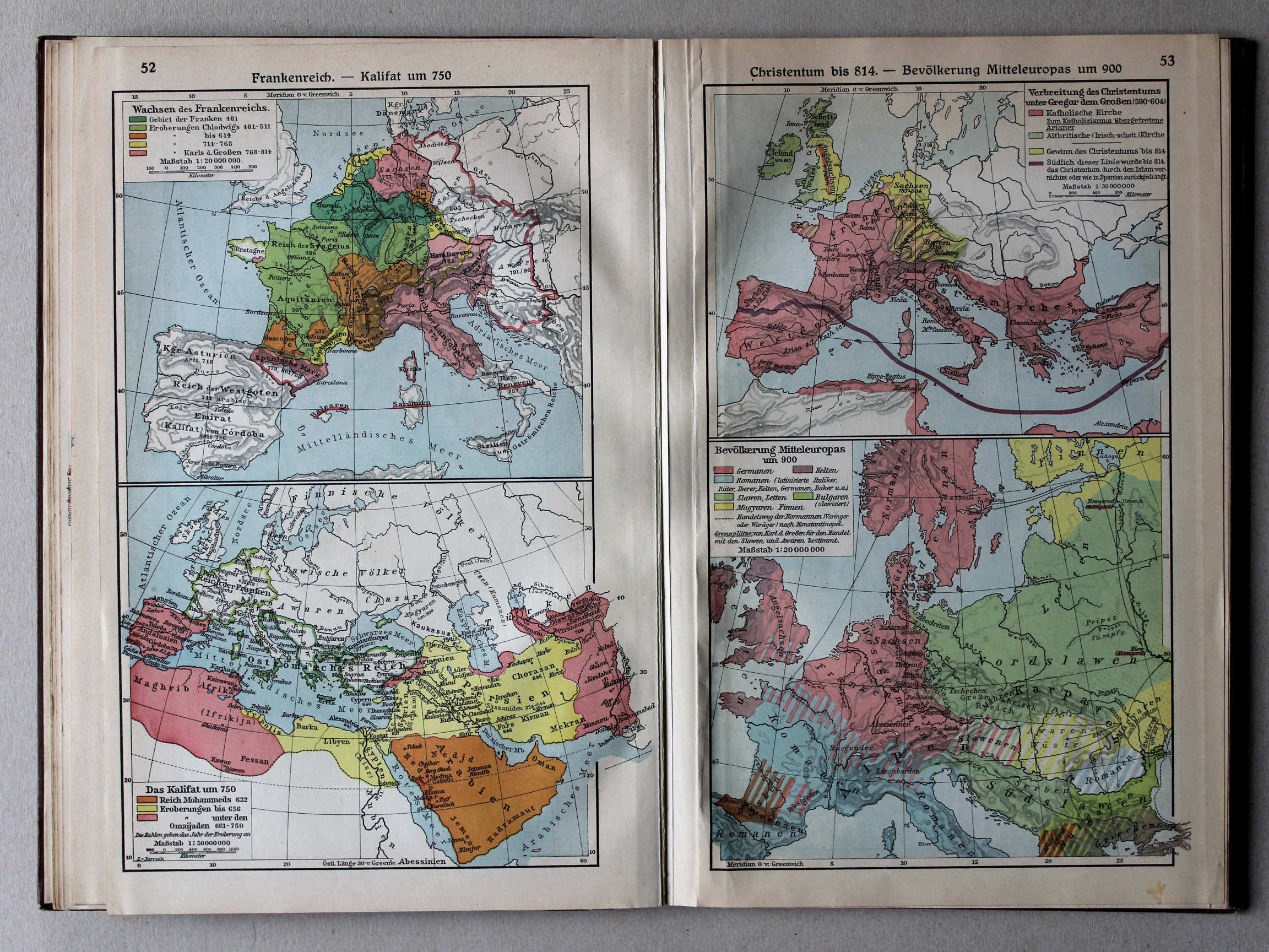
52. Frankenreich – Kalifat um 750 XL
Het Frankische Rijk. Het Kalifaat rond 750 / The Frankish Empire. The Caliphate around 750
53. Christentum bis 814 – Bevölkerung Mitteleuropas um 900 XL
Christendom tot 814. Volkeren in Midden-Europa rond 900 / Christianity until 814. Nations in Central Europe around 900
 Putzgers Historischer Schul-Atlas, Große Ausgabe, 1931/33
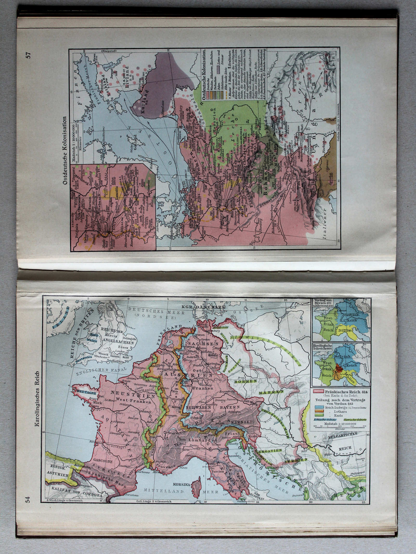
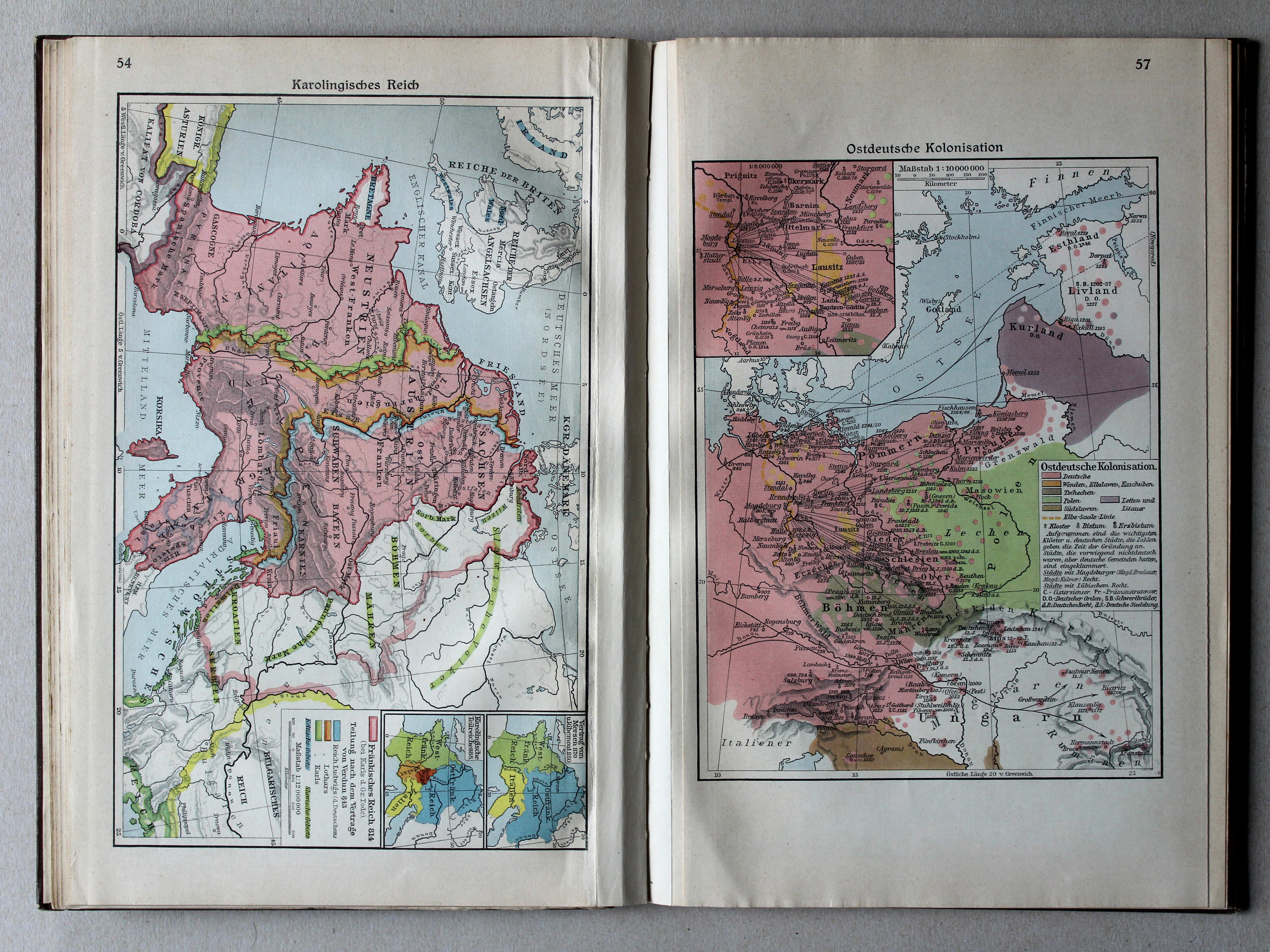
54. Karolingisches Reich XL
Het Karolingische Rijk / Carolingian Empire
 Putzgers Historischer Schul-Atlas, Große Ausgabe, 1931/33
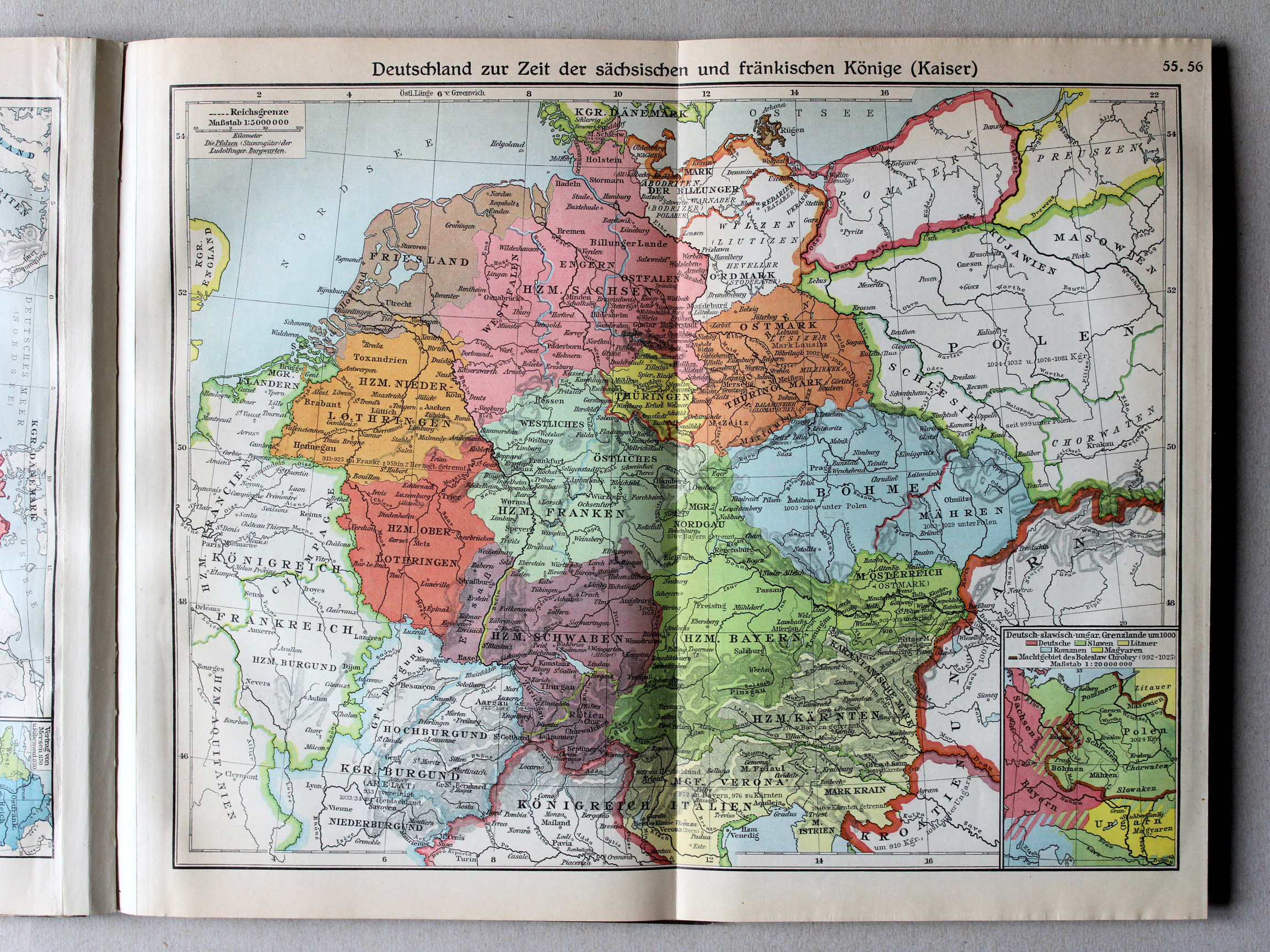
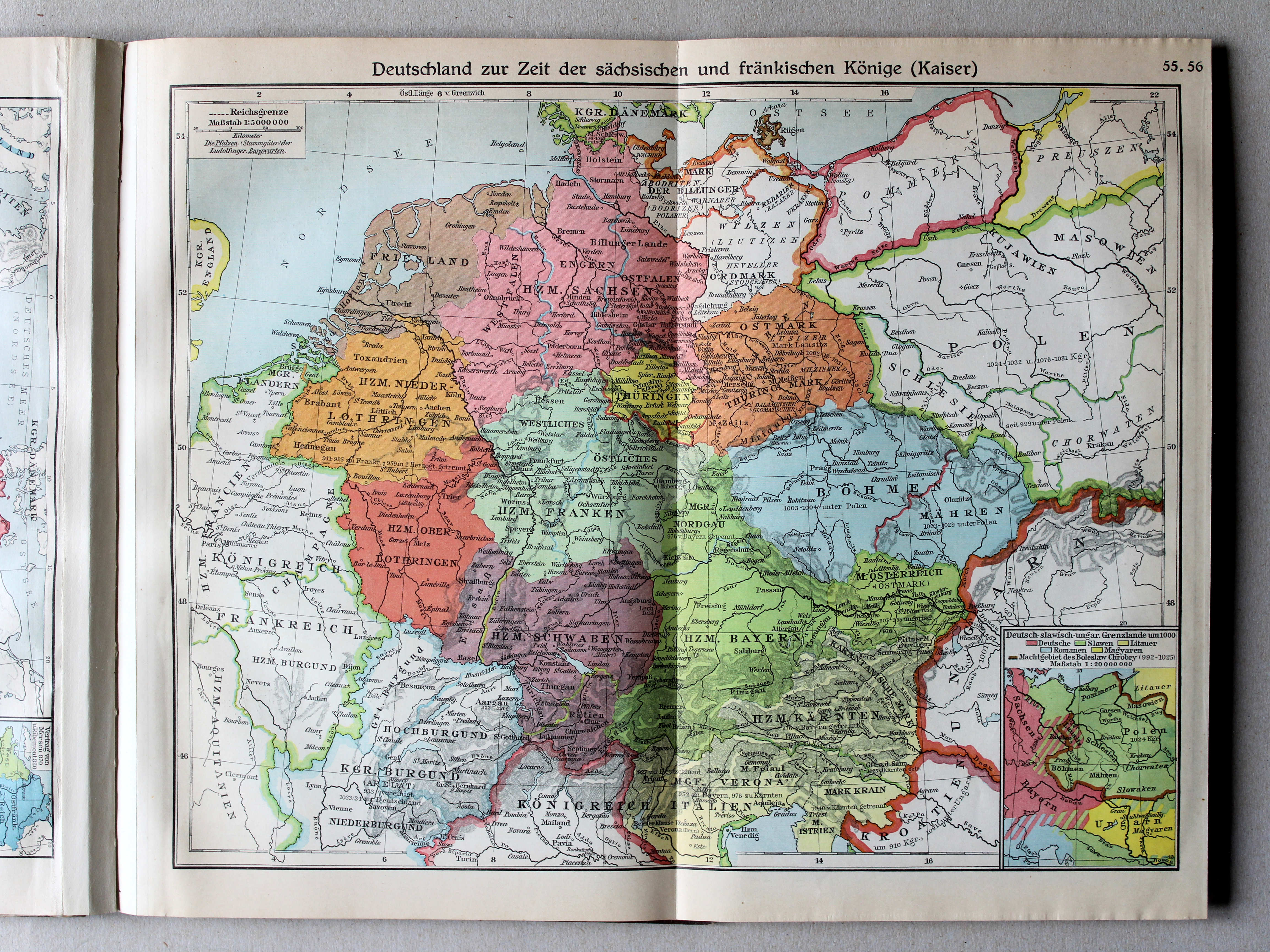
55.56. Deutschland zur Zeit der sächsischen und fränkischen Könige (Kaiser) XL
Duitsland in de tijd van de Saksische en Frankische keizers / Germany during the Saxon and Frankish dynasties
 Putzgers Historischer Schul-Atlas, Große Ausgabe, 1931/33
57. Ostdeutsche Kolonisation XL
Duitse kolonisatie naar het oosten / German colonization towards the east
 Putzgers Historischer Schul-Atlas, Große Ausgabe, 1931/33
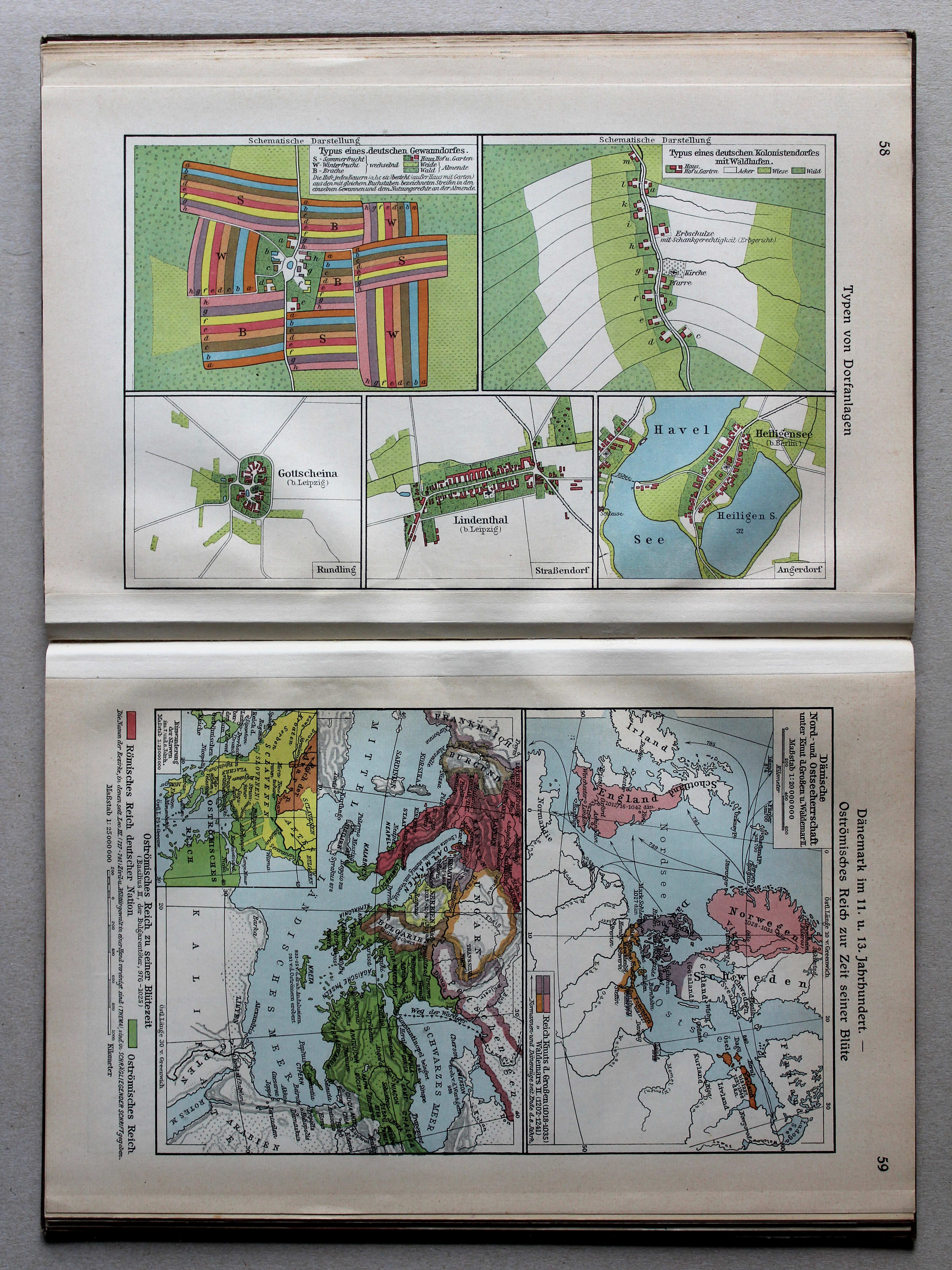
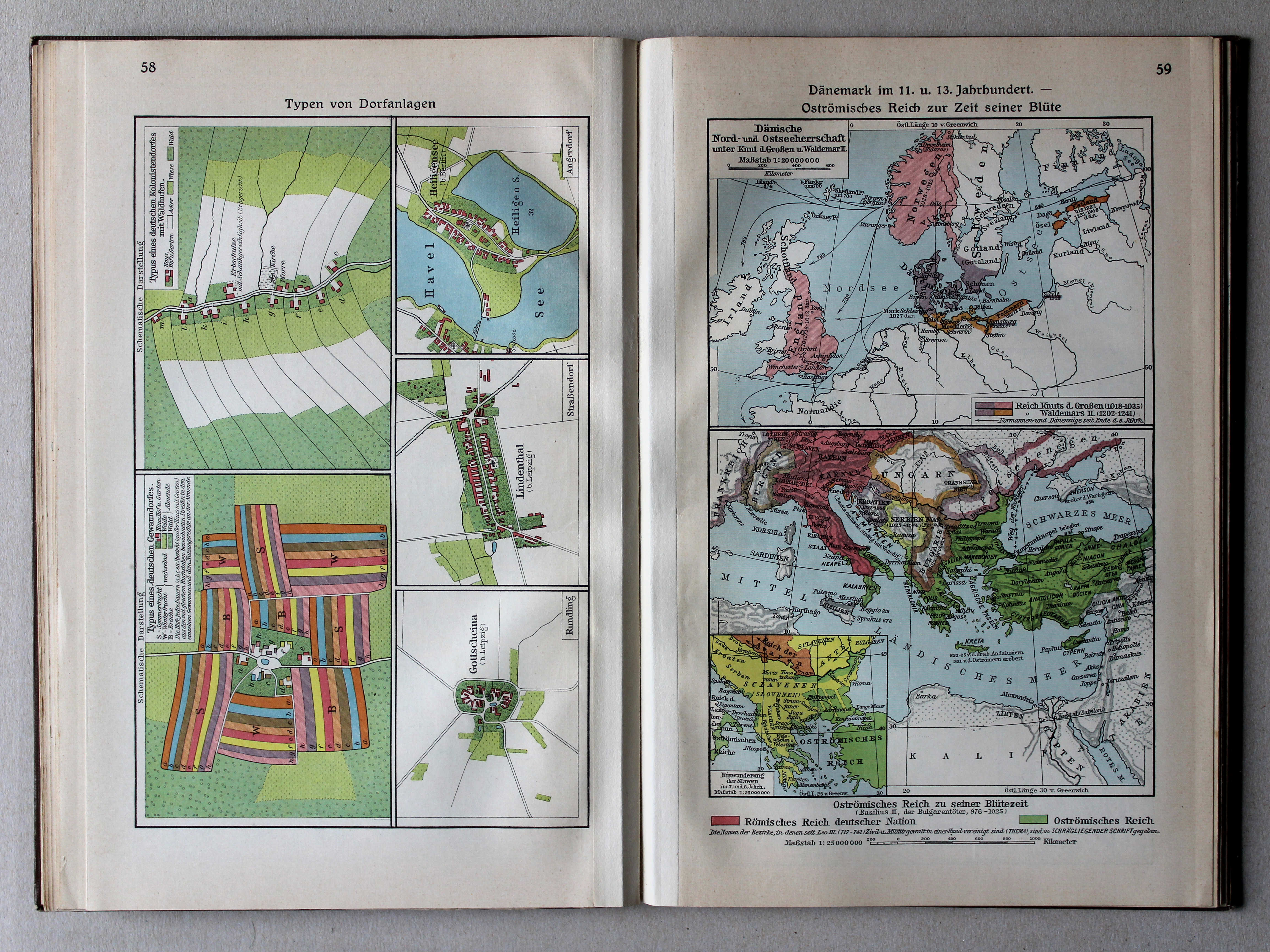
58. Typen von Dorfanlagen XL
Enkele dorpstypen / Some village types
 Putzgers Historischer Schul-Atlas, Große Ausgabe, 1931/33
59. Dänemark im 11. und 13. Jahrhundert – Oströmisches Reich zur Zeit seiner Blüte XL
Denemarken in de 11e en 13e eeuw. Bloei van het Oost-Romeinse Rijk / Denmark in the 11th and 13th centuries. Prosperity of the Eastern Roman Empire
 Putzgers Historischer Schul-Atlas, Große Ausgabe, 1931/33
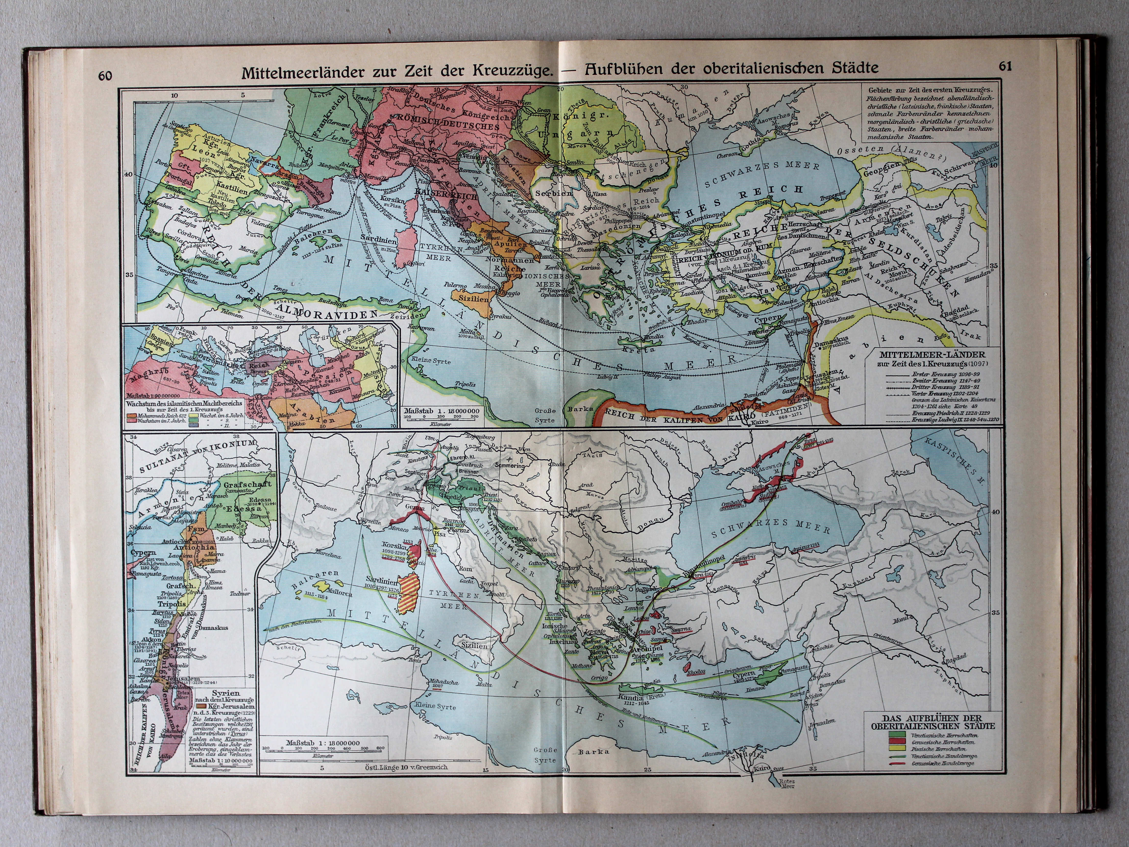
60.61. Mittelmeerländer zur Zeit der Kreuzzüge – Aufblühen der oberitalienischen Städte XL
Het Middellandse Zeegebied in de tijd van de Kruistochten. Bloei van de Noord-Italiaanse steden / The Mediterranean region during the Crusades. Prosperity of the North Italian cities
 Putzgers Historischer Schul-Atlas, Große Ausgabe, 1931/33
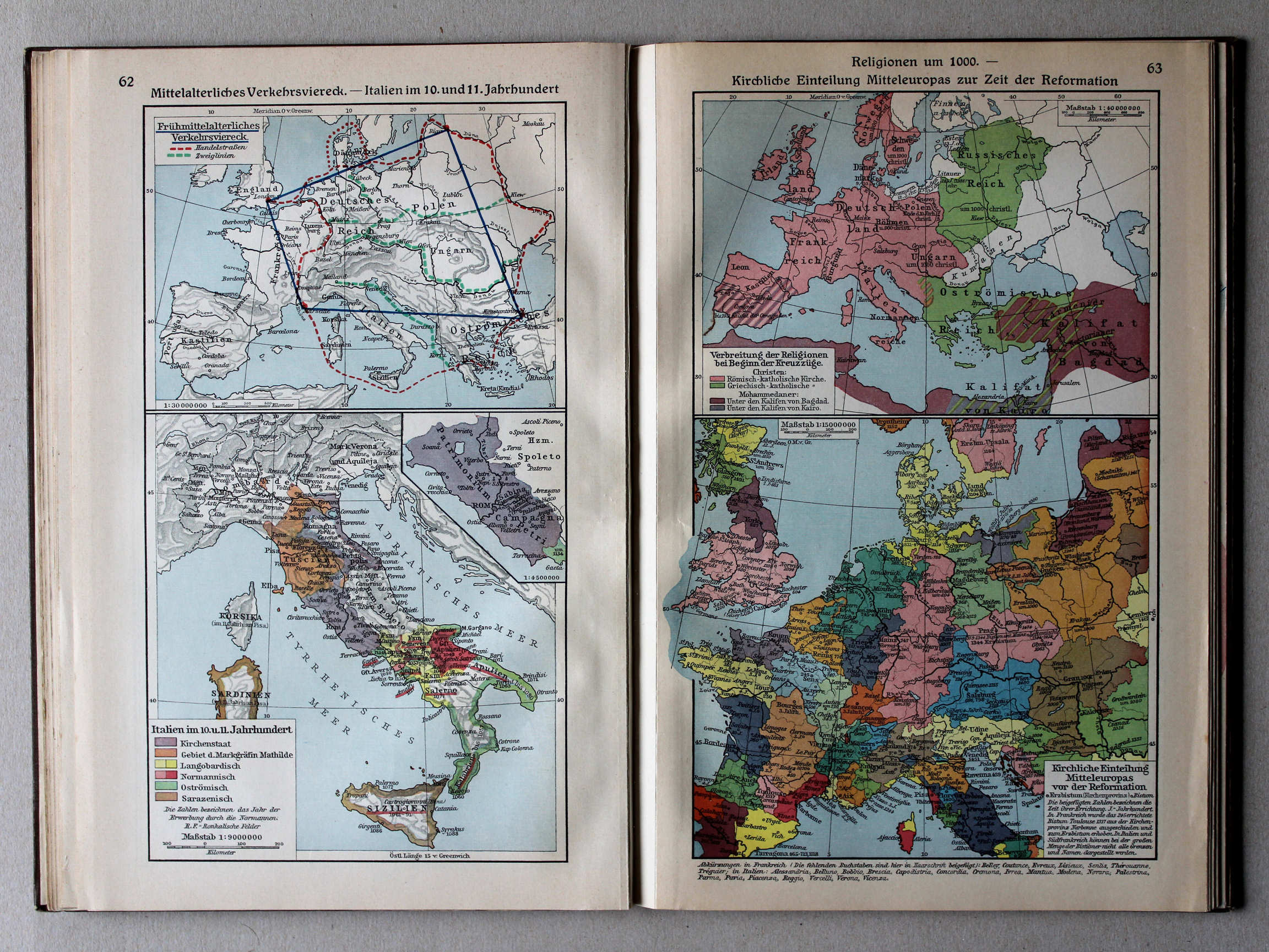
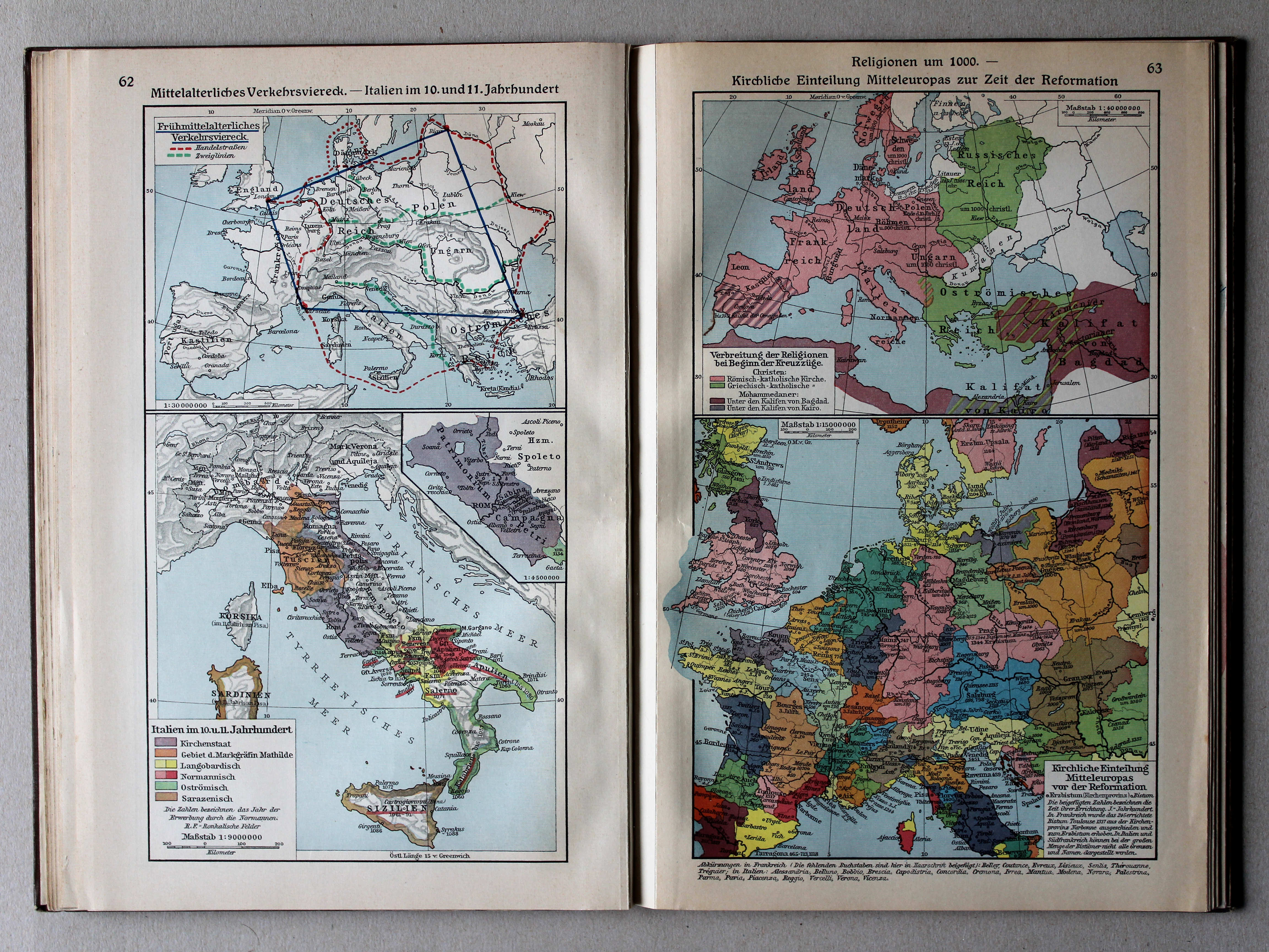
62. Mittelalterliches Verkehrsviereck – Italien im 10. und 11. Jahrhundert XL
Middeleeuwse verkeersvierhoek. Italië in de 10e en 11e eeuw / Medieval traffic quadrangle. Italy in the 10th and 11th centuries
63. Religionen um 1000 – Kirchliche Einteilung Mitteleuropas zur Zeit der Reformation XL
Godsdiensten rond 1000. Hiërarchie van de Katholieke Kerk tijdens (voor) de Reformatie / Religions around 1000. Hierarchy of the Catholic Church during (before) the Protestant Reformation
 Putzgers Historischer Schul-Atlas, Große Ausgabe, 1931/33
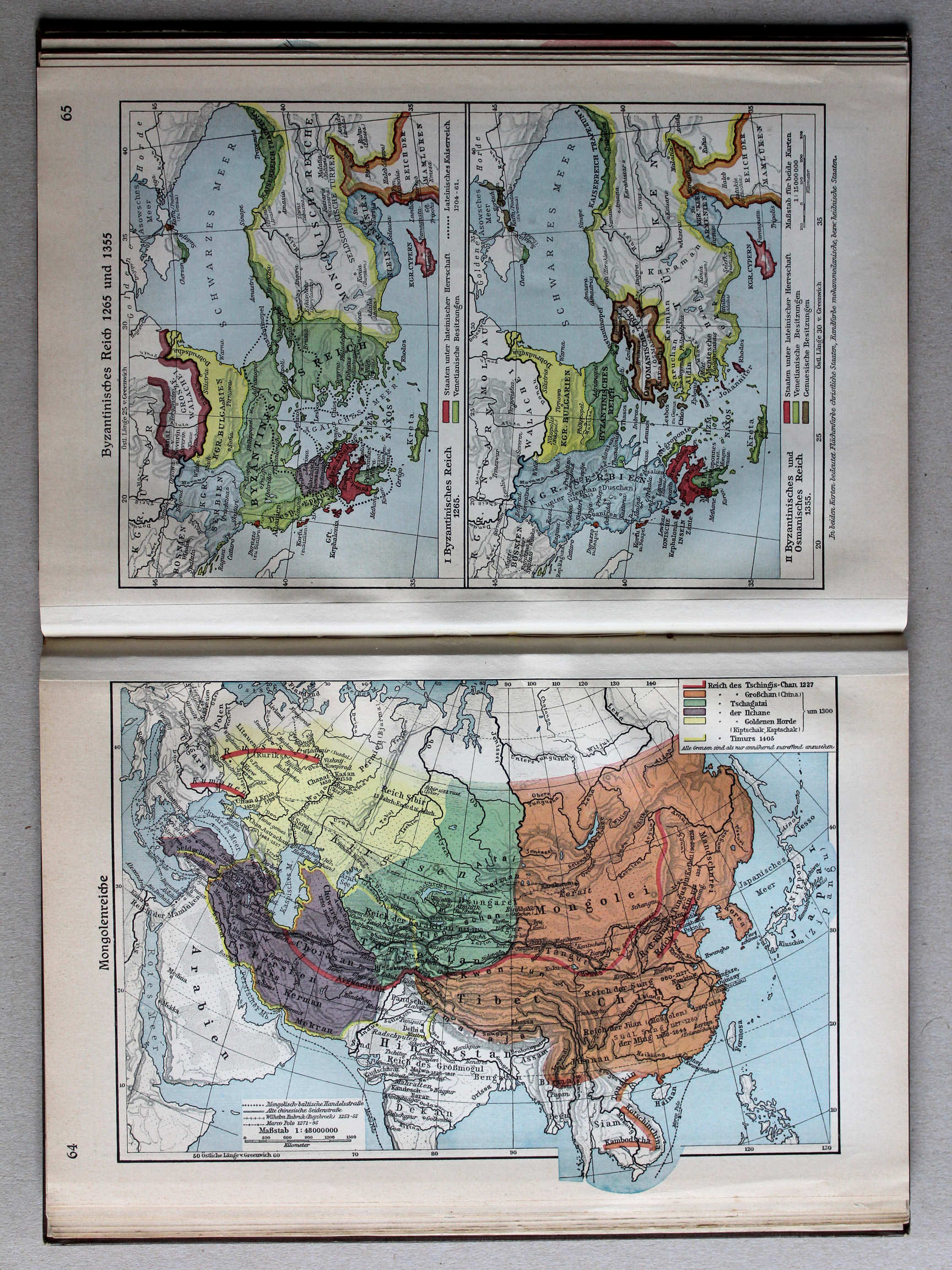
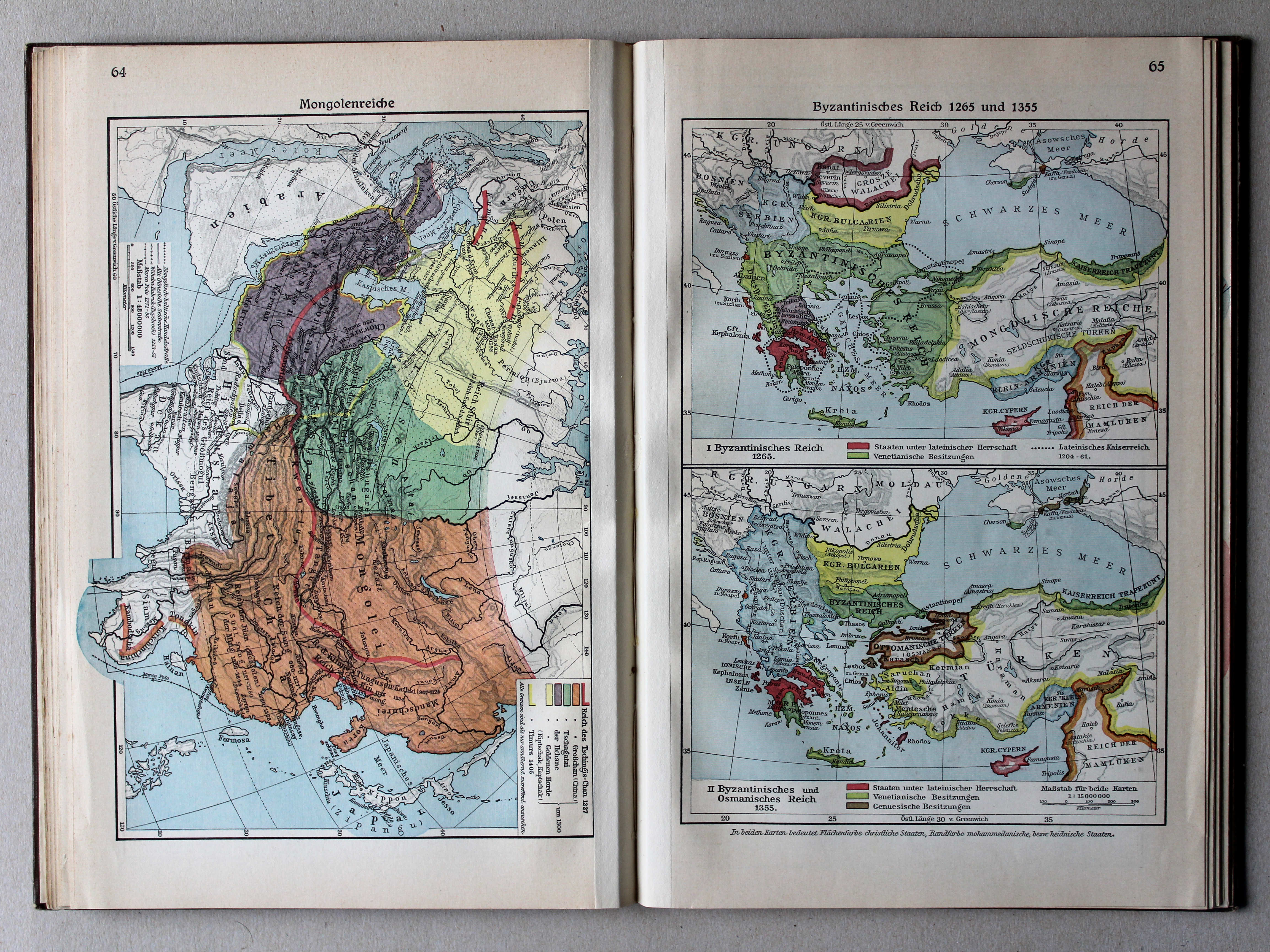
64. Mongolenreiche XL
Mongoolse rijken / Mongol empires
 Putzgers Historischer Schul-Atlas, Große Ausgabe, 1931/33
65. Byzantinisches Reich 1265 und 1355 XL
Het Byzantijnse Rijk in 1265 en 1355 / The Byzantine Empire in 1265 and 1355
 Putzgers Historischer Schul-Atlas, Große Ausgabe, 1931/33
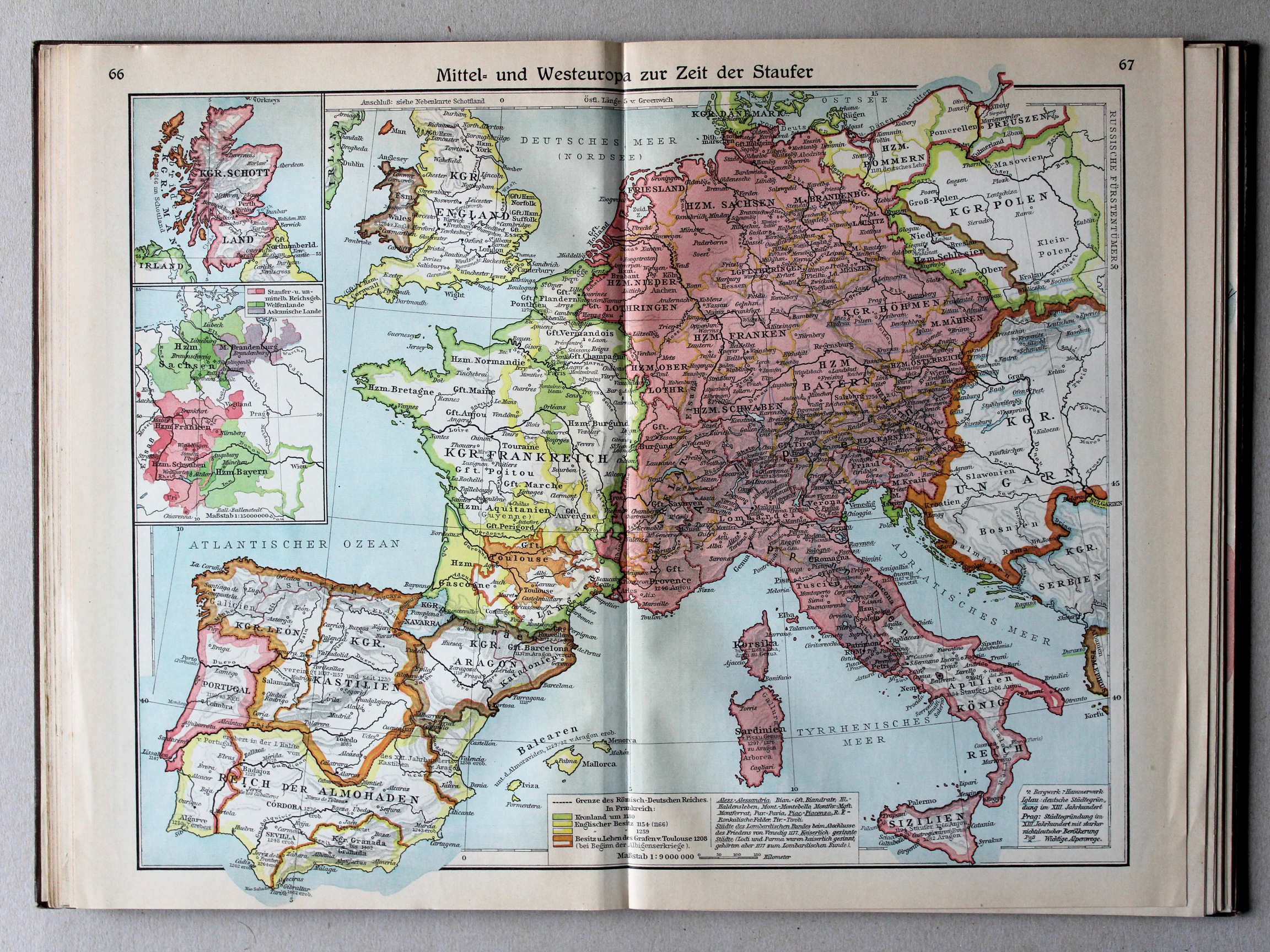
66.67. Mittel- und Westeuropa zur Zeit der Staufer XL
Midden- en West-Europa in de tijd van de Hohenstaufen / Central and Western Europe during the House of Hohenstaufen
 Putzgers Historischer Schul-Atlas, Große Ausgabe, 1931/33
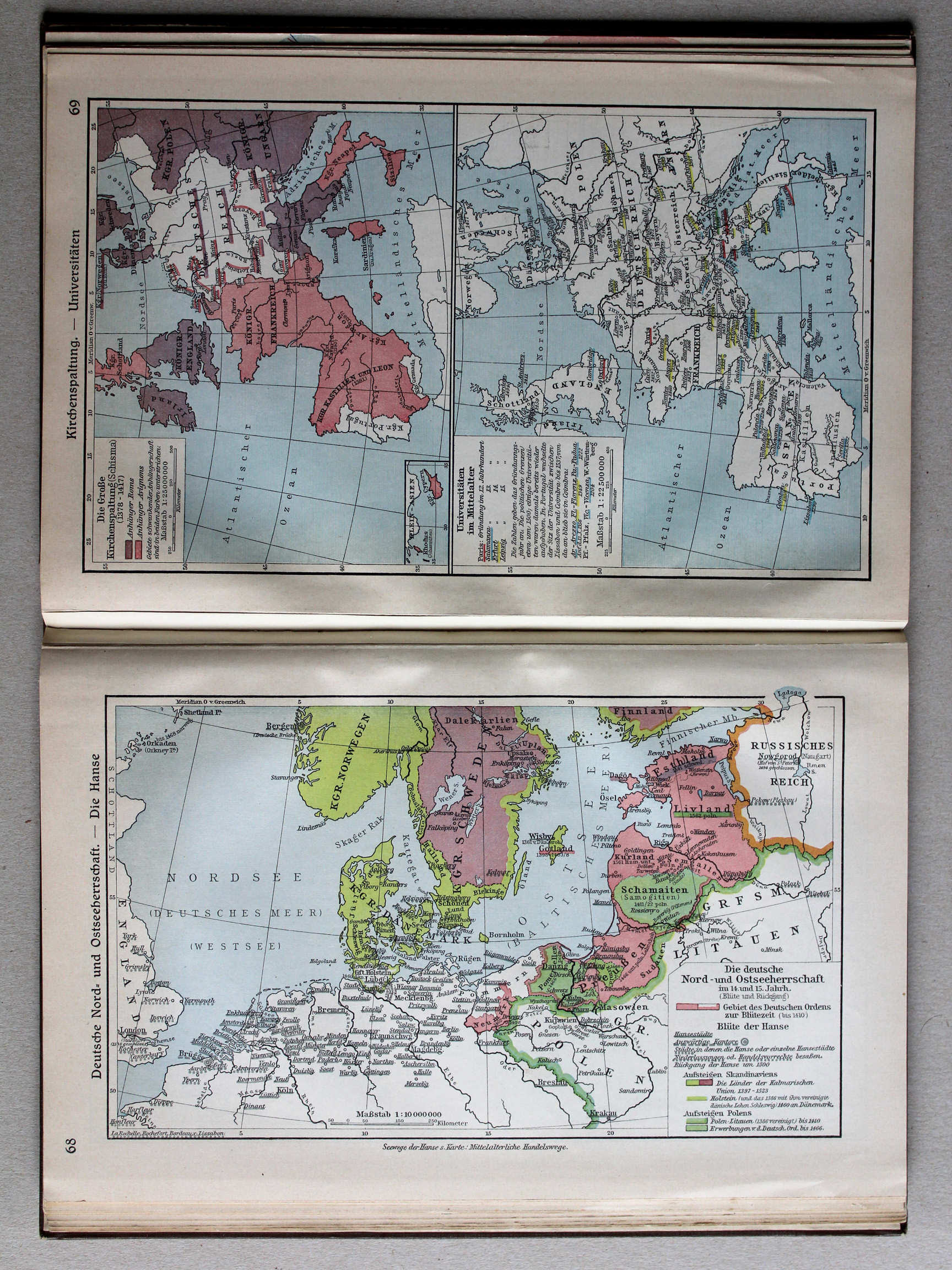
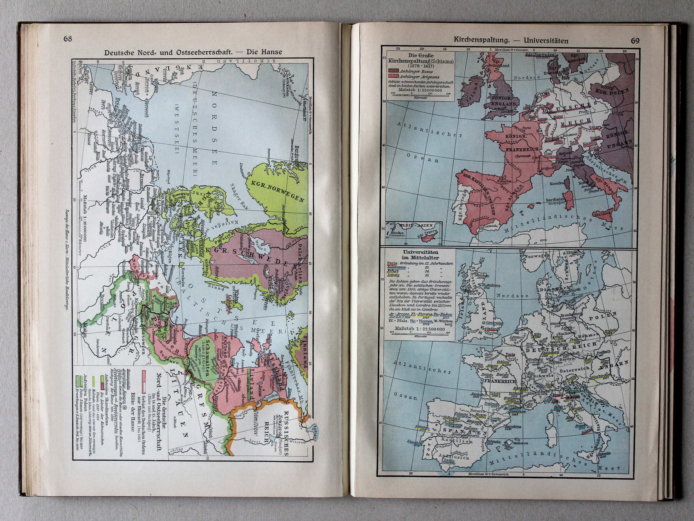
68. Deutsche Nord- und Ostseeherrschaft – Die Hanse XL
Duitse heerschappij rond de Noord- en Oostzee. De Hanze / German rule in the North Sea and Baltic region. The Hanseatic League
 Putzgers Historischer Schul-Atlas, Große Ausgabe, 1931/33
69. Kirchenspaltung – Universitäten XL
Westers Schisma. Universiteiten / Western Schism. Universities
 Putzgers Historischer Schul-Atlas, Große Ausgabe, 1931/33
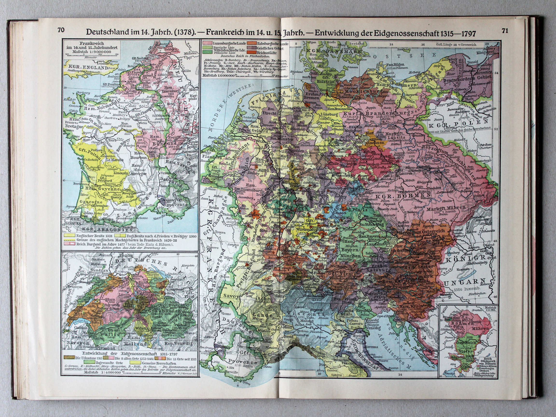
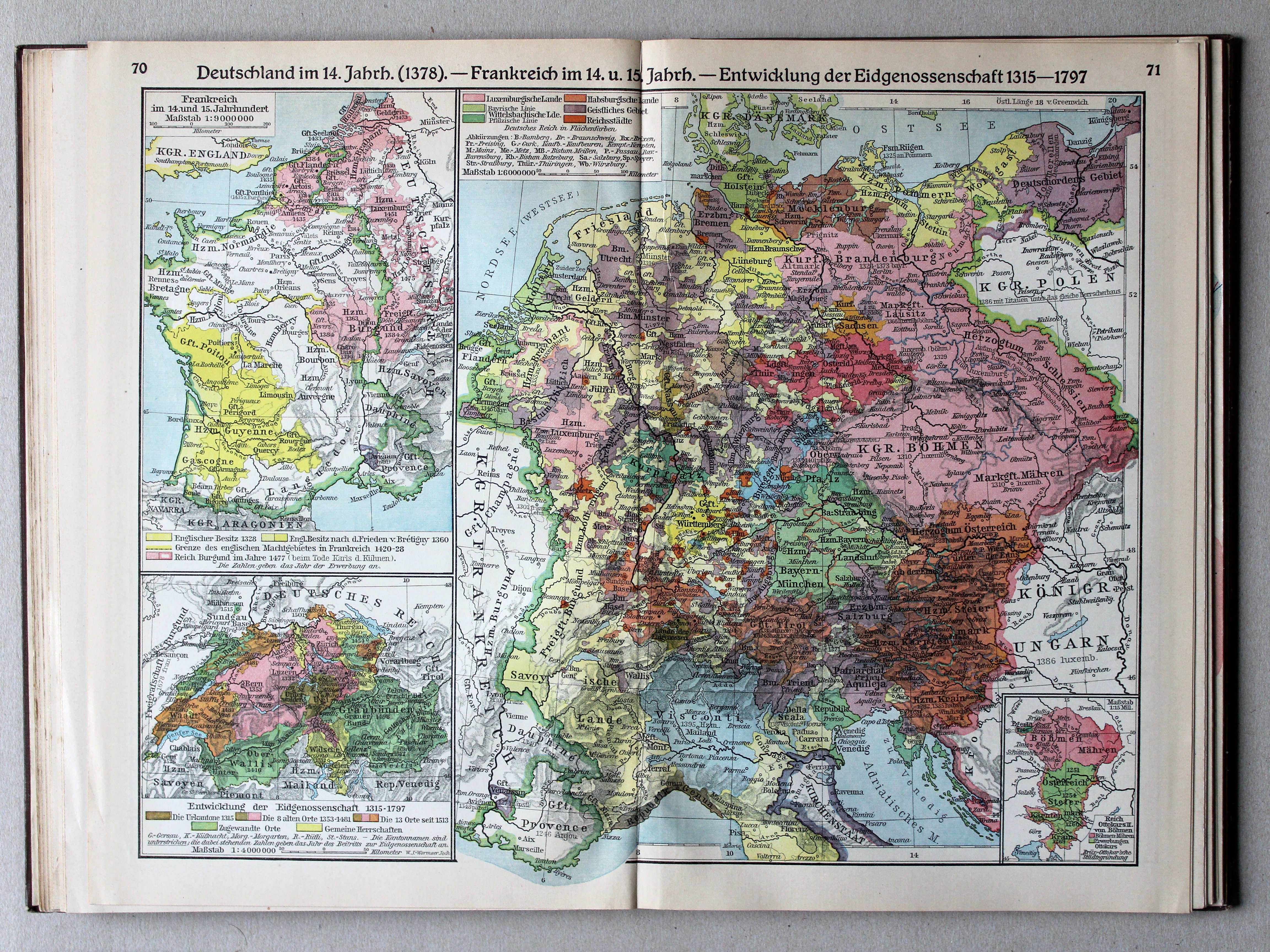
70.71. Deutschland im 14. Jahrh. (1378) – Frankreich im 14. und 15. Jahrh. – Entwicklung der Eidgenossenschaft 1315-1797 XL
Duitsland in de 14e eeuw (1378). Frankrijk in de 14e en 15e eeuw. Ontwikkeling van het Zwitserse Eedgenootschap 1315-1797 / Germany in the 14th century (1378). France in the 14th and 15th centuries. Development of the Swiss Confederation 1315-1797
 Putzgers Historischer Schul-Atlas, Große Ausgabe, 1931/33
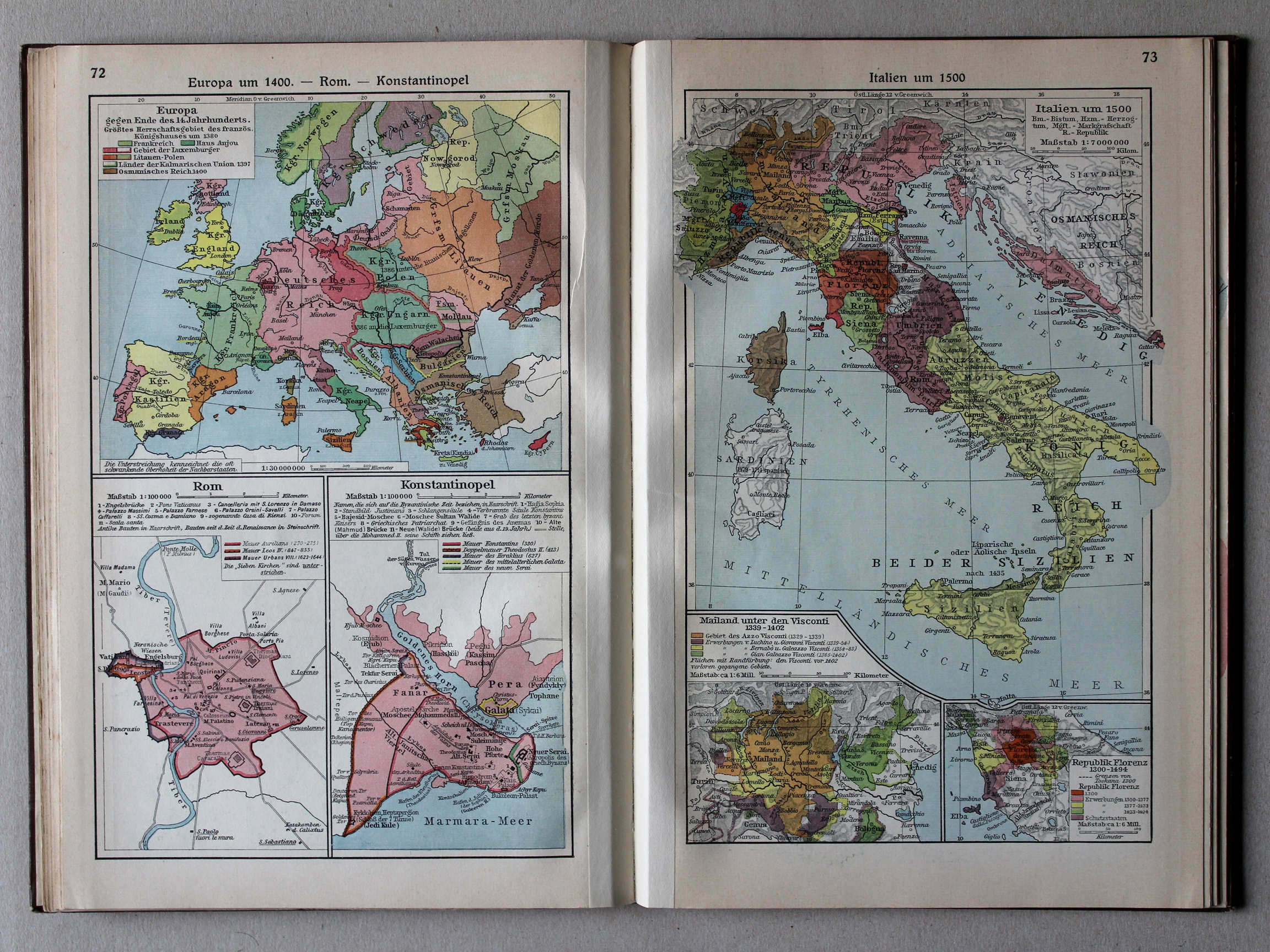
72. Europa um 1400 – Rom – Konstantinopel XL
Europa rond 1400. Rome. Constantinopel / Europe around 1400. Rome. Constantinople
73. Italien um 1500 XL
Italië rond 1500 / Italy around 1500
 Putzgers Historischer Schul-Atlas, Große Ausgabe, 1931/33
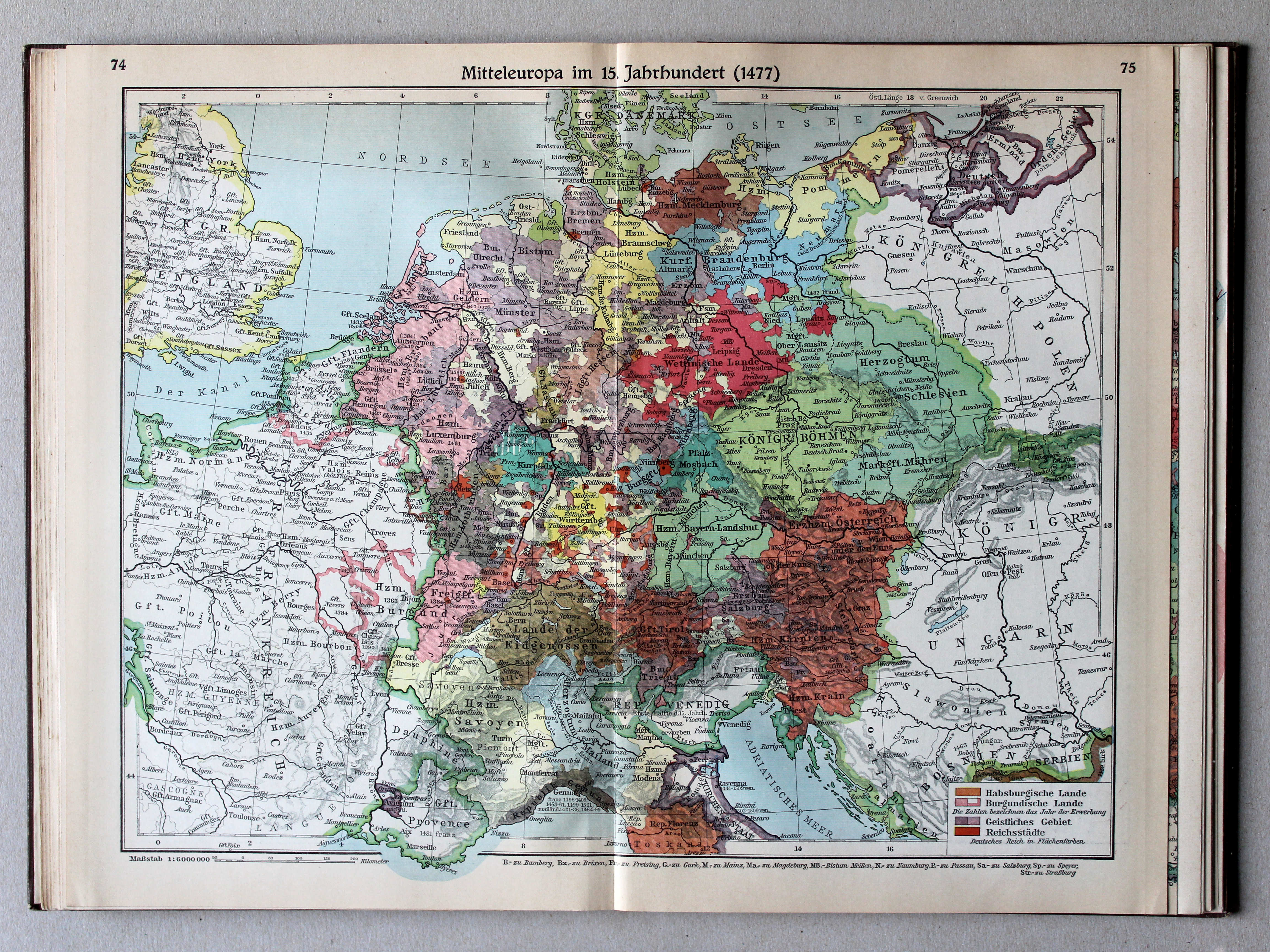
74.75. Mitteleuropa im 15. Jahrhundert (1477) XL
Midden-Europa in de 15e eeuw (1477) / Central Europe in the 15th century (1477)
 Putzgers Historischer Schul-Atlas, Große Ausgabe, 1931/33
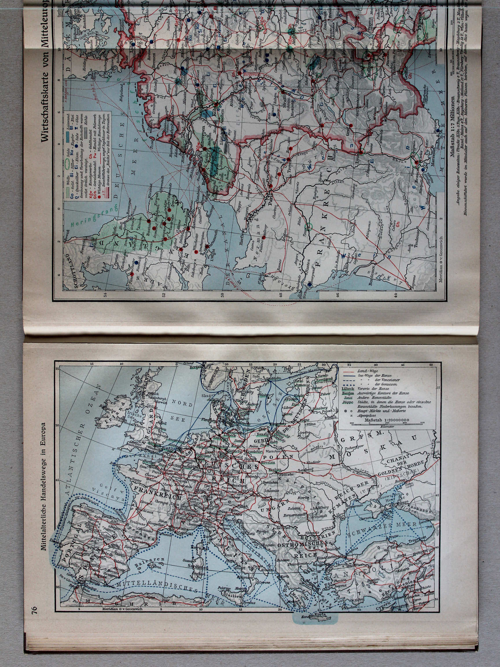
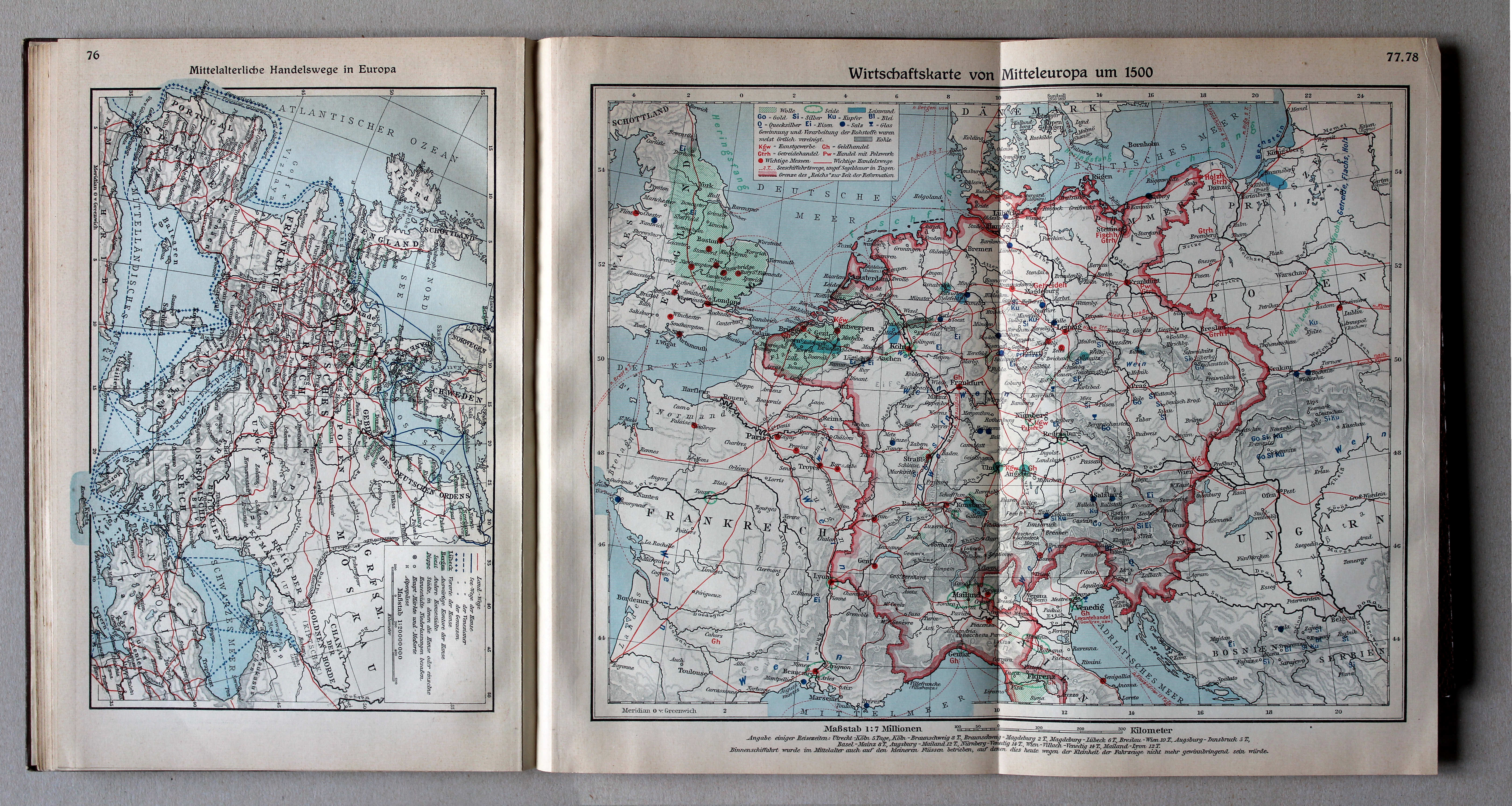
76. Mittelalterliche Handelswege in Europa XL
Handelsroutes in Europa in de Middeleeuwen / Trade routes in Europe in the Middle Ages
 Putzgers Historischer Schul-Atlas, Große Ausgabe, 1931/33
|
76. Mittelalterliche Handelswege in Europa
XL
Handelsroutes in Europa in de Middeleeuwen / Trade routes in Europe in the Middle Ages |
77.78. Wirtschaftskarte von Mitteleuropa um 1500
XL
Economische kaart van Midden-Europa rond 1500 / Economic map of Central Europe around 1500 |
 Putzgers Historischer Schul-Atlas, Große Ausgabe, 1931/33
|
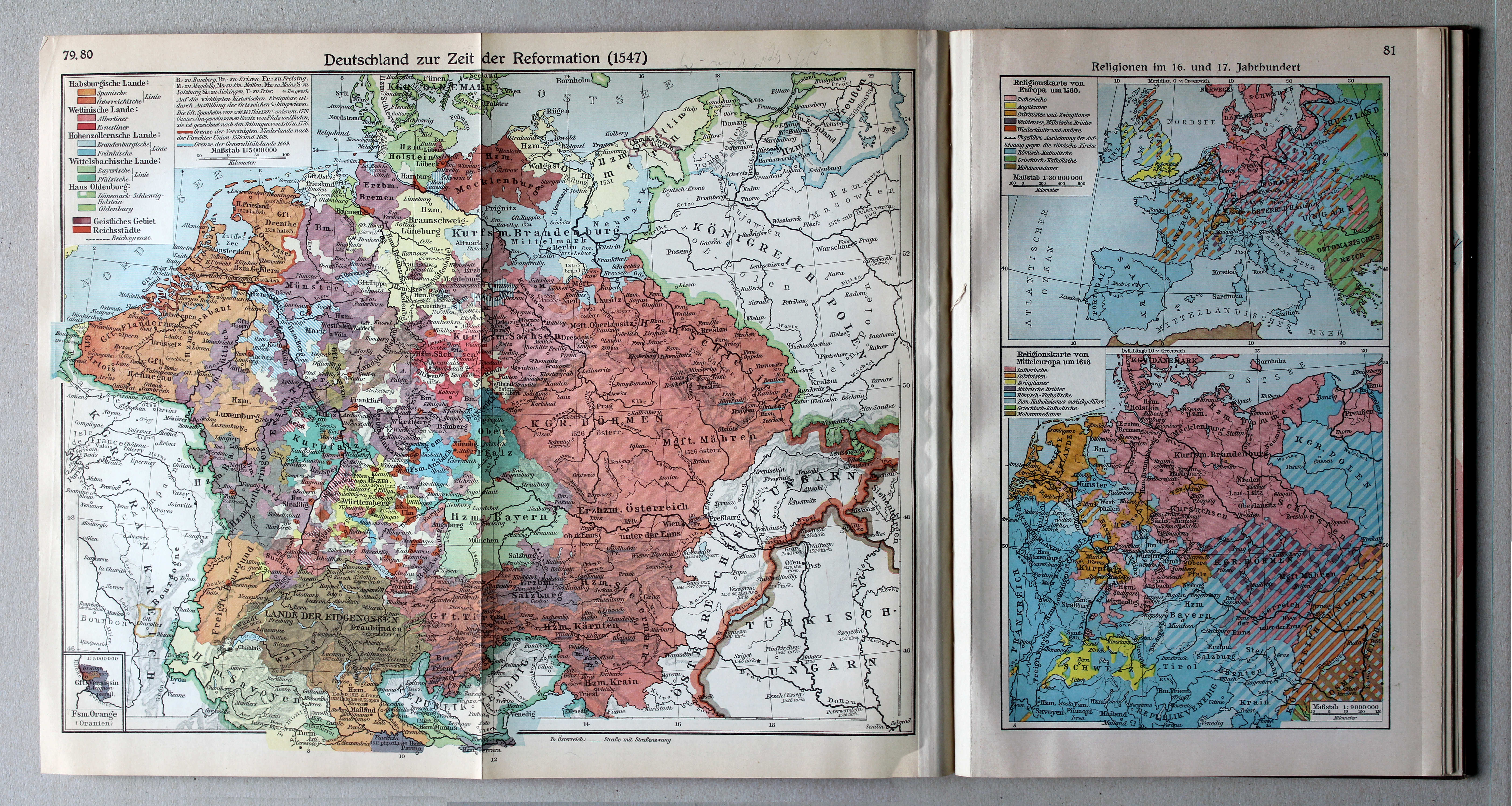
79.80. Deutschland zur Zeit der Reformation (1547)
XL
Duitsland in de tijd van de Reformatie (1547) / Germany during the Protestant Reformation (1547) |
81. Religionen im 16. und 17. Jahrhundert
XL
Godsdiensten in de 16e en 17e eeuw / Religions in the 16th and 17th centuries |
 Putzgers Historischer Schul-Atlas, Große Ausgabe, 1931/33
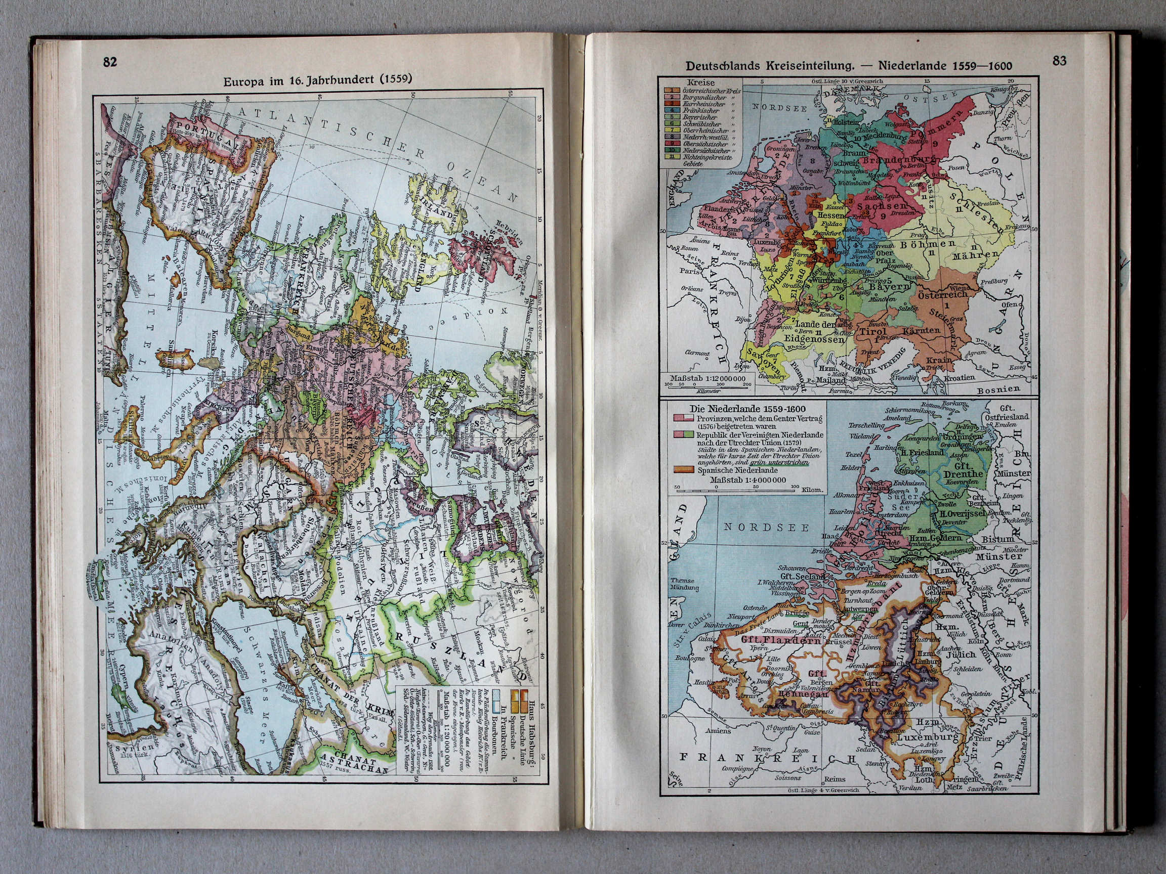
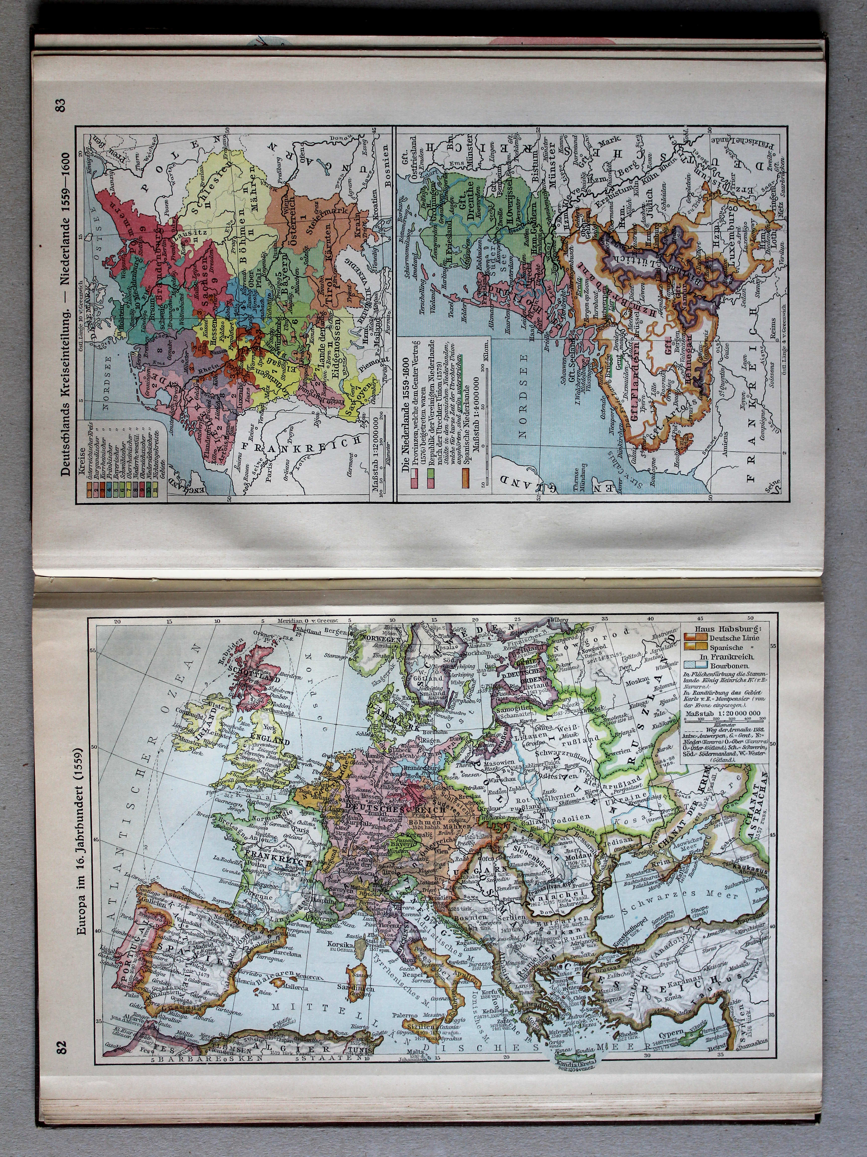
82. Europa im 16. Jahrhundert (1559) XL
Europa in de 16e eeuw (1559) / Europe in the 16th century (1559)
 Putzgers Historischer Schul-Atlas, Große Ausgabe, 1931/33
83. Deutschlands Kreiseinteilung – Niederlande 1559-1600 XL
Kreitsen in Duitsland. De Nederlanden 1559-1600 / Imperial Circles in Germany. The Netherlands 1559-1600
 Putzgers Historischer Schul-Atlas, Große Ausgabe, 1931/33
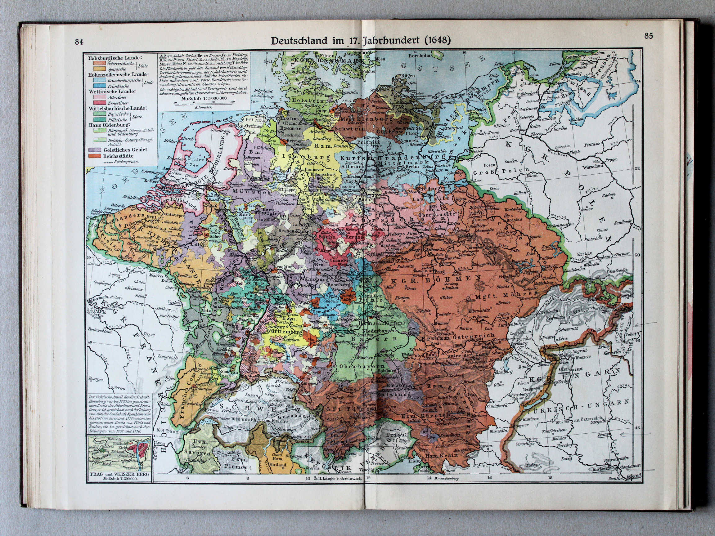
84.85. Deutschland im 17. Jahrhundert (1648) XL
Duitsland in de 17e eeuw (1648) / Germany in the 17th century (1648)
 Putzgers Historischer Schul-Atlas, Große Ausgabe, 1931/33
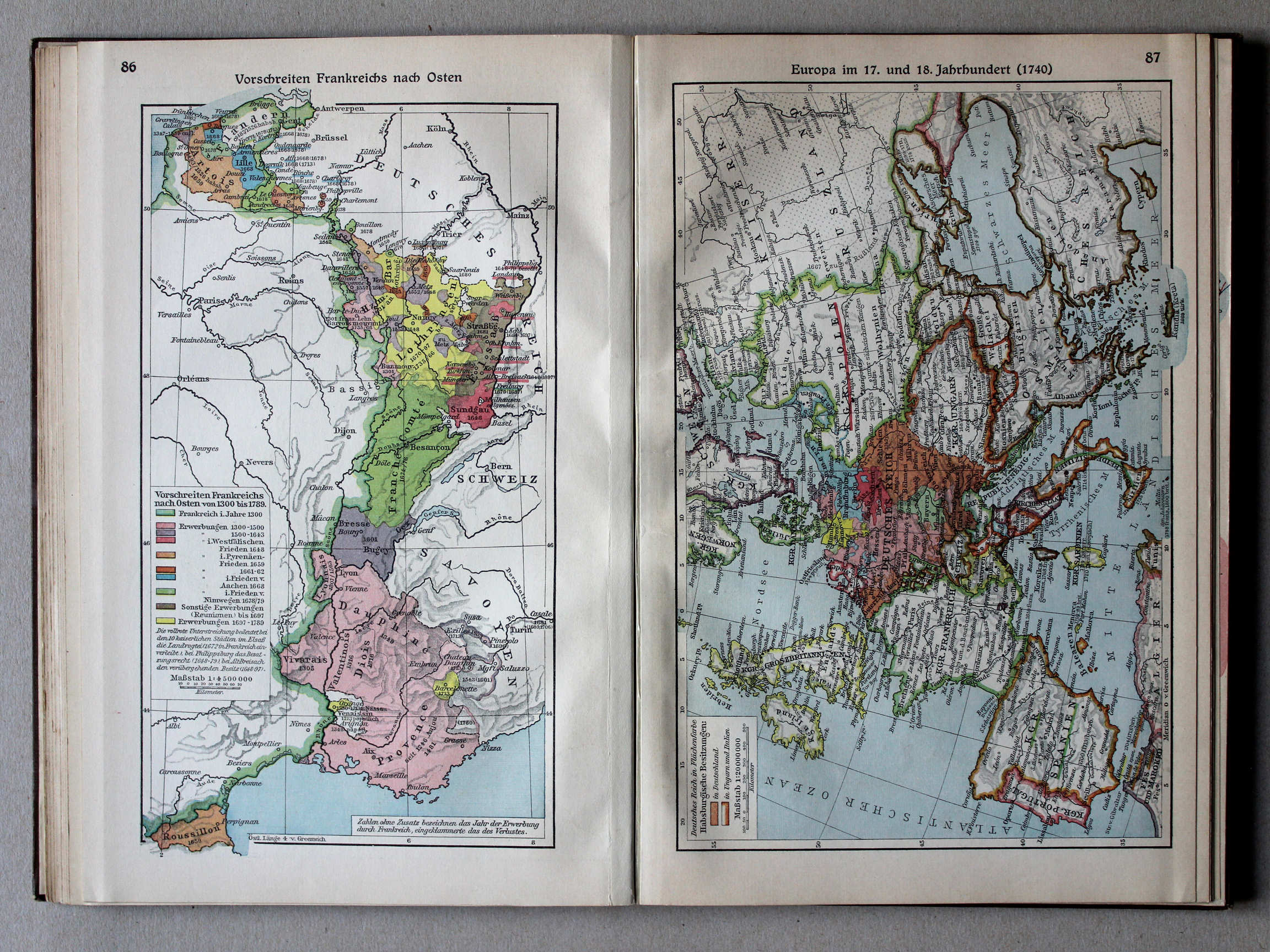
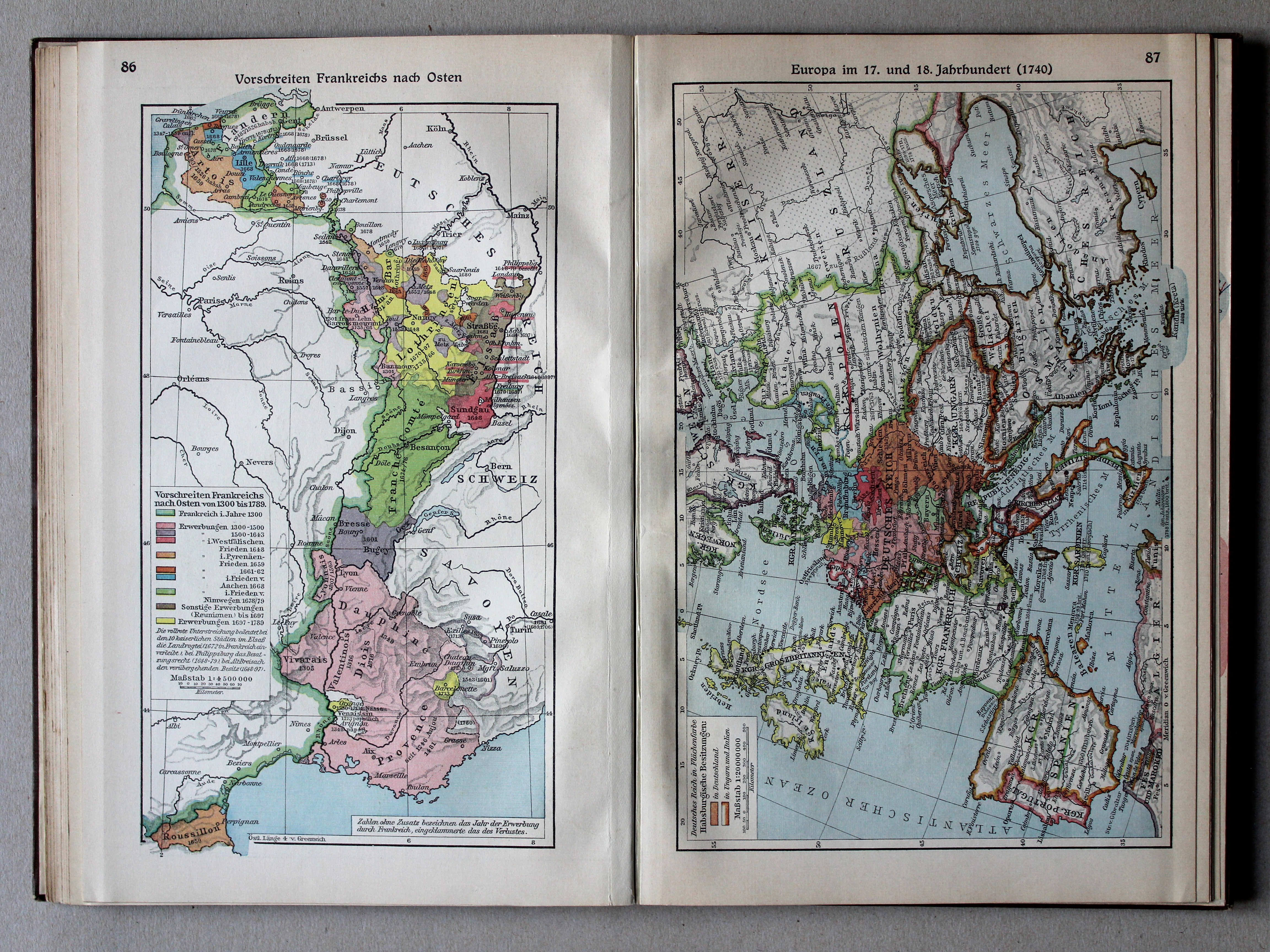
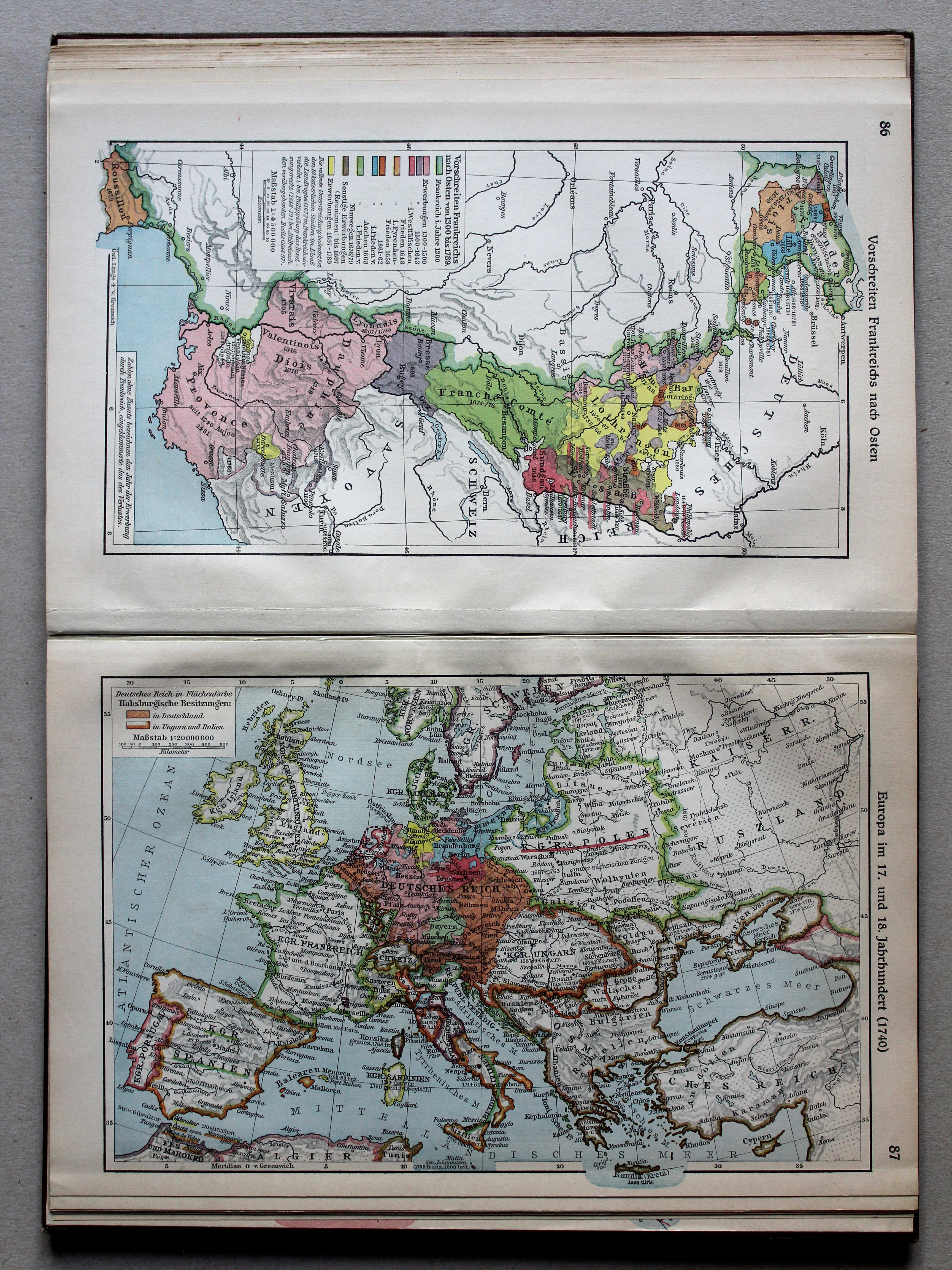
86. Vorschreiten Frankreichs nach Osten XL
Uitbreiding van Frankrijk naar het oosten 1300-1789 / Expansion of France towards the east 1300-1789
 Putzgers Historischer Schul-Atlas, Große Ausgabe, 1931/33
87. Europa im 17. und 18. Jahrhundert (1740) XL
Europa in de 17e en 18e eeuw (1740) / Europe in the 17th and 18th centuries (1740)
 Putzgers Historischer Schul-Atlas, Große Ausgabe, 1931/33
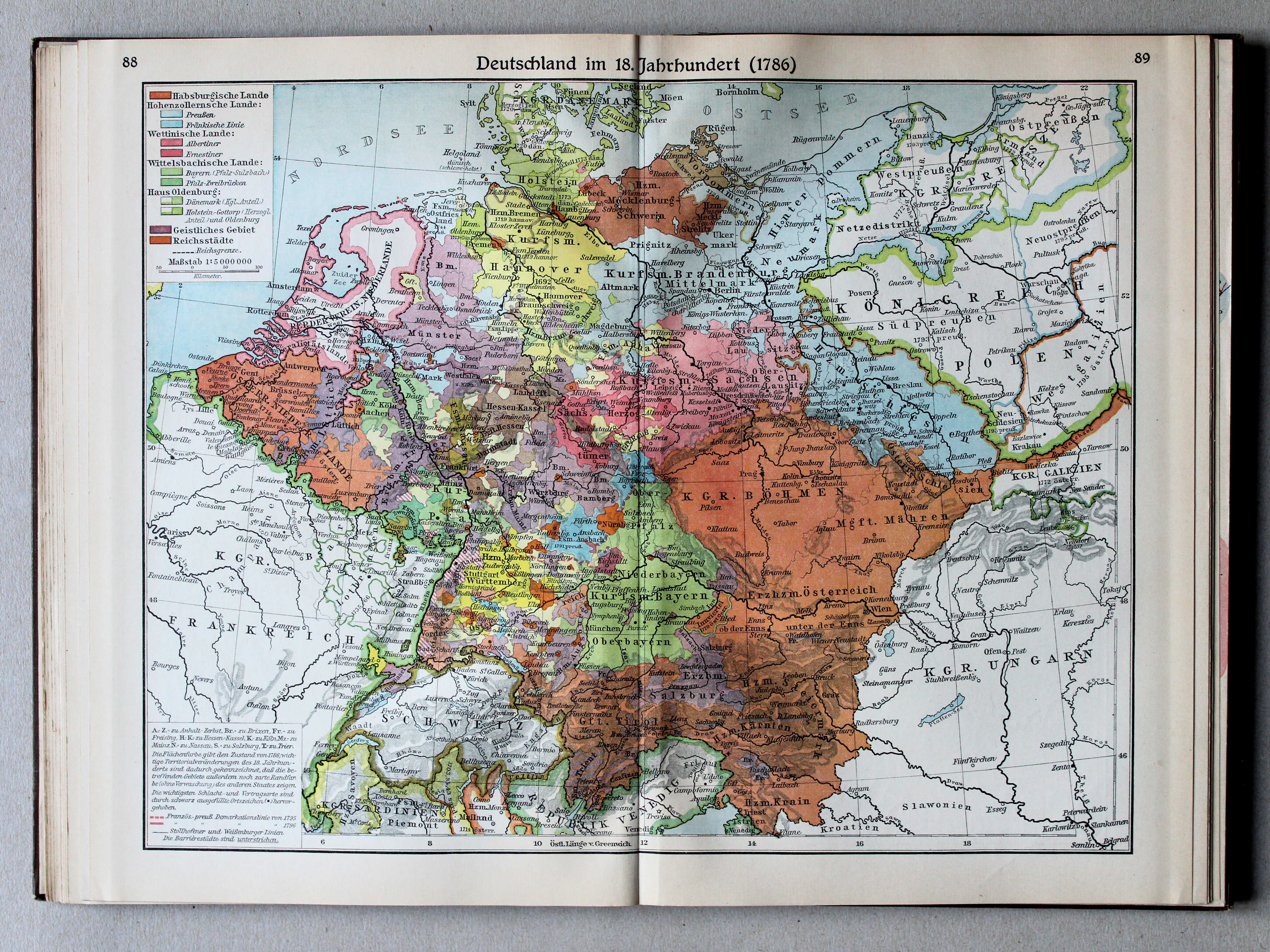
88.89. Deutschland im 18. Jahrhundert (1786) XL
Duitsland in de 18e eeuw (1786) / Germany in the 18th century (1786)
 Putzgers Historischer Schul-Atlas, Große Ausgabe, 1931/33
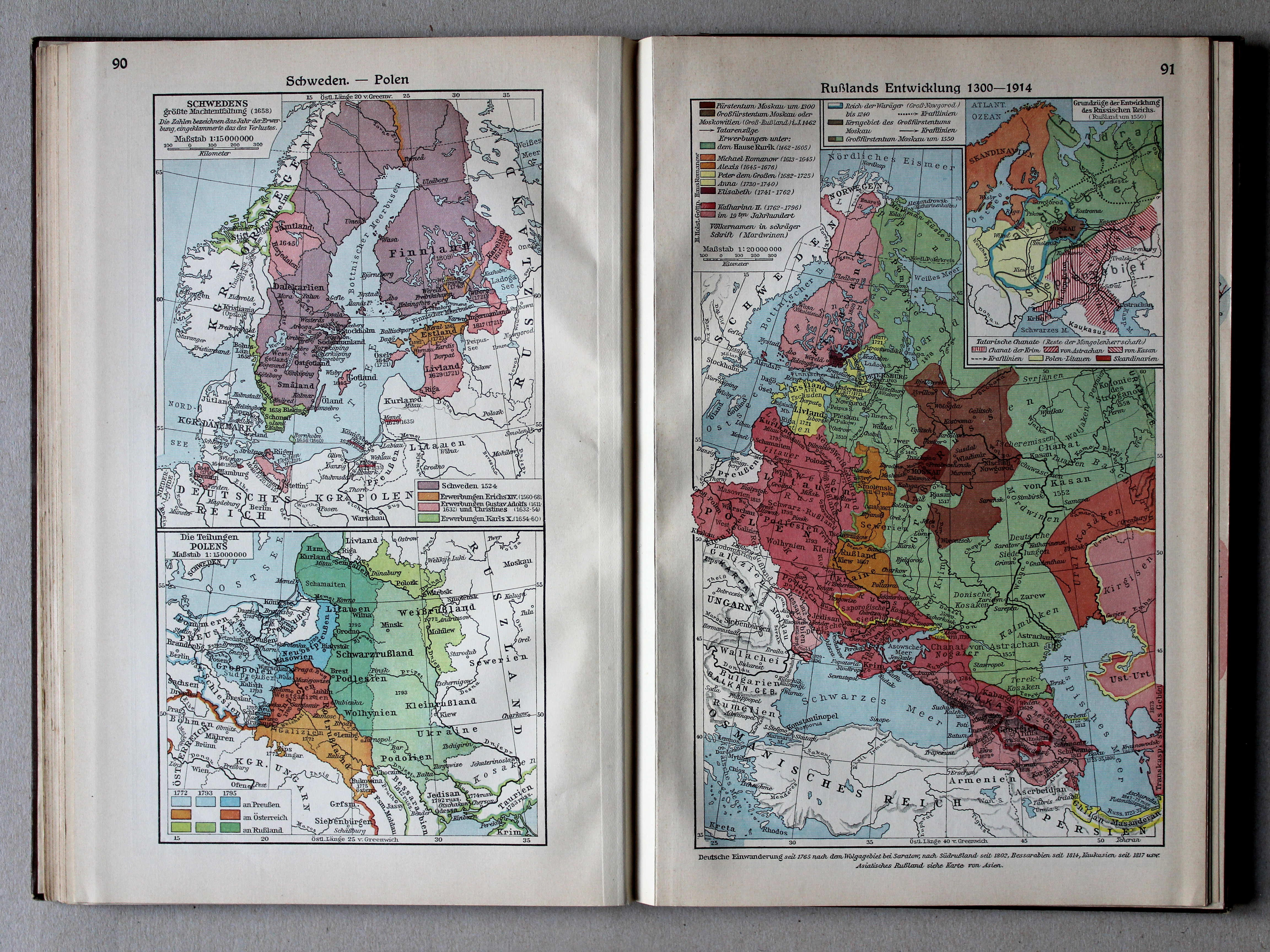
90. Schweden – Polen XL
Zweden. Polen / Sweden. Poland
91. Rußlands Entwicklung 1300-1914 XL
Ontwikkeling van Rusland 1300-1914 / Development of Russia 1300-1914
 Putzgers Historischer Schul-Atlas, Große Ausgabe, 1931/33
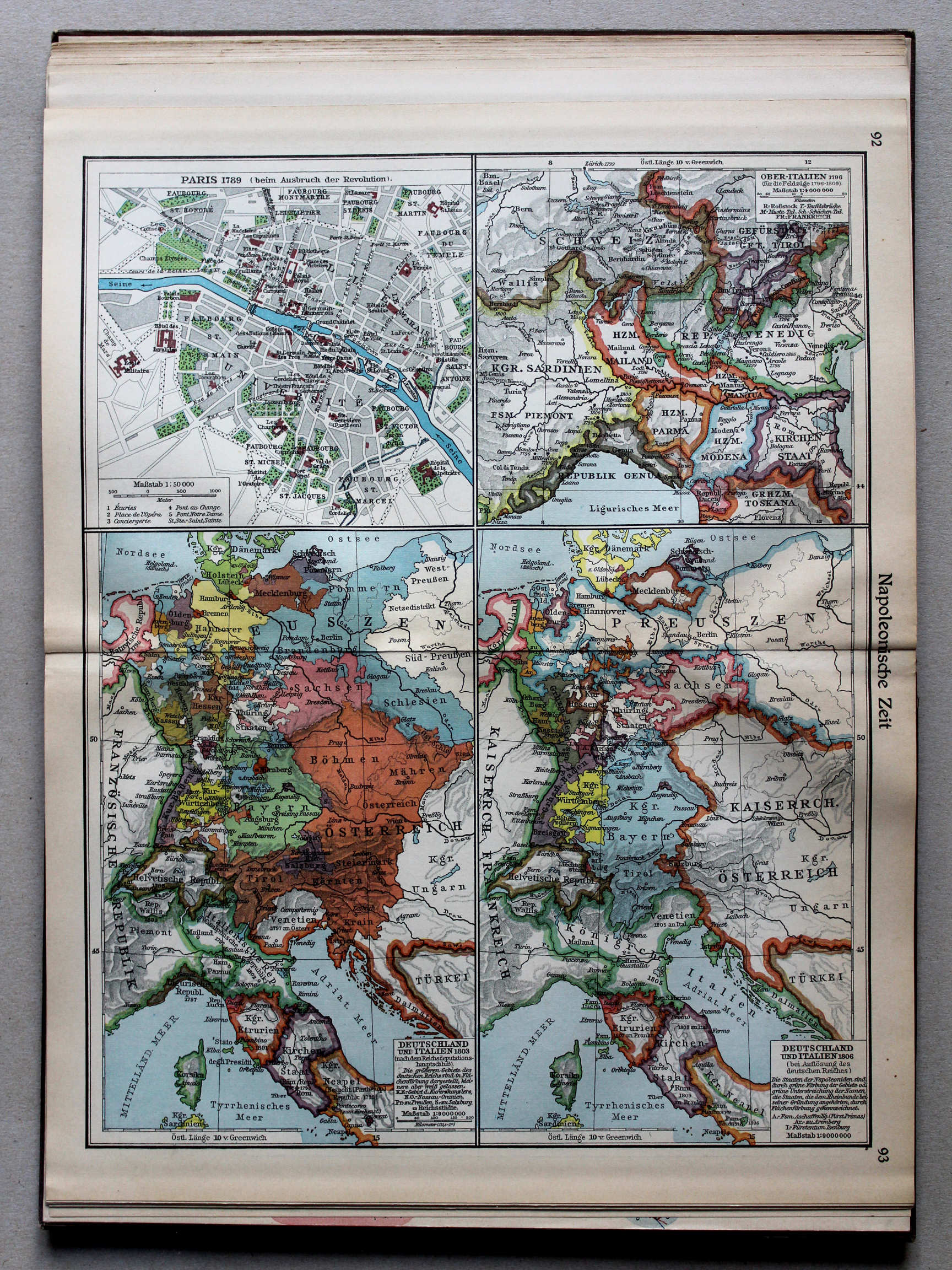
92.93. Napoleonische Zeit XL
Tijd van Napoleon / Era of Napoleon
 Putzgers Historischer Schul-Atlas, Große Ausgabe, 1931/33
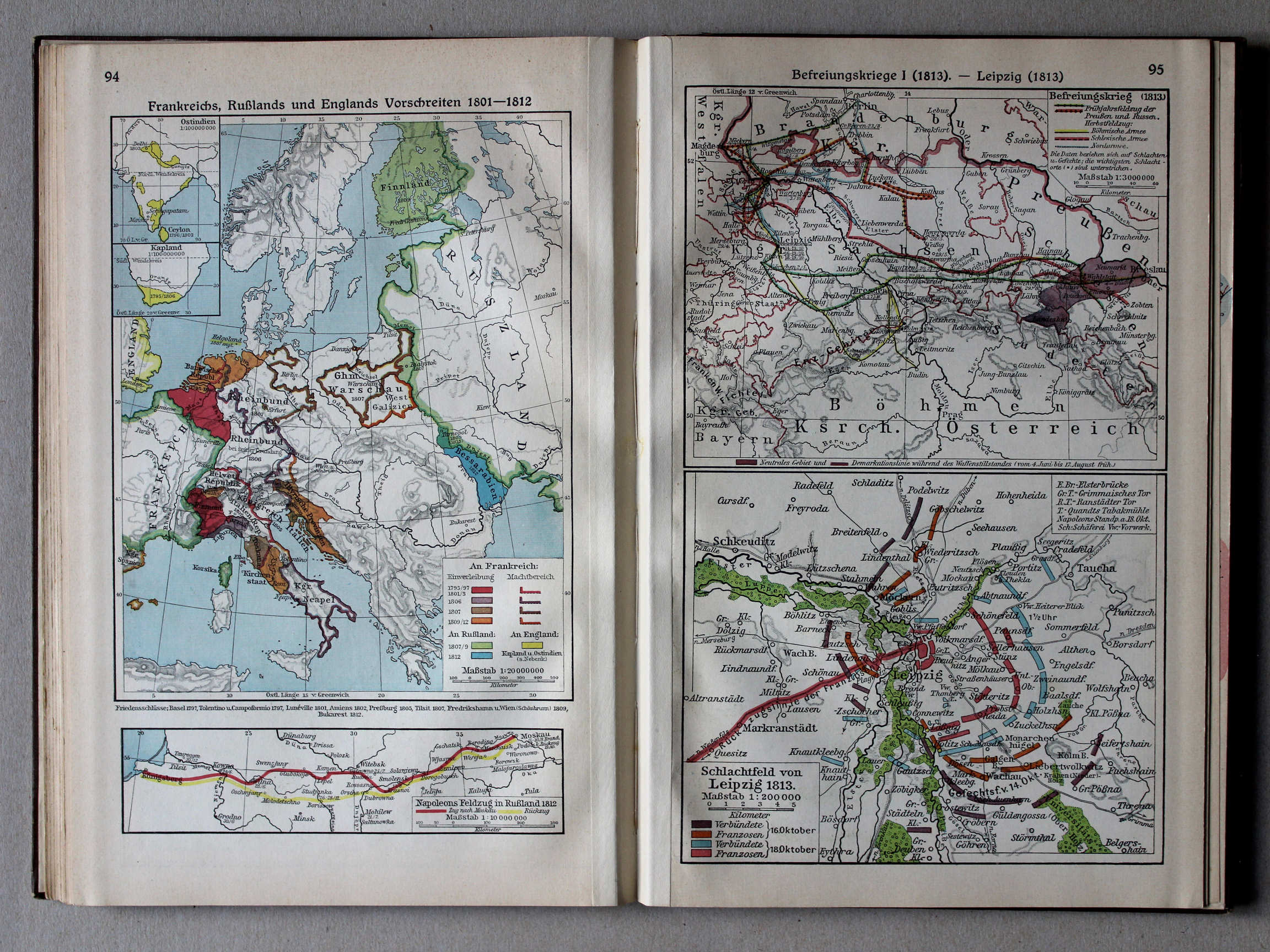
94. Frankreichs, Rußlands und Englands Vorschreiten 1801-1812 XL
Uitbreiding van Frankrijk, Rusland en Engeland 1801-1812 / Expansion of France, Russia and England 1801-1812
95. Befreiungskrieg I (1813) – Leipzig (1813) XL
Duitse bevrijdingsoorlog I (1813). Leipzig (1813) / German Campaign I (1813). Leipzig (1813)
 Putzgers Historischer Schul-Atlas, Große Ausgabe, 1931/33
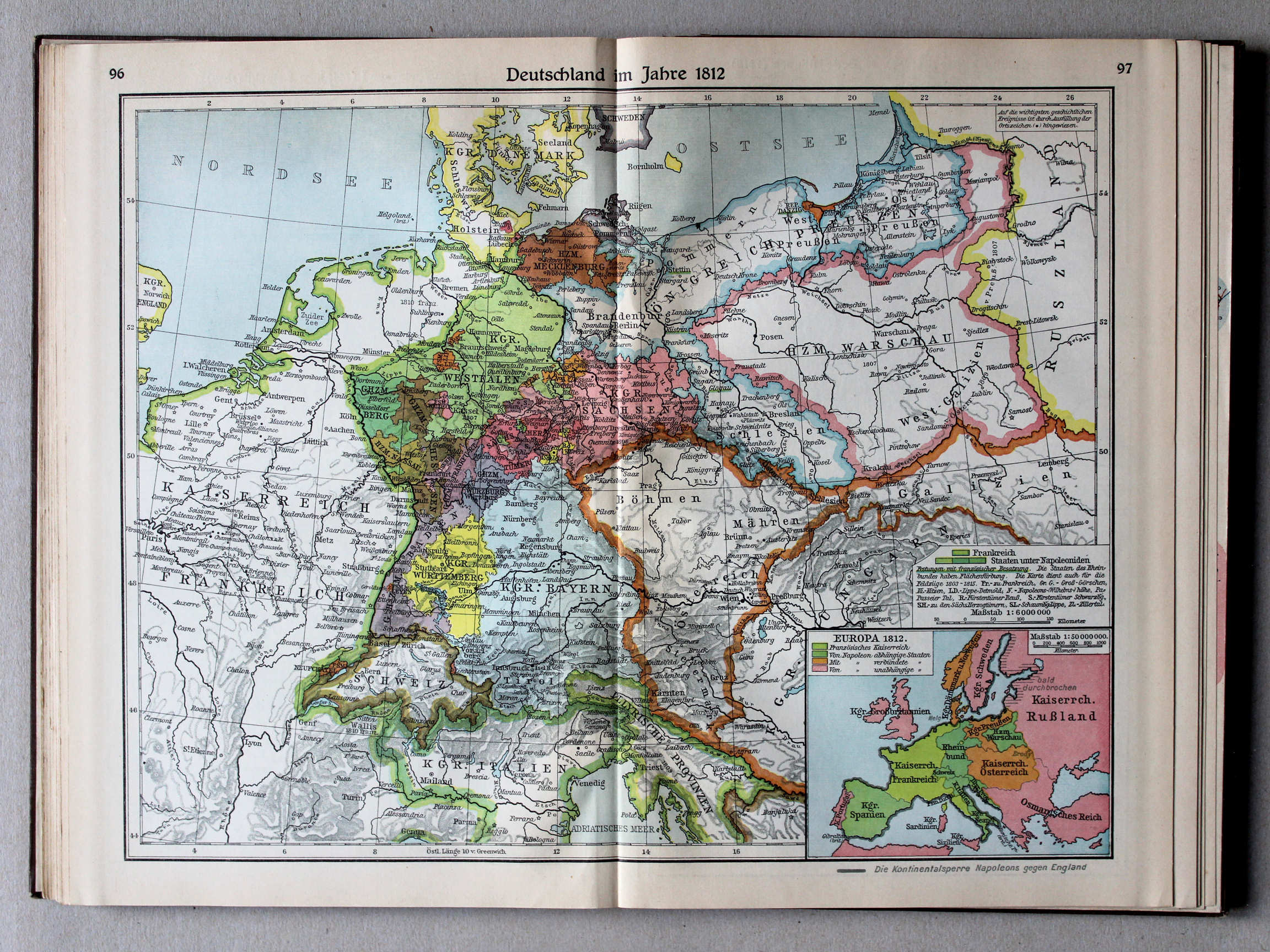
96.97. Deutschland im Jahre 1812 XL
Duitsland in 1812 / Germany in 1812
 Putzgers Historischer Schul-Atlas, Große Ausgabe, 1931/33
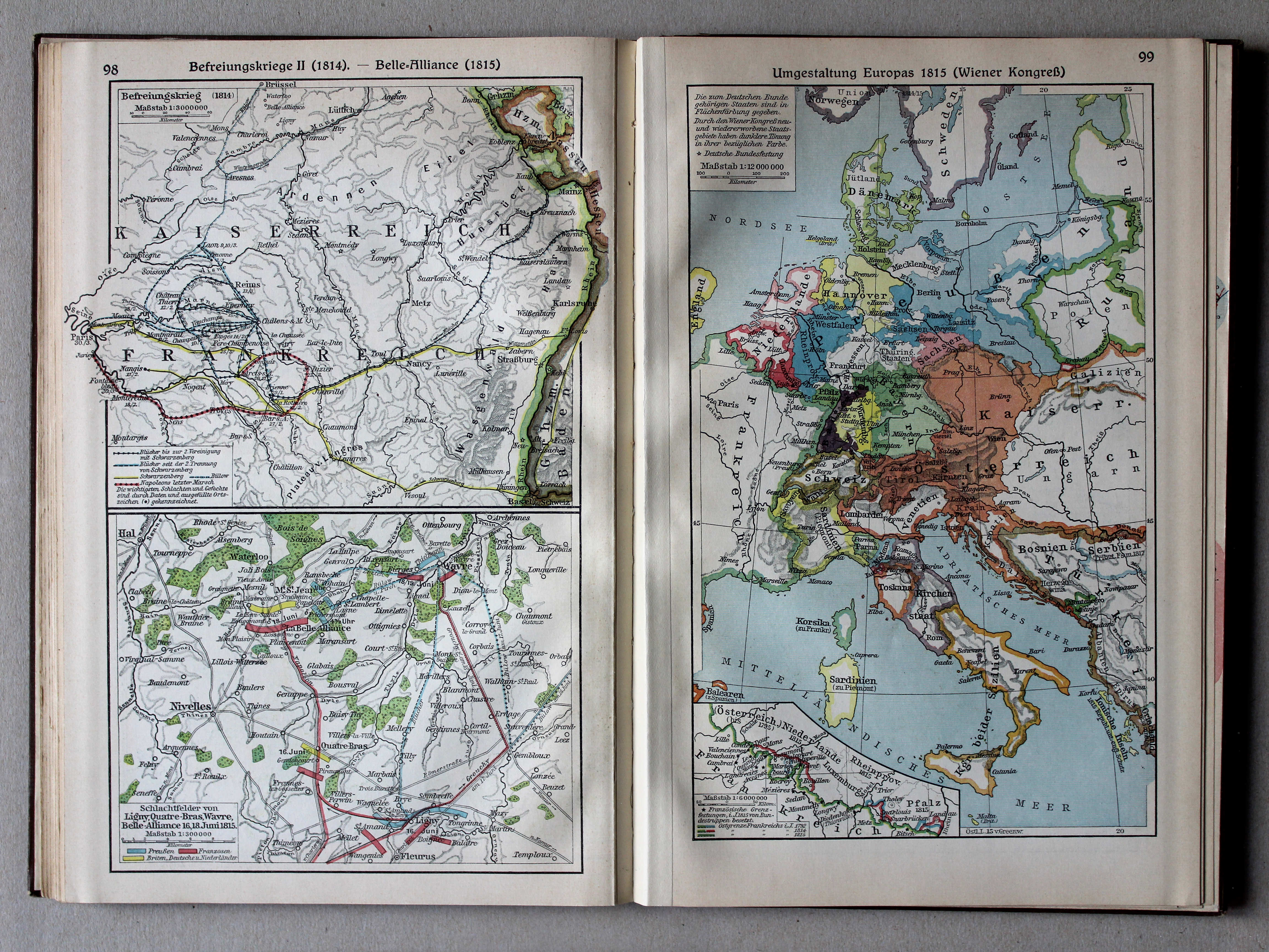
98. Befreiungskrieg II (1814) – Belle-Alliance (1815) XL
Duitse bevrijdingsoorlog II (1814). Belle-Alliance (1815) / German Campaign II (1814). Belle-Alliance (1815)
99. Umgestaltung Europas 1815 (Wiener Kongreß) XL
Staatkundige herordening van Europa in 1815 (Congres van Wenen) / Political transformation of Europe in 1815 (Congress of Vienna)
 Putzgers Historischer Schul-Atlas, Große Ausgabe, 1931/33
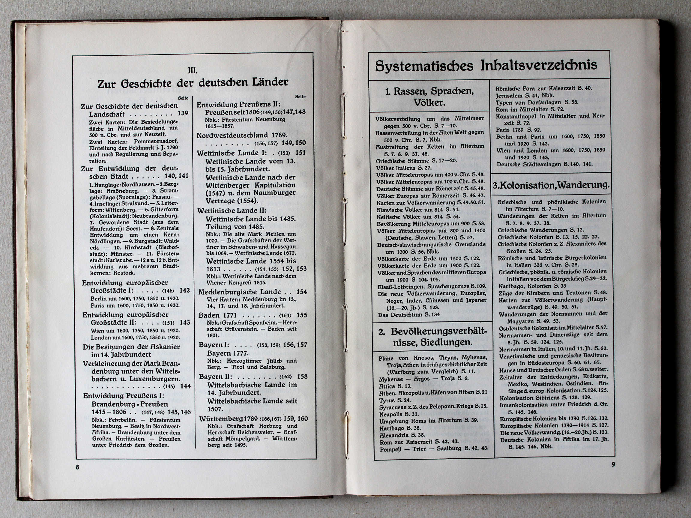
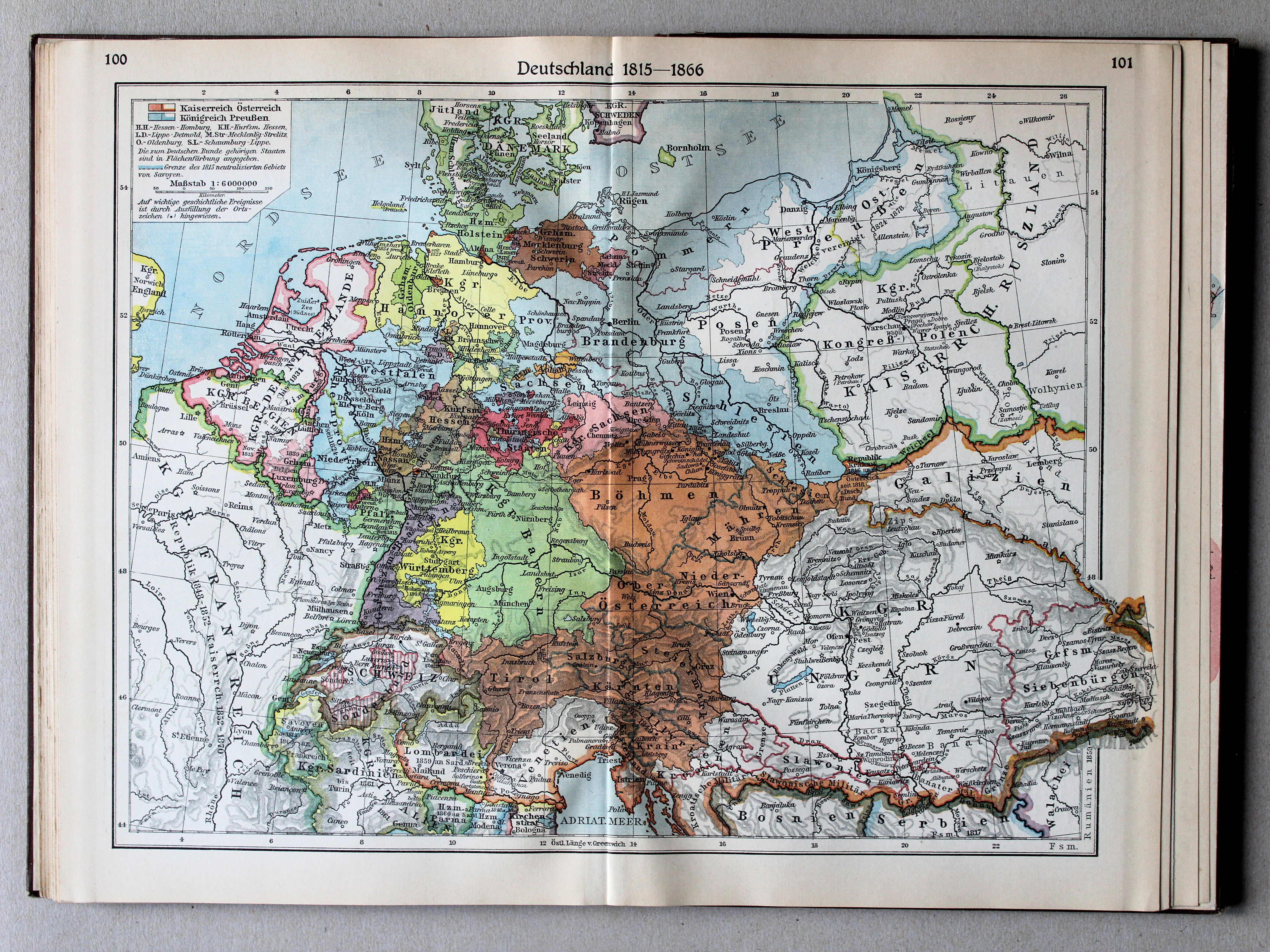
100.101. Deutschland 1815-1866 XL
Duitsland 1815-1866 / Germany 1815-1866
 Putzgers Historischer Schul-Atlas, Große Ausgabe, 1931/33
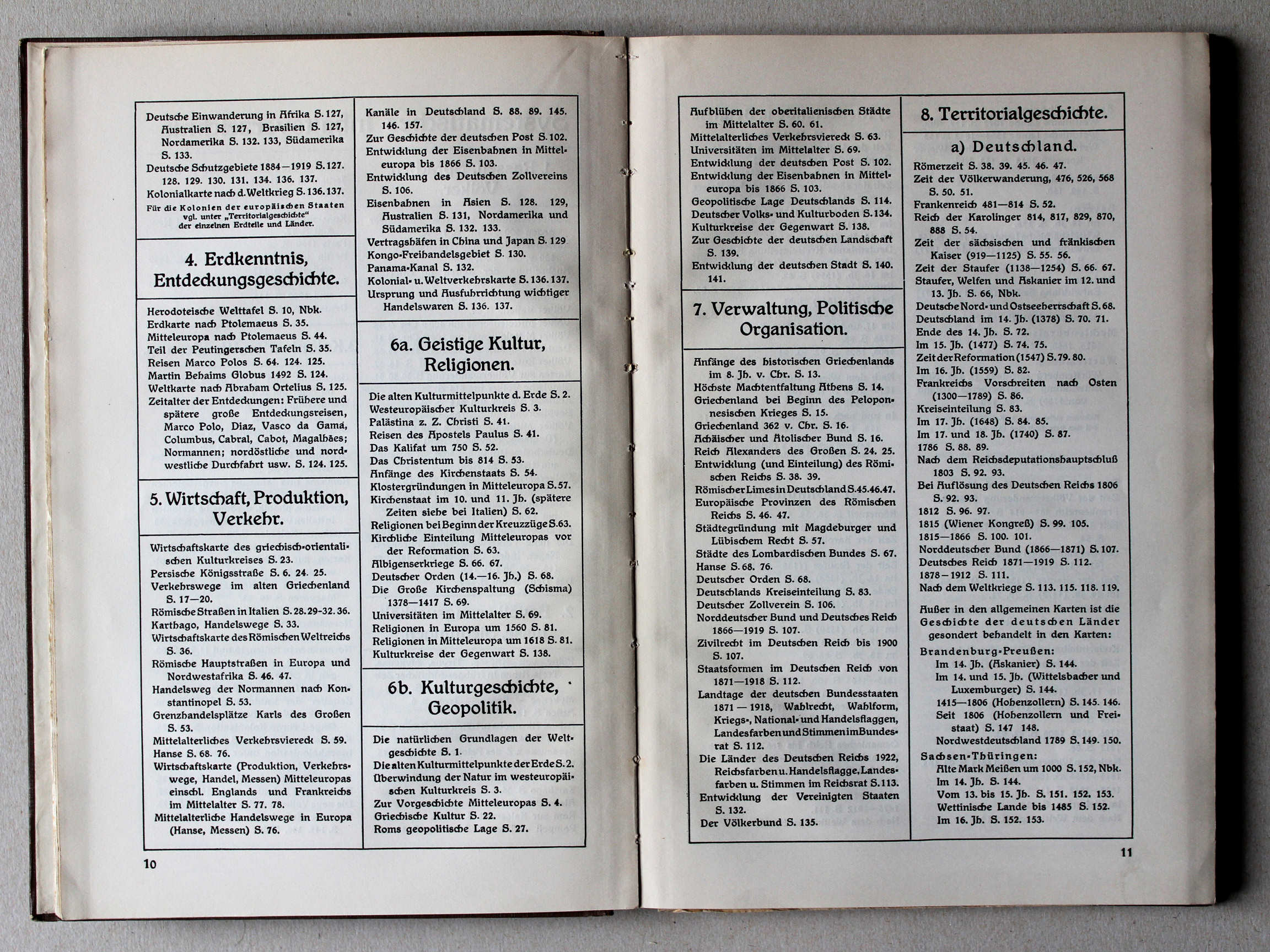
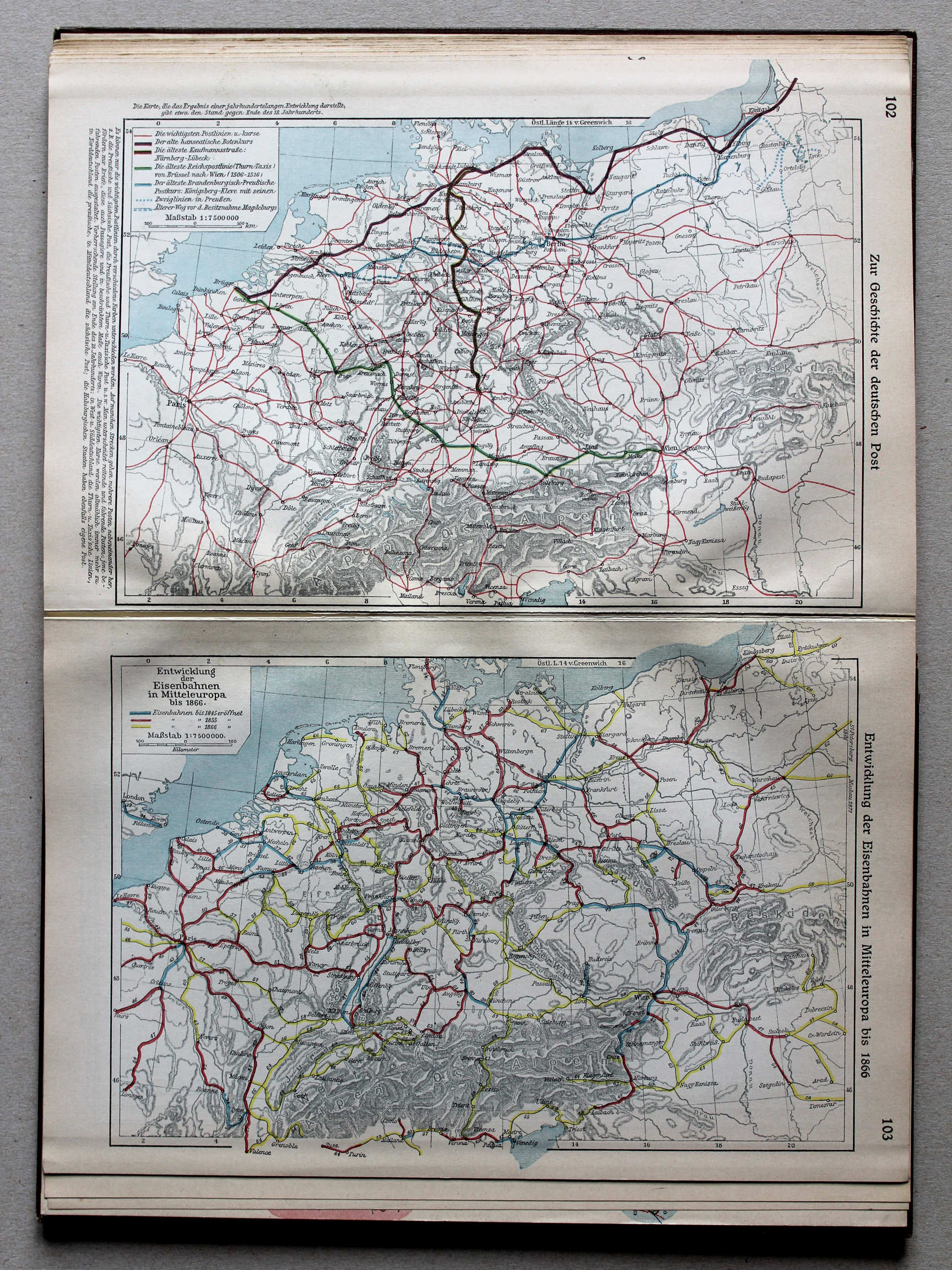
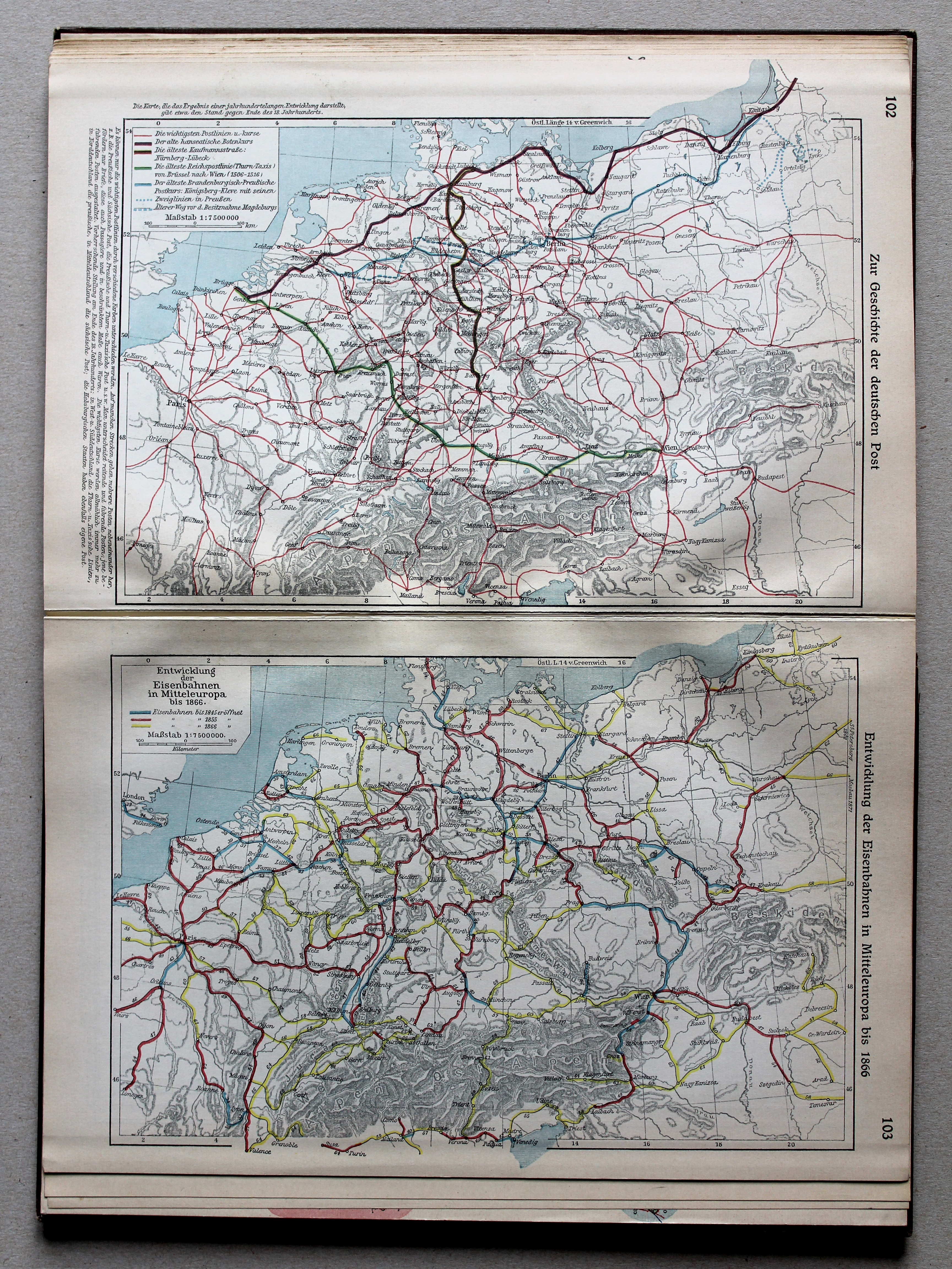
102. Zur Geschichte der deutschen Post XL
Geschiedenis van de Duitse Post / History of the German Mail
103. Entwicklung der Eisenbahnen in Mitteleuropa bis 1866 XL
Ontwikkeling van de spoorwegen in Midden-Europa tot 1866 / Development of railways in Central Europe until 1866
 Putzgers Historischer Schul-Atlas, Große Ausgabe, 1931/33
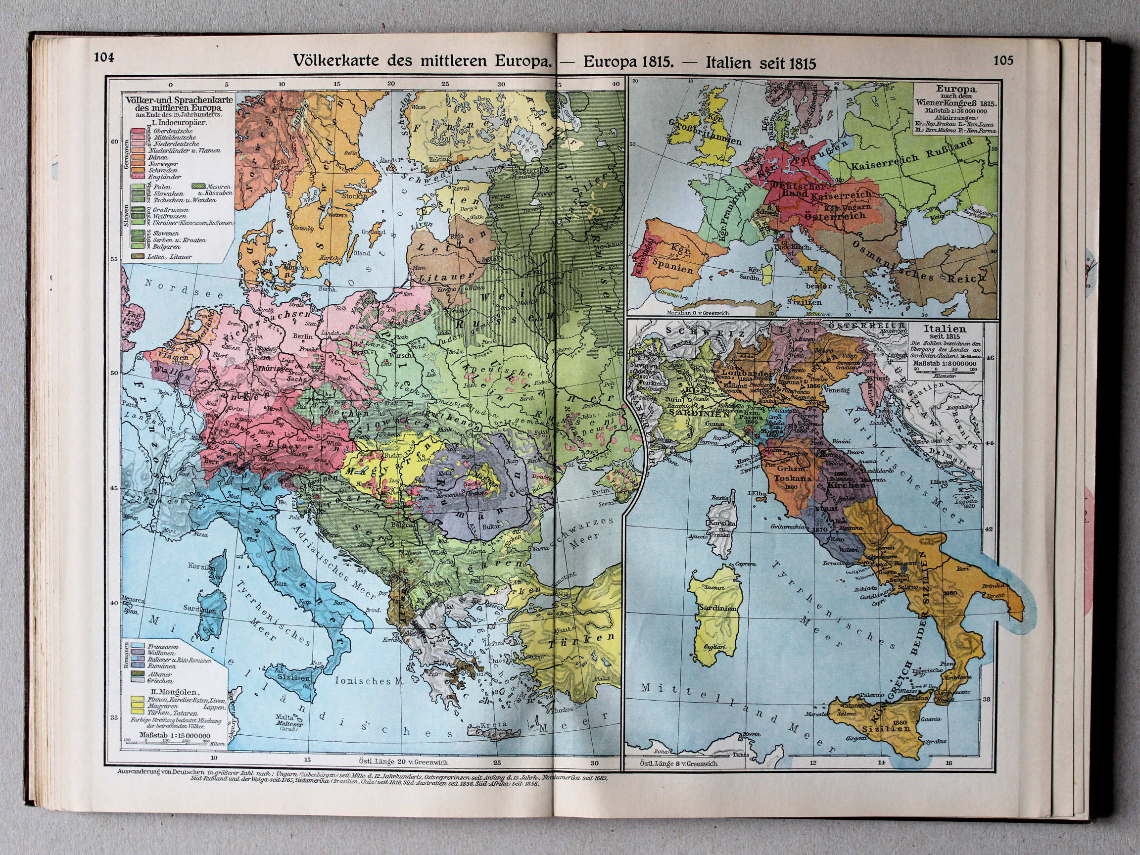
104.105. Völkerkarte des mittleren Europa – Europa 1815 – Italien seit 1815 XL
Etnografische kaart van Midden-Europa. Europa in 1815. Italië vanaf 1815 / Ethnographic map of Central Europe. Europe in 1815. Italy from 1815
 Putzgers Historischer Schul-Atlas, Große Ausgabe, 1931/33
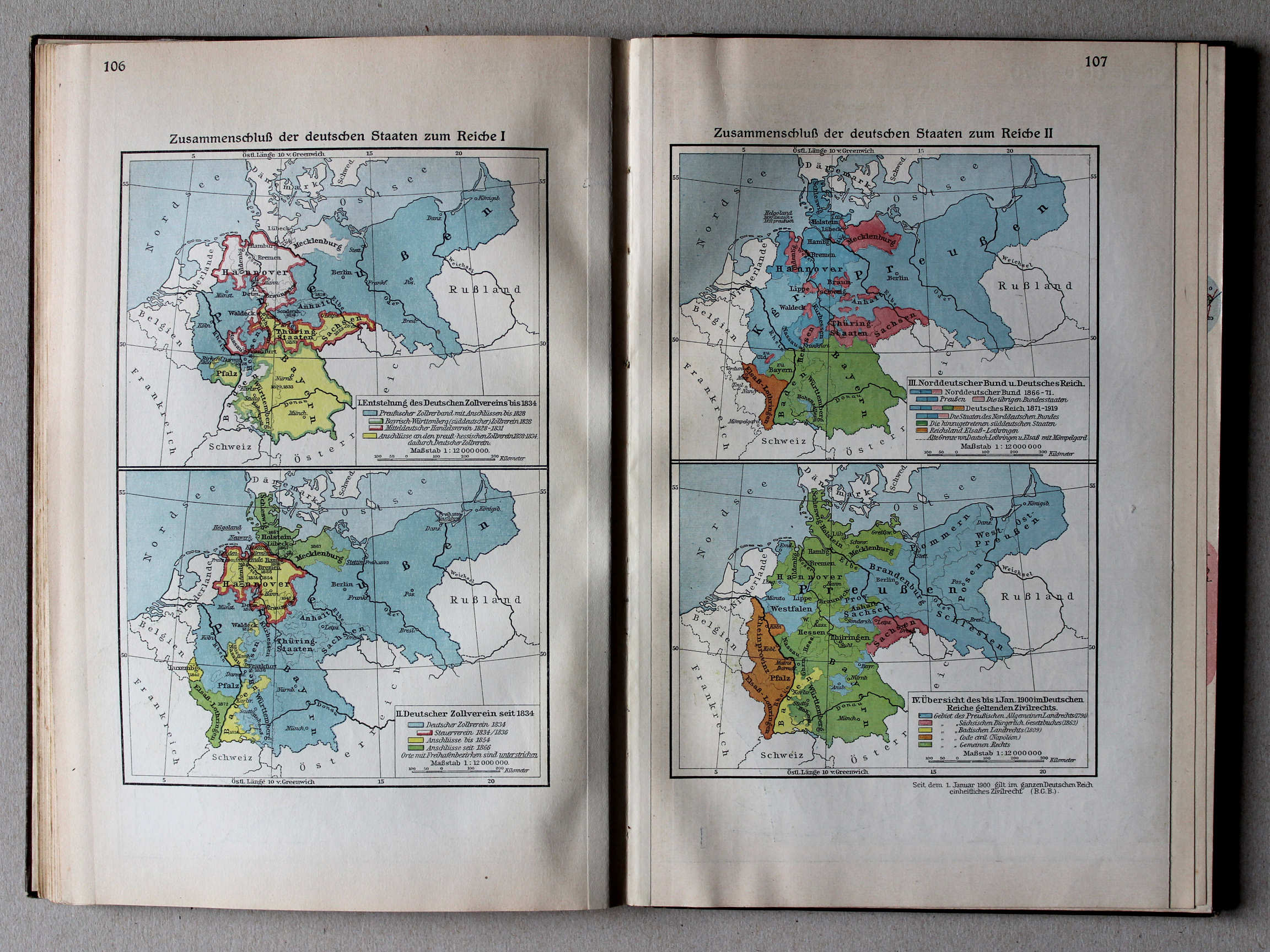
106. Zusammenschluß der deutschen Staaten zum Reiche I XL
Duitse eenwording I / German unification I
107. Zusammenschluß der deutschen Staaten zum Reiche II XL
Duitse eenwording II / German unification II
 Putzgers Historischer Schul-Atlas, Große Ausgabe, 1931/33
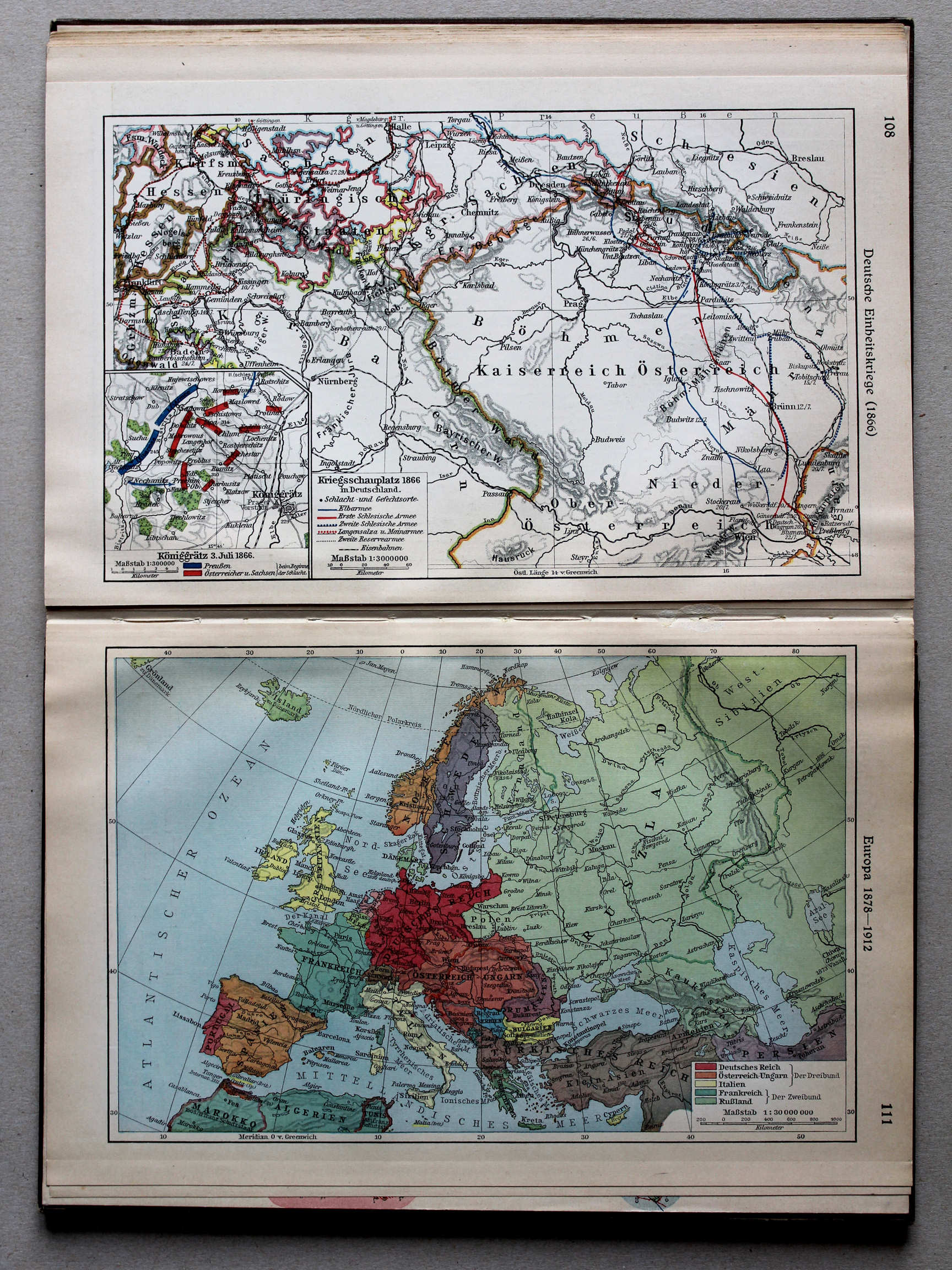
108. Deutsche Einheitskriege (1866) XL
Duitse eenwording (1866) / German unification (1866)
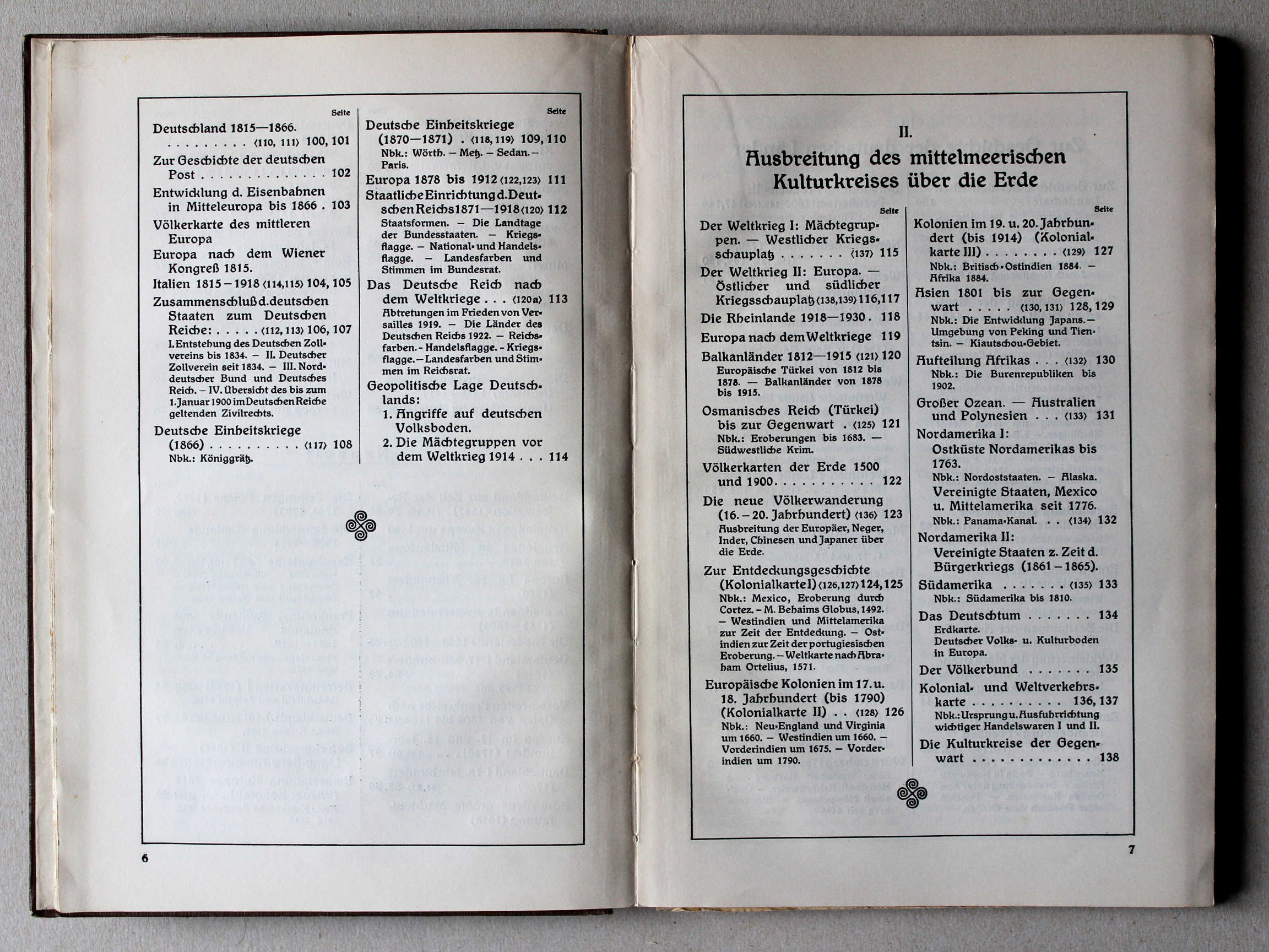
111. Europa 1878-1912 XL
Europa 1878-1912 / Europe 1878-1912
 Putzgers Historischer Schul-Atlas, Große Ausgabe, 1931/33
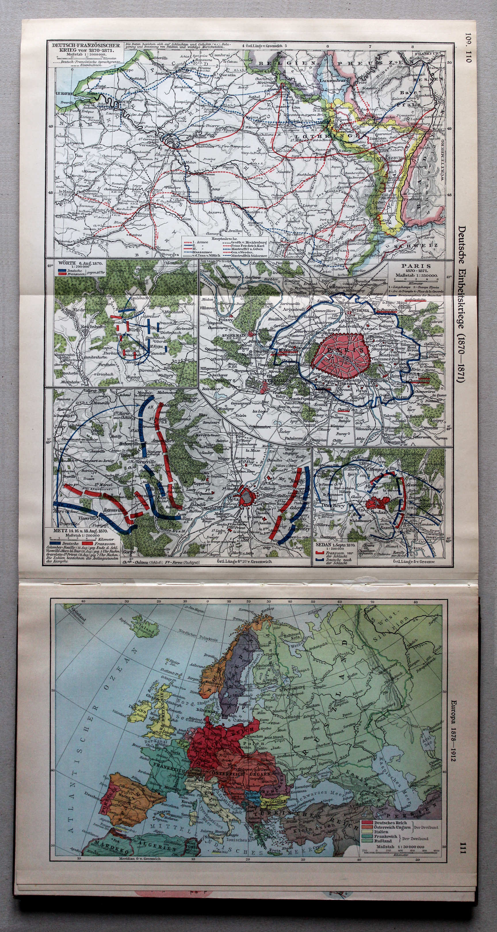
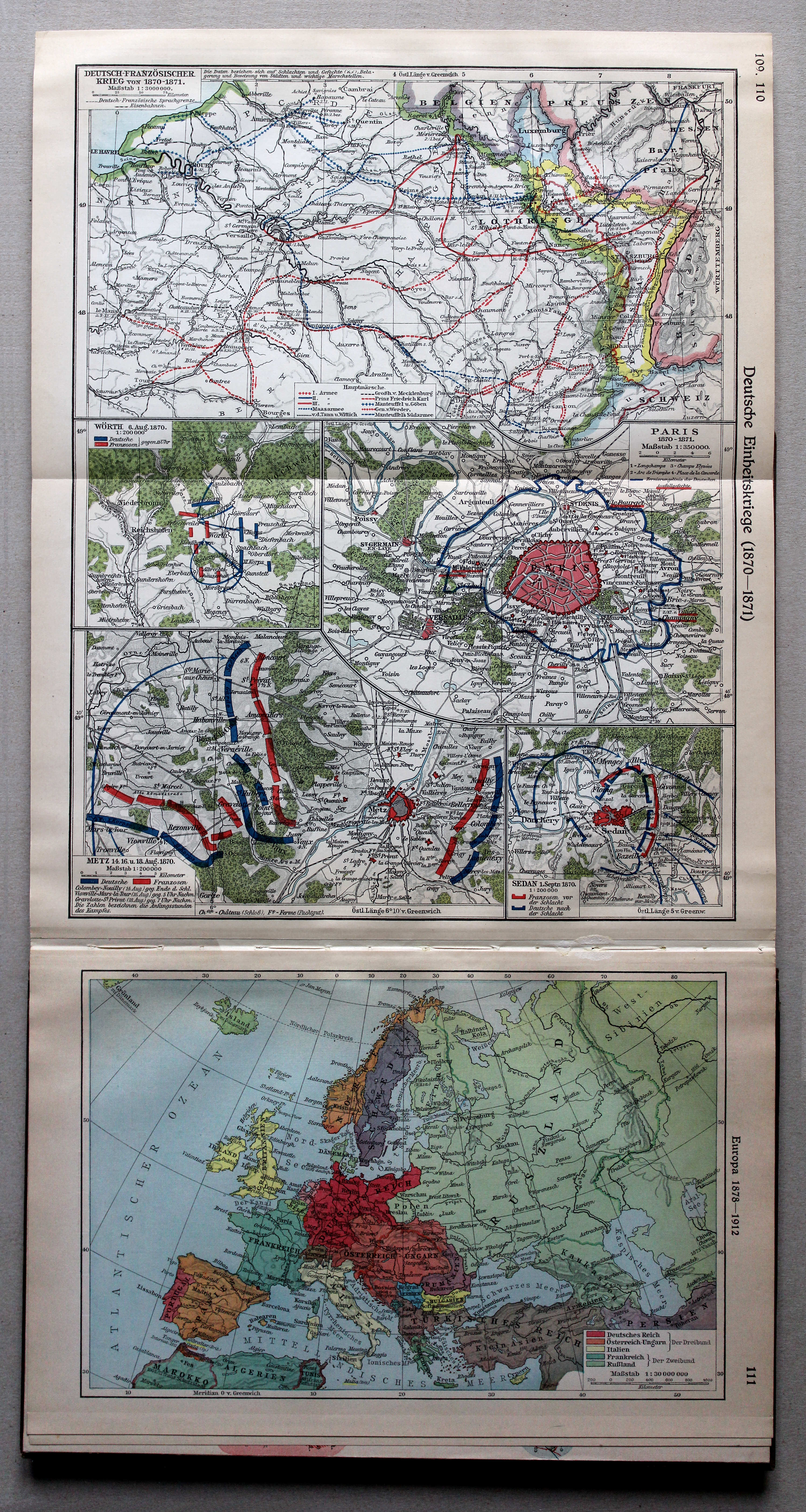
109.110. Deutsche Einheitskriege (1870-1871) XL
Duitse eenwording (1870-1871) / German unification (1870-1871)
111. Europa 1878-1912 XL
Europa 1878-1912 / Europe 1878-1912
 Putzgers Historischer Schul-Atlas, Große Ausgabe, 1931/33
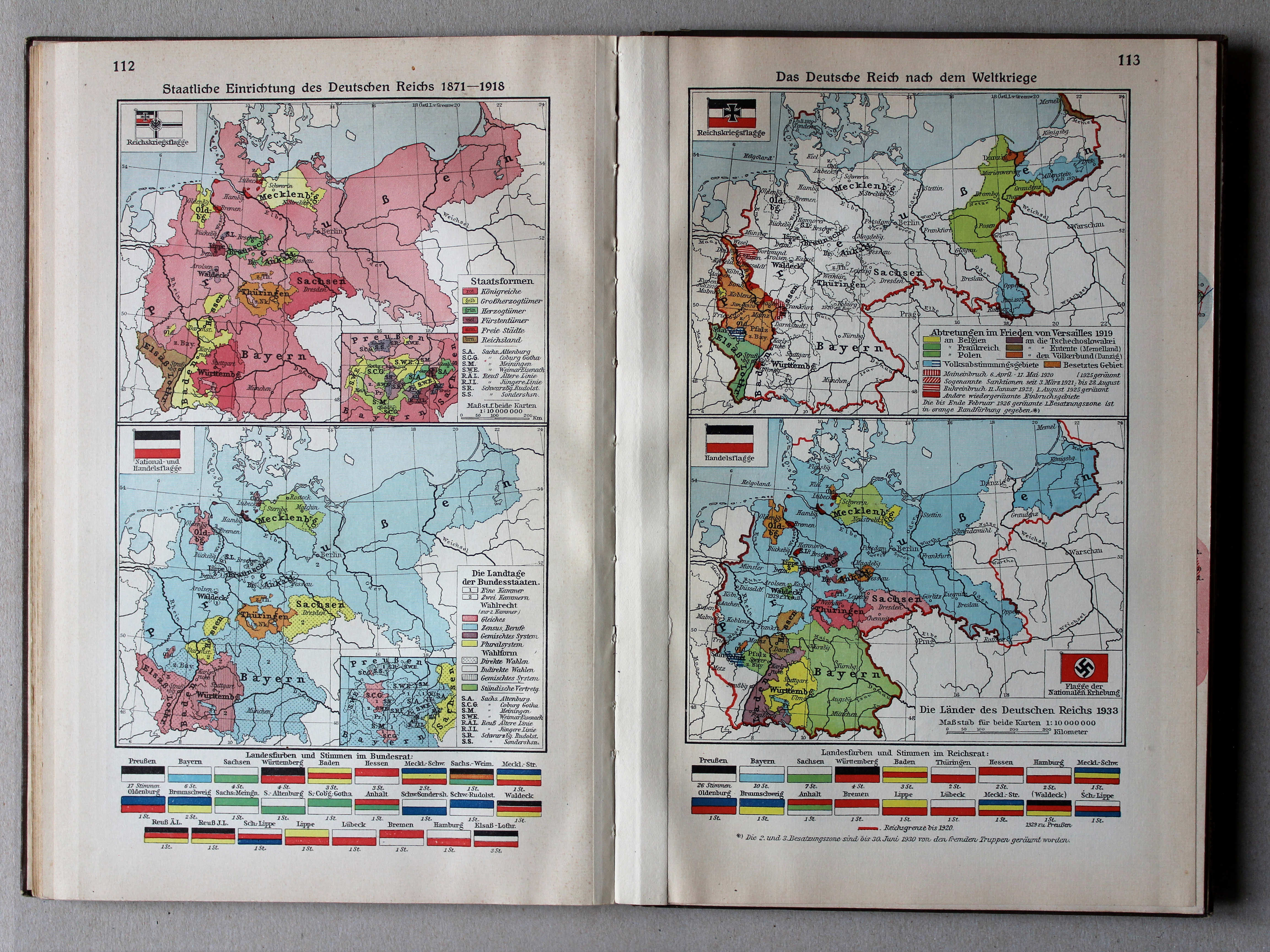
112. Staatliche Einrichtung des Deutschen Reichs 1871-1918 XL
Staatsinrichting van het Duitse Rijk 1871-1918 / Polity of the German Empire 1871-1918
113. Das Deutsche Reich nach dem Weltkriege XL
Het Duitse Rijk na de Wereldoorlog / The German Empire after the World War
 Putzgers Historischer Schul-Atlas, Große Ausgabe, 1931/33
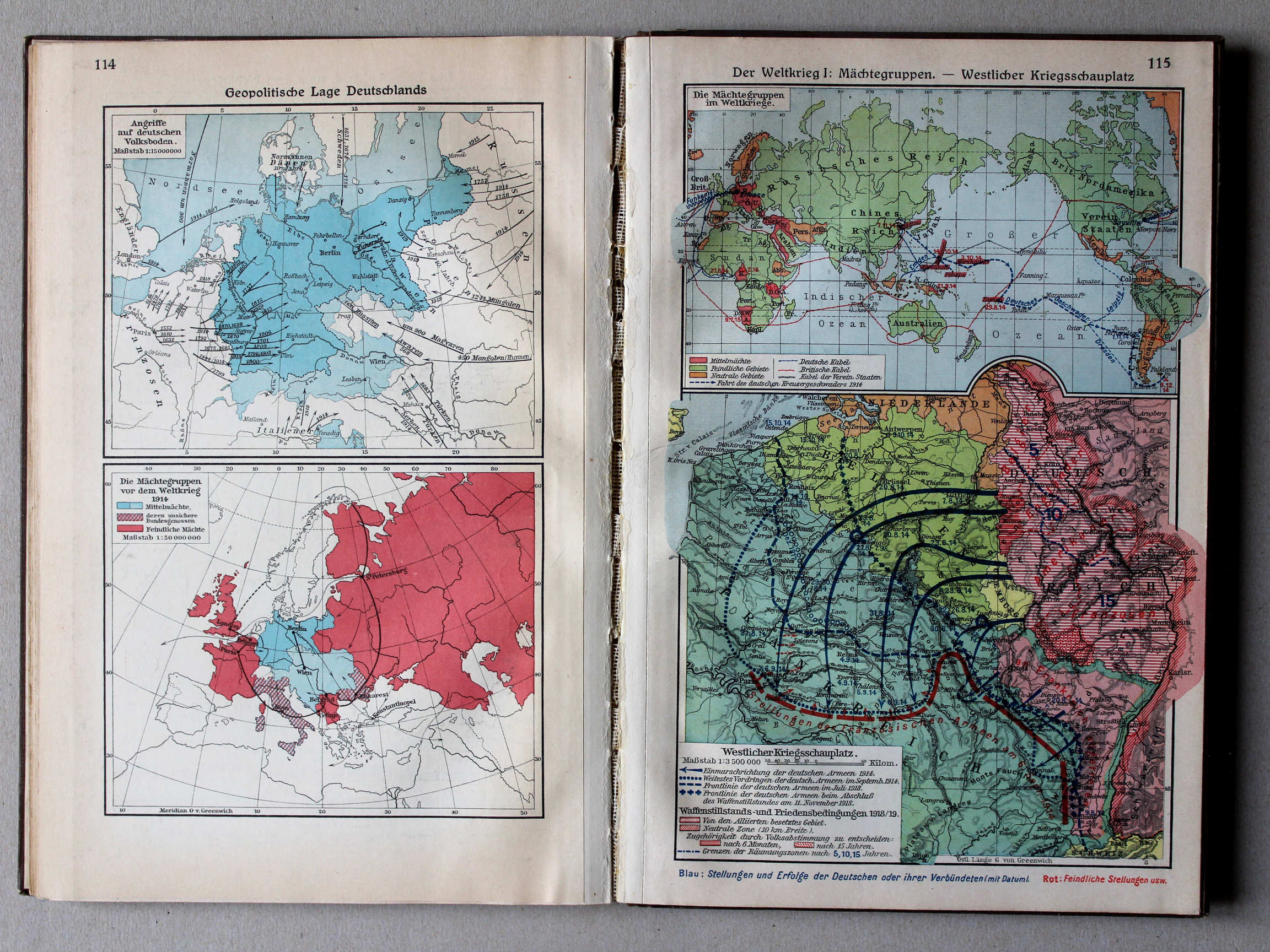
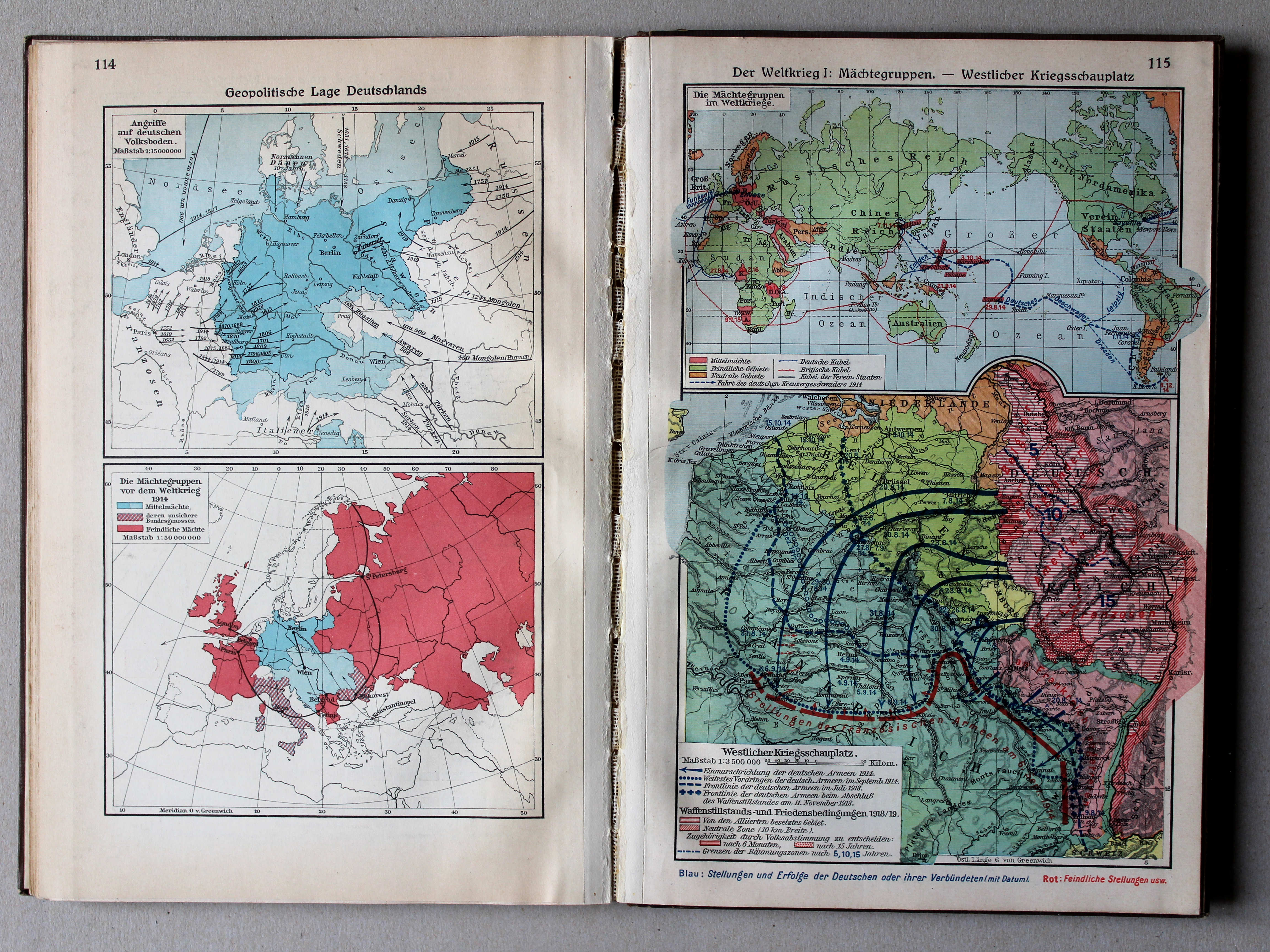
114. Geopolitische Lage Deutschlands XL
Geopolitieke situatie van Duitsland / Geopolitical situation of Germany
Putzgers Historischer Schul-Atlas, Große Ausgabe, 1931/33
115. Der Weltkrieg I: Mächtegruppen – Westlicher Kriegsschauplatz XL
De Wereldoorlog I: Machtsblokken. Westelijk Krijgstoneel / The World War I: Power blocks. Western theater of war
 Putzgers Historischer Schul-Atlas, Große Ausgabe, 1931/33
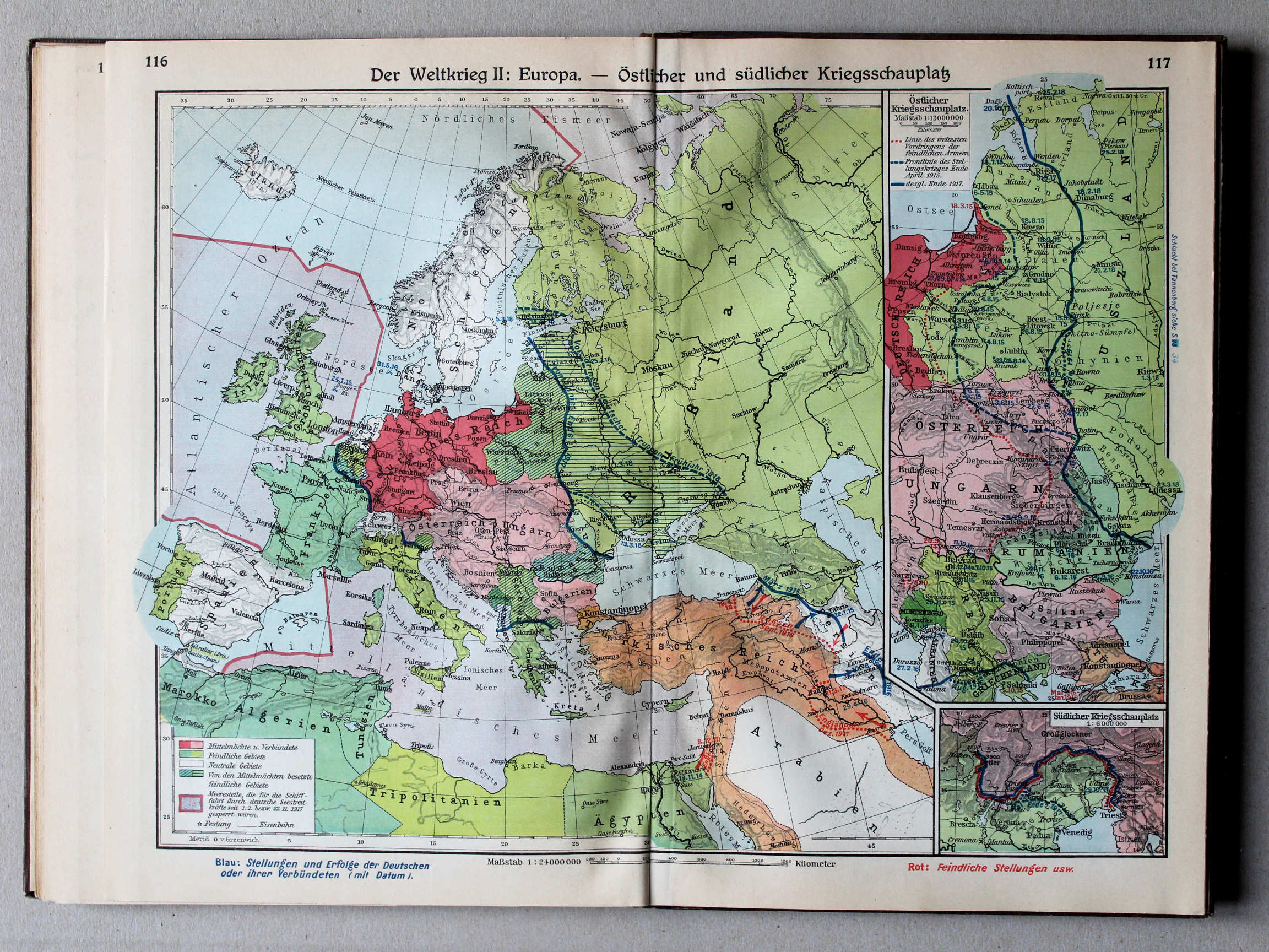
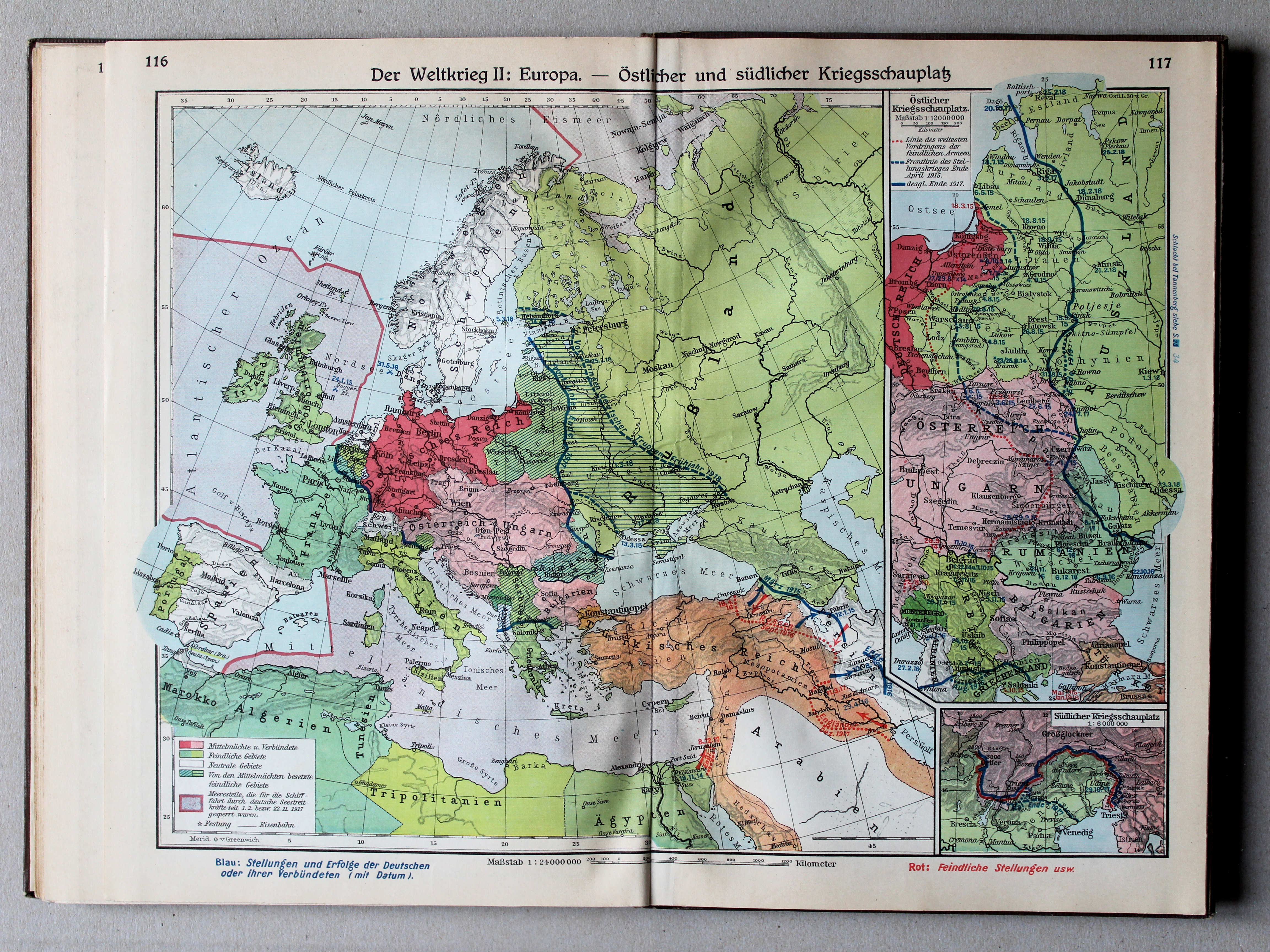
116.117. Der Weltkrieg II: Europa – Östlicher und südlicher Kriegsschauplatz XL
De Wereldoorlog II: Europa. Oostelijk en zuidelijk Krijgstoneel / The World War II: Europe. Eastern and southern theater of war
 Putzgers Historischer Schul-Atlas, Große Ausgabe, 1931/33
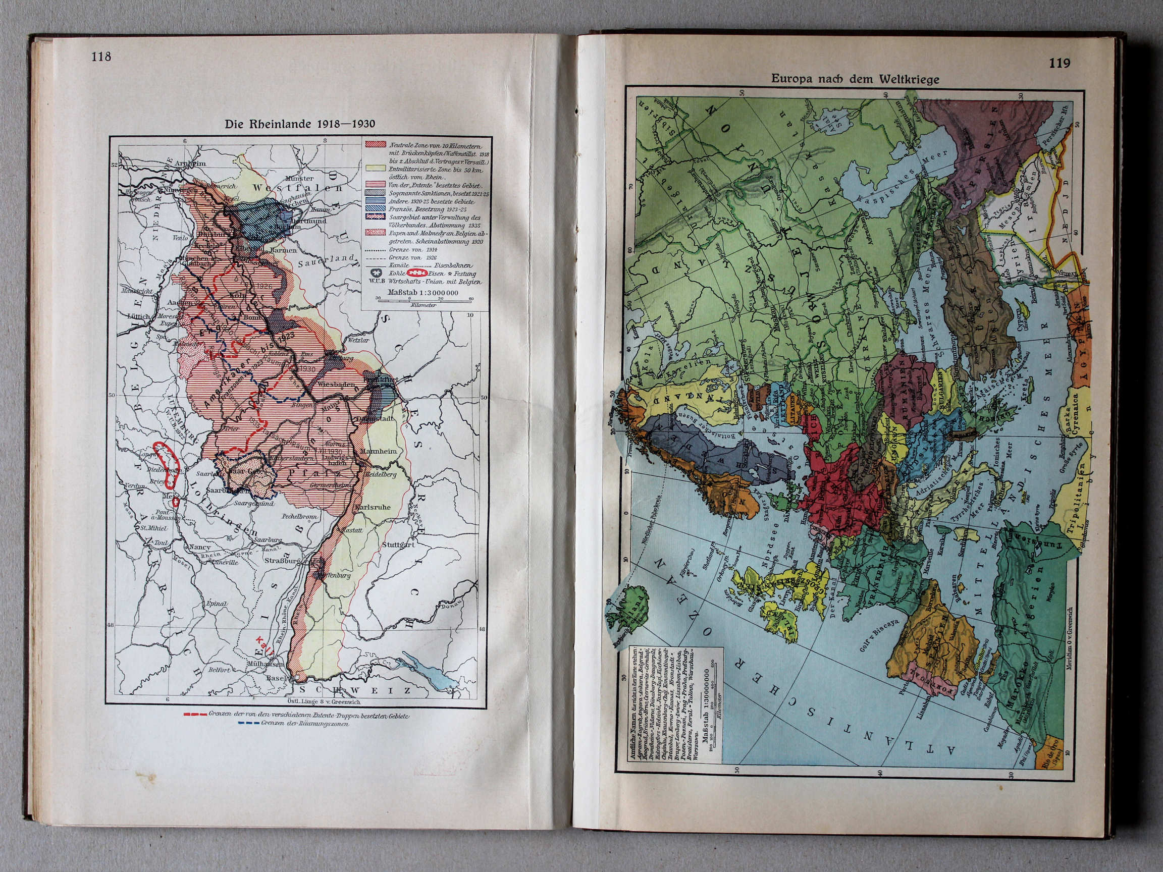
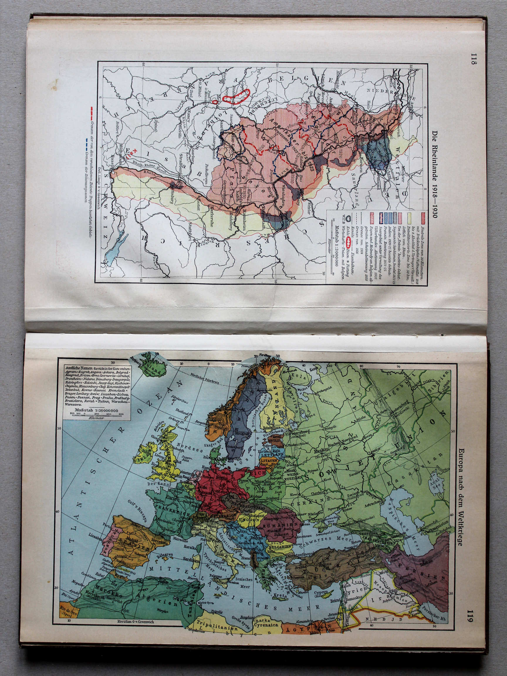
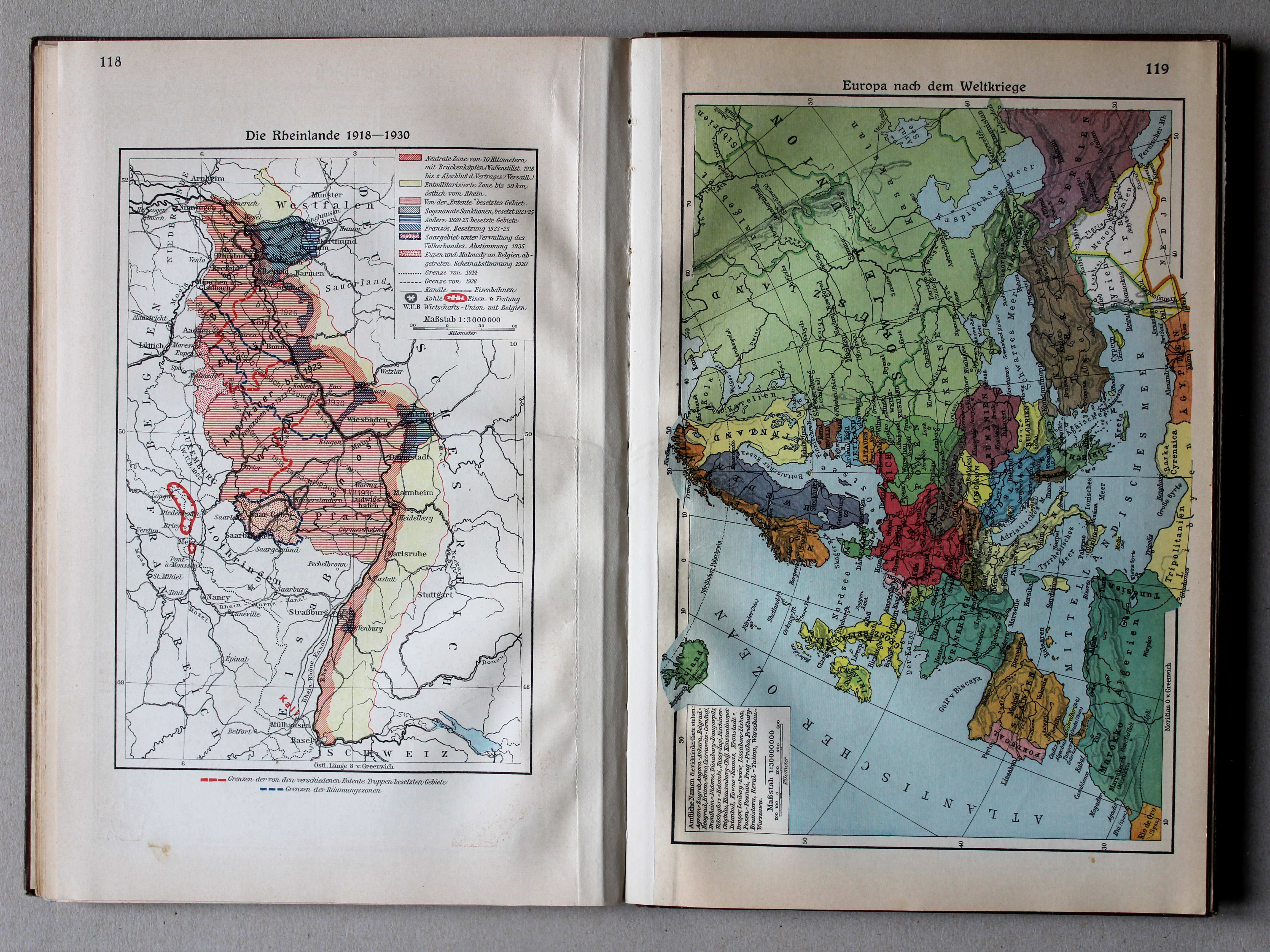
118. Die Rheinlande 1918-1930 XL
Het Rijnland 1918-1930 / Rhineland 1918-1930
 Putzgers Historischer Schul-Atlas, Große Ausgabe, 1931/33
119. Europa nach dem Weltkriege XL
Europa na de Wereldoorlog / Europe after the World War
 Putzgers Historischer Schul-Atlas, Große Ausgabe, 1931/33
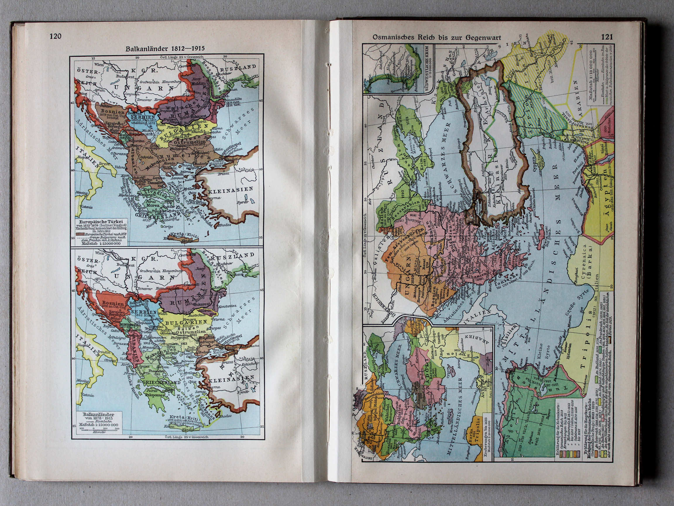
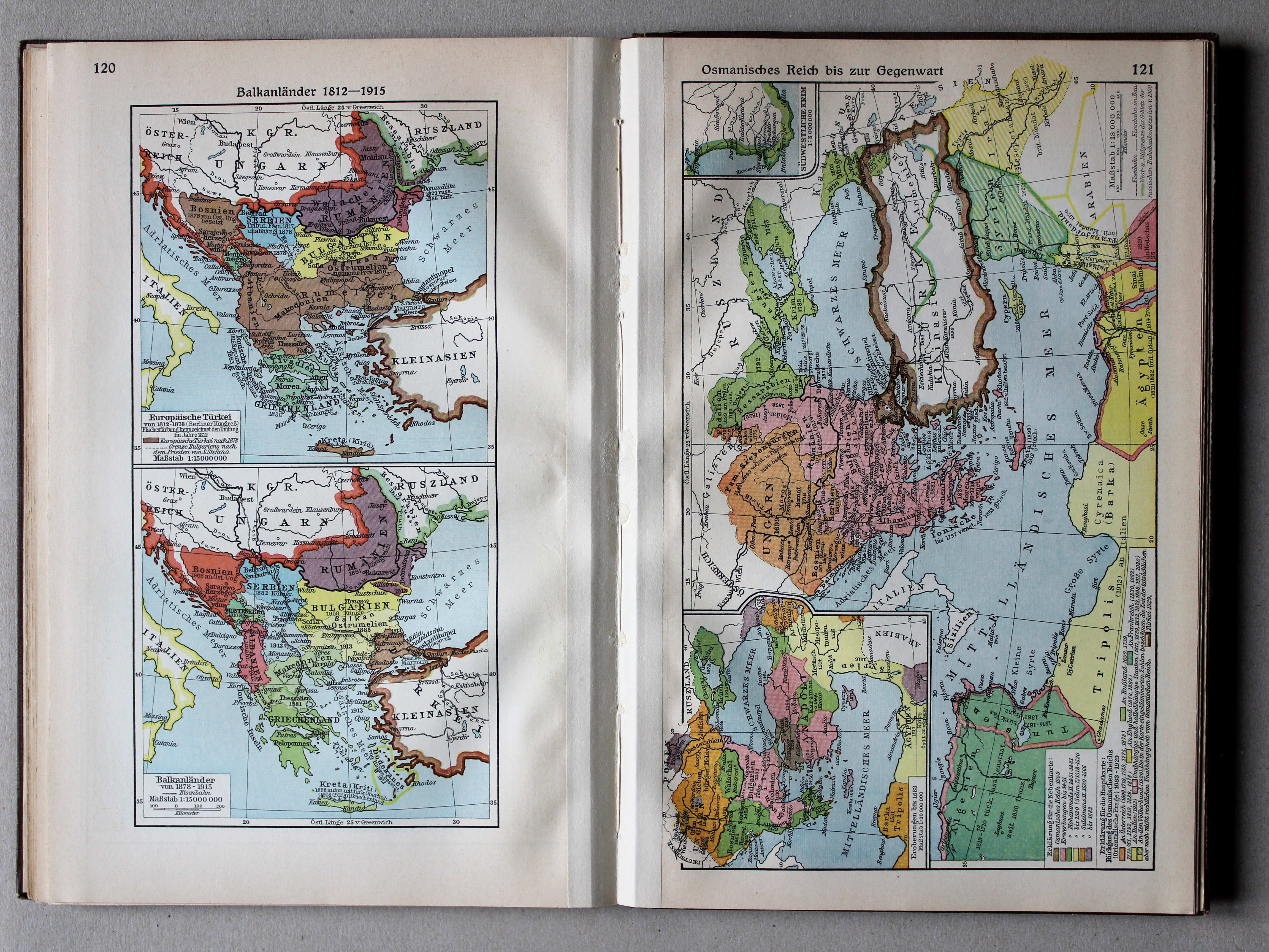
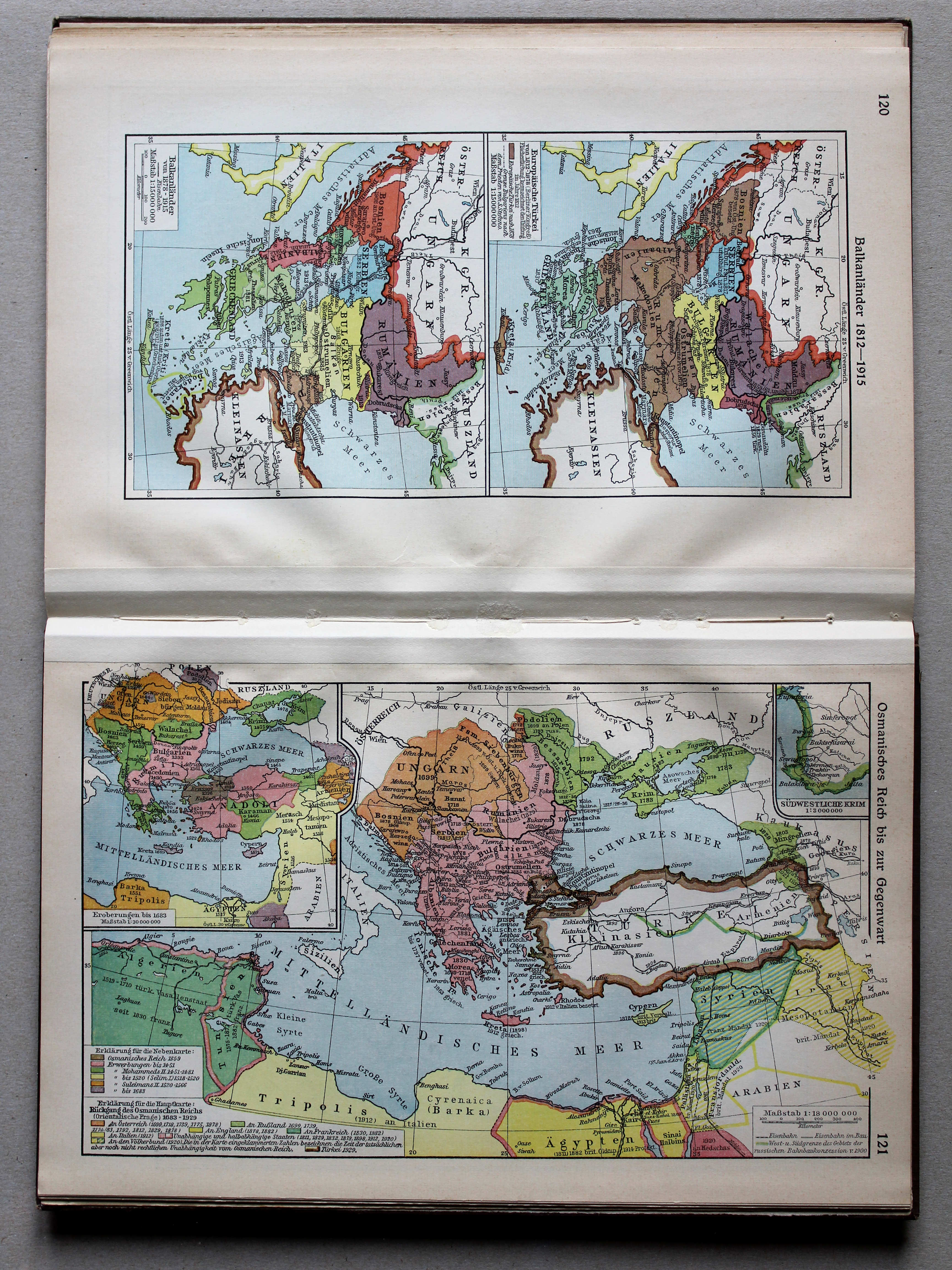
120. Balkanländer 1812-1915 XL
Balkanschiereiland 1812-1915 / Balkan Peninsula 1812-1915
 Putzgers Historischer Schul-Atlas, Große Ausgabe, 1931/33
121. Osmanisches Reich bis zur Gegenwart XL
Het Ottomaanse Rijk tot heden / The Ottoman Empire until today
 Putzgers Historischer Schul-Atlas, Große Ausgabe, 1931/33
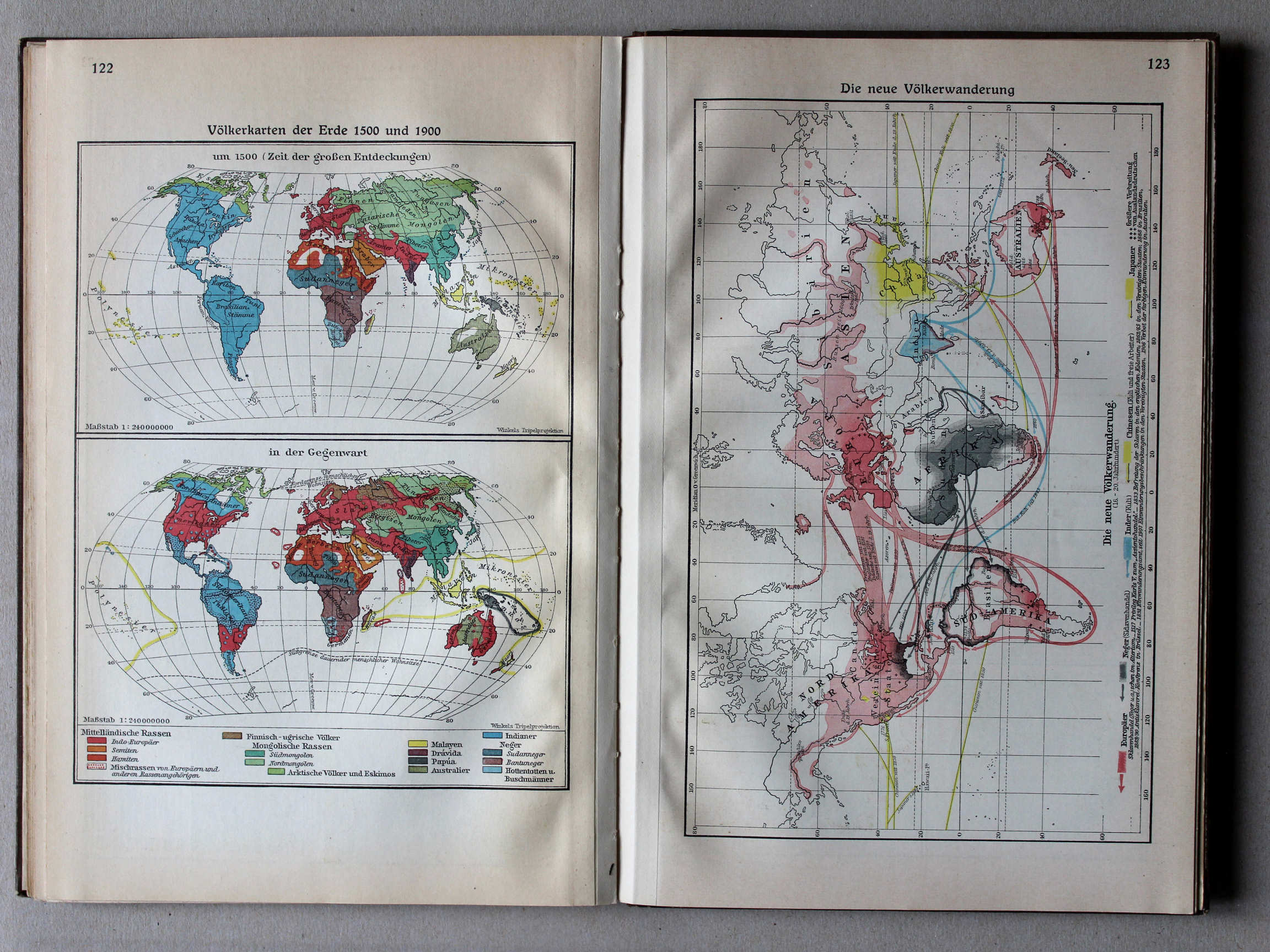
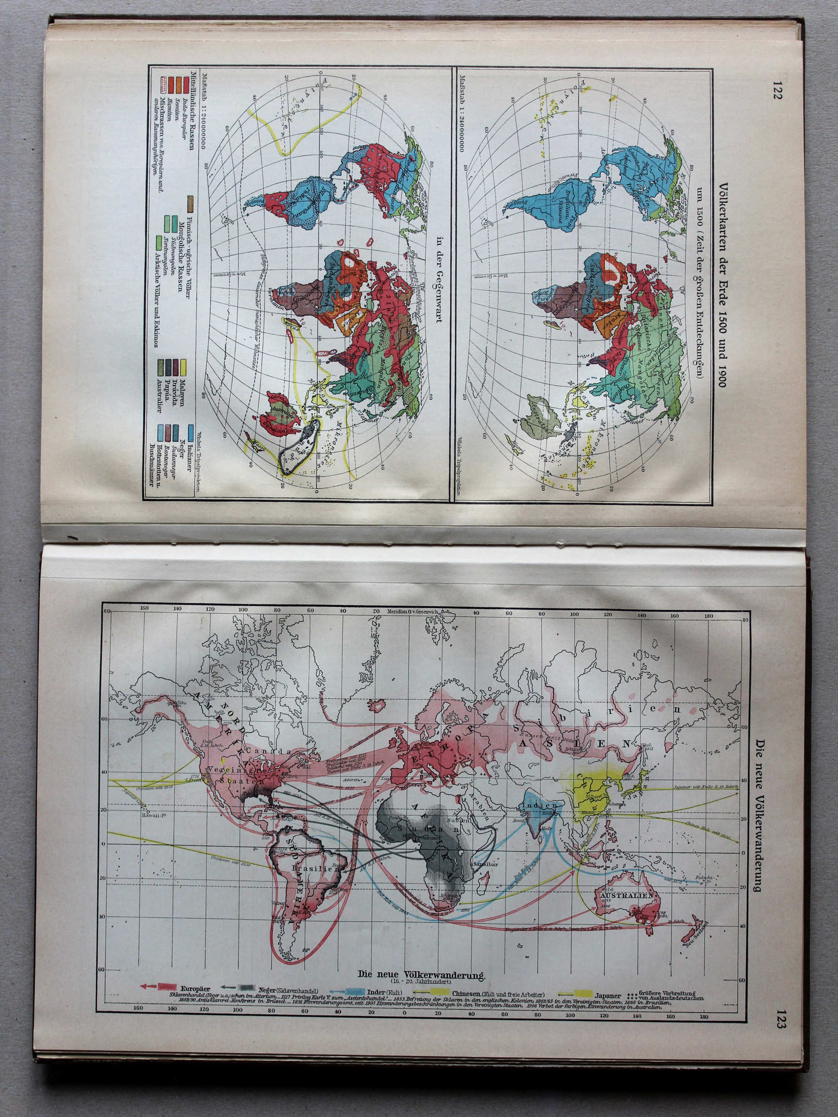
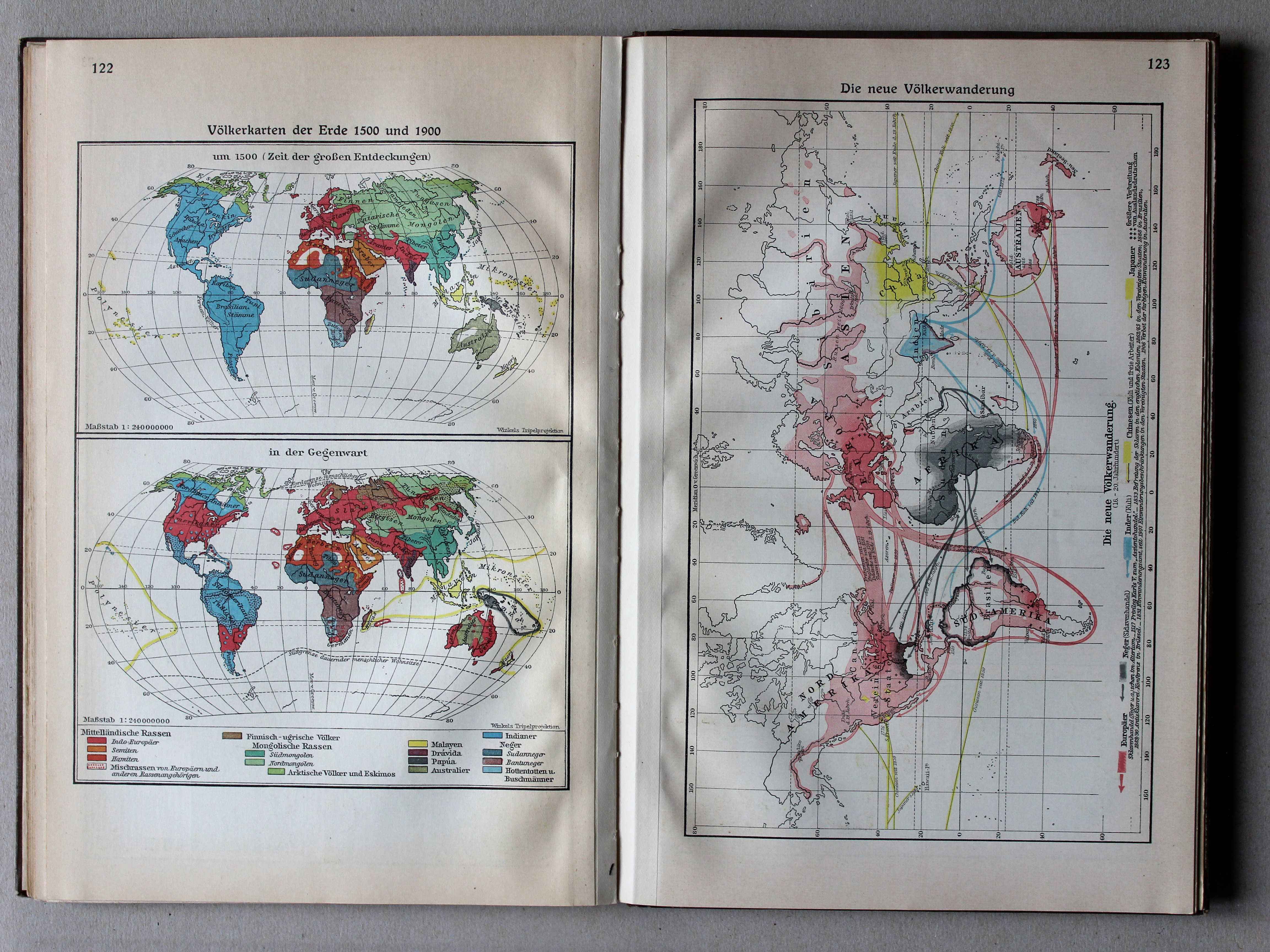
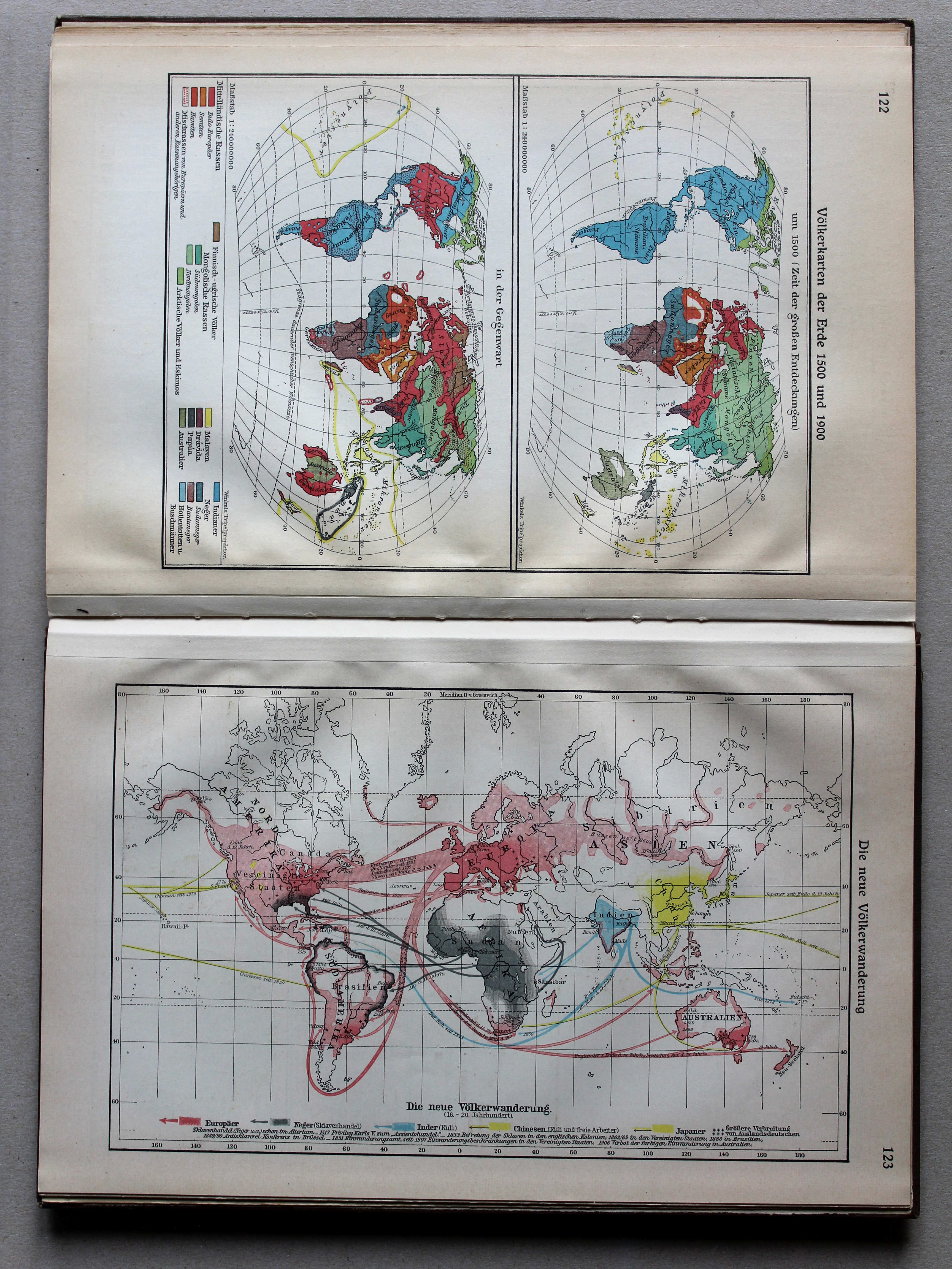
122. Völkerkarten der Erde 1500 und 1900 XL
Volkeren op Aarde in 1500 en 1900 / Nations of the world in 1500 and 1900
 Putzgers Historischer Schul-Atlas, Große Ausgabe, 1931/33
123. Die neue Völkerwanderung XL
De nieuwe Volksverhuizing / The modern Migration Period
 Putzgers Historischer Schul-Atlas, Große Ausgabe, 1931/33
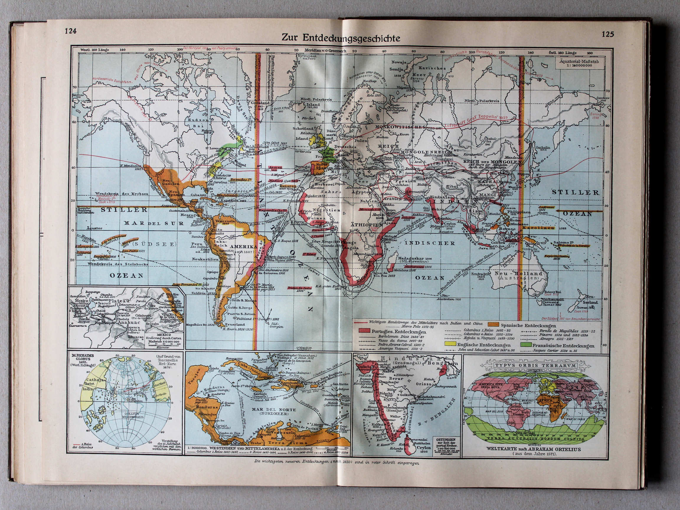
124.125. Zur Entdeckungsgeschichte XL
Geschiedenis van de grote ontdekkingen / History of Discovery
 Putzgers Historischer Schul-Atlas, Große Ausgabe, 1931/33
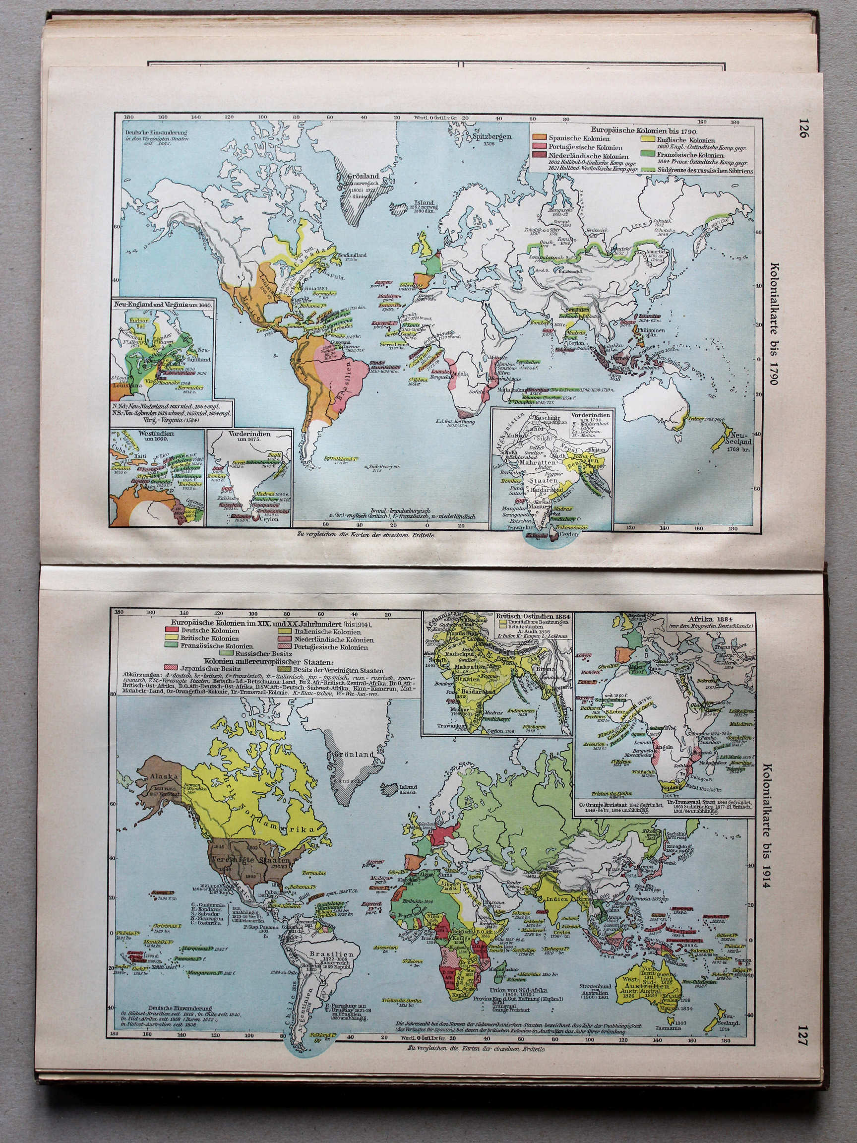
126. Kolonialkarte bis 1790 XL
Koloniën tot 1790 / Colonies until 1790
127. Kolonialkarte bis 1914 XL
Koloniën tot 1914 / Colonies until 1914
 Putzgers Historischer Schul-Atlas, Große Ausgabe, 1931/33
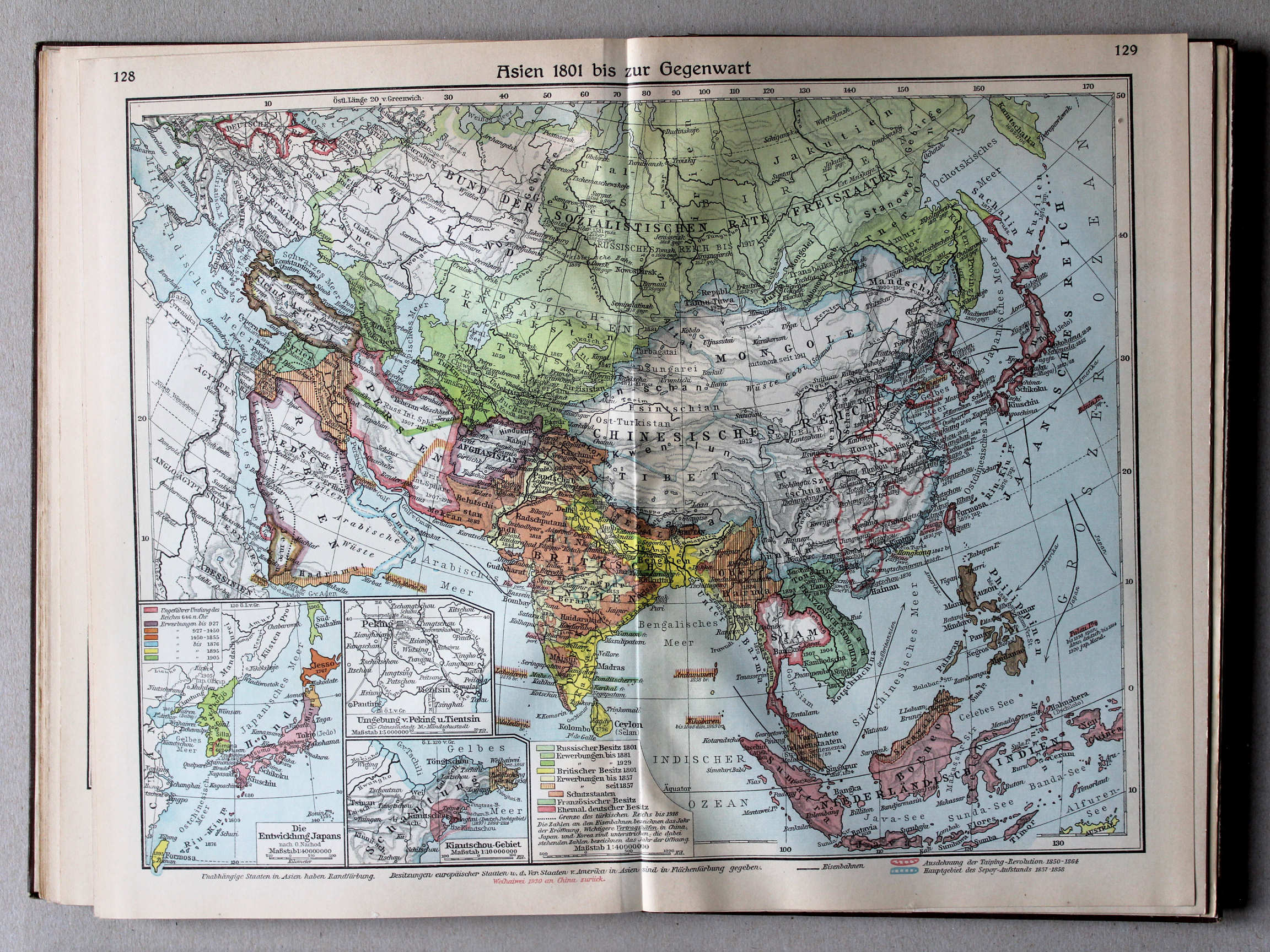
128.129. Asien 1801 bis zur Gegenwart XL
Azië van 1801 tot heden / Asia from 1801 until today
 Putzgers Historischer Schul-Atlas, Große Ausgabe, 1931/33
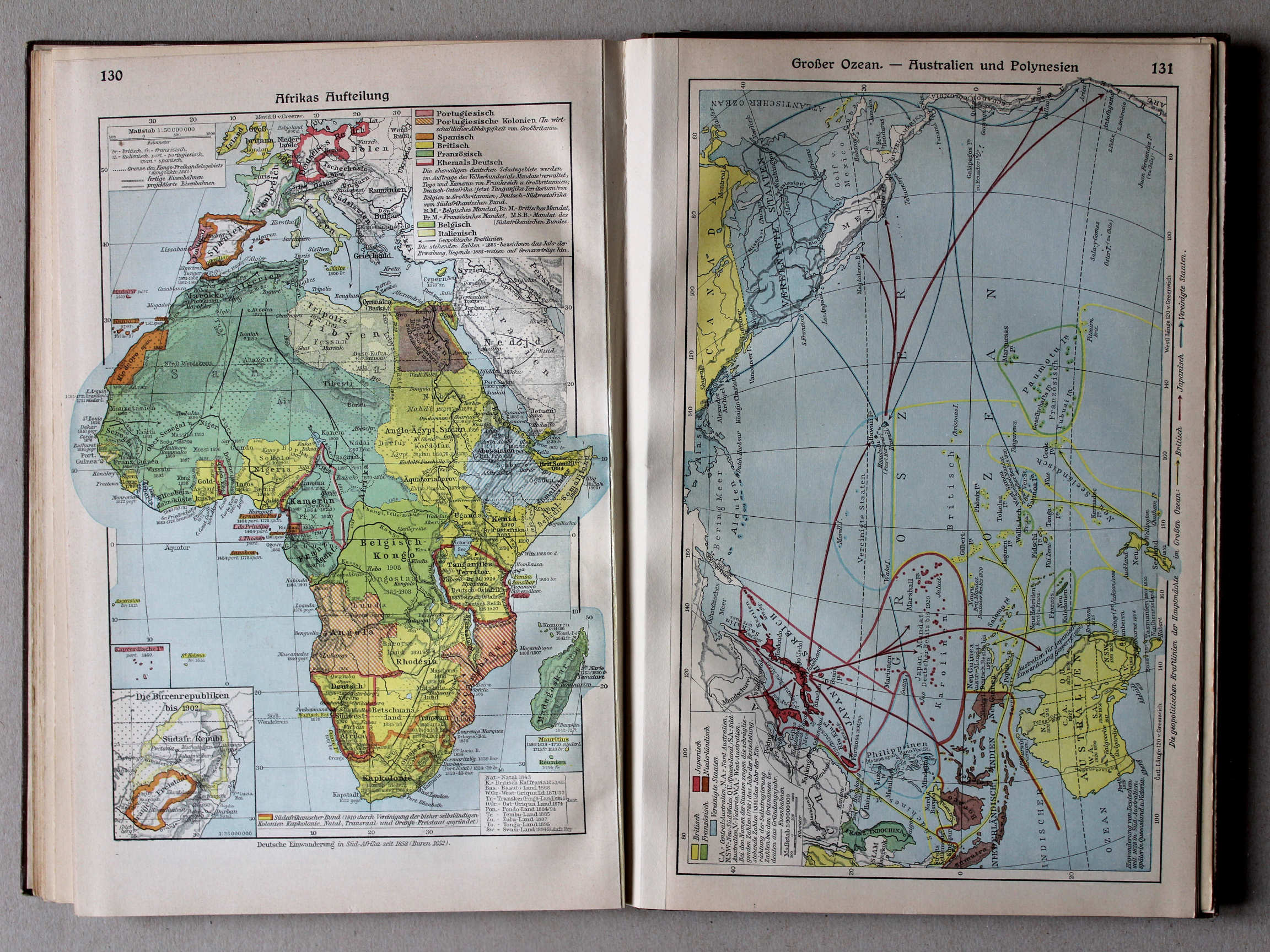
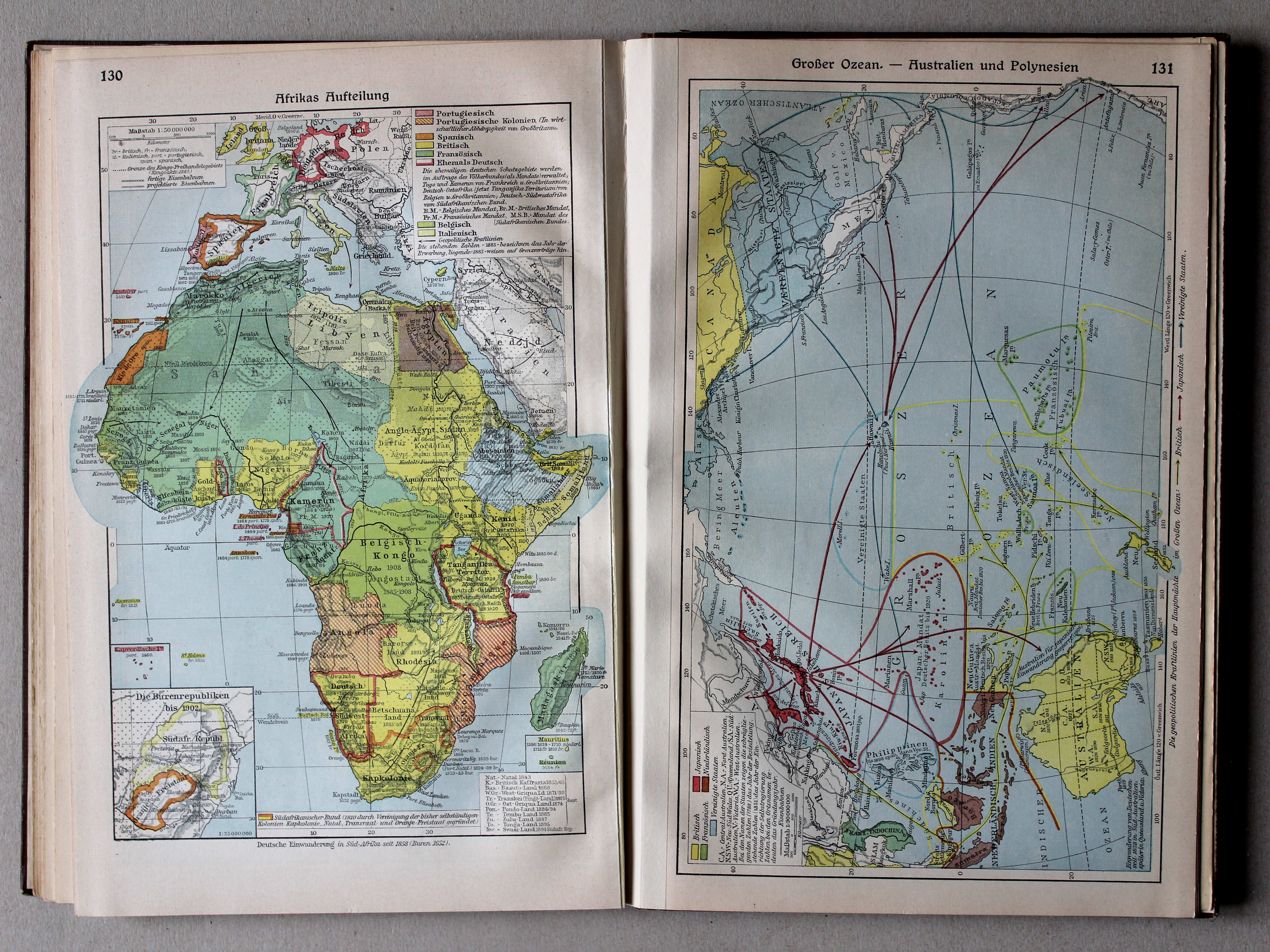
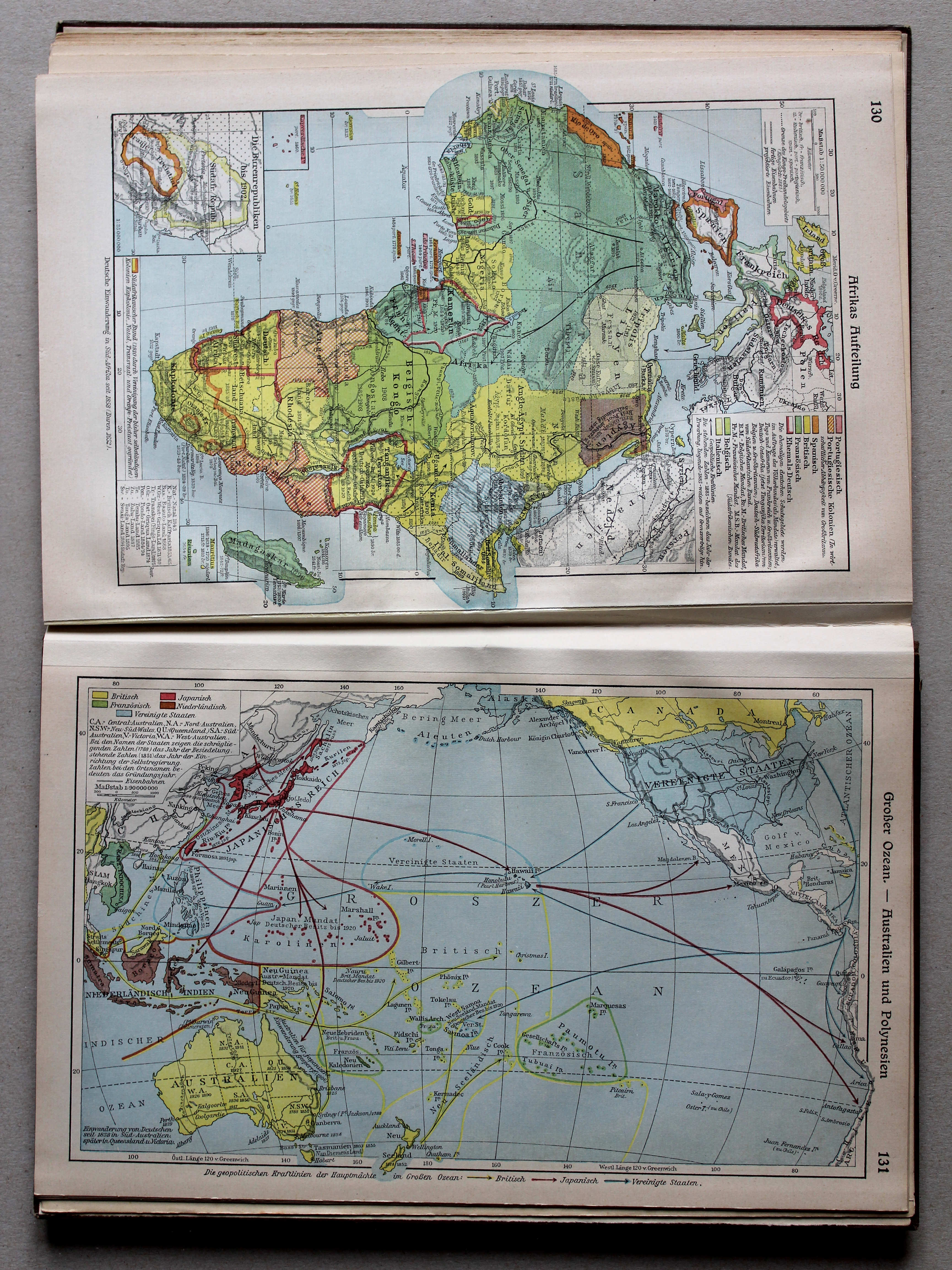
130. Aufteilung Afrikas XL
Opdeling van Afrika / Scramble for Africa
 Putzgers Historischer Schul-Atlas, Große Ausgabe, 1931/33
131. Großer Ozean – Australien und Polynesien XL
Grote Oceaan. Australië en Oceanië / Pacific Ocean. Australia and Oceania
 Putzgers Historischer Schul-Atlas, Große Ausgabe, 1931/33
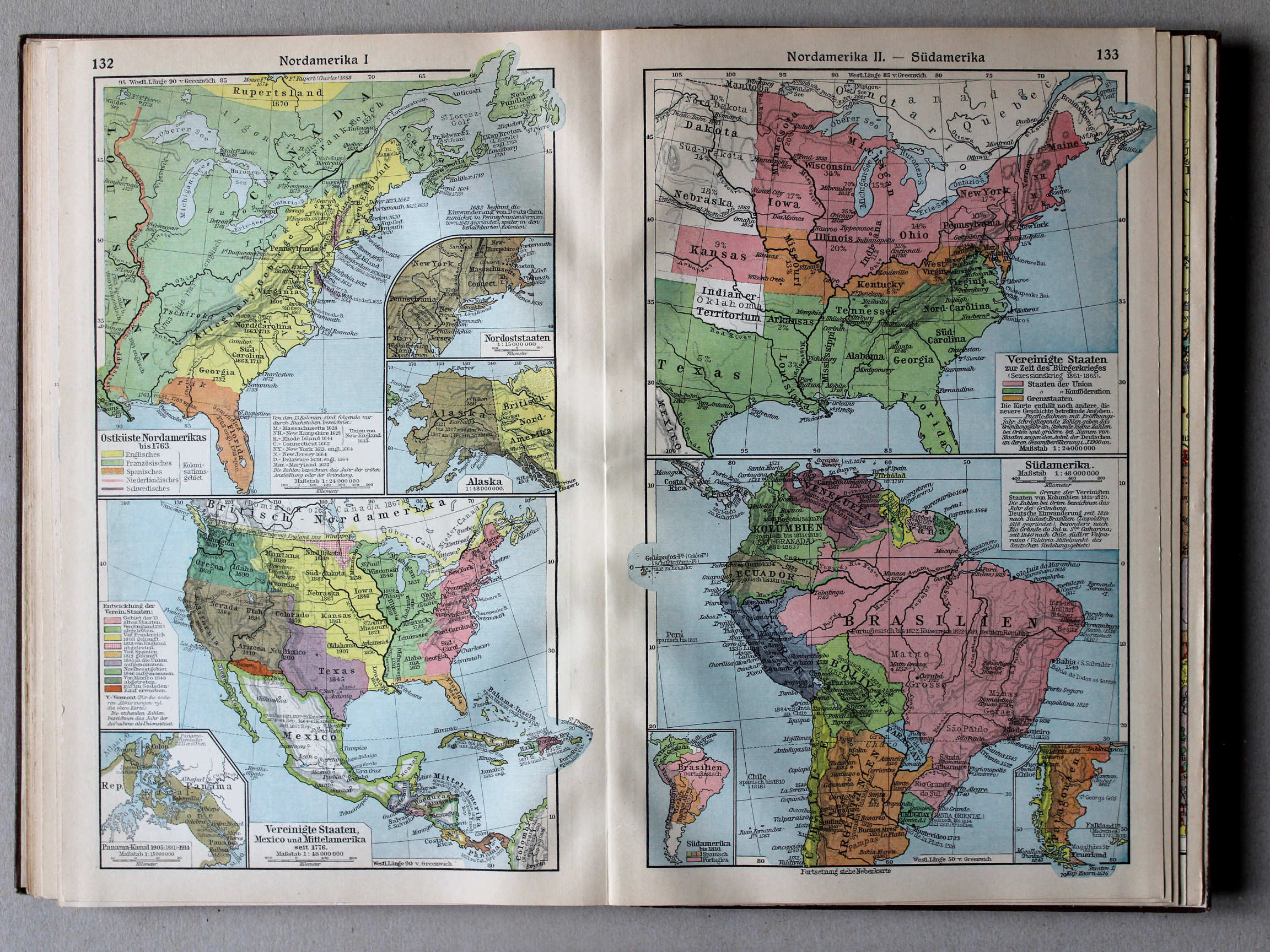
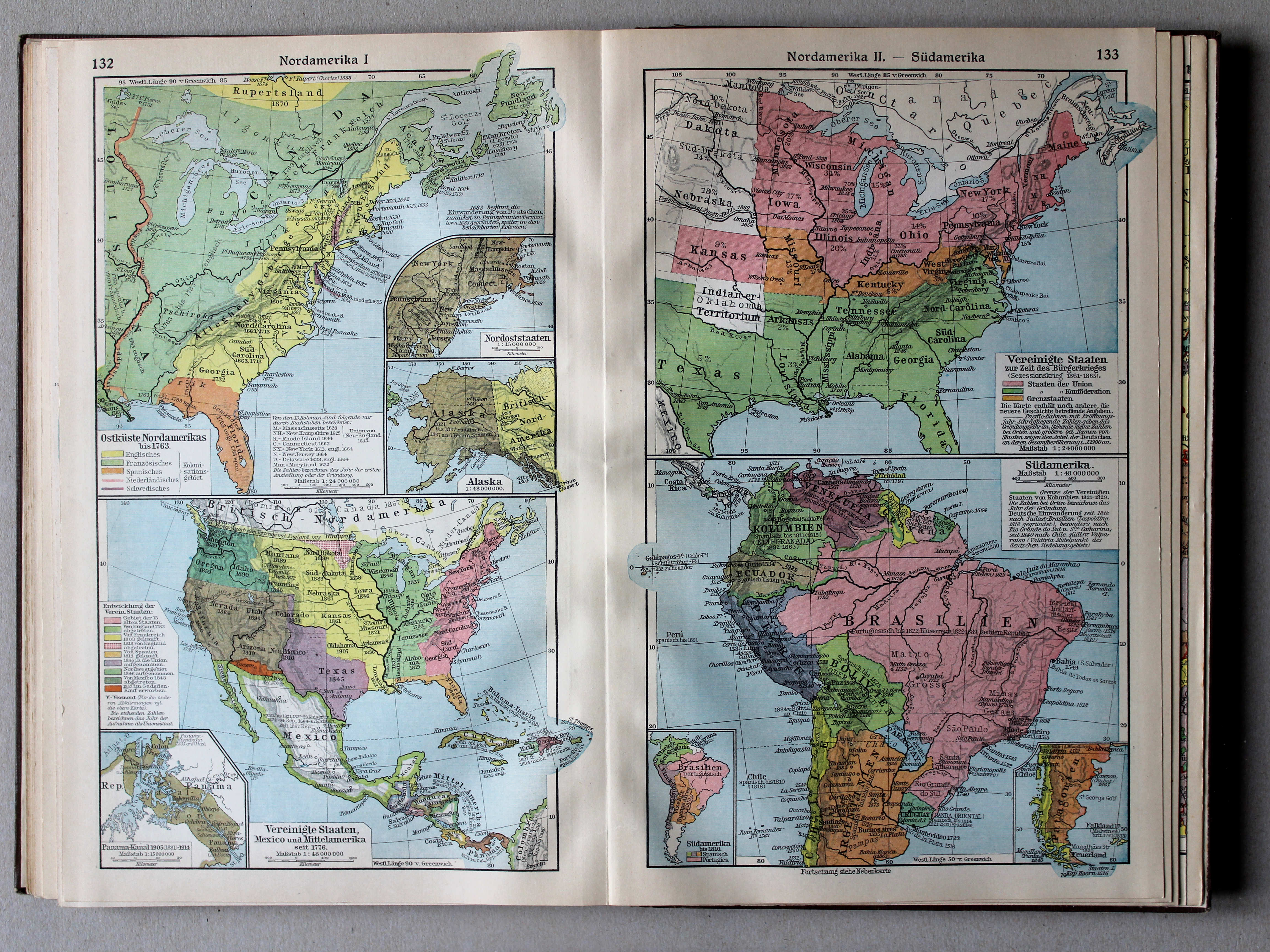
132. Nordamerika I XL
Noord-Amerika I / North America I
133. Nordamerika II – Südamerika XL
Noord-Amerika II. Zuid-Amerika / North America II. South America
 Putzgers Historischer Schul-Atlas, Große Ausgabe, 1931/33
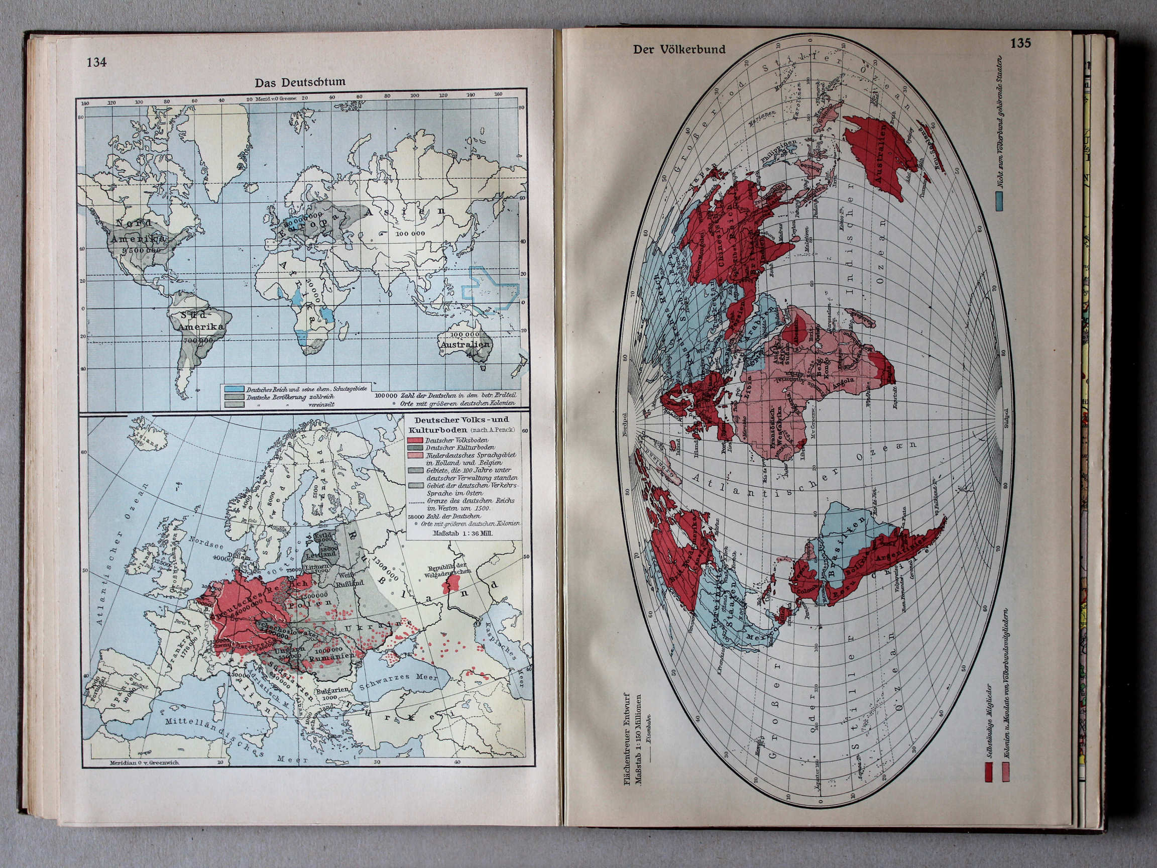
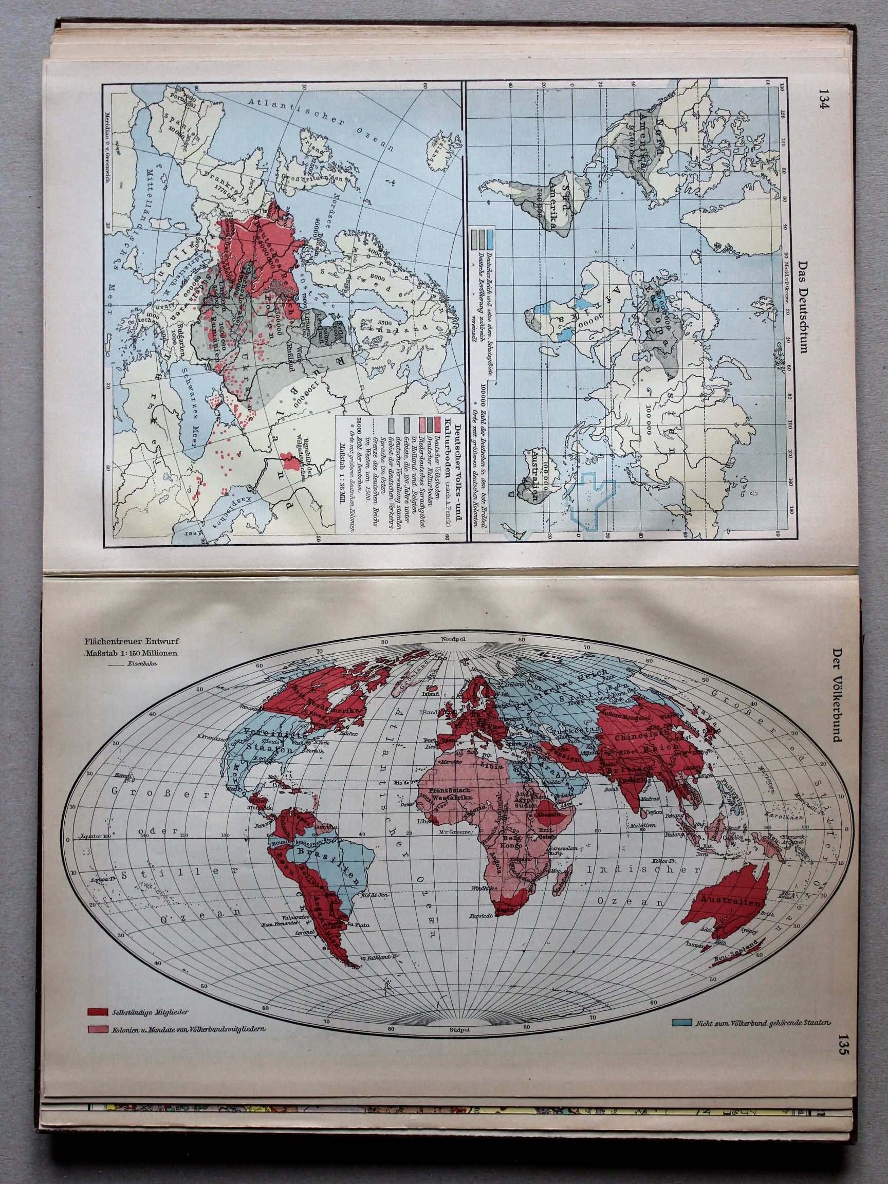
134. Das Deutschtum XL
Duitsers in de wereld / Germans over the world
 Putzgers Historischer Schul-Atlas, Große Ausgabe, 1931/33
135. Der Völkerbund XL
De Volkenbond / The League of Nations
 Putzgers Historischer Schul-Atlas, Große Ausgabe, 1931/33
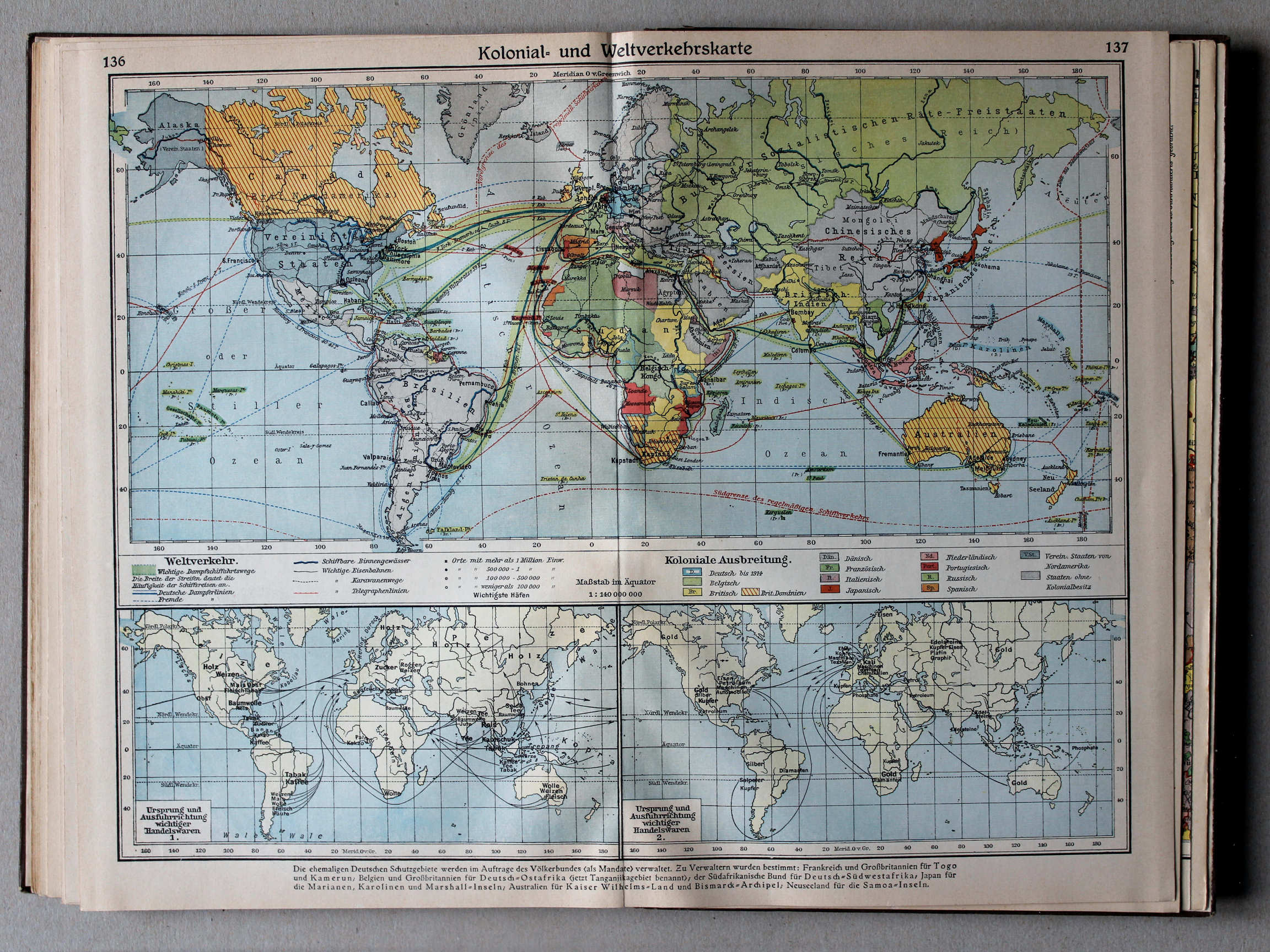
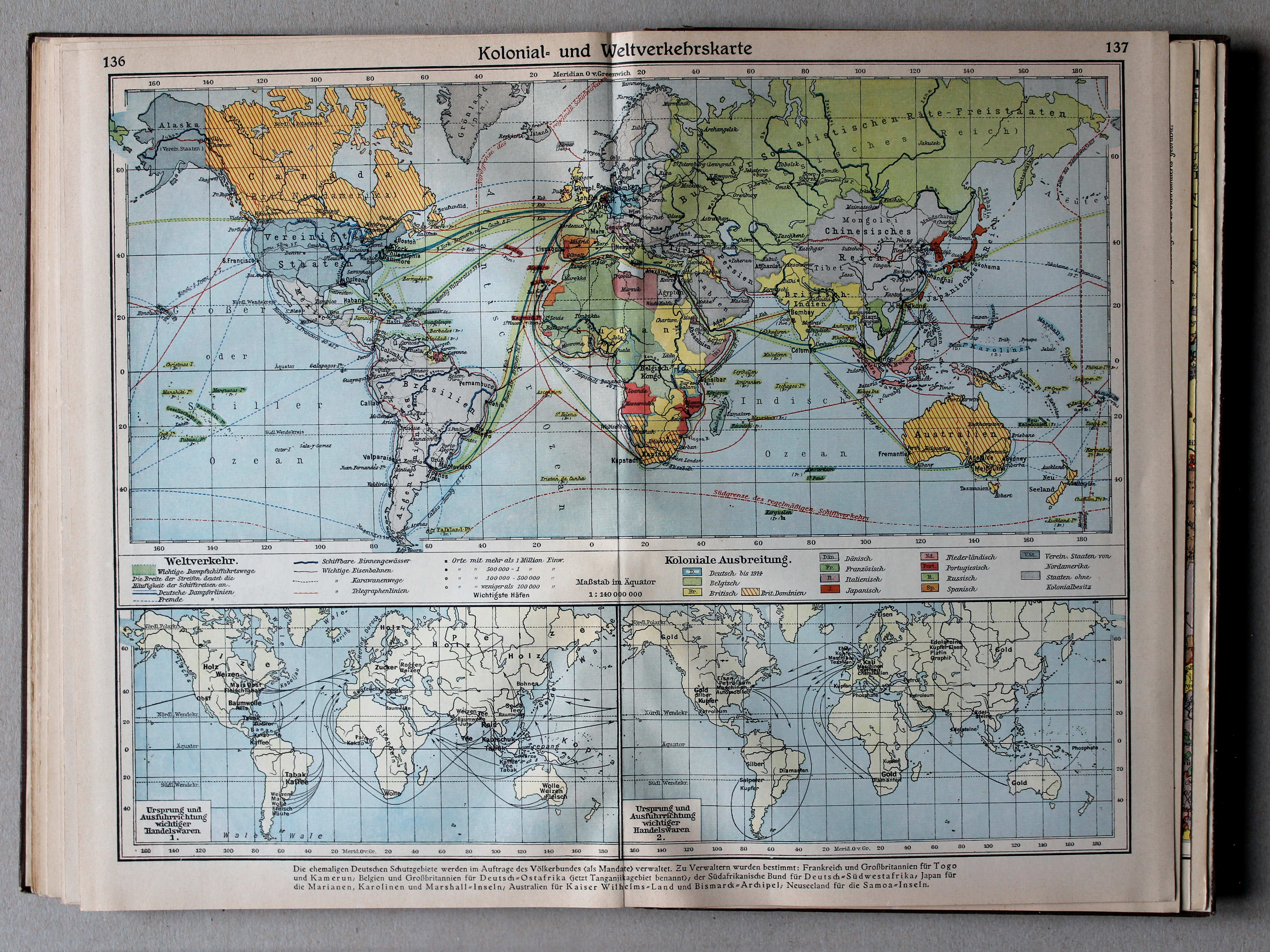
136.137. Kolonial- und Weltverkehrskarte XL
Koloniën en verbindingen / Colonies and communication
 Putzgers Historischer Schul-Atlas, Große Ausgabe, 1931/33
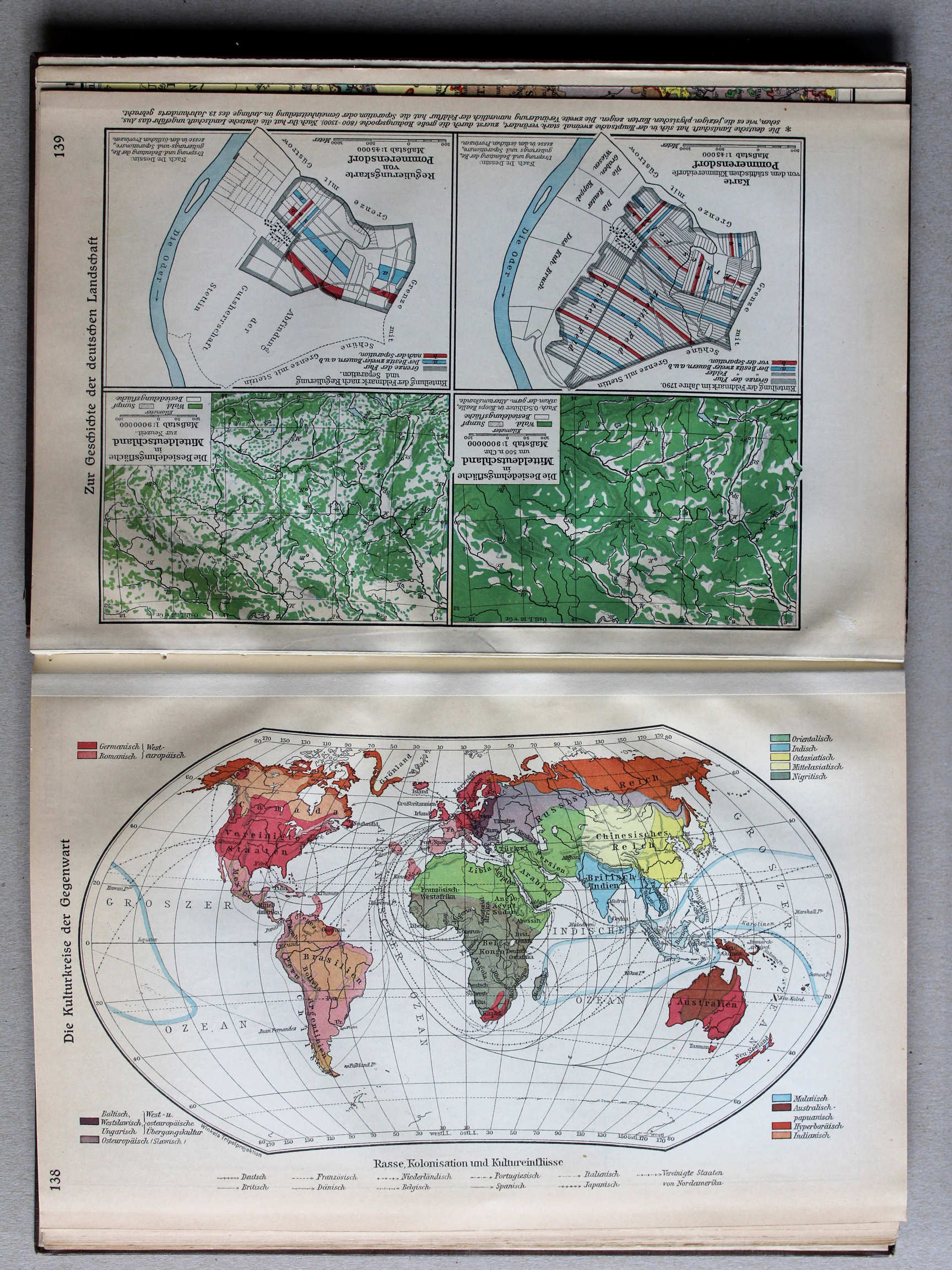
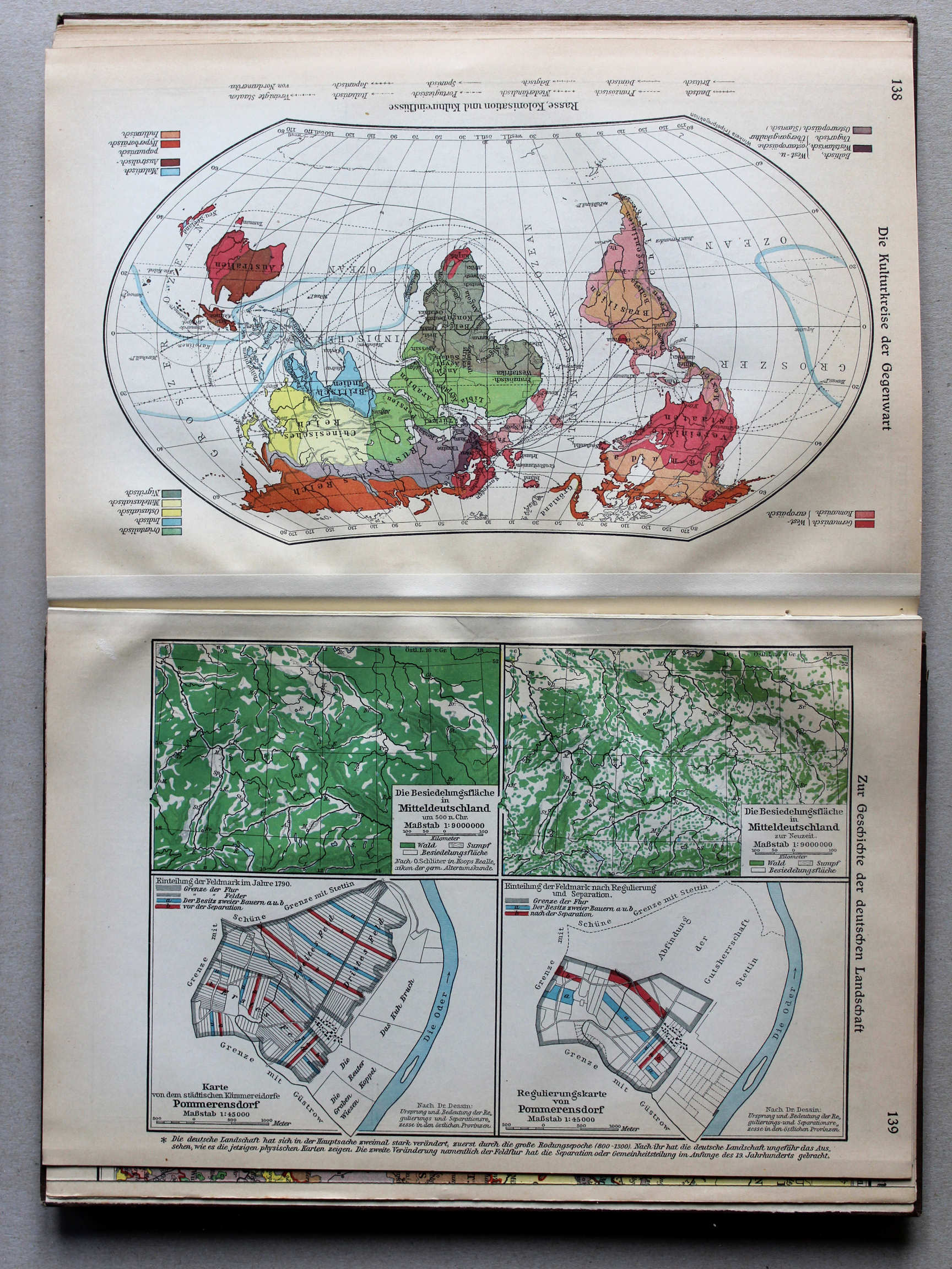
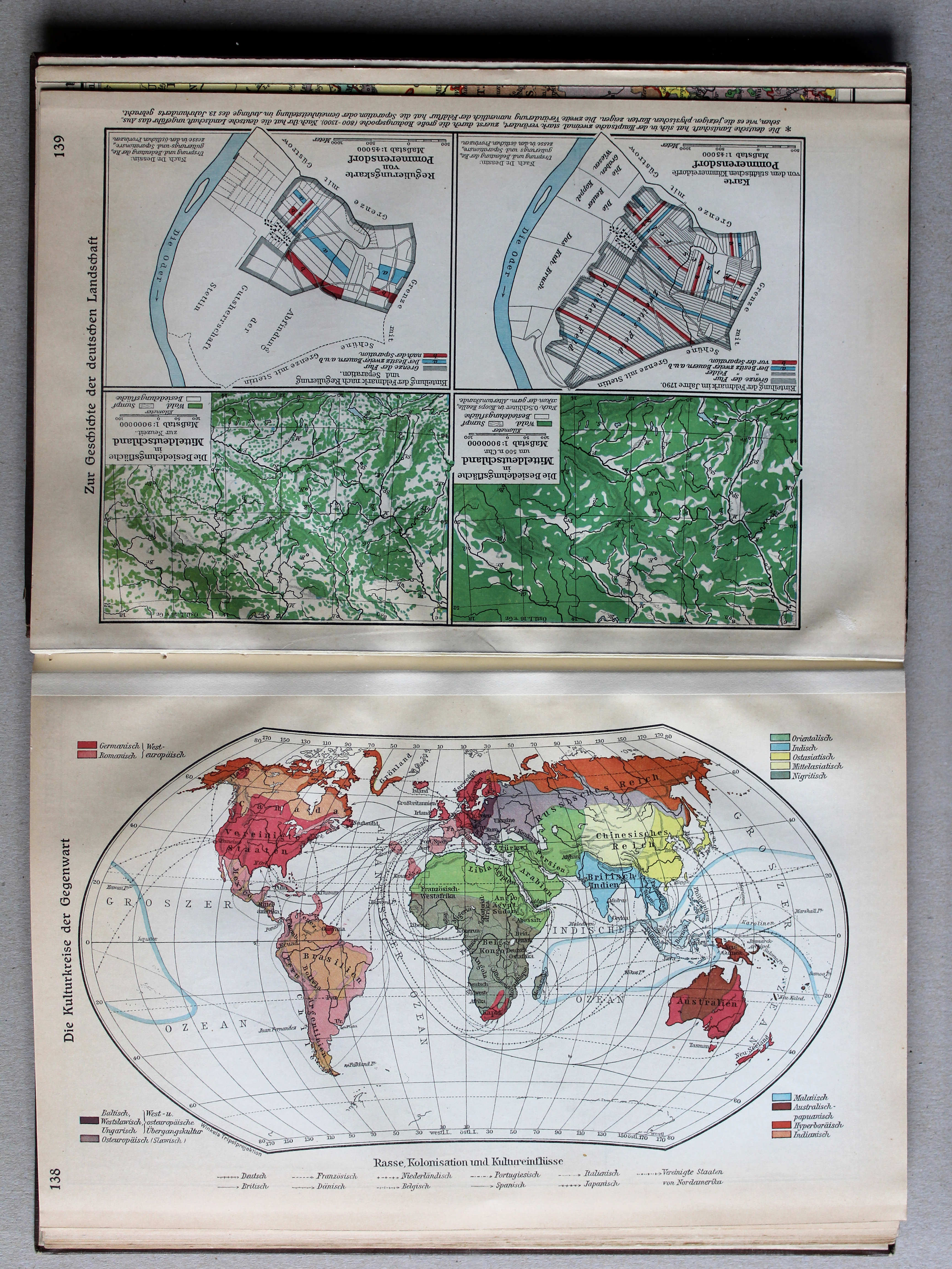
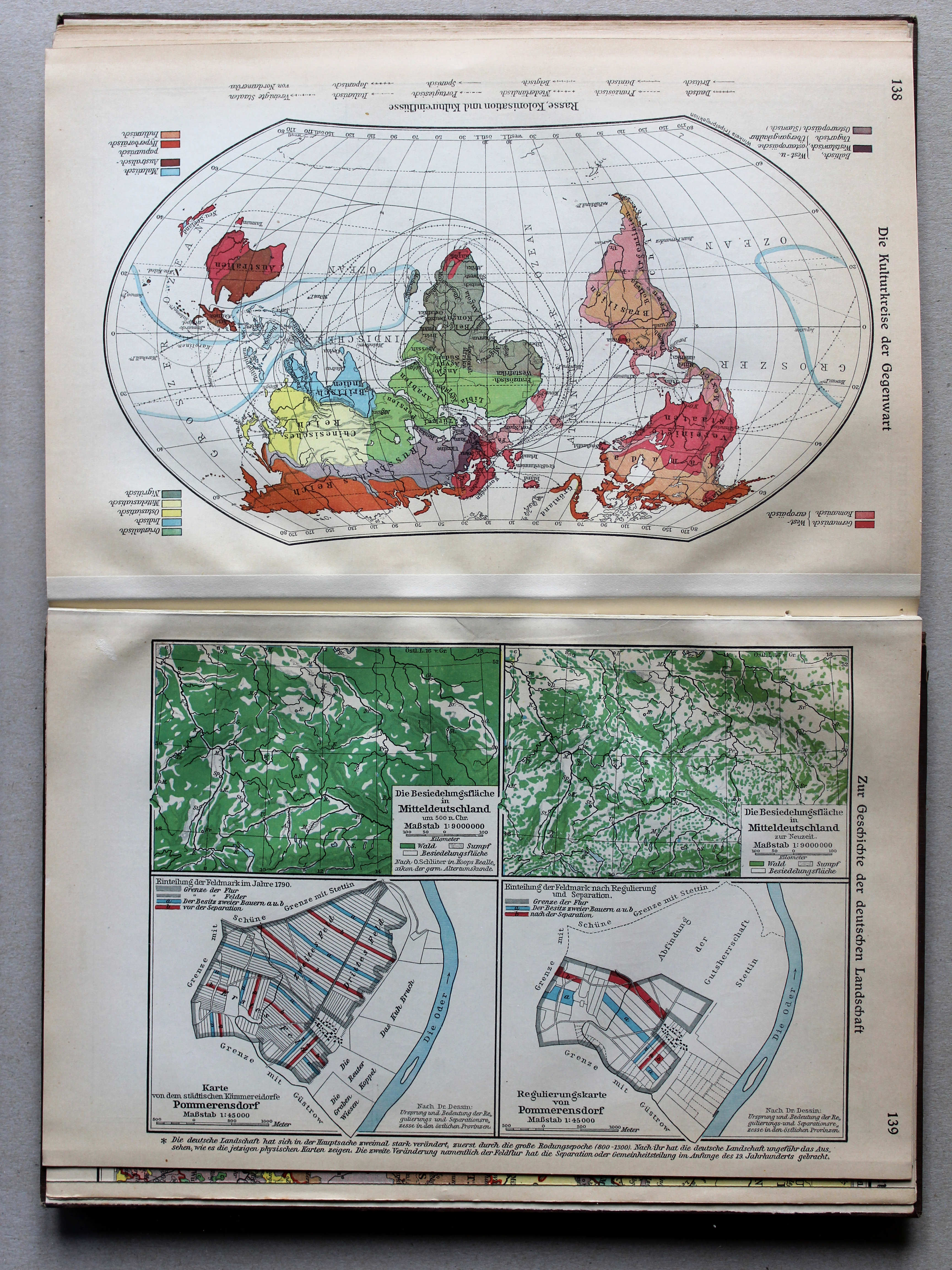
138. Die Kulturkreise der Gegenwart XL
Huidige beschavingen / Modern civilizations
 Putzgers Historischer Schul-Atlas, Große Ausgabe, 1931/33
139. Zur Geschichte der deutschen Landschaft XL
Geschiedenis van het Duitse landschap / History of the German countryside
 Putzgers Historischer Schul-Atlas, Große Ausgabe, 1931/33
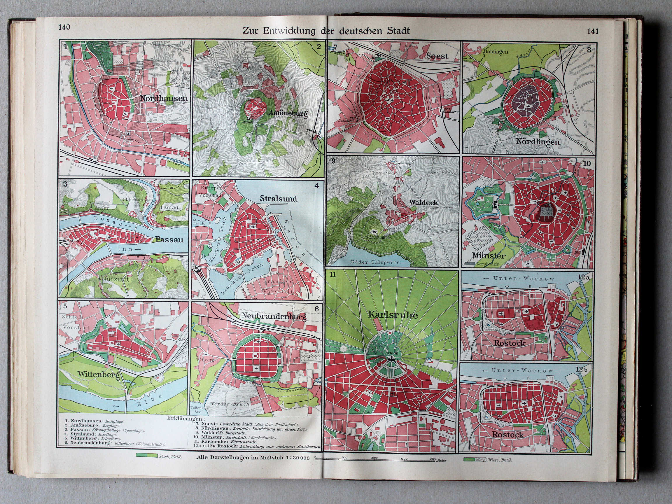
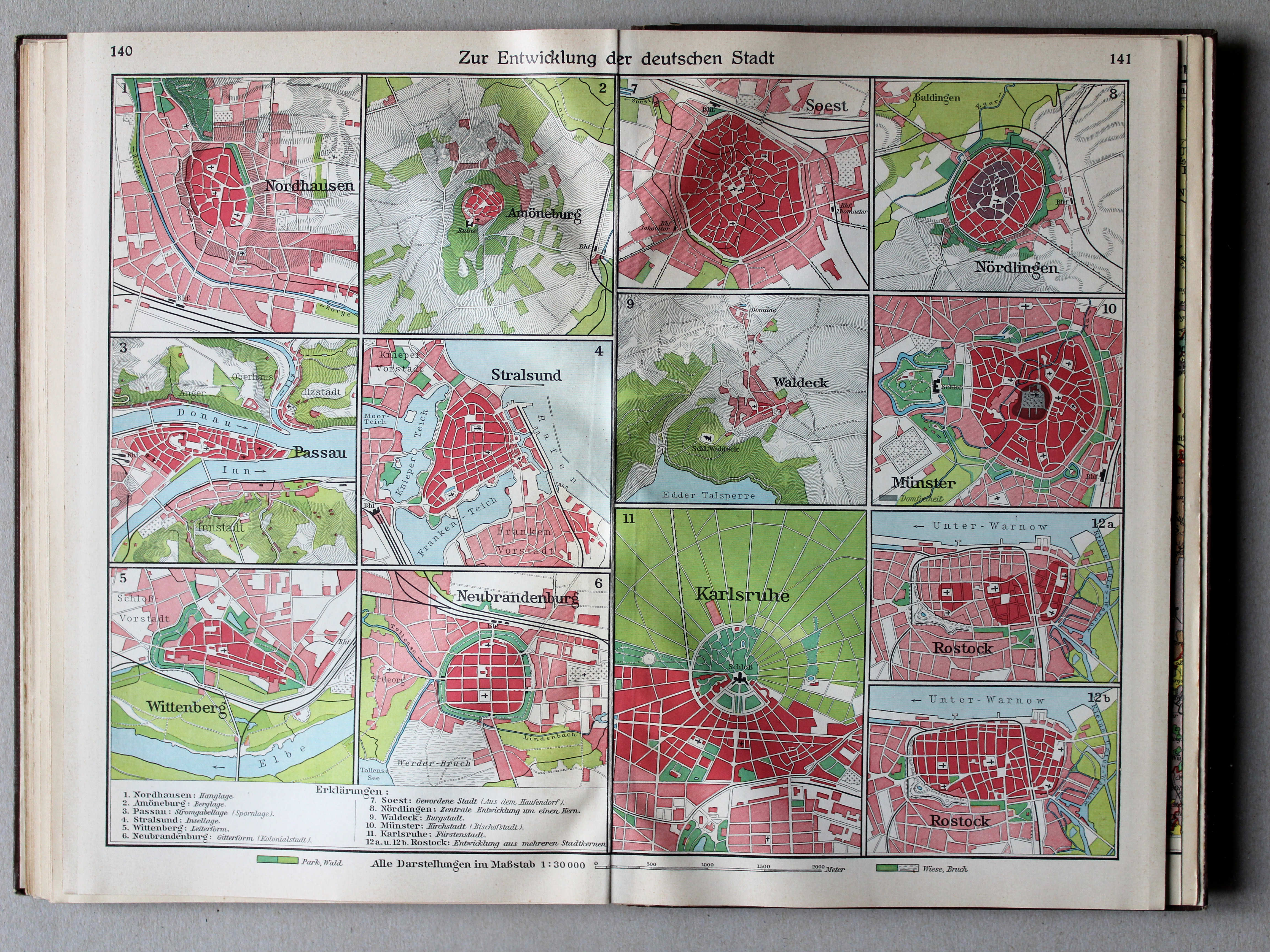
140.141. Zur Entwicklung der deutschen Stadt XL
Ontwikkeling van Duitse steden / Development of German cities
 Putzgers Historischer Schul-Atlas, Große Ausgabe, 1931/33
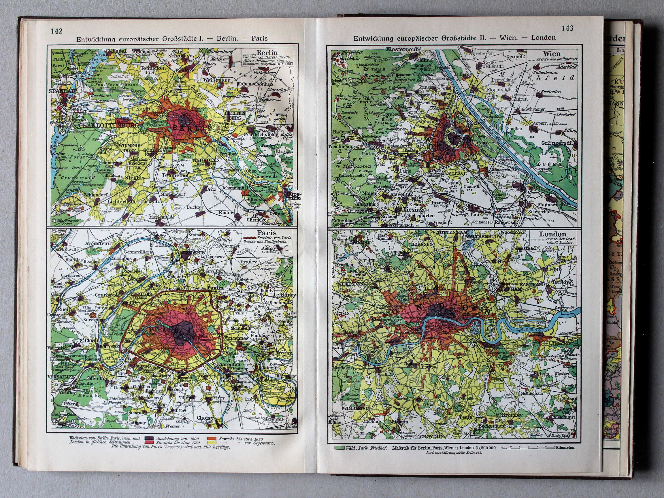
142. Entwicklung europäischer Großstädte I – Berlin – Paris XL
Ontwikkeling van Europese hoofdsteden I: Berlijn. Parijs / Development of European capitals I: Berlin. Paris
143. Entwicklung europäischer Großstädte II – Wien – London XL
Ontwikkeling van Europese hoofdsteden II: Wenen. Londen / Development of European capitals II: Vienna. London
 Putzgers Historischer Schul-Atlas, Große Ausgabe, 1931/33
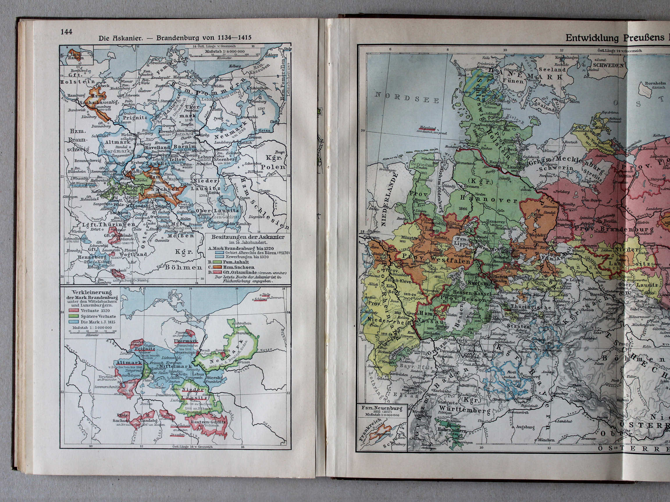
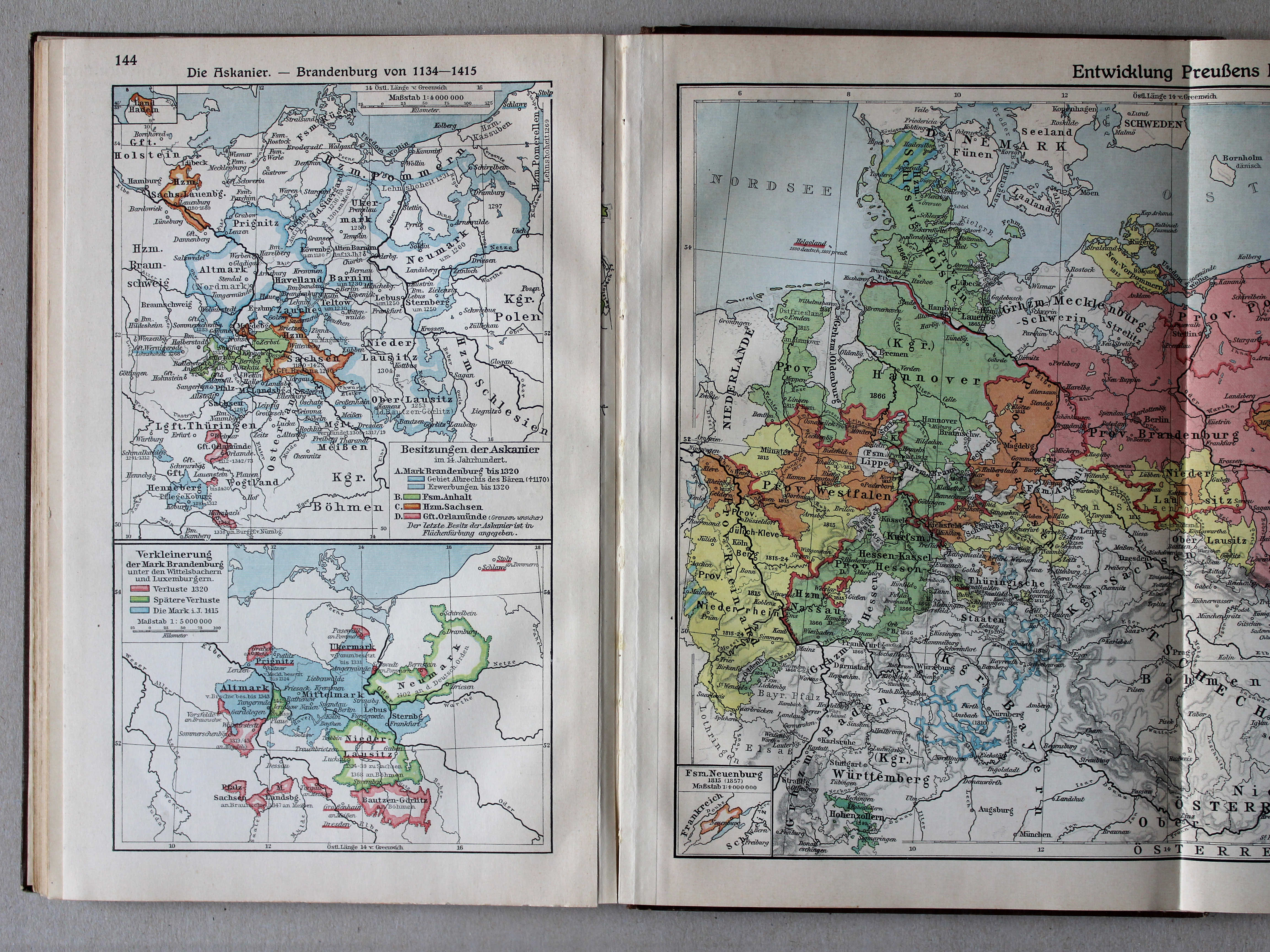
144. Die Askanier – Brandenburg von 1134-1415 XL
De Ascaniërs. Brandenburg 1134-1415 / The House of Ascania. Brandenburg 1134-1415
 Putzgers Historischer Schul-Atlas, Große Ausgabe, 1931/33
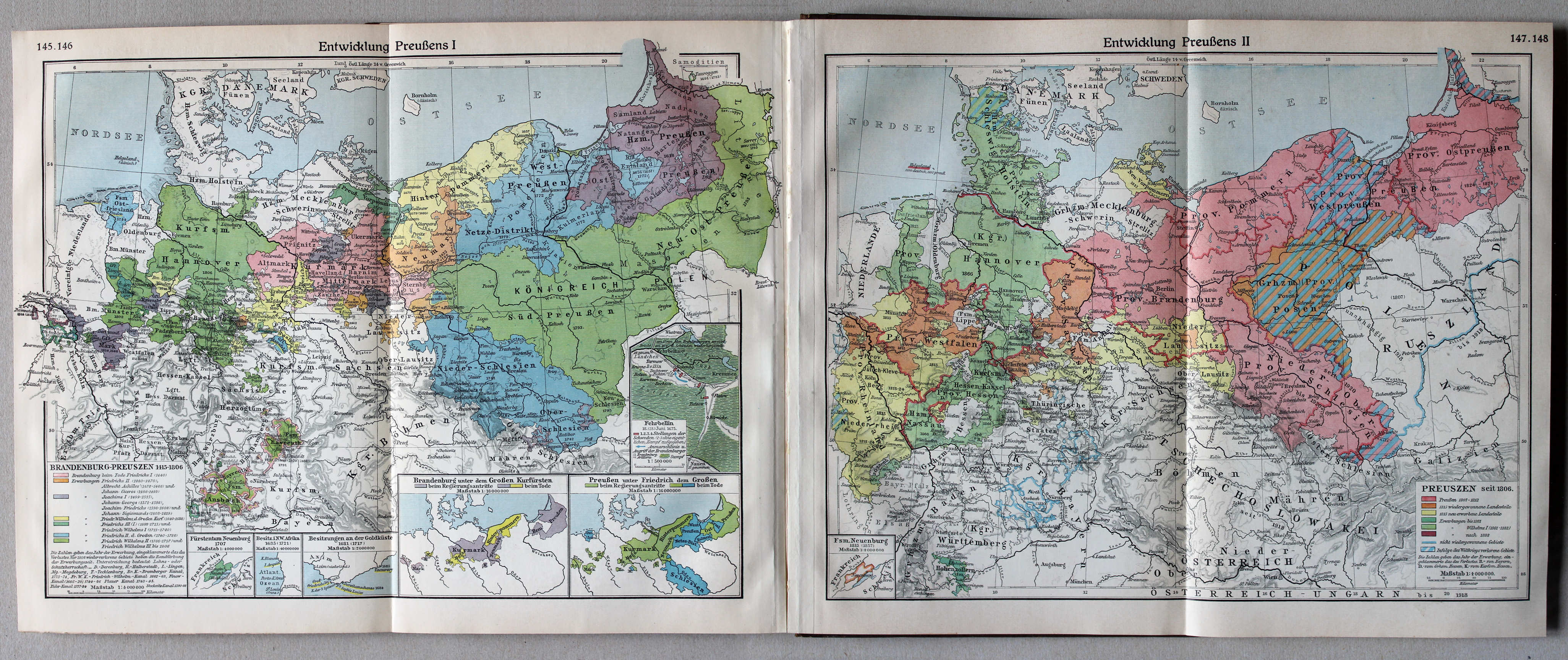
|
145.146. Entwicklung Preußens I
XL
Ontwikkeling van Pruisen I / Development of Prussia I |
147.148. Entwicklung Preußens II
XL
Ontwikkeling van Pruisen II / Development of Prussia II |
 Putzgers Historischer Schul-Atlas, Große Ausgabe, 1931/33
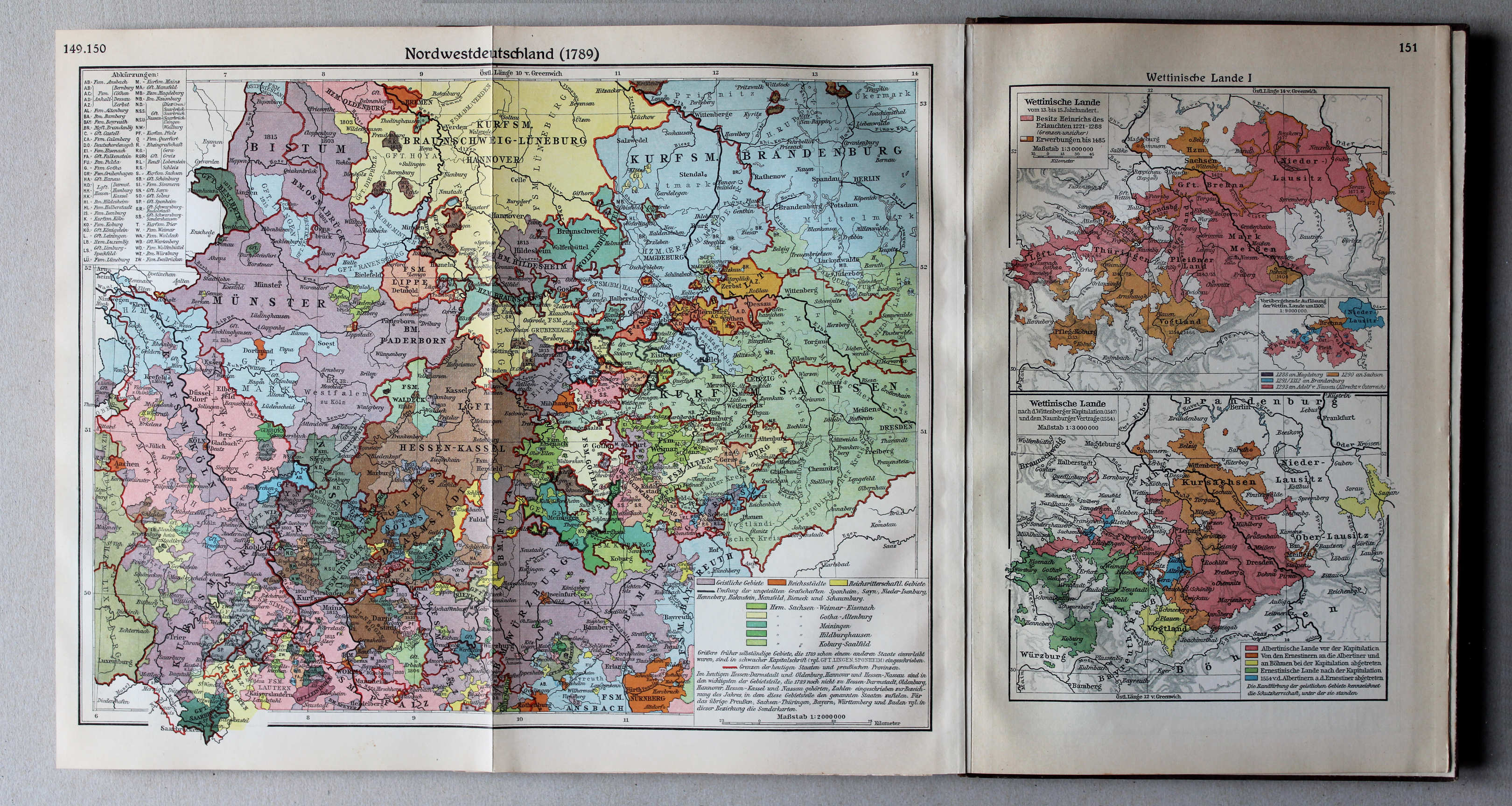
149.150. Nordwestdeutschland 1789 XL
Noordwest-Duitsland in 1789 / Northwest Germany in 1789
151. Wettinische Lande I XL
Het gebied van het Huis Wettin I / The lands of the House of Wettin I
 Putzgers Historischer Schul-Atlas, Große Ausgabe, 1931/33
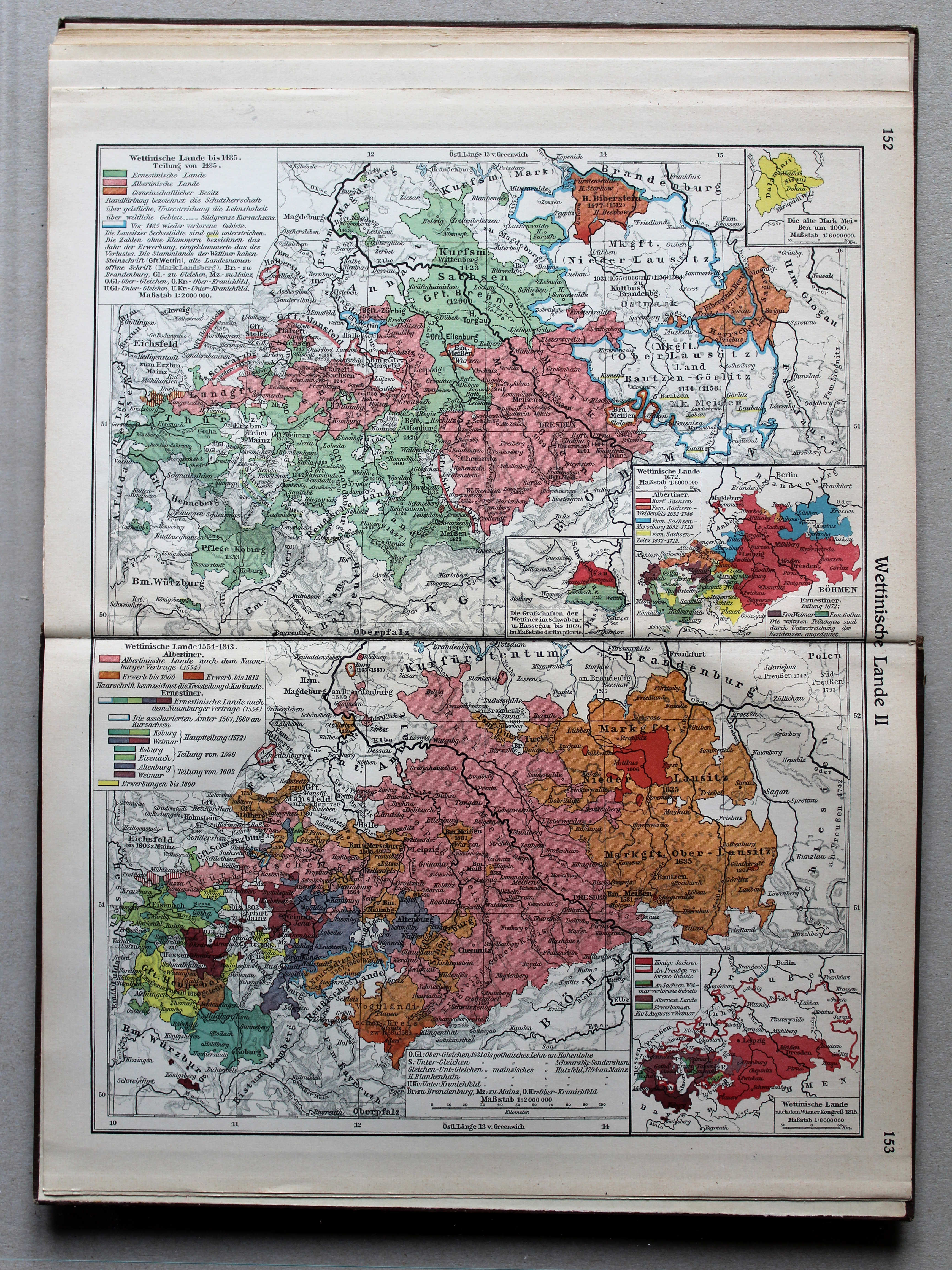
152.153. Wettinische Lande II XL
Het gebied van het Huis Wettin II / The lands of the House of Wettin II
 Putzgers Historischer Schul-Atlas, Große Ausgabe, 1931/33
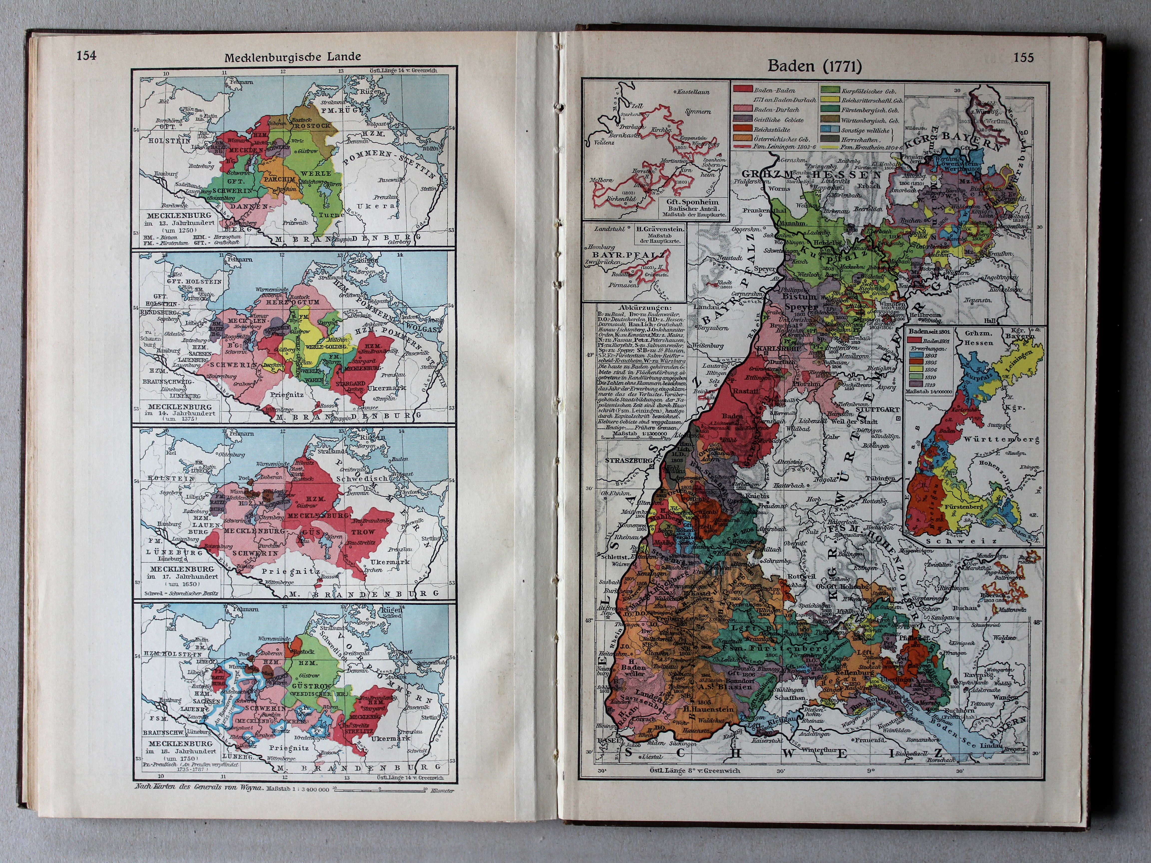
154. Mecklenburgische Lande XL
Mecklenburg
155. Baden (1771) XL
Baden (1771)
 Putzgers Historischer Schul-Atlas, Große Ausgabe, 1931/33
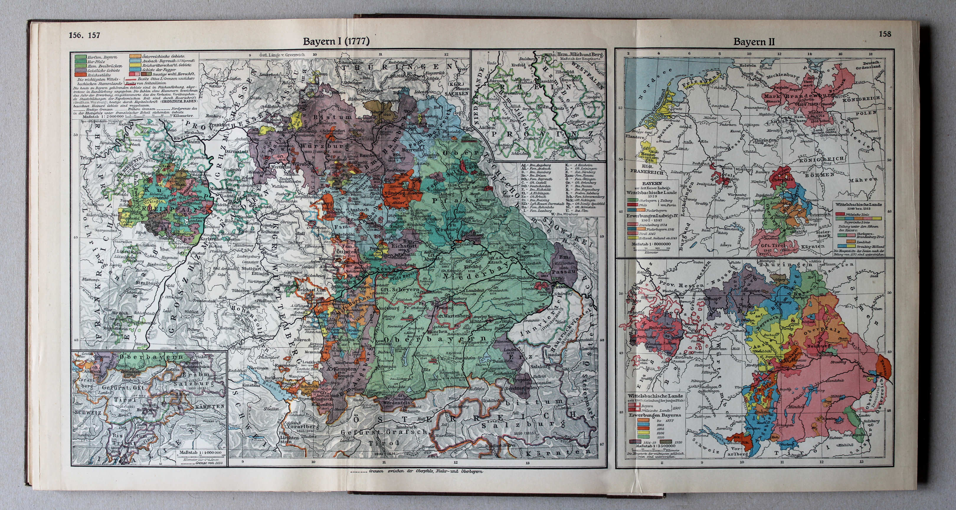
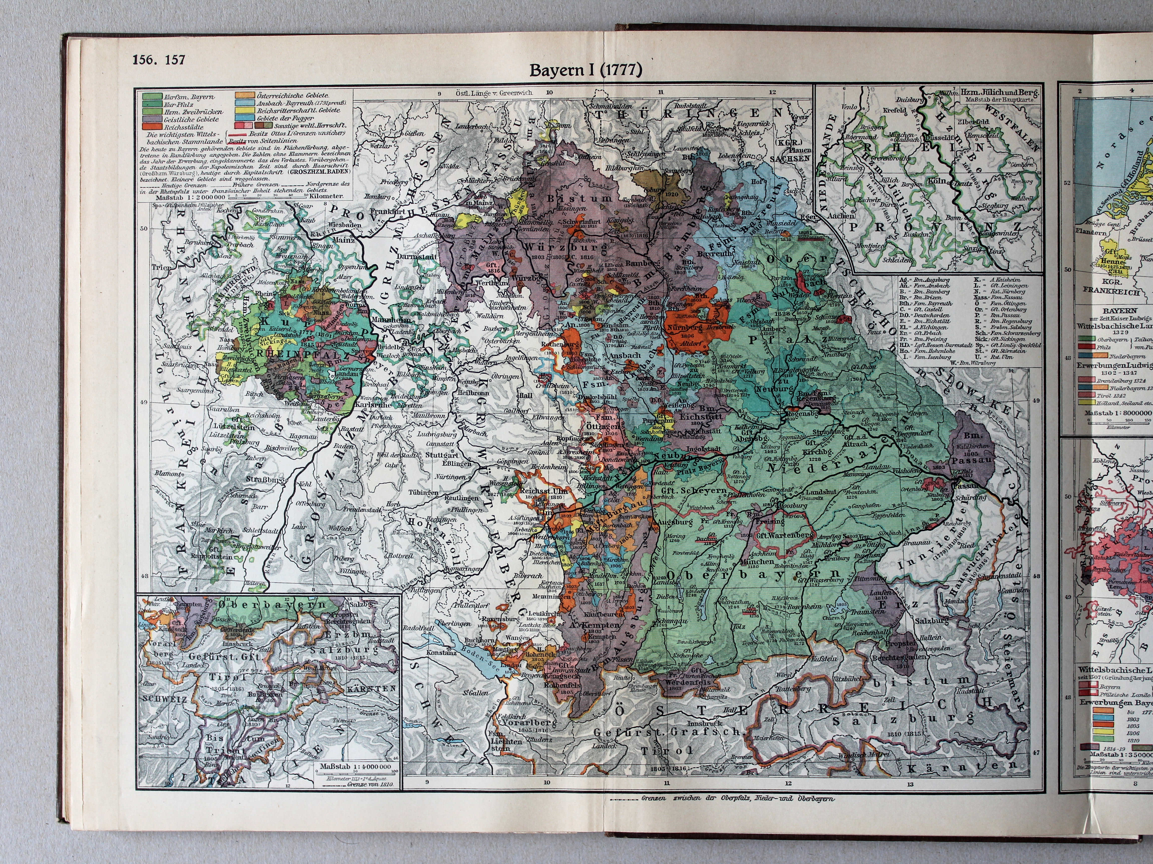
156.157. Bayern I (1777) XL
Beieren I (1777) / Bavaria I (1777)
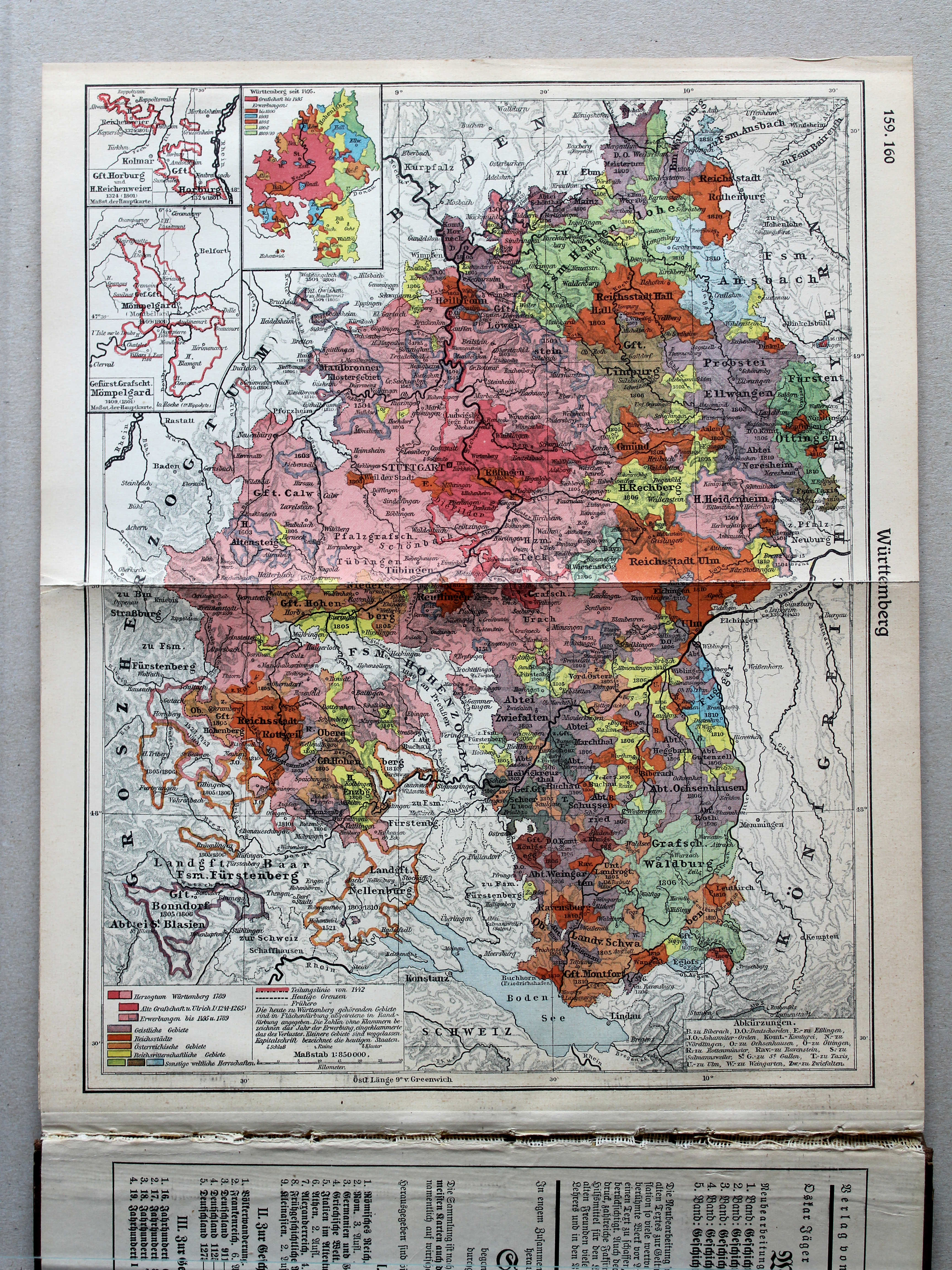
158. Bayern II XL
Beieren II / Bavaria II

© M. Witkam, 2013
![]()
![]()