Carl Wolff's Historischer Atlas (1877)
See below for (a summary of) this text in English.
Hieronder staan plaatjes van de atlas. Daarbij horen ook de volgende pagina's
- Beschrijving van de atlas
- Tabellen en lijsten bij de atlas
Plaatjes
Klik op een plaatje voor een vergroting.
Carl Wolff's Historischer Atlas (1877)
- Below are pictures of the atlas. Related pages
- Description of the atlas
- Tables and lists to the atlas
Pictures
Click on a picture to enlarge.
Prospectus 1875
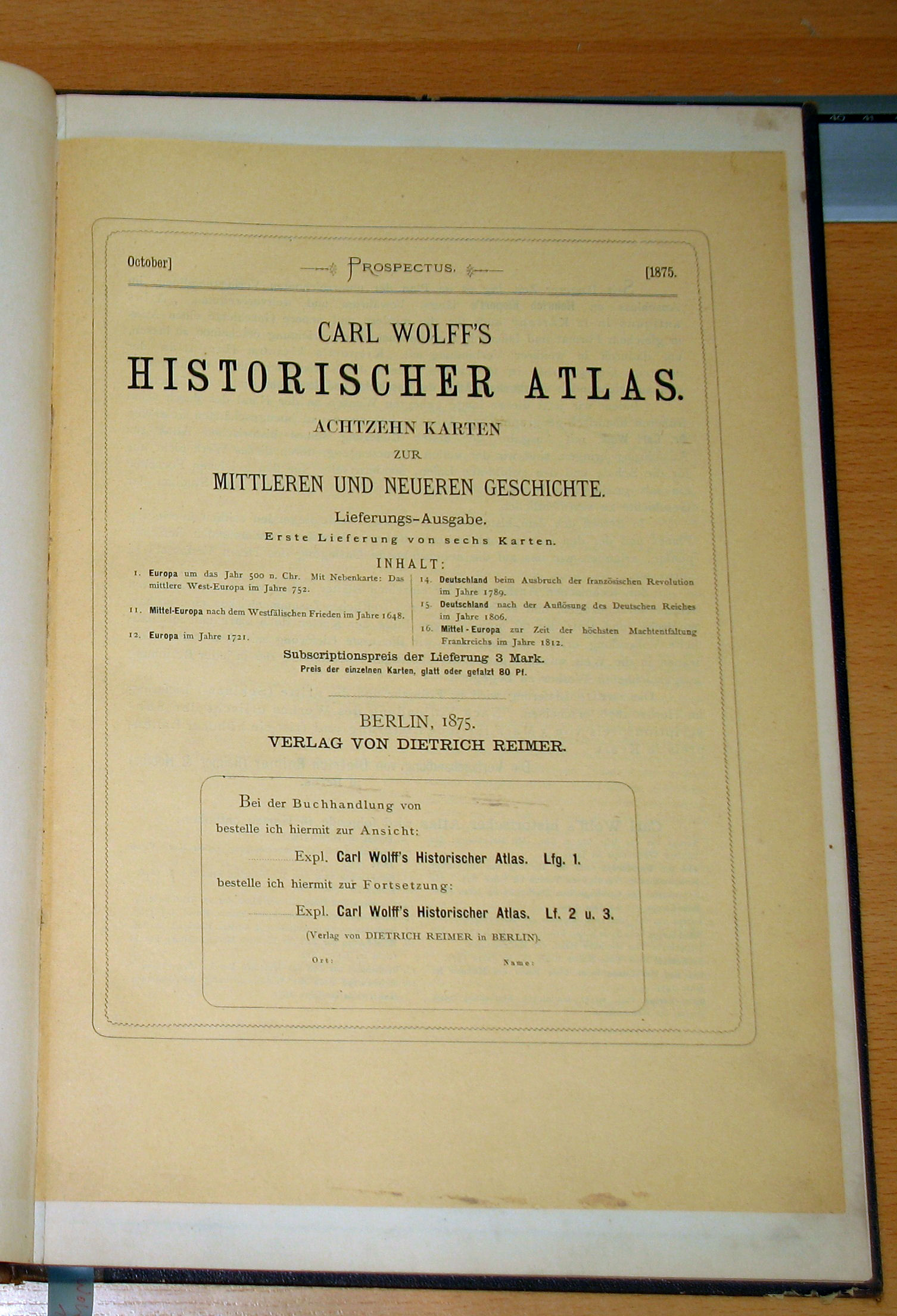 Carl Wolff's Historischer Atlas
Prospectus 1875
met dank aan Wolfgang Boock / courtesy of Wolfgang Boock
 Carl Wolff's Historischer Atlas (1877)
Voorkant band / Front cover
 Carl Wolff's Historischer Atlas (1877)
Achterkant band / Back cover
 Carl Wolff's Historischer Atlas (1877)
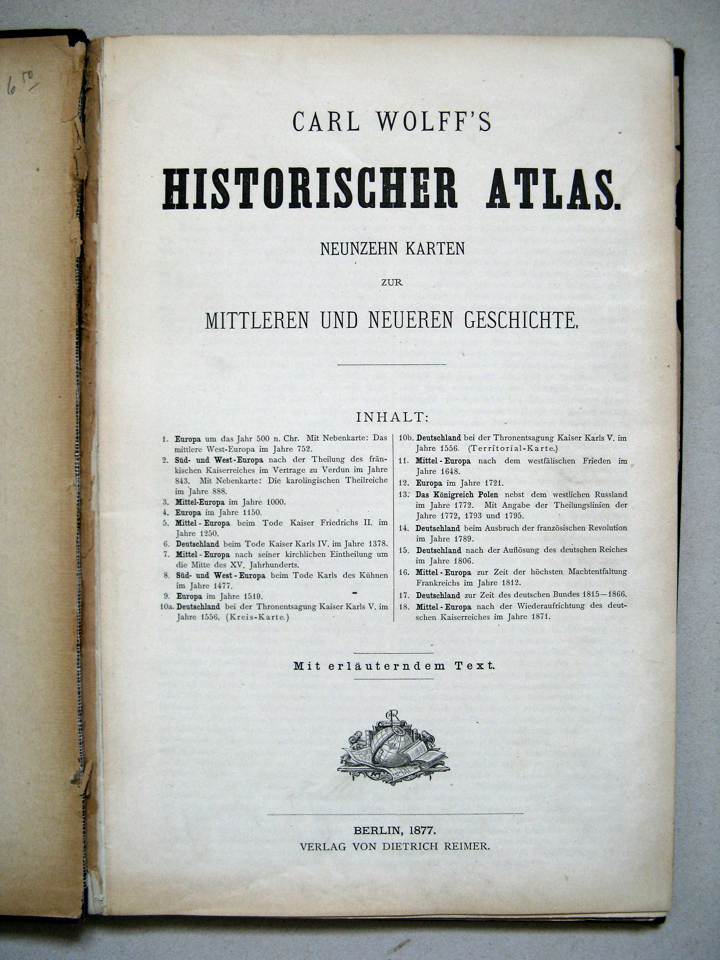
Titelpagina / Title page
 Carl Wolff's Historischer Atlas (1877)
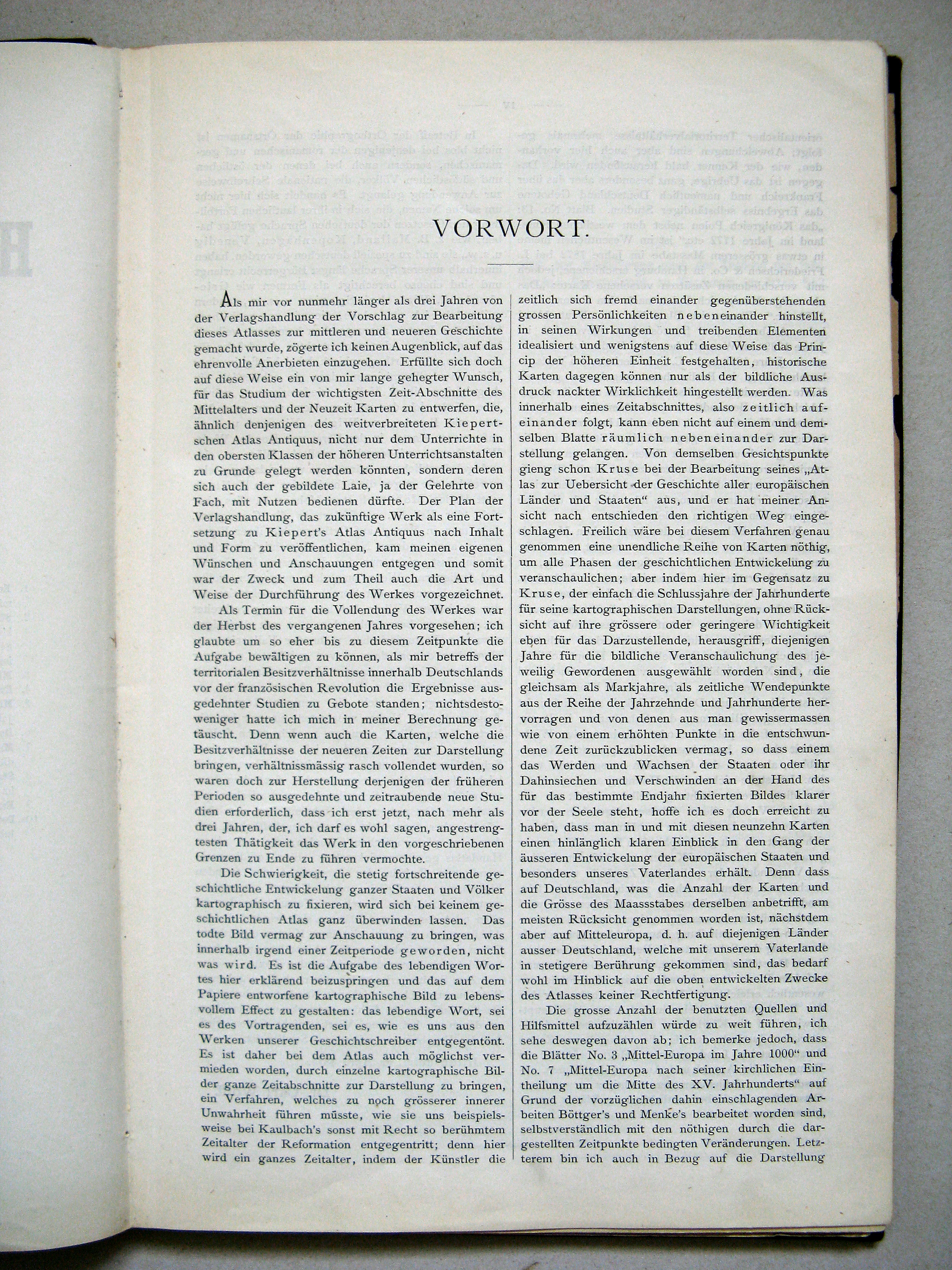
Vorwort (S. III)
Voorwoord (blz. III) / Preface (p. III)
 Carl Wolff's Historischer Atlas (1877)
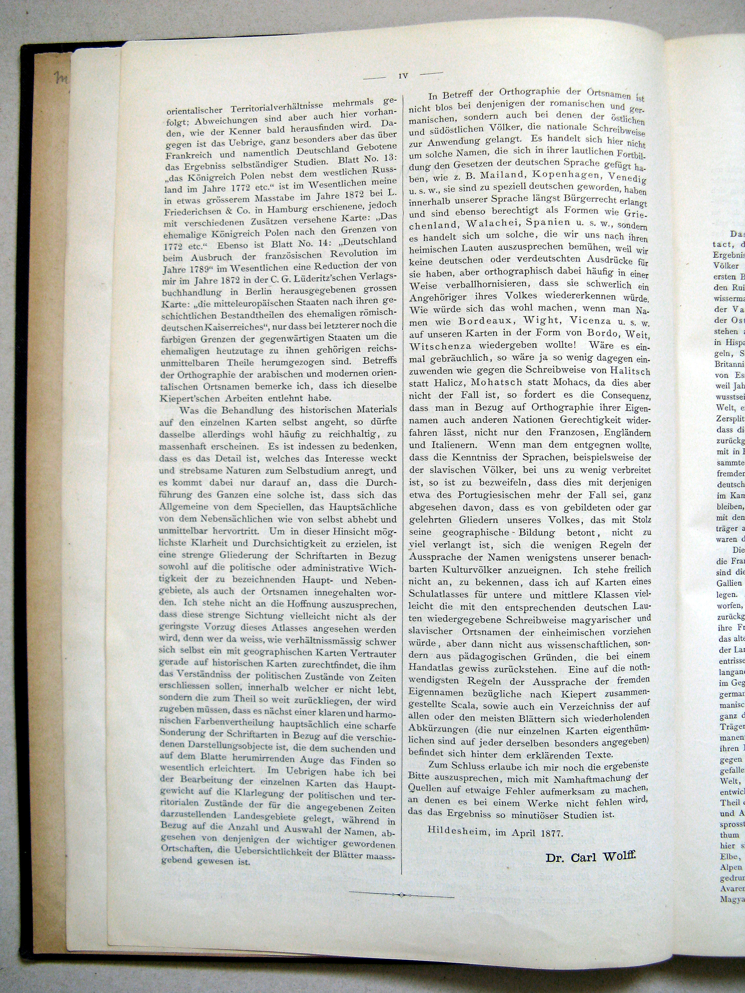
Vorwort (S. IV)
Voorwoord (blz. IV) / Preface (p. IV)
 Carl Wolff's Historischer Atlas (1877)
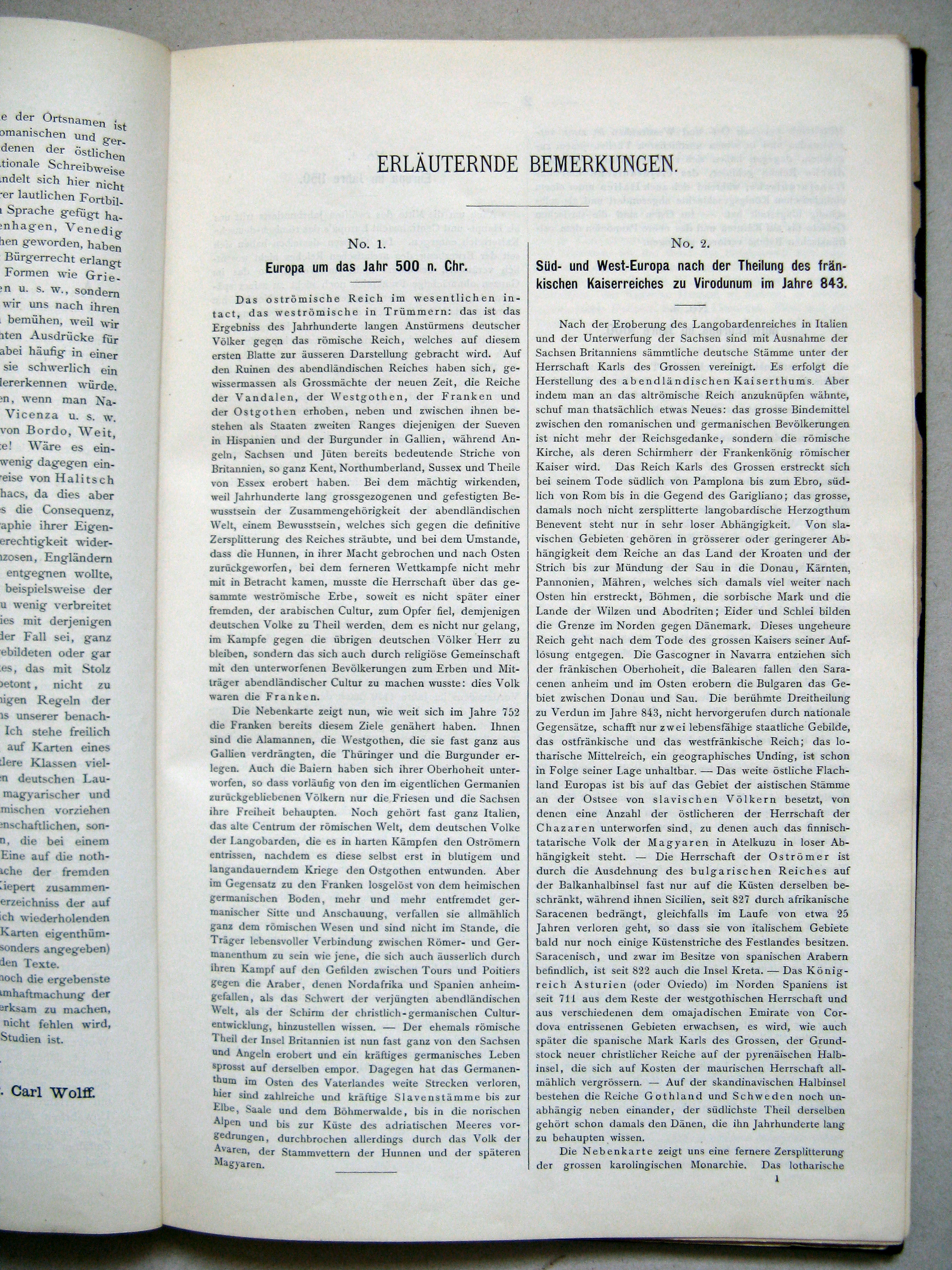
Erläuternde Bemerkungen (S. 1)
Verklarende tekst (blz. 1) / Explanatory text (p. 1)
 Carl Wolff's Historischer Atlas (1877)
Erläuternde Bemerkungen (S. 2)
Verklarende tekst (blz. 2) / Explanatory text (p. 2)
 Carl Wolff's Historischer Atlas (1877)
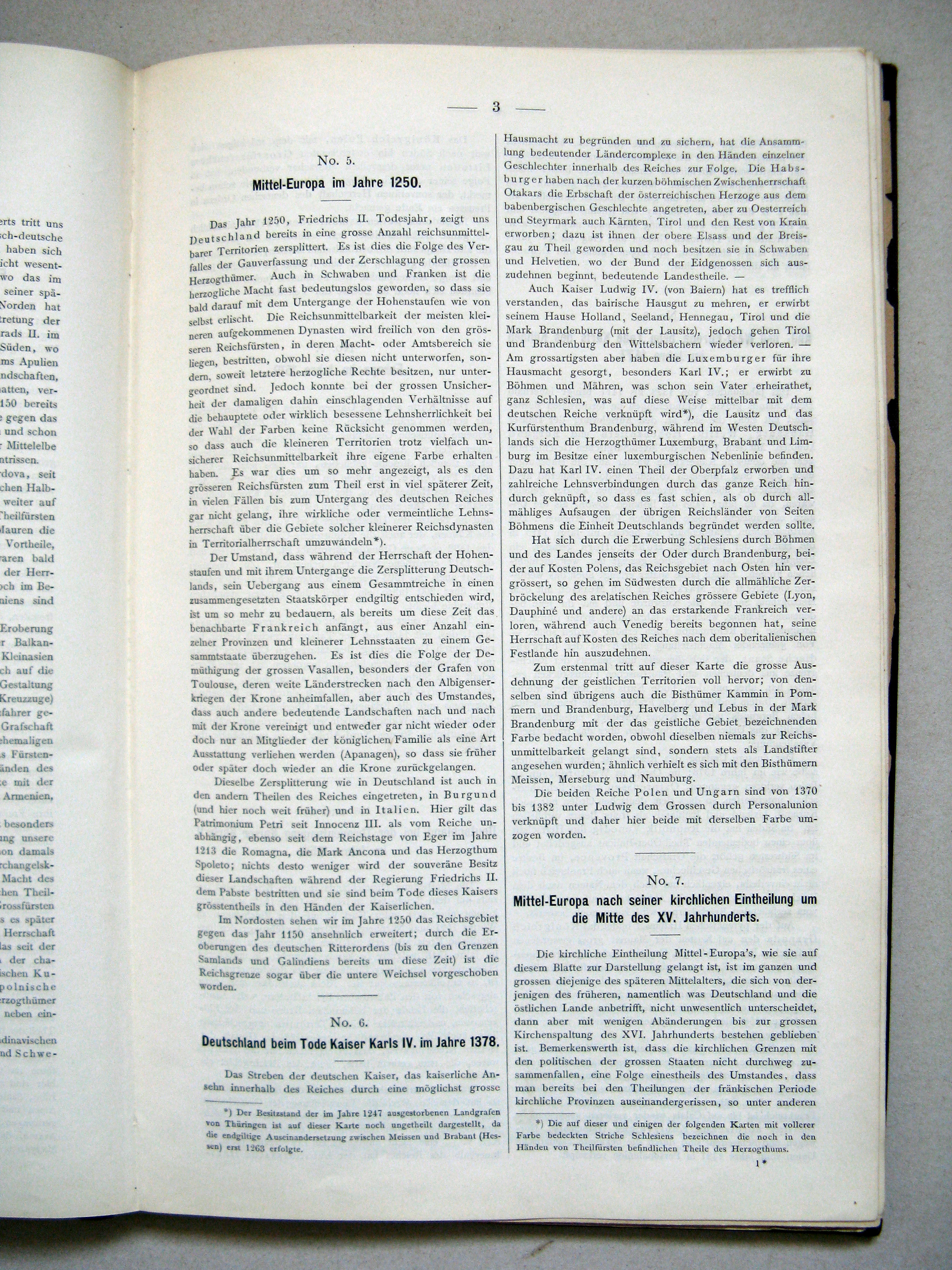
Erläuternde Bemerkungen (S. 3)
Verklarende tekst (blz. 3) / Explanatory text (p. 3)
 Carl Wolff's Historischer Atlas (1877)
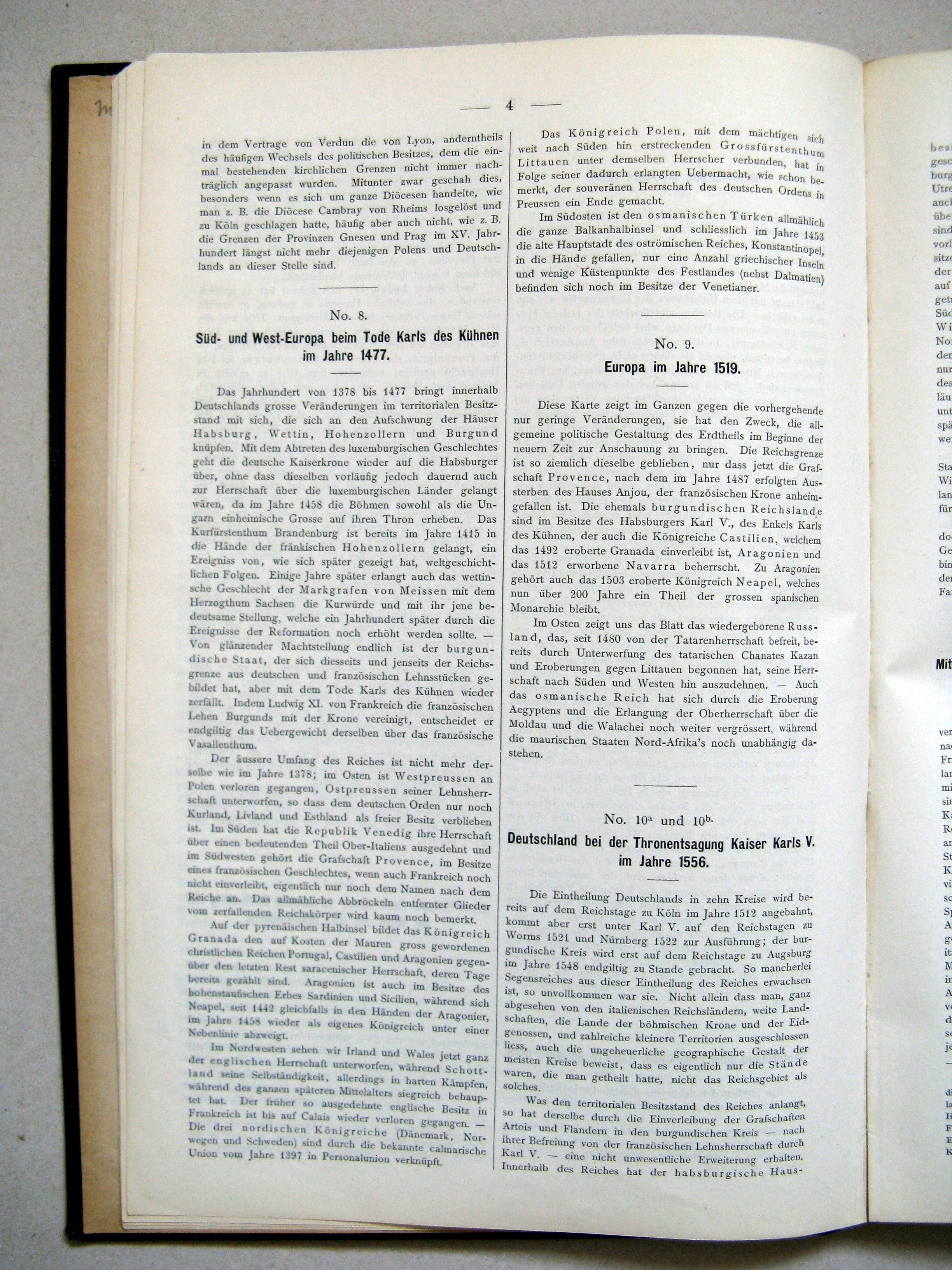
Erläuternde Bemerkungen (S. 4)
Verklarende tekst (blz. 4) / Explanatory text (p. 4)
 Carl Wolff's Historischer Atlas (1877)
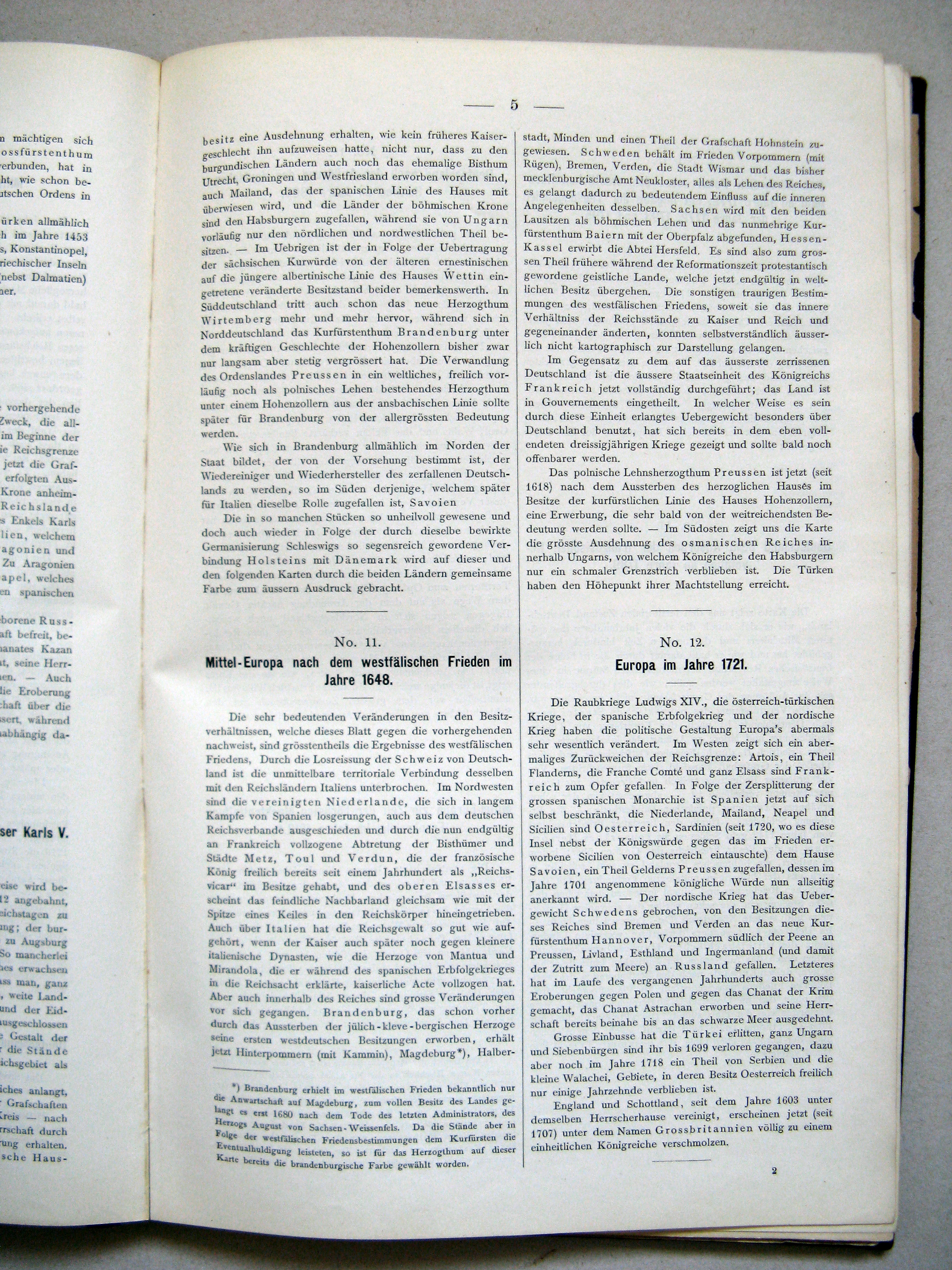
Erläuternde Bemerkungen (S. 5)
Verklarende tekst (blz. 5) / Explanatory text (p. 5)
 Carl Wolff's Historischer Atlas (1877)
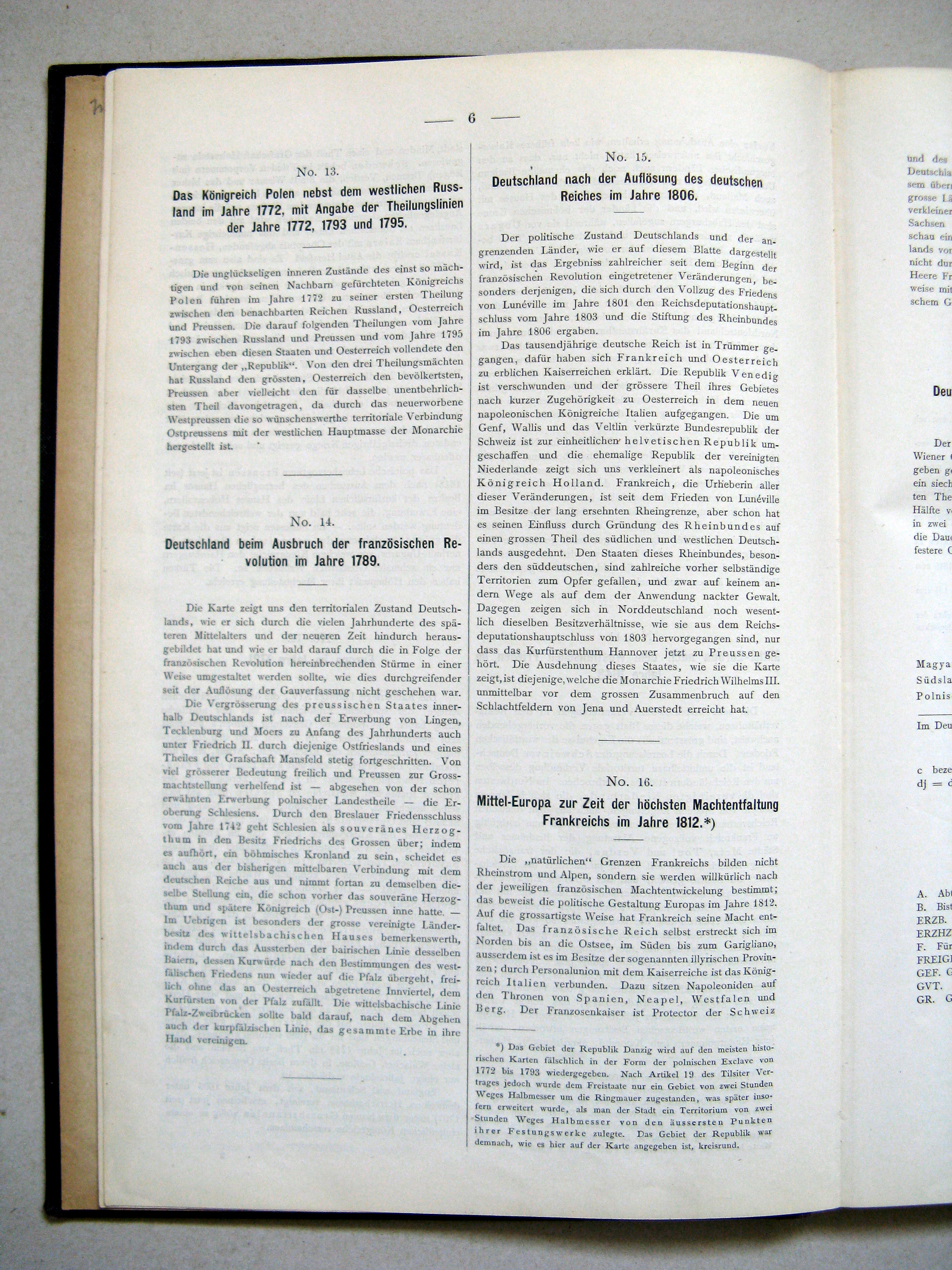
Erläuternde Bemerkungen (S. 6)
Verklarende tekst (blz. 6) / Explanatory text (p. 6)
 Carl Wolff's Historischer Atlas (1877)
Erläuternde Bemerkungen (S. 7)
Verklarende tekst (blz. 7) / Explanatory text (p. 7)
 Carl Wolff's Historischer Atlas (1877)
Berichtigung (S. 8)
Errata (blz. 8) / Errata (p. 8)
 Carl Wolff's Historischer Atlas (1877)
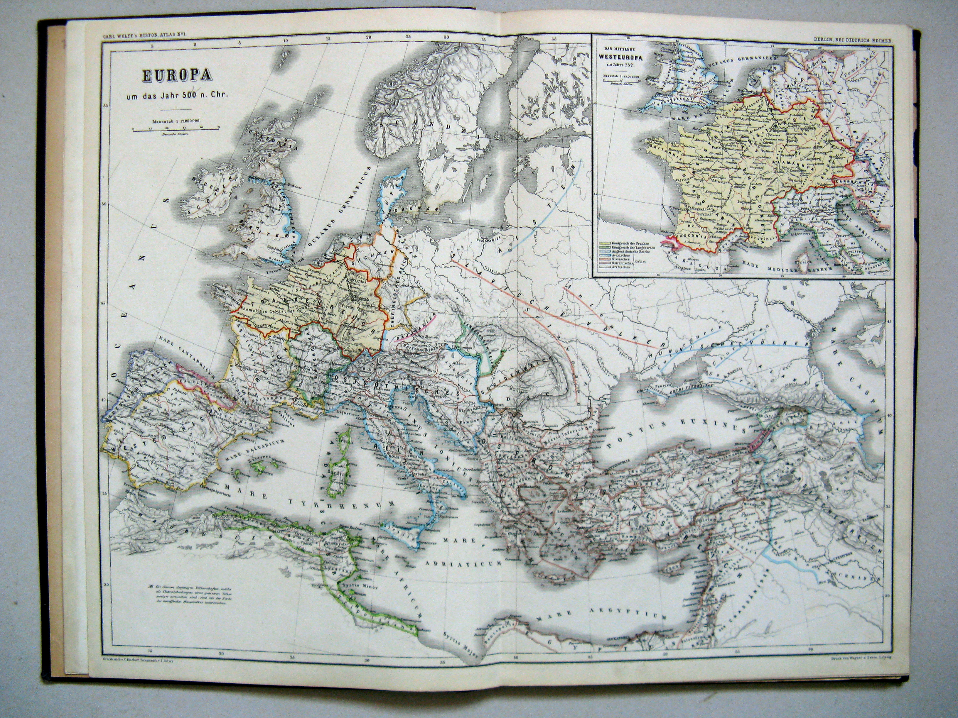
1. Europa um das Jahr 500 n. Chr.
Europa rond 500 n. Chr. / Europe around 500 A.D.
 Carl Wolff's Historischer Atlas (1877)
2. Süd- und West-Europa nach der Theilung des fränkischen Kaiserreiches im Vertrage zu Virodunum im Jahre 843
Zuid- en West-Europa na de deling van het Frankische Rijk bij het verdrag van Verdun in 843 / Southern and Western Europe after the division of the Carolingian Empire at the Treaty of Verdun of 843
 Carl Wolff's Historischer Atlas (1877)
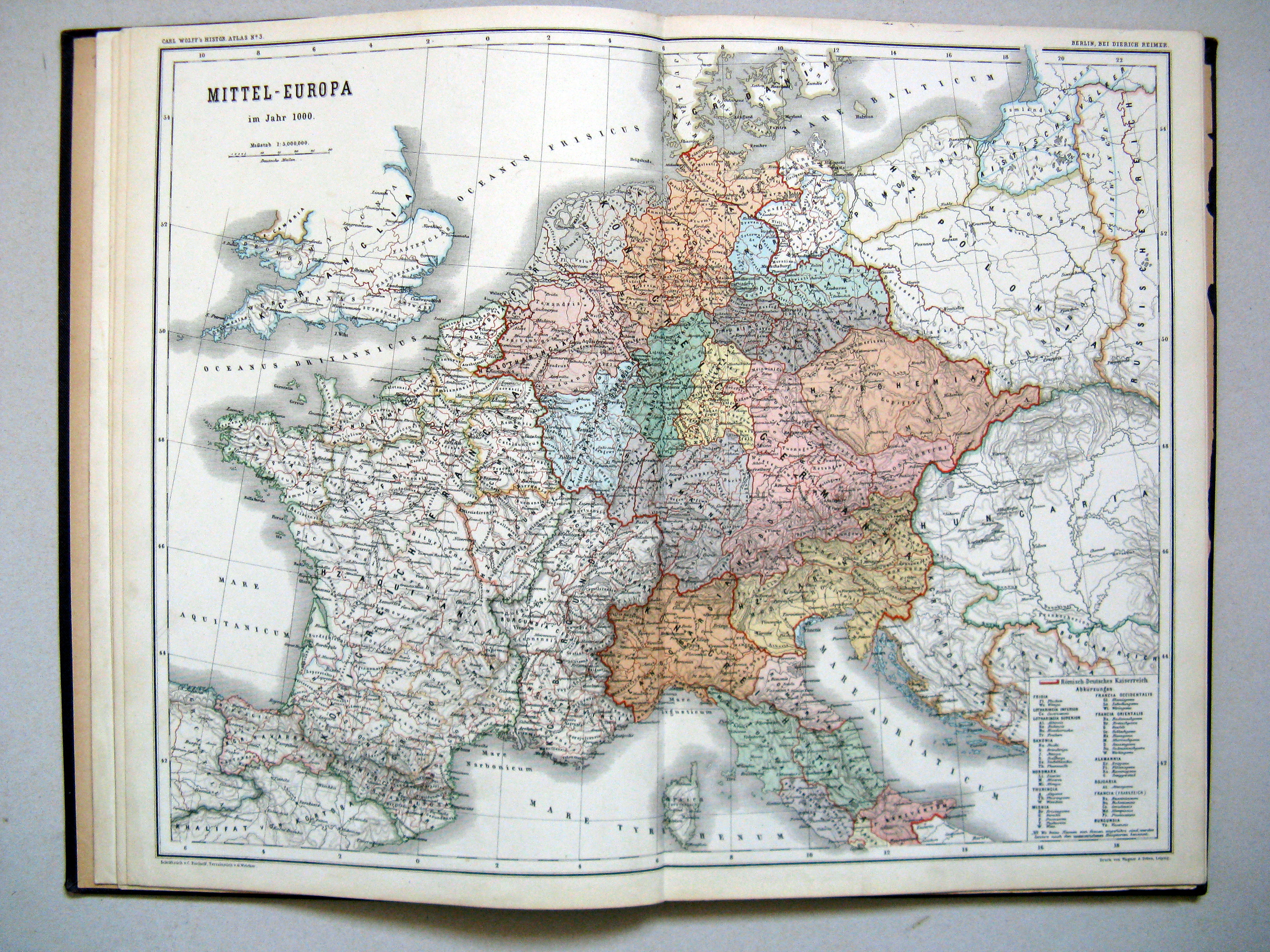
3. Mittel-Europa im Jahre 1000
Midden-Europa in het jaar 1000 / Central Europe in the year 1000
 Carl Wolff's Historischer Atlas (1877)
4. Europa im Jahre 1150
Europa in het jaar 1150 / Europe in the year 1150
 Carl Wolff's Historischer Atlas (1877)
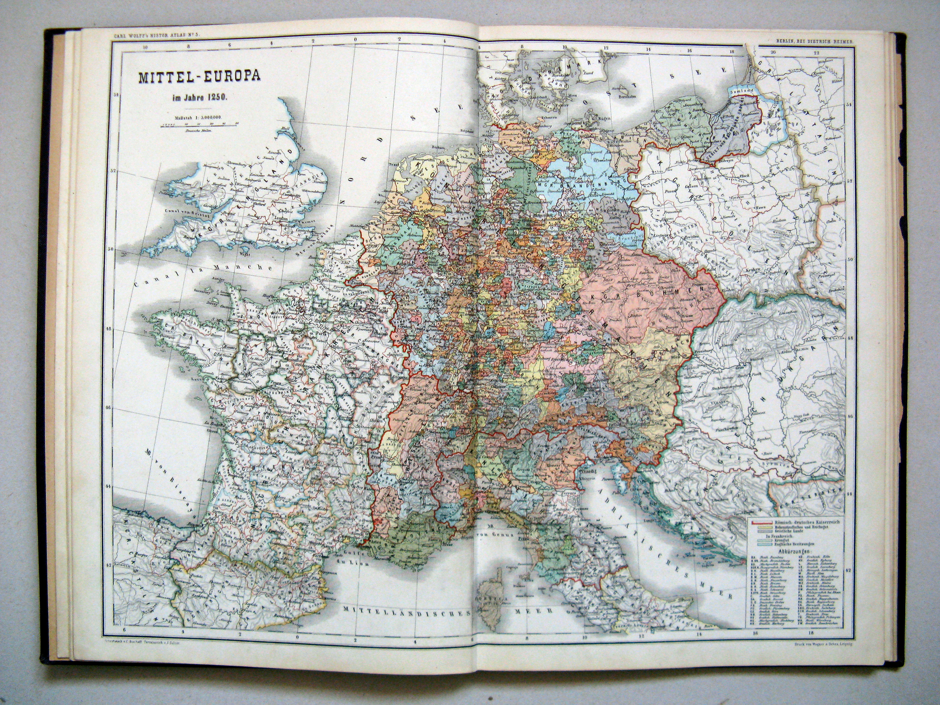
5. Mittel-Europa im Jahre 1250
Midden-Europa in het jaar 1250 / Central Europe in the year 1250
 Carl Wolff's Historischer Atlas (1877)
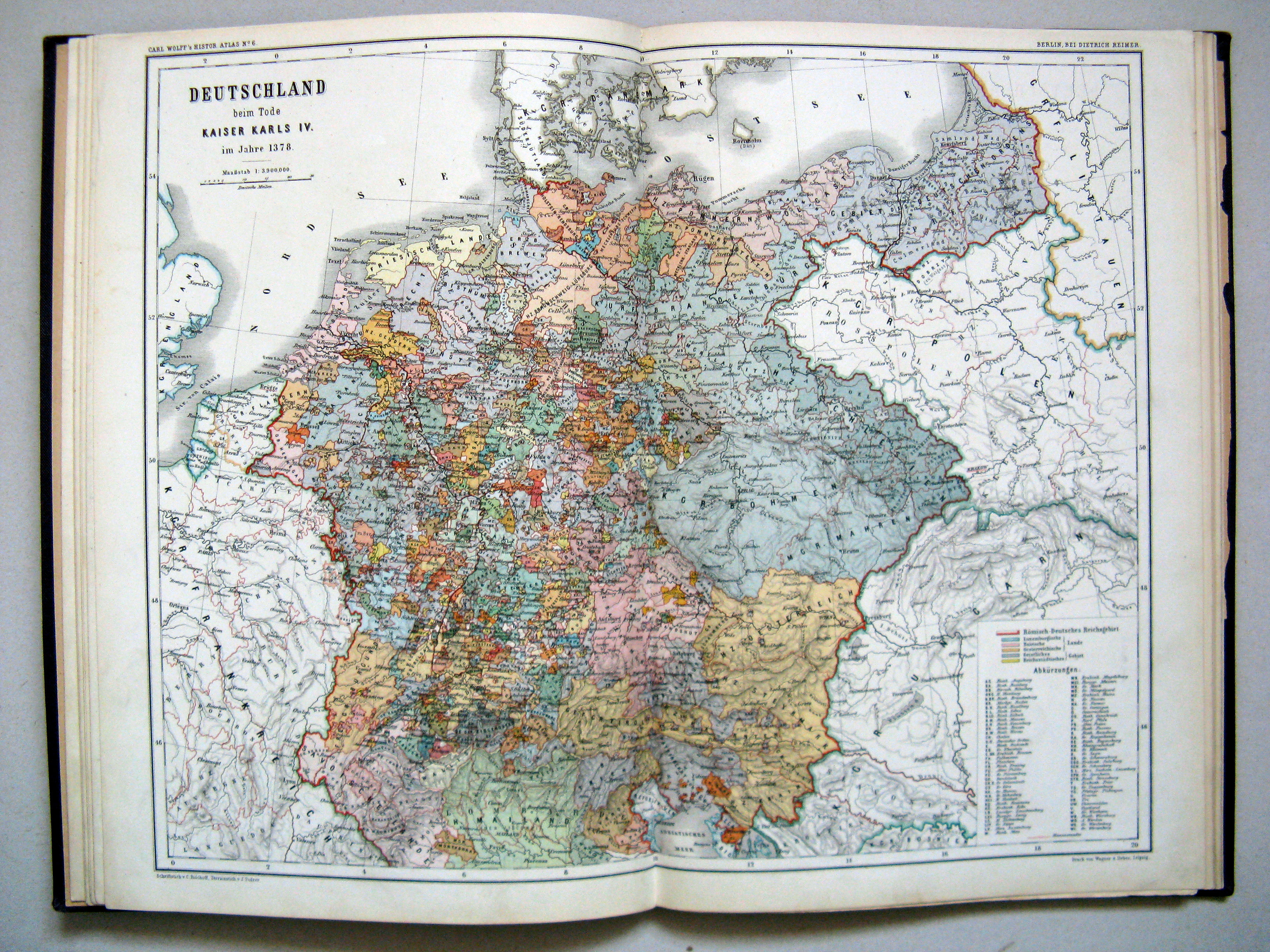
6. Deutschland beim Tode Kaiser Karls IV. im Jahre 1378
Duitsland bij de dood van Keizer Karel IV in 1378 / Germany at the death of the Emperor Charles IV in 1378
 Carl Wolff's Historischer Atlas (1877)
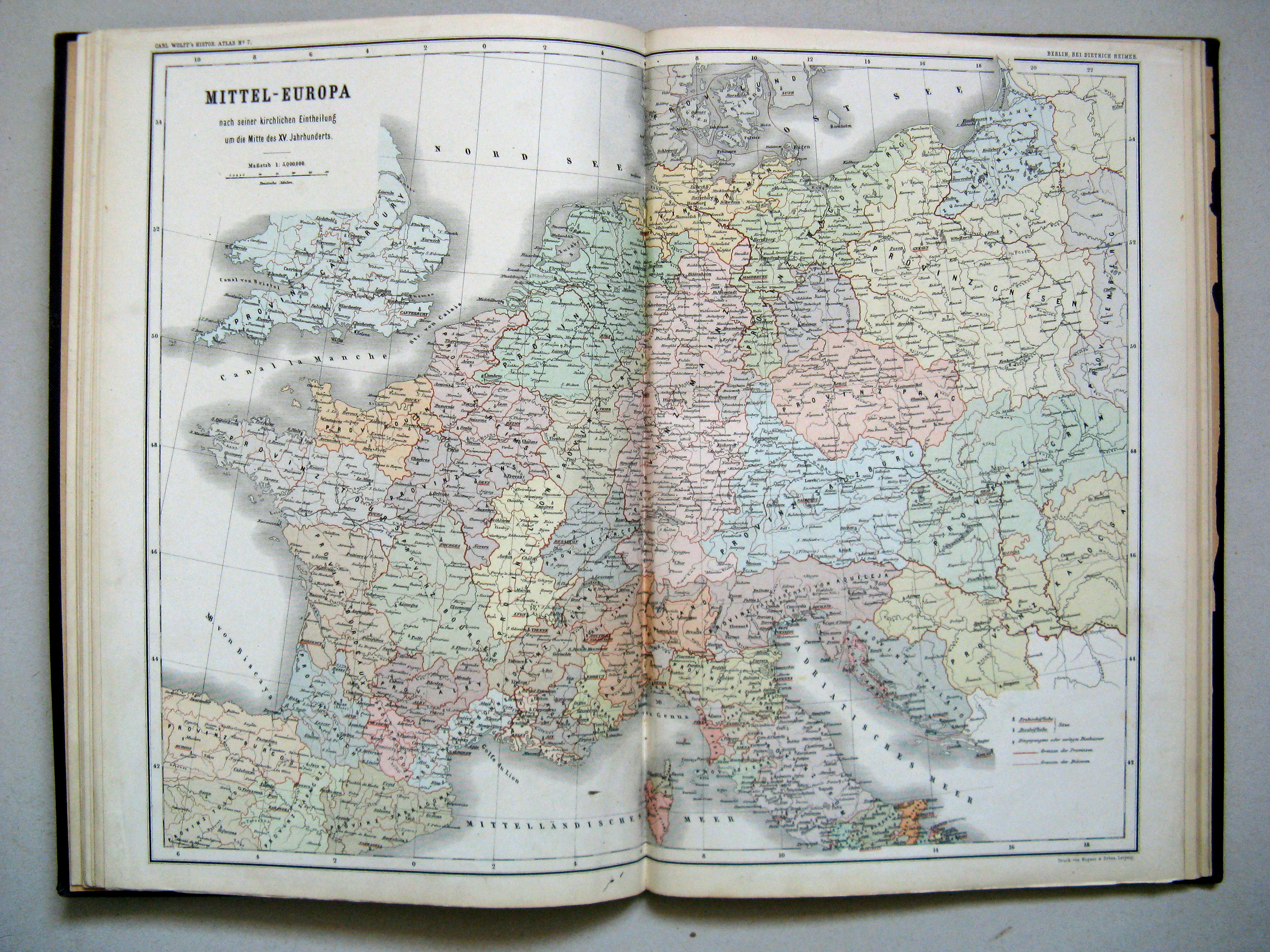
7. Mittel-Europa nach seiner kirchlichen Eintheilung um die Mitte des XV. Jahrhunderts
Kerkelijke indeling van Midden-Europa halverwege de 15e eeuw / Ecclesiastic subdivision of Central Europe halfway through the 15th century
 Carl Wolff's Historischer Atlas (1877)
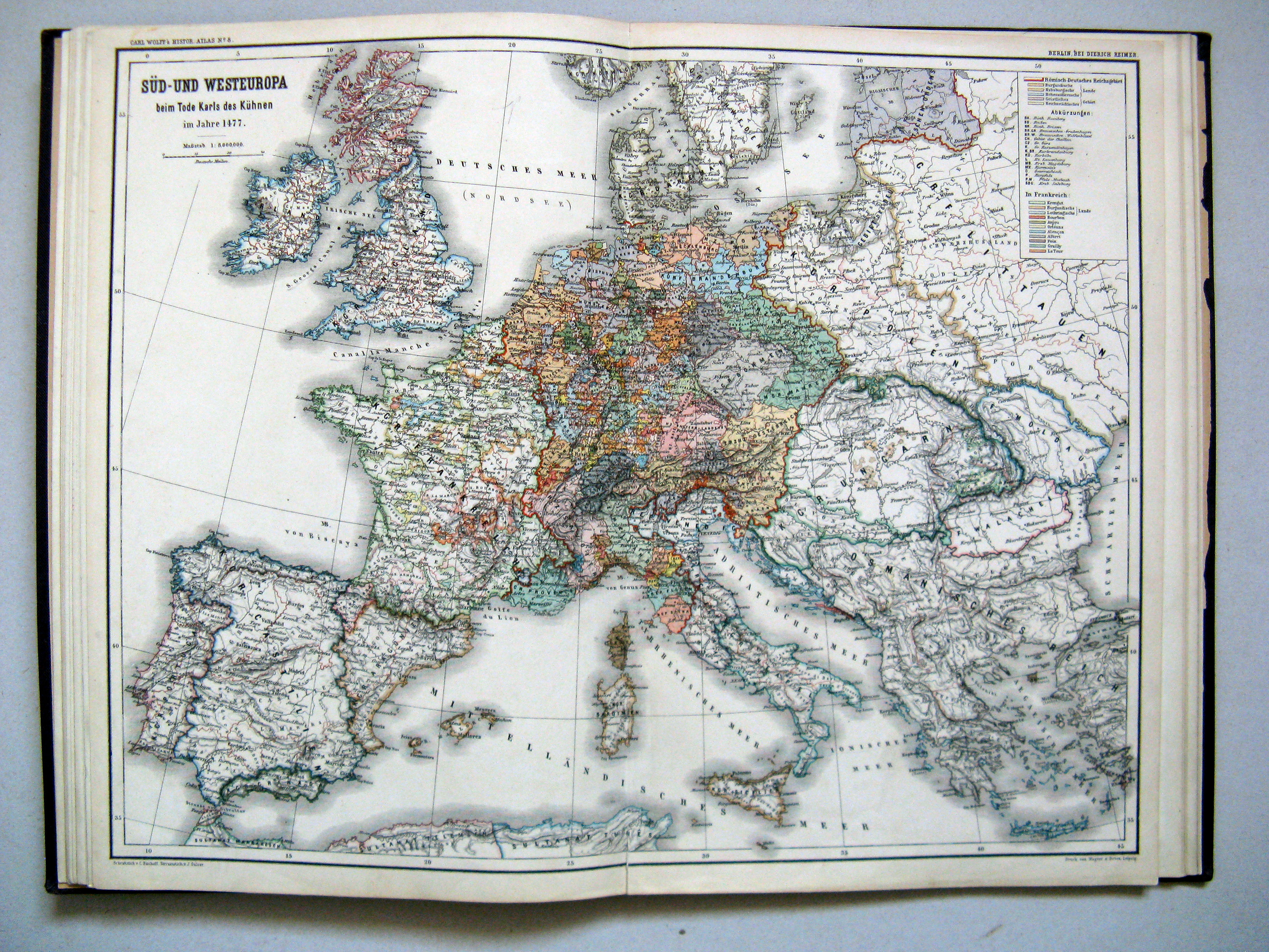
8. Süd- und Westeuropa beim Tode Karls des Kühnen im Jahre 1477
Zuid- en West-Europa bij de dood van Karel de Stoute in 1477 / Southern and Western Europe at the death of Charles the Bold in 1477
 Carl Wolff's Historischer Atlas (1877)
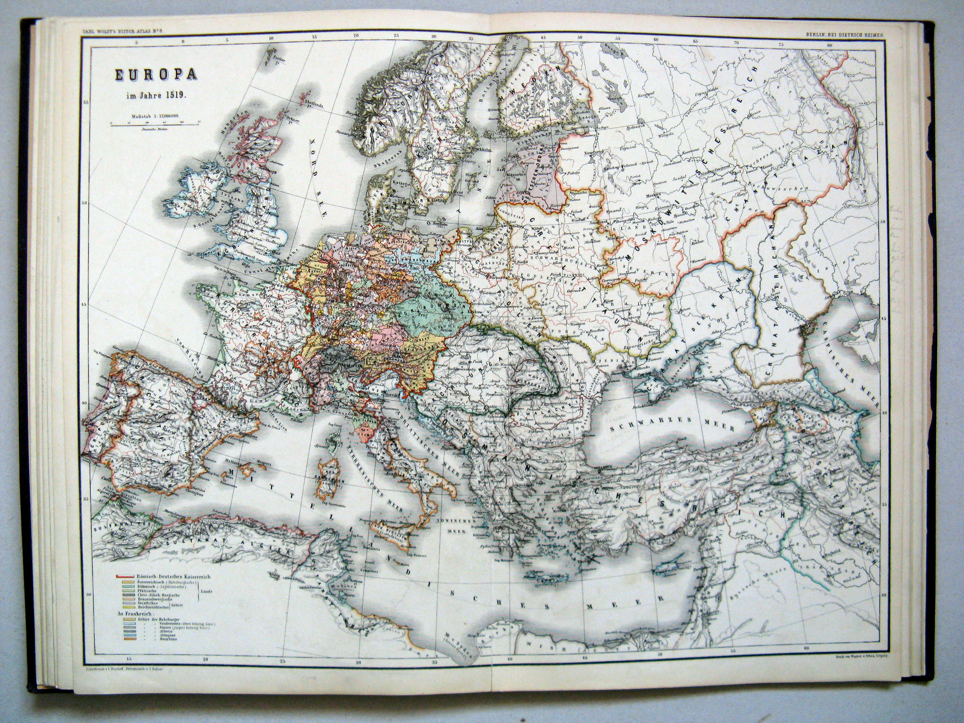
9. Europa im Jahre 1519
Europa in het jaar 1519 / Europe in the year 1519
 Carl Wolff's Historischer Atlas (1877)
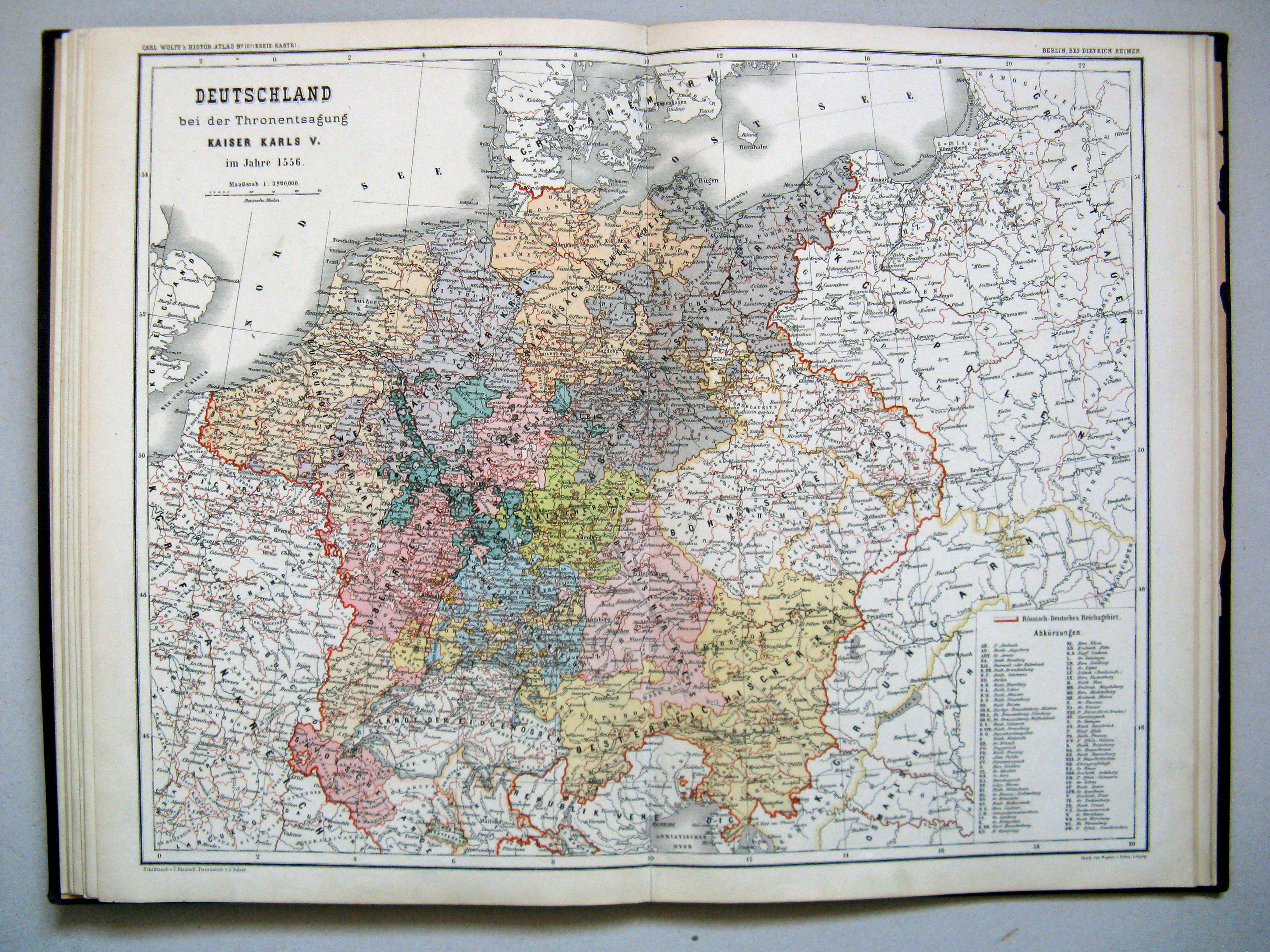
10a. Deutschland bei der Thronentsagung Kaiser Karls V. im Jahre 1556 (Kreis-Karte)
Duitsland bij de troonsafstand van Karel V in 1556 (kreitskaart) / Germany at the abdication of Charles V in 1556 (Imperial Circle map)
 Carl Wolff's Historischer Atlas (1877)
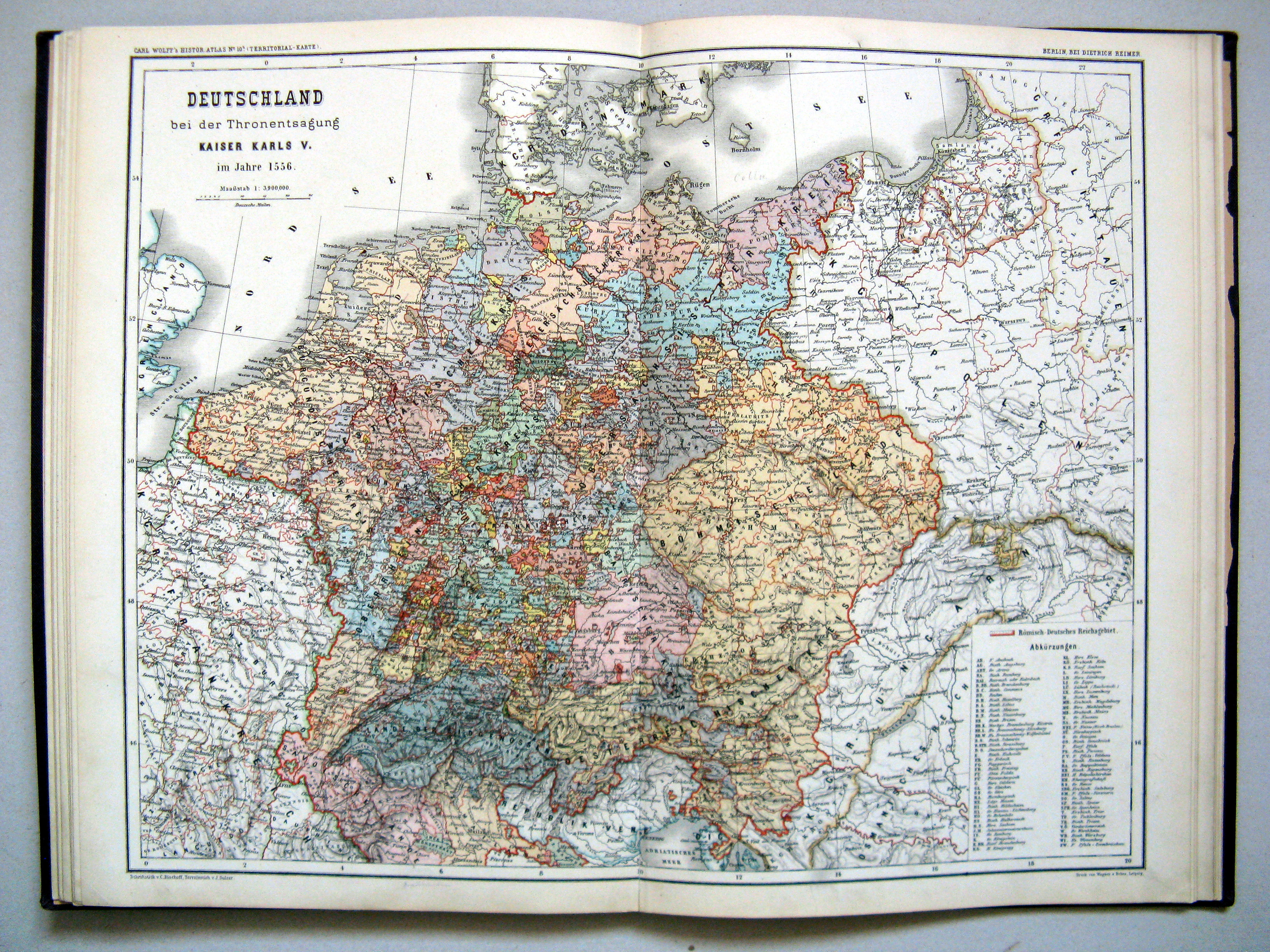
10b. Deutschland bei der Thronentsagung Kaiser Karls V. im Jahre 1556 (Territorial-Karte)
Duitsland bij de troonsafstand van Karel V in 1556 (territoriale kaart) / Germany at the abdication of Charles V in 1556 (Territorial map)
 Carl Wolff's Historischer Atlas (1877)
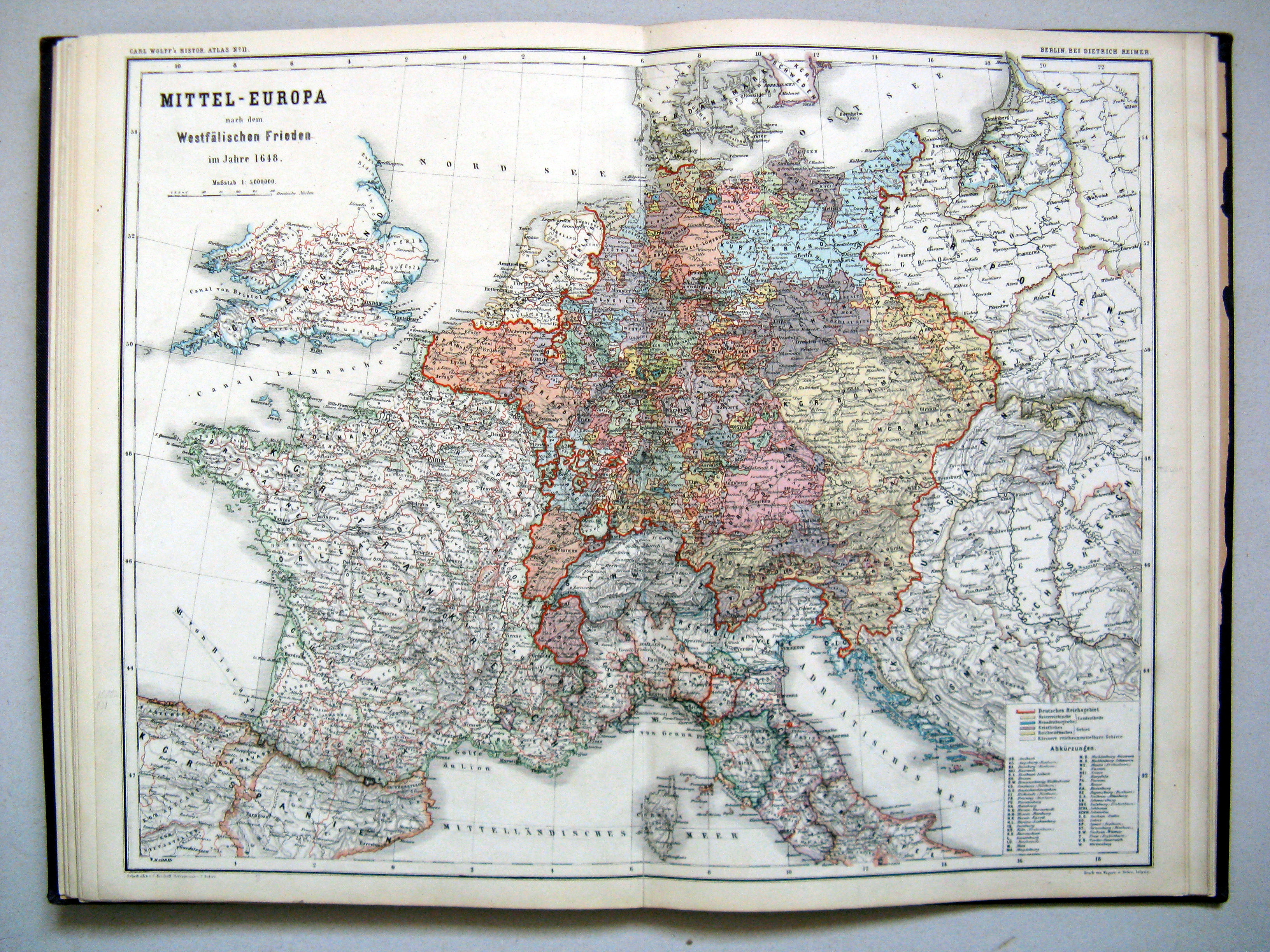
11. Mittel-Europa nach dem Westfälischen Frieden im Jahre 1648
Midden-Europa na de vrede van Westfalen in 1648 / Central Europe after the Peace of Westphalia in 1648
 Carl Wolff's Historischer Atlas (1877)
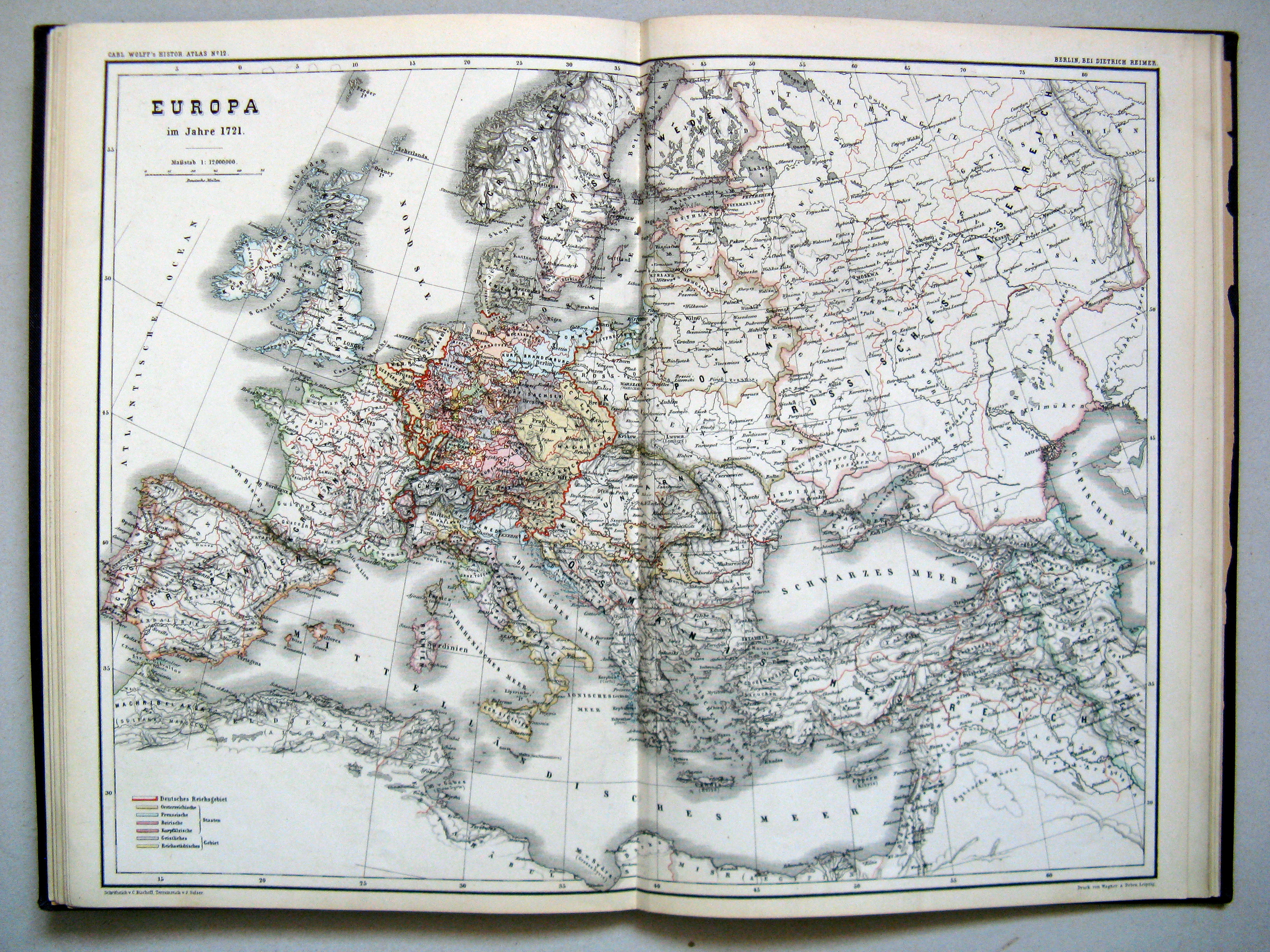
12. Europa im Jahre 1721
Europa in het jaar 1721 / Europe in the year 1721
 Carl Wolff's Historischer Atlas (1877)
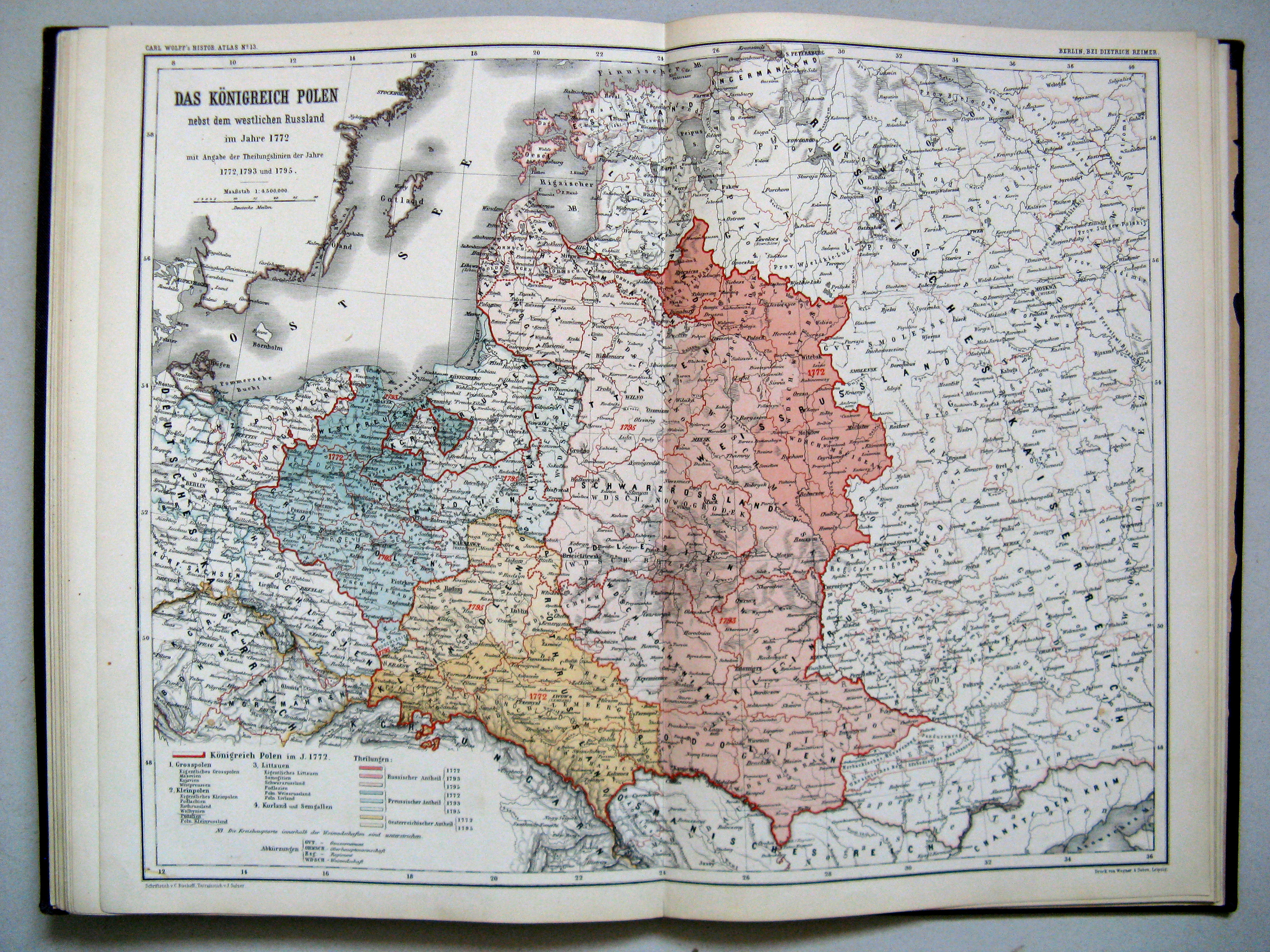
13. Das Königreich Polen nebst dem westlichen Russland im Jahre 1772
Het Koninkrijk Polen en West-Rusland in 1772 / The Kingdom of Poland and West Russia in 1772
 Carl Wolff's Historischer Atlas (1877)
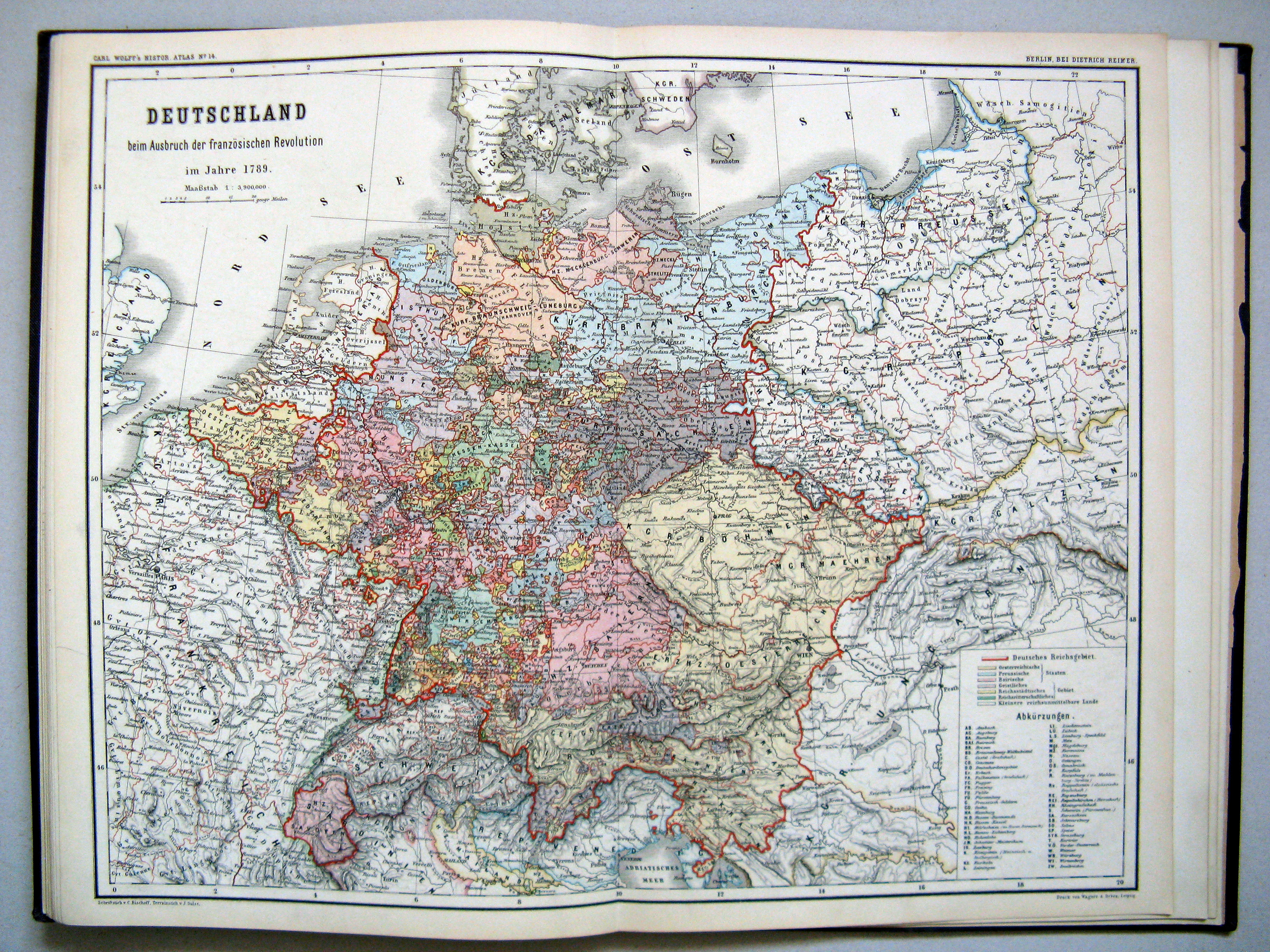
14. Deutschland beim Ausbruch der französischen Revolution im Jahre 1789
Duitsland bij het begin van de Franse Revolutie in 1789 / Germany at the beginning of the French Revolution in 1789
 Carl Wolff's Historischer Atlas (1877)
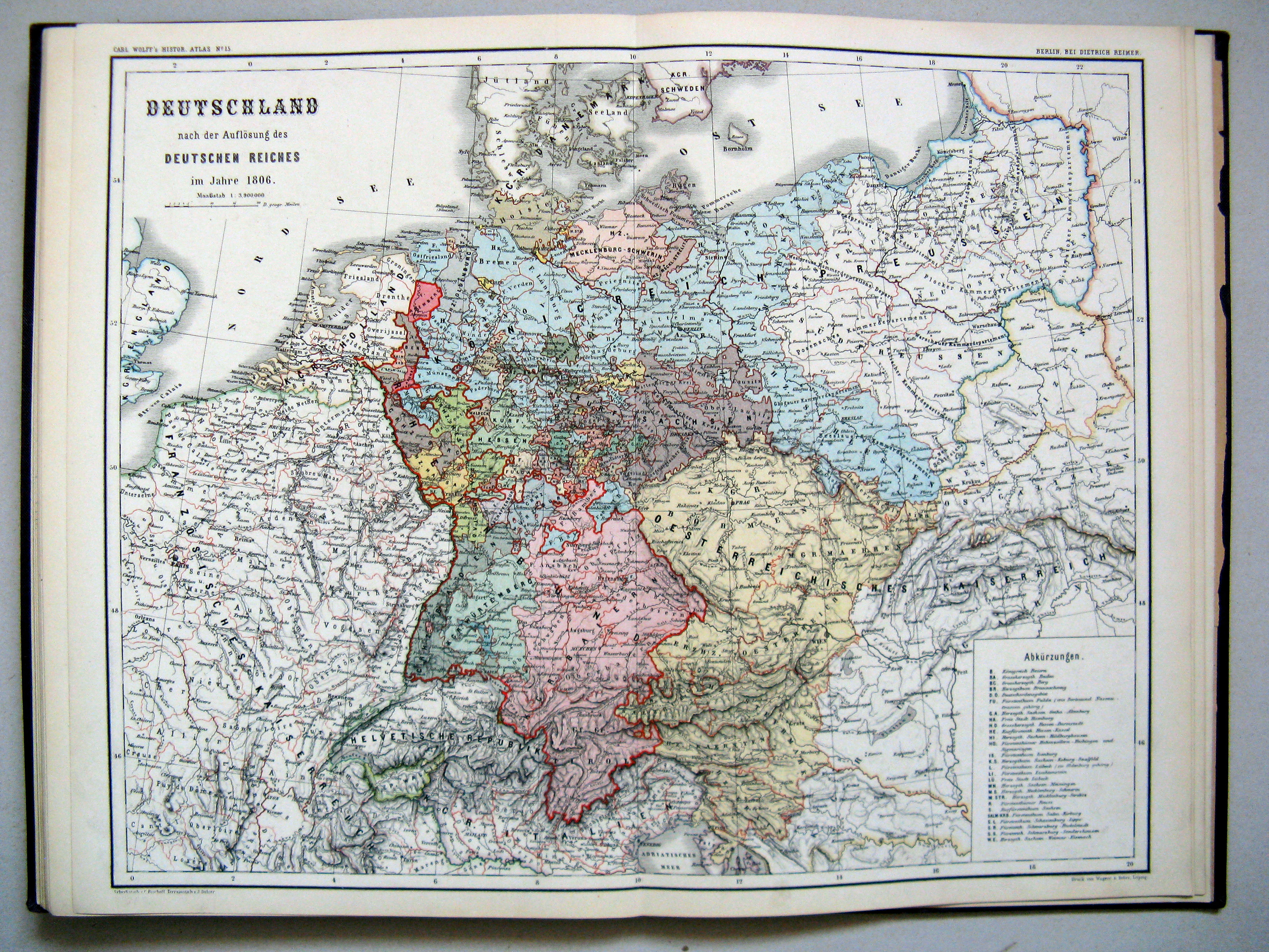
15. Deutschland nach der Auflösung des deutschen Reiches im Jahre 1806
Duitsland na de ontbinding van het Duits Rijk in 1806 / Germany after the dissolution of the German Empire in 1806
 Carl Wolff's Historischer Atlas (1877)
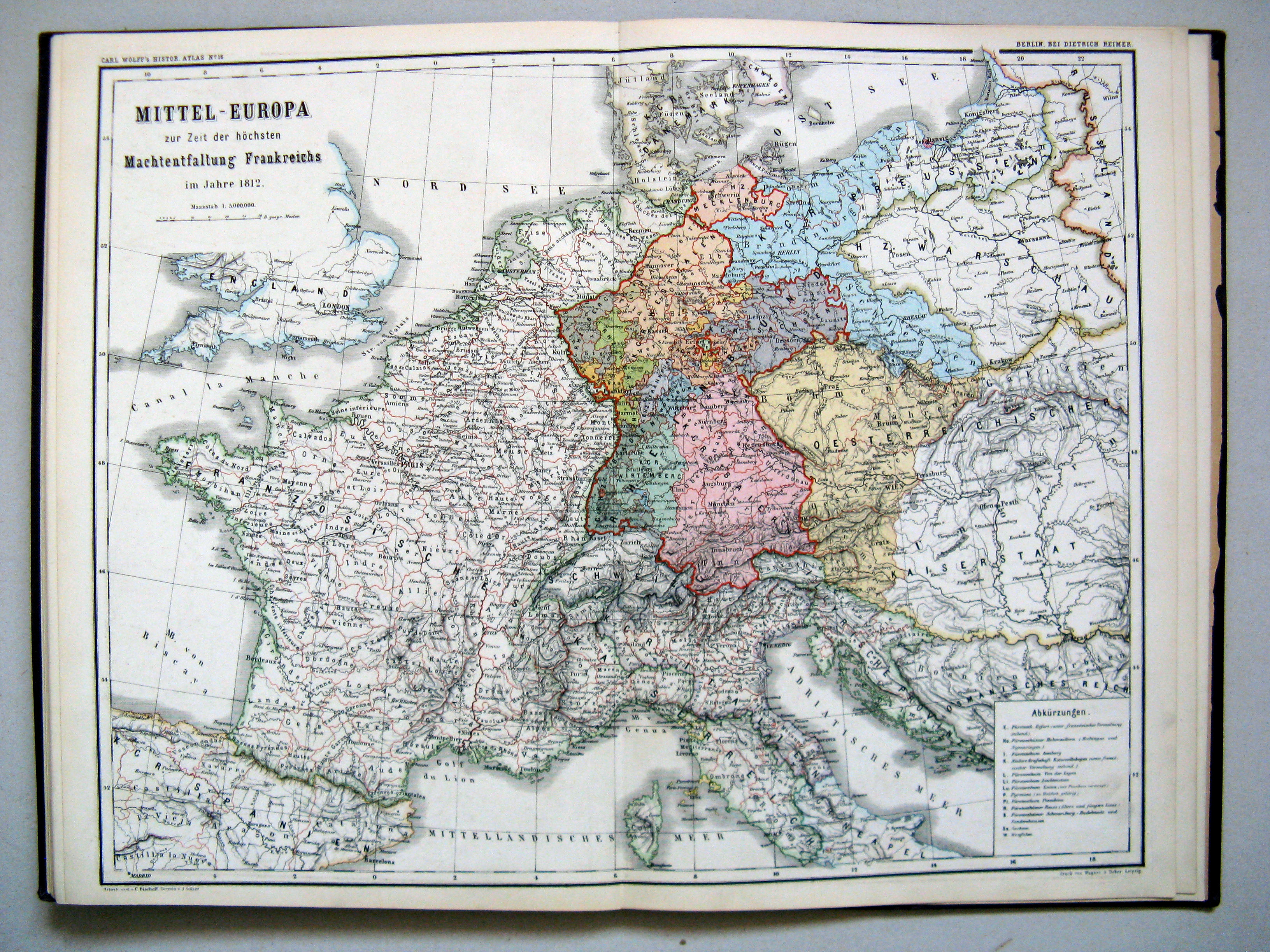
16. Mittel-Europa zur Zeit der höchsten Machtentfaltung Frankreichs im Jahre 1812
Midden-Europa ten tijde van de grootste expansie van Frankrijk in 1812 / Central Europe at the maximal expansion of France in 1812
 Carl Wolff's Historischer Atlas (1877)
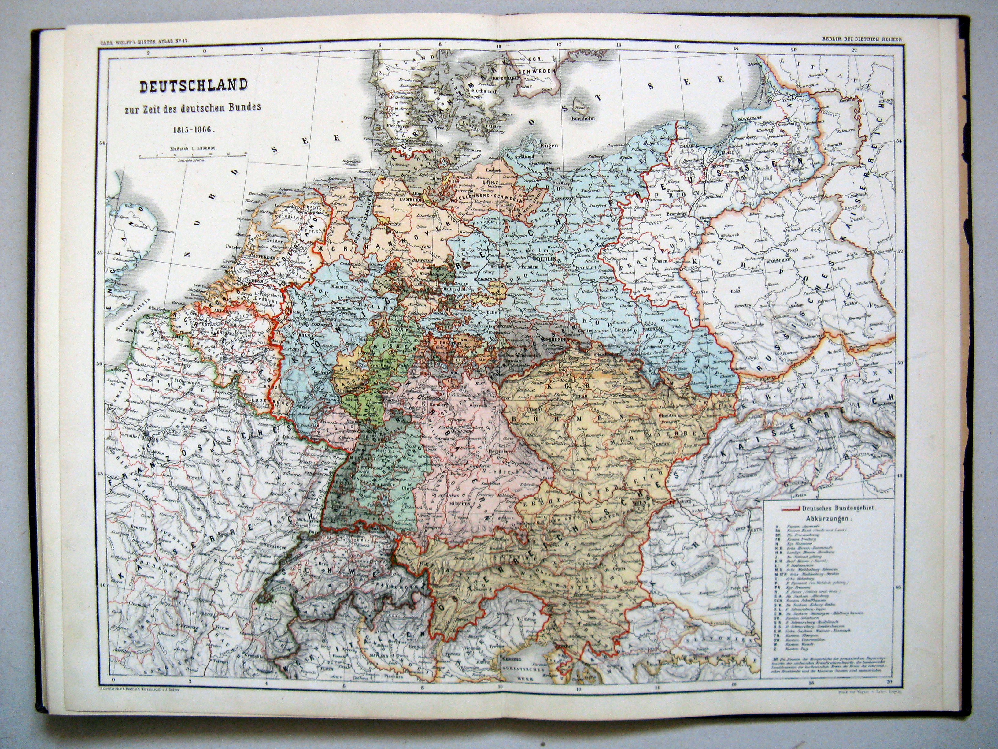
17. Deutschland zur Zeit des deutschen Bundes 1815-1866
Duitsland ten tijd van de Duitse Bond 1815-1866 / Germany in the time of the German Confederation 1815-1866
 Carl Wolff's Historischer Atlas (1877)
18. Mittel-Europa nach der Wiederaufrichtung des deutschen Kaiserreiches im Jahre 1871
Midden-Europa na de wederoprichting van het Duitse Keizerrijk in 1871 / Germany after the reestablishment of the German Empire in 1871
© M. Witkam, 2009
(rev. 2009-11-27)
![]()
![]()