Petermann's Mittelmeer-Karte (1880-1890)
See below for (a summary of) this text in English.
Hieronder staat de beschrijving van de kaarten. Daarbij horen ook de volgende pagina's
Titelgegevens
Titel: Petermann's Mittelmeer-Karte
Uitgever: Justus Perthes, Gotha
Jaar: 1880-1890 (1914)
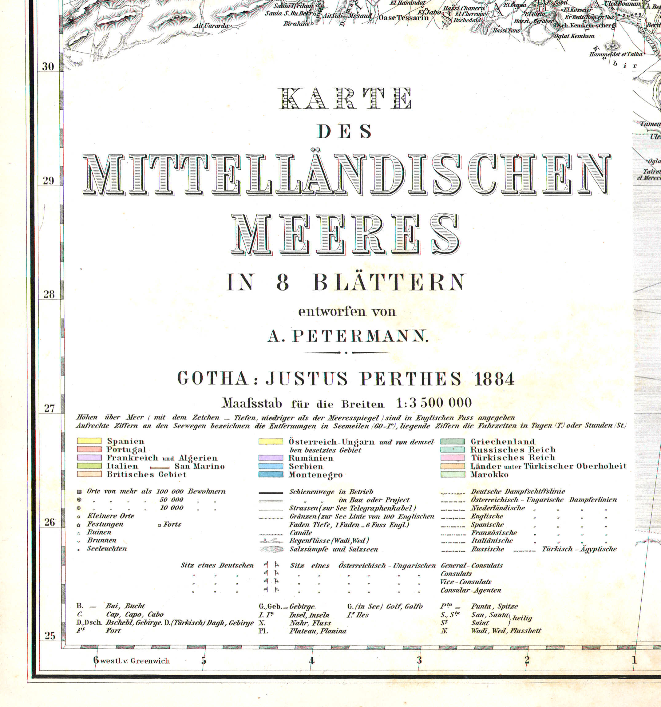
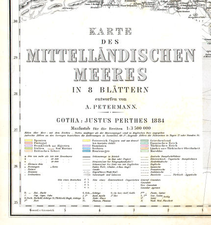
Titel uitgave 1884 (op blad Nº 5):
Karte des Mittelländischen Meeres in 8 Blättern
entworfen von A. Petermann.
Gotha: Justus Perthes 1884
Maaſsstab für die Breiten 1:3 500 000
Vertaling:
Kaart van de Middellandse Zee in 8 bladen
ontworpen door A. Petermann.
Gotha, Justus Perthes 1884
Schaal op de breedtecirkels 1:3.500.000
 Petermann's Mittelmeer-Karte (1884)
Titel op blad Nº 5
Band
De 8 kaartbladen waren los verkrijgbaar. Ze konden ook, op linnen geplakt en samengesteld tot één kaart, geleverd worden in een map of als wandkaart. Maar meestal zijn ze ingebonden als extra kaarten bij Stielers Hand-Atlas (7e druk). Mijn exemplaar van de serie is deel van de 7e druk van de atlas uit 1885.
Inhoud
De serie bestaat uit 8 kaartbladen van 47 × 38,5 cm (B × H). Ze zijn getekend door August Petermann (1822-1878). De kaarten zijn vervaardigd in kopergravure en met de hand gekleurd. De kaartbladen konden worden samengesteld tot één kaart met afmetingen 170 × 69 cm. In de titel (op blad Nº 5) staat het jaar van uitgave van de kaart, hier 1884. Rechtsonder staat de graveerdatum, hier bijna altijd IV.IV (de code voor april 1884).
De kaarten geven op de schaal 1:3.500.000 het gebied weer van de Middellandse Zee, grote delen van de Zwarte en de Kaspische Zee, Noord-Afrika en het Midden-Oosten; zie het overzicht. Ze zijn voor het eerste verschenen in 1880. Tot 1890 zijn ze regelmatig bijgewerkt – mijn exemplaar dateert van 1884. Van 1890 tot 1914 is alleen de staatkundige situatie nog geactualiseerd. Volgens de catalogi van Justus Perthes van 1915 en 1935 waren de kaarten op dat moment nog leverbaar, met in 1935 de kanttekening dat de staatkundige situatie op de kaarten was bijgewerkt tot 1914.
Bronnen:
- Jürgen Espenhorst: Petermann's Planet, volume I (p. 311)
- Katalog der Atlanten, Karten und Periodische Schriften aus dem Verlage von Justus Perthes, Geographische Anstalt. Gotha 1886 (p. 25)
- Haupt-Katalog von Justus Perthes Gotha, 1915 (p. 80, 81)
- Hauptkatalog Justus Perthes, 1935 (p. 150)
Zie ook de pagina met plaatjes.
Petermann's Mittelmeer-Karte (1880-1890)
- Below is a description of the maps in keywords. Related pages
- Title description
- Title: Petermann's Mittelmeer-Karte
Publisher: Justus Perthes, Gotha
Year: 1880-1890 (1914) - Title page:
Karte des Mittelländischen Meeres in 8 Blättern
entworfen von A. Petermann.
Gotha: Justus Perthes 1884
Maaſsstab für die Breiten 1:3 500 000 Translation:
Map of the Mediterranean Sea in 8 sheets
designed by A. Petermann
Gotha, Justus Perthes 1884
Latitude scale 1:3,500,000
- Title: Petermann's Mittelmeer-Karte
-
Binding
 Petermann's Mittelmeer-Karte (1884)
Title on sheet Nº 5- The maps were available separately. They were also sold, pasted on cloth and joined to form one large map, in a portfolio or as a wall map. But usually they are bound as additional maps in Stielers Hand-Atlas (7th edition). My copy of this series is part of the 7th edition of the atlas from 1885.
- Contents
- The map series consists of 8 sheets, each measuring 47 × 38,5 cm (W × H). They were drawn by August Petermann (1822-1878). The maps are produced in copper engraving and hand colored. The sheets could be joined to form one large map measuring 170 × 69 cm. The title (on sheet Nº 5) gives the publication year, in this case 1884. In the lower right the engraving date is mentioned, here usually IV.IV (an encoding for April 1884).
- The maps depict, at a scale of 1:3,500,000 the region of the Mediterranean Sea, most of the Black and Caspian Seas, North Africa and the Middle East; see the overview. They were first published in 1880, and updated on a regular basis until 1890 – my copy is dated 1884. From 1890 until 1914 only the political situation was updated. According to the Justus Perthes catalogs from 1915 and 1935 the maps were still available. In 1935 there is a note that the political situation on the maps was last updated in 1914.
- Sources:
- Jürgen Espenhorst: Petermann's Planet, volume I (p. 311)
- Katalog der Atlanten, Karten und Periodische Schriften aus dem Verlage von Justus Perthes, Geographische Anstalt. Gotha 1886 (p. 25)
- Haupt-Katalog von Justus Perthes Gotha, 1915 (p. 80, 81)
- Hauptkatalog Justus Perthes, 1935 (p. 150)
© M. Witkam, 2011
![]()
![]()