Diez: Post- und Reise-(Eisenbahn-)Karte
See below for (a summary of) this text in English.
Hieronder staan plaatjes van de kaart. Daarbij horen ook de volgende pagina's
- Beschrijving van de kaart
Plaatjes
Klik op een plaatje voor een vergroting.
Diez: Post- und Reise-(Eisenbahn-)Karte
- Below are pictures of the map. Related pages
- Description of the map
Pictures
Click on a picture to enlarge.
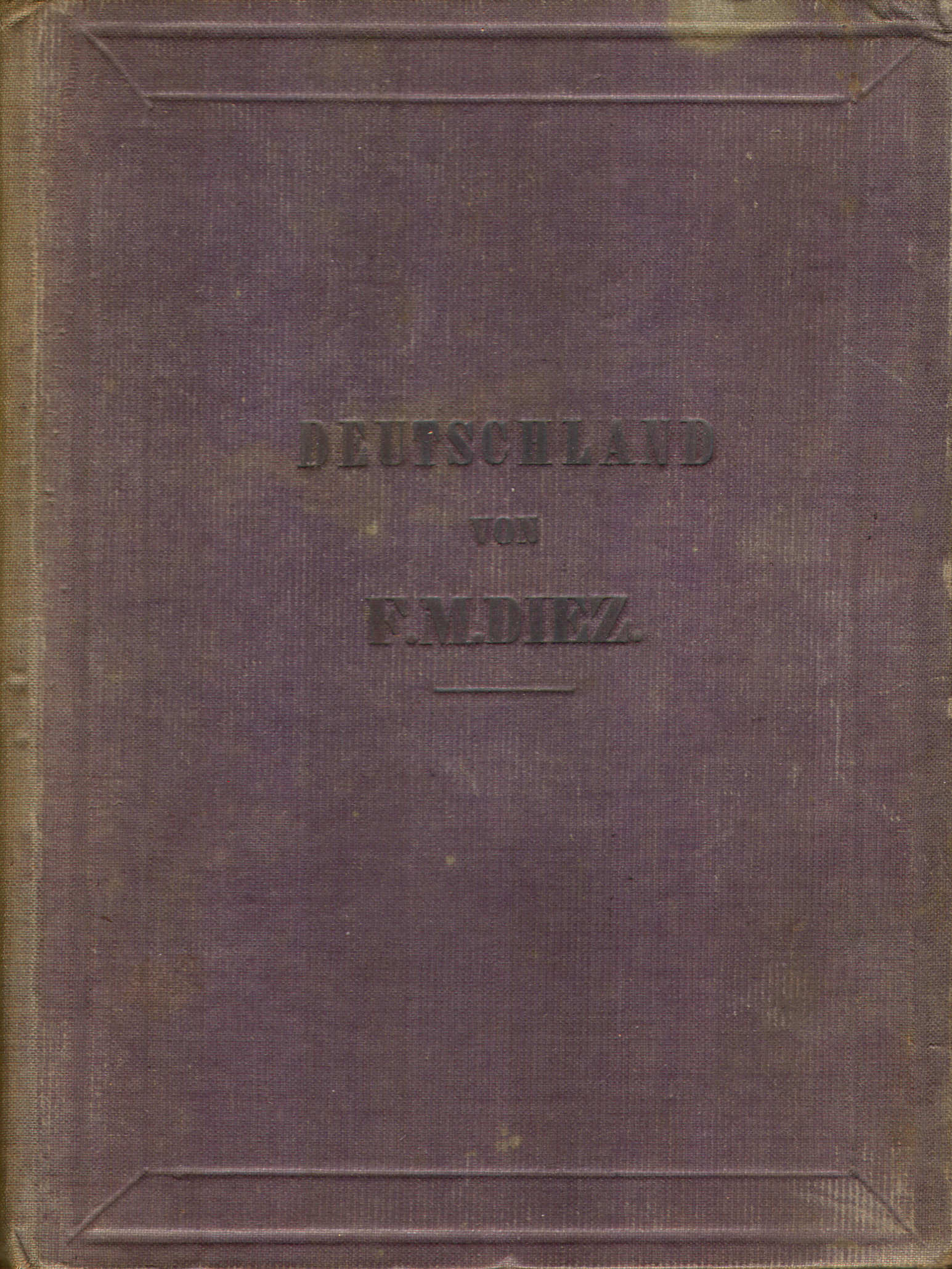
Omslag (1846) / Cover (1846)
 Diez, Bär: Post- und Eisenbahn-Karte von Deutschland ... (1846)
Omslag / Cover
 Diez, Bär: Post- und Eisenbahn-Karte von Deutschland ... (1846)
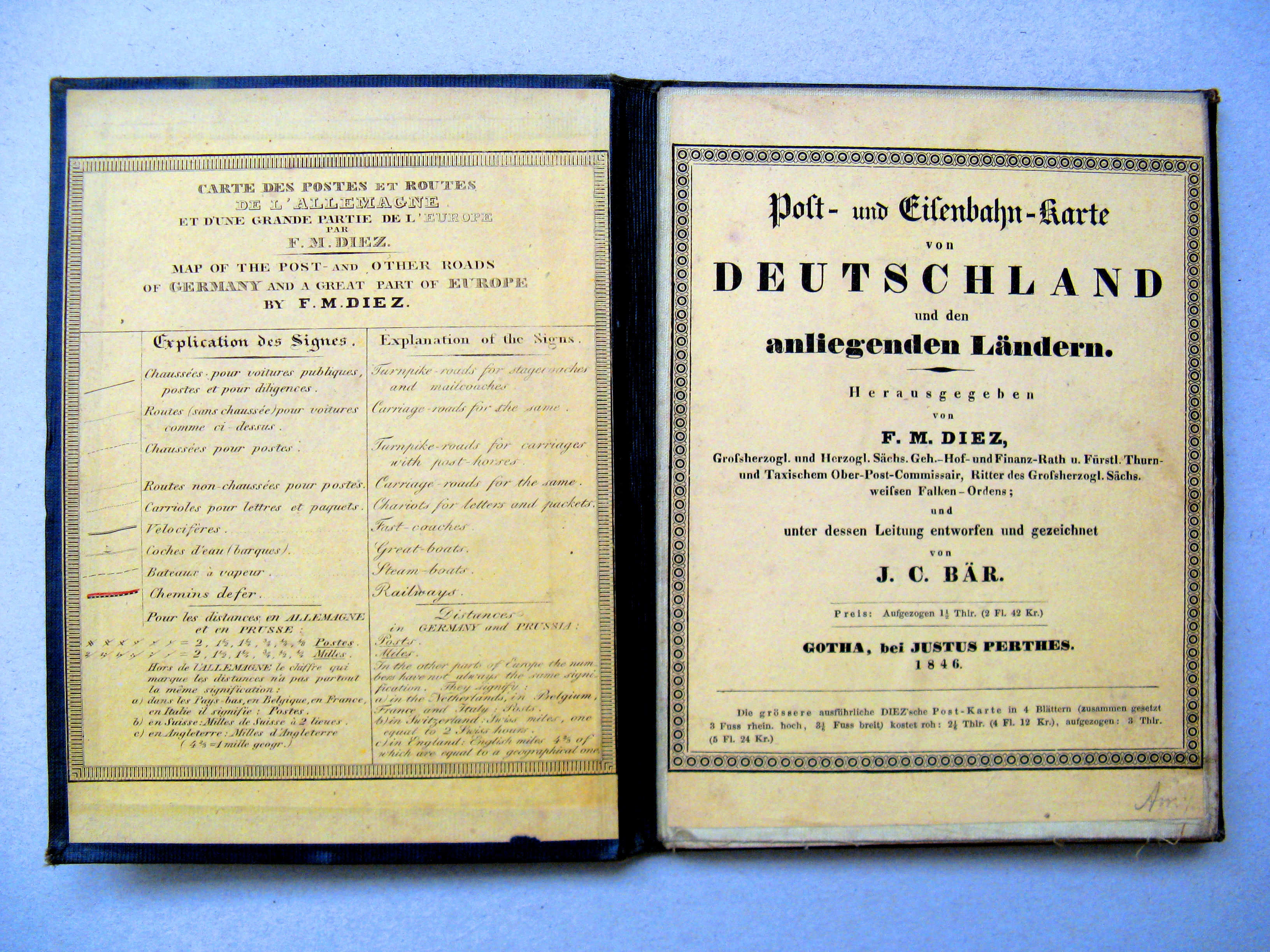
Binnenkant omslag (titel etc.) / Inside cover (title etc.)
 Diez, Bär: Post- und Eisenbahn-Karte von Deutschland ... (1846)
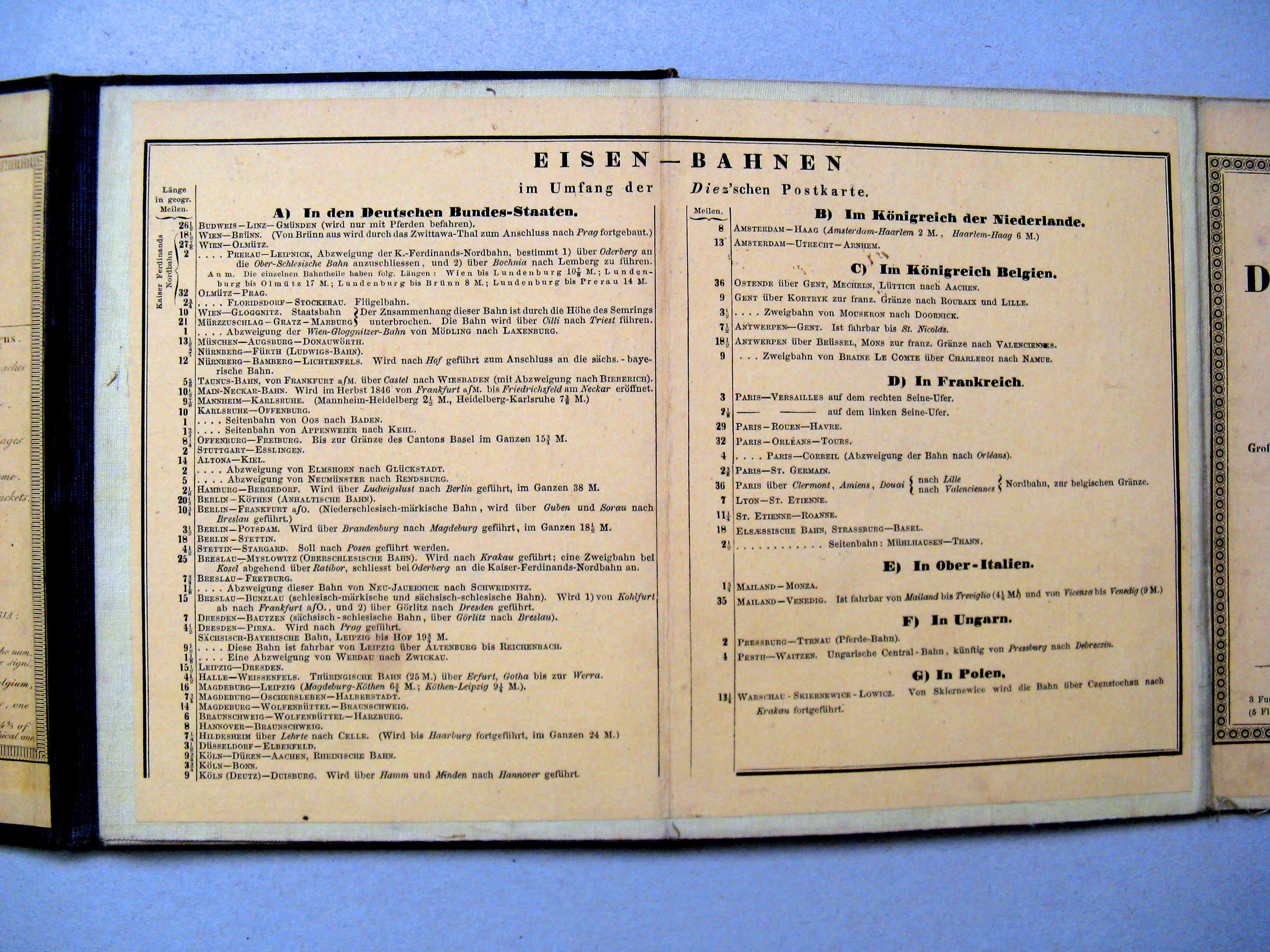
Binnenkant omslag (lijst van spoorwegen) / Inside cover (list of railroads)
 Diez, Bär: Post- und Reise-Karte von Deutschland ... (1833)
Titel op de kaart / Title on the map
 Diez, Bär: Post- und Eisenbahn-Karte von Deutschland ... (1846)
Titel op de kaart / Title on the map
 Diez, Bär: Post- und Reise-Karte von Deutschland ... (1833)
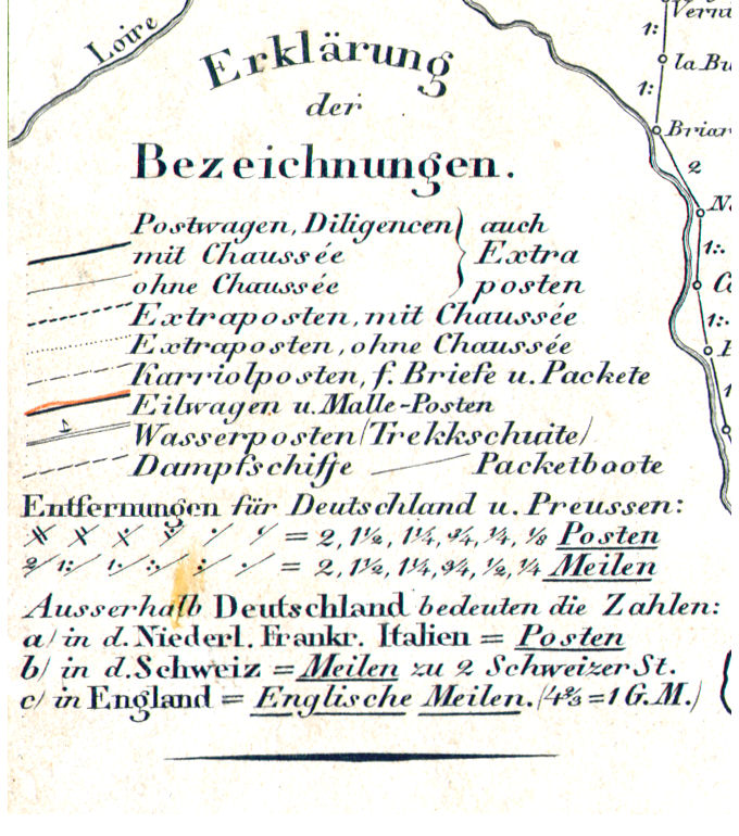
Legenda / Key to maps symbols
 Diez, Bär: Post- und Eisenbahn-Karte von Deutschland ... (1846)
Legenda / Key to maps symbols
 Diez, Bär: Post- und Eisenbahn-Karte von Deutschland ... (1846)
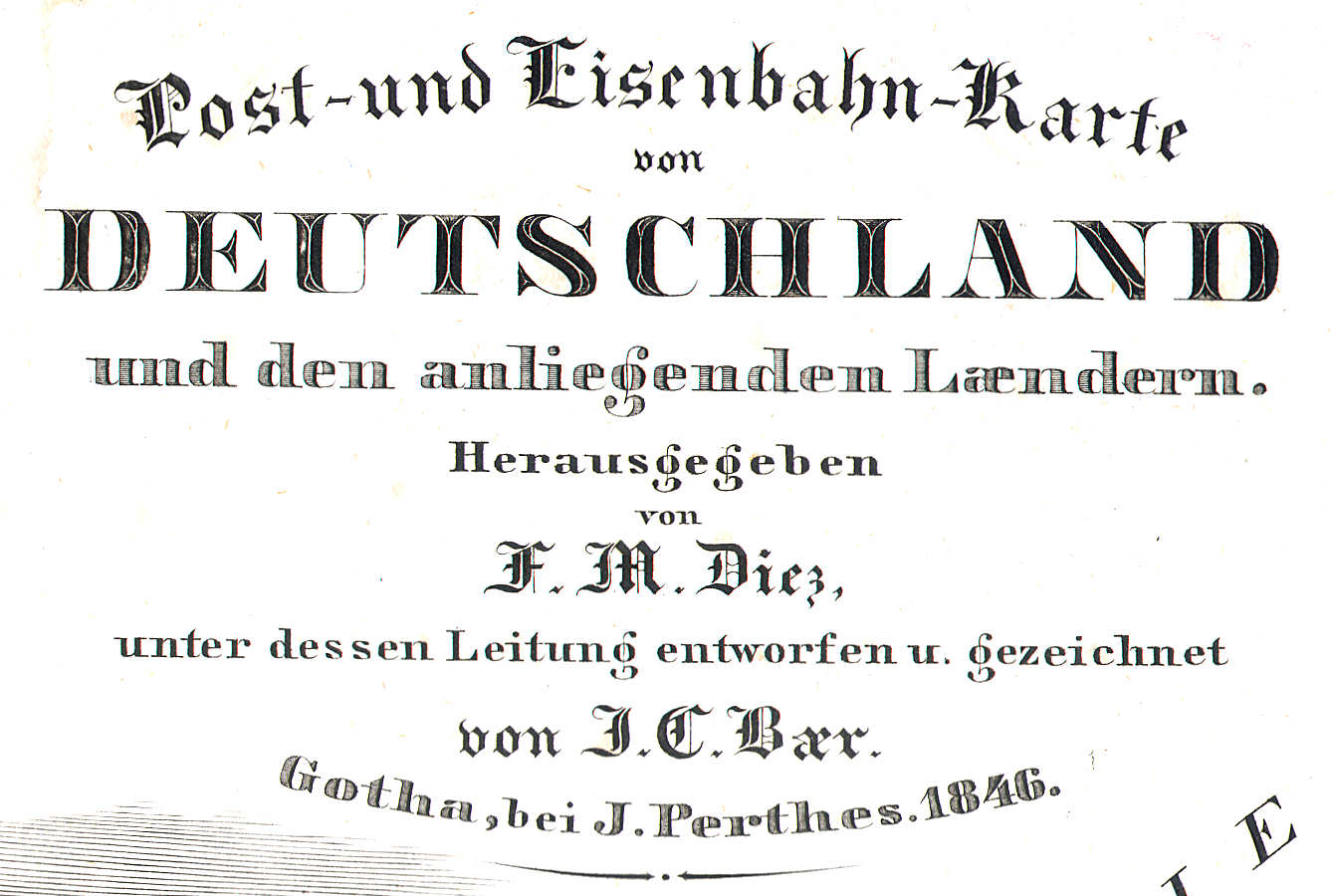
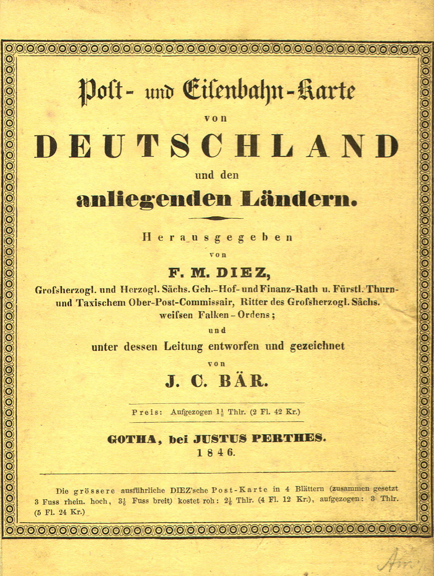
Titel in omslag / Title inside cover
 Diez, Bär: Post- und Eisenbahn-Karte von Deutschland ... (1846)
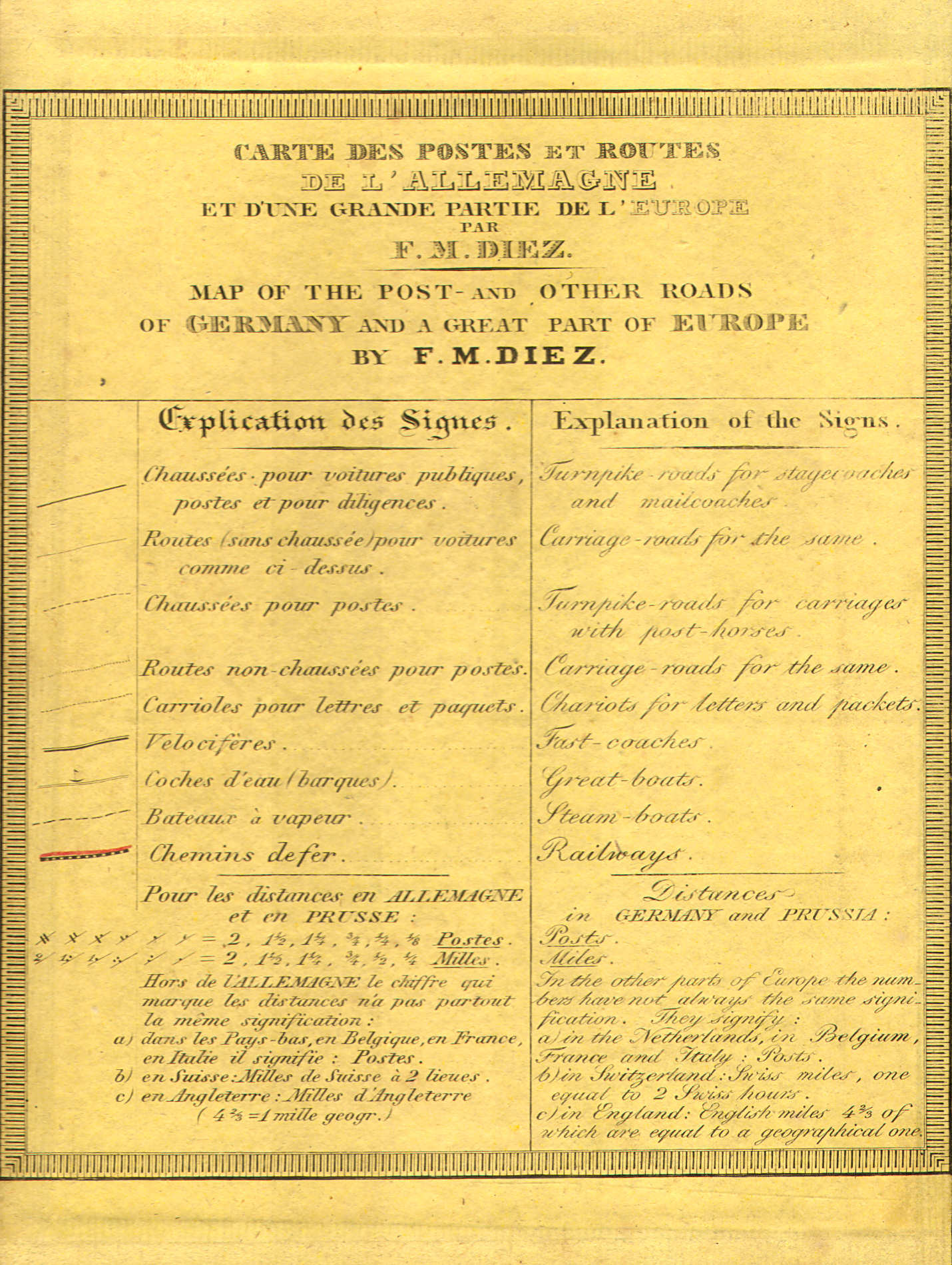
Franse en Engelse tekst in omslag / French and English text inside cover
 Diez, Bär: Post- und Eisenbahn-Karte von Deutschland ... (1846)
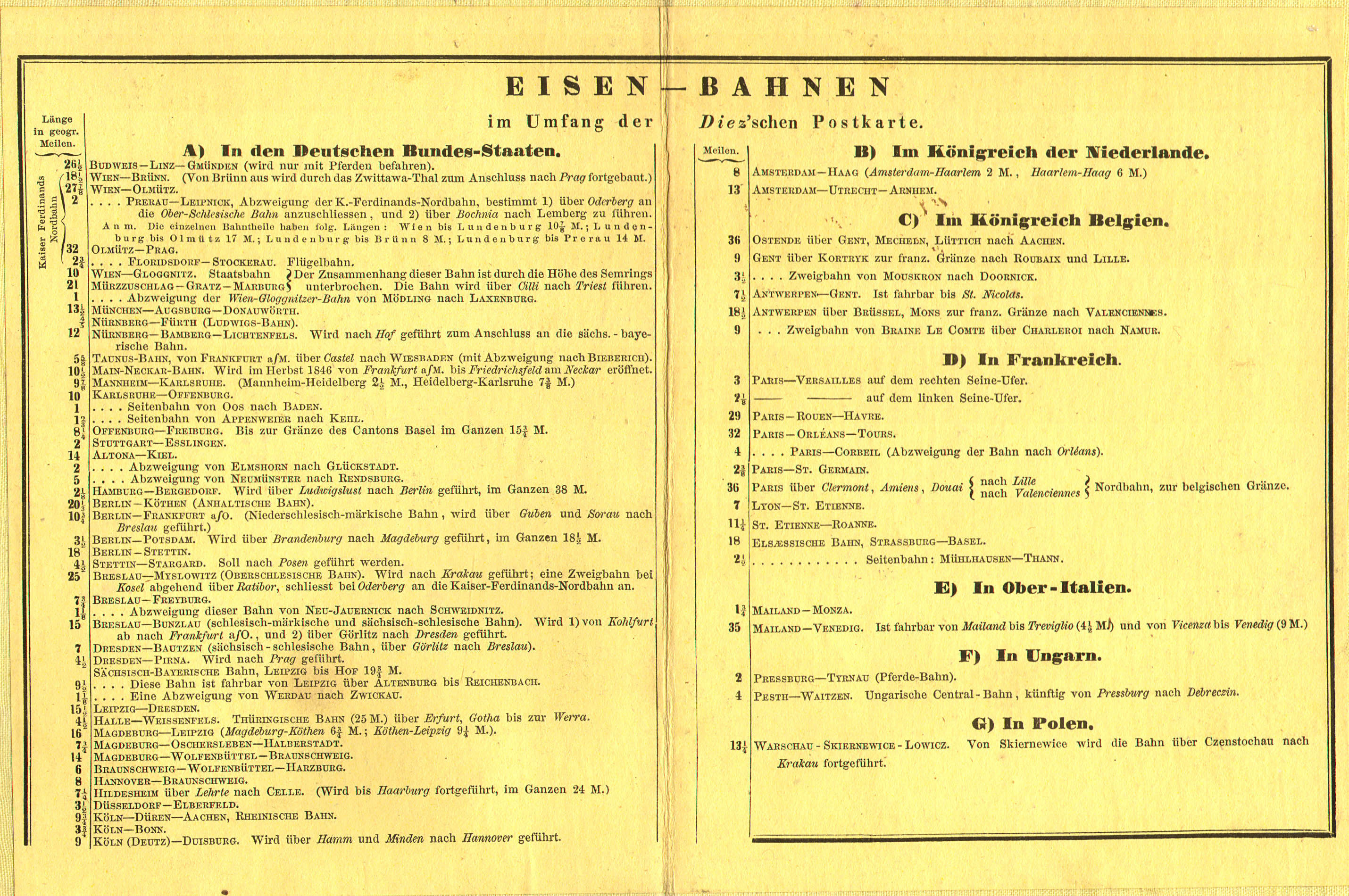
Lijst van spoorwegen (in omslag) / List of railroads (inside cover)
 Diez, Bär: Post- und Reise-Karte von Deutschland ... (1833)
XL
Diez, Bär: Post- und Reise-Karte von Deutschland ... (1833)
XL
 Diez, Bär: Post- und Eisenbahn-Karte von Deutschland ... (1846)
XL
Diez, Bär: Post- und Eisenbahn-Karte von Deutschland ... (1846)
XL
 Stielers Hand-Atlas, 1842
20. Deutschland und anliegende Länder, zur Übersicht der Hauptstrassen und Entfernungen
Nach Diez neuester Post K. berichtigt 1840
Midden-Europa, wegen- en afstandskaart / Central Europe, road and distance map
© M. Witkam, 2008
![]()
![]()