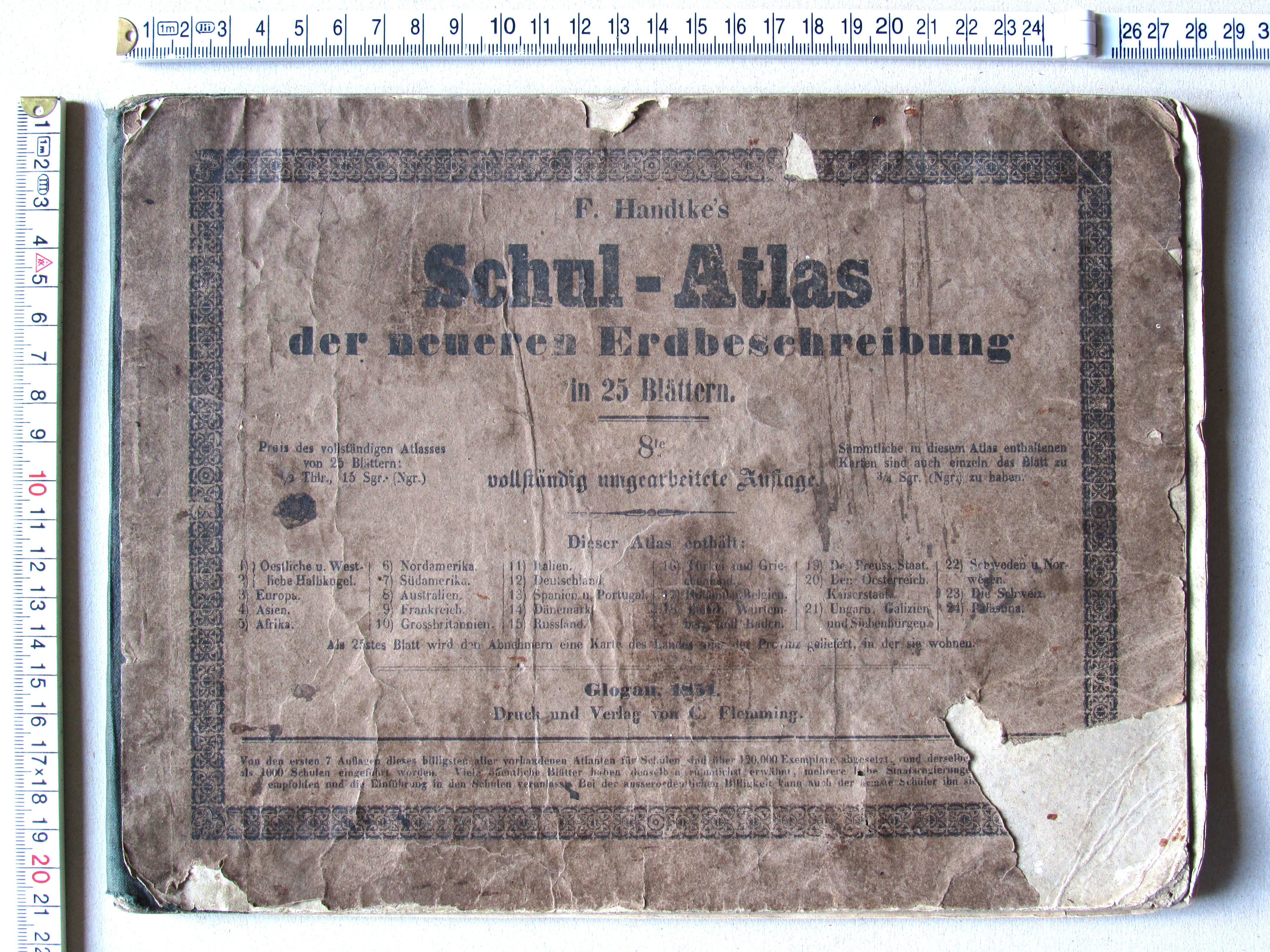
Handtke's Schul-Atlas, 8e druk (1851)
See below for (a summary of) this text in English.
Hieronder staan plaatjes van de atlas. Daarbij horen ook de volgende pagina's
- Beschrijving van de atlas
- Tabellen en lijsten bij de atlas
- Vergelijking (plaatjes) met de 2e druk (1841)
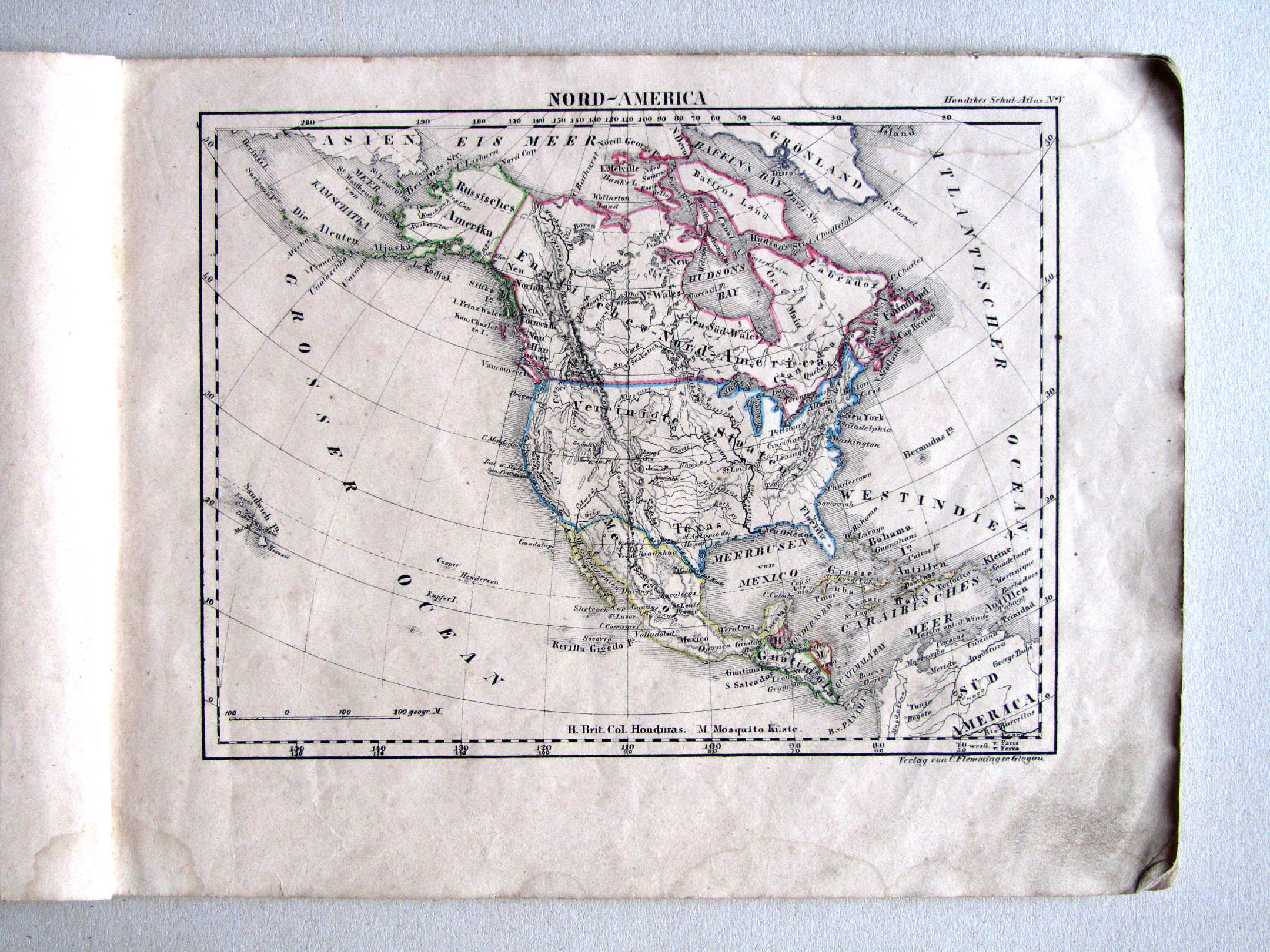
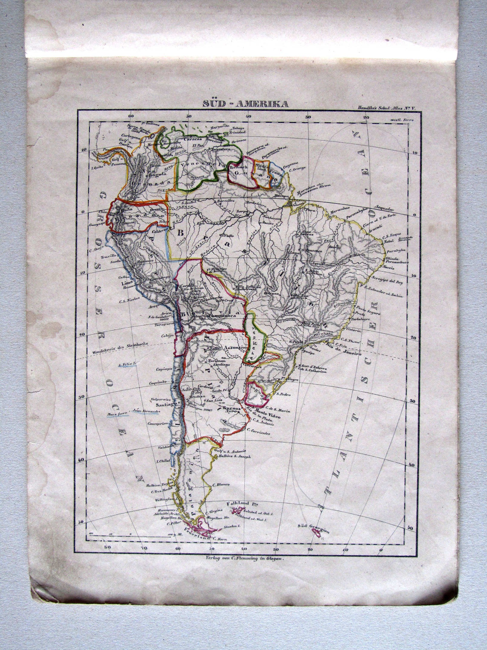
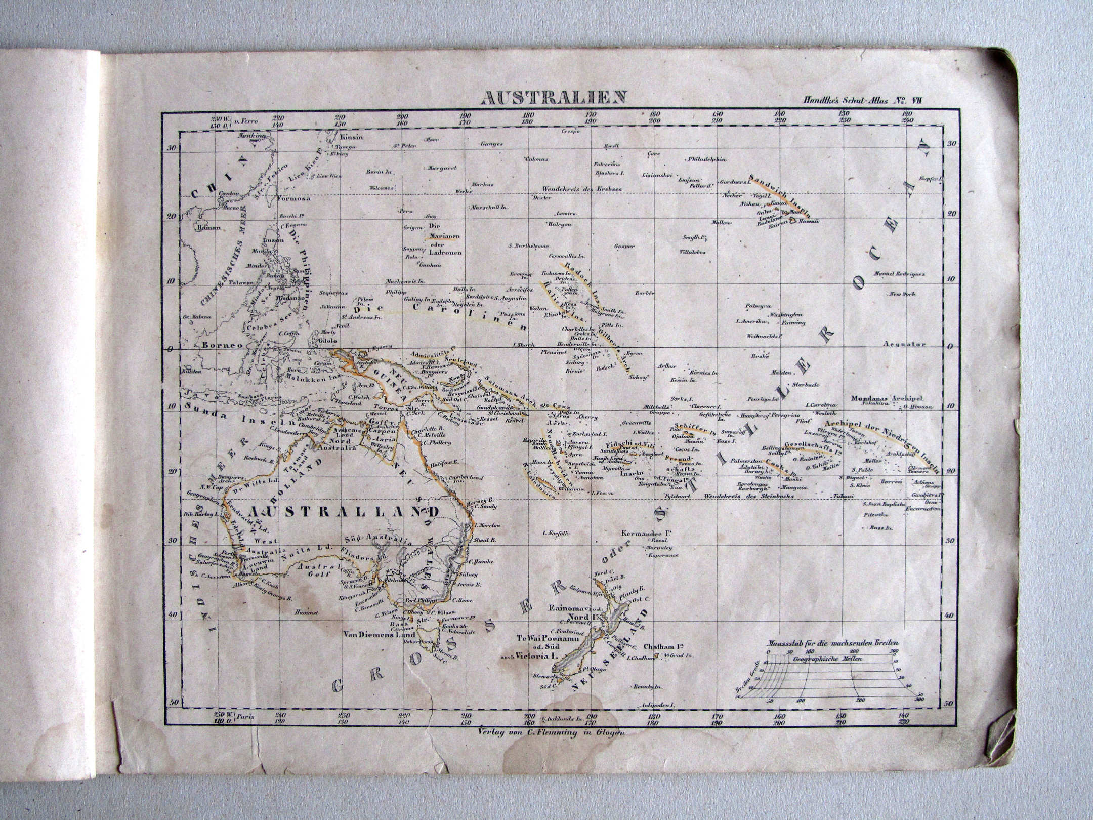
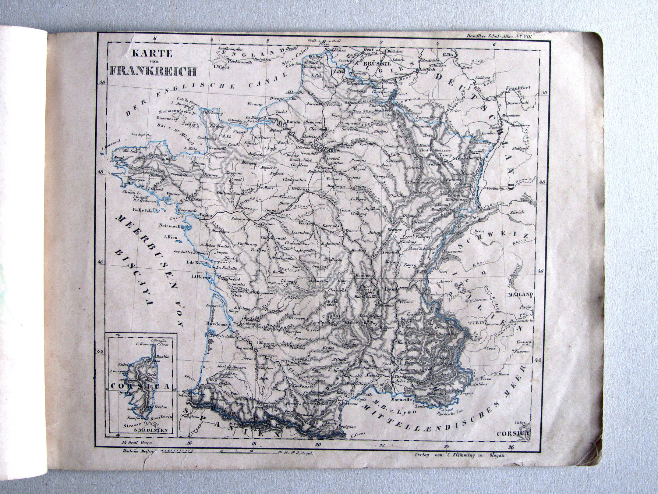
Plaatjes
Klik op een plaatje voor een vergroting.
Handtke's Schul-Atlas, 8th edition (1851)
- Below are pictures of the atlas. Related pages
- Description of the atlas
- Tables and lists to the atlas
- Comparison (pictures) with the 2nd edition (1841)
Pictures
Click on a picture to enlarge.
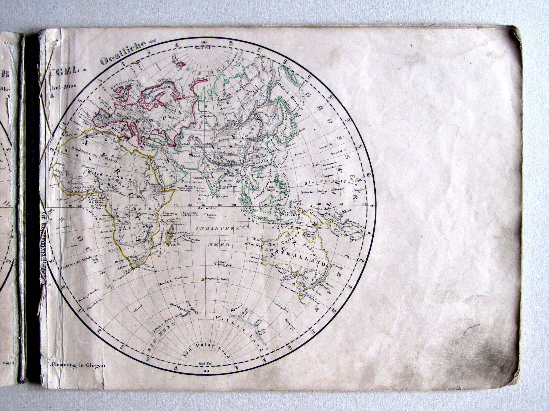
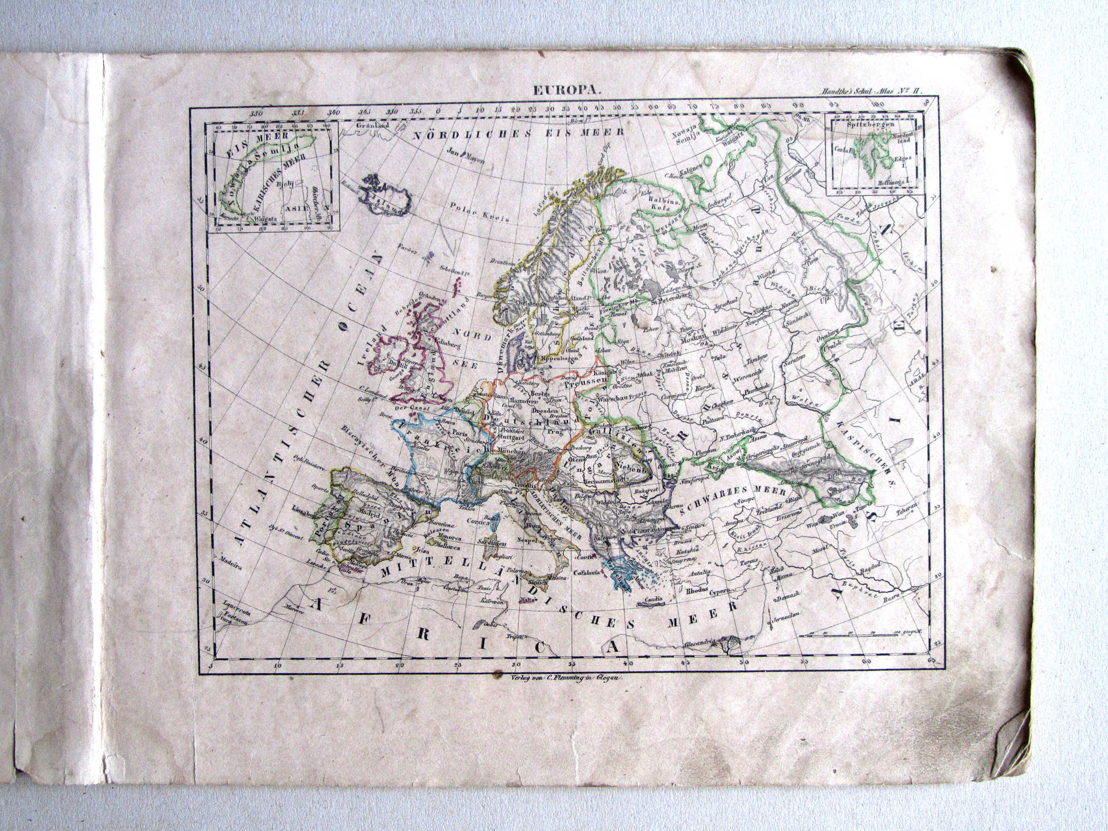
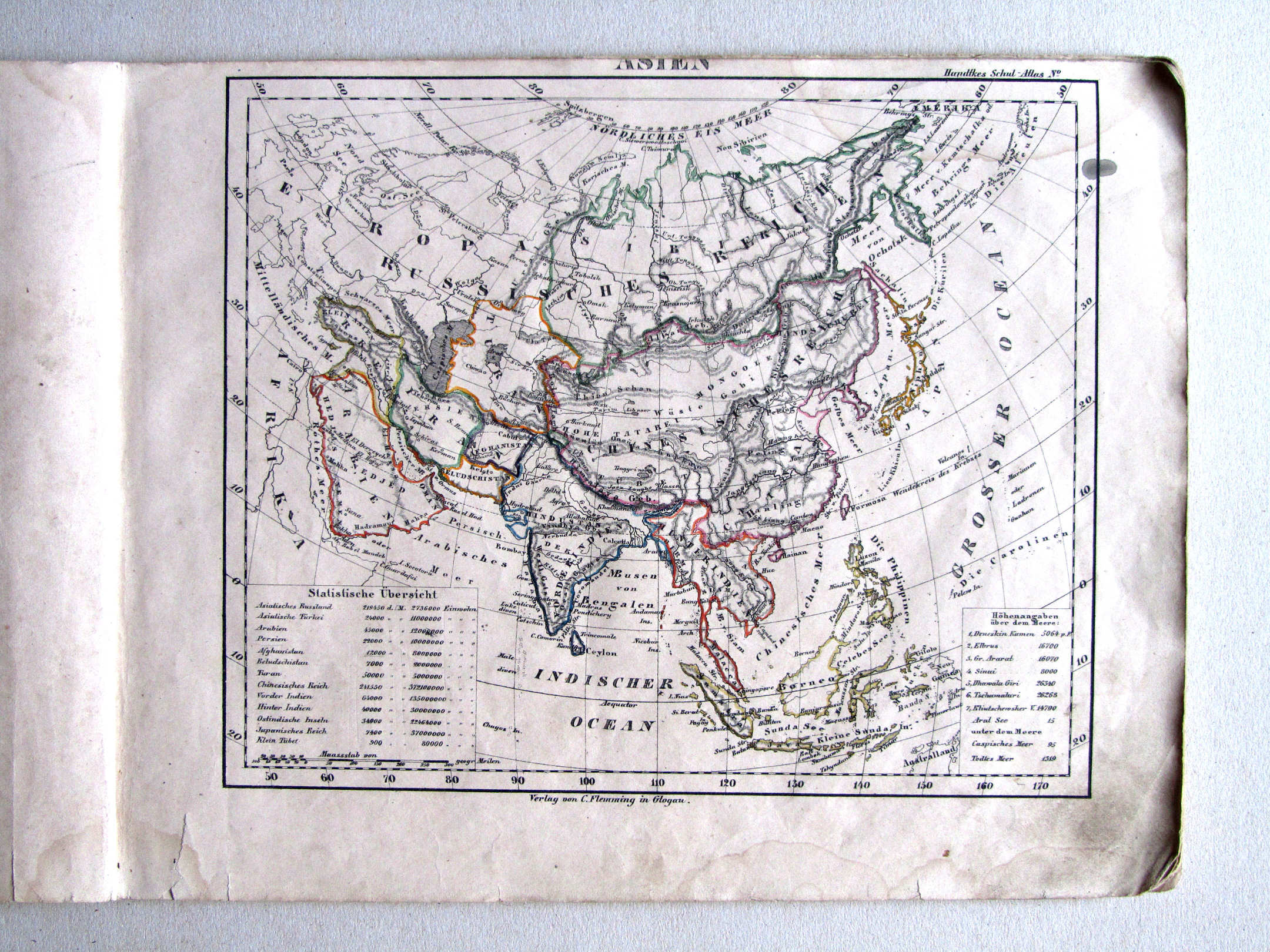
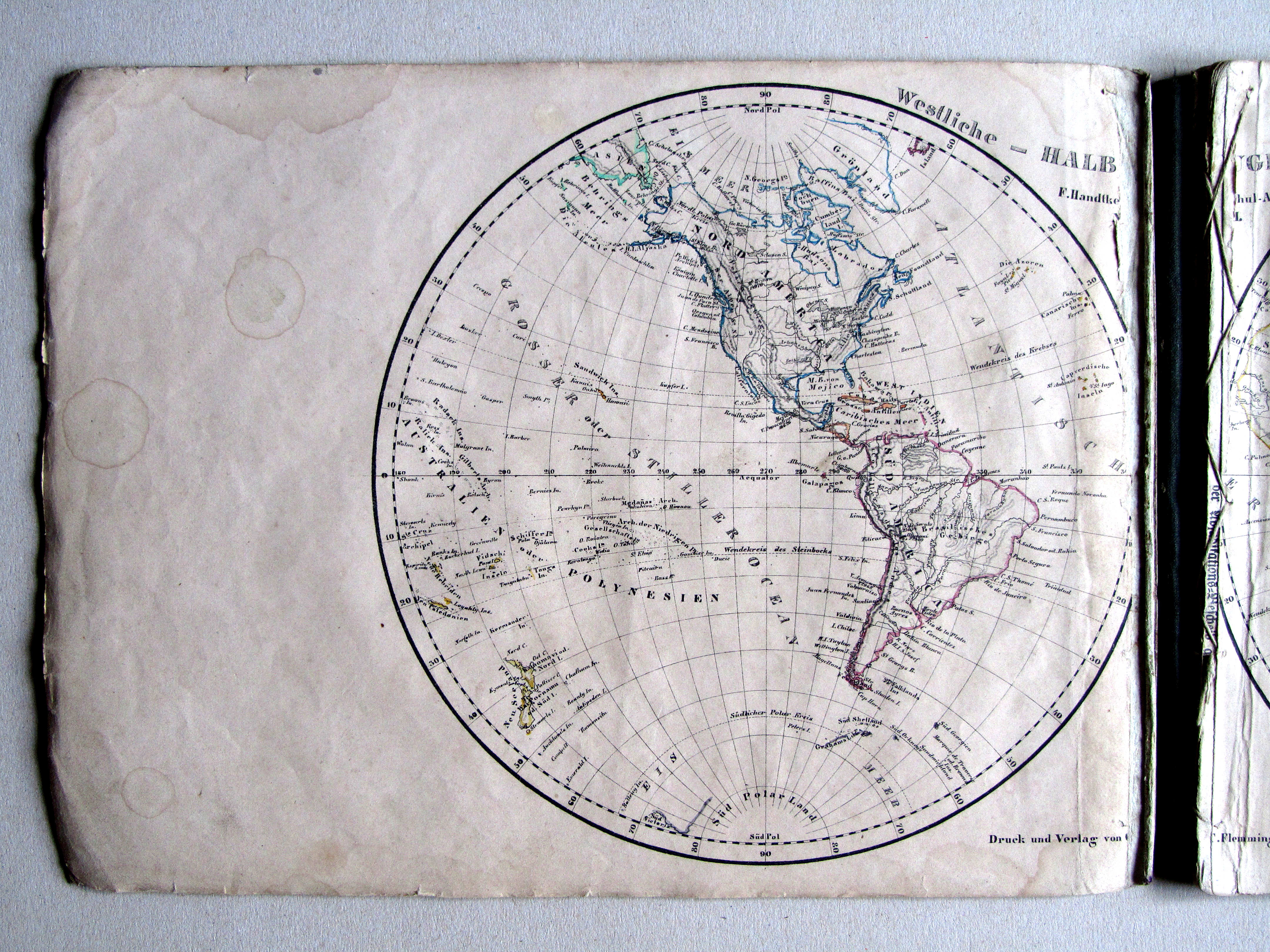
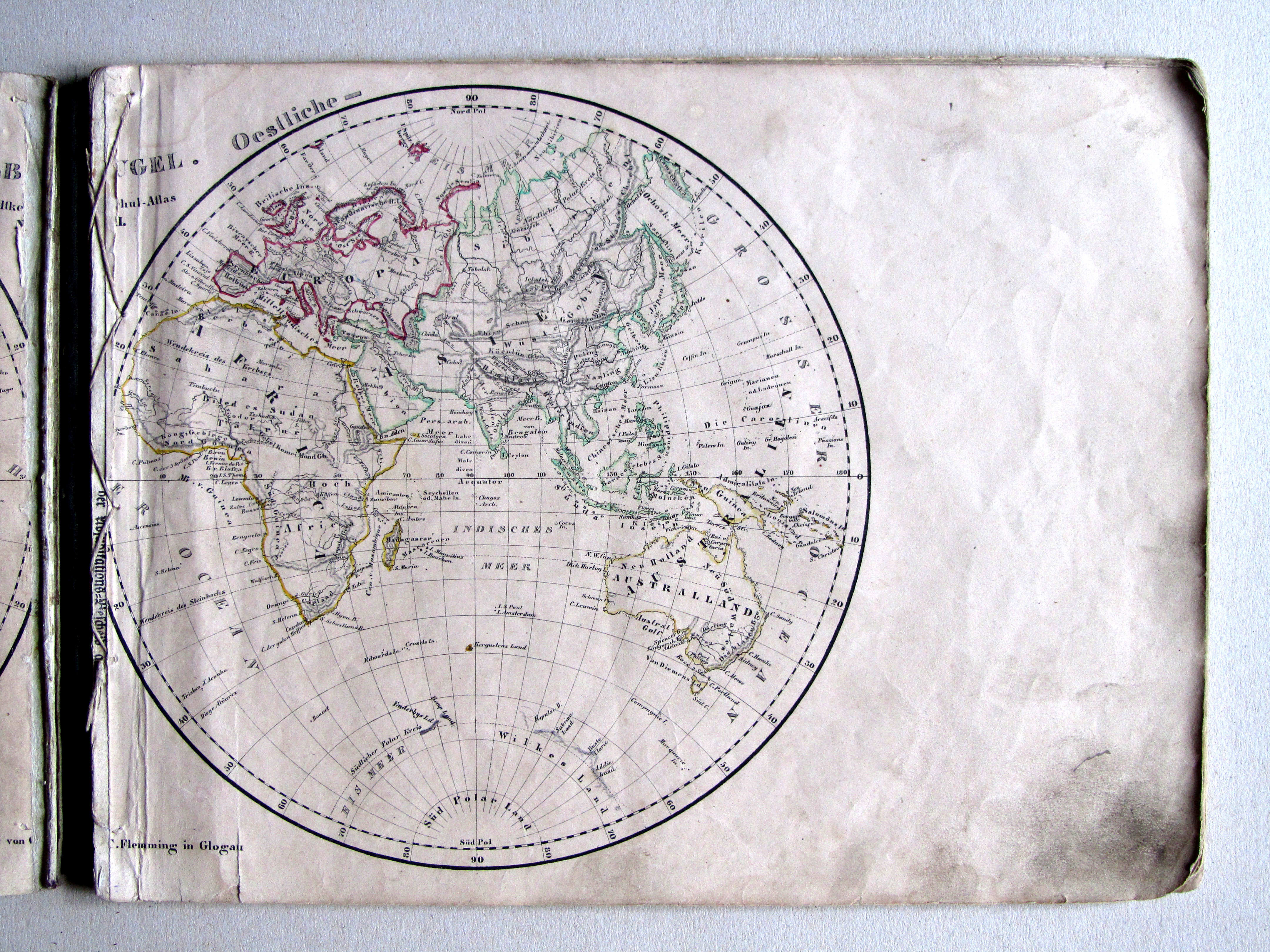
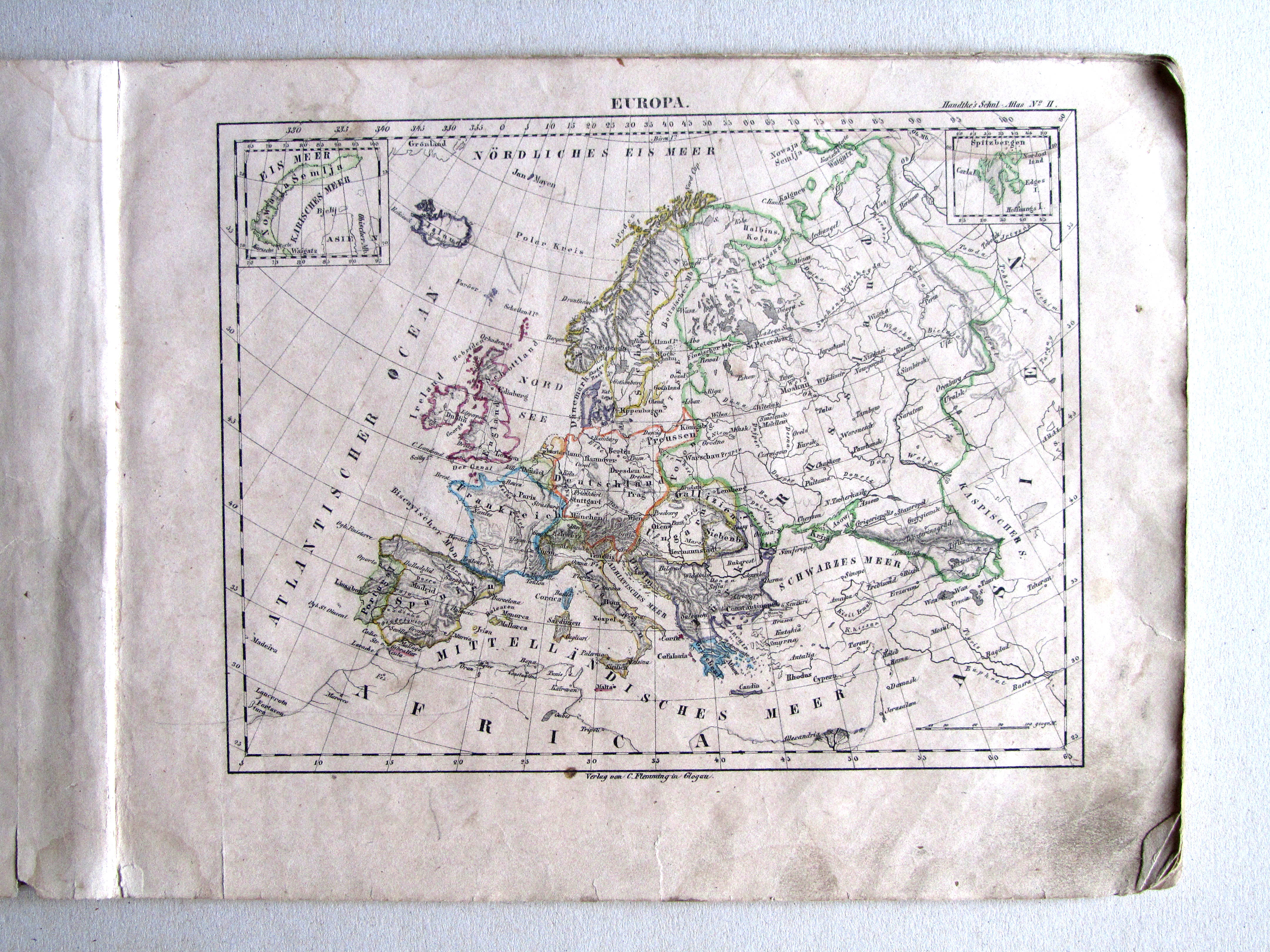
Band, titelpagina, inhoudsopgave / Binding, title page, table of contents Kaarten / Maps Wereldkaarten / World maps Werelddelen / Continents Europese landen / European countries


 Handtke's Schul-Atlas (1851)
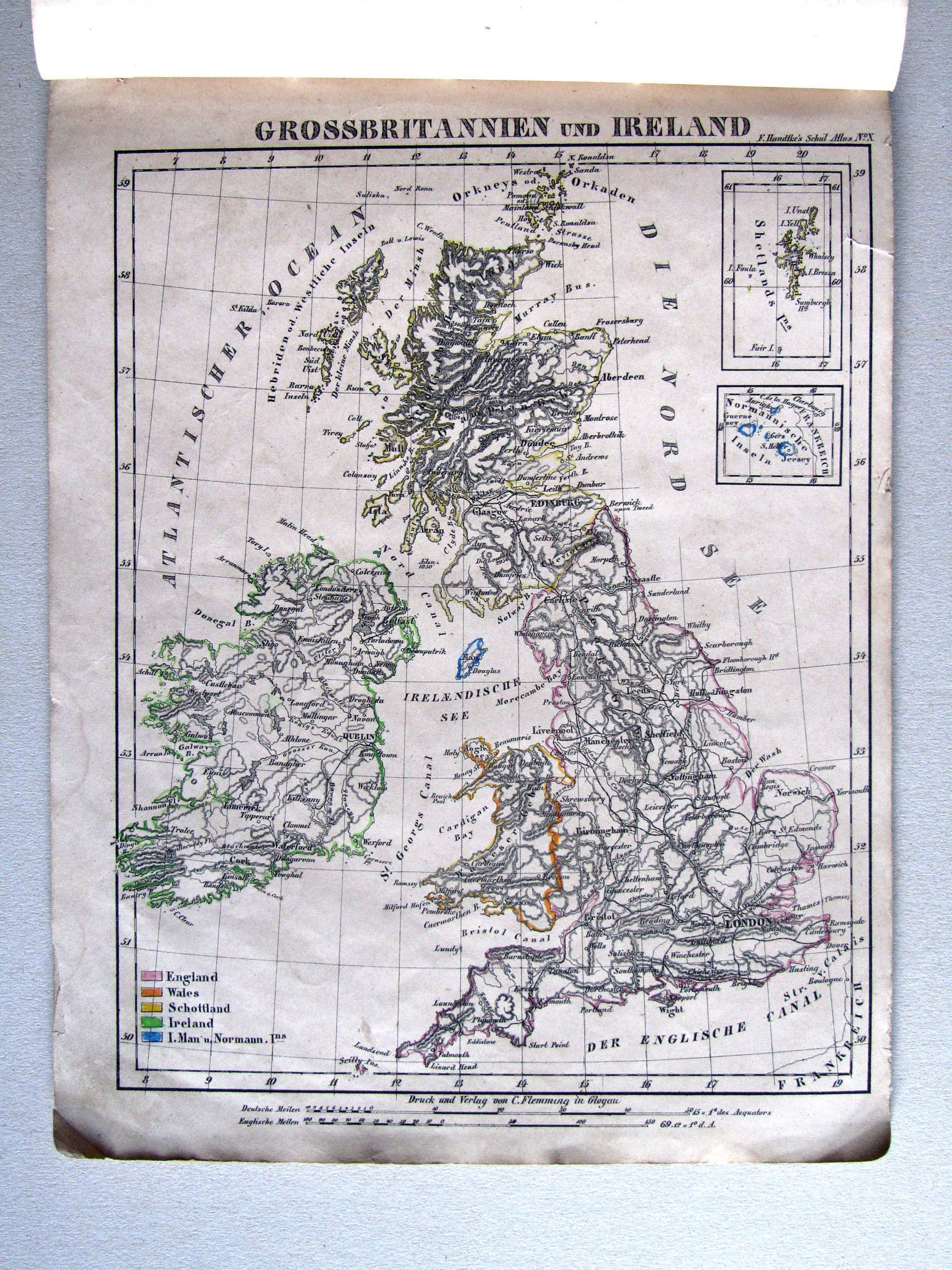
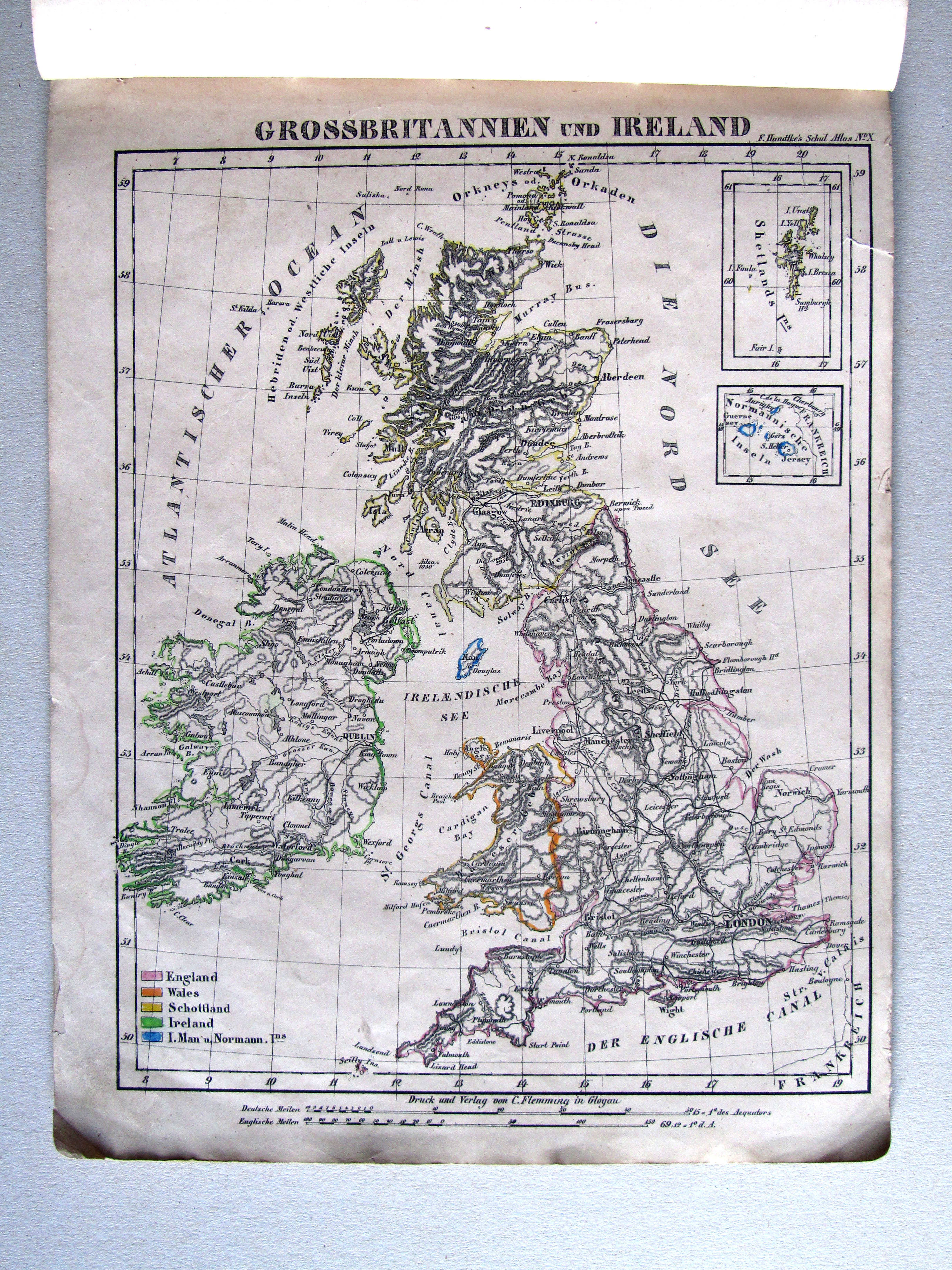
10. Grossbritannien und Ireland XL
Groot-Brittannië en Ierland / Great Britain and Ireland
 Handtke's Schul-Atlas (1851)
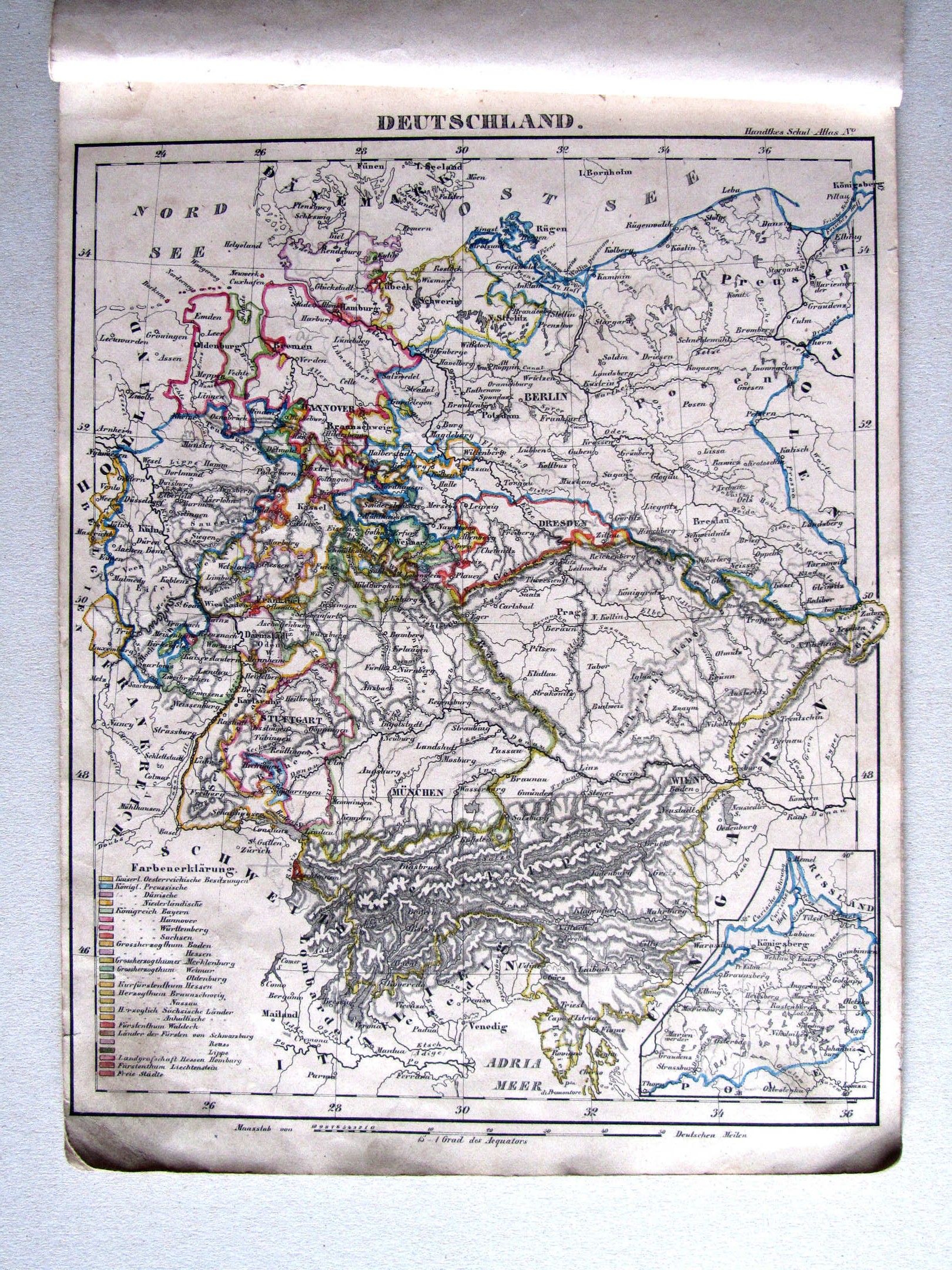
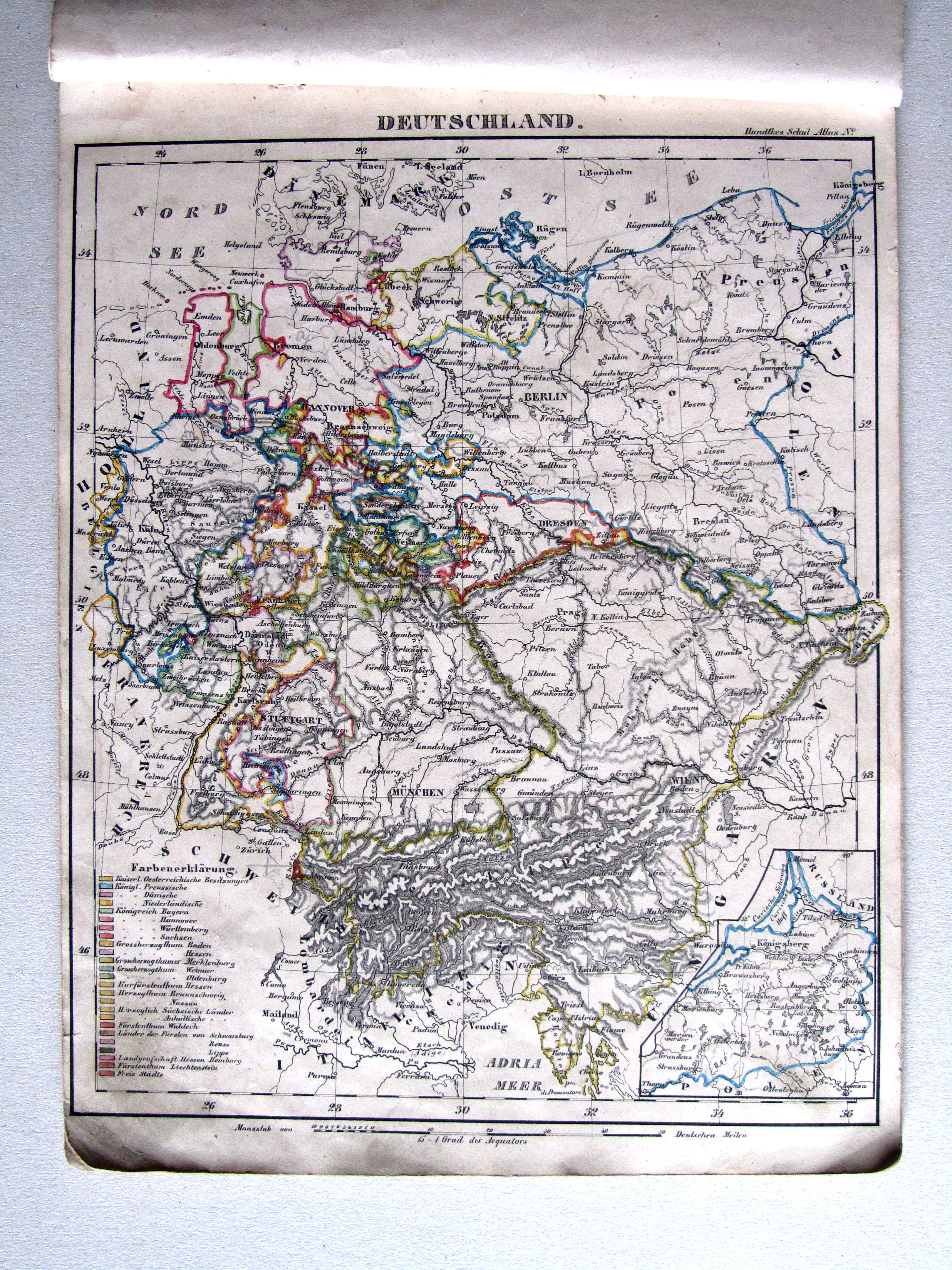
12. Deutschland XL
Duitsland (Duitse Bond) / Germany (German Confederation)

 Handtke's Schul-Atlas (1851)
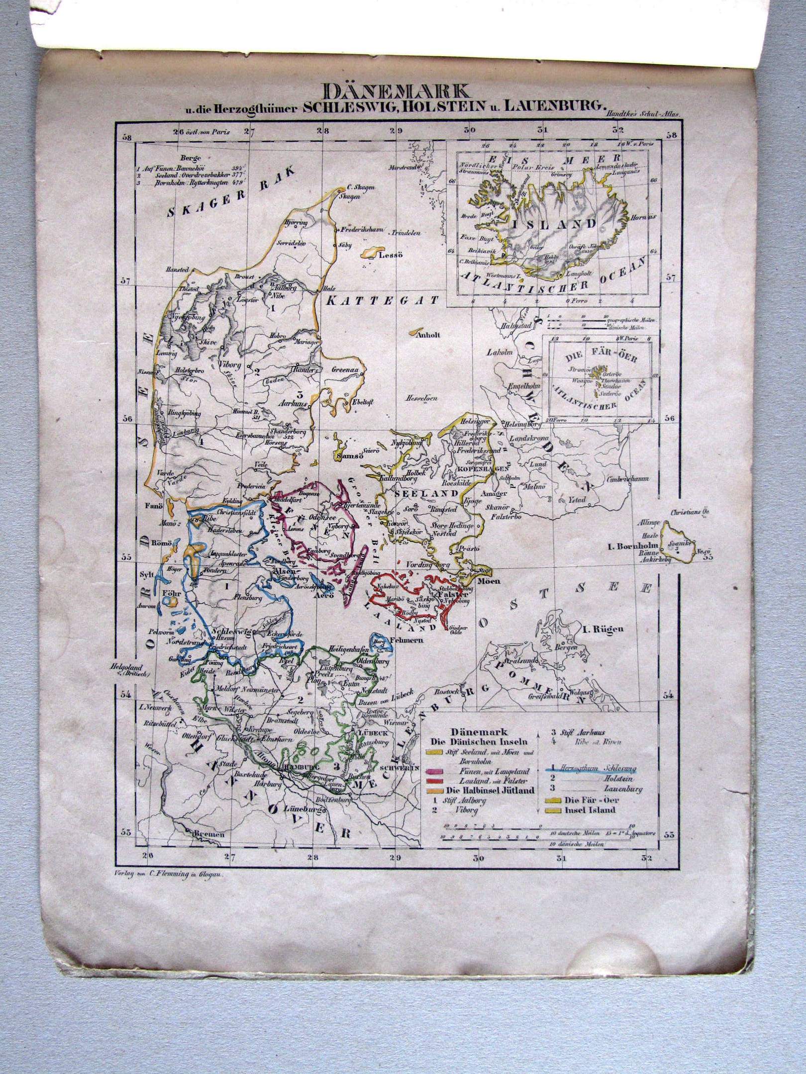
14. Dänemark u. die Herzogthümer Schleswig, Holstein u. Lauenburg XL
Denemarken, Sleeswijk, Holstein en Lauenburg / Denmark, Schleswig, Holstein and Lauenburg

 Handtke's Schul-Atlas (1851)
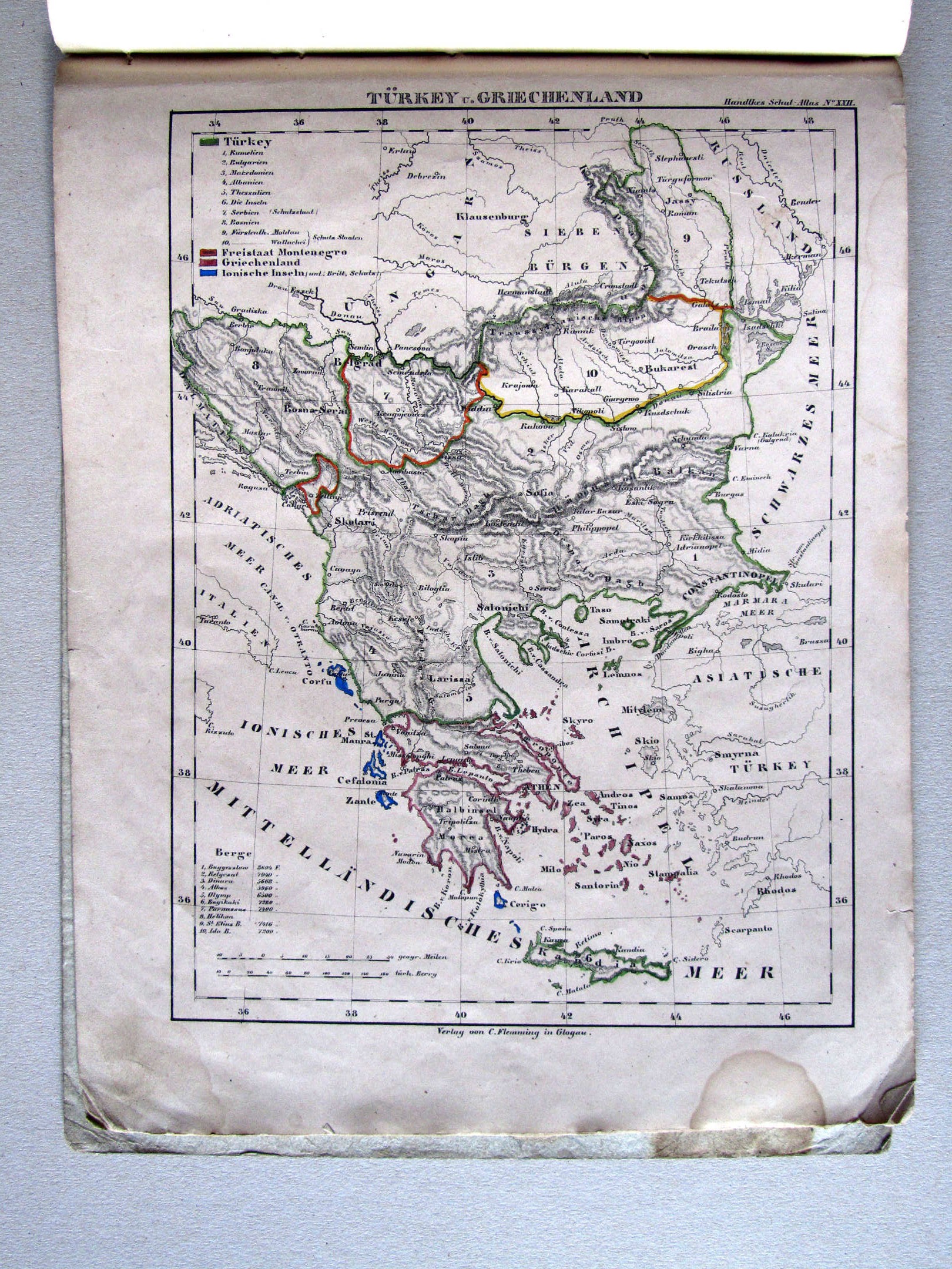
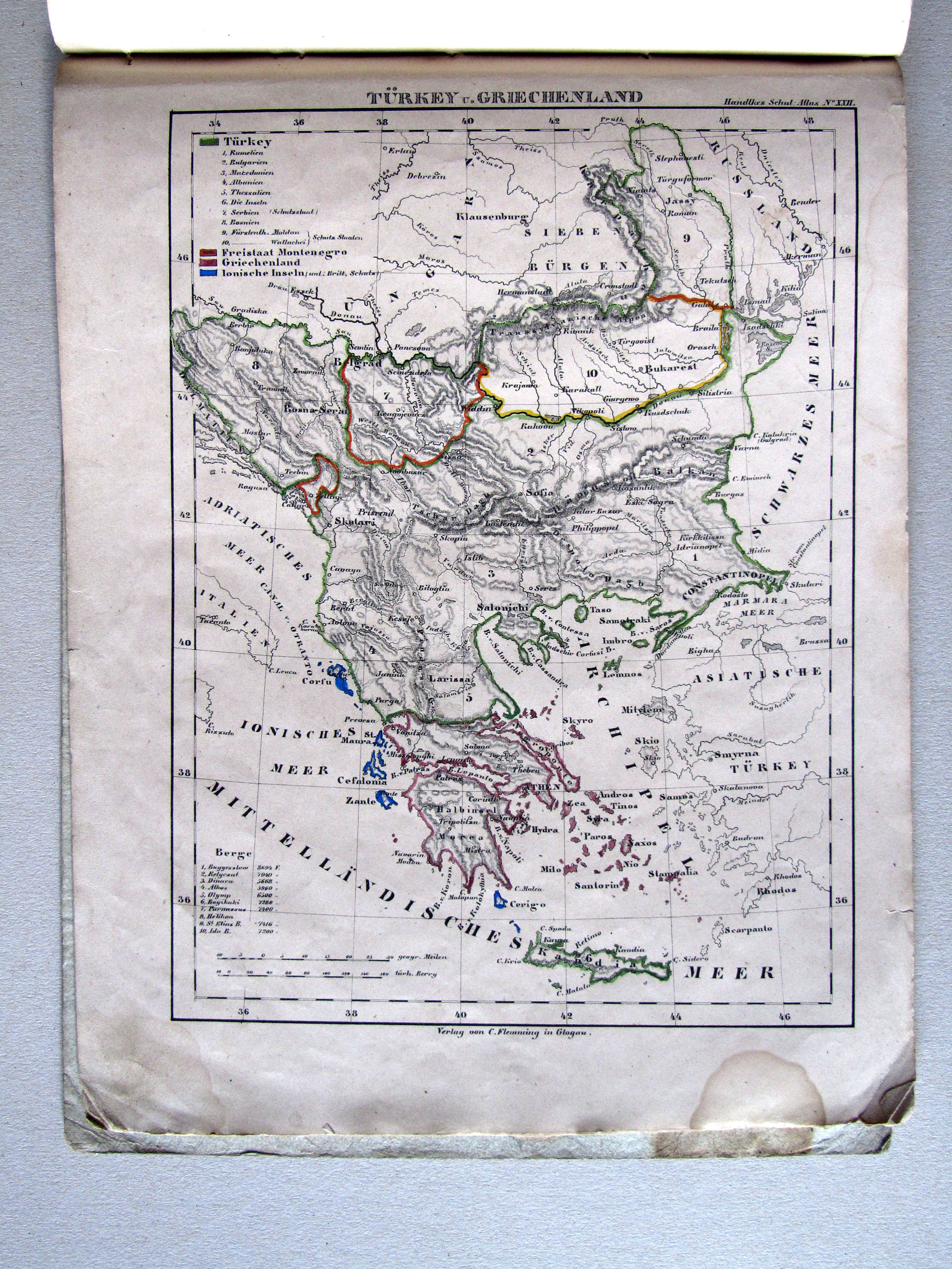
16. Türkey u. Griechenland XL
Turkije en Griekenland / Turkey and Greece
 Handtke's Schul-Atlas (1851)
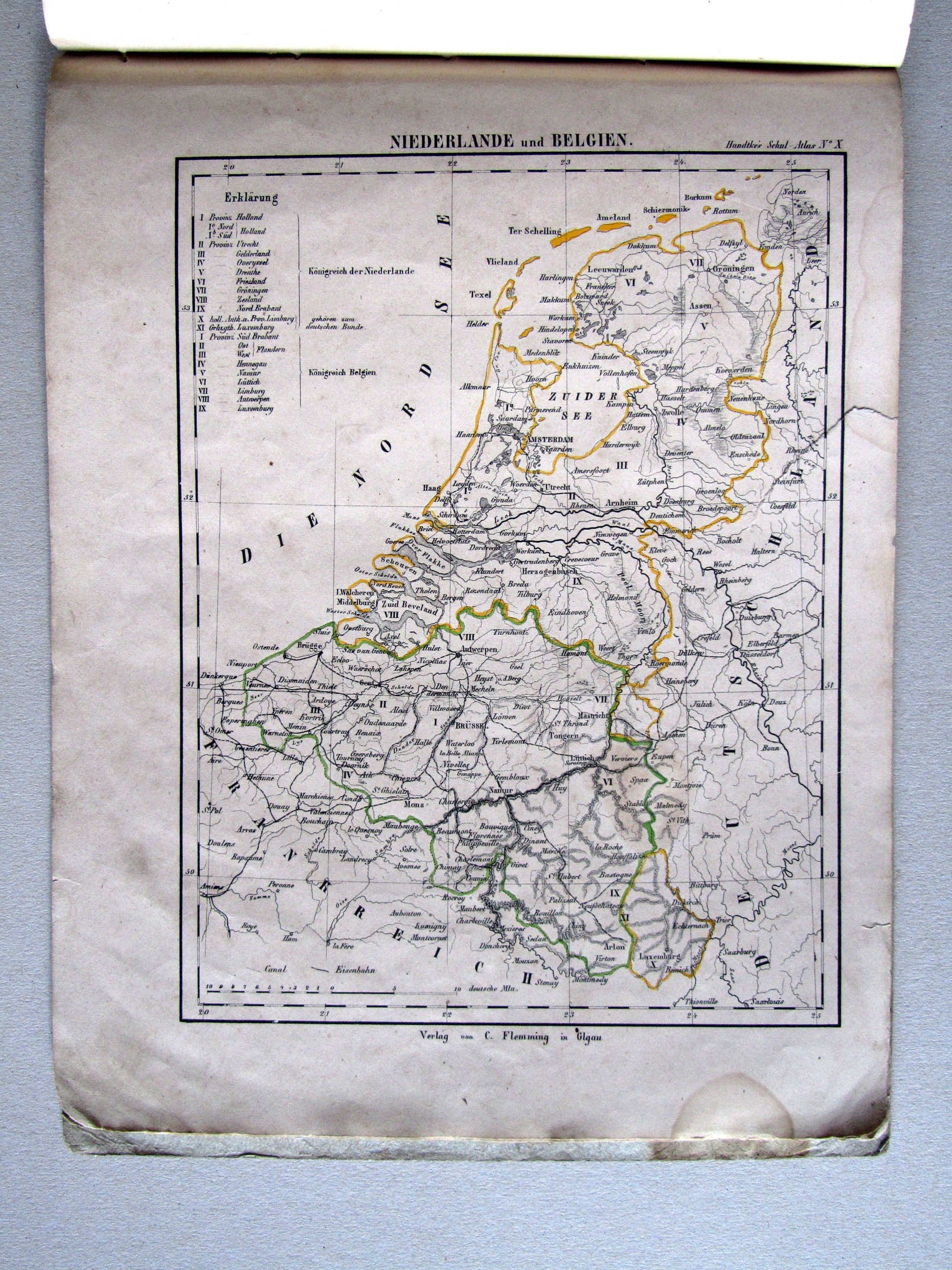
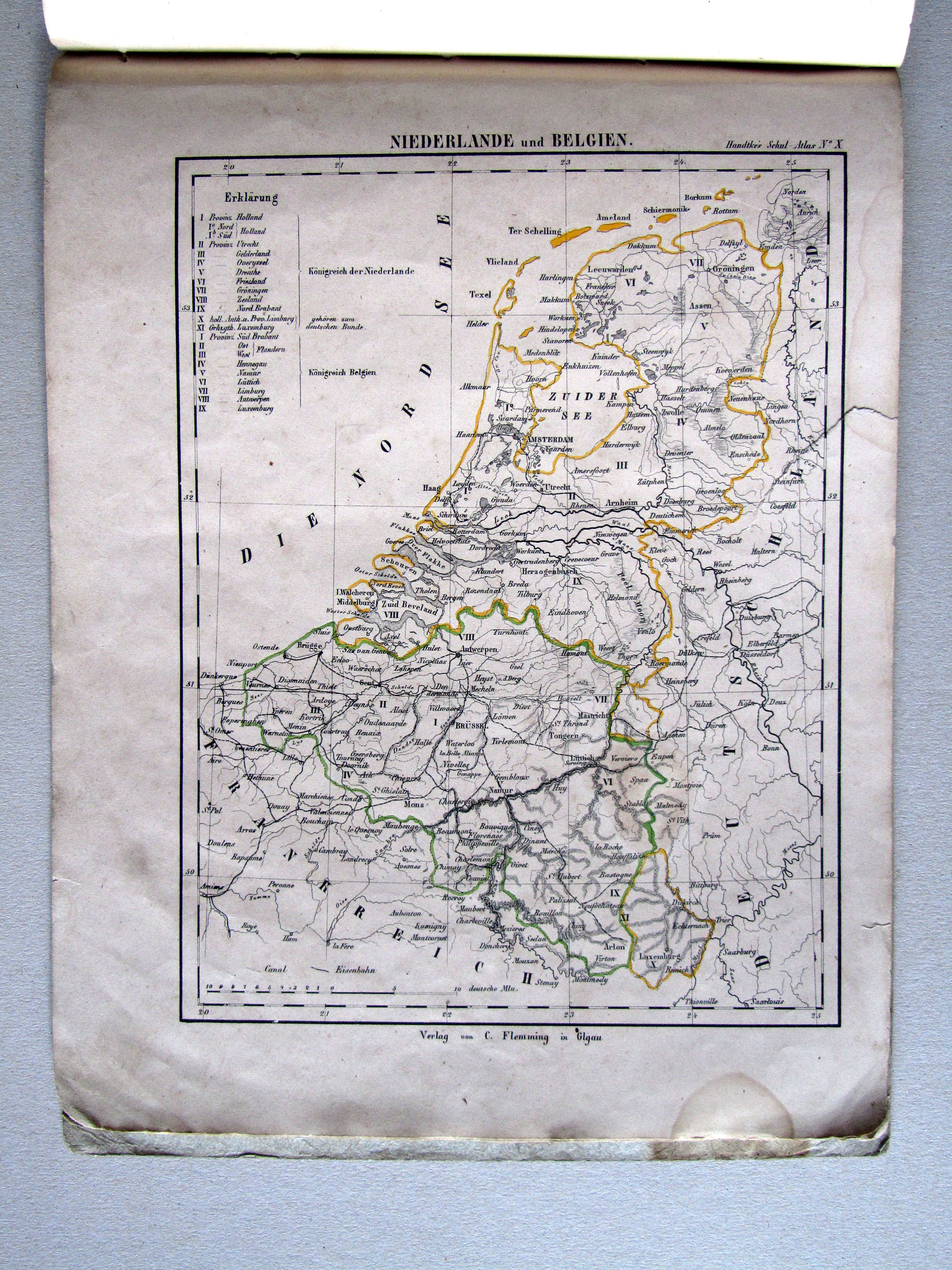
17. Niederlande und Belgien XL
Nederland en België / Netherlands and Belgium
 Handtke's Schul-Atlas (1851)
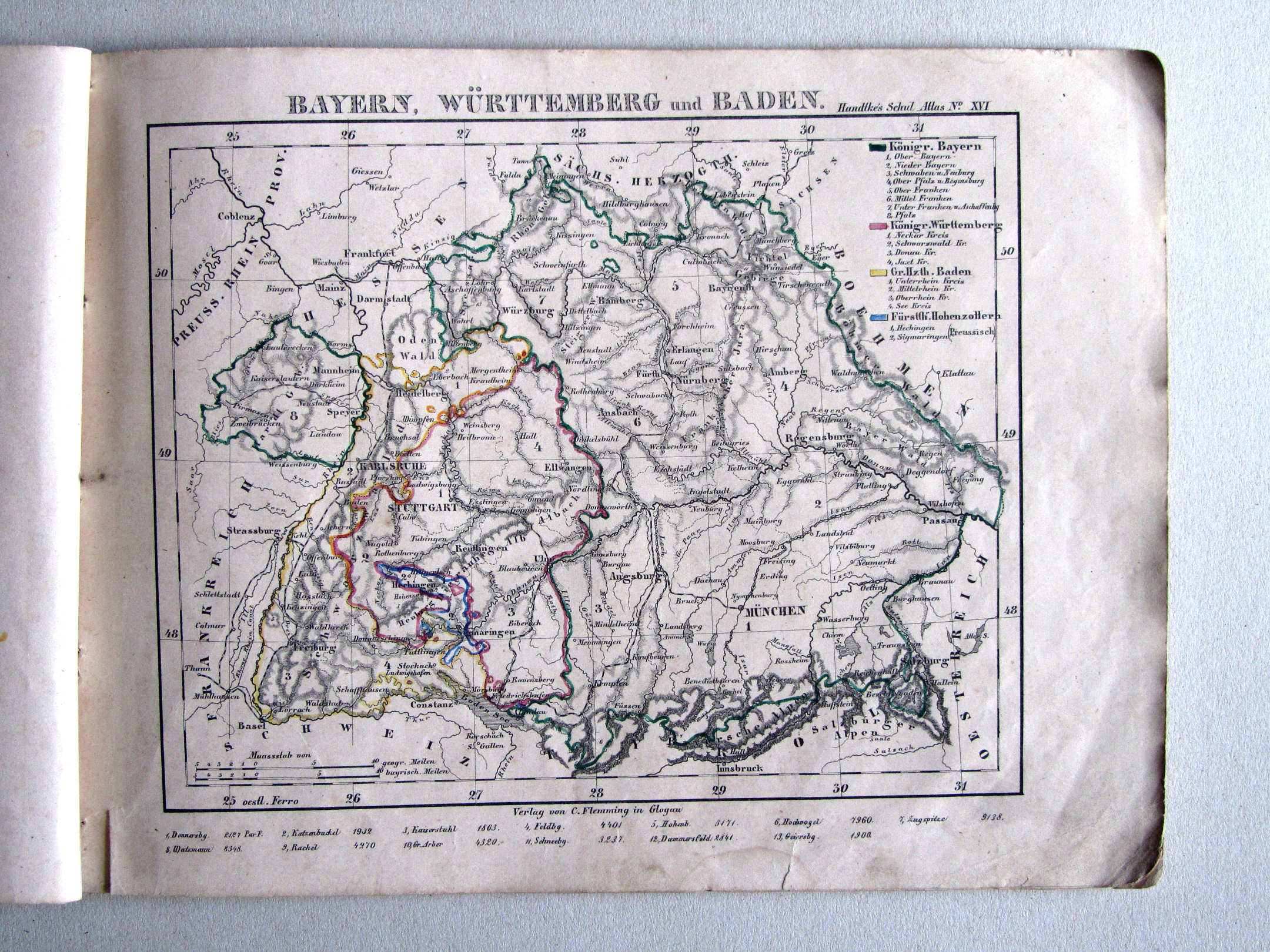
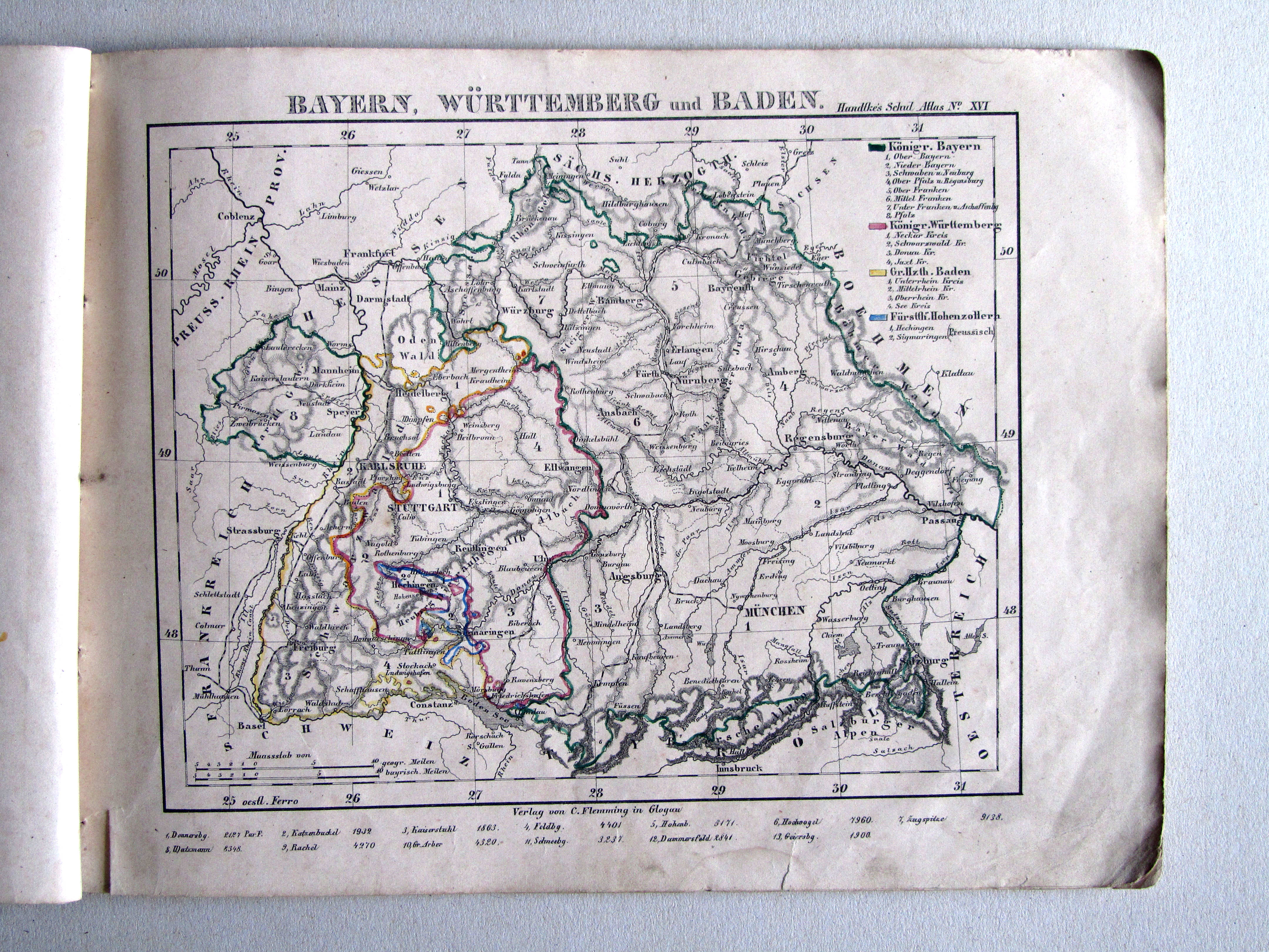
18. Bayern, Württemberg und Baden XL
Beieren, Württemberg en Baden / Bavaria, Württemberg and Baden
 Handtke's Schul-Atlas (1851)
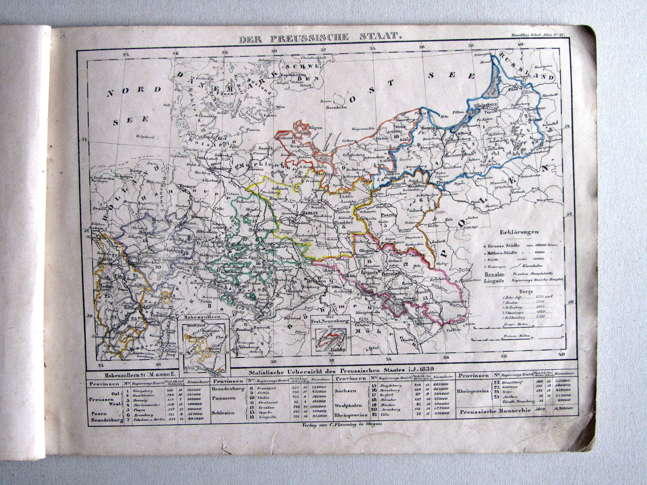
20. Der Oesterreichische Kaiserstaat
Keizerrijk Oostenrijk (ontbreekt) / Austrian Empire (missing)
 Handtke's Schul-Atlas (1851)
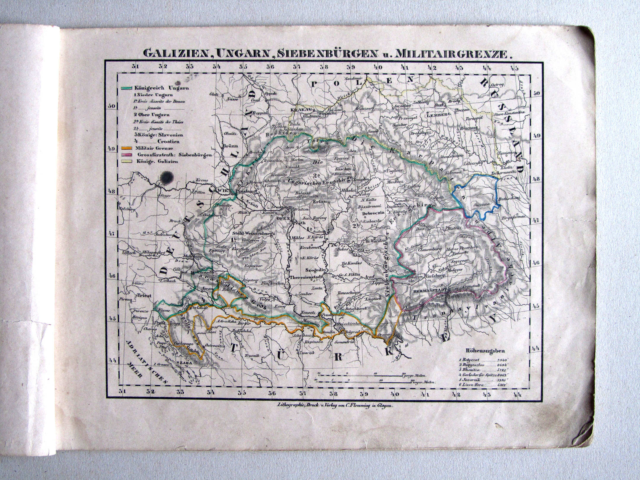
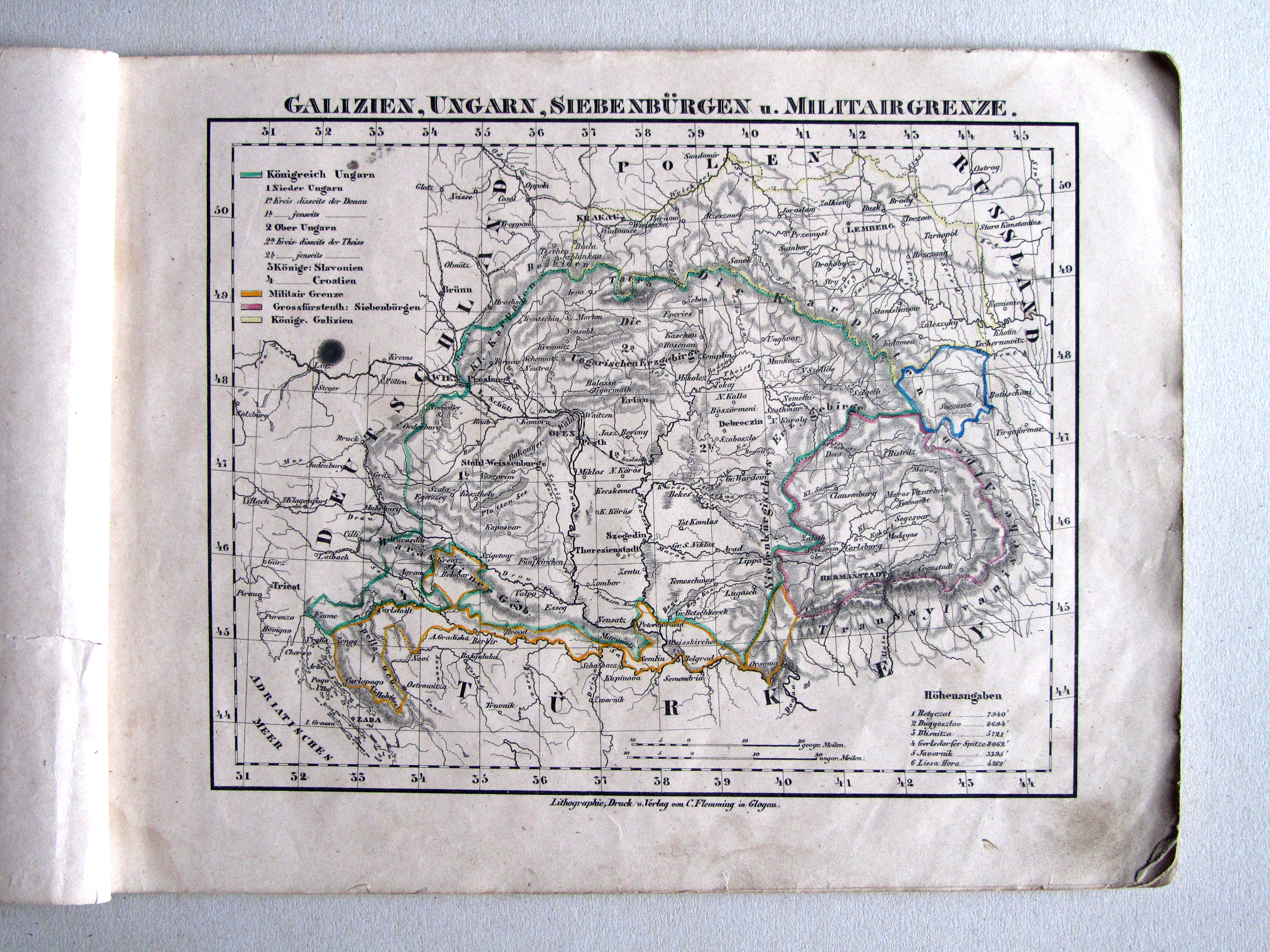
21. Galizien, Ungarn, Siebenbürgen u. Militairgrenze XL
Galicië, Hongarije, Zevenburgen en de Militaire Grens / Galicia, Hungary, Transylvania and the Military Frontier
 Handtke's Schul-Atlas (1851)
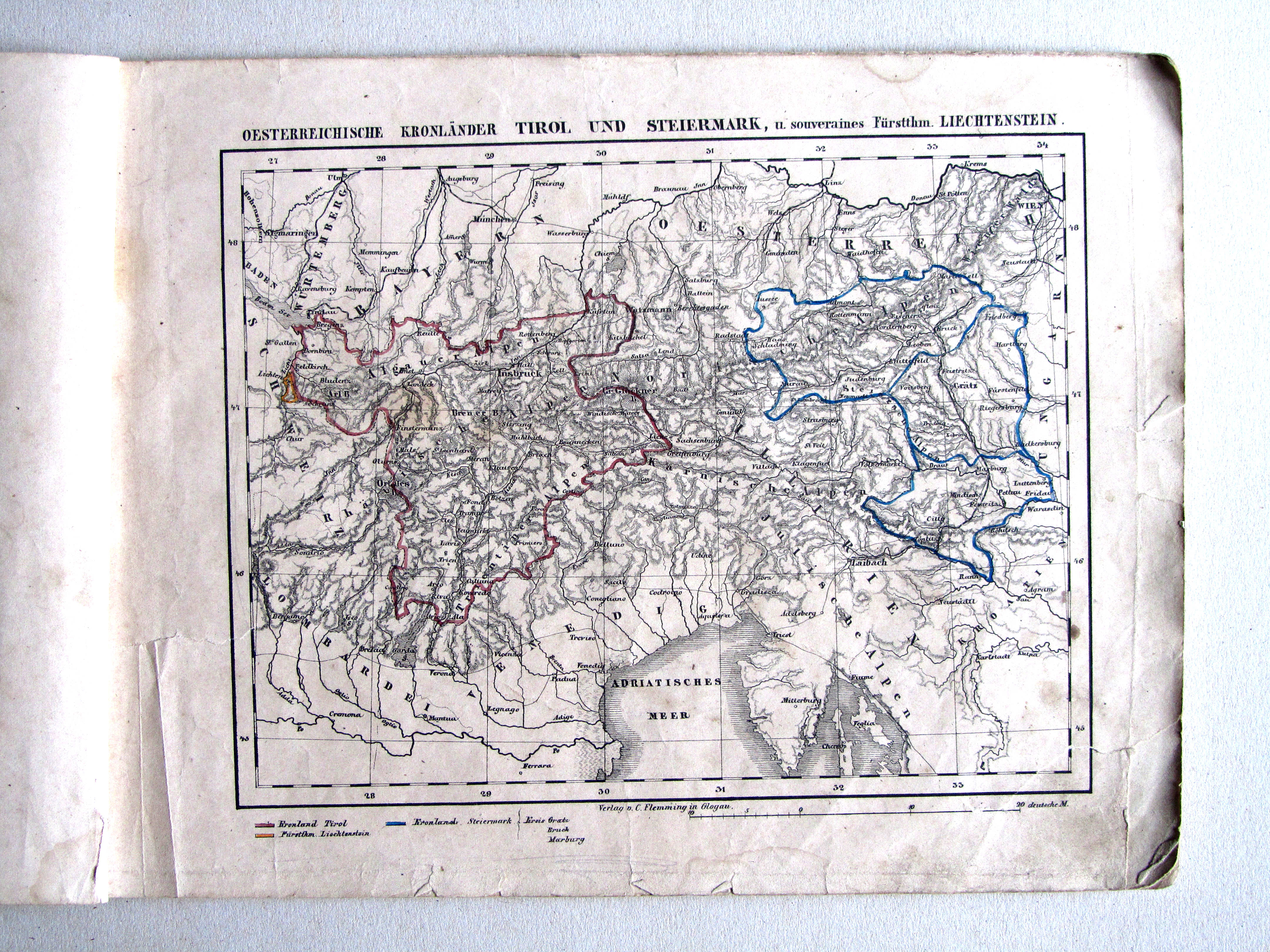
25. Oesterreichische Kronländer Tirol und Steiermark, u. souveraines Fürstthm. Liechtenstein XL
Tirol, Stiermarken en Liechtenstein / Tyrol, Styria and Liechtenstein
© M. Witkam, 2011
![]()
![]()