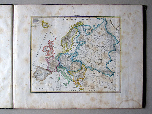
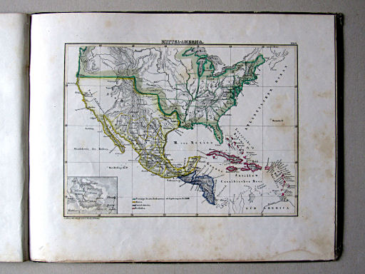
Atlas zu Blanc's Handbuch, 3e druk (1839)
See below for (a summary of) this text in English.
Hieronder staat de beschrijving van de atlas. Daarbij horen ook de volgende pagina's
Titelgegevens
Titel: Atlas zu Blanc's Handbuch
Uitgever: Schwetschke, Halle
Jaar: 1839 (3e druk)
Titelpagina:
Atlas zu Blanc's Handbuch des Wissenswürdigsten
aus der Natur und Geschichte der Erde und ihrer Bewohner,
in 25 Blätter entworfen und bearbeitet von W. Walter ...
auf Stein gravirt von H. Mahlmann ...
Halle, bei C.A. Schwetschke und Sohn, 1839
Vertaling:
Atlas bij Blanc's Handboek van het wetenswaardigste
uit de natuur en geschiedenis van de aarde en haar bewoners,
ontworpen in 25 kaartbladen en bewerkt door W. Walter ...
in steen gegraveerd door H. Mahlmann ...
Halle, C.A. Schwetschke en Zoon, 1839
- In dit exemplaar ontbreekt de titelpagina. De titelgegevens zijn ontleend aan exemplaren uit bibliotheken.
- Deze atlas is een van de vier delen van Blanc's Handbuch.
Band
Dit exemplaar heeft een eenvoudige kartonnen band (32 × 26 cm, B × H) beplakt met gedecoreerd papier. Op de voorkant zit een etiket met de handgeschreven titel "Atlas zu Blanc Handbuch".
Inhoud
De atlas bevat 25 kaarten: een wereldkaart, 16 kaarten van de landen in Europa en 8 van de overige werelddelen; zie de inhoudsopgave. De kaarten zijn getekend door W. Walter en gegraveerd door H. Mahlmann. Ze zijn vervaardigd in lithografie en met de hand gekleurd: randkleur met bies.
Bovenaan de kaarten staat de naam van het blad en het nummer in Romeinse cijfers. Onderaan staat de tekst "Zu Blanc's Handbuch entw. u. bearb. v. W. Walter". Op de laatste kaart staat ook "Stich b. H. Mahlmann. Berlin, 1839". Er staat geen schaal of schaalstok op de kaarten.
Atlas zu Blanc's Handbuch, 3rd edition (1839)
- Below is a description of the atlas in keywords. Related pages
- Title description
- Title: Atlas zu Blanc's Handbuch
Publisher: Schwetschke, Halle
Year: 1839 (3rd edition) - Title page:
Atlas zu Blanc's Handbuch des Wissenswürdigsten
aus der Natur und Geschichte der Erde und ihrer Bewohner,
in 25 Blätter entworfen und bearbeitet von W. Walter ...
auf Stein gravirt von H. Mahlmann ...
Halle, bei C.A. Schwetschke und Sohn, 1839 Translation:
Atlas to Blanc's Handbook of the most interesting
from nature and history of the earth and its inhabitants,
designed in 25 map sheets and edited by W. Walter ...
engraved in stone by H. Mahlmann ...
Halle, C.A. Schwetschke and Son, 1839 - The title page is missing form this copy. The title desription has been derived form library copies.
- This atlas is one of the four volumes of Blanc's Handbuch.
- Title: Atlas zu Blanc's Handbuch
- Binding
- This copy has a simple cardboard binding (32 × 26 cm, B × H) pasted with decorated paper. On the front cover is a sticker with the handwritten title "Atlas zu Blanc Handbuch".
- Contents
- The atlas contains 25 maps: a world maps, 16 maps of the European countries and 8 of the other continents; see als the table of contents. The maps are drawn by W. Walter and engraved by H. Mahlmann. They are produced in lithography and hand colored: outline with edging.
- In the upper margin is the name of the sheet and the number in Roman numerals. In the lower margin is the text "Zu Blanc's Handbuch entw. u. bearb. v. W. Walter". The last map has the additional text "Stich b. H. Mahlmann. Berlin, 1839". There is no scale or linear scale.
© M. Witkam, 2011


