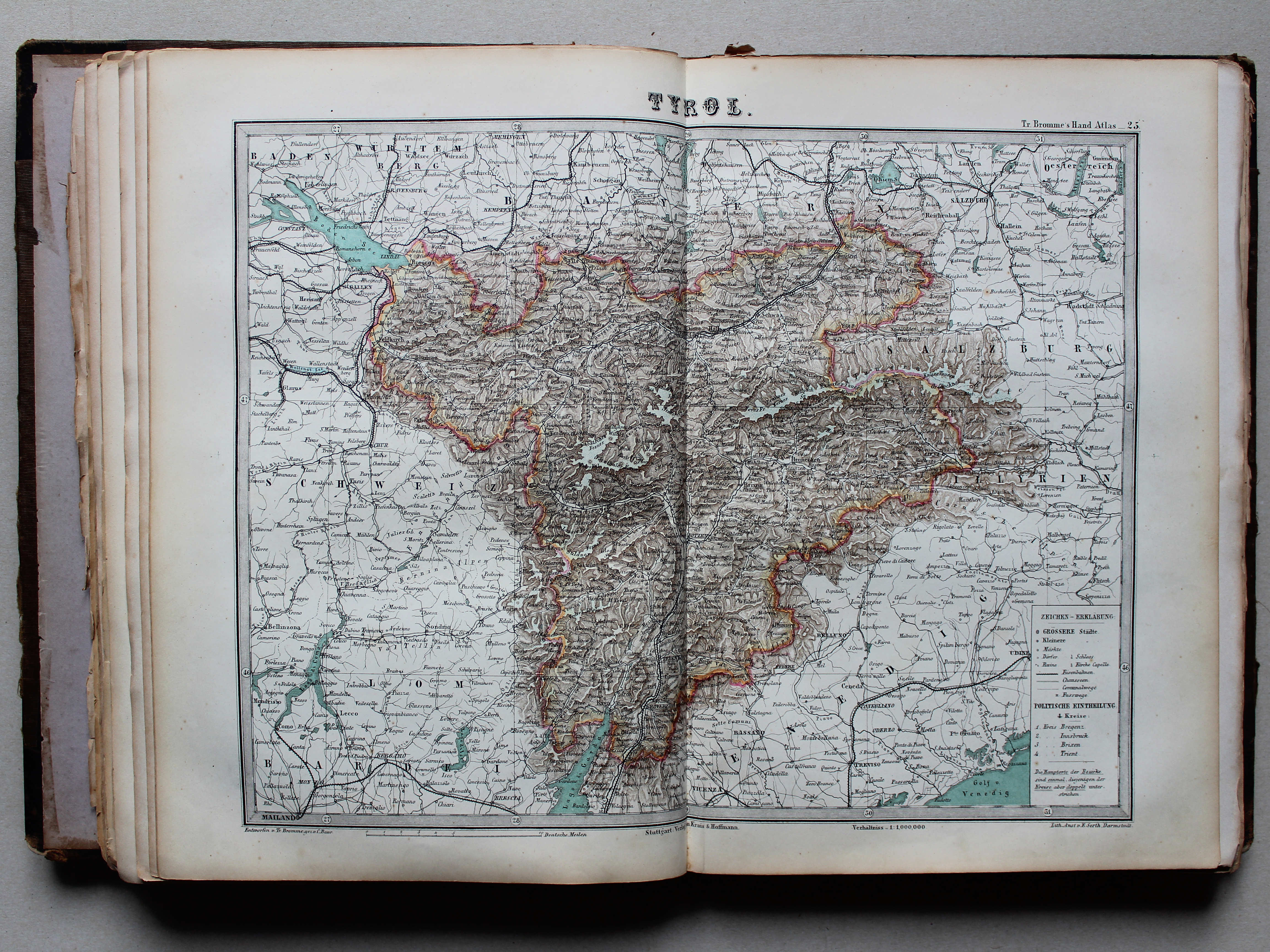
Bromme, Illustrirter Hand-Atlas, 1e uitgave (1862-1864)
See below for (a summary of) this text in English.
Hieronder staan plaatjes van de atlas. Daarbij horen ook de volgende pagina's
- Beschrijving van de atlas
- Tabellen en lijsten bij de atlas
Plaatjes
Klik op een plaatje voor een vergroting.
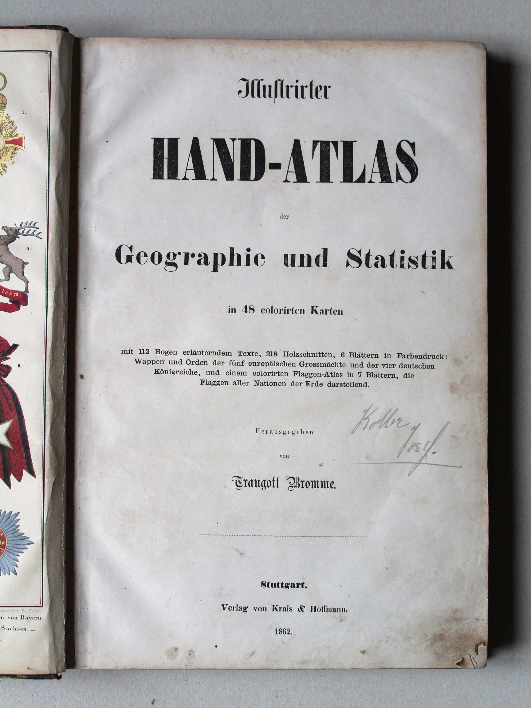
- Band, titelpagina
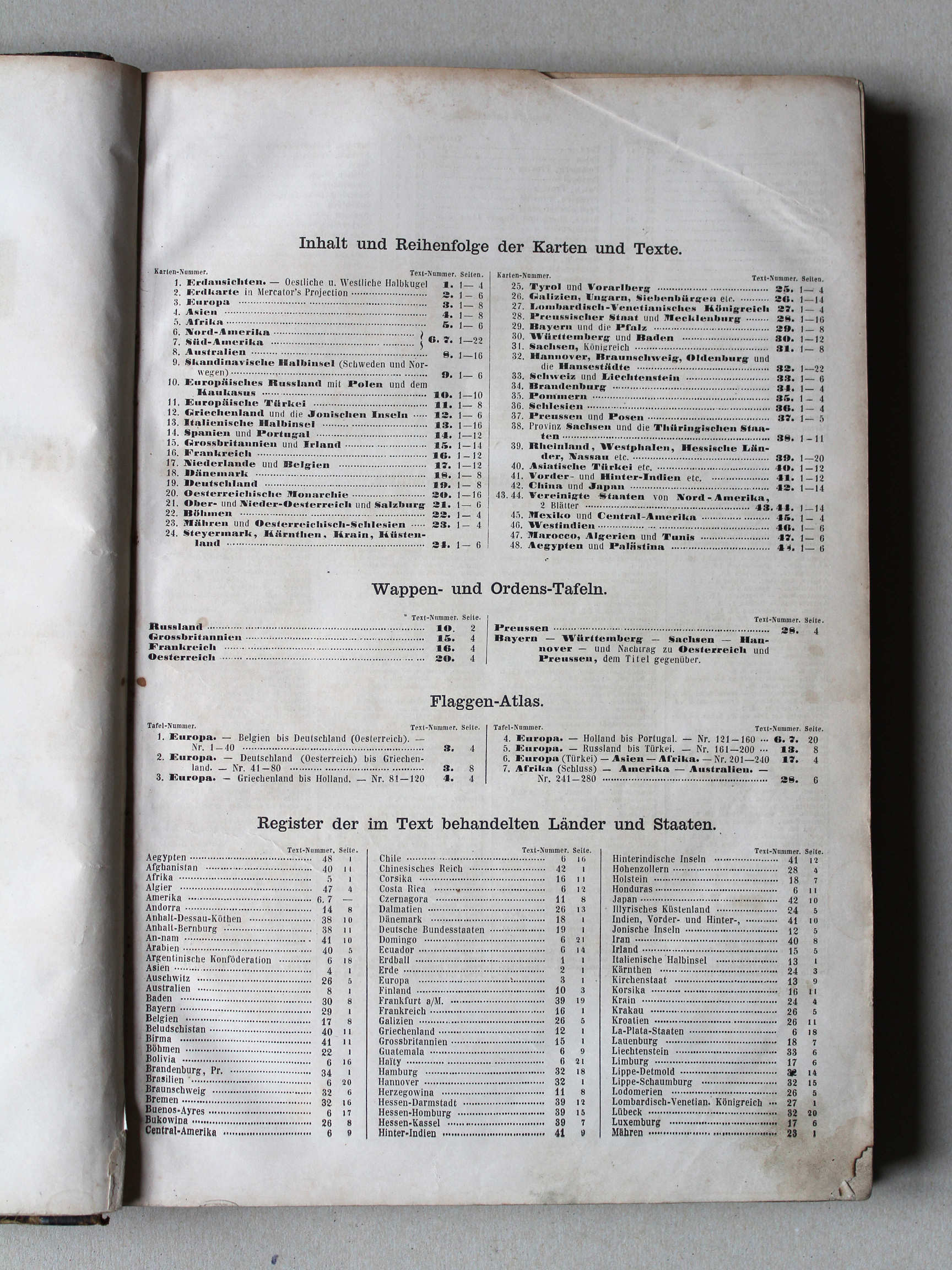
- Inhoudsopgave
- Kaarten
- Wapens
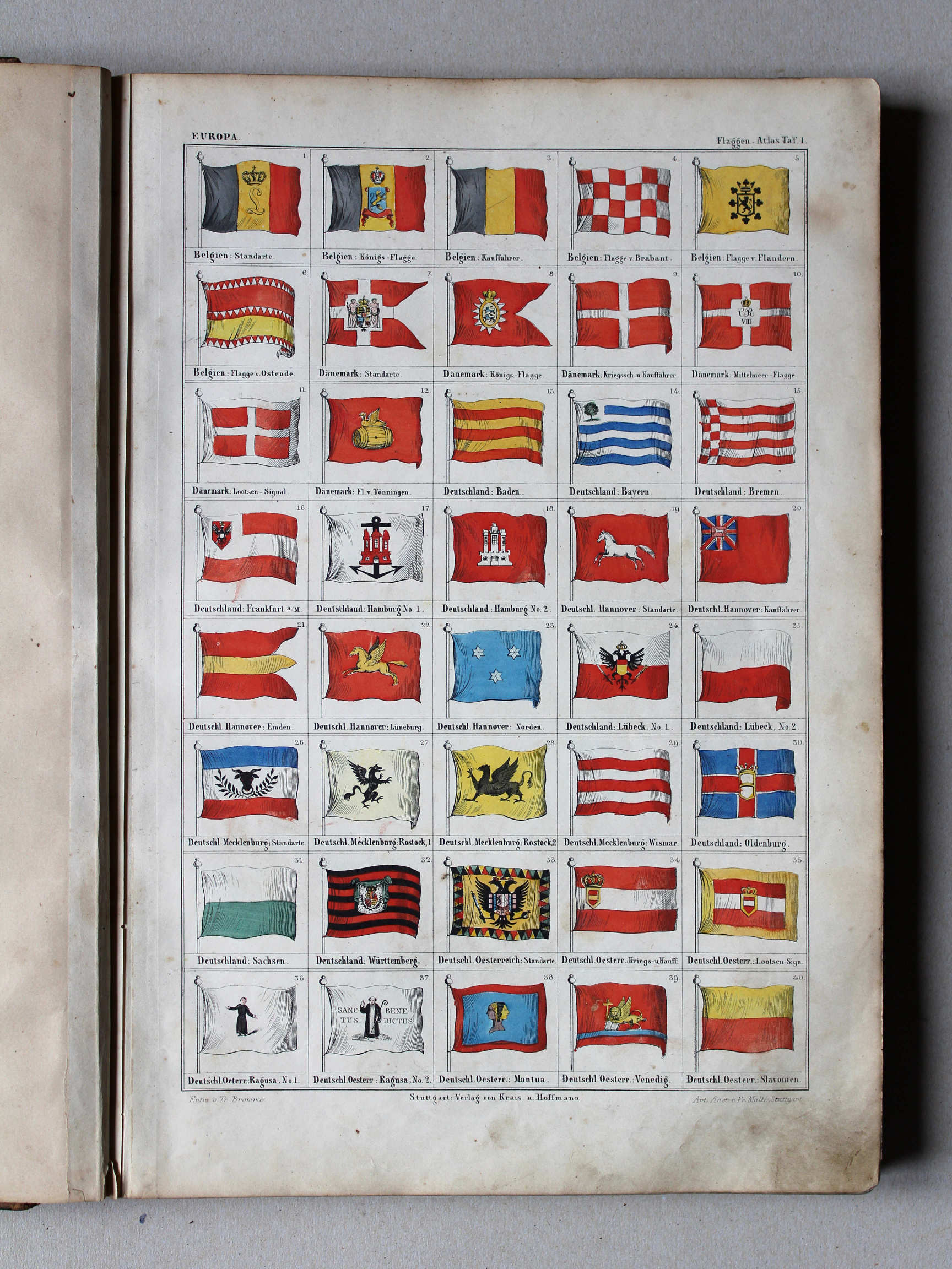
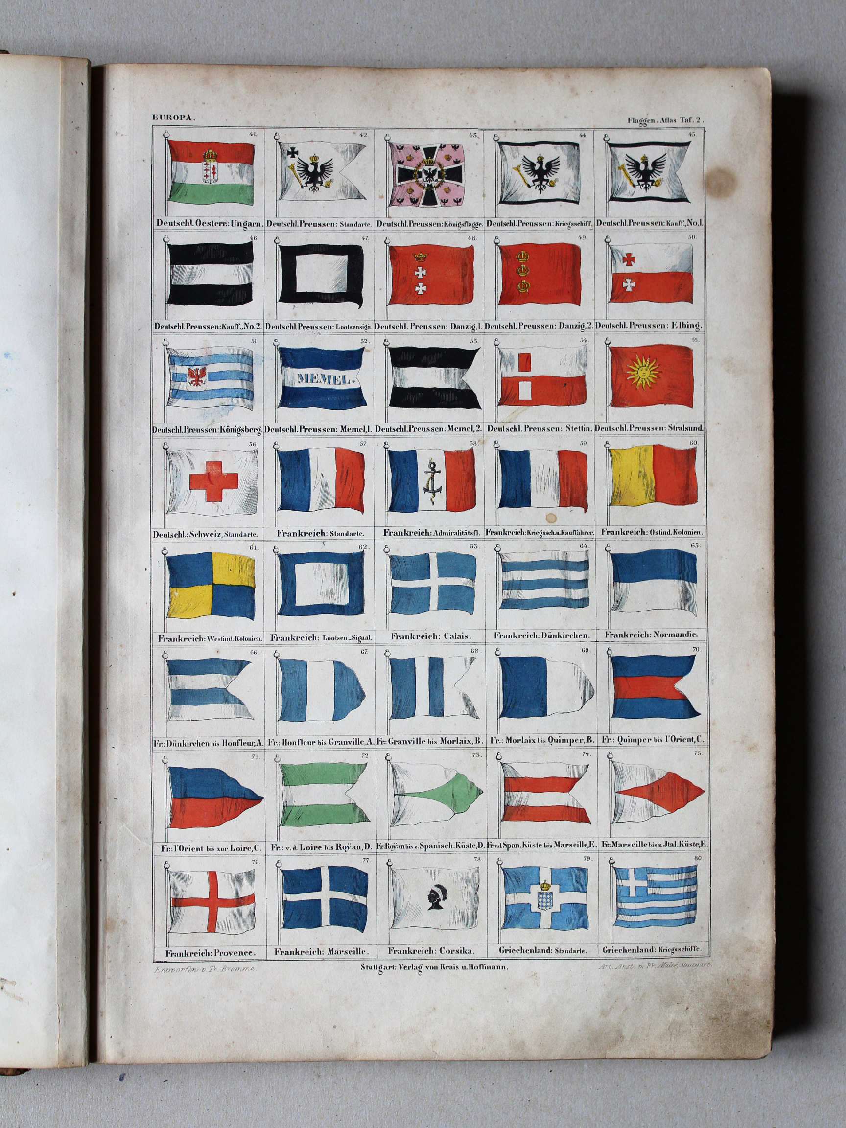
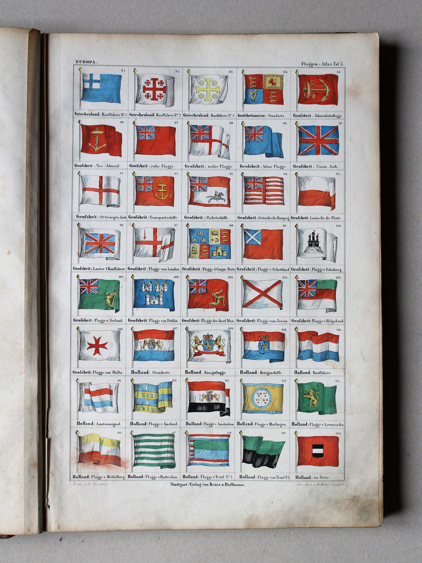
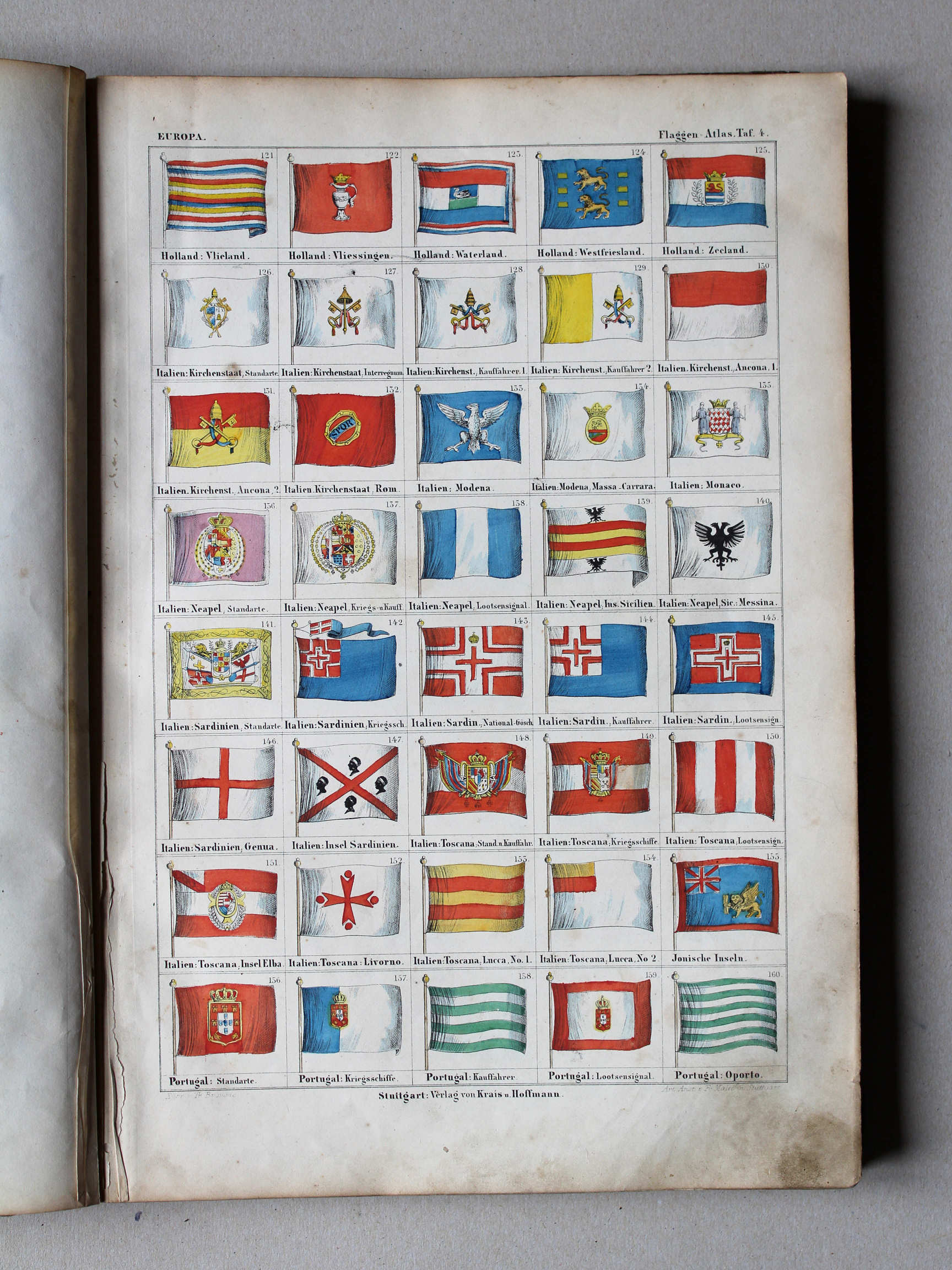
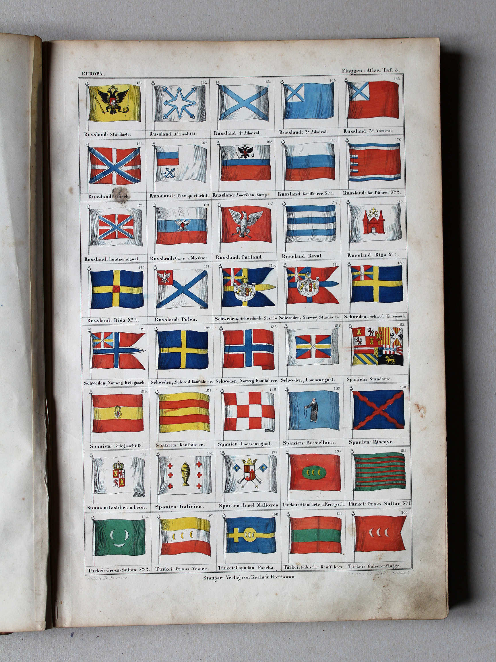
- Vlaggen
- Houtsneden (selectie)
Bromme, Illustrirter Hand-Atlas, 1st version (1862-1864)
- Below are pictures of the atlas. Related pages
- Description of the atlas
- Tables and lists to the atlas
Pictures
Click on a picture to enlarge.
- Binding, title page
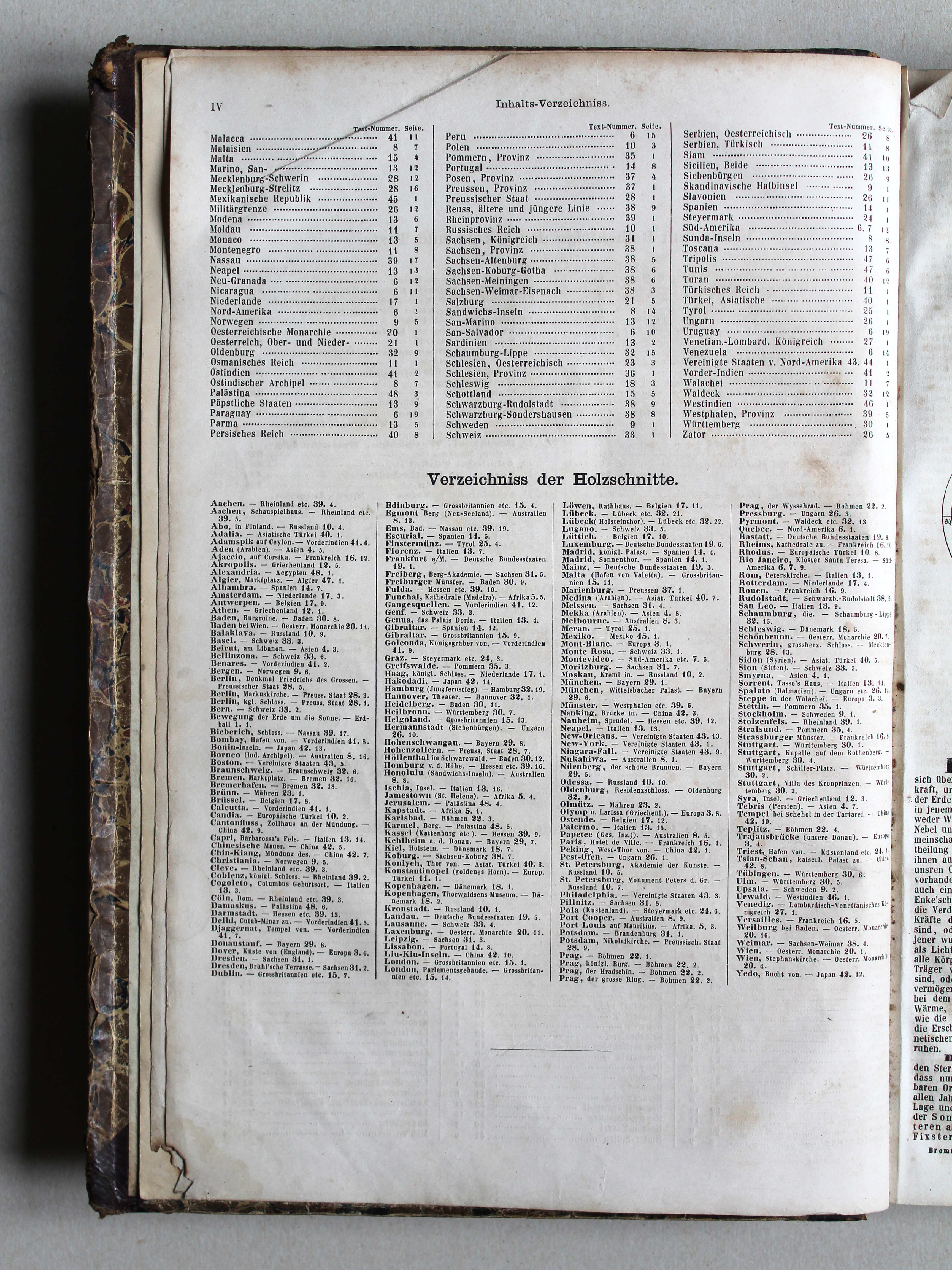
- Table of contents
- Maps
- Coats of arms
- Flags
- Woodcuts (selection)
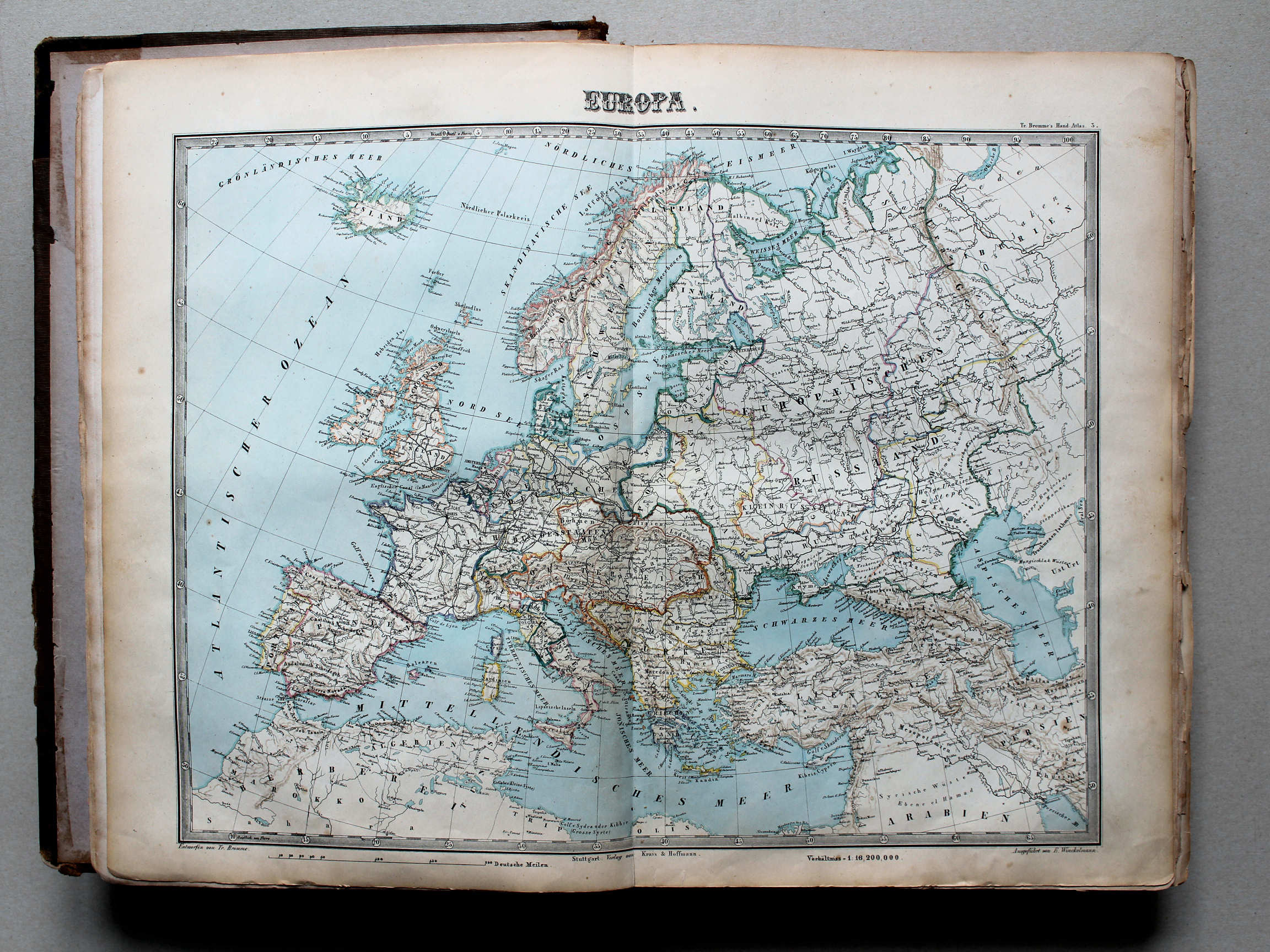
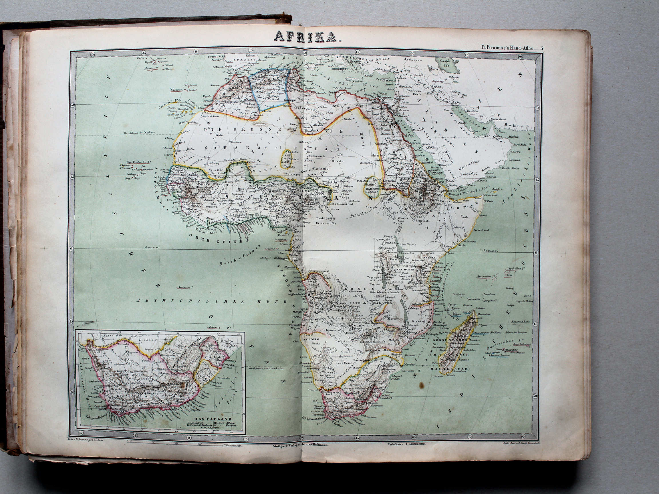
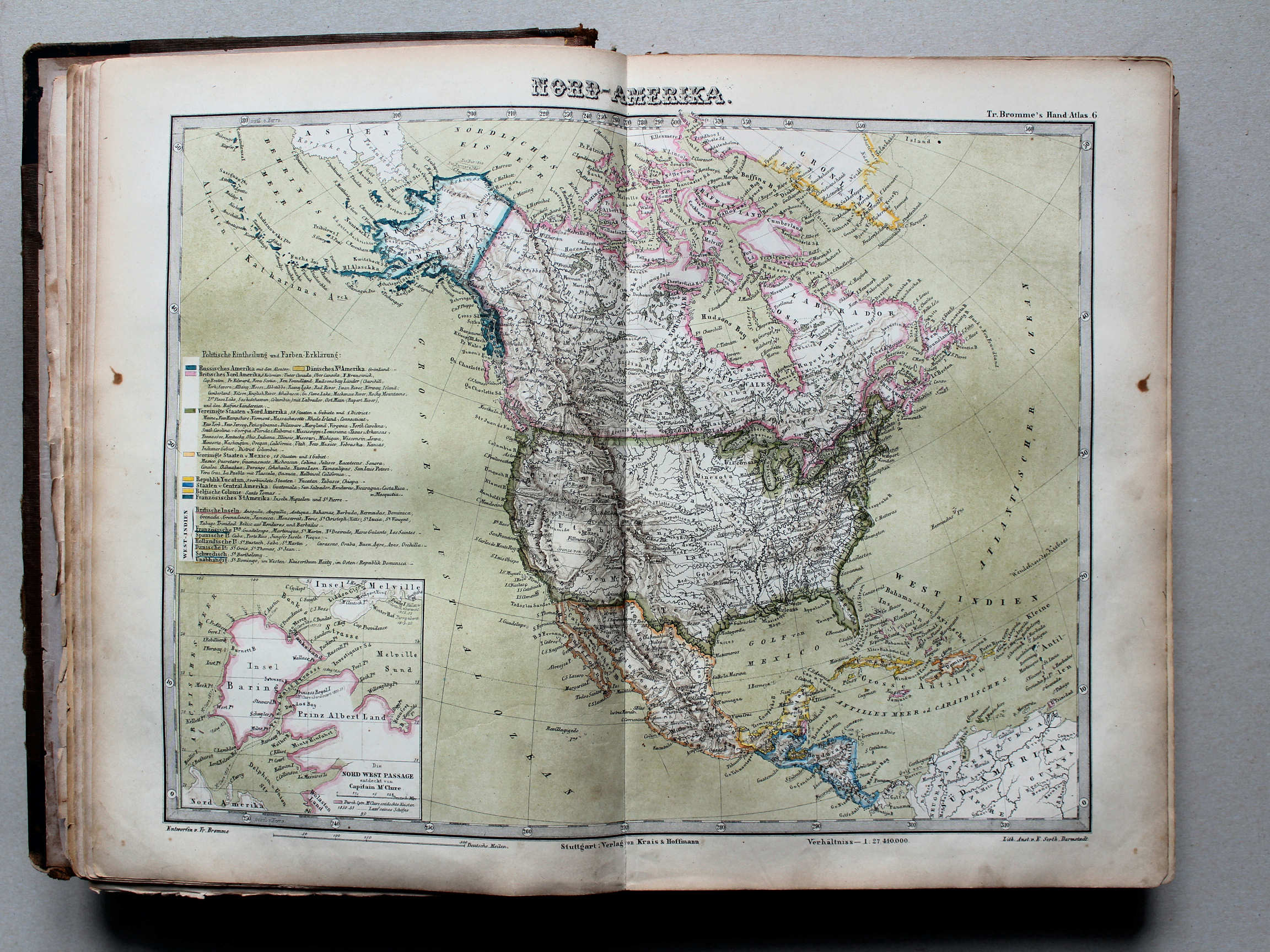
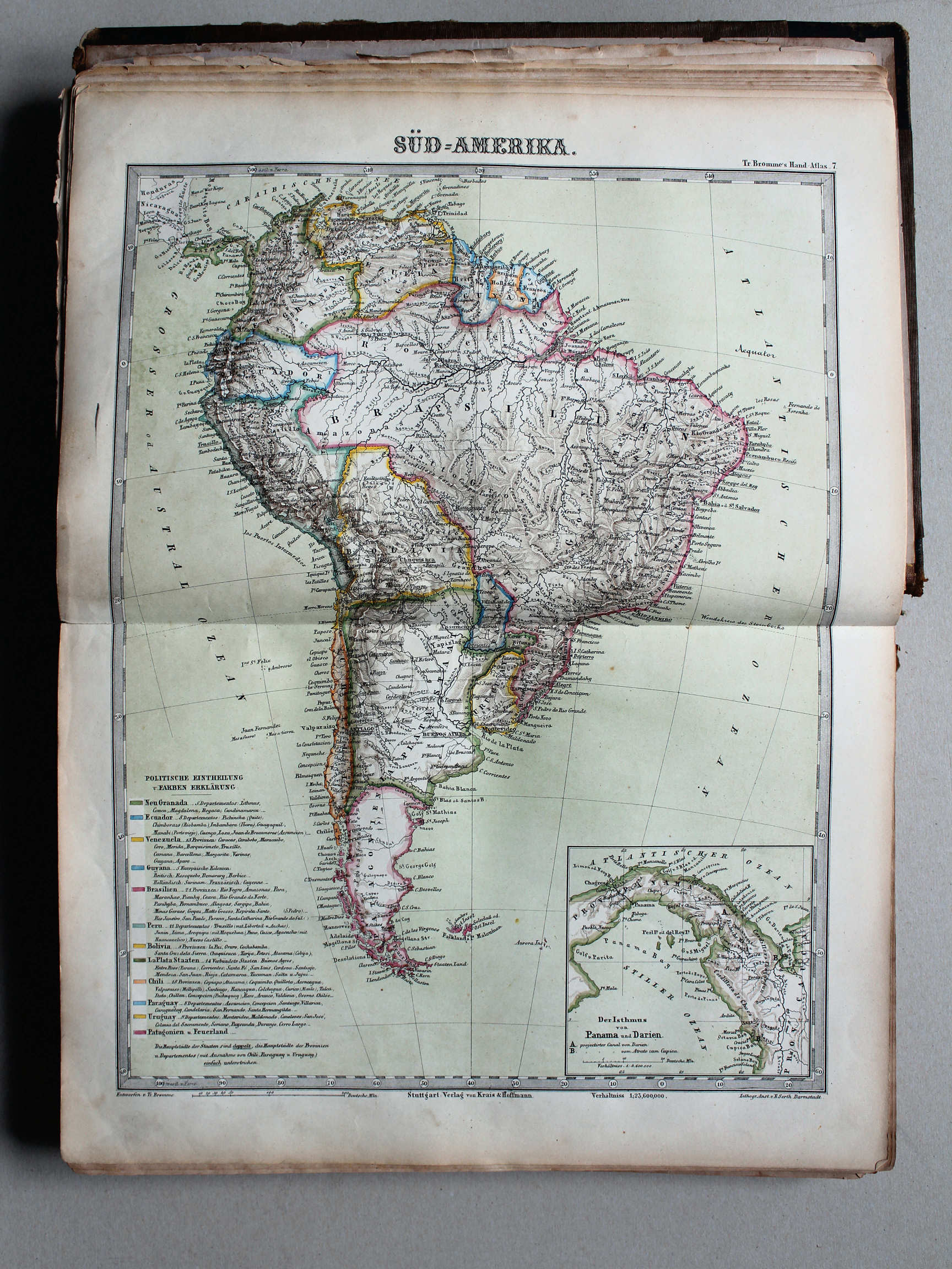
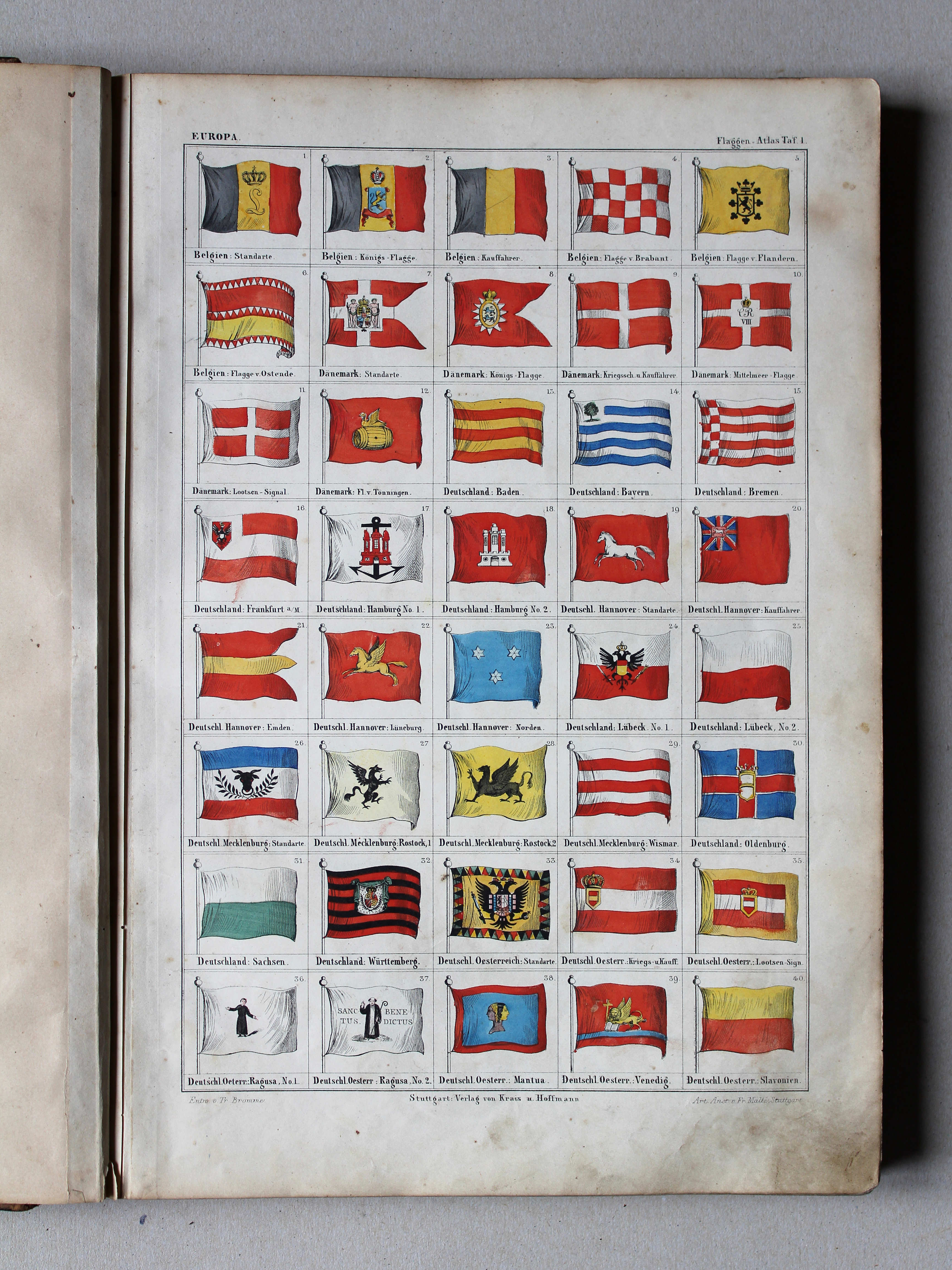
Band, titelpagina / Binding, title page Inhoudsopgave / Table of contents Kaarten / Maps Wereldkaarten / World maps Werelddelen / Continents Europa / Europe


 Bromme, Illustrirter Hand-Atlas, 1862
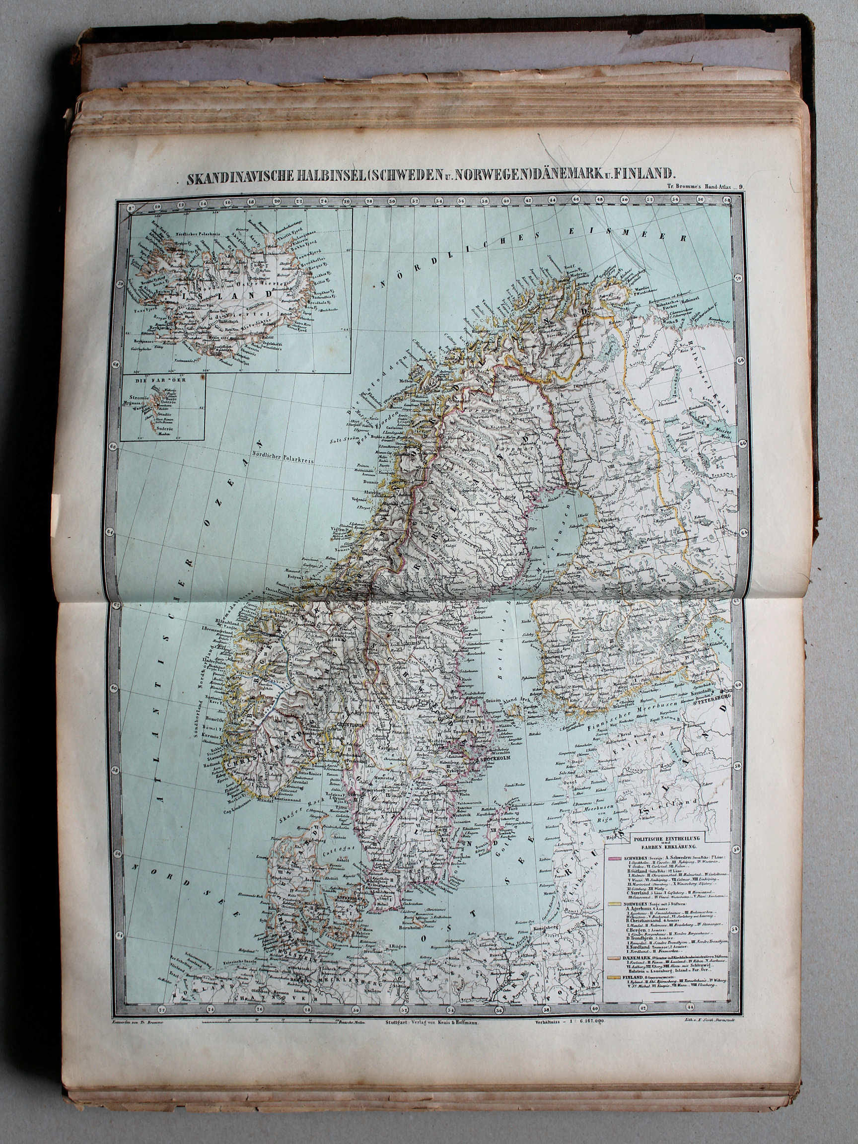
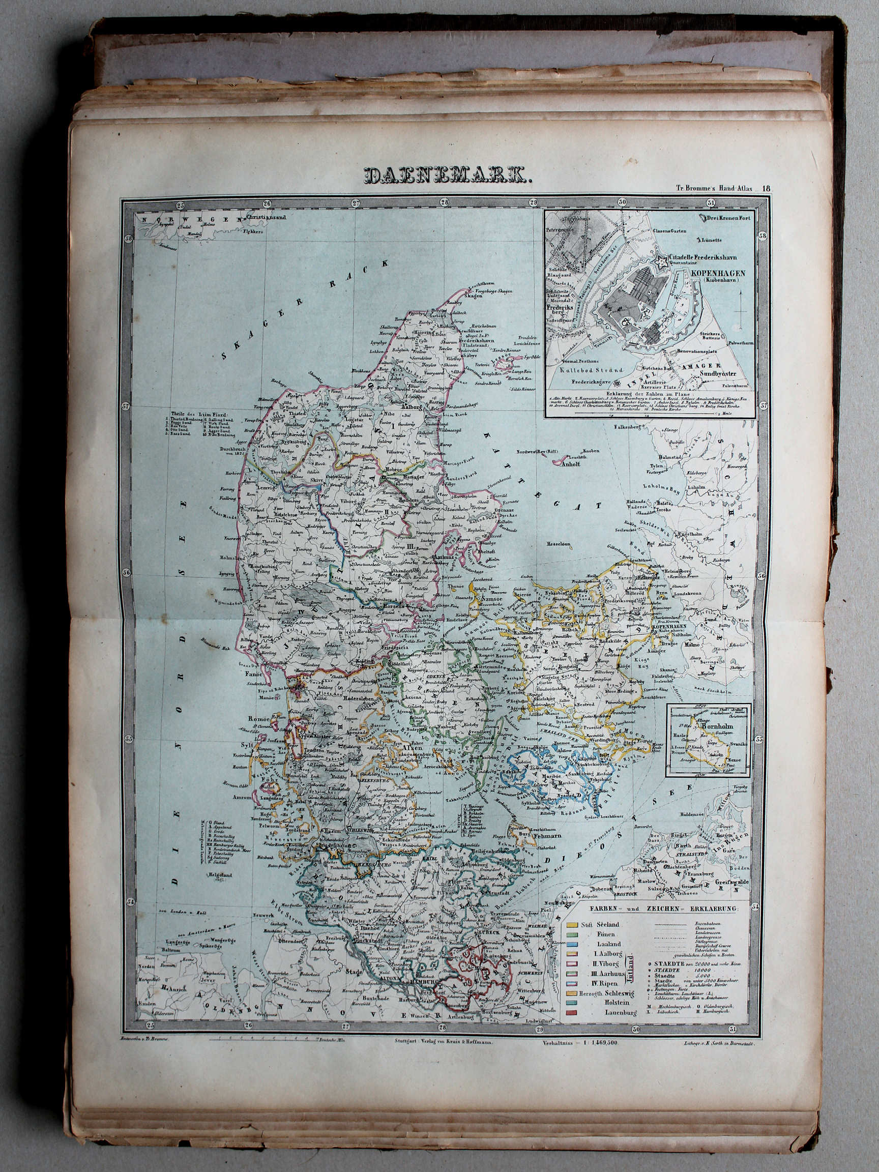
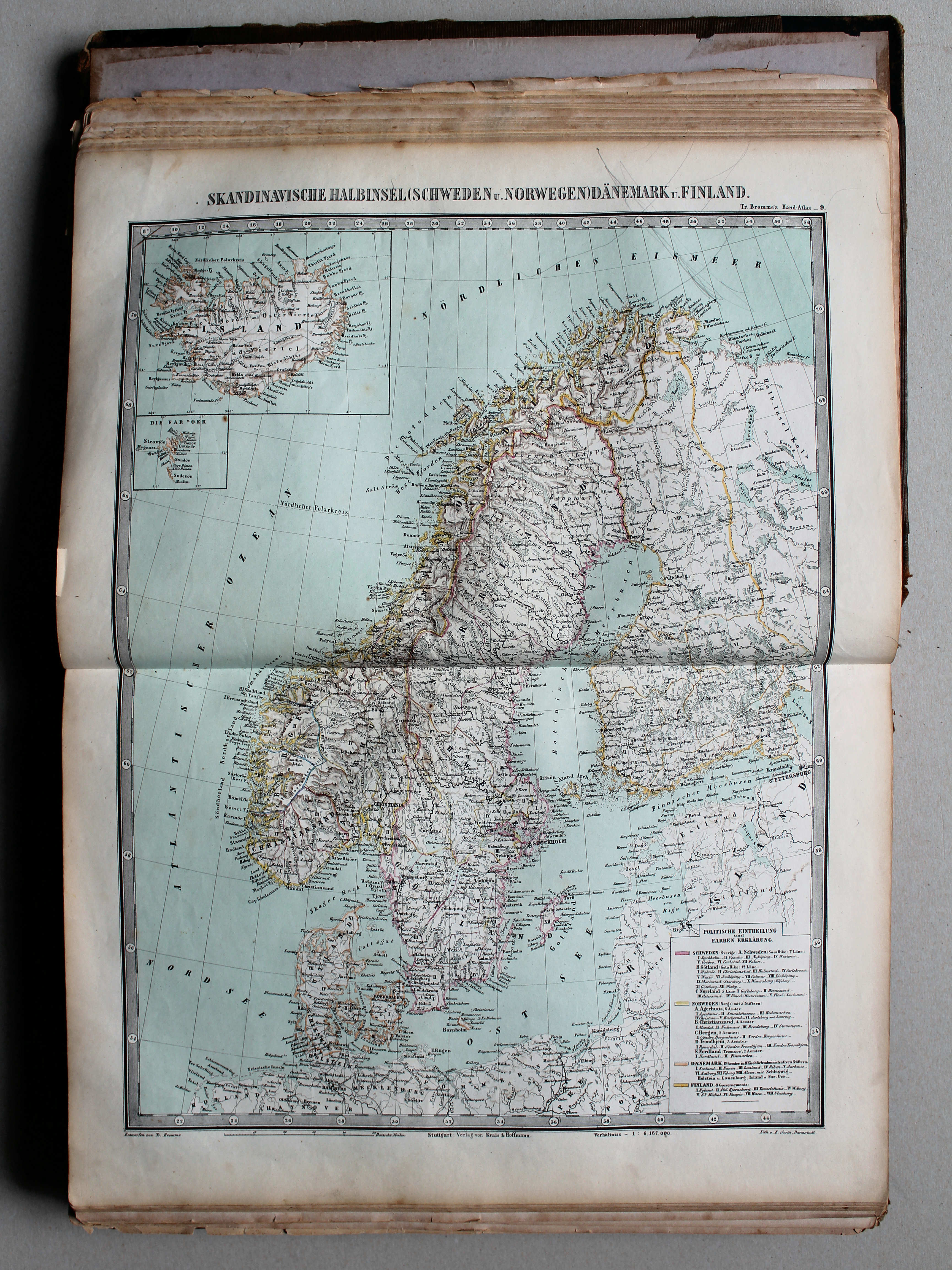
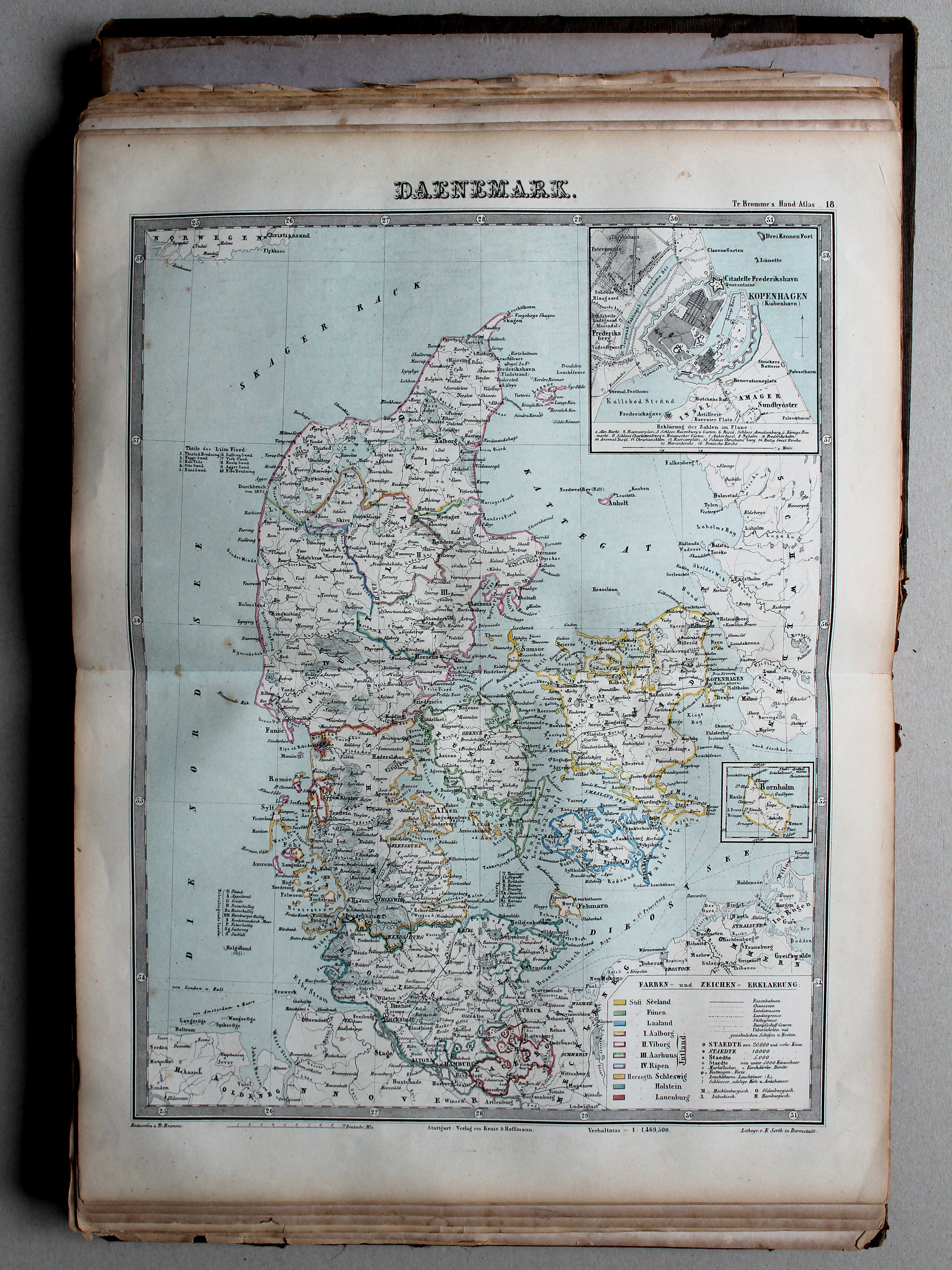
9. Skandinavische Halbinsel (Schweden u. Norwegen) Dänemark u. Finland XL
Scandinavisch Schiereiland (Zweden en Noorwegen), Denemarken en Finland / Scandinavian Peninsula (Sweden and Norway), Denmark and Finland
 Bromme, Illustrirter Hand-Atlas, 1862
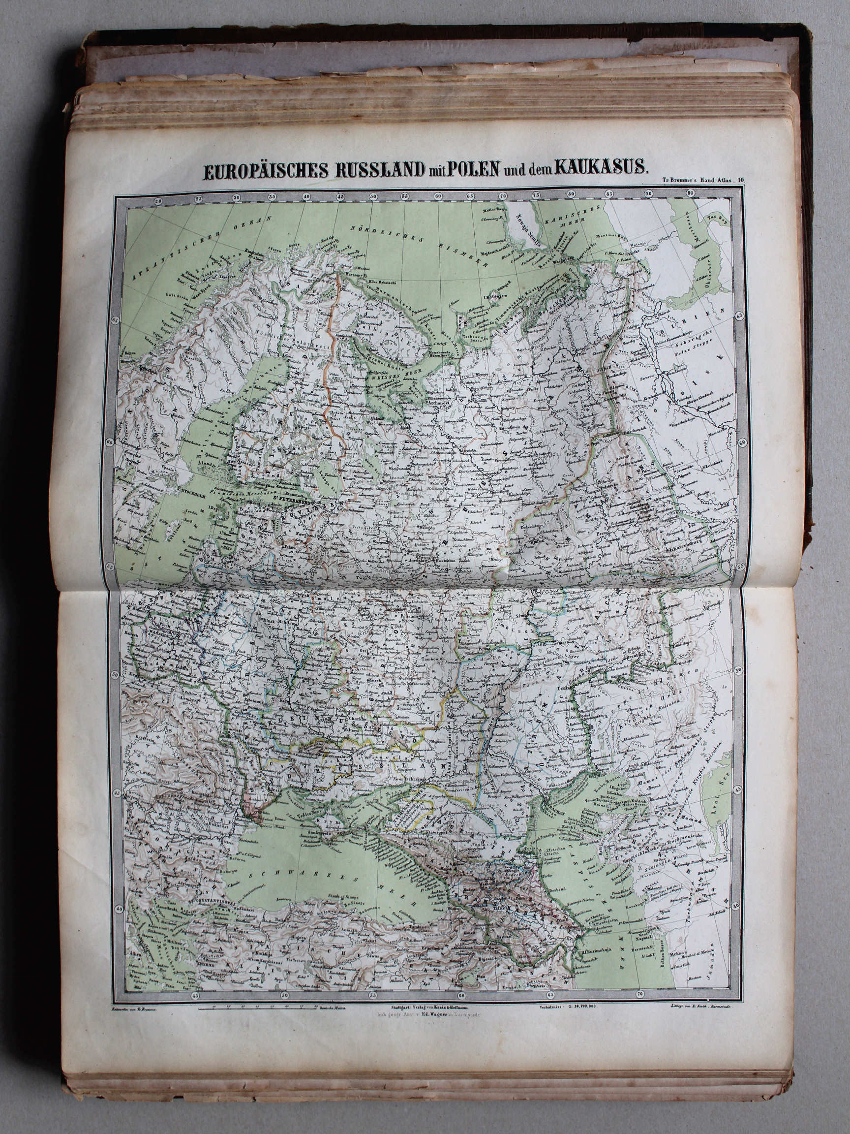
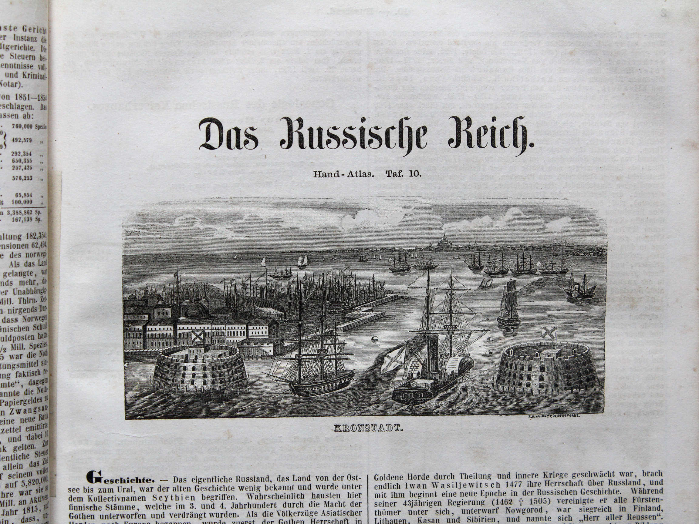
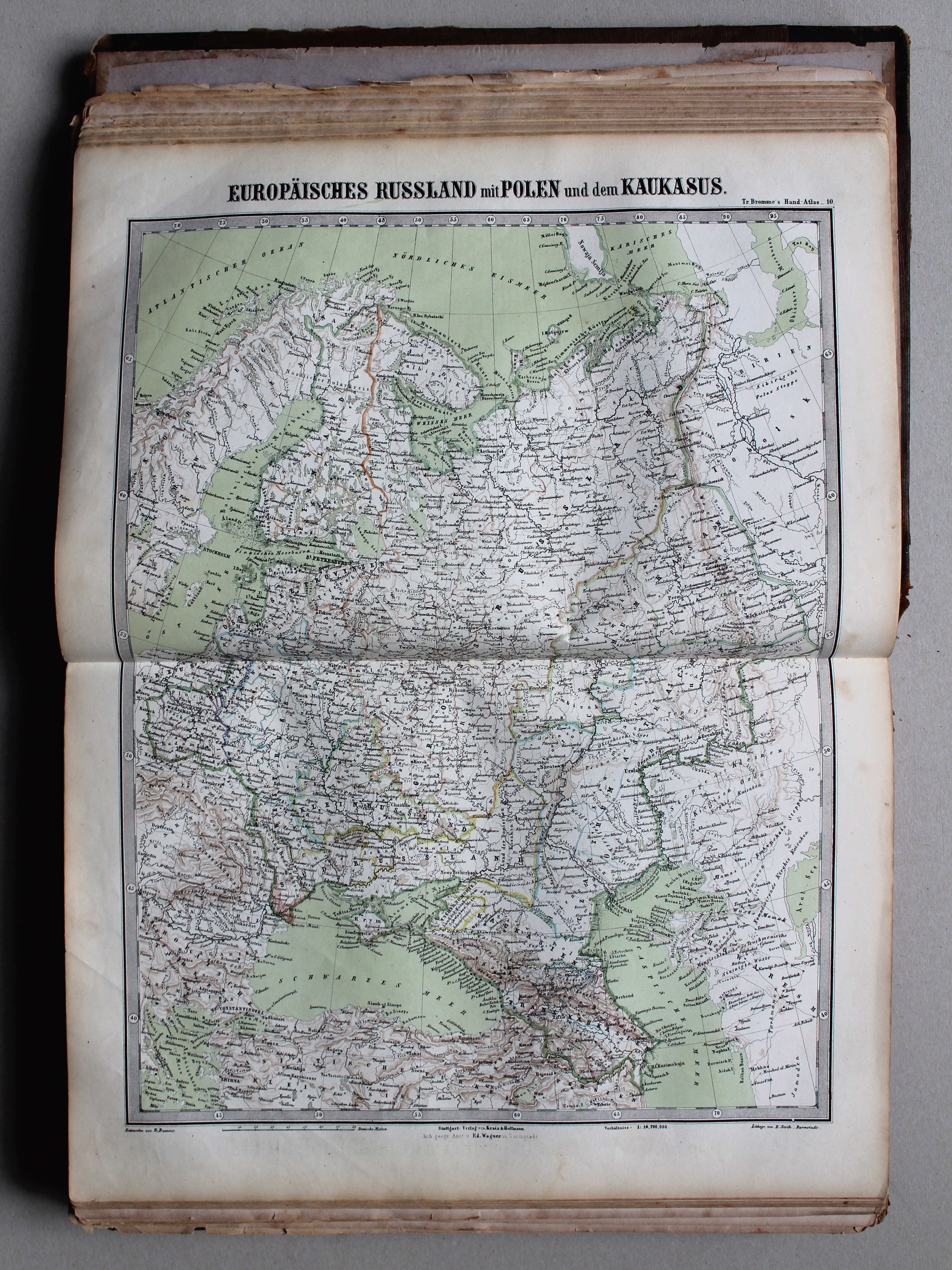
10. Europäisches Russland mit Polen und dem Kaukasus XL
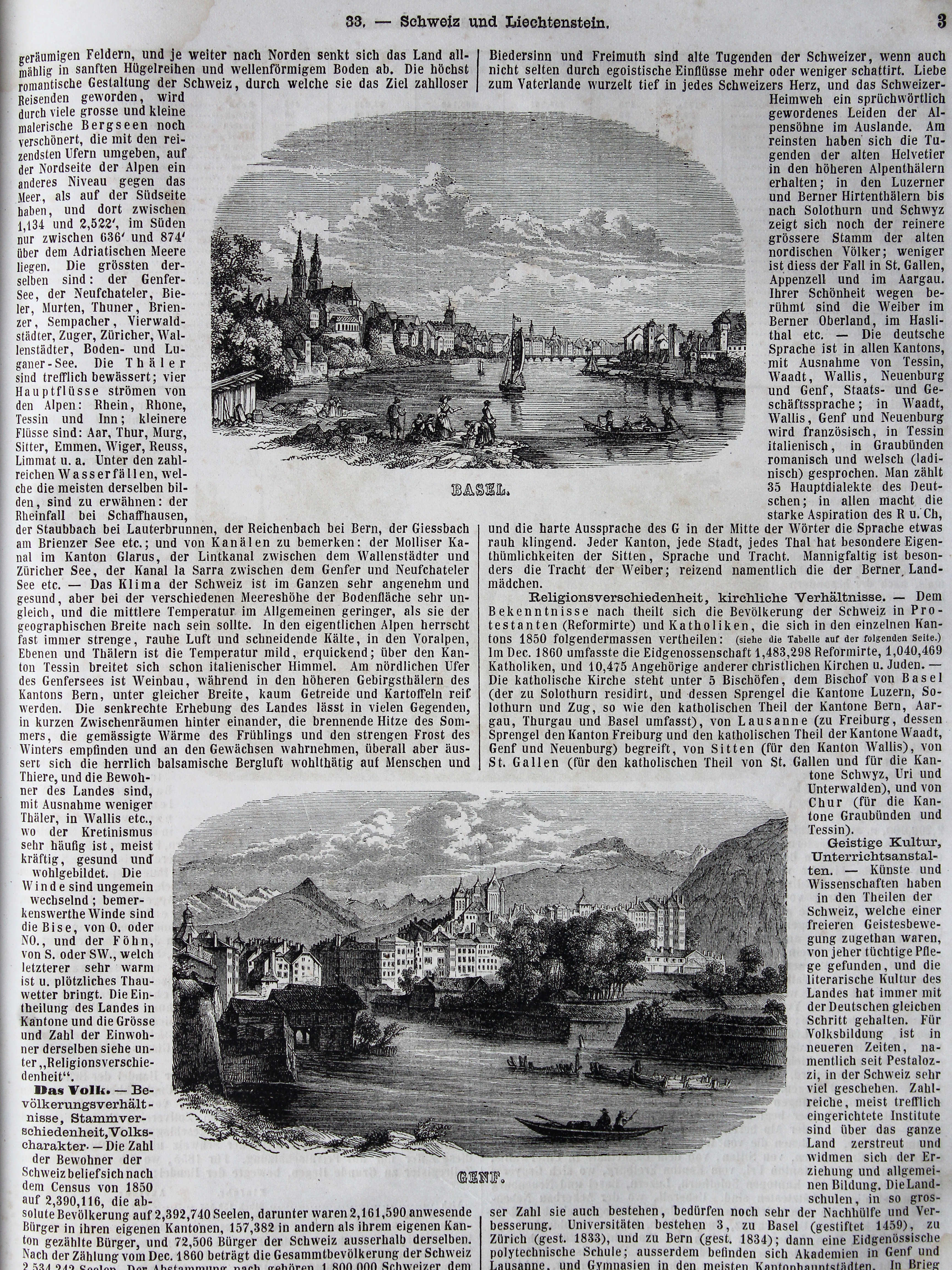
Europees Rusland met Polen en de Kaukasus / Russia in Europe with Poland and the Caucasus region
 Bromme, Illustrirter Hand-Atlas, 1862
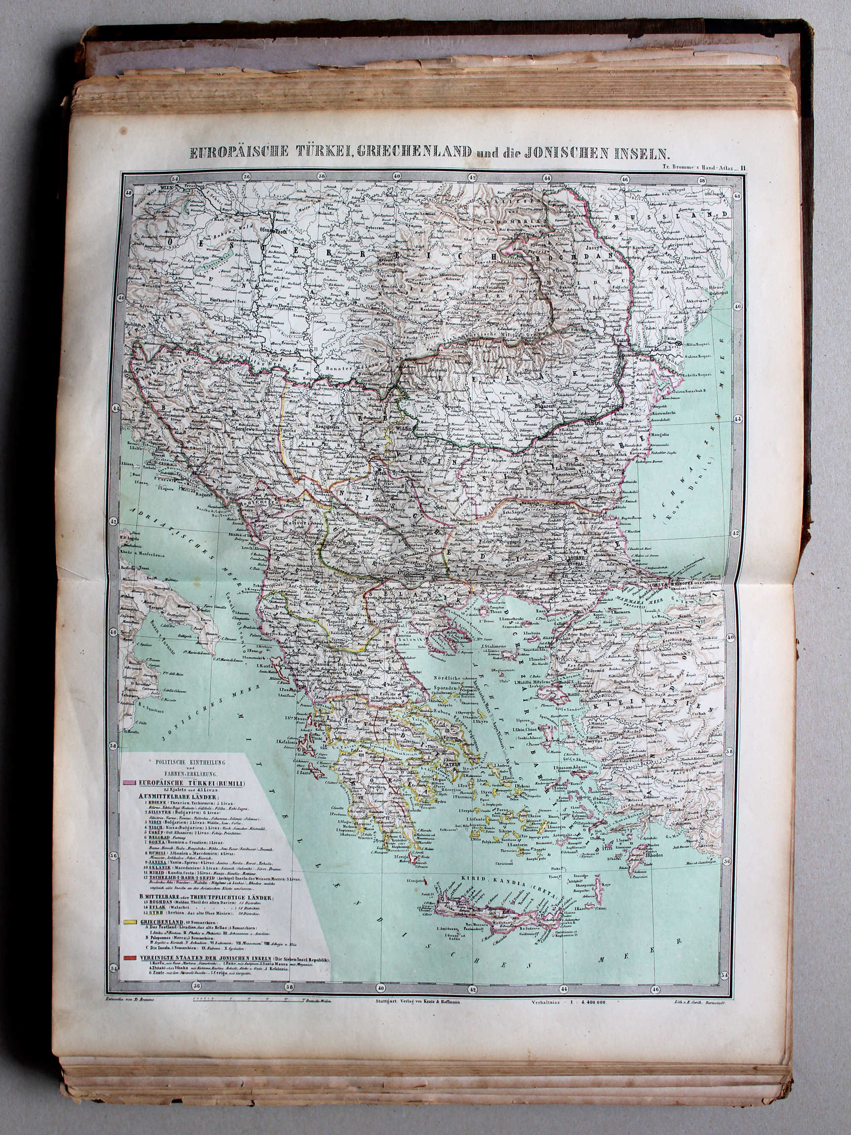
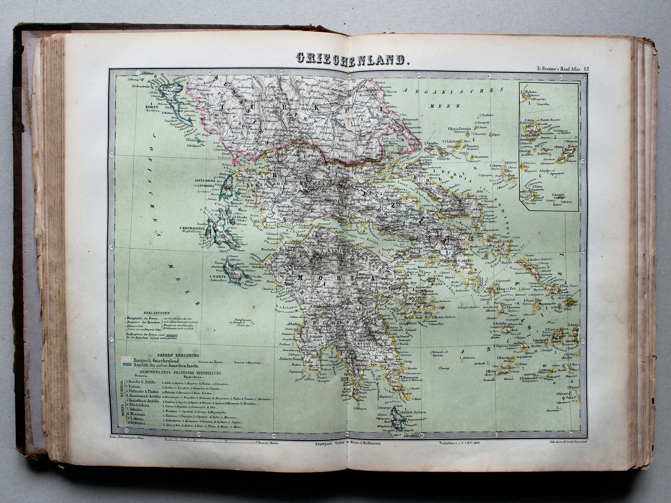
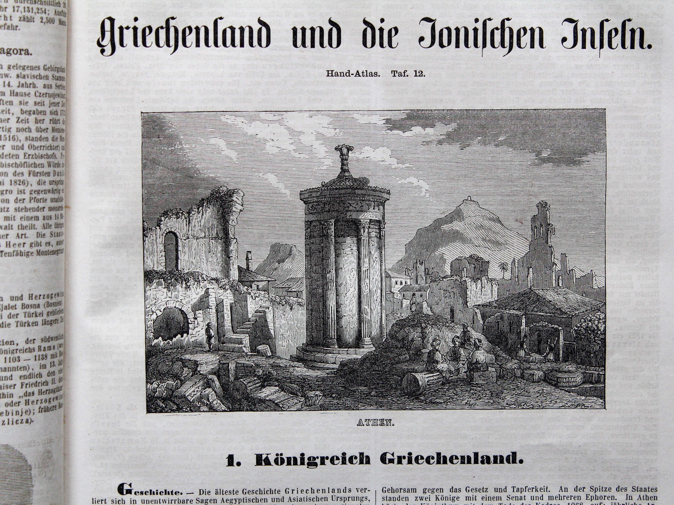
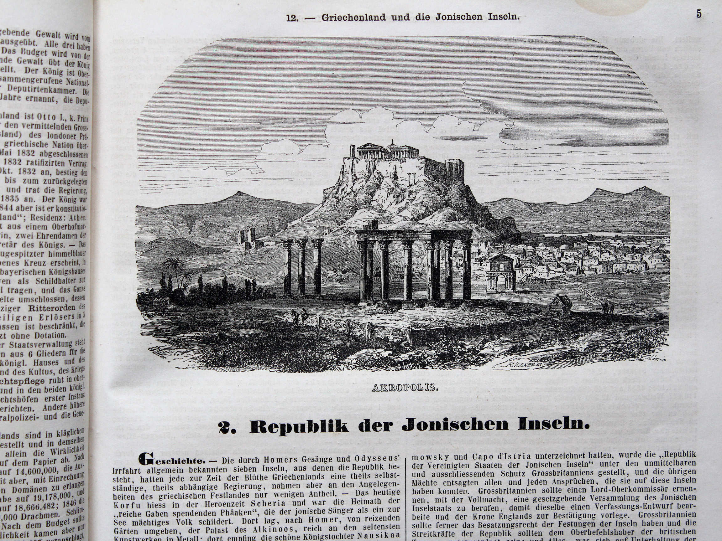
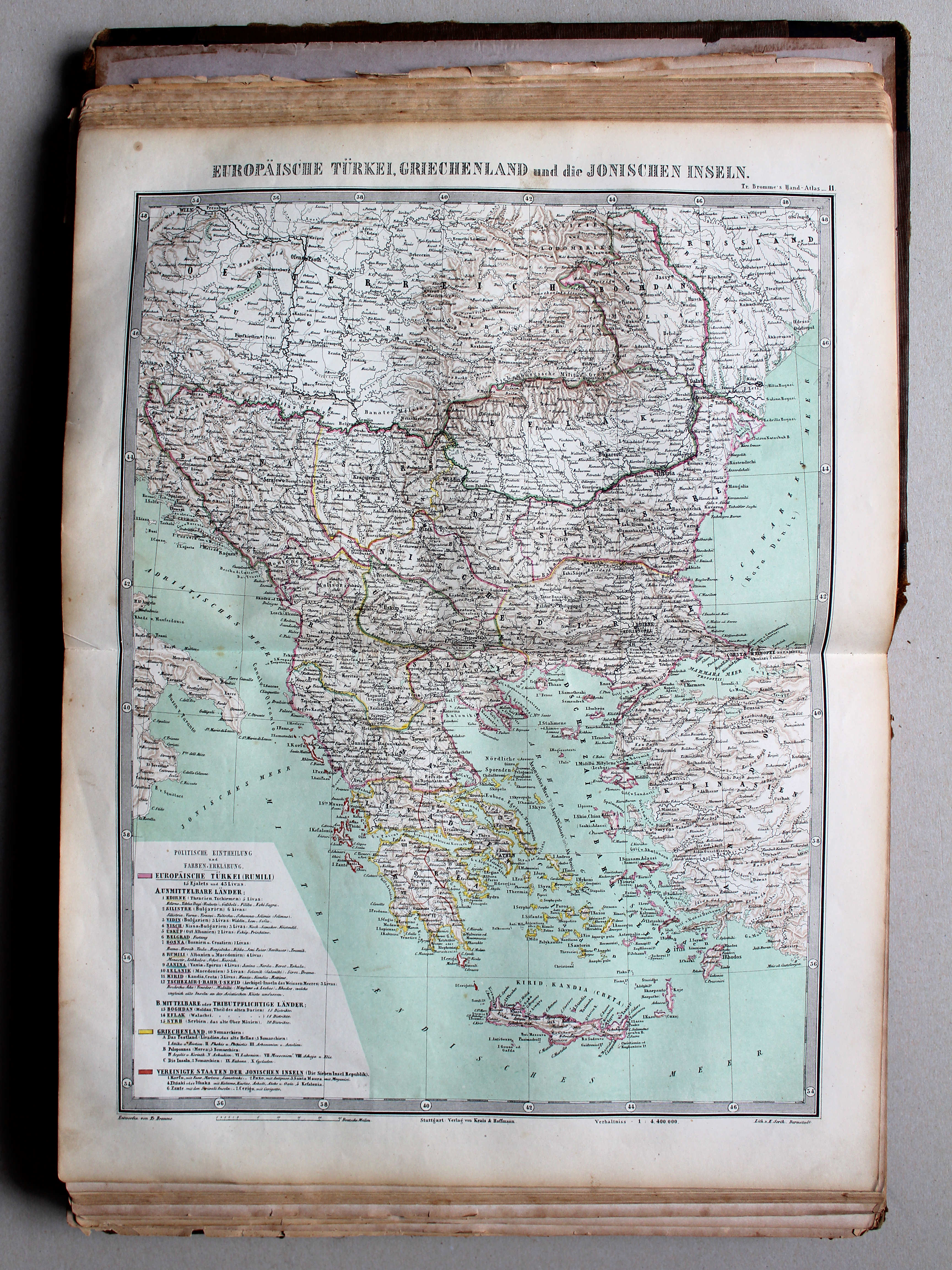
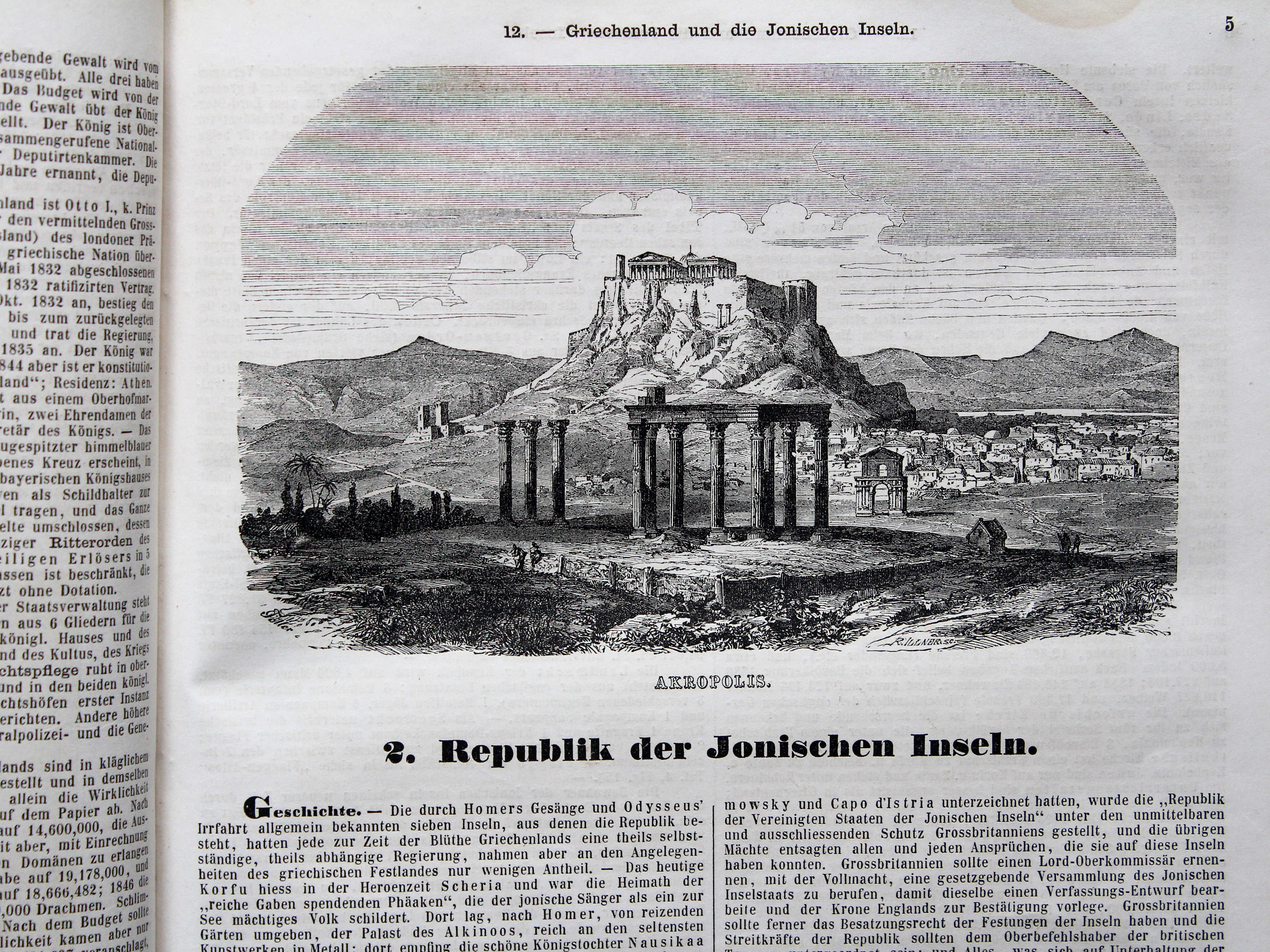
11. Europäische Türkei, Griechenland und die Ionischen Inseln XL
Europees Turkije, Griekenland en de Ionische Eilanden / Turkey in Europe, Greece and the Ionian Islands

 Bromme, Illustrirter Hand-Atlas, 1862
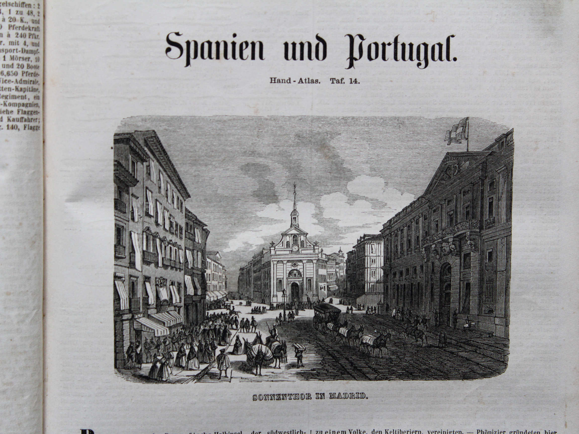
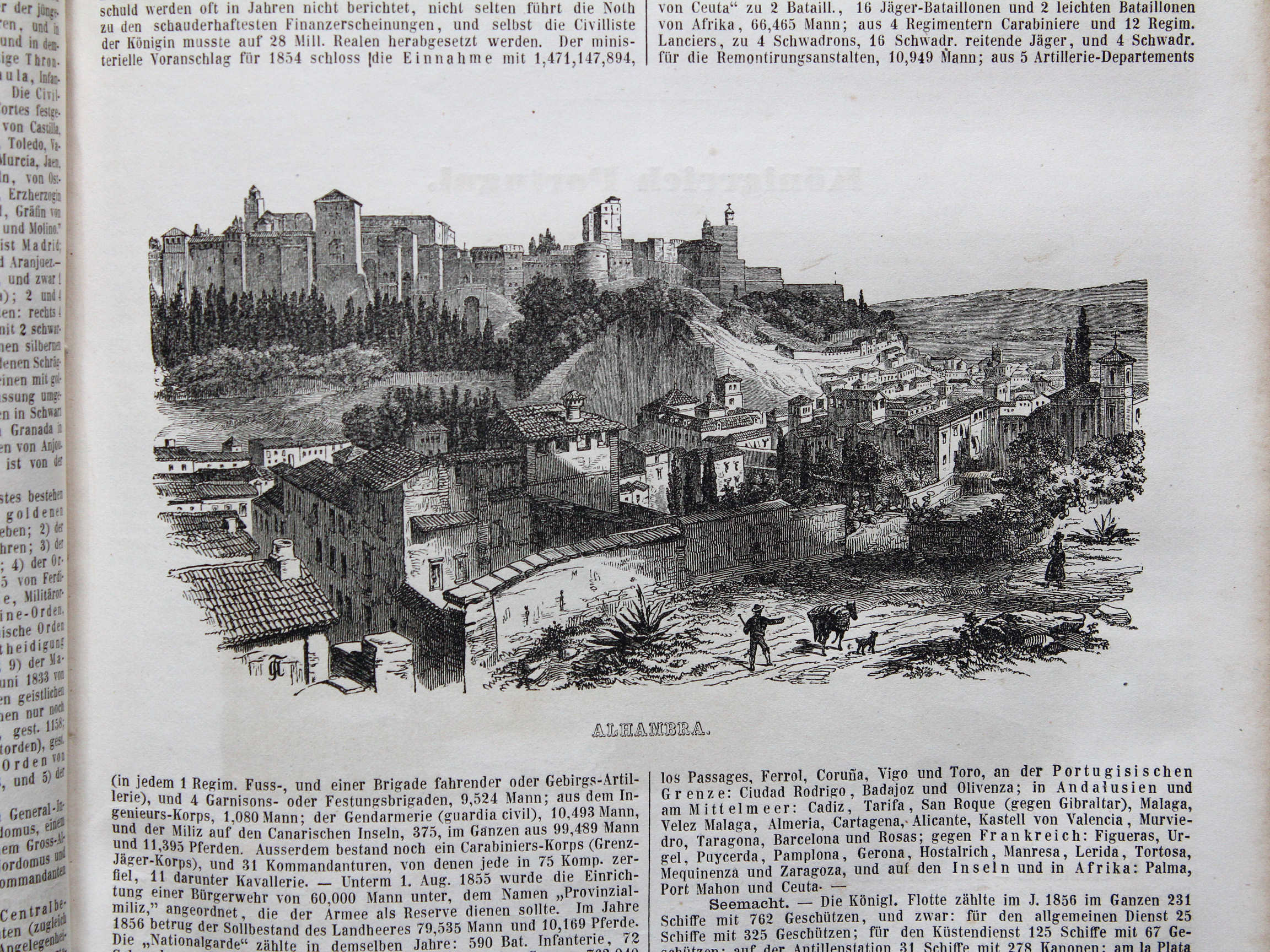
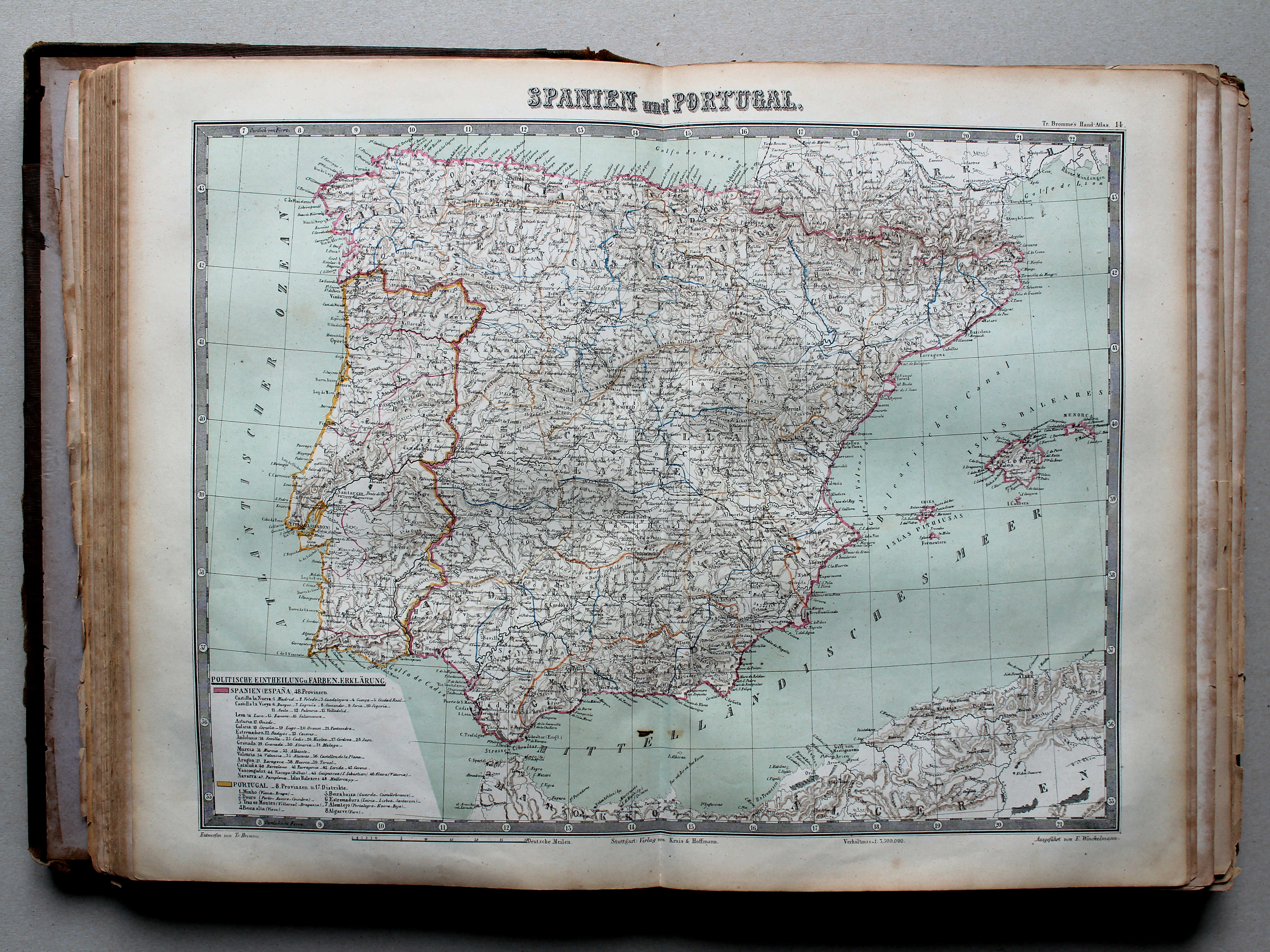
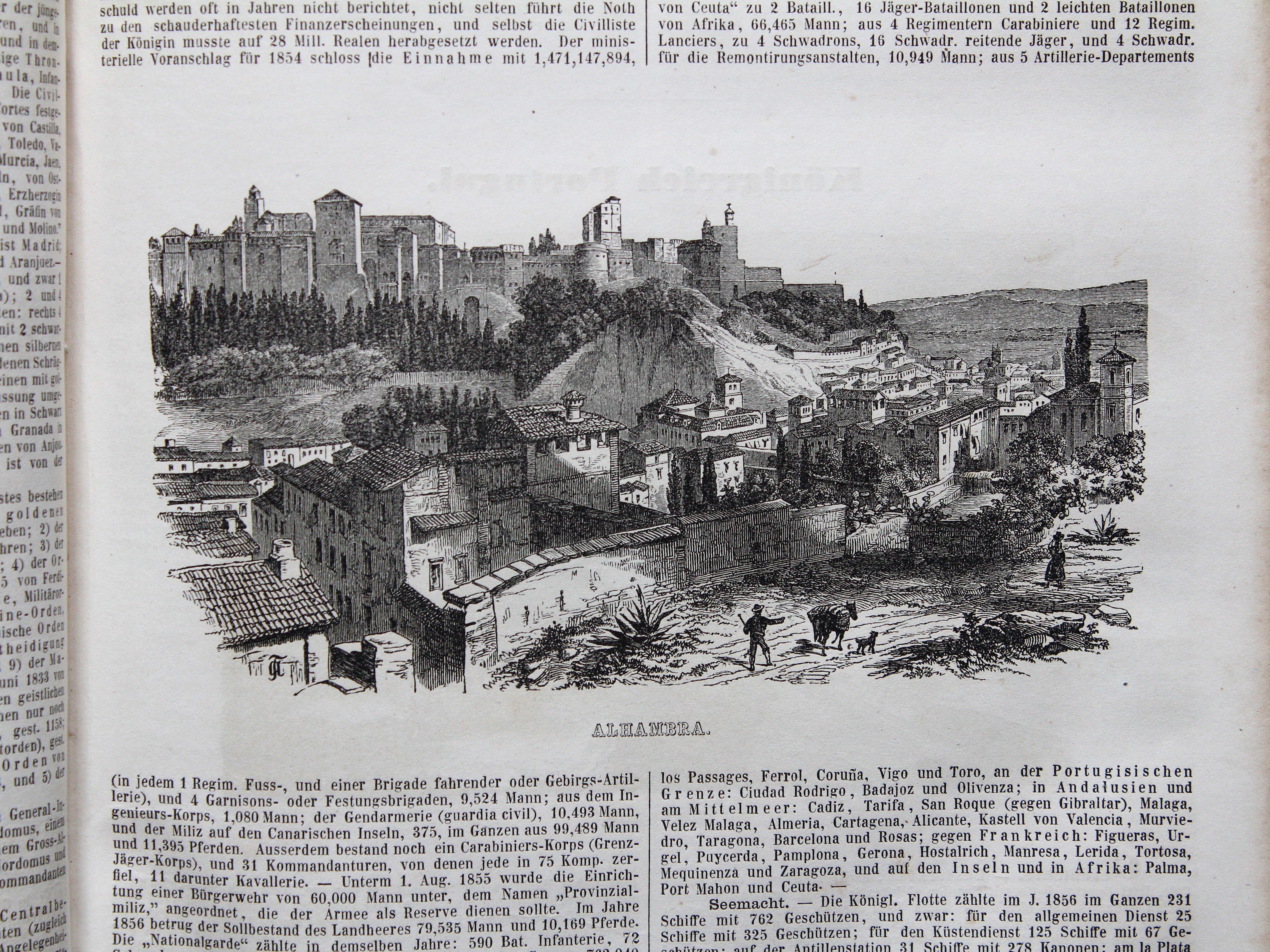
14. Spanien und Portugal XL
Spanje en Portugal / Spain and Portugal
 Bromme, Illustrirter Hand-Atlas, 1862
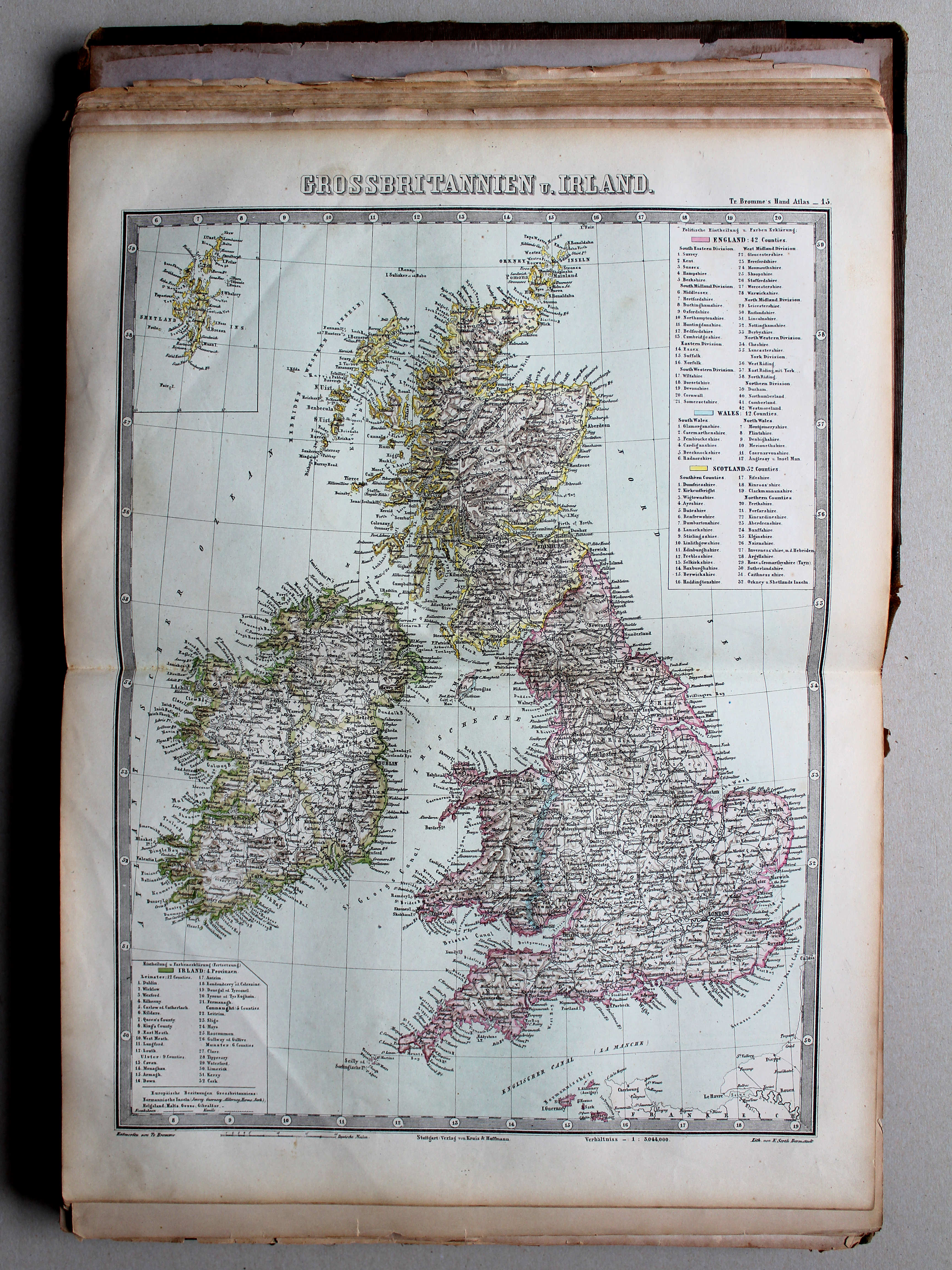
15. Grossbritannien u. Irland XL
Groot-Brittannië en Ierland / Great Britain and Ireland
 Bromme, Illustrirter Hand-Atlas, 1862
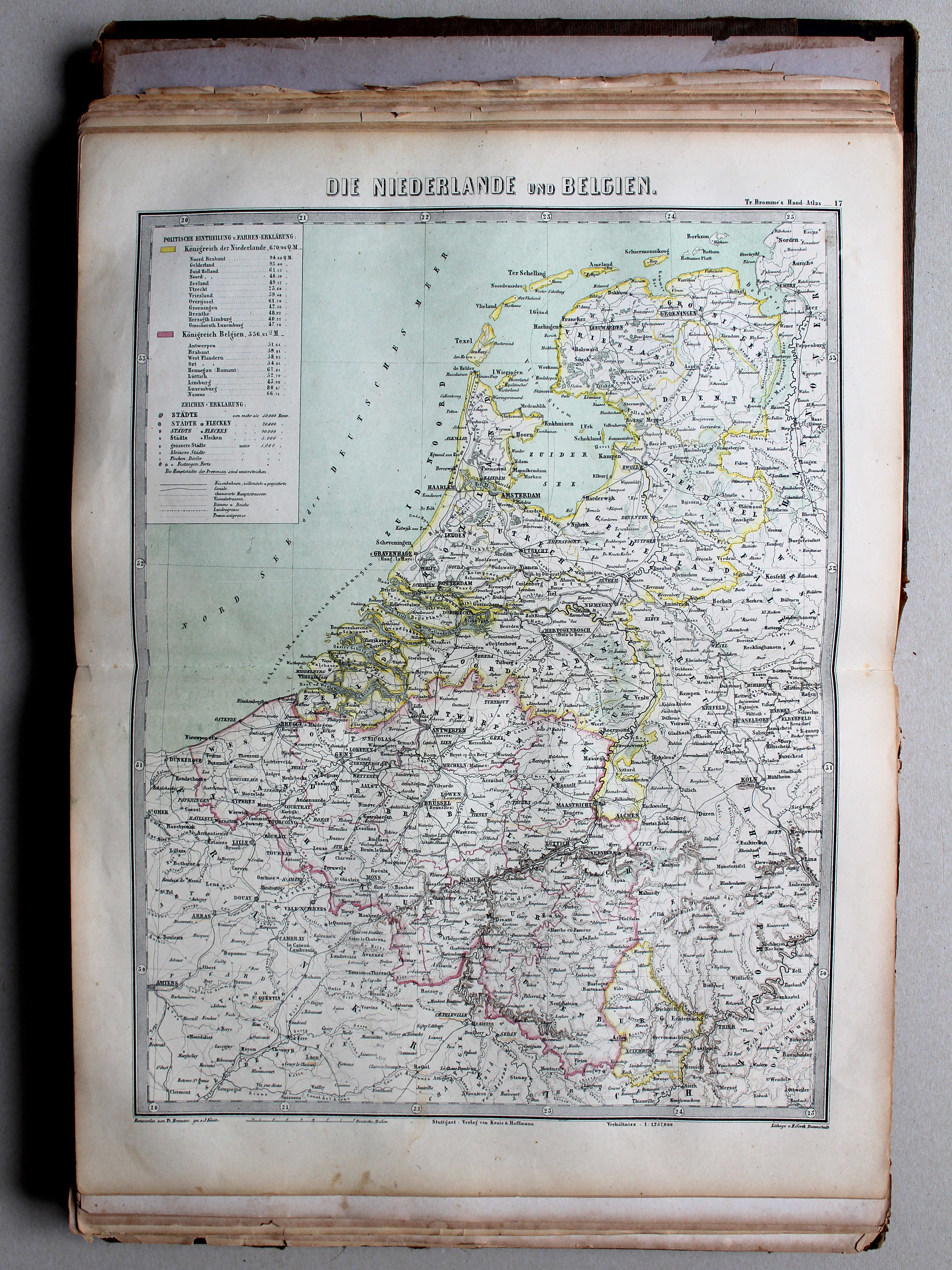
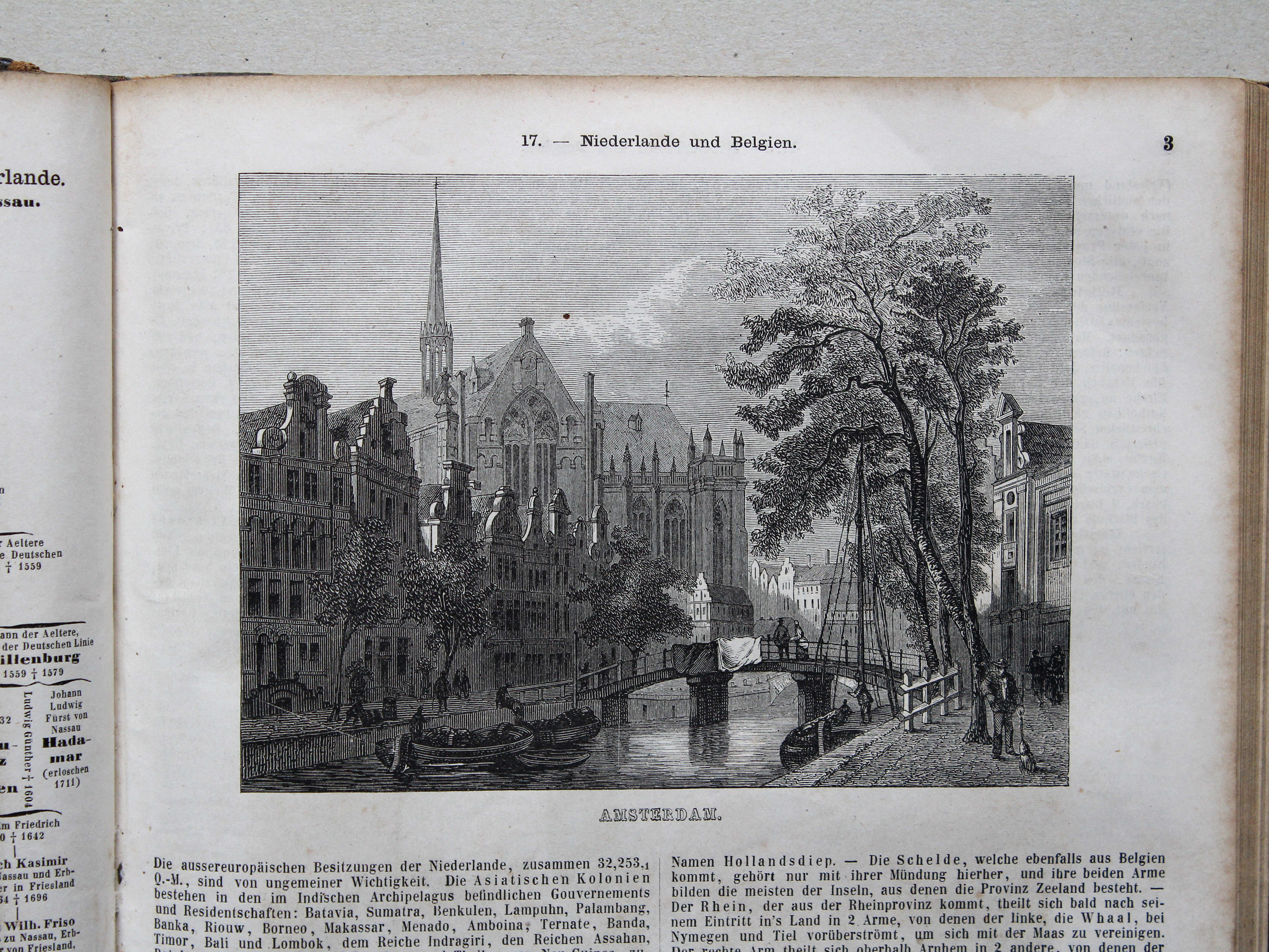
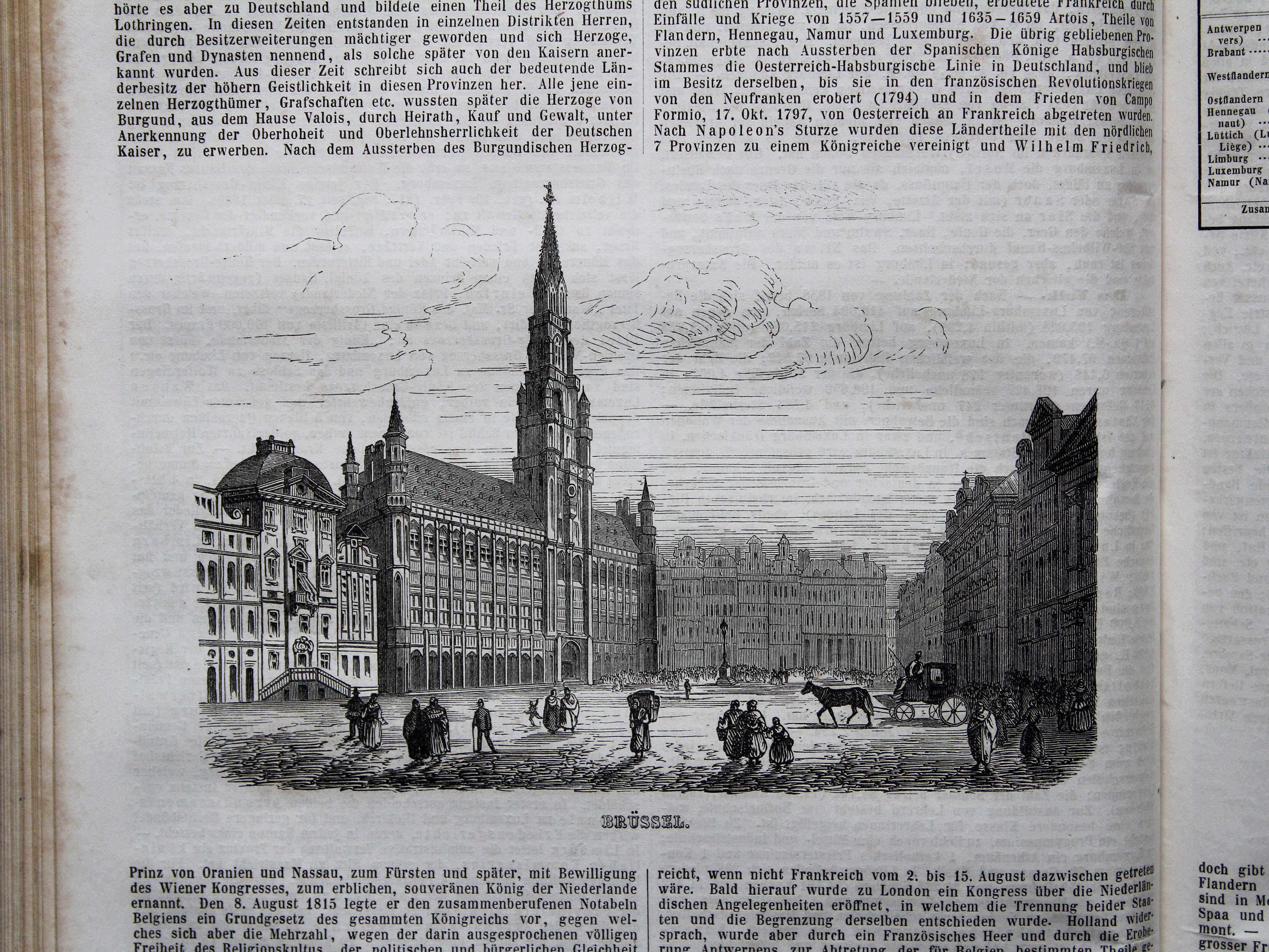
17. Die Niederlande und Belgien XL
Nederland en België / Netherlands and Belgium
 Bromme, Illustrirter Hand-Atlas, 1862
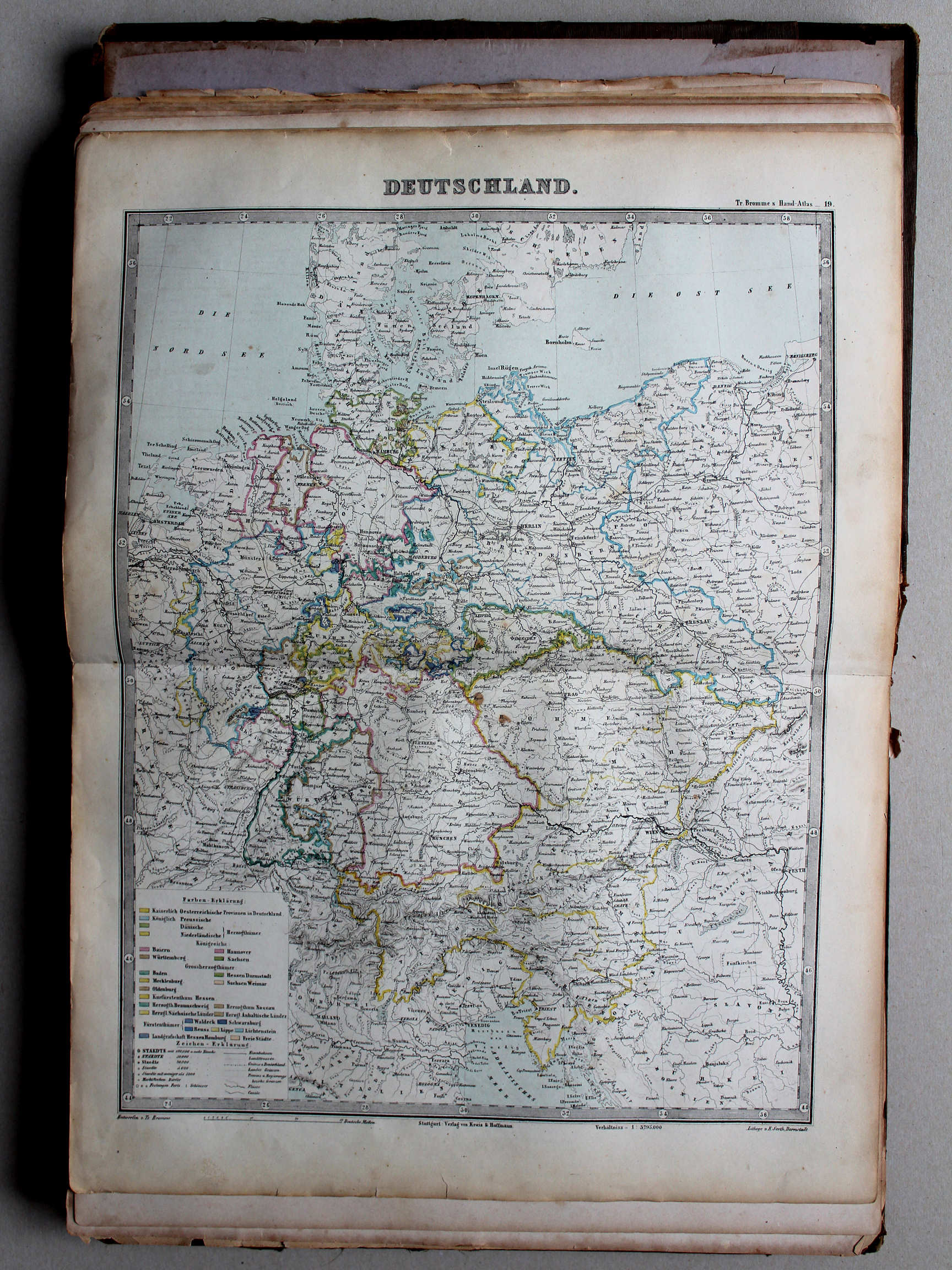
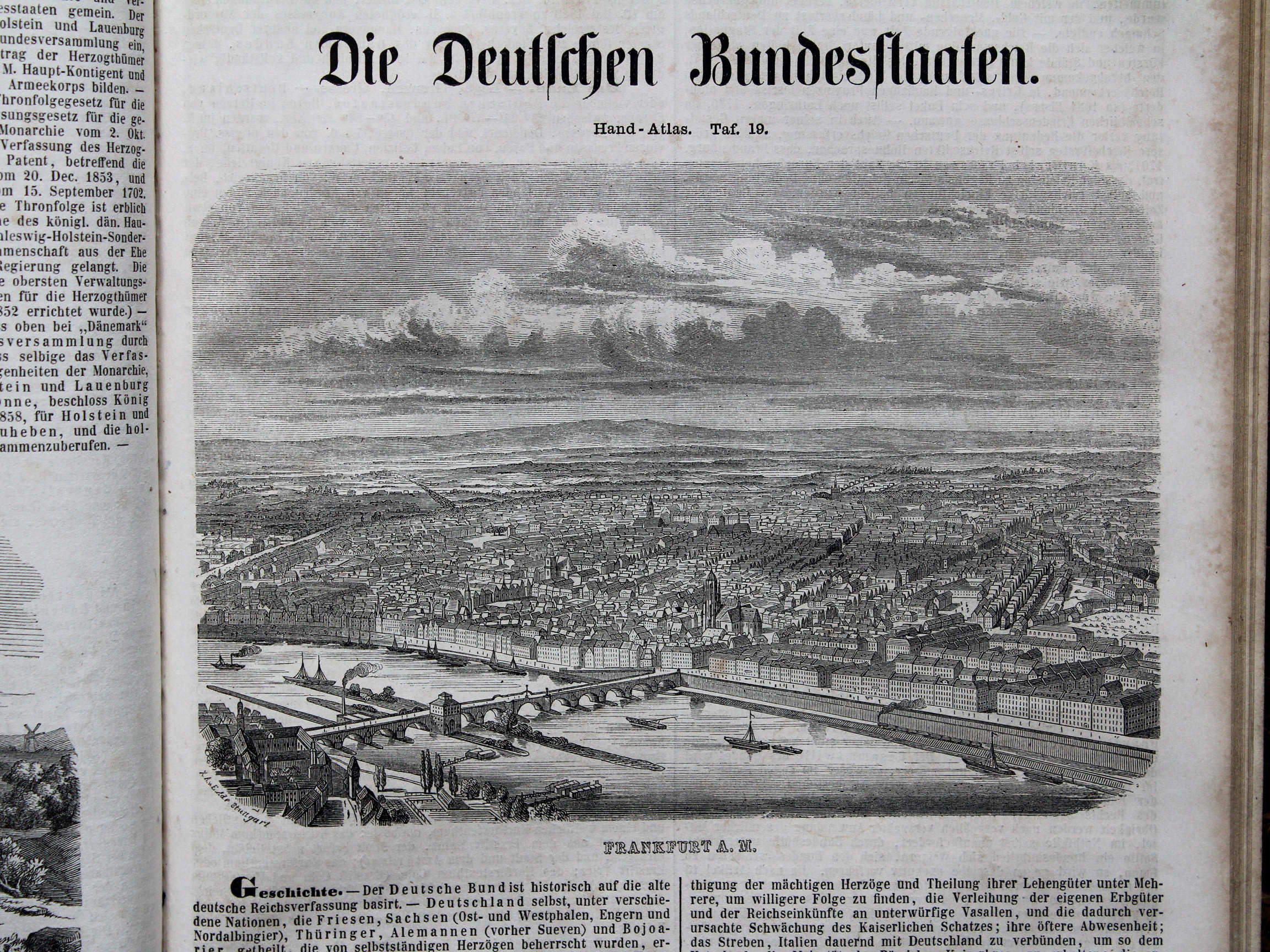
19. Deutschland XL
Duitsland (Duitse Bond) / Germany (German Confederation)
 Bromme, Illustrirter Hand-Atlas, 1862
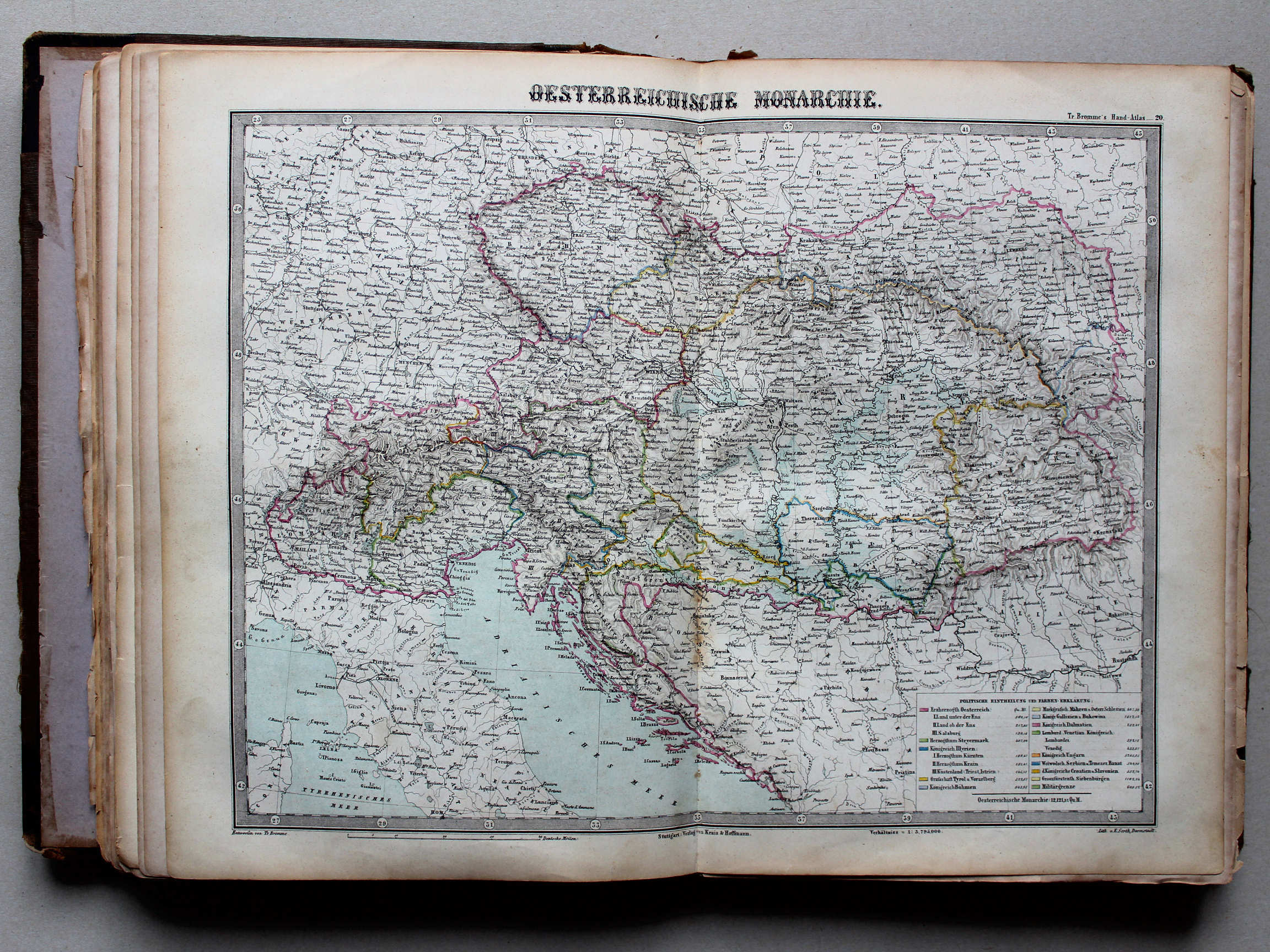
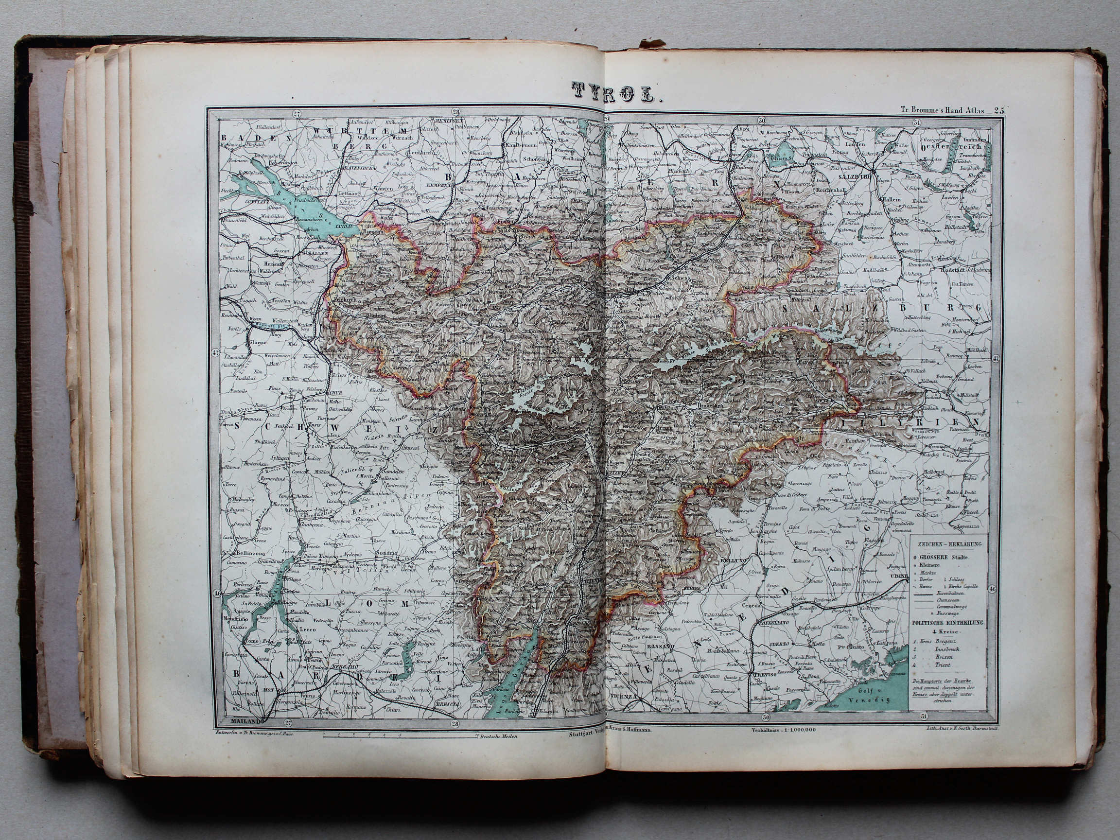
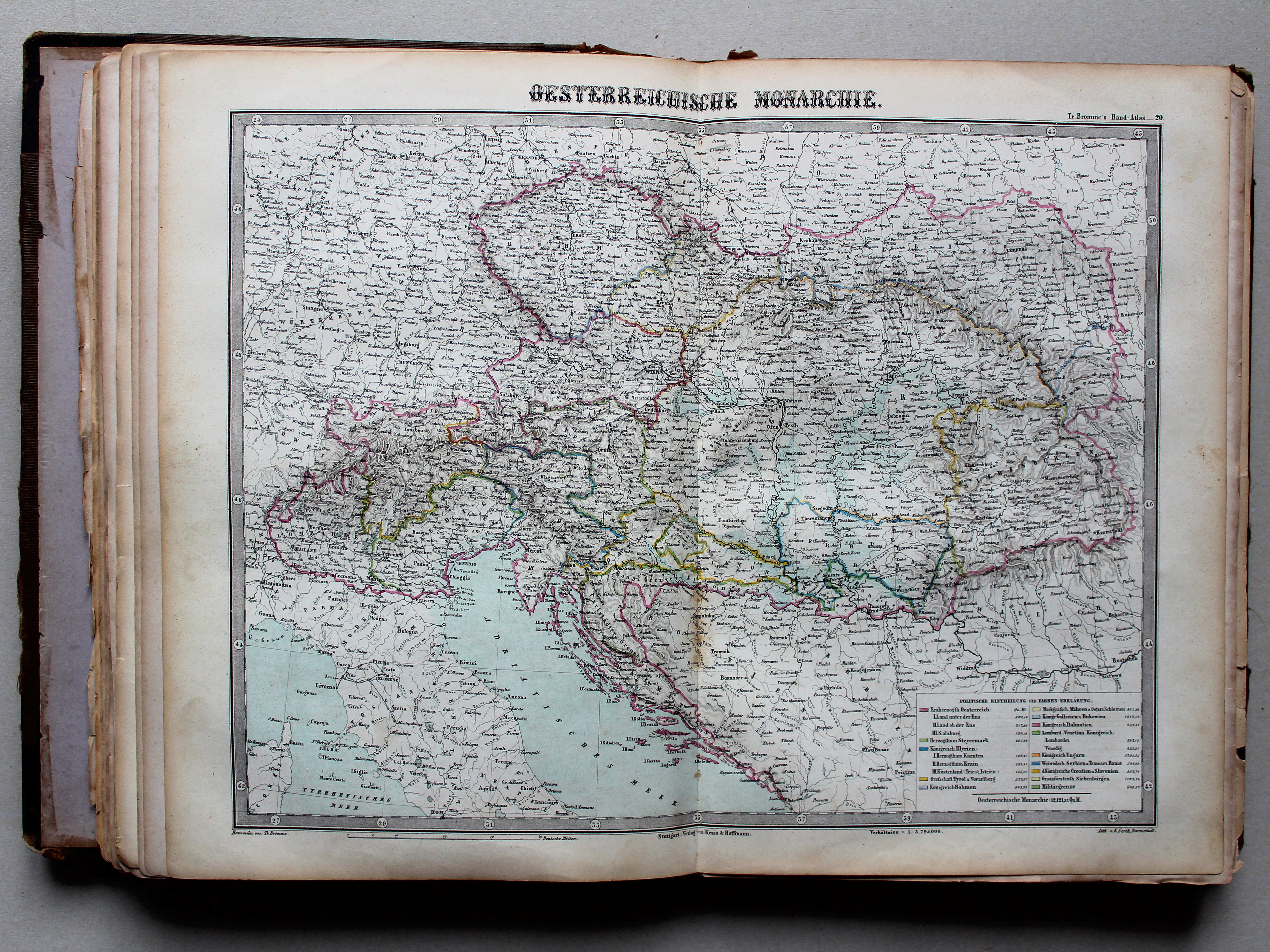
20. Oesterreichische Monarchie XL
Keizerrijk Oostenrijk / Austrian Empire
 Bromme, Illustrirter Hand-Atlas, 1862
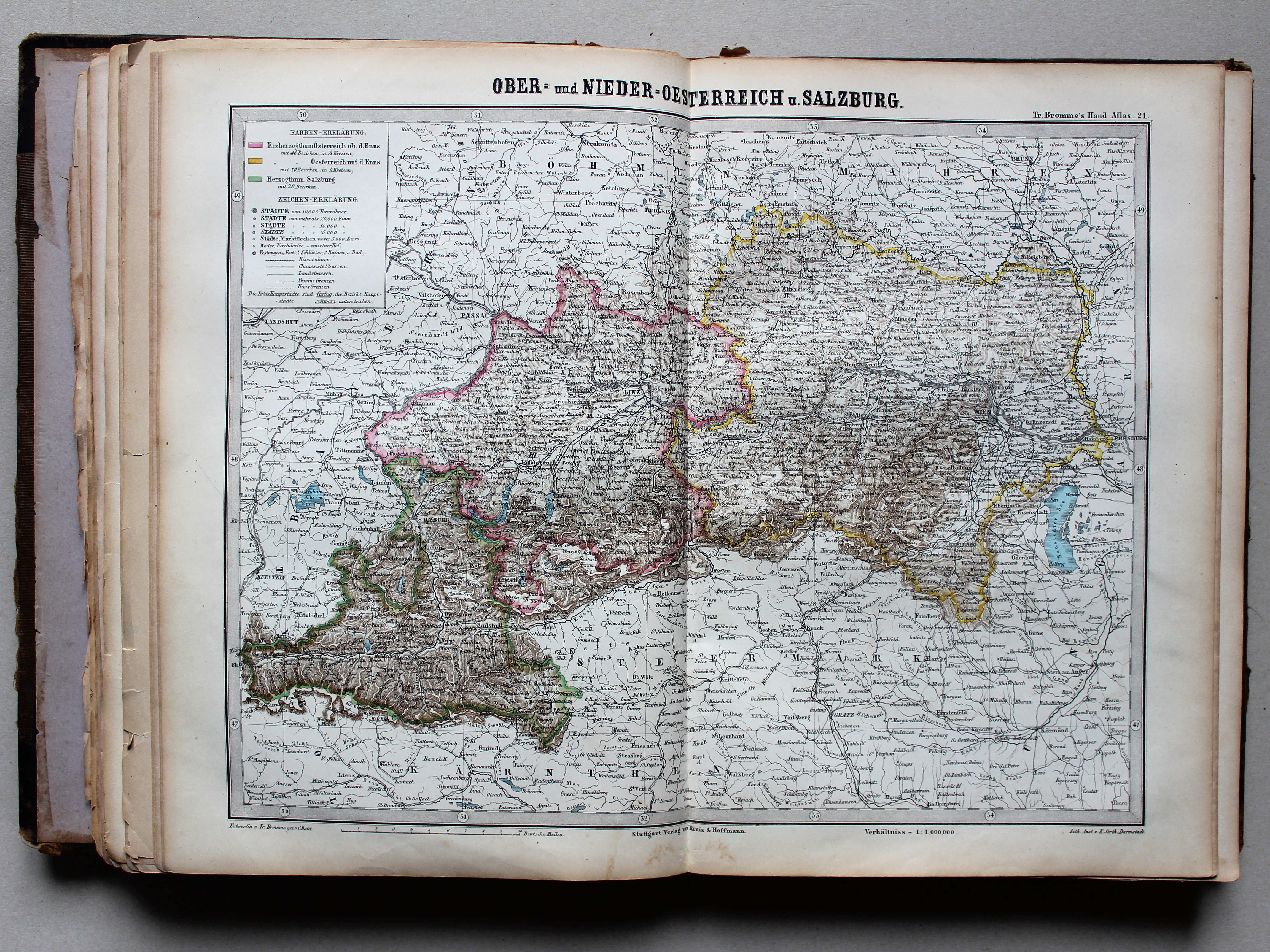
21. Ober- und Nieder-Oesterreich u. Salzburg XL
Opper- en Neder-Oostenrijk en Salzburg / Upper and Lower Austria and Salzburg
 Bromme, Illustrirter Hand-Atlas, 1862
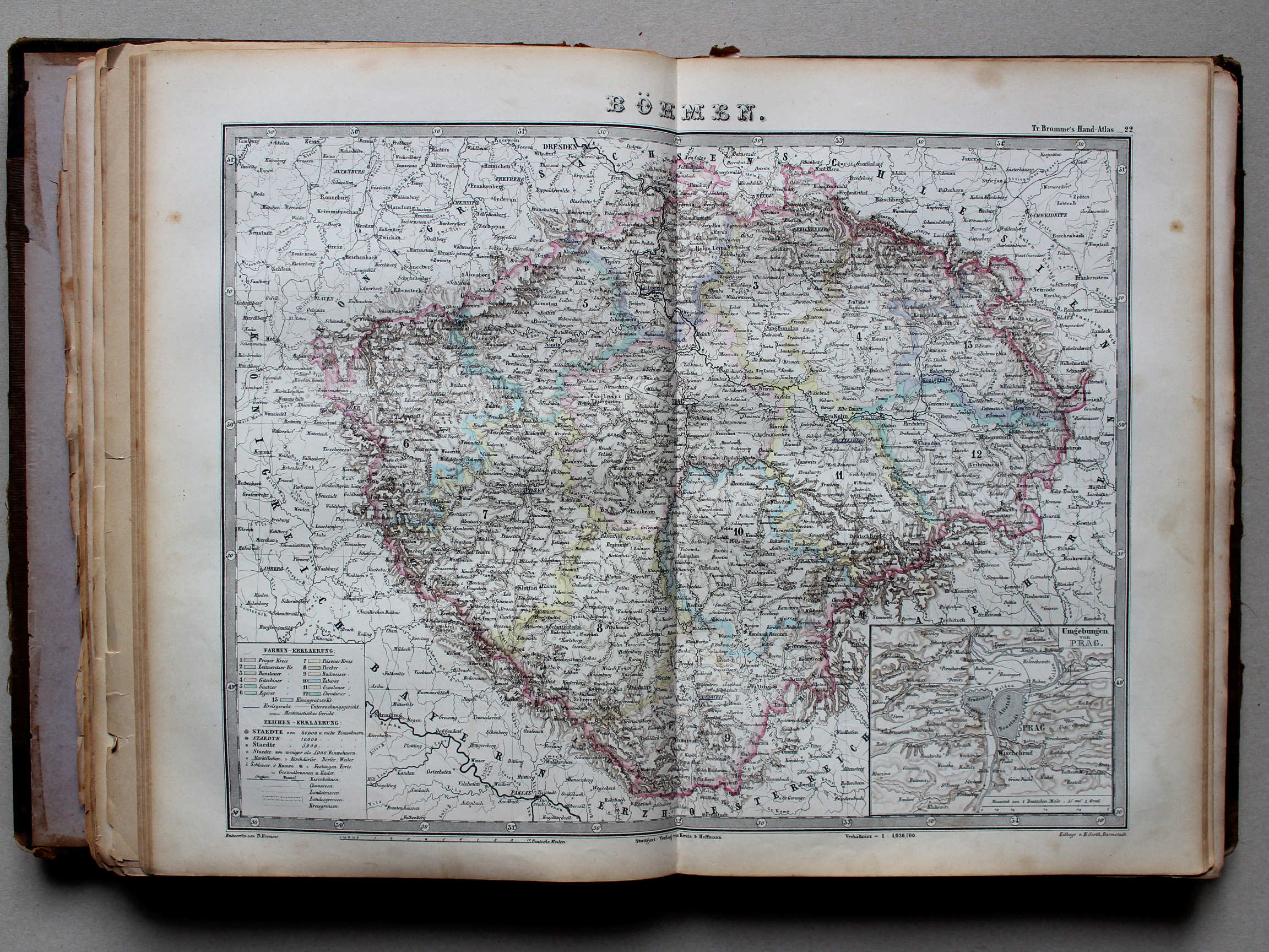
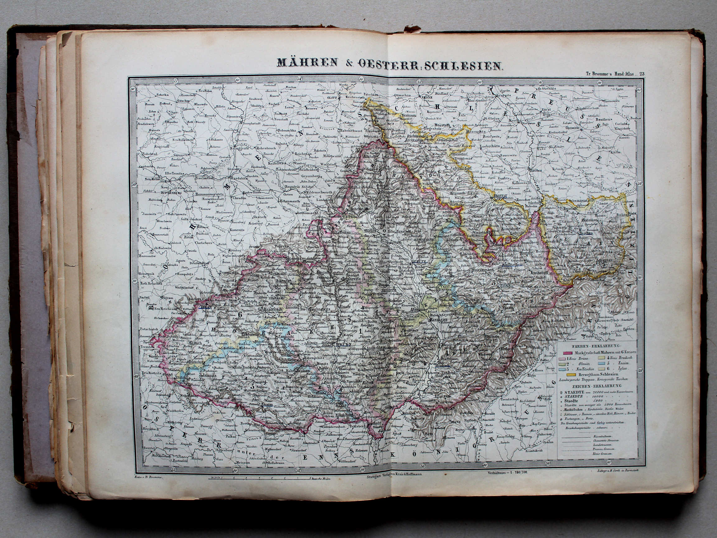
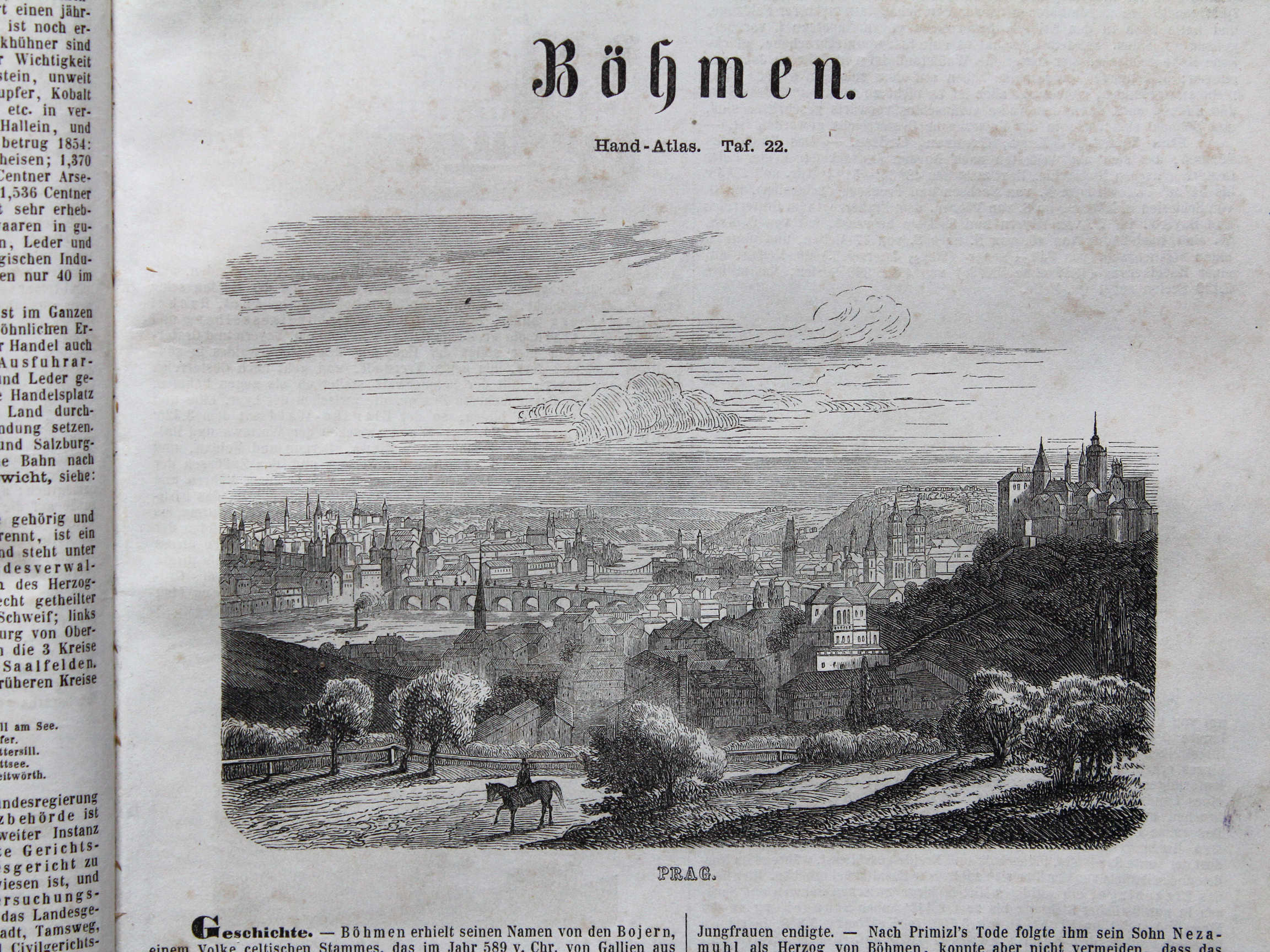
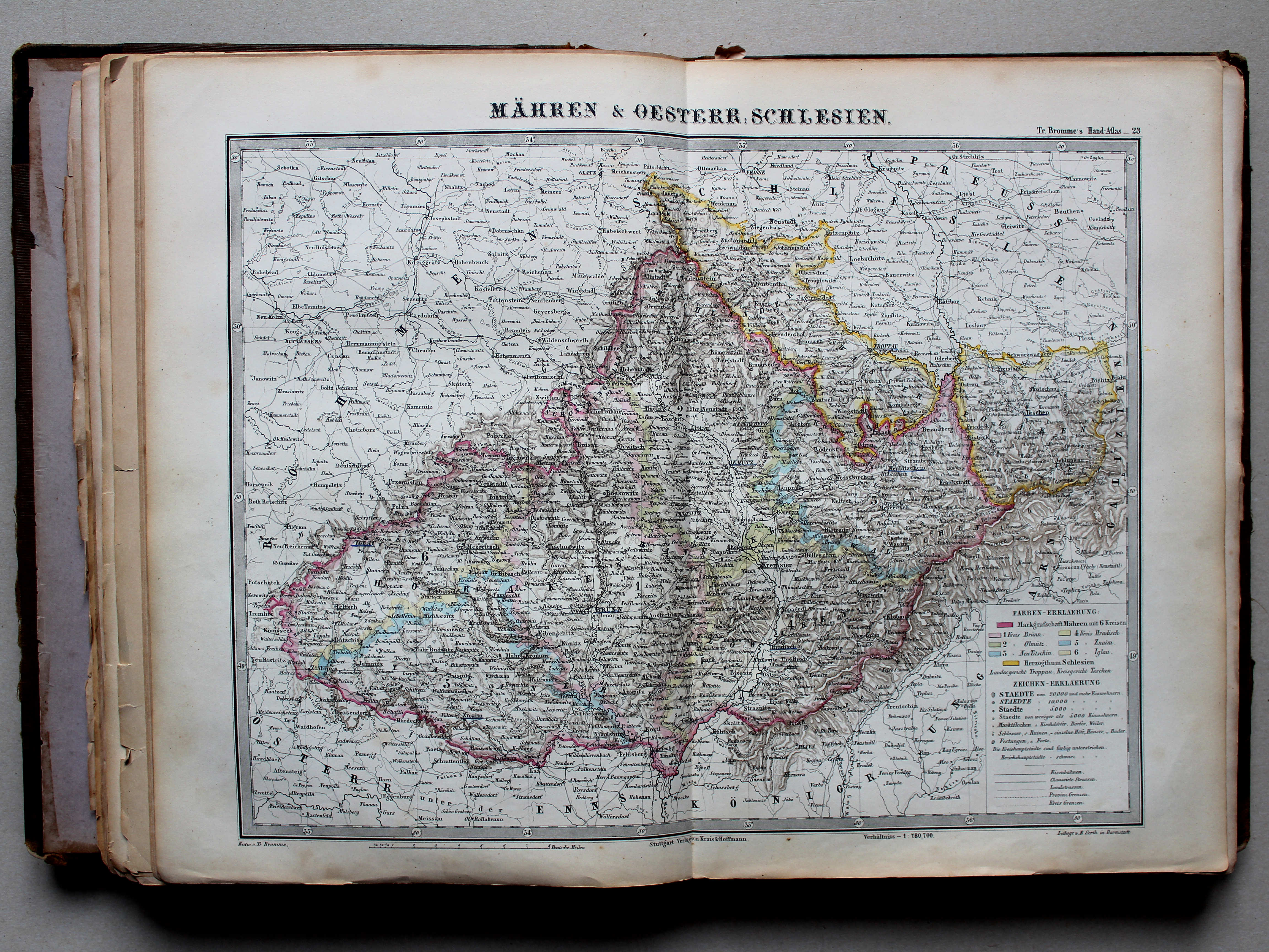
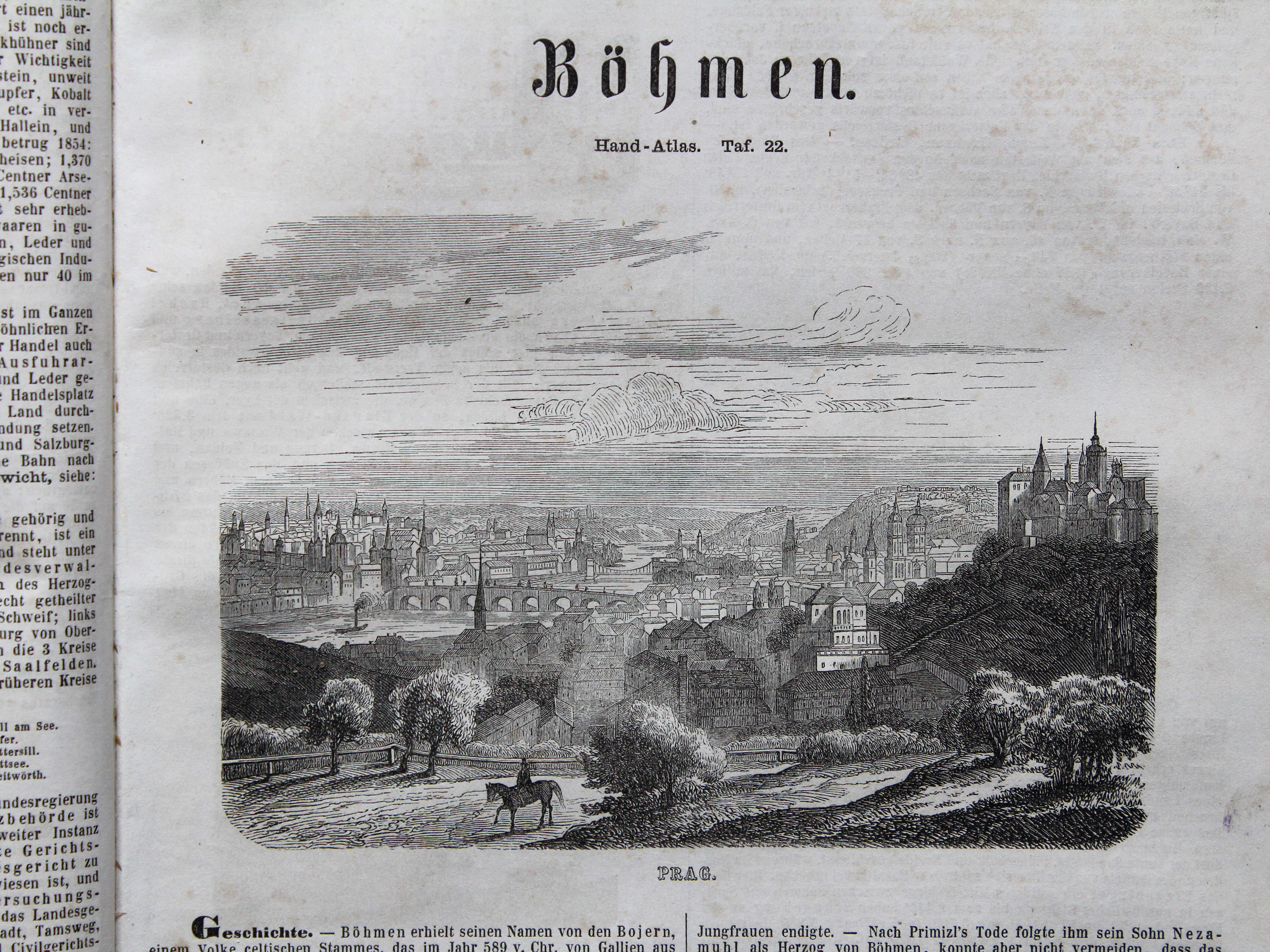
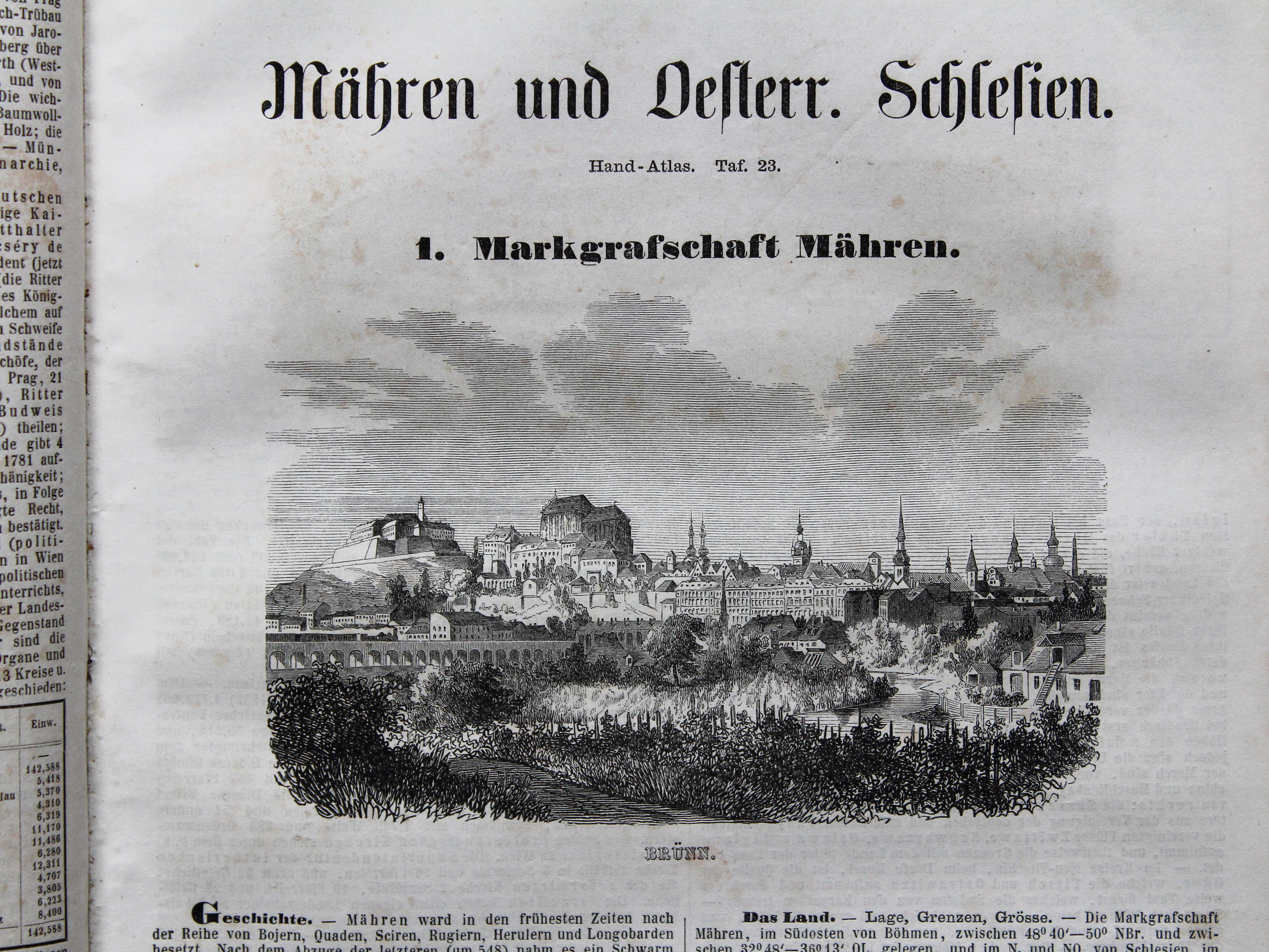
23. Mähren & Oesterr. Schlesien XL
Moravië en Oostenrijks Silezië / Moravia and Austrian Silesia
 Bromme, Illustrirter Hand-Atlas, 1862
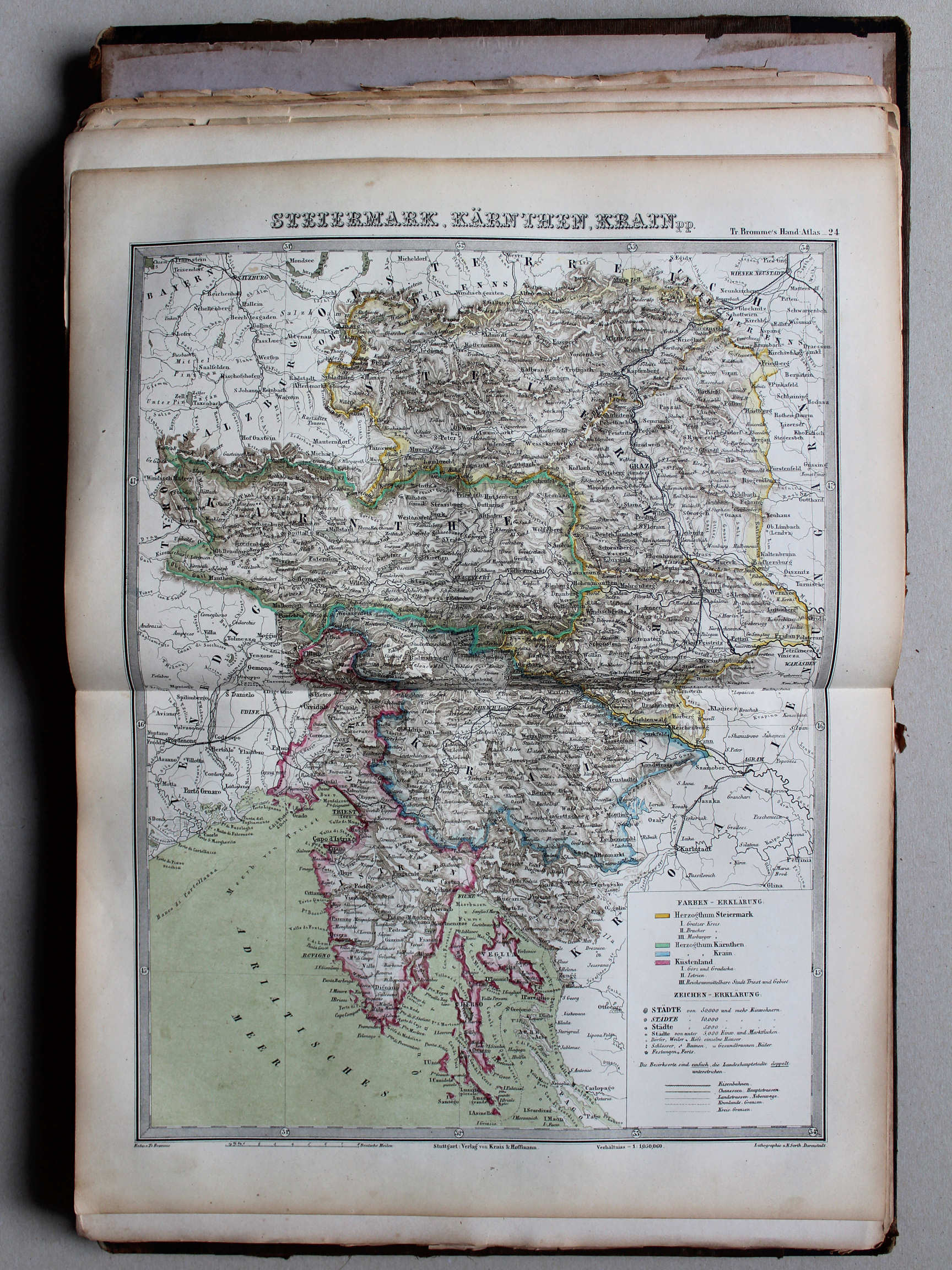
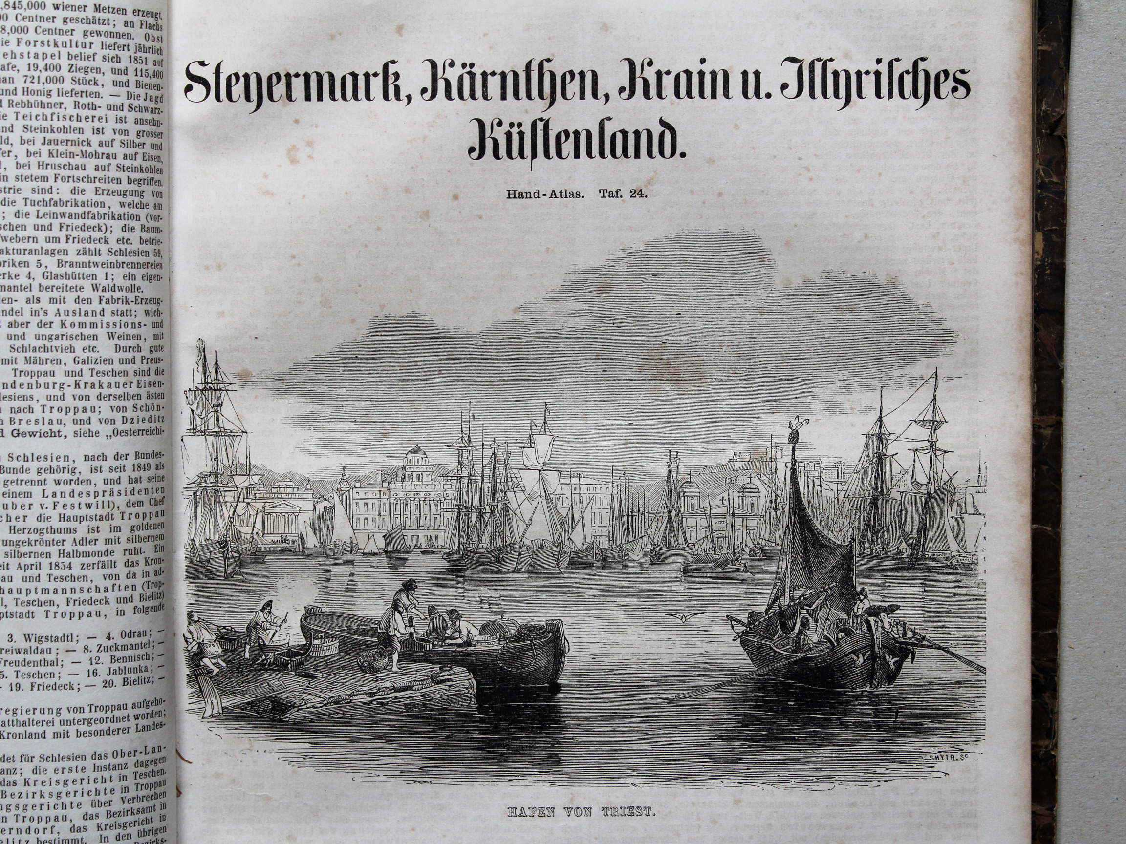
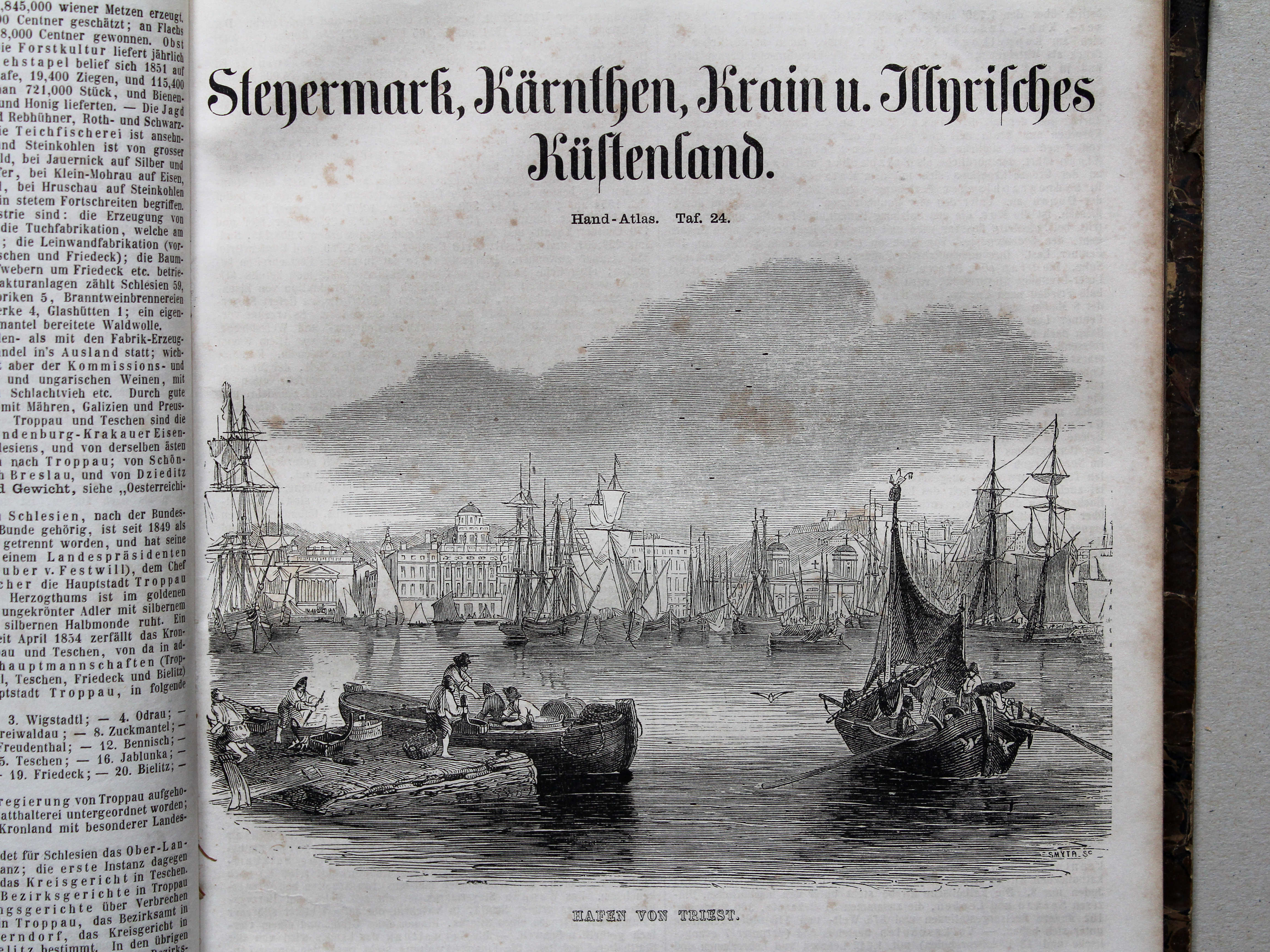
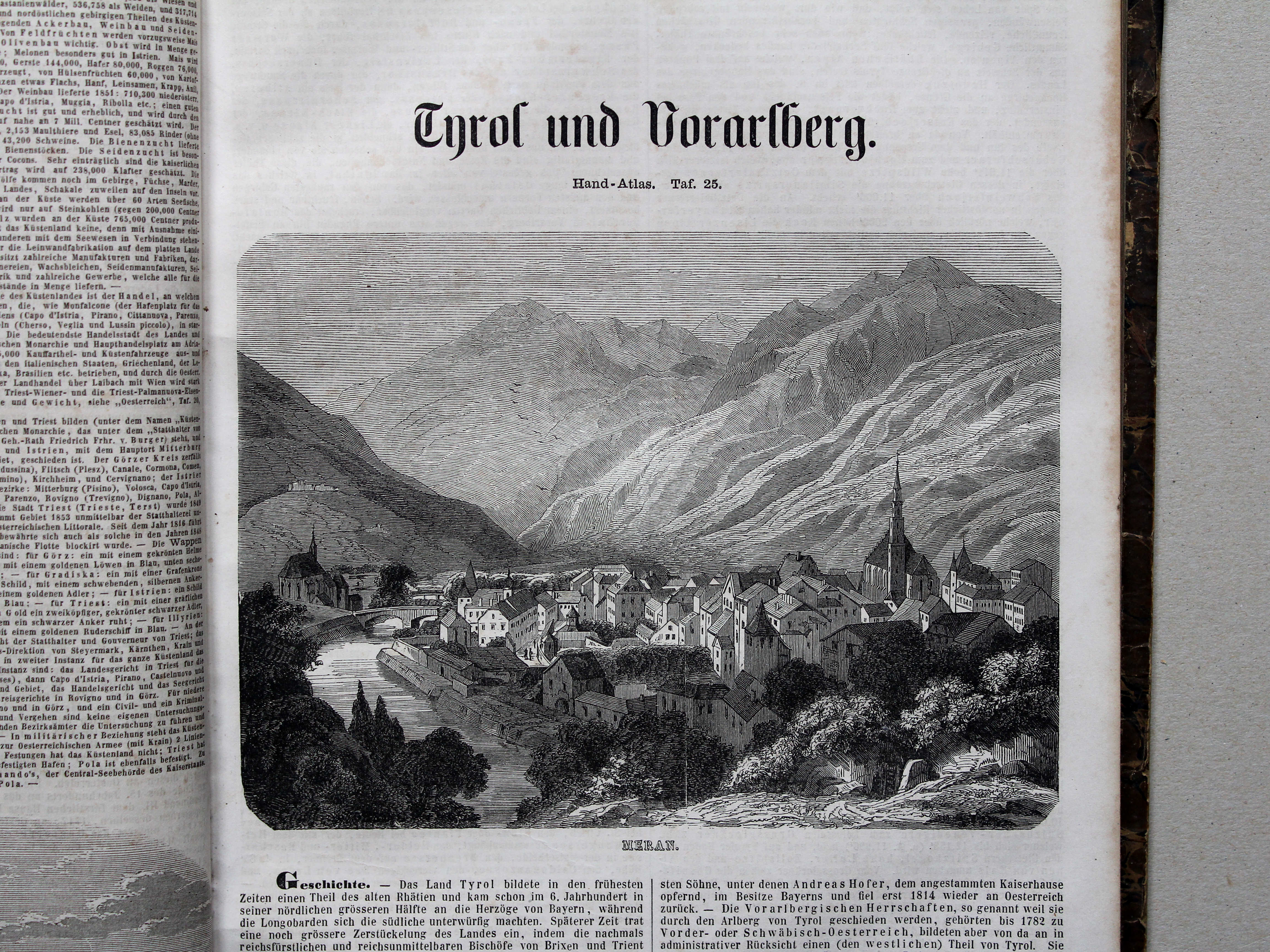
24. Steiermark, Kärnten, Krain pp. XL
Stiermarken, Karinthië, Krain enz. / Styria, Carinthia, Carniola etc.
 Bromme, Illustrirter Hand-Atlas, 1862
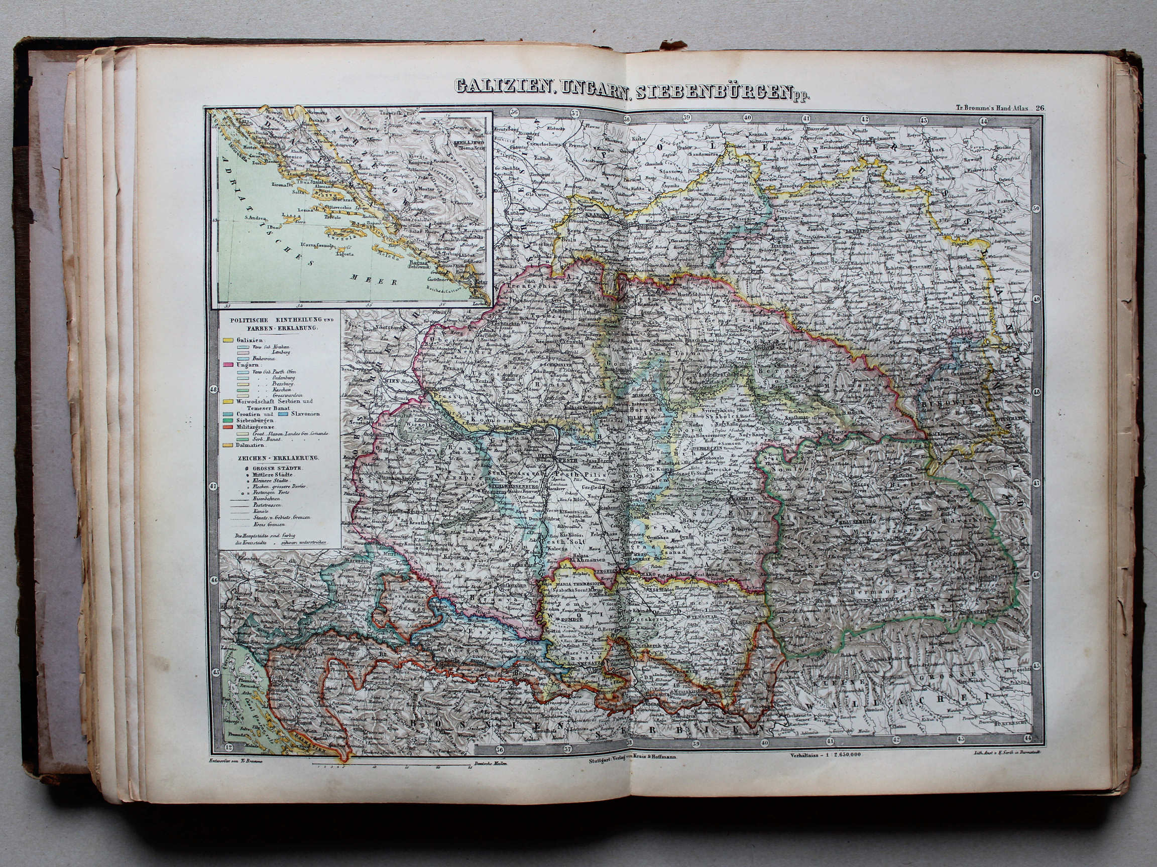
26. Galizien, Ungarn, Siebenbürgen pp. XL
Galicië, Hongarije, Transsylvanië enz. / Galicia, Hungary, Transylvanis etc.
 Bromme, Illustrirter Hand-Atlas, 1862
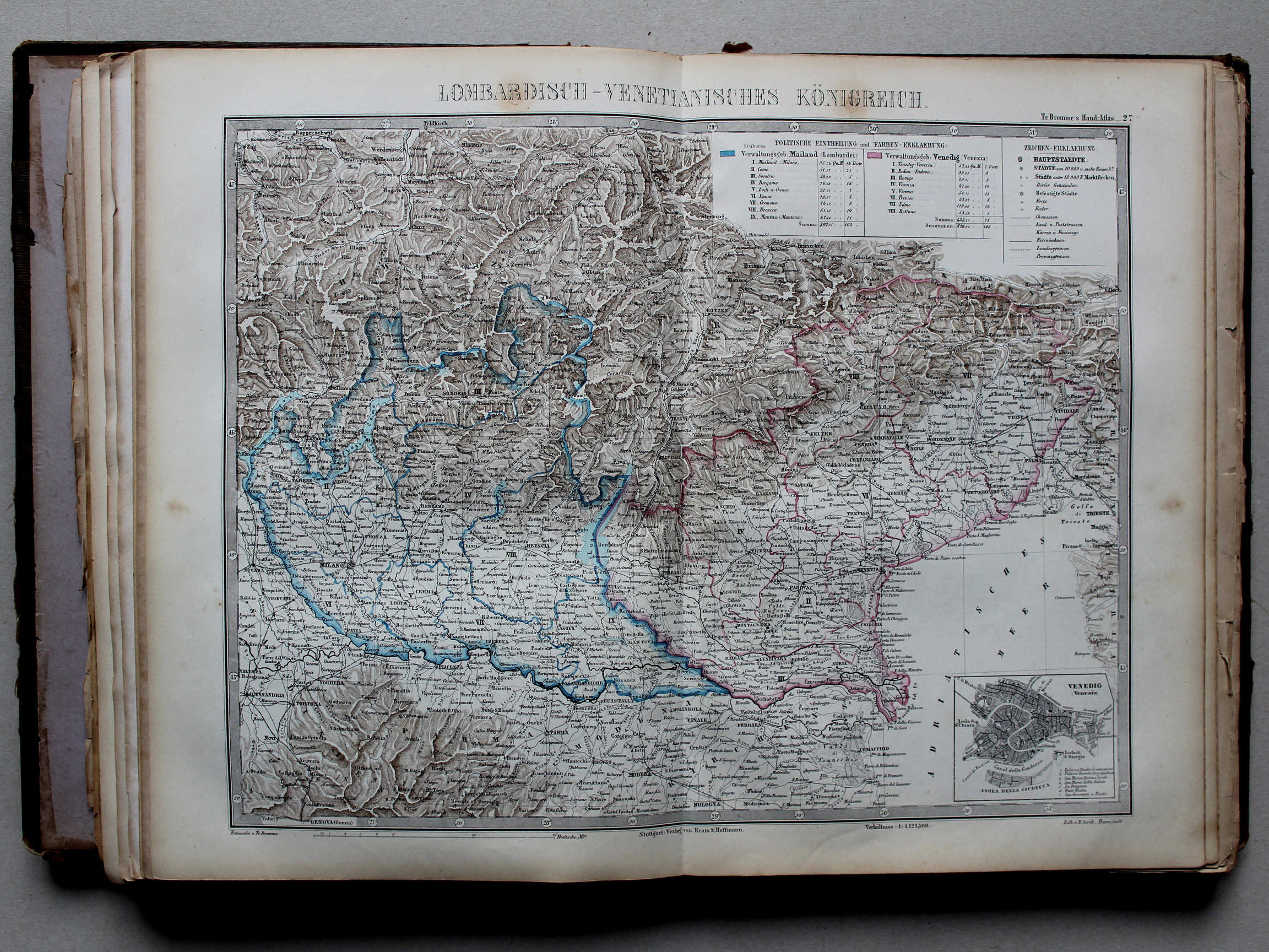
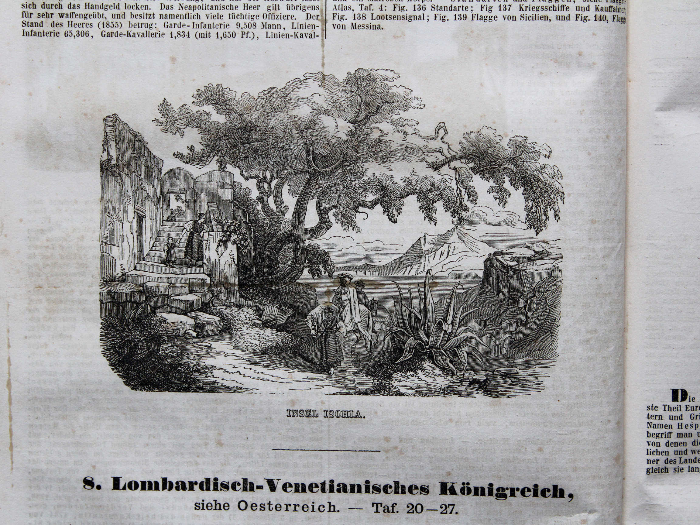
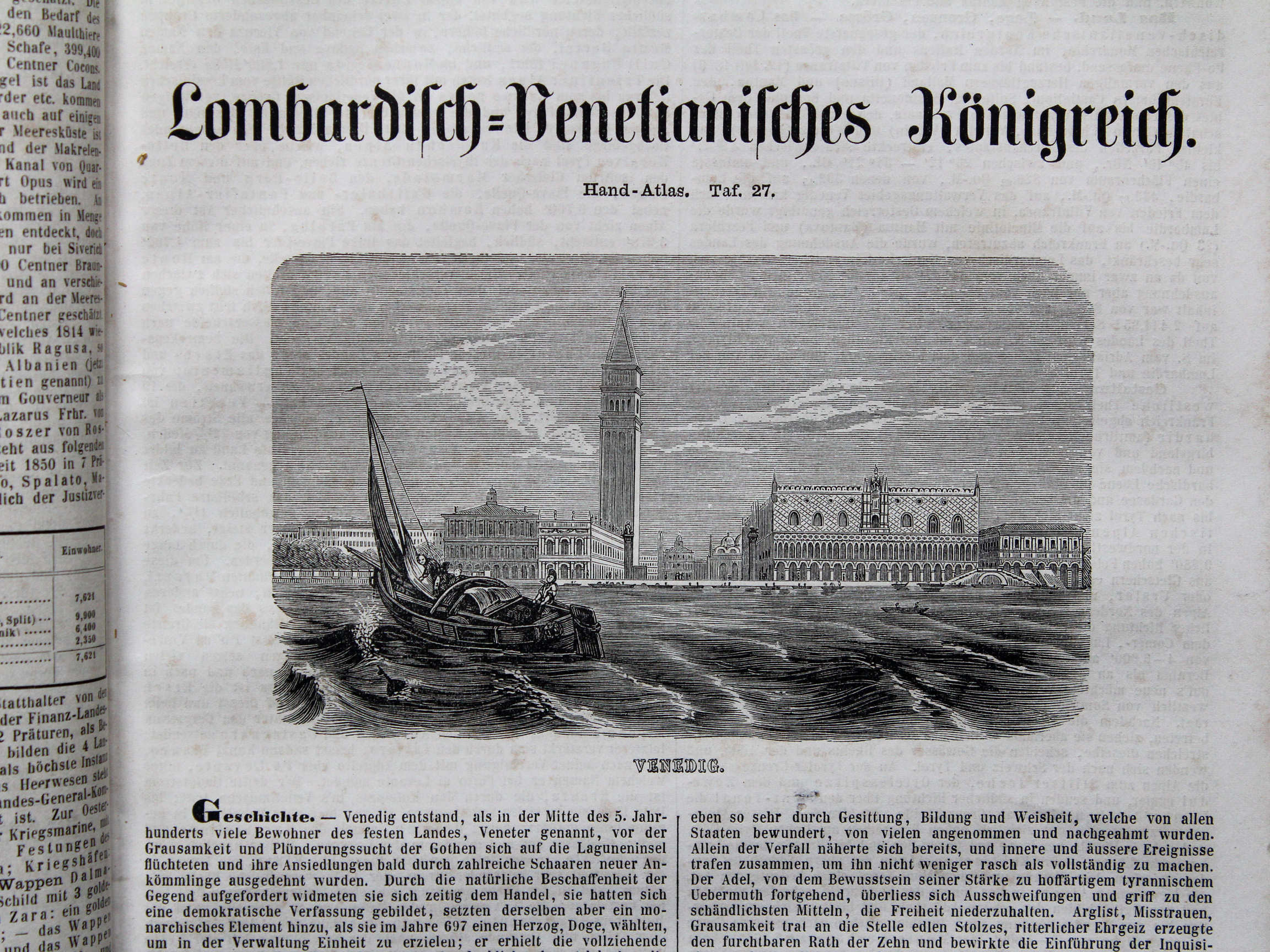
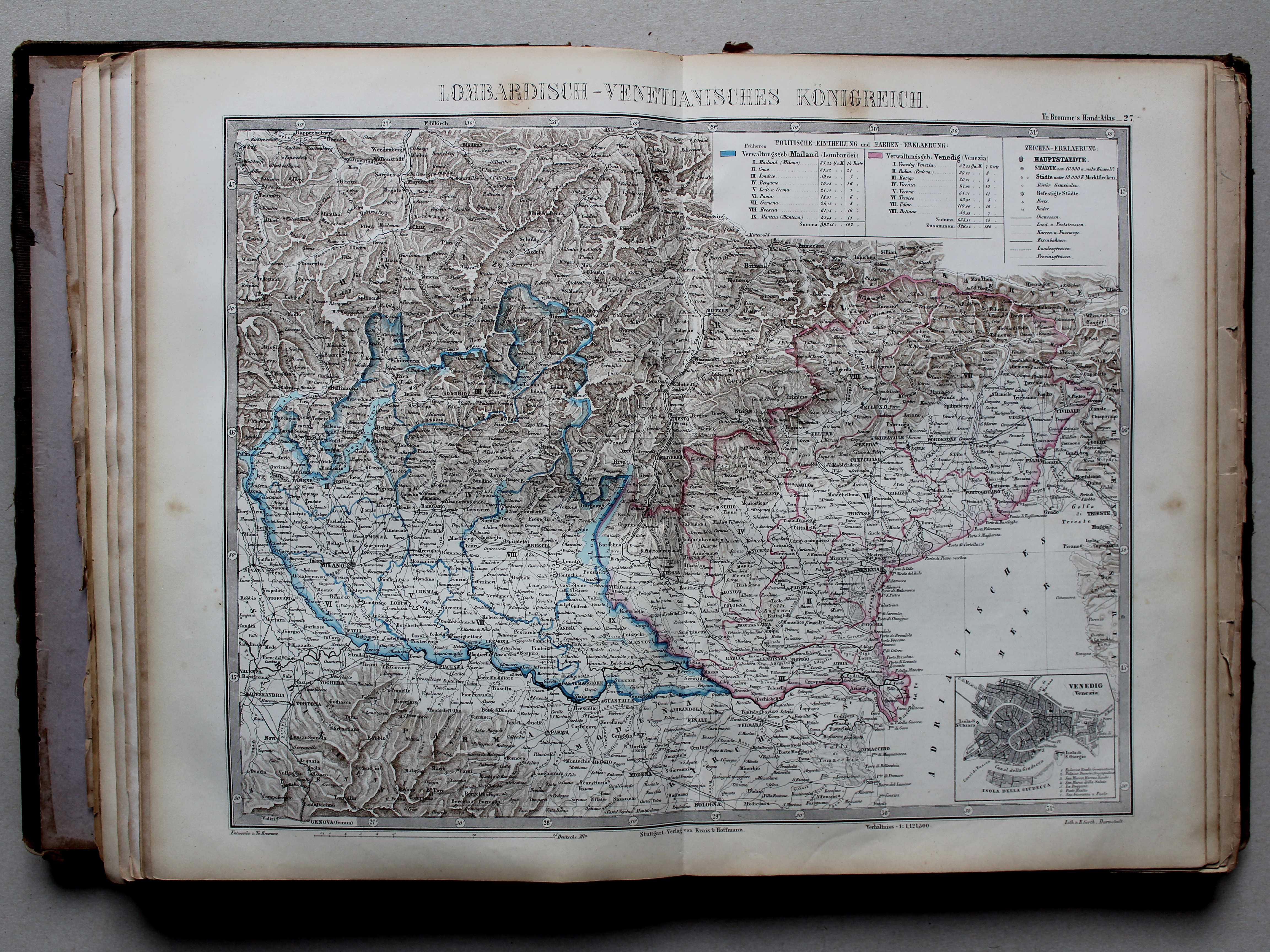
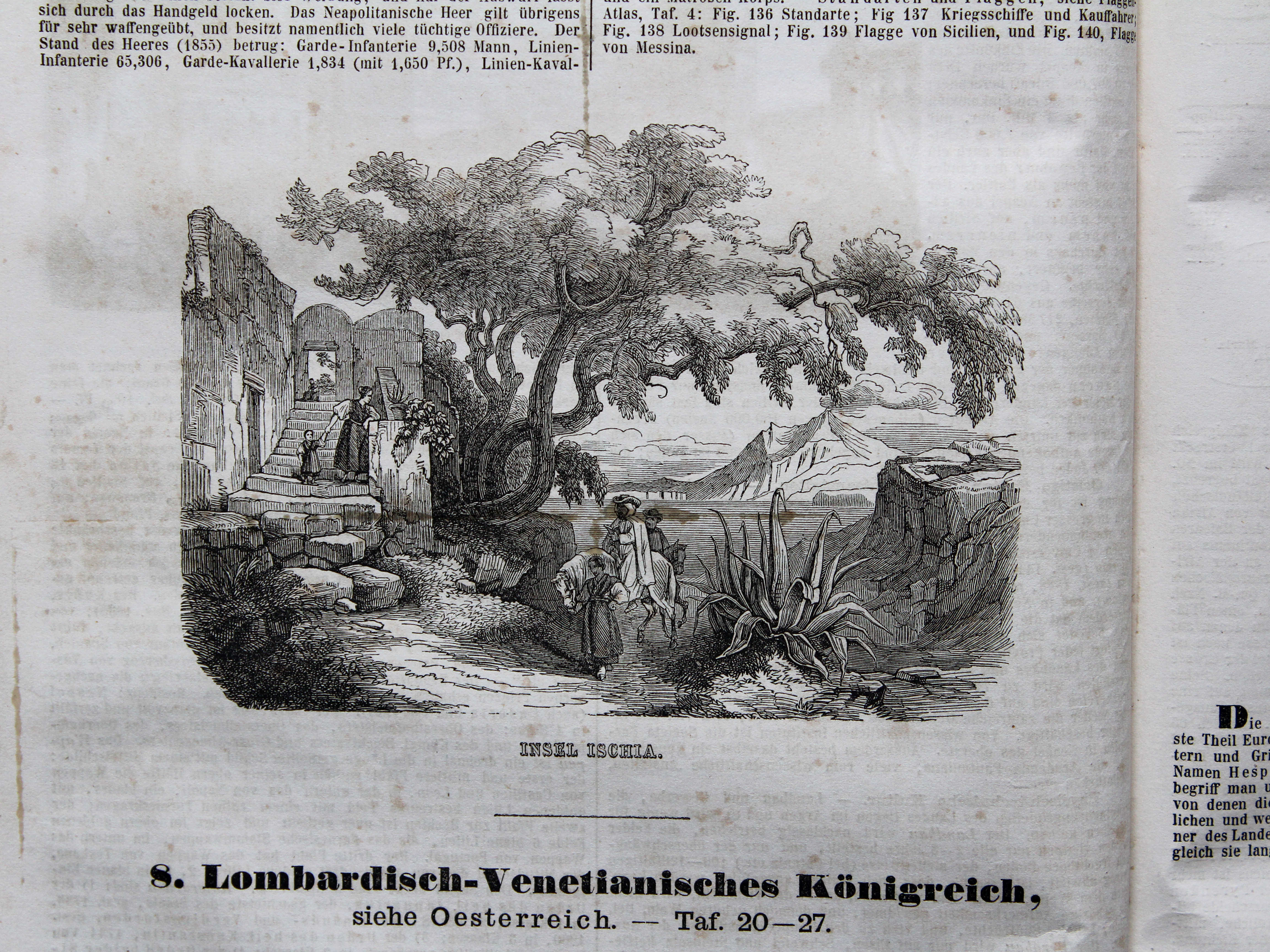
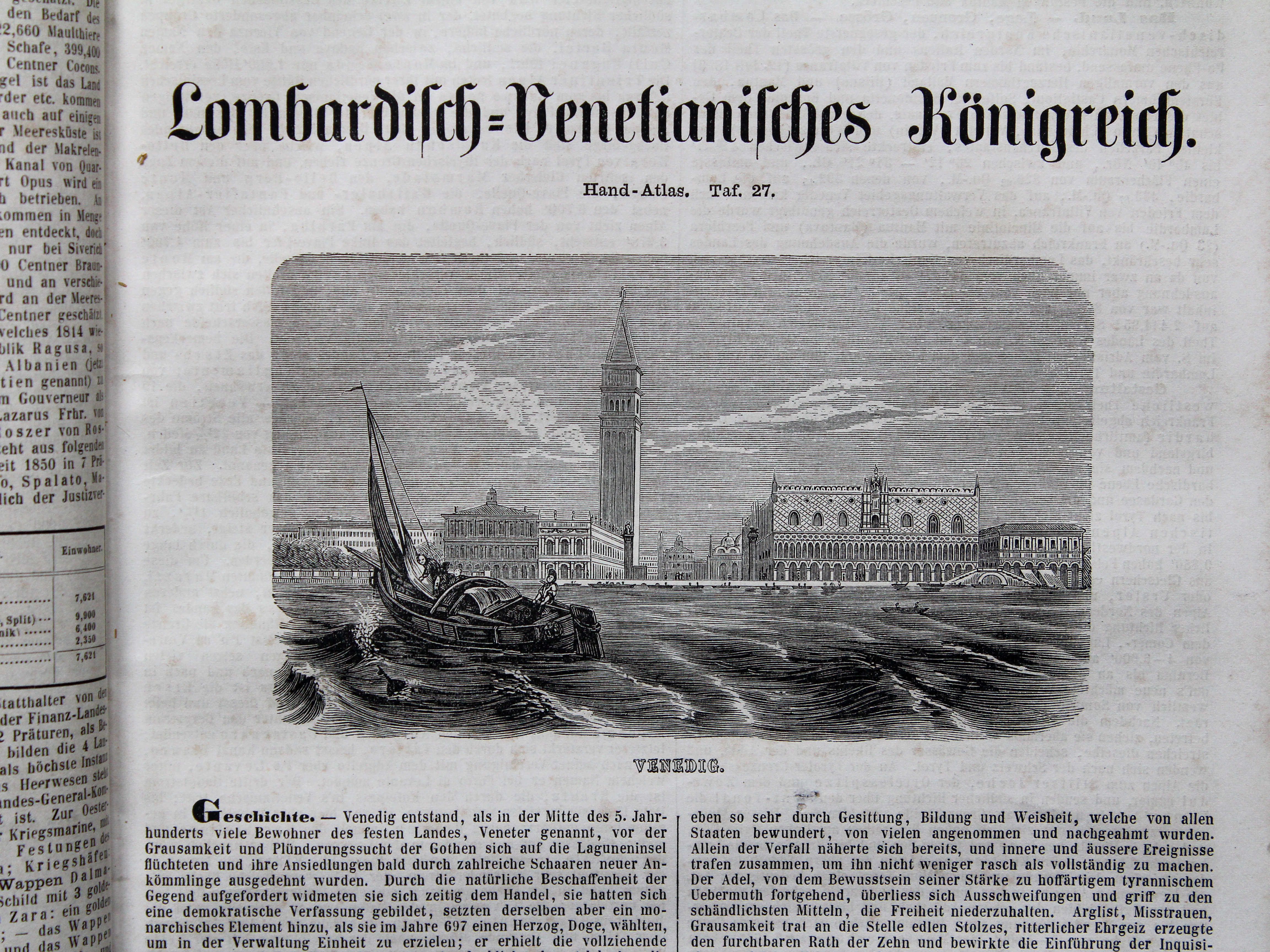
27. Lombardisch-Venetianisches Königreich XL
Koninkrijk Lombardije-Venetië / Kingdom of Lombardy–Venetia
 Bromme, Illustrirter Hand-Atlas, 1862
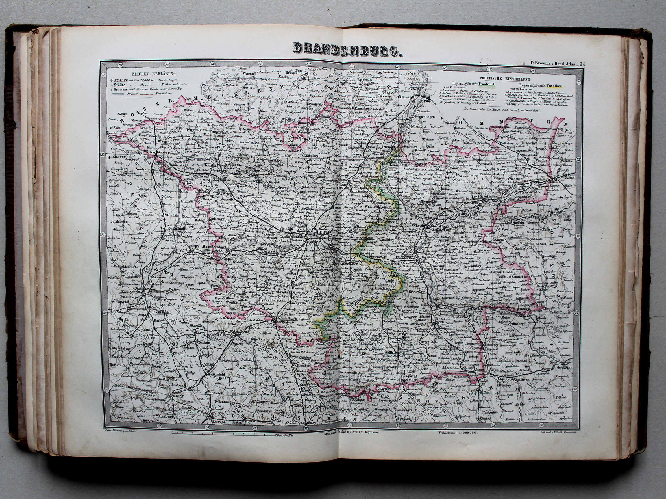
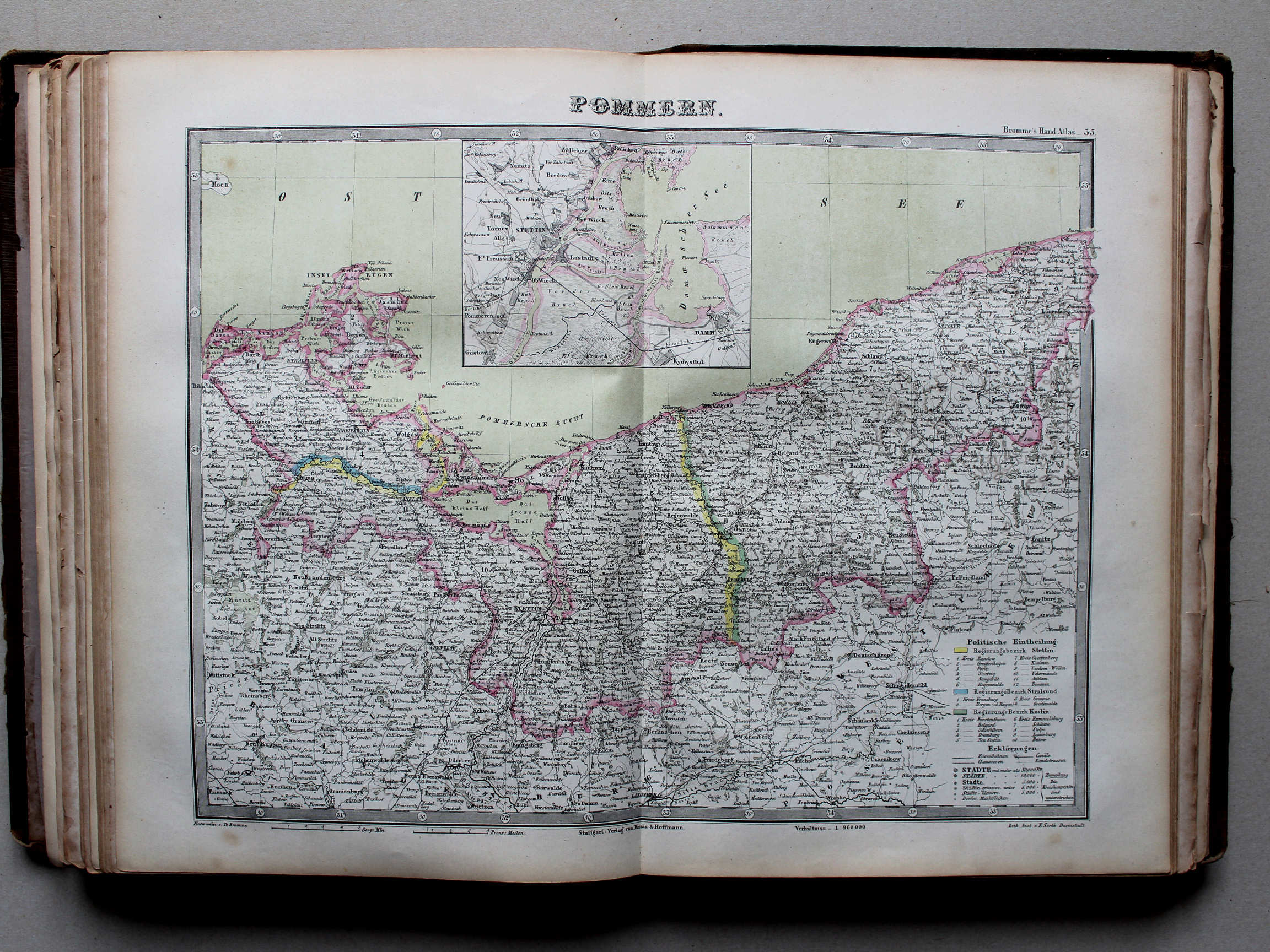
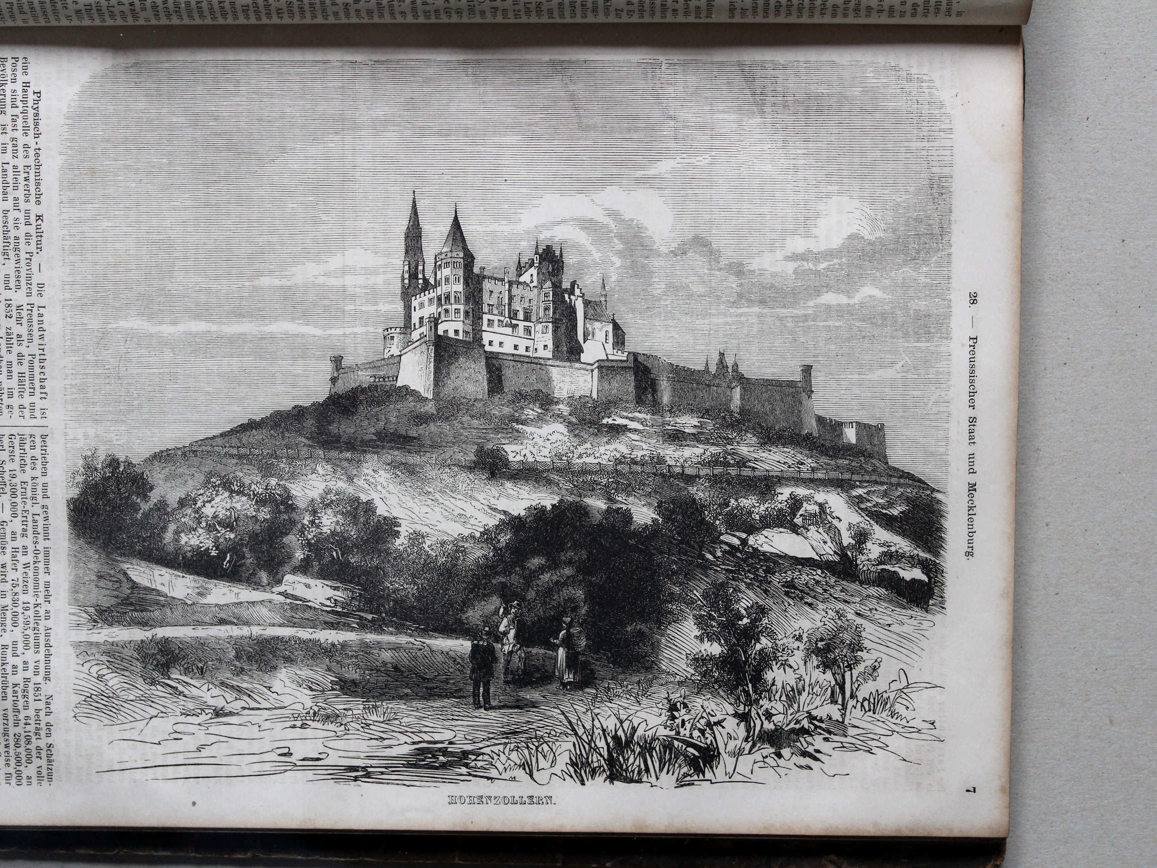
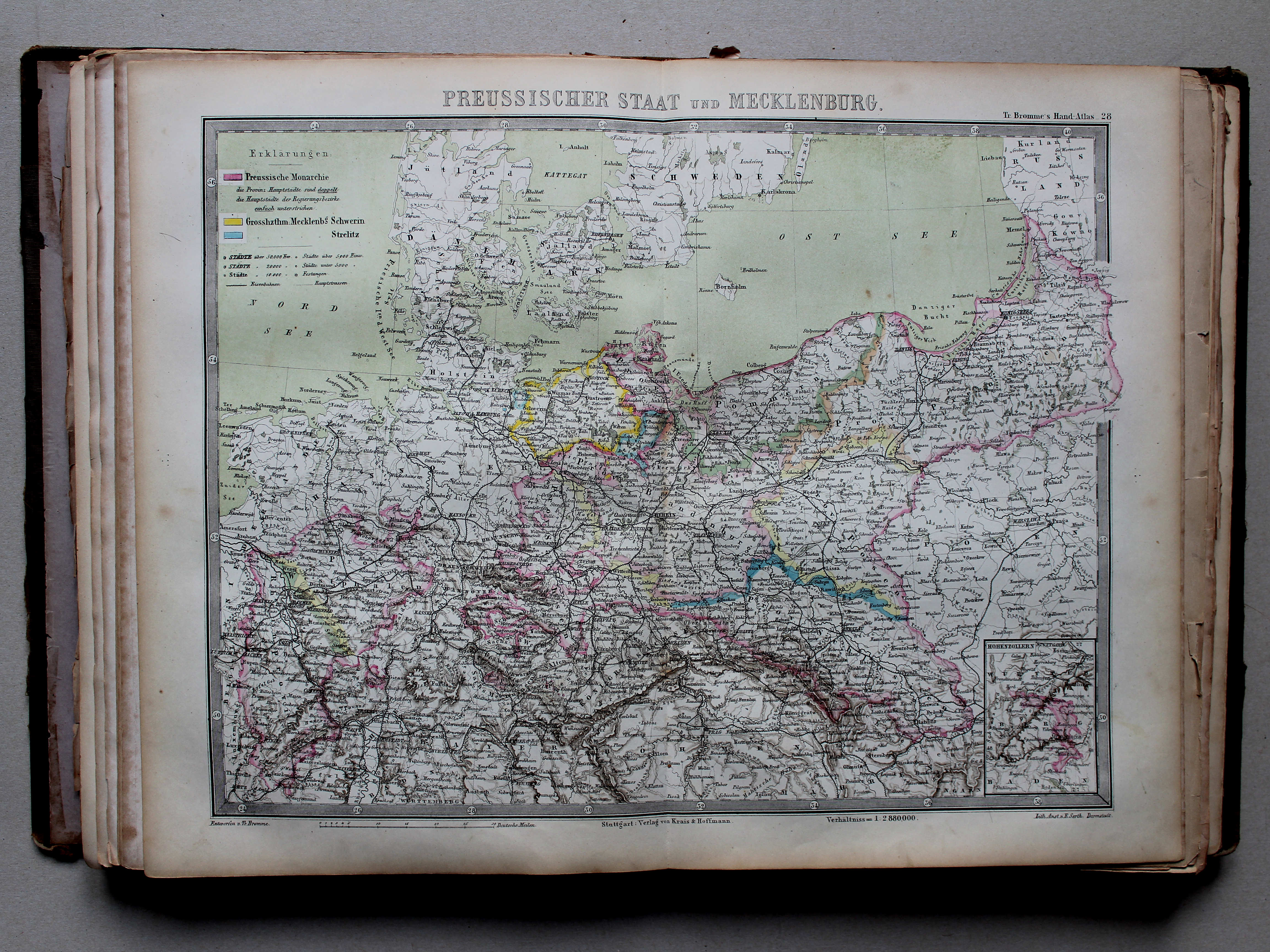
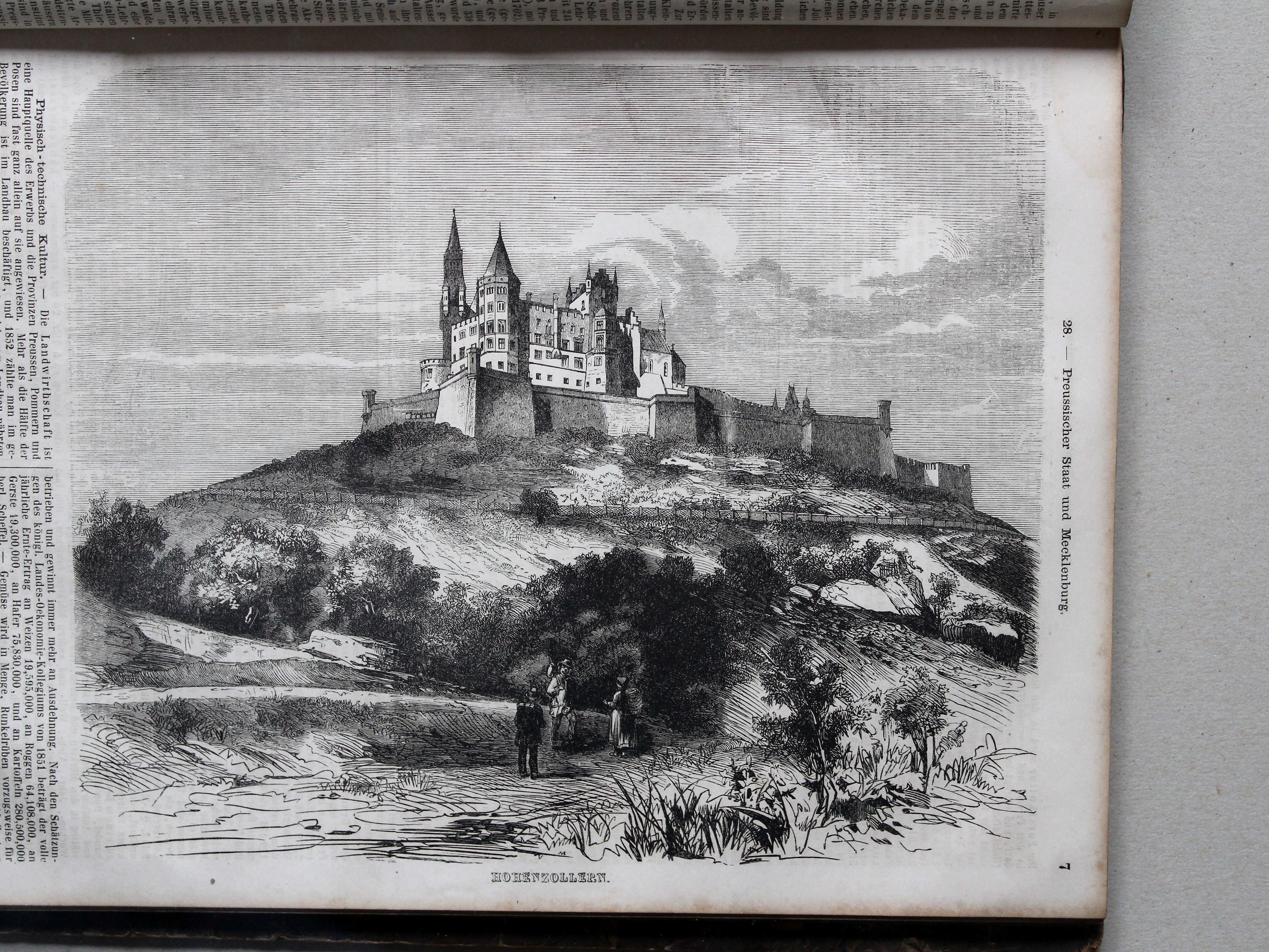
28. Preussischer Staat und Mecklenburg XL
Koninkrijk Pruisen en Mecklenburg / Kingdom of Prussia and Mecklenburg
 Bromme, Illustrirter Hand-Atlas, 1862
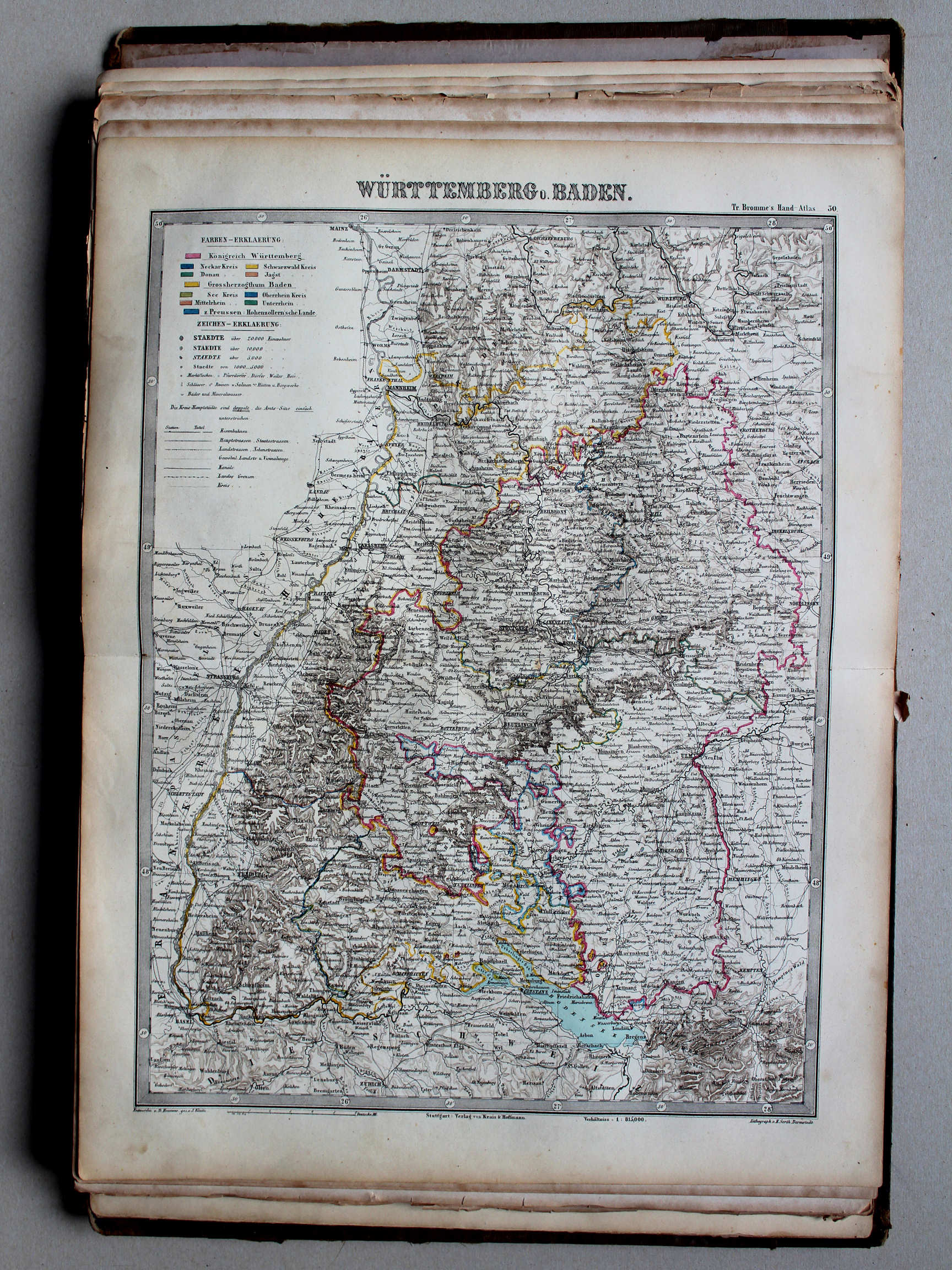
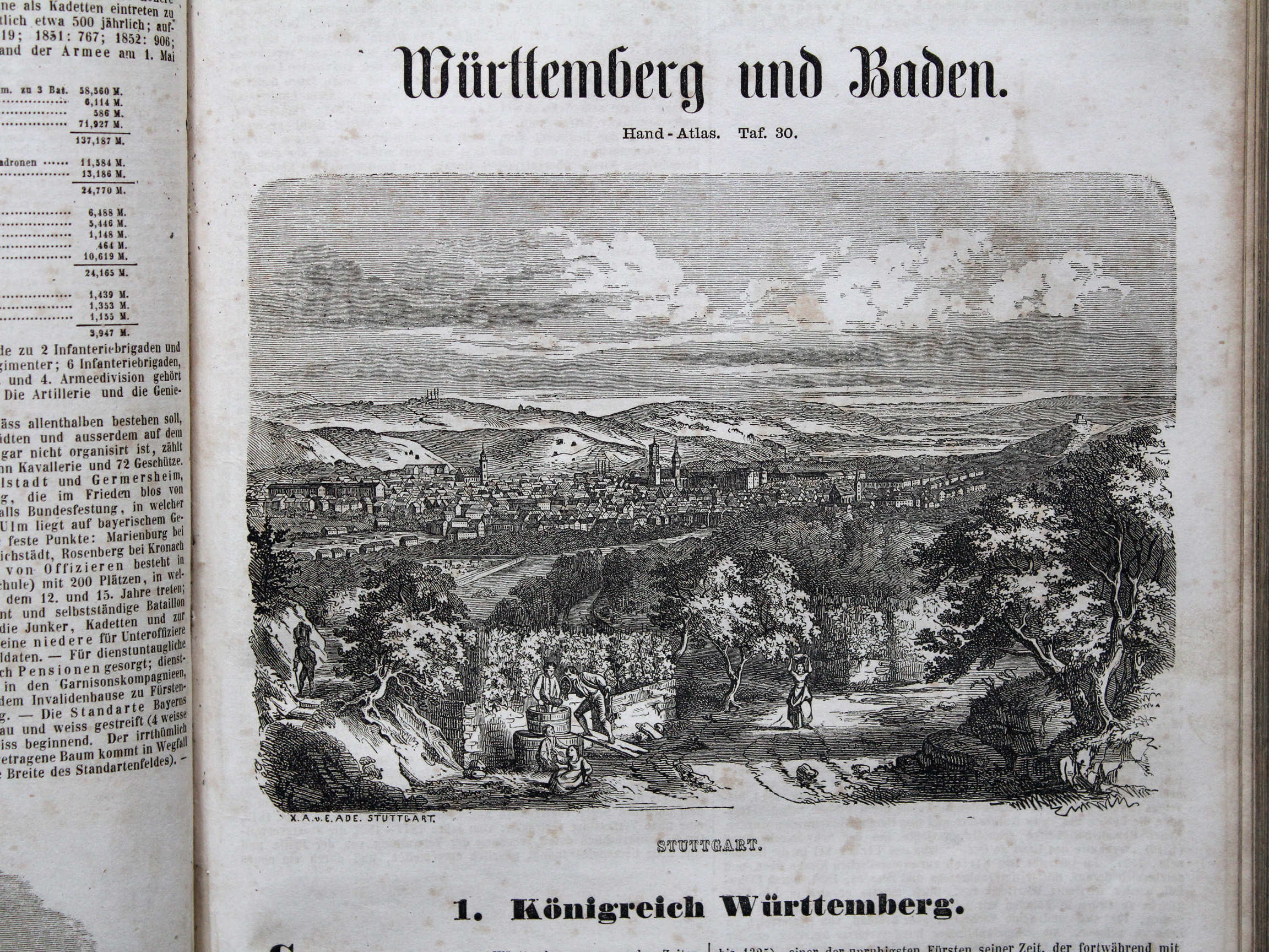
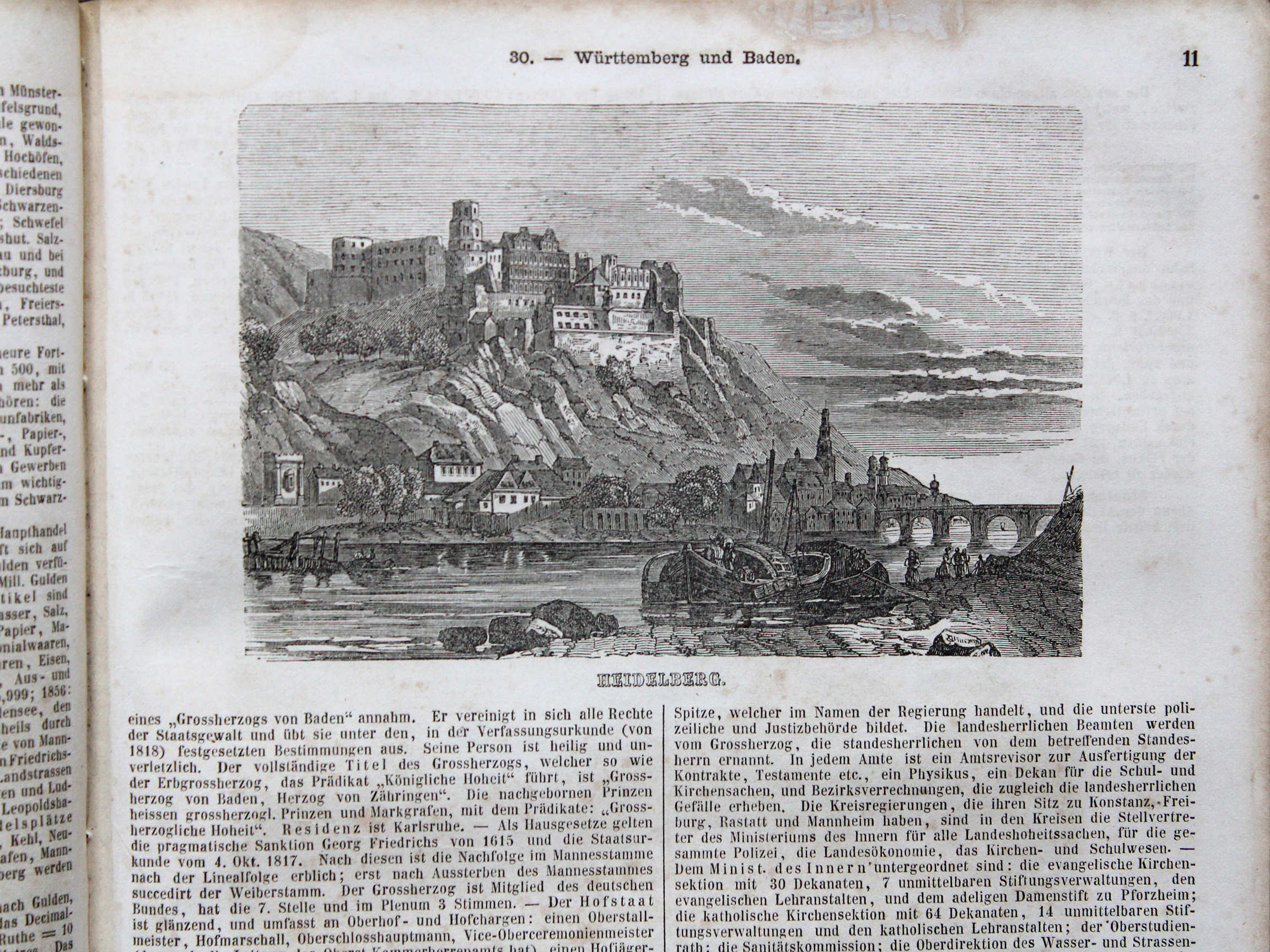
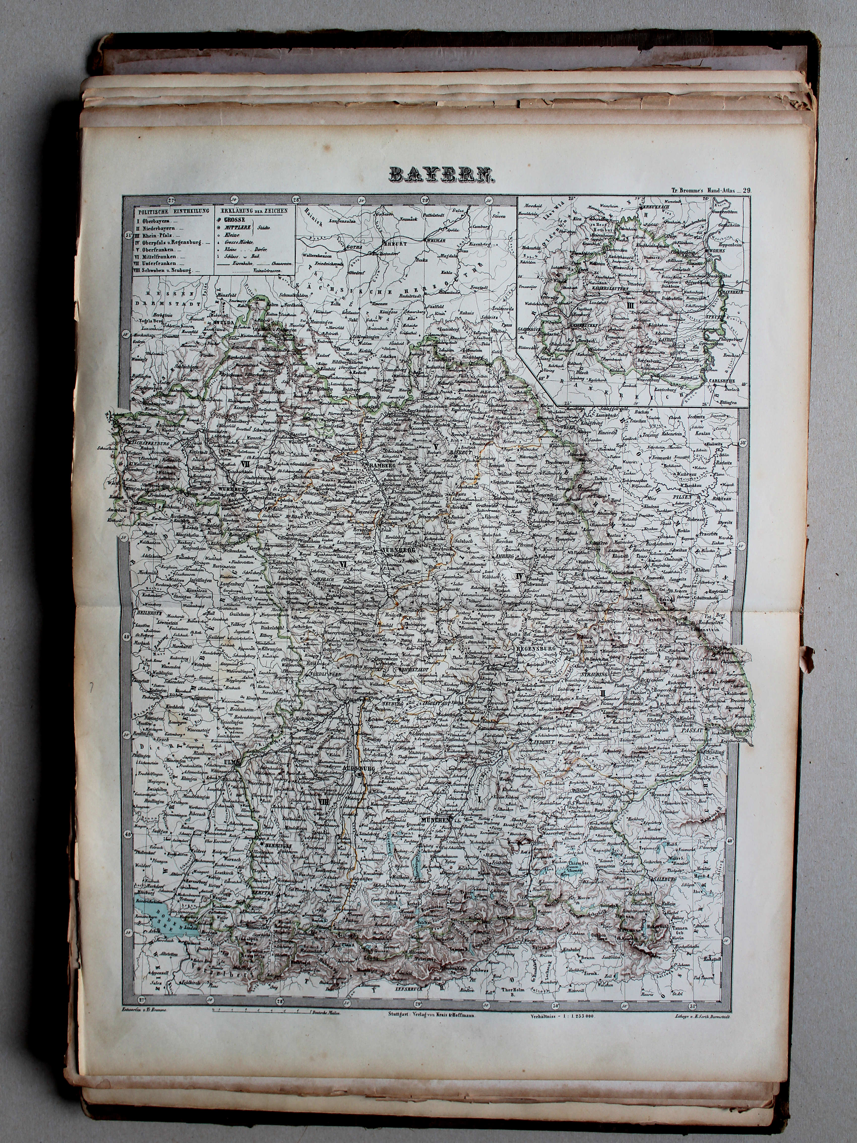
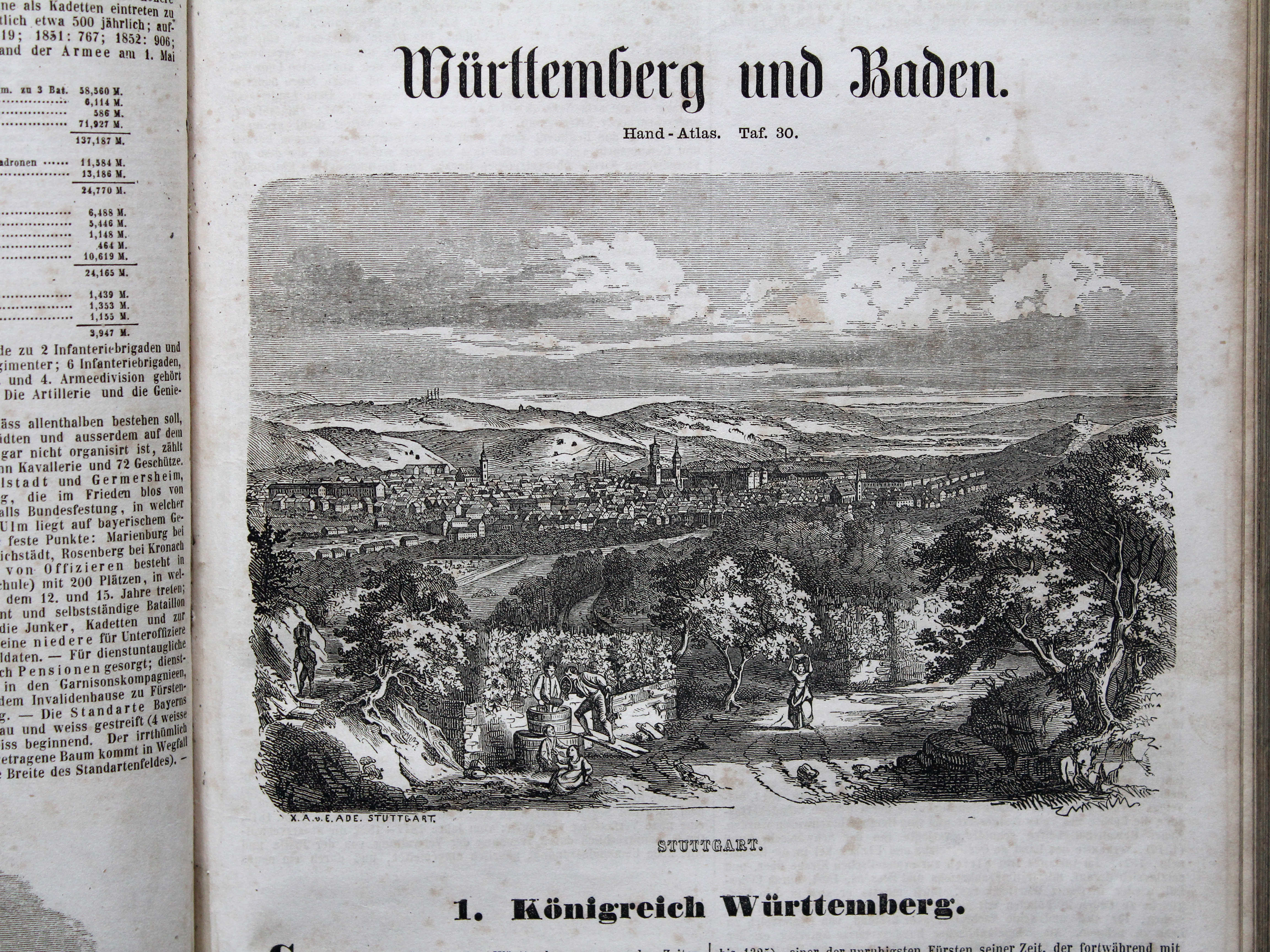
30. Württemberg u. Baden XL
Württemberg en Baden / Württemberg and Baden
 Bromme, Illustrirter Hand-Atlas, 1862
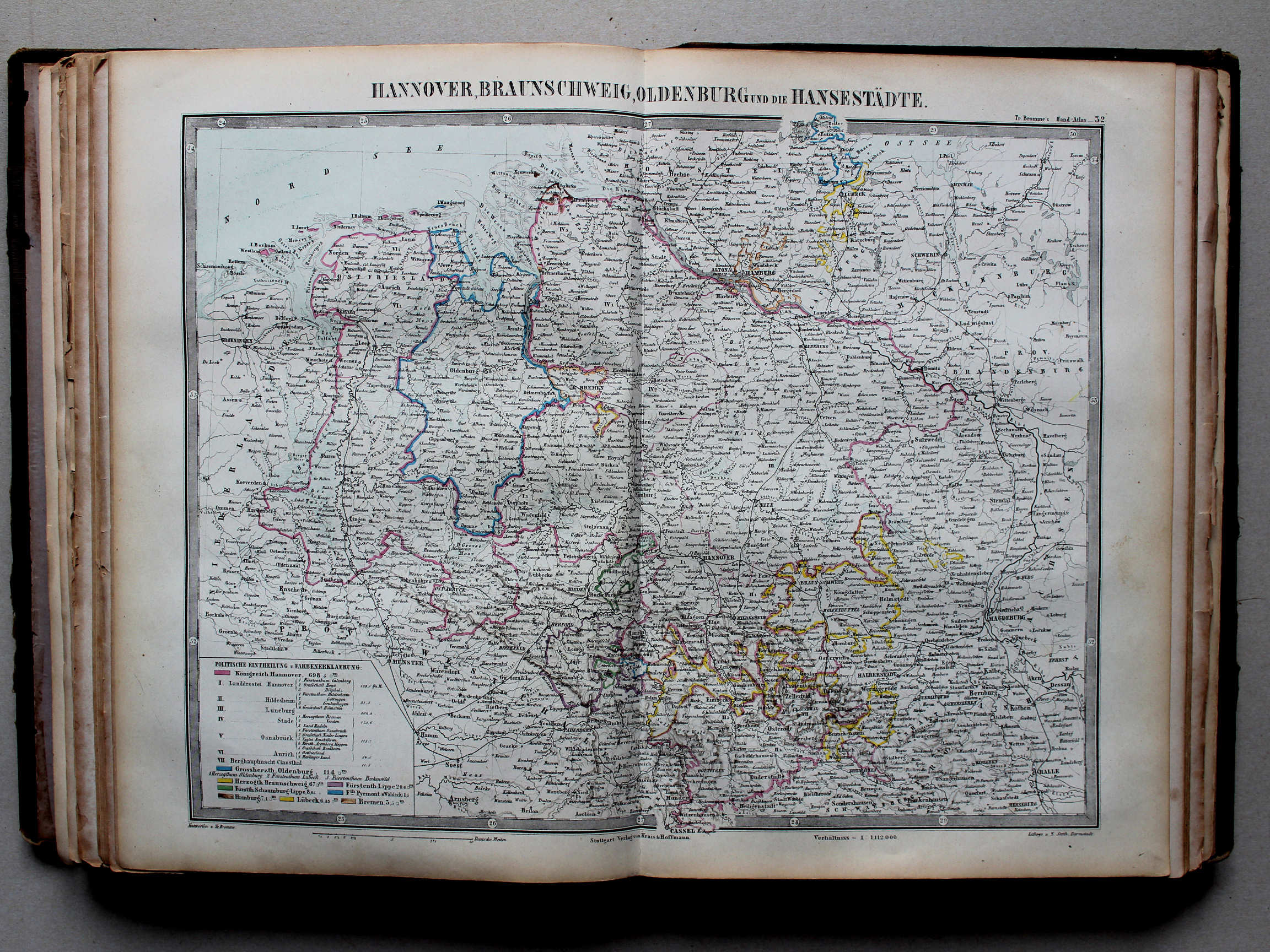
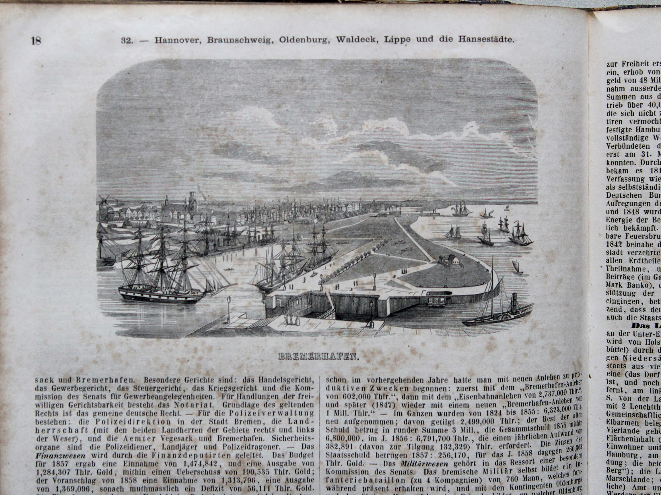
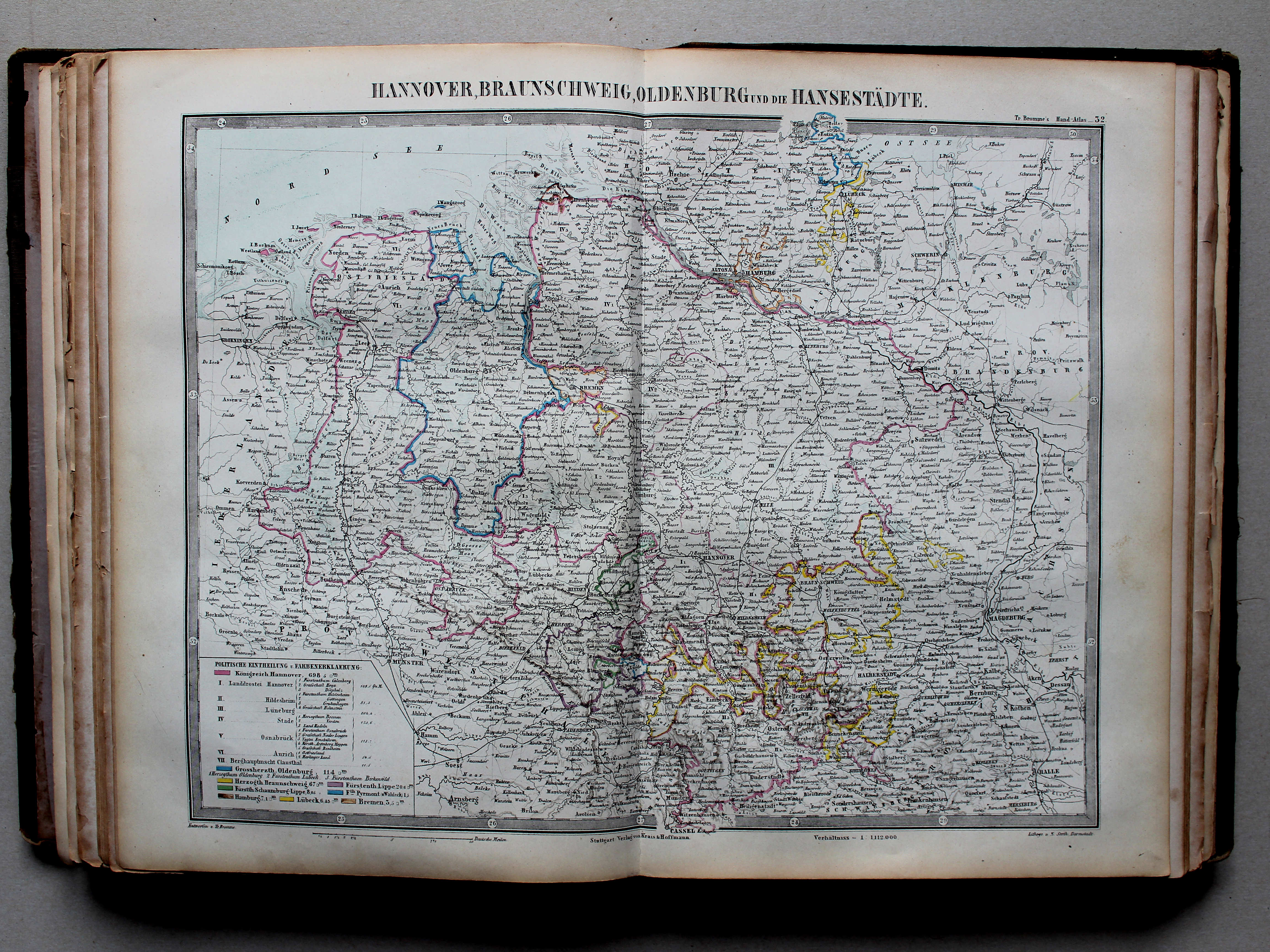
32. Hannover, Braunschweig, Oldenburg und die Hansestädte XL
Hannover, Brunswijk, Oldenburg en de Hanzesteden / Hanover, Brunswick, Oldenburg and the Hansa cities
 Bromme, Illustrirter Hand-Atlas, 1862
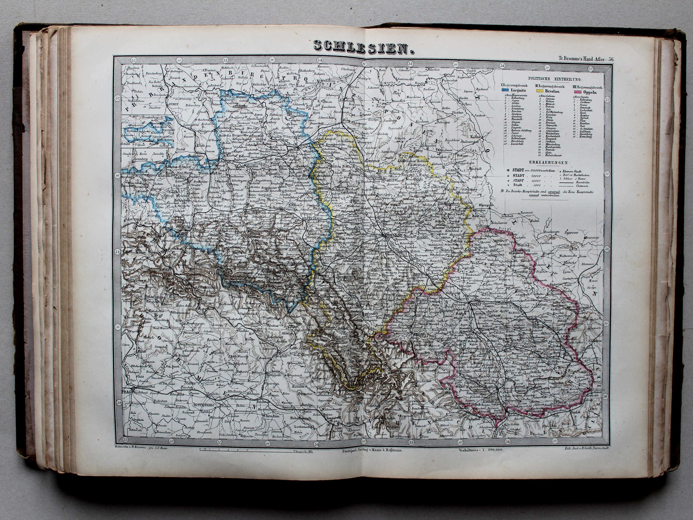
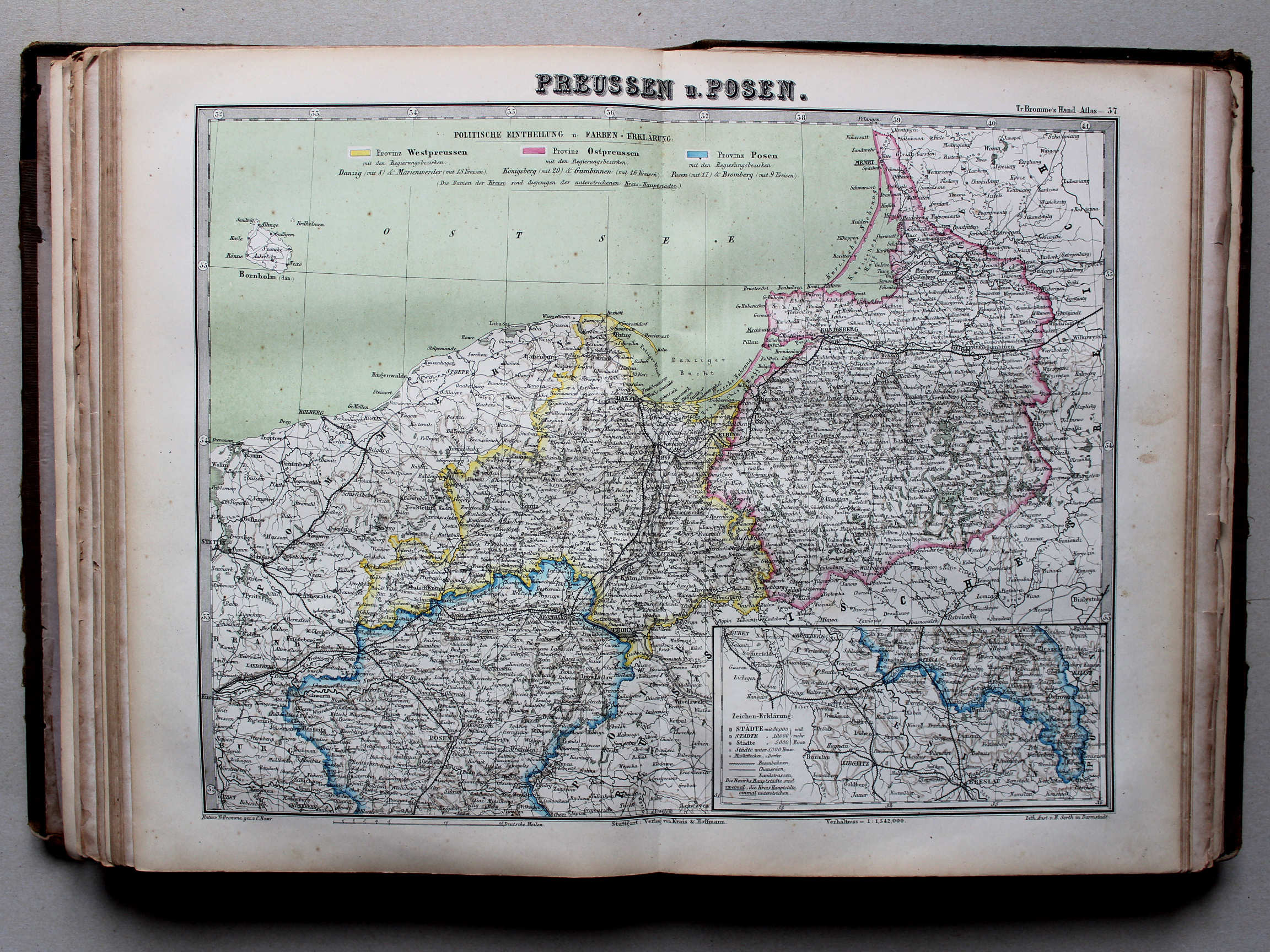
37. Preussen u. Posen XL
Provincies Pruisen en Posen / Provinces of Prussia and Posen
 Bromme, Illustrirter Hand-Atlas, 1862
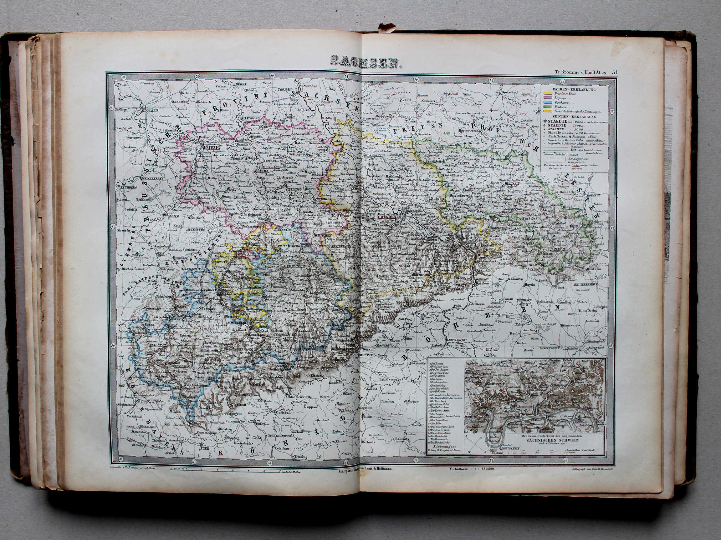
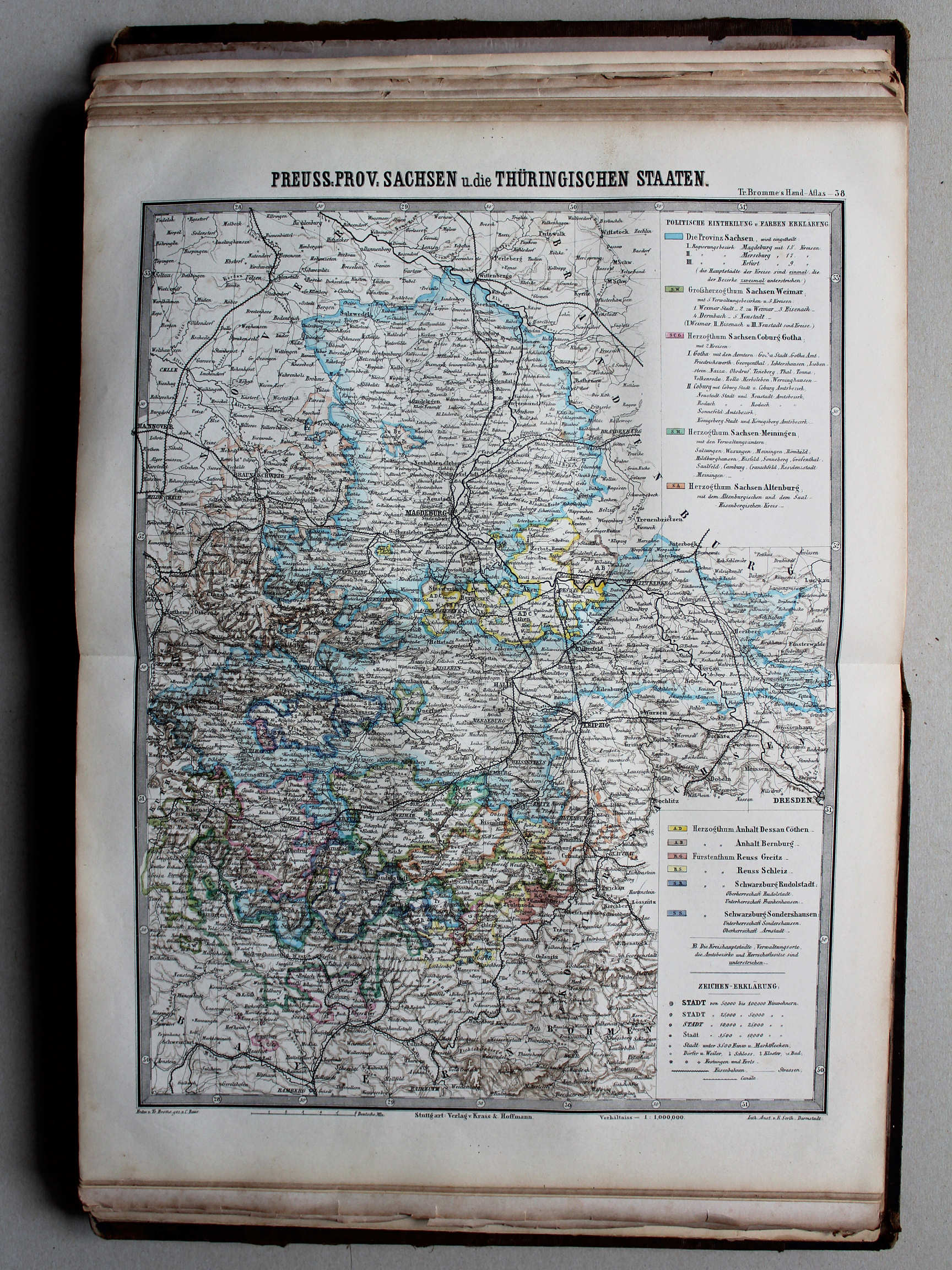
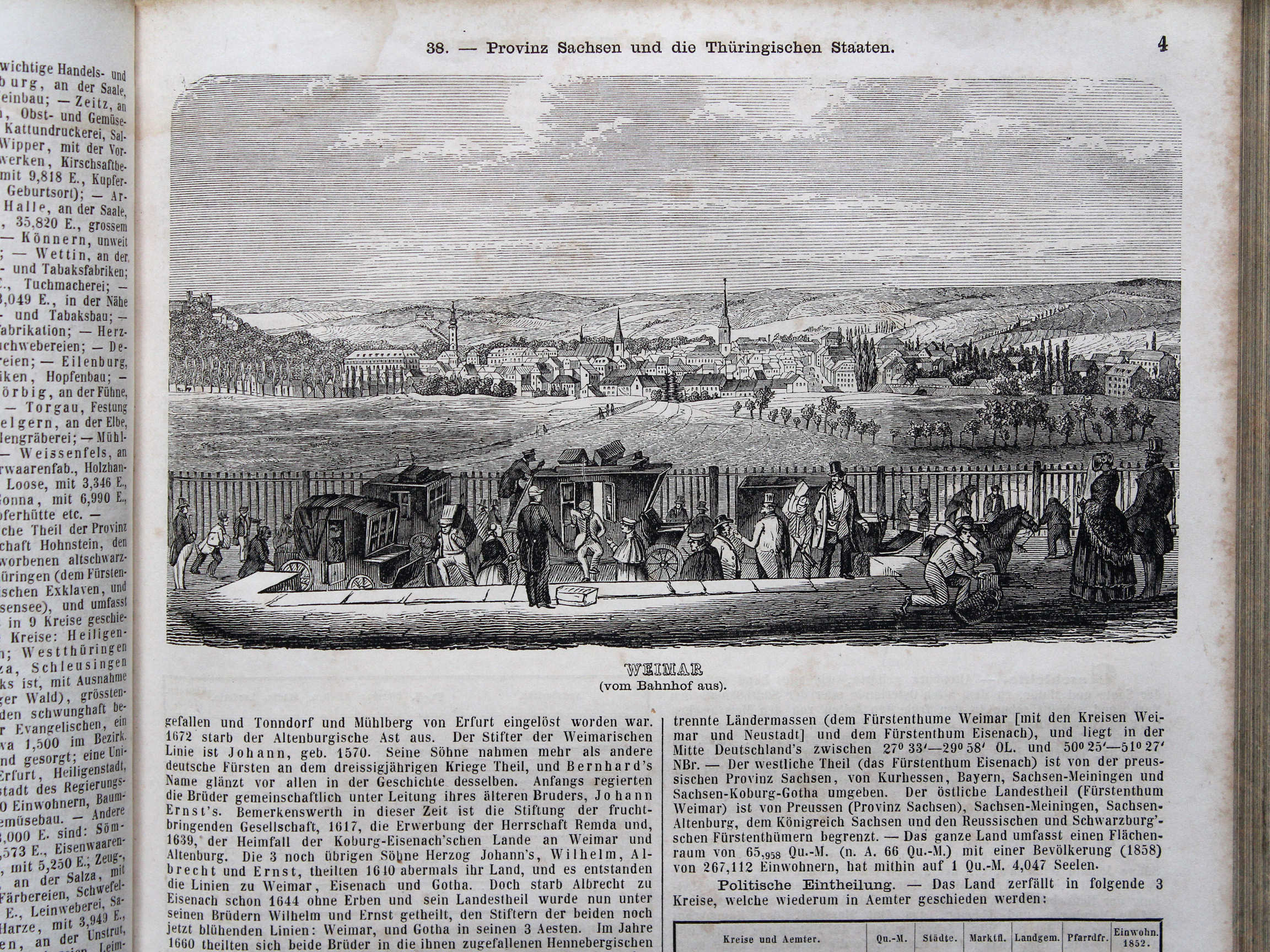
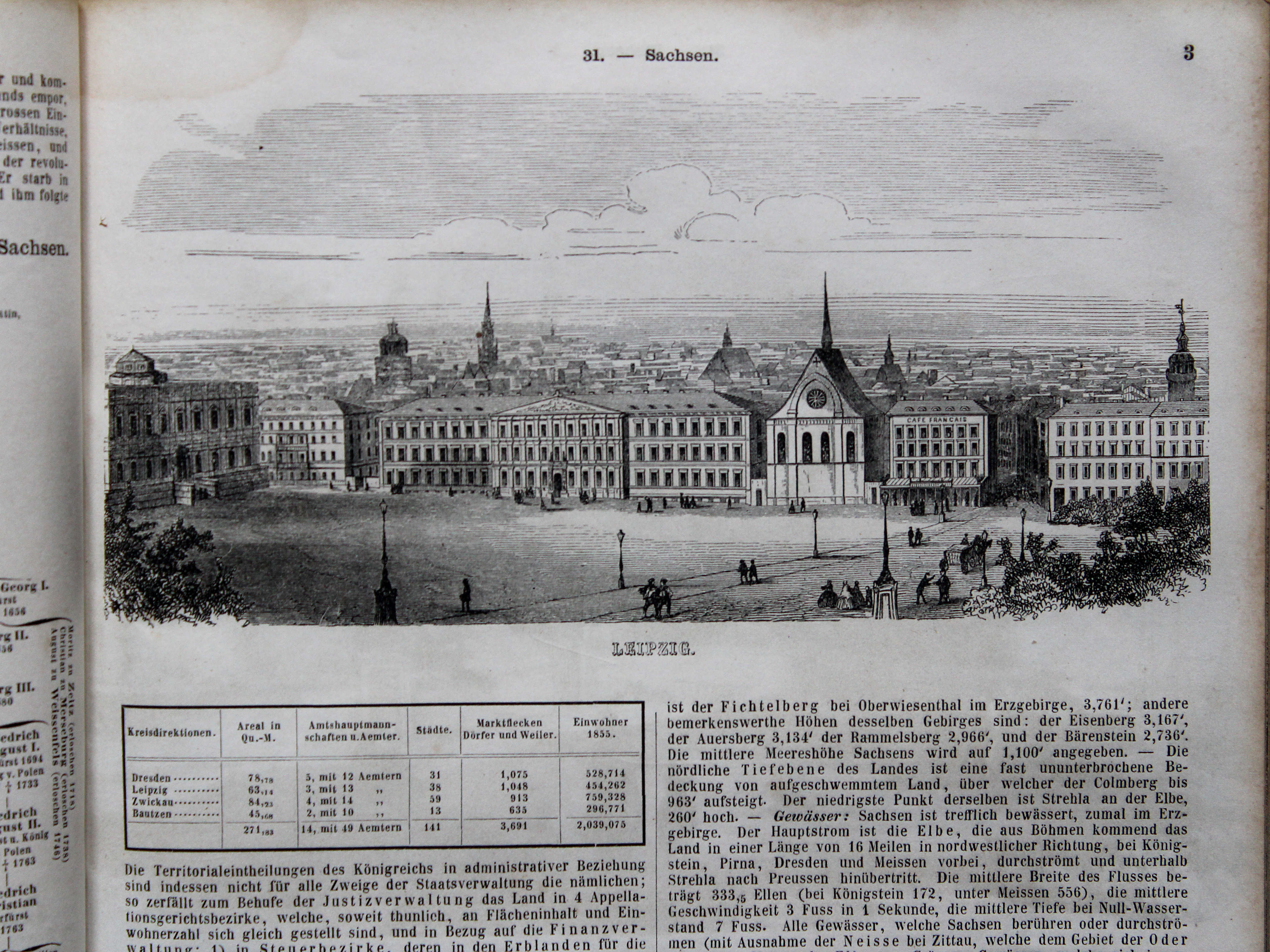
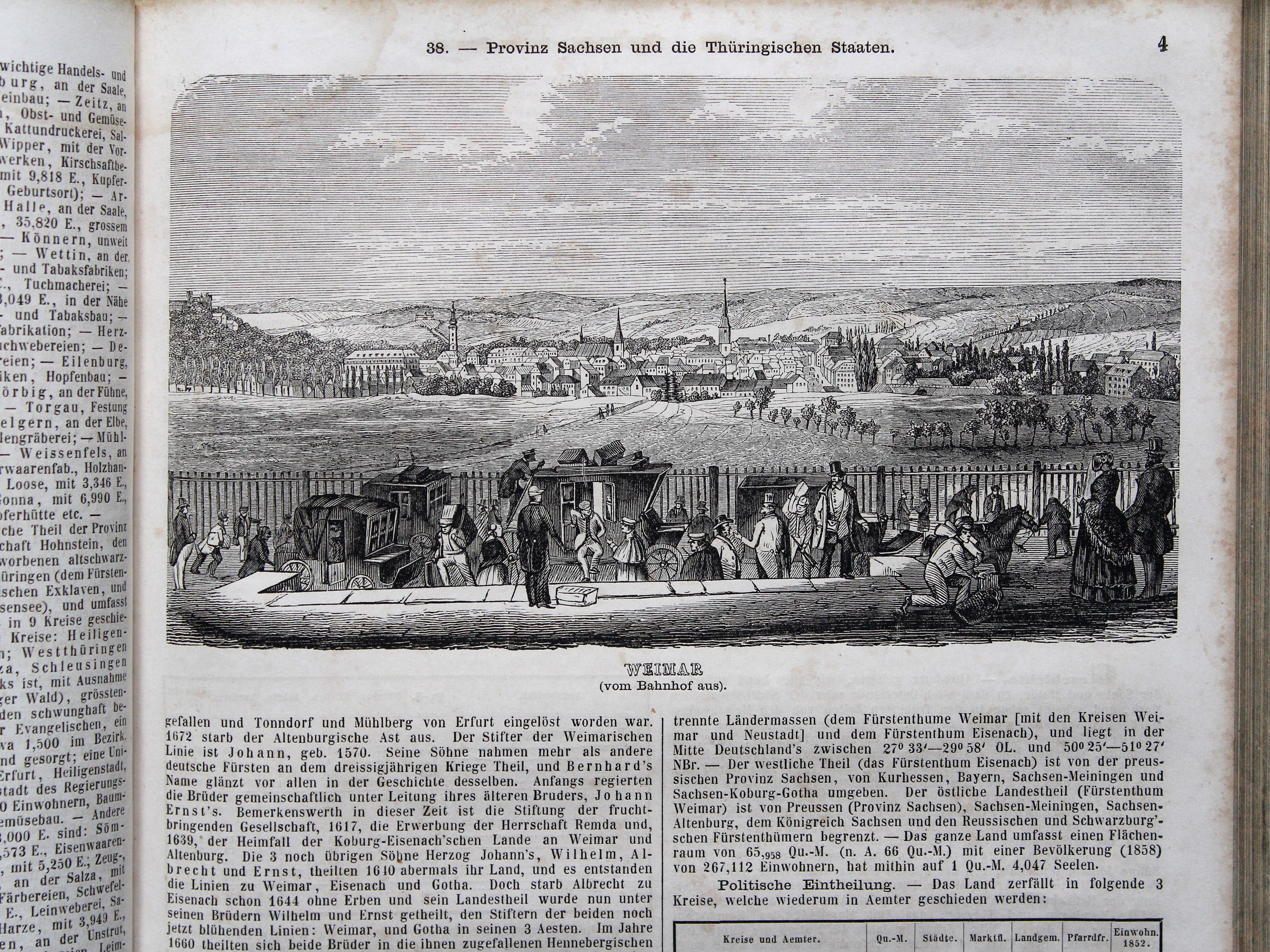
38. Provinz Sachsen und die Thüringischen Staaten XL
Provincie Saksen en de Thüringsche Staten / Province of Saxony and the Thuringian States
 Bromme, Illustrirter Hand-Atlas, 1862
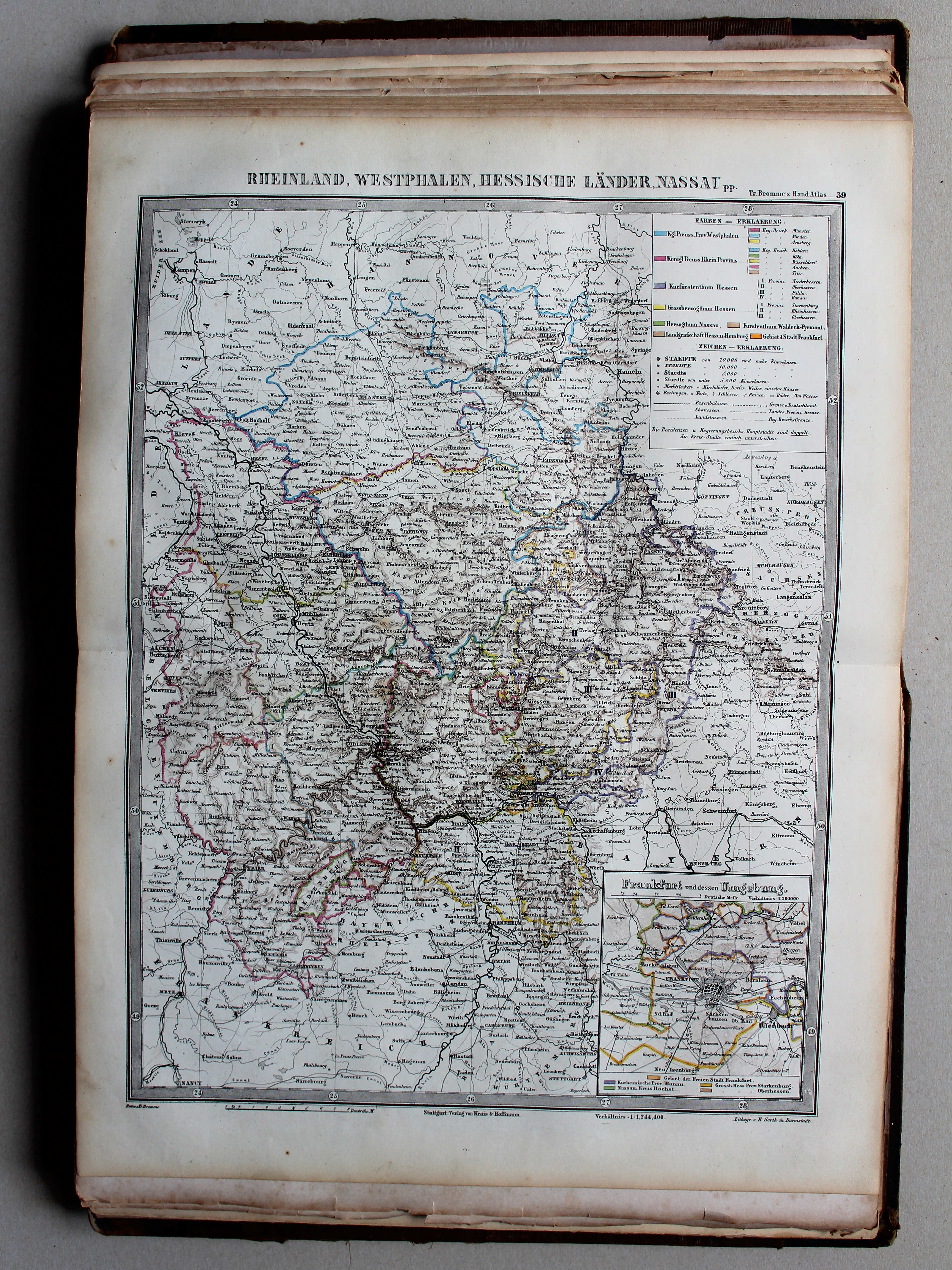
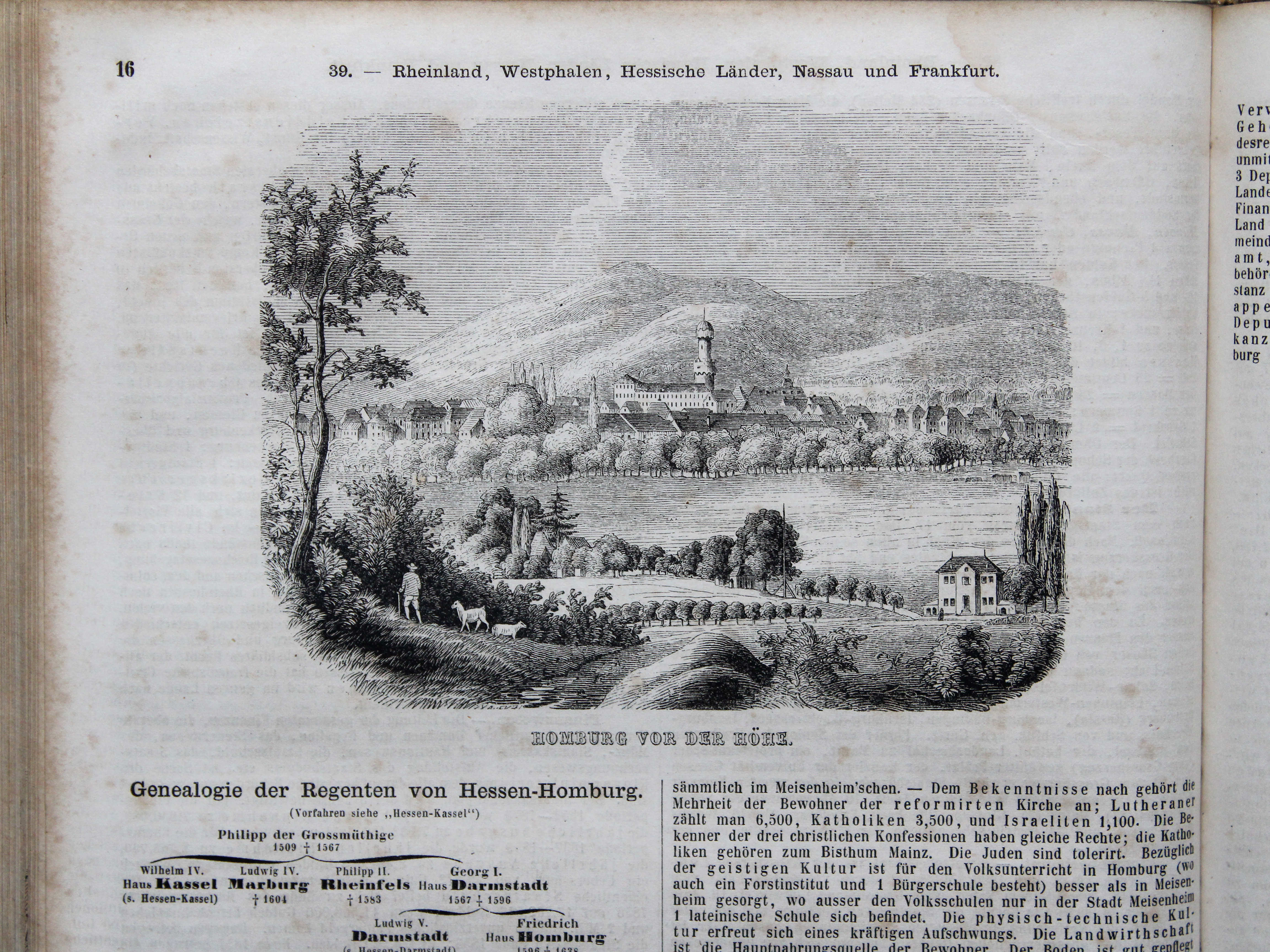
39. Rheinland, Westphalen, Hessische Länder, Nassau pp. XL
Rijnprovincie, Westfalen, Hessen, Nassau enz. / Rhine Province, Westphalia, Hesse , Nassau etc.

 Bromme, Illustrirter Hand-Atlas, 1862
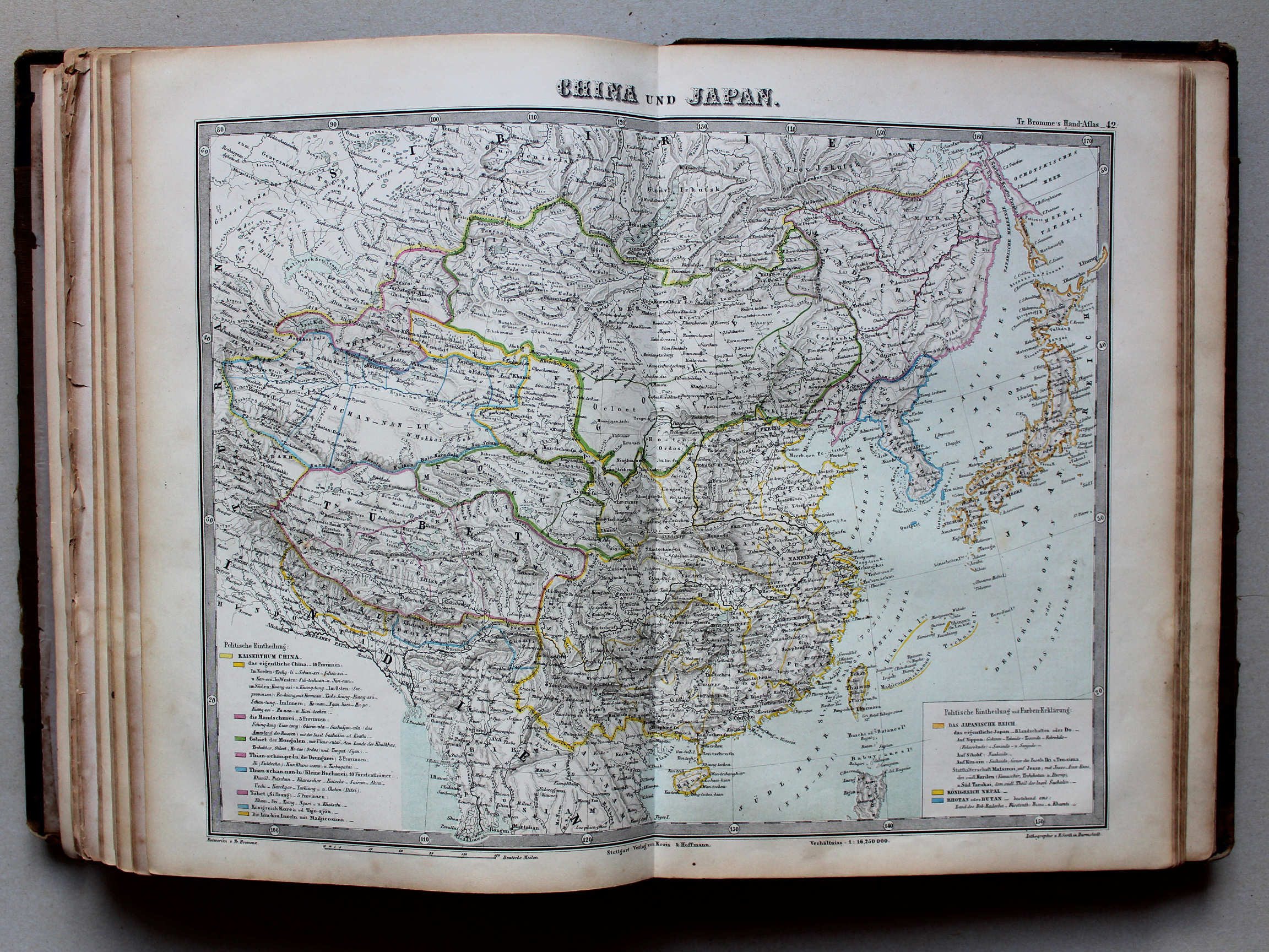
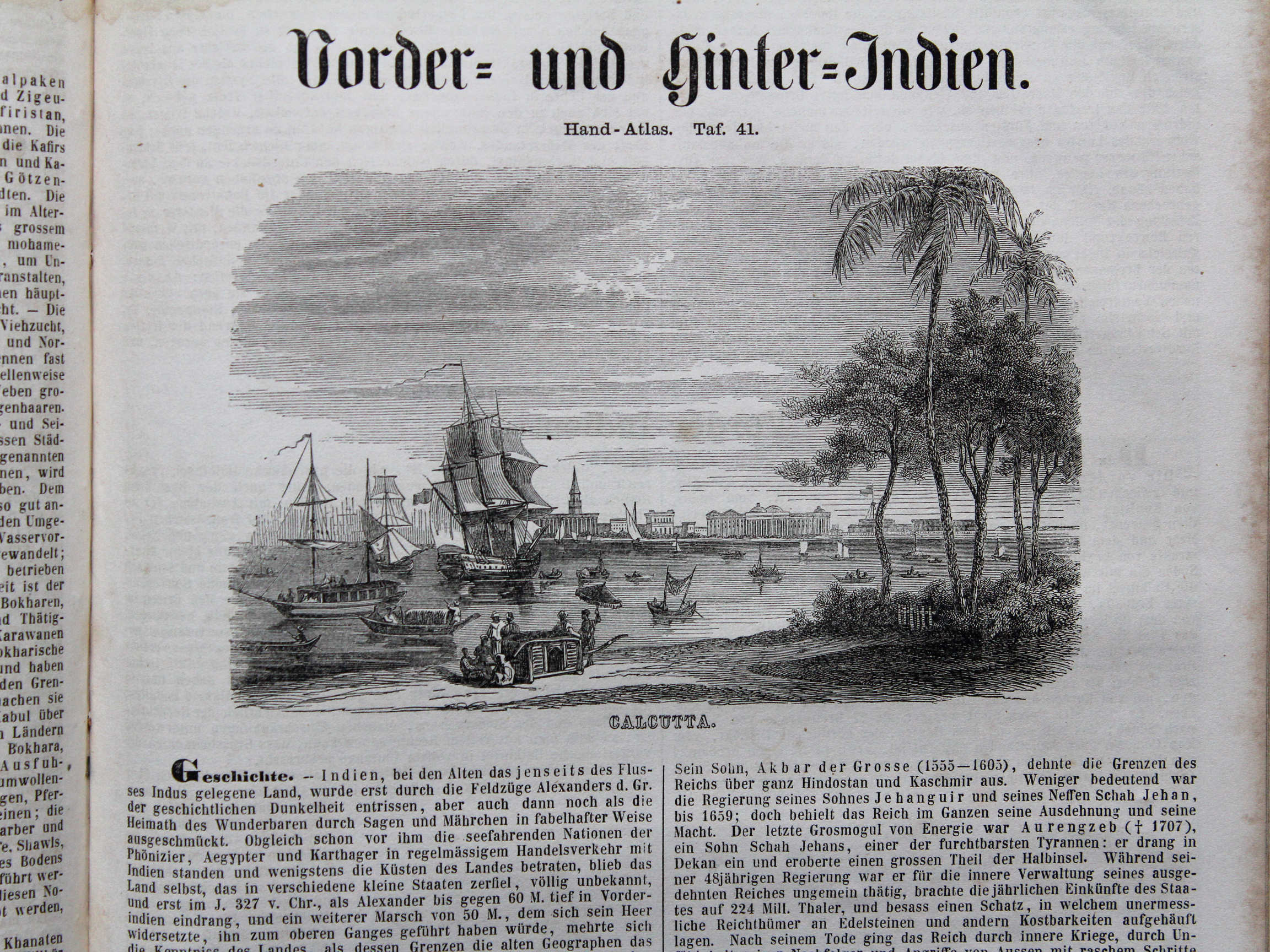
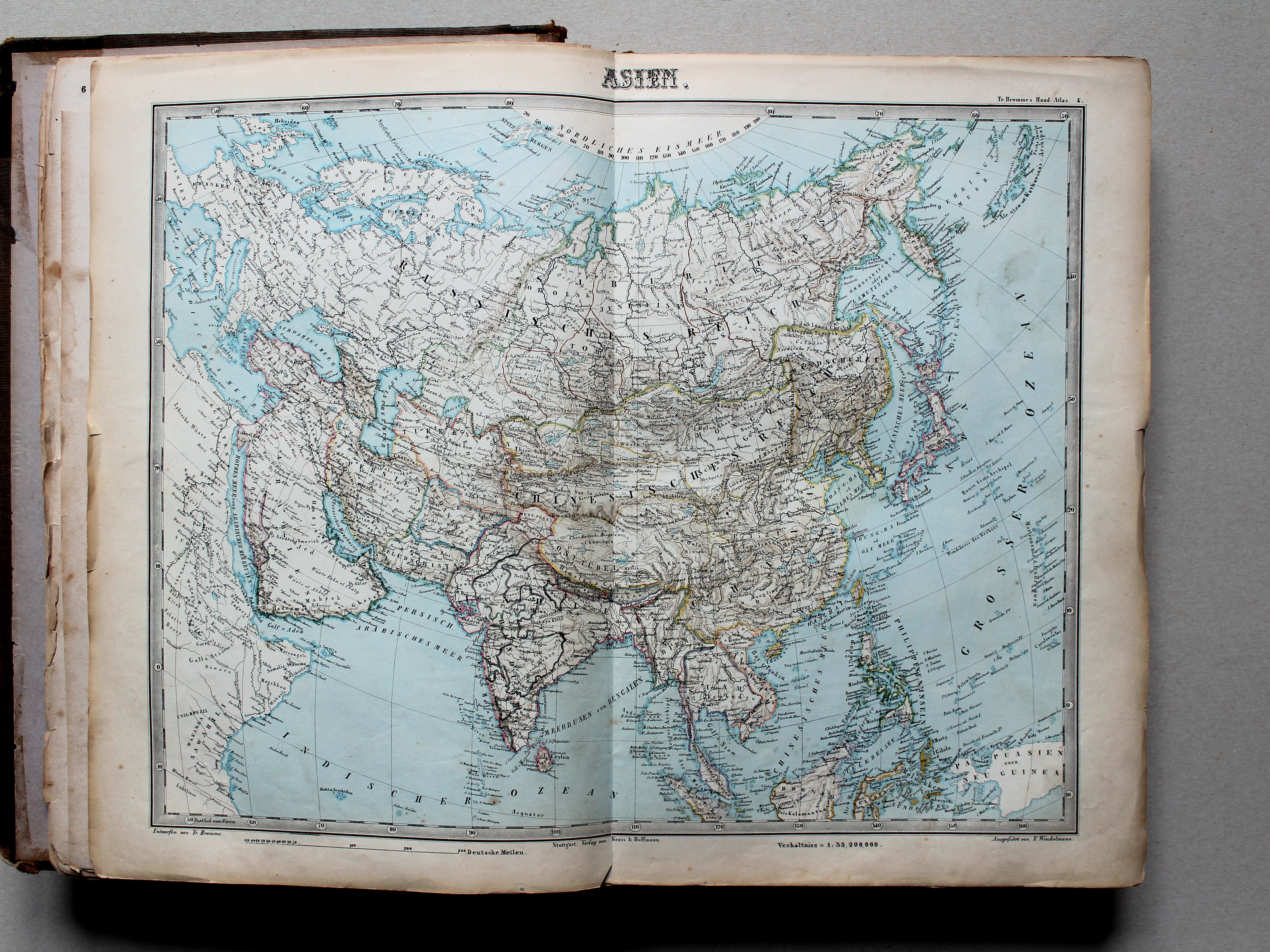
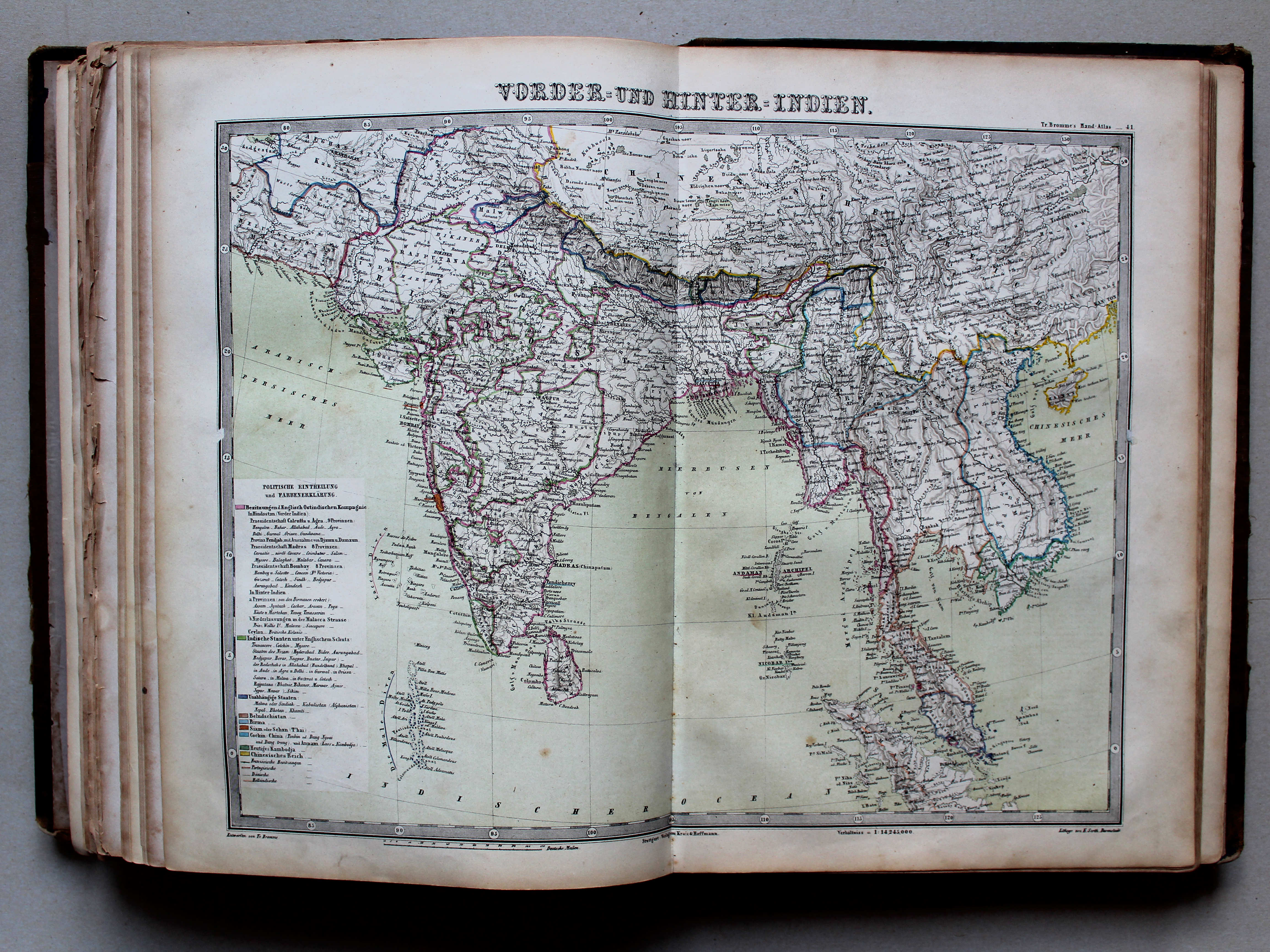
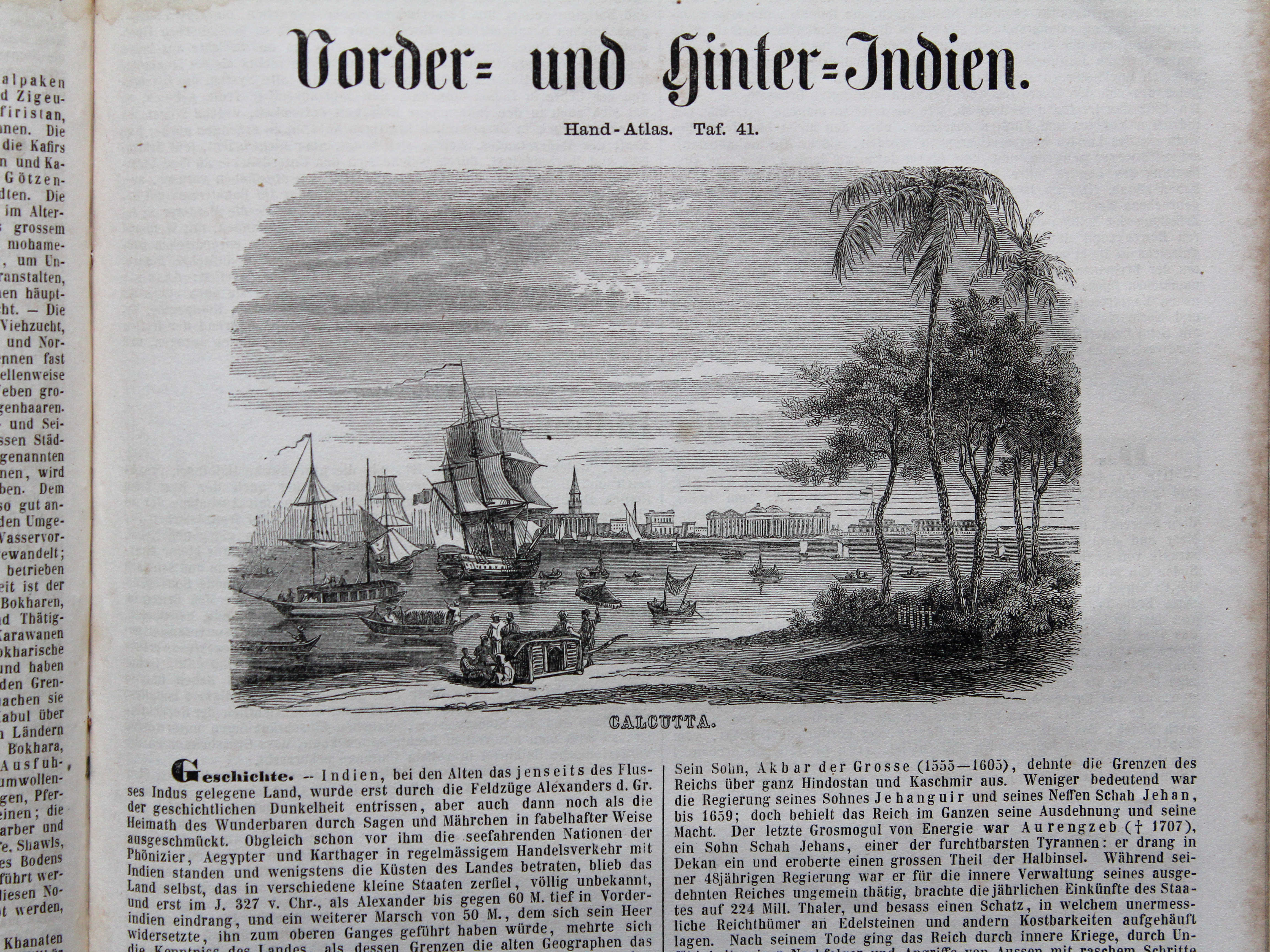
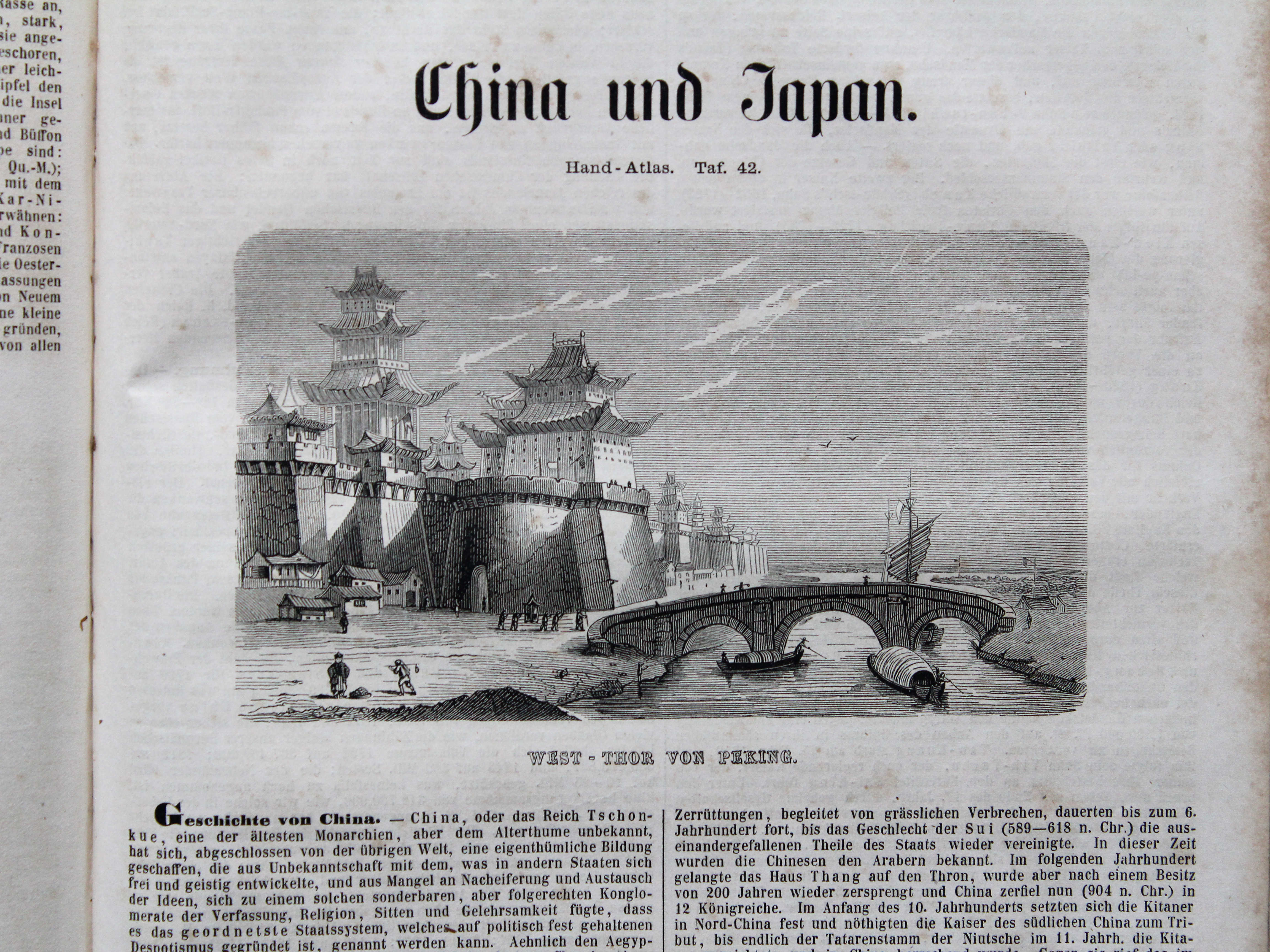
41. Vorder- und Hinter-Indien XL
Zuid- en Zuidoost-Azië / South and Southeast Asia
 Bromme, Illustrirter Hand-Atlas, 1862
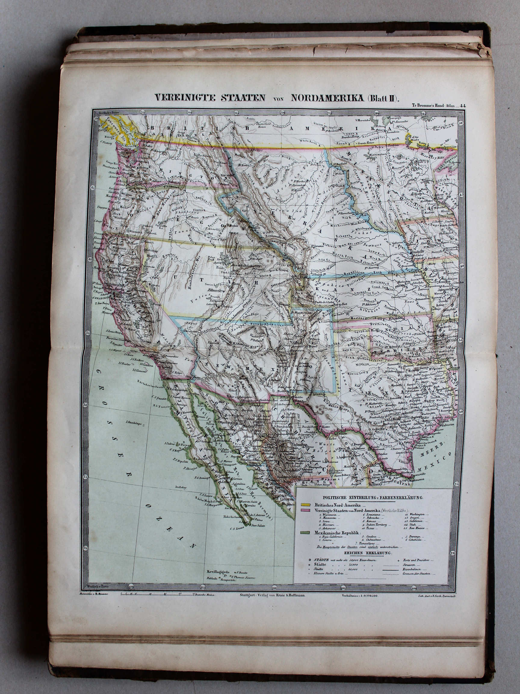
44. Vereinigte Staaten von Nord-Amerika (Blatt II) XL
Verenigde Staten van Noord-Amerika (blad 2) / United States of North America (sheet 2)
 Bromme, Illustrirter Hand-Atlas, 1862
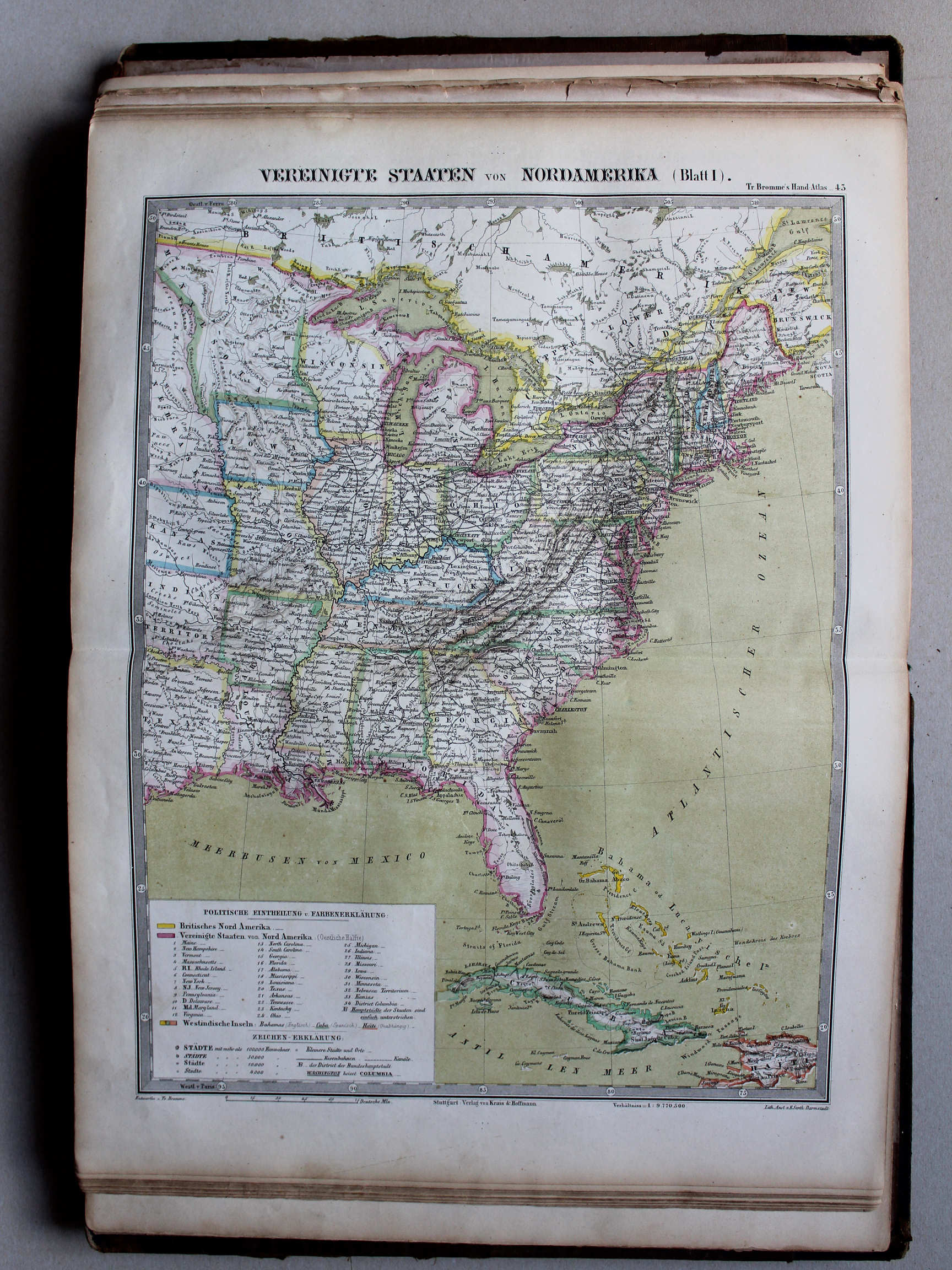
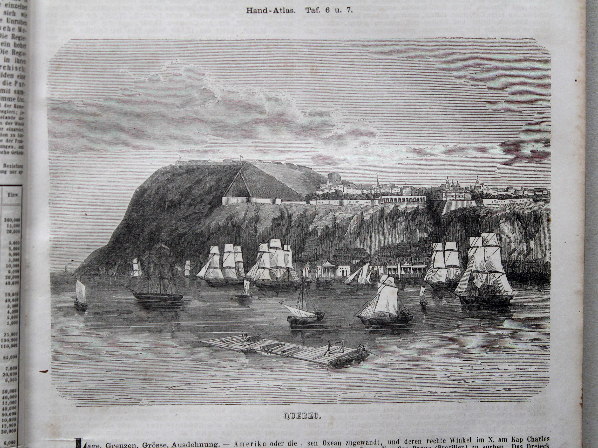
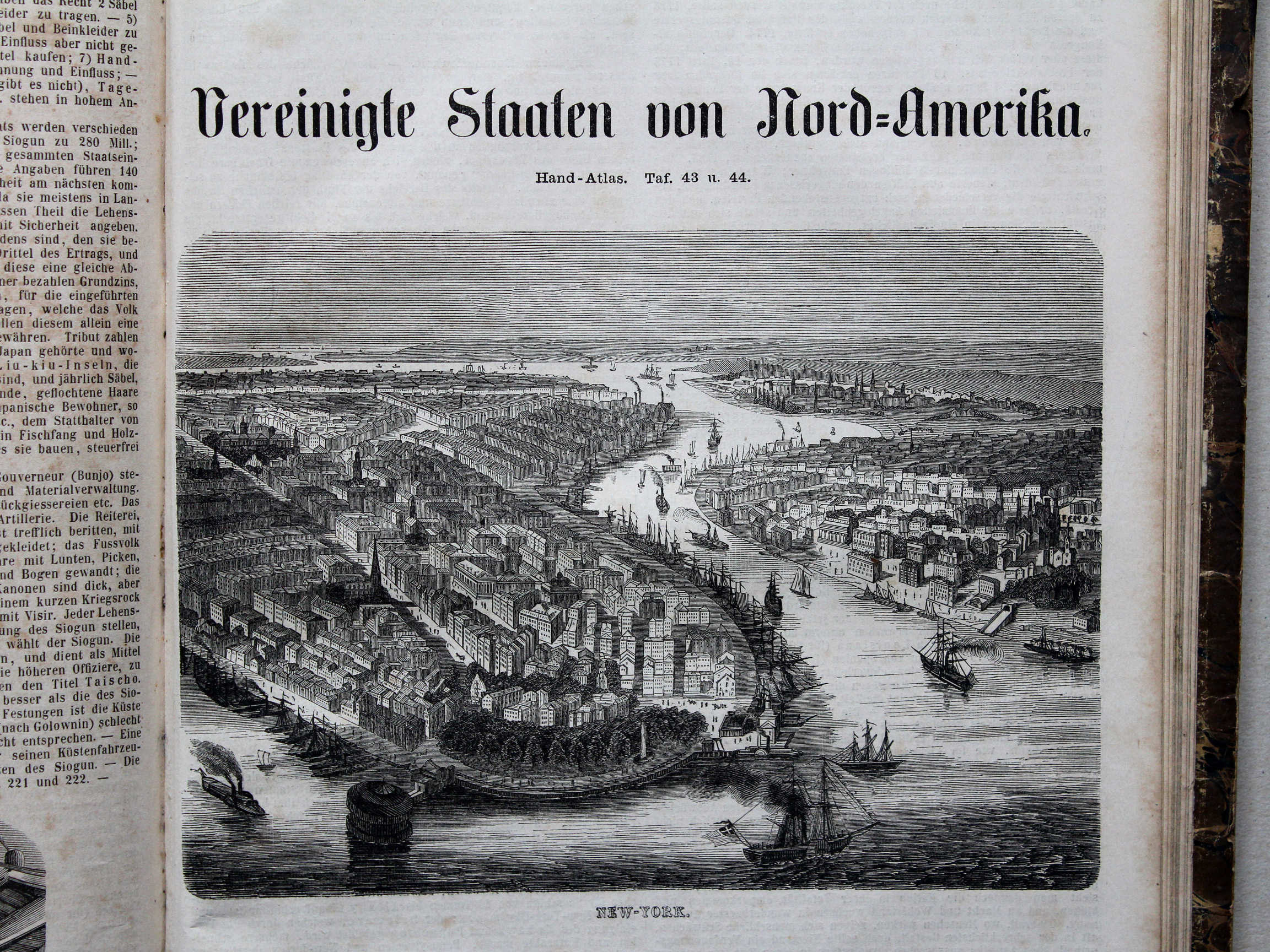
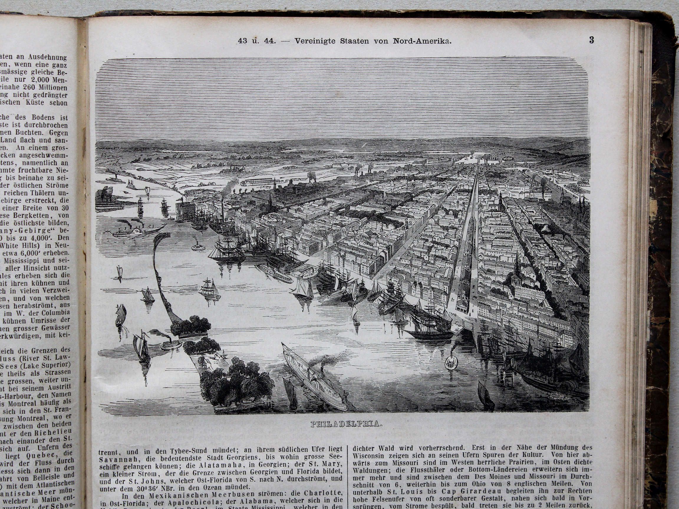
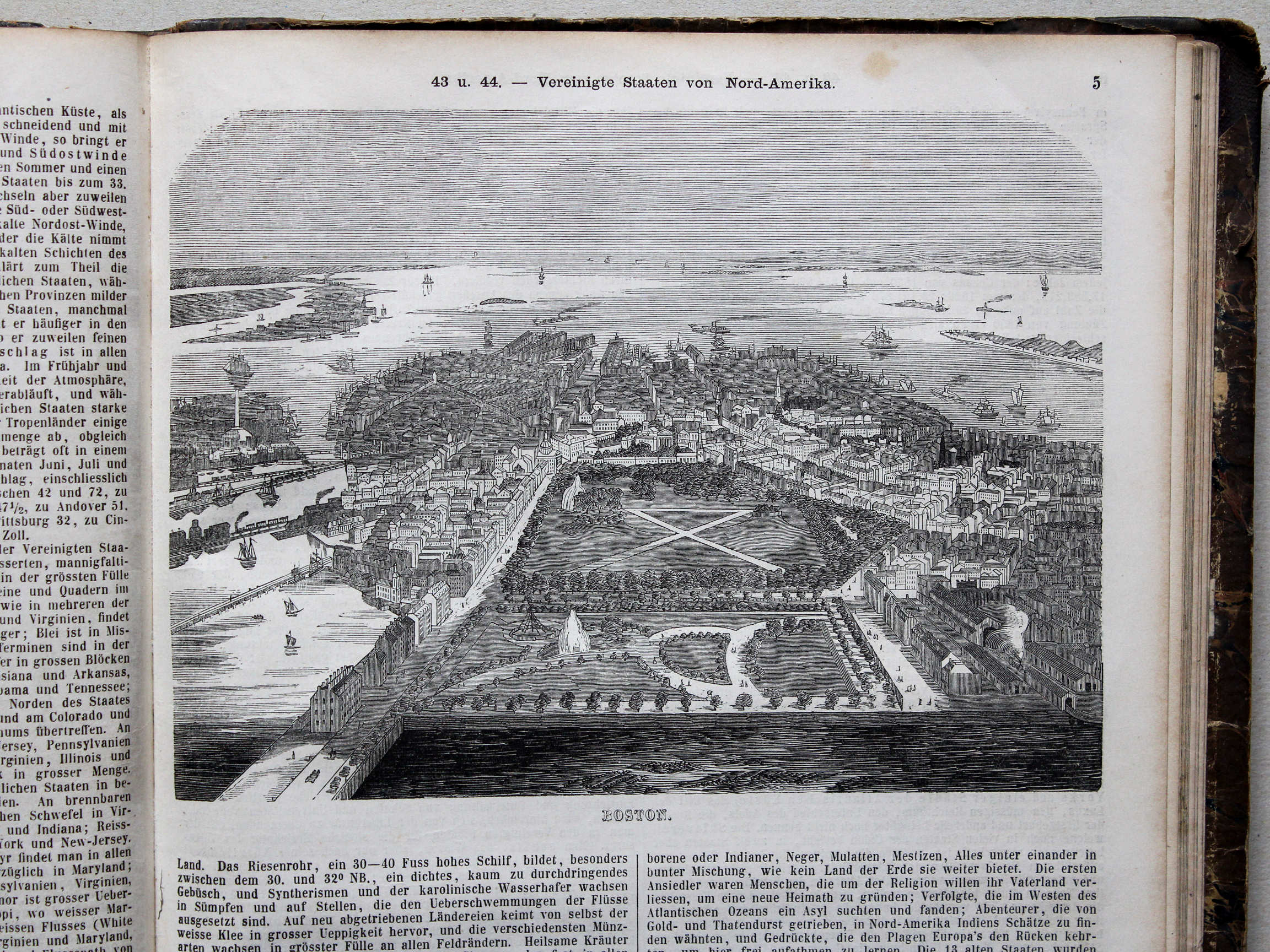
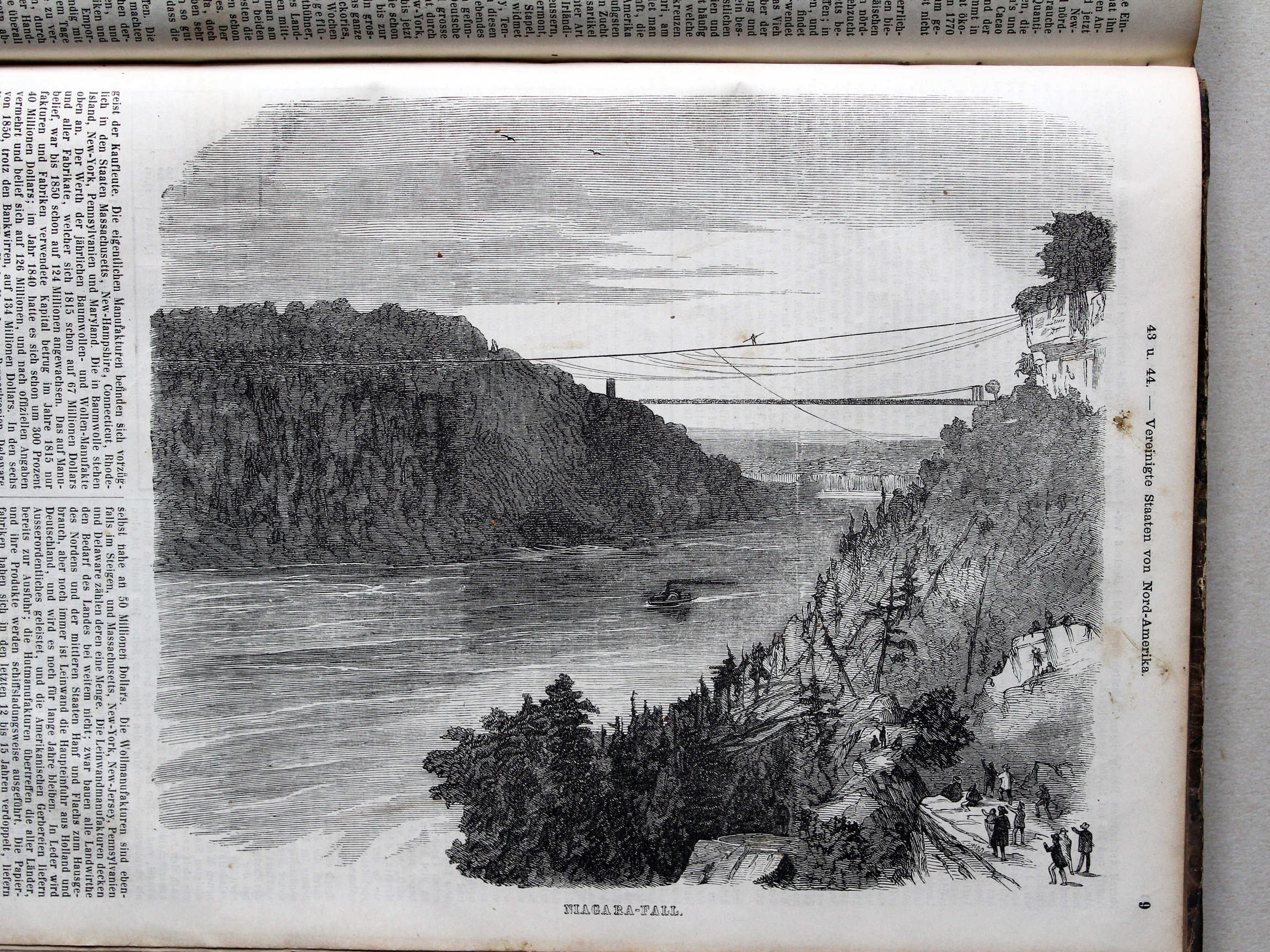
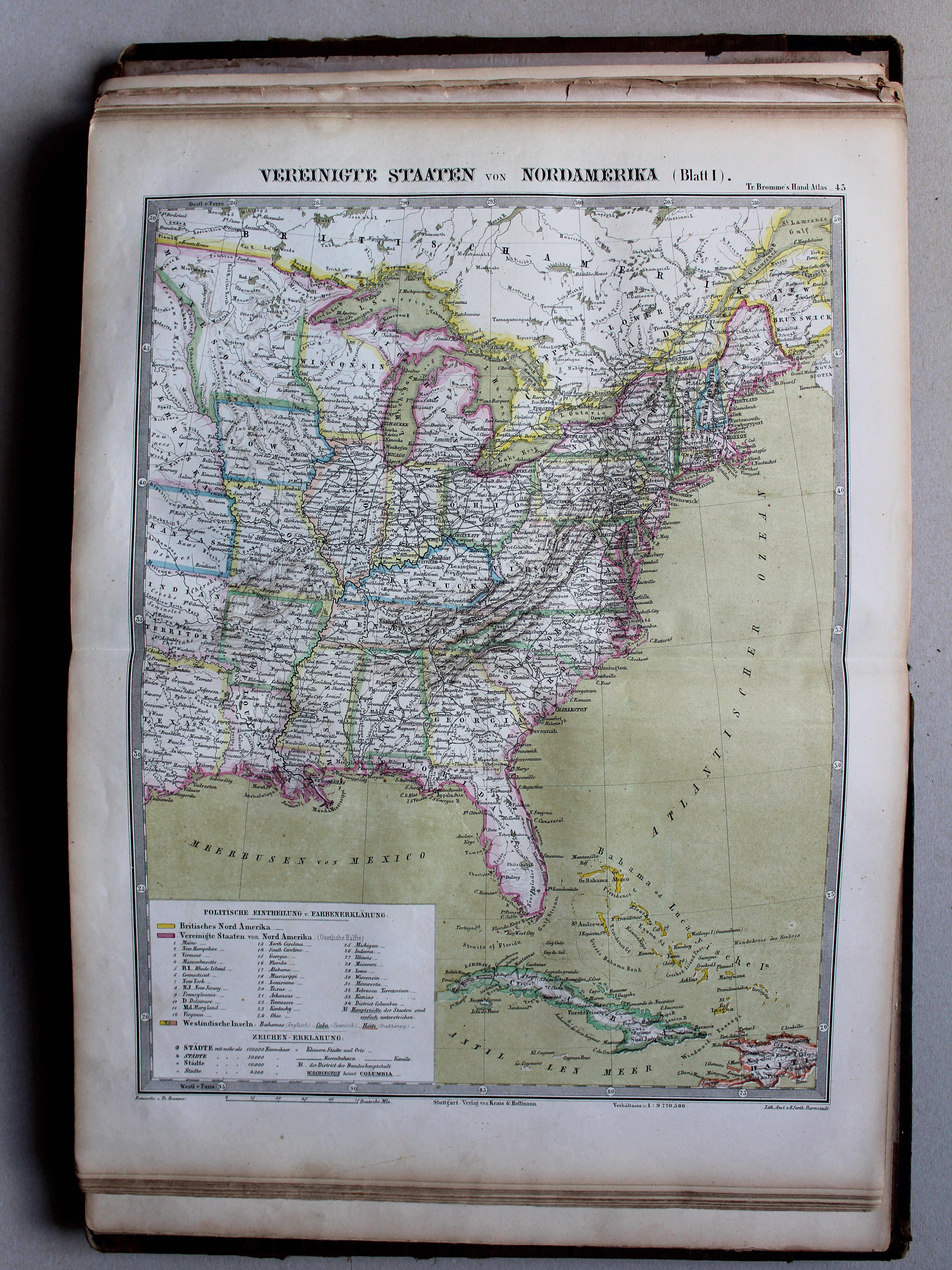
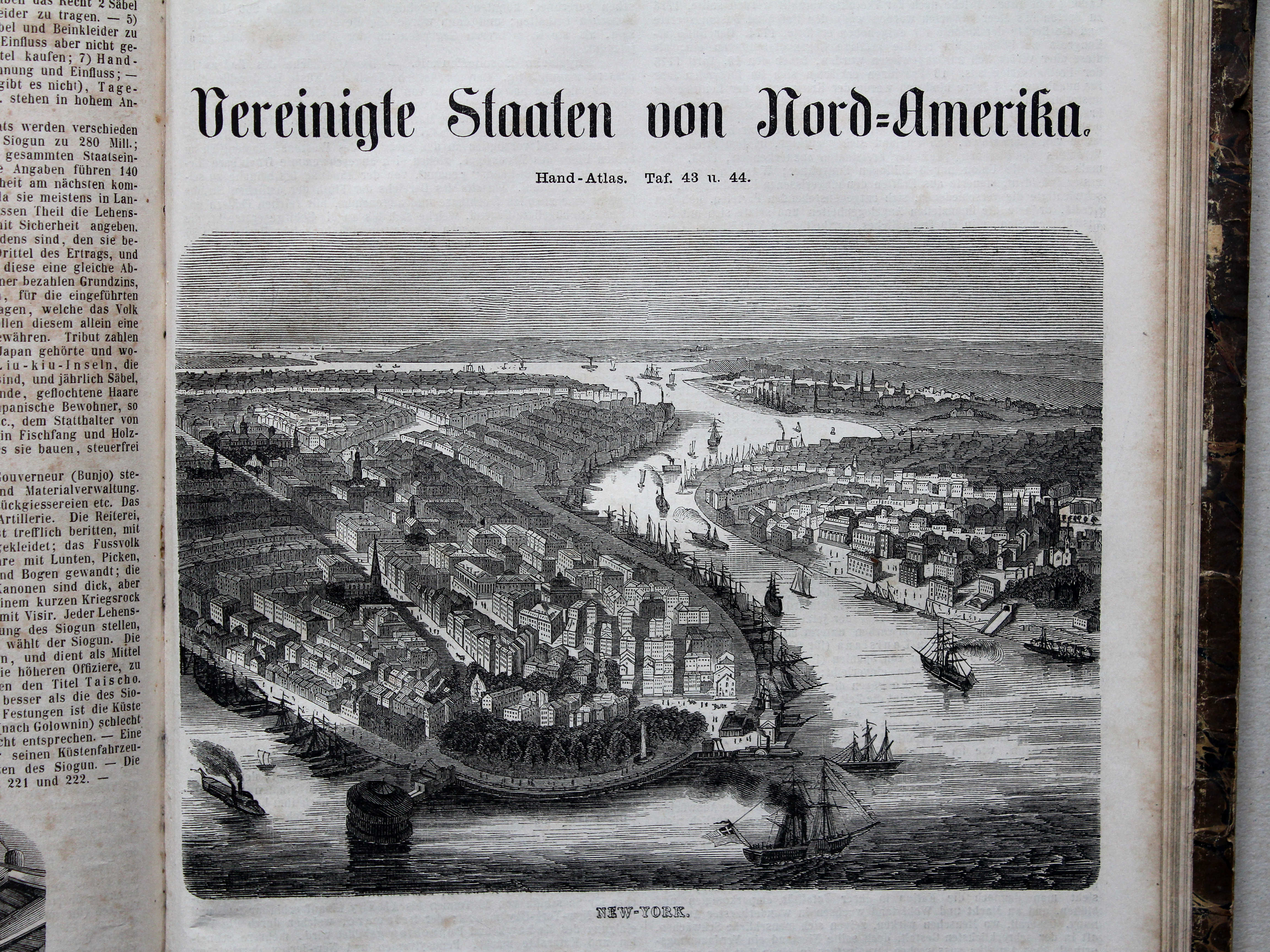
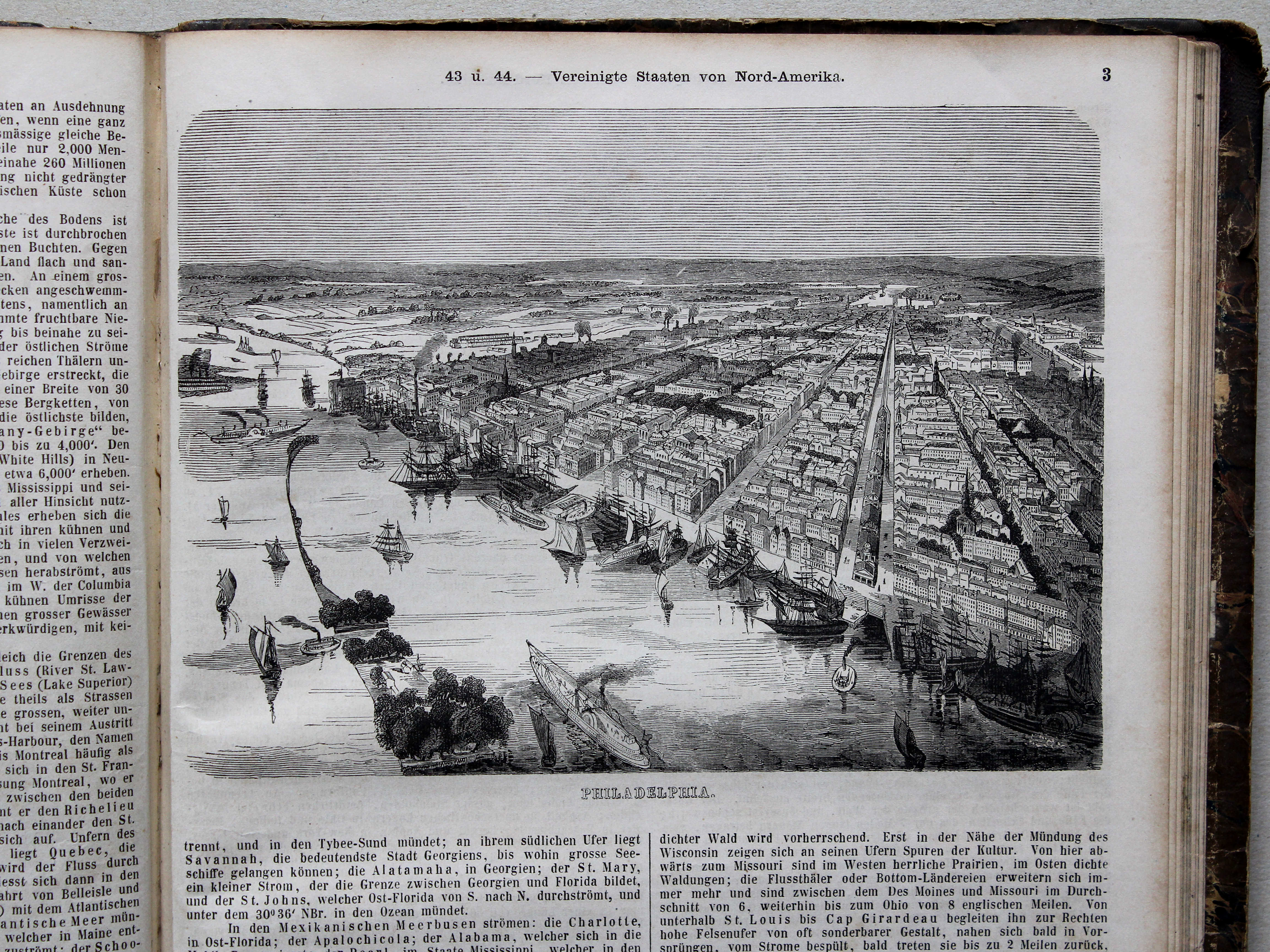
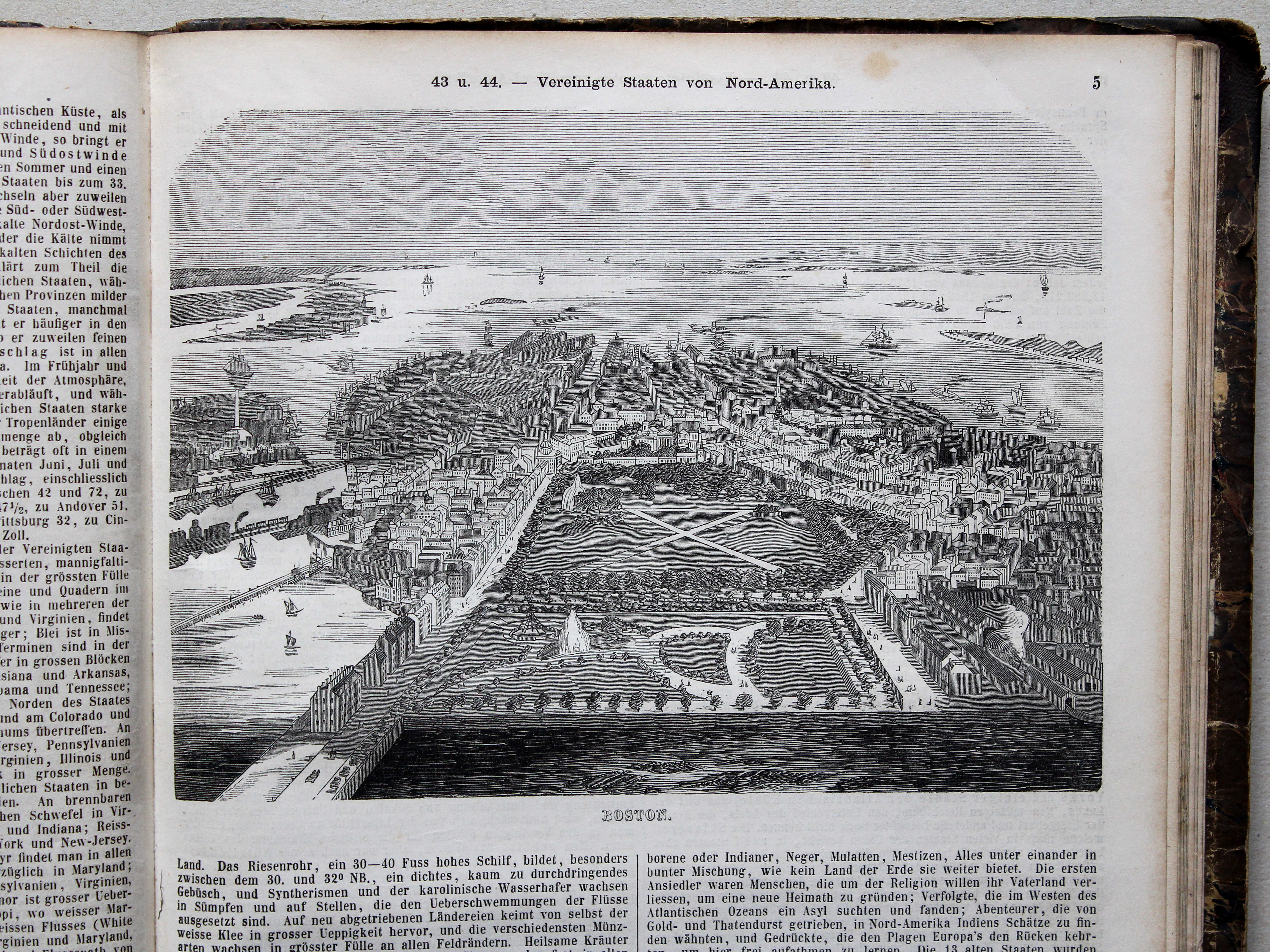
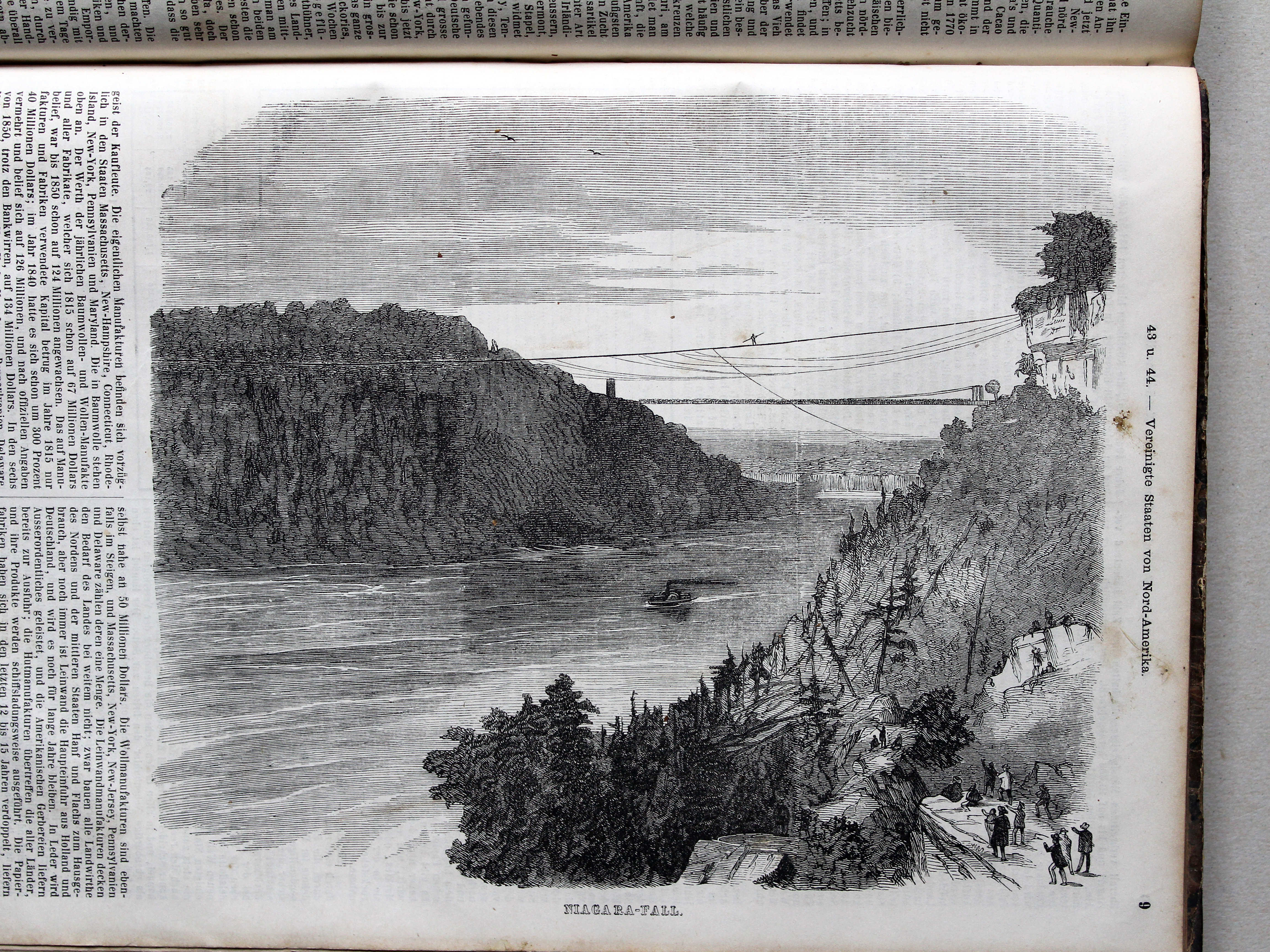
43. Vereinigte Staaten von Nord-Amerika (Blatt I) XL
Verenigde Staten van Noord-Amerika (blad 1) / United States of North America (sheet 1)
 Bromme, Illustrirter Hand-Atlas, 1862
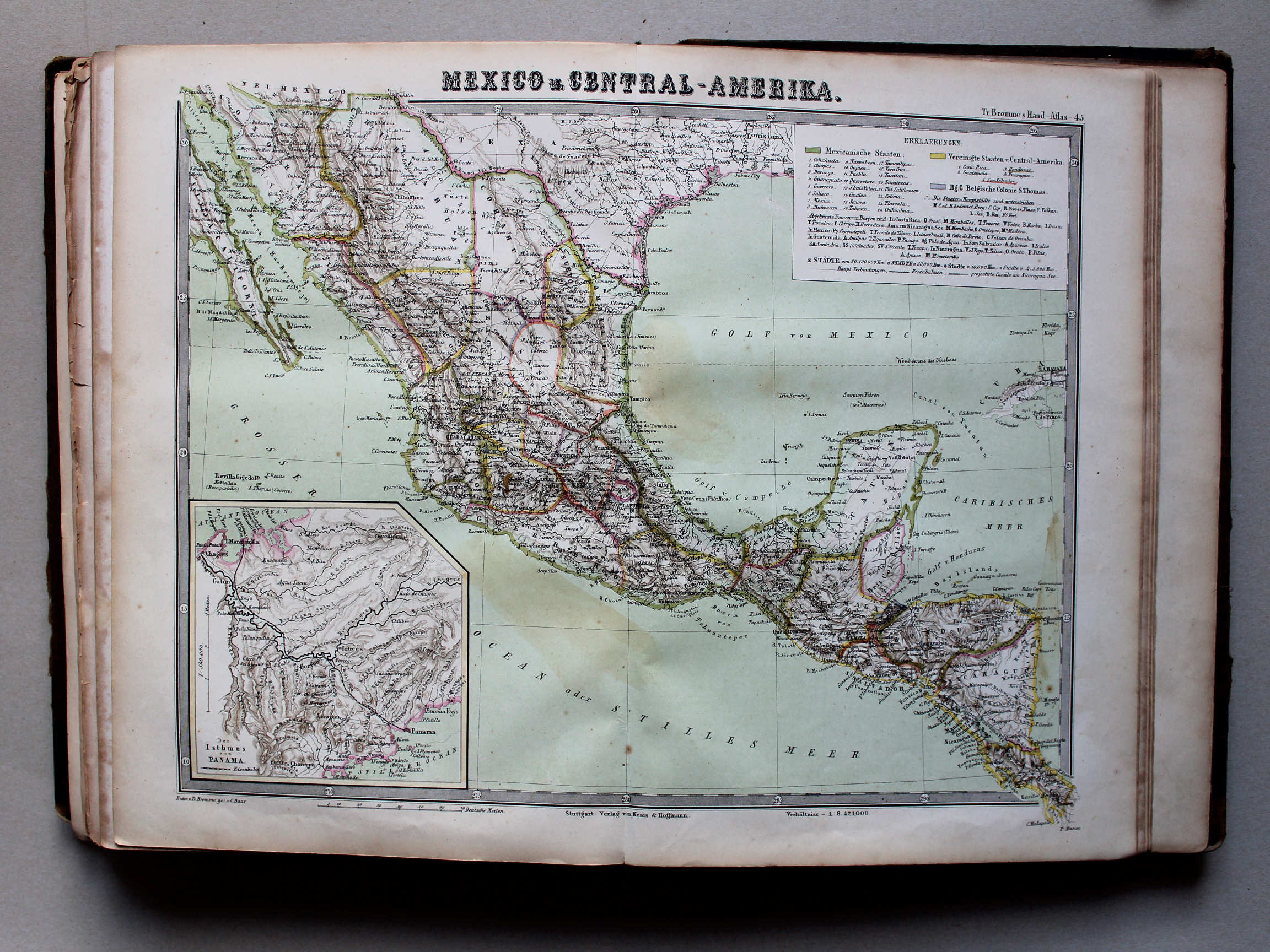
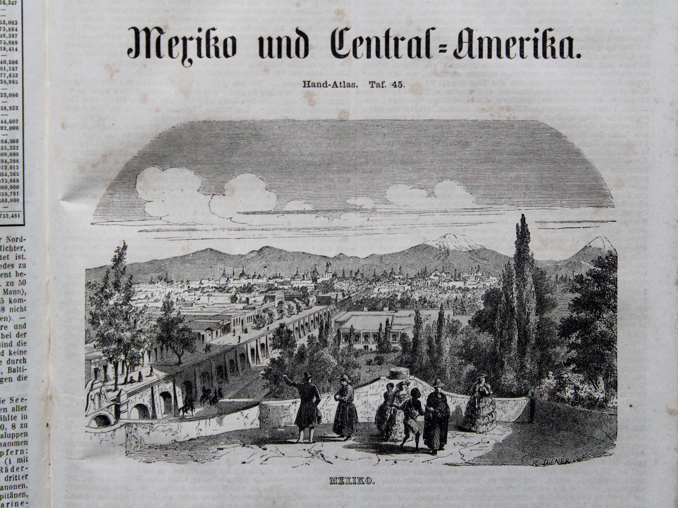
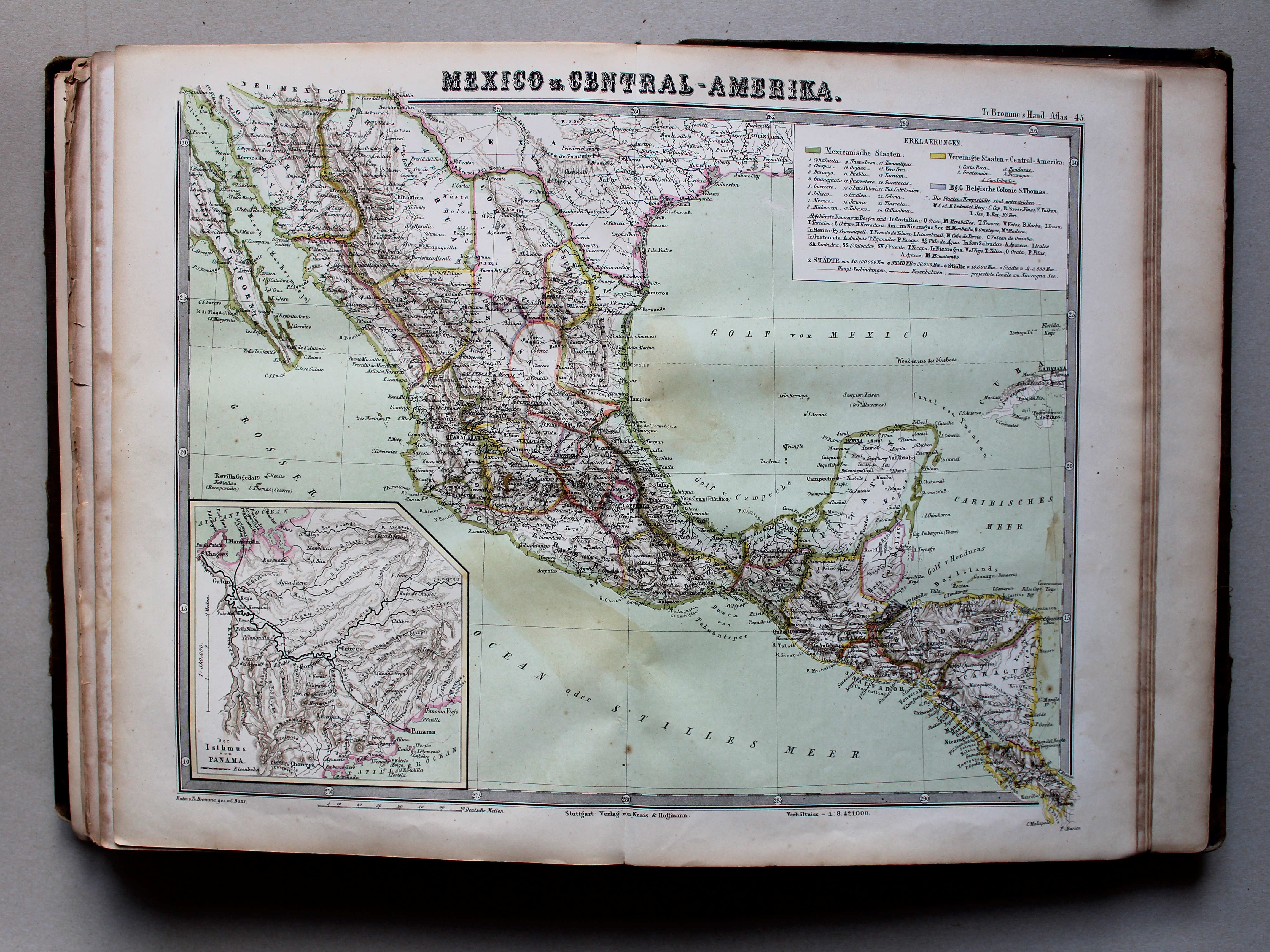
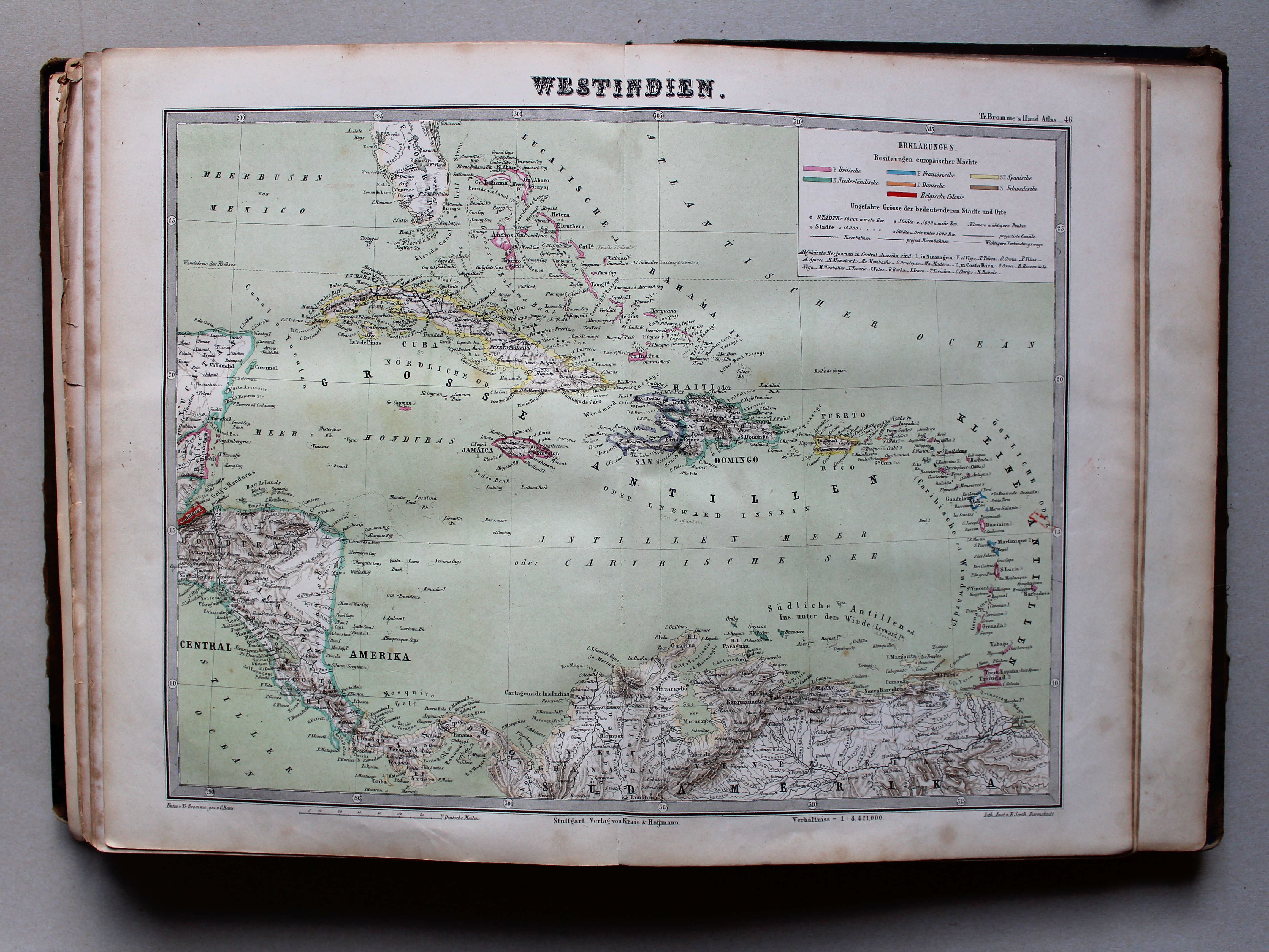
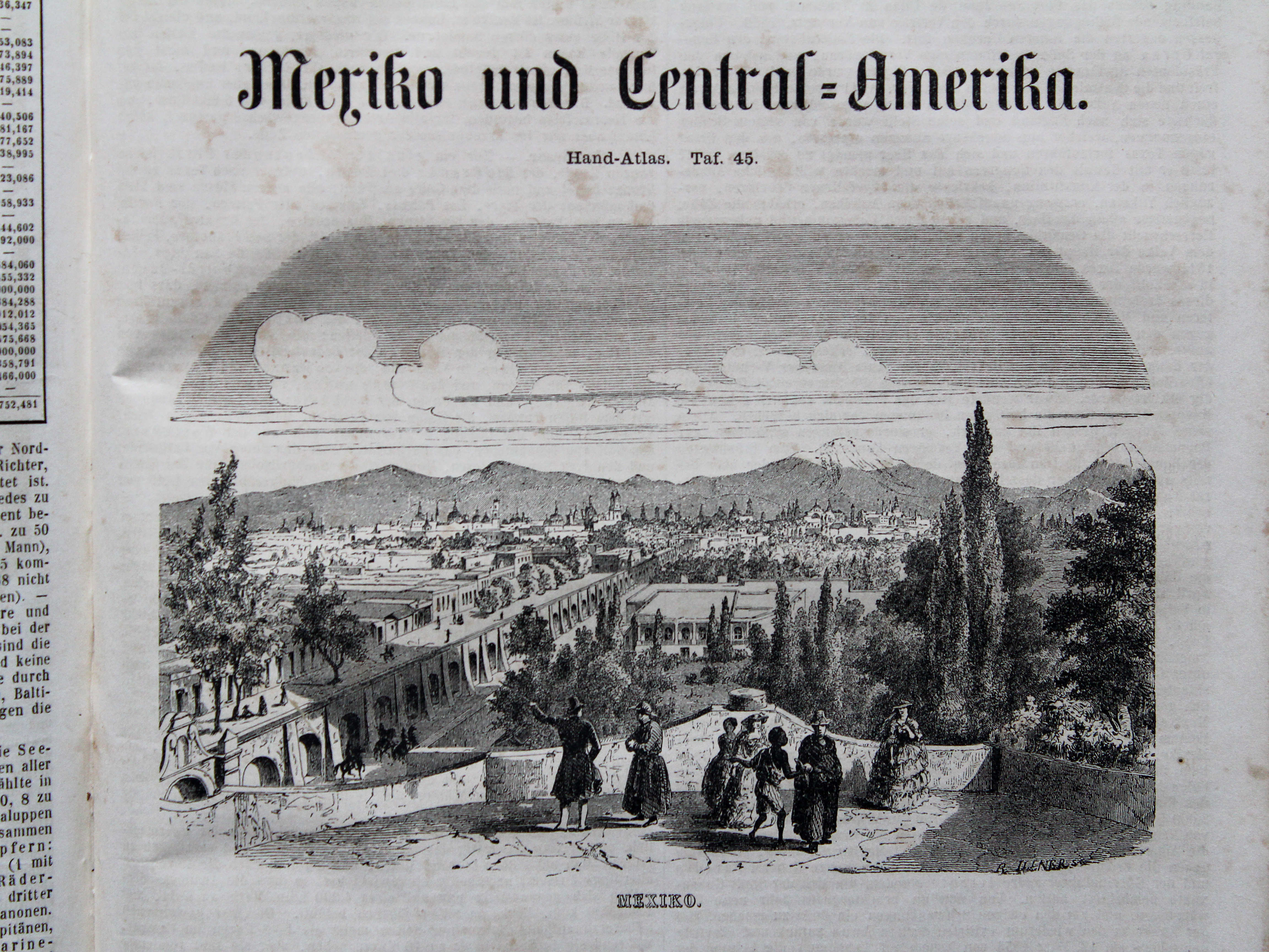
45. Mexico u. Central-Amerika XL
Mexico en Midden-Amerika / Mexico and Central America
 Bromme, Illustrirter Hand-Atlas, 1862
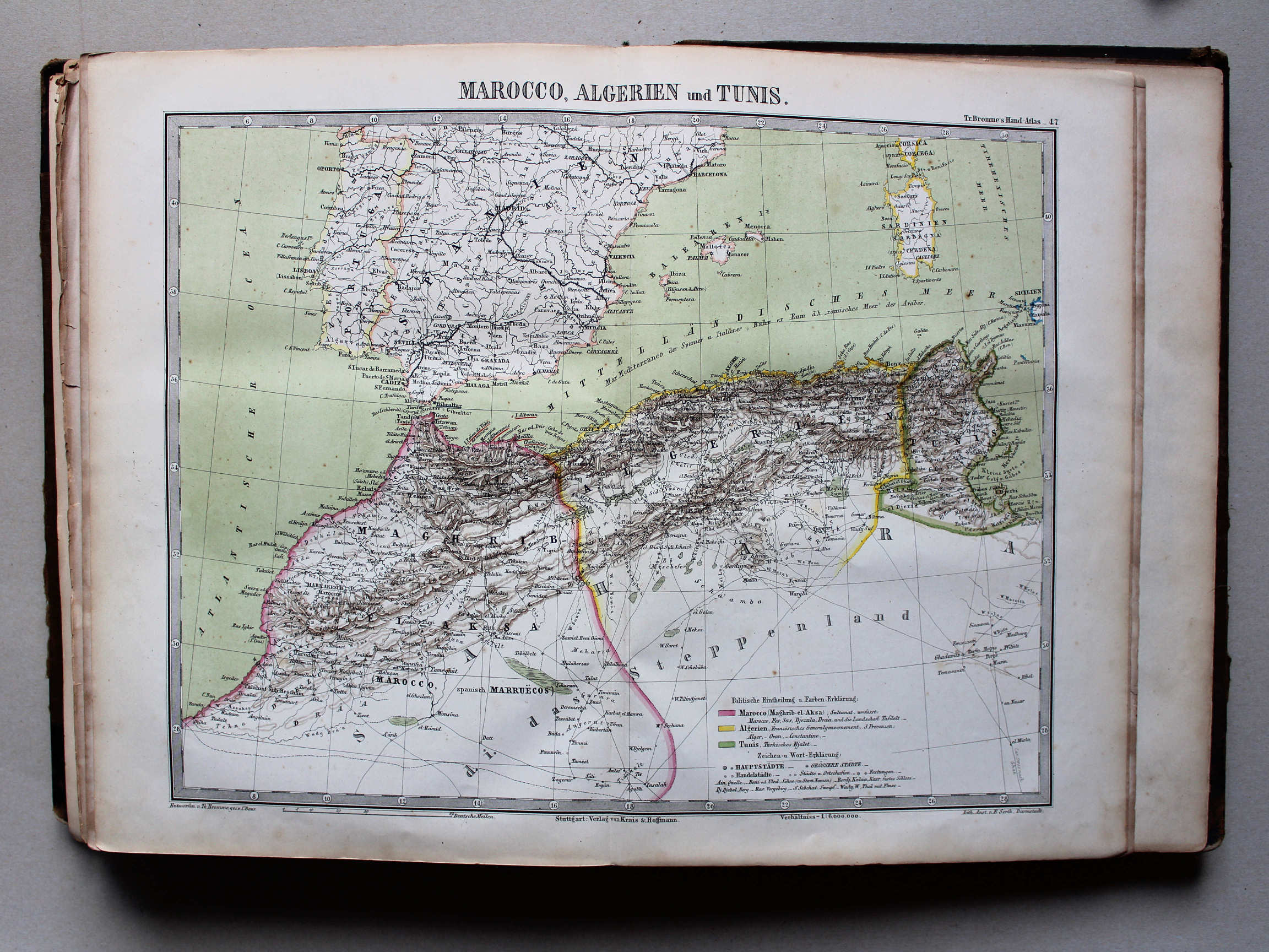
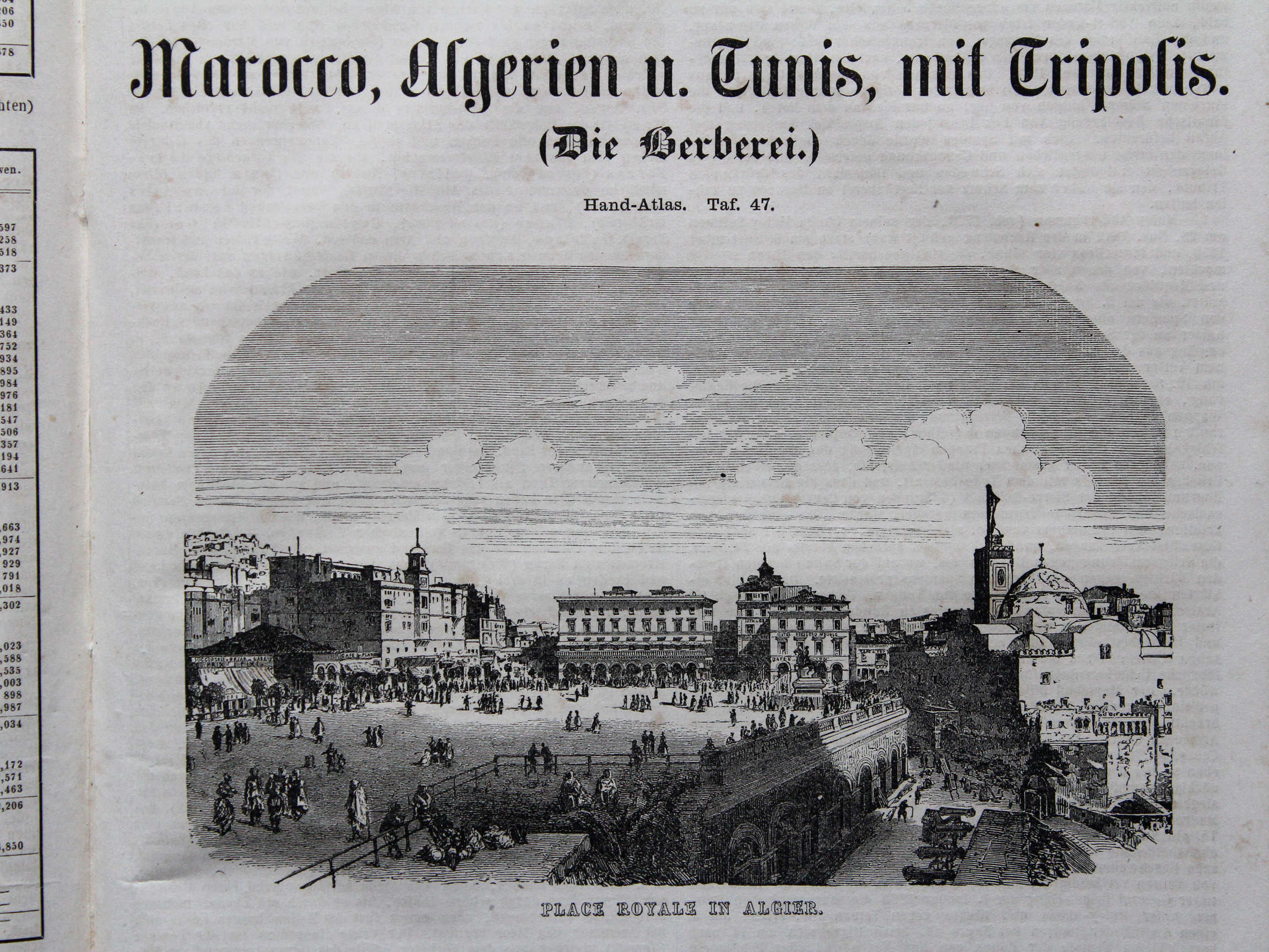
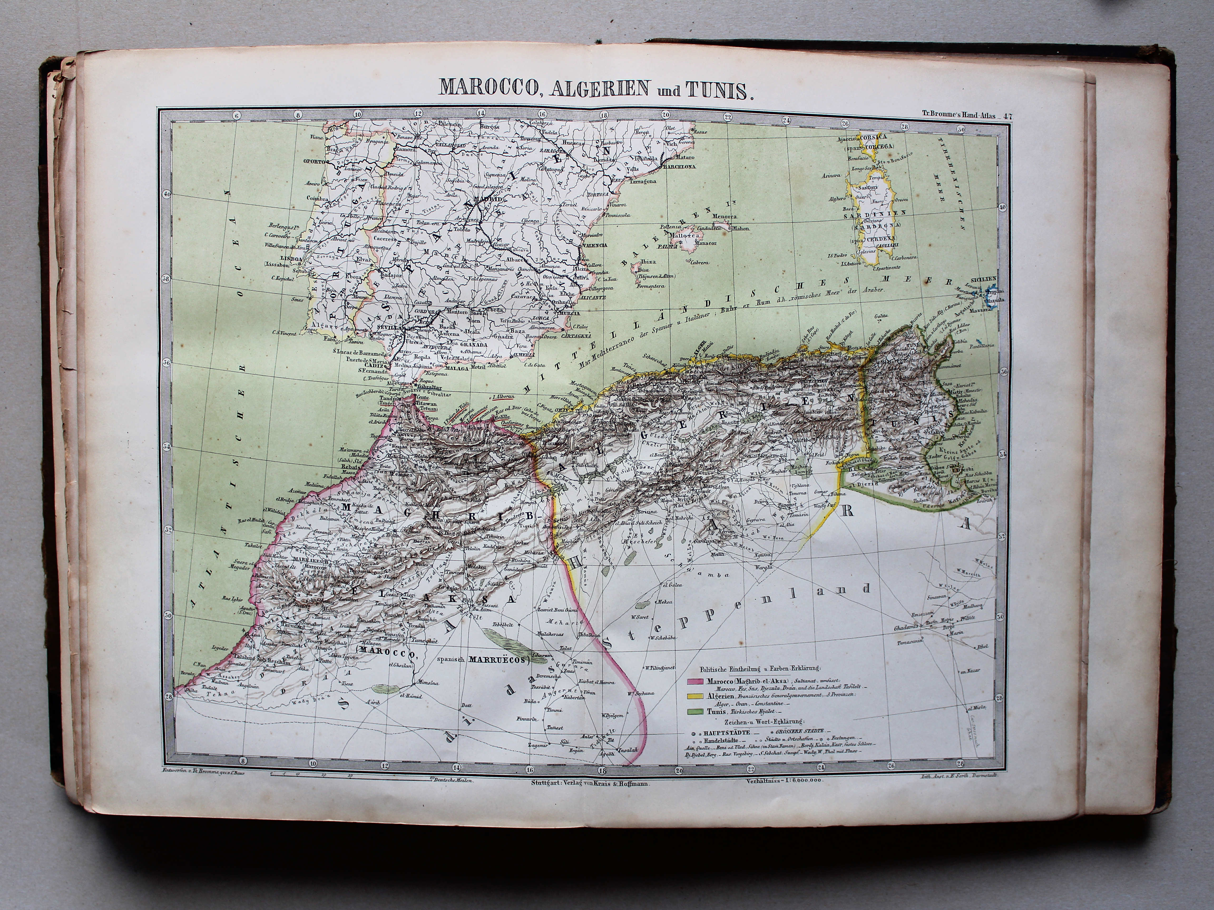
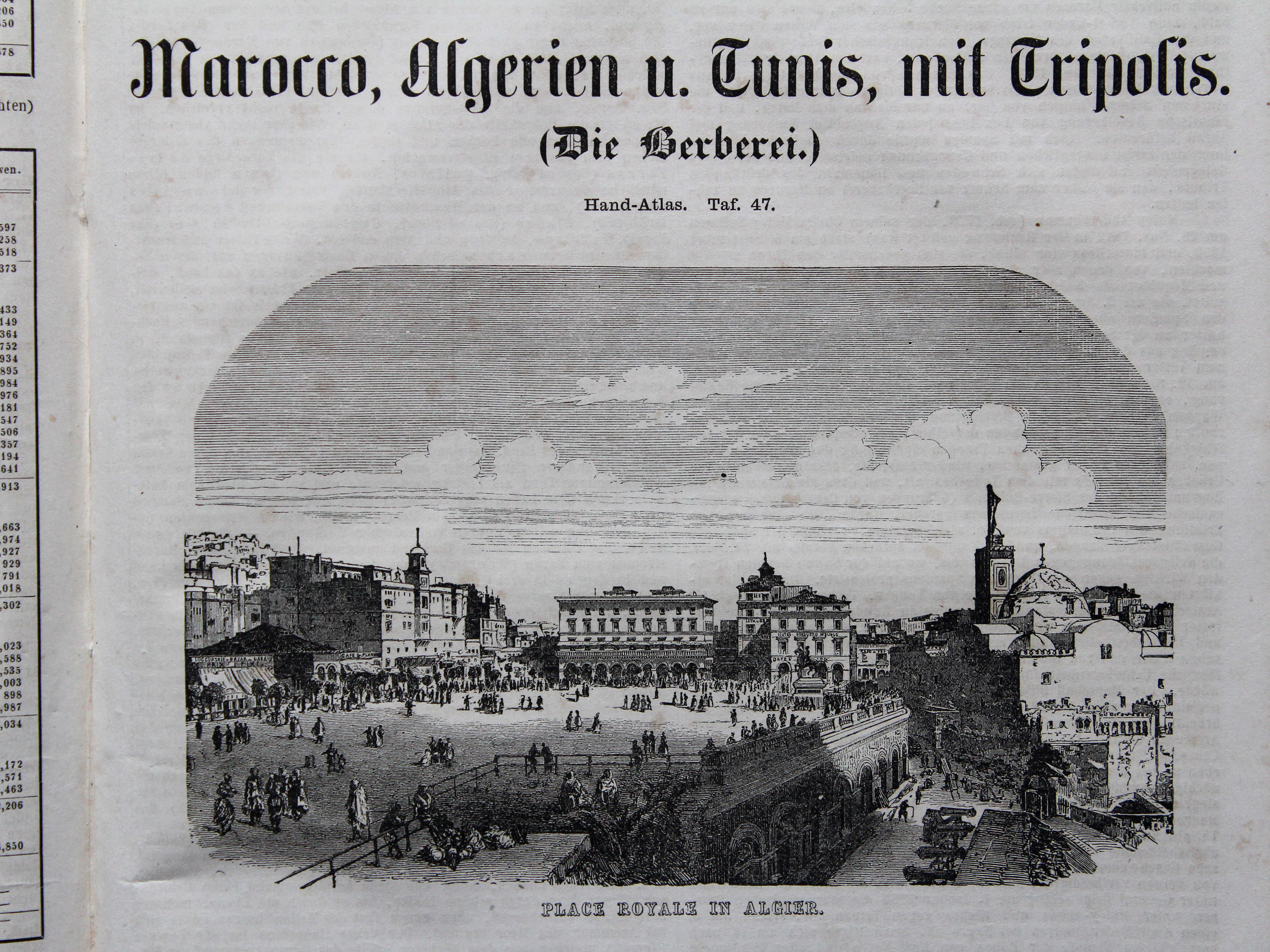
47. Marocco, Algerien und Tunis XL
Marokko, Algerije en Tunis / Morocco, Algeria and Tunis
 Bromme, Illustrirter Hand-Atlas, 1862
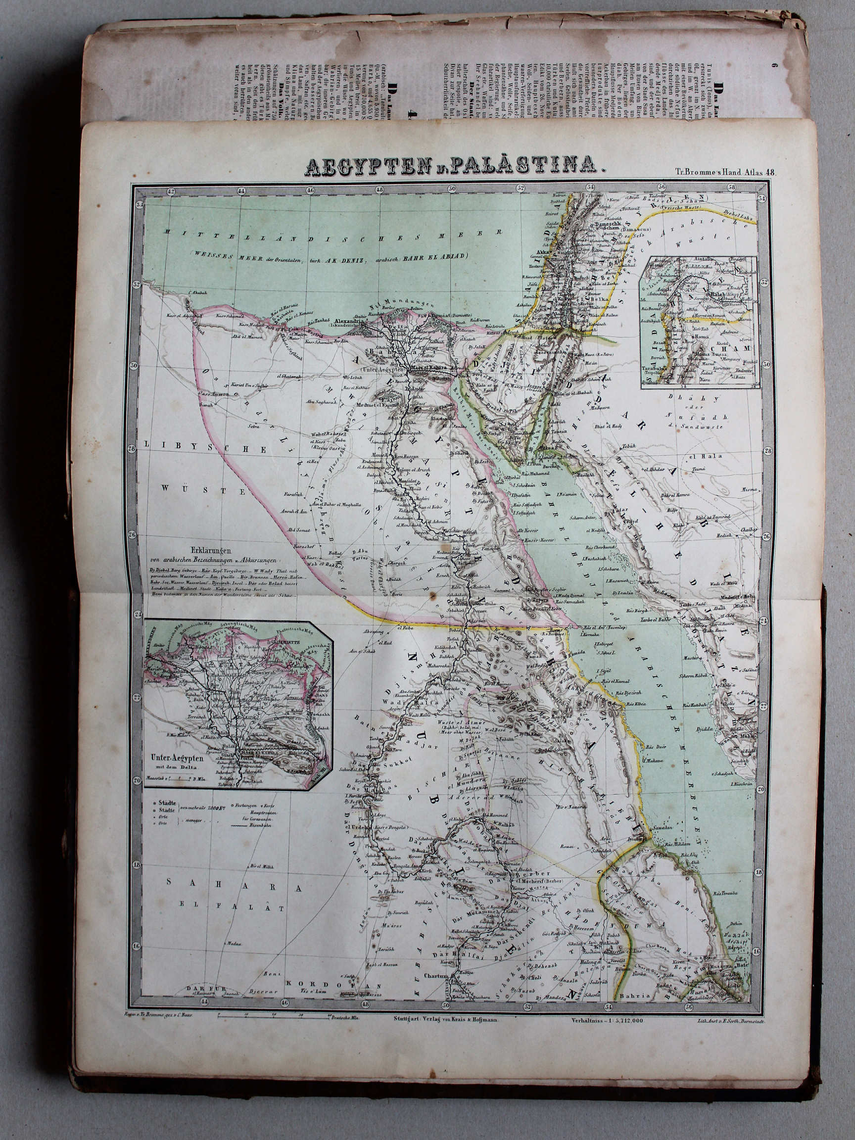
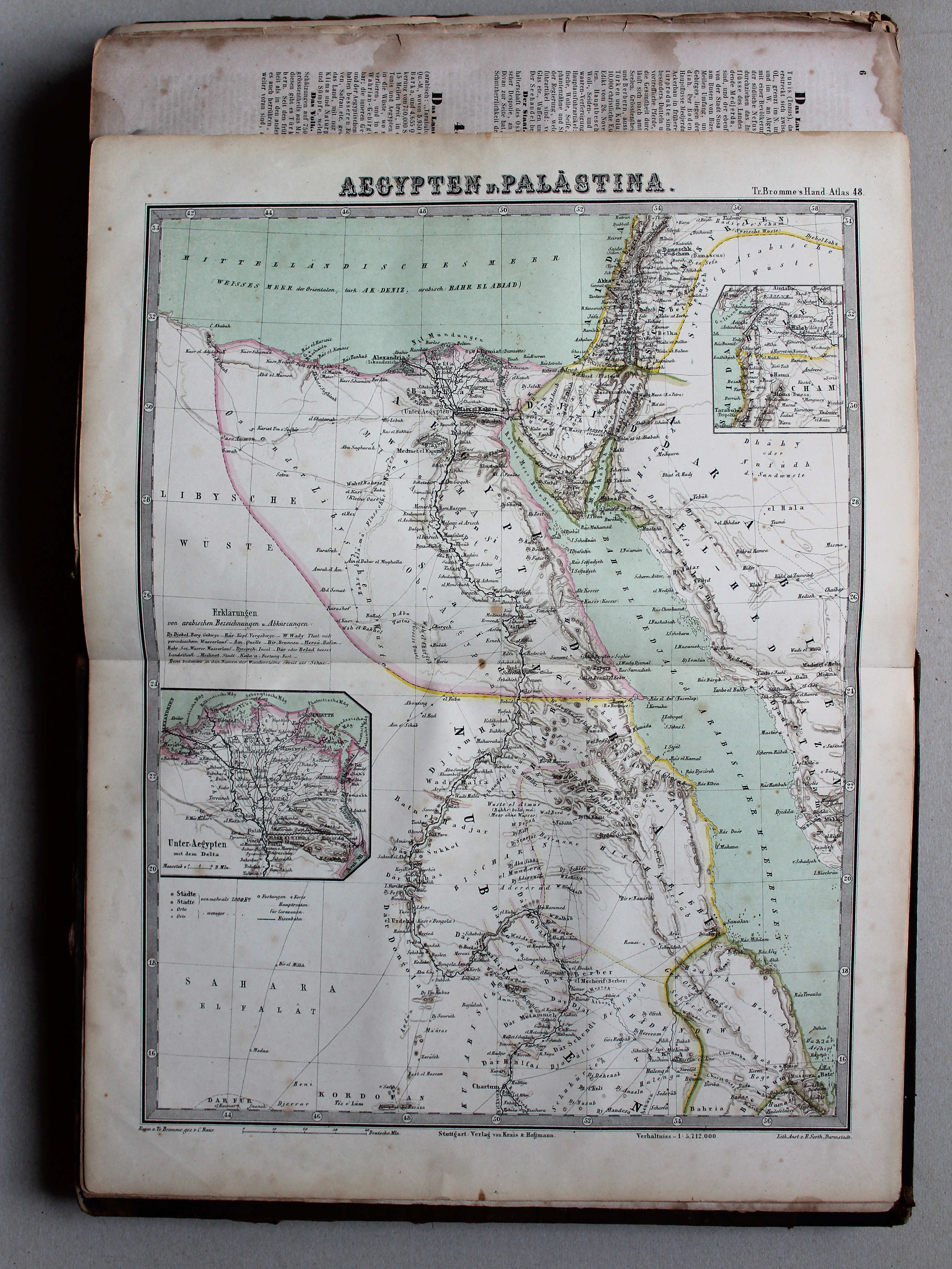
48. Aegypten u. Palästina XL
Egypte en Palestina / Egypt and Palestine
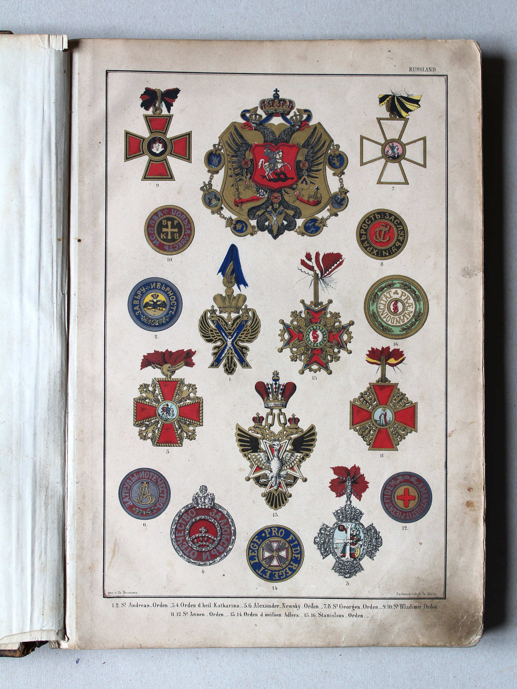
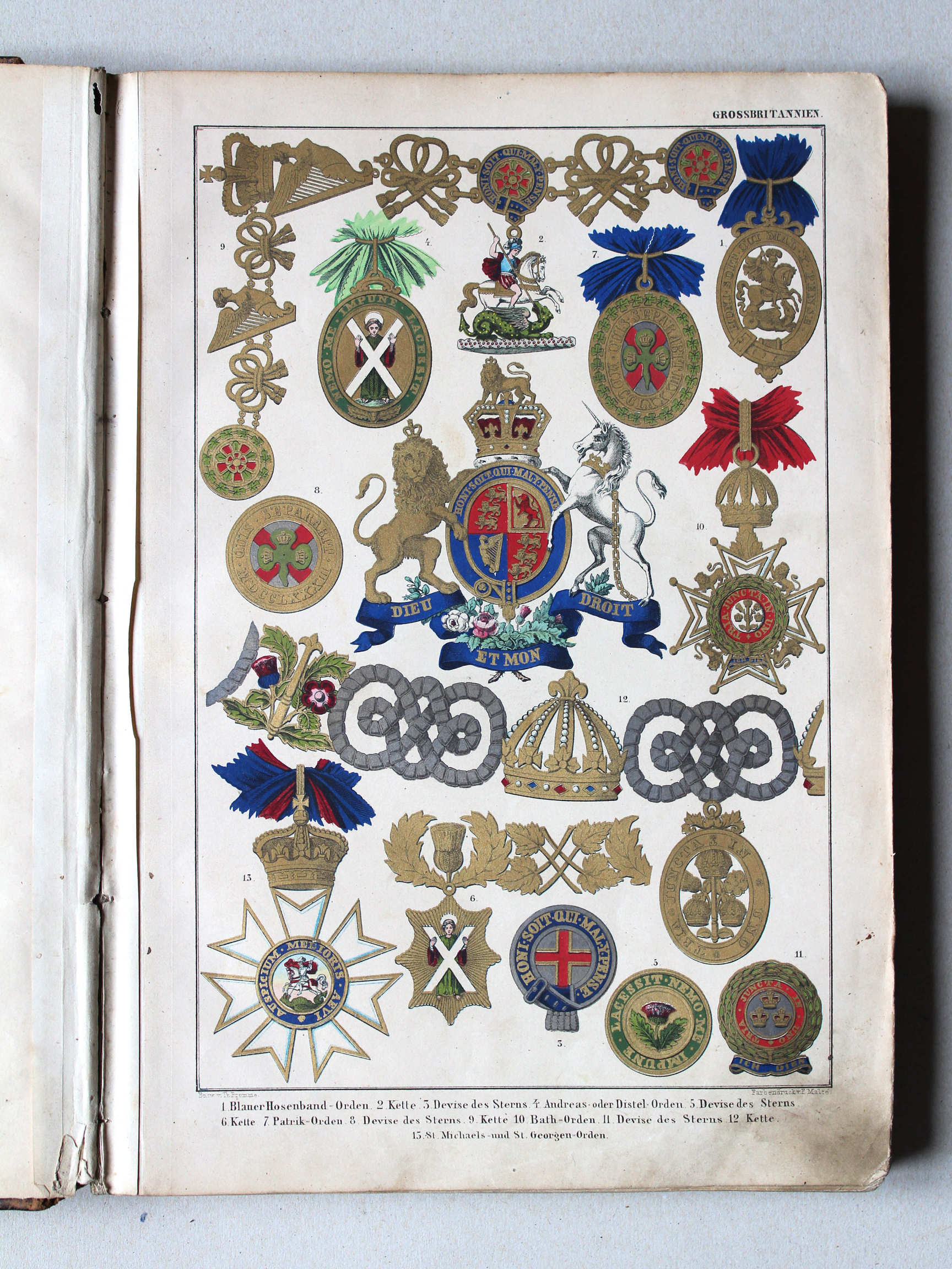
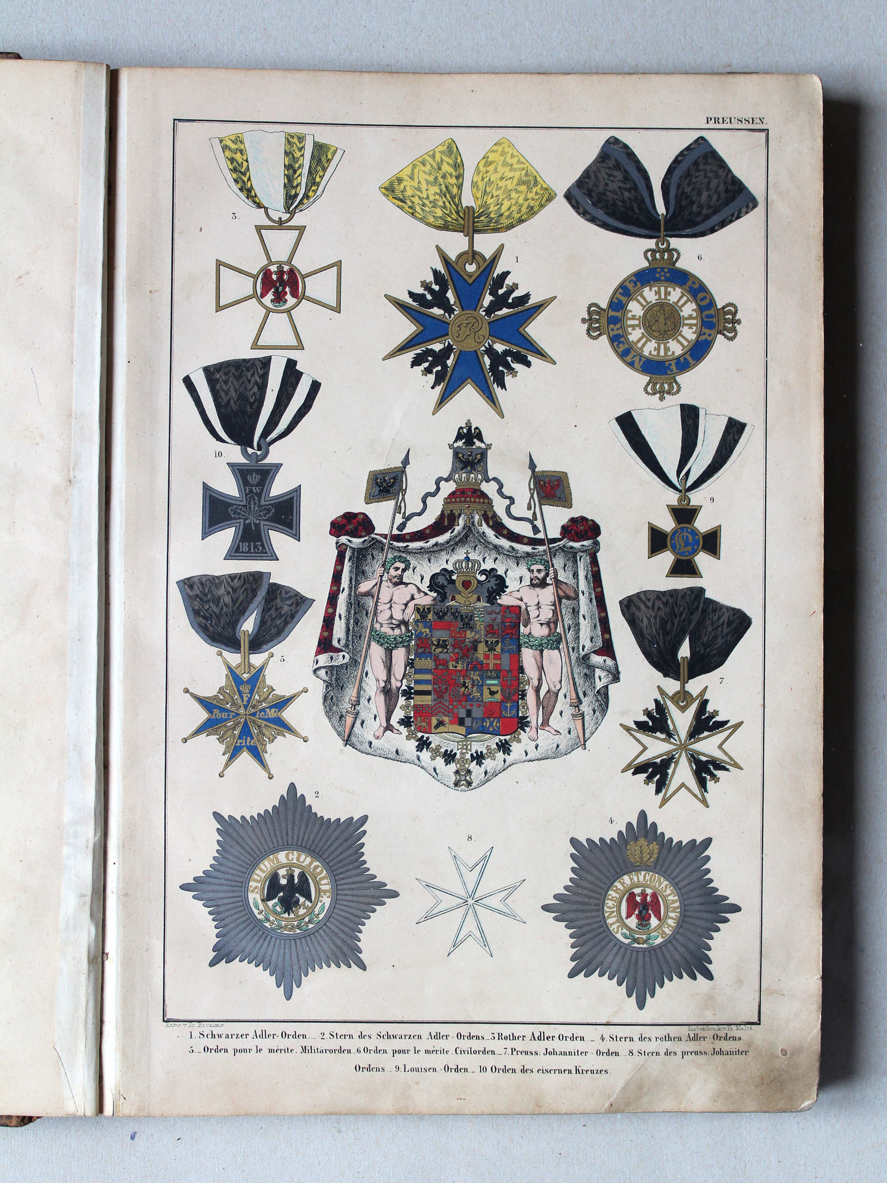
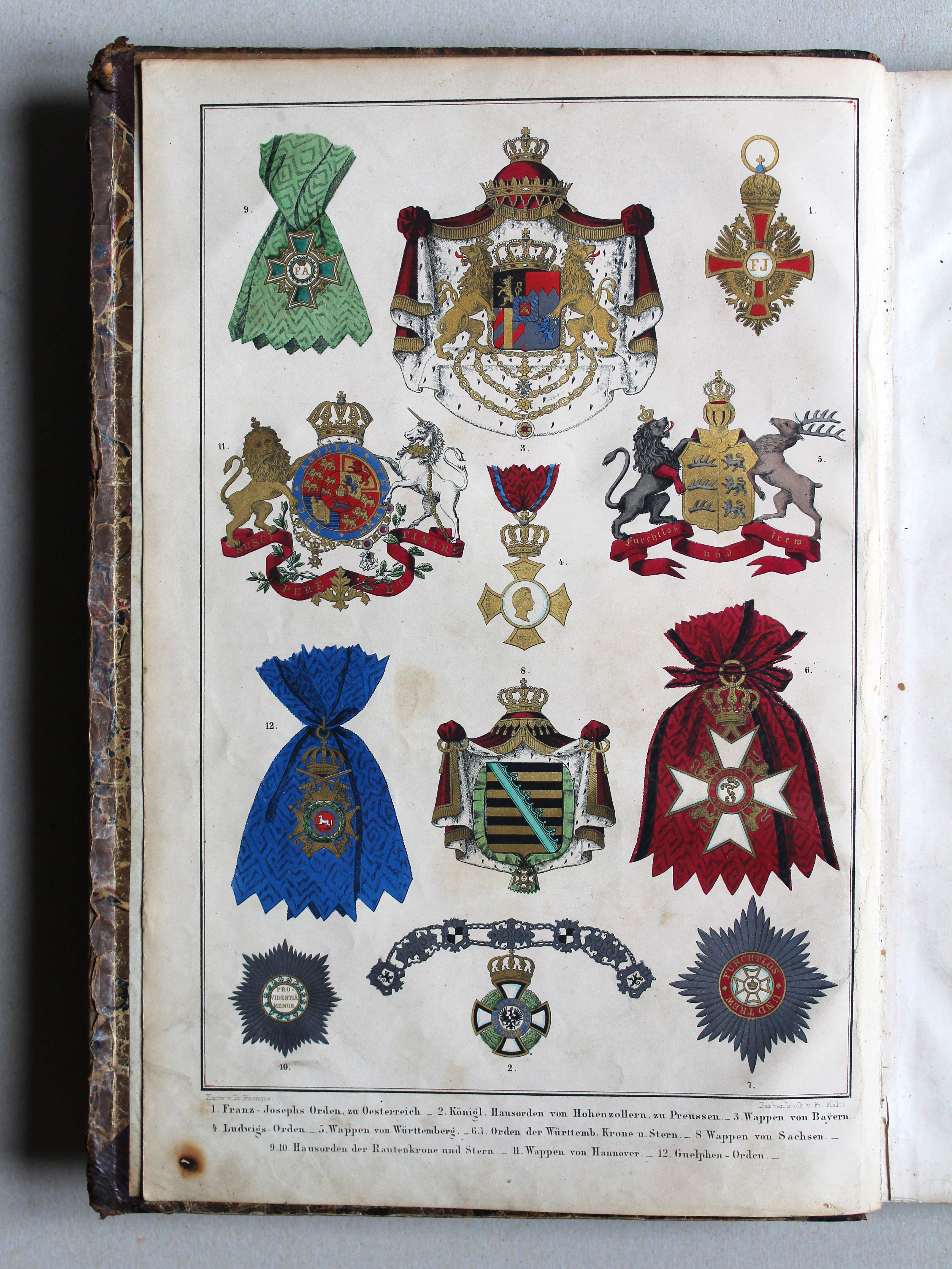
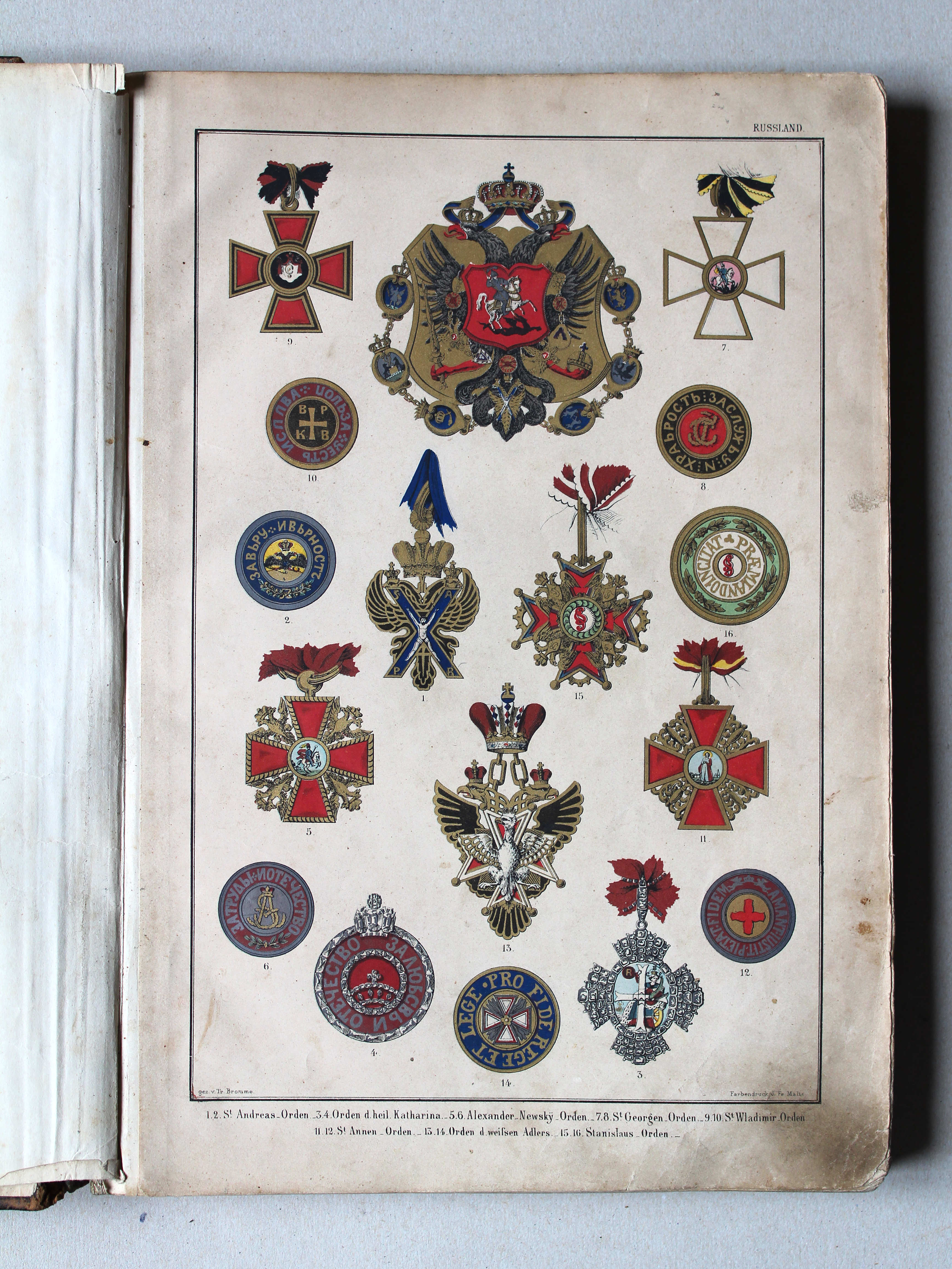
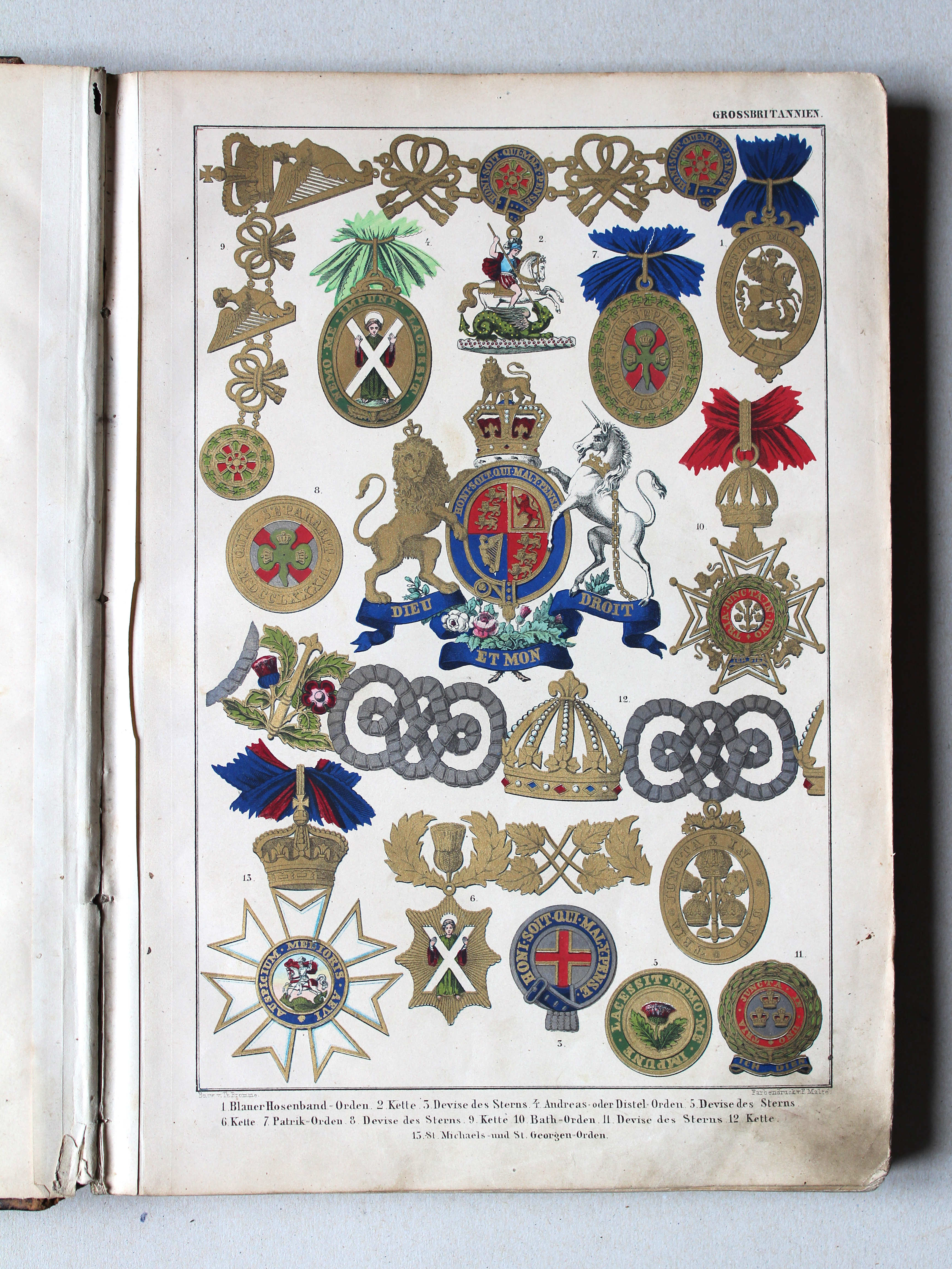
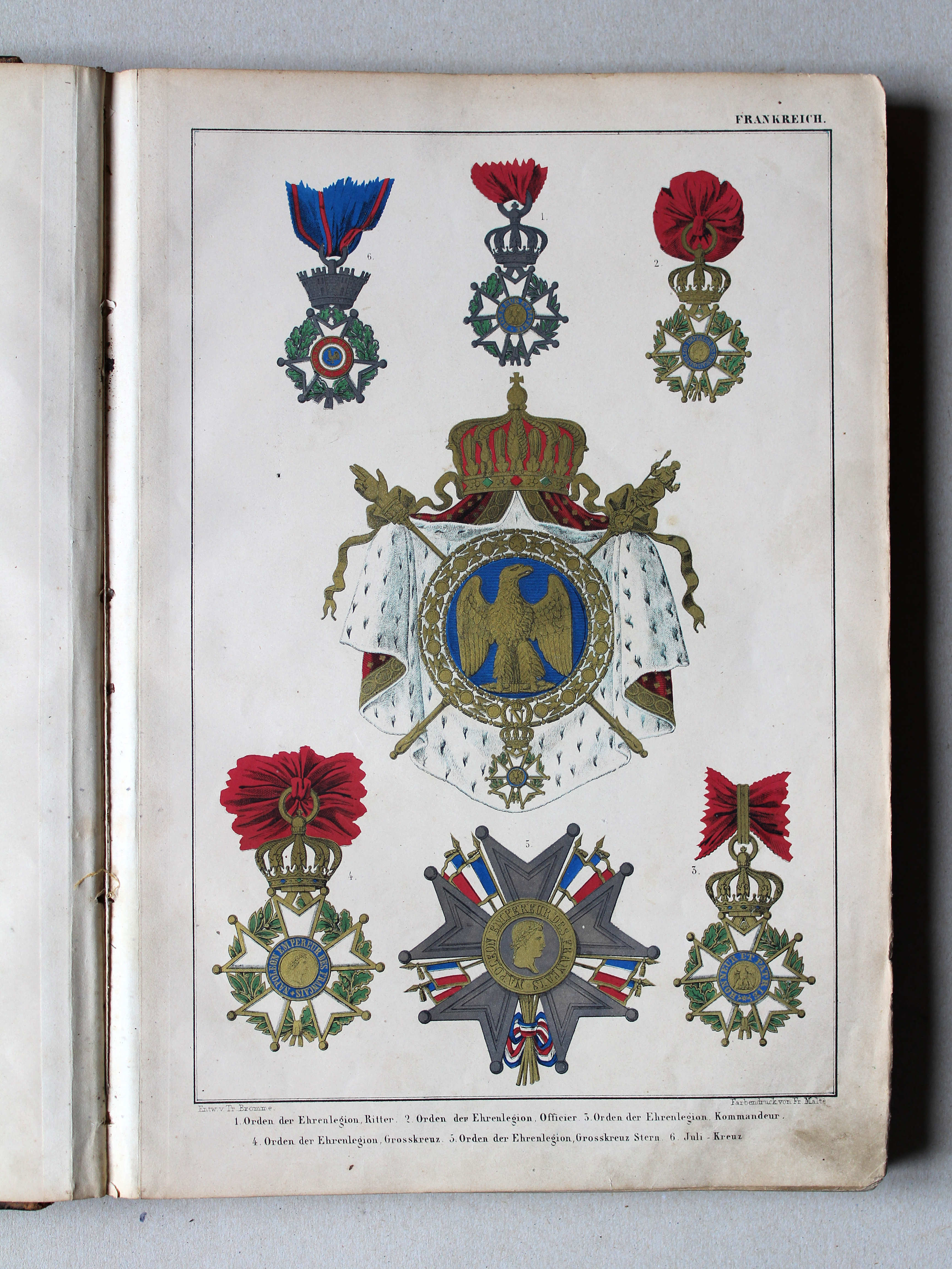
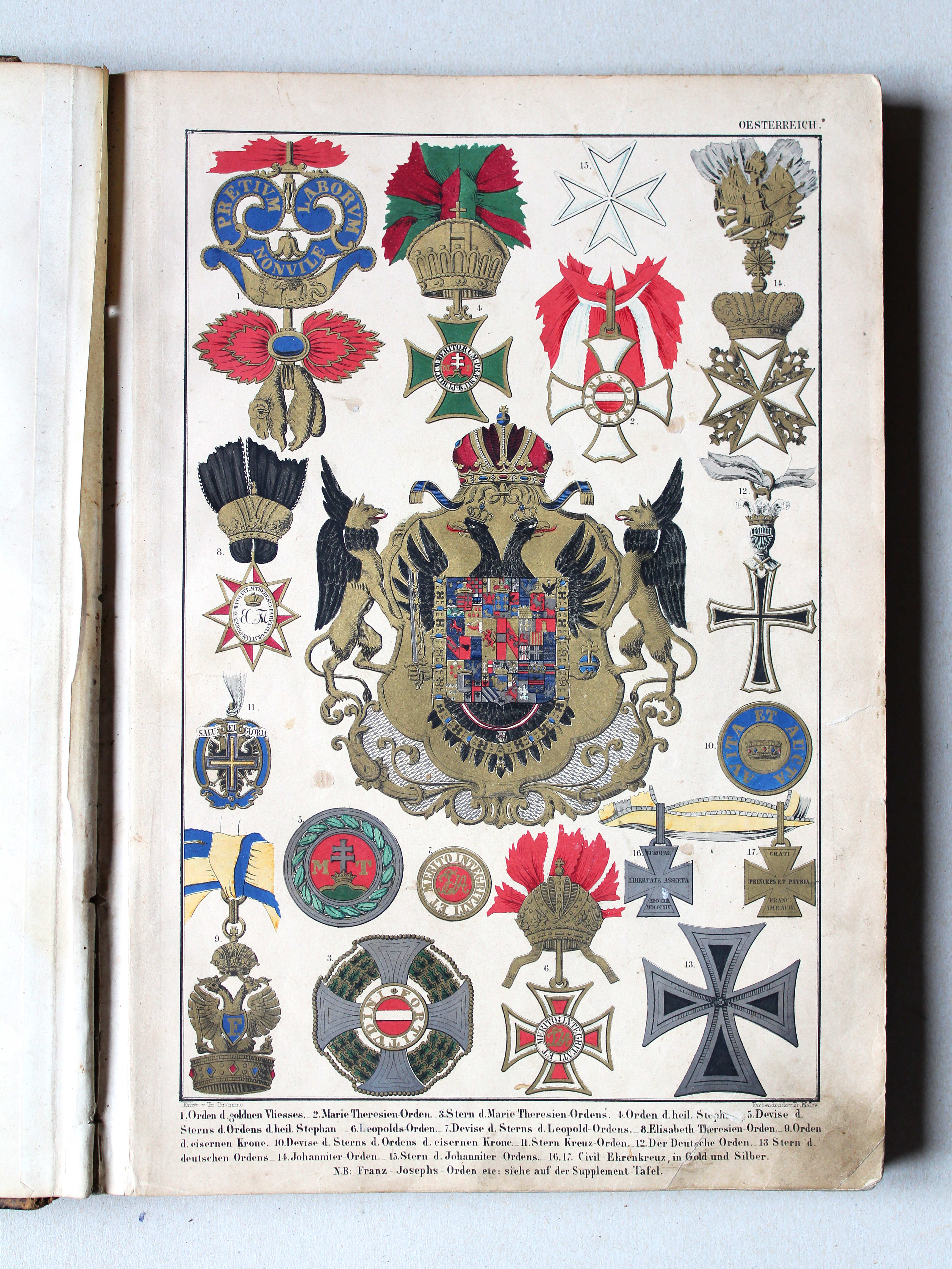
Wapens / Coats of arms
![Bromme, Illustrirter Hand-Atlas, 1862
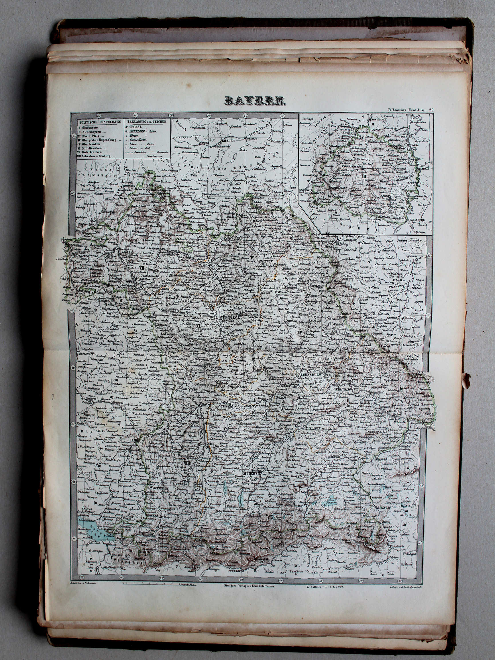
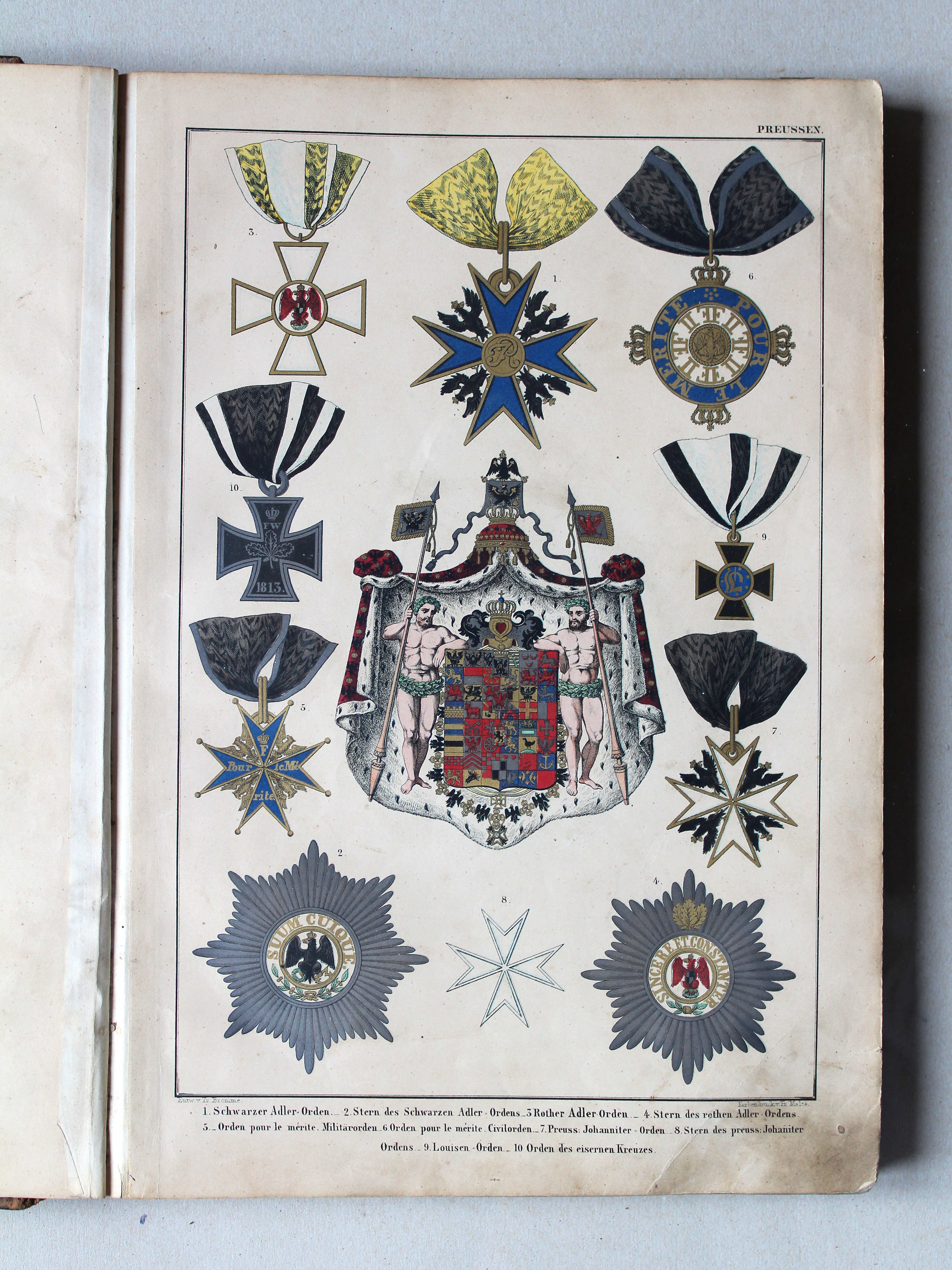
1. [Bayern, Württemberg, Sachsen, Hannover, und Nachtrag zu Oesterreich und Preussen]](picslarge/broha1862w001.jpg) Bromme, Illustrirter Hand-Atlas, 1862
Bromme, Illustrirter Hand-Atlas, 1862
1. [Bayern, Württemberg, Sachsen, Hannover, und Nachtrag zu Oesterreich und Preussen] XL
Beieren, Württemberg, Saksen, Hannover, supplement bij Oostenrijk en Pruisen / Bavaria, Württemberg, Saxony, Hanover, supplement to Austria and Prussia


 Bromme, Illustrirter Hand-Atlas, 1862
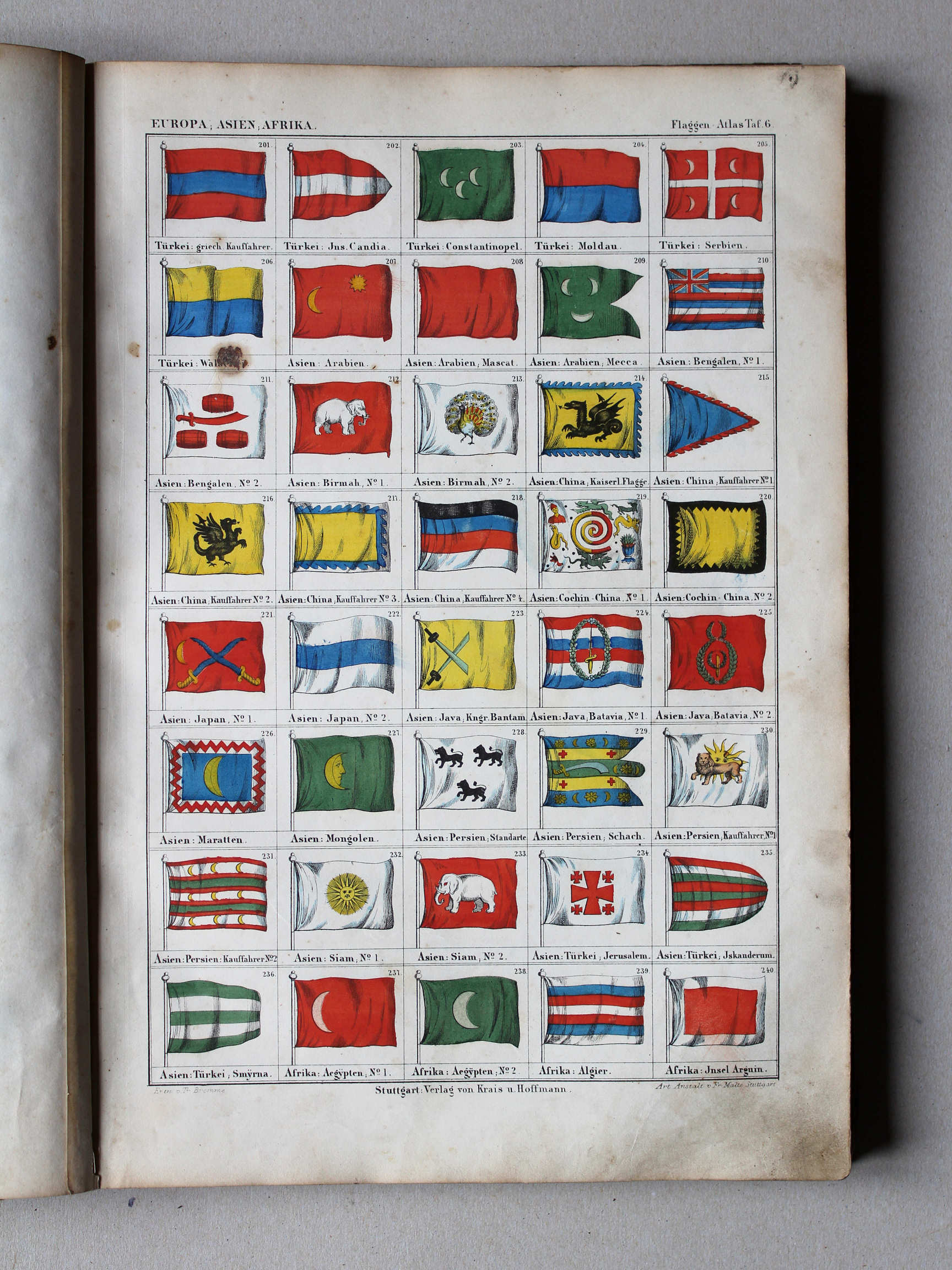
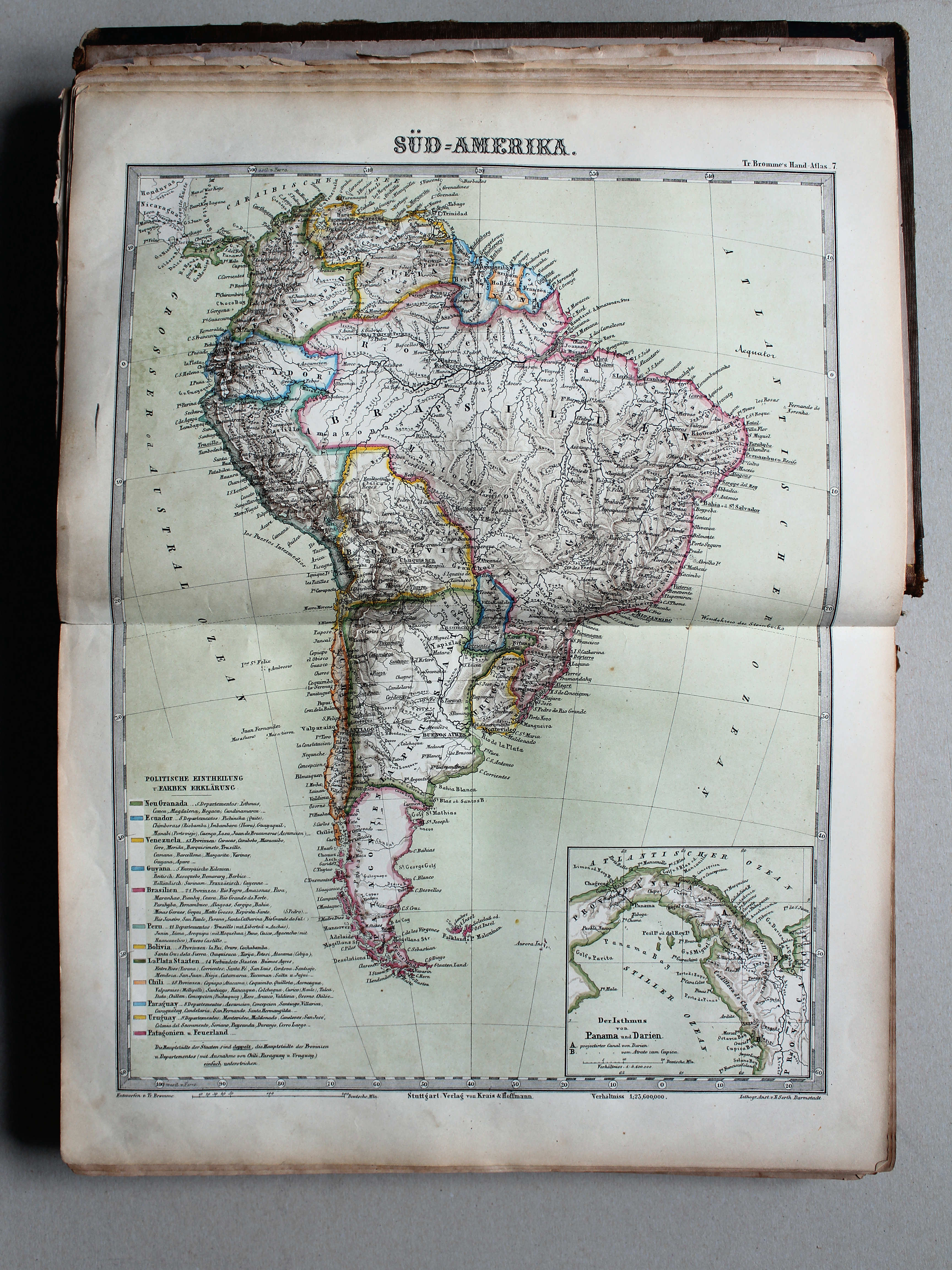
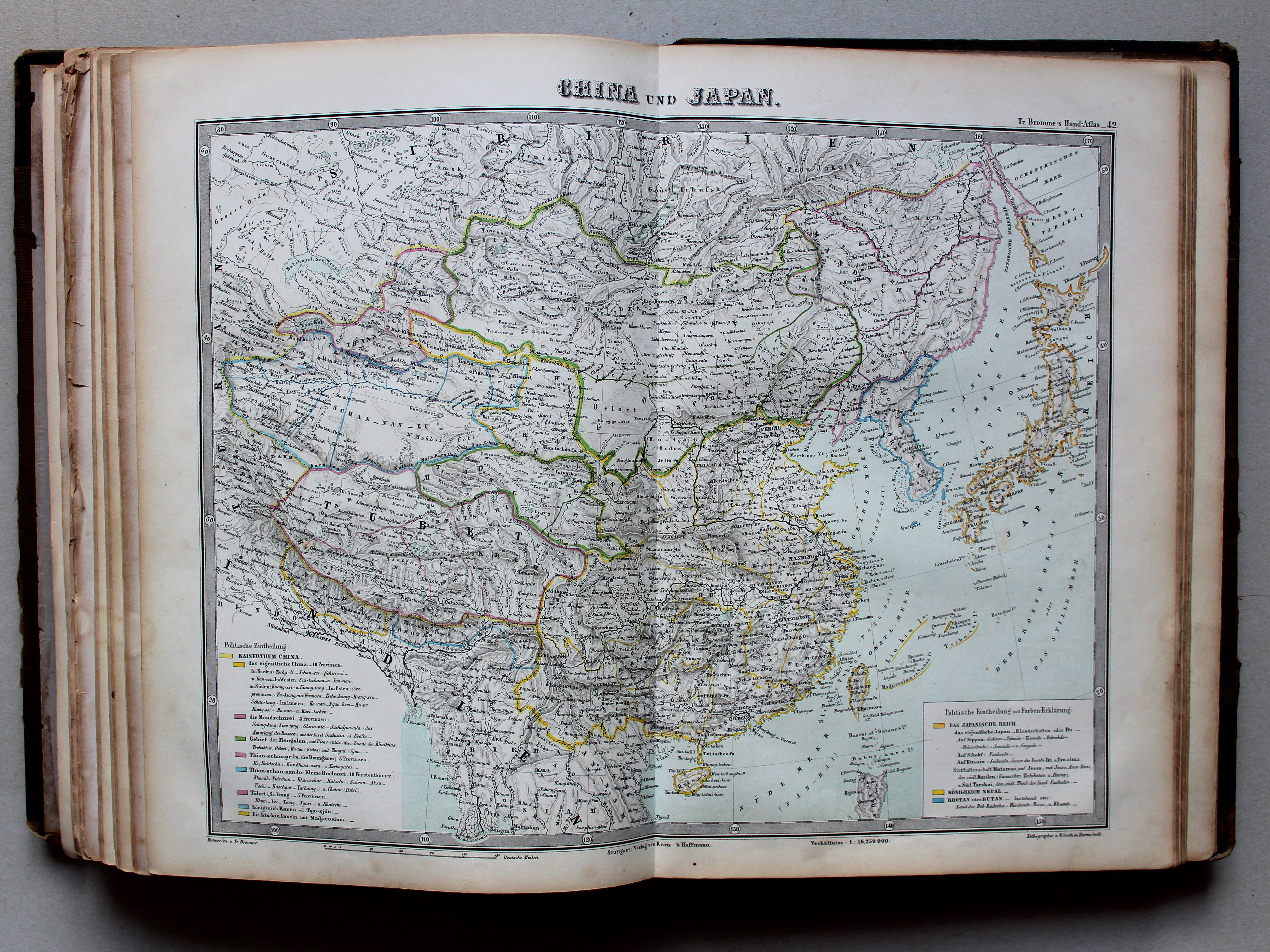
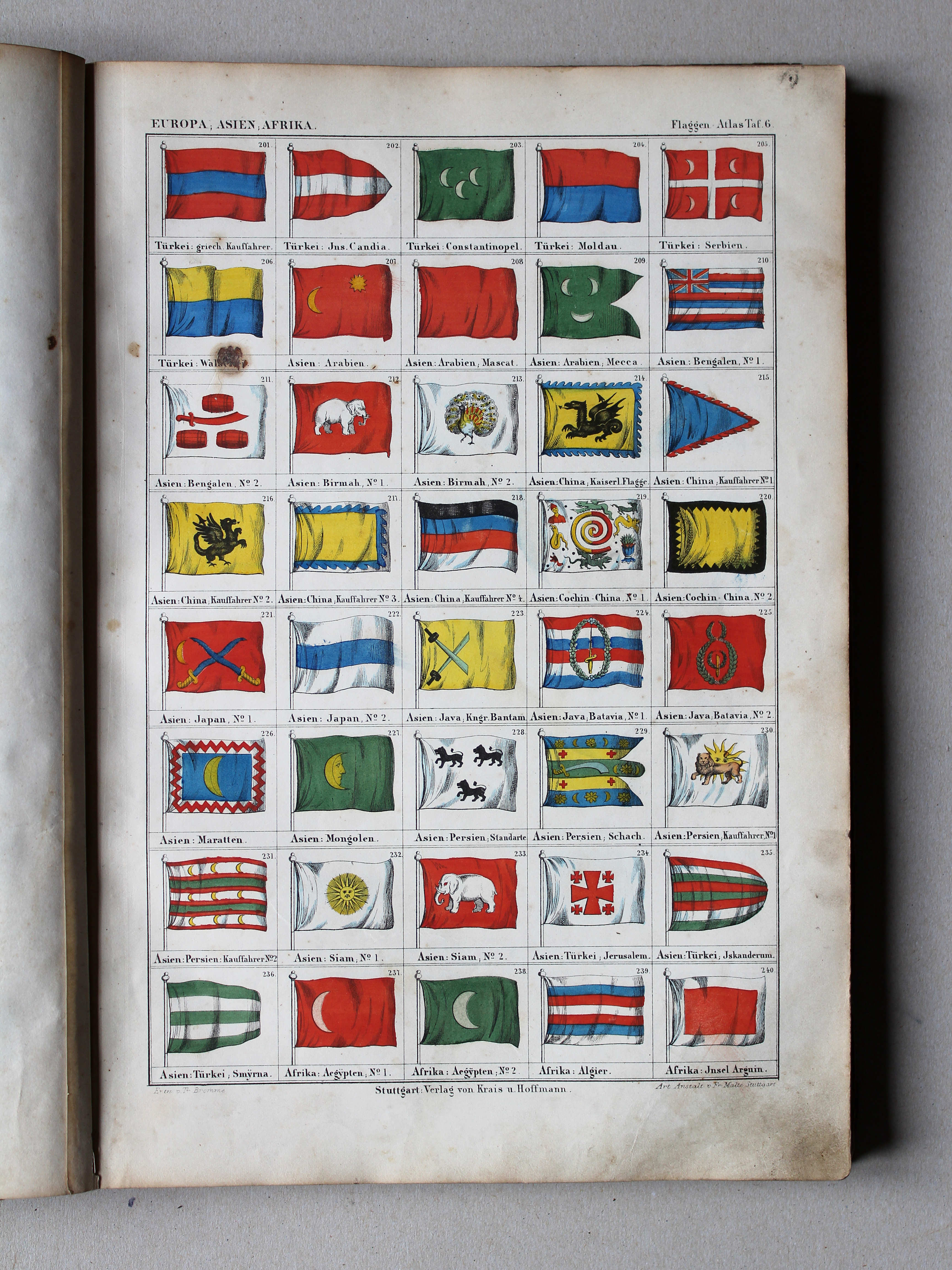
6. Europa, Asien, Afrika (201-240) XL
Europa, Azië, Afrika / Europa, Asia, Africa (201-240)
 Bromme, Illustrirter Hand-Atlas, 1862
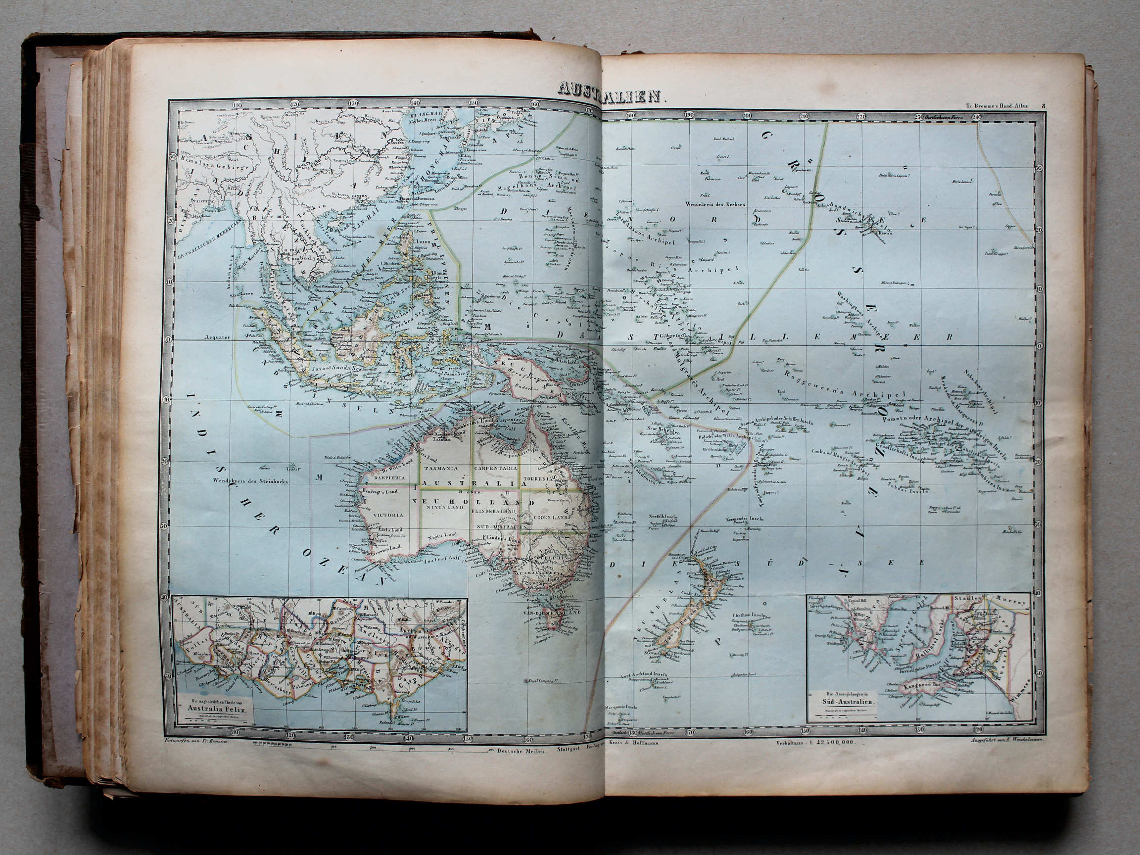
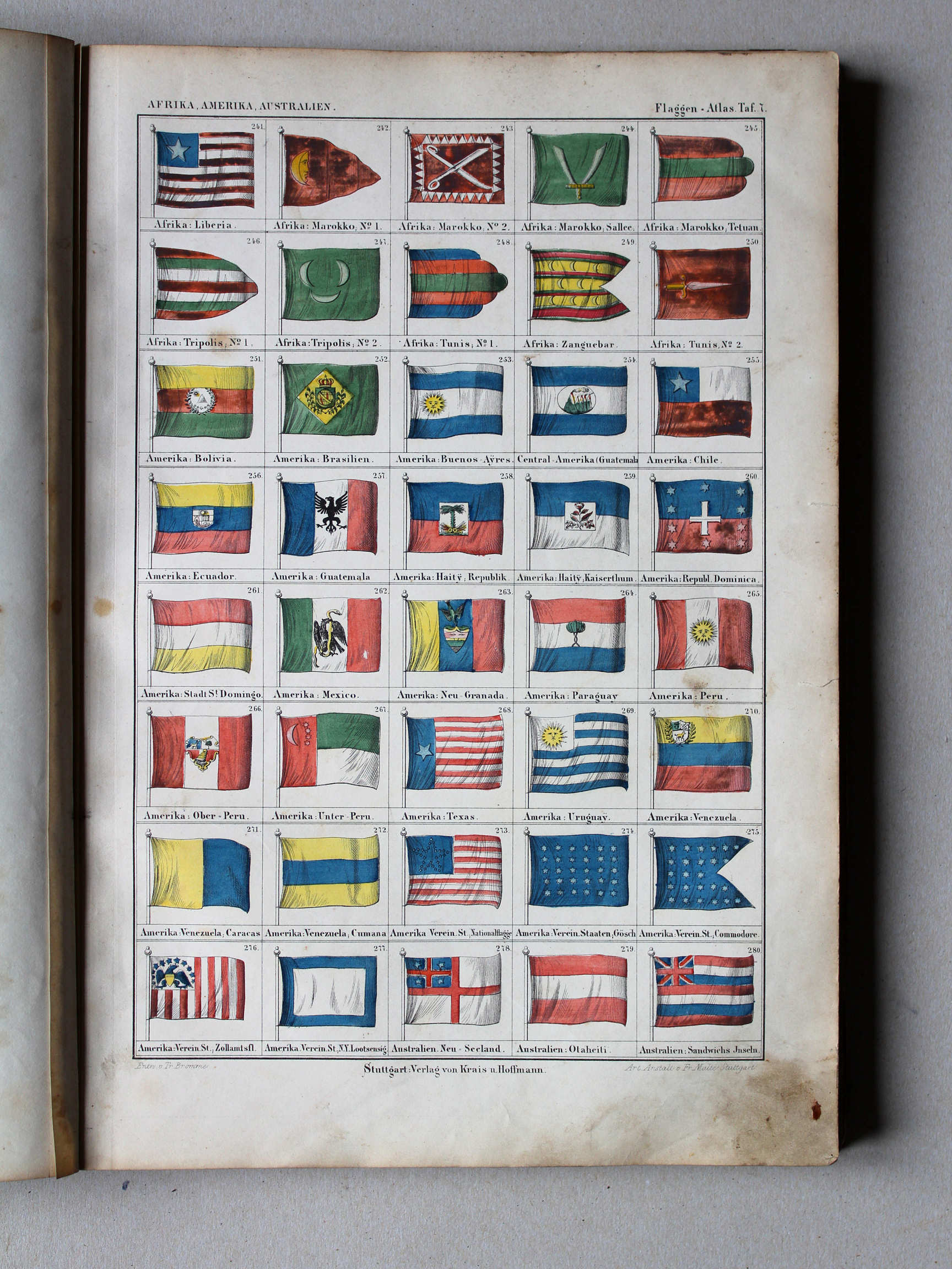
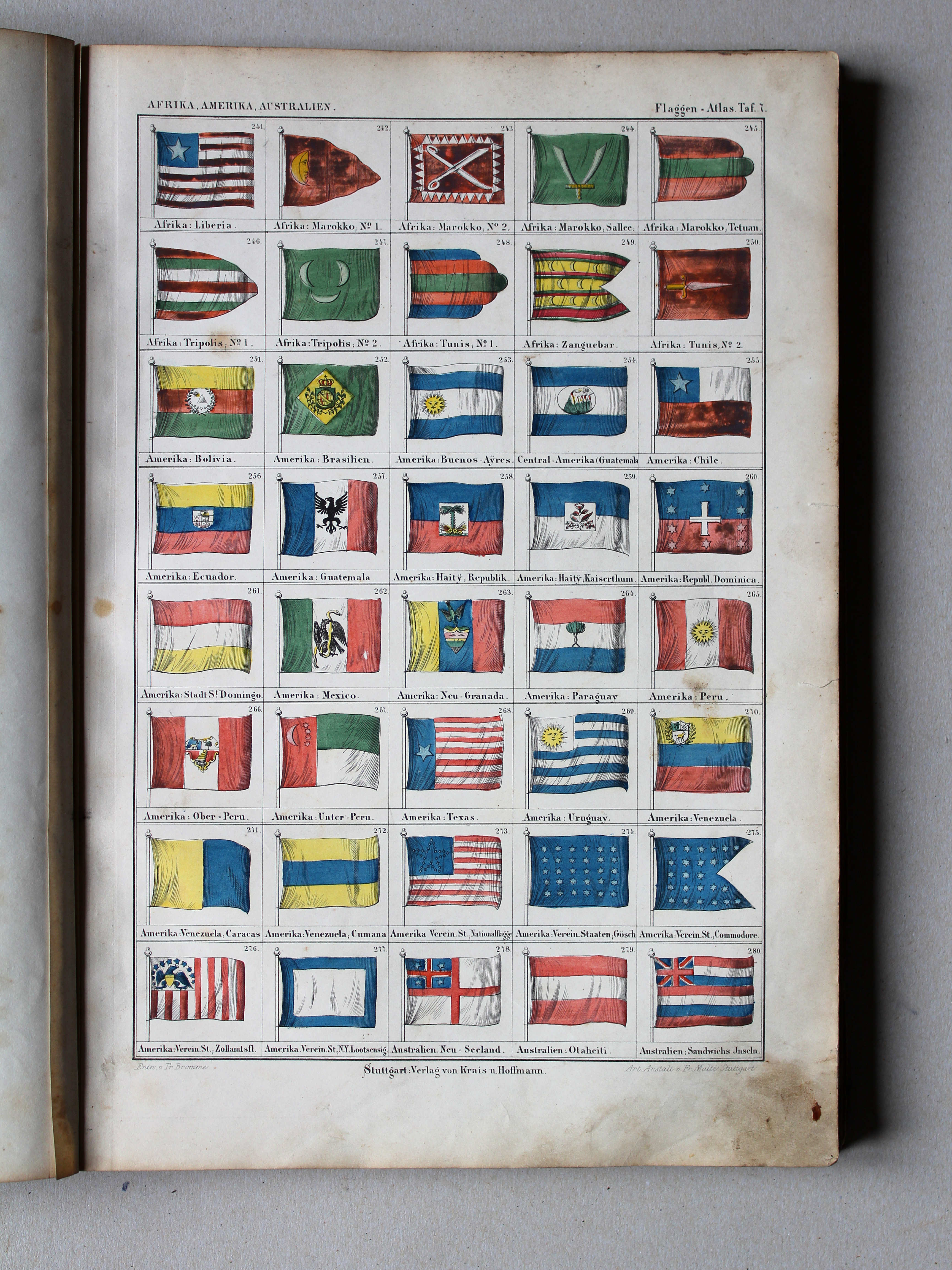
7. Afrika, Amerika, Australien (241-280) XL
Afrika, Amerika, Australië / Africa, America, Australia (241-280)
nummers: kaartnummer.pagina / numbers: map number.page
Werelddelen / Continents
 Bromme, Illustrirter Hand-Atlas, 1862
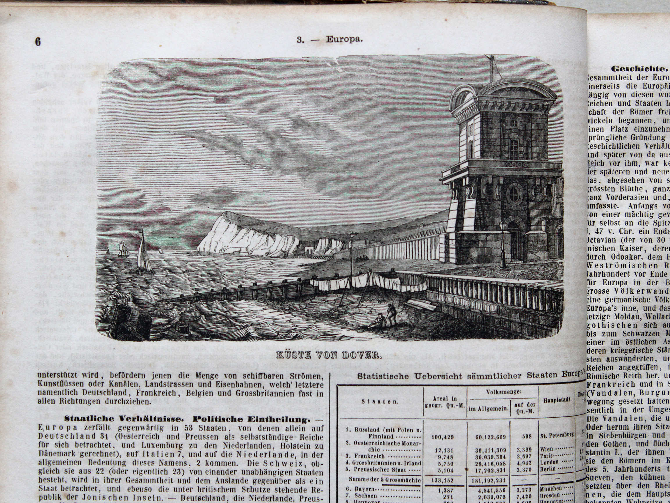
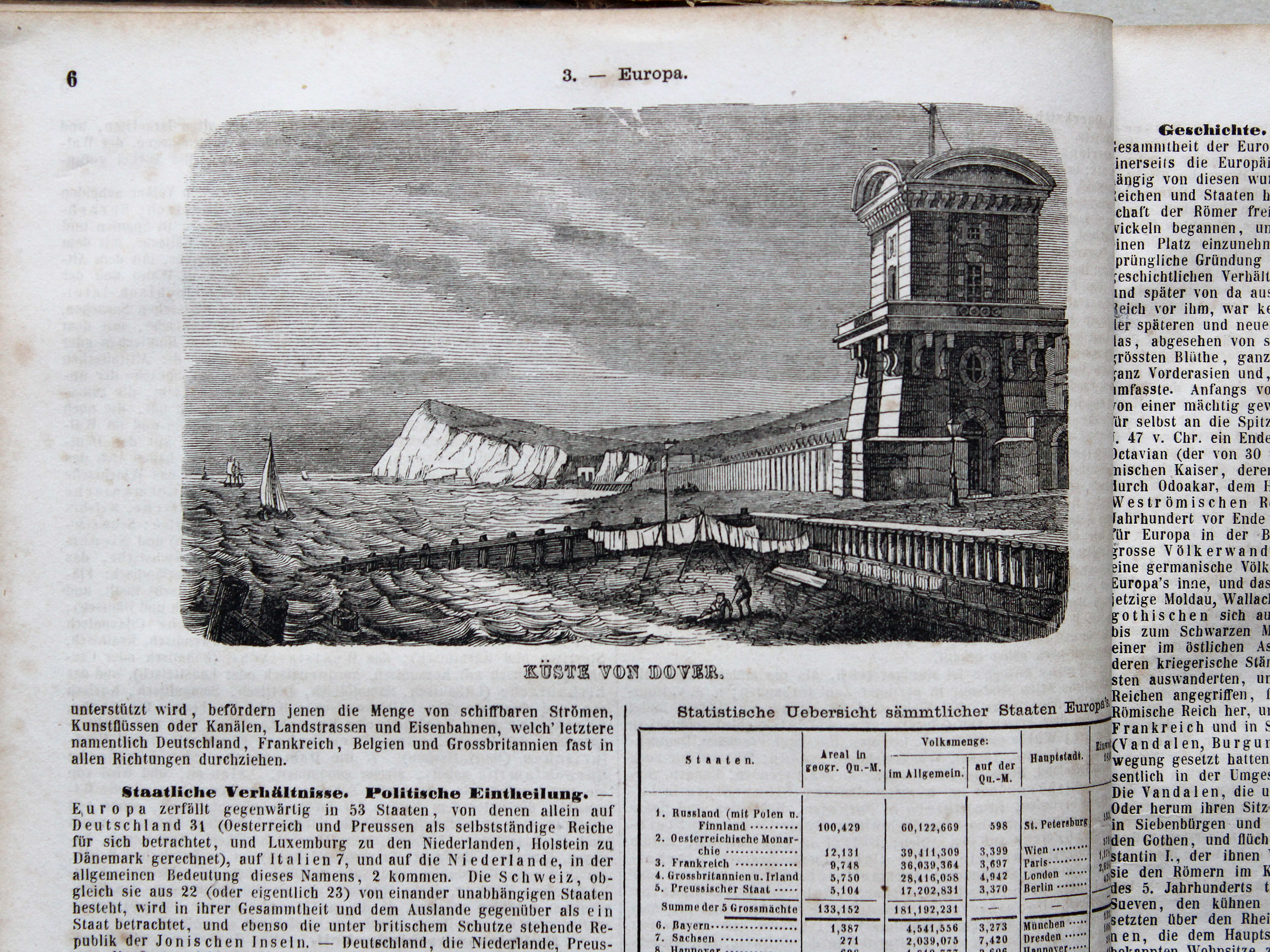
3.6. Küste von Dover XL
Krijtrotsen van Dover / White Cliffs of Dover

 Bromme, Illustrirter Hand-Atlas, 1862
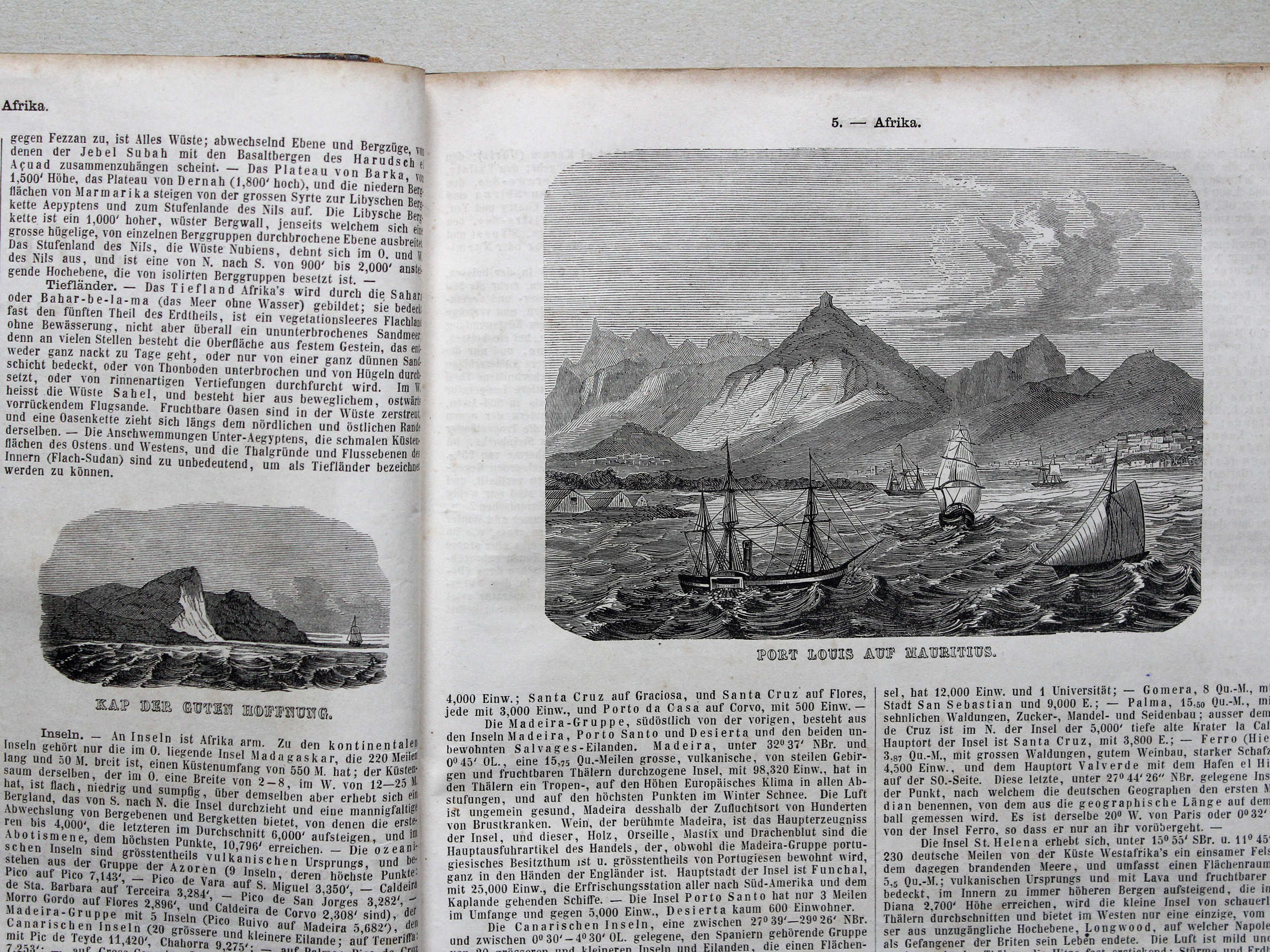
5.2. Kap der Guten Hoffnung XL
5.3. Port Louis auf Mauritius XL
Kaap de Goede Hoop, Port-Louis op Mauritius / Cape of Good Hope, Port Louis on Mauritius
 Bromme, Illustrirter Hand-Atlas, 1862
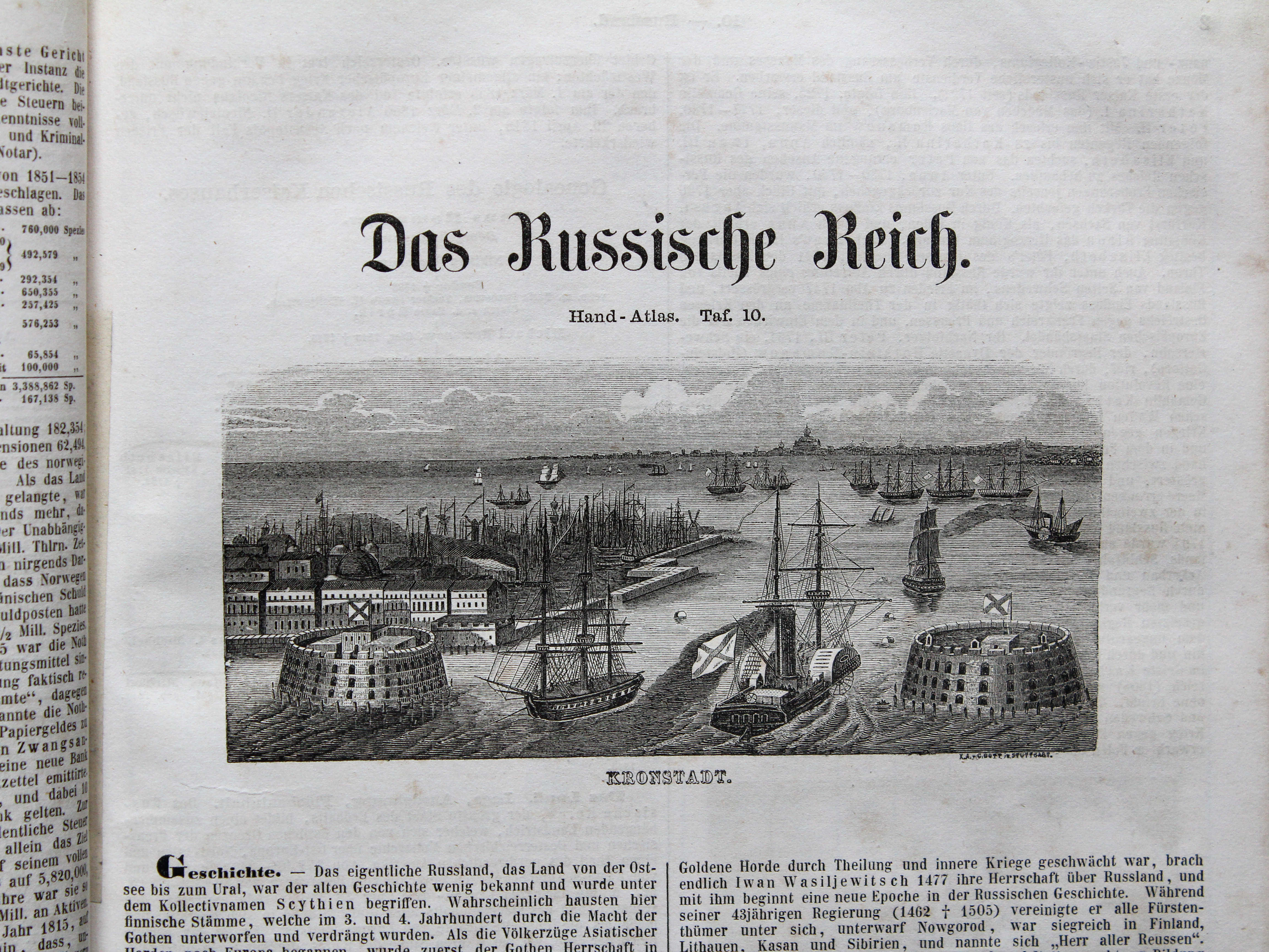
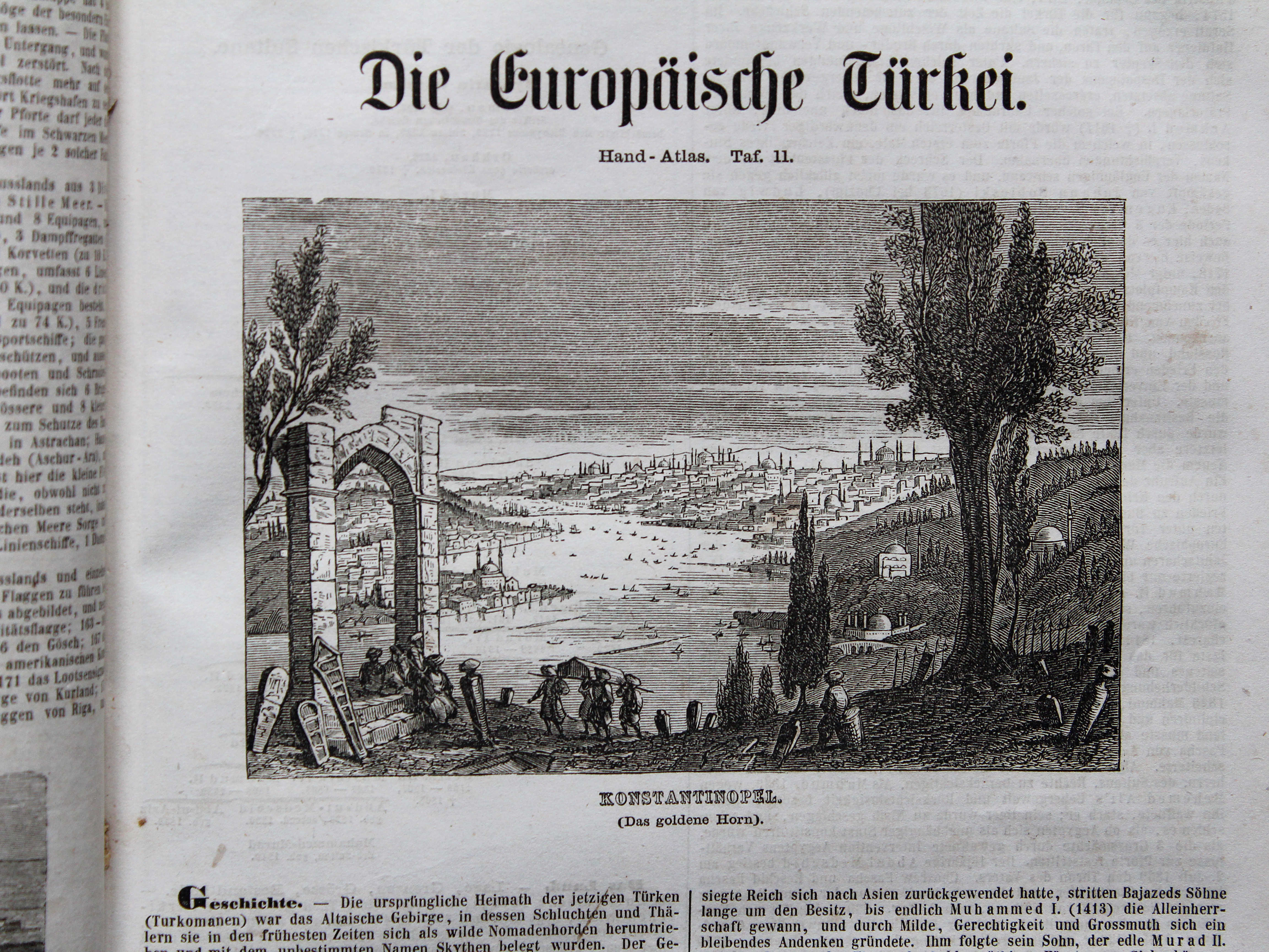
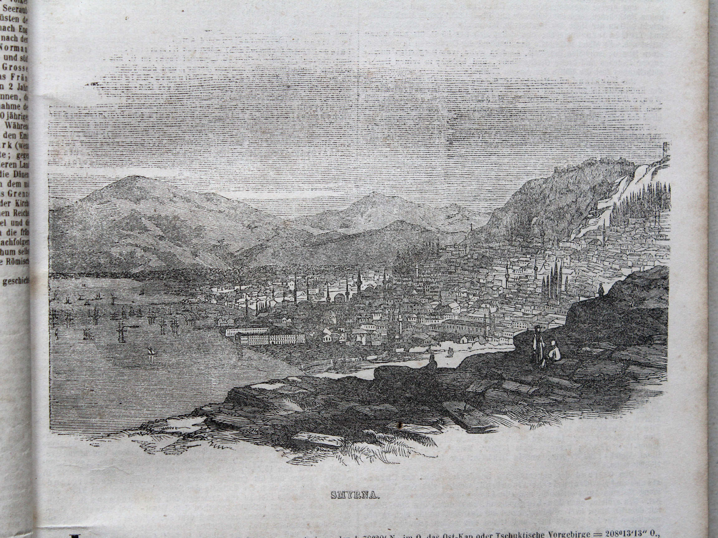
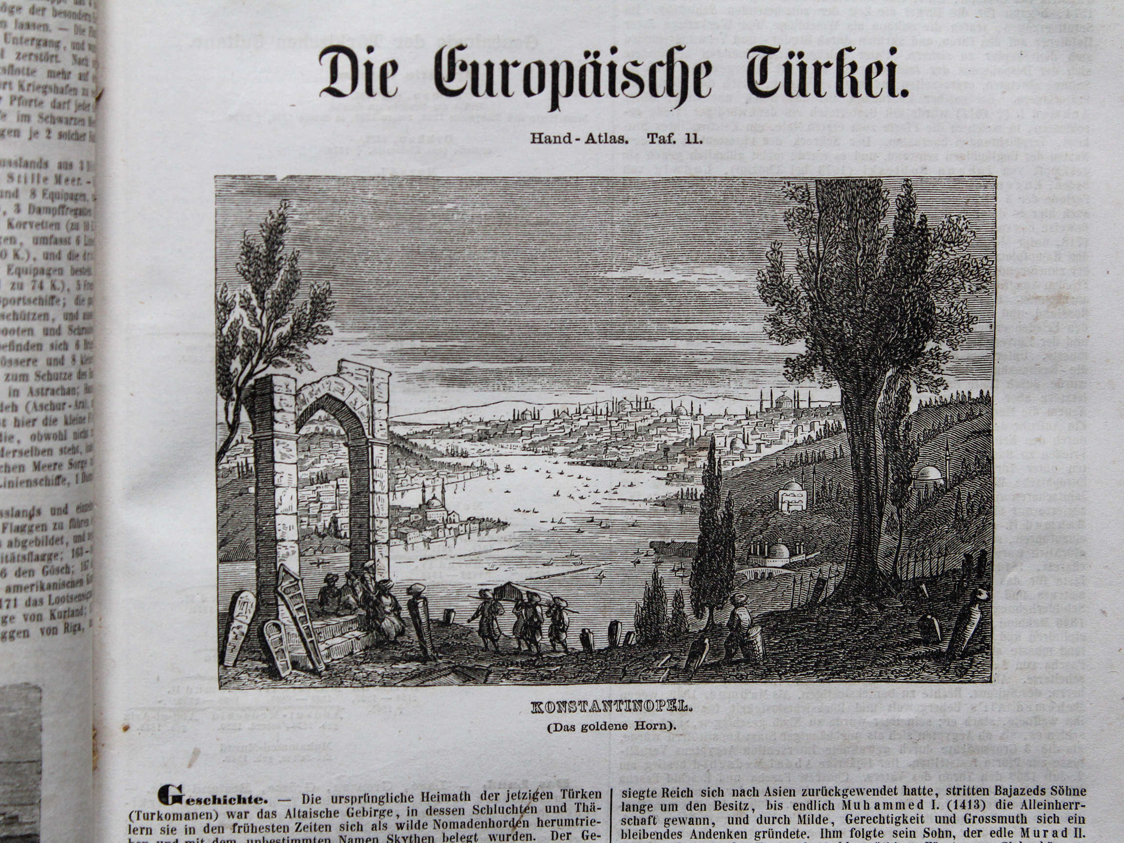
11.1. Konstantinopel (Das goldene Horn) XL
Constantinopel (De Gouden Hoorn) / Constantinople (The Golden Horn)
 Bromme, Illustrirter Hand-Atlas, 1862
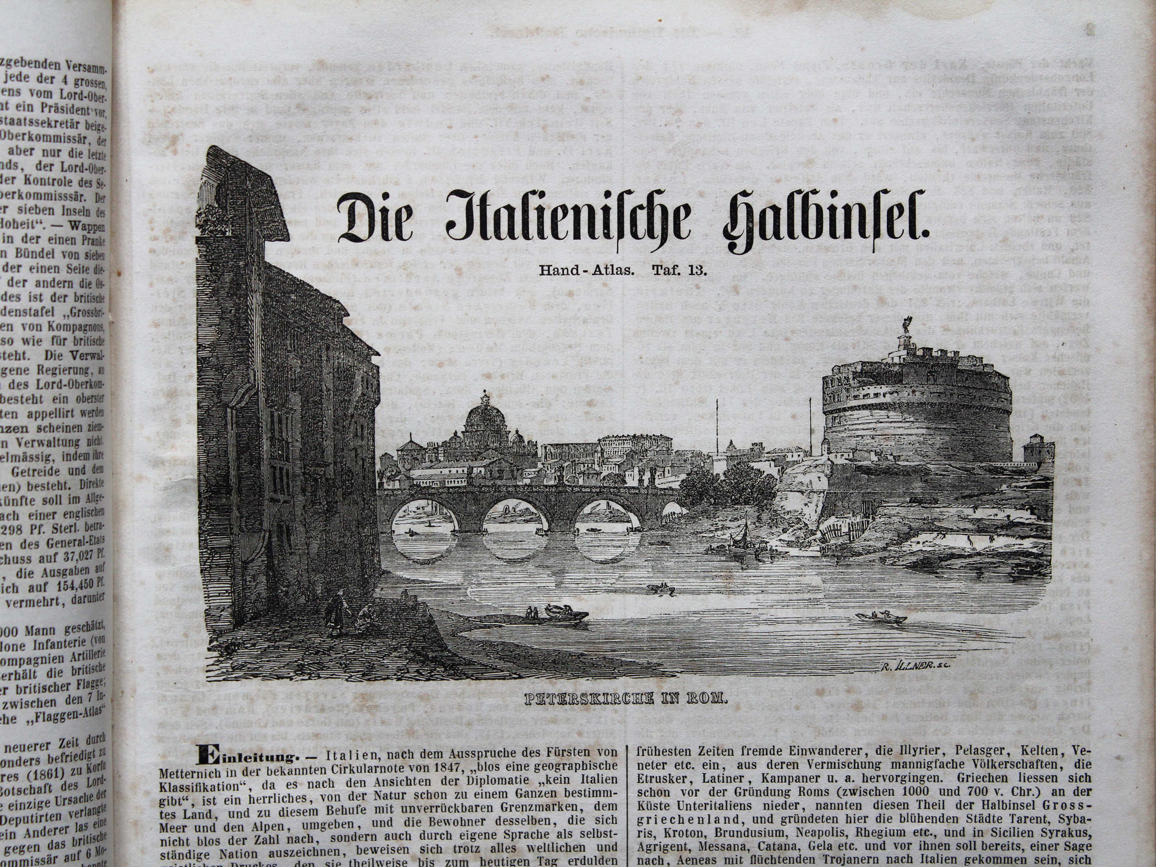
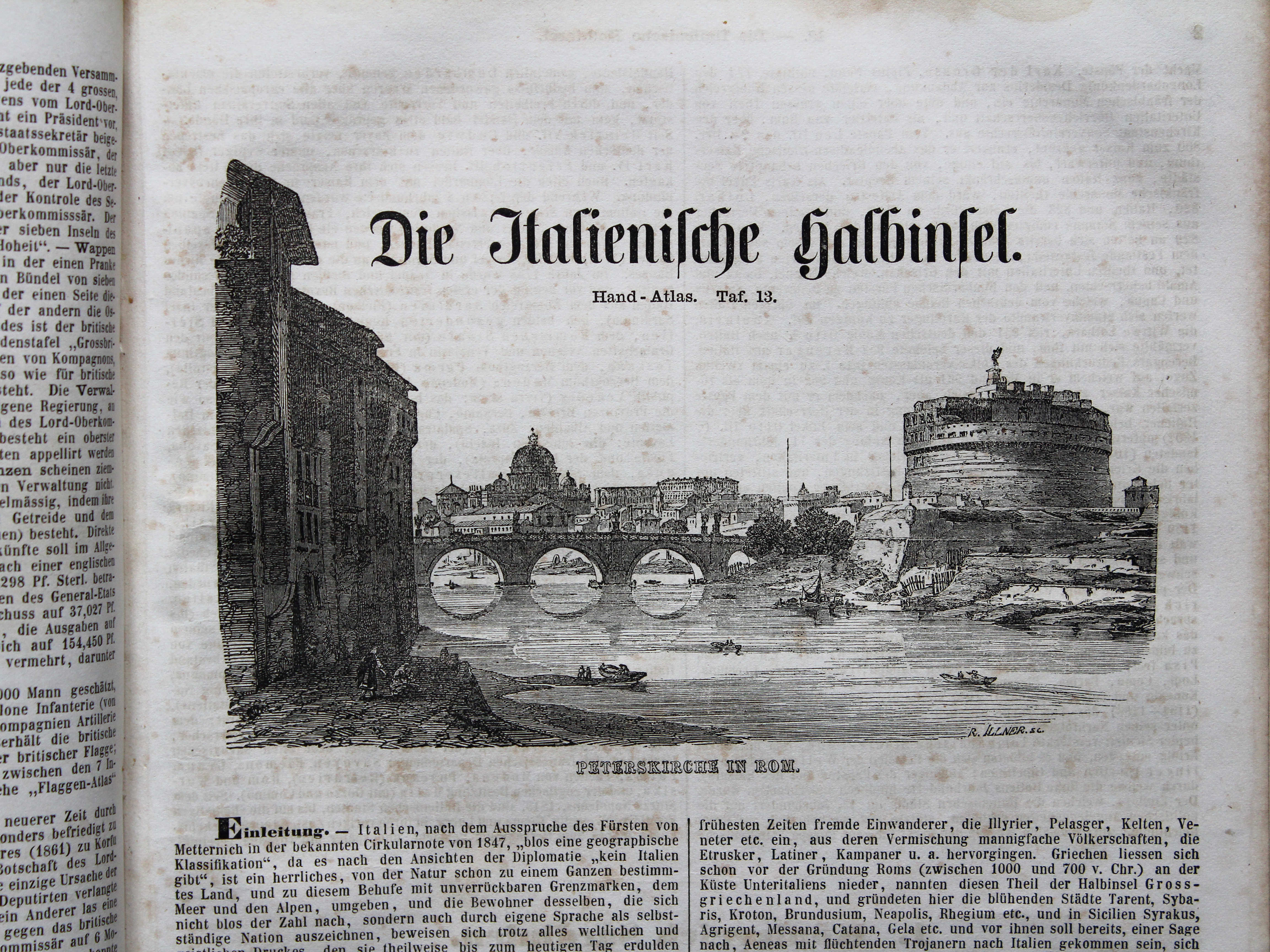
13.1. Peterskirche in Rom XL
Sint-Pietersbasiliek in Rome / St. Peter's Basilica in Rome
 Bromme, Illustrirter Hand-Atlas, 1862
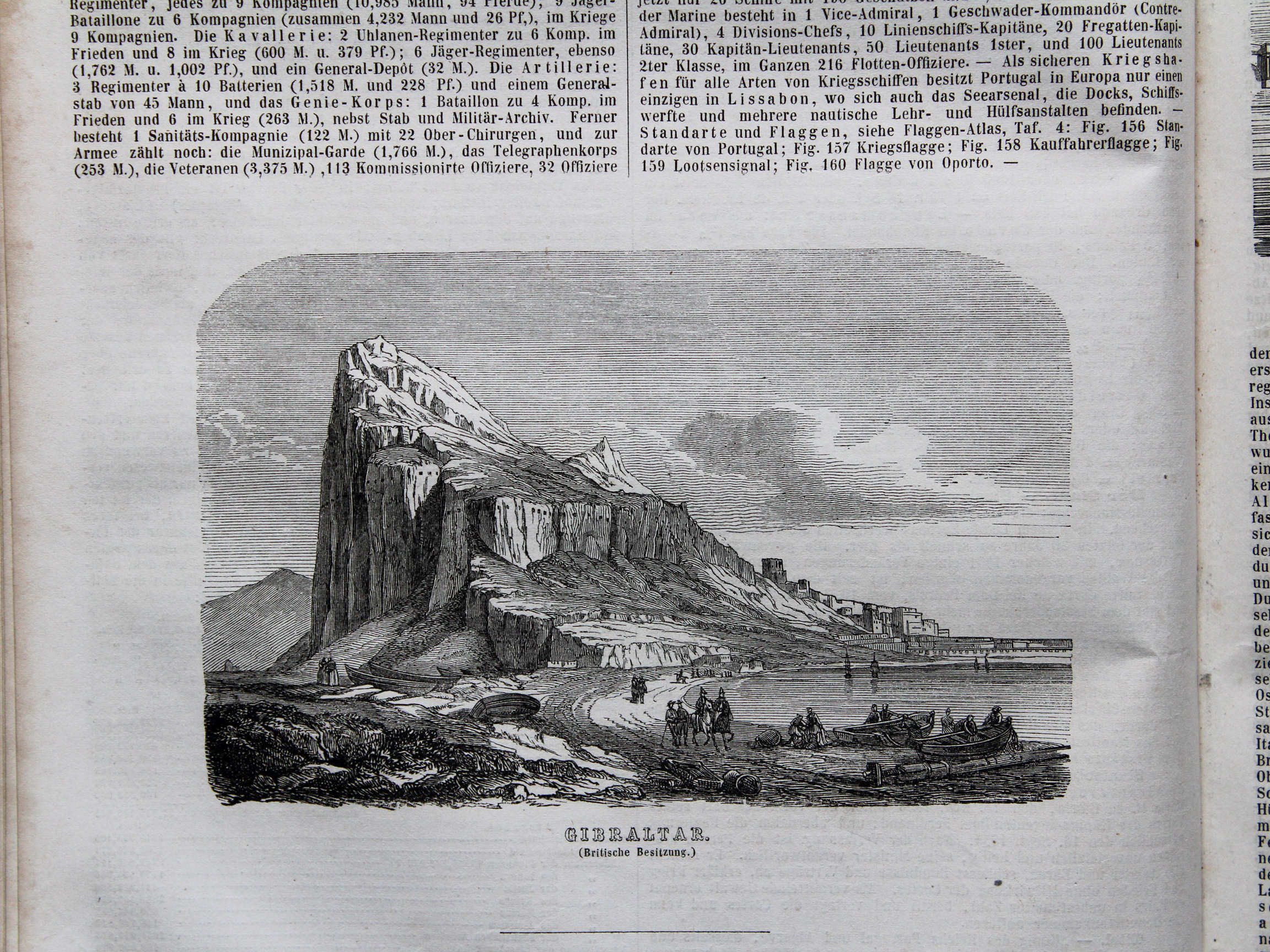
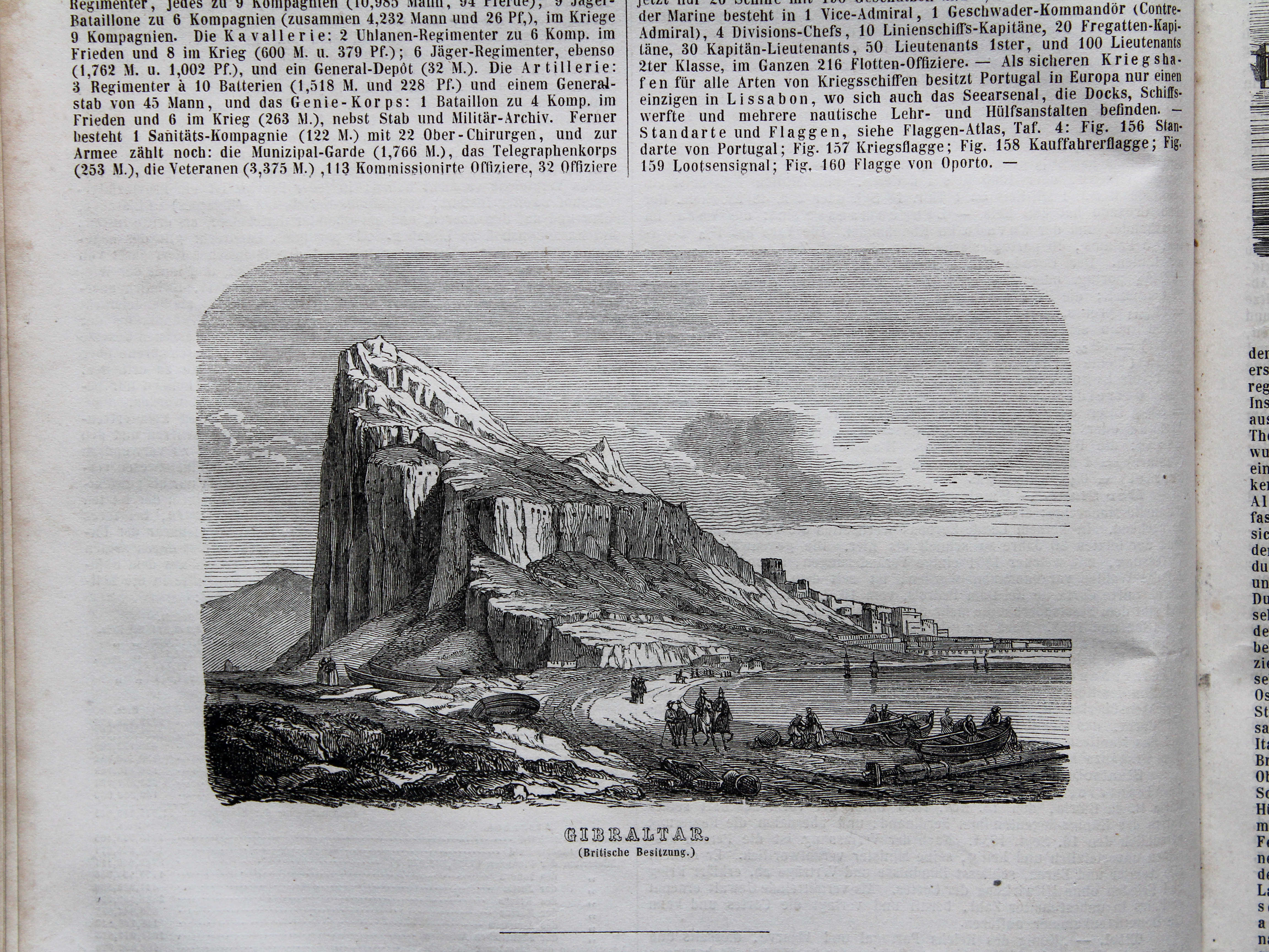
14.12. Gibraltar (Britische Besitzung) XL
Gibraltar (Britse bezitting) / Gibraltar (British possession)
 Bromme, Illustrirter Hand-Atlas, 1862
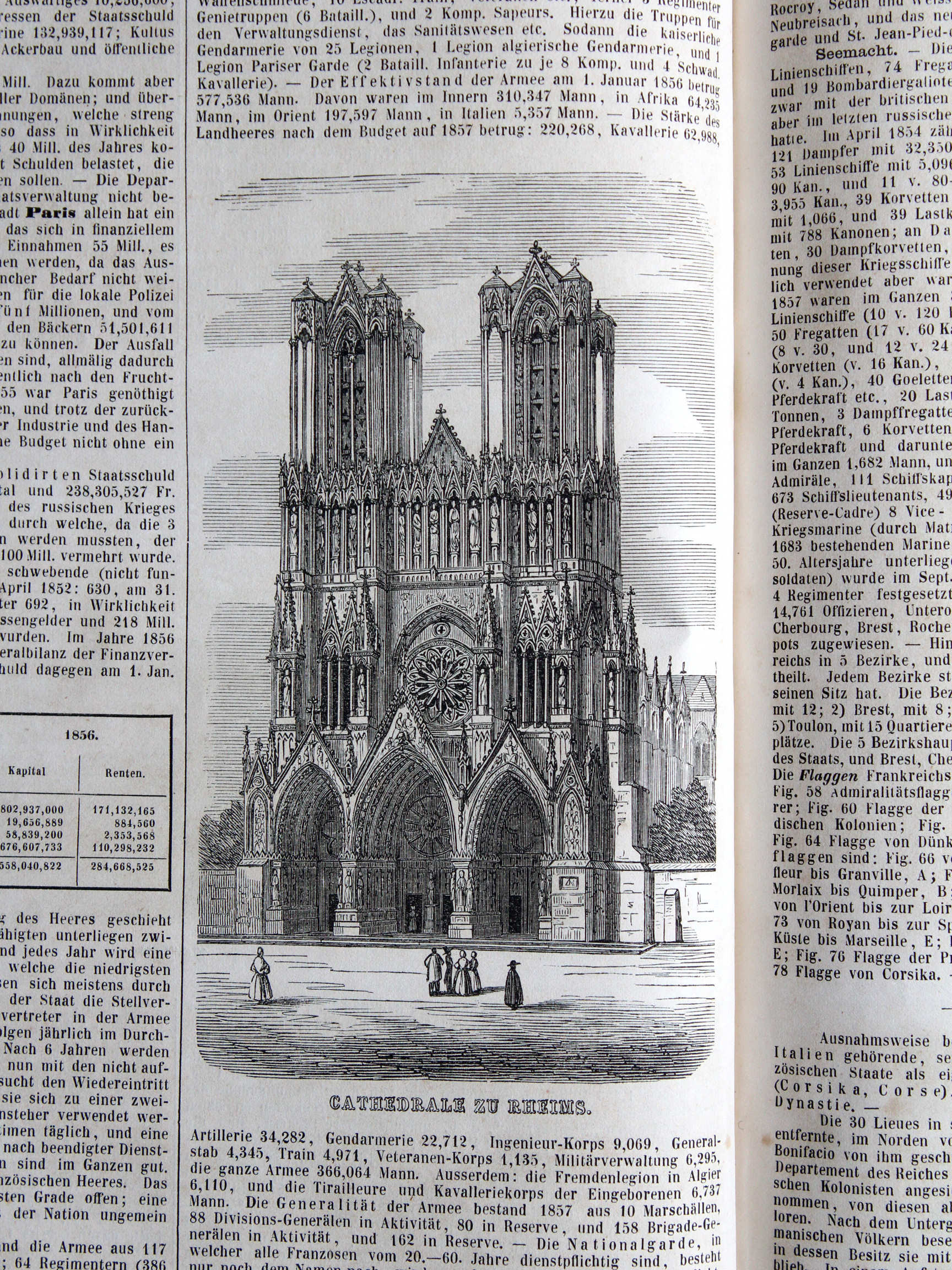
16.10. Cathedrale zu Rheims XL
Kathedraal van Reims / Cathedral of Reims
 Bromme, Illustrirter Hand-Atlas, 1862
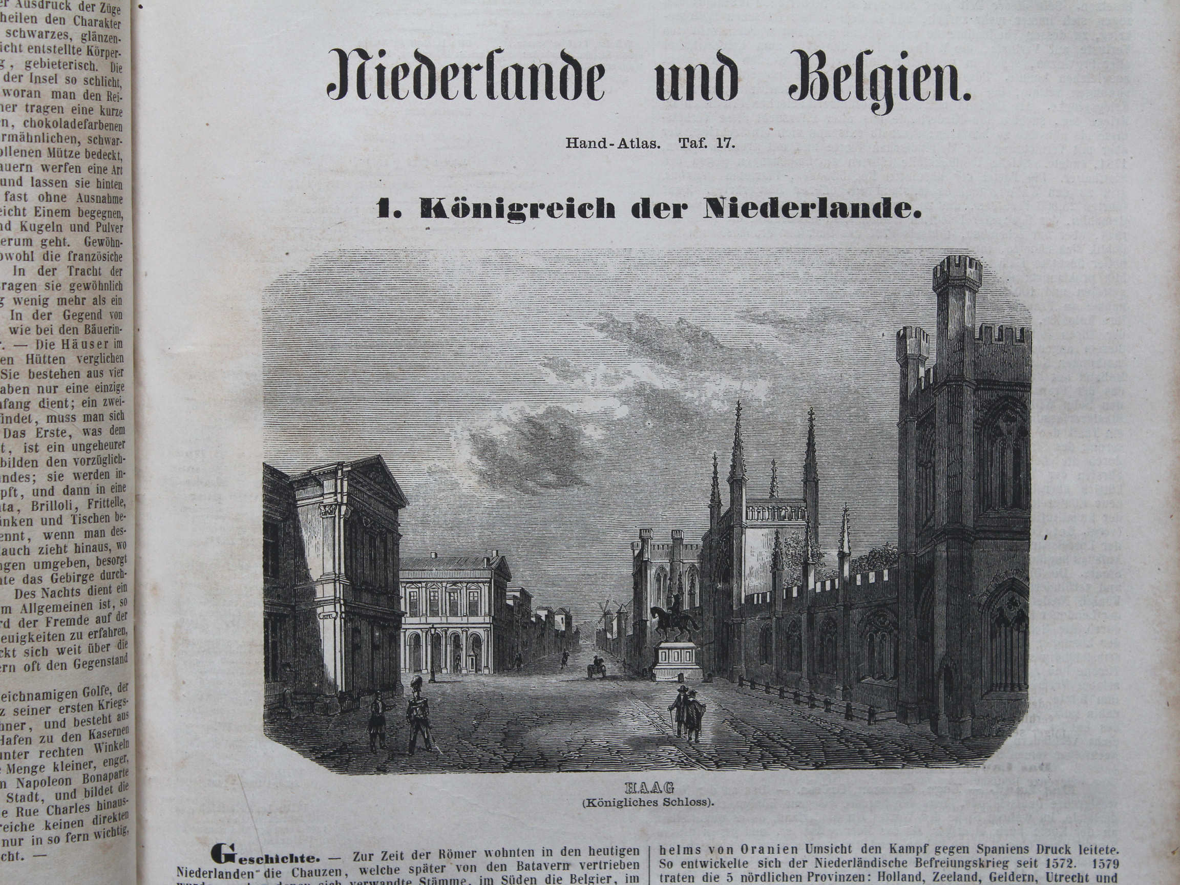
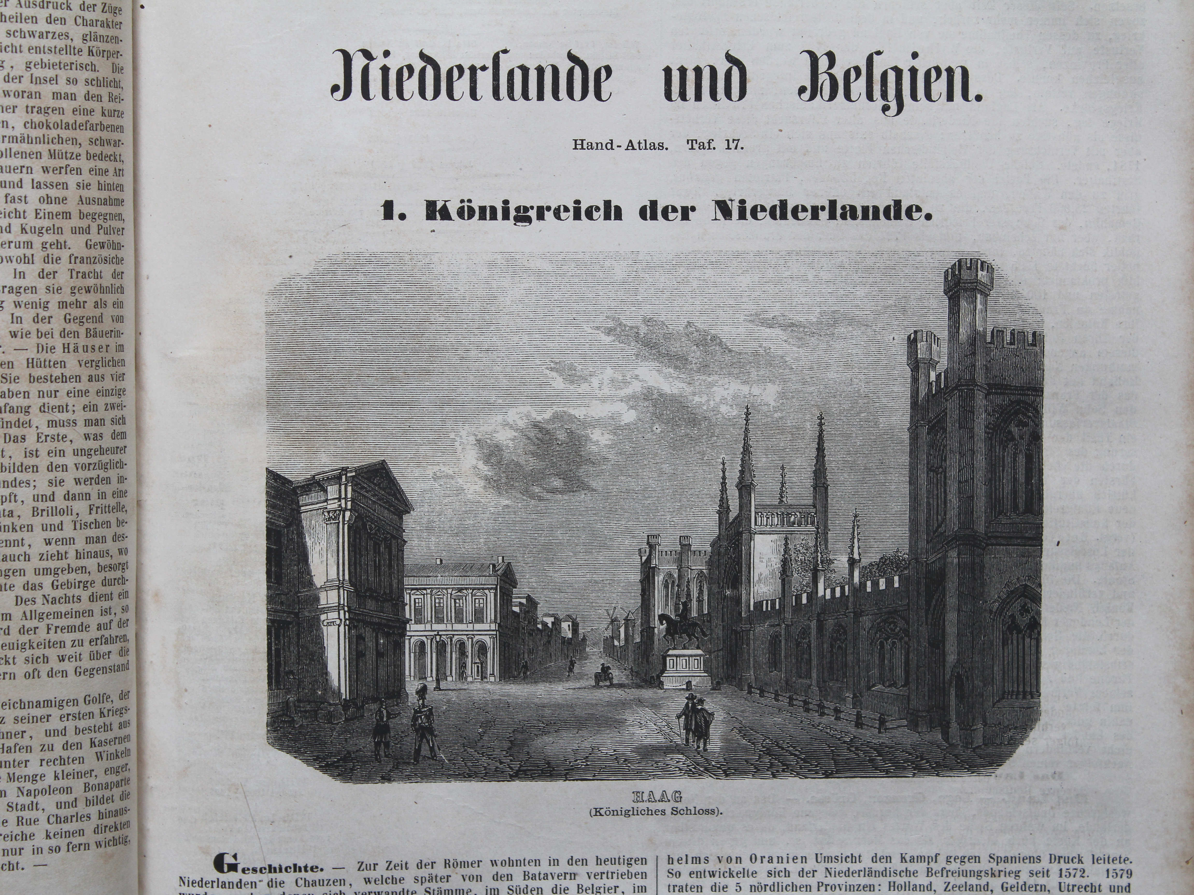
17.1. Haag (Königliches Schloss) XL
Den Haag (Koninklijk Paleis) / The Hague (Royal Palace)
 Bromme, Illustrirter Hand-Atlas, 1862
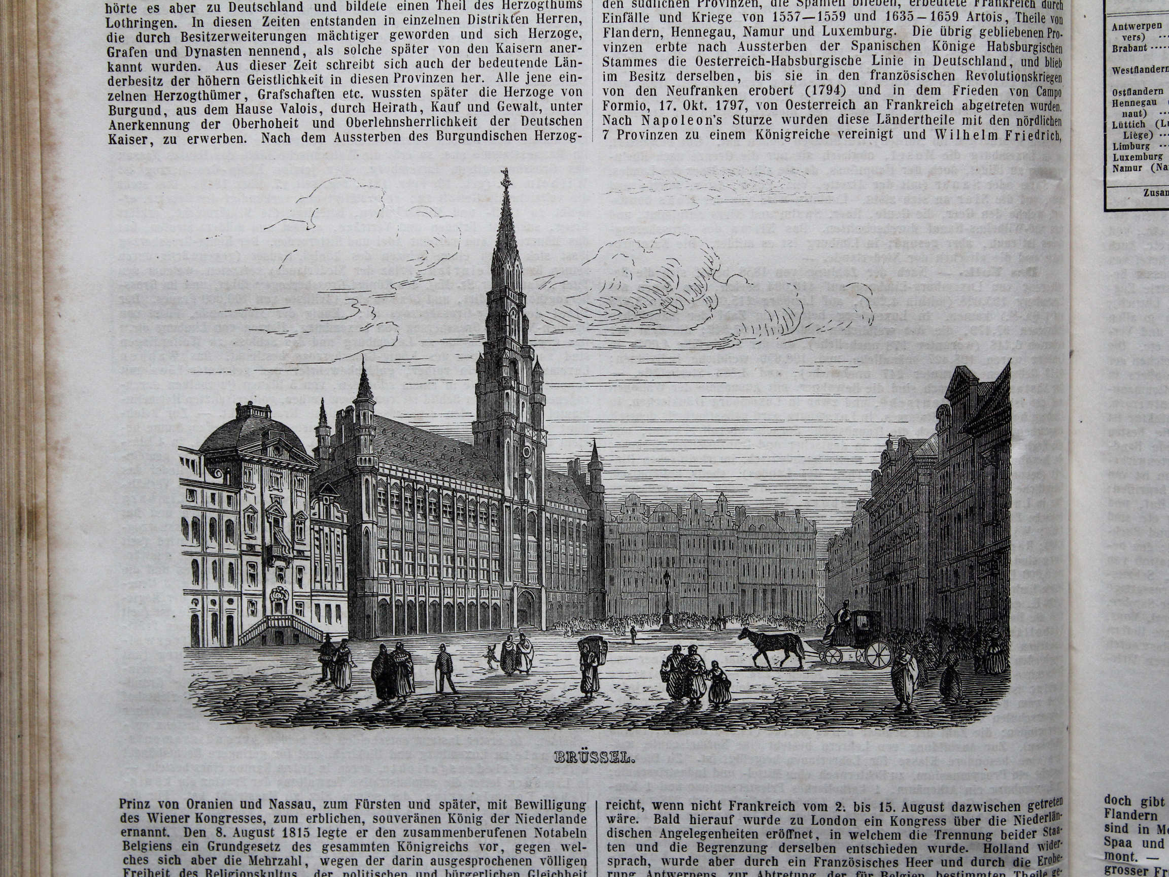
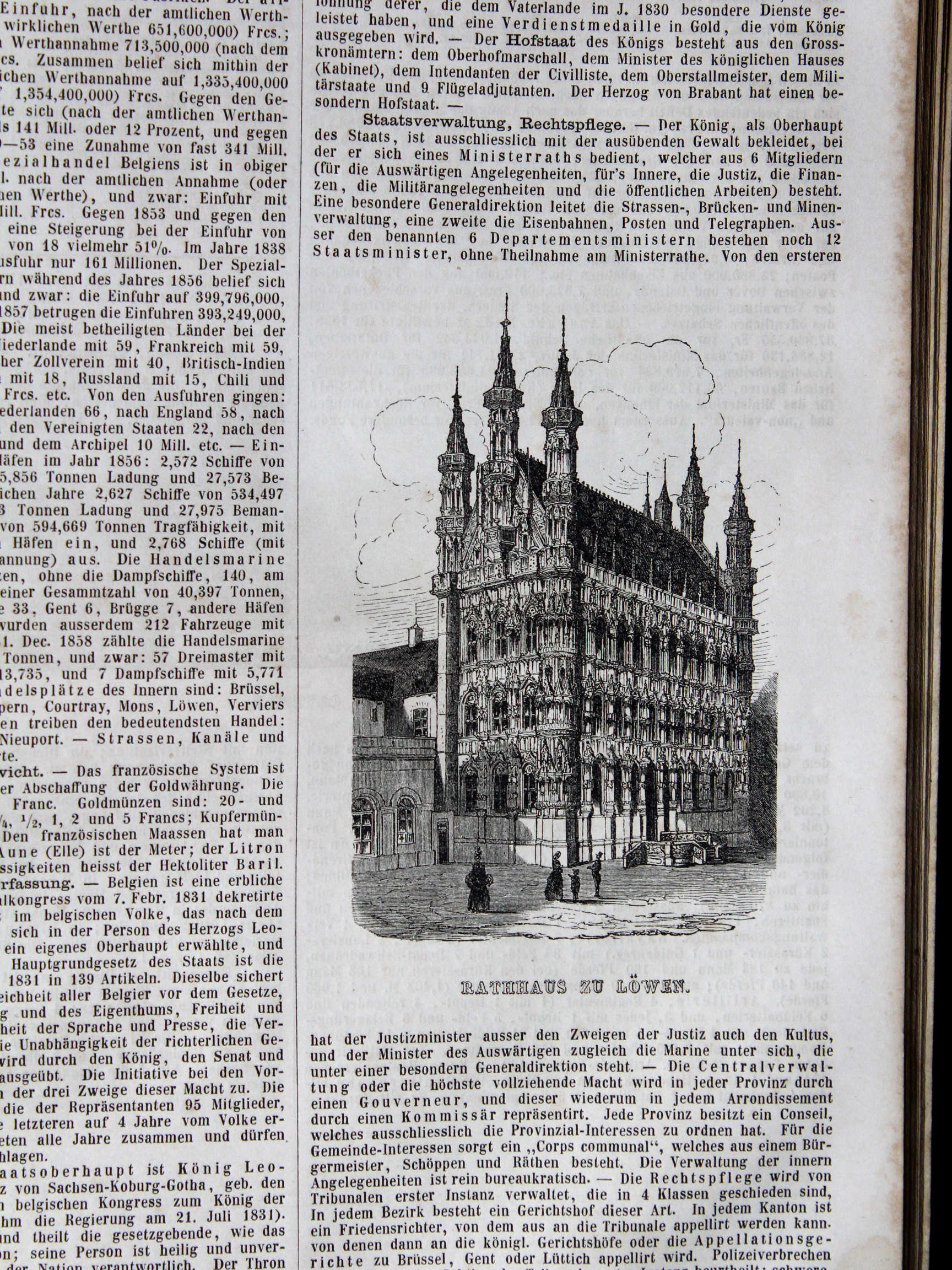
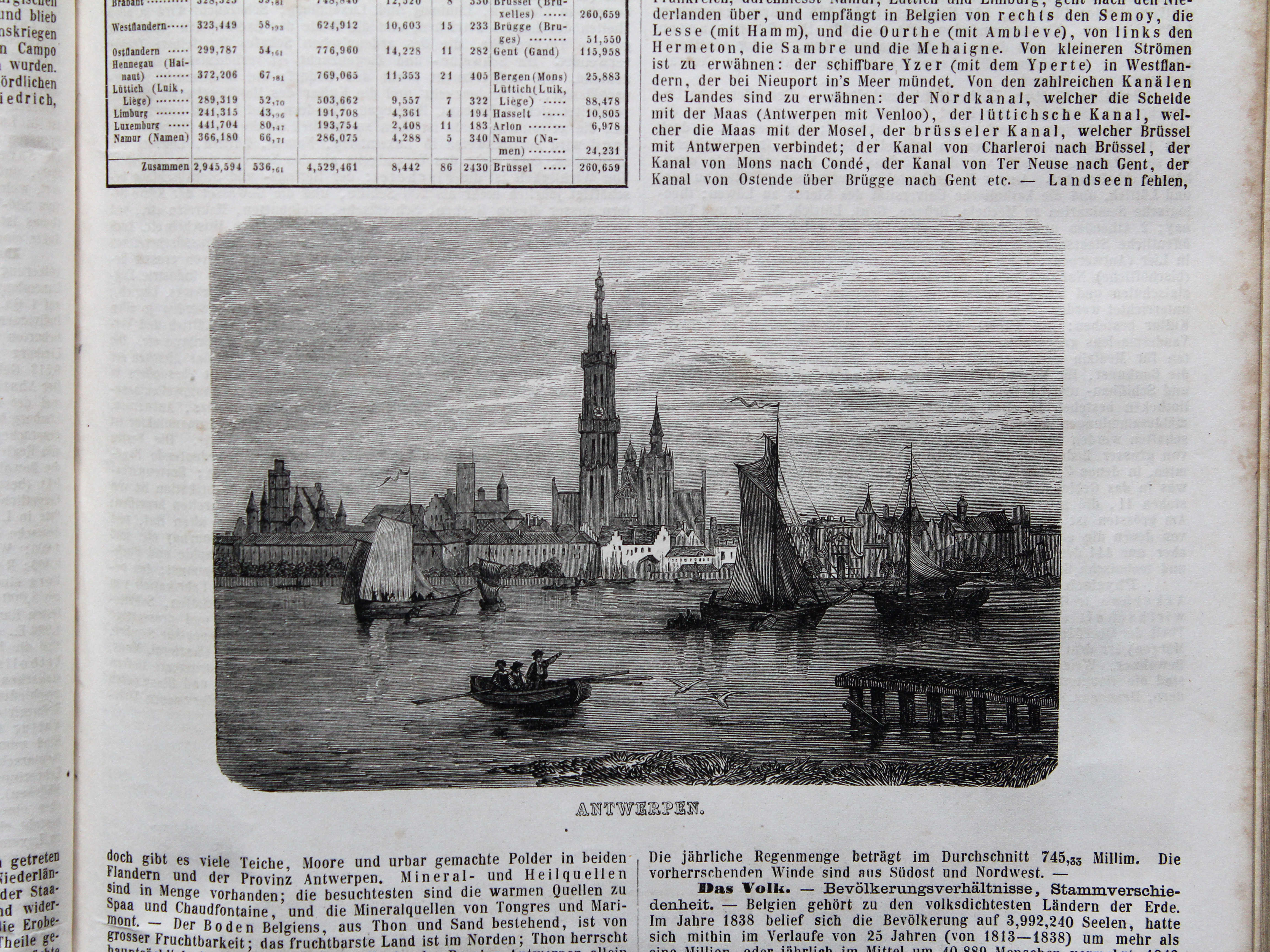
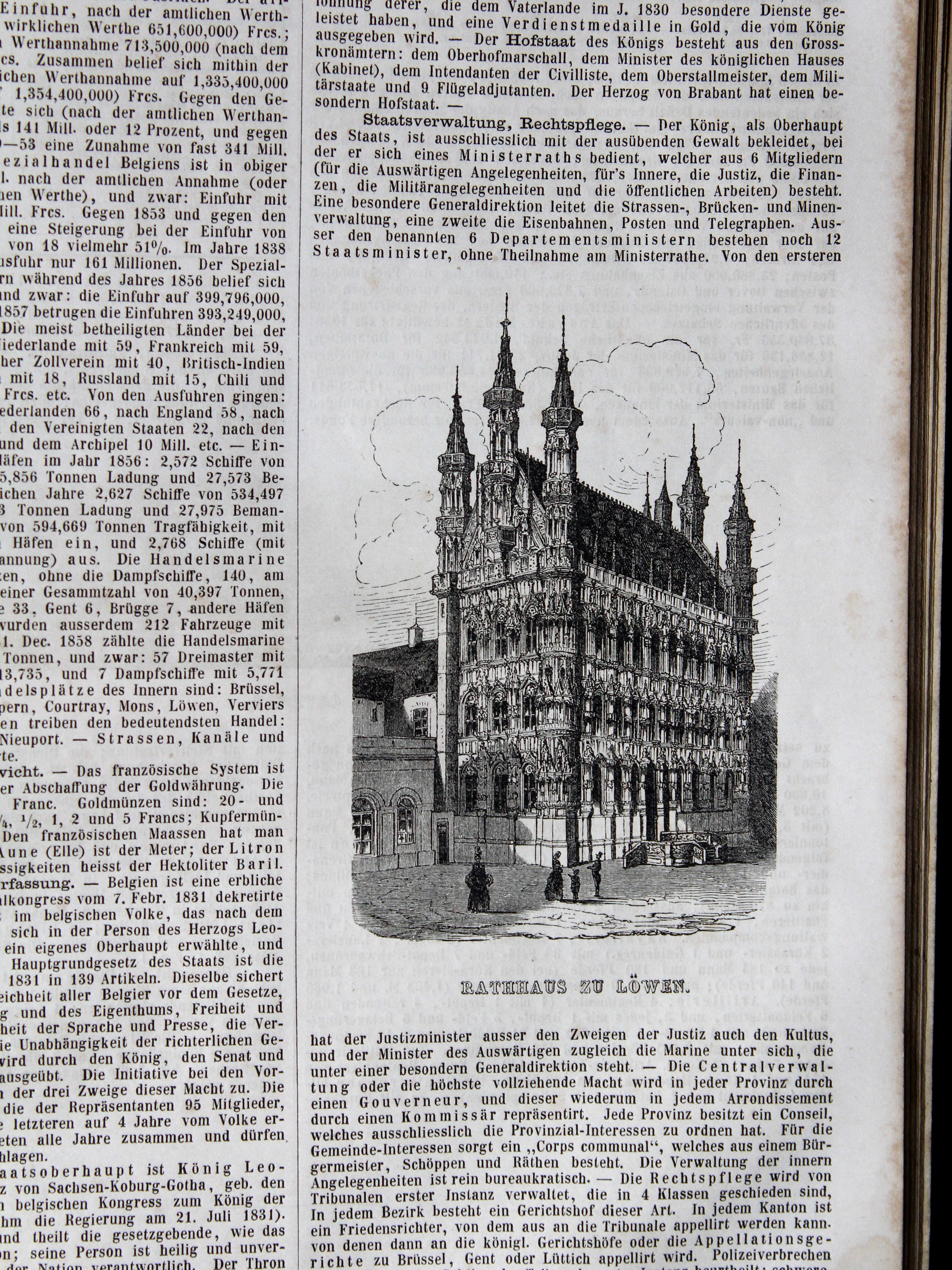
17.11. Rathhaus zu Löwen XL
Stadhhuis vab Leuven / Town Hall of Leuven

 Bromme, Illustrirter Hand-Atlas, 1862
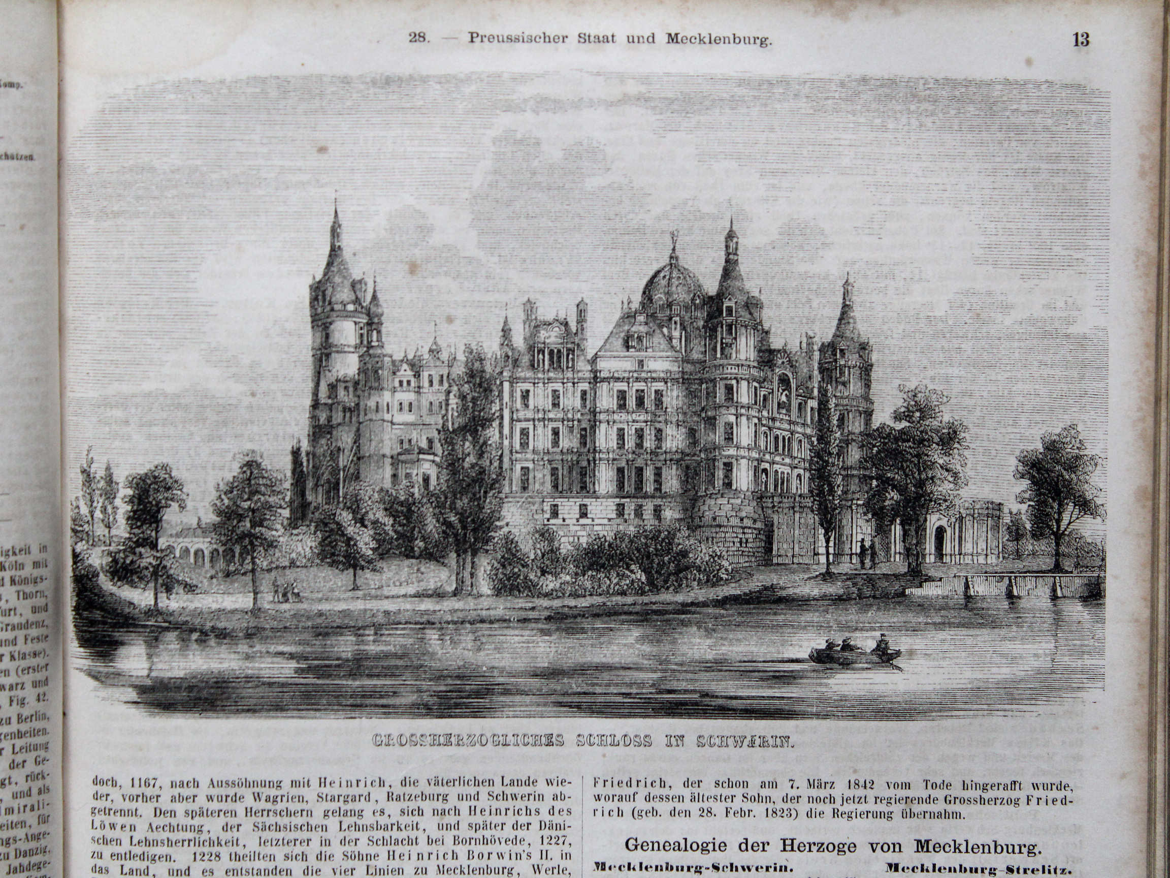
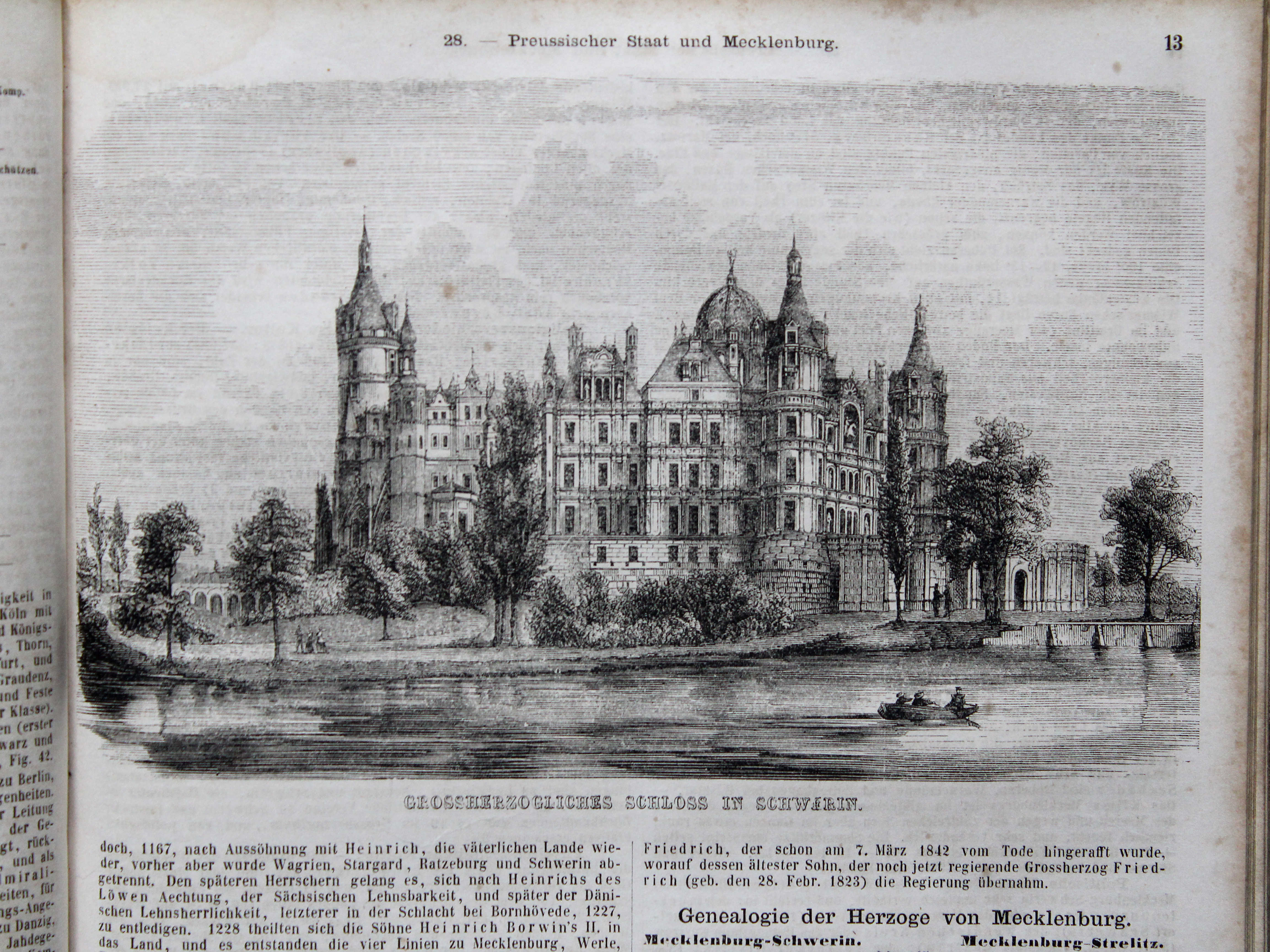
28.13. Grossherzogliches Schloss in Schwerin XL
Kasteel van Schwerin / Schwerin Palace

 Bromme, Illustrirter Hand-Atlas, 1862
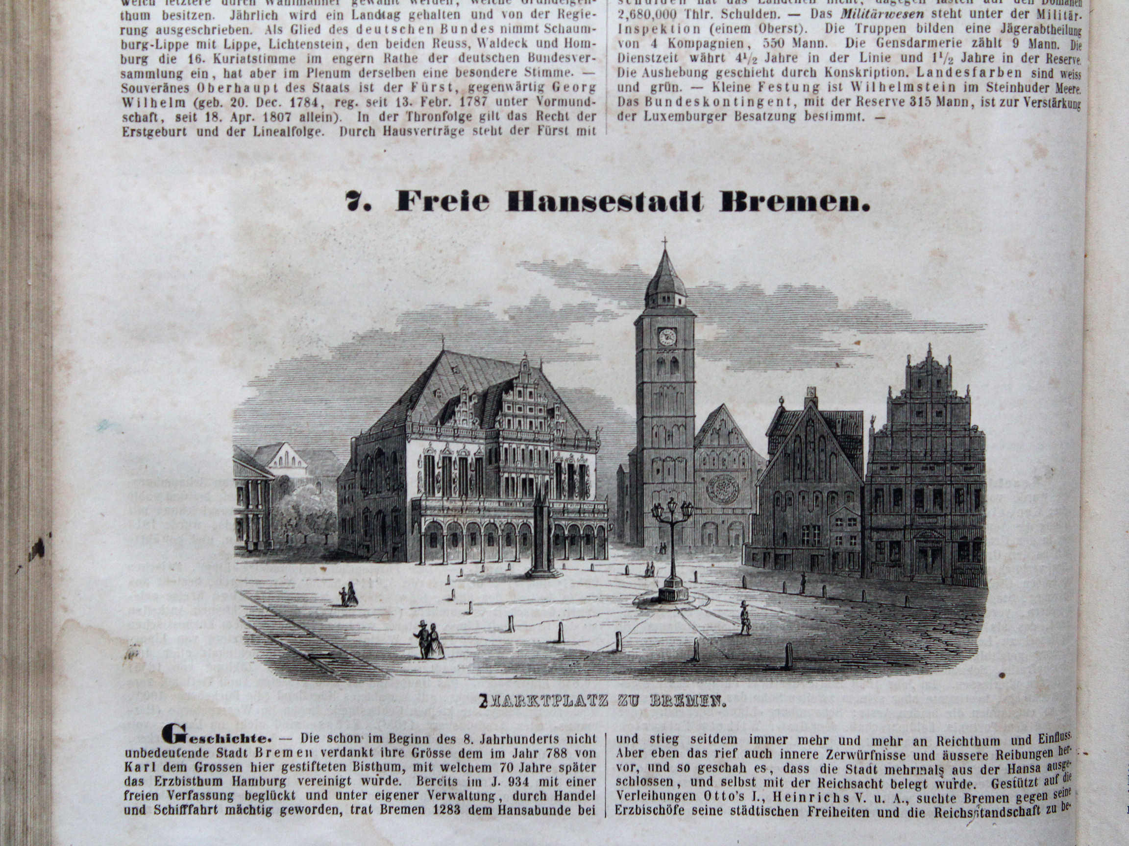
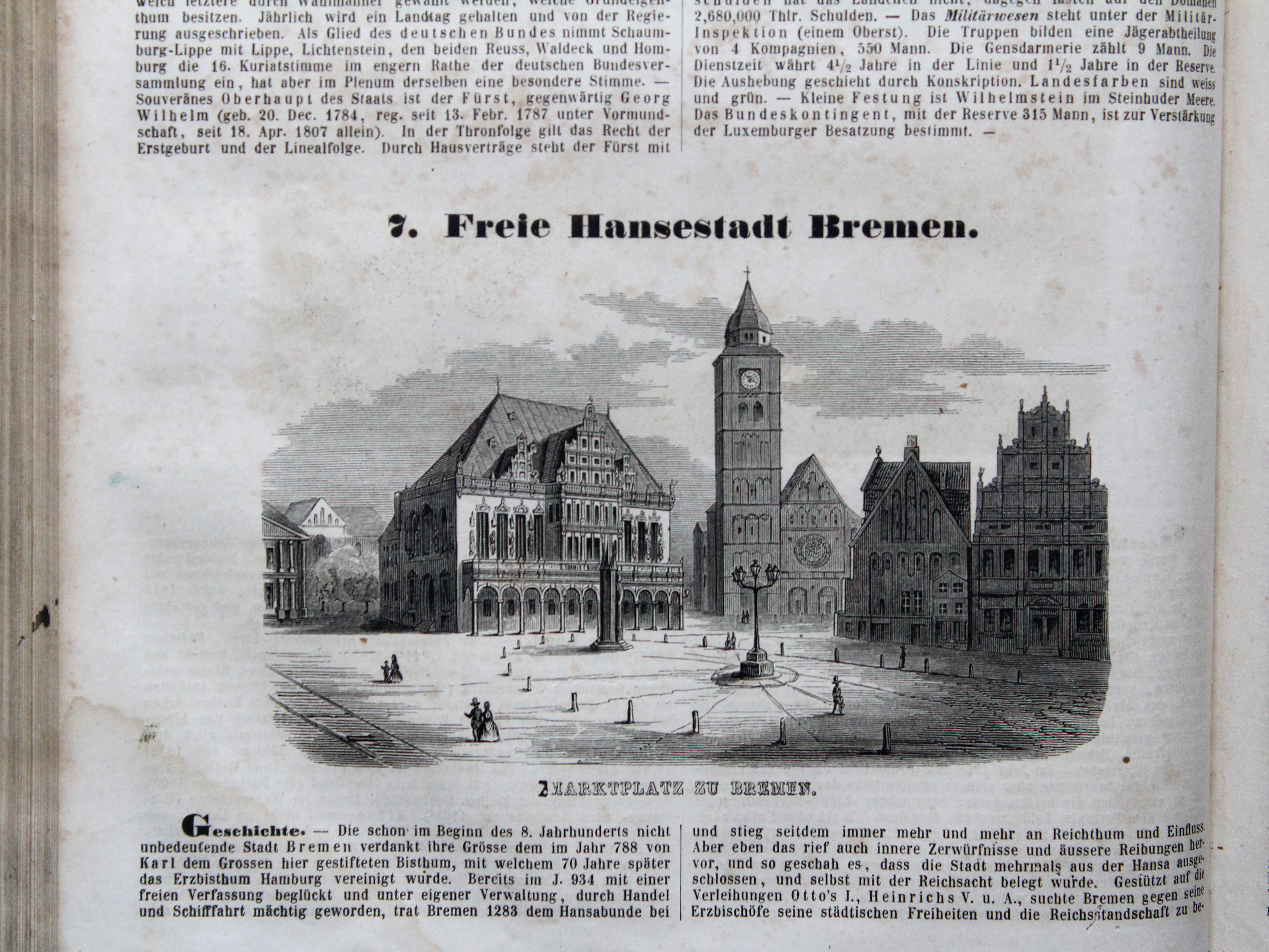
32.16. Marktplatz zu Bremen XL
Marktplein in Bremen / Market Square in Bremen
 Bromme, Illustrirter Hand-Atlas, 1862
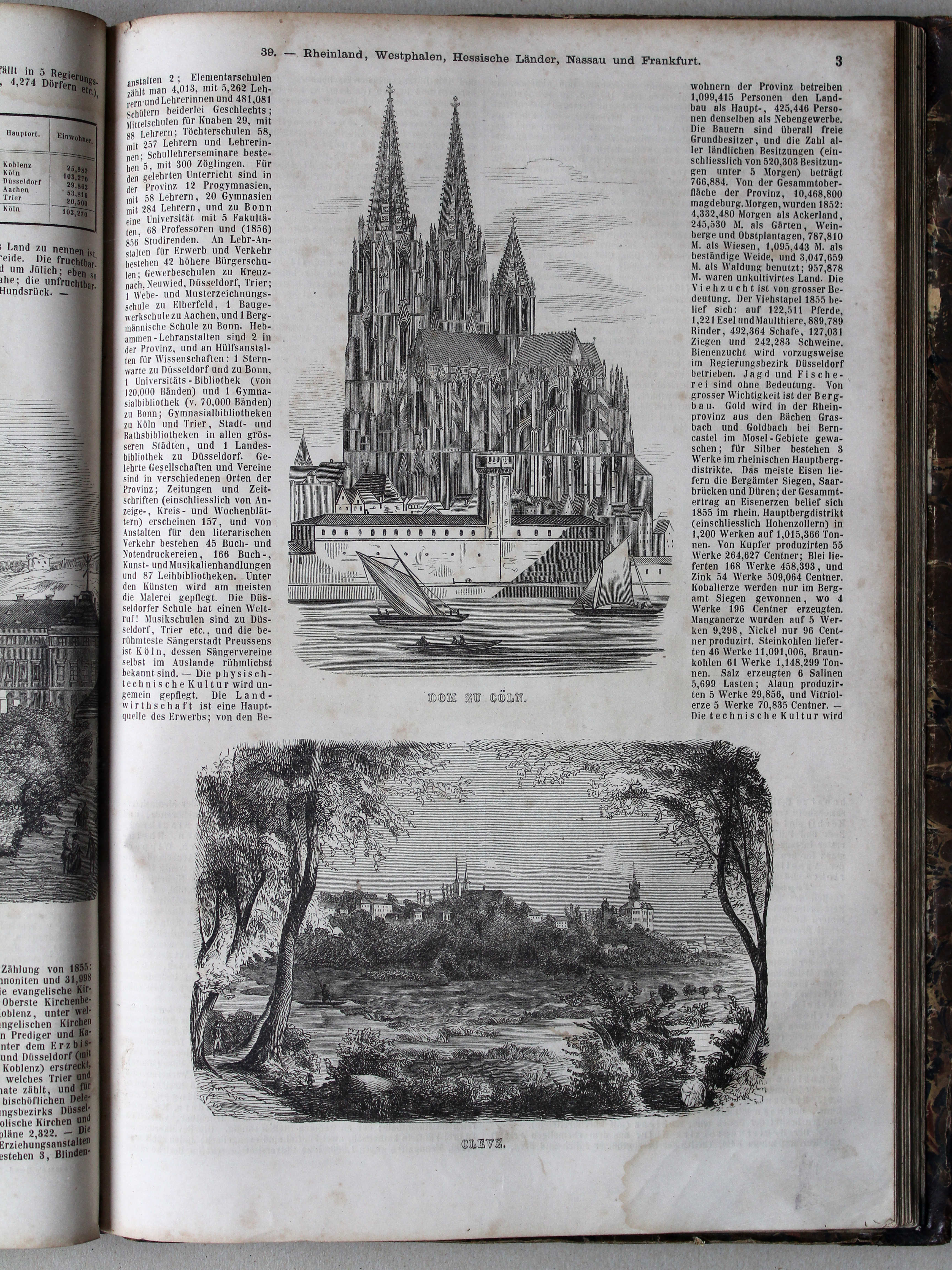
39.3. Dom zu Cöln, Cleve XL
Dom van Keulen, Kleef / Cologne Cathedral, Cleves

 Bromme, Illustrirter Hand-Atlas, 1862
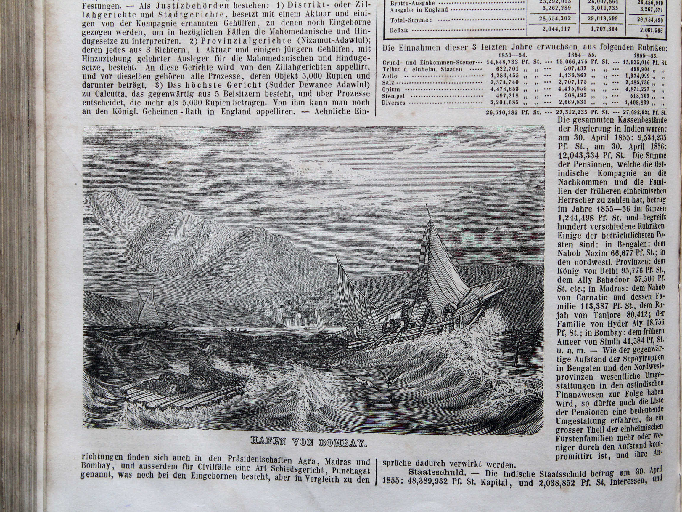
41.8. Hafen von Bombay XL
Haven van Bombay / Port of Bombay (मुंबई / Mumbai)
 Bromme, Illustrirter Hand-Atlas, 1862
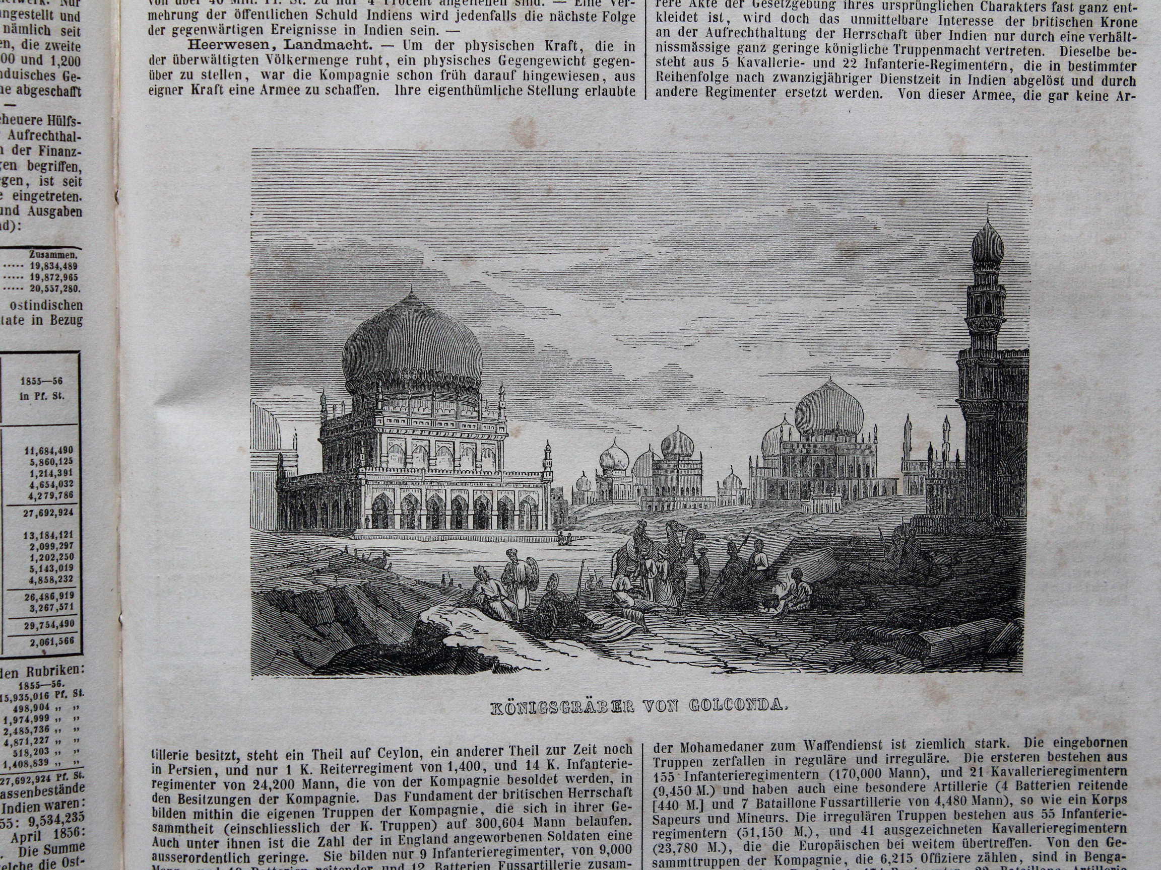
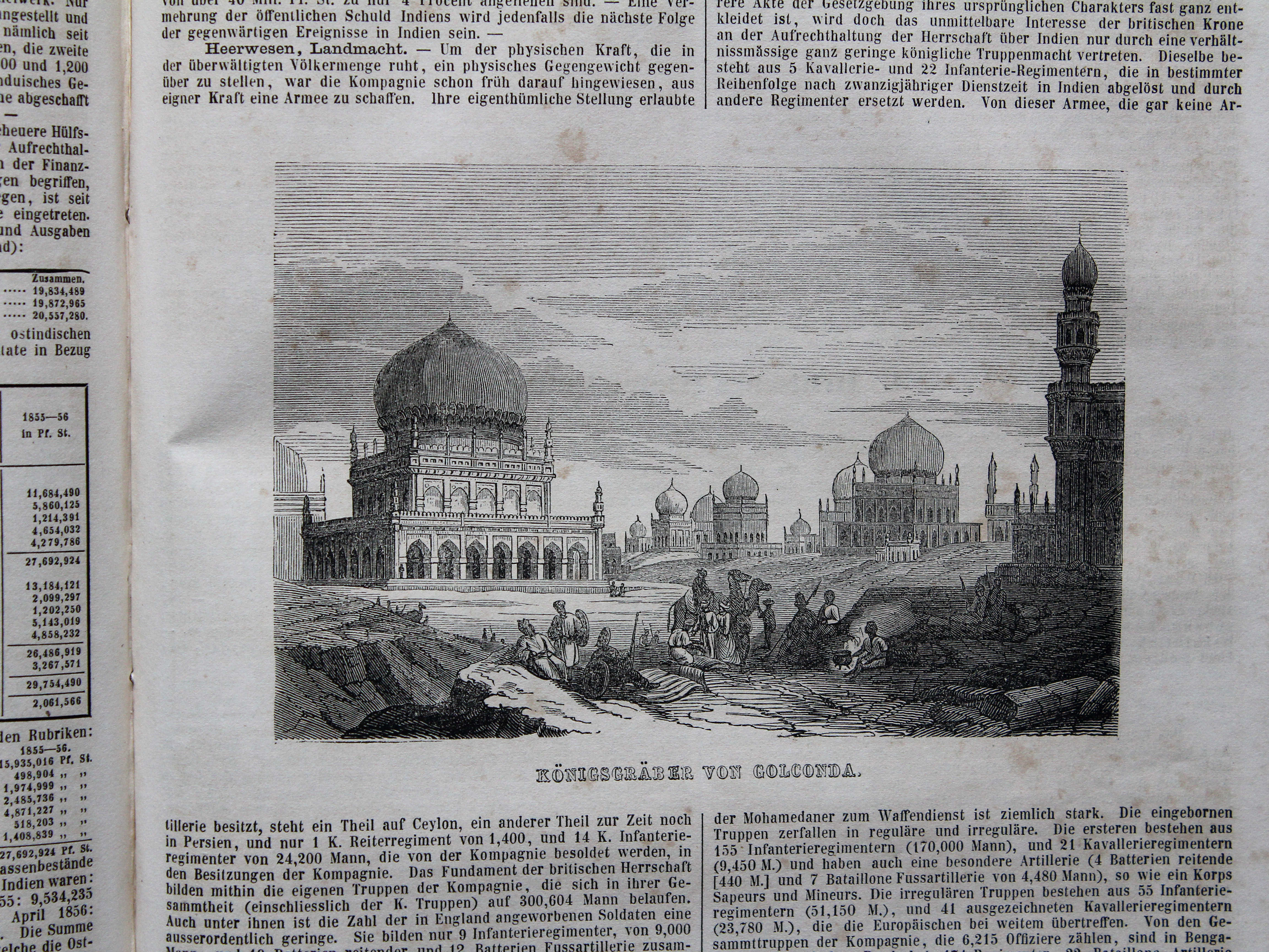
41.9. Königsgräber von Golconda XL
Koningsgraven van Golkonda / Tombs of Golkonda
 Bromme, Illustrirter Hand-Atlas, 1862
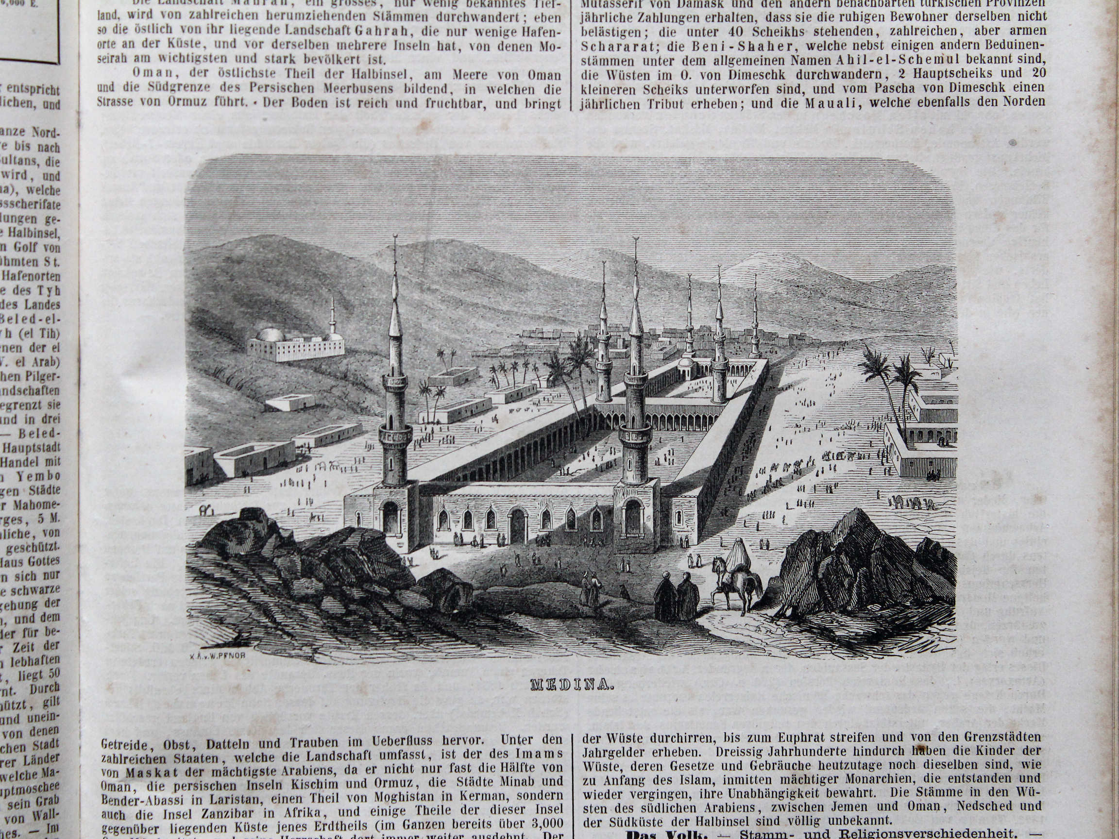
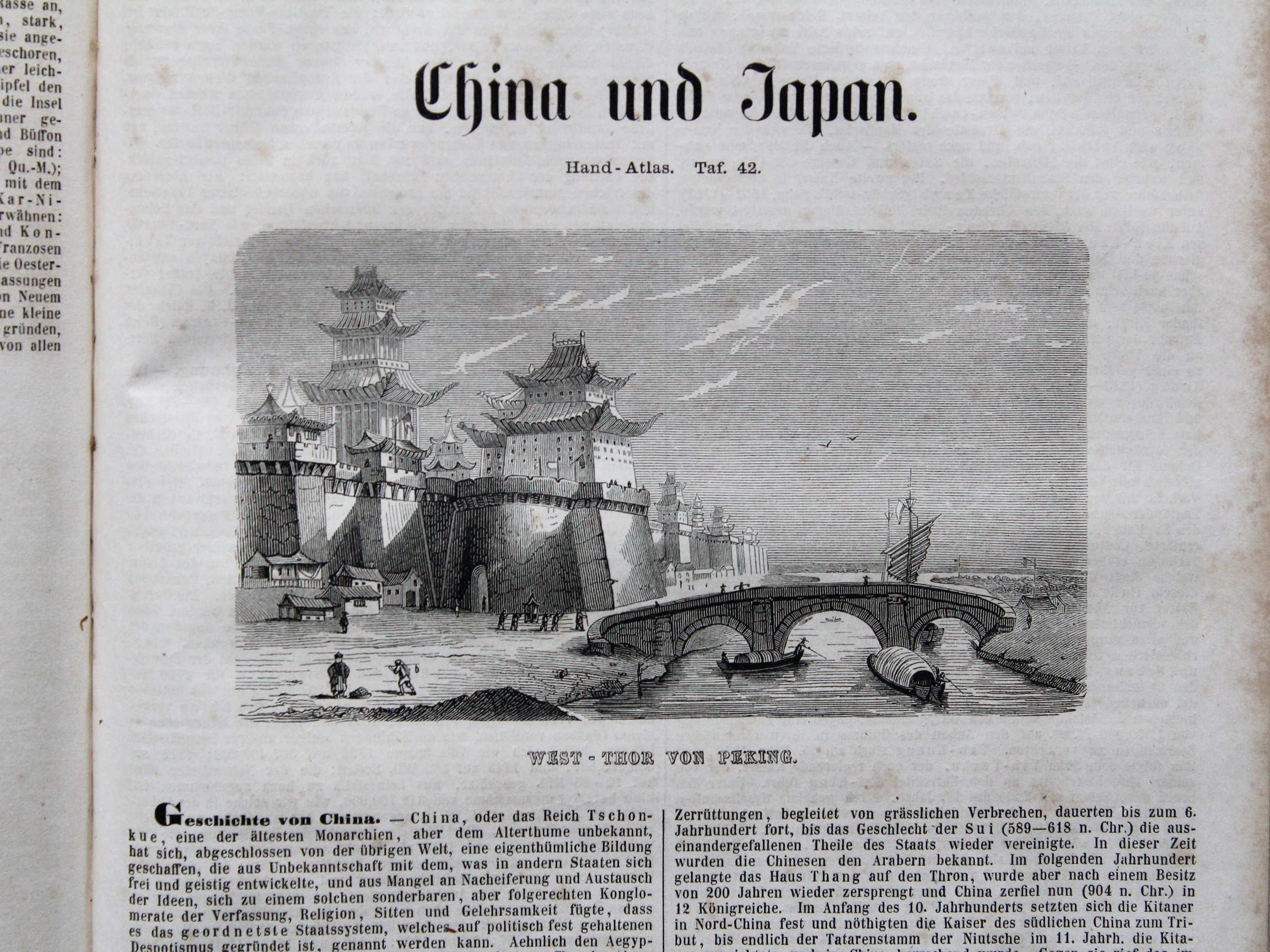
42.1. West-Thor von Peking XL
Wetspoort van Peking / Western gate of Peking (北京市 / Beijing)
© M. Witkam, 2015
![]()
![]()