Meyer's Zeitungs-Atlas (1849-1852)
See below for (a summary of) this text in English.
Hieronder staan plaatjes van de atlas. Daarbij horen ook de volgende pagina's
- Beschrijving van de atlas
- Tabellen en lijsten bij de atlas
- Vergelijking van Meyer's Zeitungs-Atlas (1849-1852), Meyer's Universal-Atlas (1830-1840), Berghaus' Physikalischer Atlas (1837-1848)
Plaatjes
Klik op een plaatje voor een vergroting.
Meyer's Zeitungs-Atlas (1849-1852)
- Below are pictures of the atlas. Related pages
- Description of the atlas
- Tables and lists to the atlas
- Comparison of Meyer's Zeitungs-Atlas (1849-1852), Meyer's Universal-Atlas (1830-1840), Berghaus' Physikalischer Atlas (1837-1848)
Pictures
Click on a picture to enlarge.
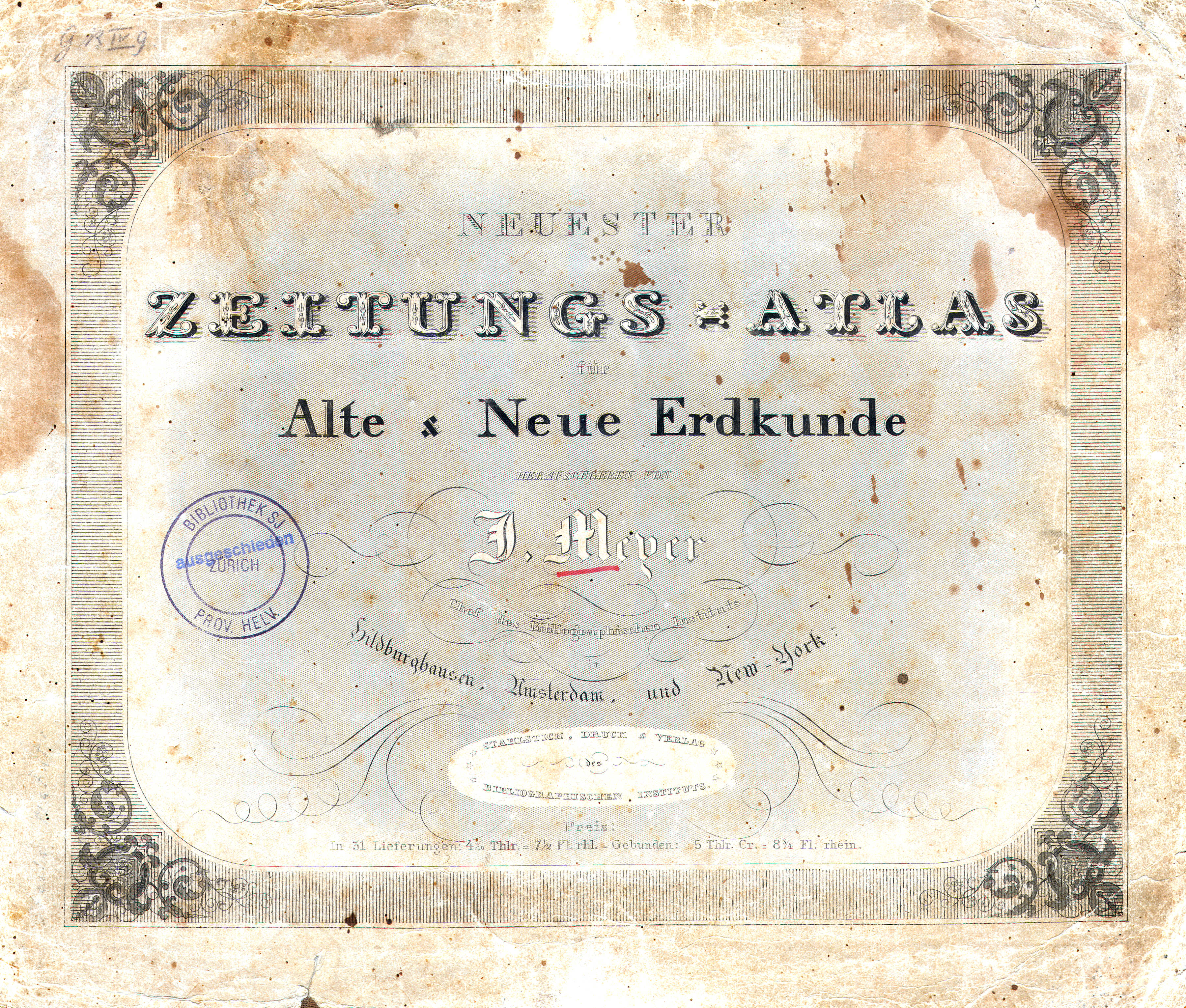
Titelpagina, inhoudsopgave / Title page, table of contents
 Meyer's Zeitungs-Atlas (1849-1852)
Titelblad / Title sheet
 Meyer's Zeitungs-Atlas (1849-1852)
Inhoudsopgave / Table of contents
 Meyer's Zeitungs-Atlas (1849-1852)
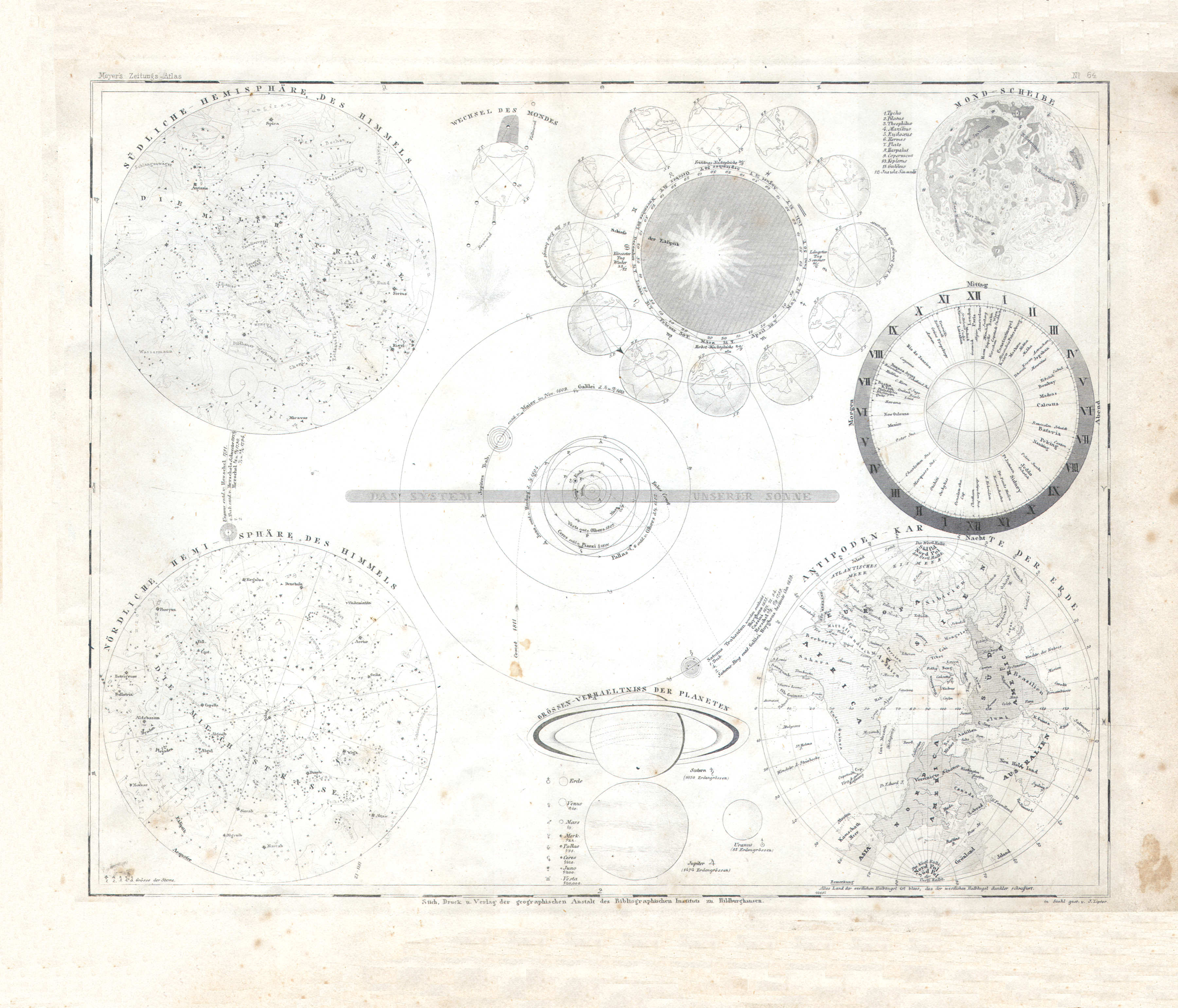
1. Himmel, Planeten, Mond, Antipoden (Nº 64)
Sterrenkunde / Astronomy
 Meyer's Zeitungs-Atlas (1849-1852)
2. Orbis veteribus notus (Nº 82)
De in de Oudheid bekende wereld / The world as known to the Ancients
 Meyer's Zeitungs-Atlas (1849-1852)
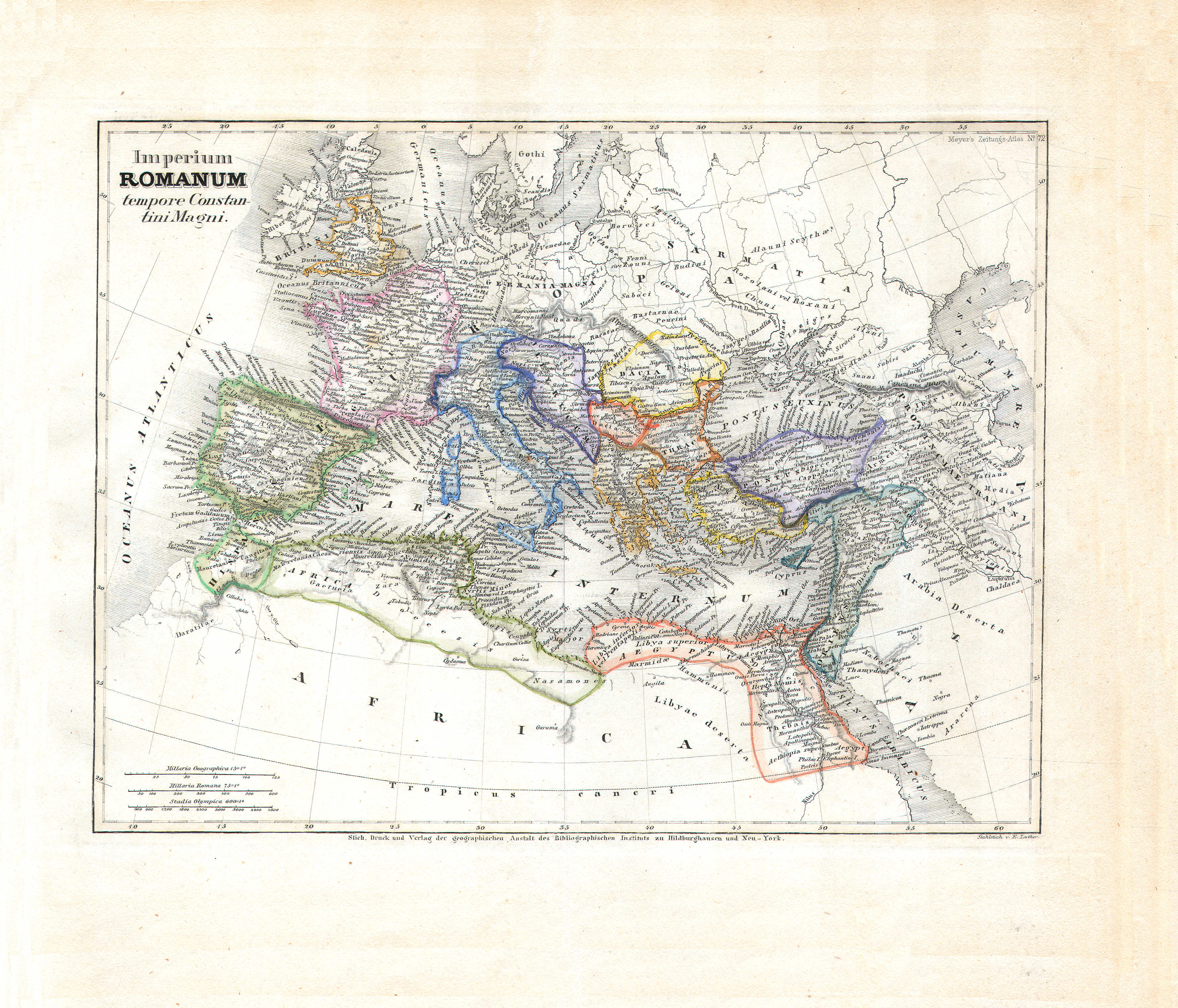
3. Imperium Romanum tempore Constantini Magni (Nº 72)
Het Romeinse rijk onder Constantijn de Grote / The Roman Empire under Constantine the Great
 Meyer's Zeitungs-Atlas (1849-1852)
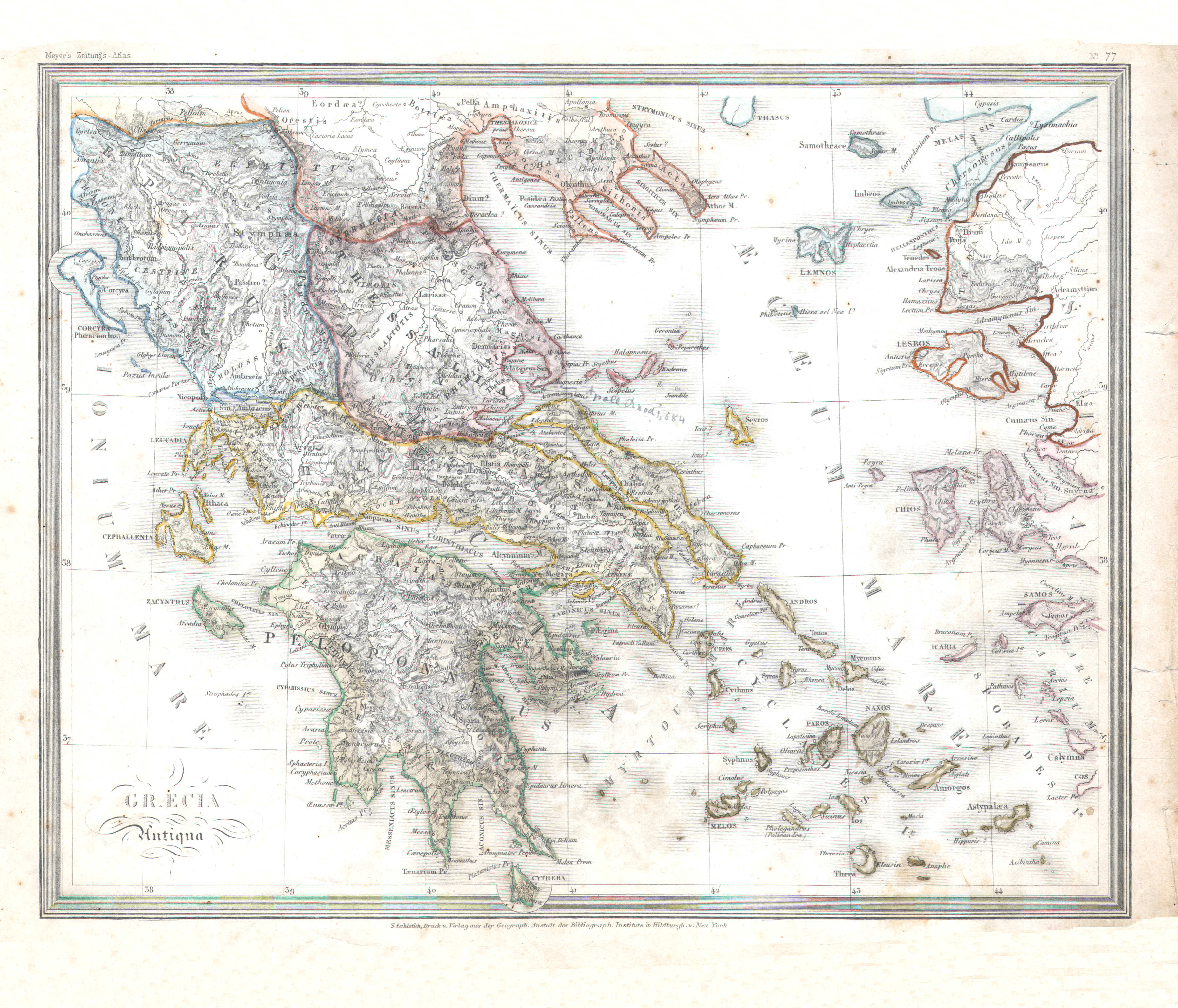
4. Graecia Antiqua (Nº 77)
Griekenland in de Oudheid / Ancient Greece
 Meyer's Zeitungs-Atlas (1849-1852)
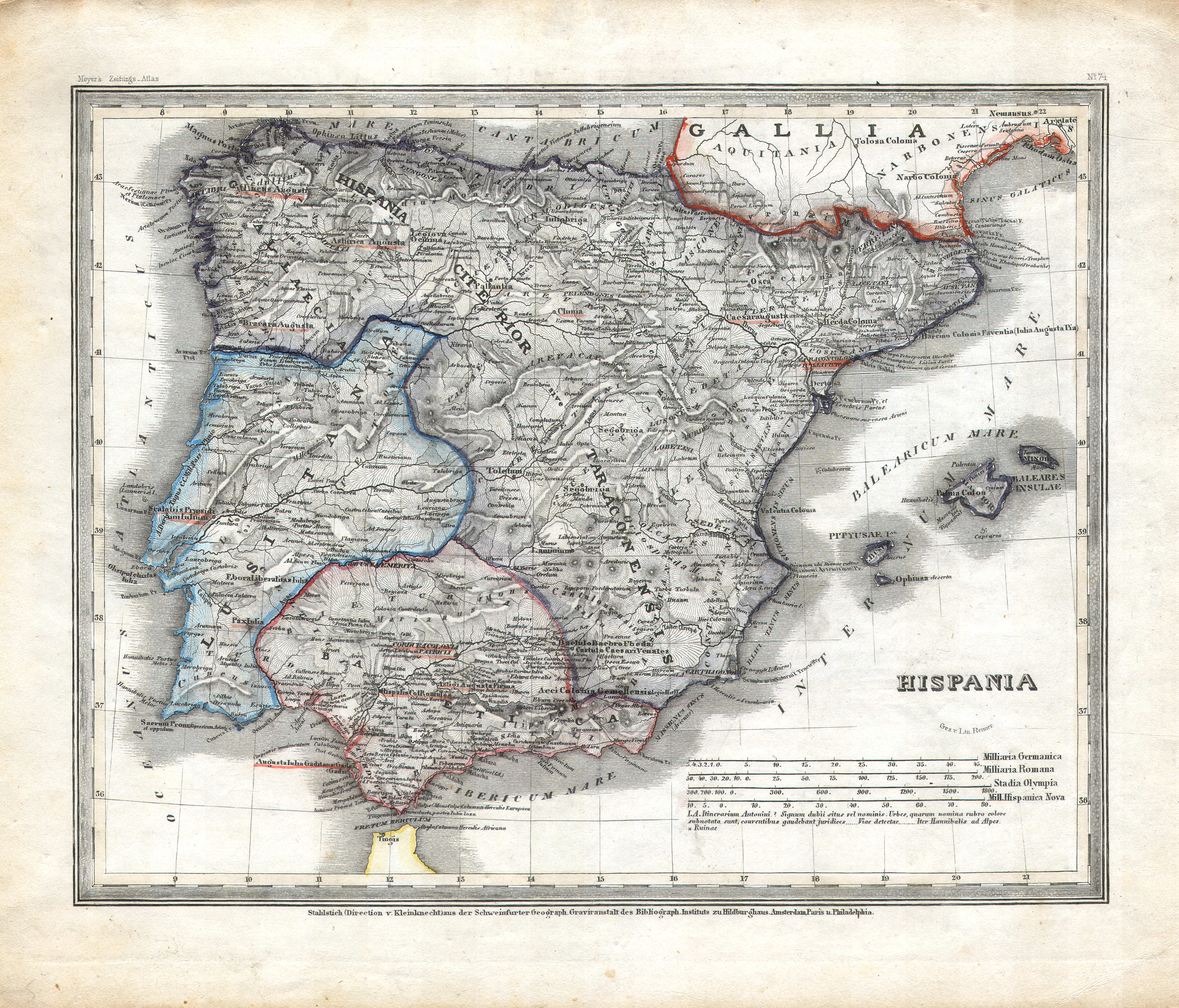
5. Hispania (Nº 74)
Hispania
 Meyer's Zeitungs-Atlas (1849-1852)
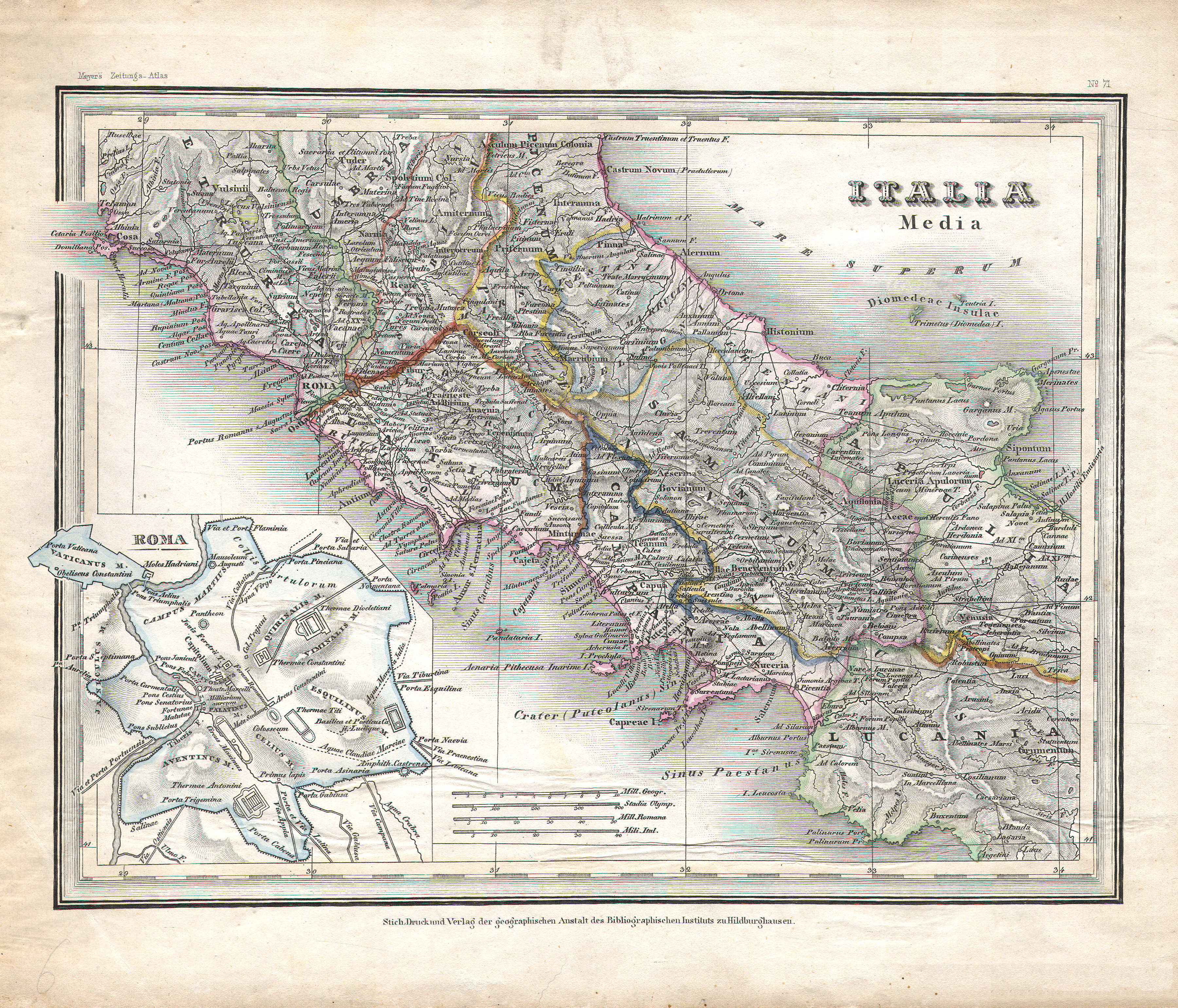
6. Italia Media (Nº 71)
Midden-Italië / Central Italy
 Meyer's Zeitungs-Atlas (1849-1852)
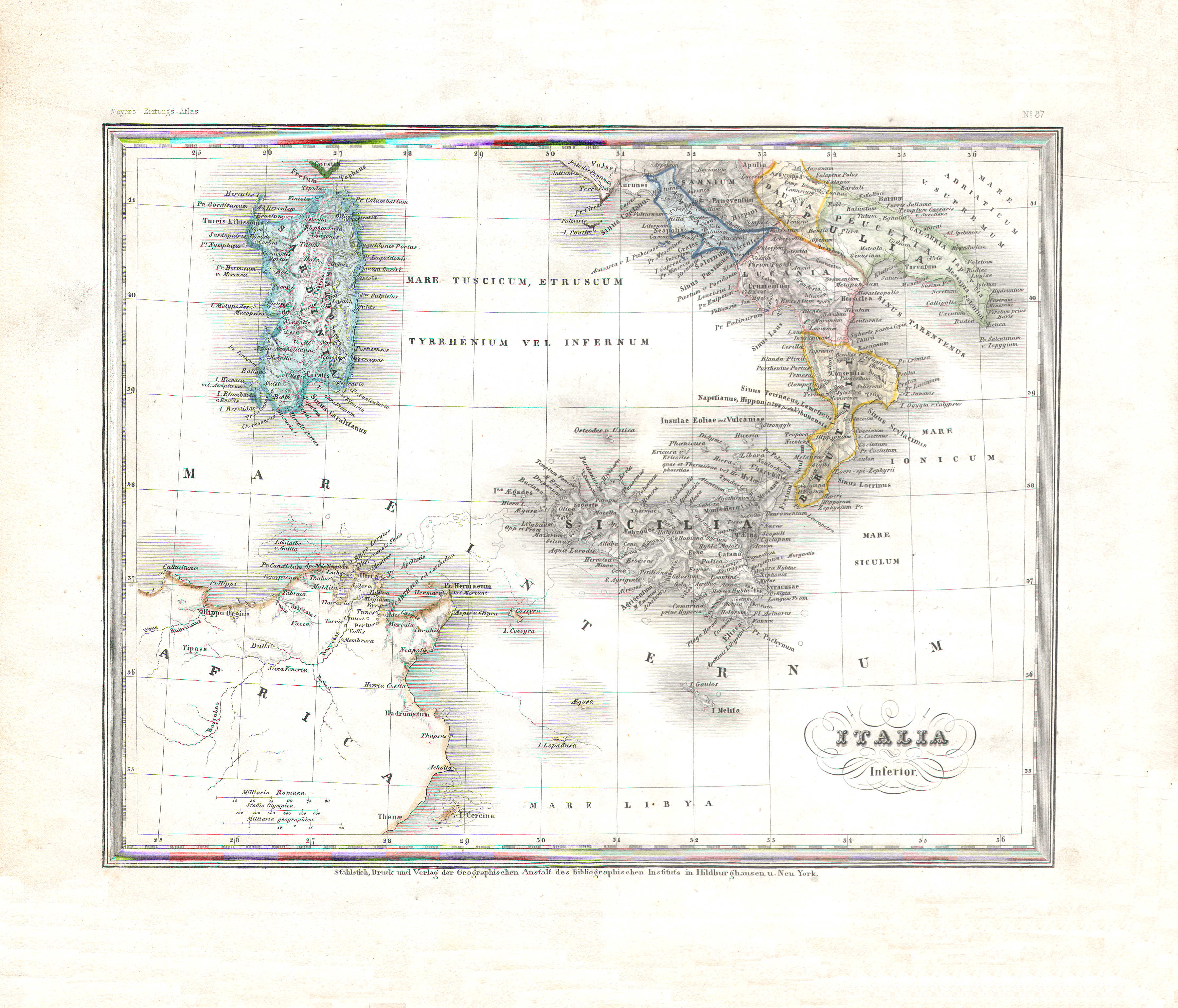
7. Italia Inferior (Nº 87)
Zuid-Italië / Southern Italy
 Meyer's Zeitungs-Atlas (1849-1852)
8. Asia Minor, Syria, Armenia, Mesopotamia, Assyria, Palestina (Nº 75)
Klein-Azië, Syrië, Armenië, ... / Asia Minor, Syria, Armenia, ...
 Meyer's Zeitungs-Atlas (1849-1852)
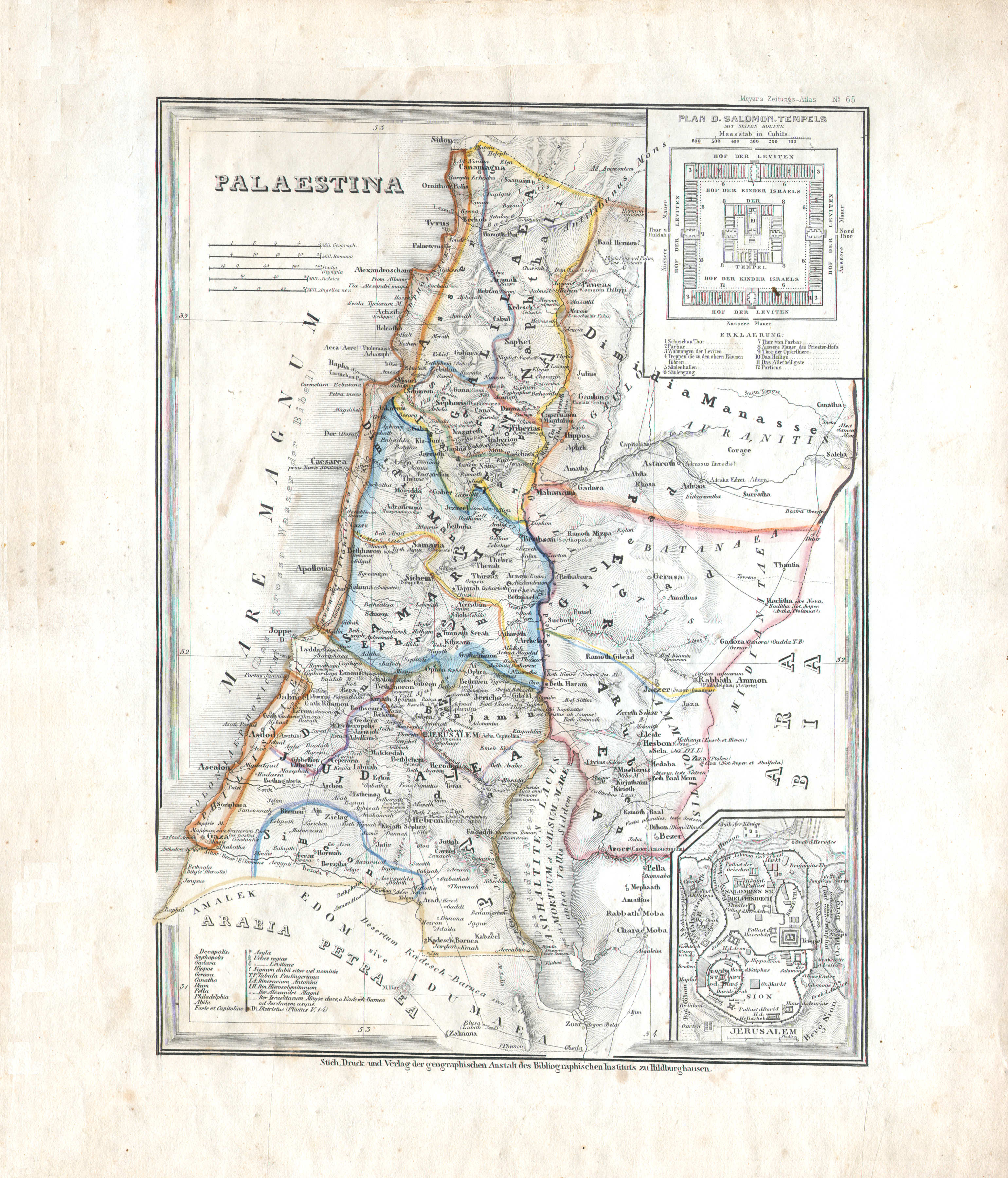
9. Palaestina (Nº 65)
Palestina / Palestine
 Meyer's Zeitungs-Atlas (1849-1852)
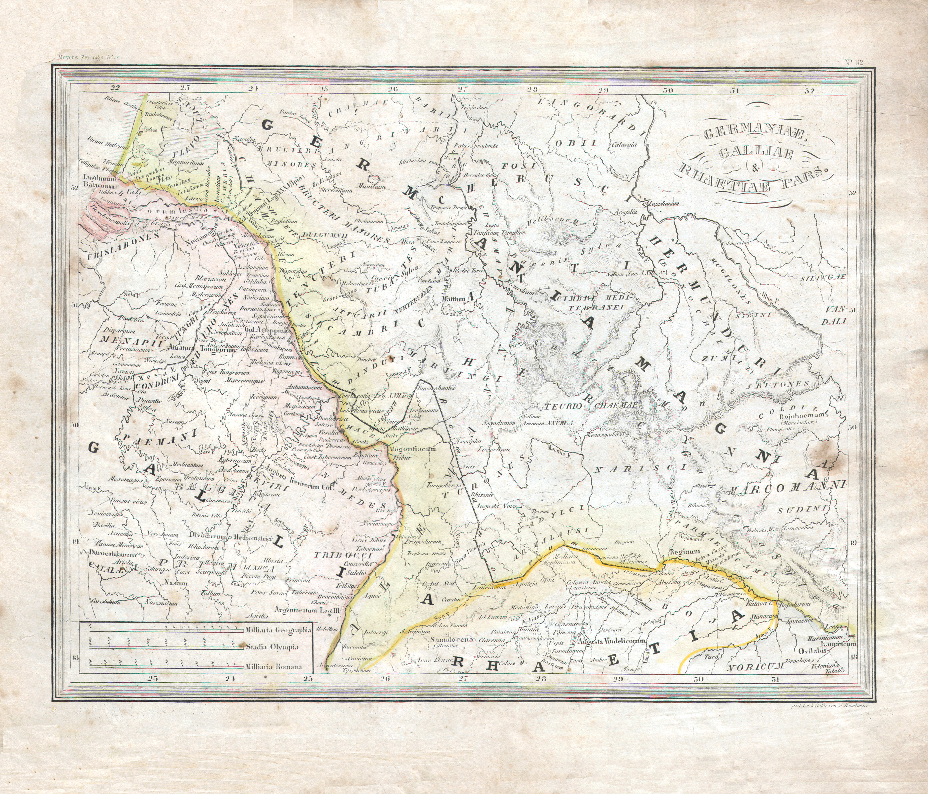
10. Germaniae, Galliae et Rhaetiae pars (Nº 112)
Deel van Germanië, Gallië en Rhetia / Part of Germania, Gaul and Rhaetia
 Meyer's Zeitungs-Atlas (1849-1852)
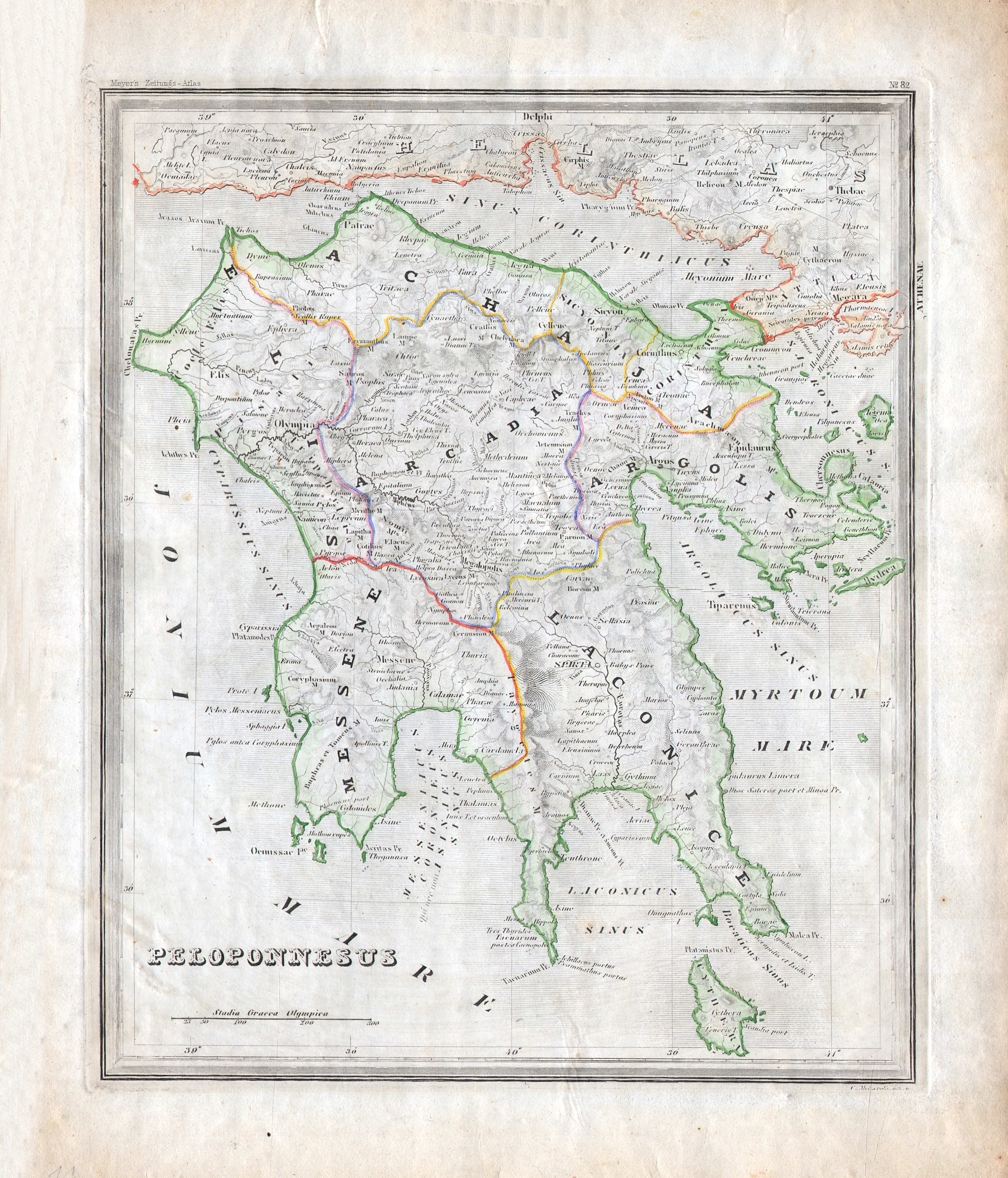
11. Peloponnesus (Nº 82)
Peloponnesus / Peloponnese
 Meyer's Zeitungs-Atlas (1849-1852)
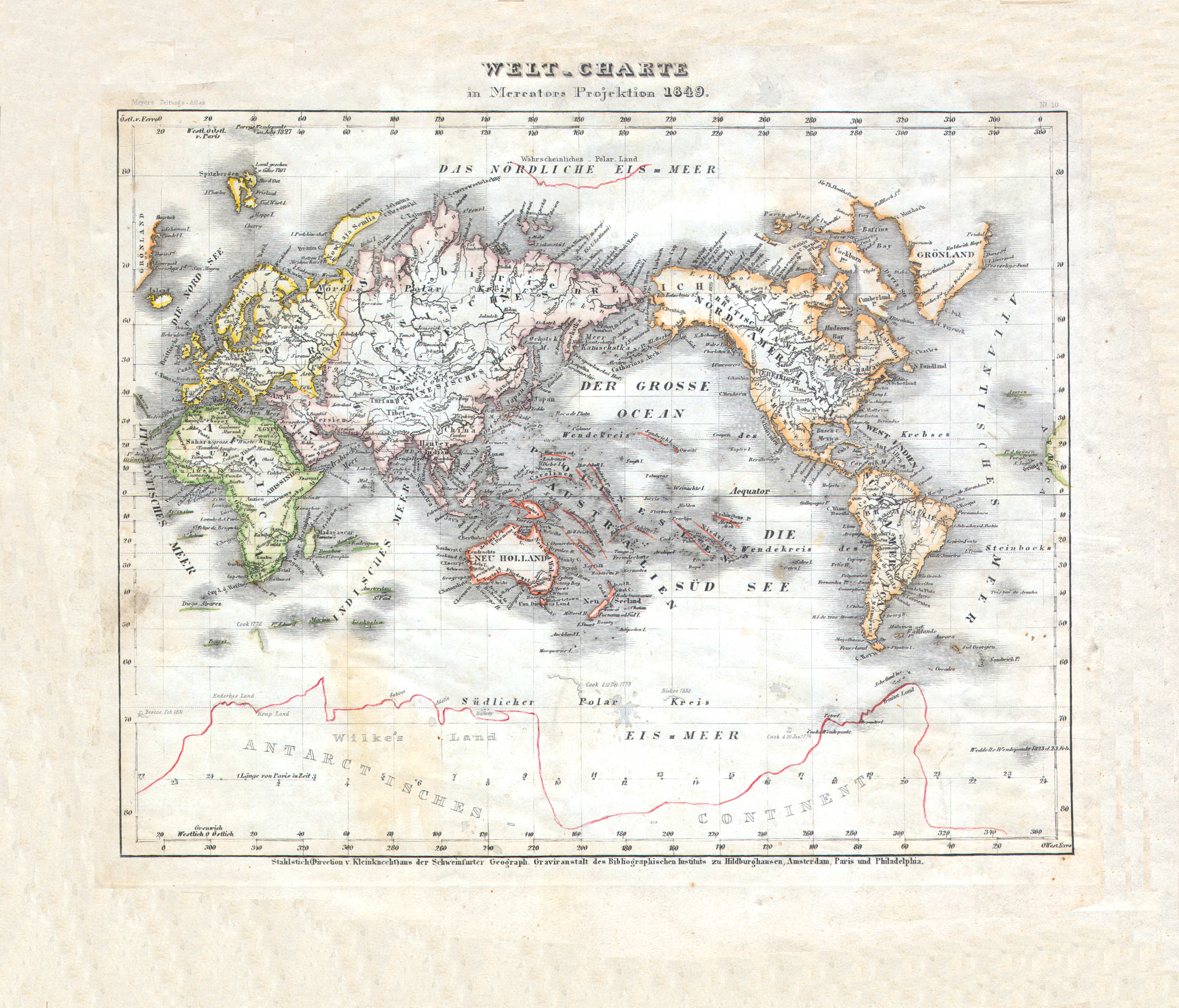
12. Welt-Charte in Mercators Projektion (Nº 10, 1849)
Wereldkaar in Mercatorprojectie / World map in Mercator projection
 Meyer's Zeitungs-Atlas (1849-1852)
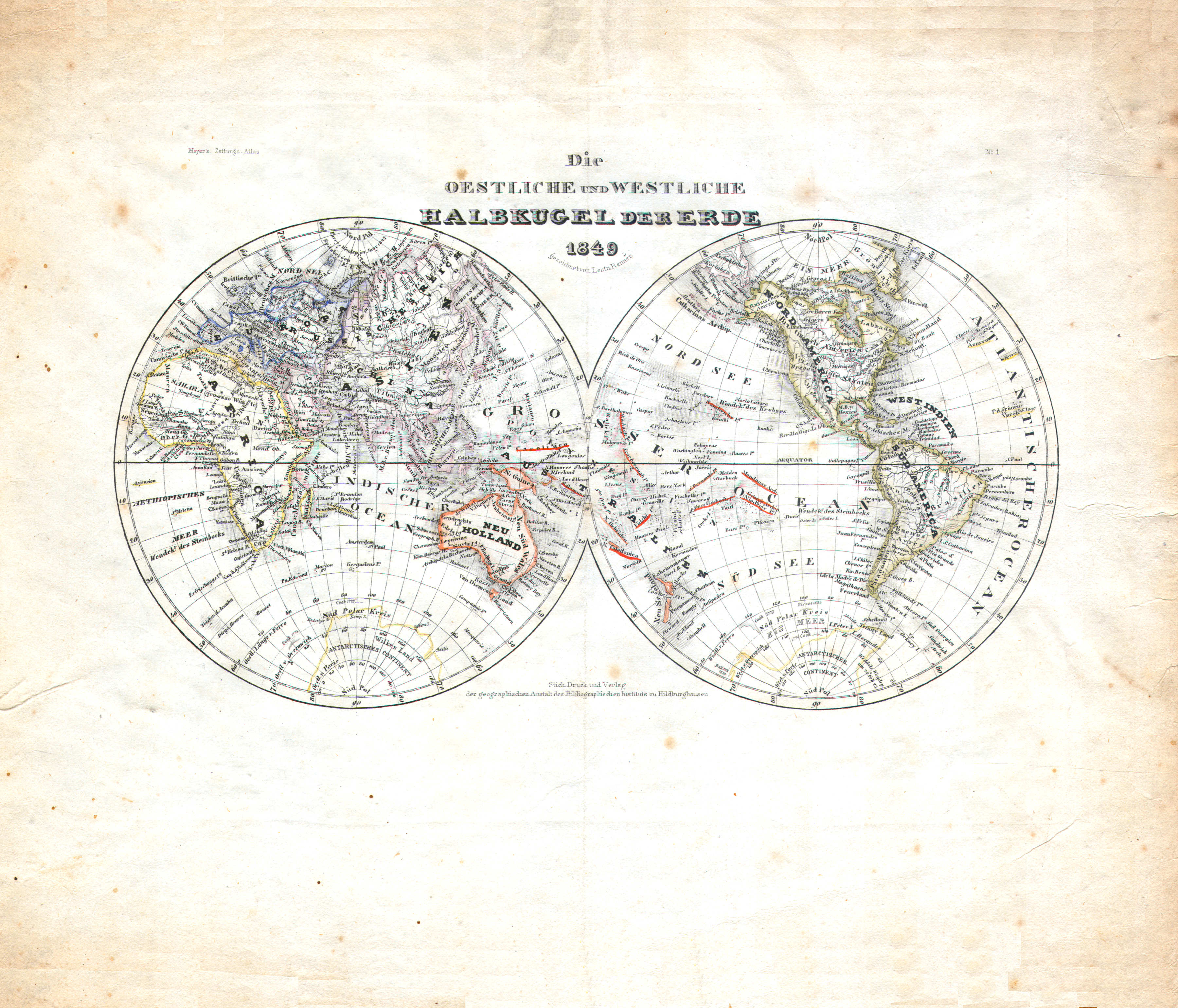
13. Die oestliche und westliche Halbkugel der Erde (Nº 1, 1849)
Oostelijk en westelijk halfrond / Eastern and western hemisphere
 Meyer's Zeitungs-Atlas (1849-1852)
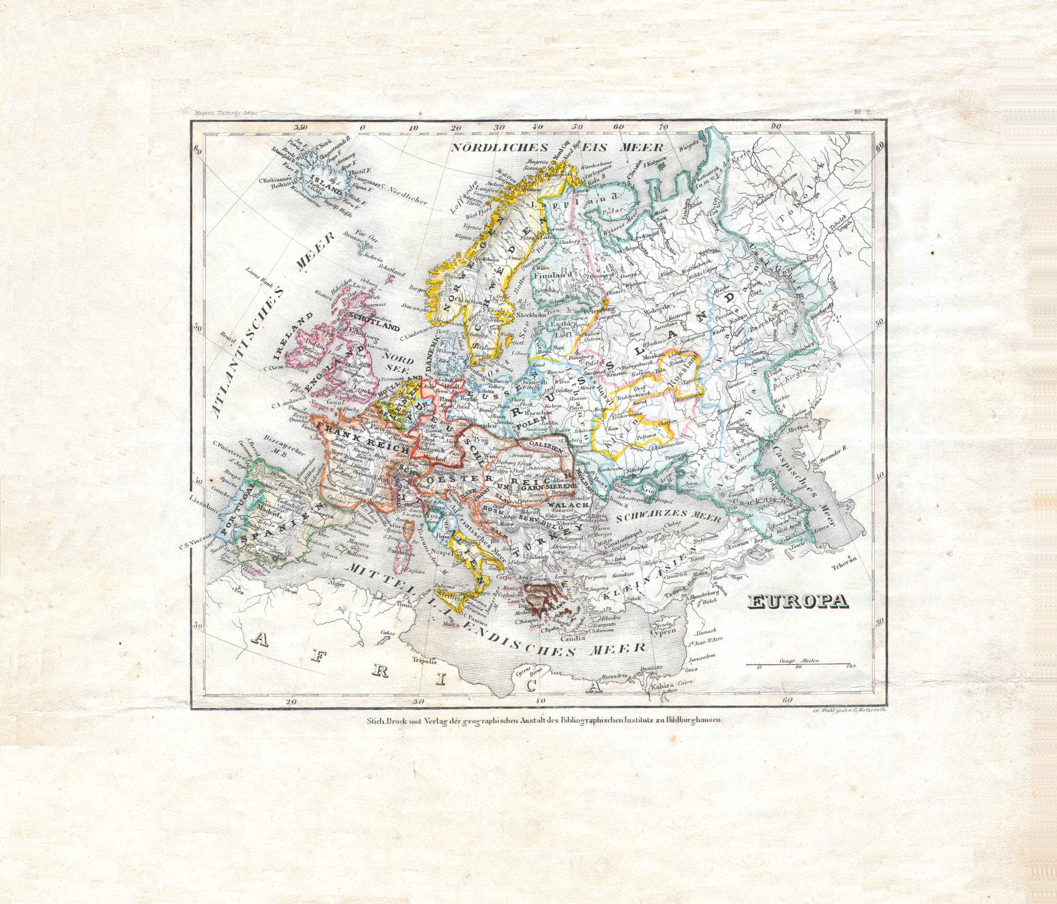
14. Europa (Nº 11)
Europa / Europe
 Meyer's Zeitungs-Atlas (1849-1852)
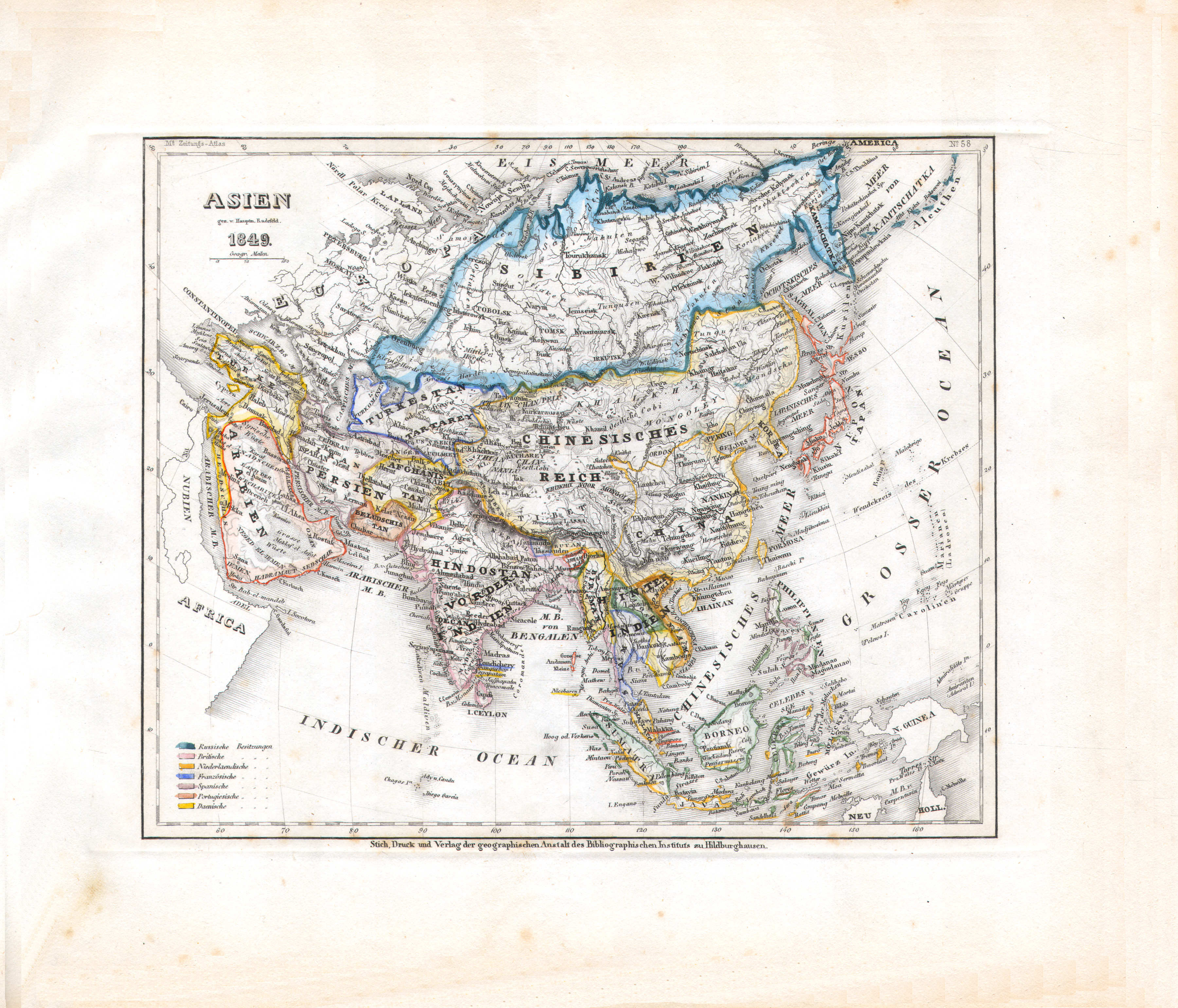
15. Asien (Nº 58, 1849)
Azië / Asia
 Meyer's Zeitungs-Atlas (1849-1852)
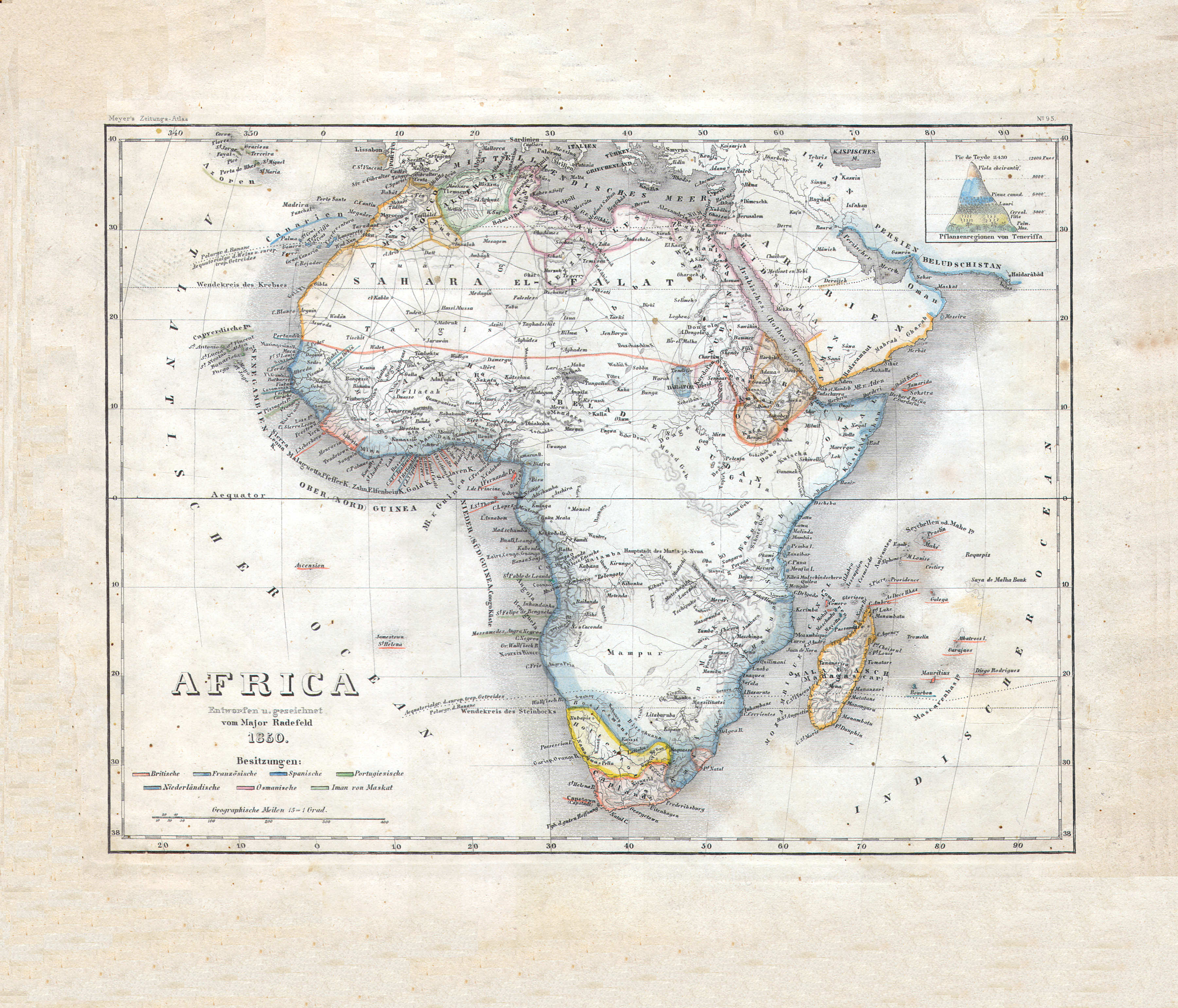
16. Africa (Nº 95, 1850)
Afrika / Africa
 Meyer's Zeitungs-Atlas (1849-1852)
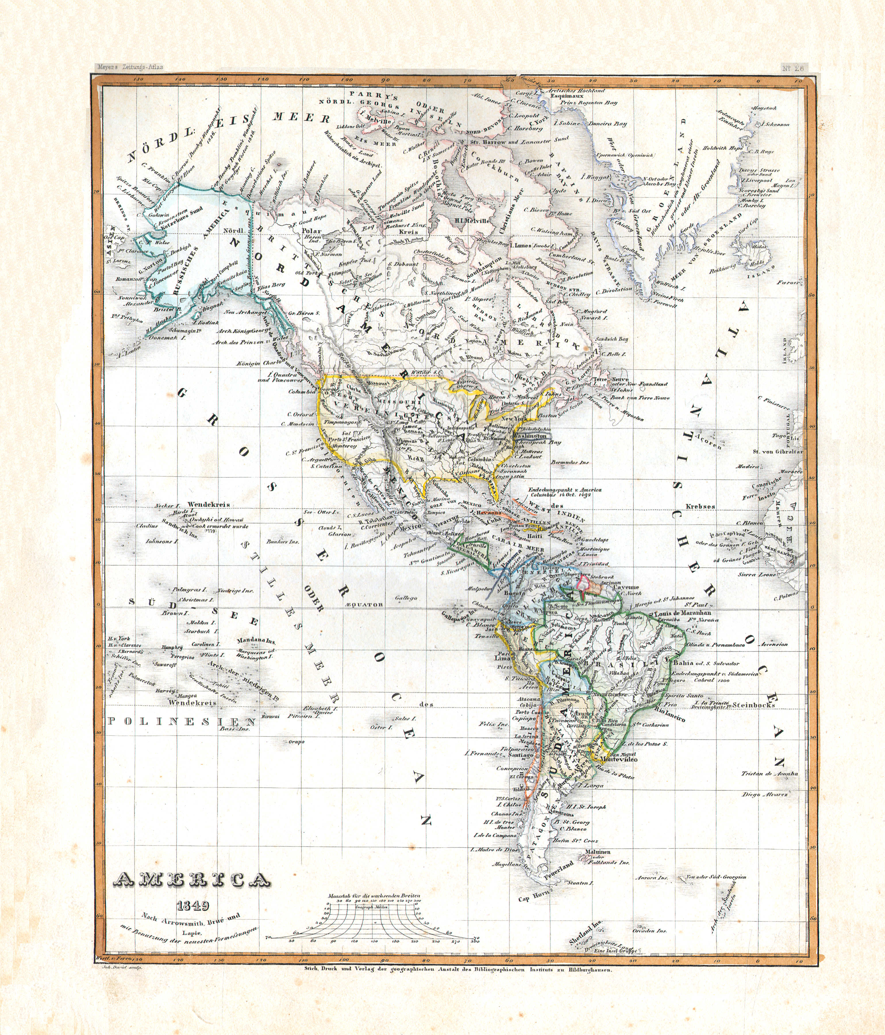
17. America (Nº 28, 1849)
Noord- en Zuid-Amerika / The Americas
 Meyer's Zeitungs-Atlas (1849-1852)
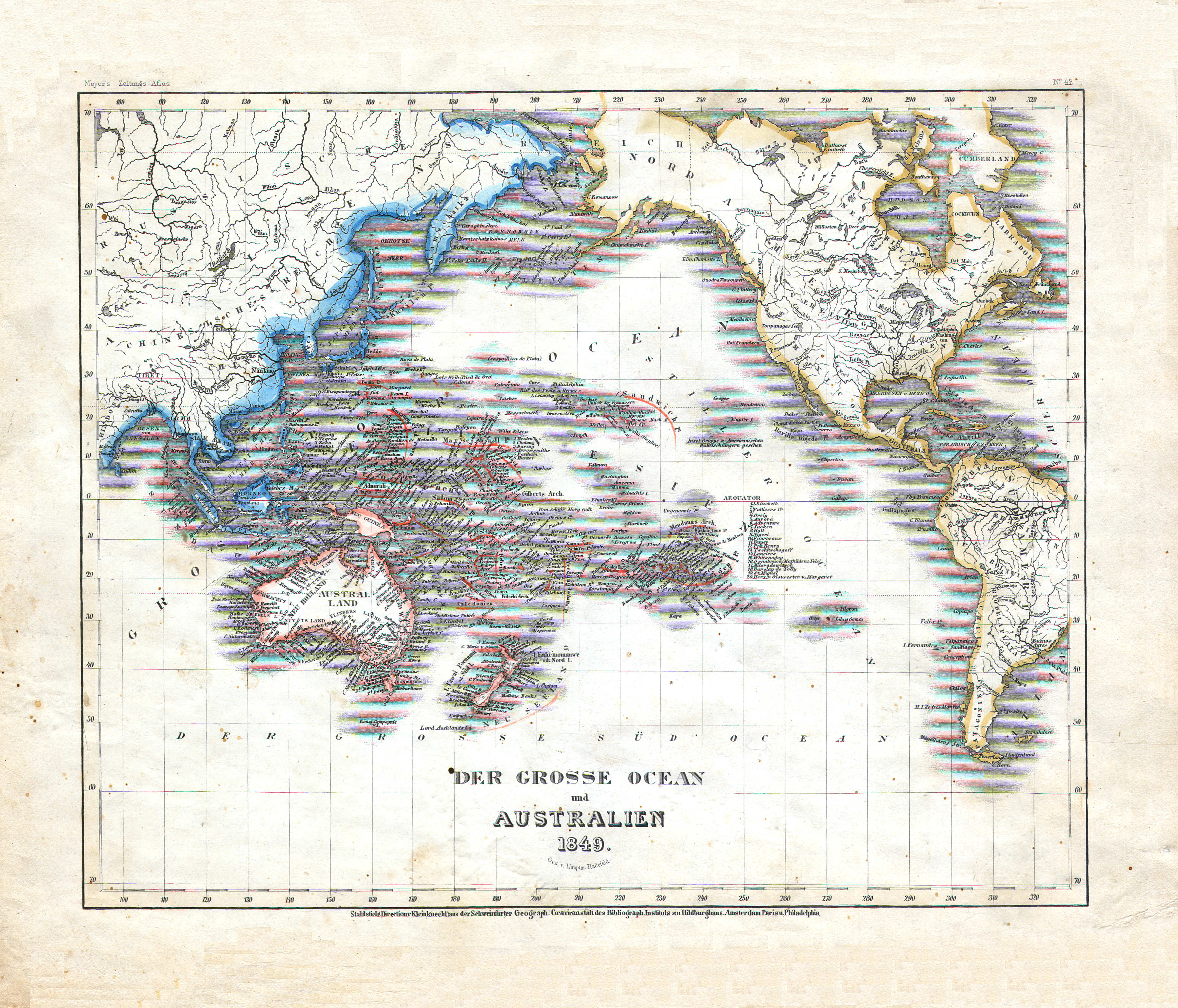
18. Der grosse Ocean und Australien (Nº 42, 1849)
De Grote Oceaan en Australië / The Pacific Ocean and Australia
 Meyer's Zeitungs-Atlas (1849-1852)
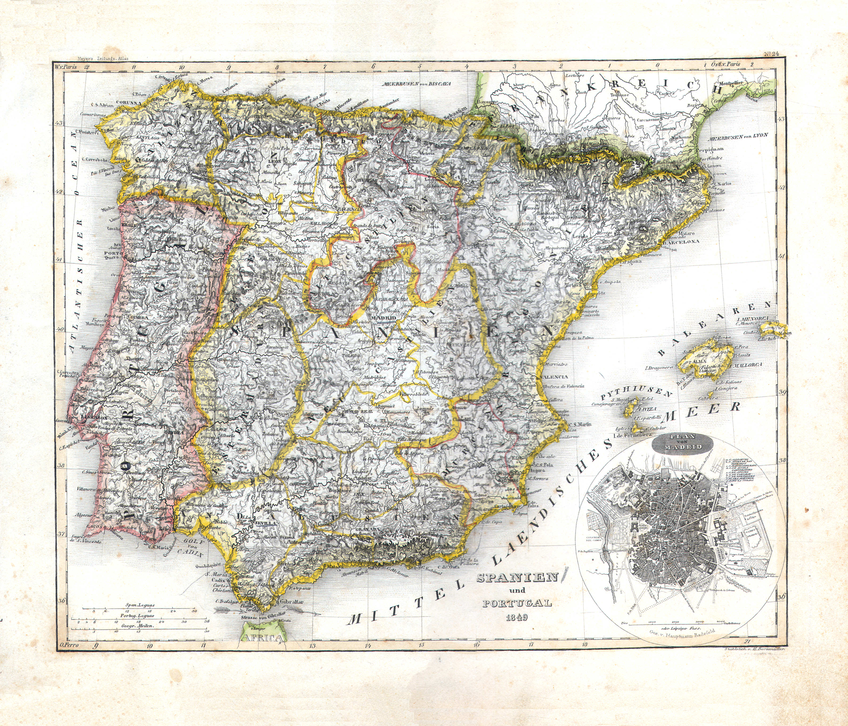
19. Spanien und Portugal (Nº 24, 1849)
Spanje en Portugal / Spain and Portugal
 Meyer's Zeitungs-Atlas (1849-1852)
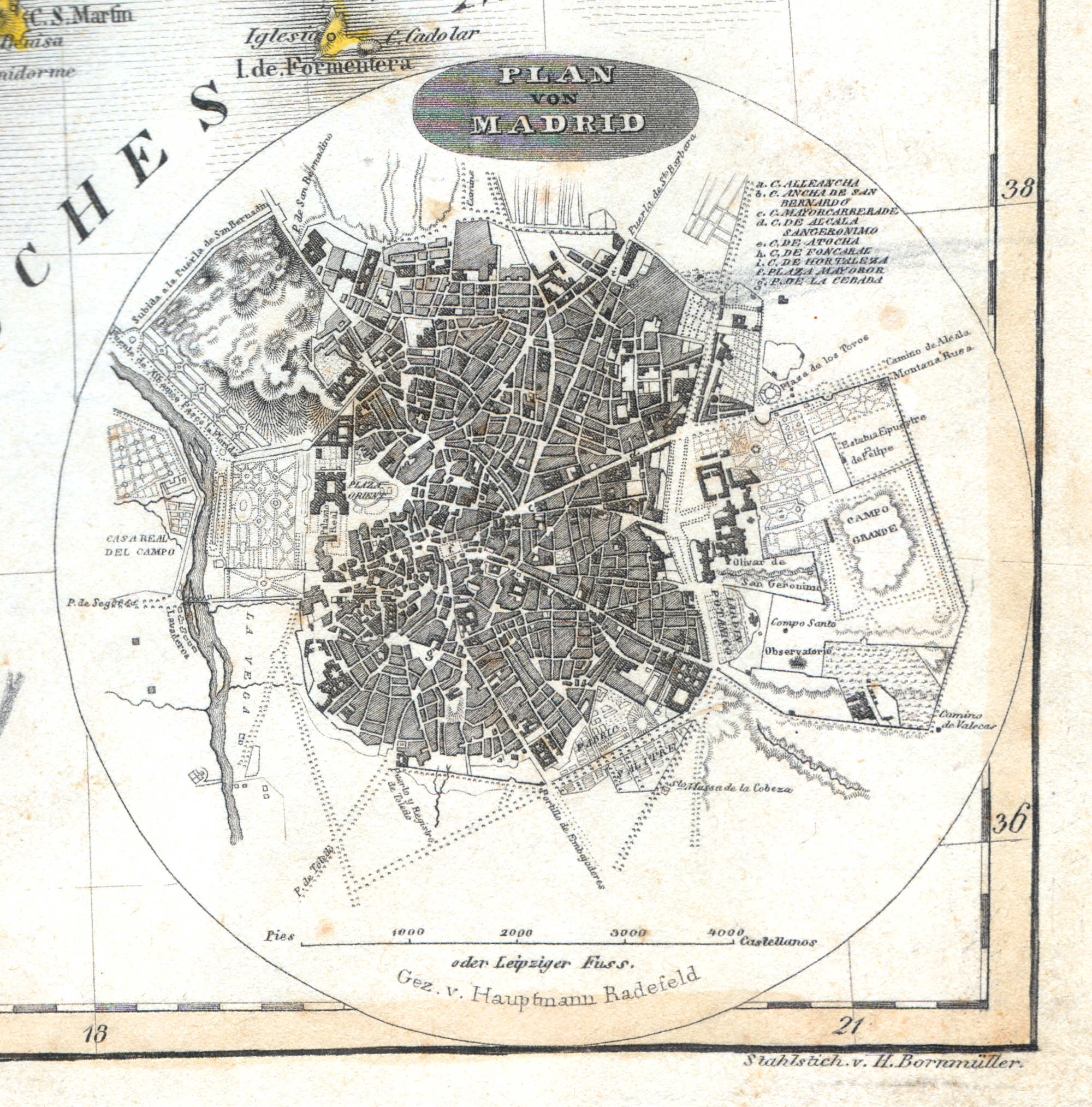
19a. Plan von Madrid
Plattegrond van Madrid / Plan of Madrid
 Meyer's Zeitungs-Atlas (1849-1852)
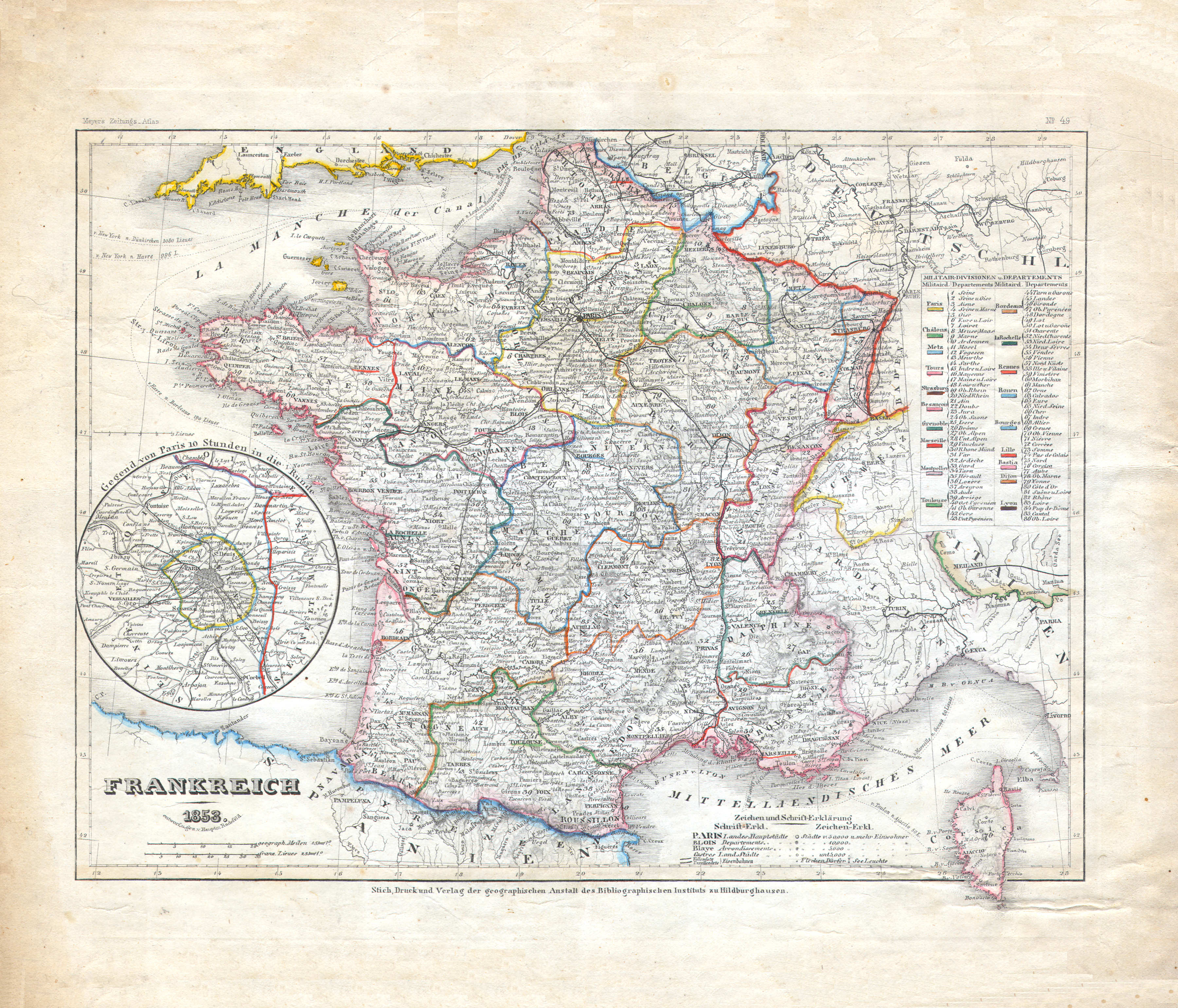
20. Frankreich (Nº 49, 1849)
Frankrijk / France
 Meyer's Zeitungs-Atlas (1849-1852)
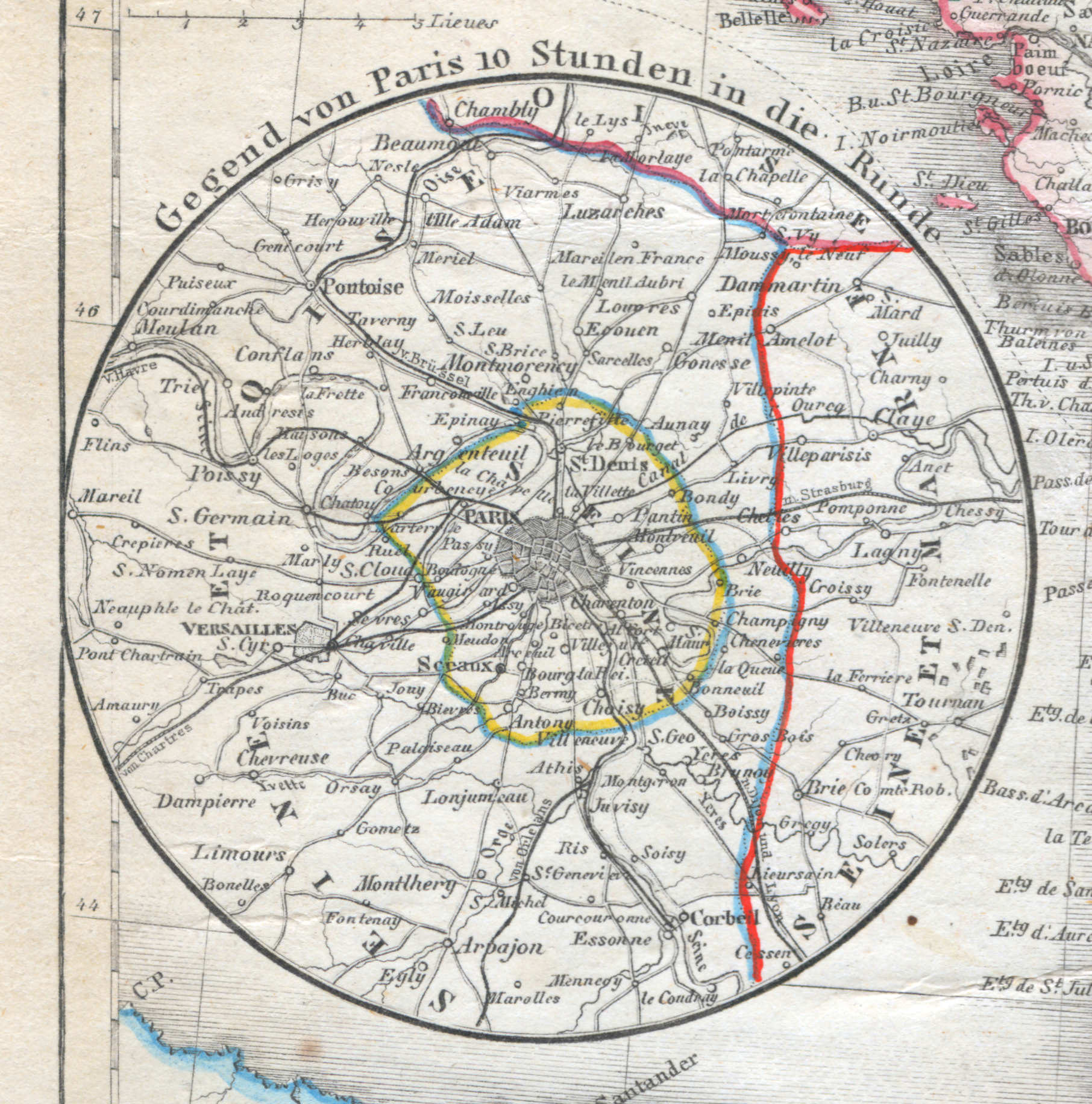
20a. Gegend von Paris 10 Stunden in die Runde
Parijs en omgeving / Paris and environs
 Meyer's Zeitungs-Atlas (1849-1852)
21. Italien mit der Dalmat.-Albanesischen Küste (Nº 4, 1849)
Italië en de kust van Dalmatië en Albanië / Italy and the shores of Dalmatia and Albania
 Meyer's Zeitungs-Atlas (1849-1852)
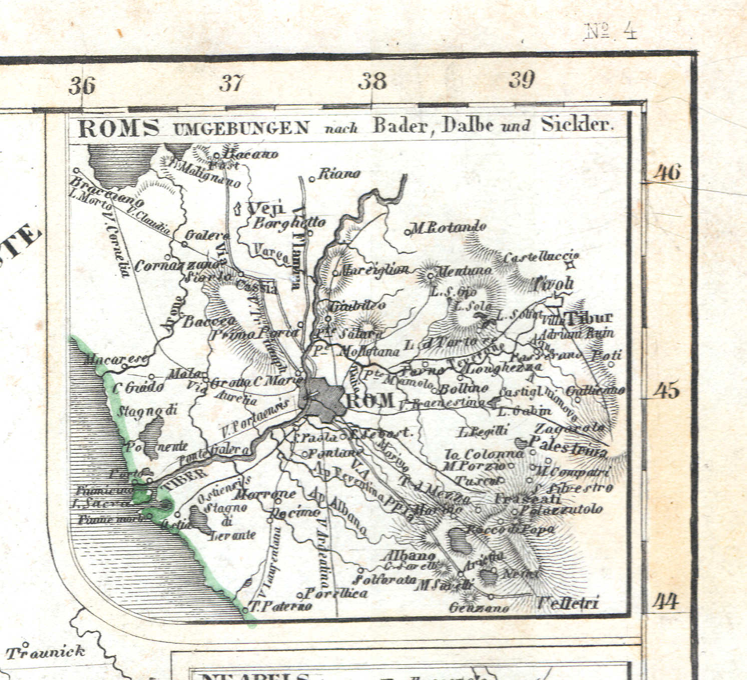
21a. Roms Umgebungen (Nº 4, 1849)
Rome en omgeving / Rome and environs / Roma
 Meyer's Zeitungs-Atlas (1849-1852)
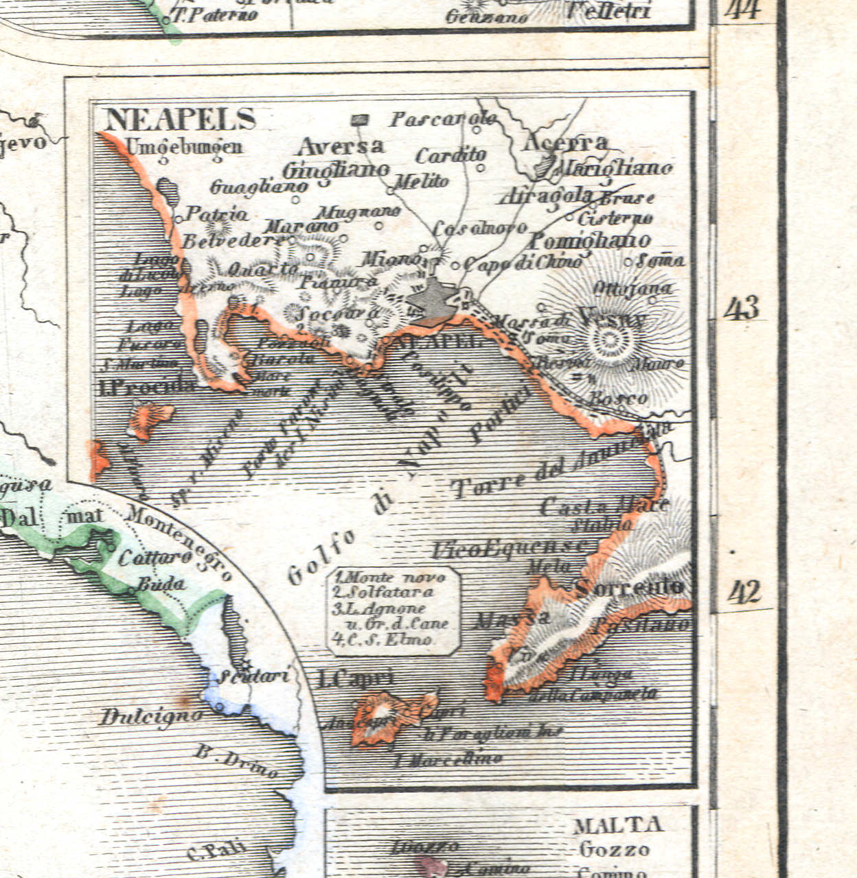
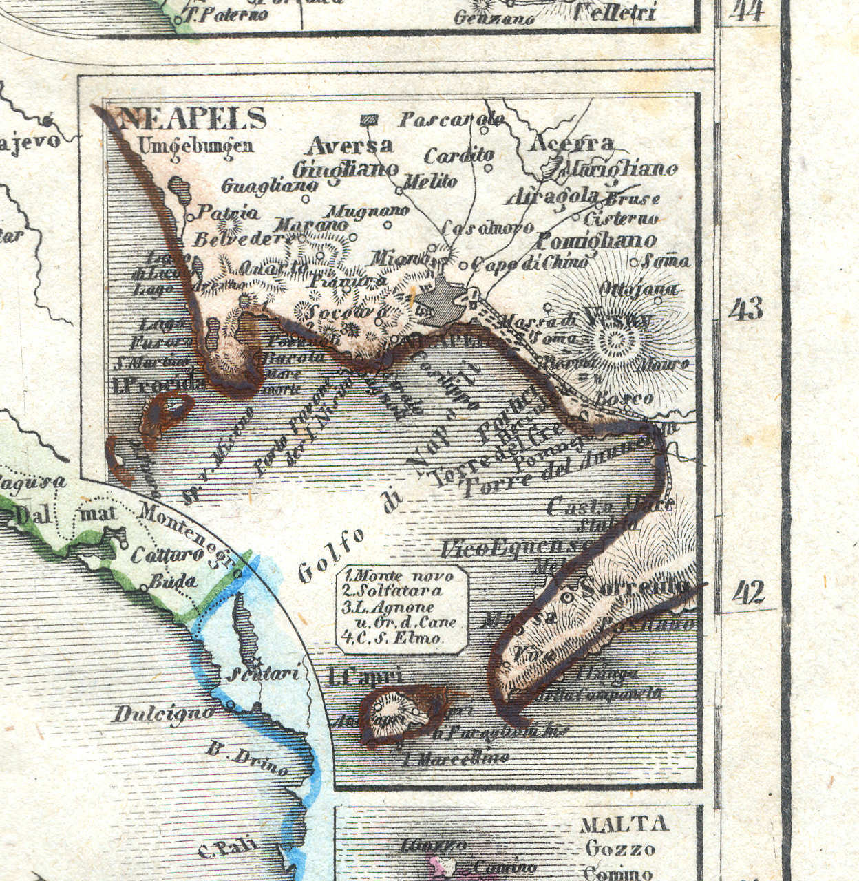
21b. Neapels Umgebungen (Nº 4, 1849)
Napels en omgeving / Naples and environs / Napoli
 Meyer's Zeitungs-Atlas (1849-1852)
21. Italien mit der Dalmat.-Albanesischen Küste (Nº 119, 1852)
Italië en de kust van Dalmatië en Albanië / Italy and the shores of Dalmatia and Albania
 Meyer's Zeitungs-Atlas (1849-1852)
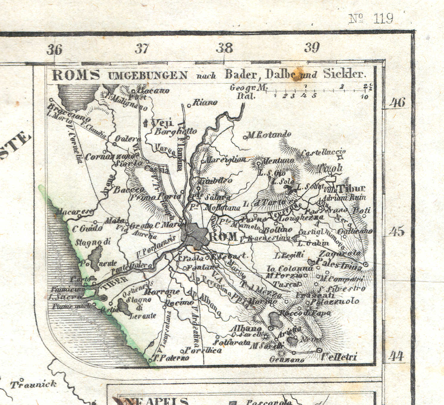
21a. Roms Umgebungen (Nº 119, 1852)
Rome en omgeving / Rome and environs / Roma
 Meyer's Zeitungs-Atlas (1849-1852)
21b. Neapels Umgebungen (Nº 119, 1852)
Napels en omgeving / Naples and environs / Napoli
 Meyer's Zeitungs-Atlas (1849-1852)
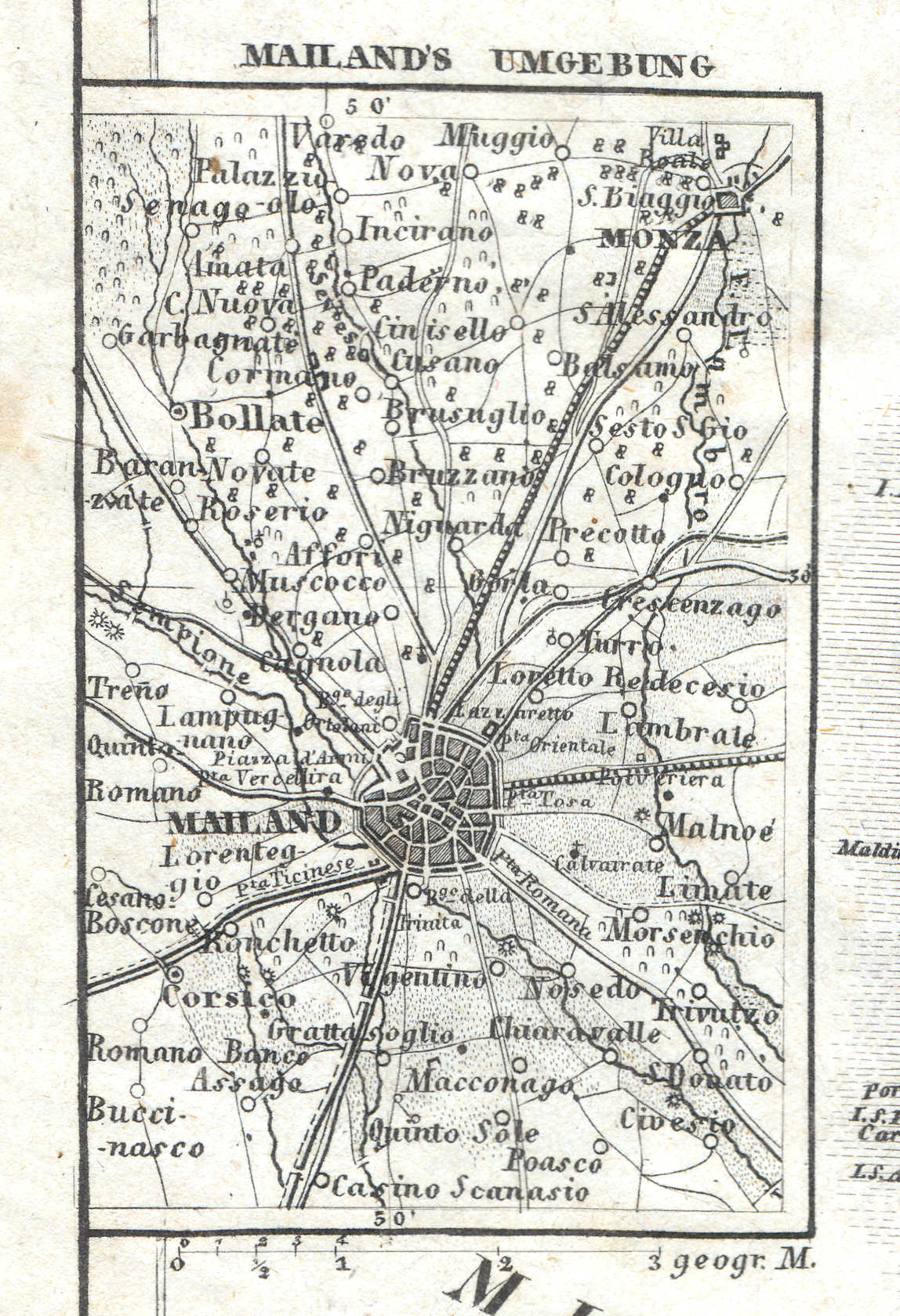
21d. Mailand's Umgebung (Nº 119, 1852)
Milaan en omgeving / Milan and environs / Milano
 Meyer's Zeitungs-Atlas (1849-1852)
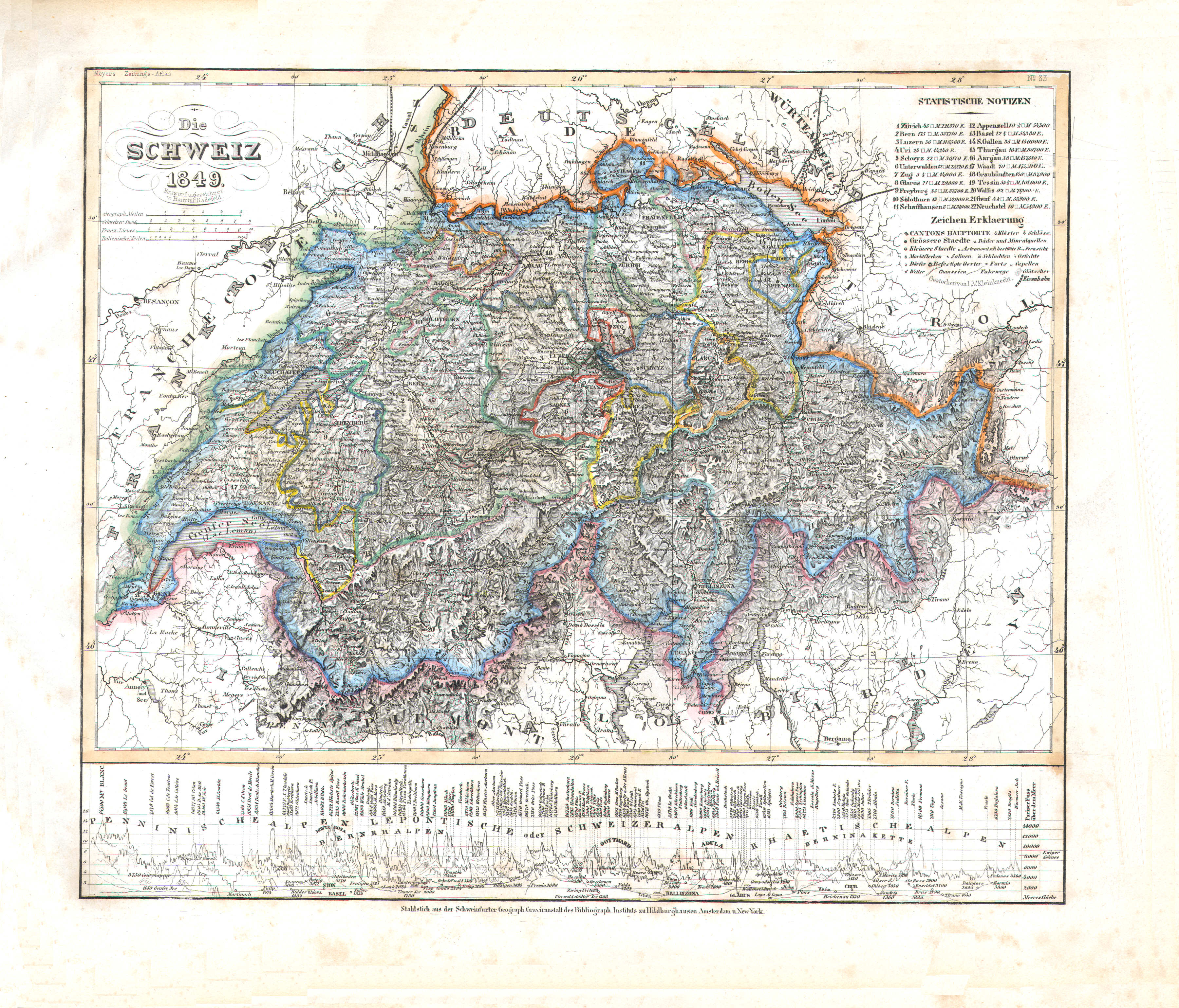
22. Die Schweiz (Nº 33, 1849)
Zwitserland / Switzerland
 Meyer's Zeitungs-Atlas (1849-1852)
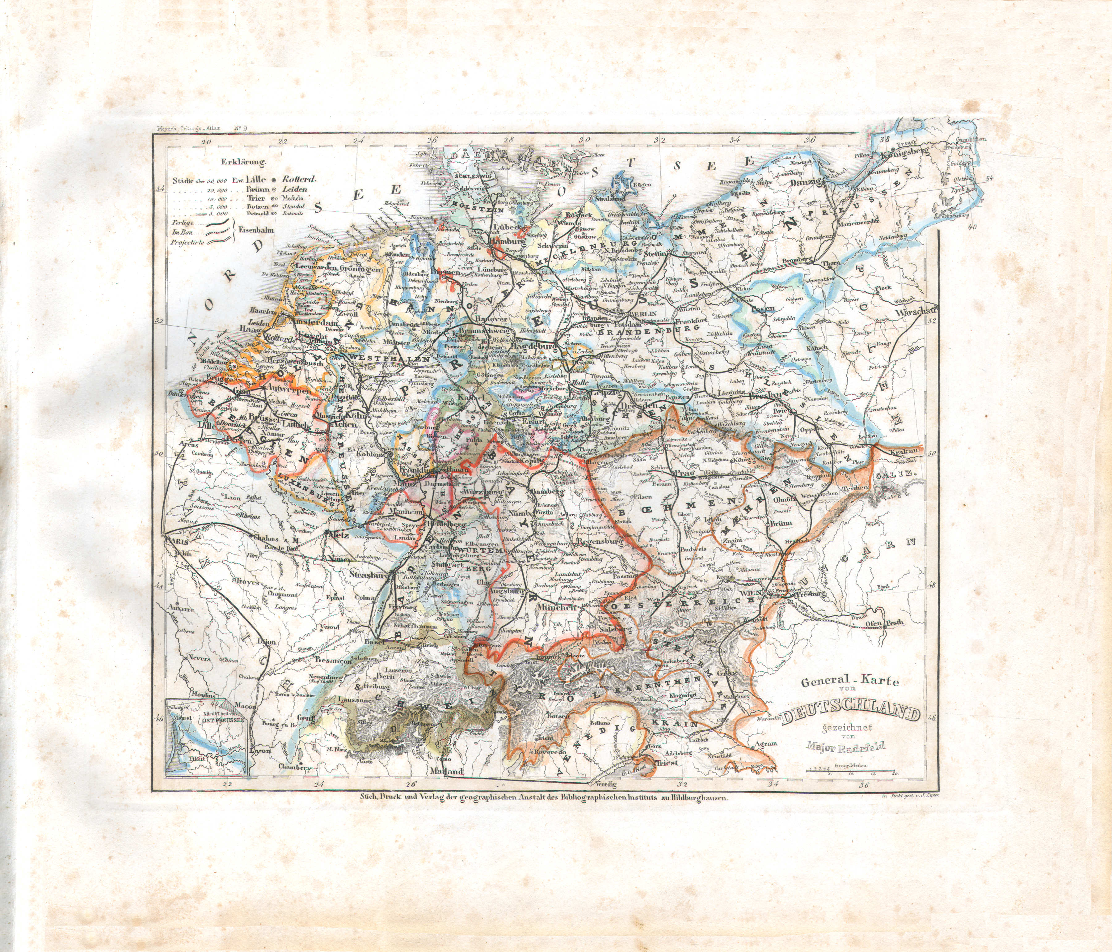
23. General-Karte von Deutschland (Nº 9)
Overzichtskaart van Duitsland / General map of Germany
 Meyer's Zeitungs-Atlas (1849-1852)
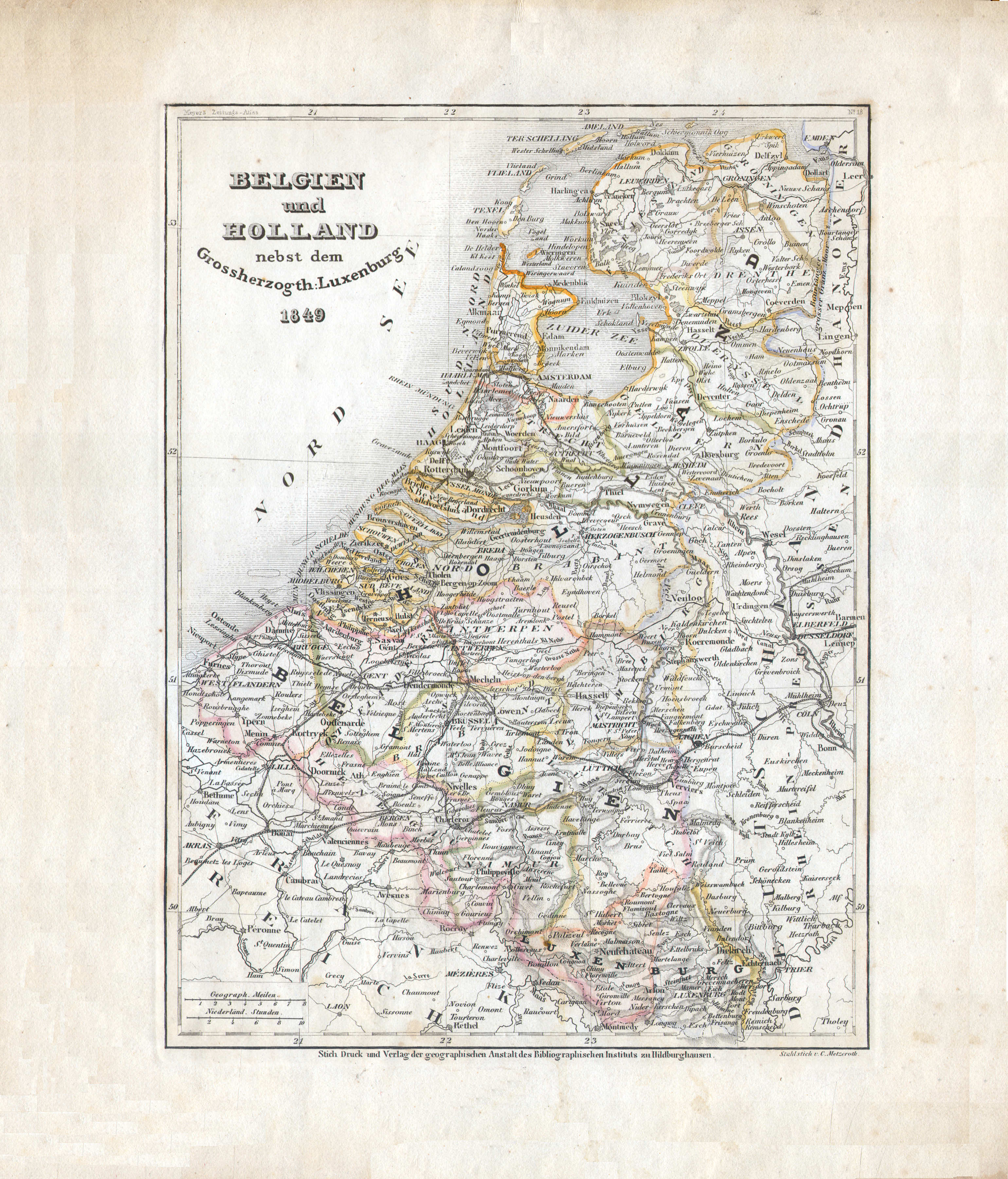
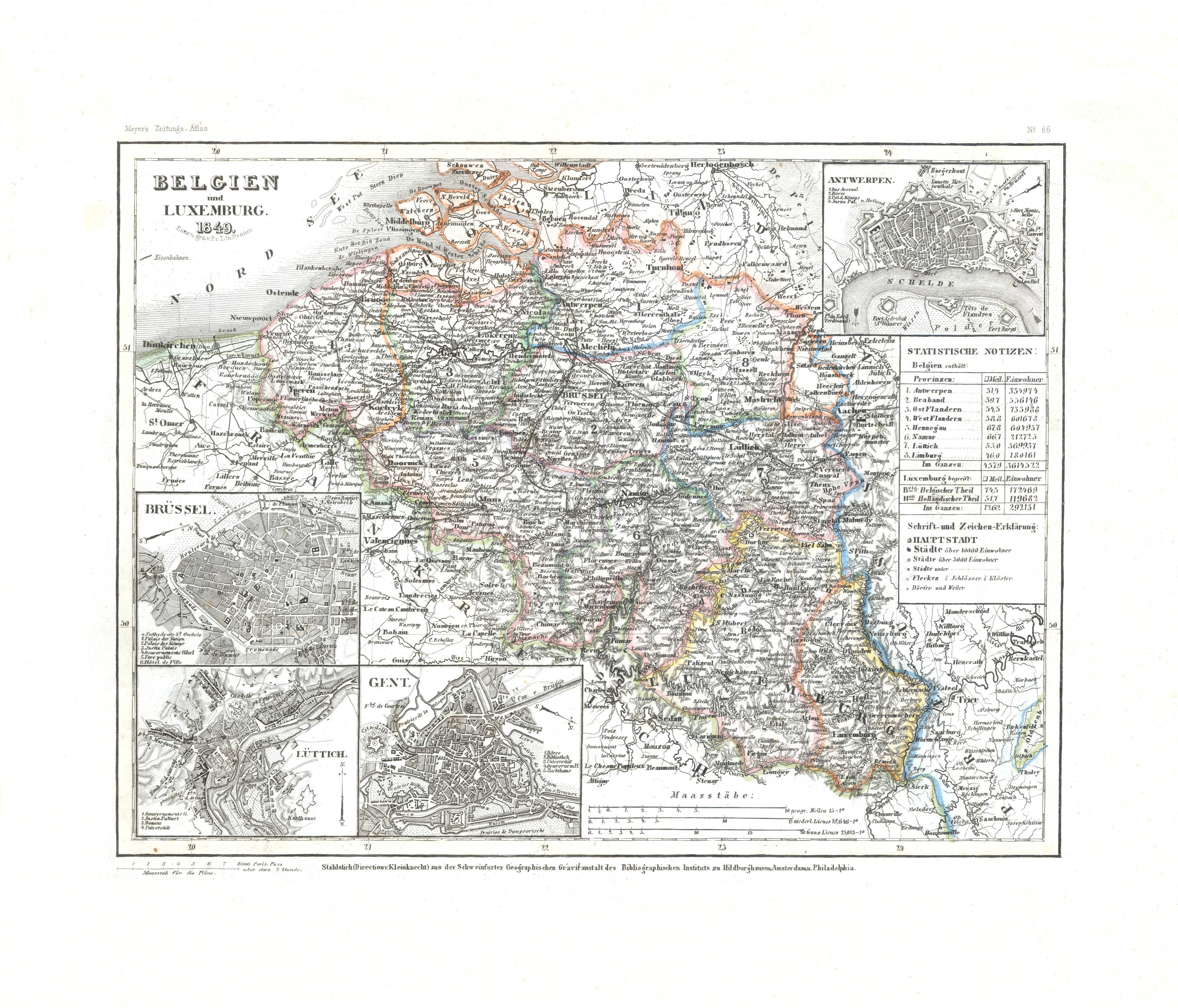
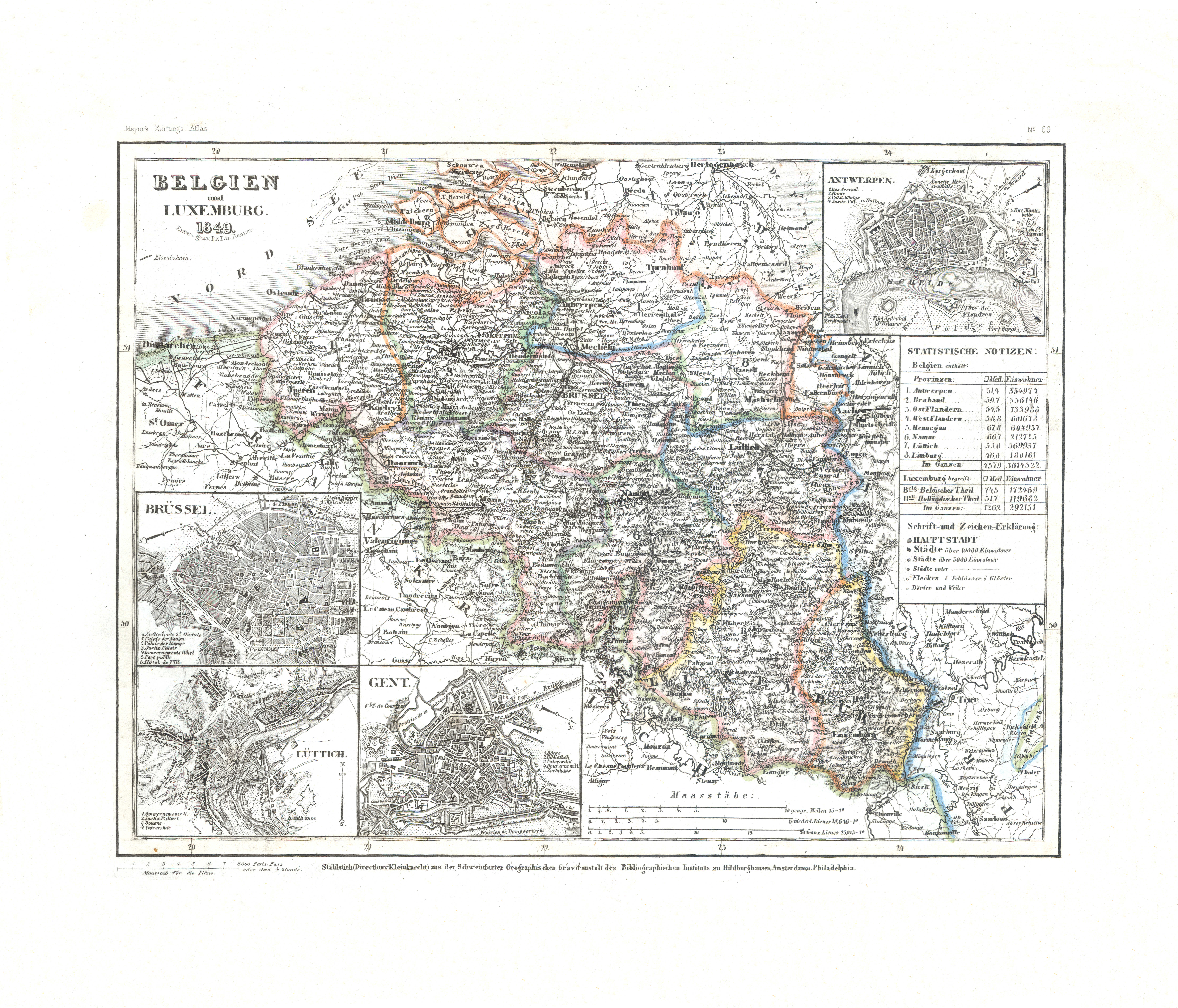
24. Belgien und Holland nebst dem Grossherzogth: Luxemburg (Nº 18, 1849)
België, Nederland en Luxemburg / Belgium, Netherlands and Luxembourg
 Meyer's Zeitungs-Atlas (1849-1852)
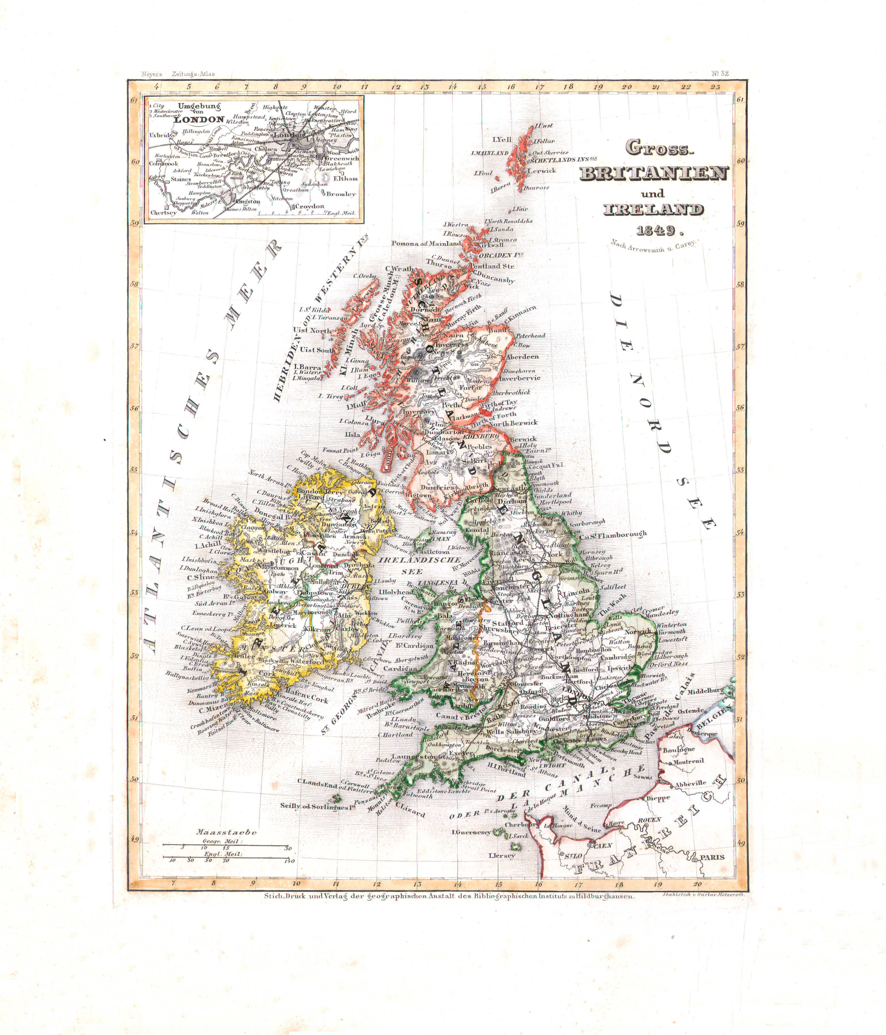
25. Gross-Britanien und Ireland (Nº 32, 1849)
Groot-Brittannië en Ierland / Great Britain and Ireland
 Meyer's Zeitungs-Atlas (1849-1852)
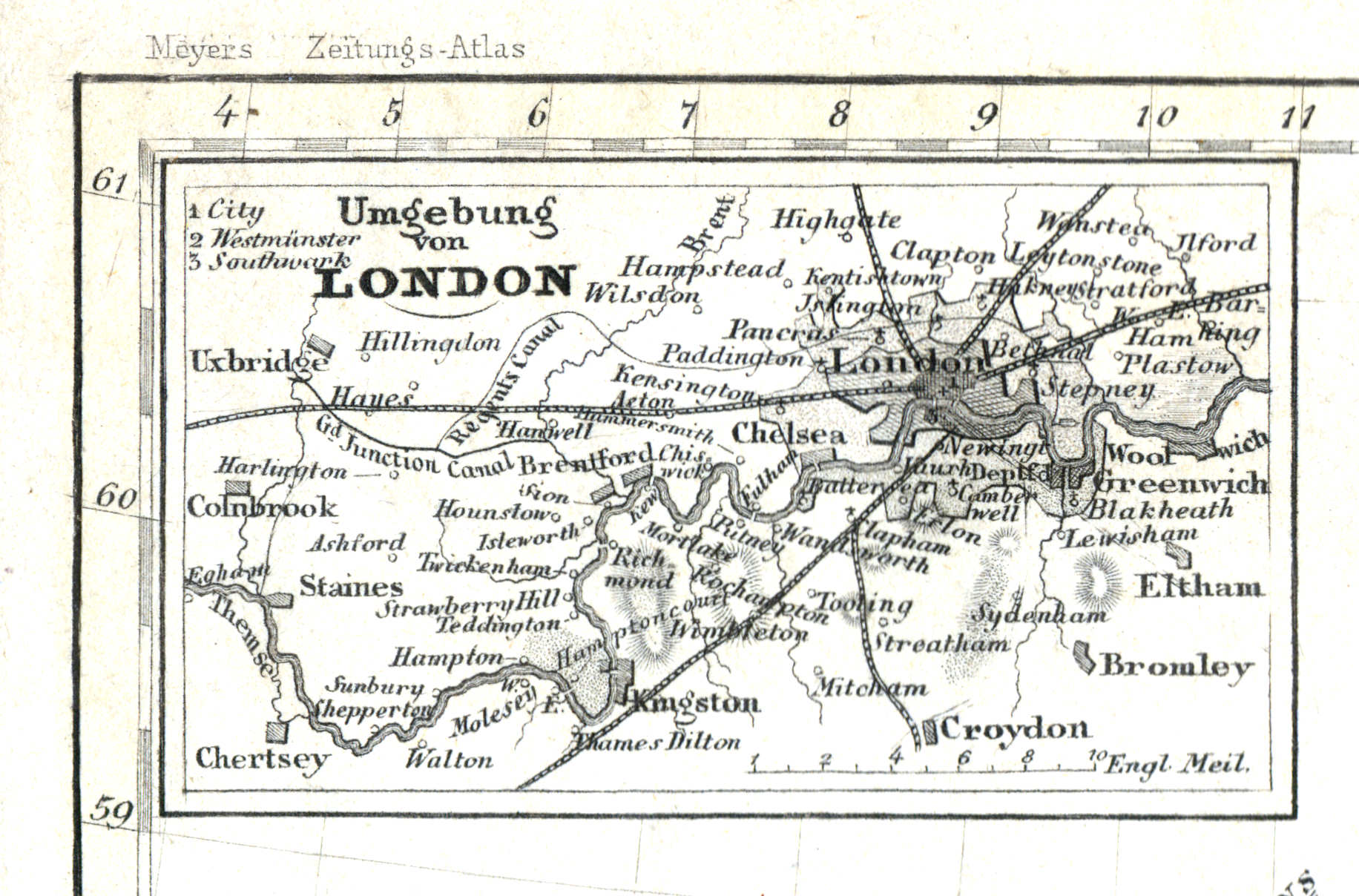
25a. Umgebung van London
Londen en omgeving / London and environs
 Meyer's Zeitungs-Atlas (1849-1852)
26. England (Nº 73, 1850)
Engeland / England
 Meyer's Zeitungs-Atlas (1849-1852)
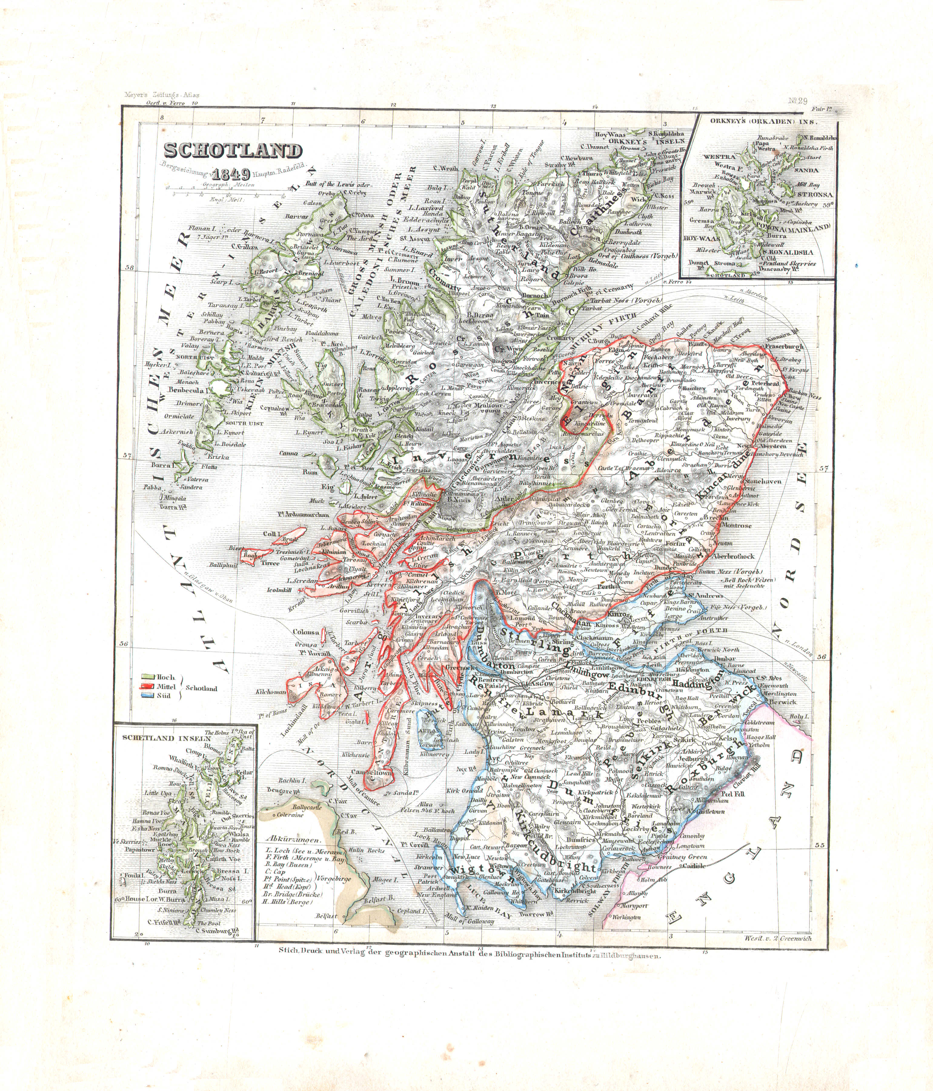
27. Schotland (Nº 29, 1849)
Schotland / Scotland
 Meyer's Zeitungs-Atlas (1849-1852)
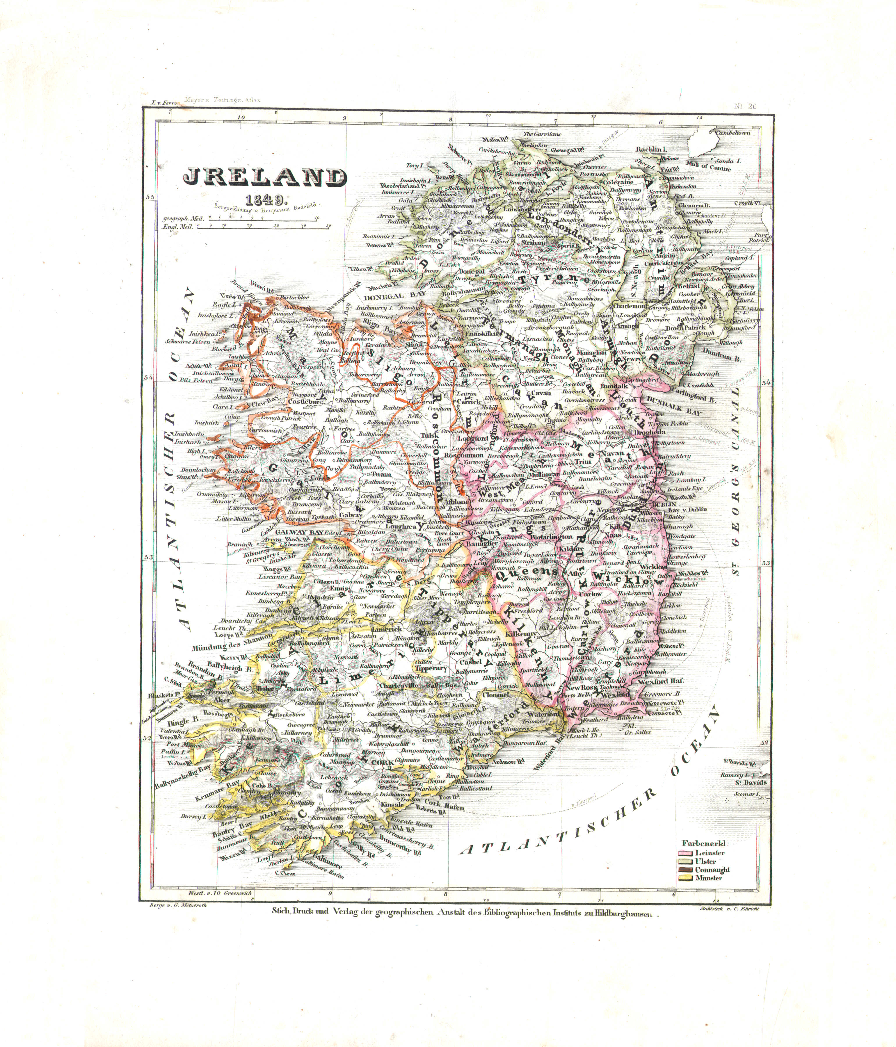
28. Ireland (Nº 26, 1849)
Ierland / Ireland
 Meyer's Zeitungs-Atlas (1849-1852)
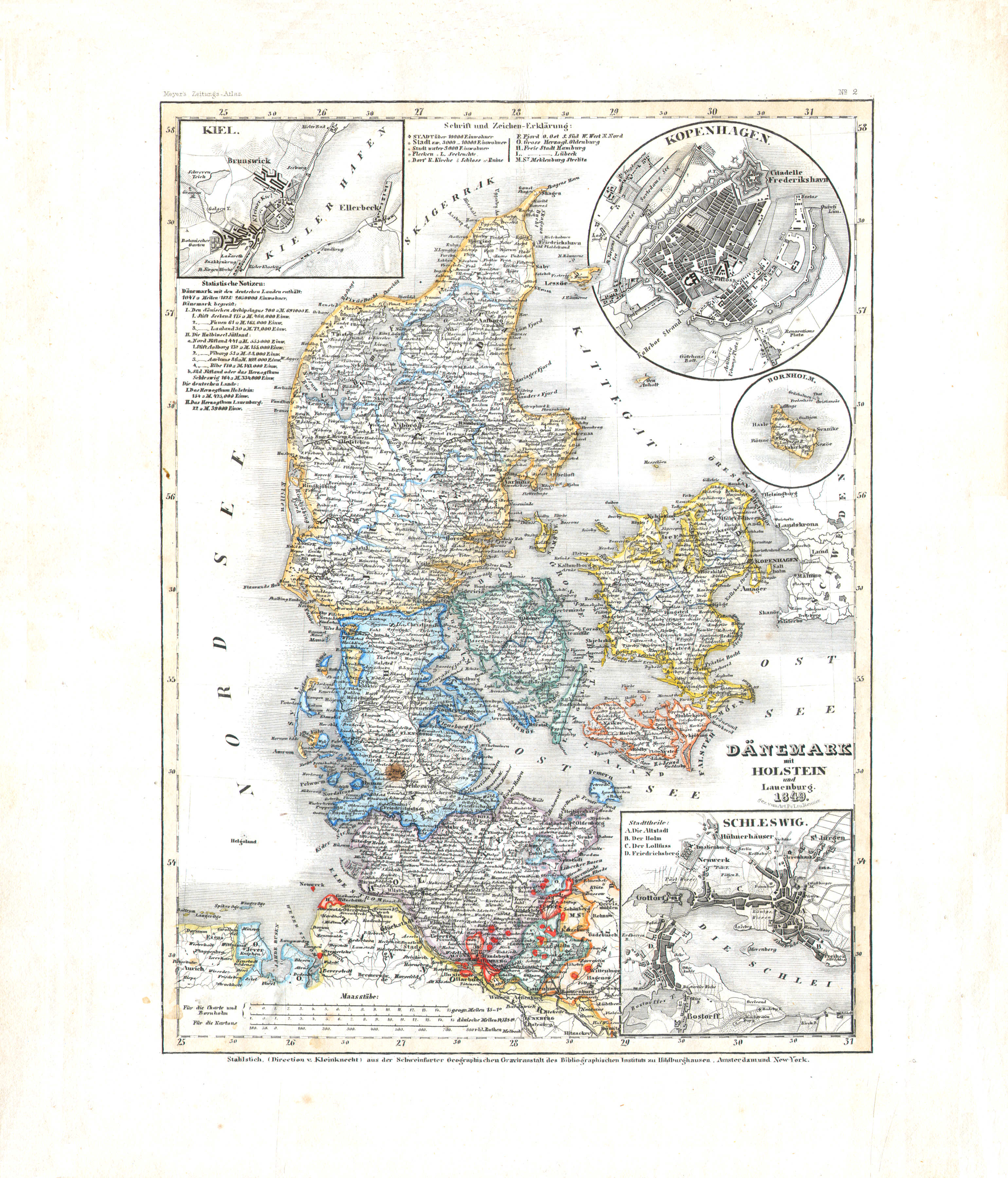
29. Dänemark mit Holstein und Lauenburg (Nº 2, 1849)
Denemarken met Holstein en Lauenburg / Denmark with Holstein and Lauenburg
 Meyer's Zeitungs-Atlas (1849-1852)
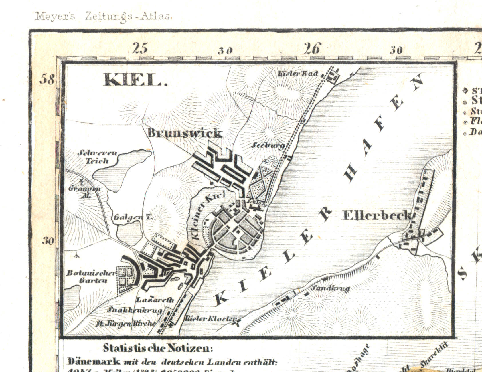
29a. Kiel
Kiel
 Meyer's Zeitungs-Atlas (1849-1852)
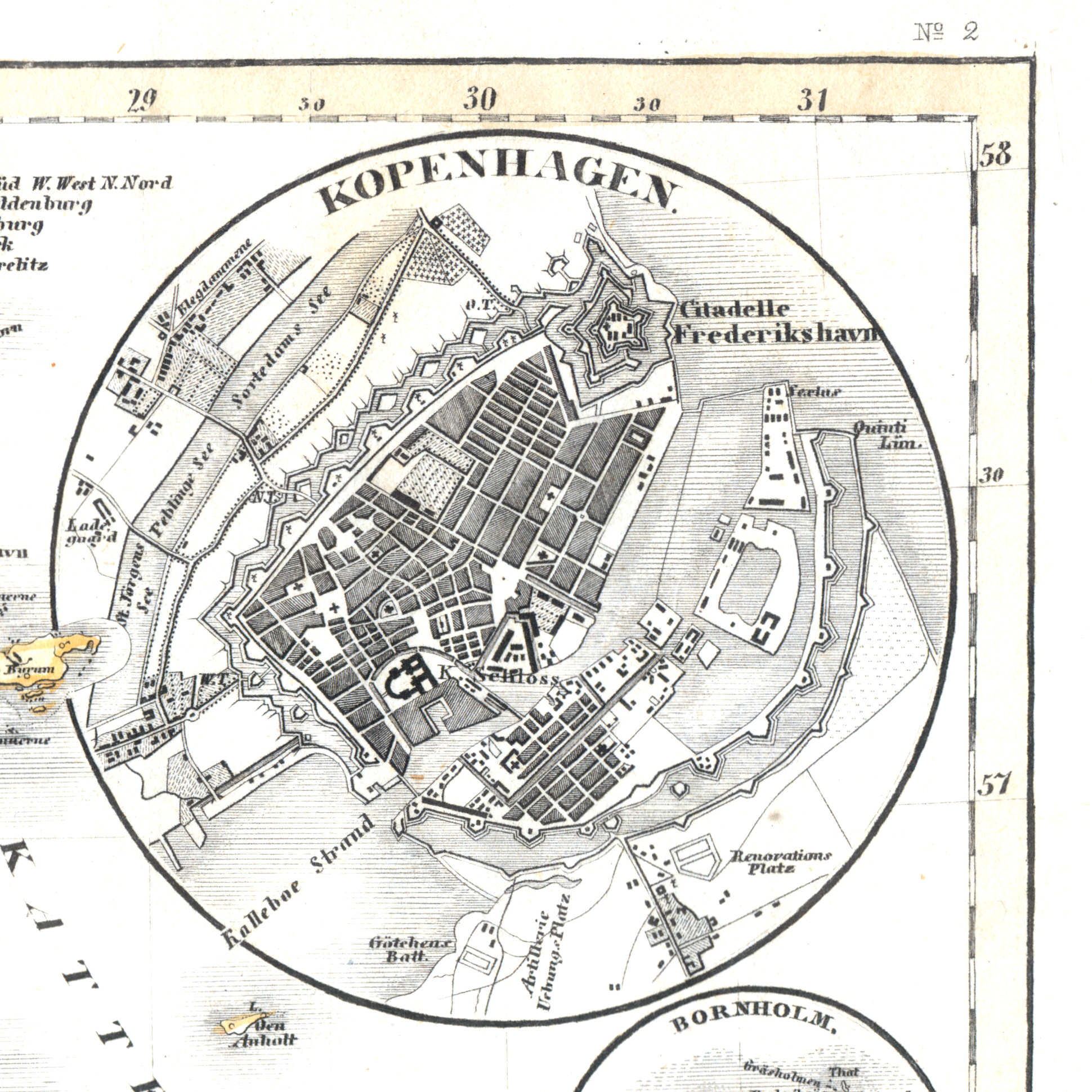
29b. Kopenhagen
Kopenhagen / Copenhagen / København
 Meyer's Zeitungs-Atlas (1849-1852)
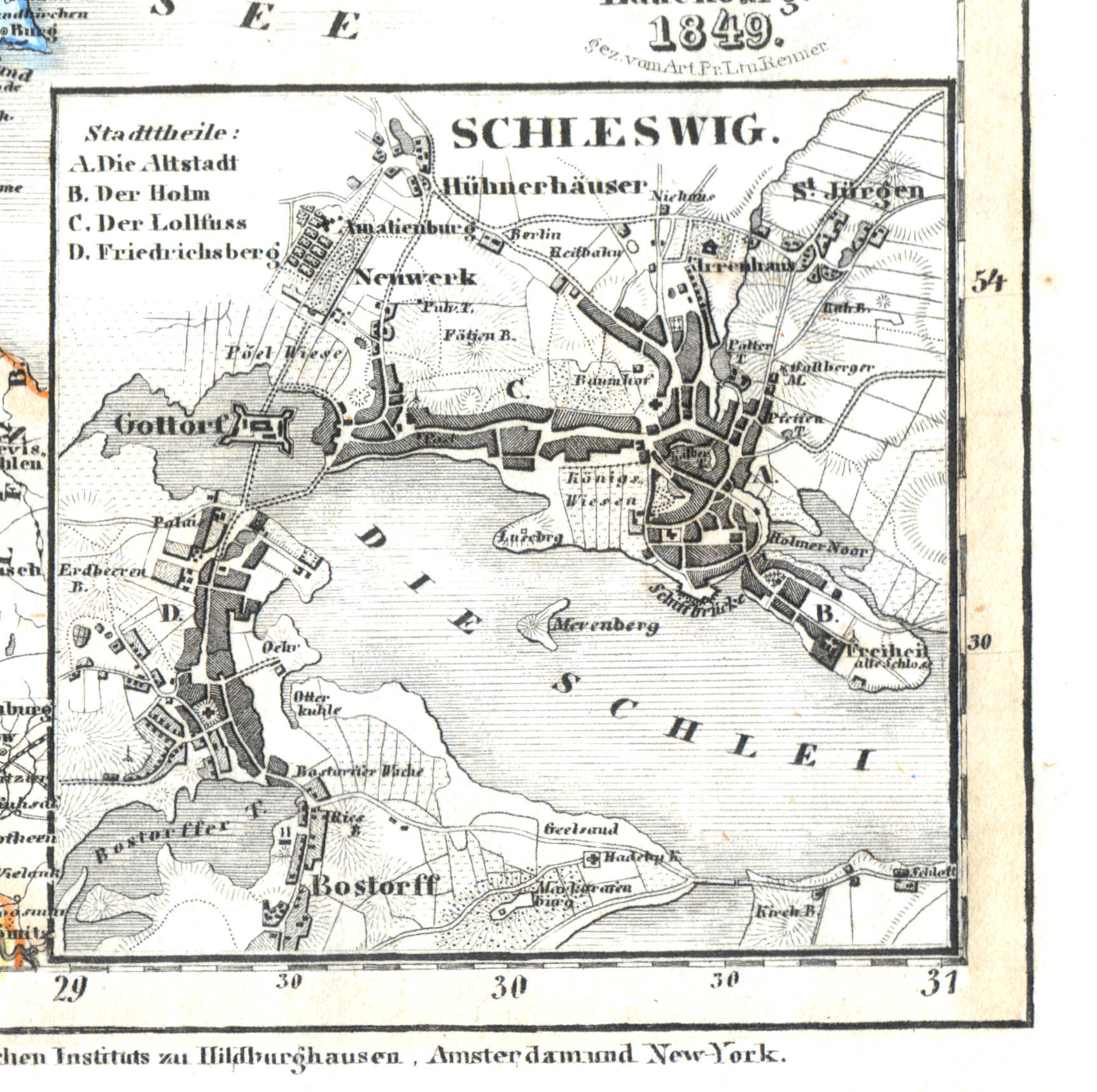
29d. Schleswig
Sleeswijk / Schleswig
 Meyer's Zeitungs-Atlas (1849-1852)
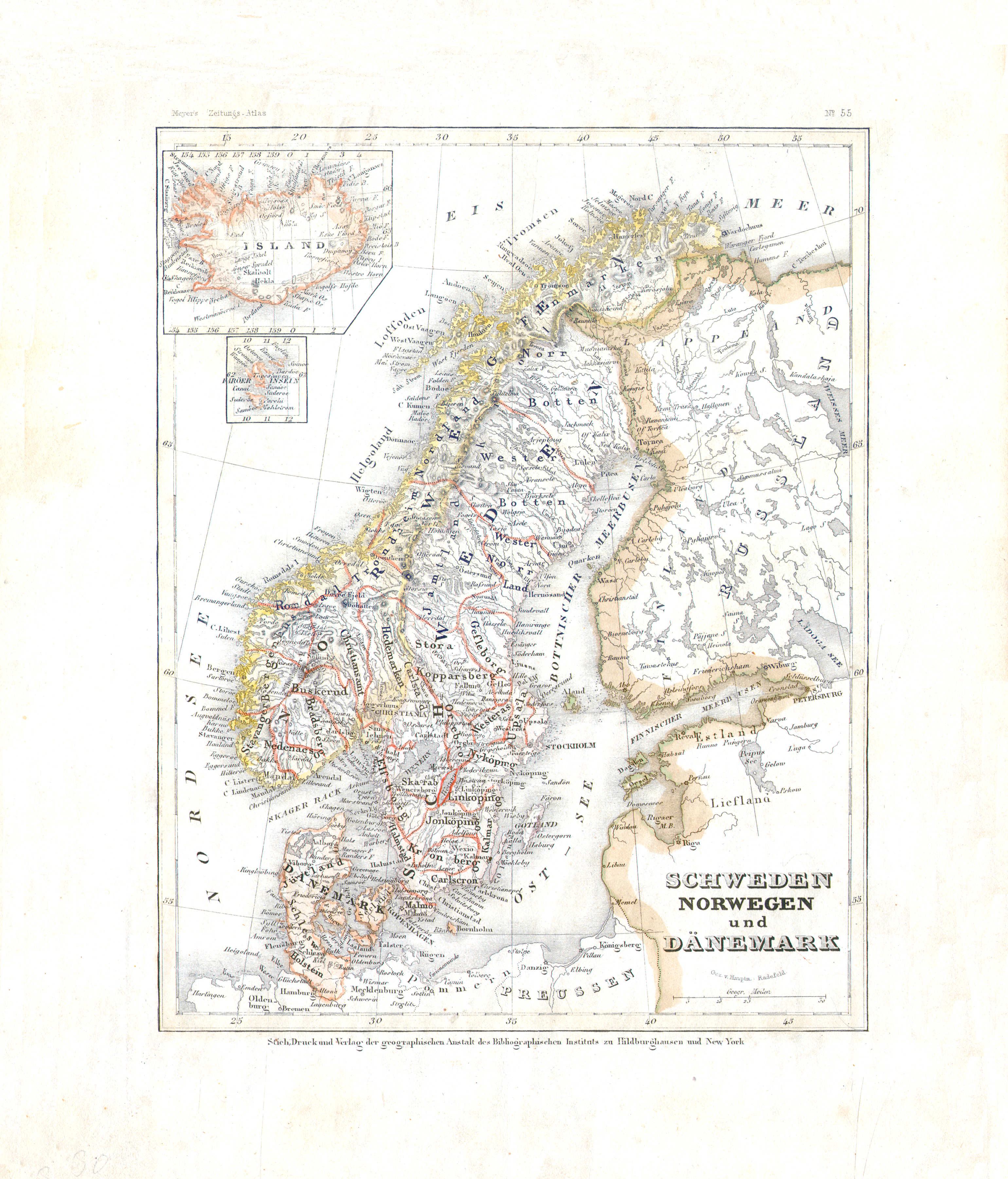
30. Schweden, Norwegen und Dänemark (Nº 55)
Zweden, Noorwegen en Denemarken / Sweden, Norway and Denmark
 Meyer's Zeitungs-Atlas (1849-1852)
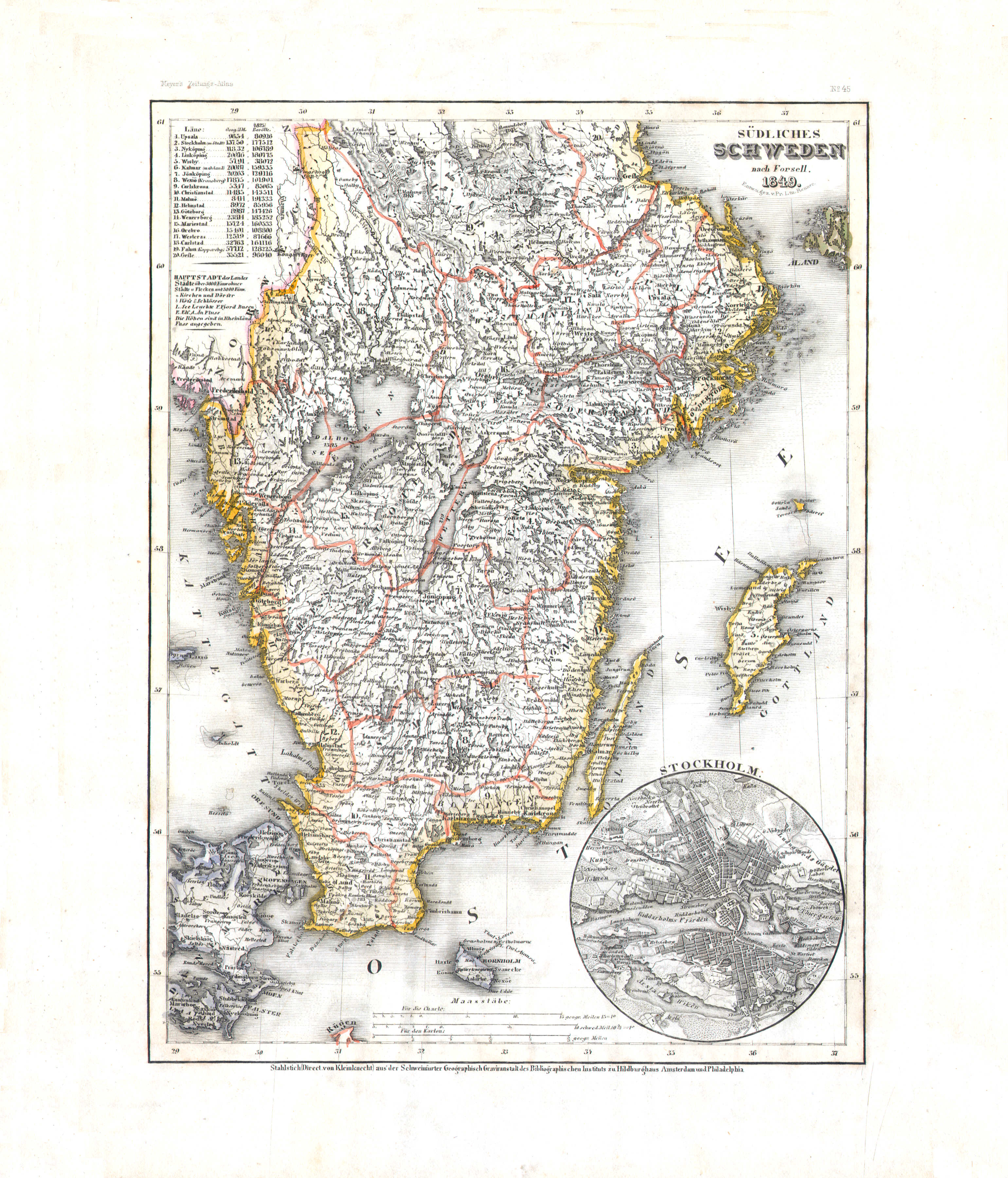
31. Südliches Schweden (Nº 45, 1849)
Zuid-Zweden / South Sweden
 Meyer's Zeitungs-Atlas (1849-1852)
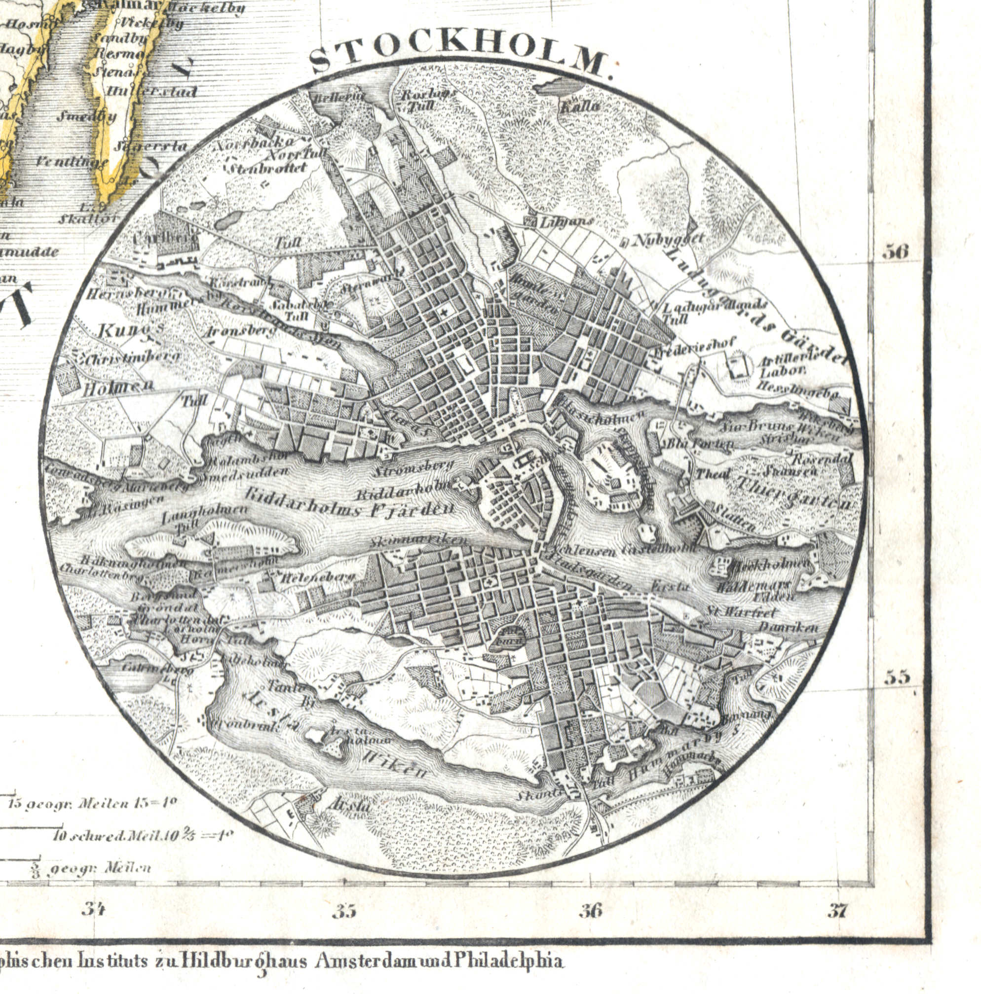
31a. Stockholm
Stockholm
 Meyer's Zeitungs-Atlas (1849-1852)
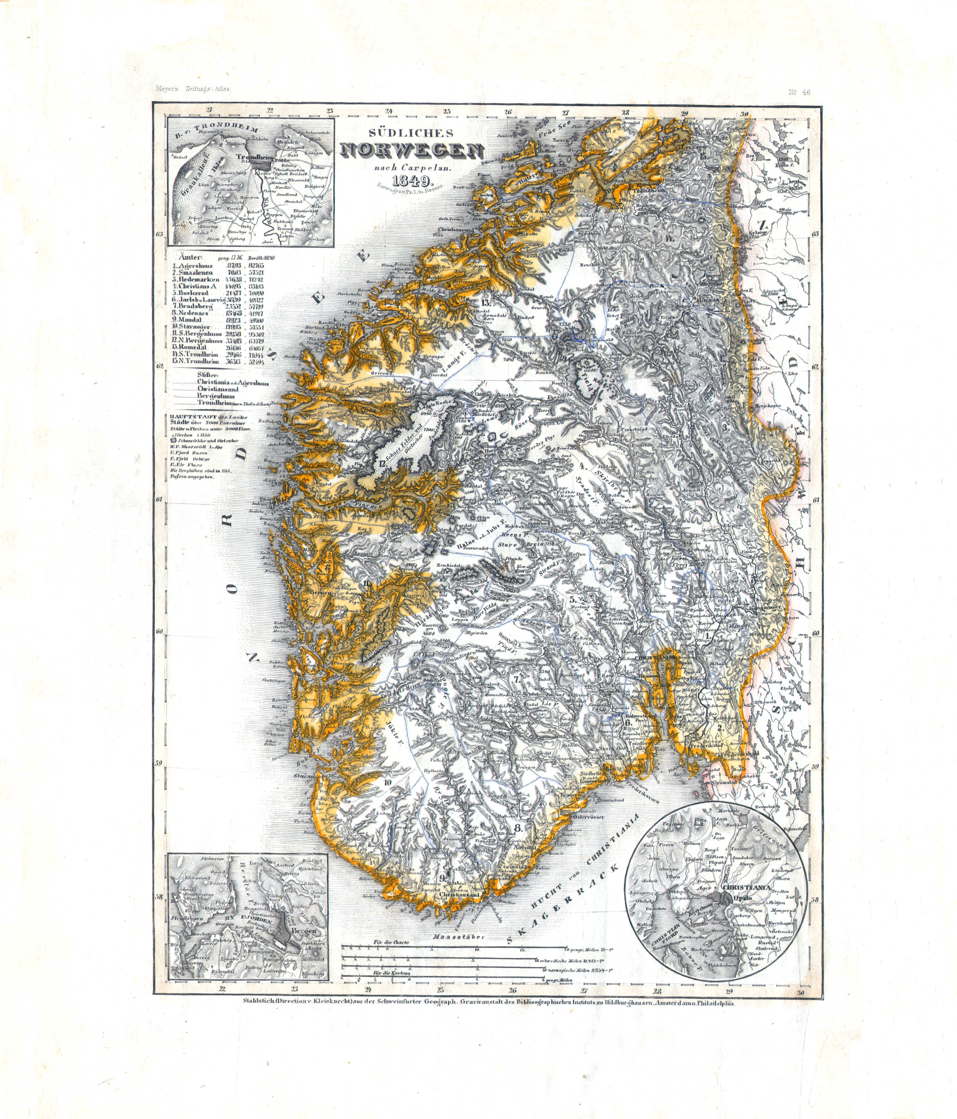
32. Südliches Norwegen (Nº 46, 1849)
Zuid-Noorwegen / South Norway
 Meyer's Zeitungs-Atlas (1849-1852)
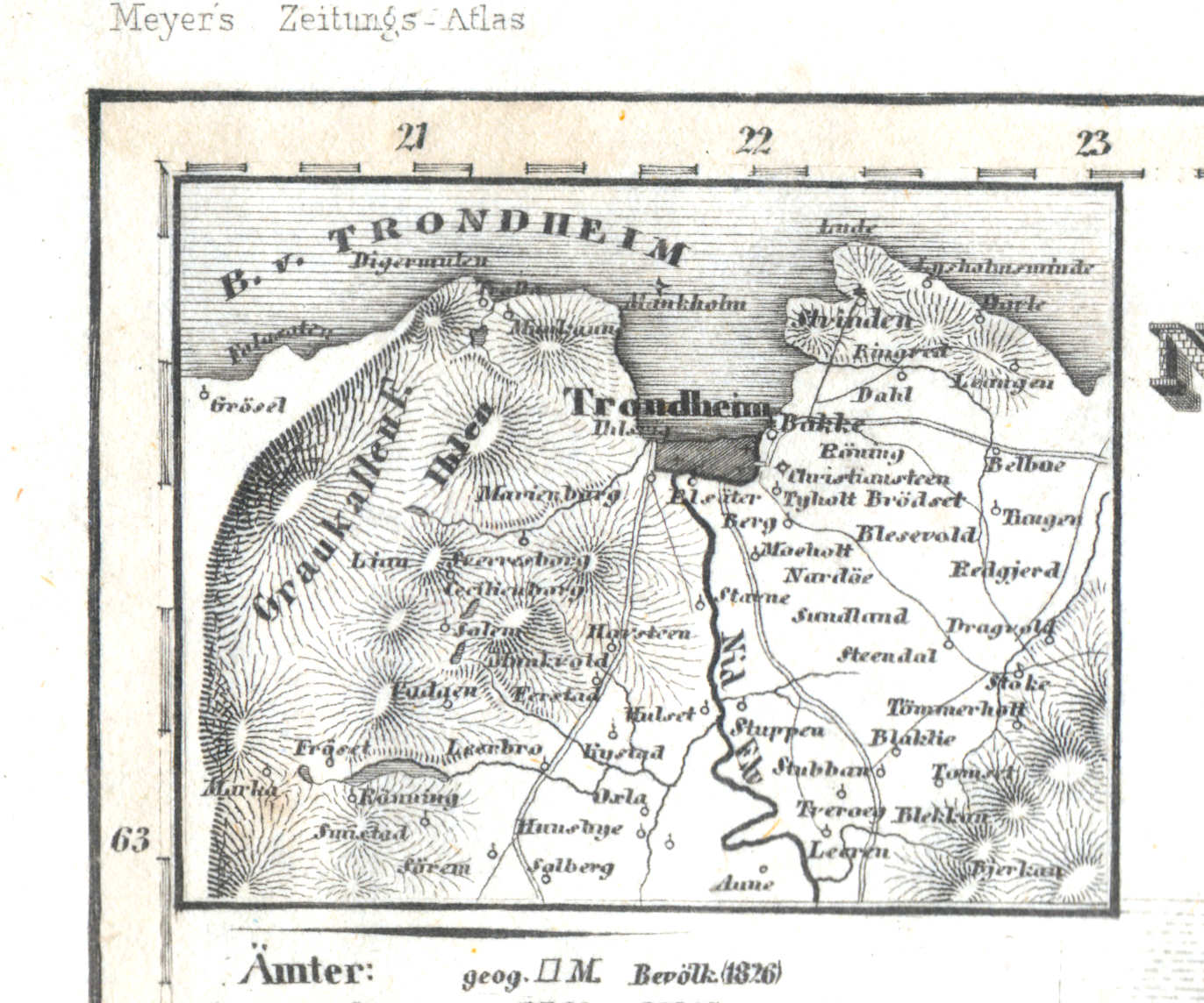
32a. Trondheim
Trondheim
 Meyer's Zeitungs-Atlas (1849-1852)
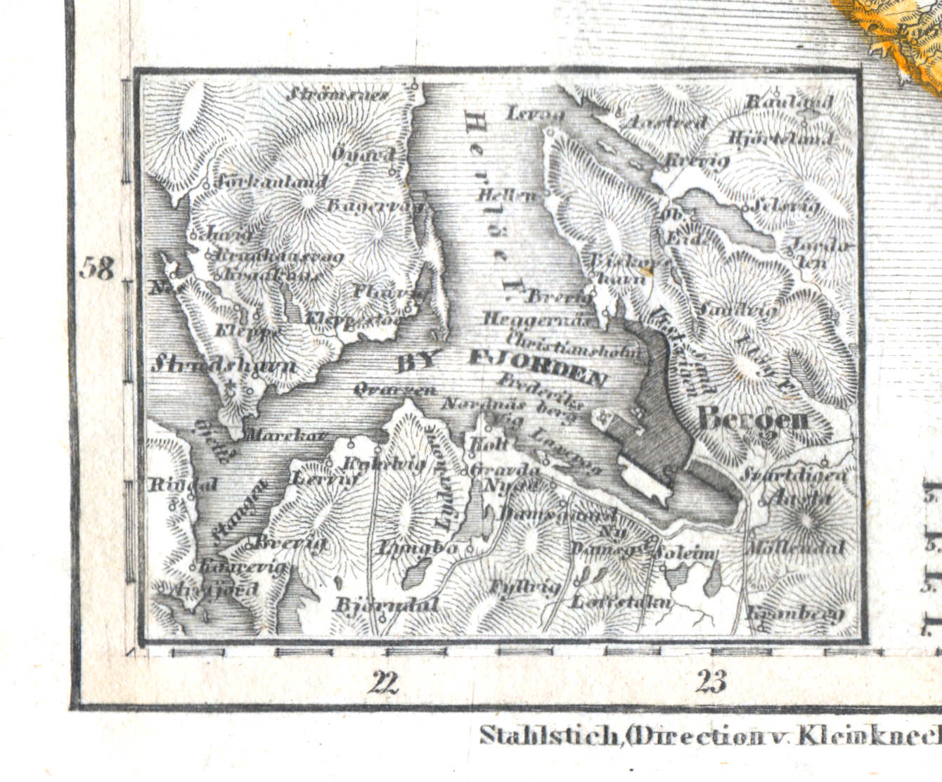
32b. Bergen
Bergen
 Meyer's Zeitungs-Atlas (1849-1852)
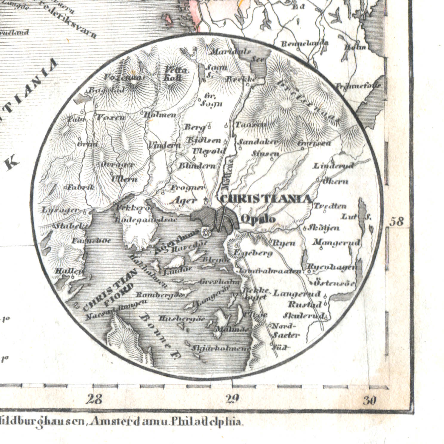
32c. Christiania
Christiania (Oslo)
 Meyer's Zeitungs-Atlas (1849-1852)
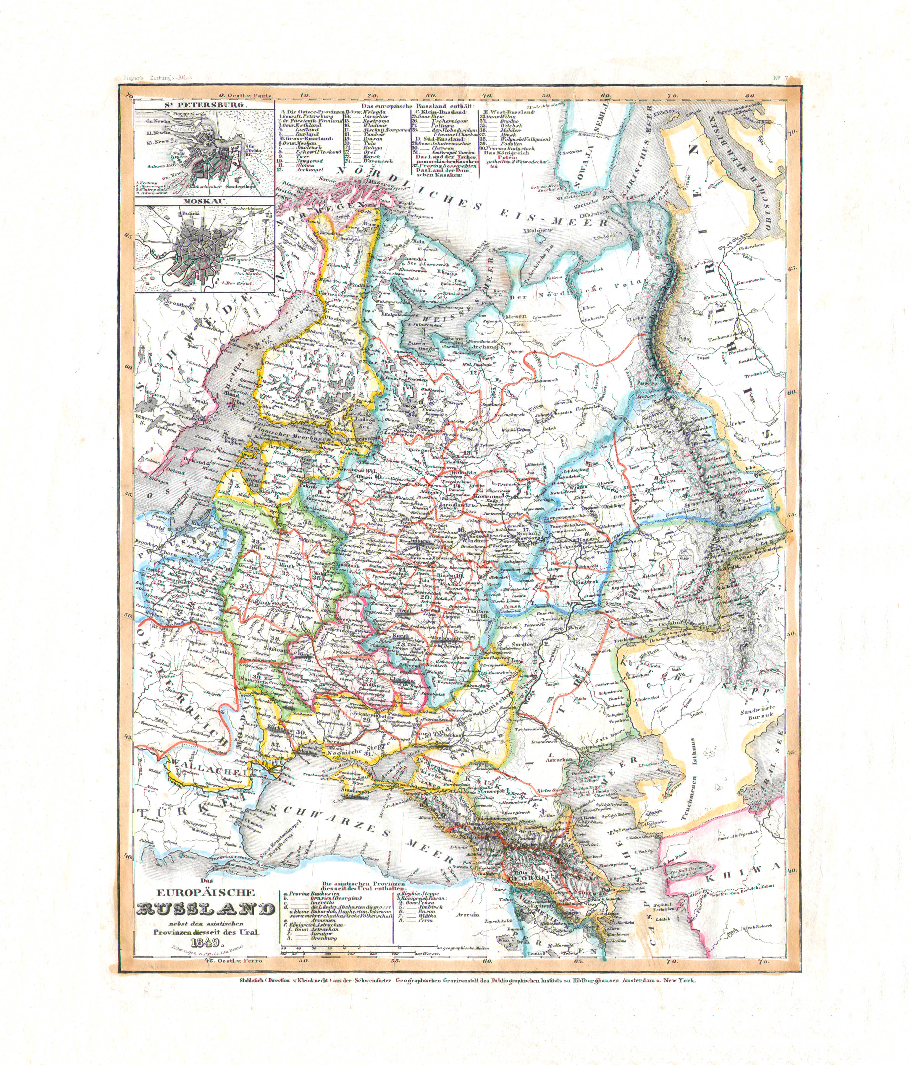
33. Das Europäische Russland nebst den asiatischen Provinzen diesseits des Ural (Nº 7, 1849)
Europees Rusland / Russia in Europe
 Meyer's Zeitungs-Atlas (1849-1852)
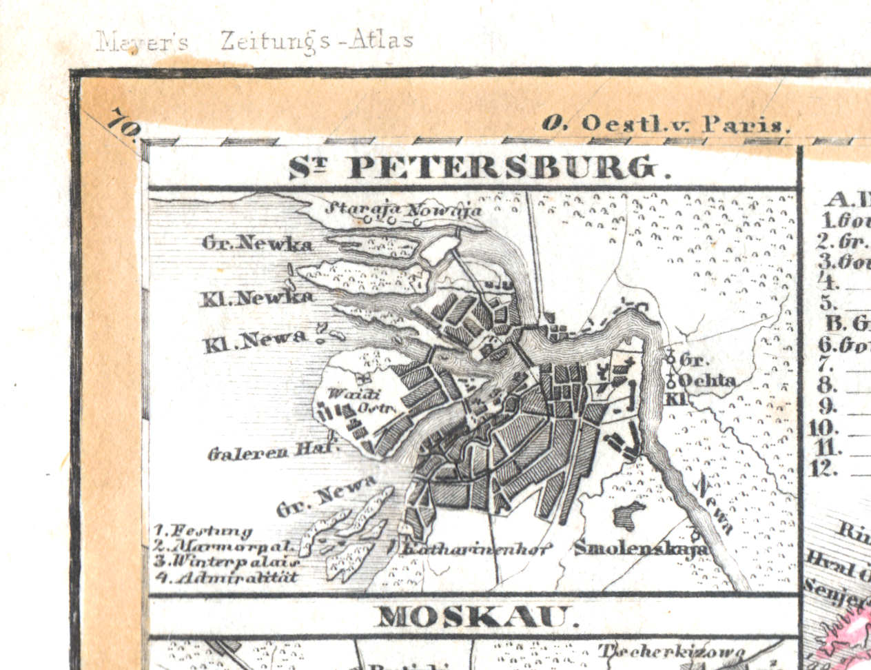
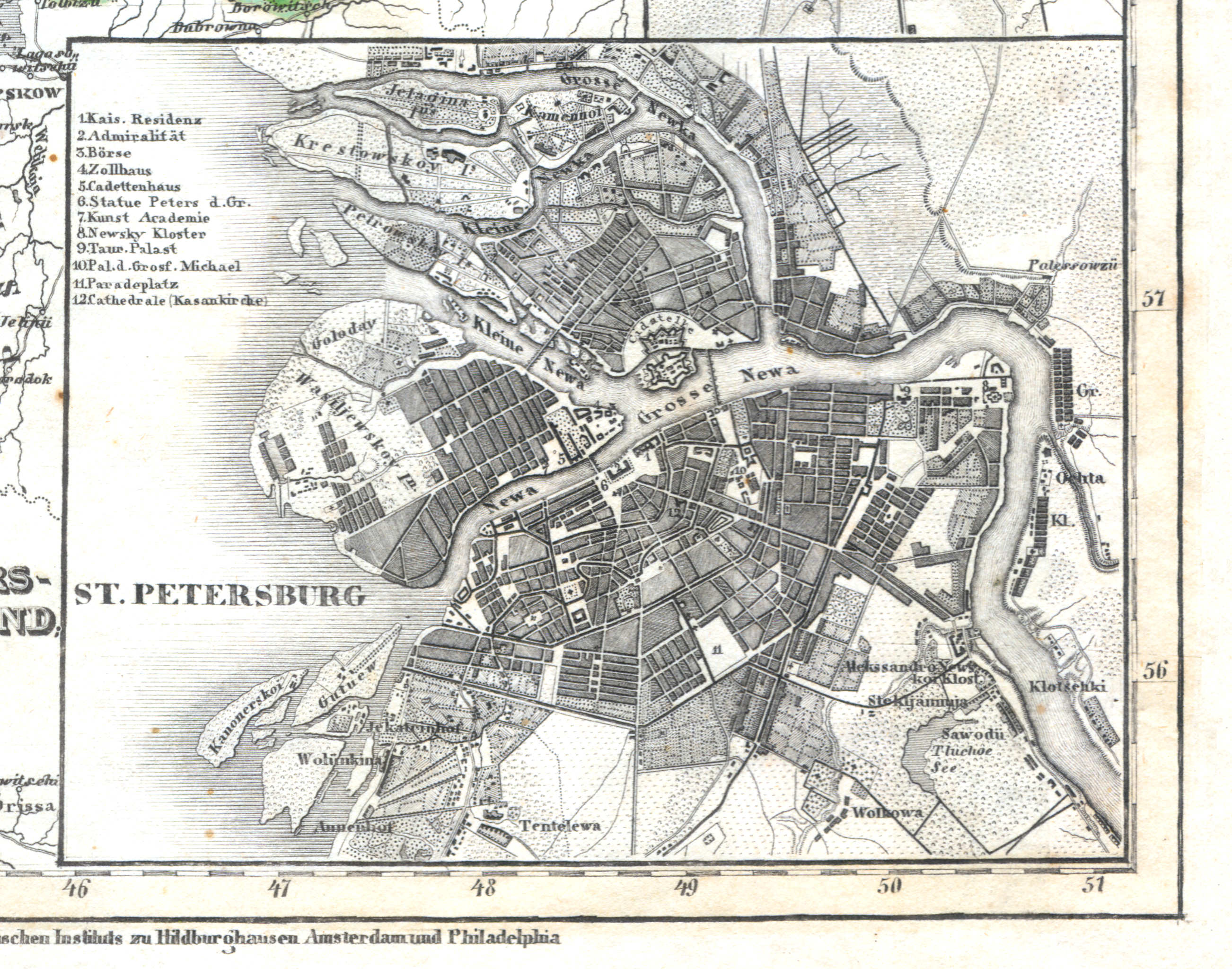
33a. St. Petersburg
Sint-Petersburg / Saint Petersburg / Санкт-Петербург, Sankt-Peterburg
 Meyer's Zeitungs-Atlas (1849-1852)
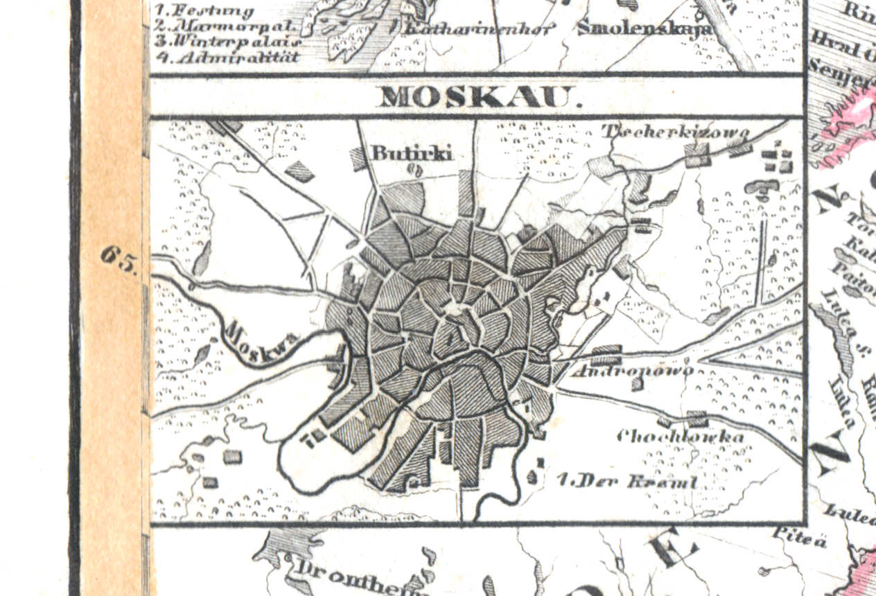
33b. Moskau
Moskou / Moscow / Москва, Moskva
 Meyer's Zeitungs-Atlas (1849-1852)
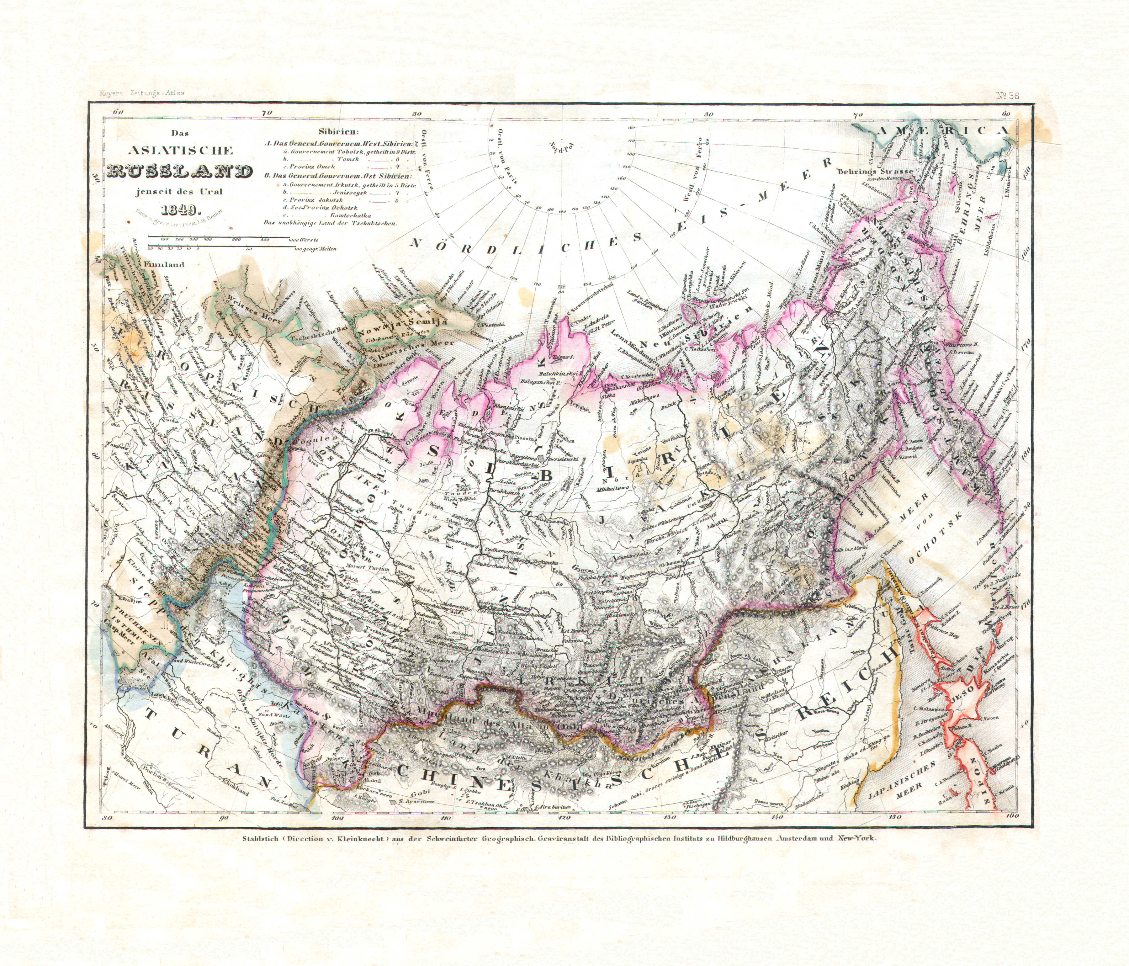
34. Das asiatische Russland jenseits des Ural (Nº 36, 1849)
Aziatisch Rusland / Russia in Asia
 Meyer's Zeitungs-Atlas (1849-1852)
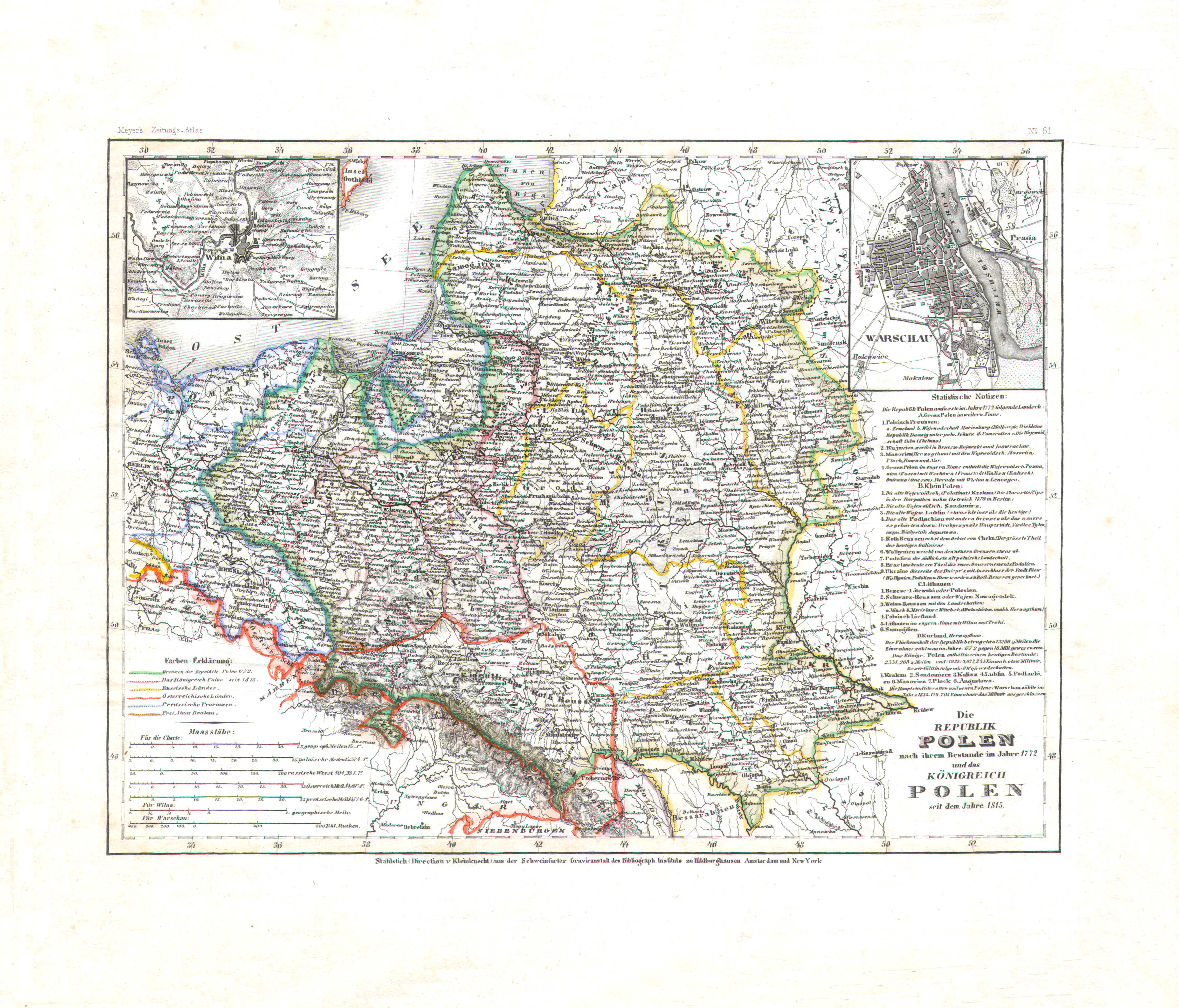
35. Die Republik Polen nach ihrem Bestande im Jahre 1772 und das Königreich Polen seit dem Jahre 1815 (Nº 61)
Republiek Polen 1772, Koninkrijk Polen vanaf 1815 / Republic of Poland 1772, Kingdom of Poland since 1815
 Meyer's Zeitungs-Atlas (1849-1852)
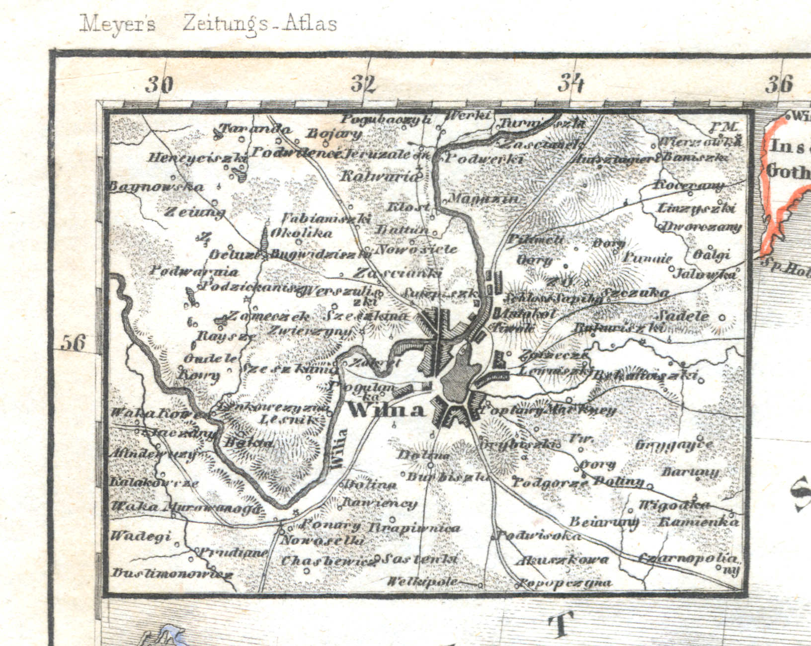
35a. Wilna
Vilnius
 Meyer's Zeitungs-Atlas (1849-1852)
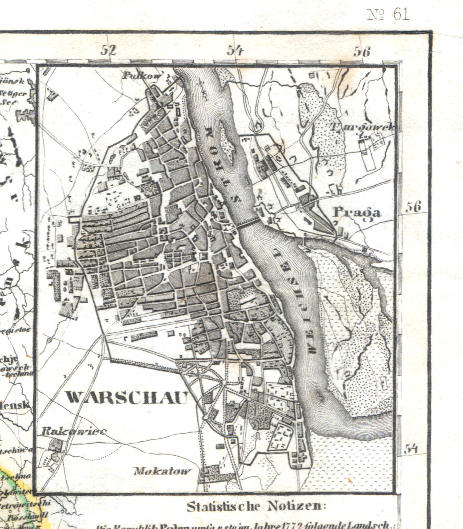
35b. Warschau
Warschau / Warsaw / Warszawa
 Meyer's Zeitungs-Atlas (1849-1852)
36. Russland: Gouv. St. Petersburg, Esthland, Liefland, Kurland (Nº 50, 1849)
Rusland: Sint-Petersburg, Estland, Lijfland, Koerland / Russia: Saint Petersburg, Estonia, Livonia, Courland
 Meyer's Zeitungs-Atlas (1849-1852)
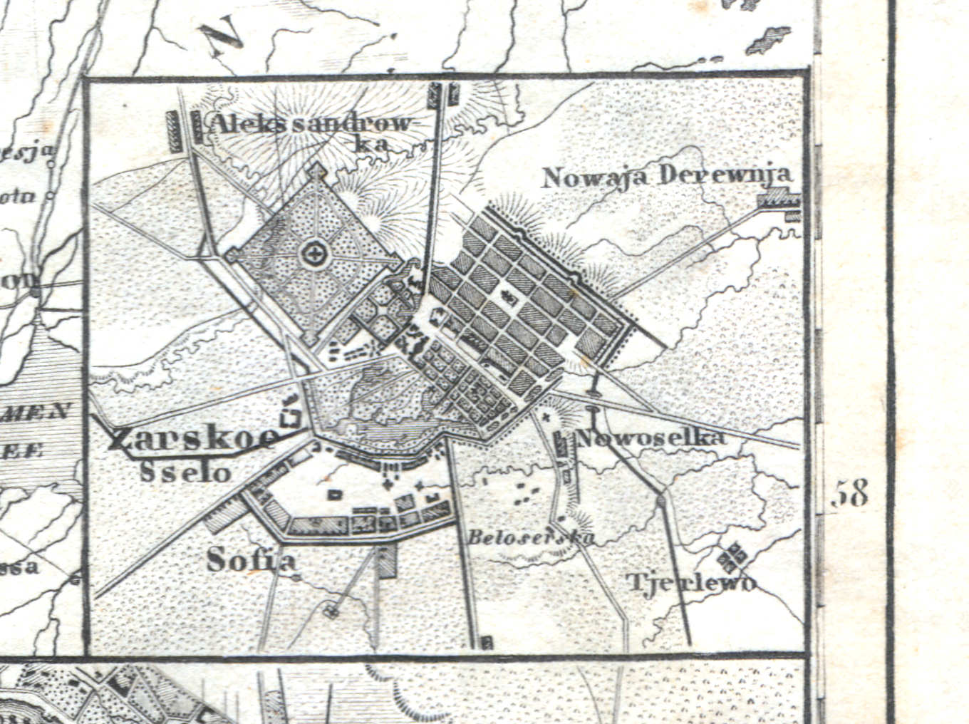
36a. Zarskoe Sselo
Tsarskoje Selo (Poesjkin) / Tsarskoye Selo (Pushkin) / Царское Село (Пушкин)
 Meyer's Zeitungs-Atlas (1849-1852)
36b. St. Petersburg
Sint-Petersburg / Saint Petersburg / Санкт-Петербург, Sankt-Peterburg
 Meyer's Zeitungs-Atlas (1849-1852)
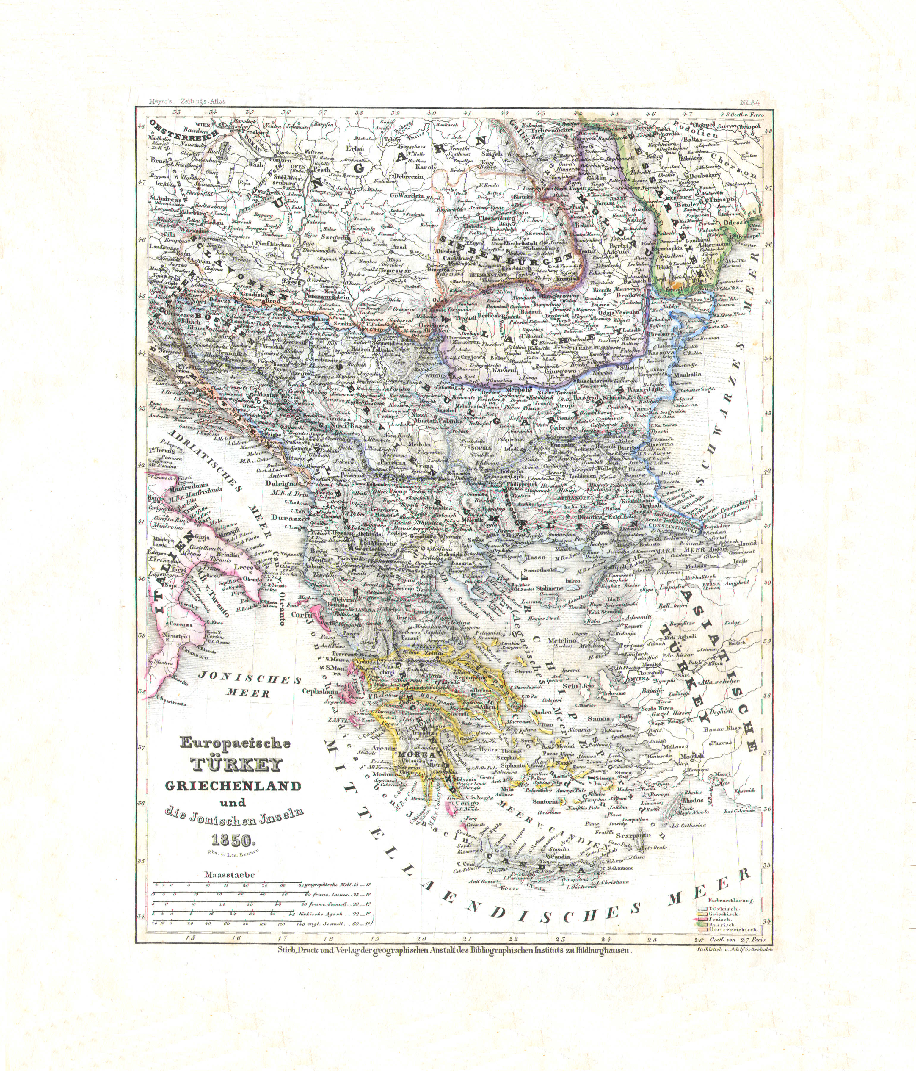
37. Europaeische Türkey, Griechenland und die Jonischen Inseln (Nº 84, 1850)
Europees Turkije, Griekenland en de Ionische Eilanden / Turkey in Europe, Greece and the Ionian Islands
 Meyer's Zeitungs-Atlas (1849-1852)
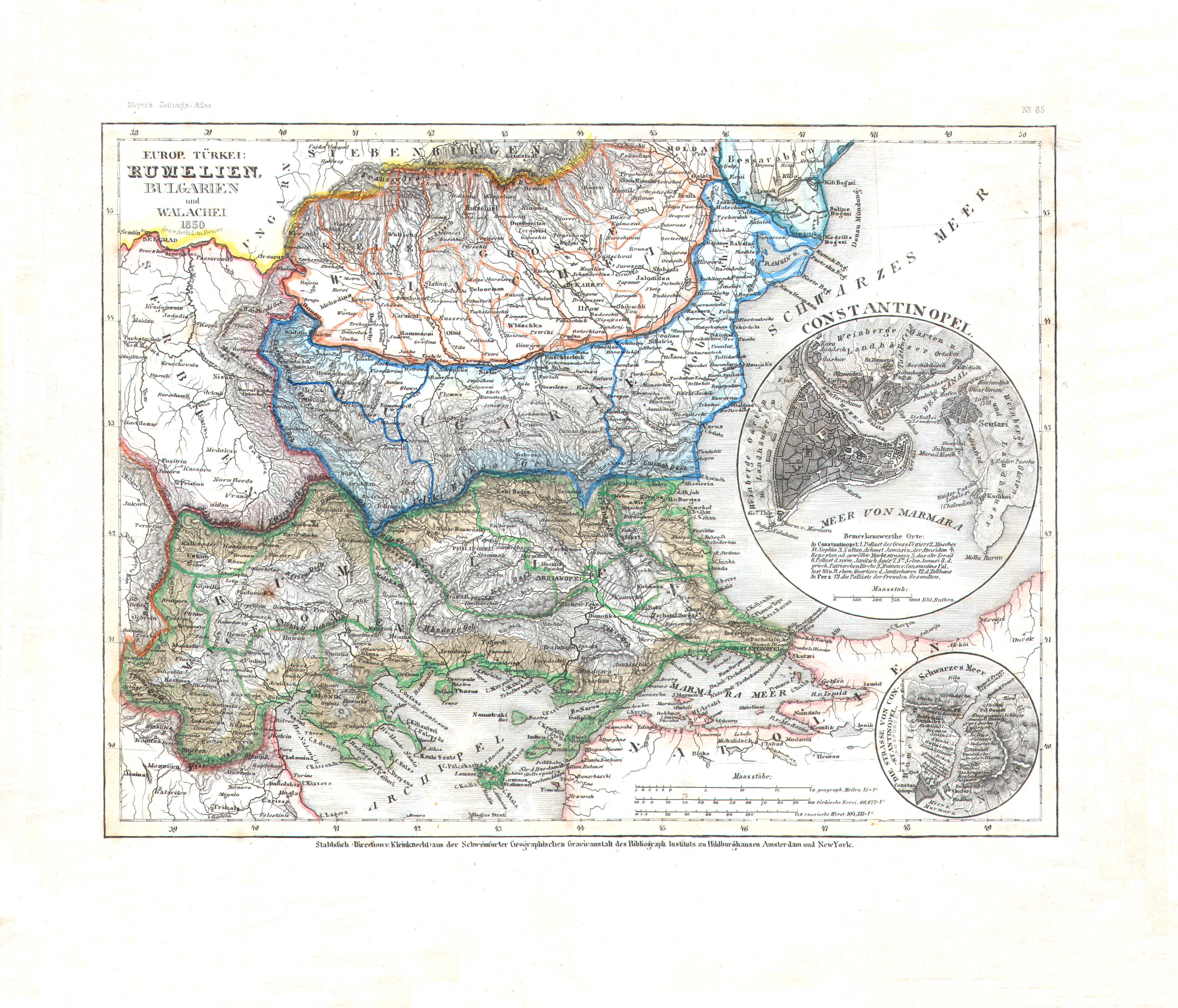
38. Europ. Türkei: Rumelien, Bulgarien und Walachei (Nº 85, 1850)
Europees Turkije: Roemelië, Bulgarije en Walachije / Turkey in Europe: Rumelia, Bulgaria and Wallachia
 Meyer's Zeitungs-Atlas (1849-1852)
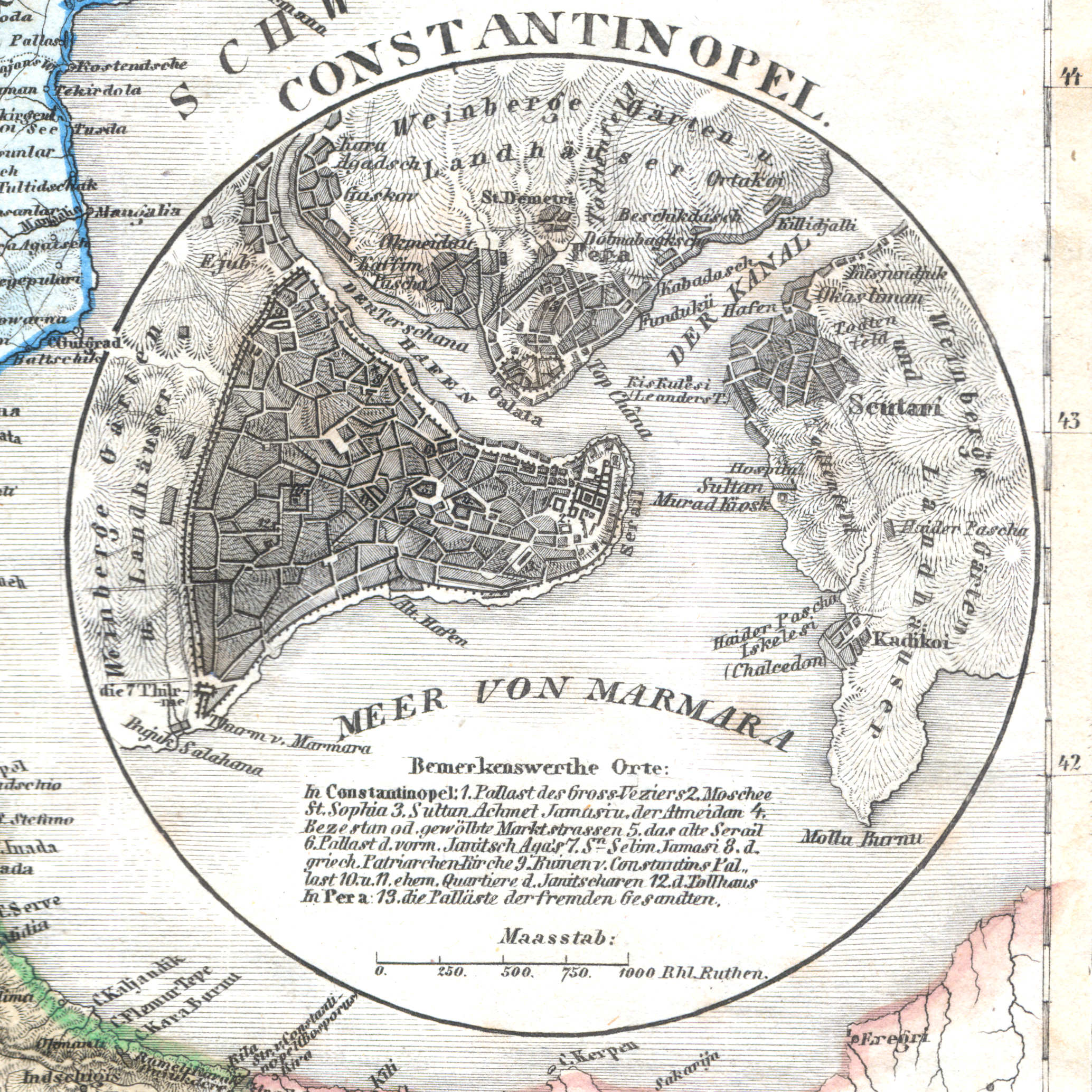
38a. Constantinopel
Constantinopel / Constantinople / İstanbul
 Meyer's Zeitungs-Atlas (1849-1852)
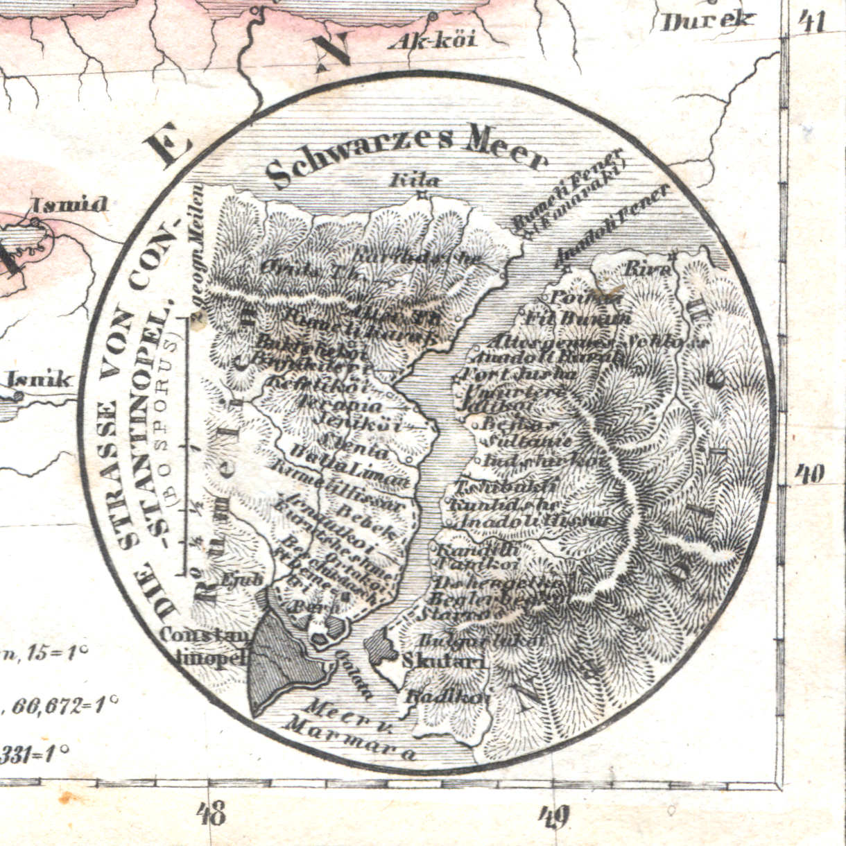
38b. Die Strasse von Constantinopel (Bosporus)
Bosporus / Bosphorus
 Meyer's Zeitungs-Atlas (1849-1852)
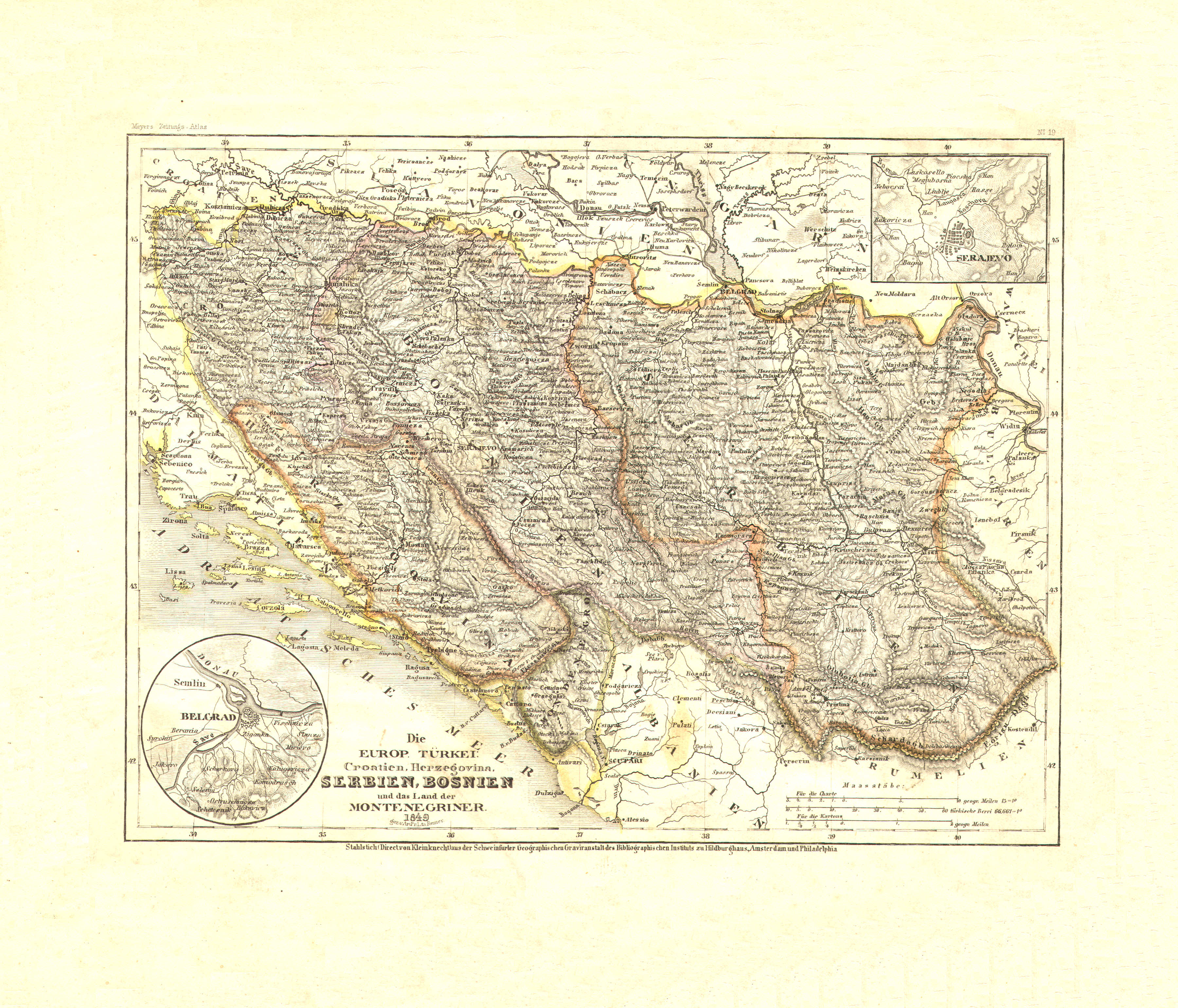
39. Die europ. Türkei. Croatien, Herzegovina, Serbien, Bosnien und das Land der Montenegriner (Nº 19, 1849)
Europees Turkije: Kroatië, Herzegovina, Servië, Bosnië en Montenegro / Turkey in Europe: Croatia, Herzegovina, Serbia, Bosnia and Montenegro
 Meyer's Zeitungs-Atlas (1849-1852)
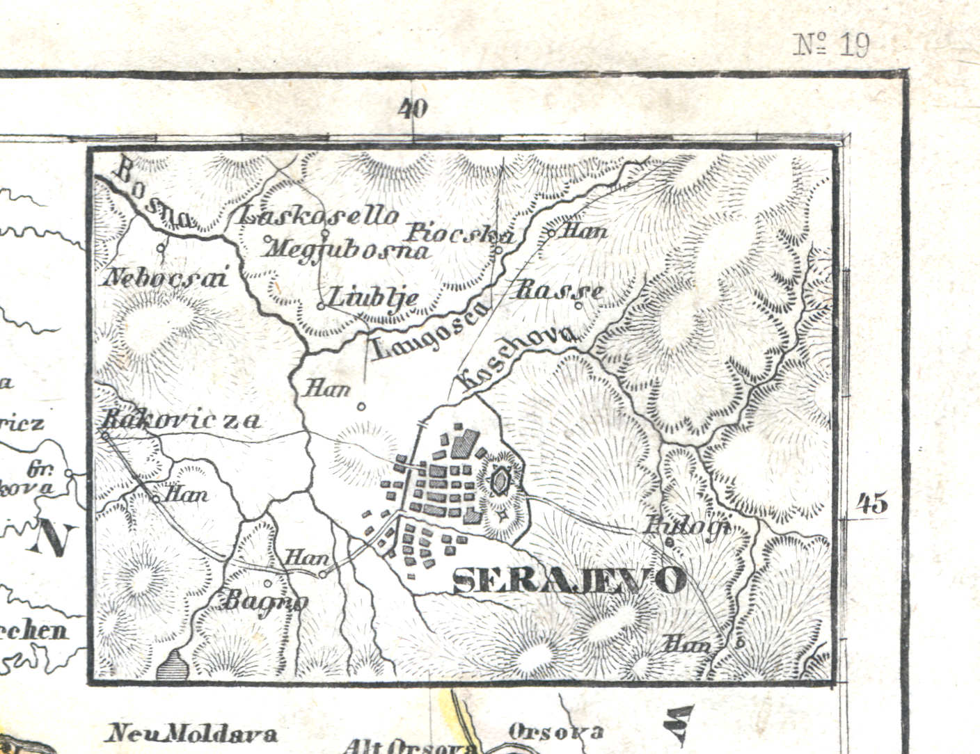
39a. Serajevo
Sarajevo
 Meyer's Zeitungs-Atlas (1849-1852)
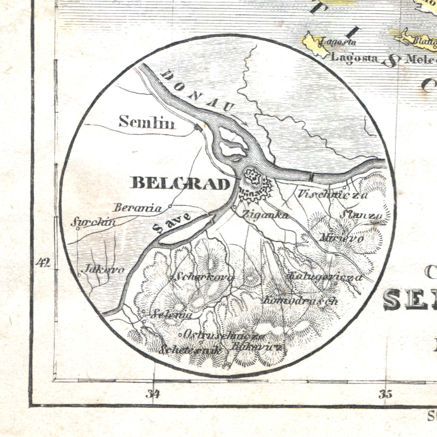
39b. Belgrad
Belgrado / Belgrade / Београд, Beograd
 Meyer's Zeitungs-Atlas (1849-1852)
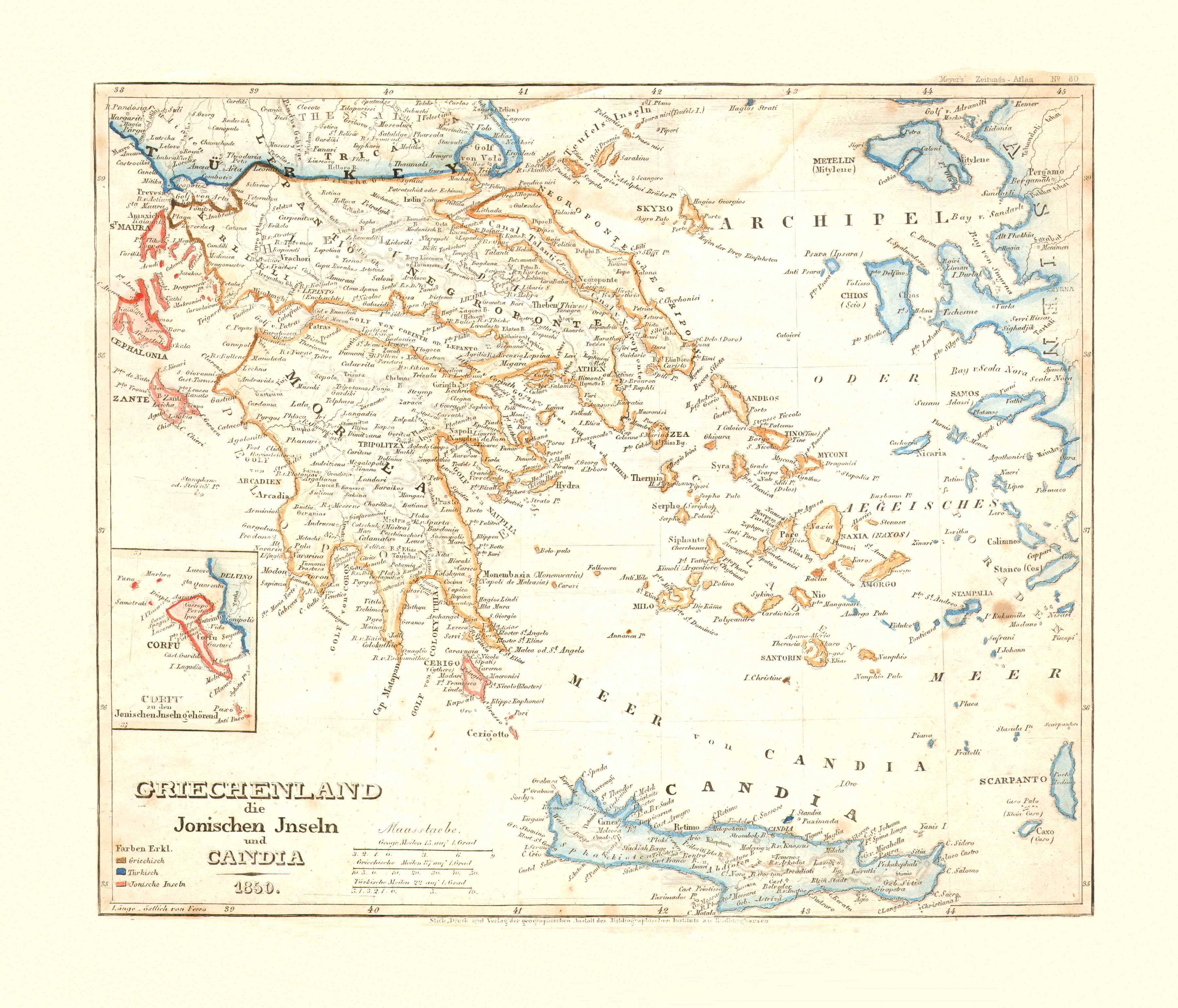
40. Griechenland, die Jonischen Inseln und Candia (Nº 80, 1850)
Griekenland, de Ionische Eilanden en Candia (Kreta) / Greece, the Ionian Islands and Candia (Crete)
 Meyer's Zeitungs-Atlas (1849-1852)
41. Oesterreich (Nº 3, 1849)
Oostenrijk / Austria
 Meyer's Zeitungs-Atlas (1849-1852)
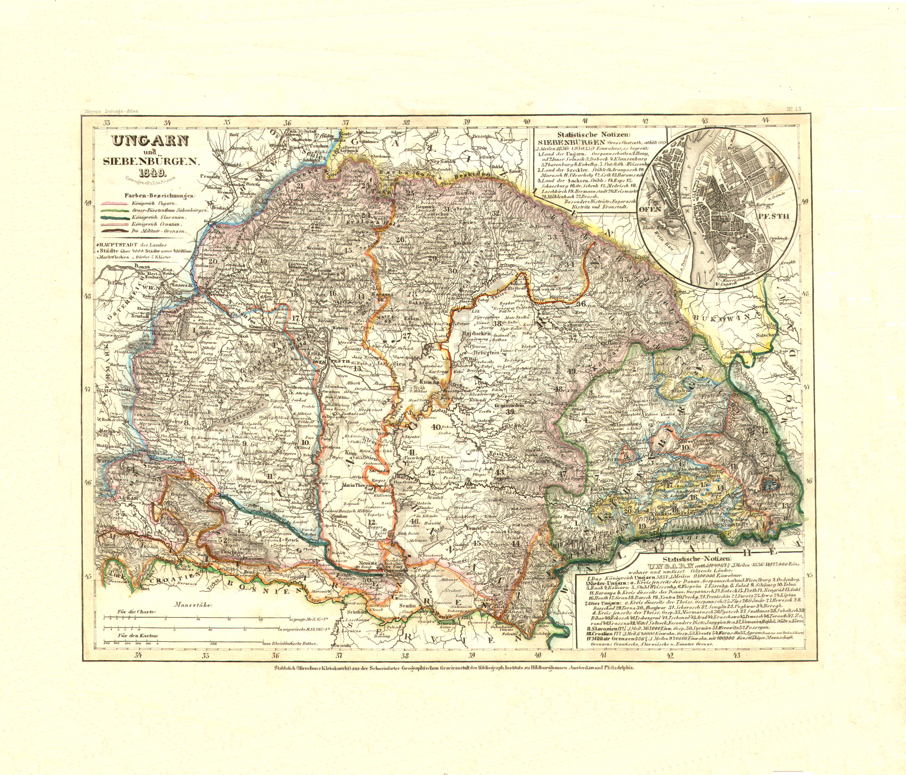
42. Ungarn und Siebenbürgen (Nº 13, 1849)
Hongarije en Zevenburgen / Hungary and Transylvania
 Meyer's Zeitungs-Atlas (1849-1852)
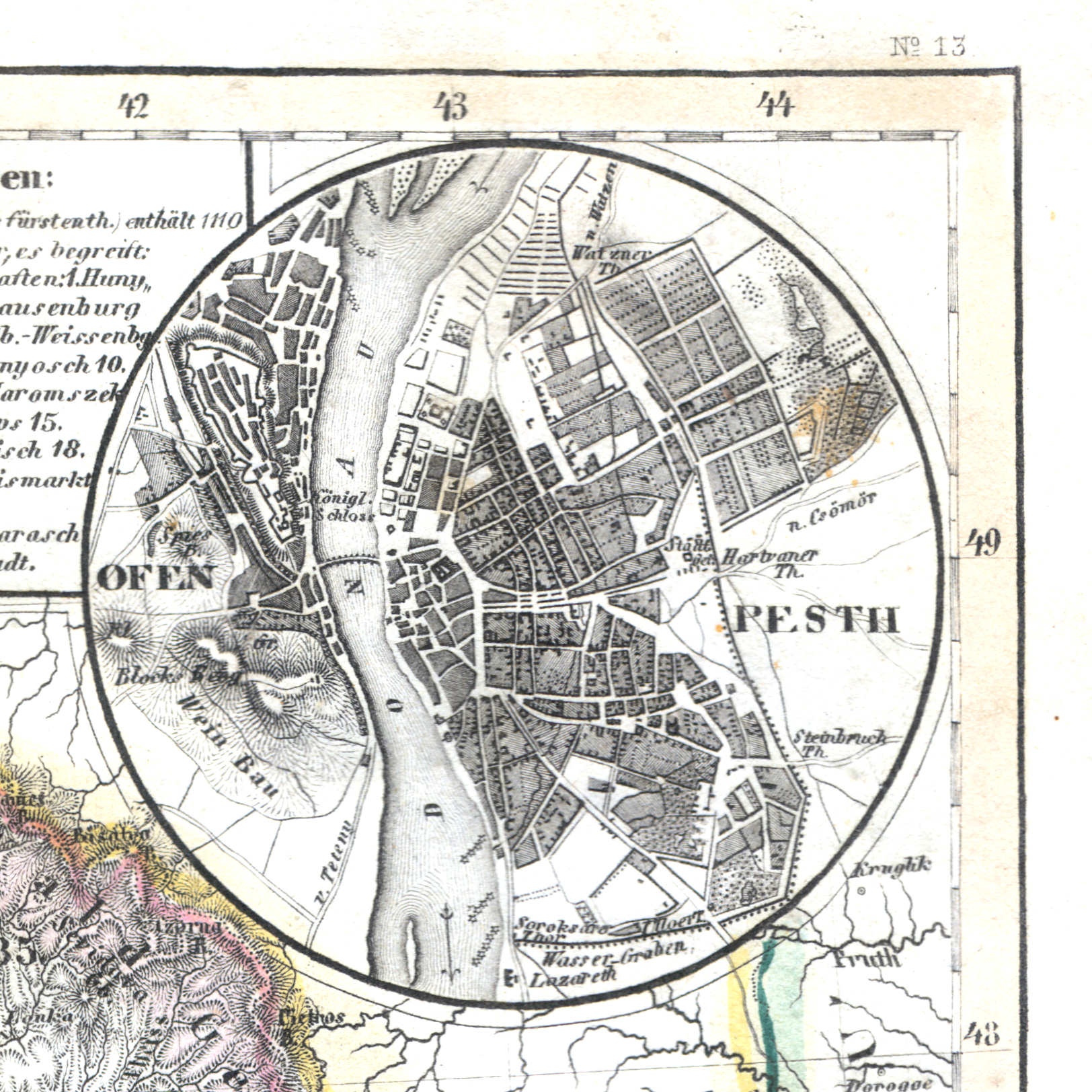
42a. Ofen, Pesth
Boeda, Pest / Buda, Pest
 Meyer's Zeitungs-Atlas (1849-1852)
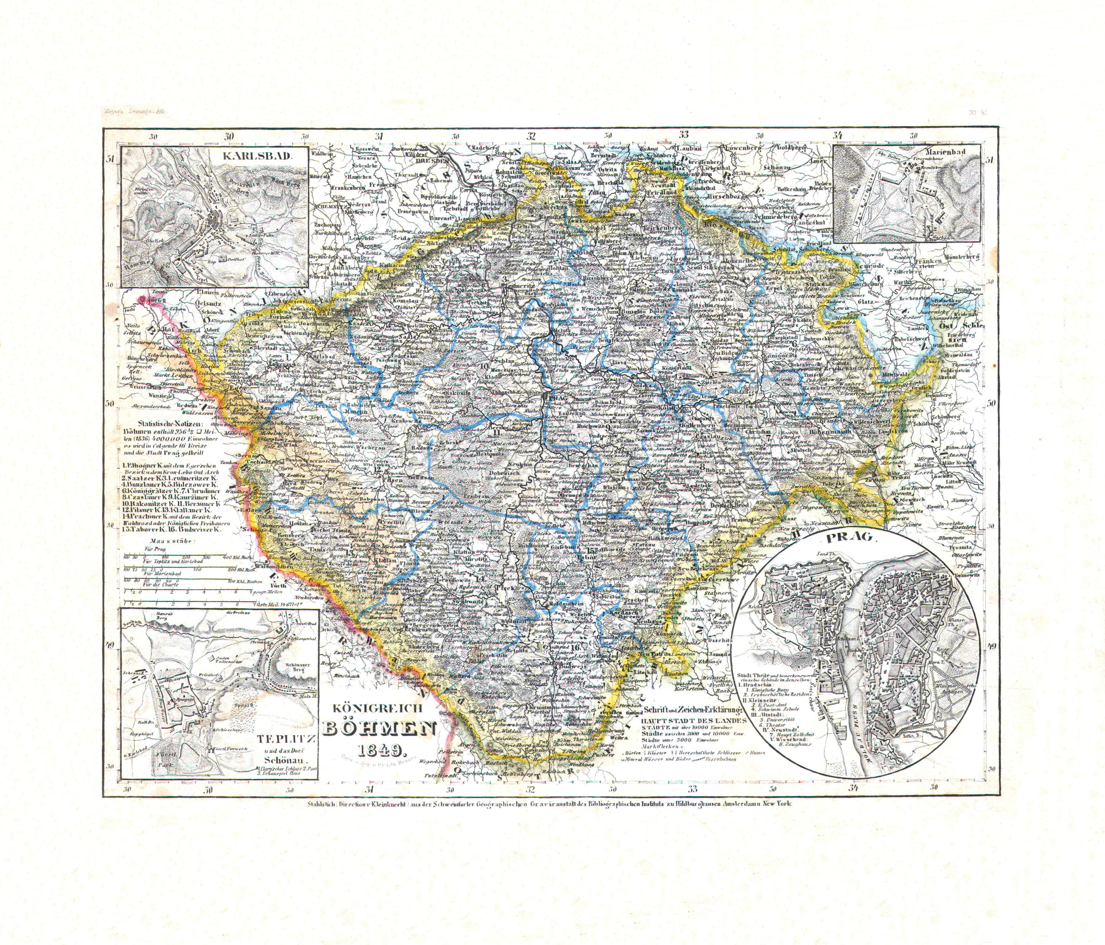
43. Königreich Böhmen (Nº 51, 1849)
Koninkrijk Bohemen / Kingdom of Bohemia
 Meyer's Zeitungs-Atlas (1849-1852)
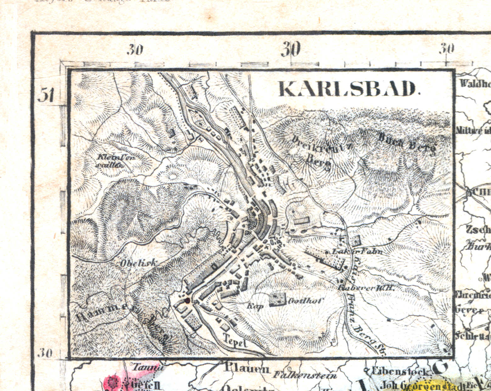
43a. Karlsbad
Karlsbad / Carlsbad / Karlovy Vary
 Meyer's Zeitungs-Atlas (1849-1852)
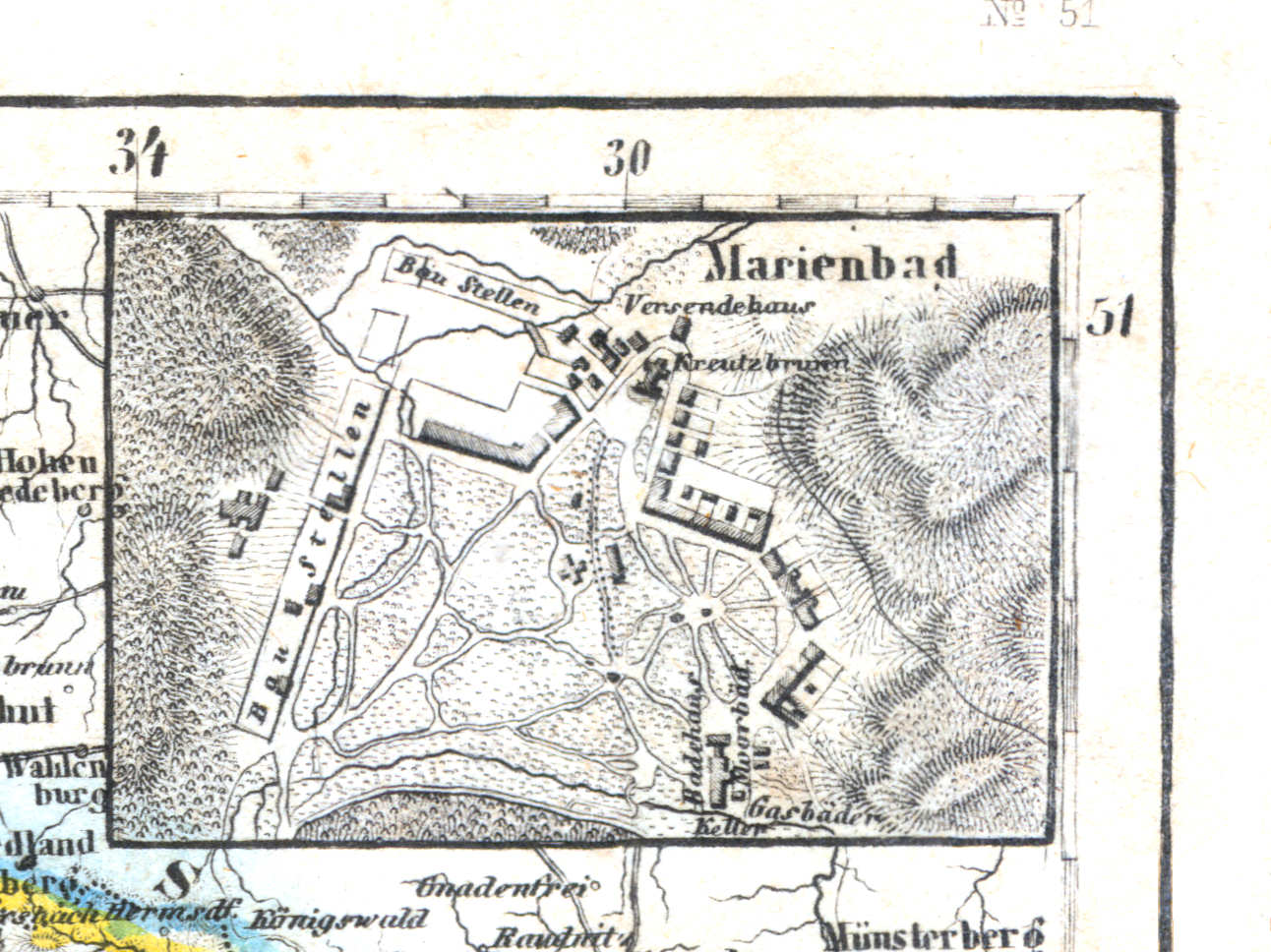
43b. Marienbad
Mariënbad / Marienbad / Mariánské Lázně
 Meyer's Zeitungs-Atlas (1849-1852)
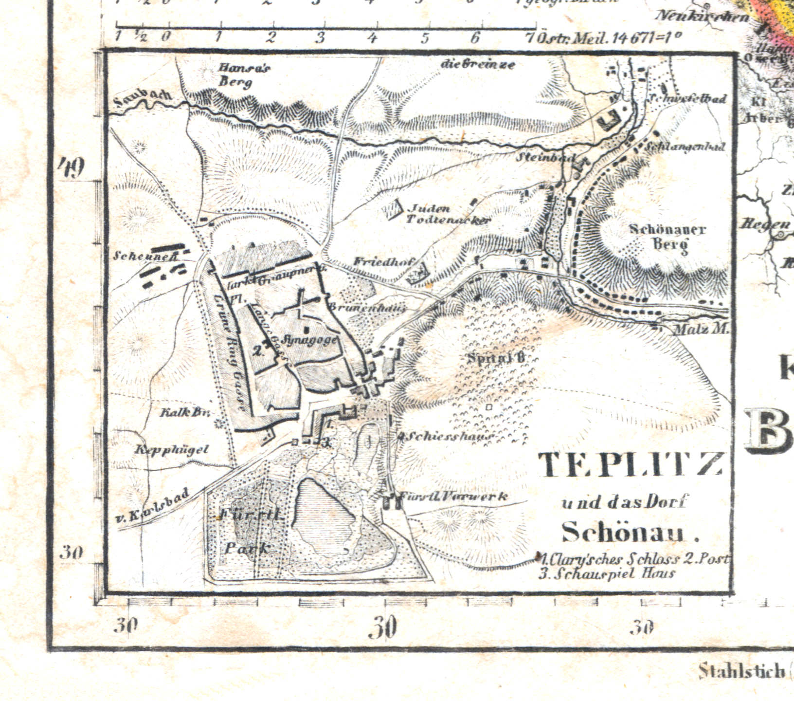
43c. Teplitz und das Dorf Schönau
Teplitz, Schönau / Teplice, Šanov
 Meyer's Zeitungs-Atlas (1849-1852)
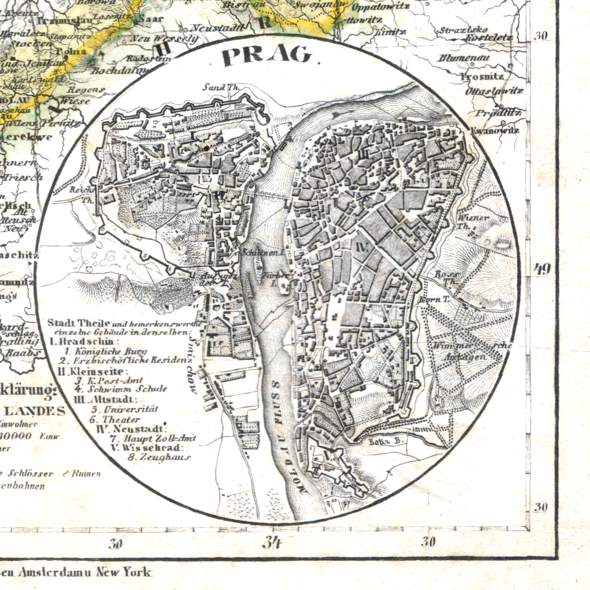
43d. Prag
Praag / Prague / Praha
 Meyer's Zeitungs-Atlas (1849-1852)
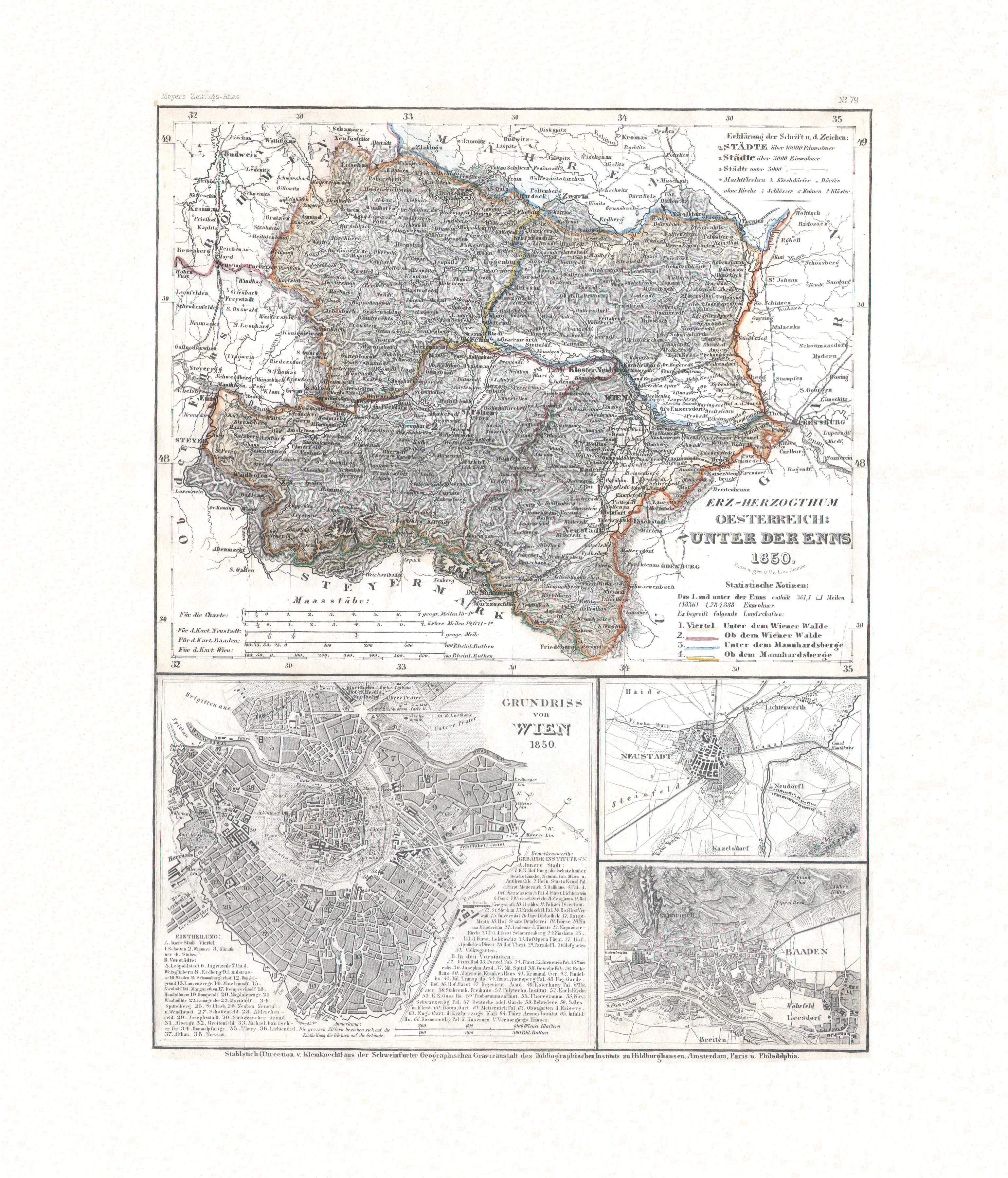
44. Erz-Herzogthum Oesterreich: unter der Enns (Nº 79, 1850)
Aartshertogdom Oostenrijk beneden de Enns / Archduchy of Austria below the Enns
 Meyer's Zeitungs-Atlas (1849-1852)
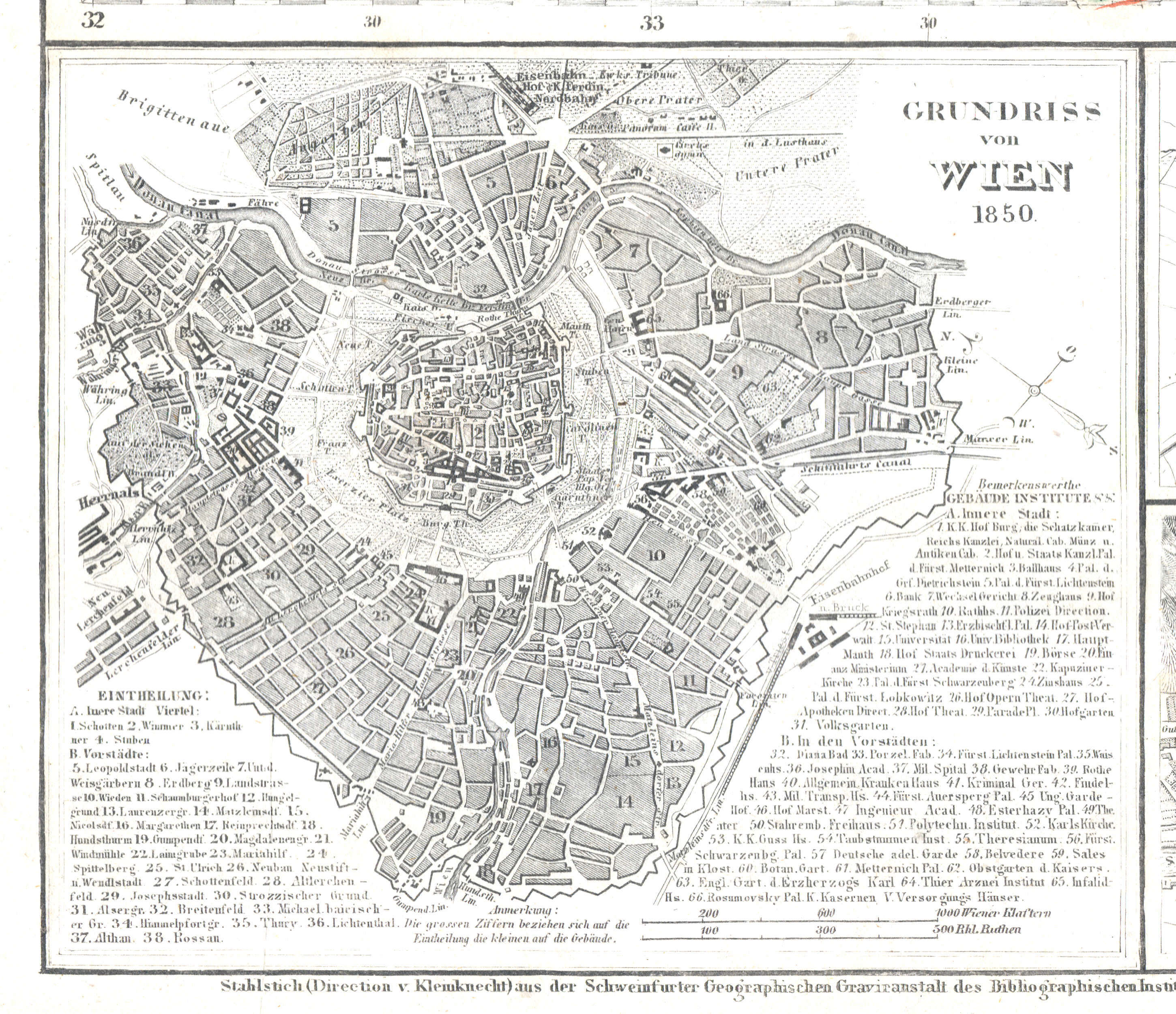
44a. Grundriss von Wien
Plattegrond van Wenen / Plan of Vienna
 Meyer's Zeitungs-Atlas (1849-1852)
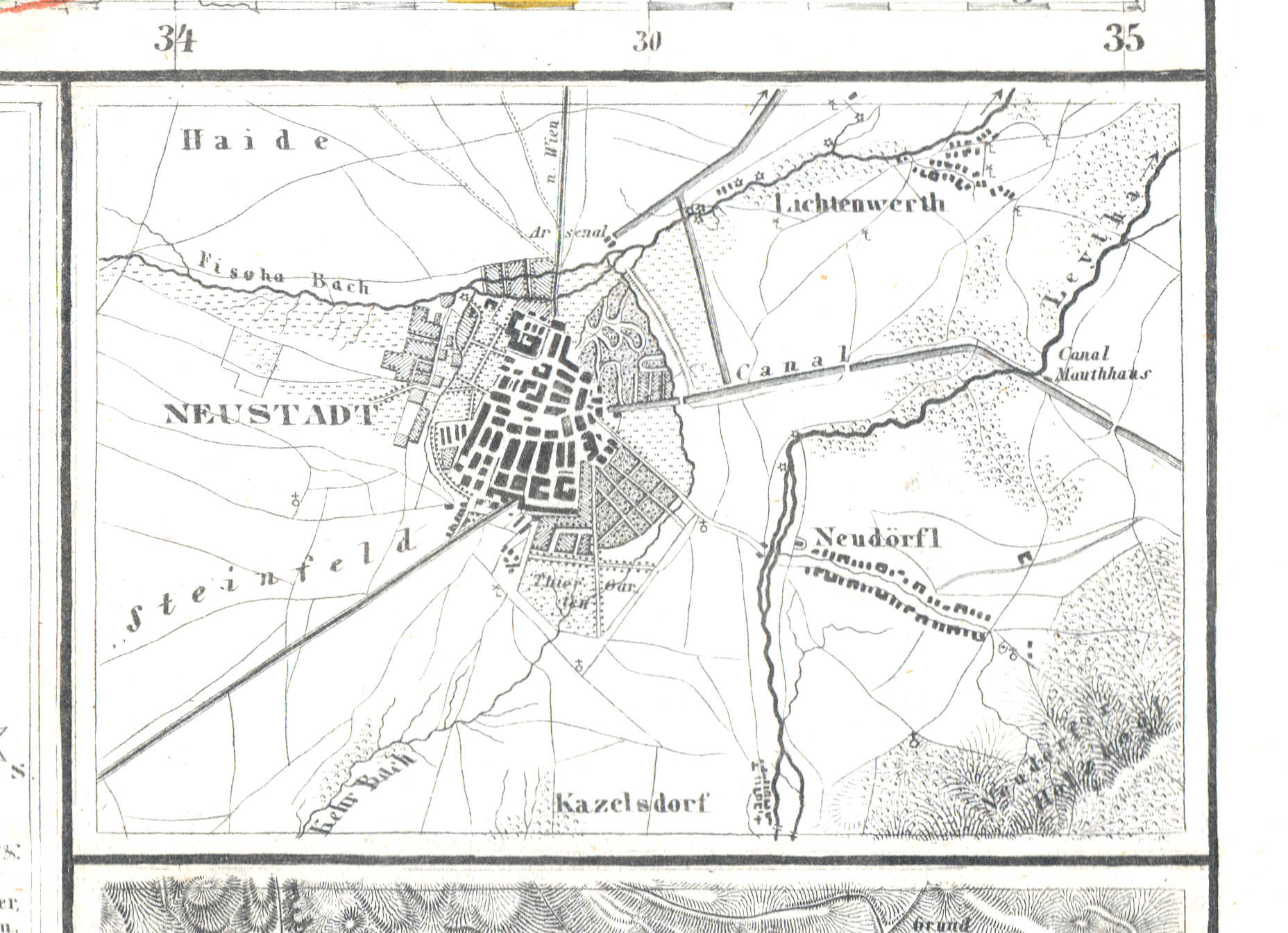
44b. Neustadt
Neustadt / Wiener Neustadt
 Meyer's Zeitungs-Atlas (1849-1852)
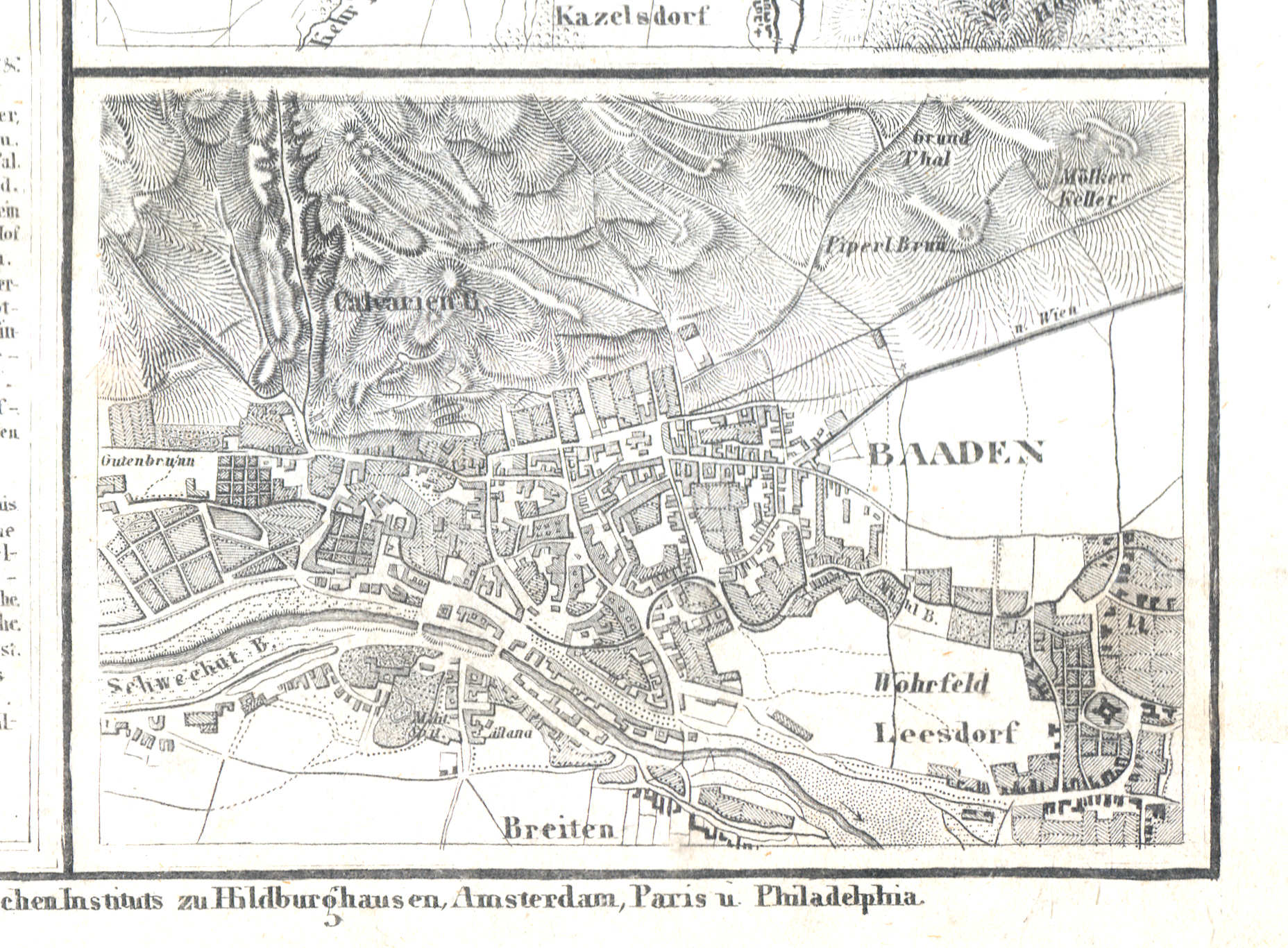
44c. Baaden
Baden / Baden bei Wien
 Meyer's Zeitungs-Atlas (1849-1852)
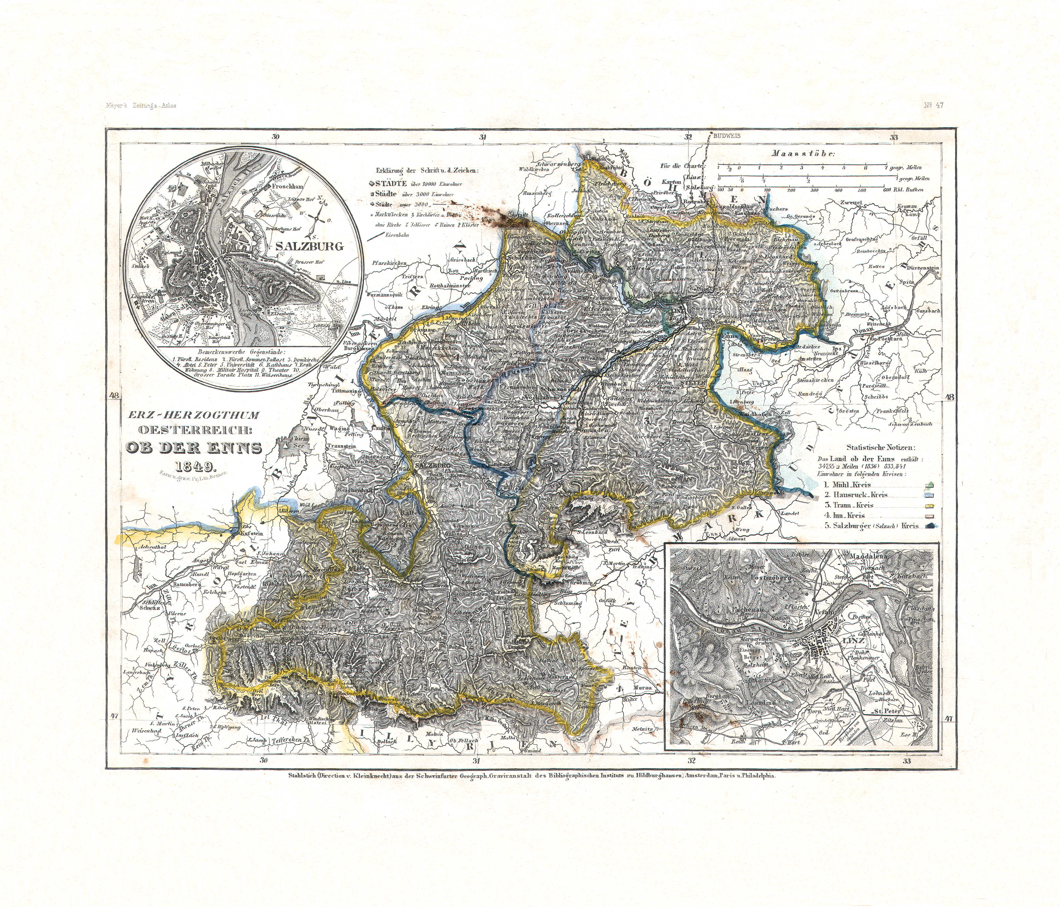
45. Erz-Herzogthum Oesterreich: ob der Enns (Nº 47, 1849)
Aartshertogdom Oostenrijk boven de Enns / Archduchy of Austria above the Enns
 Meyer's Zeitungs-Atlas (1849-1852)
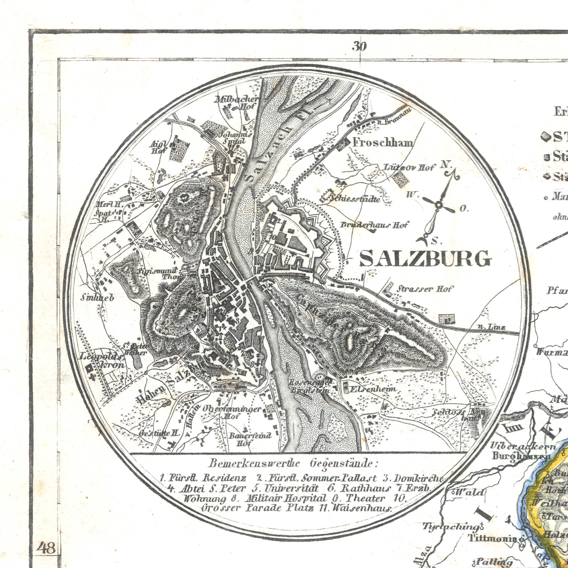
45a. Salzburg
Salzburg
 Meyer's Zeitungs-Atlas (1849-1852)
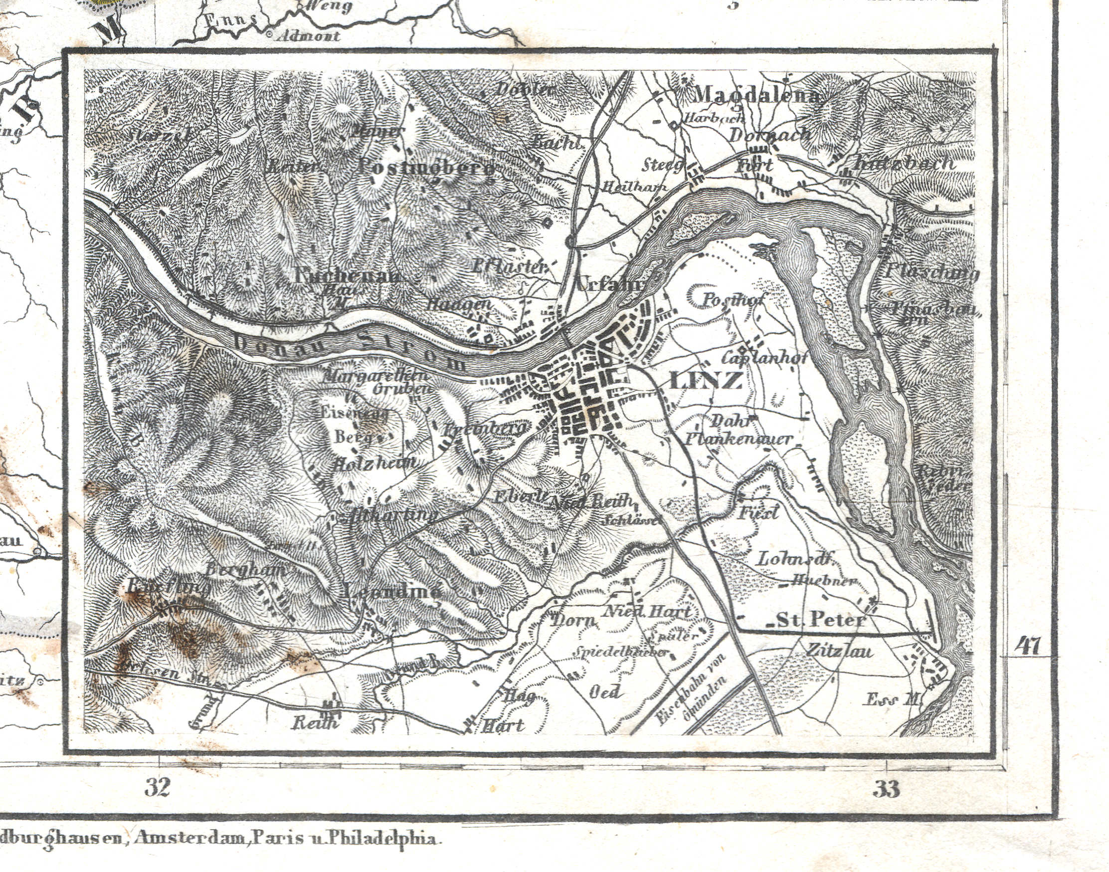
45b. Linz
Linz
 Meyer's Zeitungs-Atlas (1849-1852)
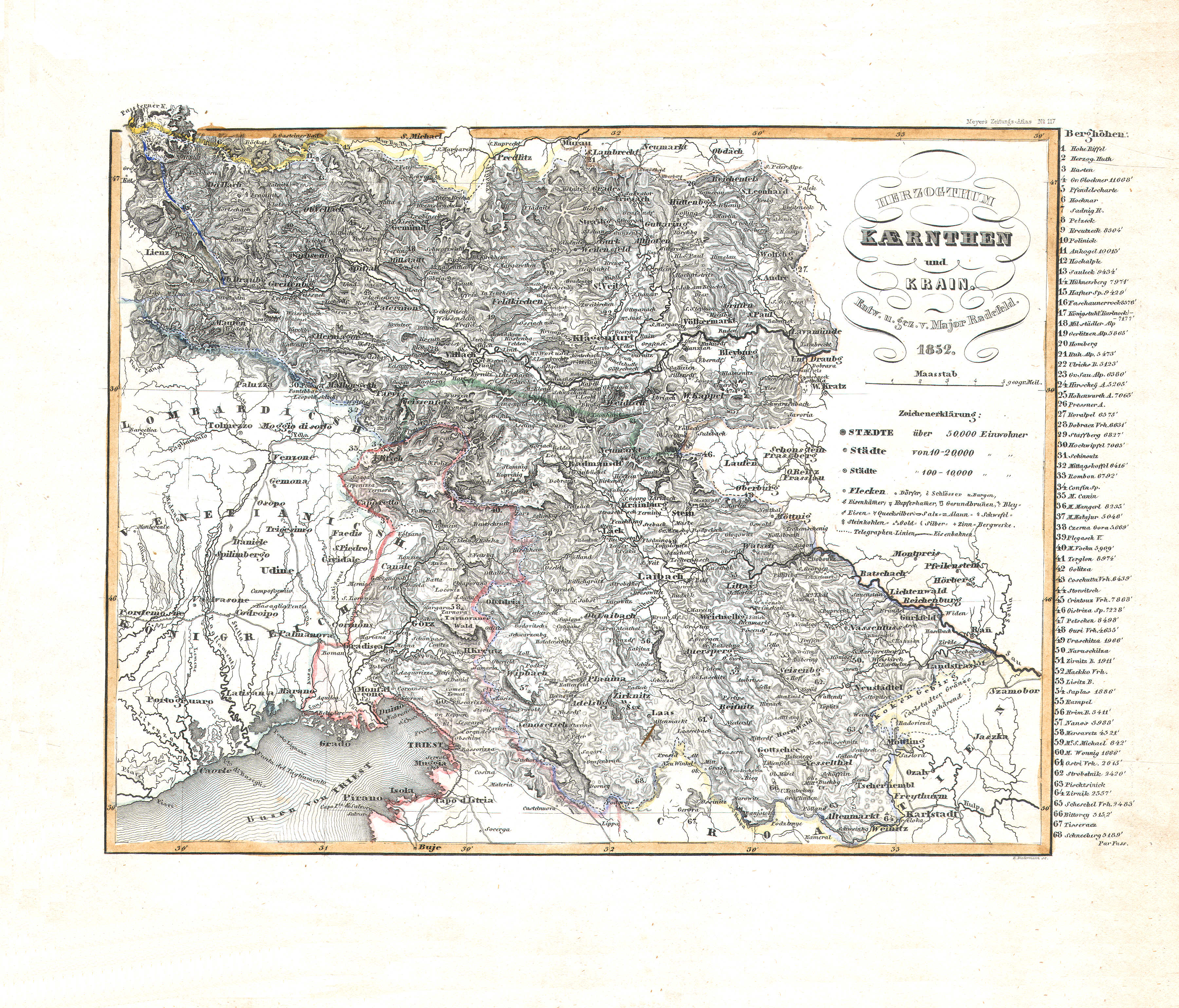
46. Herzogthum Kaernthen und Krain (Nº 117, 1852)
Hertogdom Karintië en Krain / Duchy of Carinthia and Carniola
 Meyer's Zeitungs-Atlas (1849-1852)
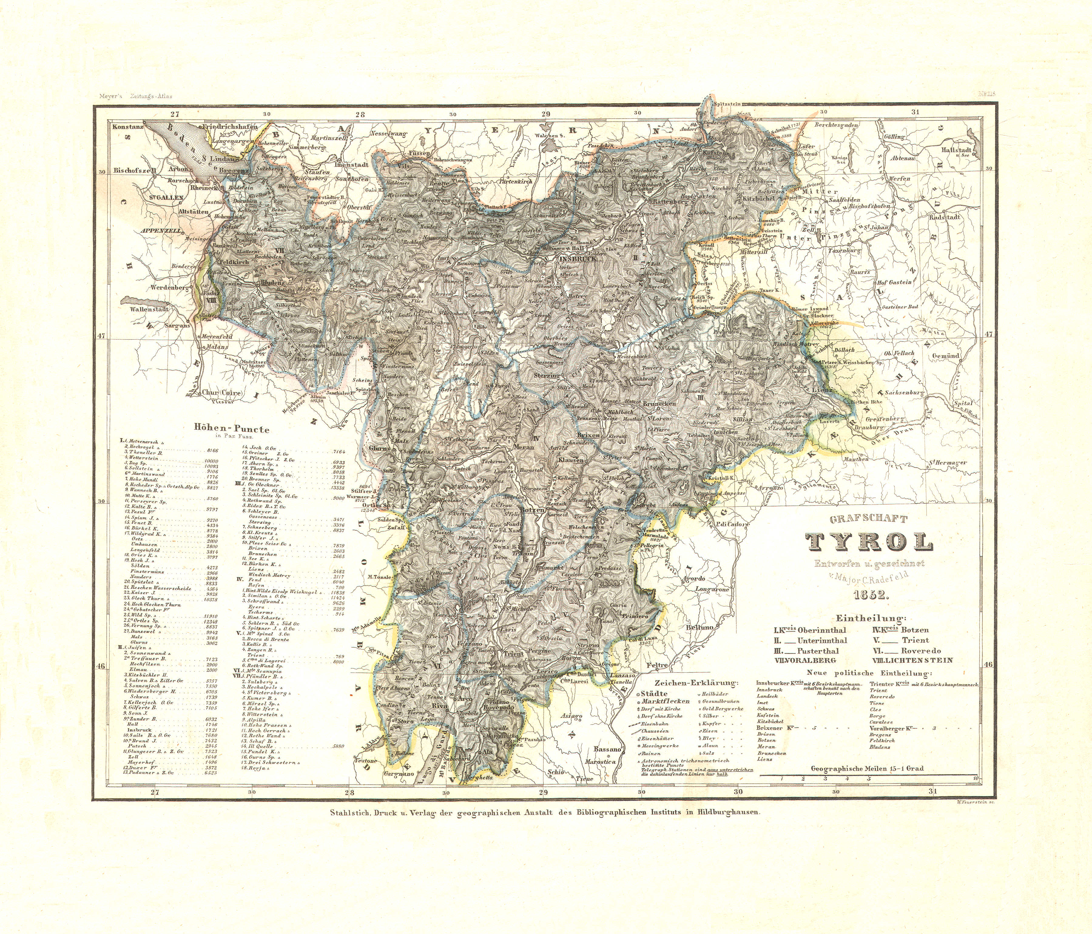
47. Grafschaft Tyrol (Nº 118, 1852)
Graafschap Tirol / County of Tyrol
 Meyer's Zeitungs-Atlas (1849-1852)
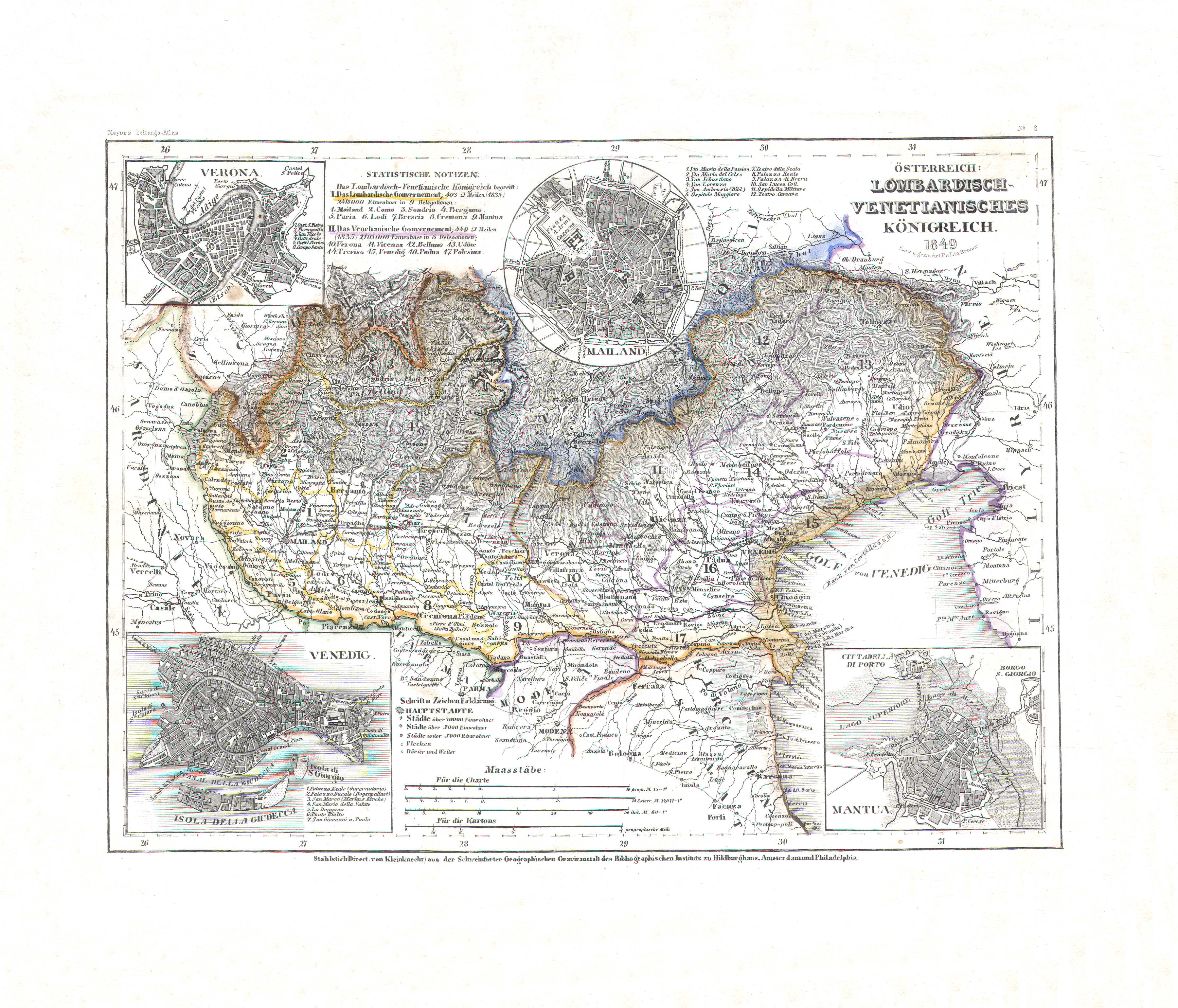
48. Österreich: Lombardisch-Venetianisches Königreich (Nº 8, 1849)
Oostenrijk: Lombardo-Venetiaans Koninkrijk / Austria: Kingdom of Lombardy–Venetia
 Meyer's Zeitungs-Atlas (1849-1852)
48a. Verona
Verona
 Meyer's Zeitungs-Atlas (1849-1852)
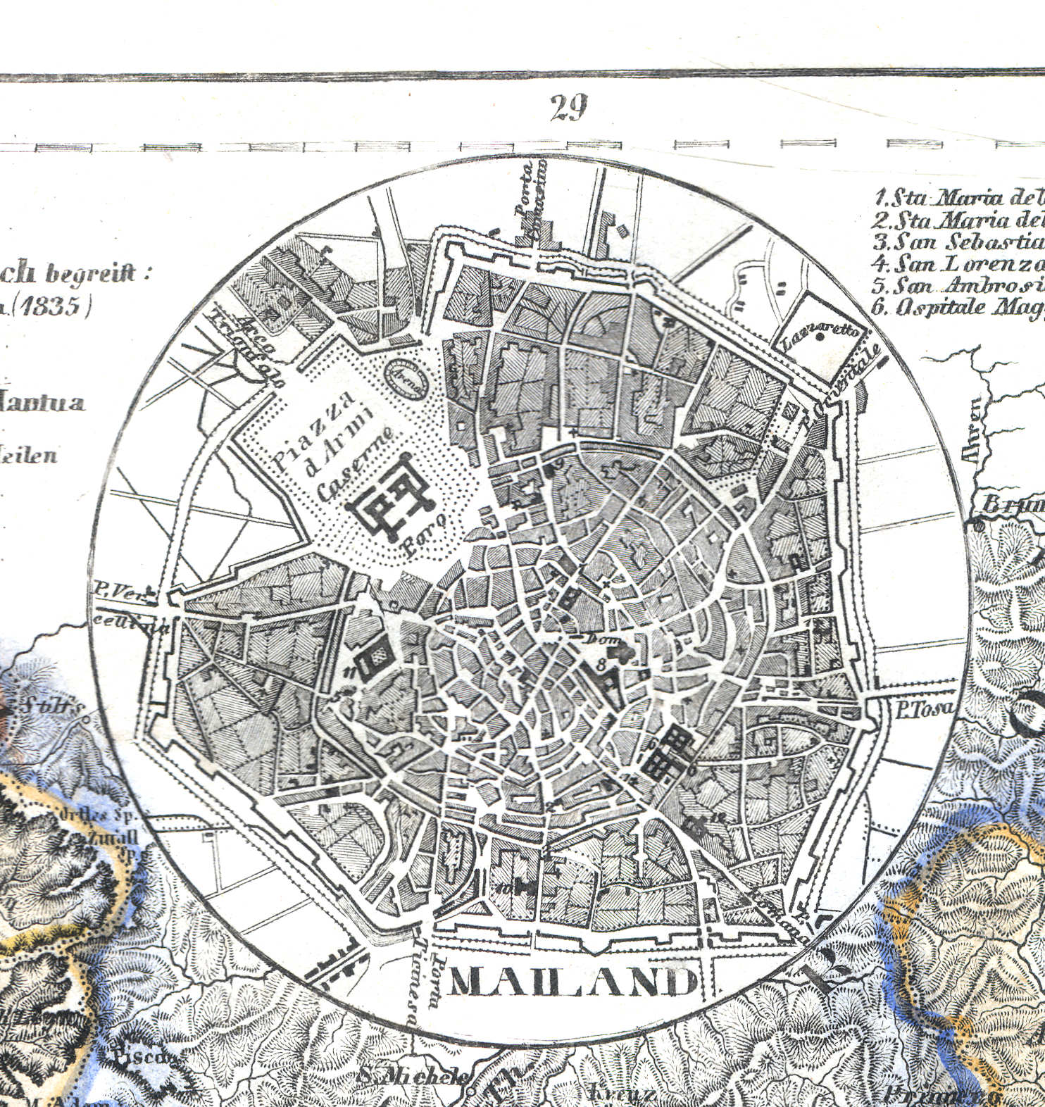
48b. Mailand
Milaan / Milan / Milano
 Meyer's Zeitungs-Atlas (1849-1852)
48c. Venedig
Venetië / Venice / Venezia
 Meyer's Zeitungs-Atlas (1849-1852)
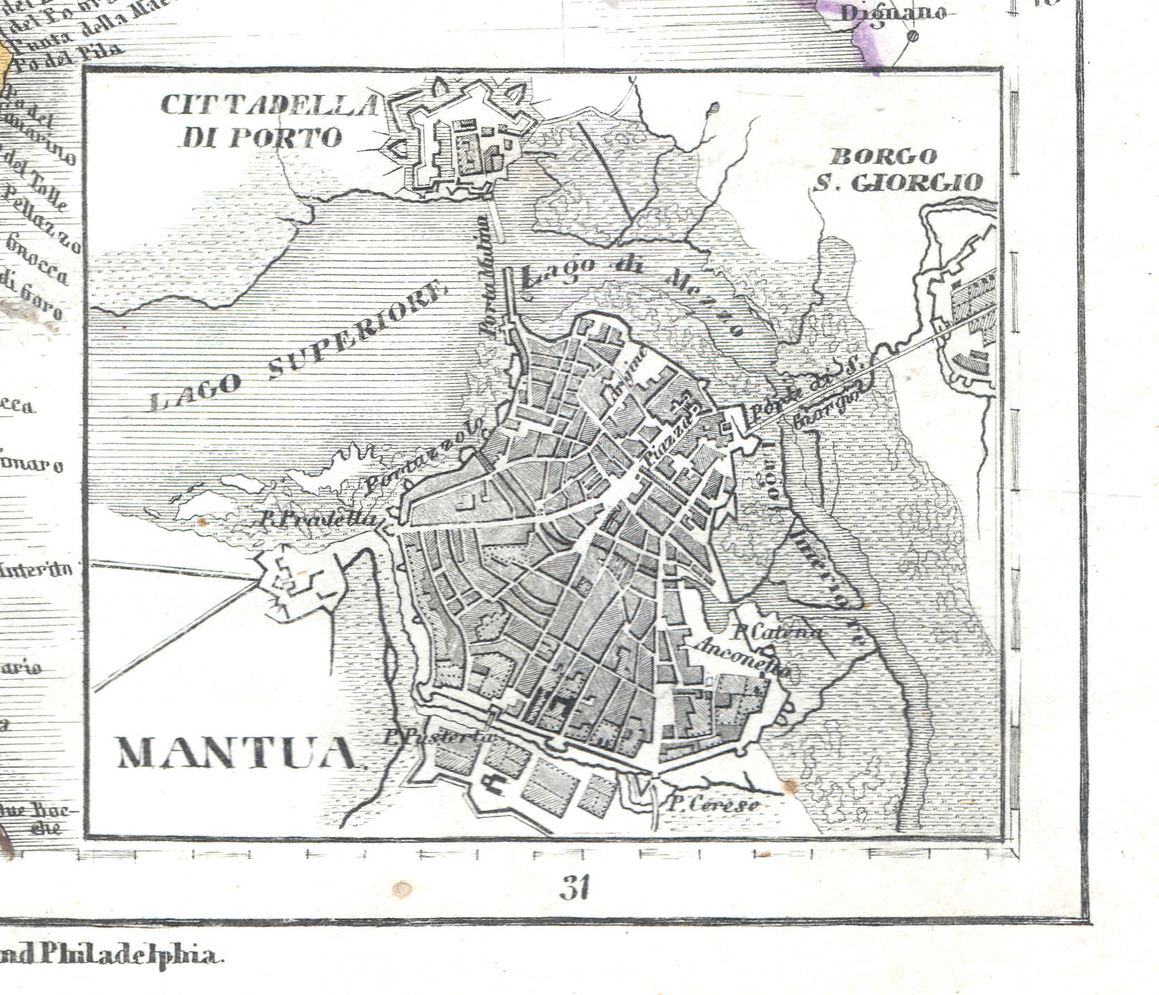
48d. Mantua
Mantua / Mantova
 Meyer's Zeitungs-Atlas (1849-1852)
49. Die Staaten von Ober Italien nämlich: das Lomb. Venet. Königreich, Parma, Modena, Toscane, Lucca, St. Marino u. d. Kirchenstaat (Nº 86, 1850)
De staten in Noord-Italië / The states in North Italy
 Meyer's Zeitungs-Atlas (1849-1852)
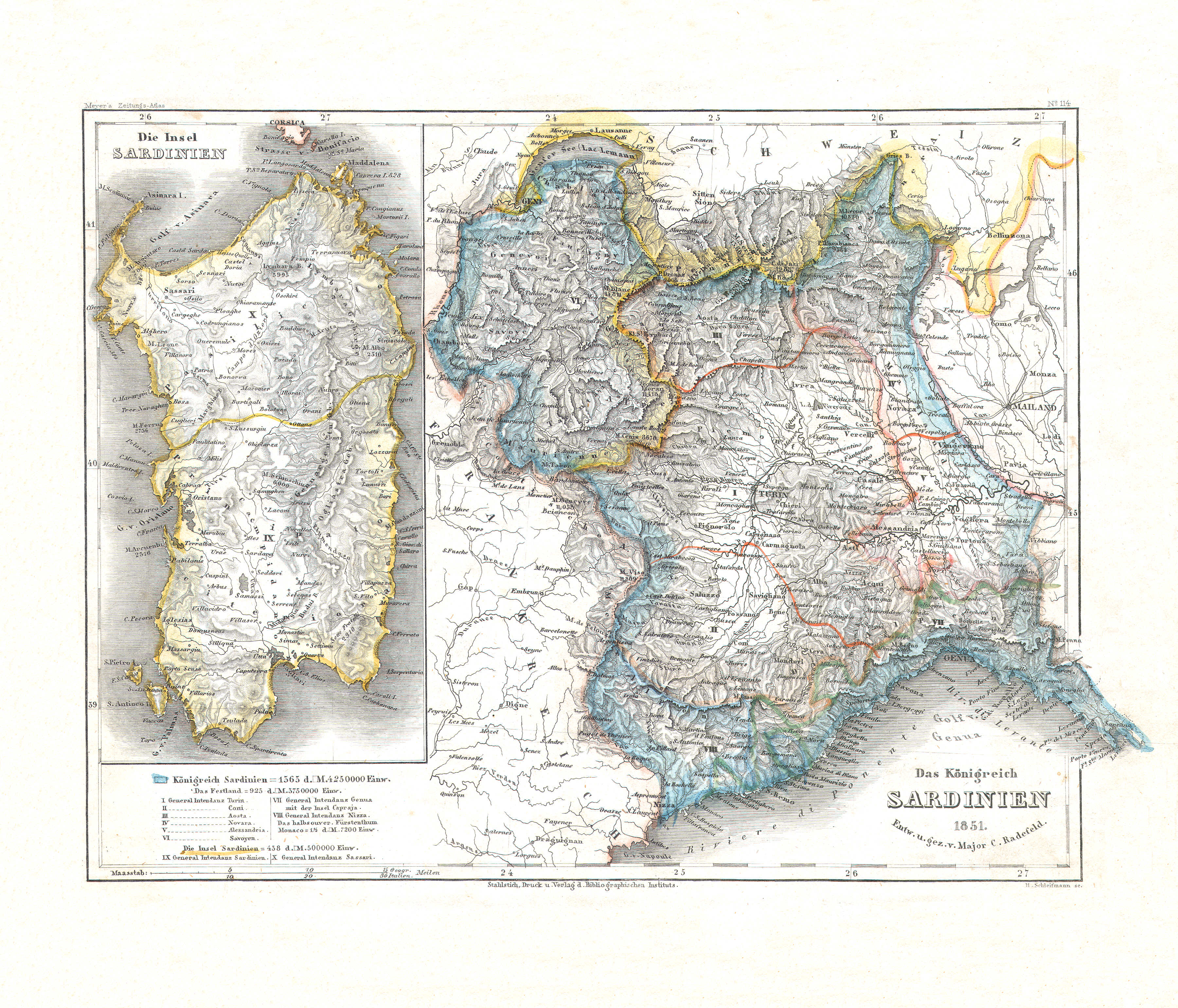
50. Das Königreich Sardinien (Nº 114, 1851)
Koninkrijk Sardinië / Kingdom of Sardinia
 Meyer's Zeitungs-Atlas (1849-1852)
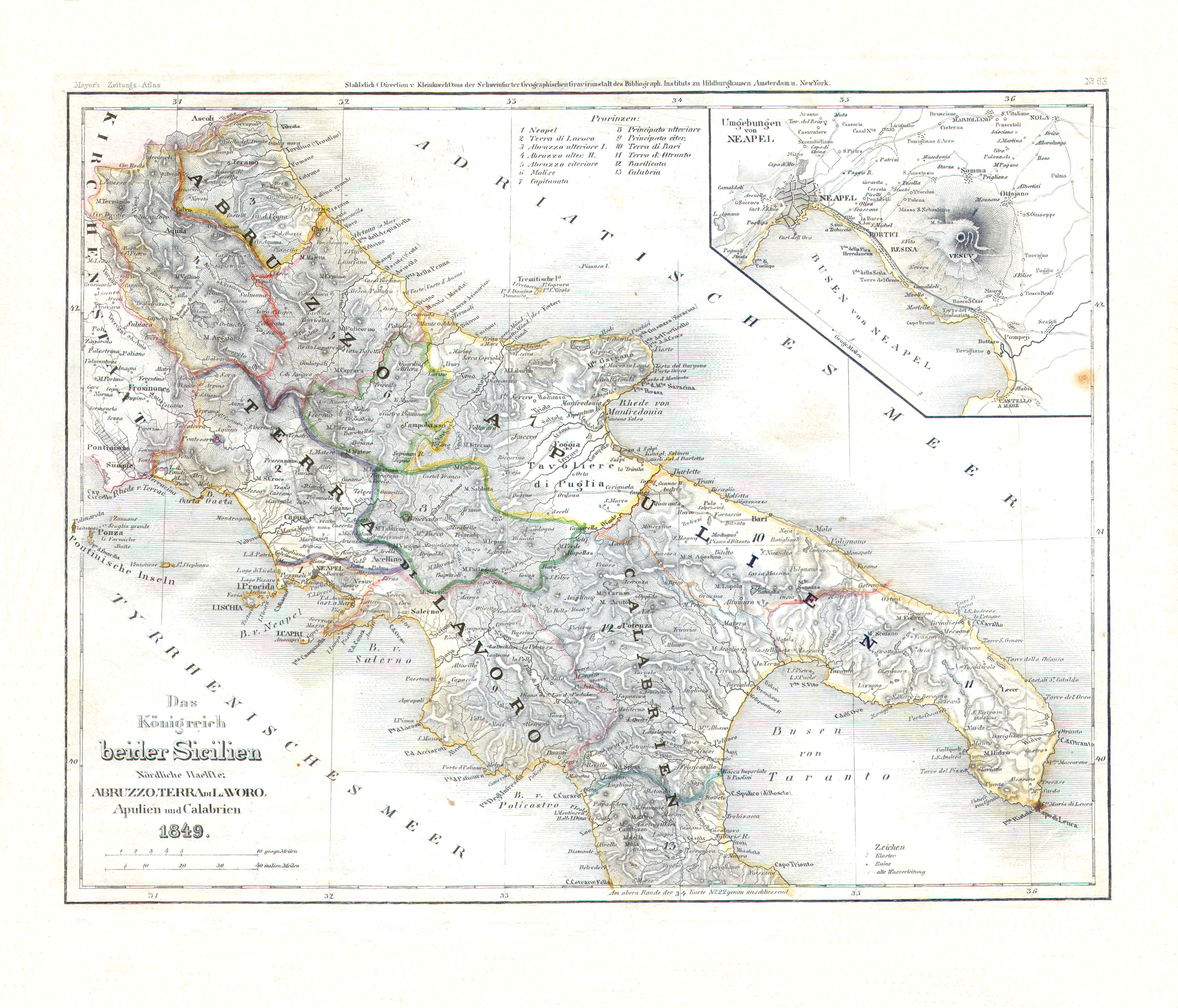
51. Das Königreich beider Sicilien Nördliche Haelfte: Abruzzo, Terra di Lavoro, Apulien und Calabrien (Nº 63, 1849)
Koninkrijk der Beide Siciliën, noordelijk deel / Kingdom of the Two Sicilies, northern half
 Meyer's Zeitungs-Atlas (1849-1852)
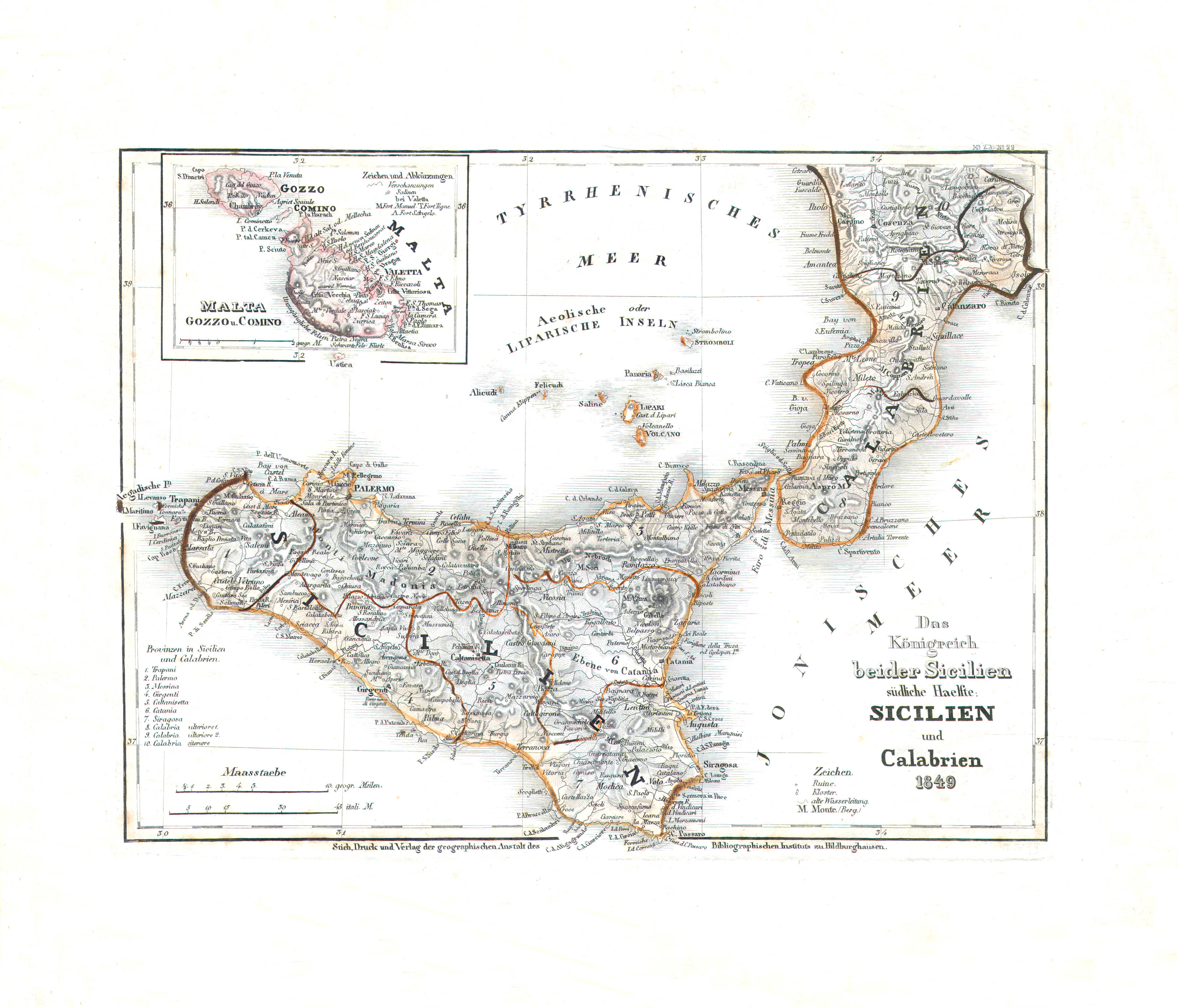
52. Das Königreich beider Sicilien, südliche Haelfte: Sicilien und Calabrien (Nº 22, 1849)
Koninkrijk der Beide Siciliën, zuidelijk deel / Kingdom of the Two Sicilies, southern half
 Meyer's Zeitungs-Atlas (1849-1852)
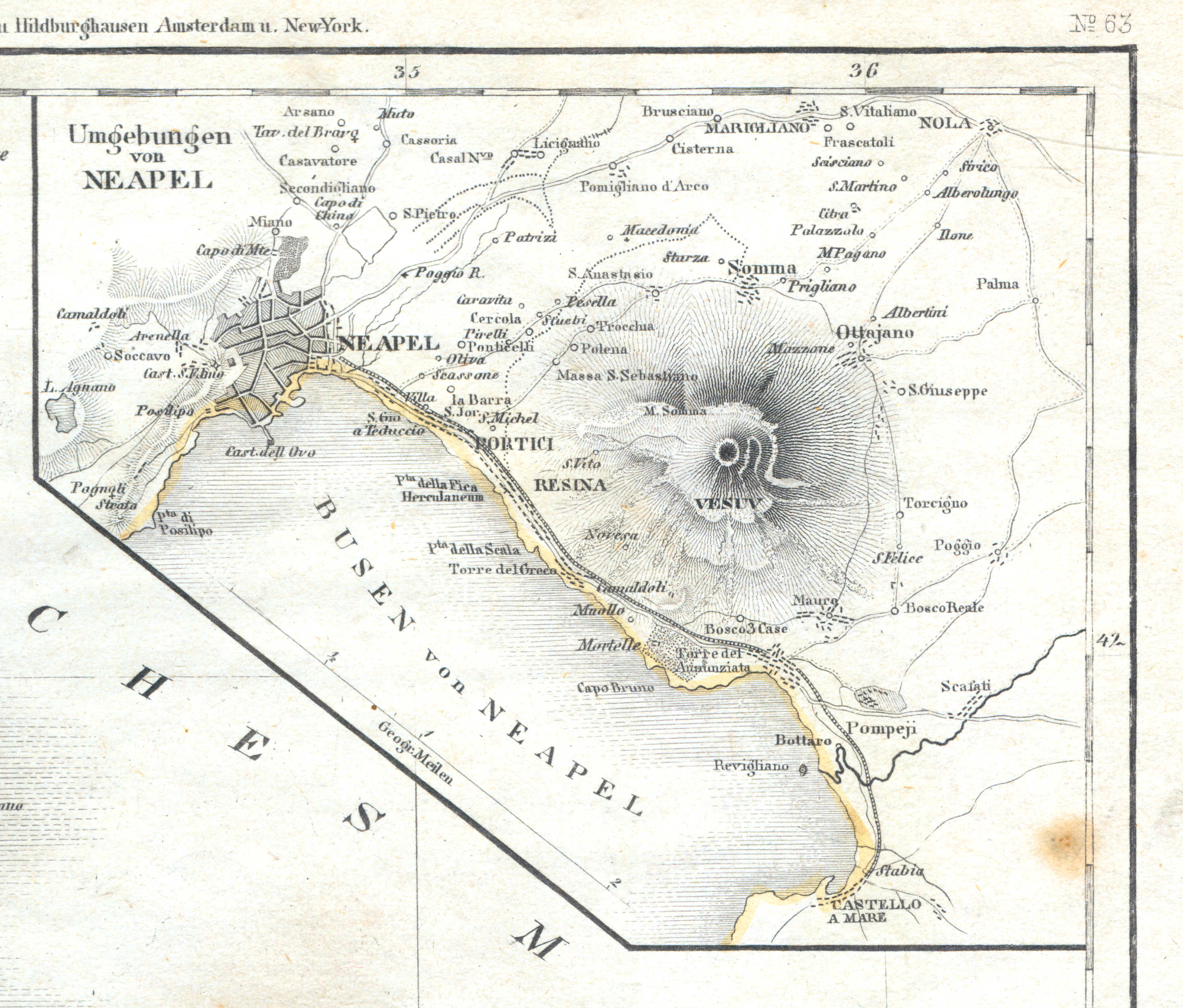
51a. Umgebungen von Neapel
Napels en omgeving / Naples and environs / Napoli
 Meyer's Zeitungs-Atlas (1849-1852)
53. Preussen (Nº 21, 1849)
Pruisen / Prussia
 Meyer's Zeitungs-Atlas (1849-1852)
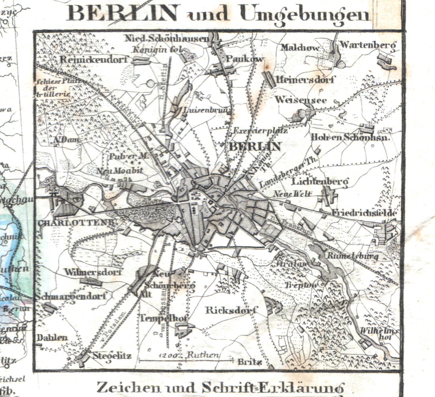
53a. Berlin und Umgebungen
Berlijn en omgeving / Berlin and environs
 Meyer's Zeitungs-Atlas (1849-1852)
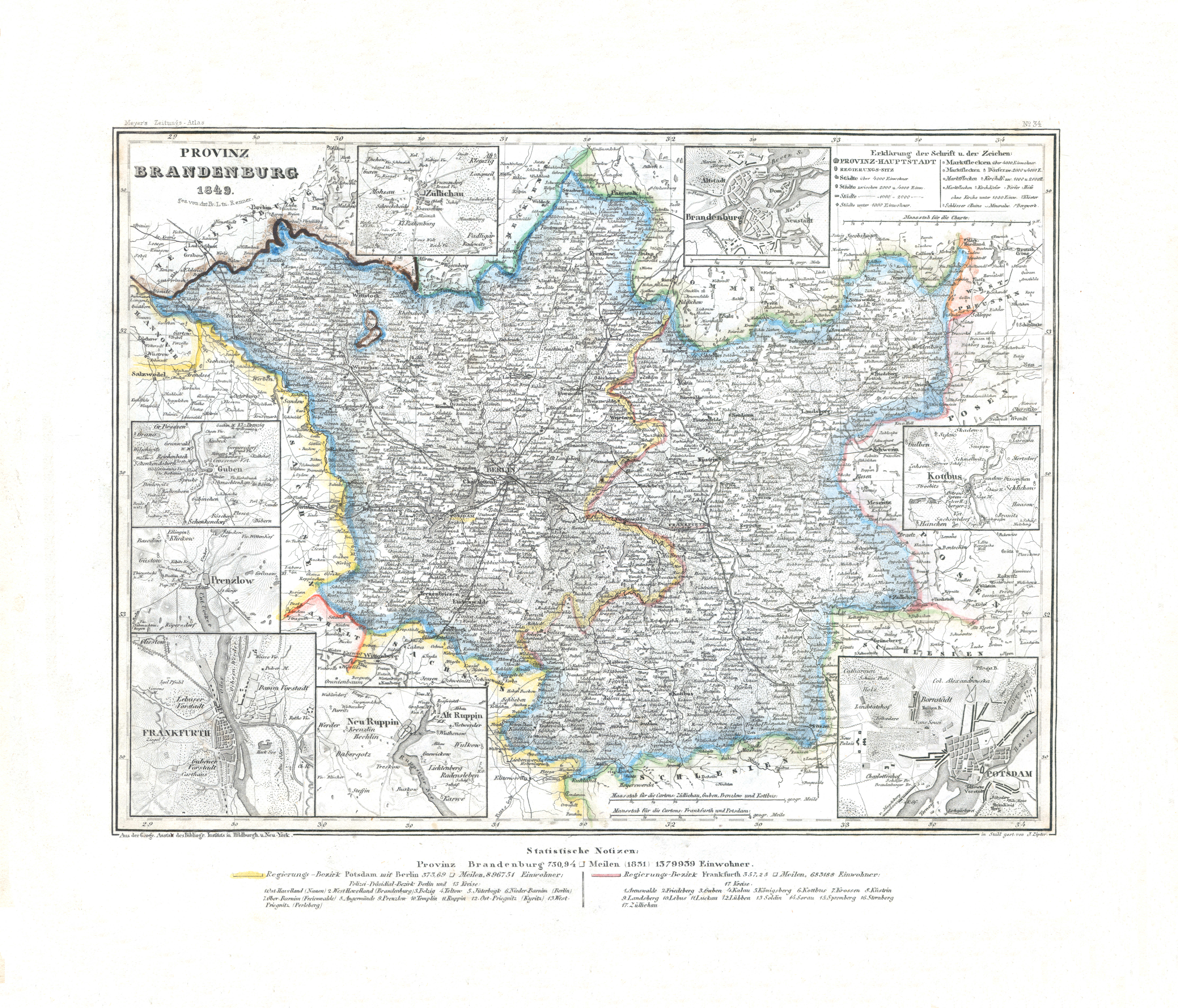
54. Provinz Brandenburg (Nº 34, 1849) XL
Provincie Brandenburg / Province of Brandenburg
 Meyer's Zeitungs-Atlas (1849-1852)
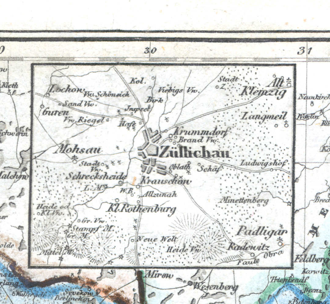
54a. Züllichau
Züllichau / Sulechów
 Meyer's Zeitungs-Atlas (1849-1852)
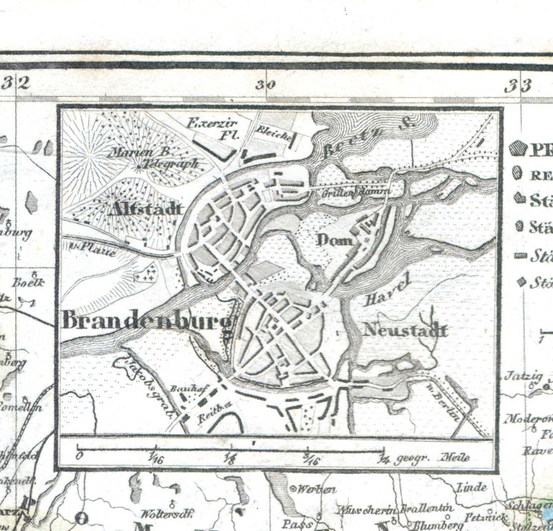
54b. Brandenburg
Brandenburg
 Meyer's Zeitungs-Atlas (1849-1852)
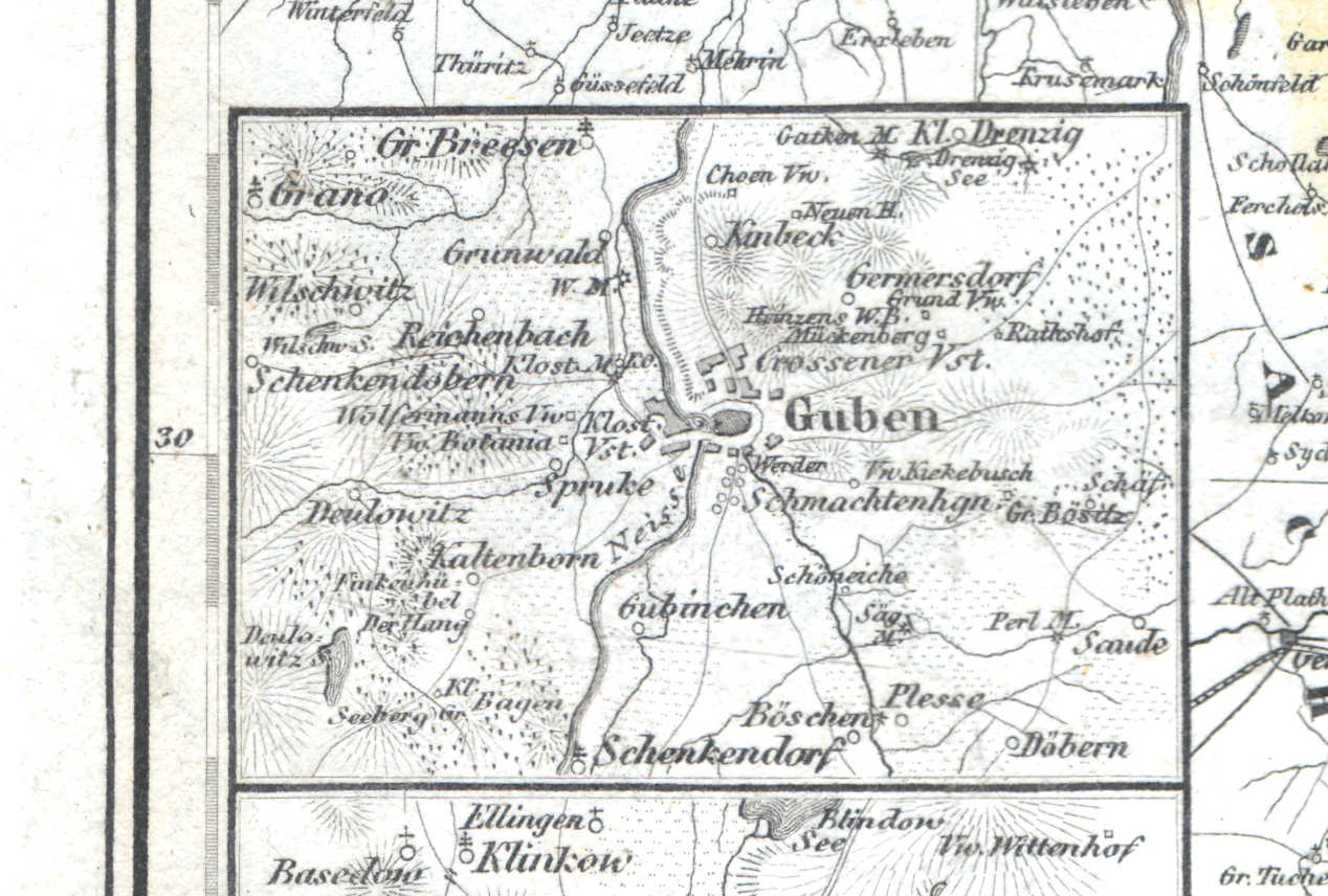
54c. Guben
Guben / Gubin
 Meyer's Zeitungs-Atlas (1849-1852)
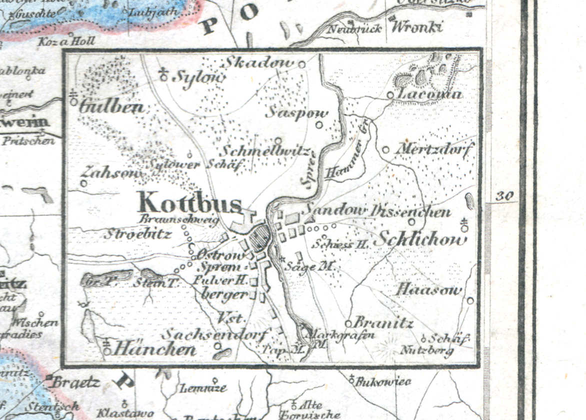
54d. Kottbus
Cottbus / Chóśebuz
 Meyer's Zeitungs-Atlas (1849-1852)
54e. Prenzlow
Prenzlau
 Meyer's Zeitungs-Atlas (1849-1852)
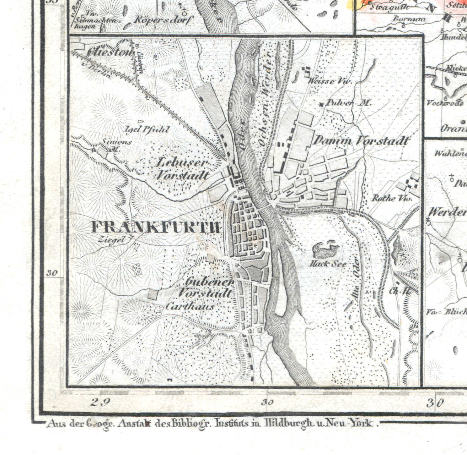
54f. Frankfurth
Frankfurt an der Oder / Słubice
 Meyer's Zeitungs-Atlas (1849-1852)
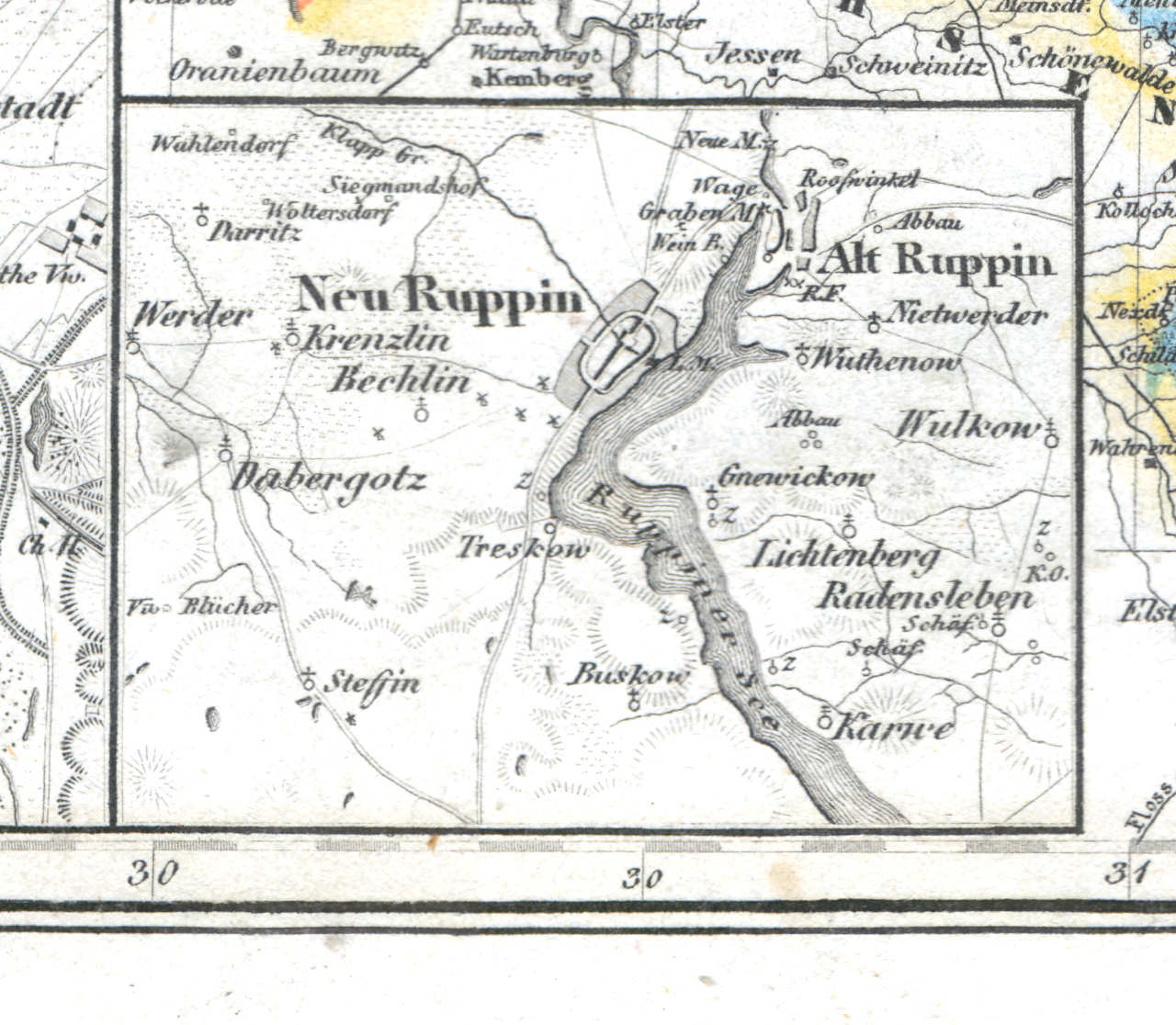
54g. Neu Ruppin, Alt Ruppin
Neuruppin, Alt Ruppin
 Meyer's Zeitungs-Atlas (1849-1852)
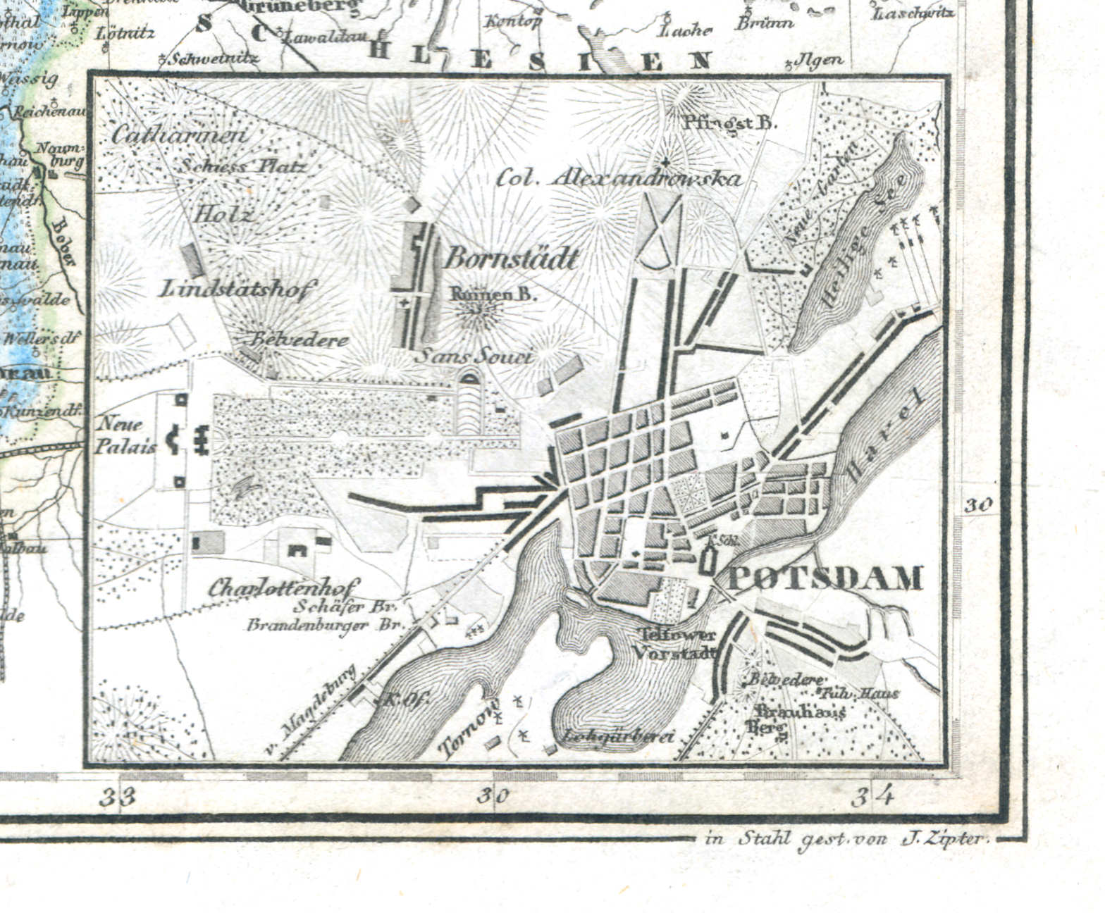
54h. Potsdam
Potsdam
 Meyer's Zeitungs-Atlas (1849-1852)
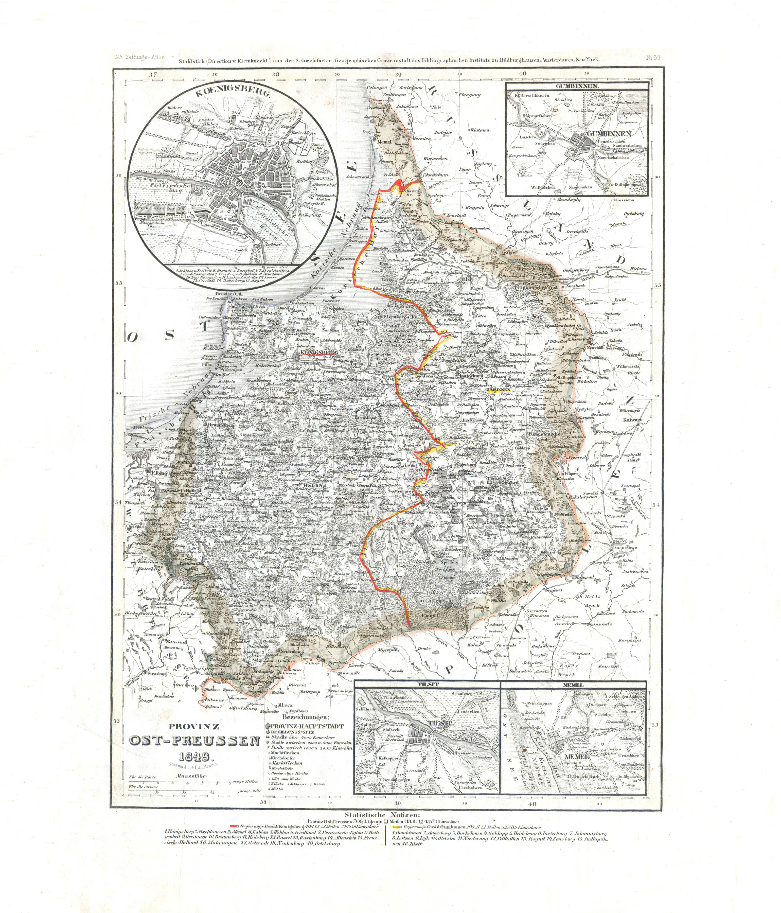
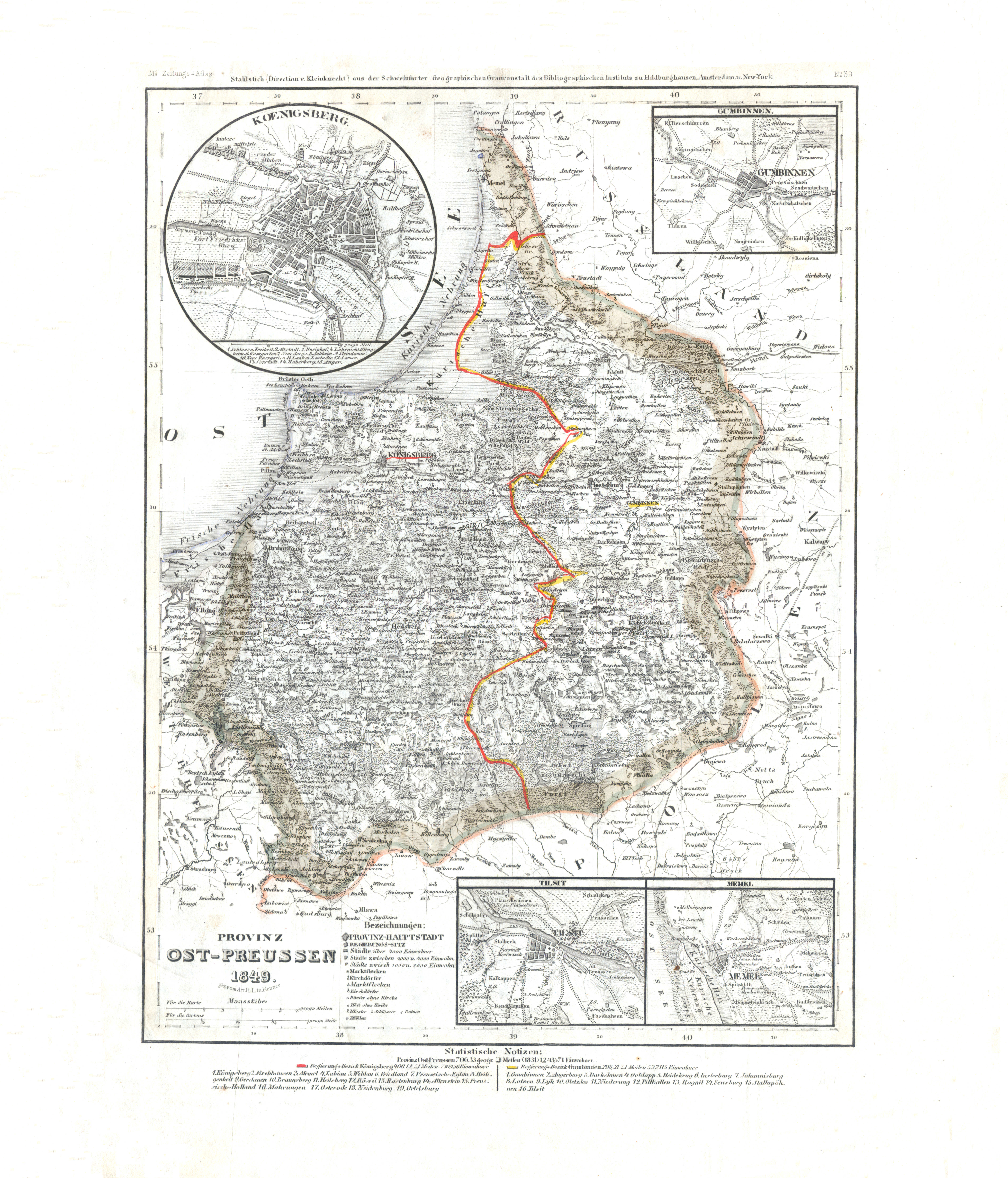
55. Provinz Ost-Preussen (Nº 39, 1849) XL
Provincie Oost-Pruisen / Province of East Prussia
 Meyer's Zeitungs-Atlas (1849-1852)
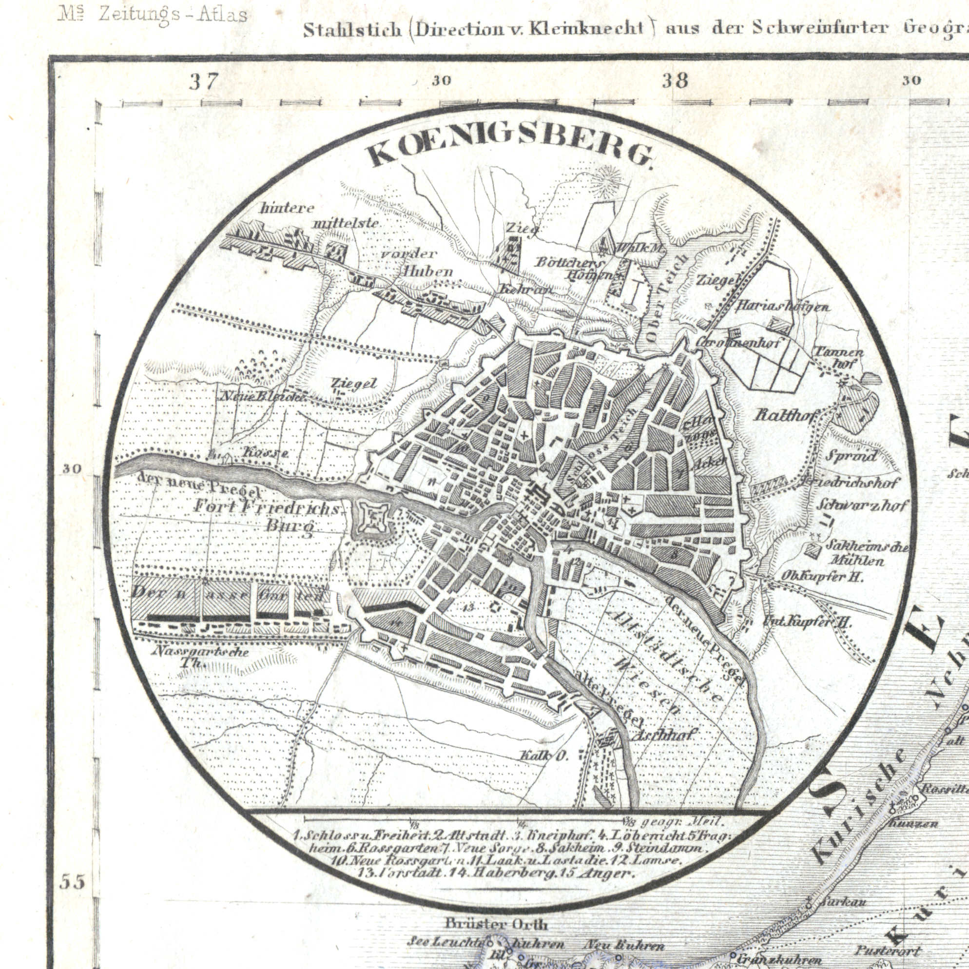
55a. Koenigsberg
Königsberg in Preußen / Koningsbergen / Królewiec / Karaliaučius / Kaliningrad, Калининград
 Meyer's Zeitungs-Atlas (1849-1852)
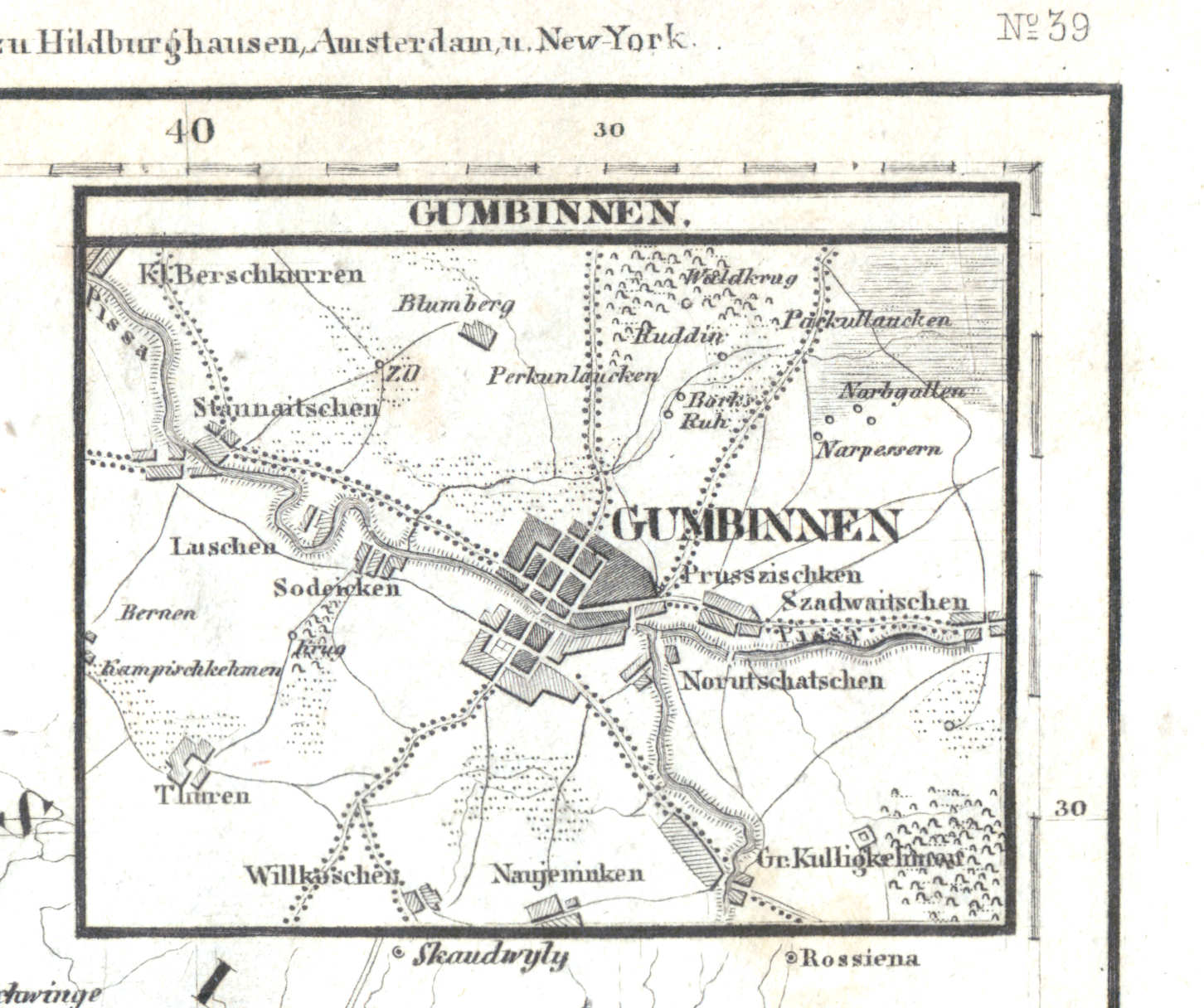
55b. Gumbinnen
Gumbinnen / Gusiew / Gusevas / Гусев, Gusev
 Meyer's Zeitungs-Atlas (1849-1852)
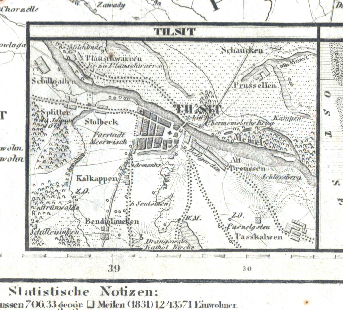
55c. Tilsit
Tilsit / Tilžė / Советск, Sovjetsk
 Meyer's Zeitungs-Atlas (1849-1852)
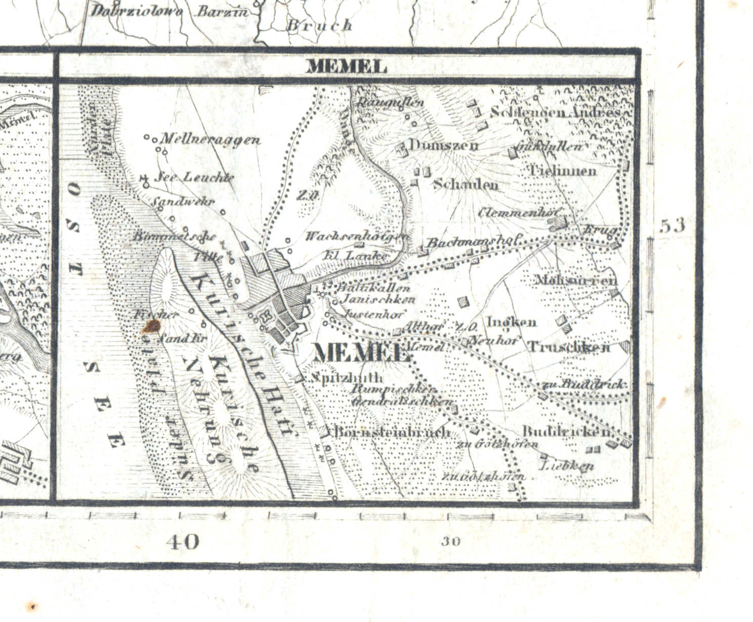
55d. Memel
Memel / Klaipėda
 Meyer's Zeitungs-Atlas (1849-1852)
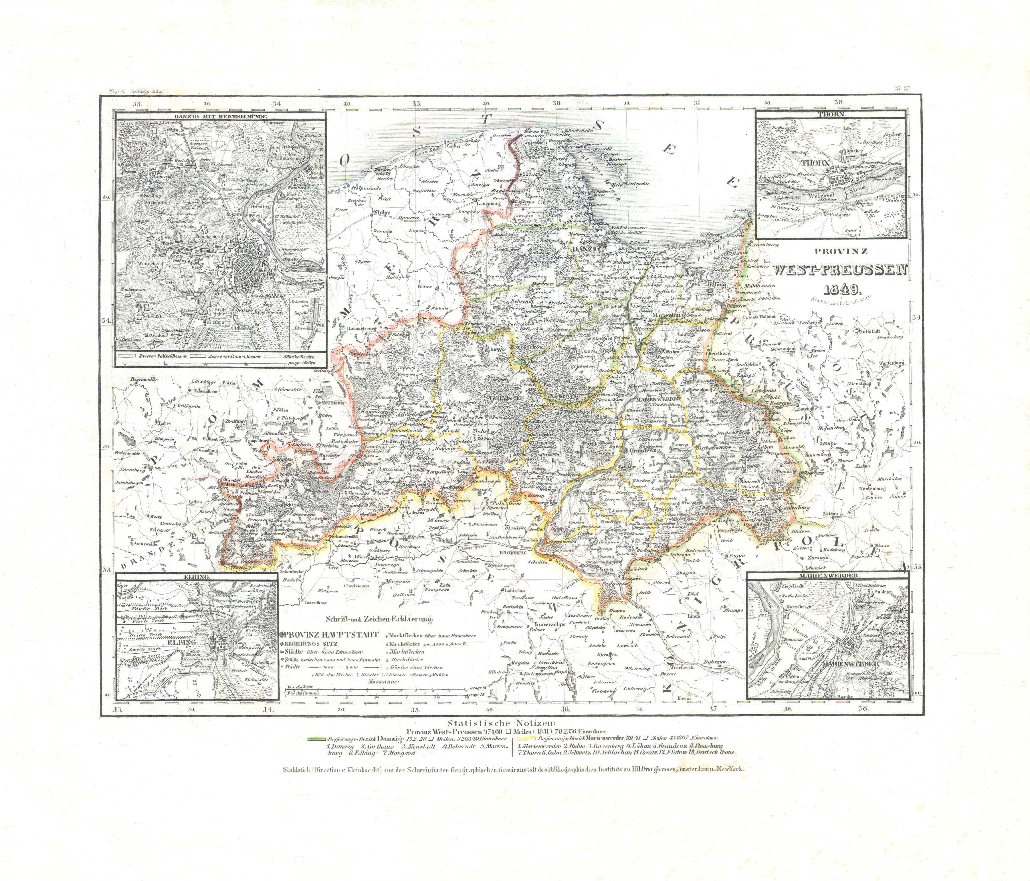
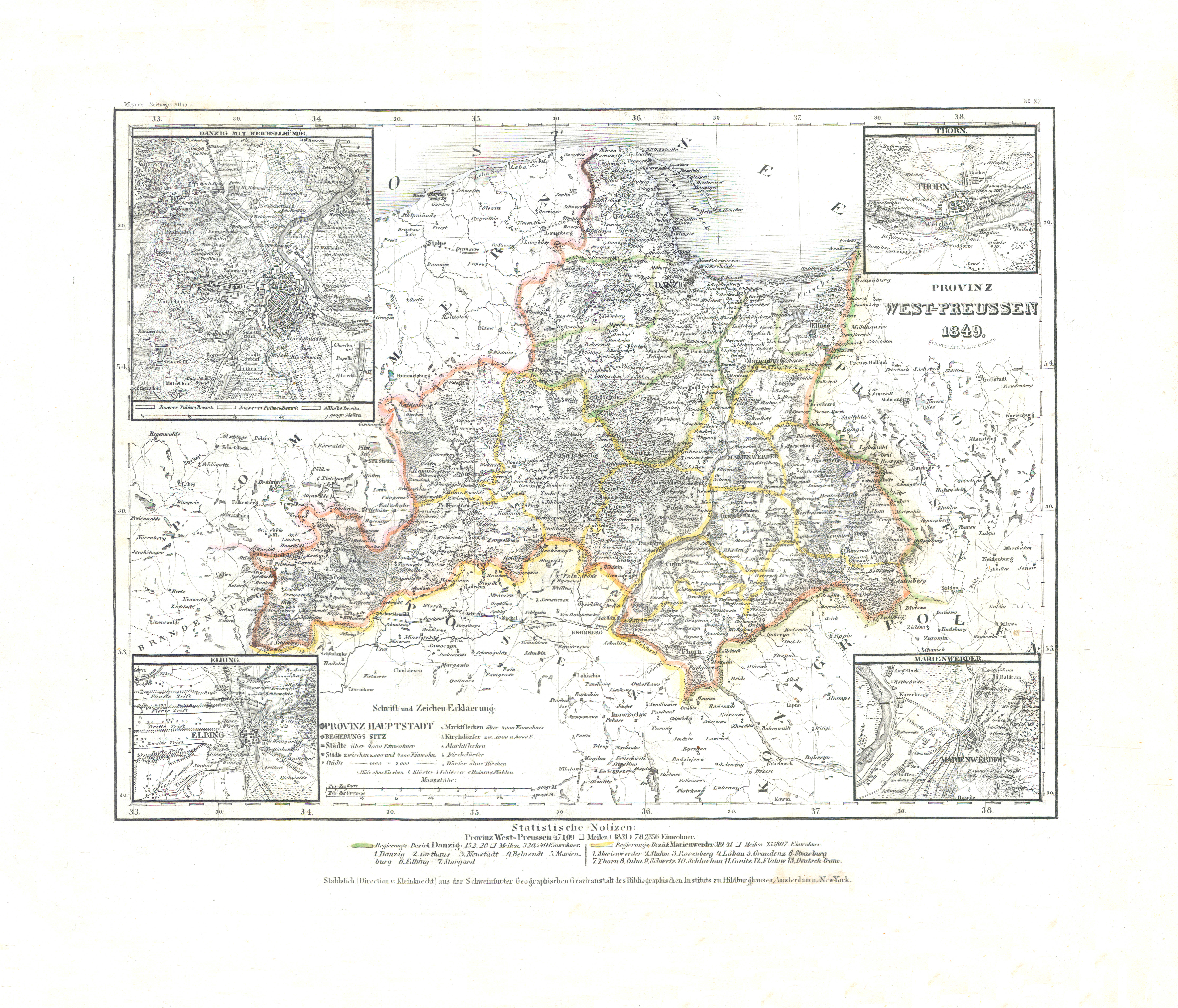
56. Provinz West-Preussen (Nº 27, 1849) XL
Provincie West-Pruisen / Province of West Prussia
 Meyer's Zeitungs-Atlas (1849-1852)
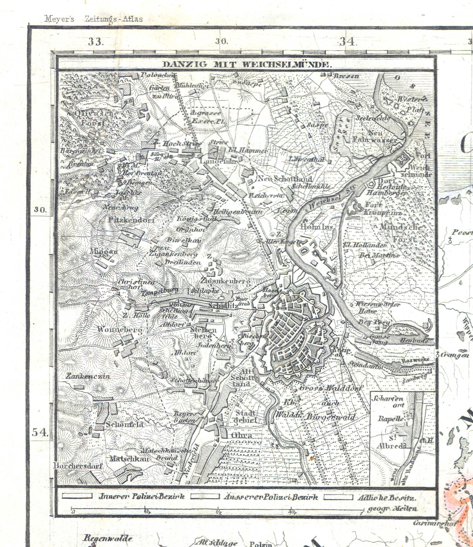
56a. Danzig mit Weichselmünde
Danzig en Weichselmonding / Danzig and mouth of the Vistula / Gdańsk, Wisła
 Meyer's Zeitungs-Atlas (1849-1852)
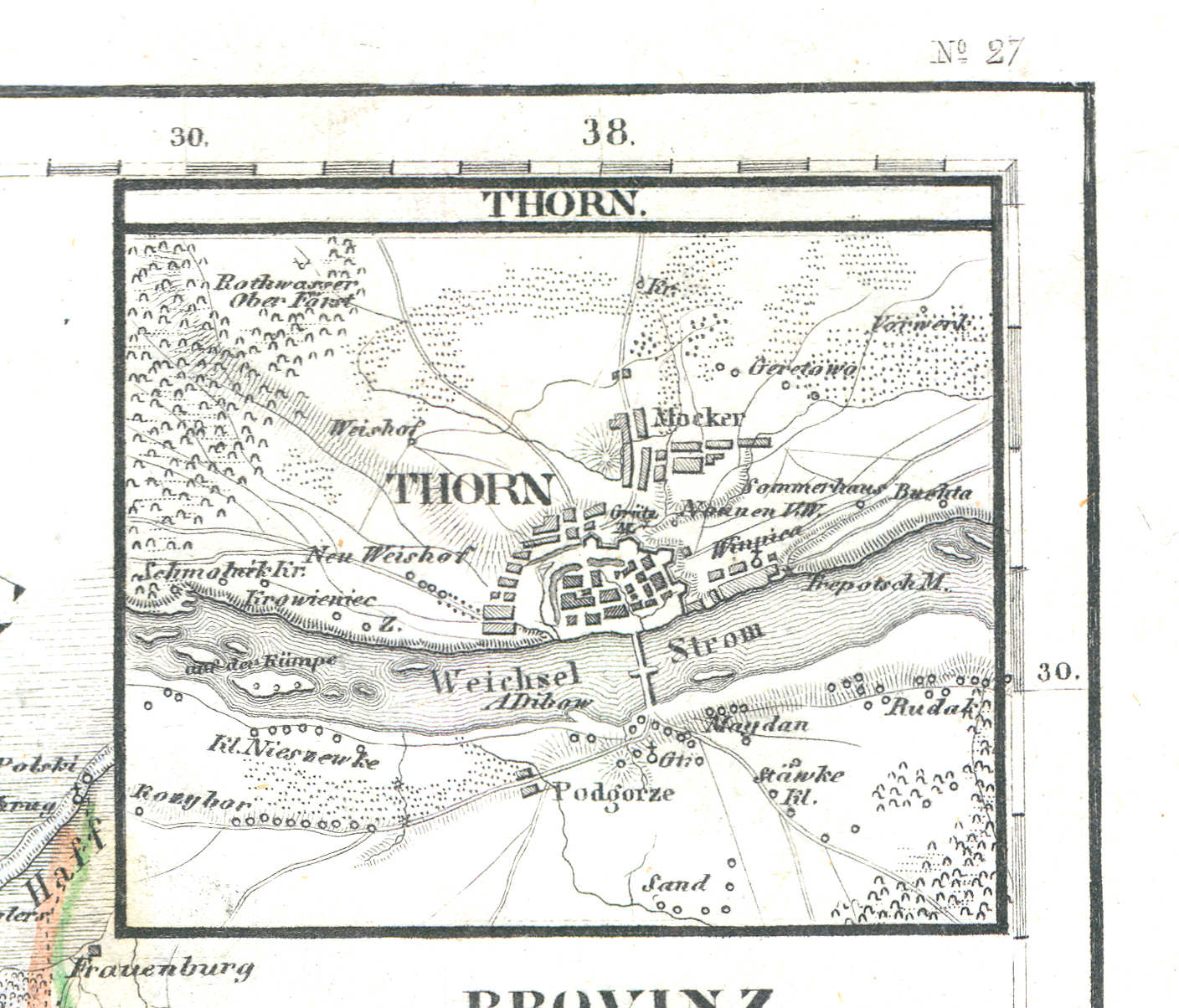
56b. Thorn
Thorn / Toruń
 Meyer's Zeitungs-Atlas (1849-1852)
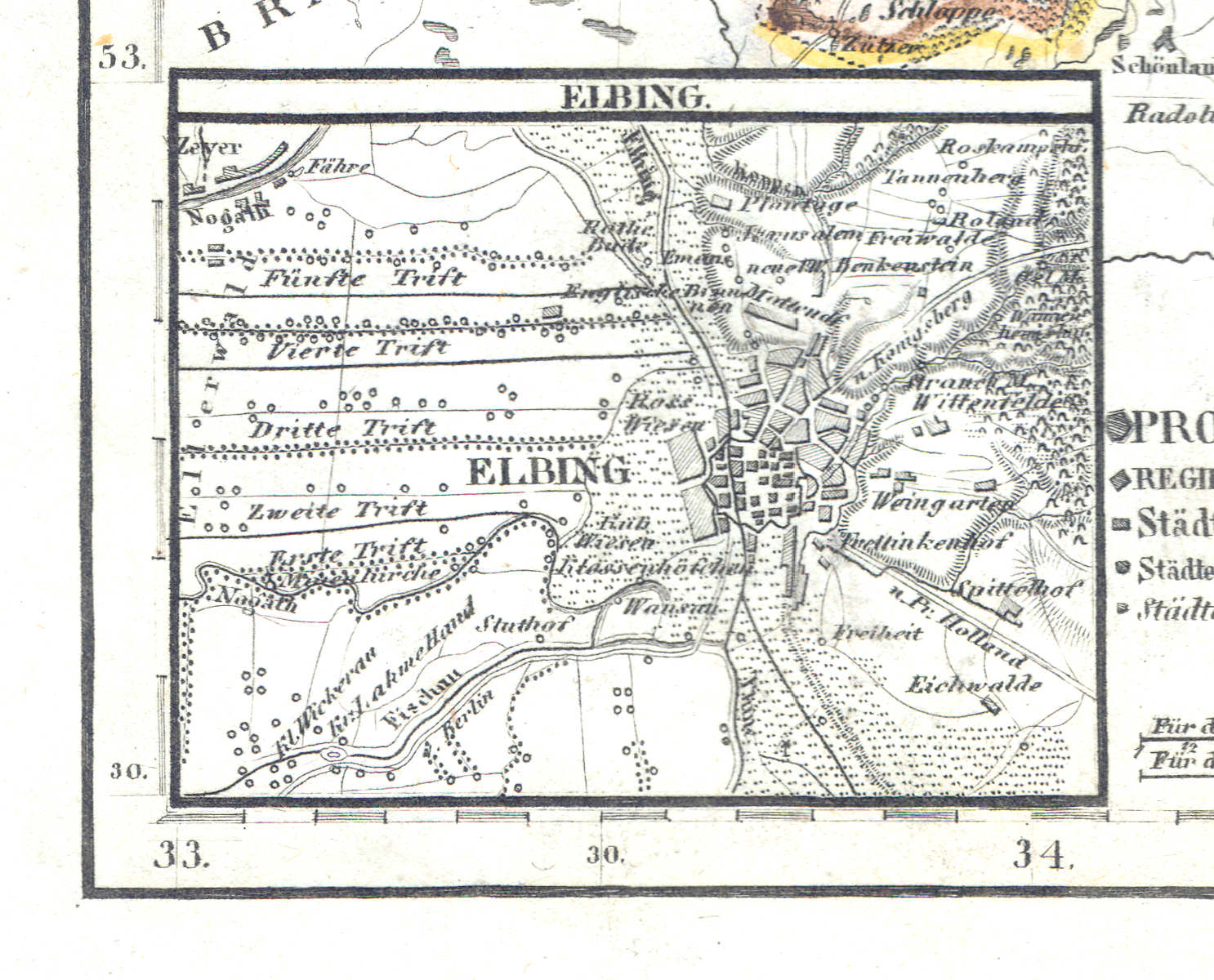
56c. Elbing
Elbing / Elbląg
 Meyer's Zeitungs-Atlas (1849-1852)
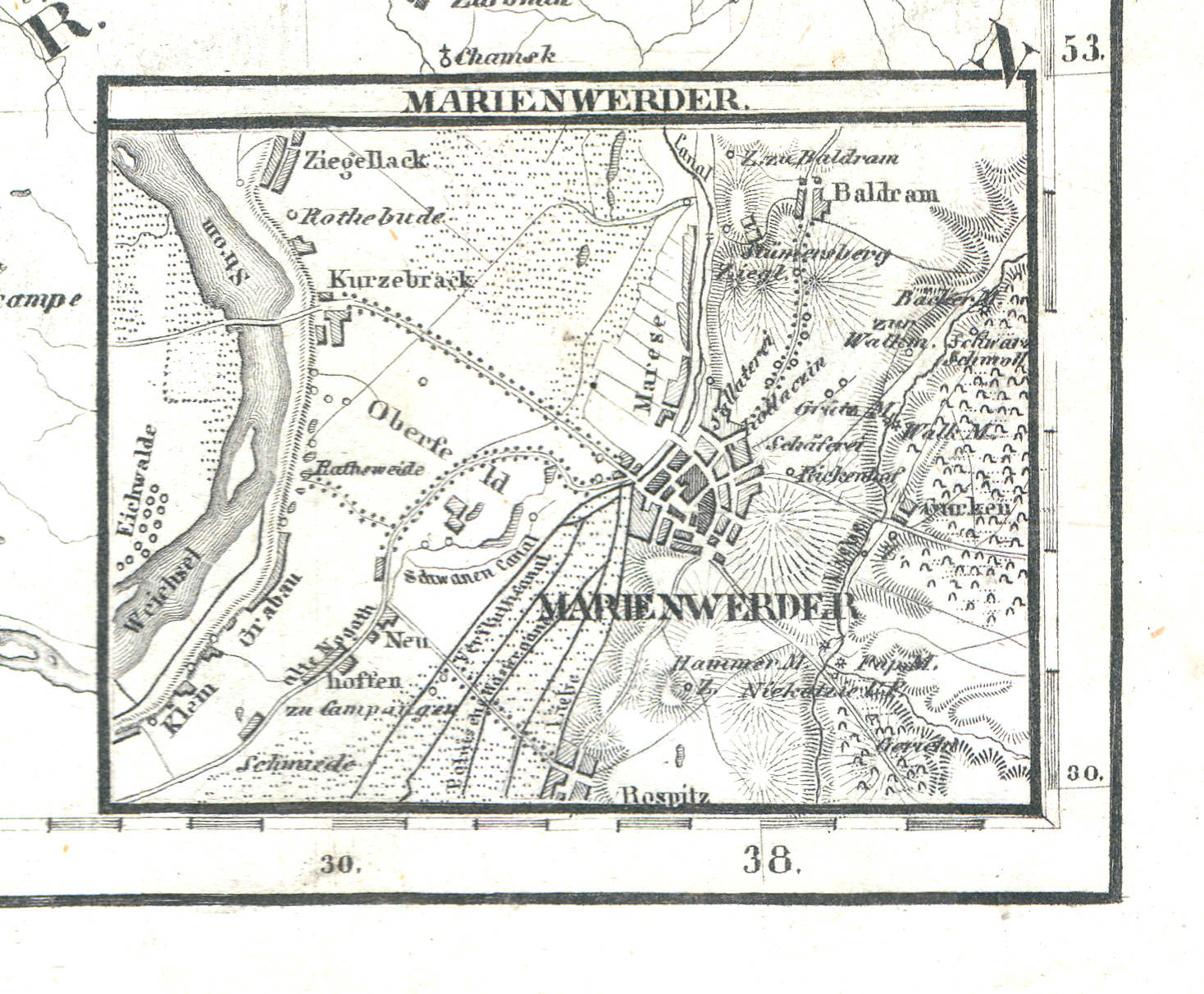
56d. Marienwerder
Marienwerder / Kwidzyn
 Meyer's Zeitungs-Atlas (1849-1852)
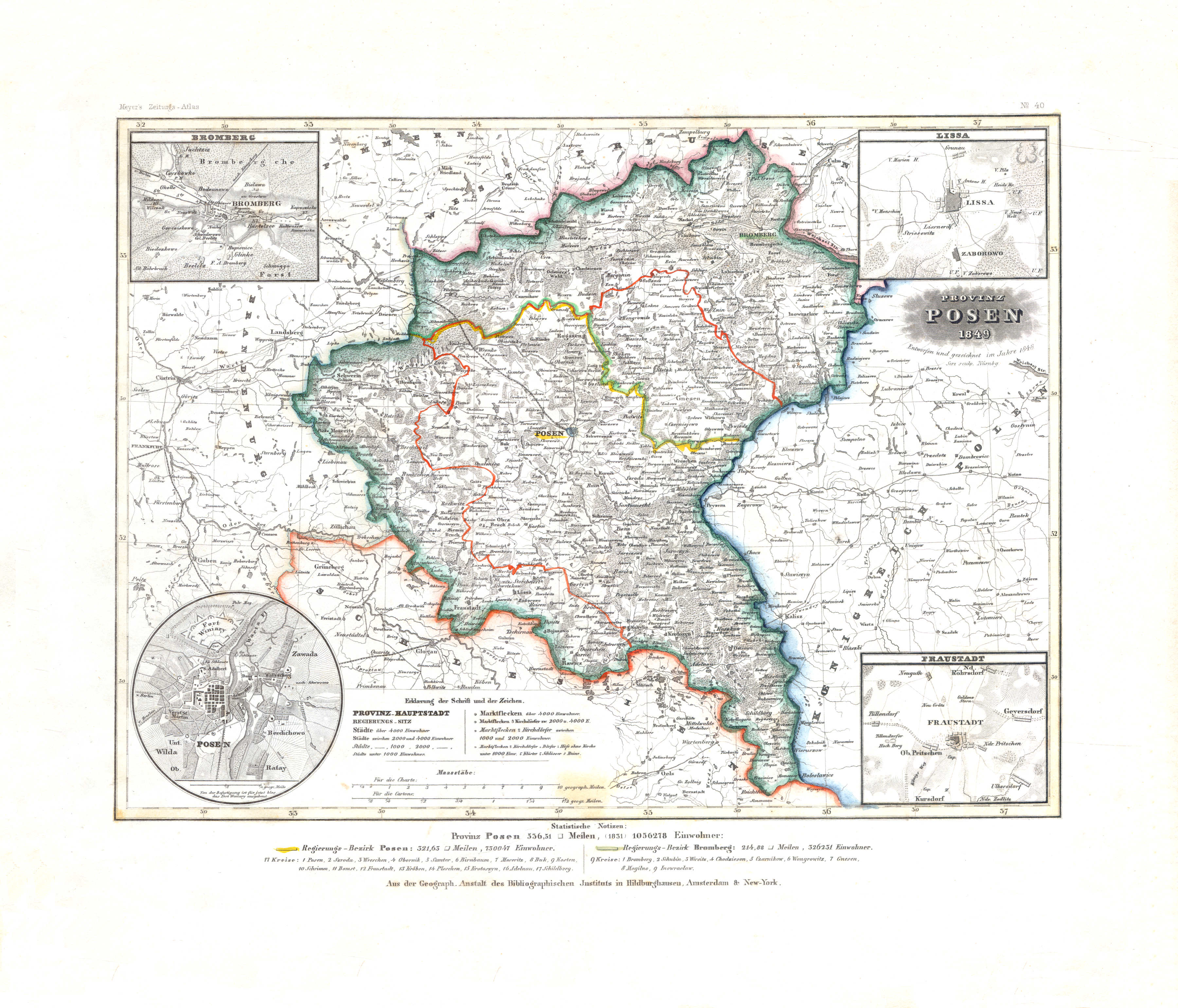
57. Provinz Posen (Nº 40, 1849) XL
Provincie Posen / Province of Posen
 Meyer's Zeitungs-Atlas (1849-1852)
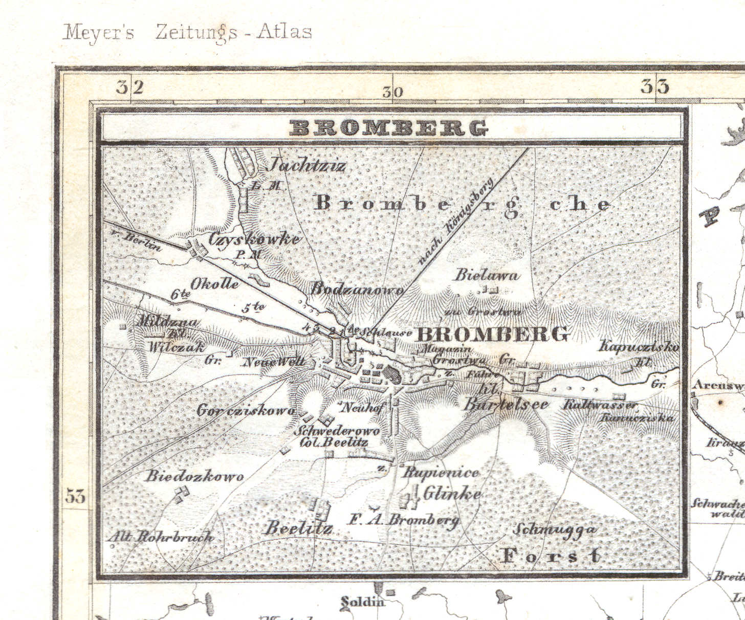
57a. Bromberg
Bromberg / Bydgoszcz
 Meyer's Zeitungs-Atlas (1849-1852)
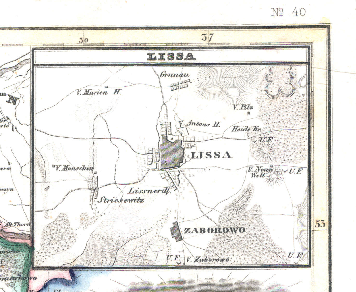
57b. Lissa
Lissa / Leszno
 Meyer's Zeitungs-Atlas (1849-1852)
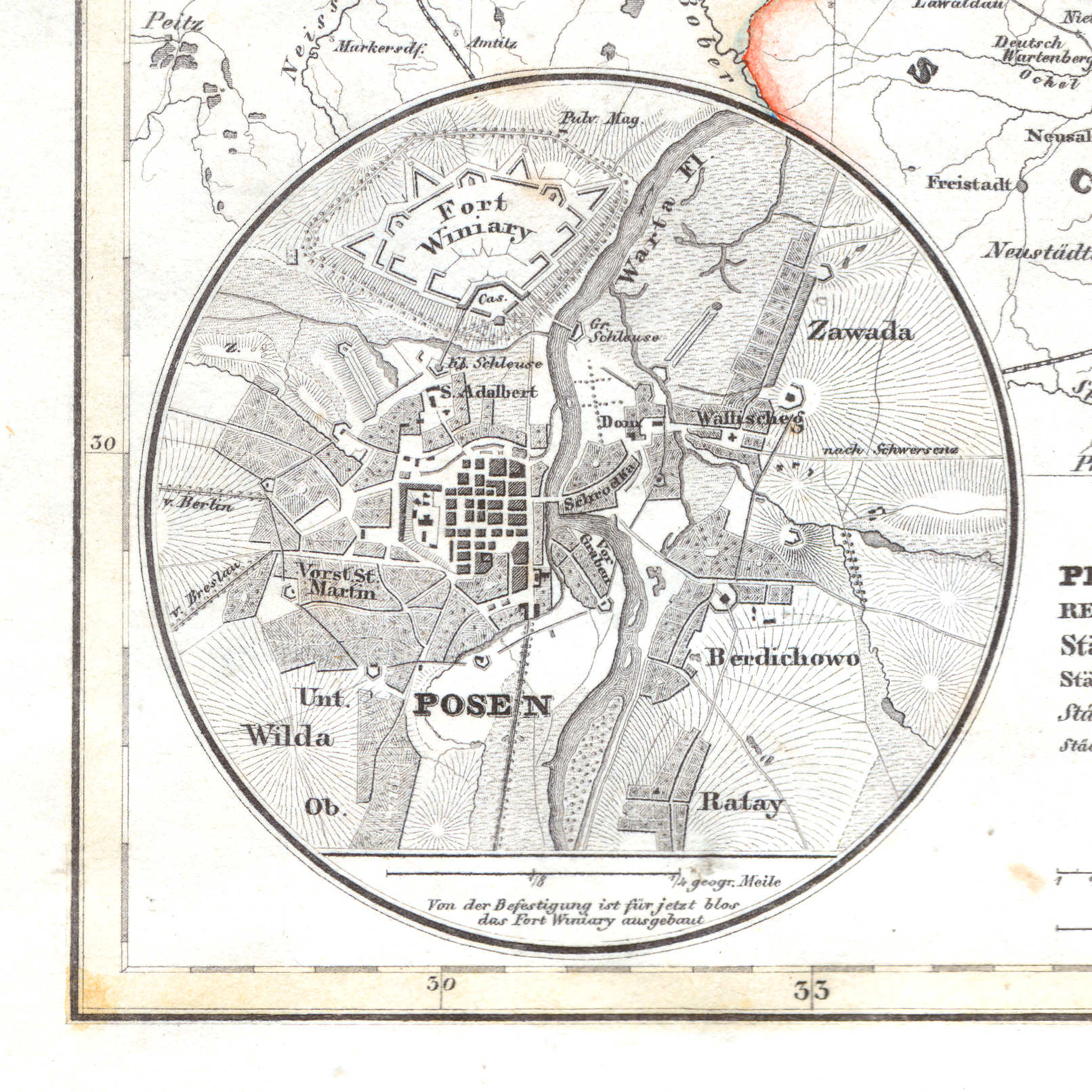
57c. Posen
Posen / Poznań
 Meyer's Zeitungs-Atlas (1849-1852)
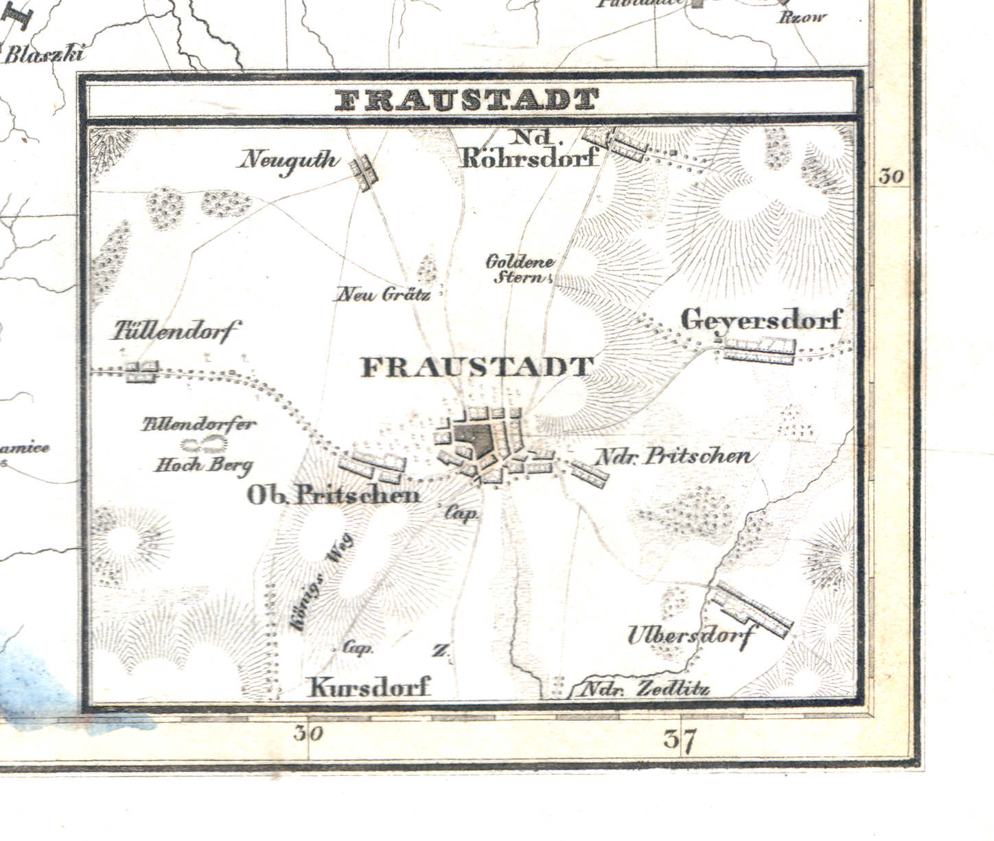
57d. Fraustadt
Fraustadt / Wschowa
 Meyer's Zeitungs-Atlas (1849-1852)
58. Provinz Pommern (Nº 31, 1849) XL
Provincie Pommeren / Province of Pomerania
 Meyer's Zeitungs-Atlas (1849-1852)
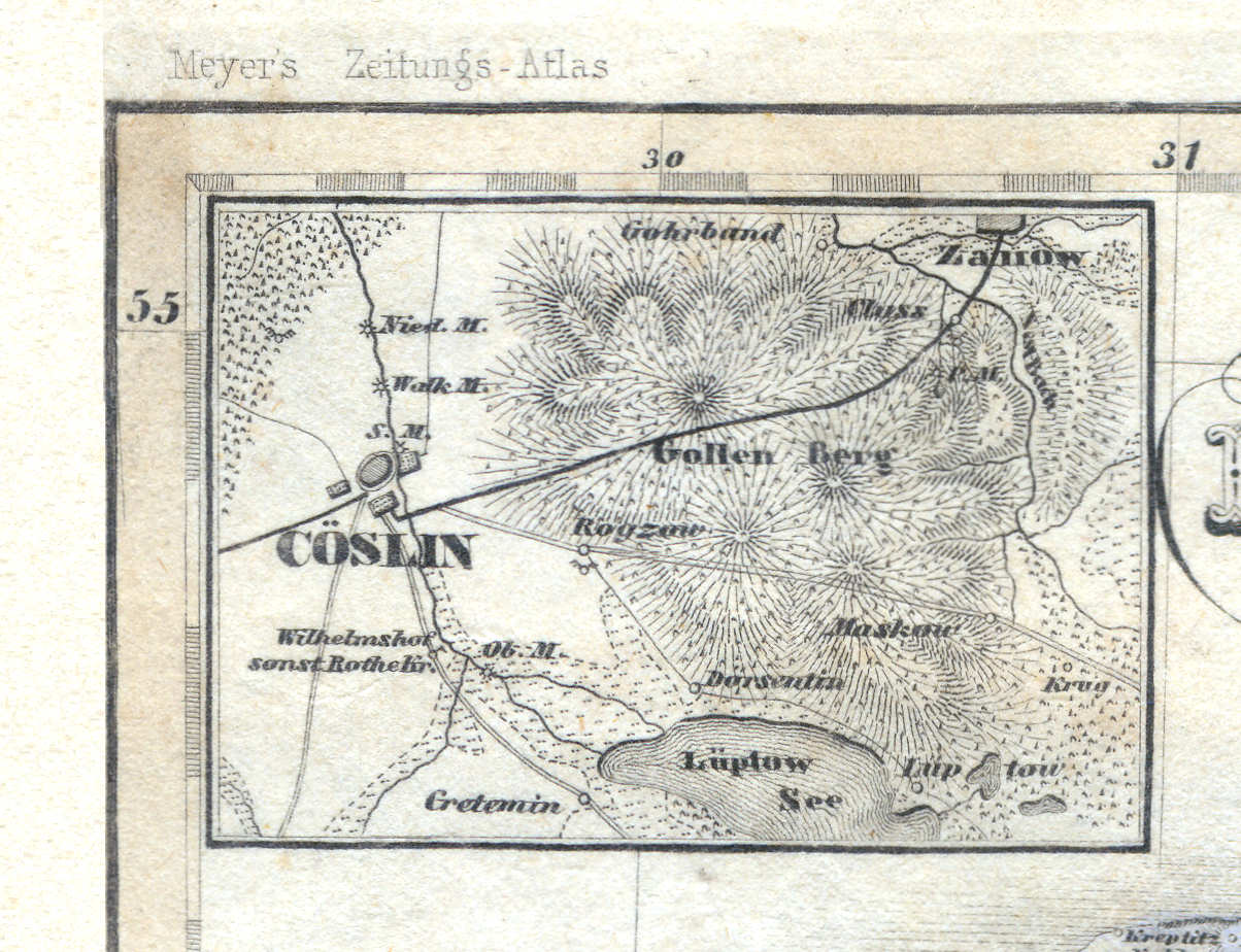
58a. Cöslin
Köslin / Koszalin
 Meyer's Zeitungs-Atlas (1849-1852)
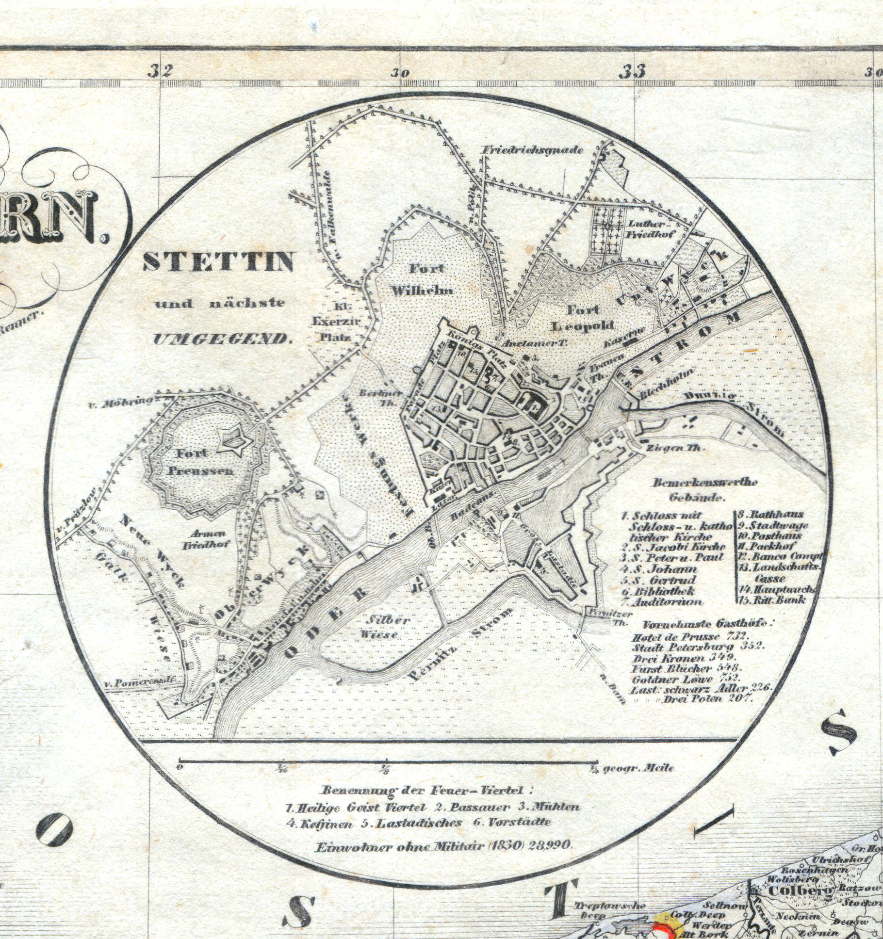
58b. Stettin und nächste Umgegend
Stettin / Szczecin
 Meyer's Zeitungs-Atlas (1849-1852)
58c. Stralsund
Stralsund
 Meyer's Zeitungs-Atlas (1849-1852)
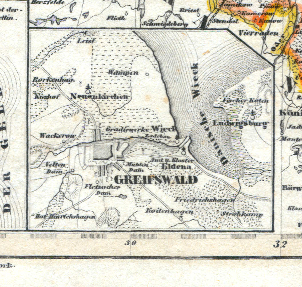
58d. Greifswald
Greifswald
 Meyer's Zeitungs-Atlas (1849-1852)
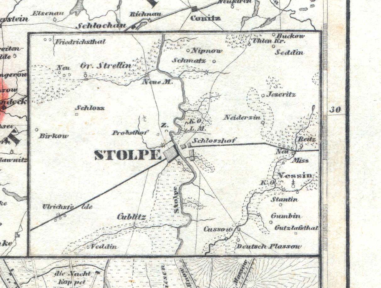
58e. Stolpe
Stolp / Słupsk
 Meyer's Zeitungs-Atlas (1849-1852)
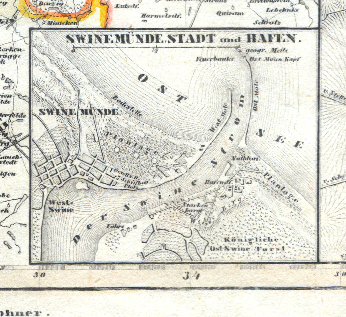
58f. Swinemünde, Stadt und Hafen
Swinemünde / Świnoujście
 Meyer's Zeitungs-Atlas (1849-1852)
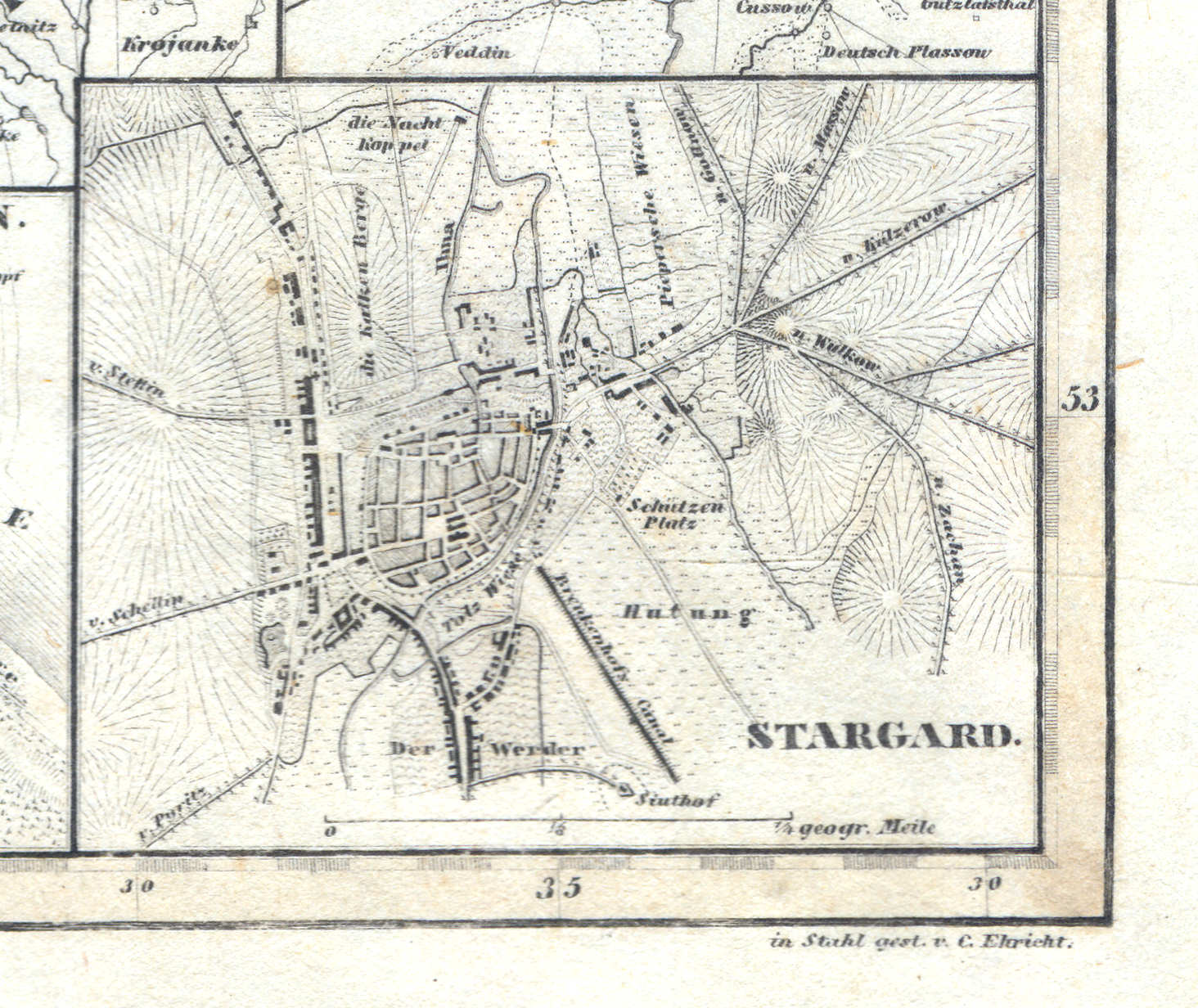
58g. Stargard
Stargard / Stargard Szczeciński
 Meyer's Zeitungs-Atlas (1849-1852)
59. Provinz Schlesien (Nº 16, 1849) XL
Provincie Silesië / Province of Silesia
 Meyer's Zeitungs-Atlas (1849-1852)
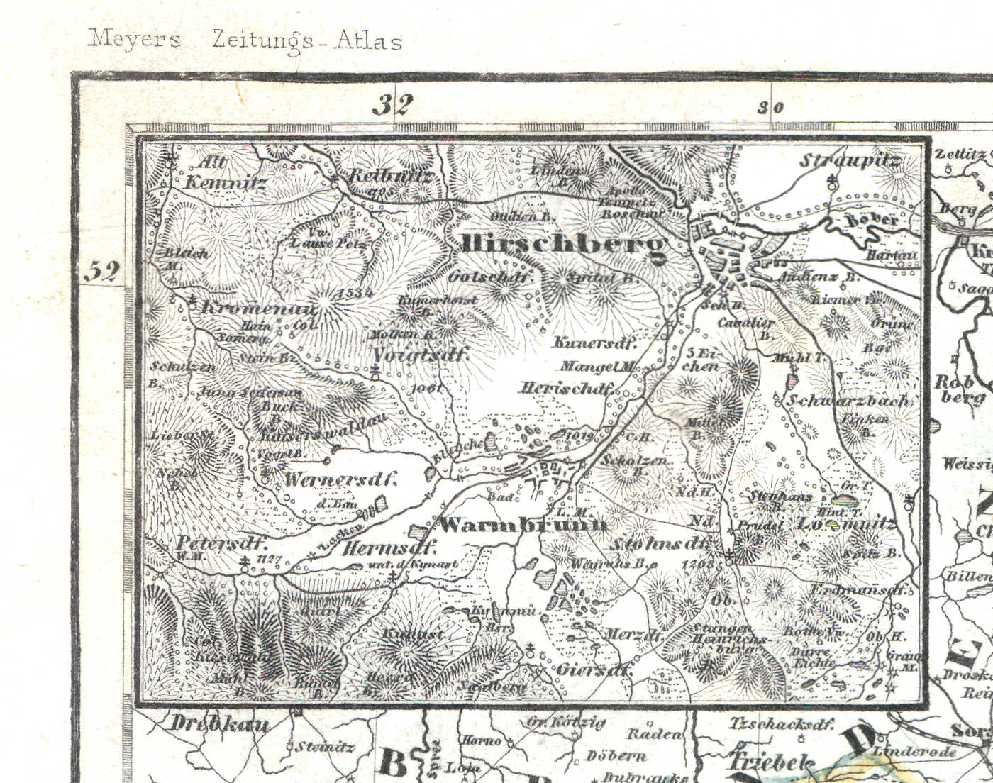
59a. Hirschberg
Hirschberg / Jelenia Góra
 Meyer's Zeitungs-Atlas (1849-1852)
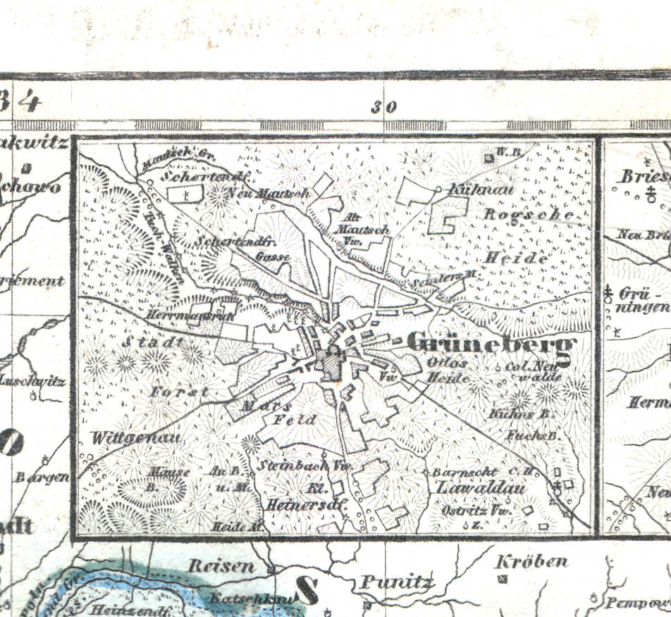
59b. Grüneberg
Grünberg in Schlesien / Zielona Góra
 Meyer's Zeitungs-Atlas (1849-1852)
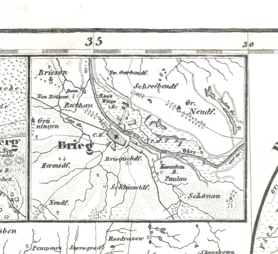
59c. Brieg
Brieg / Brzeg
 Meyer's Zeitungs-Atlas (1849-1852)
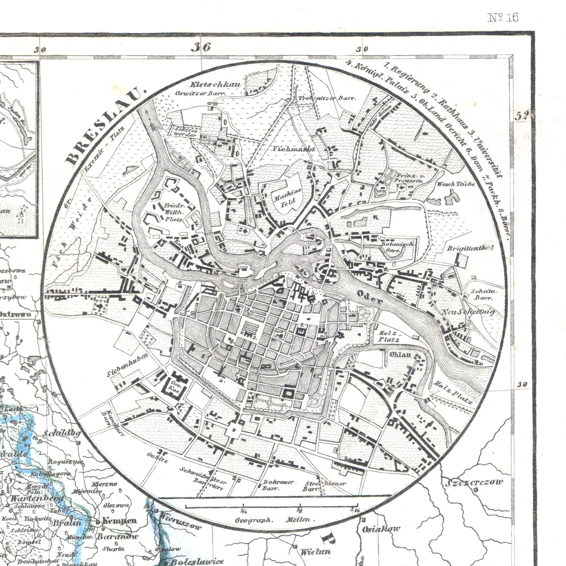
59d. Breslau
Breslau / Wrocław
 Meyer's Zeitungs-Atlas (1849-1852)
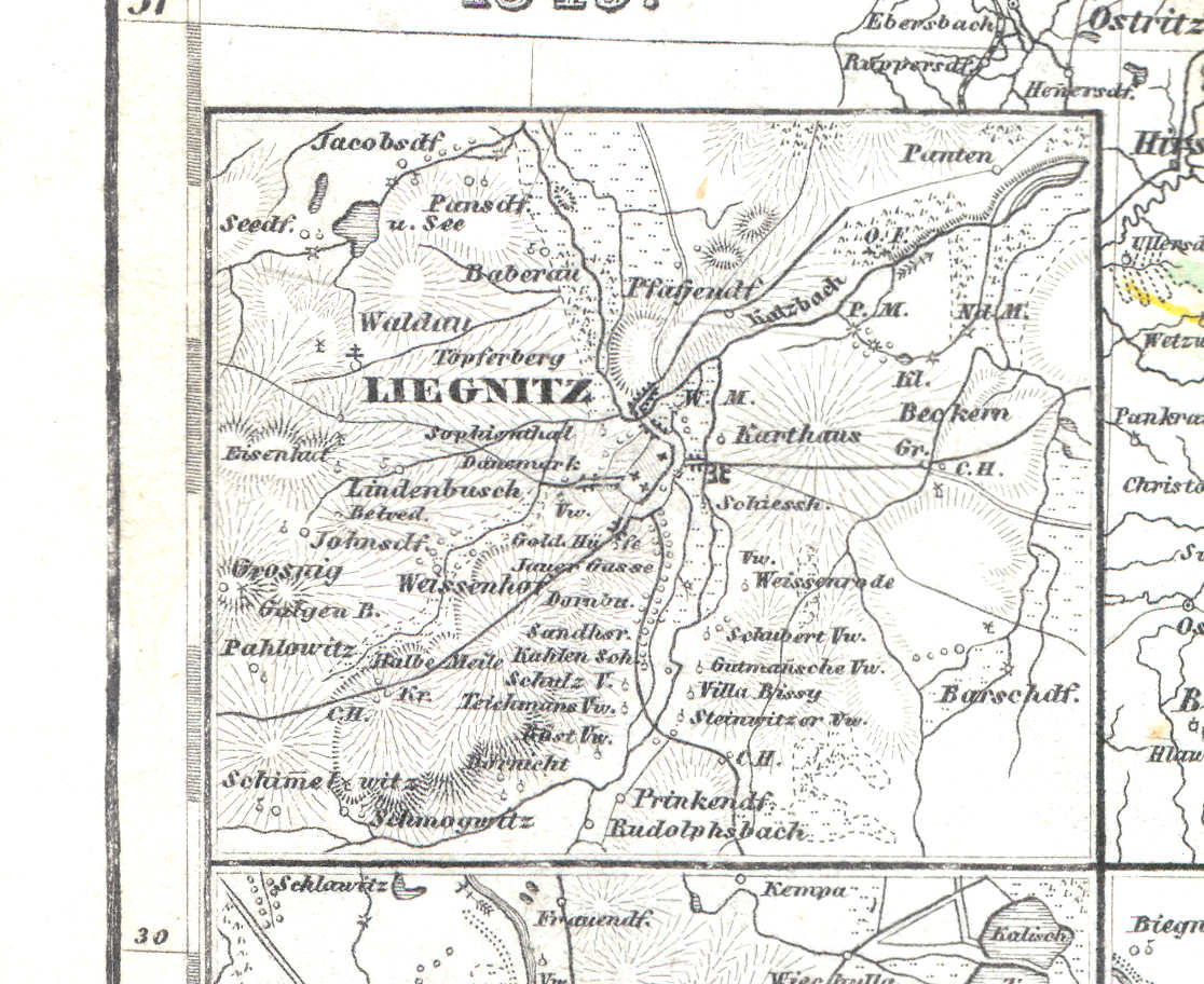
59e. Liegnitz
Liegnitz / Legnica
 Meyer's Zeitungs-Atlas (1849-1852)
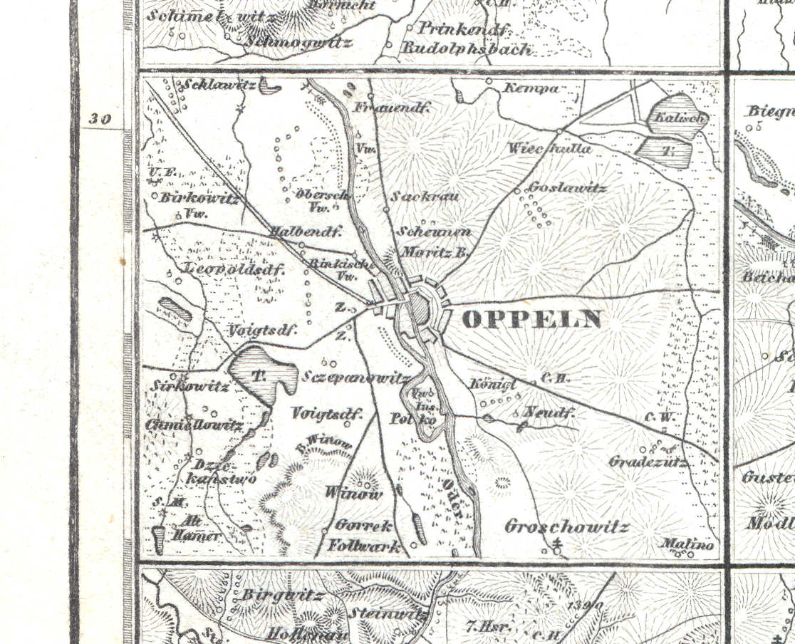
59f. Oppeln
Oppeln / Opole
 Meyer's Zeitungs-Atlas (1849-1852)
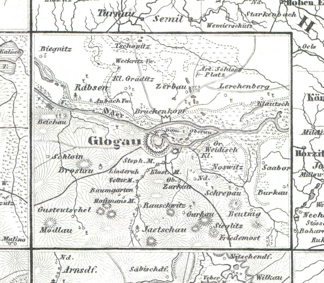
59g. Glogau
Glogau / Głogów
 Meyer's Zeitungs-Atlas (1849-1852)
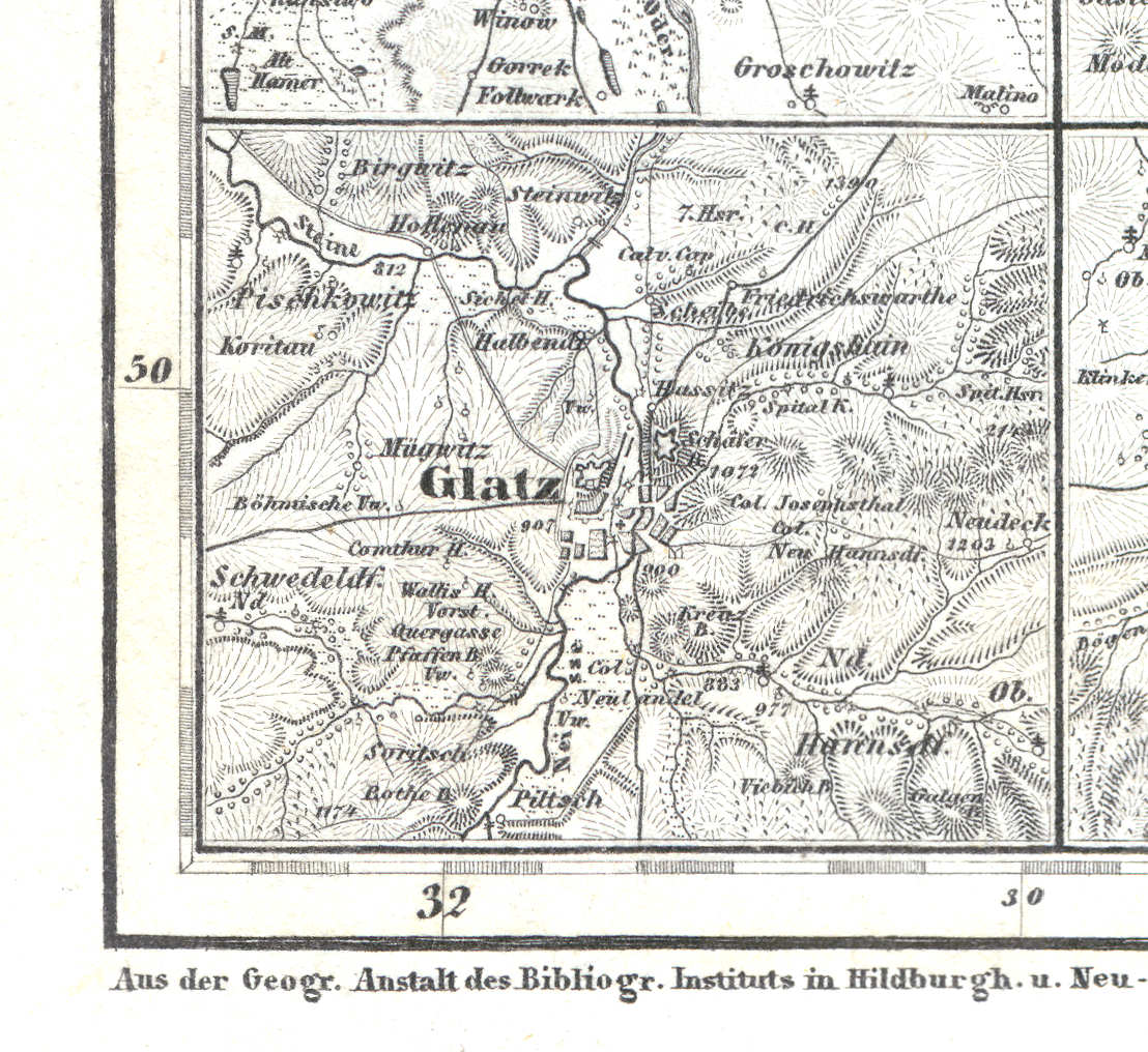
59h. Glatz
Glatz / Kłodzko
 Meyer's Zeitungs-Atlas (1849-1852)
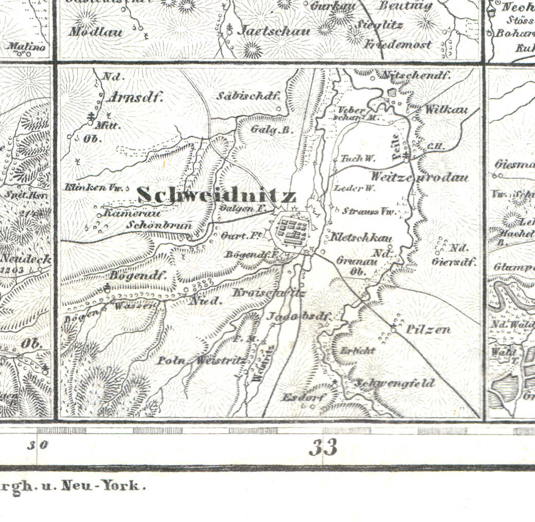
59i. Schweidnitz
Schweidnitz / Świdnica
 Meyer's Zeitungs-Atlas (1849-1852)
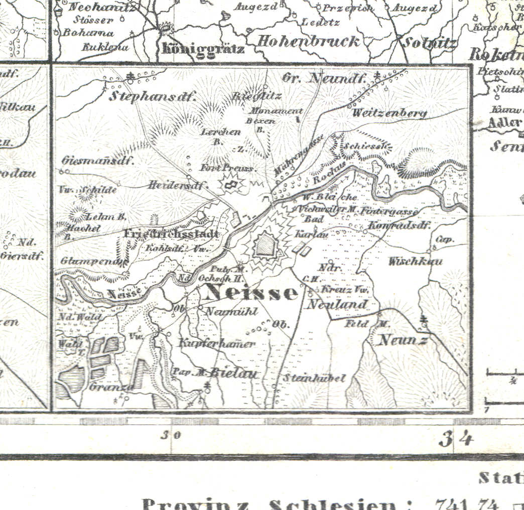
59j. Neisse
Neisse / Nysa
 Meyer's Zeitungs-Atlas (1849-1852)
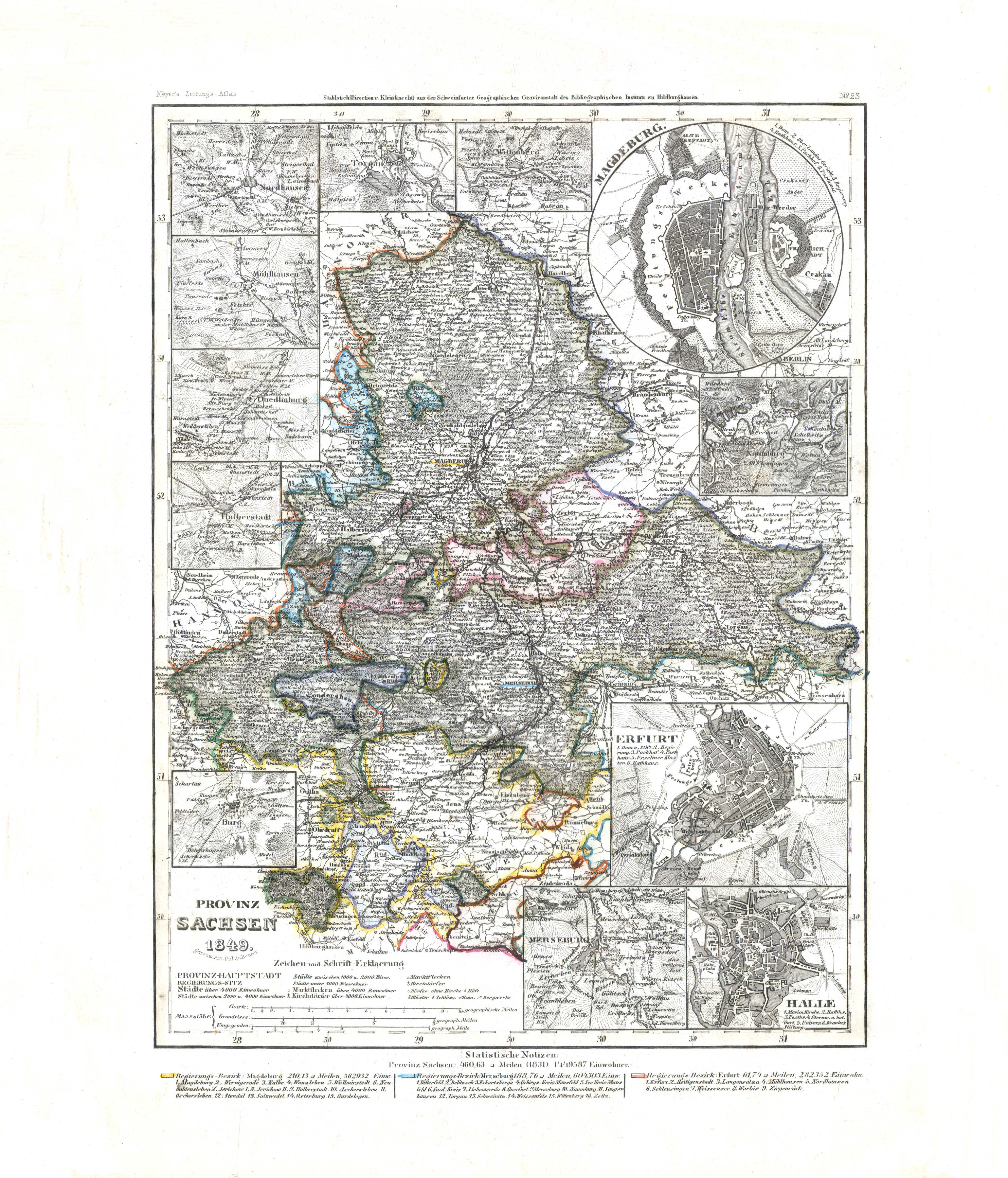
60. Provinz Sachsen (Nº 23, 1849) XL
Provincie Saksen / Province of Saxony
 Meyer's Zeitungs-Atlas (1849-1852)
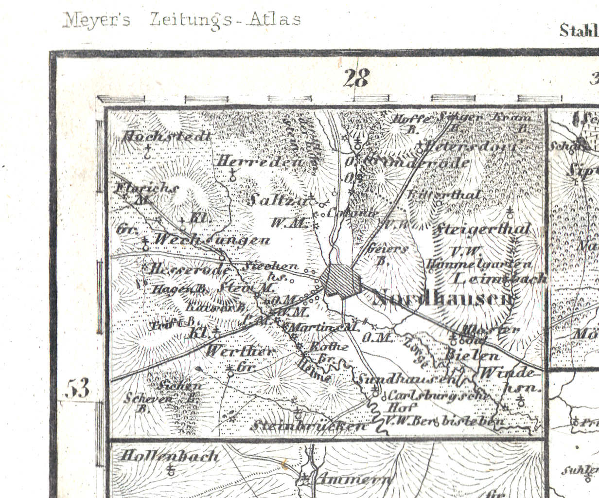
60a. Nordhausen
Nordhausen
 Meyer's Zeitungs-Atlas (1849-1852)
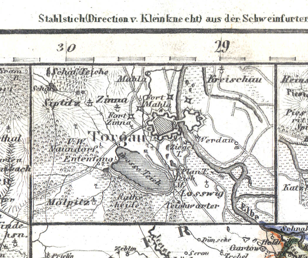
60b. Torgau
Torgau
 Meyer's Zeitungs-Atlas (1849-1852)
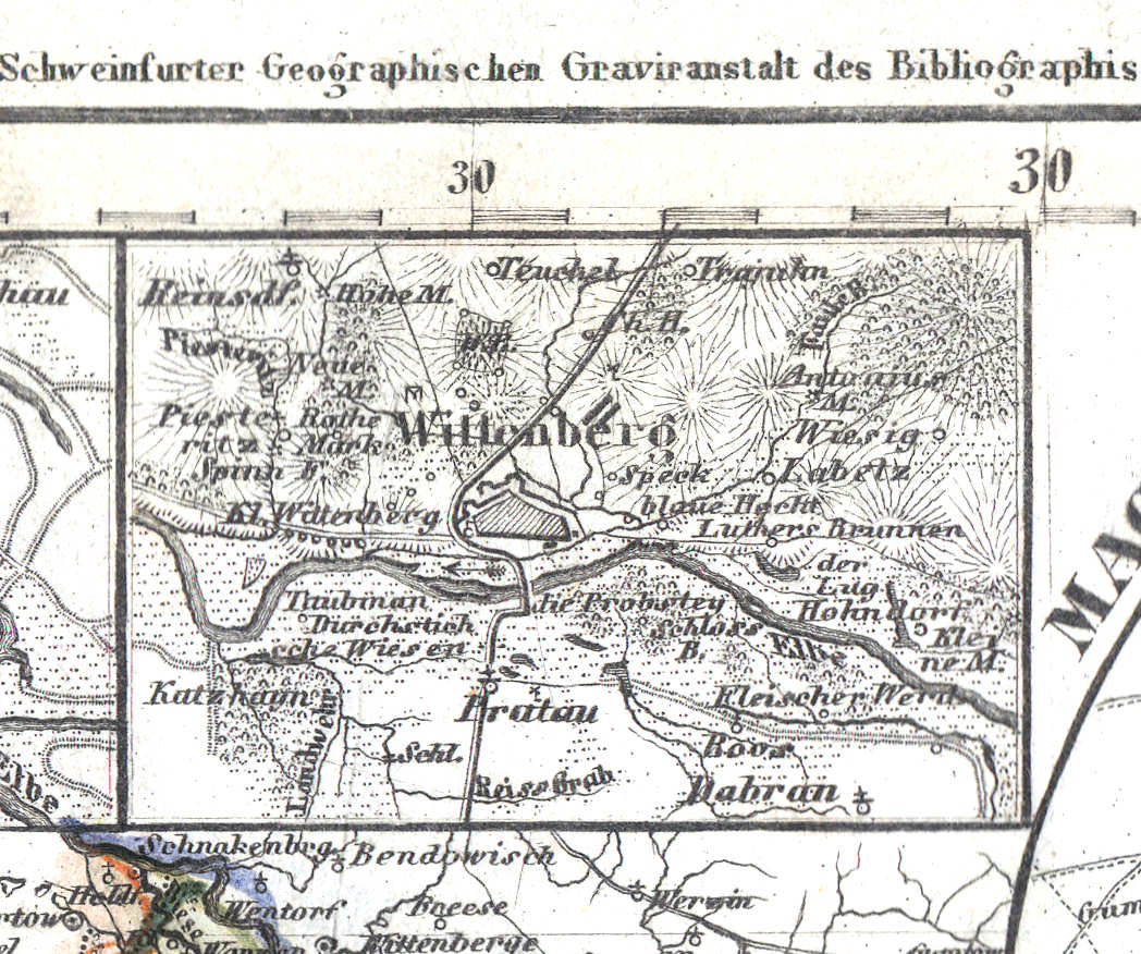
60c. Wittenberg
Wittenberg
 Meyer's Zeitungs-Atlas (1849-1852)
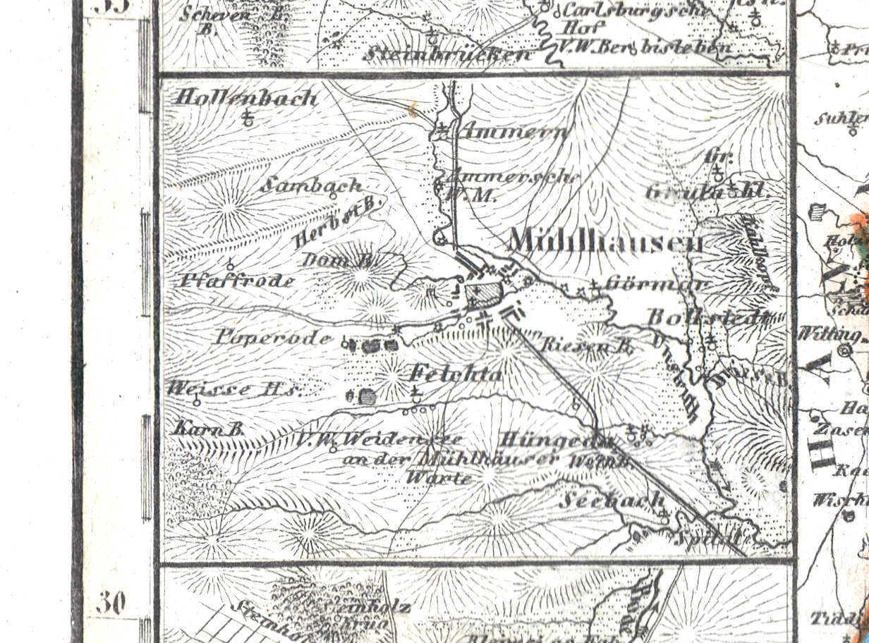
60d. Mühlhausen
Mühlhausen
 Meyer's Zeitungs-Atlas (1849-1852)
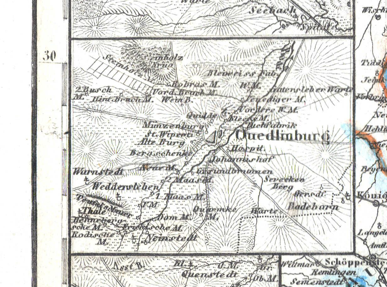
60e. Quedlinburg
Quedlinburg
 Meyer's Zeitungs-Atlas (1849-1852)
60f. Halberstadt
Halberstadt
 Meyer's Zeitungs-Atlas (1849-1852)
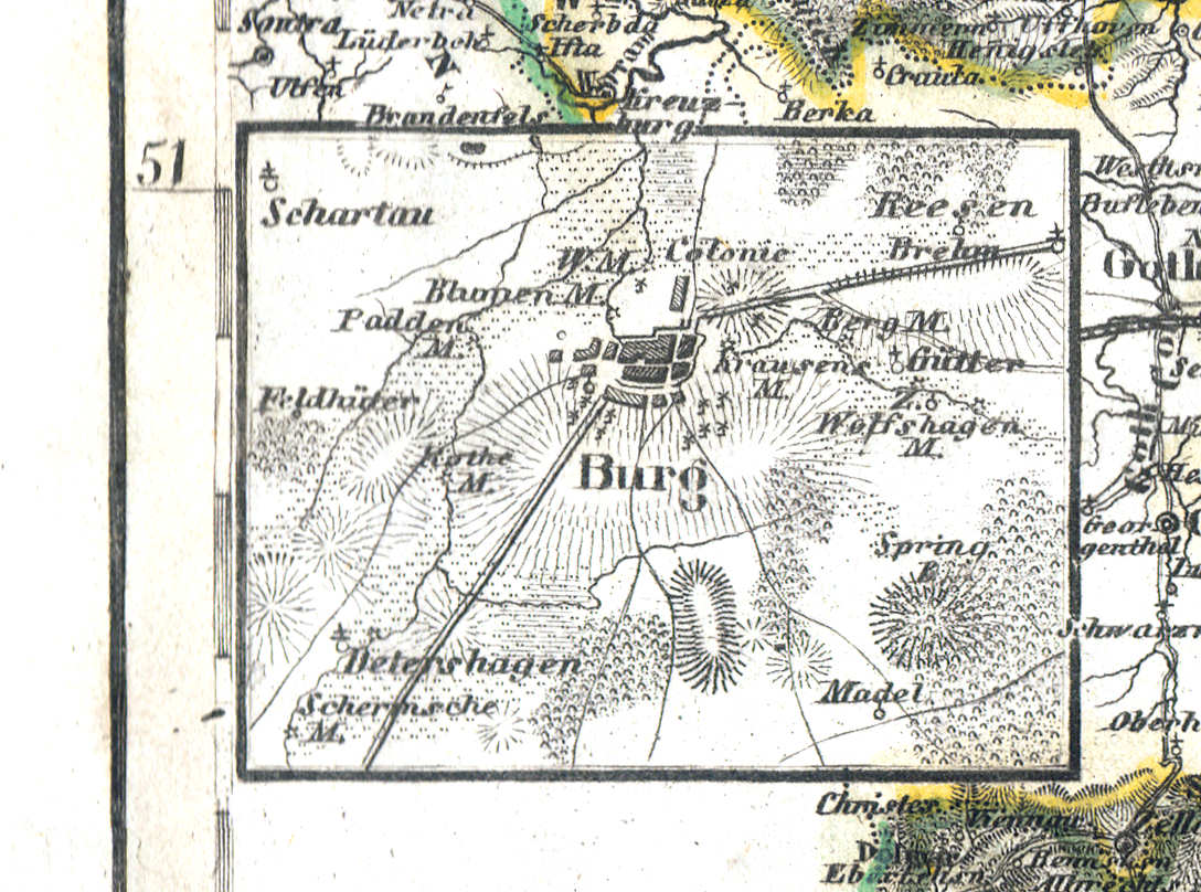
60g. Burg
Burg
 Meyer's Zeitungs-Atlas (1849-1852)
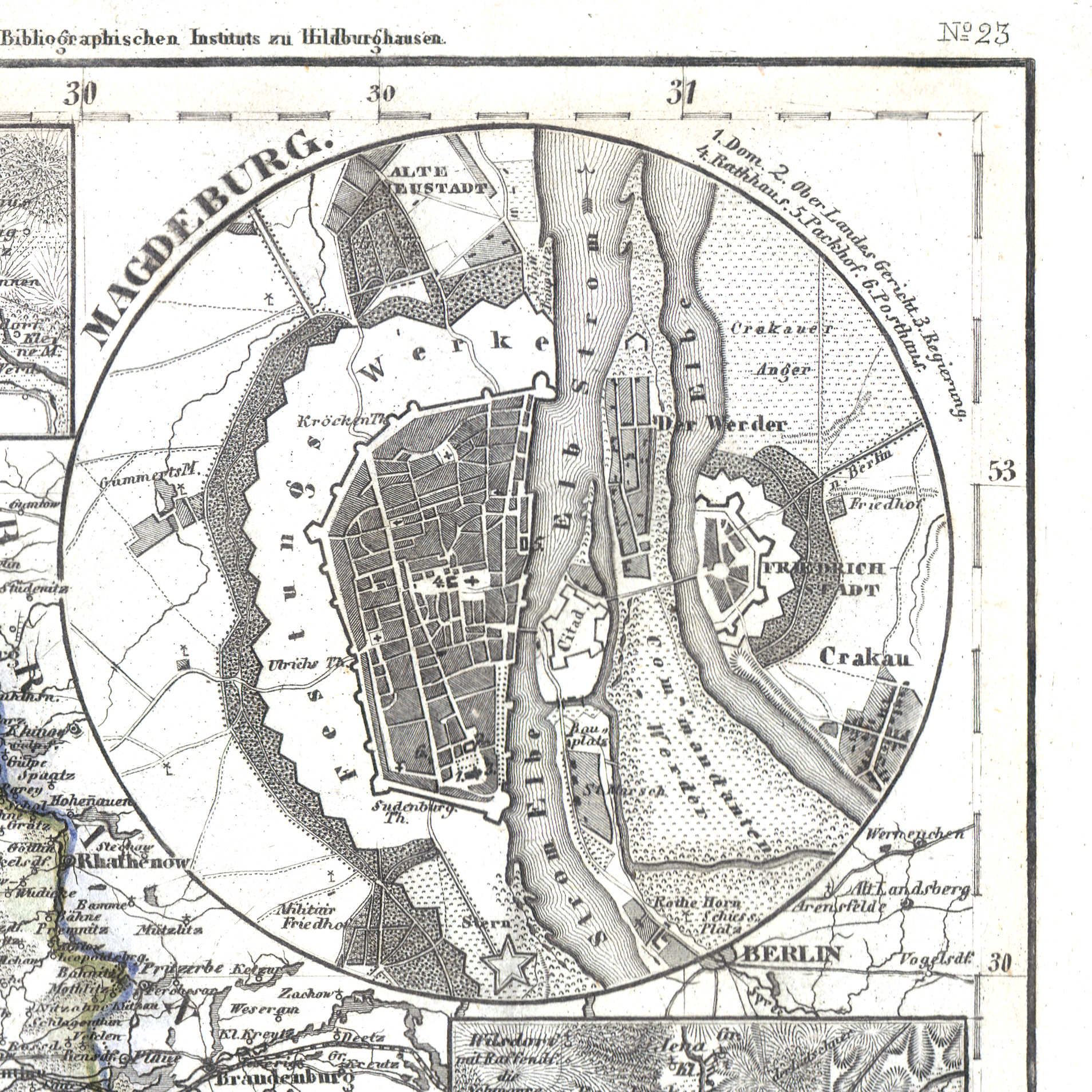
60h. Magdeburg
Maagdenburg / Magdeburg
 Meyer's Zeitungs-Atlas (1849-1852)
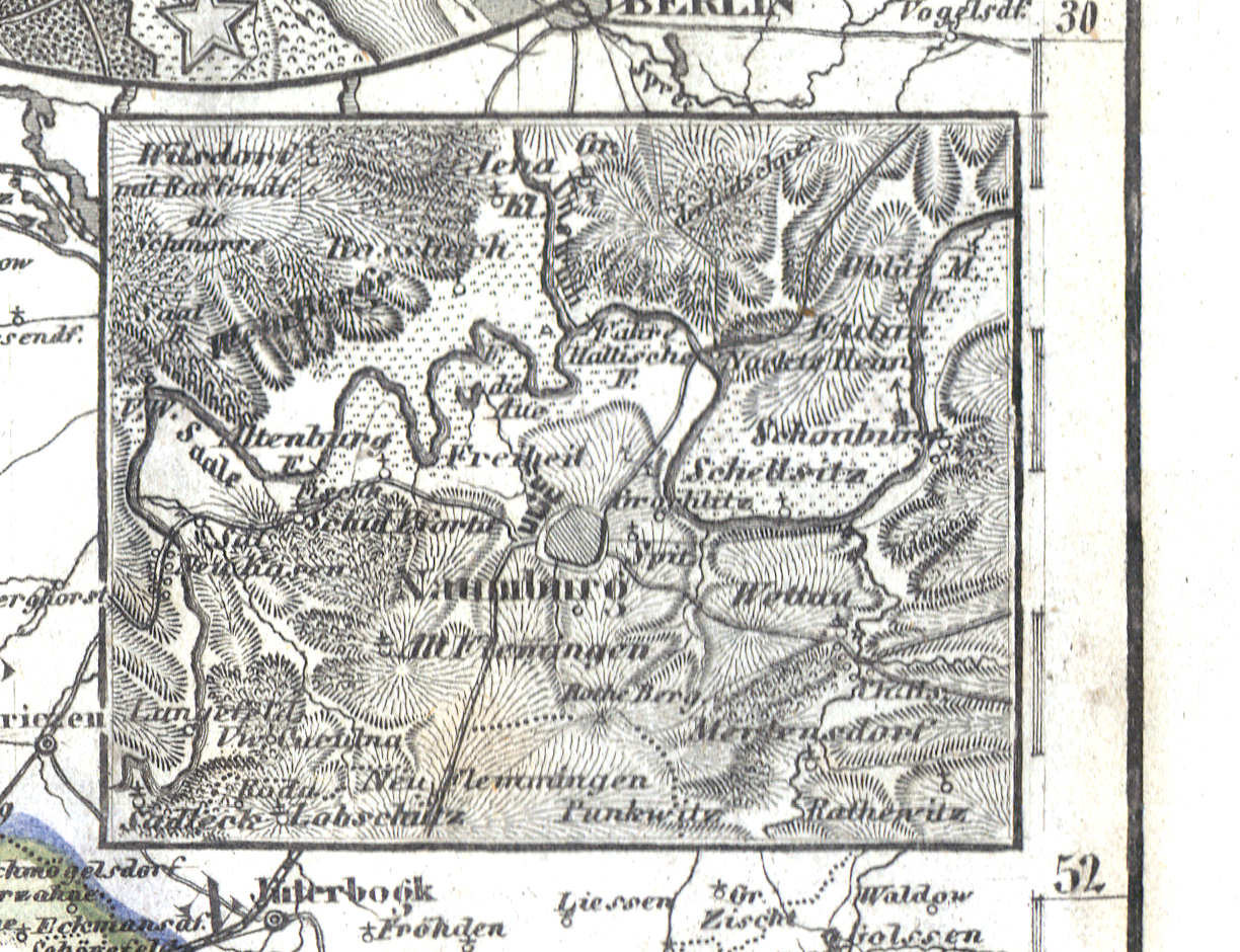
60i. Naumburg
Naumburg
 Meyer's Zeitungs-Atlas (1849-1852)
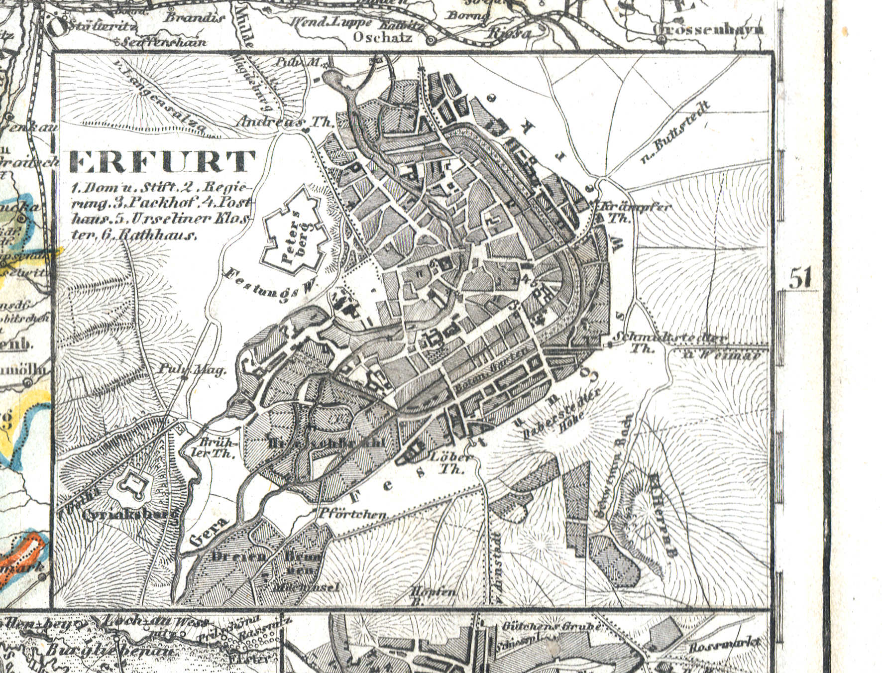
60j. Erfurt
Erfurt
 Meyer's Zeitungs-Atlas (1849-1852)
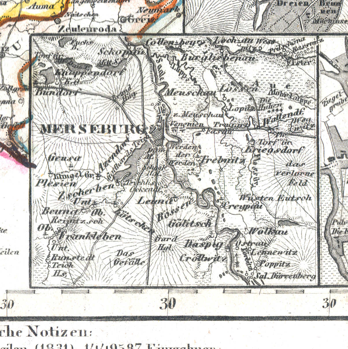
60k. Merseburg
Merseburg
 Meyer's Zeitungs-Atlas (1849-1852)
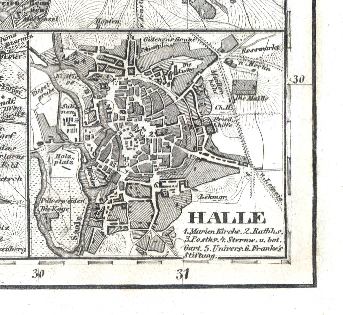
60l. Halle
Halle
 Meyer's Zeitungs-Atlas (1849-1852)
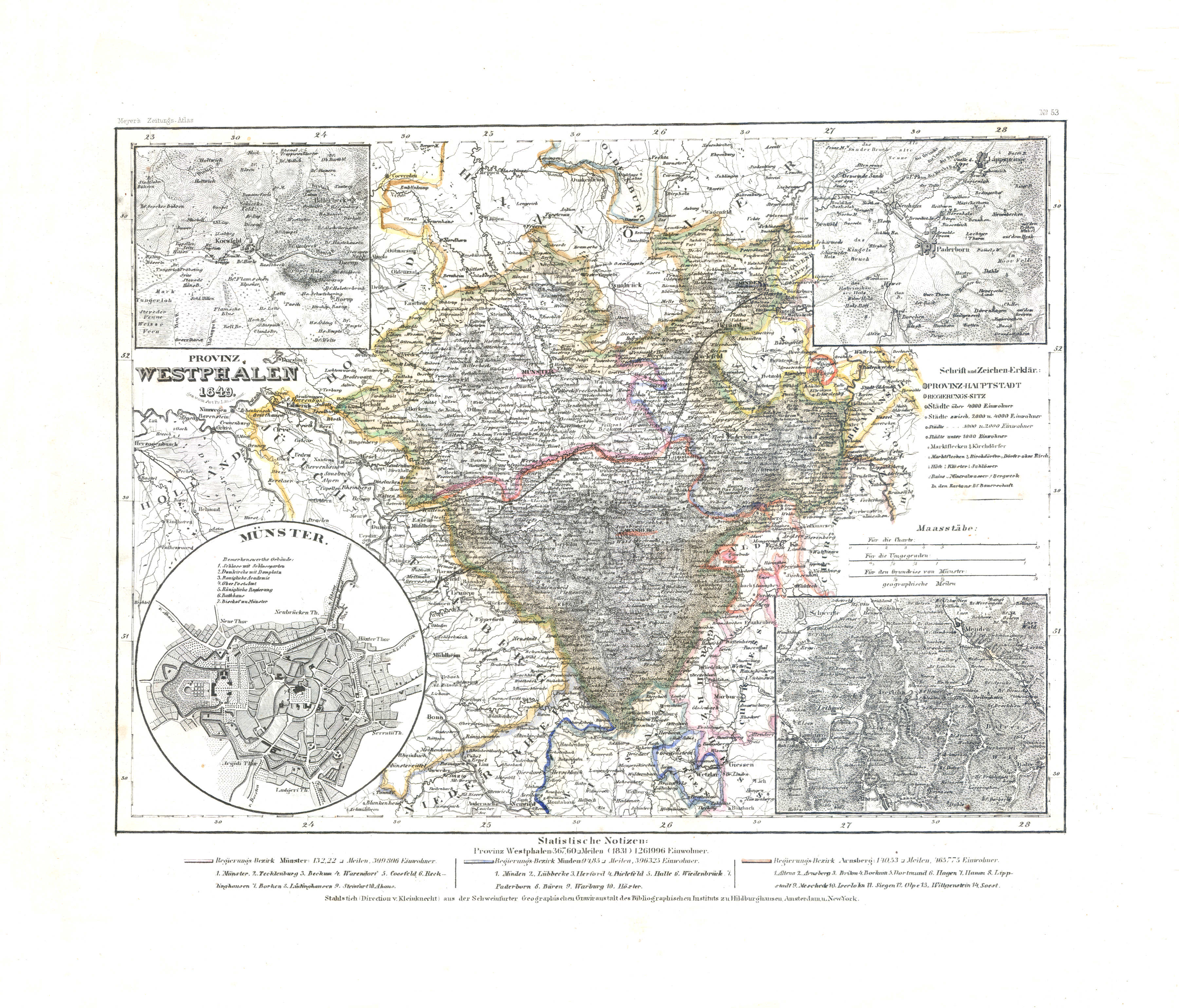
61. Provinz Westphalen (Nº 53, 1849) XL
Provincie Westfalen / Province of Westphalia
 Meyer's Zeitungs-Atlas (1849-1852)
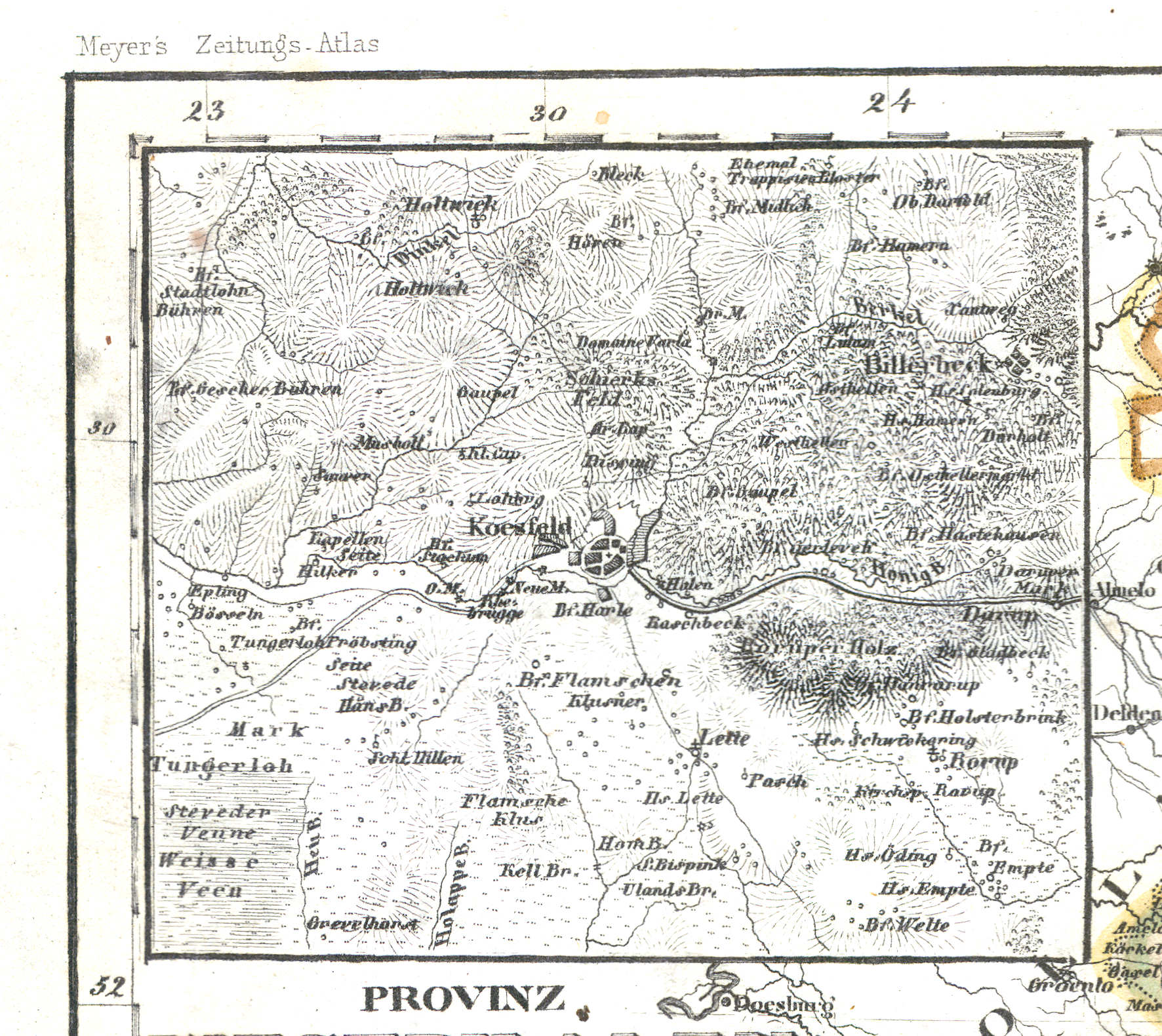
61a. Koesfeld
Koesfeld
 Meyer's Zeitungs-Atlas (1849-1852)
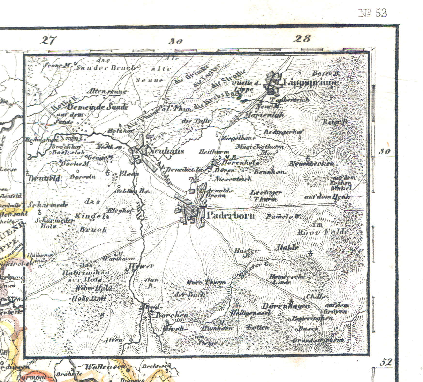
61b. Paderborn
Paderborn
 Meyer's Zeitungs-Atlas (1849-1852)
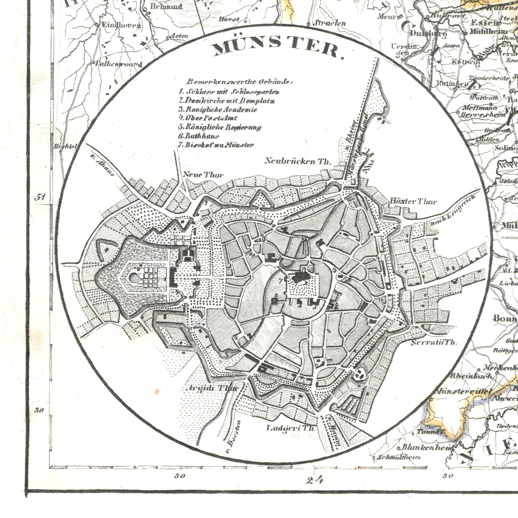
61c. Münster
Münster
 Meyer's Zeitungs-Atlas (1849-1852)
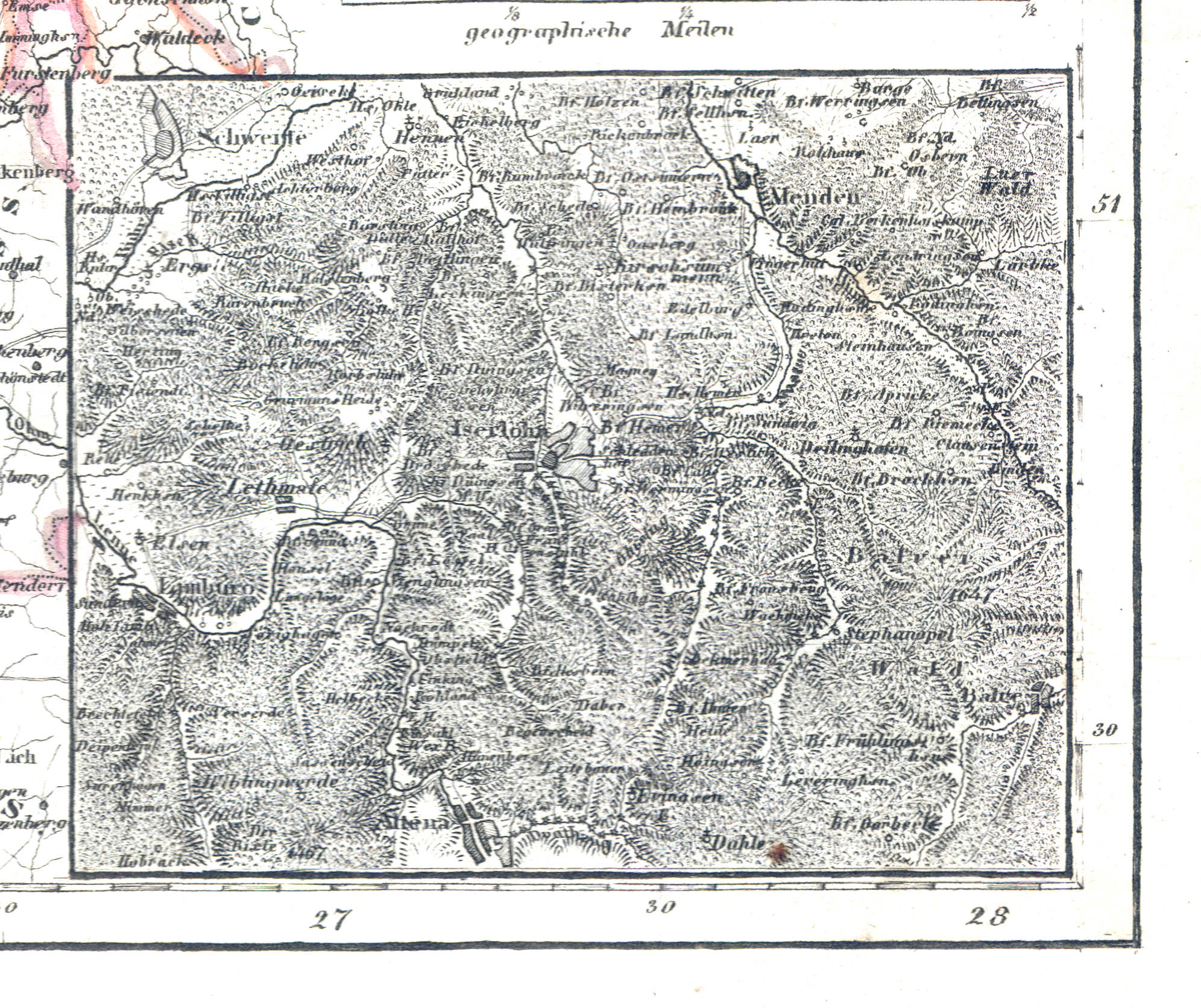
61d. Iserlohn
Iserlohn
 Meyer's Zeitungs-Atlas (1849-1852)
62. Rheinprovinz Jülich-Cleve-Berg (Nº 48, 1849) XL
Provincie Gulik-Kleef-Berg / Province of Jülich-Cleves-Berg
 Meyer's Zeitungs-Atlas (1849-1852)
62a. Düsseldorf
Düsseldorf
 Meyer's Zeitungs-Atlas (1849-1852)
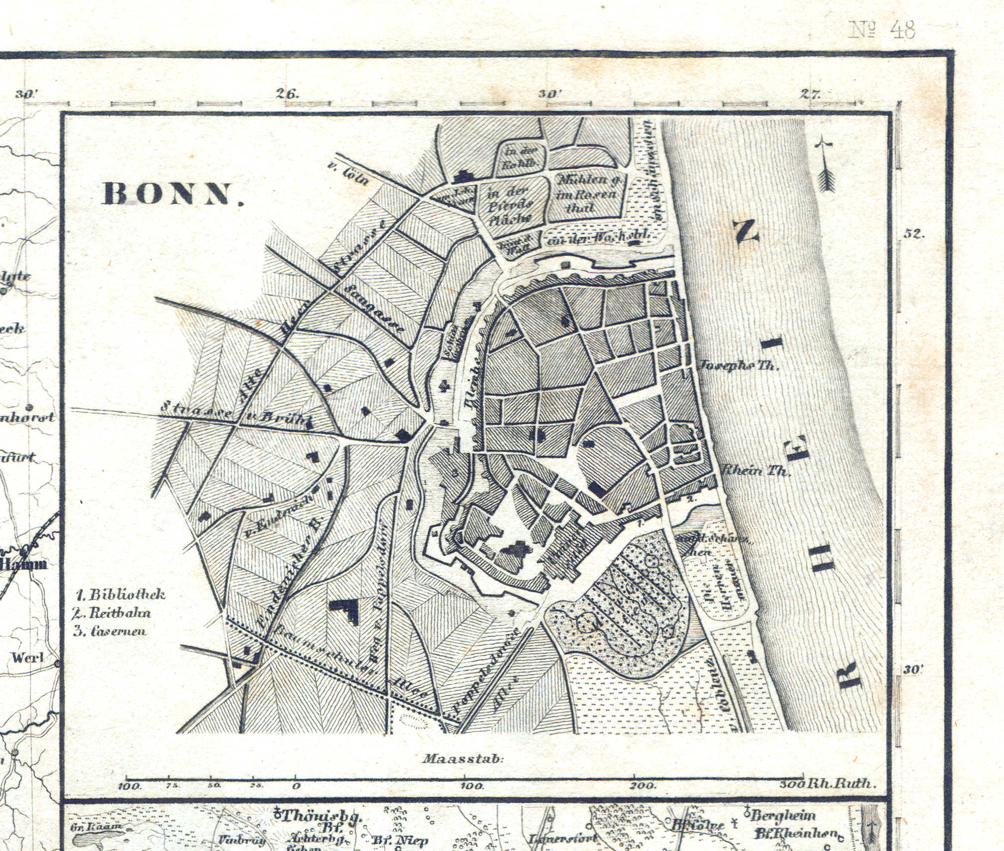
62b. Bonn
Bonn
 Meyer's Zeitungs-Atlas (1849-1852)
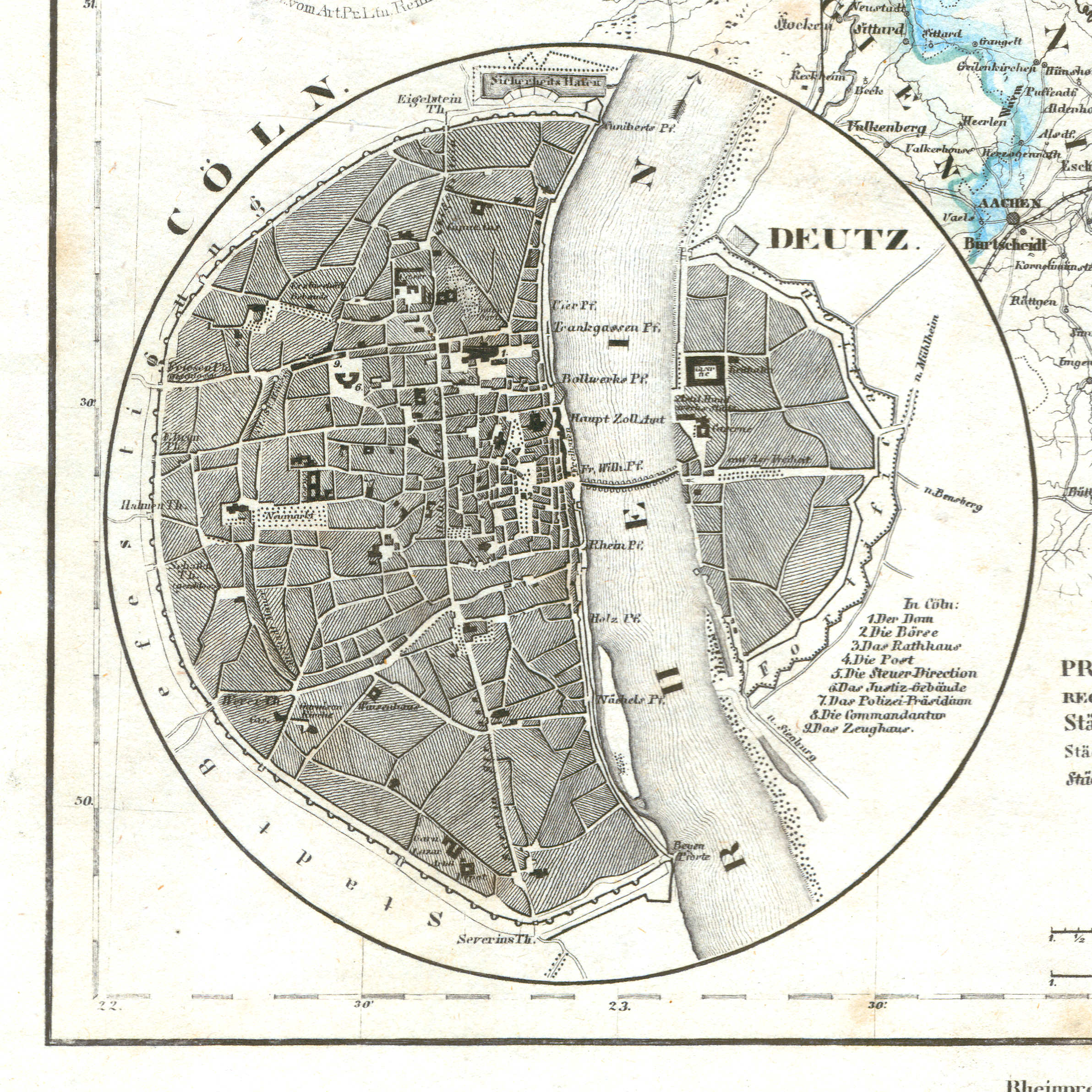
62c. Cöln
Keulen / Cologne / Köln
 Meyer's Zeitungs-Atlas (1849-1852)
62d. Krefeld
Krefeld
 Meyer's Zeitungs-Atlas (1849-1852)
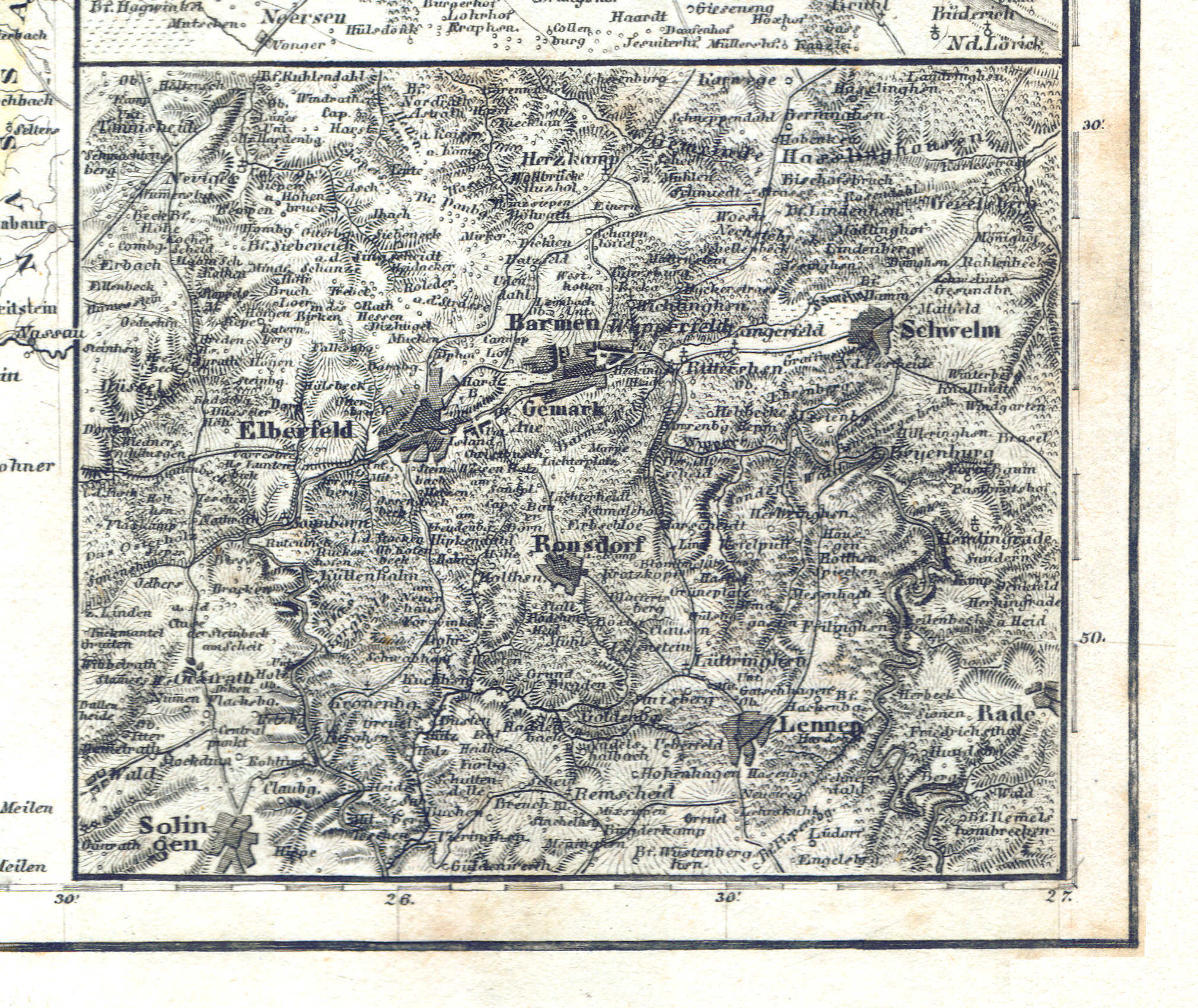
62e. Elberfeld
Elberfeld (Wuppertal)
 Meyer's Zeitungs-Atlas (1849-1852)
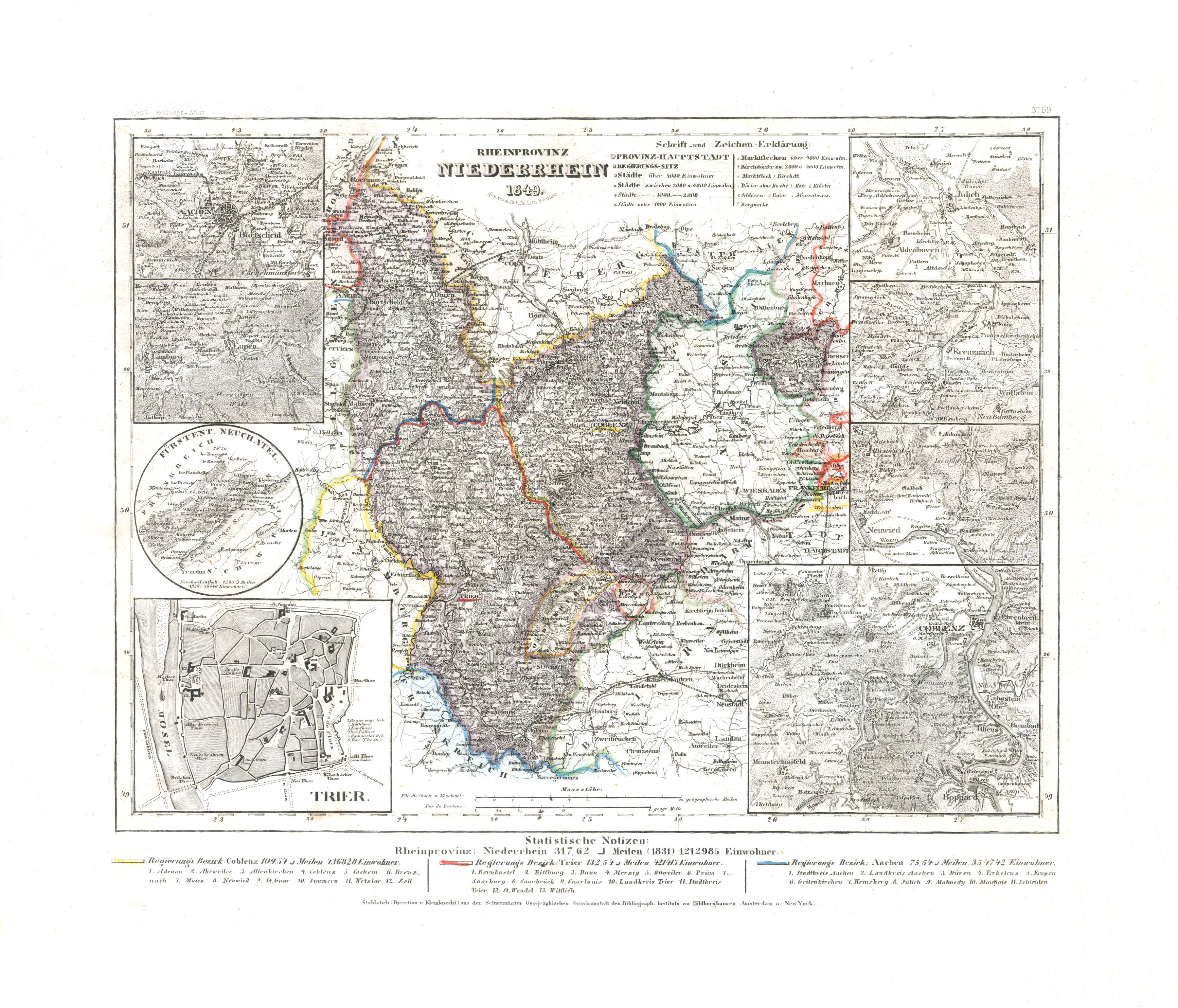
63. Rheinprovinz Niederrhein (Nº 59, 1849) XL
Provincie Beneden-Rijn / Province of the Lower Rhine
 Meyer's Zeitungs-Atlas (1849-1852)
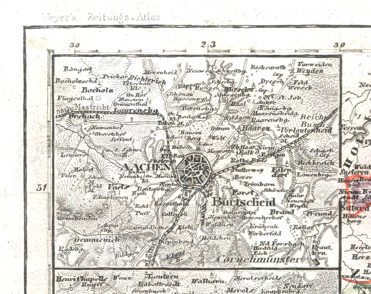
63a. Aachen
Aken / Aix-la-Chapelle
 Meyer's Zeitungs-Atlas (1849-1852)
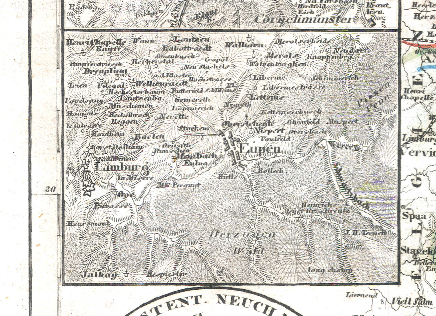
63b. Eupen
Eupen
 Meyer's Zeitungs-Atlas (1849-1852)
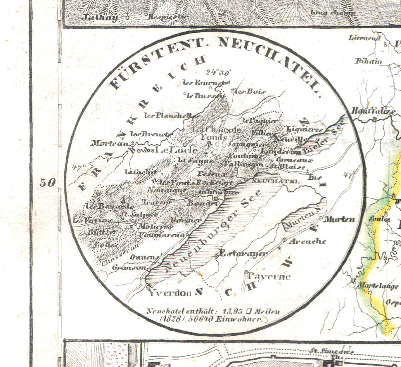
63c. Fürstent. Neuchatel
Vorstendom Neuchâtel / Principality of Neuchâtel
 Meyer's Zeitungs-Atlas (1849-1852)
63d. Trier
Trier
 Meyer's Zeitungs-Atlas (1849-1852)
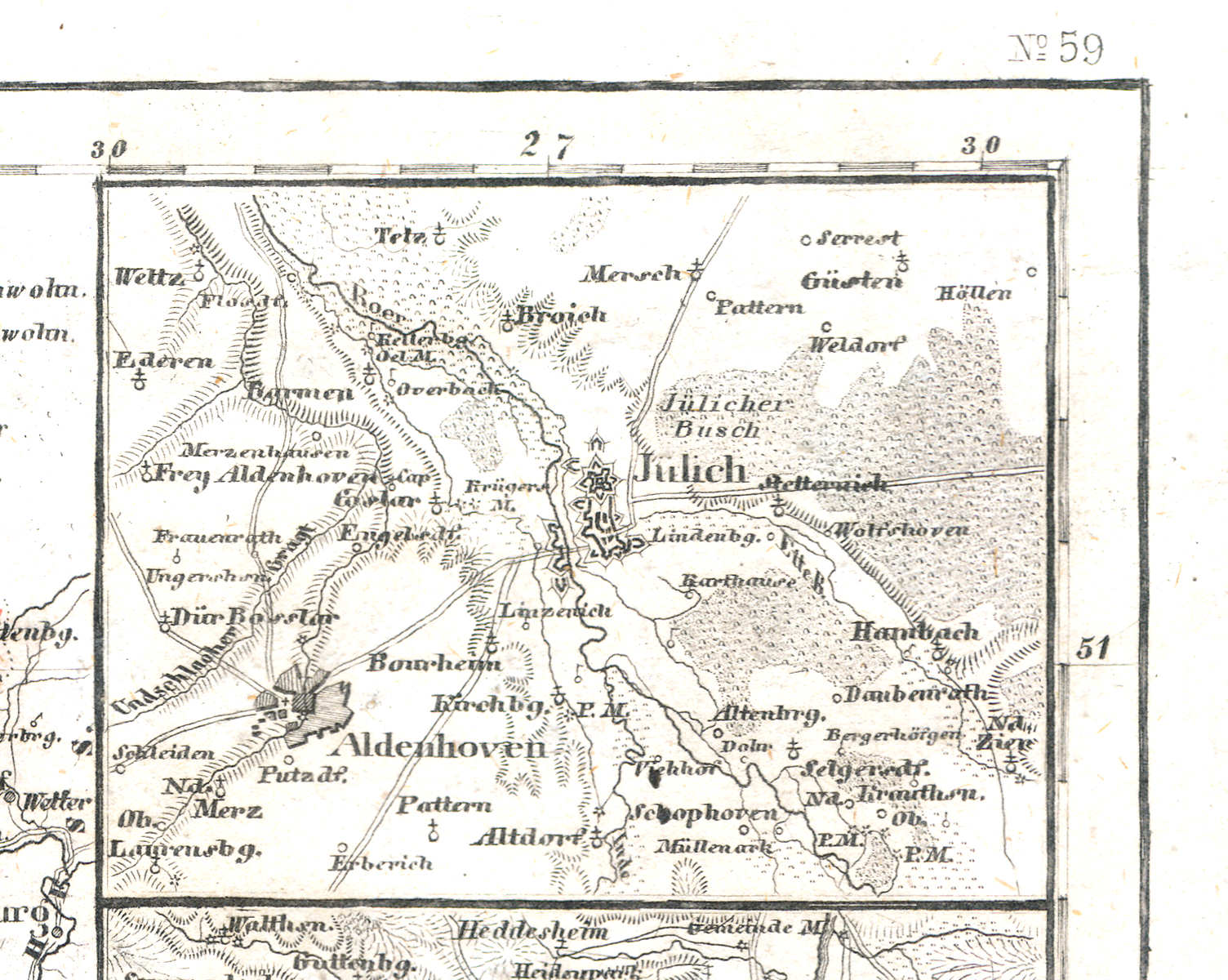
63e. Jülich
Gulik / Jülich
 Meyer's Zeitungs-Atlas (1849-1852)
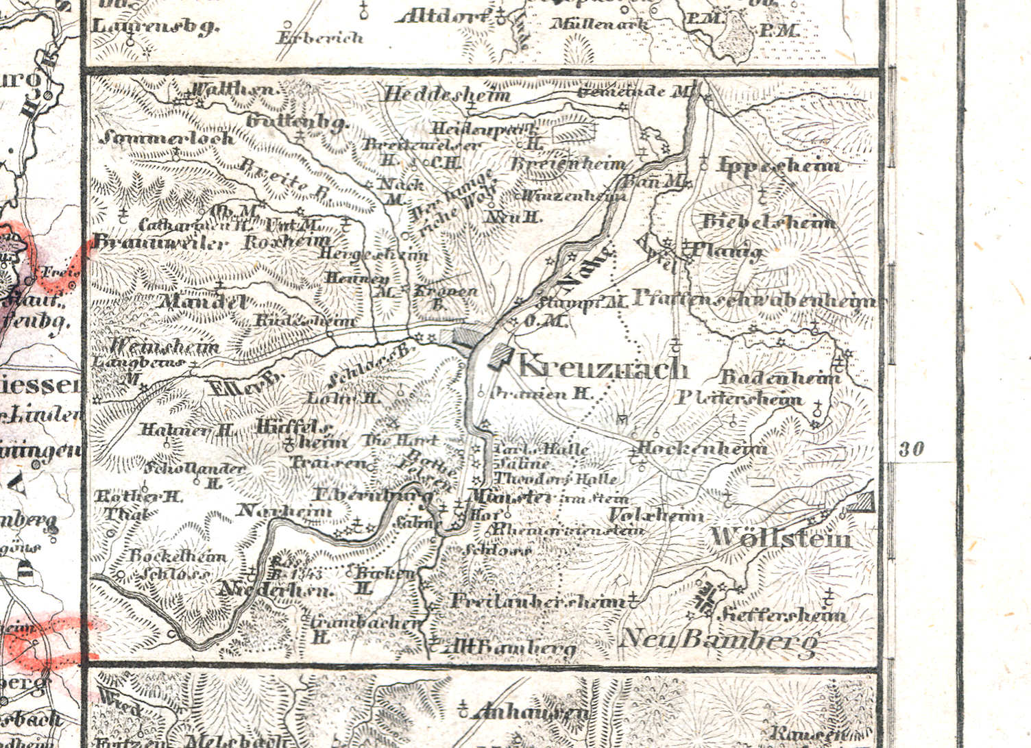
63f. Kreuznach
Kreuznach
 Meyer's Zeitungs-Atlas (1849-1852)
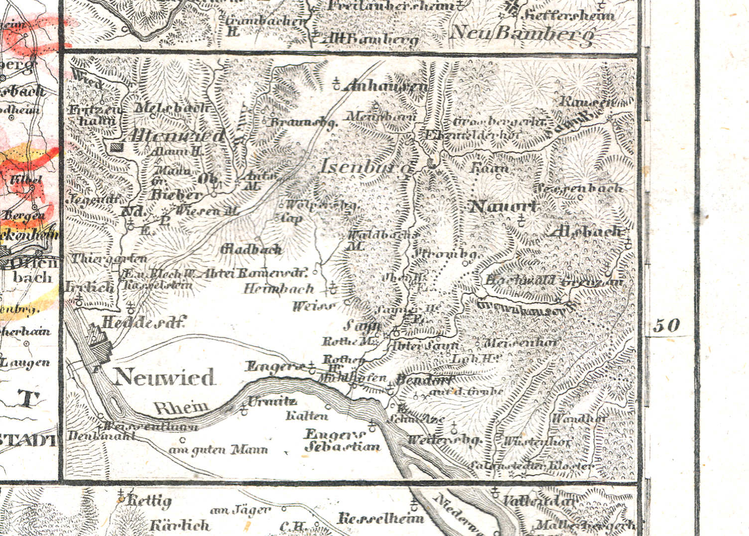
63g. Neuwied
Neuwied
 Meyer's Zeitungs-Atlas (1849-1852)
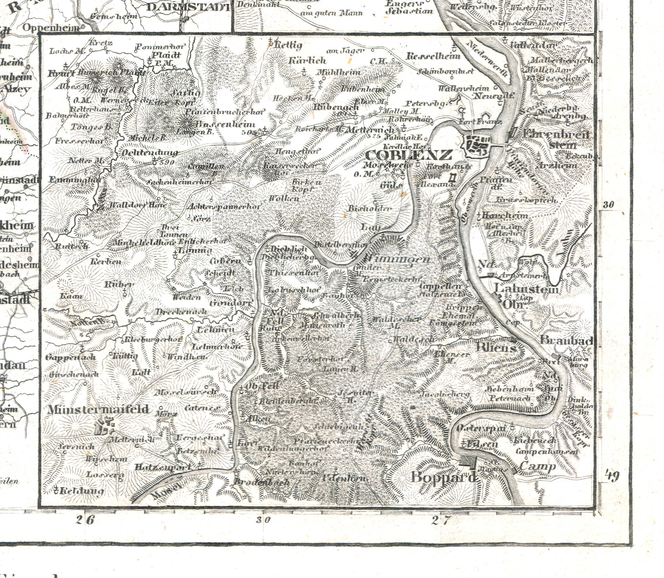
63h. Coblenz
Koblenz
 Meyer's Zeitungs-Atlas (1849-1852)
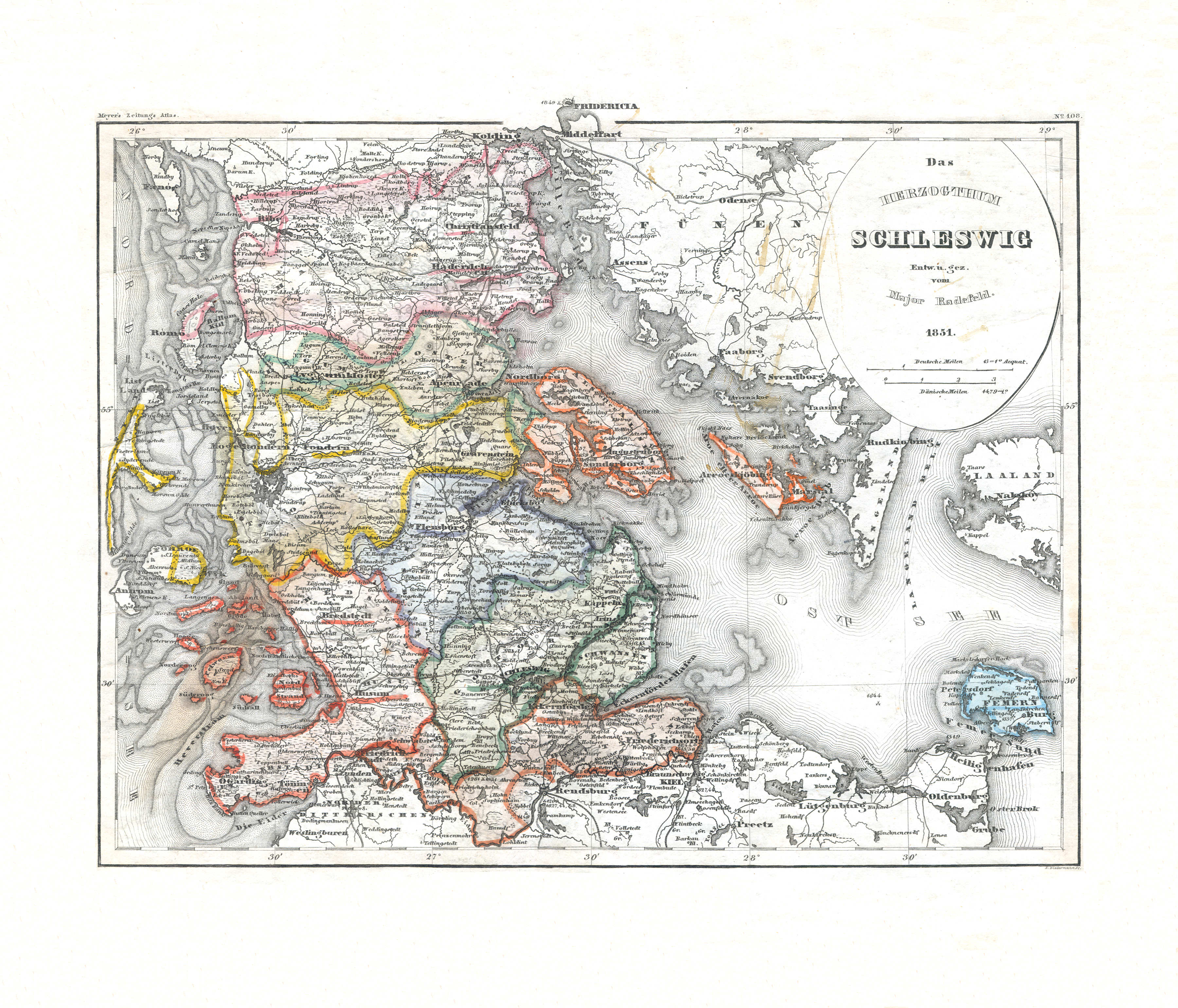
64. Das Herzogthum Schleswig (Nº 108, 1851)
Hertogdom Sleeswijk / Duchy of Schleswig
 Meyer's Zeitungs-Atlas (1849-1852)
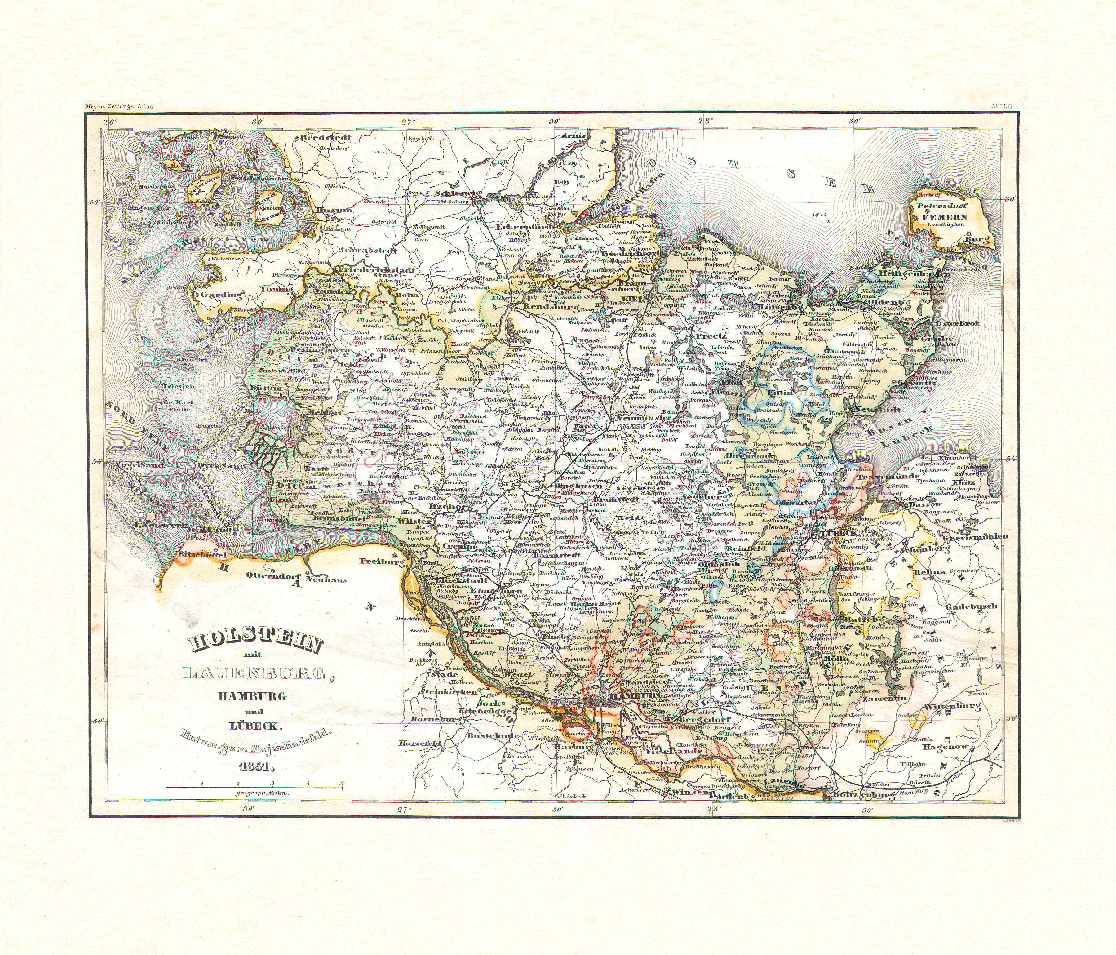
65. Holstein mit Lauenburg, Hamburg und Lübeck (Nº 106, 1851)
Holstein, Lauenburg, Hamburg, Lübeck
 Meyer's Zeitungs-Atlas (1849-1852)
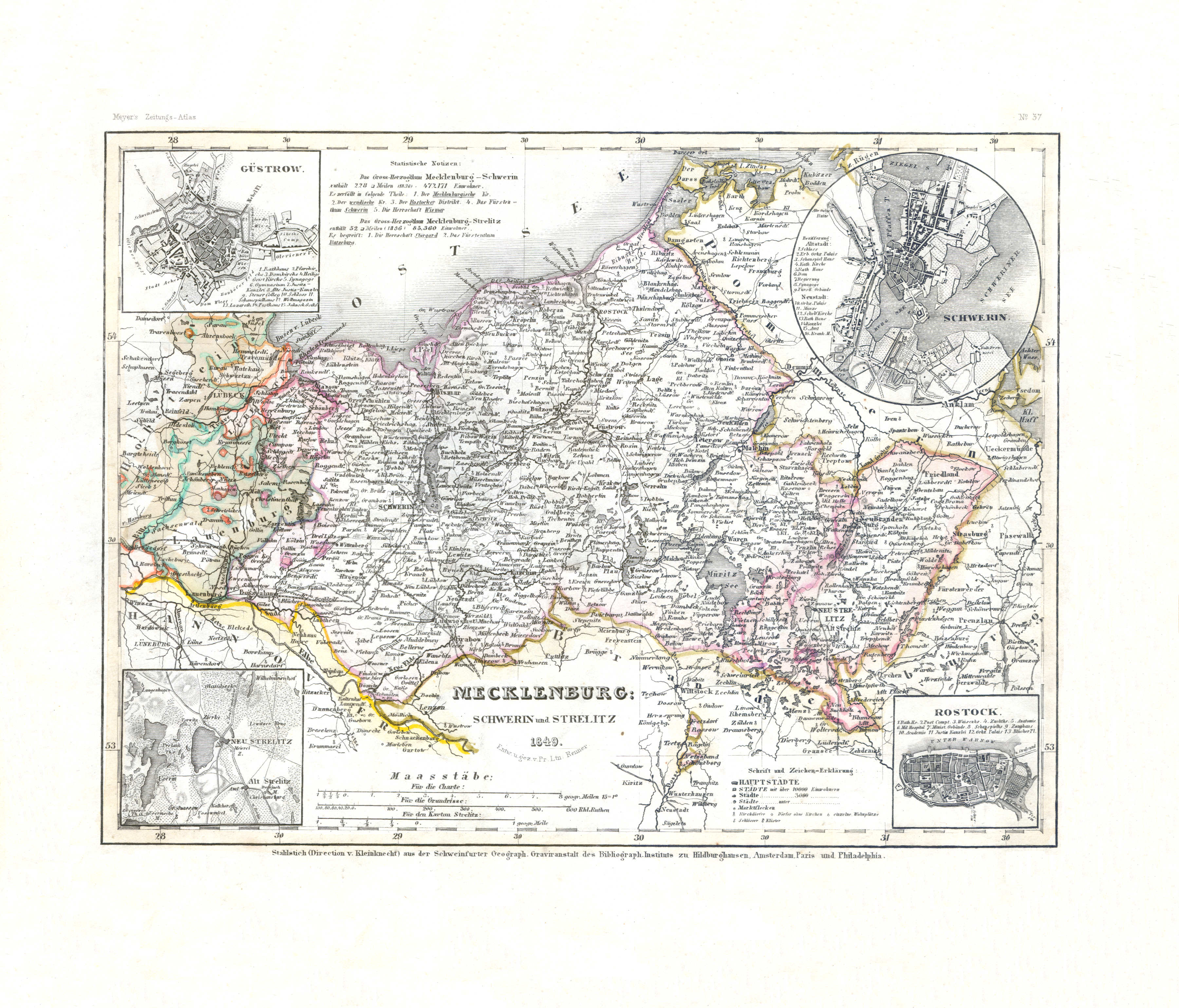
66. Mecklenburg Schwerin und Strelitz (Nº 37, 1849) XL
Mecklenburg-Schwerin, Mecklenburg-Strelitz
 Meyer's Zeitungs-Atlas (1849-1852)
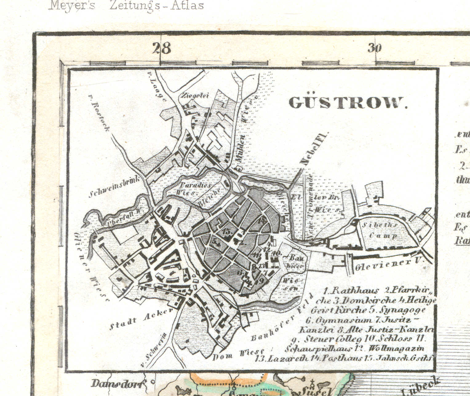
66a. Güstrow
Güstrow
 Meyer's Zeitungs-Atlas (1849-1852)
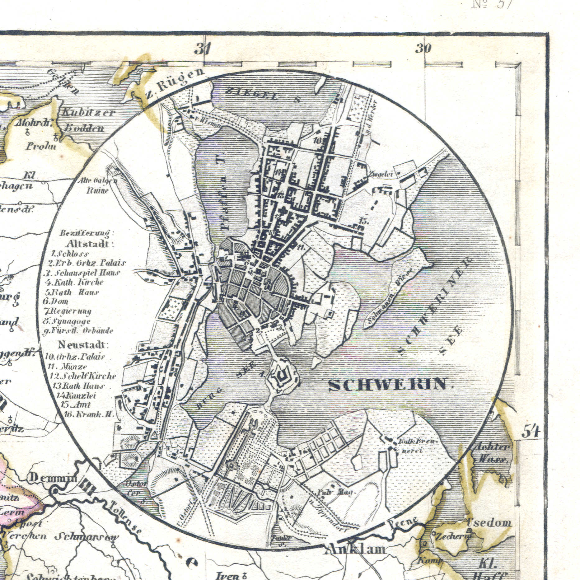
66b. Schwerin
Schwerin
 Meyer's Zeitungs-Atlas (1849-1852)
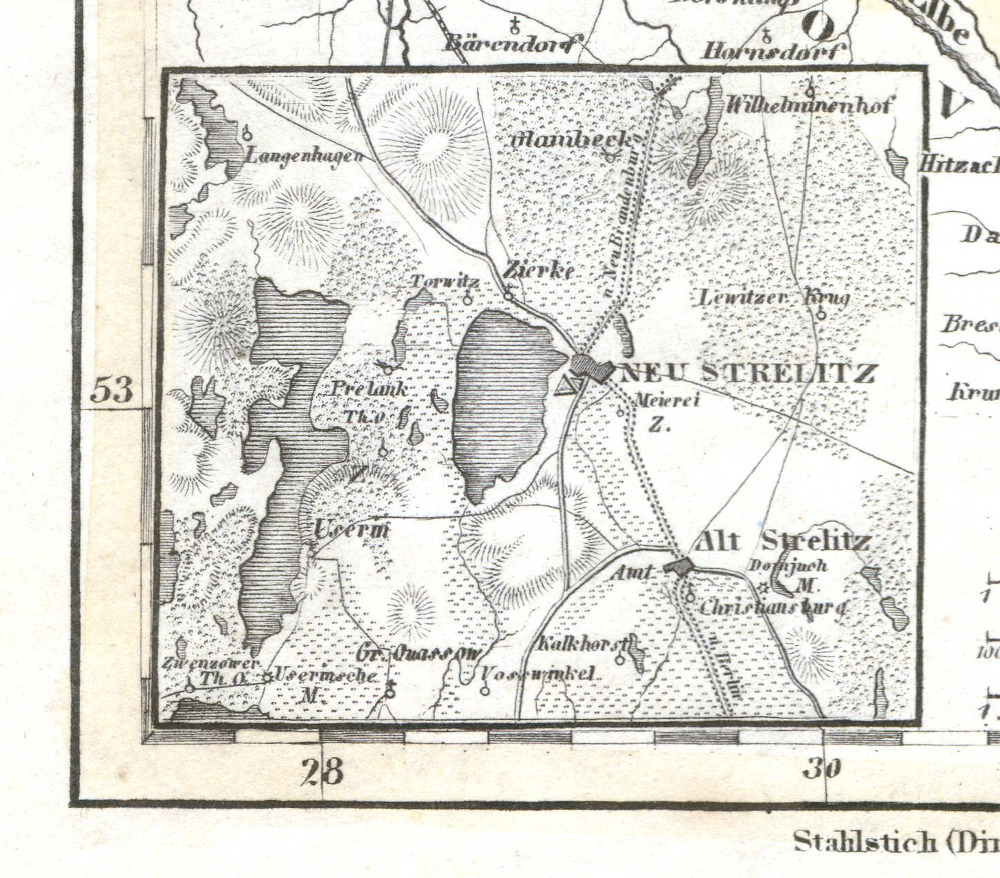
66c. Alt und Neu Strelitz
Alt und Neu Strelitz
 Meyer's Zeitungs-Atlas (1849-1852)
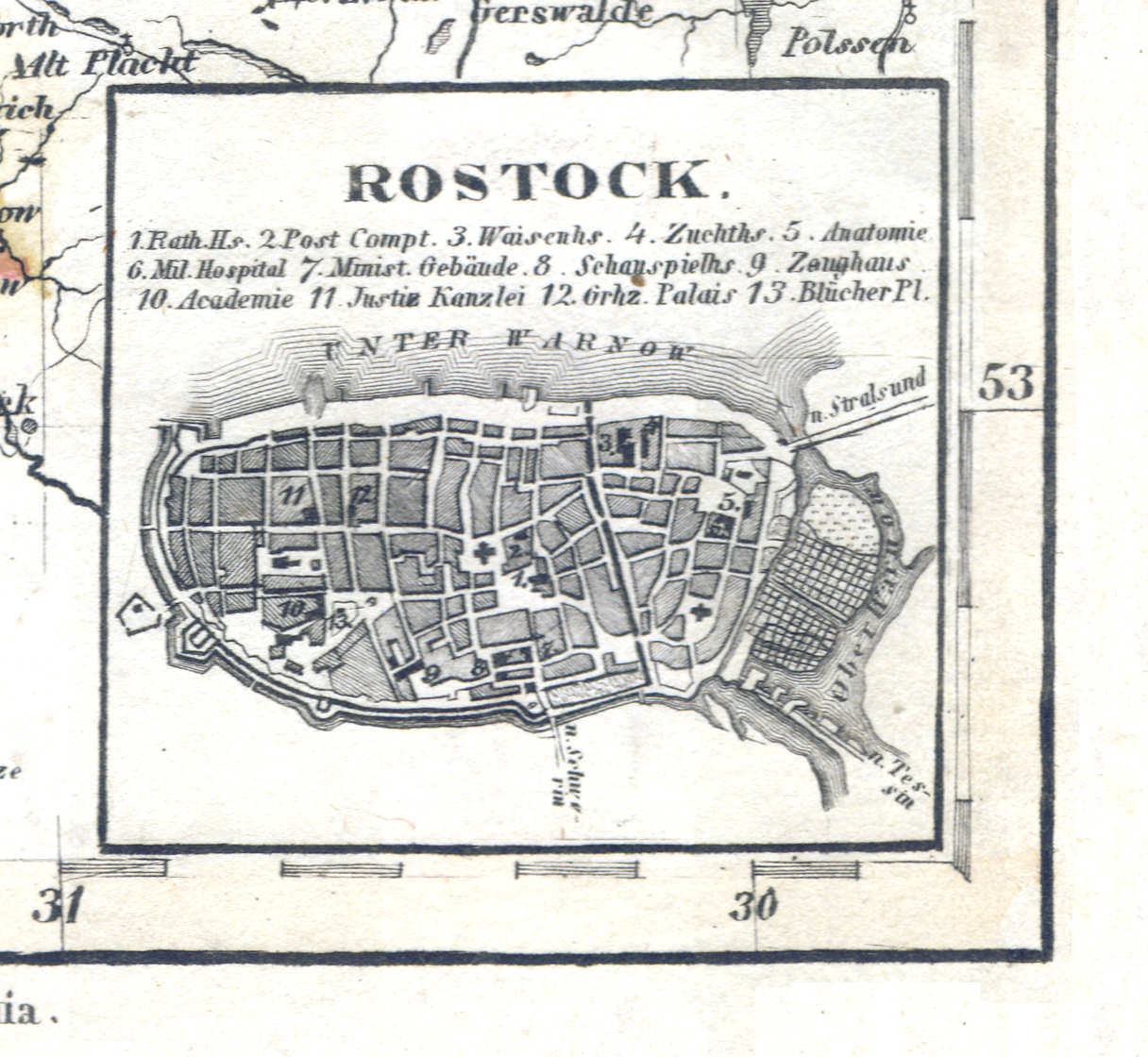
66d. Rostock
Rostock
 Meyer's Zeitungs-Atlas (1849-1852)
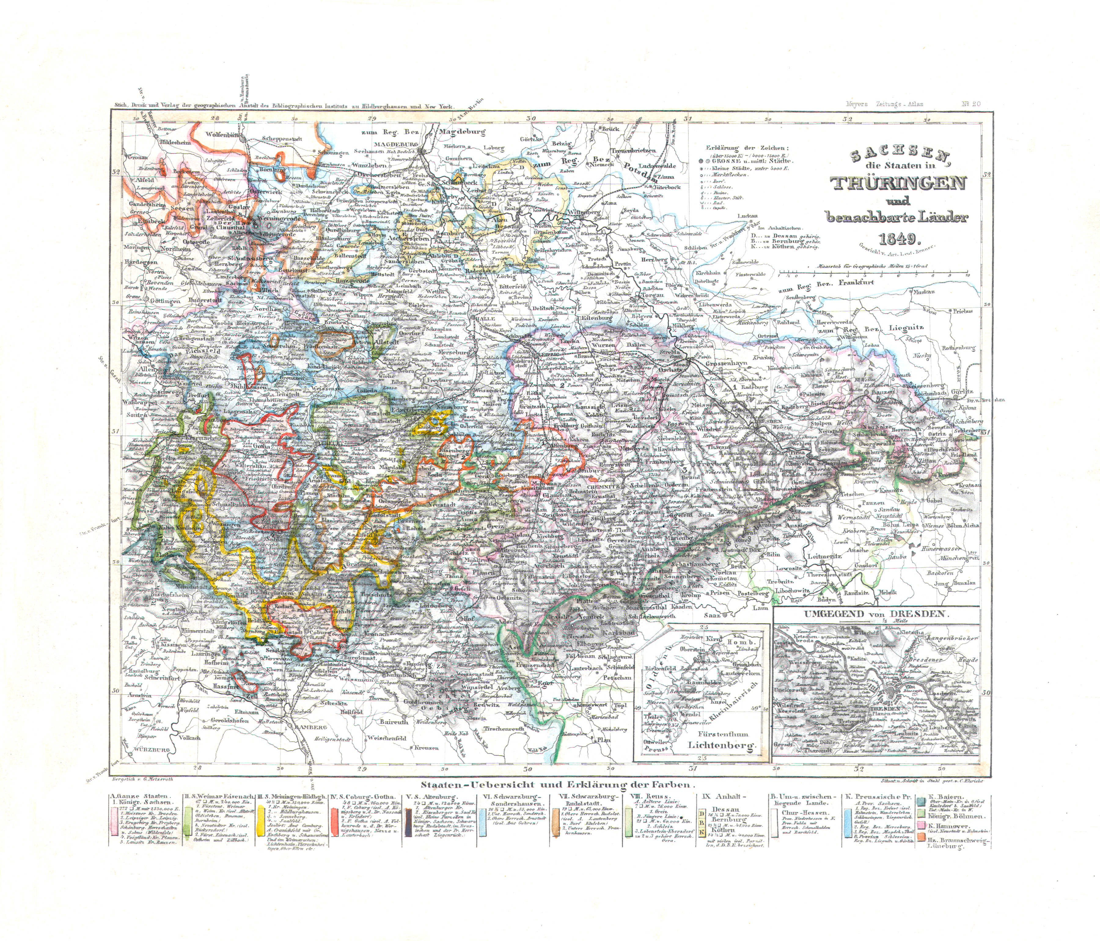
67. Sachsen, die Staaten in Thüringen und benachbarte Länder (Nº 20, 1849)
Saksen en Thüringen / Saxony and Thuringia
 Meyer's Zeitungs-Atlas (1849-1852)
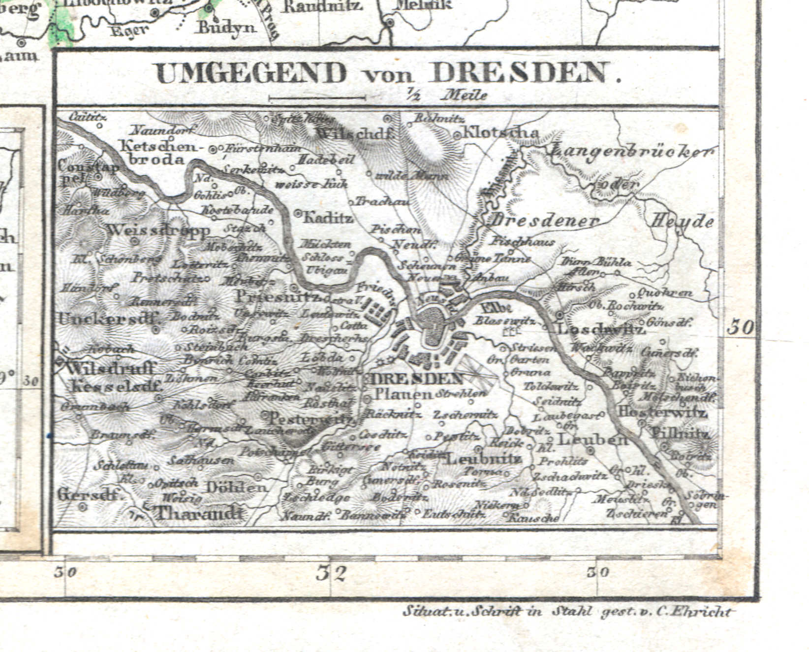
67b. Umgebung von Dresden
Dresden en omgeving / Dresden and environs
 Meyer's Zeitungs-Atlas (1849-1852)
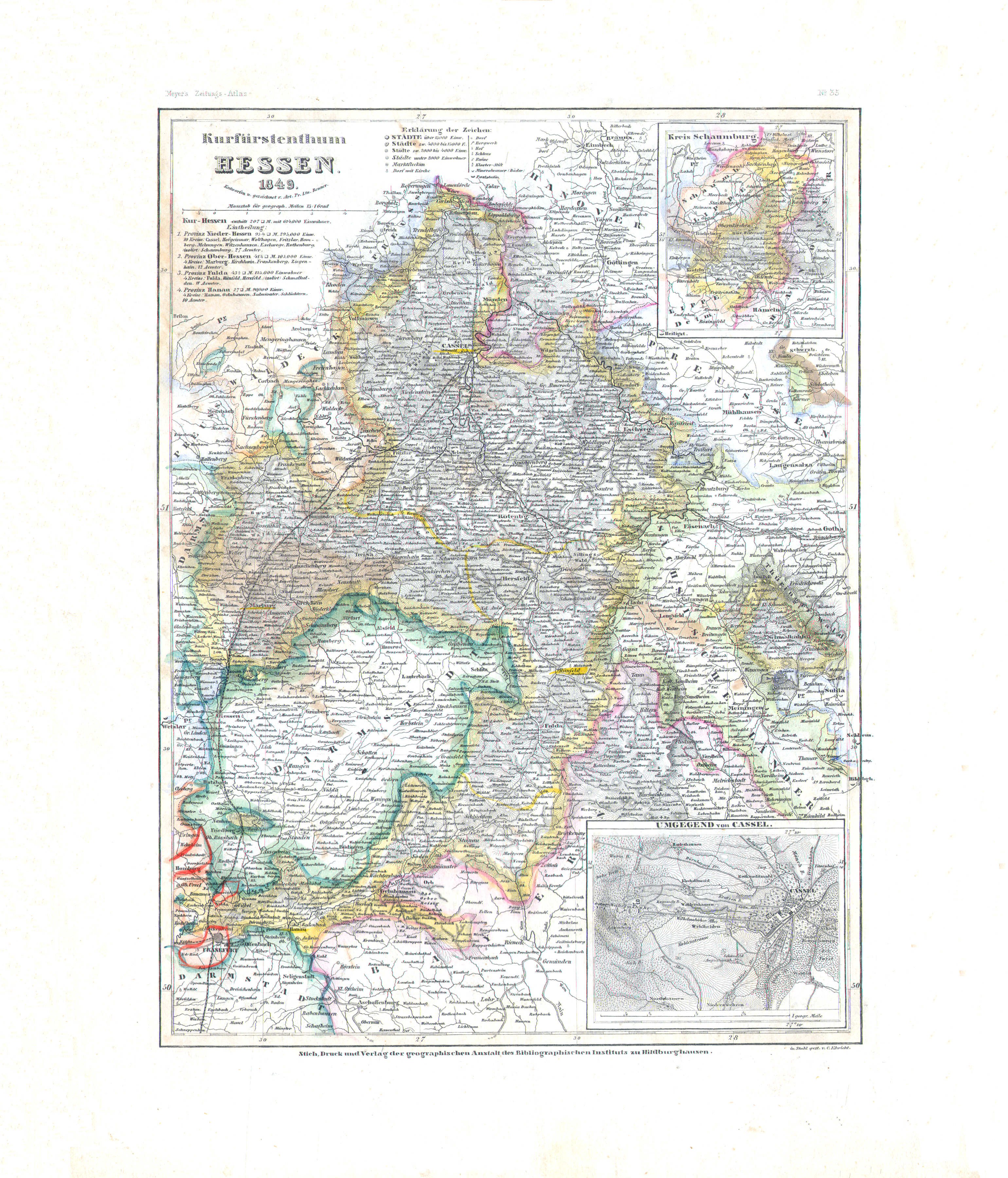
68. Kurfürstenthum Hessen (Nº 35, 1849)
Hessen-Kassel / Hesse-Kassel
 Meyer's Zeitungs-Atlas (1849-1852)
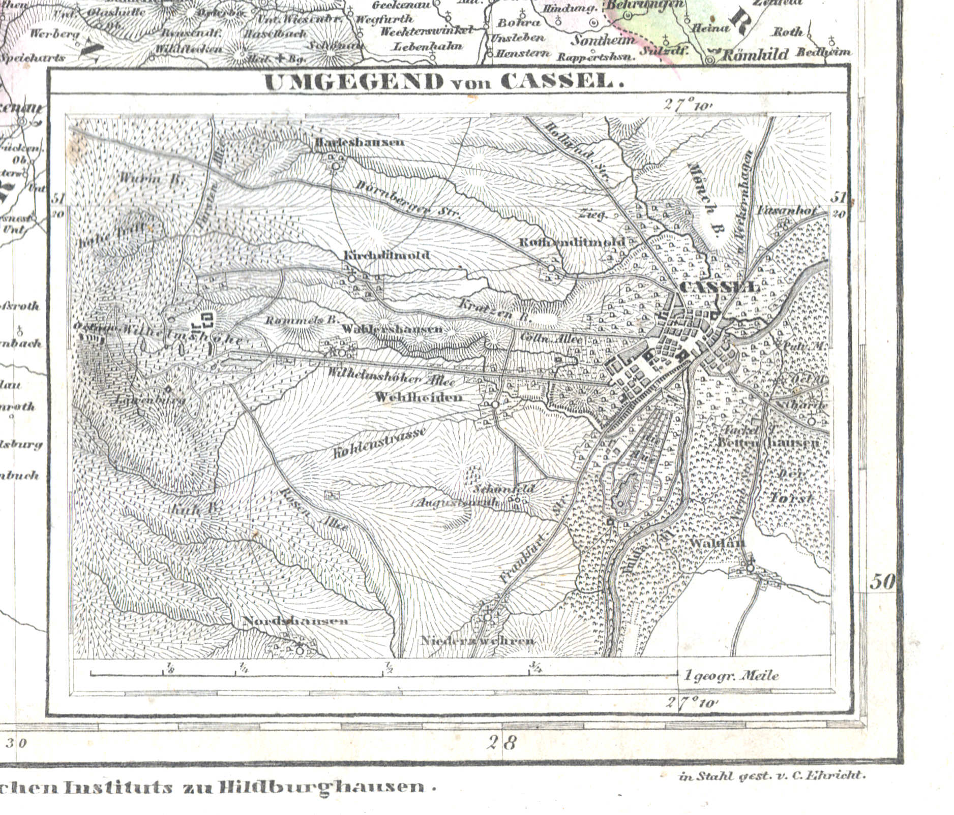
68b. Umgegend von Cassel
Kassel en omgeving / Kassel and environs
 Meyer's Zeitungs-Atlas (1849-1852)
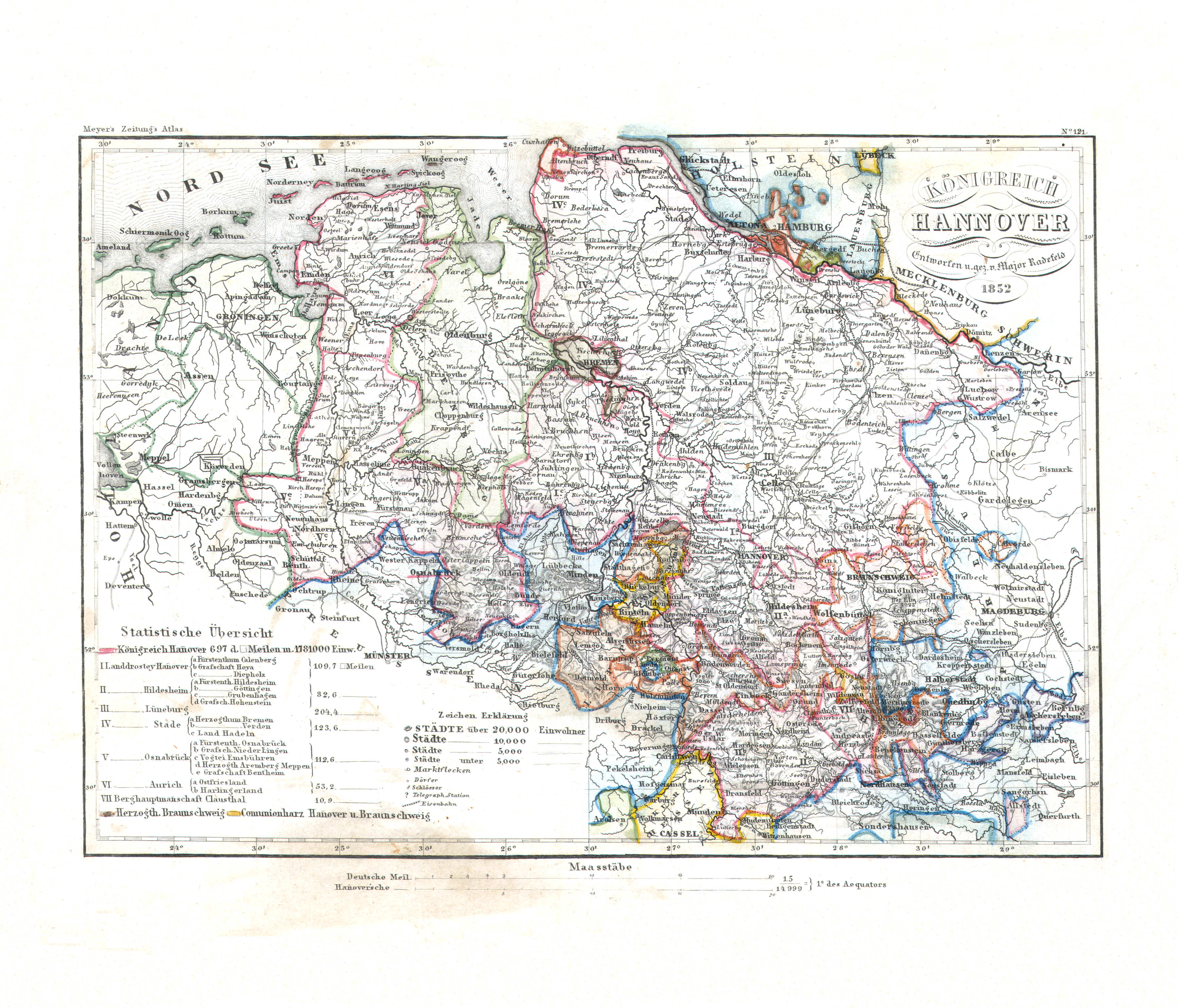
69. Königreich Hannover (Nº 121, 1852)
Koninkrijk Hannover / Kingdom of Hanover
 Meyer's Zeitungs-Atlas (1849-1852)
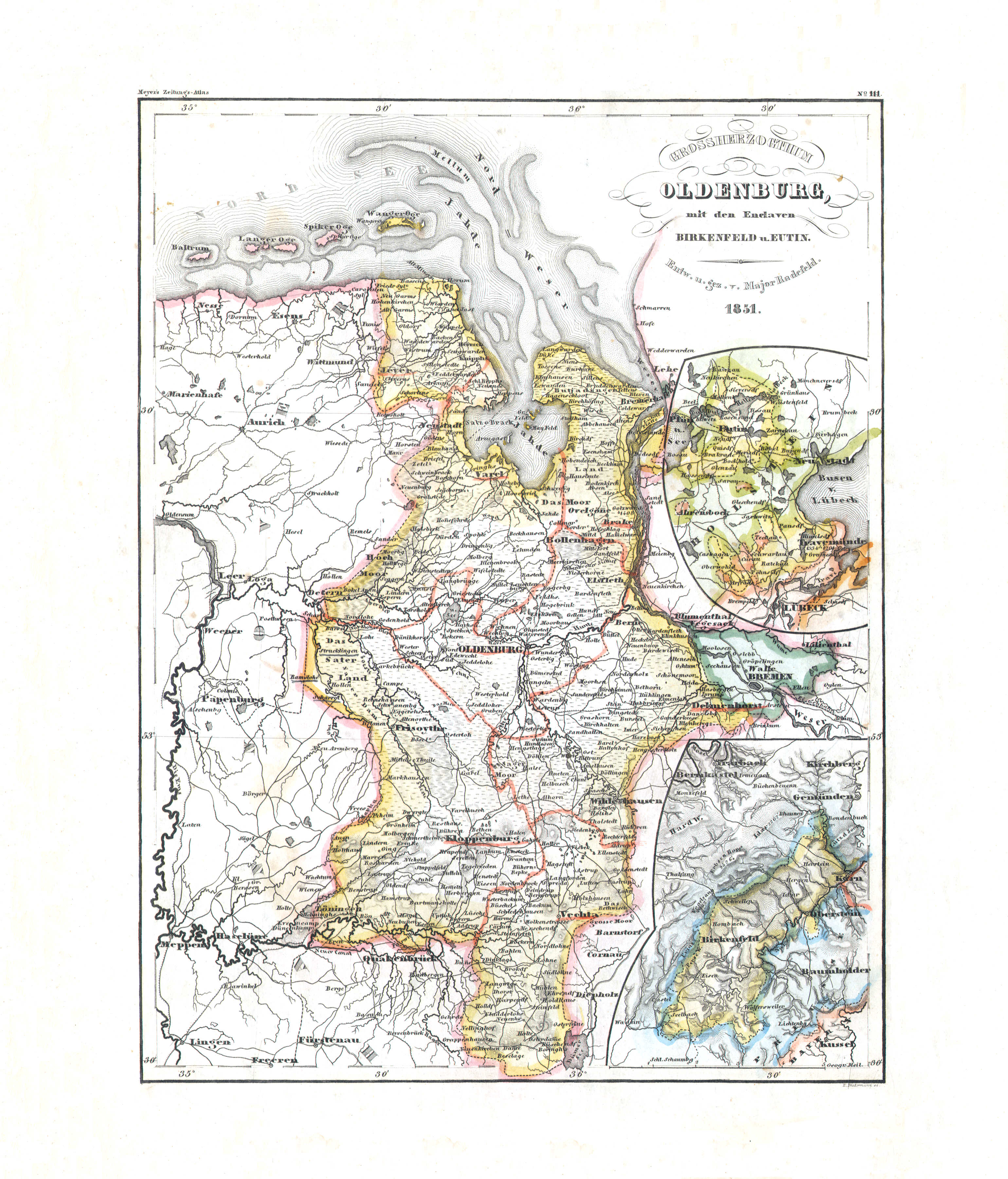
70. Groszherzogthum Oldenburg mit den Enclaven Birkenfeld u. Eutin (Nº 111, 1851)
Groothertogdom Oldenburg / Grand Duchy of Oldenburg
 Meyer's Zeitungs-Atlas (1849-1852)
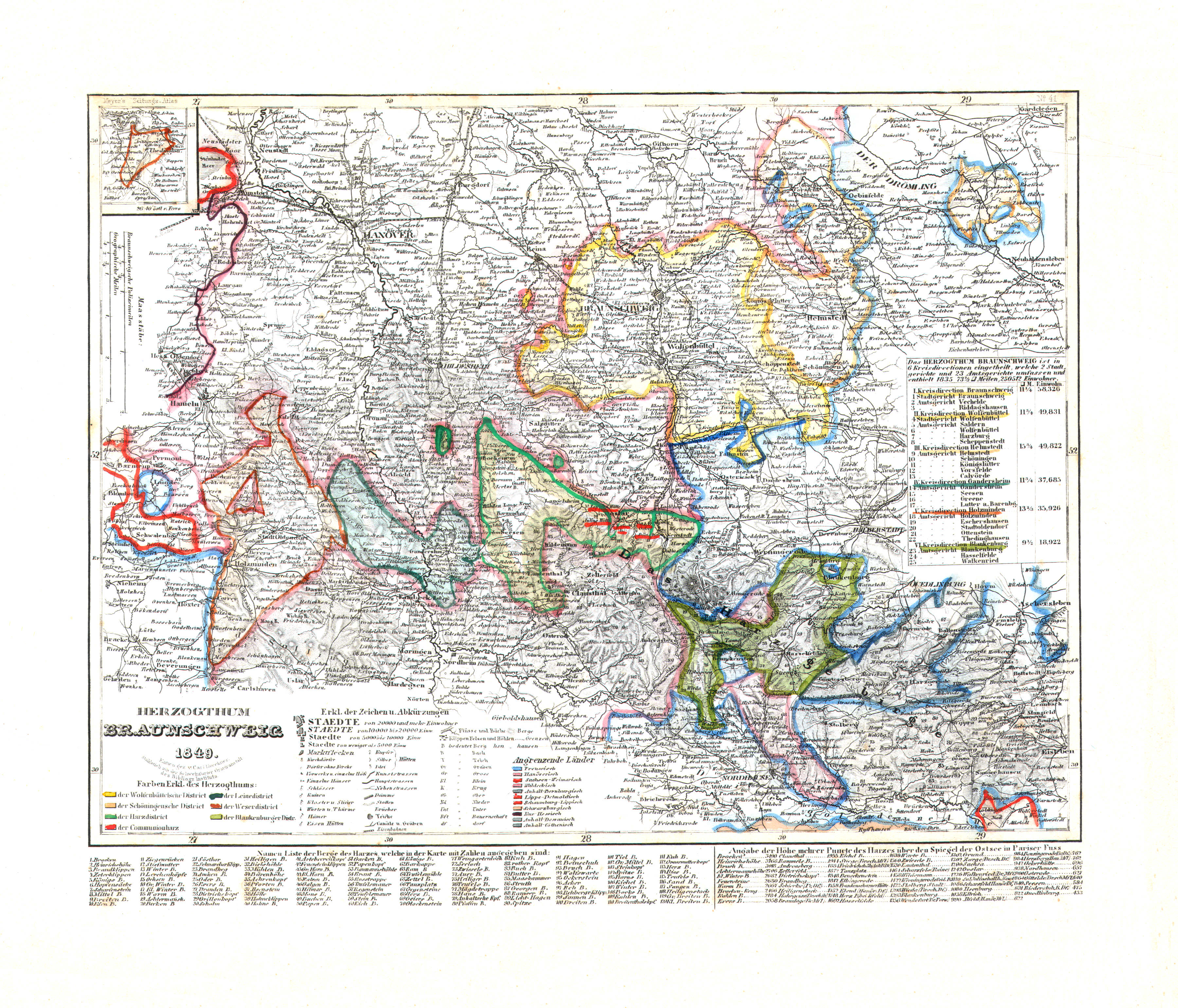
71. Herzogthum Braunschweig (Nº 41, 1849)
Hertogdom Brunswijk / Duchy of Brunswick
 Meyer's Zeitungs-Atlas (1849-1852)
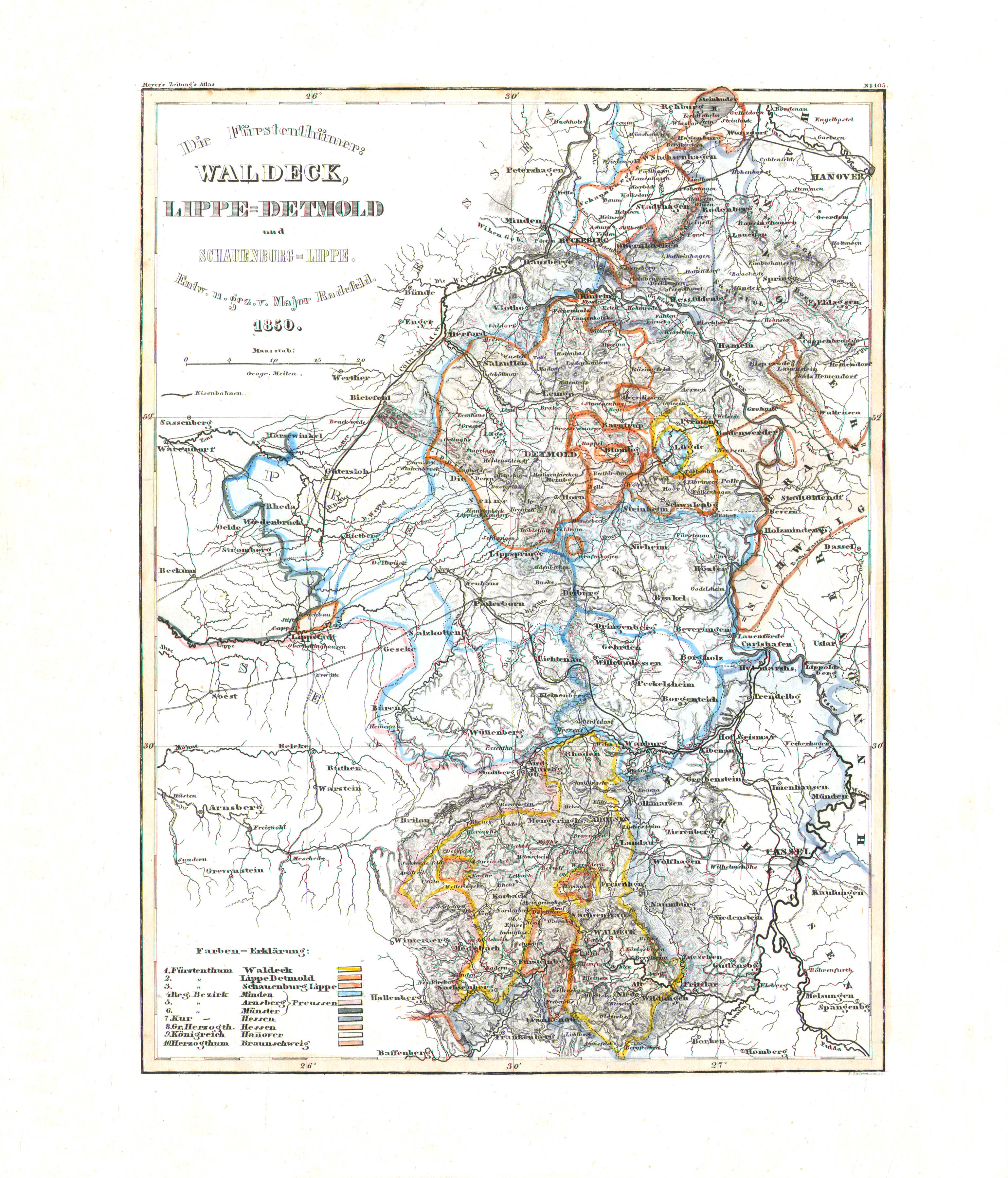
72. Die Fürstenthümer: Waldeck, Lippe-Detmold und Schauenburg-Lippe (Nº 105, 1850)
Vorstendommen Waldeck en Lippe / Principalities of Waldeck and Lippe
 Meyer's Zeitungs-Atlas (1849-1852)
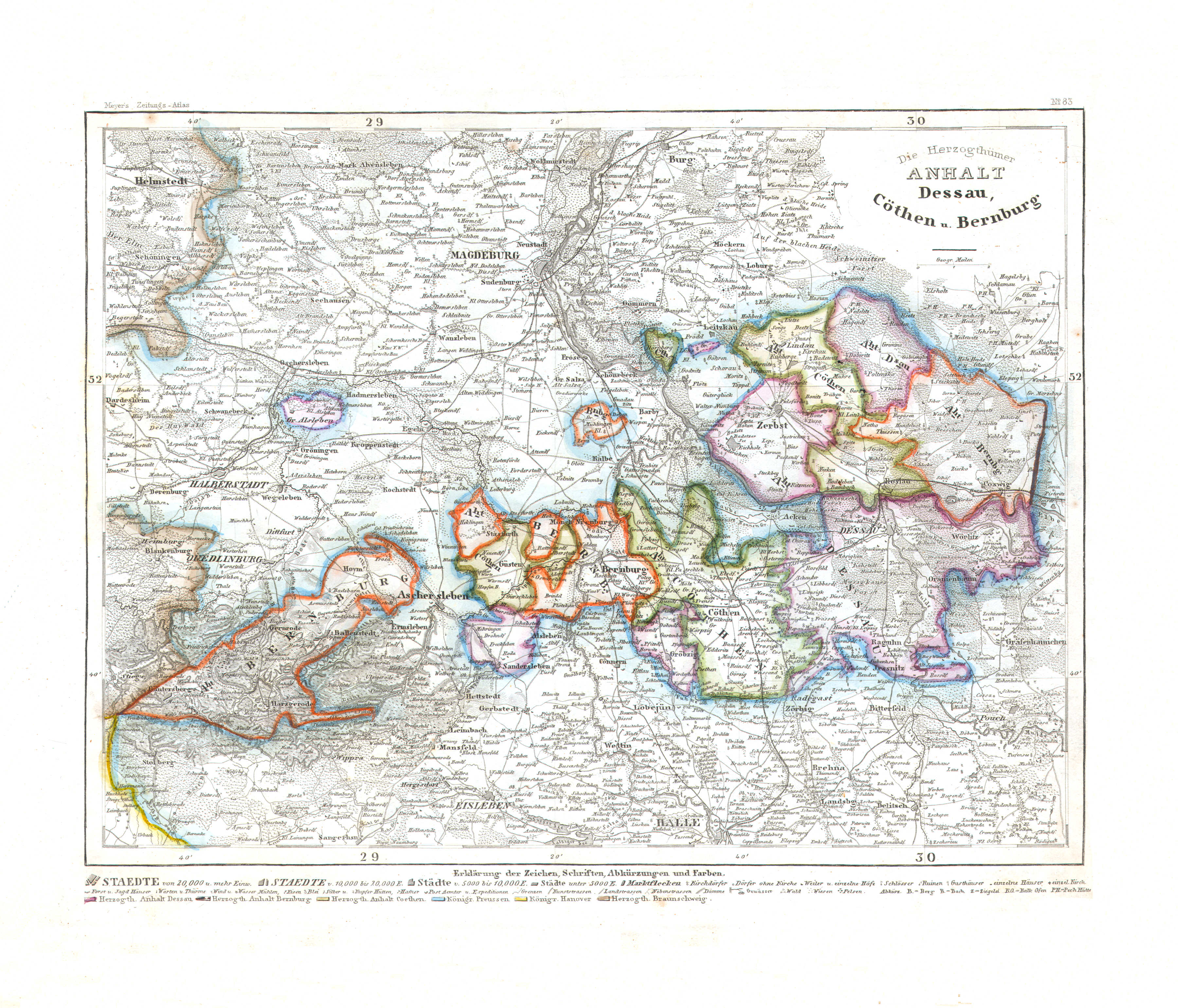
73. Die Herzogthümer Anhalt Dessau, Cöthen u. Bernburg (Nº 83)
De hertogdommen Anhalt / The duchies of Anhalt
 Meyer's Zeitungs-Atlas (1849-1852)
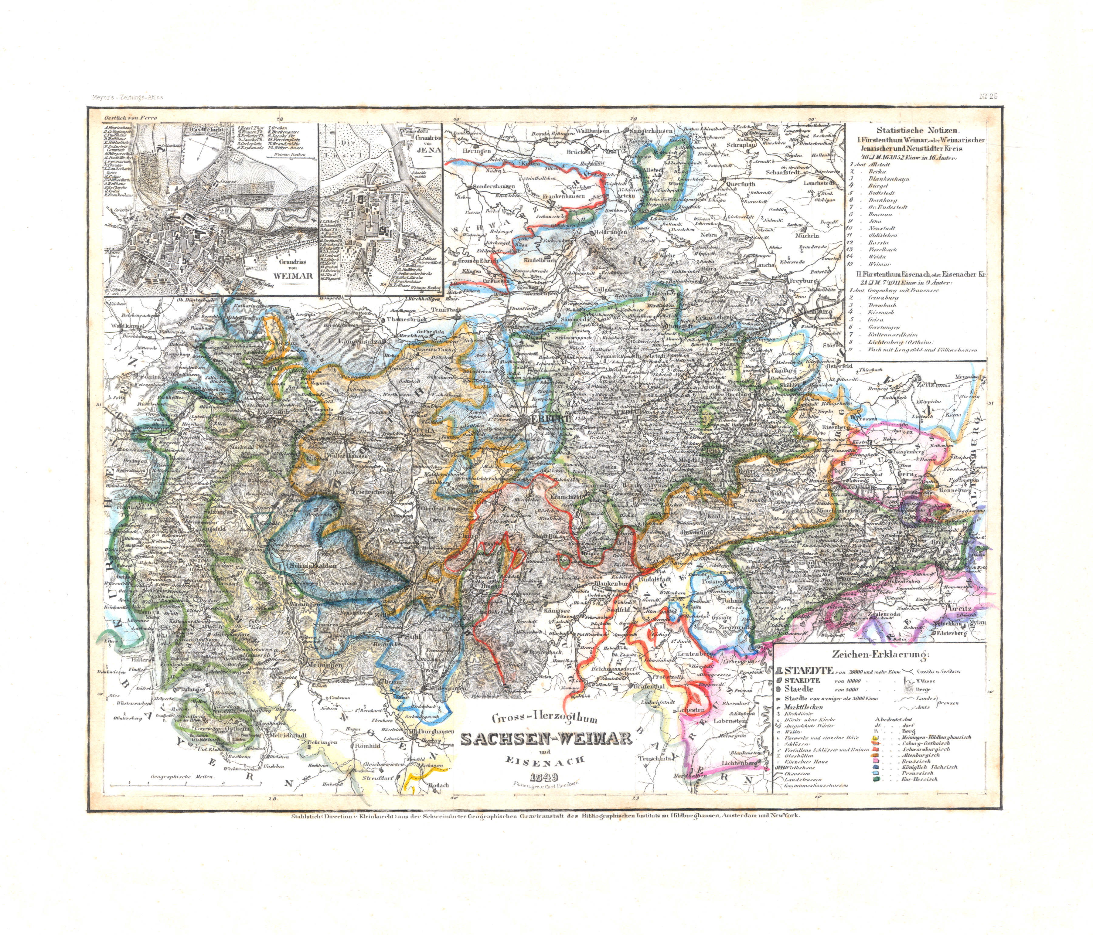
74. Gross-Herzogthum Sachsen-Weimar und Eisenach (Nº 25, 1849) XL
Groothertogdom Saksen-Weimar-Eisenach / Grand Duchy of Saxe-Weimar-Eisenach
 Meyer's Zeitungs-Atlas (1849-1852)
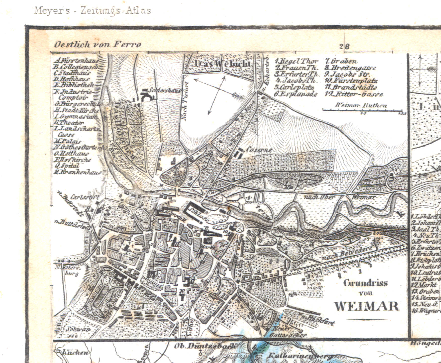
74a. Grundriss von Weimar
Plattegrond van Weimar / Plan of Weimar
 Meyer's Zeitungs-Atlas (1849-1852)
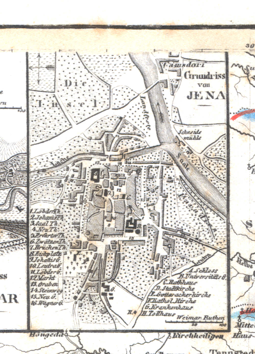
74b. Grundriss von Jena
Plattegrond van Jena / Plan of Jena
 Meyer's Zeitungs-Atlas (1849-1852)
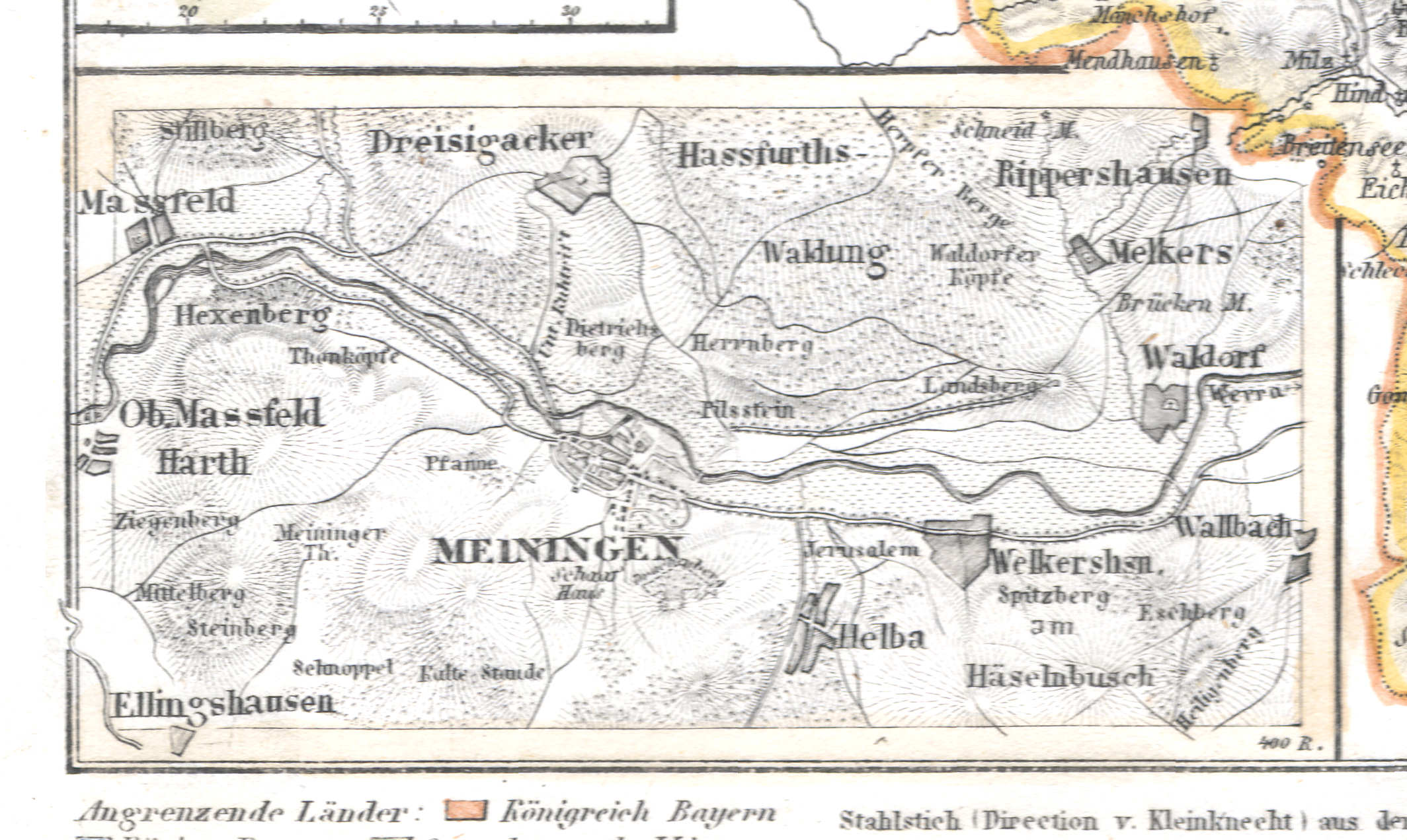
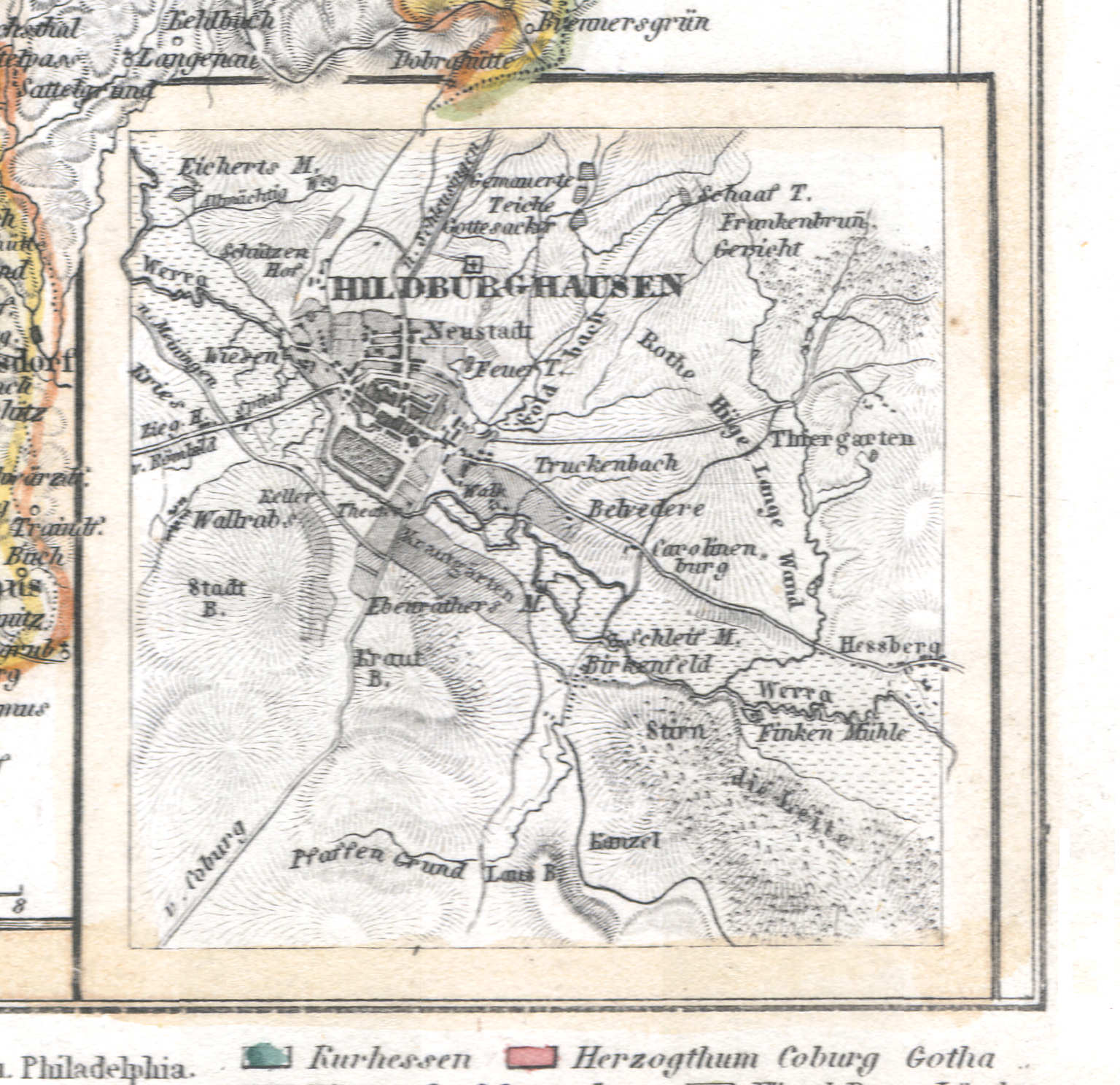
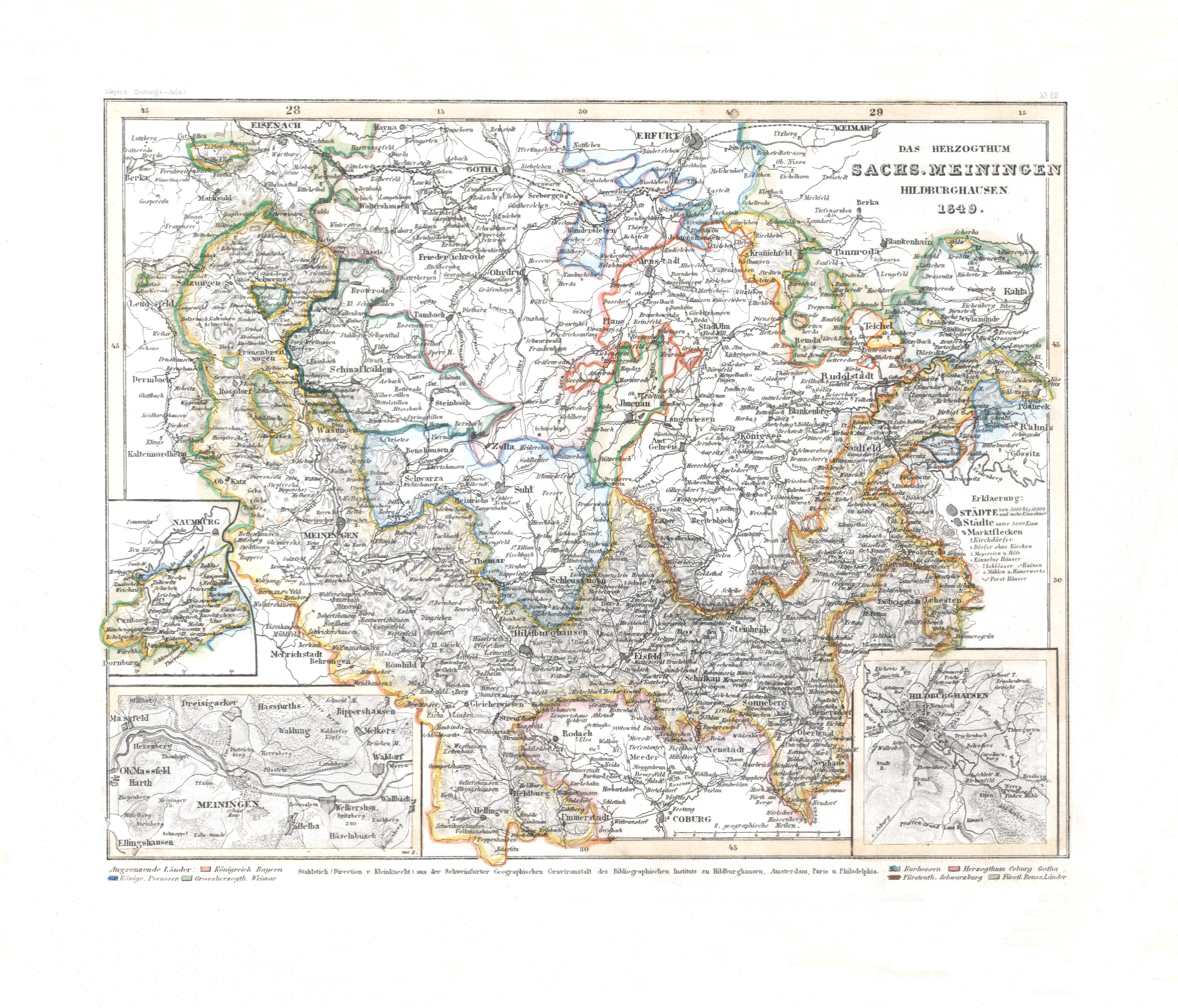
75. Das Herzogthum Sachs. Meiningen Hildburghausen (Nº 62, 1849) XL
Hertogdom Saksen-Meiningen-Hildburghausen / Duchy of Saxe-Meiningen-Hildburghausen
 Meyer's Zeitungs-Atlas (1849-1852)
75b. Meiningen
Meiningen
 Meyer's Zeitungs-Atlas (1849-1852)
75c. Hildburghausen
Hildburghausen
 Meyer's Zeitungs-Atlas (1849-1852)
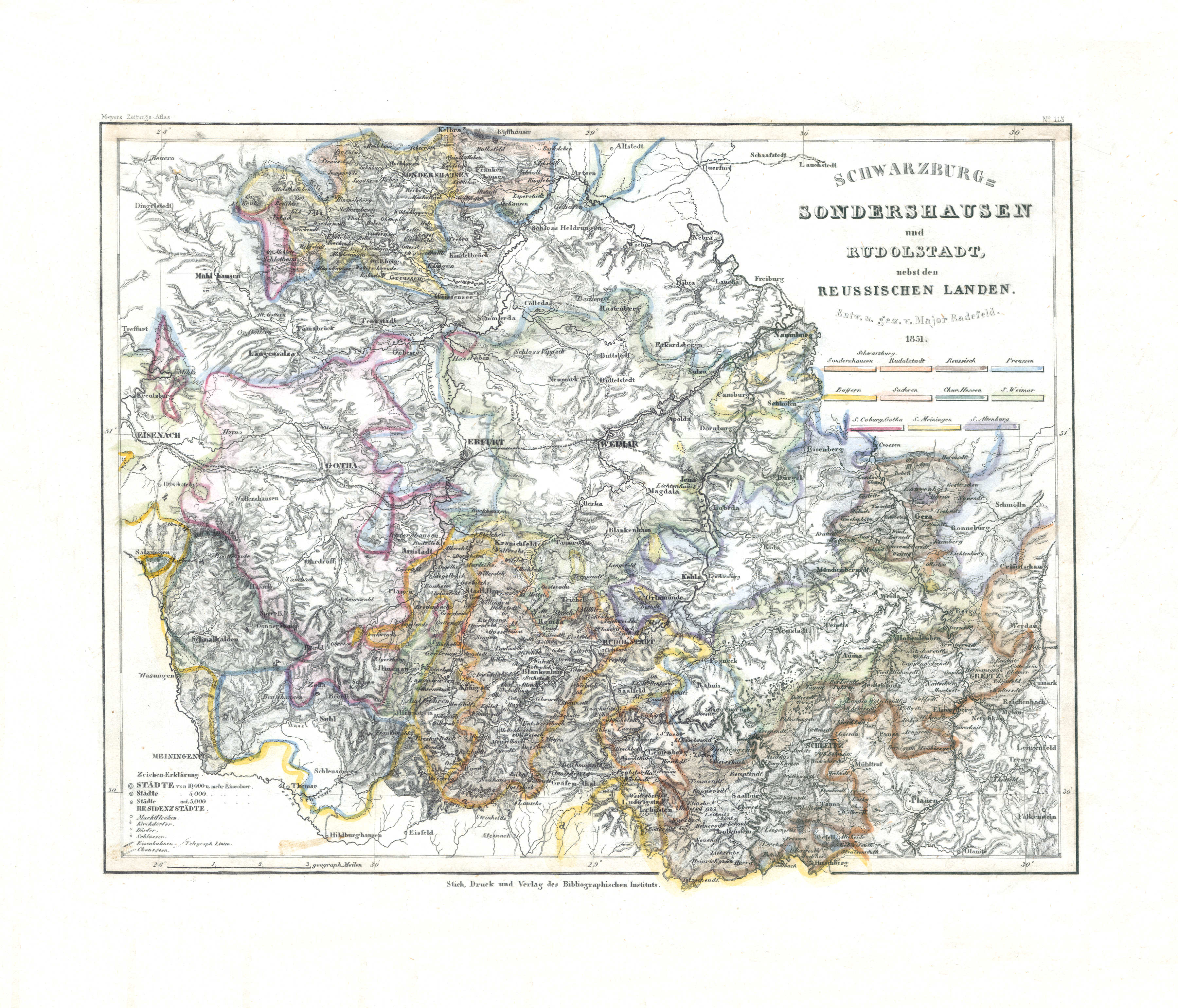
76. Schwarzburg-Sonderhausen und Rudolstadt, nebst den Reussischen Landen (Nº 113, 1851) XL
Schwarzburg-Sonderhausen, Schwarzburg-Rudolstadt en Reuss / Schwarzburg-Sonderhausen, Schwarzburg-Rudolstadt and Reuss
 Meyer's Zeitungs-Atlas (1849-1852)
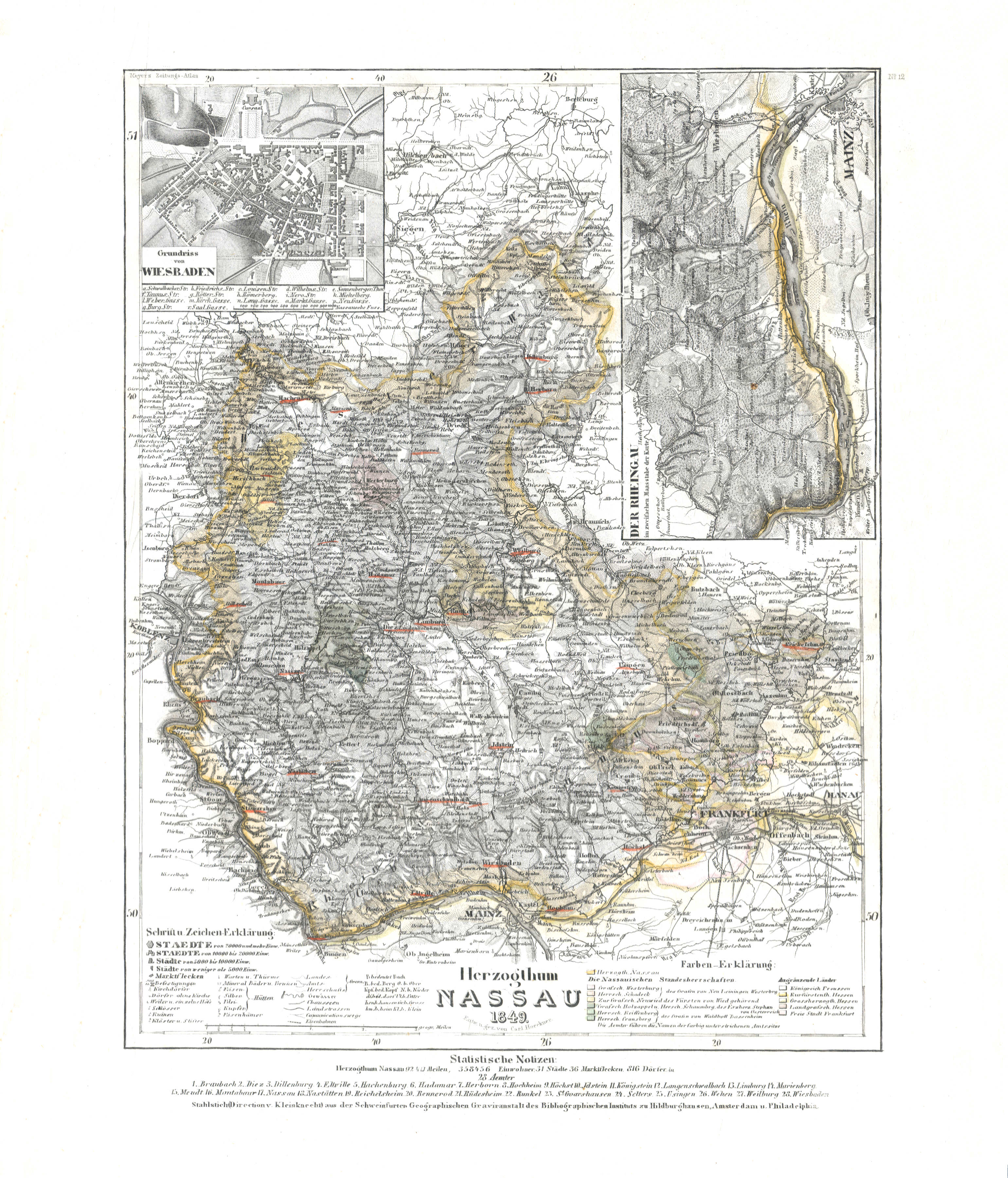
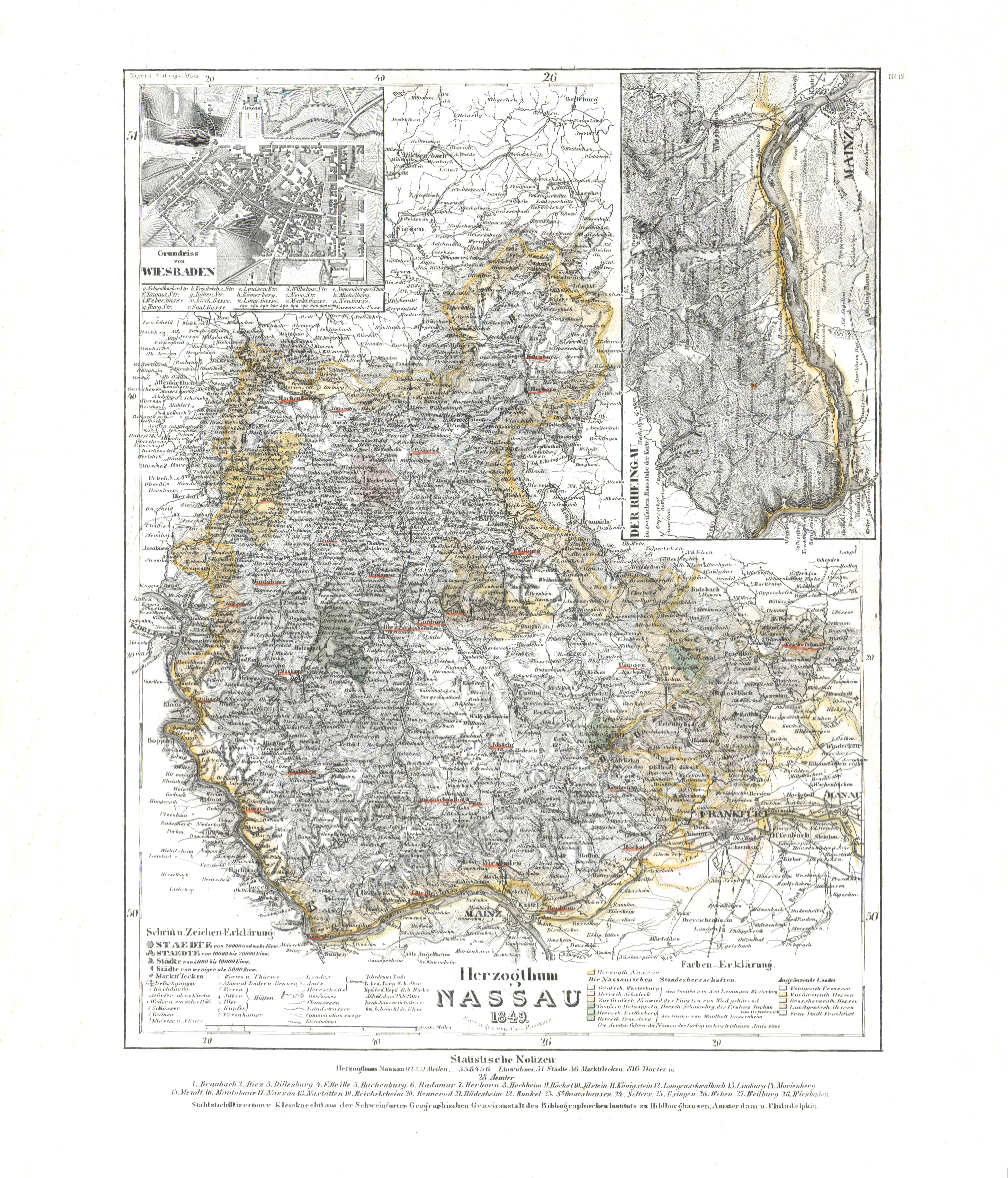
77. Herzogthum Nassau (Nº 12, 1849) XL
Hertogdom Nassau / Duchy of Nassau
 Meyer's Zeitungs-Atlas (1849-1852)
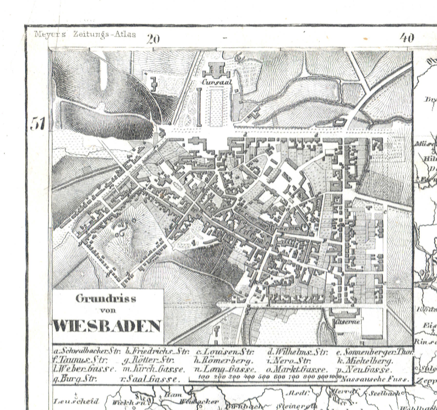
77a. Grundriss von Wiesbaden
Plattegrond van Wiesbaden / Plan of Wiesbaden
 Meyer's Zeitungs-Atlas (1849-1852)
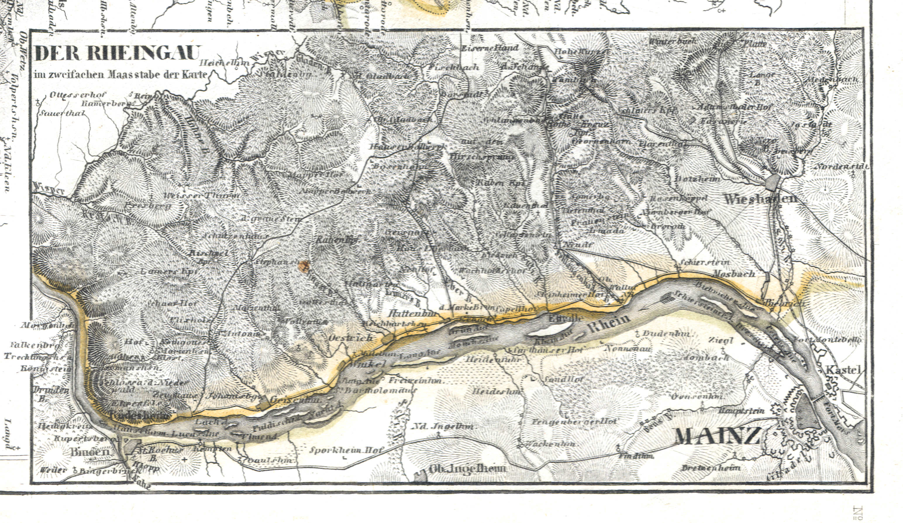
77b. Der Rheingau
De Rheingau / The Rheingau
 Meyer's Zeitungs-Atlas (1849-1852)
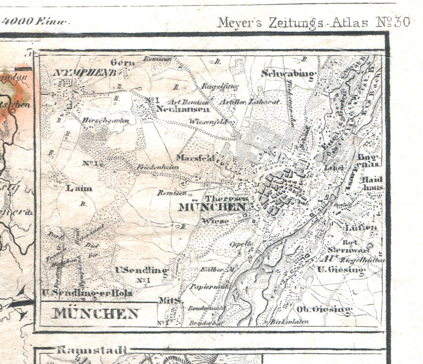
78a. München
München / Munich
 Meyer's Zeitungs-Atlas (1849-1852)
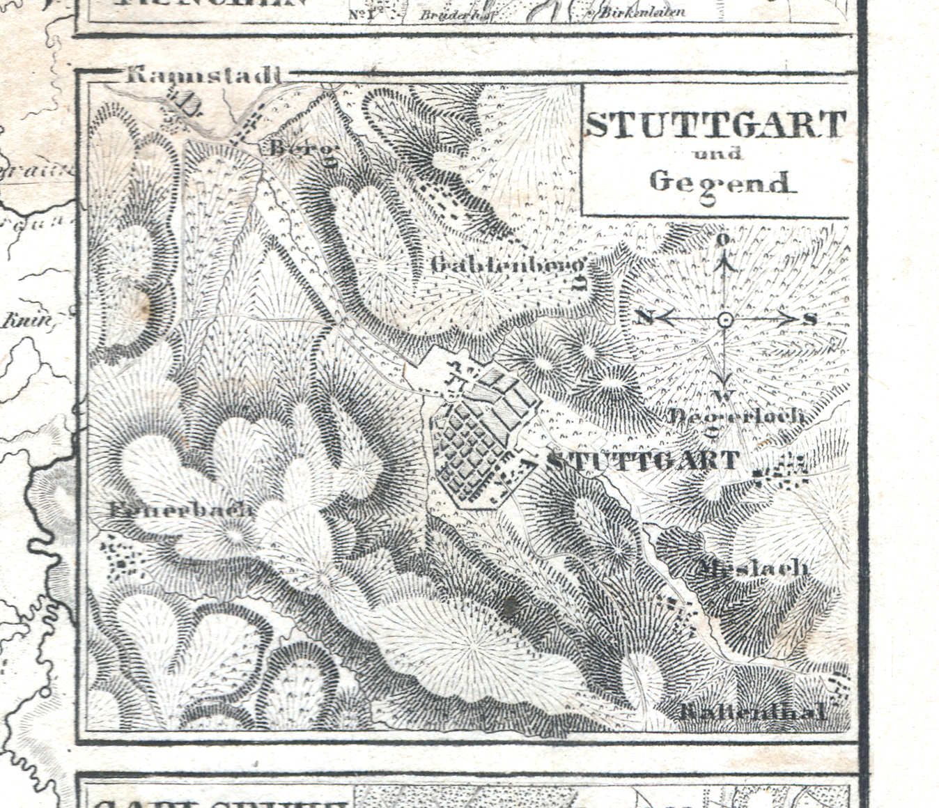
78b. Stuttgart und Gegend
Stuttgart en omgeving / Stuttgart and environs
 Meyer's Zeitungs-Atlas (1849-1852)
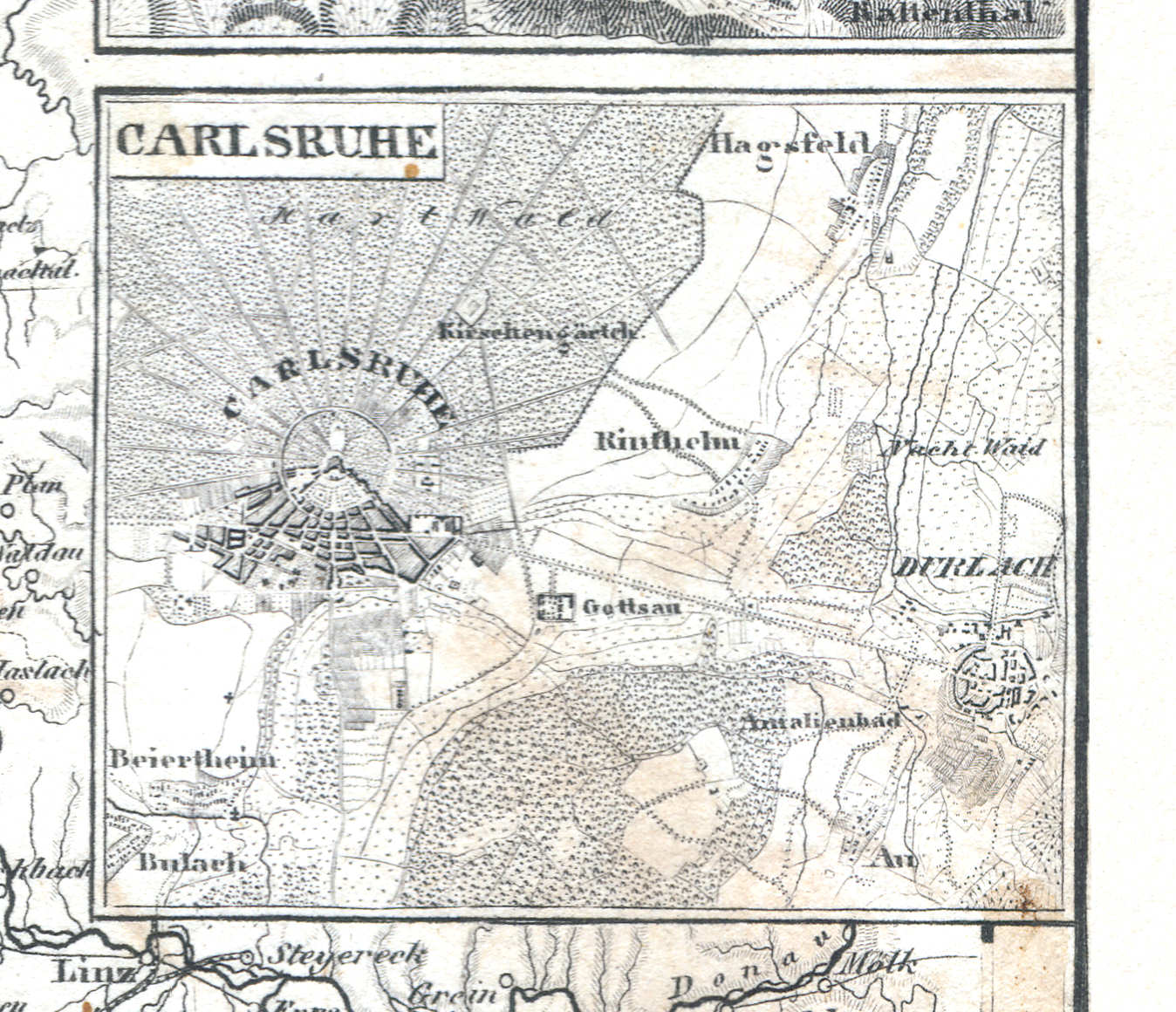
78c. Carlsruhe
Karlsruhe
 Meyer's Zeitungs-Atlas (1849-1852)
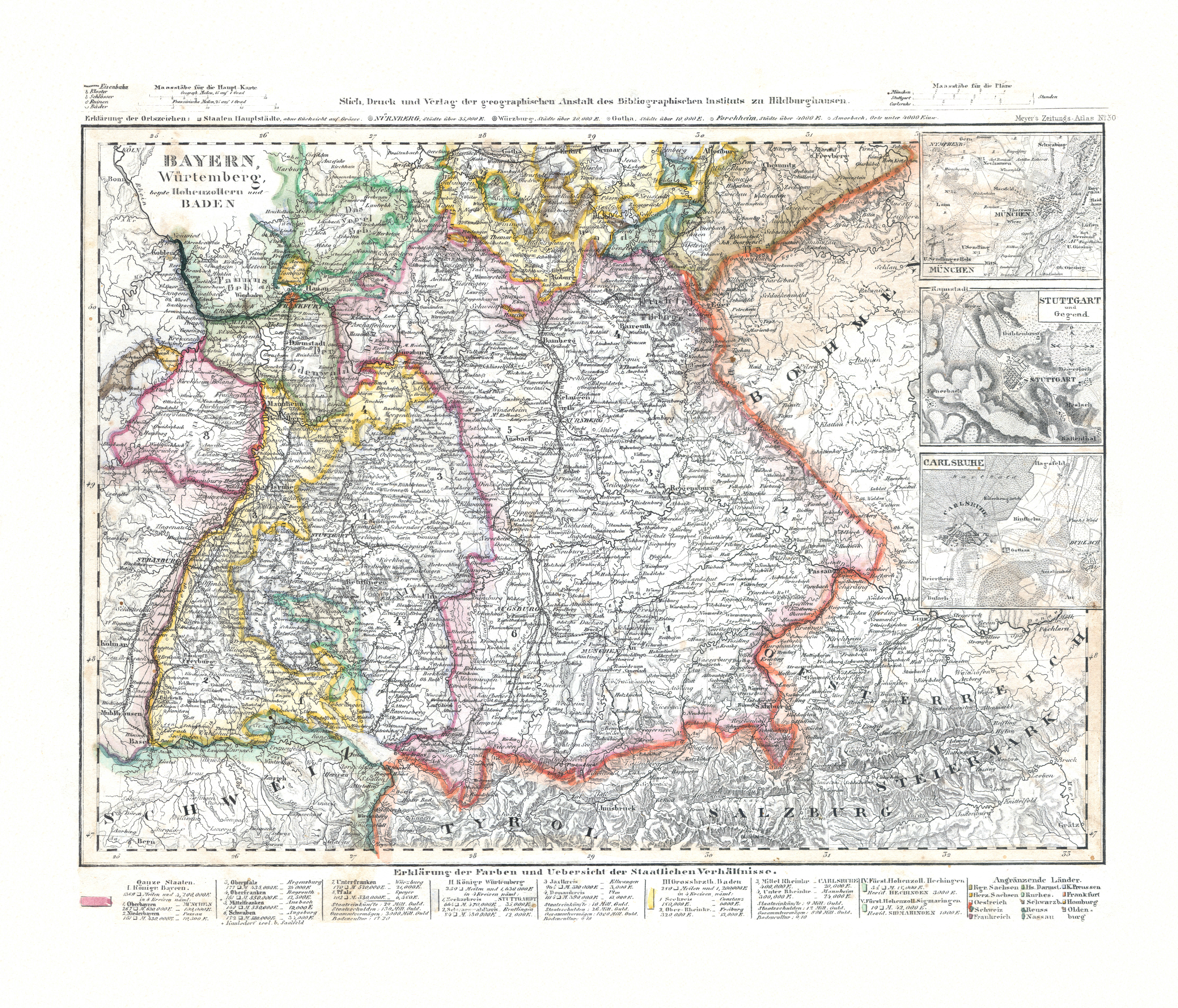
78. Bayern, Würtemberg, beyde Hohenzollern und Baden (Nº 30) XL
Beieren, Württemberg, Hohenzollern en Baden / Bavaria, Württemberg, Hohenzollern and Baden
 Meyer's Zeitungs-Atlas (1849-1852)
79. Die Pfalz oder Rhein Bayern (Nº 123, 1852)
Palts of Rijn-Beieren / Palatinate or Rhenish Bavaria
 Meyer's Zeitungs-Atlas (1849-1852)
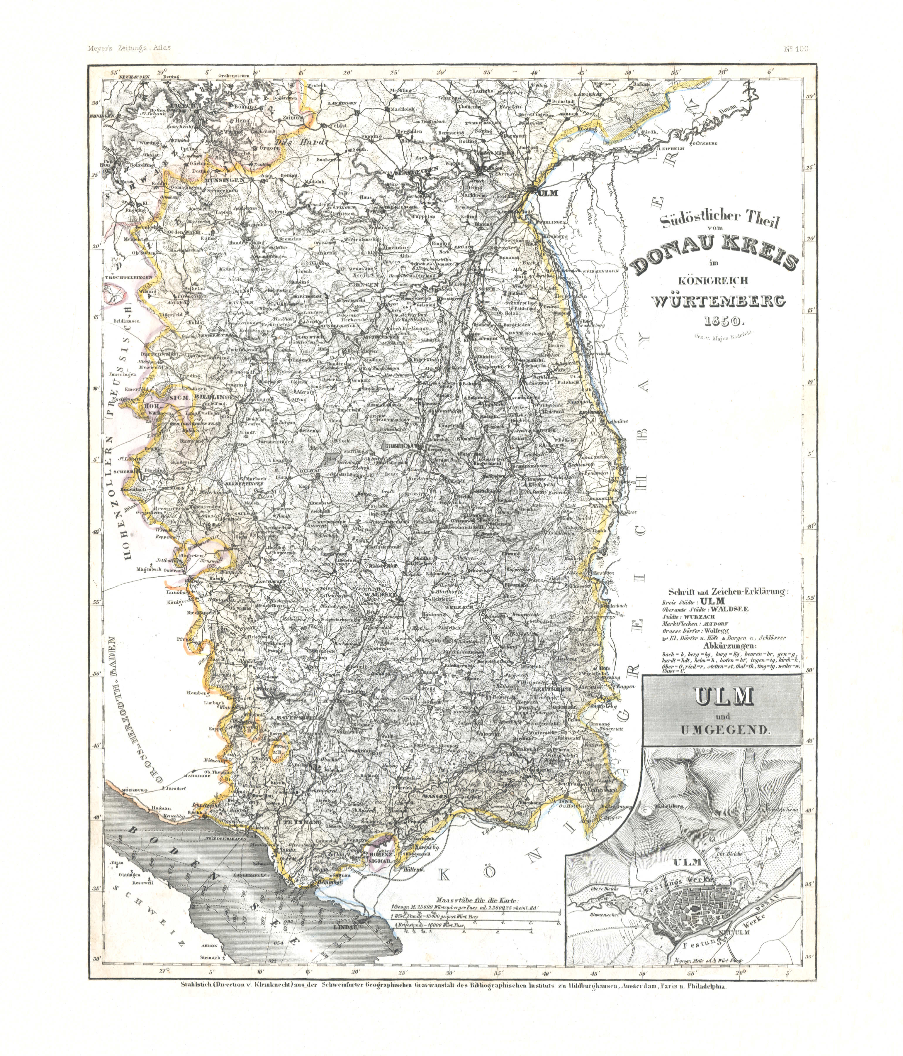
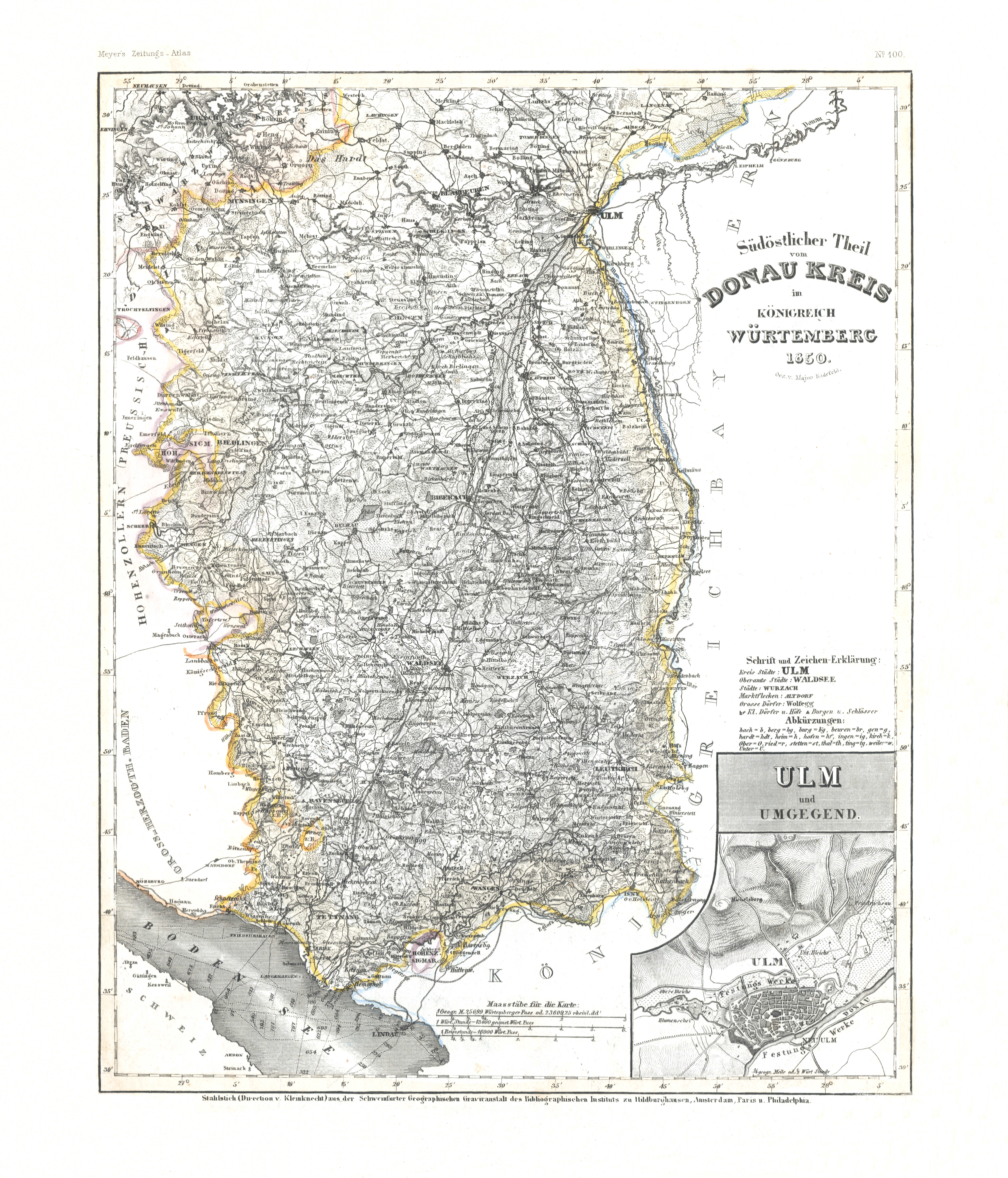
80. Südöstlicher Theil vom Donau Kreis im Königreich Würtemberg (Nº 100, 1850) XL
Het zuidoosten van de Donaukreis in Württemberg / Southeastern part of the Donaukreis in Württemberg
 Meyer's Zeitungs-Atlas (1849-1852)
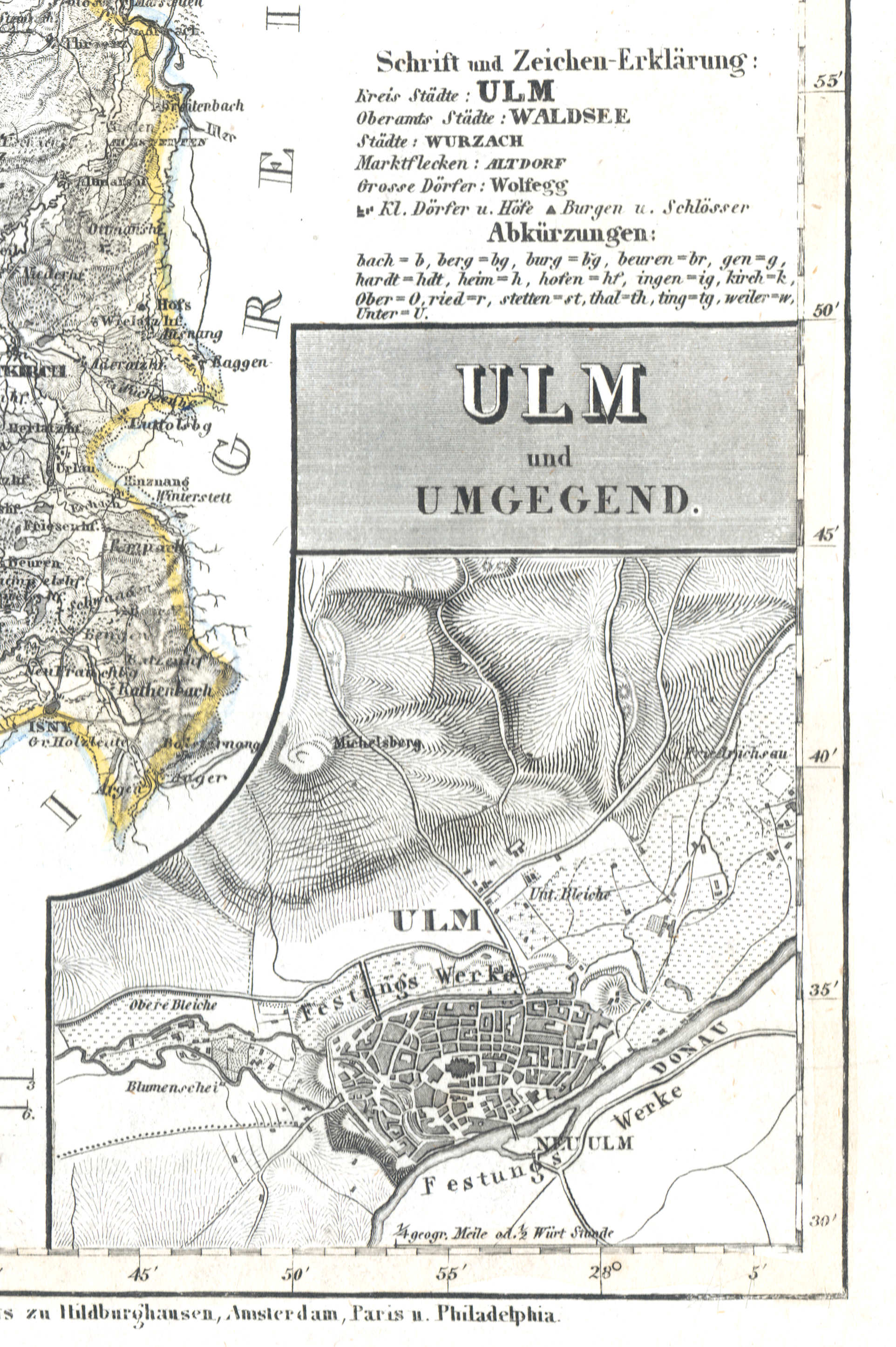
80a. Ulm und Umgegend
Ulm en omgeving / Ulm and environs
 Meyer's Zeitungs-Atlas (1849-1852)
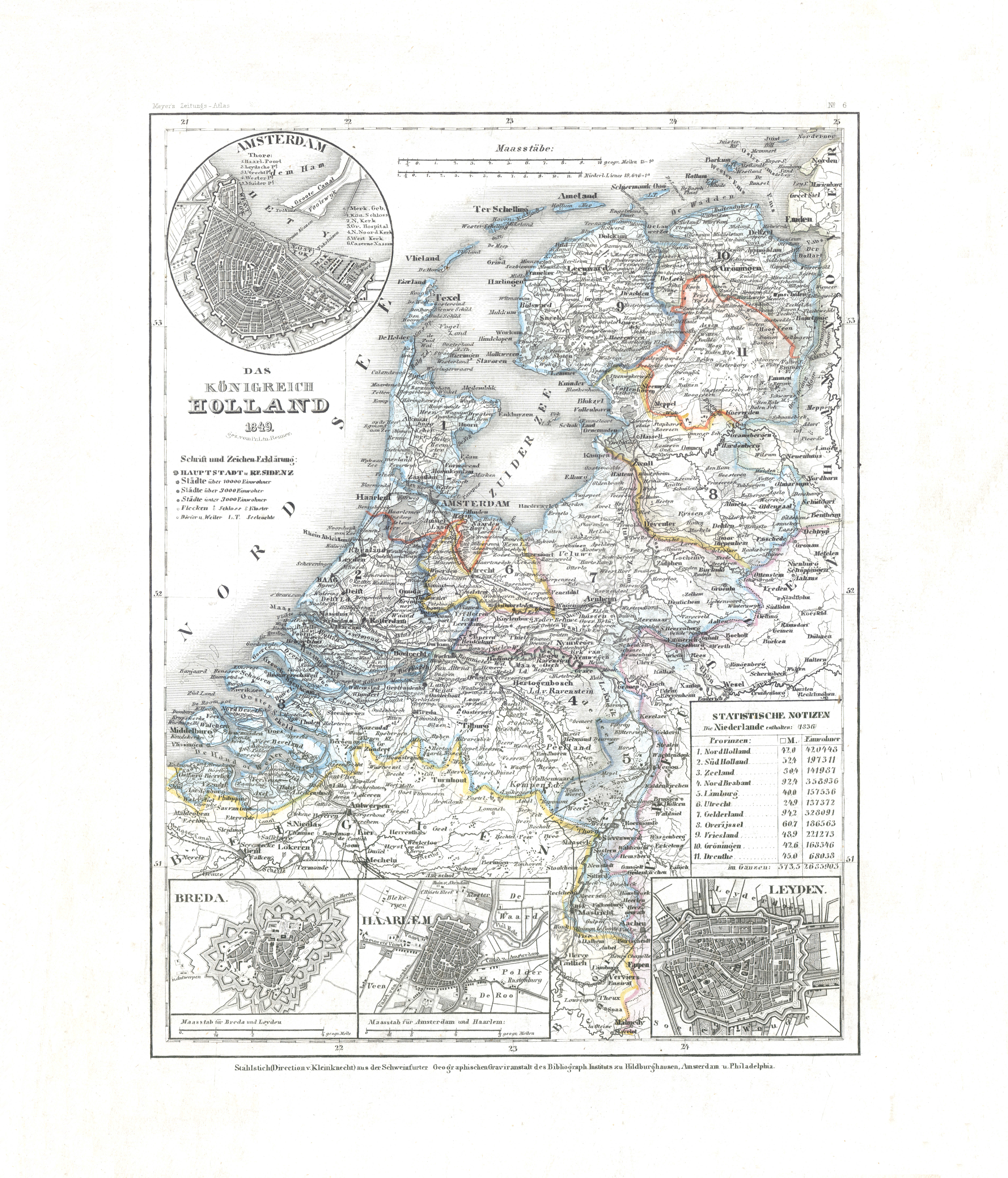
81. Das Königreich Holland (Nº 6, 1849) XL
Koninkrijk Nederland / Kingdom of the Netherlands
 Meyer's Zeitungs-Atlas (1849-1852)
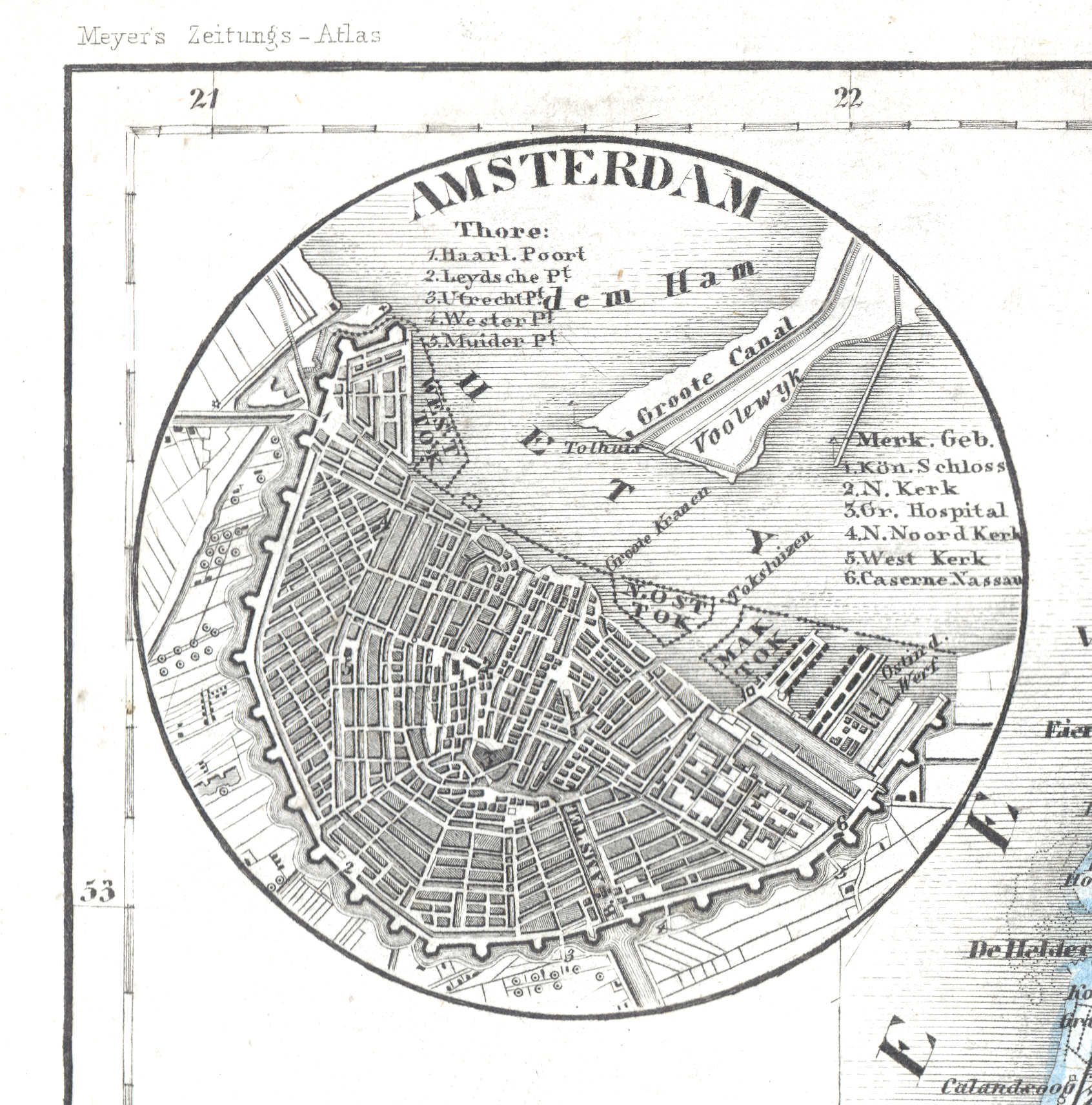
81a. Amsterdam
Amsterdam
 Meyer's Zeitungs-Atlas (1849-1852)
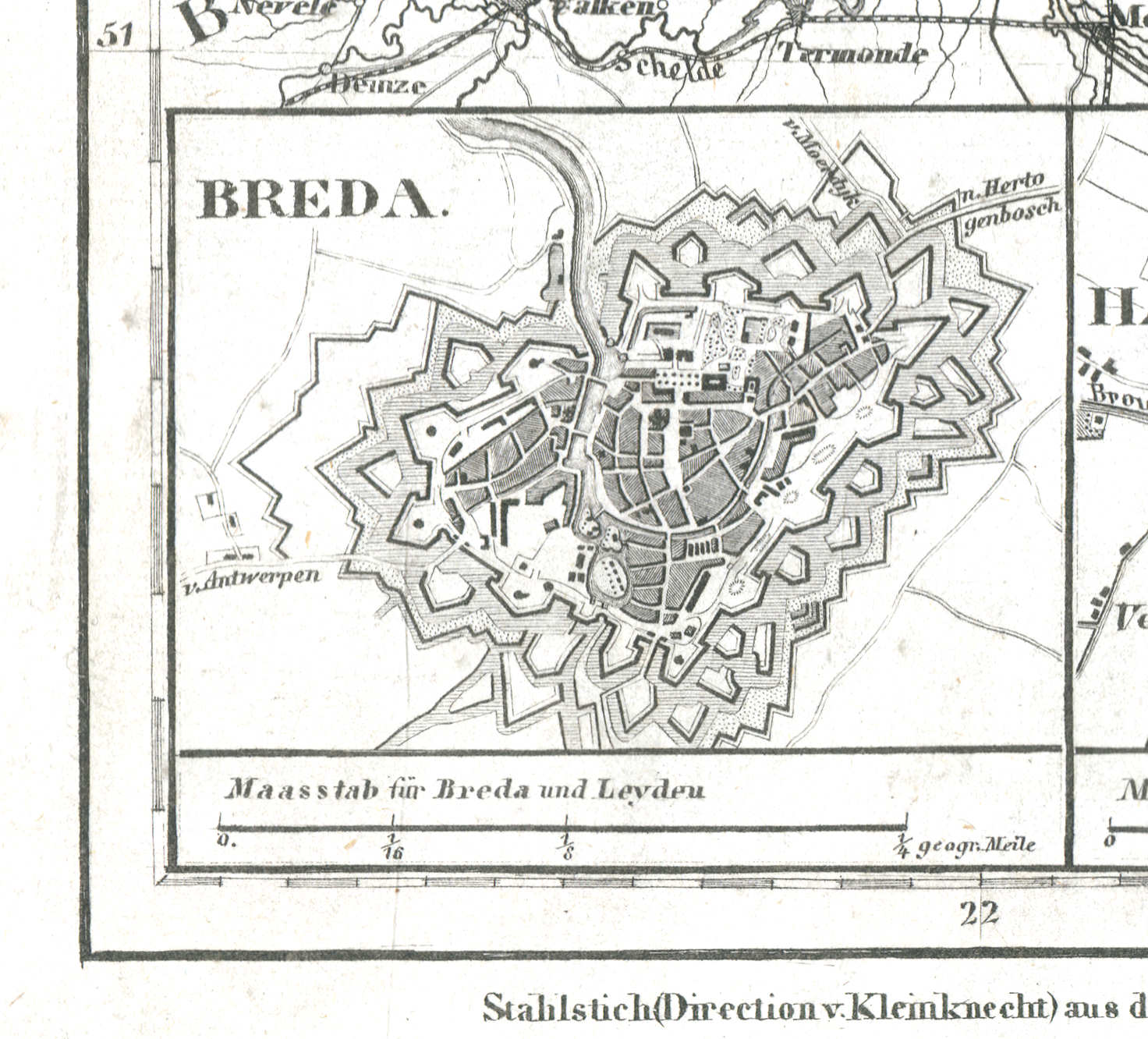
81b. Breda
Breda
 Meyer's Zeitungs-Atlas (1849-1852)
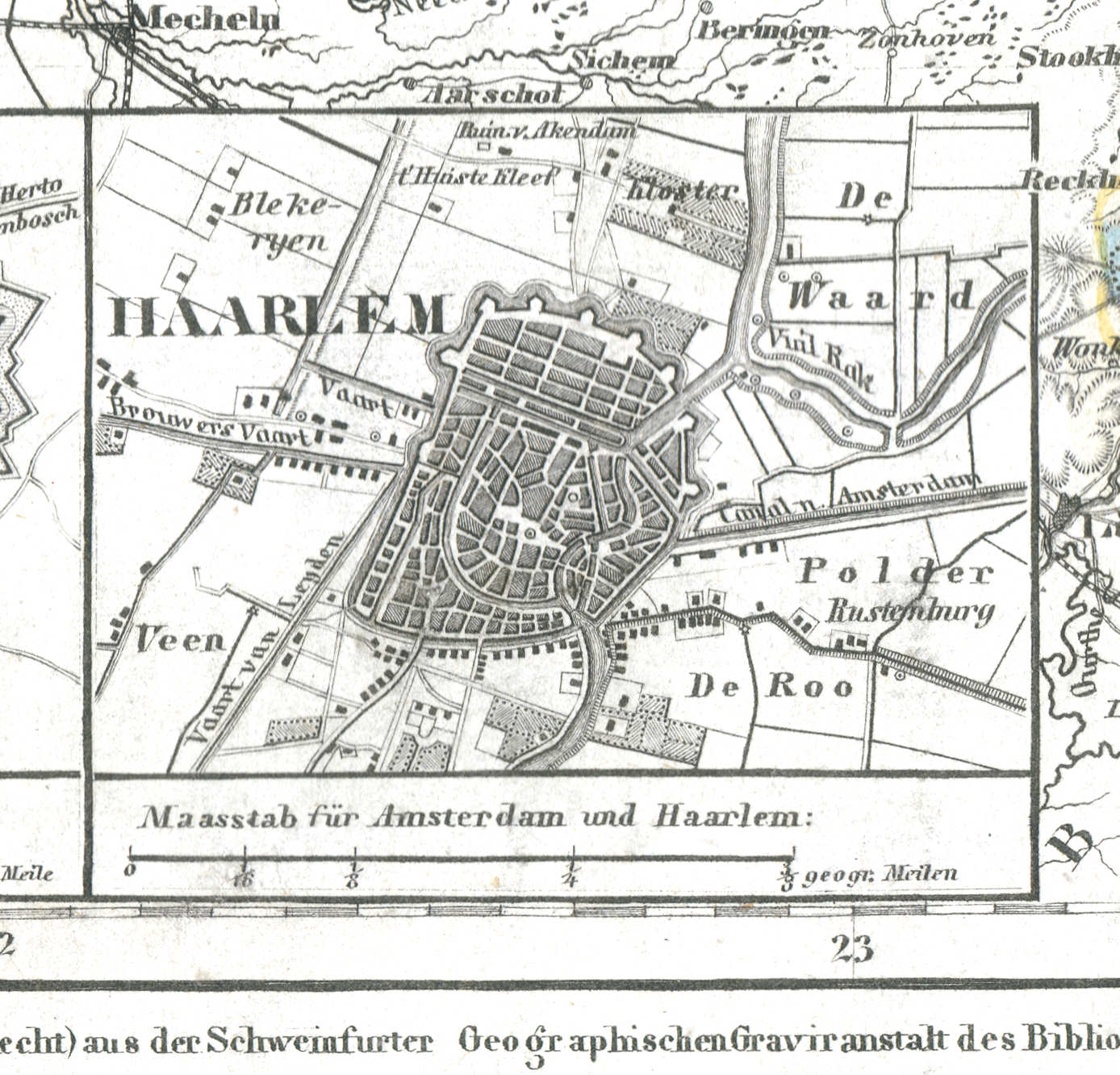
81c. Haarlem
Haarlem / Harlem
 Meyer's Zeitungs-Atlas (1849-1852)
81d. Leyden
Leiden / Leyden
 Meyer's Zeitungs-Atlas (1849-1852)
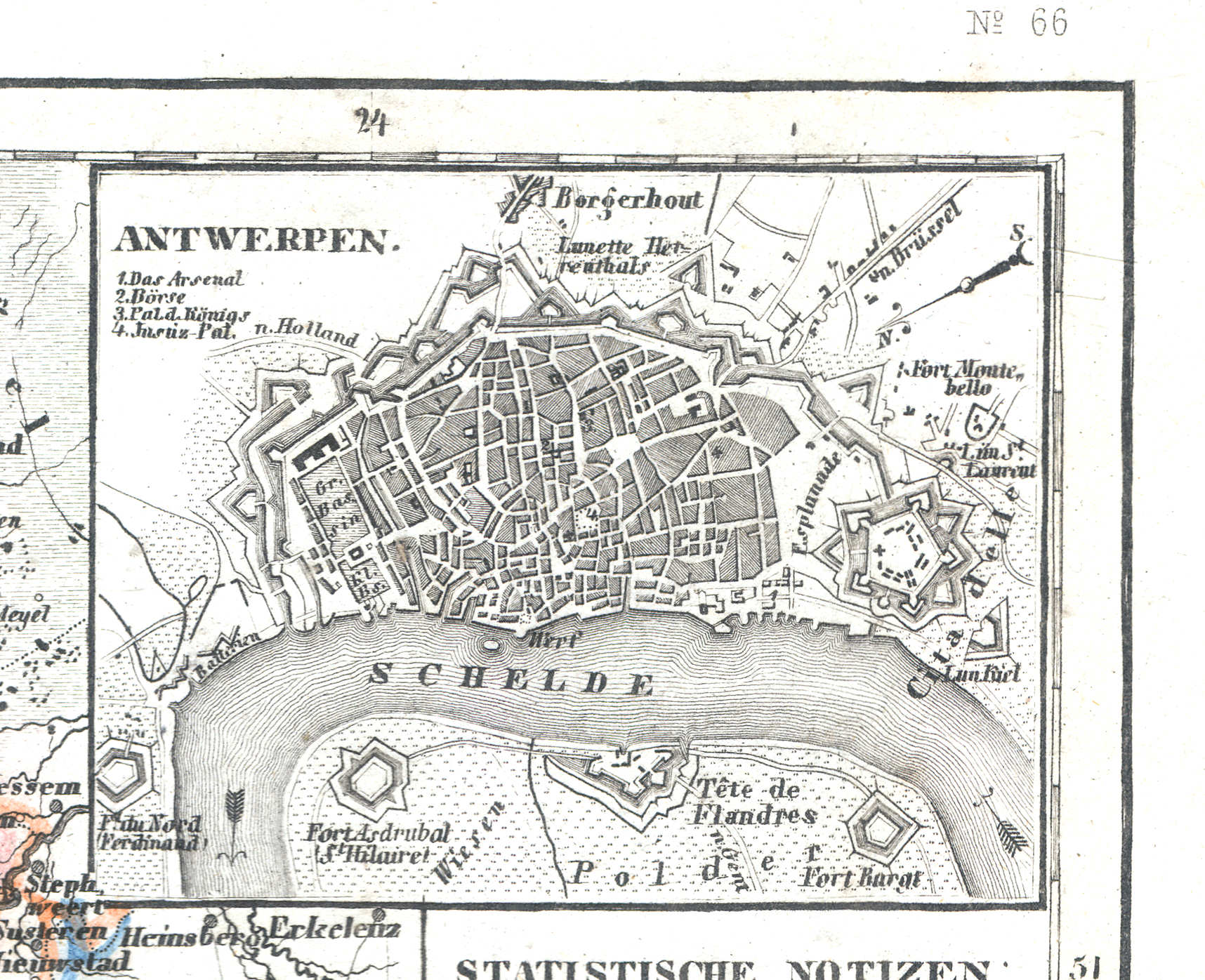
82a. Antwerpen
Antwerpen / Antwerp
 Meyer's Zeitungs-Atlas (1849-1852)
82b. Brüssel
Brussel / Brussels / Bruxelles
 Meyer's Zeitungs-Atlas (1849-1852)
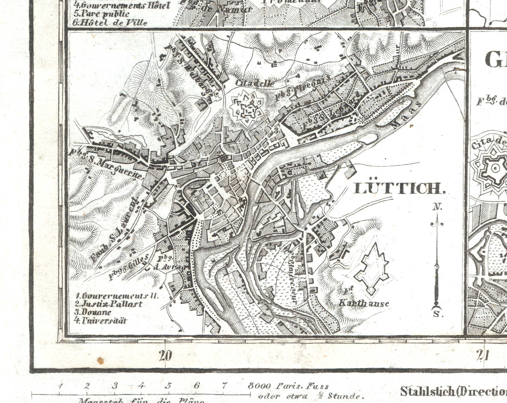
82c. Lüttich
Luik / Liège
 Meyer's Zeitungs-Atlas (1849-1852)
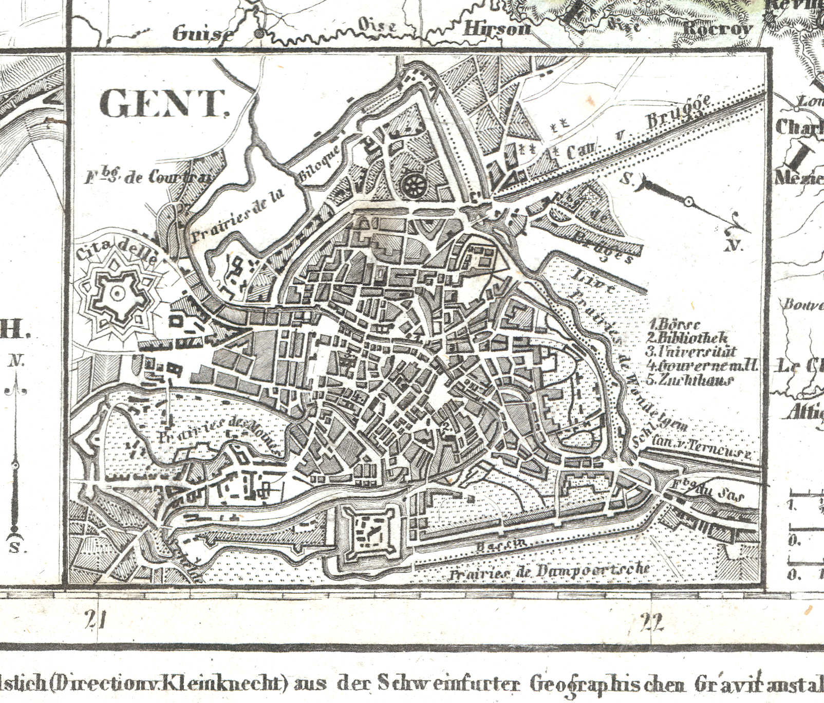
82d. Gent
Gent / Ghent
 Meyer's Zeitungs-Atlas (1849-1852)
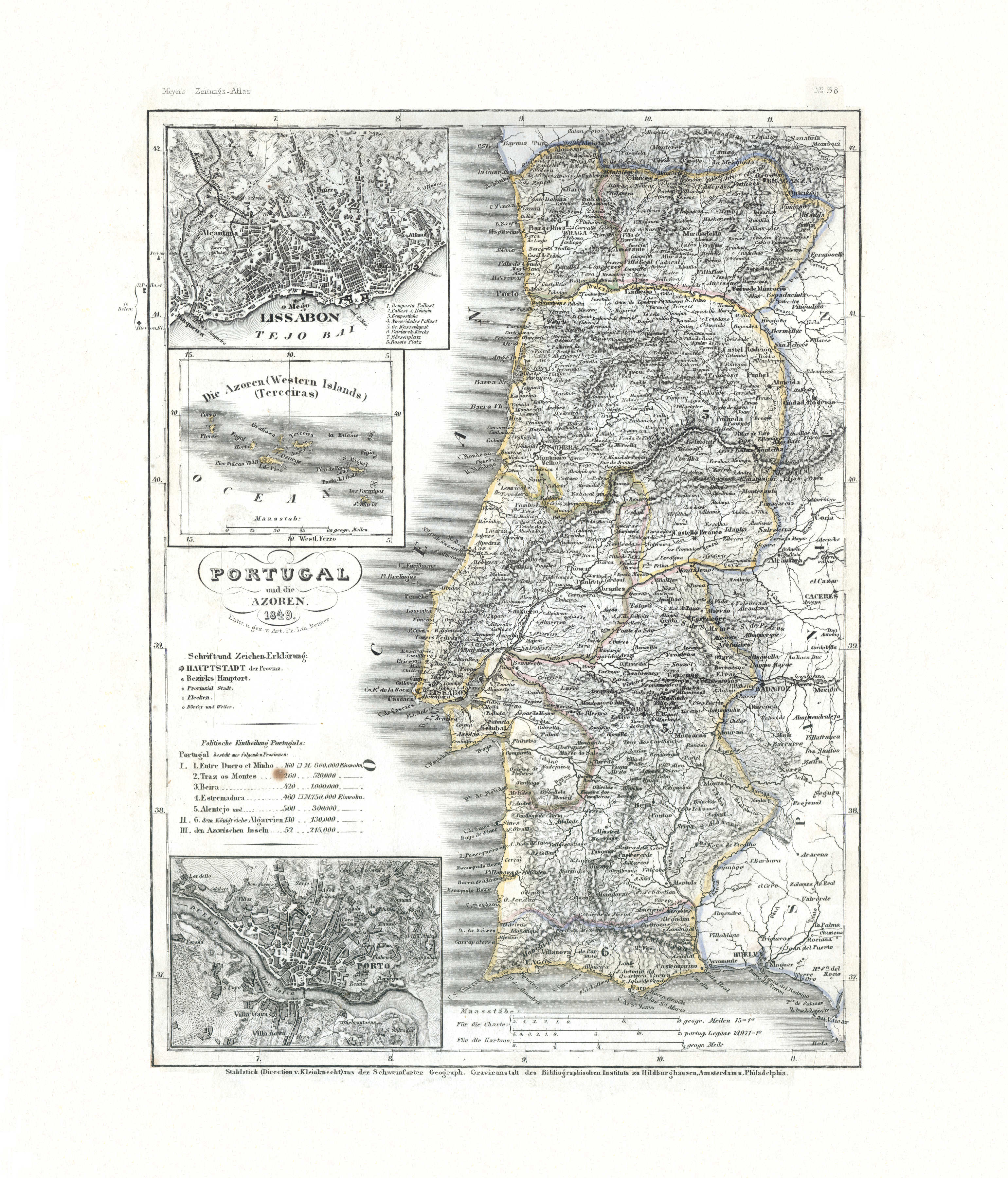
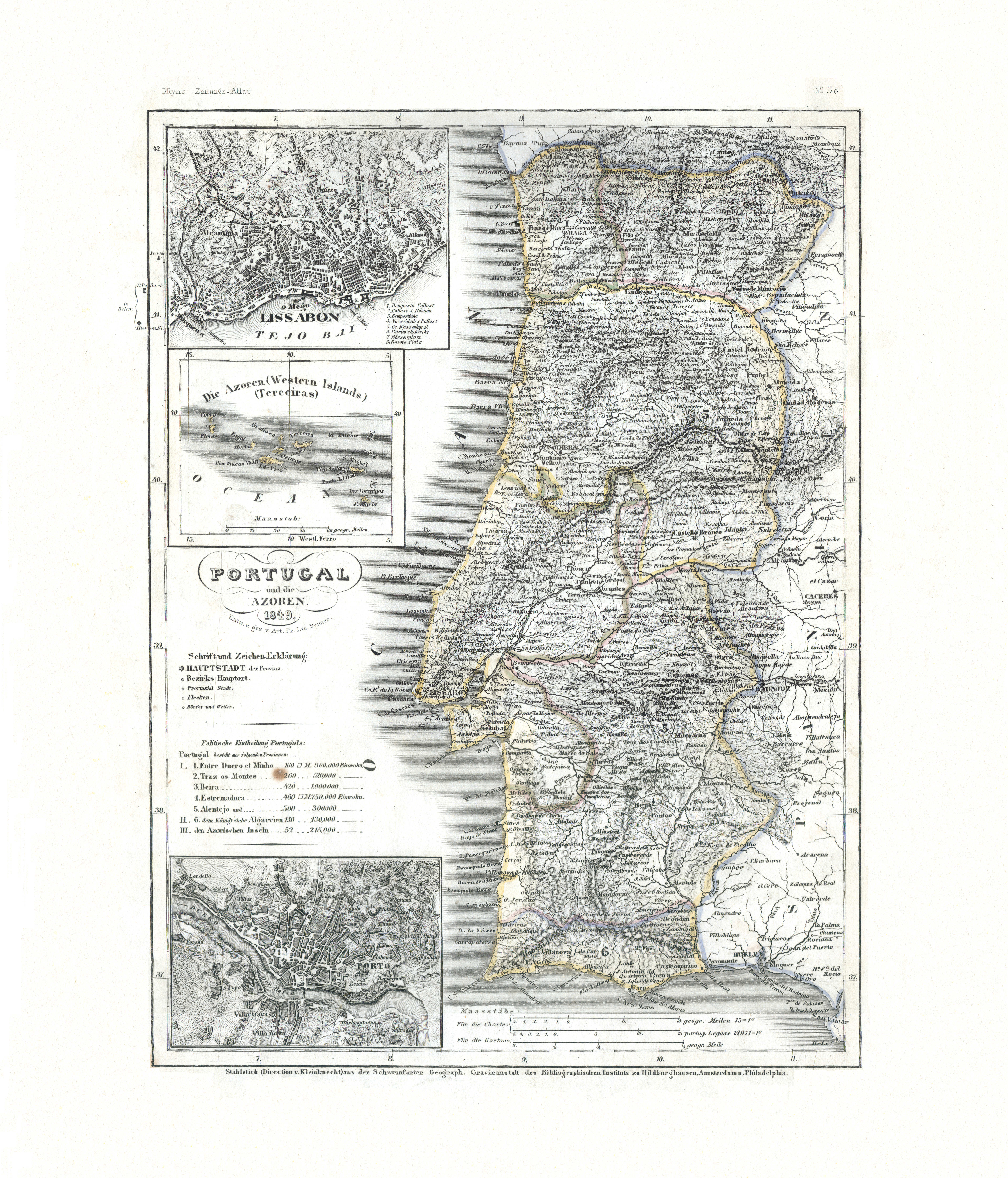
83. Portugal und die Azoren (Nº 38, 1849) XL
Portugal en de Azoren / Portugal and the Azores
 Meyer's Zeitungs-Atlas (1849-1852)
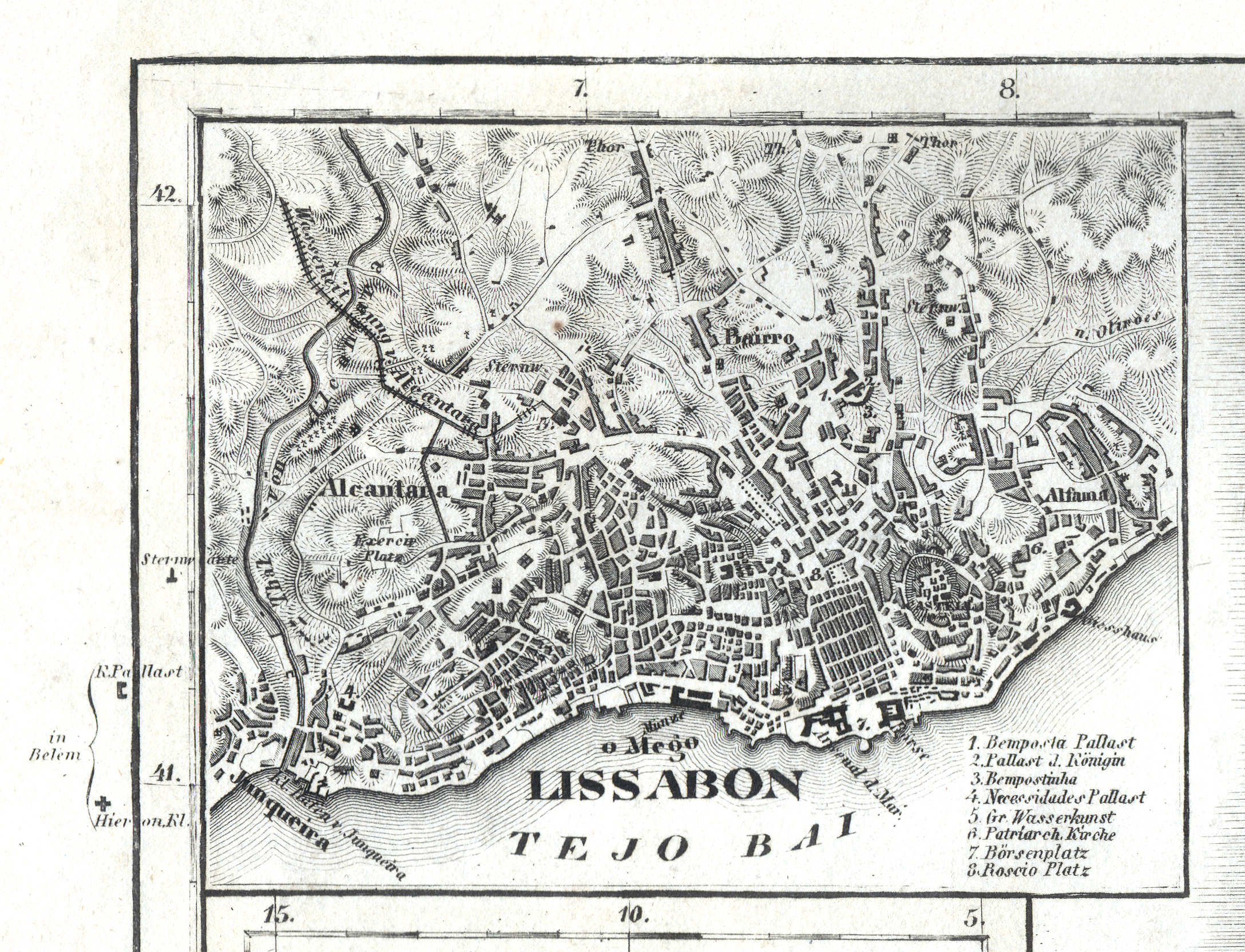
83a. Lissabon
Lissabon / Lisbon / Lisboa
 Meyer's Zeitungs-Atlas (1849-1852)
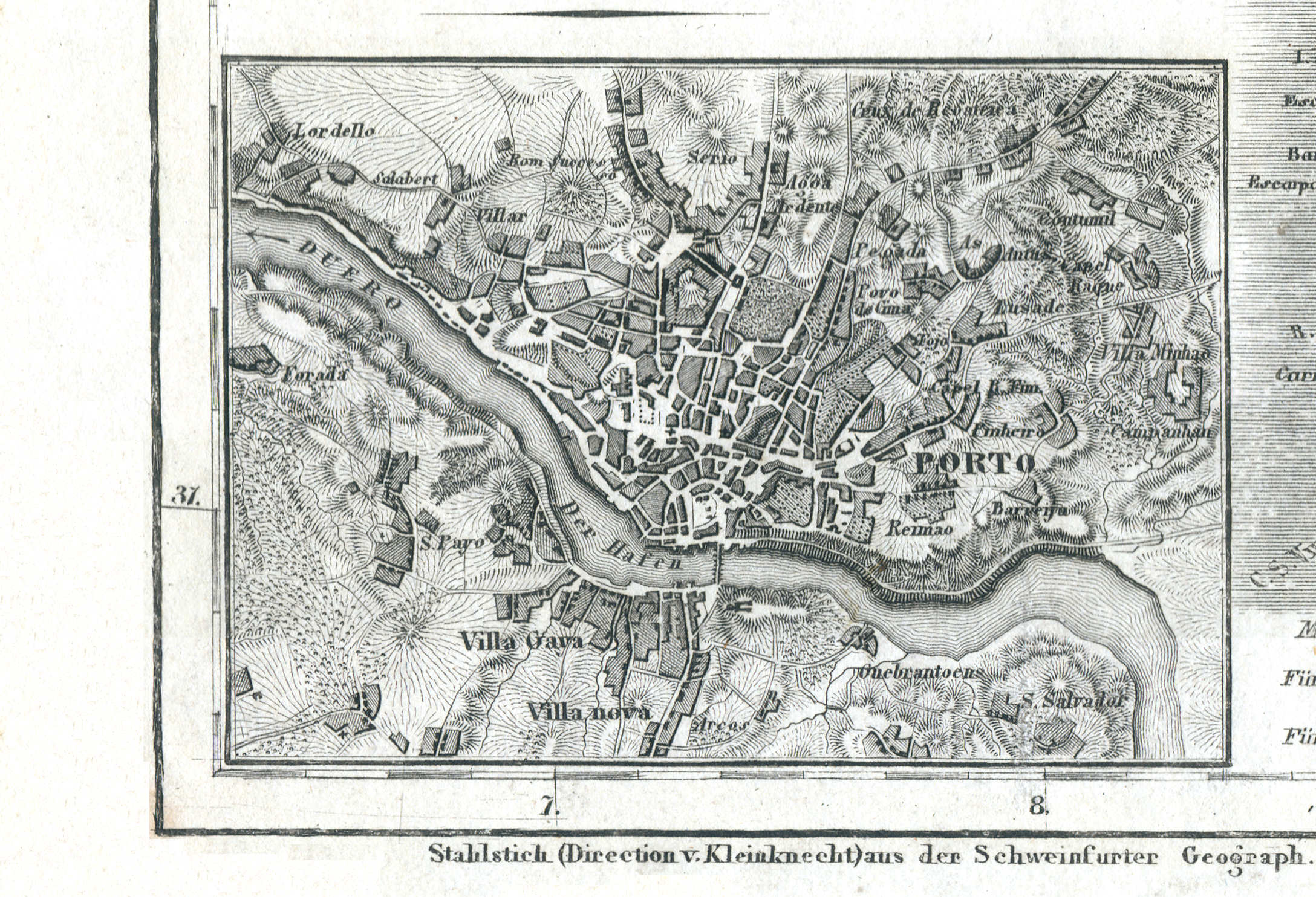
83b. Porto
Porto / Oporto
 Meyer's Zeitungs-Atlas (1849-1852)
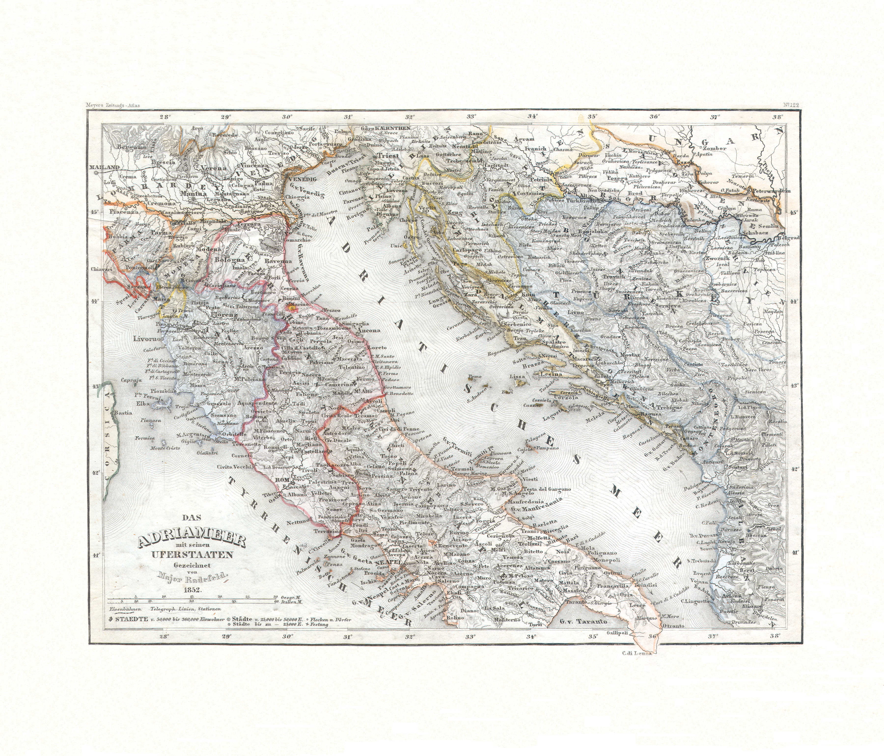
84. Das Adriameer mit seinen Uferstaaten (Nº 122, 1852)
Oevers van de Adriatische Zee / Shores of the Adriatic Sea
 Meyer's Zeitungs-Atlas (1849-1852)
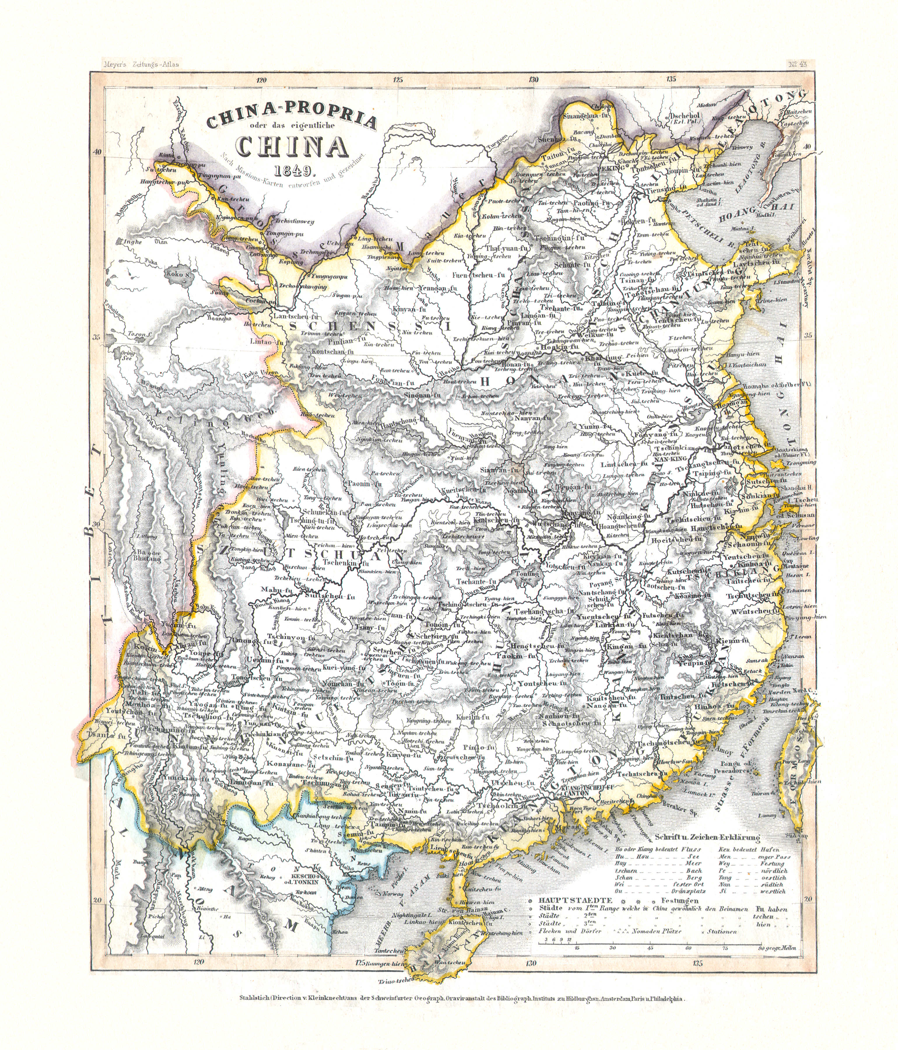
85. China-Propria oder das eigentliche China (Nº 43, 1849)
Het eigenlijke China / Proper China
 Meyer's Zeitungs-Atlas (1849-1852)
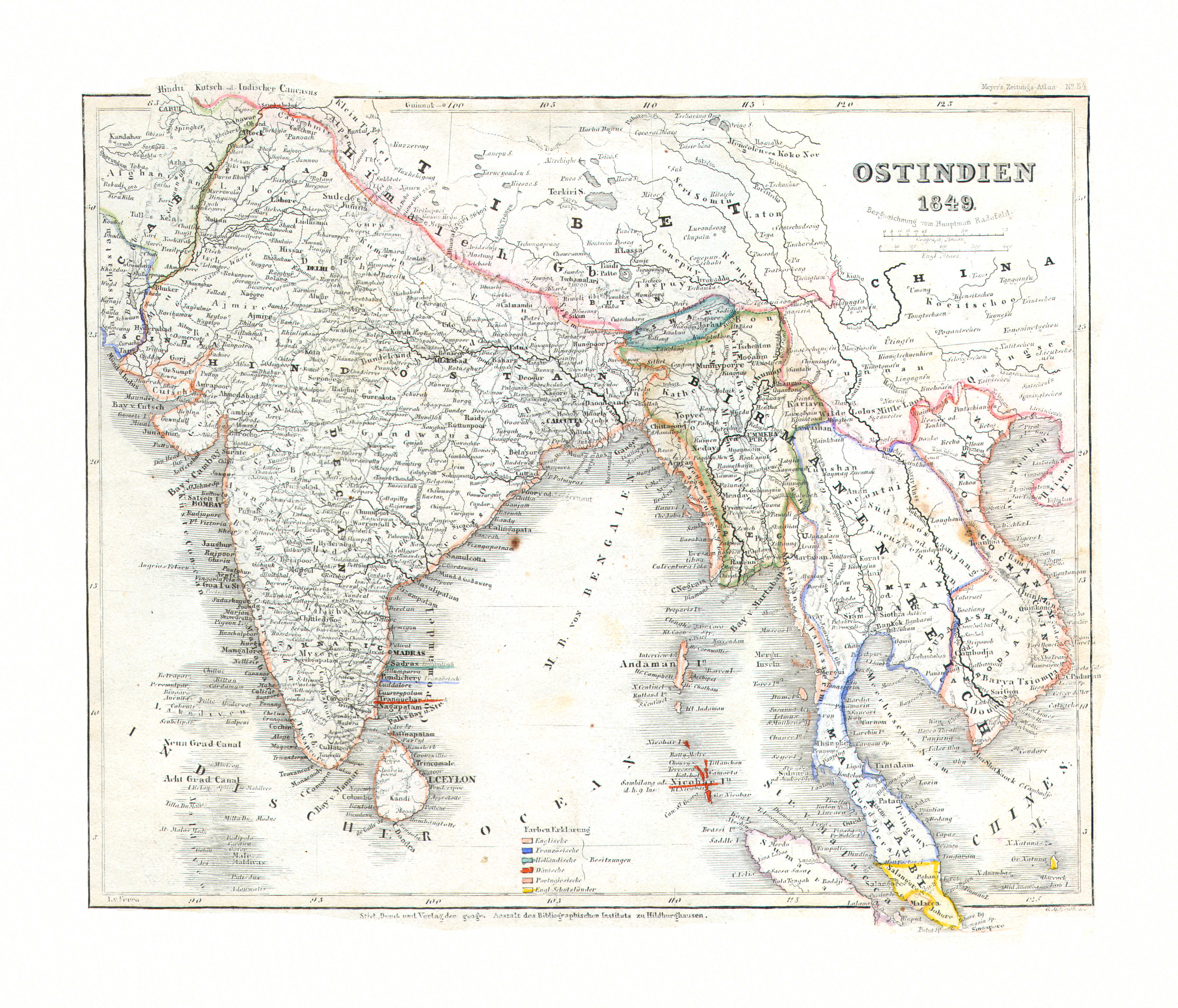
86. Ostindien (Nº 54, 1849)
Oost-Indië / East Indies
 Meyer's Zeitungs-Atlas (1849-1852)
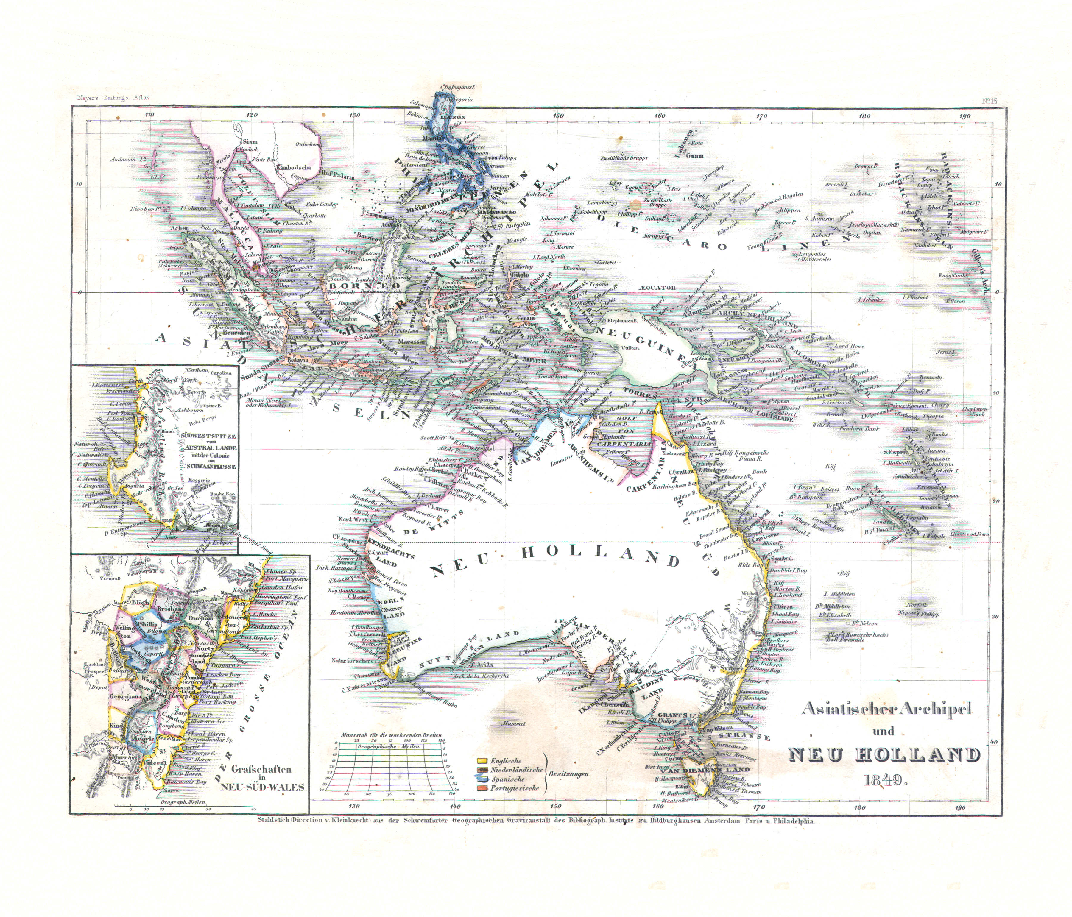
87. Asiatischer Archipel und Neu Holland (Nº 15, 1849)
Indische Archipel en Nieuw-Holland / Malay Archipelago and New Holland
 Meyer's Zeitungs-Atlas (1849-1852)
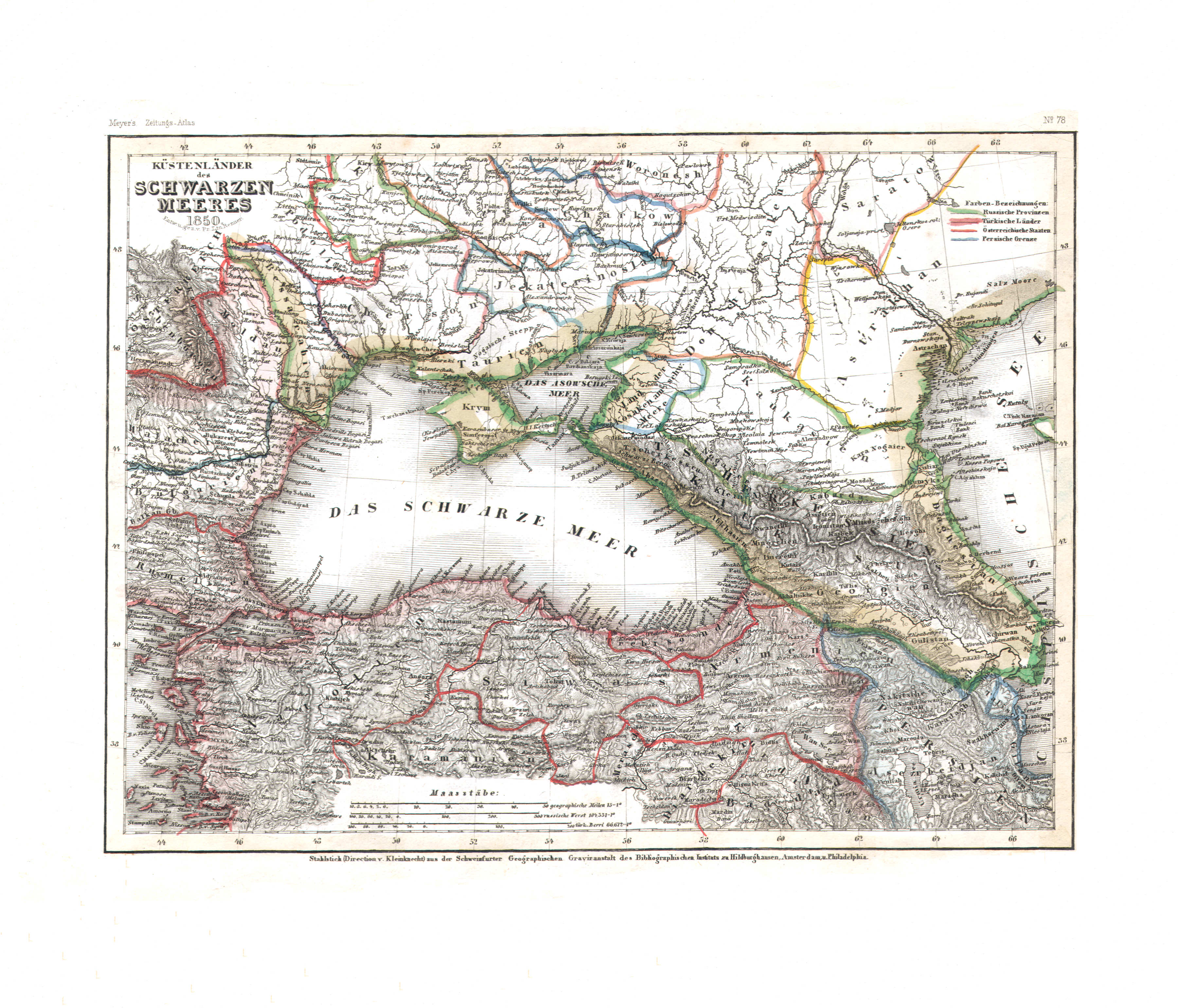
88. Küstenländer des Schwarzen Meeres (Nº 78, 1850)
De landen rond de Zwarte Zee / The countries around the Black Sea
 Meyer's Zeitungs-Atlas (1849-1852)
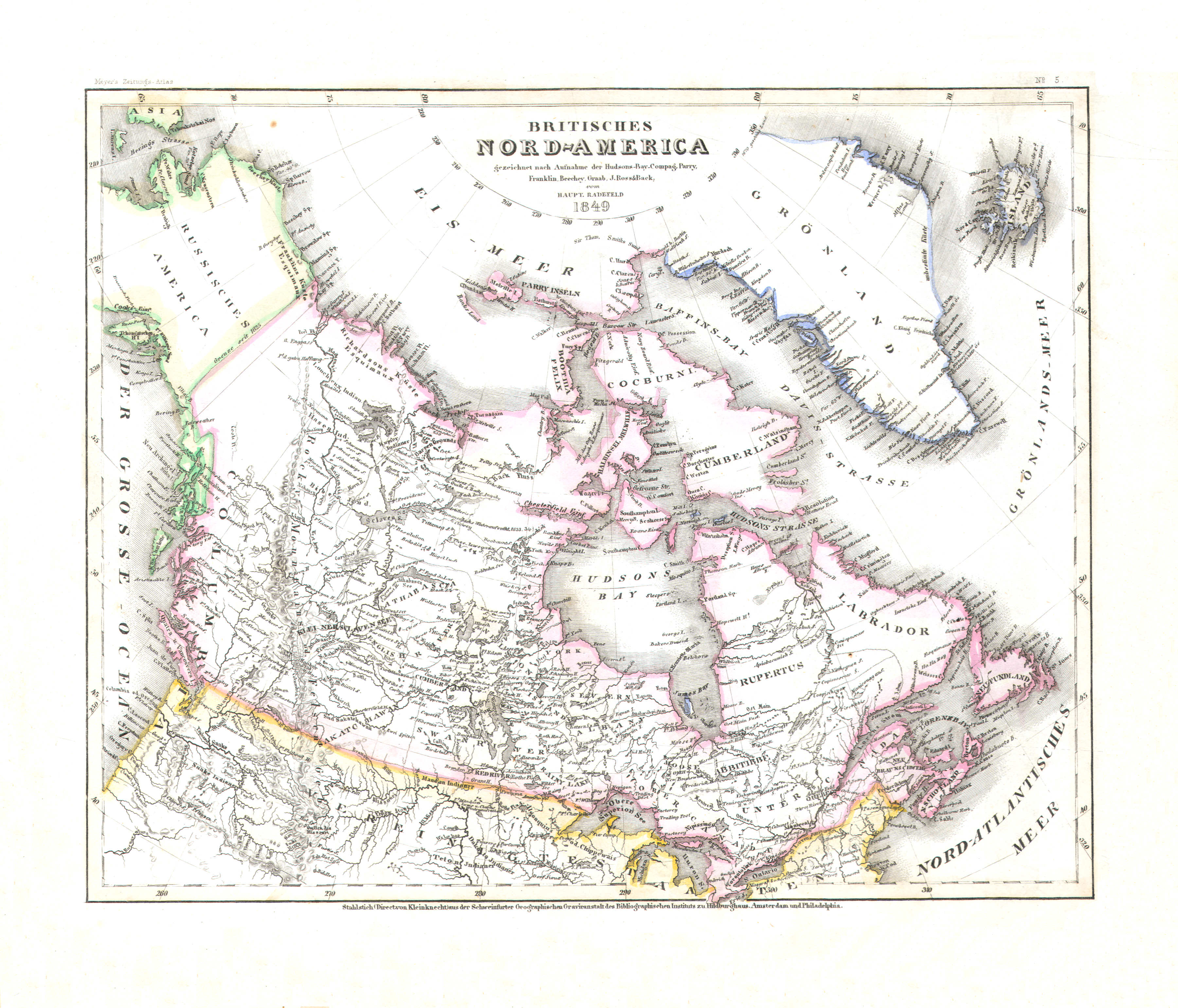
89. Britisches Nord-America (Nº 5, 1849)
Brits Noord-Amerika / British North America
 Meyer's Zeitungs-Atlas (1849-1852)
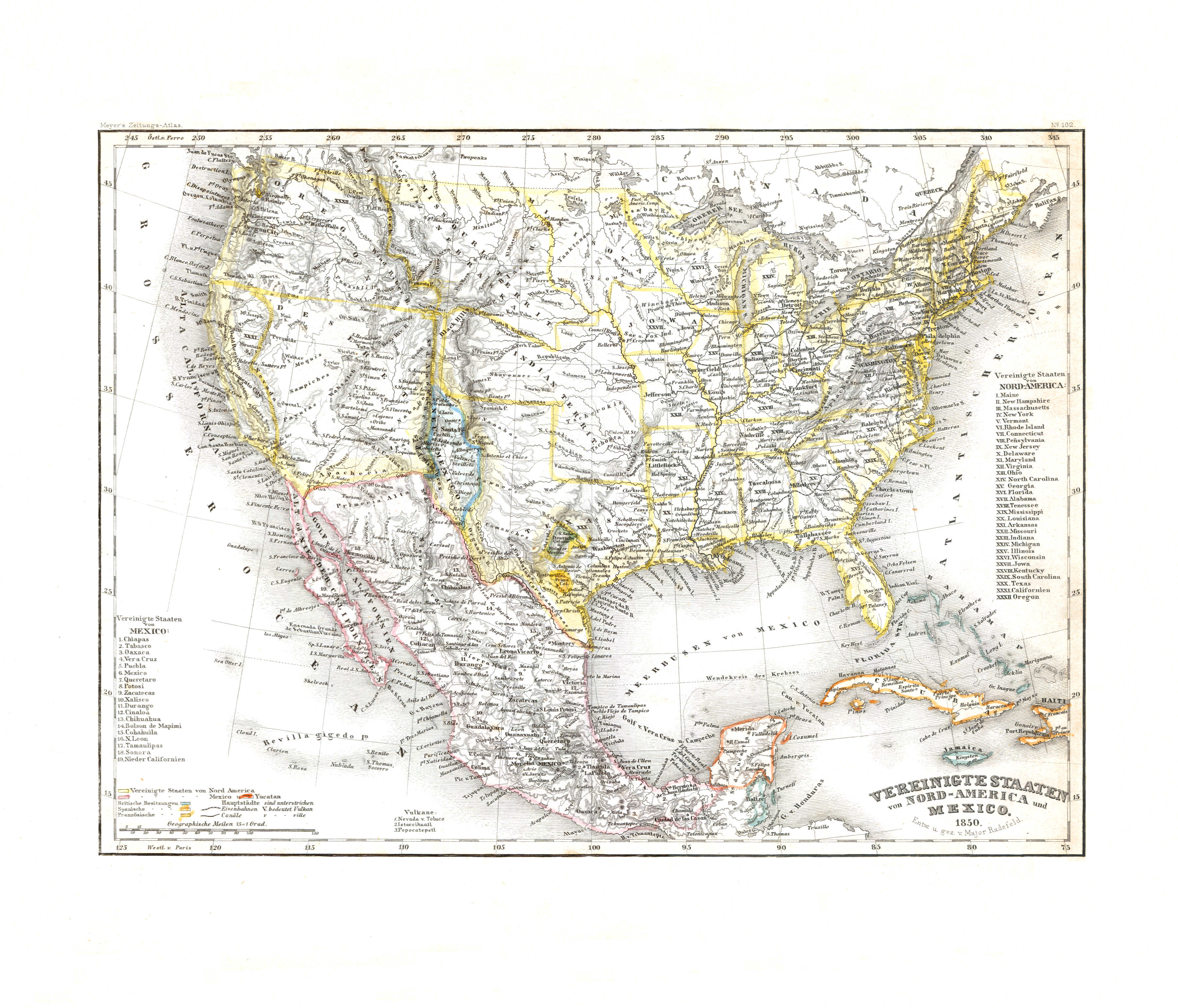
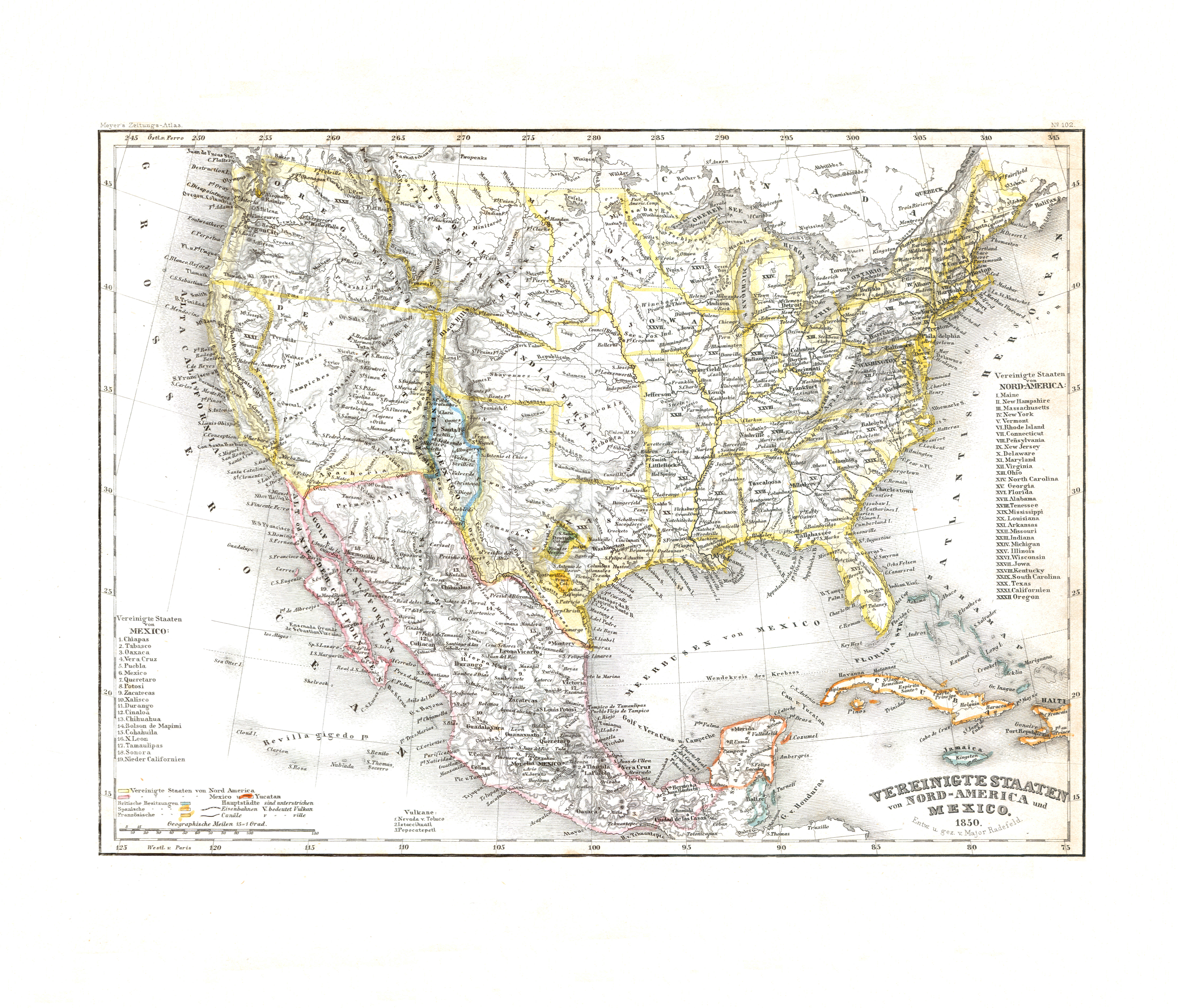
90. Vereinigte Staaten von Nord-America und Mexico (Nº 102, 1850) XL
Verenigde Staten van Noord-Amerika en Mexico / United States of North America and Mexico
 Meyer's Zeitungs-Atlas (1849-1852)
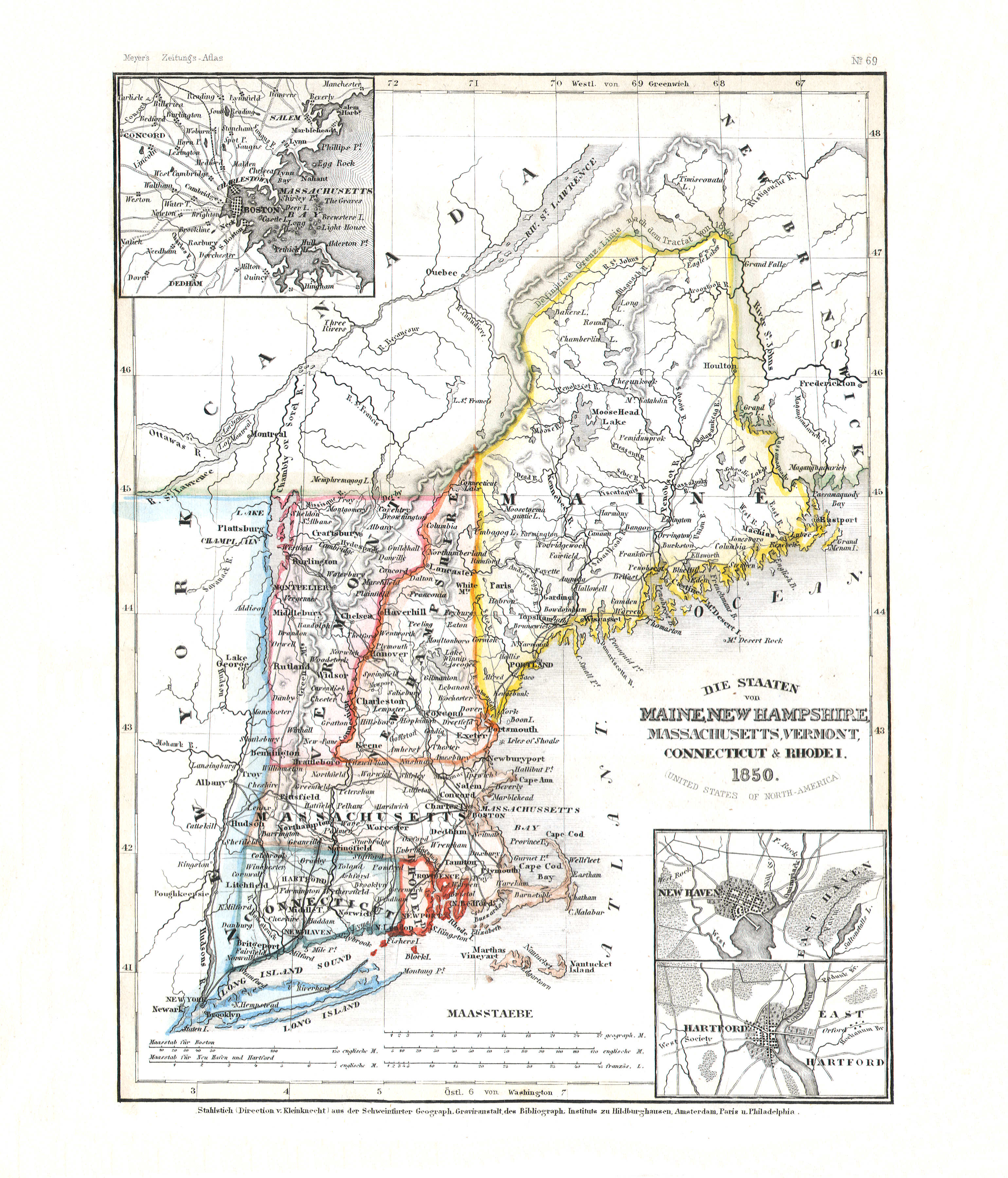
91. Die Staaten von Maine, New Hampshire, Massachusetts, Vermont, Connecticut & Rhode Island (Nº 69, 1850)
Maine, New Hampshire, Massachusetts, Vermont, Connecticut, Rhode Island
 Meyer's Zeitungs-Atlas (1849-1852)
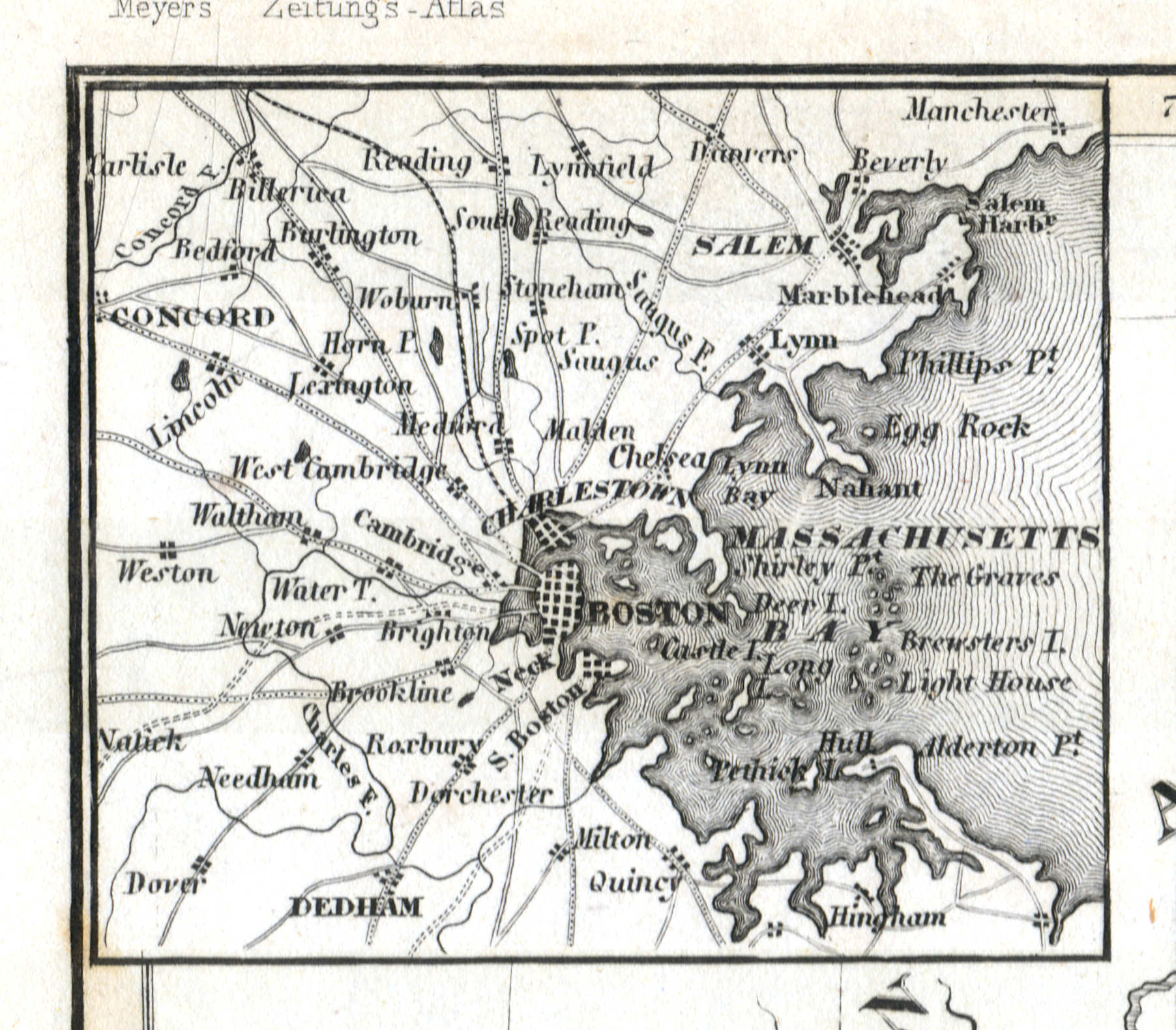
91a. Boston
Boston
 Meyer's Zeitungs-Atlas (1849-1852)
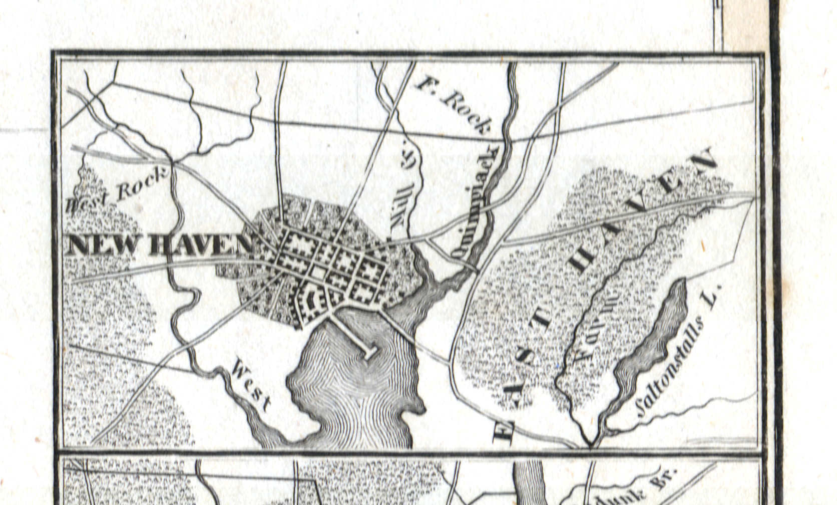
91b. New Haven
New Haven
 Meyer's Zeitungs-Atlas (1849-1852)
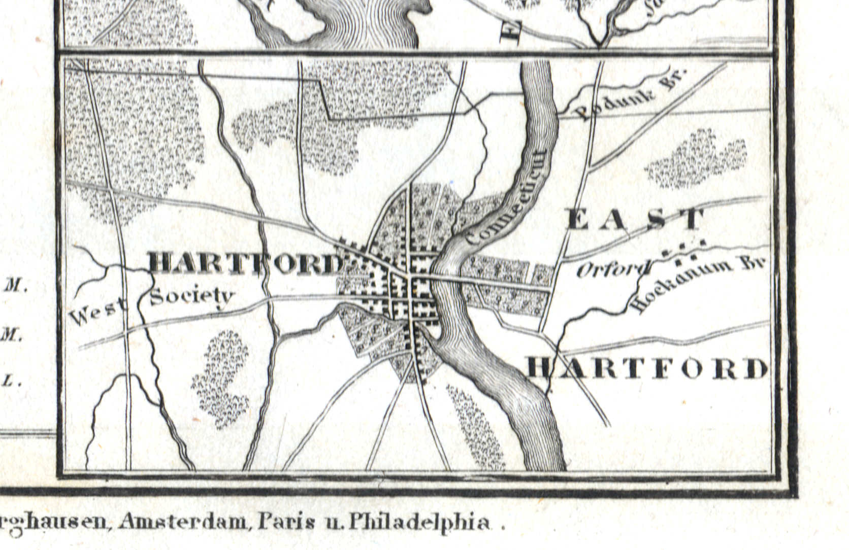
91c. Hartford
Hartford
 Meyer's Zeitungs-Atlas (1849-1852)
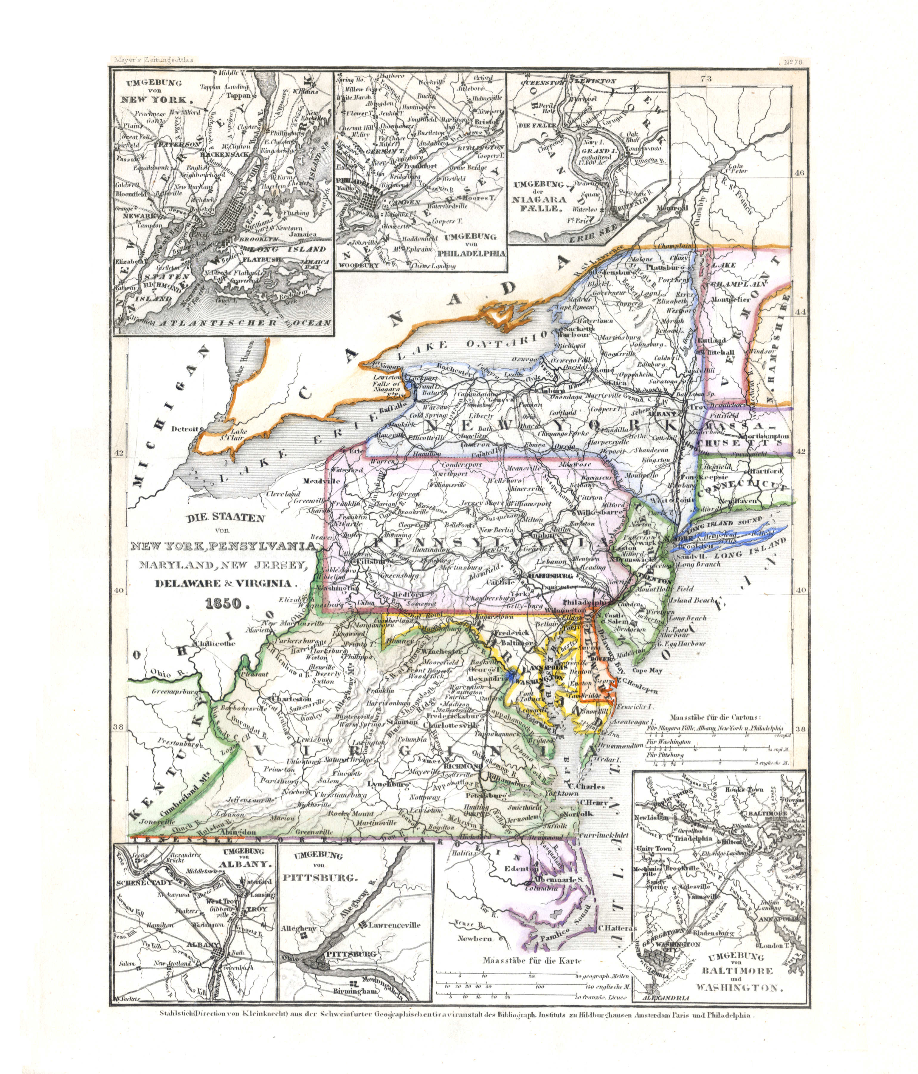
92. Die Staaten von New York, Pennsylvania, Maryland, New Jersey, Delaware & Virginia (Nº 70, 1850) XL
New York, Pennsylvania, Maryland, New Jersey, Delaware, Virginia
 Meyer's Zeitungs-Atlas (1849-1852)
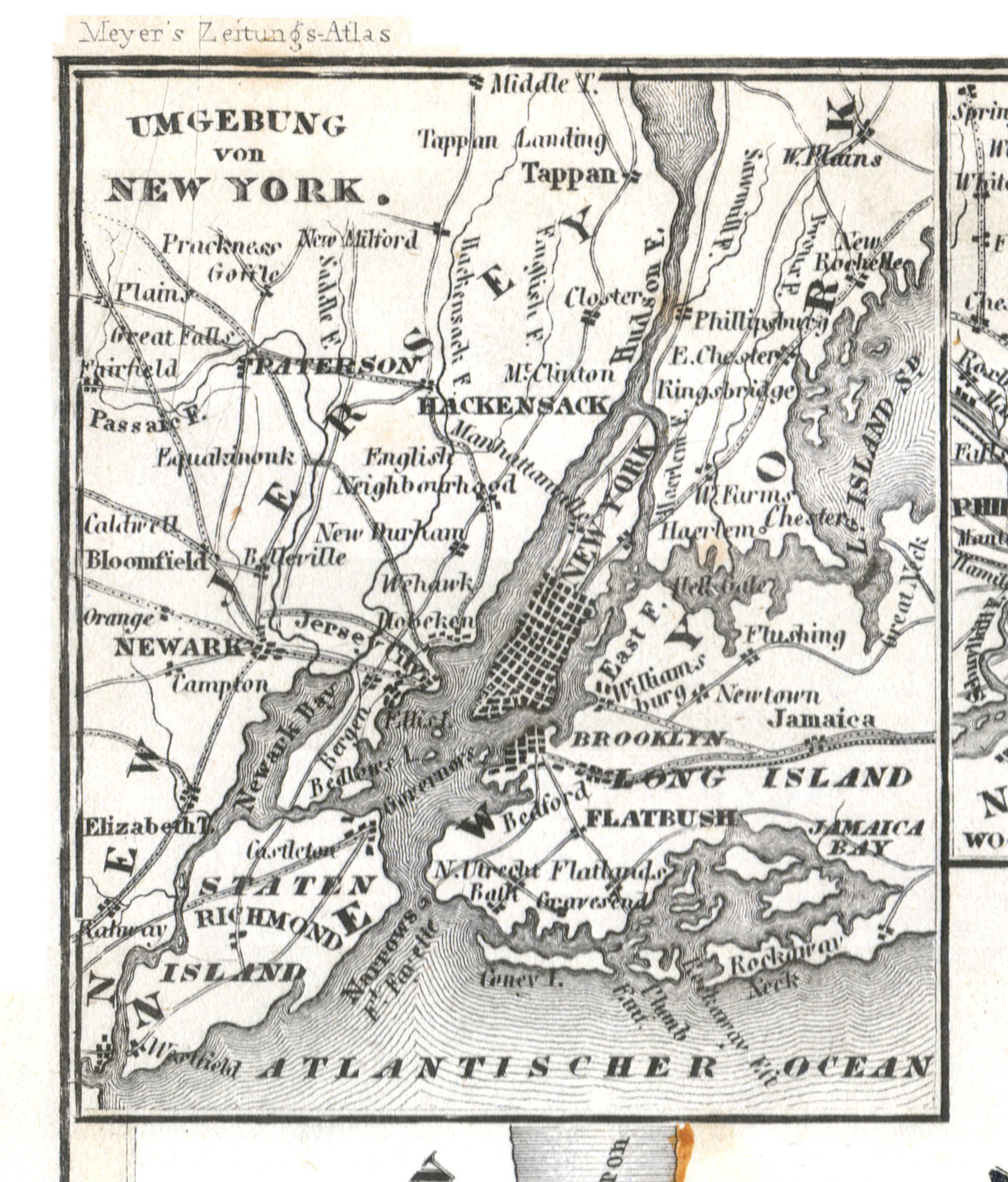
92a. Umgebung von New York
New York en omgeving / New York and environs
 Meyer's Zeitungs-Atlas (1849-1852)
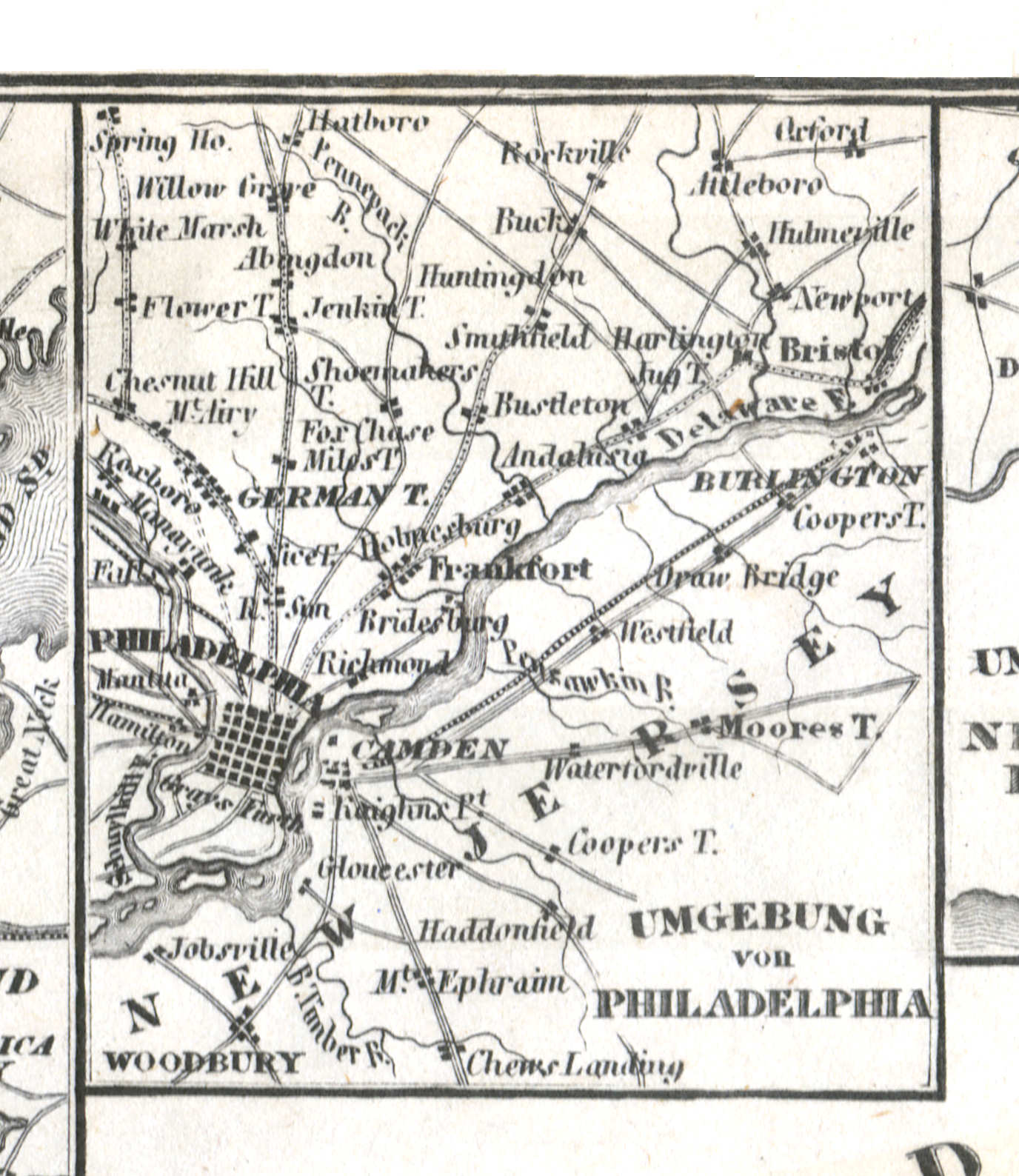
92b. Umgebung von Philadelphia
Philadelphia en omgeving / Philadelphia and environs
 Meyer's Zeitungs-Atlas (1849-1852)
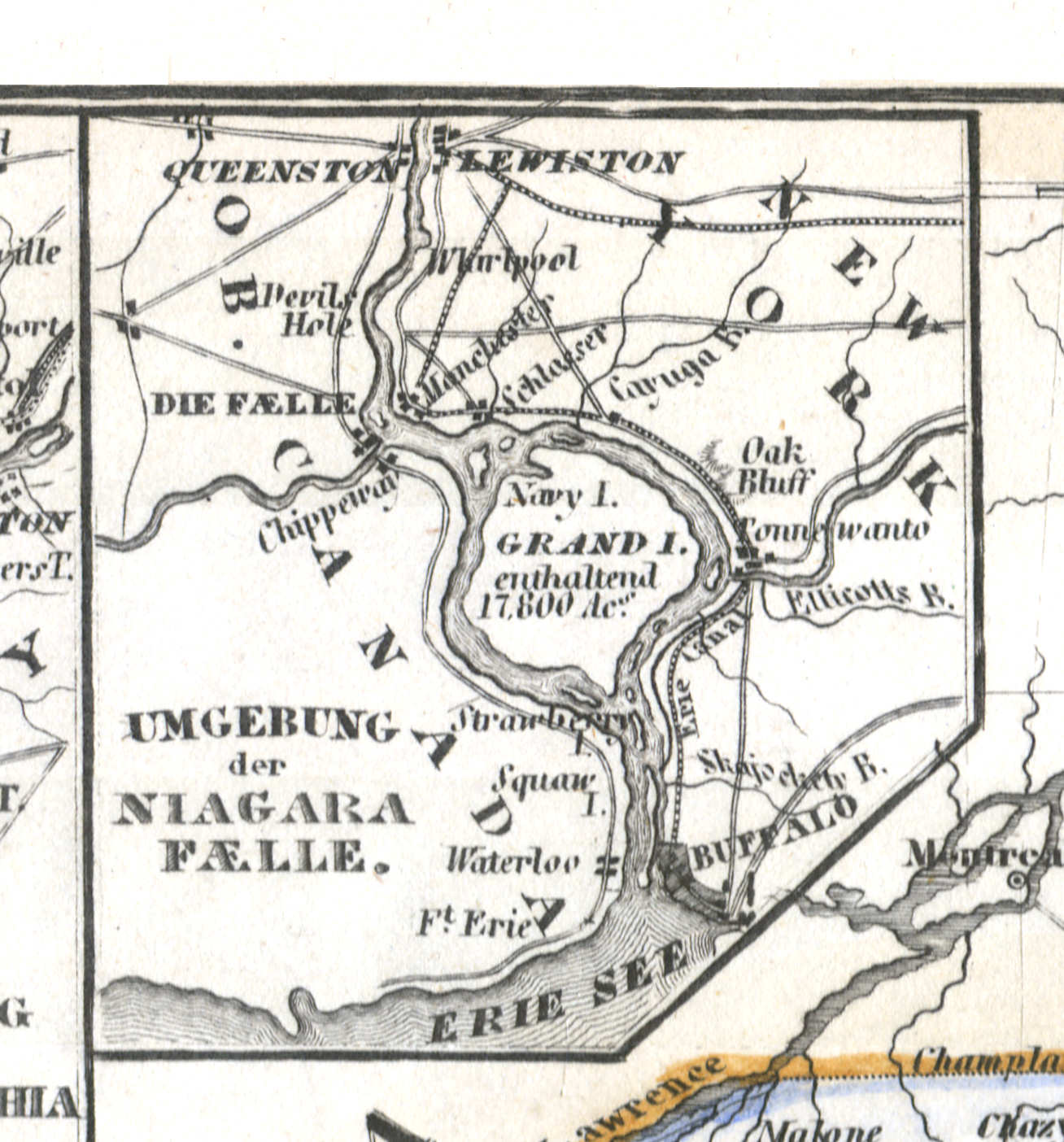
92c. Umgebung der Niagara Faelle
Niagarawatervallen en omgeving / Niagara Falls and environs
 Meyer's Zeitungs-Atlas (1849-1852)
92d. Umgebung von Albany
Albany en omgeving / Albany and environs
 Meyer's Zeitungs-Atlas (1849-1852)
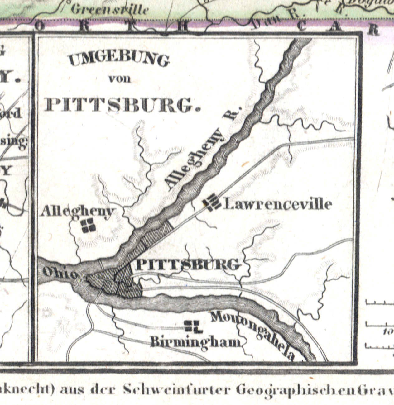
92e. Umgebung von Pittsburgh
Pittsburgh en omgeving / Pittsburgh and environs
 Meyer's Zeitungs-Atlas (1849-1852)
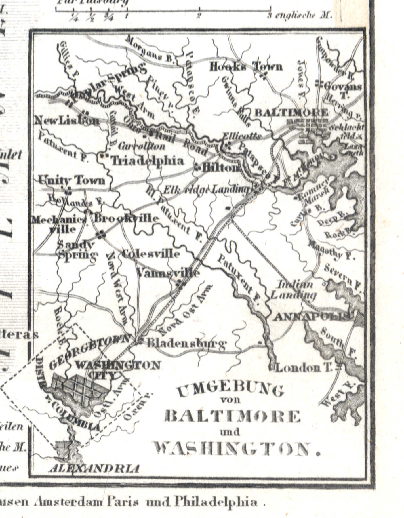
92f. Umgebung von Baltimore und Washington
Baltimore, Washington en omgeving / Baltimore, Washington and environs
 Meyer's Zeitungs-Atlas (1849-1852)
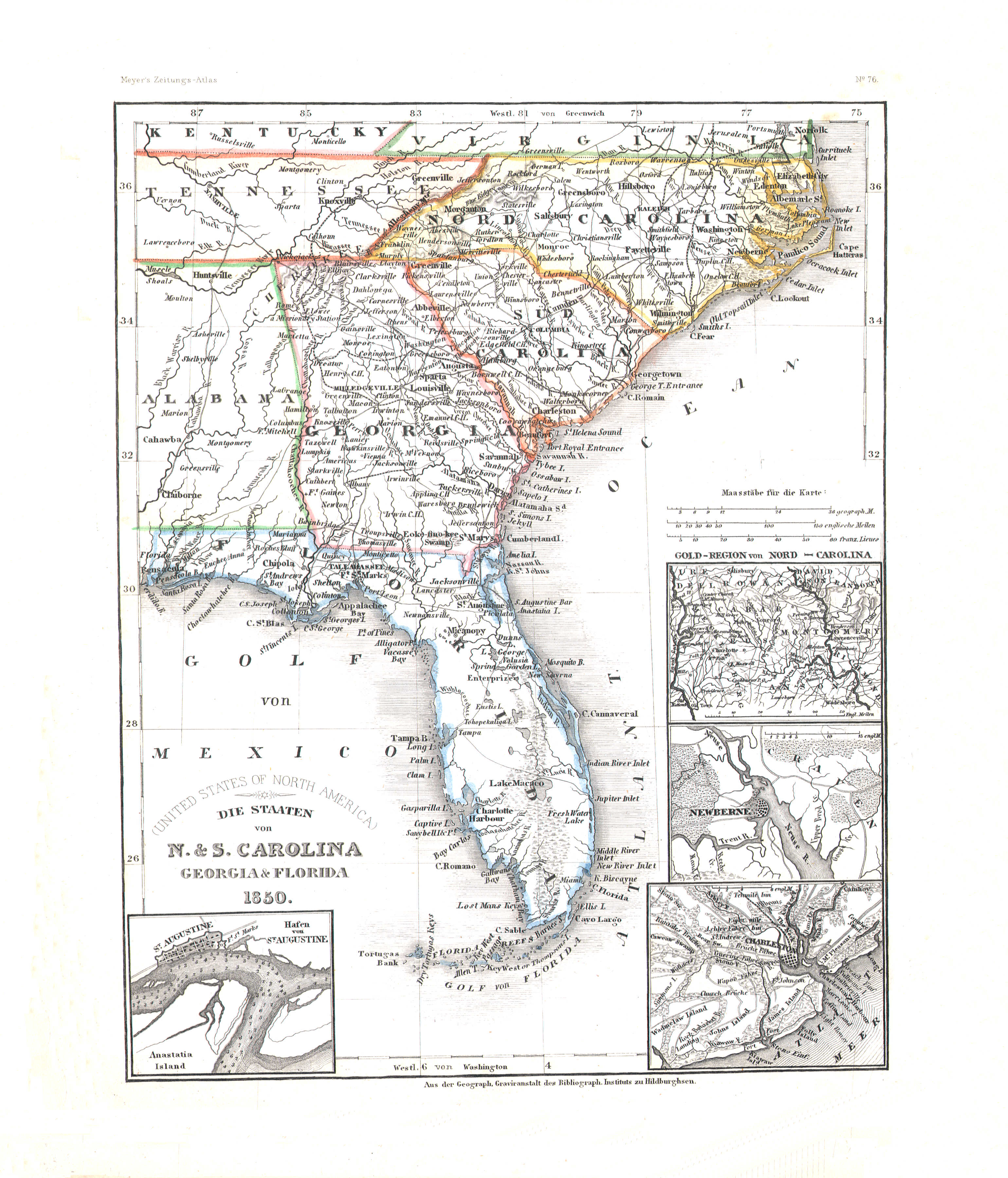
93. Die Staaten von N. & S. Carolina, Georgia & Florida (Nº 76, 1850)
North Carolina, South Carolina, Georgia, Florida
 Meyer's Zeitungs-Atlas (1849-1852)
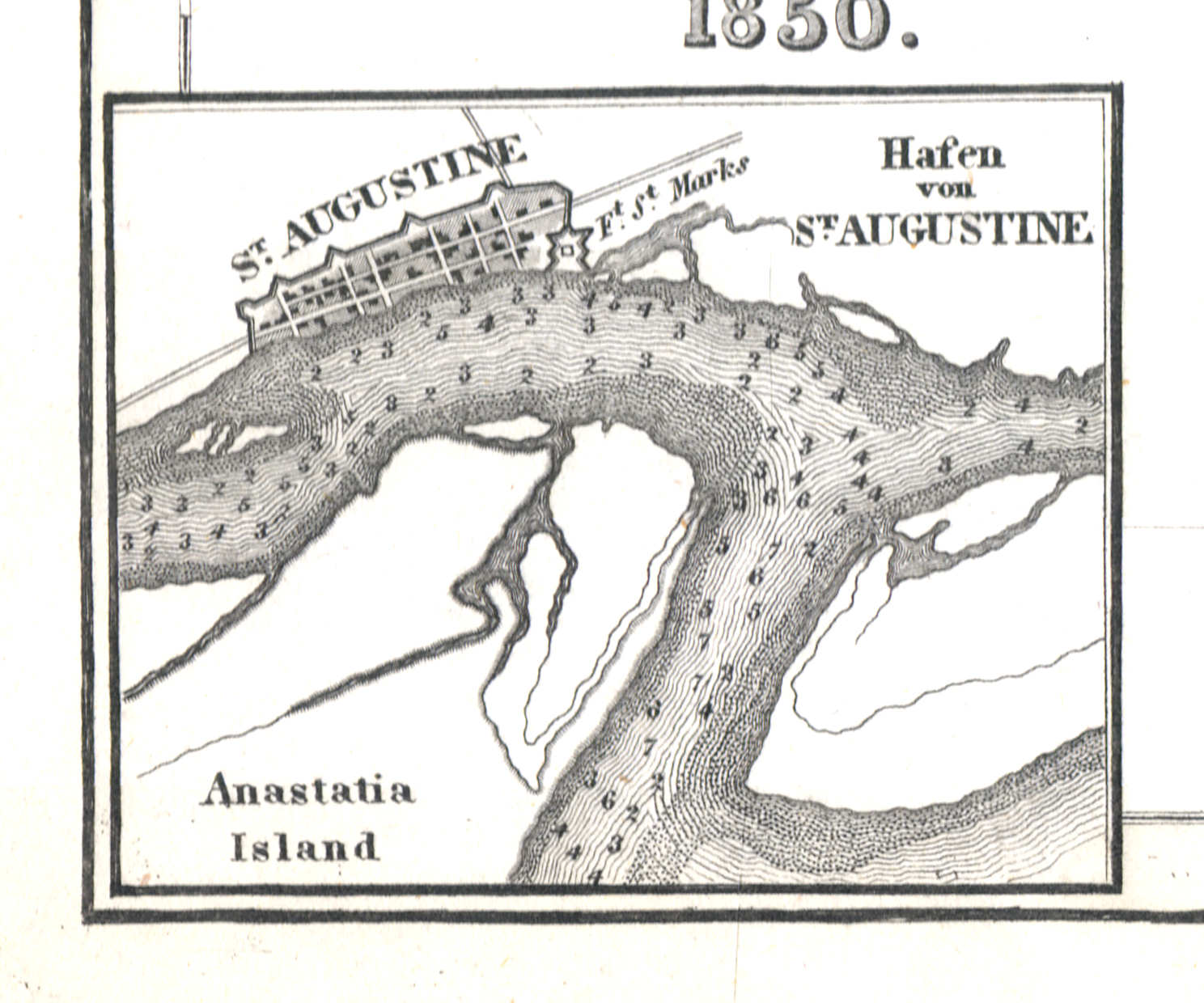
93a. Hafen von St. Augustine
Haven van St. Augustine / Port of St. Augustine
 Meyer's Zeitungs-Atlas (1849-1852)
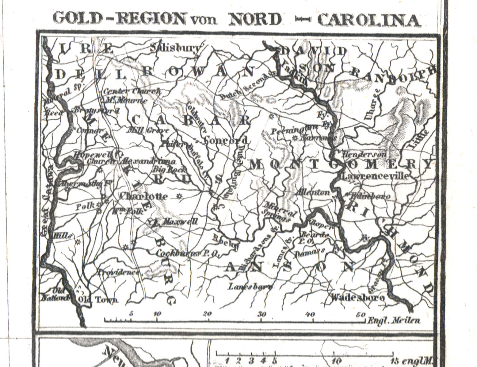
93b. Gold-Region von Nord-Carolina
Goudmijnen in North Carolina / North Carolina gold region
 Meyer's Zeitungs-Atlas (1849-1852)
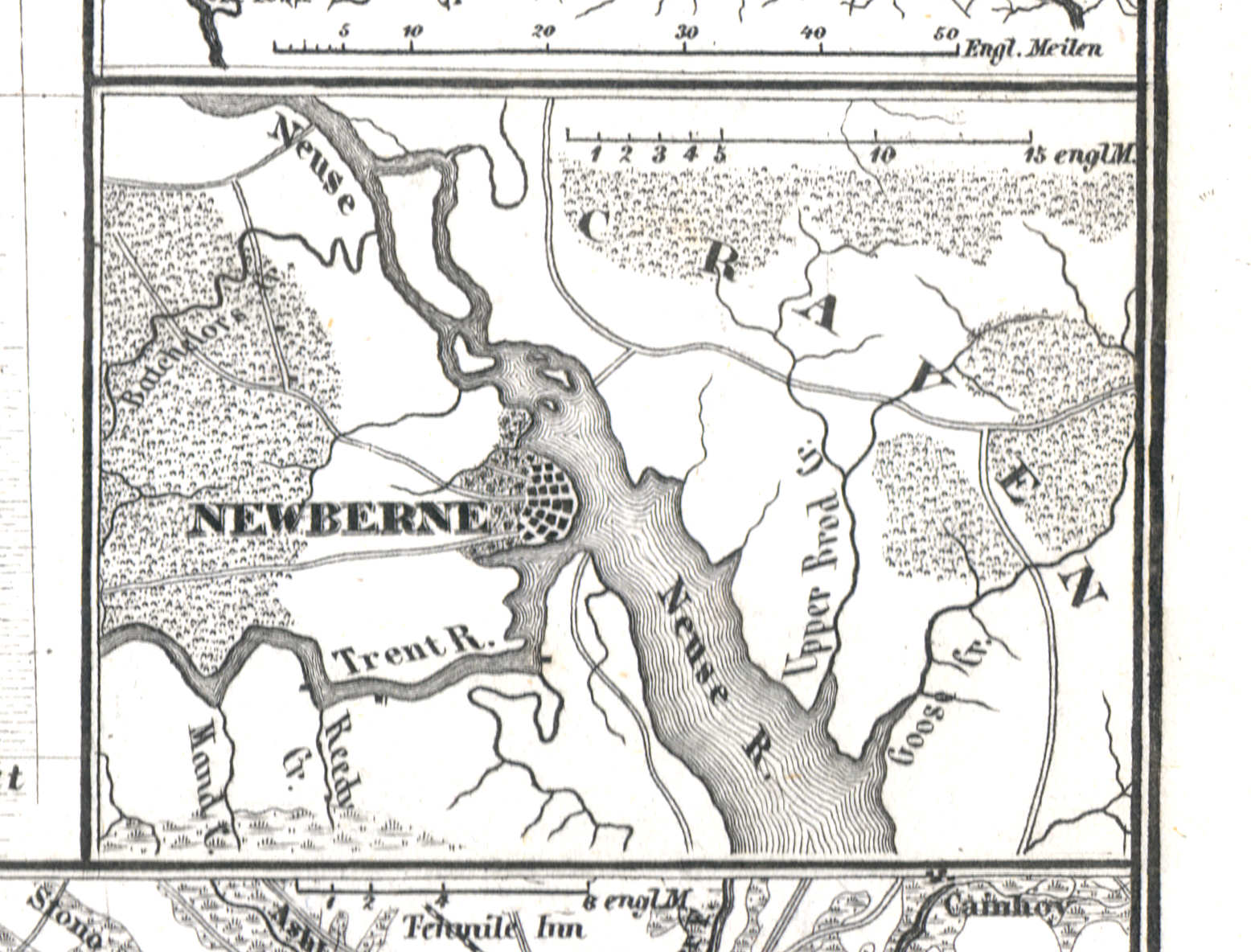
93c. Newberne
New Bern
 Meyer's Zeitungs-Atlas (1849-1852)
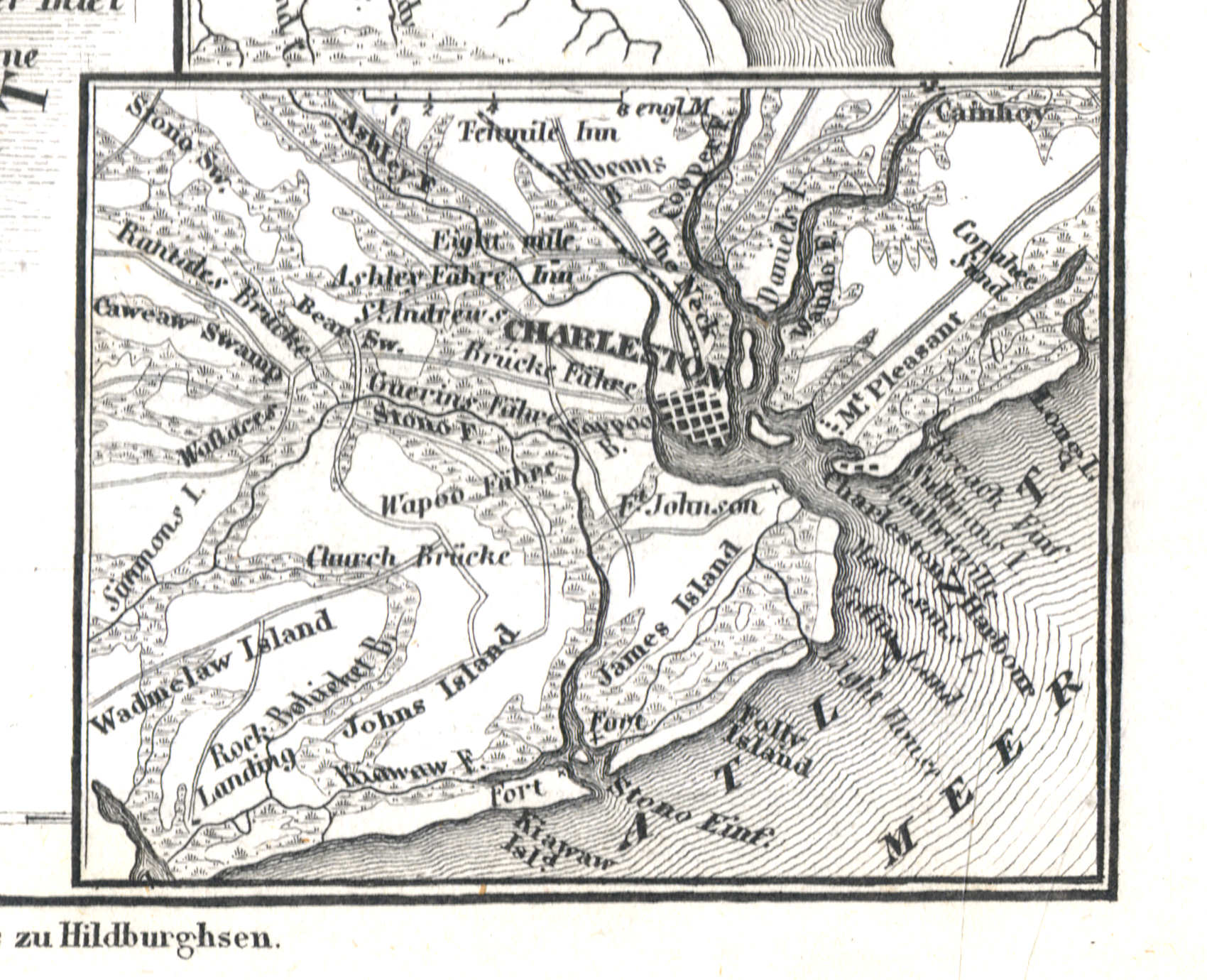
93d. Charleston
Charleston
 Meyer's Zeitungs-Atlas (1849-1852)
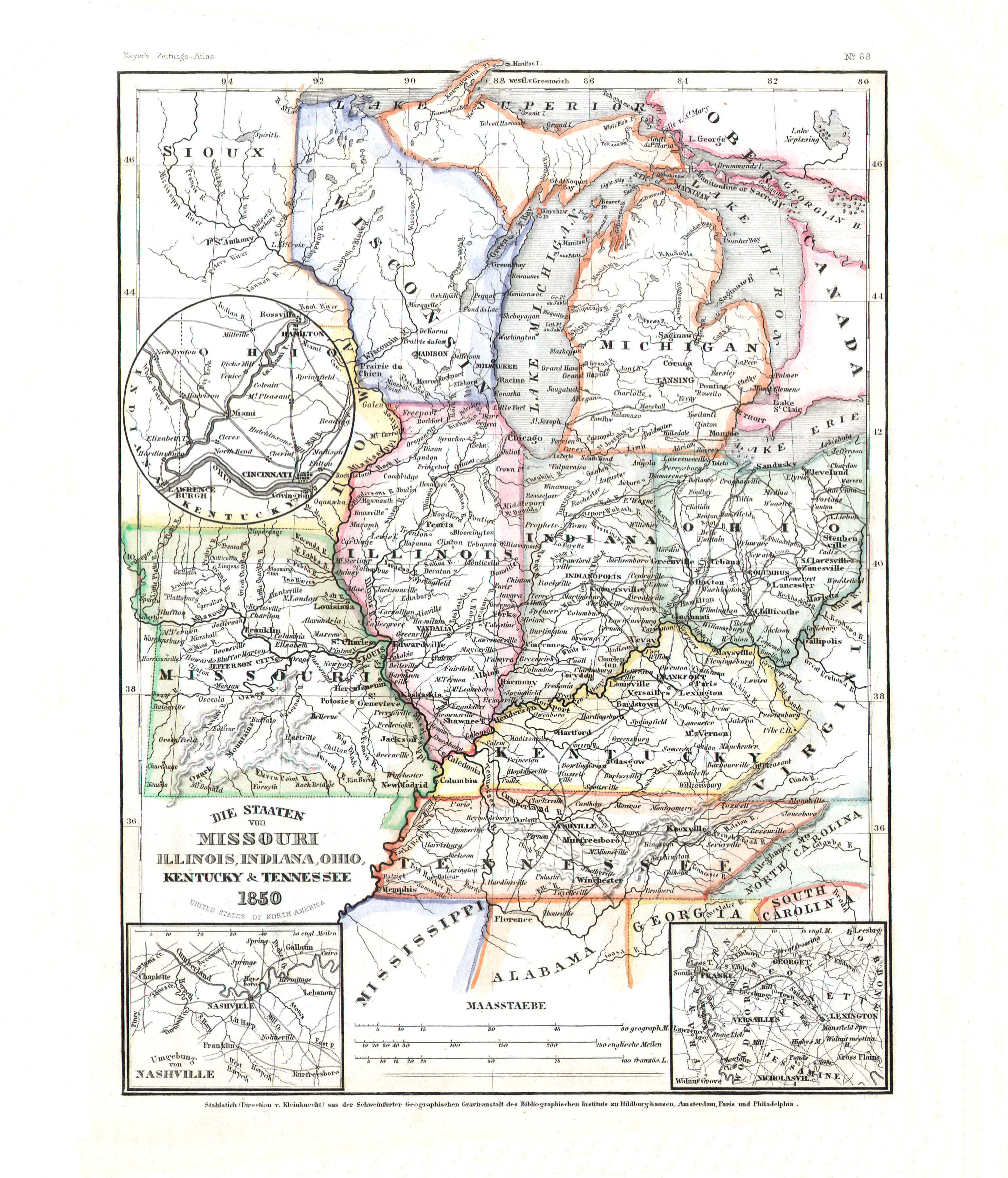
94. Die Staaten von Missouri, Illinois, Indiana, Ohio, Kentucky & Tennessee (Nº 68, 1850)
Missouri, Illinois, Indiana, Ohio, Kentucky, Tennessee
 Meyer's Zeitungs-Atlas (1849-1852)
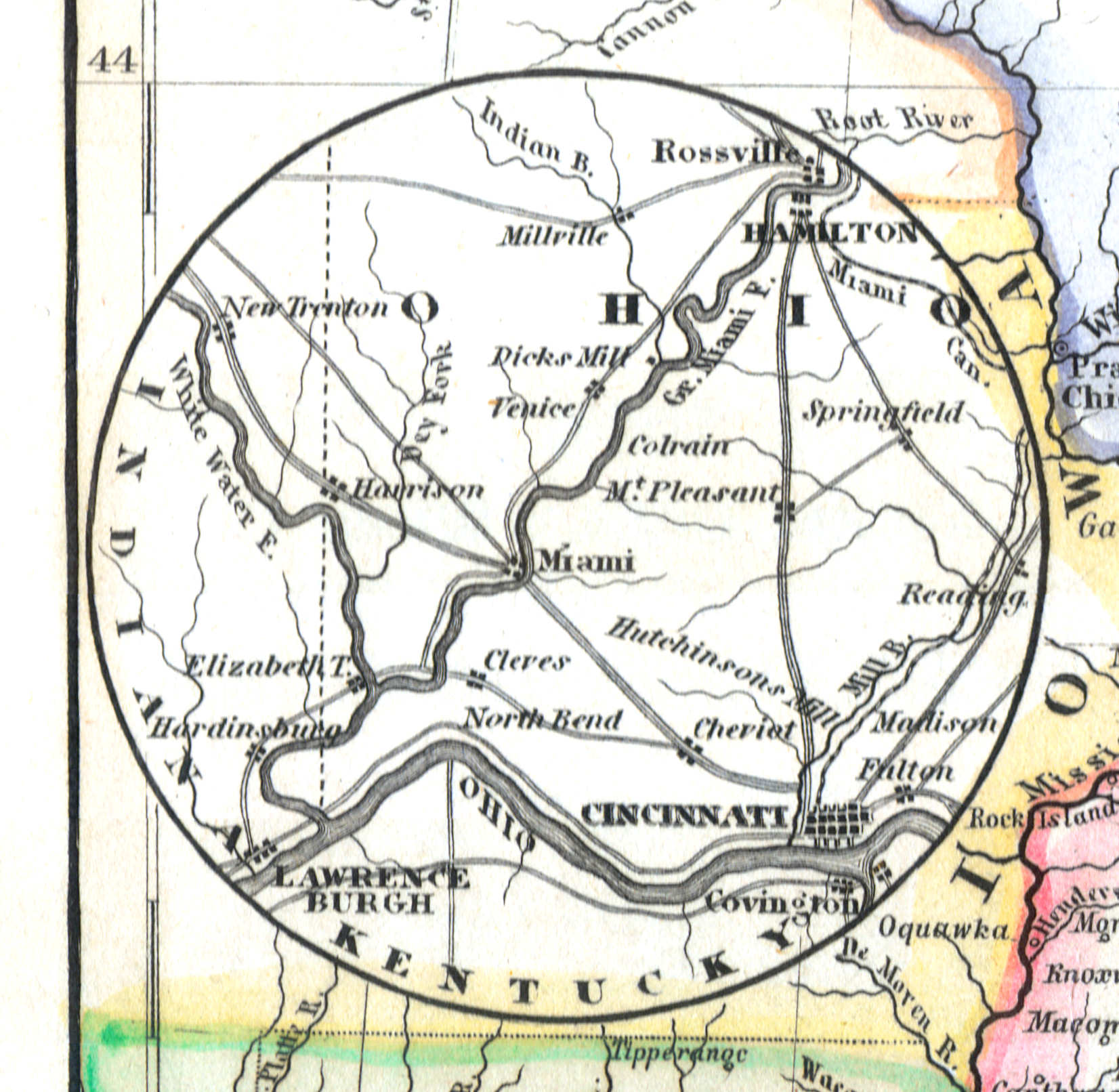
94a. Cincinnati
Cincinnati
 Meyer's Zeitungs-Atlas (1849-1852)
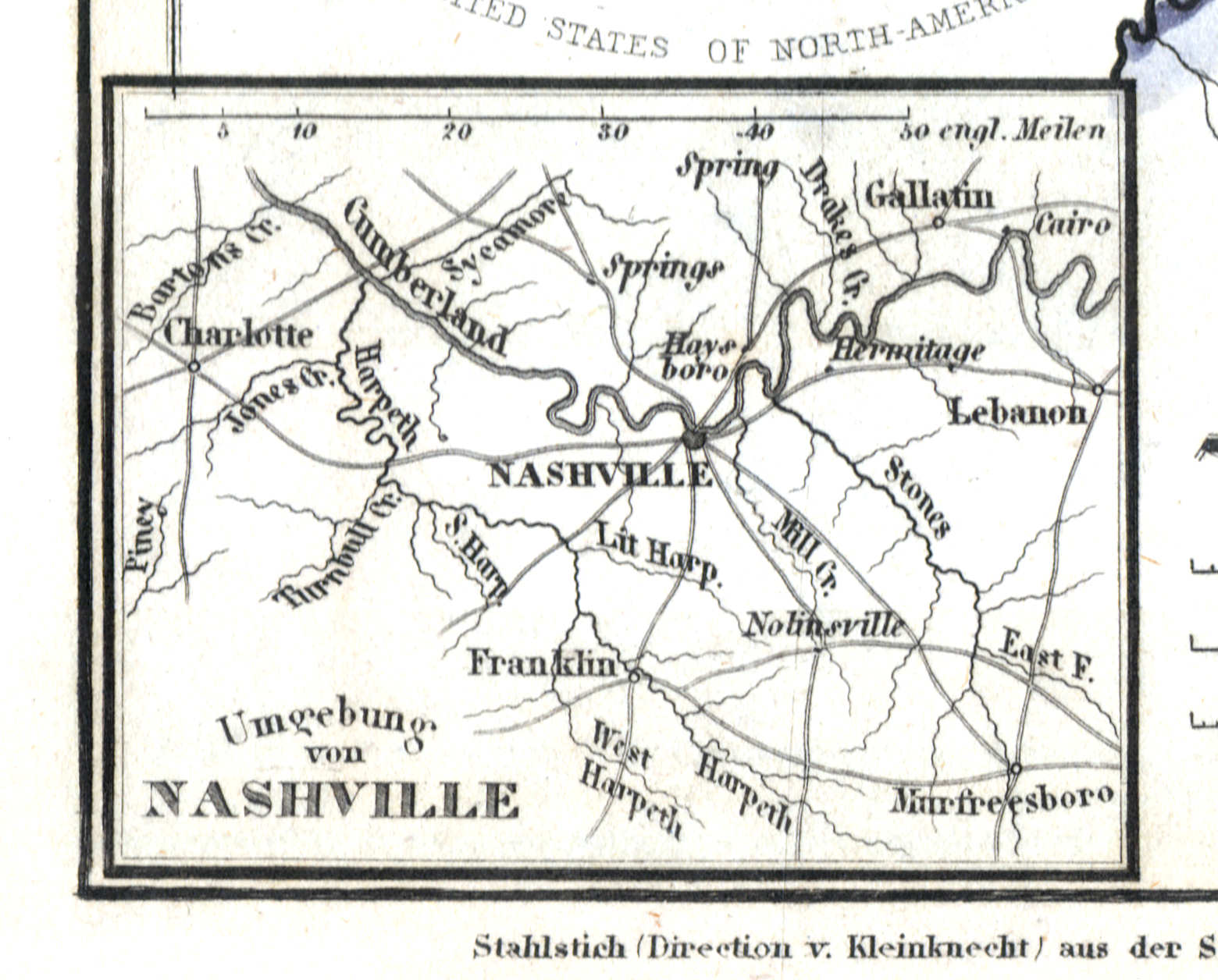
94b. Umgebung von Nashville
Nashville en omgeving / Nashville and environs
 Meyer's Zeitungs-Atlas (1849-1852)
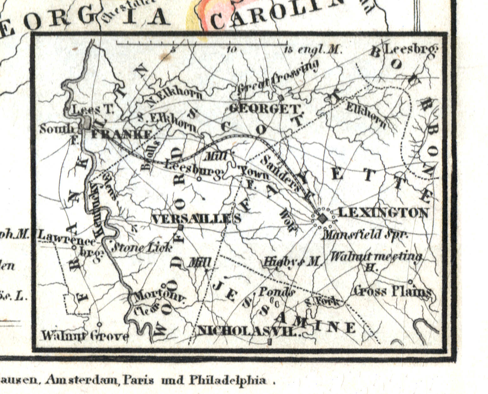
94c. North Kentucky
Noord-Kentucky / North Kentucky
 Meyer's Zeitungs-Atlas (1849-1852)
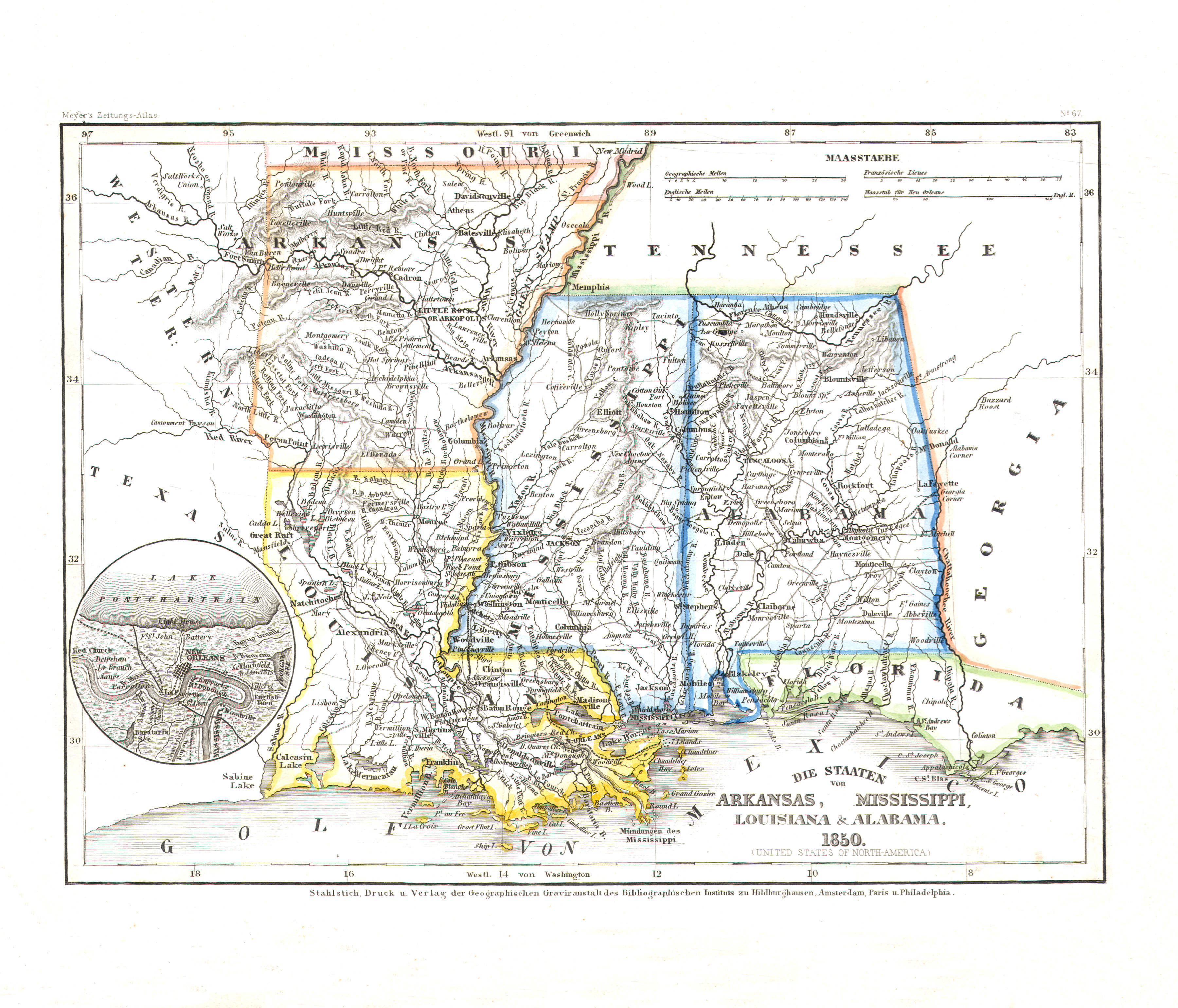
95. Die Staaten von Arkansas, Mississippi, Louisiana & Alabama (Nº 67, 1850)
Arkansas, Mississippi, Louisiana, Alabama
 Meyer's Zeitungs-Atlas (1849-1852)
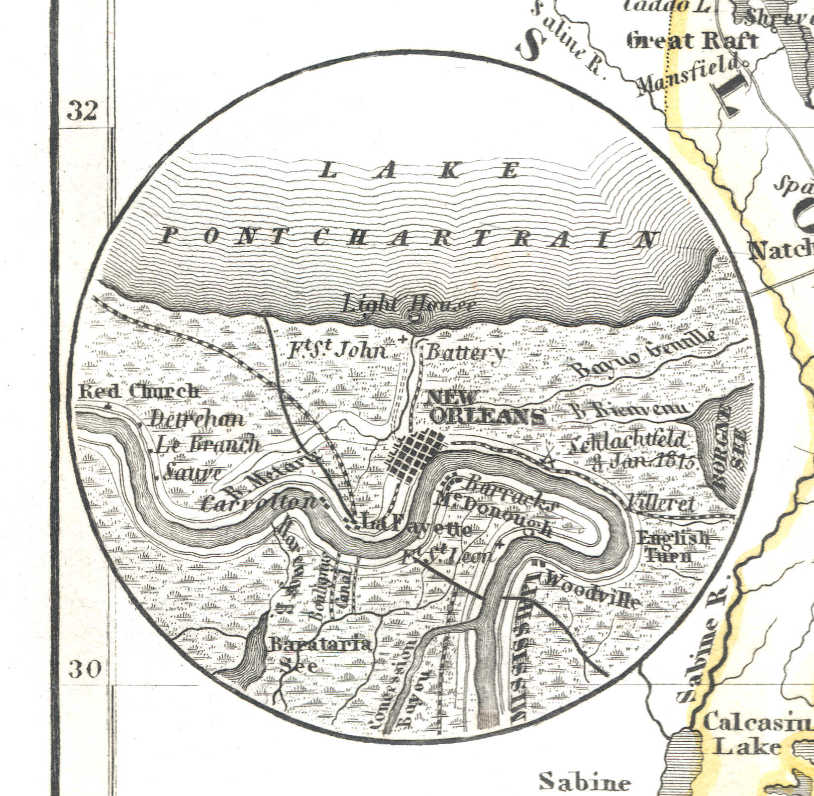
95a. New Orleans
New Orleans
 Meyer's Zeitungs-Atlas (1849-1852)
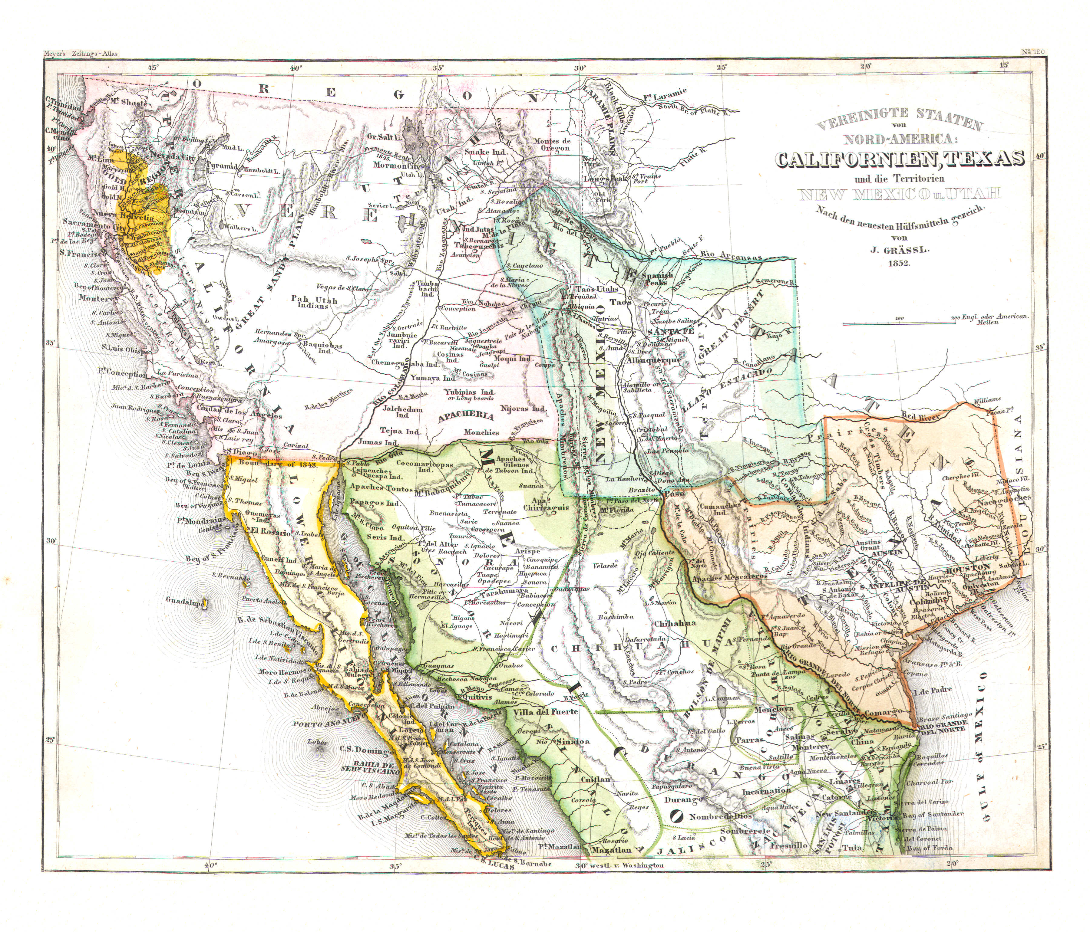
96. Vereinigte Staaten von Nord-America: Californien, Texas und die Territorien New Mexico u. Utah (Nº 120, 1852)
California, Texas, New Mexico, Utah
 Meyer's Zeitungs-Atlas (1849-1852)
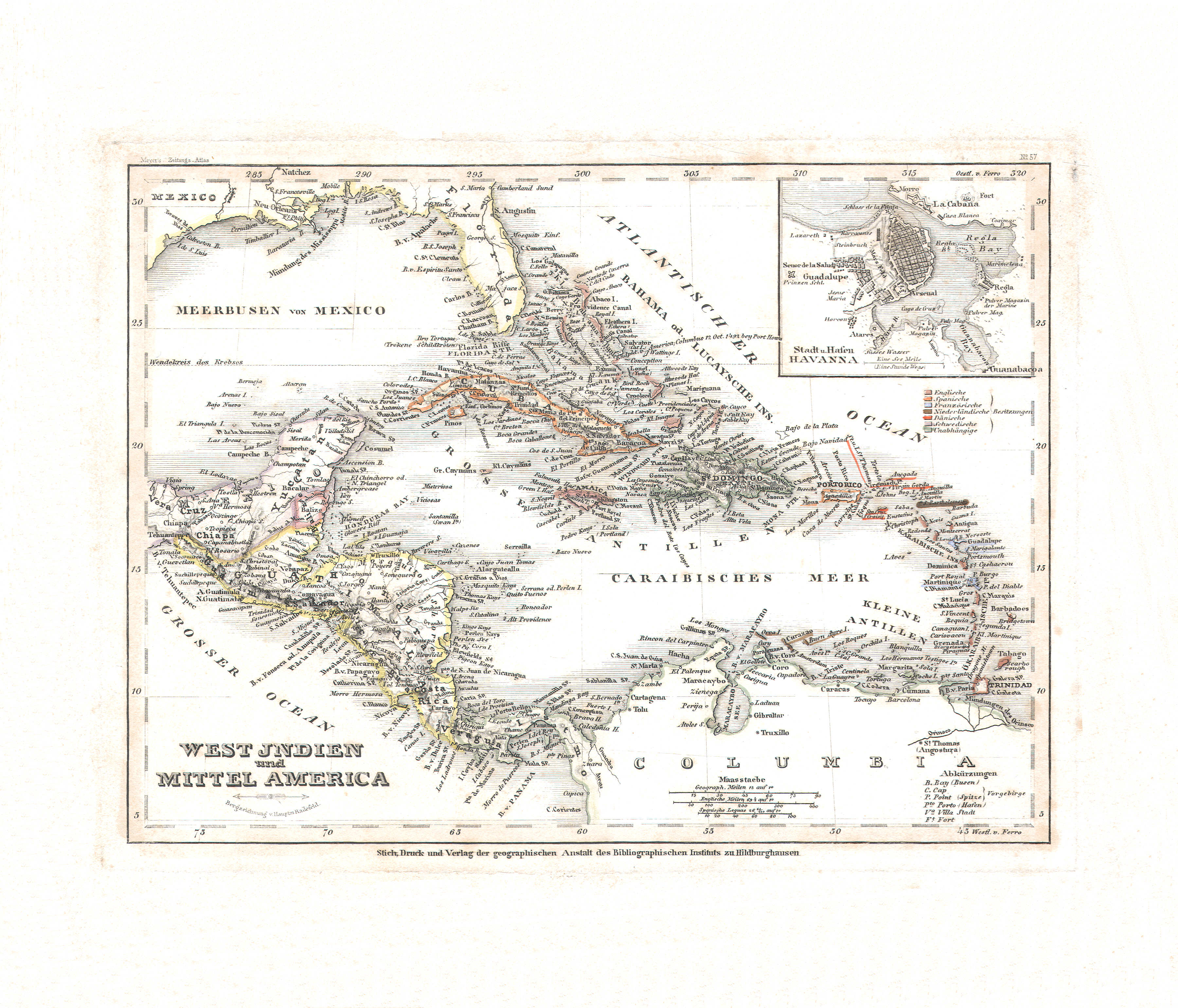
97. West Indien und Mittel America (Nº 57)
West-Indië en Midden-Amerika / West Indies and Cebtral America
 Meyer's Zeitungs-Atlas (1849-1852)
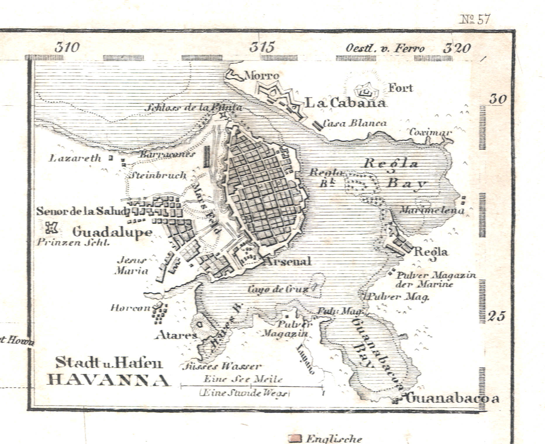
97a. Stadt u. Hafen Havanna
Stad en haven Havana / City and harbor of Havana / La Habana
 Meyer's Zeitungs-Atlas (1849-1852)
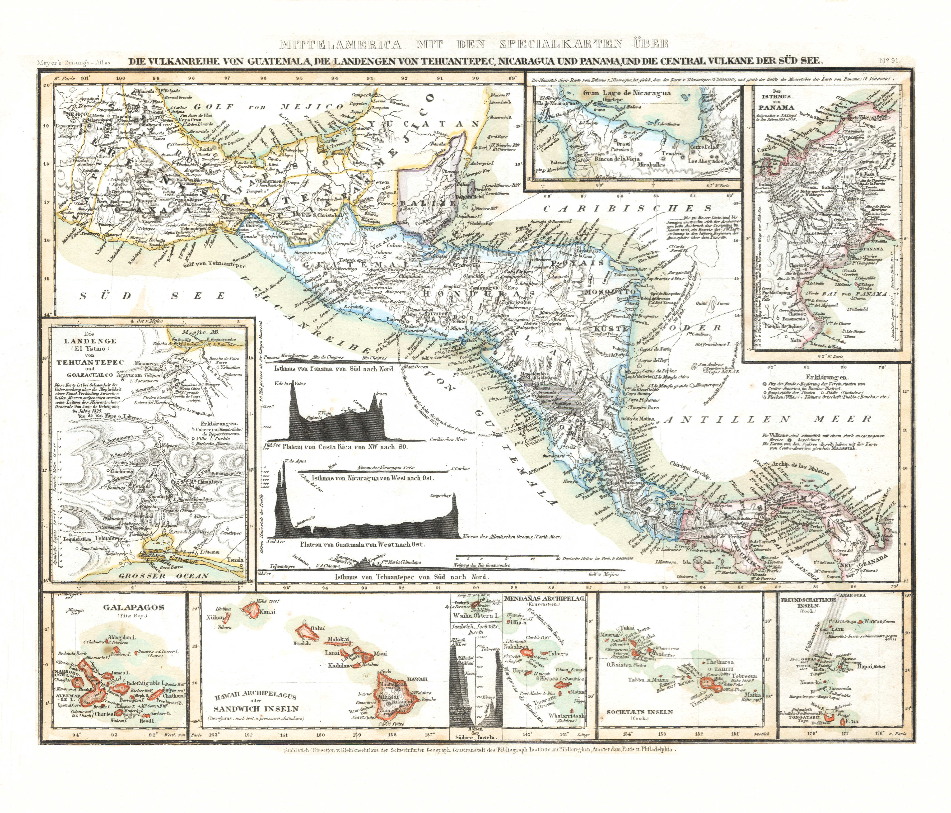
98. Mittelamerica mit den Specialkarten über die Vulkanreihe von Guatemala, die Landengen von Tehuantepec, Nicaragua und Panama, und die Central Vulkane der Süd See (Nº 91) XL
Midden-Amerika, vulkanen van Guatemala, landengtes van Tehuantepec, Nicaragua en Panama, vulkanen in de Grote Oceaan / Central America, volcanoes of Guatemala, isthmuses of Tehuantepec, Nicaragua and Panama, volcanoes in the Pacific Ocean
 Meyer's Zeitungs-Atlas (1849-1852)
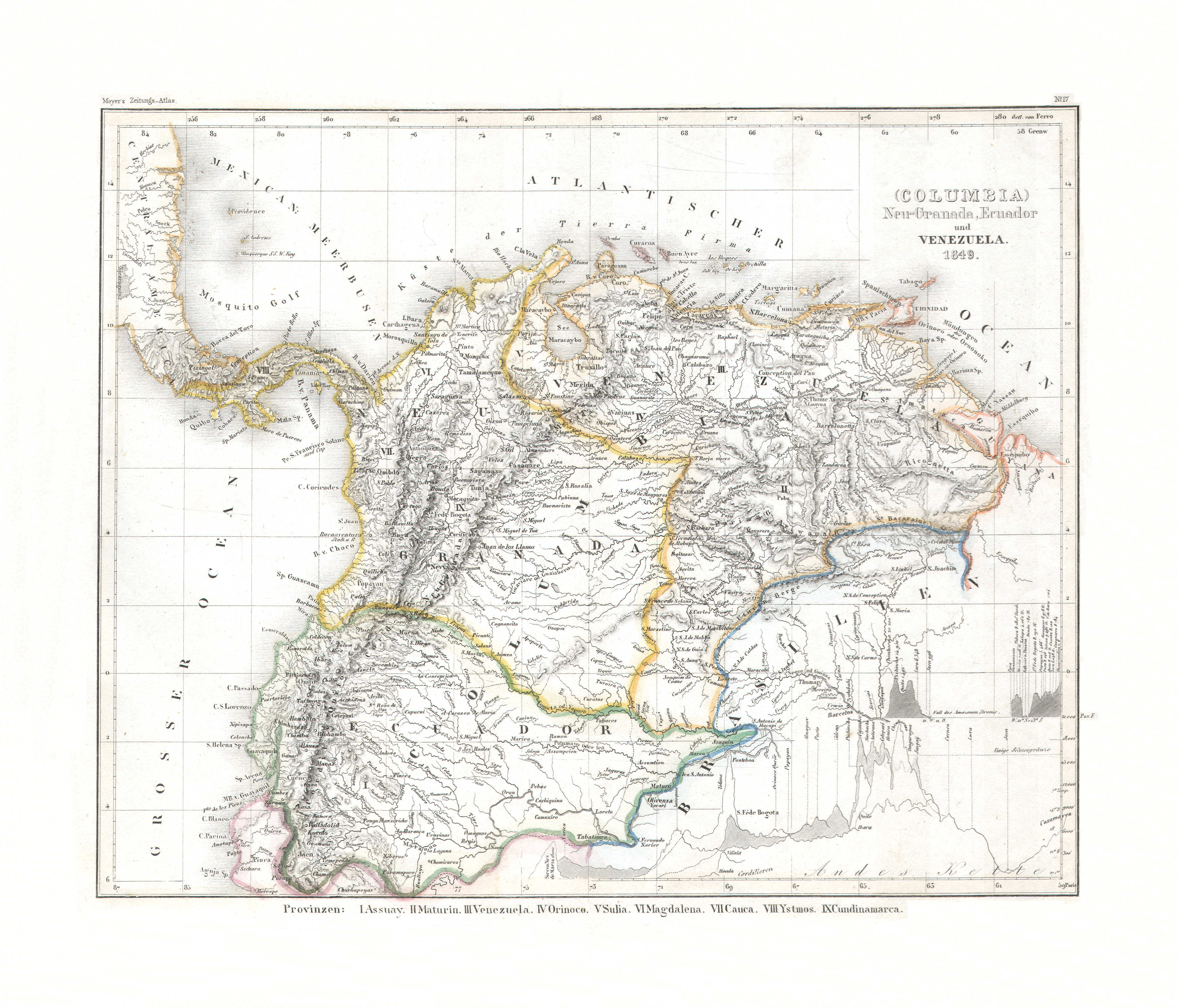
99. (Columbia) Neu-Granada, Ecuador und Venezuela (Nº 17, 1849)
(Colombia) Nieuw-Granada, Ecuador en Venezuela / (Colombia) New Granada, Ecuador and Venezuela
 Meyer's Zeitungs-Atlas (1849-1852)
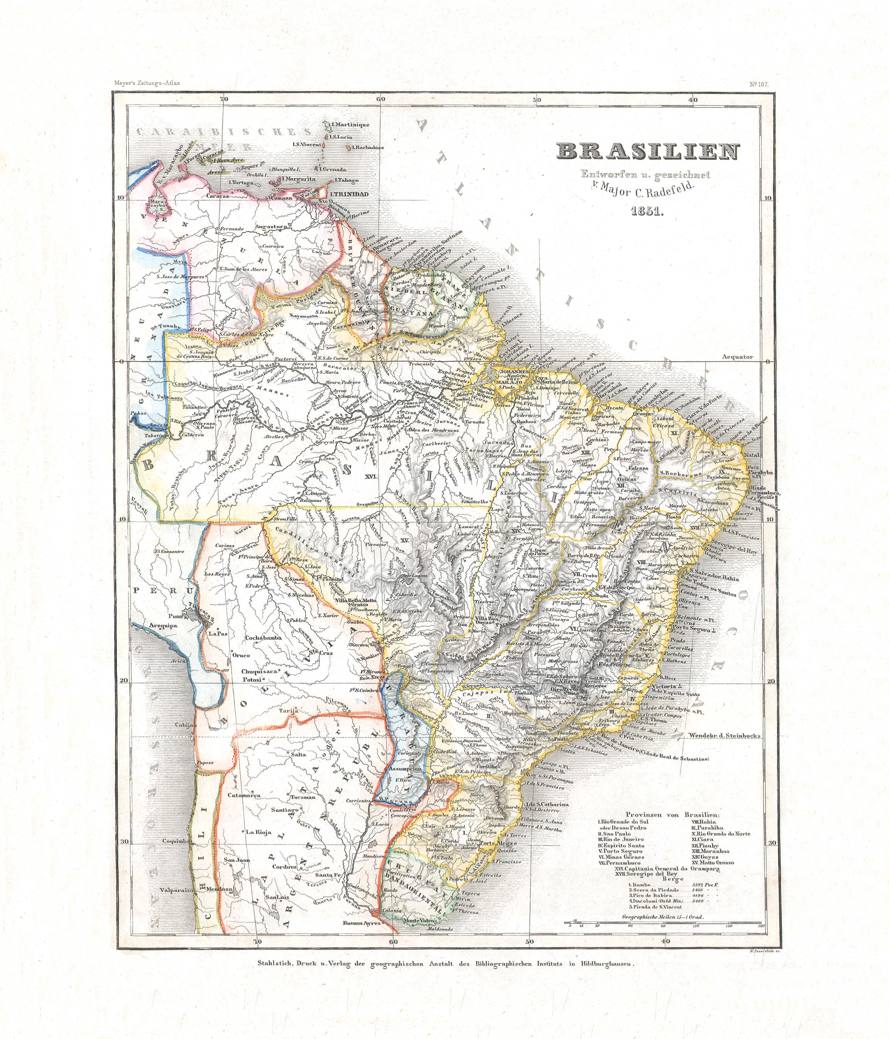
100. Brasilien (Nº 107, 1851)
Brazilië / Brazil
 Meyer's Zeitungs-Atlas (1849-1852)
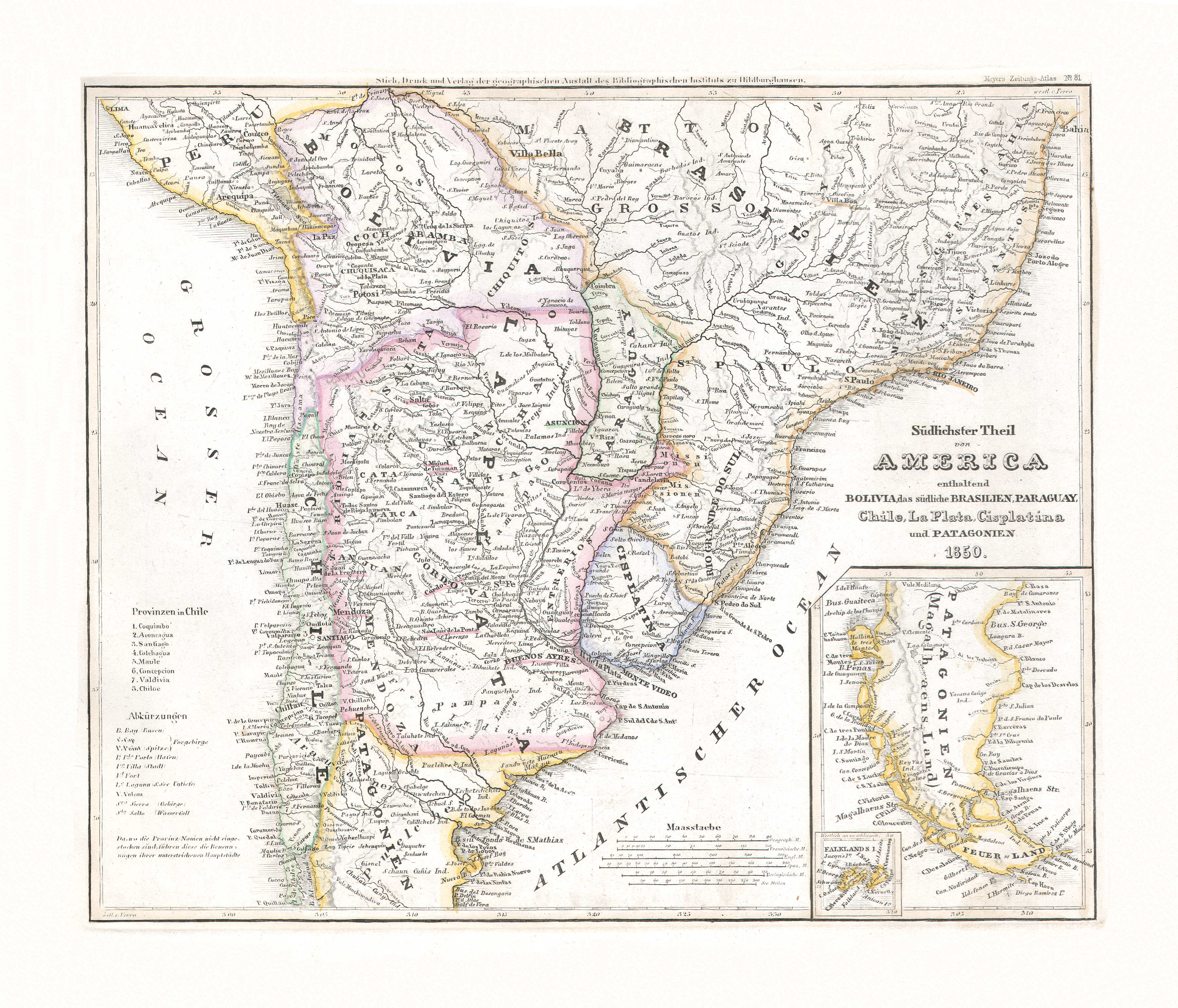
101. Südlichster Theil von America enthaltend Bolivia, das südliche Brasilien, Paraguay, Chile, La Plata, Cisplatina und Patagonien (Nº 81, 1850)
Zuidelijk deel van Zuid-Amerika met Bolivia, Zuid-Brazilië, Paraguay, Chili, La Plata (Argentinië), Cisplatina (Uruguay) en Patagonië / Southern part of South America with Bolivia, South Brazil, Paraguay, Chile, La Plata (Argentina), Cisplatina (Uruguay) and Patagonia
 Meyer's Zeitungs-Atlas (1849-1852)
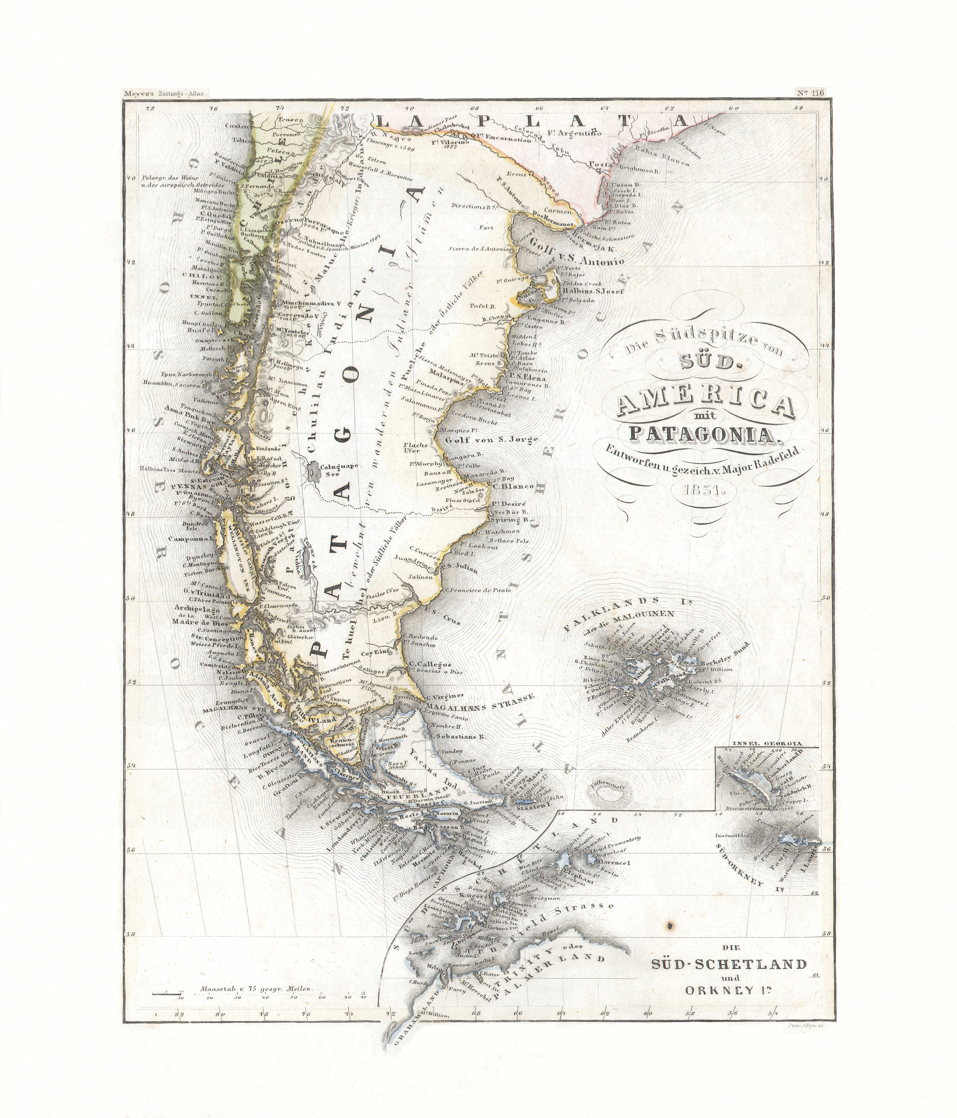
102. Die Südspitze von Süd-America mit Patagonia (Nº 116, 1851)
Zuidpunt van Zuid-Amerika met Patagonië / Southern tip of South America with Patagonia
 Meyer's Zeitungs-Atlas (1849-1852)
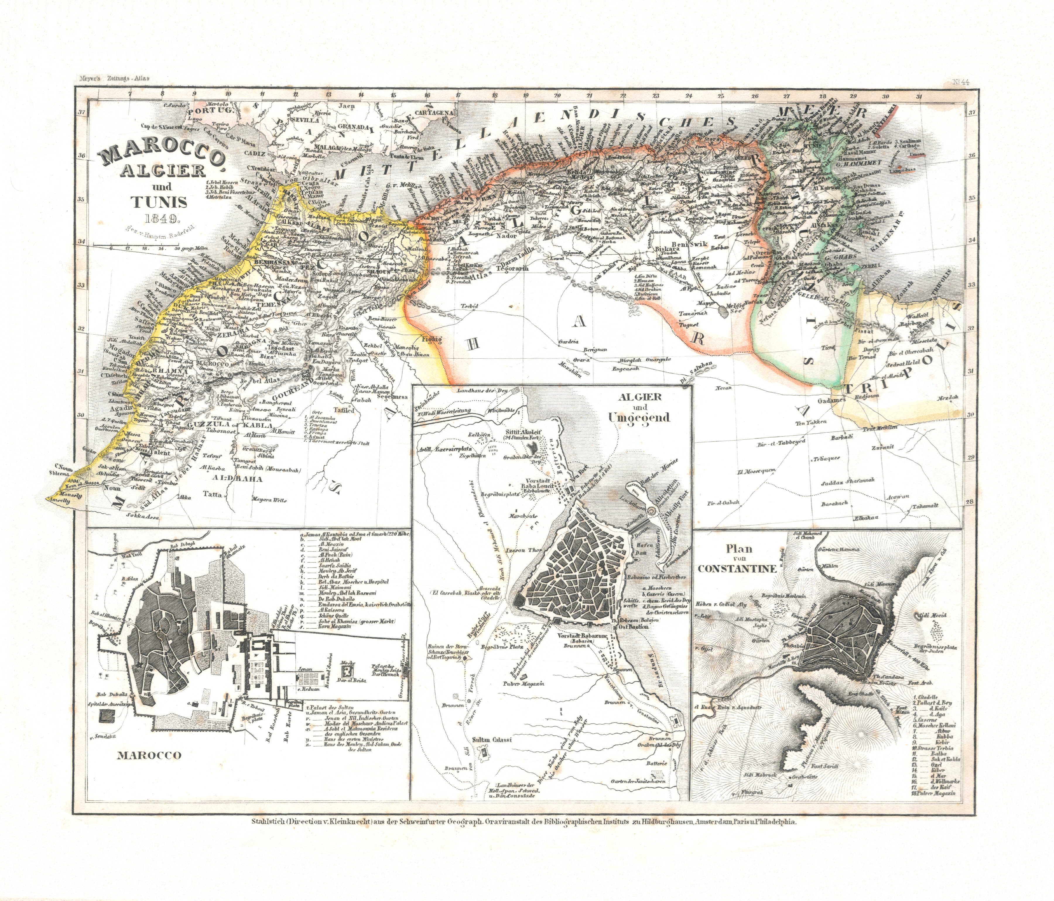
103. Marocco, Algier und Tunis (Nº 44, 1849) XL
Marokko, Algerije en Tunesië / Morocco, Algeria and Tunisia
 Meyer's Zeitungs-Atlas (1849-1852)
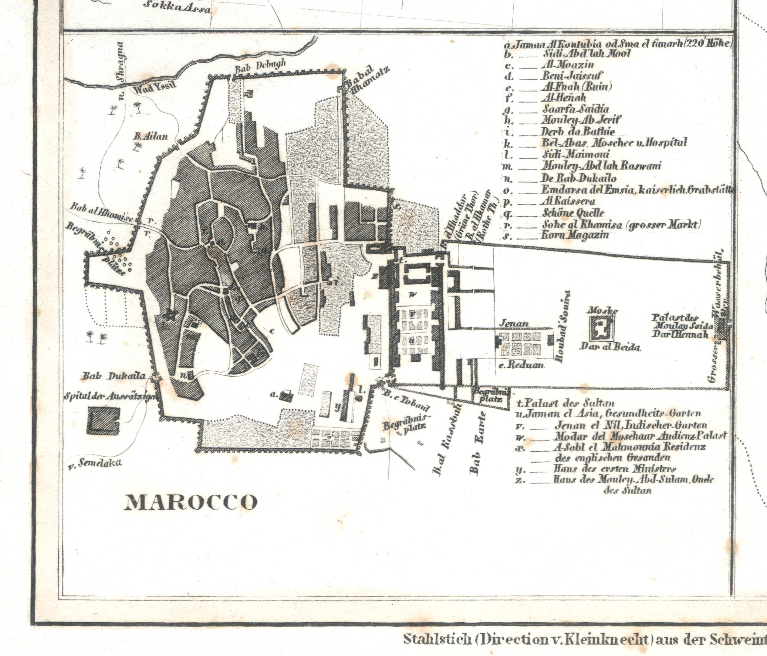
103a. Marocco
Marrakech / Marrakesh / مراكش Murrākush
 Meyer's Zeitungs-Atlas (1849-1852)
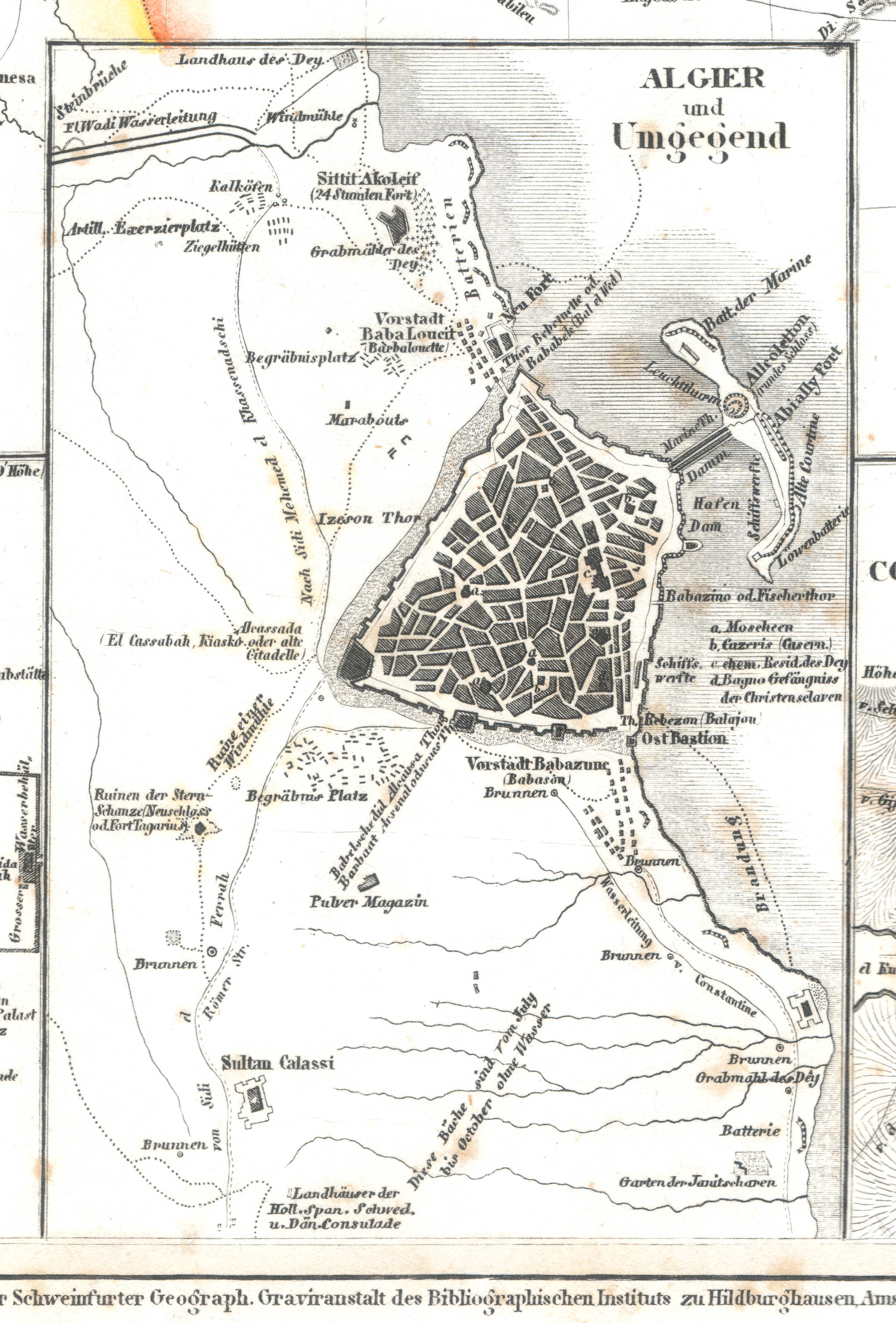
103b. Algier und Umgegend
Algiers en omgeving / Algiers and environs / الجزائر al-Jazā’ir
 Meyer's Zeitungs-Atlas (1849-1852)
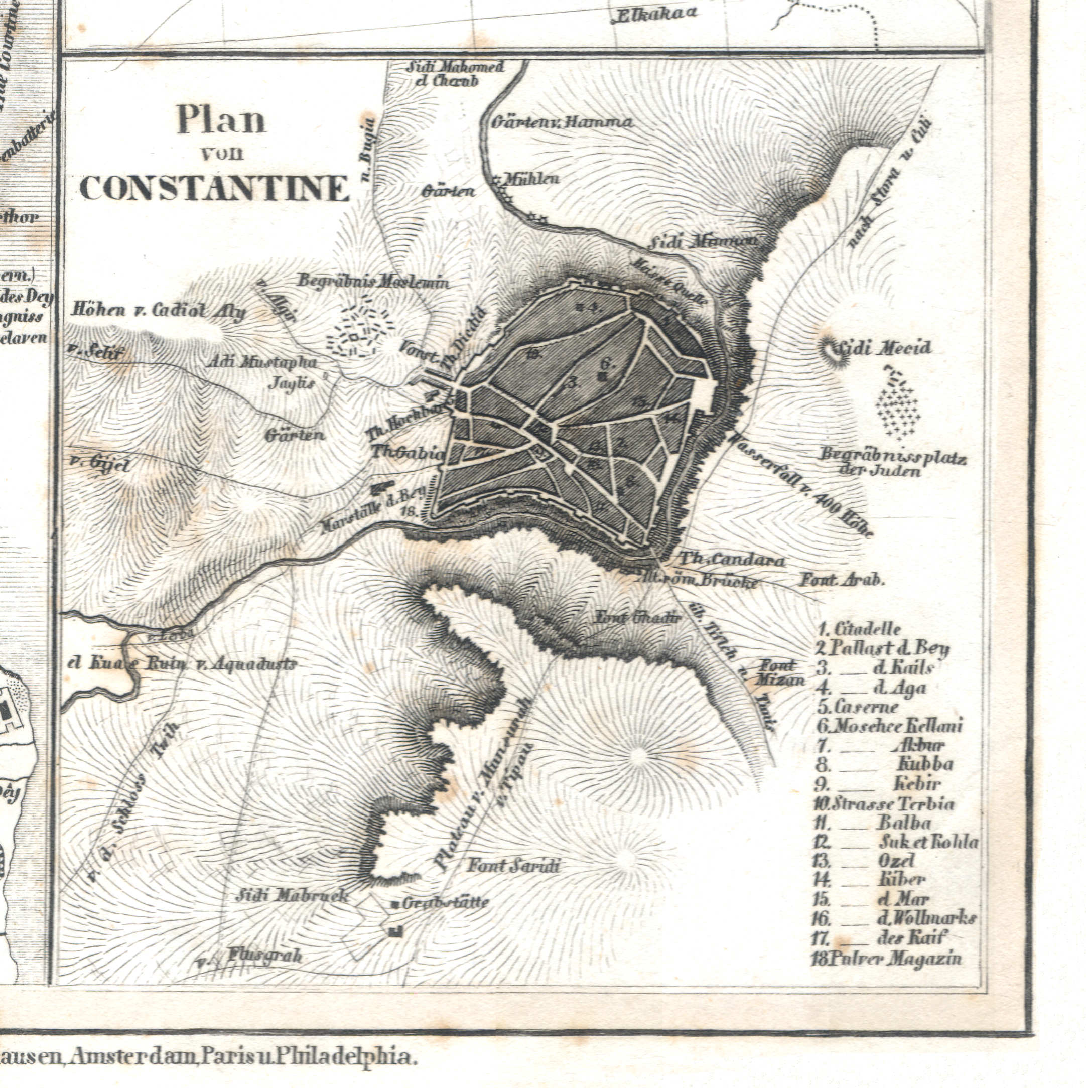
103c. Plan von Constantine
Plattegrond van Constantine / Plan of Constantine / قسنطينة
 Meyer's Zeitungs-Atlas (1849-1852)
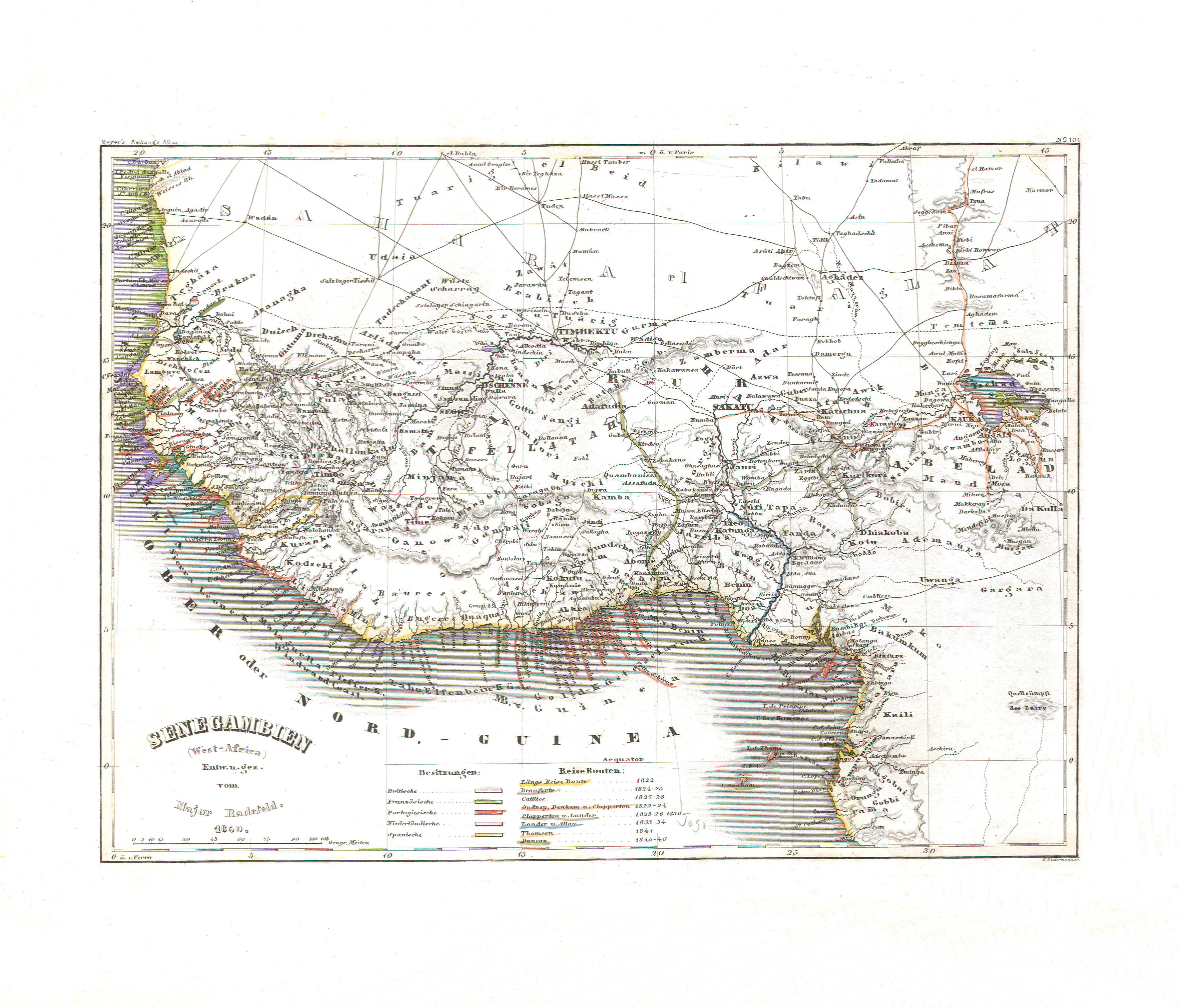
104. Senegambien (West-Africa) (Nº 101, 1850)
Senegambië (West-Afrika) / Senegambia (West Africa)
 Meyer's Zeitungs-Atlas (1849-1852)
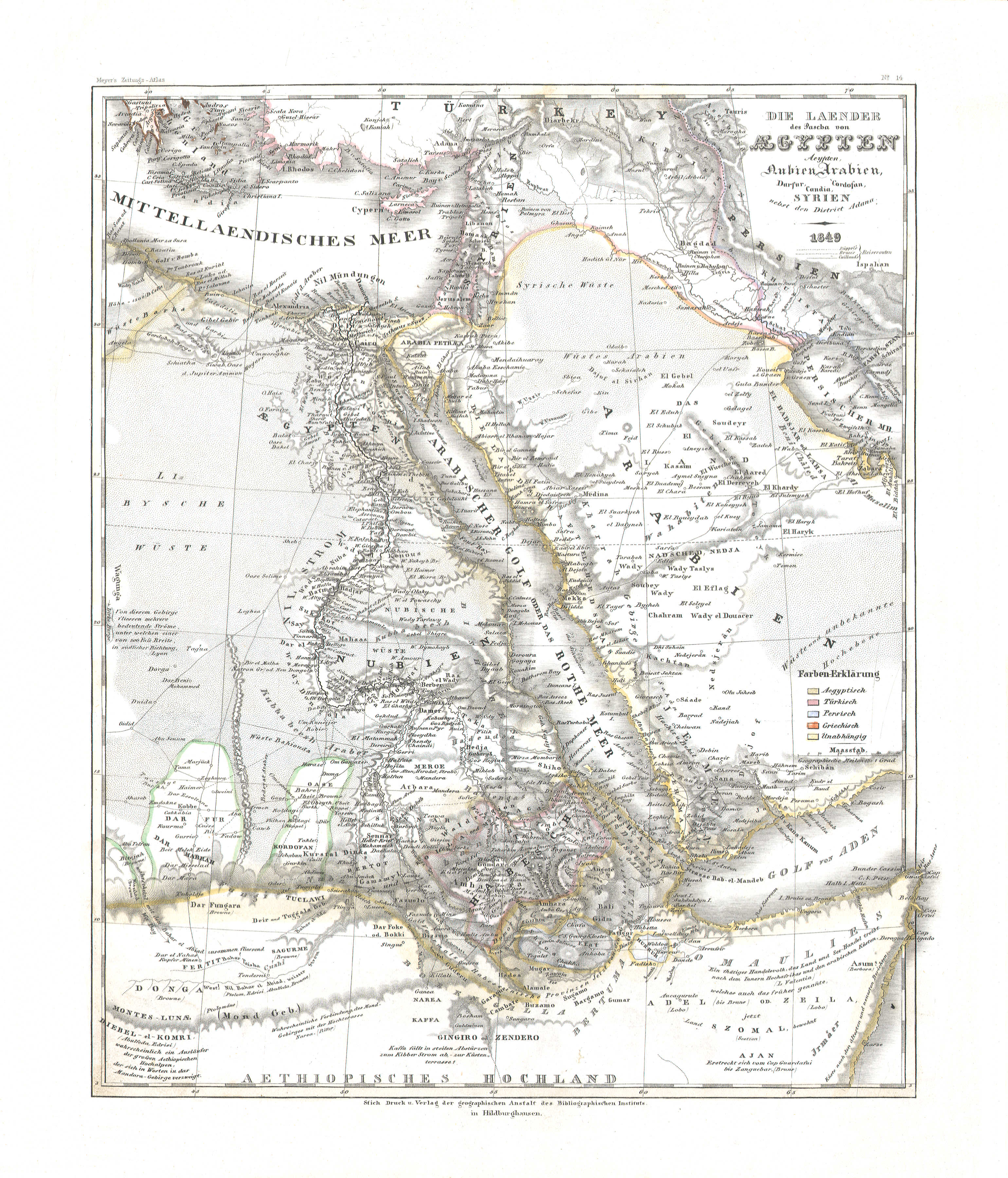
105. Die Länder des Pascha von Aegypten; Aegypten, Nubien, Arabien, Darfur, Kordofan, Candia, Syrien nebst den District Adana (Nº 14, 1849)
De landen van de Pasja van Egypte / The countries of the Pasha of Egypt
 Meyer's Zeitungs-Atlas (1849-1852)
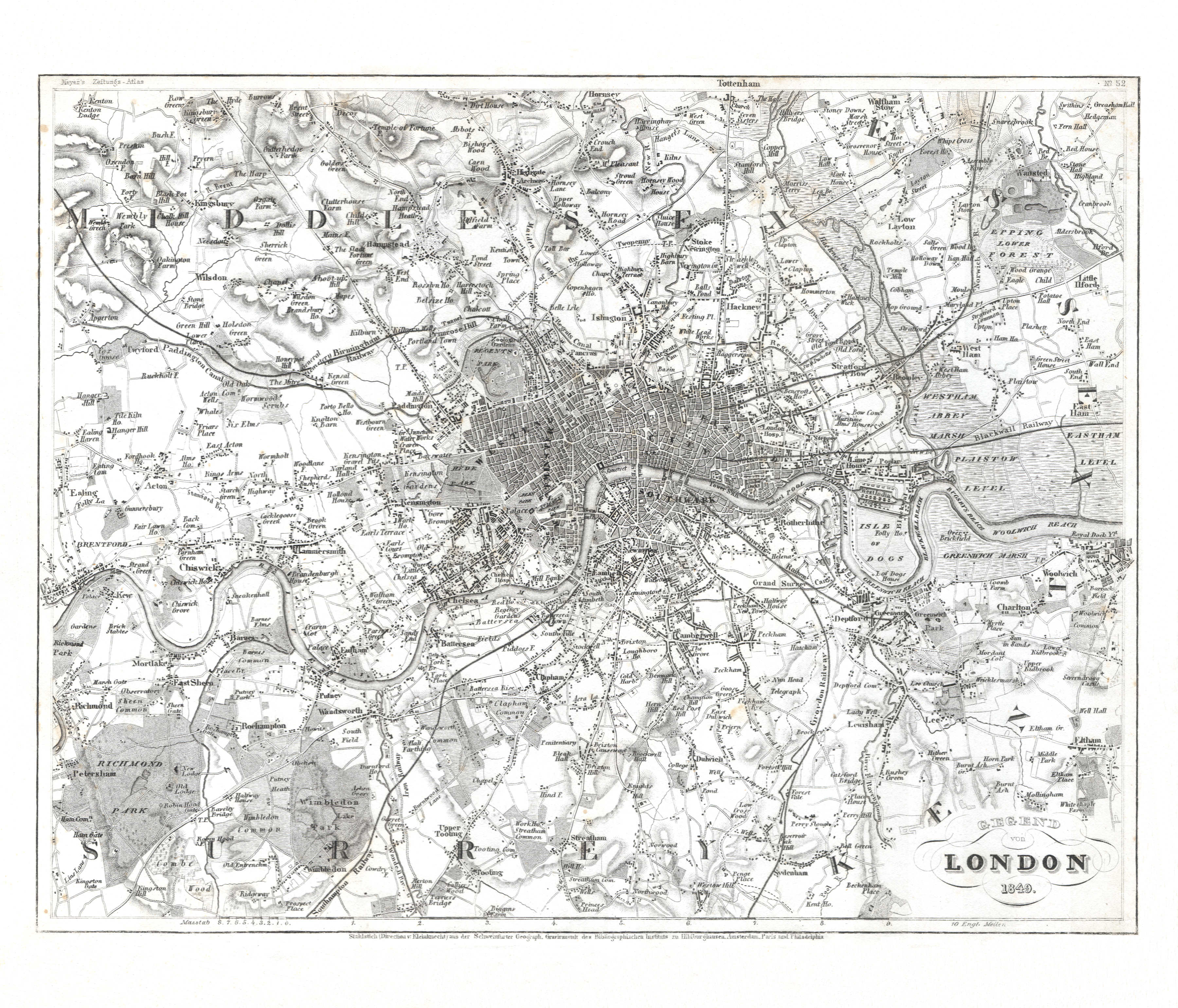
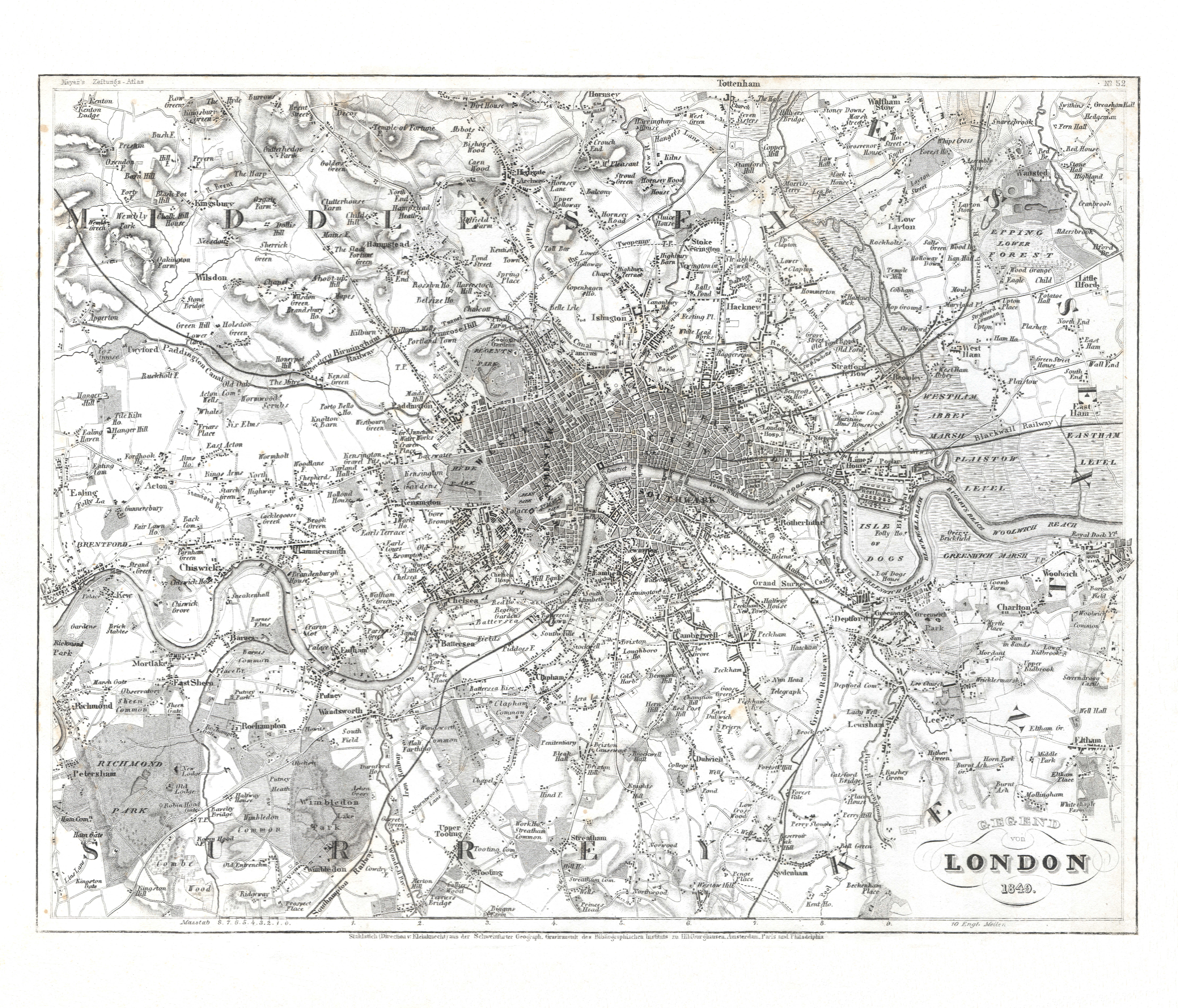
106. Gegend von London (Nº 52, 1849) XL
Londen en omgeving / London and environs
 Meyer's Zeitungs-Atlas (1849-1852)
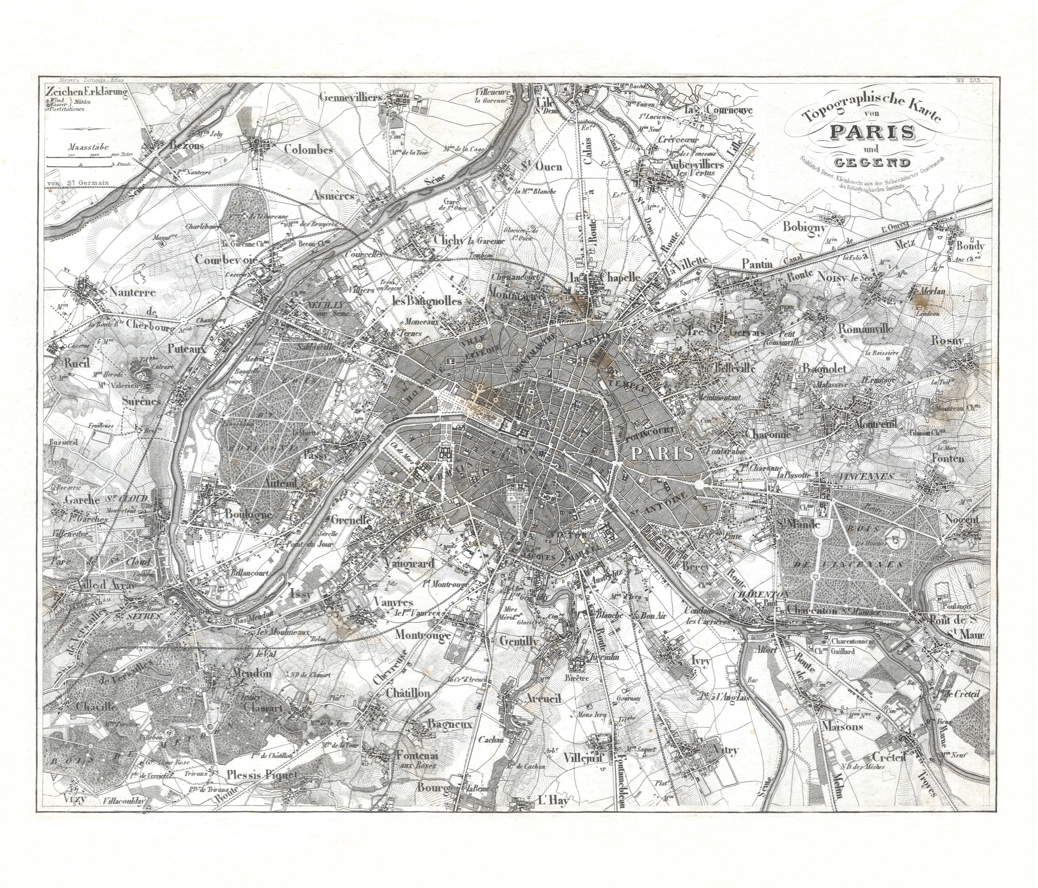
107. Topographische Karte von Paris und Gegend (Nº 103) XL
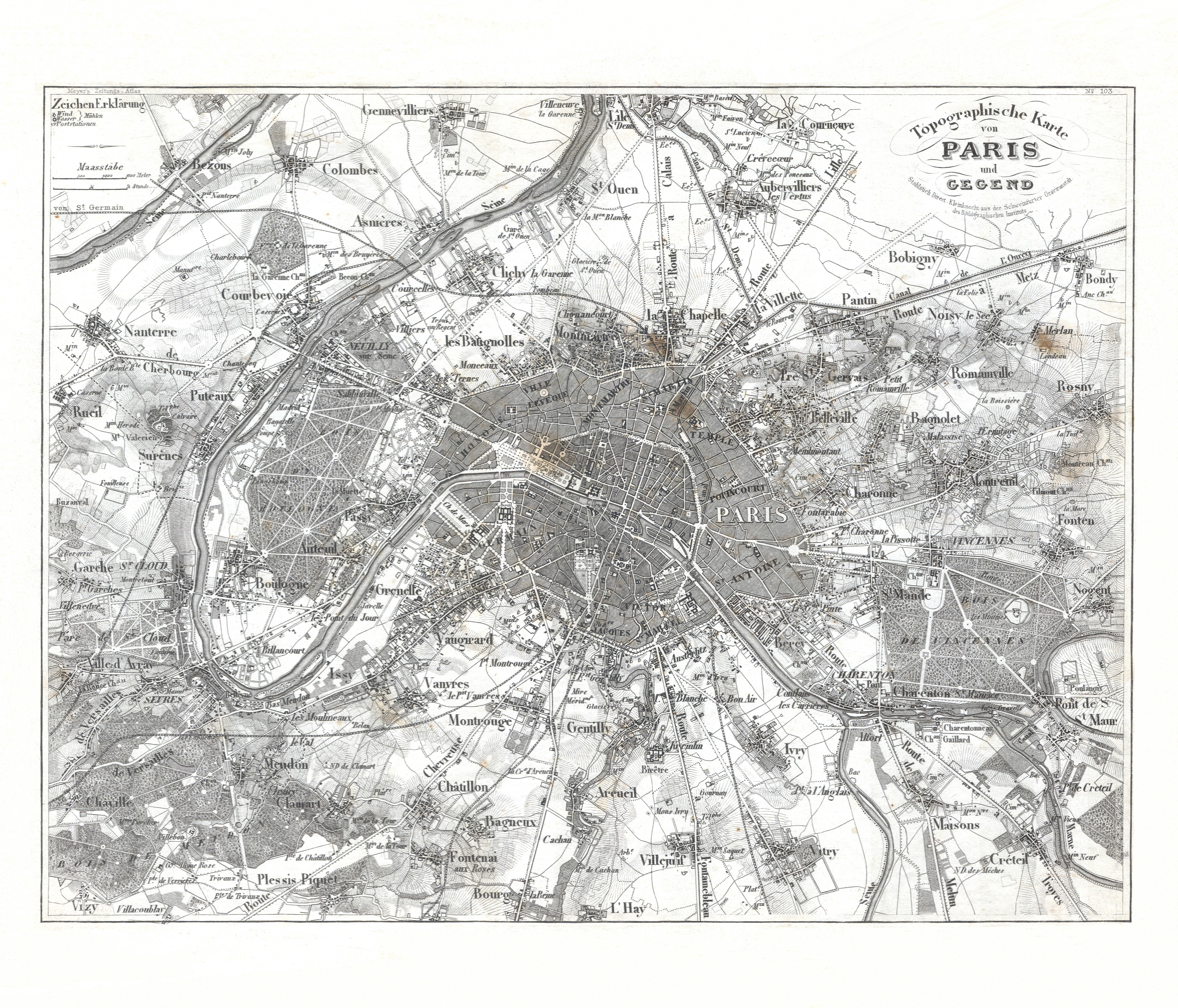
Parijs en omgeving / Paris and environs
 Meyer's Zeitungs-Atlas (1849-1852)
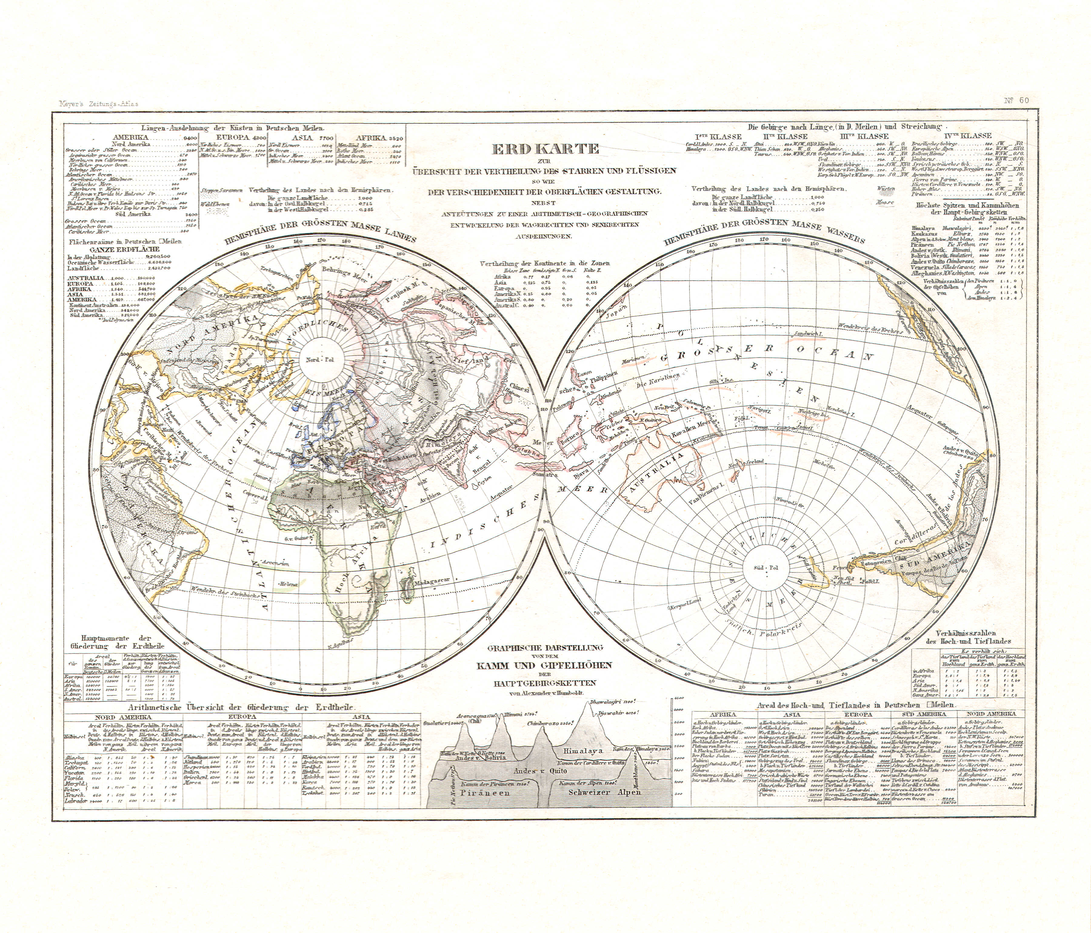
108. Erdkarte zur Übersicht der Vertheilung des Starren und Flüssigen so wie der Verschiedenheit der Oberflächen Gestaltung (Nº 60)
Verdeling van land en zee; hoogteverschillen / Distribution of land and sea; variation of altitudes
 Meyer's Zeitungs-Atlas (1849-1852)
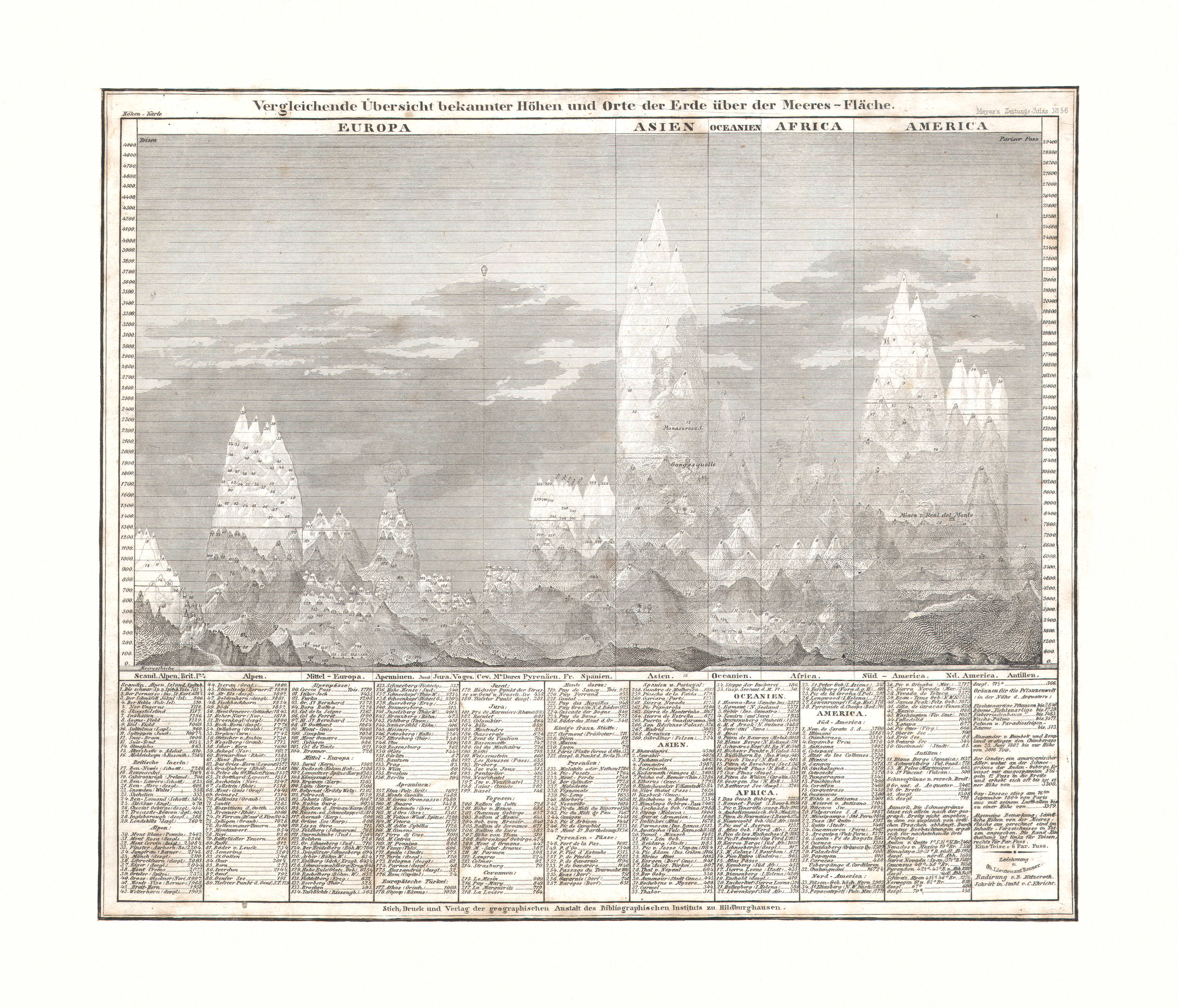
109. Vergleichende Übersicht bekannter Höhen und Orte der Erde über Meeres-Fläche (Nº 56)
Vergelijkend overzicht van hoogtes boven de zeespiegel / Comparative overview of altitudes above sea level
 Meyer's Zeitungs-Atlas (1849-1852)
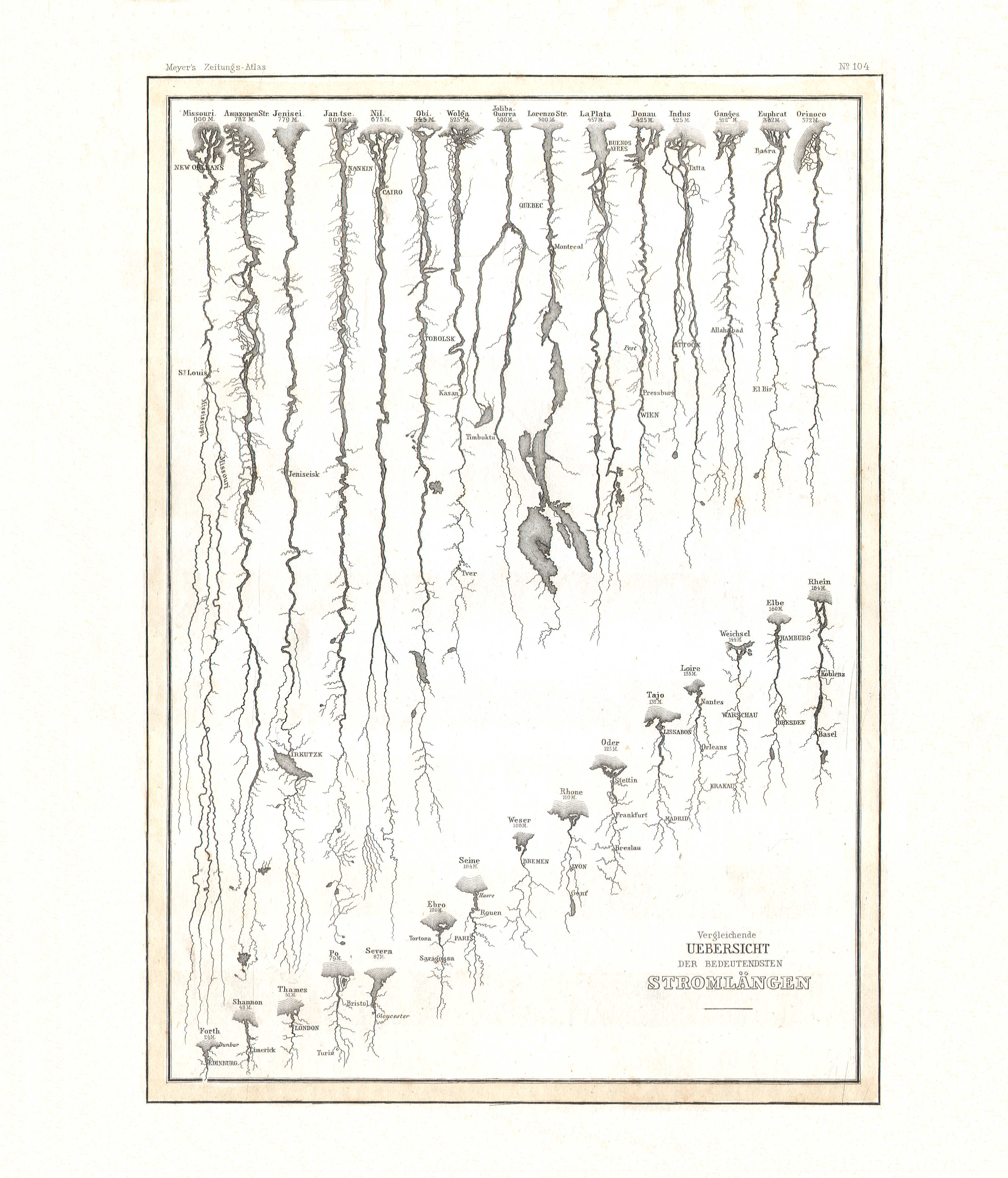
110. Vergleichende Übersicht der bedeutendsten Stromlängen (Nº 104)
Vergelijkend overzicht van lengtes van de belangrijkste rivieren / Comparative overview of lengths of the principal rivers
 Meyer's Zeitungs-Atlas (1849-1852)
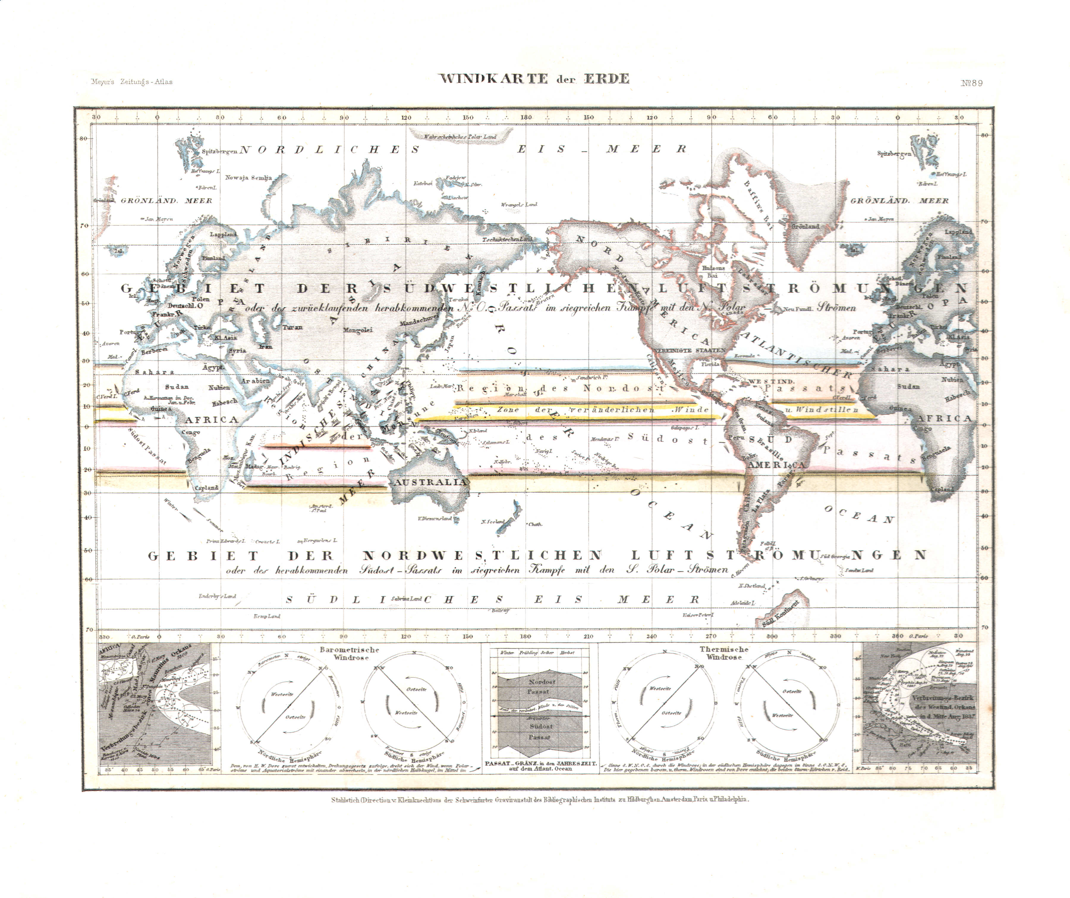
111. Windkarte der Erde (Nº 89)
Kaart van de windrichtingen / Map of the wind directions
 Meyer's Zeitungs-Atlas (1849-1852)
112. Hyetographische Karte der Erde (Nº 90)
Neerslagkaart van de Aarde / Precipitation map of the Earth
 Meyer's Zeitungs-Atlas (1849-1852)
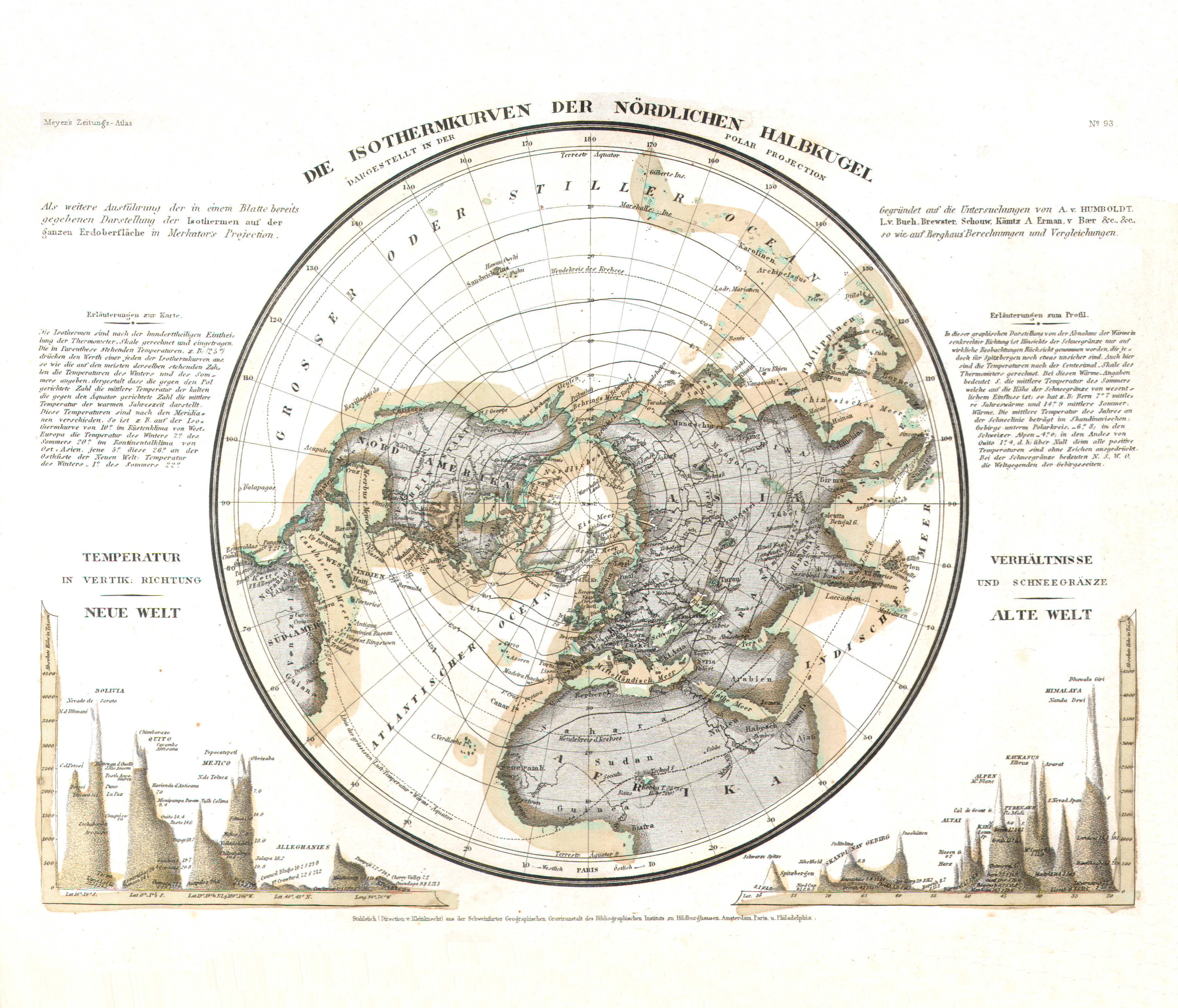
113. Die Isothermkurven der nördlichen Halbkugel (Nº 93)
Isothermen op het noordelijk halfrond / Isotherms of the northern hemisphere
 Meyer's Zeitungs-Atlas (1849-1852)
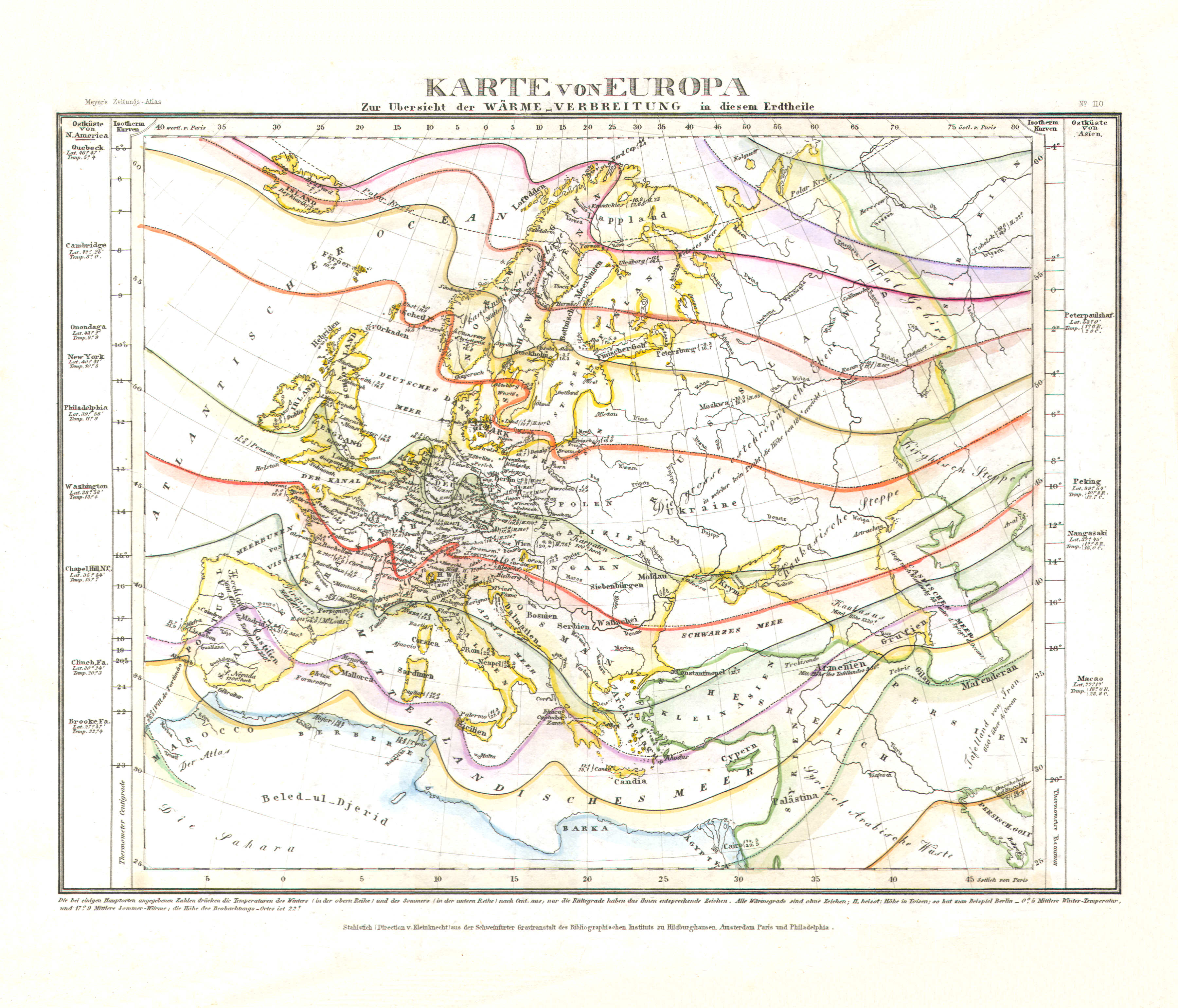
114. Karte von Europa zur Übersicht der Wärme-Verbreitung in diesem Erdtheile (Nº 110)
Temperatuurverdeling in Europa / Temperature distribution in Europe
 Meyer's Zeitungs-Atlas (1849-1852)
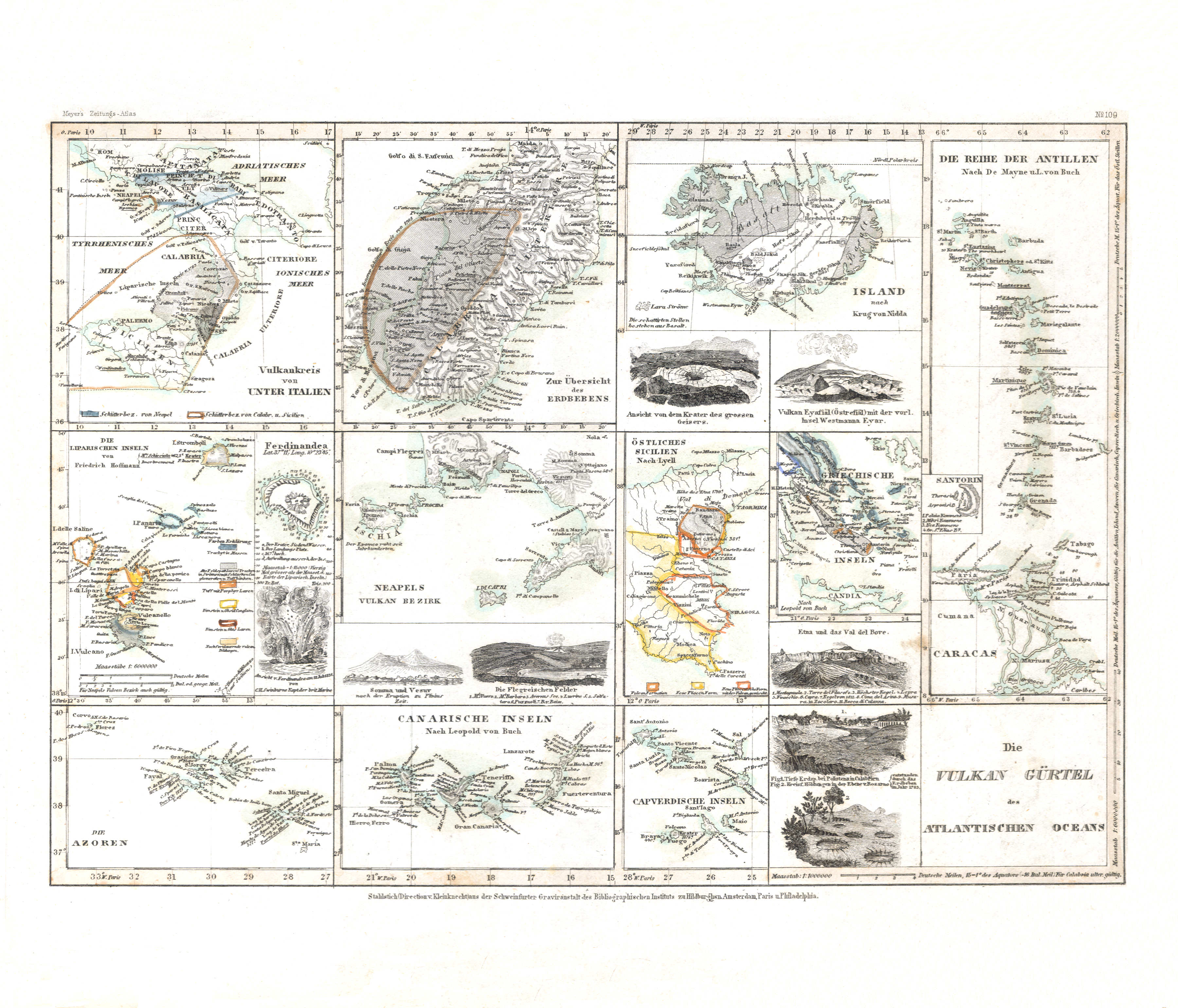
115. Die Vulkan Gürtel des Atlantischen Oceans (Nº 109)
Vulkaanketens in de Atlantische Oceaan / Volcanic chains in the Atlantic Ocean
 Meyer's Zeitungs-Atlas (1849-1852)
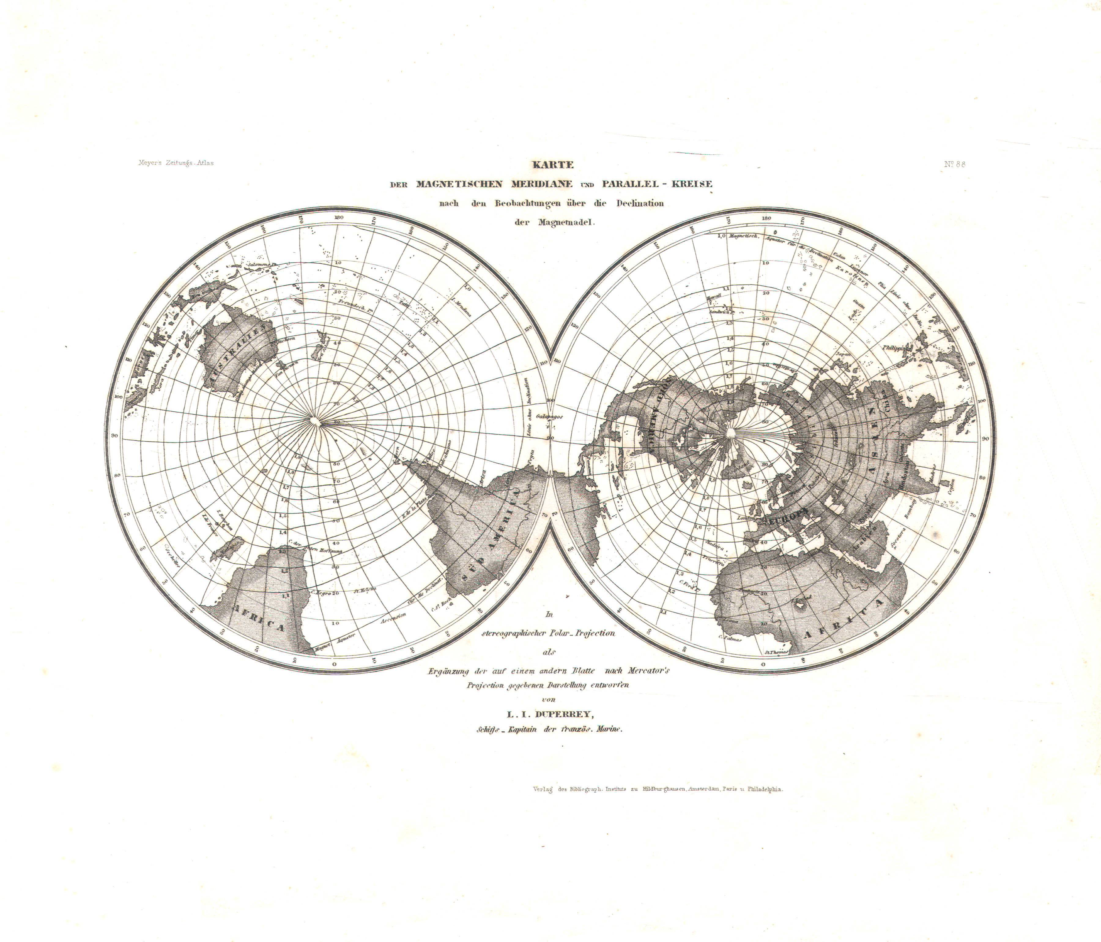
116. Karte der magnetischen Meridiane und Parallel-Kreise nach den Beobachtungen über die Declination der Magnetnadel (Nº 88)
Magnetische meridianen en parallellen volgens de magnetische declinatie / Magnetic meridians and parallels according to magnetic declination
 Meyer's Zeitungs-Atlas (1849-1852)
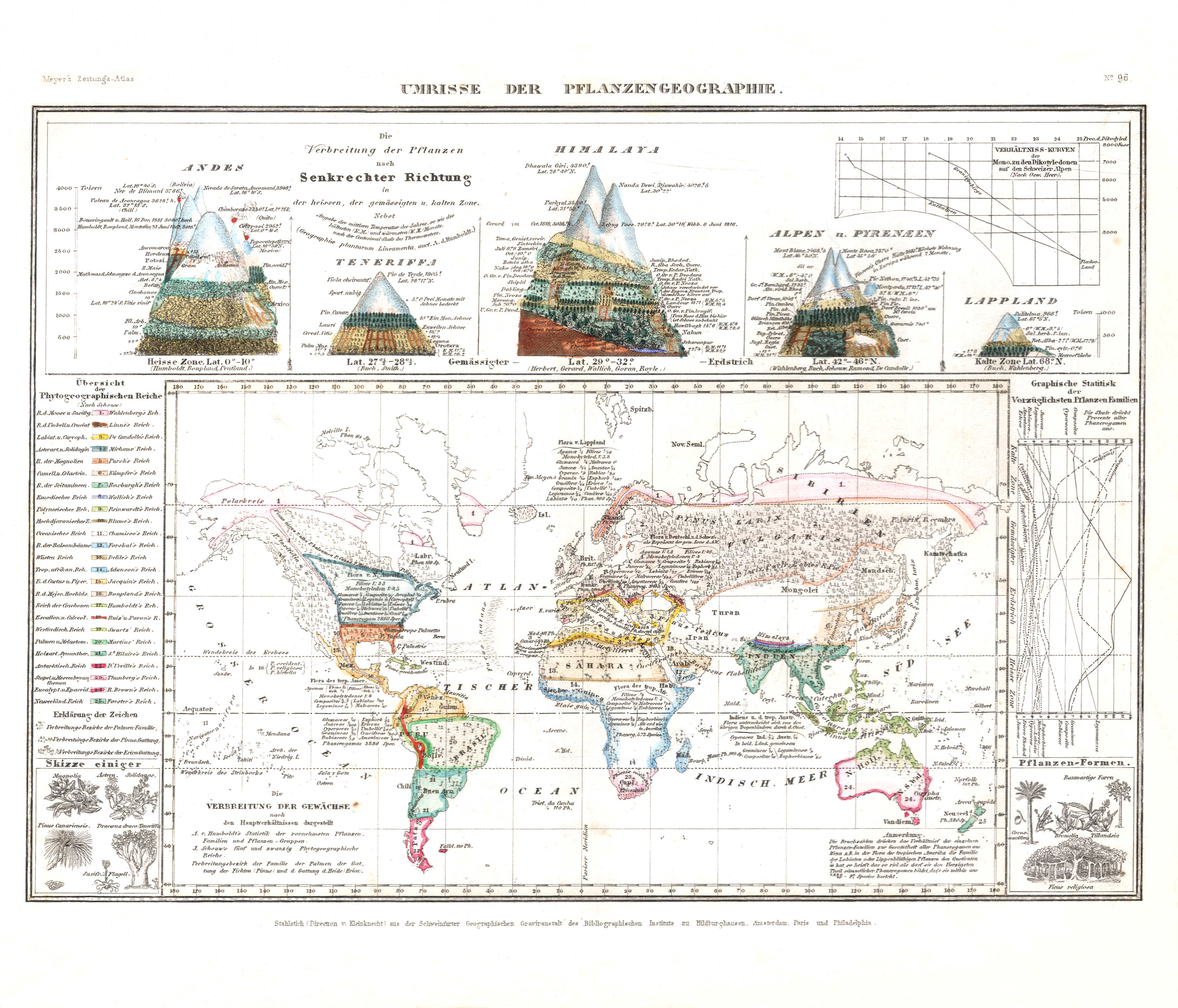
117. Umrisse der Pflanzengeographie (Nº 96) XL
Fytogeografie / Phytogeography
 Meyer's Zeitungs-Atlas (1849-1852)
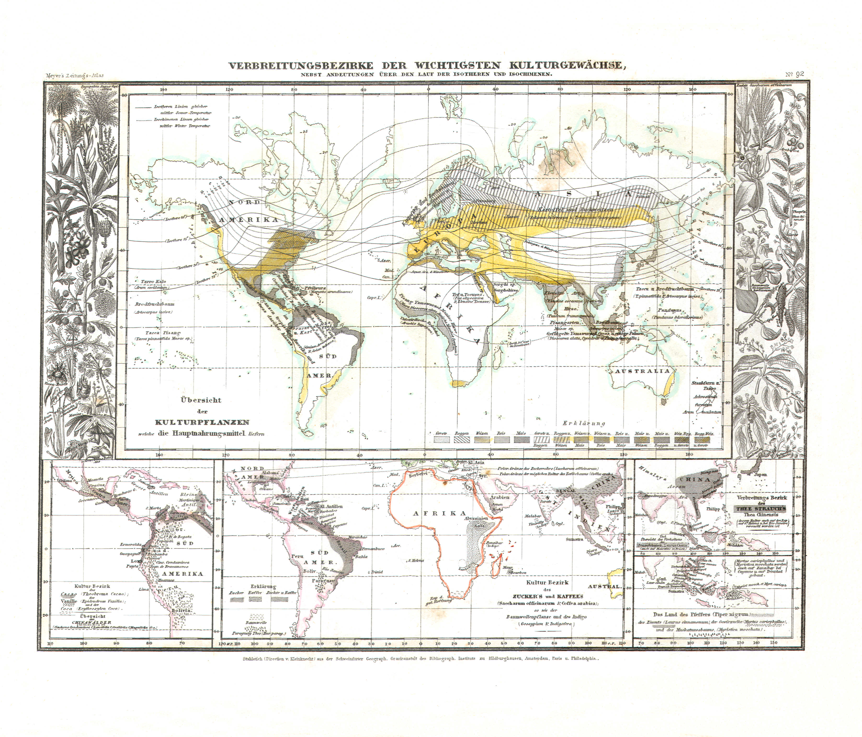
118. Verbreitungsbezirke der wichtigsten Kulturgewächse, nebst Andeutungen über den Lauf der Isotheren und Isochimenen (Nº 92)
Verspreiding van de belangrijkste landbouwgewassen; isotheren en isochimenen / Distribution of main agricultural crops; isotheres and isochimenes
 Meyer's Zeitungs-Atlas (1849-1852)
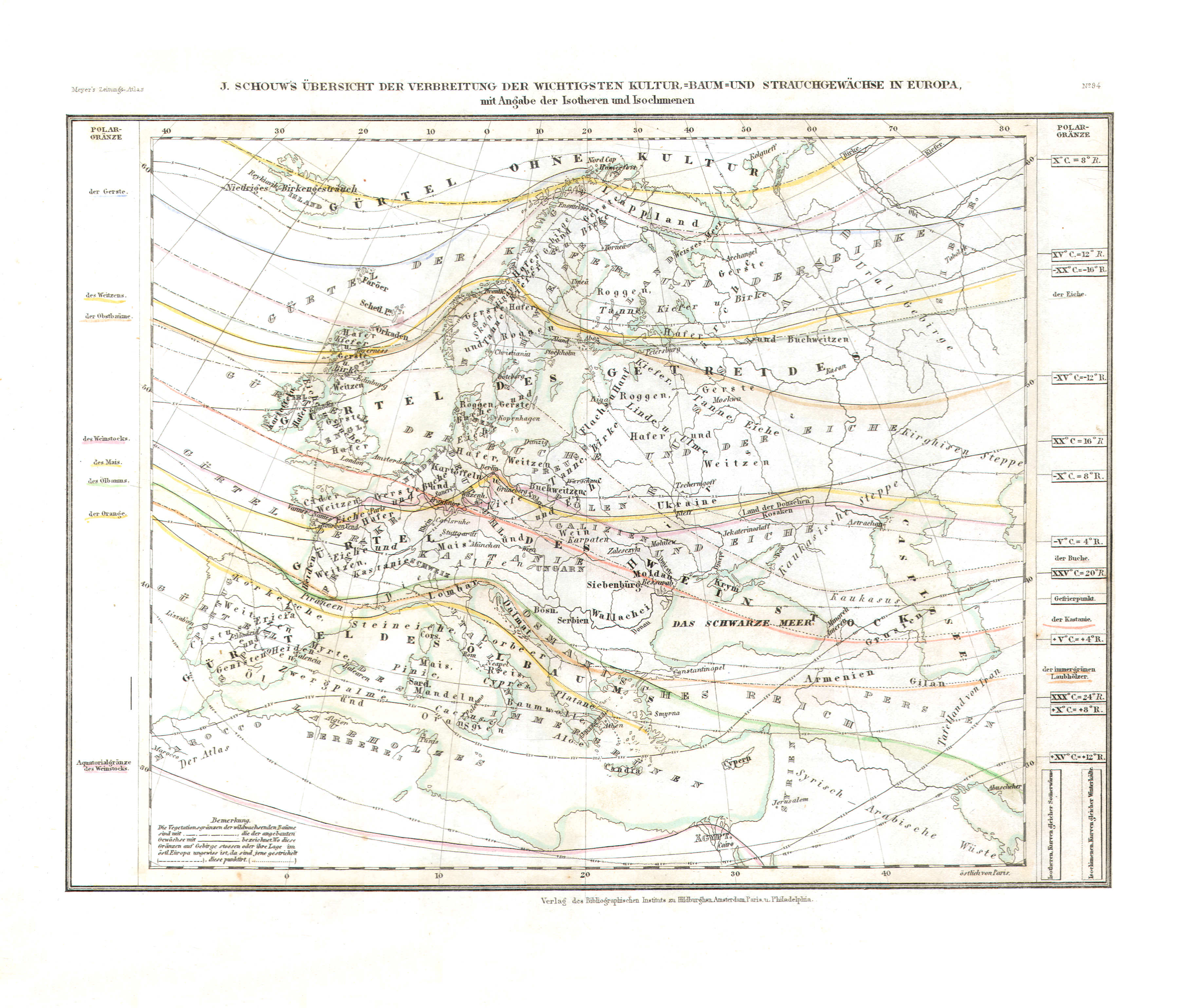
119. J. Schouw's Übersicht der Verbreitung der Wichtigsten Kultur-, Baum- und Strauchgewächse in Europa, mit Angabe der Isotheren und Isochimenen (Nº 94)
Verspreiding van de belangrijkste landbouwgewassen in Europa; isotheren en isochimenen / Distribution of main agricultural crops in Europe; isotheres and isochimenes
 Meyer's Zeitungs-Atlas (1849-1852)
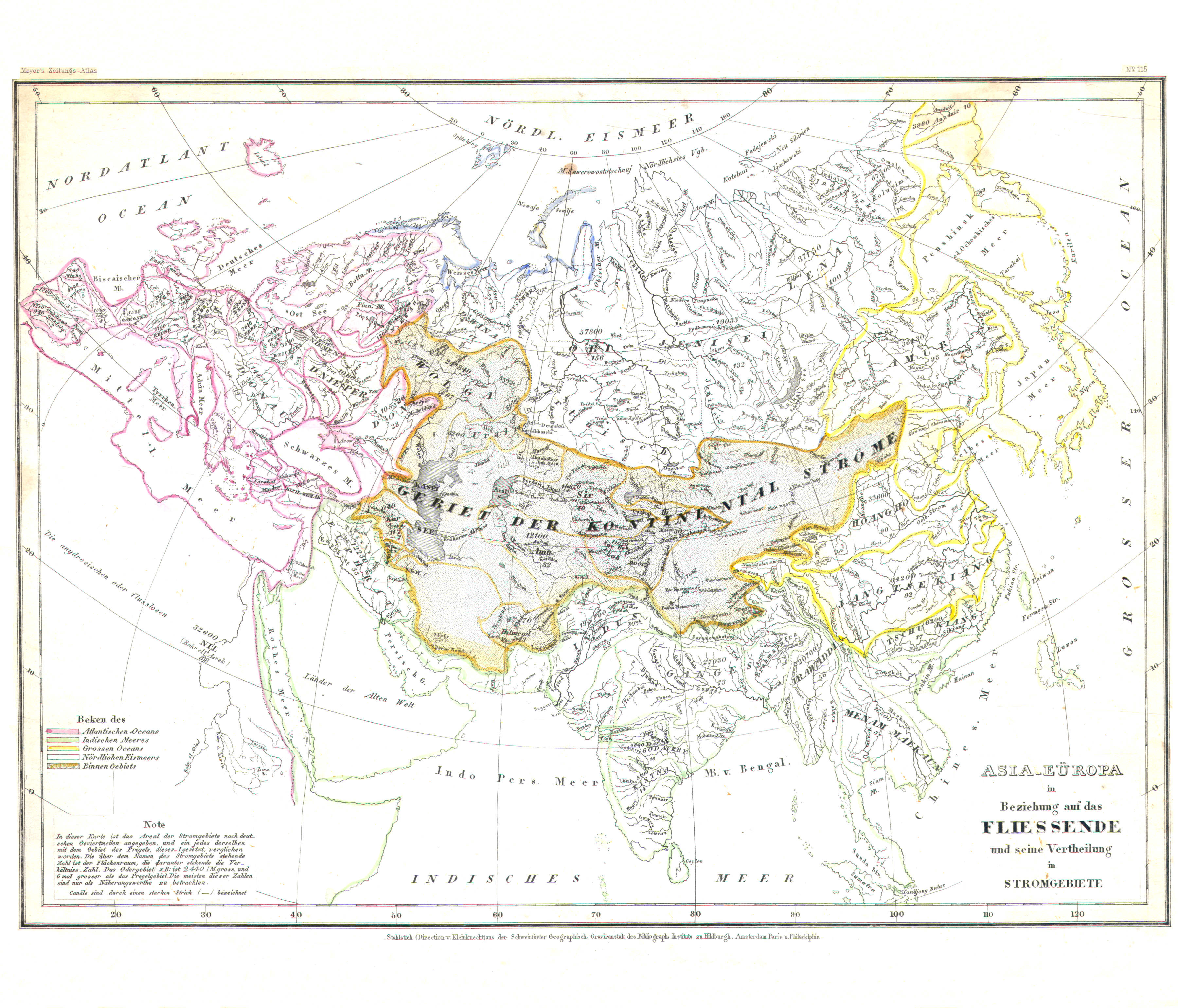
120. Asia-Eüropa in Beziehung auf das Fliessende und seine Vertheilung in Stromgebiete (Nº 115)
Rivieren en rivierbekkens in Europa en Azië / Rivers and river basins in Europe and Asia
 Meyer's Zeitungs-Atlas (1849-1852)
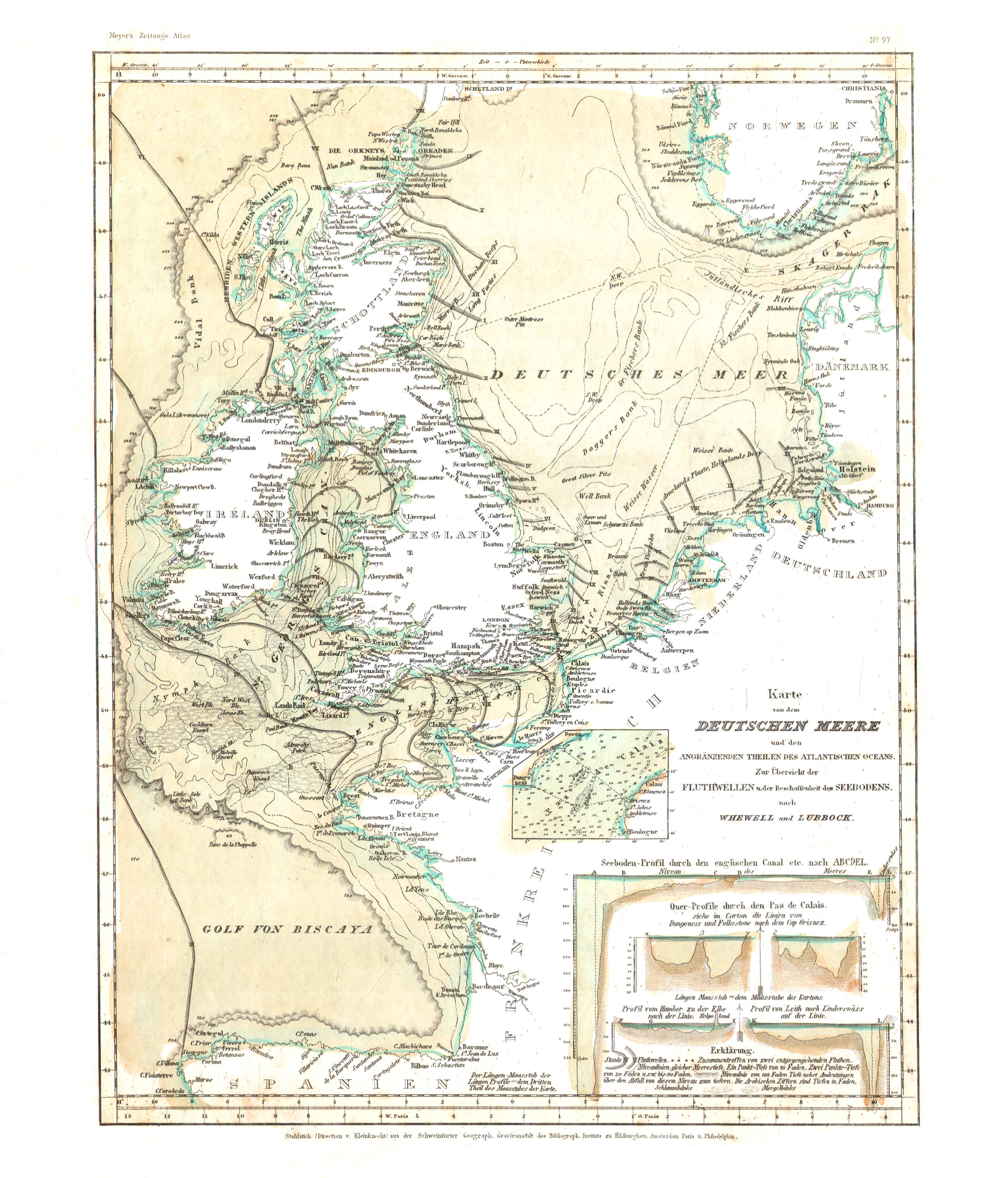
121. Karte von dem Deutschen Meere (Nº 97)
Kaart van de Noordzee / Map of the North Sea (German Ocean)
 Meyer's Zeitungs-Atlas (1849-1852)
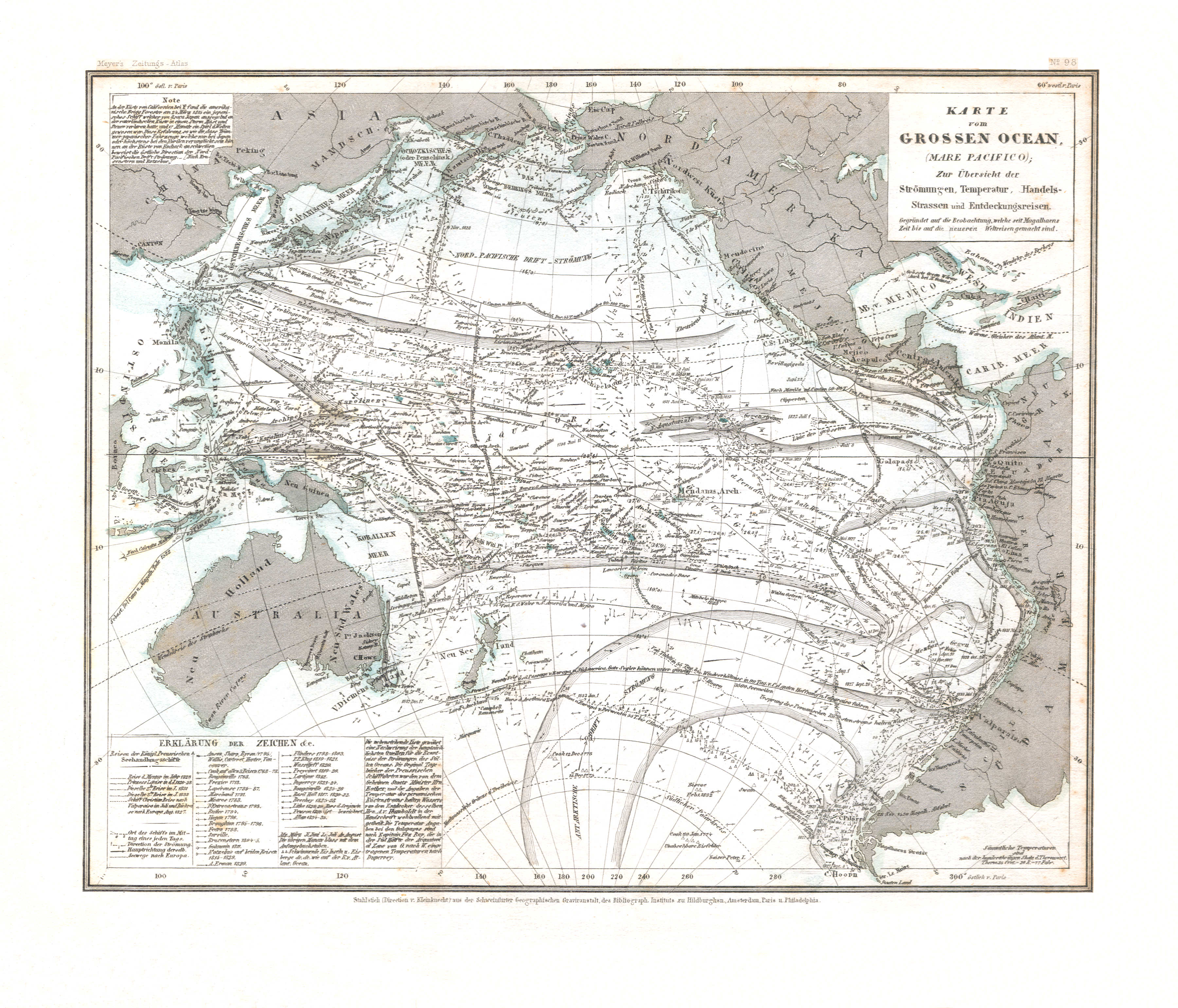
122. Karte vom Grossen Ocean, (Mare Pacifico) Zur Übersicht der Strömungen, Temperatur, Handels-Strassen und Entdeckungsreisen (Nº 98) XL
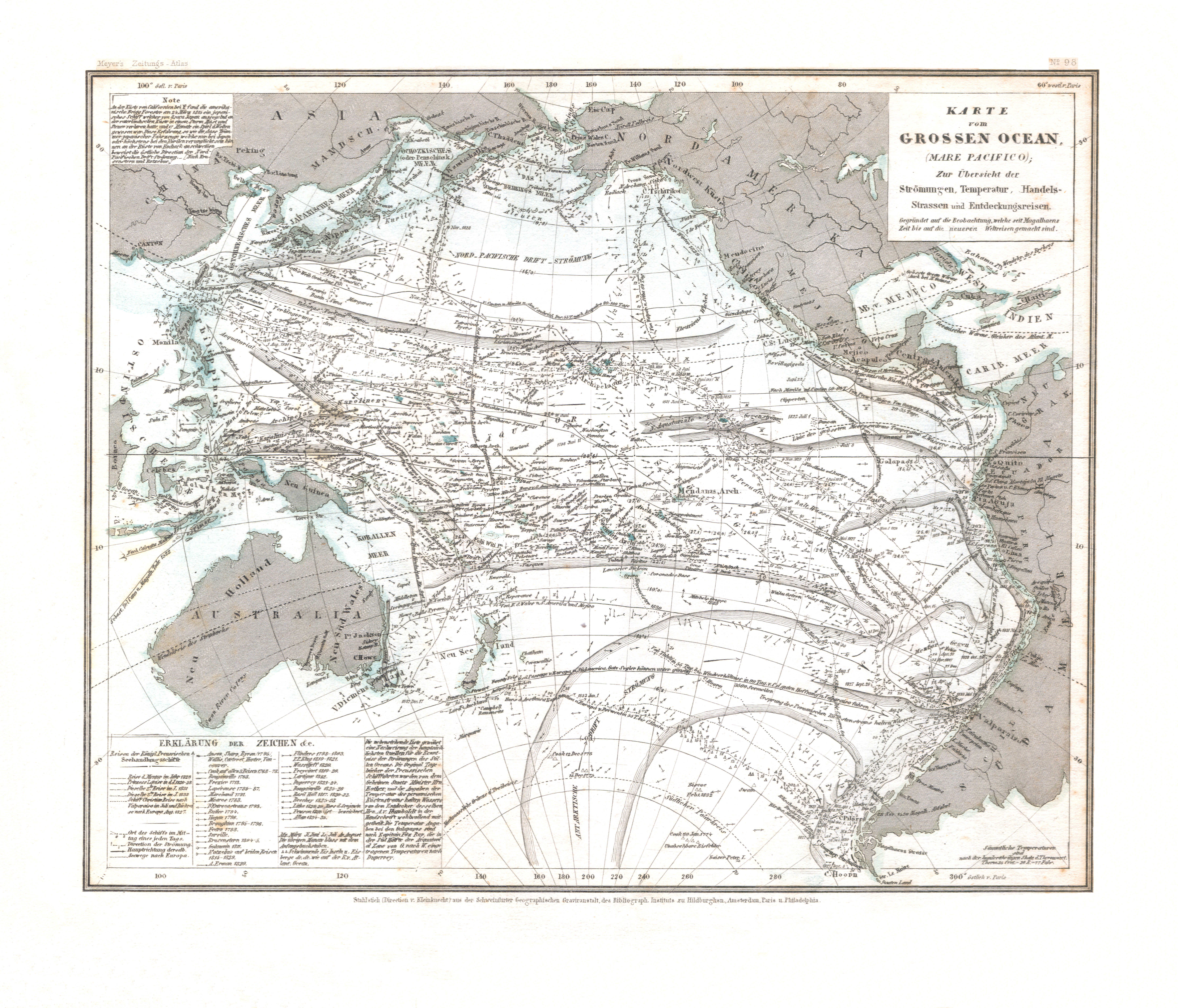
Kaart van de Grote Oceaan met zeestromen, temperatuur, handelsroutes en ontdekkingsreizen / Map of the Pacific Ocean with sea currents, temperature, trade routes and explorations
 Meyer's Zeitungs-Atlas (1849-1852)
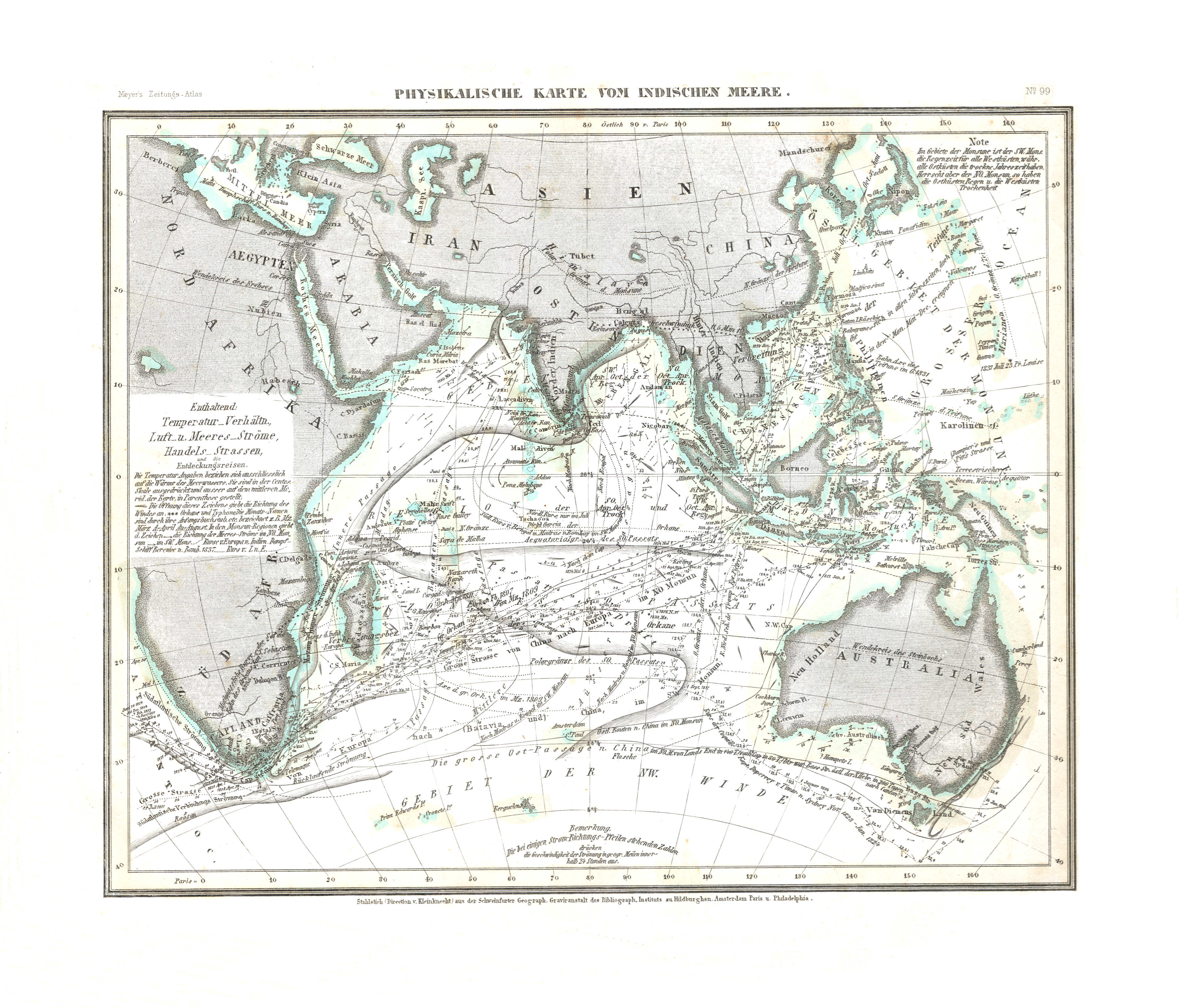
123. Physikalische Karte vom Indischen Meere (Nº 99) XL
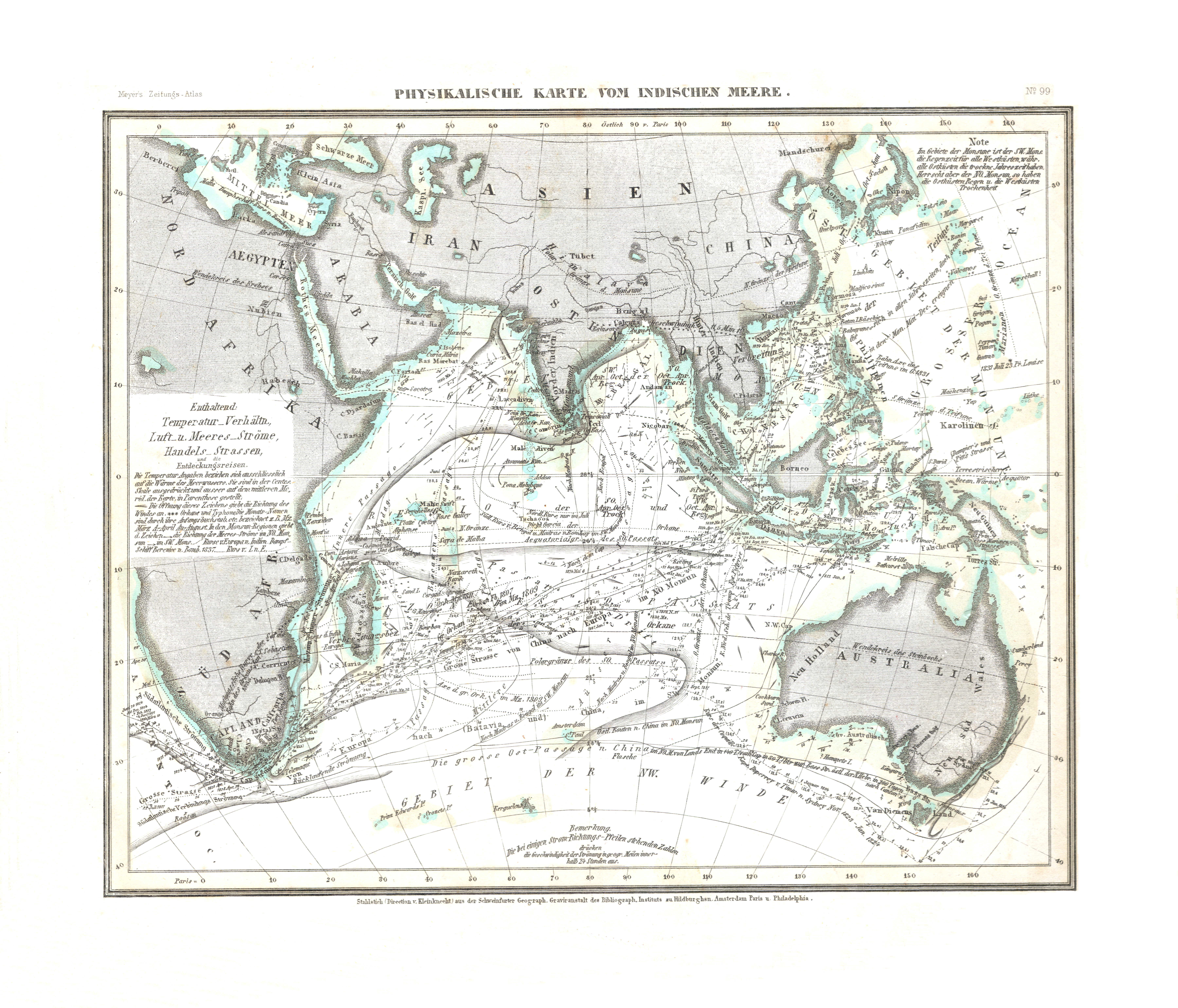
Natuurkundige kaart van de Indische Oceaan / Physical map of the Indian Ocean
© M. Witkam, 2010
![]()
![]()