Stieler-kaarten in de Encyclopaedia Britannica, 11e druk (1910-1911)
See below for (a summary of) this text in English.
Hieronder staat de beschrijving van de kaarten. Daarbij horen ook de volgende pagina's
- Plaatjes van de kaarten
- Tabellen en lijsten bij de kaarten
- Vergelijking (plaatjes) met de kaarten in Stielers Hand-Atlas
Titelgegevens
Titel: Encyclopaedia Britannica
Uitgever: Cambridge University Press
Jaar: 1910-1911 (11e druk)
Titelpagina (deel 1):
The Encyclopaedia Britannica
A Dictionary of Arts, Sciences, Literature and General Information
Eleventh Edition
Volume I A to Androphagi
Cambridge, England: at the University Press
New York, 35 West 32nd Street 1910
- Deze pagina's gaan alleen over de kaarten in de encyclopedie die gemaakt zijn door Justus Perthes in Gotha, Duitsland. Meer informatie over de encyclopedie zelf is onder andere te vinden op de pagina Encyclopaedia Britannica (11e druk) in Wikipedia.
Kaarten
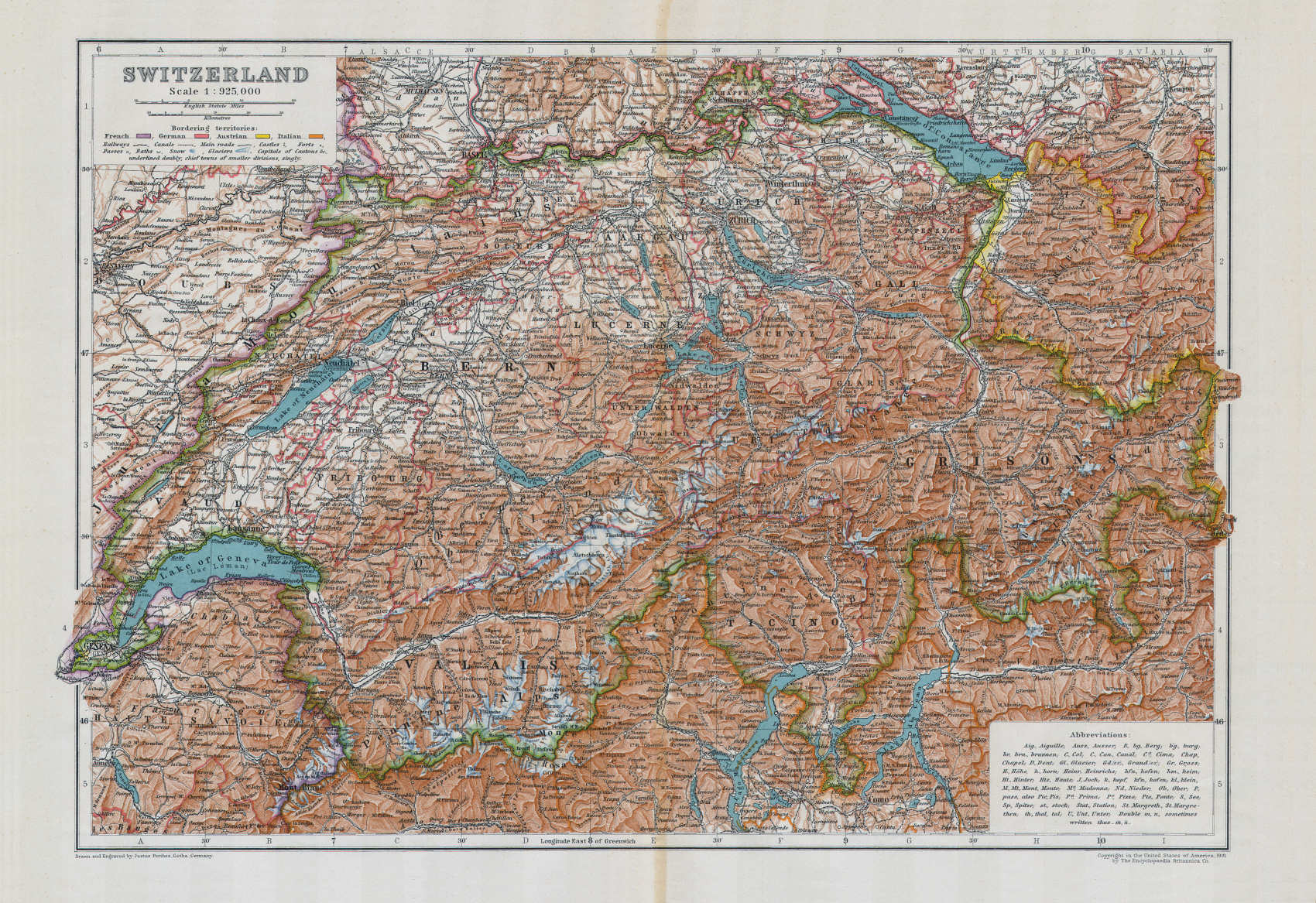
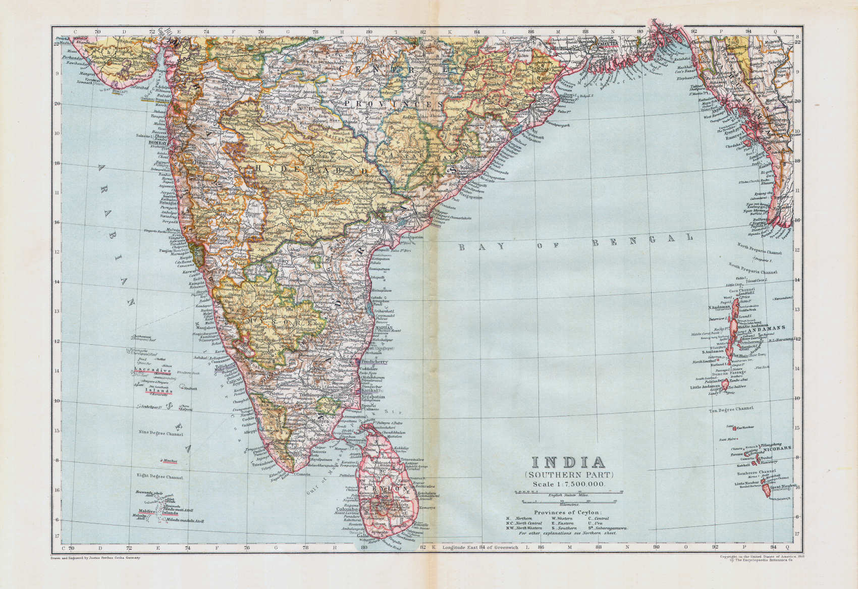
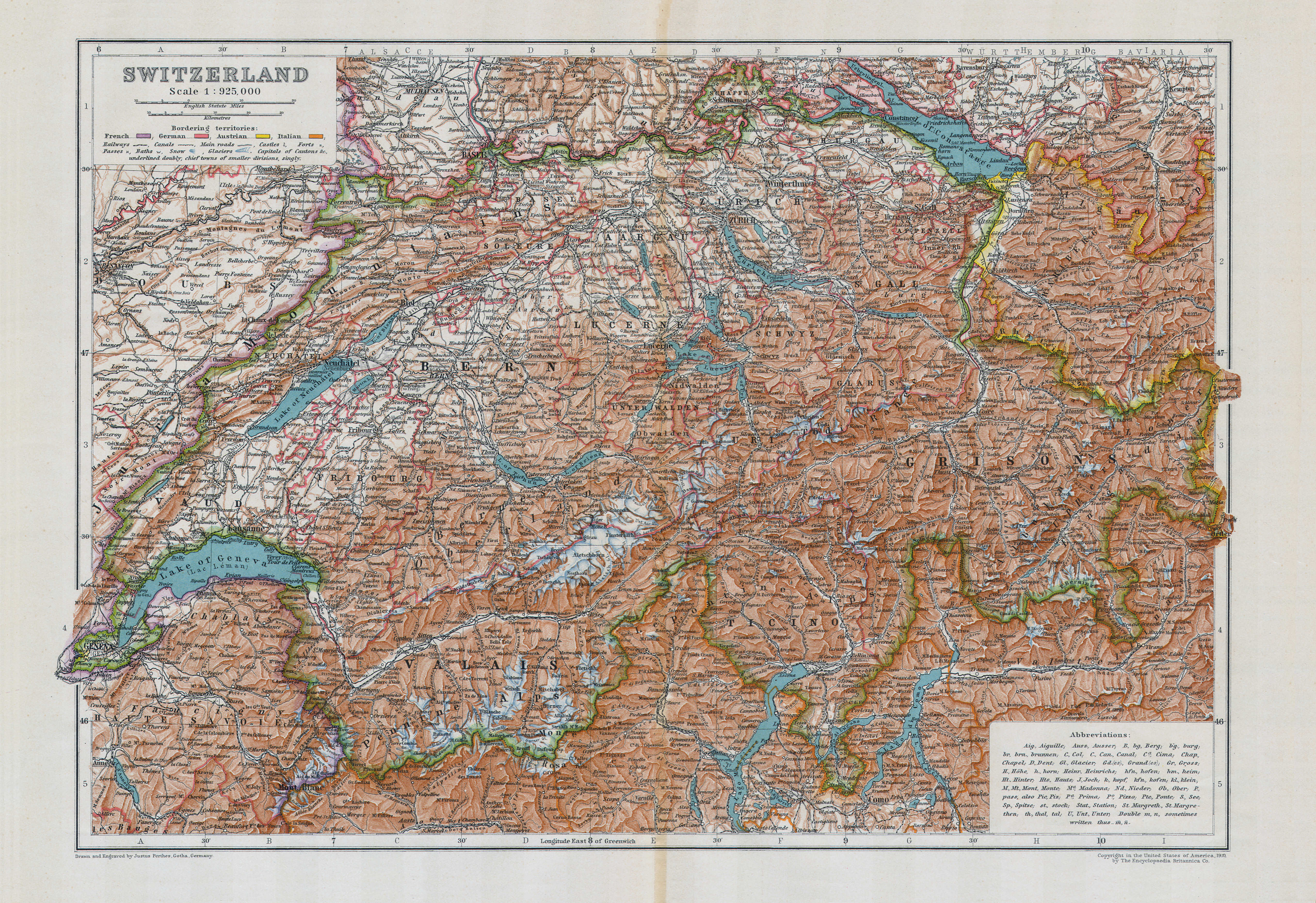
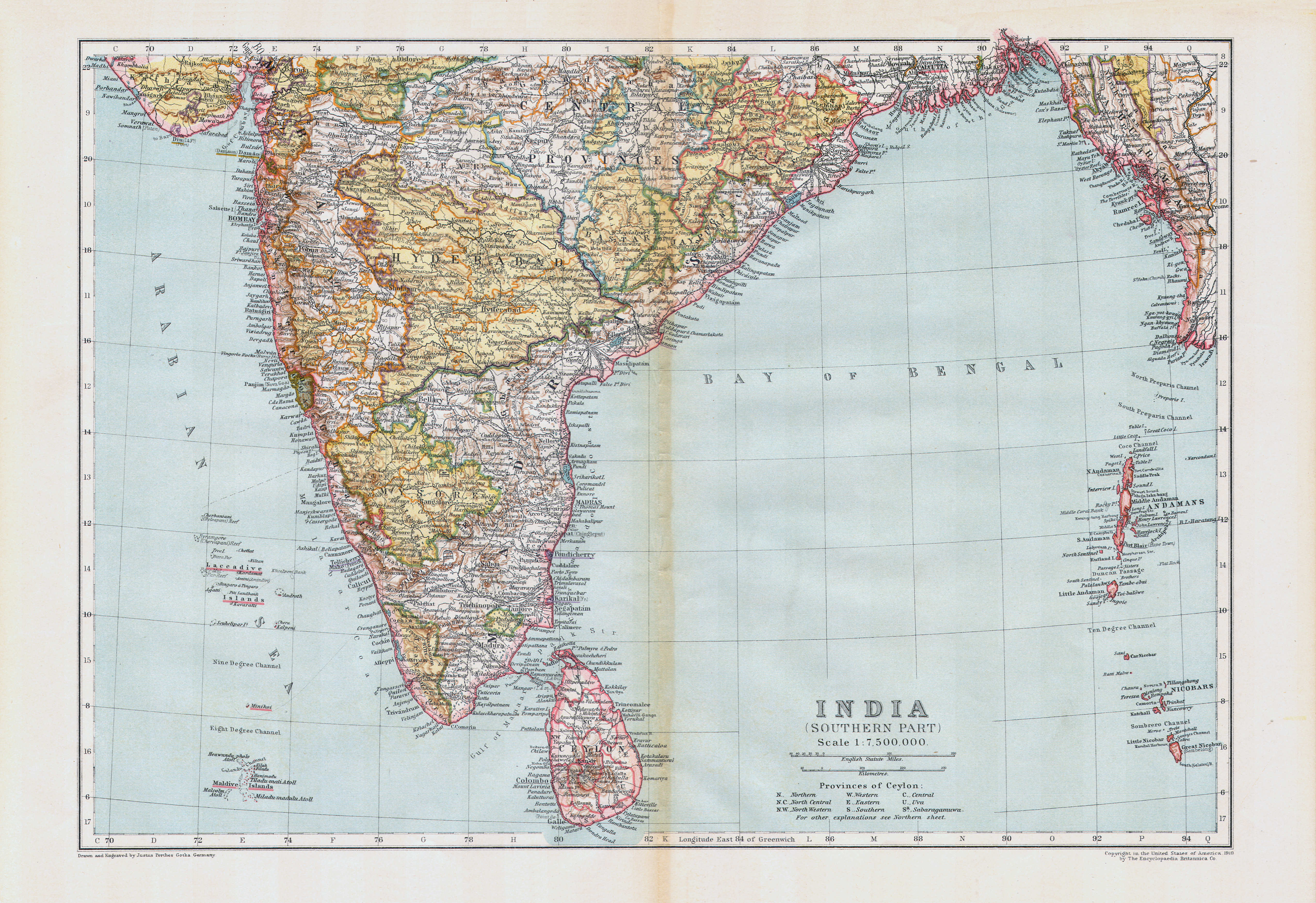
De 11e druk van de Encyclopedia Britannica bevat, naast andere kaarten, een serie van 16 kaartbladen (43 × 29,5 cm, B × H) die gemaakt zijn door Justus Perthes in Gotha, Duitsland. In de benedenmarge van die kaarten staat links steeds de tekst
- Drawn and Engraved by Justus Perthes, Gotha, Germany.
en rechts
- Copyright in the United States of America, 1910, by The Encyclopaedia Britannica Co.
De meeste van deze kaarten zijn afgeleid van die uit de 9e druk van Stielers Hand-Atlas, uitgegeven door Justus Perthes.
De serie bestaat uit 5 kaarten van de werelddelen, 8 kaarten van Groot-Brittannië, Ierland en enkele koloniën, en verder losse kaarten van Zwitserland, Japan en de Verenigde Staten. De kaarten staan verspreid door de 29 delen van de encyclopedie; zie ook het overzicht van kaarten en encylopediedelen en de lijst van kaarten, bijkaarten en schaal. De kaarten zijn gegraveerd in koper en afgedrukt in kleurenlithografie. De landsgrenzen zijn aangegeven in randkleur met bies, de bergen zijn getekend in bruine arcering. Kaartstijl en kleur wijken nogal af van die van de andere kaarten in de encyclopedie.
Vergelijking met Stielers Hand-Atlas (9e druk)
Van de 16 kaarten in de encyclopedie zijn er 13 direct in verband te brengen met kaarten uit Stielers Hand-Atlas; zie ook de vergelijkende tabel. Deze 13 kaarten zijn kleiner dan die in de atlas (49 × 41 cm, B × H) en de schaal is gelijk. Het zijn dus uitsneden uit de atlaskaarten, waarbij randgebieden of bijkaarten zijn weggelaten. Dat is het beste te zien op de pagina waarop plaatjes van de kaarten uit beide uitgaven naast elkaar staan.
Opvallend is dat alle teksten op de kaarten in de encyclopedie in het Engels vertaald zijn. Dat lijkt logisch, maar Perthes gaf ook een Engelse uitgave van Stielers Hand-Atlas uit waarin de kaarten onvertaald, dus in het Duits, zijn gebleven. Een andere, kleinere, aanpassing is dat op de kaart van Europa de kleuren van Groot Brittannië en Duitsland verwisseld zijn. In de encyclopedie is Groot Brittannië roze gekleurd en Duitsland oranje (naar Engelse gewoonte) en in de atlas is dat precies andersom (naar Duitse gewoonte).
Van de overige 3 kaarten in de encyclopedie is de herkomst minder duidelijk. De kaart van Afrika lijkt een verkleining van de overeenkomstige kaart in de Stieler Hand-Atlas. Van de andere twee kaarten – Australië, Engeland en Wales – heb ik bij Perthes geen oorsprong niet kunnen vinden. Misschien zijn ze, in dezelfde stijl als de andere kaarten, speciaal getekend voor de encyclopedie.
Stieler maps in the Encyclopaedia Britannica, 11th edition (1910-1911)
- Below is a description of the maps. Related pages
- Pictures of the maps
- Tables and lists to the maps
- Comparison (pictures) with the maps in Stielers Hand-Atlas
- Title description
- Title: Encyclopaedia Britannica
Publisher: Cambridge University Press
Year: 1910-1911 (11th edition) - Title page (volume 1):
The Encyclopaedia Britannica
A Dictionary of Arts, Sciences, Literature and General Information
Eleventh Edition
Volume I A to Androphagi
Cambridge, England: at the University Press
New York, 35 West 32nd Street 1910 - The sole subject of these pages is the series of maps in the encyclopedia that were made by Justus Perthes in Gotha, Germany. More information on the encyclopedia itself can be found, for example, on the page Encyclopaedia Britannica (11th edition) in Wikipedia.
- Title: Encyclopaedia Britannica
- Maps
- The 11th edition of the Encyclopedia Britannica contains, among other
maps, a series of 16 map sheets (43 × 29.5 cm,
W × H) that were made by Justus Perthes in Gotha,
Germany. In the lower left margin is the text
- Drawn and Engraved by Justus Perthes, Gotha, Germany.
- Copyright in the United States of America, 1910, by The Encyclopaedia Britannica Co.
- The series consists of 5 maps of the continents, 8 maps of Great Britain, Ireland and some colonies, and single maps of Switzerland, Japan and the United States. The maps are dispersed over the 29 volumes of the encyclopedia; see also the overview of maps and encyclopedia volumes and the list of maps, inset maps and scale. The maps are copper engraved and printed in color lithography. Political borders are indicated in outline color with edging, mountains are drawn in brown hachuring. Map style and color are rather different from those of the other maps in the encyclopedia.
- The 11th edition of the Encyclopedia Britannica contains, among other
maps, a series of 16 map sheets (43 × 29.5 cm,
W × H) that were made by Justus Perthes in Gotha,
Germany. In the lower left margin is the text
- In comparison with Stielers Hand-Atlas (9th edition)
- From the 16 encyclopedia maps 13 are directly related to maps in Stielers Hand-Atlas; see also the comparison table. These maps are smaller than those in the atlas (49 × 41 cm, W × H) and the scale is identical. So they are cut-outs from the atlas maps, where peripheral regions or inset maps were omitted. This is best seen on the page with pictures of the maps from encyclopedia and atlas are given side by side.
- It strikes that all texts on the encyclopedia maps have been translated in English. That might seem logical, but Perthes also published an English version of Stielers Hand-Atlas in which all maps have remained untranslated, in German. A minor adaptation to the English language audience is the swap of colors for Great Britain and Germany on the map of Europe. In the encyclopedia Great Britain is colored pink and Germany orange (the English convention) and vice versa in the atlas (the German convention).
- The origin of the other 3 encyclopedia maps is less obvious. The map of Africa seems to be a reduced version of the corresponding map in Stielers Hand-Atlas. For the other two maps – Australia, England and Wales – I haven't been able to find an origin at Perthes. They may have been drawn specially for the encyclopedia, in the same style as the other maps.
© M. Witkam, 2011
met dank aan / courtesy of:
Internet Archive via
Wikipedia
![]()
![]()