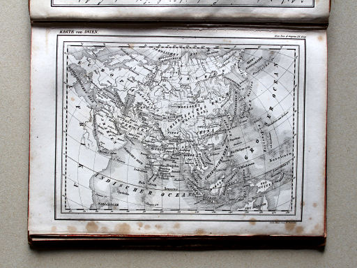
Scheible, Atlas zum Conversations-Lexikon der Gegenwart, fragment (1842)
See below for (a summary of) this text in English.
Hieronder staat de beschrijving van de atlas. Daarbij horen ook de volgende pagina's
Titelgegevens
Titel: Atlas zum Conversations-Lexikon der Gegenwart
Uitgever: Johann Scheible, Stuttgart
Jaar: 1842
Vermoedelijke titelpagina:
Erläuternder Atlas zum Conversations-Lexikon der Gegenwart
in einhundert Blättern
Vertaling:
Verklarende Atlas bij de Encyclopedie van de huidige tijd
in honderd bladen
- Op grond van de literatuur (Jürgen Espenhorst: Petermann's Planet, volume II, p. 1031-1032) valt uit de gegevens op de kaarten op te maken dat de atlas is uitgegeven door Johann Scheible in Stuttgart.
-
Deze atlas is vervaardigd als beeldmateriaal bij het 'Conversations-Lexikon
der Gegenwart' uitgegeven door
F.A. Brockhaus in Leipzig. Die
encyclopedie bestaat uit 4 delen in 5 banden.
- deel 1 (A-E): 1838
- deel 2 (F-J): 1839
- deel 3 (K-O): 1840
- deel 4, band 1 (P-S): 1840
- deel 4, band 2 (T-Z, appendix): 1841
- De encyclopedie bevatte geen paginavullende kaarten of illustraties. Om
dat gemis te ondervangen heeft Johann Scheible deze atlas met 100 kaarten,
stadsgezichten en plattegronden uitgegeven. Hij verscheen in 10
afleveringen.
- aflevering 1-3: 1839
- aflevering 4-6: 1840
- aflevering 7-9: 1841
- aflevering 10: 1842
- Al eerder verscheen bij Scheible
- Atlas über alle Theile der Erde (1836; 35 kaarten)
- Erläuternder Atlas zum Brockhaus'schen Conversations-Lexikon, 9. Aufl. (1844; 143 kaarten)
- De tekenaar van de meeste kaarten, Rudolph Gross, heeft in de periode
1846-1855 ook een schoolatlas gemaakt, uitgegeven door Schweizerbart in
Stuttgart.
- Geographischer Schul-Atlas (1846/1847; 21 kaarten)
- Neuer Geographischer Schul-Atlas (1855; 28 kaarten)
Band
De atlas heeft een kartonnen band beplakt met gemarmerd bruin papier; de afmetingen zijn 22,5 × 16,5 cm (H × B). Op de rug staat de tekst "Conver[sations]-Lexik[on] der Gegen[wart]. Atlas." De kaarten zijn ongevouwen ingebonden.
Inhoud
Dit fragment bevat 30 van de 100 kaarten (zie de inhoud) en nog enkele illustraties en facsimile's van handschriften. Een analyse van de volledige inhoud is dus niet goed mogelijk. Aanwezig zijn in ieder geval wel de kaarten van de werelddelen en van de meeste Europese landen. Er zijn ook enkele deelkaarten en stadsplattegronden. Sommige kaartbladen bevatten ook een illustratie, zoals een stadsgezicht of een beeld van de plaatselijke bevolking. Zie de lijst van kaarten, bijkaarten en schaal.
De kaarten zijn lithografisch gedrukt door de 'Lithographische Anstalt v. W. Pobuda'. Bovenaan staat de naam van de kaart. Verder staan daar de naam van de encyclopedie, het nummer van het deel, en het bladzijnummer, zoals
- Conv. Lex d. Gegenw. I. S. 1247
Op de meeste kaarten staat in de benedenmarge de naam van de drukker W. Pobuda vermeld. Op bijna de helft (van de 30) staat ook de naam van de cartograaf R(udolf) Gross. Zie ook de lijst van cartografie en gravure.
Scheible, Atlas zum Conversations-Lexikon der Gegenwart, fragment (1842)
- Below is a description of the atlas in keywords. Related pages
- Title description
- Title: Atlas zum Conversations-Lexikon der Gegenwart
Publisher: Johann Scheible, Stuttgart
Year: 1842 - Presumed title page:
Erläuternder Atlas zum Conversations-Lexikon der Gegenwart
in einhundert Blättern Translation:
Explanatory Atlas to the Encyclopedia of the present time
in one hundred sheets - Based on the literature (Jürgen Espenhorst: Petermann's Planet, volume II, p. 1031-1032) from the notes on the maps can be derived that the atlas was published by Johann Scheible in Stuttgart.
-
This atlas was produced as illustration material to the
'Conversations-Lexikon der Gegenwart' published by
F.A. Brockhaus in Leipzig.
That encyclopedia consists of 4 volumes in 5 bindings.
- volume 1 (A-E): 1838
- volume 2 (F-J): 1839
- volume 3 (K-O): 1840
- volume 4, part 1 (P-S): 1840
- volume 4, part 2 (T-Z, appendix): 1841
- The encyclopedia didn't have any full-page maps or illustrations. To
compensate for this Johann Scheible has published this atlas with 100
maps, city views and plans. It appeared in 10 installments
- installments 1-3: 1839
- installments 4-6: 1840
- installments 7-9: 1841
- installment 10: 1842
- Earlier Scheibel had published
- Atlas über alle Theile der Erde (1836; 35 maps)
- Erläuternder Atlas zum Brockhaus'schen Conversations-Lexikon, 9. Aufl. (1844; 143 maps)
- The cartographer of most maps, Rudolph Gross, has also made a school
atlas in the period 1846-1855; it was published by Schweizerbart in
Stuttgart.
- Geographischer Schul-Atlas (1846/1847; 21 maps)
- Neuer Geographischer Schul-Atlas (1855; 28 maps)
- Title: Atlas zum Conversations-Lexikon der Gegenwart
- Binding
- The atlas has a cardboard binding pasted with marbled brown paper; it measures 22.5 × 16.5 cm (H × W). On the spine is the text "Conver[sations]-Lexik[on] der Gegen[wart]. Atlas." The maps have been bound unfolded.
- Contents
- This fragment contains 30 of the 100 maps (see the content) and some illustrations and facsimiles of manuscripts. An analysis of the entire content is therefore hardly possible. The maps of the world and most European countries are present. There are also some regional maps and city plans. Some map sheets contain an illustration as well, such as a view or a picture of the local population. See the list of maps, inset maps and scale.
- The maps are lithographically printed by the 'Lithographische Anstalt
v. W. Pobuda'. In the upper margin is the name of the map.
Furthermore are given the name of the encyclopedia, the number of the
volume, and the page number as in
- Conv. Lex d. Gegenw. I. S. 1247
© M. Witkam, 2014


