Brockhaus' Konversations-Lexikon, 14e druk (1894-1897)
See below for (a summary of) this text in English.
Hieronder staat de beschrijving van de kaarten in de encyclopedie. Daarbij horen ook de volgende pagina's
Titelgegevens
Titel: Brockhaus' Konversations-Lexikon
Uitgever: Brockhaus, Leipzig
Jaar (van dit exemplaar): 1894-1897 (14e druk)
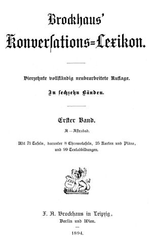
Titelpagina (deel 1):
Brockhaus' Konversations-Lexikon.
Vierzehnte vollständig neubearbeitete Auflage. In sechzehn Bänden.
Erster Band. A-Astrabad.
Mit 71 Tafeln, darunter 8 Chromotafeln, 25 Karten und Pläne, und 99 Textabbildungen.
F.A. Brockhaus in Leipzig, Berlin und Wien. 1894.
Vertaling:
Brockhaus' Encyclopedie.
Veertiende volledig vernieuwde druk. In zestien delen.
Eerste deel. A-Astrabad.
Met 71 afbeeldingen, waaronder 8 in kleur, 25 kaarten en plattegronden, en 99 afbeeldingen in de tekst.
F.A. Brockhaus in Leipzig, Berlijn en Wenen. 1894.
- Op deze pagina's worden de kaarten beschreven in de 14e druk van de grote encyclopedie van Brockhaus. Dit gebeurt om een vergelijking mogelijk te maken met andere kaartwerken en atlassen die daarop gebaseerd zijn.
- Alle gegevens op deze pagina's zijn ontleend aan de website eLexikon van Peter Hug. Daar staan teksten en scans van de 17 delen – inclusief het supplementdeel – van de uitgave 1894-1897.
Inhoud
De encyclopedie bestaat uit 16 delen en een supplementdeel. In dit exemplaar zijn ze als volgt gedateerd.
- delen 1-10: 1894
- delen 11-14: 1895
- delen 15-16: 1896
- supplement: 1897
In totaal bevat de encyclopedie 225 kaarten en 99 stadsplattegronden; zie voor alle details de inhoudsopgave en de lijst van kaarten, bijkaarten en schaal. Sommige plattegronden hebben ook een stratenregister. Van de 225 kaarten zijn er 35 overzichtskaarten (sterrenkunde, wereldkaarten, oceanen en poolgebieden), 127 kaarten van de Europese landen, 22 van Azië en Australië, 20 van Afrika en 21 van Noord- en Zuid-Amerika. Bij de kaarten van Europa ligt de nadruk op Midden-Europa – Duitsland, Zwitserland, Oostenrijk-Hongarije – met 71 kaarten. Behalve de 'geografische' kaarten zijn er ook verschillende thematische en historische kaarten.
De afmetingen van een kaartbladzijde zijn ongeveer 25 × 16 cm (H × B). Veel kaarten staan op twee bladzijden en hebben dus het formaat 25 × 32 cm. Sommige kaarten zijn, met uitvouw, nog groter.
Uitgaven
De 14e druk is in verschillende uitgaven verschenen in de periode 1892-1920. Het supplement verscheen voor het eerst in 1897. De 15e druk verscheen in de periode 1928-1939.
Brockhaus' Konversations-Lexikon, 14th edition (1894-1897)
- Below is a description of the maps in the encyclopedia. Related pages
- Title description
- Title: Brockhaus' Konversations-Lexikon
Publisher: Brockhaus, Leipzig
Year (of this copy): 1894-1897 (14th edition) - Title page (volume 1):
Brockhaus' Konversations-Lexikon.
Vierzehnte vollständig neubearbeitete Auflage. In sechzehn Bänden.
Erster Band. A-Astrabad.
Mit 71 Tafeln, darunter 8 Chromotafeln, 25 Karten und Pläne, und 99 Textabbildungen.
F.A. Brockhaus in Leipzig, Berlin und Wien. 1894. Translation:
Brockhaus' Encyclopedia.
Fourteenth completely reworked edition. In sixteen volumes.
Volume 1. A-Astrabad.
With 71 illustrations, among which 8 in color, 25 maps and plans, and 99 text illustrations.
F.A. Brockhaus in Leipzig, Berlin and Vienna. 1894. - On these pages the maps are described in the 14th edition of the comprehensive encyclopedia by Brockhaus. This enables a comparison with other cartographic works and atlases based on these maps.
- All the information on these pages has been derived from the site eLexikon by Peter Hug, which contains texts and scans of the 17 volumes – including the supplement volume – of the 1894-1897 edition.
- Title: Brockhaus' Konversations-Lexikon
- Contents
- The encyclopedia consists of 16 volumes and a supplement. In this copy
the years of publication are
- volumes 1-10: 1894
- volumes 11-14: 1895
- volumes 15-16: 1896
- supplement: 1897
- The encyclopedia contains 225 maps and 99 city plans in all; details can be found in the table of contents and the list of maps, inset maps and scale. Some plans also have a street index. Among the 225 maps there are 35 general maps (astronomy, world maps, oceans and polar regions), 127 maps for the European countries, 22 for Asia and Australia, 20 for Africa and 21 for the Americas. The emphasis of the European maps is on Central Europe – Germany, Switzerland, and Austria-Hungary – with 71 maps. Apart from the 'geographical' maps there are several thematical and historical maps.
- One map page measures about 25 × 16 cm (H × W). Many maps fill two pages and thus have a size of 25 × 32 cm. Some fold-out maps are even larger.
- The encyclopedia consists of 16 volumes and a supplement. In this copy
the years of publication are
- Printings
- The 14th edition appeared in the 1892-1920 period in several printings. The supplement was first published in 1897. The 15th edition appeared between 1928 and 1939.
HTML © M. Witkam, 2014
Met dank aan / Courtesy of: Peter Hug's eLexikon


